

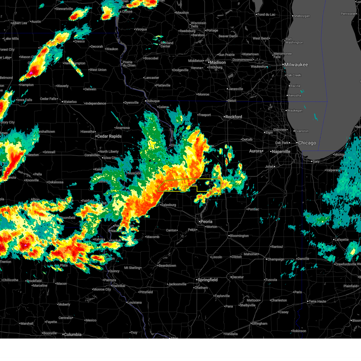
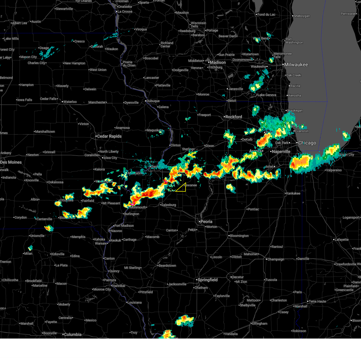
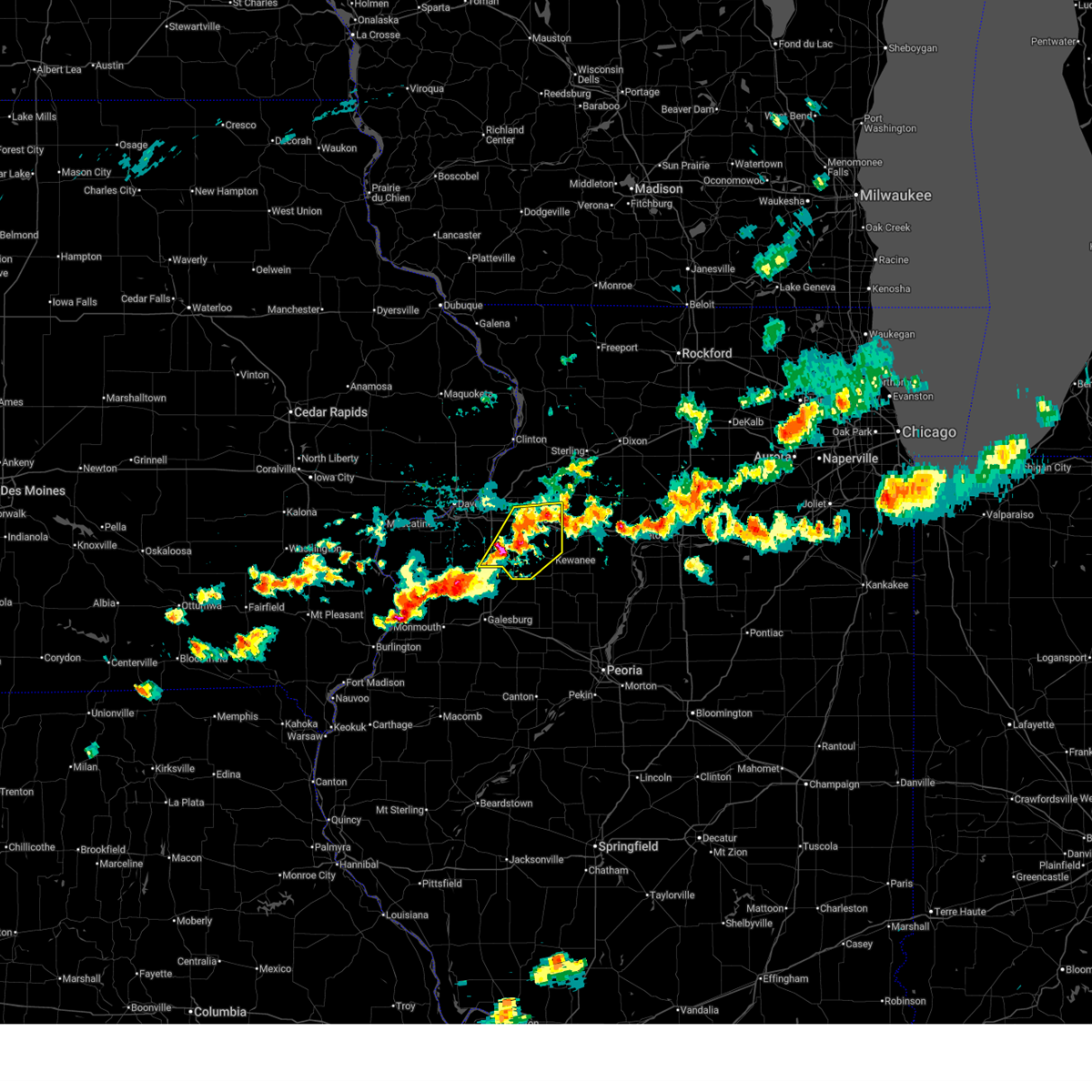
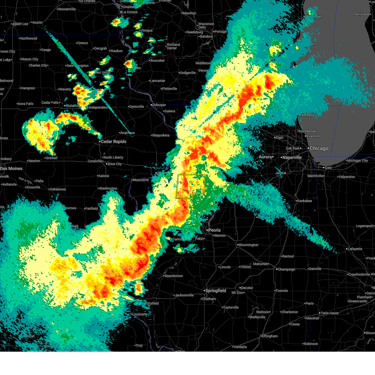
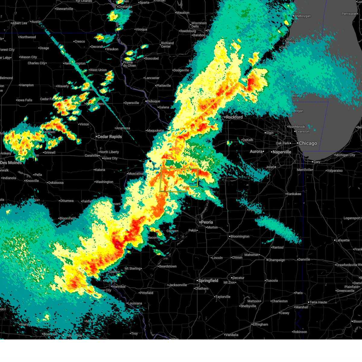
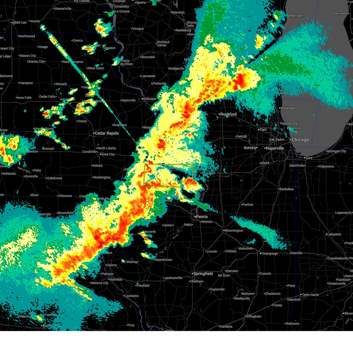
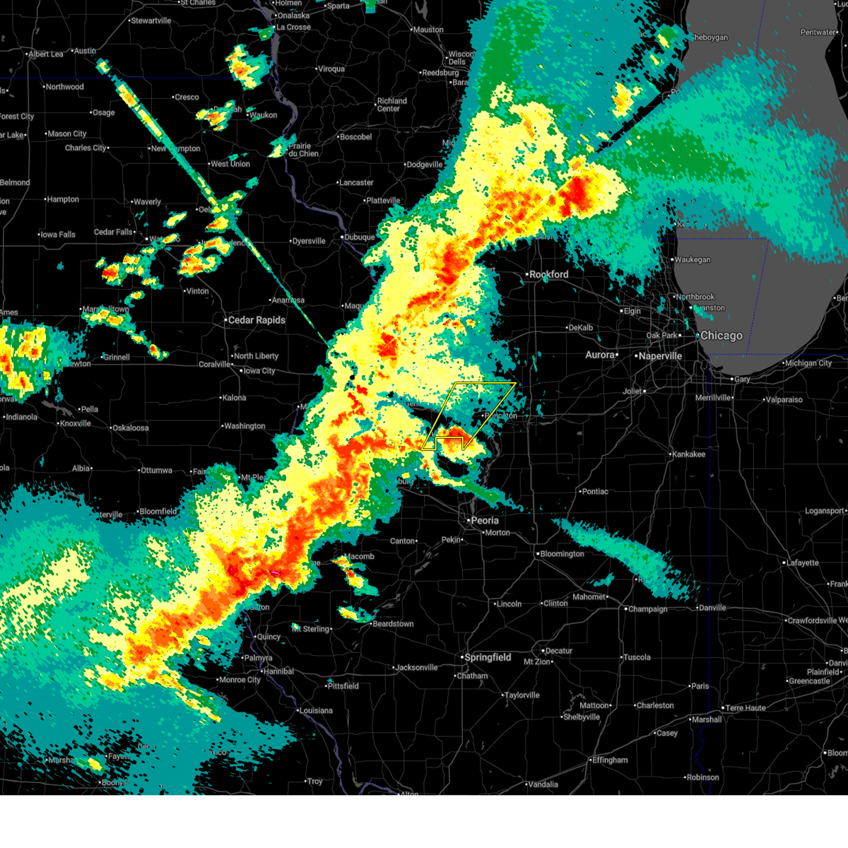
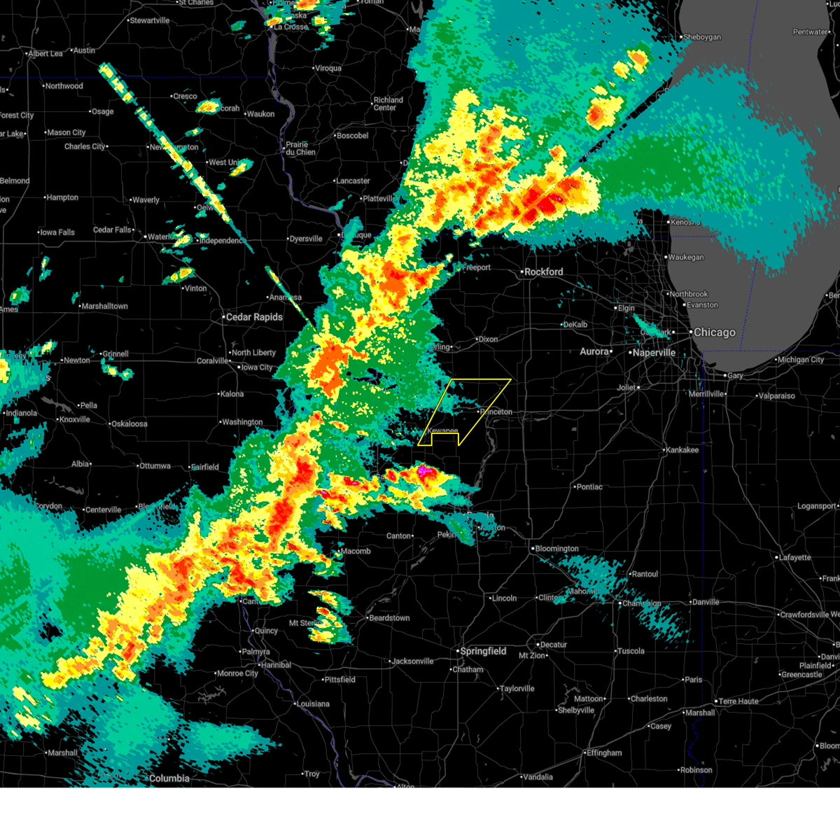
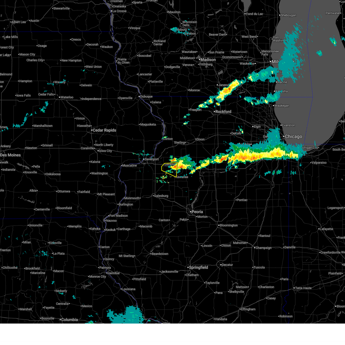
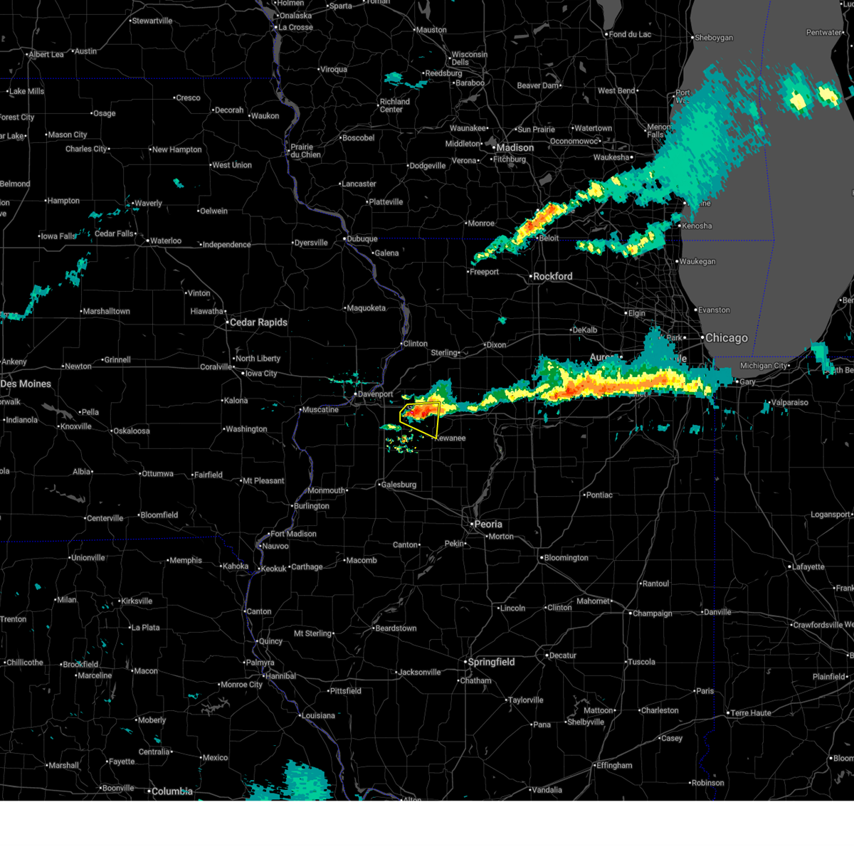
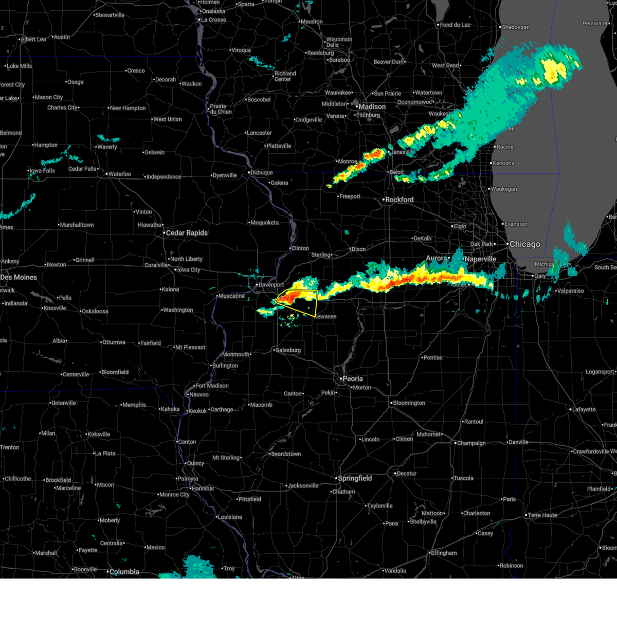
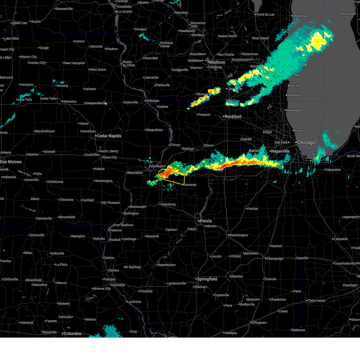
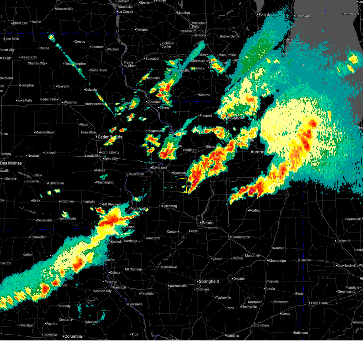
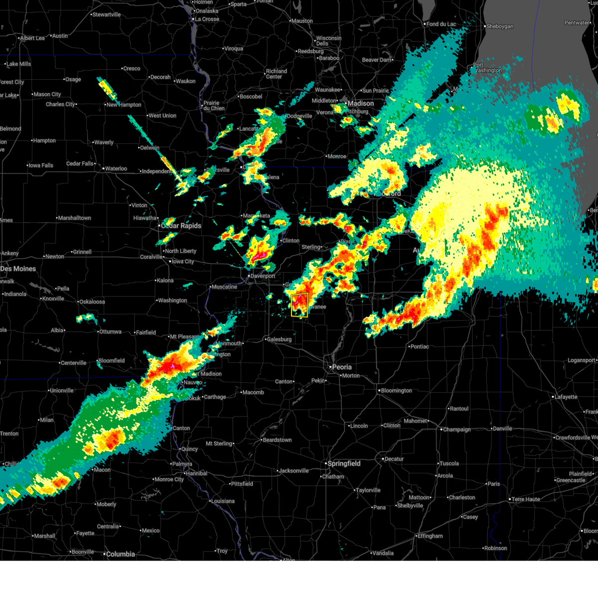
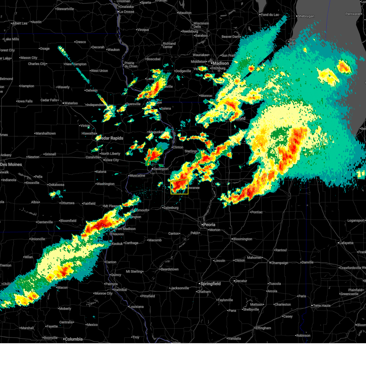
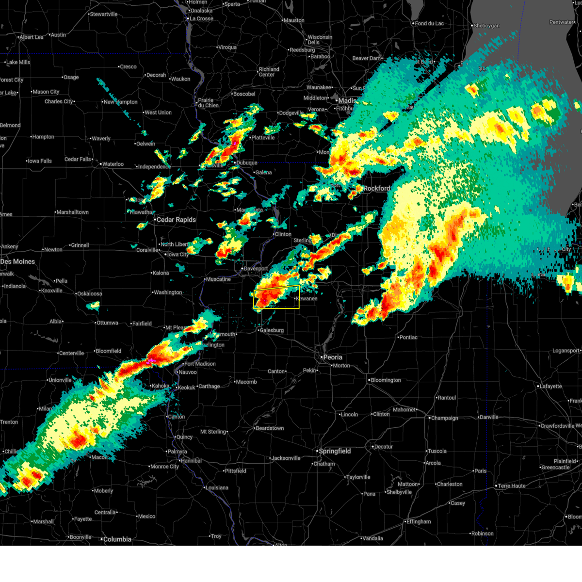
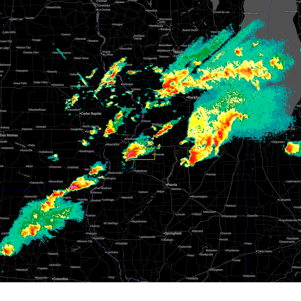
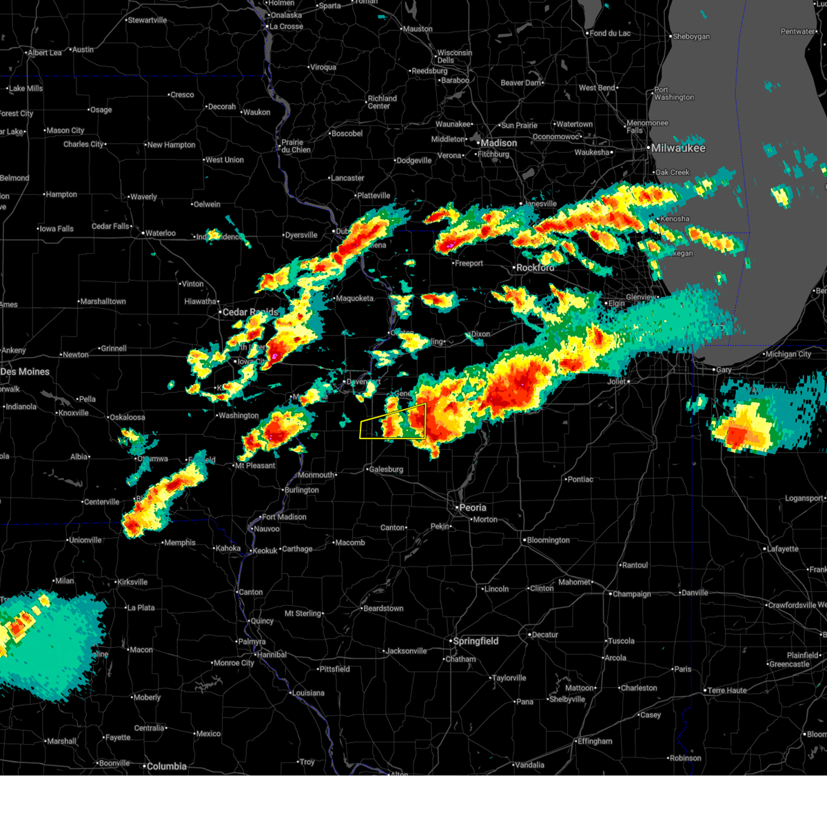
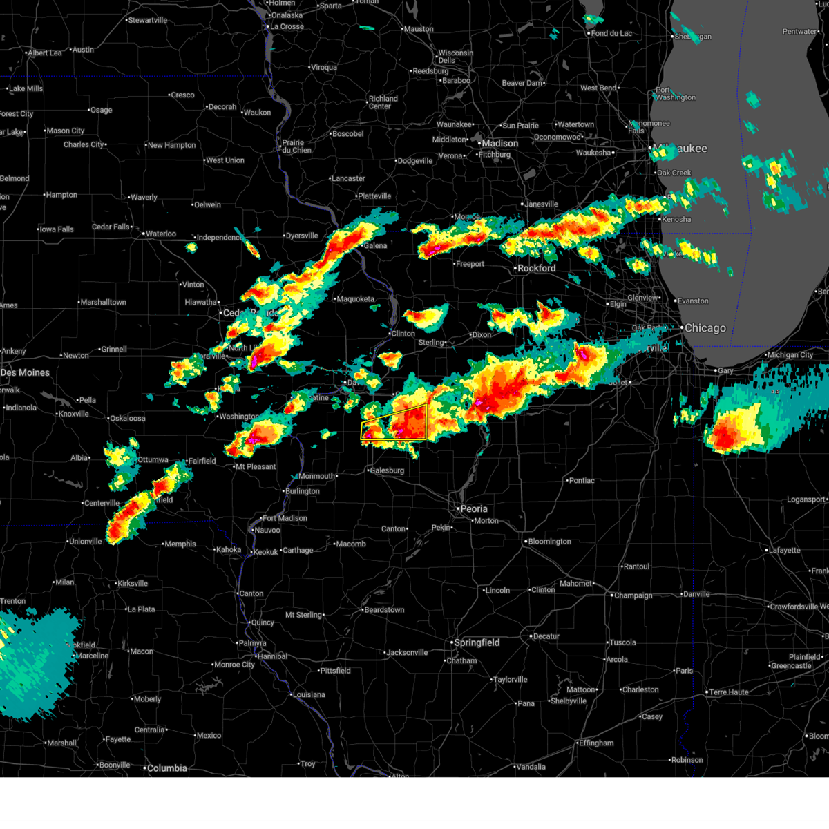
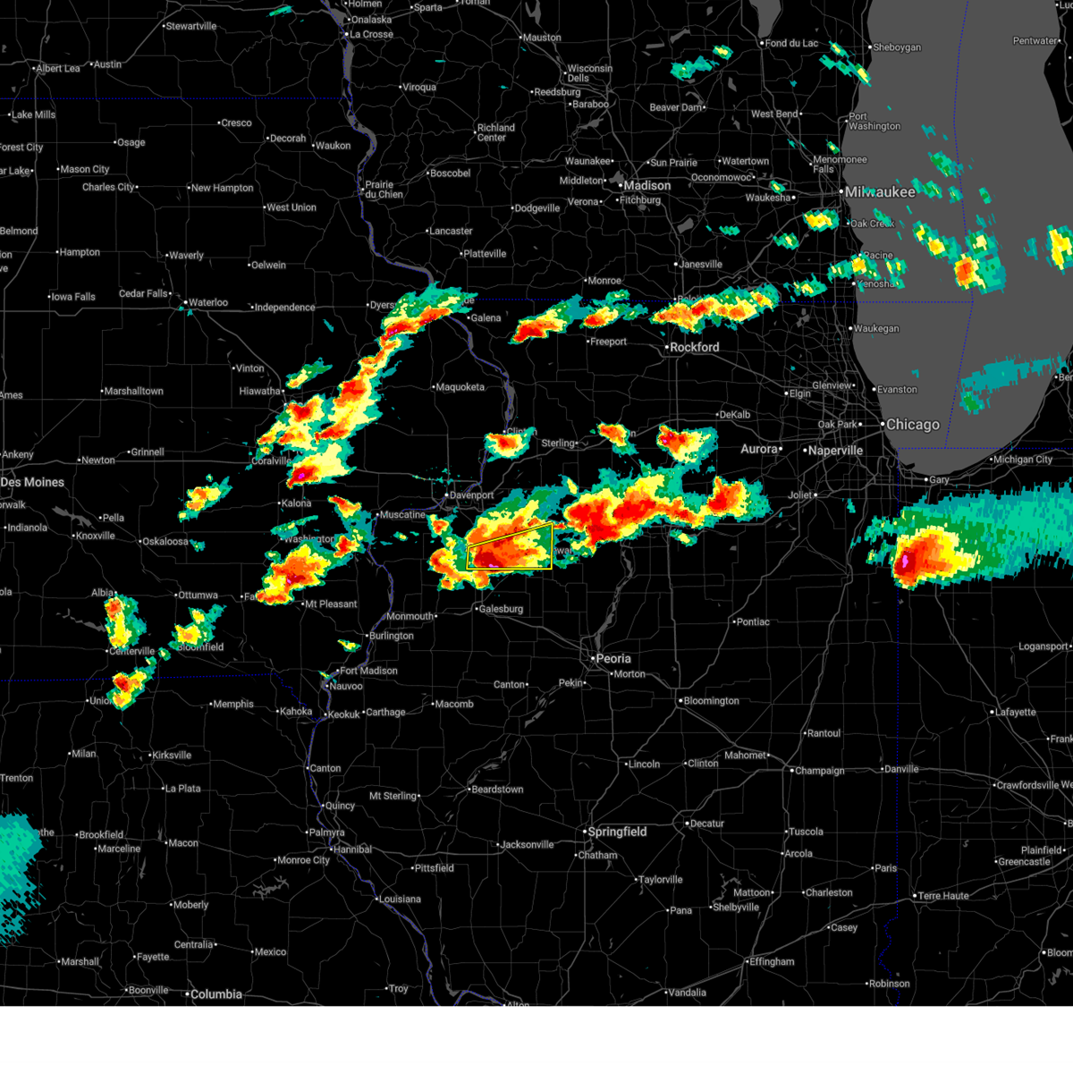
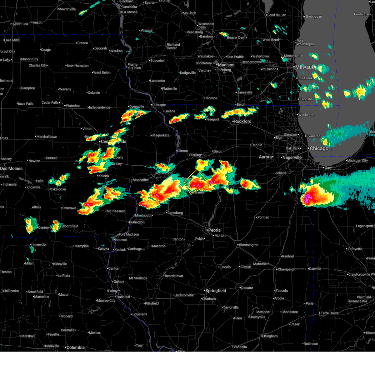
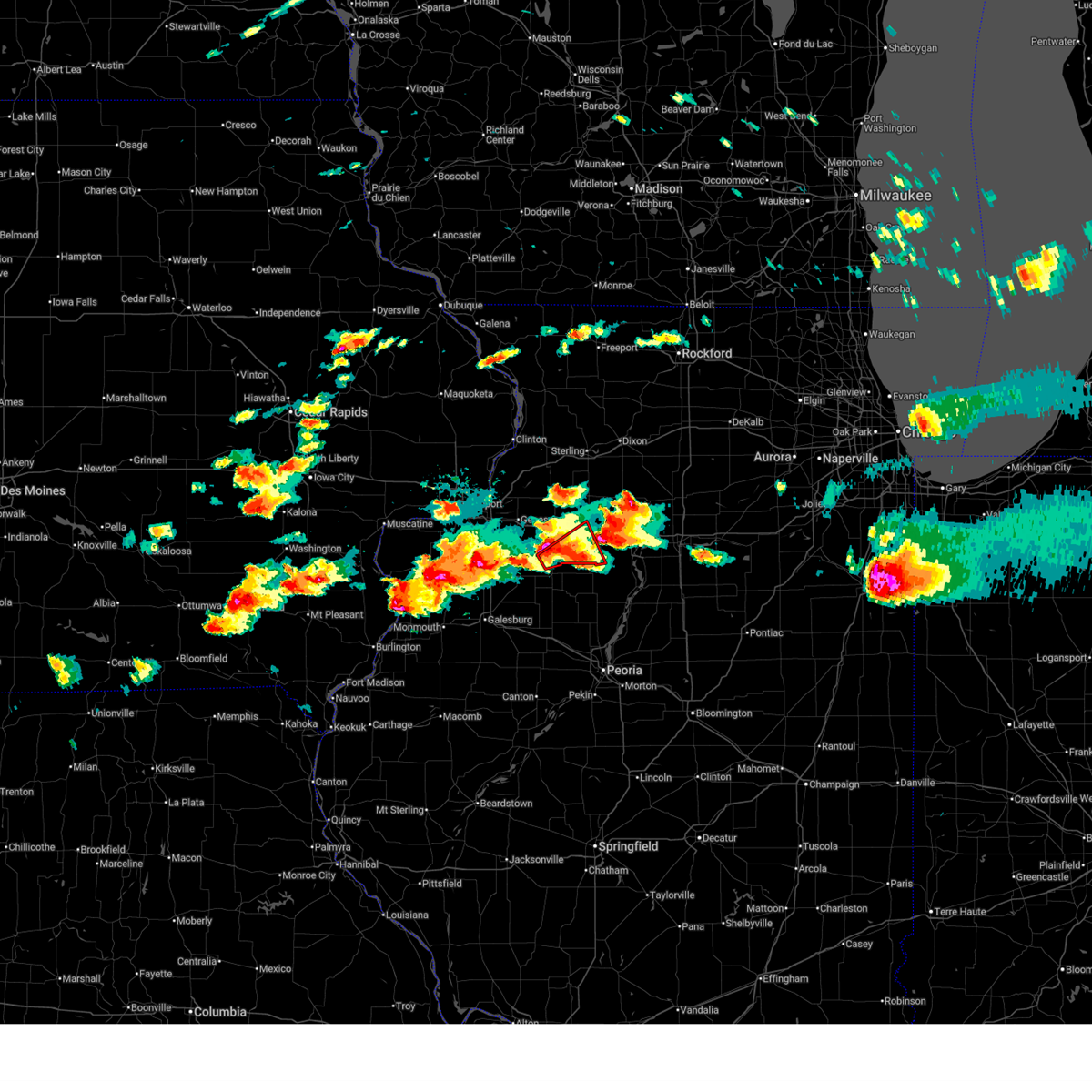
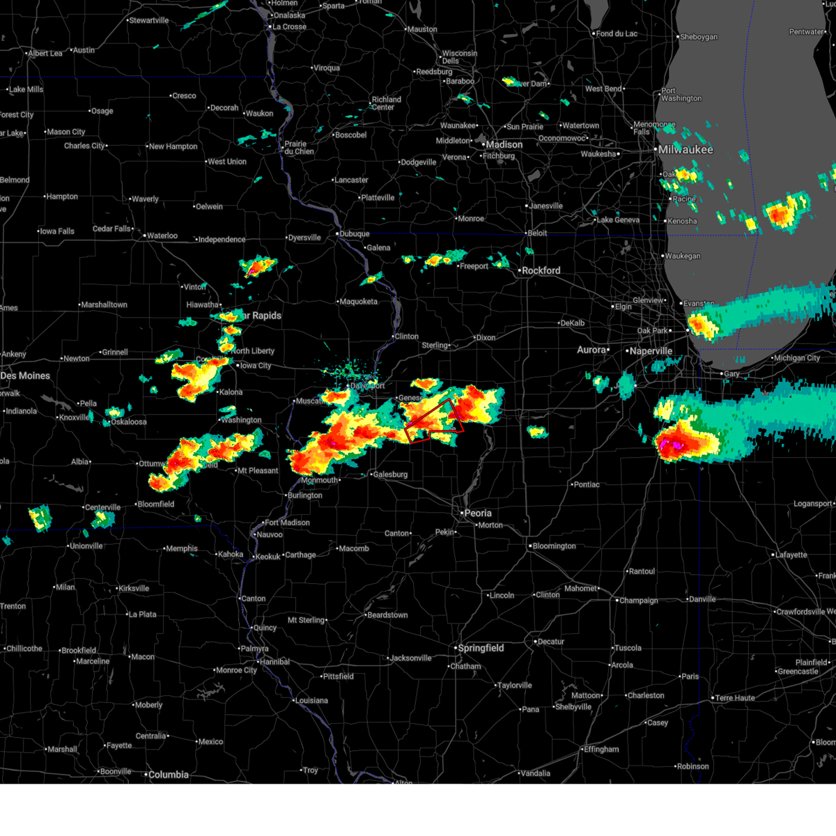
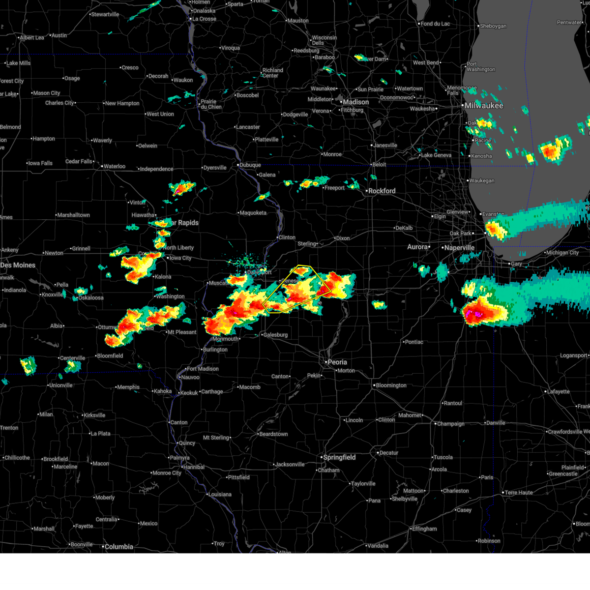
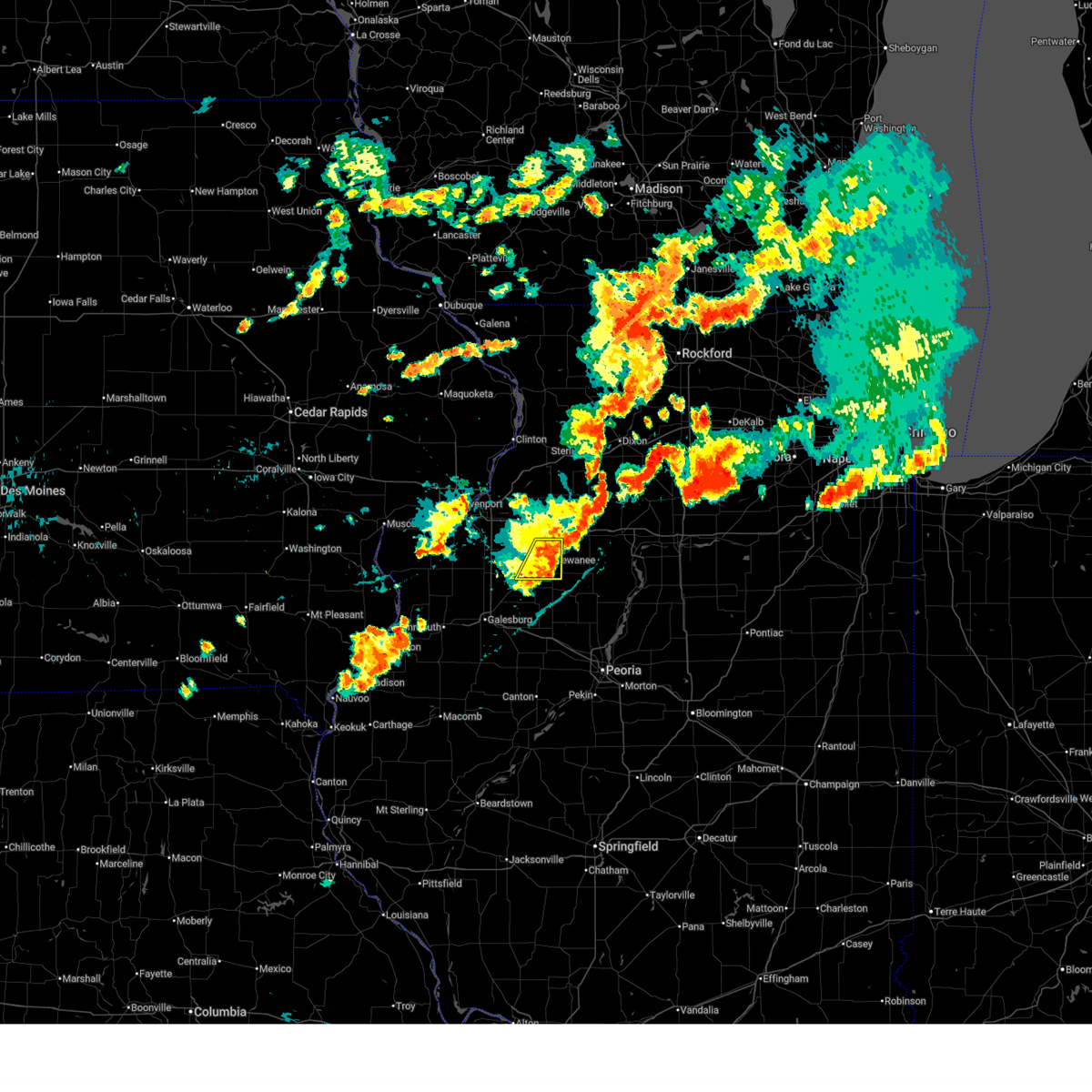
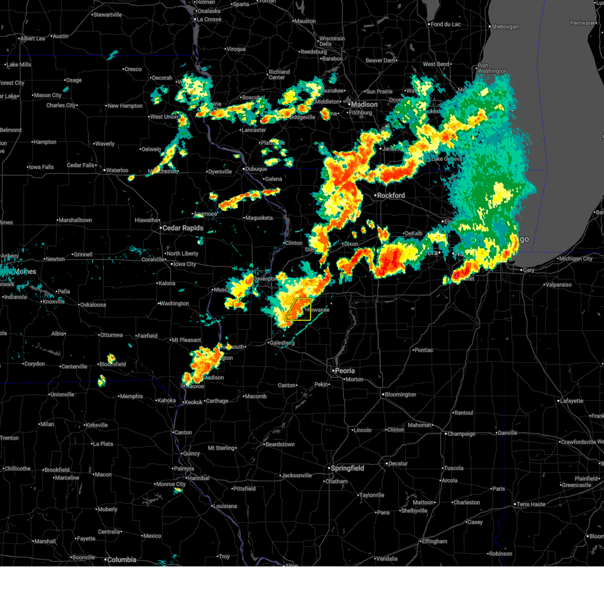
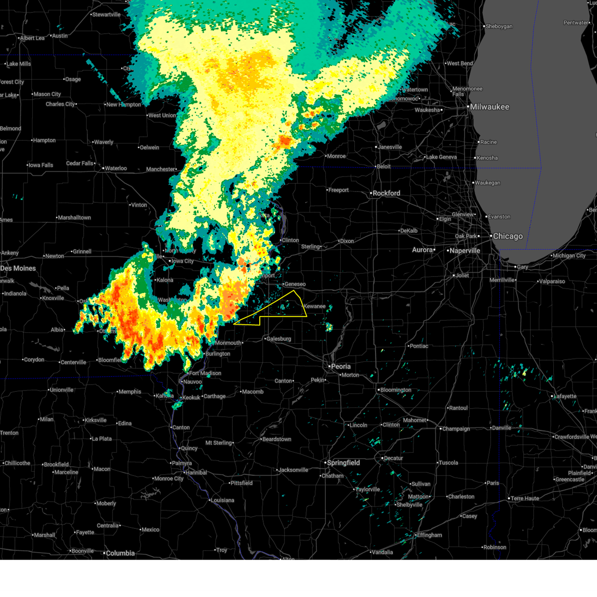
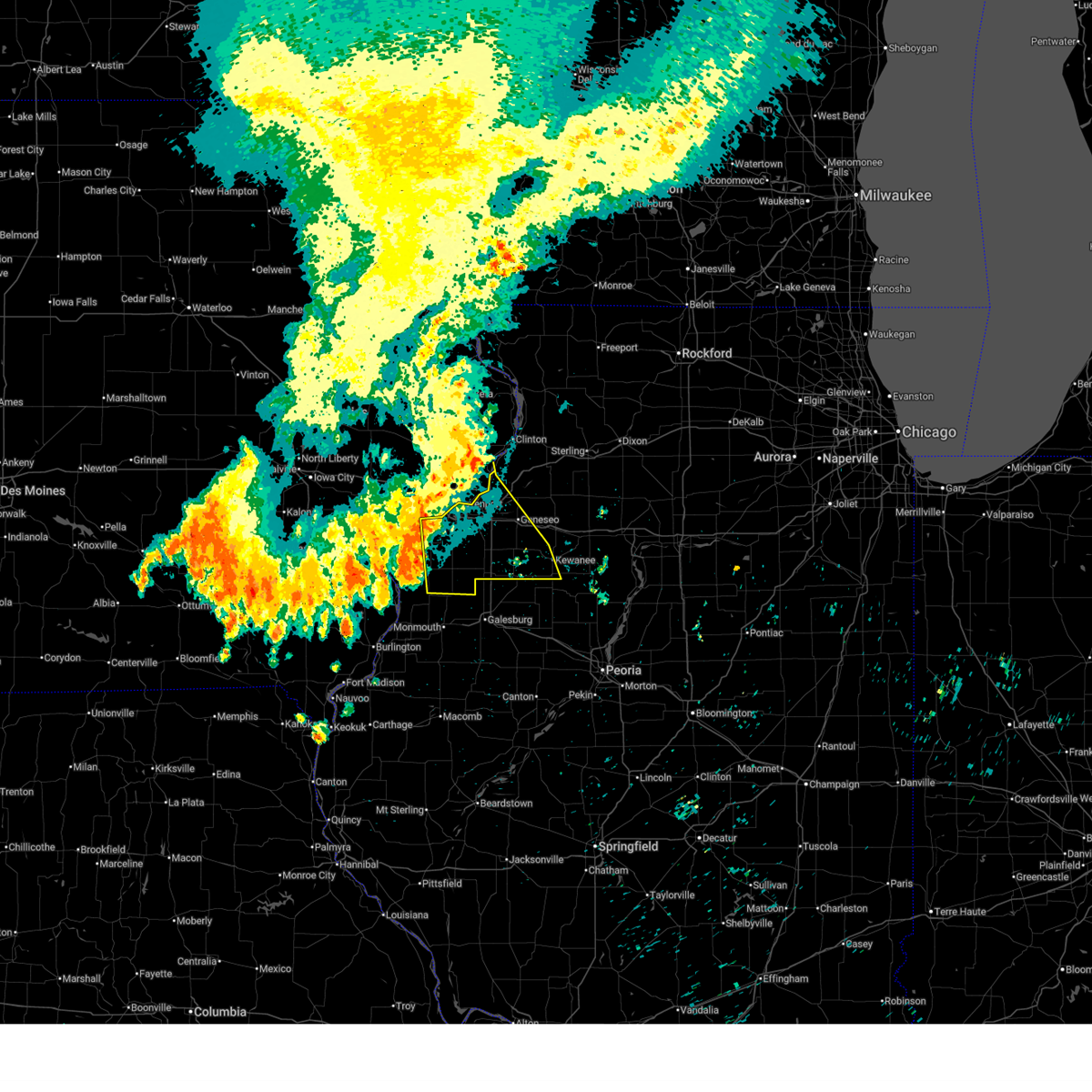
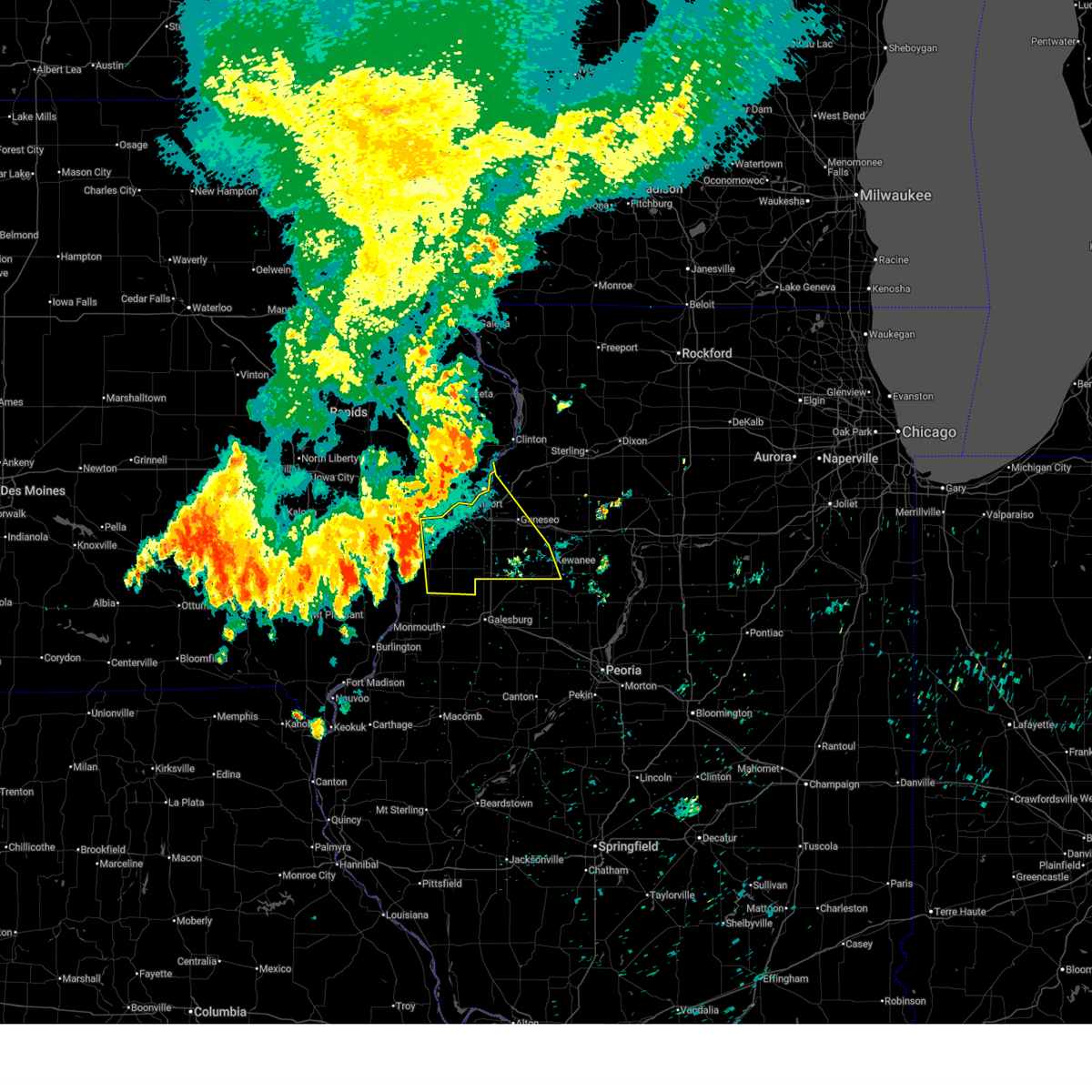
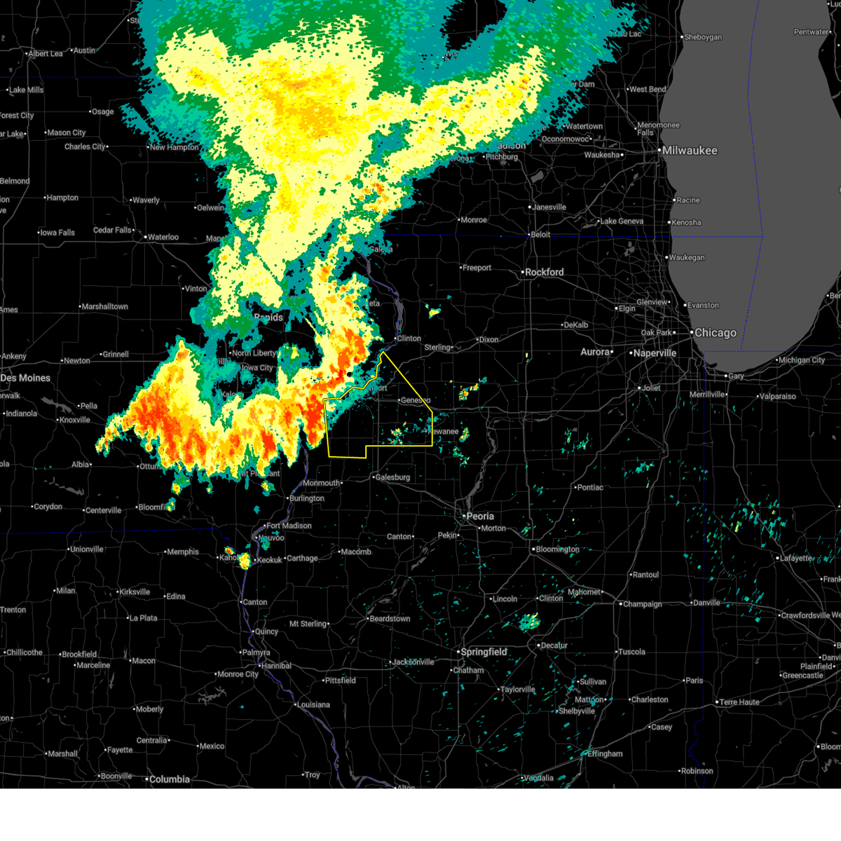
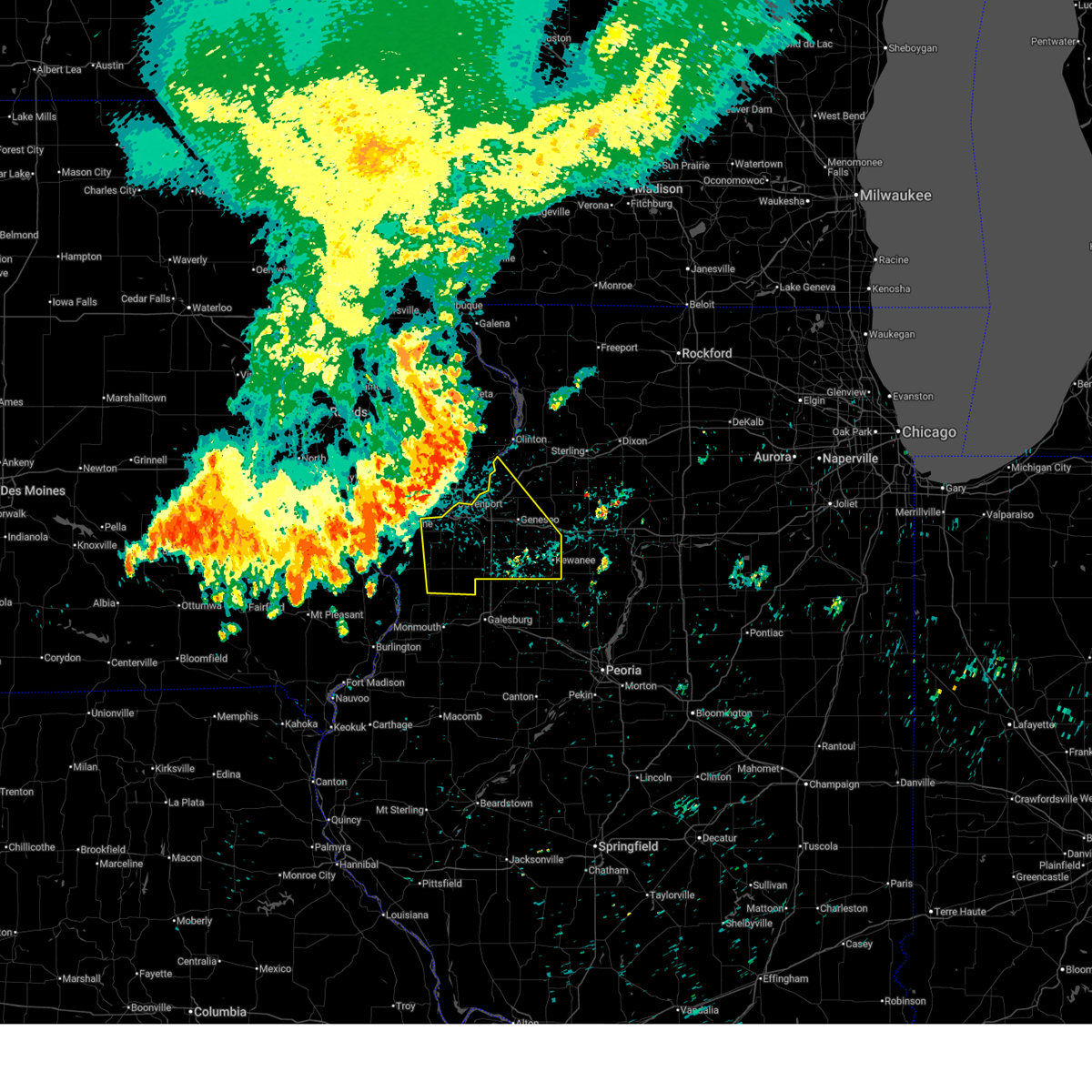
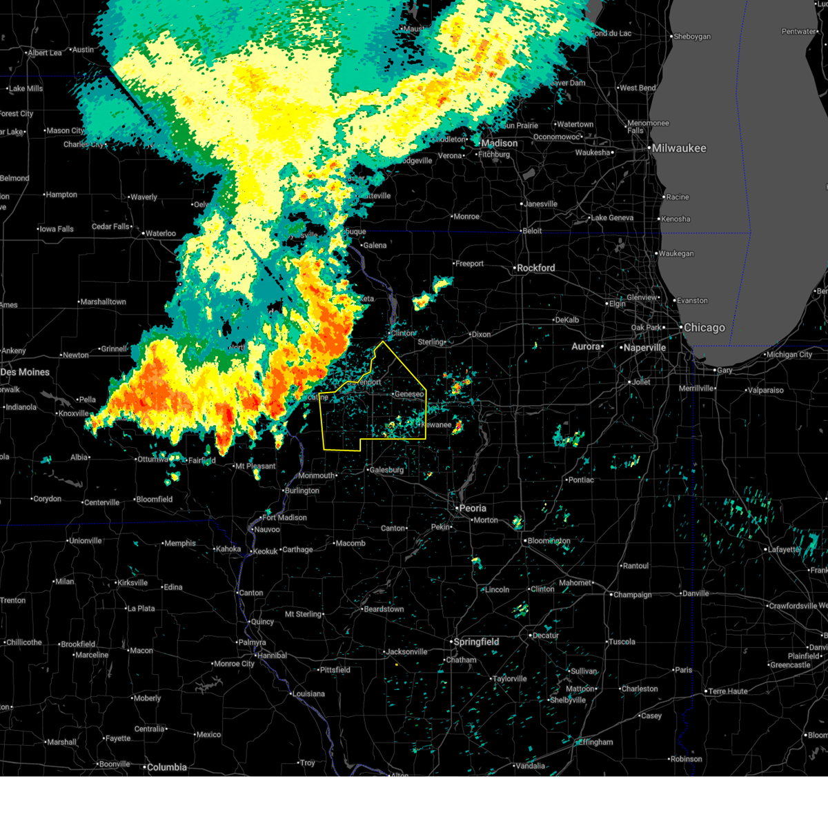
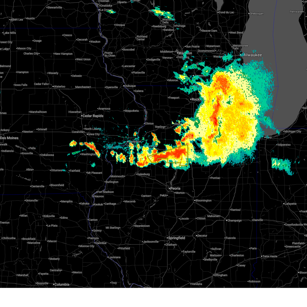
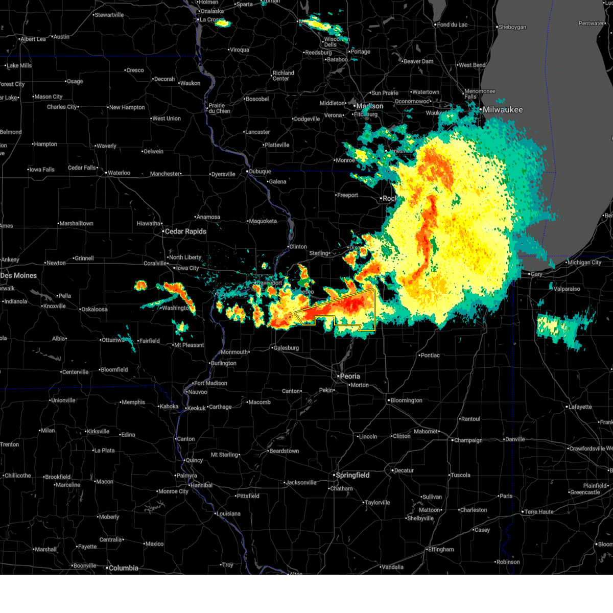
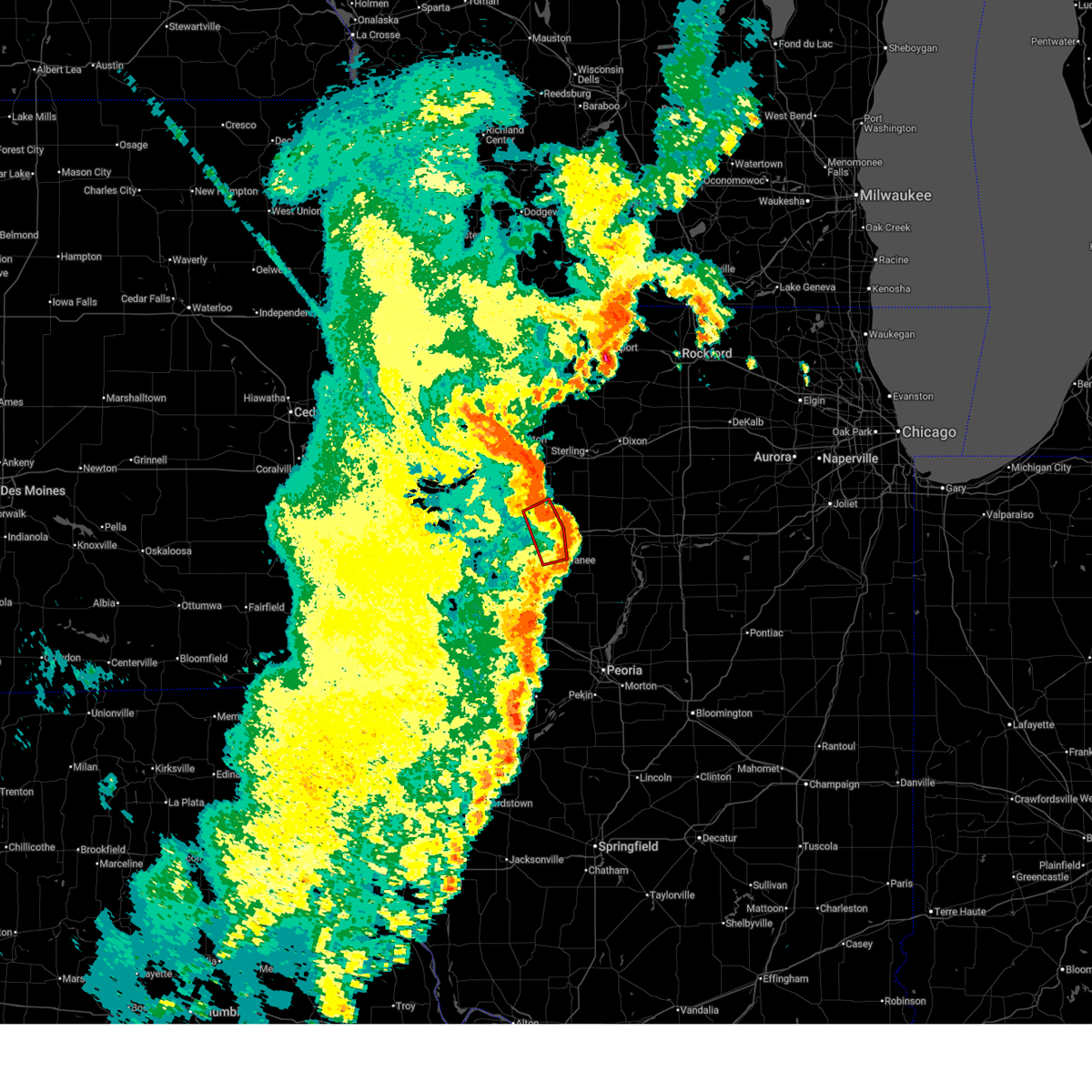
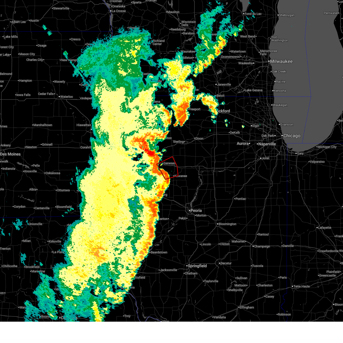
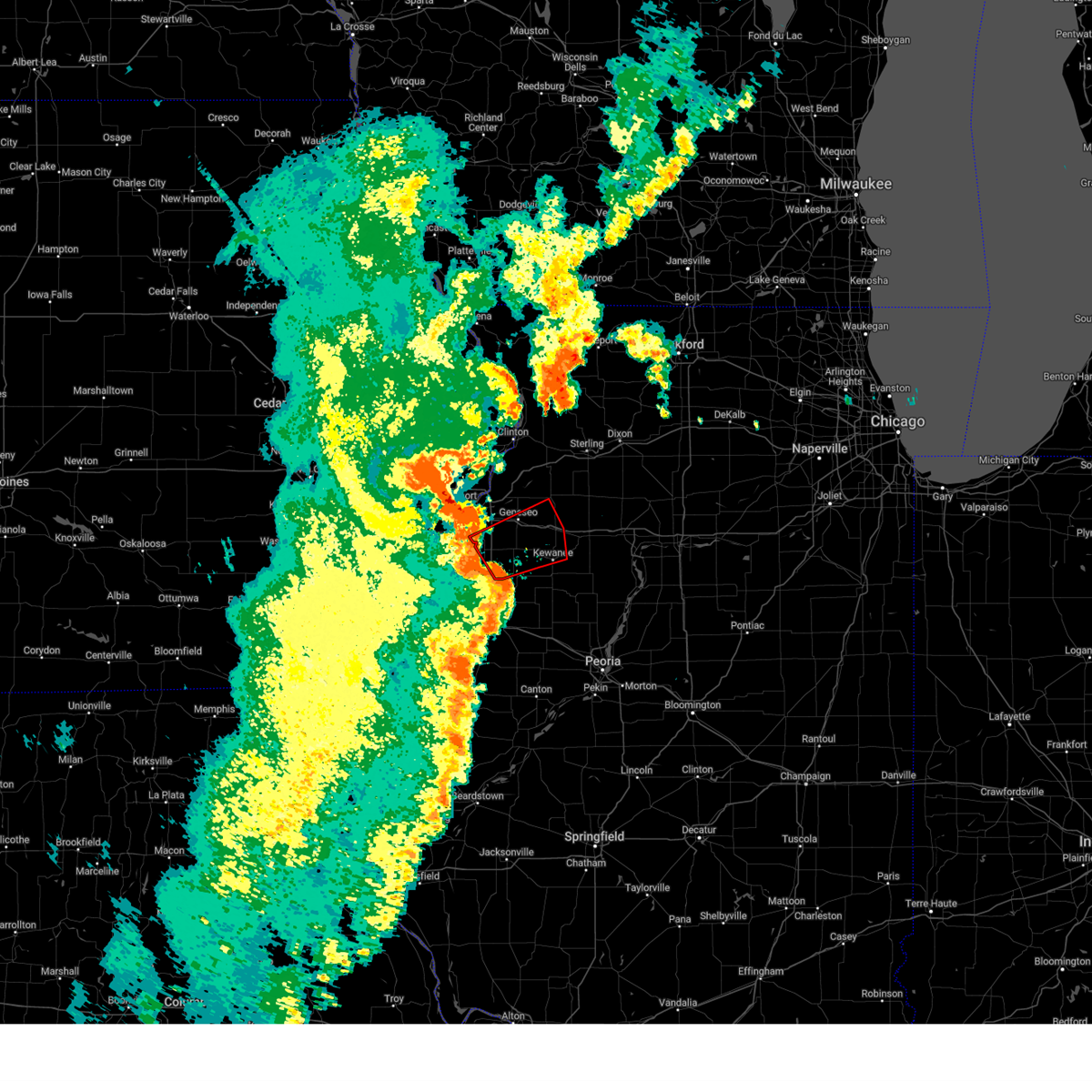
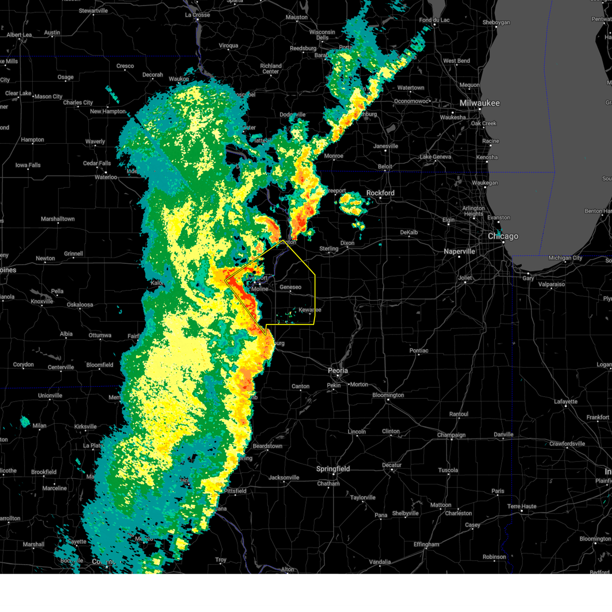
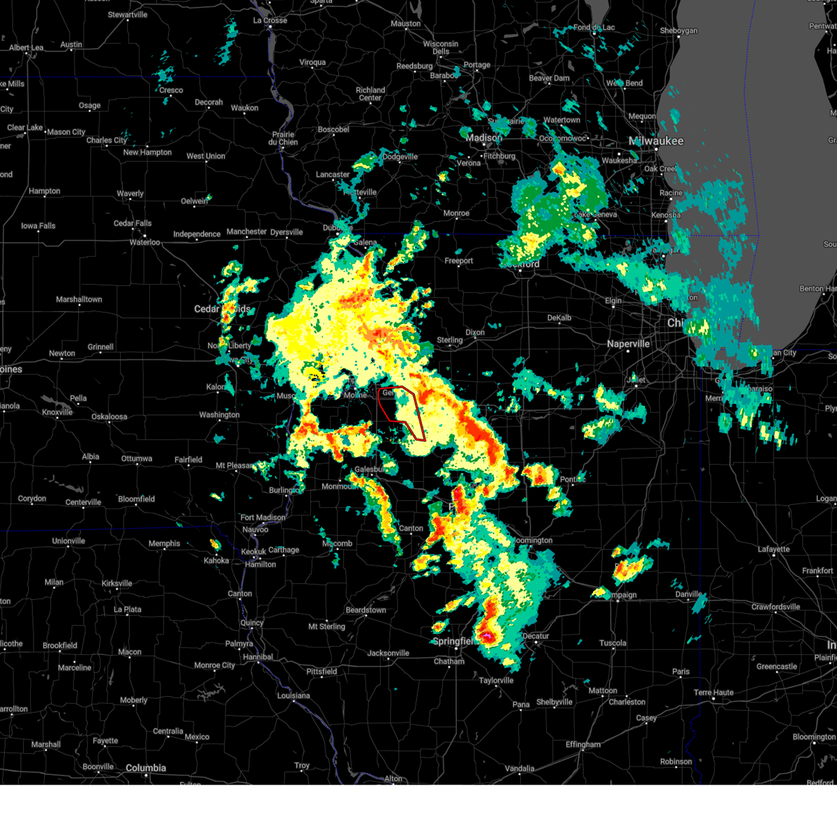
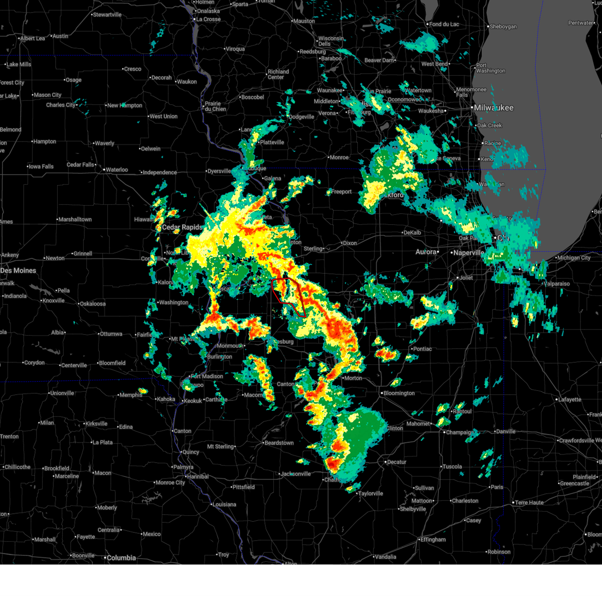
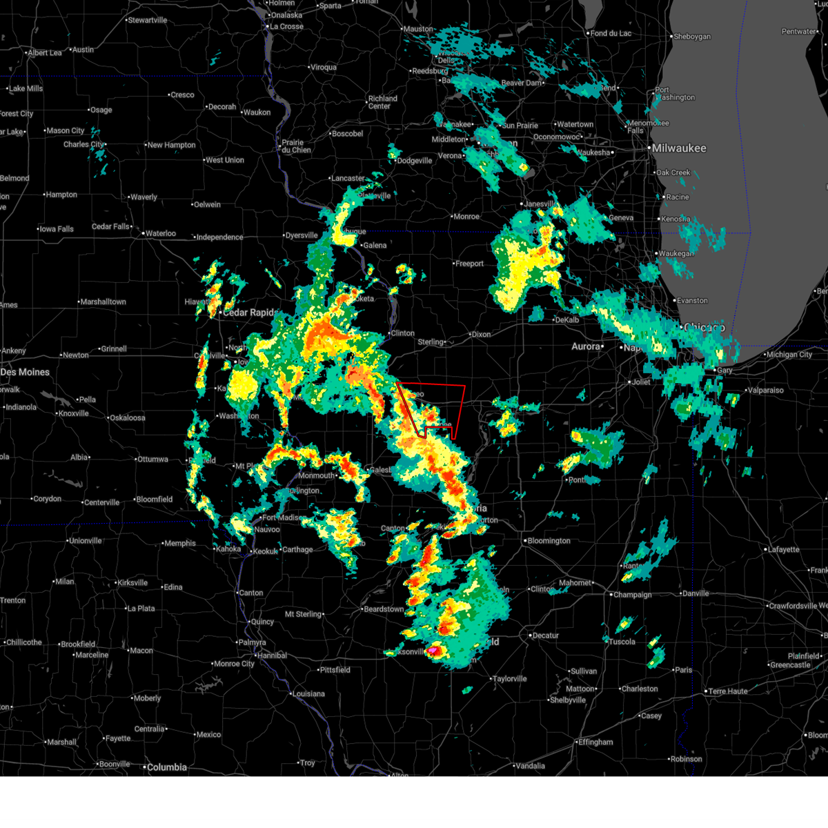
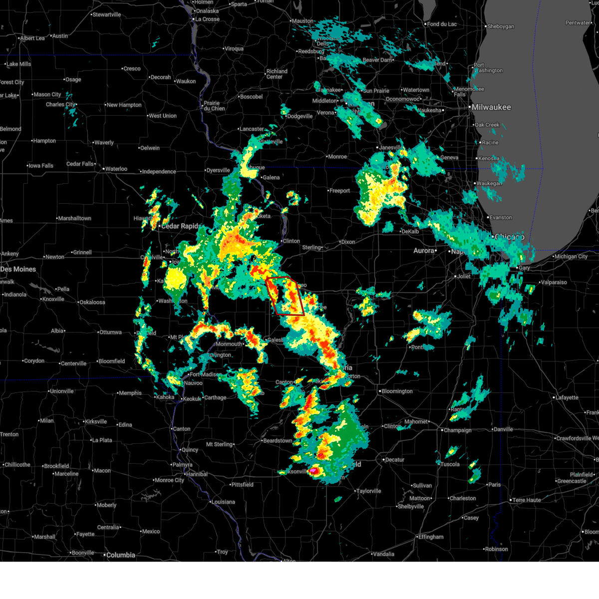
Hail Map for Kewanee, IL
The Kewanee, IL area has had 7 reports of on-the-ground hail by trained spotters, and has been under severe weather warnings 54 times during the past 12 months. Doppler radar has detected hail at or near Kewanee, IL on 63 occasions, including 5 occasions during the past year.
| Name: | Kewanee, IL |
| Where Located: | 41.8 miles NNW of Peoria, IL |
| Map: | Google Map for Kewanee, IL |
| Population: | 12916 |
| Housing Units: | 5887 |
| More Info: | Search Google for Kewanee, IL |
2
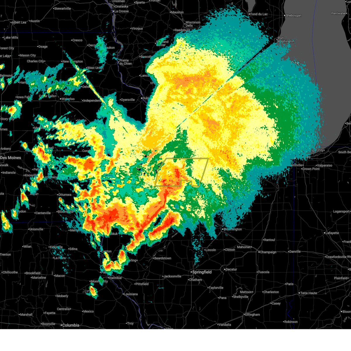
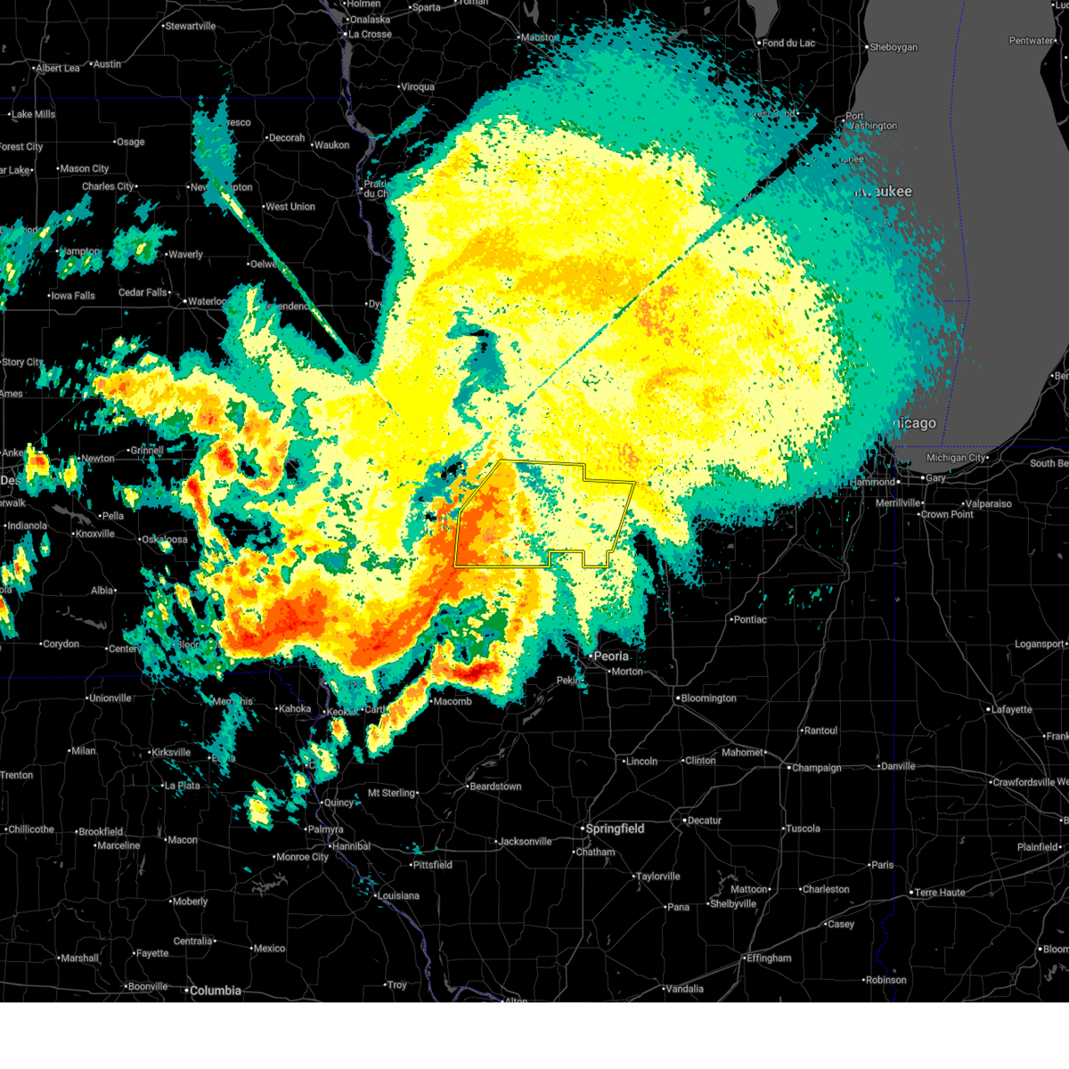
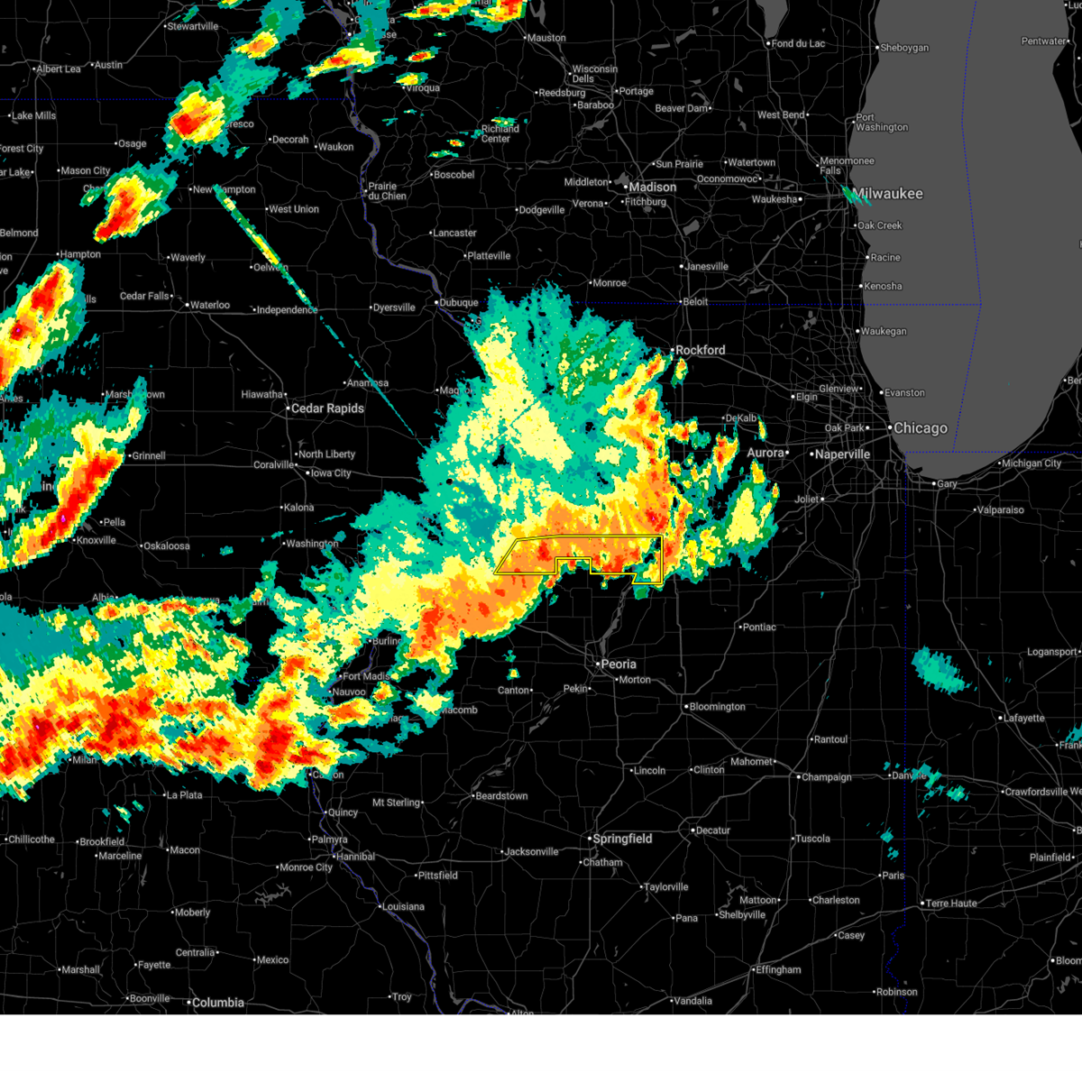
The Top Recent Hail Date for Kewanee, IL is Tuesday, March 10, 2026 (5th out of 63)
Hail and Wind Damage Spotted near Kewanee, IL
| Date / Time | Report Details |
|---|---|
| 6/17/2026 8:46 AM CDT |
 At 845 am cdt, severe thunderstorms were located along a line extending from near yorktown to johnson-sauk trail state park to near altona, moving east at 60 mph (trained weather spotters. at 838 am, emergency management reported wind gusts around 70 mph 1 mile east of cambridge). Hazards include 70 mph wind gusts. Expect considerable tree damage. damage is likely to mobile homes, roofs, and outbuildings. locations impacted include, kewanee, princeton, cambridge, geneseo, galva, walnut, wyanet, atkinson, sheffield, annawan, tiskilwa, woodhull, alpha, andover, buda, hooppole, lynn center, ohio, neponset, and osco. this also includes hennepin canal state trail, johnson-sauk trail state recreation area, and mautino state fish & wildlife area. this includes the following highways, interstate 80 in illinois between mile markers 13 and 61. interstate 74 in illinois between mile markers 17 and 33. Interstate 180 between mile markers 11 and 13. At 845 am cdt, severe thunderstorms were located along a line extending from near yorktown to johnson-sauk trail state park to near altona, moving east at 60 mph (trained weather spotters. at 838 am, emergency management reported wind gusts around 70 mph 1 mile east of cambridge). Hazards include 70 mph wind gusts. Expect considerable tree damage. damage is likely to mobile homes, roofs, and outbuildings. locations impacted include, kewanee, princeton, cambridge, geneseo, galva, walnut, wyanet, atkinson, sheffield, annawan, tiskilwa, woodhull, alpha, andover, buda, hooppole, lynn center, ohio, neponset, and osco. this also includes hennepin canal state trail, johnson-sauk trail state recreation area, and mautino state fish & wildlife area. this includes the following highways, interstate 80 in illinois between mile markers 13 and 61. interstate 74 in illinois between mile markers 17 and 33. Interstate 180 between mile markers 11 and 13.
|
| 6/17/2026 8:25 AM CDT |
 Svrdvn the national weather service in the quad cities has issued a * severe thunderstorm warning for, southeastern rock island county in northwestern illinois, northeastern mercer county in northwestern illinois, southern whiteside county in northwestern illinois, henry county in northwestern illinois, bureau county in north central illinois, * until 930 am cdt. * at 825 am cdt, severe thunderstorms were located along a line extending from near newton corners to near osco to near north henderson, moving east at 65 mph (trained weather spotters. around 815 am, the moline airport reported a 69 mph wind gust). Hazards include 70 mph wind gusts. Expect considerable tree damage. Damage is likely to mobile homes, roofs, and outbuildings. Svrdvn the national weather service in the quad cities has issued a * severe thunderstorm warning for, southeastern rock island county in northwestern illinois, northeastern mercer county in northwestern illinois, southern whiteside county in northwestern illinois, henry county in northwestern illinois, bureau county in north central illinois, * until 930 am cdt. * at 825 am cdt, severe thunderstorms were located along a line extending from near newton corners to near osco to near north henderson, moving east at 65 mph (trained weather spotters. around 815 am, the moline airport reported a 69 mph wind gust). Hazards include 70 mph wind gusts. Expect considerable tree damage. Damage is likely to mobile homes, roofs, and outbuildings.
|
| 6/10/2026 7:37 PM CDT |
 At 737 pm cdt, severe thunderstorms were located along a line extending from buda to near osceola to near la fayette, moving east at 45 mph (radar indicated). Hazards include 60 mph wind gusts. Expect damage to roofs, siding, and trees. locations impacted include, kewanee, hennepin, spring valley, galva, henry, depue, granville, tiskilwa, buda, bureau junction, mcnabb, putnam, mark, neponset, magnolia, standard, milo, bishop hill, german corner, and nekoma. this also includes donnelley depue state fish and wildlife area, johnson-sauk trail state recreation area, and mautino state fish & wildlife area. This includes interstate 180 between mile markers 1 and 9. At 737 pm cdt, severe thunderstorms were located along a line extending from buda to near osceola to near la fayette, moving east at 45 mph (radar indicated). Hazards include 60 mph wind gusts. Expect damage to roofs, siding, and trees. locations impacted include, kewanee, hennepin, spring valley, galva, henry, depue, granville, tiskilwa, buda, bureau junction, mcnabb, putnam, mark, neponset, magnolia, standard, milo, bishop hill, german corner, and nekoma. this also includes donnelley depue state fish and wildlife area, johnson-sauk trail state recreation area, and mautino state fish & wildlife area. This includes interstate 180 between mile markers 1 and 9.
|
| 6/10/2026 7:20 PM CDT |
 Svrdvn the national weather service in the quad cities has issued a * severe thunderstorm warning for, putnam county in north central illinois, southern henry county in northwestern illinois, southern bureau county in north central illinois, * until 815 pm cdt. * at 718 pm cdt, severe thunderstorms were located along a line extending from johnson-sauk trail state park to near kewanee to near oneida, moving east at 55 mph (radar indicated). Hazards include 70 mph wind gusts. Expect considerable tree damage. Damage is likely to mobile homes, roofs, and outbuildings. Svrdvn the national weather service in the quad cities has issued a * severe thunderstorm warning for, putnam county in north central illinois, southern henry county in northwestern illinois, southern bureau county in north central illinois, * until 815 pm cdt. * at 718 pm cdt, severe thunderstorms were located along a line extending from johnson-sauk trail state park to near kewanee to near oneida, moving east at 55 mph (radar indicated). Hazards include 70 mph wind gusts. Expect considerable tree damage. Damage is likely to mobile homes, roofs, and outbuildings.
|
| 5/16/2026 4:56 AM CDT |
 At 455 am cdt, severe thunderstorms were located along a line extending from buda to toulon, moving east at 50 mph (radar indicated). Hazards include 60 mph wind gusts. Expect damage to roofs, siding, and trees. locations impacted include, kewanee, princeton, galva, wyanet, sheffield, tiskilwa, buda, neponset, mineral, milo, providence, kewanee municipal airport, johnson-sauk trail state park, lone tree corners, and bureau county fairgrounds. This also includes johnson-sauk trail state recreation area and mautino state fish & wildlife area. At 455 am cdt, severe thunderstorms were located along a line extending from buda to toulon, moving east at 50 mph (radar indicated). Hazards include 60 mph wind gusts. Expect damage to roofs, siding, and trees. locations impacted include, kewanee, princeton, galva, wyanet, sheffield, tiskilwa, buda, neponset, mineral, milo, providence, kewanee municipal airport, johnson-sauk trail state park, lone tree corners, and bureau county fairgrounds. This also includes johnson-sauk trail state recreation area and mautino state fish & wildlife area.
|
| 5/16/2026 4:43 AM CDT |
 Svrdvn the national weather service in the quad cities has issued a * severe thunderstorm warning for, southeastern henry county in northwestern illinois, southwestern bureau county in north central illinois, * until 530 am cdt. * at 443 am cdt, severe thunderstorms were located along a line extending from johnson-sauk trail state park to la fayette, moving east at 55 mph (radar indicated). Hazards include 60 mph wind gusts. expect damage to roofs, siding, and trees Svrdvn the national weather service in the quad cities has issued a * severe thunderstorm warning for, southeastern henry county in northwestern illinois, southwestern bureau county in north central illinois, * until 530 am cdt. * at 443 am cdt, severe thunderstorms were located along a line extending from johnson-sauk trail state park to la fayette, moving east at 55 mph (radar indicated). Hazards include 60 mph wind gusts. expect damage to roofs, siding, and trees
|
| 5/4/2026 6:17 PM CDT |
 At 616 pm cdt, severe thunderstorms were located along a line extending from near thomas to galva, moving east at 45 mph (trained weather spotters. 60 mph winds were reported as the storm moved through cambridge, illinois). Hazards include 60 mph wind gusts and penny size hail. Expect damage to roofs, siding, and trees. locations impacted include, kewanee, galva, atkinson, annawan, hooppole, bishop hill, german corner, and johnson-sauk trail state park. This includes interstate 80 in illinois between mile markers 26 and 35. At 616 pm cdt, severe thunderstorms were located along a line extending from near thomas to galva, moving east at 45 mph (trained weather spotters. 60 mph winds were reported as the storm moved through cambridge, illinois). Hazards include 60 mph wind gusts and penny size hail. Expect damage to roofs, siding, and trees. locations impacted include, kewanee, galva, atkinson, annawan, hooppole, bishop hill, german corner, and johnson-sauk trail state park. This includes interstate 80 in illinois between mile markers 26 and 35.
|
| 5/4/2026 6:06 PM CDT |
 Svrdvn the national weather service in the quad cities has issued a * severe thunderstorm warning for, southeastern henry county in northwestern illinois, * until 630 pm cdt. * at 605 pm cdt, severe thunderstorms were located along a line extending from near annawan to near nekoma, moving east at 40 mph (radar indicated). Hazards include 60 mph wind gusts and penny size hail. expect damage to roofs, siding, and trees Svrdvn the national weather service in the quad cities has issued a * severe thunderstorm warning for, southeastern henry county in northwestern illinois, * until 630 pm cdt. * at 605 pm cdt, severe thunderstorms were located along a line extending from near annawan to near nekoma, moving east at 40 mph (radar indicated). Hazards include 60 mph wind gusts and penny size hail. expect damage to roofs, siding, and trees
|
| 5/4/2026 5:56 PM CDT |
 At 556 pm cdt, severe thunderstorms were located along a line extending from near hooppole to nekoma, moving east at 40 mph (trained weather spotters). Hazards include 60 mph wind gusts and quarter size hail. Hail damage to vehicles is expected. expect wind damage to roofs, siding, and trees. locations impacted include, kewanee, cambridge, geneseo, galva, atkinson, annawan, andover, hooppole, lynn center, osco, bishop hill, henry county fairgrounds, ophiem, german corner, nekoma, ulah, and johnson-sauk trail state park. this includes the following highways, interstate 80 in illinois between mile markers 15 and 35. Interstate 74 in illinois between mile markers 23 and 29. At 556 pm cdt, severe thunderstorms were located along a line extending from near hooppole to nekoma, moving east at 40 mph (trained weather spotters). Hazards include 60 mph wind gusts and quarter size hail. Hail damage to vehicles is expected. expect wind damage to roofs, siding, and trees. locations impacted include, kewanee, cambridge, geneseo, galva, atkinson, annawan, andover, hooppole, lynn center, osco, bishop hill, henry county fairgrounds, ophiem, german corner, nekoma, ulah, and johnson-sauk trail state park. this includes the following highways, interstate 80 in illinois between mile markers 15 and 35. Interstate 74 in illinois between mile markers 23 and 29.
|
| 5/4/2026 5:42 PM CDT |
 Svrdvn the national weather service in the quad cities has issued a * severe thunderstorm warning for, northeastern mercer county in northwestern illinois, henry county in northwestern illinois, * until 630 pm cdt. * at 542 pm cdt, a severe thunderstorm was located over lynn center, or 10 miles west of cambridge, moving east at 45 mph (radar indicated). Hazards include 60 mph wind gusts and quarter size hail. Hail damage to vehicles is expected. Expect wind damage to roofs, siding, and trees. Svrdvn the national weather service in the quad cities has issued a * severe thunderstorm warning for, northeastern mercer county in northwestern illinois, henry county in northwestern illinois, * until 630 pm cdt. * at 542 pm cdt, a severe thunderstorm was located over lynn center, or 10 miles west of cambridge, moving east at 45 mph (radar indicated). Hazards include 60 mph wind gusts and quarter size hail. Hail damage to vehicles is expected. Expect wind damage to roofs, siding, and trees.
|
| 4/17/2026 7:23 PM CDT |
 At 723 pm cdt, severe thunderstorms were located along a line extending from near manlius to camp grove, moving east at 60 mph (radar indicated). Hazards include 60 mph wind gusts and penny size hail. Expect damage to roofs, siding, and trees. these severe thunderstorms will remain over mainly rural areas of eastern henry and western bureau counties, including the following locations, mineral, bishop hill, manlius, nekoma, kewanee municipal airport, neponset, ulah, german corner, and johnson-sauk trail state park. This includes interstate 80 in illinois between mile markers 20 and 47. At 723 pm cdt, severe thunderstorms were located along a line extending from near manlius to camp grove, moving east at 60 mph (radar indicated). Hazards include 60 mph wind gusts and penny size hail. Expect damage to roofs, siding, and trees. these severe thunderstorms will remain over mainly rural areas of eastern henry and western bureau counties, including the following locations, mineral, bishop hill, manlius, nekoma, kewanee municipal airport, neponset, ulah, german corner, and johnson-sauk trail state park. This includes interstate 80 in illinois between mile markers 20 and 47.
|
| 4/17/2026 7:05 PM CDT |
 At 704 pm cdt, severe thunderstorms were located along a line extending from near annawan to near west jersey, moving east at 60 mph (radar indicated). Hazards include 60 mph wind gusts and penny size hail. Expect damage to roofs, siding, and trees. these severe storms will be near, kewanee, sheffield, neponset, mineral, and johnson-sauk trail state park around 710 pm cdt. buda and manlius around 715 pm cdt. other locations impacted by these severe thunderstorms include henry county fairgrounds, mineral, bishop hill, german corner, dayton, manlius, nekoma, kewanee municipal airport, osco, and neponset. this includes the following highways, interstate 80 in illinois between mile markers 6 and 47. Interstate 74 in illinois between mile markers 13 and 33. At 704 pm cdt, severe thunderstorms were located along a line extending from near annawan to near west jersey, moving east at 60 mph (radar indicated). Hazards include 60 mph wind gusts and penny size hail. Expect damage to roofs, siding, and trees. these severe storms will be near, kewanee, sheffield, neponset, mineral, and johnson-sauk trail state park around 710 pm cdt. buda and manlius around 715 pm cdt. other locations impacted by these severe thunderstorms include henry county fairgrounds, mineral, bishop hill, german corner, dayton, manlius, nekoma, kewanee municipal airport, osco, and neponset. this includes the following highways, interstate 80 in illinois between mile markers 6 and 47. Interstate 74 in illinois between mile markers 13 and 33.
|
| 4/17/2026 6:43 PM CDT |
 Svrdvn the national weather service in the quad cities has issued a * severe thunderstorm warning for, south central rock island county in northwestern illinois, northeastern mercer county in northwestern illinois, henry county in northwestern illinois, western bureau county in north central illinois, * until 745 pm cdt. * at 643 pm cdt, severe thunderstorms were located along a line extending from orion to galesburg, moving east at 65 mph (radar indicated). Hazards include 70 mph wind gusts and penny size hail. Expect considerable tree damage. damage is likely to mobile homes, roofs, and outbuildings. severe thunderstorms will be near, cambridge, geneseo, bishop hill, nekoma, ulah, and henry county fairgrounds around 650 pm cdt. galva, atkinson, and german corner around 655 pm cdt. kewanee, annawan, and kewanee municipal airport around 700 pm cdt. neponset, mineral, and johnson-sauk trail state park around 705 pm cdt. sheffield around 710 pm cdt. buda and manlius around 715 pm cdt. other locations impacted by these severe thunderstorms include preemption, henry county fairgrounds, silvis heights, ophiem, german corner, coyne center, sunny hill, dayton, manlius, and nekoma. this includes the following highways, interstate 80 in illinois between mile markers 6 and 47. interstate 74 in illinois between mile markers 2 and 33. Interstate 280 between mile markers 11 and 18. Svrdvn the national weather service in the quad cities has issued a * severe thunderstorm warning for, south central rock island county in northwestern illinois, northeastern mercer county in northwestern illinois, henry county in northwestern illinois, western bureau county in north central illinois, * until 745 pm cdt. * at 643 pm cdt, severe thunderstorms were located along a line extending from orion to galesburg, moving east at 65 mph (radar indicated). Hazards include 70 mph wind gusts and penny size hail. Expect considerable tree damage. damage is likely to mobile homes, roofs, and outbuildings. severe thunderstorms will be near, cambridge, geneseo, bishop hill, nekoma, ulah, and henry county fairgrounds around 650 pm cdt. galva, atkinson, and german corner around 655 pm cdt. kewanee, annawan, and kewanee municipal airport around 700 pm cdt. neponset, mineral, and johnson-sauk trail state park around 705 pm cdt. sheffield around 710 pm cdt. buda and manlius around 715 pm cdt. other locations impacted by these severe thunderstorms include preemption, henry county fairgrounds, silvis heights, ophiem, german corner, coyne center, sunny hill, dayton, manlius, and nekoma. this includes the following highways, interstate 80 in illinois between mile markers 6 and 47. interstate 74 in illinois between mile markers 2 and 33. Interstate 280 between mile markers 11 and 18.
|
| 4/17/2026 6:37 PM CDT |
 At 637 pm cdt, a severe thunderstorm was located near osceola, or 9 miles east of kewanee, moving northeast at 50 mph (radar indicated). Hazards include golf ball size hail and 60 mph wind gusts. People and animals outdoors will be injured. expect hail damage to roofs, siding, windows, and vehicles. expect wind damage to roofs, siding, and trees. locations impacted include, kewanee, princeton, walnut, wyanet, sheffield, tiskilwa, la moille, buda, ohio, neponset, malden, manlius, mineral, milo, dover, new bedford, providence, kasbeer, van orin, and normandy. this includes the following highways, interstate 80 in illinois between mile markers 38 and 61. Interstate 180 near mile marker 13. At 637 pm cdt, a severe thunderstorm was located near osceola, or 9 miles east of kewanee, moving northeast at 50 mph (radar indicated). Hazards include golf ball size hail and 60 mph wind gusts. People and animals outdoors will be injured. expect hail damage to roofs, siding, windows, and vehicles. expect wind damage to roofs, siding, and trees. locations impacted include, kewanee, princeton, walnut, wyanet, sheffield, tiskilwa, la moille, buda, ohio, neponset, malden, manlius, mineral, milo, dover, new bedford, providence, kasbeer, van orin, and normandy. this includes the following highways, interstate 80 in illinois between mile markers 38 and 61. Interstate 180 near mile marker 13.
|
| 4/17/2026 6:14 PM CDT |
 Svrdvn the national weather service in the quad cities has issued a * severe thunderstorm warning for, southeastern henry county in northwestern illinois, bureau county in north central illinois, * until 730 pm cdt. * at 614 pm cdt, a severe thunderstorm was located over west jersey, or 8 miles southwest of toulon, moving northeast at 50 mph (radar indicated). Hazards include golf ball size hail and 60 mph wind gusts. People and animals outdoors will be injured. expect hail damage to roofs, siding, windows, and vehicles. Expect wind damage to roofs, siding, and trees. Svrdvn the national weather service in the quad cities has issued a * severe thunderstorm warning for, southeastern henry county in northwestern illinois, bureau county in north central illinois, * until 730 pm cdt. * at 614 pm cdt, a severe thunderstorm was located over west jersey, or 8 miles southwest of toulon, moving northeast at 50 mph (radar indicated). Hazards include golf ball size hail and 60 mph wind gusts. People and animals outdoors will be injured. expect hail damage to roofs, siding, windows, and vehicles. Expect wind damage to roofs, siding, and trees.
|
| 3/31/2026 2:54 PM CDT |
 the severe thunderstorm warning has been cancelled and is no longer in effect the severe thunderstorm warning has been cancelled and is no longer in effect
|
| 3/31/2026 2:42 PM CDT |
 At 242 pm cdt, a severe thunderstorm was located over atkinson, or 10 miles northeast of cambridge, moving east at 35 mph (radar indicated). Hazards include quarter size hail. Damage to vehicles is expected. this severe storm will be near, atkinson, annawan, german corner, and johnson-sauk trail state park around 245 pm cdt. This includes interstate 80 in illinois between mile markers 19 and 35. At 242 pm cdt, a severe thunderstorm was located over atkinson, or 10 miles northeast of cambridge, moving east at 35 mph (radar indicated). Hazards include quarter size hail. Damage to vehicles is expected. this severe storm will be near, atkinson, annawan, german corner, and johnson-sauk trail state park around 245 pm cdt. This includes interstate 80 in illinois between mile markers 19 and 35.
|
| 3/31/2026 2:29 PM CDT |
 At 229 pm cdt, a severe thunderstorm was located near geneseo, or near cambridge, moving east at 35 mph (broadcast media). Hazards include quarter size hail. Damage to vehicles is expected. locations impacted include, kewanee, geneseo, atkinson, annawan, osco, german corner, morristown, and johnson-sauk trail state park. this includes the following highways, interstate 80 in illinois between mile markers 12 and 35. Interstate 74 in illinois between mile markers 16 and 19. At 229 pm cdt, a severe thunderstorm was located near geneseo, or near cambridge, moving east at 35 mph (broadcast media). Hazards include quarter size hail. Damage to vehicles is expected. locations impacted include, kewanee, geneseo, atkinson, annawan, osco, german corner, morristown, and johnson-sauk trail state park. this includes the following highways, interstate 80 in illinois between mile markers 12 and 35. Interstate 74 in illinois between mile markers 16 and 19.
|
| 3/31/2026 2:23 PM CDT |
 Svrdvn the national weather service in the quad cities has issued a * severe thunderstorm warning for, central henry county in northwestern illinois, * until 315 pm cdt. * at 223 pm cdt, a severe thunderstorm was located over morristown, or 8 miles northwest of cambridge, moving east at 35 mph (broadcast media). Hazards include quarter size hail. damage to vehicles is expected Svrdvn the national weather service in the quad cities has issued a * severe thunderstorm warning for, central henry county in northwestern illinois, * until 315 pm cdt. * at 223 pm cdt, a severe thunderstorm was located over morristown, or 8 miles northwest of cambridge, moving east at 35 mph (broadcast media). Hazards include quarter size hail. damage to vehicles is expected
|
| 3/10/2026 9:26 PM CDT |
 the severe thunderstorm warning has been cancelled and is no longer in effect the severe thunderstorm warning has been cancelled and is no longer in effect
|
| 3/10/2026 9:14 PM CDT |
 At 914 pm cdt, a severe thunderstorm was located near ulah, or near cambridge, moving east at 35 mph (radar indicated). Hazards include 60 mph wind gusts and quarter size hail. Hail damage to vehicles is expected. expect wind damage to roofs, siding, and trees. Locations impacted include, kewanee, galva, german corner, kewanee municipal airport, and johnson-sauk trail state park. At 914 pm cdt, a severe thunderstorm was located near ulah, or near cambridge, moving east at 35 mph (radar indicated). Hazards include 60 mph wind gusts and quarter size hail. Hail damage to vehicles is expected. expect wind damage to roofs, siding, and trees. Locations impacted include, kewanee, galva, german corner, kewanee municipal airport, and johnson-sauk trail state park.
|
| 3/10/2026 9:08 PM CDT |
 At 908 pm cdt, a severe thunderstorm was located over ulah, or near cambridge, moving east at 35 mph (radar indicated). Hazards include 60 mph wind gusts and quarter size hail. Hail damage to vehicles is expected. expect wind damage to roofs, siding, and trees. Locations impacted include, kewanee, cambridge, galva, bishop hill, henry county fairgrounds, nekoma, kewanee municipal airport, ulah, german corner, and johnson-sauk trail state park. At 908 pm cdt, a severe thunderstorm was located over ulah, or near cambridge, moving east at 35 mph (radar indicated). Hazards include 60 mph wind gusts and quarter size hail. Hail damage to vehicles is expected. expect wind damage to roofs, siding, and trees. Locations impacted include, kewanee, cambridge, galva, bishop hill, henry county fairgrounds, nekoma, kewanee municipal airport, ulah, german corner, and johnson-sauk trail state park.
|
| 3/10/2026 8:55 PM CDT |
 At 855 pm cdt, a severe thunderstorm was located near ophiem, or 7 miles southwest of cambridge, moving east at 35 mph (radar indicated). Hazards include 60 mph wind gusts and quarter size hail. Hail damage to vehicles is expected. expect wind damage to roofs, siding, and trees. locations impacted include, kewanee, cambridge, galva, woodhull, new windsor, alpha, andover, lynn center, bishop hill, henry county fairgrounds, ophiem, german corner, nekoma, kewanee municipal airport, ulah, and johnson-sauk trail state park. This includes interstate 74 in illinois between mile markers 22 and 33. At 855 pm cdt, a severe thunderstorm was located near ophiem, or 7 miles southwest of cambridge, moving east at 35 mph (radar indicated). Hazards include 60 mph wind gusts and quarter size hail. Hail damage to vehicles is expected. expect wind damage to roofs, siding, and trees. locations impacted include, kewanee, cambridge, galva, woodhull, new windsor, alpha, andover, lynn center, bishop hill, henry county fairgrounds, ophiem, german corner, nekoma, kewanee municipal airport, ulah, and johnson-sauk trail state park. This includes interstate 74 in illinois between mile markers 22 and 33.
|
| 3/10/2026 8:55 PM CDT |
 the severe thunderstorm warning has been cancelled and is no longer in effect the severe thunderstorm warning has been cancelled and is no longer in effect
|
| 3/10/2026 8:43 PM CDT |
 Svrdvn the national weather service in the quad cities has issued a * severe thunderstorm warning for, northeastern mercer county in northwestern illinois, southern henry county in northwestern illinois, * until 945 pm cdt. * at 843 pm cdt, a severe thunderstorm was located over griffin, or 14 miles west of cambridge, moving east at 35 mph (radar indicated). Hazards include 60 mph wind gusts and quarter size hail. Hail damage to vehicles is expected. Expect wind damage to roofs, siding, and trees. Svrdvn the national weather service in the quad cities has issued a * severe thunderstorm warning for, northeastern mercer county in northwestern illinois, southern henry county in northwestern illinois, * until 945 pm cdt. * at 843 pm cdt, a severe thunderstorm was located over griffin, or 14 miles west of cambridge, moving east at 35 mph (radar indicated). Hazards include 60 mph wind gusts and quarter size hail. Hail damage to vehicles is expected. Expect wind damage to roofs, siding, and trees.
|
| 3/10/2026 7:40 PM CDT |
 The storm which prompted the warning has weakened below severe limits, and has exited the warned area. therefore, the warning will be allowed to expire. however, small hail is still possible with this thunderstorm. a tornado watch remains in effect until 1100 pm cdt for northwestern illinois. The storm which prompted the warning has weakened below severe limits, and has exited the warned area. therefore, the warning will be allowed to expire. however, small hail is still possible with this thunderstorm. a tornado watch remains in effect until 1100 pm cdt for northwestern illinois.
|
| 3/10/2026 7:25 PM CDT |
 At 725 pm cdt, a severe thunderstorm was located over kewanee municipal airport, or near kewanee, moving east at 45 mph (radar indicated). Hazards include two inch hail and 60 mph wind gusts. People and animals outdoors will be injured. expect hail damage to roofs, siding, windows, and vehicles. expect wind damage to roofs, siding, and trees. locations impacted include, kewanee, cambridge, galva, woodhull, alpha, andover, bishop hill, henry county fairgrounds, ophiem, german corner, nekoma, kewanee municipal airport, ulah, and johnson-sauk trail state park. This includes interstate 74 in illinois between mile markers 26 and 33. At 725 pm cdt, a severe thunderstorm was located over kewanee municipal airport, or near kewanee, moving east at 45 mph (radar indicated). Hazards include two inch hail and 60 mph wind gusts. People and animals outdoors will be injured. expect hail damage to roofs, siding, windows, and vehicles. expect wind damage to roofs, siding, and trees. locations impacted include, kewanee, cambridge, galva, woodhull, alpha, andover, bishop hill, henry county fairgrounds, ophiem, german corner, nekoma, kewanee municipal airport, ulah, and johnson-sauk trail state park. This includes interstate 74 in illinois between mile markers 26 and 33.
|
| 3/10/2026 7:05 PM CDT |
 Svrdvn the national weather service in the quad cities has issued a * severe thunderstorm warning for, southern henry county in northwestern illinois, * until 745 pm cdt. * at 705 pm cdt, a severe thunderstorm was located over woodhull, or 9 miles southwest of cambridge, moving east at 45 mph (radar indicated). Hazards include two inch hail and 60 mph wind gusts. People and animals outdoors will be injured. expect hail damage to roofs, siding, windows, and vehicles. Expect wind damage to roofs, siding, and trees. Svrdvn the national weather service in the quad cities has issued a * severe thunderstorm warning for, southern henry county in northwestern illinois, * until 745 pm cdt. * at 705 pm cdt, a severe thunderstorm was located over woodhull, or 9 miles southwest of cambridge, moving east at 45 mph (radar indicated). Hazards include two inch hail and 60 mph wind gusts. People and animals outdoors will be injured. expect hail damage to roofs, siding, windows, and vehicles. Expect wind damage to roofs, siding, and trees.
|
| 3/10/2026 6:49 PM CDT |
 At 649 pm cdt, a severe thunderstorm was located over mineral, or 9 miles northeast of kewanee, moving northeast at 35 mph (trained weather spotters). Hazards include two inch hail and 60 mph wind gusts. People and animals outdoors will be injured. expect hail damage to roofs, siding, windows, and vehicles. expect wind damage to roofs, siding, and trees. locations impacted include, kewanee, wyanet, atkinson, sheffield, annawan, buda, neponset, manlius, mineral, new bedford, thomas, and johnson-sauk trail state park. This includes interstate 80 in illinois between mile markers 27 and 50. At 649 pm cdt, a severe thunderstorm was located over mineral, or 9 miles northeast of kewanee, moving northeast at 35 mph (trained weather spotters). Hazards include two inch hail and 60 mph wind gusts. People and animals outdoors will be injured. expect hail damage to roofs, siding, windows, and vehicles. expect wind damage to roofs, siding, and trees. locations impacted include, kewanee, wyanet, atkinson, sheffield, annawan, buda, neponset, manlius, mineral, new bedford, thomas, and johnson-sauk trail state park. This includes interstate 80 in illinois between mile markers 27 and 50.
|
| 3/10/2026 6:38 PM CDT |
 At 638 pm cdt, a severe thunderstorm capable of producing a tornado was located just north of kewanee, moving northeast at 40 mph (radar indicated rotation). Hazards include tornado and baseball size hail. Flying debris will be dangerous to those caught without shelter. mobile homes will be damaged or destroyed. damage to roofs, windows, and vehicles will occur. tree damage is likely. this dangerous storm will be near, sheffield, buda, neponset, and johnson-sauk trail state park around 645 pm cdt. This includes interstate 80 in illinois between mile markers 39 and 45. At 638 pm cdt, a severe thunderstorm capable of producing a tornado was located just north of kewanee, moving northeast at 40 mph (radar indicated rotation). Hazards include tornado and baseball size hail. Flying debris will be dangerous to those caught without shelter. mobile homes will be damaged or destroyed. damage to roofs, windows, and vehicles will occur. tree damage is likely. this dangerous storm will be near, sheffield, buda, neponset, and johnson-sauk trail state park around 645 pm cdt. This includes interstate 80 in illinois between mile markers 39 and 45.
|
| 3/10/2026 6:35 PM CDT |
 At 633 pm cdt, a severe thunderstorm was located near thomas, or 15 miles north of kewanee, moving northeast at 40 mph. this is a destructive storm for interstate 80 in illinois, heading towards sheffield and annawan (trained weather spotters). Hazards include baseball size hail and 60 mph wind gusts. People and animals outdoors will be severely injured. expect shattered windows, extensive damage to roofs, siding, and vehicles. locations impacted include, kewanee, cambridge, geneseo, wyanet, atkinson, sheffield, annawan, woodhull, andover, buda, hooppole, neponset, yorktown, manlius, mineral, bishop hill, new bedford, thomas, henry county fairgrounds, and german corner. this includes the following highways, interstate 80 in illinois between mile markers 21 and 50. Interstate 74 in illinois between mile markers 27 and 31. At 633 pm cdt, a severe thunderstorm was located near thomas, or 15 miles north of kewanee, moving northeast at 40 mph. this is a destructive storm for interstate 80 in illinois, heading towards sheffield and annawan (trained weather spotters). Hazards include baseball size hail and 60 mph wind gusts. People and animals outdoors will be severely injured. expect shattered windows, extensive damage to roofs, siding, and vehicles. locations impacted include, kewanee, cambridge, geneseo, wyanet, atkinson, sheffield, annawan, woodhull, andover, buda, hooppole, neponset, yorktown, manlius, mineral, bishop hill, new bedford, thomas, henry county fairgrounds, and german corner. this includes the following highways, interstate 80 in illinois between mile markers 21 and 50. Interstate 74 in illinois between mile markers 27 and 31.
|
| 3/10/2026 6:30 PM CDT |
 Tordvn the national weather service in the quad cities has issued a * tornado warning for, southeastern henry county in northwestern illinois, southwestern bureau county in north central illinois, * until 715 pm cdt. * at 630 pm cdt, a severe thunderstorm capable of producing a tornado was located over kewanee municipal airport, or near kewanee, moving northeast at 40 mph (radar indicated rotation). Hazards include tornado and golf ball size hail. Flying debris will be dangerous to those caught without shelter. mobile homes will be damaged or destroyed. damage to roofs, windows, and vehicles will occur. tree damage is likely. this dangerous storm will be near, kewanee, neponset, and johnson-sauk trail state park around 635 pm cdt. sheffield and buda around 645 pm cdt. This includes interstate 80 in illinois between mile markers 39 and 45. Tordvn the national weather service in the quad cities has issued a * tornado warning for, southeastern henry county in northwestern illinois, southwestern bureau county in north central illinois, * until 715 pm cdt. * at 630 pm cdt, a severe thunderstorm capable of producing a tornado was located over kewanee municipal airport, or near kewanee, moving northeast at 40 mph (radar indicated rotation). Hazards include tornado and golf ball size hail. Flying debris will be dangerous to those caught without shelter. mobile homes will be damaged or destroyed. damage to roofs, windows, and vehicles will occur. tree damage is likely. this dangerous storm will be near, kewanee, neponset, and johnson-sauk trail state park around 635 pm cdt. sheffield and buda around 645 pm cdt. This includes interstate 80 in illinois between mile markers 39 and 45.
|
| 3/10/2026 6:27 PM CDT |
 At 626 pm cdt, multiple severe thunderstorms were located in eastern henry county illinois and western bureau county illinois, moving northeast at 40 mph. strongest storm is currently located east of kewanee illinois (radar indicated). Hazards include golf ball size hail and 60 mph wind gusts. People and animals outdoors will be injured. expect hail damage to roofs, siding, windows, and vehicles. expect wind damage to roofs, siding, and trees. locations impacted include, kewanee, cambridge, geneseo, wyanet, atkinson, sheffield, annawan, woodhull, andover, buda, hooppole, neponset, yorktown, manlius, mineral, bishop hill, new bedford, thomas, henry county fairgrounds, and german corner. this includes the following highways, interstate 80 in illinois between mile markers 21 and 50. Interstate 74 in illinois between mile markers 27 and 31. At 626 pm cdt, multiple severe thunderstorms were located in eastern henry county illinois and western bureau county illinois, moving northeast at 40 mph. strongest storm is currently located east of kewanee illinois (radar indicated). Hazards include golf ball size hail and 60 mph wind gusts. People and animals outdoors will be injured. expect hail damage to roofs, siding, windows, and vehicles. expect wind damage to roofs, siding, and trees. locations impacted include, kewanee, cambridge, geneseo, wyanet, atkinson, sheffield, annawan, woodhull, andover, buda, hooppole, neponset, yorktown, manlius, mineral, bishop hill, new bedford, thomas, henry county fairgrounds, and german corner. this includes the following highways, interstate 80 in illinois between mile markers 21 and 50. Interstate 74 in illinois between mile markers 27 and 31.
|
| 3/10/2026 6:17 PM CDT |
 At 615 pm cdt, multiple severe thunderstorms were located in eastern henry county illinois and western bureau county illinois, moving northeast at 40 mph. strongest storm is currently located east of kewanee illinois (radar indicated). Hazards include golf ball size hail and 60 mph wind gusts. People and animals outdoors will be injured. expect hail damage to roofs, siding, windows, and vehicles. expect wind damage to roofs, siding, and trees. locations impacted include, kewanee, cambridge, geneseo, wyanet, atkinson, sheffield, annawan, woodhull, andover, buda, hooppole, neponset, yorktown, manlius, mineral, bishop hill, new bedford, thomas, henry county fairgrounds, and german corner. this includes the following highways, interstate 80 in illinois between mile markers 21 and 50. Interstate 74 in illinois between mile markers 27 and 31. At 615 pm cdt, multiple severe thunderstorms were located in eastern henry county illinois and western bureau county illinois, moving northeast at 40 mph. strongest storm is currently located east of kewanee illinois (radar indicated). Hazards include golf ball size hail and 60 mph wind gusts. People and animals outdoors will be injured. expect hail damage to roofs, siding, windows, and vehicles. expect wind damage to roofs, siding, and trees. locations impacted include, kewanee, cambridge, geneseo, wyanet, atkinson, sheffield, annawan, woodhull, andover, buda, hooppole, neponset, yorktown, manlius, mineral, bishop hill, new bedford, thomas, henry county fairgrounds, and german corner. this includes the following highways, interstate 80 in illinois between mile markers 21 and 50. Interstate 74 in illinois between mile markers 27 and 31.
|
| 3/10/2026 6:08 PM CDT |
 Svrdvn the national weather service in the quad cities has issued a * severe thunderstorm warning for, southeastern henry county in northwestern illinois, northwestern bureau county in north central illinois, * until 700 pm cdt. * at 607 pm cdt, a severe thunderstorm was located over ulah, or near cambridge, moving northeast at 40 mph (radar indicated). Hazards include 60 mph wind gusts and half dollar size hail. Hail damage to vehicles is expected. Expect wind damage to roofs, siding, and trees. Svrdvn the national weather service in the quad cities has issued a * severe thunderstorm warning for, southeastern henry county in northwestern illinois, northwestern bureau county in north central illinois, * until 700 pm cdt. * at 607 pm cdt, a severe thunderstorm was located over ulah, or near cambridge, moving northeast at 40 mph (radar indicated). Hazards include 60 mph wind gusts and half dollar size hail. Hail damage to vehicles is expected. Expect wind damage to roofs, siding, and trees.
|
| 8/18/2025 6:52 PM CDT |
 The storms which prompted the warning have weakened below severe limits, and have exited the warned area. therefore, the warning will be allowed to expire. however, gusty winds and lightning are still possible. a severe thunderstorm watch remains in effect until 800 pm cdt for northwestern illinois. The storms which prompted the warning have weakened below severe limits, and have exited the warned area. therefore, the warning will be allowed to expire. however, gusty winds and lightning are still possible. a severe thunderstorm watch remains in effect until 800 pm cdt for northwestern illinois.
|
| 8/18/2025 6:35 PM CDT |
 At 634 pm cdt, severe thunderstorms were located along a line extending from johnson-sauk trail state park to near kewanee municipal airport to near victoria, moving east at 35 mph (radar indicated). Hazards include 60 mph wind gusts. Expect damage to roofs, siding, and trees. Locations impacted include, kewanee, galva, bishop hill, german corner, kewanee municipal airport, and johnson-sauk trail state park. At 634 pm cdt, severe thunderstorms were located along a line extending from johnson-sauk trail state park to near kewanee municipal airport to near victoria, moving east at 35 mph (radar indicated). Hazards include 60 mph wind gusts. Expect damage to roofs, siding, and trees. Locations impacted include, kewanee, galva, bishop hill, german corner, kewanee municipal airport, and johnson-sauk trail state park.
|
| 8/18/2025 6:15 PM CDT |
 the severe thunderstorm warning has been cancelled and is no longer in effect the severe thunderstorm warning has been cancelled and is no longer in effect
|
| 8/18/2025 6:15 PM CDT |
 At 614 pm cdt, severe thunderstorms were located along a line extending from near german corner to near nekoma to near coldbrook, moving east at 30 mph (radar indicated). Hazards include 60 mph wind gusts. Expect damage to roofs, siding, and trees. locations impacted include, kewanee, cambridge, galva, woodhull, new windsor, alpha, andover, lynn center, bishop hill, henry county fairgrounds, ophiem, german corner, nekoma, kewanee municipal airport, ulah, and johnson-sauk trail state park. This includes interstate 74 in illinois between mile markers 21 and 33. At 614 pm cdt, severe thunderstorms were located along a line extending from near german corner to near nekoma to near coldbrook, moving east at 30 mph (radar indicated). Hazards include 60 mph wind gusts. Expect damage to roofs, siding, and trees. locations impacted include, kewanee, cambridge, galva, woodhull, new windsor, alpha, andover, lynn center, bishop hill, henry county fairgrounds, ophiem, german corner, nekoma, kewanee municipal airport, ulah, and johnson-sauk trail state park. This includes interstate 74 in illinois between mile markers 21 and 33.
|
| 8/18/2025 5:50 PM CDT |
 Svrdvn the national weather service in the quad cities has issued a * severe thunderstorm warning for, northern warren county in west central illinois, eastern mercer county in northwestern illinois, southern henry county in northwestern illinois, * until 700 pm cdt. * at 550 pm cdt, severe thunderstorms were located along a line extending from osco to new windsor to lake warren, moving east at 25 mph (public). Hazards include 60 mph wind gusts. expect damage to roofs, siding, and trees Svrdvn the national weather service in the quad cities has issued a * severe thunderstorm warning for, northern warren county in west central illinois, eastern mercer county in northwestern illinois, southern henry county in northwestern illinois, * until 700 pm cdt. * at 550 pm cdt, severe thunderstorms were located along a line extending from osco to new windsor to lake warren, moving east at 25 mph (public). Hazards include 60 mph wind gusts. expect damage to roofs, siding, and trees
|
| 7/29/2025 4:18 AM CDT |
 the severe thunderstorm warning has been cancelled and is no longer in effect the severe thunderstorm warning has been cancelled and is no longer in effect
|
| 7/29/2025 4:13 AM CDT |
 the severe thunderstorm warning has been cancelled and is no longer in effect the severe thunderstorm warning has been cancelled and is no longer in effect
|
| 7/29/2025 4:13 AM CDT |
 At 413 am cdt, severe thunderstorms were located along a line extending from near german corner to near nekoma to near coldbrook, moving southeast at 50 mph (radar indicated). Hazards include 60 mph wind gusts. Expect damage to roofs, siding, and trees. locations impacted include, kewanee, galva, woodhull, new windsor, alpha, bishop hill, nekoma, and kewanee municipal airport. This includes interstate 74 in illinois between mile markers 30 and 33. At 413 am cdt, severe thunderstorms were located along a line extending from near german corner to near nekoma to near coldbrook, moving southeast at 50 mph (radar indicated). Hazards include 60 mph wind gusts. Expect damage to roofs, siding, and trees. locations impacted include, kewanee, galva, woodhull, new windsor, alpha, bishop hill, nekoma, and kewanee municipal airport. This includes interstate 74 in illinois between mile markers 30 and 33.
|
| 7/29/2025 4:10 AM CDT |
 the severe thunderstorm warning has been cancelled and is no longer in effect the severe thunderstorm warning has been cancelled and is no longer in effect
|
| 7/29/2025 4:10 AM CDT |
 At 409 am cdt, severe thunderstorms were located along a line extending from near german corner to near nekoma to near alexis, moving southeast at 50 mph (radar indicated). Hazards include 60 mph wind gusts. Expect damage to roofs, siding, and trees. locations impacted include, kewanee, cambridge, galva, burgess, woodhull, new windsor, alpha, north henderson, bishop hill, henry county fairgrounds, german corner, nekoma, kewanee municipal airport, and ulah. This includes interstate 74 in illinois between mile markers 28 and 33. At 409 am cdt, severe thunderstorms were located along a line extending from near german corner to near nekoma to near alexis, moving southeast at 50 mph (radar indicated). Hazards include 60 mph wind gusts. Expect damage to roofs, siding, and trees. locations impacted include, kewanee, cambridge, galva, burgess, woodhull, new windsor, alpha, north henderson, bishop hill, henry county fairgrounds, german corner, nekoma, kewanee municipal airport, and ulah. This includes interstate 74 in illinois between mile markers 28 and 33.
|
| 7/29/2025 4:05 AM CDT |
 At 405 am cdt, severe thunderstorms were located along a line extending from near geneseo to near ophiem to alexis, moving south at 35 mph (radar indicated). Hazards include 60 mph wind gusts. Expect damage to roofs, siding, and trees. locations impacted include, moline, kewanee, aledo, cambridge, silvis, geneseo, colona, milan, coal valley, galva, burgess, orion, viola, woodhull, matherville, alpha, sherrard, andover, reynolds, and oak grove. this includes the following highways, interstate 80 in illinois between mile markers 6 and 25. Interstate 74 in illinois between mile markers 5 and 33. At 405 am cdt, severe thunderstorms were located along a line extending from near geneseo to near ophiem to alexis, moving south at 35 mph (radar indicated). Hazards include 60 mph wind gusts. Expect damage to roofs, siding, and trees. locations impacted include, moline, kewanee, aledo, cambridge, silvis, geneseo, colona, milan, coal valley, galva, burgess, orion, viola, woodhull, matherville, alpha, sherrard, andover, reynolds, and oak grove. this includes the following highways, interstate 80 in illinois between mile markers 6 and 25. Interstate 74 in illinois between mile markers 5 and 33.
|
| 7/29/2025 3:50 AM CDT |
 At 350 am cdt, severe thunderstorms were located along a line extending from near joslin to coal valley to gingle corners, moving south at 50 mph (radar indicated). Hazards include 60 mph wind gusts. Expect damage to roofs, siding, and trees. locations impacted include, davenport, moline, rock island, bettendorf, east moline, kewanee, aledo, cambridge, silvis, geneseo, colona, milan, le claire, coal valley, galva, burgess, hampton, orion, port byron, and buffalo. this includes the following highways, interstate 74 in iowa near mile marker 5. interstate 80 in illinois between mile markers 1 and 25. interstate 74 in illinois between mile markers 1 and 33. interstate 88 between mile markers 1 and 7. Interstate 280 between mile markers 10 and 18. At 350 am cdt, severe thunderstorms were located along a line extending from near joslin to coal valley to gingle corners, moving south at 50 mph (radar indicated). Hazards include 60 mph wind gusts. Expect damage to roofs, siding, and trees. locations impacted include, davenport, moline, rock island, bettendorf, east moline, kewanee, aledo, cambridge, silvis, geneseo, colona, milan, le claire, coal valley, galva, burgess, hampton, orion, port byron, and buffalo. this includes the following highways, interstate 74 in iowa near mile marker 5. interstate 80 in illinois between mile markers 1 and 25. interstate 74 in illinois between mile markers 1 and 33. interstate 88 between mile markers 1 and 7. Interstate 280 between mile markers 10 and 18.
|
| 7/29/2025 3:41 AM CDT |
 the severe thunderstorm warning has been cancelled and is no longer in effect the severe thunderstorm warning has been cancelled and is no longer in effect
|
| 7/29/2025 3:41 AM CDT |
 At 340 am cdt, severe thunderstorms were located along a line extending from rock creek park to pleasant valley to taylor ridge, moving southeast at 50 mph (radar indicated). Hazards include 60 mph wind gusts. Expect damage to roofs, siding, and trees. locations impacted include, davenport, moline, rock island, bettendorf, east moline, kewanee, aledo, cambridge, silvis, geneseo, colona, milan, le claire, coal valley, galva, burgess, hampton, orion, port byron, and buffalo. this includes the following highways, interstate 74 in iowa near mile marker 5. interstate 80 in illinois between mile markers 1 and 25. interstate 74 in illinois between mile markers 1 and 33. interstate 88 between mile markers 1 and 7. Interstate 280 between mile markers 10 and 18. At 340 am cdt, severe thunderstorms were located along a line extending from rock creek park to pleasant valley to taylor ridge, moving southeast at 50 mph (radar indicated). Hazards include 60 mph wind gusts. Expect damage to roofs, siding, and trees. locations impacted include, davenport, moline, rock island, bettendorf, east moline, kewanee, aledo, cambridge, silvis, geneseo, colona, milan, le claire, coal valley, galva, burgess, hampton, orion, port byron, and buffalo. this includes the following highways, interstate 74 in iowa near mile marker 5. interstate 80 in illinois between mile markers 1 and 25. interstate 74 in illinois between mile markers 1 and 33. interstate 88 between mile markers 1 and 7. Interstate 280 between mile markers 10 and 18.
|
| 7/29/2025 3:39 AM CDT |
 At 339 am cdt, severe thunderstorms were located along a line extending from rock creek marina and campground to hampton to fruitland to near gingle corners, moving southeast at 50 mph (radar indicated). Hazards include 60 mph wind gusts. Expect damage to roofs, siding, and trees. locations impacted include, davenport, moline, rock island, bettendorf, east moline, kewanee, aledo, cambridge, silvis, geneseo, colona, milan, le claire, coal valley, galva, burgess, hampton, orion, port byron, and buffalo. this includes the following highways, interstate 74 in iowa near mile marker 5. interstate 80 in illinois between mile markers 1 and 33. interstate 74 in illinois between mile markers 1 and 33. interstate 88 between mile markers 1 and 13. Interstate 280 between mile markers 10 and 18. At 339 am cdt, severe thunderstorms were located along a line extending from rock creek marina and campground to hampton to fruitland to near gingle corners, moving southeast at 50 mph (radar indicated). Hazards include 60 mph wind gusts. Expect damage to roofs, siding, and trees. locations impacted include, davenport, moline, rock island, bettendorf, east moline, kewanee, aledo, cambridge, silvis, geneseo, colona, milan, le claire, coal valley, galva, burgess, hampton, orion, port byron, and buffalo. this includes the following highways, interstate 74 in iowa near mile marker 5. interstate 80 in illinois between mile markers 1 and 33. interstate 74 in illinois between mile markers 1 and 33. interstate 88 between mile markers 1 and 13. Interstate 280 between mile markers 10 and 18.
|
| 7/29/2025 3:32 AM CDT |
 At 332 am cdt, severe thunderstorms were located along a line extending from low moor to near bettendorf to andalusia, moving southeast at 50 mph (radar indicated). Hazards include 70 mph wind gusts. Expect considerable tree damage. damage is likely to mobile homes, roofs, and outbuildings. locations impacted include, davenport, moline, rock island, bettendorf, east moline, kewanee, aledo, cambridge, silvis, geneseo, colona, milan, le claire, coal valley, galva, burgess, hampton, orion, port byron, and buffalo. this includes the following highways, interstate 74 in iowa near mile marker 5. interstate 80 in illinois between mile markers 1 and 33. interstate 74 in illinois between mile markers 1 and 33. interstate 88 between mile markers 1 and 13. Interstate 280 between mile markers 10 and 18. At 332 am cdt, severe thunderstorms were located along a line extending from low moor to near bettendorf to andalusia, moving southeast at 50 mph (radar indicated). Hazards include 70 mph wind gusts. Expect considerable tree damage. damage is likely to mobile homes, roofs, and outbuildings. locations impacted include, davenport, moline, rock island, bettendorf, east moline, kewanee, aledo, cambridge, silvis, geneseo, colona, milan, le claire, coal valley, galva, burgess, hampton, orion, port byron, and buffalo. this includes the following highways, interstate 74 in iowa near mile marker 5. interstate 80 in illinois between mile markers 1 and 33. interstate 74 in illinois between mile markers 1 and 33. interstate 88 between mile markers 1 and 13. Interstate 280 between mile markers 10 and 18.
|
| 7/29/2025 3:23 AM CDT |
 Svrdvn the national weather service in the quad cities has issued a * severe thunderstorm warning for, rock island county in northwestern illinois, eastern mercer county in northwestern illinois, southwestern whiteside county in northwestern illinois, henry county in northwestern illinois, * until 445 am cdt. * at 323 am cdt, severe thunderstorms were located along a line extending from near malone to park view to blue grass, moving southeast at 50 mph (radar indicated). Hazards include 70 mph wind gusts. Expect considerable tree damage. Damage is likely to mobile homes, roofs, and outbuildings. Svrdvn the national weather service in the quad cities has issued a * severe thunderstorm warning for, rock island county in northwestern illinois, eastern mercer county in northwestern illinois, southwestern whiteside county in northwestern illinois, henry county in northwestern illinois, * until 445 am cdt. * at 323 am cdt, severe thunderstorms were located along a line extending from near malone to park view to blue grass, moving southeast at 50 mph (radar indicated). Hazards include 70 mph wind gusts. Expect considerable tree damage. Damage is likely to mobile homes, roofs, and outbuildings.
|
| 7/10/2025 10:57 PM CDT |
 At 1057 pm cdt, severe thunderstorms were located along a line extending from ottville to kewanee municipal airport, moving southeast at 25 mph (radar indicated). Hazards include 60 mph wind gusts and quarter size hail. Hail damage to vehicles is expected. expect wind damage to roofs, siding, and trees. locations impacted include, kewanee, princeton, hennepin, spring valley, galva, depue, granville, ladd, wyanet, tiskilwa, dalzell, buda, bureau junction, mcnabb, putnam, mark, cherry, neponset, malden, and seatonville. this includes the following highways, interstate 80 in illinois between mile markers 53 and 73. Interstate 180 between mile markers 1 and 13. At 1057 pm cdt, severe thunderstorms were located along a line extending from ottville to kewanee municipal airport, moving southeast at 25 mph (radar indicated). Hazards include 60 mph wind gusts and quarter size hail. Hail damage to vehicles is expected. expect wind damage to roofs, siding, and trees. locations impacted include, kewanee, princeton, hennepin, spring valley, galva, depue, granville, ladd, wyanet, tiskilwa, dalzell, buda, bureau junction, mcnabb, putnam, mark, cherry, neponset, malden, and seatonville. this includes the following highways, interstate 80 in illinois between mile markers 53 and 73. Interstate 180 between mile markers 1 and 13.
|
| 7/10/2025 10:47 PM CDT |
 Svrdvn the national weather service in the quad cities has issued a * severe thunderstorm warning for, putnam county in north central illinois, southeastern henry county in northwestern illinois, southern bureau county in north central illinois, * until 1145 pm cdt. * at 1047 pm cdt, severe thunderstorms were located along a line extending from hollowayville to kewanee municipal airport, moving southeast at 25 mph (radar indicated). Hazards include 60 mph wind gusts and quarter size hail. Hail damage to vehicles is expected. Expect wind damage to roofs, siding, and trees. Svrdvn the national weather service in the quad cities has issued a * severe thunderstorm warning for, putnam county in north central illinois, southeastern henry county in northwestern illinois, southern bureau county in north central illinois, * until 1145 pm cdt. * at 1047 pm cdt, severe thunderstorms were located along a line extending from hollowayville to kewanee municipal airport, moving southeast at 25 mph (radar indicated). Hazards include 60 mph wind gusts and quarter size hail. Hail damage to vehicles is expected. Expect wind damage to roofs, siding, and trees.
|
| 6/3/2025 7:57 PM CDT |
 The storms which prompted the warning have weakened below severe limits, and have exited the warned area. therefore, the warning will be allowed to expire. a severe thunderstorm watch remains in effect until 1100 pm cdt for north central and northwestern illinois. The storms which prompted the warning have weakened below severe limits, and have exited the warned area. therefore, the warning will be allowed to expire. a severe thunderstorm watch remains in effect until 1100 pm cdt for north central and northwestern illinois.
|
| 6/3/2025 7:47 PM CDT |
 At 746 pm cdt, severe thunderstorms capable of producing tornadoes were located along a line extending from near geneseo to toulon, moving east at 45 mph (radar indicated rotation). Hazards include tornado. Flying debris will be dangerous to those caught without shelter. mobile homes will be damaged or destroyed. damage to roofs, windows, and vehicles will occur. tree damage is likely. these dangerous storms will be near, kewanee, atkinson, annawan, and johnson-sauk trail state park around 750 pm cdt. This includes interstate 80 in illinois between mile markers 24 and 36. At 746 pm cdt, severe thunderstorms capable of producing tornadoes were located along a line extending from near geneseo to toulon, moving east at 45 mph (radar indicated rotation). Hazards include tornado. Flying debris will be dangerous to those caught without shelter. mobile homes will be damaged or destroyed. damage to roofs, windows, and vehicles will occur. tree damage is likely. these dangerous storms will be near, kewanee, atkinson, annawan, and johnson-sauk trail state park around 750 pm cdt. This includes interstate 80 in illinois between mile markers 24 and 36.
|
| 6/3/2025 7:38 PM CDT |
 the tornado warning has been cancelled and is no longer in effect the tornado warning has been cancelled and is no longer in effect
|
| 6/3/2025 7:38 PM CDT |
 At 737 pm cdt, severe thunderstorms capable of producing tornadoes were located along a line extending from near morristown to near la fayette, moving east at 45 mph (radar indicated rotation). Hazards include tornado. Flying debris will be dangerous to those caught without shelter. mobile homes will be damaged or destroyed. damage to roofs, windows, and vehicles will occur. tree damage is likely. these dangerous storms will be near, kewanee, geneseo, and german corner around 740 pm cdt. other locations in the path of these tornadic storms include atkinson, annawan and johnson-sauk trail state park. This includes interstate 80 in illinois between mile markers 15 and 36. At 737 pm cdt, severe thunderstorms capable of producing tornadoes were located along a line extending from near morristown to near la fayette, moving east at 45 mph (radar indicated rotation). Hazards include tornado. Flying debris will be dangerous to those caught without shelter. mobile homes will be damaged or destroyed. damage to roofs, windows, and vehicles will occur. tree damage is likely. these dangerous storms will be near, kewanee, geneseo, and german corner around 740 pm cdt. other locations in the path of these tornadic storms include atkinson, annawan and johnson-sauk trail state park. This includes interstate 80 in illinois between mile markers 15 and 36.
|
| 6/3/2025 7:26 PM CDT |
 the severe thunderstorm warning has been cancelled and is no longer in effect the severe thunderstorm warning has been cancelled and is no longer in effect
|
| 6/3/2025 7:26 PM CDT |
 At 726 pm cdt, severe thunderstorms were located along a line extending from park view to colona to near altona, moving northeast at 50 mph (radar indicated). Hazards include 60 mph wind gusts. Expect damage to roofs, siding, and trees. locations impacted include, davenport, moline, rock island, bettendorf, clinton, east moline, kewanee, cambridge, silvis, geneseo, eldridge, colona, milan, camanche, le claire, coal valley, galva, hampton, orion, and port byron. this includes the following highways, interstate 74 in iowa between mile markers 1 and 5. interstate 80 in iowa between mile markers 288 and 306. interstate 80 in illinois between mile markers 1 and 35. interstate 74 in illinois between mile markers 1 and 33. interstate 88 between mile markers 1 and 23. Interstate 280 between mile markers 1 and 3, and between mile markers 14 and 18. At 726 pm cdt, severe thunderstorms were located along a line extending from park view to colona to near altona, moving northeast at 50 mph (radar indicated). Hazards include 60 mph wind gusts. Expect damage to roofs, siding, and trees. locations impacted include, davenport, moline, rock island, bettendorf, clinton, east moline, kewanee, cambridge, silvis, geneseo, eldridge, colona, milan, camanche, le claire, coal valley, galva, hampton, orion, and port byron. this includes the following highways, interstate 74 in iowa between mile markers 1 and 5. interstate 80 in iowa between mile markers 288 and 306. interstate 80 in illinois between mile markers 1 and 35. interstate 74 in illinois between mile markers 1 and 33. interstate 88 between mile markers 1 and 23. Interstate 280 between mile markers 1 and 3, and between mile markers 14 and 18.
|
| 6/3/2025 7:24 PM CDT |
 the tornado warning has been cancelled and is no longer in effect the tornado warning has been cancelled and is no longer in effect
|
| 6/3/2025 7:24 PM CDT |
 At 724 pm cdt, severe thunderstorms capable of producing tornadoes were located along a line extending from orion to near victoria, moving east at 45 mph (radar indicated rotation). Hazards include tornado. Flying debris will be dangerous to those caught without shelter. mobile homes will be damaged or destroyed. damage to roofs, windows, and vehicles will occur. tree damage is likely. these dangerous storms will be near, cambridge, andover, osco, bishop hill, nekoma, ulah, henry county fairgrounds, and morristown around 730 pm cdt. other locations in the path of these tornadic storms include geneseo, kewanee, german corner, atkinson, annawan and johnson-sauk trail state park. this includes the following highways, interstate 80 in illinois between mile markers 14 and 36. Interstate 74 in illinois between mile markers 16 and 32. At 724 pm cdt, severe thunderstorms capable of producing tornadoes were located along a line extending from orion to near victoria, moving east at 45 mph (radar indicated rotation). Hazards include tornado. Flying debris will be dangerous to those caught without shelter. mobile homes will be damaged or destroyed. damage to roofs, windows, and vehicles will occur. tree damage is likely. these dangerous storms will be near, cambridge, andover, osco, bishop hill, nekoma, ulah, henry county fairgrounds, and morristown around 730 pm cdt. other locations in the path of these tornadic storms include geneseo, kewanee, german corner, atkinson, annawan and johnson-sauk trail state park. this includes the following highways, interstate 80 in illinois between mile markers 14 and 36. Interstate 74 in illinois between mile markers 16 and 32.
|
| 6/3/2025 7:13 PM CDT |
 Tordvn the national weather service in the quad cities has issued a * tornado warning for, south central rock island county in northwestern illinois, eastern mercer county in northwestern illinois, henry county in northwestern illinois, west central bureau county in north central illinois, * until 800 pm cdt. * at 713 pm cdt, severe thunderstorms capable of producing a tornado were located along a line extending from near sherrard to near wataga, moving east at 50 mph (radar indicated rotation). Hazards include tornado. Flying debris will be dangerous to those caught without shelter. mobile homes will be damaged or destroyed. damage to roofs, windows, and vehicles will occur. tree damage is likely. these dangerous storms will be near, orion, woodhull, andover, lynn center, osco, ophiem, nekoma, and sunny hill around 720 pm cdt. cambridge, bishop hill, ulah, henry county fairgrounds, and morristown around 725 pm cdt. geneseo around 730 pm cdt. Other locations in the path of these tornadic storms include kewanee, german corner, atkinson, annawan and johnson-sauk trail state park. Tordvn the national weather service in the quad cities has issued a * tornado warning for, south central rock island county in northwestern illinois, eastern mercer county in northwestern illinois, henry county in northwestern illinois, west central bureau county in north central illinois, * until 800 pm cdt. * at 713 pm cdt, severe thunderstorms capable of producing a tornado were located along a line extending from near sherrard to near wataga, moving east at 50 mph (radar indicated rotation). Hazards include tornado. Flying debris will be dangerous to those caught without shelter. mobile homes will be damaged or destroyed. damage to roofs, windows, and vehicles will occur. tree damage is likely. these dangerous storms will be near, orion, woodhull, andover, lynn center, osco, ophiem, nekoma, and sunny hill around 720 pm cdt. cambridge, bishop hill, ulah, henry county fairgrounds, and morristown around 725 pm cdt. geneseo around 730 pm cdt. Other locations in the path of these tornadic storms include kewanee, german corner, atkinson, annawan and johnson-sauk trail state park.
|
| 6/3/2025 7:08 PM CDT |
 Svrdvn the national weather service in the quad cities has issued a * severe thunderstorm warning for, rock island county in northwestern illinois, eastern mercer county in northwestern illinois, southwestern whiteside county in northwestern illinois, henry county in northwestern illinois, scott county in east central iowa, northeastern muscatine county in east central iowa, southeastern clinton county in east central iowa, * until 800 pm cdt. * at 707 pm cdt, severe thunderstorms were located along a line extending from walcott to near coyne center to henderson, moving northeast at 50 mph (radar indicated). Hazards include 70 mph wind gusts. Expect considerable tree damage. Damage is likely to mobile homes, roofs, and outbuildings. Svrdvn the national weather service in the quad cities has issued a * severe thunderstorm warning for, rock island county in northwestern illinois, eastern mercer county in northwestern illinois, southwestern whiteside county in northwestern illinois, henry county in northwestern illinois, scott county in east central iowa, northeastern muscatine county in east central iowa, southeastern clinton county in east central iowa, * until 800 pm cdt. * at 707 pm cdt, severe thunderstorms were located along a line extending from walcott to near coyne center to henderson, moving northeast at 50 mph (radar indicated). Hazards include 70 mph wind gusts. Expect considerable tree damage. Damage is likely to mobile homes, roofs, and outbuildings.
|
| 5/20/2025 3:06 PM CDT |
 The storm which prompted the warning has moved out of the area. therefore, the warning will be allowed to expire. a tornado watch remains in effect until 800 pm cdt for northwestern illinois. remember, a tornado warning still remains in effect for henry county until 315 pm cdt. The storm which prompted the warning has moved out of the area. therefore, the warning will be allowed to expire. a tornado watch remains in effect until 800 pm cdt for northwestern illinois. remember, a tornado warning still remains in effect for henry county until 315 pm cdt.
|
| 5/20/2025 2:54 PM CDT |
 At 254 pm cdt, a severe thunderstorm capable of producing a tornado was located over annawan, or 8 miles north of kewanee, moving northeast at 15 mph (radar indicated rotation). Hazards include tornado. Flying debris will be dangerous to those caught without shelter. mobile homes will be damaged or destroyed. damage to roofs, windows, and vehicles will occur. tree damage is likely. locations impacted include, sheffield, annawan, neponset and mineral. This includes interstate 80 in illinois between mile markers 25 and 52. At 254 pm cdt, a severe thunderstorm capable of producing a tornado was located over annawan, or 8 miles north of kewanee, moving northeast at 15 mph (radar indicated rotation). Hazards include tornado. Flying debris will be dangerous to those caught without shelter. mobile homes will be damaged or destroyed. damage to roofs, windows, and vehicles will occur. tree damage is likely. locations impacted include, sheffield, annawan, neponset and mineral. This includes interstate 80 in illinois between mile markers 25 and 52.
|
| 5/20/2025 2:47 PM CDT |
 At 247 pm cdt, a severe thunderstorm capable of producing a tornado was located over geneseo, or 8 miles north of cambridge, moving northeast at 20 mph (weather spotters reported a funnel cloud). Hazards include tornado. Flying debris will be dangerous to those caught without shelter. mobile homes will be damaged or destroyed. damage to roofs, windows, and vehicles will occur. tree damage is likely. this dangerous storm will be near, geneseo and atkinson around 255 pm cdt. This includes interstate 80 in illinois between mile markers 11 and 28. At 247 pm cdt, a severe thunderstorm capable of producing a tornado was located over geneseo, or 8 miles north of cambridge, moving northeast at 20 mph (weather spotters reported a funnel cloud). Hazards include tornado. Flying debris will be dangerous to those caught without shelter. mobile homes will be damaged or destroyed. damage to roofs, windows, and vehicles will occur. tree damage is likely. this dangerous storm will be near, geneseo and atkinson around 255 pm cdt. This includes interstate 80 in illinois between mile markers 11 and 28.
|
| 5/20/2025 2:41 PM CDT |
 At 241 pm cdt, a severe thunderstorm capable of producing a tornado was located near geneseo, or 7 miles north of cambridge, moving northeast at 20 mph (radar indicated rotation). Hazards include tornado. Flying debris will be dangerous to those caught without shelter. mobile homes will be damaged or destroyed. damage to roofs, windows, and vehicles will occur. tree damage is likely. this dangerous storm will be near, geneseo and atkinson around 245 pm cdt. this includes the following highways, interstate 80 in illinois between mile markers 6 and 28. Interstate 74 in illinois between mile markers 13 and 19. At 241 pm cdt, a severe thunderstorm capable of producing a tornado was located near geneseo, or 7 miles north of cambridge, moving northeast at 20 mph (radar indicated rotation). Hazards include tornado. Flying debris will be dangerous to those caught without shelter. mobile homes will be damaged or destroyed. damage to roofs, windows, and vehicles will occur. tree damage is likely. this dangerous storm will be near, geneseo and atkinson around 245 pm cdt. this includes the following highways, interstate 80 in illinois between mile markers 6 and 28. Interstate 74 in illinois between mile markers 13 and 19.
|
| 5/20/2025 2:37 PM CDT |
 Tordvn the national weather service in the quad cities has issued a * tornado warning for, eastern henry county in northwestern illinois, western bureau county in north central illinois, * until 315 pm cdt. * at 236 pm cdt, a severe thunderstorm capable of producing a tornado was located over neponset, or near kewanee, moving north at 20 mph (radar indicated rotation). Hazards include tornado. Flying debris will be dangerous to those caught without shelter. mobile homes will be damaged or destroyed. damage to roofs, windows, and vehicles will occur. tree damage is likely. this dangerous storm will be near, sheffield, annawan, buda, neponset, mineral, and johnson-sauk trail state park around 240 pm cdt. other locations in the path of this tornadic thunderstorm include manlius. This includes interstate 80 in illinois between mile markers 25 and 52. Tordvn the national weather service in the quad cities has issued a * tornado warning for, eastern henry county in northwestern illinois, western bureau county in north central illinois, * until 315 pm cdt. * at 236 pm cdt, a severe thunderstorm capable of producing a tornado was located over neponset, or near kewanee, moving north at 20 mph (radar indicated rotation). Hazards include tornado. Flying debris will be dangerous to those caught without shelter. mobile homes will be damaged or destroyed. damage to roofs, windows, and vehicles will occur. tree damage is likely. this dangerous storm will be near, sheffield, annawan, buda, neponset, mineral, and johnson-sauk trail state park around 240 pm cdt. other locations in the path of this tornadic thunderstorm include manlius. This includes interstate 80 in illinois between mile markers 25 and 52.
|
| 5/20/2025 2:32 PM CDT |
 At 232 pm cdt, a severe thunderstorm capable of producing a tornado was located over osco, or near cambridge, moving northeast at 20 mph (radar indicated rotation). Hazards include tornado. Flying debris will be dangerous to those caught without shelter. mobile homes will be damaged or destroyed. damage to roofs, windows, and vehicles will occur. tree damage is likely. this dangerous storm will be near, geneseo and dayton around 240 pm cdt. other locations in the path of this tornadic thunderstorm include atkinson. this includes the following highways, interstate 80 in illinois between mile markers 6 and 28. Interstate 74 in illinois between mile markers 13 and 19. At 232 pm cdt, a severe thunderstorm capable of producing a tornado was located over osco, or near cambridge, moving northeast at 20 mph (radar indicated rotation). Hazards include tornado. Flying debris will be dangerous to those caught without shelter. mobile homes will be damaged or destroyed. damage to roofs, windows, and vehicles will occur. tree damage is likely. this dangerous storm will be near, geneseo and dayton around 240 pm cdt. other locations in the path of this tornadic thunderstorm include atkinson. this includes the following highways, interstate 80 in illinois between mile markers 6 and 28. Interstate 74 in illinois between mile markers 13 and 19.
|
| 5/20/2025 2:24 PM CDT |
 Tordvn the national weather service in the quad cities has issued a * tornado warning for, henry county in northwestern illinois, * until 315 pm cdt. * at 224 pm cdt, a severe thunderstorm capable of producing a tornado was located over osco, or near cambridge, moving northeast at 20 mph (radar indicated rotation). Hazards include tornado. Flying debris will be dangerous to those caught without shelter. mobile homes will be damaged or destroyed. damage to roofs, windows, and vehicles will occur. tree damage is likely. this dangerous storm will be near, cambridge, geneseo, colona, dayton, henry county fairgrounds, morristown, and green river around 230 pm cdt. other locations in the path of this tornadic thunderstorm include atkinson. this includes the following highways, interstate 80 in illinois between mile markers 6 and 28. Interstate 74 in illinois between mile markers 11 and 31. Tordvn the national weather service in the quad cities has issued a * tornado warning for, henry county in northwestern illinois, * until 315 pm cdt. * at 224 pm cdt, a severe thunderstorm capable of producing a tornado was located over osco, or near cambridge, moving northeast at 20 mph (radar indicated rotation). Hazards include tornado. Flying debris will be dangerous to those caught without shelter. mobile homes will be damaged or destroyed. damage to roofs, windows, and vehicles will occur. tree damage is likely. this dangerous storm will be near, cambridge, geneseo, colona, dayton, henry county fairgrounds, morristown, and green river around 230 pm cdt. other locations in the path of this tornadic thunderstorm include atkinson. this includes the following highways, interstate 80 in illinois between mile markers 6 and 28. Interstate 74 in illinois between mile markers 11 and 31.
|
| 5/15/2025 5:23 PM CDT |
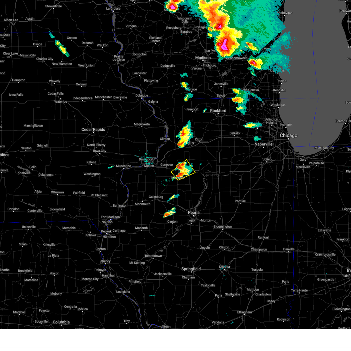 At 523 pm cdt, a severe thunderstorm was located over annawan, or 13 miles north of kewanee, moving northeast at 50 mph (trained weather spotters). Hazards include 60 mph wind gusts and quarter size hail. Hail damage to vehicles is expected. expect wind damage to roofs, siding, and trees. locations impacted include, kewanee, wyanet, sheffield, annawan, buda, neponset, manlius, mineral, new bedford, and johnson-sauk trail state park. This includes interstate 80 in illinois between mile markers 28 and 49. At 523 pm cdt, a severe thunderstorm was located over annawan, or 13 miles north of kewanee, moving northeast at 50 mph (trained weather spotters). Hazards include 60 mph wind gusts and quarter size hail. Hail damage to vehicles is expected. expect wind damage to roofs, siding, and trees. locations impacted include, kewanee, wyanet, sheffield, annawan, buda, neponset, manlius, mineral, new bedford, and johnson-sauk trail state park. This includes interstate 80 in illinois between mile markers 28 and 49.
|
| 5/15/2025 5:11 PM CDT |
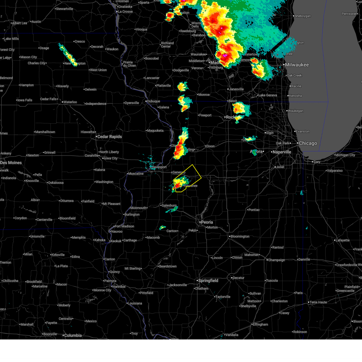 At 511 pm cdt, a severe thunderstorm was located near german corner, or near kewanee, moving northeast at 45 mph (trained weather spotters). Hazards include 60 mph wind gusts and quarter size hail. Hail damage to vehicles is expected. expect wind damage to roofs, siding, and trees. locations impacted include, kewanee, galva, wyanet, sheffield, annawan, buda, neponset, manlius, mineral, new bedford, german corner, kewanee municipal airport, and johnson-sauk trail state park. This includes interstate 80 in illinois between mile markers 29 and 49. At 511 pm cdt, a severe thunderstorm was located near german corner, or near kewanee, moving northeast at 45 mph (trained weather spotters). Hazards include 60 mph wind gusts and quarter size hail. Hail damage to vehicles is expected. expect wind damage to roofs, siding, and trees. locations impacted include, kewanee, galva, wyanet, sheffield, annawan, buda, neponset, manlius, mineral, new bedford, german corner, kewanee municipal airport, and johnson-sauk trail state park. This includes interstate 80 in illinois between mile markers 29 and 49.
|
| 5/15/2025 5:03 PM CDT |
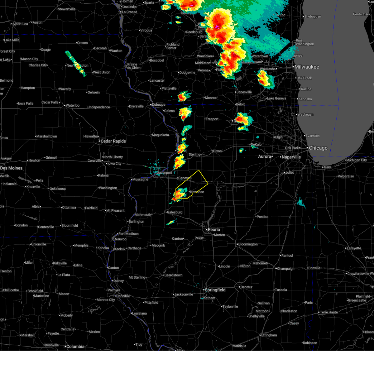 Svrdvn the national weather service in the quad cities has issued a * severe thunderstorm warning for, southeastern henry county in northwestern illinois, northwestern bureau county in north central illinois, * until 600 pm cdt. * at 503 pm cdt, a severe thunderstorm was located over bishop hill, or 7 miles southeast of cambridge, moving northeast at 45 mph (radar indicated). Hazards include 60 mph wind gusts and quarter size hail. Hail damage to vehicles is expected. Expect wind damage to roofs, siding, and trees. Svrdvn the national weather service in the quad cities has issued a * severe thunderstorm warning for, southeastern henry county in northwestern illinois, northwestern bureau county in north central illinois, * until 600 pm cdt. * at 503 pm cdt, a severe thunderstorm was located over bishop hill, or 7 miles southeast of cambridge, moving northeast at 45 mph (radar indicated). Hazards include 60 mph wind gusts and quarter size hail. Hail damage to vehicles is expected. Expect wind damage to roofs, siding, and trees.
|
| 4/20/2025 9:27 PM CDT |
 The storms which prompted the warning have moved out of the area. therefore, the warning will be allowed to expire. a tornado watch remains in effect until 1100 pm cdt for northwestern illinois. The storms which prompted the warning have moved out of the area. therefore, the warning will be allowed to expire. a tornado watch remains in effect until 1100 pm cdt for northwestern illinois.
|
| 4/20/2025 9:26 PM CDT |
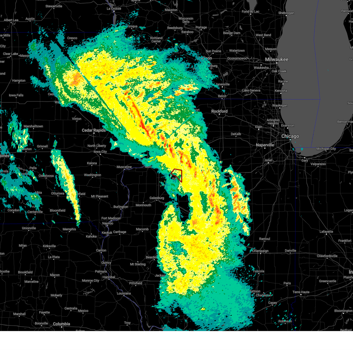 the tornado warning has been cancelled and is no longer in effect the tornado warning has been cancelled and is no longer in effect
|
| 4/20/2025 9:07 PM CDT |
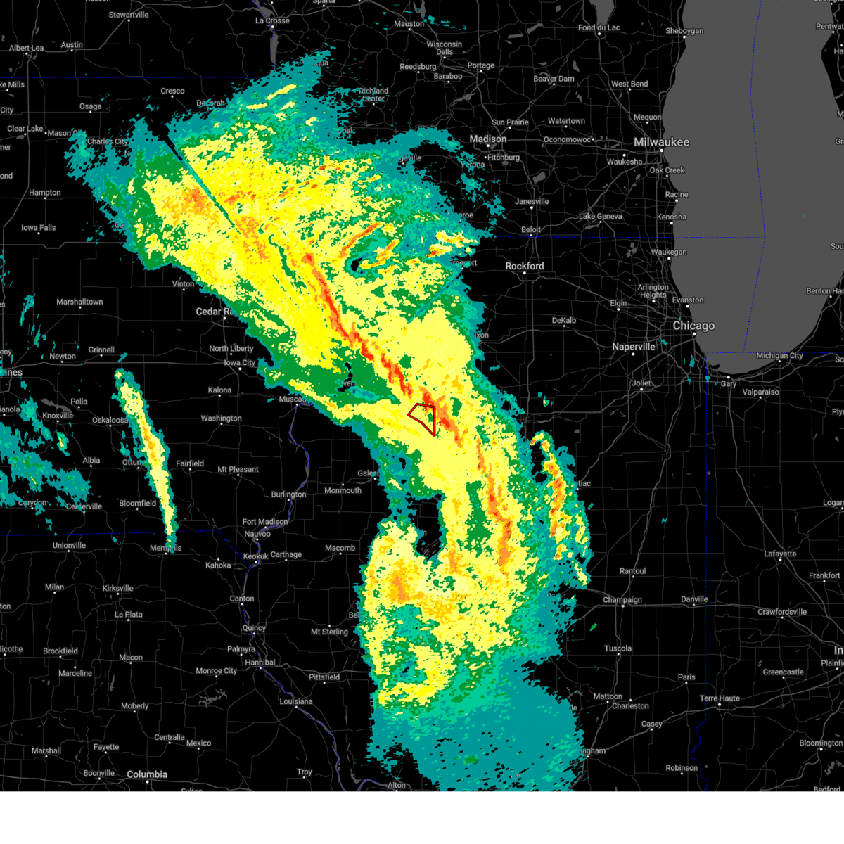 At 907 pm cdt, a severe thunderstorm capable of producing a tornado was located over kewanee, moving northeast at 30 mph (radar indicated rotation). Hazards include tornado. Flying debris will be dangerous to those caught without shelter. mobile homes will be damaged or destroyed. damage to roofs, windows, and vehicles will occur. tree damage is likely. this dangerous storm will be near, kewanee, annawan, and johnson-sauk trail state park around 910 pm cdt. This includes interstate 80 in illinois between mile markers 27 and 35. At 907 pm cdt, a severe thunderstorm capable of producing a tornado was located over kewanee, moving northeast at 30 mph (radar indicated rotation). Hazards include tornado. Flying debris will be dangerous to those caught without shelter. mobile homes will be damaged or destroyed. damage to roofs, windows, and vehicles will occur. tree damage is likely. this dangerous storm will be near, kewanee, annawan, and johnson-sauk trail state park around 910 pm cdt. This includes interstate 80 in illinois between mile markers 27 and 35.
|
| 4/20/2025 9:04 PM CDT |
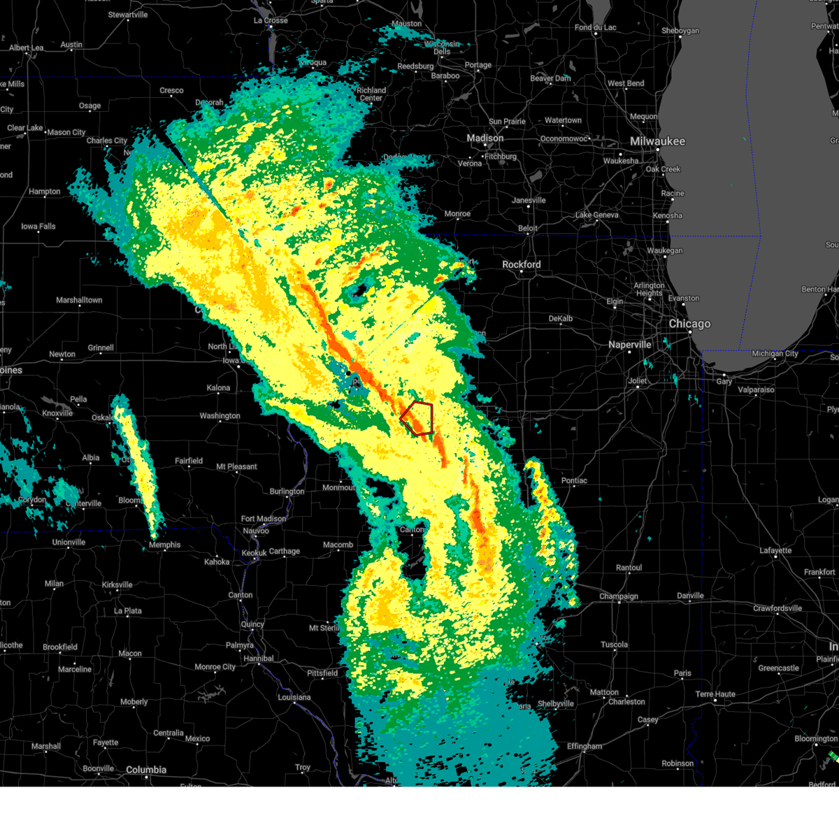 At 904 pm cdt, a severe thunderstorm capable of producing a tornado was located near kewanee, moving northeast at 30 mph (radar indicated rotation). Hazards include tornado. Flying debris will be dangerous to those caught without shelter. mobile homes will be damaged or destroyed. damage to roofs, windows, and vehicles will occur. tree damage is likely. this dangerous storm will be near, kewanee, annawan, and johnson-sauk trail state park around 910 pm cdt. This includes interstate 80 in illinois between mile markers 27 and 35. At 904 pm cdt, a severe thunderstorm capable of producing a tornado was located near kewanee, moving northeast at 30 mph (radar indicated rotation). Hazards include tornado. Flying debris will be dangerous to those caught without shelter. mobile homes will be damaged or destroyed. damage to roofs, windows, and vehicles will occur. tree damage is likely. this dangerous storm will be near, kewanee, annawan, and johnson-sauk trail state park around 910 pm cdt. This includes interstate 80 in illinois between mile markers 27 and 35.
|
| 4/20/2025 8:52 PM CDT |
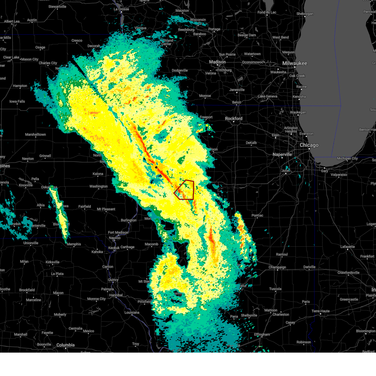 Tordvn the national weather service in the quad cities has issued a * tornado warning for, southeastern henry county in northwestern illinois, * until 945 pm cdt. * at 852 pm cdt, a severe thunderstorm capable of producing a tornado was located over bishop hill, or 8 miles west of kewanee, moving northeast at 30 mph (radar indicated rotation). Hazards include tornado. Flying debris will be dangerous to those caught without shelter. mobile homes will be damaged or destroyed. damage to roofs, windows, and vehicles will occur. tree damage is likely. this dangerous storm will be near, german corner, kewanee, johnson-sauk trail state park, and kewanee municipal airport around 900 pm cdt. annawan around 910 pm cdt. This includes interstate 80 in illinois between mile markers 27 and 35. Tordvn the national weather service in the quad cities has issued a * tornado warning for, southeastern henry county in northwestern illinois, * until 945 pm cdt. * at 852 pm cdt, a severe thunderstorm capable of producing a tornado was located over bishop hill, or 8 miles west of kewanee, moving northeast at 30 mph (radar indicated rotation). Hazards include tornado. Flying debris will be dangerous to those caught without shelter. mobile homes will be damaged or destroyed. damage to roofs, windows, and vehicles will occur. tree damage is likely. this dangerous storm will be near, german corner, kewanee, johnson-sauk trail state park, and kewanee municipal airport around 900 pm cdt. annawan around 910 pm cdt. This includes interstate 80 in illinois between mile markers 27 and 35.
|
| 4/20/2025 8:31 PM CDT |
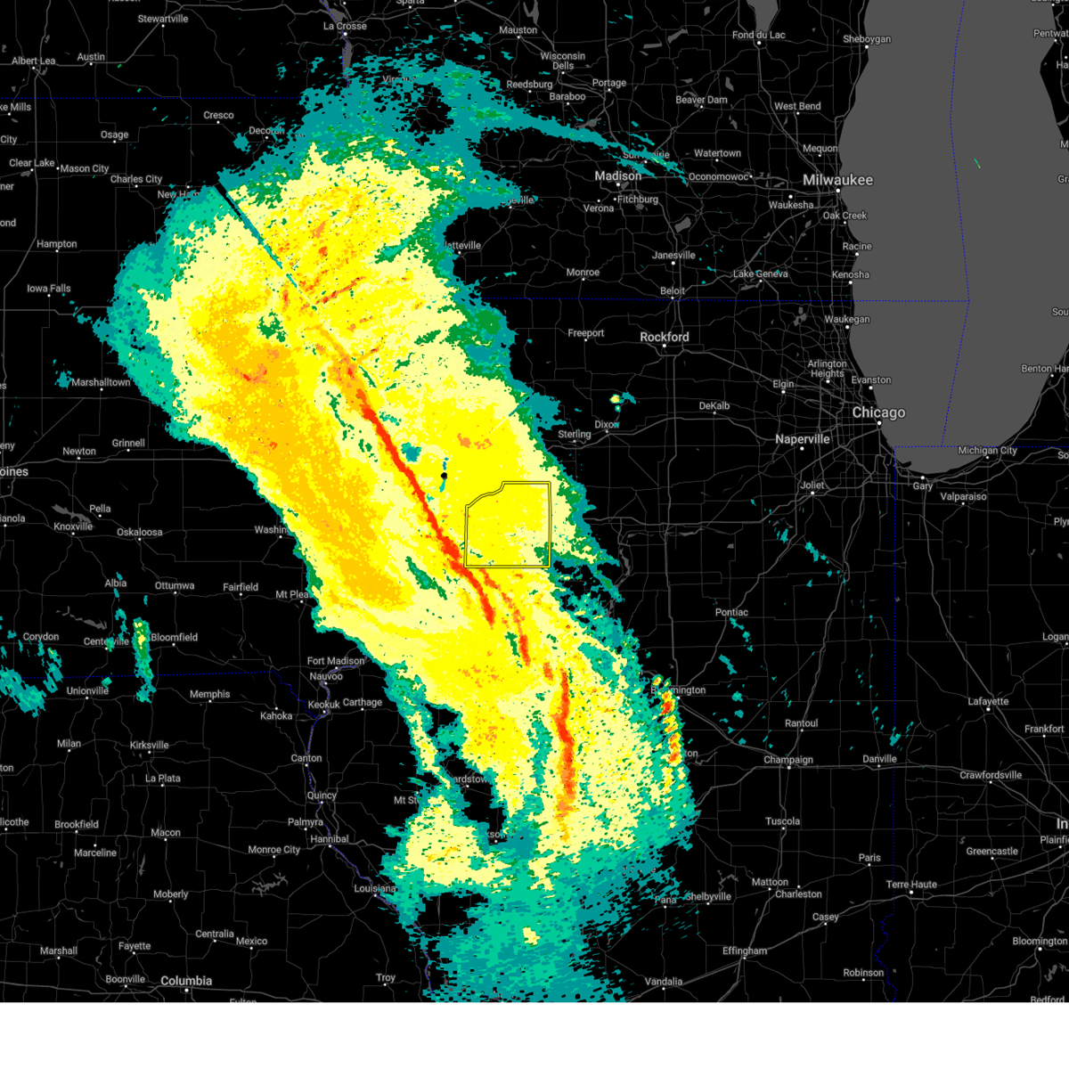 Svrdvn the national weather service in the quad cities has issued a * severe thunderstorm warning for, henry county in northwestern illinois, * until 930 pm cdt. * at 831 pm cdt, severe thunderstorms were located along a line extending from sherrard to near knoxville, moving northeast at 35 mph (radar indicated). Hazards include 60 mph wind gusts. expect damage to roofs, siding, and trees Svrdvn the national weather service in the quad cities has issued a * severe thunderstorm warning for, henry county in northwestern illinois, * until 930 pm cdt. * at 831 pm cdt, severe thunderstorms were located along a line extending from sherrard to near knoxville, moving northeast at 35 mph (radar indicated). Hazards include 60 mph wind gusts. expect damage to roofs, siding, and trees
|
| 3/14/2025 10:15 PM CDT |
 At 1015 pm cdt, severe thunderstorms were located along a line extending from morrison-rockwood state park to lawn ridge, moving east at 45 mph (radar indicated). Hazards include 70 mph wind gusts. Expect considerable tree damage. damage is likely to mobile homes, roofs, and outbuildings. locations impacted include, dalzell, cherry, coal hollow, kasbeer, manlius, la moille, kewanee municipal airport, neponset, van orin, milo, arlington, providence, princeton, magnolia, buda, hennepin, granville, sheffield, malden, and lake thunderbird. this includes the following highways, interstate 80 in illinois between mile markers 29 and 72. Interstate 180 between mile markers 1 and 13. At 1015 pm cdt, severe thunderstorms were located along a line extending from morrison-rockwood state park to lawn ridge, moving east at 45 mph (radar indicated). Hazards include 70 mph wind gusts. Expect considerable tree damage. damage is likely to mobile homes, roofs, and outbuildings. locations impacted include, dalzell, cherry, coal hollow, kasbeer, manlius, la moille, kewanee municipal airport, neponset, van orin, milo, arlington, providence, princeton, magnolia, buda, hennepin, granville, sheffield, malden, and lake thunderbird. this includes the following highways, interstate 80 in illinois between mile markers 29 and 72. Interstate 180 between mile markers 1 and 13.
|
| 3/14/2025 10:15 PM CDT |
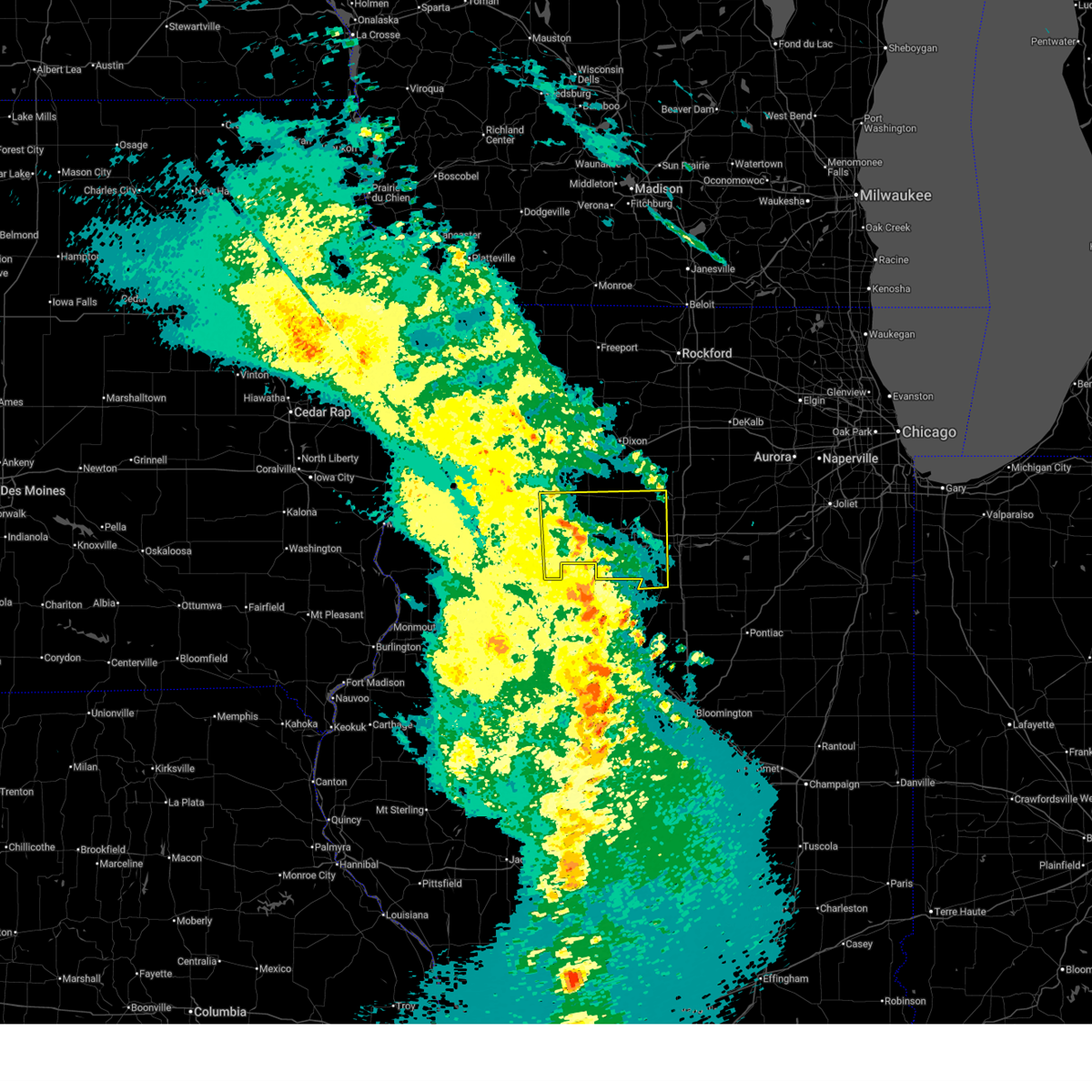 the severe thunderstorm warning has been cancelled and is no longer in effect the severe thunderstorm warning has been cancelled and is no longer in effect
|
| 3/14/2025 9:58 PM CDT |
 Svrdvn the national weather service in the quad cities has issued a * severe thunderstorm warning for, east central rock island county in northwestern illinois, putnam county in north central illinois, henry county in northwestern illinois, bureau county in north central illinois, * until 1115 pm cdt. * at 957 pm cdt, severe thunderstorms were located along a line extending from near hillsdale to near jubilee college state park, moving northeast at 65 mph (radar indicated). Hazards include 70 mph wind gusts. Expect considerable tree damage. Damage is likely to mobile homes, roofs, and outbuildings. Svrdvn the national weather service in the quad cities has issued a * severe thunderstorm warning for, east central rock island county in northwestern illinois, putnam county in north central illinois, henry county in northwestern illinois, bureau county in north central illinois, * until 1115 pm cdt. * at 957 pm cdt, severe thunderstorms were located along a line extending from near hillsdale to near jubilee college state park, moving northeast at 65 mph (radar indicated). Hazards include 70 mph wind gusts. Expect considerable tree damage. Damage is likely to mobile homes, roofs, and outbuildings.
|
| 3/14/2025 9:47 PM CDT |
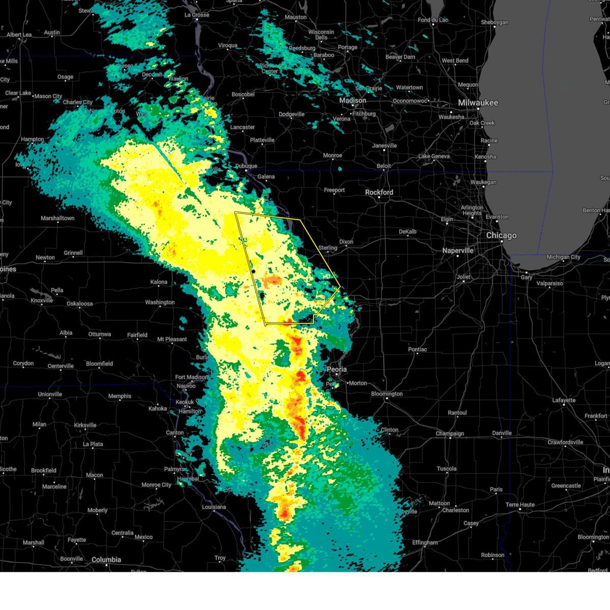 the severe thunderstorm warning has been cancelled and is no longer in effect the severe thunderstorm warning has been cancelled and is no longer in effect
|
| 3/14/2025 9:47 PM CDT |
 At 946 pm cdt, severe thunderstorms were located along a line extending from near zwingle to johnson-sauk trail state park, moving east at 50 mph (radar indicated). Hazards include 70 mph wind gusts. Expect considerable tree damage. damage is likely to mobile homes, roofs, and outbuildings. locations impacted include, moline, wacker, ideal, cambridge, maquoketa caves state park, manlius, kewanee municipal airport, jackson county fairgrounds, east clinton, port byron, panorama park, davenport municipal airport, denrock, union grove, thomson causeway, osborn, elwood, albany, bryant, and barstow. this includes the following highways, interstate 74 in iowa between mile markers 1 and 5. interstate 80 in iowa between mile markers 294 and 306. interstate 80 in illinois between mile markers 1 and 46. interstate 74 in illinois between mile markers 1 and 33. interstate 88 between mile markers 1 and 36. Interstate 280 between mile markers 15 and 18. At 946 pm cdt, severe thunderstorms were located along a line extending from near zwingle to johnson-sauk trail state park, moving east at 50 mph (radar indicated). Hazards include 70 mph wind gusts. Expect considerable tree damage. damage is likely to mobile homes, roofs, and outbuildings. locations impacted include, moline, wacker, ideal, cambridge, maquoketa caves state park, manlius, kewanee municipal airport, jackson county fairgrounds, east clinton, port byron, panorama park, davenport municipal airport, denrock, union grove, thomson causeway, osborn, elwood, albany, bryant, and barstow. this includes the following highways, interstate 74 in iowa between mile markers 1 and 5. interstate 80 in iowa between mile markers 294 and 306. interstate 80 in illinois between mile markers 1 and 46. interstate 74 in illinois between mile markers 1 and 33. interstate 88 between mile markers 1 and 36. Interstate 280 between mile markers 15 and 18.
|
| 3/14/2025 9:31 PM CDT |
 At 930 pm cdt, severe thunderstorms were located along a line extending from near garry owen to near ulah, moving northeast at 50 mph (radar indicated). Hazards include 70 mph wind gusts. Expect considerable tree damage. damage is likely to mobile homes, roofs, and outbuildings. locations impacted include, moline, wacker, ideal, west lake park, cambridge, maquoketa caves state park, manlius, kewanee municipal airport, jackson county fairgrounds, east clinton, port byron, panorama park, davenport municipal airport, denrock, union grove, thomson causeway, osborn, elwood, albany, and bryant. this includes the following highways, interstate 74 in iowa between mile markers 1 and 5. interstate 80 in iowa between mile markers 284 and 306. interstate 80 in illinois between mile markers 1 and 46. interstate 74 in illinois between mile markers 1 and 33. interstate 88 between mile markers 1 and 36. Interstate 280 between mile markers 1 and 18. At 930 pm cdt, severe thunderstorms were located along a line extending from near garry owen to near ulah, moving northeast at 50 mph (radar indicated). Hazards include 70 mph wind gusts. Expect considerable tree damage. damage is likely to mobile homes, roofs, and outbuildings. locations impacted include, moline, wacker, ideal, west lake park, cambridge, maquoketa caves state park, manlius, kewanee municipal airport, jackson county fairgrounds, east clinton, port byron, panorama park, davenport municipal airport, denrock, union grove, thomson causeway, osborn, elwood, albany, and bryant. this includes the following highways, interstate 74 in iowa between mile markers 1 and 5. interstate 80 in iowa between mile markers 284 and 306. interstate 80 in illinois between mile markers 1 and 46. interstate 74 in illinois between mile markers 1 and 33. interstate 88 between mile markers 1 and 36. Interstate 280 between mile markers 1 and 18.
|
| 3/14/2025 9:31 PM CDT |
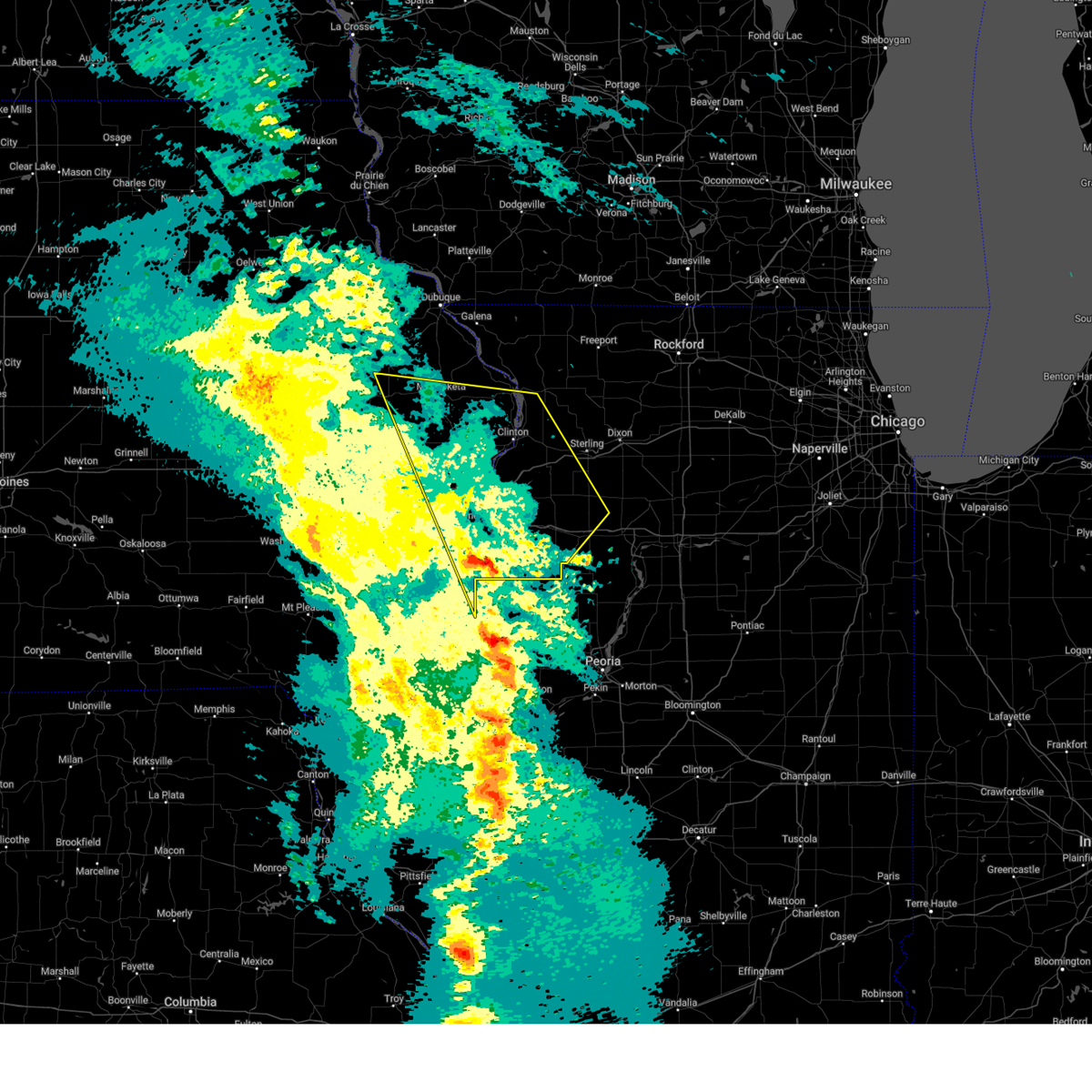 the severe thunderstorm warning has been cancelled and is no longer in effect the severe thunderstorm warning has been cancelled and is no longer in effect
|
| 3/14/2025 9:19 PM CDT |
 At 919 pm cdt, severe thunderstorms were located along a line extending from near temple hill to near nekoma, moving northeast at 50 mph (radar indicated). Hazards include 70 mph wind gusts. Expect considerable tree damage. damage is likely to mobile homes, roofs, and outbuildings. locations impacted include, ideal, west lake park, cambridge, manlius, kewanee municipal airport, jackson county fairgrounds, east clinton, port byron, davenport municipal airport, stone city, union grove, thomson causeway, osborn, elwood, albany, bryant, blackhawk state park, maquoketa, princeton, and fruitland. this includes the following highways, interstate 74 in iowa between mile markers 1 and 5. interstate 80 in iowa between mile markers 272 and 306. interstate 80 in illinois between mile markers 1 and 46. interstate 74 in illinois between mile markers 1 and 33. interstate 88 between mile markers 1 and 36. Interstate 280 between mile markers 1 and 18. At 919 pm cdt, severe thunderstorms were located along a line extending from near temple hill to near nekoma, moving northeast at 50 mph (radar indicated). Hazards include 70 mph wind gusts. Expect considerable tree damage. damage is likely to mobile homes, roofs, and outbuildings. locations impacted include, ideal, west lake park, cambridge, manlius, kewanee municipal airport, jackson county fairgrounds, east clinton, port byron, davenport municipal airport, stone city, union grove, thomson causeway, osborn, elwood, albany, bryant, blackhawk state park, maquoketa, princeton, and fruitland. this includes the following highways, interstate 74 in iowa between mile markers 1 and 5. interstate 80 in iowa between mile markers 272 and 306. interstate 80 in illinois between mile markers 1 and 46. interstate 74 in illinois between mile markers 1 and 33. interstate 88 between mile markers 1 and 36. Interstate 280 between mile markers 1 and 18.
|
| 3/14/2025 9:08 PM CDT |
 Svrdvn the national weather service in the quad cities has issued a * severe thunderstorm warning for, rock island county in northwestern illinois, eastern mercer county in northwestern illinois, whiteside county in northwestern illinois, south central carroll county in northwestern illinois, northeastern warren county in west central illinois, henry county in northwestern illinois, northwestern bureau county in north central illinois, southern jackson county in east central iowa, eastern cedar county in east central iowa, northeastern muscatine county in east central iowa, scott county in east central iowa, southern jones county in east central iowa, clinton county in east central iowa, * until 1000 pm cdt. * at 906 pm cdt, severe thunderstorms were located along a line extending from near central park to near alpha, moving northeast at 50 mph (radar indicated). Hazards include 70 mph wind gusts. Expect considerable tree damage. Damage is likely to mobile homes, roofs, and outbuildings. Svrdvn the national weather service in the quad cities has issued a * severe thunderstorm warning for, rock island county in northwestern illinois, eastern mercer county in northwestern illinois, whiteside county in northwestern illinois, south central carroll county in northwestern illinois, northeastern warren county in west central illinois, henry county in northwestern illinois, northwestern bureau county in north central illinois, southern jackson county in east central iowa, eastern cedar county in east central iowa, northeastern muscatine county in east central iowa, scott county in east central iowa, southern jones county in east central iowa, clinton county in east central iowa, * until 1000 pm cdt. * at 906 pm cdt, severe thunderstorms were located along a line extending from near central park to near alpha, moving northeast at 50 mph (radar indicated). Hazards include 70 mph wind gusts. Expect considerable tree damage. Damage is likely to mobile homes, roofs, and outbuildings.
|
| 10/24/2024 10:39 PM CDT |
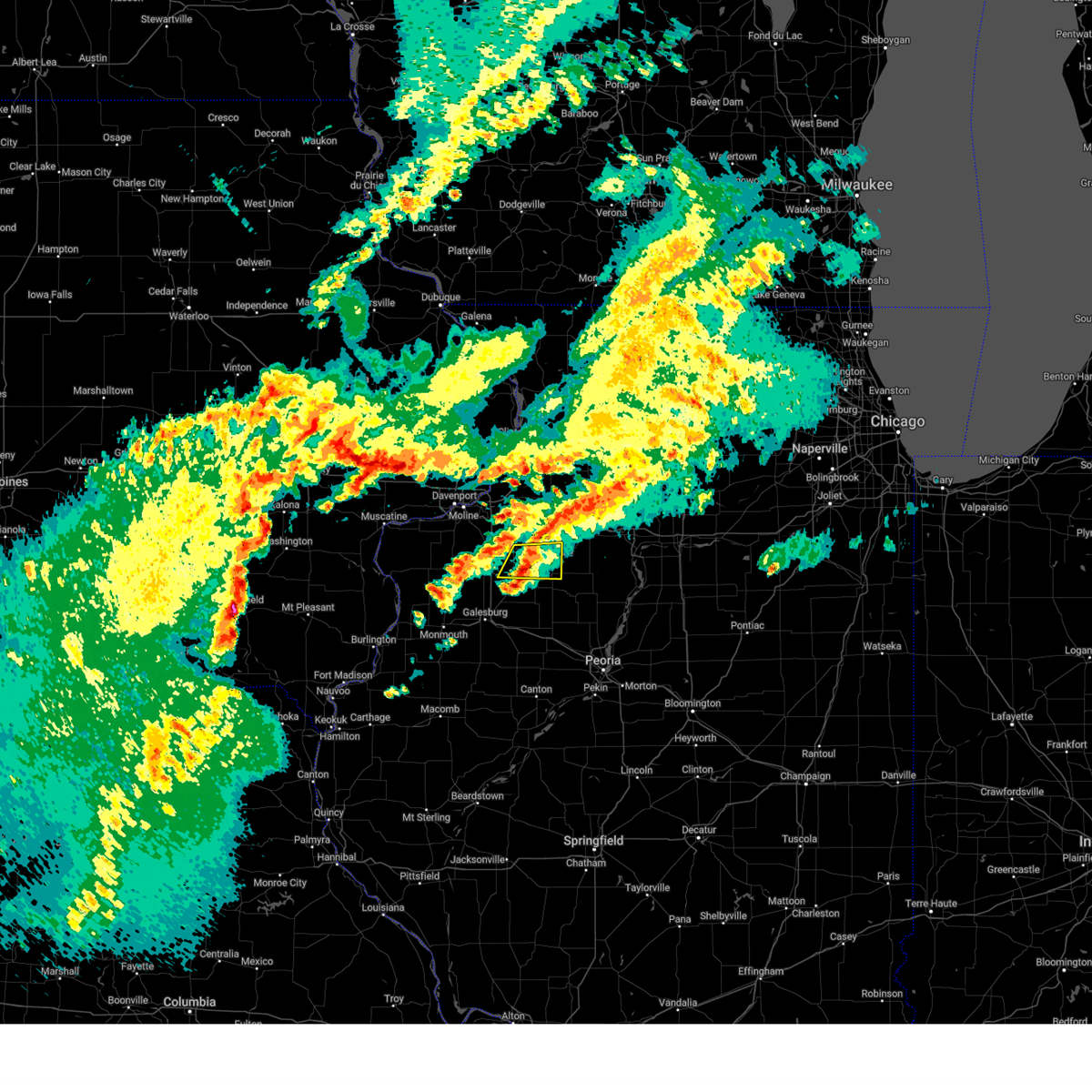 The storm which prompted the warning has weakened below severe limits, and no longer poses an immediate threat to life or property. therefore, the warning will be allowed to expire. however, small hail is still possible with this thunderstorm. to report severe weather, contact your nearest law enforcement agency. they will relay your report to the national weather service the quad cities. The storm which prompted the warning has weakened below severe limits, and no longer poses an immediate threat to life or property. therefore, the warning will be allowed to expire. however, small hail is still possible with this thunderstorm. to report severe weather, contact your nearest law enforcement agency. they will relay your report to the national weather service the quad cities.
|
| 10/24/2024 10:34 PM CDT |
 the severe thunderstorm warning has been cancelled and is no longer in effect the severe thunderstorm warning has been cancelled and is no longer in effect
|
| 10/24/2024 10:34 PM CDT |
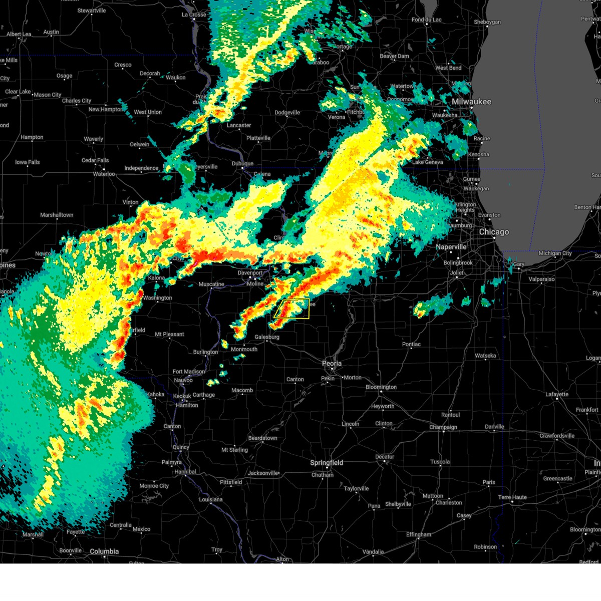 At 1033 pm cdt, a severe thunderstorm was located over bishop hill, or 8 miles southeast of cambridge, moving east at 35 mph (radar indicated). Hazards include quarter size hail. Damage to vehicles is expected. Locations impacted include, kewanee, cambridge, galva, bishop hill, nekoma, kewanee municipal airport, ulah, german corner, johnson-sauk trail state park, and henry county fairgrounds. At 1033 pm cdt, a severe thunderstorm was located over bishop hill, or 8 miles southeast of cambridge, moving east at 35 mph (radar indicated). Hazards include quarter size hail. Damage to vehicles is expected. Locations impacted include, kewanee, cambridge, galva, bishop hill, nekoma, kewanee municipal airport, ulah, german corner, johnson-sauk trail state park, and henry county fairgrounds.
|
| 10/24/2024 10:22 PM CDT |
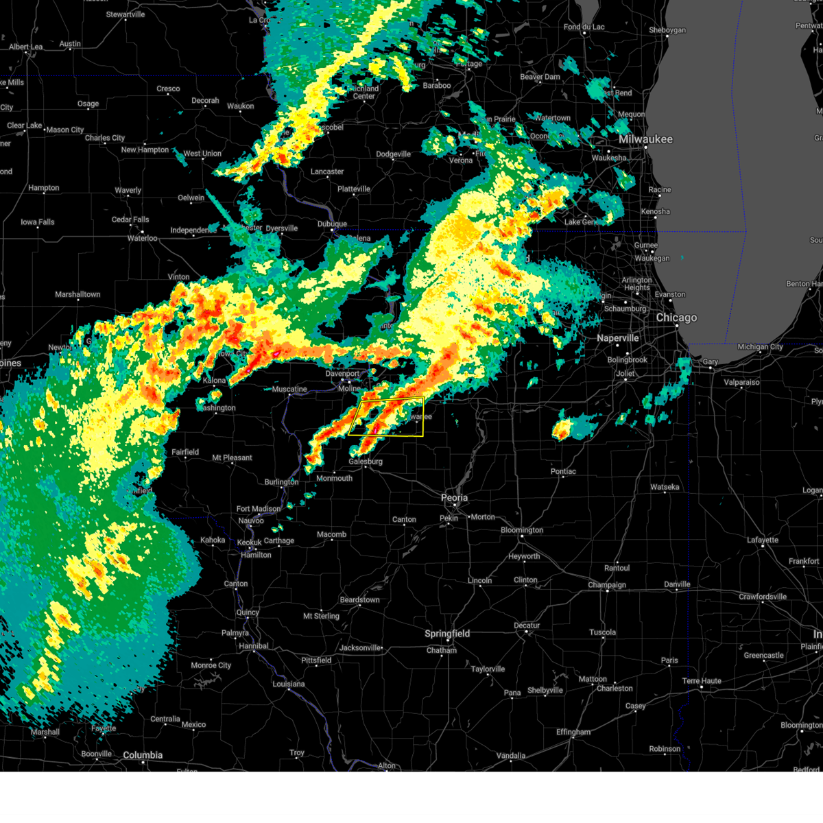 At 1022 pm cdt, a severe thunderstorm was located over nekoma, or 7 miles south of cambridge, moving east at 40 mph (radar indicated). Hazards include quarter size hail. Damage to vehicles is expected. locations impacted include, kewanee, cambridge, galva, orion, annawan, woodhull, alpha, andover, new windsor, lynn center, osco, bishop hill, henry county fairgrounds, ophiem, german corner, swedona, nekoma, kewanee municipal airport, ulah, and griffin. this includes the following highways, interstate 80 in illinois between mile markers 33 and 35. Interstate 74 in illinois between mile markers 18 and 33. At 1022 pm cdt, a severe thunderstorm was located over nekoma, or 7 miles south of cambridge, moving east at 40 mph (radar indicated). Hazards include quarter size hail. Damage to vehicles is expected. locations impacted include, kewanee, cambridge, galva, orion, annawan, woodhull, alpha, andover, new windsor, lynn center, osco, bishop hill, henry county fairgrounds, ophiem, german corner, swedona, nekoma, kewanee municipal airport, ulah, and griffin. this includes the following highways, interstate 80 in illinois between mile markers 33 and 35. Interstate 74 in illinois between mile markers 18 and 33.
|
| 10/24/2024 10:15 PM CDT |
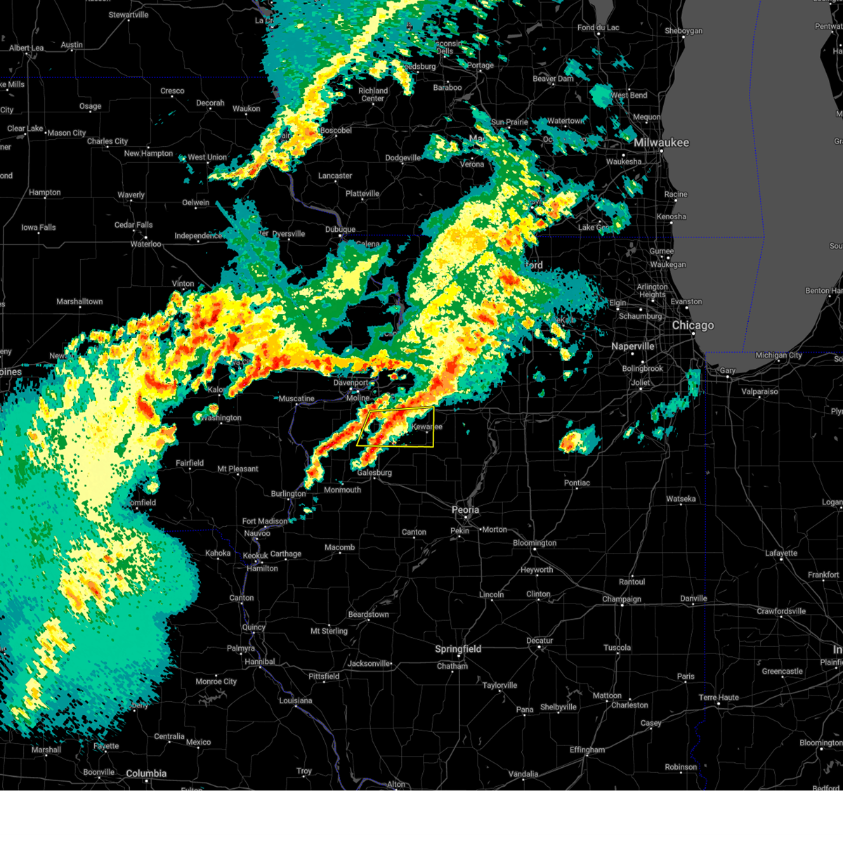 At 1015 pm cdt, a severe thunderstorm was located over cambridge, moving east at 40 mph (radar indicated). Hazards include quarter size hail. Damage to vehicles is expected. locations impacted include, kewanee, cambridge, galva, orion, annawan, woodhull, alpha, andover, new windsor, lynn center, osco, bishop hill, henry county fairgrounds, ophiem, german corner, swedona, nekoma, kewanee municipal airport, ulah, and griffin. this includes the following highways, interstate 80 in illinois between mile markers 33 and 35. Interstate 74 in illinois between mile markers 18 and 33. At 1015 pm cdt, a severe thunderstorm was located over cambridge, moving east at 40 mph (radar indicated). Hazards include quarter size hail. Damage to vehicles is expected. locations impacted include, kewanee, cambridge, galva, orion, annawan, woodhull, alpha, andover, new windsor, lynn center, osco, bishop hill, henry county fairgrounds, ophiem, german corner, swedona, nekoma, kewanee municipal airport, ulah, and griffin. this includes the following highways, interstate 80 in illinois between mile markers 33 and 35. Interstate 74 in illinois between mile markers 18 and 33.
|
| 10/24/2024 10:09 PM CDT |
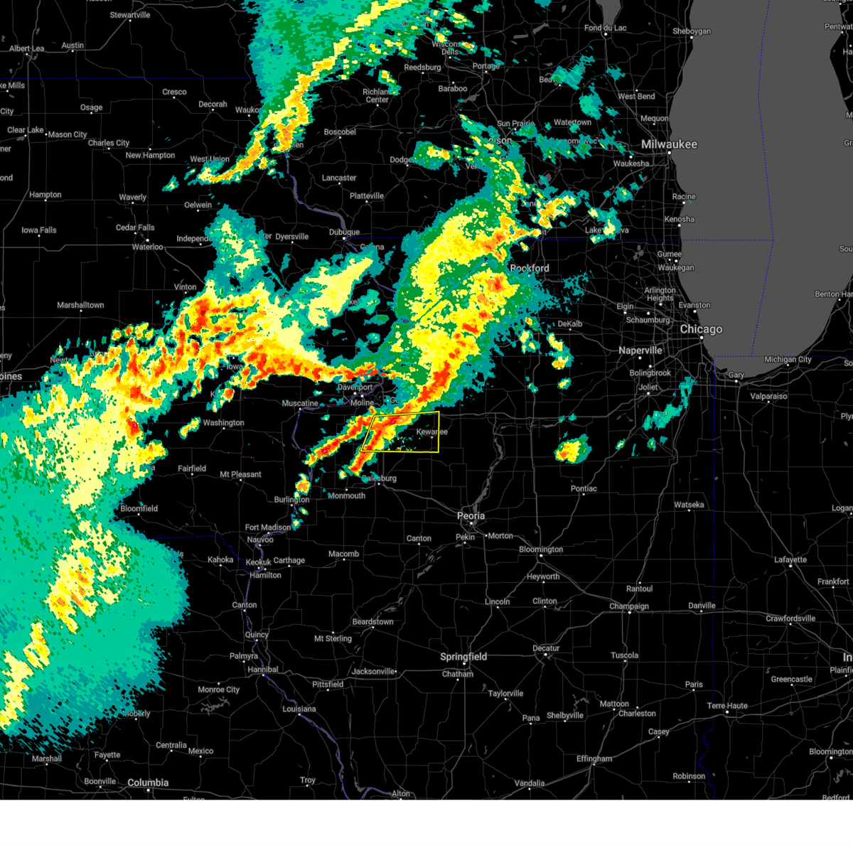 At 1009 pm cdt, a severe thunderstorm was located over andover, or near cambridge, moving east at 40 mph (radar indicated). Hazards include quarter size hail. Damage to vehicles is expected. locations impacted include, kewanee, cambridge, galva, orion, annawan, woodhull, alpha, andover, new windsor, lynn center, osco, bishop hill, henry county fairgrounds, ophiem, german corner, swedona, nekoma, kewanee municipal airport, ulah, and griffin. this includes the following highways, interstate 80 in illinois between mile markers 33 and 35. Interstate 74 in illinois between mile markers 18 and 33. At 1009 pm cdt, a severe thunderstorm was located over andover, or near cambridge, moving east at 40 mph (radar indicated). Hazards include quarter size hail. Damage to vehicles is expected. locations impacted include, kewanee, cambridge, galva, orion, annawan, woodhull, alpha, andover, new windsor, lynn center, osco, bishop hill, henry county fairgrounds, ophiem, german corner, swedona, nekoma, kewanee municipal airport, ulah, and griffin. this includes the following highways, interstate 80 in illinois between mile markers 33 and 35. Interstate 74 in illinois between mile markers 18 and 33.
|
| 10/24/2024 10:03 PM CDT |
 Svrdvn the national weather service in the quad cities has issued a * severe thunderstorm warning for, east central mercer county in northwestern illinois, southern henry county in northwestern illinois, * until 1045 pm cdt. * at 1002 pm cdt, a severe thunderstorm was located over ophiem, or 9 miles west of cambridge, moving east at 45 mph (radar indicated). Hazards include quarter size hail. damage to vehicles is expected Svrdvn the national weather service in the quad cities has issued a * severe thunderstorm warning for, east central mercer county in northwestern illinois, southern henry county in northwestern illinois, * until 1045 pm cdt. * at 1002 pm cdt, a severe thunderstorm was located over ophiem, or 9 miles west of cambridge, moving east at 45 mph (radar indicated). Hazards include quarter size hail. damage to vehicles is expected
|
| 7/15/2024 8:26 PM CDT |
 The storms which prompted the warning have moved out of the area. therefore, the warning will be allowed to expire. however, heavy rain is still possible with these thunderstorms. a tornado watch remains in effect until 100 am cdt for north central and northwestern illinois. The storms which prompted the warning have moved out of the area. therefore, the warning will be allowed to expire. however, heavy rain is still possible with these thunderstorms. a tornado watch remains in effect until 100 am cdt for north central and northwestern illinois.
|
| 7/15/2024 8:01 PM CDT |
 At 801 pm cdt, a severe squall line capable of producing both tornadoes and extensive straight line wind damage was located along a line extending from near hooppole to altona, moving east at 50 mph (radar indicated rotation). Hazards include tornado. Flying debris will be dangerous to those caught without shelter. mobile homes will be damaged or destroyed. damage to roofs, windows, and vehicles will occur. tree damage is likely. these dangerous storms will be near, kewanee, galva, atkinson, annawan, hooppole, yorktown, mineral, german corner, thomas, and johnson-sauk trail state park around 805 pm cdt. other locations in the path of these tornadic storms include neponset, new bedford, sheffield, manlius, normandy, walnut and buda. This includes interstate 80 in illinois between mile markers 24 and 48. At 801 pm cdt, a severe squall line capable of producing both tornadoes and extensive straight line wind damage was located along a line extending from near hooppole to altona, moving east at 50 mph (radar indicated rotation). Hazards include tornado. Flying debris will be dangerous to those caught without shelter. mobile homes will be damaged or destroyed. damage to roofs, windows, and vehicles will occur. tree damage is likely. these dangerous storms will be near, kewanee, galva, atkinson, annawan, hooppole, yorktown, mineral, german corner, thomas, and johnson-sauk trail state park around 805 pm cdt. other locations in the path of these tornadic storms include neponset, new bedford, sheffield, manlius, normandy, walnut and buda. This includes interstate 80 in illinois between mile markers 24 and 48.
|
| 7/15/2024 8:00 PM CDT | A partial roof collapse from a house in kewanee... illinois. possible tornado damage. information came from social media. time estimated by rada in henry county IL, 0.4 miles ENE of Kewanee, IL |
| 7/15/2024 7:59 PM CDT |
 At 759 pm cdt, severe thunderstorms were located along a line extending from near henry county fairgrounds to wataga to near ponemah, moving southeast at 55 mph (radar indicated). Hazards include 70 mph wind gusts. Expect considerable tree damage. damage is likely to mobile homes, roofs, and outbuildings. locations impacted include, kewanee, monmouth, cambridge, oquawka, geneseo, colona, galva, burgess, orion, atkinson, annawan, woodhull, kirkwood, alpha, andover, little york, rozetta, seaton, hooppole, and cleveland. this includes the following highways, interstate 80 in illinois between mile markers 4 and 34. interstate 74 in illinois between mile markers 11 and 33. Interstate 88 between mile markers 1 and 8. At 759 pm cdt, severe thunderstorms were located along a line extending from near henry county fairgrounds to wataga to near ponemah, moving southeast at 55 mph (radar indicated). Hazards include 70 mph wind gusts. Expect considerable tree damage. damage is likely to mobile homes, roofs, and outbuildings. locations impacted include, kewanee, monmouth, cambridge, oquawka, geneseo, colona, galva, burgess, orion, atkinson, annawan, woodhull, kirkwood, alpha, andover, little york, rozetta, seaton, hooppole, and cleveland. this includes the following highways, interstate 80 in illinois between mile markers 4 and 34. interstate 74 in illinois between mile markers 11 and 33. Interstate 88 between mile markers 1 and 8.
|
| 7/15/2024 7:59 PM CDT |
 the severe thunderstorm warning has been cancelled and is no longer in effect the severe thunderstorm warning has been cancelled and is no longer in effect
|
| 7/15/2024 7:47 PM CDT |
 At 747 pm cdt, severe thunderstorms were located along a line extending from near morristown to rio to near kirkwood, moving southeast at 55 mph (radar indicated). Hazards include 70 mph wind gusts. Expect considerable tree damage. damage is likely to mobile homes, roofs, and outbuildings. locations impacted include, moline, bettendorf, east moline, kewanee, monmouth, aledo, cambridge, oquawka, silvis, geneseo, colona, le claire, coal valley, galva, burgess, hampton, orion, port byron, atkinson, and rapids city. this includes the following highways, interstate 80 in iowa between mile markers 304 and 306. interstate 80 in illinois between mile markers 1 and 34. interstate 74 in illinois between mile markers 3 and 33. interstate 88 between mile markers 1 and 8. Interstate 280 near mile marker 18. At 747 pm cdt, severe thunderstorms were located along a line extending from near morristown to rio to near kirkwood, moving southeast at 55 mph (radar indicated). Hazards include 70 mph wind gusts. Expect considerable tree damage. damage is likely to mobile homes, roofs, and outbuildings. locations impacted include, moline, bettendorf, east moline, kewanee, monmouth, aledo, cambridge, oquawka, silvis, geneseo, colona, le claire, coal valley, galva, burgess, hampton, orion, port byron, atkinson, and rapids city. this includes the following highways, interstate 80 in iowa between mile markers 304 and 306. interstate 80 in illinois between mile markers 1 and 34. interstate 74 in illinois between mile markers 3 and 33. interstate 88 between mile markers 1 and 8. Interstate 280 near mile marker 18.
|
| 7/15/2024 7:46 PM CDT |
 At 745 pm cdt, tornado producing storms were located along a line extending from joslin to near woodhull, moving east at 50 mph. a tornado was reported near andover, near i-74 (weather spotters confirmed tornado). Hazards include damaging tornado. Flying debris will be dangerous to those caught without shelter. mobile homes will be damaged or destroyed. damage to roofs, windows, and vehicles will occur. tree damage is likely. these tornadic storms will be near, cambridge, geneseo, woodhull, bishop hill, spring hill, nekoma, ulah, and henry county fairgrounds around 750 pm cdt. galva, atkinson, hooppole, german corner, and leon corners around 755 pm cdt. kewanee, annawan, yorktown, and kewanee municipal airport around 800 pm cdt. other locations in the path of these tornadic storms include mineral, thomas, johnson-sauk trail state park, sheffield, tampico, deer grove, neponset, new bedford, walnut, buda, manlius and normandy. this includes the following highways, interstate 80 in illinois between mile markers 6 and 48. interstate 74 in illinois between mile markers 11 and 33. Interstate 88 between mile markers 14 and 16. At 745 pm cdt, tornado producing storms were located along a line extending from joslin to near woodhull, moving east at 50 mph. a tornado was reported near andover, near i-74 (weather spotters confirmed tornado). Hazards include damaging tornado. Flying debris will be dangerous to those caught without shelter. mobile homes will be damaged or destroyed. damage to roofs, windows, and vehicles will occur. tree damage is likely. these tornadic storms will be near, cambridge, geneseo, woodhull, bishop hill, spring hill, nekoma, ulah, and henry county fairgrounds around 750 pm cdt. galva, atkinson, hooppole, german corner, and leon corners around 755 pm cdt. kewanee, annawan, yorktown, and kewanee municipal airport around 800 pm cdt. other locations in the path of these tornadic storms include mineral, thomas, johnson-sauk trail state park, sheffield, tampico, deer grove, neponset, new bedford, walnut, buda, manlius and normandy. this includes the following highways, interstate 80 in illinois between mile markers 6 and 48. interstate 74 in illinois between mile markers 11 and 33. Interstate 88 between mile markers 14 and 16.
|
| 7/15/2024 7:42 PM CDT |
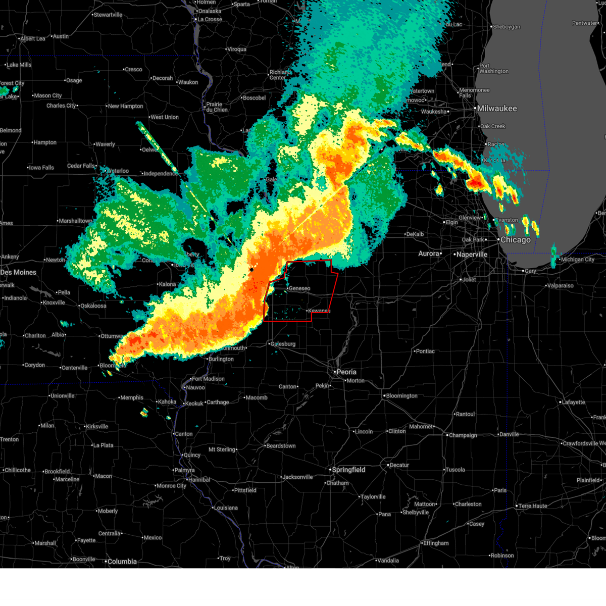 Tordvn the national weather service in the quad cities has issued a * tornado warning for, southern whiteside county in northwestern illinois, henry county in northwestern illinois, western bureau county in north central illinois, * until 830 pm cdt. * at 742 pm cdt, severe thunderstorms capable of producing both tornadoes and extensive straight line wind damage were located along a line extending from joslin to near alpha, moving east at 50 mph (radar indicated rotation). Hazards include tornado. Flying debris will be dangerous to those caught without shelter. mobile homes will be damaged or destroyed. damage to roofs, windows, and vehicles will occur. tree damage is likely. these dangerous storms will be near, cambridge, geneseo, woodhull, andover, hillsdale, osco, shady beach, nekoma, ulah, and henry county fairgrounds around 745 pm cdt. atkinson, bishop hill, and spring hill around 750 pm cdt. galva, hooppole, and german corner around 755 pm cdt. kewanee, annawan, yorktown, thomas, johnson-sauk trail state park, and kewanee municipal airport around 800 pm cdt. other locations in the path of these tornadic storms include mineral, sheffield, neponset, manlius, new bedford and buda. this includes the following highways, interstate 80 in illinois between mile markers 6 and 48. interstate 74 in illinois between mile markers 11 and 33. Interstate 88 between mile markers 14 and 16. Tordvn the national weather service in the quad cities has issued a * tornado warning for, southern whiteside county in northwestern illinois, henry county in northwestern illinois, western bureau county in north central illinois, * until 830 pm cdt. * at 742 pm cdt, severe thunderstorms capable of producing both tornadoes and extensive straight line wind damage were located along a line extending from joslin to near alpha, moving east at 50 mph (radar indicated rotation). Hazards include tornado. Flying debris will be dangerous to those caught without shelter. mobile homes will be damaged or destroyed. damage to roofs, windows, and vehicles will occur. tree damage is likely. these dangerous storms will be near, cambridge, geneseo, woodhull, andover, hillsdale, osco, shady beach, nekoma, ulah, and henry county fairgrounds around 745 pm cdt. atkinson, bishop hill, and spring hill around 750 pm cdt. galva, hooppole, and german corner around 755 pm cdt. kewanee, annawan, yorktown, thomas, johnson-sauk trail state park, and kewanee municipal airport around 800 pm cdt. other locations in the path of these tornadic storms include mineral, sheffield, neponset, manlius, new bedford and buda. this includes the following highways, interstate 80 in illinois between mile markers 6 and 48. interstate 74 in illinois between mile markers 11 and 33. Interstate 88 between mile markers 14 and 16.
|
| 7/15/2024 7:36 PM CDT |
 At 736 pm cdt, severe thunderstorms were located along a line extending from carbon cliff to near new windsor to rozetta, moving east at 55 mph (radar indicated). Hazards include 70 mph wind gusts. Expect considerable tree damage. damage is likely to mobile homes, roofs, and outbuildings. locations impacted include, moline, bettendorf, east moline, kewanee, monmouth, aledo, cambridge, oquawka, silvis, geneseo, colona, le claire, coal valley, galva, burgess, hampton, orion, port byron, atkinson, and rapids city. this includes the following highways, interstate 80 in iowa between mile markers 304 and 306. interstate 80 in illinois between mile markers 1 and 34. interstate 74 in illinois between mile markers 3 and 33. interstate 88 between mile markers 1 and 8. Interstate 280 near mile marker 18. At 736 pm cdt, severe thunderstorms were located along a line extending from carbon cliff to near new windsor to rozetta, moving east at 55 mph (radar indicated). Hazards include 70 mph wind gusts. Expect considerable tree damage. damage is likely to mobile homes, roofs, and outbuildings. locations impacted include, moline, bettendorf, east moline, kewanee, monmouth, aledo, cambridge, oquawka, silvis, geneseo, colona, le claire, coal valley, galva, burgess, hampton, orion, port byron, atkinson, and rapids city. this includes the following highways, interstate 80 in iowa between mile markers 304 and 306. interstate 80 in illinois between mile markers 1 and 34. interstate 74 in illinois between mile markers 3 and 33. interstate 88 between mile markers 1 and 8. Interstate 280 near mile marker 18.
|
| 7/15/2024 7:23 PM CDT |
 Svrdvn the national weather service in the quad cities has issued a * severe thunderstorm warning for, northeastern henderson county in west central illinois, warren county in west central illinois, southeastern rock island county in northwestern illinois, mercer county in northwestern illinois, henry county in northwestern illinois, northeastern des moines county in southeastern iowa, southeastern louisa county in southeastern iowa, east central scott county in east central iowa, * until 815 pm cdt. * at 722 pm cdt, severe thunderstorms were located along a line extending from davenport municipal airport to near reynolds to northfield, moving southeast at 55 mph (trained weather spotters. at 718 pm cdt a 74 mph wind gust was measured at the davenport municipal airport). Hazards include 70 mph wind gusts. Expect considerable tree damage. Damage is likely to mobile homes, roofs, and outbuildings. Svrdvn the national weather service in the quad cities has issued a * severe thunderstorm warning for, northeastern henderson county in west central illinois, warren county in west central illinois, southeastern rock island county in northwestern illinois, mercer county in northwestern illinois, henry county in northwestern illinois, northeastern des moines county in southeastern iowa, southeastern louisa county in southeastern iowa, east central scott county in east central iowa, * until 815 pm cdt. * at 722 pm cdt, severe thunderstorms were located along a line extending from davenport municipal airport to near reynolds to northfield, moving southeast at 55 mph (trained weather spotters. at 718 pm cdt a 74 mph wind gust was measured at the davenport municipal airport). Hazards include 70 mph wind gusts. Expect considerable tree damage. Damage is likely to mobile homes, roofs, and outbuildings.
|
| 7/14/2024 11:29 PM CDT |
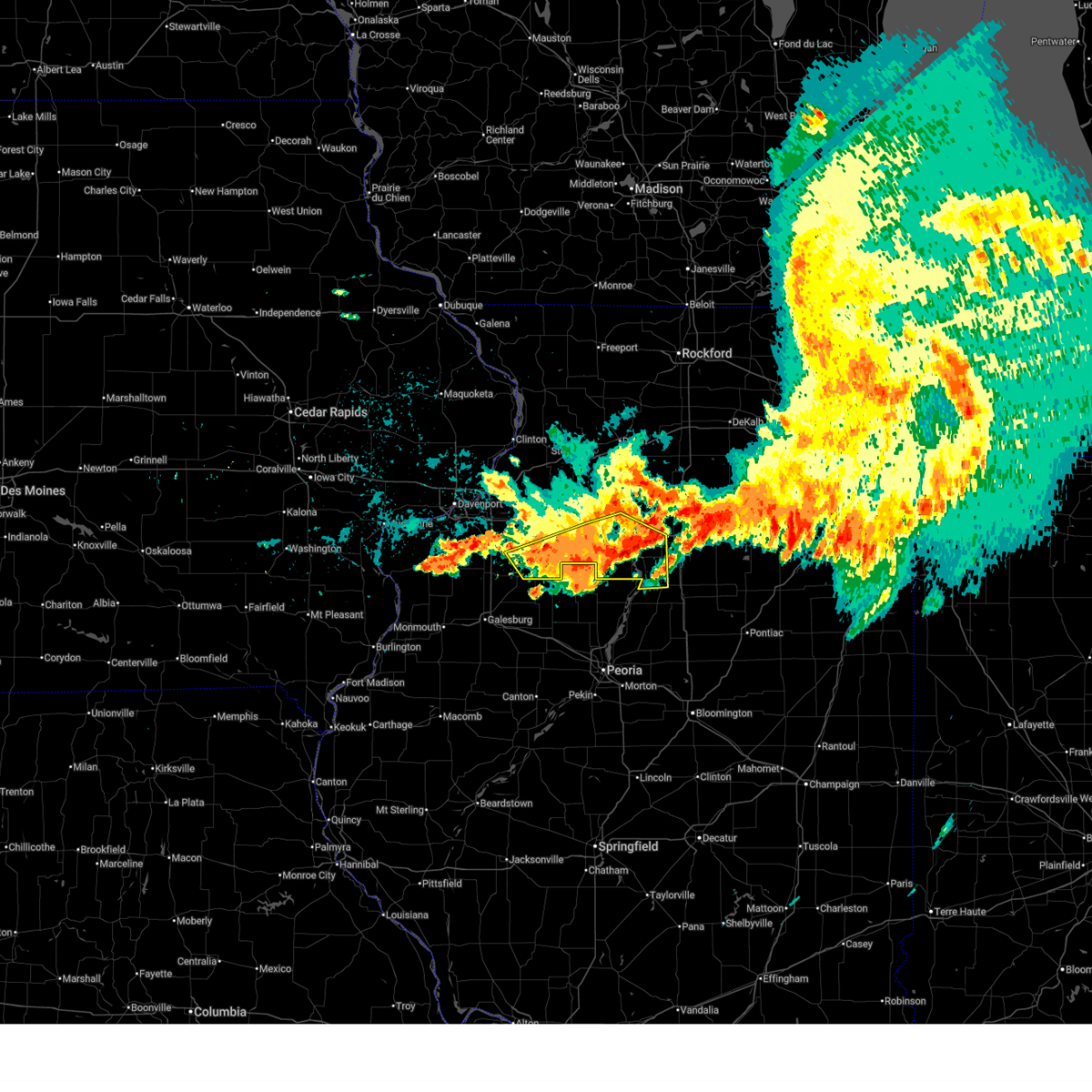 At 1129 pm cdt, severe thunderstorms were located along a line extending from near tiskilwa to near milo to near wyoming, moving southeast at 55 mph. winds gusted to 58 mph with these storms near kewanee (public). Hazards include 60 mph wind gusts. Expect damage to roofs, siding, and trees. locations impacted include, kewanee, princeton, cambridge, hennepin, spring valley, galva, henry, depue, granville, ladd, wyanet, sheffield, tiskilwa, dalzell, buda, bureau junction, mcnabb, putnam, mark, and neponset. this includes the following highways, interstate 80 in illinois between mile markers 37 and 72. Interstate 180 between mile markers 1 and 13. At 1129 pm cdt, severe thunderstorms were located along a line extending from near tiskilwa to near milo to near wyoming, moving southeast at 55 mph. winds gusted to 58 mph with these storms near kewanee (public). Hazards include 60 mph wind gusts. Expect damage to roofs, siding, and trees. locations impacted include, kewanee, princeton, cambridge, hennepin, spring valley, galva, henry, depue, granville, ladd, wyanet, sheffield, tiskilwa, dalzell, buda, bureau junction, mcnabb, putnam, mark, and neponset. this includes the following highways, interstate 80 in illinois between mile markers 37 and 72. Interstate 180 between mile markers 1 and 13.
|
| 7/14/2024 11:22 PM CDT | Sheriff reported a tree blocking midland road near the country club. time of the event estimated using rada in henry county IL, 4.2 miles NE of Kewanee, IL |
| 7/14/2024 11:19 PM CDT | Measured at the kewanee airport. (kezi in henry county IL, 3.3 miles NE of Kewanee, IL |
| 7/14/2024 11:16 PM CDT |
 At 1115 pm cdt, severe thunderstorms were located along a line extending from near manlius to near osceola to kewanee municipal airport, moving southeast at 60 mph (radar indicated). Hazards include 60 mph wind gusts. Expect damage to roofs, siding, and trees. locations impacted include, kewanee, princeton, cambridge, hennepin, geneseo, spring valley, galva, henry, depue, granville, ladd, wyanet, atkinson, sheffield, annawan, tiskilwa, dalzell, buda, bureau junction, and mcnabb. this includes the following highways, interstate 80 in illinois between mile markers 18 and 72. Interstate 180 between mile markers 1 and 13. At 1115 pm cdt, severe thunderstorms were located along a line extending from near manlius to near osceola to kewanee municipal airport, moving southeast at 60 mph (radar indicated). Hazards include 60 mph wind gusts. Expect damage to roofs, siding, and trees. locations impacted include, kewanee, princeton, cambridge, hennepin, geneseo, spring valley, galva, henry, depue, granville, ladd, wyanet, atkinson, sheffield, annawan, tiskilwa, dalzell, buda, bureau junction, and mcnabb. this includes the following highways, interstate 80 in illinois between mile markers 18 and 72. Interstate 180 between mile markers 1 and 13.
|
| 7/14/2024 11:16 PM CDT |
 the severe thunderstorm warning has been cancelled and is no longer in effect the severe thunderstorm warning has been cancelled and is no longer in effect
|
| 7/14/2024 10:54 PM CDT |
 Svrdvn the national weather service in the quad cities has issued a * severe thunderstorm warning for, putnam county in north central illinois, south central whiteside county in northwestern illinois, henry county in northwestern illinois, bureau county in north central illinois, * until midnight cdt. * at 1054 pm cdt, severe thunderstorms were located along a line extending from near spring hill to near geneseo to near orion, moving southeast at 55 mph (radar indicated). Hazards include 60 mph wind gusts. expect damage to roofs, siding, and trees Svrdvn the national weather service in the quad cities has issued a * severe thunderstorm warning for, putnam county in north central illinois, south central whiteside county in northwestern illinois, henry county in northwestern illinois, bureau county in north central illinois, * until midnight cdt. * at 1054 pm cdt, severe thunderstorms were located along a line extending from near spring hill to near geneseo to near orion, moving southeast at 55 mph (radar indicated). Hazards include 60 mph wind gusts. expect damage to roofs, siding, and trees
|
| 7/2/2024 8:43 PM CDT |
 The storm which prompted the warning has weakened below severe limits, and no longer poses an immediate threat to life or property. therefore, the warning will be allowed to expire. however, heavy rain is still possible with this thunderstorm. a tornado watch remains in effect until 900 pm cdt for northwestern illinois. a severe thunderstorm watch remains in effect until 1100 pm cdt for north central illinois. The storm which prompted the warning has weakened below severe limits, and no longer poses an immediate threat to life or property. therefore, the warning will be allowed to expire. however, heavy rain is still possible with this thunderstorm. a tornado watch remains in effect until 900 pm cdt for northwestern illinois. a severe thunderstorm watch remains in effect until 1100 pm cdt for north central illinois.
|
| 7/2/2024 8:32 PM CDT |
 At 831 pm cdt, a severe thunderstorm was located over kewanee, moving east at 55 mph (radar indicated). Hazards include 60 mph wind gusts. Expect damage to roofs, siding, and trees. locations impacted include, kewanee, sheffield, neponset, mineral, johnson-sauk trail state park and buda. This includes interstate 80 in illinois between mile markers 37 and 47. At 831 pm cdt, a severe thunderstorm was located over kewanee, moving east at 55 mph (radar indicated). Hazards include 60 mph wind gusts. Expect damage to roofs, siding, and trees. locations impacted include, kewanee, sheffield, neponset, mineral, johnson-sauk trail state park and buda. This includes interstate 80 in illinois between mile markers 37 and 47.
|
| 7/2/2024 8:13 PM CDT |
 At 813 pm cdt, a severe thunderstorm was located near woodhull, or near cambridge, moving east at 55 mph (radar indicated). Hazards include 60 mph wind gusts. Expect damage to roofs, siding, and trees. this severe storm will be near, kewanee, cambridge, galva, bishop hill, german corner, ulah, kewanee municipal airport, and henry county fairgrounds around 820 pm cdt. other locations in the path of this severe thunderstorm include neponset, johnson-sauk trail state park, mineral, sheffield and buda. this includes the following highways, interstate 80 in illinois between mile markers 37 and 47. Interstate 74 in illinois between mile markers 21 and 33. At 813 pm cdt, a severe thunderstorm was located near woodhull, or near cambridge, moving east at 55 mph (radar indicated). Hazards include 60 mph wind gusts. Expect damage to roofs, siding, and trees. this severe storm will be near, kewanee, cambridge, galva, bishop hill, german corner, ulah, kewanee municipal airport, and henry county fairgrounds around 820 pm cdt. other locations in the path of this severe thunderstorm include neponset, johnson-sauk trail state park, mineral, sheffield and buda. this includes the following highways, interstate 80 in illinois between mile markers 37 and 47. Interstate 74 in illinois between mile markers 21 and 33.
|
| 7/2/2024 8:13 PM CDT |
 the severe thunderstorm warning has been cancelled and is no longer in effect the severe thunderstorm warning has been cancelled and is no longer in effect
|
| 7/2/2024 8:00 PM CDT |
 Svrdvn the national weather service in the quad cities has issued a * severe thunderstorm warning for, eastern mercer county in northwestern illinois, southern henry county in northwestern illinois, southwestern bureau county in north central illinois, * until 845 pm cdt. * at 800 pm cdt, a severe thunderstorm was located over new windsor, or 14 miles east of aledo, moving east at 55 mph (radar indicated). Hazards include 60 mph wind gusts. Expect damage to roofs, siding, and trees. this severe thunderstorm will be near, woodhull, new windsor, alpha, andover, lynn center, swedona, and ophiem around 805 pm cdt. cambridge, nekoma, and ulah around 810 pm cdt. galva, bishop hill, and henry county fairgrounds around 815 pm cdt. german corner and kewanee municipal airport around 820 pm cdt. other locations in the path of this severe thunderstorm include kewanee, johnson-sauk trail state park, neponset and sheffield. this includes the following highways, interstate 80 in illinois between mile markers 37 and 47. Interstate 74 in illinois between mile markers 21 and 33. Svrdvn the national weather service in the quad cities has issued a * severe thunderstorm warning for, eastern mercer county in northwestern illinois, southern henry county in northwestern illinois, southwestern bureau county in north central illinois, * until 845 pm cdt. * at 800 pm cdt, a severe thunderstorm was located over new windsor, or 14 miles east of aledo, moving east at 55 mph (radar indicated). Hazards include 60 mph wind gusts. Expect damage to roofs, siding, and trees. this severe thunderstorm will be near, woodhull, new windsor, alpha, andover, lynn center, swedona, and ophiem around 805 pm cdt. cambridge, nekoma, and ulah around 810 pm cdt. galva, bishop hill, and henry county fairgrounds around 815 pm cdt. german corner and kewanee municipal airport around 820 pm cdt. other locations in the path of this severe thunderstorm include kewanee, johnson-sauk trail state park, neponset and sheffield. this includes the following highways, interstate 80 in illinois between mile markers 37 and 47. Interstate 74 in illinois between mile markers 21 and 33.
|
| 6/25/2024 9:12 PM CDT |
 the severe thunderstorm warning has been cancelled and is no longer in effect the severe thunderstorm warning has been cancelled and is no longer in effect
|
| 6/25/2024 9:05 PM CDT |
 At 904 pm cdt, severe thunderstorms were located along a line extending from near johnson-sauk trail state park to near galva, moving southeast at 35 mph (radar indicated). Hazards include 60 mph wind gusts. Expect damage to roofs, siding, and trees. Locations impacted include, kewanee, galva, bishop hill, and kewanee municipal airport. At 904 pm cdt, severe thunderstorms were located along a line extending from near johnson-sauk trail state park to near galva, moving southeast at 35 mph (radar indicated). Hazards include 60 mph wind gusts. Expect damage to roofs, siding, and trees. Locations impacted include, kewanee, galva, bishop hill, and kewanee municipal airport.
|
| 6/25/2024 8:53 PM CDT |
 At 853 pm cdt, severe thunderstorms were located along a line extending from near german corner to near bishop hill, moving southeast at 50 mph (radar indicated). Hazards include 60 mph wind gusts. Expect damage to roofs, siding, and trees. locations impacted include, kewanee, geneseo, galva, bishop hill, kewanee municipal airport, ulah, and german corner. This includes interstate 80 in illinois between mile markers 19 and 21. At 853 pm cdt, severe thunderstorms were located along a line extending from near german corner to near bishop hill, moving southeast at 50 mph (radar indicated). Hazards include 60 mph wind gusts. Expect damage to roofs, siding, and trees. locations impacted include, kewanee, geneseo, galva, bishop hill, kewanee municipal airport, ulah, and german corner. This includes interstate 80 in illinois between mile markers 19 and 21.
|
| 6/25/2024 8:37 PM CDT |
 Svrdvn the national weather service in the quad cities has issued a * severe thunderstorm warning for, southeastern henry county in northwestern illinois, * until 930 pm cdt. * at 837 pm cdt, severe thunderstorms were located along a line extending from near osborn to near andover, moving southeast at 35 mph (radar indicated). Hazards include 60 mph wind gusts. expect damage to roofs, siding, and trees Svrdvn the national weather service in the quad cities has issued a * severe thunderstorm warning for, southeastern henry county in northwestern illinois, * until 930 pm cdt. * at 837 pm cdt, severe thunderstorms were located along a line extending from near osborn to near andover, moving southeast at 35 mph (radar indicated). Hazards include 60 mph wind gusts. expect damage to roofs, siding, and trees
|
| 6/25/2024 8:15 AM CDT |
 The storms which prompted the warning have weakened below severe limits, and no longer pose an immediate threat to life or property. therefore, the warning has been allowed to expire. however, small hail and gusty winds are still possible with these thunderstorms. The storms which prompted the warning have weakened below severe limits, and no longer pose an immediate threat to life or property. therefore, the warning has been allowed to expire. however, small hail and gusty winds are still possible with these thunderstorms.
|
| 6/25/2024 8:05 AM CDT |
 At 805 am cdt, severe thunderstorms were located along a line extending from near marseilles to near leonore to near putnam, moving east at 50 mph (radar indicated). Hazards include 60 mph wind gusts and quarter size hail. Hail damage to vehicles is expected. expect wind damage to roofs, siding, and trees. locations impacted include, hennepin, galva, granville, tiskilwa, bureau junction, mcnabb, putnam, mark, magnolia, standard, milo, providence, kewanee municipal airport, lake thunderbird, florid, and lone tree corners. This includes interstate 180 between mile markers 1 and 6. At 805 am cdt, severe thunderstorms were located along a line extending from near marseilles to near leonore to near putnam, moving east at 50 mph (radar indicated). Hazards include 60 mph wind gusts and quarter size hail. Hail damage to vehicles is expected. expect wind damage to roofs, siding, and trees. locations impacted include, hennepin, galva, granville, tiskilwa, bureau junction, mcnabb, putnam, mark, magnolia, standard, milo, providence, kewanee municipal airport, lake thunderbird, florid, and lone tree corners. This includes interstate 180 between mile markers 1 and 6.
|
| 6/25/2024 7:53 AM CDT |
 At 753 am cdt, severe thunderstorms were located along a line extending from dayton to mcnabb to near milo, moving east at 50 mph (radar indicated). Hazards include 60 mph wind gusts and quarter size hail. Hail damage to vehicles is expected. expect wind damage to roofs, siding, and trees. locations impacted include, kewanee, hennepin, spring valley, galva, depue, granville, ladd, tiskilwa, dalzell, bureau junction, mcnabb, putnam, mark, seatonville, magnolia, standard, milo, hollowayville, coal hollow, and ottville. this includes the following highways, interstate 80 in illinois between mile markers 67 and 72. Interstate 180 between mile markers 1 and 11. At 753 am cdt, severe thunderstorms were located along a line extending from dayton to mcnabb to near milo, moving east at 50 mph (radar indicated). Hazards include 60 mph wind gusts and quarter size hail. Hail damage to vehicles is expected. expect wind damage to roofs, siding, and trees. locations impacted include, kewanee, hennepin, spring valley, galva, depue, granville, ladd, tiskilwa, dalzell, bureau junction, mcnabb, putnam, mark, seatonville, magnolia, standard, milo, hollowayville, coal hollow, and ottville. this includes the following highways, interstate 80 in illinois between mile markers 67 and 72. Interstate 180 between mile markers 1 and 11.
|
| 6/25/2024 7:44 AM CDT |
 At 744 am cdt, severe thunderstorms were located along a line extending from near north utica to near florid to near bradford, moving east at 50 mph (radar indicated). Hazards include 60 mph wind gusts and quarter size hail. Hail damage to vehicles is expected. expect wind damage to roofs, siding, and trees. locations impacted include, kewanee, princeton, hennepin, spring valley, galva, depue, granville, ladd, wyanet, tiskilwa, dalzell, buda, bureau junction, mcnabb, putnam, mark, cherry, neponset, malden, and seatonville. this includes the following highways, interstate 80 in illinois between mile markers 53 and 72. Interstate 180 between mile markers 1 and 13. At 744 am cdt, severe thunderstorms were located along a line extending from near north utica to near florid to near bradford, moving east at 50 mph (radar indicated). Hazards include 60 mph wind gusts and quarter size hail. Hail damage to vehicles is expected. expect wind damage to roofs, siding, and trees. locations impacted include, kewanee, princeton, hennepin, spring valley, galva, depue, granville, ladd, wyanet, tiskilwa, dalzell, buda, bureau junction, mcnabb, putnam, mark, cherry, neponset, malden, and seatonville. this includes the following highways, interstate 80 in illinois between mile markers 53 and 72. Interstate 180 between mile markers 1 and 13.
|
| 6/25/2024 7:37 AM CDT |
 At 736 am cdt, severe thunderstorms were located along a line extending from near troy grove to near lake thunderbird to osceola, moving east at 50 mph (radar indicated). Hazards include 60 mph wind gusts and quarter size hail. Hail damage to vehicles is expected. expect wind damage to roofs, siding, and trees. locations impacted include, kewanee, princeton, hennepin, spring valley, galva, depue, granville, ladd, wyanet, sheffield, tiskilwa, dalzell, buda, bureau junction, mcnabb, putnam, mark, cherry, neponset, and malden. this includes the following highways, interstate 80 in illinois between mile markers 39 and 72. Interstate 180 between mile markers 1 and 13. At 736 am cdt, severe thunderstorms were located along a line extending from near troy grove to near lake thunderbird to osceola, moving east at 50 mph (radar indicated). Hazards include 60 mph wind gusts and quarter size hail. Hail damage to vehicles is expected. expect wind damage to roofs, siding, and trees. locations impacted include, kewanee, princeton, hennepin, spring valley, galva, depue, granville, ladd, wyanet, sheffield, tiskilwa, dalzell, buda, bureau junction, mcnabb, putnam, mark, cherry, neponset, and malden. this includes the following highways, interstate 80 in illinois between mile markers 39 and 72. Interstate 180 between mile markers 1 and 13.
|
| 6/25/2024 7:28 AM CDT |
 At 727 am cdt, severe thunderstorms were located along a line extending from near cherry to near tiskilwa to kewanee, moving east at 50 mph (radar indicated). Hazards include 60 mph wind gusts and quarter size hail. Hail damage to vehicles is expected. expect wind damage to roofs, siding, and trees. locations impacted include, kewanee, princeton, hennepin, spring valley, galva, depue, granville, ladd, wyanet, sheffield, tiskilwa, dalzell, buda, bureau junction, mcnabb, putnam, mark, cherry, neponset, and malden. this includes the following highways, interstate 80 in illinois between mile markers 36 and 72. Interstate 180 between mile markers 1 and 13. At 727 am cdt, severe thunderstorms were located along a line extending from near cherry to near tiskilwa to kewanee, moving east at 50 mph (radar indicated). Hazards include 60 mph wind gusts and quarter size hail. Hail damage to vehicles is expected. expect wind damage to roofs, siding, and trees. locations impacted include, kewanee, princeton, hennepin, spring valley, galva, depue, granville, ladd, wyanet, sheffield, tiskilwa, dalzell, buda, bureau junction, mcnabb, putnam, mark, cherry, neponset, and malden. this includes the following highways, interstate 80 in illinois between mile markers 36 and 72. Interstate 180 between mile markers 1 and 13.
|
| 6/25/2024 7:22 AM CDT | Time estimated from radar; trees down at n750th ave and highway 8 in henry county IL, 2.8 miles ESE of Kewanee, IL |
| 6/25/2024 7:20 AM CDT |
 At 720 am cdt, severe thunderstorms were located along a line extending from arlington to near providence to near german corner, moving east at 50 mph (radar indicated). Hazards include 60 mph wind gusts and quarter size hail. Hail damage to vehicles is expected. expect wind damage to roofs, siding, and trees. locations impacted include, kewanee, princeton, cambridge, hennepin, spring valley, galva, depue, granville, walnut, ladd, wyanet, sheffield, annawan, tiskilwa, la moille, dalzell, buda, bureau junction, mcnabb, and putnam. this includes the following highways, interstate 80 in illinois between mile markers 29 and 72. Interstate 180 between mile markers 1 and 13. At 720 am cdt, severe thunderstorms were located along a line extending from arlington to near providence to near german corner, moving east at 50 mph (radar indicated). Hazards include 60 mph wind gusts and quarter size hail. Hail damage to vehicles is expected. expect wind damage to roofs, siding, and trees. locations impacted include, kewanee, princeton, cambridge, hennepin, spring valley, galva, depue, granville, walnut, ladd, wyanet, sheffield, annawan, tiskilwa, la moille, dalzell, buda, bureau junction, mcnabb, and putnam. this includes the following highways, interstate 80 in illinois between mile markers 29 and 72. Interstate 180 between mile markers 1 and 13.
|
| 6/25/2024 7:17 AM CDT | Time estimated from radar; trees down intersection of tower rd and highway 8 in henry county IL, 4.5 miles ESE of Kewanee, IL |
| 6/25/2024 7:11 AM CDT |
 Svrdvn the national weather service in the quad cities has issued a * severe thunderstorm warning for, putnam county in north central illinois, southeastern henry county in northwestern illinois, bureau county in north central illinois, * until 815 am cdt. * at 710 am cdt, severe thunderstorms were located along a line extending from near dover to neponset to ulah, moving east at 50 mph (radar indicated). Hazards include 60 mph wind gusts and quarter size hail. Hail damage to vehicles is expected. Expect wind damage to roofs, siding, and trees. Svrdvn the national weather service in the quad cities has issued a * severe thunderstorm warning for, putnam county in north central illinois, southeastern henry county in northwestern illinois, bureau county in north central illinois, * until 815 am cdt. * at 710 am cdt, severe thunderstorms were located along a line extending from near dover to neponset to ulah, moving east at 50 mph (radar indicated). Hazards include 60 mph wind gusts and quarter size hail. Hail damage to vehicles is expected. Expect wind damage to roofs, siding, and trees.
|
| 6/25/2024 6:48 AM CDT |
 At 647 am cdt, severe thunderstorms were located along a line extending from near ohio to near sheffield to near cambridge, moving east at 30 mph (broadcast media). Hazards include 60 mph wind gusts and quarter size hail. Hail damage to vehicles is expected. expect wind damage to roofs, siding, and trees. locations impacted include, kewanee, princeton, cambridge, geneseo, galva, orion, walnut, wyanet, atkinson, sheffield, annawan, tampico, la moille, andover, buda, hooppole, deer grove, lynn center, ohio, and neponset. this includes the following highways, interstate 80 in illinois between mile markers 12 and 58. Interstate 74 in illinois between mile markers 15 and 25. At 647 am cdt, severe thunderstorms were located along a line extending from near ohio to near sheffield to near cambridge, moving east at 30 mph (broadcast media). Hazards include 60 mph wind gusts and quarter size hail. Hail damage to vehicles is expected. expect wind damage to roofs, siding, and trees. locations impacted include, kewanee, princeton, cambridge, geneseo, galva, orion, walnut, wyanet, atkinson, sheffield, annawan, tampico, la moille, andover, buda, hooppole, deer grove, lynn center, ohio, and neponset. this includes the following highways, interstate 80 in illinois between mile markers 12 and 58. Interstate 74 in illinois between mile markers 15 and 25.
|
| 6/25/2024 6:42 AM CDT |
 At 642 am cdt, severe thunderstorms were located along a line extending from near ohio to near mineral to andover, moving southeast at 30 mph (broadcast media). Hazards include 60 mph wind gusts and quarter size hail. Hail damage to vehicles is expected. expect wind damage to roofs, siding, and trees. locations impacted include, kewanee, princeton, cambridge, geneseo, galva, orion, walnut, wyanet, atkinson, sheffield, annawan, tampico, la moille, andover, buda, hooppole, deer grove, lynn center, ohio, and neponset. this includes the following highways, interstate 80 in illinois between mile markers 12 and 58. Interstate 74 in illinois between mile markers 15 and 25. At 642 am cdt, severe thunderstorms were located along a line extending from near ohio to near mineral to andover, moving southeast at 30 mph (broadcast media). Hazards include 60 mph wind gusts and quarter size hail. Hail damage to vehicles is expected. expect wind damage to roofs, siding, and trees. locations impacted include, kewanee, princeton, cambridge, geneseo, galva, orion, walnut, wyanet, atkinson, sheffield, annawan, tampico, la moille, andover, buda, hooppole, deer grove, lynn center, ohio, and neponset. this includes the following highways, interstate 80 in illinois between mile markers 12 and 58. Interstate 74 in illinois between mile markers 15 and 25.
|
| 6/25/2024 6:35 AM CDT |
 At 634 am cdt, severe thunderstorms were located along a line extending from near walnut to near thomas to lynn center, moving southeast at 30 mph (broadcast media). Hazards include 60 mph wind gusts. Expect damage to roofs, siding, and trees. locations impacted include, sterling, kewanee, rock falls, princeton, cambridge, geneseo, colona, galva, orion, walnut, wyanet, atkinson, sheffield, annawan, tampico, la moille, andover, buda, hooppole, and deer grove. this includes the following highways, interstate 80 in illinois between mile markers 11 and 58. interstate 74 in illinois between mile markers 14 and 25. Interstate 88 between mile markers 38 and 44. At 634 am cdt, severe thunderstorms were located along a line extending from near walnut to near thomas to lynn center, moving southeast at 30 mph (broadcast media). Hazards include 60 mph wind gusts. Expect damage to roofs, siding, and trees. locations impacted include, sterling, kewanee, rock falls, princeton, cambridge, geneseo, colona, galva, orion, walnut, wyanet, atkinson, sheffield, annawan, tampico, la moille, andover, buda, hooppole, and deer grove. this includes the following highways, interstate 80 in illinois between mile markers 11 and 58. interstate 74 in illinois between mile markers 14 and 25. Interstate 88 between mile markers 38 and 44.
|
| 6/25/2024 6:27 AM CDT |
 Svrdvn the national weather service in the quad cities has issued a * severe thunderstorm warning for, southeastern rock island county in northwestern illinois, southeastern whiteside county in northwestern illinois, henry county in northwestern illinois, bureau county in north central illinois, * until 715 am cdt. * at 626 am cdt, severe thunderstorms were located along a line extending from near harmon to near hooppole to orion, moving southeast at 30 mph (radar indicated). Hazards include 60 mph wind gusts. expect damage to roofs, siding, and trees Svrdvn the national weather service in the quad cities has issued a * severe thunderstorm warning for, southeastern rock island county in northwestern illinois, southeastern whiteside county in northwestern illinois, henry county in northwestern illinois, bureau county in north central illinois, * until 715 am cdt. * at 626 am cdt, severe thunderstorms were located along a line extending from near harmon to near hooppole to orion, moving southeast at 30 mph (radar indicated). Hazards include 60 mph wind gusts. expect damage to roofs, siding, and trees
|
| 5/24/2024 4:00 PM CDT |
 Svrdvn the national weather service in the quad cities has issued a * severe thunderstorm warning for, southeastern henry county in northwestern illinois, central bureau county in north central illinois, * until 445 pm cdt. * at 400 pm cdt, a severe thunderstorm was located over kewanee municipal airport, or near kewanee, moving northeast at 50 mph (radar indicated). Hazards include 60 mph wind gusts and quarter size hail. Hail damage to vehicles is expected. Expect wind damage to roofs, siding, and trees. Svrdvn the national weather service in the quad cities has issued a * severe thunderstorm warning for, southeastern henry county in northwestern illinois, central bureau county in north central illinois, * until 445 pm cdt. * at 400 pm cdt, a severe thunderstorm was located over kewanee municipal airport, or near kewanee, moving northeast at 50 mph (radar indicated). Hazards include 60 mph wind gusts and quarter size hail. Hail damage to vehicles is expected. Expect wind damage to roofs, siding, and trees.
|
| 5/24/2024 9:27 AM CDT |
 The storms which prompted the warning have weakened below severe limits, and have exited the warned area. therefore, the warning will be allowed to expire. however, gusty winds are still possible with these thunderstorms. a severe thunderstorm watch remains in effect until 100 pm cdt for north central and northwestern illinois. The storms which prompted the warning have weakened below severe limits, and have exited the warned area. therefore, the warning will be allowed to expire. however, gusty winds are still possible with these thunderstorms. a severe thunderstorm watch remains in effect until 100 pm cdt for north central and northwestern illinois.
|
| 5/24/2024 9:14 AM CDT |
 At 914 am cdt, severe thunderstorms were located along a line extending from near dixon to van orin to near lone tree corners, moving east at 60 mph (radar indicated). Hazards include 60 mph wind gusts and penny size hail. Expect damage to roofs, siding, and trees. locations impacted include, sterling, kewanee, rock falls, princeton, hennepin, spring valley, galva, henry, prophetstown, depue, granville, walnut, ladd, wyanet, atkinson, sheffield, annawan, tiskilwa, tampico, and la moille. this includes the following highways, interstate 80 in illinois between mile markers 28 and 72. interstate 88 between mile markers 28 and 44. Interstate 180 between mile markers 1 and 13. At 914 am cdt, severe thunderstorms were located along a line extending from near dixon to van orin to near lone tree corners, moving east at 60 mph (radar indicated). Hazards include 60 mph wind gusts and penny size hail. Expect damage to roofs, siding, and trees. locations impacted include, sterling, kewanee, rock falls, princeton, hennepin, spring valley, galva, henry, prophetstown, depue, granville, walnut, ladd, wyanet, atkinson, sheffield, annawan, tiskilwa, tampico, and la moille. this includes the following highways, interstate 80 in illinois between mile markers 28 and 72. interstate 88 between mile markers 28 and 44. Interstate 180 between mile markers 1 and 13.
|
| 5/24/2024 9:06 AM CDT |
 At 905 am cdt, severe thunderstorms were located along a line extending from near penrose to ohio to near bradford, moving east at 55 mph (radar indicated). Hazards include 60 mph wind gusts and penny size hail. Expect damage to roofs, siding, and trees. locations impacted include, sterling, kewanee, rock falls, princeton, morrison, hennepin, spring valley, galva, henry, prophetstown, depue, granville, walnut, ladd, wyanet, atkinson, sheffield, annawan, tiskilwa, and tampico. this includes the following highways, interstate 80 in illinois between mile markers 23 and 72. interstate 88 between mile markers 21 and 44. Interstate 180 between mile markers 1 and 13. At 905 am cdt, severe thunderstorms were located along a line extending from near penrose to ohio to near bradford, moving east at 55 mph (radar indicated). Hazards include 60 mph wind gusts and penny size hail. Expect damage to roofs, siding, and trees. locations impacted include, sterling, kewanee, rock falls, princeton, morrison, hennepin, spring valley, galva, henry, prophetstown, depue, granville, walnut, ladd, wyanet, atkinson, sheffield, annawan, tiskilwa, and tampico. this includes the following highways, interstate 80 in illinois between mile markers 23 and 72. interstate 88 between mile markers 21 and 44. Interstate 180 between mile markers 1 and 13.
|
| 5/24/2024 9:06 AM CDT |
 the severe thunderstorm warning has been cancelled and is no longer in effect the severe thunderstorm warning has been cancelled and is no longer in effect
|
| 5/24/2024 8:54 AM CDT |
 the severe thunderstorm warning has been cancelled and is no longer in effect the severe thunderstorm warning has been cancelled and is no longer in effect
|
| 5/24/2024 8:54 AM CDT |
 At 853 am cdt, severe thunderstorms were located along a line extending from near coleta to near normandy to near elmira, moving east at 60 mph (radar indicated). Hazards include 60 mph wind gusts and penny size hail. Expect damage to roofs, siding, and trees. locations impacted include, clinton, sterling, kewanee, rock falls, princeton, morrison, cambridge, hennepin, geneseo, spring valley, fulton, galva, henry, prophetstown, depue, erie, granville, walnut, ladd, and garden plain. this includes the following highways, interstate 80 in illinois between mile markers 18 and 72. interstate 88 between mile markers 13 and 44. Interstate 180 between mile markers 1 and 13. At 853 am cdt, severe thunderstorms were located along a line extending from near coleta to near normandy to near elmira, moving east at 60 mph (radar indicated). Hazards include 60 mph wind gusts and penny size hail. Expect damage to roofs, siding, and trees. locations impacted include, clinton, sterling, kewanee, rock falls, princeton, morrison, cambridge, hennepin, geneseo, spring valley, fulton, galva, henry, prophetstown, depue, erie, granville, walnut, ladd, and garden plain. this includes the following highways, interstate 80 in illinois between mile markers 18 and 72. interstate 88 between mile markers 13 and 44. Interstate 180 between mile markers 1 and 13.
|
| 5/24/2024 8:40 AM CDT |
 the severe thunderstorm warning has been cancelled and is no longer in effect the severe thunderstorm warning has been cancelled and is no longer in effect
|
| 5/24/2024 8:40 AM CDT |
 At 840 am cdt, severe thunderstorms were located along a line extending from ustick to near thomas to galva, moving east at 60 mph (radar indicated). Hazards include 60 mph wind gusts and penny size hail. Expect damage to roofs, siding, and trees. locations impacted include, clinton, sterling, kewanee, rock falls, princeton, morrison, cambridge, hennepin, geneseo, spring valley, colona, camanche, fulton, galva, henry, prophetstown, orion, depue, port byron, and erie. this includes the following highways, interstate 80 in illinois between mile markers 2 and 72. interstate 74 in illinois between mile markers 12 and 33. interstate 88 between mile markers 1 and 44. Interstate 180 between mile markers 1 and 13. At 840 am cdt, severe thunderstorms were located along a line extending from ustick to near thomas to galva, moving east at 60 mph (radar indicated). Hazards include 60 mph wind gusts and penny size hail. Expect damage to roofs, siding, and trees. locations impacted include, clinton, sterling, kewanee, rock falls, princeton, morrison, cambridge, hennepin, geneseo, spring valley, colona, camanche, fulton, galva, henry, prophetstown, orion, depue, port byron, and erie. this includes the following highways, interstate 80 in illinois between mile markers 2 and 72. interstate 74 in illinois between mile markers 12 and 33. interstate 88 between mile markers 1 and 44. Interstate 180 between mile markers 1 and 13.
|
| 5/24/2024 8:26 AM CDT |
 Svrdvn the national weather service in the quad cities has issued a * severe thunderstorm warning for, northeastern rock island county in northwestern illinois, putnam county in north central illinois, east central mercer county in northwestern illinois, whiteside county in northwestern illinois, henry county in northwestern illinois, bureau county in north central illinois, northeastern scott county in east central iowa, southeastern clinton county in east central iowa, * until 930 am cdt. * at 825 am cdt, severe thunderstorms were located along a line extending from clinton to near shady beach to near woodhull, moving east at 60 mph (radar indicated). Hazards include 60 mph wind gusts and penny size hail. expect damage to roofs, siding, and trees Svrdvn the national weather service in the quad cities has issued a * severe thunderstorm warning for, northeastern rock island county in northwestern illinois, putnam county in north central illinois, east central mercer county in northwestern illinois, whiteside county in northwestern illinois, henry county in northwestern illinois, bureau county in north central illinois, northeastern scott county in east central iowa, southeastern clinton county in east central iowa, * until 930 am cdt. * at 825 am cdt, severe thunderstorms were located along a line extending from clinton to near shady beach to near woodhull, moving east at 60 mph (radar indicated). Hazards include 60 mph wind gusts and penny size hail. expect damage to roofs, siding, and trees
|
| 5/21/2024 7:45 PM CDT |
 Svrdvn the national weather service in the quad cities has issued a * severe thunderstorm warning for, eastern whiteside county in northwestern illinois, eastern henry county in northwestern illinois, bureau county in north central illinois, * until 830 pm cdt. * at 745 pm cdt, severe thunderstorms were located along a line extending from near atkinson to near german corner to near kewanee, moving northeast at 60 mph (radar indicated). Hazards include 60 mph wind gusts and penny size hail. expect damage to roofs, siding, and trees Svrdvn the national weather service in the quad cities has issued a * severe thunderstorm warning for, eastern whiteside county in northwestern illinois, eastern henry county in northwestern illinois, bureau county in north central illinois, * until 830 pm cdt. * at 745 pm cdt, severe thunderstorms were located along a line extending from near atkinson to near german corner to near kewanee, moving northeast at 60 mph (radar indicated). Hazards include 60 mph wind gusts and penny size hail. expect damage to roofs, siding, and trees
|
| 4/16/2024 8:26 PM CDT |
 At 825 pm cdt, severe thunderstorms were located along a line extending from yorktown to near german corner to near woodhull, moving east at 45 mph (trained weather spotters). Hazards include 60 mph wind gusts and half dollar size hail. Hail damage to vehicles is expected. expect wind damage to roofs, siding, and trees. locations impacted include, cambridge, geneseo, walnut, atkinson, annawan, woodhull, andover, hooppole, yorktown, manlius, mineral, bishop hill, new bedford, thomas, henry county fairgrounds, german corner, nekoma, ulah, normandy, and johnson-sauk trail state park. this includes the following highways, interstate 80 in illinois between mile markers 18 and 43. Interstate 74 in illinois between mile markers 29 and 33. At 825 pm cdt, severe thunderstorms were located along a line extending from yorktown to near german corner to near woodhull, moving east at 45 mph (trained weather spotters). Hazards include 60 mph wind gusts and half dollar size hail. Hail damage to vehicles is expected. expect wind damage to roofs, siding, and trees. locations impacted include, cambridge, geneseo, walnut, atkinson, annawan, woodhull, andover, hooppole, yorktown, manlius, mineral, bishop hill, new bedford, thomas, henry county fairgrounds, german corner, nekoma, ulah, normandy, and johnson-sauk trail state park. this includes the following highways, interstate 80 in illinois between mile markers 18 and 43. Interstate 74 in illinois between mile markers 29 and 33.
|
| 4/16/2024 8:08 PM CDT |
 Svrdvn the national weather service in the quad cities has issued a * severe thunderstorm warning for, henry county in northwestern illinois, northwestern bureau county in north central illinois, * until 900 pm cdt. * at 808 pm cdt, severe thunderstorms were located along a line extending from near hillsdale to near geneseo to ulah, moving northeast at 40 mph (trained weather spotters). Hazards include 60 mph wind gusts and quarter size hail. Hail damage to vehicles is expected. Expect wind damage to roofs, siding, and trees. Svrdvn the national weather service in the quad cities has issued a * severe thunderstorm warning for, henry county in northwestern illinois, northwestern bureau county in north central illinois, * until 900 pm cdt. * at 808 pm cdt, severe thunderstorms were located along a line extending from near hillsdale to near geneseo to ulah, moving northeast at 40 mph (trained weather spotters). Hazards include 60 mph wind gusts and quarter size hail. Hail damage to vehicles is expected. Expect wind damage to roofs, siding, and trees.
|
| 3/4/2024 8:48 PM CST |
 At 848 pm cst, a severe thunderstorm capable of producing a tornado was located over osceola, or 7 miles east of kewanee, moving northeast at 30 mph (radar indicated rotation). Hazards include tornado. Flying debris will be dangerous to those caught without shelter. mobile homes will be damaged or destroyed. damage to roofs, windows, and vehicles will occur. tree damage is likely. This dangerous storm will be near, buda and neponset around 855 pm cst. At 848 pm cst, a severe thunderstorm capable of producing a tornado was located over osceola, or 7 miles east of kewanee, moving northeast at 30 mph (radar indicated rotation). Hazards include tornado. Flying debris will be dangerous to those caught without shelter. mobile homes will be damaged or destroyed. damage to roofs, windows, and vehicles will occur. tree damage is likely. This dangerous storm will be near, buda and neponset around 855 pm cst.
|
| 3/4/2024 8:45 PM CST |
 At 845 pm cst, a severe thunderstorm capable of producing a tornado was located over osceola, or near kewanee, moving northeast at 30 mph (radar indicated rotation). Hazards include tornado. Flying debris will be dangerous to those caught without shelter. mobile homes will be damaged or destroyed. damage to roofs, windows, and vehicles will occur. tree damage is likely. This dangerous storm will be near, buda and neponset around 850 pm cst. At 845 pm cst, a severe thunderstorm capable of producing a tornado was located over osceola, or near kewanee, moving northeast at 30 mph (radar indicated rotation). Hazards include tornado. Flying debris will be dangerous to those caught without shelter. mobile homes will be damaged or destroyed. damage to roofs, windows, and vehicles will occur. tree damage is likely. This dangerous storm will be near, buda and neponset around 850 pm cst.
|
| 3/4/2024 8:38 PM CST |
 At 838 pm cst, a severe thunderstorm capable of producing a tornado was located over elmira, or near kewanee, moving northeast at 30 mph (radar indicated rotation). Hazards include tornado. Flying debris will be dangerous to those caught without shelter. mobile homes will be damaged or destroyed. damage to roofs, windows, and vehicles will occur. tree damage is likely. this dangerous storm will be near, buda and neponset around 845 pm cst. Other locations in the path of this tornadic thunderstorm include sheffield. At 838 pm cst, a severe thunderstorm capable of producing a tornado was located over elmira, or near kewanee, moving northeast at 30 mph (radar indicated rotation). Hazards include tornado. Flying debris will be dangerous to those caught without shelter. mobile homes will be damaged or destroyed. damage to roofs, windows, and vehicles will occur. tree damage is likely. this dangerous storm will be near, buda and neponset around 845 pm cst. Other locations in the path of this tornadic thunderstorm include sheffield.
|
| 3/4/2024 8:26 PM CST |
 Tordvn the national weather service in the quad cities has issued a * tornado warning for, southeastern henry county in northwestern illinois, southwestern bureau county in north central illinois, * until 915 pm cst. * at 826 pm cst, a severe thunderstorm capable of producing a tornado was located over kewanee municipal airport, or near kewanee, moving northeast at 30 mph (radar indicated rotation). Hazards include tornado. Flying debris will be dangerous to those caught without shelter. mobile homes will be damaged or destroyed. damage to roofs, windows, and vehicles will occur. tree damage is likely. this dangerous storm will be near, kewanee and kewanee municipal airport around 830 pm cst. neponset around 835 pm cst. buda around 845 pm cst. Other locations in the path of this tornadic thunderstorm include sheffield. Tordvn the national weather service in the quad cities has issued a * tornado warning for, southeastern henry county in northwestern illinois, southwestern bureau county in north central illinois, * until 915 pm cst. * at 826 pm cst, a severe thunderstorm capable of producing a tornado was located over kewanee municipal airport, or near kewanee, moving northeast at 30 mph (radar indicated rotation). Hazards include tornado. Flying debris will be dangerous to those caught without shelter. mobile homes will be damaged or destroyed. damage to roofs, windows, and vehicles will occur. tree damage is likely. this dangerous storm will be near, kewanee and kewanee municipal airport around 830 pm cst. neponset around 835 pm cst. buda around 845 pm cst. Other locations in the path of this tornadic thunderstorm include sheffield.
|
| 3/4/2024 8:17 PM CST |
 At 817 pm cst, a severe thunderstorm was located over galva, or 7 miles southwest of kewanee, moving east at 35 mph (radar indicated). Hazards include 70 mph wind gusts. Expect considerable tree damage. damage is likely to mobile homes, roofs, and outbuildings. Locations impacted include, kewanee, cambridge, galva, sheffield, neponset, bishop hill, nekoma, kewanee municipal airport, ulah, german corner, and johnson-sauk trail state park. At 817 pm cst, a severe thunderstorm was located over galva, or 7 miles southwest of kewanee, moving east at 35 mph (radar indicated). Hazards include 70 mph wind gusts. Expect considerable tree damage. damage is likely to mobile homes, roofs, and outbuildings. Locations impacted include, kewanee, cambridge, galva, sheffield, neponset, bishop hill, nekoma, kewanee municipal airport, ulah, german corner, and johnson-sauk trail state park.
|
| 3/4/2024 8:07 PM CST |
 Svrdvn the national weather service in the quad cities has issued a * severe thunderstorm warning for, southeastern henry county in northwestern illinois, southwestern bureau county in north central illinois, * until 845 pm cst. * at 806 pm cst, a severe thunderstorm was located over nekoma, or 9 miles south of cambridge, moving east at 35 mph (emergency management). Hazards include 60 mph wind gusts. expect damage to roofs, siding, and trees Svrdvn the national weather service in the quad cities has issued a * severe thunderstorm warning for, southeastern henry county in northwestern illinois, southwestern bureau county in north central illinois, * until 845 pm cst. * at 806 pm cst, a severe thunderstorm was located over nekoma, or 9 miles south of cambridge, moving east at 35 mph (emergency management). Hazards include 60 mph wind gusts. expect damage to roofs, siding, and trees
|
| 8/17/2023 6:32 AM CDT |
 At 632 am cdt, a severe thunderstorm was located over woodhull, or 12 miles southwest of cambridge, moving east at 55 mph (radar indicated). Hazards include quarter size hail. Damage to vehicles is expected. this severe storm will be near, nekoma around 640 am cdt. other locations in the path of this severe thunderstorm include galva, bishop hill and kewanee municipal airport. hail threat, radar indicated max hail size, 1. 00 in wind threat, radar indicated max wind gust, <50 mph. At 632 am cdt, a severe thunderstorm was located over woodhull, or 12 miles southwest of cambridge, moving east at 55 mph (radar indicated). Hazards include quarter size hail. Damage to vehicles is expected. this severe storm will be near, nekoma around 640 am cdt. other locations in the path of this severe thunderstorm include galva, bishop hill and kewanee municipal airport. hail threat, radar indicated max hail size, 1. 00 in wind threat, radar indicated max wind gust, <50 mph.
|
| 8/17/2023 6:21 AM CDT |
 At 621 am cdt, a severe thunderstorm was located near north henderson, or 13 miles east of aledo, moving east at 55 mph (radar indicated). Hazards include quarter size hail. Damage to vehicles is expected. this severe thunderstorm will be near, woodhull and alpha around 630 am cdt. nekoma around 640 am cdt. other locations in the path of this severe thunderstorm include bishop hill, galva and kewanee municipal airport. hail threat, radar indicated max hail size, 1. 00 in wind threat, radar indicated max wind gust, <50 mph. At 621 am cdt, a severe thunderstorm was located near north henderson, or 13 miles east of aledo, moving east at 55 mph (radar indicated). Hazards include quarter size hail. Damage to vehicles is expected. this severe thunderstorm will be near, woodhull and alpha around 630 am cdt. nekoma around 640 am cdt. other locations in the path of this severe thunderstorm include bishop hill, galva and kewanee municipal airport. hail threat, radar indicated max hail size, 1. 00 in wind threat, radar indicated max wind gust, <50 mph.
|
| 7/28/2023 10:03 PM CDT |
 At 1003 pm cdt, severe thunderstorms were located along a line extending from near wyanet to near la fayette, moving east at 55 mph (radar indicated). Hazards include 60 mph wind gusts. Expect damage to roofs, siding, and trees. locations impacted include, kewanee, princeton, cambridge, hennepin, geneseo, spring valley, galva, henry, depue, granville, wyanet, atkinson, sheffield, annawan, tiskilwa, woodhull, dalzell, andover, buda and bureau junction. hail threat, radar indicated max hail size, <. 75 in wind threat, observed max wind gust, 60 mph. At 1003 pm cdt, severe thunderstorms were located along a line extending from near wyanet to near la fayette, moving east at 55 mph (radar indicated). Hazards include 60 mph wind gusts. Expect damage to roofs, siding, and trees. locations impacted include, kewanee, princeton, cambridge, hennepin, geneseo, spring valley, galva, henry, depue, granville, wyanet, atkinson, sheffield, annawan, tiskilwa, woodhull, dalzell, andover, buda and bureau junction. hail threat, radar indicated max hail size, <. 75 in wind threat, observed max wind gust, 60 mph.
|
| 7/28/2023 9:28 PM CDT |
 At 928 pm cdt, severe thunderstorms were located along a line extending from near geneseo to viola, moving east at 55 mph (radar indicated). Hazards include 60 mph wind gusts. expect damage to roofs, siding, and trees At 928 pm cdt, severe thunderstorms were located along a line extending from near geneseo to viola, moving east at 55 mph (radar indicated). Hazards include 60 mph wind gusts. expect damage to roofs, siding, and trees
|
| 7/14/2023 7:15 PM CDT | 6 inch diameter tree branches dow in henry county IL, 0.7 miles SE of Kewanee, IL |
| 5/7/2023 7:28 PM CDT |
 At 728 pm cdt, a severe thunderstorm was located over neponset, or 8 miles northeast of kewanee, moving southeast at 30 mph (radar indicated). Hazards include 60 mph wind gusts and quarter size hail. Hail damage to vehicles is expected. expect wind damage to roofs, siding, and trees. Locations impacted include, buda, wyanet, providence, tiskilwa, milo, lone tree corners, lake thunderbird, putnam, henry, mcnabb and magnolia. At 728 pm cdt, a severe thunderstorm was located over neponset, or 8 miles northeast of kewanee, moving southeast at 30 mph (radar indicated). Hazards include 60 mph wind gusts and quarter size hail. Hail damage to vehicles is expected. expect wind damage to roofs, siding, and trees. Locations impacted include, buda, wyanet, providence, tiskilwa, milo, lone tree corners, lake thunderbird, putnam, henry, mcnabb and magnolia.
|
| 5/7/2023 7:12 PM CDT |
 At 712 pm cdt, a severe thunderstorm was located over annawan, or 8 miles north of kewanee, moving southeast at 30 mph (radar indicated). Hazards include 60 mph wind gusts and half dollar size hail. Hail damage to vehicles is expected. expect wind damage to roofs, siding, and trees. this severe storm will be near, kewanee, mineral and johnson-sauk trail state park around 720 pm cdt. Other locations in the path of this severe thunderstorm include sheffield, neponset, buda, providence, tiskilwa, milo, putnam, lone tree corners and lake thunderbird. At 712 pm cdt, a severe thunderstorm was located over annawan, or 8 miles north of kewanee, moving southeast at 30 mph (radar indicated). Hazards include 60 mph wind gusts and half dollar size hail. Hail damage to vehicles is expected. expect wind damage to roofs, siding, and trees. this severe storm will be near, kewanee, mineral and johnson-sauk trail state park around 720 pm cdt. Other locations in the path of this severe thunderstorm include sheffield, neponset, buda, providence, tiskilwa, milo, putnam, lone tree corners and lake thunderbird.
|
| 5/7/2023 7:06 PM CDT |
 At 705 pm cdt, a severe thunderstorm was located over atkinson, or 11 miles north of kewanee, moving southeast at 30 mph (radar indicated). Hazards include 60 mph wind gusts and half dollar size hail. Hail damage to vehicles is expected. expect wind damage to roofs, siding, and trees. this severe thunderstorm will be near, annawan around 715 pm cdt. kewanee, mineral and johnson-sauk trail state park around 720 pm cdt. other locations in the path of this severe thunderstorm include sheffield, neponset, buda, providence, tiskilwa, milo, putnam, lone tree corners and lake thunderbird. hail threat, radar indicated max hail size, 1. 25 in wind threat, radar indicated max wind gust, 60 mph. At 705 pm cdt, a severe thunderstorm was located over atkinson, or 11 miles north of kewanee, moving southeast at 30 mph (radar indicated). Hazards include 60 mph wind gusts and half dollar size hail. Hail damage to vehicles is expected. expect wind damage to roofs, siding, and trees. this severe thunderstorm will be near, annawan around 715 pm cdt. kewanee, mineral and johnson-sauk trail state park around 720 pm cdt. other locations in the path of this severe thunderstorm include sheffield, neponset, buda, providence, tiskilwa, milo, putnam, lone tree corners and lake thunderbird. hail threat, radar indicated max hail size, 1. 25 in wind threat, radar indicated max wind gust, 60 mph.
|
| 4/20/2023 4:22 PM CDT |
 At 422 pm cdt, severe thunderstorms were located along a line extending from deer grove to near sheffield to near la fayette, moving east at 35 mph (radar indicated). Hazards include ping pong ball size hail and 60 mph wind gusts. People and animals outdoors will be injured. expect hail damage to roofs, siding, windows, and vehicles. expect wind damage to roofs, siding, and trees. these severe storms will be near, sheffield, buda and normandy around 425 pm cdt. walnut, manlius and new bedford around 430 pm cdt. Other locations in the path of these severe thunderstorms include wyanet, neponset, ohio, kasbeer and providence. At 422 pm cdt, severe thunderstorms were located along a line extending from deer grove to near sheffield to near la fayette, moving east at 35 mph (radar indicated). Hazards include ping pong ball size hail and 60 mph wind gusts. People and animals outdoors will be injured. expect hail damage to roofs, siding, windows, and vehicles. expect wind damage to roofs, siding, and trees. these severe storms will be near, sheffield, buda and normandy around 425 pm cdt. walnut, manlius and new bedford around 430 pm cdt. Other locations in the path of these severe thunderstorms include wyanet, neponset, ohio, kasbeer and providence.
|
| 4/20/2023 4:19 PM CDT |
 At 418 pm cdt, a severe thunderstorm capable of producing a tornado was located near kewanee, moving east at 35 mph (emergency management reported a funnel cloud). Hazards include tornado and half dollar size hail. Flying debris will be dangerous to those caught without shelter. mobile homes will be damaged or destroyed. damage to roofs, windows, and vehicles will occur. tree damage is likely. this dangerous storm will be near, neponset around 425 pm cdt. buda around 435 pm cdt. Other locations in the path of this tornadic thunderstorm include providence and wyanet. At 418 pm cdt, a severe thunderstorm capable of producing a tornado was located near kewanee, moving east at 35 mph (emergency management reported a funnel cloud). Hazards include tornado and half dollar size hail. Flying debris will be dangerous to those caught without shelter. mobile homes will be damaged or destroyed. damage to roofs, windows, and vehicles will occur. tree damage is likely. this dangerous storm will be near, neponset around 425 pm cdt. buda around 435 pm cdt. Other locations in the path of this tornadic thunderstorm include providence and wyanet.
|
| 4/20/2023 4:16 PM CDT | Quarter sized hail reported 0.9 miles NNE of Kewanee, IL |
| 4/20/2023 4:13 PM CDT | Quarter sized hail reported 0.4 miles ENE of Kewanee, IL, relayed via social media. time estimated by radar. |
| 4/20/2023 4:13 PM CDT | Half Dollar sized hail reported 0.4 miles ENE of Kewanee, IL |
| 4/20/2023 4:12 PM CDT |
 At 412 pm cdt, severe thunderstorms were located along a line extending from near tampico to mineral to la fayette, moving east at 35 mph (radar indicated). Hazards include ping pong ball size hail and 60 mph wind gusts. People and animals outdoors will be injured. expect hail damage to roofs, siding, windows, and vehicles. expect wind damage to roofs, siding, and trees. these severe storms will be near, sheffield and new bedford around 420 pm cdt. kewanee, buda and normandy around 425 pm cdt. Other locations in the path of these severe thunderstorms include walnut, wyanet, manlius, kasbeer, ohio and providence. At 412 pm cdt, severe thunderstorms were located along a line extending from near tampico to mineral to la fayette, moving east at 35 mph (radar indicated). Hazards include ping pong ball size hail and 60 mph wind gusts. People and animals outdoors will be injured. expect hail damage to roofs, siding, windows, and vehicles. expect wind damage to roofs, siding, and trees. these severe storms will be near, sheffield and new bedford around 420 pm cdt. kewanee, buda and normandy around 425 pm cdt. Other locations in the path of these severe thunderstorms include walnut, wyanet, manlius, kasbeer, ohio and providence.
|
| 4/20/2023 4:05 PM CDT |
 At 405 pm cdt, severe thunderstorms were located along a line extending from yorktown to near johnson-sauk trail state park to near la fayette, moving east at 35 mph (radar indicated). Hazards include ping pong ball size hail and 60 mph wind gusts. People and animals outdoors will be injured. expect hail damage to roofs, siding, windows, and vehicles. expect wind damage to roofs, siding, and trees. severe thunderstorms will be near, hooppole, neponset, yorktown, mineral and thomas around 410 pm cdt. sheffield and new bedford around 415 pm cdt. kewanee, buda and normandy around 420 pm cdt. walnut and manlius around 425 pm cdt. Other locations in the path of these severe thunderstorms include wyanet, ohio, kasbeer and providence. At 405 pm cdt, severe thunderstorms were located along a line extending from yorktown to near johnson-sauk trail state park to near la fayette, moving east at 35 mph (radar indicated). Hazards include ping pong ball size hail and 60 mph wind gusts. People and animals outdoors will be injured. expect hail damage to roofs, siding, windows, and vehicles. expect wind damage to roofs, siding, and trees. severe thunderstorms will be near, hooppole, neponset, yorktown, mineral and thomas around 410 pm cdt. sheffield and new bedford around 415 pm cdt. kewanee, buda and normandy around 420 pm cdt. walnut and manlius around 425 pm cdt. Other locations in the path of these severe thunderstorms include wyanet, ohio, kasbeer and providence.
|
| 4/5/2023 5:27 AM CDT |
 The severe thunderstorm warning for south central whiteside and eastern henry counties will expire at 530 am cdt, the storms which prompted the warning have moved out of the area. therefore, the warning will be allowed to expire. however heavy rain is still possible with these thunderstorms. a severe thunderstorm watch remains in effect until 1100 am cdt for north central and northwestern illinois. The severe thunderstorm warning for south central whiteside and eastern henry counties will expire at 530 am cdt, the storms which prompted the warning have moved out of the area. therefore, the warning will be allowed to expire. however heavy rain is still possible with these thunderstorms. a severe thunderstorm watch remains in effect until 1100 am cdt for north central and northwestern illinois.
|
| 4/5/2023 5:13 AM CDT |
 At 512 am cdt, severe thunderstorms were located along a line extending from near lyndon to annawan to kewanee municipal airport, moving east at 45 mph (radar indicated). Hazards include 60 mph wind gusts and quarter size hail. Hail damage to vehicles is expected. expect wind damage to roofs, siding, and trees. These severe thunderstorms will remain over mainly rural areas of south central whiteside and eastern henry counties, including the following locations, fenton, portland corners, leon corners, kewanee municipal airport, prophetstown state recreation area, denrock, spring hill, german corner, hamilton corners and johnson-sauk trail state park. At 512 am cdt, severe thunderstorms were located along a line extending from near lyndon to annawan to kewanee municipal airport, moving east at 45 mph (radar indicated). Hazards include 60 mph wind gusts and quarter size hail. Hail damage to vehicles is expected. expect wind damage to roofs, siding, and trees. These severe thunderstorms will remain over mainly rural areas of south central whiteside and eastern henry counties, including the following locations, fenton, portland corners, leon corners, kewanee municipal airport, prophetstown state recreation area, denrock, spring hill, german corner, hamilton corners and johnson-sauk trail state park.
|
| 4/5/2023 5:01 AM CDT |
 At 501 am cdt, severe thunderstorms were located along a line extending from fenton to near bishop hill, moving east at 45 mph (radar indicated). Hazards include 60 mph wind gusts and quarter size hail. Hail damage to vehicles is expected. expect wind damage to roofs, siding, and trees. these severe storms will be near, prophetstown, fenton, hamilton corners, denrock, prophetstown state recreation area and portland corners around 505 am cdt. lyndon and kewanee municipal airport around 510 am cdt. Other locations in the path of these severe thunderstorms include kewanee. At 501 am cdt, severe thunderstorms were located along a line extending from fenton to near bishop hill, moving east at 45 mph (radar indicated). Hazards include 60 mph wind gusts and quarter size hail. Hail damage to vehicles is expected. expect wind damage to roofs, siding, and trees. these severe storms will be near, prophetstown, fenton, hamilton corners, denrock, prophetstown state recreation area and portland corners around 505 am cdt. lyndon and kewanee municipal airport around 510 am cdt. Other locations in the path of these severe thunderstorms include kewanee.
|
| 4/5/2023 4:51 AM CDT |
 At 451 am cdt, a severe thunderstorm capable of producing a tornado was located near woodhull, or near cambridge, moving northeast at 50 mph (radar indicated rotation). Hazards include tornado. Flying debris will be dangerous to those caught without shelter. mobile homes will be damaged or destroyed. damage to roofs, windows, and vehicles will occur. tree damage is likely. this dangerous storm will be near, cambridge, bishop hill, ulah and henry county fairgrounds around 500 am cdt. german corner around 510 am cdt. Other locations in the path of this tornadic thunderstorm include kewanee, annawan and johnson-sauk trail state park. At 451 am cdt, a severe thunderstorm capable of producing a tornado was located near woodhull, or near cambridge, moving northeast at 50 mph (radar indicated rotation). Hazards include tornado. Flying debris will be dangerous to those caught without shelter. mobile homes will be damaged or destroyed. damage to roofs, windows, and vehicles will occur. tree damage is likely. this dangerous storm will be near, cambridge, bishop hill, ulah and henry county fairgrounds around 500 am cdt. german corner around 510 am cdt. Other locations in the path of this tornadic thunderstorm include kewanee, annawan and johnson-sauk trail state park.
|
| 4/5/2023 4:50 AM CDT |
 At 450 am cdt, severe thunderstorms were located along a line extending from near hillsdale to near woodhull, moving east at 45 mph (radar indicated). Hazards include 60 mph wind gusts and quarter size hail. Hail damage to vehicles is expected. expect wind damage to roofs, siding, and trees. severe thunderstorms will be near, hillsdale and joslin around 455 am cdt. erie and spring hill around 500 am cdt. fenton, bishop hill, portland corners and ulah around 505 am cdt. galva, prophetstown, hamilton corners, denrock, prophetstown state recreation area, german corner and leon corners around 510 am cdt. Other locations in the path of these severe thunderstorms include kewanee, lyndon, kewanee municipal airport and johnson-sauk trail state park. At 450 am cdt, severe thunderstorms were located along a line extending from near hillsdale to near woodhull, moving east at 45 mph (radar indicated). Hazards include 60 mph wind gusts and quarter size hail. Hail damage to vehicles is expected. expect wind damage to roofs, siding, and trees. severe thunderstorms will be near, hillsdale and joslin around 455 am cdt. erie and spring hill around 500 am cdt. fenton, bishop hill, portland corners and ulah around 505 am cdt. galva, prophetstown, hamilton corners, denrock, prophetstown state recreation area, german corner and leon corners around 510 am cdt. Other locations in the path of these severe thunderstorms include kewanee, lyndon, kewanee municipal airport and johnson-sauk trail state park.
|
| 3/31/2023 6:36 PM CDT | 2 grain bins blown down. time estimated from rada in henry county IL, 6.1 miles E of Kewanee, IL |
| 11/5/2022 9:07 AM CDT |
 At 906 am cdt, severe thunderstorms were located along a line extending from near hillsdale to near annawan to osceola, moving northeast at 35 mph (radar indicated). Hazards include 60 mph wind gusts. expect damage to roofs, siding, and trees At 906 am cdt, severe thunderstorms were located along a line extending from near hillsdale to near annawan to osceola, moving northeast at 35 mph (radar indicated). Hazards include 60 mph wind gusts. expect damage to roofs, siding, and trees
|
| 9/18/2022 8:45 PM CDT | Quarter sized hail reported 0.4 miles ENE of Kewanee, IL |
| 8/1/2022 3:07 AM CDT |
 At 307 am cdt, severe thunderstorms were located along a line extending from tiskilwa to castleton to near snake den hollow, moving east at 45 mph (radar indicated). Hazards include 60 mph wind gusts and penny size hail. Expect damage to roofs, siding, and trees. locations impacted include, kewanee, galva, bishop hill, kewanee municipal airport, johnson-sauk trail state park and german corner. hail threat, radar indicated max hail size, 0. 75 in wind threat, radar indicated max wind gust, 60 mph. At 307 am cdt, severe thunderstorms were located along a line extending from tiskilwa to castleton to near snake den hollow, moving east at 45 mph (radar indicated). Hazards include 60 mph wind gusts and penny size hail. Expect damage to roofs, siding, and trees. locations impacted include, kewanee, galva, bishop hill, kewanee municipal airport, johnson-sauk trail state park and german corner. hail threat, radar indicated max hail size, 0. 75 in wind threat, radar indicated max wind gust, 60 mph.
|
| 8/1/2022 2:58 AM CDT |
 At 258 am cdt, severe thunderstorms were located along a line extending from near buda to near elmira to wataga, moving east at 45 mph (radar indicated). Hazards include 60 mph wind gusts and penny size hail. Expect damage to roofs, siding, and trees. locations impacted include, kewanee, galva, bishop hill, nekoma, kewanee municipal airport, ulah, german corner and johnson-sauk trail state park. hail threat, radar indicated max hail size, 0. 75 in wind threat, radar indicated max wind gust, 60 mph. At 258 am cdt, severe thunderstorms were located along a line extending from near buda to near elmira to wataga, moving east at 45 mph (radar indicated). Hazards include 60 mph wind gusts and penny size hail. Expect damage to roofs, siding, and trees. locations impacted include, kewanee, galva, bishop hill, nekoma, kewanee municipal airport, ulah, german corner and johnson-sauk trail state park. hail threat, radar indicated max hail size, 0. 75 in wind threat, radar indicated max wind gust, 60 mph.
|
| 8/1/2022 2:44 AM CDT |
 At 244 am cdt, severe thunderstorms were located along a line extending from mineral to galva to near north henderson, moving east at 45 mph (radar indicated). Hazards include 60 mph wind gusts and penny size hail. expect damage to roofs, siding, and trees At 244 am cdt, severe thunderstorms were located along a line extending from mineral to galva to near north henderson, moving east at 45 mph (radar indicated). Hazards include 60 mph wind gusts and penny size hail. expect damage to roofs, siding, and trees
|
| 7/5/2022 11:31 PM CDT |
 At 1131 pm cdt, severe thunderstorms were located along a line extending from near annawan to near johnson-sauk trail state park to galva, moving east at 35 mph (radar indicated). Hazards include 60 mph wind gusts. Expect damage to roofs, siding, and trees. locations impacted include, kewanee, cambridge, geneseo, galva, atkinson, annawan, woodhull, alpha, andover, bishop hill, henry county fairgrounds, german corner, nekoma, kewanee municipal airport, ulah and johnson-sauk trail state park. hail threat, radar indicated max hail size, <. 75 in wind threat, observed max wind gust, 60 mph. At 1131 pm cdt, severe thunderstorms were located along a line extending from near annawan to near johnson-sauk trail state park to galva, moving east at 35 mph (radar indicated). Hazards include 60 mph wind gusts. Expect damage to roofs, siding, and trees. locations impacted include, kewanee, cambridge, geneseo, galva, atkinson, annawan, woodhull, alpha, andover, bishop hill, henry county fairgrounds, german corner, nekoma, kewanee municipal airport, ulah and johnson-sauk trail state park. hail threat, radar indicated max hail size, <. 75 in wind threat, observed max wind gust, 60 mph.
|
| 7/5/2022 11:24 PM CDT |
 At 1124 pm cdt, severe thunderstorms were located along a line extending from near atkinson to german corner to near altona, moving east at 40 mph (radar indicated). Hazards include 60 mph wind gusts. Expect damage to roofs, siding, and trees. locations impacted include, kewanee, cambridge, geneseo, colona, coal valley, galva, orion, atkinson, annawan, woodhull, new windsor, alpha, andover, cleveland, warner, osborn, lynn center, dayton, carbon cliff and osco. hail threat, radar indicated max hail size, <. 75 in wind threat, observed max wind gust, 60 mph. At 1124 pm cdt, severe thunderstorms were located along a line extending from near atkinson to german corner to near altona, moving east at 40 mph (radar indicated). Hazards include 60 mph wind gusts. Expect damage to roofs, siding, and trees. locations impacted include, kewanee, cambridge, geneseo, colona, coal valley, galva, orion, atkinson, annawan, woodhull, new windsor, alpha, andover, cleveland, warner, osborn, lynn center, dayton, carbon cliff and osco. hail threat, radar indicated max hail size, <. 75 in wind threat, observed max wind gust, 60 mph.
|
| 7/5/2022 11:17 PM CDT |
 At 1117 pm cdt, severe thunderstorms were located along a line extending from fairhaven to near hooppole to nekoma, moving east at 50 mph (radar indicated). Hazards include 60 mph wind gusts. Expect damage to roofs, siding, and trees. locations impacted include, davenport, moline, rock island, bettendorf, east moline, kewanee, cambridge, silvis, geneseo, colona, milan, le claire, coal valley, galva, hampton, orion, port byron, atkinson, rapids city and annawan. hail threat, radar indicated max hail size, <. 75 in wind threat, observed max wind gust, 60 mph. At 1117 pm cdt, severe thunderstorms were located along a line extending from fairhaven to near hooppole to nekoma, moving east at 50 mph (radar indicated). Hazards include 60 mph wind gusts. Expect damage to roofs, siding, and trees. locations impacted include, davenport, moline, rock island, bettendorf, east moline, kewanee, cambridge, silvis, geneseo, colona, milan, le claire, coal valley, galva, hampton, orion, port byron, atkinson, rapids city and annawan. hail threat, radar indicated max hail size, <. 75 in wind threat, observed max wind gust, 60 mph.
|
| 7/5/2022 11:12 PM CDT |
 At 1112 pm cdt, severe thunderstorms were located along a line extending from thomson to shady beach to alpha, moving east at 35 mph (trained weather spotters). Hazards include 60 mph wind gusts. Expect damage to roofs, siding, and trees. locations impacted include, davenport, moline, rock island, bettendorf, clinton, east moline, sterling, kewanee, rock falls, morrison, cambridge, silvis, geneseo, milan, colona, camanche, le claire, coal valley, fulton and galva. hail threat, radar indicated max hail size, <. 75 in wind threat, observed max wind gust, 60 mph. At 1112 pm cdt, severe thunderstorms were located along a line extending from thomson to shady beach to alpha, moving east at 35 mph (trained weather spotters). Hazards include 60 mph wind gusts. Expect damage to roofs, siding, and trees. locations impacted include, davenport, moline, rock island, bettendorf, clinton, east moline, sterling, kewanee, rock falls, morrison, cambridge, silvis, geneseo, milan, colona, camanche, le claire, coal valley, fulton and galva. hail threat, radar indicated max hail size, <. 75 in wind threat, observed max wind gust, 60 mph.
|
| 7/5/2022 10:54 PM CDT |
 At 1054 pm cdt, severe thunderstorms were located along a line extending from near miles to fishermans corner to viola, moving east at 35 mph (trained weather spotters). Hazards include 60 mph wind gusts. expect damage to roofs, siding, and trees At 1054 pm cdt, severe thunderstorms were located along a line extending from near miles to fishermans corner to viola, moving east at 35 mph (trained weather spotters). Hazards include 60 mph wind gusts. expect damage to roofs, siding, and trees
|
| 6/12/2022 1:53 AM CDT |
 The severe thunderstorm warning for southeastern henry county will expire at 200 am cdt, the storm which prompted the warning has weakened below severe limits, and has exited the warned area. therefore, the warning will be allowed to expire. however gusty winds are still possible with this thunderstorm. The severe thunderstorm warning for southeastern henry county will expire at 200 am cdt, the storm which prompted the warning has weakened below severe limits, and has exited the warned area. therefore, the warning will be allowed to expire. however gusty winds are still possible with this thunderstorm.
|
| 6/12/2022 1:45 AM CDT |
 At 145 am cdt, a severe thunderstorm was located near galva, or near kewanee, moving southeast at 25 mph (radar indicated). Hazards include 60 mph wind gusts and quarter size hail. Hail damage to vehicles is expected. expect wind damage to roofs, siding, and trees. this severe storm will be near, galva around 150 am cdt. other locations in the path of this severe thunderstorm include kewanee and kewanee municipal airport. hail threat, radar indicated max hail size, 1. 00 in wind threat, radar indicated max wind gust, 60 mph. At 145 am cdt, a severe thunderstorm was located near galva, or near kewanee, moving southeast at 25 mph (radar indicated). Hazards include 60 mph wind gusts and quarter size hail. Hail damage to vehicles is expected. expect wind damage to roofs, siding, and trees. this severe storm will be near, galva around 150 am cdt. other locations in the path of this severe thunderstorm include kewanee and kewanee municipal airport. hail threat, radar indicated max hail size, 1. 00 in wind threat, radar indicated max wind gust, 60 mph.
|
| 6/12/2022 1:34 AM CDT |
 At 133 am cdt, a severe thunderstorm was located over ulah, or near cambridge, moving southeast at 25 mph (radar indicated). Hazards include 60 mph wind gusts and quarter size hail. Hail damage to vehicles is expected. expect wind damage to roofs, siding, and trees. this severe storm will be near, bishop hill and german corner around 140 am cdt. other locations in the path of this severe thunderstorm include galva, kewanee and kewanee municipal airport. hail threat, radar indicated max hail size, 1. 00 in wind threat, radar indicated max wind gust, 60 mph. At 133 am cdt, a severe thunderstorm was located over ulah, or near cambridge, moving southeast at 25 mph (radar indicated). Hazards include 60 mph wind gusts and quarter size hail. Hail damage to vehicles is expected. expect wind damage to roofs, siding, and trees. this severe storm will be near, bishop hill and german corner around 140 am cdt. other locations in the path of this severe thunderstorm include galva, kewanee and kewanee municipal airport. hail threat, radar indicated max hail size, 1. 00 in wind threat, radar indicated max wind gust, 60 mph.
|
| 6/12/2022 1:24 AM CDT |
 At 123 am cdt, a severe thunderstorm was located over cambridge, moving southeast at 25 mph (radar indicated). Hazards include 60 mph wind gusts and quarter size hail. Hail damage to vehicles is expected. expect wind damage to roofs, siding, and trees. this severe storm will be near, ulah around 130 am cdt. other locations in the path of this severe thunderstorm include bishop hill, german corner, nekoma, galva, kewanee and kewanee municipal airport. hail threat, radar indicated max hail size, 1. 00 in wind threat, radar indicated max wind gust, 60 mph. At 123 am cdt, a severe thunderstorm was located over cambridge, moving southeast at 25 mph (radar indicated). Hazards include 60 mph wind gusts and quarter size hail. Hail damage to vehicles is expected. expect wind damage to roofs, siding, and trees. this severe storm will be near, ulah around 130 am cdt. other locations in the path of this severe thunderstorm include bishop hill, german corner, nekoma, galva, kewanee and kewanee municipal airport. hail threat, radar indicated max hail size, 1. 00 in wind threat, radar indicated max wind gust, 60 mph.
|
| 6/12/2022 1:13 AM CDT |
 At 113 am cdt, a severe thunderstorm was located over osco, or near cambridge, moving southeast at 25 mph (radar indicated). Hazards include 60 mph wind gusts and quarter size hail. Hail damage to vehicles is expected. expect wind damage to roofs, siding, and trees. this severe thunderstorm will be near, cambridge and henry county fairgrounds around 125 am cdt. ulah around 130 am cdt. other locations in the path of this severe thunderstorm include bishop hill, german corner, nekoma, galva, kewanee and kewanee municipal airport. hail threat, radar indicated max hail size, 1. 00 in wind threat, radar indicated max wind gust, 60 mph. At 113 am cdt, a severe thunderstorm was located over osco, or near cambridge, moving southeast at 25 mph (radar indicated). Hazards include 60 mph wind gusts and quarter size hail. Hail damage to vehicles is expected. expect wind damage to roofs, siding, and trees. this severe thunderstorm will be near, cambridge and henry county fairgrounds around 125 am cdt. ulah around 130 am cdt. other locations in the path of this severe thunderstorm include bishop hill, german corner, nekoma, galva, kewanee and kewanee municipal airport. hail threat, radar indicated max hail size, 1. 00 in wind threat, radar indicated max wind gust, 60 mph.
|
| 3/5/2022 9:52 PM CST |
 At 952 pm cst, a severe thunderstorm was located over osceola, or 7 miles east of kewanee, moving east at 50 mph (radar indicated). Hazards include 60 mph wind gusts and penny size hail. Expect damage to roofs, siding, and trees. locations impacted include, buda, wyanet and tiskilwa. hail threat, radar indicated max hail size, 0. 75 in wind threat, radar indicated max wind gust, 60 mph. At 952 pm cst, a severe thunderstorm was located over osceola, or 7 miles east of kewanee, moving east at 50 mph (radar indicated). Hazards include 60 mph wind gusts and penny size hail. Expect damage to roofs, siding, and trees. locations impacted include, buda, wyanet and tiskilwa. hail threat, radar indicated max hail size, 0. 75 in wind threat, radar indicated max wind gust, 60 mph.
|
| 3/5/2022 9:33 PM CST |
 At 933 pm cst, a severe thunderstorm was located near galva, or 7 miles southeast of cambridge, moving east at 50 mph (radar indicated). Hazards include 60 mph wind gusts and quarter size hail. Hail damage to vehicles is expected. expect wind damage to roofs, siding, and trees. this severe thunderstorm will be near, kewanee around 945 pm cst. other locations in the path of this severe thunderstorm include buda, wyanet and tiskilwa. hail threat, radar indicated max hail size, 1. 00 in wind threat, radar indicated max wind gust, 60 mph. At 933 pm cst, a severe thunderstorm was located near galva, or 7 miles southeast of cambridge, moving east at 50 mph (radar indicated). Hazards include 60 mph wind gusts and quarter size hail. Hail damage to vehicles is expected. expect wind damage to roofs, siding, and trees. this severe thunderstorm will be near, kewanee around 945 pm cst. other locations in the path of this severe thunderstorm include buda, wyanet and tiskilwa. hail threat, radar indicated max hail size, 1. 00 in wind threat, radar indicated max wind gust, 60 mph.
|
| 12/15/2021 10:37 PM CST |
 At 1036 pm cst, severe thunderstorms were located along a line extending from cedarville to near elmira, moving east at 45 mph (radar indicated). Hazards include 60 mph wind gusts. Expect damage to roofs, siding, and trees. locations impacted include, freeport, sterling, kewanee, rock falls, lena, lanark, milledgeville, sheffield, annawan, pearl city, tampico, shannon, buda, winslow, coleta, deer grove, emerson, buena vista, oneco and orangeville. hail threat, radar indicated max hail size, <. 75 in wind threat, radar indicated max wind gust, 60 mph. At 1036 pm cst, severe thunderstorms were located along a line extending from cedarville to near elmira, moving east at 45 mph (radar indicated). Hazards include 60 mph wind gusts. Expect damage to roofs, siding, and trees. locations impacted include, freeport, sterling, kewanee, rock falls, lena, lanark, milledgeville, sheffield, annawan, pearl city, tampico, shannon, buda, winslow, coleta, deer grove, emerson, buena vista, oneco and orangeville. hail threat, radar indicated max hail size, <. 75 in wind threat, radar indicated max wind gust, 60 mph.
|
| 12/15/2021 10:21 PM CST |
 At 1021 pm cst, severe thunderstorms were located along a line extending from 6 miles west of monroe to 7 miles northwest of kewanee, moving northeast at 55 mph (radar indicated). Hazards include 60 mph wind gusts. Expect damage to roofs, siding, and trees. locations impacted include, freeport, sterling, kewanee, rock falls, morrison, mount carroll, geneseo, lena, galva, prophetstown, stockton, erie, lanark, warren, milledgeville, atkinson, sheffield, fairhaven, annawan and pearl city. hail threat, radar indicated max hail size, <. 75 in wind threat, radar indicated max wind gust, 60 mph. At 1021 pm cst, severe thunderstorms were located along a line extending from 6 miles west of monroe to 7 miles northwest of kewanee, moving northeast at 55 mph (radar indicated). Hazards include 60 mph wind gusts. Expect damage to roofs, siding, and trees. locations impacted include, freeport, sterling, kewanee, rock falls, morrison, mount carroll, geneseo, lena, galva, prophetstown, stockton, erie, lanark, warren, milledgeville, atkinson, sheffield, fairhaven, annawan and pearl city. hail threat, radar indicated max hail size, <. 75 in wind threat, radar indicated max wind gust, 60 mph.
|
| 8/25/2021 4:53 PM CDT |
 The severe thunderstorm warning for southeastern henry county will expire at 500 pm cdt, the storm which prompted the warning has moved out of the area. therefore, the warning will be allowed to expire. however gusty winds and heavy rain are still possible with this thunderstorm. to report severe weather, contact your nearest law enforcement agency. they will relay your report to the national weather service the quad cities. The severe thunderstorm warning for southeastern henry county will expire at 500 pm cdt, the storm which prompted the warning has moved out of the area. therefore, the warning will be allowed to expire. however gusty winds and heavy rain are still possible with this thunderstorm. to report severe weather, contact your nearest law enforcement agency. they will relay your report to the national weather service the quad cities.
|
| 8/25/2021 4:48 PM CDT |
 At 448 pm cdt, a severe thunderstorm was located over galva, or near kewanee, moving east at 20 mph (radar indicated). Hazards include 60 mph wind gusts and nickel size hail. Expect damage to roofs, siding, and trees. this severe thunderstorm will remain over mainly rural areas of southeastern henry county, including the following locations, kewanee municipal airport, bishop hill and nekoma. hail threat, radar indicated max hail size, 0. 88 in wind threat, radar indicated max wind gust, 60 mph. At 448 pm cdt, a severe thunderstorm was located over galva, or near kewanee, moving east at 20 mph (radar indicated). Hazards include 60 mph wind gusts and nickel size hail. Expect damage to roofs, siding, and trees. this severe thunderstorm will remain over mainly rural areas of southeastern henry county, including the following locations, kewanee municipal airport, bishop hill and nekoma. hail threat, radar indicated max hail size, 0. 88 in wind threat, radar indicated max wind gust, 60 mph.
|
| 8/25/2021 4:36 PM CDT |
 At 436 pm cdt, a severe thunderstorm was located over galva, or 8 miles southwest of kewanee, moving southeast at 10 mph (emergency management). Hazards include 70 mph wind gusts and nickel size hail. Expect considerable tree damage. damage is likely to mobile homes, roofs, and outbuildings. this severe storm will be near, galva around 440 pm cdt. other locations in the path of this severe thunderstorm include kewanee. thunderstorm damage threat, considerable hail threat, radar indicated max hail size, 0. 88 in wind threat, observed max wind gust, 70 mph. At 436 pm cdt, a severe thunderstorm was located over galva, or 8 miles southwest of kewanee, moving southeast at 10 mph (emergency management). Hazards include 70 mph wind gusts and nickel size hail. Expect considerable tree damage. damage is likely to mobile homes, roofs, and outbuildings. this severe storm will be near, galva around 440 pm cdt. other locations in the path of this severe thunderstorm include kewanee. thunderstorm damage threat, considerable hail threat, radar indicated max hail size, 0. 88 in wind threat, observed max wind gust, 70 mph.
|
| 8/25/2021 4:29 PM CDT |
 At 429 pm cdt, a severe thunderstorm was located over galva, or 8 miles southwest of kewanee, moving southeast at 10 mph (emergency management). Hazards include 70 mph wind gusts and quarter size hail. Hail damage to vehicles is expected. expect considerable tree damage. wind damage is also likely to mobile homes, roofs, and outbuildings. locations impacted include, galva and kewanee. thunderstorm damage threat, considerable hail threat, radar indicated max hail size, 1. 00 in wind threat, radar indicated max wind gust, 70 mph. At 429 pm cdt, a severe thunderstorm was located over galva, or 8 miles southwest of kewanee, moving southeast at 10 mph (emergency management). Hazards include 70 mph wind gusts and quarter size hail. Hail damage to vehicles is expected. expect considerable tree damage. wind damage is also likely to mobile homes, roofs, and outbuildings. locations impacted include, galva and kewanee. thunderstorm damage threat, considerable hail threat, radar indicated max hail size, 1. 00 in wind threat, radar indicated max wind gust, 70 mph.
|
| 8/25/2021 4:17 PM CDT |
 At 416 pm cdt, a severe thunderstorm was located over galva, or 8 miles southwest of kewanee, moving east at 20 mph (radar indicated). Hazards include 70 mph wind gusts and half dollar size hail. Hail damage to vehicles is expected. expect considerable tree damage. wind damage is also likely to mobile homes, roofs, and outbuildings. this severe storm will be near, galva around 420 pm cdt. kewanee around 430 pm cdt. thunderstorm damage threat, considerable hail threat, radar indicated max hail size, 1. 25 in wind threat, radar indicated max wind gust, 70 mph. At 416 pm cdt, a severe thunderstorm was located over galva, or 8 miles southwest of kewanee, moving east at 20 mph (radar indicated). Hazards include 70 mph wind gusts and half dollar size hail. Hail damage to vehicles is expected. expect considerable tree damage. wind damage is also likely to mobile homes, roofs, and outbuildings. this severe storm will be near, galva around 420 pm cdt. kewanee around 430 pm cdt. thunderstorm damage threat, considerable hail threat, radar indicated max hail size, 1. 25 in wind threat, radar indicated max wind gust, 70 mph.
|
| 8/25/2021 4:11 PM CDT |
 At 411 pm cdt, a severe thunderstorm was located near galva, or 8 miles southeast of cambridge, moving east at 20 mph (radar indicated). Hazards include two inch hail and 70 mph wind gusts. People and animals outdoors will be injured. expect hail damage to roofs, siding, windows, and vehicles. expect considerable tree damage. wind damage is also likely to mobile homes, roofs, and outbuildings. this severe thunderstorm will be near, galva around 420 pm cdt. other locations in the path of this severe thunderstorm include kewanee. thunderstorm damage threat, considerable hail threat, radar indicated max hail size, 2. 00 in wind threat, radar indicated max wind gust, 70 mph. At 411 pm cdt, a severe thunderstorm was located near galva, or 8 miles southeast of cambridge, moving east at 20 mph (radar indicated). Hazards include two inch hail and 70 mph wind gusts. People and animals outdoors will be injured. expect hail damage to roofs, siding, windows, and vehicles. expect considerable tree damage. wind damage is also likely to mobile homes, roofs, and outbuildings. this severe thunderstorm will be near, galva around 420 pm cdt. other locations in the path of this severe thunderstorm include kewanee. thunderstorm damage threat, considerable hail threat, radar indicated max hail size, 2. 00 in wind threat, radar indicated max wind gust, 70 mph.
|
| 8/25/2021 4:03 PM CDT |
 At 402 pm cdt, a severe thunderstorm was located near woodhull, or near cambridge, moving east at 20 mph. this is a destructive storm for ulah, bishop hill, nekoma and galva (radar indicated). Hazards include baseball size hail and 60 mph wind gusts. People and animals outdoors will be severely injured. expect shattered windows, extensive damage to roofs, siding, and vehicles. locations impacted include, kewanee, cambridge, galva, woodhull, alpha, andover, lynn center, bishop hill, ophiem, nekoma, kewanee municipal airport and ulah. thunderstorm damage threat, destructive hail threat, radar indicated max hail size, 2. 75 in wind threat, radar indicated max wind gust, 60 mph. At 402 pm cdt, a severe thunderstorm was located near woodhull, or near cambridge, moving east at 20 mph. this is a destructive storm for ulah, bishop hill, nekoma and galva (radar indicated). Hazards include baseball size hail and 60 mph wind gusts. People and animals outdoors will be severely injured. expect shattered windows, extensive damage to roofs, siding, and vehicles. locations impacted include, kewanee, cambridge, galva, woodhull, alpha, andover, lynn center, bishop hill, ophiem, nekoma, kewanee municipal airport and ulah. thunderstorm damage threat, destructive hail threat, radar indicated max hail size, 2. 75 in wind threat, radar indicated max wind gust, 60 mph.
|
| 8/25/2021 3:59 PM CDT |
 At 353 pm cdt, a severe thunderstorm was located near woodhull, or near cambridge, moving east at 15 mph (radar indicated). Hazards include golf ball size hail and 60 mph wind gusts. People and animals outdoors will be injured. expect hail damage to roofs, siding, windows, and vehicles. expect wind damage to roofs, siding, and trees. locations impacted include, galva. thunderstorm damage threat, considerable hail threat, radar indicated max hail size, 1. 75 in wind threat, radar indicated max wind gust, 60 mph. At 353 pm cdt, a severe thunderstorm was located near woodhull, or near cambridge, moving east at 15 mph (radar indicated). Hazards include golf ball size hail and 60 mph wind gusts. People and animals outdoors will be injured. expect hail damage to roofs, siding, windows, and vehicles. expect wind damage to roofs, siding, and trees. locations impacted include, galva. thunderstorm damage threat, considerable hail threat, radar indicated max hail size, 1. 75 in wind threat, radar indicated max wind gust, 60 mph.
|
| 8/25/2021 3:53 PM CDT |
 At 353 pm cdt, a severe thunderstorm was located near woodhull, or near cambridge, moving east at 15 mph (radar indicated). Hazards include golf ball size hail and 60 mph wind gusts. People and animals outdoors will be injured. expect hail damage to roofs, siding, windows, and vehicles. expect wind damage to roofs, siding, and trees. locations impacted include, galva. thunderstorm damage threat, considerable hail threat, radar indicated max hail size, 1. 75 in wind threat, radar indicated max wind gust, 60 mph. At 353 pm cdt, a severe thunderstorm was located near woodhull, or near cambridge, moving east at 15 mph (radar indicated). Hazards include golf ball size hail and 60 mph wind gusts. People and animals outdoors will be injured. expect hail damage to roofs, siding, windows, and vehicles. expect wind damage to roofs, siding, and trees. locations impacted include, galva. thunderstorm damage threat, considerable hail threat, radar indicated max hail size, 1. 75 in wind threat, radar indicated max wind gust, 60 mph.
|
| 8/25/2021 3:51 PM CDT |
 At 351 pm cdt, a severe thunderstorm was located near woodhull, or near cambridge, moving east at 15 mph (radar indicated). Hazards include ping pong ball size hail and 60 mph wind gusts. People and animals outdoors will be injured. expect hail damage to roofs, siding, windows, and vehicles. expect wind damage to roofs, siding, and trees. this severe storm will be near, cambridge around 355 pm cdt. other locations in the path of this severe thunderstorm include galva. hail threat, radar indicated max hail size, 1. 50 in wind threat, radar indicated max wind gust, 60 mph. At 351 pm cdt, a severe thunderstorm was located near woodhull, or near cambridge, moving east at 15 mph (radar indicated). Hazards include ping pong ball size hail and 60 mph wind gusts. People and animals outdoors will be injured. expect hail damage to roofs, siding, windows, and vehicles. expect wind damage to roofs, siding, and trees. this severe storm will be near, cambridge around 355 pm cdt. other locations in the path of this severe thunderstorm include galva. hail threat, radar indicated max hail size, 1. 50 in wind threat, radar indicated max wind gust, 60 mph.
|
| 8/25/2021 3:39 PM CDT |
 At 338 pm cdt, a severe thunderstorm was located near woodhull, or 7 miles southwest of cambridge, moving east at 20 mph (radar indicated). Hazards include ping pong ball size hail and 60 mph wind gusts. People and animals outdoors will be injured. expect hail damage to roofs, siding, windows, and vehicles. expect wind damage to roofs, siding, and trees. this severe thunderstorm will be near, cambridge around 345 pm cdt. other locations in the path of this severe thunderstorm include galva. hail threat, radar indicated max hail size, 1. 50 in wind threat, radar indicated max wind gust, 60 mph. At 338 pm cdt, a severe thunderstorm was located near woodhull, or 7 miles southwest of cambridge, moving east at 20 mph (radar indicated). Hazards include ping pong ball size hail and 60 mph wind gusts. People and animals outdoors will be injured. expect hail damage to roofs, siding, windows, and vehicles. expect wind damage to roofs, siding, and trees. this severe thunderstorm will be near, cambridge around 345 pm cdt. other locations in the path of this severe thunderstorm include galva. hail threat, radar indicated max hail size, 1. 50 in wind threat, radar indicated max wind gust, 60 mph.
|
| 8/24/2021 6:24 PM CDT |
 The severe thunderstorm warning for southern henry and bureau counties will expire at 630 pm cdt, the storms which prompted the warning have weakened. therefore, the warning will be allowed to expire. this warning was issued primarly for the damaging outflow winds ahead of the storms. there will be additional thunderstorms behind this initial surge, that do not produce strong winds. The severe thunderstorm warning for southern henry and bureau counties will expire at 630 pm cdt, the storms which prompted the warning have weakened. therefore, the warning will be allowed to expire. this warning was issued primarly for the damaging outflow winds ahead of the storms. there will be additional thunderstorms behind this initial surge, that do not produce strong winds.
|
| 8/24/2021 6:20 PM CDT |
 At 619 pm cdt, severe thunderstorms were located along a line extending from near paw paw to near kewanee, moving southeast at 55 mph (trained weather spotters). Hazards include 60 mph wind gusts. Expect damage to roofs, siding, and trees. these severe thunderstorms will remain over mainly rural areas of southern henry and bureau counties, including the following locations, mineral, seatonville, bishop hill, providence, cherry, german corner, dover, coal hollow, zearing and kasbeer. hail threat, radar indicated max hail size, <. 75 in wind threat, radar indicated max wind gust, 60 mph. At 619 pm cdt, severe thunderstorms were located along a line extending from near paw paw to near kewanee, moving southeast at 55 mph (trained weather spotters). Hazards include 60 mph wind gusts. Expect damage to roofs, siding, and trees. these severe thunderstorms will remain over mainly rural areas of southern henry and bureau counties, including the following locations, mineral, seatonville, bishop hill, providence, cherry, german corner, dover, coal hollow, zearing and kasbeer. hail threat, radar indicated max hail size, <. 75 in wind threat, radar indicated max wind gust, 60 mph.
|
| 8/24/2021 6:10 PM CDT |
 At 610 pm cdt, severe thunderstorms were located along a line extending from 9 miles west of paw paw to near galva, moving southeast at 55 mph (trained weather spotters). Hazards include 60 mph wind gusts. Expect damage to roofs, siding, and trees. these severe thunderstorms will remain over mainly rural areas of south central rock island, northeastern mercer, southeastern whiteside, henry and bureau counties, including the following locations, preemption, seatonville, henry county fairgrounds, ophiem, cherry, german corner, coal hollow, kasbeer, manlius and nekoma. hail threat, radar indicated max hail size, <. 75 in wind threat, radar indicated max wind gust, 60 mph. At 610 pm cdt, severe thunderstorms were located along a line extending from 9 miles west of paw paw to near galva, moving southeast at 55 mph (trained weather spotters). Hazards include 60 mph wind gusts. Expect damage to roofs, siding, and trees. these severe thunderstorms will remain over mainly rural areas of south central rock island, northeastern mercer, southeastern whiteside, henry and bureau counties, including the following locations, preemption, seatonville, henry county fairgrounds, ophiem, cherry, german corner, coal hollow, kasbeer, manlius and nekoma. hail threat, radar indicated max hail size, <. 75 in wind threat, radar indicated max wind gust, 60 mph.
|
| 8/24/2021 6:03 PM CDT |
 At 602 pm cdt, outflow from severe thunderstorms were located along a line extending from near amboy to near cambridge, moving southeast at 55 mph (trained weather spotters). Hazards include 60 mph wind gusts. Expect damage to roofs, siding, and trees. locations impacted include, kewanee. hail threat, radar indicated max hail size, <. 75 in wind threat, radar indicated max wind gust, 60 mph. At 602 pm cdt, outflow from severe thunderstorms were located along a line extending from near amboy to near cambridge, moving southeast at 55 mph (trained weather spotters). Hazards include 60 mph wind gusts. Expect damage to roofs, siding, and trees. locations impacted include, kewanee. hail threat, radar indicated max hail size, <. 75 in wind threat, radar indicated max wind gust, 60 mph.
|
| 8/24/2021 5:46 PM CDT |
 At 545 pm cdt, severe thunderstorms were located along a line extending from near dixon to near sherrard, moving southeast at 55 mph (trained weather spotters). Hazards include 60 mph wind gusts. Expect damage to roofs, siding, and trees. severe thunderstorms will be near, woodhull around 600 pm cdt. cambridge around 605 pm cdt. other locations in the path of these severe thunderstorms include galva and kewanee. hail threat, radar indicated max hail size, <. 75 in wind threat, radar indicated max wind gust, 60 mph. At 545 pm cdt, severe thunderstorms were located along a line extending from near dixon to near sherrard, moving southeast at 55 mph (trained weather spotters). Hazards include 60 mph wind gusts. Expect damage to roofs, siding, and trees. severe thunderstorms will be near, woodhull around 600 pm cdt. cambridge around 605 pm cdt. other locations in the path of these severe thunderstorms include galva and kewanee. hail threat, radar indicated max hail size, <. 75 in wind threat, radar indicated max wind gust, 60 mph.
|
| 8/11/2021 8:56 AM CDT |
 The severe thunderstorm warning for northeastern rock island, whiteside, henry and bureau counties will expire at 900 am cdt, the storms which prompted the warning have moved out of the area. therefore, the warning will be allowed to expire. however gusty winds are still possible with these thunderstorms. severe thunderstorm warnings continue for portions of bureau, putnam, and eastern whiteside county. an area of strong winds will continue behind the storms, with an extended period of near 60 mph winds expected to last up to one hour. a high wind warning continues through 10 am for winds up to 60 mph. to report severe weather, contact your nearest law enforcement agency. they will relay your report to the national weather service the quad cities. The severe thunderstorm warning for northeastern rock island, whiteside, henry and bureau counties will expire at 900 am cdt, the storms which prompted the warning have moved out of the area. therefore, the warning will be allowed to expire. however gusty winds are still possible with these thunderstorms. severe thunderstorm warnings continue for portions of bureau, putnam, and eastern whiteside county. an area of strong winds will continue behind the storms, with an extended period of near 60 mph winds expected to last up to one hour. a high wind warning continues through 10 am for winds up to 60 mph. to report severe weather, contact your nearest law enforcement agency. they will relay your report to the national weather service the quad cities.
|
| 8/11/2021 8:49 AM CDT |
 At 848 am cdt, severe thunderstorms were located along a line extending from near sterling to near buda, moving east at 45 mph. an area of strong winds will continue behind the storms, with an extended period of near 60 mph winds expected to last up to 2 hours (trained weather spotters). Hazards include 75 mph wind gusts with storm moving through bureau county. Expect considerable tree damage. damage is likely to mobile homes, roofs, and outbuildings. locations impacted include, princeton, bureau junction, hennepin, depue and spring valley. thunderstorm damage threat, considerable hail threat, radar indicated max hail size, <. 75 in wind threat, radar indicated max wind gust, 70 mph. At 848 am cdt, severe thunderstorms were located along a line extending from near sterling to near buda, moving east at 45 mph. an area of strong winds will continue behind the storms, with an extended period of near 60 mph winds expected to last up to 2 hours (trained weather spotters). Hazards include 75 mph wind gusts with storm moving through bureau county. Expect considerable tree damage. damage is likely to mobile homes, roofs, and outbuildings. locations impacted include, princeton, bureau junction, hennepin, depue and spring valley. thunderstorm damage threat, considerable hail threat, radar indicated max hail size, <. 75 in wind threat, radar indicated max wind gust, 70 mph.
|
| 8/11/2021 8:27 AM CDT |
 At 826 am cdt, severe thunderstorms were located along a line extending from morrison to near kewanee, moving east at 45 mph. an area of strong winds will continue behind the storms, with an extended period of near 60 mph winds expected to last up to 2 hours (radar indicated). Hazards include 60 mph wind gusts. Expect damage to roofs, siding, and trees. these severe storms will be near, morrison and lyndon around 830 am cdt. other locations in the path of these severe thunderstorms include rock falls, coleta, emerson, sterling, sheffield, buda, wyanet, tiskilwa, princeton, bureau junction, hennepin, spring valley and depue. hail threat, radar indicated max hail size, <. 75 in wind threat, radar indicated max wind gust, 60 mph. At 826 am cdt, severe thunderstorms were located along a line extending from morrison to near kewanee, moving east at 45 mph. an area of strong winds will continue behind the storms, with an extended period of near 60 mph winds expected to last up to 2 hours (radar indicated). Hazards include 60 mph wind gusts. Expect damage to roofs, siding, and trees. these severe storms will be near, morrison and lyndon around 830 am cdt. other locations in the path of these severe thunderstorms include rock falls, coleta, emerson, sterling, sheffield, buda, wyanet, tiskilwa, princeton, bureau junction, hennepin, spring valley and depue. hail threat, radar indicated max hail size, <. 75 in wind threat, radar indicated max wind gust, 60 mph.
|
| 8/11/2021 8:13 AM CDT |
 At 813 am cdt, severe thunderstorms were located along a line extending from near garden plain to near altona, moving east at 45 mph. an area of strong winds will continue behind the storms, with an extended period of near 60 mph winds expected to last up to 2 hours (radar indicated). Hazards include 60 mph wind gusts. Expect damage to roofs, siding, and trees. these severe storms will be near, prophetstown around 820 am cdt. morrison and lyndon around 825 am cdt. other locations in the path of these severe thunderstorms include kewanee, coleta, emerson, rock falls, sterling, sheffield, buda and wyanet. hail threat, radar indicated max hail size, <. 75 in wind threat, radar indicated max wind gust, 60 mph. At 813 am cdt, severe thunderstorms were located along a line extending from near garden plain to near altona, moving east at 45 mph. an area of strong winds will continue behind the storms, with an extended period of near 60 mph winds expected to last up to 2 hours (radar indicated). Hazards include 60 mph wind gusts. Expect damage to roofs, siding, and trees. these severe storms will be near, prophetstown around 820 am cdt. morrison and lyndon around 825 am cdt. other locations in the path of these severe thunderstorms include kewanee, coleta, emerson, rock falls, sterling, sheffield, buda and wyanet. hail threat, radar indicated max hail size, <. 75 in wind threat, radar indicated max wind gust, 60 mph.
|
| 8/11/2021 8:07 AM CDT |
 At 806 am cdt, severe thunderstorms were located along a line extending from near garden plain to near altona, moving east at 45 mph. in additionl strong gradient winds are occuring behind the storms and will also result in winds to 60 mph (radar indicated). Hazards include 60 mph wind gusts. Expect damage to roofs, siding, and trees. severe thunderstorms will be near, erie, garden plain and albany around 810 am cdt. morrison, prophetstown and lyndon around 820 am cdt. other locations in the path of these severe thunderstorms include kewanee, rock falls, coleta, emerson, sterling, sheffield, buda, wyanet, tiskilwa, princeton and bureau junction. hail threat, radar indicated max hail size, <. 75 in wind threat, radar indicated max wind gust, 60 mph. At 806 am cdt, severe thunderstorms were located along a line extending from near garden plain to near altona, moving east at 45 mph. in additionl strong gradient winds are occuring behind the storms and will also result in winds to 60 mph (radar indicated). Hazards include 60 mph wind gusts. Expect damage to roofs, siding, and trees. severe thunderstorms will be near, erie, garden plain and albany around 810 am cdt. morrison, prophetstown and lyndon around 820 am cdt. other locations in the path of these severe thunderstorms include kewanee, rock falls, coleta, emerson, sterling, sheffield, buda, wyanet, tiskilwa, princeton and bureau junction. hail threat, radar indicated max hail size, <. 75 in wind threat, radar indicated max wind gust, 60 mph.
|
| 8/9/2021 8:55 PM CDT | Power poles down near baker park golf course and another down near new st and high st. time of the event was estimated using rada in henry county IL, 1.1 miles ESE of Kewanee, IL |
| 11/10/2020 2:57 PM CST |
 At 257 pm cst, severe thunderstorms were located along a line extending from tampico to near sheffield to near elmira, moving east at 50 mph (radar indicated). Hazards include 60 mph wind gusts and penny size hail. Expect damage to roofs, siding, and trees. locations impacted include, kewanee, galva, walnut, wyanet, atkinson, sheffield, annawan, tiskilwa, buda, hooppole, neponset, yorktown, manlius, mineral, milo, new bedford, thomas, providence, german corner and kewanee municipal airport. This includes interstate 80 in illinois between mile markers 27 and 54. At 257 pm cst, severe thunderstorms were located along a line extending from tampico to near sheffield to near elmira, moving east at 50 mph (radar indicated). Hazards include 60 mph wind gusts and penny size hail. Expect damage to roofs, siding, and trees. locations impacted include, kewanee, galva, walnut, wyanet, atkinson, sheffield, annawan, tiskilwa, buda, hooppole, neponset, yorktown, manlius, mineral, milo, new bedford, thomas, providence, german corner and kewanee municipal airport. This includes interstate 80 in illinois between mile markers 27 and 54.
|
| 11/10/2020 2:47 PM CST |
 At 247 pm cst, severe thunderstorms were located along a line extending from near hooppole to near annawan to near la fayette, moving east at 50 mph (trained weather spotters). Hazards include 60 mph wind gusts and penny size hail. Expect damage to roofs, siding, and trees. locations impacted include, kewanee, geneseo, galva, walnut, wyanet, atkinson, sheffield, annawan, tiskilwa, buda, hooppole, neponset, yorktown, manlius, mineral, milo, bishop hill, new bedford, german corner and kewanee municipal airport. This includes interstate 80 in illinois between mile markers 21 and 54. At 247 pm cst, severe thunderstorms were located along a line extending from near hooppole to near annawan to near la fayette, moving east at 50 mph (trained weather spotters). Hazards include 60 mph wind gusts and penny size hail. Expect damage to roofs, siding, and trees. locations impacted include, kewanee, geneseo, galva, walnut, wyanet, atkinson, sheffield, annawan, tiskilwa, buda, hooppole, neponset, yorktown, manlius, mineral, milo, bishop hill, new bedford, german corner and kewanee municipal airport. This includes interstate 80 in illinois between mile markers 21 and 54.
|
| 11/10/2020 2:40 PM CST |
 At 240 pm cst, severe thunderstorms were located along a line extending from 6 miles south of erie to galva, moving east at 50 mph (radar indicated). Hazards include 60 mph wind gusts and penny size hail. expect damage to roofs, siding, and trees At 240 pm cst, severe thunderstorms were located along a line extending from 6 miles south of erie to galva, moving east at 50 mph (radar indicated). Hazards include 60 mph wind gusts and penny size hail. expect damage to roofs, siding, and trees
|
| 9/6/2020 6:03 AM CDT |
 At 603 am cdt, severe thunderstorms were located along a line extending from near buda to near woodhull, moving southeast at 35 mph (radar indicated). Hazards include 60 mph wind gusts and penny size hail. Expect damage to roofs, siding, and trees. locations impacted include, kewanee, galva, woodhull, buda, neponset, milo, bishop hill, providence, nekoma and kewanee municipal airport. This includes interstate 74 in illinois near mile marker 31. At 603 am cdt, severe thunderstorms were located along a line extending from near buda to near woodhull, moving southeast at 35 mph (radar indicated). Hazards include 60 mph wind gusts and penny size hail. Expect damage to roofs, siding, and trees. locations impacted include, kewanee, galva, woodhull, buda, neponset, milo, bishop hill, providence, nekoma and kewanee municipal airport. This includes interstate 74 in illinois near mile marker 31.
|
| 9/6/2020 5:53 AM CDT |
 At 553 am cdt, severe thunderstorms were located along a line extending from near tiskilwa to near oneida, moving southeast at 35 mph (radar indicated). Hazards include 60 mph wind gusts and penny size hail. Expect damage to roofs, siding, and trees. locations impacted include, kewanee, cambridge, galva, wyanet, sheffield, annawan, woodhull, andover, buda, lynn center, neponset, osco, manlius, mineral, milo, bishop hill, henry county fairgrounds, providence, german corner and nekoma. this includes the following highways, interstate 80 in illinois near mile marker 29, and between mile markers 32 and 49. Interstate 74 in illinois between mile markers 21 and 30. At 553 am cdt, severe thunderstorms were located along a line extending from near tiskilwa to near oneida, moving southeast at 35 mph (radar indicated). Hazards include 60 mph wind gusts and penny size hail. Expect damage to roofs, siding, and trees. locations impacted include, kewanee, cambridge, galva, wyanet, sheffield, annawan, woodhull, andover, buda, lynn center, neponset, osco, manlius, mineral, milo, bishop hill, henry county fairgrounds, providence, german corner and nekoma. this includes the following highways, interstate 80 in illinois near mile marker 29, and between mile markers 32 and 49. Interstate 74 in illinois between mile markers 21 and 30.
|
| 9/6/2020 5:44 AM CDT |
 At 543 am cdt, severe thunderstorms were located along a line extending from near tiskilwa to near oneida, moving southeast at 40 mph (radar indicated). Hazards include 60 mph wind gusts. expect damage to roofs, siding, and trees At 543 am cdt, severe thunderstorms were located along a line extending from near tiskilwa to near oneida, moving southeast at 40 mph (radar indicated). Hazards include 60 mph wind gusts. expect damage to roofs, siding, and trees
|
| 9/6/2020 5:25 AM CDT |
 At 524 am cdt, severe thunderstorms were located along a line extending from near walnut to near sheffield to cambridge, moving southeast at 30 mph (law enforcement). Hazards include 60 mph wind gusts and penny size hail. Expect damage to roofs, siding, and trees. locations impacted include, kewanee, cambridge, geneseo, colona, atkinson, sheffield, annawan, buda, hooppole, neponset, yorktown, manlius, mineral, new bedford, thomas, german corner, kewanee municipal airport, morristown, normandy and johnson-sauk trail state park. this includes the following highways, interstate 80 in illinois between mile markers 10 and 47. Interstate 74 in illinois between mile markers 14 and 17. At 524 am cdt, severe thunderstorms were located along a line extending from near walnut to near sheffield to cambridge, moving southeast at 30 mph (law enforcement). Hazards include 60 mph wind gusts and penny size hail. Expect damage to roofs, siding, and trees. locations impacted include, kewanee, cambridge, geneseo, colona, atkinson, sheffield, annawan, buda, hooppole, neponset, yorktown, manlius, mineral, new bedford, thomas, german corner, kewanee municipal airport, morristown, normandy and johnson-sauk trail state park. this includes the following highways, interstate 80 in illinois between mile markers 10 and 47. Interstate 74 in illinois between mile markers 14 and 17.
|
| 9/6/2020 5:14 AM CDT |
 At 514 am cdt, severe thunderstorms were located along a line extending from near rock falls to near sheffield to near cambridge, moving southeast at 35 mph (radar indicated). Hazards include 60 mph wind gusts and penny size hail. Expect damage to roofs, siding, and trees. locations impacted include, sterling, kewanee, rock falls, morrison, silvis, geneseo, colona, coal valley, prophetstown, erie, atkinson, sheffield, annawan, tampico, lyndon, buda, hooppole, cleveland, deer grove and osborn. this includes the following highways, interstate 80 in illinois between mile markers 3 and 48. interstate 74 in illinois between mile markers 9 and 16. Interstate 88 between mile markers 1 and 44. At 514 am cdt, severe thunderstorms were located along a line extending from near rock falls to near sheffield to near cambridge, moving southeast at 35 mph (radar indicated). Hazards include 60 mph wind gusts and penny size hail. Expect damage to roofs, siding, and trees. locations impacted include, sterling, kewanee, rock falls, morrison, silvis, geneseo, colona, coal valley, prophetstown, erie, atkinson, sheffield, annawan, tampico, lyndon, buda, hooppole, cleveland, deer grove and osborn. this includes the following highways, interstate 80 in illinois between mile markers 3 and 48. interstate 74 in illinois between mile markers 9 and 16. Interstate 88 between mile markers 1 and 44.
|
| 9/6/2020 5:02 AM CDT |
 At 502 am cdt, severe thunderstorms were located along a line extending from near lyndon to near annawan to near cambridge, moving southeast at 35 mph (radar indicated). Hazards include 60 mph wind gusts and penny size hail. Expect damage to roofs, siding, and trees. locations impacted include, moline, east moline, sterling, kewanee, rock falls, morrison, silvis, geneseo, colona, coal valley, prophetstown, erie, atkinson, rapids city, sheffield, annawan, tampico, lyndon, buda and hooppole. this includes the following highways, interstate 80 in illinois between mile markers 2 and 48. interstate 74 in illinois between mile markers 9 and 16. Interstate 88 between mile markers 1 and 44. At 502 am cdt, severe thunderstorms were located along a line extending from near lyndon to near annawan to near cambridge, moving southeast at 35 mph (radar indicated). Hazards include 60 mph wind gusts and penny size hail. Expect damage to roofs, siding, and trees. locations impacted include, moline, east moline, sterling, kewanee, rock falls, morrison, silvis, geneseo, colona, coal valley, prophetstown, erie, atkinson, rapids city, sheffield, annawan, tampico, lyndon, buda and hooppole. this includes the following highways, interstate 80 in illinois between mile markers 2 and 48. interstate 74 in illinois between mile markers 9 and 16. Interstate 88 between mile markers 1 and 44.
|
| 9/6/2020 4:49 AM CDT |
 At 448 am cdt, severe thunderstorms were located along a line extending from lyndon to near geneseo to near warner, moving southeast at 25 mph (radar indicated). Hazards include 60 mph wind gusts and penny size hail. Expect damage to roofs, siding, and trees. locations impacted include, moline, east moline, sterling, kewanee, rock falls, morrison, silvis, geneseo, colona, coal valley, prophetstown, erie, atkinson, rapids city, sheffield, annawan, tampico, lyndon, buda and hooppole. this includes the following highways, interstate 80 in illinois between mile markers 2 and 48. interstate 74 in illinois between mile markers 9 and 16. Interstate 88 between mile markers 1 and 44. At 448 am cdt, severe thunderstorms were located along a line extending from lyndon to near geneseo to near warner, moving southeast at 25 mph (radar indicated). Hazards include 60 mph wind gusts and penny size hail. Expect damage to roofs, siding, and trees. locations impacted include, moline, east moline, sterling, kewanee, rock falls, morrison, silvis, geneseo, colona, coal valley, prophetstown, erie, atkinson, rapids city, sheffield, annawan, tampico, lyndon, buda and hooppole. this includes the following highways, interstate 80 in illinois between mile markers 2 and 48. interstate 74 in illinois between mile markers 9 and 16. Interstate 88 between mile markers 1 and 44.
|
| 9/6/2020 4:40 AM CDT |
 At 440 am cdt, severe thunderstorms were located along a line extending from near morrison to near osborn to near warner, moving southeast at 25 mph (radar indicated). Hazards include 60 mph wind gusts and penny size hail. expect damage to roofs, siding, and trees At 440 am cdt, severe thunderstorms were located along a line extending from near morrison to near osborn to near warner, moving southeast at 25 mph (radar indicated). Hazards include 60 mph wind gusts and penny size hail. expect damage to roofs, siding, and trees
|
| 8/10/2020 2:15 PM CDT | Several tree limbs snapped based on photo about 4 to 6 inches in diameter. trampoline was blown over on its side. time of the event was estimated based on radar and dur in henry county IL, 0.4 miles ENE of Kewanee, IL |
| 8/10/2020 2:00 PM CDT |
 At 159 pm cdt, severe thunderstorms were located along a line extending from near prophetstown to near la fayette, moving east at 70 mph. these are very dangerous storms! (trained weather spotters. this line of storms has a history of producing 70 to 90 mph wind gusts and significant tree damage). Hazards include 80 mph wind gusts. Flying debris will be dangerous to those caught without shelter. mobile homes will be heavily damaged. expect considerable damage to roofs, windows, and vehicles. Extensive tree damage and power outages are likely. At 159 pm cdt, severe thunderstorms were located along a line extending from near prophetstown to near la fayette, moving east at 70 mph. these are very dangerous storms! (trained weather spotters. this line of storms has a history of producing 70 to 90 mph wind gusts and significant tree damage). Hazards include 80 mph wind gusts. Flying debris will be dangerous to those caught without shelter. mobile homes will be heavily damaged. expect considerable damage to roofs, windows, and vehicles. Extensive tree damage and power outages are likely.
|
| 8/10/2020 1:23 PM CDT |
 At 123 pm cdt, severe thunderstorms were located along a line extending from hamlet to niota, moving east at 60 mph (trained weather spotters). Hazards include 60 mph wind gusts. expect damage to roofs, siding, and trees At 123 pm cdt, severe thunderstorms were located along a line extending from hamlet to niota, moving east at 60 mph (trained weather spotters). Hazards include 60 mph wind gusts. expect damage to roofs, siding, and trees
|
| 7/19/2020 9:50 AM CDT |
 At 950 am cdt, a severe thunderstorm was located over tiskilwa, or near princeton, moving east at 60 mph (trained weather spotters). Hazards include 70 mph wind gusts. Expect considerable tree damage. damage is likely to mobile homes, roofs, and outbuildings. locations impacted include, kewanee, princeton, hennepin, spring valley, galva, depue, granville, ladd, wyanet, sheffield, annawan, tiskilwa, dalzell, buda, bureau junction, mcnabb, putnam, mark, cherry and neponset. this includes the following highways, interstate 80 in illinois between mile markers 33 and 72. Interstate 180 between mile markers 1 and 13. At 950 am cdt, a severe thunderstorm was located over tiskilwa, or near princeton, moving east at 60 mph (trained weather spotters). Hazards include 70 mph wind gusts. Expect considerable tree damage. damage is likely to mobile homes, roofs, and outbuildings. locations impacted include, kewanee, princeton, hennepin, spring valley, galva, depue, granville, ladd, wyanet, sheffield, annawan, tiskilwa, dalzell, buda, bureau junction, mcnabb, putnam, mark, cherry and neponset. this includes the following highways, interstate 80 in illinois between mile markers 33 and 72. Interstate 180 between mile markers 1 and 13.
|
| 7/19/2020 9:42 AM CDT |
 At 942 am cdt, a severe thunderstorm was located over buda, or 10 miles southwest of princeton, moving east at 60 mph (trained weather spotters). Hazards include 70 mph wind gusts. Expect considerable tree damage. damage is likely to mobile homes, roofs, and outbuildings. locations impacted include, kewanee, princeton, hennepin, spring valley, galva, depue, granville, ladd, wyanet, sheffield, annawan, tiskilwa, woodhull, dalzell, alpha, buda, bureau junction, mcnabb, putnam and mark. this includes the following highways, interstate 80 in illinois between mile markers 33 and 72. interstate 74 in illinois between mile markers 29 and 33. Interstate 180 between mile markers 1 and 13. At 942 am cdt, a severe thunderstorm was located over buda, or 10 miles southwest of princeton, moving east at 60 mph (trained weather spotters). Hazards include 70 mph wind gusts. Expect considerable tree damage. damage is likely to mobile homes, roofs, and outbuildings. locations impacted include, kewanee, princeton, hennepin, spring valley, galva, depue, granville, ladd, wyanet, sheffield, annawan, tiskilwa, woodhull, dalzell, alpha, buda, bureau junction, mcnabb, putnam and mark. this includes the following highways, interstate 80 in illinois between mile markers 33 and 72. interstate 74 in illinois between mile markers 29 and 33. Interstate 180 between mile markers 1 and 13.
|
| 7/19/2020 9:30 AM CDT |
 At 930 am cdt, a severe thunderstorm was located near kewanee, moving east at 60 mph (trained weather spotters). Hazards include 60 mph wind gusts. expect damage to roofs, siding, and trees At 930 am cdt, a severe thunderstorm was located near kewanee, moving east at 60 mph (trained weather spotters). Hazards include 60 mph wind gusts. expect damage to roofs, siding, and trees
|
| 7/11/2020 8:08 PM CDT |
 The severe thunderstorm warning for southern henry county will expire at 815 pm cdt, the storm which prompted the warning has moved out of the area. therefore, the warning will be allowed to expire. however gusty winds are still possible with this thunderstorm. a severe thunderstorm watch remains in effect until midnight cdt for northwestern illinois. to report severe weather, contact your nearest law enforcement agency. they will relay your report to the national weather service the quad cities. The severe thunderstorm warning for southern henry county will expire at 815 pm cdt, the storm which prompted the warning has moved out of the area. therefore, the warning will be allowed to expire. however gusty winds are still possible with this thunderstorm. a severe thunderstorm watch remains in effect until midnight cdt for northwestern illinois. to report severe weather, contact your nearest law enforcement agency. they will relay your report to the national weather service the quad cities.
|
| 7/11/2020 8:07 PM CDT |
 At 807 pm cdt, severe thunderstorms were located along a line extending from near walnut to near wyanet to near bradford, moving east at 55 mph. these are very dangerous storms (radar indicated). Hazards include 80 mph wind gusts. Flying debris will be dangerous to those caught without shelter. mobile homes will be heavily damaged. expect considerable damage to roofs, windows, and vehicles. extensive tree damage and power outages are likely. locations impacted include, kewanee, prophetstown, sheffield, annawan, tampico, buda, hooppole, deer grove, neponset, yorktown, manlius, mineral, new bedford, thomas, leon corners, normandy and johnson-sauk trail state park. This includes interstate 80 in illinois between mile markers 32 and 48. At 807 pm cdt, severe thunderstorms were located along a line extending from near walnut to near wyanet to near bradford, moving east at 55 mph. these are very dangerous storms (radar indicated). Hazards include 80 mph wind gusts. Flying debris will be dangerous to those caught without shelter. mobile homes will be heavily damaged. expect considerable damage to roofs, windows, and vehicles. extensive tree damage and power outages are likely. locations impacted include, kewanee, prophetstown, sheffield, annawan, tampico, buda, hooppole, deer grove, neponset, yorktown, manlius, mineral, new bedford, thomas, leon corners, normandy and johnson-sauk trail state park. This includes interstate 80 in illinois between mile markers 32 and 48.
|
| 7/11/2020 8:03 PM CDT |
 A severe thunderstorm warning remains in effect until 815 pm cdt for southern henry county. at 803 pm cdt, a severe thunderstorm was located over oneida, or 12 miles northeast of galesburg, moving southeast at 40 mph. hazard. 70 mph wind gusts. source. Trained weather spotters. A severe thunderstorm warning remains in effect until 815 pm cdt for southern henry county. at 803 pm cdt, a severe thunderstorm was located over oneida, or 12 miles northeast of galesburg, moving southeast at 40 mph. hazard. 70 mph wind gusts. source. Trained weather spotters.
|
| 7/11/2020 7:53 PM CDT |
 At 753 pm cdt, severe thunderstorms were located along a line extending from near prophetstown to near hooppole to near kewanee, moving southeast at 40 mph. these are very dangerous storms (radar indicated). Hazards include 80 mph wind gusts. Flying debris will be dangerous to those caught without shelter. mobile homes will be heavily damaged. expect considerable damage to roofs, windows, and vehicles. extensive tree damage and power outages are likely. locations impacted include, kewanee, geneseo, prophetstown, atkinson, sheffield, annawan, tampico, buda, hooppole, deer grove, neponset, yorktown, manlius, mineral, new bedford, thomas, portland corners, prophetstown state recreation area, spring hill and leon corners. This includes interstate 80 in illinois between mile markers 21 and 48. At 753 pm cdt, severe thunderstorms were located along a line extending from near prophetstown to near hooppole to near kewanee, moving southeast at 40 mph. these are very dangerous storms (radar indicated). Hazards include 80 mph wind gusts. Flying debris will be dangerous to those caught without shelter. mobile homes will be heavily damaged. expect considerable damage to roofs, windows, and vehicles. extensive tree damage and power outages are likely. locations impacted include, kewanee, geneseo, prophetstown, atkinson, sheffield, annawan, tampico, buda, hooppole, deer grove, neponset, yorktown, manlius, mineral, new bedford, thomas, portland corners, prophetstown state recreation area, spring hill and leon corners. This includes interstate 80 in illinois between mile markers 21 and 48.
|
| 7/11/2020 7:52 PM CDT |
 At 751 pm cdt, a severe thunderstorm was located over woodhull, or 10 miles southwest of cambridge, moving southeast at 40 mph. this is a very dangerous storm (trained weather spotters). Hazards include 80 mph wind gusts. Flying debris will be dangerous to those caught without shelter. mobile homes will be heavily damaged. expect considerable damage to roofs, windows, and vehicles. extensive tree damage and power outages are likely. locations impacted include, kewanee, cambridge, geneseo, colona, galva, orion, viola, woodhull, alpha, andover, north henderson, new windsor, warner, lynn center, osco, bishop hill, henry county fairgrounds, ophiem, german corner and nekoma. this includes the following highways, interstate 80 in illinois between mile markers 10 and 21. Interstate 74 in illinois between mile markers 14 and 33. At 751 pm cdt, a severe thunderstorm was located over woodhull, or 10 miles southwest of cambridge, moving southeast at 40 mph. this is a very dangerous storm (trained weather spotters). Hazards include 80 mph wind gusts. Flying debris will be dangerous to those caught without shelter. mobile homes will be heavily damaged. expect considerable damage to roofs, windows, and vehicles. extensive tree damage and power outages are likely. locations impacted include, kewanee, cambridge, geneseo, colona, galva, orion, viola, woodhull, alpha, andover, north henderson, new windsor, warner, lynn center, osco, bishop hill, henry county fairgrounds, ophiem, german corner and nekoma. this includes the following highways, interstate 80 in illinois between mile markers 10 and 21. Interstate 74 in illinois between mile markers 14 and 33.
|
| 7/11/2020 7:38 PM CDT |
 At 738 pm cdt, severe thunderstorms were located along a line extending from near erie to 7 miles northeast of geneseo to near cambridge, moving southeast at 40 mph. these are very dangerous storms! (radar indicated). Hazards include 80 mph wind gusts. Flying debris will be dangerous to those caught without shelter. mobile homes will be heavily damaged. expect considerable damage to roofs, windows, and vehicles. Extensive tree damage and power outages are likely. At 738 pm cdt, severe thunderstorms were located along a line extending from near erie to 7 miles northeast of geneseo to near cambridge, moving southeast at 40 mph. these are very dangerous storms! (radar indicated). Hazards include 80 mph wind gusts. Flying debris will be dangerous to those caught without shelter. mobile homes will be heavily damaged. expect considerable damage to roofs, windows, and vehicles. Extensive tree damage and power outages are likely.
|
| 7/11/2020 7:34 PM CDT |
 At 734 pm cdt, a severe thunderstorm was located near sherrard, or 11 miles south of moline, moving southeast at 40 mph. this is a very dangerous storm (trained weather spotters). Hazards include 80 mph wind gusts. Flying debris will be dangerous to those caught without shelter. mobile homes will be heavily damaged. expect considerable damage to roofs, windows, and vehicles. extensive tree damage and power outages are likely. locations impacted include, kewanee, cambridge, geneseo, colona, galva, burgess, orion, viola, woodhull, matherville, alpha, sherrard, andover, north henderson, cable, shale city, new windsor, warner, boden and lynn center. this includes the following highways, interstate 80 in illinois between mile markers 10 and 21. Interstate 74 in illinois between mile markers 14 and 33. At 734 pm cdt, a severe thunderstorm was located near sherrard, or 11 miles south of moline, moving southeast at 40 mph. this is a very dangerous storm (trained weather spotters). Hazards include 80 mph wind gusts. Flying debris will be dangerous to those caught without shelter. mobile homes will be heavily damaged. expect considerable damage to roofs, windows, and vehicles. extensive tree damage and power outages are likely. locations impacted include, kewanee, cambridge, geneseo, colona, galva, burgess, orion, viola, woodhull, matherville, alpha, sherrard, andover, north henderson, cable, shale city, new windsor, warner, boden and lynn center. this includes the following highways, interstate 80 in illinois between mile markers 10 and 21. Interstate 74 in illinois between mile markers 14 and 33.
|
| 7/11/2020 7:27 PM CDT |
 At 727 pm cdt, a severe thunderstorm was located near sherrard, or 8 miles south of moline, moving southeast at 40 mph. this is a very dangerous storm! (trained weather spotters). Hazards include 80 mph wind gusts. Flying debris will be dangerous to those caught without shelter. mobile homes will be heavily damaged. expect considerable damage to roofs, windows, and vehicles. Extensive tree damage and power outages are likely. At 727 pm cdt, a severe thunderstorm was located near sherrard, or 8 miles south of moline, moving southeast at 40 mph. this is a very dangerous storm! (trained weather spotters). Hazards include 80 mph wind gusts. Flying debris will be dangerous to those caught without shelter. mobile homes will be heavily damaged. expect considerable damage to roofs, windows, and vehicles. Extensive tree damage and power outages are likely.
|
| 7/11/2020 7:10 PM CDT |
 At 709 pm cdt, a severe thunderstorm was located near cambridge, moving east at 30 mph (radar indicated). Hazards include 60 mph wind gusts and quarter size hail. Hail damage to vehicles is expected. expect wind damage to roofs, siding, and trees. locations impacted include, kewanee, cambridge, geneseo, galva, atkinson, annawan, andover, osco, bishop hill, henry county fairgrounds, german corner, kewanee municipal airport, ulah, morristown and johnson-sauk trail state park. this includes the following highways, interstate 80 in illinois between mile markers 20 and 35. Interstate 74 in illinois between mile markers 15 and 20. At 709 pm cdt, a severe thunderstorm was located near cambridge, moving east at 30 mph (radar indicated). Hazards include 60 mph wind gusts and quarter size hail. Hail damage to vehicles is expected. expect wind damage to roofs, siding, and trees. locations impacted include, kewanee, cambridge, geneseo, galva, atkinson, annawan, andover, osco, bishop hill, henry county fairgrounds, german corner, kewanee municipal airport, ulah, morristown and johnson-sauk trail state park. this includes the following highways, interstate 80 in illinois between mile markers 20 and 35. Interstate 74 in illinois between mile markers 15 and 20.
|
| 7/11/2020 6:48 PM CDT |
 At 648 pm cdt, a severe thunderstorm was located over andover, or near cambridge, moving east at 25 mph (radar indicated). Hazards include 60 mph wind gusts and quarter size hail. Hail damage to vehicles is expected. Expect wind damage to roofs, siding, and trees. At 648 pm cdt, a severe thunderstorm was located over andover, or near cambridge, moving east at 25 mph (radar indicated). Hazards include 60 mph wind gusts and quarter size hail. Hail damage to vehicles is expected. Expect wind damage to roofs, siding, and trees.
|
| 4/7/2020 9:57 PM CDT |
 At 957 pm cdt, a severe thunderstorm was located over sherrard, or 10 miles south of moline, moving east at 50 mph (radar indicated). Hazards include 60 mph wind gusts and quarter size hail. Hail damage to vehicles is expected. Expect wind damage to roofs, siding, and trees. At 957 pm cdt, a severe thunderstorm was located over sherrard, or 10 miles south of moline, moving east at 50 mph (radar indicated). Hazards include 60 mph wind gusts and quarter size hail. Hail damage to vehicles is expected. Expect wind damage to roofs, siding, and trees.
|
| 3/28/2020 7:51 PM CDT |
 At 751 pm cdt, a severe thunderstorm capable of producing a tornado was located over cambridge, moving northeast at 40 mph (weather spotters reported a funnel cloud). Hazards include tornado. Flying debris will be dangerous to those caught without shelter. mobile homes will be damaged or destroyed. damage to roofs, windows, and vehicles will occur. tree damage is likely. this dangerous storm will be near, geneseo and atkinson around 805 pm cdt. annawan around 815 pm cdt. other locations impacted by this tornadic thunderstorm include henry county fairgrounds, bishop hill, ophiem, nekoma, kewanee municipal airport, ulah and german corner. this includes the following highways, interstate 80 in illinois between mile markers 20 and 32. Interstate 74 in illinois between mile markers 24 and 33. At 751 pm cdt, a severe thunderstorm capable of producing a tornado was located over cambridge, moving northeast at 40 mph (weather spotters reported a funnel cloud). Hazards include tornado. Flying debris will be dangerous to those caught without shelter. mobile homes will be damaged or destroyed. damage to roofs, windows, and vehicles will occur. tree damage is likely. this dangerous storm will be near, geneseo and atkinson around 805 pm cdt. annawan around 815 pm cdt. other locations impacted by this tornadic thunderstorm include henry county fairgrounds, bishop hill, ophiem, nekoma, kewanee municipal airport, ulah and german corner. this includes the following highways, interstate 80 in illinois between mile markers 20 and 32. Interstate 74 in illinois between mile markers 24 and 33.
|
| 3/28/2020 7:46 PM CDT |
 At 745 pm cdt, a severe thunderstorm capable of producing a tornado was located over cambridge, moving northeast at 45 mph (radar indicated rotation). Hazards include tornado. Flying debris will be dangerous to those caught without shelter. mobile homes will be damaged or destroyed. damage to roofs, windows, and vehicles will occur. tree damage is likely. this dangerous storm will be near, geneseo around 800 pm cdt. atkinson around 805 pm cdt. annawan around 810 pm cdt. other locations impacted by this tornadic thunderstorm include henry county fairgrounds, bishop hill, ophiem, nekoma, kewanee municipal airport, ulah and german corner. this includes the following highways, interstate 80 in illinois between mile markers 20 and 32. Interstate 74 in illinois between mile markers 24 and 33. At 745 pm cdt, a severe thunderstorm capable of producing a tornado was located over cambridge, moving northeast at 45 mph (radar indicated rotation). Hazards include tornado. Flying debris will be dangerous to those caught without shelter. mobile homes will be damaged or destroyed. damage to roofs, windows, and vehicles will occur. tree damage is likely. this dangerous storm will be near, geneseo around 800 pm cdt. atkinson around 805 pm cdt. annawan around 810 pm cdt. other locations impacted by this tornadic thunderstorm include henry county fairgrounds, bishop hill, ophiem, nekoma, kewanee municipal airport, ulah and german corner. this includes the following highways, interstate 80 in illinois between mile markers 20 and 32. Interstate 74 in illinois between mile markers 24 and 33.
|
| 3/28/2020 7:33 PM CDT |
 At 733 pm cdt, a severe thunderstorm capable of producing a tornado was located over alpha, or 10 miles southwest of cambridge, moving northeast at 40 mph (radar indicated rotation). Hazards include tornado. Flying debris will be dangerous to those caught without shelter. mobile homes will be damaged or destroyed. damage to roofs, windows, and vehicles will occur. tree damage is likely. this dangerous storm will be near, andover around 745 pm cdt. cambridge around 750 pm cdt. atkinson around 805 pm cdt. annawan around 815 pm cdt. other locations impacted by this tornadic thunderstorm include henry county fairgrounds, bishop hill, ophiem, nekoma, kewanee municipal airport, ulah and german corner. this includes the following highways, interstate 80 in illinois between mile markers 20 and 32. Interstate 74 in illinois between mile markers 24 and 33. At 733 pm cdt, a severe thunderstorm capable of producing a tornado was located over alpha, or 10 miles southwest of cambridge, moving northeast at 40 mph (radar indicated rotation). Hazards include tornado. Flying debris will be dangerous to those caught without shelter. mobile homes will be damaged or destroyed. damage to roofs, windows, and vehicles will occur. tree damage is likely. this dangerous storm will be near, andover around 745 pm cdt. cambridge around 750 pm cdt. atkinson around 805 pm cdt. annawan around 815 pm cdt. other locations impacted by this tornadic thunderstorm include henry county fairgrounds, bishop hill, ophiem, nekoma, kewanee municipal airport, ulah and german corner. this includes the following highways, interstate 80 in illinois between mile markers 20 and 32. Interstate 74 in illinois between mile markers 24 and 33.
|
| 3/28/2020 7:27 PM CDT |
 At 727 pm cdt, a severe thunderstorm was located over new windsor, or 14 miles southwest of cambridge, moving northeast at 40 mph (radar indicated). Hazards include 60 mph wind gusts. expect damage to roofs, siding, and trees At 727 pm cdt, a severe thunderstorm was located over new windsor, or 14 miles southwest of cambridge, moving northeast at 40 mph (radar indicated). Hazards include 60 mph wind gusts. expect damage to roofs, siding, and trees
|
| 3/28/2020 5:40 PM CDT |
 At 539 pm cdt, a severe thunderstorm was located near galva, or near kewanee, moving northeast at 40 mph (radar indicated). Hazards include 60 mph wind gusts. Expect damage to roofs, siding, and trees. locations impacted include, kewanee, galva, annawan, bishop hill, nekoma, kewanee municipal airport, ulah, german corner and johnson-sauk trail state park. This includes interstate 80 in illinois between mile markers 31 and 35. At 539 pm cdt, a severe thunderstorm was located near galva, or near kewanee, moving northeast at 40 mph (radar indicated). Hazards include 60 mph wind gusts. Expect damage to roofs, siding, and trees. locations impacted include, kewanee, galva, annawan, bishop hill, nekoma, kewanee municipal airport, ulah, german corner and johnson-sauk trail state park. This includes interstate 80 in illinois between mile markers 31 and 35.
|
| 3/28/2020 5:29 PM CDT |
 At 529 pm cdt, a severe thunderstorm was located over altona, or 10 miles south of cambridge, moving northeast at 40 mph (radar indicated). Hazards include 60 mph wind gusts. expect damage to roofs, siding, and trees At 529 pm cdt, a severe thunderstorm was located over altona, or 10 miles south of cambridge, moving northeast at 40 mph (radar indicated). Hazards include 60 mph wind gusts. expect damage to roofs, siding, and trees
|
| 8/20/2019 9:17 AM CDT |
 At 917 am cdt, severe thunderstorms were located along a line extending from 6 miles south of erie to near annawan to near kewanee, moving northeast at 40 mph (radar indicated). Hazards include 60 mph wind gusts. Expect damage to roofs, siding, and trees. locations impacted include, kewanee, cambridge, geneseo, colona, galva, atkinson, sheffield, annawan, woodhull, andover, buda, hooppole, cleveland, osborn, dayton, neponset, osco, yorktown, manlius and mineral. this includes the following highways, interstate 80 in illinois between mile markers 10 and 47. Interstate 74 in illinois between mile markers 14 and 21, and between mile markers 23 and 33. At 917 am cdt, severe thunderstorms were located along a line extending from 6 miles south of erie to near annawan to near kewanee, moving northeast at 40 mph (radar indicated). Hazards include 60 mph wind gusts. Expect damage to roofs, siding, and trees. locations impacted include, kewanee, cambridge, geneseo, colona, galva, atkinson, sheffield, annawan, woodhull, andover, buda, hooppole, cleveland, osborn, dayton, neponset, osco, yorktown, manlius and mineral. this includes the following highways, interstate 80 in illinois between mile markers 10 and 47. Interstate 74 in illinois between mile markers 14 and 21, and between mile markers 23 and 33.
|
| 8/20/2019 9:02 AM CDT |
 At 901 am cdt, severe thunderstorms were located along a line extending from rock island to alpha, moving east at 30 mph (radar indicated). Hazards include 60 mph wind gusts. the strongest winds are located around milan moving east northeast. Expect damage to roofs, siding, and trees. locations impacted include, moline, rock island, east moline, kewanee, cambridge, silvis, geneseo, colona, milan, coal valley, galva, orion, atkinson, viola, sheffield, annawan, woodhull, matherville, alpha and sherrard. this includes the following highways, interstate 80 in illinois between mile markers 4 and 47. interstate 74 in illinois between mile markers 1 and 33. interstate 88 between mile markers 1 and 5. Interstate 280 between mile markers 11 and 18. At 901 am cdt, severe thunderstorms were located along a line extending from rock island to alpha, moving east at 30 mph (radar indicated). Hazards include 60 mph wind gusts. the strongest winds are located around milan moving east northeast. Expect damage to roofs, siding, and trees. locations impacted include, moline, rock island, east moline, kewanee, cambridge, silvis, geneseo, colona, milan, coal valley, galva, orion, atkinson, viola, sheffield, annawan, woodhull, matherville, alpha and sherrard. this includes the following highways, interstate 80 in illinois between mile markers 4 and 47. interstate 74 in illinois between mile markers 1 and 33. interstate 88 between mile markers 1 and 5. Interstate 280 between mile markers 11 and 18.
|
| 8/20/2019 8:51 AM CDT |
 A severe thunderstorm warning remains in effect until 945 am cdt for southeastern rock island. northeastern mercer. henry and western bureau counties. at 851 am cdt, severe thunderstorms were located along a line extending from near moline to new windsor, moving east at 40 mph. hazard. 60 mph wind gusts. A severe thunderstorm warning remains in effect until 945 am cdt for southeastern rock island. northeastern mercer. henry and western bureau counties. at 851 am cdt, severe thunderstorms were located along a line extending from near moline to new windsor, moving east at 40 mph. hazard. 60 mph wind gusts.
|
| 8/20/2019 8:45 AM CDT |
 At 844 am cdt, severe thunderstorms were located along a line extending from milan to near new windsor, moving east at 55 mph (radar indicated). Hazards include 60 mph wind gusts. expect damage to roofs, siding, and trees At 844 am cdt, severe thunderstorms were located along a line extending from milan to near new windsor, moving east at 55 mph (radar indicated). Hazards include 60 mph wind gusts. expect damage to roofs, siding, and trees
|
| 6/30/2019 7:43 PM CDT |
 The severe thunderstorm warning for northeastern henderson, northern warren, rock island, mercer, south central whiteside, henry, northeastern des moines, louisa, southern johnson, washington, southwestern muscatine and southeastern iowa counties will expire at 745 pm cdt, the storms which prompted the warning have moved out of the area. therefore, the warning will be allowed to expire. however gusty winds and heavy rain are still possible with these thunderstorms. a severe thunderstorm watch remains in effect until 900 pm cdt for northwestern and west central illinois, and southeastern and east central iowa. The severe thunderstorm warning for northeastern henderson, northern warren, rock island, mercer, south central whiteside, henry, northeastern des moines, louisa, southern johnson, washington, southwestern muscatine and southeastern iowa counties will expire at 745 pm cdt, the storms which prompted the warning have moved out of the area. therefore, the warning will be allowed to expire. however gusty winds and heavy rain are still possible with these thunderstorms. a severe thunderstorm watch remains in effect until 900 pm cdt for northwestern and west central illinois, and southeastern and east central iowa.
|
| 6/30/2019 7:12 PM CDT |
 At 705 pm cdt, severe thunderstorms were located along a line extending from near atkinson to joy to kalona, moving southeast at 40 mph (radar indicated). Hazards include 60 mph wind gusts. Expect damage to roofs, siding, and trees. locations impacted include, davenport, moline, rock island, bettendorf, muscatine, east moline, kewanee, washington, aledo, cambridge, wapello, columbus junction, silvis, geneseo, milan, colona, coal valley, galva, burgess and kalona. if you are at henry county fairgrounds in cambridge you should seek safe shelter immediately! this includes the following highways, interstate 74 in iowa near mile marker 5. interstate 80 in illinois between mile markers 1 and 35. interstate 74 in illinois between mile markers 1 and 33. interstate 88 between mile markers 1 and 11. Interstate 280 between mile markers 8 and 18. At 705 pm cdt, severe thunderstorms were located along a line extending from near atkinson to joy to kalona, moving southeast at 40 mph (radar indicated). Hazards include 60 mph wind gusts. Expect damage to roofs, siding, and trees. locations impacted include, davenport, moline, rock island, bettendorf, muscatine, east moline, kewanee, washington, aledo, cambridge, wapello, columbus junction, silvis, geneseo, milan, colona, coal valley, galva, burgess and kalona. if you are at henry county fairgrounds in cambridge you should seek safe shelter immediately! this includes the following highways, interstate 74 in iowa near mile marker 5. interstate 80 in illinois between mile markers 1 and 35. interstate 74 in illinois between mile markers 1 and 33. interstate 88 between mile markers 1 and 11. Interstate 280 between mile markers 8 and 18.
|
| 6/30/2019 7:12 PM CDT |
 A severe thunderstorm warning remains in effect until 745 pm cdt for northeastern henderson. northern warren. rock island. mercer. south central whiteside. henry. northeastern des moines. louisa. southern johnson. washington. southwestern muscatine and southeastern iowa counties. At 712 pm cdt, severe thunderstorms were located along a line. A severe thunderstorm warning remains in effect until 745 pm cdt for northeastern henderson. northern warren. rock island. mercer. south central whiteside. henry. northeastern des moines. louisa. southern johnson. washington. southwestern muscatine and southeastern iowa counties. At 712 pm cdt, severe thunderstorms were located along a line.
|
| 6/30/2019 7:06 PM CDT |
 At 705 pm cdt, severe thunderstorms were located along a line extending from near atkinson to joy to kalona, moving southeast at 40 mph (radar indicated). Hazards include 60 mph wind gusts. Expect damage to roofs, siding, and trees. locations impacted include, davenport, moline, rock island, bettendorf, muscatine, east moline, kewanee, washington, aledo, cambridge, wapello, columbus junction, silvis, geneseo, milan, colona, coal valley, galva, burgess and kalona. if you are at henry county fairgrounds in cambridge you should seek safe shelter immediately! this includes the following highways, interstate 74 in iowa near mile marker 5. interstate 80 in illinois between mile markers 1 and 35. interstate 74 in illinois between mile markers 1 and 33. interstate 88 between mile markers 1 and 11. Interstate 280 between mile markers 8 and 18. At 705 pm cdt, severe thunderstorms were located along a line extending from near atkinson to joy to kalona, moving southeast at 40 mph (radar indicated). Hazards include 60 mph wind gusts. Expect damage to roofs, siding, and trees. locations impacted include, davenport, moline, rock island, bettendorf, muscatine, east moline, kewanee, washington, aledo, cambridge, wapello, columbus junction, silvis, geneseo, milan, colona, coal valley, galva, burgess and kalona. if you are at henry county fairgrounds in cambridge you should seek safe shelter immediately! this includes the following highways, interstate 74 in iowa near mile marker 5. interstate 80 in illinois between mile markers 1 and 35. interstate 74 in illinois between mile markers 1 and 33. interstate 88 between mile markers 1 and 11. Interstate 280 between mile markers 8 and 18.
|
| 6/30/2019 7:03 PM CDT |
 At 702 pm cdt, severe thunderstorms were located along a line extending from near hooppole to joy to near kalona, moving southeast at 40 mph (radar indicated). Hazards include 60 mph wind gusts. Expect damage to roofs, siding, and trees. locations impacted include, davenport, iowa city, moline, rock island, bettendorf, muscatine, east moline, kewanee, washington, aledo, cambridge, wapello, columbus junction, silvis, geneseo, milan, colona, le claire, coal valley and west liberty. if you are at henry county fairgrounds in cambridge you should seek safe shelter immediately! this includes the following highways, interstate 74 in iowa between mile markers 1 and 5. interstate 80 in iowa between mile markers 295 and 306. interstate 80 in illinois between mile markers 1 and 35. interstate 74 in illinois between mile markers 1 and 33. interstate 88 between mile markers 1 and 15. Interstate 280 between mile markers 2 and 18. At 702 pm cdt, severe thunderstorms were located along a line extending from near hooppole to joy to near kalona, moving southeast at 40 mph (radar indicated). Hazards include 60 mph wind gusts. Expect damage to roofs, siding, and trees. locations impacted include, davenport, iowa city, moline, rock island, bettendorf, muscatine, east moline, kewanee, washington, aledo, cambridge, wapello, columbus junction, silvis, geneseo, milan, colona, le claire, coal valley and west liberty. if you are at henry county fairgrounds in cambridge you should seek safe shelter immediately! this includes the following highways, interstate 74 in iowa between mile markers 1 and 5. interstate 80 in iowa between mile markers 295 and 306. interstate 80 in illinois between mile markers 1 and 35. interstate 74 in illinois between mile markers 1 and 33. interstate 88 between mile markers 1 and 15. Interstate 280 between mile markers 2 and 18.
|
| 6/30/2019 6:56 PM CDT |
 At 654 pm cdt, severe thunderstorms were located along a line extending from near erie to near eliza to 6 miles southwest of tiffin, moving south at 45 mph (radar indicated). Hazards include 60 mph wind gusts. expect damage to roofs, siding, and trees At 654 pm cdt, severe thunderstorms were located along a line extending from near erie to near eliza to 6 miles southwest of tiffin, moving south at 45 mph (radar indicated). Hazards include 60 mph wind gusts. expect damage to roofs, siding, and trees
|
| 6/30/2019 6:56 PM CDT |
 The national weather service in the quad cities has issued a * severe thunderstorm warning for. northeastern henderson county in west central illinois. rock island county in northwestern illinois. mercer county in northwestern illinois. Southwestern whiteside county in northwestern illinois. The national weather service in the quad cities has issued a * severe thunderstorm warning for. northeastern henderson county in west central illinois. rock island county in northwestern illinois. mercer county in northwestern illinois. Southwestern whiteside county in northwestern illinois.
|
| 6/30/2019 6:45 PM CDT |
 At 645 pm cdt, severe thunderstorms were located along a line extending from near erie to illinois city to near oxford, moving south at 45 mph (trained weather spotters). Hazards include 70 mph wind gusts. Expect considerable tree damage. damage is likely to mobile homes, roofs, and outbuildings. locations impacted include, davenport, iowa city, moline, rock island, bettendorf, muscatine, east moline, sterling, kewanee, rock falls, washington, morrison, aledo, cambridge, wapello, columbus junction, durant, silvis, geneseo and eldridge. if you are at henry county fairgrounds in cambridge, or davenport airport you should seek safe shelter immediately! this includes the following highways, interstate 74 in iowa between mile markers 1 and 5. interstate 80 in iowa between mile markers 280 and 306. interstate 80 in illinois between mile markers 1 and 45. interstate 74 in illinois between mile markers 1 and 33. interstate 88 between mile markers 1 and 43. Interstate 280 between mile markers 1 and 18. At 645 pm cdt, severe thunderstorms were located along a line extending from near erie to illinois city to near oxford, moving south at 45 mph (trained weather spotters). Hazards include 70 mph wind gusts. Expect considerable tree damage. damage is likely to mobile homes, roofs, and outbuildings. locations impacted include, davenport, iowa city, moline, rock island, bettendorf, muscatine, east moline, sterling, kewanee, rock falls, washington, morrison, aledo, cambridge, wapello, columbus junction, durant, silvis, geneseo and eldridge. if you are at henry county fairgrounds in cambridge, or davenport airport you should seek safe shelter immediately! this includes the following highways, interstate 74 in iowa between mile markers 1 and 5. interstate 80 in iowa between mile markers 280 and 306. interstate 80 in illinois between mile markers 1 and 45. interstate 74 in illinois between mile markers 1 and 33. interstate 88 between mile markers 1 and 43. Interstate 280 between mile markers 1 and 18.
|
| 6/30/2019 6:37 PM CDT |
 At 637 pm cdt, severe thunderstorms were located along a line extending from near fulton to fairport to oxford, moving south at 45 mph (trained weather spotters). Hazards include 70 mph wind gusts. Expect considerable tree damage. damage is likely to mobile homes, roofs, and outbuildings. locations impacted include, davenport, iowa city, moline, rock island, bettendorf, muscatine, east moline, sterling, kewanee, rock falls, washington, morrison, aledo, cambridge, wapello, columbus junction, durant, silvis, geneseo and eldridge. if you are at henry county fairgrounds in cambridge, or davenport airport you should seek safe shelter immediately! this includes the following highways, interstate 74 in iowa between mile markers 1 and 5. interstate 80 in iowa between mile markers 280 and 306. interstate 80 in illinois between mile markers 1 and 45. interstate 74 in illinois between mile markers 1 and 33. interstate 88 between mile markers 1 and 43. Interstate 280 between mile markers 1 and 18. At 637 pm cdt, severe thunderstorms were located along a line extending from near fulton to fairport to oxford, moving south at 45 mph (trained weather spotters). Hazards include 70 mph wind gusts. Expect considerable tree damage. damage is likely to mobile homes, roofs, and outbuildings. locations impacted include, davenport, iowa city, moline, rock island, bettendorf, muscatine, east moline, sterling, kewanee, rock falls, washington, morrison, aledo, cambridge, wapello, columbus junction, durant, silvis, geneseo and eldridge. if you are at henry county fairgrounds in cambridge, or davenport airport you should seek safe shelter immediately! this includes the following highways, interstate 74 in iowa between mile markers 1 and 5. interstate 80 in iowa between mile markers 280 and 306. interstate 80 in illinois between mile markers 1 and 45. interstate 74 in illinois between mile markers 1 and 33. interstate 88 between mile markers 1 and 43. Interstate 280 between mile markers 1 and 18.
|
| 6/30/2019 6:29 PM CDT |
 At 622 pm cdt, severe thunderstorms were located along a line extending from near charlotte to near rochester to amana, moving south at 45 mph (trained weather spotters). Hazards include 70 mph wind gusts. Expect considerable tree damage. Damage is likely to mobile homes, roofs, and outbuildings. At 622 pm cdt, severe thunderstorms were located along a line extending from near charlotte to near rochester to amana, moving south at 45 mph (trained weather spotters). Hazards include 70 mph wind gusts. Expect considerable tree damage. Damage is likely to mobile homes, roofs, and outbuildings.
|
| 6/30/2019 6:22 PM CDT |
 At 622 pm cdt, severe thunderstorms were located along a line extending from near charlotte to near rochester to amana, moving south at 45 mph (trained weather spotters). Hazards include 70 mph wind gusts. Expect considerable tree damage. Damage is likely to mobile homes, roofs, and outbuildings. At 622 pm cdt, severe thunderstorms were located along a line extending from near charlotte to near rochester to amana, moving south at 45 mph (trained weather spotters). Hazards include 70 mph wind gusts. Expect considerable tree damage. Damage is likely to mobile homes, roofs, and outbuildings.
|
| 6/26/2019 7:06 PM CDT |
 At 706 pm cdt, a severe thunderstorm was located over galva, or 9 miles southwest of kewanee, moving east at 15 mph (radar indicated). Hazards include quarter size hail. Damage to vehicles is expected. Locations impacted include, kewanee, galva, bishop hill, nekoma and kewanee municipal airport. At 706 pm cdt, a severe thunderstorm was located over galva, or 9 miles southwest of kewanee, moving east at 15 mph (radar indicated). Hazards include quarter size hail. Damage to vehicles is expected. Locations impacted include, kewanee, galva, bishop hill, nekoma and kewanee municipal airport.
|
| 6/26/2019 7:00 PM CDT |
 At 700 pm cdt, a severe thunderstorm was located over galva, or 9 miles southwest of kewanee, moving east at 15 mph (radar indicated). Hazards include ping pong ball size hail. People and animals outdoors will be injured. expect damage to roofs, siding, windows, and vehicles. Locations impacted include, kewanee, galva, bishop hill, nekoma and kewanee municipal airport. At 700 pm cdt, a severe thunderstorm was located over galva, or 9 miles southwest of kewanee, moving east at 15 mph (radar indicated). Hazards include ping pong ball size hail. People and animals outdoors will be injured. expect damage to roofs, siding, windows, and vehicles. Locations impacted include, kewanee, galva, bishop hill, nekoma and kewanee municipal airport.
|
| 6/26/2019 6:49 PM CDT |
 At 639 pm cdt, a severe thunderstorm was located over galva, or 8 miles southwest of kewanee, moving east at 10 mph (radar indicated). Hazards include 60 mph wind gusts and quarter size hail. Hail damage to vehicles is expected. expect wind damage to roofs, siding, and trees. Locations impacted include, kewanee, galva, bishop hill, nekoma, kewanee municipal airport and ulah. At 639 pm cdt, a severe thunderstorm was located over galva, or 8 miles southwest of kewanee, moving east at 10 mph (radar indicated). Hazards include 60 mph wind gusts and quarter size hail. Hail damage to vehicles is expected. expect wind damage to roofs, siding, and trees. Locations impacted include, kewanee, galva, bishop hill, nekoma, kewanee municipal airport and ulah.
|
| 6/26/2019 6:39 PM CDT |
 At 639 pm cdt, a severe thunderstorm was located over galva, or 8 miles southwest of kewanee, moving east at 10 mph (radar indicated). Hazards include 60 mph wind gusts and quarter size hail. Hail damage to vehicles is expected. expect wind damage to roofs, siding, and trees. Locations impacted include, kewanee, galva, bishop hill, nekoma, kewanee municipal airport and ulah. At 639 pm cdt, a severe thunderstorm was located over galva, or 8 miles southwest of kewanee, moving east at 10 mph (radar indicated). Hazards include 60 mph wind gusts and quarter size hail. Hail damage to vehicles is expected. expect wind damage to roofs, siding, and trees. Locations impacted include, kewanee, galva, bishop hill, nekoma, kewanee municipal airport and ulah.
|
| 6/26/2019 6:31 PM CDT |
 At 630 pm cdt, a severe thunderstorm was located near bishop hill and galva, or 8 miles southeast of cambridge, moving east at 10 mph (radar indicated). Hazards include 60 mph wind gusts and quarter size hail. Hail damage to vehicles is expected. Expect wind damage to roofs, siding, and trees. At 630 pm cdt, a severe thunderstorm was located near bishop hill and galva, or 8 miles southeast of cambridge, moving east at 10 mph (radar indicated). Hazards include 60 mph wind gusts and quarter size hail. Hail damage to vehicles is expected. Expect wind damage to roofs, siding, and trees.
|
| 6/15/2019 9:52 PM CDT |
 At 952 pm cdt, a severe thunderstorm was located near kewanee, moving east at 30 mph (radar indicated). Hazards include 60 mph wind gusts. Expect damage to roofs, siding, and trees. Locations impacted include, kewanee, galva, bishop hill, german corner, kewanee municipal airport and johnson-sauk trail state park. At 952 pm cdt, a severe thunderstorm was located near kewanee, moving east at 30 mph (radar indicated). Hazards include 60 mph wind gusts. Expect damage to roofs, siding, and trees. Locations impacted include, kewanee, galva, bishop hill, german corner, kewanee municipal airport and johnson-sauk trail state park.
|
| 6/15/2019 9:43 PM CDT |
 At 942 pm cdt, a severe thunderstorm was located near cambridge, moving east at 30 mph (radar indicated). Hazards include 60 mph wind gusts. Expect damage to roofs, siding, and trees. Locations impacted include, kewanee, cambridge, galva, bishop hill, henry county fairgrounds, nekoma, kewanee municipal airport, ulah, german corner and johnson-sauk trail state park. At 942 pm cdt, a severe thunderstorm was located near cambridge, moving east at 30 mph (radar indicated). Hazards include 60 mph wind gusts. Expect damage to roofs, siding, and trees. Locations impacted include, kewanee, cambridge, galva, bishop hill, henry county fairgrounds, nekoma, kewanee municipal airport, ulah, german corner and johnson-sauk trail state park.
|
| 6/15/2019 9:31 PM CDT |
 At 931 pm cdt, a severe thunderstorm was located near cambridge, moving east at 30 mph (radar indicated). Hazards include 60 mph wind gusts. Expect damage to roofs, siding, and trees. locations impacted include, kewanee, cambridge, galva, woodhull, andover, osco, bishop hill, henry county fairgrounds, german corner, nekoma, kewanee municipal airport, ulah and johnson-sauk trail state park. This includes interstate 74 in illinois between mile markers 23 and 33. At 931 pm cdt, a severe thunderstorm was located near cambridge, moving east at 30 mph (radar indicated). Hazards include 60 mph wind gusts. Expect damage to roofs, siding, and trees. locations impacted include, kewanee, cambridge, galva, woodhull, andover, osco, bishop hill, henry county fairgrounds, german corner, nekoma, kewanee municipal airport, ulah and johnson-sauk trail state park. This includes interstate 74 in illinois between mile markers 23 and 33.
|
| 6/15/2019 9:19 PM CDT |
 At 919 pm cdt, a severe thunderstorm was located over woodhull, or 11 miles southwest of cambridge, moving east at 30 mph (radar indicated). Hazards include 60 mph wind gusts. expect damage to roofs, siding, and trees At 919 pm cdt, a severe thunderstorm was located over woodhull, or 11 miles southwest of cambridge, moving east at 30 mph (radar indicated). Hazards include 60 mph wind gusts. expect damage to roofs, siding, and trees
|
| 5/22/2019 11:44 PM CDT |
 At 1144 pm cdt, a severe thunderstorm was located near annawan, or near kewanee, moving east at 50 mph (radar indicated). Hazards include 60 mph wind gusts and half dollar size hail. Hail damage to vehicles is expected. expect wind damage to roofs, siding, and trees. locations impacted include, kewanee, princeton, spring valley, depue, ladd, wyanet, sheffield, annawan, la moille, dalzell, buda, cherry, neponset, malden, manlius, seatonville, mineral, arlington, dover and hollowayville. this includes the following highways, interstate 80 in illinois between mile markers 33 and 72. Interstate 180 between mile markers 8 and 13. At 1144 pm cdt, a severe thunderstorm was located near annawan, or near kewanee, moving east at 50 mph (radar indicated). Hazards include 60 mph wind gusts and half dollar size hail. Hail damage to vehicles is expected. expect wind damage to roofs, siding, and trees. locations impacted include, kewanee, princeton, spring valley, depue, ladd, wyanet, sheffield, annawan, la moille, dalzell, buda, cherry, neponset, malden, manlius, seatonville, mineral, arlington, dover and hollowayville. this includes the following highways, interstate 80 in illinois between mile markers 33 and 72. Interstate 180 between mile markers 8 and 13.
|
| 5/22/2019 11:34 PM CDT |
 At 1134 pm cdt, a severe thunderstorm was located 7 miles east of cambridge, moving east at 55 mph (radar indicated). Hazards include 60 mph wind gusts and half dollar size hail. Hail damage to vehicles is expected. Expect wind damage to roofs, siding, and trees. At 1134 pm cdt, a severe thunderstorm was located 7 miles east of cambridge, moving east at 55 mph (radar indicated). Hazards include 60 mph wind gusts and half dollar size hail. Hail damage to vehicles is expected. Expect wind damage to roofs, siding, and trees.
|
| 5/16/2019 11:16 PM CDT |
 A severe thunderstorm warning remains in effect until 1145 pm cdt for southeastern henry and southwestern bureau counties. at 1116 pm cdt, severe thunderstorms were located along a line extending from near buda to elmira to near victoria, moving east at 45 mph. hazard. 60 mph wind gusts. A severe thunderstorm warning remains in effect until 1145 pm cdt for southeastern henry and southwestern bureau counties. at 1116 pm cdt, severe thunderstorms were located along a line extending from near buda to elmira to near victoria, moving east at 45 mph. hazard. 60 mph wind gusts.
|
| 5/16/2019 11:04 PM CDT |
 A severe thunderstorm warning remains in effect until 1145 pm cdt for henry and southwestern bureau counties. at 1103 pm cdt, severe thunderstorms were located along a line extending from near annawan to near kewanee to wataga, moving east at 50 mph. hazard. 60 mph wind gusts. A severe thunderstorm warning remains in effect until 1145 pm cdt for henry and southwestern bureau counties. at 1103 pm cdt, severe thunderstorms were located along a line extending from near annawan to near kewanee to wataga, moving east at 50 mph. hazard. 60 mph wind gusts.
|
| 5/16/2019 10:47 PM CDT |
 The national weather service in the quad cities has issued a * severe thunderstorm warning for. northeastern mercer county in northwestern illinois. henry county in northwestern illinois. southwestern bureau county in north central illinois. Until 1145 pm cdt. The national weather service in the quad cities has issued a * severe thunderstorm warning for. northeastern mercer county in northwestern illinois. henry county in northwestern illinois. southwestern bureau county in north central illinois. Until 1145 pm cdt.
|
| 2/23/2019 6:36 PM CST |
 The national weather service in the quad cities has issued a * severe thunderstorm warning for. southeastern henry county in northwestern illinois. western bureau county in north central illinois. until 715 pm cst. At 634 pm cst, a severe thunderstorm was located near kewanee,. The national weather service in the quad cities has issued a * severe thunderstorm warning for. southeastern henry county in northwestern illinois. western bureau county in north central illinois. until 715 pm cst. At 634 pm cst, a severe thunderstorm was located near kewanee,.
|
| 8/28/2018 7:34 PM CDT |
 At 733 pm cdt, a severe thunderstorm was located near cambridge, moving east at 50 mph (radar indicated). Hazards include 60 mph wind gusts and penny size hail. Expect damage to roofs, siding, and trees. locations impacted include, kewanee, cambridge, galva, orion, woodhull, new windsor, alpha, andover, lynn center, osco, bishop hill, henry county fairgrounds, ophiem, german corner, nekoma, kewanee municipal airport, ulah and johnson-sauk trail state park. This includes interstate 74 in illinois between mile markers 20 and 33. At 733 pm cdt, a severe thunderstorm was located near cambridge, moving east at 50 mph (radar indicated). Hazards include 60 mph wind gusts and penny size hail. Expect damage to roofs, siding, and trees. locations impacted include, kewanee, cambridge, galva, orion, woodhull, new windsor, alpha, andover, lynn center, osco, bishop hill, henry county fairgrounds, ophiem, german corner, nekoma, kewanee municipal airport, ulah and johnson-sauk trail state park. This includes interstate 74 in illinois between mile markers 20 and 33.
|
| 8/28/2018 7:16 PM CDT |
 At 716 pm cdt, a severe thunderstorm was located near alpha, or 11 miles southwest of cambridge, moving east at 60 mph (radar indicated). Hazards include 60 mph wind gusts and penny size hail. Expect damage to roofs, siding, and trees. locations impacted include, kewanee, aledo, cambridge, galva, burgess, orion, viola, woodhull, millersburg, matherville, alpha, sherrard, keithsburg, andover, reynolds, joy, seaton, north henderson, hamlet and cable. This includes interstate 74 in illinois between mile markers 20 and 33. At 716 pm cdt, a severe thunderstorm was located near alpha, or 11 miles southwest of cambridge, moving east at 60 mph (radar indicated). Hazards include 60 mph wind gusts and penny size hail. Expect damage to roofs, siding, and trees. locations impacted include, kewanee, aledo, cambridge, galva, burgess, orion, viola, woodhull, millersburg, matherville, alpha, sherrard, keithsburg, andover, reynolds, joy, seaton, north henderson, hamlet and cable. This includes interstate 74 in illinois between mile markers 20 and 33.
|
| 8/28/2018 6:45 PM CDT |
 At 645 pm cdt, a severe thunderstorm was located over mannon, or 12 miles east of wapello, moving east at 55 mph (radar indicated). Hazards include 60 mph wind gusts and penny size hail. expect damage to roofs, siding, and trees At 645 pm cdt, a severe thunderstorm was located over mannon, or 12 miles east of wapello, moving east at 55 mph (radar indicated). Hazards include 60 mph wind gusts and penny size hail. expect damage to roofs, siding, and trees
|
| 6/26/2018 8:38 PM CDT |
 A tornado warning remains in effect until 900 pm cdt for east central henry and southwestern bureau counties. at 838 pm cdt, a severe thunderstorm capable of producing a tornado was located near kewanee, moving east at 20 mph. hazard. tornado. source. Radar indicated rotation. A tornado warning remains in effect until 900 pm cdt for east central henry and southwestern bureau counties. at 838 pm cdt, a severe thunderstorm capable of producing a tornado was located near kewanee, moving east at 20 mph. hazard. tornado. source. Radar indicated rotation.
|
| 6/26/2018 8:34 PM CDT |
 At 838 pm cdt, a severe thunderstorm capable of producing a tornado was located near kewanee, moving east at 20 mph (radar indicated rotation). Hazards include tornado. Flying debris will be dangerous to those caught without shelter. mobile homes will be damaged or destroyed. damage to roofs, windows, and vehicles will occur. tree damage is likely. this dangerous storm will be near, buda around 900 pm cdt. Other locations impacted by this tornadic thunderstorm include neponset and johnson-sauk trail state park. At 838 pm cdt, a severe thunderstorm capable of producing a tornado was located near kewanee, moving east at 20 mph (radar indicated rotation). Hazards include tornado. Flying debris will be dangerous to those caught without shelter. mobile homes will be damaged or destroyed. damage to roofs, windows, and vehicles will occur. tree damage is likely. this dangerous storm will be near, buda around 900 pm cdt. Other locations impacted by this tornadic thunderstorm include neponset and johnson-sauk trail state park.
|
| 6/26/2018 8:27 PM CDT |
 At 826 pm cdt, a severe thunderstorm capable of producing a tornado was located 10 south of atkinson, or near kewanee, moving east at 15 mph (radar indicated rotation). Hazards include tornado. Flying debris will be dangerous to those caught without shelter. mobile homes will be damaged or destroyed. damage to roofs, windows, and vehicles will occur. tree damage is likely. this dangerous storm will be near, kewanee and annawan around 845 pm cdt. sheffield around 900 pm cdt. other locations impacted by this tornadic thunderstorm include mineral, german corner, manlius, neponset and johnson-sauk trail state park. This includes interstate 80 in illinois between mile markers 34 and 47. At 826 pm cdt, a severe thunderstorm capable of producing a tornado was located 10 south of atkinson, or near kewanee, moving east at 15 mph (radar indicated rotation). Hazards include tornado. Flying debris will be dangerous to those caught without shelter. mobile homes will be damaged or destroyed. damage to roofs, windows, and vehicles will occur. tree damage is likely. this dangerous storm will be near, kewanee and annawan around 845 pm cdt. sheffield around 900 pm cdt. other locations impacted by this tornadic thunderstorm include mineral, german corner, manlius, neponset and johnson-sauk trail state park. This includes interstate 80 in illinois between mile markers 34 and 47.
|
| 6/26/2018 8:21 PM CDT |
 At 821 pm cdt, a severe thunderstorm capable of producing a tornado was located near atkinson, or 7 miles northwest of kewanee, moving east at 15 mph (radar indicated rotation). Hazards include tornado. Flying debris will be dangerous to those caught without shelter. mobile homes will be damaged or destroyed. damage to roofs, windows, and vehicles will occur. tree damage is likely. this dangerous storm will be near, kewanee around 835 pm cdt. annawan around 845 pm cdt. sheffield and buda around 900 pm cdt. other locations impacted by this tornadic thunderstorm include mineral, german corner, manlius, neponset and johnson-sauk trail state park. This includes interstate 80 in illinois between mile markers 24 and 47. At 821 pm cdt, a severe thunderstorm capable of producing a tornado was located near atkinson, or 7 miles northwest of kewanee, moving east at 15 mph (radar indicated rotation). Hazards include tornado. Flying debris will be dangerous to those caught without shelter. mobile homes will be damaged or destroyed. damage to roofs, windows, and vehicles will occur. tree damage is likely. this dangerous storm will be near, kewanee around 835 pm cdt. annawan around 845 pm cdt. sheffield and buda around 900 pm cdt. other locations impacted by this tornadic thunderstorm include mineral, german corner, manlius, neponset and johnson-sauk trail state park. This includes interstate 80 in illinois between mile markers 24 and 47.
|
| 6/19/2018 3:31 PM CDT |
 At 330 pm cdt, severe thunderstorms were located along a line extending from near annawan to elmira, moving east at 30 mph (radar indicated). Hazards include 60 mph wind gusts. Expect damage to roofs, siding, and trees. Locations impacted include, kewanee, german corner, kewanee municipal airport and johnson-sauk trail state park. At 330 pm cdt, severe thunderstorms were located along a line extending from near annawan to elmira, moving east at 30 mph (radar indicated). Hazards include 60 mph wind gusts. Expect damage to roofs, siding, and trees. Locations impacted include, kewanee, german corner, kewanee municipal airport and johnson-sauk trail state park.
|
| 6/19/2018 3:18 PM CDT |
 At 318 pm cdt, severe thunderstorms were located along a line extending from 6 miles northwest of kewanee to near galva, moving east at 30 mph (radar indicated). Hazards include 60 mph wind gusts. Expect damage to roofs, siding, and trees. Locations impacted include, kewanee, galva, bishop hill, kewanee municipal airport, ulah, german corner and johnson-sauk trail state park. At 318 pm cdt, severe thunderstorms were located along a line extending from 6 miles northwest of kewanee to near galva, moving east at 30 mph (radar indicated). Hazards include 60 mph wind gusts. Expect damage to roofs, siding, and trees. Locations impacted include, kewanee, galva, bishop hill, kewanee municipal airport, ulah, german corner and johnson-sauk trail state park.
|
| 6/19/2018 3:09 PM CDT |
 At 309 pm cdt, severe thunderstorms were located along a line extending from 6 miles east of cambridge to galva, moving east at 30 mph (radar indicated). Hazards include 60 mph wind gusts. expect damage to roofs, siding, and trees At 309 pm cdt, severe thunderstorms were located along a line extending from 6 miles east of cambridge to galva, moving east at 30 mph (radar indicated). Hazards include 60 mph wind gusts. expect damage to roofs, siding, and trees
|
| 6/19/2018 2:55 PM CDT |
 At 255 pm cdt, a severe thunderstorm was located over kewanee, moving east at 30 mph (radar indicated). Hazards include 60 mph wind gusts and quarter size hail. Hail damage to vehicles is expected. expect wind damage to roofs, siding, and trees. Locations impacted include, kewanee, galva, bishop hill, kewanee municipal airport and johnson-sauk trail state park. At 255 pm cdt, a severe thunderstorm was located over kewanee, moving east at 30 mph (radar indicated). Hazards include 60 mph wind gusts and quarter size hail. Hail damage to vehicles is expected. expect wind damage to roofs, siding, and trees. Locations impacted include, kewanee, galva, bishop hill, kewanee municipal airport and johnson-sauk trail state park.
|
| 6/19/2018 2:50 PM CDT | Power lines down in kewanee... relayed by emergency management. time estimated based on rada in henry county IL, 0.4 miles ENE of Kewanee, IL |
| 6/19/2018 2:43 PM CDT |
 At 243 pm cdt, a severe thunderstorm was located near galva, or near kewanee, moving northeast at 20 mph (trained weather spotters). Hazards include 60 mph wind gusts and quarter size hail. Hail damage to vehicles is expected. expect wind damage to roofs, siding, and trees. Locations impacted include, kewanee, galva, bishop hill, kewanee municipal airport and johnson-sauk trail state park. At 243 pm cdt, a severe thunderstorm was located near galva, or near kewanee, moving northeast at 20 mph (trained weather spotters). Hazards include 60 mph wind gusts and quarter size hail. Hail damage to vehicles is expected. expect wind damage to roofs, siding, and trees. Locations impacted include, kewanee, galva, bishop hill, kewanee municipal airport and johnson-sauk trail state park.
|
| 6/19/2018 2:34 PM CDT |
 At 234 pm cdt, a severe thunderstorm was located over galva, or near kewanee, moving northeast at 20 mph (radar indicated). Hazards include 60 mph wind gusts and quarter size hail. Hail damage to vehicles is expected. Expect wind damage to roofs, siding, and trees. At 234 pm cdt, a severe thunderstorm was located over galva, or near kewanee, moving northeast at 20 mph (radar indicated). Hazards include 60 mph wind gusts and quarter size hail. Hail damage to vehicles is expected. Expect wind damage to roofs, siding, and trees.
|
| 5/14/2018 4:53 PM CDT |
 At 442 pm cdt, a severe thunderstorm was located over kewanee, moving northeast at 15 mph (radar indicated). Hazards include 60 mph wind gusts and quarter size hail. Hail damage to vehicles is expected. Expect wind damage to roofs, siding, and trees. At 442 pm cdt, a severe thunderstorm was located over kewanee, moving northeast at 15 mph (radar indicated). Hazards include 60 mph wind gusts and quarter size hail. Hail damage to vehicles is expected. Expect wind damage to roofs, siding, and trees.
|
| 5/14/2018 4:42 PM CDT |
 At 442 pm cdt, a severe thunderstorm was located over kewanee, moving northeast at 15 mph (radar indicated). Hazards include 60 mph wind gusts and quarter size hail. Hail damage to vehicles is expected. Expect wind damage to roofs, siding, and trees. At 442 pm cdt, a severe thunderstorm was located over kewanee, moving northeast at 15 mph (radar indicated). Hazards include 60 mph wind gusts and quarter size hail. Hail damage to vehicles is expected. Expect wind damage to roofs, siding, and trees.
|
| 5/12/2018 11:01 PM CDT |
 At 1100 pm cdt, a severe thunderstorm was located near galva, or near kewanee, moving east at 30 mph (radar indicated). Hazards include ping pong ball size hail. People and animals outdoors will be injured. expect damage to roofs, siding, windows, and vehicles. Locations impacted include, kewanee, galva and kewanee municipal airport. At 1100 pm cdt, a severe thunderstorm was located near galva, or near kewanee, moving east at 30 mph (radar indicated). Hazards include ping pong ball size hail. People and animals outdoors will be injured. expect damage to roofs, siding, windows, and vehicles. Locations impacted include, kewanee, galva and kewanee municipal airport.
|
| 5/12/2018 10:53 PM CDT |
 At 1053 pm cdt, a severe thunderstorm was located over galva, or 7 miles southwest of kewanee, moving east at 30 mph (radar indicated). Hazards include quarter size hail. damage to vehicles is expected At 1053 pm cdt, a severe thunderstorm was located over galva, or 7 miles southwest of kewanee, moving east at 30 mph (radar indicated). Hazards include quarter size hail. damage to vehicles is expected
|
| 7/21/2017 8:28 PM CDT |
 The severe thunderstorm warning for east central henry and bureau counties will expire at 830 pm cdt. the storms which prompted the warning have weakened below severe limits, and no longer pose an immediate threat to life or property. therefore, the warning will be allowed to expire. However gusty winds are still possible with these thunderstorms. The severe thunderstorm warning for east central henry and bureau counties will expire at 830 pm cdt. the storms which prompted the warning have weakened below severe limits, and no longer pose an immediate threat to life or property. therefore, the warning will be allowed to expire. However gusty winds are still possible with these thunderstorms.
|
| 7/21/2017 8:25 PM CDT |
 At 824 pm cdt, severe thunderstorms were located along a line extending from near deer grove to near sheffield to elmira, moving east at 55 mph (radar indicated). Hazards include 60 mph wind gusts. Expect damage to roofs, siding, and trees. locations impacted include, kewanee, princeton, walnut, wyanet, sheffield, tiskilwa, la moille, buda, ohio, neponset, malden, manlius, mineral, dover, new bedford, providence, kasbeer, van orin, normandy and johnson-sauk trail state park. this includes the following highways, interstate 80 in illinois between mile markers 35 and 62. Interstate 180 between mile markers 11 and 13. At 824 pm cdt, severe thunderstorms were located along a line extending from near deer grove to near sheffield to elmira, moving east at 55 mph (radar indicated). Hazards include 60 mph wind gusts. Expect damage to roofs, siding, and trees. locations impacted include, kewanee, princeton, walnut, wyanet, sheffield, tiskilwa, la moille, buda, ohio, neponset, malden, manlius, mineral, dover, new bedford, providence, kasbeer, van orin, normandy and johnson-sauk trail state park. this includes the following highways, interstate 80 in illinois between mile markers 35 and 62. Interstate 180 between mile markers 11 and 13.
|
| 7/21/2017 8:14 PM CDT |
 At 813 pm cdt, severe thunderstorms were located along a line extending from near hooppole to near annawan to near kewanee, moving east at 45 mph (radar indicated). Hazards include 60 mph wind gusts. Expect damage to roofs, siding, and trees. locations impacted include, kewanee, princeton, walnut, wyanet, atkinson, sheffield, annawan, tiskilwa, la moille, buda, hooppole, ohio, neponset, yorktown, malden, manlius, mineral, milo, dover and new bedford. this includes the following highways, interstate 80 in illinois between mile markers 22 and 62. Interstate 180 between mile markers 11 and 13. At 813 pm cdt, severe thunderstorms were located along a line extending from near hooppole to near annawan to near kewanee, moving east at 45 mph (radar indicated). Hazards include 60 mph wind gusts. Expect damage to roofs, siding, and trees. locations impacted include, kewanee, princeton, walnut, wyanet, atkinson, sheffield, annawan, tiskilwa, la moille, buda, hooppole, ohio, neponset, yorktown, malden, manlius, mineral, milo, dover and new bedford. this includes the following highways, interstate 80 in illinois between mile markers 22 and 62. Interstate 180 between mile markers 11 and 13.
|
| 7/21/2017 7:55 PM CDT |
 At 753 pm cdt, severe thunderstorms were located along a line extending from 6 miles west of hooppole to near geneseo to near cambridge, moving east at 40 mph (measured at quad cities moline airport at 725 pm). Hazards include 70 mph wind gusts. Expect considerable tree damage. damage is likely to mobile homes, roofs, and outbuildings. locations impacted include, kewanee, princeton, cambridge, geneseo, colona, galva, orion, walnut, wyanet, atkinson, sheffield, annawan, tiskilwa, la moille, andover, buda, hooppole, lynn center, ohio and neponset. this includes the following highways, interstate 80 in illinois between mile markers 9 and 62. interstate 74 in illinois between mile markers 13 and 28. Interstate 180 between mile markers 11 and 13. At 753 pm cdt, severe thunderstorms were located along a line extending from 6 miles west of hooppole to near geneseo to near cambridge, moving east at 40 mph (measured at quad cities moline airport at 725 pm). Hazards include 70 mph wind gusts. Expect considerable tree damage. damage is likely to mobile homes, roofs, and outbuildings. locations impacted include, kewanee, princeton, cambridge, geneseo, colona, galva, orion, walnut, wyanet, atkinson, sheffield, annawan, tiskilwa, la moille, andover, buda, hooppole, lynn center, ohio and neponset. this includes the following highways, interstate 80 in illinois between mile markers 9 and 62. interstate 74 in illinois between mile markers 13 and 28. Interstate 180 between mile markers 11 and 13.
|
| 7/21/2017 7:33 PM CDT |
 At 733 pm cdt, severe thunderstorms were located along a line extending from near rapids city to colona to sherrard, moving east at 55 mph (radar indicated). Hazards include 70 mph wind gusts. Expect considerable tree damage. Damage is likely to mobile homes, roofs, and outbuildings. At 733 pm cdt, severe thunderstorms were located along a line extending from near rapids city to colona to sherrard, moving east at 55 mph (radar indicated). Hazards include 70 mph wind gusts. Expect considerable tree damage. Damage is likely to mobile homes, roofs, and outbuildings.
|
| 6/19/2017 5:43 PM CDT |
 The severe thunderstorm warning for southeastern henry county will expire at 545 pm cdt. the storm which prompted the warning has weakened below severe limits, and no longer pose an immediate threat to life or property. therefore, the warning will be allowed to expire. However small hail is still possible with this thunderstorm. The severe thunderstorm warning for southeastern henry county will expire at 545 pm cdt. the storm which prompted the warning has weakened below severe limits, and no longer pose an immediate threat to life or property. therefore, the warning will be allowed to expire. However small hail is still possible with this thunderstorm.
|
| 6/19/2017 5:33 PM CDT |
 At 532 pm cdt, a severe thunderstorm was located 2 miles south of cambridge, moving southeast at 40 mph (radar indicated). Hazards include 60 mph wind gusts and quarter size hail. Hail damage to vehicles is expected. expect wind damage to roofs, siding, and trees. Locations impacted include, kewanee, cambridge, galva, bishop hill, nekoma, kewanee municipal airport, ulah and german corner. At 532 pm cdt, a severe thunderstorm was located 2 miles south of cambridge, moving southeast at 40 mph (radar indicated). Hazards include 60 mph wind gusts and quarter size hail. Hail damage to vehicles is expected. expect wind damage to roofs, siding, and trees. Locations impacted include, kewanee, cambridge, galva, bishop hill, nekoma, kewanee municipal airport, ulah and german corner.
|
| 6/19/2017 5:21 PM CDT |
 At 521 pm cdt, a severe thunderstorm was located over cambridge, moving southeast at 40 mph (radar indicated). Hazards include 60 mph wind gusts and quarter size hail. Hail damage to vehicles is expected. Expect wind damage to roofs, siding, and trees. At 521 pm cdt, a severe thunderstorm was located over cambridge, moving southeast at 40 mph (radar indicated). Hazards include 60 mph wind gusts and quarter size hail. Hail damage to vehicles is expected. Expect wind damage to roofs, siding, and trees.
|
| 6/15/2017 11:05 PM CDT |
 At 1105 pm cdt, severe thunderstorms were located along a line extending from 6 miles southwest of deer grove to near sheffield to near kewanee, moving east at 45 mph (trained weather spotters). Hazards include 70 mph wind gusts. Expect considerable tree damage. damage is likely to mobile homes, roofs, and outbuildings. locations impacted include, kewanee, princeton, walnut, wyanet, atkinson, sheffield, annawan, tiskilwa, buda, hooppole, neponset, yorktown, manlius, mineral, milo, dover, new bedford, thomas, providence and kasbeer. This includes interstate 80 in illinois between mile markers 28 and 59. At 1105 pm cdt, severe thunderstorms were located along a line extending from 6 miles southwest of deer grove to near sheffield to near kewanee, moving east at 45 mph (trained weather spotters). Hazards include 70 mph wind gusts. Expect considerable tree damage. damage is likely to mobile homes, roofs, and outbuildings. locations impacted include, kewanee, princeton, walnut, wyanet, atkinson, sheffield, annawan, tiskilwa, buda, hooppole, neponset, yorktown, manlius, mineral, milo, dover, new bedford, thomas, providence and kasbeer. This includes interstate 80 in illinois between mile markers 28 and 59.
|
| 6/15/2017 11:03 PM CDT |
 At 1103 pm cdt, severe thunderstorms were located along a line extending from near annawan to near kewanee to near galva, moving east at 45 mph (radar indicated). Hazards include 60 mph wind gusts. Expect damage to roofs, siding, and trees. locations impacted include, kewanee, geneseo, atkinson, annawan, kewanee municipal airport, german corner and johnson-sauk trail state park. This includes interstate 80 in illinois between mile markers 20 and 36. At 1103 pm cdt, severe thunderstorms were located along a line extending from near annawan to near kewanee to near galva, moving east at 45 mph (radar indicated). Hazards include 60 mph wind gusts. Expect damage to roofs, siding, and trees. locations impacted include, kewanee, geneseo, atkinson, annawan, kewanee municipal airport, german corner and johnson-sauk trail state park. This includes interstate 80 in illinois between mile markers 20 and 36.
|
| 6/15/2017 10:59 PM CDT |
 At 1059 pm cdt, severe thunderstorms were located along a line extending from 6 miles east of hooppole to near annawan to 6 miles northwest of kewanee, moving east at 50 mph (trained weather spotters). Hazards include 70 mph wind gusts. Expect considerable tree damage. damage is likely to mobile homes, roofs, and outbuildings. locations impacted include, kewanee, princeton, cambridge, walnut, wyanet, atkinson, sheffield, annawan, tiskilwa, buda, hooppole, neponset, yorktown, manlius, mineral, milo, dover, new bedford, henry county fairgrounds and german corner. This includes interstate 80 in illinois between mile markers 22 and 59. At 1059 pm cdt, severe thunderstorms were located along a line extending from 6 miles east of hooppole to near annawan to 6 miles northwest of kewanee, moving east at 50 mph (trained weather spotters). Hazards include 70 mph wind gusts. Expect considerable tree damage. damage is likely to mobile homes, roofs, and outbuildings. locations impacted include, kewanee, princeton, cambridge, walnut, wyanet, atkinson, sheffield, annawan, tiskilwa, buda, hooppole, neponset, yorktown, manlius, mineral, milo, dover, new bedford, henry county fairgrounds and german corner. This includes interstate 80 in illinois between mile markers 22 and 59.
|
| 6/15/2017 10:57 PM CDT |
 At 1057 pm cdt, severe thunderstorms were located along a line extending from near annawan to 6 miles northwest of kewanee to near cambridge, moving southeast at 45 mph (radar indicated). Hazards include 60 mph wind gusts. Expect damage to roofs, siding, and trees. locations impacted include, kewanee, geneseo, galva, atkinson, annawan, bishop hill, kewanee municipal airport, ulah, german corner and johnson-sauk trail state park. This includes interstate 80 in illinois between mile markers 20 and 36. At 1057 pm cdt, severe thunderstorms were located along a line extending from near annawan to 6 miles northwest of kewanee to near cambridge, moving southeast at 45 mph (radar indicated). Hazards include 60 mph wind gusts. Expect damage to roofs, siding, and trees. locations impacted include, kewanee, geneseo, galva, atkinson, annawan, bishop hill, kewanee municipal airport, ulah, german corner and johnson-sauk trail state park. This includes interstate 80 in illinois between mile markers 20 and 36.
|
| 6/15/2017 10:51 PM CDT |
 At 1051 pm cdt, severe thunderstorms were located along a line extending from near hooppole to near cambridge to near andover, moving southeast at 45 mph (radar indicated). Hazards include 60 mph wind gusts. Expect damage to roofs, siding, and trees. locations impacted include, kewanee, cambridge, geneseo, galva, atkinson, annawan, bishop hill, henry county fairgrounds, german corner, kewanee municipal airport, ulah, shady beach and johnson-sauk trail state park. This includes interstate 80 in illinois between mile markers 13 and 36. At 1051 pm cdt, severe thunderstorms were located along a line extending from near hooppole to near cambridge to near andover, moving southeast at 45 mph (radar indicated). Hazards include 60 mph wind gusts. Expect damage to roofs, siding, and trees. locations impacted include, kewanee, cambridge, geneseo, galva, atkinson, annawan, bishop hill, henry county fairgrounds, german corner, kewanee municipal airport, ulah, shady beach and johnson-sauk trail state park. This includes interstate 80 in illinois between mile markers 13 and 36.
|
| 6/15/2017 10:49 PM CDT |
 At 1049 pm cdt, severe thunderstorms were located along a line extending from 6 miles west of hooppole to near atkinson to near cambridge, moving east at 40 mph (trained weather spotters). Hazards include 60 mph wind gusts. expect damage to roofs, siding, and trees At 1049 pm cdt, severe thunderstorms were located along a line extending from 6 miles west of hooppole to near atkinson to near cambridge, moving east at 40 mph (trained weather spotters). Hazards include 60 mph wind gusts. expect damage to roofs, siding, and trees
|
| 6/15/2017 10:44 PM CDT |
 At 1044 pm cdt, severe thunderstorms were located along a line extending from near geneseo to near cambridge to andover, moving southeast at 45 mph (radar indicated). Hazards include 60 mph wind gusts. Expect damage to roofs, siding, and trees. locations impacted include, kewanee, cambridge, geneseo, colona, galva, orion, atkinson, annawan, andover, cleveland, warner, lynn center, osborn, dayton, osco, bishop hill, henry county fairgrounds, german corner, kewanee municipal airport and green river. this includes the following highways, interstate 80 in illinois between mile markers 6 and 36. Interstate 74 in illinois between mile markers 12 and 29. At 1044 pm cdt, severe thunderstorms were located along a line extending from near geneseo to near cambridge to andover, moving southeast at 45 mph (radar indicated). Hazards include 60 mph wind gusts. Expect damage to roofs, siding, and trees. locations impacted include, kewanee, cambridge, geneseo, colona, galva, orion, atkinson, annawan, andover, cleveland, warner, lynn center, osborn, dayton, osco, bishop hill, henry county fairgrounds, german corner, kewanee municipal airport and green river. this includes the following highways, interstate 80 in illinois between mile markers 6 and 36. Interstate 74 in illinois between mile markers 12 and 29.
|
| 6/15/2017 10:39 PM CDT |
 At 1038 pm cdt, severe thunderstorms were located along a line extending from near geneseo to near cambridge to lynn center, moving southeast at 45 mph (radar indicated). Hazards include 60 mph wind gusts. Expect damage to roofs, siding, and trees. locations impacted include, kewanee, cambridge, silvis, geneseo, colona, coal valley, galva, orion, atkinson, annawan, woodhull, new windsor, alpha, andover, cleveland, warner, lynn center, osborn, dayton and osco. this includes the following highways, interstate 80 in illinois between mile markers 6 and 36. Interstate 74 in illinois between mile markers 8 and 33. At 1038 pm cdt, severe thunderstorms were located along a line extending from near geneseo to near cambridge to lynn center, moving southeast at 45 mph (radar indicated). Hazards include 60 mph wind gusts. Expect damage to roofs, siding, and trees. locations impacted include, kewanee, cambridge, silvis, geneseo, colona, coal valley, galva, orion, atkinson, annawan, woodhull, new windsor, alpha, andover, cleveland, warner, lynn center, osborn, dayton and osco. this includes the following highways, interstate 80 in illinois between mile markers 6 and 36. Interstate 74 in illinois between mile markers 8 and 33.
|
| 6/15/2017 10:30 PM CDT |
 At 1030 pm cdt, severe thunderstorms were located along a line extending from near osborn to near warner to near sherrard, moving southeast at 40 mph (trained weather spotters). Hazards include 60 mph wind gusts. Expect damage to roofs, siding, and trees. locations impacted include, kewanee, cambridge, silvis, geneseo, colona, coal valley, galva, orion, atkinson, annawan, woodhull, alpha, andover, cleveland, north henderson, cable, new windsor, warner, lynn center and osborn. this includes the following highways, interstate 80 in illinois between mile markers 6 and 36. Interstate 74 in illinois between mile markers 8 and 33. At 1030 pm cdt, severe thunderstorms were located along a line extending from near osborn to near warner to near sherrard, moving southeast at 40 mph (trained weather spotters). Hazards include 60 mph wind gusts. Expect damage to roofs, siding, and trees. locations impacted include, kewanee, cambridge, silvis, geneseo, colona, coal valley, galva, orion, atkinson, annawan, woodhull, alpha, andover, cleveland, north henderson, cable, new windsor, warner, lynn center and osborn. this includes the following highways, interstate 80 in illinois between mile markers 6 and 36. Interstate 74 in illinois between mile markers 8 and 33.
|
| 6/15/2017 10:22 PM CDT |
 At 1021 pm cdt, severe thunderstorms were located along a line extending from port byron to near coal valley to near oak grove, moving southeast at 55 mph (trained weather spotters and national weather service personnel at davenport airport). Hazards include 70 mph wind gusts and quarter size hail. Hail damage to vehicles is expected. expect considerable tree damage. wind damage is also likely to mobile homes, roofs, and outbuildings. locations impacted include, kewanee, cambridge, silvis, geneseo, colona, coal valley, galva, orion, atkinson, viola, annawan, woodhull, matherville, alpha, sherrard, andover, reynolds, cleveland, north henderson and cable. this includes the following highways, interstate 80 in illinois between mile markers 6 and 36. Interstate 74 in illinois between mile markers 8 and 33. At 1021 pm cdt, severe thunderstorms were located along a line extending from port byron to near coal valley to near oak grove, moving southeast at 55 mph (trained weather spotters and national weather service personnel at davenport airport). Hazards include 70 mph wind gusts and quarter size hail. Hail damage to vehicles is expected. expect considerable tree damage. wind damage is also likely to mobile homes, roofs, and outbuildings. locations impacted include, kewanee, cambridge, silvis, geneseo, colona, coal valley, galva, orion, atkinson, viola, annawan, woodhull, matherville, alpha, sherrard, andover, reynolds, cleveland, north henderson and cable. this includes the following highways, interstate 80 in illinois between mile markers 6 and 36. Interstate 74 in illinois between mile markers 8 and 33.
|
| 6/15/2017 10:16 PM CDT |
 At 1015 pm cdt, severe thunderstorms were located along a line extending from near princeton to near rock island to near buffalo, moving southeast at 45 mph (radar indicated). Hazards include 70 mph wind gusts and quarter size hail. Hail damage to vehicles is expected. expect considerable tree damage. Wind damage is also likely to mobile homes, roofs, and outbuildings. At 1015 pm cdt, severe thunderstorms were located along a line extending from near princeton to near rock island to near buffalo, moving southeast at 45 mph (radar indicated). Hazards include 70 mph wind gusts and quarter size hail. Hail damage to vehicles is expected. expect considerable tree damage. Wind damage is also likely to mobile homes, roofs, and outbuildings.
|
| 6/14/2017 3:28 PM CDT |
 At 327 pm cdt, severe thunderstorms were located along a line extending from near deer grove to near kewanee, moving east at 30 mph (radar indicated). Hazards include 60 mph wind gusts and nickel size hail. Expect damage to roofs, siding, and trees. locations impacted include, kewanee, walnut, wyanet, sheffield, buda, neponset, manlius, mineral, milo, new bedford, thomas, providence, normandy and johnson-sauk trail state park. This includes interstate 80 in illinois between mile markers 35 and 51. At 327 pm cdt, severe thunderstorms were located along a line extending from near deer grove to near kewanee, moving east at 30 mph (radar indicated). Hazards include 60 mph wind gusts and nickel size hail. Expect damage to roofs, siding, and trees. locations impacted include, kewanee, walnut, wyanet, sheffield, buda, neponset, manlius, mineral, milo, new bedford, thomas, providence, normandy and johnson-sauk trail state park. This includes interstate 80 in illinois between mile markers 35 and 51.
|
| 6/14/2017 3:23 PM CDT |
 At 322 pm cdt, severe thunderstorms were located along a line extending from 6 miles southwest of deer grove to near kewanee, moving east at 30 mph (radar indicated). Hazards include 60 mph wind gusts and nickel size hail. Expect damage to roofs, siding, and trees. locations impacted include, kewanee, walnut, wyanet, sheffield, annawan, buda, neponset, manlius, mineral, milo, new bedford, thomas, providence, normandy and johnson-sauk trail state park. This includes interstate 80 in illinois between mile markers 34 and 51. At 322 pm cdt, severe thunderstorms were located along a line extending from 6 miles southwest of deer grove to near kewanee, moving east at 30 mph (radar indicated). Hazards include 60 mph wind gusts and nickel size hail. Expect damage to roofs, siding, and trees. locations impacted include, kewanee, walnut, wyanet, sheffield, annawan, buda, neponset, manlius, mineral, milo, new bedford, thomas, providence, normandy and johnson-sauk trail state park. This includes interstate 80 in illinois between mile markers 34 and 51.
|
| 6/14/2017 3:17 PM CDT |
 At 317 pm cdt, severe thunderstorms were located along a line extending from near hooppole to kewanee, moving east at 30 mph (radar indicated). Hazards include 60 mph wind gusts and nickel size hail. Expect damage to roofs, siding, and trees. locations impacted include, kewanee, walnut, wyanet, sheffield, annawan, buda, neponset, manlius, mineral, milo, new bedford, thomas, providence, german corner, normandy and johnson-sauk trail state park. This includes interstate 80 in illinois between mile markers 32 and 51. At 317 pm cdt, severe thunderstorms were located along a line extending from near hooppole to kewanee, moving east at 30 mph (radar indicated). Hazards include 60 mph wind gusts and nickel size hail. Expect damage to roofs, siding, and trees. locations impacted include, kewanee, walnut, wyanet, sheffield, annawan, buda, neponset, manlius, mineral, milo, new bedford, thomas, providence, german corner, normandy and johnson-sauk trail state park. This includes interstate 80 in illinois between mile markers 32 and 51.
|
| 6/14/2017 3:12 PM CDT |
 At 312 pm cdt, severe thunderstorms were located along a line extending from hooppole to kewanee, moving east at 30 mph (radar indicated). Hazards include 60 mph wind gusts and nickel size hail. Expect damage to roofs, siding, and trees. locations impacted include, kewanee, walnut, wyanet, sheffield, annawan, buda, hooppole, neponset, yorktown, manlius, mineral, milo, new bedford, thomas, providence, german corner, normandy and johnson-sauk trail state park. This includes interstate 80 in illinois between mile markers 29 and 51. At 312 pm cdt, severe thunderstorms were located along a line extending from hooppole to kewanee, moving east at 30 mph (radar indicated). Hazards include 60 mph wind gusts and nickel size hail. Expect damage to roofs, siding, and trees. locations impacted include, kewanee, walnut, wyanet, sheffield, annawan, buda, hooppole, neponset, yorktown, manlius, mineral, milo, new bedford, thomas, providence, german corner, normandy and johnson-sauk trail state park. This includes interstate 80 in illinois between mile markers 29 and 51.
|
| 6/14/2017 3:08 PM CDT |
 At 307 pm cdt, severe thunderstorms were located along a line extending from hooppole to kewanee, moving east at 35 mph (radar indicated). Hazards include 60 mph wind gusts and nickel size hail. Expect damage to roofs, siding, and trees. locations impacted include, kewanee, walnut, wyanet, atkinson, sheffield, annawan, buda, hooppole, neponset, yorktown, manlius, mineral, milo, new bedford, thomas, providence, german corner, normandy and johnson-sauk trail state park. This includes interstate 80 in illinois between mile markers 25 and 51. At 307 pm cdt, severe thunderstorms were located along a line extending from hooppole to kewanee, moving east at 35 mph (radar indicated). Hazards include 60 mph wind gusts and nickel size hail. Expect damage to roofs, siding, and trees. locations impacted include, kewanee, walnut, wyanet, atkinson, sheffield, annawan, buda, hooppole, neponset, yorktown, manlius, mineral, milo, new bedford, thomas, providence, german corner, normandy and johnson-sauk trail state park. This includes interstate 80 in illinois between mile markers 25 and 51.
|
| 6/14/2017 3:04 PM CDT |
 At 257 pm cdt, severe thunderstorms were located along a line extending from near hooppole to near galva, moving east at 30 mph (radar indicated). Hazards include 60 mph wind gusts and nickel size hail. Expect damage to roofs, siding, and trees. locations impacted include, kewanee, wyanet, atkinson, sheffield, annawan, buda, hooppole, neponset, yorktown, manlius, mineral, milo, new bedford, thomas, providence, german corner and normandy. This includes interstate 80 in illinois between mile markers 19 and 51. At 257 pm cdt, severe thunderstorms were located along a line extending from near hooppole to near galva, moving east at 30 mph (radar indicated). Hazards include 60 mph wind gusts and nickel size hail. Expect damage to roofs, siding, and trees. locations impacted include, kewanee, wyanet, atkinson, sheffield, annawan, buda, hooppole, neponset, yorktown, manlius, mineral, milo, new bedford, thomas, providence, german corner and normandy. This includes interstate 80 in illinois between mile markers 19 and 51.
|
| 6/14/2017 2:58 PM CDT |
 At 257 pm cdt, severe thunderstorms were located along a line extending from near hooppole to near galva, moving east at 30 mph (radar indicated). Hazards include 60 mph wind gusts and nickel size hail. Expect damage to roofs, siding, and trees. locations impacted include, kewanee, wyanet, atkinson, sheffield, annawan, buda, hooppole, neponset, yorktown, manlius, mineral, milo, new bedford, thomas, providence, german corner and normandy. This includes interstate 80 in illinois between mile markers 19 and 51. At 257 pm cdt, severe thunderstorms were located along a line extending from near hooppole to near galva, moving east at 30 mph (radar indicated). Hazards include 60 mph wind gusts and nickel size hail. Expect damage to roofs, siding, and trees. locations impacted include, kewanee, wyanet, atkinson, sheffield, annawan, buda, hooppole, neponset, yorktown, manlius, mineral, milo, new bedford, thomas, providence, german corner and normandy. This includes interstate 80 in illinois between mile markers 19 and 51.
|
| 6/14/2017 2:51 PM CDT |
 At 251 pm cdt, severe thunderstorms were located along a line extending from 6 miles north of atkinson to near galva, moving east at 30 mph (radar indicated). Hazards include 60 mph wind gusts and nickel size hail. Expect damage to roofs, siding, and trees. locations impacted include, kewanee, geneseo, walnut, wyanet, atkinson, sheffield, annawan, buda, hooppole, neponset, yorktown, manlius, mineral, milo, new bedford, thomas, providence, german corner, ulah and normandy. This includes interstate 80 in illinois between mile markers 19 and 51. At 251 pm cdt, severe thunderstorms were located along a line extending from 6 miles north of atkinson to near galva, moving east at 30 mph (radar indicated). Hazards include 60 mph wind gusts and nickel size hail. Expect damage to roofs, siding, and trees. locations impacted include, kewanee, geneseo, walnut, wyanet, atkinson, sheffield, annawan, buda, hooppole, neponset, yorktown, manlius, mineral, milo, new bedford, thomas, providence, german corner, ulah and normandy. This includes interstate 80 in illinois between mile markers 19 and 51.
|
| 6/14/2017 2:45 PM CDT |
 At 244 pm cdt, severe thunderstorms were located along a line extending from near geneseo to near galva, moving east at 35 mph (radar indicated). Hazards include 60 mph wind gusts and nickel size hail. expect damage to roofs, siding, and trees At 244 pm cdt, severe thunderstorms were located along a line extending from near geneseo to near galva, moving east at 35 mph (radar indicated). Hazards include 60 mph wind gusts and nickel size hail. expect damage to roofs, siding, and trees
|
| 5/17/2017 9:44 PM CDT |
 At 943 pm cdt, severe thunderstorms were located along a line extending from near annawan to near sheffield to near kewanee, moving northeast at 50 mph (law enforcement reported a power line down in kewanee at 941 pm). Hazards include 60 mph wind gusts and quarter size hail. Hail damage to vehicles is expected. expect wind damage to roofs, siding, and trees. locations impacted include, kewanee, princeton, hennepin, spring valley, galva, depue, walnut, ladd, wyanet, sheffield, annawan, tiskilwa, la moille, buda, bureau junction, ohio, cherry, neponset, malden and manlius. this includes the following highways, interstate 80 in illinois between mile markers 34 and 70. interstate 180 between mile markers 3 and 13. A tornado watch remains in effect until 1100 pm cdt for north central and northwestern illinois. At 943 pm cdt, severe thunderstorms were located along a line extending from near annawan to near sheffield to near kewanee, moving northeast at 50 mph (law enforcement reported a power line down in kewanee at 941 pm). Hazards include 60 mph wind gusts and quarter size hail. Hail damage to vehicles is expected. expect wind damage to roofs, siding, and trees. locations impacted include, kewanee, princeton, hennepin, spring valley, galva, depue, walnut, ladd, wyanet, sheffield, annawan, tiskilwa, la moille, buda, bureau junction, ohio, cherry, neponset, malden and manlius. this includes the following highways, interstate 80 in illinois between mile markers 34 and 70. interstate 180 between mile markers 3 and 13. A tornado watch remains in effect until 1100 pm cdt for north central and northwestern illinois.
|
| 5/17/2017 9:41 PM CDT | Power line down in tow in henry county IL, 0.4 miles ENE of Kewanee, IL |
| 5/17/2017 9:38 PM CDT |
 At 938 pm cdt, severe thunderstorms were located along a line extending from near annawan to near osceola, moving northeast at 55 mph (radar indicated). Hazards include 60 mph wind gusts and quarter size hail. Hail damage to vehicles is expected. Expect wind damage to roofs, siding, and trees. At 938 pm cdt, severe thunderstorms were located along a line extending from near annawan to near osceola, moving northeast at 55 mph (radar indicated). Hazards include 60 mph wind gusts and quarter size hail. Hail damage to vehicles is expected. Expect wind damage to roofs, siding, and trees.
|
| 3/20/2017 1:11 AM CDT |
 The severe thunderstorm warning for southeastern henry county will expire at 115 am cdt, the storm which prompted the warning has weakened below severe limits, and no longer poses an immediate threat to life or property. therefore the warning will be allowed to expire. however small hail is still possible with this thunderstorm. The severe thunderstorm warning for southeastern henry county will expire at 115 am cdt, the storm which prompted the warning has weakened below severe limits, and no longer poses an immediate threat to life or property. therefore the warning will be allowed to expire. however small hail is still possible with this thunderstorm.
|
| 3/20/2017 12:50 AM CDT |
 At 1249 am cdt, a severe thunderstorm was located over cambridge, moving east at 35 mph (radar indicated). Hazards include quarter size hail. Damage to vehicles is expected. locations impacted include, kewanee, cambridge, annawan, bishop hill, henry county fairgrounds, kewanee municipal airport, ulah, german corner and johnson-sauk trail state park. This includes interstate 80 in illinois between mile markers 33 and 35. At 1249 am cdt, a severe thunderstorm was located over cambridge, moving east at 35 mph (radar indicated). Hazards include quarter size hail. Damage to vehicles is expected. locations impacted include, kewanee, cambridge, annawan, bishop hill, henry county fairgrounds, kewanee municipal airport, ulah, german corner and johnson-sauk trail state park. This includes interstate 80 in illinois between mile markers 33 and 35.
|
| 3/20/2017 12:41 AM CDT |
 At 1240 am cdt, a severe thunderstorm was located over andover, or near cambridge, moving east at 35 mph (radar indicated). Hazards include quarter size hail. damage to vehicles is expected At 1240 am cdt, a severe thunderstorm was located over andover, or near cambridge, moving east at 35 mph (radar indicated). Hazards include quarter size hail. damage to vehicles is expected
|
| 3/6/2017 11:39 PM CST |
 At 1138 pm cst, severe thunderstorms were located along a line extending from near sterling to near deer grove to near hooppole to near elmira, moving east at 25 mph (trained weather spotters). Hazards include 70 mph wind gusts. Expect considerable tree damage. damage is likely to mobile homes, roofs, and outbuildings. locations impacted include, sterling, kewanee, rock falls, princeton, hennepin, spring valley, galva, depue, granville, walnut, ladd, wyanet, atkinson, sheffield, annawan, tiskilwa, tampico, la moille, dalzell and buda. this includes the following highways, interstate 80 in illinois between mile markers 26 and 72. interstate 88 between mile markers 37 and 44. interstate 180 between mile markers 1 and 13. A tornado watch remains in effect until 400 am cst for north central and northwestern illinois. At 1138 pm cst, severe thunderstorms were located along a line extending from near sterling to near deer grove to near hooppole to near elmira, moving east at 25 mph (trained weather spotters). Hazards include 70 mph wind gusts. Expect considerable tree damage. damage is likely to mobile homes, roofs, and outbuildings. locations impacted include, sterling, kewanee, rock falls, princeton, hennepin, spring valley, galva, depue, granville, walnut, ladd, wyanet, atkinson, sheffield, annawan, tiskilwa, tampico, la moille, dalzell and buda. this includes the following highways, interstate 80 in illinois between mile markers 26 and 72. interstate 88 between mile markers 37 and 44. interstate 180 between mile markers 1 and 13. A tornado watch remains in effect until 400 am cst for north central and northwestern illinois.
|
| 3/6/2017 11:13 PM CST |
 At 1112 pm cst, severe thunderstorms were located along a line extending from coleta to emerson to near hooppole to near woodhull, moving east at 55 mph (trained weather spotters). Hazards include 70 mph wind gusts. Expect considerable tree damage. Damage is likely to mobile homes, roofs, and outbuildings. At 1112 pm cst, severe thunderstorms were located along a line extending from coleta to emerson to near hooppole to near woodhull, moving east at 55 mph (trained weather spotters). Hazards include 70 mph wind gusts. Expect considerable tree damage. Damage is likely to mobile homes, roofs, and outbuildings.
|
| 3/6/2017 11:02 PM CST |
 At 1102 pm cst, severe thunderstorms were located along a line extending from near fairhaven to near geneseo to near rio, moving east at 55 mph (radar indicated). Hazards include 70 mph wind gusts. Expect considerable tree damage. damage is likely to mobile homes, roofs, and outbuildings. locations impacted include, sterling, kewanee, rock falls, morrison, cambridge, geneseo, colona, galva, prophetstown, orion, erie, walnut, garden plain, wyanet, atkinson, sheffield, annawan, woodhull, tampico and new windsor. this includes the following highways, interstate 80 in illinois between mile markers 8 and 50. interstate 74 in illinois between mile markers 13 and 33. interstate 88 between mile markers 14 and 44. A tornado watch remains in effect until 400 am cst for north central and northwestern illinois. At 1102 pm cst, severe thunderstorms were located along a line extending from near fairhaven to near geneseo to near rio, moving east at 55 mph (radar indicated). Hazards include 70 mph wind gusts. Expect considerable tree damage. damage is likely to mobile homes, roofs, and outbuildings. locations impacted include, sterling, kewanee, rock falls, morrison, cambridge, geneseo, colona, galva, prophetstown, orion, erie, walnut, garden plain, wyanet, atkinson, sheffield, annawan, woodhull, tampico and new windsor. this includes the following highways, interstate 80 in illinois between mile markers 8 and 50. interstate 74 in illinois between mile markers 13 and 33. interstate 88 between mile markers 14 and 44. A tornado watch remains in effect until 400 am cst for north central and northwestern illinois.
|
| 3/6/2017 10:26 PM CST |
 At 1026 pm cst, severe thunderstorms were located along a line extending from near dewitt to near little york, moving east at 75 mph (radar indicated). Hazards include 70 mph wind gusts. Expect considerable tree damage. Damage is likely to mobile homes, roofs, and outbuildings. At 1026 pm cst, severe thunderstorms were located along a line extending from near dewitt to near little york, moving east at 75 mph (radar indicated). Hazards include 70 mph wind gusts. Expect considerable tree damage. Damage is likely to mobile homes, roofs, and outbuildings.
|
| 2/28/2017 8:25 PM CST |
 At 824 pm cst, a severe thunderstorm was located near osceola, or near kewanee, moving northeast at 45 mph (radar indicated). Hazards include 60 mph wind gusts and quarter size hail. Hail damage to vehicles is expected. expect wind damage to roofs, siding, and trees. locations impacted include, kewanee, wyanet, sheffield, tiskilwa, buda, neponset, manlius, mineral, providence and johnson-sauk trail state park. this includes interstate 80 in illinois between mile markers 38 and 52. A tornado watch remains in effect until 1000 pm cst for north central and northwestern illinois. At 824 pm cst, a severe thunderstorm was located near osceola, or near kewanee, moving northeast at 45 mph (radar indicated). Hazards include 60 mph wind gusts and quarter size hail. Hail damage to vehicles is expected. expect wind damage to roofs, siding, and trees. locations impacted include, kewanee, wyanet, sheffield, tiskilwa, buda, neponset, manlius, mineral, providence and johnson-sauk trail state park. this includes interstate 80 in illinois between mile markers 38 and 52. A tornado watch remains in effect until 1000 pm cst for north central and northwestern illinois.
|
| 2/28/2017 8:18 PM CST |
 At 818 pm cst, a severe thunderstorm was located over kewanee, moving northeast at 45 mph (radar indicated). Hazards include 60 mph wind gusts and quarter size hail. Hail damage to vehicles is expected. Expect wind damage to roofs, siding, and trees. At 818 pm cst, a severe thunderstorm was located over kewanee, moving northeast at 45 mph (radar indicated). Hazards include 60 mph wind gusts and quarter size hail. Hail damage to vehicles is expected. Expect wind damage to roofs, siding, and trees.
|
| 2/28/2017 4:18 PM CST |
 At 418 pm cst, a severe thunderstorm was located over galva, or 7 miles southwest of kewanee, moving east at 30 mph (trained spotter reported golf ball size hail in galva). Hazards include golf ball size hail and 60 mph wind gusts. People and animals outdoors will be injured. expect hail damage to roofs, siding, windows, and vehicles. expect wind damage to roofs, siding, and trees. locations impacted include, kewanee, galva, neponset, bishop hill and kewanee municipal airport. A tornado watch remains in effect until 1000 pm cst for north central and northwestern illinois. At 418 pm cst, a severe thunderstorm was located over galva, or 7 miles southwest of kewanee, moving east at 30 mph (trained spotter reported golf ball size hail in galva). Hazards include golf ball size hail and 60 mph wind gusts. People and animals outdoors will be injured. expect hail damage to roofs, siding, windows, and vehicles. expect wind damage to roofs, siding, and trees. locations impacted include, kewanee, galva, neponset, bishop hill and kewanee municipal airport. A tornado watch remains in effect until 1000 pm cst for north central and northwestern illinois.
|
| 2/28/2017 4:15 PM CST |
 At 414 pm cst, a severe thunderstorm was located over galva, or near kewanee, moving east at 40 mph (radar indicated). Hazards include 60 mph wind gusts and half dollar size hail. Hail damage to vehicles is expected. expect wind damage to roofs, siding, and trees. locations impacted include, kewanee, galva, neponset, bishop hill and kewanee municipal airport. A tornado watch remains in effect until 1000 pm cst for north central and northwestern illinois. At 414 pm cst, a severe thunderstorm was located over galva, or near kewanee, moving east at 40 mph (radar indicated). Hazards include 60 mph wind gusts and half dollar size hail. Hail damage to vehicles is expected. expect wind damage to roofs, siding, and trees. locations impacted include, kewanee, galva, neponset, bishop hill and kewanee municipal airport. A tornado watch remains in effect until 1000 pm cst for north central and northwestern illinois.
|
| 2/28/2017 4:10 PM CST |
 At 410 pm cst, a severe thunderstorm was located over galva, or 8 miles southwest of kewanee, moving east at 40 mph (radar indicated). Hazards include 60 mph wind gusts and quarter size hail. Hail damage to vehicles is expected. Expect wind damage to roofs, siding, and trees. At 410 pm cst, a severe thunderstorm was located over galva, or 8 miles southwest of kewanee, moving east at 40 mph (radar indicated). Hazards include 60 mph wind gusts and quarter size hail. Hail damage to vehicles is expected. Expect wind damage to roofs, siding, and trees.
|
| 7/17/2016 7:03 AM CDT |
 At 703 am cdt, severe thunderstorms were located along a line extending from coleta to prophetstown to near geneseo, moving east at 60 mph (radar indicated). Hazards include 60 mph wind gusts. Expect damage to roofs. siding. and trees. Locations impacted include, sterling, kewanee, rock falls, morrison, cambridge, silvis, geneseo, colona, coal valley, fulton, galva, prophetstown, orion, erie, garden plain, atkinson, albany, annawan, tampico and lyndon. At 703 am cdt, severe thunderstorms were located along a line extending from coleta to prophetstown to near geneseo, moving east at 60 mph (radar indicated). Hazards include 60 mph wind gusts. Expect damage to roofs. siding. and trees. Locations impacted include, sterling, kewanee, rock falls, morrison, cambridge, silvis, geneseo, colona, coal valley, fulton, galva, prophetstown, orion, erie, garden plain, atkinson, albany, annawan, tampico and lyndon.
|
| 7/17/2016 6:48 AM CDT |
 At 647 am cdt, severe thunderstorms were located along a line extending from near argo fay to near erie to moline, moving east at 60 mph (radar indicated). Hazards include 60 mph wind gusts. Expect damage to roofs. siding. and trees. Locations impacted include, davenport, moline, rock island, bettendorf, east moline, sterling, kewanee, rock falls, morrison, cambridge, silvis, geneseo, eldridge, milan, colona, camanche, le claire, coal valley, fulton and galva. At 647 am cdt, severe thunderstorms were located along a line extending from near argo fay to near erie to moline, moving east at 60 mph (radar indicated). Hazards include 60 mph wind gusts. Expect damage to roofs. siding. and trees. Locations impacted include, davenport, moline, rock island, bettendorf, east moline, sterling, kewanee, rock falls, morrison, cambridge, silvis, geneseo, eldridge, milan, colona, camanche, le claire, coal valley, fulton and galva.
|
| 7/17/2016 6:14 AM CDT |
 At 614 am cdt, severe thunderstorms were located along a line extending from near delmar to near calamus to near wilton, moving east at 60 mph (radar indicated). Hazards include 60 mph wind gusts. Expect damage to roofs. siding. And trees. At 614 am cdt, severe thunderstorms were located along a line extending from near delmar to near calamus to near wilton, moving east at 60 mph (radar indicated). Hazards include 60 mph wind gusts. Expect damage to roofs. siding. And trees.
|
| 7/13/2016 4:12 PM CDT |
 At 412 pm cdt, severe thunderstorms were located along a line extending from near atkinson to near la fayette, moving east at 45 mph (radar indicated). Hazards include 60 mph wind gusts. Expect damage to roofs. siding. and trees. Locations impacted include, kewanee, galva, bishop hill, kewanee municipal airport, german corner, ulah and johnson-sauk trail state park. At 412 pm cdt, severe thunderstorms were located along a line extending from near atkinson to near la fayette, moving east at 45 mph (radar indicated). Hazards include 60 mph wind gusts. Expect damage to roofs. siding. and trees. Locations impacted include, kewanee, galva, bishop hill, kewanee municipal airport, german corner, ulah and johnson-sauk trail state park.
|
| 7/13/2016 4:06 PM CDT | Trees dow in henry county IL, 2.7 miles W of Kewanee, IL |
| 7/13/2016 3:59 PM CDT |
 At 358 pm cdt, severe thunderstorms were located along a line extending from near cambridge to oneida, moving east at 45 mph (radar indicated). Hazards include 60 mph wind gusts. Expect damage to roofs. siding. and trees. Locations impacted include, kewanee, cambridge, galva, woodhull, andover, osco, bishop hill, kewanee municipal airport, henry county fairgrounds, german corner, ulah, johnson-sauk trail state park, nekoma and morristown. At 358 pm cdt, severe thunderstorms were located along a line extending from near cambridge to oneida, moving east at 45 mph (radar indicated). Hazards include 60 mph wind gusts. Expect damage to roofs. siding. and trees. Locations impacted include, kewanee, cambridge, galva, woodhull, andover, osco, bishop hill, kewanee municipal airport, henry county fairgrounds, german corner, ulah, johnson-sauk trail state park, nekoma and morristown.
|
| 7/13/2016 3:41 PM CDT |
 At 341 pm cdt, severe thunderstorms were located along a line extending from near orion to rio, moving east at 45 mph (radar indicated). Hazards include 60 mph wind gusts. Expect damage to roofs. siding. And trees. At 341 pm cdt, severe thunderstorms were located along a line extending from near orion to rio, moving east at 45 mph (radar indicated). Hazards include 60 mph wind gusts. Expect damage to roofs. siding. And trees.
|
| 7/13/2016 3:29 PM CDT |
 At 327 pm cdt, severe thunderstorms were located along a line extending from near coal valley to cable to 6 miles southwest of north henderson, moving east at 55 mph (this storm has a history of wind damage with downed trees in portions of mercer county). Hazards include 70 mph wind gusts. Expect considerable tree damage. damage is likely to mobile homes, roofs, and outbuildings. Locations impacted include, rock island, kewanee, aledo, cambridge, milan, galva, burgess, orion, andalusia, viola, woodhull, matherville, alpha, sherrard, andover, reynolds, oak grove, seaton, north henderson and taylor ridge. At 327 pm cdt, severe thunderstorms were located along a line extending from near coal valley to cable to 6 miles southwest of north henderson, moving east at 55 mph (this storm has a history of wind damage with downed trees in portions of mercer county). Hazards include 70 mph wind gusts. Expect considerable tree damage. damage is likely to mobile homes, roofs, and outbuildings. Locations impacted include, rock island, kewanee, aledo, cambridge, milan, galva, burgess, orion, andalusia, viola, woodhull, matherville, alpha, sherrard, andover, reynolds, oak grove, seaton, north henderson and taylor ridge.
|
| 7/13/2016 3:19 PM CDT |
 At 318 pm cdt, severe thunderstorms were located along a line extending from montpelier to near hamlet to near keithsburg, moving east at 55 mph (radar indicated). Hazards include 70 mph wind gusts. Expect considerable tree damage. damage is likely to mobile homes, roofs, and outbuildings. Locations impacted include, rock island, kewanee, aledo, cambridge, milan, galva, burgess, orion, buffalo, andalusia, viola, woodhull, millersburg, matherville, alpha, sherrard, keithsburg, andover, reynolds and joy. At 318 pm cdt, severe thunderstorms were located along a line extending from montpelier to near hamlet to near keithsburg, moving east at 55 mph (radar indicated). Hazards include 70 mph wind gusts. Expect considerable tree damage. damage is likely to mobile homes, roofs, and outbuildings. Locations impacted include, rock island, kewanee, aledo, cambridge, milan, galva, burgess, orion, buffalo, andalusia, viola, woodhull, millersburg, matherville, alpha, sherrard, keithsburg, andover, reynolds and joy.
|
| 7/13/2016 3:07 PM CDT |
 At 306 pm cdt, severe thunderstorms were located along a line extending from near fairport to near illinois city to near oakville, moving east at 50 mph (this storm has a history of wind damage with downed trees in portions of keokuk and washington counties). Hazards include 70 mph wind gusts. Expect considerable tree damage. damage is likely to mobile homes, roofs, and outbuildings. Locations impacted include, rock island, muscatine, kewanee, aledo, cambridge, milan, galva, burgess, orion, buffalo, andalusia, fruitland, viola, woodhull, millersburg, matherville, new boston, alpha, sherrard and keithsburg. At 306 pm cdt, severe thunderstorms were located along a line extending from near fairport to near illinois city to near oakville, moving east at 50 mph (this storm has a history of wind damage with downed trees in portions of keokuk and washington counties). Hazards include 70 mph wind gusts. Expect considerable tree damage. damage is likely to mobile homes, roofs, and outbuildings. Locations impacted include, rock island, muscatine, kewanee, aledo, cambridge, milan, galva, burgess, orion, buffalo, andalusia, fruitland, viola, woodhull, millersburg, matherville, new boston, alpha, sherrard and keithsburg.
|
| 7/13/2016 2:45 PM CDT |
 At 244 pm cdt, severe thunderstorms were located along a line extending from near nichols to near letts to near mount union, moving east at 70 mph (this storm has a history of wind damage with downed trees in portions of keokuk and washington counties). Hazards include 70 mph wind gusts. Expect considerable tree damage. Damage is likely to mobile homes, roofs, and outbuildings. At 244 pm cdt, severe thunderstorms were located along a line extending from near nichols to near letts to near mount union, moving east at 70 mph (this storm has a history of wind damage with downed trees in portions of keokuk and washington counties). Hazards include 70 mph wind gusts. Expect considerable tree damage. Damage is likely to mobile homes, roofs, and outbuildings.
|
| 7/6/2016 4:40 AM CDT |
 At 439 am cdt, a severe thunderstorm was located over galva, or near kewanee, moving east at 40 mph (radar indicated). Hazards include 60 mph wind gusts. Expect damage to roofs. siding. and trees. Locations impacted include, kewanee, cambridge, galva, woodhull, new windsor, alpha, andover, lynn center, bishop hill, ophiem, kewanee municipal airport, henry county fairgrounds, german corner, ulah, johnson-sauk trail state park and nekoma. At 439 am cdt, a severe thunderstorm was located over galva, or near kewanee, moving east at 40 mph (radar indicated). Hazards include 60 mph wind gusts. Expect damage to roofs. siding. and trees. Locations impacted include, kewanee, cambridge, galva, woodhull, new windsor, alpha, andover, lynn center, bishop hill, ophiem, kewanee municipal airport, henry county fairgrounds, german corner, ulah, johnson-sauk trail state park and nekoma.
|
| 7/6/2016 4:35 AM CDT |
 At 434 am cdt, a severe thunderstorm was located over galva, or 9 miles southwest of kewanee, moving east at 40 mph (radar indicated). Hazards include 60 mph wind gusts. Expect damage to roofs. siding. and trees. Locations impacted include, kewanee, cambridge, hennepin, galva, depue, granville, woodhull, new windsor, alpha, andover, mcnabb, lynn center, putnam, mark, magnolia, standard, bishop hill, lake thunderbird, kewanee municipal airport and henry county fairgrounds. At 434 am cdt, a severe thunderstorm was located over galva, or 9 miles southwest of kewanee, moving east at 40 mph (radar indicated). Hazards include 60 mph wind gusts. Expect damage to roofs. siding. and trees. Locations impacted include, kewanee, cambridge, hennepin, galva, depue, granville, woodhull, new windsor, alpha, andover, mcnabb, lynn center, putnam, mark, magnolia, standard, bishop hill, lake thunderbird, kewanee municipal airport and henry county fairgrounds.
|
| 7/6/2016 4:20 AM CDT |
 At 419 am cdt, a severe thunderstorm was located near cambridge, moving southeast at 30 mph (radar indicated). Hazards include 60 mph wind gusts. Expect damage to roofs. siding. and trees. locations impacted include, kewanee, princeton, cambridge, hennepin, geneseo, spring valley, colona, galva, burgess, orion, depue, granville, walnut, ladd, wyanet, atkinson, viola, sheffield, annawan and tiskilwa. This includes interstate 80 in illinois between mile markers 10 and 72. At 419 am cdt, a severe thunderstorm was located near cambridge, moving southeast at 30 mph (radar indicated). Hazards include 60 mph wind gusts. Expect damage to roofs. siding. and trees. locations impacted include, kewanee, princeton, cambridge, hennepin, geneseo, spring valley, colona, galva, burgess, orion, depue, granville, walnut, ladd, wyanet, atkinson, viola, sheffield, annawan and tiskilwa. This includes interstate 80 in illinois between mile markers 10 and 72.
|
| 7/6/2016 3:56 AM CDT |
 At 356 am cdt, severe thunderstorms were located along a line extending from 6 miles north of geneseo to alpha, moving east at 50 mph (radar indicated). Hazards include 70 mph wind gusts. Expect considerable tree damage. damage is likely to mobile homes, roofs, and outbuildings. locations impacted include, moline, rock island, east moline, kewanee, princeton, cambridge, hennepin, silvis, geneseo, spring valley, milan, colona, le claire, coal valley, galva, burgess, hampton, orion, depue and port byron. this includes the following highways, interstate 80 in illinois between mile markers 1 and 72. interstate 74 in illinois between mile markers 2 and 3. interstate 88 between mile markers 1 and 10. Interstate 280 between mile markers 13 and 18. At 356 am cdt, severe thunderstorms were located along a line extending from 6 miles north of geneseo to alpha, moving east at 50 mph (radar indicated). Hazards include 70 mph wind gusts. Expect considerable tree damage. damage is likely to mobile homes, roofs, and outbuildings. locations impacted include, moline, rock island, east moline, kewanee, princeton, cambridge, hennepin, silvis, geneseo, spring valley, milan, colona, le claire, coal valley, galva, burgess, hampton, orion, depue and port byron. this includes the following highways, interstate 80 in illinois between mile markers 1 and 72. interstate 74 in illinois between mile markers 2 and 3. interstate 88 between mile markers 1 and 10. Interstate 280 between mile markers 13 and 18.
|
| 7/6/2016 3:46 AM CDT |
 At 345 am cdt, a severe thunderstorm was located over cleveland, or near east moline, moving east at 55 mph (radar indicated). Hazards include 60 mph wind gusts. Expect damage to roofs. siding. And trees. At 345 am cdt, a severe thunderstorm was located over cleveland, or near east moline, moving east at 55 mph (radar indicated). Hazards include 60 mph wind gusts. Expect damage to roofs. siding. And trees.
|
| 6/22/2016 7:45 PM CDT |
 At 745 pm cdt, a severe thunderstorm was located over cambridge, moving east at 30 mph (radar indicated). Hazards include quarter size hail. Damage to vehicles is expected. this severe storm will be near, atkinson around 805 pm cdt. kewanee and annawan around 815 pm cdt. other locations impacted by this severe thunderstorm include bishop hill, ophiem, osco, kewanee municipal airport, henry county fairgrounds, morristown, german corner, ulah and johnson-sauk trail state park. this includes interstate 80 in illinois between mile markers 12 and 35. A tornado watch remains in effect until 100 am cdt for northwestern illinois. At 745 pm cdt, a severe thunderstorm was located over cambridge, moving east at 30 mph (radar indicated). Hazards include quarter size hail. Damage to vehicles is expected. this severe storm will be near, atkinson around 805 pm cdt. kewanee and annawan around 815 pm cdt. other locations impacted by this severe thunderstorm include bishop hill, ophiem, osco, kewanee municipal airport, henry county fairgrounds, morristown, german corner, ulah and johnson-sauk trail state park. this includes interstate 80 in illinois between mile markers 12 and 35. A tornado watch remains in effect until 100 am cdt for northwestern illinois.
|
| 6/22/2016 7:30 PM CDT |
 At 730 pm cdt, a severe thunderstorm was located over orion, or 10 miles west of cambridge, moving east at 30 mph (radar indicated). Hazards include half dollar size hail. damage to vehicles is expected At 730 pm cdt, a severe thunderstorm was located over orion, or 10 miles west of cambridge, moving east at 30 mph (radar indicated). Hazards include half dollar size hail. damage to vehicles is expected
|
| 6/14/2016 6:12 PM CDT |
 At 611 pm cdt, a severe thunderstorm capable of producing a tornado was located near kewanee, moving east at 15 mph (radar indicated rotation). Hazards include tornado. Flying debris will be dangerous to those caught without shelter. mobile homes will be damaged or destroyed. damage to roofs, windows, and vehicles will occur. tree damage is likely. this dangerous storm will be near, kewanee around 625 pm cdt. annawan around 640 pm cdt. Other locations impacted by this tornadic thunderstorm include johnson-sauk trail state park and german corner. At 611 pm cdt, a severe thunderstorm capable of producing a tornado was located near kewanee, moving east at 15 mph (radar indicated rotation). Hazards include tornado. Flying debris will be dangerous to those caught without shelter. mobile homes will be damaged or destroyed. damage to roofs, windows, and vehicles will occur. tree damage is likely. this dangerous storm will be near, kewanee around 625 pm cdt. annawan around 640 pm cdt. Other locations impacted by this tornadic thunderstorm include johnson-sauk trail state park and german corner.
|
| 5/31/2016 11:34 AM CDT |
 At 1131 am cdt, a severe thunderstorm was located near annawan, or 10 miles north of kewanee, moving northeast at 25 mph (radar indicated). Hazards include 60 mph wind gusts and dime to penny size hail. Expect damage to roofs. siding. and trees. this severe storm will be near, hooppole and new bedford around 1145 am cdt. other locations impacted by this severe thunderstorm include thomas, neponset, normandy, manlius, yorktown, johnson-sauk trail state park and mineral. This includes interstate 80 in illinois between mile markers 27 and 44. At 1131 am cdt, a severe thunderstorm was located near annawan, or 10 miles north of kewanee, moving northeast at 25 mph (radar indicated). Hazards include 60 mph wind gusts and dime to penny size hail. Expect damage to roofs. siding. and trees. this severe storm will be near, hooppole and new bedford around 1145 am cdt. other locations impacted by this severe thunderstorm include thomas, neponset, normandy, manlius, yorktown, johnson-sauk trail state park and mineral. This includes interstate 80 in illinois between mile markers 27 and 44.
|
| 5/31/2016 11:19 AM CDT |
 At 1117 am cdt, a severe thunderstorm was located over kewanee, moving north at 20 mph (radar indicated). Hazards include 60 mph wind gusts and quarter size hail. Hail damage to vehicles is expected. Expect wind damage to roofs, siding, and trees. At 1117 am cdt, a severe thunderstorm was located over kewanee, moving north at 20 mph (radar indicated). Hazards include 60 mph wind gusts and quarter size hail. Hail damage to vehicles is expected. Expect wind damage to roofs, siding, and trees.
|
| 11/11/2015 6:56 PM CST |
 At 655 pm cst, severe thunderstorms were located along a line extending from near lyndon to near tampico to near galva, moving northeast at 55 mph (radar indicated). Hazards include 60 mph wind gusts. Expect damage to roofs. Siding and trees. At 655 pm cst, severe thunderstorms were located along a line extending from near lyndon to near tampico to near galva, moving northeast at 55 mph (radar indicated). Hazards include 60 mph wind gusts. Expect damage to roofs. Siding and trees.
|
| 7/13/2015 6:25 PM CDT |
 At 624 pm cdt, a severe thunderstorm was located over annawan, or 8 miles north of kewanee, moving southeast at 35 mph (radar indicated). Hazards include 60 mph wind gusts and half dollar size hail. Hail damage to vehicles is expected. expect wind damage to roofs, siding and trees. locations impacted include, kewanee, atkinson, sheffield, annawan, buda, neponset, mineral, johnson sauk trail, kewanee municipal airport and german corner. this includes interstate 80 in illinois between mile markers 21 and 43. A tornado watch remains in effect until 1100 pm cdt for northwestern illinois. At 624 pm cdt, a severe thunderstorm was located over annawan, or 8 miles north of kewanee, moving southeast at 35 mph (radar indicated). Hazards include 60 mph wind gusts and half dollar size hail. Hail damage to vehicles is expected. expect wind damage to roofs, siding and trees. locations impacted include, kewanee, atkinson, sheffield, annawan, buda, neponset, mineral, johnson sauk trail, kewanee municipal airport and german corner. this includes interstate 80 in illinois between mile markers 21 and 43. A tornado watch remains in effect until 1100 pm cdt for northwestern illinois.
|
| 7/13/2015 6:12 PM CDT |
 At 611 pm cdt, a severe thunderstorm was located over atkinson, or 11 miles northeast of cambridge, moving southeast at 35 mph. this is a very dangerous storm (radar indicated). Hazards include baseball size hail and 60 mph wind gusts. People and animals outdoors will be severely injured. expect shattered windows, extensive damage to roofs, siding and vehicles. locations impacted include, kewanee, geneseo, atkinson, sheffield, annawan, buda, neponset, mineral, johnson sauk trail, kewanee municipal airport and german corner. this includes interstate 80 in illinois between mile markers 17 and 44. A tornado watch remains in effect until 1100 pm cdt for northwestern illinois. At 611 pm cdt, a severe thunderstorm was located over atkinson, or 11 miles northeast of cambridge, moving southeast at 35 mph. this is a very dangerous storm (radar indicated). Hazards include baseball size hail and 60 mph wind gusts. People and animals outdoors will be severely injured. expect shattered windows, extensive damage to roofs, siding and vehicles. locations impacted include, kewanee, geneseo, atkinson, sheffield, annawan, buda, neponset, mineral, johnson sauk trail, kewanee municipal airport and german corner. this includes interstate 80 in illinois between mile markers 17 and 44. A tornado watch remains in effect until 1100 pm cdt for northwestern illinois.
|
| 7/13/2015 6:05 PM CDT |
 At 605 pm cdt, a severe thunderstorm was located near geneseo, or 11 miles northeast of cambridge, moving southeast at 35 mph. this is a very dangerous storm (radar indicated). Hazards include baseball size hail and 60 mph wind gusts. People and animals outdoors will be severely injured. expect shattered windows, extensive damage to roofs, siding and vehicles. locations impacted include, kewanee, geneseo, colona, atkinson, sheffield, annawan, buda, cleveland, osborn, dayton, neponset, mineral, johnson sauk trail, kewanee municipal airport, german corner and shady beach. this includes interstate 80 in illinois near mile marker 6, and between mile markers 13 and 44. A tornado watch remains in effect until 1100 pm cdt for northwestern illinois. At 605 pm cdt, a severe thunderstorm was located near geneseo, or 11 miles northeast of cambridge, moving southeast at 35 mph. this is a very dangerous storm (radar indicated). Hazards include baseball size hail and 60 mph wind gusts. People and animals outdoors will be severely injured. expect shattered windows, extensive damage to roofs, siding and vehicles. locations impacted include, kewanee, geneseo, colona, atkinson, sheffield, annawan, buda, cleveland, osborn, dayton, neponset, mineral, johnson sauk trail, kewanee municipal airport, german corner and shady beach. this includes interstate 80 in illinois near mile marker 6, and between mile markers 13 and 44. A tornado watch remains in effect until 1100 pm cdt for northwestern illinois.
|
| 7/13/2015 5:54 PM CDT |
 At 554 pm cdt, a severe thunderstorm was located over geneseo, or 10 miles north of cambridge, moving southeast at 30 mph (radar indicated). Hazards include 60 mph wind gusts and half dollar size hail. Hail damage to vehicles is expected. Expect wind damage to roofs, siding and trees. At 554 pm cdt, a severe thunderstorm was located over geneseo, or 10 miles north of cambridge, moving southeast at 30 mph (radar indicated). Hazards include 60 mph wind gusts and half dollar size hail. Hail damage to vehicles is expected. Expect wind damage to roofs, siding and trees.
|
| 7/13/2015 8:50 AM CDT | Quarter sized hail reported 0.4 miles ENE of Kewanee, IL, relayed by wqad and kwqc twitter feeds. |
| 6/22/2015 8:57 PM CDT | The tornado warning for henry county will expire at 900 pm cdt, the storm which prompted the warning will be moving out of the area shortly. therefore the warning will be allowed to expire. a tornado watch remains in effect until 1100 pm cdt for northwestern illinois. |
| 6/22/2015 8:47 PM CDT |
 At 847 pm cdt, a severe thunderstorm capable of producing a tornado was located near galva, or near kewanee, moving east southeast at 25 mph (radar indicated rotation). Hazards include tornado and half dollar size hail. Flying debris will be dangerous to those caught without shelter. mobile homes will be damaged or destroyed. damage to roofs, windows and vehicles will occur. tree damage is likely. this dangerous storm will be near, kewanee around 855 pm cdt. Other locations impacted by this tornadic thunderstorm include kewanee municipal airport. At 847 pm cdt, a severe thunderstorm capable of producing a tornado was located near galva, or near kewanee, moving east southeast at 25 mph (radar indicated rotation). Hazards include tornado and half dollar size hail. Flying debris will be dangerous to those caught without shelter. mobile homes will be damaged or destroyed. damage to roofs, windows and vehicles will occur. tree damage is likely. this dangerous storm will be near, kewanee around 855 pm cdt. Other locations impacted by this tornadic thunderstorm include kewanee municipal airport.
|
| 6/22/2015 8:41 PM CDT |
 At 840 pm cdt, a severe thunderstorm capable of producing a tornado was located over galva, or near kewanee, moving east at 40 mph (radar indicated rotation). Hazards include tornado and half dollar size hail. Flying debris will be dangerous to those caught without shelter. mobile homes will be damaged or destroyed. damage to roofs, windows and vehicles will occur. tree damage is likely. this dangerous storm will be near, kewanee around 845 pm cdt. Other locations impacted by this tornadic thunderstorm include bishop hill, kewanee municipal airport, german corner and ulah. At 840 pm cdt, a severe thunderstorm capable of producing a tornado was located over galva, or near kewanee, moving east at 40 mph (radar indicated rotation). Hazards include tornado and half dollar size hail. Flying debris will be dangerous to those caught without shelter. mobile homes will be damaged or destroyed. damage to roofs, windows and vehicles will occur. tree damage is likely. this dangerous storm will be near, kewanee around 845 pm cdt. Other locations impacted by this tornadic thunderstorm include bishop hill, kewanee municipal airport, german corner and ulah.
|
| 6/22/2015 8:30 PM CDT |
 At 829 pm cdt, a severe thunderstorm capable of producing a tornado was located near ulah, moving east at 30 mph (radar indicated rotation). Hazards include tornado and half dollar size hail. Flying debris will be dangerous to those caught without shelter. mobile homes will be damaged or destroyed. damage to roofs, windows and vehicles will occur. tree damage is likely. this dangerous storm will be near, galva around 840 pm cdt. kewanee around 850 pm cdt. Other locations impacted by this tornadic thunderstorm include bishop hill, kewanee municipal airport, johnson sauk trail, german corner and ulah. At 829 pm cdt, a severe thunderstorm capable of producing a tornado was located near ulah, moving east at 30 mph (radar indicated rotation). Hazards include tornado and half dollar size hail. Flying debris will be dangerous to those caught without shelter. mobile homes will be damaged or destroyed. damage to roofs, windows and vehicles will occur. tree damage is likely. this dangerous storm will be near, galva around 840 pm cdt. kewanee around 850 pm cdt. Other locations impacted by this tornadic thunderstorm include bishop hill, kewanee municipal airport, johnson sauk trail, german corner and ulah.
|
| 6/22/2015 8:22 PM CDT |
 At 821 pm cdt, a severe thunderstorm capable of producing a tornado was located near andover, or near cambridge, moving east at 25 mph (radar indicated rotation). Hazards include tornado and half dollar size hail. Flying debris will be dangerous to those caught without shelter. mobile homes will be damaged or destroyed. damage to roofs, windows and vehicles will occur. tree damage is likely. this dangerous storm will be near, cambridge around 825 pm cdt. galva around 845 pm cdt. kewanee around 900 pm cdt. Other locations impacted by this tornadic thunderstorm include bishop hill, kewanee municipal airport, johnson sauk trail, osco, german corner and ulah. At 821 pm cdt, a severe thunderstorm capable of producing a tornado was located near andover, or near cambridge, moving east at 25 mph (radar indicated rotation). Hazards include tornado and half dollar size hail. Flying debris will be dangerous to those caught without shelter. mobile homes will be damaged or destroyed. damage to roofs, windows and vehicles will occur. tree damage is likely. this dangerous storm will be near, cambridge around 825 pm cdt. galva around 845 pm cdt. kewanee around 900 pm cdt. Other locations impacted by this tornadic thunderstorm include bishop hill, kewanee municipal airport, johnson sauk trail, osco, german corner and ulah.
|
| 6/22/2015 8:14 PM CDT |
 At 814 pm cdt, a severe thunderstorm capable of producing a tornado was located over andover, or near cambridge, moving east at 25 mph (radar indicated rotation). Hazards include tornado and quarter size hail. Flying debris will be dangerous to those caught without shelter. mobile homes will be damaged or destroyed. damage to roofs, windows and vehicles will occur. tree damage is likely. this dangerous storm will be near, cambridge around 830 pm cdt. galva around 850 pm cdt. kewanee around 900 pm cdt. other locations impacted by this tornadic thunderstorm include bishop hill, kewanee municipal airport, ophiem, johnson sauk trail, german corner and ulah. This includes interstate 74 in illinois between mile markers 21 and 29. At 814 pm cdt, a severe thunderstorm capable of producing a tornado was located over andover, or near cambridge, moving east at 25 mph (radar indicated rotation). Hazards include tornado and quarter size hail. Flying debris will be dangerous to those caught without shelter. mobile homes will be damaged or destroyed. damage to roofs, windows and vehicles will occur. tree damage is likely. this dangerous storm will be near, cambridge around 830 pm cdt. galva around 850 pm cdt. kewanee around 900 pm cdt. other locations impacted by this tornadic thunderstorm include bishop hill, kewanee municipal airport, ophiem, johnson sauk trail, german corner and ulah. This includes interstate 74 in illinois between mile markers 21 and 29.
|
| 6/22/2015 8:07 PM CDT |
 At 806 pm cdt, a severe thunderstorm capable of producing a tornado was located over lynn center, or 9 miles west of cambridge, moving east at 25 mph (radar indicated rotation). Hazards include tornado and half dollar size hail. Flying debris will be dangerous to those caught without shelter. mobile homes will be damaged or destroyed. damage to roofs, windows and vehicles will occur. tree damage is likely. this dangerous storm will be near, andover around 815 pm cdt. cambridge around 830 pm cdt. galva around 850 pm cdt. kewanee around 900 pm cdt. other locations impacted by this tornadic thunderstorm include bishop hill, kewanee municipal airport, ophiem, johnson sauk trail, german corner and ulah. This includes interstate 74 in illinois between mile markers 21 and 29. At 806 pm cdt, a severe thunderstorm capable of producing a tornado was located over lynn center, or 9 miles west of cambridge, moving east at 25 mph (radar indicated rotation). Hazards include tornado and half dollar size hail. Flying debris will be dangerous to those caught without shelter. mobile homes will be damaged or destroyed. damage to roofs, windows and vehicles will occur. tree damage is likely. this dangerous storm will be near, andover around 815 pm cdt. cambridge around 830 pm cdt. galva around 850 pm cdt. kewanee around 900 pm cdt. other locations impacted by this tornadic thunderstorm include bishop hill, kewanee municipal airport, ophiem, johnson sauk trail, german corner and ulah. This includes interstate 74 in illinois between mile markers 21 and 29.
|
| 6/20/2015 8:57 PM CDT |
 At 856 pm cdt, a severe thunderstorm was located near altona, or 10 miles south of cambridge, moving east at 35 mph (radar indicated). Hazards include 70 mph wind gusts. Expect considerable tree damage. damage is likely to mobile homes, roofs and outbuildings. this severe storm will be near, galva around 905 pm cdt. kewanee around 915 pm cdt. other locations impacted by this severe thunderstorm include bishop hill, kewanee municipal airport, nekoma and ulah. A tornado watch remains in effect until 1100 pm cdt for northwestern illinois. At 856 pm cdt, a severe thunderstorm was located near altona, or 10 miles south of cambridge, moving east at 35 mph (radar indicated). Hazards include 70 mph wind gusts. Expect considerable tree damage. damage is likely to mobile homes, roofs and outbuildings. this severe storm will be near, galva around 905 pm cdt. kewanee around 915 pm cdt. other locations impacted by this severe thunderstorm include bishop hill, kewanee municipal airport, nekoma and ulah. A tornado watch remains in effect until 1100 pm cdt for northwestern illinois.
|
| 6/20/2015 8:50 PM CDT |
 At 848 pm cdt, a severe thunderstorm was located near altona, or 10 miles south of cambridge, moving east at 45 mph (radar indicated). Hazards include 70 mph wind gusts. Expect considerable tree damage. damage is likely to mobile homes, roofs and outbuildings. this severe storm will be near, galva around 900 pm cdt. kewanee around 905 pm cdt. other locations impacted by this severe thunderstorm include bishop hill, kewanee municipal airport, nekoma, ophiem and ulah. people attending midsommer music festival should seek safe shelter immediately! this includes interstate 74 in illinois between mile markers 26 and 34. A tornado watch remains in effect until 1100 pm cdt for northwestern illinois. At 848 pm cdt, a severe thunderstorm was located near altona, or 10 miles south of cambridge, moving east at 45 mph (radar indicated). Hazards include 70 mph wind gusts. Expect considerable tree damage. damage is likely to mobile homes, roofs and outbuildings. this severe storm will be near, galva around 900 pm cdt. kewanee around 905 pm cdt. other locations impacted by this severe thunderstorm include bishop hill, kewanee municipal airport, nekoma, ophiem and ulah. people attending midsommer music festival should seek safe shelter immediately! this includes interstate 74 in illinois between mile markers 26 and 34. A tornado watch remains in effect until 1100 pm cdt for northwestern illinois.
|
| 6/20/2015 8:44 PM CDT |
 At 844 pm cdt, a severe thunderstorm was located near woodhull, or 10 miles south of cambridge, moving east at 45 mph (radar indicated). Hazards include 60 mph wind gusts. Expect damage to roofs. siding and trees. this severe thunderstorm will be near, galva around 900 pm cdt. kewanee around 905 pm cdt. other locations impacted by this severe thunderstorm include bishop hill, kewanee municipal airport, nekoma, ophiem and ulah. this includes interstate 74 in illinois between mile markers 26 and 34. A tornado watch remains in effect until 1100 pm cdt for northwestern illinois. At 844 pm cdt, a severe thunderstorm was located near woodhull, or 10 miles south of cambridge, moving east at 45 mph (radar indicated). Hazards include 60 mph wind gusts. Expect damage to roofs. siding and trees. this severe thunderstorm will be near, galva around 900 pm cdt. kewanee around 905 pm cdt. other locations impacted by this severe thunderstorm include bishop hill, kewanee municipal airport, nekoma, ophiem and ulah. this includes interstate 74 in illinois between mile markers 26 and 34. A tornado watch remains in effect until 1100 pm cdt for northwestern illinois.
|
| 6/23/2013 2:26 PM CDT | Time estimated from rada in henry county IL, 0.4 miles ENE of Kewanee, IL |
| 5/15/2012 7:50 PM CDT | 5 inch diameter tree limbs down. nickel size hail also occurred with the stor in henry county IL, 1.3 miles SSE of Kewanee, IL |
| 1/1/0001 12:00 AM | Several 8 inches tree limbs dow in henry county IL, 0.4 miles ENE of Kewanee, IL |
| 1/1/0001 12:00 AM | Several large 8 inch limbs down in henry county IL, 0.4 miles ENE of Kewanee, IL |
| 1/1/0001 12:00 AM | Estimated wind speed. lasted aprroximately 10 minutes. power is out in kawane in henry county IL, 0.4 miles ENE of Kewanee, IL |
| 1/1/0001 12:00 AM | 7 to 8 inch diameter trees down. time estimated based on radar dat in henry county IL, 0.4 miles ENE of Kewanee, IL |
| 1/1/0001 12:00 AM | Golf Ball sized hail reported 0.4 miles ENE of Kewanee, IL, lots of dime and nickles...some golfballs |
| 1/1/0001 12:00 AM | Quarter sized hail reported 0.9 miles NNE of Kewanee, IL |
Hail Maps for Kewanee, IL
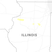
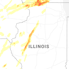
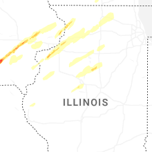

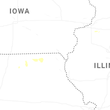


Connect with Interactive Hail Maps