

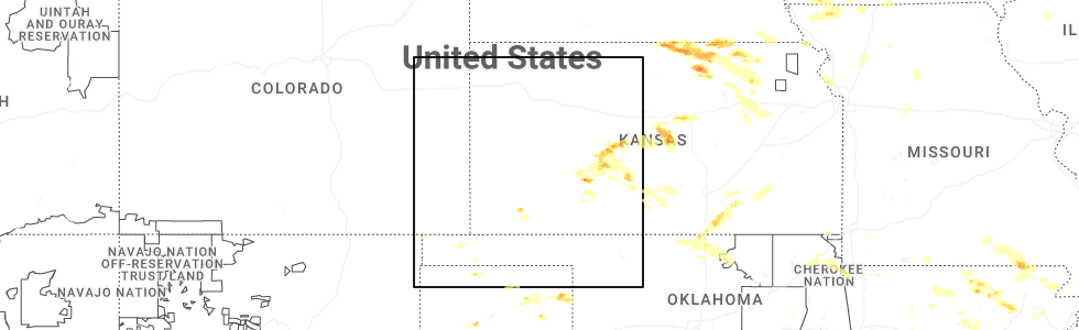
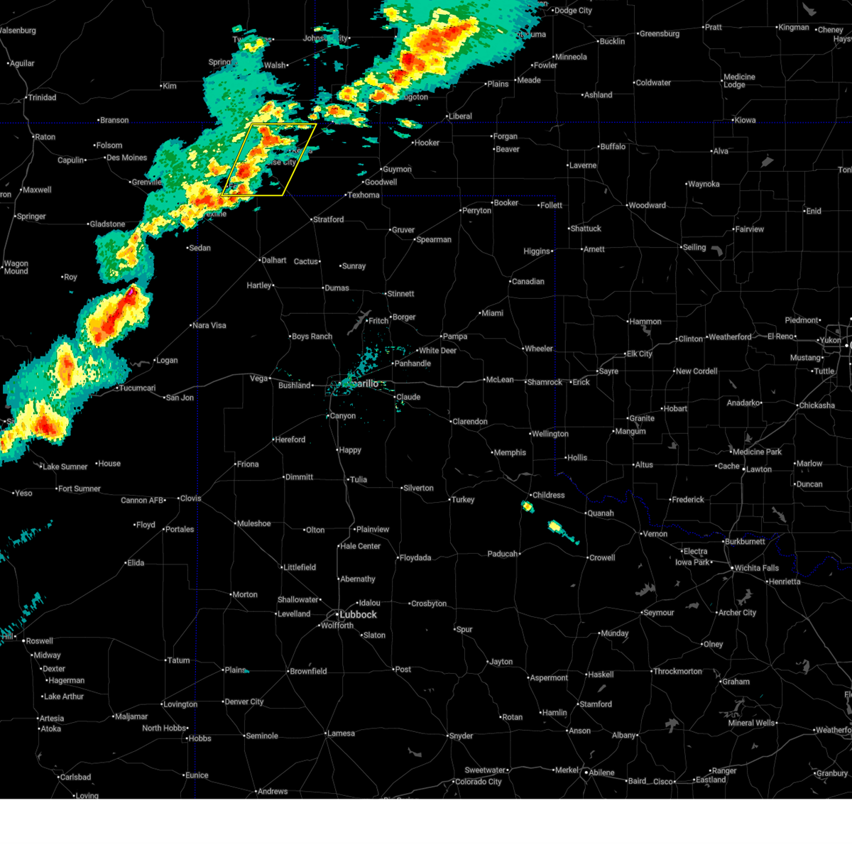
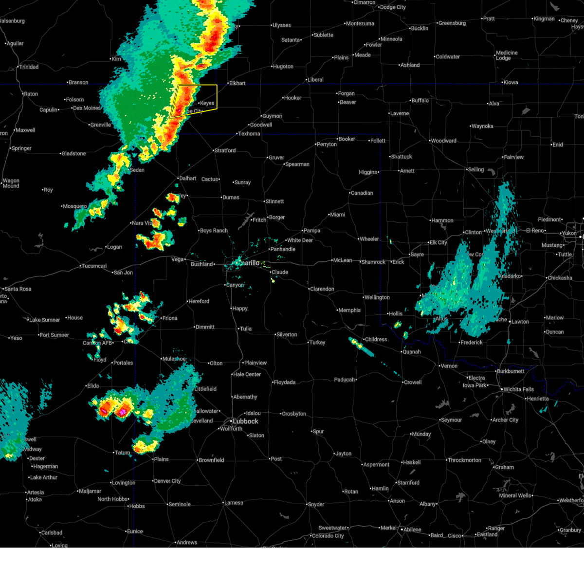
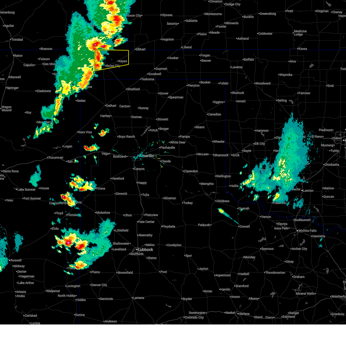
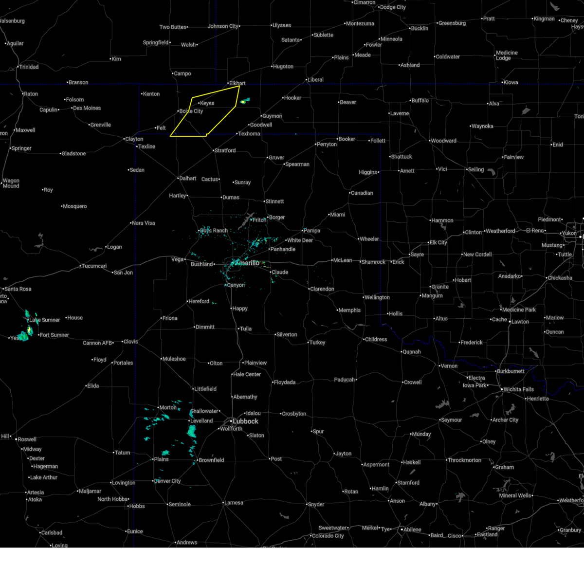
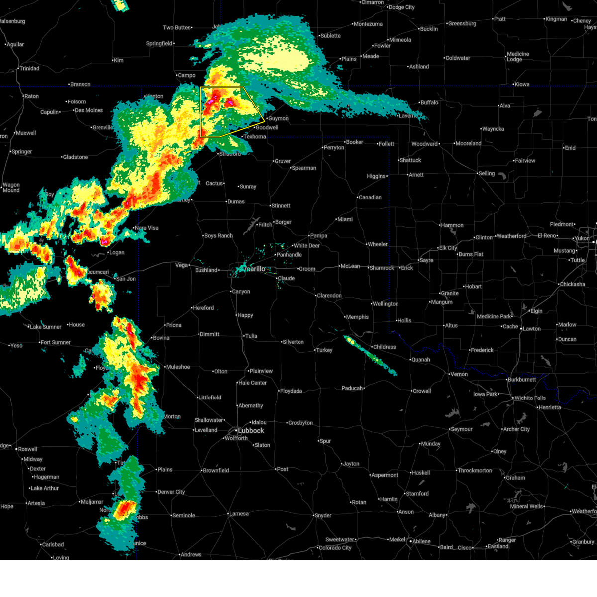
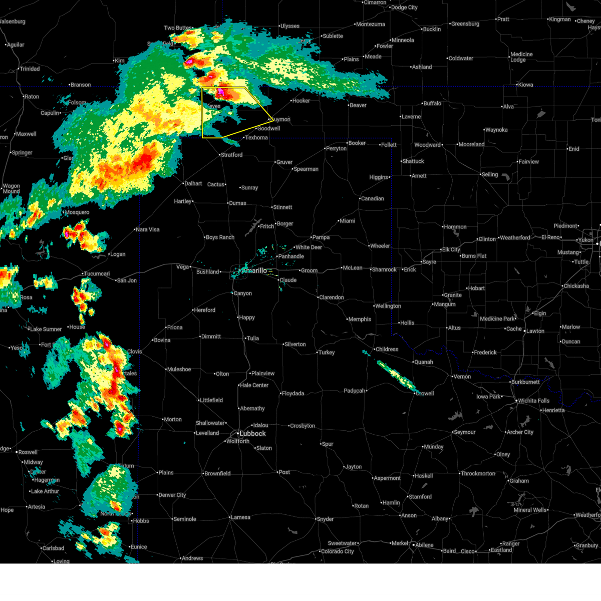
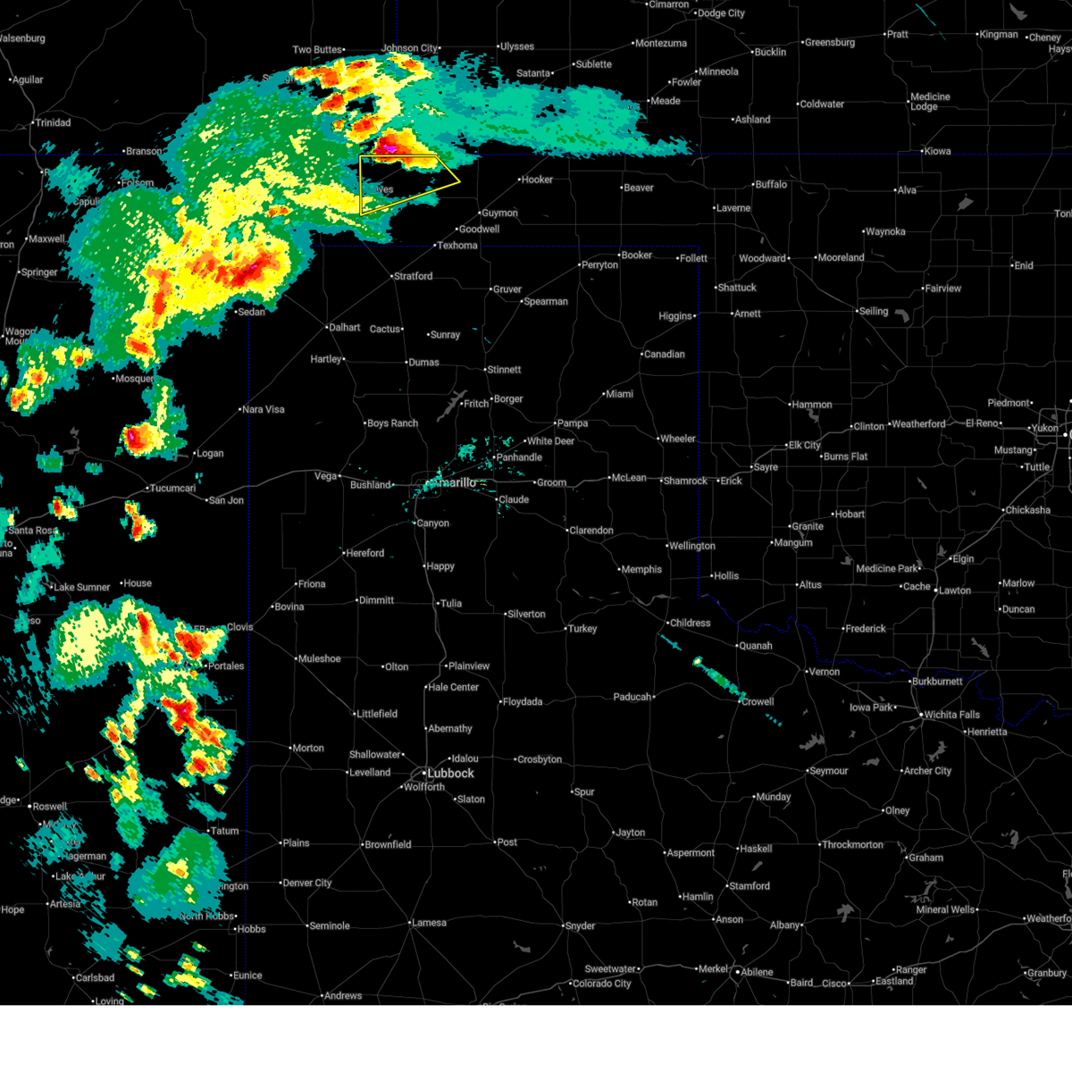
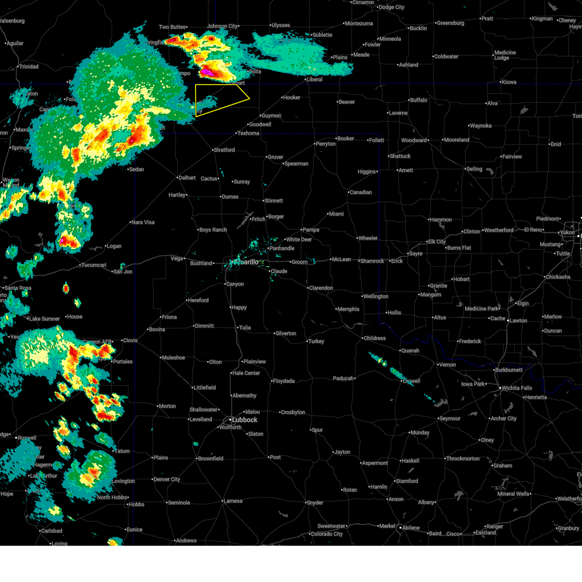
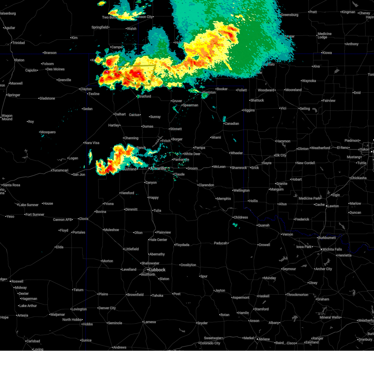
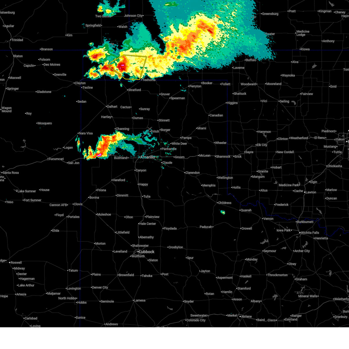
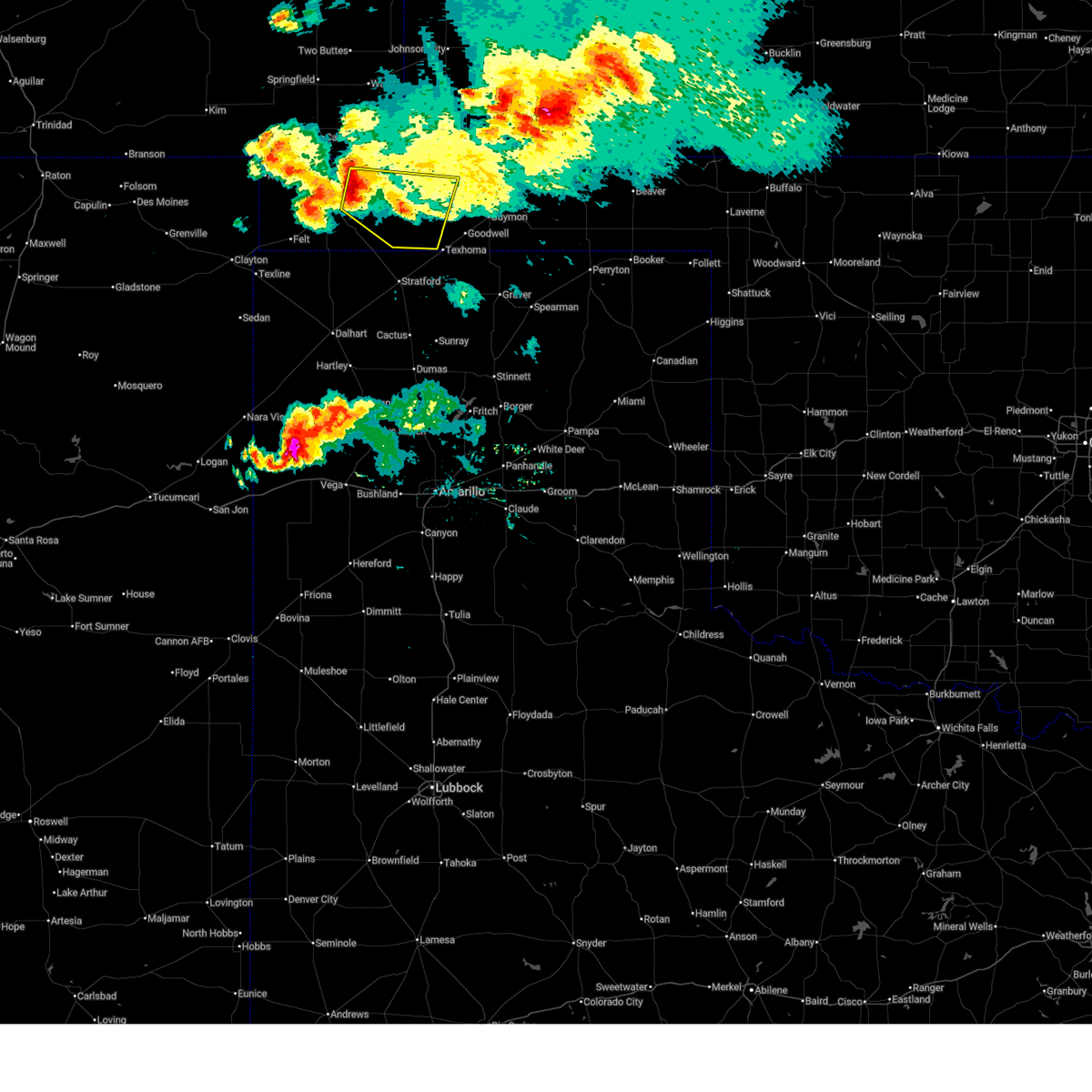
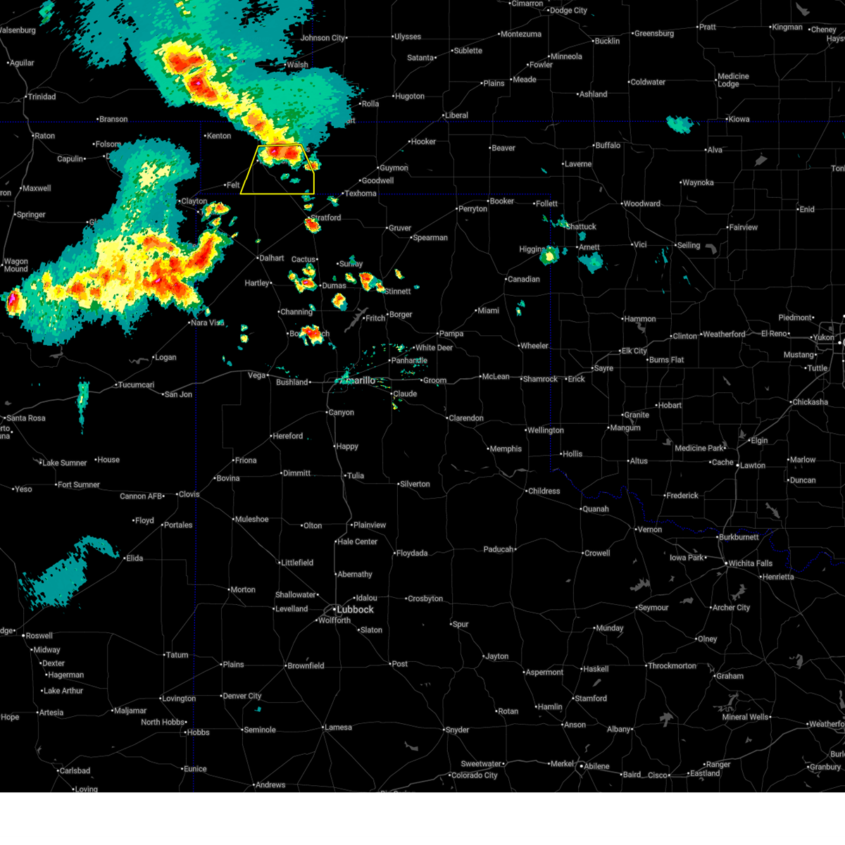
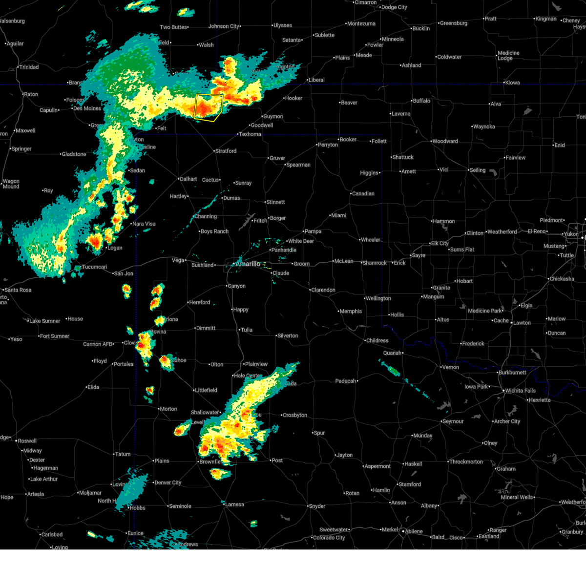
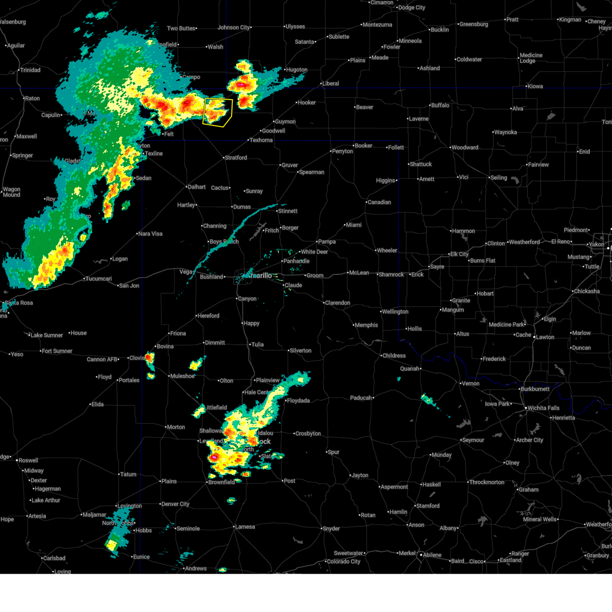
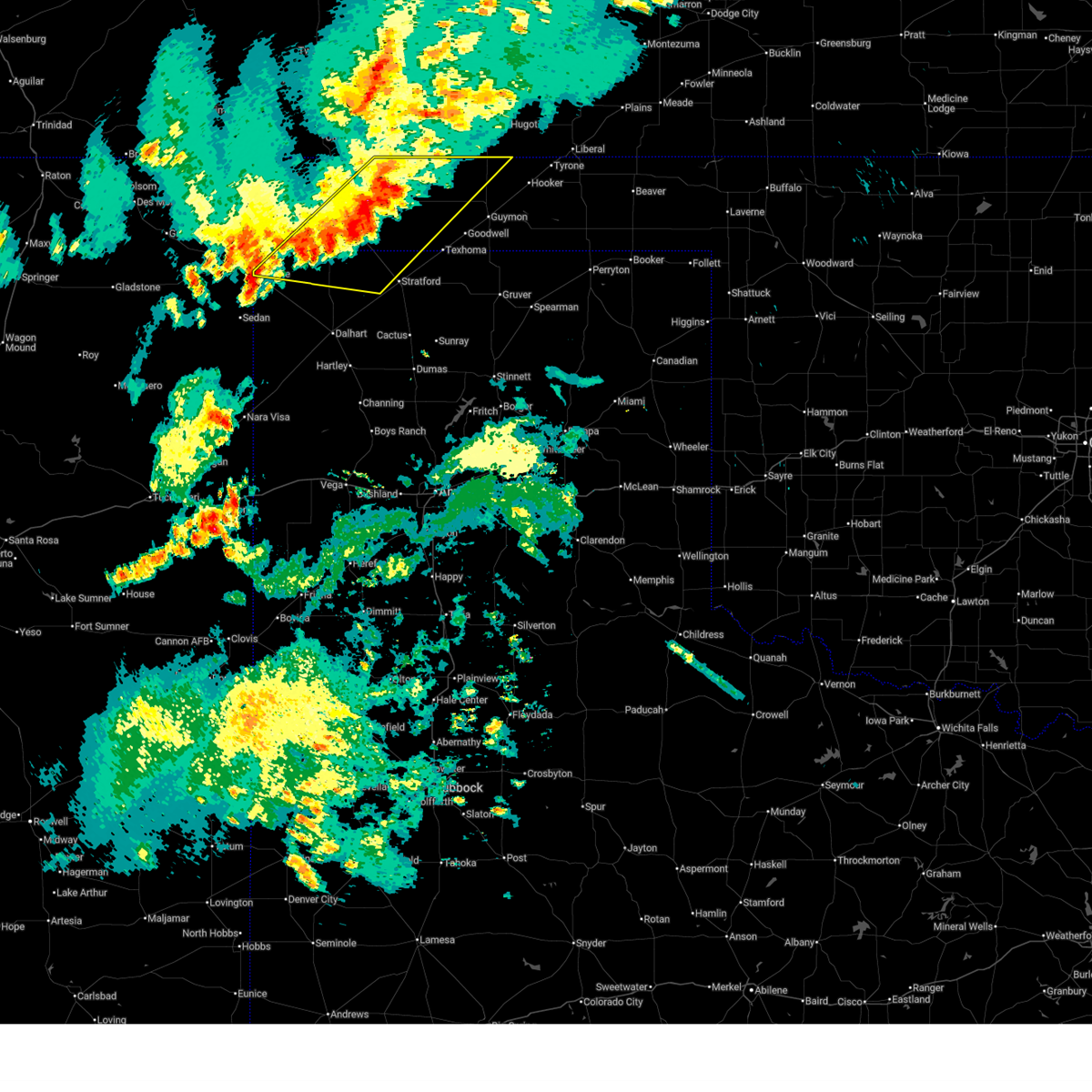
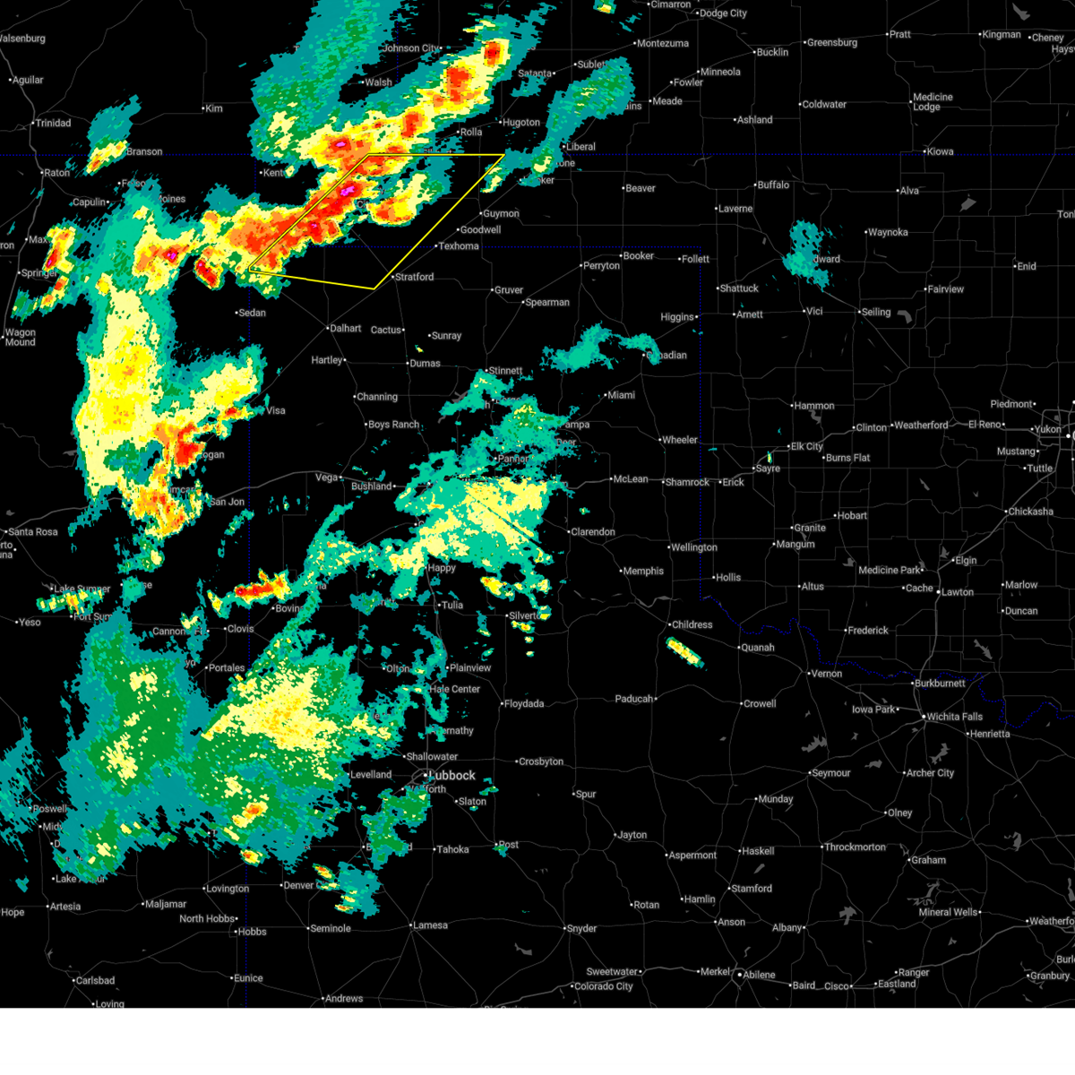
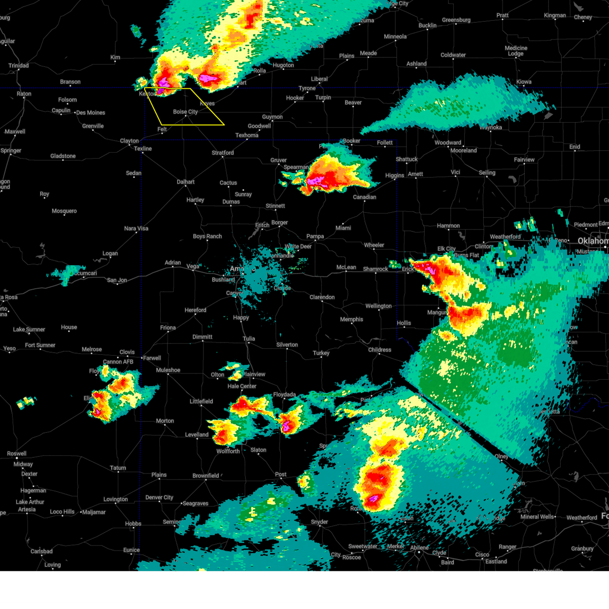
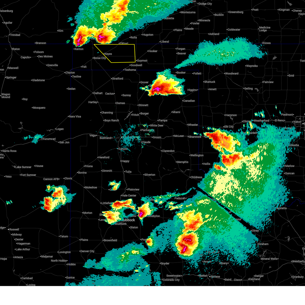
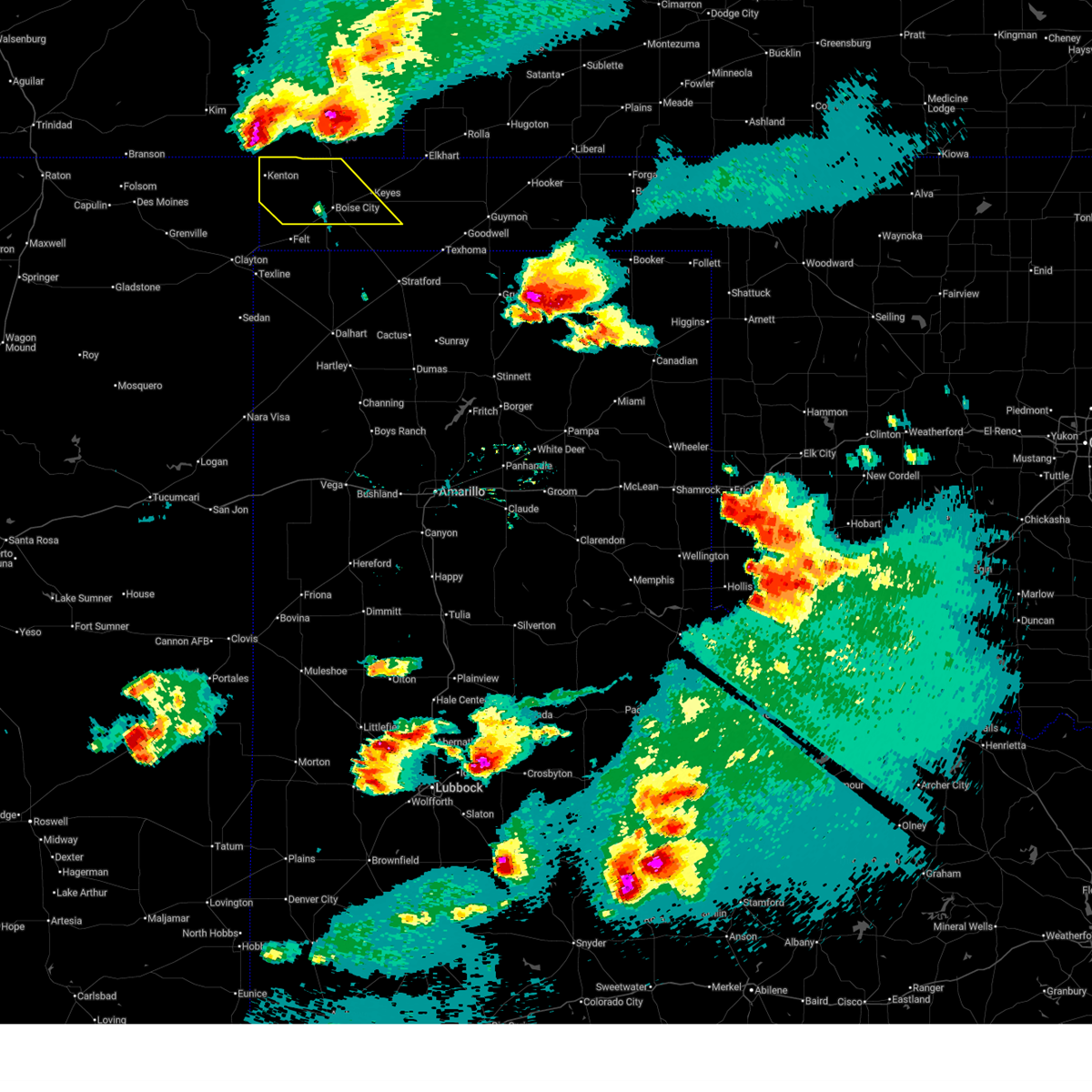
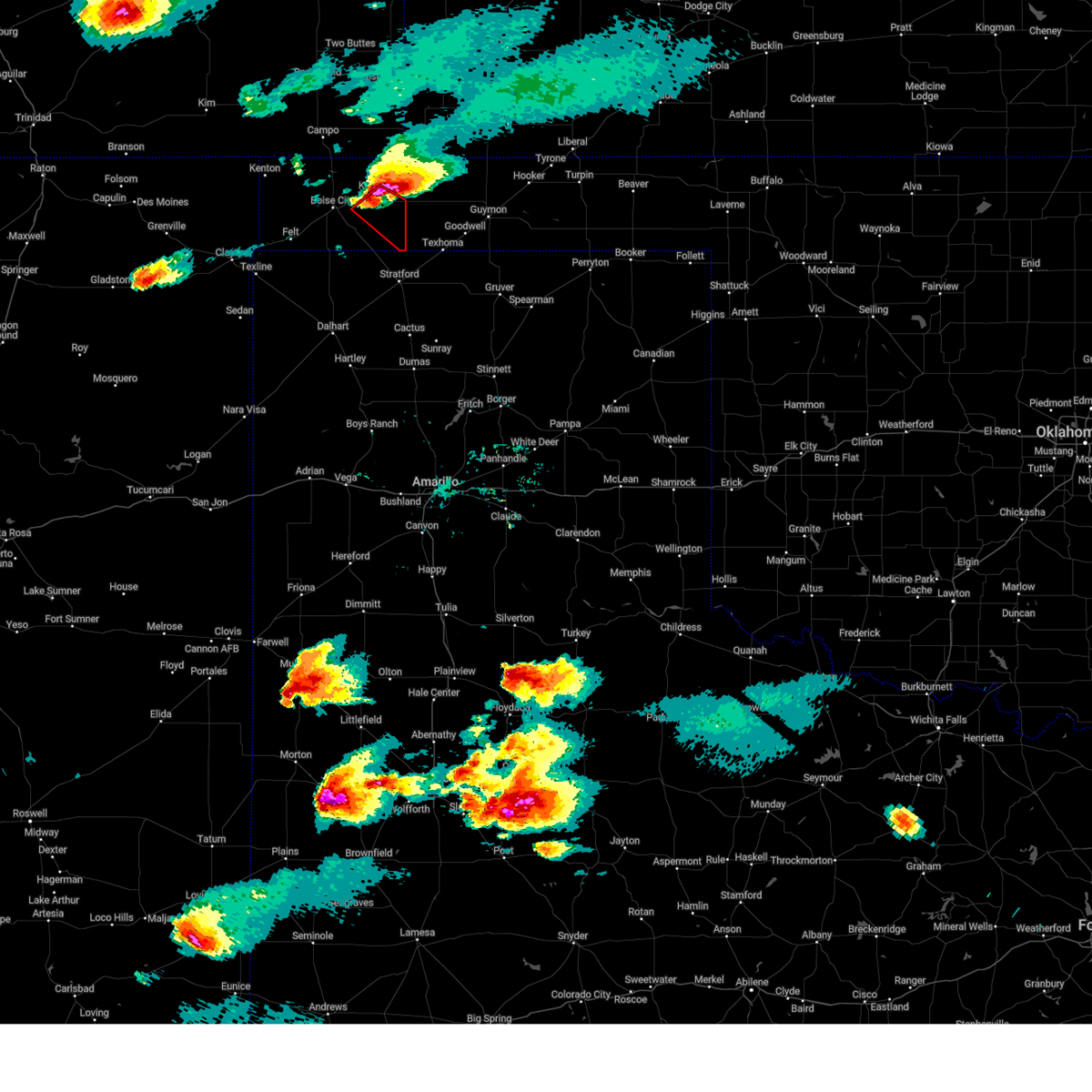
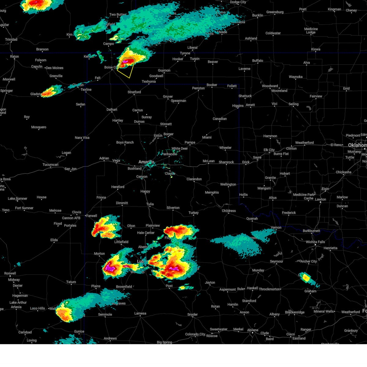
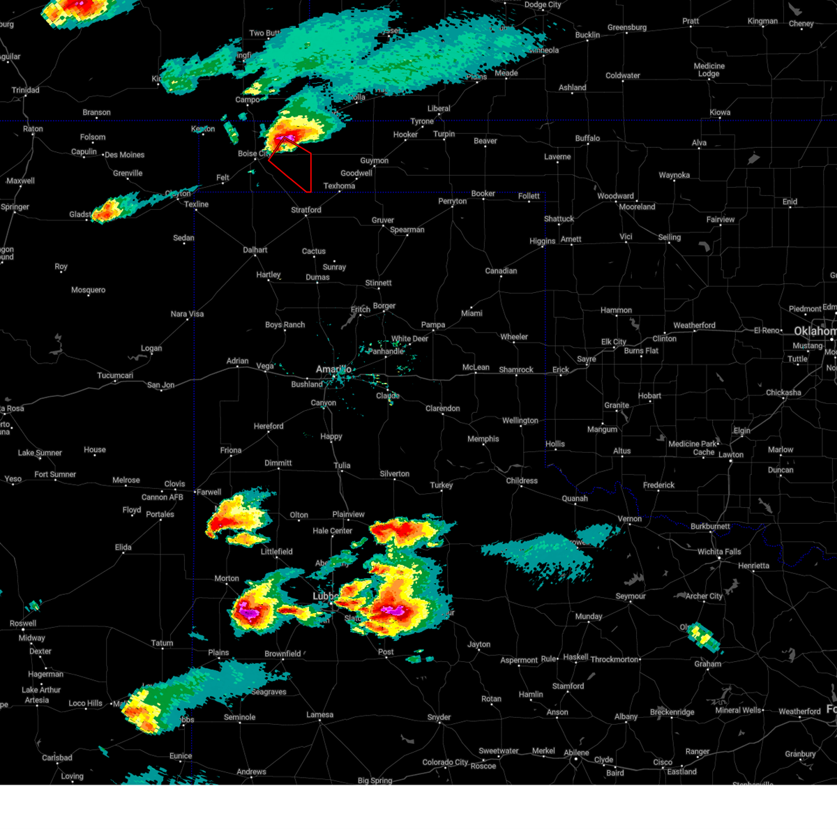
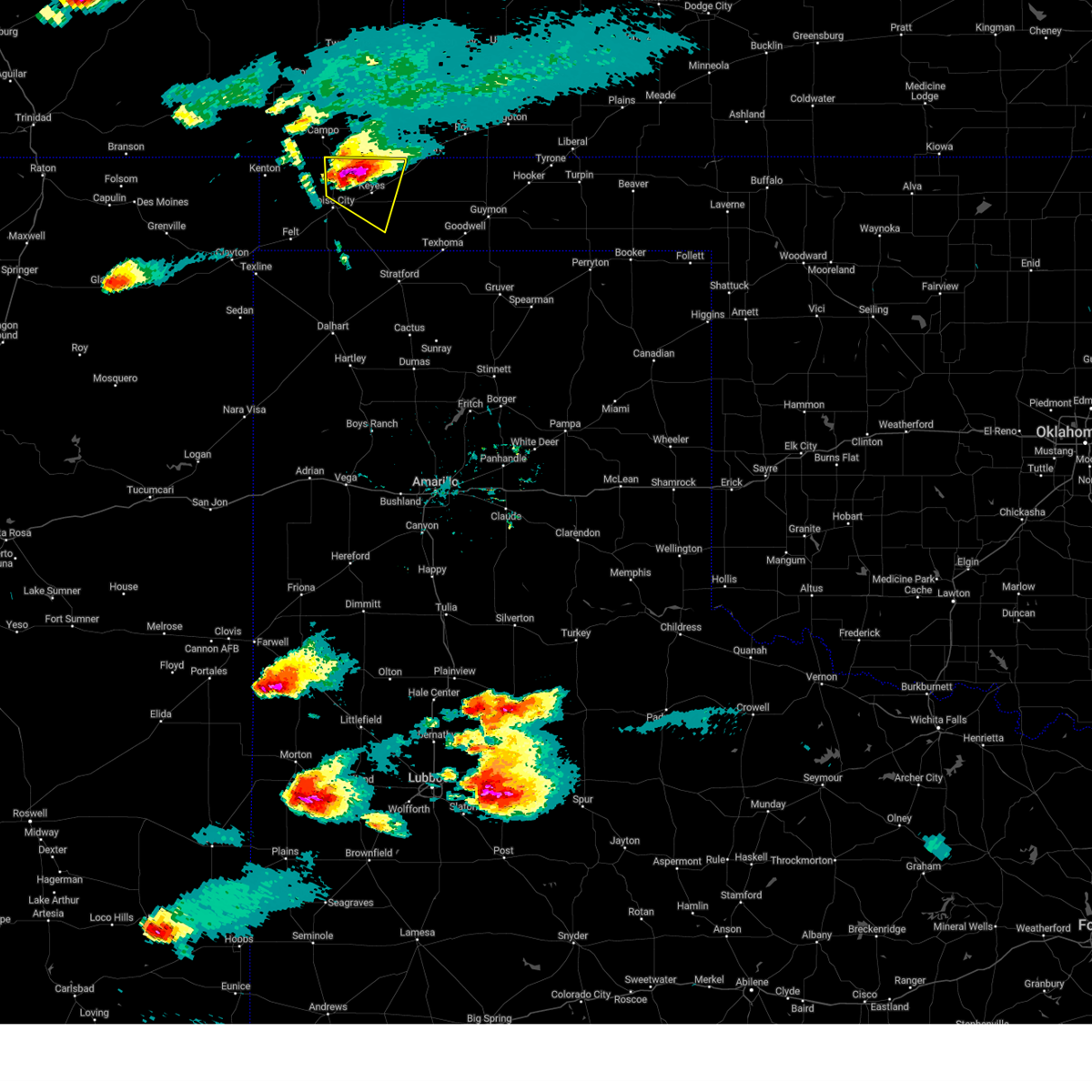
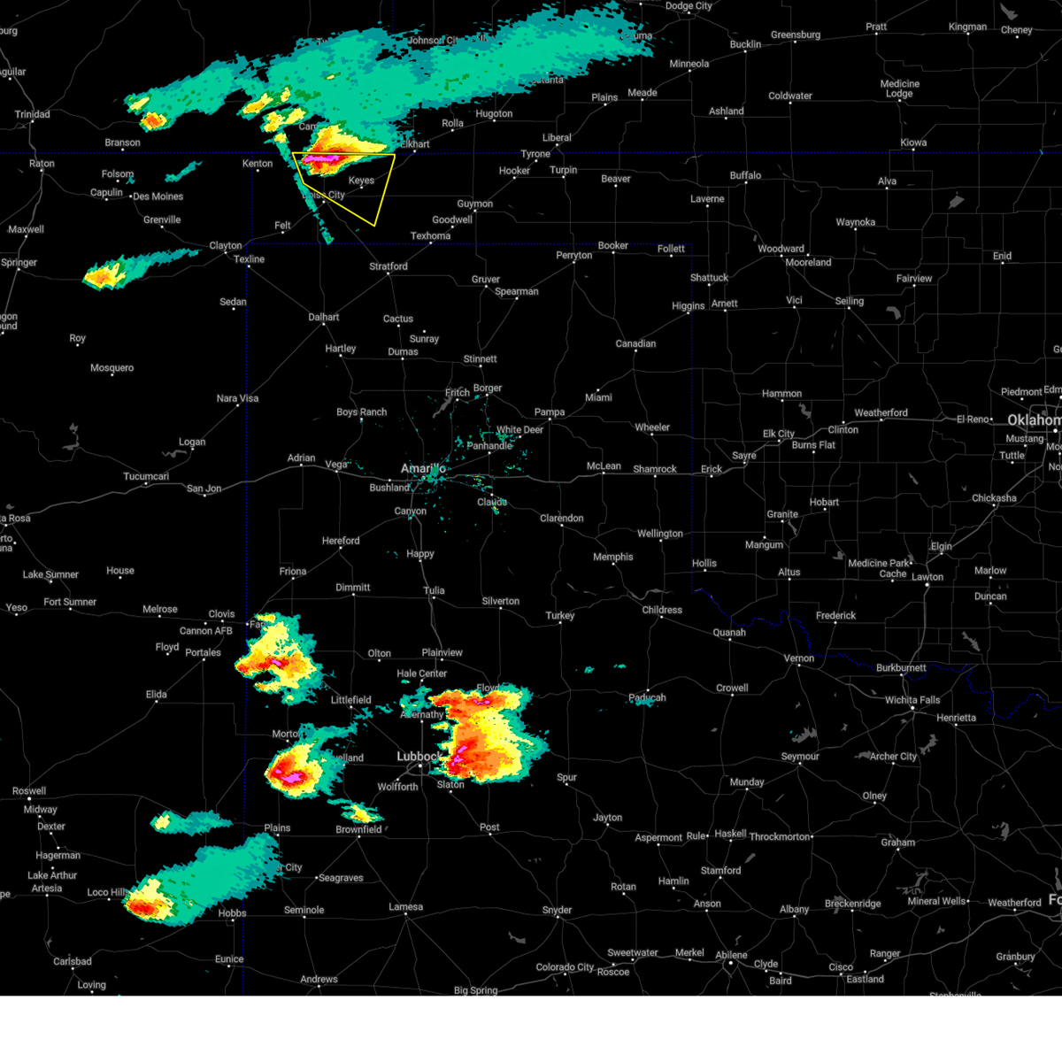
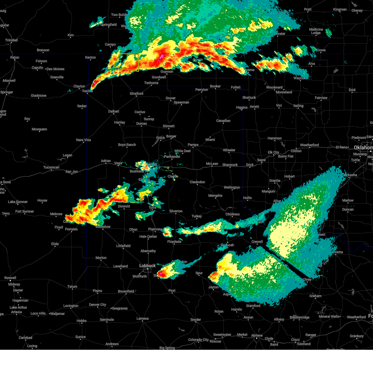
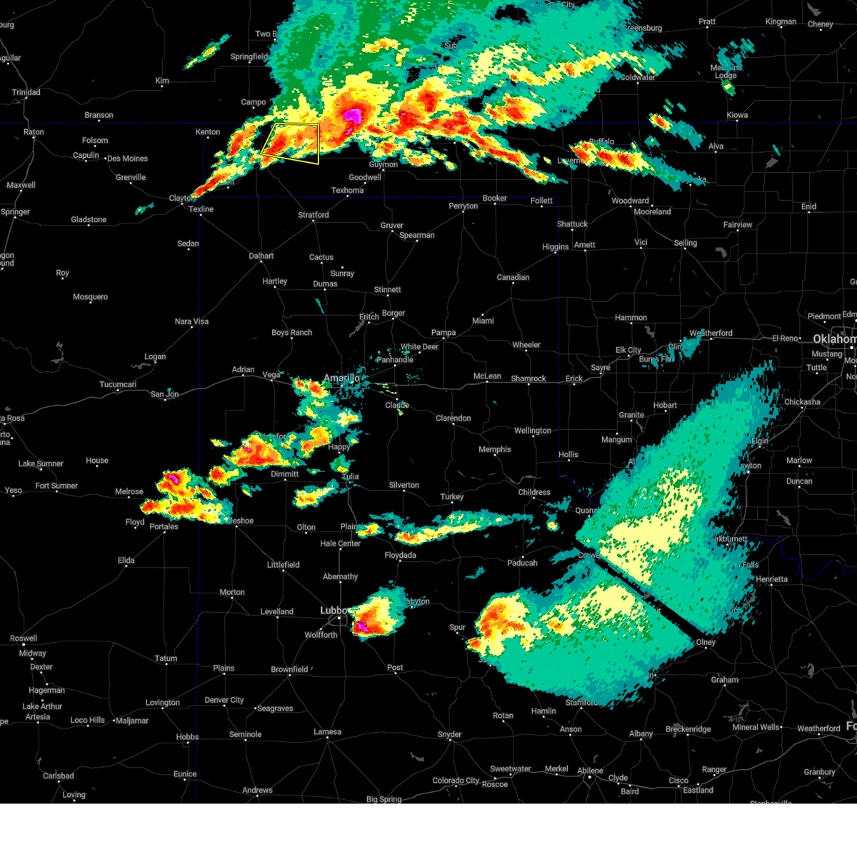
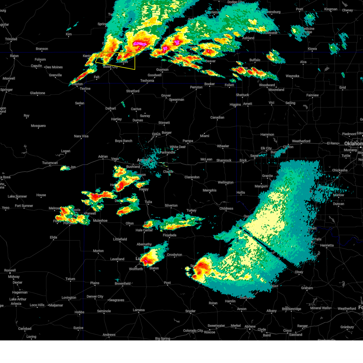
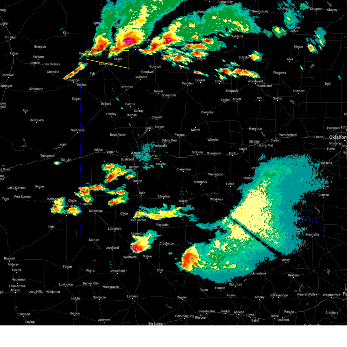
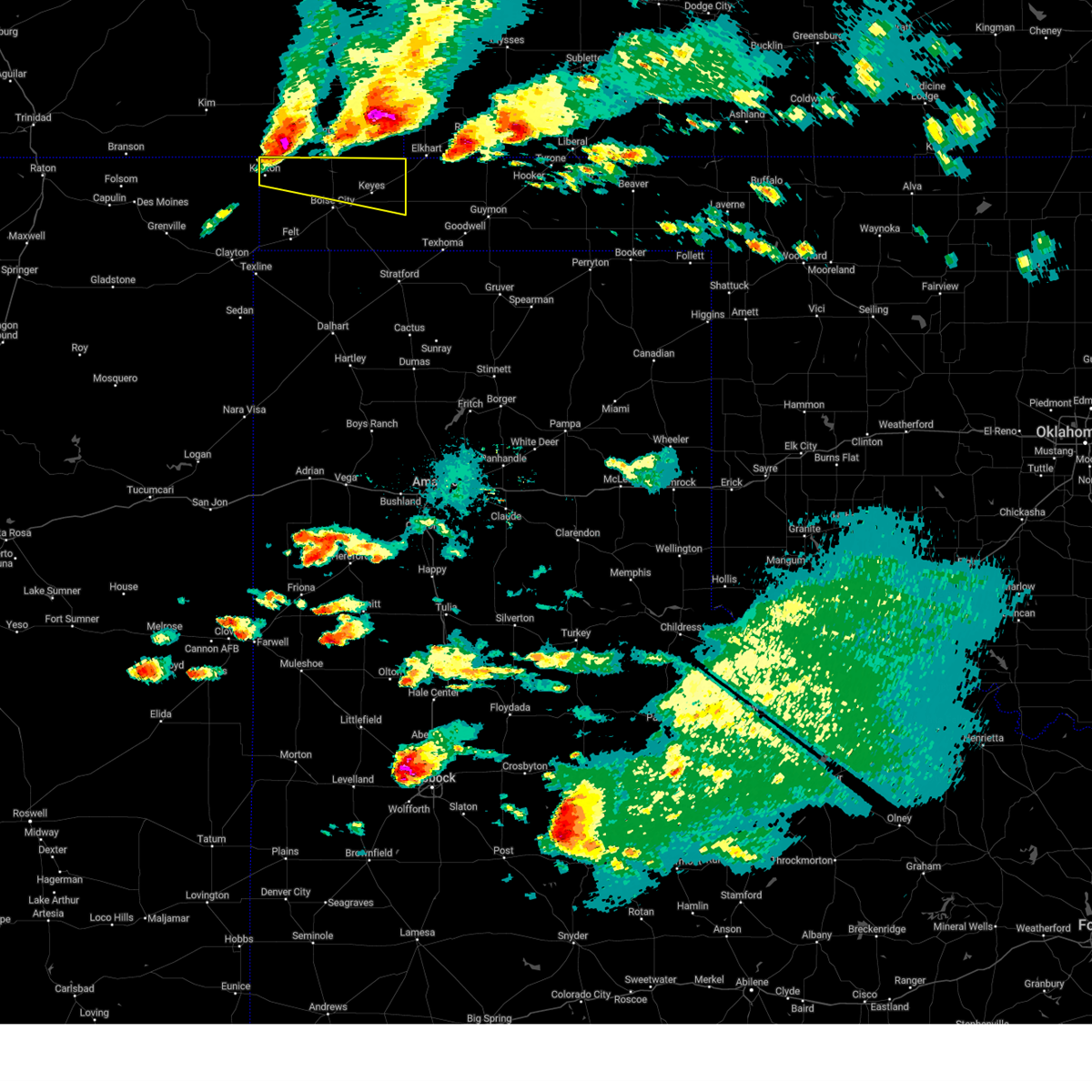
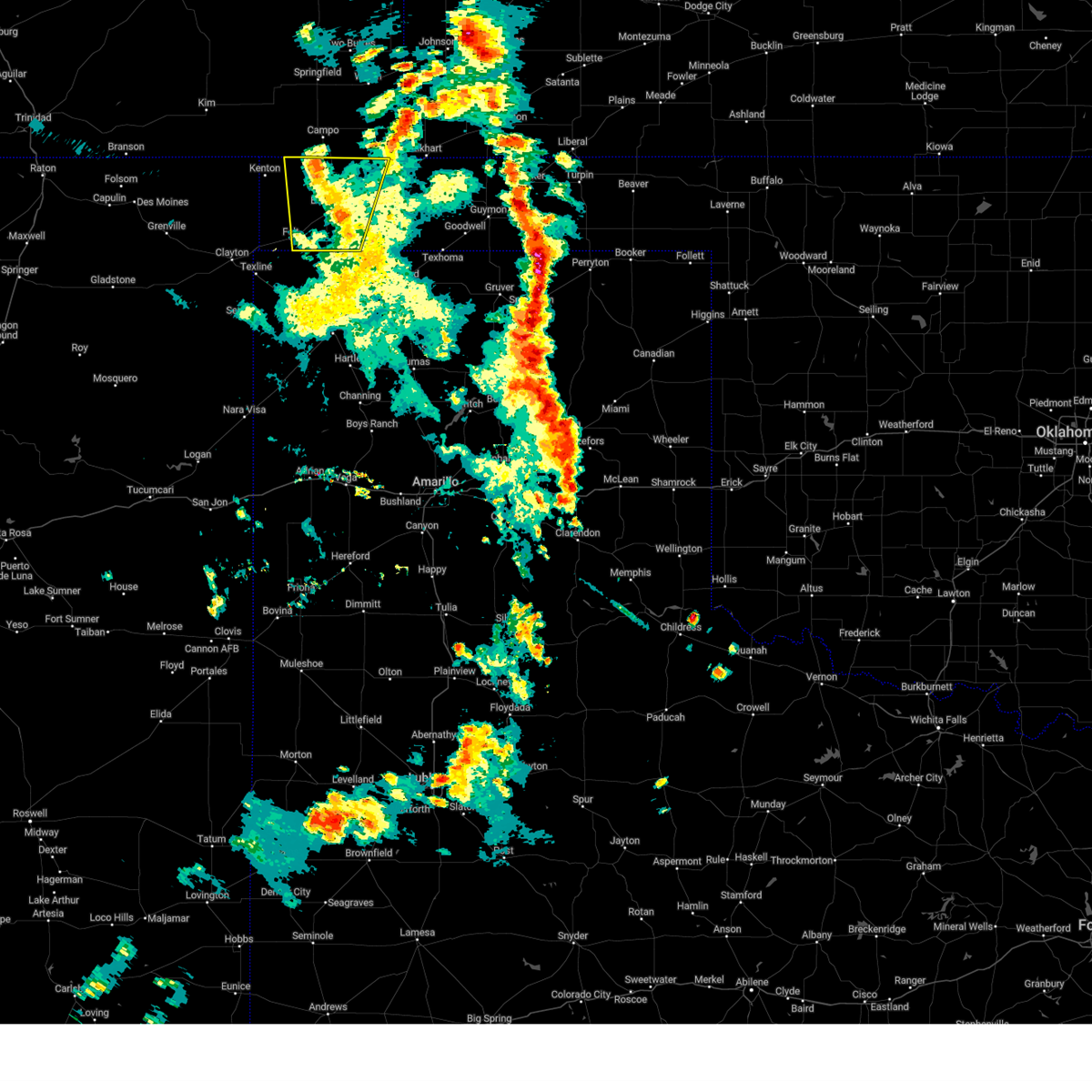
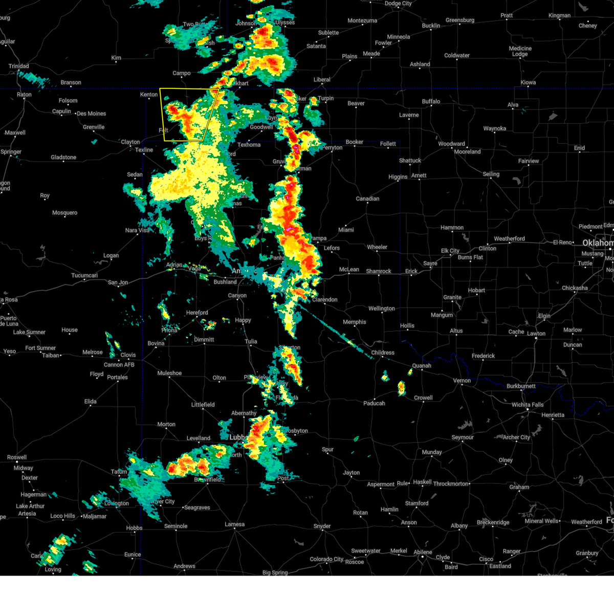
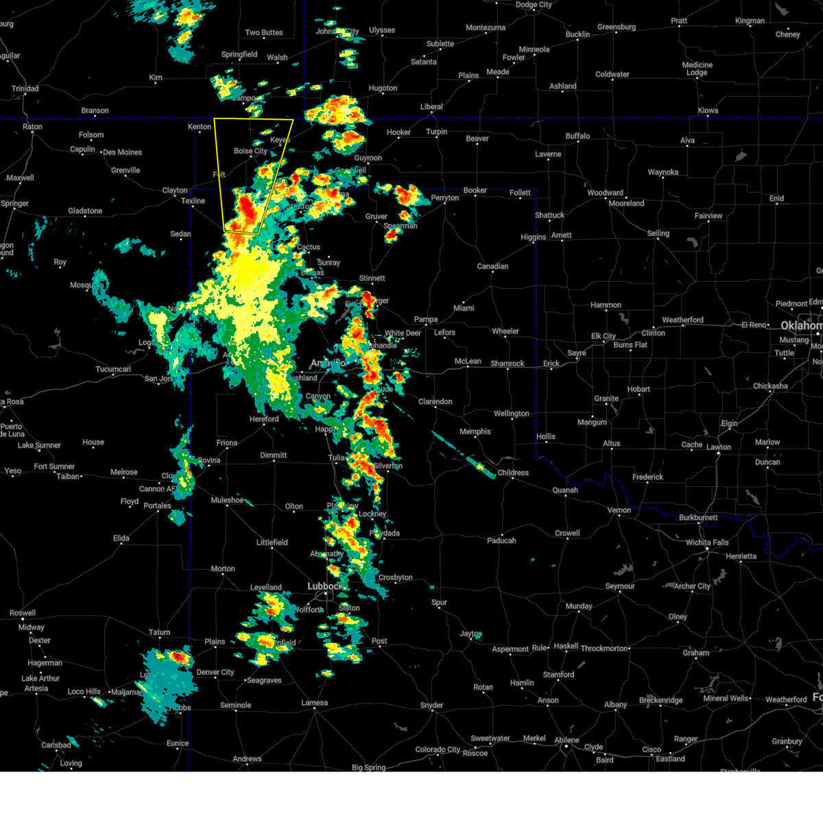
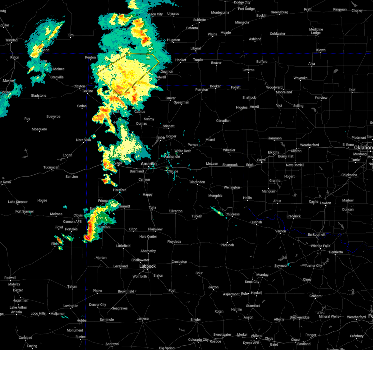
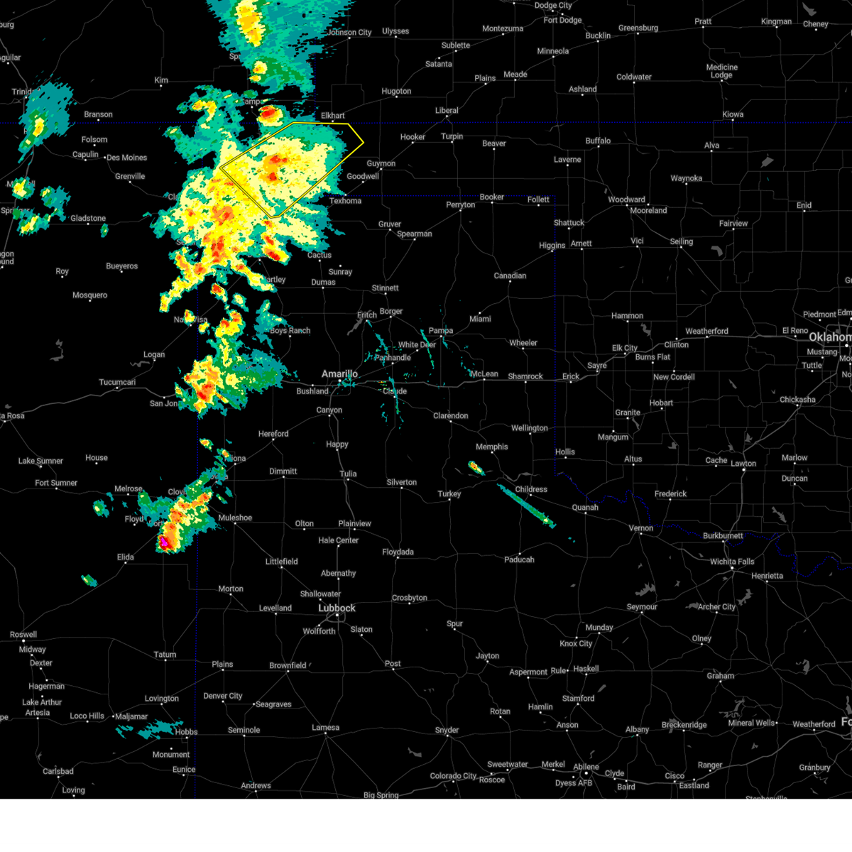
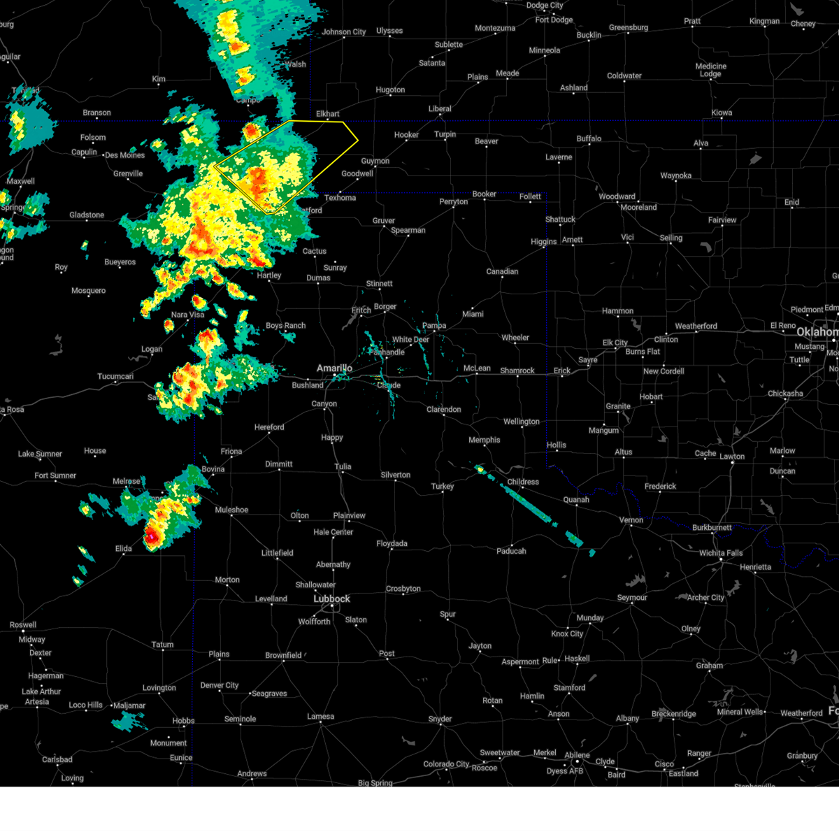
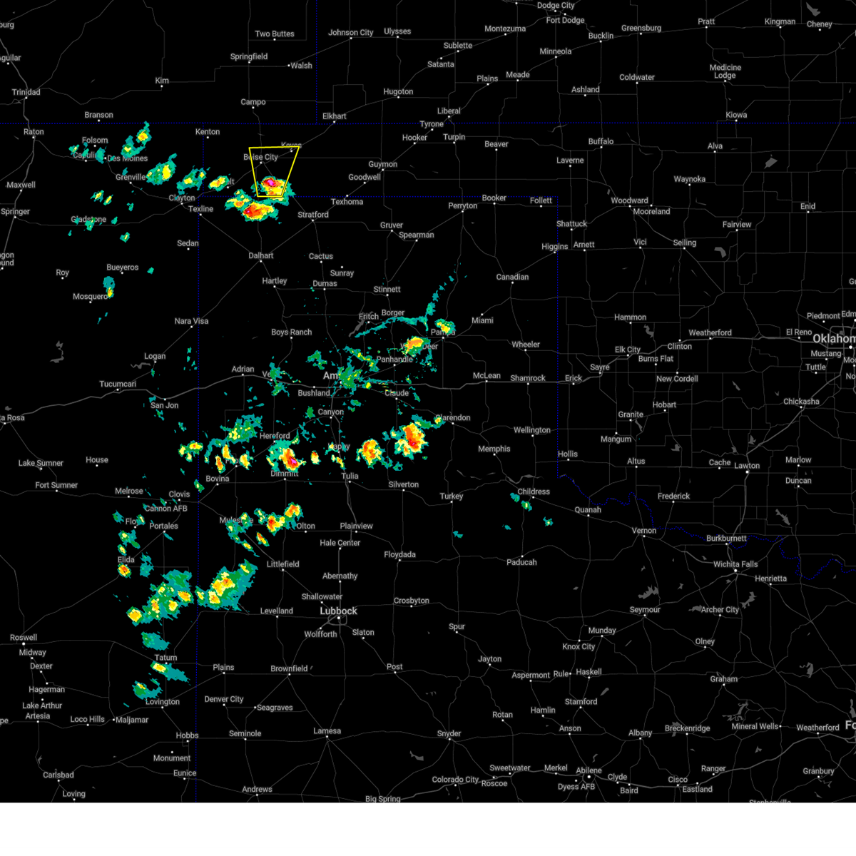
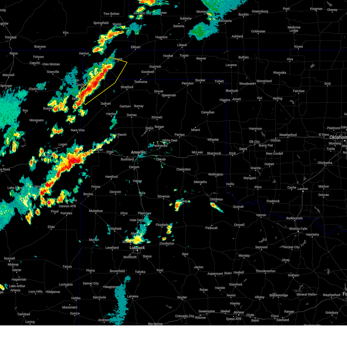
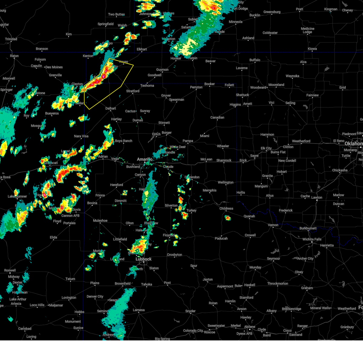
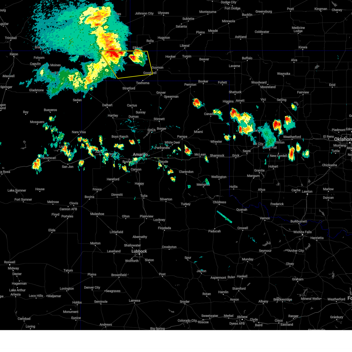
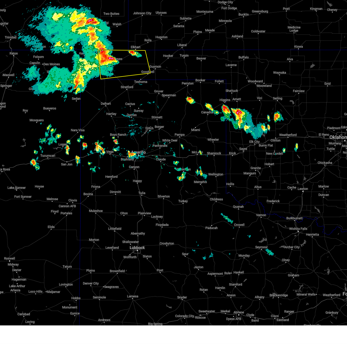
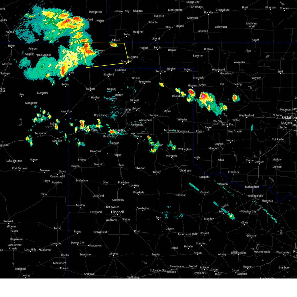
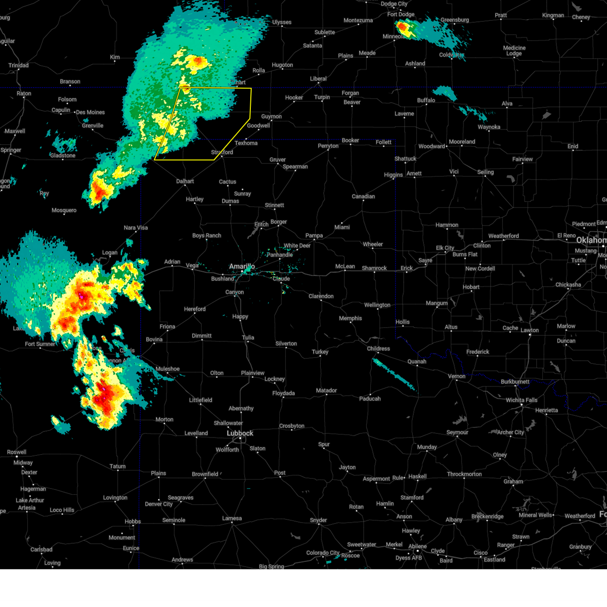
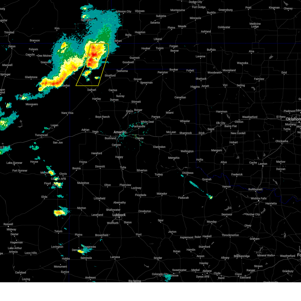
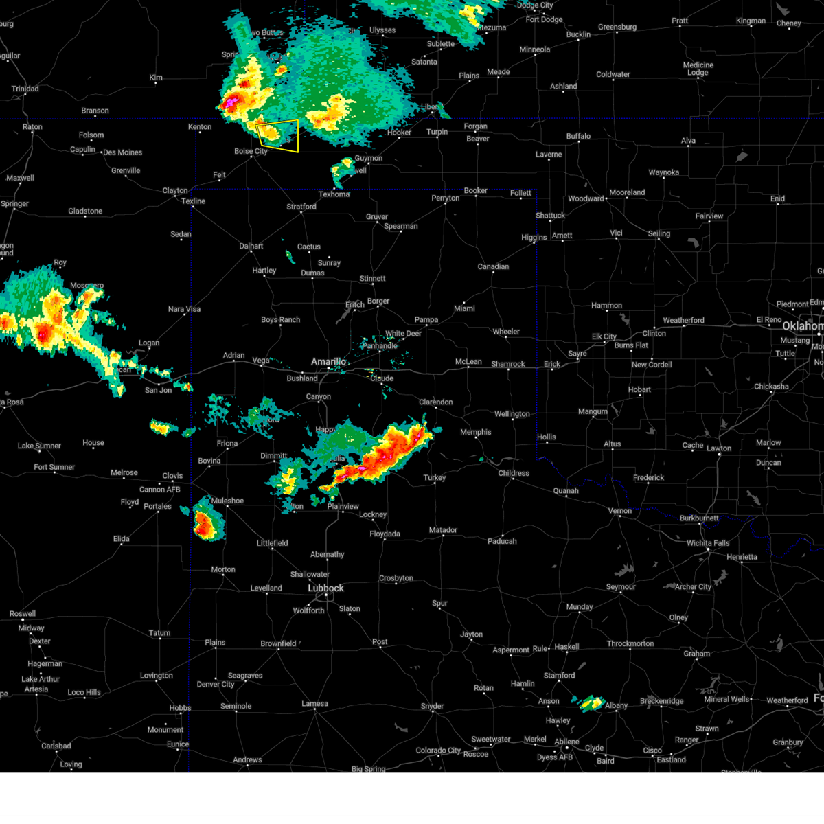
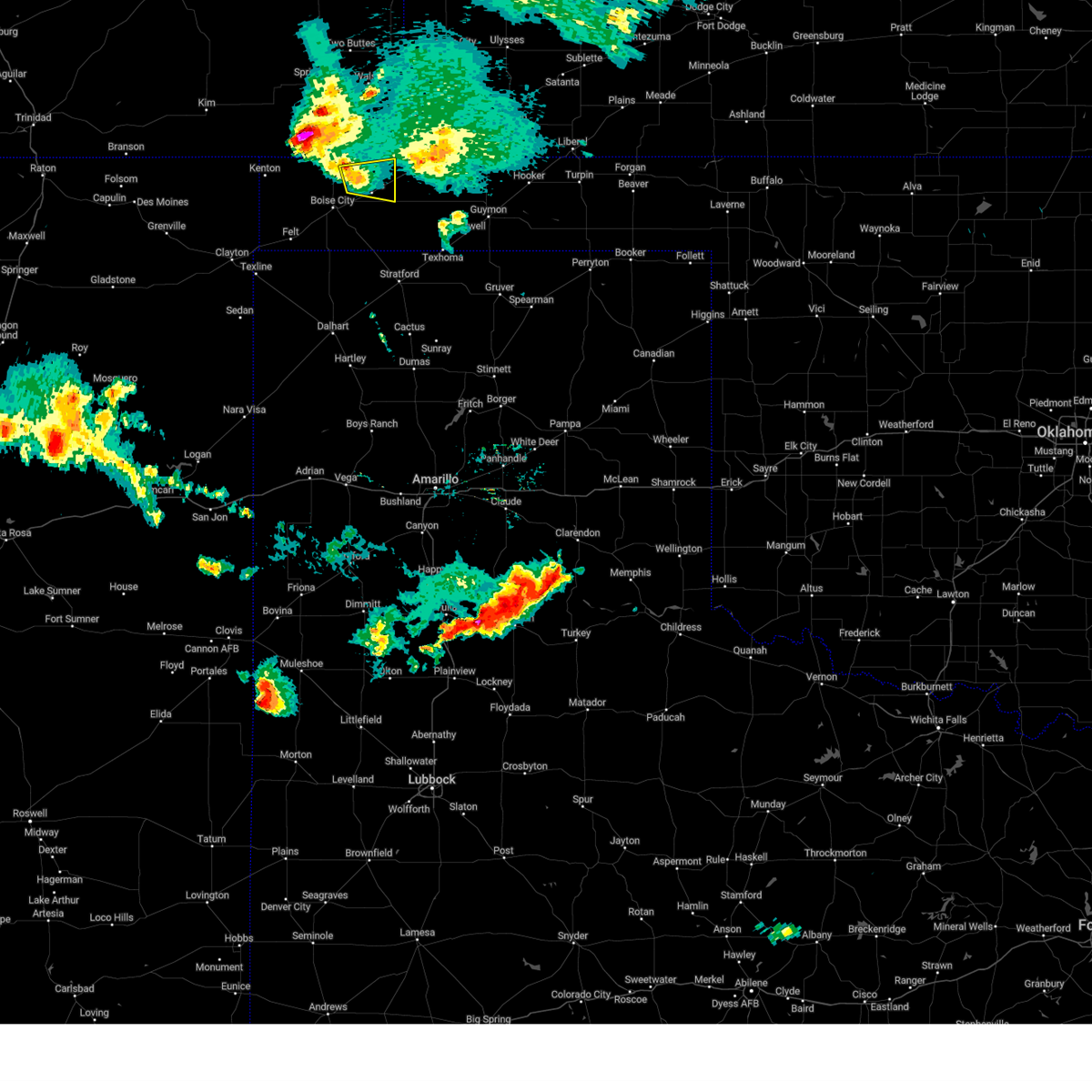
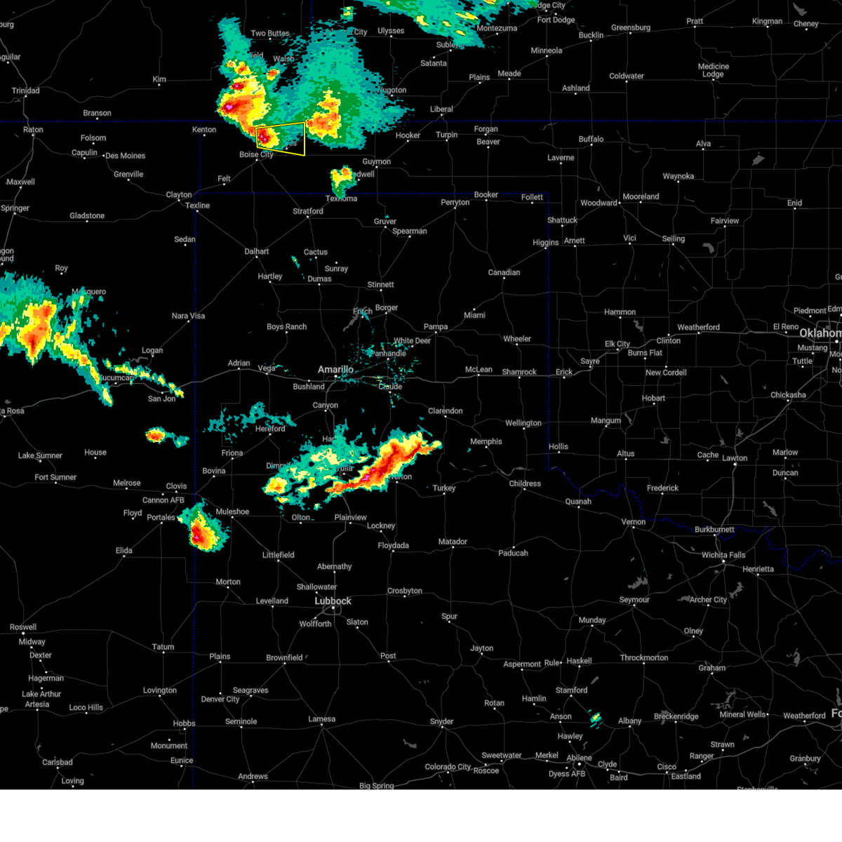
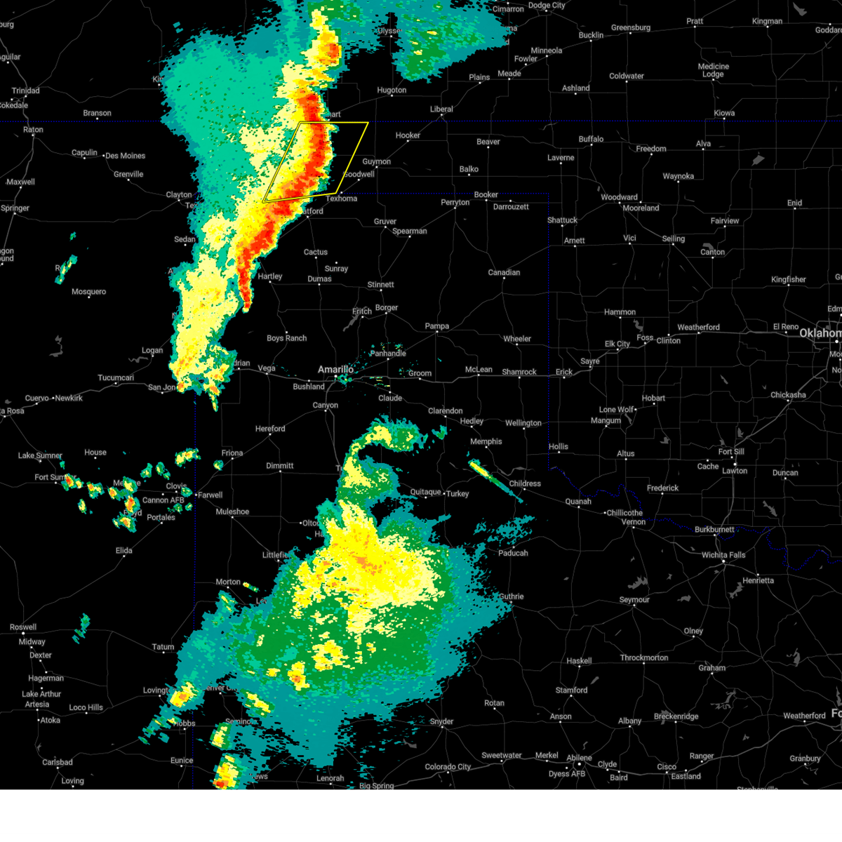
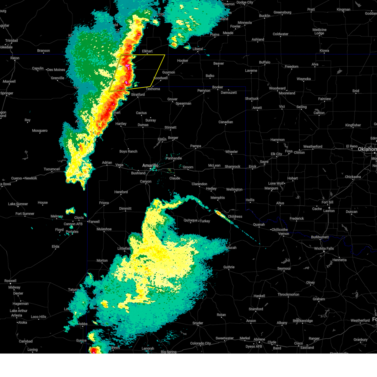
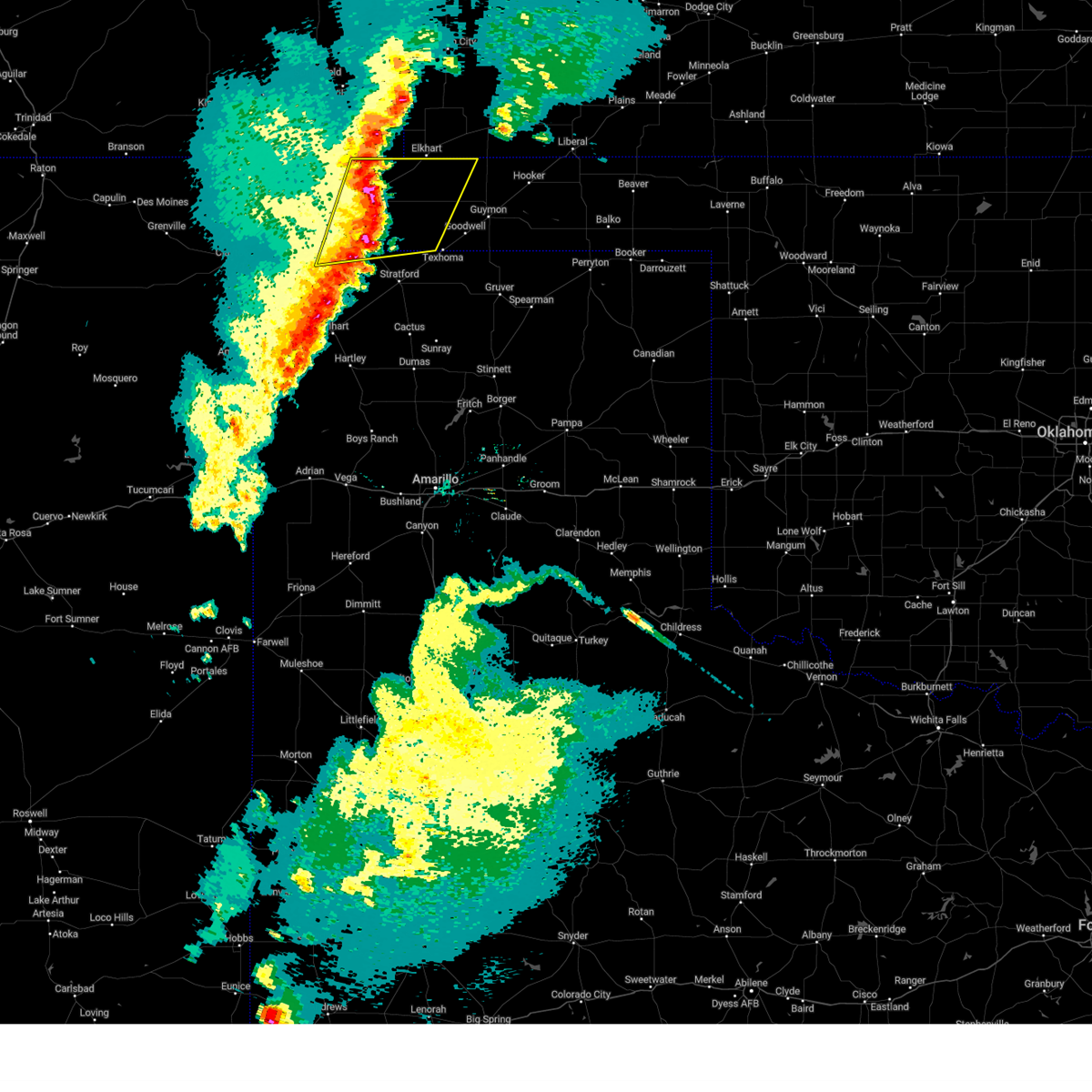
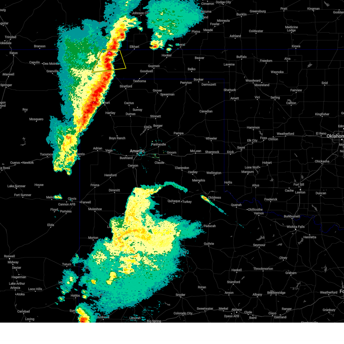
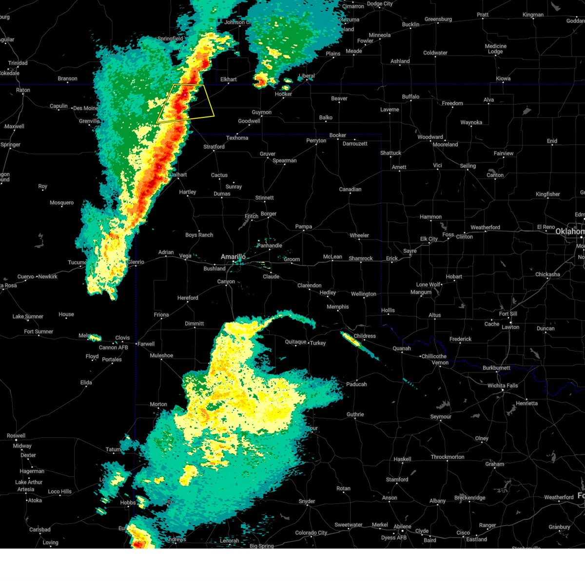
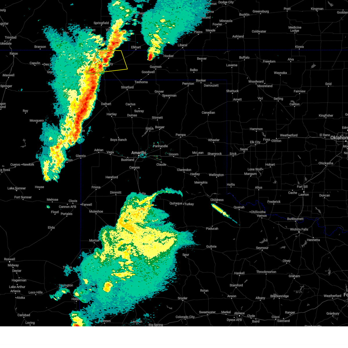
Hail Map for Keyes, OK
The Keyes, OK area has had 14 reports of on-the-ground hail by trained spotters, and has been under severe weather warnings 20 times during the past 12 months. Doppler radar has detected hail at or near Keyes, OK on 68 occasions, including 8 occasions during the past year.
| Name: | Keyes, OK |
| Where Located: | 110.4 miles SW of Garden City, KS |
| Map: | Google Map for Keyes, OK |
| Population: | 324 |
| Housing Units: | 234 |
| More Info: | Search Google for Keyes, OK |
0
The Top Recent Hail Date for Keyes, OK is Saturday, June 13, 2026 (60th out of 68)
Hail and Wind Damage Spotted near Keyes, OK
| Date / Time | Report Details |
|---|---|
| 6/12/2026 8:52 PM CDT |
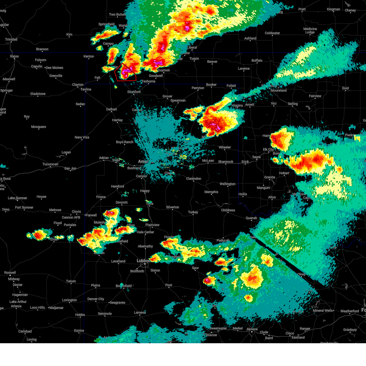
 At 852 pm cdt, severe thunderstorms were located along a line extending from 8 miles east of keyes to 9 miles west of griggs to 8 miles south of felt, moving southeast at 30 mph (radar indicated). Hazards include 60 mph wind gusts. Minor damage to roofs, siding, and trees is possible. Locations impacted include, boise city and keyes. At 852 pm cdt, severe thunderstorms were located along a line extending from 8 miles east of keyes to 9 miles west of griggs to 8 miles south of felt, moving southeast at 30 mph (radar indicated). Hazards include 60 mph wind gusts. Minor damage to roofs, siding, and trees is possible. Locations impacted include, boise city and keyes.
|
| 6/12/2026 8:35 PM CDT |
 At 835 pm cdt, severe thunderstorms were located along a line extending from 8 miles north of keyes to 8 miles southeast of boise city to 4 miles southwest of felt, moving southeast at 30 mph (radar indicated). Hazards include 60 mph wind gusts and quarter size hail. Minor damage to roofs, siding, and trees is possible. hail damage to vehicles is expected. Locations impacted include, boise city, keyes, wheeless, and felt. At 835 pm cdt, severe thunderstorms were located along a line extending from 8 miles north of keyes to 8 miles southeast of boise city to 4 miles southwest of felt, moving southeast at 30 mph (radar indicated). Hazards include 60 mph wind gusts and quarter size hail. Minor damage to roofs, siding, and trees is possible. hail damage to vehicles is expected. Locations impacted include, boise city, keyes, wheeless, and felt.
|
| 6/12/2026 8:17 PM CDT |
 Svrama the national weather service in amarillo has issued a * severe thunderstorm warning for, cimarron county in the panhandle of oklahoma, northwestern dallam county in the panhandle of texas, * until 900 pm cdt. * at 817 pm cdt, a severe thunderstorm was located over boise city, moving southeast at 30 mph (radar indicated). Hazards include 60 mph wind gusts. minor damage to roofs, siding, and trees is possible Svrama the national weather service in amarillo has issued a * severe thunderstorm warning for, cimarron county in the panhandle of oklahoma, northwestern dallam county in the panhandle of texas, * until 900 pm cdt. * at 817 pm cdt, a severe thunderstorm was located over boise city, moving southeast at 30 mph (radar indicated). Hazards include 60 mph wind gusts. minor damage to roofs, siding, and trees is possible
|
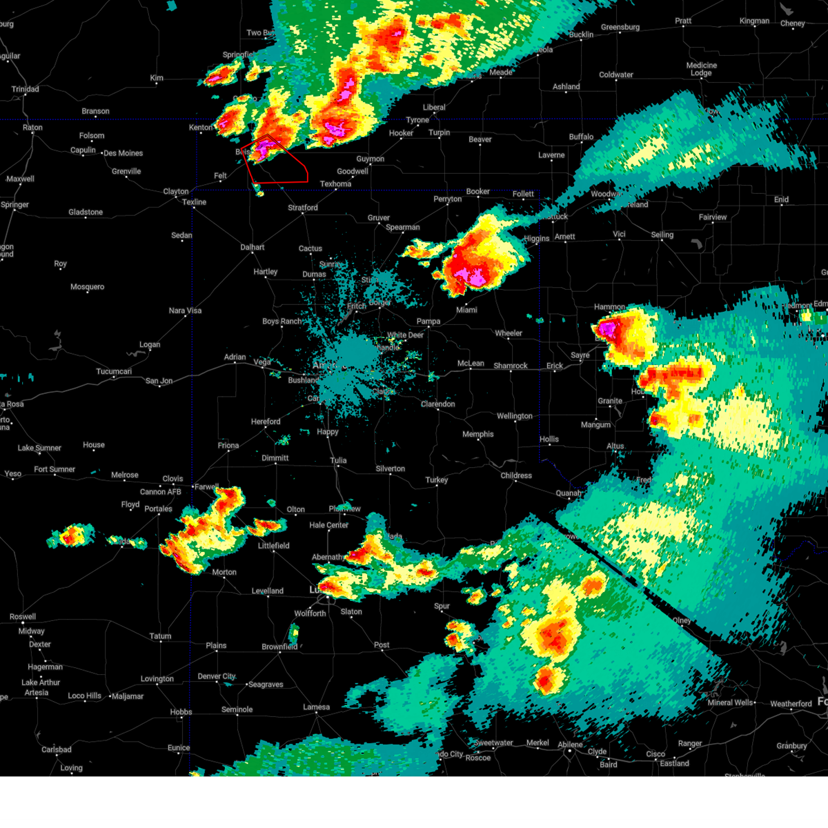
| 6/9/2026 4:27 PM CDT |
 Svrama the national weather service in amarillo has issued a * severe thunderstorm warning for, central cimarron county in the panhandle of oklahoma, * until 530 pm cdt. * at 427 pm cdt, a cluster of severe thunderstorms was located 6 miles southwest of boise city, moving northeast at 25 mph (radar indicated). Hazards include 60 mph wind gusts and penny size hail. minor damage to roofs, siding, and trees is possible Svrama the national weather service in amarillo has issued a * severe thunderstorm warning for, central cimarron county in the panhandle of oklahoma, * until 530 pm cdt. * at 427 pm cdt, a cluster of severe thunderstorms was located 6 miles southwest of boise city, moving northeast at 25 mph (radar indicated). Hazards include 60 mph wind gusts and penny size hail. minor damage to roofs, siding, and trees is possible
|
| 5/21/2026 6:27 PM CDT |
 At 627 pm cdt, a severe thunderstorm was located 7 miles northwest of keyes, or 14 miles northeast of boise city, moving east at 30 mph (radar indicated). Hazards include 60 mph wind gusts and penny size hail. Minor damage to roofs, siding, and trees is possible. Locations impacted include, boise city, keyes, and sturgis. At 627 pm cdt, a severe thunderstorm was located 7 miles northwest of keyes, or 14 miles northeast of boise city, moving east at 30 mph (radar indicated). Hazards include 60 mph wind gusts and penny size hail. Minor damage to roofs, siding, and trees is possible. Locations impacted include, boise city, keyes, and sturgis.
|
| 5/21/2026 6:01 PM CDT |
 Svrama the national weather service in amarillo has issued a * severe thunderstorm warning for, northeastern cimarron county in the panhandle of oklahoma, * until 700 pm cdt. * at 601 pm cdt, a severe thunderstorm was located 11 miles northwest of boise city, moving east at 35 mph (radar indicated). Hazards include 60 mph wind gusts and quarter size hail. Minor damage to roofs, siding, and trees is possible. Hail damage to vehicles is expected. Svrama the national weather service in amarillo has issued a * severe thunderstorm warning for, northeastern cimarron county in the panhandle of oklahoma, * until 700 pm cdt. * at 601 pm cdt, a severe thunderstorm was located 11 miles northwest of boise city, moving east at 35 mph (radar indicated). Hazards include 60 mph wind gusts and quarter size hail. Minor damage to roofs, siding, and trees is possible. Hail damage to vehicles is expected.
|
| 5/14/2026 5:51 PM CDT |
 Svrama the national weather service in amarillo has issued a * severe thunderstorm warning for, northwestern texas county in the panhandle of oklahoma, southeastern cimarron county in the panhandle of oklahoma, northeastern dallam county in the panhandle of texas, * until 700 pm cdt. * at 551 pm cdt, severe thunderstorms were located along a line extending from 17 miles west of eva to 4 miles south of keyes to 12 miles south of boise city, moving east at 20 mph (radar indicated). Hazards include 60 mph wind gusts. Blowing dust and reduced visibilities are likely. Minor damage to roofs, siding, and trees is possible. Svrama the national weather service in amarillo has issued a * severe thunderstorm warning for, northwestern texas county in the panhandle of oklahoma, southeastern cimarron county in the panhandle of oklahoma, northeastern dallam county in the panhandle of texas, * until 700 pm cdt. * at 551 pm cdt, severe thunderstorms were located along a line extending from 17 miles west of eva to 4 miles south of keyes to 12 miles south of boise city, moving east at 20 mph (radar indicated). Hazards include 60 mph wind gusts. Blowing dust and reduced visibilities are likely. Minor damage to roofs, siding, and trees is possible.
|
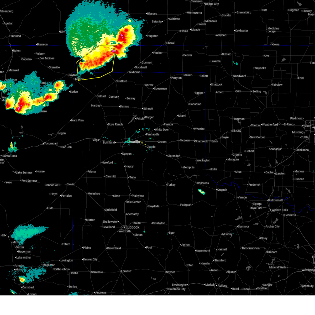
| 8/29/2025 7:43 PM CDT |
 At 742 pm cdt, a severe thunderstorm was located over eva, or 14 miles south of elkhart, moving southeast at 15 mph (radar indicated). Hazards include 70 mph wind gusts and ping pong ball size hail. Expect some tree damage. damage is likely to mobile homes, roofs, and outbuildings. people and animals outdoors will be injured. expect hail damage to roofs, siding, windows, and vehicles. Locations impacted include, keyes, eva, griggs, and sturgis. At 742 pm cdt, a severe thunderstorm was located over eva, or 14 miles south of elkhart, moving southeast at 15 mph (radar indicated). Hazards include 70 mph wind gusts and ping pong ball size hail. Expect some tree damage. damage is likely to mobile homes, roofs, and outbuildings. people and animals outdoors will be injured. expect hail damage to roofs, siding, windows, and vehicles. Locations impacted include, keyes, eva, griggs, and sturgis.
|
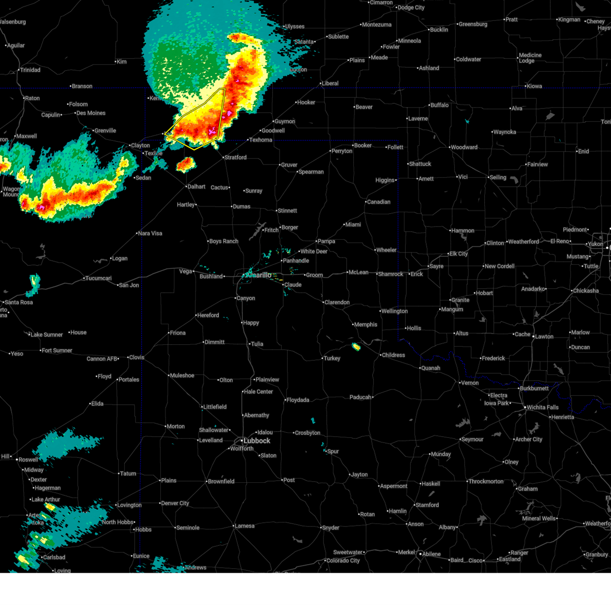
| 8/29/2025 7:14 PM CDT | Ping Pong Ball sized hail reported 13.2 miles SW of Keyes, OK |
| 8/29/2025 7:13 PM CDT |
 Svrama the national weather service in amarillo has issued a * severe thunderstorm warning for, western texas county in the panhandle of oklahoma, eastern cimarron county in the panhandle of oklahoma, * until 830 pm cdt. * at 712 pm cdt, a severe thunderstorm was located 4 miles west of eva, or 15 miles south of elkhart, moving southeast at 20 mph (radar indicated). Hazards include 60 mph wind gusts and half dollar size hail. Minor damage to roofs, siding, and trees is possible. Hail damage to vehicles is expected. Svrama the national weather service in amarillo has issued a * severe thunderstorm warning for, western texas county in the panhandle of oklahoma, eastern cimarron county in the panhandle of oklahoma, * until 830 pm cdt. * at 712 pm cdt, a severe thunderstorm was located 4 miles west of eva, or 15 miles south of elkhart, moving southeast at 20 mph (radar indicated). Hazards include 60 mph wind gusts and half dollar size hail. Minor damage to roofs, siding, and trees is possible. Hail damage to vehicles is expected.
|
| 8/29/2025 7:05 PM CDT |
 At 703 pm cdt, a severe thunderstorm was located 4 miles west of eva, or 14 miles south of elkhart, moving southeast at 20 mph (radar indicated). Hazards include golf ball size hail and 70 mph wind gusts. Expect some tree damage. damage is likely to mobile homes, roofs, and outbuildings. people and animals outdoors will be injured. expect hail damage to roofs, siding, windows, and vehicles. Locations impacted include, keyes, eva, and sturgis. At 703 pm cdt, a severe thunderstorm was located 4 miles west of eva, or 14 miles south of elkhart, moving southeast at 20 mph (radar indicated). Hazards include golf ball size hail and 70 mph wind gusts. Expect some tree damage. damage is likely to mobile homes, roofs, and outbuildings. people and animals outdoors will be injured. expect hail damage to roofs, siding, windows, and vehicles. Locations impacted include, keyes, eva, and sturgis.
|
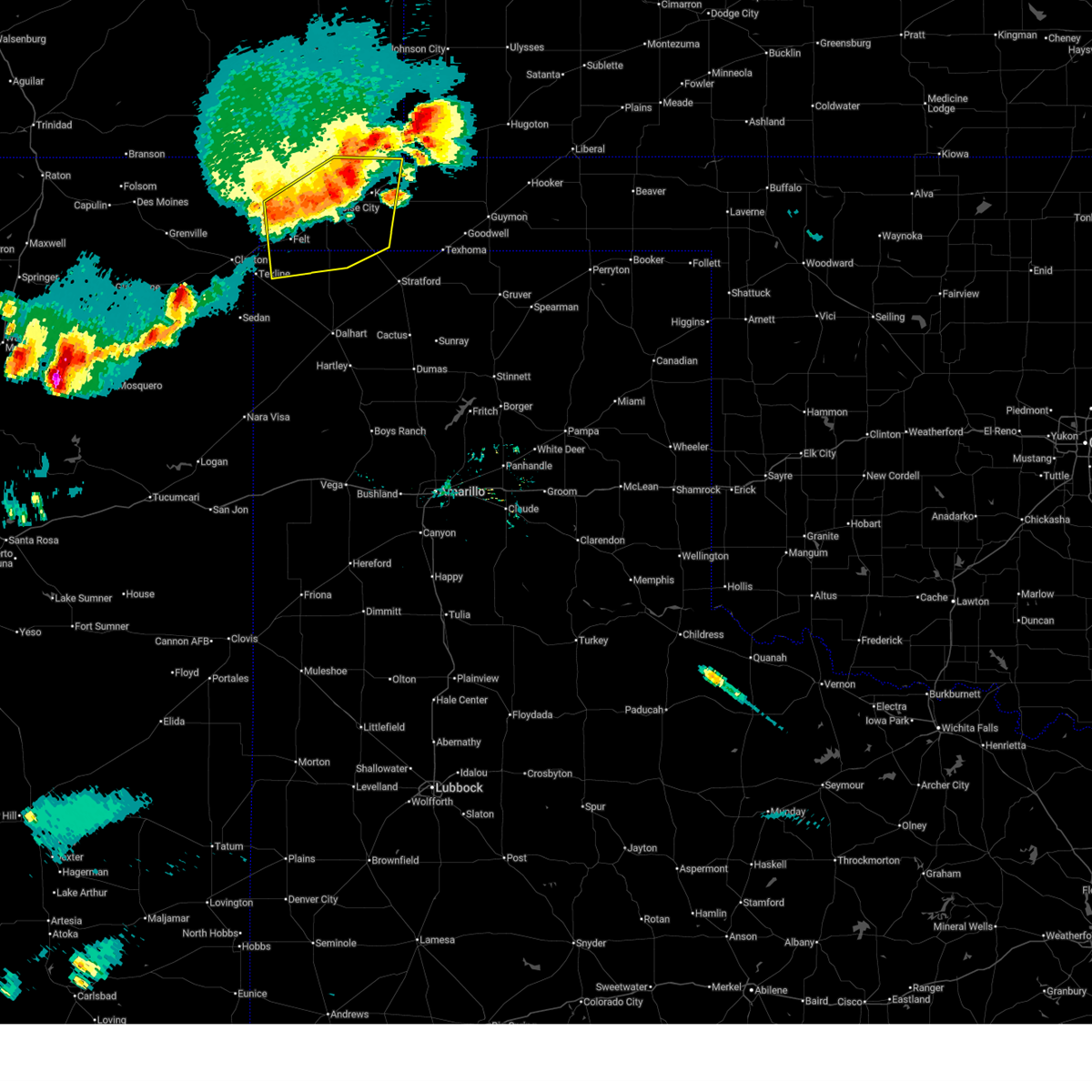
| 8/29/2025 6:31 PM CDT |
 At 631 pm cdt, automated weather equipment reported a severe thunderstorm was located 9 miles southwest of elkhart, moving southeast at 20 mph (automated weather equipment). Hazards include 60 mph wind gusts and quarter size hail. Minor damage to roofs, siding, and trees is possible. hail damage to vehicles is expected. Locations impacted include, keyes, eva, and sturgis. At 631 pm cdt, automated weather equipment reported a severe thunderstorm was located 9 miles southwest of elkhart, moving southeast at 20 mph (automated weather equipment). Hazards include 60 mph wind gusts and quarter size hail. Minor damage to roofs, siding, and trees is possible. hail damage to vehicles is expected. Locations impacted include, keyes, eva, and sturgis.
|
| 8/29/2025 6:05 PM CDT |
 Svrama the national weather service in amarillo has issued a * severe thunderstorm warning for, northwestern texas county in the panhandle of oklahoma, northeastern cimarron county in the panhandle of oklahoma, * until 715 pm cdt. * at 604 pm cdt, a severe thunderstorm was located 12 miles west of elkhart, moving southeast at 20 mph (radar indicated). Hazards include tennis ball size hail and 70 mph wind gusts. Expect some tree damage. damage is likely to mobile homes, roofs, and outbuildings. people and animals outdoors will be injured. Expect hail damage to roofs, siding, windows, and vehicles. Svrama the national weather service in amarillo has issued a * severe thunderstorm warning for, northwestern texas county in the panhandle of oklahoma, northeastern cimarron county in the panhandle of oklahoma, * until 715 pm cdt. * at 604 pm cdt, a severe thunderstorm was located 12 miles west of elkhart, moving southeast at 20 mph (radar indicated). Hazards include tennis ball size hail and 70 mph wind gusts. Expect some tree damage. damage is likely to mobile homes, roofs, and outbuildings. people and animals outdoors will be injured. Expect hail damage to roofs, siding, windows, and vehicles.
|
| 8/3/2025 12:59 AM CDT |
 At 1259 am cdt, a severe thunderstorm was located 8 miles northeast of griggs, or 22 miles north of stratford, moving southeast at 35 mph (radar indicated). Hazards include 60 mph wind gusts. Minor damage to roofs, siding, and trees is possible. Locations impacted include, keyes, eva, and griggs. At 1259 am cdt, a severe thunderstorm was located 8 miles northeast of griggs, or 22 miles north of stratford, moving southeast at 35 mph (radar indicated). Hazards include 60 mph wind gusts. Minor damage to roofs, siding, and trees is possible. Locations impacted include, keyes, eva, and griggs.
|
| 8/3/2025 12:42 AM CDT |
 At 1241 am cdt, a severe thunderstorm was located 7 miles north of griggs, or 19 miles east of boise city, moving southeast at 25 mph (radar indicated). Hazards include 60 mph wind gusts and quarter size hail. Minor damage to roofs, siding, and trees is possible. hail damage to vehicles is expected. Locations impacted include, keyes, eva, griggs, and sturgis. At 1241 am cdt, a severe thunderstorm was located 7 miles north of griggs, or 19 miles east of boise city, moving southeast at 25 mph (radar indicated). Hazards include 60 mph wind gusts and quarter size hail. Minor damage to roofs, siding, and trees is possible. hail damage to vehicles is expected. Locations impacted include, keyes, eva, griggs, and sturgis.
|
| 8/3/2025 12:18 AM CDT |
 Svrama the national weather service in amarillo has issued a * severe thunderstorm warning for, western texas county in the panhandle of oklahoma, eastern cimarron county in the panhandle of oklahoma, * until 115 am cdt. * at 1218 am cdt, a severe thunderstorm was located 4 miles west of keyes, or 10 miles northeast of boise city, moving southeast at 35 mph (radar indicated). Hazards include 60 mph wind gusts and quarter size hail. Minor damage to roofs, siding, and trees is possible. Hail damage to vehicles is expected. Svrama the national weather service in amarillo has issued a * severe thunderstorm warning for, western texas county in the panhandle of oklahoma, eastern cimarron county in the panhandle of oklahoma, * until 115 am cdt. * at 1218 am cdt, a severe thunderstorm was located 4 miles west of keyes, or 10 miles northeast of boise city, moving southeast at 35 mph (radar indicated). Hazards include 60 mph wind gusts and quarter size hail. Minor damage to roofs, siding, and trees is possible. Hail damage to vehicles is expected.
|
| 7/11/2025 8:54 PM CDT |
 Svrama the national weather service in amarillo has issued a * severe thunderstorm warning for, southeastern cimarron county in the panhandle of oklahoma, * until 1000 pm cdt. * at 853 pm cdt, severe thunderstorms were located along a line extending from 5 miles northeast of boise city to 10 miles northwest of griggs to 6 miles southeast of keyes, moving south at 10 mph (radar indicated). Hazards include 70 mph wind gusts and quarter size hail. Expect some tree damage. damage is likely to mobile homes, roofs, and outbuildings. Hail damage to vehicles is expected. Svrama the national weather service in amarillo has issued a * severe thunderstorm warning for, southeastern cimarron county in the panhandle of oklahoma, * until 1000 pm cdt. * at 853 pm cdt, severe thunderstorms were located along a line extending from 5 miles northeast of boise city to 10 miles northwest of griggs to 6 miles southeast of keyes, moving south at 10 mph (radar indicated). Hazards include 70 mph wind gusts and quarter size hail. Expect some tree damage. damage is likely to mobile homes, roofs, and outbuildings. Hail damage to vehicles is expected.
|
| 6/29/2025 7:58 PM CDT |
 the severe thunderstorm warning has been cancelled and is no longer in effect the severe thunderstorm warning has been cancelled and is no longer in effect
|
| 6/29/2025 7:14 PM CDT |
 Svrama the national weather service in amarillo has issued a * severe thunderstorm warning for, west central texas county in the panhandle of oklahoma, northeastern cimarron county in the panhandle of oklahoma, * until 815 pm cdt. * at 713 pm cdt, a severe thunderstorm was located 6 miles southeast of keyes, or 17 miles east of boise city, moving north at 10 mph (radar indicated). Hazards include 60 mph wind gusts and quarter size hail. Minor damage to roofs, siding, and trees is possible. Hail damage to vehicles is expected. Svrama the national weather service in amarillo has issued a * severe thunderstorm warning for, west central texas county in the panhandle of oklahoma, northeastern cimarron county in the panhandle of oklahoma, * until 815 pm cdt. * at 713 pm cdt, a severe thunderstorm was located 6 miles southeast of keyes, or 17 miles east of boise city, moving north at 10 mph (radar indicated). Hazards include 60 mph wind gusts and quarter size hail. Minor damage to roofs, siding, and trees is possible. Hail damage to vehicles is expected.
|
| 6/23/2025 8:51 PM CDT |
 The storms which prompted the warning have weakened below severe limits, and no longer pose an immediate threat to life or property. therefore, the warning will be allowed to expire. however, gusty winds and heavy rain are still possible with these thunderstorms. The storms which prompted the warning have weakened below severe limits, and no longer pose an immediate threat to life or property. therefore, the warning will be allowed to expire. however, gusty winds and heavy rain are still possible with these thunderstorms.
|
| 6/23/2025 7:59 PM CDT |
 Svrama the national weather service in amarillo has issued a * severe thunderstorm warning for, western texas county in the panhandle of oklahoma, eastern cimarron county in the panhandle of oklahoma, northwestern sherman county in the panhandle of texas, northern dallam county in the panhandle of texas, * until 900 pm cdt. * at 759 pm cdt, severe thunderstorms were located along a line extending from 12 miles north of keyes to 7 miles east of texline, moving east at 35 mph (radar indicated). Hazards include 60 mph wind gusts and nickel size hail. minor damage to roofs, siding, and trees is possible Svrama the national weather service in amarillo has issued a * severe thunderstorm warning for, western texas county in the panhandle of oklahoma, eastern cimarron county in the panhandle of oklahoma, northwestern sherman county in the panhandle of texas, northern dallam county in the panhandle of texas, * until 900 pm cdt. * at 759 pm cdt, severe thunderstorms were located along a line extending from 12 miles north of keyes to 7 miles east of texline, moving east at 35 mph (radar indicated). Hazards include 60 mph wind gusts and nickel size hail. minor damage to roofs, siding, and trees is possible
|
| 6/6/2025 10:39 PM CDT |
 At 1038 pm cdt, a severe thunderstorm capable of producing a tornado was located 6 miles northwest of griggs, or 16 miles east of boise city, moving southeast at 40 mph (radar indicated rotation). Hazards include tornado and three inch hail. Flying debris will be dangerous to those caught without shelter. mobile homes will be damaged or destroyed. damage to roofs, windows, and vehicles will occur. tree damage is likely. Locations impacted include, griggs. At 1038 pm cdt, a severe thunderstorm capable of producing a tornado was located 6 miles northwest of griggs, or 16 miles east of boise city, moving southeast at 40 mph (radar indicated rotation). Hazards include tornado and three inch hail. Flying debris will be dangerous to those caught without shelter. mobile homes will be damaged or destroyed. damage to roofs, windows, and vehicles will occur. tree damage is likely. Locations impacted include, griggs.
|
| 6/6/2025 10:25 PM CDT |
 At 1025 pm cdt, a severe thunderstorm capable of producing a tornado was located 7 miles southwest of keyes, or 8 miles east of boise city, moving southeast at 40 mph (radar indicated rotation). Hazards include tornado and three inch hail. Flying debris will be dangerous to those caught without shelter. mobile homes will be damaged or destroyed. damage to roofs, windows, and vehicles will occur. tree damage is likely. Locations impacted include, boise city and griggs. At 1025 pm cdt, a severe thunderstorm capable of producing a tornado was located 7 miles southwest of keyes, or 8 miles east of boise city, moving southeast at 40 mph (radar indicated rotation). Hazards include tornado and three inch hail. Flying debris will be dangerous to those caught without shelter. mobile homes will be damaged or destroyed. damage to roofs, windows, and vehicles will occur. tree damage is likely. Locations impacted include, boise city and griggs.
|
| 6/6/2025 10:18 PM CDT |
 At 1018 pm cdt, a severe thunderstorm was located 7 miles east of boise city, moving southeast at 45 mph. this is a destructive storm for boise city (radar indicated). Hazards include softball size hail and 60 mph wind gusts. People and animals outdoors will be severely injured. expect shattered windows, extensive damage to roofs, siding, and vehicles. Locations impacted include, keyes and boise city. At 1018 pm cdt, a severe thunderstorm was located 7 miles east of boise city, moving southeast at 45 mph. this is a destructive storm for boise city (radar indicated). Hazards include softball size hail and 60 mph wind gusts. People and animals outdoors will be severely injured. expect shattered windows, extensive damage to roofs, siding, and vehicles. Locations impacted include, keyes and boise city.
|
| 6/6/2025 10:09 PM CDT |
 Torama the national weather service in amarillo has issued a * tornado warning for, central cimarron county in the panhandle of oklahoma, * until 1100 pm cdt. * at 1008 pm cdt, a severe thunderstorm capable of producing a tornado was located 7 miles north of boise city, moving southeast at 35 mph (radar indicated rotation). Hazards include tornado and softball size hail. Flying debris will be dangerous to those caught without shelter. mobile homes will be damaged or destroyed. damage to roofs, windows, and vehicles will occur. Tree damage is likely. Torama the national weather service in amarillo has issued a * tornado warning for, central cimarron county in the panhandle of oklahoma, * until 1100 pm cdt. * at 1008 pm cdt, a severe thunderstorm capable of producing a tornado was located 7 miles north of boise city, moving southeast at 35 mph (radar indicated rotation). Hazards include tornado and softball size hail. Flying debris will be dangerous to those caught without shelter. mobile homes will be damaged or destroyed. damage to roofs, windows, and vehicles will occur. Tree damage is likely.
|
| 6/6/2025 9:58 PM CDT |
 At 958 pm cdt, a severe thunderstorm was located 9 miles north of boise city, moving southeast at 45 mph. this is a destructive storm for northern cimarron county (radar indicated). Hazards include softball size hail and 60 mph wind gusts. People and animals outdoors will be severely injured. expect shattered windows, extensive damage to roofs, siding, and vehicles. Locations impacted include, keyes and boise city. At 958 pm cdt, a severe thunderstorm was located 9 miles north of boise city, moving southeast at 45 mph. this is a destructive storm for northern cimarron county (radar indicated). Hazards include softball size hail and 60 mph wind gusts. People and animals outdoors will be severely injured. expect shattered windows, extensive damage to roofs, siding, and vehicles. Locations impacted include, keyes and boise city.
|
| 6/6/2025 9:45 PM CDT |
 At 944 pm cdt, a severe thunderstorm was located 9 miles northeast of black mesa park, or 18 miles northwest of boise city, moving southeast at 35 mph. this is a destructive storm for northern cimarron county (radar indicated). Hazards include softball size hail and 60 mph wind gusts. People and animals outdoors will be severely injured. expect shattered windows, extensive damage to roofs, siding, and vehicles. Locations impacted include, black mesa park, keyes, and boise city. At 944 pm cdt, a severe thunderstorm was located 9 miles northeast of black mesa park, or 18 miles northwest of boise city, moving southeast at 35 mph. this is a destructive storm for northern cimarron county (radar indicated). Hazards include softball size hail and 60 mph wind gusts. People and animals outdoors will be severely injured. expect shattered windows, extensive damage to roofs, siding, and vehicles. Locations impacted include, black mesa park, keyes, and boise city.
|
| 6/6/2025 9:38 PM CDT |
 Svrama the national weather service in amarillo has issued a * severe thunderstorm warning for, northwestern texas county in the panhandle of oklahoma, northeastern cimarron county in the panhandle of oklahoma, * until 1045 pm cdt. * at 938 pm cdt, a severe thunderstorm was located 13 miles north of keyes, or 17 miles west of elkhart, moving southeast at 40 mph (radar indicated). Hazards include tennis ball size hail and 60 mph wind gusts. Minor damage to roofs, siding, and trees is possible. people and animals outdoors will be injured. Expect hail damage to roofs, siding, windows, and vehicles. Svrama the national weather service in amarillo has issued a * severe thunderstorm warning for, northwestern texas county in the panhandle of oklahoma, northeastern cimarron county in the panhandle of oklahoma, * until 1045 pm cdt. * at 938 pm cdt, a severe thunderstorm was located 13 miles north of keyes, or 17 miles west of elkhart, moving southeast at 40 mph (radar indicated). Hazards include tennis ball size hail and 60 mph wind gusts. Minor damage to roofs, siding, and trees is possible. people and animals outdoors will be injured. Expect hail damage to roofs, siding, windows, and vehicles.
|
| 6/6/2025 9:26 PM CDT |
 Svrama the national weather service in amarillo has issued a * severe thunderstorm warning for, central cimarron county in the panhandle of oklahoma, * until 1030 pm cdt. * at 925 pm cdt, a severe thunderstorm was located 7 miles northeast of kenton, or 27 miles northwest of boise city, moving southeast at 40 mph (radar indicated). Hazards include tennis ball size hail and 60 mph wind gusts. Minor damage to roofs, siding, and trees is possible. people and animals outdoors will be injured. Expect hail damage to roofs, siding, windows, and vehicles. Svrama the national weather service in amarillo has issued a * severe thunderstorm warning for, central cimarron county in the panhandle of oklahoma, * until 1030 pm cdt. * at 925 pm cdt, a severe thunderstorm was located 7 miles northeast of kenton, or 27 miles northwest of boise city, moving southeast at 40 mph (radar indicated). Hazards include tennis ball size hail and 60 mph wind gusts. Minor damage to roofs, siding, and trees is possible. people and animals outdoors will be injured. Expect hail damage to roofs, siding, windows, and vehicles.
|
| 6/6/2025 6:58 PM CDT |
 At 658 pm cdt, a confirmed tornado was located 8 miles north of griggs, or 19 miles east of boise city, moving southeast at 35 mph (weather spotters confirmed tornado). Hazards include damaging tornado and baseball size hail. Flying debris will be dangerous to those caught without shelter. mobile homes will be damaged or destroyed. damage to roofs, windows, and vehicles will occur. tree damage is likely. Locations impacted include, keyes and griggs. At 658 pm cdt, a confirmed tornado was located 8 miles north of griggs, or 19 miles east of boise city, moving southeast at 35 mph (weather spotters confirmed tornado). Hazards include damaging tornado and baseball size hail. Flying debris will be dangerous to those caught without shelter. mobile homes will be damaged or destroyed. damage to roofs, windows, and vehicles will occur. tree damage is likely. Locations impacted include, keyes and griggs.
|
| 6/6/2025 6:53 PM CDT |
 At 653 pm cdt, a severe thunderstorm was located over keyes, or 15 miles east of boise city, moving southeast at 25 mph. this is a destructive storm for keyes (radar indicated). Hazards include baseball size hail and 60 mph wind gusts. People and animals outdoors will be severely injured. expect shattered windows, extensive damage to roofs, siding, and vehicles. Locations impacted include, keyes. At 653 pm cdt, a severe thunderstorm was located over keyes, or 15 miles east of boise city, moving southeast at 25 mph. this is a destructive storm for keyes (radar indicated). Hazards include baseball size hail and 60 mph wind gusts. People and animals outdoors will be severely injured. expect shattered windows, extensive damage to roofs, siding, and vehicles. Locations impacted include, keyes.
|
| 6/6/2025 6:46 PM CDT |
 Torama the national weather service in amarillo has issued a * tornado warning for, southeastern cimarron county in the panhandle of oklahoma, * until 715 pm cdt. * at 646 pm cdt, a severe thunderstorm capable of producing a tornado was located near keyes, or 14 miles east of boise city, moving southeast at 35 mph (weather spotters reported funnel cloud). Hazards include tornado and baseball size hail. Flying debris will be dangerous to those caught without shelter. mobile homes will be damaged or destroyed. damage to roofs, windows, and vehicles will occur. Tree damage is likely. Torama the national weather service in amarillo has issued a * tornado warning for, southeastern cimarron county in the panhandle of oklahoma, * until 715 pm cdt. * at 646 pm cdt, a severe thunderstorm capable of producing a tornado was located near keyes, or 14 miles east of boise city, moving southeast at 35 mph (weather spotters reported funnel cloud). Hazards include tornado and baseball size hail. Flying debris will be dangerous to those caught without shelter. mobile homes will be damaged or destroyed. damage to roofs, windows, and vehicles will occur. Tree damage is likely.
|
| 6/6/2025 6:29 PM CDT |
 At 629 pm cdt, a severe thunderstorm was located 8 miles west of keyes, or 9 miles northeast of boise city, moving southeast at 25 mph. this is a destructive storm for north central cimarron county and keyes (radar indicated). Hazards include baseball size hail and 60 mph wind gusts. People and animals outdoors will be severely injured. expect shattered windows, extensive damage to roofs, siding, and vehicles. Locations impacted include, keyes. At 629 pm cdt, a severe thunderstorm was located 8 miles west of keyes, or 9 miles northeast of boise city, moving southeast at 25 mph. this is a destructive storm for north central cimarron county and keyes (radar indicated). Hazards include baseball size hail and 60 mph wind gusts. People and animals outdoors will be severely injured. expect shattered windows, extensive damage to roofs, siding, and vehicles. Locations impacted include, keyes.
|
| 6/6/2025 6:14 PM CDT |
 Svrama the national weather service in amarillo has issued a * severe thunderstorm warning for, northeastern cimarron county in the panhandle of oklahoma, * until 715 pm cdt. * at 613 pm cdt, a severe thunderstorm was located 10 miles north of boise city, moving southeast at 25 mph (radar indicated). Hazards include two inch hail and 60 mph wind gusts. Minor damage to roofs, siding, and trees is possible. people and animals outdoors will be injured. Expect hail damage to roofs, siding, windows, and vehicles. Svrama the national weather service in amarillo has issued a * severe thunderstorm warning for, northeastern cimarron county in the panhandle of oklahoma, * until 715 pm cdt. * at 613 pm cdt, a severe thunderstorm was located 10 miles north of boise city, moving southeast at 25 mph (radar indicated). Hazards include two inch hail and 60 mph wind gusts. Minor damage to roofs, siding, and trees is possible. people and animals outdoors will be injured. Expect hail damage to roofs, siding, windows, and vehicles.
|
| 6/5/2025 11:07 PM CDT |
 The storm which prompted the warning has weakened below severe limits, and no longer poses an immediate threat to life or property. therefore, the warning will be allowed to expire. however, heavy rain is still possible with this thunderstorm. a severe thunderstorm watch remains in effect until 200 am cdt for the panhandle of oklahoma. The storm which prompted the warning has weakened below severe limits, and no longer poses an immediate threat to life or property. therefore, the warning will be allowed to expire. however, heavy rain is still possible with this thunderstorm. a severe thunderstorm watch remains in effect until 200 am cdt for the panhandle of oklahoma.
|
| 6/5/2025 10:57 PM CDT |
 At 1056 pm cdt, a severe thunderstorm was located over keyes, or 13 miles northeast of boise city, moving east at 40 mph (radar indicated). Hazards include 60 mph wind gusts and nickel size hail. Minor damage to roofs, siding, and trees is possible. Locations impacted include, keyes and sturgis. At 1056 pm cdt, a severe thunderstorm was located over keyes, or 13 miles northeast of boise city, moving east at 40 mph (radar indicated). Hazards include 60 mph wind gusts and nickel size hail. Minor damage to roofs, siding, and trees is possible. Locations impacted include, keyes and sturgis.
|
| 6/5/2025 10:36 PM CDT |
 At 1036 pm cdt, a severe thunderstorm was located 13 miles southeast of campo, or 14 miles north of boise city, moving east at 50 mph (radar indicated). Hazards include 60 mph wind gusts and nickel size hail. Minor damage to roofs, siding, and trees is possible. Locations impacted include, keyes and sturgis. At 1036 pm cdt, a severe thunderstorm was located 13 miles southeast of campo, or 14 miles north of boise city, moving east at 50 mph (radar indicated). Hazards include 60 mph wind gusts and nickel size hail. Minor damage to roofs, siding, and trees is possible. Locations impacted include, keyes and sturgis.
|
| 6/5/2025 10:22 PM CDT |
 At 1022 pm cdt, a severe thunderstorm was located 10 miles south of campo, or 16 miles north of boise city, moving east at 40 mph (radar indicated). Hazards include 60 mph wind gusts and half dollar size hail. Minor damage to roofs, siding, and trees is possible. hail damage to vehicles is expected. Locations impacted include, black mesa park, keyes, and sturgis. At 1022 pm cdt, a severe thunderstorm was located 10 miles south of campo, or 16 miles north of boise city, moving east at 40 mph (radar indicated). Hazards include 60 mph wind gusts and half dollar size hail. Minor damage to roofs, siding, and trees is possible. hail damage to vehicles is expected. Locations impacted include, black mesa park, keyes, and sturgis.
|
| 6/5/2025 10:09 PM CDT |
 Svrama the national weather service in amarillo has issued a * severe thunderstorm warning for, northern cimarron county in the panhandle of oklahoma, * until 1115 pm cdt. * at 1008 pm cdt, a severe thunderstorm was located 12 miles northeast of black mesa park, or 22 miles northwest of boise city, moving east at 40 mph (radar indicated). Hazards include ping pong ball size hail and 60 mph wind gusts. Minor damage to roofs, siding, and trees is possible. people and animals outdoors will be injured. Expect hail damage to roofs, siding, windows, and vehicles. Svrama the national weather service in amarillo has issued a * severe thunderstorm warning for, northern cimarron county in the panhandle of oklahoma, * until 1115 pm cdt. * at 1008 pm cdt, a severe thunderstorm was located 12 miles northeast of black mesa park, or 22 miles northwest of boise city, moving east at 40 mph (radar indicated). Hazards include ping pong ball size hail and 60 mph wind gusts. Minor damage to roofs, siding, and trees is possible. people and animals outdoors will be injured. Expect hail damage to roofs, siding, windows, and vehicles.
|
| 6/2/2025 5:10 PM CDT |
 The storm which prompted the warning has weakened below severe limits, and no longer poses an immediate threat to life or property. therefore, the warning will be allowed to expire. however, small hail and gusty winds are still possible with this thunderstorm. a severe thunderstorm watch remains in effect until 900 pm cdt for the panhandle of oklahoma, and the panhandle of texas. The storm which prompted the warning has weakened below severe limits, and no longer poses an immediate threat to life or property. therefore, the warning will be allowed to expire. however, small hail and gusty winds are still possible with this thunderstorm. a severe thunderstorm watch remains in effect until 900 pm cdt for the panhandle of oklahoma, and the panhandle of texas.
|
| 6/2/2025 4:55 PM CDT |
 the severe thunderstorm warning has been cancelled and is no longer in effect the severe thunderstorm warning has been cancelled and is no longer in effect
|
| 6/2/2025 4:55 PM CDT |
 At 454 pm cdt, a severe thunderstorm was located 11 miles southeast of campo, or 16 miles north of boise city, moving north at 45 mph (radar indicated). Hazards include 60 mph wind gusts. Minor damage to roofs, siding, and trees is possible. Locations impacted include, keyes, felt, and boise city. At 454 pm cdt, a severe thunderstorm was located 11 miles southeast of campo, or 16 miles north of boise city, moving north at 45 mph (radar indicated). Hazards include 60 mph wind gusts. Minor damage to roofs, siding, and trees is possible. Locations impacted include, keyes, felt, and boise city.
|
| 6/2/2025 4:12 PM CDT |
 Svrama the national weather service in amarillo has issued a * severe thunderstorm warning for, central cimarron county in the panhandle of oklahoma, north central dallam county in the panhandle of texas, * until 515 pm cdt. * at 412 pm cdt, a severe thunderstorm was located 14 miles east of felt, or 16 miles south of boise city, moving north at 45 mph (radar indicated). Hazards include 60 mph wind gusts and penny size hail. minor damage to roofs, siding, and trees is possible Svrama the national weather service in amarillo has issued a * severe thunderstorm warning for, central cimarron county in the panhandle of oklahoma, north central dallam county in the panhandle of texas, * until 515 pm cdt. * at 412 pm cdt, a severe thunderstorm was located 14 miles east of felt, or 16 miles south of boise city, moving north at 45 mph (radar indicated). Hazards include 60 mph wind gusts and penny size hail. minor damage to roofs, siding, and trees is possible
|
| 9/17/2024 7:27 PM CDT |
 The storm which prompted the warning has weakened below severe limits, and has exited the warned area. therefore, the warning will be allowed to expire. however, gusty winds are still possible with this thunderstorm. The storm which prompted the warning has weakened below severe limits, and has exited the warned area. therefore, the warning will be allowed to expire. however, gusty winds are still possible with this thunderstorm.
|
| 9/17/2024 6:45 PM CDT |
 At 644 pm cdt, automated weather equipment reported a severe thunderstorm was located 7 miles southwest of keyes, or 10 miles east of boise city, moving northeast at 40 mph (automated weather equipment near bosie city measured 67 mph wind gust at 6:35 pm cdt). Hazards include 70 mph wind gusts. Expect some tree damage. damage is likely to mobile homes, roofs, and outbuildings. Locations impacted include, boise city, keyes, eva, griggs, and sturgis. At 644 pm cdt, automated weather equipment reported a severe thunderstorm was located 7 miles southwest of keyes, or 10 miles east of boise city, moving northeast at 40 mph (automated weather equipment near bosie city measured 67 mph wind gust at 6:35 pm cdt). Hazards include 70 mph wind gusts. Expect some tree damage. damage is likely to mobile homes, roofs, and outbuildings. Locations impacted include, boise city, keyes, eva, griggs, and sturgis.
|
| 9/17/2024 6:31 PM CDT |
 Svrama the national weather service in amarillo has issued a * severe thunderstorm warning for, northwestern texas county in the panhandle of oklahoma, southeastern cimarron county in the panhandle of oklahoma, northeastern dallam county in the panhandle of texas, * until 730 pm cdt. * at 631 pm cdt, a severe thunderstorm was located 8 miles southeast of boise city, moving northeast at 40 mph (radar indicated). Hazards include 60 mph wind gusts. minor damage to roofs, siding, and trees is possible Svrama the national weather service in amarillo has issued a * severe thunderstorm warning for, northwestern texas county in the panhandle of oklahoma, southeastern cimarron county in the panhandle of oklahoma, northeastern dallam county in the panhandle of texas, * until 730 pm cdt. * at 631 pm cdt, a severe thunderstorm was located 8 miles southeast of boise city, moving northeast at 40 mph (radar indicated). Hazards include 60 mph wind gusts. minor damage to roofs, siding, and trees is possible
|
| 9/14/2024 4:10 PM CDT |
 Svrama the national weather service in amarillo has issued a * severe thunderstorm warning for, southeastern cimarron county in the panhandle of oklahoma, * until 515 pm cdt. * at 410 pm cdt, a severe thunderstorm was located 10 miles southeast of boise city, moving north at 15 mph (radar indicated). Hazards include 60 mph wind gusts and quarter size hail. Minor damage to roofs, siding, and trees is possible. Hail damage to vehicles is expected. Svrama the national weather service in amarillo has issued a * severe thunderstorm warning for, southeastern cimarron county in the panhandle of oklahoma, * until 515 pm cdt. * at 410 pm cdt, a severe thunderstorm was located 10 miles southeast of boise city, moving north at 15 mph (radar indicated). Hazards include 60 mph wind gusts and quarter size hail. Minor damage to roofs, siding, and trees is possible. Hail damage to vehicles is expected.
|
| 8/29/2024 5:50 PM CDT |
 At 550 pm cdt, severe thunderstorms were located along a line extending from near boise city to 10 miles southeast of felt to 8 miles northeast of sedan, moving east at 20 mph (radar indicated). Hazards include 60 mph wind gusts and penny size hail. Minor damage to roofs, siding, and trees is possible. Locations impacted include, boise city and keyes. At 550 pm cdt, severe thunderstorms were located along a line extending from near boise city to 10 miles southeast of felt to 8 miles northeast of sedan, moving east at 20 mph (radar indicated). Hazards include 60 mph wind gusts and penny size hail. Minor damage to roofs, siding, and trees is possible. Locations impacted include, boise city and keyes.
|
| 8/29/2024 5:08 PM CDT |
 Svrama the national weather service in amarillo has issued a * severe thunderstorm warning for, cimarron county in the panhandle of oklahoma, western dallam county in the panhandle of texas, * until 615 pm cdt. * at 508 pm cdt, severe thunderstorms were located along a line extending from 5 miles north of boise city to 6 miles east of felt to 3 miles southwest of texline, moving southeast at 15 mph (radar indicated). Hazards include 60 mph wind gusts and penny size hail. minor damage to roofs, siding, and trees is possible Svrama the national weather service in amarillo has issued a * severe thunderstorm warning for, cimarron county in the panhandle of oklahoma, western dallam county in the panhandle of texas, * until 615 pm cdt. * at 508 pm cdt, severe thunderstorms were located along a line extending from 5 miles north of boise city to 6 miles east of felt to 3 miles southwest of texline, moving southeast at 15 mph (radar indicated). Hazards include 60 mph wind gusts and penny size hail. minor damage to roofs, siding, and trees is possible
|
| 7/16/2024 6:56 PM CDT |
 At 656 pm cdt, severe thunderstorms were located along a line extending from 14 miles east of campo to 5 miles south of keyes, moving east at 20 mph (radar indicated). Hazards include 60 mph wind gusts and quarter size hail. Minor damage to roofs, siding, and trees is possible. hail damage to vehicles is expected. Locations impacted include, keyes, eva, griggs, and sturgis. At 656 pm cdt, severe thunderstorms were located along a line extending from 14 miles east of campo to 5 miles south of keyes, moving east at 20 mph (radar indicated). Hazards include 60 mph wind gusts and quarter size hail. Minor damage to roofs, siding, and trees is possible. hail damage to vehicles is expected. Locations impacted include, keyes, eva, griggs, and sturgis.
|
| 7/16/2024 6:25 PM CDT |
 At 625 pm cdt, severe thunderstorms were located along a line extending from 6 miles southeast of campo to 5 miles southeast of boise city, moving east at 20 mph (radar indicated). Hazards include 60 mph wind gusts and quarter size hail. Minor damage to roofs, siding, and trees is possible. hail damage to vehicles is expected. Locations impacted include, boise city, keyes, eva, griggs, and sturgis. At 625 pm cdt, severe thunderstorms were located along a line extending from 6 miles southeast of campo to 5 miles southeast of boise city, moving east at 20 mph (radar indicated). Hazards include 60 mph wind gusts and quarter size hail. Minor damage to roofs, siding, and trees is possible. hail damage to vehicles is expected. Locations impacted include, boise city, keyes, eva, griggs, and sturgis.
|
| 7/16/2024 6:14 PM CDT |
 Svrama the national weather service in amarillo has issued a * severe thunderstorm warning for, western texas county in the panhandle of oklahoma, eastern cimarron county in the panhandle of oklahoma, * until 715 pm cdt. * at 614 pm cdt, severe thunderstorms were located along a line extending from 5 miles southeast of campo to 3 miles southeast of boise city, moving east at 20 mph (radar indicated). Hazards include 60 mph wind gusts and penny size hail. minor damage to roofs, siding, and trees is possible Svrama the national weather service in amarillo has issued a * severe thunderstorm warning for, western texas county in the panhandle of oklahoma, eastern cimarron county in the panhandle of oklahoma, * until 715 pm cdt. * at 614 pm cdt, severe thunderstorms were located along a line extending from 5 miles southeast of campo to 3 miles southeast of boise city, moving east at 20 mph (radar indicated). Hazards include 60 mph wind gusts and penny size hail. minor damage to roofs, siding, and trees is possible
|
| 6/14/2024 7:28 PM CDT |
 The storm which prompted the warning has moved out of the area. therefore, the warning will be allowed to expire. however, gusty winds are still possible with this thunderstorm. a severe thunderstorm watch remains in effect until 1000 pm cdt for the panhandle of oklahoma, and the panhandle of texas. remember, a severe thunderstorm warning still remains in effect for eastern cimarron and western texas counties until 800 pm cdt. The storm which prompted the warning has moved out of the area. therefore, the warning will be allowed to expire. however, gusty winds are still possible with this thunderstorm. a severe thunderstorm watch remains in effect until 1000 pm cdt for the panhandle of oklahoma, and the panhandle of texas. remember, a severe thunderstorm warning still remains in effect for eastern cimarron and western texas counties until 800 pm cdt.
|
| 6/14/2024 7:20 PM CDT |
 At 719 pm cdt, a severe thunderstorm was located over keyes, or 17 miles northeast of boise city, moving north at 20 mph (radar indicated). Hazards include 70 mph wind gusts. Expect some tree damage. damage is likely to mobile homes, roofs, and outbuildings. Locations impacted include, boise city, keyes, felt, and sturgis. At 719 pm cdt, a severe thunderstorm was located over keyes, or 17 miles northeast of boise city, moving north at 20 mph (radar indicated). Hazards include 70 mph wind gusts. Expect some tree damage. damage is likely to mobile homes, roofs, and outbuildings. Locations impacted include, boise city, keyes, felt, and sturgis.
|
| 6/14/2024 7:12 PM CDT |
 At 711 pm cdt, a severe thunderstorm was located 8 miles west of eva, or 17 miles southwest of elkhart, moving north at 30 mph (radar indicated). Hazards include 70 mph wind gusts and penny size hail. Expect some tree damage. damage is likely to mobile homes, roofs, and outbuildings. Locations impacted include, guymon, stratford, goodwell, keyes, eva, hough, griggs, texhoma, and sturgis. At 711 pm cdt, a severe thunderstorm was located 8 miles west of eva, or 17 miles southwest of elkhart, moving north at 30 mph (radar indicated). Hazards include 70 mph wind gusts and penny size hail. Expect some tree damage. damage is likely to mobile homes, roofs, and outbuildings. Locations impacted include, guymon, stratford, goodwell, keyes, eva, hough, griggs, texhoma, and sturgis.
|
| 6/14/2024 6:59 PM CDT |
 At 658 pm cdt, a severe thunderstorm was located near griggs, or 20 miles east of boise city, moving north at 40 mph (radar indicated). Hazards include 70 mph wind gusts and penny size hail. Expect some tree damage. damage is likely to mobile homes, roofs, and outbuildings. Locations impacted include, guymon, stratford, goodwell, keyes, eva, hough, griggs, texhoma, and sturgis. At 658 pm cdt, a severe thunderstorm was located near griggs, or 20 miles east of boise city, moving north at 40 mph (radar indicated). Hazards include 70 mph wind gusts and penny size hail. Expect some tree damage. damage is likely to mobile homes, roofs, and outbuildings. Locations impacted include, guymon, stratford, goodwell, keyes, eva, hough, griggs, texhoma, and sturgis.
|
| 6/14/2024 6:54 PM CDT |
 At 653 pm cdt, a severe thunderstorm was located 8 miles west of keyes, or 8 miles northeast of boise city, moving northeast at 45 mph (radar indicated). Hazards include 60 mph wind gusts. Minor damage to roofs, siding, and trees is possible. Locations impacted include, boise city, keyes, kenton, wheeless, black mesa park, felt, and sturgis. At 653 pm cdt, a severe thunderstorm was located 8 miles west of keyes, or 8 miles northeast of boise city, moving northeast at 45 mph (radar indicated). Hazards include 60 mph wind gusts. Minor damage to roofs, siding, and trees is possible. Locations impacted include, boise city, keyes, kenton, wheeless, black mesa park, felt, and sturgis.
|
| 6/14/2024 6:54 PM CDT |
 the severe thunderstorm warning has been cancelled and is no longer in effect the severe thunderstorm warning has been cancelled and is no longer in effect
|
| 6/14/2024 6:39 PM CDT |
 At 638 pm cdt, a severe thunderstorm was located 6 miles southeast of griggs, or 13 miles north of stratford, moving north at 25 mph (radar indicated). Hazards include 70 mph wind gusts and penny size hail. Expect some tree damage. damage is likely to mobile homes, roofs, and outbuildings. Locations impacted include, guymon, stratford, goodwell, keyes, eva, hough, griggs, texhoma, and sturgis. At 638 pm cdt, a severe thunderstorm was located 6 miles southeast of griggs, or 13 miles north of stratford, moving north at 25 mph (radar indicated). Hazards include 70 mph wind gusts and penny size hail. Expect some tree damage. damage is likely to mobile homes, roofs, and outbuildings. Locations impacted include, guymon, stratford, goodwell, keyes, eva, hough, griggs, texhoma, and sturgis.
|
| 6/14/2024 6:32 PM CDT |
 At 631 pm cdt, a severe thunderstorm was located 12 miles east of black mesa park, or 12 miles northwest of boise city, moving northeast at 40 mph (radar indicated). Hazards include 60 mph wind gusts and nickel size hail. Minor damage to roofs, siding, and trees is possible. Locations impacted include, boise city, keyes, kenton, wheeless, black mesa park, felt, and sturgis. At 631 pm cdt, a severe thunderstorm was located 12 miles east of black mesa park, or 12 miles northwest of boise city, moving northeast at 40 mph (radar indicated). Hazards include 60 mph wind gusts and nickel size hail. Minor damage to roofs, siding, and trees is possible. Locations impacted include, boise city, keyes, kenton, wheeless, black mesa park, felt, and sturgis.
|
| 6/14/2024 6:25 PM CDT |
 Svrama the national weather service in amarillo has issued a * severe thunderstorm warning for, western texas county in the panhandle of oklahoma, eastern cimarron county in the panhandle of oklahoma, northern sherman county in the panhandle of texas, northeastern dallam county in the panhandle of texas, * until 800 pm cdt. * at 625 pm cdt, a severe thunderstorm was located 7 miles north of stratford, moving north at 25 mph (radar indicated). Hazards include 70 mph wind gusts and quarter size hail. Expect some tree damage. damage is likely to mobile homes, roofs, and outbuildings. Hail damage to vehicles is expected. Svrama the national weather service in amarillo has issued a * severe thunderstorm warning for, western texas county in the panhandle of oklahoma, eastern cimarron county in the panhandle of oklahoma, northern sherman county in the panhandle of texas, northeastern dallam county in the panhandle of texas, * until 800 pm cdt. * at 625 pm cdt, a severe thunderstorm was located 7 miles north of stratford, moving north at 25 mph (radar indicated). Hazards include 70 mph wind gusts and quarter size hail. Expect some tree damage. damage is likely to mobile homes, roofs, and outbuildings. Hail damage to vehicles is expected.
|
| 6/14/2024 6:22 PM CDT |
 At 622 pm cdt, a severe thunderstorm was located 10 miles west of boise city, moving northeast at 55 mph (radar indicated). Hazards include 60 mph wind gusts and nickel size hail. Minor damage to roofs, siding, and trees is possible. Locations impacted include, boise city, keyes, kenton, wheeless, black mesa park, felt, and sturgis. At 622 pm cdt, a severe thunderstorm was located 10 miles west of boise city, moving northeast at 55 mph (radar indicated). Hazards include 60 mph wind gusts and nickel size hail. Minor damage to roofs, siding, and trees is possible. Locations impacted include, boise city, keyes, kenton, wheeless, black mesa park, felt, and sturgis.
|
| 6/14/2024 5:59 PM CDT |
 Svrama the national weather service in amarillo has issued a * severe thunderstorm warning for, northwestern texas county in the panhandle of oklahoma, cimarron county in the panhandle of oklahoma, northwestern dallam county in the panhandle of texas, * until 730 pm cdt. * at 558 pm cdt, a severe thunderstorm was located 7 miles northeast of texline, or 13 miles east of clayton, moving north at 45 mph (radar indicated). Hazards include 60 mph wind gusts and nickel size hail. minor damage to roofs, siding, and trees is possible Svrama the national weather service in amarillo has issued a * severe thunderstorm warning for, northwestern texas county in the panhandle of oklahoma, cimarron county in the panhandle of oklahoma, northwestern dallam county in the panhandle of texas, * until 730 pm cdt. * at 558 pm cdt, a severe thunderstorm was located 7 miles northeast of texline, or 13 miles east of clayton, moving north at 45 mph (radar indicated). Hazards include 60 mph wind gusts and nickel size hail. minor damage to roofs, siding, and trees is possible
|
| 6/7/2024 6:38 PM CDT |
 The storms which prompted the warning have weakened below severe limits, and no longer pose an immediate threat to life or property. therefore, the warning will be allowed to expire. however, gusty winds are still possible with these thunderstorms. a severe thunderstorm watch remains in effect until 1000 pm cdt for the panhandle of oklahoma. The storms which prompted the warning have weakened below severe limits, and no longer pose an immediate threat to life or property. therefore, the warning will be allowed to expire. however, gusty winds are still possible with these thunderstorms. a severe thunderstorm watch remains in effect until 1000 pm cdt for the panhandle of oklahoma.
|
| 6/7/2024 5:40 PM CDT |
 Svrama the national weather service in amarillo has issued a * severe thunderstorm warning for, northern texas county in the panhandle of oklahoma, northeastern cimarron county in the panhandle of oklahoma, * until 645 pm cdt. * at 540 pm cdt, severe thunderstorms were located along a line extending from 7 miles north of eva to 13 miles north of boise city, moving east at 45 mph (radar indicated). Hazards include 70 mph wind gusts and penny size hail. Expect some tree damage. Damage is likely to mobile homes, roofs, and outbuildings. Svrama the national weather service in amarillo has issued a * severe thunderstorm warning for, northern texas county in the panhandle of oklahoma, northeastern cimarron county in the panhandle of oklahoma, * until 645 pm cdt. * at 540 pm cdt, severe thunderstorms were located along a line extending from 7 miles north of eva to 13 miles north of boise city, moving east at 45 mph (radar indicated). Hazards include 70 mph wind gusts and penny size hail. Expect some tree damage. Damage is likely to mobile homes, roofs, and outbuildings.
|
| 5/31/2024 7:50 PM CDT |
 The storms which prompted the warning have weakened below severe limits, and no longer pose an immediate threat to life or property. therefore, the warning will be allowed to expire. however, gusty winds are still possible with these thunderstorms. a severe thunderstorm watch remains in effect until 1100 pm cdt for the panhandle of oklahoma, and the panhandle of texas. The storms which prompted the warning have weakened below severe limits, and no longer pose an immediate threat to life or property. therefore, the warning will be allowed to expire. however, gusty winds are still possible with these thunderstorms. a severe thunderstorm watch remains in effect until 1100 pm cdt for the panhandle of oklahoma, and the panhandle of texas.
|
| 5/31/2024 7:19 PM CDT |
 At 719 pm cdt, severe thunderstorms were located along a line extending from 11 miles southeast of campo to near boise city to 11 miles northwest of ware, moving east at 25 mph (radar indicated). Hazards include 60 mph wind gusts. Minor damage to roofs, siding, and trees is possible. Locations impacted include, boise city, keyes, eva, griggs, and sturgis. At 719 pm cdt, severe thunderstorms were located along a line extending from 11 miles southeast of campo to near boise city to 11 miles northwest of ware, moving east at 25 mph (radar indicated). Hazards include 60 mph wind gusts. Minor damage to roofs, siding, and trees is possible. Locations impacted include, boise city, keyes, eva, griggs, and sturgis.
|
| 5/31/2024 7:04 PM CDT |
 Svrama the national weather service in amarillo has issued a * severe thunderstorm warning for, western texas county in the panhandle of oklahoma, cimarron county in the panhandle of oklahoma, northwestern sherman county in the panhandle of texas, dallam county in the panhandle of texas, * until 800 pm cdt. * at 704 pm cdt, severe thunderstorms were located along a line extending from 11 miles southwest of stonington to boise city to 4 miles east of sedan, moving east at 35 mph (radar indicated). Hazards include 60 mph wind gusts. minor damage to roofs, siding, and trees is possible Svrama the national weather service in amarillo has issued a * severe thunderstorm warning for, western texas county in the panhandle of oklahoma, cimarron county in the panhandle of oklahoma, northwestern sherman county in the panhandle of texas, dallam county in the panhandle of texas, * until 800 pm cdt. * at 704 pm cdt, severe thunderstorms were located along a line extending from 11 miles southwest of stonington to boise city to 4 miles east of sedan, moving east at 35 mph (radar indicated). Hazards include 60 mph wind gusts. minor damage to roofs, siding, and trees is possible
|
| 5/30/2024 3:26 PM CDT |
 Svrama the national weather service in amarillo has issued a * severe thunderstorm warning for, central cimarron county in the panhandle of oklahoma, central dallam county in the panhandle of texas, * until 430 pm cdt. * at 326 pm cdt, severe thunderstorms were located along a line extending from 13 miles northwest of keyes to 6 miles south of boise city to 12 miles southeast of felt, moving east at 30 mph (radar indicated). Hazards include 60 mph wind gusts and half dollar size hail. Minor damage to roofs, siding, and trees is possible. Hail damage to vehicles is expected. Svrama the national weather service in amarillo has issued a * severe thunderstorm warning for, central cimarron county in the panhandle of oklahoma, central dallam county in the panhandle of texas, * until 430 pm cdt. * at 326 pm cdt, severe thunderstorms were located along a line extending from 13 miles northwest of keyes to 6 miles south of boise city to 12 miles southeast of felt, moving east at 30 mph (radar indicated). Hazards include 60 mph wind gusts and half dollar size hail. Minor damage to roofs, siding, and trees is possible. Hail damage to vehicles is expected.
|
| 5/30/2024 1:27 AM CDT |
 the severe thunderstorm warning has been cancelled and is no longer in effect the severe thunderstorm warning has been cancelled and is no longer in effect
|
| 5/30/2024 1:23 AM CDT |
 At 123 am cdt, a severe thunderstorm was located 7 miles northwest of keyes, or 13 miles northeast of boise city, moving east at 20 mph (radar indicated). Hazards include 60 mph wind gusts and quarter size hail. Minor damage to roofs, siding, and trees is possible. hail damage to vehicles is expected. Locations impacted include, keyes. At 123 am cdt, a severe thunderstorm was located 7 miles northwest of keyes, or 13 miles northeast of boise city, moving east at 20 mph (radar indicated). Hazards include 60 mph wind gusts and quarter size hail. Minor damage to roofs, siding, and trees is possible. hail damage to vehicles is expected. Locations impacted include, keyes.
|
| 5/30/2024 1:11 AM CDT |
 Svrama the national weather service in amarillo has issued a * severe thunderstorm warning for, northeastern cimarron county in the panhandle of oklahoma, * until 200 am cdt. * at 111 am cdt, a severe thunderstorm was located 10 miles north of boise city, moving east at 20 mph (radar indicated). Hazards include 60 mph wind gusts and half dollar size hail. Minor damage to roofs, siding, and trees is possible. Hail damage to vehicles is expected. Svrama the national weather service in amarillo has issued a * severe thunderstorm warning for, northeastern cimarron county in the panhandle of oklahoma, * until 200 am cdt. * at 111 am cdt, a severe thunderstorm was located 10 miles north of boise city, moving east at 20 mph (radar indicated). Hazards include 60 mph wind gusts and half dollar size hail. Minor damage to roofs, siding, and trees is possible. Hail damage to vehicles is expected.
|
| 5/28/2024 6:27 PM CDT |
 At 627 pm cdt, severe thunderstorms were located along a line extending from near elkhart to griggs to 8 miles north of conlen, moving east at 35 mph (radar indicated). Hazards include golf ball size hail and 60 mph wind gusts. Minor damage to roofs, siding, and trees is possible. people and animals outdoors will be injured. expect hail damage to roofs, siding, windows, and vehicles. Locations impacted include, stratford, keyes, eva, griggs, and sturgis. At 627 pm cdt, severe thunderstorms were located along a line extending from near elkhart to griggs to 8 miles north of conlen, moving east at 35 mph (radar indicated). Hazards include golf ball size hail and 60 mph wind gusts. Minor damage to roofs, siding, and trees is possible. people and animals outdoors will be injured. expect hail damage to roofs, siding, windows, and vehicles. Locations impacted include, stratford, keyes, eva, griggs, and sturgis.
|
| 5/28/2024 5:45 PM CDT |
 Svrama the national weather service in amarillo has issued a * severe thunderstorm warning for, western texas county in the panhandle of oklahoma, eastern cimarron county in the panhandle of oklahoma, northwestern sherman county in the panhandle of texas, northeastern dallam county in the panhandle of texas, * until 645 pm cdt. * at 545 pm cdt, severe thunderstorms were located along a line extending from 14 miles west of elkhart to 6 miles southeast of boise city to 14 miles southeast of felt, moving east at 40 mph (radar indicated). Hazards include 60 mph wind gusts and quarter size hail. Minor damage to roofs, siding, and trees is possible. Hail damage to vehicles is expected. Svrama the national weather service in amarillo has issued a * severe thunderstorm warning for, western texas county in the panhandle of oklahoma, eastern cimarron county in the panhandle of oklahoma, northwestern sherman county in the panhandle of texas, northeastern dallam county in the panhandle of texas, * until 645 pm cdt. * at 545 pm cdt, severe thunderstorms were located along a line extending from 14 miles west of elkhart to 6 miles southeast of boise city to 14 miles southeast of felt, moving east at 40 mph (radar indicated). Hazards include 60 mph wind gusts and quarter size hail. Minor damage to roofs, siding, and trees is possible. Hail damage to vehicles is expected.
|
| 10/2/2023 11:12 PM CDT |
 At 1111 pm cdt, severe thunderstorms were located along a line extending from 10 miles southeast of elkhart to 3 miles northeast of stratford, moving east at 60 mph (radar indicated). Hazards include 60 mph wind gusts. Minor damage to roofs, siding, and trees is possible. locations impacted include, eva, griggs, and sturgis. hail threat, radar indicated max hail size, <. 75 in wind threat, radar indicated max wind gust, 60 mph. At 1111 pm cdt, severe thunderstorms were located along a line extending from 10 miles southeast of elkhart to 3 miles northeast of stratford, moving east at 60 mph (radar indicated). Hazards include 60 mph wind gusts. Minor damage to roofs, siding, and trees is possible. locations impacted include, eva, griggs, and sturgis. hail threat, radar indicated max hail size, <. 75 in wind threat, radar indicated max wind gust, 60 mph.
|
| 10/2/2023 10:49 PM CDT |
 At 1048 pm cdt, severe thunderstorms were located along a line extending from 9 miles east of keyes to 8 miles northwest of conlen, moving east at 50 mph (radar indicated). Hazards include 60 mph wind gusts. Minor damage to roofs, siding, and trees is possible. locations impacted include, keyes, eva, griggs, and sturgis. hail threat, radar indicated max hail size, <. 75 in wind threat, radar indicated max wind gust, 60 mph. At 1048 pm cdt, severe thunderstorms were located along a line extending from 9 miles east of keyes to 8 miles northwest of conlen, moving east at 50 mph (radar indicated). Hazards include 60 mph wind gusts. Minor damage to roofs, siding, and trees is possible. locations impacted include, keyes, eva, griggs, and sturgis. hail threat, radar indicated max hail size, <. 75 in wind threat, radar indicated max wind gust, 60 mph.
|
| 10/2/2023 10:36 PM CDT |
 The severe thunderstorm warning for central cimarron county will expire at 1045 pm cdt, the storms which prompted the warning have moved out of the area. therefore, the warning will be allowed to expire. however gusty winds are still possible with these thunderstorms. a severe thunderstorm watch remains in effect until 400 am cdt for the panhandle of oklahoma. The severe thunderstorm warning for central cimarron county will expire at 1045 pm cdt, the storms which prompted the warning have moved out of the area. therefore, the warning will be allowed to expire. however gusty winds are still possible with these thunderstorms. a severe thunderstorm watch remains in effect until 400 am cdt for the panhandle of oklahoma.
|
| 10/2/2023 10:30 PM CDT |
 At 1030 pm cdt, severe thunderstorms were located along a line extending from 13 miles east of campo to 4 miles east of boise city, moving northeast at 65 mph (radar indicated). Hazards include 60 mph wind gusts. Minor damage to roofs, siding, and trees is possible. locations impacted include, boise city and keyes. hail threat, radar indicated max hail size, <. 75 in wind threat, radar indicated max wind gust, 60 mph. At 1030 pm cdt, severe thunderstorms were located along a line extending from 13 miles east of campo to 4 miles east of boise city, moving northeast at 65 mph (radar indicated). Hazards include 60 mph wind gusts. Minor damage to roofs, siding, and trees is possible. locations impacted include, boise city and keyes. hail threat, radar indicated max hail size, <. 75 in wind threat, radar indicated max wind gust, 60 mph.
|
| 10/2/2023 10:25 PM CDT |
 At 1025 pm cdt, severe thunderstorms were located along a line extending from 14 miles north of keyes to 13 miles southeast of felt, moving east at 60 mph (radar indicated). Hazards include 60 mph wind gusts. minor damage to roofs, siding, and trees is possible At 1025 pm cdt, severe thunderstorms were located along a line extending from 14 miles north of keyes to 13 miles southeast of felt, moving east at 60 mph (radar indicated). Hazards include 60 mph wind gusts. minor damage to roofs, siding, and trees is possible
|
| 10/2/2023 10:15 PM CDT |
 At 1015 pm cdt, severe thunderstorms were located along a line extending from 9 miles south of campo to 8 miles east of felt, moving east at 50 mph (radar indicated). Hazards include 60 mph wind gusts. Minor damage to roofs, siding, and trees is possible. locations impacted include, boise city and keyes. hail threat, radar indicated max hail size, <. 75 in wind threat, radar indicated max wind gust, 60 mph. At 1015 pm cdt, severe thunderstorms were located along a line extending from 9 miles south of campo to 8 miles east of felt, moving east at 50 mph (radar indicated). Hazards include 60 mph wind gusts. Minor damage to roofs, siding, and trees is possible. locations impacted include, boise city and keyes. hail threat, radar indicated max hail size, <. 75 in wind threat, radar indicated max wind gust, 60 mph.
|
| 10/2/2023 9:49 PM CDT |
 At 948 pm cdt, severe thunderstorms were located along a line extending from 3 miles west of kenton to 6 miles southeast of seneca, moving northeast at 40 mph (radar indicated). Hazards include 60 mph wind gusts. Minor damage to roofs, siding, and trees is possible. locations impacted include, boise city, keyes, kenton, wheeless, and black mesa park. hail threat, radar indicated max hail size, <. 75 in wind threat, radar indicated max wind gust, 60 mph. At 948 pm cdt, severe thunderstorms were located along a line extending from 3 miles west of kenton to 6 miles southeast of seneca, moving northeast at 40 mph (radar indicated). Hazards include 60 mph wind gusts. Minor damage to roofs, siding, and trees is possible. locations impacted include, boise city, keyes, kenton, wheeless, and black mesa park. hail threat, radar indicated max hail size, <. 75 in wind threat, radar indicated max wind gust, 60 mph.
|
| 10/2/2023 9:40 PM CDT |
 At 940 pm cdt, a severe thunderstorm was located over kenton, or 29 miles west of boise city, moving northeast at 65 mph (radar indicated). Hazards include 60 mph wind gusts and quarter size hail. Minor damage to roofs, siding, and trees is possible. Hail damage to vehicles is expected. At 940 pm cdt, a severe thunderstorm was located over kenton, or 29 miles west of boise city, moving northeast at 65 mph (radar indicated). Hazards include 60 mph wind gusts and quarter size hail. Minor damage to roofs, siding, and trees is possible. Hail damage to vehicles is expected.
|
| 10/2/2023 8:30 PM CDT |
 At 830 pm cdt, a severe thunderstorm was located 5 miles southeast of griggs, or 13 miles north of stratford, moving northeast at 30 mph (radar indicated). Hazards include 60 mph wind gusts. Minor damage to roofs, siding, and trees is possible. locations impacted include, stratford, boise city, keyes, eva, kenton, wheeless, black mesa park, felt, conlen, griggs, and sturgis. hail threat, radar indicated max hail size, <. 75 in wind threat, radar indicated max wind gust, 60 mph. At 830 pm cdt, a severe thunderstorm was located 5 miles southeast of griggs, or 13 miles north of stratford, moving northeast at 30 mph (radar indicated). Hazards include 60 mph wind gusts. Minor damage to roofs, siding, and trees is possible. locations impacted include, stratford, boise city, keyes, eva, kenton, wheeless, black mesa park, felt, conlen, griggs, and sturgis. hail threat, radar indicated max hail size, <. 75 in wind threat, radar indicated max wind gust, 60 mph.
|
| 10/2/2023 8:18 PM CDT |
 At 818 pm cdt, a severe thunderstorm was located 8 miles south of griggs, or 9 miles north of stratford, moving northeast at 30 mph (radar indicated). Hazards include 60 mph wind gusts and penny size hail. Minor damage to roofs, siding, and trees is possible. locations impacted include, stratford, boise city, texline, keyes, eva, kenton, wheeless, black mesa park, felt, conlen, griggs, and sturgis. hail threat, radar indicated max hail size, 0. 75in wind threat, radar indicated max wind gust, 60 mph. At 818 pm cdt, a severe thunderstorm was located 8 miles south of griggs, or 9 miles north of stratford, moving northeast at 30 mph (radar indicated). Hazards include 60 mph wind gusts and penny size hail. Minor damage to roofs, siding, and trees is possible. locations impacted include, stratford, boise city, texline, keyes, eva, kenton, wheeless, black mesa park, felt, conlen, griggs, and sturgis. hail threat, radar indicated max hail size, 0. 75in wind threat, radar indicated max wind gust, 60 mph.
|
| 10/2/2023 8:03 PM CDT |
 At 803 pm cdt, severe thunderstorms were located along a line extending from 5 miles north of texline to 8 miles southeast of conlen, moving north at 50 mph (radar indicated). Hazards include 60 mph wind gusts and penny size hail. Minor damage to roofs, siding, and trees is possible. locations impacted include, stratford, boise city, texline, keyes, eva, kenton, wheeless, black mesa park, felt, conlen, griggs, and sturgis. hail threat, radar indicated max hail size, 0. 75in wind threat, radar indicated max wind gust, 60 mph. At 803 pm cdt, severe thunderstorms were located along a line extending from 5 miles north of texline to 8 miles southeast of conlen, moving north at 50 mph (radar indicated). Hazards include 60 mph wind gusts and penny size hail. Minor damage to roofs, siding, and trees is possible. locations impacted include, stratford, boise city, texline, keyes, eva, kenton, wheeless, black mesa park, felt, conlen, griggs, and sturgis. hail threat, radar indicated max hail size, 0. 75in wind threat, radar indicated max wind gust, 60 mph.
|
| 10/2/2023 7:55 PM CDT |
 At 755 pm cdt, severe thunderstorms were located along a line extending from texline to 12 miles south of conlen, moving north at 50 mph (radar indicated). Hazards include 60 mph wind gusts and penny size hail. Minor damage to roofs, siding, and trees is possible. locations impacted include, dalhart, stratford, boise city, texline, keyes, kenton, wheeless, black mesa park, felt, griggs, eva, ware, conlen, and sturgis. hail threat, radar indicated max hail size, 0. 75in wind threat, radar indicated max wind gust, 60 mph. At 755 pm cdt, severe thunderstorms were located along a line extending from texline to 12 miles south of conlen, moving north at 50 mph (radar indicated). Hazards include 60 mph wind gusts and penny size hail. Minor damage to roofs, siding, and trees is possible. locations impacted include, dalhart, stratford, boise city, texline, keyes, kenton, wheeless, black mesa park, felt, griggs, eva, ware, conlen, and sturgis. hail threat, radar indicated max hail size, 0. 75in wind threat, radar indicated max wind gust, 60 mph.
|
| 10/2/2023 7:41 PM CDT |
 At 741 pm cdt, severe thunderstorms were located along a line extending from 6 miles south of texline to 8 miles northeast of hartley, moving north at 50 mph (radar indicated). Hazards include 60 mph wind gusts and penny size hail. minor damage to roofs, siding, and trees is possible At 741 pm cdt, severe thunderstorms were located along a line extending from 6 miles south of texline to 8 miles northeast of hartley, moving north at 50 mph (radar indicated). Hazards include 60 mph wind gusts and penny size hail. minor damage to roofs, siding, and trees is possible
|
| 8/7/2023 8:55 PM CDT |
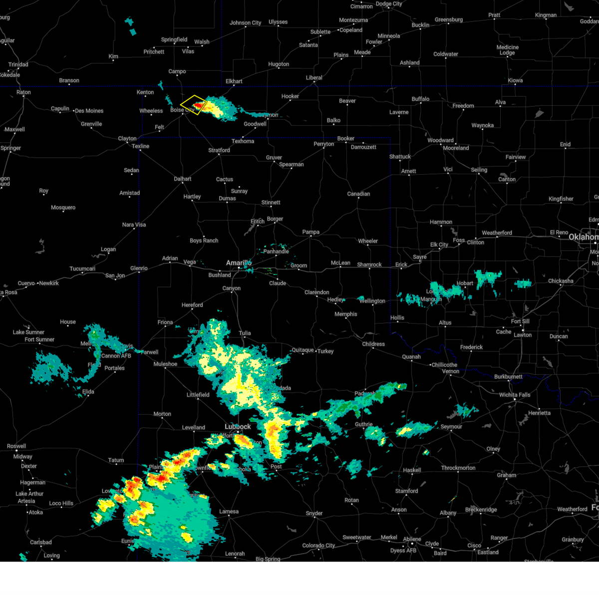 The severe thunderstorm warning for northeastern cimarron county will expire at 900 pm cdt, the storm which prompted the warning has weakened below severe limits, and no longer poses an immediate threat to life or property. therefore, the warning will be allowed to expire. The severe thunderstorm warning for northeastern cimarron county will expire at 900 pm cdt, the storm which prompted the warning has weakened below severe limits, and no longer poses an immediate threat to life or property. therefore, the warning will be allowed to expire.
|
| 8/7/2023 8:44 PM CDT |
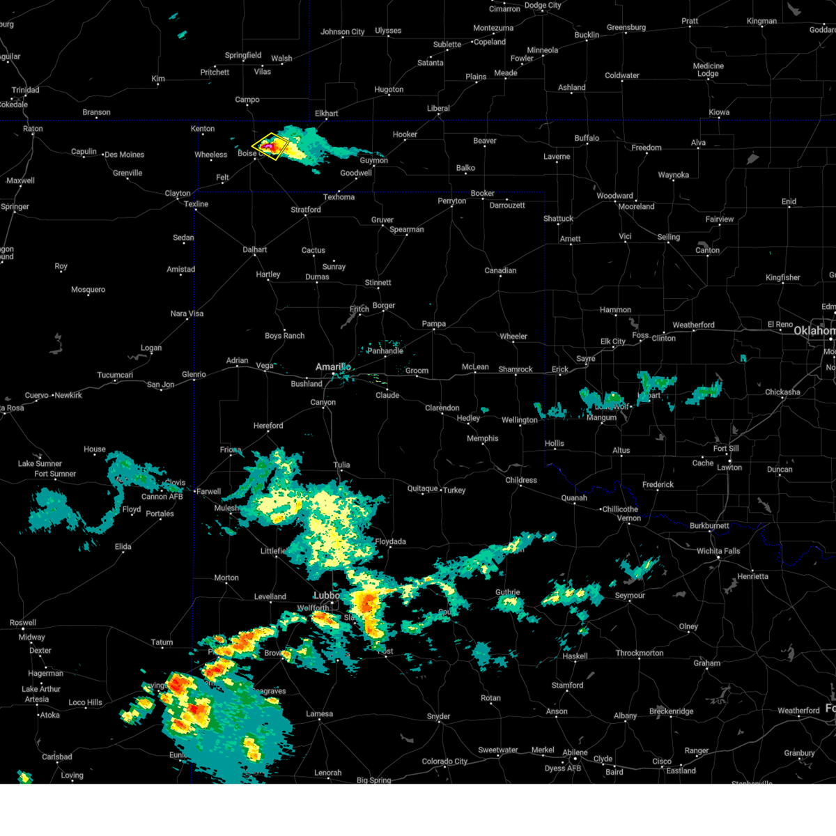 At 844 pm cdt, a severe thunderstorm was located 5 miles west of keyes, or 9 miles northeast of boise city, moving southeast at 25 mph (radar indicated). Hazards include 60 mph wind gusts and half dollar size hail. Minor damage to roofs, siding, and trees is possible. hail damage to vehicles is expected. this severe thunderstorm will remain over mainly rural areas of northeastern cimarron county. hail threat, radar indicated max hail size, 1. 25 in wind threat, radar indicated max wind gust, 60 mph. At 844 pm cdt, a severe thunderstorm was located 5 miles west of keyes, or 9 miles northeast of boise city, moving southeast at 25 mph (radar indicated). Hazards include 60 mph wind gusts and half dollar size hail. Minor damage to roofs, siding, and trees is possible. hail damage to vehicles is expected. this severe thunderstorm will remain over mainly rural areas of northeastern cimarron county. hail threat, radar indicated max hail size, 1. 25 in wind threat, radar indicated max wind gust, 60 mph.
|
| 8/7/2023 8:40 PM CDT |
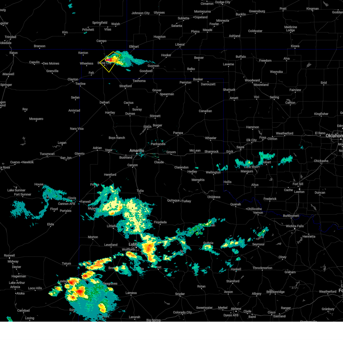 At 839 pm cdt, a severe thunderstorm was located 7 miles west of keyes, or 8 miles northeast of boise city, moving southeast at 25 mph (radar indicated). Hazards include 70 mph wind gusts and ping pong ball size hail. Expect some tree damage. damage is likely to mobile homes, roofs, and outbuildings. people and animals outdoors will be injured. expect hail damage to roofs, siding, windows, and vehicles. locations impacted include, boise city. thunderstorm damage threat, considerable hail threat, radar indicated max hail size, 1. 50 in wind threat, radar indicated max wind gust, 70 mph. At 839 pm cdt, a severe thunderstorm was located 7 miles west of keyes, or 8 miles northeast of boise city, moving southeast at 25 mph (radar indicated). Hazards include 70 mph wind gusts and ping pong ball size hail. Expect some tree damage. damage is likely to mobile homes, roofs, and outbuildings. people and animals outdoors will be injured. expect hail damage to roofs, siding, windows, and vehicles. locations impacted include, boise city. thunderstorm damage threat, considerable hail threat, radar indicated max hail size, 1. 50 in wind threat, radar indicated max wind gust, 70 mph.
|
| 8/7/2023 8:31 PM CDT |
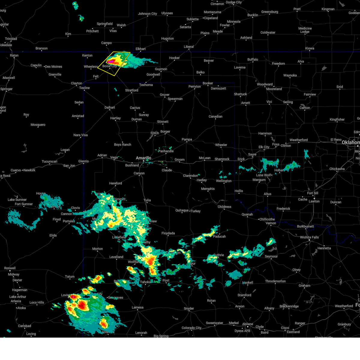 At 830 pm cdt, a severe thunderstorm was located 5 miles northeast of boise city, moving southeast at 20 mph. this is a destructive storm for areas north and northeast of boise city along u.s. highways 287 and 56 (radar indicated). Hazards include 80 mph wind gusts and two inch hail. Flying debris will be dangerous to those caught without shelter. mobile homes will be heavily damaged. expect considerable damage to roofs, windows, and vehicles. tree damage and power outages are likely. people and animals outdoors will be injured. expect hail damage to roofs, siding, windows, and vehicles. locations impacted include, boise city. thunderstorm damage threat, destructive hail threat, radar indicated max hail size, 2. 00 in wind threat, radar indicated max wind gust, 80 mph. At 830 pm cdt, a severe thunderstorm was located 5 miles northeast of boise city, moving southeast at 20 mph. this is a destructive storm for areas north and northeast of boise city along u.s. highways 287 and 56 (radar indicated). Hazards include 80 mph wind gusts and two inch hail. Flying debris will be dangerous to those caught without shelter. mobile homes will be heavily damaged. expect considerable damage to roofs, windows, and vehicles. tree damage and power outages are likely. people and animals outdoors will be injured. expect hail damage to roofs, siding, windows, and vehicles. locations impacted include, boise city. thunderstorm damage threat, destructive hail threat, radar indicated max hail size, 2. 00 in wind threat, radar indicated max wind gust, 80 mph.
|
| 8/7/2023 8:25 PM CDT |
 At 824 pm cdt, a severe thunderstorm was located 5 miles north of boise city, moving southeast at 25 mph. this is a destructive storm for boise city (radar indicated). Hazards include 80 mph wind gusts and golf ball size hail. Flying debris will be dangerous to those caught without shelter. mobile homes will be heavily damaged. expect considerable damage to roofs, windows, and vehicles. tree damage and power outages are likely. people and animals outdoors will be injured. expect hail damage to roofs, siding, windows, and vehicles. locations impacted include, boise city. thunderstorm damage threat, destructive hail threat, radar indicated max hail size, 1. 75 in wind threat, radar indicated max wind gust, 80 mph. At 824 pm cdt, a severe thunderstorm was located 5 miles north of boise city, moving southeast at 25 mph. this is a destructive storm for boise city (radar indicated). Hazards include 80 mph wind gusts and golf ball size hail. Flying debris will be dangerous to those caught without shelter. mobile homes will be heavily damaged. expect considerable damage to roofs, windows, and vehicles. tree damage and power outages are likely. people and animals outdoors will be injured. expect hail damage to roofs, siding, windows, and vehicles. locations impacted include, boise city. thunderstorm damage threat, destructive hail threat, radar indicated max hail size, 1. 75 in wind threat, radar indicated max wind gust, 80 mph.
|
| 8/7/2023 8:15 PM CDT |
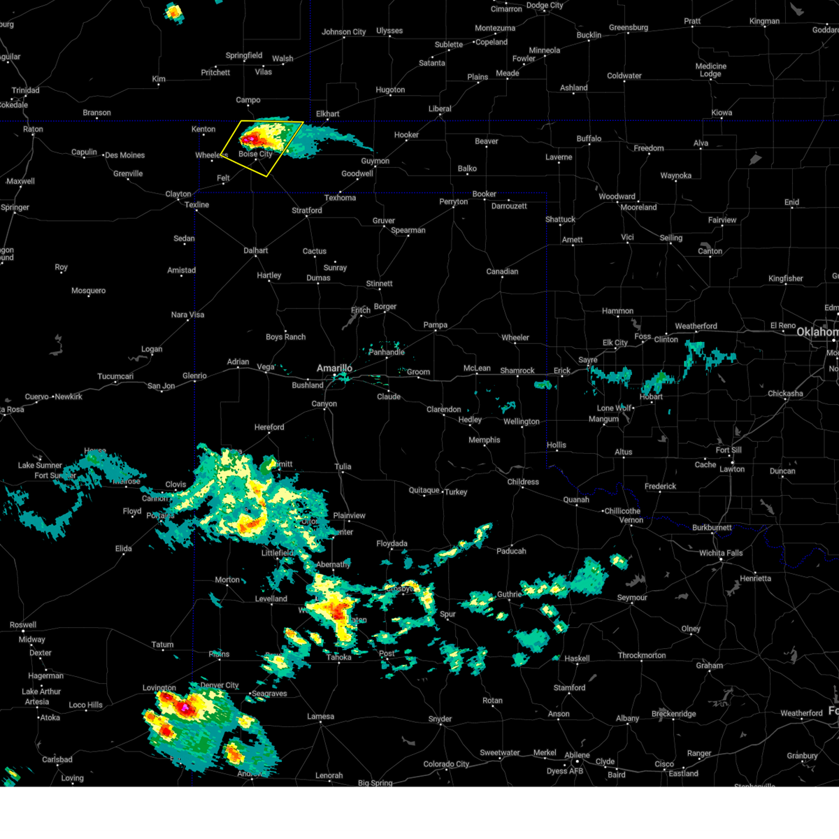 At 815 pm cdt, a severe thunderstorm was located 7 miles north of boise city, moving southeast at 20 mph (radar indicated). Hazards include 70 mph wind gusts and ping pong ball size hail. Expect some tree damage. damage is likely to mobile homes, roofs, and outbuildings. people and animals outdoors will be injured. expect hail damage to roofs, siding, windows, and vehicles. locations impacted include, boise city. thunderstorm damage threat, considerable hail threat, radar indicated max hail size, 1. 50 in wind threat, radar indicated max wind gust, 70 mph. At 815 pm cdt, a severe thunderstorm was located 7 miles north of boise city, moving southeast at 20 mph (radar indicated). Hazards include 70 mph wind gusts and ping pong ball size hail. Expect some tree damage. damage is likely to mobile homes, roofs, and outbuildings. people and animals outdoors will be injured. expect hail damage to roofs, siding, windows, and vehicles. locations impacted include, boise city. thunderstorm damage threat, considerable hail threat, radar indicated max hail size, 1. 50 in wind threat, radar indicated max wind gust, 70 mph.
|
| 8/7/2023 8:06 PM CDT |
 At 805 pm cdt, a severe thunderstorm was located 10 miles northwest of boise city, moving southeast at 20 mph (radar indicated). Hazards include two inch hail and 70 mph wind gusts. Expect some tree damage. damage is likely to mobile homes, roofs, and outbuildings. people and animals outdoors will be injured. expect hail damage to roofs, siding, windows, and vehicles. locations impacted include, boise city. thunderstorm damage threat, considerable hail threat, radar indicated max hail size, 2. 00 in wind threat, radar indicated max wind gust, 70 mph. At 805 pm cdt, a severe thunderstorm was located 10 miles northwest of boise city, moving southeast at 20 mph (radar indicated). Hazards include two inch hail and 70 mph wind gusts. Expect some tree damage. damage is likely to mobile homes, roofs, and outbuildings. people and animals outdoors will be injured. expect hail damage to roofs, siding, windows, and vehicles. locations impacted include, boise city. thunderstorm damage threat, considerable hail threat, radar indicated max hail size, 2. 00 in wind threat, radar indicated max wind gust, 70 mph.
|
| 8/7/2023 7:56 PM CDT |
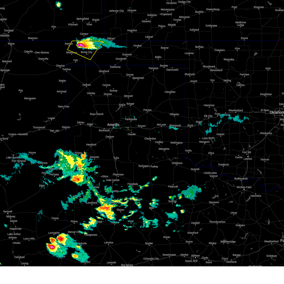 At 756 pm cdt, a severe thunderstorm was located 11 miles east of black mesa park, or 13 miles northwest of boise city, moving southeast at 25 mph (radar indicated). Hazards include two inch hail and 70 mph wind gusts. Expect some tree damage. damage is likely to mobile homes, roofs, and outbuildings. people and animals outdoors will be injured. expect hail damage to roofs, siding, windows, and vehicles. locations impacted include, boise city and black mesa park. thunderstorm damage threat, considerable hail threat, radar indicated max hail size, 2. 00 in wind threat, radar indicated max wind gust, 70 mph. At 756 pm cdt, a severe thunderstorm was located 11 miles east of black mesa park, or 13 miles northwest of boise city, moving southeast at 25 mph (radar indicated). Hazards include two inch hail and 70 mph wind gusts. Expect some tree damage. damage is likely to mobile homes, roofs, and outbuildings. people and animals outdoors will be injured. expect hail damage to roofs, siding, windows, and vehicles. locations impacted include, boise city and black mesa park. thunderstorm damage threat, considerable hail threat, radar indicated max hail size, 2. 00 in wind threat, radar indicated max wind gust, 70 mph.
|
| 8/7/2023 7:50 PM CDT |
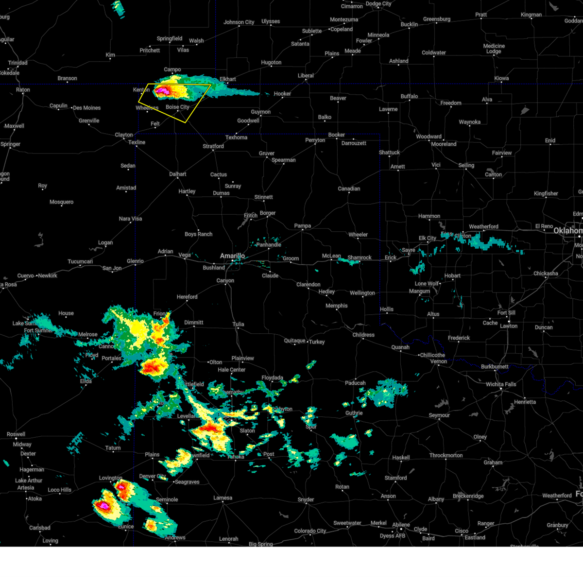 At 750 pm cdt, a severe thunderstorm was located 10 miles east of black mesa park, or 15 miles northwest of boise city, moving southeast at 25 mph (radar indicated). Hazards include golf ball size hail and 60 mph wind gusts. Minor damage to roofs, siding, and trees is possible. people and animals outdoors will be injured. expect hail damage to roofs, siding, windows, and vehicles. locations impacted include, boise city and black mesa park. thunderstorm damage threat, considerable hail threat, radar indicated max hail size, 1. 75 in wind threat, radar indicated max wind gust, 60 mph. At 750 pm cdt, a severe thunderstorm was located 10 miles east of black mesa park, or 15 miles northwest of boise city, moving southeast at 25 mph (radar indicated). Hazards include golf ball size hail and 60 mph wind gusts. Minor damage to roofs, siding, and trees is possible. people and animals outdoors will be injured. expect hail damage to roofs, siding, windows, and vehicles. locations impacted include, boise city and black mesa park. thunderstorm damage threat, considerable hail threat, radar indicated max hail size, 1. 75 in wind threat, radar indicated max wind gust, 60 mph.
|
| 8/7/2023 7:37 PM CDT |
 At 737 pm cdt, a severe thunderstorm was located 8 miles northeast of black mesa park, or 20 miles northwest of boise city, moving southeast at 25 mph (radar indicated). Hazards include ping pong ball size hail and 60 mph wind gusts. Minor damage to roofs, siding, and trees is possible. people and animals outdoors will be injured. expect hail damage to roofs, siding, windows, and vehicles. locations impacted include, boise city, black mesa park and kenton. hail threat, radar indicated max hail size, 1. 50 in wind threat, radar indicated max wind gust, 60 mph. At 737 pm cdt, a severe thunderstorm was located 8 miles northeast of black mesa park, or 20 miles northwest of boise city, moving southeast at 25 mph (radar indicated). Hazards include ping pong ball size hail and 60 mph wind gusts. Minor damage to roofs, siding, and trees is possible. people and animals outdoors will be injured. expect hail damage to roofs, siding, windows, and vehicles. locations impacted include, boise city, black mesa park and kenton. hail threat, radar indicated max hail size, 1. 50 in wind threat, radar indicated max wind gust, 60 mph.
|
| 8/7/2023 7:23 PM CDT |
 At 723 pm cdt, a severe thunderstorm was located 7 miles northeast of kenton, or 27 miles northwest of boise city, moving southeast at 20 mph (radar indicated). Hazards include ping pong ball size hail and 60 mph wind gusts. Minor damage to roofs, siding, and trees is possible. people and animals outdoors will be injured. Expect hail damage to roofs, siding, windows, and vehicles. At 723 pm cdt, a severe thunderstorm was located 7 miles northeast of kenton, or 27 miles northwest of boise city, moving southeast at 20 mph (radar indicated). Hazards include ping pong ball size hail and 60 mph wind gusts. Minor damage to roofs, siding, and trees is possible. people and animals outdoors will be injured. Expect hail damage to roofs, siding, windows, and vehicles.
|
| 8/5/2023 8:55 PM CDT |
 At 855 pm cdt, severe thunderstorms were located along a line extending from 5 miles south of keyes to 8 miles south of boise city, moving southeast at 30 mph (radar indicated). Hazards include two inch hail and 70 mph wind gusts. Expect some tree damage. damage is likely to mobile homes, roofs, and outbuildings. people and animals outdoors will be injured. expect hail damage to roofs, siding, windows, and vehicles. locations impacted include, stratford, keyes, griggs, conlen and texhoma. thunderstorm damage threat, considerable hail threat, radar indicated max hail size, 2. 00 in wind threat, radar indicated max wind gust, 70 mph. At 855 pm cdt, severe thunderstorms were located along a line extending from 5 miles south of keyes to 8 miles south of boise city, moving southeast at 30 mph (radar indicated). Hazards include two inch hail and 70 mph wind gusts. Expect some tree damage. damage is likely to mobile homes, roofs, and outbuildings. people and animals outdoors will be injured. expect hail damage to roofs, siding, windows, and vehicles. locations impacted include, stratford, keyes, griggs, conlen and texhoma. thunderstorm damage threat, considerable hail threat, radar indicated max hail size, 2. 00 in wind threat, radar indicated max wind gust, 70 mph.
|
| 8/5/2023 8:55 PM CDT |
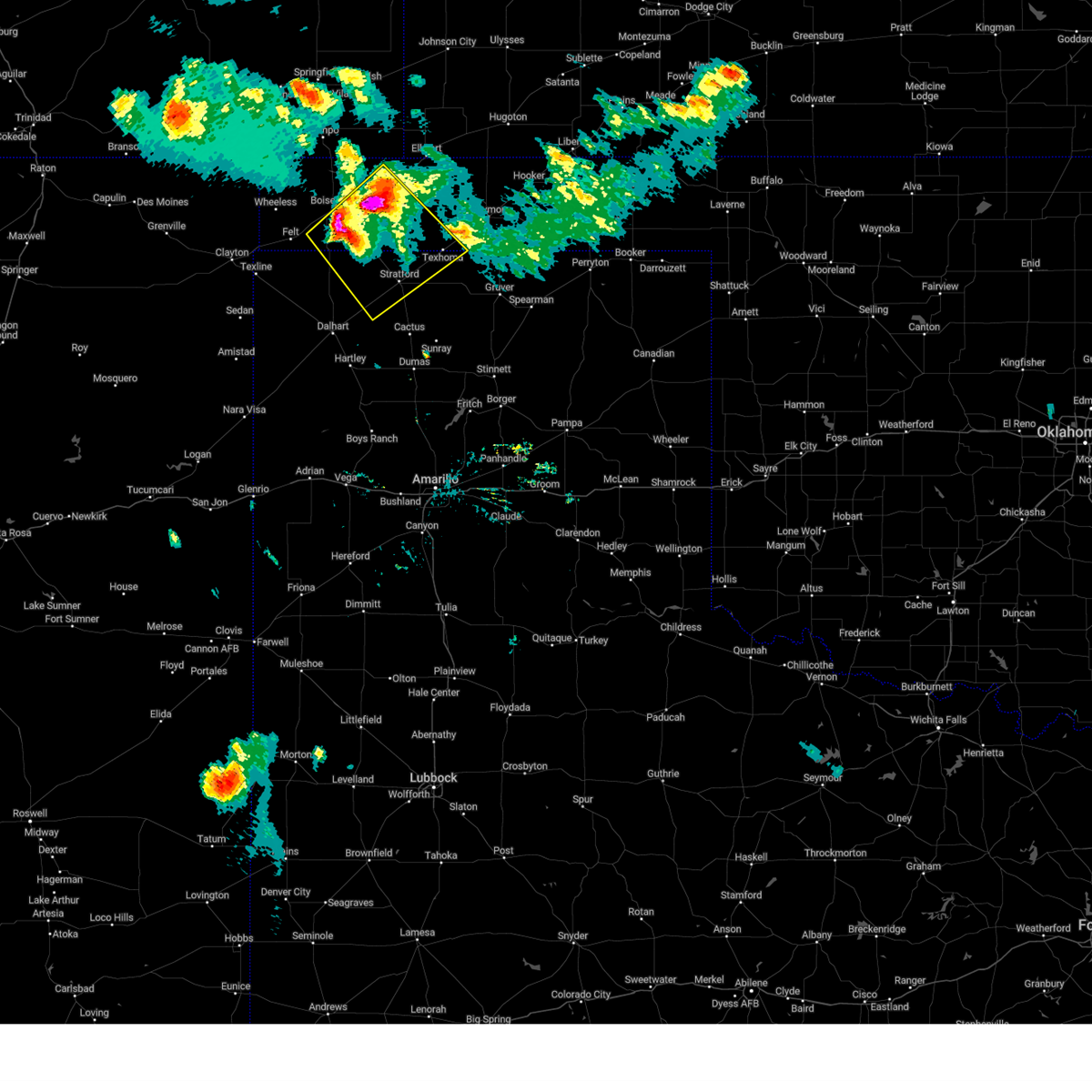 At 855 pm cdt, severe thunderstorms were located along a line extending from 5 miles south of keyes to 8 miles south of boise city, moving southeast at 30 mph (radar indicated). Hazards include two inch hail and 70 mph wind gusts. Expect some tree damage. damage is likely to mobile homes, roofs, and outbuildings. people and animals outdoors will be injured. expect hail damage to roofs, siding, windows, and vehicles. locations impacted include, stratford, keyes, griggs, conlen and texhoma. thunderstorm damage threat, considerable hail threat, radar indicated max hail size, 2. 00 in wind threat, radar indicated max wind gust, 70 mph. At 855 pm cdt, severe thunderstorms were located along a line extending from 5 miles south of keyes to 8 miles south of boise city, moving southeast at 30 mph (radar indicated). Hazards include two inch hail and 70 mph wind gusts. Expect some tree damage. damage is likely to mobile homes, roofs, and outbuildings. people and animals outdoors will be injured. expect hail damage to roofs, siding, windows, and vehicles. locations impacted include, stratford, keyes, griggs, conlen and texhoma. thunderstorm damage threat, considerable hail threat, radar indicated max hail size, 2. 00 in wind threat, radar indicated max wind gust, 70 mph.
|
| 8/5/2023 8:50 PM CDT |
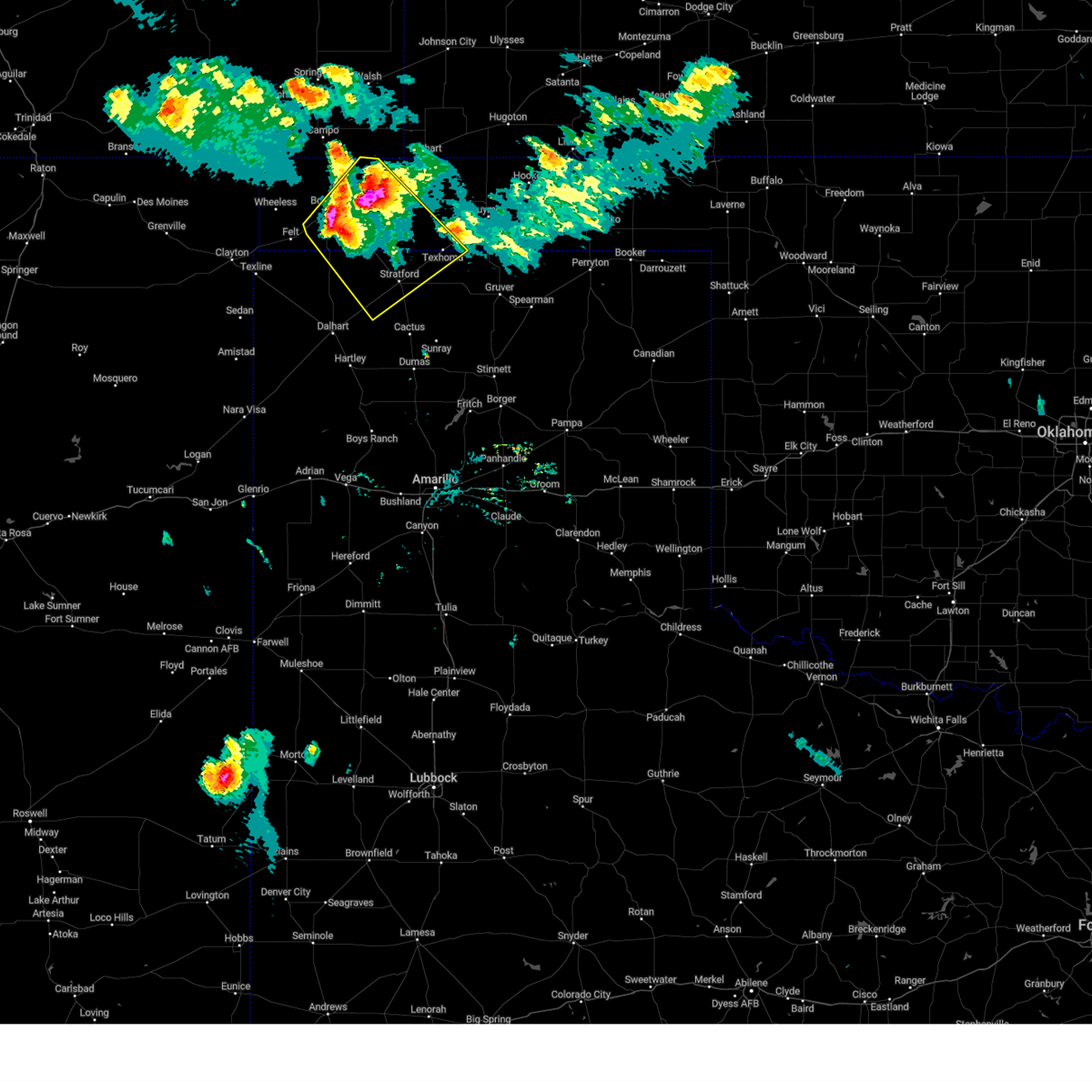 At 850 pm cdt, severe thunderstorms were located along a line extending from 3 miles south of keyes to 7 miles south of boise city, moving southeast at 30 mph (radar indicated). Hazards include 70 mph wind gusts and half dollar size hail. Expect some tree damage. damage is likely to mobile homes, roofs, and outbuildings. hail damage to vehicles is expected. locations impacted include, stratford, boise city, keyes, conlen, griggs and texhoma. thunderstorm damage threat, considerable hail threat, radar indicated max hail size, 1. 25 in wind threat, radar indicated max wind gust, 70 mph. At 850 pm cdt, severe thunderstorms were located along a line extending from 3 miles south of keyes to 7 miles south of boise city, moving southeast at 30 mph (radar indicated). Hazards include 70 mph wind gusts and half dollar size hail. Expect some tree damage. damage is likely to mobile homes, roofs, and outbuildings. hail damage to vehicles is expected. locations impacted include, stratford, boise city, keyes, conlen, griggs and texhoma. thunderstorm damage threat, considerable hail threat, radar indicated max hail size, 1. 25 in wind threat, radar indicated max wind gust, 70 mph.
|
| 8/5/2023 8:50 PM CDT |
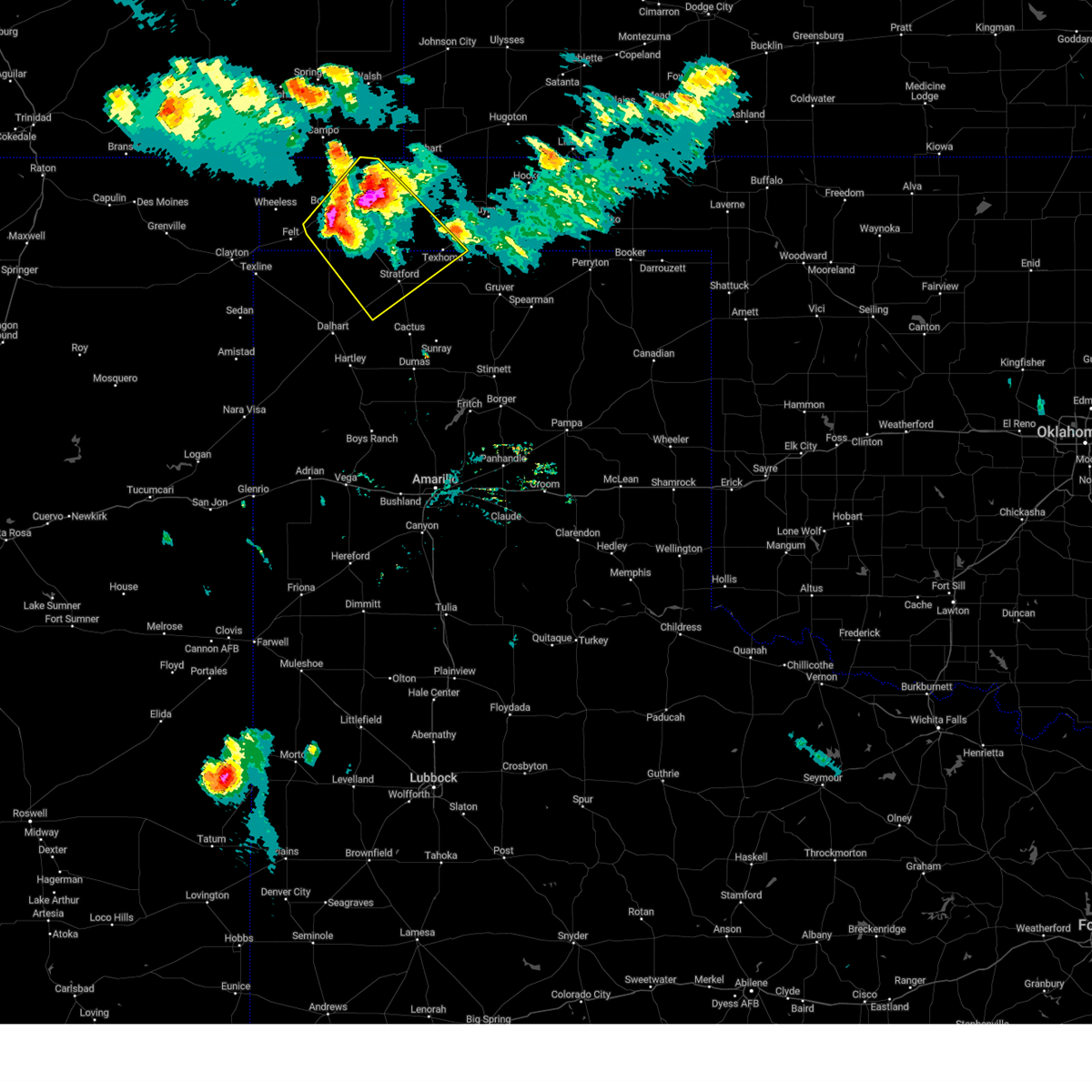 At 850 pm cdt, severe thunderstorms were located along a line extending from 3 miles south of keyes to 7 miles south of boise city, moving southeast at 30 mph (radar indicated). Hazards include 70 mph wind gusts and half dollar size hail. Expect some tree damage. damage is likely to mobile homes, roofs, and outbuildings. hail damage to vehicles is expected. locations impacted include, stratford, boise city, keyes, conlen, griggs and texhoma. thunderstorm damage threat, considerable hail threat, radar indicated max hail size, 1. 25 in wind threat, radar indicated max wind gust, 70 mph. At 850 pm cdt, severe thunderstorms were located along a line extending from 3 miles south of keyes to 7 miles south of boise city, moving southeast at 30 mph (radar indicated). Hazards include 70 mph wind gusts and half dollar size hail. Expect some tree damage. damage is likely to mobile homes, roofs, and outbuildings. hail damage to vehicles is expected. locations impacted include, stratford, boise city, keyes, conlen, griggs and texhoma. thunderstorm damage threat, considerable hail threat, radar indicated max hail size, 1. 25 in wind threat, radar indicated max wind gust, 70 mph.
|
| 8/5/2023 8:36 PM CDT |
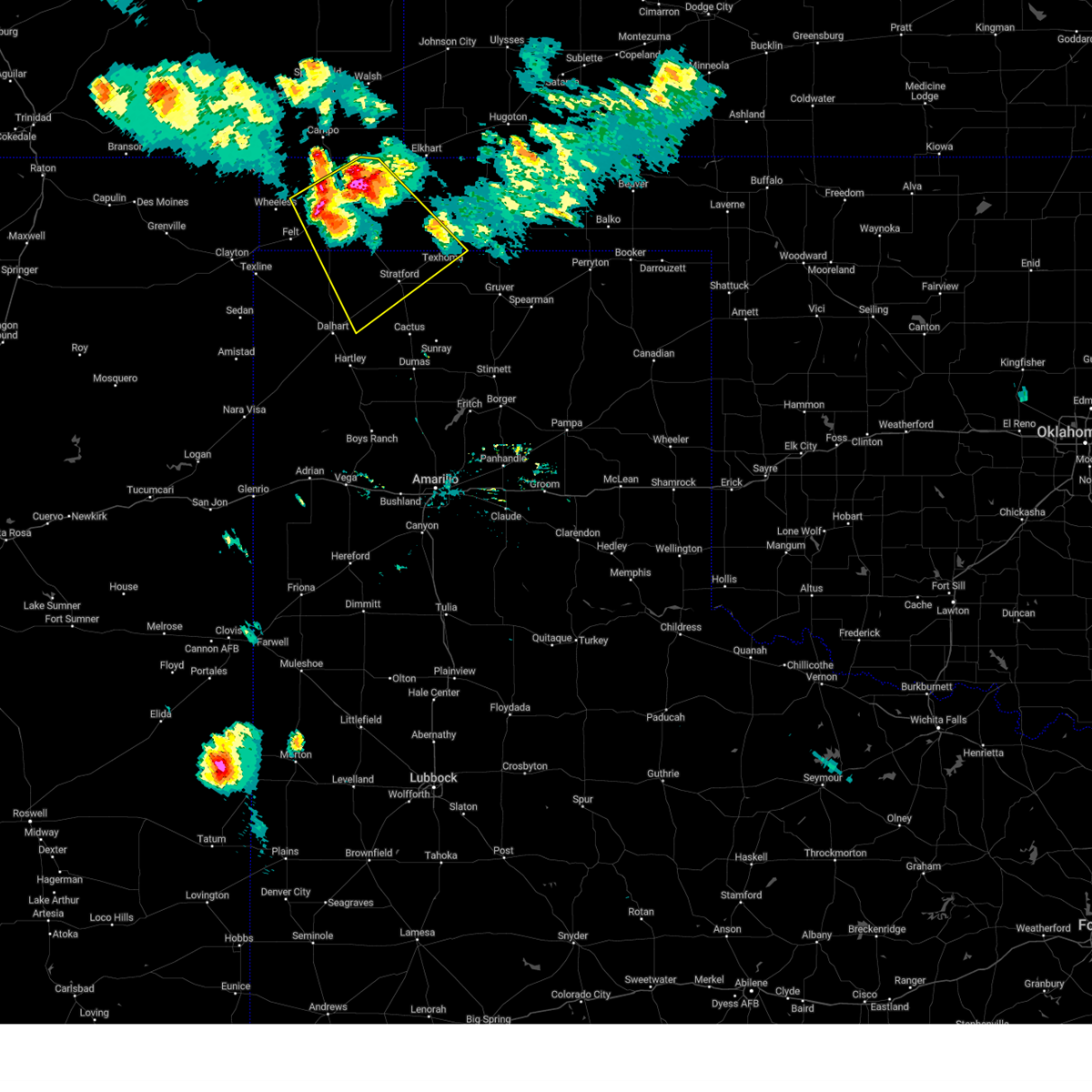 At 836 pm cdt, severe thunderstorms were located along a line extending from near keyes to 8 miles southwest of boise city, moving southeast at 30 mph (radar indicated). Hazards include 70 mph wind gusts and half dollar size hail. Expect some tree damage. damage is likely to mobile homes, roofs, and outbuildings. Hail damage to vehicles is expected. At 836 pm cdt, severe thunderstorms were located along a line extending from near keyes to 8 miles southwest of boise city, moving southeast at 30 mph (radar indicated). Hazards include 70 mph wind gusts and half dollar size hail. Expect some tree damage. damage is likely to mobile homes, roofs, and outbuildings. Hail damage to vehicles is expected.
|
| 8/5/2023 8:21 PM CDT |
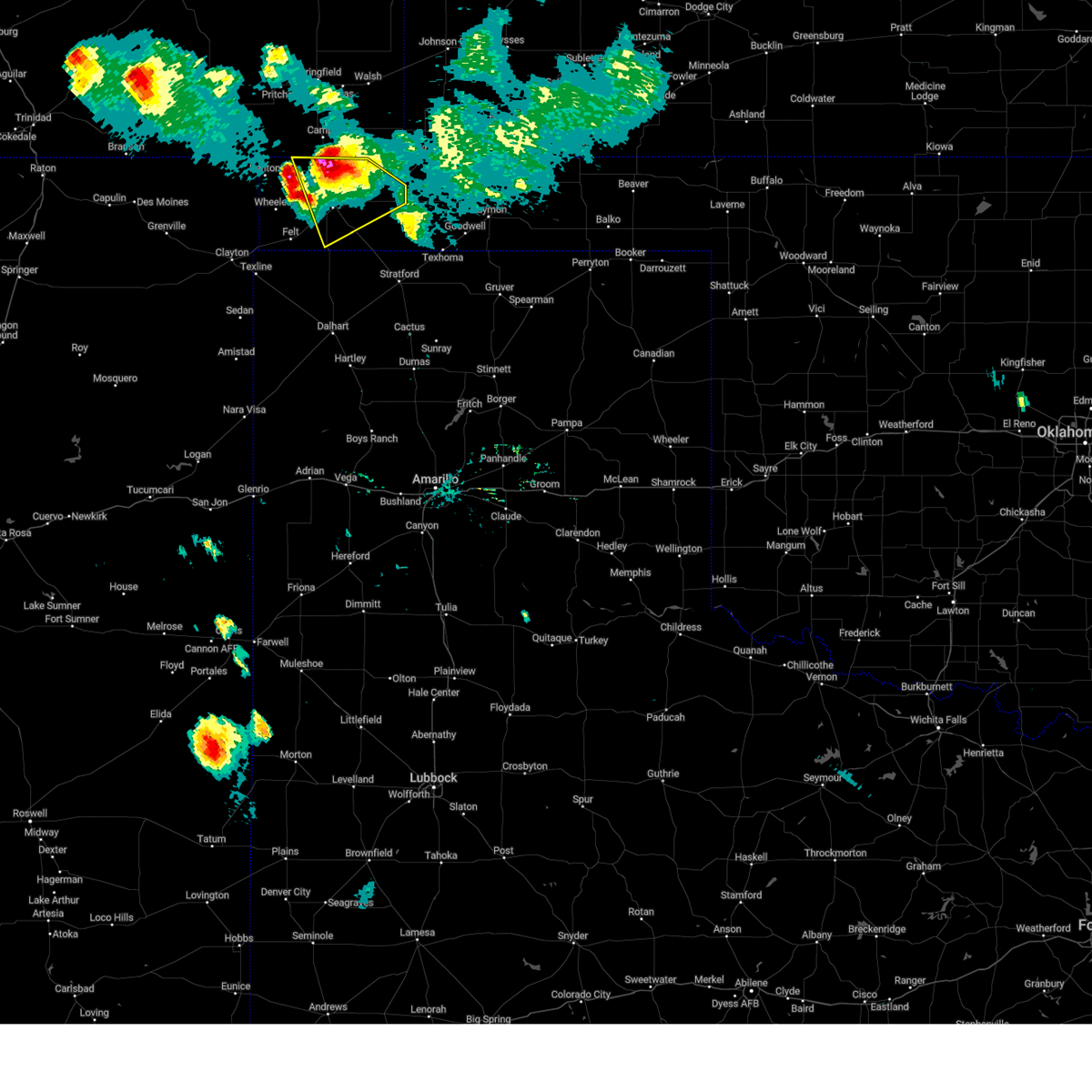 At 821 pm cdt, severe thunderstorms were located along a line extending from 11 miles northwest of keyes to 9 miles west of boise city, moving east at 35 mph (radar indicated). Hazards include 70 mph wind gusts and quarter size hail. Expect some tree damage. damage is likely to mobile homes, roofs, and outbuildings. hail damage to vehicles is expected. locations impacted include, boise city and keyes. thunderstorm damage threat, considerable hail threat, radar indicated max hail size, 1. 00in wind threat, radar indicated max wind gust, 70 mph. At 821 pm cdt, severe thunderstorms were located along a line extending from 11 miles northwest of keyes to 9 miles west of boise city, moving east at 35 mph (radar indicated). Hazards include 70 mph wind gusts and quarter size hail. Expect some tree damage. damage is likely to mobile homes, roofs, and outbuildings. hail damage to vehicles is expected. locations impacted include, boise city and keyes. thunderstorm damage threat, considerable hail threat, radar indicated max hail size, 1. 00in wind threat, radar indicated max wind gust, 70 mph.
|
| 8/5/2023 8:03 PM CDT |
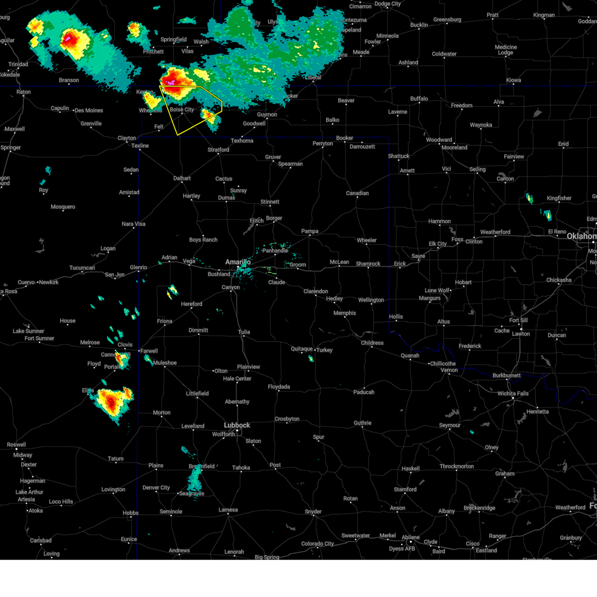 At 803 pm cdt, a severe thunderstorm was located 11 miles south of campo, or 14 miles north of boise city, moving southeast at 40 mph (radar indicated). Hazards include tennis ball size hail and 70 mph wind gusts. Expect some tree damage. damage is likely to mobile homes, roofs, and outbuildings. people and animals outdoors will be injured. expect hail damage to roofs, siding, windows, and vehicles. locations impacted include, boise city and keyes. thunderstorm damage threat, considerable hail threat, radar indicated max hail size, 2. 50 in wind threat, radar indicated max wind gust, 70 mph. At 803 pm cdt, a severe thunderstorm was located 11 miles south of campo, or 14 miles north of boise city, moving southeast at 40 mph (radar indicated). Hazards include tennis ball size hail and 70 mph wind gusts. Expect some tree damage. damage is likely to mobile homes, roofs, and outbuildings. people and animals outdoors will be injured. expect hail damage to roofs, siding, windows, and vehicles. locations impacted include, boise city and keyes. thunderstorm damage threat, considerable hail threat, radar indicated max hail size, 2. 50 in wind threat, radar indicated max wind gust, 70 mph.
|
| 8/5/2023 7:45 PM CDT |
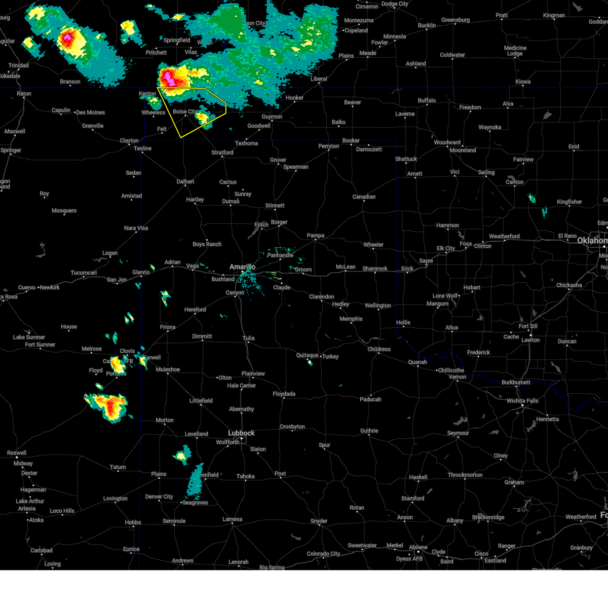 At 744 pm cdt, a severe thunderstorm was located 8 miles southwest of campo, or 23 miles northwest of boise city, moving southeast at 40 mph (radar indicated). Hazards include tennis ball size hail and 70 mph wind gusts. Expect some tree damage. damage is likely to mobile homes, roofs, and outbuildings. people and animals outdoors will be injured. Expect hail damage to roofs, siding, windows, and vehicles. At 744 pm cdt, a severe thunderstorm was located 8 miles southwest of campo, or 23 miles northwest of boise city, moving southeast at 40 mph (radar indicated). Hazards include tennis ball size hail and 70 mph wind gusts. Expect some tree damage. damage is likely to mobile homes, roofs, and outbuildings. people and animals outdoors will be injured. Expect hail damage to roofs, siding, windows, and vehicles.
|
| 7/21/2023 12:10 AM CDT |
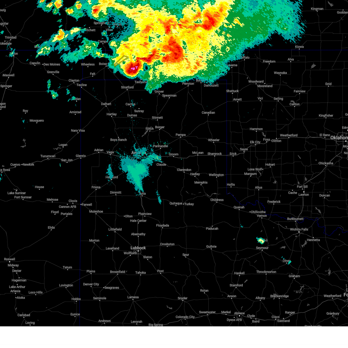 The severe thunderstorm warning for east central cimarron county will expire at 1215 am cdt, the storm which prompted the warning has moved out of the area. therefore, the warning will be allowed to expire. a severe thunderstorm watch remains in effect until 700 am cdt for the panhandle of oklahoma. remember, a severe thunderstorm warning still remains in effect for far southeast portions of cimarron county until 1245 am. The severe thunderstorm warning for east central cimarron county will expire at 1215 am cdt, the storm which prompted the warning has moved out of the area. therefore, the warning will be allowed to expire. a severe thunderstorm watch remains in effect until 700 am cdt for the panhandle of oklahoma. remember, a severe thunderstorm warning still remains in effect for far southeast portions of cimarron county until 1245 am.
|
| 7/20/2023 11:48 PM CDT |
 At 1148 pm cdt, a severe thunderstorm was located 6 miles north of griggs, or 23 miles east of boise city, moving southeast at 35 mph (radar indicated). Hazards include 70 mph wind gusts and ping pong ball size hail. Expect some tree damage. damage is likely to mobile homes, roofs, and outbuildings. people and animals outdoors will be injured. expect hail damage to roofs, siding, windows, and vehicles. Locations impacted include, goodwell, texhoma, keyes and griggs. At 1148 pm cdt, a severe thunderstorm was located 6 miles north of griggs, or 23 miles east of boise city, moving southeast at 35 mph (radar indicated). Hazards include 70 mph wind gusts and ping pong ball size hail. Expect some tree damage. damage is likely to mobile homes, roofs, and outbuildings. people and animals outdoors will be injured. expect hail damage to roofs, siding, windows, and vehicles. Locations impacted include, goodwell, texhoma, keyes and griggs.
|
| 7/20/2023 11:47 PM CDT |
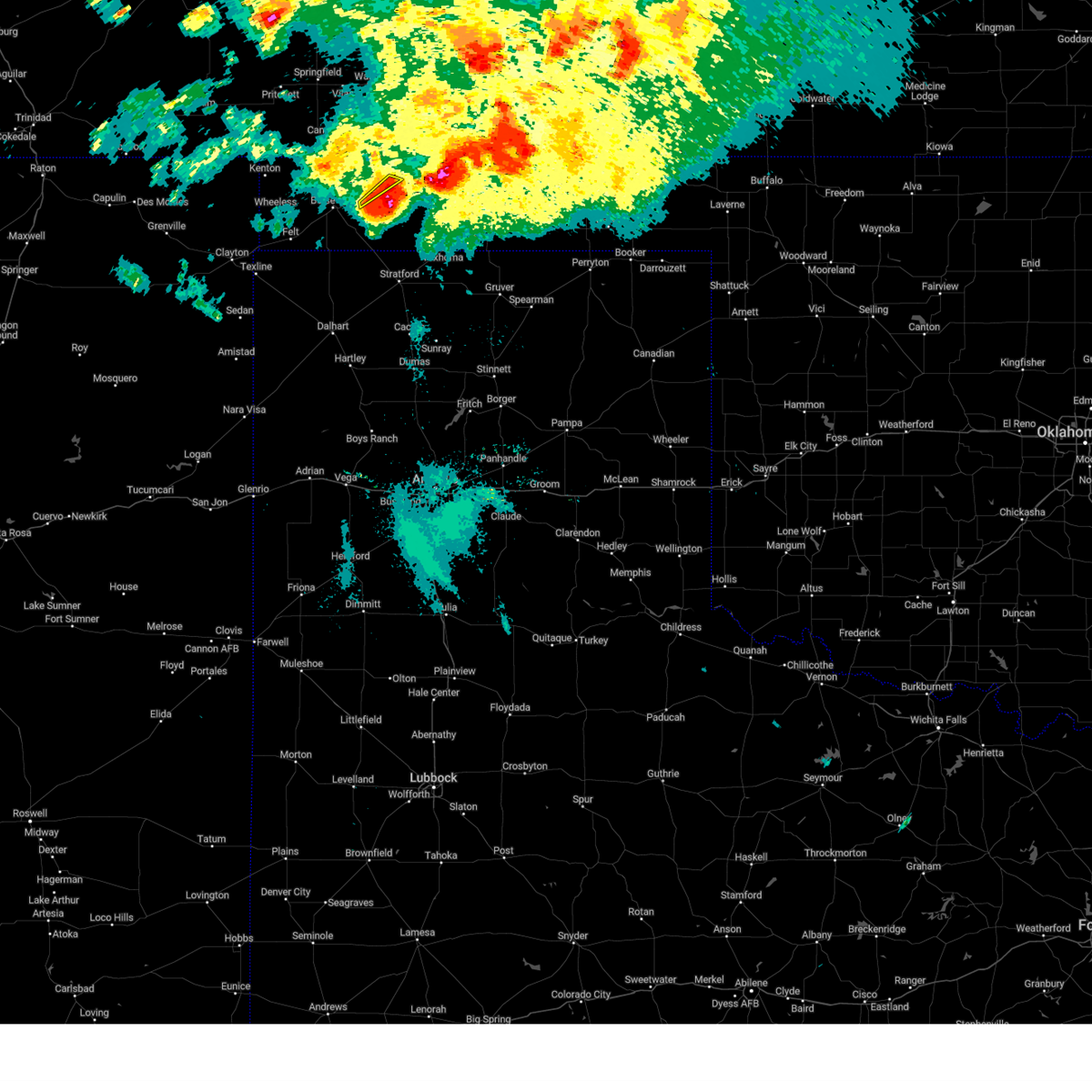 At 1147 pm cdt, a severe thunderstorm was located 6 miles north of griggs, or 22 miles east of boise city, moving southeast at 40 mph (radar indicated). Hazards include 70 mph wind gusts and ping pong ball size hail. Expect some tree damage. damage is likely to mobile homes, roofs, and outbuildings. people and animals outdoors will be injured. expect hail damage to roofs, siding, windows, and vehicles. Locations impacted include, keyes and sturgis. At 1147 pm cdt, a severe thunderstorm was located 6 miles north of griggs, or 22 miles east of boise city, moving southeast at 40 mph (radar indicated). Hazards include 70 mph wind gusts and ping pong ball size hail. Expect some tree damage. damage is likely to mobile homes, roofs, and outbuildings. people and animals outdoors will be injured. expect hail damage to roofs, siding, windows, and vehicles. Locations impacted include, keyes and sturgis.
|
| 7/20/2023 11:32 PM CDT |
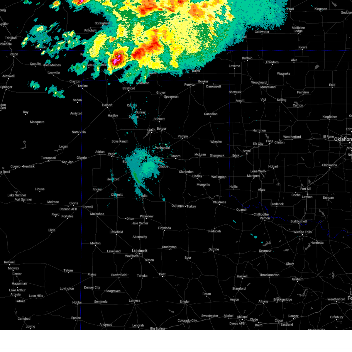 At 1132 pm cdt, a severe thunderstorm was located 4 miles south of keyes, or 12 miles east of boise city, moving southeast at 25 mph (radar indicated). Hazards include golf ball size hail and 70 mph wind gusts. Expect some tree damage. damage is likely to mobile homes, roofs, and outbuildings. people and animals outdoors will be injured. expect hail damage to roofs, siding, windows, and vehicles. Locations impacted include, keyes and sturgis. At 1132 pm cdt, a severe thunderstorm was located 4 miles south of keyes, or 12 miles east of boise city, moving southeast at 25 mph (radar indicated). Hazards include golf ball size hail and 70 mph wind gusts. Expect some tree damage. damage is likely to mobile homes, roofs, and outbuildings. people and animals outdoors will be injured. expect hail damage to roofs, siding, windows, and vehicles. Locations impacted include, keyes and sturgis.
|
| 7/20/2023 11:24 PM CDT |
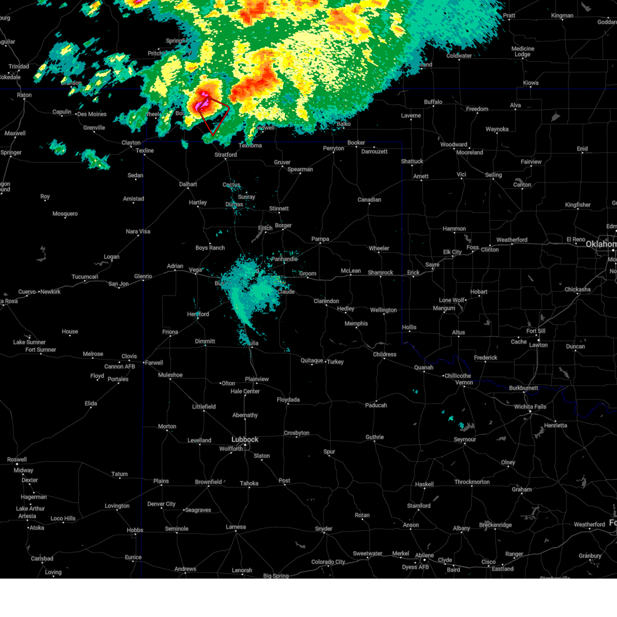 At 1123 pm cdt, a severe thunderstorm capable of producing a tornado was located over keyes, or 15 miles northeast of boise city, moving southeast at 30 mph (radar indicated rotation). Hazards include tornado and golf ball size hail. Flying debris will be dangerous to those caught without shelter. mobile homes will be damaged or destroyed. damage to roofs, windows, and vehicles will occur. tree damage is likely. Locations impacted include, keyes. At 1123 pm cdt, a severe thunderstorm capable of producing a tornado was located over keyes, or 15 miles northeast of boise city, moving southeast at 30 mph (radar indicated rotation). Hazards include tornado and golf ball size hail. Flying debris will be dangerous to those caught without shelter. mobile homes will be damaged or destroyed. damage to roofs, windows, and vehicles will occur. tree damage is likely. Locations impacted include, keyes.
|
| 7/20/2023 11:17 PM CDT |
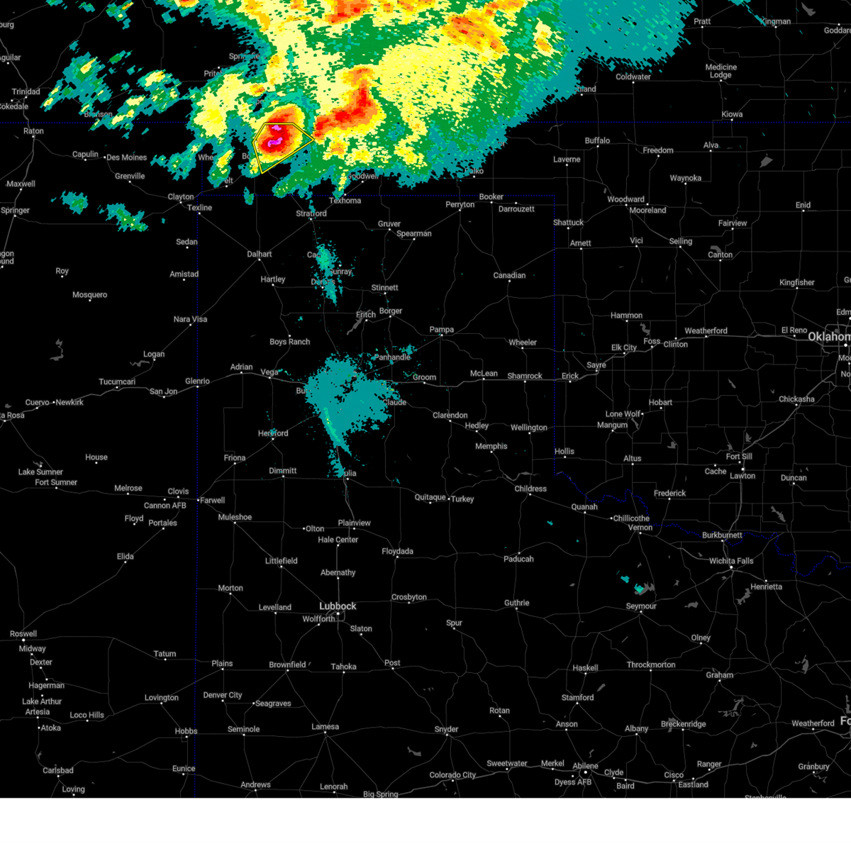 At 1117 pm cdt, a severe thunderstorm was located 5 miles west of keyes, or 10 miles northeast of boise city, moving southeast at 35 mph (radar indicated). Hazards include golf ball size hail and 70 mph wind gusts. Expect some tree damage. damage is likely to mobile homes, roofs, and outbuildings. people and animals outdoors will be injured. expect hail damage to roofs, siding, windows, and vehicles. Locations impacted include, boise city, keyes and sturgis. At 1117 pm cdt, a severe thunderstorm was located 5 miles west of keyes, or 10 miles northeast of boise city, moving southeast at 35 mph (radar indicated). Hazards include golf ball size hail and 70 mph wind gusts. Expect some tree damage. damage is likely to mobile homes, roofs, and outbuildings. people and animals outdoors will be injured. expect hail damage to roofs, siding, windows, and vehicles. Locations impacted include, boise city, keyes and sturgis.
|
| 7/20/2023 11:16 PM CDT |
 At 1115 pm cdt, a severe thunderstorm was located 5 miles west of keyes, or 11 miles northeast of boise city, moving southeast at 35 mph (radar indicated). Hazards include golf ball size hail and 70 mph wind gusts. Expect some tree damage. damage is likely to mobile homes, roofs, and outbuildings. people and animals outdoors will be injured. Expect hail damage to roofs, siding, windows, and vehicles. At 1115 pm cdt, a severe thunderstorm was located 5 miles west of keyes, or 11 miles northeast of boise city, moving southeast at 35 mph (radar indicated). Hazards include golf ball size hail and 70 mph wind gusts. Expect some tree damage. damage is likely to mobile homes, roofs, and outbuildings. people and animals outdoors will be injured. Expect hail damage to roofs, siding, windows, and vehicles.
|
| 7/20/2023 11:11 PM CDT |
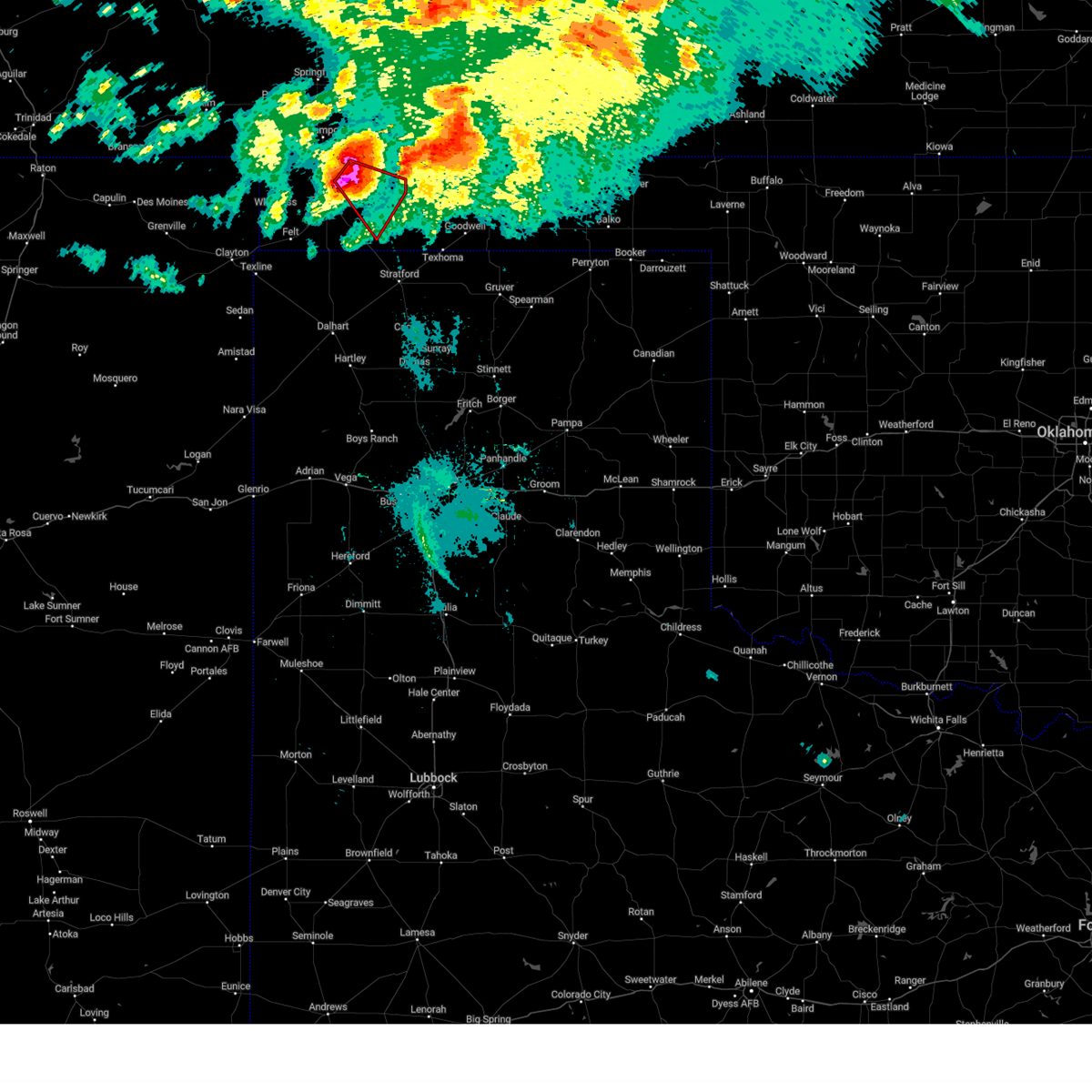 At 1111 pm cdt, a severe thunderstorm capable of producing a tornado was located 7 miles northwest of keyes, or 13 miles northeast of boise city, moving southeast at 30 mph (radar indicated rotation). Hazards include tornado and golf ball size hail. Flying debris will be dangerous to those caught without shelter. mobile homes will be damaged or destroyed. damage to roofs, windows, and vehicles will occur. Tree damage is likely. At 1111 pm cdt, a severe thunderstorm capable of producing a tornado was located 7 miles northwest of keyes, or 13 miles northeast of boise city, moving southeast at 30 mph (radar indicated rotation). Hazards include tornado and golf ball size hail. Flying debris will be dangerous to those caught without shelter. mobile homes will be damaged or destroyed. damage to roofs, windows, and vehicles will occur. Tree damage is likely.
|
| 7/20/2023 10:38 PM CDT |
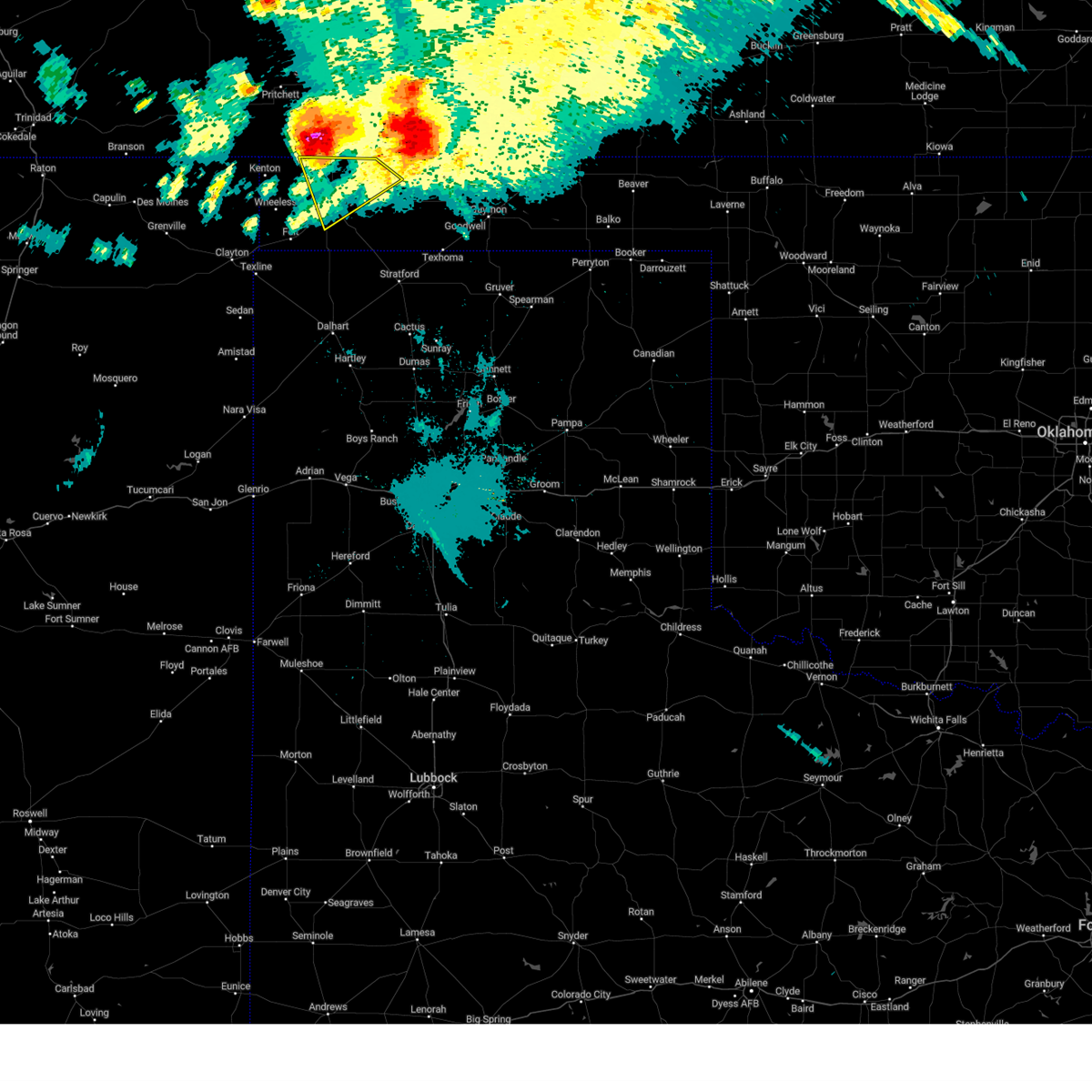 At 1037 pm cdt, a severe thunderstorm was located 5 miles southwest of campo, or 23 miles north of boise city, moving southeast at 20 mph (radar indicated). Hazards include golf ball size hail and 70 mph wind gusts. Expect some tree damage. damage is likely to mobile homes, roofs, and outbuildings. people and animals outdoors will be injured. Expect hail damage to roofs, siding, windows, and vehicles. At 1037 pm cdt, a severe thunderstorm was located 5 miles southwest of campo, or 23 miles north of boise city, moving southeast at 20 mph (radar indicated). Hazards include golf ball size hail and 70 mph wind gusts. Expect some tree damage. damage is likely to mobile homes, roofs, and outbuildings. people and animals outdoors will be injured. Expect hail damage to roofs, siding, windows, and vehicles.
|
| 7/13/2023 10:04 PM CDT |
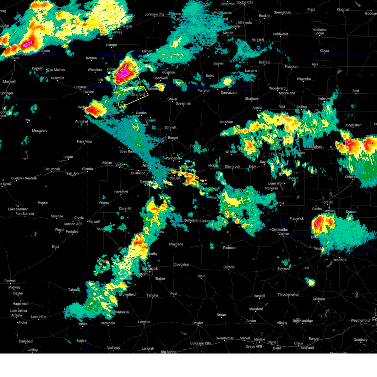 At 1002 pm cdt, a severe thunderstorm was located 12 miles west of griggs, or 13 miles southeast of boise city, moving southeast at 30 mph. this is a destructive storm for southeast cimarron county (radar indicated). Hazards include baseball size hail and 70 mph wind gusts. People and animals outdoors will be severely injured. expect shattered windows, extensive damage to roofs, siding, and vehicles. locations impacted include, stratford, keyes and griggs. thunderstorm damage threat, destructive hail threat, radar indicated max hail size, 2. 75 in wind threat, radar indicated max wind gust, 70 mph. At 1002 pm cdt, a severe thunderstorm was located 12 miles west of griggs, or 13 miles southeast of boise city, moving southeast at 30 mph. this is a destructive storm for southeast cimarron county (radar indicated). Hazards include baseball size hail and 70 mph wind gusts. People and animals outdoors will be severely injured. expect shattered windows, extensive damage to roofs, siding, and vehicles. locations impacted include, stratford, keyes and griggs. thunderstorm damage threat, destructive hail threat, radar indicated max hail size, 2. 75 in wind threat, radar indicated max wind gust, 70 mph.
|
| 7/13/2023 9:40 PM CDT |
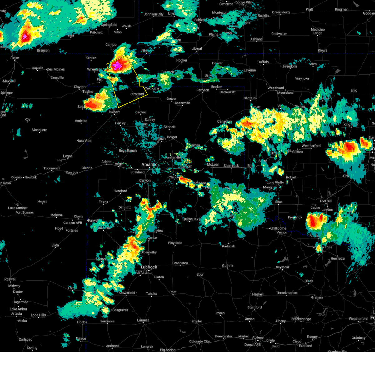 At 938 pm cdt, a severe thunderstorm was located 4 miles east of boise city, moving southeast at 30 mph. this is a destructive storm for areas near and just east of boise city (radar indicated). Hazards include baseball size hail and 70 mph wind gusts. People and animals outdoors will be severely injured. Expect shattered windows, extensive damage to roofs, siding, and vehicles. At 938 pm cdt, a severe thunderstorm was located 4 miles east of boise city, moving southeast at 30 mph. this is a destructive storm for areas near and just east of boise city (radar indicated). Hazards include baseball size hail and 70 mph wind gusts. People and animals outdoors will be severely injured. Expect shattered windows, extensive damage to roofs, siding, and vehicles.
|
| 7/13/2023 8:57 PM CDT |
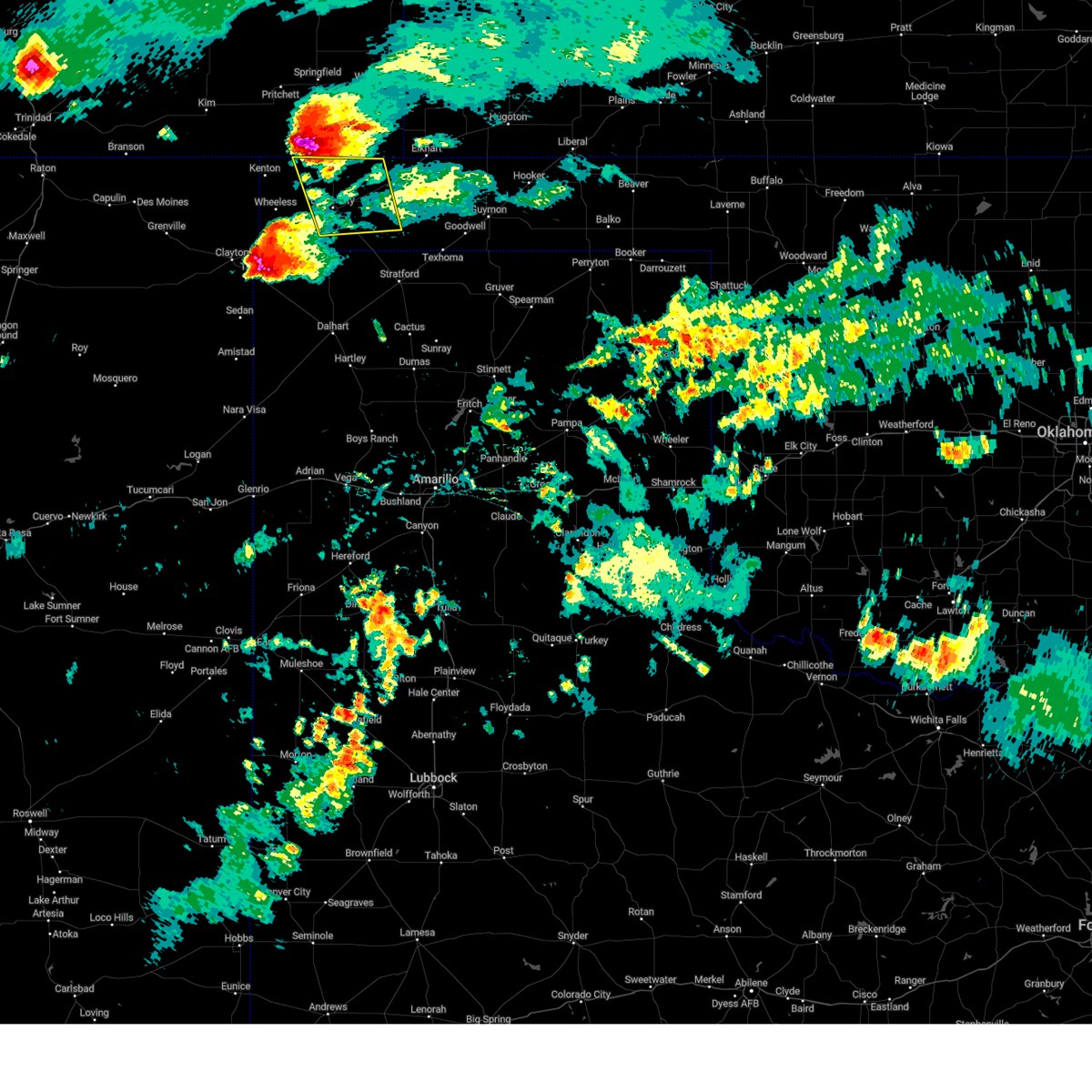 At 857 pm cdt, a severe thunderstorm was located 11 miles south of campo, or 16 miles northwest of boise city, moving southeast at 30 mph (radar indicated). Hazards include tennis ball size hail and 70 mph wind gusts. Expect some tree damage. damage is likely to mobile homes, roofs, and outbuildings. people and animals outdoors will be injured. expect hail damage to roofs, siding, windows, and vehicles. locations impacted include, boise city and keyes. thunderstorm damage threat, considerable hail threat, radar indicated max hail size, 2. 50 in wind threat, radar indicated max wind gust, 70 mph. At 857 pm cdt, a severe thunderstorm was located 11 miles south of campo, or 16 miles northwest of boise city, moving southeast at 30 mph (radar indicated). Hazards include tennis ball size hail and 70 mph wind gusts. Expect some tree damage. damage is likely to mobile homes, roofs, and outbuildings. people and animals outdoors will be injured. expect hail damage to roofs, siding, windows, and vehicles. locations impacted include, boise city and keyes. thunderstorm damage threat, considerable hail threat, radar indicated max hail size, 2. 50 in wind threat, radar indicated max wind gust, 70 mph.
|
| 7/13/2023 8:41 PM CDT |
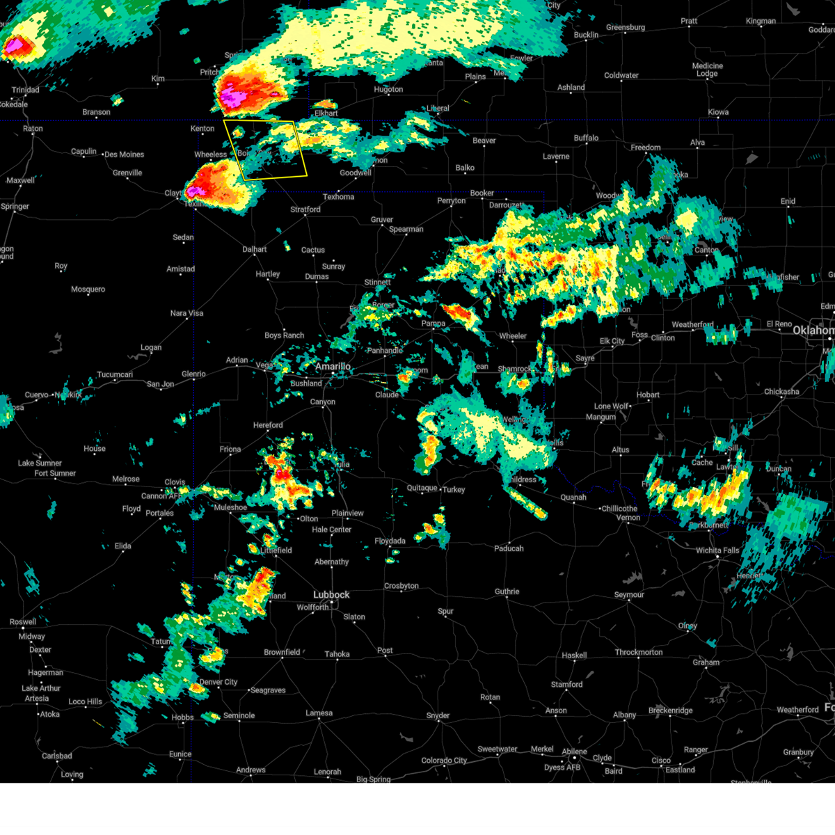 At 841 pm cdt, a severe thunderstorm was located 6 miles southwest of campo, or 24 miles south of springfield, moving southeast at 30 mph (radar indicated). Hazards include tennis ball size hail and 70 mph wind gusts. Expect some tree damage. damage is likely to mobile homes, roofs, and outbuildings. people and animals outdoors will be injured. Expect hail damage to roofs, siding, windows, and vehicles. At 841 pm cdt, a severe thunderstorm was located 6 miles southwest of campo, or 24 miles south of springfield, moving southeast at 30 mph (radar indicated). Hazards include tennis ball size hail and 70 mph wind gusts. Expect some tree damage. damage is likely to mobile homes, roofs, and outbuildings. people and animals outdoors will be injured. Expect hail damage to roofs, siding, windows, and vehicles.
|
| 7/6/2023 2:41 AM CDT |
 The severe thunderstorm warning for southwestern texas and eastern cimarron counties will expire at 245 am cdt, the storm which prompted the warning has weakened below severe limits, and no longer poses an immediate threat to life or property. therefore, the warning will be allowed to expire. however small hail, gusty winds and heavy rain are still possible with this thunderstorm. a severe thunderstorm watch remains in effect until 500 am cdt for the panhandle of oklahoma, and the panhandle of texas. The severe thunderstorm warning for southwestern texas and eastern cimarron counties will expire at 245 am cdt, the storm which prompted the warning has weakened below severe limits, and no longer poses an immediate threat to life or property. therefore, the warning will be allowed to expire. however small hail, gusty winds and heavy rain are still possible with this thunderstorm. a severe thunderstorm watch remains in effect until 500 am cdt for the panhandle of oklahoma, and the panhandle of texas.
|
| 7/6/2023 2:17 AM CDT |
 At 217 am cdt, automated weather equipment reported a severe thunderstorm was located 5 miles west of griggs, or 18 miles northwest of stratford, moving southeast at 35 mph (radar indicated). Hazards include 60 mph wind gusts and quarter size hail. Minor damage to roofs, siding, and trees is possible. hail damage to vehicles is expected. locations impacted include, guymon, boise city, goodwell, texhoma, keyes, eva, griggs and sturgis. hail threat, radar indicated max hail size, 1. 00in wind threat, radar indicated max wind gust, 60 mph. At 217 am cdt, automated weather equipment reported a severe thunderstorm was located 5 miles west of griggs, or 18 miles northwest of stratford, moving southeast at 35 mph (radar indicated). Hazards include 60 mph wind gusts and quarter size hail. Minor damage to roofs, siding, and trees is possible. hail damage to vehicles is expected. locations impacted include, guymon, boise city, goodwell, texhoma, keyes, eva, griggs and sturgis. hail threat, radar indicated max hail size, 1. 00in wind threat, radar indicated max wind gust, 60 mph.
|
| 7/6/2023 2:04 AM CDT |
 At 204 am cdt, automated weather equipment reported a severe thunderstorm was located 9 miles southeast of boise city, moving southeast at 30 mph (automated weather equipment. at 155 am cdt, a 71 mph wind gust was recorded 3 miles south southeast of boise city). Hazards include 70 mph wind gusts. Expect some tree damage. damage is likely to mobile homes, roofs, and outbuildings. locations impacted include, guymon, boise city, goodwell, texhoma, keyes, eva, griggs and sturgis. thunderstorm damage threat, considerable hail threat, radar indicated max hail size, <. 75 in wind threat, observed max wind gust, 70 mph. At 204 am cdt, automated weather equipment reported a severe thunderstorm was located 9 miles southeast of boise city, moving southeast at 30 mph (automated weather equipment. at 155 am cdt, a 71 mph wind gust was recorded 3 miles south southeast of boise city). Hazards include 70 mph wind gusts. Expect some tree damage. damage is likely to mobile homes, roofs, and outbuildings. locations impacted include, guymon, boise city, goodwell, texhoma, keyes, eva, griggs and sturgis. thunderstorm damage threat, considerable hail threat, radar indicated max hail size, <. 75 in wind threat, observed max wind gust, 70 mph.
|
| 7/6/2023 2:02 AM CDT |
 At 201 am cdt, automated weather equipment reported a severe thunderstorm was located 8 miles southeast of boise city, moving southeast at 25 mph (automated weather equipment. at 155 am cdt, a 71 mph wind gust recorded at boise city). Hazards include 70 mph wind gusts. Expect some tree damage. damage is likely to mobile homes, roofs, and outbuildings. locations impacted include, guymon, boise city, goodwell, texhoma, keyes, eva, griggs and sturgis. thunderstorm damage threat, considerable hail threat, radar indicated max hail size, <. 75 in wind threat, observed max wind gust, 70 mph. At 201 am cdt, automated weather equipment reported a severe thunderstorm was located 8 miles southeast of boise city, moving southeast at 25 mph (automated weather equipment. at 155 am cdt, a 71 mph wind gust recorded at boise city). Hazards include 70 mph wind gusts. Expect some tree damage. damage is likely to mobile homes, roofs, and outbuildings. locations impacted include, guymon, boise city, goodwell, texhoma, keyes, eva, griggs and sturgis. thunderstorm damage threat, considerable hail threat, radar indicated max hail size, <. 75 in wind threat, observed max wind gust, 70 mph.
|
| 7/6/2023 1:34 AM CDT |
 At 134 am cdt, a severe thunderstorm was located 14 miles southeast of campo, or 22 miles northeast of boise city, moving southeast at 35 mph (radar indicated). Hazards include 70 mph wind gusts and quarter size hail. Expect some tree damage. damage is likely to mobile homes, roofs, and outbuildings. hail damage to vehicles is expected. locations impacted include, guymon, boise city, goodwell, texhoma, keyes, eva, griggs and sturgis. thunderstorm damage threat, considerable hail threat, radar indicated max hail size, 1. 00in wind threat, radar indicated max wind gust, 70 mph. At 134 am cdt, a severe thunderstorm was located 14 miles southeast of campo, or 22 miles northeast of boise city, moving southeast at 35 mph (radar indicated). Hazards include 70 mph wind gusts and quarter size hail. Expect some tree damage. damage is likely to mobile homes, roofs, and outbuildings. hail damage to vehicles is expected. locations impacted include, guymon, boise city, goodwell, texhoma, keyes, eva, griggs and sturgis. thunderstorm damage threat, considerable hail threat, radar indicated max hail size, 1. 00in wind threat, radar indicated max wind gust, 70 mph.
|
| 7/6/2023 1:20 AM CDT |
 At 119 am cdt, a severe thunderstorm was located 8 miles east of campo, or 22 miles southeast of springfield, moving southeast at 35 mph (automated weather equipment. at 102 am cdt, an 82 mph wind gust was recorded at springfield colorado). Hazards include 70 mph wind gusts and quarter size hail. Expect some tree damage. damage is likely to mobile homes, roofs, and outbuildings. Hail damage to vehicles is expected. At 119 am cdt, a severe thunderstorm was located 8 miles east of campo, or 22 miles southeast of springfield, moving southeast at 35 mph (automated weather equipment. at 102 am cdt, an 82 mph wind gust was recorded at springfield colorado). Hazards include 70 mph wind gusts and quarter size hail. Expect some tree damage. damage is likely to mobile homes, roofs, and outbuildings. Hail damage to vehicles is expected.
|
| 6/30/2023 7:46 PM CDT |
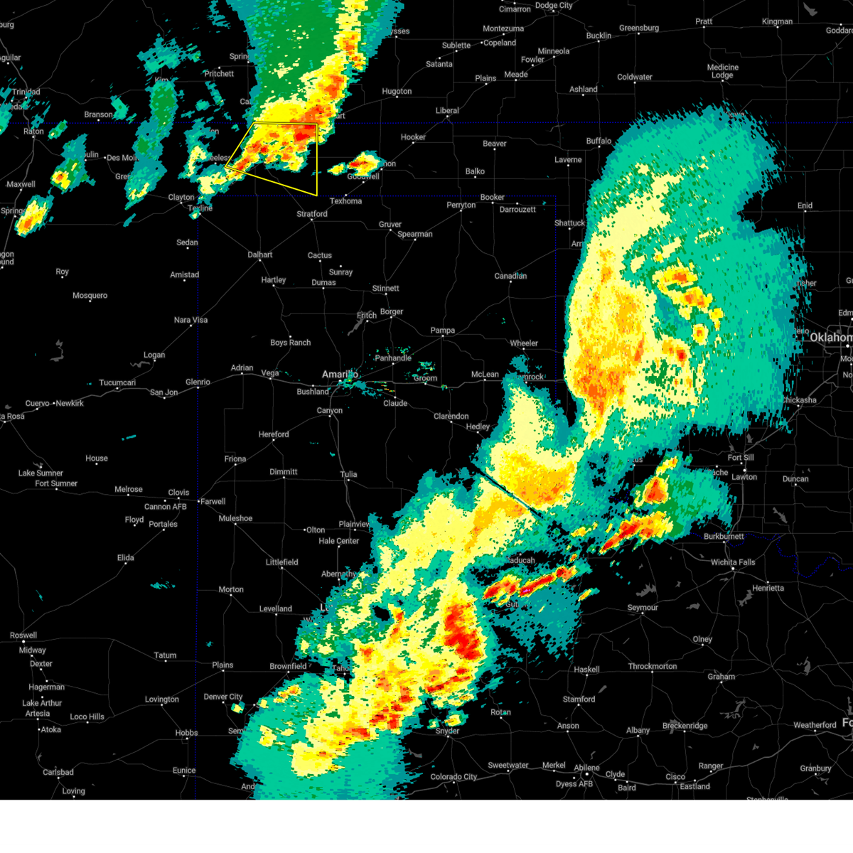 At 746 pm cdt, a severe thunderstorm was located 9 miles northeast of keyes, or 14 miles southwest of elkhart, moving east at 45 mph (radar indicated). Hazards include 60 mph wind gusts and penny size hail. Minor damage to roofs, siding, and trees is possible. locations impacted include, boise city, keyes, griggs and sturgis. hail threat, radar indicated max hail size, 0. 75in wind threat, radar indicated max wind gust, 60 mph. At 746 pm cdt, a severe thunderstorm was located 9 miles northeast of keyes, or 14 miles southwest of elkhart, moving east at 45 mph (radar indicated). Hazards include 60 mph wind gusts and penny size hail. Minor damage to roofs, siding, and trees is possible. locations impacted include, boise city, keyes, griggs and sturgis. hail threat, radar indicated max hail size, 0. 75in wind threat, radar indicated max wind gust, 60 mph.
|
| 6/30/2023 7:22 PM CDT |
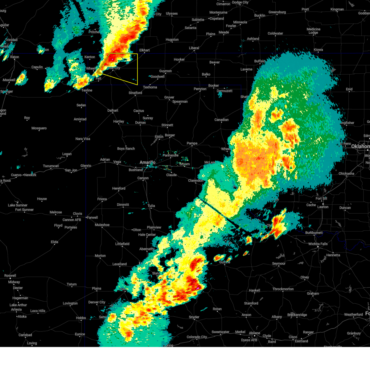 At 722 pm cdt, a severe thunderstorm was located 12 miles southeast of campo, or 14 miles north of boise city, moving east at 30 mph (radar indicated). Hazards include 60 mph wind gusts and quarter size hail. Minor damage to roofs, siding, and trees is possible. hail damage to vehicles is expected. locations impacted include, boise city, keyes, griggs and sturgis. hail threat, radar indicated max hail size, 1. 00in wind threat, radar indicated max wind gust, 60 mph. At 722 pm cdt, a severe thunderstorm was located 12 miles southeast of campo, or 14 miles north of boise city, moving east at 30 mph (radar indicated). Hazards include 60 mph wind gusts and quarter size hail. Minor damage to roofs, siding, and trees is possible. hail damage to vehicles is expected. locations impacted include, boise city, keyes, griggs and sturgis. hail threat, radar indicated max hail size, 1. 00in wind threat, radar indicated max wind gust, 60 mph.
|
| 6/30/2023 7:19 PM CDT |
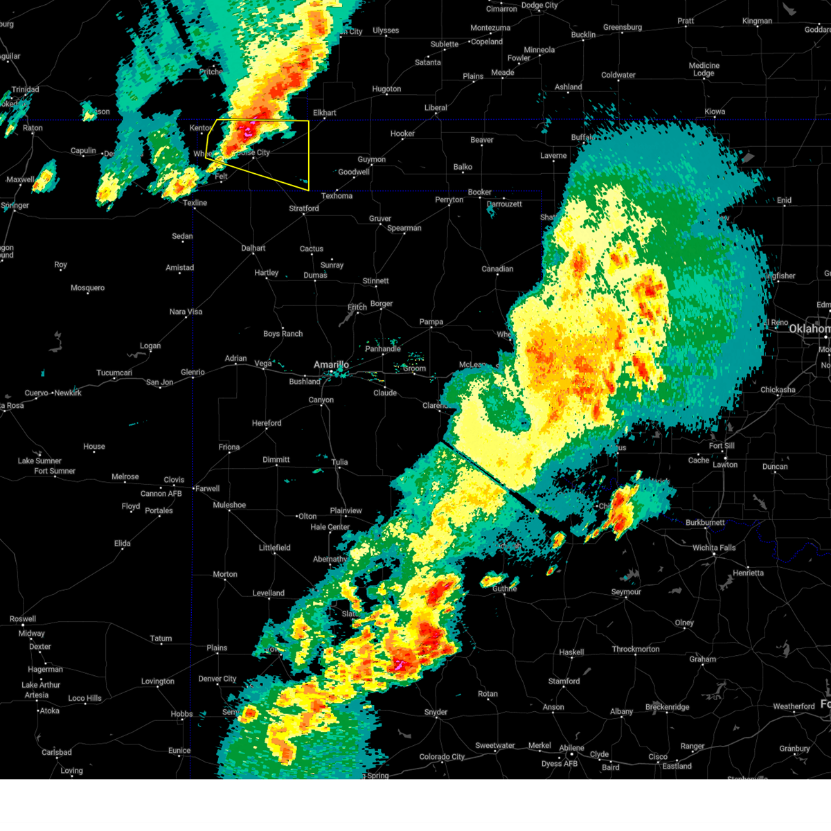 At 718 pm cdt, a severe thunderstorm was located 12 miles south of campo, or 14 miles north of boise city, moving east at 30 mph (radar indicated). Hazards include 60 mph wind gusts and quarter size hail. Minor damage to roofs, siding, and trees is possible. hail damage to vehicles is expected. locations impacted include, boise city, keyes, griggs, black mesa park and sturgis. hail threat, radar indicated max hail size, 1. 00in wind threat, radar indicated max wind gust, 60 mph. At 718 pm cdt, a severe thunderstorm was located 12 miles south of campo, or 14 miles north of boise city, moving east at 30 mph (radar indicated). Hazards include 60 mph wind gusts and quarter size hail. Minor damage to roofs, siding, and trees is possible. hail damage to vehicles is expected. locations impacted include, boise city, keyes, griggs, black mesa park and sturgis. hail threat, radar indicated max hail size, 1. 00in wind threat, radar indicated max wind gust, 60 mph.
|
| 6/30/2023 7:05 PM CDT |
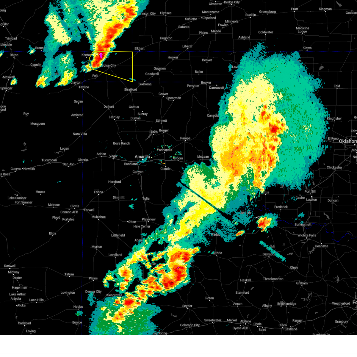 At 705 pm cdt, a severe thunderstorm was located 11 miles south of campo, or 15 miles northwest of boise city, moving east at 30 mph (radar indicated). Hazards include two inch hail and 60 mph wind gusts. Minor damage to roofs, siding, and trees is possible. people and animals outdoors will be injured. expect hail damage to roofs, siding, windows, and vehicles. locations impacted include, boise city, keyes, griggs, black mesa park and sturgis. thunderstorm damage threat, considerable hail threat, radar indicated max hail size, 2. 00 in wind threat, radar indicated max wind gust, 60 mph. At 705 pm cdt, a severe thunderstorm was located 11 miles south of campo, or 15 miles northwest of boise city, moving east at 30 mph (radar indicated). Hazards include two inch hail and 60 mph wind gusts. Minor damage to roofs, siding, and trees is possible. people and animals outdoors will be injured. expect hail damage to roofs, siding, windows, and vehicles. locations impacted include, boise city, keyes, griggs, black mesa park and sturgis. thunderstorm damage threat, considerable hail threat, radar indicated max hail size, 2. 00 in wind threat, radar indicated max wind gust, 60 mph.
|
| 6/30/2023 7:02 PM CDT |
 At 702 pm cdt, a severe thunderstorm was located 11 miles south of campo, or 16 miles northwest of boise city, moving east at 30 mph (radar indicated). Hazards include two inch hail and 60 mph wind gusts. Minor damage to roofs, siding, and trees is possible. people and animals outdoors will be injured. expect hail damage to roofs, siding, windows, and vehicles. locations impacted include, boise city, keyes, griggs, black mesa park and sturgis. thunderstorm damage threat, considerable hail threat, radar indicated max hail size, 2. 00 in wind threat, radar indicated max wind gust, 60 mph. At 702 pm cdt, a severe thunderstorm was located 11 miles south of campo, or 16 miles northwest of boise city, moving east at 30 mph (radar indicated). Hazards include two inch hail and 60 mph wind gusts. Minor damage to roofs, siding, and trees is possible. people and animals outdoors will be injured. expect hail damage to roofs, siding, windows, and vehicles. locations impacted include, boise city, keyes, griggs, black mesa park and sturgis. thunderstorm damage threat, considerable hail threat, radar indicated max hail size, 2. 00 in wind threat, radar indicated max wind gust, 60 mph.
|
| 6/30/2023 6:53 PM CDT |
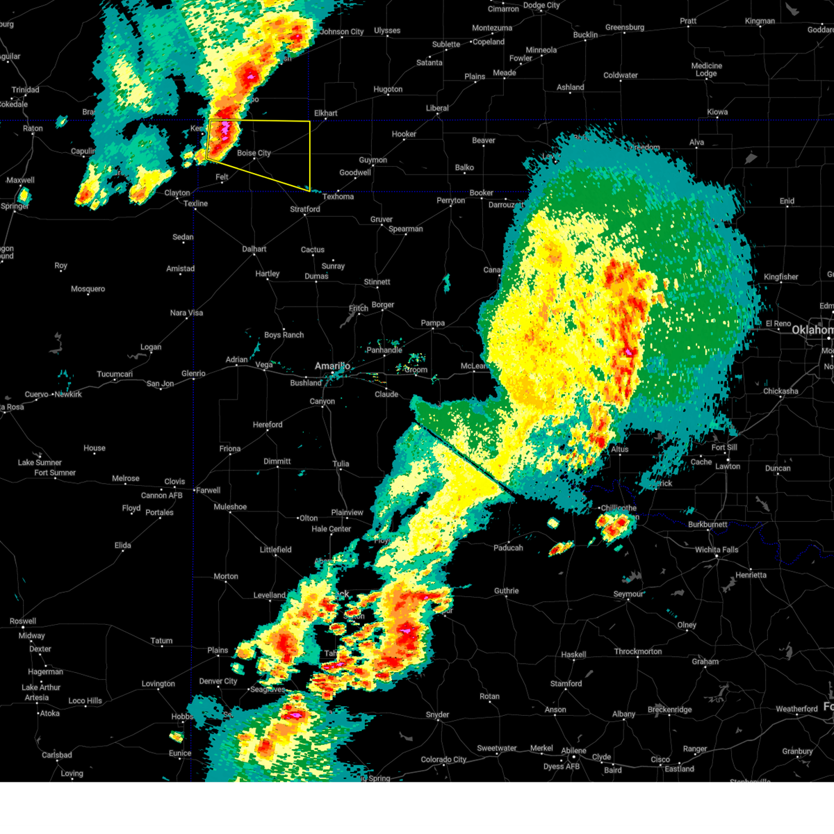 At 653 pm cdt, a severe thunderstorm was located 9 miles northeast of black mesa park, or 20 miles northwest of boise city, moving east at 25 mph (radar indicated). Hazards include ping pong ball size hail and 60 mph wind gusts. Minor damage to roofs, siding, and trees is possible. people and animals outdoors will be injured. Expect hail damage to roofs, siding, windows, and vehicles. At 653 pm cdt, a severe thunderstorm was located 9 miles northeast of black mesa park, or 20 miles northwest of boise city, moving east at 25 mph (radar indicated). Hazards include ping pong ball size hail and 60 mph wind gusts. Minor damage to roofs, siding, and trees is possible. people and animals outdoors will be injured. Expect hail damage to roofs, siding, windows, and vehicles.
|
| 6/27/2023 6:30 PM CDT | Report of downed telephone poles on the northside of hwy 5 in cimarron county OK, 2.9 miles ENE of Keyes, OK |
| 6/27/2023 6:19 PM CDT |
 At 619 pm cdt, severe thunderstorms were located along a line extending from 6 miles north of keyes to 8 miles northeast of griggs to 4 miles east of stratford, moving northeast at 40 mph (radar indicated). Hazards include 70 mph wind gusts and ping pong ball size hail. Expect some tree damage. damage is likely to mobile homes, roofs, and outbuildings. people and animals outdoors will be injured. expect hail damage to roofs, siding, windows, and vehicles. locations impacted include, goodwell, keyes, eva, griggs, texhoma and sturgis. thunderstorm damage threat, considerable hail threat, radar indicated max hail size, 1. 50 in wind threat, radar indicated max wind gust, 70 mph. At 619 pm cdt, severe thunderstorms were located along a line extending from 6 miles north of keyes to 8 miles northeast of griggs to 4 miles east of stratford, moving northeast at 40 mph (radar indicated). Hazards include 70 mph wind gusts and ping pong ball size hail. Expect some tree damage. damage is likely to mobile homes, roofs, and outbuildings. people and animals outdoors will be injured. expect hail damage to roofs, siding, windows, and vehicles. locations impacted include, goodwell, keyes, eva, griggs, texhoma and sturgis. thunderstorm damage threat, considerable hail threat, radar indicated max hail size, 1. 50 in wind threat, radar indicated max wind gust, 70 mph.
|
| 6/27/2023 6:19 PM CDT |
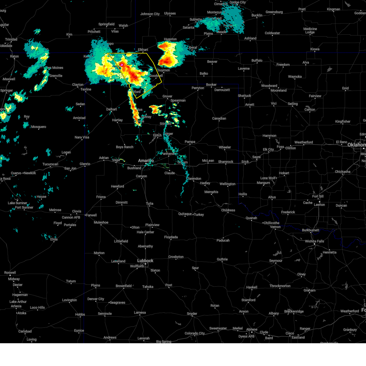 At 619 pm cdt, severe thunderstorms were located along a line extending from 6 miles north of keyes to 8 miles northeast of griggs to 4 miles east of stratford, moving northeast at 40 mph (radar indicated). Hazards include 70 mph wind gusts and ping pong ball size hail. Expect some tree damage. damage is likely to mobile homes, roofs, and outbuildings. people and animals outdoors will be injured. expect hail damage to roofs, siding, windows, and vehicles. locations impacted include, goodwell, keyes, eva, griggs, texhoma and sturgis. thunderstorm damage threat, considerable hail threat, radar indicated max hail size, 1. 50 in wind threat, radar indicated max wind gust, 70 mph. At 619 pm cdt, severe thunderstorms were located along a line extending from 6 miles north of keyes to 8 miles northeast of griggs to 4 miles east of stratford, moving northeast at 40 mph (radar indicated). Hazards include 70 mph wind gusts and ping pong ball size hail. Expect some tree damage. damage is likely to mobile homes, roofs, and outbuildings. people and animals outdoors will be injured. expect hail damage to roofs, siding, windows, and vehicles. locations impacted include, goodwell, keyes, eva, griggs, texhoma and sturgis. thunderstorm damage threat, considerable hail threat, radar indicated max hail size, 1. 50 in wind threat, radar indicated max wind gust, 70 mph.
|
| 6/27/2023 5:56 PM CDT |
 At 555 pm cdt, severe thunderstorms were located along a line extending from 4 miles southwest of black mesa park to 9 miles west of griggs to near conlen, moving northeast at 40 mph (radar indicated). Hazards include 60 mph wind gusts and quarter size hail. Minor damage to roofs, siding, and trees is possible. Hail damage to vehicles is expected. At 555 pm cdt, severe thunderstorms were located along a line extending from 4 miles southwest of black mesa park to 9 miles west of griggs to near conlen, moving northeast at 40 mph (radar indicated). Hazards include 60 mph wind gusts and quarter size hail. Minor damage to roofs, siding, and trees is possible. Hail damage to vehicles is expected.
|
| 6/27/2023 3:28 PM CDT |
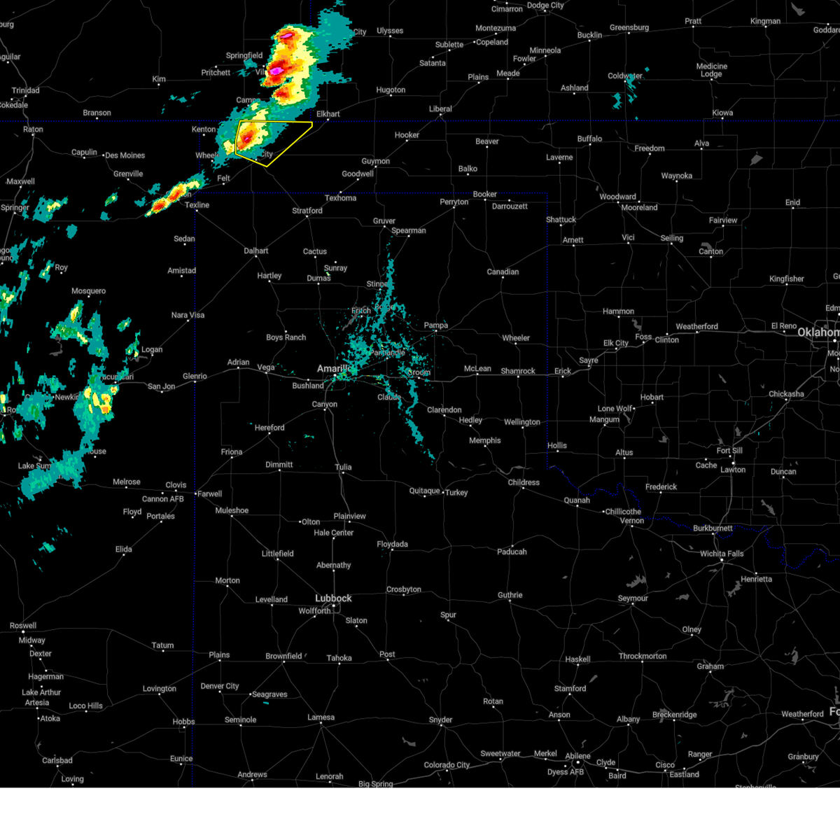 At 327 pm cdt, a severe thunderstorm was located 10 miles northwest of boise city, moving east at 25 mph (radar indicated). Hazards include 60 mph wind gusts and quarter size hail. Minor damage to roofs, siding, and trees is possible. hail damage to vehicles is expected. locations impacted include, boise city and keyes. hail threat, radar indicated max hail size, 1. 00in wind threat, radar indicated max wind gust, 60 mph. At 327 pm cdt, a severe thunderstorm was located 10 miles northwest of boise city, moving east at 25 mph (radar indicated). Hazards include 60 mph wind gusts and quarter size hail. Minor damage to roofs, siding, and trees is possible. hail damage to vehicles is expected. locations impacted include, boise city and keyes. hail threat, radar indicated max hail size, 1. 00in wind threat, radar indicated max wind gust, 60 mph.
|
| 6/27/2023 3:16 PM CDT |
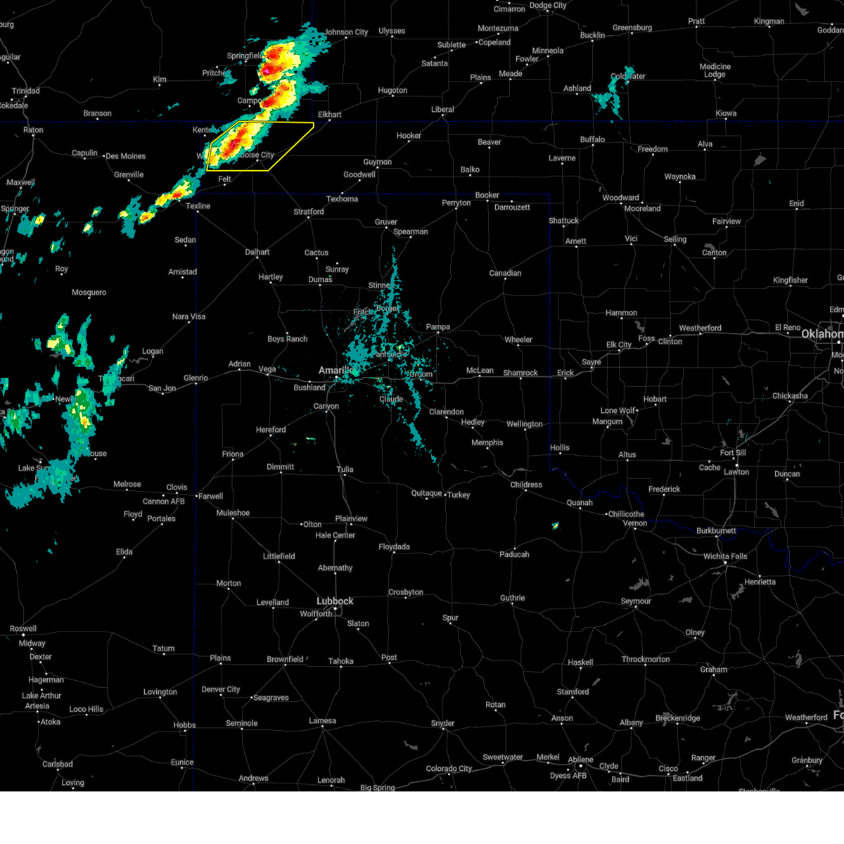 At 316 pm cdt, severe thunderstorms were located along a line extending from 9 miles southeast of campo to near wheeless, moving northeast at 20 mph (radar indicated). Hazards include 60 mph wind gusts and quarter size hail. Minor damage to roofs, siding, and trees is possible. hail damage to vehicles is expected. locations impacted include, boise city, keyes, wheeless and black mesa park. hail threat, radar indicated max hail size, 1. 00in wind threat, radar indicated max wind gust, 60 mph. At 316 pm cdt, severe thunderstorms were located along a line extending from 9 miles southeast of campo to near wheeless, moving northeast at 20 mph (radar indicated). Hazards include 60 mph wind gusts and quarter size hail. Minor damage to roofs, siding, and trees is possible. hail damage to vehicles is expected. locations impacted include, boise city, keyes, wheeless and black mesa park. hail threat, radar indicated max hail size, 1. 00in wind threat, radar indicated max wind gust, 60 mph.
|
| 6/27/2023 2:44 PM CDT |
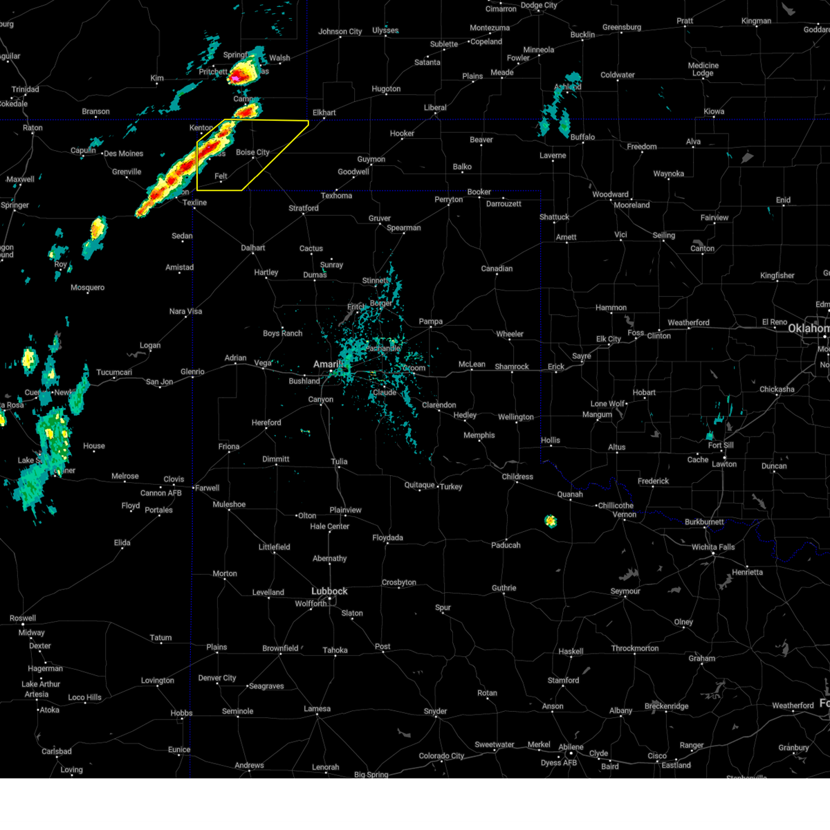 At 243 pm cdt, severe thunderstorms were located along a line extending from 8 miles south of campo to 4 miles southwest of wheeless, moving east at 20 mph (radar indicated). Hazards include 60 mph wind gusts and half dollar size hail. Minor damage to roofs, siding, and trees is possible. Hail damage to vehicles is expected. At 243 pm cdt, severe thunderstorms were located along a line extending from 8 miles south of campo to 4 miles southwest of wheeless, moving east at 20 mph (radar indicated). Hazards include 60 mph wind gusts and half dollar size hail. Minor damage to roofs, siding, and trees is possible. Hail damage to vehicles is expected.
|
| 6/21/2023 9:12 PM CDT |
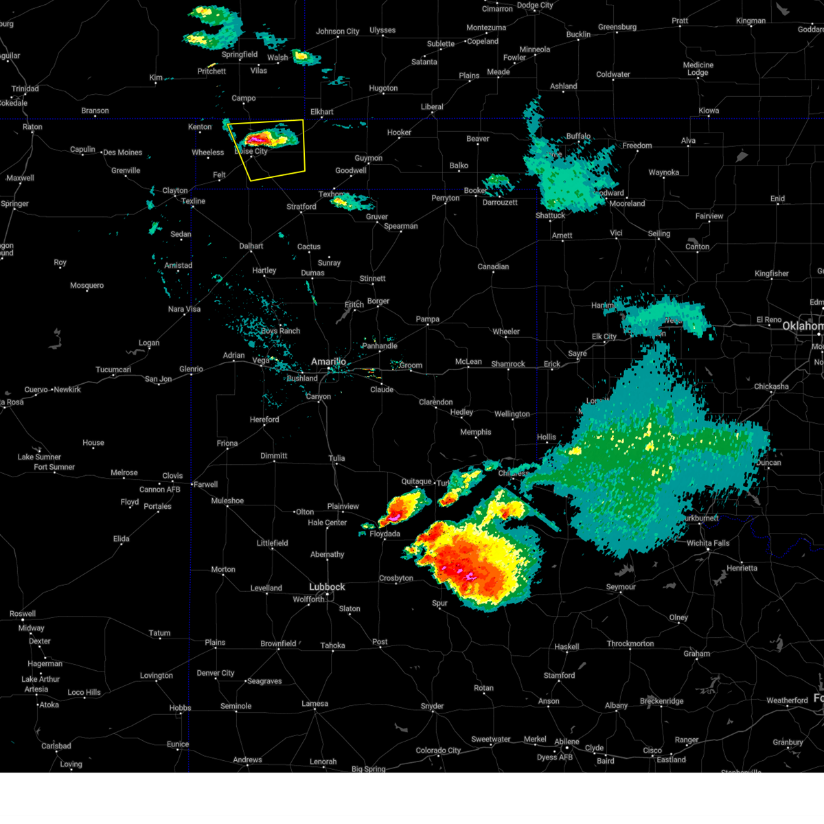 The severe thunderstorm warning for eastern cimarron county will expire at 915 pm cdt, the storm which prompted the warning has weakened below severe limits, and no longer poses an immediate threat to life or property. therefore, the warning will be allowed to expire. a tornado watch remains in effect until 1000 pm cdt for the panhandle of oklahoma. The severe thunderstorm warning for eastern cimarron county will expire at 915 pm cdt, the storm which prompted the warning has weakened below severe limits, and no longer poses an immediate threat to life or property. therefore, the warning will be allowed to expire. a tornado watch remains in effect until 1000 pm cdt for the panhandle of oklahoma.
|
| 6/21/2023 9:07 PM CDT |
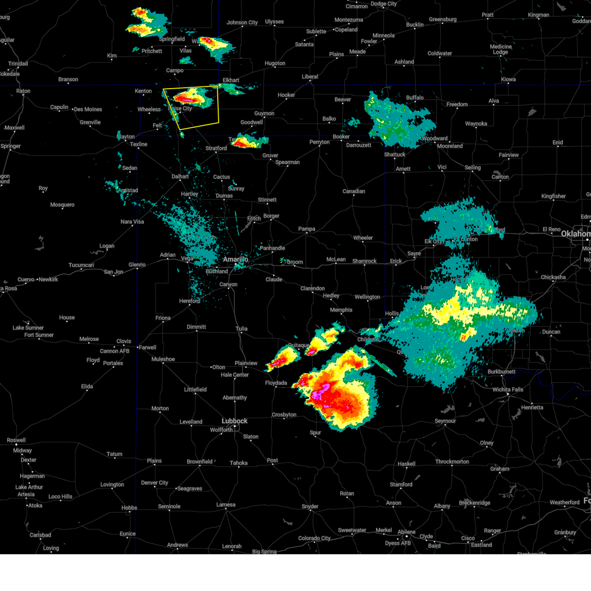 At 907 pm cdt, a severe thunderstorm was located 7 miles north of boise city, and is nearly stationary (radar indicated). Hazards include 60 mph wind gusts and half dollar size hail. Minor damage to roofs, siding, and trees is possible. hail damage to vehicles is expected. locations impacted include, boise city and keyes. hail threat, radar indicated max hail size, 1. 25 in wind threat, radar indicated max wind gust, 60 mph. At 907 pm cdt, a severe thunderstorm was located 7 miles north of boise city, and is nearly stationary (radar indicated). Hazards include 60 mph wind gusts and half dollar size hail. Minor damage to roofs, siding, and trees is possible. hail damage to vehicles is expected. locations impacted include, boise city and keyes. hail threat, radar indicated max hail size, 1. 25 in wind threat, radar indicated max wind gust, 60 mph.
|
| 6/21/2023 8:58 PM CDT |
 At 858 pm cdt, a severe thunderstorm was located 6 miles northeast of boise city, moving southeast at 15 mph (radar indicated). Hazards include 60 mph wind gusts and quarter size hail. Minor damage to roofs, siding, and trees is possible. hail damage to vehicles is expected. locations impacted include, boise city and keyes. hail threat, radar indicated max hail size, 1. 00in wind threat, radar indicated max wind gust, 60 mph. At 858 pm cdt, a severe thunderstorm was located 6 miles northeast of boise city, moving southeast at 15 mph (radar indicated). Hazards include 60 mph wind gusts and quarter size hail. Minor damage to roofs, siding, and trees is possible. hail damage to vehicles is expected. locations impacted include, boise city and keyes. hail threat, radar indicated max hail size, 1. 00in wind threat, radar indicated max wind gust, 60 mph.
|
| 6/21/2023 8:21 PM CDT |
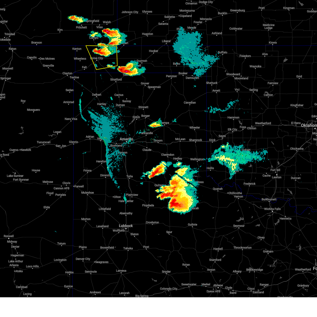 At 821 pm cdt, a severe thunderstorm was located 8 miles north of boise city, moving southeast at 20 mph (radar indicated). Hazards include 60 mph wind gusts and quarter size hail. Minor damage to roofs, siding, and trees is possible. Hail damage to vehicles is expected. At 821 pm cdt, a severe thunderstorm was located 8 miles north of boise city, moving southeast at 20 mph (radar indicated). Hazards include 60 mph wind gusts and quarter size hail. Minor damage to roofs, siding, and trees is possible. Hail damage to vehicles is expected.
|
| 6/17/2023 5:42 PM CDT |
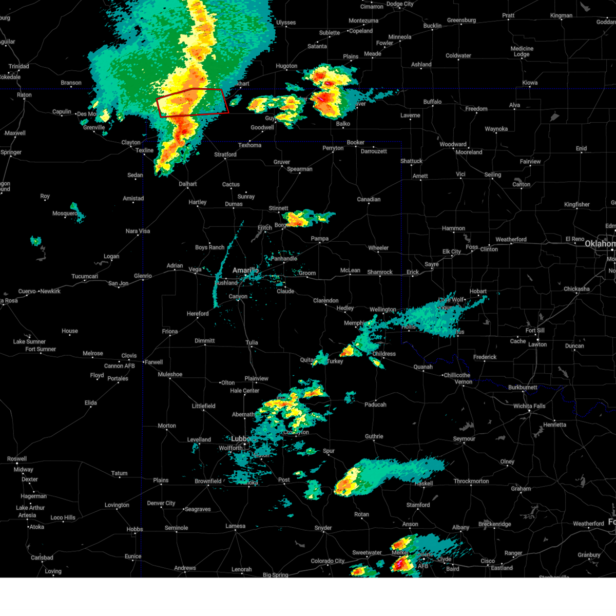 The tornado warning for northern cimarron county will expire at 545 pm cdt, the storm which prompted the warning has weakened below severe limits, and no longer appears capable of producing a tornado. therefore, the warning will be allowed to expire. however small hail, gusty winds and heavy rain are still possible with this thunderstorm. a tornado watch remains in effect until 1100 pm cdt for the panhandle of oklahoma. The tornado warning for northern cimarron county will expire at 545 pm cdt, the storm which prompted the warning has weakened below severe limits, and no longer appears capable of producing a tornado. therefore, the warning will be allowed to expire. however small hail, gusty winds and heavy rain are still possible with this thunderstorm. a tornado watch remains in effect until 1100 pm cdt for the panhandle of oklahoma.
|
| 6/17/2023 5:25 PM CDT |
 At 525 pm cdt, a severe thunderstorm capable of producing a tornado was located 11 miles east of black mesa park, or 12 miles northwest of boise city, moving east at 60 mph (radar indicated rotation). Hazards include tornado and golf ball size hail. Flying debris will be dangerous to those caught without shelter. mobile homes will be damaged or destroyed. damage to roofs, windows, and vehicles will occur. tree damage is likely. Locations impacted include, keyes. At 525 pm cdt, a severe thunderstorm capable of producing a tornado was located 11 miles east of black mesa park, or 12 miles northwest of boise city, moving east at 60 mph (radar indicated rotation). Hazards include tornado and golf ball size hail. Flying debris will be dangerous to those caught without shelter. mobile homes will be damaged or destroyed. damage to roofs, windows, and vehicles will occur. tree damage is likely. Locations impacted include, keyes.
|
| 6/17/2023 5:23 PM CDT |
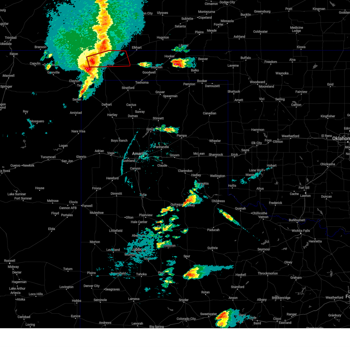 At 521 pm cdt, a severe thunderstorm capable of producing a tornado was located 6 miles east of black mesa park, or 15 miles northwest of boise city, moving east at 45 mph (radar indicated rotation). Hazards include tornado and golf ball size hail. Flying debris will be dangerous to those caught without shelter. mobile homes will be damaged or destroyed. damage to roofs, windows, and vehicles will occur. tree damage is likely. Locations impacted include, boise city, keyes and black mesa park. At 521 pm cdt, a severe thunderstorm capable of producing a tornado was located 6 miles east of black mesa park, or 15 miles northwest of boise city, moving east at 45 mph (radar indicated rotation). Hazards include tornado and golf ball size hail. Flying debris will be dangerous to those caught without shelter. mobile homes will be damaged or destroyed. damage to roofs, windows, and vehicles will occur. tree damage is likely. Locations impacted include, boise city, keyes and black mesa park.
|
| 6/17/2023 5:02 PM CDT |
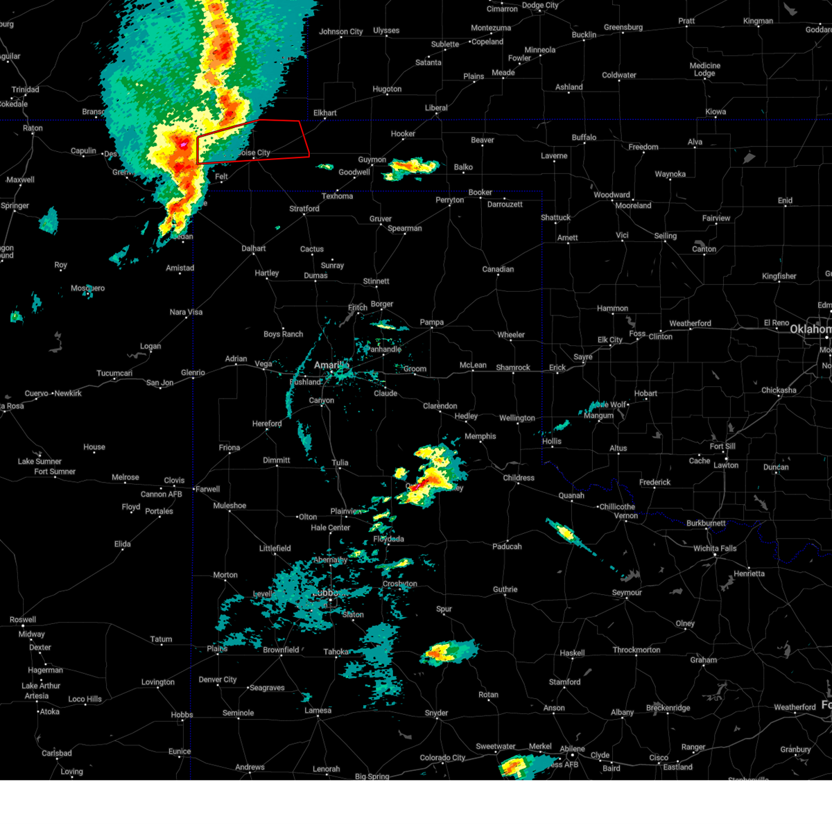 At 502 pm cdt, a severe thunderstorm capable of producing a tornado was located 7 miles northwest of wheeless, or 25 miles north of clayton, moving east at 60 mph (radar indicated rotation). Hazards include tornado and golf ball size hail. Flying debris will be dangerous to those caught without shelter. mobile homes will be damaged or destroyed. damage to roofs, windows, and vehicles will occur. Tree damage is likely. At 502 pm cdt, a severe thunderstorm capable of producing a tornado was located 7 miles northwest of wheeless, or 25 miles north of clayton, moving east at 60 mph (radar indicated rotation). Hazards include tornado and golf ball size hail. Flying debris will be dangerous to those caught without shelter. mobile homes will be damaged or destroyed. damage to roofs, windows, and vehicles will occur. Tree damage is likely.
|
| 6/12/2023 12:14 AM CDT |
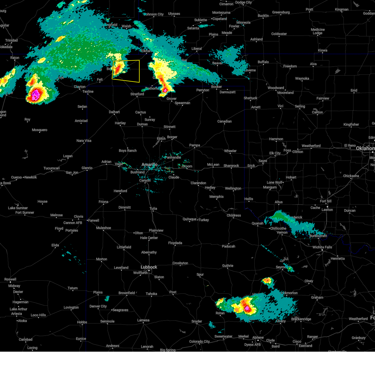 At 1214 am cdt, a severe thunderstorm was located 5 miles east of boise city, moving east at 35 mph (radar indicated). Hazards include 60 mph wind gusts and penny size hail. Minor damage to roofs, siding, and trees is possible. locations impacted include, boise city, keyes, griggs and sturgis. hail threat, radar indicated max hail size, 0. 75in wind threat, radar indicated max wind gust, 60 mph. At 1214 am cdt, a severe thunderstorm was located 5 miles east of boise city, moving east at 35 mph (radar indicated). Hazards include 60 mph wind gusts and penny size hail. Minor damage to roofs, siding, and trees is possible. locations impacted include, boise city, keyes, griggs and sturgis. hail threat, radar indicated max hail size, 0. 75in wind threat, radar indicated max wind gust, 60 mph.
|
| 6/11/2023 11:46 PM CDT |
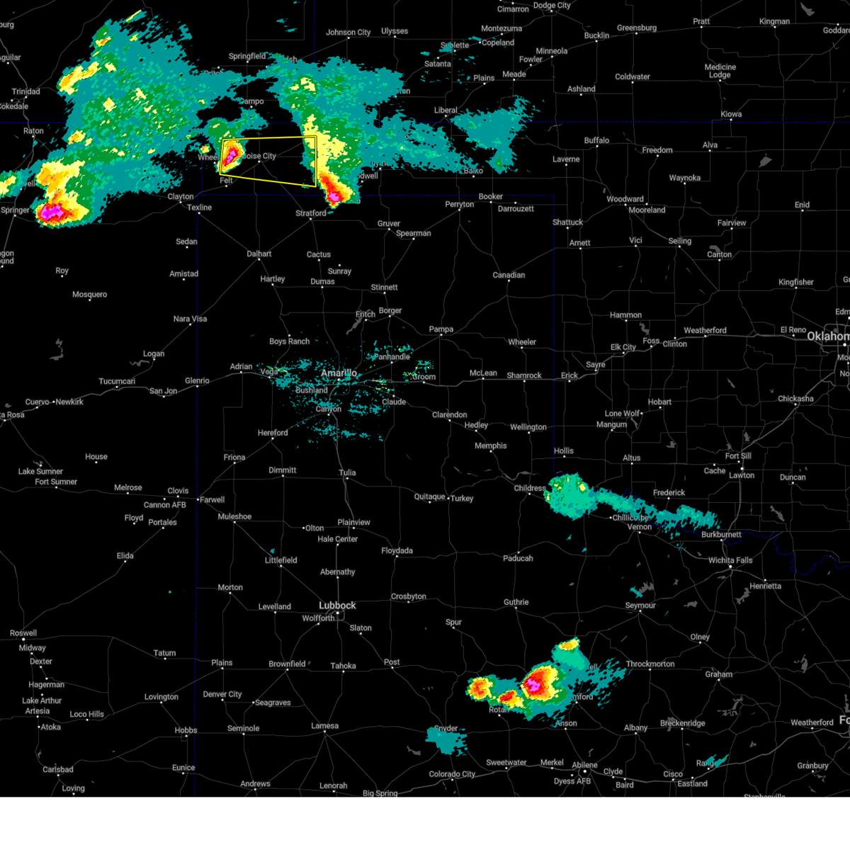 At 1146 pm cdt, a severe thunderstorm was located 9 miles east of wheeless, or 12 miles west of boise city, moving east at 35 mph (radar indicated). Hazards include 60 mph wind gusts and quarter size hail. Minor damage to roofs, siding, and trees is possible. Hail damage to vehicles is expected. At 1146 pm cdt, a severe thunderstorm was located 9 miles east of wheeless, or 12 miles west of boise city, moving east at 35 mph (radar indicated). Hazards include 60 mph wind gusts and quarter size hail. Minor damage to roofs, siding, and trees is possible. Hail damage to vehicles is expected.
|
| 6/11/2023 9:12 PM CDT |
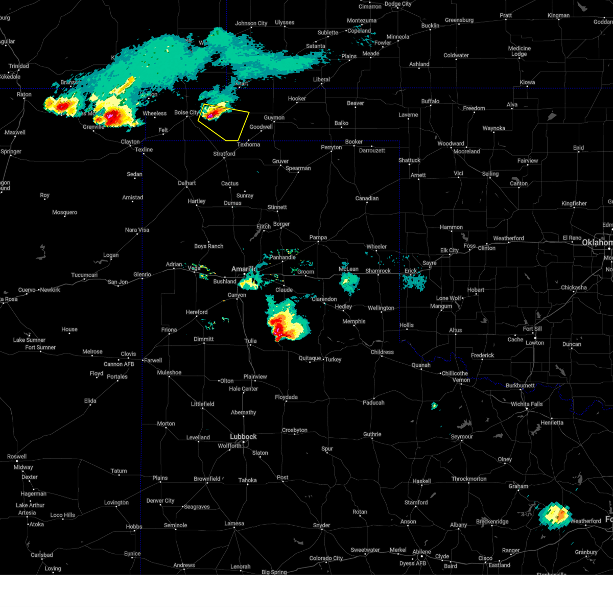 At 912 pm cdt, a severe thunderstorm was located 7 miles southeast of keyes, or 17 miles east of boise city, moving east at 25 mph (radar indicated). Hazards include ping pong ball size hail and 60 mph wind gusts. Minor damage to roofs, siding, and trees is possible. people and animals outdoors will be injured. expect hail damage to roofs, siding, windows, and vehicles. locations impacted include, keyes and griggs. hail threat, radar indicated max hail size, 1. 50 in wind threat, radar indicated max wind gust, 60 mph. At 912 pm cdt, a severe thunderstorm was located 7 miles southeast of keyes, or 17 miles east of boise city, moving east at 25 mph (radar indicated). Hazards include ping pong ball size hail and 60 mph wind gusts. Minor damage to roofs, siding, and trees is possible. people and animals outdoors will be injured. expect hail damage to roofs, siding, windows, and vehicles. locations impacted include, keyes and griggs. hail threat, radar indicated max hail size, 1. 50 in wind threat, radar indicated max wind gust, 60 mph.
|
| 6/11/2023 9:11 PM CDT |
 The severe thunderstorm warning for central cimarron county will expire at 915 pm cdt, the storm which prompted the warning has moved out of the area. therefore, the warning will be allowed to expire. a severe thunderstorm watch remains in effect until 1000 pm cdt for the panhandle of oklahoma. remember, a severe thunderstorm warning still remains in effect for eastern cimarron county and western texas county until 9:45 pm cdt. The severe thunderstorm warning for central cimarron county will expire at 915 pm cdt, the storm which prompted the warning has moved out of the area. therefore, the warning will be allowed to expire. a severe thunderstorm watch remains in effect until 1000 pm cdt for the panhandle of oklahoma. remember, a severe thunderstorm warning still remains in effect for eastern cimarron county and western texas county until 9:45 pm cdt.
|
| 6/11/2023 9:04 PM CDT |
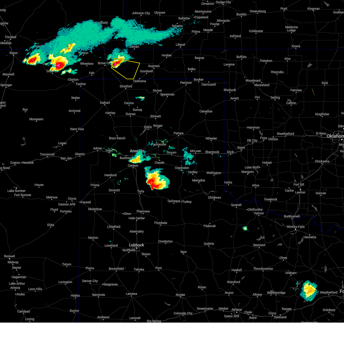 At 904 pm cdt, a severe thunderstorm was located 6 miles south of keyes, or 15 miles east of boise city, moving southeast at 25 mph (radar indicated). Hazards include 60 mph wind gusts and quarter size hail. Minor damage to roofs, siding, and trees is possible. Hail damage to vehicles is expected. At 904 pm cdt, a severe thunderstorm was located 6 miles south of keyes, or 15 miles east of boise city, moving southeast at 25 mph (radar indicated). Hazards include 60 mph wind gusts and quarter size hail. Minor damage to roofs, siding, and trees is possible. Hail damage to vehicles is expected.
|
| 6/11/2023 8:44 PM CDT |
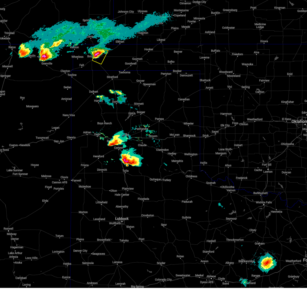 At 843 pm cdt, a severe thunderstorm was located 7 miles west of keyes, or 8 miles east of boise city, moving east at 25 mph (radar indicated). Hazards include ping pong ball size hail and 60 mph wind gusts. Minor damage to roofs, siding, and trees is possible. people and animals outdoors will be injured. expect hail damage to roofs, siding, windows, and vehicles. locations impacted include, boise city and keyes. hail threat, radar indicated max hail size, 1. 50 in wind threat, radar indicated max wind gust, 60 mph. At 843 pm cdt, a severe thunderstorm was located 7 miles west of keyes, or 8 miles east of boise city, moving east at 25 mph (radar indicated). Hazards include ping pong ball size hail and 60 mph wind gusts. Minor damage to roofs, siding, and trees is possible. people and animals outdoors will be injured. expect hail damage to roofs, siding, windows, and vehicles. locations impacted include, boise city and keyes. hail threat, radar indicated max hail size, 1. 50 in wind threat, radar indicated max wind gust, 60 mph.
|
| 6/11/2023 8:27 PM CDT |
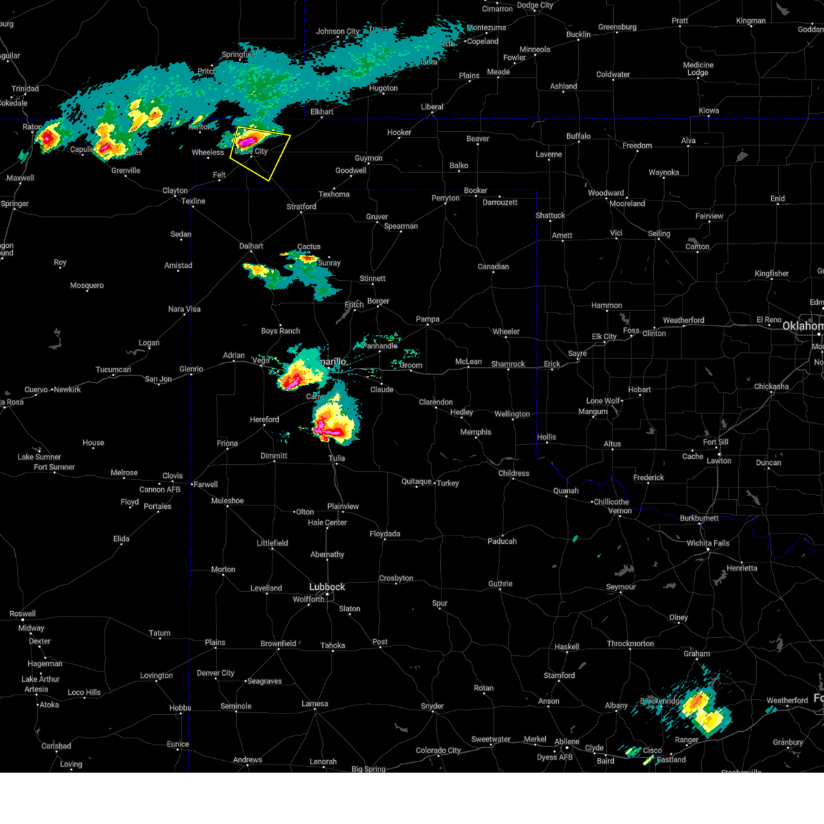 At 827 pm cdt, a severe thunderstorm was located 4 miles north of boise city, moving east at 25 mph (radar indicated). Hazards include two inch hail and 60 mph wind gusts. Minor damage to roofs, siding, and trees is possible. people and animals outdoors will be injured. expect hail damage to roofs, siding, windows, and vehicles. locations impacted include, boise city and keyes. thunderstorm damage threat, considerable hail threat, radar indicated max hail size, 2. 00 in wind threat, radar indicated max wind gust, 60 mph. At 827 pm cdt, a severe thunderstorm was located 4 miles north of boise city, moving east at 25 mph (radar indicated). Hazards include two inch hail and 60 mph wind gusts. Minor damage to roofs, siding, and trees is possible. people and animals outdoors will be injured. expect hail damage to roofs, siding, windows, and vehicles. locations impacted include, boise city and keyes. thunderstorm damage threat, considerable hail threat, radar indicated max hail size, 2. 00 in wind threat, radar indicated max wind gust, 60 mph.
|
| 6/11/2023 8:11 PM CDT |
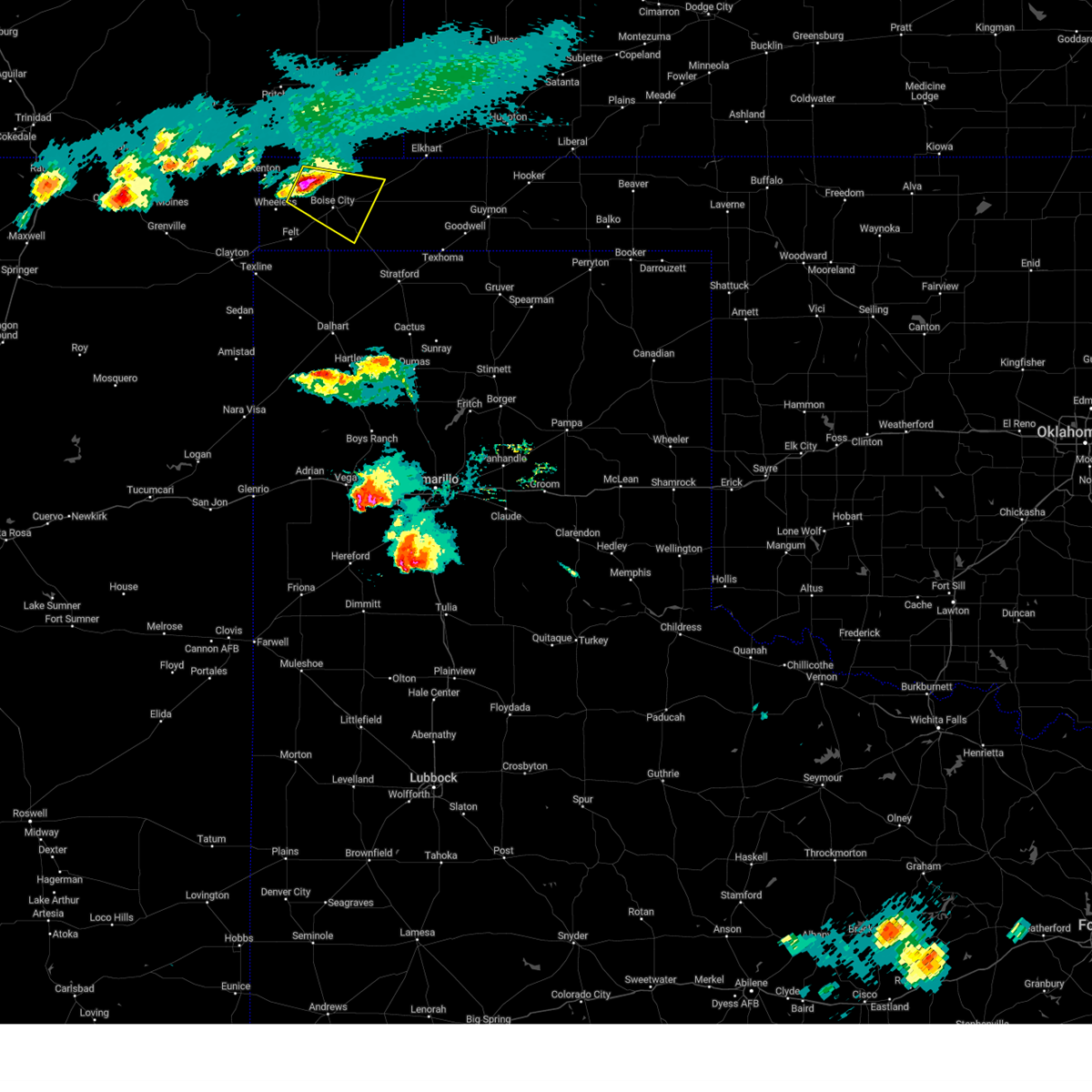 At 811 pm cdt, a severe thunderstorm was located 9 miles northwest of boise city, moving southeast at 20 mph (radar indicated). Hazards include golf ball size hail and 60 mph wind gusts. Minor damage to roofs, siding, and trees is possible. people and animals outdoors will be injured. Expect hail damage to roofs, siding, windows, and vehicles. At 811 pm cdt, a severe thunderstorm was located 9 miles northwest of boise city, moving southeast at 20 mph (radar indicated). Hazards include golf ball size hail and 60 mph wind gusts. Minor damage to roofs, siding, and trees is possible. people and animals outdoors will be injured. Expect hail damage to roofs, siding, windows, and vehicles.
|
| 6/2/2023 3:19 PM CDT |
 At 319 pm cdt, a severe thunderstorm was located 13 miles southeast of campo, or 14 miles north of boise city, moving north at 50 mph (radar indicated). Hazards include 60 mph wind gusts. Minor damage to roofs, siding, and trees is possible. locations impacted include, boise city, keyes, kenton, wheeless, black mesa park, felt, conlen, griggs and sturgis. hail threat, radar indicated max hail size, <. 75 in wind threat, radar indicated max wind gust, 60 mph. At 319 pm cdt, a severe thunderstorm was located 13 miles southeast of campo, or 14 miles north of boise city, moving north at 50 mph (radar indicated). Hazards include 60 mph wind gusts. Minor damage to roofs, siding, and trees is possible. locations impacted include, boise city, keyes, kenton, wheeless, black mesa park, felt, conlen, griggs and sturgis. hail threat, radar indicated max hail size, <. 75 in wind threat, radar indicated max wind gust, 60 mph.
|
| 6/2/2023 2:53 PM CDT |
 At 252 pm cdt, a severe thunderstorm was located 9 miles south of boise city, moving north at 50 mph (radar indicated). Hazards include 60 mph wind gusts. Minor damage to roofs, siding, and trees is possible. locations impacted include, dalhart, boise city, keyes, kenton, wheeless, ware, black mesa park, felt, conlen, griggs and sturgis. hail threat, radar indicated max hail size, <. 75 in wind threat, radar indicated max wind gust, 60 mph. At 252 pm cdt, a severe thunderstorm was located 9 miles south of boise city, moving north at 50 mph (radar indicated). Hazards include 60 mph wind gusts. Minor damage to roofs, siding, and trees is possible. locations impacted include, dalhart, boise city, keyes, kenton, wheeless, ware, black mesa park, felt, conlen, griggs and sturgis. hail threat, radar indicated max hail size, <. 75 in wind threat, radar indicated max wind gust, 60 mph.
|
| 6/2/2023 2:32 PM CDT |
 At 232 pm cdt, a severe thunderstorm was located 14 miles northwest of conlen, or 18 miles north of dalhart, moving north at 40 mph (radar indicated). Hazards include 60 mph wind gusts. Minor damage to roofs, siding, and trees is possible. locations impacted include, dalhart, boise city, keyes, kenton, wheeless, ware, black mesa park, felt, conlen, griggs and sturgis. hail threat, radar indicated max hail size, <. 75 in wind threat, radar indicated max wind gust, 60 mph. At 232 pm cdt, a severe thunderstorm was located 14 miles northwest of conlen, or 18 miles north of dalhart, moving north at 40 mph (radar indicated). Hazards include 60 mph wind gusts. Minor damage to roofs, siding, and trees is possible. locations impacted include, dalhart, boise city, keyes, kenton, wheeless, ware, black mesa park, felt, conlen, griggs and sturgis. hail threat, radar indicated max hail size, <. 75 in wind threat, radar indicated max wind gust, 60 mph.
|
| 6/2/2023 2:18 PM CDT |
 At 218 pm cdt, a severe thunderstorm was located 10 miles north of dalhart, moving north at 35 mph (radar indicated). Hazards include 60 mph wind gusts. Minor damage to roofs, siding, and trees is possible. locations impacted include, dalhart, boise city, keyes, kenton, wheeless, ware, black mesa park, felt, conlen, griggs and sturgis. hail threat, radar indicated max hail size, <. 75 in wind threat, radar indicated max wind gust, 60 mph. At 218 pm cdt, a severe thunderstorm was located 10 miles north of dalhart, moving north at 35 mph (radar indicated). Hazards include 60 mph wind gusts. Minor damage to roofs, siding, and trees is possible. locations impacted include, dalhart, boise city, keyes, kenton, wheeless, ware, black mesa park, felt, conlen, griggs and sturgis. hail threat, radar indicated max hail size, <. 75 in wind threat, radar indicated max wind gust, 60 mph.
|
| 6/2/2023 2:01 PM CDT |
 At 201 pm cdt, a severe thunderstorm was located over dalhart, moving north at 50 mph (radar indicated). Hazards include 70 mph wind gusts. Expect some tree damage. Damage is likely to mobile homes, roofs, and outbuildings. At 201 pm cdt, a severe thunderstorm was located over dalhart, moving north at 50 mph (radar indicated). Hazards include 70 mph wind gusts. Expect some tree damage. Damage is likely to mobile homes, roofs, and outbuildings.
|
| 5/28/2023 8:04 PM CDT |
 At 804 pm cdt, severe thunderstorms were located along a line extending from 6 miles west of texhoma to 15 miles south of boise city to 15 miles east of amistad, moving southeast at 25 mph (radar indicated). Hazards include 70 mph wind gusts and half dollar size hail. Expect some tree damage. damage is likely to mobile homes, roofs, and outbuildings. hail damage to vehicles is expected. locations impacted include, dalhart, stratford, boise city, hartley, keyes, eva, ware, conlen and griggs. thunderstorm damage threat, considerable hail threat, radar indicated max hail size, 1. 25 in wind threat, radar indicated max wind gust, 70 mph. At 804 pm cdt, severe thunderstorms were located along a line extending from 6 miles west of texhoma to 15 miles south of boise city to 15 miles east of amistad, moving southeast at 25 mph (radar indicated). Hazards include 70 mph wind gusts and half dollar size hail. Expect some tree damage. damage is likely to mobile homes, roofs, and outbuildings. hail damage to vehicles is expected. locations impacted include, dalhart, stratford, boise city, hartley, keyes, eva, ware, conlen and griggs. thunderstorm damage threat, considerable hail threat, radar indicated max hail size, 1. 25 in wind threat, radar indicated max wind gust, 70 mph.
|
| 5/28/2023 7:38 PM CDT |
 At 738 pm cdt, severe thunderstorms were located along a line extending from 9 miles south of eva to 11 miles east of felt to 13 miles south of ware, moving southeast at 20 mph (radar indicated). Hazards include 70 mph wind gusts and ping pong ball size hail. Expect some tree damage. damage is likely to mobile homes, roofs, and outbuildings. people and animals outdoors will be injured. expect hail damage to roofs, siding, windows, and vehicles. locations impacted include, dalhart, stratford, boise city, hartley, keyes, eva, ware, conlen, griggs and sturgis. thunderstorm damage threat, considerable hail threat, radar indicated max hail size, 1. 50 in wind threat, radar indicated max wind gust, 70 mph. At 738 pm cdt, severe thunderstorms were located along a line extending from 9 miles south of eva to 11 miles east of felt to 13 miles south of ware, moving southeast at 20 mph (radar indicated). Hazards include 70 mph wind gusts and ping pong ball size hail. Expect some tree damage. damage is likely to mobile homes, roofs, and outbuildings. people and animals outdoors will be injured. expect hail damage to roofs, siding, windows, and vehicles. locations impacted include, dalhart, stratford, boise city, hartley, keyes, eva, ware, conlen, griggs and sturgis. thunderstorm damage threat, considerable hail threat, radar indicated max hail size, 1. 50 in wind threat, radar indicated max wind gust, 70 mph.
|
| 5/28/2023 7:22 PM CDT |
 At 721 pm cdt, severe thunderstorms were located along a line extending from boise city to 12 miles southeast of sedan, moving southeast at 25 mph (radar indicated). Hazards include 60 mph wind gusts and half dollar size hail. Minor damage to roofs, siding, and trees is possible. Hail damage to vehicles is expected. At 721 pm cdt, severe thunderstorms were located along a line extending from boise city to 12 miles southeast of sedan, moving southeast at 25 mph (radar indicated). Hazards include 60 mph wind gusts and half dollar size hail. Minor damage to roofs, siding, and trees is possible. Hail damage to vehicles is expected.
|
| 5/21/2023 8:52 PM CDT |
 The severe thunderstorm warning for northwestern texas and northern cimarron counties will expire at 900 pm cdt, the storms which prompted the warning have weakened below severe limits, and no longer pose an immediate threat to life or property. therefore, the warning will be allowed to expire. however heavy rain is still possible with these thunderstorms. The severe thunderstorm warning for northwestern texas and northern cimarron counties will expire at 900 pm cdt, the storms which prompted the warning have weakened below severe limits, and no longer pose an immediate threat to life or property. therefore, the warning will be allowed to expire. however heavy rain is still possible with these thunderstorms.
|
| 5/21/2023 8:13 PM CDT |
 At 813 pm cdt, severe thunderstorms were located along a line extending from 6 miles northeast of eva to 5 miles northeast of keyes to 5 miles north of boise city, moving northeast at 20 mph (radar indicated). Hazards include 60 mph wind gusts and quarter size hail. Minor damage to roofs, siding, and trees is possible. hail damage to vehicles is expected. locations impacted include, boise city, keyes, eva and sturgis. hail threat, radar indicated max hail size, 1. 00in wind threat, radar indicated max wind gust, 60 mph. At 813 pm cdt, severe thunderstorms were located along a line extending from 6 miles northeast of eva to 5 miles northeast of keyes to 5 miles north of boise city, moving northeast at 20 mph (radar indicated). Hazards include 60 mph wind gusts and quarter size hail. Minor damage to roofs, siding, and trees is possible. hail damage to vehicles is expected. locations impacted include, boise city, keyes, eva and sturgis. hail threat, radar indicated max hail size, 1. 00in wind threat, radar indicated max wind gust, 60 mph.
|
| 5/21/2023 7:54 PM CDT |
 At 753 pm cdt, severe thunderstorms were located along a line extending from 4 miles southwest of elkhart to keyes to 9 miles east of wheeless, moving northeast at 10 mph (radar indicated). Hazards include 60 mph wind gusts and quarter size hail. Minor damage to roofs, siding, and trees is possible. Hail damage to vehicles is expected. At 753 pm cdt, severe thunderstorms were located along a line extending from 4 miles southwest of elkhart to keyes to 9 miles east of wheeless, moving northeast at 10 mph (radar indicated). Hazards include 60 mph wind gusts and quarter size hail. Minor damage to roofs, siding, and trees is possible. Hail damage to vehicles is expected.
|
| 8/1/2022 6:25 PM CDT |
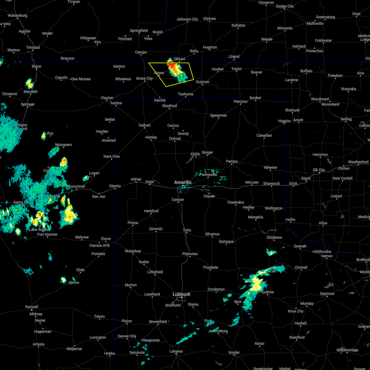 At 624 pm cdt, a severe thunderstorm was located 7 miles west of elkhart, moving northwest at 5 mph (radar indicated). Hazards include 60 mph wind gusts and penny size hail. Minor damage to roofs, siding, and trees is possible. locations impacted include, keyes, eva and sturgis. hail threat, radar indicated max hail size, 0. 75in wind threat, radar indicated max wind gust, 60 mph. At 624 pm cdt, a severe thunderstorm was located 7 miles west of elkhart, moving northwest at 5 mph (radar indicated). Hazards include 60 mph wind gusts and penny size hail. Minor damage to roofs, siding, and trees is possible. locations impacted include, keyes, eva and sturgis. hail threat, radar indicated max hail size, 0. 75in wind threat, radar indicated max wind gust, 60 mph.
|
| 8/1/2022 6:14 PM CDT |
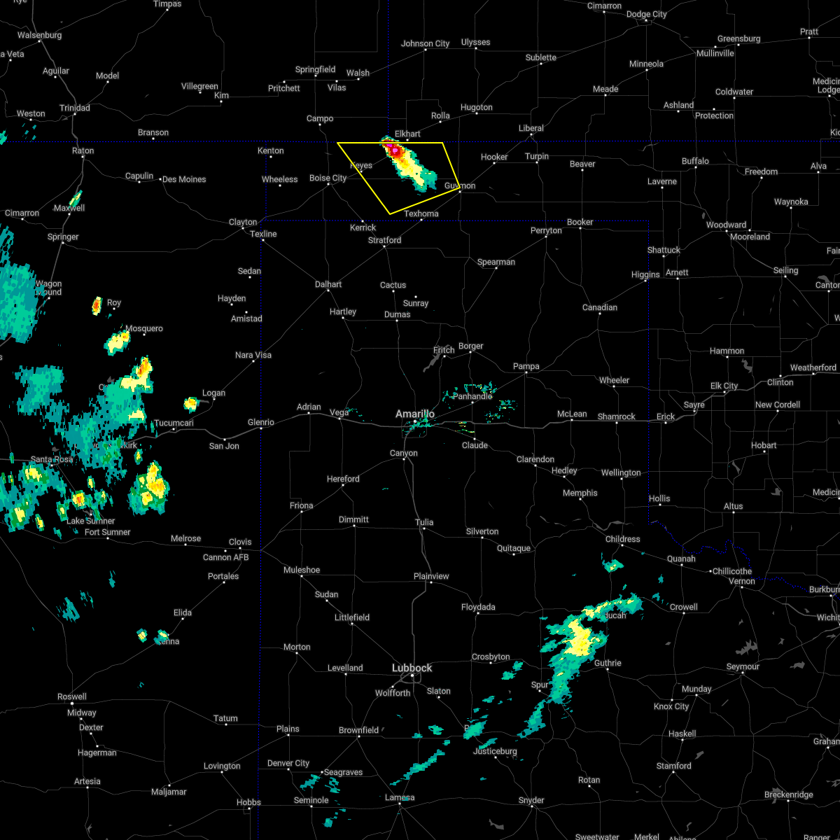 At 613 pm cdt, a severe thunderstorm was located 7 miles southwest of elkhart, and is nearly stationary (radar indicated). Hazards include 60 mph wind gusts and quarter size hail. Minor damage to roofs, siding, and trees is possible. hail damage to vehicles is expected. locations impacted include, keyes, eva, hough and sturgis. hail threat, radar indicated max hail size, 1. 00in wind threat, radar indicated max wind gust, 60 mph. At 613 pm cdt, a severe thunderstorm was located 7 miles southwest of elkhart, and is nearly stationary (radar indicated). Hazards include 60 mph wind gusts and quarter size hail. Minor damage to roofs, siding, and trees is possible. hail damage to vehicles is expected. locations impacted include, keyes, eva, hough and sturgis. hail threat, radar indicated max hail size, 1. 00in wind threat, radar indicated max wind gust, 60 mph.
|
| 8/1/2022 6:03 PM CDT |
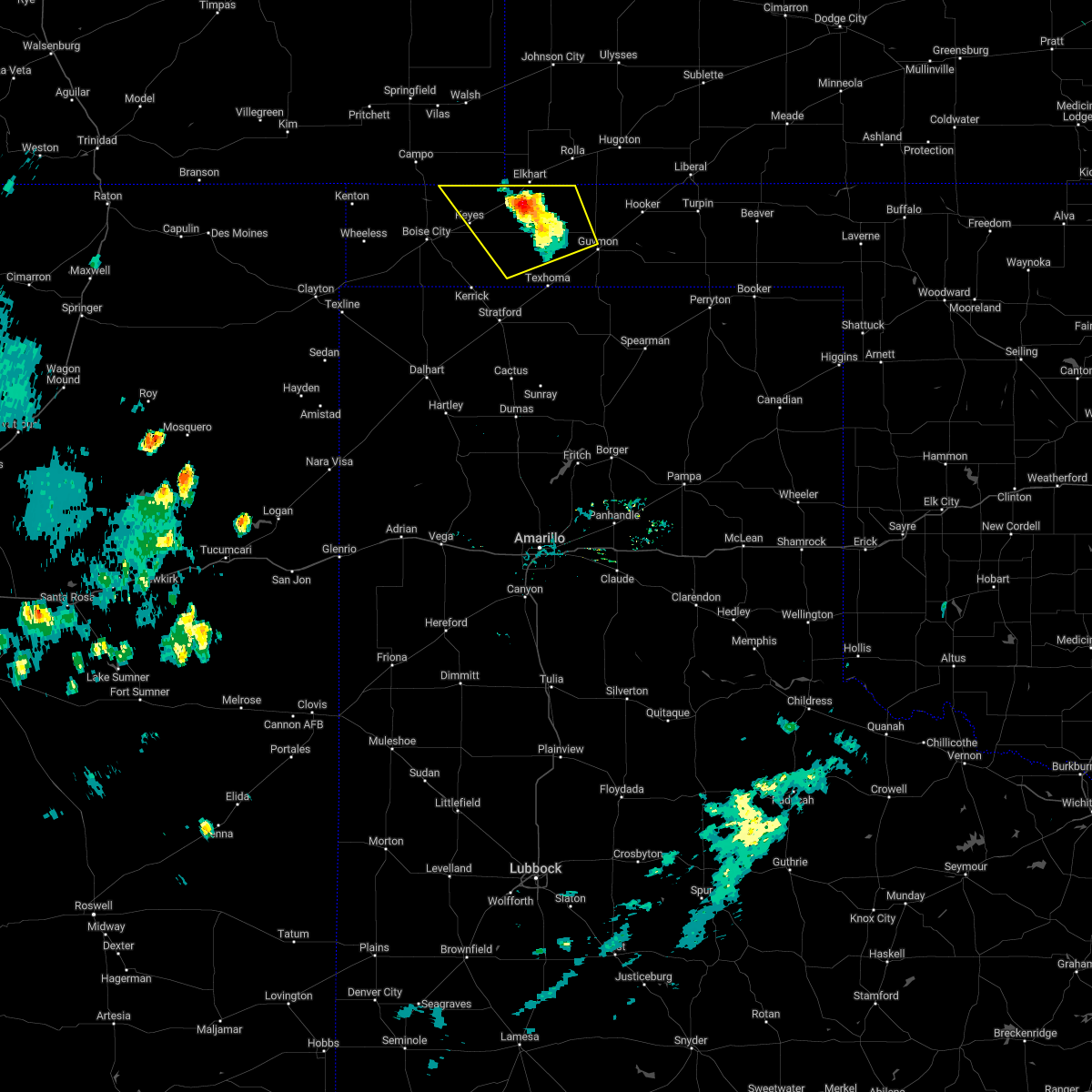 At 603 pm cdt, a severe thunderstorm was located 6 miles southwest of elkhart, moving northwest at 10 mph (radar indicated). Hazards include 60 mph wind gusts. Minor damage to roofs, siding, and trees is possible. locations impacted include, keyes, eva, hough and sturgis. hail threat, radar indicated max hail size, <. 75 in wind threat, radar indicated max wind gust, 60 mph. At 603 pm cdt, a severe thunderstorm was located 6 miles southwest of elkhart, moving northwest at 10 mph (radar indicated). Hazards include 60 mph wind gusts. Minor damage to roofs, siding, and trees is possible. locations impacted include, keyes, eva, hough and sturgis. hail threat, radar indicated max hail size, <. 75 in wind threat, radar indicated max wind gust, 60 mph.
|
| 8/1/2022 5:54 PM CDT |
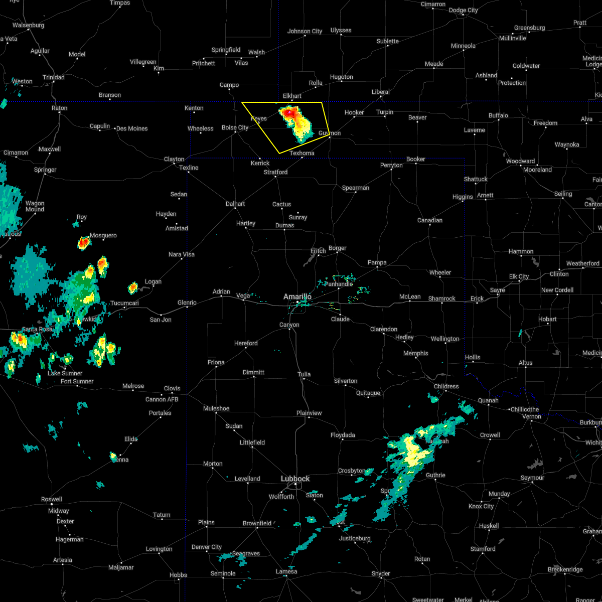 At 554 pm cdt, a severe thunderstorm was located 6 miles north of eva, or 7 miles south of elkhart, moving northwest at 5 mph (radar indicated). Hazards include 60 mph wind gusts and quarter size hail. Minor damage to roofs, siding, and trees is possible. hail damage to vehicles is expected. locations impacted include, keyes, eva, hough and sturgis. hail threat, radar indicated max hail size, 1. 00in wind threat, radar indicated max wind gust, 60 mph. At 554 pm cdt, a severe thunderstorm was located 6 miles north of eva, or 7 miles south of elkhart, moving northwest at 5 mph (radar indicated). Hazards include 60 mph wind gusts and quarter size hail. Minor damage to roofs, siding, and trees is possible. hail damage to vehicles is expected. locations impacted include, keyes, eva, hough and sturgis. hail threat, radar indicated max hail size, 1. 00in wind threat, radar indicated max wind gust, 60 mph.
|
| 8/1/2022 5:44 PM CDT |
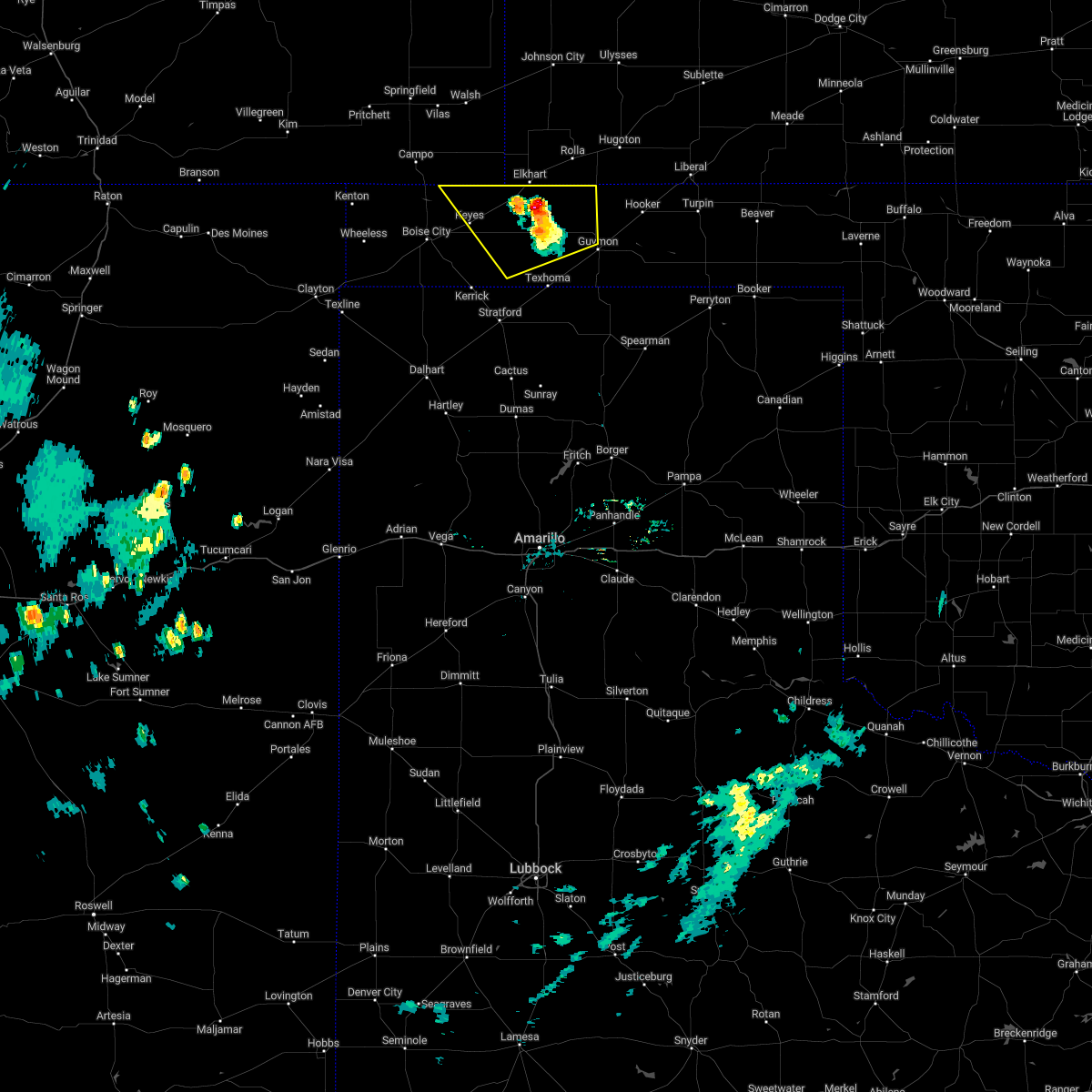 At 543 pm cdt, a severe thunderstorm was located 6 miles northeast of eva, or 8 miles south of elkhart, moving northwest at 10 mph (radar indicated). Hazards include 60 mph wind gusts and quarter size hail. Minor damage to roofs, siding, and trees is possible. hail damage to vehicles is expected. locations impacted include, keyes, eva, hough and sturgis. hail threat, radar indicated max hail size, 1. 00in wind threat, radar indicated max wind gust, 60 mph. At 543 pm cdt, a severe thunderstorm was located 6 miles northeast of eva, or 8 miles south of elkhart, moving northwest at 10 mph (radar indicated). Hazards include 60 mph wind gusts and quarter size hail. Minor damage to roofs, siding, and trees is possible. hail damage to vehicles is expected. locations impacted include, keyes, eva, hough and sturgis. hail threat, radar indicated max hail size, 1. 00in wind threat, radar indicated max wind gust, 60 mph.
|
| 8/1/2022 5:30 PM CDT |
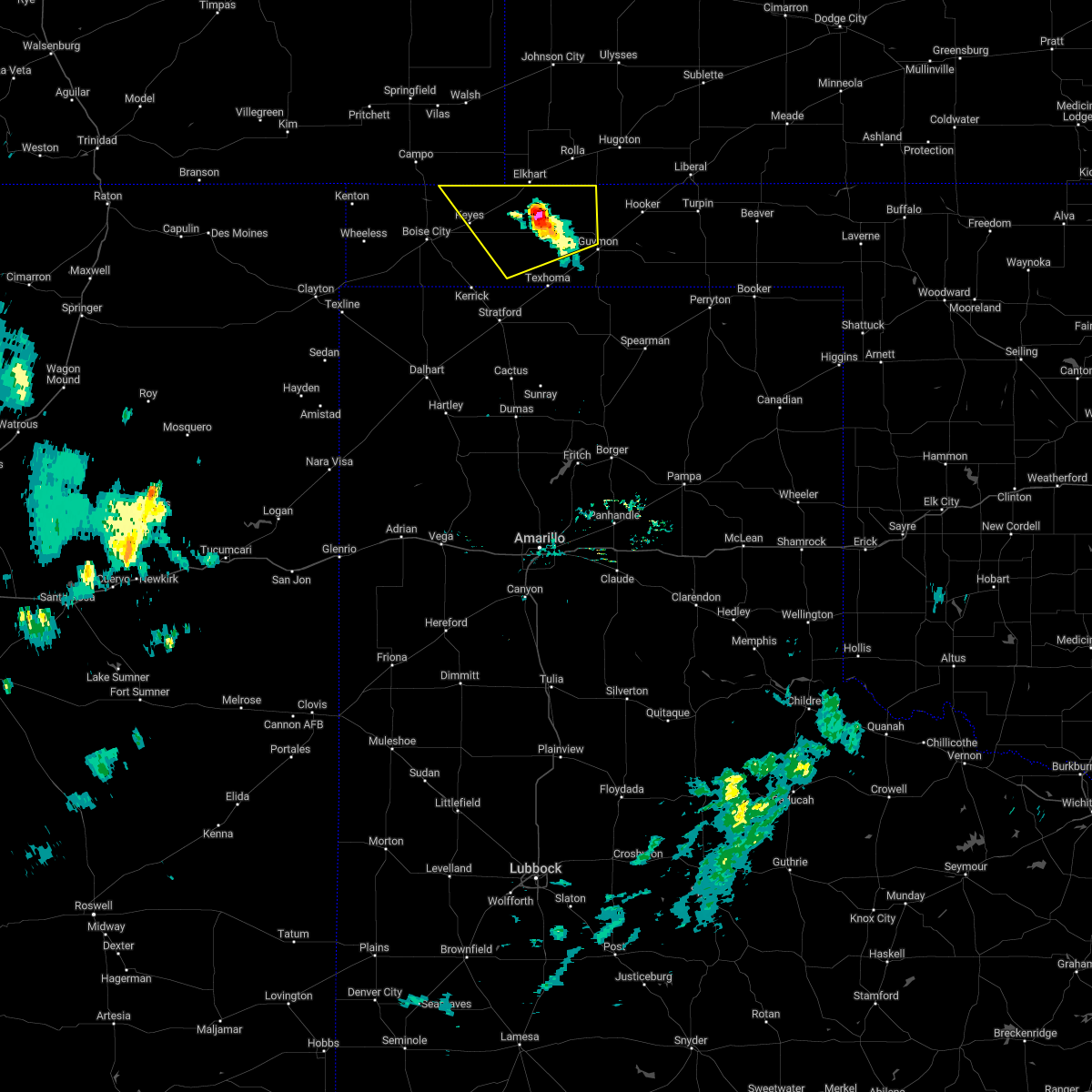 At 530 pm cdt, a severe thunderstorm was located 4 miles northeast of eva, or 11 miles south of elkhart, moving northwest at 10 mph (radar indicated). Hazards include 60 mph wind gusts and quarter size hail. Minor damage to roofs, siding, and trees is possible. Hail damage to vehicles is expected. At 530 pm cdt, a severe thunderstorm was located 4 miles northeast of eva, or 11 miles south of elkhart, moving northwest at 10 mph (radar indicated). Hazards include 60 mph wind gusts and quarter size hail. Minor damage to roofs, siding, and trees is possible. Hail damage to vehicles is expected.
|
| 7/2/2022 7:28 PM CDT |
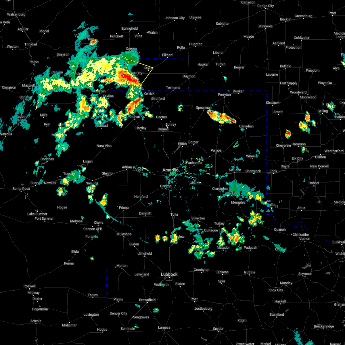 At 727 pm cdt, a severe thunderstorm was located 5 miles southwest of boise city, moving northeast at 15 mph (radar indicated). Hazards include 60 mph wind gusts and quarter size hail. Minor damage to roofs, siding, and trees is possible. Hail damage to vehicles is expected. At 727 pm cdt, a severe thunderstorm was located 5 miles southwest of boise city, moving northeast at 15 mph (radar indicated). Hazards include 60 mph wind gusts and quarter size hail. Minor damage to roofs, siding, and trees is possible. Hail damage to vehicles is expected.
|
| 7/1/2022 8:48 PM CDT |
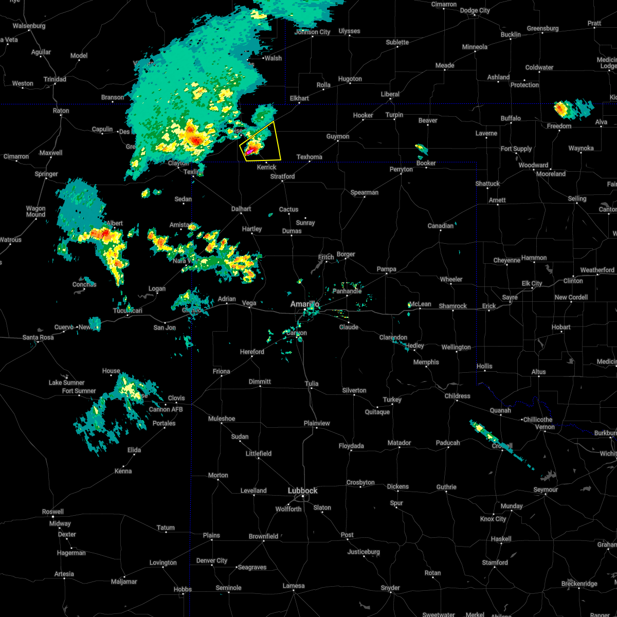 At 848 pm cdt, a severe thunderstorm was located 11 miles southeast of boise city, moving east at 10 mph (radar indicated). Hazards include 60 mph wind gusts and quarter size hail. Minor damage to roofs, siding, and trees is possible. Hail damage to vehicles is expected. At 848 pm cdt, a severe thunderstorm was located 11 miles southeast of boise city, moving east at 10 mph (radar indicated). Hazards include 60 mph wind gusts and quarter size hail. Minor damage to roofs, siding, and trees is possible. Hail damage to vehicles is expected.
|
| 6/8/2022 4:05 AM CDT |
 At 405 am cdt, severe thunderstorms were located along a line extending from 11 miles south of campo to 7 miles west of eva, moving south at 35 mph (radar indicated). Hazards include 70 mph wind gusts and quarter size hail. Expect some tree damage. damage is likely to mobile homes, roofs, and outbuildings. hail damage to vehicles is expected. locations impacted include, boise city, keyes, griggs and sturgis. thunderstorm damage threat, considerable hail threat, radar indicated max hail size, 1. 00in wind threat, radar indicated max wind gust, 70 mph. At 405 am cdt, severe thunderstorms were located along a line extending from 11 miles south of campo to 7 miles west of eva, moving south at 35 mph (radar indicated). Hazards include 70 mph wind gusts and quarter size hail. Expect some tree damage. damage is likely to mobile homes, roofs, and outbuildings. hail damage to vehicles is expected. locations impacted include, boise city, keyes, griggs and sturgis. thunderstorm damage threat, considerable hail threat, radar indicated max hail size, 1. 00in wind threat, radar indicated max wind gust, 70 mph.
|
| 6/8/2022 3:46 AM CDT |
 At 346 am cdt, severe thunderstorms were located along a line extending from near campo to 8 miles west of elkhart, moving southwest at 45 mph (radar indicated). Hazards include 70 mph wind gusts and quarter size hail. Expect some tree damage. damage is likely to mobile homes, roofs, and outbuildings. Hail damage to vehicles is expected. At 346 am cdt, severe thunderstorms were located along a line extending from near campo to 8 miles west of elkhart, moving southwest at 45 mph (radar indicated). Hazards include 70 mph wind gusts and quarter size hail. Expect some tree damage. damage is likely to mobile homes, roofs, and outbuildings. Hail damage to vehicles is expected.
|
| 6/3/2022 9:07 PM CDT |
 At 906 pm cdt, severe thunderstorms were located along a line extending from 8 miles northwest of keyes to 9 miles southwest of elkhart to wilburton, moving southeast at 25 mph (radar indicated). Hazards include 60 mph wind gusts and penny size hail. Minor damage to roofs, siding, and trees is possible. locations impacted include, guymon, boise city, goodwell, texhoma, keyes, eva, hough, griggs and sturgis. hail threat, radar indicated max hail size, 0. 75in wind threat, radar indicated max wind gust, 60 mph. At 906 pm cdt, severe thunderstorms were located along a line extending from 8 miles northwest of keyes to 9 miles southwest of elkhart to wilburton, moving southeast at 25 mph (radar indicated). Hazards include 60 mph wind gusts and penny size hail. Minor damage to roofs, siding, and trees is possible. locations impacted include, guymon, boise city, goodwell, texhoma, keyes, eva, hough, griggs and sturgis. hail threat, radar indicated max hail size, 0. 75in wind threat, radar indicated max wind gust, 60 mph.
|
| 6/3/2022 8:42 PM CDT |
 At 842 pm cdt, severe thunderstorms were located along a line extending from 10 miles north of boise city to 11 miles northeast of keyes to 9 miles north of elkhart, moving southeast at 25 mph (radar indicated). Hazards include 60 mph wind gusts and nickel size hail. Minor damage to roofs, siding, and trees is possible. locations impacted include, guymon, boise city, goodwell, texhoma, keyes, eva, hough, griggs and sturgis. hail threat, radar indicated max hail size, 0. 88in wind threat, radar indicated max wind gust, 60 mph. At 842 pm cdt, severe thunderstorms were located along a line extending from 10 miles north of boise city to 11 miles northeast of keyes to 9 miles north of elkhart, moving southeast at 25 mph (radar indicated). Hazards include 60 mph wind gusts and nickel size hail. Minor damage to roofs, siding, and trees is possible. locations impacted include, guymon, boise city, goodwell, texhoma, keyes, eva, hough, griggs and sturgis. hail threat, radar indicated max hail size, 0. 88in wind threat, radar indicated max wind gust, 60 mph.
|
| 6/3/2022 8:26 PM CDT |
 At 826 pm cdt, severe thunderstorms were located along a line extending from 11 miles south of campo to 13 miles north of keyes to 10 miles southeast of stonington, moving southeast at 25 mph (radar indicated). Hazards include 60 mph wind gusts and penny size hail. minor damage to roofs, siding, and trees is possible At 826 pm cdt, severe thunderstorms were located along a line extending from 11 miles south of campo to 13 miles north of keyes to 10 miles southeast of stonington, moving southeast at 25 mph (radar indicated). Hazards include 60 mph wind gusts and penny size hail. minor damage to roofs, siding, and trees is possible
|
| 5/11/2022 6:52 PM CDT |
 At 652 pm cdt, a severe thunderstorm was located 4 miles west of elkhart, moving northeast at 55 mph (radar indicated). Hazards include ping pong ball size hail and 60 mph wind gusts. Minor damage to roofs, siding, and trees is possible. people and animals outdoors will be injured. expect hail damage to roofs, siding, windows, and vehicles. locations impacted include, keyes, eva and sturgis. hail threat, radar indicated max hail size, 1. 50 in wind threat, radar indicated max wind gust, 60 mph. At 652 pm cdt, a severe thunderstorm was located 4 miles west of elkhart, moving northeast at 55 mph (radar indicated). Hazards include ping pong ball size hail and 60 mph wind gusts. Minor damage to roofs, siding, and trees is possible. people and animals outdoors will be injured. expect hail damage to roofs, siding, windows, and vehicles. locations impacted include, keyes, eva and sturgis. hail threat, radar indicated max hail size, 1. 50 in wind threat, radar indicated max wind gust, 60 mph.
|
| 5/11/2022 6:43 PM CDT |
 At 643 pm cdt, a severe thunderstorm was located 11 miles west of elkhart, moving north at 60 mph. this is a destructive storm for northeastern cimarron and northwestern texas counties in oklahoma (radar indicated). Hazards include 80 mph wind gusts and baseball size hail. People and animals outdoors will be severely injured. expect shattered windows, extensive damage to roofs, siding, and vehicles. locations impacted include, keyes, eva and sturgis. thunderstorm damage threat, destructive hail threat, radar indicated max hail size, 2. 75 in wind threat, radar indicated max wind gust, 80 mph. At 643 pm cdt, a severe thunderstorm was located 11 miles west of elkhart, moving north at 60 mph. this is a destructive storm for northeastern cimarron and northwestern texas counties in oklahoma (radar indicated). Hazards include 80 mph wind gusts and baseball size hail. People and animals outdoors will be severely injured. expect shattered windows, extensive damage to roofs, siding, and vehicles. locations impacted include, keyes, eva and sturgis. thunderstorm damage threat, destructive hail threat, radar indicated max hail size, 2. 75 in wind threat, radar indicated max wind gust, 80 mph.
|
| 5/11/2022 6:36 PM CDT | Hen Egg sized hail reported 2.9 miles W of Keyes, OK |
| 5/11/2022 6:35 PM CDT | Golf Ball sized hail reported 8 miles WNW of Keyes, OK |
| 5/11/2022 6:28 PM CDT |
 At 627 pm cdt, a severe thunderstorm was located 5 miles southeast of keyes, or 17 miles east of boise city, moving north at 65 mph. this is a destructive storm for eastern cimarron and western texas counties in oklahoma (radar indicated). Hazards include 80 mph wind gusts and baseball size hail. People and animals outdoors will be severely injured. Expect shattered windows, extensive damage to roofs, siding, and vehicles. At 627 pm cdt, a severe thunderstorm was located 5 miles southeast of keyes, or 17 miles east of boise city, moving north at 65 mph. this is a destructive storm for eastern cimarron and western texas counties in oklahoma (radar indicated). Hazards include 80 mph wind gusts and baseball size hail. People and animals outdoors will be severely injured. Expect shattered windows, extensive damage to roofs, siding, and vehicles.
|
| 5/11/2022 6:06 PM CDT |
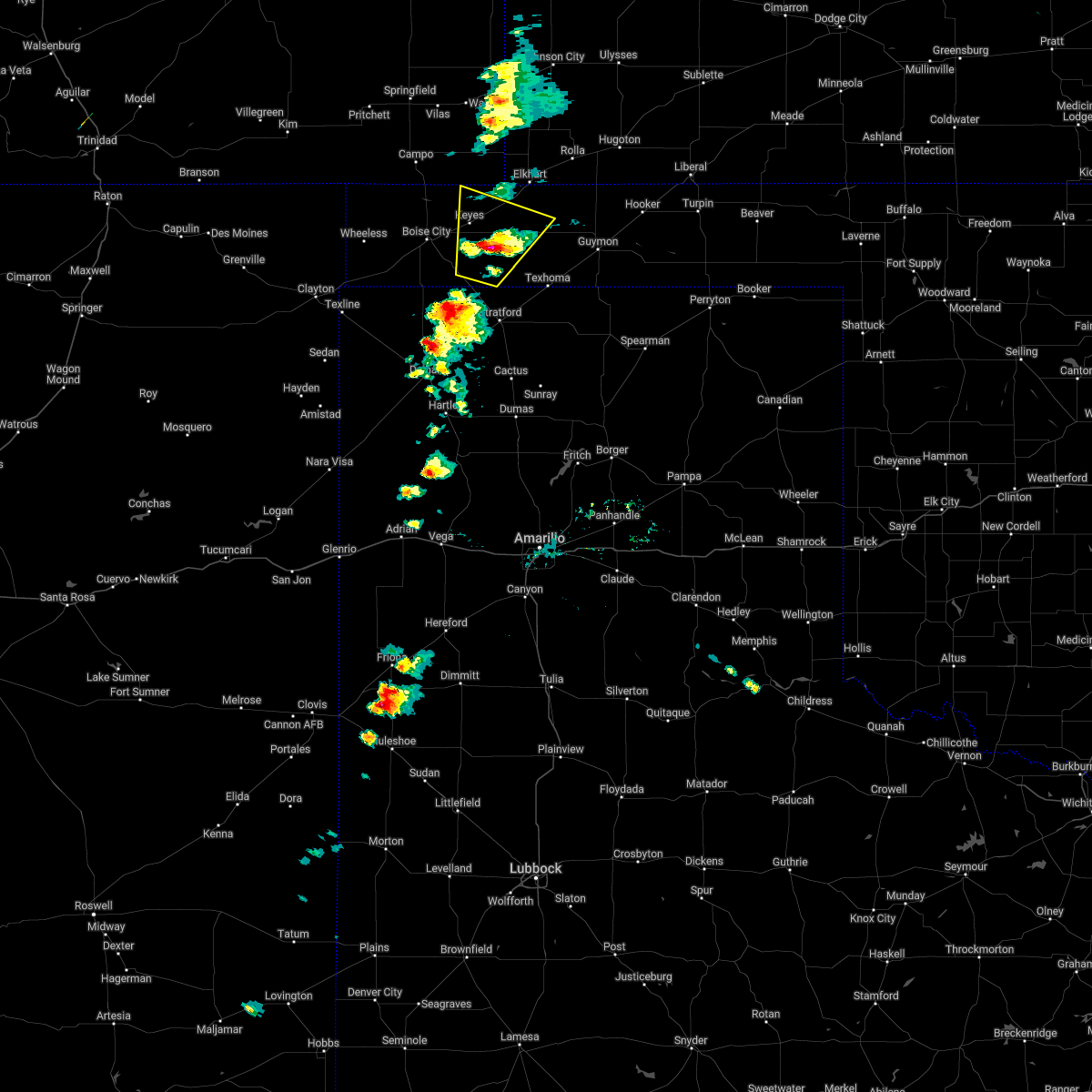 At 606 pm cdt, a severe thunderstorm was located 8 miles north of griggs, or 21 miles east of boise city, moving northeast at 25 mph (radar indicated). Hazards include golf ball size hail and 70 mph wind gusts. Expect some tree damage. damage is likely to mobile homes, roofs, and outbuildings. people and animals outdoors will be injured. expect hail damage to roofs, siding, windows, and vehicles. locations impacted include, keyes, eva, griggs and sturgis. thunderstorm damage threat, considerable hail threat, radar indicated max hail size, 1. 75 in wind threat, radar indicated max wind gust, 70 mph. At 606 pm cdt, a severe thunderstorm was located 8 miles north of griggs, or 21 miles east of boise city, moving northeast at 25 mph (radar indicated). Hazards include golf ball size hail and 70 mph wind gusts. Expect some tree damage. damage is likely to mobile homes, roofs, and outbuildings. people and animals outdoors will be injured. expect hail damage to roofs, siding, windows, and vehicles. locations impacted include, keyes, eva, griggs and sturgis. thunderstorm damage threat, considerable hail threat, radar indicated max hail size, 1. 75 in wind threat, radar indicated max wind gust, 70 mph.
|
| 5/11/2022 5:47 PM CDT |
 At 547 pm cdt, a severe thunderstorm was located near griggs, or 20 miles east of boise city, moving northeast at 25 mph (radar indicated). Hazards include 60 mph wind gusts and half dollar size hail. Minor damage to roofs, siding, and trees is possible. hail damage to vehicles is expected. locations impacted include, keyes, eva, griggs and sturgis. hail threat, radar indicated max hail size, 1. 25 in wind threat, radar indicated max wind gust, 60 mph. At 547 pm cdt, a severe thunderstorm was located near griggs, or 20 miles east of boise city, moving northeast at 25 mph (radar indicated). Hazards include 60 mph wind gusts and half dollar size hail. Minor damage to roofs, siding, and trees is possible. hail damage to vehicles is expected. locations impacted include, keyes, eva, griggs and sturgis. hail threat, radar indicated max hail size, 1. 25 in wind threat, radar indicated max wind gust, 60 mph.
|
| 5/11/2022 5:44 PM CDT |
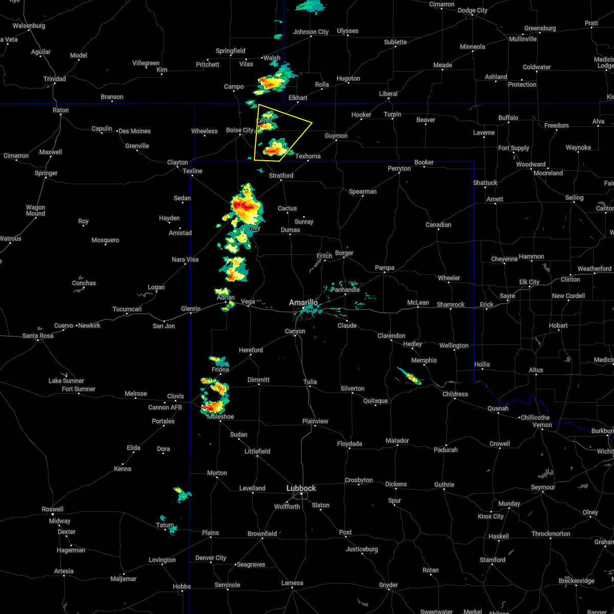 At 543 pm cdt, a severe thunderstorm was located near griggs, or 19 miles southeast of boise city, moving northeast at 25 mph (radar indicated). Hazards include 60 mph wind gusts and quarter size hail. Minor damage to roofs, siding, and trees is possible. hail damage to vehicles is expected. locations impacted include, keyes, eva, griggs and sturgis. hail threat, radar indicated max hail size, 1. 00in wind threat, radar indicated max wind gust, 60 mph. At 543 pm cdt, a severe thunderstorm was located near griggs, or 19 miles southeast of boise city, moving northeast at 25 mph (radar indicated). Hazards include 60 mph wind gusts and quarter size hail. Minor damage to roofs, siding, and trees is possible. hail damage to vehicles is expected. locations impacted include, keyes, eva, griggs and sturgis. hail threat, radar indicated max hail size, 1. 00in wind threat, radar indicated max wind gust, 60 mph.
|
| 5/11/2022 5:30 PM CDT |
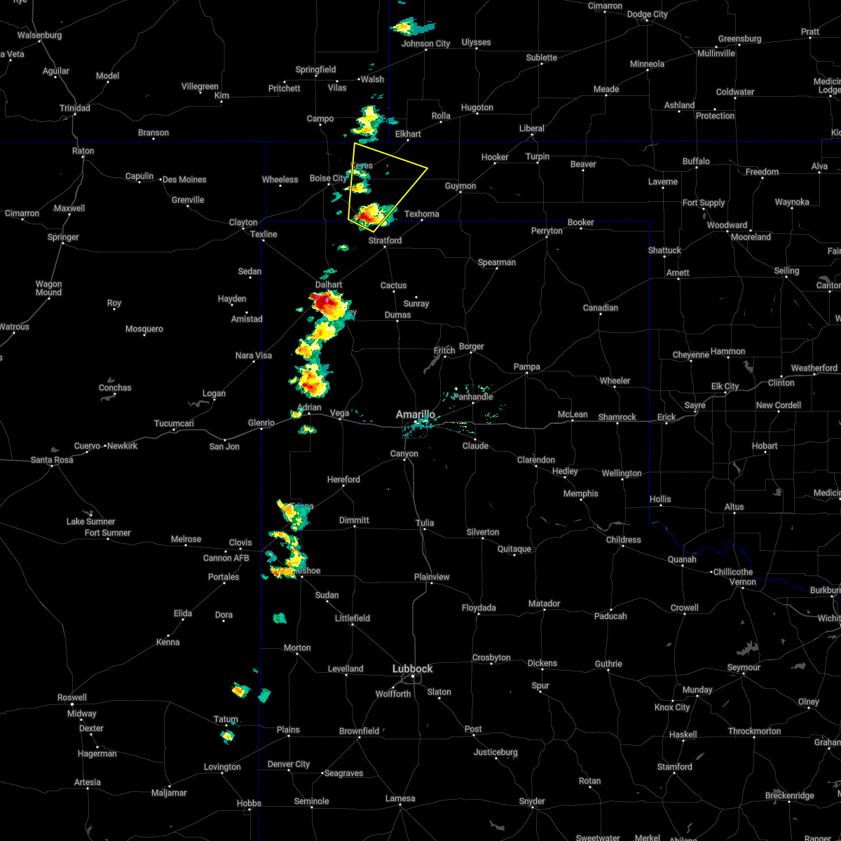 At 530 pm cdt, a severe thunderstorm was located 7 miles southwest of griggs, or 16 miles northwest of stratford, moving northeast at 25 mph (trained weather spotters). Hazards include ping pong ball size hail and 60 mph wind gusts. Minor damage to roofs, siding, and trees is possible. people and animals outdoors will be injured. Expect hail damage to roofs, siding, windows, and vehicles. At 530 pm cdt, a severe thunderstorm was located 7 miles southwest of griggs, or 16 miles northwest of stratford, moving northeast at 25 mph (trained weather spotters). Hazards include ping pong ball size hail and 60 mph wind gusts. Minor damage to roofs, siding, and trees is possible. people and animals outdoors will be injured. Expect hail damage to roofs, siding, windows, and vehicles.
|
| 4/22/2022 5:35 PM CDT | Golf Ball sized hail reported 15.1 miles NW of Keyes, OK |
| 8/7/2021 5:39 PM CDT |
 At 538 pm cdt, a severe thunderstorm was located 8 miles northwest of eva, or 9 miles southwest of elkhart, moving east at 20 mph (radar indicated). Hazards include 60 mph wind gusts and nickel size hail. Minor damage to roofs, siding, and trees is possible. hail may accumulate on roadways causing hazardous travel. locations impacted include, keyes, eva and sturgis. hail threat, observed max hail size, 0. 88in wind threat, radar indicated max wind gust, 60 mph. At 538 pm cdt, a severe thunderstorm was located 8 miles northwest of eva, or 9 miles southwest of elkhart, moving east at 20 mph (radar indicated). Hazards include 60 mph wind gusts and nickel size hail. Minor damage to roofs, siding, and trees is possible. hail may accumulate on roadways causing hazardous travel. locations impacted include, keyes, eva and sturgis. hail threat, observed max hail size, 0. 88in wind threat, radar indicated max wind gust, 60 mph.
|
| 8/7/2021 5:09 PM CDT |
 At 509 pm cdt, a severe thunderstorm was located 8 miles northwest of eva, or 10 miles southwest of elkhart, moving east at 30 mph (radar indicated). Hazards include 70 mph wind gusts and quarter size hail. Expect some tree damage. damage is likely to mobile homes, roofs, and outbuildings. Hail damage to vehicles is expected. At 509 pm cdt, a severe thunderstorm was located 8 miles northwest of eva, or 10 miles southwest of elkhart, moving east at 30 mph (radar indicated). Hazards include 70 mph wind gusts and quarter size hail. Expect some tree damage. damage is likely to mobile homes, roofs, and outbuildings. Hail damage to vehicles is expected.
|
| 7/4/2021 8:39 PM CDT |
 At 839 pm cdt, a severe thunderstorm was located 9 miles south of boise city, moving south at 35 mph. this is a very dangerous storm (radar indicated). Hazards include 80 mph wind gusts and quarter size hail. Flying debris will be dangerous to those caught without shelter. mobile homes will be heavily damaged. expect considerable damage to roofs, windows, and vehicles. tree damage and power outages are likely. hail damage to vehicles is expected. Locations impacted include, boise city, keyes, kenton, wheeless, black mesa park, felt, griggs and sturgis. At 839 pm cdt, a severe thunderstorm was located 9 miles south of boise city, moving south at 35 mph. this is a very dangerous storm (radar indicated). Hazards include 80 mph wind gusts and quarter size hail. Flying debris will be dangerous to those caught without shelter. mobile homes will be heavily damaged. expect considerable damage to roofs, windows, and vehicles. tree damage and power outages are likely. hail damage to vehicles is expected. Locations impacted include, boise city, keyes, kenton, wheeless, black mesa park, felt, griggs and sturgis.
|
| 7/4/2021 8:33 PM CDT |
 At 833 pm cdt, a severe thunderstorm was located 8 miles south of boise city, moving south at 35 mph (radar indicated). Hazards include 70 mph wind gusts and half dollar size hail. Expect some tree damage. damage is likely to mobile homes, roofs, and outbuildings. hail damage to vehicles is expected. Locations impacted include, boise city, keyes, kenton, wheeless, black mesa park, felt, griggs and sturgis. At 833 pm cdt, a severe thunderstorm was located 8 miles south of boise city, moving south at 35 mph (radar indicated). Hazards include 70 mph wind gusts and half dollar size hail. Expect some tree damage. damage is likely to mobile homes, roofs, and outbuildings. hail damage to vehicles is expected. Locations impacted include, boise city, keyes, kenton, wheeless, black mesa park, felt, griggs and sturgis.
|
| 7/4/2021 8:12 PM CDT |
 At 812 pm cdt, a severe thunderstorm was located 8 miles northeast of boise city, moving south at 25 mph (radar indicated). Hazards include golf ball size hail and 60 mph wind gusts. Minor damage to roofs, siding, and trees is possible. people and animals outdoors will be injured. expect hail damage to roofs, siding, windows, and vehicles. Locations impacted include, boise city, keyes, kenton, wheeless, black mesa park, felt, griggs and sturgis. At 812 pm cdt, a severe thunderstorm was located 8 miles northeast of boise city, moving south at 25 mph (radar indicated). Hazards include golf ball size hail and 60 mph wind gusts. Minor damage to roofs, siding, and trees is possible. people and animals outdoors will be injured. expect hail damage to roofs, siding, windows, and vehicles. Locations impacted include, boise city, keyes, kenton, wheeless, black mesa park, felt, griggs and sturgis.
|
| 7/4/2021 7:55 PM CDT |
 At 755 pm cdt, a severe thunderstorm was located 10 miles northwest of keyes, or 16 miles northeast of boise city, moving south at 25 mph (radar indicated). Hazards include golf ball size hail and 60 mph wind gusts. Minor damage to roofs, siding, and trees is possible. people and animals outdoors will be injured. expect hail damage to roofs, siding, windows, and vehicles. Locations impacted include, boise city, keyes, kenton, wheeless, black mesa park, felt, griggs and sturgis. At 755 pm cdt, a severe thunderstorm was located 10 miles northwest of keyes, or 16 miles northeast of boise city, moving south at 25 mph (radar indicated). Hazards include golf ball size hail and 60 mph wind gusts. Minor damage to roofs, siding, and trees is possible. people and animals outdoors will be injured. expect hail damage to roofs, siding, windows, and vehicles. Locations impacted include, boise city, keyes, kenton, wheeless, black mesa park, felt, griggs and sturgis.
|
| 7/4/2021 7:31 PM CDT |
 At 731 pm cdt, a severe thunderstorm was located 16 miles north of keyes, or 19 miles west of elkhart, moving south at 25 mph (radar indicated). Hazards include golf ball size hail and 60 mph wind gusts. Minor damage to roofs, siding, and trees is possible. people and animals outdoors will be injured. Expect hail damage to roofs, siding, windows, and vehicles. At 731 pm cdt, a severe thunderstorm was located 16 miles north of keyes, or 19 miles west of elkhart, moving south at 25 mph (radar indicated). Hazards include golf ball size hail and 60 mph wind gusts. Minor damage to roofs, siding, and trees is possible. people and animals outdoors will be injured. Expect hail damage to roofs, siding, windows, and vehicles.
|
| 6/12/2021 10:37 PM CDT |
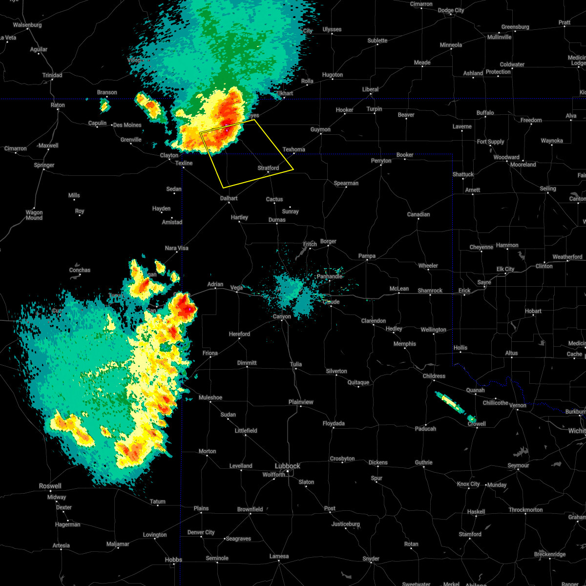 At 1037 pm cdt, automated weather equipment reported a severe thunderstorm was located near boise city, moving southeast at 40 mph. this is a very dangerous storm (automated weather equipment near boise city measured a wind gust of 75 mph). Hazards include 80 mph wind gusts and quarter size hail. Flying debris will be dangerous to those caught without shelter. mobile homes will be heavily damaged. expect considerable damage to roofs, windows, and vehicles. tree damage and power outages are likely. hail damage to vehicles is expected. Locations impacted include, stratford, boise city and griggs. At 1037 pm cdt, automated weather equipment reported a severe thunderstorm was located near boise city, moving southeast at 40 mph. this is a very dangerous storm (automated weather equipment near boise city measured a wind gust of 75 mph). Hazards include 80 mph wind gusts and quarter size hail. Flying debris will be dangerous to those caught without shelter. mobile homes will be heavily damaged. expect considerable damage to roofs, windows, and vehicles. tree damage and power outages are likely. hail damage to vehicles is expected. Locations impacted include, stratford, boise city and griggs.
|
| 6/12/2021 10:32 PM CDT |
 At 1032 pm cdt, a severe thunderstorm was located over boise city, moving southeast at 40 mph (radar indicated). Hazards include 60 mph wind gusts and quarter size hail. Minor damage to roofs, siding, and trees is possible. Hail damage to vehicles is expected. At 1032 pm cdt, a severe thunderstorm was located over boise city, moving southeast at 40 mph (radar indicated). Hazards include 60 mph wind gusts and quarter size hail. Minor damage to roofs, siding, and trees is possible. Hail damage to vehicles is expected.
|
| 6/12/2021 10:32 PM CDT |
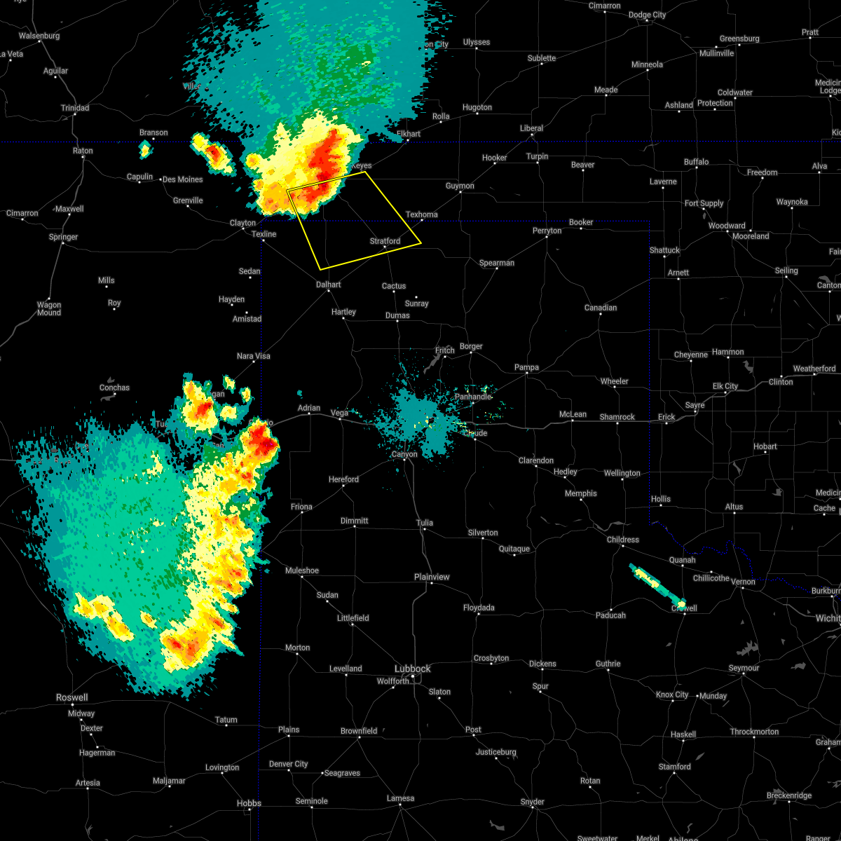 At 1032 pm cdt, a severe thunderstorm was located over boise city, moving southeast at 40 mph (radar indicated). Hazards include 60 mph wind gusts and quarter size hail. Minor damage to roofs, siding, and trees is possible. Hail damage to vehicles is expected. At 1032 pm cdt, a severe thunderstorm was located over boise city, moving southeast at 40 mph (radar indicated). Hazards include 60 mph wind gusts and quarter size hail. Minor damage to roofs, siding, and trees is possible. Hail damage to vehicles is expected.
|
| 6/12/2021 10:24 PM CDT |
 At 1024 pm cdt, a severe thunderstorm was located 4 miles northwest of boise city, moving southeast at 30 mph (radar indicated). Hazards include 60 mph wind gusts and quarter size hail. Minor damage to roofs, siding, and trees is possible. hail damage to vehicles is expected. Locations impacted include, boise city, keyes, kenton, wheeless and black mesa park. At 1024 pm cdt, a severe thunderstorm was located 4 miles northwest of boise city, moving southeast at 30 mph (radar indicated). Hazards include 60 mph wind gusts and quarter size hail. Minor damage to roofs, siding, and trees is possible. hail damage to vehicles is expected. Locations impacted include, boise city, keyes, kenton, wheeless and black mesa park.
|
| 6/12/2021 10:13 PM CDT |
 At 1012 pm cdt, a severe thunderstorm was located 9 miles east of black mesa park, or 14 miles northwest of boise city, moving southeast at 25 mph (radar indicated). Hazards include 70 mph wind gusts and half dollar size hail. Expect some tree damage. damage is likely to mobile homes, roofs, and outbuildings. hail damage to vehicles is expected. Locations impacted include, boise city, keyes, kenton, wheeless and black mesa park. At 1012 pm cdt, a severe thunderstorm was located 9 miles east of black mesa park, or 14 miles northwest of boise city, moving southeast at 25 mph (radar indicated). Hazards include 70 mph wind gusts and half dollar size hail. Expect some tree damage. damage is likely to mobile homes, roofs, and outbuildings. hail damage to vehicles is expected. Locations impacted include, boise city, keyes, kenton, wheeless and black mesa park.
|
| 6/12/2021 9:49 PM CDT |
 At 948 pm cdt, severe thunderstorms were located along a line extending from 9 miles south of campo to 7 miles west of kenton, moving south at 30 mph. these are very dangerous storms (radar indicated). Hazards include 80 mph wind gusts and ping pong ball size hail. Flying debris will be dangerous to those caught without shelter. mobile homes will be heavily damaged. expect considerable damage to roofs, windows, and vehicles. tree damage and power outages are likely. people and animals outdoors will be injured. expect hail damage to roofs, siding, windows, and vehicles. Locations impacted include, boise city, keyes, kenton, wheeless and black mesa park. At 948 pm cdt, severe thunderstorms were located along a line extending from 9 miles south of campo to 7 miles west of kenton, moving south at 30 mph. these are very dangerous storms (radar indicated). Hazards include 80 mph wind gusts and ping pong ball size hail. Flying debris will be dangerous to those caught without shelter. mobile homes will be heavily damaged. expect considerable damage to roofs, windows, and vehicles. tree damage and power outages are likely. people and animals outdoors will be injured. expect hail damage to roofs, siding, windows, and vehicles. Locations impacted include, boise city, keyes, kenton, wheeless and black mesa park.
|
| 6/12/2021 9:45 PM CDT |
 At 945 pm cdt, severe thunderstorms were located along a line extending from 5 miles southwest of campo to 8 miles northwest of kenton, moving southeast at 25 mph (radar indicated). Hazards include 70 mph wind gusts and ping pong ball size hail. Expect some tree damage. damage is likely to mobile homes, roofs, and outbuildings. people and animals outdoors will be injured. expect hail damage to roofs, siding, windows, and vehicles. Locations impacted include, boise city, keyes, kenton, wheeless and black mesa park. At 945 pm cdt, severe thunderstorms were located along a line extending from 5 miles southwest of campo to 8 miles northwest of kenton, moving southeast at 25 mph (radar indicated). Hazards include 70 mph wind gusts and ping pong ball size hail. Expect some tree damage. damage is likely to mobile homes, roofs, and outbuildings. people and animals outdoors will be injured. expect hail damage to roofs, siding, windows, and vehicles. Locations impacted include, boise city, keyes, kenton, wheeless and black mesa park.
|
| 6/12/2021 9:36 PM CDT |
 At 935 pm cdt, severe thunderstorms were located along a line extending from 4 miles southwest of campo to 11 miles northwest of kenton, moving southeast at 25 mph (radar indicated). Hazards include 70 mph wind gusts and half dollar size hail. Expect some tree damage. damage is likely to mobile homes, roofs, and outbuildings. Hail damage to vehicles is expected. At 935 pm cdt, severe thunderstorms were located along a line extending from 4 miles southwest of campo to 11 miles northwest of kenton, moving southeast at 25 mph (radar indicated). Hazards include 70 mph wind gusts and half dollar size hail. Expect some tree damage. damage is likely to mobile homes, roofs, and outbuildings. Hail damage to vehicles is expected.
|
| 5/30/2021 7:40 PM CDT |
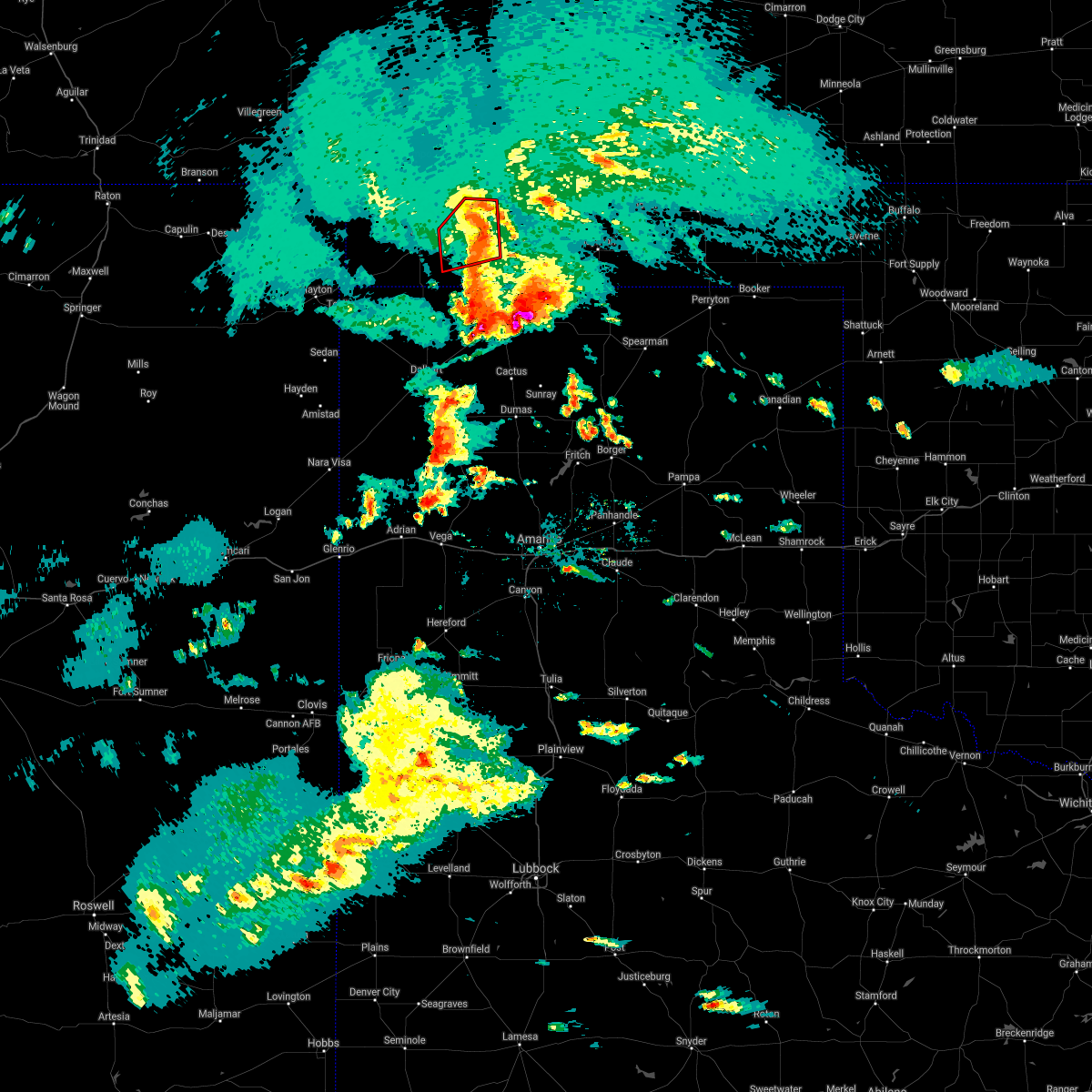 The tornado warning for eastern cimarron county will expire at 745 pm cdt, the tornadic thunderstorm which prompted the warning has weakened. therefore, the warning will be allowed to expire. however heavy rain is still possible with this thunderstorm. a tornado watch remains in effect until midnight cdt for the panhandle of oklahoma. The tornado warning for eastern cimarron county will expire at 745 pm cdt, the tornadic thunderstorm which prompted the warning has weakened. therefore, the warning will be allowed to expire. however heavy rain is still possible with this thunderstorm. a tornado watch remains in effect until midnight cdt for the panhandle of oklahoma.
|
| 5/30/2021 7:24 PM CDT |
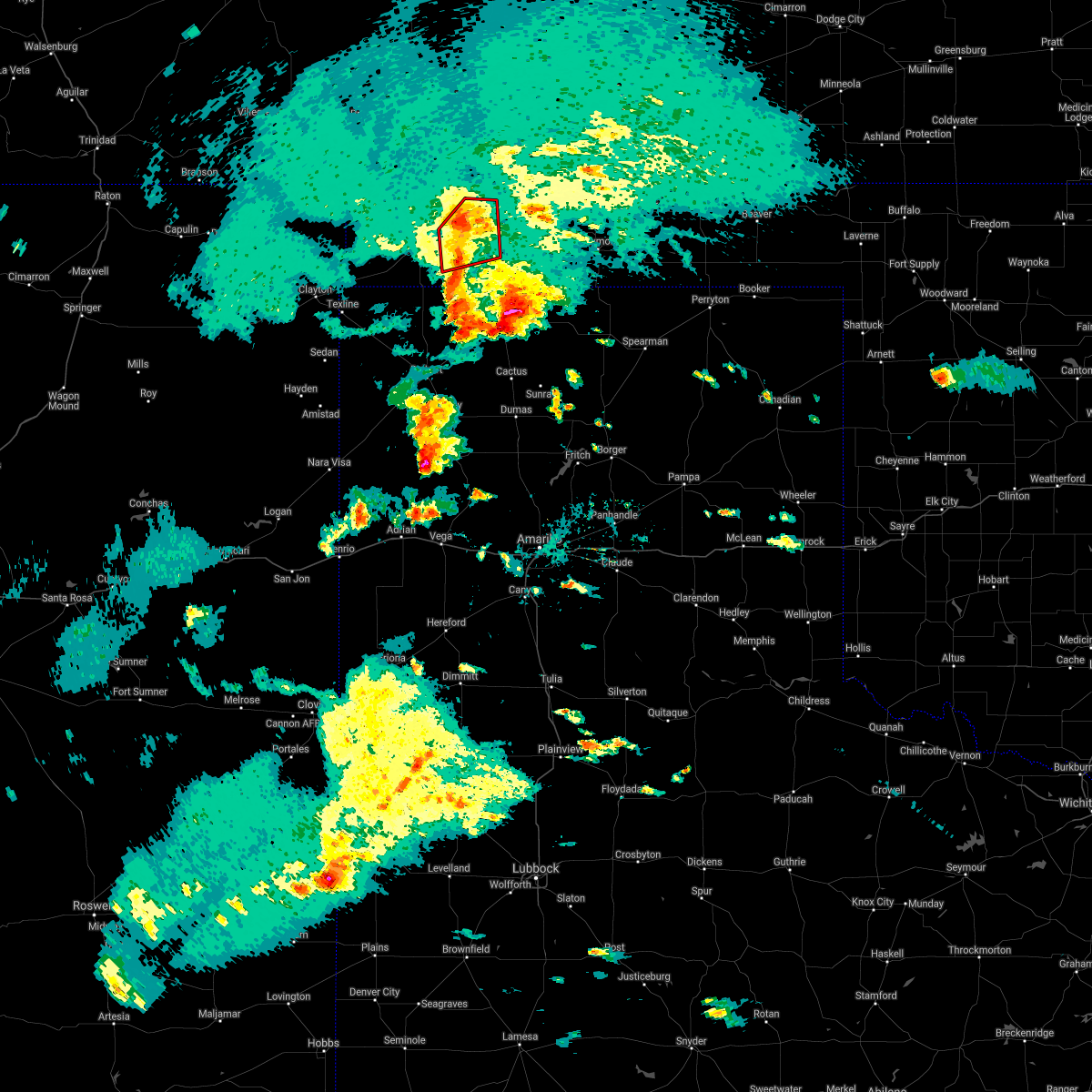 At 723 pm cdt, a severe thunderstorm capable of producing a tornado was located over keyes, or 16 miles northeast of boise city, moving northeast at 20 mph (radar indicated rotation). Hazards include tornado and quarter size hail. Flying debris will be dangerous to those caught without shelter. mobile homes will be damaged or destroyed. damage to roofs, windows, and vehicles will occur. tree damage is likely. Locations impacted include, keyes. At 723 pm cdt, a severe thunderstorm capable of producing a tornado was located over keyes, or 16 miles northeast of boise city, moving northeast at 20 mph (radar indicated rotation). Hazards include tornado and quarter size hail. Flying debris will be dangerous to those caught without shelter. mobile homes will be damaged or destroyed. damage to roofs, windows, and vehicles will occur. tree damage is likely. Locations impacted include, keyes.
|
| 5/30/2021 7:18 PM CDT |
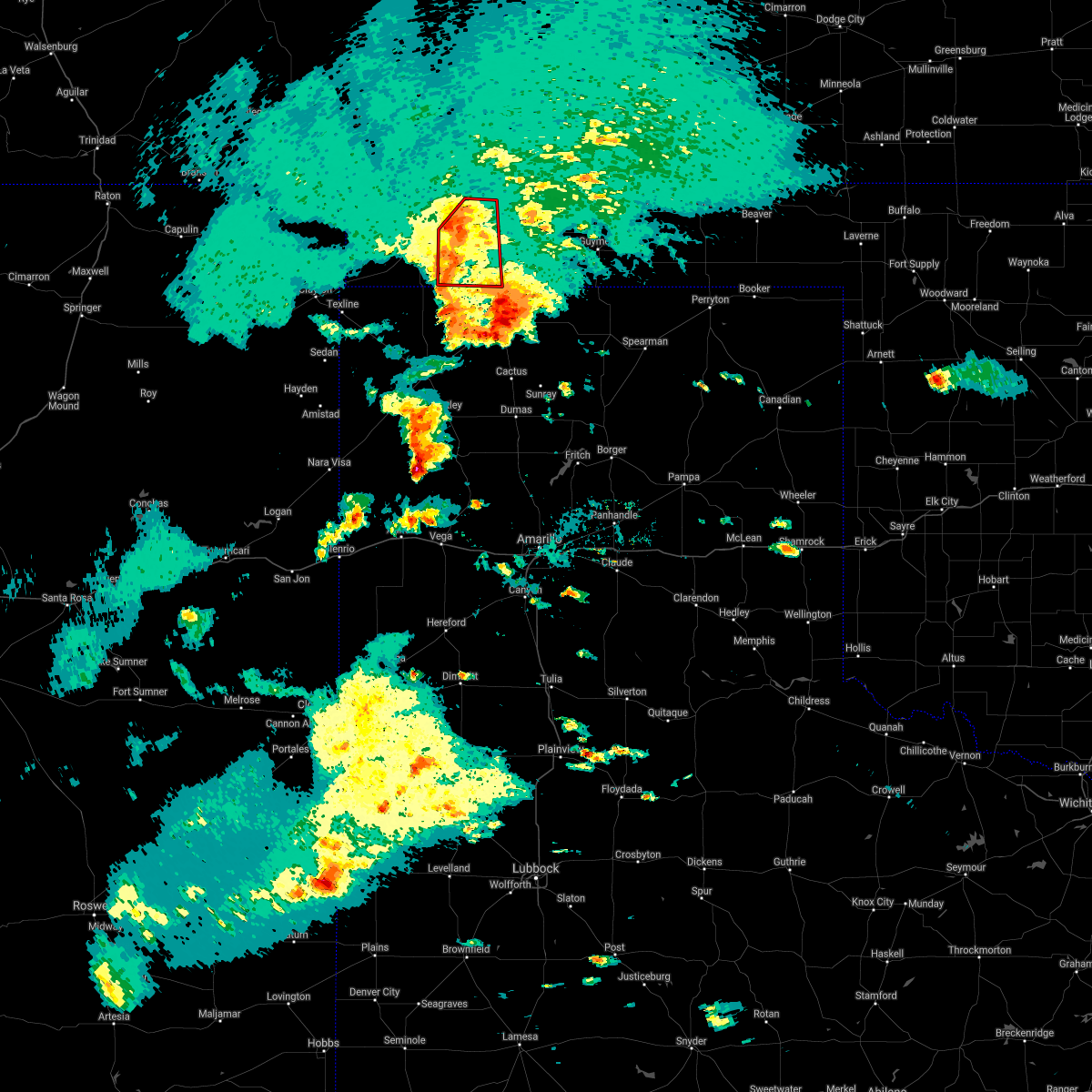 At 715 pm cdt, a severe thunderstorm capable of producing a tornado was located over keyes, or 13 miles east of boise city, moving northeast at 20 mph (radar indicated rotation). Hazards include tornado and quarter size hail. Flying debris will be dangerous to those caught without shelter. mobile homes will be damaged or destroyed. damage to roofs, windows, and vehicles will occur. tree damage is likely. Locations impacted include, keyes and griggs. At 715 pm cdt, a severe thunderstorm capable of producing a tornado was located over keyes, or 13 miles east of boise city, moving northeast at 20 mph (radar indicated rotation). Hazards include tornado and quarter size hail. Flying debris will be dangerous to those caught without shelter. mobile homes will be damaged or destroyed. damage to roofs, windows, and vehicles will occur. tree damage is likely. Locations impacted include, keyes and griggs.
|
| 5/30/2021 7:05 PM CDT |
 At 703 pm cdt, a severe thunderstorm capable of producing a tornado was located 5 miles southwest of keyes, or 10 miles east of boise city, moving northeast at 20 mph (radar indicated rotation. two separate rotations with this storms. one is about 6 miles southwest of keys and moving northeast, and the other is about 18 miles west of griggs moving east). Hazards include tornado and quarter size hail. Flying debris will be dangerous to those caught without shelter. mobile homes will be damaged or destroyed. damage to roofs, windows, and vehicles will occur. tree damage is likely. Locations impacted include, keyes and griggs. At 703 pm cdt, a severe thunderstorm capable of producing a tornado was located 5 miles southwest of keyes, or 10 miles east of boise city, moving northeast at 20 mph (radar indicated rotation. two separate rotations with this storms. one is about 6 miles southwest of keys and moving northeast, and the other is about 18 miles west of griggs moving east). Hazards include tornado and quarter size hail. Flying debris will be dangerous to those caught without shelter. mobile homes will be damaged or destroyed. damage to roofs, windows, and vehicles will occur. tree damage is likely. Locations impacted include, keyes and griggs.
|
| 5/30/2021 6:58 PM CDT |
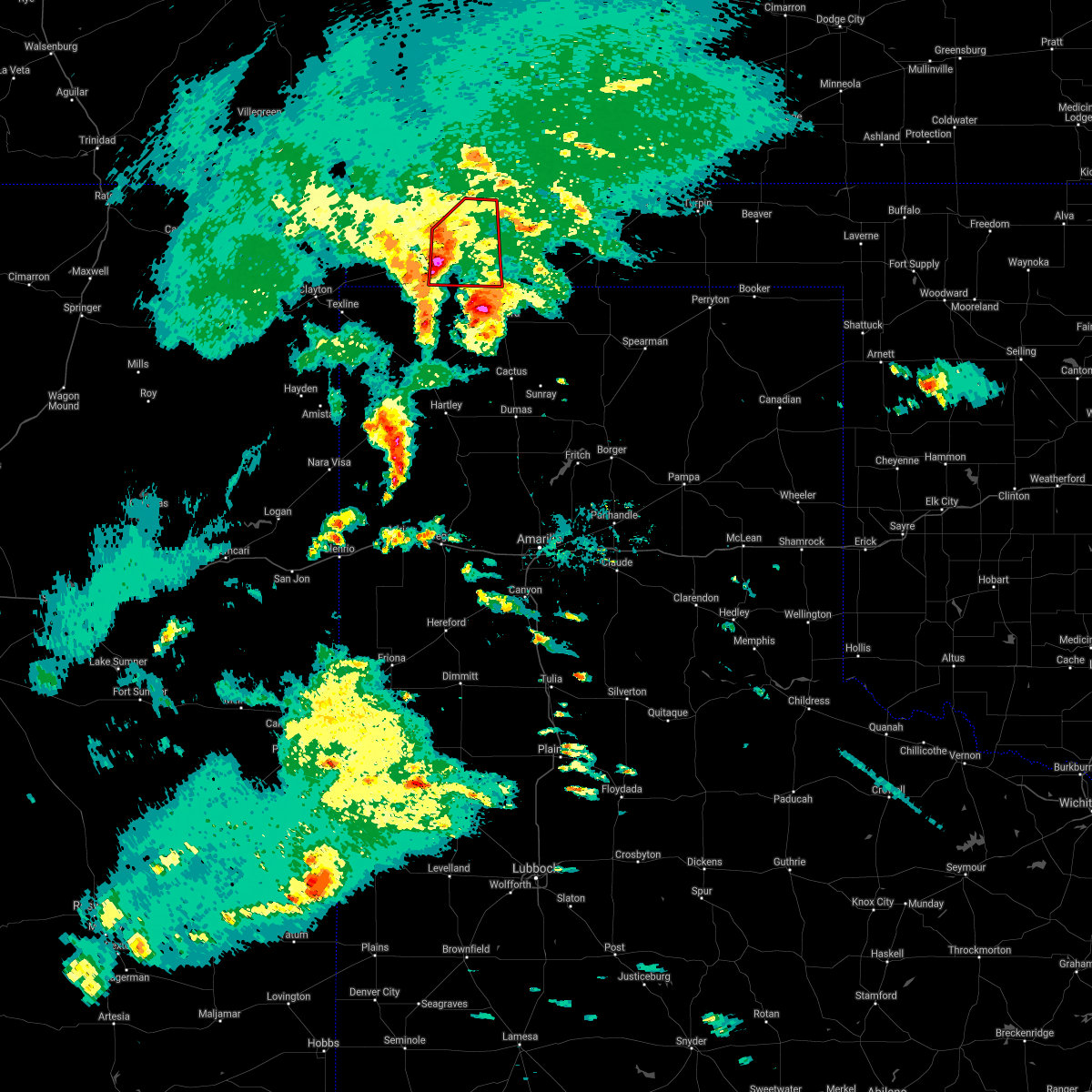 At 658 pm cdt, a severe thunderstorm capable of producing a tornado was located 8 miles southwest of keyes, or 8 miles east of boise city, moving northeast at 15 mph (radar indicated rotation). Hazards include tornado and quarter size hail. Flying debris will be dangerous to those caught without shelter. mobile homes will be damaged or destroyed. damage to roofs, windows, and vehicles will occur. Tree damage is likely. At 658 pm cdt, a severe thunderstorm capable of producing a tornado was located 8 miles southwest of keyes, or 8 miles east of boise city, moving northeast at 15 mph (radar indicated rotation). Hazards include tornado and quarter size hail. Flying debris will be dangerous to those caught without shelter. mobile homes will be damaged or destroyed. damage to roofs, windows, and vehicles will occur. Tree damage is likely.
|
| 5/17/2021 8:31 PM CDT |
 At 830 pm cdt, automated weather equipment reported severe thunderstorms were located along a line extending from 11 miles northwest of campo to 7 miles southwest of griggs, moving northeast at 50 mph (automated weather equipment measured a wind gust of 59 mph at 815 pm cdt in boise city). Hazards include 60 mph wind gusts and quarter size hail. Minor damage to roofs, siding, and trees is possible. hail damage to vehicles is expected. Locations impacted include, boise city, keyes, kenton, wheeless, black mesa park, felt, griggs and sturgis. At 830 pm cdt, automated weather equipment reported severe thunderstorms were located along a line extending from 11 miles northwest of campo to 7 miles southwest of griggs, moving northeast at 50 mph (automated weather equipment measured a wind gust of 59 mph at 815 pm cdt in boise city). Hazards include 60 mph wind gusts and quarter size hail. Minor damage to roofs, siding, and trees is possible. hail damage to vehicles is expected. Locations impacted include, boise city, keyes, kenton, wheeless, black mesa park, felt, griggs and sturgis.
|
| 5/17/2021 8:05 PM CDT |
 At 805 pm cdt, severe thunderstorms were located along a line extending from 7 miles north of kenton to 12 miles west of conlen, moving northeast at 50 mph (radar indicated). Hazards include 60 mph wind gusts and quarter size hail. Minor damage to roofs, siding, and trees is possible. Hail damage to vehicles is expected. At 805 pm cdt, severe thunderstorms were located along a line extending from 7 miles north of kenton to 12 miles west of conlen, moving northeast at 50 mph (radar indicated). Hazards include 60 mph wind gusts and quarter size hail. Minor damage to roofs, siding, and trees is possible. Hail damage to vehicles is expected.
|
| 5/17/2021 8:05 PM CDT |
 The national weather service in amarillo has issued a * severe thunderstorm warning for. southwestern texas county in the panhandle of oklahoma. cimarron county in the panhandle of oklahoma. northwestern sherman county in the panhandle of texas. Northern dallam county in the panhandle of texas. The national weather service in amarillo has issued a * severe thunderstorm warning for. southwestern texas county in the panhandle of oklahoma. cimarron county in the panhandle of oklahoma. northwestern sherman county in the panhandle of texas. Northern dallam county in the panhandle of texas.
|
| 5/14/2021 6:12 PM CDT |
 At 612 pm cdt, a severe thunderstorm was located 10 miles south of campo, or 16 miles north of boise city, moving east at 20 mph (radar indicated). Hazards include 60 mph wind gusts and quarter size hail. Minor damage to roofs, siding, and trees is possible. hail damage to vehicles is expected. Locations impacted include, black mesa park and kenton. At 612 pm cdt, a severe thunderstorm was located 10 miles south of campo, or 16 miles north of boise city, moving east at 20 mph (radar indicated). Hazards include 60 mph wind gusts and quarter size hail. Minor damage to roofs, siding, and trees is possible. hail damage to vehicles is expected. Locations impacted include, black mesa park and kenton.
|
| 5/14/2021 5:50 PM CDT |
 At 550 pm cdt, a severe thunderstorm was located 11 miles east of black mesa park, or 14 miles northwest of boise city, moving southeast at 15 mph (radar indicated). Hazards include 60 mph wind gusts and quarter size hail. Minor damage to roofs, siding, and trees is possible. Hail damage to vehicles is expected. At 550 pm cdt, a severe thunderstorm was located 11 miles east of black mesa park, or 14 miles northwest of boise city, moving southeast at 15 mph (radar indicated). Hazards include 60 mph wind gusts and quarter size hail. Minor damage to roofs, siding, and trees is possible. Hail damage to vehicles is expected.
|
| 5/7/2021 2:20 PM CDT |
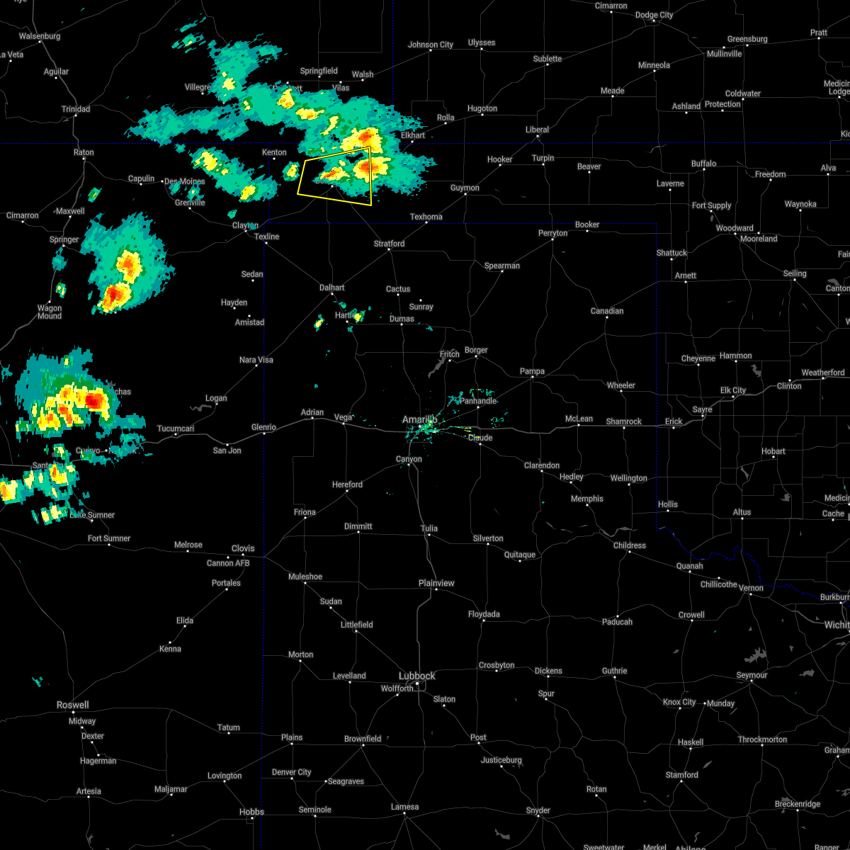 The severe thunderstorm warning for central cimarron county will expire at 230 pm cdt, the storm which prompted the warning has weakened below severe limits, and no longer poses an immediate threat to life or property. therefore, the warning will be allowed to expire. however small hail, gusty winds and heavy rain are still possible with this thunderstorm. The severe thunderstorm warning for central cimarron county will expire at 230 pm cdt, the storm which prompted the warning has weakened below severe limits, and no longer poses an immediate threat to life or property. therefore, the warning will be allowed to expire. however small hail, gusty winds and heavy rain are still possible with this thunderstorm.
|
| 5/7/2021 1:57 PM CDT |
 At 157 pm cdt, a severe thunderstorm was located 7 miles northeast of boise city, moving east at 20 mph (radar indicated). Hazards include 60 mph wind gusts and penny size hail. Minor damage to roofs, siding, and trees is possible. Locations impacted include, boise city and keyes. At 157 pm cdt, a severe thunderstorm was located 7 miles northeast of boise city, moving east at 20 mph (radar indicated). Hazards include 60 mph wind gusts and penny size hail. Minor damage to roofs, siding, and trees is possible. Locations impacted include, boise city and keyes.
|
| 5/7/2021 1:41 PM CDT |
 At 133 pm cdt, a severe thunderstorm was located 6 miles northwest of boise city, moving east at 15 mph (radar indicated). Hazards include 60 mph wind gusts and quarter size hail. Minor damage to roofs, siding, and trees is possible. Hail damage to vehicles is expected. At 133 pm cdt, a severe thunderstorm was located 6 miles northwest of boise city, moving east at 15 mph (radar indicated). Hazards include 60 mph wind gusts and quarter size hail. Minor damage to roofs, siding, and trees is possible. Hail damage to vehicles is expected.
|
| 5/7/2021 1:33 PM CDT |
 At 133 pm cdt, a severe thunderstorm was located 6 miles northwest of boise city, moving east at 15 mph (radar indicated). Hazards include 60 mph wind gusts and quarter size hail. Minor damage to roofs, siding, and trees is possible. Hail damage to vehicles is expected. At 133 pm cdt, a severe thunderstorm was located 6 miles northwest of boise city, moving east at 15 mph (radar indicated). Hazards include 60 mph wind gusts and quarter size hail. Minor damage to roofs, siding, and trees is possible. Hail damage to vehicles is expected.
|
| 8/29/2020 5:50 PM CDT |
 At 549 pm cdt, severe thunderstorms were located along a line extending from 5 miles northeast of black mesa park to 6 miles southeast of seneca, moving east at 40 mph (radar indicated). Hazards include 60 mph wind gusts and nickel size hail. Minor damage to roofs, siding, and trees is possible. Locations impacted include, boise city, keyes, kenton, wheeless, black mesa park and felt. At 549 pm cdt, severe thunderstorms were located along a line extending from 5 miles northeast of black mesa park to 6 miles southeast of seneca, moving east at 40 mph (radar indicated). Hazards include 60 mph wind gusts and nickel size hail. Minor damage to roofs, siding, and trees is possible. Locations impacted include, boise city, keyes, kenton, wheeless, black mesa park and felt.
|
| 8/29/2020 5:18 PM CDT |
 At 518 pm cdt, a severe thunderstorm was located 6 miles north of seneca, or 18 miles north of clayton, moving east at 50 mph (radar indicated). Hazards include 60 mph wind gusts and nickel size hail. minor damage to roofs, siding, and trees is possible At 518 pm cdt, a severe thunderstorm was located 6 miles north of seneca, or 18 miles north of clayton, moving east at 50 mph (radar indicated). Hazards include 60 mph wind gusts and nickel size hail. minor damage to roofs, siding, and trees is possible
|
| 8/14/2020 8:35 PM CDT |
 At 835 pm cdt, a severe thunderstorm was located 7 miles south of eva, or 21 miles south of elkhart, moving south at 25 mph (radar indicated). Hazards include 70 mph wind gusts and ping pong ball size hail. Expect some tree damage. damage is likely to mobile homes, roofs, and outbuildings. people and animals outdoors will be injured. expect hail damage to roofs, siding, windows, and vehicles. Locations impacted include, guymon, goodwell, texhoma, keyes, eva, hough, griggs and sturgis. At 835 pm cdt, a severe thunderstorm was located 7 miles south of eva, or 21 miles south of elkhart, moving south at 25 mph (radar indicated). Hazards include 70 mph wind gusts and ping pong ball size hail. Expect some tree damage. damage is likely to mobile homes, roofs, and outbuildings. people and animals outdoors will be injured. expect hail damage to roofs, siding, windows, and vehicles. Locations impacted include, guymon, goodwell, texhoma, keyes, eva, hough, griggs and sturgis.
|
| 8/14/2020 8:25 PM CDT |
 At 825 pm cdt, a severe thunderstorm was located over eva, or 16 miles south of elkhart, moving south at 25 mph (radar indicated). Hazards include golf ball size hail and 70 mph wind gusts. Expect some tree damage. damage is likely to mobile homes, roofs, and outbuildings. people and animals outdoors will be injured. expect hail damage to roofs, siding, windows, and vehicles. Locations impacted include, guymon, goodwell, texhoma, keyes, eva, hough, griggs and sturgis. At 825 pm cdt, a severe thunderstorm was located over eva, or 16 miles south of elkhart, moving south at 25 mph (radar indicated). Hazards include golf ball size hail and 70 mph wind gusts. Expect some tree damage. damage is likely to mobile homes, roofs, and outbuildings. people and animals outdoors will be injured. expect hail damage to roofs, siding, windows, and vehicles. Locations impacted include, guymon, goodwell, texhoma, keyes, eva, hough, griggs and sturgis.
|
| 8/14/2020 8:17 PM CDT |
 At 817 pm cdt, a severe thunderstorm was located over eva, or 13 miles south of elkhart, moving south at 20 mph (radar indicated). Hazards include golf ball size hail and 70 mph wind gusts. Expect some tree damage. damage is likely to mobile homes, roofs, and outbuildings. people and animals outdoors will be injured. expect hail damage to roofs, siding, windows, and vehicles. Locations impacted include, guymon, goodwell, texhoma, keyes, eva, hough, griggs and sturgis. At 817 pm cdt, a severe thunderstorm was located over eva, or 13 miles south of elkhart, moving south at 20 mph (radar indicated). Hazards include golf ball size hail and 70 mph wind gusts. Expect some tree damage. damage is likely to mobile homes, roofs, and outbuildings. people and animals outdoors will be injured. expect hail damage to roofs, siding, windows, and vehicles. Locations impacted include, guymon, goodwell, texhoma, keyes, eva, hough, griggs and sturgis.
|
| 8/14/2020 8:13 PM CDT | Tree limbs 2 to 3 inches in diameter broken of in cimarron county OK, 4.6 miles W of Keyes, OK |
| 8/14/2020 8:08 PM CDT |
 At 808 pm cdt, a severe thunderstorm was located 4 miles northwest of eva, or 11 miles south of elkhart, moving south at 25 mph (radar indicated). Hazards include two inch hail and 70 mph wind gusts. Expect some tree damage. damage is likely to mobile homes, roofs, and outbuildings. people and animals outdoors will be injured. expect hail damage to roofs, siding, windows, and vehicles. Locations impacted include, guymon, boise city, goodwell, texhoma, keyes, eva, hough, griggs and sturgis. At 808 pm cdt, a severe thunderstorm was located 4 miles northwest of eva, or 11 miles south of elkhart, moving south at 25 mph (radar indicated). Hazards include two inch hail and 70 mph wind gusts. Expect some tree damage. damage is likely to mobile homes, roofs, and outbuildings. people and animals outdoors will be injured. expect hail damage to roofs, siding, windows, and vehicles. Locations impacted include, guymon, boise city, goodwell, texhoma, keyes, eva, hough, griggs and sturgis.
|
| 8/14/2020 7:57 PM CDT |
 At 757 pm cdt, a severe thunderstorm was located 7 miles northwest of eva, or 8 miles southwest of elkhart, moving south at 25 mph (radar indicated). Hazards include golf ball size hail and 70 mph wind gusts. Expect some tree damage. damage is likely to mobile homes, roofs, and outbuildings. people and animals outdoors will be injured. expect hail damage to roofs, siding, windows, and vehicles. Locations impacted include, guymon, boise city, goodwell, texhoma, keyes, eva, hough, griggs and sturgis. At 757 pm cdt, a severe thunderstorm was located 7 miles northwest of eva, or 8 miles southwest of elkhart, moving south at 25 mph (radar indicated). Hazards include golf ball size hail and 70 mph wind gusts. Expect some tree damage. damage is likely to mobile homes, roofs, and outbuildings. people and animals outdoors will be injured. expect hail damage to roofs, siding, windows, and vehicles. Locations impacted include, guymon, boise city, goodwell, texhoma, keyes, eva, hough, griggs and sturgis.
|
| 8/14/2020 7:37 PM CDT |
 At 737 pm cdt, a severe thunderstorm was located 6 miles west of elkhart, moving southwest at 25 mph (radar indicated). Hazards include 70 mph wind gusts and ping pong ball size hail. Expect some tree damage. damage is likely to mobile homes, roofs, and outbuildings. people and animals outdoors will be injured. Expect hail damage to roofs, siding, windows, and vehicles. At 737 pm cdt, a severe thunderstorm was located 6 miles west of elkhart, moving southwest at 25 mph (radar indicated). Hazards include 70 mph wind gusts and ping pong ball size hail. Expect some tree damage. damage is likely to mobile homes, roofs, and outbuildings. people and animals outdoors will be injured. Expect hail damage to roofs, siding, windows, and vehicles.
|
| 8/9/2020 7:27 PM CDT |
 At 727 pm cdt, a severe thunderstorm was located 7 miles east of keyes, or 16 miles southwest of elkhart, moving northeast at 20 mph (radar indicated). Hazards include 60 mph wind gusts and nickel size hail. Minor damage to roofs, siding, and trees is possible. Locations impacted include, keyes and sturgis. At 727 pm cdt, a severe thunderstorm was located 7 miles east of keyes, or 16 miles southwest of elkhart, moving northeast at 20 mph (radar indicated). Hazards include 60 mph wind gusts and nickel size hail. Minor damage to roofs, siding, and trees is possible. Locations impacted include, keyes and sturgis.
|
| 8/9/2020 7:17 PM CDT |
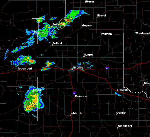 At 716 pm cdt, a severe thunderstorm was located near keyes, or 18 miles east of boise city, moving northeast at 20 mph (trained weather spotters. at 7:09 pm cdt a trained weather spotter reported a few hail stones up to the size of quarters in keyes, oklahoma). Hazards include 60 mph wind gusts and quarter size hail. Minor damage to roofs, siding, and trees is possible. hail damage to vehicles is expected. Locations impacted include, keyes and sturgis. At 716 pm cdt, a severe thunderstorm was located near keyes, or 18 miles east of boise city, moving northeast at 20 mph (trained weather spotters. at 7:09 pm cdt a trained weather spotter reported a few hail stones up to the size of quarters in keyes, oklahoma). Hazards include 60 mph wind gusts and quarter size hail. Minor damage to roofs, siding, and trees is possible. hail damage to vehicles is expected. Locations impacted include, keyes and sturgis.
|
| 8/9/2020 7:09 PM CDT | Quarter sized hail reported 0.7 miles WSW of Keyes, OK, majority of hail stones from dime to penny size... though a few measured a little over an inch in diameter. |
| 8/9/2020 7:07 PM CDT |
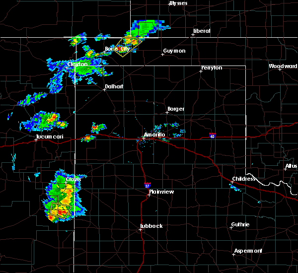 At 706 pm cdt, a severe thunderstorm was located over keyes, or 16 miles east of boise city, moving northeast at 20 mph (radar indicated). Hazards include 60 mph wind gusts and quarter size hail. Minor damage to roofs, siding, and trees is possible. Hail damage to vehicles is expected. At 706 pm cdt, a severe thunderstorm was located over keyes, or 16 miles east of boise city, moving northeast at 20 mph (radar indicated). Hazards include 60 mph wind gusts and quarter size hail. Minor damage to roofs, siding, and trees is possible. Hail damage to vehicles is expected.
|
| 8/6/2020 6:37 PM CDT |
 At 636 pm cdt, a severe thunderstorm was located 6 miles east of boise city, moving southeast at 20 mph (radar indicated). Hazards include 60 mph wind gusts and quarter size hail. Minor damage to roofs, siding, and trees is possible. hail damage to vehicles is expected. Locations impacted include, boise city, keyes, griggs and sturgis. At 636 pm cdt, a severe thunderstorm was located 6 miles east of boise city, moving southeast at 20 mph (radar indicated). Hazards include 60 mph wind gusts and quarter size hail. Minor damage to roofs, siding, and trees is possible. hail damage to vehicles is expected. Locations impacted include, boise city, keyes, griggs and sturgis.
|
| 8/6/2020 6:25 PM CDT |
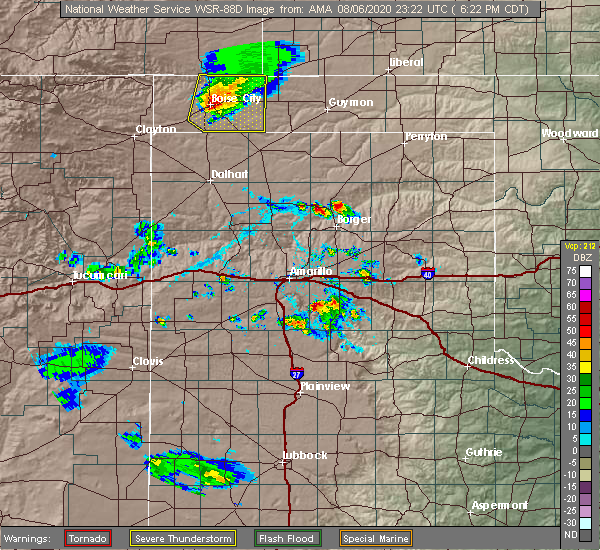 At 625 pm cdt, a severe thunderstorm was located near boise city, moving southeast at 20 mph (radar indicated). Hazards include 60 mph wind gusts and quarter size hail. Minor damage to roofs, siding, and trees is possible. hail damage to vehicles is expected. Locations impacted include, boise city, keyes, griggs and sturgis. At 625 pm cdt, a severe thunderstorm was located near boise city, moving southeast at 20 mph (radar indicated). Hazards include 60 mph wind gusts and quarter size hail. Minor damage to roofs, siding, and trees is possible. hail damage to vehicles is expected. Locations impacted include, boise city, keyes, griggs and sturgis.
|
| 8/6/2020 6:12 PM CDT |
 At 611 pm cdt, a severe thunderstorm was located over boise city, moving southeast at 25 mph (radar indicated). Hazards include 70 mph wind gusts and ping pong ball size hail. Expect some tree damage. damage is likely to mobile homes, roofs, and outbuildings. people and animals outdoors will be injured. expect hail damage to roofs, siding, windows, and vehicles. Locations impacted include, boise city, keyes, griggs and sturgis. At 611 pm cdt, a severe thunderstorm was located over boise city, moving southeast at 25 mph (radar indicated). Hazards include 70 mph wind gusts and ping pong ball size hail. Expect some tree damage. damage is likely to mobile homes, roofs, and outbuildings. people and animals outdoors will be injured. expect hail damage to roofs, siding, windows, and vehicles. Locations impacted include, boise city, keyes, griggs and sturgis.
|
| 8/6/2020 6:06 PM CDT |
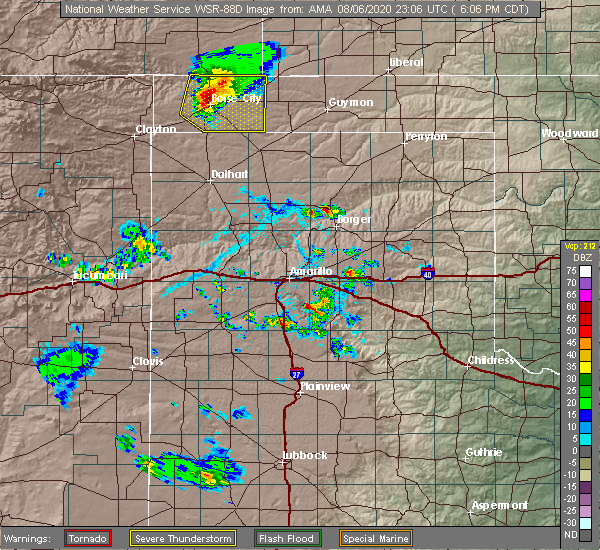 At 606 pm cdt, a severe thunderstorm was located over boise city, moving southeast at 25 mph (radar indicated). Hazards include 70 mph wind gusts and quarter size hail. Expect some tree damage. damage is likely to mobile homes, roofs, and outbuildings. hail damage to vehicles is expected. Locations impacted include, boise city, keyes, griggs and sturgis. At 606 pm cdt, a severe thunderstorm was located over boise city, moving southeast at 25 mph (radar indicated). Hazards include 70 mph wind gusts and quarter size hail. Expect some tree damage. damage is likely to mobile homes, roofs, and outbuildings. hail damage to vehicles is expected. Locations impacted include, boise city, keyes, griggs and sturgis.
|
| 8/6/2020 5:53 PM CDT |
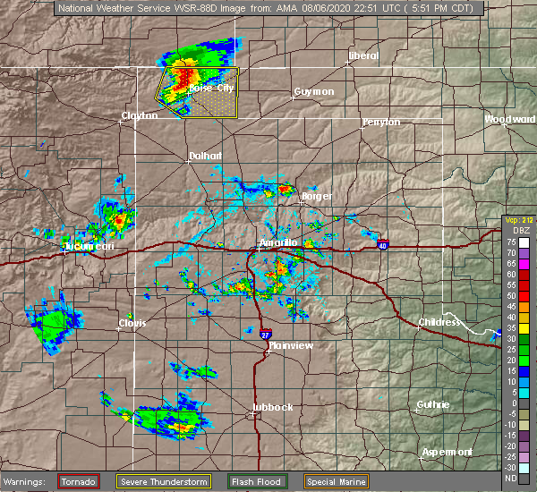 At 553 pm cdt, a severe thunderstorm was located 8 miles north of boise city, moving southeast at 25 mph (radar indicated). Hazards include 70 mph wind gusts and half dollar size hail. Expect some tree damage. damage is likely to mobile homes, roofs, and outbuildings. hail damage to vehicles is expected. Locations impacted include, boise city, keyes, griggs and sturgis. At 553 pm cdt, a severe thunderstorm was located 8 miles north of boise city, moving southeast at 25 mph (radar indicated). Hazards include 70 mph wind gusts and half dollar size hail. Expect some tree damage. damage is likely to mobile homes, roofs, and outbuildings. hail damage to vehicles is expected. Locations impacted include, boise city, keyes, griggs and sturgis.
|
| 8/6/2020 5:44 PM CDT |
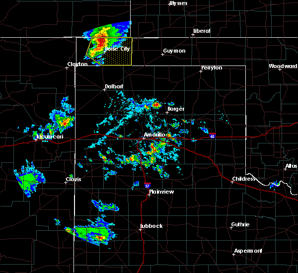 At 544 pm cdt, a severe thunderstorm was located 10 miles north of boise city, moving southeast at 25 mph (radar indicated). Hazards include 60 mph wind gusts and quarter size hail. Minor damage to roofs, siding, and trees is possible. Hail damage to vehicles is expected. At 544 pm cdt, a severe thunderstorm was located 10 miles north of boise city, moving southeast at 25 mph (radar indicated). Hazards include 60 mph wind gusts and quarter size hail. Minor damage to roofs, siding, and trees is possible. Hail damage to vehicles is expected.
|
| 7/20/2020 10:48 PM CDT |
 At 1048 pm cdt, a severe thunderstorm was located over eva, or 13 miles south of elkhart, moving east at 25 mph (radar indicated). Hazards include 60 mph wind gusts. minor damage to roofs, siding, and trees is possible At 1048 pm cdt, a severe thunderstorm was located over eva, or 13 miles south of elkhart, moving east at 25 mph (radar indicated). Hazards include 60 mph wind gusts. minor damage to roofs, siding, and trees is possible
|
| 7/19/2020 7:09 PM CDT |
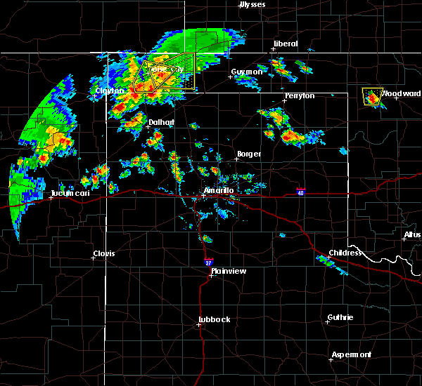 At 708 pm cdt, a severe thunderstorm was located 14 miles south of boise city, moving northeast at 15 mph (radar indicated). Hazards include 60 mph wind gusts and nickel size hail. Minor damage to roofs, siding, and trees is possible. Locations impacted include, keyes, griggs and sturgis. At 708 pm cdt, a severe thunderstorm was located 14 miles south of boise city, moving northeast at 15 mph (radar indicated). Hazards include 60 mph wind gusts and nickel size hail. Minor damage to roofs, siding, and trees is possible. Locations impacted include, keyes, griggs and sturgis.
|
| 7/19/2020 6:48 PM CDT |
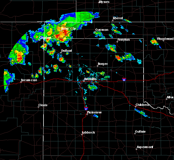 At 648 pm cdt, a severe thunderstorm was located 7 miles east of boise city, moving northeast at 10 mph (radar indicated). Hazards include 60 mph wind gusts and penny size hail. Minor damage to roofs, siding, and trees is possible. Locations impacted include, boise city and keyes. At 648 pm cdt, a severe thunderstorm was located 7 miles east of boise city, moving northeast at 10 mph (radar indicated). Hazards include 60 mph wind gusts and penny size hail. Minor damage to roofs, siding, and trees is possible. Locations impacted include, boise city and keyes.
|
| 7/19/2020 6:47 PM CDT |
 At 641 pm cdt, a severe thunderstorm was located 7 miles southwest of keyes, or 9 miles east of boise city, moving northeast at 20 mph (radar indicated). Hazards include 70 mph wind gusts and nickel size hail. Expect some tree damage. Damage is likely to mobile homes, roofs, and outbuildings. At 641 pm cdt, a severe thunderstorm was located 7 miles southwest of keyes, or 9 miles east of boise city, moving northeast at 20 mph (radar indicated). Hazards include 70 mph wind gusts and nickel size hail. Expect some tree damage. Damage is likely to mobile homes, roofs, and outbuildings.
|
| 7/19/2020 6:35 PM CDT |
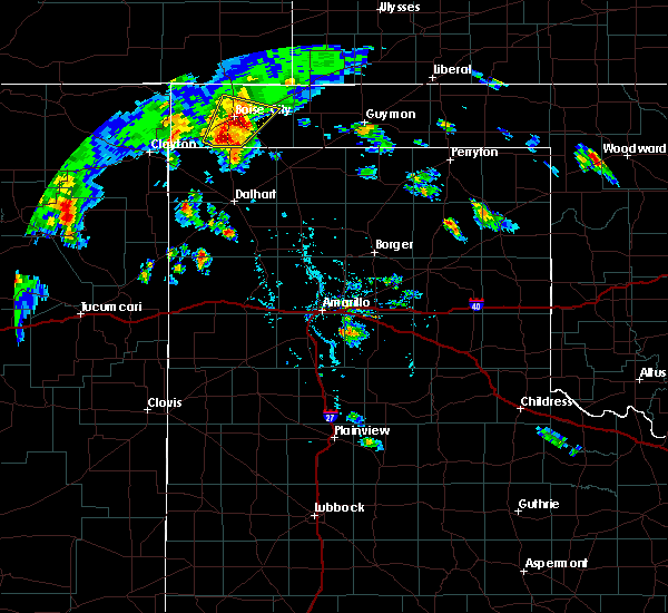 At 634 pm cdt, a severe thunderstorm was located 5 miles east of boise city, moving northeast at 20 mph. this is a very dangerous storm (an 83 mph wind gust was reported at the boise city mesonet at 6:30 pm cdt). Hazards include 80 mph wind gusts and quarter size hail. Flying debris will be dangerous to those caught without shelter. mobile homes will be heavily damaged. expect considerable damage to roofs, windows, and vehicles. tree damage and power outages are likely. hail damage to vehicles is expected. Locations impacted include, boise city and keyes. At 634 pm cdt, a severe thunderstorm was located 5 miles east of boise city, moving northeast at 20 mph. this is a very dangerous storm (an 83 mph wind gust was reported at the boise city mesonet at 6:30 pm cdt). Hazards include 80 mph wind gusts and quarter size hail. Flying debris will be dangerous to those caught without shelter. mobile homes will be heavily damaged. expect considerable damage to roofs, windows, and vehicles. tree damage and power outages are likely. hail damage to vehicles is expected. Locations impacted include, boise city and keyes.
|
| 7/19/2020 6:27 PM CDT |
 At 627 pm cdt, a severe thunderstorm was located 4 miles southeast of boise city, moving northeast at 20 mph (radar indicated). Hazards include 70 mph wind gusts and quarter size hail. Expect some tree damage. damage is likely to mobile homes, roofs, and outbuildings. hail damage to vehicles is expected. Locations impacted include, boise city and keyes. At 627 pm cdt, a severe thunderstorm was located 4 miles southeast of boise city, moving northeast at 20 mph (radar indicated). Hazards include 70 mph wind gusts and quarter size hail. Expect some tree damage. damage is likely to mobile homes, roofs, and outbuildings. hail damage to vehicles is expected. Locations impacted include, boise city and keyes.
|
| 7/19/2020 6:16 PM CDT |
 At 615 pm cdt, a severe thunderstorm was located 10 miles east of felt, or 11 miles southwest of boise city, moving northeast at 10 mph (radar indicated). Hazards include 60 mph wind gusts and quarter size hail. Minor damage to roofs, siding, and trees is possible. Hail damage to vehicles is expected. At 615 pm cdt, a severe thunderstorm was located 10 miles east of felt, or 11 miles southwest of boise city, moving northeast at 10 mph (radar indicated). Hazards include 60 mph wind gusts and quarter size hail. Minor damage to roofs, siding, and trees is possible. Hail damage to vehicles is expected.
|
| 7/19/2020 5:37 PM CDT |
 At 537 pm cdt, a severe thunderstorm was located 13 miles north of keyes, or 21 miles west of elkhart, moving southeast at 15 mph (radar indicated). Hazards include 70 mph wind gusts and half dollar size hail. Expect some tree damage. damage is likely to mobile homes, roofs, and outbuildings. hail damage to vehicles is expected. Locations impacted include, keyes and sturgis. At 537 pm cdt, a severe thunderstorm was located 13 miles north of keyes, or 21 miles west of elkhart, moving southeast at 15 mph (radar indicated). Hazards include 70 mph wind gusts and half dollar size hail. Expect some tree damage. damage is likely to mobile homes, roofs, and outbuildings. hail damage to vehicles is expected. Locations impacted include, keyes and sturgis.
|
| 7/19/2020 5:34 PM CDT |
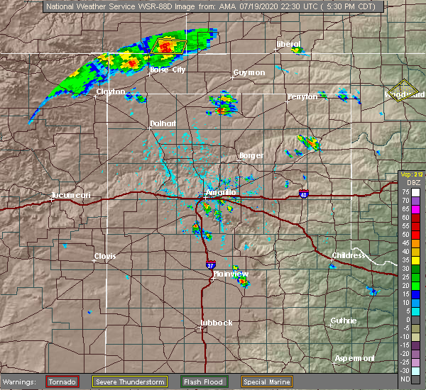 At 533 pm cdt, a severe thunderstorm was located 14 miles north of keyes, or 21 miles west of elkhart, moving southeast at 15 mph (radar indicated). Hazards include 70 mph wind gusts and quarter size hail. Expect some tree damage. damage is likely to mobile homes, roofs, and outbuildings. Hail damage to vehicles is expected. At 533 pm cdt, a severe thunderstorm was located 14 miles north of keyes, or 21 miles west of elkhart, moving southeast at 15 mph (radar indicated). Hazards include 70 mph wind gusts and quarter size hail. Expect some tree damage. damage is likely to mobile homes, roofs, and outbuildings. Hail damage to vehicles is expected.
|
| 7/13/2020 6:51 PM CDT |
 At 650 pm cdt, severe thunderstorms were located along a line extending from 10 miles northwest of keyes to 16 miles south of boise city to 9 miles north of dalhart, moving east at 30 mph (radar indicated). Hazards include 60 mph wind gusts. Minor damage to roofs, siding, and trees is possible. Locations impacted include, boise city, keyes and ware. At 650 pm cdt, severe thunderstorms were located along a line extending from 10 miles northwest of keyes to 16 miles south of boise city to 9 miles north of dalhart, moving east at 30 mph (radar indicated). Hazards include 60 mph wind gusts. Minor damage to roofs, siding, and trees is possible. Locations impacted include, boise city, keyes and ware.
|
| 7/13/2020 6:51 PM CDT |
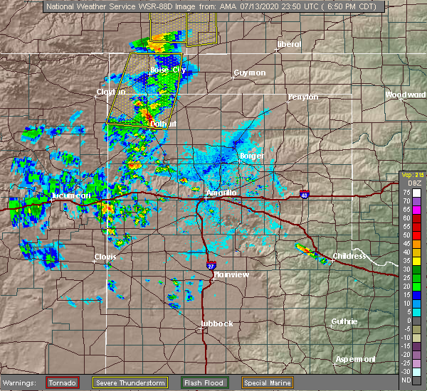 At 650 pm cdt, severe thunderstorms were located along a line extending from 10 miles northwest of keyes to 16 miles south of boise city to 9 miles north of dalhart, moving east at 30 mph (radar indicated). Hazards include 60 mph wind gusts. Minor damage to roofs, siding, and trees is possible. Locations impacted include, boise city, keyes and ware. At 650 pm cdt, severe thunderstorms were located along a line extending from 10 miles northwest of keyes to 16 miles south of boise city to 9 miles north of dalhart, moving east at 30 mph (radar indicated). Hazards include 60 mph wind gusts. Minor damage to roofs, siding, and trees is possible. Locations impacted include, boise city, keyes and ware.
|
| 7/13/2020 6:29 PM CDT |
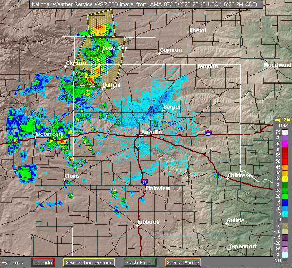 At 629 pm cdt, severe thunderstorms were located along a line extending from 10 miles south of campo to 11 miles east of felt to near ware, moving east at 20 mph (radar indicated). Hazards include 60 mph wind gusts. Minor damage to roofs, siding, and trees is possible. Locations impacted include, boise city, keyes, ware and felt. At 629 pm cdt, severe thunderstorms were located along a line extending from 10 miles south of campo to 11 miles east of felt to near ware, moving east at 20 mph (radar indicated). Hazards include 60 mph wind gusts. Minor damage to roofs, siding, and trees is possible. Locations impacted include, boise city, keyes, ware and felt.
|
| 7/13/2020 6:14 PM CDT |
 At 614 pm cdt, severe thunderstorms were located along a line extending from 9 miles south of campo to 7 miles southeast of felt to 3 miles northwest of ware, moving east at 20 mph (radar indicated). Hazards include 60 mph wind gusts. Minor damage to roofs, siding, and trees is possible. Locations impacted include, boise city, keyes, wheeless, ware and felt. At 614 pm cdt, severe thunderstorms were located along a line extending from 9 miles south of campo to 7 miles southeast of felt to 3 miles northwest of ware, moving east at 20 mph (radar indicated). Hazards include 60 mph wind gusts. Minor damage to roofs, siding, and trees is possible. Locations impacted include, boise city, keyes, wheeless, ware and felt.
|
| 7/13/2020 5:39 PM CDT |
 At 539 pm cdt, severe thunderstorms were located along a line extending from 9 miles northeast of kenton to 7 miles west of felt to 8 miles northeast of sedan, moving east at 20 mph (radar indicated). Hazards include 60 mph wind gusts. minor damage to roofs, siding, and trees is possible At 539 pm cdt, severe thunderstorms were located along a line extending from 9 miles northeast of kenton to 7 miles west of felt to 8 miles northeast of sedan, moving east at 20 mph (radar indicated). Hazards include 60 mph wind gusts. minor damage to roofs, siding, and trees is possible
|
| 6/19/2020 8:53 PM CDT |
 At 853 pm cdt, a severe thunderstorm was located 10 miles southeast of boise city, moving southeast at 35 mph (radar indicated). Hazards include 60 mph wind gusts and penny size hail. Minor damage to roofs, siding, and trees is possible. Locations impacted include, boise city and keyes. At 853 pm cdt, a severe thunderstorm was located 10 miles southeast of boise city, moving southeast at 35 mph (radar indicated). Hazards include 60 mph wind gusts and penny size hail. Minor damage to roofs, siding, and trees is possible. Locations impacted include, boise city and keyes.
|
| 6/19/2020 8:48 PM CDT |
 At 848 pm cdt, a severe thunderstorm was located 7 miles southeast of boise city, moving southeast at 35 mph (radar indicated). Hazards include 60 mph wind gusts and penny size hail. Minor damage to roofs, siding, and trees is possible. Locations impacted include, boise city and keyes. At 848 pm cdt, a severe thunderstorm was located 7 miles southeast of boise city, moving southeast at 35 mph (radar indicated). Hazards include 60 mph wind gusts and penny size hail. Minor damage to roofs, siding, and trees is possible. Locations impacted include, boise city and keyes.
|
| 6/19/2020 8:40 PM CDT |
 At 839 pm cdt, a severe thunderstorm was located over boise city, moving southeast at 35 mph (radar indicated). Hazards include 60 mph wind gusts and quarter size hail. Minor damage to roofs, siding, and trees is possible. hail damage to vehicles is expected. Locations impacted include, boise city and keyes. At 839 pm cdt, a severe thunderstorm was located over boise city, moving southeast at 35 mph (radar indicated). Hazards include 60 mph wind gusts and quarter size hail. Minor damage to roofs, siding, and trees is possible. hail damage to vehicles is expected. Locations impacted include, boise city and keyes.
|
| 6/19/2020 8:34 PM CDT |
 At 834 pm cdt, a severe thunderstorm was located over boise city, moving southeast at 35 mph (radar indicated). Hazards include 60 mph wind gusts and quarter size hail. Minor damage to roofs, siding, and trees is possible. hail damage to vehicles is expected. Locations impacted include, boise city, keyes, wheeless, black mesa park and felt. At 834 pm cdt, a severe thunderstorm was located over boise city, moving southeast at 35 mph (radar indicated). Hazards include 60 mph wind gusts and quarter size hail. Minor damage to roofs, siding, and trees is possible. hail damage to vehicles is expected. Locations impacted include, boise city, keyes, wheeless, black mesa park and felt.
|
| 6/19/2020 8:21 PM CDT |
 At 820 pm cdt, a severe thunderstorm was located 6 miles northwest of boise city, moving southeast at 35 mph (radar indicated). Hazards include 60 mph wind gusts and half dollar size hail. Minor damage to roofs, siding, and trees is possible. hail damage to vehicles is expected. Locations impacted include, boise city, keyes, wheeless, black mesa park and felt. At 820 pm cdt, a severe thunderstorm was located 6 miles northwest of boise city, moving southeast at 35 mph (radar indicated). Hazards include 60 mph wind gusts and half dollar size hail. Minor damage to roofs, siding, and trees is possible. hail damage to vehicles is expected. Locations impacted include, boise city, keyes, wheeless, black mesa park and felt.
|
| 6/19/2020 8:13 PM CDT |
 At 813 pm cdt, a severe thunderstorm was located 11 miles east of black mesa park, or 11 miles northwest of boise city, moving east at 35 mph (radar indicated). Hazards include 60 mph wind gusts and quarter size hail. Minor damage to roofs, siding, and trees is possible. hail damage to vehicles is expected. Locations impacted include, boise city, keyes, wheeless, black mesa park and felt. At 813 pm cdt, a severe thunderstorm was located 11 miles east of black mesa park, or 11 miles northwest of boise city, moving east at 35 mph (radar indicated). Hazards include 60 mph wind gusts and quarter size hail. Minor damage to roofs, siding, and trees is possible. hail damage to vehicles is expected. Locations impacted include, boise city, keyes, wheeless, black mesa park and felt.
|
| 6/19/2020 8:06 PM CDT |
 At 806 pm cdt, a severe thunderstorm was located over black mesa park, or 20 miles northwest of boise city, moving southeast at 25 mph (radar indicated). Hazards include 60 mph wind gusts and quarter size hail. Minor damage to roofs, siding, and trees is possible. hail damage to vehicles is expected. Locations impacted include, boise city, keyes, kenton, wheeless, black mesa park and felt. At 806 pm cdt, a severe thunderstorm was located over black mesa park, or 20 miles northwest of boise city, moving southeast at 25 mph (radar indicated). Hazards include 60 mph wind gusts and quarter size hail. Minor damage to roofs, siding, and trees is possible. hail damage to vehicles is expected. Locations impacted include, boise city, keyes, kenton, wheeless, black mesa park and felt.
|
| 6/19/2020 7:57 PM CDT |
 At 757 pm cdt, a severe thunderstorm was located near kenton, or 24 miles northwest of boise city, moving southeast at 20 mph (radar indicated). Hazards include 60 mph wind gusts and quarter size hail. Minor damage to roofs, siding, and trees is possible. hail damage to vehicles is expected. Locations impacted include, boise city, keyes, kenton, wheeless, black mesa park and felt. At 757 pm cdt, a severe thunderstorm was located near kenton, or 24 miles northwest of boise city, moving southeast at 20 mph (radar indicated). Hazards include 60 mph wind gusts and quarter size hail. Minor damage to roofs, siding, and trees is possible. hail damage to vehicles is expected. Locations impacted include, boise city, keyes, kenton, wheeless, black mesa park and felt.
|
| 6/19/2020 7:44 PM CDT |
 At 744 pm cdt, a severe thunderstorm was located over kenton, or 29 miles northwest of boise city, moving east at 20 mph (radar indicated). Hazards include ping pong ball size hail and 60 mph wind gusts. Minor damage to roofs, siding, and trees is possible. people and animals outdoors will be injured. expect hail damage to roofs, siding, windows, and vehicles. Locations impacted include, boise city, keyes, kenton, wheeless, black mesa park and felt. At 744 pm cdt, a severe thunderstorm was located over kenton, or 29 miles northwest of boise city, moving east at 20 mph (radar indicated). Hazards include ping pong ball size hail and 60 mph wind gusts. Minor damage to roofs, siding, and trees is possible. people and animals outdoors will be injured. expect hail damage to roofs, siding, windows, and vehicles. Locations impacted include, boise city, keyes, kenton, wheeless, black mesa park and felt.
|
| 6/19/2020 7:36 PM CDT |
 At 736 pm cdt, a severe thunderstorm was located 5 miles northwest of kenton, or 33 miles northwest of boise city, moving southeast at 20 mph (radar indicated). Hazards include ping pong ball size hail and 60 mph wind gusts. Minor damage to roofs, siding, and trees is possible. people and animals outdoors will be injured. Expect hail damage to roofs, siding, windows, and vehicles. At 736 pm cdt, a severe thunderstorm was located 5 miles northwest of kenton, or 33 miles northwest of boise city, moving southeast at 20 mph (radar indicated). Hazards include ping pong ball size hail and 60 mph wind gusts. Minor damage to roofs, siding, and trees is possible. people and animals outdoors will be injured. Expect hail damage to roofs, siding, windows, and vehicles.
|
| 8/21/2019 9:56 PM CDT |
 At 905 pm cdt, a severe thunderstorm was located 9 miles northeast of felt, or 10 miles west of boise city, moving west at 10 mph (radar indicated). Hazards include 60 mph wind gusts. minor damage to roofs, siding, and trees is possible At 905 pm cdt, a severe thunderstorm was located 9 miles northeast of felt, or 10 miles west of boise city, moving west at 10 mph (radar indicated). Hazards include 60 mph wind gusts. minor damage to roofs, siding, and trees is possible
|
| 8/21/2019 9:44 PM CDT |
 At 944 pm cdt, severe thunderstorms were located along a line extending from 9 miles east of felt to 10 miles south of campo, moving east at 20 mph (radar indicated). Hazards include 60 mph wind gusts and penny size hail. Minor damage to roofs, siding, and trees is possible. Locations impacted include, boise city, keyes, kenton, wheeless, black mesa park, felt and griggs. At 944 pm cdt, severe thunderstorms were located along a line extending from 9 miles east of felt to 10 miles south of campo, moving east at 20 mph (radar indicated). Hazards include 60 mph wind gusts and penny size hail. Minor damage to roofs, siding, and trees is possible. Locations impacted include, boise city, keyes, kenton, wheeless, black mesa park, felt and griggs.
|
| 8/21/2019 9:31 PM CDT |
 At 931 pm cdt, a severe thunderstorm was located 9 miles east of wheeless, or 12 miles west of boise city, moving east at 10 mph (radar indicated). Hazards include 60 mph wind gusts and quarter size hail. Minor damage to roofs, siding, and trees is possible. hail damage to vehicles is expected. Locations impacted include, boise city, keyes, kenton, wheeless, black mesa park, felt and griggs. At 931 pm cdt, a severe thunderstorm was located 9 miles east of wheeless, or 12 miles west of boise city, moving east at 10 mph (radar indicated). Hazards include 60 mph wind gusts and quarter size hail. Minor damage to roofs, siding, and trees is possible. hail damage to vehicles is expected. Locations impacted include, boise city, keyes, kenton, wheeless, black mesa park, felt and griggs.
|
| 8/21/2019 9:20 PM CDT |
 At 919 pm cdt, a severe thunderstorm was located 7 miles east of wheeless, or 14 miles west of boise city, moving northwest at 10 mph (radar indicated). Hazards include 60 mph wind gusts and quarter size hail. Minor damage to roofs, siding, and trees is possible. hail damage to vehicles is expected. Locations impacted include, boise city, keyes, kenton, wheeless, black mesa park, felt and griggs. At 919 pm cdt, a severe thunderstorm was located 7 miles east of wheeless, or 14 miles west of boise city, moving northwest at 10 mph (radar indicated). Hazards include 60 mph wind gusts and quarter size hail. Minor damage to roofs, siding, and trees is possible. hail damage to vehicles is expected. Locations impacted include, boise city, keyes, kenton, wheeless, black mesa park, felt and griggs.
|
| 8/21/2019 9:06 PM CDT |
 The national weather service in amarillo has issued a * severe thunderstorm warning for. cimarron county in the panhandle of oklahoma. until 1030 pm cdt. At 905 pm cdt, a severe thunderstorm was located 9 miles northeast of felt, or 10 miles west of boise city, moving west at 10 mph. The national weather service in amarillo has issued a * severe thunderstorm warning for. cimarron county in the panhandle of oklahoma. until 1030 pm cdt. At 905 pm cdt, a severe thunderstorm was located 9 miles northeast of felt, or 10 miles west of boise city, moving west at 10 mph.
|
| 8/21/2019 7:12 PM CDT |
 At 705 pm cdt, a severe thunderstorm was located 4 miles southwest of eva, or 17 miles south of elkhart, moving southwest at 5 mph (radar indicated). Hazards include 60 mph wind gusts and quarter size hail. Minor damage to roofs, siding, and trees is possible. hail damage to vehicles is expected. Locations impacted include, guymon, goodwell, texhoma, optima, keyes, hardesty, eva, hough, griggs and sturgis. At 705 pm cdt, a severe thunderstorm was located 4 miles southwest of eva, or 17 miles south of elkhart, moving southwest at 5 mph (radar indicated). Hazards include 60 mph wind gusts and quarter size hail. Minor damage to roofs, siding, and trees is possible. hail damage to vehicles is expected. Locations impacted include, guymon, goodwell, texhoma, optima, keyes, hardesty, eva, hough, griggs and sturgis.
|
| 8/21/2019 7:05 PM CDT |
 At 705 pm cdt, a severe thunderstorm was located 4 miles southwest of eva, or 17 miles south of elkhart, moving southwest at 5 mph (radar indicated). Hazards include 60 mph wind gusts and quarter size hail. Minor damage to roofs, siding, and trees is possible. hail damage to vehicles is expected. Locations impacted include, guymon, goodwell, texhoma, optima, keyes, hardesty, eva, hough, griggs and sturgis. At 705 pm cdt, a severe thunderstorm was located 4 miles southwest of eva, or 17 miles south of elkhart, moving southwest at 5 mph (radar indicated). Hazards include 60 mph wind gusts and quarter size hail. Minor damage to roofs, siding, and trees is possible. hail damage to vehicles is expected. Locations impacted include, guymon, goodwell, texhoma, optima, keyes, hardesty, eva, hough, griggs and sturgis.
|
| 8/21/2019 6:58 PM CDT |
 At 649 pm cdt, a severe thunderstorm was located over eva, or 16 miles south of elkhart, and is nearly stationary (radar indicated). Hazards include 60 mph wind gusts and quarter size hail. Minor damage to roofs, siding, and trees is possible. hail damage to vehicles is expected. Locations impacted include, guymon, hooker, goodwell, texhoma, tyrone, optima, keyes, hardesty, hough, adams, griggs, eva and sturgis. At 649 pm cdt, a severe thunderstorm was located over eva, or 16 miles south of elkhart, and is nearly stationary (radar indicated). Hazards include 60 mph wind gusts and quarter size hail. Minor damage to roofs, siding, and trees is possible. hail damage to vehicles is expected. Locations impacted include, guymon, hooker, goodwell, texhoma, tyrone, optima, keyes, hardesty, hough, adams, griggs, eva and sturgis.
|
| 8/21/2019 6:49 PM CDT |
 A severe thunderstorm warning remains in effect until 800 pm cdt for texas and eastern cimarron counties. at 649 pm cdt, a severe thunderstorm was located over eva, or 16 miles south of elkhart, and is nearly stationary. hazard. 60 mph wind gusts and quarter size hail. source. Radar indicated. A severe thunderstorm warning remains in effect until 800 pm cdt for texas and eastern cimarron counties. at 649 pm cdt, a severe thunderstorm was located over eva, or 16 miles south of elkhart, and is nearly stationary. hazard. 60 mph wind gusts and quarter size hail. source. Radar indicated.
|
| 8/21/2019 6:37 PM CDT |
 The national weather service in amarillo has issued a * severe thunderstorm warning for. texas county in the panhandle of oklahoma. eastern cimarron county in the panhandle of oklahoma. until 800 pm cdt. At 637 pm cdt, a severe thunderstorm was located 6 miles east of. The national weather service in amarillo has issued a * severe thunderstorm warning for. texas county in the panhandle of oklahoma. eastern cimarron county in the panhandle of oklahoma. until 800 pm cdt. At 637 pm cdt, a severe thunderstorm was located 6 miles east of.
|
| 6/23/2019 1:50 AM CDT |
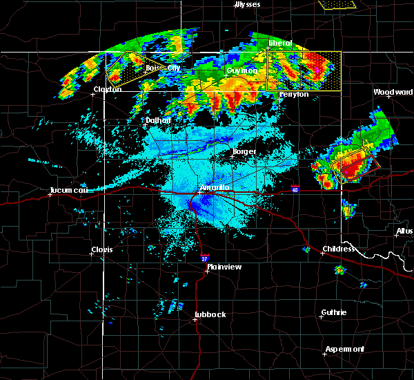 The severe thunderstorm warning for western cimarron county will expire at 200 am cdt, the storm which prompted the warning has weakened below severe limits, and no longer poses an immediate threat to life or property. therefore, the warning will be allowed to expire. however small hail is still possible with this thunderstorm. a severe thunderstorm watch remains in effect until 500 am cdt for the panhandle of oklahoma. The severe thunderstorm warning for western cimarron county will expire at 200 am cdt, the storm which prompted the warning has weakened below severe limits, and no longer poses an immediate threat to life or property. therefore, the warning will be allowed to expire. however small hail is still possible with this thunderstorm. a severe thunderstorm watch remains in effect until 500 am cdt for the panhandle of oklahoma.
|
| 6/23/2019 1:44 AM CDT |
 At 144 am cdt, a severe thunderstorm was located 9 miles northwest of boise city, moving northeast at 50 mph (radar indicated). Hazards include 60 mph wind gusts and quarter size hail. Minor damage to roofs, siding, and trees is possible. hail damage to vehicles is expected. Locations impacted include, boise city, black mesa park and wheeless. At 144 am cdt, a severe thunderstorm was located 9 miles northwest of boise city, moving northeast at 50 mph (radar indicated). Hazards include 60 mph wind gusts and quarter size hail. Minor damage to roofs, siding, and trees is possible. hail damage to vehicles is expected. Locations impacted include, boise city, black mesa park and wheeless.
|
| 6/23/2019 1:24 AM CDT |
 At 124 am cdt, a severe thunderstorm was located 6 miles east of wheeless, or 15 miles west of boise city, moving northeast at 20 mph (radar indicated). Hazards include golf ball size hail and 60 mph wind gusts. Minor damage to roofs, siding, and trees is possible. people and animals outdoors will be injured. expect hail damage to roofs, siding, windows, and vehicles. Locations impacted include, boise city, black mesa park and wheeless. At 124 am cdt, a severe thunderstorm was located 6 miles east of wheeless, or 15 miles west of boise city, moving northeast at 20 mph (radar indicated). Hazards include golf ball size hail and 60 mph wind gusts. Minor damage to roofs, siding, and trees is possible. people and animals outdoors will be injured. expect hail damage to roofs, siding, windows, and vehicles. Locations impacted include, boise city, black mesa park and wheeless.
|
| 6/23/2019 1:12 AM CDT |
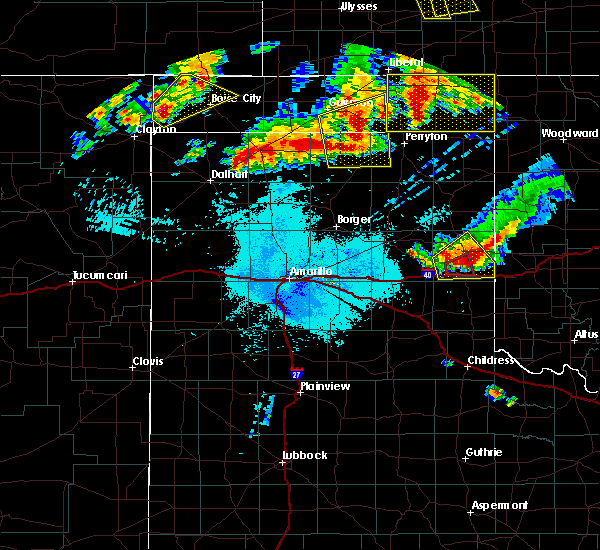 At 111 am cdt, a severe thunderstorm was located near wheeless, or 18 miles west of boise city, moving northeast at 55 mph (radar indicated). Hazards include golf ball size hail and 60 mph wind gusts. Minor damage to roofs, siding, and trees is possible. people and animals outdoors will be injured. Expect hail damage to roofs, siding, windows, and vehicles. At 111 am cdt, a severe thunderstorm was located near wheeless, or 18 miles west of boise city, moving northeast at 55 mph (radar indicated). Hazards include golf ball size hail and 60 mph wind gusts. Minor damage to roofs, siding, and trees is possible. people and animals outdoors will be injured. Expect hail damage to roofs, siding, windows, and vehicles.
|
| 6/15/2019 8:57 PM CDT |
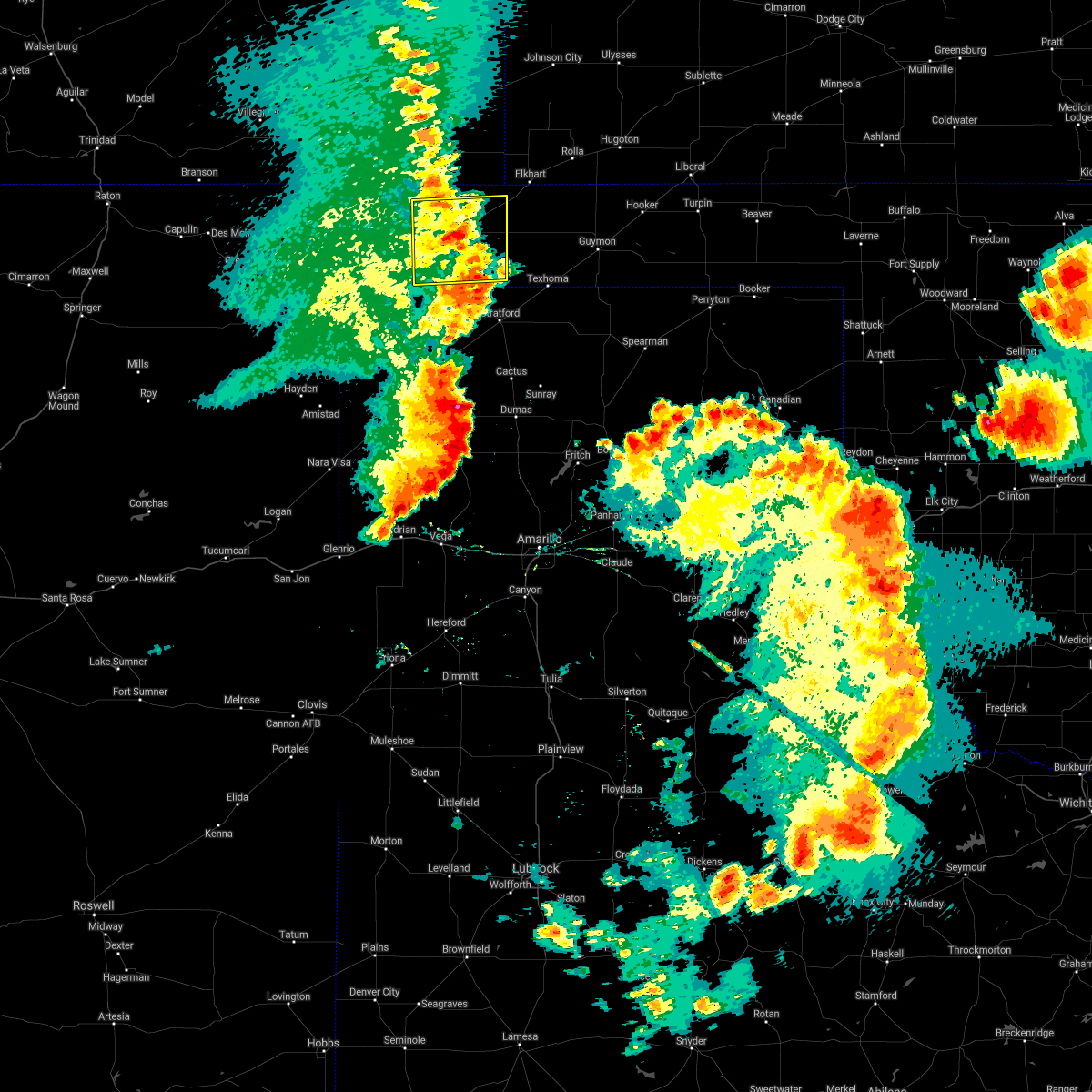 The severe thunderstorm warning for eastern cimarron county will expire at 900 pm cdt, the storm which prompted the warning has weakened below severe limits, and no longer poses an immediate threat to life or property. therefore, the warning will be allowed to expire. however gusty winds are still possible with this thunderstorm. The severe thunderstorm warning for eastern cimarron county will expire at 900 pm cdt, the storm which prompted the warning has weakened below severe limits, and no longer poses an immediate threat to life or property. therefore, the warning will be allowed to expire. however gusty winds are still possible with this thunderstorm.
|
| 6/15/2019 8:46 PM CDT |
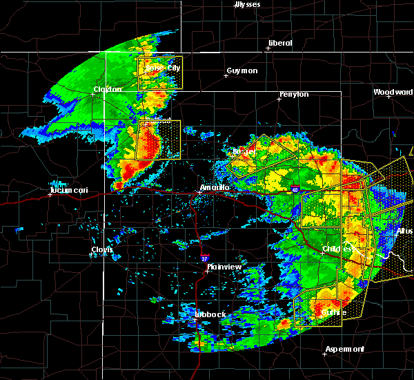 At 846 pm cdt, a severe thunderstorm was located 6 miles east of boise city, moving east at 10 mph (radar indicated). Hazards include 60 mph wind gusts and nickel size hail. Minor damage to roofs, siding, and trees is possible. Locations impacted include, boise city, keyes, griggs and sturgis. At 846 pm cdt, a severe thunderstorm was located 6 miles east of boise city, moving east at 10 mph (radar indicated). Hazards include 60 mph wind gusts and nickel size hail. Minor damage to roofs, siding, and trees is possible. Locations impacted include, boise city, keyes, griggs and sturgis.
|
| 6/15/2019 8:19 PM CDT |
 At 818 pm cdt, a severe thunderstorm was located over boise city, moving east at 10 mph (radar indicated). Hazards include 60 mph wind gusts and quarter size hail. Minor damage to roofs, siding, and trees is possible. Hail damage to vehicles is expected. At 818 pm cdt, a severe thunderstorm was located over boise city, moving east at 10 mph (radar indicated). Hazards include 60 mph wind gusts and quarter size hail. Minor damage to roofs, siding, and trees is possible. Hail damage to vehicles is expected.
|
| 5/26/2019 8:31 PM CDT |
 At 831 pm cdt, severe thunderstorms were located along a line extending from near keyes to 4 miles north of conlen to 9 miles northeast of channing, moving northeast at 60 mph (radar indicated). Hazards include 70 mph wind gusts and ping pong ball size hail. Expect some tree damage. damage is likely to mobile homes, roofs, and outbuildings. people and animals outdoors will be injured. expect hail damage to roofs, siding, windows, and vehicles. locations impacted include, dumas, stratford, hartley, cactus, fritch, sunray, channing, keyes, griggs, eva, four way, conlen, masterson, lake meredith, texhoma and sturgis. a tornado watch remains in effect until 1000 pm cdt for the panhandle of oklahoma, and the panhandle of texas. A tornado watch also remains in effect until 200 am cdt for the panhandle of texas. At 831 pm cdt, severe thunderstorms were located along a line extending from near keyes to 4 miles north of conlen to 9 miles northeast of channing, moving northeast at 60 mph (radar indicated). Hazards include 70 mph wind gusts and ping pong ball size hail. Expect some tree damage. damage is likely to mobile homes, roofs, and outbuildings. people and animals outdoors will be injured. expect hail damage to roofs, siding, windows, and vehicles. locations impacted include, dumas, stratford, hartley, cactus, fritch, sunray, channing, keyes, griggs, eva, four way, conlen, masterson, lake meredith, texhoma and sturgis. a tornado watch remains in effect until 1000 pm cdt for the panhandle of oklahoma, and the panhandle of texas. A tornado watch also remains in effect until 200 am cdt for the panhandle of texas.
|
| 5/26/2019 7:52 PM CDT |
 At 752 pm cdt, severe thunderstorms were located along a line extending from 9 miles north of felt to near ware to 9 miles east of romero, moving east at 55 mph (radar indicated). Hazards include 70 mph wind gusts and ping pong ball size hail. Expect some tree damage. damage is likely to mobile homes, roofs, and outbuildings. people and animals outdoors will be injured. Expect hail damage to roofs, siding, windows, and vehicles. At 752 pm cdt, severe thunderstorms were located along a line extending from 9 miles north of felt to near ware to 9 miles east of romero, moving east at 55 mph (radar indicated). Hazards include 70 mph wind gusts and ping pong ball size hail. Expect some tree damage. damage is likely to mobile homes, roofs, and outbuildings. people and animals outdoors will be injured. Expect hail damage to roofs, siding, windows, and vehicles.
|
| 5/26/2019 7:24 PM CDT |
 At 724 pm cdt, a severe thunderstorm was located 6 miles south of wheeless, or 17 miles northeast of clayton, moving northeast at 35 mph (radar indicated). Hazards include ping pong ball size hail and 60 mph wind gusts. Minor damage to roofs, siding, and trees is possible. people and animals outdoors will be injured. expect hail damage to roofs, siding, windows, and vehicles. locations impacted include, boise city, keyes, kenton, wheeless, black mesa park and sturgis. A tornado watch remains in effect until 1000 pm cdt for the panhandle of oklahoma, and the panhandle of texas. At 724 pm cdt, a severe thunderstorm was located 6 miles south of wheeless, or 17 miles northeast of clayton, moving northeast at 35 mph (radar indicated). Hazards include ping pong ball size hail and 60 mph wind gusts. Minor damage to roofs, siding, and trees is possible. people and animals outdoors will be injured. expect hail damage to roofs, siding, windows, and vehicles. locations impacted include, boise city, keyes, kenton, wheeless, black mesa park and sturgis. A tornado watch remains in effect until 1000 pm cdt for the panhandle of oklahoma, and the panhandle of texas.
|
| 5/26/2019 7:05 PM CDT |
 At 705 pm cdt, a severe thunderstorm was located over seneca, or 13 miles north of clayton, moving northeast at 55 mph (radar indicated). Hazards include ping pong ball size hail and 60 mph wind gusts. Minor damage to roofs, siding, and trees is possible. people and animals outdoors will be injured. Expect hail damage to roofs, siding, windows, and vehicles. At 705 pm cdt, a severe thunderstorm was located over seneca, or 13 miles north of clayton, moving northeast at 55 mph (radar indicated). Hazards include ping pong ball size hail and 60 mph wind gusts. Minor damage to roofs, siding, and trees is possible. people and animals outdoors will be injured. Expect hail damage to roofs, siding, windows, and vehicles.
|
| 5/25/2019 4:05 PM CDT |
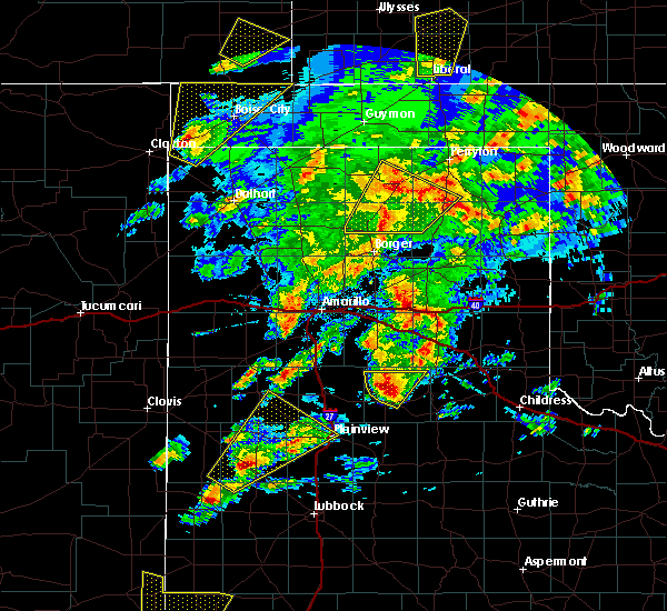 At 404 pm cdt, a severe thunderstorm was located 4 miles south of felt, or 21 miles east of clayton, moving northeast at 50 mph (radar indicated). Hazards include 60 mph wind gusts and quarter size hail. Minor damage to roofs, siding, and trees is possible. hail damage to vehicles is expected. Locations impacted include, boise city, keyes, wheeless, black mesa park and felt. At 404 pm cdt, a severe thunderstorm was located 4 miles south of felt, or 21 miles east of clayton, moving northeast at 50 mph (radar indicated). Hazards include 60 mph wind gusts and quarter size hail. Minor damage to roofs, siding, and trees is possible. hail damage to vehicles is expected. Locations impacted include, boise city, keyes, wheeless, black mesa park and felt.
|
| 5/25/2019 3:49 PM CDT |
 At 349 pm cdt, a severe thunderstorm was located 6 miles southeast of texline, or 16 miles southeast of clayton, moving northeast at 50 mph (radar indicated). Hazards include 60 mph wind gusts and quarter size hail. Minor damage to roofs, siding, and trees is possible. Hail damage to vehicles is expected. At 349 pm cdt, a severe thunderstorm was located 6 miles southeast of texline, or 16 miles southeast of clayton, moving northeast at 50 mph (radar indicated). Hazards include 60 mph wind gusts and quarter size hail. Minor damage to roofs, siding, and trees is possible. Hail damage to vehicles is expected.
|
| 5/25/2019 3:49 PM CDT |
 The national weather service in amarillo has issued a * severe thunderstorm warning for. cimarron county in the panhandle of oklahoma. northwestern dallam county in the panhandle of texas. until 500 pm cdt. At 349 pm cdt, a severe thunderstorm was located 6 miles southeast. The national weather service in amarillo has issued a * severe thunderstorm warning for. cimarron county in the panhandle of oklahoma. northwestern dallam county in the panhandle of texas. until 500 pm cdt. At 349 pm cdt, a severe thunderstorm was located 6 miles southeast.
|
| 5/6/2019 8:52 PM CDT |
 At 852 pm cdt, a severe thunderstorm was located 5 miles southwest of elkhart, moving east at 15 mph (radar indicated). Hazards include 60 mph wind gusts and half dollar size hail. Minor damage to roofs, siding, and trees is possible. Hail damage to vehicles is expected. At 852 pm cdt, a severe thunderstorm was located 5 miles southwest of elkhart, moving east at 15 mph (radar indicated). Hazards include 60 mph wind gusts and half dollar size hail. Minor damage to roofs, siding, and trees is possible. Hail damage to vehicles is expected.
|
| 5/4/2019 6:25 PM CDT | Golf Ball sized hail reported 9.3 miles WSW of Keyes, OK |
| 5/4/2019 6:18 PM CDT |
 At 618 pm cdt, a severe thunderstorm was located 10 miles northeast of keyes, or 13 miles southwest of elkhart, moving southeast at 20 mph (radar indicated). Hazards include tennis ball size hail and 70 mph wind gusts. Expect some tree damage. damage is likely to mobile homes, roofs, and outbuildings. people and animals outdoors will be injured. expect hail damage to roofs, siding, windows, and vehicles. Locations impacted include, keyes, eva and sturgis. At 618 pm cdt, a severe thunderstorm was located 10 miles northeast of keyes, or 13 miles southwest of elkhart, moving southeast at 20 mph (radar indicated). Hazards include tennis ball size hail and 70 mph wind gusts. Expect some tree damage. damage is likely to mobile homes, roofs, and outbuildings. people and animals outdoors will be injured. expect hail damage to roofs, siding, windows, and vehicles. Locations impacted include, keyes, eva and sturgis.
|
| 5/4/2019 6:10 PM CDT |
 At 610 pm cdt, a severe thunderstorm was located 9 miles northeast of keyes, or 14 miles southwest of elkhart, moving east at 15 mph (radar indicated). Hazards include tennis ball size hail and 70 mph wind gusts. Expect some tree damage. damage is likely to mobile homes, roofs, and outbuildings. people and animals outdoors will be injured. expect hail damage to roofs, siding, windows, and vehicles. Locations impacted include, keyes, eva and sturgis. At 610 pm cdt, a severe thunderstorm was located 9 miles northeast of keyes, or 14 miles southwest of elkhart, moving east at 15 mph (radar indicated). Hazards include tennis ball size hail and 70 mph wind gusts. Expect some tree damage. damage is likely to mobile homes, roofs, and outbuildings. people and animals outdoors will be injured. expect hail damage to roofs, siding, windows, and vehicles. Locations impacted include, keyes, eva and sturgis.
|
| 5/4/2019 6:02 PM CDT |
 At 601 pm cdt, a severe thunderstorm was located 9 miles northeast of keyes, or 16 miles west of elkhart, moving east at 15 mph (radar indicated). Hazards include tennis ball size hail and 70 mph wind gusts. Expect some tree damage. damage is likely to mobile homes, roofs, and outbuildings. people and animals outdoors will be injured. expect hail damage to roofs, siding, windows, and vehicles. Locations impacted include, keyes, eva and sturgis. At 601 pm cdt, a severe thunderstorm was located 9 miles northeast of keyes, or 16 miles west of elkhart, moving east at 15 mph (radar indicated). Hazards include tennis ball size hail and 70 mph wind gusts. Expect some tree damage. damage is likely to mobile homes, roofs, and outbuildings. people and animals outdoors will be injured. expect hail damage to roofs, siding, windows, and vehicles. Locations impacted include, keyes, eva and sturgis.
|
| 5/4/2019 5:53 PM CDT |
 At 553 pm cdt, a severe thunderstorm was located 9 miles north of keyes, or 17 miles west of elkhart, moving east at 15 mph (radar indicated). Hazards include tennis ball size hail and 70 mph wind gusts. Expect some tree damage. damage is likely to mobile homes, roofs, and outbuildings. people and animals outdoors will be injured. expect hail damage to roofs, siding, windows, and vehicles. Locations impacted include, keyes, eva and sturgis. At 553 pm cdt, a severe thunderstorm was located 9 miles north of keyes, or 17 miles west of elkhart, moving east at 15 mph (radar indicated). Hazards include tennis ball size hail and 70 mph wind gusts. Expect some tree damage. damage is likely to mobile homes, roofs, and outbuildings. people and animals outdoors will be injured. expect hail damage to roofs, siding, windows, and vehicles. Locations impacted include, keyes, eva and sturgis.
|
| 5/4/2019 5:47 PM CDT |
 At 547 pm cdt, a severe thunderstorm was located 9 miles north of keyes, or 18 miles west of elkhart, moving southeast at 15 mph (radar indicated). Hazards include two inch hail and 70 mph wind gusts. Expect some tree damage. damage is likely to mobile homes, roofs, and outbuildings. people and animals outdoors will be injured. expect hail damage to roofs, siding, windows, and vehicles. Locations impacted include, keyes, eva and sturgis. At 547 pm cdt, a severe thunderstorm was located 9 miles north of keyes, or 18 miles west of elkhart, moving southeast at 15 mph (radar indicated). Hazards include two inch hail and 70 mph wind gusts. Expect some tree damage. damage is likely to mobile homes, roofs, and outbuildings. people and animals outdoors will be injured. expect hail damage to roofs, siding, windows, and vehicles. Locations impacted include, keyes, eva and sturgis.
|
| 5/4/2019 5:37 PM CDT |
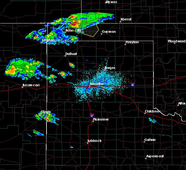 At 536 pm cdt, a severe thunderstorm was located 11 miles north of keyes, or 20 miles west of elkhart, moving east at 15 mph (radar indicated). Hazards include 70 mph wind gusts and ping pong ball size hail. Expect some tree damage. damage is likely to mobile homes, roofs, and outbuildings. people and animals outdoors will be injured. Expect hail damage to roofs, siding, windows, and vehicles. At 536 pm cdt, a severe thunderstorm was located 11 miles north of keyes, or 20 miles west of elkhart, moving east at 15 mph (radar indicated). Hazards include 70 mph wind gusts and ping pong ball size hail. Expect some tree damage. damage is likely to mobile homes, roofs, and outbuildings. people and animals outdoors will be injured. Expect hail damage to roofs, siding, windows, and vehicles.
|
| 8/21/2018 9:08 PM CDT |
 At 908 pm cdt, severe thunderstorms were located along a line extending from 6 miles northwest of guymon to near griggs to 6 miles northeast of texline, moving east at 35 mph (radar indicated). Hazards include 70 mph wind gusts and half dollar size hail. Expect some tree damage. damage is likely to mobile homes, roofs, and outbuildings. hail damage to vehicles is expected. Locations impacted include, guymon, stratford, boise city, goodwell, texline, optima, keyes, hardesty, wheeless, hough, felt, griggs, eva, texhoma and sturgis. At 908 pm cdt, severe thunderstorms were located along a line extending from 6 miles northwest of guymon to near griggs to 6 miles northeast of texline, moving east at 35 mph (radar indicated). Hazards include 70 mph wind gusts and half dollar size hail. Expect some tree damage. damage is likely to mobile homes, roofs, and outbuildings. hail damage to vehicles is expected. Locations impacted include, guymon, stratford, boise city, goodwell, texline, optima, keyes, hardesty, wheeless, hough, felt, griggs, eva, texhoma and sturgis.
|
| 8/21/2018 8:46 PM CDT | Half Dollar sized hail reported 3.6 miles NNE of Keyes, OK |
| 8/21/2018 8:46 PM CDT | Storm damage reported in cimarron county OK, 3.6 miles NNE of Keyes, OK |
| 8/21/2018 8:42 PM CDT |
 At 842 pm cdt, severe thunderstorms were located along a line extending from 4 miles east of eva to 11 miles southeast of boise city to 3 miles north of clayton, moving east at 35 mph (radar indicated). Hazards include 60 mph wind gusts and half dollar size hail. Minor damage to roofs, siding, and trees is possible. Hail damage to vehicles is expected. At 842 pm cdt, severe thunderstorms were located along a line extending from 4 miles east of eva to 11 miles southeast of boise city to 3 miles north of clayton, moving east at 35 mph (radar indicated). Hazards include 60 mph wind gusts and half dollar size hail. Minor damage to roofs, siding, and trees is possible. Hail damage to vehicles is expected.
|
| 8/8/2018 5:38 PM CDT |
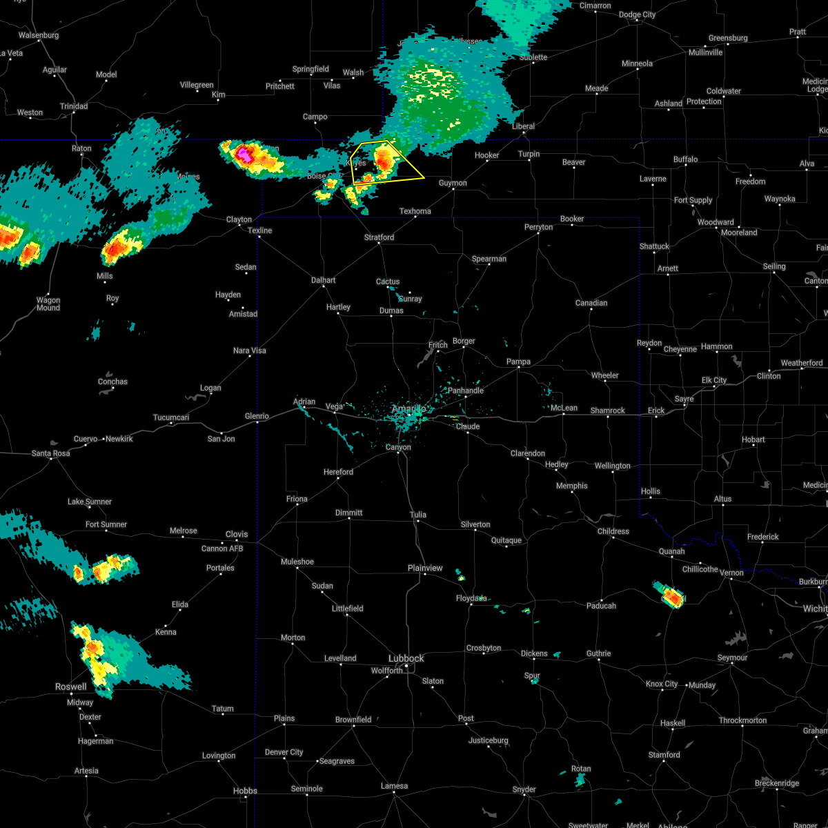 The severe thunderstorm warning for west central texas and northeastern cimarron counties will expire at 545 pm cdt, the storm which prompted the warning has weakened below severe limits, and no longer poses an immediate threat to life or property. therefore, the warning will be allowed to expire. The severe thunderstorm warning for west central texas and northeastern cimarron counties will expire at 545 pm cdt, the storm which prompted the warning has weakened below severe limits, and no longer poses an immediate threat to life or property. therefore, the warning will be allowed to expire.
|
| 8/8/2018 5:32 PM CDT |
 At 531 pm cdt, a severe thunderstorm was located 9 miles northwest of eva, or 13 miles southwest of elkhart, moving southeast at 25 mph (radar indicated). Hazards include 60 mph wind gusts and quarter size hail. Minor damage to roofs, siding, and trees is possible. hail damage to vehicles is expected. Locations impacted include, keyes, eva and sturgis. At 531 pm cdt, a severe thunderstorm was located 9 miles northwest of eva, or 13 miles southwest of elkhart, moving southeast at 25 mph (radar indicated). Hazards include 60 mph wind gusts and quarter size hail. Minor damage to roofs, siding, and trees is possible. hail damage to vehicles is expected. Locations impacted include, keyes, eva and sturgis.
|
| 8/8/2018 5:05 PM CDT |
 At 505 pm cdt, a severe thunderstorm was located 12 miles north of keyes, or 15 miles west of elkhart, moving southeast at 30 mph (radar indicated). Hazards include 60 mph wind gusts and half dollar size hail. Minor damage to roofs, siding, and trees is possible. Hail damage to vehicles is expected. At 505 pm cdt, a severe thunderstorm was located 12 miles north of keyes, or 15 miles west of elkhart, moving southeast at 30 mph (radar indicated). Hazards include 60 mph wind gusts and half dollar size hail. Minor damage to roofs, siding, and trees is possible. Hail damage to vehicles is expected.
|
| 7/30/2018 12:06 AM CDT |
 The severe thunderstorm warning for eastern cimarron county will expire at 1215 am cdt, the storm which prompted the warning has weakened below severe limits, and no longer poses an immediate threat to life or property. therefore, the warning will be allowed to expire. however small hail is still possible with this thunderstorm. a severe thunderstorm watch remains in effect until 500 am cdt for the panhandle of oklahoma. The severe thunderstorm warning for eastern cimarron county will expire at 1215 am cdt, the storm which prompted the warning has weakened below severe limits, and no longer poses an immediate threat to life or property. therefore, the warning will be allowed to expire. however small hail is still possible with this thunderstorm. a severe thunderstorm watch remains in effect until 500 am cdt for the panhandle of oklahoma.
|
| 7/29/2018 11:56 PM CDT |
 At 1156 pm cdt, a severe thunderstorm was located over keyes, or 17 miles northeast of boise city, moving southeast at 30 mph (radar indicated). Hazards include 60 mph wind gusts and half dollar size hail. Minor damage to roofs, siding, and trees is possible. hail damage to vehicles is expected. Locations impacted include, keyes, griggs and sturgis. At 1156 pm cdt, a severe thunderstorm was located over keyes, or 17 miles northeast of boise city, moving southeast at 30 mph (radar indicated). Hazards include 60 mph wind gusts and half dollar size hail. Minor damage to roofs, siding, and trees is possible. hail damage to vehicles is expected. Locations impacted include, keyes, griggs and sturgis.
|
| 7/29/2018 11:27 PM CDT |
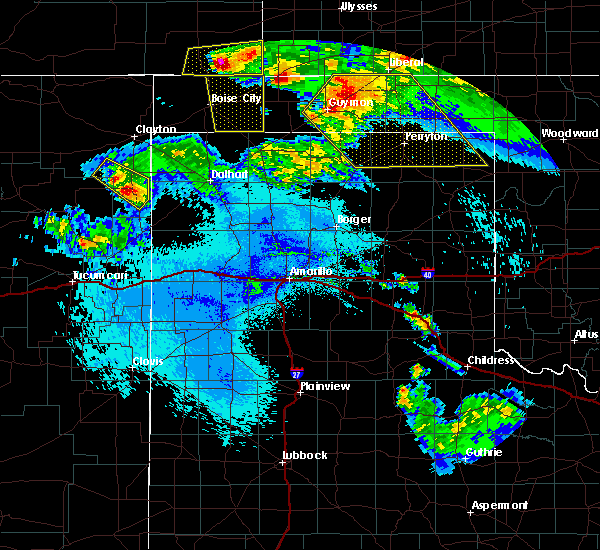 At 1127 pm cdt, a severe thunderstorm was located 12 miles east of campo, or 22 miles north of boise city, moving southeast at 30 mph (radar indicated). Hazards include 60 mph wind gusts and half dollar size hail. Minor damage to roofs, siding, and trees is possible. Hail damage to vehicles is expected. At 1127 pm cdt, a severe thunderstorm was located 12 miles east of campo, or 22 miles north of boise city, moving southeast at 30 mph (radar indicated). Hazards include 60 mph wind gusts and half dollar size hail. Minor damage to roofs, siding, and trees is possible. Hail damage to vehicles is expected.
|
| 7/22/2018 11:07 PM CDT |
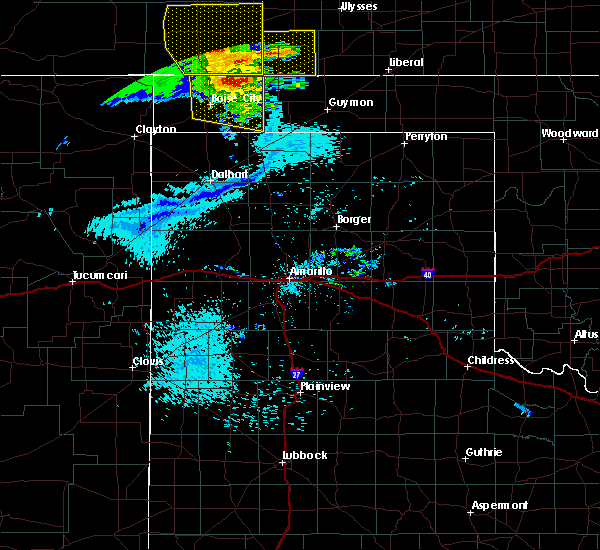 At 1107 pm cdt, a severe thunderstorm was located 5 miles north of keyes, or 18 miles northeast of boise city, moving southeast at 25 mph (radar indicated). Hazards include 60 mph wind gusts and penny size hail. Minor damage to roofs, siding, and trees is possible. Locations impacted include, boise city, keyes, griggs and sturgis. At 1107 pm cdt, a severe thunderstorm was located 5 miles north of keyes, or 18 miles northeast of boise city, moving southeast at 25 mph (radar indicated). Hazards include 60 mph wind gusts and penny size hail. Minor damage to roofs, siding, and trees is possible. Locations impacted include, boise city, keyes, griggs and sturgis.
|
| 7/22/2018 10:39 PM CDT | Storm damage reported in cimarron county OK, 0.7 miles NE of Keyes, OK |
| 7/22/2018 10:11 PM CDT |
 At 1010 pm cdt, automated weather equipment reported a severe thunderstorm located 11 miles south of campo, or 17 miles northwest of boise city, moving east at 30 mph (automated weather equipment). Hazards include 60 mph wind gusts and penny size hail. Minor damage to roofs, siding, and trees is possible. Locations impacted include, boise city, keyes, kenton, wheeless, black mesa park, griggs and sturgis. At 1010 pm cdt, automated weather equipment reported a severe thunderstorm located 11 miles south of campo, or 17 miles northwest of boise city, moving east at 30 mph (automated weather equipment). Hazards include 60 mph wind gusts and penny size hail. Minor damage to roofs, siding, and trees is possible. Locations impacted include, boise city, keyes, kenton, wheeless, black mesa park, griggs and sturgis.
|
| 7/22/2018 9:57 PM CDT |
 At 956 pm cdt, a severe thunderstorm was located 10 miles northeast of black mesa park, or 22 miles northwest of boise city, moving east at 30 mph (radar indicated). Hazards include 60 mph wind gusts and penny size hail. minor damage to roofs, siding, and trees is possible At 956 pm cdt, a severe thunderstorm was located 10 miles northeast of black mesa park, or 22 miles northwest of boise city, moving east at 30 mph (radar indicated). Hazards include 60 mph wind gusts and penny size hail. minor damage to roofs, siding, and trees is possible
|
| 6/22/2018 5:44 PM CDT |
 At 544 pm cdt, a severe thunderstorm was located 5 miles east of keyes, or 19 miles southwest of elkhart, moving east at 30 mph (radar indicated). Hazards include golf ball size hail and 70 mph wind gusts. Expect some tree damage. damage is likely to mobile homes, roofs, and outbuildings. people and animals outdoors will be injured. expect hail damage to roofs, siding, windows, and vehicles. Locations impacted include, keyes and sturgis. At 544 pm cdt, a severe thunderstorm was located 5 miles east of keyes, or 19 miles southwest of elkhart, moving east at 30 mph (radar indicated). Hazards include golf ball size hail and 70 mph wind gusts. Expect some tree damage. damage is likely to mobile homes, roofs, and outbuildings. people and animals outdoors will be injured. expect hail damage to roofs, siding, windows, and vehicles. Locations impacted include, keyes and sturgis.
|
| 6/22/2018 5:34 PM CDT | Quarter sized hail reported 6.3 miles SW of Keyes, OK |
| 6/22/2018 5:15 PM CDT |
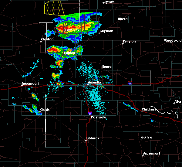 The national weather service in amarillo has issued a * severe thunderstorm warning for. northwestern texas county in the panhandle of oklahoma. northeastern cimarron county in the panhandle of oklahoma. Until 615 pm cdt * at 515 pm cdt, a severe thunderstorm was located 7 miles west of. The national weather service in amarillo has issued a * severe thunderstorm warning for. northwestern texas county in the panhandle of oklahoma. northeastern cimarron county in the panhandle of oklahoma. Until 615 pm cdt * at 515 pm cdt, a severe thunderstorm was located 7 miles west of.
|
| 6/12/2018 8:48 PM CDT |
 At 847 pm cdt, severe thunderstorms were located along a line extending from 5 miles southwest of felt to 9 miles south of ware to 6 miles north of romero, moving northeast at 30 mph (radar indicated). Hazards include 60 mph wind gusts and quarter size hail. Minor damage to roofs, siding, and trees is possible. Hail damage to vehicles is expected. At 847 pm cdt, severe thunderstorms were located along a line extending from 5 miles southwest of felt to 9 miles south of ware to 6 miles north of romero, moving northeast at 30 mph (radar indicated). Hazards include 60 mph wind gusts and quarter size hail. Minor damage to roofs, siding, and trees is possible. Hail damage to vehicles is expected.
|
| 5/30/2018 10:32 PM CDT |
 At 1031 pm cdt, a severe thunderstorm was located 6 miles south of keyes, or 13 miles east of boise city, moving east at 30 mph (radar indicated). Hazards include quarter size hail. Damage to vehicles is expected. Locations impacted include, keyes. At 1031 pm cdt, a severe thunderstorm was located 6 miles south of keyes, or 13 miles east of boise city, moving east at 30 mph (radar indicated). Hazards include quarter size hail. Damage to vehicles is expected. Locations impacted include, keyes.
|
| 5/30/2018 10:12 PM CDT |
 At 1011 pm cdt, a severe thunderstorm was located 5 miles southeast of boise city, moving east at 25 mph (trained weather spotters reported ping pong ball size hail 4 miles sse of boise city). Hazards include ping pong ball size hail. People and animals outdoors will be injured. expect damage to roofs, siding, windows, and vehicles. Locations impacted include, boise city, keyes and griggs. At 1011 pm cdt, a severe thunderstorm was located 5 miles southeast of boise city, moving east at 25 mph (trained weather spotters reported ping pong ball size hail 4 miles sse of boise city). Hazards include ping pong ball size hail. People and animals outdoors will be injured. expect damage to roofs, siding, windows, and vehicles. Locations impacted include, boise city, keyes and griggs.
|
| 5/30/2018 9:52 PM CDT |
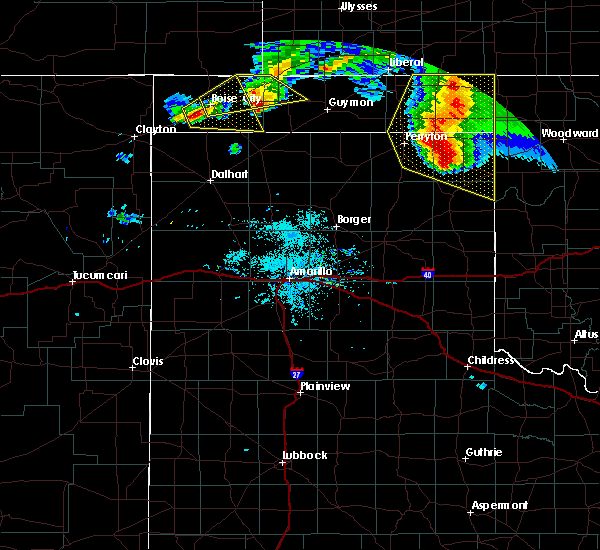 At 952 pm cdt, a severe thunderstorm was located 7 miles southwest of boise city, moving east at 35 mph (radar indicated). Hazards include half dollar size hail. damage to vehicles is expected At 952 pm cdt, a severe thunderstorm was located 7 miles southwest of boise city, moving east at 35 mph (radar indicated). Hazards include half dollar size hail. damage to vehicles is expected
|
| 5/30/2018 9:35 PM CDT |
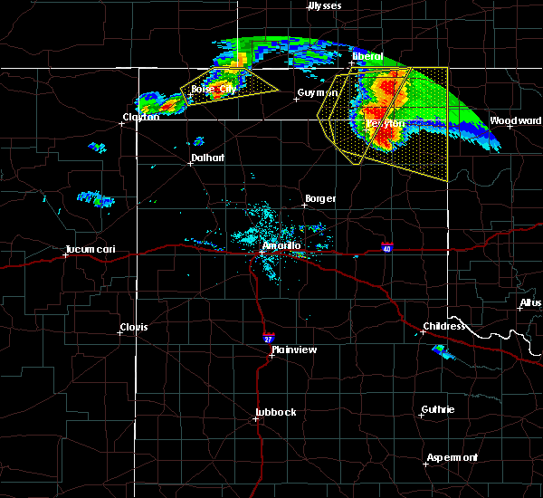 At 935 pm cdt, a severe thunderstorm was located over keyes, or 12 miles east of boise city, moving east at 40 mph (radar indicated). Hazards include 60 mph wind gusts and half dollar size hail. Minor damage to roofs, siding, and trees is possible. hail damage to vehicles is expected. Locations impacted include, boise city, keyes, eva and sturgis. At 935 pm cdt, a severe thunderstorm was located over keyes, or 12 miles east of boise city, moving east at 40 mph (radar indicated). Hazards include 60 mph wind gusts and half dollar size hail. Minor damage to roofs, siding, and trees is possible. hail damage to vehicles is expected. Locations impacted include, boise city, keyes, eva and sturgis.
|
| 5/30/2018 9:19 PM CDT |
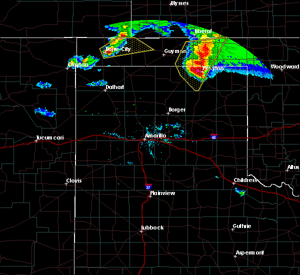 At 919 pm cdt, a severe thunderstorm was located over boise city, moving east at 40 mph (radar indicated). Hazards include quarter size hail. damage to vehicles is expected At 919 pm cdt, a severe thunderstorm was located over boise city, moving east at 40 mph (radar indicated). Hazards include quarter size hail. damage to vehicles is expected
|
| 5/30/2018 7:12 PM CDT |
 At 712 pm cdt, severe thunderstorms were located along a line extending from 8 miles west of elkhart to 14 miles southwest of griggs, moving east at 45 mph (radar indicated). Hazards include 60 mph wind gusts and quarter size hail. Minor damage to roofs, siding, and trees is possible. Hail damage to vehicles is expected. At 712 pm cdt, severe thunderstorms were located along a line extending from 8 miles west of elkhart to 14 miles southwest of griggs, moving east at 45 mph (radar indicated). Hazards include 60 mph wind gusts and quarter size hail. Minor damage to roofs, siding, and trees is possible. Hail damage to vehicles is expected.
|
| 5/30/2018 7:07 PM CDT |
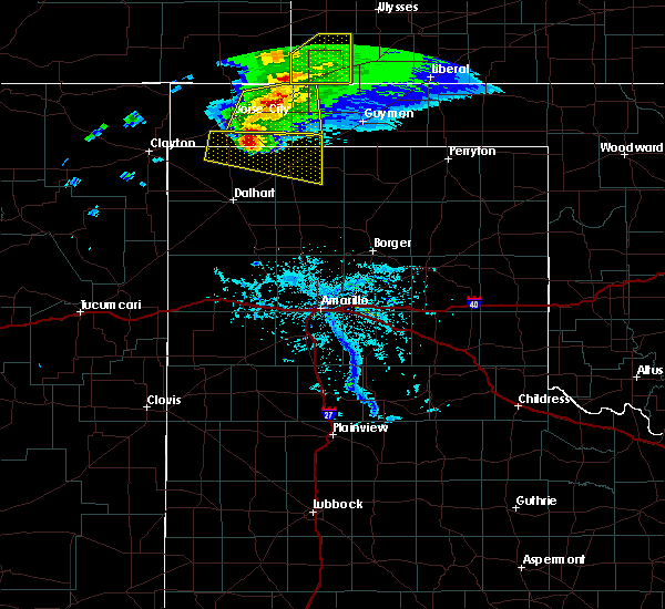 At 706 pm cdt, a severe thunderstorm was located near keyes, or 18 miles east of boise city, moving east at 40 mph (doppler radar indicated). Hazards include 60 mph wind gusts and quarter size hail. Minor damage to roofs, siding, and trees is possible. hail damage to vehicles is expected. Locations impacted include, keyes, eva, griggs and sturgis. At 706 pm cdt, a severe thunderstorm was located near keyes, or 18 miles east of boise city, moving east at 40 mph (doppler radar indicated). Hazards include 60 mph wind gusts and quarter size hail. Minor damage to roofs, siding, and trees is possible. hail damage to vehicles is expected. Locations impacted include, keyes, eva, griggs and sturgis.
|
| 5/30/2018 6:50 PM CDT |
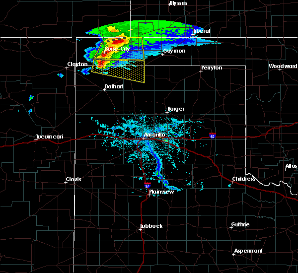 At 650 pm cdt, a severe thunderstorm was located 6 miles east of boise city, moving east at 40 mph (emergency management reported quarter size hail in boise city at 647 pm cdt). Hazards include 60 mph wind gusts and quarter size hail. Minor damage to roofs, siding, and trees is possible. hail damage to vehicles is expected. Locations impacted include, boise city, keyes, eva, griggs and sturgis. At 650 pm cdt, a severe thunderstorm was located 6 miles east of boise city, moving east at 40 mph (emergency management reported quarter size hail in boise city at 647 pm cdt). Hazards include 60 mph wind gusts and quarter size hail. Minor damage to roofs, siding, and trees is possible. hail damage to vehicles is expected. Locations impacted include, boise city, keyes, eva, griggs and sturgis.
|
| 5/30/2018 6:33 PM CDT |
 At 633 pm cdt, a severe thunderstorm was located 4 miles northwest of boise city, moving east at 40 mph (radar indicated). Hazards include 60 mph wind gusts and quarter size hail. Minor damage to roofs, siding, and trees is possible. hail damage to vehicles is expected. Locations impacted include, boise city, keyes, eva, griggs and sturgis. At 633 pm cdt, a severe thunderstorm was located 4 miles northwest of boise city, moving east at 40 mph (radar indicated). Hazards include 60 mph wind gusts and quarter size hail. Minor damage to roofs, siding, and trees is possible. hail damage to vehicles is expected. Locations impacted include, boise city, keyes, eva, griggs and sturgis.
|
| 5/30/2018 6:18 PM CDT |
 The national weather service in amarillo has issued a * severe thunderstorm warning for. western texas county in the panhandle of oklahoma. central cimarron county in the panhandle of oklahoma. Until 715 pm cdt * at 618 pm cdt, a severe thunderstorm was located 7 miles northwest. The national weather service in amarillo has issued a * severe thunderstorm warning for. western texas county in the panhandle of oklahoma. central cimarron county in the panhandle of oklahoma. Until 715 pm cdt * at 618 pm cdt, a severe thunderstorm was located 7 miles northwest.
|
| 9/22/2017 7:24 PM CDT | 5 power poles downe in cimarron county OK, 12.6 miles WNW of Keyes, OK |
| 9/14/2017 5:51 PM CDT |
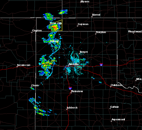 At 550 pm cdt, a severe thunderstorm was located 8 miles west of griggs, or 15 miles southeast of boise city, moving east at 20 mph (radar indicated). Hazards include 60 mph wind gusts and quarter size hail. Minor damage to roofs, siding, and trees is possible. hail damage to vehicles is expected. Locations impacted include, keyes, griggs and sturgis. At 550 pm cdt, a severe thunderstorm was located 8 miles west of griggs, or 15 miles southeast of boise city, moving east at 20 mph (radar indicated). Hazards include 60 mph wind gusts and quarter size hail. Minor damage to roofs, siding, and trees is possible. hail damage to vehicles is expected. Locations impacted include, keyes, griggs and sturgis.
|
| 9/14/2017 5:26 PM CDT |
 At 525 pm cdt, a severe thunderstorm was located 8 miles southeast of boise city, moving east at 20 mph (radar indicated). Hazards include 60 mph wind gusts and quarter size hail. Minor damage to roofs, siding, and trees is possible. Hail damage to vehicles is expected. At 525 pm cdt, a severe thunderstorm was located 8 miles southeast of boise city, moving east at 20 mph (radar indicated). Hazards include 60 mph wind gusts and quarter size hail. Minor damage to roofs, siding, and trees is possible. Hail damage to vehicles is expected.
|
| 9/14/2017 5:26 PM CDT |
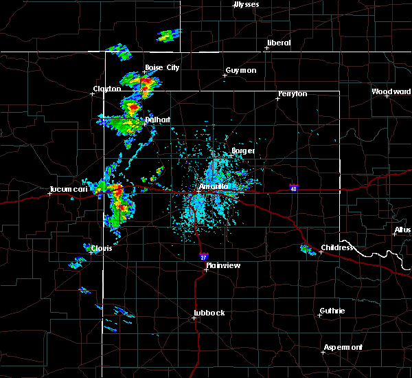 At 525 pm cdt, a severe thunderstorm was located 8 miles southeast of boise city, moving east at 20 mph (radar indicated). Hazards include 60 mph wind gusts and quarter size hail. Minor damage to roofs, siding, and trees is possible. Hail damage to vehicles is expected. At 525 pm cdt, a severe thunderstorm was located 8 miles southeast of boise city, moving east at 20 mph (radar indicated). Hazards include 60 mph wind gusts and quarter size hail. Minor damage to roofs, siding, and trees is possible. Hail damage to vehicles is expected.
|
| 8/27/2017 7:25 PM CDT |
 At 724 pm cdt, a severe thunderstorm was located 11 miles northeast of keyes, or 13 miles southwest of elkhart, moving south at 15 mph (radar indicated). Hazards include 60 mph wind gusts and half dollar size hail. Minor damage to roofs, siding, and trees is possible. Hail damage to vehicles is expected. At 724 pm cdt, a severe thunderstorm was located 11 miles northeast of keyes, or 13 miles southwest of elkhart, moving south at 15 mph (radar indicated). Hazards include 60 mph wind gusts and half dollar size hail. Minor damage to roofs, siding, and trees is possible. Hail damage to vehicles is expected.
|
| 8/18/2017 1:37 AM CDT |
 At 137 am cdt, severe thunderstorms were located along a line extending from 10 miles northeast of keyes to 6 miles southeast of boise city, moving east at 30 mph (radar indicated). Hazards include 60 mph wind gusts and penny size hail. Minor damage to roofs, siding, and trees is possible. Locations impacted include, boise city, keyes, eva, griggs and sturgis. At 137 am cdt, severe thunderstorms were located along a line extending from 10 miles northeast of keyes to 6 miles southeast of boise city, moving east at 30 mph (radar indicated). Hazards include 60 mph wind gusts and penny size hail. Minor damage to roofs, siding, and trees is possible. Locations impacted include, boise city, keyes, eva, griggs and sturgis.
|
| 8/18/2017 1:15 AM CDT |
 At 115 am cdt, severe thunderstorms were located along a line extending from 9 miles northwest of keyes to 8 miles southwest of boise city, moving northeast at 35 mph (radar indicated). Hazards include 60 mph wind gusts and half dollar size hail. Minor damage to roofs, siding, and trees is possible. Hail damage to vehicles is expected. At 115 am cdt, severe thunderstorms were located along a line extending from 9 miles northwest of keyes to 8 miles southwest of boise city, moving northeast at 35 mph (radar indicated). Hazards include 60 mph wind gusts and half dollar size hail. Minor damage to roofs, siding, and trees is possible. Hail damage to vehicles is expected.
|
| 6/25/2017 6:55 PM CDT |
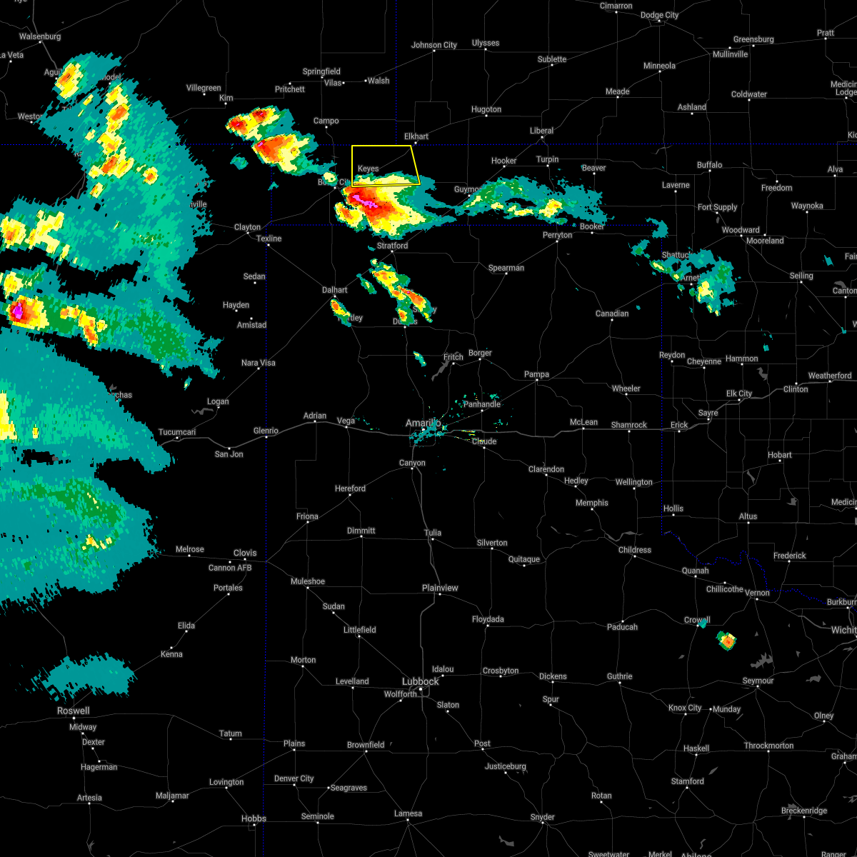 The severe thunderstorm warning for northwestern texas and northeastern cimarron counties will expire at 700 pm cdt, the storm which prompted the warning has moved out of the area. therefore the warning will be allowed to expire. a severe thunderstorm watch remains in effect until 1100 pm cdt for the panhandle of oklahoma. The severe thunderstorm warning for northwestern texas and northeastern cimarron counties will expire at 700 pm cdt, the storm which prompted the warning has moved out of the area. therefore the warning will be allowed to expire. a severe thunderstorm watch remains in effect until 1100 pm cdt for the panhandle of oklahoma.
|
| 6/25/2017 6:36 PM CDT |
 At 635 pm cdt, a confirmed tornado was located 6 miles south of keyes, or 13 miles east of boise city, moving south at 15 mph (law enforcement confirmed tornado at the juction of hwy 56 and hwy 64). Hazards include damaging tornado and baseball size hail. Flying debris will be dangerous to those caught without shelter. mobile homes will be damaged or destroyed. damage to roofs, windows, and vehicles will occur. tree damage is likely. Locations impacted include, keyes and griggs. At 635 pm cdt, a confirmed tornado was located 6 miles south of keyes, or 13 miles east of boise city, moving south at 15 mph (law enforcement confirmed tornado at the juction of hwy 56 and hwy 64). Hazards include damaging tornado and baseball size hail. Flying debris will be dangerous to those caught without shelter. mobile homes will be damaged or destroyed. damage to roofs, windows, and vehicles will occur. tree damage is likely. Locations impacted include, keyes and griggs.
|
| 6/25/2017 6:30 PM CDT |
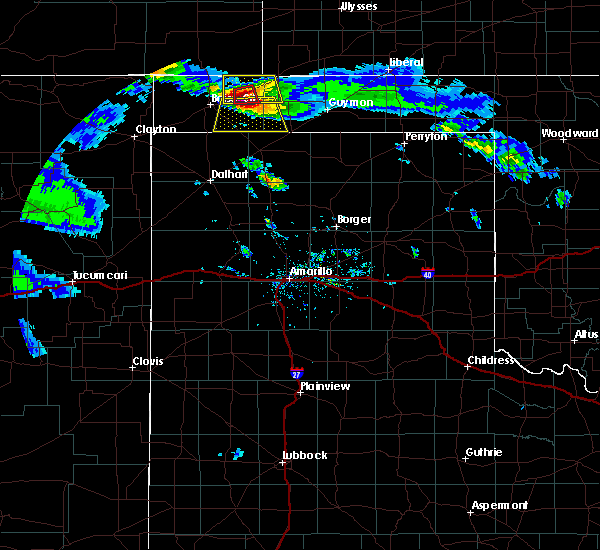 At 630 pm cdt, a severe thunderstorm capable of producing a tornado was located 4 miles south of keyes, or 13 miles east of boise city, moving south at 15 mph (radar indicated rotation). Hazards include tornado and baseball size hail. Flying debris will be dangerous to those caught without shelter. mobile homes will be damaged or destroyed. damage to roofs, windows, and vehicles will occur. Tree damage is likely. At 630 pm cdt, a severe thunderstorm capable of producing a tornado was located 4 miles south of keyes, or 13 miles east of boise city, moving south at 15 mph (radar indicated rotation). Hazards include tornado and baseball size hail. Flying debris will be dangerous to those caught without shelter. mobile homes will be damaged or destroyed. damage to roofs, windows, and vehicles will occur. Tree damage is likely.
|
| 6/25/2017 6:24 PM CDT | Baseball sized hail reported 1.6 miles S of Keyes, OK, baseball size hail reported on north road 430 north of keyes. |
| 6/25/2017 6:20 PM CDT |
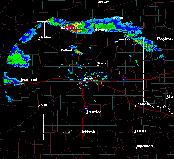 At 620 pm cdt, a severe thunderstorm capable of producing a tornado was located over keyes, or 15 miles east of boise city, moving south at 20 mph (radar indicated rotation). Hazards include tornado and baseball size hail. Flying debris will be dangerous to those caught without shelter. mobile homes will be damaged or destroyed. damage to roofs, windows, and vehicles will occur. tree damage is likely. Locations impacted include, keyes. At 620 pm cdt, a severe thunderstorm capable of producing a tornado was located over keyes, or 15 miles east of boise city, moving south at 20 mph (radar indicated rotation). Hazards include tornado and baseball size hail. Flying debris will be dangerous to those caught without shelter. mobile homes will be damaged or destroyed. damage to roofs, windows, and vehicles will occur. tree damage is likely. Locations impacted include, keyes.
|
| 6/25/2017 6:12 PM CDT |
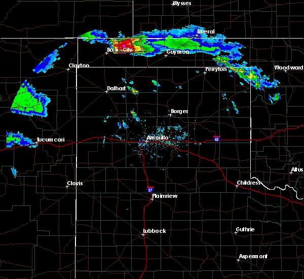 At 612 pm cdt, a severe thunderstorm capable of producing a tornado was located 6 miles northeast of keyes, or 17 miles southwest of elkhart, moving south at 20 mph (radar indicated rotation). Hazards include tornado and baseball size hail. Flying debris will be dangerous to those caught without shelter. mobile homes will be damaged or destroyed. damage to roofs, windows, and vehicles will occur. Tree damage is likely. At 612 pm cdt, a severe thunderstorm capable of producing a tornado was located 6 miles northeast of keyes, or 17 miles southwest of elkhart, moving south at 20 mph (radar indicated rotation). Hazards include tornado and baseball size hail. Flying debris will be dangerous to those caught without shelter. mobile homes will be damaged or destroyed. damage to roofs, windows, and vehicles will occur. Tree damage is likely.
|
| 6/25/2017 5:47 PM CDT |
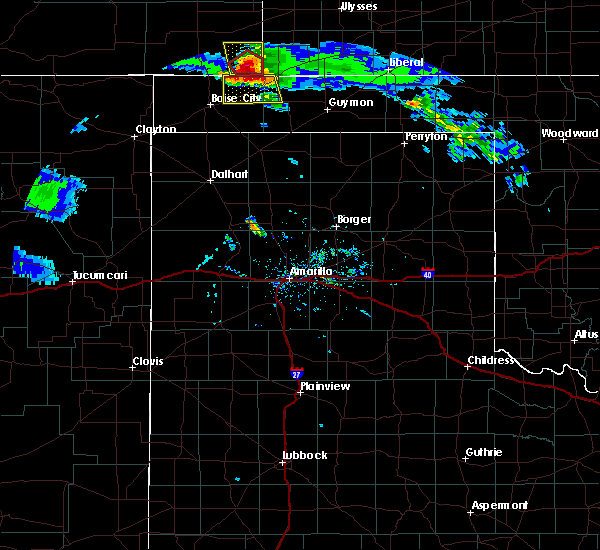 At 545 pm cdt, a severe thunderstorm was located 15 miles south of stonington, or 17 miles west of elkhart, moving south at 20 mph (radar indicated). Hazards include ping pong ball size hail and 60 mph wind gusts. Minor damage to roofs, siding, and trees is possible. people and animals outdoors will be injured. expect hail damage to roofs, siding, windows, and vehicles. Locations impacted include, keyes, eva and sturgis. At 545 pm cdt, a severe thunderstorm was located 15 miles south of stonington, or 17 miles west of elkhart, moving south at 20 mph (radar indicated). Hazards include ping pong ball size hail and 60 mph wind gusts. Minor damage to roofs, siding, and trees is possible. people and animals outdoors will be injured. expect hail damage to roofs, siding, windows, and vehicles. Locations impacted include, keyes, eva and sturgis.
|
| 6/25/2017 5:24 PM CDT |
 At 523 pm cdt, a severe thunderstorm was located 8 miles south of stonington, or 21 miles northwest of elkhart, moving south at 20 mph (radar indicated). Hazards include ping pong ball size hail and 60 mph wind gusts. Minor damage to roofs, siding, and trees is possible. people and animals outdoors will be injured. Expect hail damage to roofs, siding, windows, and vehicles. At 523 pm cdt, a severe thunderstorm was located 8 miles south of stonington, or 21 miles northwest of elkhart, moving south at 20 mph (radar indicated). Hazards include ping pong ball size hail and 60 mph wind gusts. Minor damage to roofs, siding, and trees is possible. people and animals outdoors will be injured. Expect hail damage to roofs, siding, windows, and vehicles.
|
| 6/22/2017 8:14 PM CDT |
 At 813 pm cdt, a severe thunderstorm was located 6 miles northwest of eva, or 10 miles southwest of elkhart, moving southeast at 20 mph (radar indicated). Hazards include 60 mph wind gusts and half dollar size hail. Minor damage to roofs, siding, and trees is possible. hail damage to vehicles is expected. Locations impacted include, texhoma, keyes, eva, griggs, hough and sturgis. At 813 pm cdt, a severe thunderstorm was located 6 miles northwest of eva, or 10 miles southwest of elkhart, moving southeast at 20 mph (radar indicated). Hazards include 60 mph wind gusts and half dollar size hail. Minor damage to roofs, siding, and trees is possible. hail damage to vehicles is expected. Locations impacted include, texhoma, keyes, eva, griggs, hough and sturgis.
|
| 6/22/2017 8:13 PM CDT | Powerlines knocked down at the intersection of hwy 56 and e-w 7 in cimarron county OK, 13.7 miles WSW of Keyes, OK |
| 6/22/2017 7:40 PM CDT |
 At 740 pm cdt, a severe thunderstorm was located 11 miles west of elkhart, moving southeast at 20 mph (radar indicated). Hazards include 60 mph wind gusts and half dollar size hail. Minor damage to roofs, siding, and trees is possible. Hail damage to vehicles is expected. At 740 pm cdt, a severe thunderstorm was located 11 miles west of elkhart, moving southeast at 20 mph (radar indicated). Hazards include 60 mph wind gusts and half dollar size hail. Minor damage to roofs, siding, and trees is possible. Hail damage to vehicles is expected.
|
| 5/9/2017 9:45 PM CDT |
 At 943 pm cdt, severe thunderstorms were located along a line extending from 12 miles north of keyes to 7 miles southwest of griggs, moving east at 35 mph (trained weather spotters reported 65 mph winds in keyes at 936 pm ). Hazards include 70 mph wind gusts. Expect some tree damage. damage is likely to mobile homes, roofs, and outbuildings. Locations impacted include, texhoma, keyes, eva, griggs and sturgis. At 943 pm cdt, severe thunderstorms were located along a line extending from 12 miles north of keyes to 7 miles southwest of griggs, moving east at 35 mph (trained weather spotters reported 65 mph winds in keyes at 936 pm ). Hazards include 70 mph wind gusts. Expect some tree damage. damage is likely to mobile homes, roofs, and outbuildings. Locations impacted include, texhoma, keyes, eva, griggs and sturgis.
|
| 5/9/2017 9:31 PM CDT | Storm damage reported in cimarron county OK, 0.2 miles SSW of Keyes, OK |
| 5/9/2017 9:23 PM CDT | Storm damage reported in cimarron county OK, 0.7 miles NE of Keyes, OK |
| 5/9/2017 9:17 PM CDT |
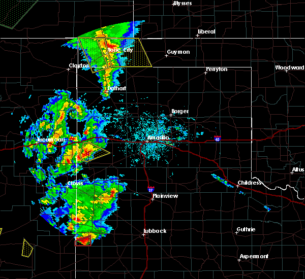 At 917 pm cdt, severe thunderstorms were located along a line extending from 10 miles south of campo to 15 miles west of griggs, moving east at 30 mph (radar indicated). Hazards include 70 mph wind gusts and quarter size hail. Expect some tree damage. damage is likely to mobile homes, roofs, and outbuildings. Hail damage to vehicles is expected. At 917 pm cdt, severe thunderstorms were located along a line extending from 10 miles south of campo to 15 miles west of griggs, moving east at 30 mph (radar indicated). Hazards include 70 mph wind gusts and quarter size hail. Expect some tree damage. damage is likely to mobile homes, roofs, and outbuildings. Hail damage to vehicles is expected.
|
| 7/29/2016 6:50 PM CDT |
 At 649 pm cdt, severe thunderstorms were located along a line extending from 4 miles southeast of boise city to felt, moving southeast at 15 mph (radar indicated). Hazards include 60 mph wind gusts. Minor damage to roofs. siding. and trees is possible. Locations impacted include, boise city, keyes and felt. At 649 pm cdt, severe thunderstorms were located along a line extending from 4 miles southeast of boise city to felt, moving southeast at 15 mph (radar indicated). Hazards include 60 mph wind gusts. Minor damage to roofs. siding. and trees is possible. Locations impacted include, boise city, keyes and felt.
|
| 7/29/2016 6:40 PM CDT |
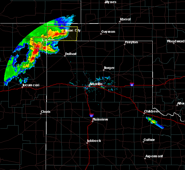 At 640 pm cdt, a severe thunderstorm was located over boise city, moving east at 25 mph (radar indicated). Hazards include 60 mph wind gusts and penny size hail. Minor damage to roofs. siding. and trees is possible. Locations impacted include, boise city, keyes, felt and wheeless. At 640 pm cdt, a severe thunderstorm was located over boise city, moving east at 25 mph (radar indicated). Hazards include 60 mph wind gusts and penny size hail. Minor damage to roofs. siding. and trees is possible. Locations impacted include, boise city, keyes, felt and wheeless.
|
| 7/29/2016 6:25 PM CDT |
 At 625 pm cdt, a severe thunderstorm was located over boise city, moving east at 30 mph (radar indicated). Hazards include 70 mph wind gusts and quarter size hail. Expect some tree damage. damage is likely to mobile homes. roofs, and outbuildings. hail damage to vehicles is expected. Locations impacted include, boise city, keyes, black mesa park, felt, kenton and wheeless. At 625 pm cdt, a severe thunderstorm was located over boise city, moving east at 30 mph (radar indicated). Hazards include 70 mph wind gusts and quarter size hail. Expect some tree damage. damage is likely to mobile homes. roofs, and outbuildings. hail damage to vehicles is expected. Locations impacted include, boise city, keyes, black mesa park, felt, kenton and wheeless.
|
| 7/29/2016 6:12 PM CDT |
 At 611 pm cdt, a severe thunderstorm was located 9 miles west of boise city, moving east at 25 mph (radar indicated). Hazards include 60 mph wind gusts and quarter size hail. Minor damage to roofs. siding. and trees is possible. hail damage to vehicles is expected. Locations impacted include, boise city, keyes, black mesa park, felt, kenton and wheeless. At 611 pm cdt, a severe thunderstorm was located 9 miles west of boise city, moving east at 25 mph (radar indicated). Hazards include 60 mph wind gusts and quarter size hail. Minor damage to roofs. siding. and trees is possible. hail damage to vehicles is expected. Locations impacted include, boise city, keyes, black mesa park, felt, kenton and wheeless.
|
| 7/29/2016 5:56 PM CDT |
 At 556 pm cdt, a severe thunderstorm was located 4 miles northeast of wheeless, or 17 miles west of boise city, moving southeast at 30 mph (radar indicated). Hazards include 60 mph wind gusts and half dollar size hail. Minor damage to roofs. siding. and trees is possible. Hail damage to vehicles is expected. At 556 pm cdt, a severe thunderstorm was located 4 miles northeast of wheeless, or 17 miles west of boise city, moving southeast at 30 mph (radar indicated). Hazards include 60 mph wind gusts and half dollar size hail. Minor damage to roofs. siding. and trees is possible. Hail damage to vehicles is expected.
|
| 7/15/2016 5:10 PM CDT |
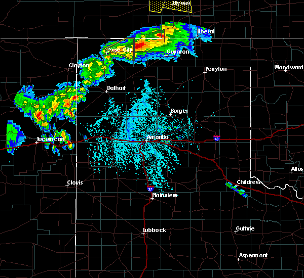 The severe thunderstorm warning for northeastern cimarron county will expire at 515 pm cdt, the storm which prompted the warning has weakened below severe limits, and no longer poses an immediate threat to life or property. therefore the warning will be allowed to expire. however gusty winds are still possible with this thunderstorm. The severe thunderstorm warning for northeastern cimarron county will expire at 515 pm cdt, the storm which prompted the warning has weakened below severe limits, and no longer poses an immediate threat to life or property. therefore the warning will be allowed to expire. however gusty winds are still possible with this thunderstorm.
|
| 7/15/2016 4:51 PM CDT |
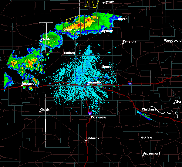 At 451 pm cdt, a severe thunderstorm was located 9 miles northeast of keyes, or 14 miles southwest of elkhart, moving east at 35 mph (radar indicated). Hazards include 60 mph wind gusts and nickel size hail. Minor damage to roofs. siding. and trees is possible. Locations impacted include, keyes and sturgis. At 451 pm cdt, a severe thunderstorm was located 9 miles northeast of keyes, or 14 miles southwest of elkhart, moving east at 35 mph (radar indicated). Hazards include 60 mph wind gusts and nickel size hail. Minor damage to roofs. siding. and trees is possible. Locations impacted include, keyes and sturgis.
|
| 7/15/2016 4:37 PM CDT |
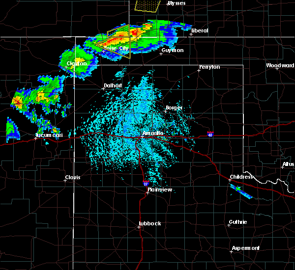 At 436 pm cdt, a severe thunderstorm was located 8 miles north of keyes, or 19 miles northeast of boise city, moving east at 20 mph (radar indicated). Hazards include 60 mph wind gusts and nickel size hail. Minor damage to roofs. siding. And trees is possible. At 436 pm cdt, a severe thunderstorm was located 8 miles north of keyes, or 19 miles northeast of boise city, moving east at 20 mph (radar indicated). Hazards include 60 mph wind gusts and nickel size hail. Minor damage to roofs. siding. And trees is possible.
|
| 6/13/2016 6:33 PM CDT |
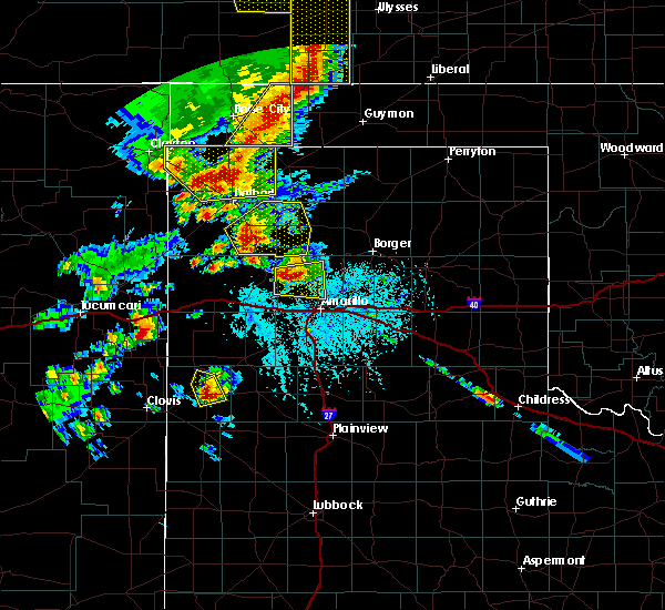 At 632 pm cdt, severe thunderstorms were located along a line extending from 5 miles west of elkhart to 15 miles south of boise city, moving east at 45 mph (radar indicated). Hazards include 60 mph wind gusts and penny size hail. Minor damage to roofs. siding. and trees is possible. locations impacted include, keyes, griggs and sturgis. A tornado watch remains in effect until 200 am cdt for the panhandle of oklahoma, and the panhandle of texas. At 632 pm cdt, severe thunderstorms were located along a line extending from 5 miles west of elkhart to 15 miles south of boise city, moving east at 45 mph (radar indicated). Hazards include 60 mph wind gusts and penny size hail. Minor damage to roofs. siding. and trees is possible. locations impacted include, keyes, griggs and sturgis. A tornado watch remains in effect until 200 am cdt for the panhandle of oklahoma, and the panhandle of texas.
|
| 6/13/2016 6:05 PM CDT |
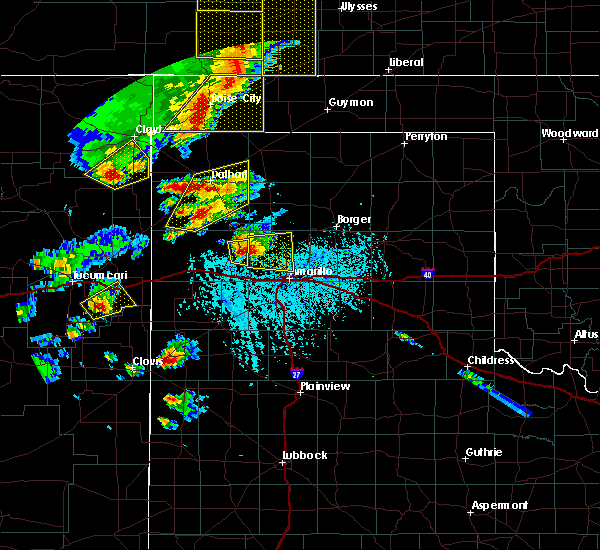 At 605 pm cdt, severe thunderstorms were located along a line extending from 12 miles north of keyes to 5 miles southeast of felt, moving east at 45 mph (radar indicated). Hazards include 60 mph wind gusts and penny size hail. Minor damage to roofs. siding. And trees is possible. At 605 pm cdt, severe thunderstorms were located along a line extending from 12 miles north of keyes to 5 miles southeast of felt, moving east at 45 mph (radar indicated). Hazards include 60 mph wind gusts and penny size hail. Minor damage to roofs. siding. And trees is possible.
|
| 5/29/2016 2:52 PM CDT |
 At 251 pm cdt, severe thunderstorms were located along a line extending from 9 miles north of keyes to 8 miles north of stratford, moving northeast at 15 mph (radar indicated). Hazards include golf ball size hail and 60 mph wind gusts. Minor damage to roofs. siding. and trees is possible. people and animals outdoors will be injured. Expect hail damage to roofs, siding, windows, and vehicles. At 251 pm cdt, severe thunderstorms were located along a line extending from 9 miles north of keyes to 8 miles north of stratford, moving northeast at 15 mph (radar indicated). Hazards include golf ball size hail and 60 mph wind gusts. Minor damage to roofs. siding. and trees is possible. people and animals outdoors will be injured. Expect hail damage to roofs, siding, windows, and vehicles.
|
| 5/29/2016 2:52 PM CDT |
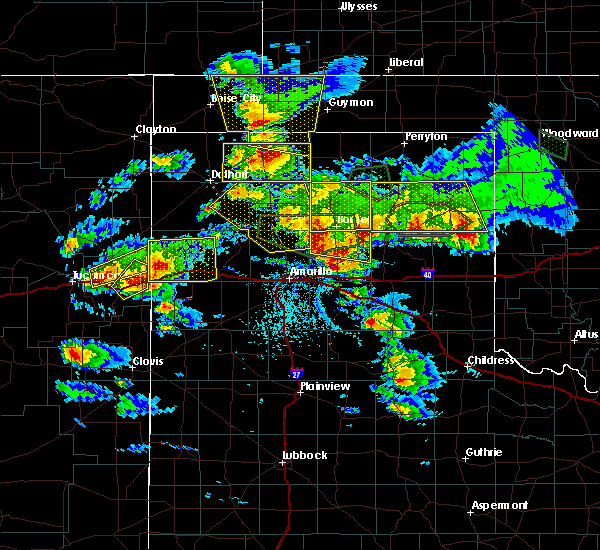 At 251 pm cdt, severe thunderstorms were located along a line extending from 9 miles north of keyes to 8 miles north of stratford, moving northeast at 15 mph (radar indicated). Hazards include golf ball size hail and 60 mph wind gusts. Minor damage to roofs. siding. and trees is possible. people and animals outdoors will be injured. Expect hail damage to roofs, siding, windows, and vehicles. At 251 pm cdt, severe thunderstorms were located along a line extending from 9 miles north of keyes to 8 miles north of stratford, moving northeast at 15 mph (radar indicated). Hazards include golf ball size hail and 60 mph wind gusts. Minor damage to roofs. siding. and trees is possible. people and animals outdoors will be injured. Expect hail damage to roofs, siding, windows, and vehicles.
|
| 4/29/2016 12:05 AM CDT |
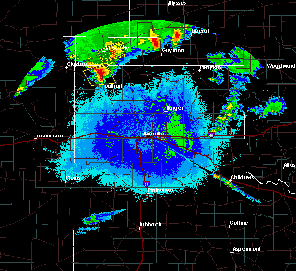 The severe thunderstorm warning for southeastern cimarron county will expire at 1215 am cdt, the storm which prompted the warning has weakened below severe limits, and no longer poses an immediate threat to life or property. therefore the warning will be allowed to expire. however small hail up to penny size is still possible with this thunderstorm. a severe thunderstorm watch remains in effect until 600 am cdt for the oklahoma panhandle. The severe thunderstorm warning for southeastern cimarron county will expire at 1215 am cdt, the storm which prompted the warning has weakened below severe limits, and no longer poses an immediate threat to life or property. therefore the warning will be allowed to expire. however small hail up to penny size is still possible with this thunderstorm. a severe thunderstorm watch remains in effect until 600 am cdt for the oklahoma panhandle.
|
| 4/28/2016 11:52 PM CDT |
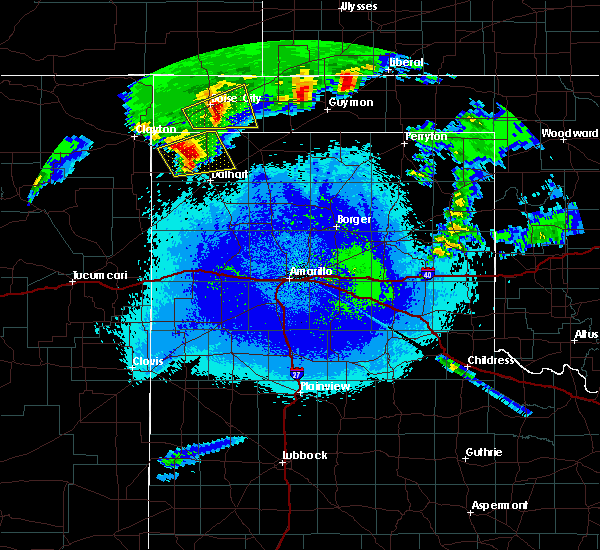 At 1152 pm cdt, a severe thunderstorm was located near boise city, moving east at 30 mph (radar indicated). Hazards include quarter size hail. Damage to vehicles is expected. Locations impacted include, boise city and keyes. At 1152 pm cdt, a severe thunderstorm was located near boise city, moving east at 30 mph (radar indicated). Hazards include quarter size hail. Damage to vehicles is expected. Locations impacted include, boise city and keyes.
|
| 4/28/2016 11:35 PM CDT |
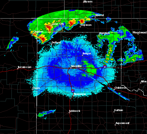 At 1134 pm cdt, a severe thunderstorm was located 8 miles southwest of boise city, moving east at 30 mph (radar indicated). Hazards include half dollar size hail. damage to vehicles is expected At 1134 pm cdt, a severe thunderstorm was located 8 miles southwest of boise city, moving east at 30 mph (radar indicated). Hazards include half dollar size hail. damage to vehicles is expected
|
| 4/16/2016 12:43 AM CDT |
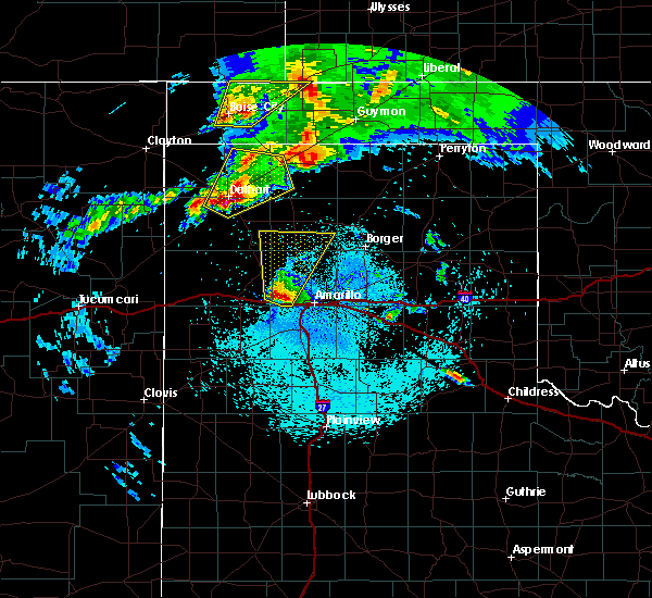 At 1243 am cdt, a severe thunderstorm was located 5 miles southwest of keyes, or 10 miles east of boise city, moving northeast at 30 mph (radar indicated). Hazards include 60 mph wind gusts and quarter size hail. Minor damage to roofs. siding. and trees is possible. hail damage to vehicles is expected. Locations impacted include, boise city, keyes and sturgis. At 1243 am cdt, a severe thunderstorm was located 5 miles southwest of keyes, or 10 miles east of boise city, moving northeast at 30 mph (radar indicated). Hazards include 60 mph wind gusts and quarter size hail. Minor damage to roofs. siding. and trees is possible. hail damage to vehicles is expected. Locations impacted include, boise city, keyes and sturgis.
|
| 4/16/2016 12:23 AM CDT |
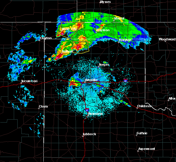 At 1222 am cdt, a severe thunderstorm was located 6 miles southeast of boise city, moving northeast at 30 mph (radar indicated). Hazards include ping pong ball size hail and 60 mph wind gusts. Minor damage to roofs. siding. and trees is possible. people and animals outdoors will be injured. Expect hail damage to roofs, siding, windows, and vehicles. At 1222 am cdt, a severe thunderstorm was located 6 miles southeast of boise city, moving northeast at 30 mph (radar indicated). Hazards include ping pong ball size hail and 60 mph wind gusts. Minor damage to roofs. siding. and trees is possible. people and animals outdoors will be injured. Expect hail damage to roofs, siding, windows, and vehicles.
|
| 4/15/2016 10:09 PM CDT |
 At 1008 pm cdt, a severe thunderstorm was located 7 miles south of keyes, or 16 miles east of boise city, moving northeast at 30 mph (radar indicated). Hazards include golf ball size hail and 60 mph wind gusts. Minor damage to roofs. siding. and trees is possible. people and animals outdoors will be injured. expect hail damage to roofs, siding, windows, and vehicles. Locations impacted include, guymon, stratford, hooker, goodwell, optima, keyes, griggs, hough, eva, texhoma and sturgis. At 1008 pm cdt, a severe thunderstorm was located 7 miles south of keyes, or 16 miles east of boise city, moving northeast at 30 mph (radar indicated). Hazards include golf ball size hail and 60 mph wind gusts. Minor damage to roofs. siding. and trees is possible. people and animals outdoors will be injured. expect hail damage to roofs, siding, windows, and vehicles. Locations impacted include, guymon, stratford, hooker, goodwell, optima, keyes, griggs, hough, eva, texhoma and sturgis.
|
| 4/15/2016 9:15 PM CDT |
 At 915 pm cdt, severe thunderstorms were located along a line extending from near elkhart to 9 miles north of griggs to 10 miles southeast of felt, moving east at 50 mph (radar indicated). Hazards include 60 mph wind gusts and quarter size hail. Minor damage to roofs. siding. and trees is possible. Hail damage to vehicles is expected. At 915 pm cdt, severe thunderstorms were located along a line extending from near elkhart to 9 miles north of griggs to 10 miles southeast of felt, moving east at 50 mph (radar indicated). Hazards include 60 mph wind gusts and quarter size hail. Minor damage to roofs. siding. and trees is possible. Hail damage to vehicles is expected.
|
| 4/15/2016 9:05 PM CDT | Quarter sized hail reported 11.9 miles WSW of Keyes, OK, copious amounts of quarter size hail were falling northwest of sturgis. |
| 4/15/2016 8:46 PM CDT |
 At 846 pm cdt, severe thunderstorms were located along a line extending from 7 miles west of keyes to near felt, moving east at 15 mph (radar indicated). Hazards include 60 mph wind gusts and quarter size hail. Minor damage to roofs. siding. and trees is possible. hail damage to vehicles is expected. locations impacted include, boise city, keyes and felt. A tornado watch remains in effect until 1000 pm cdt. At 846 pm cdt, severe thunderstorms were located along a line extending from 7 miles west of keyes to near felt, moving east at 15 mph (radar indicated). Hazards include 60 mph wind gusts and quarter size hail. Minor damage to roofs. siding. and trees is possible. hail damage to vehicles is expected. locations impacted include, boise city, keyes and felt. A tornado watch remains in effect until 1000 pm cdt.
|
| 4/15/2016 8:32 PM CDT |
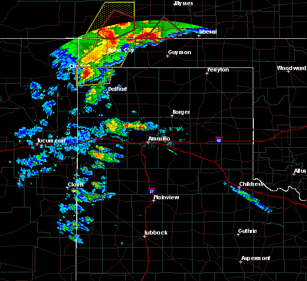 At 831 pm cdt, severe thunderstorms were located along a line extending from 13 miles northwest of keyes to felt, moving east at 40 mph (radar indicated). Hazards include 60 mph wind gusts and quarter size hail. Minor damage to roofs. siding. and trees is possible. hail damage to vehicles is expected. locations impacted include, boise city, keyes and felt. A tornado watch remains in effect until 1000 pm cdt. At 831 pm cdt, severe thunderstorms were located along a line extending from 13 miles northwest of keyes to felt, moving east at 40 mph (radar indicated). Hazards include 60 mph wind gusts and quarter size hail. Minor damage to roofs. siding. and trees is possible. hail damage to vehicles is expected. locations impacted include, boise city, keyes and felt. A tornado watch remains in effect until 1000 pm cdt.
|
| 4/15/2016 8:11 PM CDT |
 At 810 pm cdt, severe thunderstorms were located along a line extending from 9 miles southwest of campo to 7 miles west of felt, moving northeast at 20 mph (radar indicated). Hazards include 60 mph wind gusts and quarter size hail. Minor damage to roofs. siding. and trees is possible. Hail damage to vehicles is expected. At 810 pm cdt, severe thunderstorms were located along a line extending from 9 miles southwest of campo to 7 miles west of felt, moving northeast at 20 mph (radar indicated). Hazards include 60 mph wind gusts and quarter size hail. Minor damage to roofs. siding. and trees is possible. Hail damage to vehicles is expected.
|
| 11/16/2015 2:32 PM CST |
 At 232 pm cst, a severe thunderstorm was located 7 miles southeast of keyes, or 18 miles east of boise city, moving northeast at 50 mph (radar indicated). Hazards include 60 mph wind gusts and half dollar size hail. Hail damage to vehicles is expected. Minor wind damage to roofs, siding and trees is possible. At 232 pm cst, a severe thunderstorm was located 7 miles southeast of keyes, or 18 miles east of boise city, moving northeast at 50 mph (radar indicated). Hazards include 60 mph wind gusts and half dollar size hail. Hail damage to vehicles is expected. Minor wind damage to roofs, siding and trees is possible.
|
| 11/16/2015 1:36 PM CST |
 The severe thunderstorm warning for northeastern cimarron county will expire at 145 pm cst, the storm which prompted the warning has exited the warned area. therefore the warning will be allowed to expire. a tornado watch remains in effect until 900 pm cst for central oklahoma. additional severe thunderstorms are possible this afternoon in cimarron county. The severe thunderstorm warning for northeastern cimarron county will expire at 145 pm cst, the storm which prompted the warning has exited the warned area. therefore the warning will be allowed to expire. a tornado watch remains in effect until 900 pm cst for central oklahoma. additional severe thunderstorms are possible this afternoon in cimarron county.
|
| 11/16/2015 1:23 PM CST |
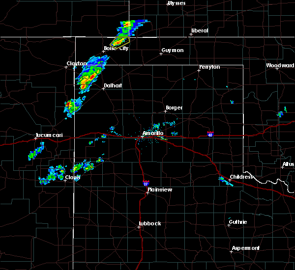 At 122 pm cst, a severe thunderstorm was located over keyes, or 15 miles northeast of boise city, moving northeast at 50 mph (radar indicated). Hazards include 60 mph wind gusts and quarter size hail. Hail damage to vehicles is expected. minor wind damage to roofs, siding and trees is possible. this storm has a history of producing hail up to quarter size. locations impacted include, rural northeast cimarron county, north of keys. A tornado watch remains in effect until 900 pm cst for central oklahoma. At 122 pm cst, a severe thunderstorm was located over keyes, or 15 miles northeast of boise city, moving northeast at 50 mph (radar indicated). Hazards include 60 mph wind gusts and quarter size hail. Hail damage to vehicles is expected. minor wind damage to roofs, siding and trees is possible. this storm has a history of producing hail up to quarter size. locations impacted include, rural northeast cimarron county, north of keys. A tornado watch remains in effect until 900 pm cst for central oklahoma.
|
| 11/16/2015 1:12 PM CST |
 At 111 pm cst, a severe thunderstorm was located 7 miles southwest of keyes, or 8 miles east of boise city, moving northeast at 45 mph (radar indicated). Hazards include 60 mph wind gusts and quarter size hail. Hail damage to vehicles is expected. minor wind damage to roofs, siding and trees is possible. trained storm spotters reported quarter size hail 8 miles south southeast of boise city at 103 pm cst. locations impacted include, keyes and sturgis. A tornado watch remains in effect until 900 pm cst for central oklahoma. At 111 pm cst, a severe thunderstorm was located 7 miles southwest of keyes, or 8 miles east of boise city, moving northeast at 45 mph (radar indicated). Hazards include 60 mph wind gusts and quarter size hail. Hail damage to vehicles is expected. minor wind damage to roofs, siding and trees is possible. trained storm spotters reported quarter size hail 8 miles south southeast of boise city at 103 pm cst. locations impacted include, keyes and sturgis. A tornado watch remains in effect until 900 pm cst for central oklahoma.
|
| 11/16/2015 1:02 PM CST |
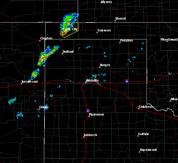 At 101 pm cst, a severe thunderstorm was located near boise city, moving northeast at 50 mph (trained weather spotters). Hazards include 60 mph wind gusts and half dollar size hail. Hail damage to vehicles is expected. minor wind damage to roofs, siding and trees is possible. locations impacted include, keyes and sturgis. A tornado watch remains in effect until 900 pm cst for central oklahoma. At 101 pm cst, a severe thunderstorm was located near boise city, moving northeast at 50 mph (trained weather spotters). Hazards include 60 mph wind gusts and half dollar size hail. Hail damage to vehicles is expected. minor wind damage to roofs, siding and trees is possible. locations impacted include, keyes and sturgis. A tornado watch remains in effect until 900 pm cst for central oklahoma.
|
| 11/16/2015 12:51 PM CST |
 At 1251 pm cst, a severe thunderstorm was located 10 miles south of boise city, moving northeast at 55 mph (radar indicated). Hazards include 60 mph wind gusts and half dollar size hail. Hail damage to vehicles is expected. minor wind damage to roofs, siding and trees is possible. Locations impacted include, boise city, keyes and sturgis. At 1251 pm cst, a severe thunderstorm was located 10 miles south of boise city, moving northeast at 55 mph (radar indicated). Hazards include 60 mph wind gusts and half dollar size hail. Hail damage to vehicles is expected. minor wind damage to roofs, siding and trees is possible. Locations impacted include, boise city, keyes and sturgis.
|
| 11/16/2015 12:43 PM CST |
 At 1242 pm cst, a severe thunderstorm was located 9 miles southeast of felt, or 17 miles southwest of boise city, moving northeast at 50 mph (radar indicated). Hazards include 60 mph wind gusts and half dollar size hail. Hail damage to vehicles is expected. Minor wind damage to roofs, siding and trees is possible. At 1242 pm cst, a severe thunderstorm was located 9 miles southeast of felt, or 17 miles southwest of boise city, moving northeast at 50 mph (radar indicated). Hazards include 60 mph wind gusts and half dollar size hail. Hail damage to vehicles is expected. Minor wind damage to roofs, siding and trees is possible.
|
| 8/8/2015 10:07 PM CDT |
 At 940 pm cdt, severe thunderstorms were located along a line extending from 7 miles southwest of griggs to 11 miles northwest of conlen, moving northeast at 30 mph (radar indicated). Hazards include 60 mph wind gusts and penny size hail. Minor wind damage to roofs. siding and trees is possible. Locations impacted include, stratford, keyes, griggs, conlen and texhoma. At 940 pm cdt, severe thunderstorms were located along a line extending from 7 miles southwest of griggs to 11 miles northwest of conlen, moving northeast at 30 mph (radar indicated). Hazards include 60 mph wind gusts and penny size hail. Minor wind damage to roofs. siding and trees is possible. Locations impacted include, stratford, keyes, griggs, conlen and texhoma.
|
| 8/8/2015 10:07 PM CDT |
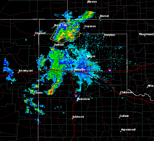 The severe thunderstorm warning for southwestern texas, eastern cimarron, northeastern dallam and northern sherman counties will expire at 1015 pm cdt, the storms which prompted the warning have weakened below severe limits, and no longer pose an immediate threat to life or property. therefore the warning will be allowed to expire. however gusty winds and heavy rain are still possible with these thunderstorms. The severe thunderstorm warning for southwestern texas, eastern cimarron, northeastern dallam and northern sherman counties will expire at 1015 pm cdt, the storms which prompted the warning have weakened below severe limits, and no longer pose an immediate threat to life or property. therefore the warning will be allowed to expire. however gusty winds and heavy rain are still possible with these thunderstorms.
|
| 8/8/2015 9:41 PM CDT |
 At 940 pm cdt, severe thunderstorms were located along a line extending from 7 miles southwest of griggs to 11 miles northwest of conlen, moving northeast at 30 mph (radar indicated). Hazards include 60 mph wind gusts and penny size hail. Minor wind damage to roofs. siding and trees is possible. Locations impacted include, stratford, keyes, griggs, conlen and texhoma. At 940 pm cdt, severe thunderstorms were located along a line extending from 7 miles southwest of griggs to 11 miles northwest of conlen, moving northeast at 30 mph (radar indicated). Hazards include 60 mph wind gusts and penny size hail. Minor wind damage to roofs. siding and trees is possible. Locations impacted include, stratford, keyes, griggs, conlen and texhoma.
|
| 8/8/2015 9:41 PM CDT |
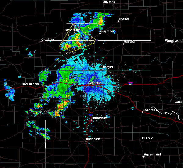 At 940 pm cdt, severe thunderstorms were located along a line extending from 7 miles southwest of griggs to 11 miles northwest of conlen, moving northeast at 30 mph (radar indicated). Hazards include 60 mph wind gusts and penny size hail. Minor wind damage to roofs. siding and trees is possible. Locations impacted include, stratford, keyes, griggs, conlen and texhoma. At 940 pm cdt, severe thunderstorms were located along a line extending from 7 miles southwest of griggs to 11 miles northwest of conlen, moving northeast at 30 mph (radar indicated). Hazards include 60 mph wind gusts and penny size hail. Minor wind damage to roofs. siding and trees is possible. Locations impacted include, stratford, keyes, griggs, conlen and texhoma.
|
| 8/8/2015 9:23 PM CDT |
 At 922 pm cdt, severe thunderstorms were located along a line extending from 13 miles northwest of stratford to 12 miles northeast of ware, moving northeast at 35 mph (radar indicated). Hazards include 60 mph wind gusts and penny size hail. Minor wind damage to roofs. Siding and trees is possible. At 922 pm cdt, severe thunderstorms were located along a line extending from 13 miles northwest of stratford to 12 miles northeast of ware, moving northeast at 35 mph (radar indicated). Hazards include 60 mph wind gusts and penny size hail. Minor wind damage to roofs. Siding and trees is possible.
|
| 8/8/2015 9:23 PM CDT |
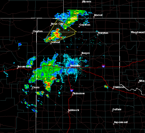 At 922 pm cdt, severe thunderstorms were located along a line extending from 13 miles northwest of stratford to 12 miles northeast of ware, moving northeast at 35 mph (radar indicated). Hazards include 60 mph wind gusts and penny size hail. Minor wind damage to roofs. Siding and trees is possible. At 922 pm cdt, severe thunderstorms were located along a line extending from 13 miles northwest of stratford to 12 miles northeast of ware, moving northeast at 35 mph (radar indicated). Hazards include 60 mph wind gusts and penny size hail. Minor wind damage to roofs. Siding and trees is possible.
|
| 7/9/2015 8:46 PM CDT |
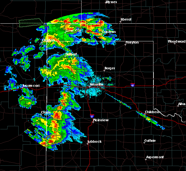 At 843 pm cdt, a severe thunderstorm was located 5 miles northwest of keyes, and moving north at 20 mph (radar indicated). Hazards include 60 mph wind gusts and quarter size hail. Hail damage to vehicles is expected. Minor wind damage to roofs, siding and trees is possible. At 843 pm cdt, a severe thunderstorm was located 5 miles northwest of keyes, and moving north at 20 mph (radar indicated). Hazards include 60 mph wind gusts and quarter size hail. Hail damage to vehicles is expected. Minor wind damage to roofs, siding and trees is possible.
|
| 7/9/2015 8:32 PM CDT |
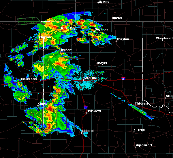 At 829 pm cdt, a severe thunderstorm was located 7 miles northeast of boise city, and moving north at 30 mph (radar indicated). Hazards include 60 mph wind gusts and quarter size hail. Hail damage to vehicles is expected. Minor wind damage to roofs, siding and trees is possible. At 829 pm cdt, a severe thunderstorm was located 7 miles northeast of boise city, and moving north at 30 mph (radar indicated). Hazards include 60 mph wind gusts and quarter size hail. Hail damage to vehicles is expected. Minor wind damage to roofs, siding and trees is possible.
|
| 7/9/2015 8:13 PM CDT |
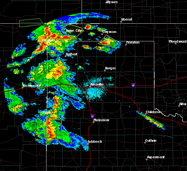 At 811 pm cdt, a severe thunderstorm was located near boise city, and moving north at 20 mph (radar indicated). Hazards include 60 mph wind gusts and quarter size hail. Hail damage to vehicles is expected. Minor wind damage to roofs, siding and trees is possible. At 811 pm cdt, a severe thunderstorm was located near boise city, and moving north at 20 mph (radar indicated). Hazards include 60 mph wind gusts and quarter size hail. Hail damage to vehicles is expected. Minor wind damage to roofs, siding and trees is possible.
|
| 7/9/2015 7:54 PM CDT |
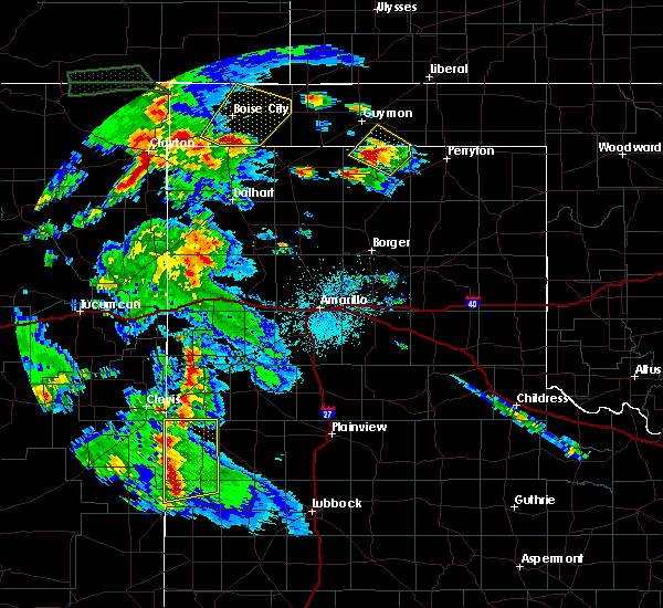 At 753 pm cdt, a severe thunderstorm was located 12 miles south of boise city, and moving northeast at 25 mph (radar indicated). Hazards include 60 mph wind gusts and quarter size hail. Hail damage to vehicles is expected. Minor wind damage to roofs, siding and trees is possible. At 753 pm cdt, a severe thunderstorm was located 12 miles south of boise city, and moving northeast at 25 mph (radar indicated). Hazards include 60 mph wind gusts and quarter size hail. Hail damage to vehicles is expected. Minor wind damage to roofs, siding and trees is possible.
|
| 6/25/2015 7:50 PM CDT |
 At 747 pm cdt, a severe thunderstorm was located near boise city, and moving south at 10 mph (radar indicated). Hazards include 60 mph wind gusts and quarter size hail. Hail damage to vehicles is expected. Minor wind damage to roofs, siding and trees is possible. At 747 pm cdt, a severe thunderstorm was located near boise city, and moving south at 10 mph (radar indicated). Hazards include 60 mph wind gusts and quarter size hail. Hail damage to vehicles is expected. Minor wind damage to roofs, siding and trees is possible.
|
| 6/25/2015 7:29 PM CDT |
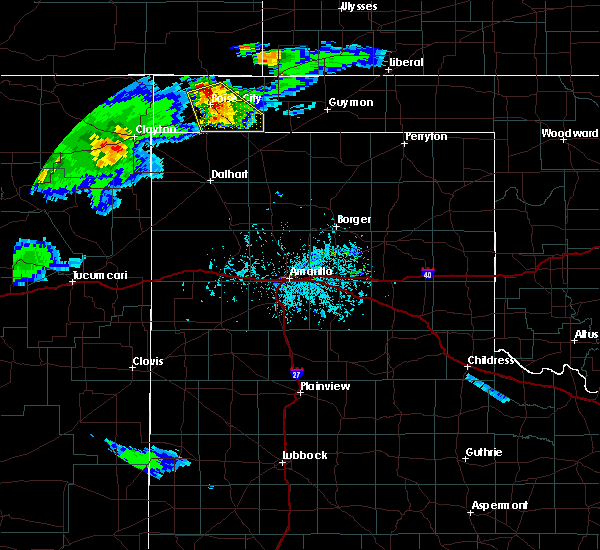 At 728 pm cdt, a severe thunderstorm was located 9 miles north of boise city, and moving southeast at 20 mph (radar indicated). Hazards include 60 mph wind gusts and half dollar size hail. Hail damage to vehicles is expected. Minor wind damage to roofs, siding and trees is possible. At 728 pm cdt, a severe thunderstorm was located 9 miles north of boise city, and moving southeast at 20 mph (radar indicated). Hazards include 60 mph wind gusts and half dollar size hail. Hail damage to vehicles is expected. Minor wind damage to roofs, siding and trees is possible.
|
| 6/25/2015 7:10 PM CDT |
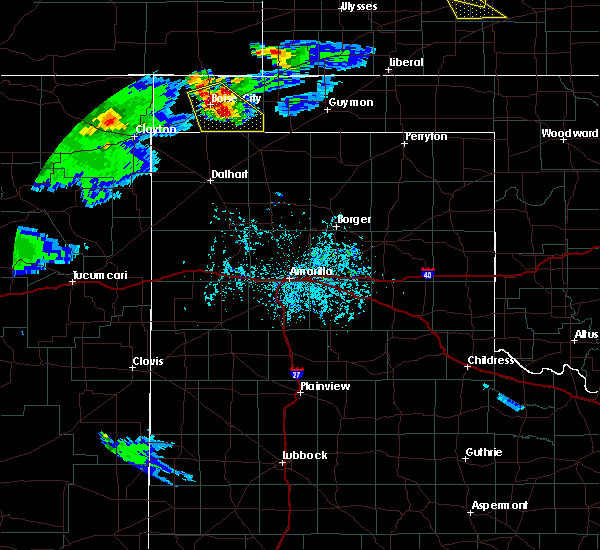 At 708 pm cdt, a severe thunderstorm was located near boise city, and moving southeast at 5 mph (radar indicated). Hazards include 60 mph wind gusts and half dollar size hail. Hail damage to vehicles is expected. Minor wind damage to roofs, siding and trees is possible. At 708 pm cdt, a severe thunderstorm was located near boise city, and moving southeast at 5 mph (radar indicated). Hazards include 60 mph wind gusts and half dollar size hail. Hail damage to vehicles is expected. Minor wind damage to roofs, siding and trees is possible.
|
| 6/25/2015 6:46 PM CDT |
 At 644 pm cdt, a severe thunderstorm was located near boise city, and moving southeast at 10 mph (radar indicated). Hazards include 60 mph wind gusts and quarter size hail. Hail damage to vehicles is expected. Minor wind damage to roofs, siding and trees is possible. At 644 pm cdt, a severe thunderstorm was located near boise city, and moving southeast at 10 mph (radar indicated). Hazards include 60 mph wind gusts and quarter size hail. Hail damage to vehicles is expected. Minor wind damage to roofs, siding and trees is possible.
|
| 6/11/2015 5:27 PM CDT |
 At 524 pm cdt, severe thunderstorms were located along a line extending from 11 miles north of keyes to 6 miles west of eva, and moving east at 15 mph (radar indicated). Hazards include 70 mph wind gusts and half dollar size hail. Hail damage to vehicles is expected. expect some tree damage. Wind damage is also likely to mobile homes, roofs and outbuildings. At 524 pm cdt, severe thunderstorms were located along a line extending from 11 miles north of keyes to 6 miles west of eva, and moving east at 15 mph (radar indicated). Hazards include 70 mph wind gusts and half dollar size hail. Hail damage to vehicles is expected. expect some tree damage. Wind damage is also likely to mobile homes, roofs and outbuildings.
|
| 6/11/2015 4:56 PM CDT |
 At 453 pm cdt, a severe thunderstorm was located near keyes, and moving east at 15 mph (radar indicated). Hazards include 60 mph wind gusts and quarter size hail. Hail damage to vehicles is expected. Minor wind damage to roofs, siding and trees is possible. At 453 pm cdt, a severe thunderstorm was located near keyes, and moving east at 15 mph (radar indicated). Hazards include 60 mph wind gusts and quarter size hail. Hail damage to vehicles is expected. Minor wind damage to roofs, siding and trees is possible.
|
| 6/4/2015 6:57 PM CDT | At 654 pm cdt, a severe thunderstorm was located near eva, and moving northeast at 40 mph (radar indicated). Hazards include 60 mph wind gusts and half dollar size hail. Hail damage to vehicles is expected. Minor wind damage to roofs, siding and trees is possible. |
| 6/4/2015 6:42 PM CDT | At 641 pm cdt, a severe thunderstorm was located 8 miles northeast of griggs, and moving northeast at 20 mph (radar indicated). Hazards include 60 mph wind gusts and half dollar size hail. Hail damage to vehicles is expected. Minor wind damage to roofs, siding and trees is possible. |
| 6/4/2015 6:42 PM CDT | At 641 pm cdt, a severe thunderstorm was located 8 miles northeast of griggs, and moving northeast at 20 mph (radar indicated). Hazards include 60 mph wind gusts and half dollar size hail. Hail damage to vehicles is expected. Minor wind damage to roofs, siding and trees is possible. |
| 6/4/2015 6:08 PM CDT | At 606 pm cdt, a severe thunderstorm was located 13 miles northwest of stratford, and moving northeast at 20 mph (radar indicated). Hazards include ping pong ball size hail and 60 mph wind gusts. People and animals outdoors will be injured. expect hail damage to roofs, siding, windows and vehicles. Minor wind damage to roofs, siding and trees is possible. |
| 6/4/2015 6:08 PM CDT | At 606 pm cdt, a severe thunderstorm was located 13 miles northwest of stratford, and moving northeast at 20 mph (radar indicated). Hazards include ping pong ball size hail and 60 mph wind gusts. People and animals outdoors will be injured. expect hail damage to roofs, siding, windows and vehicles. Minor wind damage to roofs, siding and trees is possible. |
| 5/28/2015 6:28 PM CDT | The severe thunderstorm warning for northwestern hartley, dallam and cimarron counties will expire at 630 pm cdt, the line of storms which prompted the warning has weakened below severe limits, and no longer poses an immediate threat to life or property. additional strong thunderstorms are still possible, and a severe thunderstorm watch remains in effect until 9 pm cdt. |
| 5/28/2015 6:28 PM CDT | The severe thunderstorm warning for northwestern hartley, dallam and cimarron counties will expire at 630 pm cdt, the line of storms which prompted the warning has weakened below severe limits, and no longer poses an immediate threat to life or property. additional strong thunderstorms are still possible, and a severe thunderstorm watch remains in effect until 9 pm cdt. |
| 5/28/2015 6:10 PM CDT | At 607 pm cdt, severe thunderstorms were located along a line extending from 12 miles southwest of elkhart to 11 miles west of conlen to 9 miles east of sedan, and moving east at 20 mph. the strongest storm within this line was located 11 miles west of ware (radar indicated). Hazards include ping pong ball size hail and 60 mph wind gusts. People and animals outdoors will be injured. expect hail damage to roofs, siding, windows and vehicles. Minor wind damage to roofs, siding and trees is possible. |
| 5/28/2015 6:10 PM CDT | At 607 pm cdt, severe thunderstorms were located along a line extending from 12 miles southwest of elkhart to 11 miles west of conlen to 9 miles east of sedan, and moving east at 20 mph. the strongest storm within this line was located 11 miles west of ware (radar indicated). Hazards include ping pong ball size hail and 60 mph wind gusts. People and animals outdoors will be injured. expect hail damage to roofs, siding, windows and vehicles. Minor wind damage to roofs, siding and trees is possible. |
| 5/28/2015 5:50 PM CDT | At 549 pm cdt, severe thunderstorms were located along a line extending from 9 miles west of elkhart to 13 miles southeast of boise city to 8 miles northeast of ware to 10 miles southeast of sedan, and moving east at 20 mph (radar indicated). Hazards include ping pong ball size hail and 60 mph wind gusts. People and animals outdoors will be injured. expect hail damage to roofs, siding, windows and vehicles. Minor wind damage to roofs, siding and trees is possible. |
| 5/28/2015 5:50 PM CDT | At 549 pm cdt, severe thunderstorms were located along a line extending from 9 miles west of elkhart to 13 miles southeast of boise city to 8 miles northeast of ware to 10 miles southeast of sedan, and moving east at 20 mph (radar indicated). Hazards include ping pong ball size hail and 60 mph wind gusts. People and animals outdoors will be injured. expect hail damage to roofs, siding, windows and vehicles. Minor wind damage to roofs, siding and trees is possible. |
| 5/28/2015 5:26 PM CDT | At 524 pm cdt, severe thunderstorms were located along a line extending from 17 miles north of boise city to 13 miles southeast of felt to 7 miles southeast of sedan, and moving east at 20 mph (radar indicated). Hazards include 60 mph wind gusts and half dollar size hail. Hail damage to vehicles is expected. Minor wind damage to roofs, siding and trees is possible. |
| 5/28/2015 5:26 PM CDT | At 524 pm cdt, severe thunderstorms were located along a line extending from 17 miles north of boise city to 13 miles southeast of felt to 7 miles southeast of sedan, and moving east at 20 mph (radar indicated). Hazards include 60 mph wind gusts and half dollar size hail. Hail damage to vehicles is expected. Minor wind damage to roofs, siding and trees is possible. |
| 5/28/2015 5:10 PM CDT | At 508 pm cdt, severe thunderstorms were located along a line extending from 18 miles north of boise city to 6 miles southeast of felt to sedan, and moving east at 15 mph (radar indicated). Hazards include golf ball size hail and 60 mph wind gusts. People and animals outdoors will be injured. expect hail damage to roofs, siding, windows and vehicles. Minor wind damage to roofs, siding and trees is possible. |
| 5/28/2015 5:10 PM CDT | At 508 pm cdt, severe thunderstorms were located along a line extending from 18 miles north of boise city to 6 miles southeast of felt to sedan, and moving east at 15 mph (radar indicated). Hazards include golf ball size hail and 60 mph wind gusts. People and animals outdoors will be injured. expect hail damage to roofs, siding, windows and vehicles. Minor wind damage to roofs, siding and trees is possible. |
| 5/28/2015 4:43 PM CDT | At 439 pm cdt, severe thunderstorms were located along a line extending from 15 miles northeast of black mesa park to felt to 6 miles south of texline, and moving east at 15 mph (radar indicated). Hazards include golf ball size hail and 60 mph wind gusts. People and animals outdoors will be injured. expect hail damage to roofs, siding, windows and vehicles. Minor wind damage to roofs, siding and trees is possible. |
| 5/28/2015 4:43 PM CDT | At 439 pm cdt, severe thunderstorms were located along a line extending from 15 miles northeast of black mesa park to felt to 6 miles south of texline, and moving east at 15 mph (radar indicated). Hazards include golf ball size hail and 60 mph wind gusts. People and animals outdoors will be injured. expect hail damage to roofs, siding, windows and vehicles. Minor wind damage to roofs, siding and trees is possible. |
| 5/28/2015 4:26 PM CDT | At 424 pm cdt, severe thunderstorms were located along a line extending from 17 miles north of boise city to felt to 7 miles south of texline, and moving east at 15 mph (radar indicated). Hazards include golf ball size hail and 60 mph wind gusts. People and animals outdoors will be injured. expect hail damage to roofs, siding, windows and vehicles. Minor wind damage to roofs, siding and trees is possible. |
| 5/28/2015 4:26 PM CDT | At 424 pm cdt, severe thunderstorms were located along a line extending from 17 miles north of boise city to felt to 7 miles south of texline, and moving east at 15 mph (radar indicated). Hazards include golf ball size hail and 60 mph wind gusts. People and animals outdoors will be injured. expect hail damage to roofs, siding, windows and vehicles. Minor wind damage to roofs, siding and trees is possible. |
| 6/30/2014 8:15 PM CDT | Blew trees down and several branches broken off in cimarron county OK, 9.9 miles NW of Keyes, OK |
| 6/30/2014 8:00 PM CDT | Storm damage reported in cimarron county OK, 0.2 miles SSW of Keyes, OK |
| 8/7/2013 6:30 PM CDT | Baseball sized hail reported 0.2 miles SSW of Keyes, OK |
| 8/7/2013 6:29 PM CDT | Golf Ball sized hail reported 0.2 miles SSW of Keyes, OK |
| 8/7/2013 6:15 PM CDT | Golf Ball sized hail reported 0.2 miles SSW of Keyes, OK |
| 6/4/2013 9:30 PM CDT | Estimated thunderstorm wind gust as high as 60 mph with marble size hai in cimarron county OK, 14.5 miles N of Keyes, OK |
| 9/6/2012 4:59 PM CDT | Wind gusts were estimated at 55 to 60 mp in cimarron county OK, 15.6 miles NNW of Keyes, OK |
| 1/1/0001 12:00 AM | Storm damage reported in cimarron county OK, 12.9 miles N of Keyes, OK |
| 1/1/0001 12:00 AM | Quarter sized hail reported 0.2 miles SSW of Keyes, OK |
Hail Maps for Keyes, OK
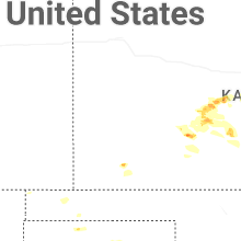
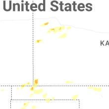
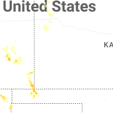
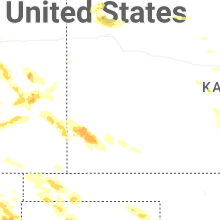
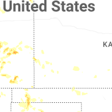
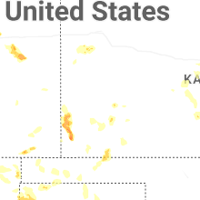
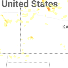
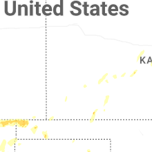
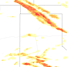


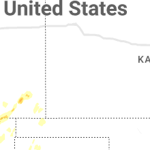


Connect with Interactive Hail Maps