

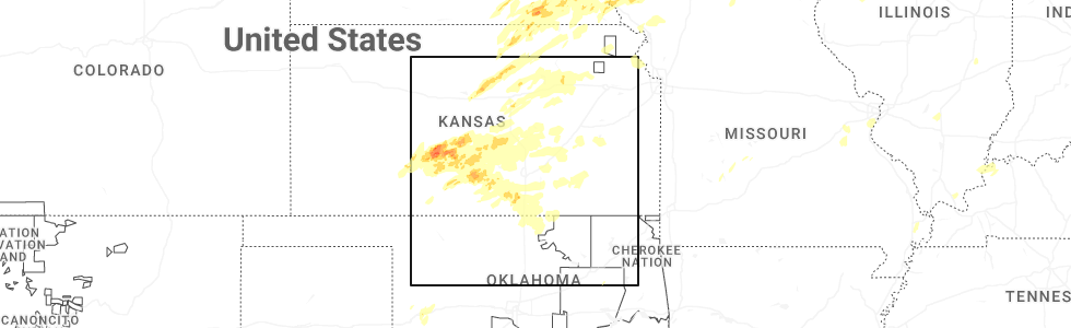
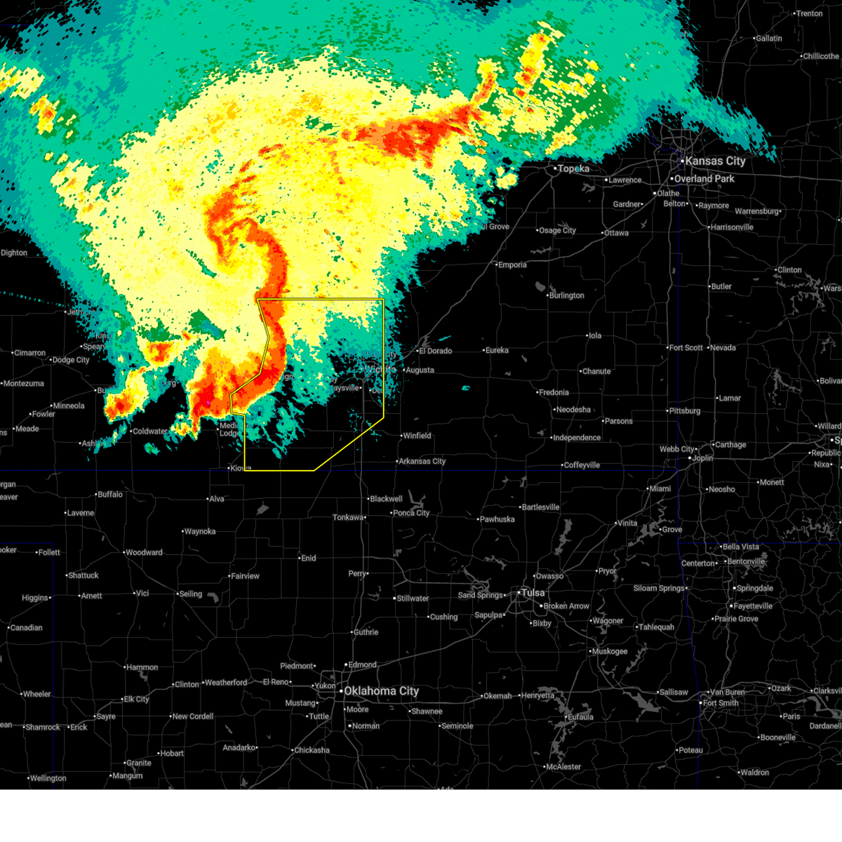
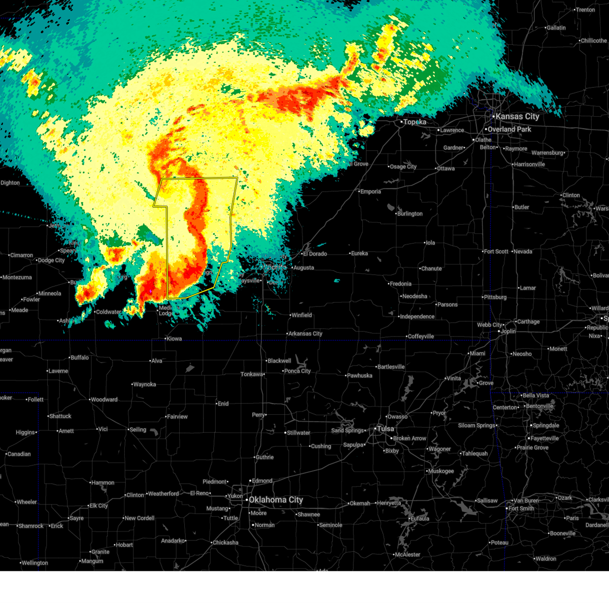
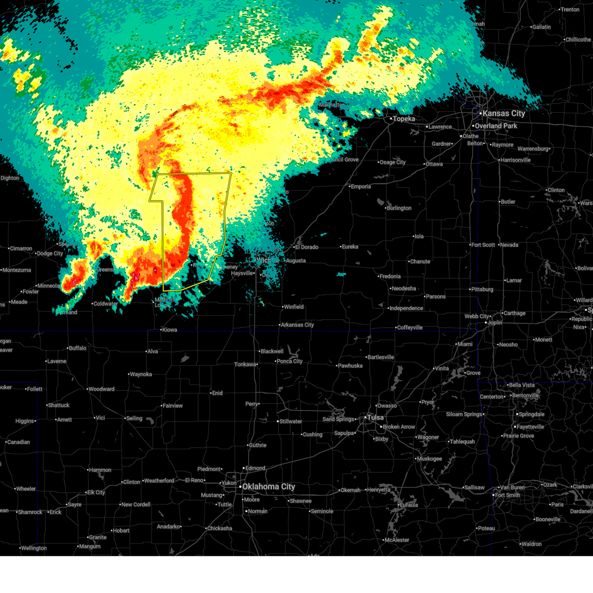
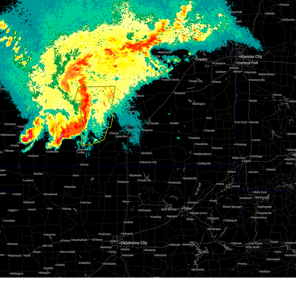
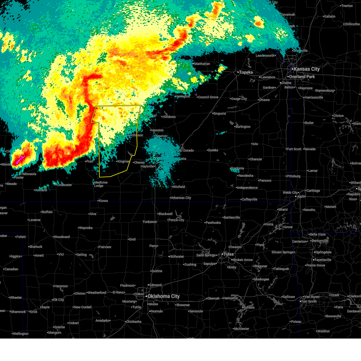
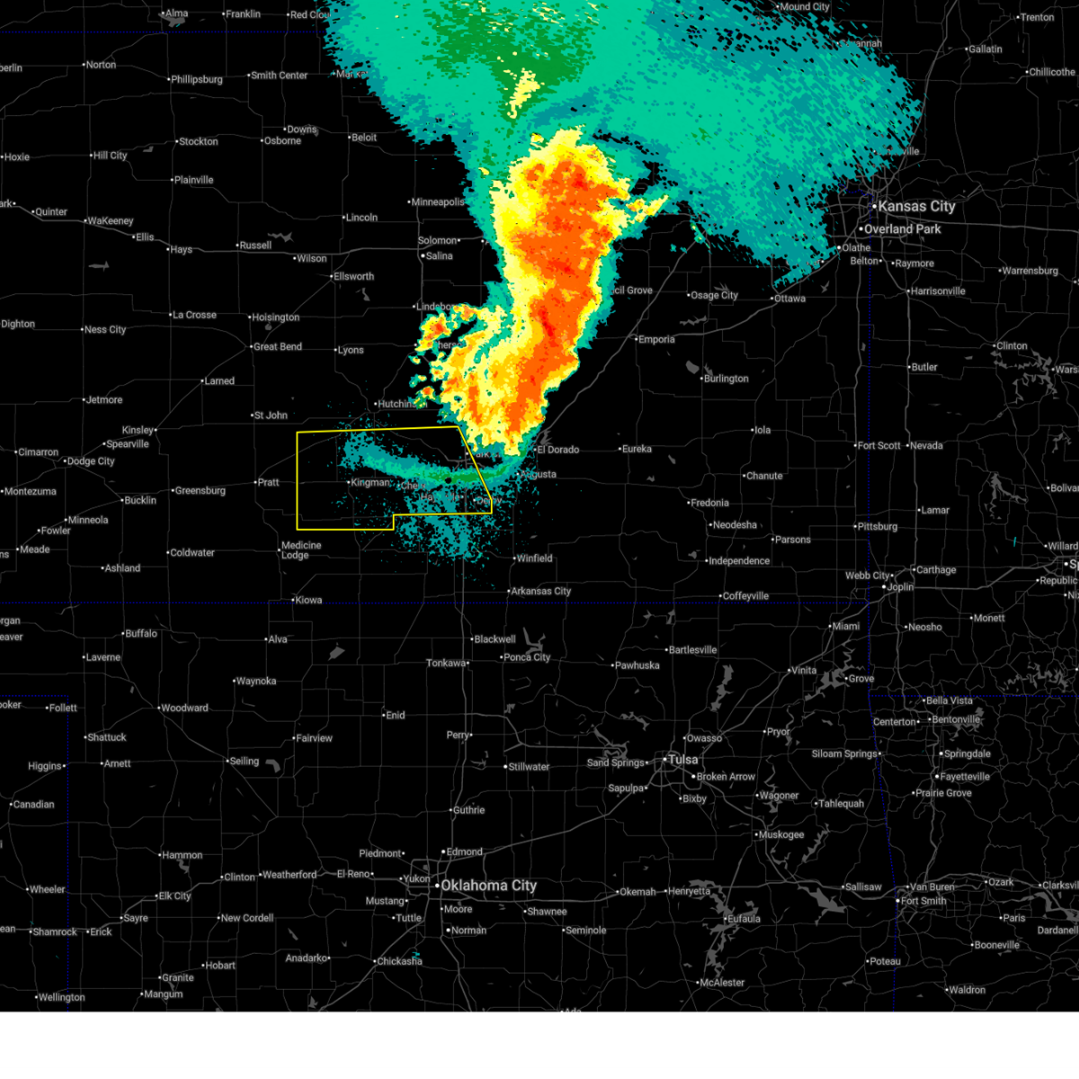
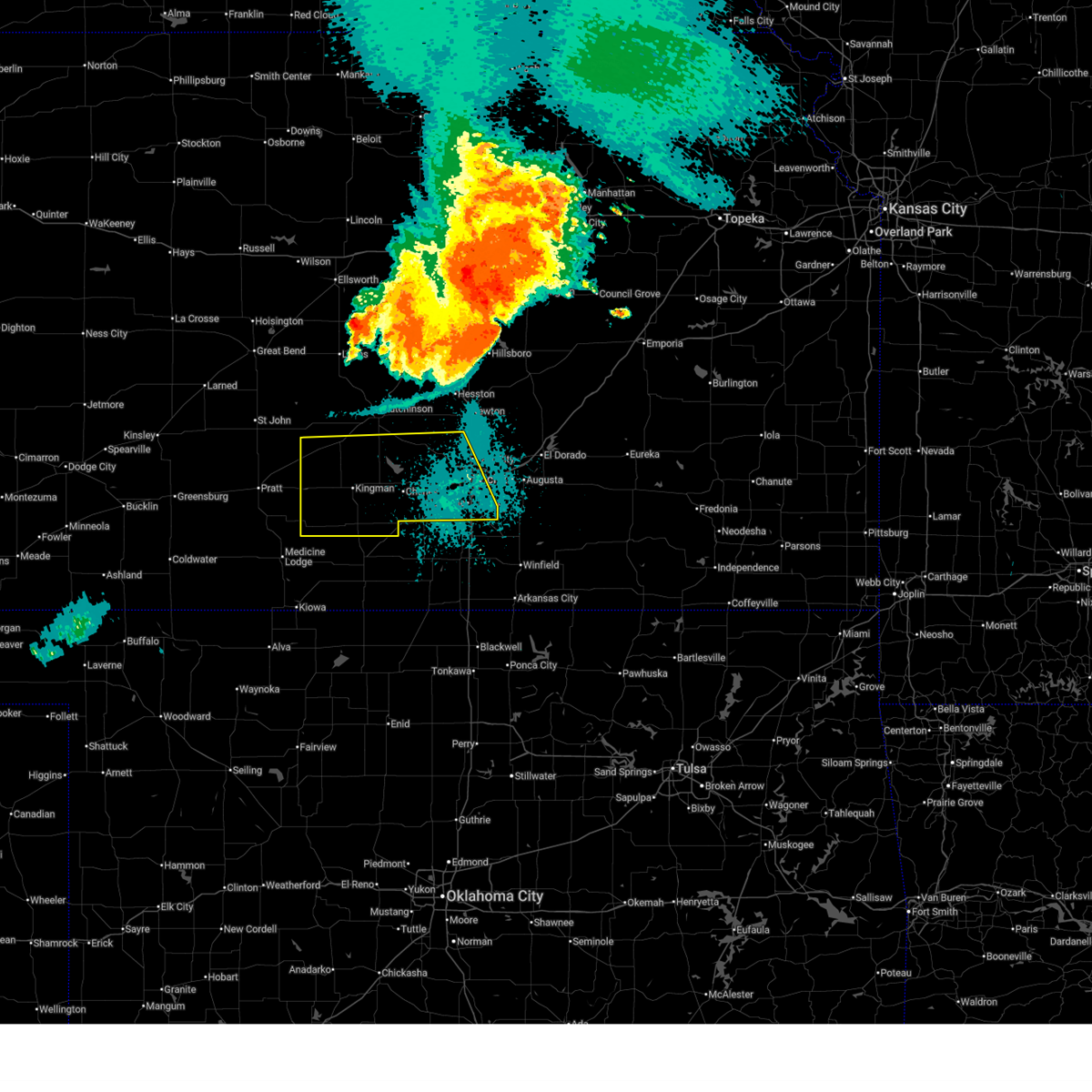
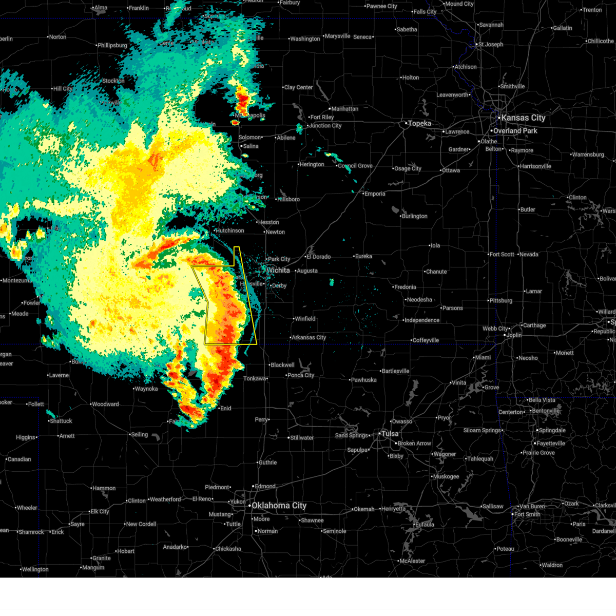
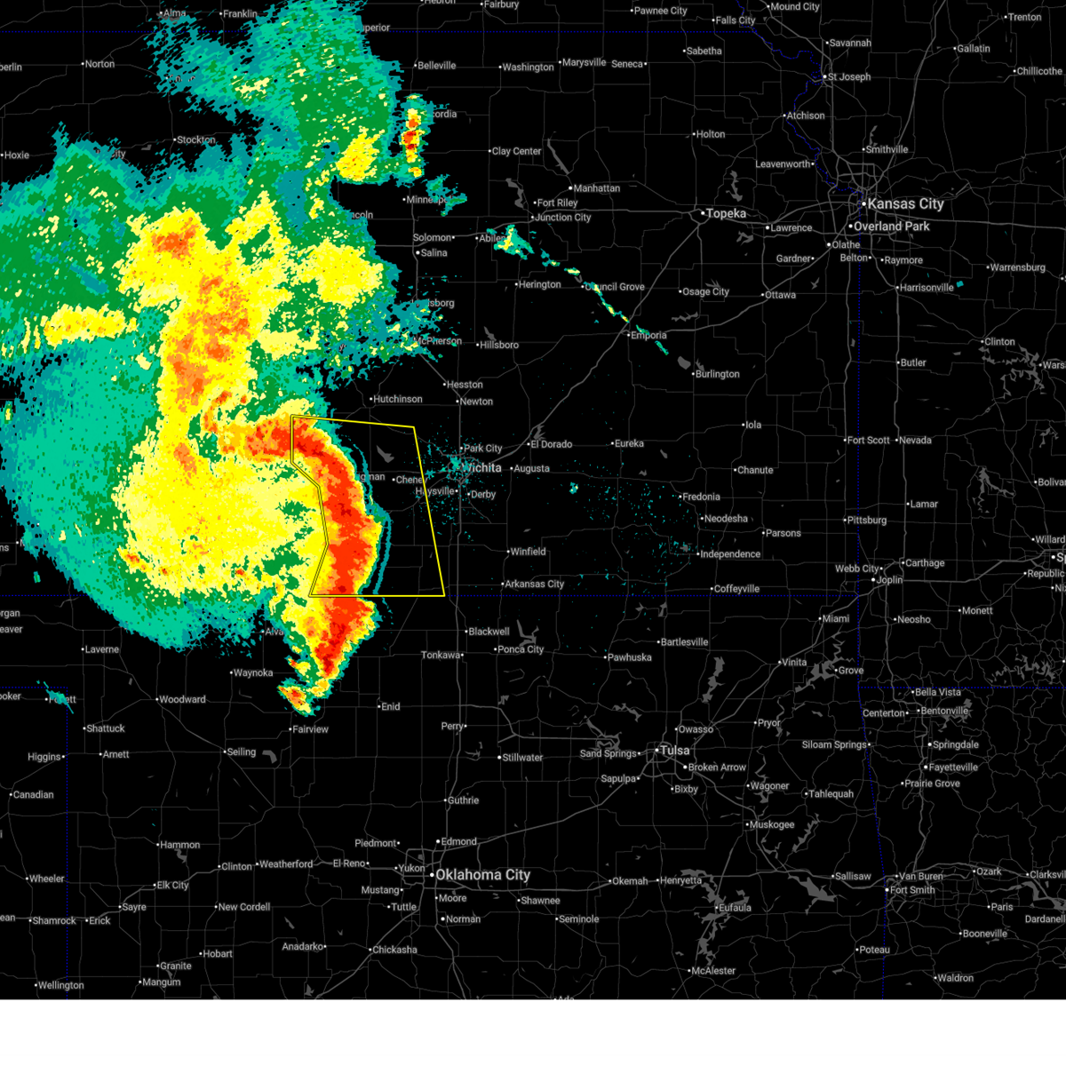
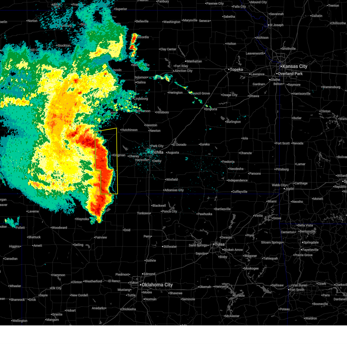
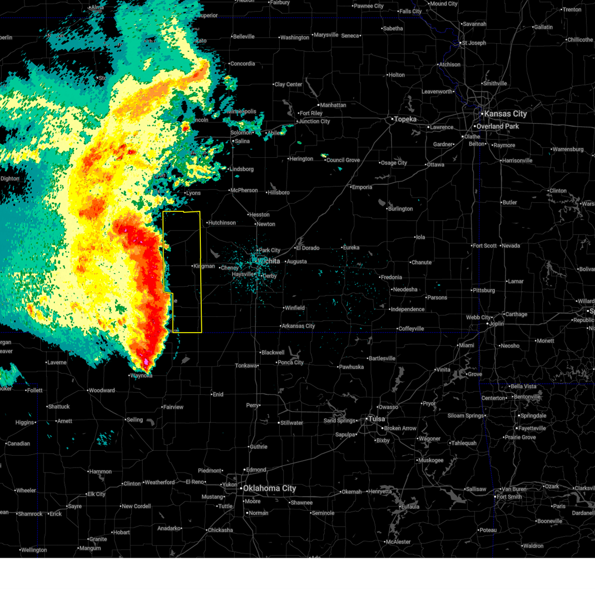
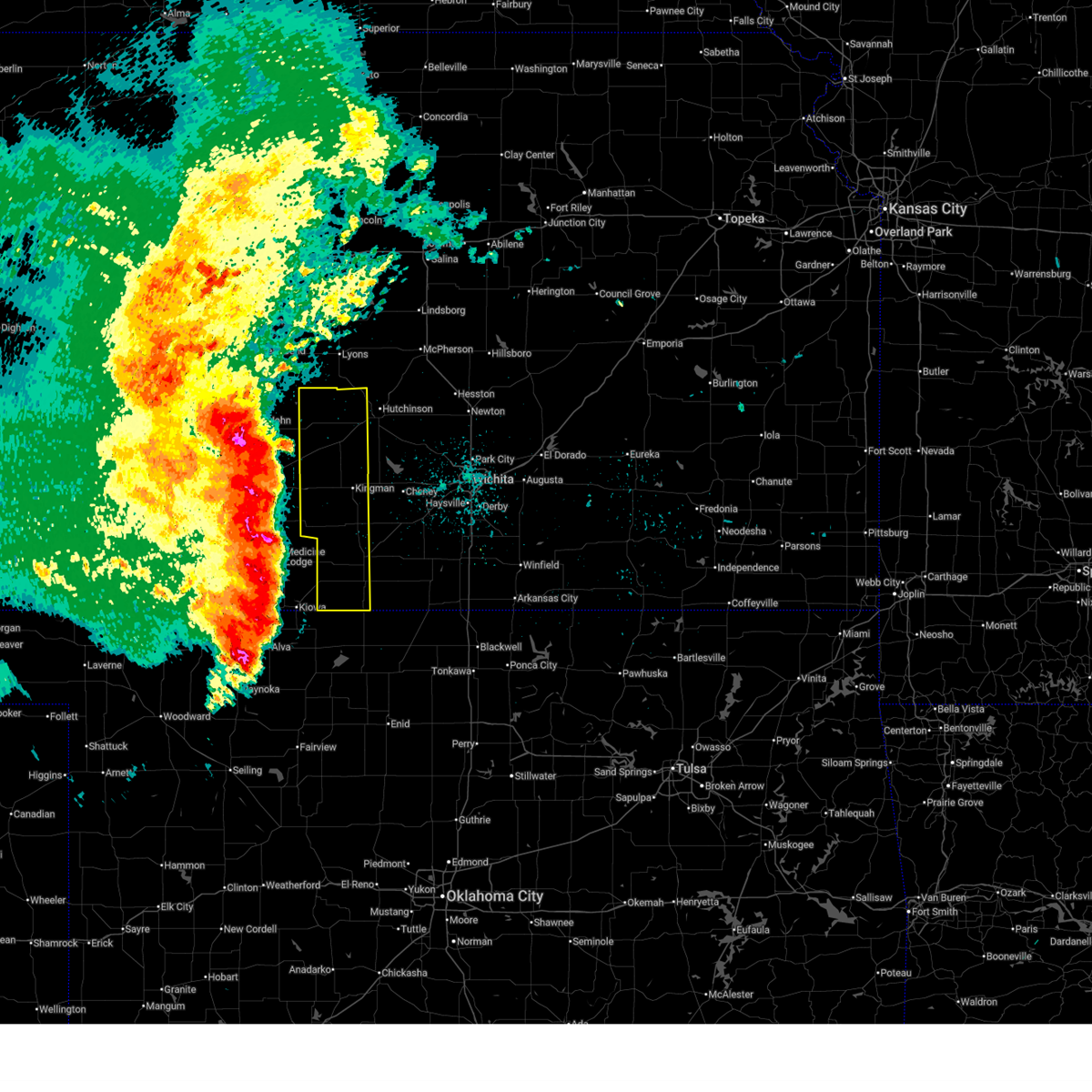
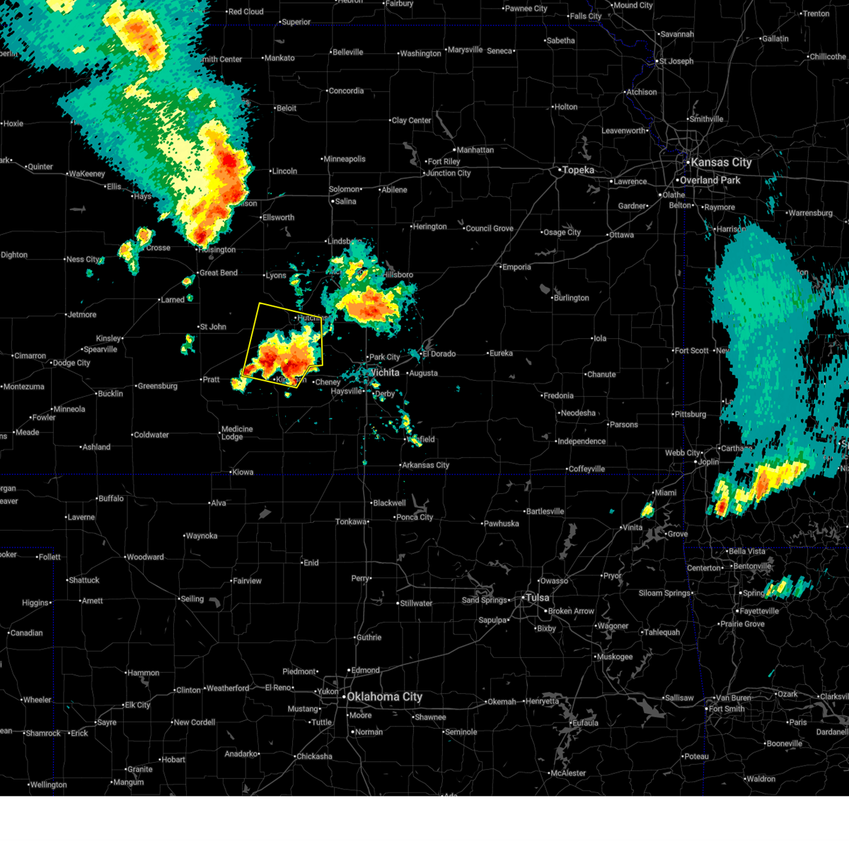
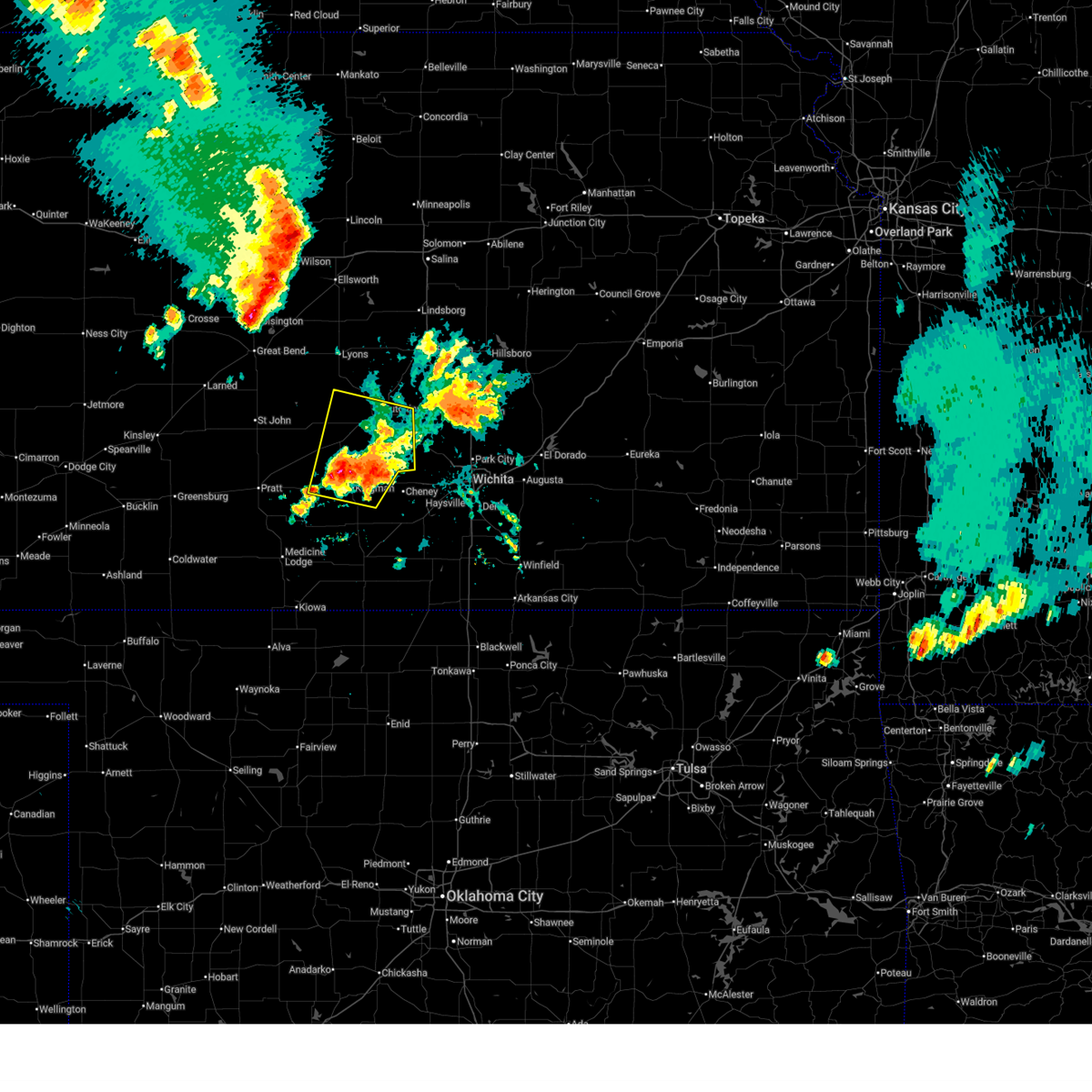
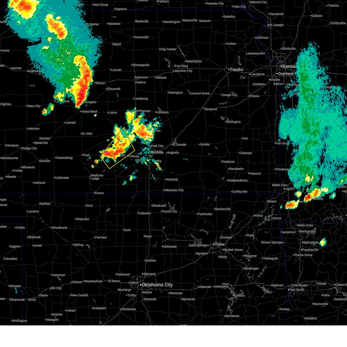
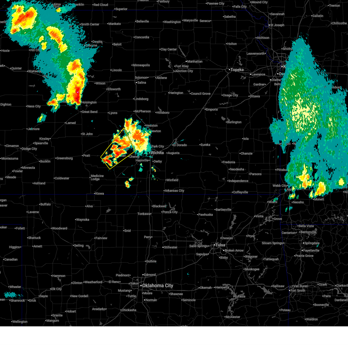
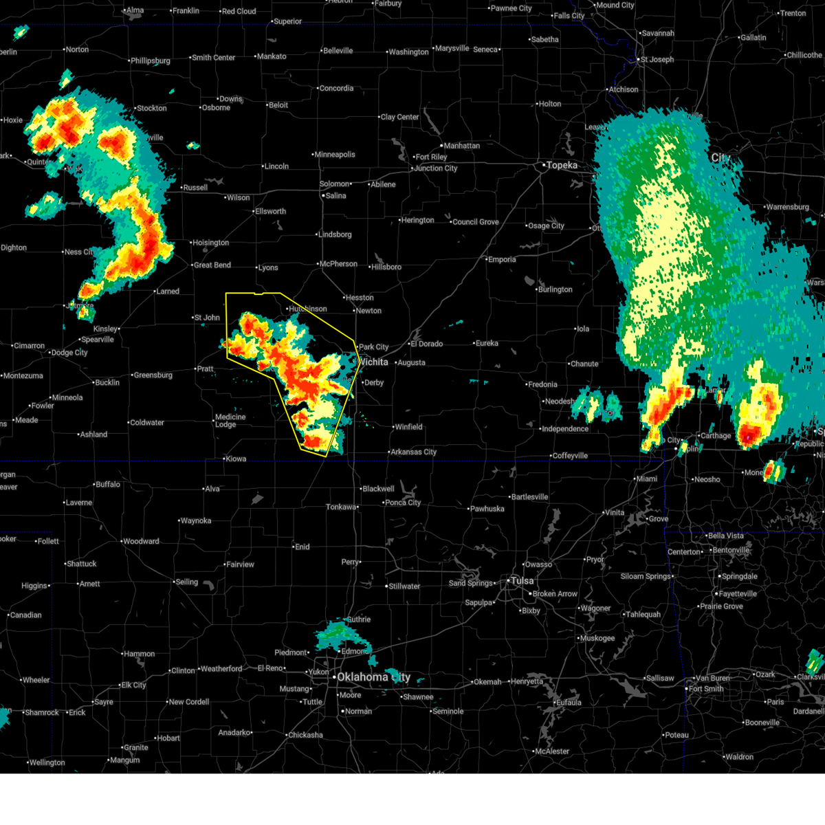
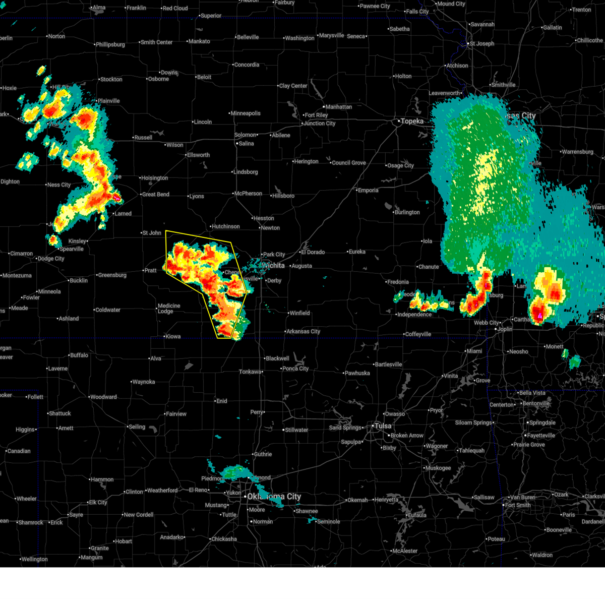
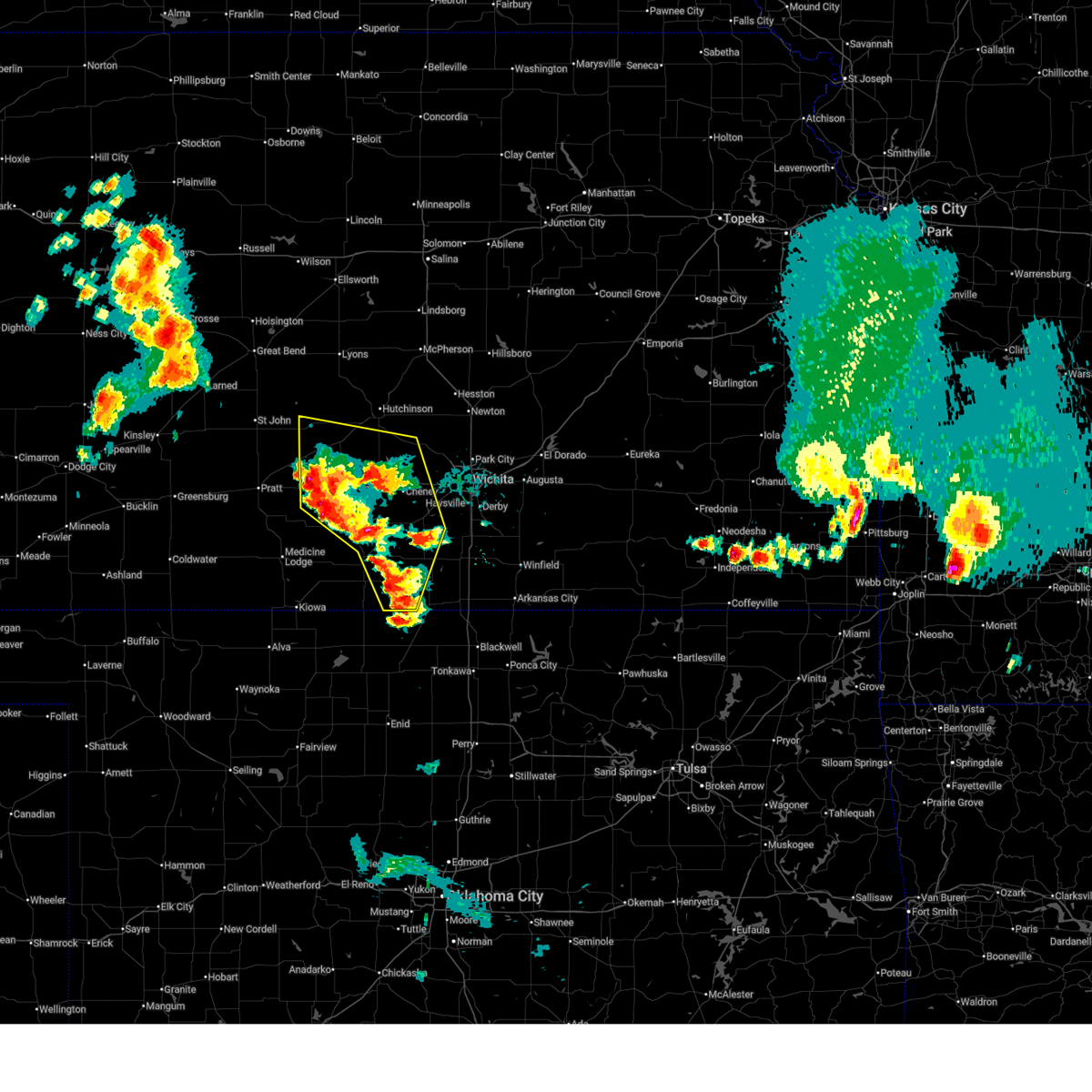
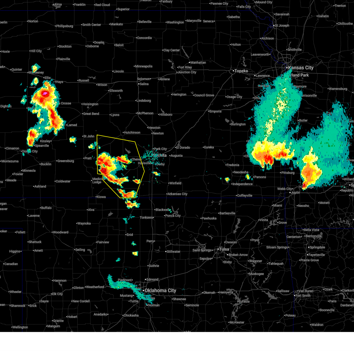
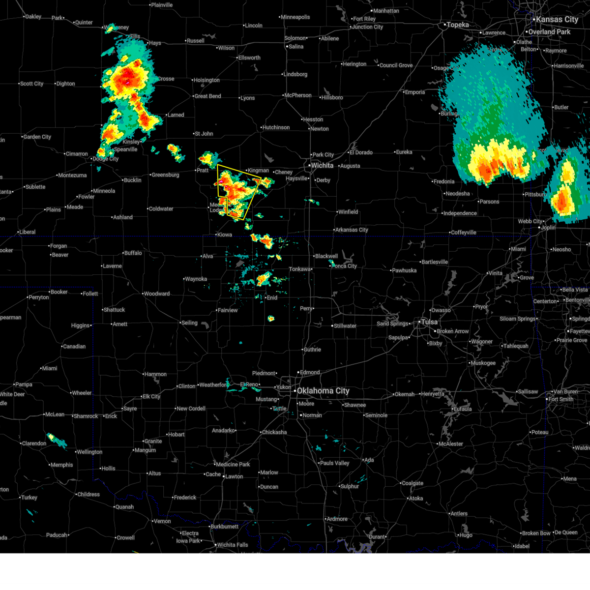
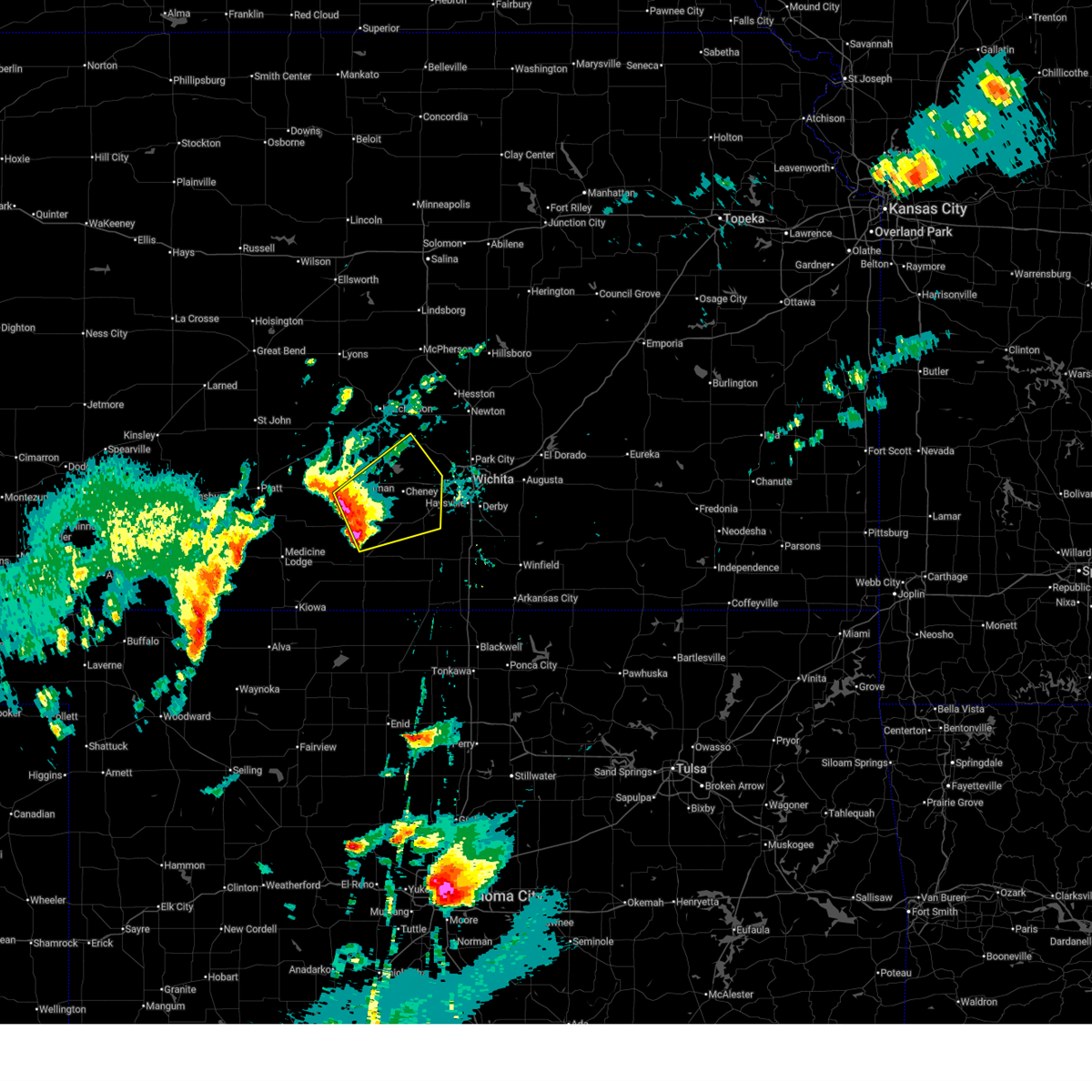
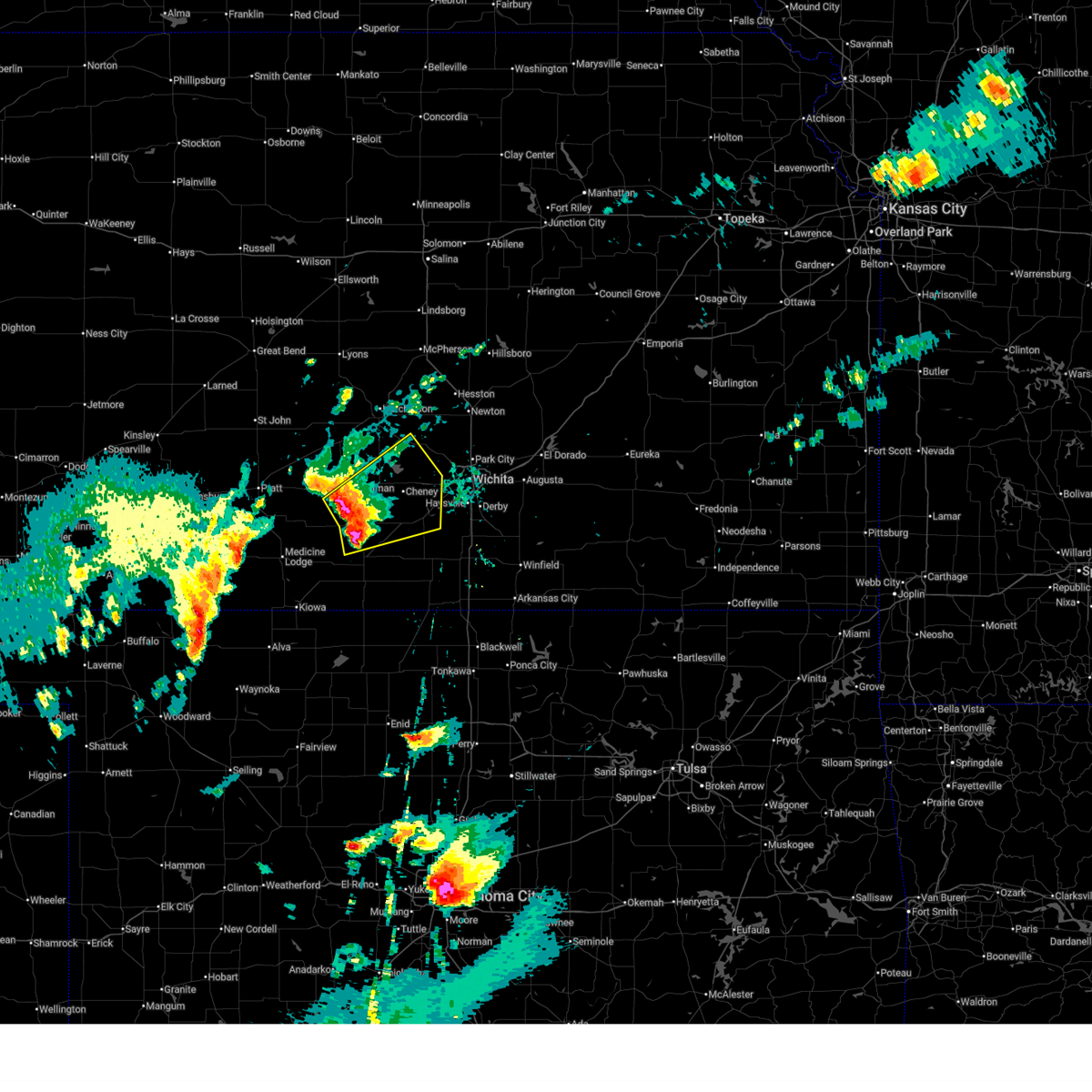
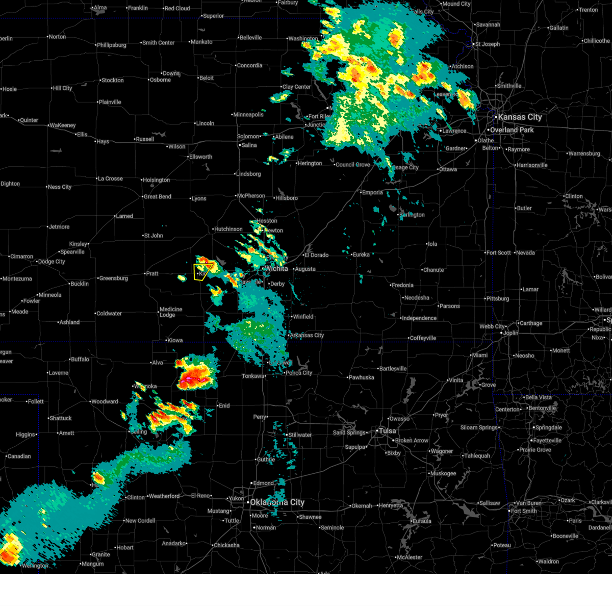
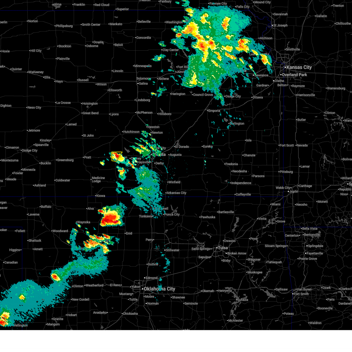
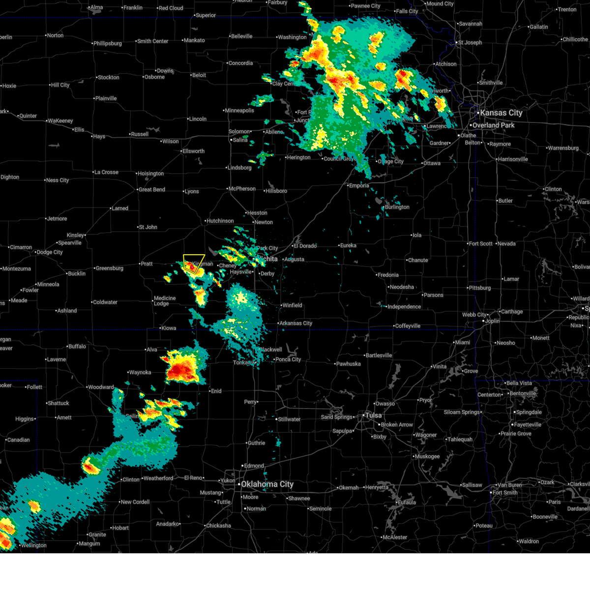
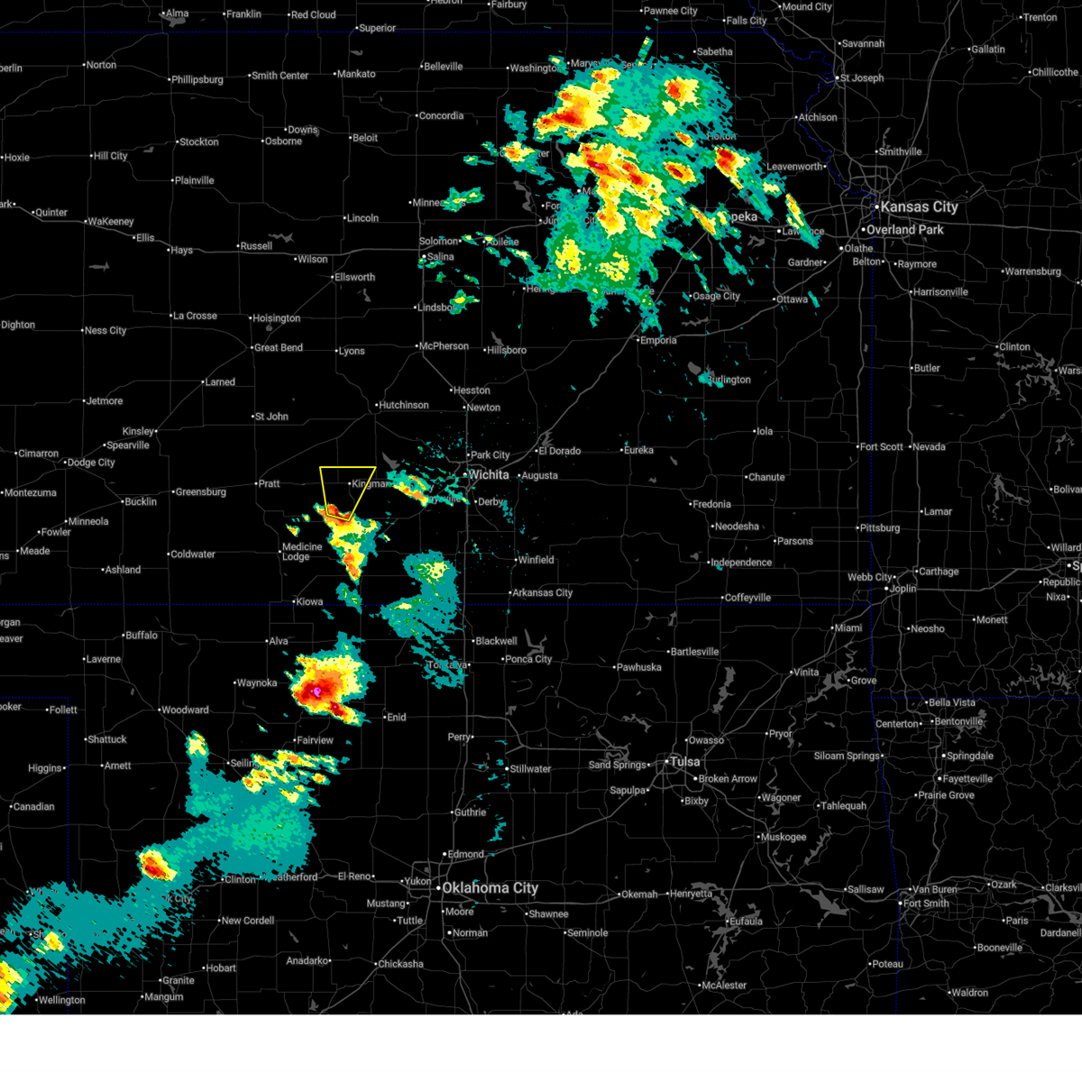
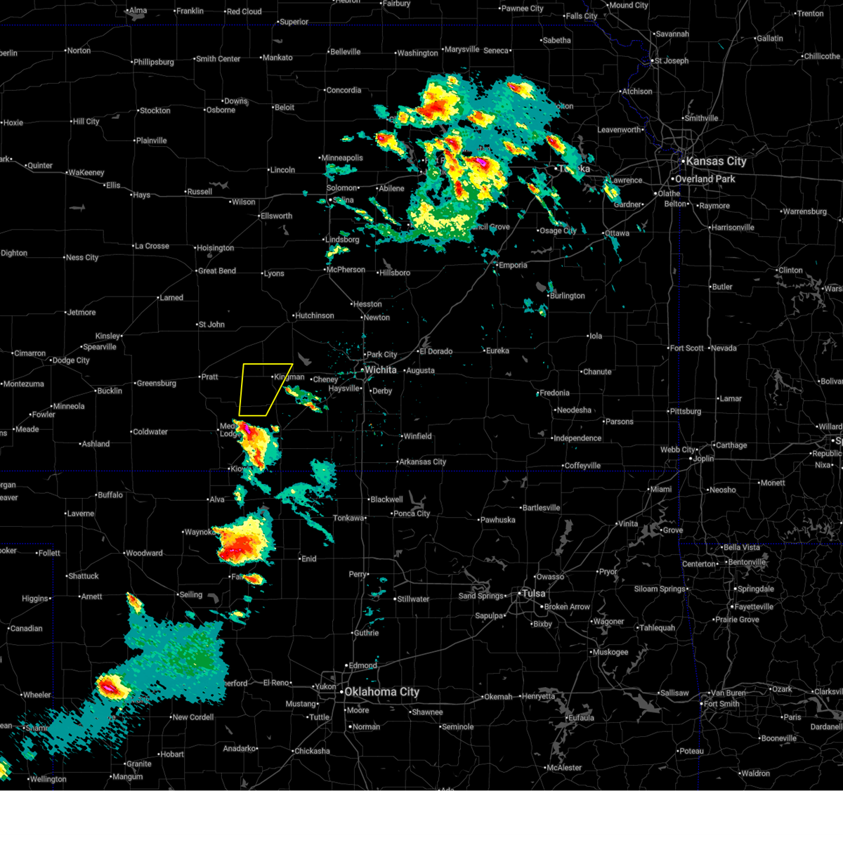
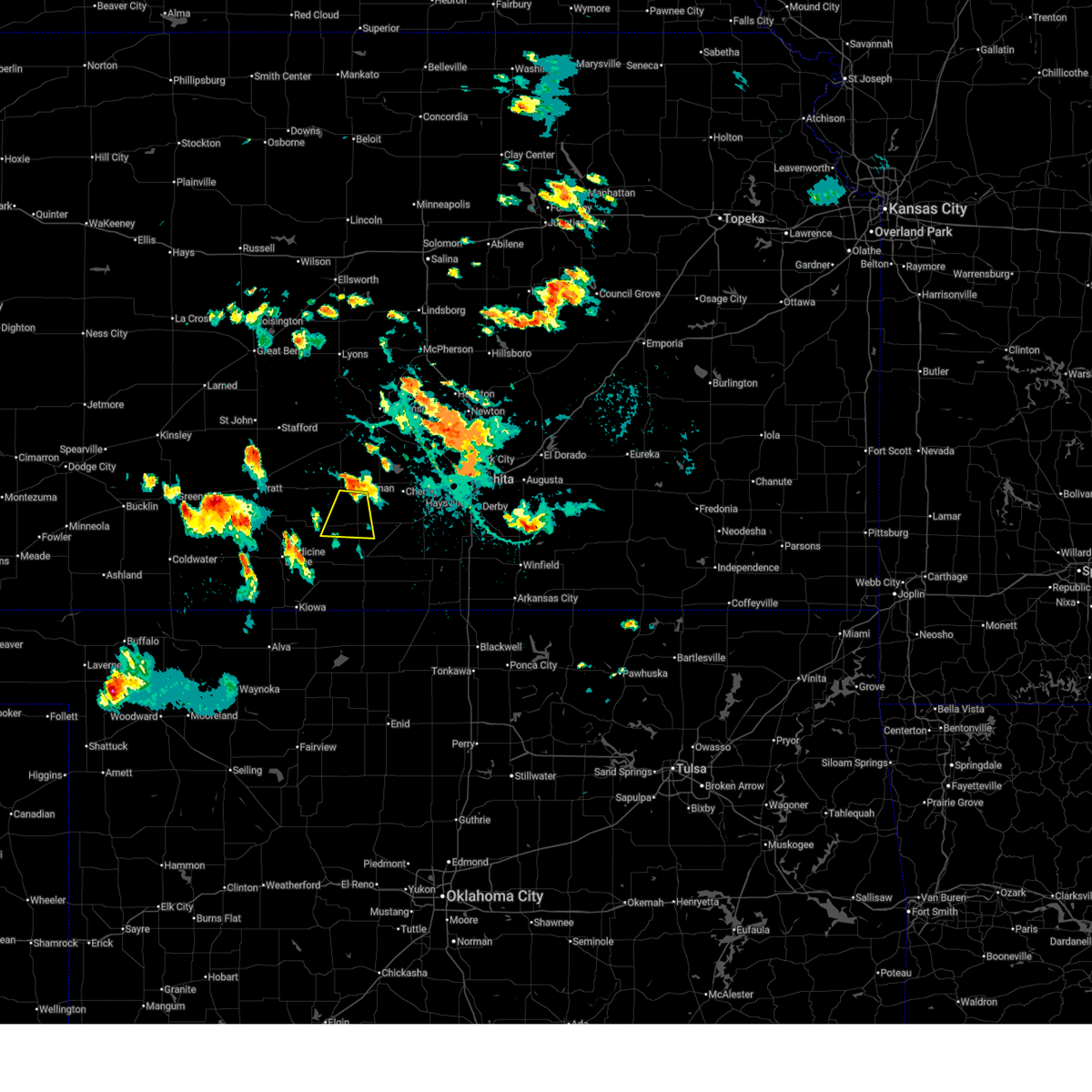
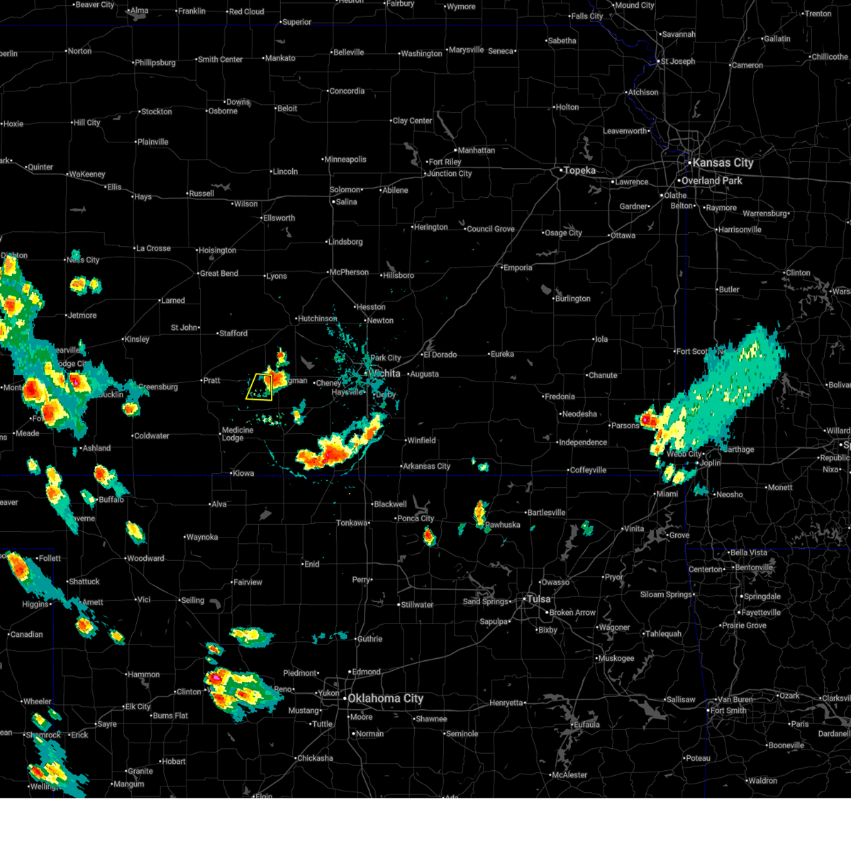
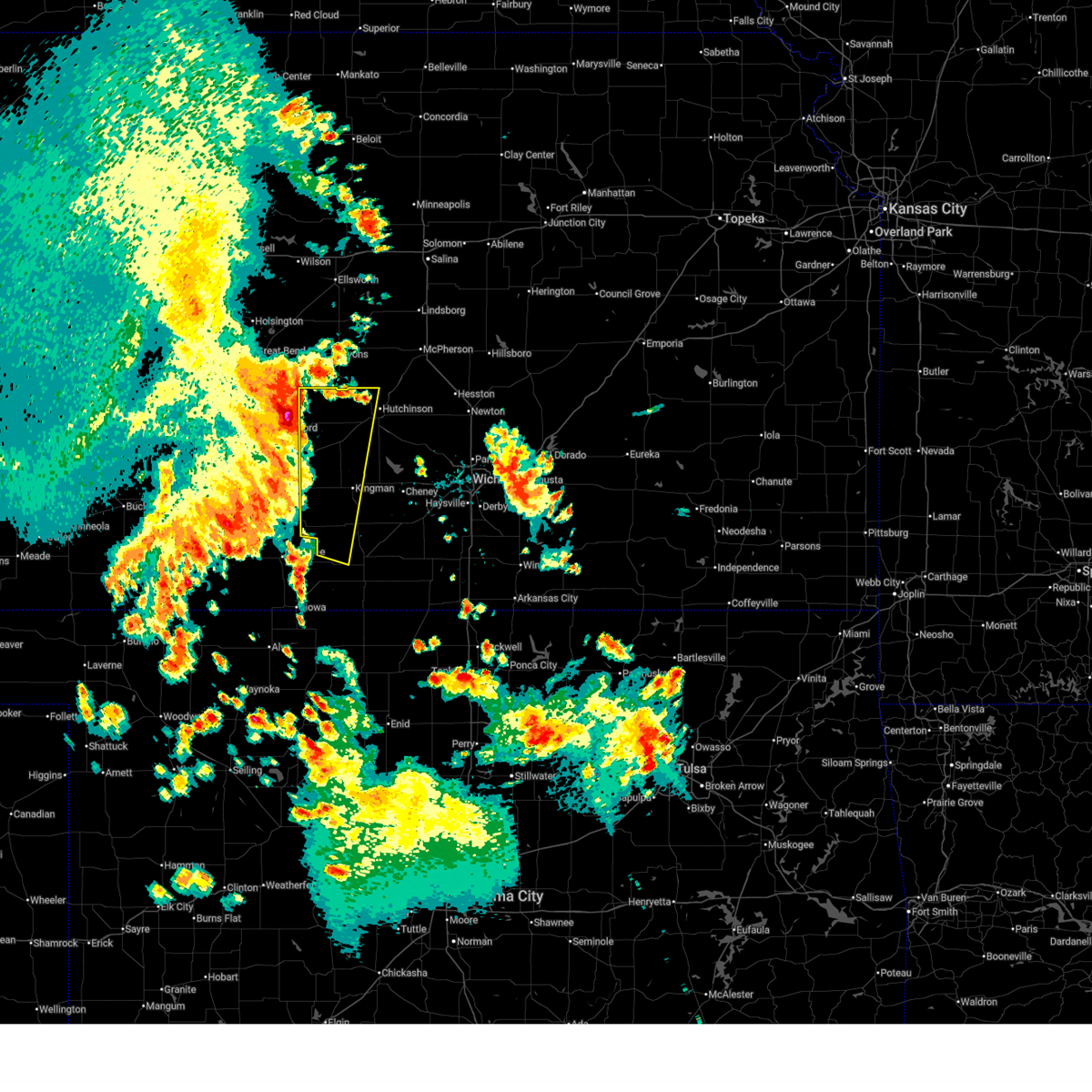
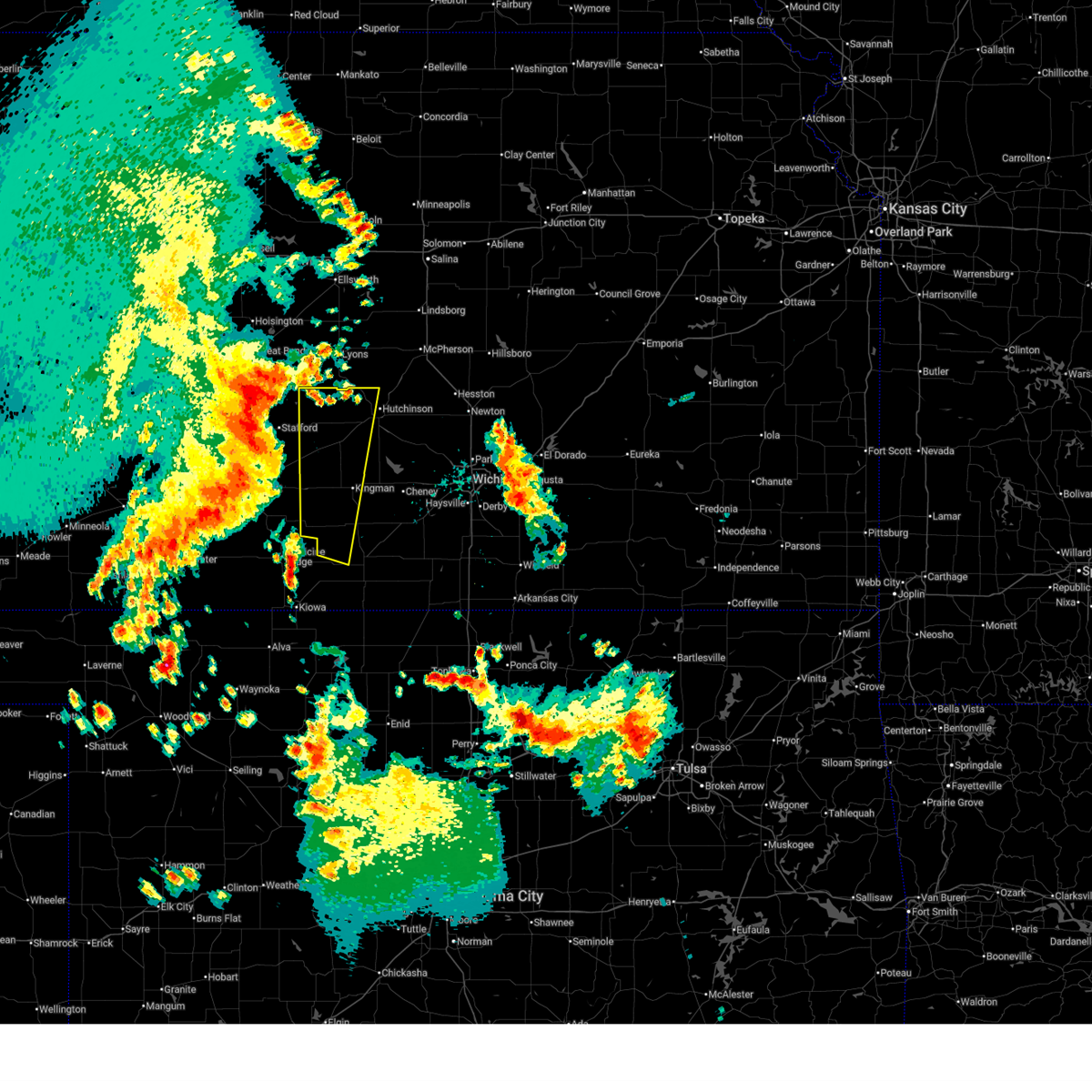
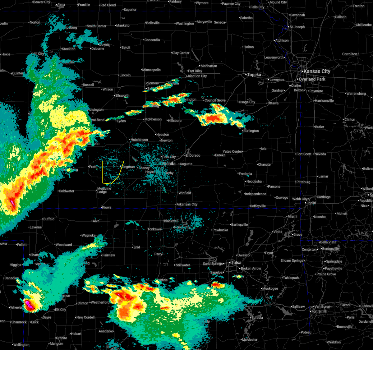
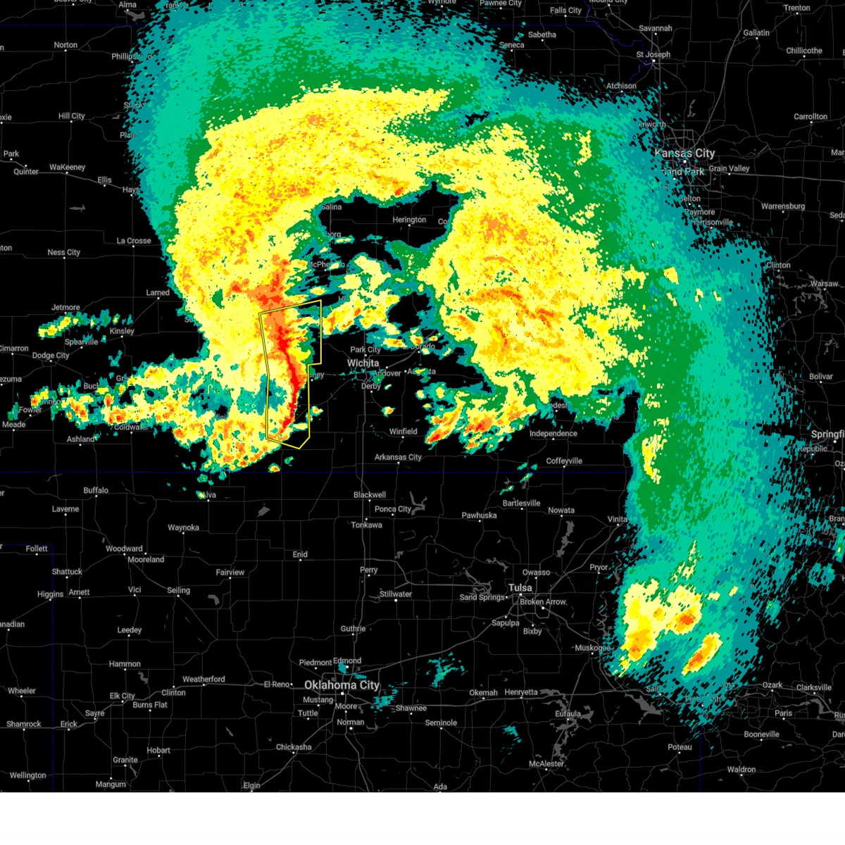
Hail Map for Kingman, KS
The Kingman, KS area has had 34 reports of on-the-ground hail by trained spotters, and has been under severe weather warnings 63 times during the past 12 months. Doppler radar has detected hail at or near Kingman, KS on 113 occasions, including 14 occasions during the past year.
| Name: | Kingman, KS |
| Where Located: | 43.4 miles W of Wichita, KS |
| Map: | Google Map for Kingman, KS |
| Population: | 3177 |
| Housing Units: | 1546 |
| More Info: | Search Google for Kingman, KS |
1
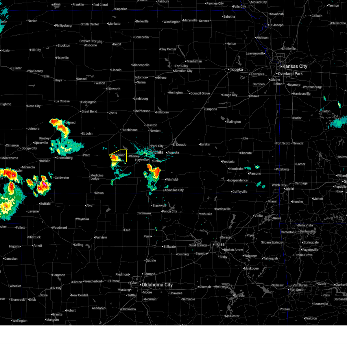
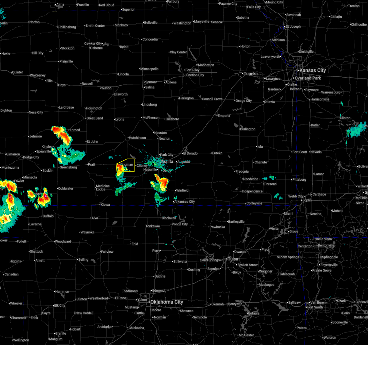
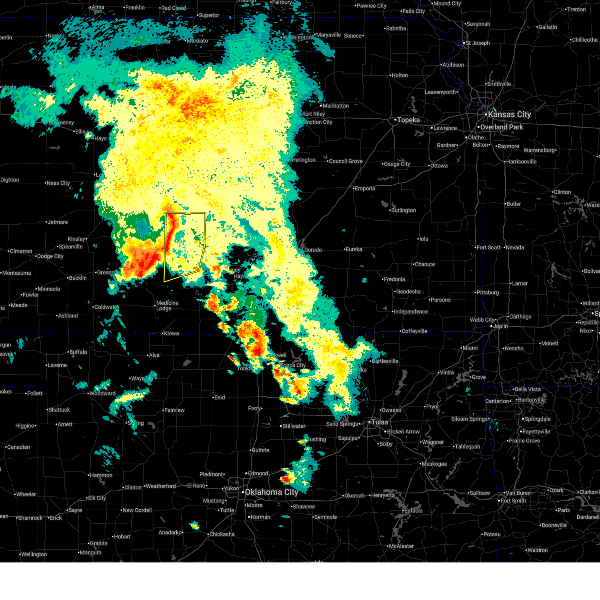
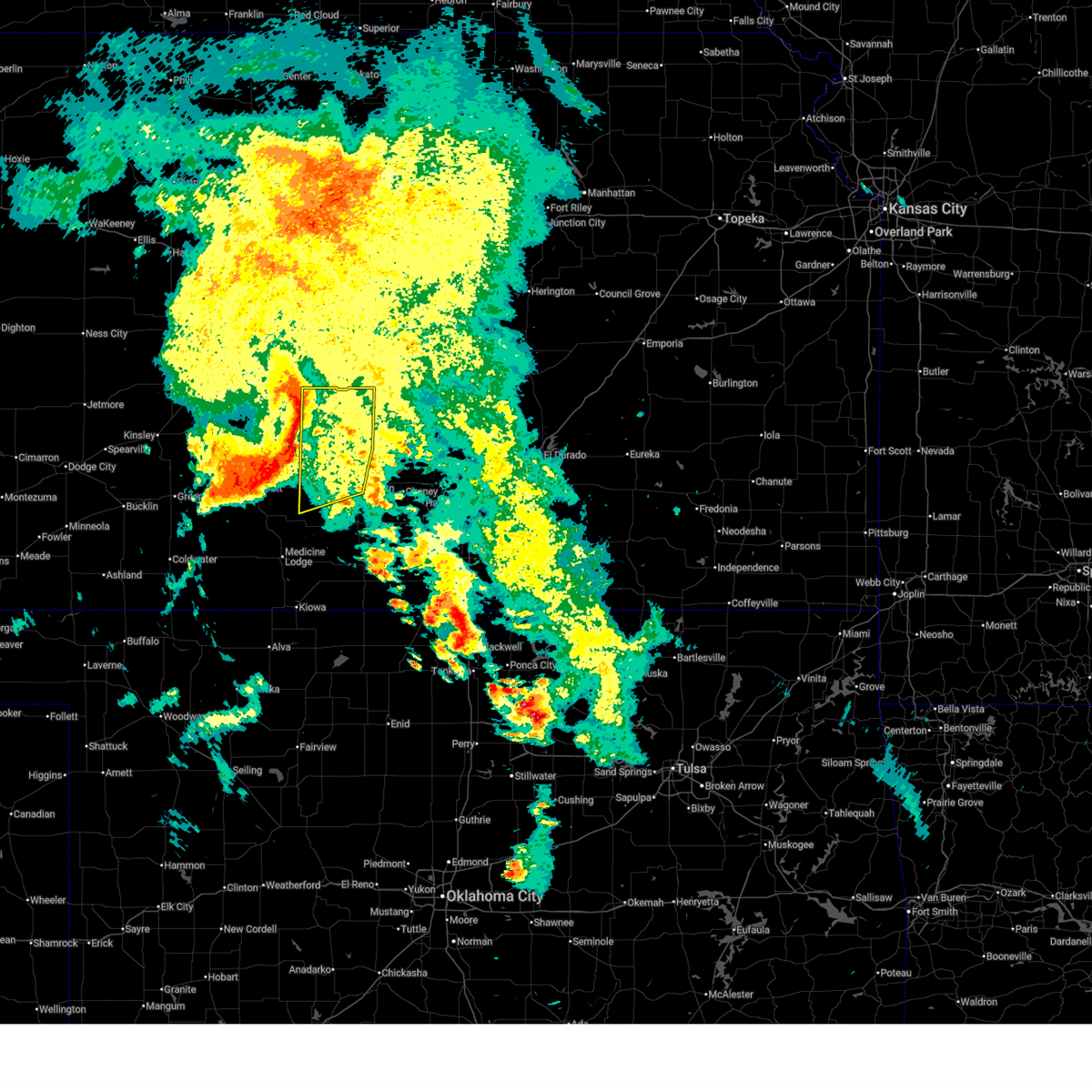
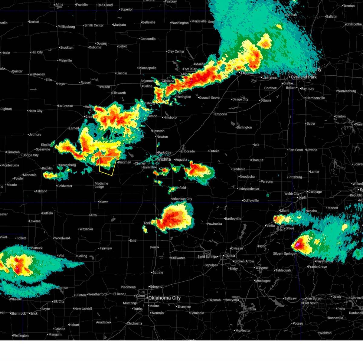
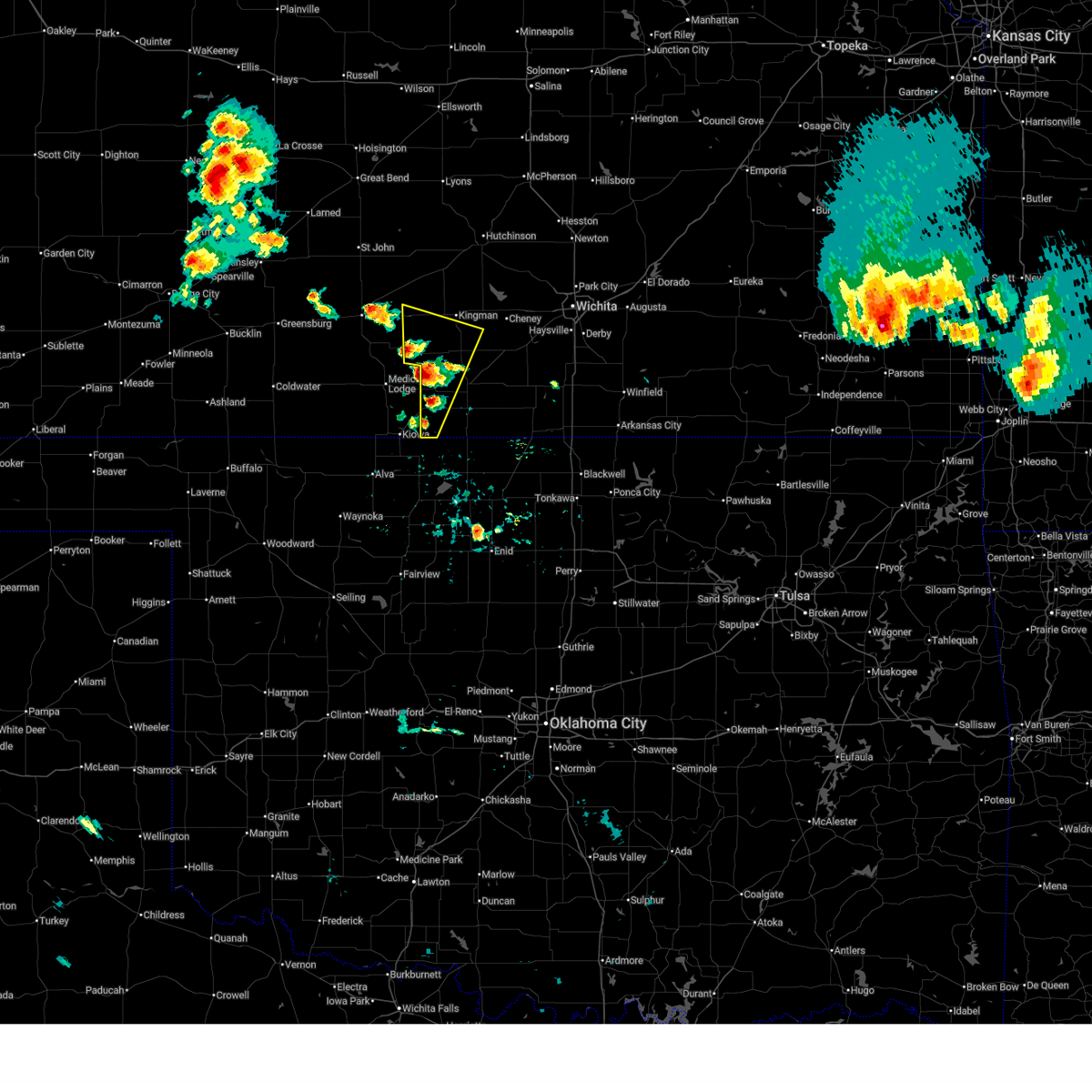
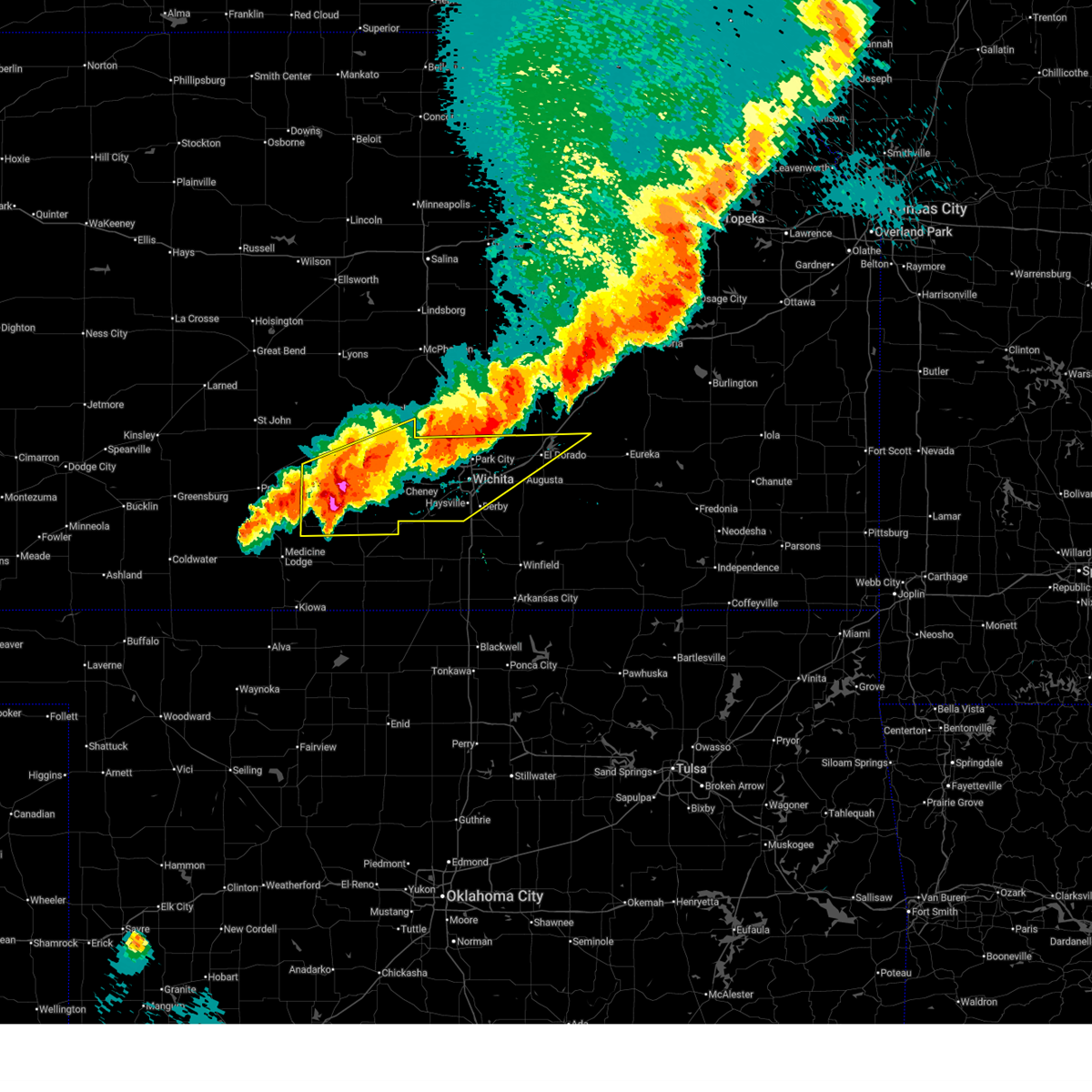
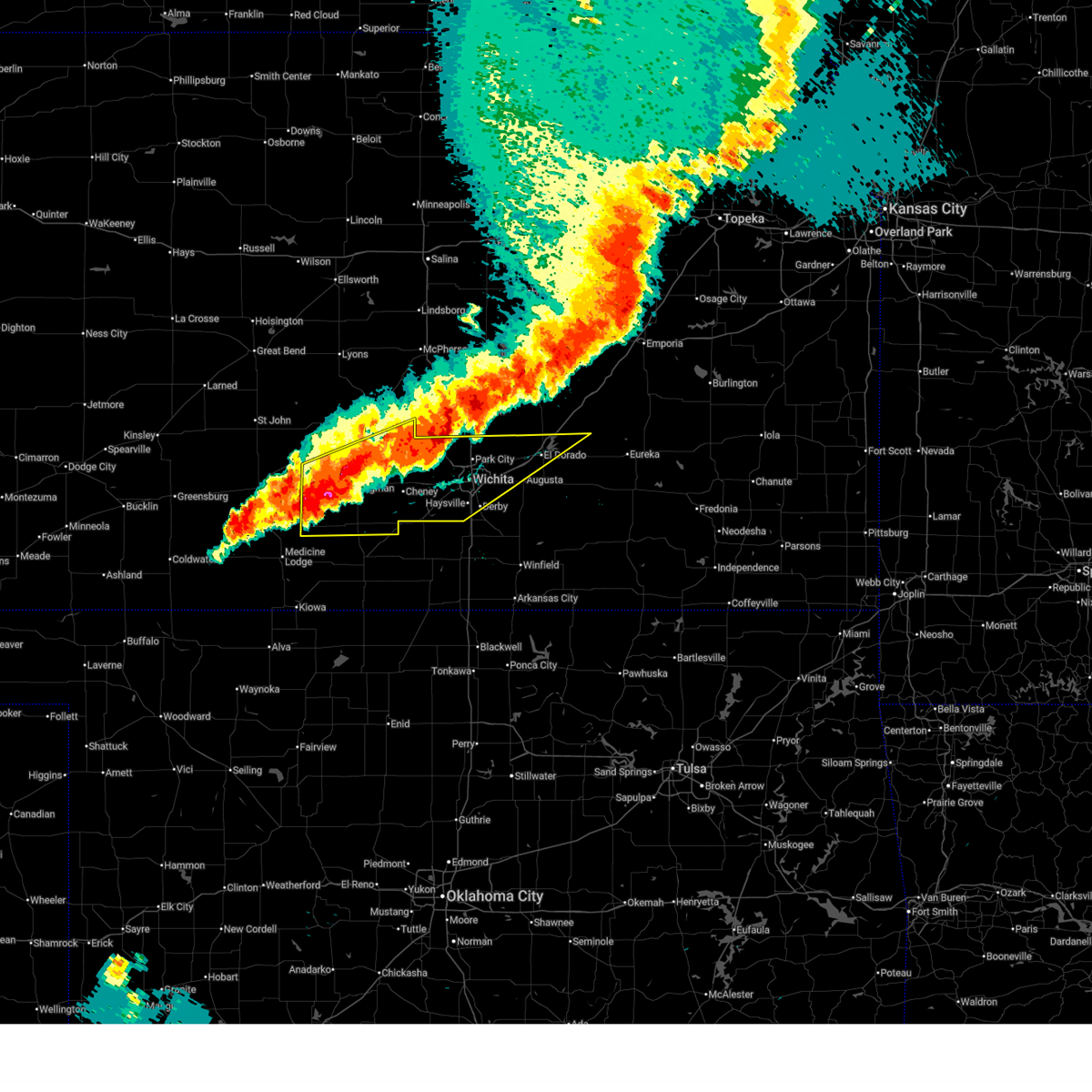
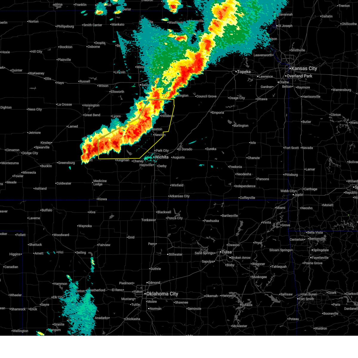
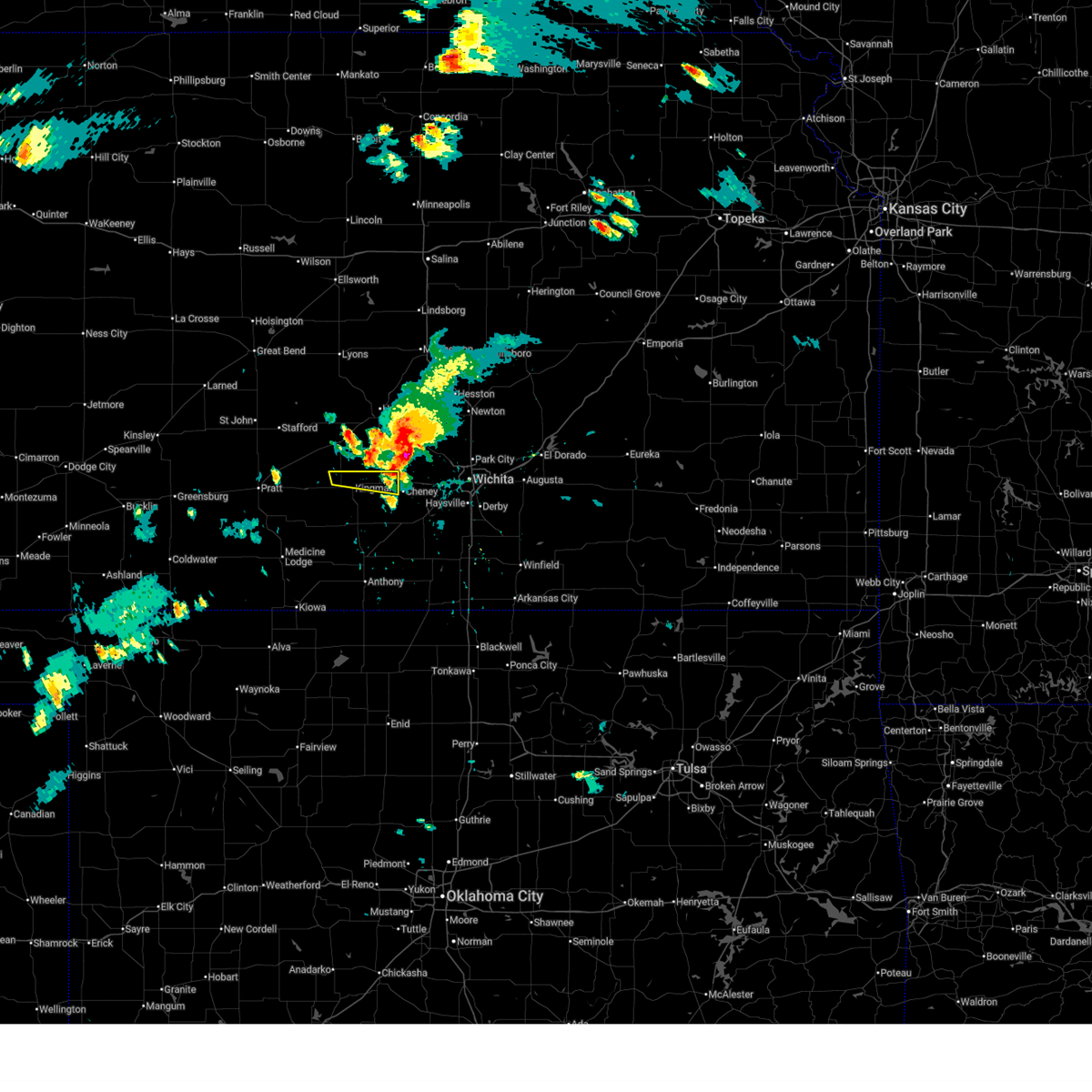
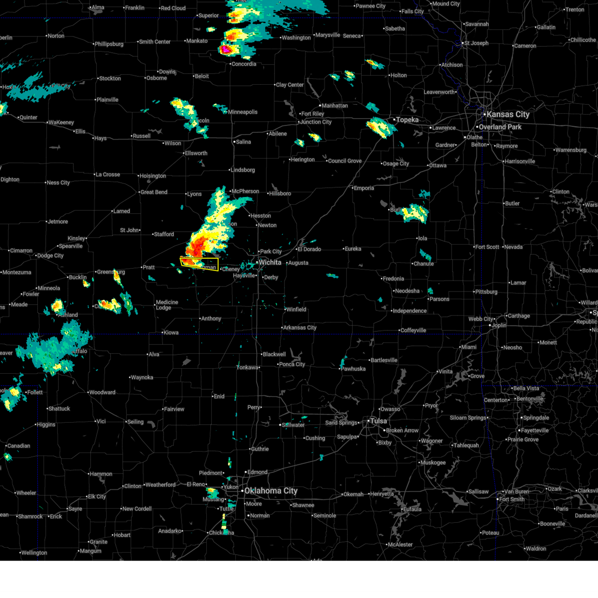
The Top Recent Hail Date for Kingman, KS is Monday, May 18, 2026 (7th out of 113)
Hail and Wind Damage Spotted near Kingman, KS
| Date / Time | Report Details |
|---|---|
| 7/9/2026 7:45 PM CDT |
 At 744 pm cdt, a severe thunderstorm was located near kingman, moving east at 20 mph (60 mph winds were reported in kingman at 744 pm). Hazards include 60 mph wind gusts and quarter size hail. Hail damage to vehicles is expected. expect wind damage to roofs, siding, and trees. Locations impacted include, kingman, murdock, waterloo, mt vernon, cheney state park, and cheney lake. At 744 pm cdt, a severe thunderstorm was located near kingman, moving east at 20 mph (60 mph winds were reported in kingman at 744 pm). Hazards include 60 mph wind gusts and quarter size hail. Hail damage to vehicles is expected. expect wind damage to roofs, siding, and trees. Locations impacted include, kingman, murdock, waterloo, mt vernon, cheney state park, and cheney lake.
|
| 7/9/2026 7:44 PM CDT | Storm damage reported in kingman county KS, 0.9 miles WSW of Kingman, KS |
| 7/9/2026 7:38 PM CDT |
 Svrict the national weather service in wichita has issued a * severe thunderstorm warning for, northeastern kingman county in south central kansas, * until 845 pm cdt. * at 738 pm cdt, a severe thunderstorm was located near kingman, moving east at 20 mph (radar indicated). Hazards include 60 mph wind gusts and quarter size hail. Hail damage to vehicles is expected. Expect wind damage to roofs, siding, and trees. Svrict the national weather service in wichita has issued a * severe thunderstorm warning for, northeastern kingman county in south central kansas, * until 845 pm cdt. * at 738 pm cdt, a severe thunderstorm was located near kingman, moving east at 20 mph (radar indicated). Hazards include 60 mph wind gusts and quarter size hail. Hail damage to vehicles is expected. Expect wind damage to roofs, siding, and trees.
|
| 6/25/2026 10:53 AM CDT |
 At 1052 am cdt, severe thunderstorms were located along a line extending from 8 miles south of alden to sylvia to near turon to near coats, moving east at 30 mph (radar indicated). Hazards include 60 mph wind gusts. Expect damage to roofs, siding, and trees. Locations impacted include, kingman, nickerson, pretty prairie, arlington, cunningham, turon, partridge, sylvia, plevna, abbyville, willowbrook, langdon, penalosa, and kingman airport. At 1052 am cdt, severe thunderstorms were located along a line extending from 8 miles south of alden to sylvia to near turon to near coats, moving east at 30 mph (radar indicated). Hazards include 60 mph wind gusts. Expect damage to roofs, siding, and trees. Locations impacted include, kingman, nickerson, pretty prairie, arlington, cunningham, turon, partridge, sylvia, plevna, abbyville, willowbrook, langdon, penalosa, and kingman airport.
|
| 6/25/2026 10:41 AM CDT |
 Svrict the national weather service in wichita has issued a * severe thunderstorm warning for, reno county in south central kansas, northwestern kingman county in south central kansas, * until 1145 am cdt. * at 1041 am cdt, severe thunderstorms were located along a line extending from 10 miles east of hudson to zenith to near preston to 5 miles northeast of croft, moving east at 30 mph (radar indicated). Hazards include 60 mph wind gusts. expect damage to roofs, siding, and trees Svrict the national weather service in wichita has issued a * severe thunderstorm warning for, reno county in south central kansas, northwestern kingman county in south central kansas, * until 1145 am cdt. * at 1041 am cdt, severe thunderstorms were located along a line extending from 10 miles east of hudson to zenith to near preston to 5 miles northeast of croft, moving east at 30 mph (radar indicated). Hazards include 60 mph wind gusts. expect damage to roofs, siding, and trees
|
| 6/21/2026 10:11 PM CDT |
 Svrict the national weather service in wichita has issued a * severe thunderstorm warning for, northwestern harper county in south central kansas, kingman county in south central kansas, * until 1115 pm cdt. * at 1010 pm cdt, severe thunderstorms were located along a line extending from 9 miles southeast of kingman to near isabel, moving southeast at 15 mph (radar indicated). Hazards include 60 mph wind gusts and half dollar size hail. Hail damage to vehicles is expected. Expect wind damage to roofs, siding, and trees. Svrict the national weather service in wichita has issued a * severe thunderstorm warning for, northwestern harper county in south central kansas, kingman county in south central kansas, * until 1115 pm cdt. * at 1010 pm cdt, severe thunderstorms were located along a line extending from 9 miles southeast of kingman to near isabel, moving southeast at 15 mph (radar indicated). Hazards include 60 mph wind gusts and half dollar size hail. Hail damage to vehicles is expected. Expect wind damage to roofs, siding, and trees.
|
| 6/21/2026 1:26 AM CDT |
 At 125 am cdt, severe thunderstorms were located along a line extending from 6 miles southwest of moundridge to 5 miles north of benton to near andover to 5 miles west of belle plaine to 8 miles east of anthony, moving southeast at 55 mph (trained weather spotters. several reports of 60 to 70 mph wind gusts were reported around wichita). Hazards include 70 mph wind gusts. Expect considerable tree damage. damage is likely to mobile homes, roofs, and outbuildings. locations impacted include, wichita, derby, newton, andover, haysville, wellington, park city, valley center, bel aire, mulvane, goddard, rose hill, hesston, maize, kingman, clearwater, anthony, cheney, halstead, and north newton. this includes the following highways, interstate 135 between mile markers 0 and 42. Interstate 35 between mile markers 18 and 54. At 125 am cdt, severe thunderstorms were located along a line extending from 6 miles southwest of moundridge to 5 miles north of benton to near andover to 5 miles west of belle plaine to 8 miles east of anthony, moving southeast at 55 mph (trained weather spotters. several reports of 60 to 70 mph wind gusts were reported around wichita). Hazards include 70 mph wind gusts. Expect considerable tree damage. damage is likely to mobile homes, roofs, and outbuildings. locations impacted include, wichita, derby, newton, andover, haysville, wellington, park city, valley center, bel aire, mulvane, goddard, rose hill, hesston, maize, kingman, clearwater, anthony, cheney, halstead, and north newton. this includes the following highways, interstate 135 between mile markers 0 and 42. Interstate 35 between mile markers 18 and 54.
|
| 6/21/2026 12:55 AM CDT |
 At 1254 am cdt, severe thunderstorms were located along a line extending from near buhler to near mount hope to 5 miles northwest of viola to near harper, moving east at 45 mph (trained weather spotters reported 60 mph winds near cheney reservoir and 65 mph 2 miles northwest of andale). Hazards include 70 mph wind gusts. Expect considerable tree damage. damage is likely to mobile homes, roofs, and outbuildings. locations impacted include, wichita, hutchinson, derby, newton, andover, haysville, wellington, park city, valley center, bel aire, mulvane, goddard, rose hill, hesston, maize, kingman, clearwater, south hutchinson, anthony, and cheney. this includes the following highways, interstate 135 between mile markers 0 and 42. Interstate 35 between mile markers 18 and 54. At 1254 am cdt, severe thunderstorms were located along a line extending from near buhler to near mount hope to 5 miles northwest of viola to near harper, moving east at 45 mph (trained weather spotters reported 60 mph winds near cheney reservoir and 65 mph 2 miles northwest of andale). Hazards include 70 mph wind gusts. Expect considerable tree damage. damage is likely to mobile homes, roofs, and outbuildings. locations impacted include, wichita, hutchinson, derby, newton, andover, haysville, wellington, park city, valley center, bel aire, mulvane, goddard, rose hill, hesston, maize, kingman, clearwater, south hutchinson, anthony, and cheney. this includes the following highways, interstate 135 between mile markers 0 and 42. Interstate 35 between mile markers 18 and 54.
|
| 6/21/2026 12:32 AM CDT |
 Svrict the national weather service in wichita has issued a * severe thunderstorm warning for, reno county in south central kansas, sedgwick county in south central kansas, harvey county in south central kansas, harper county in south central kansas, kingman county in south central kansas, sumner county in south central kansas, * until 145 am cdt. * at 1232 am cdt, severe thunderstorms were located along a line extending from near nickerson to 6 miles west of haven to 9 miles east of kingman to 7 miles southeast of nashville, moving east at 45 mph (trained weather spotters reported 60 mph winds in kingman at 12:26 am). Hazards include 70 mph wind gusts. Expect considerable tree damage. Damage is likely to mobile homes, roofs, and outbuildings. Svrict the national weather service in wichita has issued a * severe thunderstorm warning for, reno county in south central kansas, sedgwick county in south central kansas, harvey county in south central kansas, harper county in south central kansas, kingman county in south central kansas, sumner county in south central kansas, * until 145 am cdt. * at 1232 am cdt, severe thunderstorms were located along a line extending from near nickerson to 6 miles west of haven to 9 miles east of kingman to 7 miles southeast of nashville, moving east at 45 mph (trained weather spotters reported 60 mph winds in kingman at 12:26 am). Hazards include 70 mph wind gusts. Expect considerable tree damage. Damage is likely to mobile homes, roofs, and outbuildings.
|
| 6/21/2026 12:27 AM CDT |
 At 1226 am cdt, severe thunderstorms were located along a line extending from little river to near south hutchinson to near kingman to nashville, moving southeast at 45 mph (trained weather spotters reported 60 mph winds in kingman at 12:26 am). Hazards include 70 mph wind gusts. Expect considerable tree damage. damage is likely to mobile homes, roofs, and outbuildings. Locations impacted include, hutchinson, mcpherson, lyons, kingman, south hutchinson, sterling, ellinwood, inman, buhler, haven, nickerson, pretty prairie, little river, chase, arlington, cunningham, turon, bushton, geneseo, and partridge. At 1226 am cdt, severe thunderstorms were located along a line extending from little river to near south hutchinson to near kingman to nashville, moving southeast at 45 mph (trained weather spotters reported 60 mph winds in kingman at 12:26 am). Hazards include 70 mph wind gusts. Expect considerable tree damage. damage is likely to mobile homes, roofs, and outbuildings. Locations impacted include, hutchinson, mcpherson, lyons, kingman, south hutchinson, sterling, ellinwood, inman, buhler, haven, nickerson, pretty prairie, little river, chase, arlington, cunningham, turon, bushton, geneseo, and partridge.
|
| 6/21/2026 12:20 AM CDT | Storm damage reported in kingman county KS, 0.9 miles SSE of Kingman, KS |
| 6/21/2026 12:15 AM CDT |
 At 1215 am cdt, severe thunderstorms were located along a line extending from 5 miles south of geneseo to near south hutchinson to near kingman to near isabel, moving southeast at 45 mph (radar indicated). Hazards include 70 mph wind gusts. Expect considerable tree damage. damage is likely to mobile homes, roofs, and outbuildings. Locations impacted include, hutchinson, mcpherson, lyons, kingman, south hutchinson, sterling, ellinwood, inman, buhler, haven, nickerson, pretty prairie, little river, chase, arlington, cunningham, turon, bushton, geneseo, and partridge. At 1215 am cdt, severe thunderstorms were located along a line extending from 5 miles south of geneseo to near south hutchinson to near kingman to near isabel, moving southeast at 45 mph (radar indicated). Hazards include 70 mph wind gusts. Expect considerable tree damage. damage is likely to mobile homes, roofs, and outbuildings. Locations impacted include, hutchinson, mcpherson, lyons, kingman, south hutchinson, sterling, ellinwood, inman, buhler, haven, nickerson, pretty prairie, little river, chase, arlington, cunningham, turon, bushton, geneseo, and partridge.
|
| 6/20/2026 11:59 PM CDT |
 At 1158 pm cdt, severe thunderstorms were located along a line extending from near bushton to 7 miles southwest of nickerson to 6 miles southeast of turon to near sawyer, moving southeast at 45 mph (radar indicated). Hazards include 60 mph wind gusts. Expect damage to roofs, siding, and trees. Locations impacted include, hutchinson, mcpherson, lyons, kingman, south hutchinson, sterling, ellinwood, inman, buhler, haven, nickerson, pretty prairie, little river, chase, arlington, cunningham, turon, bushton, geneseo, and partridge. At 1158 pm cdt, severe thunderstorms were located along a line extending from near bushton to 7 miles southwest of nickerson to 6 miles southeast of turon to near sawyer, moving southeast at 45 mph (radar indicated). Hazards include 60 mph wind gusts. Expect damage to roofs, siding, and trees. Locations impacted include, hutchinson, mcpherson, lyons, kingman, south hutchinson, sterling, ellinwood, inman, buhler, haven, nickerson, pretty prairie, little river, chase, arlington, cunningham, turon, bushton, geneseo, and partridge.
|
| 6/20/2026 11:32 PM CDT |
 Svrict the national weather service in wichita has issued a * severe thunderstorm warning for, western mcpherson county in central kansas, reno county in south central kansas, rice county in central kansas, kingman county in south central kansas, southeastern barton county in central kansas, * until 1245 am cdt. * at 1132 pm cdt, severe thunderstorms were located along a line extending from near sylvan grove to 6 miles southwest of raymond to 8 miles west of neola to near wellsford, moving southeast at 45 mph (radar indicated). Hazards include 60 mph wind gusts. expect damage to roofs, siding, and trees Svrict the national weather service in wichita has issued a * severe thunderstorm warning for, western mcpherson county in central kansas, reno county in south central kansas, rice county in central kansas, kingman county in south central kansas, southeastern barton county in central kansas, * until 1245 am cdt. * at 1132 pm cdt, severe thunderstorms were located along a line extending from near sylvan grove to 6 miles southwest of raymond to 8 miles west of neola to near wellsford, moving southeast at 45 mph (radar indicated). Hazards include 60 mph wind gusts. expect damage to roofs, siding, and trees
|
| 6/13/2026 8:19 PM CDT |
 At 818 pm cdt, severe thunderstorms were located along a line extending from 6 miles north of cheney to 5 miles north of norwich to 8 miles north of harper, moving southeast at 40 mph (radar indicated). Hazards include 70 mph wind gusts and penny size hail. Expect considerable tree damage. damage is likely to mobile homes, roofs, and outbuildings. Locations impacted include, kingman, pretty prairie, norwich, murdock, waterloo, spivey, cleveland, rago, cheney lake, mt vernon, kingman airport, and cheney state park. At 818 pm cdt, severe thunderstorms were located along a line extending from 6 miles north of cheney to 5 miles north of norwich to 8 miles north of harper, moving southeast at 40 mph (radar indicated). Hazards include 70 mph wind gusts and penny size hail. Expect considerable tree damage. damage is likely to mobile homes, roofs, and outbuildings. Locations impacted include, kingman, pretty prairie, norwich, murdock, waterloo, spivey, cleveland, rago, cheney lake, mt vernon, kingman airport, and cheney state park.
|
| 6/13/2026 8:17 PM CDT |
 At 816 pm cdt, a severe thunderstorm was located 10 miles northeast of nashville, or 11 miles southwest of kingman, moving southeast at 25 mph (radar indicated). Hazards include 60 mph wind gusts and half dollar size hail. Hail damage to vehicles is expected. expect wind damage to roofs, siding, and trees. Locations impacted include, cunningham, willowdale, zenda, and penalosa. At 816 pm cdt, a severe thunderstorm was located 10 miles northeast of nashville, or 11 miles southwest of kingman, moving southeast at 25 mph (radar indicated). Hazards include 60 mph wind gusts and half dollar size hail. Hail damage to vehicles is expected. expect wind damage to roofs, siding, and trees. Locations impacted include, cunningham, willowdale, zenda, and penalosa.
|
| 6/13/2026 8:07 PM CDT | Awos station k9k8 kingma in kingman county KS, 1.6 miles SSW of Kingman, KS |
| 6/13/2026 8:00 PM CDT |
 Svrict the national weather service in wichita has issued a * severe thunderstorm warning for, south central reno county in south central kansas, eastern kingman county in south central kansas, * until 845 pm cdt. * at 800 pm cdt, severe thunderstorms were located along a line extending from near pretty prairie to 7 miles southwest of kingman, moving east at 35 mph (trained weather spotters). Hazards include 70 mph wind gusts and penny size hail. Expect considerable tree damage. Damage is likely to mobile homes, roofs, and outbuildings. Svrict the national weather service in wichita has issued a * severe thunderstorm warning for, south central reno county in south central kansas, eastern kingman county in south central kansas, * until 845 pm cdt. * at 800 pm cdt, severe thunderstorms were located along a line extending from near pretty prairie to 7 miles southwest of kingman, moving east at 35 mph (trained weather spotters). Hazards include 70 mph wind gusts and penny size hail. Expect considerable tree damage. Damage is likely to mobile homes, roofs, and outbuildings.
|
| 6/13/2026 7:53 PM CDT | 50-60 mph wind estimat in kingman county KS, 1.8 miles SSE of Kingman, KS |
| 6/13/2026 7:48 PM CDT |
 Svrict the national weather service in wichita has issued a * severe thunderstorm warning for, western kingman county in south central kansas, * until 845 pm cdt. * at 748 pm cdt, a severe thunderstorm was located over cunningham, or near cairo, moving east at 20 mph (radar indicated). Hazards include golf ball size hail and 70 mph wind gusts. People and animals outdoors will be injured. expect hail damage to roofs, siding, windows, and vehicles. expect considerable tree damage. Wind damage is also likely to mobile homes, roofs, and outbuildings. Svrict the national weather service in wichita has issued a * severe thunderstorm warning for, western kingman county in south central kansas, * until 845 pm cdt. * at 748 pm cdt, a severe thunderstorm was located over cunningham, or near cairo, moving east at 20 mph (radar indicated). Hazards include golf ball size hail and 70 mph wind gusts. People and animals outdoors will be injured. expect hail damage to roofs, siding, windows, and vehicles. expect considerable tree damage. Wind damage is also likely to mobile homes, roofs, and outbuildings.
|
| 6/8/2026 11:06 PM CDT |
 the severe thunderstorm warning has been cancelled and is no longer in effect the severe thunderstorm warning has been cancelled and is no longer in effect
|
| 6/8/2026 10:09 PM CDT |
 Svrict the national weather service in wichita has issued a * severe thunderstorm warning for, southern reno county in south central kansas, sedgwick county in south central kansas, southwestern harvey county in south central kansas, kingman county in south central kansas, * until 1130 pm cdt. * at 1009 pm cdt, severe thunderstorms were located along a line extending from 6 miles northeast of burrton to near south hutchinson to near sylvia, moving south at 40 mph (radar indicated). Hazards include 60 mph wind gusts. expect damage to roofs, siding, and trees Svrict the national weather service in wichita has issued a * severe thunderstorm warning for, southern reno county in south central kansas, sedgwick county in south central kansas, southwestern harvey county in south central kansas, kingman county in south central kansas, * until 1130 pm cdt. * at 1009 pm cdt, severe thunderstorms were located along a line extending from 6 miles northeast of burrton to near south hutchinson to near sylvia, moving south at 40 mph (radar indicated). Hazards include 60 mph wind gusts. expect damage to roofs, siding, and trees
|
| 6/2/2026 1:20 AM CDT |
 At 119 am cdt, severe thunderstorms were located along a line extending from near arlington to 8 miles northwest of cheney to near argonia to 7 miles northeast of wakita, moving east at 30 mph (emergency management). Hazards include 70 mph wind gusts. Expect considerable tree damage. damage is likely to mobile homes, roofs, and outbuildings. Locations impacted include, goddard, kingman, anthony, cheney, harper, conway springs, caldwell, garden plain, mount hope, andale, argonia, norwich, viola, murdock, waterloo, mayfield, milan, bluff city, danville, and freeport. At 119 am cdt, severe thunderstorms were located along a line extending from near arlington to 8 miles northwest of cheney to near argonia to 7 miles northeast of wakita, moving east at 30 mph (emergency management). Hazards include 70 mph wind gusts. Expect considerable tree damage. damage is likely to mobile homes, roofs, and outbuildings. Locations impacted include, goddard, kingman, anthony, cheney, harper, conway springs, caldwell, garden plain, mount hope, andale, argonia, norwich, viola, murdock, waterloo, mayfield, milan, bluff city, danville, and freeport.
|
| 6/2/2026 12:56 AM CDT |
 At 1255 am cdt, severe thunderstorms were located along a line extending from near turon to near kingman to 7 miles northeast of harper to manchester, moving east at 35 mph (radar indicated). Hazards include 70 mph wind gusts. Expect considerable tree damage. damage is likely to mobile homes, roofs, and outbuildings. Locations impacted include, goddard, kingman, anthony, cheney, harper, conway springs, haven, caldwell, garden plain, mount hope, pretty prairie, attica, andale, argonia, norwich, arlington, turon, sylvia, viola, and murdock. At 1255 am cdt, severe thunderstorms were located along a line extending from near turon to near kingman to 7 miles northeast of harper to manchester, moving east at 35 mph (radar indicated). Hazards include 70 mph wind gusts. Expect considerable tree damage. damage is likely to mobile homes, roofs, and outbuildings. Locations impacted include, goddard, kingman, anthony, cheney, harper, conway springs, haven, caldwell, garden plain, mount hope, pretty prairie, attica, andale, argonia, norwich, arlington, turon, sylvia, viola, and murdock.
|
| 6/2/2026 12:51 AM CDT | Storm damage reported in kingman county KS, 2.3 miles NW of Kingman, KS |
| 6/2/2026 12:38 AM CDT |
 Svrict the national weather service in wichita has issued a * severe thunderstorm warning for, southern reno county in south central kansas, western sedgwick county in south central kansas, harper county in south central kansas, kingman county in south central kansas, western sumner county in south central kansas, * until 145 am cdt. * at 1237 am cdt, severe thunderstorms were located along a line extending from 5 miles south of stafford to 9 miles northwest of kingman to near manchester, moving east at 35 mph (radar indicated). Hazards include 70 mph wind gusts. Expect considerable tree damage. Damage is likely to mobile homes, roofs, and outbuildings. Svrict the national weather service in wichita has issued a * severe thunderstorm warning for, southern reno county in south central kansas, western sedgwick county in south central kansas, harper county in south central kansas, kingman county in south central kansas, western sumner county in south central kansas, * until 145 am cdt. * at 1237 am cdt, severe thunderstorms were located along a line extending from 5 miles south of stafford to 9 miles northwest of kingman to near manchester, moving east at 35 mph (radar indicated). Hazards include 70 mph wind gusts. Expect considerable tree damage. Damage is likely to mobile homes, roofs, and outbuildings.
|
| 6/2/2026 12:29 AM CDT |
 At 1229 am cdt, severe thunderstorms were located along a line extending from near stafford to near turon to 8 miles northeast of amorita, moving east at 35 mph (radar indicated). Hazards include 70 mph wind gusts. Expect considerable tree damage. damage is likely to mobile homes, roofs, and outbuildings. Locations impacted include, kingman, anthony, harper, pretty prairie, attica, arlington, cunningham, turon, partridge, sylvia, plevna, abbyville, nashville, willowdale, zenda, spivey, langdon, cleveland, penalosa, and waldron. At 1229 am cdt, severe thunderstorms were located along a line extending from near stafford to near turon to 8 miles northeast of amorita, moving east at 35 mph (radar indicated). Hazards include 70 mph wind gusts. Expect considerable tree damage. damage is likely to mobile homes, roofs, and outbuildings. Locations impacted include, kingman, anthony, harper, pretty prairie, attica, arlington, cunningham, turon, partridge, sylvia, plevna, abbyville, nashville, willowdale, zenda, spivey, langdon, cleveland, penalosa, and waldron.
|
| 6/2/2026 12:09 AM CDT |
 At 1208 am cdt, severe thunderstorms were located along a line extending from near dillwyn to near neola to kiowa, moving east at 30 mph (weather stations). Hazards include 60 mph wind gusts. Expect damage to roofs, siding, and trees. Locations impacted include, kingman, anthony, harper, nickerson, pretty prairie, attica, arlington, cunningham, turon, partridge, sylvia, plevna, abbyville, nashville, willowdale, zenda, spivey, cleveland, langdon, and penalosa. At 1208 am cdt, severe thunderstorms were located along a line extending from near dillwyn to near neola to kiowa, moving east at 30 mph (weather stations). Hazards include 60 mph wind gusts. Expect damage to roofs, siding, and trees. Locations impacted include, kingman, anthony, harper, nickerson, pretty prairie, attica, arlington, cunningham, turon, partridge, sylvia, plevna, abbyville, nashville, willowdale, zenda, spivey, cleveland, langdon, and penalosa.
|
| 6/1/2026 11:52 PM CDT |
 Svrict the national weather service in wichita has issued a * severe thunderstorm warning for, western reno county in south central kansas, harper county in south central kansas, kingman county in south central kansas, * until 1245 am cdt. * at 1152 pm cdt, severe thunderstorms were located along a line extending from 7 miles southwest of stafford to near hardtner, moving east at 30 mph (measured from weather stations). Hazards include 60 mph wind gusts. expect damage to roofs, siding, and trees Svrict the national weather service in wichita has issued a * severe thunderstorm warning for, western reno county in south central kansas, harper county in south central kansas, kingman county in south central kansas, * until 1245 am cdt. * at 1152 pm cdt, severe thunderstorms were located along a line extending from 7 miles southwest of stafford to near hardtner, moving east at 30 mph (measured from weather stations). Hazards include 60 mph wind gusts. expect damage to roofs, siding, and trees
|
| 5/30/2026 6:56 PM CDT |
 At 656 pm cdt, a severe thunderstorm was located 6 miles west of pretty prairie, moving northeast at 20 mph (radar indicated). Hazards include ping pong ball size hail and 60 mph wind gusts. People and animals outdoors will be injured. expect hail damage to roofs, siding, windows, and vehicles. expect wind damage to roofs, siding, and trees. Locations impacted include, hutchinson, kingman, south hutchinson, haven, pretty prairie, arlington, partridge, abbyville, yoder, waterloo, willowbrook, langdon, penalosa, cheney lake, mt vernon, kingman airport, hutchinson airport, and cheney state park. At 656 pm cdt, a severe thunderstorm was located 6 miles west of pretty prairie, moving northeast at 20 mph (radar indicated). Hazards include ping pong ball size hail and 60 mph wind gusts. People and animals outdoors will be injured. expect hail damage to roofs, siding, windows, and vehicles. expect wind damage to roofs, siding, and trees. Locations impacted include, hutchinson, kingman, south hutchinson, haven, pretty prairie, arlington, partridge, abbyville, yoder, waterloo, willowbrook, langdon, penalosa, cheney lake, mt vernon, kingman airport, hutchinson airport, and cheney state park.
|
| 5/30/2026 6:42 PM CDT |
 Svrict the national weather service in wichita has issued a * severe thunderstorm warning for, reno county in south central kansas, northern kingman county in south central kansas, * until 730 pm cdt. * at 642 pm cdt, a severe thunderstorm was located near pretty prairie, moving northeast at 25 mph. this warning replaces the previous severe thunderstorm warning (radar indicated). Hazards include 60 mph wind gusts and quarter size hail. Hail damage to vehicles is expected. Expect wind damage to roofs, siding, and trees. Svrict the national weather service in wichita has issued a * severe thunderstorm warning for, reno county in south central kansas, northern kingman county in south central kansas, * until 730 pm cdt. * at 642 pm cdt, a severe thunderstorm was located near pretty prairie, moving northeast at 25 mph. this warning replaces the previous severe thunderstorm warning (radar indicated). Hazards include 60 mph wind gusts and quarter size hail. Hail damage to vehicles is expected. Expect wind damage to roofs, siding, and trees.
|
| 5/30/2026 6:31 PM CDT |
 At 631 pm cdt, a severe thunderstorm was located 6 miles east of kingman, moving northeast at 25 mph (radar indicated). Hazards include ping pong ball size hail and 60 mph wind gusts. People and animals outdoors will be injured. expect hail damage to roofs, siding, windows, and vehicles. expect wind damage to roofs, siding, and trees. Locations impacted include, hutchinson, kingman, south hutchinson, cheney, haven, pretty prairie, yoder, murdock, waterloo, spivey, cleveland, cheney lake, mt vernon, kingman airport, hutchinson airport, and cheney state park. At 631 pm cdt, a severe thunderstorm was located 6 miles east of kingman, moving northeast at 25 mph (radar indicated). Hazards include ping pong ball size hail and 60 mph wind gusts. People and animals outdoors will be injured. expect hail damage to roofs, siding, windows, and vehicles. expect wind damage to roofs, siding, and trees. Locations impacted include, hutchinson, kingman, south hutchinson, cheney, haven, pretty prairie, yoder, murdock, waterloo, spivey, cleveland, cheney lake, mt vernon, kingman airport, hutchinson airport, and cheney state park.
|
| 5/30/2026 6:17 PM CDT |
 Svrict the national weather service in wichita has issued a * severe thunderstorm warning for, eastern reno county in south central kansas, west central sedgwick county in south central kansas, kingman county in south central kansas, * until 645 pm cdt. * at 617 pm cdt, a severe thunderstorm was located 6 miles southeast of pretty prairie, moving northeast at 35 mph (radar indicated). Hazards include 60 mph wind gusts and quarter size hail. Hail damage to vehicles is expected. Expect wind damage to roofs, siding, and trees. Svrict the national weather service in wichita has issued a * severe thunderstorm warning for, eastern reno county in south central kansas, west central sedgwick county in south central kansas, kingman county in south central kansas, * until 645 pm cdt. * at 617 pm cdt, a severe thunderstorm was located 6 miles southeast of pretty prairie, moving northeast at 35 mph (radar indicated). Hazards include 60 mph wind gusts and quarter size hail. Hail damage to vehicles is expected. Expect wind damage to roofs, siding, and trees.
|
| 5/30/2026 5:27 PM CDT |
 Svrict the national weather service in wichita has issued a * severe thunderstorm warning for, reno county in south central kansas, sedgwick county in south central kansas, southwestern harvey county in south central kansas, northeastern harper county in south central kansas, northeastern kingman county in south central kansas, western sumner county in south central kansas, * until 615 pm cdt. * at 526 pm cdt, severe thunderstorms were located along a line extending from near plevna to 5 miles northeast of pretty prairie to near garden plain to 9 miles northwest of caldwell, moving north at 20 mph. this warning replaces the previous severe thunderstorm warning (radar indicated). Hazards include 60 mph wind gusts and quarter size hail. Hail damage to vehicles is expected. Expect wind damage to roofs, siding, and trees. Svrict the national weather service in wichita has issued a * severe thunderstorm warning for, reno county in south central kansas, sedgwick county in south central kansas, southwestern harvey county in south central kansas, northeastern harper county in south central kansas, northeastern kingman county in south central kansas, western sumner county in south central kansas, * until 615 pm cdt. * at 526 pm cdt, severe thunderstorms were located along a line extending from near plevna to 5 miles northeast of pretty prairie to near garden plain to 9 miles northwest of caldwell, moving north at 20 mph. this warning replaces the previous severe thunderstorm warning (radar indicated). Hazards include 60 mph wind gusts and quarter size hail. Hail damage to vehicles is expected. Expect wind damage to roofs, siding, and trees.
|
| 5/30/2026 5:10 PM CDT |
 At 509 pm cdt, a severe thunderstorm was located near pretty prairie, moving north at 25 mph (radar indicated). Hazards include ping pong ball size hail and 60 mph wind gusts. People and animals outdoors will be injured. expect hail damage to roofs, siding, windows, and vehicles. expect wind damage to roofs, siding, and trees. Locations impacted include, kingman, cheney, conway springs, haven, garden plain, pretty prairie, argonia, norwich, arlington, cunningham, turon, partridge, sylvia, viola, plevna, abbyville, murdock, waterloo, milan, and bluff city. At 509 pm cdt, a severe thunderstorm was located near pretty prairie, moving north at 25 mph (radar indicated). Hazards include ping pong ball size hail and 60 mph wind gusts. People and animals outdoors will be injured. expect hail damage to roofs, siding, windows, and vehicles. expect wind damage to roofs, siding, and trees. Locations impacted include, kingman, cheney, conway springs, haven, garden plain, pretty prairie, argonia, norwich, arlington, cunningham, turon, partridge, sylvia, viola, plevna, abbyville, murdock, waterloo, milan, and bluff city.
|
| 5/30/2026 4:58 PM CDT |
 At 458 pm cdt, a severe thunderstorm was located near pretty prairie, moving north at 30 mph (trained weather spotters. at 450 pm, ping pong ball size hail was reported 5 miles east of kingman). Hazards include ping pong ball size hail and 60 mph wind gusts. People and animals outdoors will be injured. expect hail damage to roofs, siding, windows, and vehicles. expect wind damage to roofs, siding, and trees. Locations impacted include, kingman, cheney, harper, conway springs, haven, garden plain, pretty prairie, argonia, norwich, arlington, cunningham, turon, partridge, sylvia, viola, plevna, abbyville, murdock, waterloo, and willowdale. At 458 pm cdt, a severe thunderstorm was located near pretty prairie, moving north at 30 mph (trained weather spotters. at 450 pm, ping pong ball size hail was reported 5 miles east of kingman). Hazards include ping pong ball size hail and 60 mph wind gusts. People and animals outdoors will be injured. expect hail damage to roofs, siding, windows, and vehicles. expect wind damage to roofs, siding, and trees. Locations impacted include, kingman, cheney, harper, conway springs, haven, garden plain, pretty prairie, argonia, norwich, arlington, cunningham, turon, partridge, sylvia, viola, plevna, abbyville, murdock, waterloo, and willowdale.
|
| 5/30/2026 4:52 PM CDT |
 At 452 pm cdt, a severe thunderstorm was located near pretty prairie, moving northeast at 35 mph (radar indicated). Hazards include 60 mph wind gusts and half dollar size hail. Hail damage to vehicles is expected. expect wind damage to roofs, siding, and trees. Locations impacted include, kingman, cheney, harper, conway springs, haven, garden plain, pretty prairie, argonia, norwich, arlington, cunningham, turon, partridge, sylvia, viola, plevna, abbyville, murdock, waterloo, and willowdale. At 452 pm cdt, a severe thunderstorm was located near pretty prairie, moving northeast at 35 mph (radar indicated). Hazards include 60 mph wind gusts and half dollar size hail. Hail damage to vehicles is expected. expect wind damage to roofs, siding, and trees. Locations impacted include, kingman, cheney, harper, conway springs, haven, garden plain, pretty prairie, argonia, norwich, arlington, cunningham, turon, partridge, sylvia, viola, plevna, abbyville, murdock, waterloo, and willowdale.
|
| 5/30/2026 4:44 PM CDT | Ping Pong Ball sized hail reported 5.3 miles W of Kingman, KS, time estimated from radar. |
| 5/30/2026 4:39 PM CDT |
 Svrict the national weather service in wichita has issued a * severe thunderstorm warning for, southern reno county in south central kansas, western sedgwick county in south central kansas, harper county in south central kansas, kingman county in south central kansas, western sumner county in south central kansas, * until 530 pm cdt. * at 439 pm cdt, a cluster of severe thunderstorms was located 7 miles southwest of kingman, moving north at 30 mph. this warning replaces the previous severe thunderstorm warning (radar indicated). Hazards include 60 mph wind gusts and quarter size hail. Hail damage to vehicles is expected. Expect wind damage to roofs, siding, and trees. Svrict the national weather service in wichita has issued a * severe thunderstorm warning for, southern reno county in south central kansas, western sedgwick county in south central kansas, harper county in south central kansas, kingman county in south central kansas, western sumner county in south central kansas, * until 530 pm cdt. * at 439 pm cdt, a cluster of severe thunderstorms was located 7 miles southwest of kingman, moving north at 30 mph. this warning replaces the previous severe thunderstorm warning (radar indicated). Hazards include 60 mph wind gusts and quarter size hail. Hail damage to vehicles is expected. Expect wind damage to roofs, siding, and trees.
|
| 5/30/2026 4:32 PM CDT |
 At 432 pm cdt, a severe thunderstorm was located 11 miles southwest of kingman, moving northeast at 35 mph (radar indicated). Hazards include 60 mph wind gusts and quarter size hail. Hail damage to vehicles is expected. expect wind damage to roofs, siding, and trees. Locations impacted include, attica, cunningham, nashville, willowdale, zenda, spivey, cleveland, rago, and crystal springs. At 432 pm cdt, a severe thunderstorm was located 11 miles southwest of kingman, moving northeast at 35 mph (radar indicated). Hazards include 60 mph wind gusts and quarter size hail. Hail damage to vehicles is expected. expect wind damage to roofs, siding, and trees. Locations impacted include, attica, cunningham, nashville, willowdale, zenda, spivey, cleveland, rago, and crystal springs.
|
| 5/30/2026 4:15 PM CDT |
 At 415 pm cdt, a severe thunderstorm was located 7 miles southeast of nashville, or 10 miles north of attica, moving north at 35 mph (radar indicated). Hazards include 60 mph wind gusts and quarter size hail. Hail damage to vehicles is expected. expect wind damage to roofs, siding, and trees. Locations impacted include, attica, cunningham, nashville, willowdale, zenda, spivey, cleveland, corwin, rago, and crystal springs. At 415 pm cdt, a severe thunderstorm was located 7 miles southeast of nashville, or 10 miles north of attica, moving north at 35 mph (radar indicated). Hazards include 60 mph wind gusts and quarter size hail. Hail damage to vehicles is expected. expect wind damage to roofs, siding, and trees. Locations impacted include, attica, cunningham, nashville, willowdale, zenda, spivey, cleveland, corwin, rago, and crystal springs.
|
| 5/30/2026 4:00 PM CDT |
 Svrict the national weather service in wichita has issued a * severe thunderstorm warning for, western harper county in south central kansas, kingman county in south central kansas, * until 445 pm cdt. * at 359 pm cdt, a severe thunderstorm was located near sharon, moving northeast at 40 mph (radar indicated). Hazards include 60 mph wind gusts and quarter size hail. Hail damage to vehicles is expected. Expect wind damage to roofs, siding, and trees. Svrict the national weather service in wichita has issued a * severe thunderstorm warning for, western harper county in south central kansas, kingman county in south central kansas, * until 445 pm cdt. * at 359 pm cdt, a severe thunderstorm was located near sharon, moving northeast at 40 mph (radar indicated). Hazards include 60 mph wind gusts and quarter size hail. Hail damage to vehicles is expected. Expect wind damage to roofs, siding, and trees.
|
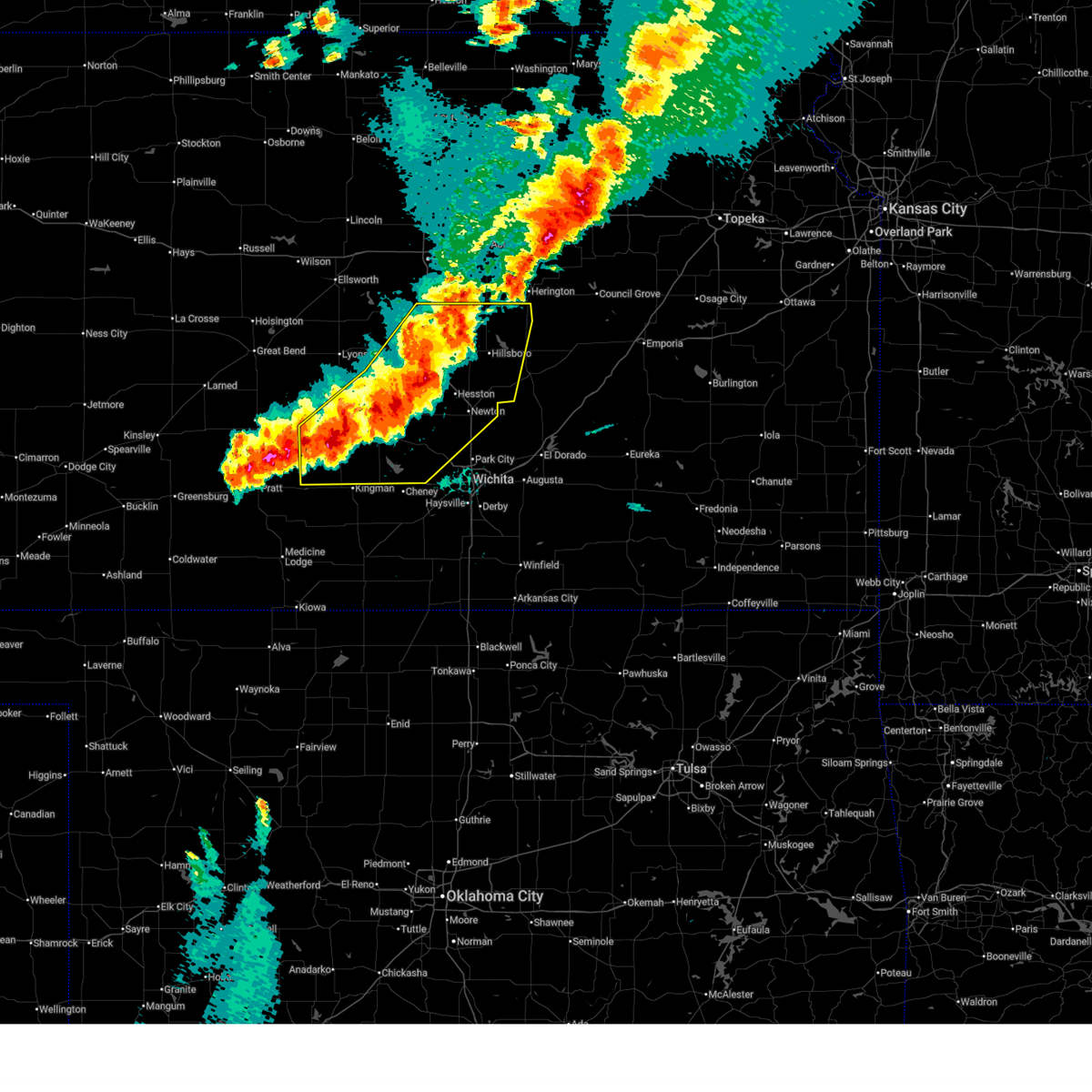
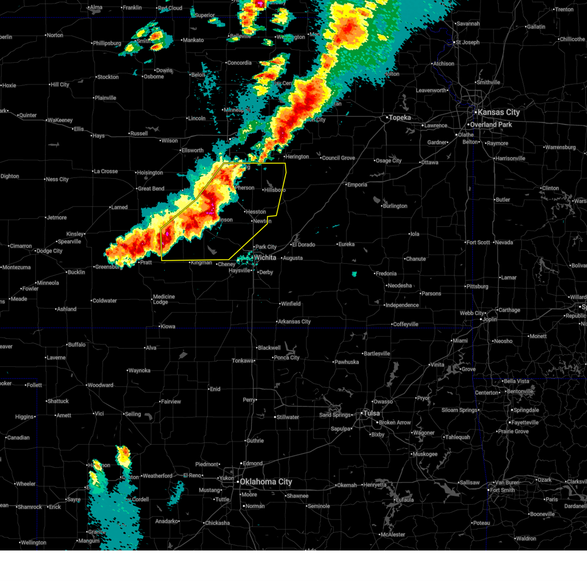
| 5/18/2026 8:51 PM CDT |
 At 851 pm cdt, a severe thunderstorm was located 8 miles southeast of kingman, moving east at 30 mph (radar indicated). Hazards include golf ball size hail and 70 mph wind gusts. People and animals outdoors will be injured. expect hail damage to roofs, siding, windows, and vehicles. expect considerable tree damage. wind damage is also likely to mobile homes, roofs, and outbuildings. Locations impacted include, wichita, goddard, maize, kingman, clearwater, cheney, halstead, colwich, haven, garden plain, mount hope, pretty prairie, andale, bentley, norwich, cunningham, viola, nashville, west wichita, and eisenhower national airport. At 851 pm cdt, a severe thunderstorm was located 8 miles southeast of kingman, moving east at 30 mph (radar indicated). Hazards include golf ball size hail and 70 mph wind gusts. People and animals outdoors will be injured. expect hail damage to roofs, siding, windows, and vehicles. expect considerable tree damage. wind damage is also likely to mobile homes, roofs, and outbuildings. Locations impacted include, wichita, goddard, maize, kingman, clearwater, cheney, halstead, colwich, haven, garden plain, mount hope, pretty prairie, andale, bentley, norwich, cunningham, viola, nashville, west wichita, and eisenhower national airport.
|
| 5/18/2026 8:41 PM CDT |
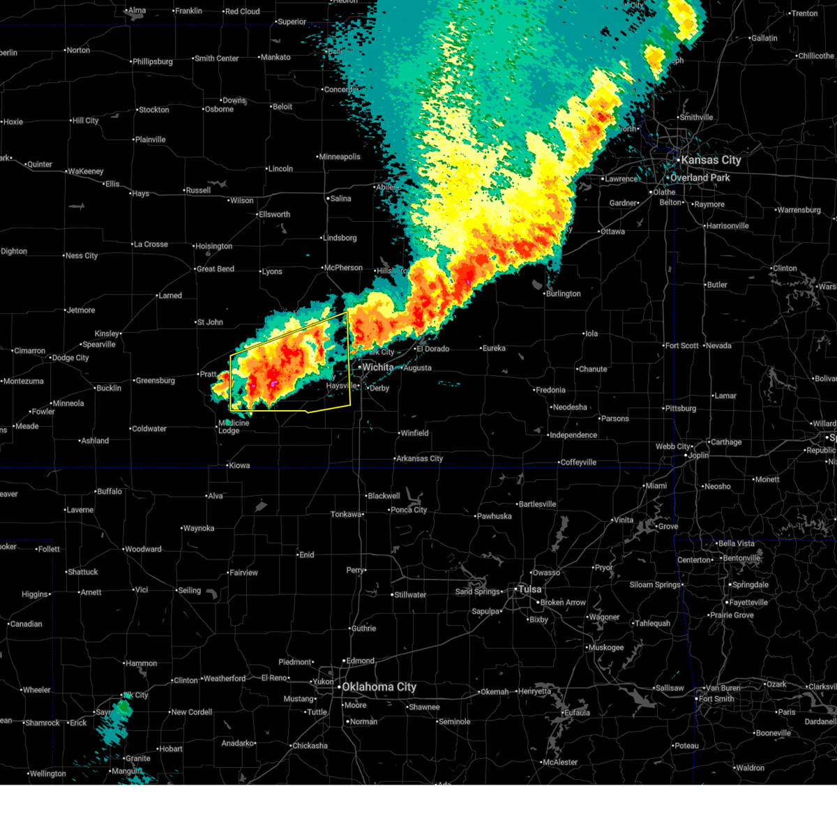 Svrict the national weather service in wichita has issued a * severe thunderstorm warning for, southern reno county in south central kansas, western sedgwick county in south central kansas, southwestern harvey county in south central kansas, kingman county in south central kansas, northwestern sumner county in south central kansas, * until 945 pm cdt. * at 840 pm cdt, a severe thunderstorm was located 6 miles southeast of kingman, moving east at 30 mph (radar indicated). Hazards include golf ball size hail and 60 mph wind gusts. People and animals outdoors will be injured. expect hail damage to roofs, siding, windows, and vehicles. Expect wind damage to roofs, siding, and trees. Svrict the national weather service in wichita has issued a * severe thunderstorm warning for, southern reno county in south central kansas, western sedgwick county in south central kansas, southwestern harvey county in south central kansas, kingman county in south central kansas, northwestern sumner county in south central kansas, * until 945 pm cdt. * at 840 pm cdt, a severe thunderstorm was located 6 miles southeast of kingman, moving east at 30 mph (radar indicated). Hazards include golf ball size hail and 60 mph wind gusts. People and animals outdoors will be injured. expect hail damage to roofs, siding, windows, and vehicles. Expect wind damage to roofs, siding, and trees.
|
| 5/18/2026 8:30 PM CDT | Quarter sized hail reported 3.4 miles NNW of Kingman, KS, spotter driving through storm... lots of hail up to quarter size. |
| 5/18/2026 8:26 PM CDT | Quarter sized hail reported 0.9 miles SSE of Kingman, KS, lots of hail... up to quarter size hail. |
| 5/18/2026 8:25 PM CDT |
 At 825 pm cdt, a severe thunderstorm was located near kingman, moving east at 25 mph (radar indicated). Hazards include golf ball size hail and 60 mph wind gusts. People and animals outdoors will be injured. expect hail damage to roofs, siding, windows, and vehicles. expect wind damage to roofs, siding, and trees. locations impacted include, wichita, derby, el dorado, andover, haysville, augusta, park city, valley center, bel aire, goddard, rose hill, maize, kingman, clearwater, cheney, sedgwick, towanda, colwich, haven, and benton. this includes the following highways, interstate 135 between mile markers 0 and 22. Interstate 35 between mile markers 36 and 80. At 825 pm cdt, a severe thunderstorm was located near kingman, moving east at 25 mph (radar indicated). Hazards include golf ball size hail and 60 mph wind gusts. People and animals outdoors will be injured. expect hail damage to roofs, siding, windows, and vehicles. expect wind damage to roofs, siding, and trees. locations impacted include, wichita, derby, el dorado, andover, haysville, augusta, park city, valley center, bel aire, goddard, rose hill, maize, kingman, clearwater, cheney, sedgwick, towanda, colwich, haven, and benton. this includes the following highways, interstate 135 between mile markers 0 and 22. Interstate 35 between mile markers 36 and 80.
|
| 5/18/2026 8:00 PM CDT |
 Svrict the national weather service in wichita has issued a * severe thunderstorm warning for, southern reno county in south central kansas, sedgwick county in south central kansas, central butler county in south central kansas, kingman county in south central kansas, * until 845 pm cdt. * at 800 pm cdt, a severe thunderstorm was located 6 miles west of kingman, moving east at 40 mph (radar indicated). Hazards include 60 mph wind gusts and half dollar size hail. Hail damage to vehicles is expected. Expect wind damage to roofs, siding, and trees. Svrict the national weather service in wichita has issued a * severe thunderstorm warning for, southern reno county in south central kansas, sedgwick county in south central kansas, central butler county in south central kansas, kingman county in south central kansas, * until 845 pm cdt. * at 800 pm cdt, a severe thunderstorm was located 6 miles west of kingman, moving east at 40 mph (radar indicated). Hazards include 60 mph wind gusts and half dollar size hail. Hail damage to vehicles is expected. Expect wind damage to roofs, siding, and trees.
|
| 5/18/2026 7:15 PM CDT |
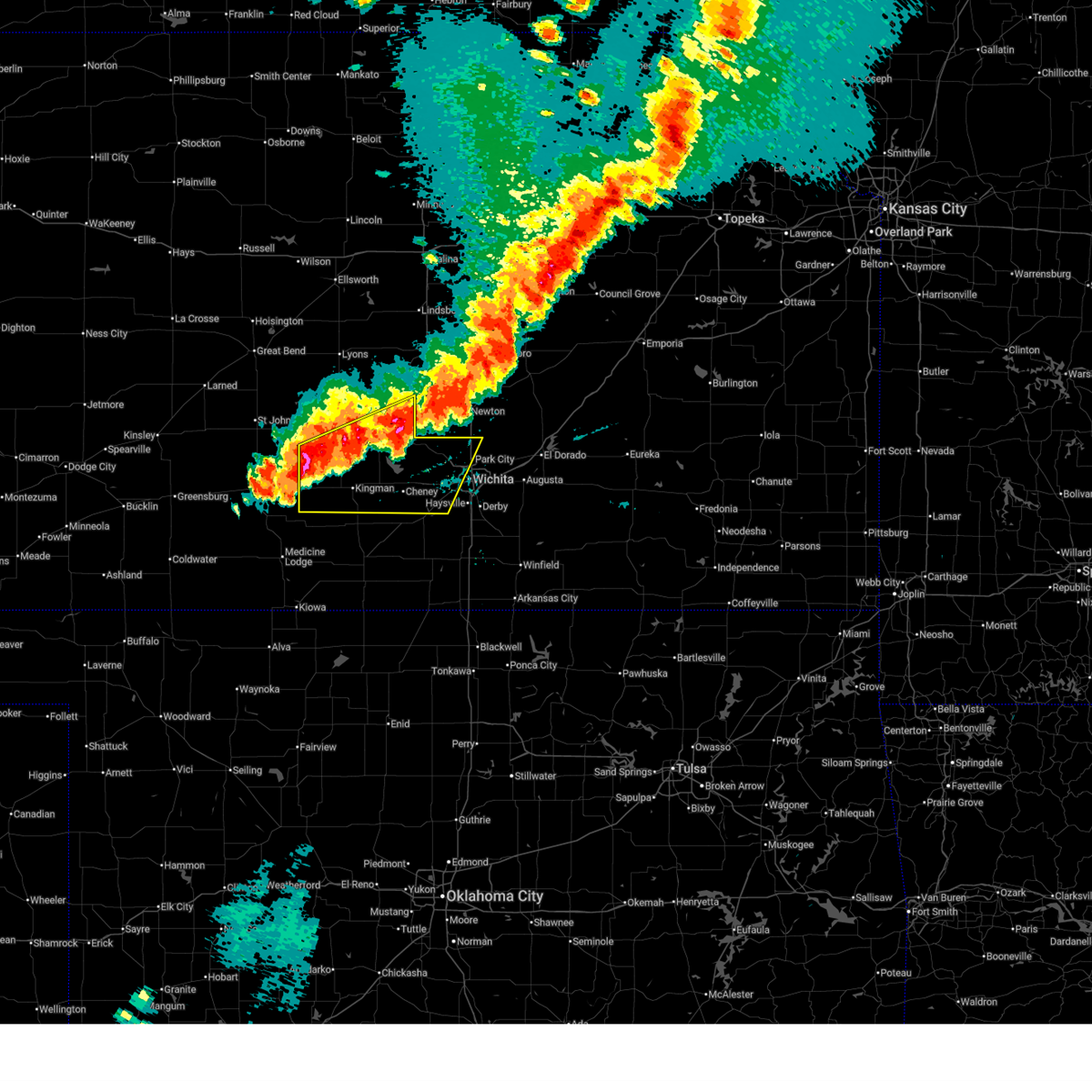 Svrict the national weather service in wichita has issued a * severe thunderstorm warning for, reno county in south central kansas, central sedgwick county in south central kansas, kingman county in south central kansas, * until 800 pm cdt. * at 714 pm cdt, severe thunderstorms were located along a line extending from burrton to pretty prairie to near cunningham, moving east at 55 mph (radar indicated). Hazards include 60 mph wind gusts and half dollar size hail. Hail damage to vehicles is expected. Expect wind damage to roofs, siding, and trees. Svrict the national weather service in wichita has issued a * severe thunderstorm warning for, reno county in south central kansas, central sedgwick county in south central kansas, kingman county in south central kansas, * until 800 pm cdt. * at 714 pm cdt, severe thunderstorms were located along a line extending from burrton to pretty prairie to near cunningham, moving east at 55 mph (radar indicated). Hazards include 60 mph wind gusts and half dollar size hail. Hail damage to vehicles is expected. Expect wind damage to roofs, siding, and trees.
|
| 5/18/2026 6:52 PM CDT |
 At 652 pm cdt, severe thunderstorms were located along a line extending from durham to north newton to 6 miles north of pretty prairie, moving east at 45 mph (radar indicated). Hazards include 70 mph wind gusts and half dollar size hail. Hail damage to vehicles is expected. expect considerable tree damage. wind damage is also likely to mobile homes, roofs, and outbuildings. locations impacted include, hutchinson, newton, hesston, maize, kingman, hillsboro, south hutchinson, halstead, marion, north newton, moundridge, sedgwick, inman, colwich, buhler, haven, peabody, burrton, galva, and mount hope. This includes interstate 135 between mile markers 21 and 60. At 652 pm cdt, severe thunderstorms were located along a line extending from durham to north newton to 6 miles north of pretty prairie, moving east at 45 mph (radar indicated). Hazards include 70 mph wind gusts and half dollar size hail. Hail damage to vehicles is expected. expect considerable tree damage. wind damage is also likely to mobile homes, roofs, and outbuildings. locations impacted include, hutchinson, newton, hesston, maize, kingman, hillsboro, south hutchinson, halstead, marion, north newton, moundridge, sedgwick, inman, colwich, buhler, haven, peabody, burrton, galva, and mount hope. This includes interstate 135 between mile markers 21 and 60.
|
| 5/18/2026 6:37 PM CDT |
 At 636 pm cdt, severe thunderstorms were located along a line extending from 5 miles north of canton to 5 miles northwest of halstead to near arlington, moving east at 45 mph (trained weather spotters. multiple quarter to ping pong ball size hail reports have been received, with a two inch hail report reported to the east of inman). Hazards include golf ball size hail and 70 mph wind gusts. People and animals outdoors will be injured. expect hail damage to roofs, siding, windows, and vehicles. expect considerable tree damage. wind damage is also likely to mobile homes, roofs, and outbuildings. locations impacted include, hutchinson, newton, mcpherson, hesston, lindsborg, maize, kingman, hillsboro, south hutchinson, halstead, marion, north newton, moundridge, sedgwick, inman, colwich, buhler, haven, peabody, and nickerson. This includes interstate 135 between mile markers 21 and 77. At 636 pm cdt, severe thunderstorms were located along a line extending from 5 miles north of canton to 5 miles northwest of halstead to near arlington, moving east at 45 mph (trained weather spotters. multiple quarter to ping pong ball size hail reports have been received, with a two inch hail report reported to the east of inman). Hazards include golf ball size hail and 70 mph wind gusts. People and animals outdoors will be injured. expect hail damage to roofs, siding, windows, and vehicles. expect considerable tree damage. wind damage is also likely to mobile homes, roofs, and outbuildings. locations impacted include, hutchinson, newton, mcpherson, hesston, lindsborg, maize, kingman, hillsboro, south hutchinson, halstead, marion, north newton, moundridge, sedgwick, inman, colwich, buhler, haven, peabody, and nickerson. This includes interstate 135 between mile markers 21 and 77.
|
| 5/18/2026 6:25 PM CDT |
 Svrict the national weather service in wichita has issued a * severe thunderstorm warning for, mcpherson county in central kansas, reno county in south central kansas, northwestern sedgwick county in south central kansas, harvey county in south central kansas, southeastern rice county in central kansas, northern kingman county in south central kansas, marion county in central kansas, * until 715 pm cdt. * at 624 pm cdt, severe thunderstorms were located along a line extending from 5 miles northwest of galva to near burrton to near turon, moving east at 45 mph. this warning replaces the previous severe thunderstorm warning (radar indicated). Hazards include 70 mph wind gusts and half dollar size hail. Hail damage to vehicles is expected. expect considerable tree damage. Wind damage is also likely to mobile homes, roofs, and outbuildings. Svrict the national weather service in wichita has issued a * severe thunderstorm warning for, mcpherson county in central kansas, reno county in south central kansas, northwestern sedgwick county in south central kansas, harvey county in south central kansas, southeastern rice county in central kansas, northern kingman county in south central kansas, marion county in central kansas, * until 715 pm cdt. * at 624 pm cdt, severe thunderstorms were located along a line extending from 5 miles northwest of galva to near burrton to near turon, moving east at 45 mph. this warning replaces the previous severe thunderstorm warning (radar indicated). Hazards include 70 mph wind gusts and half dollar size hail. Hail damage to vehicles is expected. expect considerable tree damage. Wind damage is also likely to mobile homes, roofs, and outbuildings.
|
| 4/11/2026 5:20 PM CDT |
 The storm which prompted the warning has moved out of the area. therefore, the warning will be allowed to expire. to report severe weather, contact your nearest law enforcement agency. they will relay your report to the national weather service wichita. The storm which prompted the warning has moved out of the area. therefore, the warning will be allowed to expire. to report severe weather, contact your nearest law enforcement agency. they will relay your report to the national weather service wichita.
|
| 4/11/2026 4:45 PM CDT |
 Svrict the national weather service in wichita has issued a * severe thunderstorm warning for, northeastern kingman county in south central kansas, * until 530 pm cdt. * at 445 pm cdt, a severe thunderstorm was located near pretty prairie, moving east at 20 mph (radar indicated). Hazards include 70 mph wind gusts and quarter size hail. Hail damage to vehicles is expected. expect considerable tree damage. Wind damage is also likely to mobile homes, roofs, and outbuildings. Svrict the national weather service in wichita has issued a * severe thunderstorm warning for, northeastern kingman county in south central kansas, * until 530 pm cdt. * at 445 pm cdt, a severe thunderstorm was located near pretty prairie, moving east at 20 mph (radar indicated). Hazards include 70 mph wind gusts and quarter size hail. Hail damage to vehicles is expected. expect considerable tree damage. Wind damage is also likely to mobile homes, roofs, and outbuildings.
|
| 3/10/2026 7:24 PM CDT |
 At 724 pm cdt, severe thunderstorms were located along a line extending from near kingman to 11 miles west of norwich to 5 miles north of harper, moving northeast at 40 mph (radar indicated). Hazards include 70 mph wind gusts and half dollar size hail. Hail damage to vehicles is expected. expect considerable tree damage. wind damage is also likely to mobile homes, roofs, and outbuildings. Locations impacted include, goddard, kingman, cheney, haven, garden plain, andale, norwich, viola, murdock, waterloo, cleveland, cheney lake, mt vernon, kingman airport, lake afton, rago, cheney state park, and runnymede. At 724 pm cdt, severe thunderstorms were located along a line extending from near kingman to 11 miles west of norwich to 5 miles north of harper, moving northeast at 40 mph (radar indicated). Hazards include 70 mph wind gusts and half dollar size hail. Hail damage to vehicles is expected. expect considerable tree damage. wind damage is also likely to mobile homes, roofs, and outbuildings. Locations impacted include, goddard, kingman, cheney, haven, garden plain, andale, norwich, viola, murdock, waterloo, cleveland, cheney lake, mt vernon, kingman airport, lake afton, rago, cheney state park, and runnymede.
|
| 3/10/2026 7:20 PM CDT | Also reported pea sized hail. received via social medi in kingman county KS, 8.2 miles NNW of Kingman, KS |
| 3/10/2026 7:15 PM CDT |
 Svrict the national weather service in wichita has issued a * severe thunderstorm warning for, southeastern reno county in south central kansas, western sedgwick county in south central kansas, northeastern harper county in south central kansas, kingman county in south central kansas, northwestern sumner county in south central kansas, * until 815 pm cdt. * at 715 pm cdt, severe thunderstorms were located along a line extending from 8 miles southwest of kingman to 15 miles west of norwich to 7 miles northwest of harper, moving northeast at 40 mph (radar indicated). Hazards include 60 mph wind gusts and half dollar size hail. Hail damage to vehicles is expected. Expect wind damage to roofs, siding, and trees. Svrict the national weather service in wichita has issued a * severe thunderstorm warning for, southeastern reno county in south central kansas, western sedgwick county in south central kansas, northeastern harper county in south central kansas, kingman county in south central kansas, northwestern sumner county in south central kansas, * until 815 pm cdt. * at 715 pm cdt, severe thunderstorms were located along a line extending from 8 miles southwest of kingman to 15 miles west of norwich to 7 miles northwest of harper, moving northeast at 40 mph (radar indicated). Hazards include 60 mph wind gusts and half dollar size hail. Hail damage to vehicles is expected. Expect wind damage to roofs, siding, and trees.
|
| 3/5/2026 9:30 PM CST |
 the severe thunderstorm warning has been cancelled and is no longer in effect the severe thunderstorm warning has been cancelled and is no longer in effect
|
| 3/5/2026 9:20 PM CST |
 At 920 pm cst, a severe thunderstorm was located near kingman, moving north at 65 mph (radar indicated). Hazards include quarter size hail. Damage to vehicles is expected. Locations impacted include, kingman and kingman airport. At 920 pm cst, a severe thunderstorm was located near kingman, moving north at 65 mph (radar indicated). Hazards include quarter size hail. Damage to vehicles is expected. Locations impacted include, kingman and kingman airport.
|
| 3/5/2026 9:17 PM CST |
 At 917 pm cst, a severe thunderstorm was located over kingman, moving north at 60 mph (radar indicated). Hazards include quarter size hail. Damage to vehicles is expected. Locations impacted include, kingman. At 917 pm cst, a severe thunderstorm was located over kingman, moving north at 60 mph (radar indicated). Hazards include quarter size hail. Damage to vehicles is expected. Locations impacted include, kingman.
|
| 3/5/2026 9:08 PM CST |
 At 907 pm cst, a severe thunderstorm was located 6 miles south of kingman, moving northeast at 55 mph (radar indicated). Hazards include quarter size hail. Damage to vehicles is expected. Locations impacted include, kingman. At 907 pm cst, a severe thunderstorm was located 6 miles south of kingman, moving northeast at 55 mph (radar indicated). Hazards include quarter size hail. Damage to vehicles is expected. Locations impacted include, kingman.
|
| 3/5/2026 8:52 PM CST |
 Svrict the national weather service in wichita has issued a * severe thunderstorm warning for, central kingman county in south central kansas, * until 945 pm cst. * at 852 pm cst, a severe thunderstorm was located 8 miles southeast of nashville, or 9 miles northwest of attica, moving northeast at 55 mph (radar indicated). Hazards include half dollar size hail. damage to vehicles is expected Svrict the national weather service in wichita has issued a * severe thunderstorm warning for, central kingman county in south central kansas, * until 945 pm cst. * at 852 pm cst, a severe thunderstorm was located 8 miles southeast of nashville, or 9 miles northwest of attica, moving northeast at 55 mph (radar indicated). Hazards include half dollar size hail. damage to vehicles is expected
|
| 10/7/2025 3:19 AM CDT | At 318 am cdt, a severe thunderstorm was located near kingman, moving east at 25 mph (trained weather spotters reported golf ball size hail on the north side of kingman). Hazards include golf ball size hail. People and animals outdoors will be injured. expect damage to roofs, siding, windows, and vehicles. Locations impacted include, waterloo, mt vernon, and cheney state park. |
| 10/7/2025 3:13 AM CDT | Golf Ball sized hail reported 1.8 miles SSW of Kingman, KS |
| 10/7/2025 3:13 AM CDT | Svrict the national weather service in wichita has issued a * severe thunderstorm warning for, northeastern kingman county in south central kansas, * until 400 am cdt. * at 313 am cdt, a severe thunderstorm was located over kingman, moving east at 25 mph (trained weather spotters). Hazards include quarter size hail. damage to vehicles is expected |
| 10/7/2025 3:12 AM CDT | Quarter sized hail reported 1.3 miles SW of Kingman, KS |
| 9/23/2025 1:46 AM CDT | At 146 am cdt, severe thunderstorms were located along a line extending from 5 miles north of attica to near anthony to 7 miles southwest of wakita, moving northeast at 55 mph (radar indicated). Hazards include 70 mph wind gusts and penny size hail. Expect considerable tree damage. damage is likely to mobile homes, roofs, and outbuildings. Locations impacted include, kingman, anthony, harper, attica, norwich, cunningham, nashville, murdock, waterloo, willowdale, zenda, spivey, bluff city, cleveland, danville, penalosa, waldron, freeport, mt vernon, and rago. |
| 9/23/2025 1:34 AM CDT | At 133 am cdt, severe thunderstorms were located along a line extending from 6 miles south of cunningham to 5 miles west of anthony to jet, moving northeast at 40 mph (radar indicated). Hazards include 70 mph wind gusts and penny size hail. Expect considerable tree damage. damage is likely to mobile homes, roofs, and outbuildings. Locations impacted include, kingman, anthony, harper, attica, norwich, cunningham, nashville, murdock, waterloo, willowdale, zenda, spivey, bluff city, cleveland, danville, penalosa, waldron, freeport, mt vernon, and corwin. |
| 9/23/2025 1:09 AM CDT | Svrict the national weather service in wichita has issued a * severe thunderstorm warning for, harper county in south central kansas, kingman county in south central kansas, * until 200 am cdt. * at 106 am cdt, severe thunderstorms were located along a line extending from 6 miles southwest of sawyer to near kiowa to near carmen, moving northeast at 40 mph (medicine lodge airport reported a 61 mph wind gust at 1:07 am cdt). Hazards include 60 mph wind gusts and penny size hail. expect damage to roofs, siding, and trees |
| 9/1/2025 5:30 PM CDT | Grapefruit sized hail reported 10.2 miles N of Kingman, KS, delayed report - shared via kake on facebook. appeared close to 3.75 in. in image. |
| 9/1/2025 5:18 PM CDT | Quarter sized hail reported 0.9 miles WSW of Kingman, KS, large... irregular shaped hail. at least quarter size. |
| 9/1/2025 5:13 PM CDT |
 At 513 pm cdt, a severe thunderstorm was located near kingman, moving south at 15 mph (radar indicated). Hazards include 60 mph wind gusts and half dollar size hail. Hail damage to vehicles is expected. expect wind damage to roofs, siding, and trees. Locations impacted include, zenda, spivey, cleveland, and rago. At 513 pm cdt, a severe thunderstorm was located near kingman, moving south at 15 mph (radar indicated). Hazards include 60 mph wind gusts and half dollar size hail. Hail damage to vehicles is expected. expect wind damage to roofs, siding, and trees. Locations impacted include, zenda, spivey, cleveland, and rago.
|
| 9/1/2025 5:03 PM CDT |
 Svrict the national weather service in wichita has issued a * severe thunderstorm warning for, central kingman county in south central kansas, * until 600 pm cdt. * at 503 pm cdt, a severe thunderstorm was located over kingman, moving south at 15 mph (radar indicated). Hazards include 60 mph wind gusts and quarter size hail. Hail damage to vehicles is expected. Expect wind damage to roofs, siding, and trees. Svrict the national weather service in wichita has issued a * severe thunderstorm warning for, central kingman county in south central kansas, * until 600 pm cdt. * at 503 pm cdt, a severe thunderstorm was located over kingman, moving south at 15 mph (radar indicated). Hazards include 60 mph wind gusts and quarter size hail. Hail damage to vehicles is expected. Expect wind damage to roofs, siding, and trees.
|
| 8/11/2025 3:29 AM CDT |
 The storms which prompted the warning have moved out of the area. therefore, the warning will be allowed to expire. a severe thunderstorm watch remains in effect until 600 am cdt for south central kansas. The storms which prompted the warning have moved out of the area. therefore, the warning will be allowed to expire. a severe thunderstorm watch remains in effect until 600 am cdt for south central kansas.
|
| 8/11/2025 3:01 AM CDT |
 At 301 am cdt, severe thunderstorms were located along a line extending from 6 miles south of sterling to kingman to 7 miles northwest of manchester, moving east at 45 mph (radar indicated). Hazards include 60 mph wind gusts. Expect damage to roofs, siding, and trees. Locations impacted include, hutchinson, kingman, south hutchinson, anthony, harper, buhler, haven, nickerson, pretty prairie, attica, norwich, arlington, cunningham, turon, partridge, sylvia, plevna, abbyville, nashville, and yoder. At 301 am cdt, severe thunderstorms were located along a line extending from 6 miles south of sterling to kingman to 7 miles northwest of manchester, moving east at 45 mph (radar indicated). Hazards include 60 mph wind gusts. Expect damage to roofs, siding, and trees. Locations impacted include, hutchinson, kingman, south hutchinson, anthony, harper, buhler, haven, nickerson, pretty prairie, attica, norwich, arlington, cunningham, turon, partridge, sylvia, plevna, abbyville, nashville, and yoder.
|
| 8/11/2025 2:24 AM CDT |
 Svrict the national weather service in wichita has issued a * severe thunderstorm warning for, reno county in south central kansas, harper county in south central kansas, kingman county in south central kansas, * until 330 am cdt. * at 224 am cdt, severe thunderstorms were located along a line extending from iuka to near isabel to 7 miles northwest of kiowa, moving east at 45 mph (radar indicated). Hazards include 60 mph wind gusts and penny size hail. expect damage to roofs, siding, and trees Svrict the national weather service in wichita has issued a * severe thunderstorm warning for, reno county in south central kansas, harper county in south central kansas, kingman county in south central kansas, * until 330 am cdt. * at 224 am cdt, severe thunderstorms were located along a line extending from iuka to near isabel to 7 miles northwest of kiowa, moving east at 45 mph (radar indicated). Hazards include 60 mph wind gusts and penny size hail. expect damage to roofs, siding, and trees
|
| 7/8/2025 7:04 PM CDT |
 At 703 pm cdt, a severe thunderstorm was located 6 miles west of kingman, moving south at 10 mph (radar indicated). Hazards include 60 mph wind gusts and quarter size hail. Hail damage to vehicles is expected. expect wind damage to roofs, siding, and trees. This severe thunderstorm will remain over mainly rural areas of northwestern kingman county. At 703 pm cdt, a severe thunderstorm was located 6 miles west of kingman, moving south at 10 mph (radar indicated). Hazards include 60 mph wind gusts and quarter size hail. Hail damage to vehicles is expected. expect wind damage to roofs, siding, and trees. This severe thunderstorm will remain over mainly rural areas of northwestern kingman county.
|
| 7/8/2025 6:44 PM CDT | Quarter sized hail reported 0.9 miles SSE of Kingman, KS |
| 7/8/2025 6:37 PM CDT |
 Svrict the national weather service in wichita has issued a * severe thunderstorm warning for, central kingman county in south central kansas, * until 730 pm cdt. * at 636 pm cdt, a severe thunderstorm was located near kingman, moving south at 10 mph (radar indicated). Hazards include 60 mph wind gusts and half dollar size hail. Hail damage to vehicles is expected. Expect wind damage to roofs, siding, and trees. Svrict the national weather service in wichita has issued a * severe thunderstorm warning for, central kingman county in south central kansas, * until 730 pm cdt. * at 636 pm cdt, a severe thunderstorm was located near kingman, moving south at 10 mph (radar indicated). Hazards include 60 mph wind gusts and half dollar size hail. Hail damage to vehicles is expected. Expect wind damage to roofs, siding, and trees.
|
| 6/17/2025 4:34 PM CDT |
 Svrict the national weather service in wichita has issued a * severe thunderstorm warning for, southeastern reno county in south central kansas, sedgwick county in south central kansas, eastern kingman county in south central kansas, * until 515 pm cdt. * at 434 pm cdt, a severe thunderstorm was located 6 miles northwest of cheney, moving east at 30 mph (radar indicated). Hazards include 60 mph wind gusts and quarter size hail. Hail damage to vehicles is expected. Expect wind damage to roofs, siding, and trees. Svrict the national weather service in wichita has issued a * severe thunderstorm warning for, southeastern reno county in south central kansas, sedgwick county in south central kansas, eastern kingman county in south central kansas, * until 515 pm cdt. * at 434 pm cdt, a severe thunderstorm was located 6 miles northwest of cheney, moving east at 30 mph (radar indicated). Hazards include 60 mph wind gusts and quarter size hail. Hail damage to vehicles is expected. Expect wind damage to roofs, siding, and trees.
|
| 6/17/2025 3:34 AM CDT |
 Svrict the national weather service in wichita has issued a * severe thunderstorm warning for, southern mcpherson county in central kansas, southeastern reno county in south central kansas, sedgwick county in south central kansas, harvey county in south central kansas, harper county in south central kansas, kingman county in south central kansas, southwestern marion county in central kansas, northern sumner county in south central kansas, * until 430 am cdt. * at 333 am cdt, severe thunderstorms were located along a line extending from 6 miles north of mcpherson to 7 miles northeast of pretty prairie to 6 miles east of cunningham, moving southeast at 45 mph (trained weather spotters). Hazards include 70 mph wind gusts. Expect considerable tree damage. Damage is likely to mobile homes, roofs, and outbuildings. Svrict the national weather service in wichita has issued a * severe thunderstorm warning for, southern mcpherson county in central kansas, southeastern reno county in south central kansas, sedgwick county in south central kansas, harvey county in south central kansas, harper county in south central kansas, kingman county in south central kansas, southwestern marion county in central kansas, northern sumner county in south central kansas, * until 430 am cdt. * at 333 am cdt, severe thunderstorms were located along a line extending from 6 miles north of mcpherson to 7 miles northeast of pretty prairie to 6 miles east of cunningham, moving southeast at 45 mph (trained weather spotters). Hazards include 70 mph wind gusts. Expect considerable tree damage. Damage is likely to mobile homes, roofs, and outbuildings.
|
| 6/14/2025 7:14 AM CDT |
 the severe thunderstorm warning has been cancelled and is no longer in effect the severe thunderstorm warning has been cancelled and is no longer in effect
|
| 6/14/2025 7:14 AM CDT |
 At 713 am cdt, severe thunderstorms were located along a line extending from 5 miles southwest of nickerson to arlington to 8 miles east of turon, moving east at 50 mph (radar indicated). Hazards include 70 mph wind gusts and quarter size hail. Hail damage to vehicles is expected. expect considerable tree damage. wind damage is also likely to mobile homes, roofs, and outbuildings. Locations impacted include, kingman, nickerson, pretty prairie, arlington, turon, partridge, sylvia, plevna, abbyville, willowbrook, langdon, penalosa, and kingman airport. At 713 am cdt, severe thunderstorms were located along a line extending from 5 miles southwest of nickerson to arlington to 8 miles east of turon, moving east at 50 mph (radar indicated). Hazards include 70 mph wind gusts and quarter size hail. Hail damage to vehicles is expected. expect considerable tree damage. wind damage is also likely to mobile homes, roofs, and outbuildings. Locations impacted include, kingman, nickerson, pretty prairie, arlington, turon, partridge, sylvia, plevna, abbyville, willowbrook, langdon, penalosa, and kingman airport.
|
| 6/14/2025 6:57 AM CDT |
 At 657 am cdt, severe thunderstorms were located along a line extending from 8 miles north of sylvia to near turon to 5 miles south of cunningham to near lake city, moving east at 40 mph (radar indicated). Hazards include 70 mph wind gusts and quarter size hail. Hail damage to vehicles is expected. expect considerable tree damage. wind damage is also likely to mobile homes, roofs, and outbuildings. Locations impacted include, kingman, nickerson, pretty prairie, arlington, cunningham, turon, partridge, sylvia, plevna, abbyville, nashville, willowdale, zenda, willowbrook, spivey, langdon, cleveland, penalosa, kingman airport, and crystal springs. At 657 am cdt, severe thunderstorms were located along a line extending from 8 miles north of sylvia to near turon to 5 miles south of cunningham to near lake city, moving east at 40 mph (radar indicated). Hazards include 70 mph wind gusts and quarter size hail. Hail damage to vehicles is expected. expect considerable tree damage. wind damage is also likely to mobile homes, roofs, and outbuildings. Locations impacted include, kingman, nickerson, pretty prairie, arlington, cunningham, turon, partridge, sylvia, plevna, abbyville, nashville, willowdale, zenda, willowbrook, spivey, langdon, cleveland, penalosa, kingman airport, and crystal springs.
|
| 6/14/2025 6:53 AM CDT |
 At 653 am cdt, severe thunderstorms were located along a line extending from 8 miles north of sylvia to turon to 5 miles southeast of cairo to lake city, moving east at 40 mph (radar indicated). Hazards include 70 mph wind gusts and penny size hail. Expect considerable tree damage. damage is likely to mobile homes, roofs, and outbuildings. Locations impacted include, kingman, nickerson, pretty prairie, arlington, cunningham, turon, partridge, sylvia, plevna, abbyville, nashville, willowdale, zenda, willowbrook, spivey, langdon, cleveland, penalosa, kingman airport, and crystal springs. At 653 am cdt, severe thunderstorms were located along a line extending from 8 miles north of sylvia to turon to 5 miles southeast of cairo to lake city, moving east at 40 mph (radar indicated). Hazards include 70 mph wind gusts and penny size hail. Expect considerable tree damage. damage is likely to mobile homes, roofs, and outbuildings. Locations impacted include, kingman, nickerson, pretty prairie, arlington, cunningham, turon, partridge, sylvia, plevna, abbyville, nashville, willowdale, zenda, willowbrook, spivey, langdon, cleveland, penalosa, kingman airport, and crystal springs.
|
| 6/14/2025 6:38 AM CDT |
 Svrict the national weather service in wichita has issued a * severe thunderstorm warning for, reno county in south central kansas, northwestern harper county in south central kansas, western kingman county in south central kansas, * until 730 am cdt. * at 637 am cdt, severe thunderstorms were located along a line extending from near hudson to near neola to 5 miles southwest of cairo to sun city, moving east at 40 mph (public. at 630 am, a 65 mph wind gust was reported near pratt). Hazards include 60 mph wind gusts and penny size hail. expect damage to roofs, siding, and trees Svrict the national weather service in wichita has issued a * severe thunderstorm warning for, reno county in south central kansas, northwestern harper county in south central kansas, western kingman county in south central kansas, * until 730 am cdt. * at 637 am cdt, severe thunderstorms were located along a line extending from near hudson to near neola to 5 miles southwest of cairo to sun city, moving east at 40 mph (public. at 630 am, a 65 mph wind gust was reported near pratt). Hazards include 60 mph wind gusts and penny size hail. expect damage to roofs, siding, and trees
|
| 6/7/2025 1:24 AM CDT |
 The storms which prompted the warning have moved out of the warned area. therefore, the warning will be allowed to expire. a tornado watch remains in effect until 700 am cdt for south central kansas. The storms which prompted the warning have moved out of the warned area. therefore, the warning will be allowed to expire. a tornado watch remains in effect until 700 am cdt for south central kansas.
|
| 6/7/2025 1:01 AM CDT |
 Svrict the national weather service in wichita has issued a * severe thunderstorm warning for, western kingman county in south central kansas, * until 130 am cdt. * at 100 am cdt, severe thunderstorms were located along a line extending from 4 miles southeast of turon to 6 miles south of cunningham to 4 miles west of isabel, moving east at 35 mph (radar indicated). Hazards include 60 mph wind gusts. expect damage to roofs, siding, and trees Svrict the national weather service in wichita has issued a * severe thunderstorm warning for, western kingman county in south central kansas, * until 130 am cdt. * at 100 am cdt, severe thunderstorms were located along a line extending from 4 miles southeast of turon to 6 miles south of cunningham to 4 miles west of isabel, moving east at 35 mph (radar indicated). Hazards include 60 mph wind gusts. expect damage to roofs, siding, and trees
|
| 5/25/2025 7:13 AM CDT |
 At 713 am cdt, severe thunderstorms were located along a line extending from near hutchinson to 7 miles northwest of cheney to near norwich to near harper, moving east at 50 mph (radar indicated). Hazards include 60 mph wind gusts. Expect damage to roofs, siding, and trees. Locations impacted include, hutchinson, kingman, south hutchinson, harper, buhler, haven, pretty prairie, norwich, arlington, partridge, abbyville, yoder, murdock, waterloo, willowbrook, spivey, cleveland, danville, freeport, and cheney lake. At 713 am cdt, severe thunderstorms were located along a line extending from near hutchinson to 7 miles northwest of cheney to near norwich to near harper, moving east at 50 mph (radar indicated). Hazards include 60 mph wind gusts. Expect damage to roofs, siding, and trees. Locations impacted include, hutchinson, kingman, south hutchinson, harper, buhler, haven, pretty prairie, norwich, arlington, partridge, abbyville, yoder, murdock, waterloo, willowbrook, spivey, cleveland, danville, freeport, and cheney lake.
|
| 5/25/2025 7:03 AM CDT |
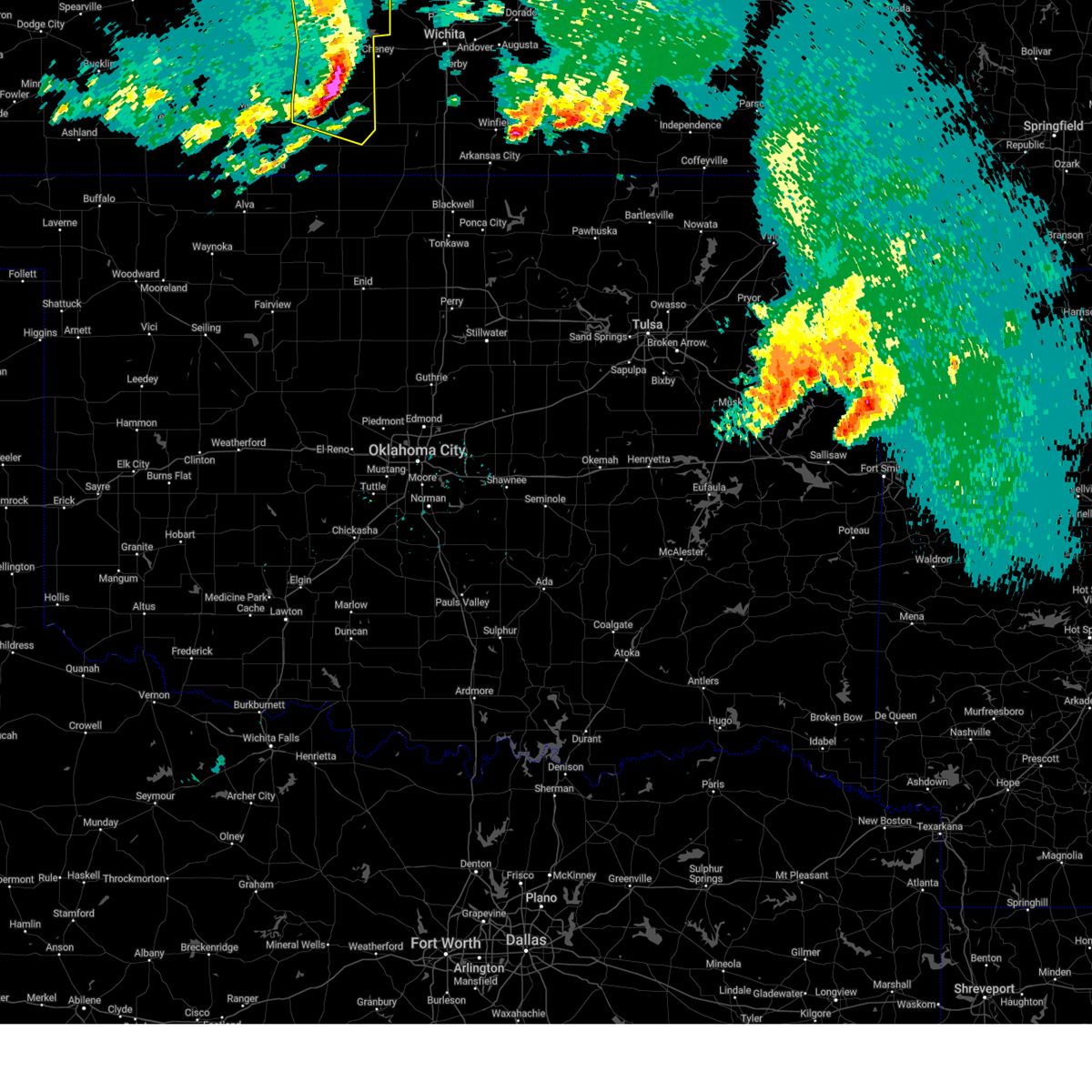 At 703 am cdt, severe thunderstorms were located along a line extending from near nickerson to near pretty prairie to 12 miles north of harper to near attica, moving east at 50 mph (radar indicated). Hazards include 60 mph wind gusts. Expect damage to roofs, siding, and trees. Locations impacted include, hutchinson, kingman, south hutchinson, harper, buhler, haven, nickerson, pretty prairie, attica, norwich, arlington, partridge, plevna, abbyville, yoder, murdock, waterloo, willowdale, zenda, and willowbrook. At 703 am cdt, severe thunderstorms were located along a line extending from near nickerson to near pretty prairie to 12 miles north of harper to near attica, moving east at 50 mph (radar indicated). Hazards include 60 mph wind gusts. Expect damage to roofs, siding, and trees. Locations impacted include, hutchinson, kingman, south hutchinson, harper, buhler, haven, nickerson, pretty prairie, attica, norwich, arlington, partridge, plevna, abbyville, yoder, murdock, waterloo, willowdale, zenda, and willowbrook.
|
| 5/25/2025 6:40 AM CDT |
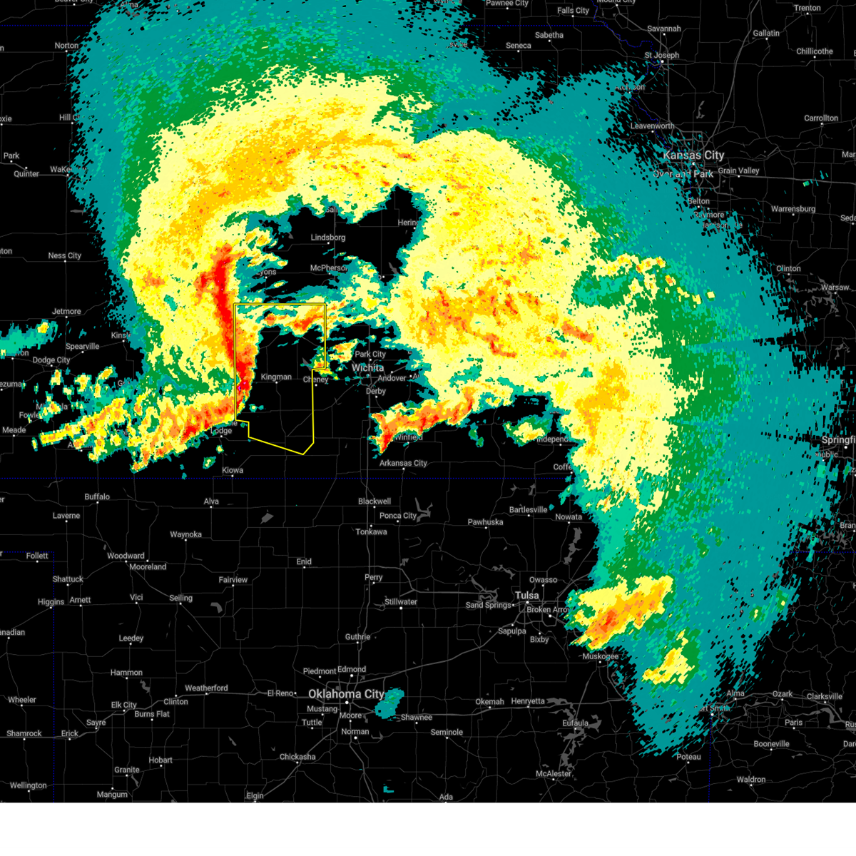 At 640 am cdt, severe thunderstorms were located along a line extending from plevna to 6 miles southwest of arlington to 9 miles southeast of cunningham to 5 miles southwest of nashville, moving east at 50 mph (radar indicated). Hazards include 60 mph wind gusts and penny size hail. Expect damage to roofs, siding, and trees. Locations impacted include, hutchinson, kingman, south hutchinson, harper, buhler, haven, nickerson, pretty prairie, attica, norwich, arlington, cunningham, turon, partridge, sylvia, plevna, abbyville, nashville, yoder, and murdock. At 640 am cdt, severe thunderstorms were located along a line extending from plevna to 6 miles southwest of arlington to 9 miles southeast of cunningham to 5 miles southwest of nashville, moving east at 50 mph (radar indicated). Hazards include 60 mph wind gusts and penny size hail. Expect damage to roofs, siding, and trees. Locations impacted include, hutchinson, kingman, south hutchinson, harper, buhler, haven, nickerson, pretty prairie, attica, norwich, arlington, cunningham, turon, partridge, sylvia, plevna, abbyville, nashville, yoder, and murdock.
|
| 5/25/2025 6:25 AM CDT |
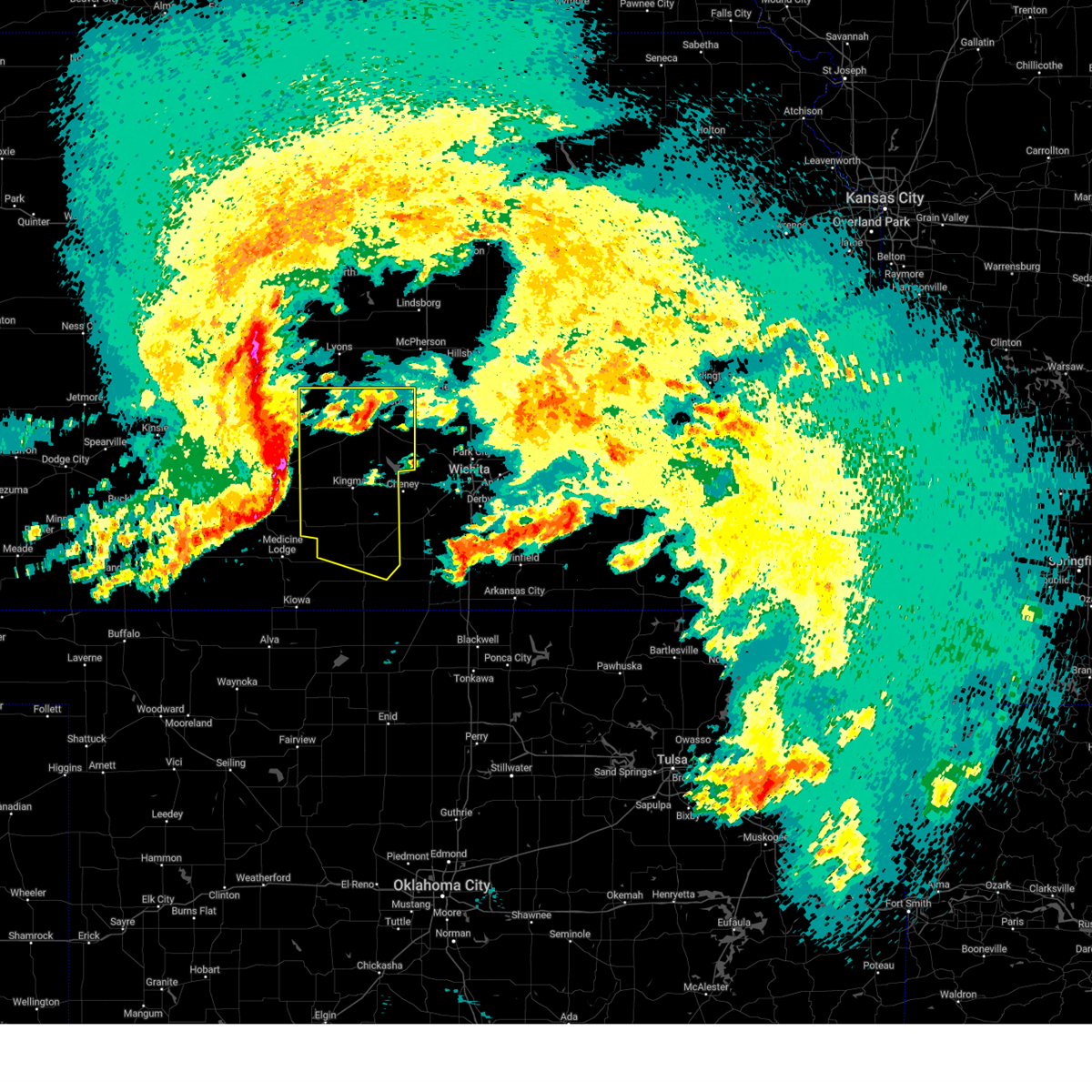 At 624 am cdt, severe thunderstorms were located along a line extending from 7 miles southeast of hudson to near neola to near cairo to near sawyer, moving east at 50 mph (a 62 mph wind gust was measured at the pratt county landfill at 615 am). Hazards include 60 mph wind gusts and penny size hail. Expect damage to roofs, siding, and trees. Locations impacted include, hutchinson, kingman, south hutchinson, harper, buhler, haven, nickerson, pretty prairie, attica, norwich, arlington, cunningham, turon, partridge, sylvia, plevna, abbyville, nashville, yoder, and murdock. At 624 am cdt, severe thunderstorms were located along a line extending from 7 miles southeast of hudson to near neola to near cairo to near sawyer, moving east at 50 mph (a 62 mph wind gust was measured at the pratt county landfill at 615 am). Hazards include 60 mph wind gusts and penny size hail. Expect damage to roofs, siding, and trees. Locations impacted include, hutchinson, kingman, south hutchinson, harper, buhler, haven, nickerson, pretty prairie, attica, norwich, arlington, cunningham, turon, partridge, sylvia, plevna, abbyville, nashville, yoder, and murdock.
|
| 5/25/2025 6:14 AM CDT |
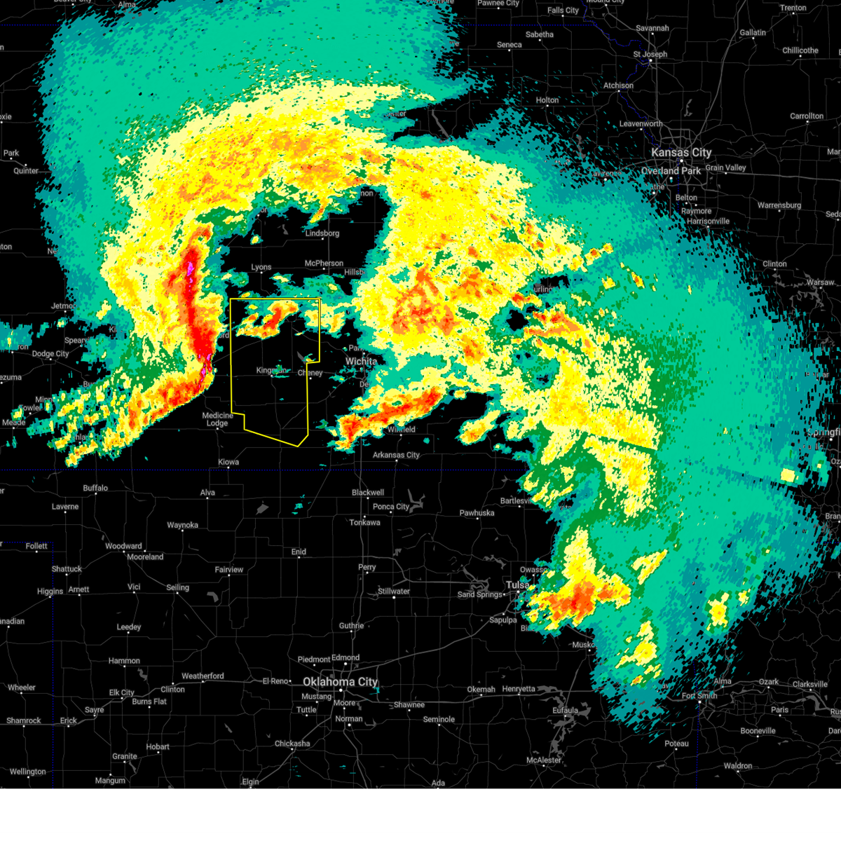 Svrict the national weather service in wichita has issued a * severe thunderstorm warning for, reno county in south central kansas, northern harper county in south central kansas, kingman county in south central kansas, * until 730 am cdt. * at 614 am cdt, severe thunderstorms were located along a line extending from hudson to near stafford to near pratt to near coats, moving east at 50 mph (radar indicated). Hazards include 60 mph wind gusts and penny size hail. expect damage to roofs, siding, and trees Svrict the national weather service in wichita has issued a * severe thunderstorm warning for, reno county in south central kansas, northern harper county in south central kansas, kingman county in south central kansas, * until 730 am cdt. * at 614 am cdt, severe thunderstorms were located along a line extending from hudson to near stafford to near pratt to near coats, moving east at 50 mph (radar indicated). Hazards include 60 mph wind gusts and penny size hail. expect damage to roofs, siding, and trees
|
| 5/24/2025 3:13 AM CDT |
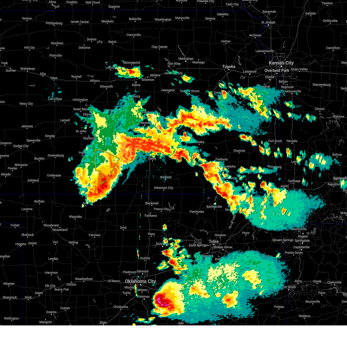 The storms which prompted the warning have moved out of the area. therefore, the warning will be allowed to expire. a severe thunderstorm watch remains in effect until 600 am cdt for south central kansas. remember, a severe thunderstorm warning still remains in effect for southern kingman and harper counties until 345 am. The storms which prompted the warning have moved out of the area. therefore, the warning will be allowed to expire. a severe thunderstorm watch remains in effect until 600 am cdt for south central kansas. remember, a severe thunderstorm warning still remains in effect for southern kingman and harper counties until 345 am.
|
| 5/24/2025 2:44 AM CDT |
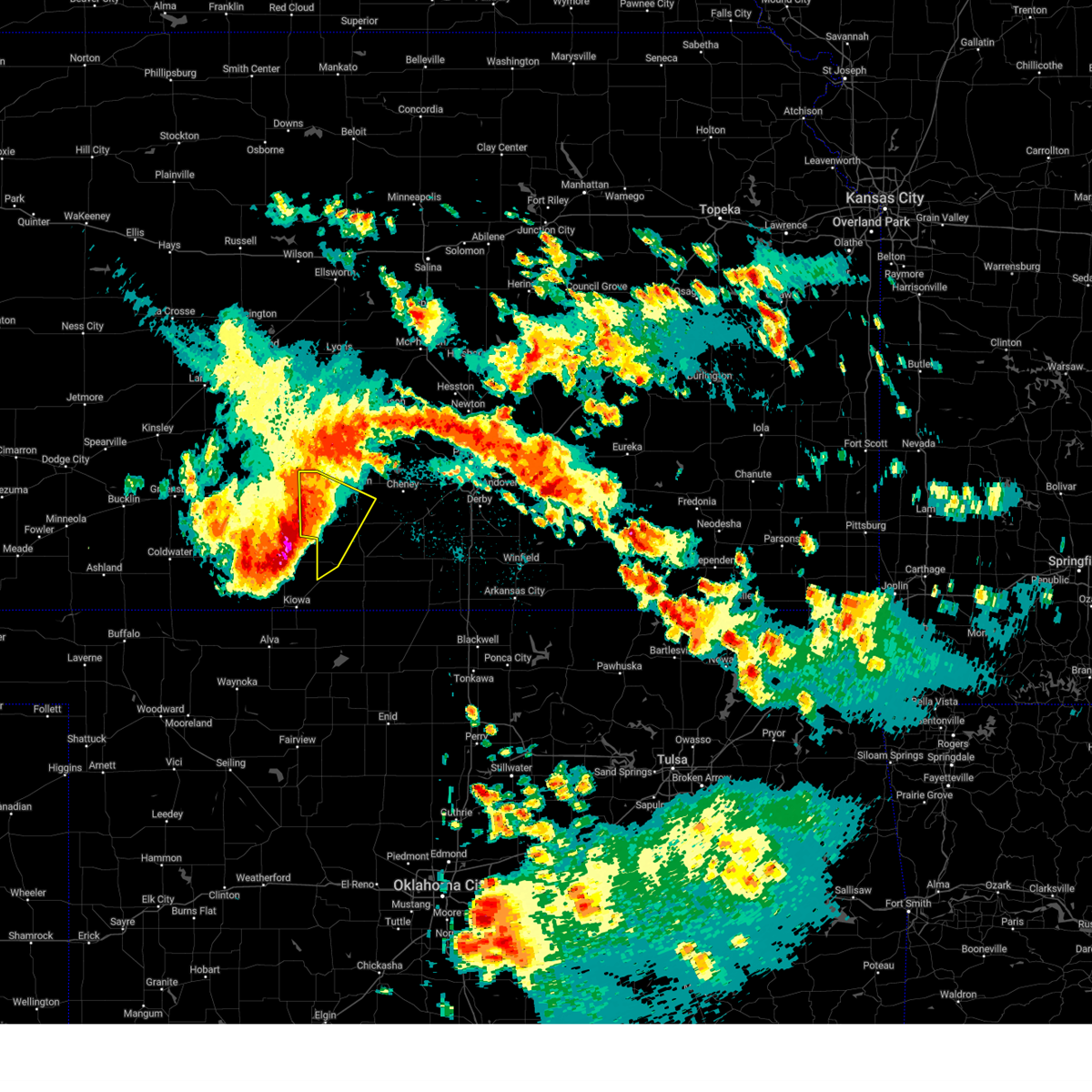 At 244 am cdt, severe thunderstorms were located along a line extending from 7 miles west of kingman to near sharon to 6 miles north of hardtner, moving southeast at 45 mph (radar indicated). Hazards include 60 mph wind gusts and penny size hail. Expect damage to roofs, siding, and trees. Locations impacted include, kingman, attica, cunningham, nashville, willowdale, zenda, spivey, cleveland, penalosa, and rago. At 244 am cdt, severe thunderstorms were located along a line extending from 7 miles west of kingman to near sharon to 6 miles north of hardtner, moving southeast at 45 mph (radar indicated). Hazards include 60 mph wind gusts and penny size hail. Expect damage to roofs, siding, and trees. Locations impacted include, kingman, attica, cunningham, nashville, willowdale, zenda, spivey, cleveland, penalosa, and rago.
|
| 5/24/2025 2:30 AM CDT |
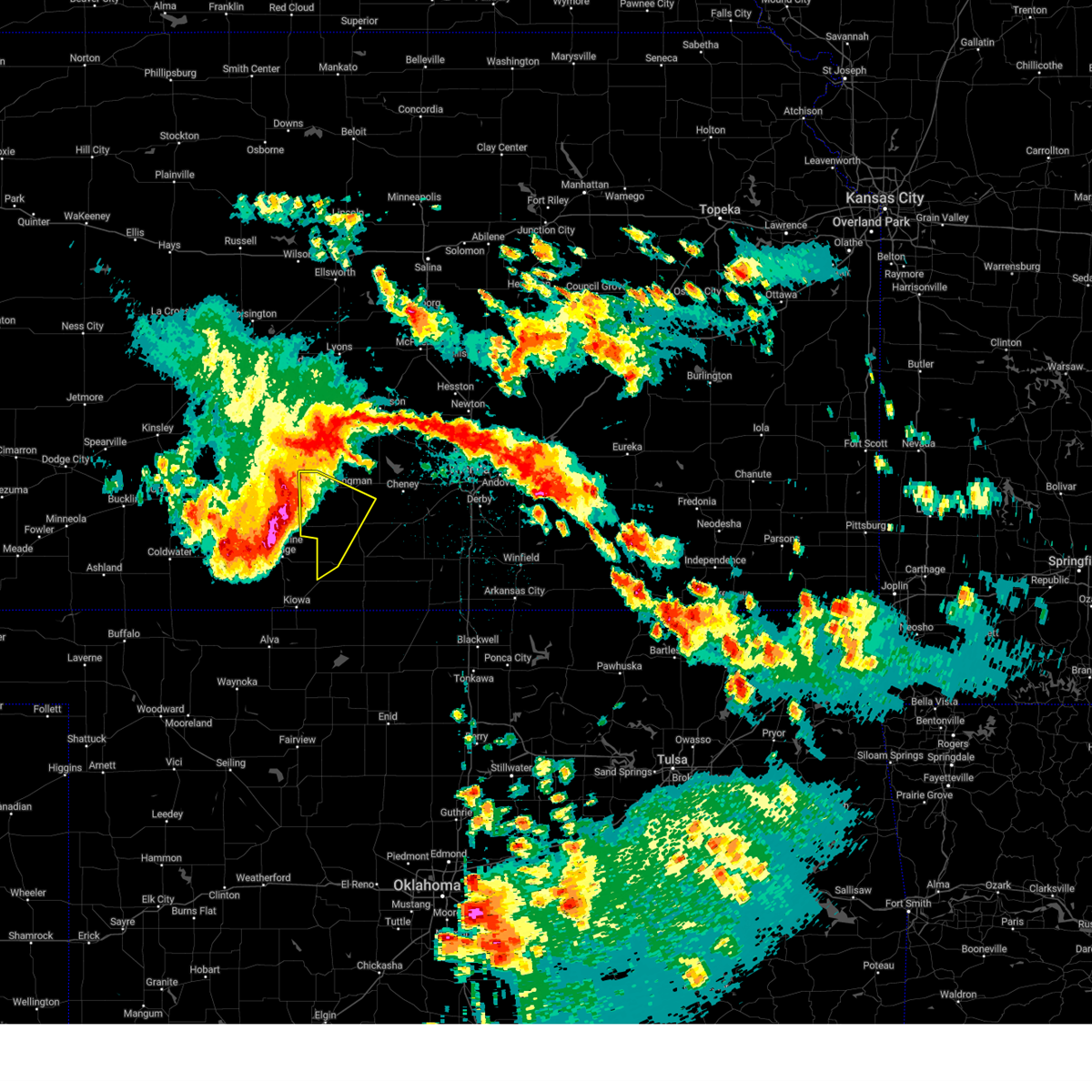 At 230 am cdt, severe thunderstorms were located along a line extending from 5 miles north of cunningham to near isabel to 9 miles south of lake city, moving southeast at 40 mph (radar indicated). Hazards include 60 mph wind gusts and penny size hail. Expect damage to roofs, siding, and trees. Locations impacted include, kingman, attica, cunningham, nashville, willowdale, zenda, spivey, cleveland, penalosa, and rago. At 230 am cdt, severe thunderstorms were located along a line extending from 5 miles north of cunningham to near isabel to 9 miles south of lake city, moving southeast at 40 mph (radar indicated). Hazards include 60 mph wind gusts and penny size hail. Expect damage to roofs, siding, and trees. Locations impacted include, kingman, attica, cunningham, nashville, willowdale, zenda, spivey, cleveland, penalosa, and rago.
|
| 5/24/2025 2:16 AM CDT |
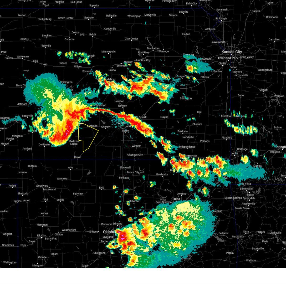 Svrict the national weather service in wichita has issued a * severe thunderstorm warning for, northwestern harper county in south central kansas, western kingman county in south central kansas, * until 315 am cdt. * at 216 am cdt, severe thunderstorms were located along a line extending from preston to near sawyer to 8 miles southwest of sun city, moving southeast at 35 mph (radar indicated). Hazards include 60 mph wind gusts and penny size hail. expect damage to roofs, siding, and trees Svrict the national weather service in wichita has issued a * severe thunderstorm warning for, northwestern harper county in south central kansas, western kingman county in south central kansas, * until 315 am cdt. * at 216 am cdt, severe thunderstorms were located along a line extending from preston to near sawyer to 8 miles southwest of sun city, moving southeast at 35 mph (radar indicated). Hazards include 60 mph wind gusts and penny size hail. expect damage to roofs, siding, and trees
|
| 4/22/2025 8:00 PM CDT |
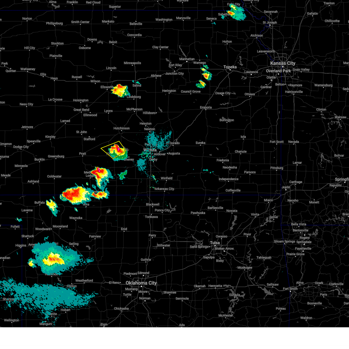 The storm which prompted the warning has moved out of the area. therefore, the warning will be allowed to expire. a severe thunderstorm watch remains in effect until 100 am cdt for south central kansas. remember, a severe thunderstorm warning still remains in effect for southeast reno county until 845 pm. The storm which prompted the warning has moved out of the area. therefore, the warning will be allowed to expire. a severe thunderstorm watch remains in effect until 100 am cdt for south central kansas. remember, a severe thunderstorm warning still remains in effect for southeast reno county until 845 pm.
|
| 4/22/2025 7:51 PM CDT | Ping Pong Ball sized hail reported 4.7 miles SE of Kingman, KS, courtesy of kake tv. |
| 4/22/2025 7:46 PM CDT |
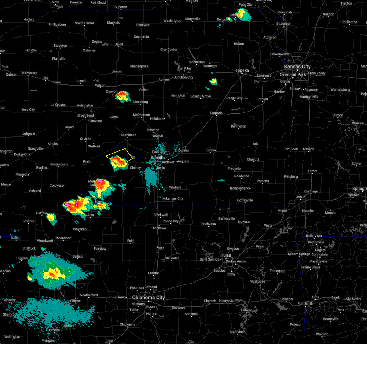 At 745 pm cdt, a severe thunderstorm was located near kingman, moving northeast at 40 mph (trained weather spotters. at 728 pm, ping pong ball size hail was reported in calista). Hazards include ping pong ball size hail and 60 mph wind gusts. People and animals outdoors will be injured. expect hail damage to roofs, siding, windows, and vehicles. expect wind damage to roofs, siding, and trees. Locations impacted include, pretty prairie, kingman, and kingman airport. At 745 pm cdt, a severe thunderstorm was located near kingman, moving northeast at 40 mph (trained weather spotters. at 728 pm, ping pong ball size hail was reported in calista). Hazards include ping pong ball size hail and 60 mph wind gusts. People and animals outdoors will be injured. expect hail damage to roofs, siding, windows, and vehicles. expect wind damage to roofs, siding, and trees. Locations impacted include, pretty prairie, kingman, and kingman airport.
|
| 4/22/2025 7:31 PM CDT |
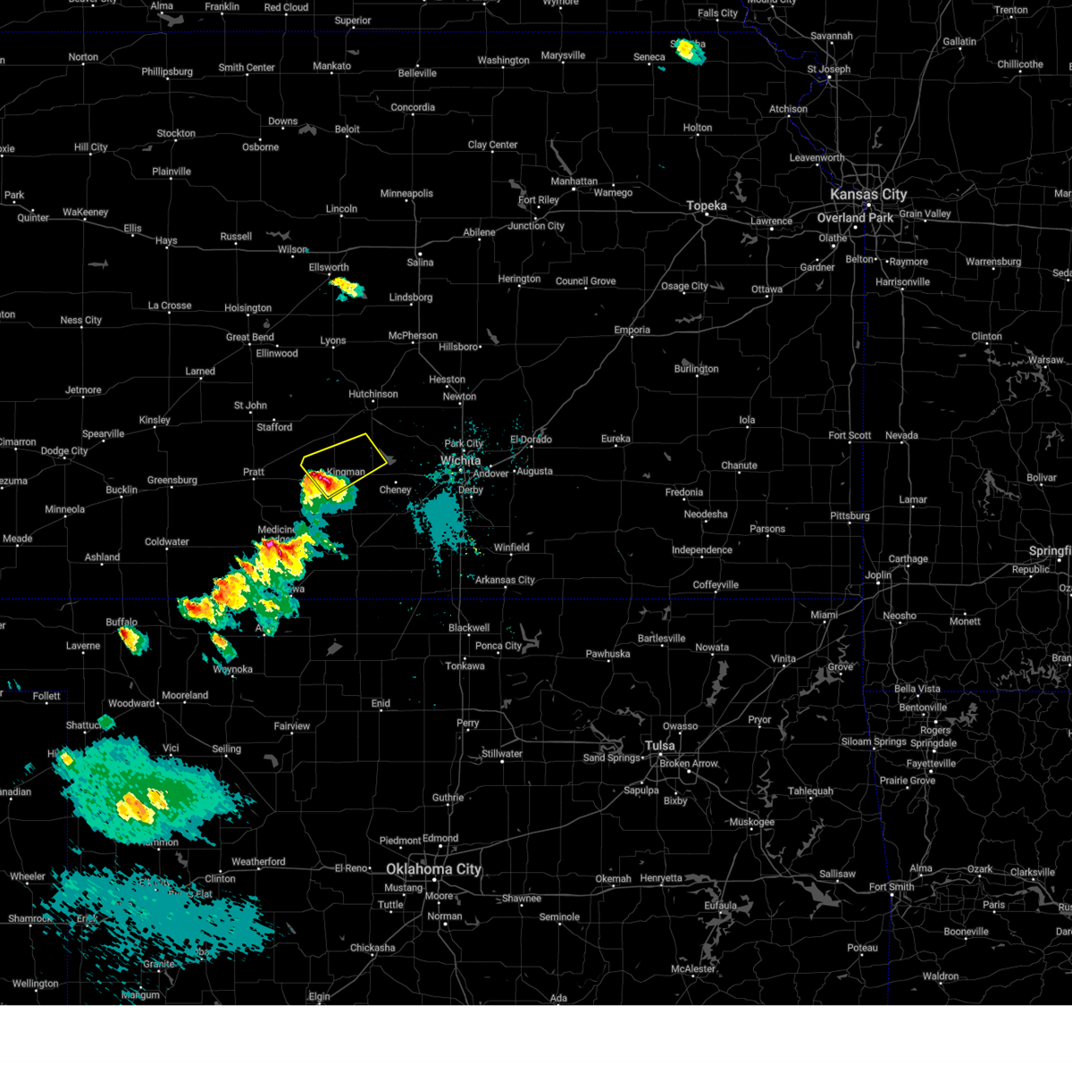 At 730 pm cdt, a severe thunderstorm was located 6 miles west of kingman, moving northeast at 40 mph (radar indicated). Hazards include ping pong ball size hail and 60 mph wind gusts. People and animals outdoors will be injured. expect hail damage to roofs, siding, windows, and vehicles. expect wind damage to roofs, siding, and trees. Locations impacted include, kingman airport, penalosa, pretty prairie, and kingman. At 730 pm cdt, a severe thunderstorm was located 6 miles west of kingman, moving northeast at 40 mph (radar indicated). Hazards include ping pong ball size hail and 60 mph wind gusts. People and animals outdoors will be injured. expect hail damage to roofs, siding, windows, and vehicles. expect wind damage to roofs, siding, and trees. Locations impacted include, kingman airport, penalosa, pretty prairie, and kingman.
|
| 4/22/2025 7:28 PM CDT | Ping Pong Ball sized hail reported 7.3 miles E of Kingman, KS |
| 4/22/2025 7:24 PM CDT |
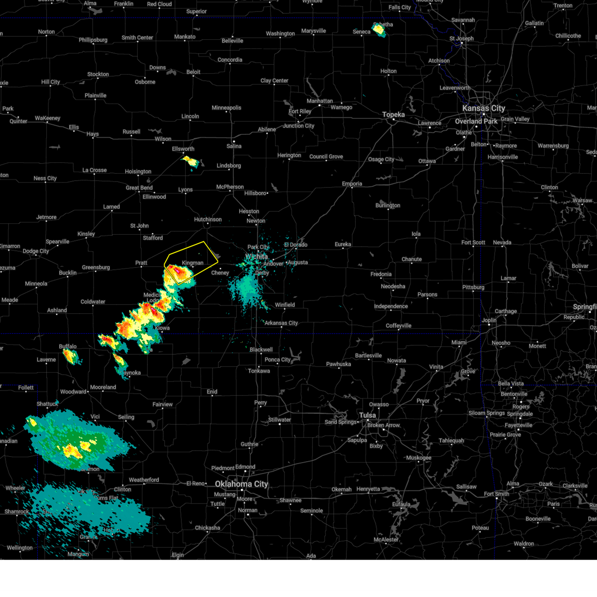 At 723 pm cdt, a severe thunderstorm was located 9 miles west of kingman, moving northeast at 40 mph (radar indicated). Hazards include ping pong ball size hail and 60 mph wind gusts. People and animals outdoors will be injured. expect hail damage to roofs, siding, windows, and vehicles. expect wind damage to roofs, siding, and trees. Locations impacted include, mt vernon, kingman airport, penalosa, waterloo, willowdale, cunningham, pretty prairie, kingman, cleveland, and cheney state park. At 723 pm cdt, a severe thunderstorm was located 9 miles west of kingman, moving northeast at 40 mph (radar indicated). Hazards include ping pong ball size hail and 60 mph wind gusts. People and animals outdoors will be injured. expect hail damage to roofs, siding, windows, and vehicles. expect wind damage to roofs, siding, and trees. Locations impacted include, mt vernon, kingman airport, penalosa, waterloo, willowdale, cunningham, pretty prairie, kingman, cleveland, and cheney state park.
|
| 4/22/2025 7:24 PM CDT |
 the severe thunderstorm warning has been cancelled and is no longer in effect the severe thunderstorm warning has been cancelled and is no longer in effect
|
| 4/22/2025 7:11 PM CDT |
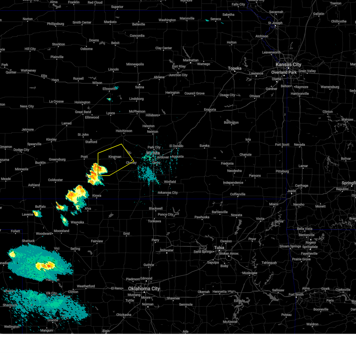 Svrict the national weather service in wichita has issued a * severe thunderstorm warning for, southwestern reno county in south central kansas, west central sedgwick county in south central kansas, kingman county in south central kansas, * until 800 pm cdt. * at 711 pm cdt, a severe thunderstorm was located 6 miles northeast of nashville, or 10 miles east of isabel, moving northeast at 45 mph (radar indicated). Hazards include ping pong ball size hail and 60 mph wind gusts. People and animals outdoors will be injured. expect hail damage to roofs, siding, windows, and vehicles. Expect wind damage to roofs, siding, and trees. Svrict the national weather service in wichita has issued a * severe thunderstorm warning for, southwestern reno county in south central kansas, west central sedgwick county in south central kansas, kingman county in south central kansas, * until 800 pm cdt. * at 711 pm cdt, a severe thunderstorm was located 6 miles northeast of nashville, or 10 miles east of isabel, moving northeast at 45 mph (radar indicated). Hazards include ping pong ball size hail and 60 mph wind gusts. People and animals outdoors will be injured. expect hail damage to roofs, siding, windows, and vehicles. Expect wind damage to roofs, siding, and trees.
|
| 4/16/2025 11:00 PM CDT |
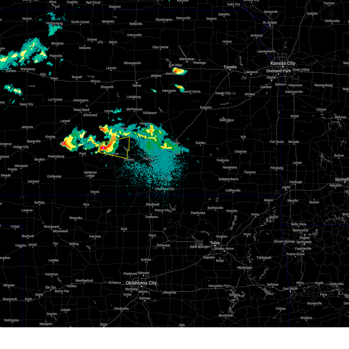 Svrict the national weather service in wichita has issued a * severe thunderstorm warning for, southern reno county in south central kansas, northeastern kingman county in south central kansas, * until 1145 pm cdt. * at 1059 pm cdt, a severe thunderstorm was located 9 miles east of turon, or 11 miles northwest of kingman, moving east at 35 mph (radar indicated). Hazards include quarter size hail. damage to vehicles is expected Svrict the national weather service in wichita has issued a * severe thunderstorm warning for, southern reno county in south central kansas, northeastern kingman county in south central kansas, * until 1145 pm cdt. * at 1059 pm cdt, a severe thunderstorm was located 9 miles east of turon, or 11 miles northwest of kingman, moving east at 35 mph (radar indicated). Hazards include quarter size hail. damage to vehicles is expected
|
| 4/2/2025 12:32 AM CDT |
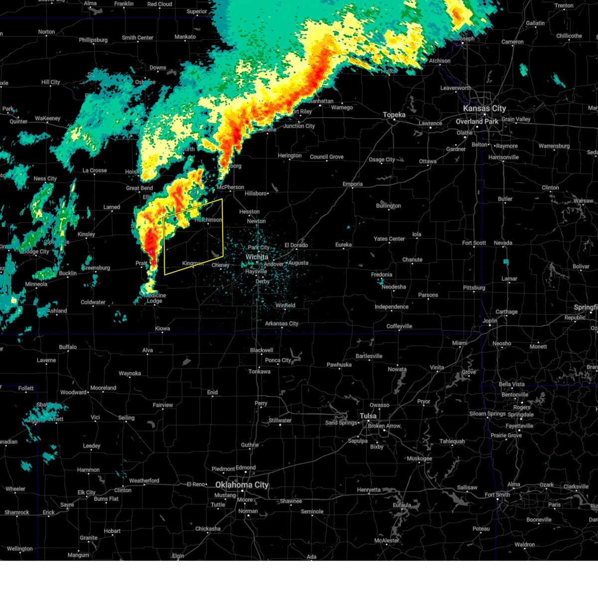 Svrict the national weather service in wichita has issued a * severe thunderstorm warning for, southwestern mcpherson county in central kansas, reno county in south central kansas, southeastern rice county in central kansas, northwestern kingman county in south central kansas, * until 130 am cdt. * at 1232 am cdt, severe thunderstorms were located along a line extending from 5 miles southeast of hudson to near neola to near cairo, moving east at 45 mph (radar indicated). Hazards include 60 mph wind gusts and quarter size hail. Hail damage to vehicles is expected. Expect wind damage to roofs, siding, and trees. Svrict the national weather service in wichita has issued a * severe thunderstorm warning for, southwestern mcpherson county in central kansas, reno county in south central kansas, southeastern rice county in central kansas, northwestern kingman county in south central kansas, * until 130 am cdt. * at 1232 am cdt, severe thunderstorms were located along a line extending from 5 miles southeast of hudson to near neola to near cairo, moving east at 45 mph (radar indicated). Hazards include 60 mph wind gusts and quarter size hail. Hail damage to vehicles is expected. Expect wind damage to roofs, siding, and trees.
|
| 10/30/2024 4:09 PM CDT |
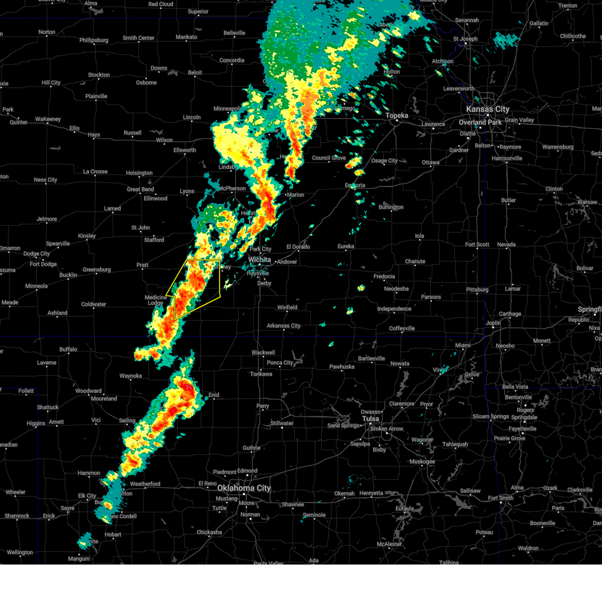 the severe thunderstorm warning has been cancelled and is no longer in effect the severe thunderstorm warning has been cancelled and is no longer in effect
|
| 10/30/2024 3:47 PM CDT |
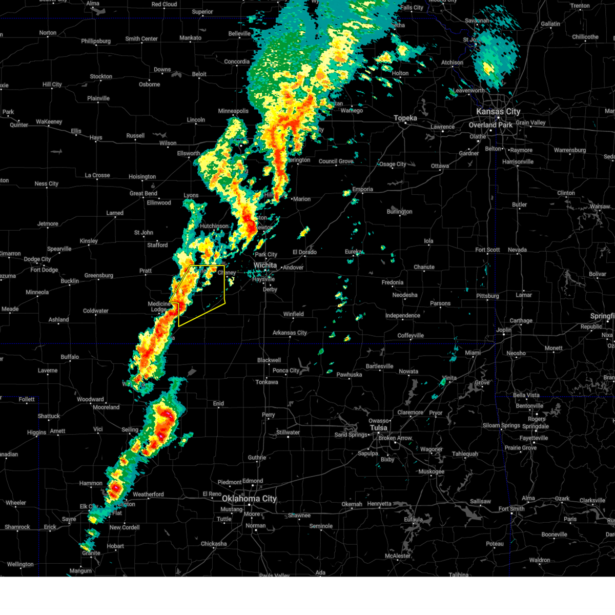 At 347 pm cdt, severe thunderstorms were located along a line extending from 8 miles east of nashville to 7 miles north of attica, moving northeast at 55 mph (radar indicated). Hazards include 60 mph wind gusts and nickel size hail. Expect damage to roofs, siding, and trees. Locations impacted include, kingman, harper, attica, norwich, nashville, murdock, waterloo, willowdale, zenda, spivey, cleveland, mt vernon, kingman airport, rago, runnymede, crystal springs, cheney state park, and cheney lake. At 347 pm cdt, severe thunderstorms were located along a line extending from 8 miles east of nashville to 7 miles north of attica, moving northeast at 55 mph (radar indicated). Hazards include 60 mph wind gusts and nickel size hail. Expect damage to roofs, siding, and trees. Locations impacted include, kingman, harper, attica, norwich, nashville, murdock, waterloo, willowdale, zenda, spivey, cleveland, mt vernon, kingman airport, rago, runnymede, crystal springs, cheney state park, and cheney lake.
|
| 10/30/2024 3:35 PM CDT |
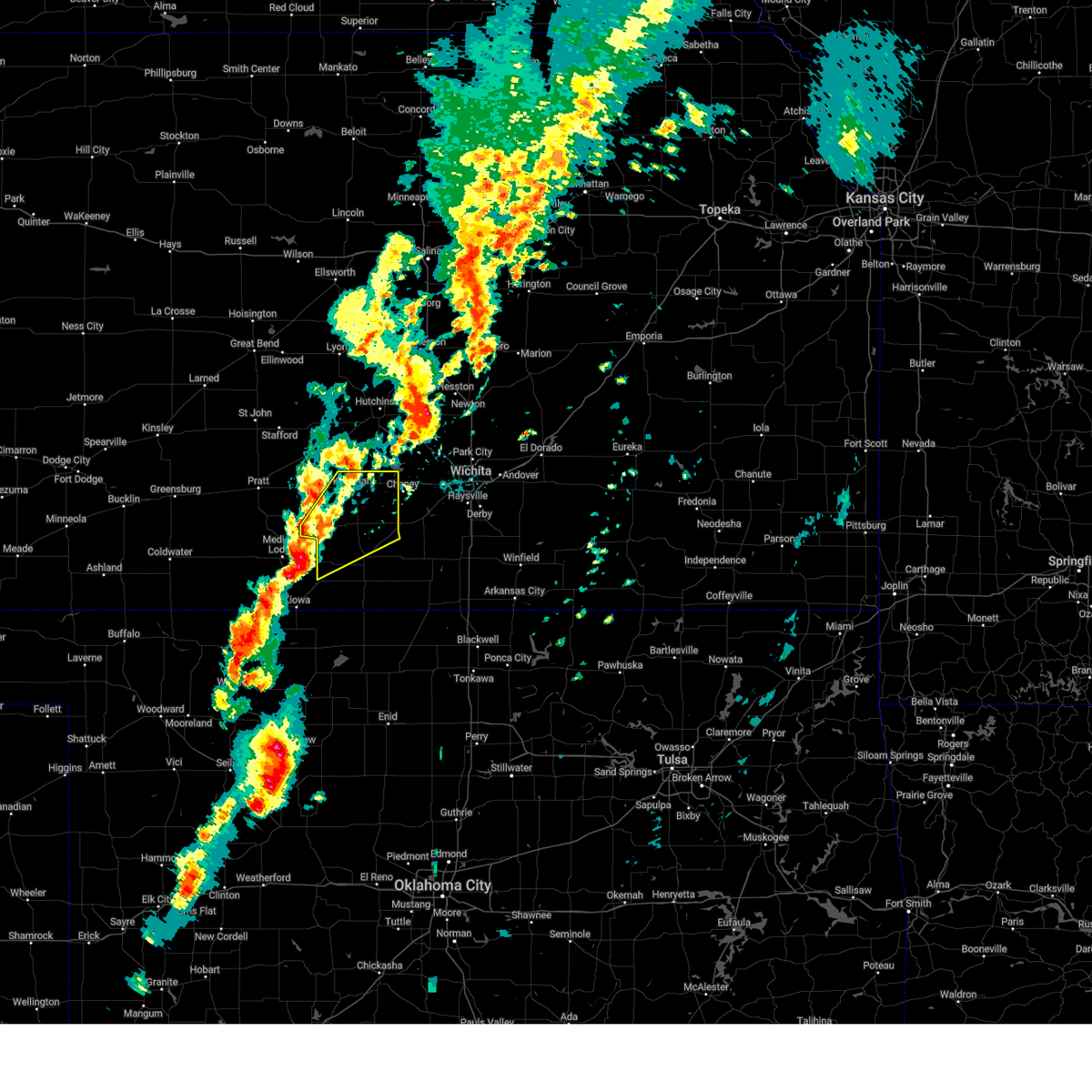 Svrict the national weather service in wichita has issued a * severe thunderstorm warning for, northern harper county in south central kansas, kingman county in south central kansas, * until 430 pm cdt. * at 334 pm cdt, severe thunderstorms were located along a line extending from 5 miles south of nashville to sharon, moving northeast at 55 mph (radar indicated). Hazards include 60 mph wind gusts and nickel size hail. expect damage to roofs, siding, and trees Svrict the national weather service in wichita has issued a * severe thunderstorm warning for, northern harper county in south central kansas, kingman county in south central kansas, * until 430 pm cdt. * at 334 pm cdt, severe thunderstorms were located along a line extending from 5 miles south of nashville to sharon, moving northeast at 55 mph (radar indicated). Hazards include 60 mph wind gusts and nickel size hail. expect damage to roofs, siding, and trees
|
| 10/30/2024 2:39 PM CDT |
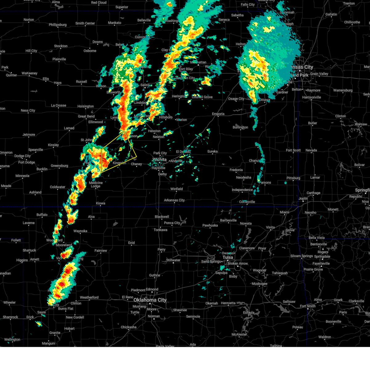 At 239 pm cdt, severe thunderstorms were located along a line extending from turon to 5 miles northeast of cunningham, moving northeast at 55 mph (radar indicated). Hazards include ping pong ball size hail and 60 mph wind gusts. People and animals outdoors will be injured. expect hail damage to roofs, siding, windows, and vehicles. expect wind damage to roofs, siding, and trees. Locations impacted include, hutchinson, kingman, south hutchinson, pretty prairie, arlington, cunningham, turon, partridge, plevna, abbyville, willowbrook, langdon, penalosa, kingman airport, and cheney lake. At 239 pm cdt, severe thunderstorms were located along a line extending from turon to 5 miles northeast of cunningham, moving northeast at 55 mph (radar indicated). Hazards include ping pong ball size hail and 60 mph wind gusts. People and animals outdoors will be injured. expect hail damage to roofs, siding, windows, and vehicles. expect wind damage to roofs, siding, and trees. Locations impacted include, hutchinson, kingman, south hutchinson, pretty prairie, arlington, cunningham, turon, partridge, plevna, abbyville, willowbrook, langdon, penalosa, kingman airport, and cheney lake.
|
| 10/30/2024 2:32 PM CDT |
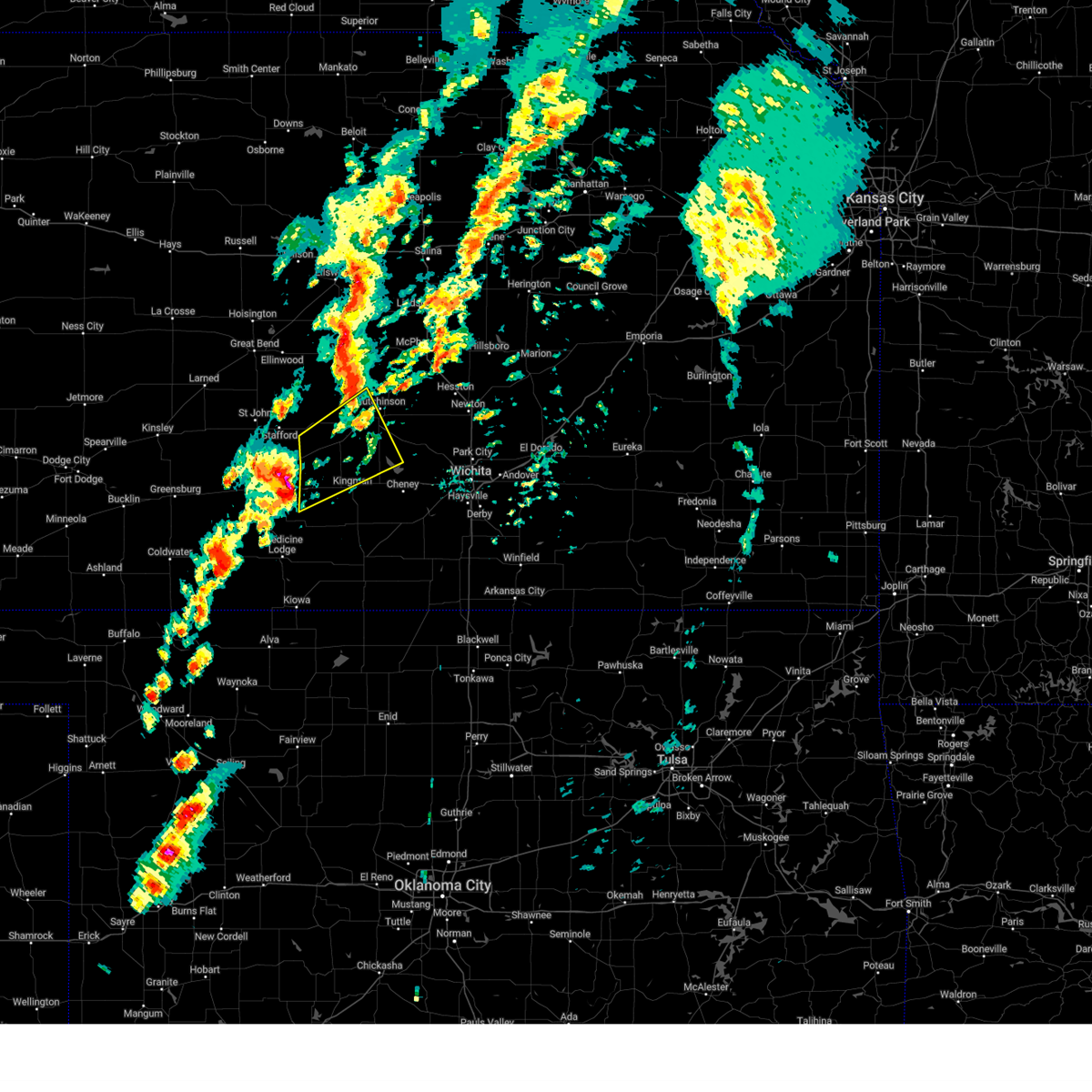 At 231 pm cdt, severe thunderstorms were located along a line extending from preston to cunningham, moving northeast at 55 mph (trained weather spotters reported 1 inch hail covering the ground 8 miles west of cunningham). Hazards include ping pong ball size hail and 60 mph wind gusts. People and animals outdoors will be injured. expect hail damage to roofs, siding, windows, and vehicles. expect wind damage to roofs, siding, and trees. Locations impacted include, hutchinson, kingman, south hutchinson, pretty prairie, arlington, cunningham, turon, partridge, plevna, abbyville, willowbrook, langdon, penalosa, cheney lake, and kingman airport. At 231 pm cdt, severe thunderstorms were located along a line extending from preston to cunningham, moving northeast at 55 mph (trained weather spotters reported 1 inch hail covering the ground 8 miles west of cunningham). Hazards include ping pong ball size hail and 60 mph wind gusts. People and animals outdoors will be injured. expect hail damage to roofs, siding, windows, and vehicles. expect wind damage to roofs, siding, and trees. Locations impacted include, hutchinson, kingman, south hutchinson, pretty prairie, arlington, cunningham, turon, partridge, plevna, abbyville, willowbrook, langdon, penalosa, cheney lake, and kingman airport.
|
| 10/30/2024 2:29 PM CDT |
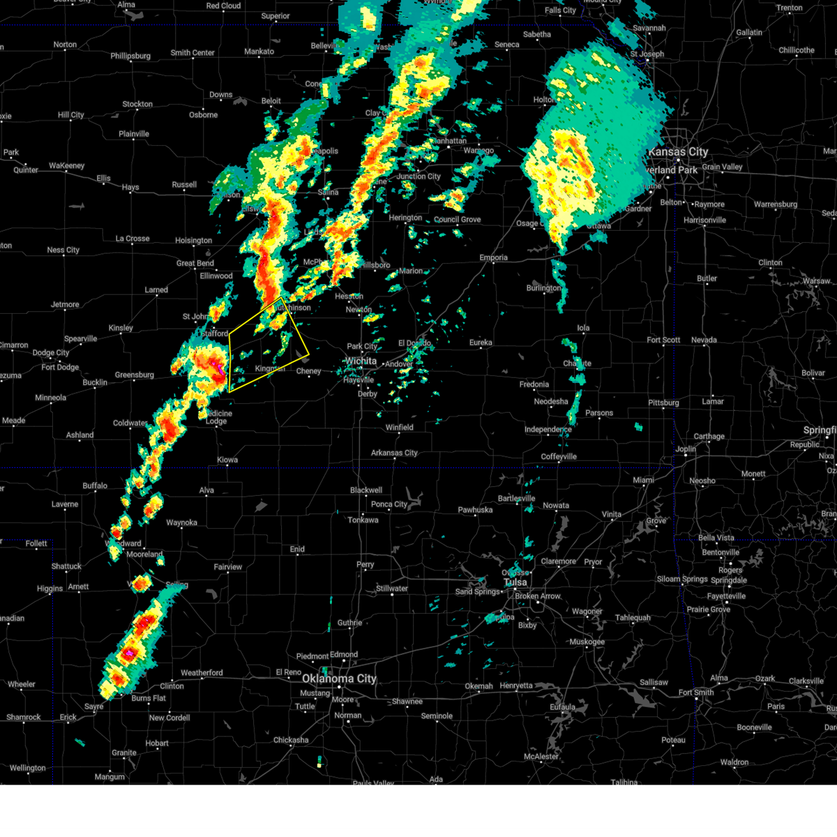 At 229 pm cdt, severe thunderstorms were located along a line extending from preston to near cairo, moving northeast at 55 mph (radar indicated). Hazards include ping pong ball size hail and 60 mph wind gusts. People and animals outdoors will be injured. expect hail damage to roofs, siding, windows, and vehicles. expect wind damage to roofs, siding, and trees. Locations impacted include, hutchinson, kingman, south hutchinson, pretty prairie, arlington, cunningham, turon, partridge, plevna, abbyville, willowbrook, langdon, penalosa, cheney lake, and kingman airport. At 229 pm cdt, severe thunderstorms were located along a line extending from preston to near cairo, moving northeast at 55 mph (radar indicated). Hazards include ping pong ball size hail and 60 mph wind gusts. People and animals outdoors will be injured. expect hail damage to roofs, siding, windows, and vehicles. expect wind damage to roofs, siding, and trees. Locations impacted include, hutchinson, kingman, south hutchinson, pretty prairie, arlington, cunningham, turon, partridge, plevna, abbyville, willowbrook, langdon, penalosa, cheney lake, and kingman airport.
|
| 10/30/2024 2:22 PM CDT |
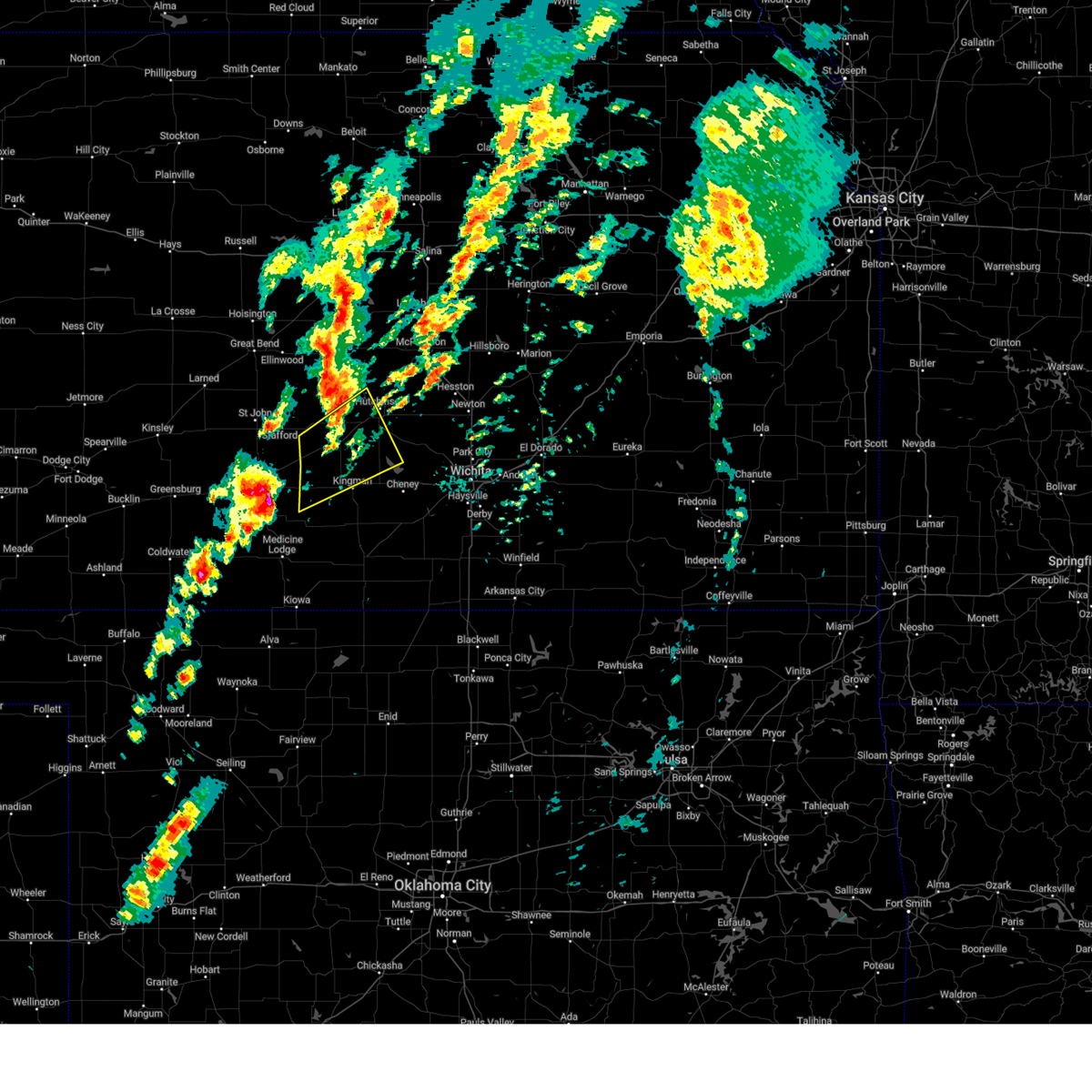 Svrict the national weather service in wichita has issued a * severe thunderstorm warning for, reno county in south central kansas, northwestern kingman county in south central kansas, * until 315 pm cdt. * at 222 pm cdt, severe thunderstorms were located along a line extending from 5 miles southeast of iuka to 5 miles southwest of cairo, moving northeast at 55 mph (radar indicated). Hazards include 60 mph wind gusts and half dollar size hail. Hail damage to vehicles is expected. Expect wind damage to roofs, siding, and trees. Svrict the national weather service in wichita has issued a * severe thunderstorm warning for, reno county in south central kansas, northwestern kingman county in south central kansas, * until 315 pm cdt. * at 222 pm cdt, severe thunderstorms were located along a line extending from 5 miles southeast of iuka to 5 miles southwest of cairo, moving northeast at 55 mph (radar indicated). Hazards include 60 mph wind gusts and half dollar size hail. Hail damage to vehicles is expected. Expect wind damage to roofs, siding, and trees.
|
| 9/20/2024 7:15 PM CDT |
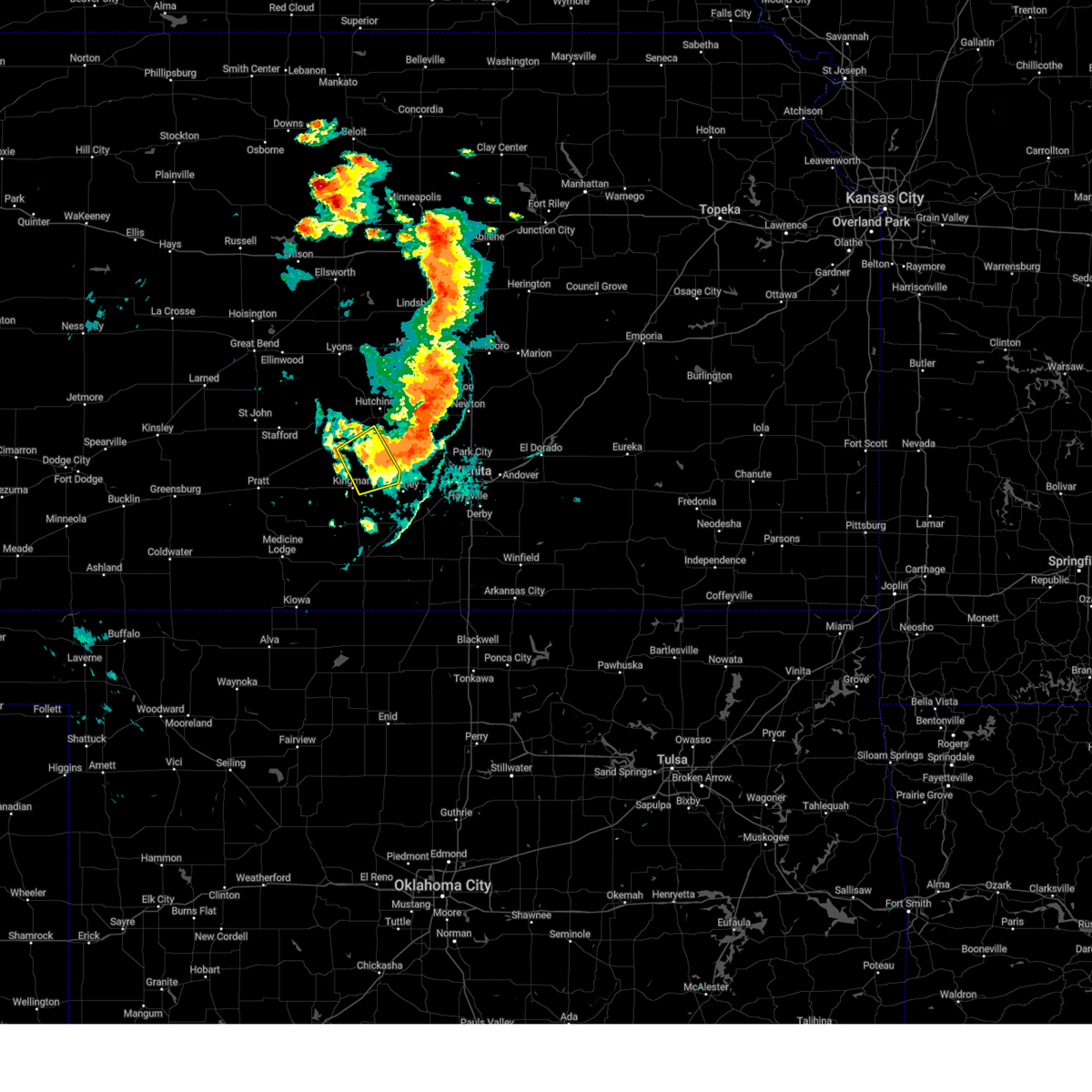 the severe thunderstorm warning has been cancelled and is no longer in effect the severe thunderstorm warning has been cancelled and is no longer in effect
|
| 9/20/2024 7:04 PM CDT |
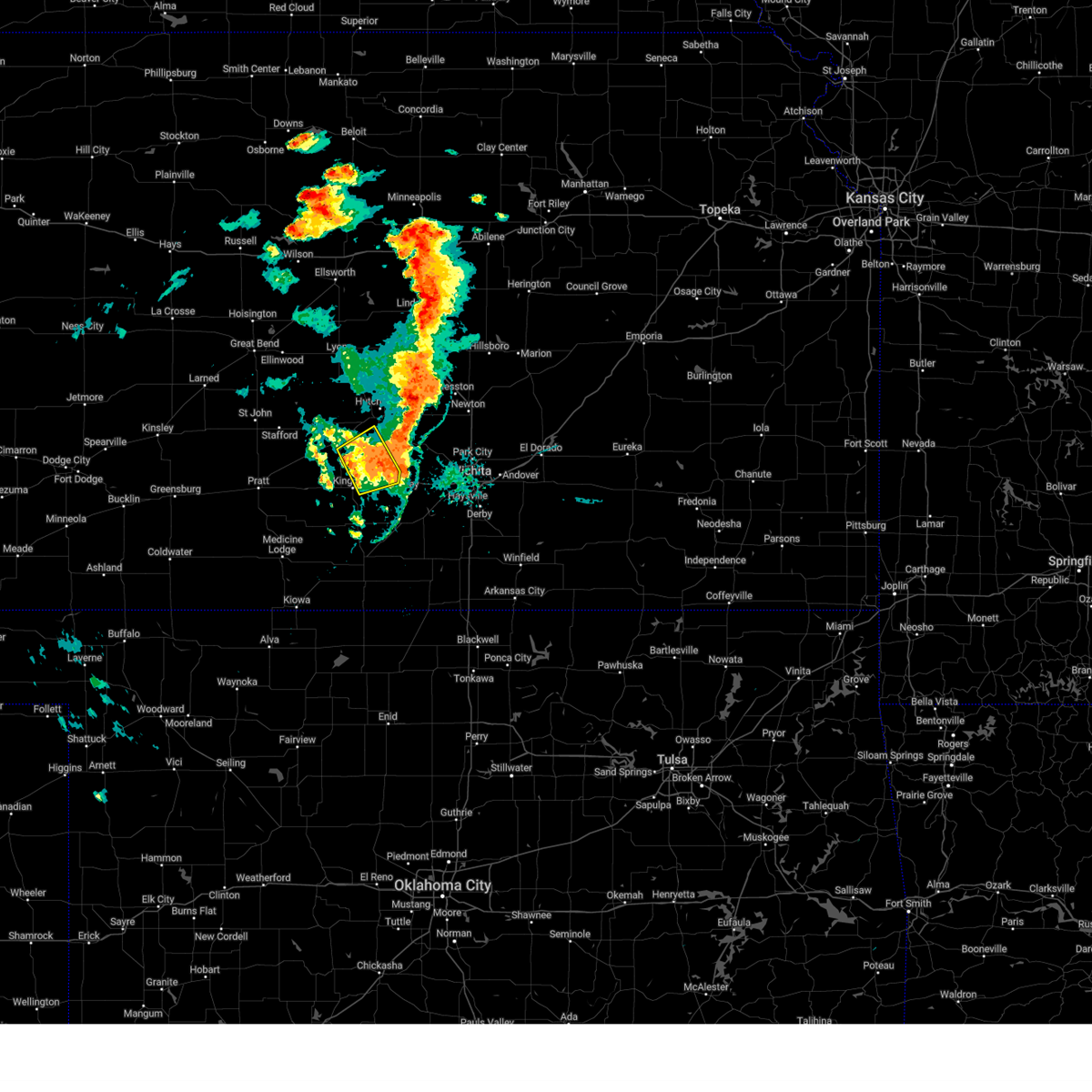 At 704 pm cdt, severe thunderstorms were located along a line extending from 7 miles west of haven to 10 miles east of pretty prairie, moving northeast at 35 mph (radar indicated). Hazards include 60 mph wind gusts and nickel size hail. Expect damage to roofs, siding, and trees. Locations impacted include, pretty prairie, waterloo, mt vernon, cheney state park, and cheney lake. At 704 pm cdt, severe thunderstorms were located along a line extending from 7 miles west of haven to 10 miles east of pretty prairie, moving northeast at 35 mph (radar indicated). Hazards include 60 mph wind gusts and nickel size hail. Expect damage to roofs, siding, and trees. Locations impacted include, pretty prairie, waterloo, mt vernon, cheney state park, and cheney lake.
|
| 9/20/2024 6:54 PM CDT |
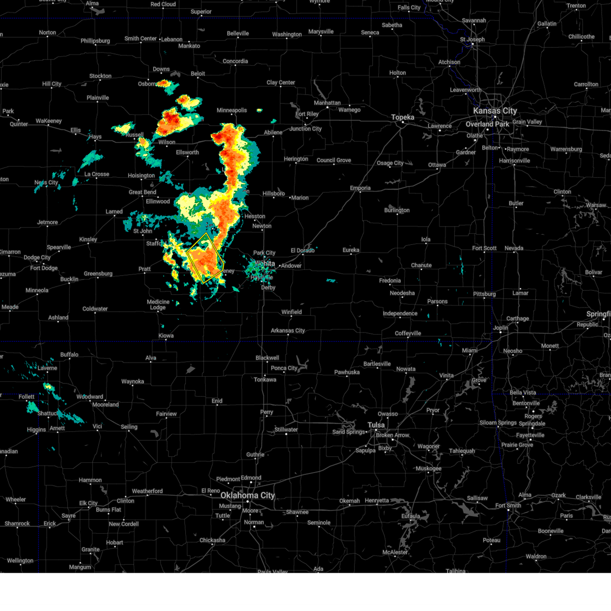 At 654 pm cdt, severe thunderstorms were located along a line extending from 5 miles north of pretty prairie to 9 miles northwest of cheney, moving northeast at 45 mph (radar indicated). Hazards include 60 mph wind gusts and nickel size hail. Expect damage to roofs, siding, and trees. Locations impacted include, kingman, pretty prairie, arlington, waterloo, cheney lake, mt vernon, and cheney state park. At 654 pm cdt, severe thunderstorms were located along a line extending from 5 miles north of pretty prairie to 9 miles northwest of cheney, moving northeast at 45 mph (radar indicated). Hazards include 60 mph wind gusts and nickel size hail. Expect damage to roofs, siding, and trees. Locations impacted include, kingman, pretty prairie, arlington, waterloo, cheney lake, mt vernon, and cheney state park.
|
| 9/20/2024 6:38 PM CDT | Storm damage reported in kingman county KS, 2.5 miles SSW of Kingman, KS |
| 9/20/2024 6:36 PM CDT |
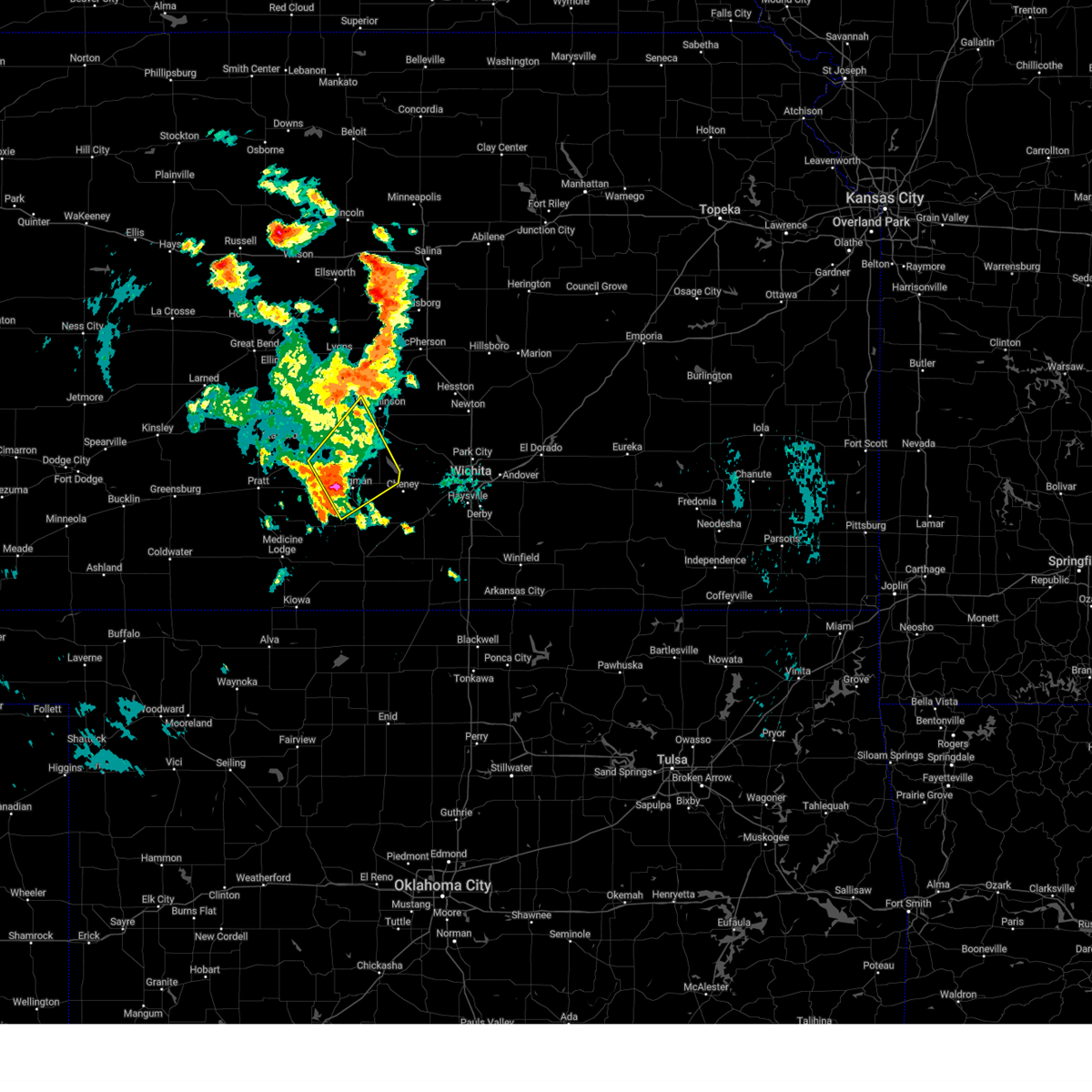 At 636 pm cdt, severe thunderstorms were located along a line extending from 9 miles east of turon to near kingman, moving northeast at 35 mph (radar indicated). Hazards include 60 mph wind gusts and half dollar size hail. Hail damage to vehicles is expected. expect wind damage to roofs, siding, and trees. Locations impacted include, kingman, pretty prairie, arlington, partridge, abbyville, waterloo, langdon, cleveland, penalosa, cheney lake, mt vernon, kingman airport, and cheney state park. At 636 pm cdt, severe thunderstorms were located along a line extending from 9 miles east of turon to near kingman, moving northeast at 35 mph (radar indicated). Hazards include 60 mph wind gusts and half dollar size hail. Hail damage to vehicles is expected. expect wind damage to roofs, siding, and trees. Locations impacted include, kingman, pretty prairie, arlington, partridge, abbyville, waterloo, langdon, cleveland, penalosa, cheney lake, mt vernon, kingman airport, and cheney state park.
|
| 9/20/2024 6:26 PM CDT |
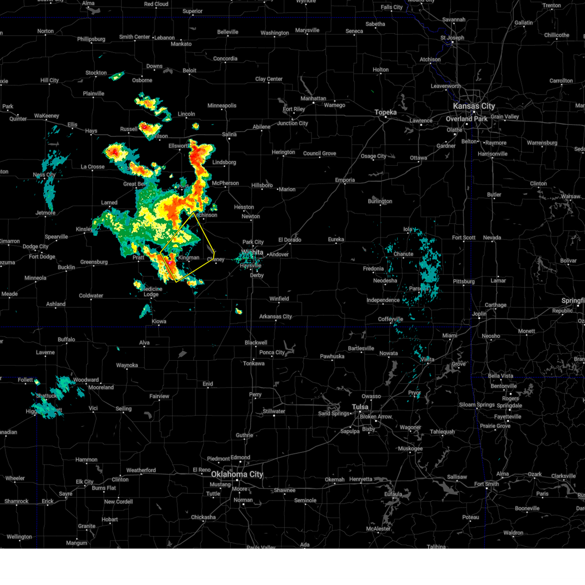 Svrict the national weather service in wichita has issued a * severe thunderstorm warning for, reno county in south central kansas, northwestern kingman county in south central kansas, * until 730 pm cdt. * at 626 pm cdt, severe thunderstorms were located along a line extending from 6 miles northeast of cunningham to 9 miles southwest of kingman, moving northeast at 35 mph (radar indicated). Hazards include 60 mph wind gusts and quarter size hail. Hail damage to vehicles is expected. Expect wind damage to roofs, siding, and trees. Svrict the national weather service in wichita has issued a * severe thunderstorm warning for, reno county in south central kansas, northwestern kingman county in south central kansas, * until 730 pm cdt. * at 626 pm cdt, severe thunderstorms were located along a line extending from 6 miles northeast of cunningham to 9 miles southwest of kingman, moving northeast at 35 mph (radar indicated). Hazards include 60 mph wind gusts and quarter size hail. Hail damage to vehicles is expected. Expect wind damage to roofs, siding, and trees.
|
| 8/16/2024 12:02 PM CDT |
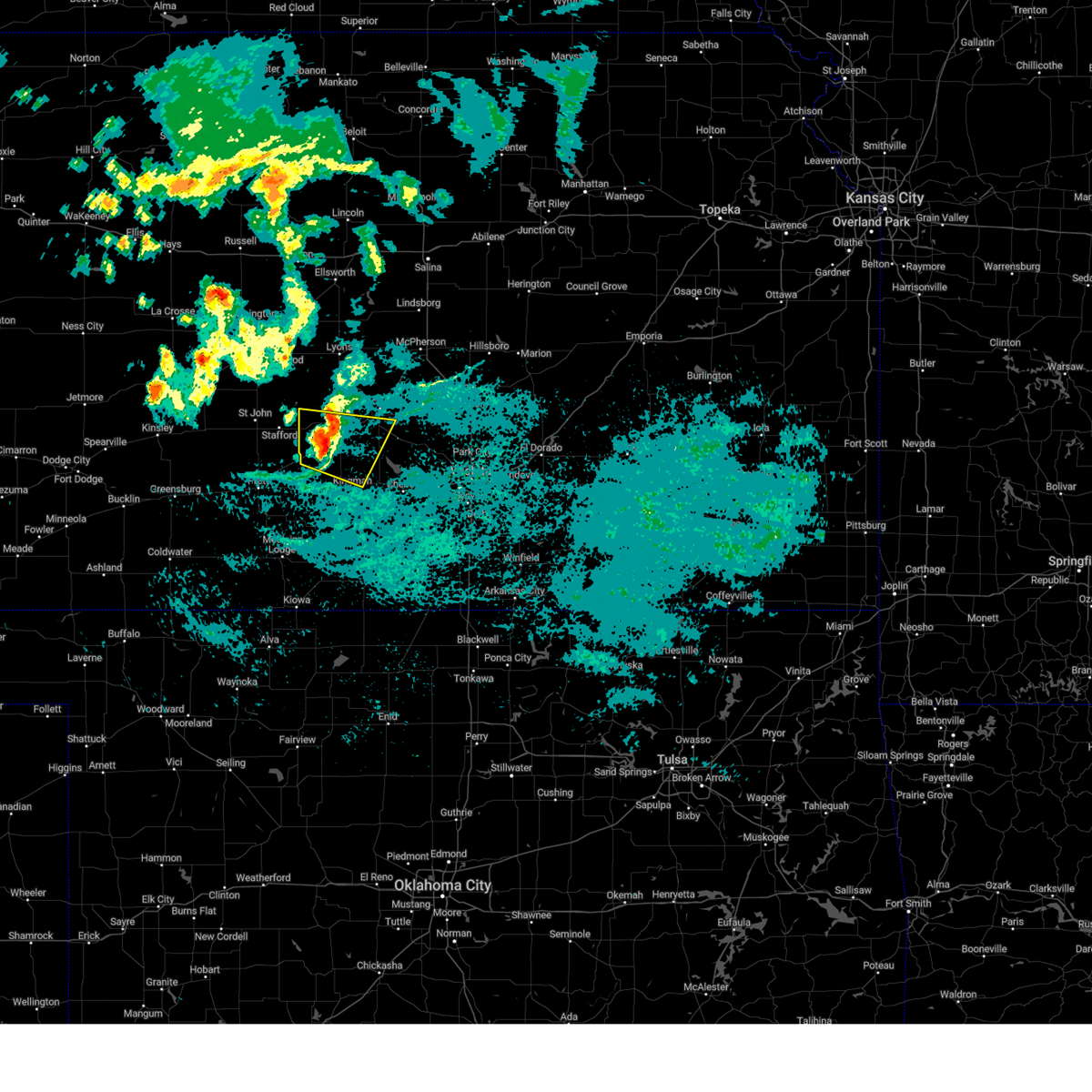 the severe thunderstorm warning has been cancelled and is no longer in effect the severe thunderstorm warning has been cancelled and is no longer in effect
|
| 8/16/2024 11:42 AM CDT |
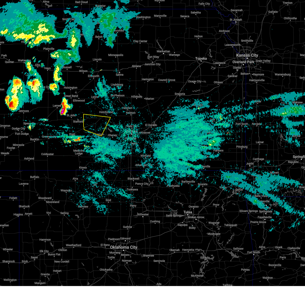 At 1141 am cdt, a severe thunderstorm was located near zenith, moving east at 40 mph (radar indicated). Hazards include 60 mph wind gusts and quarter size hail. Hail damage to vehicles is expected. expect wind damage to roofs, siding, and trees. Locations impacted include, pretty prairie, arlington, turon, partridge, sylvia, plevna, abbyville, yoder, and langdon. At 1141 am cdt, a severe thunderstorm was located near zenith, moving east at 40 mph (radar indicated). Hazards include 60 mph wind gusts and quarter size hail. Hail damage to vehicles is expected. expect wind damage to roofs, siding, and trees. Locations impacted include, pretty prairie, arlington, turon, partridge, sylvia, plevna, abbyville, yoder, and langdon.
|
| 8/16/2024 11:28 AM CDT |
 Svrict the national weather service in wichita has issued a * severe thunderstorm warning for, southern reno county in south central kansas, north central kingman county in south central kansas, * until 1230 pm cdt. * at 1128 am cdt, a severe thunderstorm was located over stafford, moving east at 40 mph (radar indicated). Hazards include ping pong ball size hail and 60 mph wind gusts. People and animals outdoors will be injured. expect hail damage to roofs, siding, windows, and vehicles. Expect wind damage to roofs, siding, and trees. Svrict the national weather service in wichita has issued a * severe thunderstorm warning for, southern reno county in south central kansas, north central kingman county in south central kansas, * until 1230 pm cdt. * at 1128 am cdt, a severe thunderstorm was located over stafford, moving east at 40 mph (radar indicated). Hazards include ping pong ball size hail and 60 mph wind gusts. People and animals outdoors will be injured. expect hail damage to roofs, siding, windows, and vehicles. Expect wind damage to roofs, siding, and trees.
|
| 8/14/2024 10:20 PM CDT | Tree damage occurred in town with a couple of trees knocked over. there is some powerline damage as well. time is estimate in kingman county KS, 0.9 miles WSW of Kingman, KS |
| 8/14/2024 10:16 PM CDT |
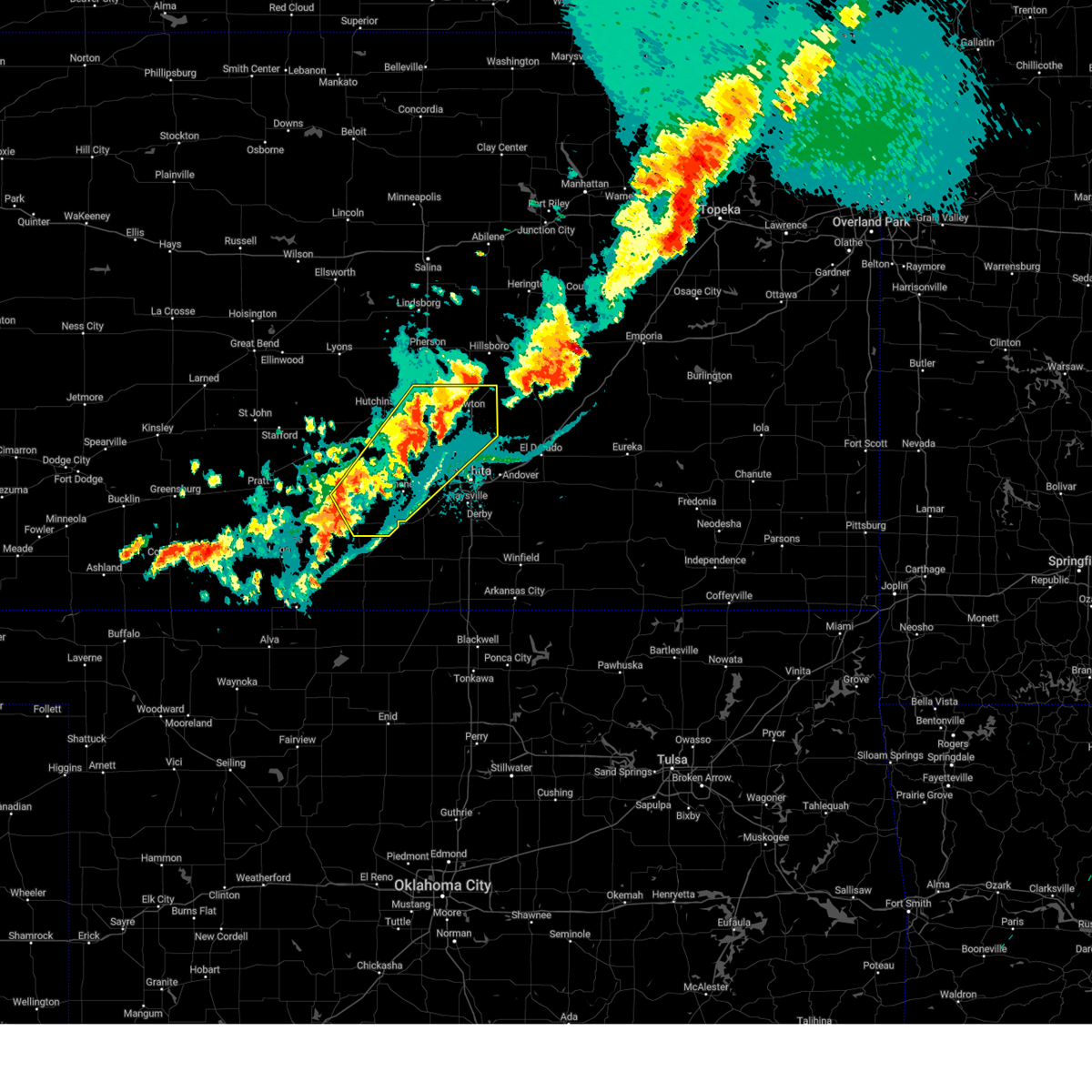 Svrict the national weather service in wichita has issued a * severe thunderstorm warning for, eastern reno county in south central kansas, northwestern sedgwick county in south central kansas, harvey county in south central kansas, eastern kingman county in south central kansas, * until 1100 pm cdt. * at 1015 pm cdt, severe thunderstorms were located along a line extending from 5 miles northeast of burrton to near colwich to 10 miles west of norwich, moving northeast at 40 mph (radar indicated). Hazards include 60 mph wind gusts and nickel size hail. expect damage to roofs, siding, and trees Svrict the national weather service in wichita has issued a * severe thunderstorm warning for, eastern reno county in south central kansas, northwestern sedgwick county in south central kansas, harvey county in south central kansas, eastern kingman county in south central kansas, * until 1100 pm cdt. * at 1015 pm cdt, severe thunderstorms were located along a line extending from 5 miles northeast of burrton to near colwich to 10 miles west of norwich, moving northeast at 40 mph (radar indicated). Hazards include 60 mph wind gusts and nickel size hail. expect damage to roofs, siding, and trees
|
| 6/27/2024 11:25 PM CDT |
 At 1125 pm cdt, a severe thunderstorm was located 10 miles northwest of harper, moving east at 45 mph (radar indicated). Hazards include 60 mph wind gusts. Expect damage to roofs, siding, and trees. Locations impacted include, kingman, harper, attica, norwich, cunningham, nashville, murdock, waterloo, willowdale, zenda, spivey, cleveland, danville, mt vernon, kingman airport, rago, runnymede, crystal springs, and cheney state park. At 1125 pm cdt, a severe thunderstorm was located 10 miles northwest of harper, moving east at 45 mph (radar indicated). Hazards include 60 mph wind gusts. Expect damage to roofs, siding, and trees. Locations impacted include, kingman, harper, attica, norwich, cunningham, nashville, murdock, waterloo, willowdale, zenda, spivey, cleveland, danville, mt vernon, kingman airport, rago, runnymede, crystal springs, and cheney state park.
|
| 6/27/2024 10:57 PM CDT |
 Svrict the national weather service in wichita has issued a * severe thunderstorm warning for, northern harper county in south central kansas, kingman county in south central kansas, * until 1215 am cdt. * at 1057 pm cdt, a severe thunderstorm was located over nashville, or near isabel, moving east at 45 mph (radar indicated). Hazards include 60 mph wind gusts and penny size hail. expect damage to roofs, siding, and trees Svrict the national weather service in wichita has issued a * severe thunderstorm warning for, northern harper county in south central kansas, kingman county in south central kansas, * until 1215 am cdt. * at 1057 pm cdt, a severe thunderstorm was located over nashville, or near isabel, moving east at 45 mph (radar indicated). Hazards include 60 mph wind gusts and penny size hail. expect damage to roofs, siding, and trees
|
| 6/15/2024 4:46 PM CDT |
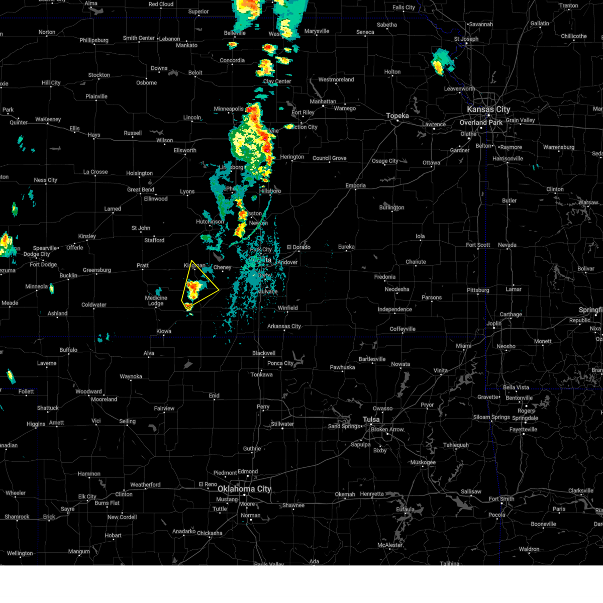 At 446 pm cdt, severe thunderstorms were located along a line extending from 11 miles south of kingman to near attica, moving northeast at 30 mph (radar indicated). Hazards include 60 mph wind gusts. Expect damage to roofs, siding, and trees. Locations impacted include, kingman, norwich, spivey, cleveland, rago, and kingman airport. At 446 pm cdt, severe thunderstorms were located along a line extending from 11 miles south of kingman to near attica, moving northeast at 30 mph (radar indicated). Hazards include 60 mph wind gusts. Expect damage to roofs, siding, and trees. Locations impacted include, kingman, norwich, spivey, cleveland, rago, and kingman airport.
|
| 6/15/2024 4:33 PM CDT |
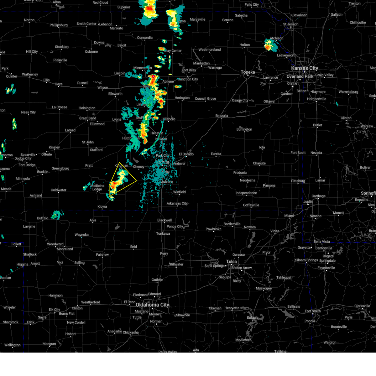 At 432 pm cdt, a severe thunderstorm was located 11 miles east of nashville, or 13 miles north of attica, moving northeast at 30 mph (radar indicated). Hazards include 60 mph wind gusts. Expect damage to roofs, siding, and trees. Locations impacted include, kingman, norwich, zenda, spivey, cleveland, rago, and kingman airport. At 432 pm cdt, a severe thunderstorm was located 11 miles east of nashville, or 13 miles north of attica, moving northeast at 30 mph (radar indicated). Hazards include 60 mph wind gusts. Expect damage to roofs, siding, and trees. Locations impacted include, kingman, norwich, zenda, spivey, cleveland, rago, and kingman airport.
|
| 6/15/2024 4:20 PM CDT |
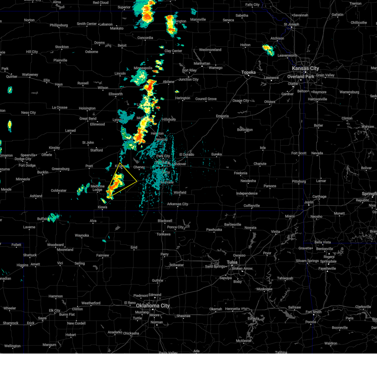 Svrict the national weather service in wichita has issued a * severe thunderstorm warning for, northwestern harper county in south central kansas, eastern kingman county in south central kansas, * until 515 pm cdt. * at 419 pm cdt, a severe thunderstorm was located 8 miles southeast of nashville, or 9 miles north of attica, moving northeast at 30 mph (radar indicated). Hazards include 60 mph wind gusts. expect damage to roofs, siding, and trees Svrict the national weather service in wichita has issued a * severe thunderstorm warning for, northwestern harper county in south central kansas, eastern kingman county in south central kansas, * until 515 pm cdt. * at 419 pm cdt, a severe thunderstorm was located 8 miles southeast of nashville, or 9 miles north of attica, moving northeast at 30 mph (radar indicated). Hazards include 60 mph wind gusts. expect damage to roofs, siding, and trees
|
| 6/13/2024 9:29 PM CDT |
 the severe thunderstorm warning has been cancelled and is no longer in effect the severe thunderstorm warning has been cancelled and is no longer in effect
|
| 6/13/2024 9:22 PM CDT |
 At 920 pm cdt, severe thunderstorms were located along a line extending from near cheney to near harper to kiowa, moving southeast at 30 mph (radar indicated). Hazards include 60 mph wind gusts. Expect damage to roofs, siding, and trees. Locations impacted include, kingman, anthony, harper, attica, murdock, waterloo, zenda, spivey, cleveland, waldron, mt vernon, kingman airport, corwin, rago, runnymede, crystal springs, and cheney state park. At 920 pm cdt, severe thunderstorms were located along a line extending from near cheney to near harper to kiowa, moving southeast at 30 mph (radar indicated). Hazards include 60 mph wind gusts. Expect damage to roofs, siding, and trees. Locations impacted include, kingman, anthony, harper, attica, murdock, waterloo, zenda, spivey, cleveland, waldron, mt vernon, kingman airport, corwin, rago, runnymede, crystal springs, and cheney state park.
|
| 6/13/2024 9:04 PM CDT |
 At 904 pm cdt, severe thunderstorms were located along a line extending from 9 miles west of cheney to 8 miles north of attica to 8 miles northeast of hardtner, moving southeast at 30 mph (radar indicated). Hazards include 70 mph wind gusts. Expect considerable tree damage. damage is likely to mobile homes, roofs, and outbuildings. Locations impacted include, kingman, anthony, harper, attica, nashville, murdock, waterloo, willowdale, zenda, spivey, cleveland, waldron, mt vernon, kingman airport, corwin, rago, runnymede, crystal springs, and cheney state park. At 904 pm cdt, severe thunderstorms were located along a line extending from 9 miles west of cheney to 8 miles north of attica to 8 miles northeast of hardtner, moving southeast at 30 mph (radar indicated). Hazards include 70 mph wind gusts. Expect considerable tree damage. damage is likely to mobile homes, roofs, and outbuildings. Locations impacted include, kingman, anthony, harper, attica, nashville, murdock, waterloo, willowdale, zenda, spivey, cleveland, waldron, mt vernon, kingman airport, corwin, rago, runnymede, crystal springs, and cheney state park.
|
| 6/13/2024 8:48 PM CDT |
 At 847 pm cdt, severe thunderstorms were located along a line extending from near pretty prairie to 7 miles east of nashville to 7 miles southwest of medicine lodge, moving southeast at 30 mph (trained weather spotters). Hazards include 70 mph wind gusts. Expect considerable tree damage. damage is likely to mobile homes, roofs, and outbuildings. Locations impacted include, kingman, anthony, harper, attica, cunningham, nashville, murdock, waterloo, willowdale, zenda, spivey, cleveland, penalosa, waldron, mt vernon, kingman airport, corwin, rago, runnymede, and crystal springs. At 847 pm cdt, severe thunderstorms were located along a line extending from near pretty prairie to 7 miles east of nashville to 7 miles southwest of medicine lodge, moving southeast at 30 mph (trained weather spotters). Hazards include 70 mph wind gusts. Expect considerable tree damage. damage is likely to mobile homes, roofs, and outbuildings. Locations impacted include, kingman, anthony, harper, attica, cunningham, nashville, murdock, waterloo, willowdale, zenda, spivey, cleveland, penalosa, waldron, mt vernon, kingman airport, corwin, rago, runnymede, and crystal springs.
|
| 6/13/2024 8:38 PM CDT | Storm damage reported in kingman county KS, 1 miles SSW of Kingman, KS |
| 6/13/2024 8:38 PM CDT |
 Svrict the national weather service in wichita has issued a * severe thunderstorm warning for, harper county in south central kansas, kingman county in south central kansas, * until 945 pm cdt. * at 838 pm cdt, severe thunderstorms were located along a line extending from near pretty prairie to 5 miles northeast of nashville to 7 miles southeast of lake city, moving southeast at 35 mph (public). Hazards include 60 mph wind gusts. expect damage to roofs, siding, and trees Svrict the national weather service in wichita has issued a * severe thunderstorm warning for, harper county in south central kansas, kingman county in south central kansas, * until 945 pm cdt. * at 838 pm cdt, severe thunderstorms were located along a line extending from near pretty prairie to 5 miles northeast of nashville to 7 miles southeast of lake city, moving southeast at 35 mph (public). Hazards include 60 mph wind gusts. expect damage to roofs, siding, and trees
|
| 6/13/2024 8:30 PM CDT | Pictures submitted via social media show one large tree and limbs (>6 in. diameter) dow in kingman county KS, 0.9 miles SSE of Kingman, KS |
| 6/9/2024 2:02 AM CDT | Rain blowing horizontal. visibility reduced to about 30 f in kingman county KS, 5.3 miles N of Kingman, KS |
| 6/9/2024 1:30 AM CDT |
 At 130 am cdt, severe thunderstorms were located along a line extending from 7 miles northeast of hudson to 5 miles north of cunningham to near sharon, moving east at 35 mph (radar indicated). Hazards include 60 mph wind gusts. Expect damage to roofs, siding, and trees. Locations impacted include, hutchinson, lyons, kingman, south hutchinson, sterling, anthony, harper, nickerson, pretty prairie, attica, little river, norwich, chase, arlington, cunningham, turon, bushton, geneseo, partridge, and sylvia. At 130 am cdt, severe thunderstorms were located along a line extending from 7 miles northeast of hudson to 5 miles north of cunningham to near sharon, moving east at 35 mph (radar indicated). Hazards include 60 mph wind gusts. Expect damage to roofs, siding, and trees. Locations impacted include, hutchinson, lyons, kingman, south hutchinson, sterling, anthony, harper, nickerson, pretty prairie, attica, little river, norwich, chase, arlington, cunningham, turon, bushton, geneseo, partridge, and sylvia.
|
| 6/9/2024 1:08 AM CDT |
 Svrict the national weather service in wichita has issued a * severe thunderstorm warning for, reno county in south central kansas, harper county in south central kansas, rice county in central kansas, kingman county in south central kansas, * until 215 am cdt. * at 108 am cdt, severe thunderstorms were located along a line extending from 5 miles east of great bend to preston to 6 miles northwest of medicine lodge, moving east at 45 mph (radar indicated). Hazards include 60 mph wind gusts and quarter size hail. Hail damage to vehicles is expected. Expect wind damage to roofs, siding, and trees. Svrict the national weather service in wichita has issued a * severe thunderstorm warning for, reno county in south central kansas, harper county in south central kansas, rice county in central kansas, kingman county in south central kansas, * until 215 am cdt. * at 108 am cdt, severe thunderstorms were located along a line extending from 5 miles east of great bend to preston to 6 miles northwest of medicine lodge, moving east at 45 mph (radar indicated). Hazards include 60 mph wind gusts and quarter size hail. Hail damage to vehicles is expected. Expect wind damage to roofs, siding, and trees.
|
| 5/19/2024 7:25 PM CDT | Lots of tree limbs in the roads and power is out to some of the tow in kingman county KS, 0.9 miles WSW of Kingman, KS |
| 5/19/2024 7:22 PM CDT |
 At 721 pm cdt, severe thunderstorms were located along a line extending from 6 miles north of abbyville to 5 miles north of kingman to 7 miles northeast of nashville, moving east at 70 mph (radar indicated). Hazards include 80 mph wind gusts and quarter size hail. Flying debris will be dangerous to those caught without shelter. mobile homes will be heavily damaged. expect considerable damage to roofs, windows, and vehicles. extensive tree damage and power outages are likely. Locations impacted include, hutchinson, kingman, south hutchinson, buhler, haven, nickerson, pretty prairie, norwich, arlington, cunningham, turon, partridge, sylvia, plevna, abbyville, nashville, yoder, murdock, waterloo, and willowdale. At 721 pm cdt, severe thunderstorms were located along a line extending from 6 miles north of abbyville to 5 miles north of kingman to 7 miles northeast of nashville, moving east at 70 mph (radar indicated). Hazards include 80 mph wind gusts and quarter size hail. Flying debris will be dangerous to those caught without shelter. mobile homes will be heavily damaged. expect considerable damage to roofs, windows, and vehicles. extensive tree damage and power outages are likely. Locations impacted include, hutchinson, kingman, south hutchinson, buhler, haven, nickerson, pretty prairie, norwich, arlington, cunningham, turon, partridge, sylvia, plevna, abbyville, nashville, yoder, murdock, waterloo, and willowdale.
|
| 5/19/2024 7:18 PM CDT |
 At 717 pm cdt, severe thunderstorms were located along a line extending from near plevna to 7 miles northwest of kingman to near nashville, moving east at 65 mph (radar indicated). Hazards include 80 mph wind gusts and quarter size hail. Flying debris will be dangerous to those caught without shelter. mobile homes will be heavily damaged. expect considerable damage to roofs, windows, and vehicles. extensive tree damage and power outages are likely. Locations impacted include, hutchinson, kingman, south hutchinson, buhler, haven, nickerson, pretty prairie, norwich, arlington, cunningham, turon, partridge, sylvia, plevna, abbyville, nashville, yoder, murdock, waterloo, and willowdale. At 717 pm cdt, severe thunderstorms were located along a line extending from near plevna to 7 miles northwest of kingman to near nashville, moving east at 65 mph (radar indicated). Hazards include 80 mph wind gusts and quarter size hail. Flying debris will be dangerous to those caught without shelter. mobile homes will be heavily damaged. expect considerable damage to roofs, windows, and vehicles. extensive tree damage and power outages are likely. Locations impacted include, hutchinson, kingman, south hutchinson, buhler, haven, nickerson, pretty prairie, norwich, arlington, cunningham, turon, partridge, sylvia, plevna, abbyville, nashville, yoder, murdock, waterloo, and willowdale.
|
| 5/19/2024 6:55 PM CDT |
 Svrict the national weather service in wichita has issued a * severe thunderstorm warning for, reno county in south central kansas, kingman county in south central kansas, * until 800 pm cdt. * at 654 pm cdt, severe thunderstorms were located along a line extending from near hudson to near pratt to 5 miles east of croft, moving east at 60 mph (radar indicated). Hazards include 80 mph wind gusts and quarter size hail. Flying debris will be dangerous to those caught without shelter. mobile homes will be heavily damaged. expect considerable damage to roofs, windows, and vehicles. Extensive tree damage and power outages are likely. Svrict the national weather service in wichita has issued a * severe thunderstorm warning for, reno county in south central kansas, kingman county in south central kansas, * until 800 pm cdt. * at 654 pm cdt, severe thunderstorms were located along a line extending from near hudson to near pratt to 5 miles east of croft, moving east at 60 mph (radar indicated). Hazards include 80 mph wind gusts and quarter size hail. Flying debris will be dangerous to those caught without shelter. mobile homes will be heavily damaged. expect considerable damage to roofs, windows, and vehicles. Extensive tree damage and power outages are likely.
|
| 5/15/2024 10:53 PM CDT |
 The storms which prompted the warning have moved out of the warned area. therefore, the warning will be allowed to expire. a severe thunderstorm watch remains in effect until 100 am cdt for south central kansas. The storms which prompted the warning have moved out of the warned area. therefore, the warning will be allowed to expire. a severe thunderstorm watch remains in effect until 100 am cdt for south central kansas.
|
| 5/15/2024 10:50 PM CDT | Storm damage reported in kingman county KS, 0.9 miles WSW of Kingman, KS |
| 5/15/2024 10:33 PM CDT |
 At 1033 pm cdt, severe thunderstorms were located along a line extending from cunningham to 7 miles southwest of kingman to 7 miles north of harper, moving northeast at 50 mph (radar indicated). Hazards include 60 mph wind gusts and penny size hail. Expect damage to roofs, siding, and trees. Locations impacted include, kingman, attica, cunningham, nashville, murdock, willowdale, zenda, spivey, cleveland, rago, kingman airport, and crystal springs. At 1033 pm cdt, severe thunderstorms were located along a line extending from cunningham to 7 miles southwest of kingman to 7 miles north of harper, moving northeast at 50 mph (radar indicated). Hazards include 60 mph wind gusts and penny size hail. Expect damage to roofs, siding, and trees. Locations impacted include, kingman, attica, cunningham, nashville, murdock, willowdale, zenda, spivey, cleveland, rago, kingman airport, and crystal springs.
|
| 5/15/2024 10:14 PM CDT |
 Svrict the national weather service in wichita has issued a * severe thunderstorm warning for, northwestern harper county in south central kansas, kingman county in south central kansas, * until 1100 pm cdt. * at 1014 pm cdt, severe thunderstorms were located along a line extending from near sawyer to near nashville to 6 miles northwest of attica, moving northeast at 50 mph (radar indicated). Hazards include 60 mph wind gusts and penny size hail. expect damage to roofs, siding, and trees Svrict the national weather service in wichita has issued a * severe thunderstorm warning for, northwestern harper county in south central kansas, kingman county in south central kansas, * until 1100 pm cdt. * at 1014 pm cdt, severe thunderstorms were located along a line extending from near sawyer to near nashville to 6 miles northwest of attica, moving northeast at 50 mph (radar indicated). Hazards include 60 mph wind gusts and penny size hail. expect damage to roofs, siding, and trees
|
| 8/5/2023 11:47 PM CDT |
 At 1146 pm cdt, severe thunderstorms were located along a line extending from near hillsboro to near bel aire to near cheney, moving east-southeast at 60 mph. these are destructive storms with winds of 70 to 80 mph (radar indicated). Hazards include 80 mph wind gusts and nickel size hail. Flying debris will be dangerous to those caught without shelter. mobile homes will be heavily damaged. expect considerable damage to roofs, windows, and vehicles. extensive tree damage and power outages are likely. locations impacted include, wichita, derby, newton, andover, haysville, augusta, park city, valley center, bel aire, mulvane, goddard, rose hill, hesston, maize, kingman, hillsboro, clearwater, cheney, marion and north newton. thunderstorm damage threat, destructive hail threat, radar indicated max hail size, 0. 88 in wind threat, radar indicated max wind gust, 80 mph. At 1146 pm cdt, severe thunderstorms were located along a line extending from near hillsboro to near bel aire to near cheney, moving east-southeast at 60 mph. these are destructive storms with winds of 70 to 80 mph (radar indicated). Hazards include 80 mph wind gusts and nickel size hail. Flying debris will be dangerous to those caught without shelter. mobile homes will be heavily damaged. expect considerable damage to roofs, windows, and vehicles. extensive tree damage and power outages are likely. locations impacted include, wichita, derby, newton, andover, haysville, augusta, park city, valley center, bel aire, mulvane, goddard, rose hill, hesston, maize, kingman, hillsboro, clearwater, cheney, marion and north newton. thunderstorm damage threat, destructive hail threat, radar indicated max hail size, 0. 88 in wind threat, radar indicated max wind gust, 80 mph.
|
| 8/5/2023 11:25 PM CDT |
 At 1124 pm cdt, severe thunderstorms were located along a line extending from 5 miles northeast of galva to near halstead to near kingman, moving east-southeast at 60 mph. these are destructive storms for winds to 80 mph (radar indicated). Hazards include 80 mph wind gusts and nickel size hail. Flying debris will be dangerous to those caught without shelter. mobile homes will be heavily damaged. expect considerable damage to roofs, windows, and vehicles. Extensive tree damage and power outages are likely. At 1124 pm cdt, severe thunderstorms were located along a line extending from 5 miles northeast of galva to near halstead to near kingman, moving east-southeast at 60 mph. these are destructive storms for winds to 80 mph (radar indicated). Hazards include 80 mph wind gusts and nickel size hail. Flying debris will be dangerous to those caught without shelter. mobile homes will be heavily damaged. expect considerable damage to roofs, windows, and vehicles. Extensive tree damage and power outages are likely.
|
| 8/5/2023 11:17 PM CDT |
 At 1116 pm cdt, severe thunderstorms were located along a line extending from 5 miles north of mcpherson to near burrton to 6 miles west of pretty prairie, moving east-southeast at 55 mph. these are destructive storms to 80 mph (radar indicated). Hazards include 80 mph wind gusts and nickel size hail. Flying debris will be dangerous to those caught without shelter. mobile homes will be heavily damaged. expect considerable damage to roofs, windows, and vehicles. extensive tree damage and power outages are likely. locations impacted include, hutchinson, newton, mcpherson, hesston, kingman, south hutchinson, halstead, moundridge, sedgwick, inman, buhler, haven, burrton, galva, mount hope, canton, pretty prairie, andale, bentley and arlington. thunderstorm damage threat, destructive hail threat, radar indicated max hail size, 0. 88 in wind threat, observed max wind gust, 80 mph. At 1116 pm cdt, severe thunderstorms were located along a line extending from 5 miles north of mcpherson to near burrton to 6 miles west of pretty prairie, moving east-southeast at 55 mph. these are destructive storms to 80 mph (radar indicated). Hazards include 80 mph wind gusts and nickel size hail. Flying debris will be dangerous to those caught without shelter. mobile homes will be heavily damaged. expect considerable damage to roofs, windows, and vehicles. extensive tree damage and power outages are likely. locations impacted include, hutchinson, newton, mcpherson, hesston, kingman, south hutchinson, halstead, moundridge, sedgwick, inman, buhler, haven, burrton, galva, mount hope, canton, pretty prairie, andale, bentley and arlington. thunderstorm damage threat, destructive hail threat, radar indicated max hail size, 0. 88 in wind threat, observed max wind gust, 80 mph.
|
| 8/5/2023 10:58 PM CDT |
 At 1057 pm cdt, severe thunderstorms were located along a line extending from near little river to 5 miles south of nickerson to near turon, moving east-southeast at 50 mph (radar indicated). Hazards include 70 mph wind gusts and quarter size hail. Hail damage to vehicles is expected. expect considerable tree damage. Wind damage is also likely to mobile homes, roofs, and outbuildings. At 1057 pm cdt, severe thunderstorms were located along a line extending from near little river to 5 miles south of nickerson to near turon, moving east-southeast at 50 mph (radar indicated). Hazards include 70 mph wind gusts and quarter size hail. Hail damage to vehicles is expected. expect considerable tree damage. Wind damage is also likely to mobile homes, roofs, and outbuildings.
|
| 8/5/2023 5:35 AM CDT |
 The severe thunderstorm warning for harper, eastern kingman and western sumner counties will expire at 545 am cdt, the storms which prompted the warning have moved out of the area. therefore, the warning will be allowed to expire. however gusty winds are still possible with these thunderstorms. a severe thunderstorm watch remains in effect until 1000 am cdt for south central kansas. The severe thunderstorm warning for harper, eastern kingman and western sumner counties will expire at 545 am cdt, the storms which prompted the warning have moved out of the area. therefore, the warning will be allowed to expire. however gusty winds are still possible with these thunderstorms. a severe thunderstorm watch remains in effect until 1000 am cdt for south central kansas.
|
| 8/5/2023 5:30 AM CDT |
 At 530 am cdt, severe thunderstorms were located along a line extending from 6 miles northwest of cheney to 12 miles west of caldwell, moving east at 40 mph (radar indicated). Hazards include 60 mph wind gusts. Expect damage to roofs, siding, and trees. locations impacted include, kingman, anthony, harper, norwich, murdock, waterloo, spivey, bluff city, cleveland, danville, freeport, mt vernon, kingman airport, rago, runnymede, crystal springs, cheney state park and cheney lake. hail threat, radar indicated max hail size, <. 75 in wind threat, radar indicated max wind gust, 60 mph. At 530 am cdt, severe thunderstorms were located along a line extending from 6 miles northwest of cheney to 12 miles west of caldwell, moving east at 40 mph (radar indicated). Hazards include 60 mph wind gusts. Expect damage to roofs, siding, and trees. locations impacted include, kingman, anthony, harper, norwich, murdock, waterloo, spivey, bluff city, cleveland, danville, freeport, mt vernon, kingman airport, rago, runnymede, crystal springs, cheney state park and cheney lake. hail threat, radar indicated max hail size, <. 75 in wind threat, radar indicated max wind gust, 60 mph.
|
| 8/5/2023 4:50 AM CDT |
 At 449 am cdt, severe thunderstorms were located along a line extending from 5 miles northeast of cunningham to 6 miles east of hazelton, moving east at 40 mph (radar indicated). Hazards include 60 mph wind gusts. Expect damage to roofs, siding, and trees. locations impacted include, kingman, anthony, harper, attica, norwich, cunningham, nashville, murdock, waterloo, willowdale, zenda, spivey, bluff city, cleveland, danville, penalosa, waldron, freeport, mt vernon and corwin. hail threat, radar indicated max hail size, <. 75 in wind threat, radar indicated max wind gust, 60 mph. At 449 am cdt, severe thunderstorms were located along a line extending from 5 miles northeast of cunningham to 6 miles east of hazelton, moving east at 40 mph (radar indicated). Hazards include 60 mph wind gusts. Expect damage to roofs, siding, and trees. locations impacted include, kingman, anthony, harper, attica, norwich, cunningham, nashville, murdock, waterloo, willowdale, zenda, spivey, bluff city, cleveland, danville, penalosa, waldron, freeport, mt vernon and corwin. hail threat, radar indicated max hail size, <. 75 in wind threat, radar indicated max wind gust, 60 mph.
|
| 8/5/2023 4:25 AM CDT |
 At 424 am cdt, severe thunderstorms were located along a line extending from 5 miles west of cairo to near hardtner, moving east at 35 mph (radar indicated). Hazards include 60 mph wind gusts. expect damage to roofs, siding, and trees At 424 am cdt, severe thunderstorms were located along a line extending from 5 miles west of cairo to near hardtner, moving east at 35 mph (radar indicated). Hazards include 60 mph wind gusts. expect damage to roofs, siding, and trees
|
| 7/14/2023 4:50 PM CDT |
 At 449 pm cdt, severe thunderstorms were located along a line extending from near nashville to 5 miles north of harper to near conway springs, moving south at 30 mph (radar indicated). Hazards include 60 mph wind gusts and penny size hail. Expect damage to roofs, siding, and trees. locations impacted include, kingman, cheney, norwich, nashville, murdock, willowdale, zenda, spivey, cleveland, rago and runnymede. hail threat, radar indicated max hail size, 0. 75 in wind threat, radar indicated max wind gust, 60 mph. At 449 pm cdt, severe thunderstorms were located along a line extending from near nashville to 5 miles north of harper to near conway springs, moving south at 30 mph (radar indicated). Hazards include 60 mph wind gusts and penny size hail. Expect damage to roofs, siding, and trees. locations impacted include, kingman, cheney, norwich, nashville, murdock, willowdale, zenda, spivey, cleveland, rago and runnymede. hail threat, radar indicated max hail size, 0. 75 in wind threat, radar indicated max wind gust, 60 mph.
|
| 7/14/2023 4:33 PM CDT |
 At 432 pm cdt, severe thunderstorms were located along a line extending from near nashville to 9 miles west of norwich to 5 miles northwest of viola, moving south at 30 mph (radar indicated). Hazards include 60 mph wind gusts and penny size hail. Expect damage to roofs, siding, and trees. locations impacted include, kingman, cheney, norwich, nashville, murdock, willowdale, zenda, spivey, cleveland, rago and runnymede. hail threat, radar indicated max hail size, 0. 75 in wind threat, radar indicated max wind gust, 60 mph. At 432 pm cdt, severe thunderstorms were located along a line extending from near nashville to 9 miles west of norwich to 5 miles northwest of viola, moving south at 30 mph (radar indicated). Hazards include 60 mph wind gusts and penny size hail. Expect damage to roofs, siding, and trees. locations impacted include, kingman, cheney, norwich, nashville, murdock, willowdale, zenda, spivey, cleveland, rago and runnymede. hail threat, radar indicated max hail size, 0. 75 in wind threat, radar indicated max wind gust, 60 mph.
|
| 7/14/2023 4:26 PM CDT |
 The severe thunderstorm warning for southern reno, northwestern sedgwick and northern kingman counties will expire at 430 pm cdt, the storms which prompted the warning have weakened below severe limits, and have exited the warned area. therefore, the warning will be allowed to expire. however gusty winds and heavy rain are still possible with these thunderstorms. a severe thunderstorm watch remains in effect until 700 pm cdt for south central kansas. The severe thunderstorm warning for southern reno, northwestern sedgwick and northern kingman counties will expire at 430 pm cdt, the storms which prompted the warning have weakened below severe limits, and have exited the warned area. therefore, the warning will be allowed to expire. however gusty winds and heavy rain are still possible with these thunderstorms. a severe thunderstorm watch remains in effect until 700 pm cdt for south central kansas.
|
| 7/14/2023 4:12 PM CDT |
 At 412 pm cdt, severe thunderstorms were located along a line extending from cunningham to near kingman to near garden plain, moving south at 30 mph (radar indicated). Hazards include 60 mph wind gusts and penny size hail. expect damage to roofs, siding, and trees At 412 pm cdt, severe thunderstorms were located along a line extending from cunningham to near kingman to near garden plain, moving south at 30 mph (radar indicated). Hazards include 60 mph wind gusts and penny size hail. expect damage to roofs, siding, and trees
|
| 7/14/2023 4:11 PM CDT |
 At 410 pm cdt, severe thunderstorms were located along a line extending from near mount hope to 6 miles northwest of cheney to near cunningham, moving east at 45 mph (radar indicated). Hazards include 60 mph wind gusts. Expect damage to roofs, siding, and trees. locations impacted include, kingman, cheney, haven, pretty prairie, cunningham, yoder, waterloo, penalosa, cheney lake, mt vernon, kingman airport and cheney state park. hail threat, radar indicated max hail size, <. 75 in wind threat, radar indicated max wind gust, 60 mph. At 410 pm cdt, severe thunderstorms were located along a line extending from near mount hope to 6 miles northwest of cheney to near cunningham, moving east at 45 mph (radar indicated). Hazards include 60 mph wind gusts. Expect damage to roofs, siding, and trees. locations impacted include, kingman, cheney, haven, pretty prairie, cunningham, yoder, waterloo, penalosa, cheney lake, mt vernon, kingman airport and cheney state park. hail threat, radar indicated max hail size, <. 75 in wind threat, radar indicated max wind gust, 60 mph.
|
| 7/14/2023 3:53 PM CDT |
 At 352 pm cdt, severe thunderstorms were located along a line extending from 5 miles southeast of south hutchinson to pretty prairie to 6 miles southeast of turon, moving southeast at 40 mph (radar indicated). Hazards include 60 mph wind gusts and penny size hail. Expect damage to roofs, siding, and trees. locations impacted include, hutchinson, kingman, south hutchinson, cheney, haven, pretty prairie, arlington, cunningham, turon, partridge, abbyville, yoder, waterloo, langdon, penalosa, cheney lake, mt vernon, kingman airport and cheney state park. hail threat, radar indicated max hail size, 0. 75 in wind threat, radar indicated max wind gust, 60 mph. At 352 pm cdt, severe thunderstorms were located along a line extending from 5 miles southeast of south hutchinson to pretty prairie to 6 miles southeast of turon, moving southeast at 40 mph (radar indicated). Hazards include 60 mph wind gusts and penny size hail. Expect damage to roofs, siding, and trees. locations impacted include, hutchinson, kingman, south hutchinson, cheney, haven, pretty prairie, arlington, cunningham, turon, partridge, abbyville, yoder, waterloo, langdon, penalosa, cheney lake, mt vernon, kingman airport and cheney state park. hail threat, radar indicated max hail size, 0. 75 in wind threat, radar indicated max wind gust, 60 mph.
|
| 7/14/2023 3:40 PM CDT |
 At 340 pm cdt, severe thunderstorms were located along a line extending from south hutchinson to 5 miles southeast of arlington to turon, moving southeast at 45 mph (radar indicated). Hazards include 60 mph wind gusts and penny size hail. Expect damage to roofs, siding, and trees. locations impacted include, hutchinson, kingman, south hutchinson, cheney, haven, pretty prairie, arlington, cunningham, turon, partridge, sylvia, plevna, abbyville, yoder, waterloo, langdon, penalosa, cheney lake, mt vernon and kingman airport. hail threat, radar indicated max hail size, 0. 75 in wind threat, radar indicated max wind gust, 60 mph. At 340 pm cdt, severe thunderstorms were located along a line extending from south hutchinson to 5 miles southeast of arlington to turon, moving southeast at 45 mph (radar indicated). Hazards include 60 mph wind gusts and penny size hail. Expect damage to roofs, siding, and trees. locations impacted include, hutchinson, kingman, south hutchinson, cheney, haven, pretty prairie, arlington, cunningham, turon, partridge, sylvia, plevna, abbyville, yoder, waterloo, langdon, penalosa, cheney lake, mt vernon and kingman airport. hail threat, radar indicated max hail size, 0. 75 in wind threat, radar indicated max wind gust, 60 mph.
|
| 7/14/2023 3:30 PM CDT |
 At 330 pm cdt, a severe thunderstorm was located over plevna, or 10 miles east of zenith, moving southeast at 40 mph (radar indicated). Hazards include 60 mph wind gusts. expect damage to roofs, siding, and trees At 330 pm cdt, a severe thunderstorm was located over plevna, or 10 miles east of zenith, moving southeast at 40 mph (radar indicated). Hazards include 60 mph wind gusts. expect damage to roofs, siding, and trees
|
| 6/21/2023 7:51 AM CDT |
 The severe thunderstorm warning for southwestern reno, northern harper and kingman counties will expire at 800 am cdt, the storms which prompted the warning have weakened below severe limits, and no longer pose an immediate threat to life or property. therefore, the warning will be allowed to expire. however gusty winds up to 40 mph are still possible with these thunderstorms. a severe thunderstorm watch remains in effect until 1100 am cdt for south central kansas. The severe thunderstorm warning for southwestern reno, northern harper and kingman counties will expire at 800 am cdt, the storms which prompted the warning have weakened below severe limits, and no longer pose an immediate threat to life or property. therefore, the warning will be allowed to expire. however gusty winds up to 40 mph are still possible with these thunderstorms. a severe thunderstorm watch remains in effect until 1100 am cdt for south central kansas.
|
| 6/21/2023 7:11 AM CDT |
 At 711 am cdt, severe thunderstorms were located along a line extending from near kingman to 15 miles northwest of harper to 5 miles southeast of nashville, moving southeast at 45 mph (radar indicated). Hazards include 60 to 70 mph wind gusts. Expect considerable tree damage. damage is likely to mobile homes, roofs, and outbuildings. locations impacted include, kingman, anthony, harper, attica, norwich, cunningham, turon, nashville, murdock, willowdale, zenda, spivey, cleveland, danville, penalosa, freeport, kingman airport, rago, runnymede and crystal springs. thunderstorm damage threat, considerable hail threat, radar indicated max hail size, <. 75 in wind threat, radar indicated max wind gust, 70 mph. At 711 am cdt, severe thunderstorms were located along a line extending from near kingman to 15 miles northwest of harper to 5 miles southeast of nashville, moving southeast at 45 mph (radar indicated). Hazards include 60 to 70 mph wind gusts. Expect considerable tree damage. damage is likely to mobile homes, roofs, and outbuildings. locations impacted include, kingman, anthony, harper, attica, norwich, cunningham, turon, nashville, murdock, willowdale, zenda, spivey, cleveland, danville, penalosa, freeport, kingman airport, rago, runnymede and crystal springs. thunderstorm damage threat, considerable hail threat, radar indicated max hail size, <. 75 in wind threat, radar indicated max wind gust, 70 mph.
|
| 6/21/2023 6:55 AM CDT |
 At 653 am cdt, severe thunderstorms were located along a line extending from 9 miles east of turon to 6 miles southeast of cunningham to isabel, moving southeast at 40 mph (trained weather spotter reported 70 mph winds at penalosa). Hazards include 70 mph wind gusts. Expect considerable tree damage. damage is likely to mobile homes, roofs, and outbuildings. locations impacted include, kingman, anthony, harper, attica, norwich, cunningham, turon, nashville, murdock, willowdale, zenda, spivey, cleveland, danville, penalosa, freeport, kingman airport, rago, runnymede and crystal springs. thunderstorm damage threat, considerable hail threat, radar indicated max hail size, <. 75 in wind threat, radar indicated max wind gust, 70 mph. At 653 am cdt, severe thunderstorms were located along a line extending from 9 miles east of turon to 6 miles southeast of cunningham to isabel, moving southeast at 40 mph (trained weather spotter reported 70 mph winds at penalosa). Hazards include 70 mph wind gusts. Expect considerable tree damage. damage is likely to mobile homes, roofs, and outbuildings. locations impacted include, kingman, anthony, harper, attica, norwich, cunningham, turon, nashville, murdock, willowdale, zenda, spivey, cleveland, danville, penalosa, freeport, kingman airport, rago, runnymede and crystal springs. thunderstorm damage threat, considerable hail threat, radar indicated max hail size, <. 75 in wind threat, radar indicated max wind gust, 70 mph.
|
| 6/21/2023 6:41 AM CDT |
 At 641 am cdt, severe thunderstorms were located along a line extending from near turon to near cunningham to near isabel, moving southeast at 40 mph (radar indicated). Hazards include 60 mph wind gusts. expect damage to roofs, siding, and trees At 641 am cdt, severe thunderstorms were located along a line extending from near turon to near cunningham to near isabel, moving southeast at 40 mph (radar indicated). Hazards include 60 mph wind gusts. expect damage to roofs, siding, and trees
|
| 6/17/2023 10:04 PM CDT | Storm damage reported in kingman county KS, 0.9 miles WSW of Kingman, KS |
| 6/17/2023 10:03 PM CDT |
 At 1003 pm cdt, a severe thunderstorm was located 8 miles northwest of kingman, moving northeast at 20 mph (radar indicated). Hazards include 70 mph wind gusts and quarter size hail. Hail damage to vehicles is expected. expect considerable tree damage. wind damage is also likely to mobile homes, roofs, and outbuildings. locations impacted include, kingman, pretty prairie, arlington, turon, partridge, sylvia, plevna, abbyville, langdon, penalosa and kingman airport. thunderstorm damage threat, considerable hail threat, radar indicated max hail size, 1. 00 in wind threat, radar indicated max wind gust, 70 mph. At 1003 pm cdt, a severe thunderstorm was located 8 miles northwest of kingman, moving northeast at 20 mph (radar indicated). Hazards include 70 mph wind gusts and quarter size hail. Hail damage to vehicles is expected. expect considerable tree damage. wind damage is also likely to mobile homes, roofs, and outbuildings. locations impacted include, kingman, pretty prairie, arlington, turon, partridge, sylvia, plevna, abbyville, langdon, penalosa and kingman airport. thunderstorm damage threat, considerable hail threat, radar indicated max hail size, 1. 00 in wind threat, radar indicated max wind gust, 70 mph.
|
| 6/17/2023 9:45 PM CDT |
 At 945 pm cdt, a severe thunderstorm was located 6 miles east of cunningham, or 10 miles west of kingman, moving northeast at 20 mph (radar indicated). Hazards include 60 mph wind gusts and quarter size hail. Hail damage to vehicles is expected. Expect wind damage to roofs, siding, and trees. At 945 pm cdt, a severe thunderstorm was located 6 miles east of cunningham, or 10 miles west of kingman, moving northeast at 20 mph (radar indicated). Hazards include 60 mph wind gusts and quarter size hail. Hail damage to vehicles is expected. Expect wind damage to roofs, siding, and trees.
|
| 5/9/2023 9:12 PM CDT |
 The severe thunderstorm warning for northwestern harper and western kingman counties will expire at 915 pm cdt, the storms which prompted the warning have weakened below severe limits, and no longer pose an immediate threat to life or property. therefore, the warning will be allowed to expire. however small hail and heavy rain are still possible with these thunderstorms. The severe thunderstorm warning for northwestern harper and western kingman counties will expire at 915 pm cdt, the storms which prompted the warning have weakened below severe limits, and no longer pose an immediate threat to life or property. therefore, the warning will be allowed to expire. however small hail and heavy rain are still possible with these thunderstorms.
|
| 5/9/2023 8:43 PM CDT |
 At 843 pm cdt, severe thunderstorms were located along a line extending from 8 miles southeast of cunningham to 8 miles east of nashville, moving east to southeast at 25 mph (radar indicated). Hazards include 60 mph wind gusts and half dollar size hail. Hail damage to vehicles is expected. expect wind damage to roofs, siding, and trees. locations impacted include, kingman, cunningham, nashville, willowdale, zenda, spivey, cleveland and crystal springs. hail threat, radar indicated max hail size, 1. 25 in wind threat, radar indicated max wind gust, 60 mph. At 843 pm cdt, severe thunderstorms were located along a line extending from 8 miles southeast of cunningham to 8 miles east of nashville, moving east to southeast at 25 mph (radar indicated). Hazards include 60 mph wind gusts and half dollar size hail. Hail damage to vehicles is expected. expect wind damage to roofs, siding, and trees. locations impacted include, kingman, cunningham, nashville, willowdale, zenda, spivey, cleveland and crystal springs. hail threat, radar indicated max hail size, 1. 25 in wind threat, radar indicated max wind gust, 60 mph.
|
| 5/9/2023 8:21 PM CDT |
 At 821 pm cdt, severe thunderstorms were located along a line extending from cunningham to nashville, moving east to southeast at 20 mph (radar indicated). Hazards include two inch hail and 70 mph wind gusts. People and animals outdoors will be injured. expect hail damage to roofs, siding, windows, and vehicles. expect considerable tree damage. wind damage is also likely to mobile homes, roofs, and outbuildings. locations impacted include, kingman, cunningham, nashville, willowdale, zenda, spivey, cleveland, penalosa, kingman airport and crystal springs. thunderstorm damage threat, considerable hail threat, radar indicated max hail size, 2. 00 in wind threat, radar indicated max wind gust, 70 mph. At 821 pm cdt, severe thunderstorms were located along a line extending from cunningham to nashville, moving east to southeast at 20 mph (radar indicated). Hazards include two inch hail and 70 mph wind gusts. People and animals outdoors will be injured. expect hail damage to roofs, siding, windows, and vehicles. expect considerable tree damage. wind damage is also likely to mobile homes, roofs, and outbuildings. locations impacted include, kingman, cunningham, nashville, willowdale, zenda, spivey, cleveland, penalosa, kingman airport and crystal springs. thunderstorm damage threat, considerable hail threat, radar indicated max hail size, 2. 00 in wind threat, radar indicated max wind gust, 70 mph.
|
| 5/9/2023 8:13 PM CDT |
 At 812 pm cdt, severe thunderstorms were located along a line extending from near cunningham to near nashville, moving east to southeast at 25 mph (radar indicated). Hazards include golf ball size hail and 60 mph wind gusts. People and animals outdoors will be injured. expect hail damage to roofs, siding, windows, and vehicles. Expect wind damage to roofs, siding, and trees. At 812 pm cdt, severe thunderstorms were located along a line extending from near cunningham to near nashville, moving east to southeast at 25 mph (radar indicated). Hazards include golf ball size hail and 60 mph wind gusts. People and animals outdoors will be injured. expect hail damage to roofs, siding, windows, and vehicles. Expect wind damage to roofs, siding, and trees.
|
| 4/14/2023 9:37 PM CDT |
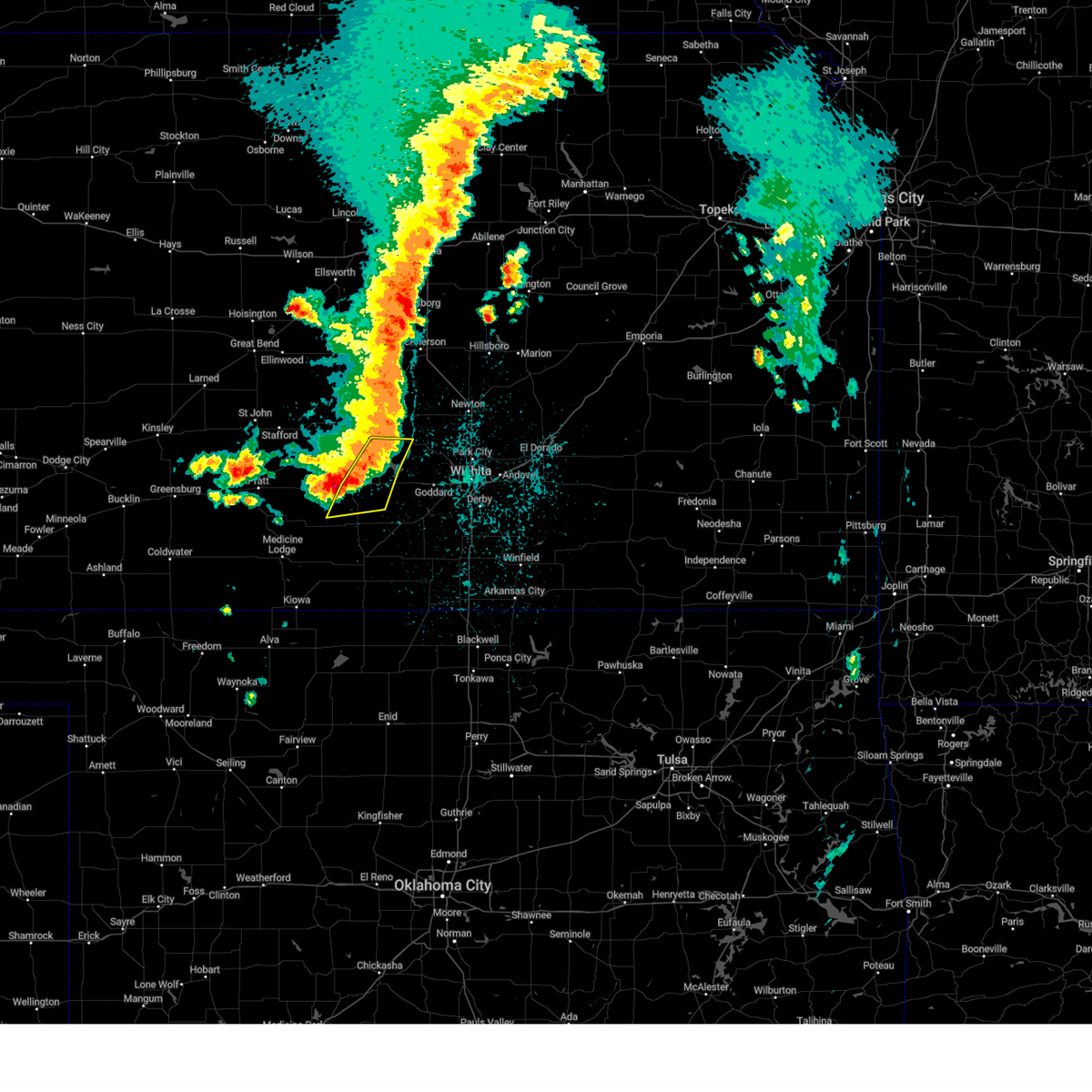 The severe thunderstorm warning for southeastern reno and northeastern kingman counties will expire at 945 pm cdt, the storms which prompted the warning have weakened below severe limits, and no longer pose an immediate threat to life or property. therefore, the warning will be allowed to expire. however small hail, gusty winds and heavy rain are still possible with these thunderstorms. a severe thunderstorm watch remains in effect until midnight cdt for south central kansas. The severe thunderstorm warning for southeastern reno and northeastern kingman counties will expire at 945 pm cdt, the storms which prompted the warning have weakened below severe limits, and no longer pose an immediate threat to life or property. therefore, the warning will be allowed to expire. however small hail, gusty winds and heavy rain are still possible with these thunderstorms. a severe thunderstorm watch remains in effect until midnight cdt for south central kansas.
|
| 4/14/2023 9:30 PM CDT |
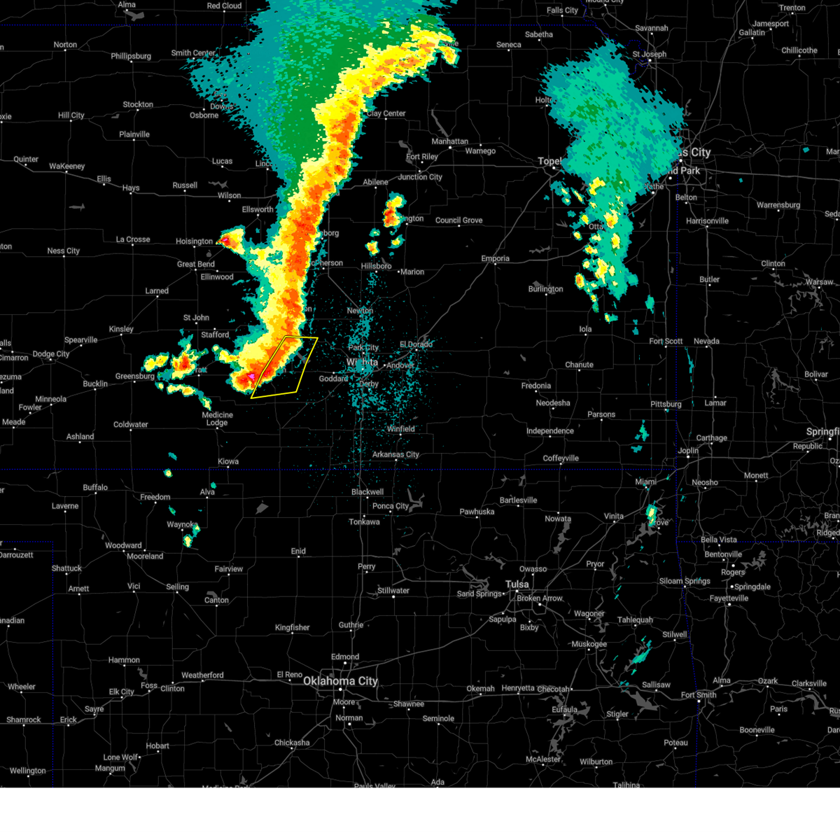 At 929 pm cdt, severe thunderstorms were located along a line extending from pretty prairie to near kingman to 12 miles northeast of nashville, moving east at 30 mph (storm chaser reported quarter size hail 7 west of kingman at 929 pm with hail covering the road). Hazards include 60 mph wind gusts and quarter size hail. Hail damage to vehicles is expected. expect wind damage to roofs, siding, and trees. locations impacted include, kingman, haven, pretty prairie, murdock, waterloo, cleveland, cheney lake, mt vernon, kingman airport and cheney state park. hail threat, radar indicated max hail size, 1. 00 in wind threat, radar indicated max wind gust, 60 mph. At 929 pm cdt, severe thunderstorms were located along a line extending from pretty prairie to near kingman to 12 miles northeast of nashville, moving east at 30 mph (storm chaser reported quarter size hail 7 west of kingman at 929 pm with hail covering the road). Hazards include 60 mph wind gusts and quarter size hail. Hail damage to vehicles is expected. expect wind damage to roofs, siding, and trees. locations impacted include, kingman, haven, pretty prairie, murdock, waterloo, cleveland, cheney lake, mt vernon, kingman airport and cheney state park. hail threat, radar indicated max hail size, 1. 00 in wind threat, radar indicated max wind gust, 60 mph.
|
| 4/14/2023 9:29 PM CDT | Quarter sized hail reported 6.2 miles E of Kingman, KS, 90 0round covered. |
| 4/14/2023 9:25 PM CDT |
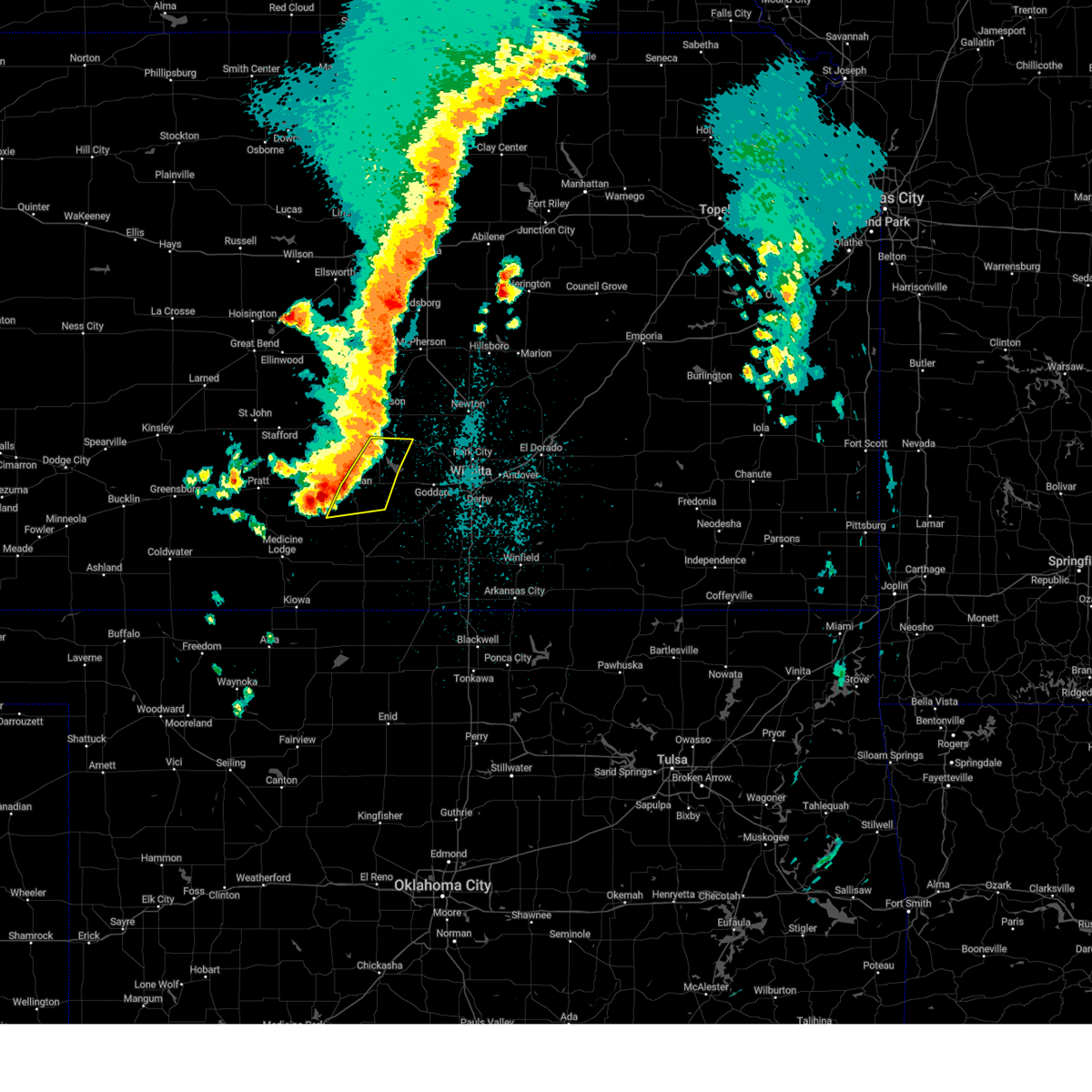 At 925 pm cdt, severe thunderstorms were located along a line extending from near pretty prairie to near kingman to 10 miles northeast of nashville, moving east at 30 mph (radar indicated). Hazards include 60 mph wind gusts and nickel size hail. Expect damage to roofs, siding, and trees. locations impacted include, kingman, haven, pretty prairie, murdock, waterloo, cleveland, cheney lake, mt vernon, kingman airport and cheney state park. hail threat, radar indicated max hail size, 0. 88 in wind threat, radar indicated max wind gust, 60 mph. At 925 pm cdt, severe thunderstorms were located along a line extending from near pretty prairie to near kingman to 10 miles northeast of nashville, moving east at 30 mph (radar indicated). Hazards include 60 mph wind gusts and nickel size hail. Expect damage to roofs, siding, and trees. locations impacted include, kingman, haven, pretty prairie, murdock, waterloo, cleveland, cheney lake, mt vernon, kingman airport and cheney state park. hail threat, radar indicated max hail size, 0. 88 in wind threat, radar indicated max wind gust, 60 mph.
|
| 4/14/2023 9:18 PM CDT |
 At 918 pm cdt, severe thunderstorms were located along a line extending from 5 miles southwest of pretty prairie to 5 miles southwest of kingman to 7 miles northeast of nashville, moving northeast at 25 mph (radar indicated). Hazards include 60 mph wind gusts and quarter size hail. Hail damage to vehicles is expected. expect wind damage to roofs, siding, and trees. locations impacted include, kingman, haven, pretty prairie, murdock, waterloo, zenda, spivey, cleveland, cheney lake, mt vernon, kingman airport, rago and cheney state park. hail threat, radar indicated max hail size, 1. 00 in wind threat, radar indicated max wind gust, 60 mph. At 918 pm cdt, severe thunderstorms were located along a line extending from 5 miles southwest of pretty prairie to 5 miles southwest of kingman to 7 miles northeast of nashville, moving northeast at 25 mph (radar indicated). Hazards include 60 mph wind gusts and quarter size hail. Hail damage to vehicles is expected. expect wind damage to roofs, siding, and trees. locations impacted include, kingman, haven, pretty prairie, murdock, waterloo, zenda, spivey, cleveland, cheney lake, mt vernon, kingman airport, rago and cheney state park. hail threat, radar indicated max hail size, 1. 00 in wind threat, radar indicated max wind gust, 60 mph.
|
| 4/14/2023 9:13 PM CDT |
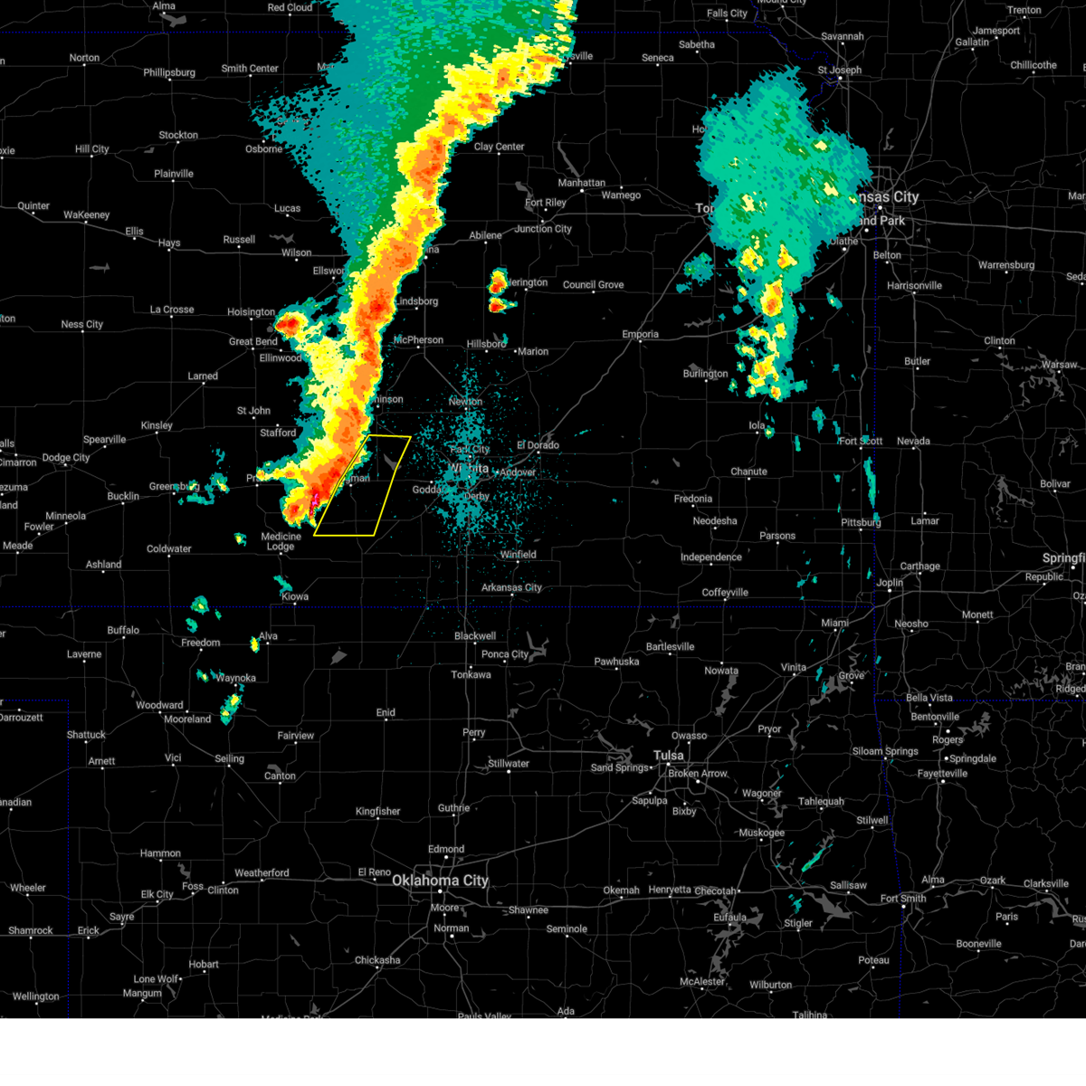 At 913 pm cdt, severe thunderstorms were located along a line extending from 8 miles west of haven to near pretty prairie to 10 miles east of nashville, moving east at 35 mph (radar indicated). Hazards include 60 mph wind gusts and penny size hail. Expect damage to roofs, siding, and trees. locations impacted include, kingman, haven, pretty prairie, murdock, waterloo, zenda, spivey, cleveland, cheney lake, mt vernon, kingman airport, rago and cheney state park. hail threat, radar indicated max hail size, 0. 75 in wind threat, radar indicated max wind gust, 60 mph. At 913 pm cdt, severe thunderstorms were located along a line extending from 8 miles west of haven to near pretty prairie to 10 miles east of nashville, moving east at 35 mph (radar indicated). Hazards include 60 mph wind gusts and penny size hail. Expect damage to roofs, siding, and trees. locations impacted include, kingman, haven, pretty prairie, murdock, waterloo, zenda, spivey, cleveland, cheney lake, mt vernon, kingman airport, rago and cheney state park. hail threat, radar indicated max hail size, 0. 75 in wind threat, radar indicated max wind gust, 60 mph.
|
| 4/14/2023 8:49 PM CDT |
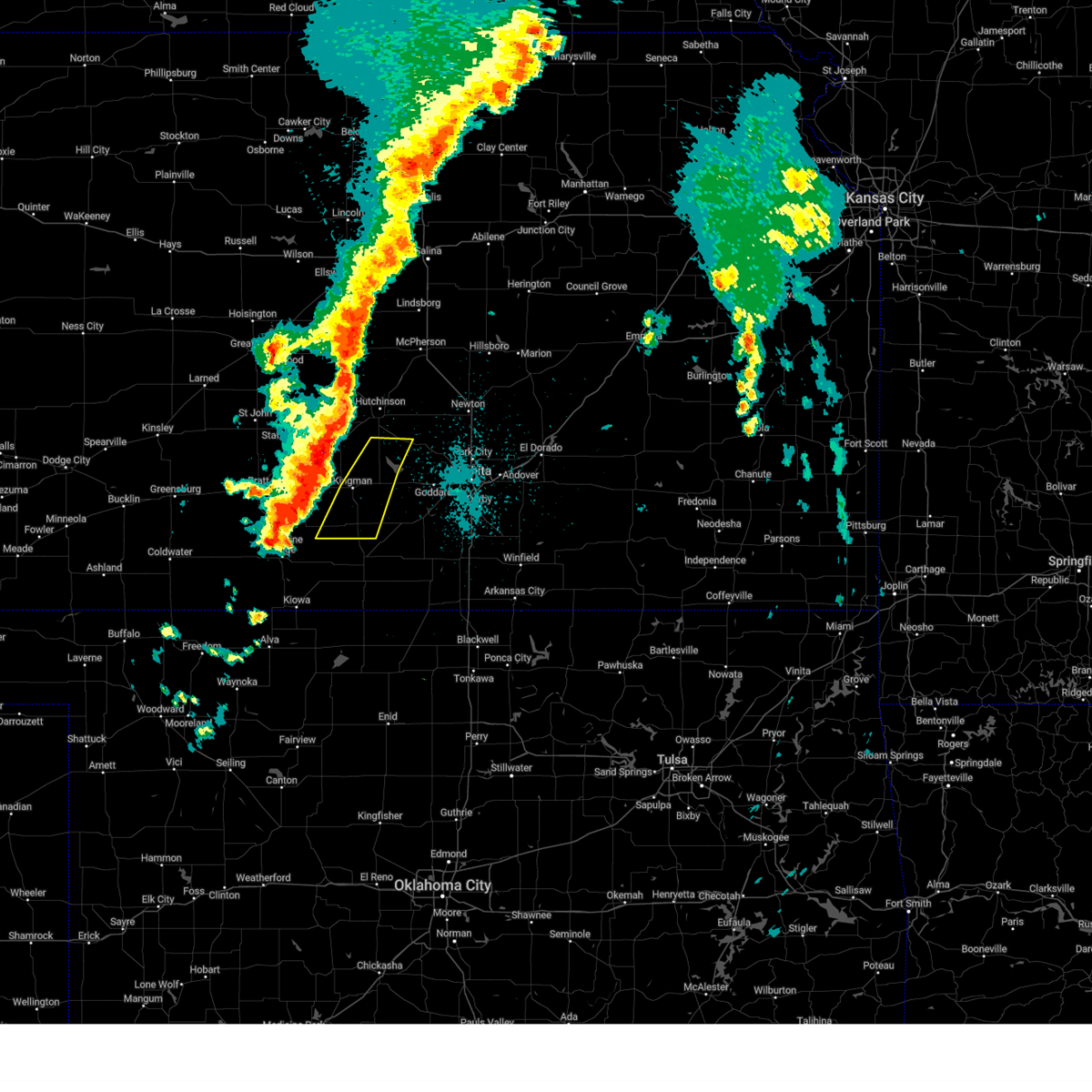 At 849 pm cdt, severe thunderstorms were located along a line extending from 8 miles south of arlington to 5 miles northwest of kingman to near nashville, moving east at 30 mph (radar indicated). Hazards include 60 mph wind gusts and penny size hail. expect damage to roofs, siding, and trees At 849 pm cdt, severe thunderstorms were located along a line extending from 8 miles south of arlington to 5 miles northwest of kingman to near nashville, moving east at 30 mph (radar indicated). Hazards include 60 mph wind gusts and penny size hail. expect damage to roofs, siding, and trees
|
| 6/5/2022 3:19 AM CDT |
 At 318 am cdt, severe thunderstorms were located along a line extending from near cheney to near nashville, moving southeast at 40 mph (radar indicated). Hazards include 60 mph wind gusts. Expect damage to roofs, siding, and trees. locations impacted include, kingman, pretty prairie, norwich, arlington, cunningham, turon, nashville, murdock, waterloo, willowdale, zenda, spivey, langdon, cleveland, penalosa, mt vernon, kingman airport, rago, cheney state park and cheney lake. hail threat, radar indicated max hail size, <. 75 in wind threat, radar indicated max wind gust, 60 mph. At 318 am cdt, severe thunderstorms were located along a line extending from near cheney to near nashville, moving southeast at 40 mph (radar indicated). Hazards include 60 mph wind gusts. Expect damage to roofs, siding, and trees. locations impacted include, kingman, pretty prairie, norwich, arlington, cunningham, turon, nashville, murdock, waterloo, willowdale, zenda, spivey, langdon, cleveland, penalosa, mt vernon, kingman airport, rago, cheney state park and cheney lake. hail threat, radar indicated max hail size, <. 75 in wind threat, radar indicated max wind gust, 60 mph.
|
| 6/5/2022 2:51 AM CDT |
 At 251 am cdt, severe thunderstorms were located along a line extending from near abbyville to near cunningham to 5 miles south of cullison, moving southeast at 35 mph (radar indicated). Hazards include 60 mph wind gusts and penny size hail. expect damage to roofs, siding, and trees At 251 am cdt, severe thunderstorms were located along a line extending from near abbyville to near cunningham to 5 miles south of cullison, moving southeast at 35 mph (radar indicated). Hazards include 60 mph wind gusts and penny size hail. expect damage to roofs, siding, and trees
|
| 4/12/2022 10:35 PM CDT |
 The severe thunderstorm warning for southern reno and northwestern kingman counties will expire at 1045 pm cdt, the storms which prompted the warning have weakened below severe limits, and no longer pose an immediate threat to life or property. therefore, the warning will be allowed to expire. however small hail and gusty winds are still possible with these thunderstorms. a severe thunderstorm watch remains in effect until 100 am cdt for south central kansas. The severe thunderstorm warning for southern reno and northwestern kingman counties will expire at 1045 pm cdt, the storms which prompted the warning have weakened below severe limits, and no longer pose an immediate threat to life or property. therefore, the warning will be allowed to expire. however small hail and gusty winds are still possible with these thunderstorms. a severe thunderstorm watch remains in effect until 100 am cdt for south central kansas.
|
| 4/12/2022 10:20 PM CDT | 59 mph wind reported by airport awo in kingman county KS, 1 miles SSW of Kingman, KS |
| 4/12/2022 10:18 PM CDT |
 At 1018 pm cdt, severe thunderstorms were located along a line extending from near partridge to 7 miles east of cunningham, moving east at 15 mph (radar indicated). Hazards include 60 mph wind gusts and quarter size hail. Hail damage to vehicles is expected. expect wind damage to roofs, siding, and trees. locations impacted include, kingman, south hutchinson, pretty prairie, arlington, partridge, abbyville, yoder, penalosa and kingman airport. hail threat, radar indicated max hail size, 1. 00 in wind threat, radar indicated max wind gust, 60 mph. At 1018 pm cdt, severe thunderstorms were located along a line extending from near partridge to 7 miles east of cunningham, moving east at 15 mph (radar indicated). Hazards include 60 mph wind gusts and quarter size hail. Hail damage to vehicles is expected. expect wind damage to roofs, siding, and trees. locations impacted include, kingman, south hutchinson, pretty prairie, arlington, partridge, abbyville, yoder, penalosa and kingman airport. hail threat, radar indicated max hail size, 1. 00 in wind threat, radar indicated max wind gust, 60 mph.
|
| 4/12/2022 10:01 PM CDT |
 At 1000 pm cdt, severe thunderstorms were located along a line extending from near partridge to near cunningham, moving east at 10 mph (radar indicated). Hazards include 60 mph wind gusts and quarter size hail. Hail damage to vehicles is expected. expect wind damage to roofs, siding, and trees. locations impacted include, kingman, south hutchinson, pretty prairie, arlington, cunningham, turon, partridge, plevna, abbyville, yoder, langdon, penalosa and kingman airport. hail threat, radar indicated max hail size, 1. 00 in wind threat, radar indicated max wind gust, 60 mph. At 1000 pm cdt, severe thunderstorms were located along a line extending from near partridge to near cunningham, moving east at 10 mph (radar indicated). Hazards include 60 mph wind gusts and quarter size hail. Hail damage to vehicles is expected. expect wind damage to roofs, siding, and trees. locations impacted include, kingman, south hutchinson, pretty prairie, arlington, cunningham, turon, partridge, plevna, abbyville, yoder, langdon, penalosa and kingman airport. hail threat, radar indicated max hail size, 1. 00 in wind threat, radar indicated max wind gust, 60 mph.
|
| 4/12/2022 9:44 PM CDT |
 At 944 pm cdt, severe thunderstorms were located along a line extending from near partridge to near cunningham, moving east at 15 mph (radar indicated). Hazards include 60 mph wind gusts and quarter size hail. Hail damage to vehicles is expected. Expect wind damage to roofs, siding, and trees. At 944 pm cdt, severe thunderstorms were located along a line extending from near partridge to near cunningham, moving east at 15 mph (radar indicated). Hazards include 60 mph wind gusts and quarter size hail. Hail damage to vehicles is expected. Expect wind damage to roofs, siding, and trees.
|
| 10/26/2021 10:50 PM CDT |
 The severe thunderstorm warning for reno and northeastern kingman counties will expire at 1100 pm cdt, the storm which prompted the warning has weakened below severe limits, and no longer poses an immediate threat to life or property. therefore, the warning will be allowed to expire. however gusty winds are still possible with this thunderstorm. a tornado watch remains in effect until 100 am cdt for south central and central kansas. a severe thunderstorm watch remains in effect until 500 am cdt for south central kansas. The severe thunderstorm warning for reno and northeastern kingman counties will expire at 1100 pm cdt, the storm which prompted the warning has weakened below severe limits, and no longer poses an immediate threat to life or property. therefore, the warning will be allowed to expire. however gusty winds are still possible with this thunderstorm. a tornado watch remains in effect until 100 am cdt for south central and central kansas. a severe thunderstorm watch remains in effect until 500 am cdt for south central kansas.
|
| 10/26/2021 10:42 PM CDT |
 At 1042 pm cdt, a severe thunderstorm was located over hutchinson, moving northeast at 65 mph (radar indicated). Hazards include 60 mph wind gusts. Expect damage to roofs, siding, and trees. locations impacted include, hutchinson, kingman, south hutchinson, buhler, haven, nickerson, pretty prairie, arlington, partridge, abbyville, yoder, waterloo, willowbrook, mt vernon, kingman airport, hutchinson airport, cheney state park and cheney lake. hail threat, radar indicated max hail size, <. 75 in wind threat, radar indicated max wind gust, 60 mph. At 1042 pm cdt, a severe thunderstorm was located over hutchinson, moving northeast at 65 mph (radar indicated). Hazards include 60 mph wind gusts. Expect damage to roofs, siding, and trees. locations impacted include, hutchinson, kingman, south hutchinson, buhler, haven, nickerson, pretty prairie, arlington, partridge, abbyville, yoder, waterloo, willowbrook, mt vernon, kingman airport, hutchinson airport, cheney state park and cheney lake. hail threat, radar indicated max hail size, <. 75 in wind threat, radar indicated max wind gust, 60 mph.
|
| 10/26/2021 10:14 PM CDT |
 At 1013 pm cdt, a severe thunderstorm was located 10 miles southeast of turon, or 10 miles northwest of kingman, moving northeast at 65 mph (radar indicated). Hazards include 60 mph wind gusts and penny size hail. expect damage to roofs, siding, and trees At 1013 pm cdt, a severe thunderstorm was located 10 miles southeast of turon, or 10 miles northwest of kingman, moving northeast at 65 mph (radar indicated). Hazards include 60 mph wind gusts and penny size hail. expect damage to roofs, siding, and trees
|
| 9/14/2021 5:52 PM CDT |
 At 551 pm cdt, a severe thunderstorm was located 8 miles southwest of kingman, moving east at 25 mph (radar indicated). Hazards include 60 mph wind gusts and quarter size hail. Hail damage to vehicles is expected. expect wind damage to roofs, siding, and trees. locations impacted include, kingman, willowdale and cleveland. hail threat, radar indicated max hail size, 1. 00 in wind threat, radar indicated max wind gust, 60 mph. At 551 pm cdt, a severe thunderstorm was located 8 miles southwest of kingman, moving east at 25 mph (radar indicated). Hazards include 60 mph wind gusts and quarter size hail. Hail damage to vehicles is expected. expect wind damage to roofs, siding, and trees. locations impacted include, kingman, willowdale and cleveland. hail threat, radar indicated max hail size, 1. 00 in wind threat, radar indicated max wind gust, 60 mph.
|
| 9/14/2021 5:30 PM CDT |
 At 530 pm cdt, a severe thunderstorm was located 6 miles southeast of cunningham, or 12 miles west of kingman, moving east at 20 mph (radar indicated). Hazards include 60 mph wind gusts and half dollar size hail. Hail damage to vehicles is expected. Expect wind damage to roofs, siding, and trees. At 530 pm cdt, a severe thunderstorm was located 6 miles southeast of cunningham, or 12 miles west of kingman, moving east at 20 mph (radar indicated). Hazards include 60 mph wind gusts and half dollar size hail. Hail damage to vehicles is expected. Expect wind damage to roofs, siding, and trees.
|
| 9/14/2021 5:09 PM CDT |
 At 508 pm cdt, a severe thunderstorm was located over cunningham, or 6 miles east of cairo, moving east at 15 mph (radar indicated). Hazards include 60 mph wind gusts and half dollar size hail. Hail damage to vehicles is expected. Expect wind damage to roofs, siding, and trees. At 508 pm cdt, a severe thunderstorm was located over cunningham, or 6 miles east of cairo, moving east at 15 mph (radar indicated). Hazards include 60 mph wind gusts and half dollar size hail. Hail damage to vehicles is expected. Expect wind damage to roofs, siding, and trees.
|
| 8/20/2021 11:12 PM CDT |
 The severe thunderstorm warning for eastern kingman county will expire at 1115 pm cdt, the storms which prompted the warning have moved out of the area. therefore, the warning will be allowed to expire. The severe thunderstorm warning for eastern kingman county will expire at 1115 pm cdt, the storms which prompted the warning have moved out of the area. therefore, the warning will be allowed to expire.
|
| 8/20/2021 11:00 PM CDT |
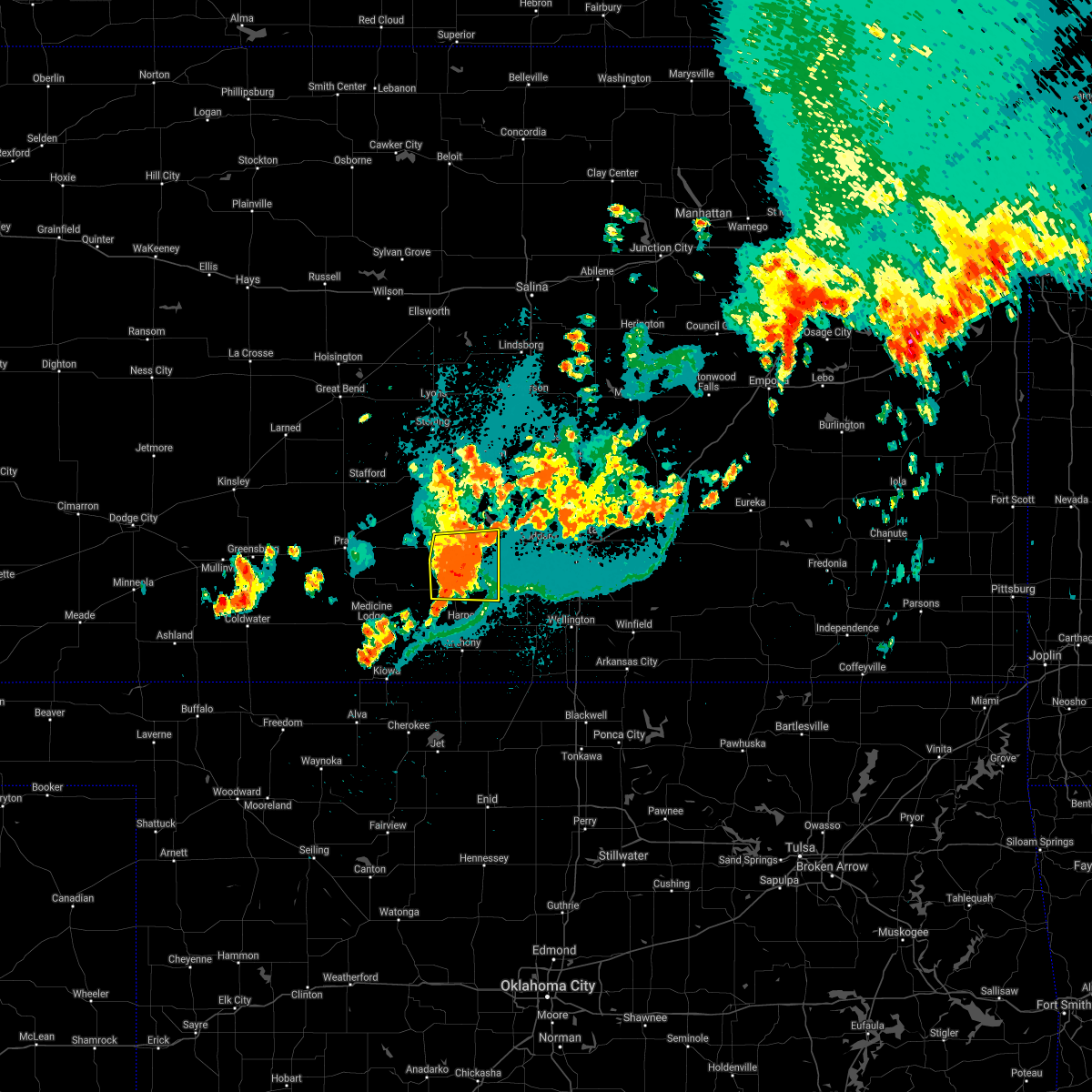 At 1100 pm cdt, severe thunderstorms were located along a line extending from 5 miles southeast of pretty prairie to 8 miles southwest of cheney to 11 miles north of harper, moving east at 40 mph (radar indicated). Hazards include 60 mph wind gusts and penny size hail. Expect damage to roofs, siding, and trees. locations impacted include, kingman, norwich, murdock, waterloo, spivey, cleveland, rago, mt vernon, kingman airport and cheney state park. hail threat, radar indicated max hail size, 0. 75 in wind threat, radar indicated max wind gust, 60 mph. At 1100 pm cdt, severe thunderstorms were located along a line extending from 5 miles southeast of pretty prairie to 8 miles southwest of cheney to 11 miles north of harper, moving east at 40 mph (radar indicated). Hazards include 60 mph wind gusts and penny size hail. Expect damage to roofs, siding, and trees. locations impacted include, kingman, norwich, murdock, waterloo, spivey, cleveland, rago, mt vernon, kingman airport and cheney state park. hail threat, radar indicated max hail size, 0. 75 in wind threat, radar indicated max wind gust, 60 mph.
|
| 8/20/2021 10:31 PM CDT |
 At 1031 pm cdt, severe thunderstorms were located along a line extending from 9 miles northeast of cunningham to 9 miles southwest of kingman to 5 miles southeast of nashville, moving east at 40 mph (radar indicated). Hazards include 60 mph wind gusts and penny size hail. expect damage to roofs, siding, and trees At 1031 pm cdt, severe thunderstorms were located along a line extending from 9 miles northeast of cunningham to 9 miles southwest of kingman to 5 miles southeast of nashville, moving east at 40 mph (radar indicated). Hazards include 60 mph wind gusts and penny size hail. expect damage to roofs, siding, and trees
|
| 8/7/2021 10:55 PM CDT |
 The severe thunderstorm warning for western reno and western kingman counties will expire at 1100 pm cdt, the storms which prompted the warning have weakened below severe limits, and no longer pose an immediate threat to life or property. therefore, the warning will be allowed to expire. however gusty winds are still possible with these thunderstorms. The severe thunderstorm warning for western reno and western kingman counties will expire at 1100 pm cdt, the storms which prompted the warning have weakened below severe limits, and no longer pose an immediate threat to life or property. therefore, the warning will be allowed to expire. however gusty winds are still possible with these thunderstorms.
|
| 8/7/2021 10:47 PM CDT |
 At 1047 pm cdt, severe thunderstorms were located along a line extending from 6 miles north of plevna to 8 miles south of arlington to near nashville, moving east at 50 mph (radar indicated). Hazards include 60 mph wind gusts and penny size hail. Expect damage to roofs, siding, and trees. locations impacted include, arlington, cunningham, turon, partridge, sylvia, plevna, abbyville, nashville, willowdale, zenda, langdon and penalosa. hail threat, radar indicated max hail size, 0. 75 in wind threat, radar indicated max wind gust, 60 mph. At 1047 pm cdt, severe thunderstorms were located along a line extending from 6 miles north of plevna to 8 miles south of arlington to near nashville, moving east at 50 mph (radar indicated). Hazards include 60 mph wind gusts and penny size hail. Expect damage to roofs, siding, and trees. locations impacted include, arlington, cunningham, turon, partridge, sylvia, plevna, abbyville, nashville, willowdale, zenda, langdon and penalosa. hail threat, radar indicated max hail size, 0. 75 in wind threat, radar indicated max wind gust, 60 mph.
|
| 8/7/2021 10:24 PM CDT |
 At 1024 pm cdt, severe thunderstorms were located along a line extending from 7 miles north of zenith to near preston to near sawyer, moving east at 45 mph (radar indicated). Hazards include 60 mph wind gusts and penny size hail. expect damage to roofs, siding, and trees At 1024 pm cdt, severe thunderstorms were located along a line extending from 7 miles north of zenith to near preston to near sawyer, moving east at 45 mph (radar indicated). Hazards include 60 mph wind gusts and penny size hail. expect damage to roofs, siding, and trees
|
| 6/25/2021 7:35 PM CDT |
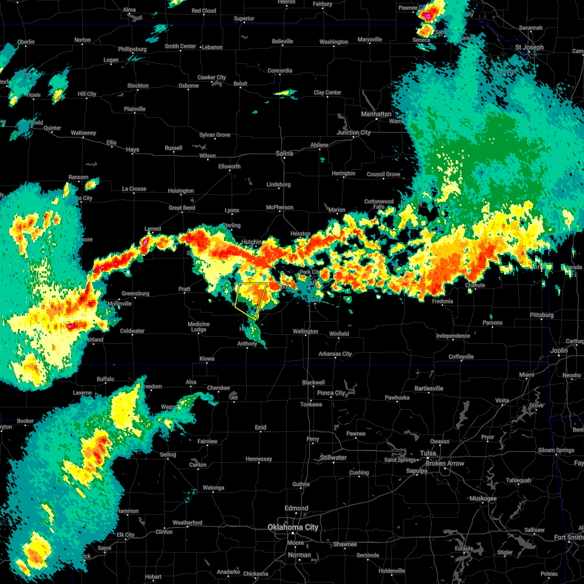 At 735 pm cdt, a severe thunderstorm was located 8 miles southeast of pretty prairie, moving northeast at 40 mph (radar indicated). Hazards include 70 mph wind gusts and nickel size hail. Expect considerable tree damage. damage is likely to mobile homes, roofs, and outbuildings. Locations impacted include, kingman, murdock, waterloo, cleveland, mt vernon, kingman airport and cheney state park. At 735 pm cdt, a severe thunderstorm was located 8 miles southeast of pretty prairie, moving northeast at 40 mph (radar indicated). Hazards include 70 mph wind gusts and nickel size hail. Expect considerable tree damage. damage is likely to mobile homes, roofs, and outbuildings. Locations impacted include, kingman, murdock, waterloo, cleveland, mt vernon, kingman airport and cheney state park.
|
| 6/25/2021 7:24 PM CDT |
 At 724 pm cdt, a severe thunderstorm was located near kingman, moving northeast at 40 mph (radar indicated). Hazards include 70 mph wind gusts and nickel size hail. Expect considerable tree damage. damage is likely to mobile homes, roofs, and outbuildings. Locations impacted include, kingman, cunningham, murdock, waterloo, willowdale, spivey, cleveland, penalosa, rago, mt vernon, kingman airport and cheney state park. At 724 pm cdt, a severe thunderstorm was located near kingman, moving northeast at 40 mph (radar indicated). Hazards include 70 mph wind gusts and nickel size hail. Expect considerable tree damage. damage is likely to mobile homes, roofs, and outbuildings. Locations impacted include, kingman, cunningham, murdock, waterloo, willowdale, spivey, cleveland, penalosa, rago, mt vernon, kingman airport and cheney state park.
|
| 6/25/2021 7:17 PM CDT | Spotter reported gusts of at least 60 mp in kingman county KS, 0.9 miles SSE of Kingman, KS |
| 6/25/2021 7:15 PM CDT | Delayed report. roofs blown off sheds... large trees down... and power lines down. sporadic reports of this kind of damage across kingman count in kingman county KS, 1.5 miles WNW of Kingman, KS |
| 6/25/2021 7:13 PM CDT |
 At 713 pm cdt, a severe thunderstorm was located 6 miles southwest of kingman, moving northeast at 40 mph (radar indicated). Hazards include 60 mph wind gusts and nickel size hail. Expect damage to roofs, siding, and trees. Locations impacted include, kingman. At 713 pm cdt, a severe thunderstorm was located 6 miles southwest of kingman, moving northeast at 40 mph (radar indicated). Hazards include 60 mph wind gusts and nickel size hail. Expect damage to roofs, siding, and trees. Locations impacted include, kingman.
|
| 6/25/2021 7:11 PM CDT | Storm damage reported in kingman county KS, 0.9 miles WSW of Kingman, KS |
| 6/25/2021 6:39 PM CDT |
 At 638 pm cdt, a severe thunderstorm was located 6 miles northeast of medicine lodge, moving northeast at 40 mph (radar indicated). Hazards include 60 mph wind gusts and quarter size hail. Hail damage to vehicles is expected. expect wind damage to roofs, siding, and trees. this severe thunderstorm will be near, nashville around 650 pm cdt. Other locations in the path of this severe thunderstorm include kingman. At 638 pm cdt, a severe thunderstorm was located 6 miles northeast of medicine lodge, moving northeast at 40 mph (radar indicated). Hazards include 60 mph wind gusts and quarter size hail. Hail damage to vehicles is expected. expect wind damage to roofs, siding, and trees. this severe thunderstorm will be near, nashville around 650 pm cdt. Other locations in the path of this severe thunderstorm include kingman.
|
| 3/17/2021 12:09 AM CDT |
 The severe thunderstorm warning for southeastern reno, west central sedgwick and northeastern kingman counties will expire at 1215 am cdt, the storm which prompted the warning has weakened below severe limits, and no longer poses an immediate threat to life or property. therefore, the warning will be allowed to expire. however small hail, gusty winds and heavy rain are still possible with this thunderstorm. The severe thunderstorm warning for southeastern reno, west central sedgwick and northeastern kingman counties will expire at 1215 am cdt, the storm which prompted the warning has weakened below severe limits, and no longer poses an immediate threat to life or property. therefore, the warning will be allowed to expire. however small hail, gusty winds and heavy rain are still possible with this thunderstorm.
|
| 3/16/2021 11:50 PM CDT |
 At 1149 pm cdt, a severe thunderstorm was located 8 miles east of kingman, moving north at 15 mph (radar indicated). Hazards include 60 mph wind gusts and half dollar size hail. Hail damage to vehicles is expected. expect wind damage to roofs, siding, and trees. Locations impacted include, kingman, pretty prairie, waterloo, cheney lake, mt vernon, kingman airport and cheney state park. At 1149 pm cdt, a severe thunderstorm was located 8 miles east of kingman, moving north at 15 mph (radar indicated). Hazards include 60 mph wind gusts and half dollar size hail. Hail damage to vehicles is expected. expect wind damage to roofs, siding, and trees. Locations impacted include, kingman, pretty prairie, waterloo, cheney lake, mt vernon, kingman airport and cheney state park.
|
| 3/16/2021 11:22 PM CDT |
 At 1120 pm cdt, a severe thunderstorm was located 9 miles southeast of kingman, moving north at 25 mph (radar indicated). Hazards include 60 mph wind gusts and half dollar size hail. Hail damage to vehicles is expected. Expect wind damage to roofs, siding, and trees. At 1120 pm cdt, a severe thunderstorm was located 9 miles southeast of kingman, moving north at 25 mph (radar indicated). Hazards include 60 mph wind gusts and half dollar size hail. Hail damage to vehicles is expected. Expect wind damage to roofs, siding, and trees.
|
| 3/12/2021 5:35 AM CST |
 At 534 am cst, a severe thunderstorm was located over pretty prairie, moving east at 50 mph (radar indicated). Hazards include 60 mph wind gusts and penny size hail. expect damage to roofs, siding, and trees At 534 am cst, a severe thunderstorm was located over pretty prairie, moving east at 50 mph (radar indicated). Hazards include 60 mph wind gusts and penny size hail. expect damage to roofs, siding, and trees
|
| 11/24/2020 5:28 PM CST |
 The severe thunderstorm warning for harper and eastern kingman counties will expire at 530 pm cst, the storms which prompted the warning will be moving out of the area by around 530 pm. therefore, the warning will be allowed to expire. however gusty winds are still possible with these thunderstorms. The severe thunderstorm warning for harper and eastern kingman counties will expire at 530 pm cst, the storms which prompted the warning will be moving out of the area by around 530 pm. therefore, the warning will be allowed to expire. however gusty winds are still possible with these thunderstorms.
|
| 11/24/2020 5:17 PM CST |
 At 517 pm cst, severe thunderstorms were located along a line extending from 11 miles south of kingman to near harper to 5 miles northeast of manchester, moving east at 50 mph (radar indicated). Hazards include 60 mph wind gusts and nickel size hail. Expect damage to roofs, siding, and trees. Locations impacted include, kingman, anthony, harper, attica, norwich, murdock, waterloo, spivey, bluff city, cleveland, danville, freeport, mt vernon, kingman airport, rago, runnymede, crystal springs and cheney state park. At 517 pm cst, severe thunderstorms were located along a line extending from 11 miles south of kingman to near harper to 5 miles northeast of manchester, moving east at 50 mph (radar indicated). Hazards include 60 mph wind gusts and nickel size hail. Expect damage to roofs, siding, and trees. Locations impacted include, kingman, anthony, harper, attica, norwich, murdock, waterloo, spivey, bluff city, cleveland, danville, freeport, mt vernon, kingman airport, rago, runnymede, crystal springs and cheney state park.
|
| 11/24/2020 5:12 PM CST |
 At 511 pm cst, severe thunderstorms were located along a line extending from 10 miles southeast of cunningham to near harper to manchester, moving east at 50 mph (radar indicated). Hazards include 60 mph wind gusts and nickel size hail. Expect damage to roofs, siding, and trees. Locations impacted include, kingman, anthony, harper, attica, norwich, cunningham, murdock, waterloo, willowdale, zenda, spivey, bluff city, cleveland, danville, waldron, freeport, mt vernon, kingman airport, rago and runnymede. At 511 pm cst, severe thunderstorms were located along a line extending from 10 miles southeast of cunningham to near harper to manchester, moving east at 50 mph (radar indicated). Hazards include 60 mph wind gusts and nickel size hail. Expect damage to roofs, siding, and trees. Locations impacted include, kingman, anthony, harper, attica, norwich, cunningham, murdock, waterloo, willowdale, zenda, spivey, bluff city, cleveland, danville, waldron, freeport, mt vernon, kingman airport, rago and runnymede.
|
| 11/24/2020 5:04 PM CST |
 At 503 pm cst, severe thunderstorms were located along a line extending from 6 miles northeast of nashville to near attica to 6 miles northwest of manchester, moving east at 50 mph (radar indicated). Hazards include 60 mph wind gusts and nickel size hail. Expect damage to roofs, siding, and trees. Locations impacted include, kingman, anthony, harper, attica, norwich, cunningham, nashville, murdock, waterloo, willowdale, zenda, spivey, bluff city, cleveland, danville, waldron, freeport, mt vernon, kingman airport and corwin. At 503 pm cst, severe thunderstorms were located along a line extending from 6 miles northeast of nashville to near attica to 6 miles northwest of manchester, moving east at 50 mph (radar indicated). Hazards include 60 mph wind gusts and nickel size hail. Expect damage to roofs, siding, and trees. Locations impacted include, kingman, anthony, harper, attica, norwich, cunningham, nashville, murdock, waterloo, willowdale, zenda, spivey, bluff city, cleveland, danville, waldron, freeport, mt vernon, kingman airport and corwin.
|
| 11/24/2020 4:48 PM CST |
 At 447 pm cst, severe thunderstorms were located along a line extending from 6 miles northwest of nashville to 6 miles southeast of hazelton, moving east at 50 mph (radar indicated). Hazards include 60 mph wind gusts and nickel size hail. expect damage to roofs, siding, and trees At 447 pm cst, severe thunderstorms were located along a line extending from 6 miles northwest of nashville to 6 miles southeast of hazelton, moving east at 50 mph (radar indicated). Hazards include 60 mph wind gusts and nickel size hail. expect damage to roofs, siding, and trees
|
| 8/10/2020 4:01 AM CDT |
 At 400 am cdt, a severe thunderstorm was located 8 miles southwest of arlington, or 13 miles northwest of kingman, moving east at 30 mph (radar indicated). Hazards include 60 mph wind gusts. expect damage to roofs, siding, and trees At 400 am cdt, a severe thunderstorm was located 8 miles southwest of arlington, or 13 miles northwest of kingman, moving east at 30 mph (radar indicated). Hazards include 60 mph wind gusts. expect damage to roofs, siding, and trees
|
| 7/29/2020 10:12 PM CDT |
 At 1011 pm cdt, severe thunderstorms were located along a line extending from halstead to near mount hope to 7 miles northeast of pretty prairie, moving southeast at 40 mph (radar indicated). Hazards include 60 mph wind gusts and nickel size hail. expect damage to roofs, siding, and trees At 1011 pm cdt, severe thunderstorms were located along a line extending from halstead to near mount hope to 7 miles northeast of pretty prairie, moving southeast at 40 mph (radar indicated). Hazards include 60 mph wind gusts and nickel size hail. expect damage to roofs, siding, and trees
|
| 7/13/2020 2:09 AM CDT |
 At 208 am cdt, severe thunderstorms were located along a line extending from 6 miles west of kingman to near harper to 5 miles northeast of manchester, moving east at 40 mph (radar indicated). Hazards include 60 mph wind gusts. Expect damage to roofs, siding, and trees. Locations impacted include, kingman, anthony, harper, attica, norwich, cunningham, nashville, murdock, waterloo, willowdale, zenda, spivey, bluff city, cleveland, danville, penalosa, waldron, freeport, kingman airport and corwin. At 208 am cdt, severe thunderstorms were located along a line extending from 6 miles west of kingman to near harper to 5 miles northeast of manchester, moving east at 40 mph (radar indicated). Hazards include 60 mph wind gusts. Expect damage to roofs, siding, and trees. Locations impacted include, kingman, anthony, harper, attica, norwich, cunningham, nashville, murdock, waterloo, willowdale, zenda, spivey, bluff city, cleveland, danville, penalosa, waldron, freeport, kingman airport and corwin.
|
| 7/13/2020 1:56 AM CDT |
 At 156 am cdt, severe thunderstorms were located along a line extending from 5 miles north of cunningham to 8 miles north of attica to 6 miles northeast of amorita, moving east at 40 mph (radar indicated). Hazards include 60 mph wind gusts and penny size hail. Expect damage to roofs, siding, and trees. Locations impacted include, kingman, anthony, harper, attica, norwich, cunningham, nashville, murdock, waterloo, willowdale, zenda, spivey, bluff city, cleveland, danville, penalosa, waldron, freeport, kingman airport and corwin. At 156 am cdt, severe thunderstorms were located along a line extending from 5 miles north of cunningham to 8 miles north of attica to 6 miles northeast of amorita, moving east at 40 mph (radar indicated). Hazards include 60 mph wind gusts and penny size hail. Expect damage to roofs, siding, and trees. Locations impacted include, kingman, anthony, harper, attica, norwich, cunningham, nashville, murdock, waterloo, willowdale, zenda, spivey, bluff city, cleveland, danville, penalosa, waldron, freeport, kingman airport and corwin.
|
| 7/13/2020 1:42 AM CDT |
 At 142 am cdt, severe thunderstorms were located along a line extending from near preston to 5 miles southeast of nashville to 5 miles southeast of hazelton, moving east at 40 mph (radar indicated). Hazards include 60 mph wind gusts and penny size hail. expect damage to roofs, siding, and trees At 142 am cdt, severe thunderstorms were located along a line extending from near preston to 5 miles southeast of nashville to 5 miles southeast of hazelton, moving east at 40 mph (radar indicated). Hazards include 60 mph wind gusts and penny size hail. expect damage to roofs, siding, and trees
|
| 6/21/2020 7:40 PM CDT |
 At 740 pm cdt, severe thunderstorms were located along a line extending from near nickerson to 7 miles south of kingman, moving southeast at 45 mph. these are very dangerous storms (trained weather spotters). Hazards include 80 mph wind gusts and penny size hail. Flying debris will be dangerous to those caught without shelter. mobile homes will be heavily damaged. expect considerable damage to roofs, windows, and vehicles. extensive tree damage and power outages are likely. Locations impacted include, hutchinson, lyons, kingman, south hutchinson, sterling, ellinwood, cheney, inman, buhler, haven, nickerson, pretty prairie, little river, chase, arlington, cunningham, turon, partridge, sylvia and alden. At 740 pm cdt, severe thunderstorms were located along a line extending from near nickerson to 7 miles south of kingman, moving southeast at 45 mph. these are very dangerous storms (trained weather spotters). Hazards include 80 mph wind gusts and penny size hail. Flying debris will be dangerous to those caught without shelter. mobile homes will be heavily damaged. expect considerable damage to roofs, windows, and vehicles. extensive tree damage and power outages are likely. Locations impacted include, hutchinson, lyons, kingman, south hutchinson, sterling, ellinwood, cheney, inman, buhler, haven, nickerson, pretty prairie, little river, chase, arlington, cunningham, turon, partridge, sylvia and alden.
|
| 6/21/2020 7:34 PM CDT | Storm damage reported in kingman county KS, 0.9 miles WSW of Kingman, KS |
| 6/21/2020 7:32 PM CDT | Trained spotter reports 75 to 80 mph wind in kingman county KS, 0.9 miles WSW of Kingman, KS |
| 6/21/2020 7:25 PM CDT |
 At 724 pm cdt, severe thunderstorms were located along a line extending from near sterling to 8 miles west of kingman, moving east at 35 mph. these are very dangerous storms (radar indicated). Hazards include 80 mph wind gusts and penny size hail. Flying debris will be dangerous to those caught without shelter. mobile homes will be heavily damaged. expect considerable damage to roofs, windows, and vehicles. extensive tree damage and power outages are likely. Locations impacted include, hutchinson, lyons, kingman, south hutchinson, sterling, ellinwood, cheney, inman, buhler, haven, nickerson, pretty prairie, little river, chase, arlington, cunningham, turon, partridge, sylvia and alden. At 724 pm cdt, severe thunderstorms were located along a line extending from near sterling to 8 miles west of kingman, moving east at 35 mph. these are very dangerous storms (radar indicated). Hazards include 80 mph wind gusts and penny size hail. Flying debris will be dangerous to those caught without shelter. mobile homes will be heavily damaged. expect considerable damage to roofs, windows, and vehicles. extensive tree damage and power outages are likely. Locations impacted include, hutchinson, lyons, kingman, south hutchinson, sterling, ellinwood, cheney, inman, buhler, haven, nickerson, pretty prairie, little river, chase, arlington, cunningham, turon, partridge, sylvia and alden.
|
| 6/21/2020 6:53 PM CDT |
 At 652 pm cdt, severe thunderstorms were located along a line extending from raymond to cunningham, moving southeast at 45 mph. these are very dangerous storms (radar indicated). Hazards include 80 mph wind gusts and quarter size hail. Flying debris will be dangerous to those caught without shelter. mobile homes will be heavily damaged. expect considerable damage to roofs, windows, and vehicles. extensive tree damage and power outages are likely. Locations impacted include, hutchinson, lyons, kingman, south hutchinson, sterling, ellinwood, cheney, inman, buhler, haven, nickerson, pretty prairie, little river, chase, arlington, cunningham, turon, partridge, sylvia and alden. At 652 pm cdt, severe thunderstorms were located along a line extending from raymond to cunningham, moving southeast at 45 mph. these are very dangerous storms (radar indicated). Hazards include 80 mph wind gusts and quarter size hail. Flying debris will be dangerous to those caught without shelter. mobile homes will be heavily damaged. expect considerable damage to roofs, windows, and vehicles. extensive tree damage and power outages are likely. Locations impacted include, hutchinson, lyons, kingman, south hutchinson, sterling, ellinwood, cheney, inman, buhler, haven, nickerson, pretty prairie, little river, chase, arlington, cunningham, turon, partridge, sylvia and alden.
|
| 6/21/2020 6:42 PM CDT |
 At 640 pm cdt, severe thunderstorms were located along a line extending from near ellinwood to near cairo, moving southeast at 45 mph. these are very dangerous storms (radar indicated). Hazards include 80 mph wind gusts and quarter size hail. Flying debris will be dangerous to those caught without shelter. mobile homes will be heavily damaged. expect considerable damage to roofs, windows, and vehicles. Extensive tree damage and power outages are likely. At 640 pm cdt, severe thunderstorms were located along a line extending from near ellinwood to near cairo, moving southeast at 45 mph. these are very dangerous storms (radar indicated). Hazards include 80 mph wind gusts and quarter size hail. Flying debris will be dangerous to those caught without shelter. mobile homes will be heavily damaged. expect considerable damage to roofs, windows, and vehicles. Extensive tree damage and power outages are likely.
|
| 5/3/2020 5:59 AM CDT |
 At 547 am cdt, a severe thunderstorm was located 10 miles east of nashville, or 13 miles southwest of kingman, moving east at 35 mph (radar indicated). Hazards include quarter size hail. damage to vehicles is expected At 547 am cdt, a severe thunderstorm was located 10 miles east of nashville, or 13 miles southwest of kingman, moving east at 35 mph (radar indicated). Hazards include quarter size hail. damage to vehicles is expected
|
| 5/3/2020 5:48 AM CDT |
 At 547 am cdt, a severe thunderstorm was located 10 miles east of nashville, or 13 miles southwest of kingman, moving east at 35 mph (radar indicated). Hazards include quarter size hail. damage to vehicles is expected At 547 am cdt, a severe thunderstorm was located 10 miles east of nashville, or 13 miles southwest of kingman, moving east at 35 mph (radar indicated). Hazards include quarter size hail. damage to vehicles is expected
|
| 9/25/2019 9:33 PM CDT |
 At 932 pm cdt, severe thunderstorms were located along a line extending from 11 miles east of nashville to 5 miles west of viola to near clearwater to near belle plaine, and are nearly stationary (radar indicated). Hazards include 60 mph wind gusts and quarter size hail. Hail damage to vehicles is expected. expect wind damage to roofs, siding, and trees. Locations impacted include, mulvane, clearwater, belle plaine, conway springs, oxford, norwich, viola, murdock, zenda, spivey, cleveland, rago, riverdale and wellington airport. At 932 pm cdt, severe thunderstorms were located along a line extending from 11 miles east of nashville to 5 miles west of viola to near clearwater to near belle plaine, and are nearly stationary (radar indicated). Hazards include 60 mph wind gusts and quarter size hail. Hail damage to vehicles is expected. expect wind damage to roofs, siding, and trees. Locations impacted include, mulvane, clearwater, belle plaine, conway springs, oxford, norwich, viola, murdock, zenda, spivey, cleveland, rago, riverdale and wellington airport.
|
| 9/25/2019 9:05 PM CDT |
 At 904 pm cdt, severe thunderstorms were located along a line extending from 10 miles northeast of nashville to near viola to near clearwater to near belle plaine, moving northeast at 15 mph (radar indicated). Hazards include 60 mph wind gusts and quarter size hail. Hail damage to vehicles is expected. expect wind damage to roofs, siding, and trees. Locations impacted include, mulvane, clearwater, belle plaine, conway springs, oxford, norwich, viola, murdock, zenda, spivey, cleveland, rago, riverdale and wellington airport. At 904 pm cdt, severe thunderstorms were located along a line extending from 10 miles northeast of nashville to near viola to near clearwater to near belle plaine, moving northeast at 15 mph (radar indicated). Hazards include 60 mph wind gusts and quarter size hail. Hail damage to vehicles is expected. expect wind damage to roofs, siding, and trees. Locations impacted include, mulvane, clearwater, belle plaine, conway springs, oxford, norwich, viola, murdock, zenda, spivey, cleveland, rago, riverdale and wellington airport.
|
| 9/25/2019 8:48 PM CDT |
 At 848 pm cdt, severe thunderstorms were located along a line extending from 11 miles northeast of nashville to norwich to near clearwater to near belle plaine, moving north at 10 mph (radar indicated). Hazards include 60 mph wind gusts and quarter size hail. Hail damage to vehicles is expected. Expect wind damage to roofs, siding, and trees. At 848 pm cdt, severe thunderstorms were located along a line extending from 11 miles northeast of nashville to norwich to near clearwater to near belle plaine, moving north at 10 mph (radar indicated). Hazards include 60 mph wind gusts and quarter size hail. Hail damage to vehicles is expected. Expect wind damage to roofs, siding, and trees.
|
| 9/24/2019 6:36 PM CDT |
 At 635 pm cdt, a severe thunderstorm was located over isabel, moving east at 15 mph (radar indicated). Hazards include ping pong ball size hail and 60 mph wind gusts. People and animals outdoors will be injured. expect hail damage to roofs, siding, windows, and vehicles. Expect wind damage to roofs, siding, and trees. At 635 pm cdt, a severe thunderstorm was located over isabel, moving east at 15 mph (radar indicated). Hazards include ping pong ball size hail and 60 mph wind gusts. People and animals outdoors will be injured. expect hail damage to roofs, siding, windows, and vehicles. Expect wind damage to roofs, siding, and trees.
|
| 8/30/2019 12:19 AM CDT |
 At 1219 am cdt, severe thunderstorms were located along a line extending from whitewater to near west wichita to near kingman, moving southeast at 50 mph (radar indicated). Hazards include 60 mph wind gusts and penny size hail. Expect damage to roofs, siding, and trees. Locations impacted include, wichita, derby, newton, andover, haysville, park city, valley center, bel aire, mulvane, goddard, rose hill, hesston, maize, kingman, clearwater, cheney, halstead, north newton, sedgwick and colwich. At 1219 am cdt, severe thunderstorms were located along a line extending from whitewater to near west wichita to near kingman, moving southeast at 50 mph (radar indicated). Hazards include 60 mph wind gusts and penny size hail. Expect damage to roofs, siding, and trees. Locations impacted include, wichita, derby, newton, andover, haysville, park city, valley center, bel aire, mulvane, goddard, rose hill, hesston, maize, kingman, clearwater, cheney, halstead, north newton, sedgwick and colwich.
|
| 8/29/2019 11:56 PM CDT |
 At 1156 pm cdt, severe thunderstorms were located along a line extending from near hesston to near mount hope to near turon, moving southeast at 55 mph (radar indicated). Hazards include 60 mph wind gusts and penny size hail. Expect damage to roofs, siding, and trees. Locations impacted include, wichita, hutchinson, derby, newton, andover, haysville, park city, valley center, bel aire, mulvane, goddard, rose hill, hesston, maize, kingman, clearwater, south hutchinson, cheney, halstead and north newton. At 1156 pm cdt, severe thunderstorms were located along a line extending from near hesston to near mount hope to near turon, moving southeast at 55 mph (radar indicated). Hazards include 60 mph wind gusts and penny size hail. Expect damage to roofs, siding, and trees. Locations impacted include, wichita, hutchinson, derby, newton, andover, haysville, park city, valley center, bel aire, mulvane, goddard, rose hill, hesston, maize, kingman, clearwater, south hutchinson, cheney, halstead and north newton.
|
| 8/29/2019 11:16 PM CDT |
 At 1115 pm cdt, severe thunderstorms were located along a line extending from near marquette to near sterling to near radium, moving southeast at 50 mph. these are very dangerous storms (radar indicated). Hazards include 80 mph wind gusts and quarter size hail. Flying debris will be dangerous to those caught without shelter. mobile homes will be heavily damaged. expect considerable damage to roofs, windows, and vehicles. Extensive tree damage and power outages are likely. At 1115 pm cdt, severe thunderstorms were located along a line extending from near marquette to near sterling to near radium, moving southeast at 50 mph. these are very dangerous storms (radar indicated). Hazards include 80 mph wind gusts and quarter size hail. Flying debris will be dangerous to those caught without shelter. mobile homes will be heavily damaged. expect considerable damage to roofs, windows, and vehicles. Extensive tree damage and power outages are likely.
|
| 8/25/2019 9:40 AM CDT |
 At 940 am cdt, a severe thunderstorm was located 6 miles northeast of nashville, or 12 miles east of isabel, moving southeast at 30 mph (radar indicated). Hazards include 60 mph wind gusts and quarter size hail. Hail damage to vehicles is expected. expect wind damage to roofs, siding, and trees. Locations impacted include, kingman, cunningham, willowdale, zenda, spivey, cleveland, penalosa, rago and kingman airport. At 940 am cdt, a severe thunderstorm was located 6 miles northeast of nashville, or 12 miles east of isabel, moving southeast at 30 mph (radar indicated). Hazards include 60 mph wind gusts and quarter size hail. Hail damage to vehicles is expected. expect wind damage to roofs, siding, and trees. Locations impacted include, kingman, cunningham, willowdale, zenda, spivey, cleveland, penalosa, rago and kingman airport.
|
| 8/25/2019 9:22 AM CDT |
 At 922 am cdt, a severe thunderstorm was located over cunningham, or 8 miles east of cairo, moving southeast at 30 mph (radar indicated). Hazards include 60 mph wind gusts and quarter size hail. Hail damage to vehicles is expected. Expect wind damage to roofs, siding, and trees. At 922 am cdt, a severe thunderstorm was located over cunningham, or 8 miles east of cairo, moving southeast at 30 mph (radar indicated). Hazards include 60 mph wind gusts and quarter size hail. Hail damage to vehicles is expected. Expect wind damage to roofs, siding, and trees.
|
| 8/25/2019 2:33 AM CDT |
 At 232 am cdt, severe thunderstorms were located along a line extending from near lincolnville to 5 miles southeast of elbing to kechi to 8 miles west of cheney, moving southeast at 40 mph (radar indicated). Hazards include 60 mph wind gusts. Expect damage to roofs, siding, and trees. Locations impacted include, wichita, hutchinson, derby, newton, el dorado, andover, haysville, augusta, park city, valley center, bel aire, mulvane, goddard, rose hill, hesston, maize, kingman, hillsboro, clearwater and south hutchinson. At 232 am cdt, severe thunderstorms were located along a line extending from near lincolnville to 5 miles southeast of elbing to kechi to 8 miles west of cheney, moving southeast at 40 mph (radar indicated). Hazards include 60 mph wind gusts. Expect damage to roofs, siding, and trees. Locations impacted include, wichita, hutchinson, derby, newton, el dorado, andover, haysville, augusta, park city, valley center, bel aire, mulvane, goddard, rose hill, hesston, maize, kingman, hillsboro, clearwater and south hutchinson.
|
| 8/25/2019 2:21 AM CDT |
 At 221 am cdt, severe thunderstorms were located along a line extending from near tampa to near elbing to near valley center to near kingman, moving southeast at 40 mph (radar indicated). Hazards include 60 mph wind gusts. Expect damage to roofs, siding, and trees. Locations impacted include, wichita, hutchinson, derby, newton, el dorado, andover, haysville, augusta, park city, valley center, bel aire, mulvane, goddard, rose hill, hesston, maize, kingman, hillsboro, clearwater and south hutchinson. At 221 am cdt, severe thunderstorms were located along a line extending from near tampa to near elbing to near valley center to near kingman, moving southeast at 40 mph (radar indicated). Hazards include 60 mph wind gusts. Expect damage to roofs, siding, and trees. Locations impacted include, wichita, hutchinson, derby, newton, el dorado, andover, haysville, augusta, park city, valley center, bel aire, mulvane, goddard, rose hill, hesston, maize, kingman, hillsboro, clearwater and south hutchinson.
|
| 8/25/2019 2:00 AM CDT |
 At 159 am cdt, severe thunderstorms were located along a line extending from 5 miles southwest of carlton to near hesston to 5 miles northwest of bentley to near arlington, moving southeast at 40 mph (radar indicated). Hazards include 60 mph wind gusts and penny size hail. Expect damage to roofs, siding, and trees. Locations impacted include, wichita, hutchinson, derby, newton, el dorado, andover, haysville, augusta, park city, valley center, bel aire, mulvane, goddard, rose hill, hesston, maize, kingman, hillsboro, clearwater and south hutchinson. At 159 am cdt, severe thunderstorms were located along a line extending from 5 miles southwest of carlton to near hesston to 5 miles northwest of bentley to near arlington, moving southeast at 40 mph (radar indicated). Hazards include 60 mph wind gusts and penny size hail. Expect damage to roofs, siding, and trees. Locations impacted include, wichita, hutchinson, derby, newton, el dorado, andover, haysville, augusta, park city, valley center, bel aire, mulvane, goddard, rose hill, hesston, maize, kingman, hillsboro, clearwater and south hutchinson.
|
| 8/25/2019 1:44 AM CDT |
 At 144 am cdt, severe thunderstorms were located along a line extending from near gypsum to near moundridge to near burrton to near plevna, moving southeast at 40 mph (radar indicated). Hazards include 60 mph wind gusts and nickel size hail. expect damage to roofs, siding, and trees At 144 am cdt, severe thunderstorms were located along a line extending from near gypsum to near moundridge to near burrton to near plevna, moving southeast at 40 mph (radar indicated). Hazards include 60 mph wind gusts and nickel size hail. expect damage to roofs, siding, and trees
|
| 8/13/2019 10:33 PM CDT |
 At 1031 pm cdt, severe thunderstorms were located along a line extending from bushton to near lyons to 5 miles north of partridge to 6 miles east of nashville, moving east at 30 mph (radar indicated). Hazards include 70 mph wind gusts and penny size hail. Expect considerable tree damage. damage is likely to mobile homes, roofs, and outbuildings. Locations impacted include, hutchinson, lyons, kingman, south hutchinson, sterling, haven, nickerson, pretty prairie, little river, norwich, chase, arlington, cunningham, turon, bushton, geneseo, partridge, sylvia, alden and windom. At 1031 pm cdt, severe thunderstorms were located along a line extending from bushton to near lyons to 5 miles north of partridge to 6 miles east of nashville, moving east at 30 mph (radar indicated). Hazards include 70 mph wind gusts and penny size hail. Expect considerable tree damage. damage is likely to mobile homes, roofs, and outbuildings. Locations impacted include, hutchinson, lyons, kingman, south hutchinson, sterling, haven, nickerson, pretty prairie, little river, norwich, chase, arlington, cunningham, turon, bushton, geneseo, partridge, sylvia, alden and windom.
|
| 8/13/2019 10:20 PM CDT |
 At 1016 pm cdt, severe thunderstorms were located along a line extending from near claflin, to near alden, to near abbyville, to nashville, moving east at 35 mph (radar indicated). Hazards include 70 mph wind gusts and penny size hail. Expect considerable tree damage. damage is likely to mobile homes, roofs, and outbuildings. Locations impacted include, hutchinson, lyons, kingman, south hutchinson, sterling, ellinwood, haven, nickerson, pretty prairie, little river, norwich, chase, arlington, cunningham, turon, bushton, geneseo, partridge, sylvia and alden. At 1016 pm cdt, severe thunderstorms were located along a line extending from near claflin, to near alden, to near abbyville, to nashville, moving east at 35 mph (radar indicated). Hazards include 70 mph wind gusts and penny size hail. Expect considerable tree damage. damage is likely to mobile homes, roofs, and outbuildings. Locations impacted include, hutchinson, lyons, kingman, south hutchinson, sterling, ellinwood, haven, nickerson, pretty prairie, little river, norwich, chase, arlington, cunningham, turon, bushton, geneseo, partridge, sylvia and alden.
|
| 8/13/2019 9:52 PM CDT |
 At 950 pm cdt, severe thunderstorms were located along a line extending from 5 miles northwest of ellinwood to 6 miles southwest of raymond to zenith to near sawyer, moving east at 30 mph (radar indicated). Hazards include 70 mph wind gusts and penny size hail. Expect considerable tree damage. Damage is likely to mobile homes, roofs, and outbuildings. At 950 pm cdt, severe thunderstorms were located along a line extending from 5 miles northwest of ellinwood to 6 miles southwest of raymond to zenith to near sawyer, moving east at 30 mph (radar indicated). Hazards include 70 mph wind gusts and penny size hail. Expect considerable tree damage. Damage is likely to mobile homes, roofs, and outbuildings.
|
| 8/12/2019 10:05 PM CDT |
 At 1005 pm cdt, a severe thunderstorm was located over kingman, moving east at 40 mph (radar indicated). Hazards include 60 mph wind gusts and half dollar size hail. Hail damage to vehicles is expected. Expect wind damage to roofs, siding, and trees. At 1005 pm cdt, a severe thunderstorm was located over kingman, moving east at 40 mph (radar indicated). Hazards include 60 mph wind gusts and half dollar size hail. Hail damage to vehicles is expected. Expect wind damage to roofs, siding, and trees.
|
| 6/18/2019 4:39 PM CDT |
 At 439 pm cdt, a severe thunderstorm was located over kingman, moving east at 30 mph (radar indicated). Hazards include 60 mph wind gusts and quarter size hail. Hail damage to vehicles is expected. expect wind damage to roofs, siding, and trees. Locations impacted include, kingman, cheney, waterloo, cheney lake, mt vernon, kingman airport and cheney state park. At 439 pm cdt, a severe thunderstorm was located over kingman, moving east at 30 mph (radar indicated). Hazards include 60 mph wind gusts and quarter size hail. Hail damage to vehicles is expected. expect wind damage to roofs, siding, and trees. Locations impacted include, kingman, cheney, waterloo, cheney lake, mt vernon, kingman airport and cheney state park.
|
| 6/18/2019 4:35 PM CDT |
 A severe thunderstorm warning remains in effect until 515 pm cdt for west central sedgwick and northeastern kingman counties. at 435 pm cdt, a severe thunderstorm was located over kingman, moving east at 30 mph. hazard. 60 mph wind gusts and half dollar size hail. source. Radar indicated. A severe thunderstorm warning remains in effect until 515 pm cdt for west central sedgwick and northeastern kingman counties. at 435 pm cdt, a severe thunderstorm was located over kingman, moving east at 30 mph. hazard. 60 mph wind gusts and half dollar size hail. source. Radar indicated.
|
| 6/18/2019 4:13 PM CDT |
 At 413 pm cdt, a severe thunderstorm was located 7 miles west of pretty prairie, moving east at 25 mph (radar indicated). Hazards include ping pong ball size hail and 60 mph wind gusts. People and animals outdoors will be injured. expect hail damage to roofs, siding, windows, and vehicles. Expect wind damage to roofs, siding, and trees. At 413 pm cdt, a severe thunderstorm was located 7 miles west of pretty prairie, moving east at 25 mph (radar indicated). Hazards include ping pong ball size hail and 60 mph wind gusts. People and animals outdoors will be injured. expect hail damage to roofs, siding, windows, and vehicles. Expect wind damage to roofs, siding, and trees.
|
| 6/16/2019 12:22 AM CDT |
 The severe thunderstorm warning for southeastern reno, west central sedgwick and northeastern kingman counties will expire at 1230 am cdt, the storm which prompted the warning has weakened below severe limits, and no longer poses an immediate threat to life or property. therefore, the warning will be allowed to expire. however small hail, gusty winds and heavy rain are still possible with this thunderstorm. a severe thunderstorm watch remains in effect until 400 am cdt for south central kansas. The severe thunderstorm warning for southeastern reno, west central sedgwick and northeastern kingman counties will expire at 1230 am cdt, the storm which prompted the warning has weakened below severe limits, and no longer poses an immediate threat to life or property. therefore, the warning will be allowed to expire. however small hail, gusty winds and heavy rain are still possible with this thunderstorm. a severe thunderstorm watch remains in effect until 400 am cdt for south central kansas.
|
| 6/16/2019 12:17 AM CDT |
 At 1154 pm cdt, a severe thunderstorm was located 7 miles northwest of cheney, moving south-southwest at 10 mph (radar indicated). Hazards include 60 mph wind gusts and quarter size hail. Hail damage to vehicles is expected. Expect wind damage to roofs, siding, and trees. At 1154 pm cdt, a severe thunderstorm was located 7 miles northwest of cheney, moving south-southwest at 10 mph (radar indicated). Hazards include 60 mph wind gusts and quarter size hail. Hail damage to vehicles is expected. Expect wind damage to roofs, siding, and trees.
|
| 6/15/2019 11:54 PM CDT |
 At 1154 pm cdt, a severe thunderstorm was located 7 miles northwest of cheney, moving south-southwest at 10 mph (radar indicated). Hazards include 60 mph wind gusts and quarter size hail. Hail damage to vehicles is expected. Expect wind damage to roofs, siding, and trees. At 1154 pm cdt, a severe thunderstorm was located 7 miles northwest of cheney, moving south-southwest at 10 mph (radar indicated). Hazards include 60 mph wind gusts and quarter size hail. Hail damage to vehicles is expected. Expect wind damage to roofs, siding, and trees.
|
| 6/15/2019 10:13 PM CDT |
 The severe thunderstorm warning for central kingman county will expire at 1015 pm cdt, the storm which prompted the warning has weakened below severe limits, and no longer poses an immediate threat to life or property. therefore, the warning will be allowed to expire. however gusty winds are still possible with this thunderstorm. a severe thunderstorm watch remains in effect until 400 am cdt for south central kansas. The severe thunderstorm warning for central kingman county will expire at 1015 pm cdt, the storm which prompted the warning has weakened below severe limits, and no longer poses an immediate threat to life or property. therefore, the warning will be allowed to expire. however gusty winds are still possible with this thunderstorm. a severe thunderstorm watch remains in effect until 400 am cdt for south central kansas.
|
| 6/15/2019 9:52 PM CDT |
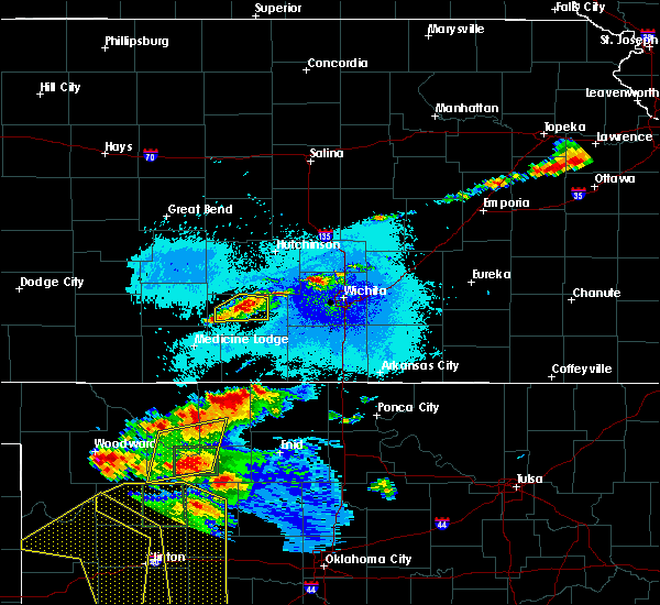 At 952 pm cdt, a severe thunderstorm was located just southwest of kingman, and is nearly stationary (trained weather spotters). Hazards include ping pong ball size hail and 60 mph wind gusts. People and animals outdoors will be injured. expect hail damage to roofs, siding, windows, and vehicles. expect wind damage to roofs, siding, and trees. Locations impacted include, kingman, willowdale, cleveland and kingman airport. At 952 pm cdt, a severe thunderstorm was located just southwest of kingman, and is nearly stationary (trained weather spotters). Hazards include ping pong ball size hail and 60 mph wind gusts. People and animals outdoors will be injured. expect hail damage to roofs, siding, windows, and vehicles. expect wind damage to roofs, siding, and trees. Locations impacted include, kingman, willowdale, cleveland and kingman airport.
|
| 6/15/2019 9:38 PM CDT |
 At 937 pm cdt, a severe thunderstorm was located over kingman, and is nearly stationary (trained weather spotters. at 936 pm, golf ball size hail was reported in kingman). Hazards include golf ball size hail and 60 mph wind gusts. People and animals outdoors will be injured. expect hail damage to roofs, siding, windows, and vehicles. expect wind damage to roofs, siding, and trees. Locations impacted include, kingman, willowdale, cleveland and kingman airport. At 937 pm cdt, a severe thunderstorm was located over kingman, and is nearly stationary (trained weather spotters. at 936 pm, golf ball size hail was reported in kingman). Hazards include golf ball size hail and 60 mph wind gusts. People and animals outdoors will be injured. expect hail damage to roofs, siding, windows, and vehicles. expect wind damage to roofs, siding, and trees. Locations impacted include, kingman, willowdale, cleveland and kingman airport.
|
| 6/15/2019 9:36 PM CDT | Golf Ball sized hail reported 0.9 miles WSW of Kingman, KS, precipitation was all hail... no rain |
| 6/15/2019 9:36 PM CDT | Half Dollar sized hail reported 0.4 miles WSW of Kingman, KS |
| 6/15/2019 9:33 PM CDT |
 At 933 pm cdt, a severe thunderstorm was located over kingman, and is nearly stationary (radar indicated). Hazards include 60 mph wind gusts and quarter size hail. Hail damage to vehicles is expected. Expect wind damage to roofs, siding, and trees. At 933 pm cdt, a severe thunderstorm was located over kingman, and is nearly stationary (radar indicated). Hazards include 60 mph wind gusts and quarter size hail. Hail damage to vehicles is expected. Expect wind damage to roofs, siding, and trees.
|
| 6/15/2019 12:41 AM CDT |
 The severe thunderstorm warning for eastern reno, harper and eastern kingman counties will expire at 1245 am cdt, the storms which prompted the warning have moved out of the area. therefore, the warning will be allowed to expire. however gusty winds and heavy rain are still possible with these thunderstorms. a severe thunderstorm watch remains in effect until 500 am cdt for south central kansas. The severe thunderstorm warning for eastern reno, harper and eastern kingman counties will expire at 1245 am cdt, the storms which prompted the warning have moved out of the area. therefore, the warning will be allowed to expire. however gusty winds and heavy rain are still possible with these thunderstorms. a severe thunderstorm watch remains in effect until 500 am cdt for south central kansas.
|
| 6/15/2019 12:25 AM CDT | State trooper reported 70+ mph winds that leveled a shed and destroyed a chicken coo in kingman county KS, 15.7 miles NW of Kingman, KS |
| 6/15/2019 12:24 AM CDT |
 At 1224 am cdt, severe thunderstorms were located along a line extending from near haven to 5 miles northeast of norwich to 8 miles southeast of anthony, moving east at 60 mph (radar indicated). Hazards include 70 mph wind gusts and penny size hail. Expect considerable tree damage. damage is likely to mobile homes, roofs, and outbuildings. Locations impacted include, hutchinson, kingman, south hutchinson, anthony, harper, buhler, haven, pretty prairie, attica, norwich, partridge, yoder, murdock, waterloo, willowbrook, spivey, bluff city, cleveland, danville and waldron. At 1224 am cdt, severe thunderstorms were located along a line extending from near haven to 5 miles northeast of norwich to 8 miles southeast of anthony, moving east at 60 mph (radar indicated). Hazards include 70 mph wind gusts and penny size hail. Expect considerable tree damage. damage is likely to mobile homes, roofs, and outbuildings. Locations impacted include, hutchinson, kingman, south hutchinson, anthony, harper, buhler, haven, pretty prairie, attica, norwich, partridge, yoder, murdock, waterloo, willowbrook, spivey, bluff city, cleveland, danville and waldron.
|
| 6/15/2019 12:05 AM CDT | At least 75 mph winds estimated 1/4 mile southwest of the airport in kingman county KS, 0.9 miles SSE of Kingman, KS |
| 6/15/2019 12:00 AM CDT | Personal weather station measured 59mp in kingman county KS, 7.4 miles NE of Kingman, KS |
| 6/14/2019 11:38 PM CDT |
 At 1138 pm cdt, severe thunderstorms were located along a line extending from near stafford to near isabel to 7 miles northeast of aetna, moving east at 55 mph (radar indicated). Hazards include 70 mph wind gusts and quarter size hail. Hail damage to vehicles is expected. expect considerable tree damage. Wind damage is also likely to mobile homes, roofs, and outbuildings. At 1138 pm cdt, severe thunderstorms were located along a line extending from near stafford to near isabel to 7 miles northeast of aetna, moving east at 55 mph (radar indicated). Hazards include 70 mph wind gusts and quarter size hail. Hail damage to vehicles is expected. expect considerable tree damage. Wind damage is also likely to mobile homes, roofs, and outbuildings.
|
| 6/9/2019 5:43 AM CDT |
 At 542 am cdt, a severe thunderstorm was located 8 miles east of turon, or 12 miles northwest of kingman, moving east at 35 mph (radar indicated). Hazards include 60 mph wind gusts and quarter size hail. Hail damage to vehicles is expected. Expect wind damage to roofs, siding, and trees. At 542 am cdt, a severe thunderstorm was located 8 miles east of turon, or 12 miles northwest of kingman, moving east at 35 mph (radar indicated). Hazards include 60 mph wind gusts and quarter size hail. Hail damage to vehicles is expected. Expect wind damage to roofs, siding, and trees.
|
| 6/9/2019 4:11 AM CDT |
 The severe thunderstorm warning for reno, sedgwick, harvey and northeastern kingman counties will expire at 415 am cdt, the storms which prompted the warning have moved out of the area. therefore, the warning will be allowed to expire. a severe thunderstorm watch remains in effect until 500 am cdt for south central kansas. The severe thunderstorm warning for reno, sedgwick, harvey and northeastern kingman counties will expire at 415 am cdt, the storms which prompted the warning have moved out of the area. therefore, the warning will be allowed to expire. a severe thunderstorm watch remains in effect until 500 am cdt for south central kansas.
|
| 6/9/2019 3:50 AM CDT |
 At 349 am cdt, severe thunderstorms were located along a line extending from hesston to near halstead to bentley to near andale to 6 miles east of kingman, moving southeast at 50 mph (radar indicated). Hazards include 60 mph wind gusts and penny size hail. Expect damage to roofs, siding, and trees. Locations impacted include, wichita, hutchinson, derby, newton, haysville, park city, valley center, bel aire, goddard, hesston, maize, kingman, clearwater, south hutchinson, cheney, halstead, north newton, sedgwick, colwich and buhler. At 349 am cdt, severe thunderstorms were located along a line extending from hesston to near halstead to bentley to near andale to 6 miles east of kingman, moving southeast at 50 mph (radar indicated). Hazards include 60 mph wind gusts and penny size hail. Expect damage to roofs, siding, and trees. Locations impacted include, wichita, hutchinson, derby, newton, haysville, park city, valley center, bel aire, goddard, hesston, maize, kingman, clearwater, south hutchinson, cheney, halstead, north newton, sedgwick, colwich and buhler.
|
| 6/9/2019 3:29 AM CDT |
 The national weather service in wichita has issued a * severe thunderstorm warning for. southern mcpherson county in central kansas. reno county in south central kansas. sedgwick county in south central kansas. Harvey county in south central kansas. The national weather service in wichita has issued a * severe thunderstorm warning for. southern mcpherson county in central kansas. reno county in south central kansas. sedgwick county in south central kansas. Harvey county in south central kansas.
|
| 5/27/2019 1:39 AM CDT |
 At 139 am cdt, severe thunderstorms were located along a line extending from near north newton to near haysville to near caldwell, moving east at 55 mph (trained weather spotters). Hazards include 70 mph wind gusts and nickel size hail. Expect considerable tree damage. damage is likely to mobile homes, roofs, and outbuildings. Locations impacted include, wichita, hutchinson, derby, newton, haysville, wellington, park city, valley center, bel aire, mulvane, goddard, hesston, maize, kingman, clearwater, south hutchinson, anthony, cheney, halstead and north newton. At 139 am cdt, severe thunderstorms were located along a line extending from near north newton to near haysville to near caldwell, moving east at 55 mph (trained weather spotters). Hazards include 70 mph wind gusts and nickel size hail. Expect considerable tree damage. damage is likely to mobile homes, roofs, and outbuildings. Locations impacted include, wichita, hutchinson, derby, newton, haysville, wellington, park city, valley center, bel aire, mulvane, goddard, hesston, maize, kingman, clearwater, south hutchinson, anthony, cheney, halstead and north newton.
|
| 5/27/2019 1:19 AM CDT |
 At 119 am cdt, severe thunderstorms were located along a line extending from near buhler to 5 miles northwest of viola to 8 miles southeast of anthony, moving east at 50 mph (radar indicated). Hazards include 70 mph wind gusts and nickel size hail. Expect considerable tree damage. damage is likely to mobile homes, roofs, and outbuildings. Locations impacted include, wichita, hutchinson, derby, newton, haysville, wellington, park city, valley center, bel aire, mulvane, goddard, hesston, maize, kingman, clearwater, south hutchinson, anthony, cheney, halstead and north newton. At 119 am cdt, severe thunderstorms were located along a line extending from near buhler to 5 miles northwest of viola to 8 miles southeast of anthony, moving east at 50 mph (radar indicated). Hazards include 70 mph wind gusts and nickel size hail. Expect considerable tree damage. damage is likely to mobile homes, roofs, and outbuildings. Locations impacted include, wichita, hutchinson, derby, newton, haysville, wellington, park city, valley center, bel aire, mulvane, goddard, hesston, maize, kingman, clearwater, south hutchinson, anthony, cheney, halstead and north newton.
|
| 5/27/2019 12:54 AM CDT |
 At 1253 am cdt, severe thunderstorms were located along a line extending from near nickerson to 8 miles south of kingman to 7 miles east of hazelton, moving east at 55 mph (radar indicated). Hazards include 70 mph wind gusts and nickel size hail. Expect considerable tree damage. Damage is likely to mobile homes, roofs, and outbuildings. At 1253 am cdt, severe thunderstorms were located along a line extending from near nickerson to 8 miles south of kingman to 7 miles east of hazelton, moving east at 55 mph (radar indicated). Hazards include 70 mph wind gusts and nickel size hail. Expect considerable tree damage. Damage is likely to mobile homes, roofs, and outbuildings.
|
| 5/26/2019 11:51 PM CDT |
 At 1150 pm cdt, severe thunderstorms were located along a line extending from hopewell to 11 miles south of aetna, moving east at 60 mph (radar indicated). Hazards include 70 mph wind gusts and quarter size hail. Hail damage to vehicles is expected. expect considerable tree damage. Wind damage is also likely to mobile homes, roofs, and outbuildings. At 1150 pm cdt, severe thunderstorms were located along a line extending from hopewell to 11 miles south of aetna, moving east at 60 mph (radar indicated). Hazards include 70 mph wind gusts and quarter size hail. Hail damage to vehicles is expected. expect considerable tree damage. Wind damage is also likely to mobile homes, roofs, and outbuildings.
|
| 5/25/2019 8:37 PM CDT |
 The severe thunderstorm warning for western mcpherson, reno, western sedgwick, rice, southeastern ellsworth and eastern kingman counties will expire at 845 pm cdt, the storms which prompted the warning have weakened below severe limits, and no longer pose an immediate threat to life or property. therefore, the warning will be allowed to expire. however gusty winds and heavy rain are still possible with these thunderstorms. a severe thunderstorm watch remains in effect until midnight cdt for central and south central kansas. The severe thunderstorm warning for western mcpherson, reno, western sedgwick, rice, southeastern ellsworth and eastern kingman counties will expire at 845 pm cdt, the storms which prompted the warning have weakened below severe limits, and no longer pose an immediate threat to life or property. therefore, the warning will be allowed to expire. however gusty winds and heavy rain are still possible with these thunderstorms. a severe thunderstorm watch remains in effect until midnight cdt for central and south central kansas.
|
| 5/25/2019 8:10 PM CDT |
 At 809 pm cdt, severe thunderstorms were located along a line extending from 7 miles east of geneseo to near norwich, moving northeast at 40 mph (radar indicated). Hazards include 60 mph wind gusts and penny size hail. Expect damage to roofs, siding, and trees. Locations impacted include, hutchinson, lyons, kingman, south hutchinson, sterling, cheney, inman, buhler, haven, nickerson, pretty prairie, marquette, little river, norwich, arlington, geneseo, partridge, alden, windom and abbyville. At 809 pm cdt, severe thunderstorms were located along a line extending from 7 miles east of geneseo to near norwich, moving northeast at 40 mph (radar indicated). Hazards include 60 mph wind gusts and penny size hail. Expect damage to roofs, siding, and trees. Locations impacted include, hutchinson, lyons, kingman, south hutchinson, sterling, cheney, inman, buhler, haven, nickerson, pretty prairie, marquette, little river, norwich, arlington, geneseo, partridge, alden, windom and abbyville.
|
| 5/25/2019 7:45 PM CDT |
 At 744 pm cdt, severe thunderstorms were located along a line extending from lyons to 11 miles north of harper, moving east at 35 mph (radar indicated). Hazards include 60 mph wind gusts and penny size hail. Expect damage to roofs, siding, and trees. This severe warning replaces the previous warnings that were in effect for the warned areas. At 744 pm cdt, severe thunderstorms were located along a line extending from lyons to 11 miles north of harper, moving east at 35 mph (radar indicated). Hazards include 60 mph wind gusts and penny size hail. Expect damage to roofs, siding, and trees. This severe warning replaces the previous warnings that were in effect for the warned areas.
|
| 5/25/2019 7:13 PM CDT |
 At 712 pm cdt, a severe thunderstorm was located 8 miles northeast of nashville, or 13 miles southwest of kingman, moving northeast at 35 mph (radar indicated). Hazards include 60 mph wind gusts and nickel size hail. Expect damage to roofs, siding, and trees. Locations impacted include, kingman, cunningham, nashville, willowdale, zenda, spivey, cleveland, penalosa and kingman airport. At 712 pm cdt, a severe thunderstorm was located 8 miles northeast of nashville, or 13 miles southwest of kingman, moving northeast at 35 mph (radar indicated). Hazards include 60 mph wind gusts and nickel size hail. Expect damage to roofs, siding, and trees. Locations impacted include, kingman, cunningham, nashville, willowdale, zenda, spivey, cleveland, penalosa and kingman airport.
|
| 5/25/2019 6:53 PM CDT |
 At 653 pm cdt, a severe thunderstorm was located over nashville, or 7 miles southeast of isabel, moving northeast at 30 mph (radar indicated). Hazards include 60 mph wind gusts and quarter size hail. Hail damage to vehicles is expected. Expect wind damage to roofs, siding, and trees. At 653 pm cdt, a severe thunderstorm was located over nashville, or 7 miles southeast of isabel, moving northeast at 30 mph (radar indicated). Hazards include 60 mph wind gusts and quarter size hail. Hail damage to vehicles is expected. Expect wind damage to roofs, siding, and trees.
|
| 5/18/2019 8:57 PM CDT | Storm damage reported in kingman county KS, 0.9 miles SSE of Kingman, KS |
| 5/18/2019 8:53 PM CDT |
 At 844 pm cdt, severe thunderstorms were located along a line extending from near kingman to 7 miles northeast of hazelton, moving east at 25 mph (radar indicated). Hazards include 60 mph wind gusts and quarter size hail. Hail damage to vehicles is expected. expect wind damage to roofs, siding, and trees. Locations impacted include, kingman, anthony, harper, attica, norwich, murdock, waterloo, willowdale, zenda, spivey, bluff city, cleveland, danville, penalosa, freeport, mt vernon, kingman airport, corwin, rago and runnymede. At 844 pm cdt, severe thunderstorms were located along a line extending from near kingman to 7 miles northeast of hazelton, moving east at 25 mph (radar indicated). Hazards include 60 mph wind gusts and quarter size hail. Hail damage to vehicles is expected. expect wind damage to roofs, siding, and trees. Locations impacted include, kingman, anthony, harper, attica, norwich, murdock, waterloo, willowdale, zenda, spivey, bluff city, cleveland, danville, penalosa, freeport, mt vernon, kingman airport, corwin, rago and runnymede.
|
| 5/18/2019 8:44 PM CDT |
 At 844 pm cdt, severe thunderstorms were located along a line extending from near kingman to 7 miles northeast of hazelton, moving east at 25 mph (radar indicated). Hazards include 60 mph wind gusts and quarter size hail. Hail damage to vehicles is expected. expect wind damage to roofs, siding, and trees. Locations impacted include, kingman, anthony, harper, attica, norwich, murdock, waterloo, willowdale, zenda, spivey, bluff city, cleveland, danville, penalosa, freeport, mt vernon, kingman airport, corwin, rago and runnymede. At 844 pm cdt, severe thunderstorms were located along a line extending from near kingman to 7 miles northeast of hazelton, moving east at 25 mph (radar indicated). Hazards include 60 mph wind gusts and quarter size hail. Hail damage to vehicles is expected. expect wind damage to roofs, siding, and trees. Locations impacted include, kingman, anthony, harper, attica, norwich, murdock, waterloo, willowdale, zenda, spivey, bluff city, cleveland, danville, penalosa, freeport, mt vernon, kingman airport, corwin, rago and runnymede.
|
| 5/18/2019 8:27 PM CDT |
 At 827 pm cdt, severe thunderstorms were located along a line extending from 8 miles east of cunningham to 5 miles south of sharon, moving east at 25 mph (radar indicated). Hazards include 70 mph wind gusts and half dollar size hail. Hail damage to vehicles is expected. expect considerable tree damage. Wind damage is also likely to mobile homes, roofs, and outbuildings. At 827 pm cdt, severe thunderstorms were located along a line extending from 8 miles east of cunningham to 5 miles south of sharon, moving east at 25 mph (radar indicated). Hazards include 70 mph wind gusts and half dollar size hail. Hail damage to vehicles is expected. expect considerable tree damage. Wind damage is also likely to mobile homes, roofs, and outbuildings.
|
| 5/18/2019 7:27 PM CDT |
 At 727 pm cdt, a severe thunderstorm was located near isabel, moving east at 30 mph (radar indicated). Hazards include ping pong ball size hail and 60 mph wind gusts. People and animals outdoors will be injured. expect hail damage to roofs, siding, windows, and vehicles. Expect wind damage to roofs, siding, and trees. At 727 pm cdt, a severe thunderstorm was located near isabel, moving east at 30 mph (radar indicated). Hazards include ping pong ball size hail and 60 mph wind gusts. People and animals outdoors will be injured. expect hail damage to roofs, siding, windows, and vehicles. Expect wind damage to roofs, siding, and trees.
|
| 5/6/2019 11:53 PM CDT |
 At 1152 pm cdt, severe thunderstorms were located along a line extending from 9 miles southwest of raymond to near cairo to 5 miles southwest of sharon, moving east at 45 mph (radar indicated). Hazards include 60 mph wind gusts. expect damage to roofs, siding, and trees At 1152 pm cdt, severe thunderstorms were located along a line extending from 9 miles southwest of raymond to near cairo to 5 miles southwest of sharon, moving east at 45 mph (radar indicated). Hazards include 60 mph wind gusts. expect damage to roofs, siding, and trees
|
| 8/9/2018 4:10 PM CDT | Tree limbs down. some 6 to 8 inches in diameter. winds estimated 50-60 mph. delayed repor in kingman county KS, 0.9 miles SSE of Kingman, KS |
| 6/30/2018 6:32 PM CDT |
 At 630 pm cdt, severe thunderstorms were located along a line extending from 11 miles north of harper to 5 miles southeast of clearwater to 5 miles south of belle plaine to 5 miles west of geuda springs, moving northeast at 40 mph (radar indicated). Hazards include 70 mph winds and penny size hail. Expect considerable tree damage. damage is likely to mobile homes, roofs, and outbuildings. Locations impacted include, wichita, derby, andover, haysville, wellington, park city, valley center, bel aire, mulvane, goddard, rose hill, maize, kingman, clearwater, cheney, douglass, sedgwick, belle plaine, harper and colwich. At 630 pm cdt, severe thunderstorms were located along a line extending from 11 miles north of harper to 5 miles southeast of clearwater to 5 miles south of belle plaine to 5 miles west of geuda springs, moving northeast at 40 mph (radar indicated). Hazards include 70 mph winds and penny size hail. Expect considerable tree damage. damage is likely to mobile homes, roofs, and outbuildings. Locations impacted include, wichita, derby, andover, haysville, wellington, park city, valley center, bel aire, mulvane, goddard, rose hill, maize, kingman, clearwater, cheney, douglass, sedgwick, belle plaine, harper and colwich.
|
| 6/30/2018 6:17 PM CDT |
 At 614 pm cdt, severe thunderstorms were located along a line extending from 6 miles north of attica to 5 miles southeast of conway springs to near south haven, moving northeast at 40 mph (radar indicated). Hazards include 70 mph wind gusts and penny size hail. Expect considerable tree damage. Damage is likely to mobile homes, roofs, and outbuildings. At 614 pm cdt, severe thunderstorms were located along a line extending from 6 miles north of attica to 5 miles southeast of conway springs to near south haven, moving northeast at 40 mph (radar indicated). Hazards include 70 mph wind gusts and penny size hail. Expect considerable tree damage. Damage is likely to mobile homes, roofs, and outbuildings.
|
| 6/7/2018 3:43 AM CDT |
 At 322 am cdt, severe thunderstorms were located along a line extending from near hudson to near preston to 7 miles south of sawyer, moving northeast at 40 mph (radar indicated). Hazards include 60 mph wind gusts. expect damage to roofs, siding, and trees At 322 am cdt, severe thunderstorms were located along a line extending from near hudson to near preston to 7 miles south of sawyer, moving northeast at 40 mph (radar indicated). Hazards include 60 mph wind gusts. expect damage to roofs, siding, and trees
|
| 6/7/2018 3:23 AM CDT |
 The national weather service in wichita has issued a * severe thunderstorm warning for. reno county in south central kansas. kingman county in south central kansas. Until 415 am cdt * at 322 am cdt, severe thunderstorms were located along a line. The national weather service in wichita has issued a * severe thunderstorm warning for. reno county in south central kansas. kingman county in south central kansas. Until 415 am cdt * at 322 am cdt, severe thunderstorms were located along a line.
|
| 5/31/2018 12:41 AM CDT |
 At 1241 am cdt, severe thunderstorms were located along a line extending from 7 miles east of pretty prairie to cheney to near norwich, moving east at 45 mph (radar indicated). Hazards include 60 to 70 mph wind gusts and nickel size hail. Expect considerable tree damage. damage is likely to mobile homes, roofs, and outbuildings. Locations impacted include, wichita, derby, andover, haysville, augusta, park city, valley center, bel aire, mulvane, goddard, rose hill, maize, kingman, clearwater, cheney, douglass, sedgwick, towanda, colwich and benton. At 1241 am cdt, severe thunderstorms were located along a line extending from 7 miles east of pretty prairie to cheney to near norwich, moving east at 45 mph (radar indicated). Hazards include 60 to 70 mph wind gusts and nickel size hail. Expect considerable tree damage. damage is likely to mobile homes, roofs, and outbuildings. Locations impacted include, wichita, derby, andover, haysville, augusta, park city, valley center, bel aire, mulvane, goddard, rose hill, maize, kingman, clearwater, cheney, douglass, sedgwick, towanda, colwich and benton.
|
| 5/31/2018 12:26 AM CDT |
 At 1225 am cdt, severe thunderstorms were located along a line extending from near pretty prairie to 9 miles west of cheney to 5 miles west of norwich, moving east at 60 mph. these are very dangerous storms (radar indicated). Hazards include 80 mph wind gusts and quarter size hail. Flying debris will be dangerous to those caught without shelter. mobile homes will be heavily damaged. expect considerable damage to roofs, windows, and vehicles. Extensive tree damage and power outages are likely. At 1225 am cdt, severe thunderstorms were located along a line extending from near pretty prairie to 9 miles west of cheney to 5 miles west of norwich, moving east at 60 mph. these are very dangerous storms (radar indicated). Hazards include 80 mph wind gusts and quarter size hail. Flying debris will be dangerous to those caught without shelter. mobile homes will be heavily damaged. expect considerable damage to roofs, windows, and vehicles. Extensive tree damage and power outages are likely.
|
| 5/31/2018 12:21 AM CDT |
 At 1220 am cdt, a severe thunderstorm was located 13 miles south of kingman, moving east at 35 mph. this is a very dangerous storm (radar indicated). Hazards include 70 to 80 mph wind gusts and nickel size hail. Flying debris will be dangerous to those caught without shelter. mobile homes will be heavily damaged. expect considerable damage to roofs, windows, and vehicles. extensive tree damage and power outages are likely. Locations impacted include, kingman, nashville, willowdale, zenda, spivey, cleveland, rago and kingman airport. At 1220 am cdt, a severe thunderstorm was located 13 miles south of kingman, moving east at 35 mph. this is a very dangerous storm (radar indicated). Hazards include 70 to 80 mph wind gusts and nickel size hail. Flying debris will be dangerous to those caught without shelter. mobile homes will be heavily damaged. expect considerable damage to roofs, windows, and vehicles. extensive tree damage and power outages are likely. Locations impacted include, kingman, nashville, willowdale, zenda, spivey, cleveland, rago and kingman airport.
|
| 5/31/2018 12:02 AM CDT |
 At 1202 am cdt, a severe thunderstorm was located near nashville, or 11 miles east of isabel, moving east at 60 mph. this is a very dangerous storm (radar indicated). Hazards include 80 mph wind gusts and nickel size hail. Flying debris will be dangerous to those caught without shelter. mobile homes will be heavily damaged. expect considerable damage to roofs, windows, and vehicles. extensive tree damage and power outages are likely. Locations impacted include, kingman, nashville, willowdale, zenda, spivey, cleveland, rago and kingman airport. At 1202 am cdt, a severe thunderstorm was located near nashville, or 11 miles east of isabel, moving east at 60 mph. this is a very dangerous storm (radar indicated). Hazards include 80 mph wind gusts and nickel size hail. Flying debris will be dangerous to those caught without shelter. mobile homes will be heavily damaged. expect considerable damage to roofs, windows, and vehicles. extensive tree damage and power outages are likely. Locations impacted include, kingman, nashville, willowdale, zenda, spivey, cleveland, rago and kingman airport.
|
| 5/30/2018 11:47 PM CDT |
 At 1147 pm cdt, a severe thunderstorm was located near nashville, or 9 miles east of isabel, moving northeast at 25 mph (radar indicated). Hazards include 70 mph wind gusts and ping pong ball size hail. People and animals outdoors will be injured. expect hail damage to roofs, siding, windows, and vehicles. expect considerable tree damage. Wind damage is also likely to mobile homes, roofs, and outbuildings. At 1147 pm cdt, a severe thunderstorm was located near nashville, or 9 miles east of isabel, moving northeast at 25 mph (radar indicated). Hazards include 70 mph wind gusts and ping pong ball size hail. People and animals outdoors will be injured. expect hail damage to roofs, siding, windows, and vehicles. expect considerable tree damage. Wind damage is also likely to mobile homes, roofs, and outbuildings.
|
| 5/29/2018 7:09 PM CDT |
 At 708 pm cdt, severe thunderstorms were located along a line extending from 6 miles east of hudson to near preston, moving east at 45 mph (radar indicated). Hazards include 70 mph wind gusts and quarter size hail. Hail damage to vehicles is expected. expect considerable tree damage. Wind damage is also likely to mobile homes, roofs, and outbuildings. At 708 pm cdt, severe thunderstorms were located along a line extending from 6 miles east of hudson to near preston, moving east at 45 mph (radar indicated). Hazards include 70 mph wind gusts and quarter size hail. Hail damage to vehicles is expected. expect considerable tree damage. Wind damage is also likely to mobile homes, roofs, and outbuildings.
|
| 5/18/2018 10:36 PM CDT |
 The severe thunderstorm warning for reno, harper, rice and kingman counties will expire at 1045 pm cdt, the storms which prompted the warning have weakened below severe limits, and no longer pose an immediate threat to life or property. therefore the warning will be allowed to expire. however gusty winds of 40 to 50 mph are still possible with these thunderstorms. a severe thunderstorm watch remains in effect until 200 am cdt for south central and central kansas. The severe thunderstorm warning for reno, harper, rice and kingman counties will expire at 1045 pm cdt, the storms which prompted the warning have weakened below severe limits, and no longer pose an immediate threat to life or property. therefore the warning will be allowed to expire. however gusty winds of 40 to 50 mph are still possible with these thunderstorms. a severe thunderstorm watch remains in effect until 200 am cdt for south central and central kansas.
|
| 5/18/2018 10:09 PM CDT |
 At 1009 pm cdt, severe thunderstorms were located along a line extending from near alden to near anthony, moving east at 30 mph (radar indicated). Hazards include 60 to 70 mph wind gusts and penny size hail. Expect considerable tree damage. damage is likely to mobile homes, roofs, and outbuildings. Locations impacted include, hutchinson, lyons, kingman, south hutchinson, sterling, anthony, harper, nickerson, pretty prairie, attica, little river, norwich, chase, arlington, cunningham, turon, partridge, sylvia, alden and plevna. At 1009 pm cdt, severe thunderstorms were located along a line extending from near alden to near anthony, moving east at 30 mph (radar indicated). Hazards include 60 to 70 mph wind gusts and penny size hail. Expect considerable tree damage. damage is likely to mobile homes, roofs, and outbuildings. Locations impacted include, hutchinson, lyons, kingman, south hutchinson, sterling, anthony, harper, nickerson, pretty prairie, attica, little river, norwich, chase, arlington, cunningham, turon, partridge, sylvia, alden and plevna.
|
| 5/18/2018 9:48 PM CDT |
 At 947 pm cdt, severe thunderstorms were located along a line extending from 7 miles northeast of hudson to 9 miles east of hazelton, moving east at 30 mph (radar indicated). Hazards include 60 to 70 mph wind gusts and penny size hail. Expect considerable tree damage. damage is likely to mobile homes, roofs, and outbuildings. Locations impacted include, hutchinson, lyons, kingman, south hutchinson, sterling, anthony, harper, nickerson, pretty prairie, attica, little river, norwich, chase, arlington, cunningham, turon, partridge, sylvia, alden and plevna. At 947 pm cdt, severe thunderstorms were located along a line extending from 7 miles northeast of hudson to 9 miles east of hazelton, moving east at 30 mph (radar indicated). Hazards include 60 to 70 mph wind gusts and penny size hail. Expect considerable tree damage. damage is likely to mobile homes, roofs, and outbuildings. Locations impacted include, hutchinson, lyons, kingman, south hutchinson, sterling, anthony, harper, nickerson, pretty prairie, attica, little river, norwich, chase, arlington, cunningham, turon, partridge, sylvia, alden and plevna.
|
| 5/18/2018 9:18 PM CDT |
 At 918 pm cdt, severe thunderstorms were located along a line extending from near seward to kiowa, moving east at 30 mph (radar indicated). Hazards include 60 to 70 mph wind gusts and penny size hail. Expect considerable tree damage. Damage is likely to mobile homes, roofs, and outbuildings. At 918 pm cdt, severe thunderstorms were located along a line extending from near seward to kiowa, moving east at 30 mph (radar indicated). Hazards include 60 to 70 mph wind gusts and penny size hail. Expect considerable tree damage. Damage is likely to mobile homes, roofs, and outbuildings.
|
| 5/9/2018 11:51 PM CDT |
 At 1150 pm cdt, a severe thunderstorm was located 5 miles north of kingman, moving east at 10 mph (radar indicated). Hazards include ping pong ball size hail. People and animals outdoors will be injured. expect damage to roofs, siding, windows, and vehicles. Locations impacted include, kingman, waterloo, mt vernon, kingman airport and cheney state park. At 1150 pm cdt, a severe thunderstorm was located 5 miles north of kingman, moving east at 10 mph (radar indicated). Hazards include ping pong ball size hail. People and animals outdoors will be injured. expect damage to roofs, siding, windows, and vehicles. Locations impacted include, kingman, waterloo, mt vernon, kingman airport and cheney state park.
|
| 5/9/2018 11:33 PM CDT |
 At 1132 pm cdt, a severe thunderstorm was located near kingman, moving southeast at 15 mph (radar indicated). Hazards include ping pong ball size hail. People and animals outdoors will be injured. expect damage to roofs, siding, windows, and vehicles. Locations impacted include, kingman, waterloo, cleveland, mt vernon, kingman airport and cheney state park. At 1132 pm cdt, a severe thunderstorm was located near kingman, moving southeast at 15 mph (radar indicated). Hazards include ping pong ball size hail. People and animals outdoors will be injured. expect damage to roofs, siding, windows, and vehicles. Locations impacted include, kingman, waterloo, cleveland, mt vernon, kingman airport and cheney state park.
|
| 5/9/2018 11:16 PM CDT |
 At 1116 pm cdt, a severe thunderstorm was located 8 miles northwest of kingman, moving southeast at 10 mph (radar indicated). Hazards include quarter size hail. damage to vehicles is expected At 1116 pm cdt, a severe thunderstorm was located 8 miles northwest of kingman, moving southeast at 10 mph (radar indicated). Hazards include quarter size hail. damage to vehicles is expected
|
| 5/2/2018 5:24 PM CDT |
 The severe thunderstorm warning for northwestern kingman county will expire at 530 pm cdt, the storm which prompted the warning has weakened below severe limits, and no longer poses an immediate threat to life or property. therefore the warning will be allowed to expire. however small hail and gusty winds are still possible with this thunderstorm. a tornado watch remains in effect until 1000 pm cdt for south central kansas. The severe thunderstorm warning for northwestern kingman county will expire at 530 pm cdt, the storm which prompted the warning has weakened below severe limits, and no longer poses an immediate threat to life or property. therefore the warning will be allowed to expire. however small hail and gusty winds are still possible with this thunderstorm. a tornado watch remains in effect until 1000 pm cdt for south central kansas.
|
| 5/2/2018 5:11 PM CDT |
 At 511 pm cdt, a severe thunderstorm was located 6 miles southwest of kingman, moving northeast at 30 mph (radar indicated). Hazards include 60 mph wind gusts and penny size hail. Expect damage to roofs, siding, and trees. locations impacted include, kingman, cunningham, willowdale, cleveland, penalosa and kingman airport. A tornado watch remains in effect until 1000 pm cdt for south central kansas. At 511 pm cdt, a severe thunderstorm was located 6 miles southwest of kingman, moving northeast at 30 mph (radar indicated). Hazards include 60 mph wind gusts and penny size hail. Expect damage to roofs, siding, and trees. locations impacted include, kingman, cunningham, willowdale, cleveland, penalosa and kingman airport. A tornado watch remains in effect until 1000 pm cdt for south central kansas.
|
| 5/2/2018 4:46 PM CDT |
 At 446 pm cdt, a severe thunderstorm was located near cunningham, or 11 miles east of cairo, moving northeast at 40 mph (radar indicated). Hazards include 60 mph wind gusts and quarter size hail. Hail damage to vehicles is expected. expect wind damage to roofs, siding, and trees. locations impacted include, kingman, cunningham, willowdale, cleveland, penalosa and kingman airport. A tornado watch remains in effect until 1000 pm cdt for south central kansas. At 446 pm cdt, a severe thunderstorm was located near cunningham, or 11 miles east of cairo, moving northeast at 40 mph (radar indicated). Hazards include 60 mph wind gusts and quarter size hail. Hail damage to vehicles is expected. expect wind damage to roofs, siding, and trees. locations impacted include, kingman, cunningham, willowdale, cleveland, penalosa and kingman airport. A tornado watch remains in effect until 1000 pm cdt for south central kansas.
|
| 5/2/2018 4:33 PM CDT |
 At 433 pm cdt, a severe thunderstorm was located near cunningham, or 10 miles east of cairo, moving northeast at 40 mph (radar indicated). Hazards include ping pong ball size hail and 60 mph wind gusts. People and animals outdoors will be injured. expect hail damage to roofs, siding, windows, and vehicles. Expect wind damage to roofs, siding, and trees. At 433 pm cdt, a severe thunderstorm was located near cunningham, or 10 miles east of cairo, moving northeast at 40 mph (radar indicated). Hazards include ping pong ball size hail and 60 mph wind gusts. People and animals outdoors will be injured. expect hail damage to roofs, siding, windows, and vehicles. Expect wind damage to roofs, siding, and trees.
|
| 8/5/2017 6:06 PM CDT |
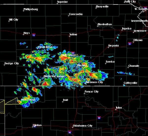 The severe thunderstorm warning for eastern kingman county will expire at 615 pm cdt, the storm which prompted the warning has weakened below severe limits, and no longer poses an immediate threat to life or property. therefore the warning will be allowed to expire. a severe thunderstorm watch remains in effect until 1100 pm cdt for south central kansas. The severe thunderstorm warning for eastern kingman county will expire at 615 pm cdt, the storm which prompted the warning has weakened below severe limits, and no longer poses an immediate threat to life or property. therefore the warning will be allowed to expire. a severe thunderstorm watch remains in effect until 1100 pm cdt for south central kansas.
|
| 8/5/2017 5:45 PM CDT | Three or four power poles were snapped at the intersection of highway 54 and k-14. spotter stated that the wind damage had occurred 15-20 minutes ag in kingman county KS, 4 miles E of Kingman, KS |
| 8/5/2017 5:40 PM CDT | A tree 25 feet tall with a 2-foot diameter trunk was snapped about 3 feet from the ground. time of event is based on rada in kingman county KS, 0.9 miles WSW of Kingman, KS |
| 8/5/2017 5:38 PM CDT |
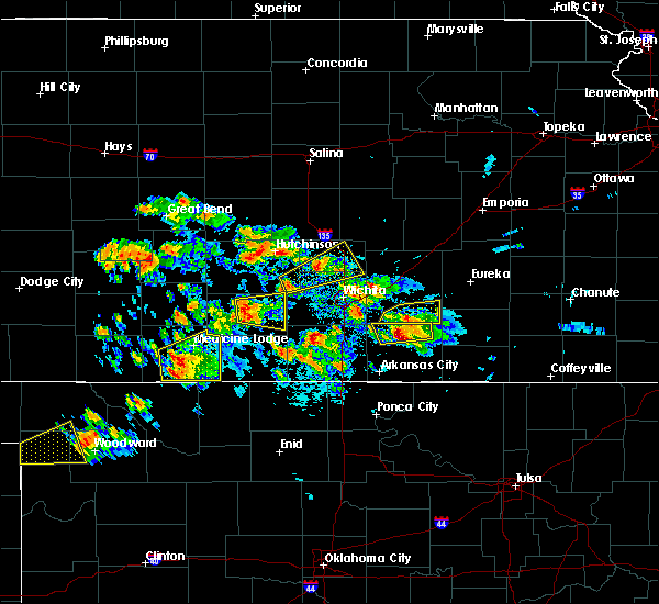 At 538 pm cdt, a severe thunderstorm was located near kingman, moving east at 30 mph (radar indicated). Hazards include 60 mph wind gusts and quarter size hail. Hail damage to vehicles is expected. Expect wind damage to roofs, siding, and trees. At 538 pm cdt, a severe thunderstorm was located near kingman, moving east at 30 mph (radar indicated). Hazards include 60 mph wind gusts and quarter size hail. Hail damage to vehicles is expected. Expect wind damage to roofs, siding, and trees.
|
| 8/5/2017 5:37 PM CDT | Several power poles were downed from severe thunderstorm wind gusts in kingman county KS, 1.6 miles SE of Kingman, KS |
| 8/5/2017 5:37 PM CDT | Small tree limbs were downed from sustained winds of 50 to 60 mp in kingman county KS, 0.9 miles WSW of Kingman, KS |
| 8/5/2017 5:35 PM CDT | Storm damage reported in kingman county KS, 0.9 miles WSW of Kingman, KS |
| 6/30/2017 12:30 AM CDT | 3-4 inch tree limbs down as wel in kingman county KS, 0.9 miles WSW of Kingman, KS |
| 6/29/2017 7:44 PM CDT |
 At 1244 am cdt, a severe thunderstorm was located 8 miles east of kingman, moving east at 40 mph (radar indicated). Hazards include 60 mph wind gusts. expect damage to roofs, siding, and trees At 1244 am cdt, a severe thunderstorm was located 8 miles east of kingman, moving east at 40 mph (radar indicated). Hazards include 60 mph wind gusts. expect damage to roofs, siding, and trees
|
| 6/29/2017 7:38 PM CDT |
 The severe thunderstorm warning for kingman county will expire at 1245 am cdt, the storm which prompted the warning has moved out of the area. therefore the warning will be allowed to expire. a severe thunderstorm watch remains in effect until 500 am cdt for south central kansas. The severe thunderstorm warning for kingman county will expire at 1245 am cdt, the storm which prompted the warning has moved out of the area. therefore the warning will be allowed to expire. a severe thunderstorm watch remains in effect until 500 am cdt for south central kansas.
|
| 6/29/2017 7:28 PM CDT |
 At 1227 am cdt, a severe thunderstorm was located near kingman, moving east at 30 mph (radar indicated). Hazards include 60 mph wind gusts and penny size hail. Expect damage to roofs, siding, and trees. Locations impacted include, kingman, cunningham, nashville, willowdale, zenda, spivey, cleveland, penalosa and kingman airport. At 1227 am cdt, a severe thunderstorm was located near kingman, moving east at 30 mph (radar indicated). Hazards include 60 mph wind gusts and penny size hail. Expect damage to roofs, siding, and trees. Locations impacted include, kingman, cunningham, nashville, willowdale, zenda, spivey, cleveland, penalosa and kingman airport.
|
| 6/29/2017 7:05 PM CDT |
 At 1205 am cdt, severe thunderstorms were located along a line extending from 9 miles northwest of kingman to 5 miles north of nashville, moving southeast at 30 mph (radar indicated). Hazards include 60 mph wind gusts and quarter size hail. Hail damage to vehicles is expected. expect wind damage to roofs, siding, and trees. Locations impacted include, kingman, cunningham, nashville, willowdale, zenda, spivey, cleveland, penalosa and kingman airport. At 1205 am cdt, severe thunderstorms were located along a line extending from 9 miles northwest of kingman to 5 miles north of nashville, moving southeast at 30 mph (radar indicated). Hazards include 60 mph wind gusts and quarter size hail. Hail damage to vehicles is expected. expect wind damage to roofs, siding, and trees. Locations impacted include, kingman, cunningham, nashville, willowdale, zenda, spivey, cleveland, penalosa and kingman airport.
|
| 6/29/2017 6:42 PM CDT |
 At 1142 pm cdt, a severe thunderstorm was located near turon, or 10 miles east of preston, moving southeast at 30 mph (radar indicated). Hazards include 60 mph wind gusts and quarter size hail. Hail damage to vehicles is expected. Expect wind damage to roofs, siding, and trees. At 1142 pm cdt, a severe thunderstorm was located near turon, or 10 miles east of preston, moving southeast at 30 mph (radar indicated). Hazards include 60 mph wind gusts and quarter size hail. Hail damage to vehicles is expected. Expect wind damage to roofs, siding, and trees.
|
| 6/29/2017 4:26 PM CDT |
 At 926 pm cdt, a severe thunderstorm was located over kingman, moving east at 15 mph (radar indicated). Hazards include 60 mph wind gusts and quarter size hail. Hail damage to vehicles is expected. Expect wind damage to roofs, siding, and trees. At 926 pm cdt, a severe thunderstorm was located over kingman, moving east at 15 mph (radar indicated). Hazards include 60 mph wind gusts and quarter size hail. Hail damage to vehicles is expected. Expect wind damage to roofs, siding, and trees.
|
| 6/15/2017 8:30 PM CDT |
 At 829 pm cdt, severe thunderstorms were located along a line extending from 7 miles west of eureka to 5 miles south of haysville to 6 miles northeast of nashville, moving southeast at 30 mph (trained weather spotters). Hazards include 60 mph wind gusts and quarter size hail. Hail damage to vehicles is expected. expect wind damage to roofs, siding, and trees. Locations impacted include, wichita, park city, valley center, bel aire, goddard, maize, kingman, cheney, colwich, garden plain, downtown wichita, kechi, andale, eastborough, norwich, viola, west wichita, eisenhower national airport, northeast wichita and east wichita. At 829 pm cdt, severe thunderstorms were located along a line extending from 7 miles west of eureka to 5 miles south of haysville to 6 miles northeast of nashville, moving southeast at 30 mph (trained weather spotters). Hazards include 60 mph wind gusts and quarter size hail. Hail damage to vehicles is expected. expect wind damage to roofs, siding, and trees. Locations impacted include, wichita, park city, valley center, bel aire, goddard, maize, kingman, cheney, colwich, garden plain, downtown wichita, kechi, andale, eastborough, norwich, viola, west wichita, eisenhower national airport, northeast wichita and east wichita.
|
| 6/15/2017 8:19 PM CDT |
 At 818 pm cdt, severe thunderstorms were located along a line extending from 10 miles northwest of eureka to near haysville to 6 miles southeast of cunningham, moving southeast at 30 mph (trained weather spotters). Hazards include 60 mph wind gusts and half dollar size hail. Hail damage to vehicles is expected. expect wind damage to roofs, siding, and trees. Locations impacted include, wichita, el dorado, andover, park city, valley center, bel aire, goddard, maize, kingman, cheney, towanda, colwich, benton, garden plain, downtown wichita, kechi, andale, eastborough, norwich and cunningham. At 818 pm cdt, severe thunderstorms were located along a line extending from 10 miles northwest of eureka to near haysville to 6 miles southeast of cunningham, moving southeast at 30 mph (trained weather spotters). Hazards include 60 mph wind gusts and half dollar size hail. Hail damage to vehicles is expected. expect wind damage to roofs, siding, and trees. Locations impacted include, wichita, el dorado, andover, park city, valley center, bel aire, goddard, maize, kingman, cheney, towanda, colwich, benton, garden plain, downtown wichita, kechi, andale, eastborough, norwich and cunningham.
|
| 6/15/2017 8:08 PM CDT | Large tree limb on a house. delayed repor in kingman county KS, 0.9 miles WSW of Kingman, KS |
| 6/15/2017 8:08 PM CDT |
 At 808 pm cdt, severe thunderstorms were located along a line extending from 13 miles northwest of eureka to near eisenhower national airport to near cunningham, moving southeast at 30 mph (trained weather spotters). Hazards include 60 mph wind gusts and half dollar size hail. Hail damage to vehicles is expected. expect wind damage to roofs, siding, and trees. Locations impacted include, wichita, el dorado, andover, park city, valley center, bel aire, goddard, maize, kingman, cheney, towanda, colwich, benton, garden plain, mount hope, pretty prairie, downtown wichita, kechi, andale and eastborough. At 808 pm cdt, severe thunderstorms were located along a line extending from 13 miles northwest of eureka to near eisenhower national airport to near cunningham, moving southeast at 30 mph (trained weather spotters). Hazards include 60 mph wind gusts and half dollar size hail. Hail damage to vehicles is expected. expect wind damage to roofs, siding, and trees. Locations impacted include, wichita, el dorado, andover, park city, valley center, bel aire, goddard, maize, kingman, cheney, towanda, colwich, benton, garden plain, mount hope, pretty prairie, downtown wichita, kechi, andale and eastborough.
|
| 6/15/2017 7:53 PM CDT |
 At 752 pm cdt, severe thunderstorms were located along a line extending from 18 miles northwest of eureka to eisenhower national airport to cunningham, moving southeast at 30 mph (radar indicated). Hazards include 60 mph wind gusts and quarter size hail. Hail damage to vehicles is expected. Expect wind damage to roofs, siding, and trees. At 752 pm cdt, severe thunderstorms were located along a line extending from 18 miles northwest of eureka to eisenhower national airport to cunningham, moving southeast at 30 mph (radar indicated). Hazards include 60 mph wind gusts and quarter size hail. Hail damage to vehicles is expected. Expect wind damage to roofs, siding, and trees.
|
| 6/15/2017 7:36 PM CDT |
 At 734 pm cdt, severe thunderstorms were located along a line extending from near valley center to near garden plain to 5 miles west of kingman, moving southeast at 30 mph. these are very dangerous storms (law enforcement). Hazards include 90 mph wind gusts and quarter size hail. reports of 85 mph winds have been reported in the wichita metro area. You are in a life-threatening situation. flying debris may be deadly to those caught without shelter. mobile homes will be heavily damaged or destroyed. homes and businesses will have substantial roof and window damage. expect extensive tree damage and power outages. Locations impacted include, wichita, newton, park city, valley center, bel aire, goddard, hesston, maize, kingman, cheney, halstead, north newton, sedgwick, colwich, haven, benton, garden plain, mount hope, whitewater and pretty prairie. At 734 pm cdt, severe thunderstorms were located along a line extending from near valley center to near garden plain to 5 miles west of kingman, moving southeast at 30 mph. these are very dangerous storms (law enforcement). Hazards include 90 mph wind gusts and quarter size hail. reports of 85 mph winds have been reported in the wichita metro area. You are in a life-threatening situation. flying debris may be deadly to those caught without shelter. mobile homes will be heavily damaged or destroyed. homes and businesses will have substantial roof and window damage. expect extensive tree damage and power outages. Locations impacted include, wichita, newton, park city, valley center, bel aire, goddard, hesston, maize, kingman, cheney, halstead, north newton, sedgwick, colwich, haven, benton, garden plain, mount hope, whitewater and pretty prairie.
|
| 6/15/2017 7:27 PM CDT |
 At 726 pm cdt, a severe thunderstorm located along a line extending from near valley center to 5 miles southwest of andale to 7 miles northwest of kingman, moving southeast at 30 mph. these are very dangerous storms (radar indicated). Hazards include 90 mph wind gusts and quarter size hail. You are in a life-threatening situation. flying debris may be deadly to those caught without shelter. mobile homes will be heavily damaged or destroyed. homes and businesses will have substantial roof and window damage. expect extensive tree damage and power outages. Locations impacted include, wichita, newton, park city, valley center, bel aire, goddard, hesston, maize, kingman, cheney, halstead, north newton, sedgwick, colwich, haven, benton, garden plain, mount hope, whitewater and pretty prairie. At 726 pm cdt, a severe thunderstorm located along a line extending from near valley center to 5 miles southwest of andale to 7 miles northwest of kingman, moving southeast at 30 mph. these are very dangerous storms (radar indicated). Hazards include 90 mph wind gusts and quarter size hail. You are in a life-threatening situation. flying debris may be deadly to those caught without shelter. mobile homes will be heavily damaged or destroyed. homes and businesses will have substantial roof and window damage. expect extensive tree damage and power outages. Locations impacted include, wichita, newton, park city, valley center, bel aire, goddard, hesston, maize, kingman, cheney, halstead, north newton, sedgwick, colwich, haven, benton, garden plain, mount hope, whitewater and pretty prairie.
|
| 6/15/2017 7:08 PM CDT |
 At 705 pm cdt, a severe thunderstorm was located along a line extending from near halstead to haven to 6 miles northeast of turon, moving southeast at 30 mph. these are very dangerous storms (law enforcement). Hazards include 80 mph wind gusts and quarter size hail. Flying debris will be dangerous to those caught without shelter. mobile homes will be heavily damaged. expect considerable damage to roofs, windows, and vehicles. extensive tree damage and power outages are likely. Locations impacted include, wichita, newton, park city, valley center, bel aire, goddard, hesston, maize, kingman, cheney, halstead, north newton, sedgwick, colwich, haven, benton, garden plain, mount hope, whitewater and pretty prairie. At 705 pm cdt, a severe thunderstorm was located along a line extending from near halstead to haven to 6 miles northeast of turon, moving southeast at 30 mph. these are very dangerous storms (law enforcement). Hazards include 80 mph wind gusts and quarter size hail. Flying debris will be dangerous to those caught without shelter. mobile homes will be heavily damaged. expect considerable damage to roofs, windows, and vehicles. extensive tree damage and power outages are likely. Locations impacted include, wichita, newton, park city, valley center, bel aire, goddard, hesston, maize, kingman, cheney, halstead, north newton, sedgwick, colwich, haven, benton, garden plain, mount hope, whitewater and pretty prairie.
|
| 6/15/2017 7:00 PM CDT |
 At 657 pm cdt, severe thunderstorms were located along a line extending from near hesston to near haven to 5 miles southeast of sylvia, moving southeast at 30 mph (trained spotters). Hazards include 70 mph wind gusts and quarter size hail. Hail damage to vehicles is expected. expect considerable tree damage. wind damage is also likely to mobile homes, roofs, and outbuildings. Locations impacted include, wichita, newton, park city, valley center, bel aire, goddard, hesston, maize, kingman, cheney, halstead, north newton, sedgwick, colwich, haven, benton, garden plain, mount hope, whitewater and pretty prairie. At 657 pm cdt, severe thunderstorms were located along a line extending from near hesston to near haven to 5 miles southeast of sylvia, moving southeast at 30 mph (trained spotters). Hazards include 70 mph wind gusts and quarter size hail. Hail damage to vehicles is expected. expect considerable tree damage. wind damage is also likely to mobile homes, roofs, and outbuildings. Locations impacted include, wichita, newton, park city, valley center, bel aire, goddard, hesston, maize, kingman, cheney, halstead, north newton, sedgwick, colwich, haven, benton, garden plain, mount hope, whitewater and pretty prairie.
|
| 6/15/2017 6:39 PM CDT |
 At 638 pm cdt, severe thunderstorms were located along a line extending from moundridge to hutchinson to near sylvia, moving southeast at 30 mph (radar indicated). Hazards include 70 mph wind gusts and quarter size hail. Hail damage to vehicles is expected. expect considerable tree damage. Wind damage is also likely to mobile homes, roofs, and outbuildings. At 638 pm cdt, severe thunderstorms were located along a line extending from moundridge to hutchinson to near sylvia, moving southeast at 30 mph (radar indicated). Hazards include 70 mph wind gusts and quarter size hail. Hail damage to vehicles is expected. expect considerable tree damage. Wind damage is also likely to mobile homes, roofs, and outbuildings.
|
| 5/19/2017 5:33 PM CDT |
 At 533 pm cdt, a severe thunderstorm capable of producing a tornado was located 7 miles east of kingman, moving northeast at 35 mph (radar indicated rotation). Hazards include tornado. Flying debris will be dangerous to those caught without shelter. mobile homes will be damaged or destroyed. damage to roofs, windows, and vehicles will occur. tree damage is likely. This tornadic thunderstorm will remain over mainly rural areas of central kingman county, including the following locations: kingman airport, waterloo, cleveland and murdock. At 533 pm cdt, a severe thunderstorm capable of producing a tornado was located 7 miles east of kingman, moving northeast at 35 mph (radar indicated rotation). Hazards include tornado. Flying debris will be dangerous to those caught without shelter. mobile homes will be damaged or destroyed. damage to roofs, windows, and vehicles will occur. tree damage is likely. This tornadic thunderstorm will remain over mainly rural areas of central kingman county, including the following locations: kingman airport, waterloo, cleveland and murdock.
|
| 5/19/2017 5:31 PM CDT |
 At 530 pm cdt, a severe thunderstorm capable of producing a tornado was located over south hutchinson, moving northeast at 30 mph (radar indicated rotation). Hazards include tornado. Flying debris will be dangerous to those caught without shelter. mobile homes will be damaged or destroyed. damage to roofs, windows, and vehicles will occur. tree damage is likely. this dangerous storm will be near, hutchinson around 535 pm cdt. Other locations impacted by this tornadic thunderstorm include yoder and willowbrook. At 530 pm cdt, a severe thunderstorm capable of producing a tornado was located over south hutchinson, moving northeast at 30 mph (radar indicated rotation). Hazards include tornado. Flying debris will be dangerous to those caught without shelter. mobile homes will be damaged or destroyed. damage to roofs, windows, and vehicles will occur. tree damage is likely. this dangerous storm will be near, hutchinson around 535 pm cdt. Other locations impacted by this tornadic thunderstorm include yoder and willowbrook.
|
| 5/19/2017 5:20 PM CDT |
 At 520 pm cdt, a severe thunderstorm capable of producing a tornado was located near partridge, or 6 miles southwest of south hutchinson, moving northeast at 35 mph (radar indicated rotation). Hazards include tornado and quarter size hail. Flying debris will be dangerous to those caught without shelter. mobile homes will be damaged or destroyed. damage to roofs, windows, and vehicles will occur. tree damage is likely. this dangerous storm will be near, hutchinson and south hutchinson around 530 pm cdt. Other locations impacted by this tornadic thunderstorm include yoder and willowbrook. At 520 pm cdt, a severe thunderstorm capable of producing a tornado was located near partridge, or 6 miles southwest of south hutchinson, moving northeast at 35 mph (radar indicated rotation). Hazards include tornado and quarter size hail. Flying debris will be dangerous to those caught without shelter. mobile homes will be damaged or destroyed. damage to roofs, windows, and vehicles will occur. tree damage is likely. this dangerous storm will be near, hutchinson and south hutchinson around 530 pm cdt. Other locations impacted by this tornadic thunderstorm include yoder and willowbrook.
|
| 5/19/2017 5:17 PM CDT |
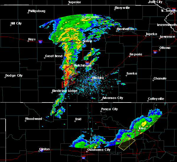 At 517 pm cdt, a severe thunderstorm capable of producing a tornado was located 6 miles south of kingman, moving northeast at 40 mph (radar indicated rotation). Hazards include tornado. Flying debris will be dangerous to those caught without shelter. mobile homes will be damaged or destroyed. damage to roofs, windows, and vehicles will occur. tree damage is likely. this dangerous storm will be near, kingman around 525 pm cdt. Other locations impacted by this tornadic thunderstorm include kingman airport, waterloo, cleveland and murdock. At 517 pm cdt, a severe thunderstorm capable of producing a tornado was located 6 miles south of kingman, moving northeast at 40 mph (radar indicated rotation). Hazards include tornado. Flying debris will be dangerous to those caught without shelter. mobile homes will be damaged or destroyed. damage to roofs, windows, and vehicles will occur. tree damage is likely. this dangerous storm will be near, kingman around 525 pm cdt. Other locations impacted by this tornadic thunderstorm include kingman airport, waterloo, cleveland and murdock.
|
| 5/19/2017 5:07 PM CDT |
 At 506 pm cdt, a severe thunderstorm capable of producing a tornado was located over arlington, or 11 miles northwest of pretty prairie, moving northeast at 30 mph (radar indicated rotation). Hazards include tornado and quarter size hail. Flying debris will be dangerous to those caught without shelter. mobile homes will be damaged or destroyed. damage to roofs, windows, and vehicles will occur. tree damage is likely. this dangerous storm will be near, partridge around 520 pm cdt. hutchinson and south hutchinson around 535 pm cdt. other locations impacted by this tornadic thunderstorm include yoder and willowbrook. At 506 pm cdt, a severe thunderstorm capable of producing a tornado was located over arlington, or 11 miles northwest of pretty prairie, moving northeast at 30 mph (radar indicated rotation). Hazards include tornado and quarter size hail. Flying debris will be dangerous to those caught without shelter. mobile homes will be damaged or destroyed. damage to roofs, windows, and vehicles will occur. tree damage is likely. this dangerous storm will be near, partridge around 520 pm cdt. hutchinson and south hutchinson around 535 pm cdt. other locations impacted by this tornadic thunderstorm include yoder and willowbrook.
|
| 5/19/2017 5:04 PM CDT |
 At 504 pm cdt, a severe thunderstorm capable of producing a tornado was located 9 miles southwest of kingman, moving northeast at 30 mph (radar indicated rotation). Hazards include tornado. Flying debris will be dangerous to those caught without shelter. mobile homes will be damaged or destroyed. damage to roofs, windows, and vehicles will occur. tree damage is likely. this dangerous storm will be near, kingman around 525 pm cdt. other locations impacted by this tornadic thunderstorm include kingman airport, waterloo, cleveland and murdock. At 504 pm cdt, a severe thunderstorm capable of producing a tornado was located 9 miles southwest of kingman, moving northeast at 30 mph (radar indicated rotation). Hazards include tornado. Flying debris will be dangerous to those caught without shelter. mobile homes will be damaged or destroyed. damage to roofs, windows, and vehicles will occur. tree damage is likely. this dangerous storm will be near, kingman around 525 pm cdt. other locations impacted by this tornadic thunderstorm include kingman airport, waterloo, cleveland and murdock.
|
| 5/19/2017 4:48 PM CDT |
 At 448 pm cdt, a severe thunderstorm capable of producing a tornado was located 8 miles east of cunningham, or 9 miles west of kingman, moving northeast at 30 mph (radar indicated rotation). Hazards include tornado. Flying debris will be dangerous to those caught without shelter. mobile homes will be damaged or destroyed. damage to roofs, windows, and vehicles will occur. tree damage is likely. Locations impacted include, cunningham, turon, plevna, abbyville, nashville, willowdale, langdon and penalosa. At 448 pm cdt, a severe thunderstorm capable of producing a tornado was located 8 miles east of cunningham, or 9 miles west of kingman, moving northeast at 30 mph (radar indicated rotation). Hazards include tornado. Flying debris will be dangerous to those caught without shelter. mobile homes will be damaged or destroyed. damage to roofs, windows, and vehicles will occur. tree damage is likely. Locations impacted include, cunningham, turon, plevna, abbyville, nashville, willowdale, langdon and penalosa.
|
| 5/19/2017 4:27 PM CDT |
 At 427 pm cdt, a confirmed tornado was located 6 miles south of cunningham, or 9 miles northeast of isabel, moving northeast at 30 mph (weather spotters confirmed tornado). Hazards include damaging tornado. Flying debris will be dangerous to those caught without shelter. mobile homes will be damaged or destroyed. damage to roofs, windows, and vehicles will occur. tree damage is likely. This tornadic thunderstorm will remain over mainly rural areas of southwestern reno and northwestern kingman counties, including the following locations: willowdale, langdon and penalosa. At 427 pm cdt, a confirmed tornado was located 6 miles south of cunningham, or 9 miles northeast of isabel, moving northeast at 30 mph (weather spotters confirmed tornado). Hazards include damaging tornado. Flying debris will be dangerous to those caught without shelter. mobile homes will be damaged or destroyed. damage to roofs, windows, and vehicles will occur. tree damage is likely. This tornadic thunderstorm will remain over mainly rural areas of southwestern reno and northwestern kingman counties, including the following locations: willowdale, langdon and penalosa.
|
| 5/19/2017 4:15 PM CDT |
 At 413 pm cdt, a confirmed tornado was located near isabel, moving northeast at 35 mph (weather spotters confirmed tornado). Hazards include damaging tornado. Flying debris will be dangerous to those caught without shelter. mobile homes will be damaged or destroyed. damage to roofs, windows, and vehicles will occur. tree damage is likely. the tornado will be near, cunningham around 435 pm cdt. abbyville around 515 pm cdt. other locations impacted by this tornadic thunderstorm include willowdale, langdon and penalosa. At 413 pm cdt, a confirmed tornado was located near isabel, moving northeast at 35 mph (weather spotters confirmed tornado). Hazards include damaging tornado. Flying debris will be dangerous to those caught without shelter. mobile homes will be damaged or destroyed. damage to roofs, windows, and vehicles will occur. tree damage is likely. the tornado will be near, cunningham around 435 pm cdt. abbyville around 515 pm cdt. other locations impacted by this tornadic thunderstorm include willowdale, langdon and penalosa.
|
| 9/8/2016 6:47 PM CDT |
 At 644 pm cdt, a severe thunderstorm was located near norwich, or 13 miles north of harper, moving northeast at 20 mph (trained weather spotters have reported 3 foot diameter cottonwood trees down in rago). Hazards include 60 mph wind gusts and quarter size hail. Hail damage to vehicles is expected. expect wind damage to roofs, siding, and trees. Locations impacted include, kingman, norwich, murdock, waterloo, willowdale, zenda, spivey, cleveland, penalosa, kingman airport, rago, mt vernon, cheney lake and cheney state park. At 644 pm cdt, a severe thunderstorm was located near norwich, or 13 miles north of harper, moving northeast at 20 mph (trained weather spotters have reported 3 foot diameter cottonwood trees down in rago). Hazards include 60 mph wind gusts and quarter size hail. Hail damage to vehicles is expected. expect wind damage to roofs, siding, and trees. Locations impacted include, kingman, norwich, murdock, waterloo, willowdale, zenda, spivey, cleveland, penalosa, kingman airport, rago, mt vernon, cheney lake and cheney state park.
|
| 9/8/2016 6:25 PM CDT |
 At 624 pm cdt, a severe thunderstorm was located 9 miles north of harper, moving northeast at 20 mph (trained weather spotters have reported quarter sized hail in zenda). Hazards include 60 mph wind gusts and quarter size hail. Hail damage to vehicles is expected. Expect wind damage to roofs, siding, and trees. At 624 pm cdt, a severe thunderstorm was located 9 miles north of harper, moving northeast at 20 mph (trained weather spotters have reported quarter sized hail in zenda). Hazards include 60 mph wind gusts and quarter size hail. Hail damage to vehicles is expected. Expect wind damage to roofs, siding, and trees.
|
| 8/28/2016 5:52 PM CDT |
 The severe thunderstorm warning for central kingman county will expire at 600 pm cdt, the storm which prompted the warning has weakened below severe limits, and no longer pose an immediate threat to life or property. therefore, the warning will be allowed to expire. however heavy rain is still possible with this thunderstorm. remember, a flood warning remains in effect for kingman county until 1145 pm. The severe thunderstorm warning for central kingman county will expire at 600 pm cdt, the storm which prompted the warning has weakened below severe limits, and no longer pose an immediate threat to life or property. therefore, the warning will be allowed to expire. however heavy rain is still possible with this thunderstorm. remember, a flood warning remains in effect for kingman county until 1145 pm.
|
| 8/28/2016 5:25 PM CDT |
 At 522 pm cdt, a severe thunderstorm was located 10 miles south of kingman, moving northwest at 10 mph (trained spotters have reported 3 to 4 inch tree limbs down in northeast of kingman). Hazards include 60 mph wind gusts and penny size hail. Expect damage to roofs. siding. and trees. Locations impacted include, kingman, willowdale, spivey, cleveland, kingman airport and rago. At 522 pm cdt, a severe thunderstorm was located 10 miles south of kingman, moving northwest at 10 mph (trained spotters have reported 3 to 4 inch tree limbs down in northeast of kingman). Hazards include 60 mph wind gusts and penny size hail. Expect damage to roofs. siding. and trees. Locations impacted include, kingman, willowdale, spivey, cleveland, kingman airport and rago.
|
| 8/28/2016 5:24 PM CDT | Trained spotter reports a burst of wind broke 3 to 4 inch limbs from a tree in her yar in kingman county KS, 3.9 miles SW of Kingman, KS |
| 8/28/2016 5:00 PM CDT |
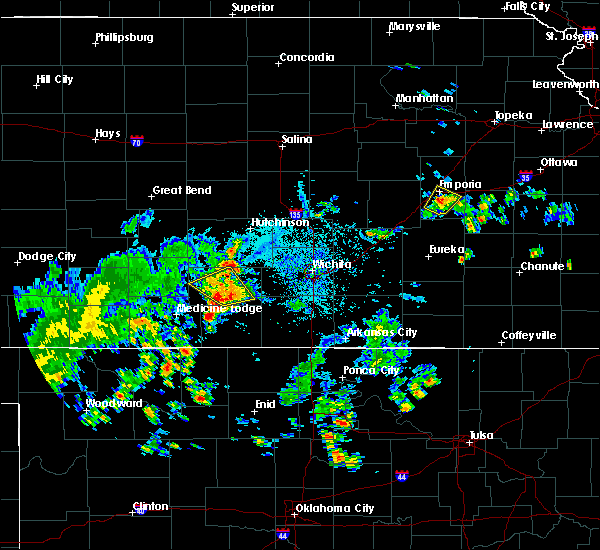 At 459 pm cdt, a severe thunderstorm was located 11 miles north of harper, moving northwest at 10 mph (radar indicated). Hazards include 60 mph wind gusts and penny size hail. Expect damage to roofs. siding. And trees. At 459 pm cdt, a severe thunderstorm was located 11 miles north of harper, moving northwest at 10 mph (radar indicated). Hazards include 60 mph wind gusts and penny size hail. Expect damage to roofs. siding. And trees.
|
| 7/28/2016 8:28 PM CDT |
 At 827 pm cdt, severe thunderstorms were located along a line extending from 5 miles south of whitewater to near haysville to 11 miles south of kingman, moving southeast at 50 mph. these are very dangerous storms (radar indicated). Hazards include 80 mph wind gusts and golf ball size hail. Flying debris will be dangerous to those caught without shelter. mobile homes will be heavily damaged. expect considerable damage to roofs, windows, and vehicles. extensive tree damage and power outages are likely. Locations impacted include, wichita, derby, el dorado, andover, haysville, augusta, park city, valley center, bel aire, mulvane, goddard, rose hill, maize, kingman, clearwater, cheney, douglass, sedgwick, belle plaine and harper. At 827 pm cdt, severe thunderstorms were located along a line extending from 5 miles south of whitewater to near haysville to 11 miles south of kingman, moving southeast at 50 mph. these are very dangerous storms (radar indicated). Hazards include 80 mph wind gusts and golf ball size hail. Flying debris will be dangerous to those caught without shelter. mobile homes will be heavily damaged. expect considerable damage to roofs, windows, and vehicles. extensive tree damage and power outages are likely. Locations impacted include, wichita, derby, el dorado, andover, haysville, augusta, park city, valley center, bel aire, mulvane, goddard, rose hill, maize, kingman, clearwater, cheney, douglass, sedgwick, belle plaine and harper.
|
| 7/28/2016 8:15 PM CDT |
 At 815 pm cdt, severe thunderstorms were located along a line extending from near walton to west wichita to 10 miles southwest of kingman, moving southeast at 45 mph. these are very dangerous storms (radar indicated). Hazards include 80 mph wind gusts and two inch hail. Flying debris will be dangerous to those caught without shelter. mobile homes will be heavily damaged. expect considerable damage to roofs, windows, and vehicles. Extensive tree damage and power outages are likely. At 815 pm cdt, severe thunderstorms were located along a line extending from near walton to west wichita to 10 miles southwest of kingman, moving southeast at 45 mph. these are very dangerous storms (radar indicated). Hazards include 80 mph wind gusts and two inch hail. Flying debris will be dangerous to those caught without shelter. mobile homes will be heavily damaged. expect considerable damage to roofs, windows, and vehicles. Extensive tree damage and power outages are likely.
|
| 7/28/2016 8:00 PM CDT |
 At 800 pm cdt, severe thunderstorms were located along a line extending from near goessel to near mount hope to 7 miles west of kingman, moving southeast at 45 mph. these are very dangerous storms (radar indicated). Hazards include 80 mph wind gusts and two inch hail. Flying debris will be dangerous to those caught without shelter. mobile homes will be heavily damaged. expect considerable damage to roofs, windows, and vehicles. extensive tree damage and power outages are likely. Locations impacted include, wichita, newton, park city, valley center, bel aire, goddard, hesston, maize, kingman, cheney, halstead, north newton, moundridge, sedgwick, colwich, haven, burrton, garden plain, mount hope and whitewater. At 800 pm cdt, severe thunderstorms were located along a line extending from near goessel to near mount hope to 7 miles west of kingman, moving southeast at 45 mph. these are very dangerous storms (radar indicated). Hazards include 80 mph wind gusts and two inch hail. Flying debris will be dangerous to those caught without shelter. mobile homes will be heavily damaged. expect considerable damage to roofs, windows, and vehicles. extensive tree damage and power outages are likely. Locations impacted include, wichita, newton, park city, valley center, bel aire, goddard, hesston, maize, kingman, cheney, halstead, north newton, moundridge, sedgwick, colwich, haven, burrton, garden plain, mount hope and whitewater.
|
| 7/28/2016 7:50 PM CDT |
 At 749 pm cdt, severe thunderstorms were located along a line extending from near goessel to near mount hope to 9 miles northwest of kingman, moving southeast at 45 mph. these are very dangerous storms (radar indicated). Hazards include 80 mph wind gusts and golf ball size hail. Flying debris will be dangerous to those caught without shelter. mobile homes will be heavily damaged. expect considerable damage to roofs, windows, and vehicles. Extensive tree damage and power outages are likely. At 749 pm cdt, severe thunderstorms were located along a line extending from near goessel to near mount hope to 9 miles northwest of kingman, moving southeast at 45 mph. these are very dangerous storms (radar indicated). Hazards include 80 mph wind gusts and golf ball size hail. Flying debris will be dangerous to those caught without shelter. mobile homes will be heavily damaged. expect considerable damage to roofs, windows, and vehicles. Extensive tree damage and power outages are likely.
|
| 7/14/2016 7:49 AM CDT |
 At 748 am cdt, a severe thunderstorm was located 7 miles west of haven, moving east at 25 mph (trained weather spotters have reported 60 mph winds in arlington). Hazards include 60 mph wind gusts and nickel size hail. Expect damage to roofs. siding. and trees. Locations impacted include, hutchinson, south hutchinson, cheney, haven, burrton, garden plain, mount hope, pretty prairie, andale, arlington, partridge, yoder, waterloo, lake afton, cheney lake, mt vernon and cheney state park. At 748 am cdt, a severe thunderstorm was located 7 miles west of haven, moving east at 25 mph (trained weather spotters have reported 60 mph winds in arlington). Hazards include 60 mph wind gusts and nickel size hail. Expect damage to roofs. siding. and trees. Locations impacted include, hutchinson, south hutchinson, cheney, haven, burrton, garden plain, mount hope, pretty prairie, andale, arlington, partridge, yoder, waterloo, lake afton, cheney lake, mt vernon and cheney state park.
|
| 7/14/2016 7:27 AM CDT |
 At 726 am cdt, a severe thunderstorm was located near partridge, or 9 miles north of pretty prairie, moving east at 25 mph (trained weather spotters have reported 60 mph winds in arlington). Hazards include 60 mph wind gusts and nickel size hail. Expect damage to roofs. siding. And trees. At 726 am cdt, a severe thunderstorm was located near partridge, or 9 miles north of pretty prairie, moving east at 25 mph (trained weather spotters have reported 60 mph winds in arlington). Hazards include 60 mph wind gusts and nickel size hail. Expect damage to roofs. siding. And trees.
|
| 6/18/2016 2:05 AM CDT |
 The severe thunderstorm warning for southwestern butler, northeastern harper, northwestern cowley, sedgwick, kingman and northern sumner counties will expire at 215 am cdt, the storms which prompted the warning have weakened below severe limits, and no longer pose an immediate threat to life or property. therefore the warning will be allowed to expire. however gusty winds and heavy rain are still possible with these thunderstorms. The severe thunderstorm warning for southwestern butler, northeastern harper, northwestern cowley, sedgwick, kingman and northern sumner counties will expire at 215 am cdt, the storms which prompted the warning have weakened below severe limits, and no longer pose an immediate threat to life or property. therefore the warning will be allowed to expire. however gusty winds and heavy rain are still possible with these thunderstorms.
|
| 6/18/2016 1:52 AM CDT |
 At 151 am cdt, severe thunderstorms were located along a line extending from 5 miles northwest of benton to haysville to near norwich, moving southeast at 30 mph (radar indicated). Hazards include 60 mph wind gusts. Expect damage to roofs. siding. and trees. Locations impacted include, wichita, derby, el dorado, andover, haysville, augusta, wellington, park city, valley center, bel aire, mulvane, goddard, rose hill, maize, kingman, clearwater, cheney, douglass, belle plaine and harper. At 151 am cdt, severe thunderstorms were located along a line extending from 5 miles northwest of benton to haysville to near norwich, moving southeast at 30 mph (radar indicated). Hazards include 60 mph wind gusts. Expect damage to roofs. siding. and trees. Locations impacted include, wichita, derby, el dorado, andover, haysville, augusta, wellington, park city, valley center, bel aire, mulvane, goddard, rose hill, maize, kingman, clearwater, cheney, douglass, belle plaine and harper.
|
| 6/18/2016 1:36 AM CDT |
 At 135 am cdt, severe thunderstorms were located along a line extending from 6 miles south of newton to west wichita to 8 miles southeast of kingman, moving southeast at 25 mph (radar indicated). Hazards include 60 mph wind gusts. Expect damage to roofs. siding. and trees. Locations impacted include, wichita, derby, newton, el dorado, andover, haysville, augusta, wellington, park city, valley center, bel aire, mulvane, goddard, rose hill, hesston, maize, kingman, clearwater, cheney and halstead. At 135 am cdt, severe thunderstorms were located along a line extending from 6 miles south of newton to west wichita to 8 miles southeast of kingman, moving southeast at 25 mph (radar indicated). Hazards include 60 mph wind gusts. Expect damage to roofs. siding. and trees. Locations impacted include, wichita, derby, newton, el dorado, andover, haysville, augusta, wellington, park city, valley center, bel aire, mulvane, goddard, rose hill, hesston, maize, kingman, clearwater, cheney and halstead.
|
| 6/18/2016 1:22 AM CDT |
 At 121 am cdt, severe thunderstorms were located along a line extending from near newton to near goddard to near kingman, moving southeast at 25 mph (radar indicated). Hazards include 60 mph wind gusts. Expect damage to roofs. siding. and trees. This warning replaces the previous severe warning in effect for the warned area. At 121 am cdt, severe thunderstorms were located along a line extending from near newton to near goddard to near kingman, moving southeast at 25 mph (radar indicated). Hazards include 60 mph wind gusts. Expect damage to roofs. siding. and trees. This warning replaces the previous severe warning in effect for the warned area.
|
| 6/18/2016 1:08 AM CDT |
 At 108 am cdt, severe thunderstorms were located along a line extending from near halstead to near garden plain to 6 miles southeast of kingman, moving southeast at 35 mph (trained weather spotters). Hazards include 60 mph wind gusts. Expect damage to roofs. siding. and trees. Locations impacted include, wichita, newton, park city, valley center, bel aire, goddard, hesston, maize, kingman, cheney, halstead, north newton, sedgwick, colwich, haven, burrton, garden plain, mount hope, pretty prairie and downtown wichita. At 108 am cdt, severe thunderstorms were located along a line extending from near halstead to near garden plain to 6 miles southeast of kingman, moving southeast at 35 mph (trained weather spotters). Hazards include 60 mph wind gusts. Expect damage to roofs. siding. and trees. Locations impacted include, wichita, newton, park city, valley center, bel aire, goddard, hesston, maize, kingman, cheney, halstead, north newton, sedgwick, colwich, haven, burrton, garden plain, mount hope, pretty prairie and downtown wichita.
|
| 6/18/2016 12:56 AM CDT |
 At 1254 am cdt, severe thunderstorms were located along a line extending from 6 miles northwest of halstead to 6 miles west of andale to near kingman, moving southeast at 30 mph (law enforcement). Hazards include 60 mph wind gusts. Expect damage to roofs. siding. and trees. Locations impacted include, wichita, newton, park city, valley center, bel aire, goddard, hesston, maize, kingman, cheney, halstead, north newton, sedgwick, colwich, haven, burrton, garden plain, mount hope, pretty prairie and downtown wichita. At 1254 am cdt, severe thunderstorms were located along a line extending from 6 miles northwest of halstead to 6 miles west of andale to near kingman, moving southeast at 30 mph (law enforcement). Hazards include 60 mph wind gusts. Expect damage to roofs. siding. and trees. Locations impacted include, wichita, newton, park city, valley center, bel aire, goddard, hesston, maize, kingman, cheney, halstead, north newton, sedgwick, colwich, haven, burrton, garden plain, mount hope, pretty prairie and downtown wichita.
|
| 6/18/2016 12:37 AM CDT |
 At 1237 am cdt, severe thunderstorms were located along a line extending from 5 miles southeast of buhler to 7 miles southwest of haven to 8 miles northwest of kingman, moving southeast at 35 mph (radar indicated). Hazards include 60 mph wind gusts. Expect damage to roofs. siding. And trees. At 1237 am cdt, severe thunderstorms were located along a line extending from 5 miles southeast of buhler to 7 miles southwest of haven to 8 miles northwest of kingman, moving southeast at 35 mph (radar indicated). Hazards include 60 mph wind gusts. Expect damage to roofs. siding. And trees.
|
| 5/26/2016 10:36 PM CDT | Delayed report from law enforcement of a 24 inch tree was uprooted and several trees with near 2ft in diameter down in town. time is estimated from rada in kingman county KS, 0.9 miles WSW of Kingman, KS |
| 5/26/2016 12:52 PM CDT |
 At 1251 pm cdt, a severe thunderstorm was located 8 miles northwest of cheney, moving northeast at 45 mph (radar indicated). Hazards include 60 mph wind gusts and quarter size hail. Hail damage to vehicles is expected. Expect wind damage to roofs, siding, and trees. At 1251 pm cdt, a severe thunderstorm was located 8 miles northwest of cheney, moving northeast at 45 mph (radar indicated). Hazards include 60 mph wind gusts and quarter size hail. Hail damage to vehicles is expected. Expect wind damage to roofs, siding, and trees.
|
| 5/24/2016 10:25 PM CDT | A severe thunderstorm warning remains in effect until 1045 pm cdt for central kingman and eastern reno counties. at 1024 pm cdt. severe thunderstorms were located along a line extending from near haven to near kingman. moving east at 20 mph. hazard. 60 mph wind gusts and quarter size hail. source. Radar indicated. |
| 5/24/2016 8:11 PM CDT |
 At 811 pm cdt, a severe thunderstorm was located 7 miles northeast of nashville, or 15 miles southwest of kingman, moving north at 35 mph (radar indicated). Hazards include ping pong ball size hail and 60 mph wind gusts. People and animals outdoors will be injured. expect hail damage to roofs, siding, windows, and vehicles. expect wind damage to roofs, siding, and trees. locations impacted include, kingman, cunningham, nashville, murdock, willowdale, waterloo, rago, zenda, spivey, cleveland, penalosa, kingman airport, mt vernon and cheney lake. A tornado watch remains in effect until 200 am cdt for south central kansas. At 811 pm cdt, a severe thunderstorm was located 7 miles northeast of nashville, or 15 miles southwest of kingman, moving north at 35 mph (radar indicated). Hazards include ping pong ball size hail and 60 mph wind gusts. People and animals outdoors will be injured. expect hail damage to roofs, siding, windows, and vehicles. expect wind damage to roofs, siding, and trees. locations impacted include, kingman, cunningham, nashville, murdock, willowdale, waterloo, rago, zenda, spivey, cleveland, penalosa, kingman airport, mt vernon and cheney lake. A tornado watch remains in effect until 200 am cdt for south central kansas.
|
| 5/9/2016 3:34 PM CDT |
 At 334 pm cdt, a severe thunderstorm was located 7 miles northwest of attica, moving northeast at 30 mph (trained weather spotters). Hazards include golf ball size hail and 60 mph wind gusts. People and animals outdoors will be injured. expect hail damage to roofs, siding, windows, and vehicles. expect wind damage to roofs, siding, and trees. This severe thunderstorm will remain over mainly rural areas of northwestern harper and western kingman counties, including the following locations: willowdale, spivey, zenda, crystal springs and penalosa. At 334 pm cdt, a severe thunderstorm was located 7 miles northwest of attica, moving northeast at 30 mph (trained weather spotters). Hazards include golf ball size hail and 60 mph wind gusts. People and animals outdoors will be injured. expect hail damage to roofs, siding, windows, and vehicles. expect wind damage to roofs, siding, and trees. This severe thunderstorm will remain over mainly rural areas of northwestern harper and western kingman counties, including the following locations: willowdale, spivey, zenda, crystal springs and penalosa.
|
| 5/9/2016 3:16 PM CDT |
 At 315 pm cdt, a severe thunderstorm was located 8 miles west of attica, moving northeast at 25 mph (trained weather spotters). Hazards include golf ball size hail and 60 mph wind gusts. People and animals outdoors will be injured. expect hail damage to roofs, siding, windows, and vehicles. expect wind damage to roofs, siding, and trees. Locations impacted include, attica, cunningham, nashville, willowdale, zenda, spivey, penalosa and crystal springs. At 315 pm cdt, a severe thunderstorm was located 8 miles west of attica, moving northeast at 25 mph (trained weather spotters). Hazards include golf ball size hail and 60 mph wind gusts. People and animals outdoors will be injured. expect hail damage to roofs, siding, windows, and vehicles. expect wind damage to roofs, siding, and trees. Locations impacted include, attica, cunningham, nashville, willowdale, zenda, spivey, penalosa and crystal springs.
|
| 5/9/2016 3:00 PM CDT |
 At 259 pm cdt, a severe thunderstorm was located 12 miles west of attica, moving northeast at 25 mph (radar indicated). Hazards include golf ball size hail and 60 mph wind gusts. People and animals outdoors will be injured. expect hail damage to roofs, siding, windows, and vehicles. Expect wind damage to roofs, siding, and trees. At 259 pm cdt, a severe thunderstorm was located 12 miles west of attica, moving northeast at 25 mph (radar indicated). Hazards include golf ball size hail and 60 mph wind gusts. People and animals outdoors will be injured. expect hail damage to roofs, siding, windows, and vehicles. Expect wind damage to roofs, siding, and trees.
|
| 5/9/2016 2:50 PM CDT |
 At 249 pm cdt, a severe thunderstorm was located over nashville, or 17 miles northwest of attica, moving northeast at 30 mph (radar indicated). Hazards include ping pong ball size hail. People and animals outdoors will be injured. expect damage to roofs, siding, windows, and vehicles. Locations impacted include, attica, cunningham, nashville, willowdale, zenda, spivey, penalosa and crystal springs. At 249 pm cdt, a severe thunderstorm was located over nashville, or 17 miles northwest of attica, moving northeast at 30 mph (radar indicated). Hazards include ping pong ball size hail. People and animals outdoors will be injured. expect damage to roofs, siding, windows, and vehicles. Locations impacted include, attica, cunningham, nashville, willowdale, zenda, spivey, penalosa and crystal springs.
|
| 5/9/2016 2:37 PM CDT |
 At 235 pm cdt, a severe thunderstorm was located 7 miles southwest of nashville, or 17 miles northwest of attica, moving northeast at 30 mph (radar indicated). Hazards include ping pong ball size hail and 60 mph wind gusts. People and animals outdoors will be injured. expect hail damage to roofs, siding, windows, and vehicles. Expect wind damage to roofs, siding, and trees. At 235 pm cdt, a severe thunderstorm was located 7 miles southwest of nashville, or 17 miles northwest of attica, moving northeast at 30 mph (radar indicated). Hazards include ping pong ball size hail and 60 mph wind gusts. People and animals outdoors will be injured. expect hail damage to roofs, siding, windows, and vehicles. Expect wind damage to roofs, siding, and trees.
|
| 9/10/2015 9:31 PM CDT |
 At 931 pm cdt, a severe thunderstorm was located 6 miles northeast of pretty prairie, moving southeast at 50 mph. this is a very dangerous storm (radar indicated). Hazards include 90 mph wind gusts and half dollar size hail. You are in a life-threatening situation. flying debris may be deadly to those caught without shelter. mobile homes will be heavily damaged or destroyed. homes and businesses will have substantial roof and window damage. expect extensive tree damage and power outages. Locations impacted include, hutchinson, kingman, south hutchinson, haven, pretty prairie, arlington, partridge, abbyville, yoder, waterloo, langdon, kingman airport, mt vernon and cheney lake. At 931 pm cdt, a severe thunderstorm was located 6 miles northeast of pretty prairie, moving southeast at 50 mph. this is a very dangerous storm (radar indicated). Hazards include 90 mph wind gusts and half dollar size hail. You are in a life-threatening situation. flying debris may be deadly to those caught without shelter. mobile homes will be heavily damaged or destroyed. homes and businesses will have substantial roof and window damage. expect extensive tree damage and power outages. Locations impacted include, hutchinson, kingman, south hutchinson, haven, pretty prairie, arlington, partridge, abbyville, yoder, waterloo, langdon, kingman airport, mt vernon and cheney lake.
|
| 9/10/2015 9:19 PM CDT |
 At 918 pm cdt, a severe thunderstorm was located near partridge, or 11 miles northwest of pretty prairie, moving southeast at 40 mph. this is a very dangerous storm with the capability of producing widespread significant wind damage (radar indicated). Hazards include 80 mph wind gusts and penny size hail. Flying debris will be dangerous to those caught without shelter. mobile homes will be heavily damaged. expect considerable damage to roofs, windows and vehicles. extensive tree damage and power outages are likely. Locations impacted include, hutchinson, kingman, south hutchinson, haven, pretty prairie, arlington, partridge, abbyville, yoder, waterloo, langdon, kingman airport, mt vernon and cheney lake. At 918 pm cdt, a severe thunderstorm was located near partridge, or 11 miles northwest of pretty prairie, moving southeast at 40 mph. this is a very dangerous storm with the capability of producing widespread significant wind damage (radar indicated). Hazards include 80 mph wind gusts and penny size hail. Flying debris will be dangerous to those caught without shelter. mobile homes will be heavily damaged. expect considerable damage to roofs, windows and vehicles. extensive tree damage and power outages are likely. Locations impacted include, hutchinson, kingman, south hutchinson, haven, pretty prairie, arlington, partridge, abbyville, yoder, waterloo, langdon, kingman airport, mt vernon and cheney lake.
|
| 9/10/2015 9:11 PM CDT |
 At 910 pm cdt, a severe thunderstorm was located over abbyville, or 13 miles southwest of nickerson, moving southeast at 40 mph (radar indicated). Hazards include 70 mph wind gusts and penny size hail. Expect considerable tree damage. Damage is likely to mobile homes, roofs and outbuildings. At 910 pm cdt, a severe thunderstorm was located over abbyville, or 13 miles southwest of nickerson, moving southeast at 40 mph (radar indicated). Hazards include 70 mph wind gusts and penny size hail. Expect considerable tree damage. Damage is likely to mobile homes, roofs and outbuildings.
|
| 7/13/2015 9:12 PM CDT |
 At 912 pm cdt, a severe thunderstorm was located near arlington, or 13 miles west of pretty prairie, moving east at 15 mph (trained weather spotters). Hazards include golf ball size hail and 60 mph wind gusts. People and animals outdoors will be injured. expect hail damage to roofs, siding, windows and vehicles. expect wind damage to roofs, siding and trees. Locations impacted include, kingman, haven, pretty prairie, arlington, turon, yoder, murdock, waterloo, langdon, penalosa, kingman airport, mt vernon, cheney state park and cheney lake. At 912 pm cdt, a severe thunderstorm was located near arlington, or 13 miles west of pretty prairie, moving east at 15 mph (trained weather spotters). Hazards include golf ball size hail and 60 mph wind gusts. People and animals outdoors will be injured. expect hail damage to roofs, siding, windows and vehicles. expect wind damage to roofs, siding and trees. Locations impacted include, kingman, haven, pretty prairie, arlington, turon, yoder, murdock, waterloo, langdon, penalosa, kingman airport, mt vernon, cheney state park and cheney lake.
|
| 7/13/2015 8:52 PM CDT |
 At 851 pm cdt, a severe thunderstorm was located 7 miles south of arlington, or 9 miles west of pretty prairie, moving east at 20 mph (radar indicated). Hazards include 60 mph wind gusts and half dollar size hail. Hail damage to vehicles is expected. Expect wind damage to roofs, siding and trees. At 851 pm cdt, a severe thunderstorm was located 7 miles south of arlington, or 9 miles west of pretty prairie, moving east at 20 mph (radar indicated). Hazards include 60 mph wind gusts and half dollar size hail. Hail damage to vehicles is expected. Expect wind damage to roofs, siding and trees.
|
| 4/12/2015 8:36 PM CDT | A severe thunderstorm warning remains in effect until 900 pm cdt for western kingman county. at 835 pm cdt. a severe thunderstorm was located 7 miles east of nashville. or 14 miles east of isabel. moving east at 20 mph. hazard. quarter size hail and 60 mph wind gusts. source. Radar indicated. |
| 4/12/2015 8:19 PM CDT | The national weather service in wichita has issued a * severe thunderstorm warning for. western kingman county in south central kansas. until 900 pm cdt * at 819 pm cdt. a severe thunderstorm was located over nashville. or 7 miles southeast of isabel. Moving east at 20 mph. |
| 4/8/2015 8:48 PM CDT | Quarter sized hail reported 6.1 miles N of Kingman, KS |
| 4/8/2015 8:46 PM CDT | The national weather service in wichita has issued a * severe thunderstorm warning for. southeastern reno county in south central kansas. west central sedgwick county in south central kansas. northeastern kingman county in south central kansas. Until 915 pm cdt. |
| 4/8/2015 8:34 PM CDT | A severe thunderstorm warning remains in effect until 845 pm cdt for central kingman county. at 834 pm cdt. a severe thunderstorm was located 6 miles south of kingman. moving northeast at 40 mph. hazard. golf ball size hail and 60 mph wind gusts. source. Radar indicated. |
| 4/8/2015 8:24 PM CDT | A severe thunderstorm warning remains in effect until 845 pm cdt for central kingman county. at 824 pm cdt. a severe thunderstorm was located 10 miles southwest of kingman. moving east at 40 mph. hazard. golf ball size hail and 60 mph wind gusts. source. Trained weather spotters. |
| 4/8/2015 8:15 PM CDT | The national weather service in wichita has issued a * severe thunderstorm warning for. central kingman county in south central kansas. until 845 pm cdt * at 814 pm cdt. a severe thunderstorm was located 9 miles east of nashville. or 14 miles southwest of kingman. Moving east at 45. |
| 4/8/2015 7:59 PM CDT | A severe thunderstorm warning remains in effect until 815 pm cdt for kingman county. at 759 pm cdt. a severe thunderstorm was located over nashville. or 8 miles east of isabel. moving northeast at 30 mph. hazard. golf ball size hail and 60 mph wind gusts. source. Radar indicated. |
| 4/8/2015 7:48 PM CDT | A severe thunderstorm warning remains in effect until 815 pm cdt for kingman county. at 748 pm cdt. a severe thunderstorm was located over nashville. or 8 miles east of isabel. moving northeast at 45 mph. hazard. golf ball size hail and 60 mph wind gusts. source. Radar indicated. |
| 4/8/2015 7:37 PM CDT | The national weather service in wichita has issued a * severe thunderstorm warning for. kingman county in south central kansas. until 815 pm cdt * at 737 pm cdt. a severe thunderstorm was located near isabel. Moving northeast at 45 mph. |
| 4/8/2015 6:02 PM CDT | A severe thunderstorm warning remains in effect until 630 pm cdt for southwestern reno and northwestern kingman counties. at 602 pm cdt. a severe thunderstorm was located near cunningham. or 10 miles east of cairo. moving north at 40 mph. hazard. quarter size hail and 60 mph wind gusts. source. Radar indicated. |
| 4/8/2015 5:50 PM CDT | The national weather service in wichita has issued a * severe thunderstorm warning for. southwestern reno county in south central kansas. western kingman county in south central kansas. until 630 pm cdt * at 550 pm cdt. A severe thunderstorm was located near nashville. |
| 3/25/2015 5:09 PM CDT | The severe thunderstorm warning for southeastern reno and northeastern kingman counties will expire at 515 pm cdt. the storm which prompted the warning has weakened below severe limits. and no longer pose an immediate threat to life or property. therefore the warning will be allowed to expire. However small hail can still be expected with this thunderstorm. |
| 3/25/2015 4:51 PM CDT | A severe thunderstorm warning remains in effect until 515 pm cdt for southeastern reno and northeastern kingman counties. at 451 pm cdt. a severe thunderstorm was located just south of pretty prairie. moving northeast at 40 mph. hazard. quarter size hail. source. Radar indicated. |
| 3/25/2015 4:42 PM CDT | The national weather service in wichita has issued a * severe thunderstorm warning for. southeastern reno county in south central kansas. northeastern kingman county in south central kansas. until 515 pm cdt * at 442 pm cdt. A severe thunderstorm was located over kingman. |
| 3/25/2015 3:35 PM CST | Quarter sized hail reported 3.5 miles NE of Kingman, KS |
| 5/11/2014 10:50 PM CDT | Quarter sized hail reported 0.9 miles WSW of Kingman, KS, time is based on radar. |
| 5/11/2014 10:48 PM CDT | Half Dollar sized hail reported 6.3 miles NNE of Kingman, KS |
| 5/11/2014 10:40 PM CDT | Tennis Ball sized hail reported 11.2 miles NE of Kingman, KS |
| 4/2/2014 7:19 PM CDT | Golf Ball sized hail reported 6.1 miles NE of Kingman, KS |
| 8/15/2013 8:50 PM CDT | Ping Pong Ball sized hail reported 0.9 miles SSE of Kingman, KS |
| 7/27/2013 11:30 PM CDT | Storm damage reported in kingman county KS, 0.9 miles WSW of Kingman, KS |
| 7/23/2013 8:52 PM CDT | Powerlines down across the roadway in kingman county KS, 6.9 miles W of Kingman, KS |
| 7/23/2013 8:50 PM CDT | Storm damage reported in kingman county KS, 9.2 miles W of Kingman, KS |
| 7/23/2013 8:44 PM CDT | 8 inch tree limbs down with several on power lines. several traffic signs dow in kingman county KS, 0.9 miles WSW of Kingman, KS |
| 7/22/2013 4:55 PM CDT | Golf Ball sized hail reported 5.9 miles NNW of Kingman, KS, trained spotter reported golfball sized hail and winds of 60 to 70 mph which occurred for about 20 minutes. |
| 7/22/2013 4:55 PM CDT | Trained spotter estimates winds of 60 to 70mp in kingman county KS, 5.9 miles NNW of Kingman, KS |
| 6/17/2013 12:10 AM CDT | Wind speeds from 45 to 72 mph occurring over the past 10 minute in kingman county KS, 5.4 miles N of Kingman, KS |
| 5/8/2013 7:55 PM CDT | Quarter sized hail reported 0.9 miles WSW of Kingman, KS, picture sent via facebook with quarter sized hail in kingman. time is estimated according to radar. |
| 5/8/2013 7:43 PM CDT | A tree was reported down within city limits of kingman according to dispatch. time is estimated according to rada in kingman county KS, 0.9 miles WSW of Kingman, KS |
| 7/19/2012 4:04 PM CDT | Storm damage reported in kingman county KS, 1.6 miles SSW of Kingman, KS |
| 5/19/2012 6:06 PM CDT | Tea Cup sized hail reported 5.5 miles WSW of Kingman, KS |
| 5/19/2012 6:03 PM CDT | Tea Cup sized hail reported 5 miles WSW of Kingman, KS |
| 5/19/2012 5:57 PM CDT | Golf Ball sized hail reported 0.9 miles WSW of Kingman, KS |
| 5/19/2012 5:44 PM CDT | Golf Ball sized hail reported 6.1 miles NE of Kingman, KS |
| 5/4/2012 1:35 AM CDT | 10 to 12 inch cottonwood tree limbs downed. delayed repor in kingman county KS, 5.1 miles S of Kingman, KS |
| 5/4/2012 1:35 AM CDT | Damage to the hangers at the kingmam airport. delayed repor in kingman county KS, 0.9 miles WSW of Kingman, KS |
| 5/4/2012 1:31 AM CDT | Storm damage reported in kingman county KS, 1.6 miles SSW of Kingman, KS |
| 5/4/2012 1:25 AM CDT | Five power poles knocked down. delayed repor in kingman county KS, 5.1 miles S of Kingman, KS |
| 4/14/2012 6:44 PM CDT | Quarter sized hail reported 6.4 miles SW of Kingman, KS |
| 4/14/2012 6:35 PM CDT | Quarter sized hail reported 1.3 miles E of Kingman, KS, hail lasted between 5 to 10 minutes long. |
| 1/1/0001 12:00 AM | New pivot irrigation system blown over. time of event based on doppler radar imager in kingman county KS, 6.1 miles NE of Kingman, KS |
| 1/1/0001 12:00 AM | Storm damage reported in kingman county KS, 5.3 miles NNW of Kingman, KS |
| 1/1/0001 12:00 AM | Large tree downed at kingman state fishing lak in kingman county KS, 6.2 miles E of Kingman, KS |
| 1/1/0001 12:00 AM | Storm damage reported in kingman county KS, 6.3 miles NNE of Kingman, KS |
| 1/1/0001 12:00 AM | Storm damage reported in kingman county KS, 5 miles SSW of Kingman, KS |
| 1/1/0001 12:00 AM | Kingman awos reported 68 mph wind gusts for a total of 9 minute in kingman county KS, 1.6 miles SSW of Kingman, KS |
| 1/1/0001 12:00 AM | Storm damage reported in kingman county KS, 1.6 miles SSW of Kingman, KS |
| 1/1/0001 12:00 AM | Trained spotter estimates 60 mph winds along city limits of kingma in kingman county KS, 0.9 miles WSW of Kingman, KS |
| 1/1/0001 12:00 AM | Storm damage reported in kingman county KS, 8.6 miles W of Kingman, KS |
| 1/1/0001 12:00 AM | Storm damage reported in kingman county KS, 0.9 miles WSW of Kingman, KS |
| 1/1/0001 12:00 AM | Storm damage reported in kingman county KS, 0.9 miles WSW of Kingman, KS |
| 1/1/0001 12:00 AM | Quarter sized hail reported 5.8 miles W of Kingman, KS |
| 1/1/0001 12:00 AM | Quarter sized hail reported 5.1 miles S of Kingman, KS, nickel to quarter hail covering the ground |
| 1/1/0001 12:00 AM | Golf Ball sized hail reported 13 miles NW of Kingman, KS, 60 mph winds reported along with golf ball size hail. |
| 1/1/0001 12:00 AM | Golf Ball sized hail reported 4.7 miles SE of Kingman, KS |
| 1/1/0001 12:00 AM | Golf Ball sized hail reported 10.2 miles N of Kingman, KS |
| 1/1/0001 12:00 AM | Golf Ball sized hail reported 0.9 miles WSW of Kingman, KS |
Hail Maps for Kingman, KS
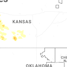
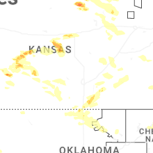
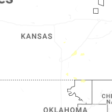
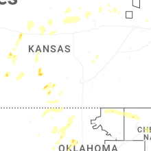

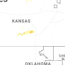

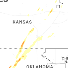
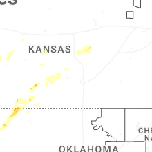
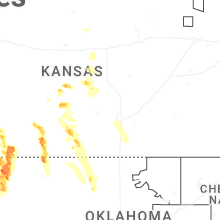

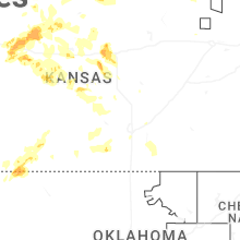
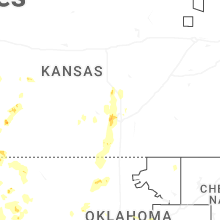


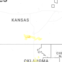


Connect with Interactive Hail Maps