

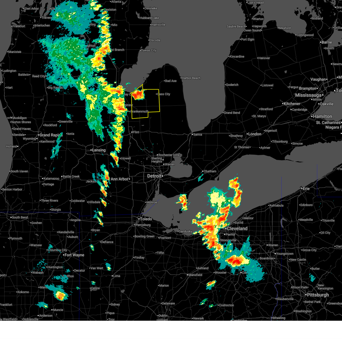
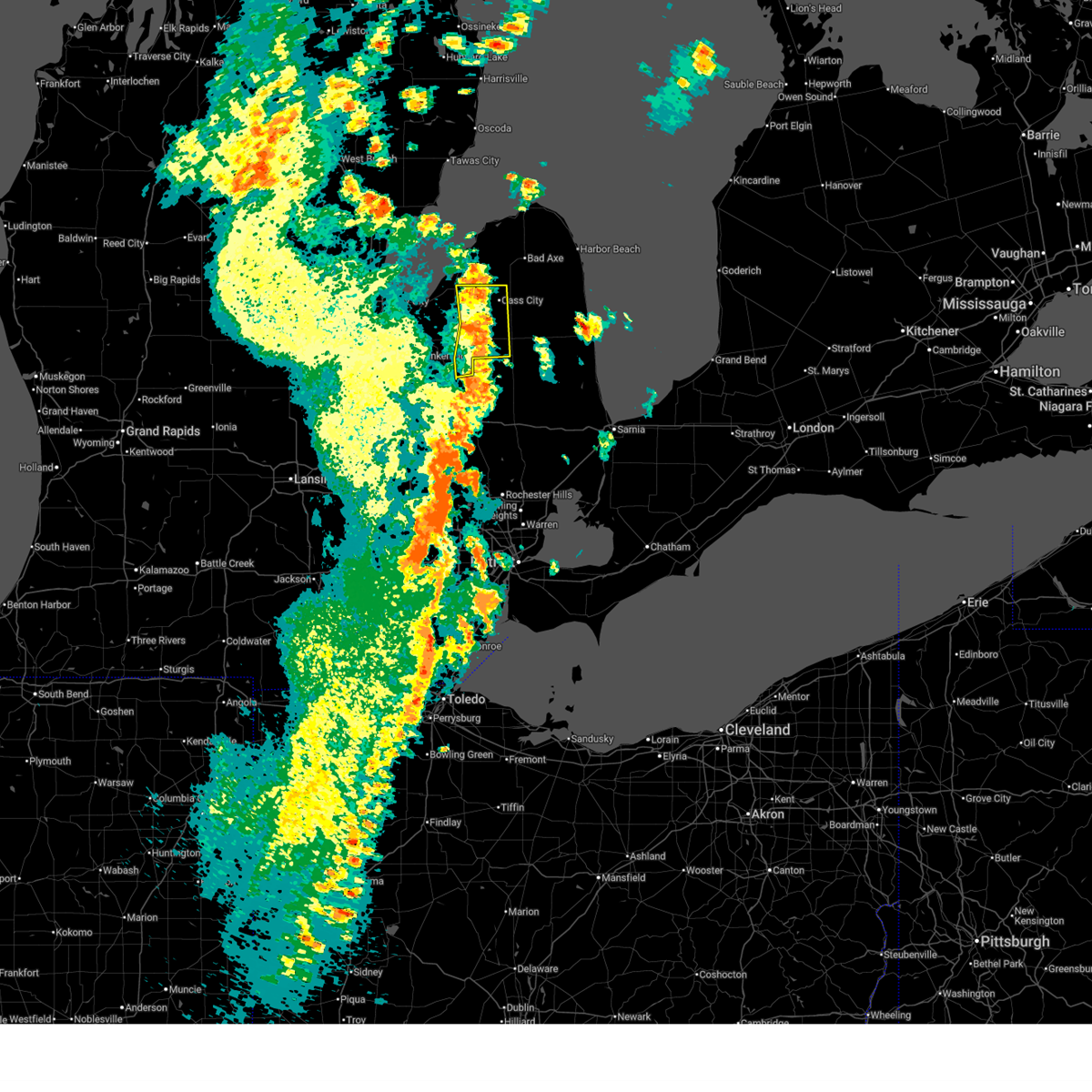
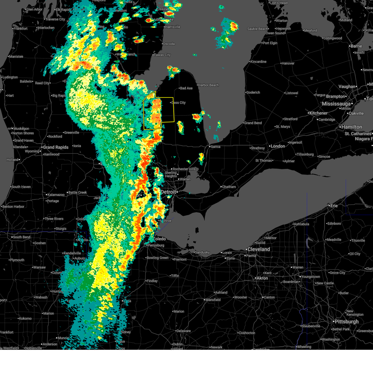
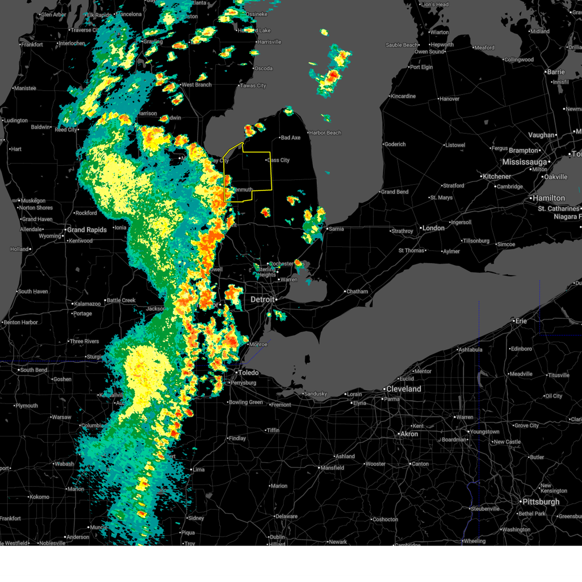
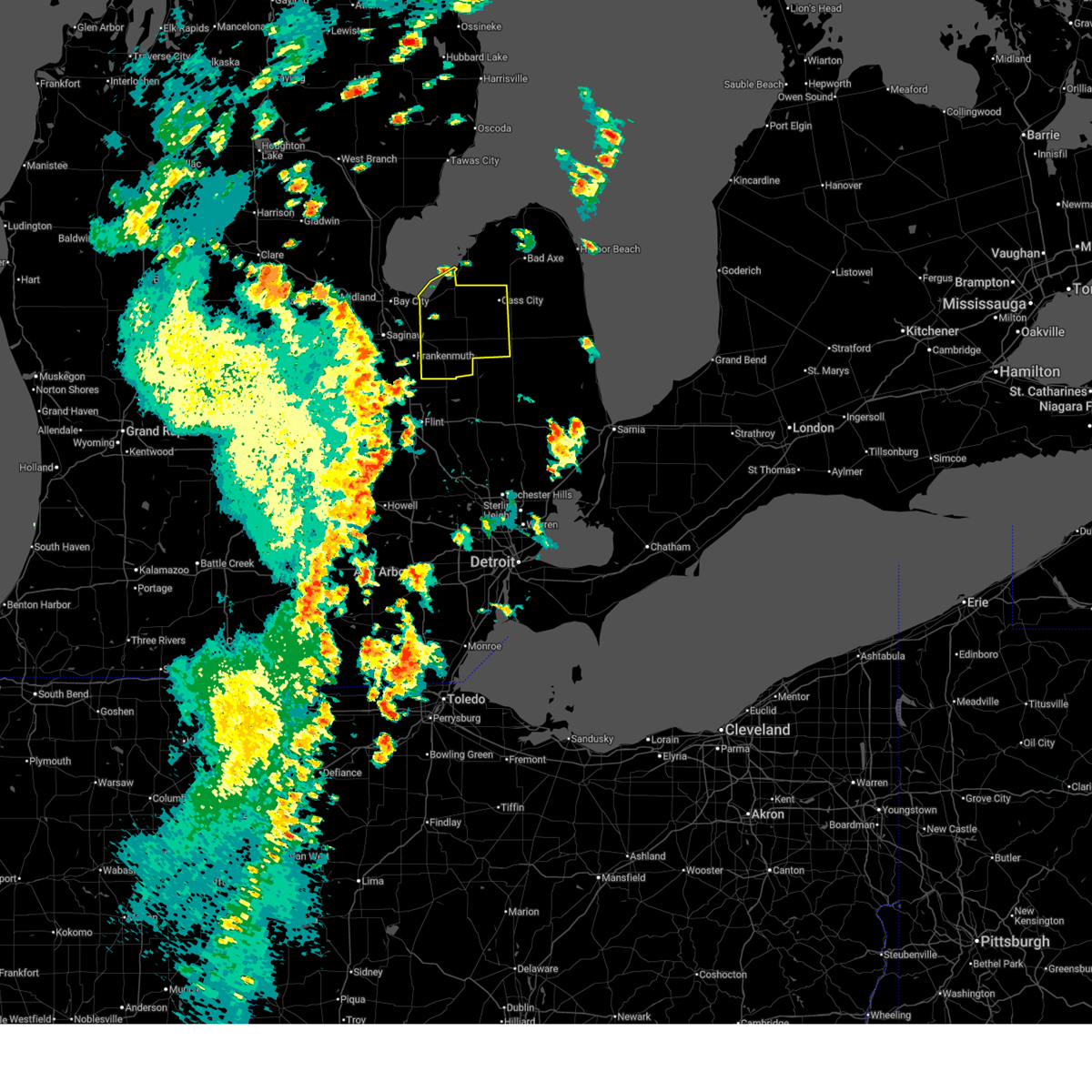
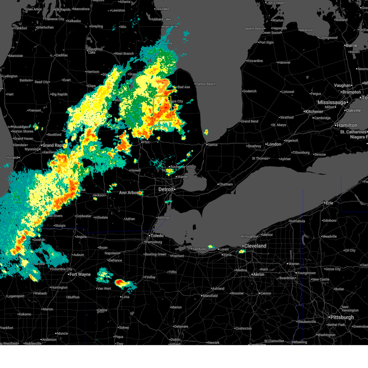
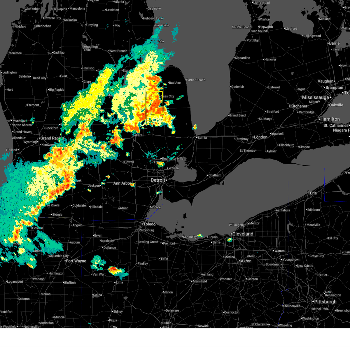
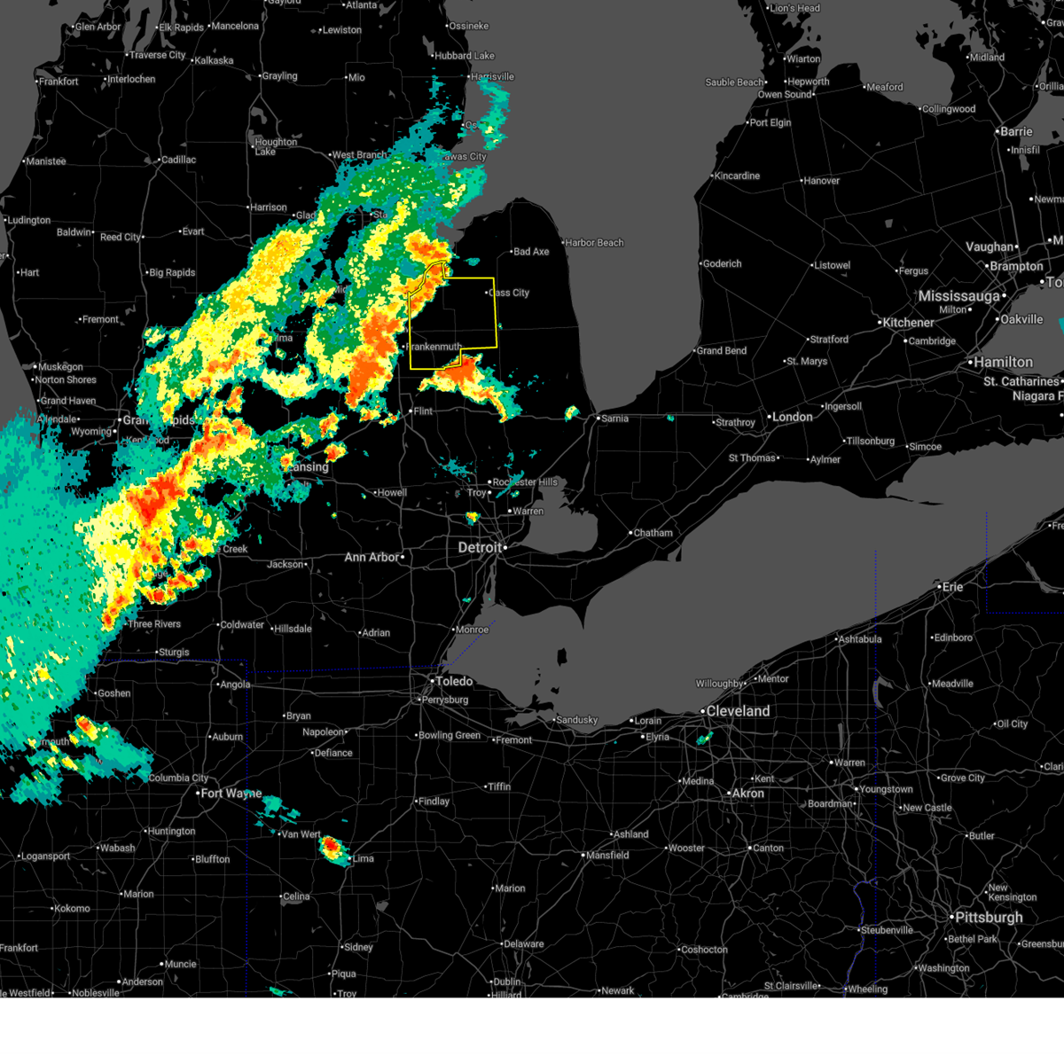
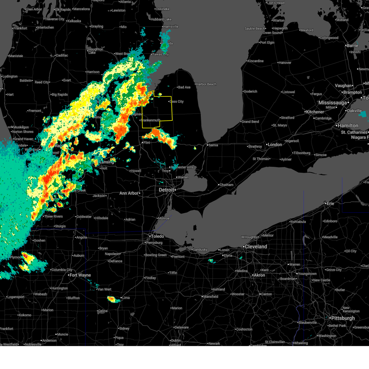
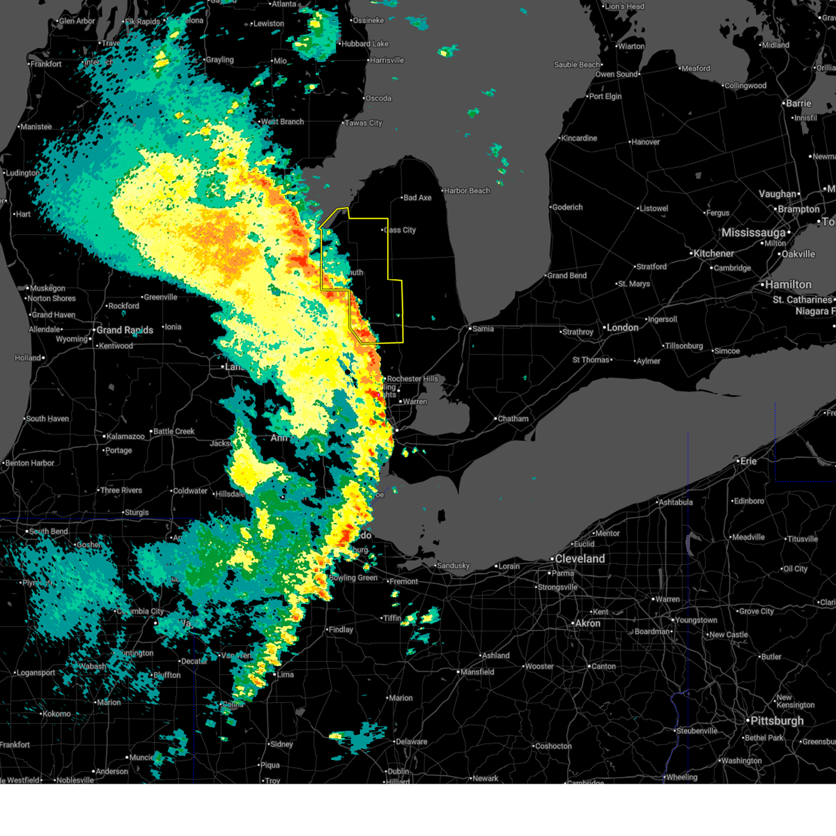
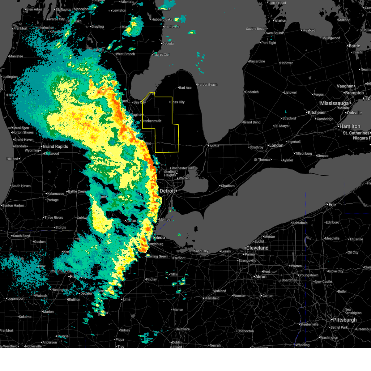
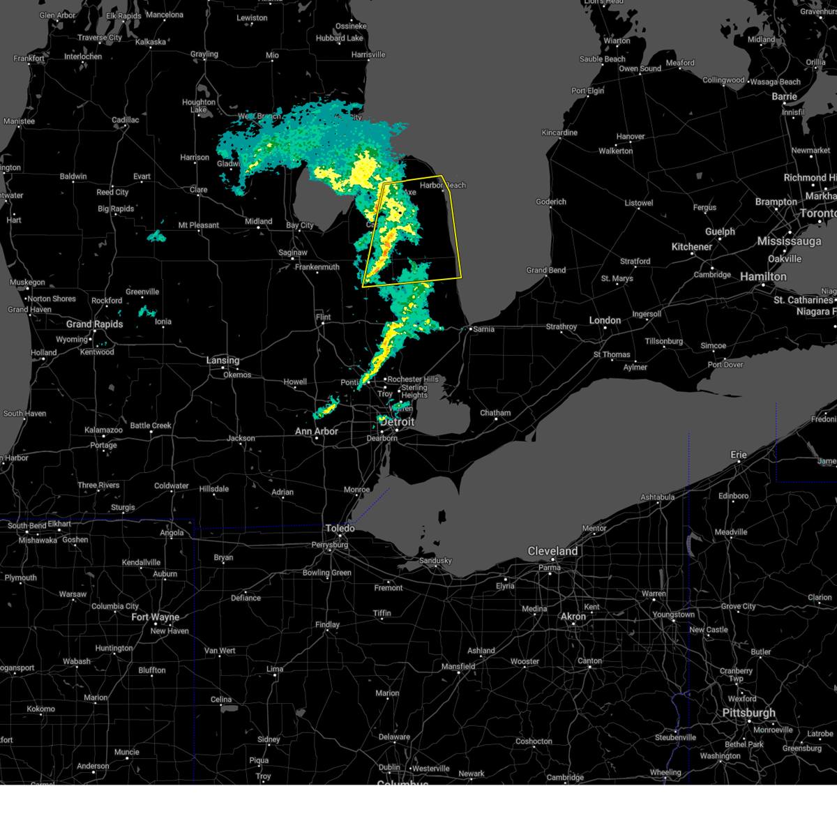
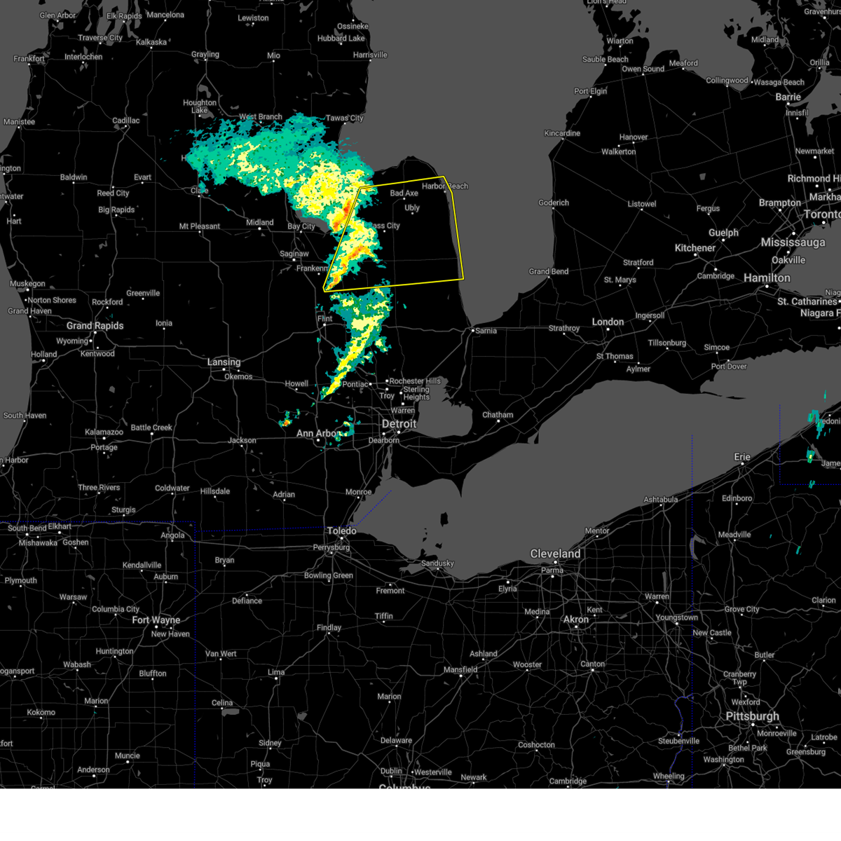
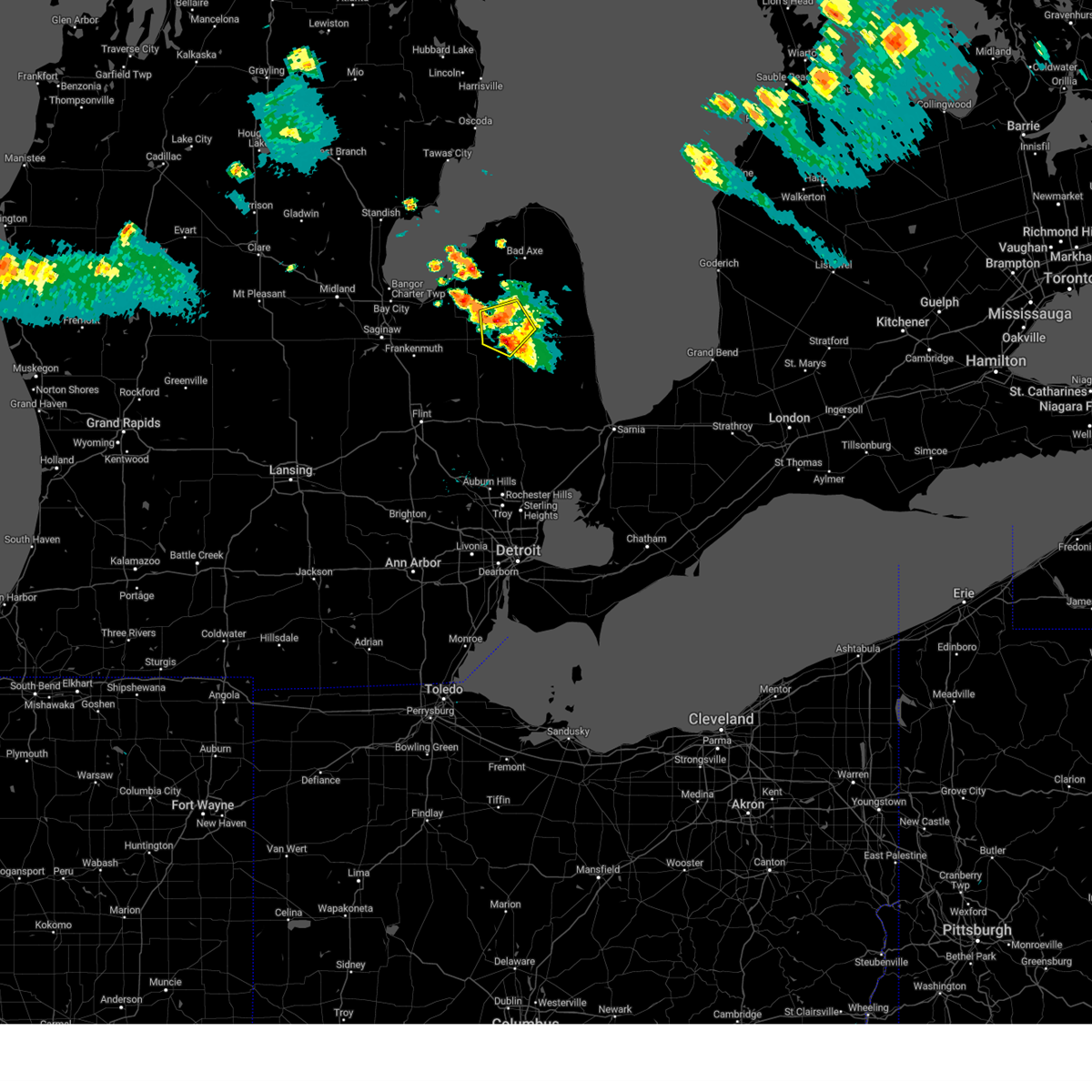
Hail Map for Kingston, MI
The Kingston, MI area has had 0 reports of on-the-ground hail by trained spotters, and has been under severe weather warnings 12 times during the past 12 months. Doppler radar has detected hail at or near Kingston, MI on 17 occasions, including 1 occasion during the past year.
| Name: | Kingston, MI |
| Where Located: | 37.5 miles NE of Flint, MI |
| Map: | Google Map for Kingston, MI |
| Population: | 440 |
| Housing Units: | 180 |
| More Info: | Search Google for Kingston, MI |
0
The Top Recent Hail Date for Kingston, MI is Tuesday, August 12, 2025 (16th out of 17)
Hail and Wind Damage Spotted near Kingston, MI
| Date / Time | Report Details |
|---|---|
| 6/10/2026 9:55 PM EDT |
 The storms which prompted the warning have weakened below severe limits, and have exited the warned area. therefore, the warning will be allowed to expire. a severe thunderstorm watch remains in effect until midnight edt for southeastern michigan. The storms which prompted the warning have weakened below severe limits, and have exited the warned area. therefore, the warning will be allowed to expire. a severe thunderstorm watch remains in effect until midnight edt for southeastern michigan.
|
| 6/10/2026 9:37 PM EDT |
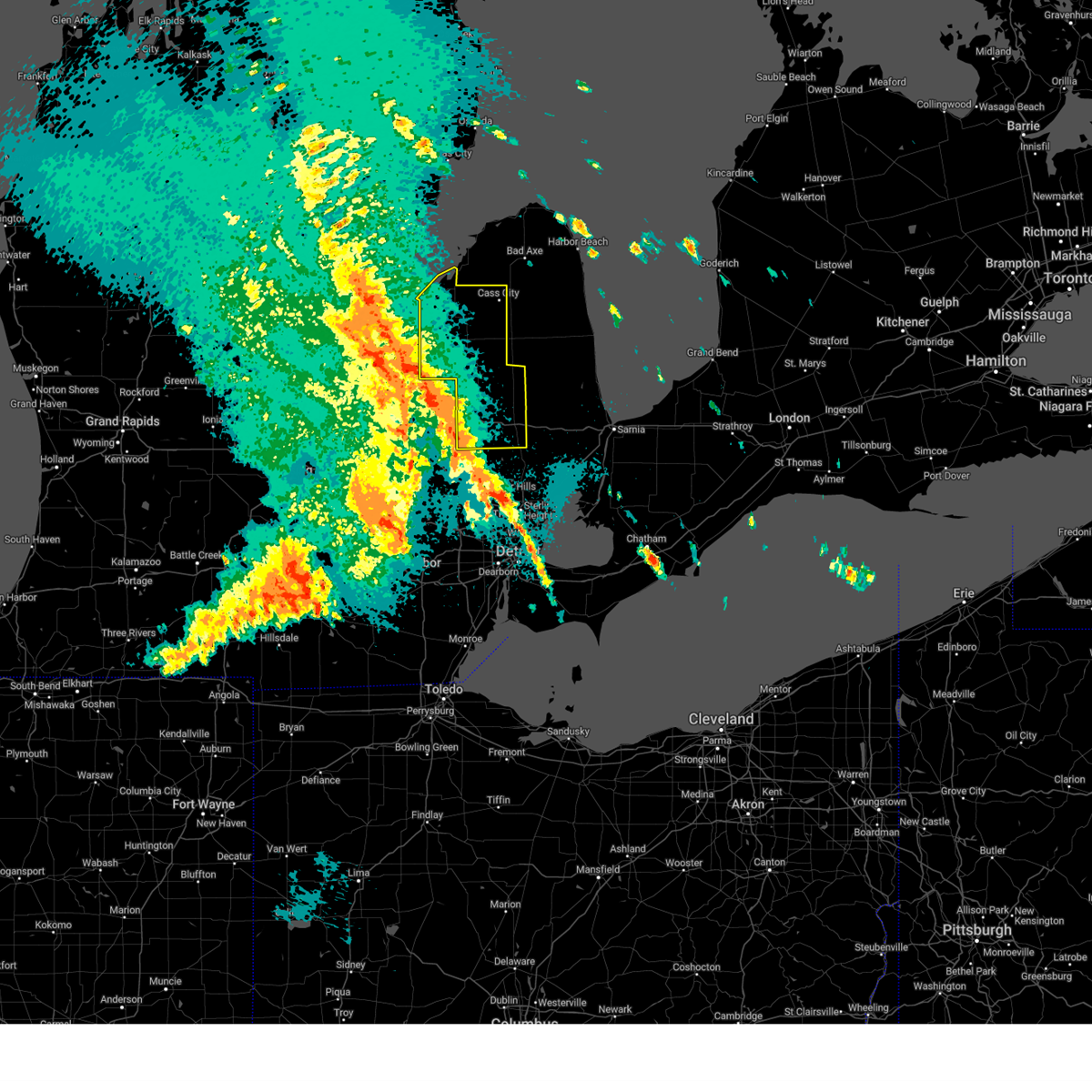
 At 937 pm edt, severe thunderstorms were located along a line extending from near gagetown to near kingston to near north branch, moving east at 35 mph (radar indicated). Hazards include 60 mph wind gusts. Expect damage to roofs, siding, and trees. these severe storms will be near, cass city and kingston around 940 pm edt. Other locations impacted by these severe thunderstorms include east dayton, deford, colling, wilmot, colwood, ellington, fostoria, and silverwood. At 937 pm edt, severe thunderstorms were located along a line extending from near gagetown to near kingston to near north branch, moving east at 35 mph (radar indicated). Hazards include 60 mph wind gusts. Expect damage to roofs, siding, and trees. these severe storms will be near, cass city and kingston around 940 pm edt. Other locations impacted by these severe thunderstorms include east dayton, deford, colling, wilmot, colwood, ellington, fostoria, and silverwood.
|
| 6/10/2026 9:18 PM EDT |
 At 917 pm edt, severe thunderstorms were located along a line extending from near unionville to near vassar to otisville, moving east at 50 mph (radar indicated). Hazards include 60 mph wind gusts. Expect damage to roofs, siding, and trees. these severe storms will be near, caro and mayville around 925 pm edt. kingston and gagetown around 930 pm edt. cass city around 935 pm edt. Other locations impacted by these severe thunderstorms include east dayton, colling, tuscola, wilmot, wisner, ellington, gilford, richville, deford, and colwood. At 917 pm edt, severe thunderstorms were located along a line extending from near unionville to near vassar to otisville, moving east at 50 mph (radar indicated). Hazards include 60 mph wind gusts. Expect damage to roofs, siding, and trees. these severe storms will be near, caro and mayville around 925 pm edt. kingston and gagetown around 930 pm edt. cass city around 935 pm edt. Other locations impacted by these severe thunderstorms include east dayton, colling, tuscola, wilmot, wisner, ellington, gilford, richville, deford, and colwood.
|
| 6/10/2026 8:58 PM EDT |
 Svrdtx the national weather service in detroit/pontiac has issued a * severe thunderstorm warning for, tuscola county in southeastern michigan, * until 1000 pm edt. * at 857 pm edt, severe thunderstorms were located along a line extending from near kawkawlin to near bridgeport to near montrose, moving east at 60 mph (radar indicated). Hazards include 60 mph wind gusts. Expect damage to roofs, siding, and trees. severe thunderstorms will be near, reese and quanicassee around 905 pm edt. vassar, millington, akron, and fairgrove around 910 pm edt. caro and unionville around 915 pm edt. mayville around 920 pm edt. gagetown around 925 pm edt. cass city and kingston around 930 pm edt. other locations impacted by these severe thunderstorms include east dayton, colling, tuscola, wilmot, wisner, ellington, gilford, richville, deford, and colwood. A tornado warning is also in effect for northwest tuscola county until 915 pm. Svrdtx the national weather service in detroit/pontiac has issued a * severe thunderstorm warning for, tuscola county in southeastern michigan, * until 1000 pm edt. * at 857 pm edt, severe thunderstorms were located along a line extending from near kawkawlin to near bridgeport to near montrose, moving east at 60 mph (radar indicated). Hazards include 60 mph wind gusts. Expect damage to roofs, siding, and trees. severe thunderstorms will be near, reese and quanicassee around 905 pm edt. vassar, millington, akron, and fairgrove around 910 pm edt. caro and unionville around 915 pm edt. mayville around 920 pm edt. gagetown around 925 pm edt. cass city and kingston around 930 pm edt. other locations impacted by these severe thunderstorms include east dayton, colling, tuscola, wilmot, wisner, ellington, gilford, richville, deford, and colwood. A tornado warning is also in effect for northwest tuscola county until 915 pm.
|
| 5/18/2026 4:57 PM EDT |
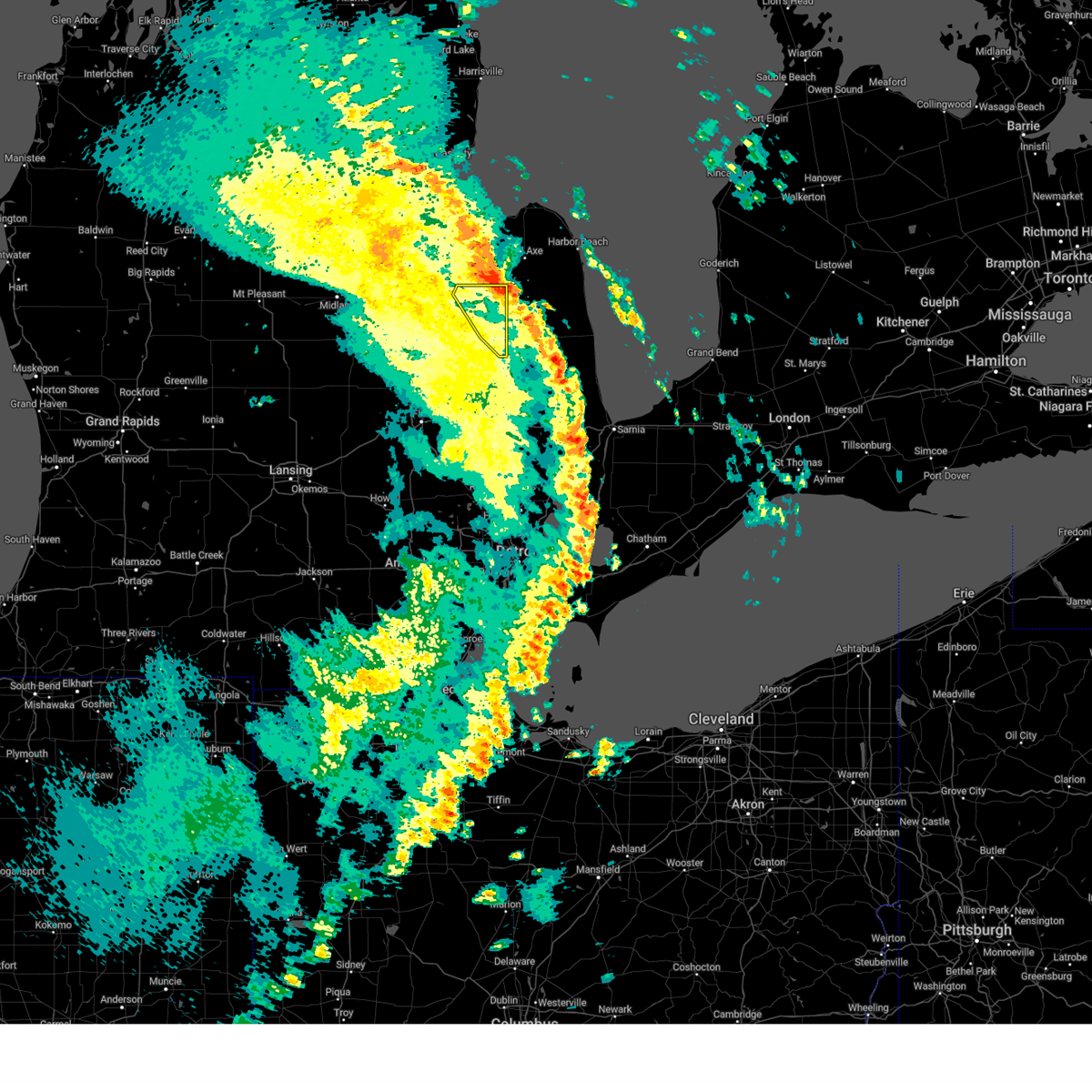
 At 457 pm edt, severe thunderstorms were located along a line extending from near sebewaing to gagetown to near north branch, moving northeast at 45 mph (radar indicated). Hazards include 60 mph wind gusts. Expect damage to roofs, siding, and trees. these severe storms will be near, cass city, kingston, and gagetown around 500 pm edt. Other locations impacted by these severe thunderstorms include east dayton, deford, colling, wilmot, colwood, ellington, fostoria, and silverwood. At 457 pm edt, severe thunderstorms were located along a line extending from near sebewaing to gagetown to near north branch, moving northeast at 45 mph (radar indicated). Hazards include 60 mph wind gusts. Expect damage to roofs, siding, and trees. these severe storms will be near, cass city, kingston, and gagetown around 500 pm edt. Other locations impacted by these severe thunderstorms include east dayton, deford, colling, wilmot, colwood, ellington, fostoria, and silverwood.
|
| 5/18/2026 4:40 PM EDT |
 At 440 pm edt, severe thunderstorms were located along a line extending from near unionville to near akron to near columbiaville, moving northeast at 50 mph (radar indicated). Hazards include 60 mph wind gusts. Expect damage to roofs, siding, and trees. these severe storms will be near, caro, mayville, and gagetown around 445 pm edt. cass city and kingston around 450 pm edt. Other locations impacted by these severe thunderstorms include east dayton, colling, tuscola, wilmot, wisner, ellington, gilford, richville, deford, and colwood. At 440 pm edt, severe thunderstorms were located along a line extending from near unionville to near akron to near columbiaville, moving northeast at 50 mph (radar indicated). Hazards include 60 mph wind gusts. Expect damage to roofs, siding, and trees. these severe storms will be near, caro, mayville, and gagetown around 445 pm edt. cass city and kingston around 450 pm edt. Other locations impacted by these severe thunderstorms include east dayton, colling, tuscola, wilmot, wisner, ellington, gilford, richville, deford, and colwood.
|
| 5/18/2026 4:21 PM EDT |
 At 421 pm edt, severe thunderstorms were located along a line extending from near zilwaukee to near frankenmuth to burton, moving northeast at 55 mph (radar indicated). Hazards include 70 mph wind gusts. Expect considerable tree damage. damage is likely to mobile homes, roofs, and outbuildings. these severe storms will be near, vassar, reese, and millington around 425 pm edt. fairgrove and quanicassee around 430 pm edt. caro, mayville, and akron around 435 pm edt. unionville around 440 pm edt. kingston around 445 pm edt. cass city and gagetown around 450 pm edt. Other locations impacted by these severe thunderstorms include east dayton, colling, tuscola, wilmot, wisner, ellington, gilford, richville, deford, and colwood. At 421 pm edt, severe thunderstorms were located along a line extending from near zilwaukee to near frankenmuth to burton, moving northeast at 55 mph (radar indicated). Hazards include 70 mph wind gusts. Expect considerable tree damage. damage is likely to mobile homes, roofs, and outbuildings. these severe storms will be near, vassar, reese, and millington around 425 pm edt. fairgrove and quanicassee around 430 pm edt. caro, mayville, and akron around 435 pm edt. unionville around 440 pm edt. kingston around 445 pm edt. cass city and gagetown around 450 pm edt. Other locations impacted by these severe thunderstorms include east dayton, colling, tuscola, wilmot, wisner, ellington, gilford, richville, deford, and colwood.
|
| 5/18/2026 4:07 PM EDT |
 Svrdtx the national weather service in detroit/pontiac has issued a * severe thunderstorm warning for, tuscola county in southeastern michigan, * until 515 pm edt. * at 407 pm edt, severe thunderstorms were located along a line extending from near freeland to near montrose to swartz creek, moving northeast at 55 mph (radar indicated). Hazards include 70 mph wind gusts. Expect considerable tree damage. damage is likely to mobile homes, roofs, and outbuildings. severe thunderstorms will be near, reese around 420 pm edt. vassar and millington around 425 pm edt. fairgrove and quanicassee around 430 pm edt. caro, mayville, and akron around 435 pm edt. unionville around 440 pm edt. kingston around 445 pm edt. cass city and gagetown around 450 pm edt. Other locations impacted by these severe thunderstorms include east dayton, colling, tuscola, wilmot, wisner, ellington, gilford, richville, deford, and colwood. Svrdtx the national weather service in detroit/pontiac has issued a * severe thunderstorm warning for, tuscola county in southeastern michigan, * until 515 pm edt. * at 407 pm edt, severe thunderstorms were located along a line extending from near freeland to near montrose to swartz creek, moving northeast at 55 mph (radar indicated). Hazards include 70 mph wind gusts. Expect considerable tree damage. damage is likely to mobile homes, roofs, and outbuildings. severe thunderstorms will be near, reese around 420 pm edt. vassar and millington around 425 pm edt. fairgrove and quanicassee around 430 pm edt. caro, mayville, and akron around 435 pm edt. unionville around 440 pm edt. kingston around 445 pm edt. cass city and gagetown around 450 pm edt. Other locations impacted by these severe thunderstorms include east dayton, colling, tuscola, wilmot, wisner, ellington, gilford, richville, deford, and colwood.
|
| 8/12/2025 7:36 PM EDT |
 The storms which prompted the warning have weakened below severe limits, and have exited the warned area. therefore, the warning will be allowed to expire. however, heavy rain is still possible with these thunderstorms. The storms which prompted the warning have weakened below severe limits, and have exited the warned area. therefore, the warning will be allowed to expire. however, heavy rain is still possible with these thunderstorms.
|
| 8/12/2025 7:17 PM EDT |
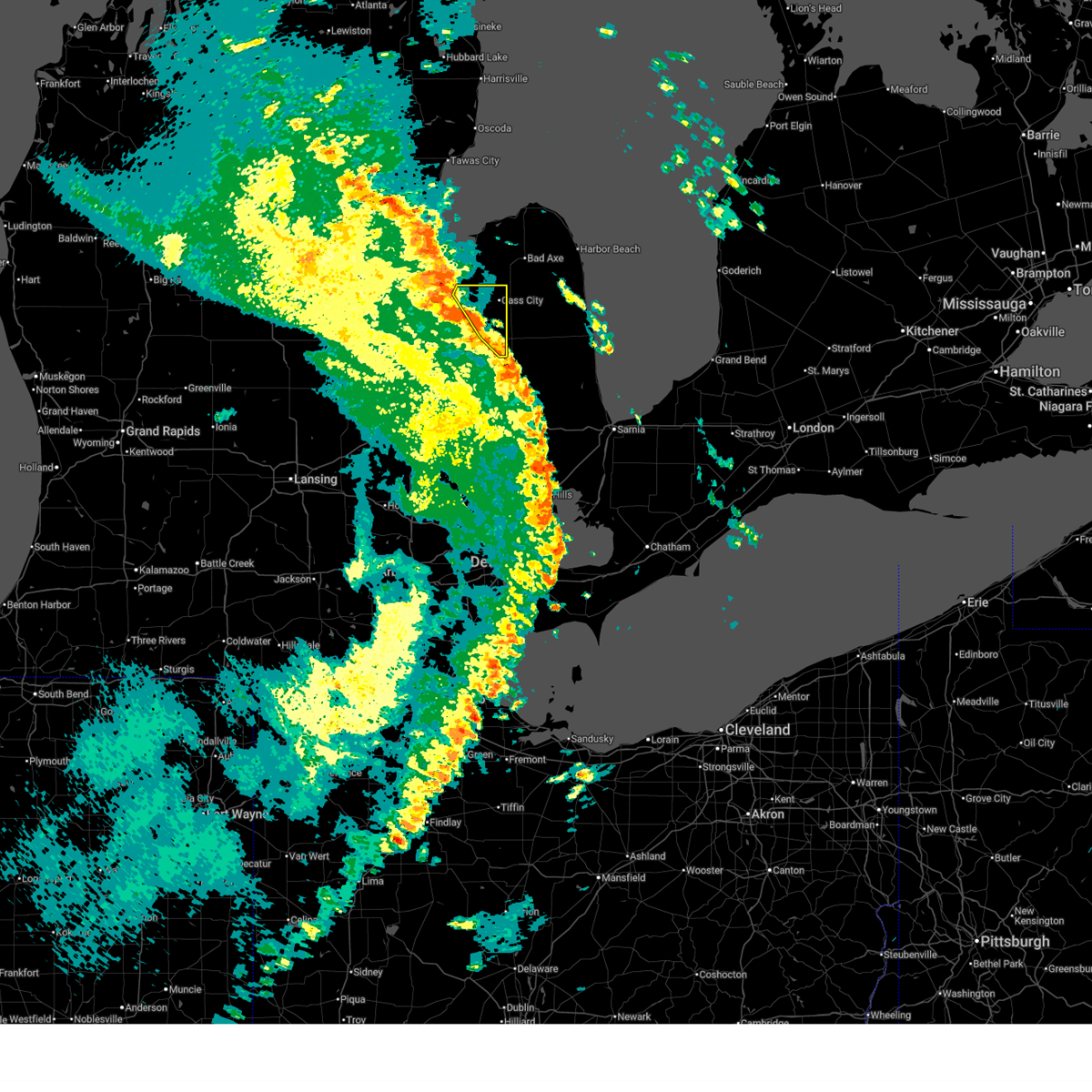
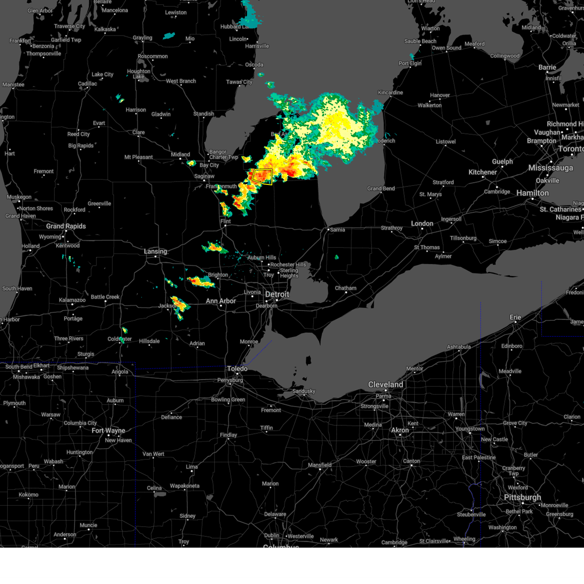
 At 717 pm edt, severe thunderstorms were located along a line extending from near caro to 7 miles northeast of mayville to kingston, moving northeast at 30 mph (radar indicated). Hazards include 60 mph wind gusts. Expect damage to roofs, siding, and trees. these severe storms will be near, caro and kingston around 720 pm edt. cass city around 735 pm edt. gagetown around 740 pm edt. Other locations impacted by these severe thunderstorms include east dayton, deford, colling, colwood, wilmot, ellington, fostoria, and silverwood. At 717 pm edt, severe thunderstorms were located along a line extending from near caro to 7 miles northeast of mayville to kingston, moving northeast at 30 mph (radar indicated). Hazards include 60 mph wind gusts. Expect damage to roofs, siding, and trees. these severe storms will be near, caro and kingston around 720 pm edt. cass city around 735 pm edt. gagetown around 740 pm edt. Other locations impacted by these severe thunderstorms include east dayton, deford, colling, colwood, wilmot, ellington, fostoria, and silverwood.
|
| 8/12/2025 6:52 PM EDT |
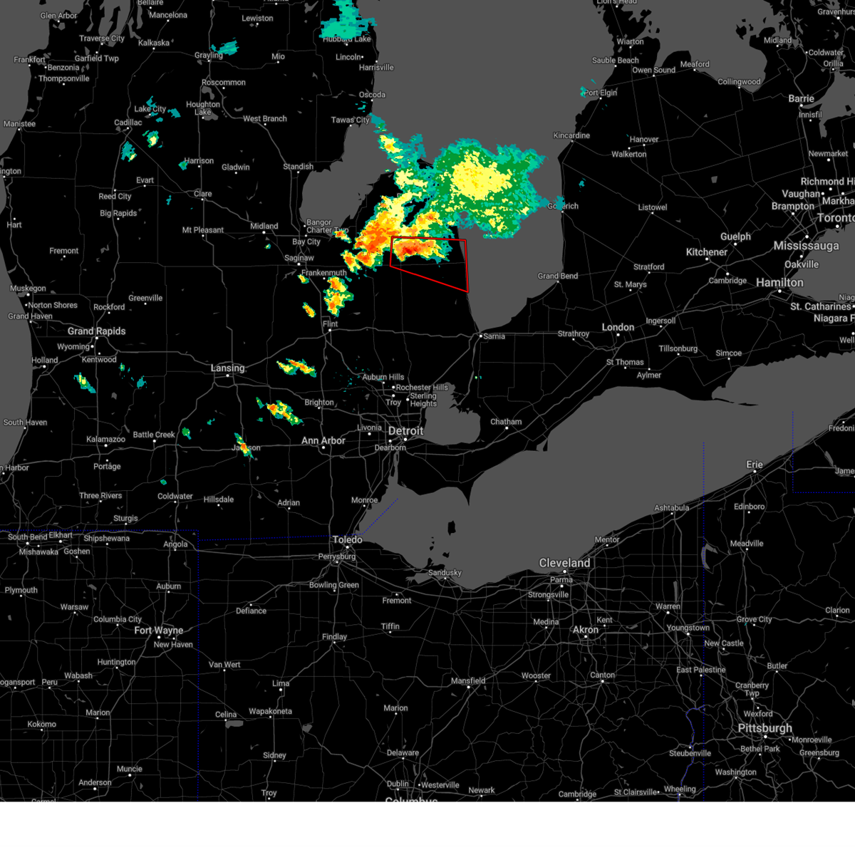
 At 652 pm edt, severe thunderstorms were located along a line extending from millington to near mayville to near north branch, moving north at 30 mph (radar indicated). Hazards include 70 mph wind gusts and penny size hail. Expect considerable tree damage. damage is likely to mobile homes, roofs, and outbuildings. these severe storms will be near, millington and mayville around 655 pm edt. kingston around 705 pm edt. caro around 715 pm edt. cass city around 730 pm edt. gagetown around 740 pm edt. Other locations impacted by these severe thunderstorms include east dayton, tuscola, colling, wilmot, wisner, ellington, gilford, richville, deford, and colwood. At 652 pm edt, severe thunderstorms were located along a line extending from millington to near mayville to near north branch, moving north at 30 mph (radar indicated). Hazards include 70 mph wind gusts and penny size hail. Expect considerable tree damage. damage is likely to mobile homes, roofs, and outbuildings. these severe storms will be near, millington and mayville around 655 pm edt. kingston around 705 pm edt. caro around 715 pm edt. cass city around 730 pm edt. gagetown around 740 pm edt. Other locations impacted by these severe thunderstorms include east dayton, tuscola, colling, wilmot, wisner, ellington, gilford, richville, deford, and colwood.
|
| 8/12/2025 6:38 PM EDT |
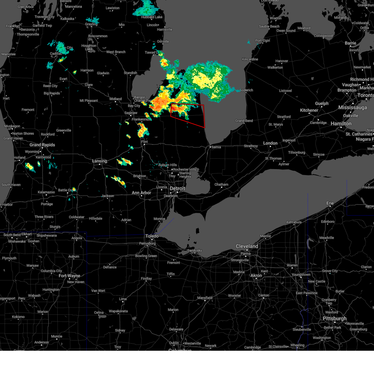
 Svrdtx the national weather service in detroit/pontiac has issued a * severe thunderstorm warning for, tuscola county in southeastern michigan, * until 745 pm edt. * at 636 pm edt, severe thunderstorms were located along a line extending from near otisville to columbiaville to near lapeer, moving north at 30 mph (radar indicated). Hazards include 60 mph wind gusts and penny size hail. Expect damage to roofs, siding, and trees. severe thunderstorms will be near, millington around 640 pm edt. mayville around 650 pm edt. caro around 710 pm edt. kingston around 715 pm edt. additional strong to severe thunderstorms are coming off inner saginaw bay and will impact northwest tuscola county by 7 pm. Other locations impacted by these severe thunderstorms include east dayton, tuscola, colling, wilmot, wisner, ellington, gilford, richville, deford, and colwood. Svrdtx the national weather service in detroit/pontiac has issued a * severe thunderstorm warning for, tuscola county in southeastern michigan, * until 745 pm edt. * at 636 pm edt, severe thunderstorms were located along a line extending from near otisville to columbiaville to near lapeer, moving north at 30 mph (radar indicated). Hazards include 60 mph wind gusts and penny size hail. Expect damage to roofs, siding, and trees. severe thunderstorms will be near, millington around 640 pm edt. mayville around 650 pm edt. caro around 710 pm edt. kingston around 715 pm edt. additional strong to severe thunderstorms are coming off inner saginaw bay and will impact northwest tuscola county by 7 pm. Other locations impacted by these severe thunderstorms include east dayton, tuscola, colling, wilmot, wisner, ellington, gilford, richville, deford, and colwood.
|
| 6/24/2025 7:27 PM EDT | the severe thunderstorm warning has been cancelled and is no longer in effect |
| 6/24/2025 7:12 PM EDT |
 the severe thunderstorm warning has been cancelled and is no longer in effect the severe thunderstorm warning has been cancelled and is no longer in effect
|
| 6/24/2025 7:12 PM EDT |
 At 712 pm edt, a severe thunderstorm was located over kingston, or 9 miles northwest of marlette, moving northeast at 25 mph (radar indicated). Hazards include 60 mph wind gusts. Expect damage to roofs, siding, and trees. This severe thunderstorm will remain over mainly rural areas of southeastern tuscola county, including the following locations, east dayton and silverwood. At 712 pm edt, a severe thunderstorm was located over kingston, or 9 miles northwest of marlette, moving northeast at 25 mph (radar indicated). Hazards include 60 mph wind gusts. Expect damage to roofs, siding, and trees. This severe thunderstorm will remain over mainly rural areas of southeastern tuscola county, including the following locations, east dayton and silverwood.
|
| 6/24/2025 6:58 PM EDT |
 At 658 pm edt, a severe thunderstorm was located near mayville, moving northeast at 40 mph (radar indicated). Hazards include 60 mph wind gusts. Expect damage to roofs, siding, and trees. this severe storm will be near, kingston around 705 pm edt. Other locations impacted by this severe thunderstorm include east dayton, tuscola, wisner, gilford, silverwood, watrousville, richville, fostoria, and bay park. At 658 pm edt, a severe thunderstorm was located near mayville, moving northeast at 40 mph (radar indicated). Hazards include 60 mph wind gusts. Expect damage to roofs, siding, and trees. this severe storm will be near, kingston around 705 pm edt. Other locations impacted by this severe thunderstorm include east dayton, tuscola, wisner, gilford, silverwood, watrousville, richville, fostoria, and bay park.
|
| 6/24/2025 6:48 PM EDT |
 Svrdtx the national weather service in detroit/pontiac has issued a * severe thunderstorm warning for, tuscola county in southeastern michigan, northwestern lapeer county in southeastern michigan, * until 745 pm edt. * at 648 pm edt, a severe thunderstorm was located over mayville, moving northeast at 30 mph (radar indicated). Hazards include 60 mph wind gusts. Expect damage to roofs, siding, and trees. this severe thunderstorm will be near, mayville around 655 pm edt. kingston and clifford around 700 pm edt. Other locations impacted by this severe thunderstorm include east dayton, tuscola, wisner, gilford, silverwood, watrousville, richville, fostoria, and bay park. Svrdtx the national weather service in detroit/pontiac has issued a * severe thunderstorm warning for, tuscola county in southeastern michigan, northwestern lapeer county in southeastern michigan, * until 745 pm edt. * at 648 pm edt, a severe thunderstorm was located over mayville, moving northeast at 30 mph (radar indicated). Hazards include 60 mph wind gusts. Expect damage to roofs, siding, and trees. this severe thunderstorm will be near, mayville around 655 pm edt. kingston and clifford around 700 pm edt. Other locations impacted by this severe thunderstorm include east dayton, tuscola, wisner, gilford, silverwood, watrousville, richville, fostoria, and bay park.
|
| 5/16/2025 1:24 AM EDT |
 The storms which prompted the warning have moved out of the area. therefore, the warning will be allowed to expire. a tornado watch remains in effect until 500 am edt for southeastern michigan. The storms which prompted the warning have moved out of the area. therefore, the warning will be allowed to expire. a tornado watch remains in effect until 500 am edt for southeastern michigan.
|
| 5/16/2025 1:18 AM EDT |
 At 117 am edt, severe thunderstorms were located along a line extending from near bad axe to near deckerville to near lexington, moving east at 55 mph (radar indicated). Hazards include 60 mph wind gusts. Expect damage to roofs, siding, and trees. Locations impacted include, cass city, unionville, kingston, gagetown, ellington, wilmot, deford, colling, and colwood. At 117 am edt, severe thunderstorms were located along a line extending from near bad axe to near deckerville to near lexington, moving east at 55 mph (radar indicated). Hazards include 60 mph wind gusts. Expect damage to roofs, siding, and trees. Locations impacted include, cass city, unionville, kingston, gagetown, ellington, wilmot, deford, colling, and colwood.
|
| 5/16/2025 1:18 AM EDT |
 the severe thunderstorm warning has been cancelled and is no longer in effect the severe thunderstorm warning has been cancelled and is no longer in effect
|
| 5/16/2025 1:04 AM EDT |
 At 104 am edt, severe thunderstorms were located along a line extending from near owendale to 6 miles northeast of marlette to near emmett, moving east at 55 mph (radar indicated). Hazards include 60 mph wind gusts. Expect damage to roofs, siding, and trees. These severe thunderstorms will remain over mainly rural areas of northeastern tuscola and eastern lapeer counties, including the following locations, goodland township, east dayton, attica, colling, wilmot, wisner, ellington, silverwood, deford, and burnside. At 104 am edt, severe thunderstorms were located along a line extending from near owendale to 6 miles northeast of marlette to near emmett, moving east at 55 mph (radar indicated). Hazards include 60 mph wind gusts. Expect damage to roofs, siding, and trees. These severe thunderstorms will remain over mainly rural areas of northeastern tuscola and eastern lapeer counties, including the following locations, goodland township, east dayton, attica, colling, wilmot, wisner, ellington, silverwood, deford, and burnside.
|
| 5/16/2025 12:43 AM EDT |
 At 1243 am edt, severe thunderstorms were located along a line extending from near quanicassee to near mayville to near almont, moving east at 55 mph (radar indicated). Hazards include 60 mph wind gusts. Expect damage to roofs, siding, and trees. these severe storms will be near, caro, sebewaing, brown city, unionville, kingston, and clifford around 1250 am edt. cass city and gagetown around 1255 am edt. Other locations impacted by these severe thunderstorms include goodland township, east dayton, attica, tuscola, elba, colling, wilmot, wisner, ellington, and gilford. At 1243 am edt, severe thunderstorms were located along a line extending from near quanicassee to near mayville to near almont, moving east at 55 mph (radar indicated). Hazards include 60 mph wind gusts. Expect damage to roofs, siding, and trees. these severe storms will be near, caro, sebewaing, brown city, unionville, kingston, and clifford around 1250 am edt. cass city and gagetown around 1255 am edt. Other locations impacted by these severe thunderstorms include goodland township, east dayton, attica, tuscola, elba, colling, wilmot, wisner, ellington, and gilford.
|
| 5/16/2025 12:25 AM EDT |
 Svrdtx the national weather service in detroit/pontiac has issued a * severe thunderstorm warning for, tuscola county in southeastern michigan, lapeer county in southeastern michigan, * until 130 am edt. * at 1225 am edt, severe thunderstorms were located along a line extending from near auburn to birch run to fenton, moving east at 55 mph (radar indicated). Hazards include 60 mph wind gusts. Expect damage to roofs, siding, and trees. severe thunderstorms will be near, reese around 1230 am edt. vassar, millington, otter lake, and quanicassee around 1235 am edt. lapeer, columbiaville, hadley, and fairgrove around 1240 am edt. caro, mayville, akron, and metamora around 1245 am edt. sebewaing, north branch, unionville, and clifford around 1250 am edt. imlay city, almont, dryden, kingston, and lum around 1255 am edt. cass city, brown city, and gagetown around 100 am edt. Other locations impacted by these severe thunderstorms include goodland township, east dayton, attica, tuscola, elba, colling, wilmot, wisner, ellington, and gilford. Svrdtx the national weather service in detroit/pontiac has issued a * severe thunderstorm warning for, tuscola county in southeastern michigan, lapeer county in southeastern michigan, * until 130 am edt. * at 1225 am edt, severe thunderstorms were located along a line extending from near auburn to birch run to fenton, moving east at 55 mph (radar indicated). Hazards include 60 mph wind gusts. Expect damage to roofs, siding, and trees. severe thunderstorms will be near, reese around 1230 am edt. vassar, millington, otter lake, and quanicassee around 1235 am edt. lapeer, columbiaville, hadley, and fairgrove around 1240 am edt. caro, mayville, akron, and metamora around 1245 am edt. sebewaing, north branch, unionville, and clifford around 1250 am edt. imlay city, almont, dryden, kingston, and lum around 1255 am edt. cass city, brown city, and gagetown around 100 am edt. Other locations impacted by these severe thunderstorms include goodland township, east dayton, attica, tuscola, elba, colling, wilmot, wisner, ellington, and gilford.
|
| 3/30/2025 8:06 PM EDT |
 The storms which prompted the warning have moved out of the area. therefore, the warning will be allowed to expire. a severe thunderstorm watch remains in effect until 1000 pm edt for southeastern michigan. The storms which prompted the warning have moved out of the area. therefore, the warning will be allowed to expire. a severe thunderstorm watch remains in effect until 1000 pm edt for southeastern michigan.
|
| 3/30/2025 7:54 PM EDT |
 the severe thunderstorm warning has been cancelled and is no longer in effect the severe thunderstorm warning has been cancelled and is no longer in effect
|
| 3/30/2025 7:54 PM EDT |
 At 754 pm edt, severe thunderstorms were located along a line extending from sebewaing to near kingston to brown city, moving northeast at 65 mph (radar indicated). Hazards include 70 mph wind gusts and penny size hail. Expect considerable tree damage. damage is likely to mobile homes, roofs, and outbuildings. these severe storms will be near, gagetown and cass city around 800 pm edt. Other locations impacted by these severe thunderstorms include wilmot, colwood, ellington, east dayton, deford, and colling. At 754 pm edt, severe thunderstorms were located along a line extending from sebewaing to near kingston to brown city, moving northeast at 65 mph (radar indicated). Hazards include 70 mph wind gusts and penny size hail. Expect considerable tree damage. damage is likely to mobile homes, roofs, and outbuildings. these severe storms will be near, gagetown and cass city around 800 pm edt. Other locations impacted by these severe thunderstorms include wilmot, colwood, ellington, east dayton, deford, and colling.
|
| 3/30/2025 7:41 PM EDT |
 At 741 pm edt, severe thunderstorms were located along a line extending from near quanicassee to mayville to lum, moving northeast at 65 mph (radar indicated). Hazards include 70 mph wind gusts and penny size hail. Expect considerable tree damage. damage is likely to mobile homes, roofs, and outbuildings. these severe storms will be near, akron, north branch, clifford, caro, kingston, and unionville around 745 pm edt. gagetown, cass city, and brown city around 750 pm edt. other locations impacted by these severe thunderstorms include goodland township, east dayton, attica, colling, wilmot, wisner, ellington, gilford, silverwood, and deford. This includes i-69 between mile markers 159 and 172. At 741 pm edt, severe thunderstorms were located along a line extending from near quanicassee to mayville to lum, moving northeast at 65 mph (radar indicated). Hazards include 70 mph wind gusts and penny size hail. Expect considerable tree damage. damage is likely to mobile homes, roofs, and outbuildings. these severe storms will be near, akron, north branch, clifford, caro, kingston, and unionville around 745 pm edt. gagetown, cass city, and brown city around 750 pm edt. other locations impacted by these severe thunderstorms include goodland township, east dayton, attica, colling, wilmot, wisner, ellington, gilford, silverwood, and deford. This includes i-69 between mile markers 159 and 172.
|
| 3/30/2025 7:31 PM EDT |
 At 730 pm edt, severe thunderstorms were located along a line extending from near munger to otter lake to near metamora, moving northeast at 65 mph (radar indicated). Hazards include 70 mph wind gusts and penny size hail. Expect considerable tree damage. damage is likely to mobile homes, roofs, and outbuildings. these severe storms will be near, lapeer, quanicassee, lum, fairgrove, vassar, and mayville around 735 pm edt. akron, north branch, imlay city, clifford, and caro around 740 pm edt. brown city, kingston, and unionville around 745 pm edt. gagetown and cass city around 750 pm edt. other locations impacted by these severe thunderstorms include goodland township, east dayton, attica, tuscola, elba, colling, wilmot, wisner, ellington, and gilford. This includes i-69 between mile markers 149 and 172. At 730 pm edt, severe thunderstorms were located along a line extending from near munger to otter lake to near metamora, moving northeast at 65 mph (radar indicated). Hazards include 70 mph wind gusts and penny size hail. Expect considerable tree damage. damage is likely to mobile homes, roofs, and outbuildings. these severe storms will be near, lapeer, quanicassee, lum, fairgrove, vassar, and mayville around 735 pm edt. akron, north branch, imlay city, clifford, and caro around 740 pm edt. brown city, kingston, and unionville around 745 pm edt. gagetown and cass city around 750 pm edt. other locations impacted by these severe thunderstorms include goodland township, east dayton, attica, tuscola, elba, colling, wilmot, wisner, ellington, and gilford. This includes i-69 between mile markers 149 and 172.
|
| 3/30/2025 7:15 PM EDT |
 Svrdtx the national weather service in detroit/pontiac has issued a * severe thunderstorm warning for, tuscola county in southeastern michigan, lapeer county in southeastern michigan, * until 815 pm edt. * at 715 pm edt, severe thunderstorms were located along a line extending from near bridgeport to near beecher to near ortonville, moving northeast at 65 mph (radar indicated). Hazards include 70 mph wind gusts and penny size hail. Expect considerable tree damage. damage is likely to mobile homes, roofs, and outbuildings. severe thunderstorms will be near, hadley around 720 pm edt. lapeer, otter lake, millington, vassar, reese, metamora, and columbiaville around 725 pm edt. quanicassee around 730 pm edt. lum, akron, north branch, fairgrove, caro, and mayville around 735 pm edt. clifford and unionville around 740 pm edt. brown city and kingston around 745 pm edt. gagetown and cass city around 750 pm edt. other locations impacted by these severe thunderstorms include goodland township, east dayton, attica, tuscola, elba, colling, wilmot, wisner, ellington, and gilford. This includes i-69 between mile markers 149 and 172. Svrdtx the national weather service in detroit/pontiac has issued a * severe thunderstorm warning for, tuscola county in southeastern michigan, lapeer county in southeastern michigan, * until 815 pm edt. * at 715 pm edt, severe thunderstorms were located along a line extending from near bridgeport to near beecher to near ortonville, moving northeast at 65 mph (radar indicated). Hazards include 70 mph wind gusts and penny size hail. Expect considerable tree damage. damage is likely to mobile homes, roofs, and outbuildings. severe thunderstorms will be near, hadley around 720 pm edt. lapeer, otter lake, millington, vassar, reese, metamora, and columbiaville around 725 pm edt. quanicassee around 730 pm edt. lum, akron, north branch, fairgrove, caro, and mayville around 735 pm edt. clifford and unionville around 740 pm edt. brown city and kingston around 745 pm edt. gagetown and cass city around 750 pm edt. other locations impacted by these severe thunderstorms include goodland township, east dayton, attica, tuscola, elba, colling, wilmot, wisner, ellington, and gilford. This includes i-69 between mile markers 149 and 172.
|
| 11/10/2024 7:35 PM EST |
 At 735 pm est, severe thunderstorms were located along a line extending from near elkton to near argyle to near clifford, moving east at 40 mph (radar indicated). Hazards include 60 mph wind gusts. Expect damage to roofs, siding, and trees. these severe storms will be near, bad axe, marlette, ubly, argyle, and clifford around 740 pm est. sandusky and deckerville around 750 pm est. harbor beach, forestville, and carsonville around 800 pm est. applegate around 810 pm est. port sanilac around 815 pm est. Other locations impacted by these severe thunderstorms include east dayton, parisville, mcgregor, wilmot, white rock, ivanhoe, rapson, snover, juhl, and elmer. At 735 pm est, severe thunderstorms were located along a line extending from near elkton to near argyle to near clifford, moving east at 40 mph (radar indicated). Hazards include 60 mph wind gusts. Expect damage to roofs, siding, and trees. these severe storms will be near, bad axe, marlette, ubly, argyle, and clifford around 740 pm est. sandusky and deckerville around 750 pm est. harbor beach, forestville, and carsonville around 800 pm est. applegate around 810 pm est. port sanilac around 815 pm est. Other locations impacted by these severe thunderstorms include east dayton, parisville, mcgregor, wilmot, white rock, ivanhoe, rapson, snover, juhl, and elmer.
|
| 11/10/2024 7:11 PM EST |
 Svrdtx the national weather service in detroit/pontiac has issued a * severe thunderstorm warning for, tuscola county in southeastern michigan, sanilac county in southeastern michigan, northeastern lapeer county in southeastern michigan, huron county in southeastern michigan, * until 830 pm est. * at 710 pm est, severe thunderstorms were located along a line extending from near sebewaing to near caro to near millington, moving east at 45 mph (radar indicated). Hazards include 60 mph wind gusts. Expect damage to roofs, siding, and trees. severe thunderstorms will be near, cass city, millington, mayville, pigeon, gagetown, and owendale around 715 pm est. elkton and kingston around 720 pm est. clifford around 725 pm est. bad axe, marlette, and argyle around 730 pm est. ubly around 735 pm est. sandusky and deckerville around 740 pm est. harbor beach, forestville, and carsonville around 755 pm est. port sanilac and applegate around 800 pm est. Other locations impacted by these severe thunderstorms include parisville, colling, white rock, ivanhoe, rapson, ellington, juhl, elmer, silverwood, and new greenleaf. Svrdtx the national weather service in detroit/pontiac has issued a * severe thunderstorm warning for, tuscola county in southeastern michigan, sanilac county in southeastern michigan, northeastern lapeer county in southeastern michigan, huron county in southeastern michigan, * until 830 pm est. * at 710 pm est, severe thunderstorms were located along a line extending from near sebewaing to near caro to near millington, moving east at 45 mph (radar indicated). Hazards include 60 mph wind gusts. Expect damage to roofs, siding, and trees. severe thunderstorms will be near, cass city, millington, mayville, pigeon, gagetown, and owendale around 715 pm est. elkton and kingston around 720 pm est. clifford around 725 pm est. bad axe, marlette, and argyle around 730 pm est. ubly around 735 pm est. sandusky and deckerville around 740 pm est. harbor beach, forestville, and carsonville around 755 pm est. port sanilac and applegate around 800 pm est. Other locations impacted by these severe thunderstorms include parisville, colling, white rock, ivanhoe, rapson, ellington, juhl, elmer, silverwood, and new greenleaf.
|
| 8/27/2024 5:16 PM EDT |
 the severe thunderstorm warning has been cancelled and is no longer in effect the severe thunderstorm warning has been cancelled and is no longer in effect
|
| 8/27/2024 4:58 PM EDT |
 At 458 pm edt, severe thunderstorms were located along a line extending from near gagetown to near kingston to near clio, moving southeast at 40 mph (radar indicated). Hazards include 60 mph wind gusts and penny size hail. Expect damage to roofs, siding, and trees. these severe storms will be near, cass city, mayville, and kingston around 505 pm edt. Other locations impacted by these severe thunderstorms include east dayton, tuscola, colling, wilmot, wisner, ellington, gilford, richville, deford, and colwood. At 458 pm edt, severe thunderstorms were located along a line extending from near gagetown to near kingston to near clio, moving southeast at 40 mph (radar indicated). Hazards include 60 mph wind gusts and penny size hail. Expect damage to roofs, siding, and trees. these severe storms will be near, cass city, mayville, and kingston around 505 pm edt. Other locations impacted by these severe thunderstorms include east dayton, tuscola, colling, wilmot, wisner, ellington, gilford, richville, deford, and colwood.
|
| 8/27/2024 4:42 PM EDT |
 At 441 pm edt, severe thunderstorms were located along a line extending from near sebewaing to near akron to clio, moving east at 30 mph (radar indicated). Hazards include 70 mph wind gusts and penny size hail. Expect considerable tree damage. damage is likely to mobile homes, roofs, and outbuildings. these severe storms will be near, caro, vassar, and millington around 445 pm edt. gagetown around 450 pm edt. cass city and mayville around 455 pm edt. kingston around 505 pm edt. Other locations impacted by these severe thunderstorms include east dayton, tuscola, colling, wilmot, wisner, ellington, gilford, richville, deford, and colwood. At 441 pm edt, severe thunderstorms were located along a line extending from near sebewaing to near akron to clio, moving east at 30 mph (radar indicated). Hazards include 70 mph wind gusts and penny size hail. Expect considerable tree damage. damage is likely to mobile homes, roofs, and outbuildings. these severe storms will be near, caro, vassar, and millington around 445 pm edt. gagetown around 450 pm edt. cass city and mayville around 455 pm edt. kingston around 505 pm edt. Other locations impacted by these severe thunderstorms include east dayton, tuscola, colling, wilmot, wisner, ellington, gilford, richville, deford, and colwood.
|
| 8/27/2024 4:25 PM EDT |
 At 424 pm edt, severe thunderstorms were located along a line extending from 9 miles west of sebewaing to quanicassee to bridgeport, moving east at 30 mph (radar indicated). Hazards include 70 mph wind gusts and penny size hail. Expect considerable tree damage. damage is likely to mobile homes, roofs, and outbuildings. these severe storms will be near, reese and quanicassee around 430 pm edt. akron, fairgrove, and unionville around 435 pm edt. vassar around 440 pm edt. caro around 450 pm edt. millington and gagetown around 455 pm edt. cass city and mayville around 505 pm edt. kingston around 515 pm edt. Other locations impacted by these severe thunderstorms include east dayton, tuscola, colling, wilmot, wisner, ellington, gilford, richville, deford, and colwood. At 424 pm edt, severe thunderstorms were located along a line extending from 9 miles west of sebewaing to quanicassee to bridgeport, moving east at 30 mph (radar indicated). Hazards include 70 mph wind gusts and penny size hail. Expect considerable tree damage. damage is likely to mobile homes, roofs, and outbuildings. these severe storms will be near, reese and quanicassee around 430 pm edt. akron, fairgrove, and unionville around 435 pm edt. vassar around 440 pm edt. caro around 450 pm edt. millington and gagetown around 455 pm edt. cass city and mayville around 505 pm edt. kingston around 515 pm edt. Other locations impacted by these severe thunderstorms include east dayton, tuscola, colling, wilmot, wisner, ellington, gilford, richville, deford, and colwood.
|
| 8/27/2024 4:13 PM EDT |
 Svrdtx the national weather service in detroit/pontiac has issued a * severe thunderstorm warning for, tuscola county in southeastern michigan, * until 545 pm edt. * at 413 pm edt, severe thunderstorms were located along a line extending from 8 miles east of linwood to essexville to 6 miles south of freeland, moving east at 30 mph (radar indicated). Hazards include 60 mph wind gusts and penny size hail. Expect damage to roofs, siding, and trees. severe thunderstorms will be near, quanicassee around 420 pm edt. reese around 430 pm edt. fairgrove around 435 pm edt. akron and unionville around 440 pm edt. caro and vassar around 450 pm edt. gagetown around 500 pm edt. millington around 505 pm edt. cass city around 510 pm edt. Other locations impacted by these severe thunderstorms include east dayton, tuscola, colling, wilmot, wisner, ellington, gilford, richville, deford, and colwood. Svrdtx the national weather service in detroit/pontiac has issued a * severe thunderstorm warning for, tuscola county in southeastern michigan, * until 545 pm edt. * at 413 pm edt, severe thunderstorms were located along a line extending from 8 miles east of linwood to essexville to 6 miles south of freeland, moving east at 30 mph (radar indicated). Hazards include 60 mph wind gusts and penny size hail. Expect damage to roofs, siding, and trees. severe thunderstorms will be near, quanicassee around 420 pm edt. reese around 430 pm edt. fairgrove around 435 pm edt. akron and unionville around 440 pm edt. caro and vassar around 450 pm edt. gagetown around 500 pm edt. millington around 505 pm edt. cass city around 510 pm edt. Other locations impacted by these severe thunderstorms include east dayton, tuscola, colling, wilmot, wisner, ellington, gilford, richville, deford, and colwood.
|
| 6/17/2024 4:50 PM EDT | Multiple large tree limbs down on the roa in tuscola county MI, 5.8 miles SSW of Kingston, MI |
| 5/20/2024 2:11 PM EDT |
 The storms which prompted the warning have moved out of the area. therefore, the warning will be allowed to expire. however, gusty winds are still possible with trailing thunderstorms. The storms which prompted the warning have moved out of the area. therefore, the warning will be allowed to expire. however, gusty winds are still possible with trailing thunderstorms.
|
| 5/20/2024 1:57 PM EDT |
 At 157 pm edt, severe thunderstorms were located along a line extending from near gagetown to near kingston to 6 miles southwest of north branch, moving northeast at 40 mph (radar indicated). Hazards include 60 mph wind gusts and quarter size hail. Hail damage to vehicles is expected. expect wind damage to roofs, siding, and trees. these severe storms will be near, cass city, north branch, kingston, gagetown, and clifford around 200 pm edt. Other locations impacted by these severe thunderstorms include east dayton, deford, colling, wilmot, colwood, ellington, kings mill, silverwood, and fostoria. At 157 pm edt, severe thunderstorms were located along a line extending from near gagetown to near kingston to 6 miles southwest of north branch, moving northeast at 40 mph (radar indicated). Hazards include 60 mph wind gusts and quarter size hail. Hail damage to vehicles is expected. expect wind damage to roofs, siding, and trees. these severe storms will be near, cass city, north branch, kingston, gagetown, and clifford around 200 pm edt. Other locations impacted by these severe thunderstorms include east dayton, deford, colling, wilmot, colwood, ellington, kings mill, silverwood, and fostoria.
|
| 5/20/2024 1:35 PM EDT |
 the severe thunderstorm warning has been cancelled and is no longer in effect the severe thunderstorm warning has been cancelled and is no longer in effect
|
| 5/20/2024 1:35 PM EDT |
 At 134 pm edt, severe thunderstorms were located along a line extending from near quanicassee to near millington to near columbiaville, moving northeast at 35 mph (radar indicated). Hazards include 60 mph wind gusts and quarter size hail. Hail damage to vehicles is expected. expect wind damage to roofs, siding, and trees. these severe storms will be near, caro, mayville, columbiaville, akron, and unionville around 140 pm edt. kingston around 150 pm edt. north branch and clifford around 155 pm edt. cass city and gagetown around 200 pm edt. Other locations impacted by these severe thunderstorms include east dayton, tuscola, colling, wilmot, wisner, ellington, gilford, silverwood, richville, and genesee. At 134 pm edt, severe thunderstorms were located along a line extending from near quanicassee to near millington to near columbiaville, moving northeast at 35 mph (radar indicated). Hazards include 60 mph wind gusts and quarter size hail. Hail damage to vehicles is expected. expect wind damage to roofs, siding, and trees. these severe storms will be near, caro, mayville, columbiaville, akron, and unionville around 140 pm edt. kingston around 150 pm edt. north branch and clifford around 155 pm edt. cass city and gagetown around 200 pm edt. Other locations impacted by these severe thunderstorms include east dayton, tuscola, colling, wilmot, wisner, ellington, gilford, silverwood, richville, and genesee.
|
| 5/20/2024 1:17 PM EDT |
 Svrdtx the national weather service in detroit/pontiac has issued a * severe thunderstorm warning for, tuscola county in southeastern michigan, northwestern lapeer county in southeastern michigan, southeastern bay county in southeastern michigan, northeastern saginaw county in southeastern michigan, northeastern genesee county in southeastern michigan, * until 215 pm edt. * at 117 pm edt, severe thunderstorms were located along a line extending from near munger to near vassar to otisville, moving northeast at 40 mph (radar indicated). Hazards include 60 mph wind gusts and quarter size hail. Hail damage to vehicles is expected. expect wind damage to roofs, siding, and trees. severe thunderstorms will be near, vassar, millington, columbiaville, otter lake, and quanicassee around 125 pm edt. mayville and fairgrove around 130 pm edt. caro and akron around 135 pm edt. north branch around 140 pm edt. unionville, kingston, and clifford around 145 pm edt. cass city and gagetown around 155 pm edt. Other locations impacted by these severe thunderstorms include east dayton, arthur, tuscola, colling, wilmot, wisner, ellington, gera, gilford, and silverwood. Svrdtx the national weather service in detroit/pontiac has issued a * severe thunderstorm warning for, tuscola county in southeastern michigan, northwestern lapeer county in southeastern michigan, southeastern bay county in southeastern michigan, northeastern saginaw county in southeastern michigan, northeastern genesee county in southeastern michigan, * until 215 pm edt. * at 117 pm edt, severe thunderstorms were located along a line extending from near munger to near vassar to otisville, moving northeast at 40 mph (radar indicated). Hazards include 60 mph wind gusts and quarter size hail. Hail damage to vehicles is expected. expect wind damage to roofs, siding, and trees. severe thunderstorms will be near, vassar, millington, columbiaville, otter lake, and quanicassee around 125 pm edt. mayville and fairgrove around 130 pm edt. caro and akron around 135 pm edt. north branch around 140 pm edt. unionville, kingston, and clifford around 145 pm edt. cass city and gagetown around 155 pm edt. Other locations impacted by these severe thunderstorms include east dayton, arthur, tuscola, colling, wilmot, wisner, ellington, gera, gilford, and silverwood.
|
| 8/3/2023 7:09 PM EDT |
 At 708 pm edt, a severe thunderstorm was located near kingston, or near marlette, moving southeast at 20 mph (radar indicated). Hazards include 60 mph wind gusts and quarter size hail. Hail damage to vehicles is expected. expect wind damage to roofs, siding, and trees. locations impacted include, kingston, wilmot, decker, snover and deford. hail threat, radar indicated max hail size, 1. 00 in wind threat, radar indicated max wind gust, 60 mph. At 708 pm edt, a severe thunderstorm was located near kingston, or near marlette, moving southeast at 20 mph (radar indicated). Hazards include 60 mph wind gusts and quarter size hail. Hail damage to vehicles is expected. expect wind damage to roofs, siding, and trees. locations impacted include, kingston, wilmot, decker, snover and deford. hail threat, radar indicated max hail size, 1. 00 in wind threat, radar indicated max wind gust, 60 mph.
|
| 8/3/2023 6:59 PM EDT |
 At 659 pm edt, a severe thunderstorm was located over kingston, or 8 miles northwest of marlette, moving southeast at 20 mph (radar indicated). Hazards include 60 mph wind gusts and quarter size hail. Hail damage to vehicles is expected. expect wind damage to roofs, siding, and trees. locations impacted include, cass city, kingston, gagetown, clifford, wilmot, decker, deford, snover and silverwood. hail threat, radar indicated max hail size, 1. 00 in wind threat, radar indicated max wind gust, 60 mph. At 659 pm edt, a severe thunderstorm was located over kingston, or 8 miles northwest of marlette, moving southeast at 20 mph (radar indicated). Hazards include 60 mph wind gusts and quarter size hail. Hail damage to vehicles is expected. expect wind damage to roofs, siding, and trees. locations impacted include, cass city, kingston, gagetown, clifford, wilmot, decker, deford, snover and silverwood. hail threat, radar indicated max hail size, 1. 00 in wind threat, radar indicated max wind gust, 60 mph.
|
| 8/3/2023 6:48 PM EDT |
 At 647 pm edt, a severe thunderstorm was located near kingston, or 8 miles south of cass city, moving southeast at 25 mph (radar indicated). Hazards include 60 mph wind gusts and half dollar size hail. Hail damage to vehicles is expected. expect wind damage to roofs, siding, and trees. locations impacted include, caro, cass city, mayville, kingston, gagetown, ellington, wilmot, east dayton, snover, new greenleaf, decker, deford, colwood and silverwood. hail threat, radar indicated max hail size, 1. 25 in wind threat, radar indicated max wind gust, 60 mph. At 647 pm edt, a severe thunderstorm was located near kingston, or 8 miles south of cass city, moving southeast at 25 mph (radar indicated). Hazards include 60 mph wind gusts and half dollar size hail. Hail damage to vehicles is expected. expect wind damage to roofs, siding, and trees. locations impacted include, caro, cass city, mayville, kingston, gagetown, ellington, wilmot, east dayton, snover, new greenleaf, decker, deford, colwood and silverwood. hail threat, radar indicated max hail size, 1. 25 in wind threat, radar indicated max wind gust, 60 mph.
|
| 8/3/2023 6:35 PM EDT |
 At 634 pm edt, a severe thunderstorm was located over cass city, moving southeast at 35 mph (radar indicated). Hazards include 60 mph wind gusts and half dollar size hail. Hail damage to vehicles is expected. expect wind damage to roofs, siding, and trees. this severe thunderstorm will remain over mainly rural areas of eastern tuscola and northwestern sanilac counties, including the following locations, decker, east dayton, deford, wilmot, colwood, ellington, snover, new greenleaf and silverwood. hail threat, radar indicated max hail size, 1. 25 in wind threat, radar indicated max wind gust, 60 mph. At 634 pm edt, a severe thunderstorm was located over cass city, moving southeast at 35 mph (radar indicated). Hazards include 60 mph wind gusts and half dollar size hail. Hail damage to vehicles is expected. expect wind damage to roofs, siding, and trees. this severe thunderstorm will remain over mainly rural areas of eastern tuscola and northwestern sanilac counties, including the following locations, decker, east dayton, deford, wilmot, colwood, ellington, snover, new greenleaf and silverwood. hail threat, radar indicated max hail size, 1. 25 in wind threat, radar indicated max wind gust, 60 mph.
|
| 8/3/2023 6:15 PM EDT |
 At 615 pm edt, a severe thunderstorm was located near owendale, or near sebewaing, moving southeast at 20 mph (radar indicated). Hazards include golf ball size hail and 60 mph wind gusts. People and animals outdoors will be injured. expect hail damage to roofs, siding, windows, and vehicles. expect wind damage to roofs, siding, and trees. this severe thunderstorm will be near, gagetown around 635 pm edt. cass city around 645 pm edt. kingston around 715 pm edt. other locations impacted by this severe thunderstorm include decker, east dayton, deford, colling, wilmot, colwood, ellington, snover, new greenleaf and silverwood. thunderstorm damage threat, considerable hail threat, radar indicated max hail size, 1. 75 in wind threat, radar indicated max wind gust, 60 mph. At 615 pm edt, a severe thunderstorm was located near owendale, or near sebewaing, moving southeast at 20 mph (radar indicated). Hazards include golf ball size hail and 60 mph wind gusts. People and animals outdoors will be injured. expect hail damage to roofs, siding, windows, and vehicles. expect wind damage to roofs, siding, and trees. this severe thunderstorm will be near, gagetown around 635 pm edt. cass city around 645 pm edt. kingston around 715 pm edt. other locations impacted by this severe thunderstorm include decker, east dayton, deford, colling, wilmot, colwood, ellington, snover, new greenleaf and silverwood. thunderstorm damage threat, considerable hail threat, radar indicated max hail size, 1. 75 in wind threat, radar indicated max wind gust, 60 mph.
|
| 7/28/2023 8:25 PM EDT |
 At 825 pm edt, a severe thunderstorm was located over vassar, moving southeast at 30 mph (radar indicated). Hazards include 60 mph wind gusts and quarter size hail. Hail damage to vehicles is expected. expect wind damage to roofs, siding, and trees. this severe storm will be near, millington around 830 pm edt. mayville around 845 pm edt. other locations impacted by this severe thunderstorm include east dayton, watrousville, tuscola, richville, fostoria and silverwood. hail threat, radar indicated max hail size, 1. 00 in wind threat, radar indicated max wind gust, 60 mph. At 825 pm edt, a severe thunderstorm was located over vassar, moving southeast at 30 mph (radar indicated). Hazards include 60 mph wind gusts and quarter size hail. Hail damage to vehicles is expected. expect wind damage to roofs, siding, and trees. this severe storm will be near, millington around 830 pm edt. mayville around 845 pm edt. other locations impacted by this severe thunderstorm include east dayton, watrousville, tuscola, richville, fostoria and silverwood. hail threat, radar indicated max hail size, 1. 00 in wind threat, radar indicated max wind gust, 60 mph.
|
| 7/28/2023 7:58 PM EDT |
 At 757 pm edt, a severe thunderstorm was located near munger, or near reese, moving southeast at 25 mph (radar indicated). Hazards include 60 mph wind gusts and quarter size hail. Hail damage to vehicles is expected. expect wind damage to roofs, siding, and trees. this severe thunderstorm will be near, reese around 810 pm edt. frankenmuth around 820 pm edt. vassar around 830 pm edt. millington around 845 pm edt. mayville around 855 pm edt. other locations impacted by this severe thunderstorm include east dayton, arthur, tuscola, buena vista township, gera, watrousville, indiantown, richville, fostoria and silverwood. another potential severe thunderstorm is also located south of caro and may produce large hail and gusty winds. hail threat, radar indicated max hail size, 1. 00 in wind threat, radar indicated max wind gust, 60 mph. At 757 pm edt, a severe thunderstorm was located near munger, or near reese, moving southeast at 25 mph (radar indicated). Hazards include 60 mph wind gusts and quarter size hail. Hail damage to vehicles is expected. expect wind damage to roofs, siding, and trees. this severe thunderstorm will be near, reese around 810 pm edt. frankenmuth around 820 pm edt. vassar around 830 pm edt. millington around 845 pm edt. mayville around 855 pm edt. other locations impacted by this severe thunderstorm include east dayton, arthur, tuscola, buena vista township, gera, watrousville, indiantown, richville, fostoria and silverwood. another potential severe thunderstorm is also located south of caro and may produce large hail and gusty winds. hail threat, radar indicated max hail size, 1. 00 in wind threat, radar indicated max wind gust, 60 mph.
|
| 7/20/2023 2:57 PM EDT |
 At 256 pm edt, a severe thunderstorm was located over millington, moving east at 35 mph (radar indicated). Hazards include 60 mph wind gusts and quarter size hail. Hail damage to vehicles is expected. expect wind damage to roofs, siding, and trees. this severe storm will be near, mayville around 310 pm edt. kingston around 330 pm edt. other locations impacted by this severe thunderstorm include east dayton, tuscola, richville, fostoria and silverwood. hail threat, radar indicated max hail size, 1. 00 in wind threat, radar indicated max wind gust, 60 mph. At 256 pm edt, a severe thunderstorm was located over millington, moving east at 35 mph (radar indicated). Hazards include 60 mph wind gusts and quarter size hail. Hail damage to vehicles is expected. expect wind damage to roofs, siding, and trees. this severe storm will be near, mayville around 310 pm edt. kingston around 330 pm edt. other locations impacted by this severe thunderstorm include east dayton, tuscola, richville, fostoria and silverwood. hail threat, radar indicated max hail size, 1. 00 in wind threat, radar indicated max wind gust, 60 mph.
|
| 7/20/2023 2:43 PM EDT |
 At 243 pm edt, a severe thunderstorm was located near millington, moving east at 40 mph (radar indicated). Hazards include 60 mph wind gusts and quarter size hail. Hail damage to vehicles is expected. expect wind damage to roofs, siding, and trees. this severe storm will be near, mayville around 305 pm edt. kingston around 320 pm edt. other locations impacted by this severe thunderstorm include east dayton, tuscola, richville, fostoria and silverwood. hail threat, radar indicated max hail size, 1. 00 in wind threat, radar indicated max wind gust, 60 mph. At 243 pm edt, a severe thunderstorm was located near millington, moving east at 40 mph (radar indicated). Hazards include 60 mph wind gusts and quarter size hail. Hail damage to vehicles is expected. expect wind damage to roofs, siding, and trees. this severe storm will be near, mayville around 305 pm edt. kingston around 320 pm edt. other locations impacted by this severe thunderstorm include east dayton, tuscola, richville, fostoria and silverwood. hail threat, radar indicated max hail size, 1. 00 in wind threat, radar indicated max wind gust, 60 mph.
|
| 7/20/2023 2:27 PM EDT |
 At 227 pm edt, a severe thunderstorm was located over clio, moving northeast at 35 mph (radar indicated). Hazards include 60 mph wind gusts and quarter size hail. Hail damage to vehicles is expected. expect wind damage to roofs, siding, and trees. this severe thunderstorm will be near, vassar and millington around 250 pm edt. mayville around 305 pm edt. kingston around 320 pm edt. other locations impacted by this severe thunderstorm include east dayton, tuscola, richville, fostoria and silverwood. hail threat, radar indicated max hail size, 1. 00 in wind threat, radar indicated max wind gust, 60 mph. At 227 pm edt, a severe thunderstorm was located over clio, moving northeast at 35 mph (radar indicated). Hazards include 60 mph wind gusts and quarter size hail. Hail damage to vehicles is expected. expect wind damage to roofs, siding, and trees. this severe thunderstorm will be near, vassar and millington around 250 pm edt. mayville around 305 pm edt. kingston around 320 pm edt. other locations impacted by this severe thunderstorm include east dayton, tuscola, richville, fostoria and silverwood. hail threat, radar indicated max hail size, 1. 00 in wind threat, radar indicated max wind gust, 60 mph.
|
| 7/14/2023 2:42 PM EDT |
 At 242 pm edt, a severe thunderstorm was located near kingston, or 8 miles north of marlette, moving east at 30 mph (radar indicated). Hazards include 60 mph wind gusts and nickel size hail. Expect damage to roofs, siding, and trees. This severe thunderstorm will remain over mainly rural areas of east central tuscola county, including the following locations, wilmot, east dayton and deford. At 242 pm edt, a severe thunderstorm was located near kingston, or 8 miles north of marlette, moving east at 30 mph (radar indicated). Hazards include 60 mph wind gusts and nickel size hail. Expect damage to roofs, siding, and trees. This severe thunderstorm will remain over mainly rural areas of east central tuscola county, including the following locations, wilmot, east dayton and deford.
|
| 7/14/2023 2:24 PM EDT |
 At 223 pm edt, a severe thunderstorm was located near caro, moving east at 30 mph (radar indicated). Hazards include 60 mph wind gusts and nickel size hail. Expect damage to roofs, siding, and trees. this severe thunderstorm will be near, kingston around 235 pm edt. Other locations impacted by this severe thunderstorm include wilmot, east dayton and deford. At 223 pm edt, a severe thunderstorm was located near caro, moving east at 30 mph (radar indicated). Hazards include 60 mph wind gusts and nickel size hail. Expect damage to roofs, siding, and trees. this severe thunderstorm will be near, kingston around 235 pm edt. Other locations impacted by this severe thunderstorm include wilmot, east dayton and deford.
|
| 7/14/2023 2:24 PM EDT |
 At 223 pm edt, a severe thunderstorm capable of producing a tornado was located 8 miles southwest of argyle, or 9 miles west of sandusky, moving east at 20 mph (radar indicated rotation). Hazards include tornado and quarter size hail. Flying debris will be dangerous to those caught without shelter. mobile homes will be damaged or destroyed. damage to roofs, windows, and vehicles will occur. tree damage is likely. this dangerous storm will be near, argyle around 235 pm edt. sandusky around 250 pm edt. deckerville around 300 pm edt. carsonville around 310 pm edt. applegate around 320 pm edt. port sanilac around 330 pm edt. Other locations impacted by this tornadic thunderstorm include decker, watertown, mcgregor, forester, snover, juhl and elmer. At 223 pm edt, a severe thunderstorm capable of producing a tornado was located 8 miles southwest of argyle, or 9 miles west of sandusky, moving east at 20 mph (radar indicated rotation). Hazards include tornado and quarter size hail. Flying debris will be dangerous to those caught without shelter. mobile homes will be damaged or destroyed. damage to roofs, windows, and vehicles will occur. tree damage is likely. this dangerous storm will be near, argyle around 235 pm edt. sandusky around 250 pm edt. deckerville around 300 pm edt. carsonville around 310 pm edt. applegate around 320 pm edt. port sanilac around 330 pm edt. Other locations impacted by this tornadic thunderstorm include decker, watertown, mcgregor, forester, snover, juhl and elmer.
|
| 7/14/2023 2:16 PM EDT |
 At 216 pm edt, a severe thunderstorm capable of producing a tornado was located near kingston, or 9 miles north of marlette, moving east at 25 mph (radar indicated rotation). Hazards include tornado and quarter size hail. Flying debris will be dangerous to those caught without shelter. mobile homes will be damaged or destroyed. damage to roofs, windows, and vehicles will occur. tree damage is likely. this dangerous storm will be near, argyle around 230 pm edt. sandusky around 245 pm edt. deckerville around 250 pm edt. carsonville around 305 pm edt. applegate around 310 pm edt. port sanilac around 315 pm edt. Other locations impacted by this tornadic thunderstorm include decker, watertown, mcgregor, forester, snover, juhl and elmer. At 216 pm edt, a severe thunderstorm capable of producing a tornado was located near kingston, or 9 miles north of marlette, moving east at 25 mph (radar indicated rotation). Hazards include tornado and quarter size hail. Flying debris will be dangerous to those caught without shelter. mobile homes will be damaged or destroyed. damage to roofs, windows, and vehicles will occur. tree damage is likely. this dangerous storm will be near, argyle around 230 pm edt. sandusky around 245 pm edt. deckerville around 250 pm edt. carsonville around 305 pm edt. applegate around 310 pm edt. port sanilac around 315 pm edt. Other locations impacted by this tornadic thunderstorm include decker, watertown, mcgregor, forester, snover, juhl and elmer.
|
| 7/11/2023 3:36 PM EDT |
 At 336 pm edt, severe thunderstorms were located along a line extending from near kingston to near mayville to near millington, moving east at 35 mph (radar indicated). Hazards include 60 mph wind gusts and quarter size hail. Hail damage to vehicles is expected. expect wind damage to roofs, siding, and trees. these severe storms will be near, mayville around 340 pm edt. kingston around 345 pm edt. other locations impacted by these severe thunderstorms include wilmot, east dayton, watrousville, tuscola, fostoria and silverwood. hail threat, radar indicated max hail size, 1. 00 in wind threat, radar indicated max wind gust, 60 mph. At 336 pm edt, severe thunderstorms were located along a line extending from near kingston to near mayville to near millington, moving east at 35 mph (radar indicated). Hazards include 60 mph wind gusts and quarter size hail. Hail damage to vehicles is expected. expect wind damage to roofs, siding, and trees. these severe storms will be near, mayville around 340 pm edt. kingston around 345 pm edt. other locations impacted by these severe thunderstorms include wilmot, east dayton, watrousville, tuscola, fostoria and silverwood. hail threat, radar indicated max hail size, 1. 00 in wind threat, radar indicated max wind gust, 60 mph.
|
| 7/11/2023 3:18 PM EDT |
 At 318 pm edt, a severe thunderstorm was located near vassar, moving east at 45 mph (radar indicated). Hazards include 60 mph wind gusts and quarter size hail. Hail damage to vehicles is expected. expect wind damage to roofs, siding, and trees. this severe thunderstorm will be near, caro and mayville around 330 pm edt. kingston around 340 pm edt. other locations impacted by this severe thunderstorm include east dayton, tuscola, wilmot, gilford, watrousville, richville, fostoria and silverwood. hail threat, radar indicated max hail size, 1. 00 in wind threat, radar indicated max wind gust, 60 mph. At 318 pm edt, a severe thunderstorm was located near vassar, moving east at 45 mph (radar indicated). Hazards include 60 mph wind gusts and quarter size hail. Hail damage to vehicles is expected. expect wind damage to roofs, siding, and trees. this severe thunderstorm will be near, caro and mayville around 330 pm edt. kingston around 340 pm edt. other locations impacted by this severe thunderstorm include east dayton, tuscola, wilmot, gilford, watrousville, richville, fostoria and silverwood. hail threat, radar indicated max hail size, 1. 00 in wind threat, radar indicated max wind gust, 60 mph.
|
| 7/11/2023 3:06 PM EDT |
 At 306 pm edt, a severe thunderstorm capable of producing a tornado was located near mayville, moving east at 35 mph (radar indicated rotation). Hazards include tornado and quarter size hail. Flying debris will be dangerous to those caught without shelter. mobile homes will be damaged or destroyed. damage to roofs, windows, and vehicles will occur. tree damage is likely. this dangerous storm will be near, north branch and clifford around 315 pm edt. Other locations impacted by this tornadic thunderstorm include silverwood, fostoria and east dayton. At 306 pm edt, a severe thunderstorm capable of producing a tornado was located near mayville, moving east at 35 mph (radar indicated rotation). Hazards include tornado and quarter size hail. Flying debris will be dangerous to those caught without shelter. mobile homes will be damaged or destroyed. damage to roofs, windows, and vehicles will occur. tree damage is likely. this dangerous storm will be near, north branch and clifford around 315 pm edt. Other locations impacted by this tornadic thunderstorm include silverwood, fostoria and east dayton.
|
| 7/11/2023 2:52 PM EDT |
 At 251 pm edt, a severe thunderstorm capable of producing a tornado was located near millington, moving east at 25 mph (radar indicated rotation). Hazards include tornado and quarter size hail. Flying debris will be dangerous to those caught without shelter. mobile homes will be damaged or destroyed. damage to roofs, windows, and vehicles will occur. tree damage is likely. this dangerous storm will be near, mayville around 305 pm edt. clifford around 325 pm edt. north branch around 330 pm edt. Other locations impacted by this tornadic thunderstorm include east dayton, silverwood and fostoria. At 251 pm edt, a severe thunderstorm capable of producing a tornado was located near millington, moving east at 25 mph (radar indicated rotation). Hazards include tornado and quarter size hail. Flying debris will be dangerous to those caught without shelter. mobile homes will be damaged or destroyed. damage to roofs, windows, and vehicles will occur. tree damage is likely. this dangerous storm will be near, mayville around 305 pm edt. clifford around 325 pm edt. north branch around 330 pm edt. Other locations impacted by this tornadic thunderstorm include east dayton, silverwood and fostoria.
|
| 7/11/2023 2:46 PM EDT |
 At 246 pm edt, a severe thunderstorm was located near mayville, moving east at 40 mph (radar indicated). Hazards include 60 mph wind gusts and quarter size hail. Hail damage to vehicles is expected. expect wind damage to roofs, siding, and trees. this severe storm will be near, mayville around 255 pm edt. kingston around 305 pm edt. Other locations impacted by this severe thunderstorm include east dayton, deford, wilmot, ellington, gilford, watrousville and richville. At 246 pm edt, a severe thunderstorm was located near mayville, moving east at 40 mph (radar indicated). Hazards include 60 mph wind gusts and quarter size hail. Hail damage to vehicles is expected. expect wind damage to roofs, siding, and trees. this severe storm will be near, mayville around 255 pm edt. kingston around 305 pm edt. Other locations impacted by this severe thunderstorm include east dayton, deford, wilmot, ellington, gilford, watrousville and richville.
|
| 7/11/2023 2:37 PM EDT |
 At 237 pm edt, a severe thunderstorm was located near caro, moving east at 35 mph (radar indicated). Hazards include 60 mph wind gusts and quarter size hail. Hail damage to vehicles is expected. expect wind damage to roofs, siding, and trees. this severe storm will be near, caro and mayville around 245 pm edt. kingston around 300 pm edt. other locations impacted by this severe thunderstorm include east dayton, deford, wilmot, ellington, gilford, watrousville and richville. hail threat, radar indicated max hail size, 1. 00 in wind threat, radar indicated max wind gust, 60 mph. At 237 pm edt, a severe thunderstorm was located near caro, moving east at 35 mph (radar indicated). Hazards include 60 mph wind gusts and quarter size hail. Hail damage to vehicles is expected. expect wind damage to roofs, siding, and trees. this severe storm will be near, caro and mayville around 245 pm edt. kingston around 300 pm edt. other locations impacted by this severe thunderstorm include east dayton, deford, wilmot, ellington, gilford, watrousville and richville. hail threat, radar indicated max hail size, 1. 00 in wind threat, radar indicated max wind gust, 60 mph.
|
| 7/11/2023 2:22 PM EDT |
 At 221 pm edt, a severe thunderstorm was located over reese, moving east at 40 mph (radar indicated). Hazards include 60 mph wind gusts and quarter size hail. Hail damage to vehicles is expected. expect wind damage to roofs, siding, and trees. this severe thunderstorm will be near, vassar around 225 pm edt. fairgrove around 230 pm edt. caro and mayville around 240 pm edt. kingston around 255 pm edt. other locations impacted by this severe thunderstorm include east dayton, deford, wilmot, ellington, gilford, watrousville and richville. hail threat, radar indicated max hail size, 1. 00 in wind threat, radar indicated max wind gust, 60 mph. At 221 pm edt, a severe thunderstorm was located over reese, moving east at 40 mph (radar indicated). Hazards include 60 mph wind gusts and quarter size hail. Hail damage to vehicles is expected. expect wind damage to roofs, siding, and trees. this severe thunderstorm will be near, vassar around 225 pm edt. fairgrove around 230 pm edt. caro and mayville around 240 pm edt. kingston around 255 pm edt. other locations impacted by this severe thunderstorm include east dayton, deford, wilmot, ellington, gilford, watrousville and richville. hail threat, radar indicated max hail size, 1. 00 in wind threat, radar indicated max wind gust, 60 mph.
|
| 9/21/2022 10:05 AM EDT |
 At 1005 am edt, severe thunderstorms were located along a line extending from near kingston to mayville to near otisville, moving east at 55 mph (radar indicated). Hazards include 60 mph wind gusts and quarter size hail. Hail damage to vehicles is expected. expect wind damage to roofs, siding, and trees. these severe storms will be near, kingston around 1010 am edt. other locations impacted by these severe thunderstorms include east dayton, deford, tuscola, wilmot, watrousville, fostoria and silverwood. hail threat, radar indicated max hail size, 1. 00 in wind threat, radar indicated max wind gust, 60 mph. At 1005 am edt, severe thunderstorms were located along a line extending from near kingston to mayville to near otisville, moving east at 55 mph (radar indicated). Hazards include 60 mph wind gusts and quarter size hail. Hail damage to vehicles is expected. expect wind damage to roofs, siding, and trees. these severe storms will be near, kingston around 1010 am edt. other locations impacted by these severe thunderstorms include east dayton, deford, tuscola, wilmot, watrousville, fostoria and silverwood. hail threat, radar indicated max hail size, 1. 00 in wind threat, radar indicated max wind gust, 60 mph.
|
| 9/21/2022 9:38 AM EDT |
 At 937 am edt, severe thunderstorms were located along a line extending from unionville to near quanicassee to saginaw, moving east at 60 mph (radar indicated). Hazards include 60 mph wind gusts and quarter size hail. Hail damage to vehicles is expected. expect wind damage to roofs, siding, and trees. severe thunderstorms will be near, akron and fairgrove around 945 am edt. caro and reese around 950 am edt. vassar and millington around 1000 am edt. kingston around 1005 am edt. mayville around 1010 am edt. other locations impacted by these severe thunderstorms include east dayton, deford, tuscola, wilmot, gilford, watrousville, richville, fostoria and silverwood. hail threat, radar indicated max hail size, 1. 00 in wind threat, radar indicated max wind gust, 60 mph. At 937 am edt, severe thunderstorms were located along a line extending from unionville to near quanicassee to saginaw, moving east at 60 mph (radar indicated). Hazards include 60 mph wind gusts and quarter size hail. Hail damage to vehicles is expected. expect wind damage to roofs, siding, and trees. severe thunderstorms will be near, akron and fairgrove around 945 am edt. caro and reese around 950 am edt. vassar and millington around 1000 am edt. kingston around 1005 am edt. mayville around 1010 am edt. other locations impacted by these severe thunderstorms include east dayton, deford, tuscola, wilmot, gilford, watrousville, richville, fostoria and silverwood. hail threat, radar indicated max hail size, 1. 00 in wind threat, radar indicated max wind gust, 60 mph.
|
| 8/29/2022 5:56 PM EDT |
 At 555 pm edt, severe thunderstorms were located along a line extending from 6 miles east of caseville to near argyle to clifford, moving east at 50 mph (radar indicated). Hazards include 60 mph wind gusts. Expect damage to roofs, siding, and trees. these severe thunderstorms will remain over mainly rural areas of tuscola and western huron counties, including the following locations, pinnebog, east dayton, deford, colling, wilmot, colwood, bay port, ellington, bach and fostoria. hail threat, radar indicated max hail size, <. 75 in wind threat, radar indicated max wind gust, 60 mph. At 555 pm edt, severe thunderstorms were located along a line extending from 6 miles east of caseville to near argyle to clifford, moving east at 50 mph (radar indicated). Hazards include 60 mph wind gusts. Expect damage to roofs, siding, and trees. these severe thunderstorms will remain over mainly rural areas of tuscola and western huron counties, including the following locations, pinnebog, east dayton, deford, colling, wilmot, colwood, bay port, ellington, bach and fostoria. hail threat, radar indicated max hail size, <. 75 in wind threat, radar indicated max wind gust, 60 mph.
|
| 8/29/2022 5:33 PM EDT |
 At 532 pm edt, severe thunderstorms were located along a line extending from 6 miles west of caseville to 6 miles southwest of gagetown to near millington, moving east at 50 mph (radar indicated). Hazards include 60 mph wind gusts. Expect damage to roofs, siding, and trees. these severe storms will be near, cass city, caseville, pigeon and gagetown around 540 pm edt. mayville around 550 pm edt. other locations impacted by these severe thunderstorms include arthur, colling, wisner, ellington, buena vista township, gera, gilford, indiantown, deford and colwood. hail threat, radar indicated max hail size, <. 75 in wind threat, radar indicated max wind gust, 60 mph. At 532 pm edt, severe thunderstorms were located along a line extending from 6 miles west of caseville to 6 miles southwest of gagetown to near millington, moving east at 50 mph (radar indicated). Hazards include 60 mph wind gusts. Expect damage to roofs, siding, and trees. these severe storms will be near, cass city, caseville, pigeon and gagetown around 540 pm edt. mayville around 550 pm edt. other locations impacted by these severe thunderstorms include arthur, colling, wisner, ellington, buena vista township, gera, gilford, indiantown, deford and colwood. hail threat, radar indicated max hail size, <. 75 in wind threat, radar indicated max wind gust, 60 mph.
|
| 8/29/2022 5:15 PM EDT |
 At 515 pm edt, severe thunderstorms were located along a line extending from 9 miles south of au gres to near quanicassee to near montrose, moving east at 50 mph (radar indicated). Hazards include 60 mph wind gusts. Expect damage to roofs, siding, and trees. severe thunderstorms will be near, akron and fairgrove around 520 pm edt. unionville around 525 pm edt. frankenmuth and caro around 530 pm edt. vassar, cass city, millington, caseville, pigeon and gagetown around 540 pm edt. mayville around 550 pm edt. kingston around 600 pm edt. other locations impacted by these severe thunderstorms include carrollton, arthur, colling, wisner, ellington, buena vista township, gera, gilford, indiantown and deford. hail threat, radar indicated max hail size, <. 75 in wind threat, radar indicated max wind gust, 60 mph. At 515 pm edt, severe thunderstorms were located along a line extending from 9 miles south of au gres to near quanicassee to near montrose, moving east at 50 mph (radar indicated). Hazards include 60 mph wind gusts. Expect damage to roofs, siding, and trees. severe thunderstorms will be near, akron and fairgrove around 520 pm edt. unionville around 525 pm edt. frankenmuth and caro around 530 pm edt. vassar, cass city, millington, caseville, pigeon and gagetown around 540 pm edt. mayville around 550 pm edt. kingston around 600 pm edt. other locations impacted by these severe thunderstorms include carrollton, arthur, colling, wisner, ellington, buena vista township, gera, gilford, indiantown and deford. hail threat, radar indicated max hail size, <. 75 in wind threat, radar indicated max wind gust, 60 mph.
|
| 8/1/2022 2:55 PM EDT |
 The tornado warning for southeastern tuscola county will expire at 300 pm edt, the storm which prompted the warning has weakened below severe limits, and has exited the warned area. therefore, the warning will be allowed to expire. however heavy rain is still possible with the additional thunderstorms over southeastern tuscola county. to report severe weather, contact your nearest law enforcement agency. they will relay your report to the national weather service detroit/pontiac. The tornado warning for southeastern tuscola county will expire at 300 pm edt, the storm which prompted the warning has weakened below severe limits, and has exited the warned area. therefore, the warning will be allowed to expire. however heavy rain is still possible with the additional thunderstorms over southeastern tuscola county. to report severe weather, contact your nearest law enforcement agency. they will relay your report to the national weather service detroit/pontiac.
|
| 8/1/2022 2:35 PM EDT |
 At 234 pm edt, a severe thunderstorm capable of producing a tornado was located over kingston, or 8 miles northeast of mayville, moving east at 25 mph (radar indicated rotation). Hazards include tornado. Flying debris will be dangerous to those caught without shelter. mobile homes will be damaged or destroyed. damage to roofs, windows, and vehicles will occur. tree damage is likely. This tornadic thunderstorm will remain over mainly rural areas of southeastern tuscola county, including the following locations, wilmot, east dayton, deford and silverwood. At 234 pm edt, a severe thunderstorm capable of producing a tornado was located over kingston, or 8 miles northeast of mayville, moving east at 25 mph (radar indicated rotation). Hazards include tornado. Flying debris will be dangerous to those caught without shelter. mobile homes will be damaged or destroyed. damage to roofs, windows, and vehicles will occur. tree damage is likely. This tornadic thunderstorm will remain over mainly rural areas of southeastern tuscola county, including the following locations, wilmot, east dayton, deford and silverwood.
|
| 8/1/2022 2:24 PM EDT |
 At 223 pm edt, a severe thunderstorm capable of producing a tornado was located near mayville, moving east at 25 mph (radar indicated rotation). Hazards include tornado. Flying debris will be dangerous to those caught without shelter. mobile homes will be damaged or destroyed. damage to roofs, windows, and vehicles will occur. tree damage is likely. this dangerous storm will be near, kingston around 240 pm edt. Other locations impacted by this tornadic thunderstorm include wilmot, east dayton, deford and silverwood. At 223 pm edt, a severe thunderstorm capable of producing a tornado was located near mayville, moving east at 25 mph (radar indicated rotation). Hazards include tornado. Flying debris will be dangerous to those caught without shelter. mobile homes will be damaged or destroyed. damage to roofs, windows, and vehicles will occur. tree damage is likely. this dangerous storm will be near, kingston around 240 pm edt. Other locations impacted by this tornadic thunderstorm include wilmot, east dayton, deford and silverwood.
|
| 8/1/2022 2:16 PM EDT |
 The national weather service in detroit/pontiac has issued a * tornado warning for. southeastern tuscola county in southeastern michigan. until 300 pm edt. At 216 pm edt, a severe thunderstorm capable of producing a tornado was located near mayville, moving east at 25 mph. The national weather service in detroit/pontiac has issued a * tornado warning for. southeastern tuscola county in southeastern michigan. until 300 pm edt. At 216 pm edt, a severe thunderstorm capable of producing a tornado was located near mayville, moving east at 25 mph.
|
| 7/20/2022 2:50 PM EDT |
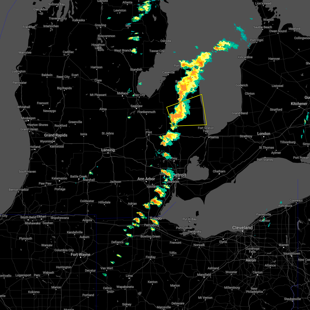 At 249 pm edt, a severe thunderstorm was located near clifford, or near marlette, moving east at 40 mph (radar indicated). Hazards include 60 mph wind gusts and nickel size hail. Expect damage to roofs, siding, and trees. this severe thunderstorm will be near, brown city around 255 pm edt. sandusky and peck around 315 pm edt. croswell around 325 pm edt. carsonville and applegate around 330 pm edt. port sanilac around 340 pm edt. Other locations impacted by this severe thunderstorm include east dayton, birch beach, mcgregor, wilmot, amador, snover, juhl, elmer, silverwood and valley center. At 249 pm edt, a severe thunderstorm was located near clifford, or near marlette, moving east at 40 mph (radar indicated). Hazards include 60 mph wind gusts and nickel size hail. Expect damage to roofs, siding, and trees. this severe thunderstorm will be near, brown city around 255 pm edt. sandusky and peck around 315 pm edt. croswell around 325 pm edt. carsonville and applegate around 330 pm edt. port sanilac around 340 pm edt. Other locations impacted by this severe thunderstorm include east dayton, birch beach, mcgregor, wilmot, amador, snover, juhl, elmer, silverwood and valley center.
|
| 7/20/2022 2:40 PM EDT |
 At 238 pm edt, a severe thunderstorm was located near north branch, moving northeast at 45 mph (radar indicated). Hazards include 60 mph wind gusts and quarter size hail. Hail damage to vehicles is expected. expect wind damage to roofs, siding, and trees. This severe thunderstorm will remain over mainly rural areas of southeastern tuscola and northern lapeer counties, including the following locations, wilmot, burnside, kings mill, silverwood and fostoria. At 238 pm edt, a severe thunderstorm was located near north branch, moving northeast at 45 mph (radar indicated). Hazards include 60 mph wind gusts and quarter size hail. Hail damage to vehicles is expected. expect wind damage to roofs, siding, and trees. This severe thunderstorm will remain over mainly rural areas of southeastern tuscola and northern lapeer counties, including the following locations, wilmot, burnside, kings mill, silverwood and fostoria.
|
| 7/20/2022 2:25 PM EDT |
 At 223 pm edt, a severe thunderstorm was located over otter lake, or over columbiaville, moving northeast at 50 mph (radar indicated). Hazards include 60 mph wind gusts and penny size hail. Expect damage to roofs, siding, and trees. this severe storm will be near, mayville around 235 pm edt. north branch and clifford around 240 pm edt. kingston around 245 pm edt. Other locations impacted by this severe thunderstorm include east dayton, burnside, wilmot, kings mill, silverwood, genesee and fostoria. At 223 pm edt, a severe thunderstorm was located over otter lake, or over columbiaville, moving northeast at 50 mph (radar indicated). Hazards include 60 mph wind gusts and penny size hail. Expect damage to roofs, siding, and trees. this severe storm will be near, mayville around 235 pm edt. north branch and clifford around 240 pm edt. kingston around 245 pm edt. Other locations impacted by this severe thunderstorm include east dayton, burnside, wilmot, kings mill, silverwood, genesee and fostoria.
|
| 7/20/2022 2:11 PM EDT |
 At 210 pm edt, a severe thunderstorm was located near clio, moving northeast at 40 mph (radar indicated). Hazards include 60 mph wind gusts and penny size hail. Expect damage to roofs, siding, and trees. this severe storm will be near, otisville around 220 pm edt. millington, columbiaville and otter lake around 225 pm edt. mayville around 240 pm edt. clifford around 250 pm edt. kingston around 255 pm edt. Other locations impacted by this severe thunderstorm include east dayton, burnside, wilmot, thetford township, kings mill, silverwood, genesee and fostoria. At 210 pm edt, a severe thunderstorm was located near clio, moving northeast at 40 mph (radar indicated). Hazards include 60 mph wind gusts and penny size hail. Expect damage to roofs, siding, and trees. this severe storm will be near, otisville around 220 pm edt. millington, columbiaville and otter lake around 225 pm edt. mayville around 240 pm edt. clifford around 250 pm edt. kingston around 255 pm edt. Other locations impacted by this severe thunderstorm include east dayton, burnside, wilmot, thetford township, kings mill, silverwood, genesee and fostoria.
|
| 7/20/2022 1:58 PM EDT |
 At 158 pm edt, a severe thunderstorm was located near flushing, moving northeast at 40 mph (radar indicated). Hazards include 60 mph wind gusts and penny size hail. Expect damage to roofs, siding, and trees. this severe thunderstorm will be near, clio, mount morris and crossroads village around 205 pm edt. otisville around 220 pm edt. millington and otter lake around 225 pm edt. columbiaville around 230 pm edt. mayville around 240 pm edt. north branch and clifford around 250 pm edt. kingston around 255 pm edt. Other locations impacted by this severe thunderstorm include east dayton, burnside, wilmot, thetford township, kings mill, silverwood, genesee and fostoria. At 158 pm edt, a severe thunderstorm was located near flushing, moving northeast at 40 mph (radar indicated). Hazards include 60 mph wind gusts and penny size hail. Expect damage to roofs, siding, and trees. this severe thunderstorm will be near, clio, mount morris and crossroads village around 205 pm edt. otisville around 220 pm edt. millington and otter lake around 225 pm edt. columbiaville around 230 pm edt. mayville around 240 pm edt. north branch and clifford around 250 pm edt. kingston around 255 pm edt. Other locations impacted by this severe thunderstorm include east dayton, burnside, wilmot, thetford township, kings mill, silverwood, genesee and fostoria.
|
| 6/16/2022 5:12 AM EDT |
 The severe thunderstorm warning for tuscola and western huron counties will expire at 515 am edt, the storms which prompted the warning have moved out of the area. therefore, the warning will be allowed to expire. The severe thunderstorm warning for tuscola and western huron counties will expire at 515 am edt, the storms which prompted the warning have moved out of the area. therefore, the warning will be allowed to expire.
|
| 6/16/2022 4:31 AM EDT |
 At 431 am edt, severe thunderstorms were located along a line extending from 9 miles west of sebewaing to quanicassee to near bridgeport, moving northeast at 65 mph (radar indicated). Hazards include 60 mph wind gusts and penny size hail. Expect damage to roofs, siding, and trees. severe thunderstorms will be near, vassar and unionville around 440 am edt. sebewaing, pigeon and fairgrove around 445 am edt. caro, caseville, akron and owendale around 450 am edt. elkton around 455 am edt. gagetown around 500 am edt. cass city around 505 am edt. other locations impacted by these severe thunderstorms include east dayton, tuscola, colling, wilmot, wisner, ivanhoe, bay port, ellington, gilford and richville. hail threat, radar indicated max hail size, 0. 75 in wind threat, radar indicated max wind gust, 60 mph. At 431 am edt, severe thunderstorms were located along a line extending from 9 miles west of sebewaing to quanicassee to near bridgeport, moving northeast at 65 mph (radar indicated). Hazards include 60 mph wind gusts and penny size hail. Expect damage to roofs, siding, and trees. severe thunderstorms will be near, vassar and unionville around 440 am edt. sebewaing, pigeon and fairgrove around 445 am edt. caro, caseville, akron and owendale around 450 am edt. elkton around 455 am edt. gagetown around 500 am edt. cass city around 505 am edt. other locations impacted by these severe thunderstorms include east dayton, tuscola, colling, wilmot, wisner, ivanhoe, bay port, ellington, gilford and richville. hail threat, radar indicated max hail size, 0. 75 in wind threat, radar indicated max wind gust, 60 mph.
|
| 9/14/2021 5:11 PM EDT |
 The severe thunderstorm warning for tuscola and northwestern lapeer counties will expire at 515 pm edt, the storms which prompted the warning have weakened below severe limits, and no longer pose an immediate threat to life or property. therefore, the warning will be allowed to expire. however small hail and gusty winds are still possible with these thunderstorms. a severe thunderstorm watch remains in effect until 1100 pm edt for southeastern michigan. The severe thunderstorm warning for tuscola and northwestern lapeer counties will expire at 515 pm edt, the storms which prompted the warning have weakened below severe limits, and no longer pose an immediate threat to life or property. therefore, the warning will be allowed to expire. however small hail and gusty winds are still possible with these thunderstorms. a severe thunderstorm watch remains in effect until 1100 pm edt for southeastern michigan.
|
| 9/14/2021 4:59 PM EDT |
 At 458 pm edt, severe thunderstorms were located along a line extending from near ubly to 7 miles northeast of kingston to near mayville, moving east at 35 mph (radar indicated). Hazards include 60 mph wind gusts and quarter size hail. Hail damage to vehicles is expected. expect wind damage to roofs, siding, and trees. these severe storms will be near, kingston around 515 pm edt. other locations impacted by these severe thunderstorms include east dayton, deford, tuscola, wilmot, ellington, silverwood and fostoria. hail threat, radar indicated max hail size, 1. 00 in wind threat, radar indicated max wind gust, 60 mph. At 458 pm edt, severe thunderstorms were located along a line extending from near ubly to 7 miles northeast of kingston to near mayville, moving east at 35 mph (radar indicated). Hazards include 60 mph wind gusts and quarter size hail. Hail damage to vehicles is expected. expect wind damage to roofs, siding, and trees. these severe storms will be near, kingston around 515 pm edt. other locations impacted by these severe thunderstorms include east dayton, deford, tuscola, wilmot, ellington, silverwood and fostoria. hail threat, radar indicated max hail size, 1. 00 in wind threat, radar indicated max wind gust, 60 mph.
|
| 9/14/2021 4:45 PM EDT |
 At 445 pm edt, severe thunderstorms were located along a line extending from near cass city to near kingston to millington, moving east at 35 mph (radar indicated). Hazards include 60 mph wind gusts and quarter size hail. Hail damage to vehicles is expected. expect wind damage to roofs, siding, and trees. these severe storms will be near, cass city and kingston around 450 pm edt. mayville around 505 pm edt. clifford around 515 pm edt. other locations impacted by these severe thunderstorms include east dayton, deford, tuscola, wilmot, ellington, watrousville, silverwood and fostoria. hail threat, radar indicated max hail size, 1. 00 in wind threat, radar indicated max wind gust, 60 mph. At 445 pm edt, severe thunderstorms were located along a line extending from near cass city to near kingston to millington, moving east at 35 mph (radar indicated). Hazards include 60 mph wind gusts and quarter size hail. Hail damage to vehicles is expected. expect wind damage to roofs, siding, and trees. these severe storms will be near, cass city and kingston around 450 pm edt. mayville around 505 pm edt. clifford around 515 pm edt. other locations impacted by these severe thunderstorms include east dayton, deford, tuscola, wilmot, ellington, watrousville, silverwood and fostoria. hail threat, radar indicated max hail size, 1. 00 in wind threat, radar indicated max wind gust, 60 mph.
|
| 9/14/2021 4:30 PM EDT |
 At 430 pm edt, severe thunderstorms were located along a line extending from 6 miles southwest of ubly to near caro to near millington, moving east at 40 mph (radar indicated). Hazards include 60 mph wind gusts and quarter size hail. Hail damage to vehicles is expected. expect wind damage to roofs, siding, and trees. these severe storms will be near, kingston around 440 pm edt. mayville around 450 pm edt. clifford around 500 pm edt. other locations impacted by these severe thunderstorms include east dayton, deford, tuscola, wilmot, ellington, watrousville, silverwood, richville and fostoria. hail threat, radar indicated max hail size, 1. 00 in wind threat, radar indicated max wind gust, 60 mph. At 430 pm edt, severe thunderstorms were located along a line extending from 6 miles southwest of ubly to near caro to near millington, moving east at 40 mph (radar indicated). Hazards include 60 mph wind gusts and quarter size hail. Hail damage to vehicles is expected. expect wind damage to roofs, siding, and trees. these severe storms will be near, kingston around 440 pm edt. mayville around 450 pm edt. clifford around 500 pm edt. other locations impacted by these severe thunderstorms include east dayton, deford, tuscola, wilmot, ellington, watrousville, silverwood, richville and fostoria. hail threat, radar indicated max hail size, 1. 00 in wind threat, radar indicated max wind gust, 60 mph.
|
| 9/14/2021 4:19 PM EDT |
 At 418 pm edt, severe thunderstorms were located along a line extending from near cass city to near vassar to near birch run, moving east at 40 mph (radar indicated). Hazards include 60 mph wind gusts and quarter size hail. Hail damage to vehicles is expected. expect wind damage to roofs, siding, and trees. severe thunderstorms will be near, cass city and gagetown around 425 pm edt. vassar around 435 pm edt. kingston around 440 pm edt. mayville around 450 pm edt. clifford around 500 pm edt. other locations impacted by these severe thunderstorms include east dayton, deford, tuscola, wilmot, ellington, watrousville, silverwood, richville and fostoria. hail threat, radar indicated max hail size, 1. 00 in wind threat, radar indicated max wind gust, 60 mph. At 418 pm edt, severe thunderstorms were located along a line extending from near cass city to near vassar to near birch run, moving east at 40 mph (radar indicated). Hazards include 60 mph wind gusts and quarter size hail. Hail damage to vehicles is expected. expect wind damage to roofs, siding, and trees. severe thunderstorms will be near, cass city and gagetown around 425 pm edt. vassar around 435 pm edt. kingston around 440 pm edt. mayville around 450 pm edt. clifford around 500 pm edt. other locations impacted by these severe thunderstorms include east dayton, deford, tuscola, wilmot, ellington, watrousville, silverwood, richville and fostoria. hail threat, radar indicated max hail size, 1. 00 in wind threat, radar indicated max wind gust, 60 mph.
|
| 9/7/2021 5:12 PM EDT |
 The severe thunderstorm warning for tuscola county will expire at 515 pm edt, the storm which prompted the warning has weakened below severe limits, and no longer poses an immediate threat to life or property. therefore, the warning will be allowed to expire. however gusty winds up to 55 mph and heavy rain are still possible with this thunderstorm. a severe thunderstorm watch also remains in effect until 1100 pm edt for southeastern michigan. The severe thunderstorm warning for tuscola county will expire at 515 pm edt, the storm which prompted the warning has weakened below severe limits, and no longer poses an immediate threat to life or property. therefore, the warning will be allowed to expire. however gusty winds up to 55 mph and heavy rain are still possible with this thunderstorm. a severe thunderstorm watch also remains in effect until 1100 pm edt for southeastern michigan.
|
| 9/7/2021 4:54 PM EDT |
 At 453 pm edt, a severe thunderstorm was located over bridgeport, or near saginaw, moving east at 50 mph (radar indicated). Hazards include 60 mph wind gusts. Expect damage to roofs, siding, and trees. locations impacted include, caro, vassar, cass city, reese, millington, mayville, akron, fairgrove, kingston, tuscola, ellington, wilmot, gilford, east dayton, richville, deford, watrousville, fostoria and silverwood. hail threat, radar indicated max hail size, <. 75 in wind threat, radar indicated max wind gust, 60 mph. At 453 pm edt, a severe thunderstorm was located over bridgeport, or near saginaw, moving east at 50 mph (radar indicated). Hazards include 60 mph wind gusts. Expect damage to roofs, siding, and trees. locations impacted include, caro, vassar, cass city, reese, millington, mayville, akron, fairgrove, kingston, tuscola, ellington, wilmot, gilford, east dayton, richville, deford, watrousville, fostoria and silverwood. hail threat, radar indicated max hail size, <. 75 in wind threat, radar indicated max wind gust, 60 mph.
|
| 9/7/2021 4:37 PM EDT |
 At 437 pm edt, severe thunderstorms were located along a line extending from near ubly to near kingston to near mayville, moving east at 55 mph (radar indicated). Hazards include 60 mph wind gusts. Expect damage to roofs, siding, and trees. these severe thunderstorms will remain over mainly rural areas of tuscola county, including the following locations, east dayton, deford, tuscola, wilmot, ellington, gilford, watrousville, richville, fostoria and silverwood. hail threat, radar indicated max hail size, <. 75 in wind threat, radar indicated max wind gust, 60 mph. At 437 pm edt, severe thunderstorms were located along a line extending from near ubly to near kingston to near mayville, moving east at 55 mph (radar indicated). Hazards include 60 mph wind gusts. Expect damage to roofs, siding, and trees. these severe thunderstorms will remain over mainly rural areas of tuscola county, including the following locations, east dayton, deford, tuscola, wilmot, ellington, gilford, watrousville, richville, fostoria and silverwood. hail threat, radar indicated max hail size, <. 75 in wind threat, radar indicated max wind gust, 60 mph.
|
| 9/7/2021 4:12 PM EDT |
 At 412 pm edt, severe thunderstorms were located along a line extending from owendale to akron to near reese to near bridgeport, moving east at 55 mph (radar indicated). Hazards include 60 mph wind gusts and penny size hail. Expect damage to roofs, siding, and trees. these severe storms will be near, akron, unionville and gagetown around 415 pm edt. caro and cass city around 425 pm edt. millington around 430 pm edt. kingston around 435 pm edt. mayville around 440 pm edt. other locations impacted by these severe thunderstorms include east dayton, tuscola, colling, wilmot, wisner, ellington, gilford, richville, deford and colwood. hail threat, radar indicated max hail size, 0. 75 in wind threat, radar indicated max wind gust, 60 mph. At 412 pm edt, severe thunderstorms were located along a line extending from owendale to akron to near reese to near bridgeport, moving east at 55 mph (radar indicated). Hazards include 60 mph wind gusts and penny size hail. Expect damage to roofs, siding, and trees. these severe storms will be near, akron, unionville and gagetown around 415 pm edt. caro and cass city around 425 pm edt. millington around 430 pm edt. kingston around 435 pm edt. mayville around 440 pm edt. other locations impacted by these severe thunderstorms include east dayton, tuscola, colling, wilmot, wisner, ellington, gilford, richville, deford and colwood. hail threat, radar indicated max hail size, 0. 75 in wind threat, radar indicated max wind gust, 60 mph.
|
| 9/7/2021 3:53 PM EDT |
 At 353 pm edt, severe thunderstorms were located along a line extending from 11 miles northeast of essexville to freeland to near ithaca, moving east at 45 mph (radar indicated). Hazards include 60 mph wind gusts and quarter size hail. Hail damage to vehicles is expected. expect wind damage to roofs, siding, and trees. severe thunderstorms will be near, unionville around 410 pm edt. reese and quanicassee around 420 pm edt. gagetown around 425 pm edt. fairgrove around 430 pm edt. akron around 435 pm edt. caro around 445 pm edt. cass city and kingston around 455 pm edt. millington around 500 pm edt. other locations impacted by these severe thunderstorms include east dayton, tuscola, colling, wilmot, wisner, ellington, gilford, richville, deford and colwood. hail threat, radar indicated max hail size, 1. 00 in wind threat, radar indicated max wind gust, 60 mph. At 353 pm edt, severe thunderstorms were located along a line extending from 11 miles northeast of essexville to freeland to near ithaca, moving east at 45 mph (radar indicated). Hazards include 60 mph wind gusts and quarter size hail. Hail damage to vehicles is expected. expect wind damage to roofs, siding, and trees. severe thunderstorms will be near, unionville around 410 pm edt. reese and quanicassee around 420 pm edt. gagetown around 425 pm edt. fairgrove around 430 pm edt. akron around 435 pm edt. caro around 445 pm edt. cass city and kingston around 455 pm edt. millington around 500 pm edt. other locations impacted by these severe thunderstorms include east dayton, tuscola, colling, wilmot, wisner, ellington, gilford, richville, deford and colwood. hail threat, radar indicated max hail size, 1. 00 in wind threat, radar indicated max wind gust, 60 mph.
|
| 8/29/2021 6:07 PM EDT |
 At 607 pm edt, severe thunderstorms were located along a line extending from near cass city to near mayville to near holly, moving northeast at 35 mph (radar indicated). Hazards include 60 mph wind gusts. Expect damage to roofs, siding, and trees. these severe storms will be near, cass city, mayville and gagetown around 610 pm edt. kingston around 630 pm edt. other locations impacted by these severe thunderstorms include atlas, east dayton, deford, rankin, wilmot, thetford township, ellington, argentine, genesee and fostoria. people attending ally golf tournament should seek safe shelter immediately! hail threat, radar indicated max hail size, <. 75 in wind threat, radar indicated max wind gust, 60 mph. At 607 pm edt, severe thunderstorms were located along a line extending from near cass city to near mayville to near holly, moving northeast at 35 mph (radar indicated). Hazards include 60 mph wind gusts. Expect damage to roofs, siding, and trees. these severe storms will be near, cass city, mayville and gagetown around 610 pm edt. kingston around 630 pm edt. other locations impacted by these severe thunderstorms include atlas, east dayton, deford, rankin, wilmot, thetford township, ellington, argentine, genesee and fostoria. people attending ally golf tournament should seek safe shelter immediately! hail threat, radar indicated max hail size, <. 75 in wind threat, radar indicated max wind gust, 60 mph.
|
| 8/29/2021 5:52 PM EDT |
 At 552 pm edt, severe thunderstorms were located along a line extending from owendale to near mayville to linden, moving east at 35 mph (radar indicated). Hazards include 60 mph wind gusts. Expect damage to roofs, siding, and trees. these severe storms will be near, otter lake and gagetown around 555 pm edt. mayville around 600 pm edt. grand blanc and kingston around 615 pm edt. goodrich around 620 pm edt. other locations impacted by these severe thunderstorms include atlas, east dayton, rankin, colling, wilmot, ellington, argentine, genesee, deford and colwood. people attending ally golf tournament should seek safe shelter immediately! hail threat, radar indicated max hail size, <. 75 in wind threat, radar indicated max wind gust, 60 mph. At 552 pm edt, severe thunderstorms were located along a line extending from owendale to near mayville to linden, moving east at 35 mph (radar indicated). Hazards include 60 mph wind gusts. Expect damage to roofs, siding, and trees. these severe storms will be near, otter lake and gagetown around 555 pm edt. mayville around 600 pm edt. grand blanc and kingston around 615 pm edt. goodrich around 620 pm edt. other locations impacted by these severe thunderstorms include atlas, east dayton, rankin, colling, wilmot, ellington, argentine, genesee, deford and colwood. people attending ally golf tournament should seek safe shelter immediately! hail threat, radar indicated max hail size, <. 75 in wind threat, radar indicated max wind gust, 60 mph.
|
| 8/29/2021 5:44 PM EDT |
 At 543 pm edt, severe thunderstorms were located along a line extending from near owendale to millington to near byron, moving east at 35 mph (radar indicated). Hazards include 60 mph wind gusts. Expect damage to roofs, siding, and trees. these severe storms will be near, otter lake and gagetown around 550 pm edt. mayville around 600 pm edt. grand blanc and kingston around 615 pm edt. goodrich around 620 pm edt. other locations impacted by these severe thunderstorms include atlas, east dayton, tuscola, rankin, colling, wilmot, wisner, ellington, gilford and argentine. people attending ally golf tournament should seek safe shelter immediately! hail threat, radar indicated max hail size, <. 75 in wind threat, radar indicated max wind gust, 60 mph. At 543 pm edt, severe thunderstorms were located along a line extending from near owendale to millington to near byron, moving east at 35 mph (radar indicated). Hazards include 60 mph wind gusts. Expect damage to roofs, siding, and trees. these severe storms will be near, otter lake and gagetown around 550 pm edt. mayville around 600 pm edt. grand blanc and kingston around 615 pm edt. goodrich around 620 pm edt. other locations impacted by these severe thunderstorms include atlas, east dayton, tuscola, rankin, colling, wilmot, wisner, ellington, gilford and argentine. people attending ally golf tournament should seek safe shelter immediately! hail threat, radar indicated max hail size, <. 75 in wind threat, radar indicated max wind gust, 60 mph.
|
| 8/29/2021 5:34 PM EDT |
 At 534 pm edt, severe thunderstorms were located along a line extending from near sebewaing to near frankenmuth to near durand, moving east at 35 mph (radar indicated). Hazards include 60 mph wind gusts. Expect damage to roofs, siding, and trees. these severe storms will be near, unionville around 540 pm edt. vassar and millington around 545 pm edt. flushing, otter lake and gagetown around 550 pm edt. lake fenton around 555 pm edt. flint and mayville around 600 pm edt. grand blanc, burton and crossroads village around 605 pm edt. goodrich around 610 pm edt. davison around 615 pm edt. other locations impacted by these severe thunderstorms include atlas, east dayton, tuscola, rankin, colling, wilmot, wisner, ellington, gilford and argentine. people attending ally golf tournament should seek safe shelter immediately! hail threat, radar indicated max hail size, <. 75 in wind threat, radar indicated max wind gust, 60 mph. At 534 pm edt, severe thunderstorms were located along a line extending from near sebewaing to near frankenmuth to near durand, moving east at 35 mph (radar indicated). Hazards include 60 mph wind gusts. Expect damage to roofs, siding, and trees. these severe storms will be near, unionville around 540 pm edt. vassar and millington around 545 pm edt. flushing, otter lake and gagetown around 550 pm edt. lake fenton around 555 pm edt. flint and mayville around 600 pm edt. grand blanc, burton and crossroads village around 605 pm edt. goodrich around 610 pm edt. davison around 615 pm edt. other locations impacted by these severe thunderstorms include atlas, east dayton, tuscola, rankin, colling, wilmot, wisner, ellington, gilford and argentine. people attending ally golf tournament should seek safe shelter immediately! hail threat, radar indicated max hail size, <. 75 in wind threat, radar indicated max wind gust, 60 mph.
|
| 8/29/2021 5:21 PM EDT |
 At 521 pm edt, severe thunderstorms were located along a line extending from near unionville to birch run to near bancroft, moving east at 25 mph (radar indicated). Hazards include 60 mph wind gusts. Expect damage to roofs, siding, and trees. these severe storms will be near, clio around 525 pm edt. unionville around 535 pm edt. lennon around 540 pm edt. vassar and millington around 550 pm edt. swartz creek, linden and otter lake around 555 pm edt. gagetown around 600 pm edt. cass city and lake fenton around 605 pm edt. flint and mayville around 610 pm edt. other locations impacted by these severe thunderstorms include atlas, east dayton, tuscola, rankin, colling, wilmot, wisner, ellington, gilford and argentine. people attending ally golf tournament should seek safe shelter immediately! hail threat, radar indicated max hail size, <. 75 in wind threat, radar indicated max wind gust, 60 mph. At 521 pm edt, severe thunderstorms were located along a line extending from near unionville to birch run to near bancroft, moving east at 25 mph (radar indicated). Hazards include 60 mph wind gusts. Expect damage to roofs, siding, and trees. these severe storms will be near, clio around 525 pm edt. unionville around 535 pm edt. lennon around 540 pm edt. vassar and millington around 550 pm edt. swartz creek, linden and otter lake around 555 pm edt. gagetown around 600 pm edt. cass city and lake fenton around 605 pm edt. flint and mayville around 610 pm edt. other locations impacted by these severe thunderstorms include atlas, east dayton, tuscola, rankin, colling, wilmot, wisner, ellington, gilford and argentine. people attending ally golf tournament should seek safe shelter immediately! hail threat, radar indicated max hail size, <. 75 in wind threat, radar indicated max wind gust, 60 mph.
|
| 8/29/2021 5:11 PM EDT |
 At 510 pm edt, severe thunderstorms were located along a line extending from near zilwaukee to 7 miles east of st. charles to near owosso, moving east at 35 mph (radar indicated). Hazards include 60 mph wind gusts. Expect damage to roofs, siding, and trees. severe thunderstorms will be near, montrose and munger around 520 pm edt. reese around 525 pm edt. clio and quanicassee around 530 pm edt. fairgrove and lennon around 540 pm edt. akron around 545 pm edt. flushing, caro, vassar, millington and swartz creek around 550 pm edt. mount morris and beecher around 600 pm edt. flint, grand blanc, mayville and crossroads village around 605 pm edt. other locations impacted by these severe thunderstorms include atlas, east dayton, tuscola, rankin, colling, wilmot, wisner, ellington, gilford and argentine. people attending ally golf tournament should seek safe shelter immediately! hail threat, radar indicated max hail size, <. 75 in wind threat, radar indicated max wind gust, 60 mph. At 510 pm edt, severe thunderstorms were located along a line extending from near zilwaukee to 7 miles east of st. charles to near owosso, moving east at 35 mph (radar indicated). Hazards include 60 mph wind gusts. Expect damage to roofs, siding, and trees. severe thunderstorms will be near, montrose and munger around 520 pm edt. reese around 525 pm edt. clio and quanicassee around 530 pm edt. fairgrove and lennon around 540 pm edt. akron around 545 pm edt. flushing, caro, vassar, millington and swartz creek around 550 pm edt. mount morris and beecher around 600 pm edt. flint, grand blanc, mayville and crossroads village around 605 pm edt. other locations impacted by these severe thunderstorms include atlas, east dayton, tuscola, rankin, colling, wilmot, wisner, ellington, gilford and argentine. people attending ally golf tournament should seek safe shelter immediately! hail threat, radar indicated max hail size, <. 75 in wind threat, radar indicated max wind gust, 60 mph.
|
| 8/28/2021 7:22 PM EDT |
 At 722 pm edt, severe thunderstorms were located along a line extending from near owendale to near caro to near clio, moving east at 25 mph (radar indicated). Hazards include 60 mph wind gusts. Expect damage to roofs, siding, and trees. these severe storms will be near, owendale around 730 pm edt. gagetown around 735 pm edt. mayville around 740 pm edt. kingston around 755 pm edt. ubly around 805 pm edt. other locations impacted by these severe thunderstorms include east dayton, parisville, colling, wilmot, white rock, ivanhoe, ellington, ruth, deford and colwood. hail threat, radar indicated max hail size, <. 75 in wind threat, radar indicated max wind gust, 60 mph. At 722 pm edt, severe thunderstorms were located along a line extending from near owendale to near caro to near clio, moving east at 25 mph (radar indicated). Hazards include 60 mph wind gusts. Expect damage to roofs, siding, and trees. these severe storms will be near, owendale around 730 pm edt. gagetown around 735 pm edt. mayville around 740 pm edt. kingston around 755 pm edt. ubly around 805 pm edt. other locations impacted by these severe thunderstorms include east dayton, parisville, colling, wilmot, white rock, ivanhoe, ellington, ruth, deford and colwood. hail threat, radar indicated max hail size, <. 75 in wind threat, radar indicated max wind gust, 60 mph.
|
| 8/28/2021 6:51 PM EDT |
 At 651 pm edt, severe thunderstorms were located along a line extending from near sebewaing to near munger to near montrose, moving east at 25 mph (radar indicated). Hazards include 60 mph wind gusts. Expect damage to roofs, siding, and trees. severe thunderstorms will be near, sebewaing around 700 pm edt. akron and fairgrove around 710 pm edt. vassar and owendale around 715 pm edt. caro and gagetown around 725 pm edt. cass city and millington around 735 pm edt. mayville around 740 pm edt. ubly and kingston around 745 pm edt. other locations impacted by these severe thunderstorms include east dayton, parisville, tuscola, colling, wilmot, white rock, wisner, ivanhoe, ellington and gilford. hail threat, radar indicated max hail size, <. 75 in wind threat, radar indicated max wind gust, 60 mph. At 651 pm edt, severe thunderstorms were located along a line extending from near sebewaing to near munger to near montrose, moving east at 25 mph (radar indicated). Hazards include 60 mph wind gusts. Expect damage to roofs, siding, and trees. severe thunderstorms will be near, sebewaing around 700 pm edt. akron and fairgrove around 710 pm edt. vassar and owendale around 715 pm edt. caro and gagetown around 725 pm edt. cass city and millington around 735 pm edt. mayville around 740 pm edt. ubly and kingston around 745 pm edt. other locations impacted by these severe thunderstorms include east dayton, parisville, tuscola, colling, wilmot, white rock, wisner, ivanhoe, ellington and gilford. hail threat, radar indicated max hail size, <. 75 in wind threat, radar indicated max wind gust, 60 mph.
|
| 8/11/2021 1:15 AM EDT |
 At 114 am edt, severe thunderstorms were located along a line extending from near owendale to near gagetown to near mayville, moving east at 45 mph (radar indicated). Hazards include 60 mph wind gusts. Expect damage to roofs, siding, and trees. these severe storms will be near, cass city and pigeon around 120 am edt. elkton around 125 am edt. other locations impacted by these severe thunderstorms include east dayton, deford, colling, wilmot, colwood, bay port, bach, ellington and silverwood. hail threat, radar indicated max hail size, <. 75 in wind threat, radar indicated max wind gust, 60 mph. At 114 am edt, severe thunderstorms were located along a line extending from near owendale to near gagetown to near mayville, moving east at 45 mph (radar indicated). Hazards include 60 mph wind gusts. Expect damage to roofs, siding, and trees. these severe storms will be near, cass city and pigeon around 120 am edt. elkton around 125 am edt. other locations impacted by these severe thunderstorms include east dayton, deford, colling, wilmot, colwood, bay port, bach, ellington and silverwood. hail threat, radar indicated max hail size, <. 75 in wind threat, radar indicated max wind gust, 60 mph.
|
| 8/11/2021 1:00 AM EDT |
 At 100 am edt, severe thunderstorms were located along a line extending from sebewaing to near akron to near mayville, moving east at 45 mph (radar indicated). Hazards include 60 mph wind gusts. Expect damage to roofs, siding, and trees. these severe storms will be near, owendale around 110 am edt. cass city, pigeon and gagetown around 115 am edt. elkton and kingston around 120 am edt. other locations impacted by these severe thunderstorms include east dayton, colling, wilmot, wisner, bay port, ellington, deford, colwood, bach and watrousville. hail threat, radar indicated max hail size, <. 75 in wind threat, radar indicated max wind gust, 60 mph. At 100 am edt, severe thunderstorms were located along a line extending from sebewaing to near akron to near mayville, moving east at 45 mph (radar indicated). Hazards include 60 mph wind gusts. Expect damage to roofs, siding, and trees. these severe storms will be near, owendale around 110 am edt. cass city, pigeon and gagetown around 115 am edt. elkton and kingston around 120 am edt. other locations impacted by these severe thunderstorms include east dayton, colling, wilmot, wisner, bay port, ellington, deford, colwood, bach and watrousville. hail threat, radar indicated max hail size, <. 75 in wind threat, radar indicated max wind gust, 60 mph.
|
| 8/11/2021 12:43 AM EDT |
 At 1242 am edt, severe thunderstorms were located along a line extending from 10 miles northeast of essexville to near quanicassee to 6 miles southeast of frankenmuth, moving east at 45 mph (radar indicated). Hazards include 60 mph wind gusts. Expect damage to roofs, siding, and trees. severe thunderstorms will be near, akron and fairgrove around 1250 am edt. unionville around 1255 am edt. caro and sebewaing around 100 am edt. mayville around 105 am edt. pigeon, gagetown and owendale around 110 am edt. cass city and kingston around 115 am edt. elkton around 120 am edt. other locations impacted by these severe thunderstorms include east dayton, arthur, tuscola, colling, wilmot, wisner, bay port, ellington, gera and gilford. hail threat, radar indicated max hail size, <. 75 in wind threat, radar indicated max wind gust, 60 mph. At 1242 am edt, severe thunderstorms were located along a line extending from 10 miles northeast of essexville to near quanicassee to 6 miles southeast of frankenmuth, moving east at 45 mph (radar indicated). Hazards include 60 mph wind gusts. Expect damage to roofs, siding, and trees. severe thunderstorms will be near, akron and fairgrove around 1250 am edt. unionville around 1255 am edt. caro and sebewaing around 100 am edt. mayville around 105 am edt. pigeon, gagetown and owendale around 110 am edt. cass city and kingston around 115 am edt. elkton around 120 am edt. other locations impacted by these severe thunderstorms include east dayton, arthur, tuscola, colling, wilmot, wisner, bay port, ellington, gera and gilford. hail threat, radar indicated max hail size, <. 75 in wind threat, radar indicated max wind gust, 60 mph.
|
| 7/24/2021 5:40 PM EDT |
 At 540 pm edt, severe thunderstorms were located along a line extending from cass city to 6 miles east of caro to vassar, moving east at 30 mph (radar indicated). Hazards include 60 mph wind gusts. Expect damage to roofs, siding, and trees. Locations impacted include, caro, cass city, kingston, gagetown, ellington, wilmot, east dayton, deford, watrousville and richville. At 540 pm edt, severe thunderstorms were located along a line extending from cass city to 6 miles east of caro to vassar, moving east at 30 mph (radar indicated). Hazards include 60 mph wind gusts. Expect damage to roofs, siding, and trees. Locations impacted include, caro, cass city, kingston, gagetown, ellington, wilmot, east dayton, deford, watrousville and richville.
|
| 7/24/2021 5:23 PM EDT |
 At 522 pm edt, a line of severe thunderstorms were located from reese to unionville, moving southeast at 35 mph (radar indicated). Hazards include 60 mph wind gusts. expect damage to roofs, siding, and trees At 522 pm edt, a line of severe thunderstorms were located from reese to unionville, moving southeast at 35 mph (radar indicated). Hazards include 60 mph wind gusts. expect damage to roofs, siding, and trees
|
| 7/24/2021 5:12 PM EDT |
 At 511 pm edt, severe thunderstorms were located along a line extending from owendale to 6 miles southwest of gagetown to near akron to near reese, moving east at 40 mph (radar indicated). Hazards include 60 mph wind gusts. Expect damage to roofs, siding, and trees. these severe storms will be near, gagetown and owendale around 515 pm edt. caro around 535 pm edt. cass city around 545 pm edt. kingston around 550 pm edt. Other locations impacted by these severe thunderstorms include east dayton, colling, wilmot, wisner, ivanhoe, ellington, gilford, new greenleaf, richville and decker. At 511 pm edt, severe thunderstorms were located along a line extending from owendale to 6 miles southwest of gagetown to near akron to near reese, moving east at 40 mph (radar indicated). Hazards include 60 mph wind gusts. Expect damage to roofs, siding, and trees. these severe storms will be near, gagetown and owendale around 515 pm edt. caro around 535 pm edt. cass city around 545 pm edt. kingston around 550 pm edt. Other locations impacted by these severe thunderstorms include east dayton, colling, wilmot, wisner, ivanhoe, ellington, gilford, new greenleaf, richville and decker.
|
| 7/24/2021 4:52 PM EDT |
 At 452 pm edt, a severe thunderstorm was located over unionville, or near sebewaing, moving east at 45 mph (radar indicated). Hazards include 60 mph wind gusts and penny size hail. Expect damage to roofs, siding, and trees. this severe storm will be near, owendale around 505 pm edt. gagetown around 510 pm edt. cass city around 515 pm edt. Other locations impacted by this severe thunderstorm include east dayton, colling, wilmot, wisner, ivanhoe, ellington, gilford, new greenleaf, richville and decker. At 452 pm edt, a severe thunderstorm was located over unionville, or near sebewaing, moving east at 45 mph (radar indicated). Hazards include 60 mph wind gusts and penny size hail. Expect damage to roofs, siding, and trees. this severe storm will be near, owendale around 505 pm edt. gagetown around 510 pm edt. cass city around 515 pm edt. Other locations impacted by this severe thunderstorm include east dayton, colling, wilmot, wisner, ivanhoe, ellington, gilford, new greenleaf, richville and decker.
|
| 7/24/2021 4:37 PM EDT |
 At 437 pm edt, a severe thunderstorm was located 8 miles north of quanicassee, or 11 miles northeast of bay city, moving east at 45 mph (radar indicated). Hazards include 60 mph wind gusts and penny size hail. Expect damage to roofs, siding, and trees. this severe thunderstorm will be near, quanicassee around 440 pm edt. sebewaing, akron and unionville around 455 pm edt. Other locations in the path of this severe thunderstorm include owendale, gagetown and cass city. At 437 pm edt, a severe thunderstorm was located 8 miles north of quanicassee, or 11 miles northeast of bay city, moving east at 45 mph (radar indicated). Hazards include 60 mph wind gusts and penny size hail. Expect damage to roofs, siding, and trees. this severe thunderstorm will be near, quanicassee around 440 pm edt. sebewaing, akron and unionville around 455 pm edt. Other locations in the path of this severe thunderstorm include owendale, gagetown and cass city.
|
| 7/6/2021 10:50 PM EDT |
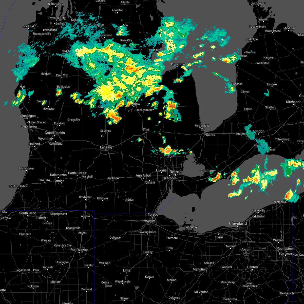 At 1049 pm edt, a severe thunderstorm was located over kingston, or near marlette, moving northeast at 30 mph (radar indicated). Hazards include 60 mph wind gusts and penny size hail. Expect damage to roofs, siding, and trees. This severe thunderstorm will remain over mainly rural areas of southeastern tuscola and northeastern lapeer counties, including the following locations, east dayton, burnside and silverwood. At 1049 pm edt, a severe thunderstorm was located over kingston, or near marlette, moving northeast at 30 mph (radar indicated). Hazards include 60 mph wind gusts and penny size hail. Expect damage to roofs, siding, and trees. This severe thunderstorm will remain over mainly rural areas of southeastern tuscola and northeastern lapeer counties, including the following locations, east dayton, burnside and silverwood.
|
| 7/6/2021 10:34 PM EDT |
 At 1034 pm edt, a severe thunderstorm was located near mayville, moving east at 20 mph (radar indicated). Hazards include 60 mph wind gusts and penny size hail. Expect damage to roofs, siding, and trees. this severe storm will be near, north branch around 1055 pm edt. clifford around 1100 pm edt. kingston around 1110 pm edt. Other locations impacted by this severe thunderstorm include east dayton, burnside, silverwood and fostoria. At 1034 pm edt, a severe thunderstorm was located near mayville, moving east at 20 mph (radar indicated). Hazards include 60 mph wind gusts and penny size hail. Expect damage to roofs, siding, and trees. this severe storm will be near, north branch around 1055 pm edt. clifford around 1100 pm edt. kingston around 1110 pm edt. Other locations impacted by this severe thunderstorm include east dayton, burnside, silverwood and fostoria.
|
| 7/6/2021 10:16 PM EDT |
 At 1015 pm edt, a severe thunderstorm was located over otter lake, or near millington, moving east at 20 mph (radar indicated). Hazards include 60 mph wind gusts and penny size hail. Expect damage to roofs, siding, and trees. this severe thunderstorm will be near, mayville around 1040 pm edt. north branch around 1055 pm edt. clifford around 1100 pm edt. kingston around 1110 pm edt. Other locations impacted by this severe thunderstorm include east dayton, burnside, silverwood and fostoria. At 1015 pm edt, a severe thunderstorm was located over otter lake, or near millington, moving east at 20 mph (radar indicated). Hazards include 60 mph wind gusts and penny size hail. Expect damage to roofs, siding, and trees. this severe thunderstorm will be near, mayville around 1040 pm edt. north branch around 1055 pm edt. clifford around 1100 pm edt. kingston around 1110 pm edt. Other locations impacted by this severe thunderstorm include east dayton, burnside, silverwood and fostoria.
|
| 10/23/2020 3:04 PM EDT |
 At 303 pm edt, severe thunderstorms were located along a line extending from near kingston to near clifford, moving east at 50 mph (radar indicated). Hazards include 60 mph wind gusts and penny size hail. Expect damage to roofs, siding, and trees. These severe thunderstorms will remain over mainly rural areas of southeastern tuscola county, including the following locations, wilmot, east dayton, deford, fostoria and silverwood. At 303 pm edt, severe thunderstorms were located along a line extending from near kingston to near clifford, moving east at 50 mph (radar indicated). Hazards include 60 mph wind gusts and penny size hail. Expect damage to roofs, siding, and trees. These severe thunderstorms will remain over mainly rural areas of southeastern tuscola county, including the following locations, wilmot, east dayton, deford, fostoria and silverwood.
|
| 10/23/2020 2:39 PM EDT |
 At 238 pm edt, severe thunderstorms were located along a line extending from near frankenmuth to clio, moving east at 50 mph (radar indicated). Hazards include 60 mph wind gusts and penny size hail. Expect damage to roofs, siding, and trees. severe thunderstorms will be near, vassar around 245 pm edt. millington around 250 pm edt. caro around 300 pm edt. mayville around 305 pm edt. kingston around 310 pm edt. Other locations impacted by these severe thunderstorms include east dayton, deford, tuscola, wilmot, watrousville, richville, fostoria and silverwood. At 238 pm edt, severe thunderstorms were located along a line extending from near frankenmuth to clio, moving east at 50 mph (radar indicated). Hazards include 60 mph wind gusts and penny size hail. Expect damage to roofs, siding, and trees. severe thunderstorms will be near, vassar around 245 pm edt. millington around 250 pm edt. caro around 300 pm edt. mayville around 305 pm edt. kingston around 310 pm edt. Other locations impacted by these severe thunderstorms include east dayton, deford, tuscola, wilmot, watrousville, richville, fostoria and silverwood.
|
| 7/19/2020 10:09 AM EDT |
 The severe thunderstorm warning for tuscola county will expire at 1015 am edt, the storms which prompted the warning have weakened below severe limits, and will continue to slowly exit the southern part of the county. therefore, the warning will be allowed to expire. however gusty winds and heavy rain will persist through at least 1030 am toward the southern tuscola border. The severe thunderstorm warning for tuscola county will expire at 1015 am edt, the storms which prompted the warning have weakened below severe limits, and will continue to slowly exit the southern part of the county. therefore, the warning will be allowed to expire. however gusty winds and heavy rain will persist through at least 1030 am toward the southern tuscola border.
|
| 7/19/2020 9:40 AM EDT | Trees down. time estimated by rada in tuscola county MI, 0.2 miles NE of Kingston, MI |
| 7/19/2020 9:33 AM EDT |
 At 933 am edt, severe thunderstorms were located along a line extending from 6 miles southeast of cass city to near caro to near reese, moving southeast at 45 mph (radar indicated). Hazards include 60 mph wind gusts. Expect damage to roofs, siding, and trees. these severe storms will be near, kingston around 950 am edt. mayville around 955 am edt. Other locations impacted by these severe thunderstorms include east dayton, tuscola, colling, wilmot, wisner, ellington, gilford, richville, deford and colwood. At 933 am edt, severe thunderstorms were located along a line extending from 6 miles southeast of cass city to near caro to near reese, moving southeast at 45 mph (radar indicated). Hazards include 60 mph wind gusts. Expect damage to roofs, siding, and trees. these severe storms will be near, kingston around 950 am edt. mayville around 955 am edt. Other locations impacted by these severe thunderstorms include east dayton, tuscola, colling, wilmot, wisner, ellington, gilford, richville, deford and colwood.
|
| 7/19/2020 9:17 AM EDT |
 At 916 am edt, a severe thunderstorm was located over munger, or near bay city, moving east at 50 mph (radar indicated). Hazards include 60 mph wind gusts. Expect damage to roofs, siding, and trees. this severe thunderstorm will be near, quanicassee around 920 am edt. reese around 925 am edt. akron and fairgrove around 930 am edt. vassar around 935 am edt. caro around 940 am edt. mayville around 945 am edt. kingston around 955 am edt. Other locations impacted by this severe thunderstorm include east dayton, tuscola, colling, wilmot, wisner, ellington, gilford, richville, deford and colwood. At 916 am edt, a severe thunderstorm was located over munger, or near bay city, moving east at 50 mph (radar indicated). Hazards include 60 mph wind gusts. Expect damage to roofs, siding, and trees. this severe thunderstorm will be near, quanicassee around 920 am edt. reese around 925 am edt. akron and fairgrove around 930 am edt. vassar around 935 am edt. caro around 940 am edt. mayville around 945 am edt. kingston around 955 am edt. Other locations impacted by this severe thunderstorm include east dayton, tuscola, colling, wilmot, wisner, ellington, gilford, richville, deford and colwood.
|
| 6/10/2020 4:22 PM EDT |
 At 421 pm edt, severe thunderstorms were located along a line extending from owendale to near cass city to near clifford, moving northeast at 70 mph (radar indicated). Hazards include 70 mph wind gusts. Expect considerable tree damage. damage is likely to mobile homes, roofs, and outbuildings. These severe thunderstorms will remain over mainly rural areas of eastern tuscola county, including the following locations, east dayton, deford, colling, wilmot, colwood, ellington, fostoria and silverwood. At 421 pm edt, severe thunderstorms were located along a line extending from owendale to near cass city to near clifford, moving northeast at 70 mph (radar indicated). Hazards include 70 mph wind gusts. Expect considerable tree damage. damage is likely to mobile homes, roofs, and outbuildings. These severe thunderstorms will remain over mainly rural areas of eastern tuscola county, including the following locations, east dayton, deford, colling, wilmot, colwood, ellington, fostoria and silverwood.
|
| 6/10/2020 4:06 PM EDT |
 At 406 pm edt, severe thunderstorms were located along a line extending from near unionville to near millington, moving northeast at 50 mph (radar indicated). Hazards include 70 mph wind gusts and penny size hail. Expect considerable tree damage. damage is likely to mobile homes, roofs, and outbuildings. these severe storms will be near, unionville around 410 pm edt. cass city and gagetown around 420 pm edt. kingston around 430 pm edt. Other locations impacted by these severe thunderstorms include east dayton, deford, colling, wilmot, colwood, wisner, ellington, watrousville, bay park and fostoria. At 406 pm edt, severe thunderstorms were located along a line extending from near unionville to near millington, moving northeast at 50 mph (radar indicated). Hazards include 70 mph wind gusts and penny size hail. Expect considerable tree damage. damage is likely to mobile homes, roofs, and outbuildings. these severe storms will be near, unionville around 410 pm edt. cass city and gagetown around 420 pm edt. kingston around 430 pm edt. Other locations impacted by these severe thunderstorms include east dayton, deford, colling, wilmot, colwood, wisner, ellington, watrousville, bay park and fostoria.
|
| 6/10/2020 3:54 PM EDT |
 At 354 pm edt, severe thunderstorms were located along a line extending from near zilwaukee to clio, moving northeast at 35 mph (radar indicated). Hazards include 70 mph wind gusts. Expect considerable tree damage. damage is likely to mobile homes, roofs, and outbuildings. these severe storms will be near, bay city, essexville and munger around 400 pm edt. quanicassee around 410 pm edt. millington around 415 pm edt. vassar and akron around 420 pm edt. mayville and unionville around 430 pm edt. kingston around 445 pm edt. Other locations impacted by these severe thunderstorms include carrollton, east dayton, arthur, tuscola, colling, wilmot, wisner, ellington, gera and buena vista township. At 354 pm edt, severe thunderstorms were located along a line extending from near zilwaukee to clio, moving northeast at 35 mph (radar indicated). Hazards include 70 mph wind gusts. Expect considerable tree damage. damage is likely to mobile homes, roofs, and outbuildings. these severe storms will be near, bay city, essexville and munger around 400 pm edt. quanicassee around 410 pm edt. millington around 415 pm edt. vassar and akron around 420 pm edt. mayville and unionville around 430 pm edt. kingston around 445 pm edt. Other locations impacted by these severe thunderstorms include carrollton, east dayton, arthur, tuscola, colling, wilmot, wisner, ellington, gera and buena vista township.
|
| 6/10/2020 3:40 PM EDT |
 At 340 pm edt, a severe thunderstorm was located near birch run, moving northeast at 45 mph (radar indicated). Hazards include 70 mph wind gusts. Expect considerable tree damage. damage is likely to mobile homes, roofs, and outbuildings. this severe thunderstorm will be near, frankenmuth around 350 pm edt. vassar and reese around 400 pm edt. fairgrove around 410 pm edt. akron around 415 pm edt. caro around 420 pm edt. cass city and gagetown around 435 pm edt. Other locations impacted by this severe thunderstorm include carrollton, garfield, arthur, colling, wisner, ellington, gera, buena vista township, gilford and indiantown. At 340 pm edt, a severe thunderstorm was located near birch run, moving northeast at 45 mph (radar indicated). Hazards include 70 mph wind gusts. Expect considerable tree damage. damage is likely to mobile homes, roofs, and outbuildings. this severe thunderstorm will be near, frankenmuth around 350 pm edt. vassar and reese around 400 pm edt. fairgrove around 410 pm edt. akron around 415 pm edt. caro around 420 pm edt. cass city and gagetown around 435 pm edt. Other locations impacted by this severe thunderstorm include carrollton, garfield, arthur, colling, wisner, ellington, gera, buena vista township, gilford and indiantown.
|
| 4/7/2020 8:06 PM EDT |
 At 806 pm edt, severe thunderstorms were located along a line extending from near caro to reese, moving east at 60 mph (radar indicated). Hazards include quarter size hail. Damage to vehicles is expected. these severe storms will be near, caro around 810 pm edt. kingston around 815 pm edt. mayville around 825 pm edt. Other locations impacted by these severe thunderstorms include east dayton, deford, wilmot, colwood, ellington, gilford, watrousville, silverwood and richville. At 806 pm edt, severe thunderstorms were located along a line extending from near caro to reese, moving east at 60 mph (radar indicated). Hazards include quarter size hail. Damage to vehicles is expected. these severe storms will be near, caro around 810 pm edt. kingston around 815 pm edt. mayville around 825 pm edt. Other locations impacted by these severe thunderstorms include east dayton, deford, wilmot, colwood, ellington, gilford, watrousville, silverwood and richville.
|
| 4/7/2020 7:55 PM EDT |
 At 755 pm edt, severe thunderstorms were located along a line extending from akron to near zilwaukee, moving southeast at 65 mph (radar indicated). Hazards include half dollar size hail. Damage to vehicles is expected. these severe storms will be near, akron, fairgrove and unionville around 800 pm edt. caro around 805 pm edt. vassar around 810 pm edt. kingston around 815 pm edt. mayville around 820 pm edt. Other locations impacted by these severe thunderstorms include east dayton, deford, colling, wilmot, colwood, wisner, ellington, gilford, watrousville and silverwood. At 755 pm edt, severe thunderstorms were located along a line extending from akron to near zilwaukee, moving southeast at 65 mph (radar indicated). Hazards include half dollar size hail. Damage to vehicles is expected. these severe storms will be near, akron, fairgrove and unionville around 800 pm edt. caro around 805 pm edt. vassar around 810 pm edt. kingston around 815 pm edt. mayville around 820 pm edt. Other locations impacted by these severe thunderstorms include east dayton, deford, colling, wilmot, colwood, wisner, ellington, gilford, watrousville and silverwood.
|
| 4/7/2020 7:42 PM EDT |
 At 742 pm edt, severe thunderstorms were located along a line extending from 10 miles north of quanicassee to 6 miles northeast of essexville to auburn, moving east at 60 mph (radar indicated). Hazards include half dollar size hail. Damage to vehicles is expected. severe thunderstorms will be near, quanicassee around 750 pm edt. akron and unionville around 755 pm edt. caro, cass city, reese and gagetown around 805 pm edt. vassar and fairgrove around 810 pm edt. mayville around 825 pm edt. kingston around 830 pm edt. Other locations impacted by these severe thunderstorms include east dayton, deford, colling, wilmot, colwood, wisner, ellington, gilford, watrousville and silverwood. At 742 pm edt, severe thunderstorms were located along a line extending from 10 miles north of quanicassee to 6 miles northeast of essexville to auburn, moving east at 60 mph (radar indicated). Hazards include half dollar size hail. Damage to vehicles is expected. severe thunderstorms will be near, quanicassee around 750 pm edt. akron and unionville around 755 pm edt. caro, cass city, reese and gagetown around 805 pm edt. vassar and fairgrove around 810 pm edt. mayville around 825 pm edt. kingston around 830 pm edt. Other locations impacted by these severe thunderstorms include east dayton, deford, colling, wilmot, colwood, wisner, ellington, gilford, watrousville and silverwood.
|
| 10/1/2019 1:37 PM EDT |
 At 136 pm edt, a severe thunderstorm was located near marlette, moving east at 55 mph (radar indicated). Hazards include 60 mph wind gusts and penny size hail. Expect damage to roofs, siding, and trees. This severe thunderstorm will remain over mainly rural areas of southeastern tuscola and northern lapeer counties, including the following locations, wilmot, east dayton, deford, silverwood and fostoria. At 136 pm edt, a severe thunderstorm was located near marlette, moving east at 55 mph (radar indicated). Hazards include 60 mph wind gusts and penny size hail. Expect damage to roofs, siding, and trees. This severe thunderstorm will remain over mainly rural areas of southeastern tuscola and northern lapeer counties, including the following locations, wilmot, east dayton, deford, silverwood and fostoria.
|
| 10/1/2019 1:02 PM EDT |
 At 1259 pm edt, a severe thunderstorm was located near frankenmuth, moving east at 50 mph (radar indicated). Hazards include 60 mph wind gusts and penny size hail. Expect damage to roofs, siding, and trees. this severe thunderstorm will be near, millington around 110 pm edt. mayville around 120 pm edt. clifford around 125 pm edt. kingston around 130 pm edt. Other locations impacted by this severe thunderstorm include east dayton, deford, tuscola, wilmot, watrousville, silverwood, richville and fostoria. At 1259 pm edt, a severe thunderstorm was located near frankenmuth, moving east at 50 mph (radar indicated). Hazards include 60 mph wind gusts and penny size hail. Expect damage to roofs, siding, and trees. this severe thunderstorm will be near, millington around 110 pm edt. mayville around 120 pm edt. clifford around 125 pm edt. kingston around 130 pm edt. Other locations impacted by this severe thunderstorm include east dayton, deford, tuscola, wilmot, watrousville, silverwood, richville and fostoria.
|
| 9/10/2019 8:47 PM EDT |
 At 846 pm edt, severe thunderstorms were located along a line extending from 6 miles south of cass city to near kingston to near caro, moving east at 35 mph (radar indicated). Hazards include 60 mph wind gusts and quarter size hail. Hail damage to vehicles is expected. expect wind damage to roofs, siding, and trees. these severe storms will be near, kingston around 850 pm edt. Other locations impacted by these severe thunderstorms include wilmot, ellington, east dayton, deford, watrousville and colwood. At 846 pm edt, severe thunderstorms were located along a line extending from 6 miles south of cass city to near kingston to near caro, moving east at 35 mph (radar indicated). Hazards include 60 mph wind gusts and quarter size hail. Hail damage to vehicles is expected. expect wind damage to roofs, siding, and trees. these severe storms will be near, kingston around 850 pm edt. Other locations impacted by these severe thunderstorms include wilmot, ellington, east dayton, deford, watrousville and colwood.
|
| 9/10/2019 8:47 PM EDT |
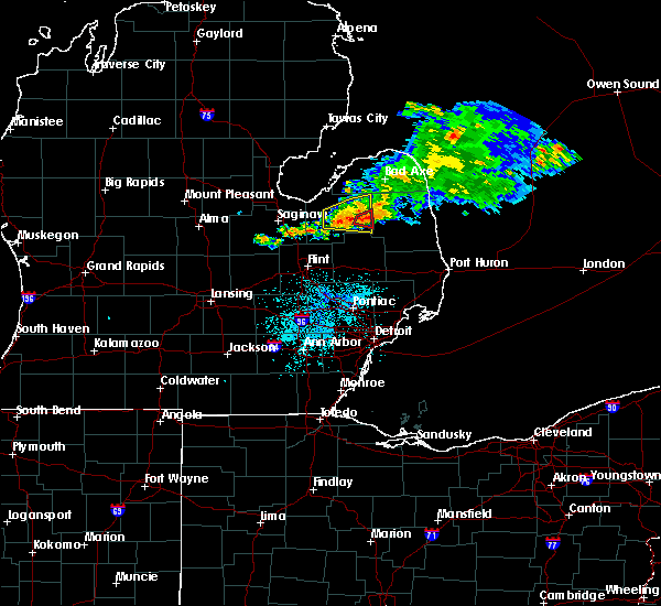 At 847 pm edt, a severe thunderstorm capable of producing a tornado was located over kingston, or 8 miles northwest of marlette, moving east at 35 mph (radar indicated rotation). Hazards include tornado and quarter size hail. Flying debris will be dangerous to those caught without shelter. mobile homes will be damaged or destroyed. damage to roofs, windows, and vehicles will occur. tree damage is likely. This tornadic thunderstorm will remain over mainly rural areas of east central tuscola county, including the following locations, wilmot. At 847 pm edt, a severe thunderstorm capable of producing a tornado was located over kingston, or 8 miles northwest of marlette, moving east at 35 mph (radar indicated rotation). Hazards include tornado and quarter size hail. Flying debris will be dangerous to those caught without shelter. mobile homes will be damaged or destroyed. damage to roofs, windows, and vehicles will occur. tree damage is likely. This tornadic thunderstorm will remain over mainly rural areas of east central tuscola county, including the following locations, wilmot.
|
| 9/10/2019 8:36 PM EDT |
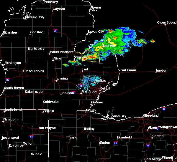 The national weather service in detroit/pontiac has issued a * tornado warning for. east central tuscola county in southeastern michigan. until 900 pm edt. At 835 pm edt, a severe thunderstorm capable of producing a tornado was located near caro, moving east at 35 mph. The national weather service in detroit/pontiac has issued a * tornado warning for. east central tuscola county in southeastern michigan. until 900 pm edt. At 835 pm edt, a severe thunderstorm capable of producing a tornado was located near caro, moving east at 35 mph.
|
| 9/10/2019 8:33 PM EDT |
 At 833 pm edt, severe thunderstorms were located along a line extending from near gagetown to 6 miles east of caro to near vassar, moving east at 35 mph (radar indicated). Hazards include 60 mph wind gusts and quarter size hail. Hail damage to vehicles is expected. expect wind damage to roofs, siding, and trees. these severe storms will be near, cass city and gagetown around 840 pm edt. kingston around 845 pm edt. caro around 850 pm edt. Other locations impacted by these severe thunderstorms include east dayton, deford, colling, wilmot, colwood, ellington, gilford, watrousville and richville. At 833 pm edt, severe thunderstorms were located along a line extending from near gagetown to 6 miles east of caro to near vassar, moving east at 35 mph (radar indicated). Hazards include 60 mph wind gusts and quarter size hail. Hail damage to vehicles is expected. expect wind damage to roofs, siding, and trees. these severe storms will be near, cass city and gagetown around 840 pm edt. kingston around 845 pm edt. caro around 850 pm edt. Other locations impacted by these severe thunderstorms include east dayton, deford, colling, wilmot, colwood, ellington, gilford, watrousville and richville.
|
| 9/10/2019 8:23 PM EDT |
 At 822 pm edt, severe thunderstorms were located along a line extending from near gagetown to caro to reese, moving east at 45 mph (radar indicated). Hazards include 60 mph wind gusts and quarter size hail. Hail damage to vehicles is expected. expect wind damage to roofs, siding, and trees. these severe storms will be near, gagetown around 830 pm edt. cass city around 835 pm edt. kingston around 840 pm edt. Other locations impacted by these severe thunderstorms include east dayton, deford, colling, wilmot, colwood, wisner, ellington, gilford, watrousville and bay park. At 822 pm edt, severe thunderstorms were located along a line extending from near gagetown to caro to reese, moving east at 45 mph (radar indicated). Hazards include 60 mph wind gusts and quarter size hail. Hail damage to vehicles is expected. expect wind damage to roofs, siding, and trees. these severe storms will be near, gagetown around 830 pm edt. cass city around 835 pm edt. kingston around 840 pm edt. Other locations impacted by these severe thunderstorms include east dayton, deford, colling, wilmot, colwood, wisner, ellington, gilford, watrousville and bay park.
|
| 9/10/2019 8:07 PM EDT |
 At 807 pm edt, severe thunderstorms were located along a line extending from near bay park to near vassar, moving east at 35 mph (radar indicated). Hazards include 60 mph wind gusts and penny size hail. Expect damage to roofs, siding, and trees. these severe storms will be near, fairgrove around 810 pm edt. unionville around 815 pm edt. caro around 825 pm edt. gagetown around 835 pm edt. cass city and kingston around 840 pm edt. Other locations impacted by these severe thunderstorms include east dayton, deford, colling, wilmot, colwood, wisner, ellington, gilford, watrousville and bay park. At 807 pm edt, severe thunderstorms were located along a line extending from near bay park to near vassar, moving east at 35 mph (radar indicated). Hazards include 60 mph wind gusts and penny size hail. Expect damage to roofs, siding, and trees. these severe storms will be near, fairgrove around 810 pm edt. unionville around 815 pm edt. caro around 825 pm edt. gagetown around 835 pm edt. cass city and kingston around 840 pm edt. Other locations impacted by these severe thunderstorms include east dayton, deford, colling, wilmot, colwood, wisner, ellington, gilford, watrousville and bay park.
|
| 9/10/2019 7:53 PM EDT |
 At 753 pm edt, severe thunderstorms were located along a line extending from 11 miles northeast of essexville to reese, moving east at 35 mph (radar indicated). Hazards include 60 mph wind gusts and penny size hail. Expect damage to roofs, siding, and trees. severe thunderstorms will be near, vassar and fairgrove around 805 pm edt. unionville around 815 pm edt. caro around 820 pm edt. kingston and gagetown around 835 pm edt. cass city around 840 pm edt. Other locations impacted by these severe thunderstorms include east dayton, deford, colling, wilmot, colwood, wisner, ellington, gilford, watrousville and bay park. At 753 pm edt, severe thunderstorms were located along a line extending from 11 miles northeast of essexville to reese, moving east at 35 mph (radar indicated). Hazards include 60 mph wind gusts and penny size hail. Expect damage to roofs, siding, and trees. severe thunderstorms will be near, vassar and fairgrove around 805 pm edt. unionville around 815 pm edt. caro around 820 pm edt. kingston and gagetown around 835 pm edt. cass city around 840 pm edt. Other locations impacted by these severe thunderstorms include east dayton, deford, colling, wilmot, colwood, wisner, ellington, gilford, watrousville and bay park.
|
| 7/20/2019 6:09 PM EDT |
 At 609 pm edt, severe thunderstorms were located along a line extending from 6 miles southwest of ubly to near lapeer, moving east at 20 mph (radar indicated). Hazards include 60 mph wind gusts. Expect damage to roofs, siding, and trees. these severe storms will be near, argyle around 625 pm edt. forestville around 700 pm edt. other locations impacted by these severe thunderstorms include east dayton, colling, mcgregor, wilmot, ellington, snover, juhl, elmer, silverwood and new greenleaf. People attending pioneer days festival, and marlettes country fair days should seek safe shelter immediately!. At 609 pm edt, severe thunderstorms were located along a line extending from 6 miles southwest of ubly to near lapeer, moving east at 20 mph (radar indicated). Hazards include 60 mph wind gusts. Expect damage to roofs, siding, and trees. these severe storms will be near, argyle around 625 pm edt. forestville around 700 pm edt. other locations impacted by these severe thunderstorms include east dayton, colling, mcgregor, wilmot, ellington, snover, juhl, elmer, silverwood and new greenleaf. People attending pioneer days festival, and marlettes country fair days should seek safe shelter immediately!.
|
| 7/20/2019 5:53 PM EDT |
 At 553 pm edt, severe thunderstorms were located along a line extending from near cass city to near lapeer, moving east at 20 mph (radar indicated). Hazards include 60 mph wind gusts. Expect damage to roofs, siding, and trees. severe thunderstorms will be near, cass city around 600 pm edt. argyle around 625 pm edt. forestville around 700 pm edt. other locations impacted by these severe thunderstorms include east dayton, colling, mcgregor, wilmot, ellington, snover, juhl, elmer, silverwood and new greenleaf. People attending pioneer days festival, and marlettes country fair days should seek safe shelter immediately!. At 553 pm edt, severe thunderstorms were located along a line extending from near cass city to near lapeer, moving east at 20 mph (radar indicated). Hazards include 60 mph wind gusts. Expect damage to roofs, siding, and trees. severe thunderstorms will be near, cass city around 600 pm edt. argyle around 625 pm edt. forestville around 700 pm edt. other locations impacted by these severe thunderstorms include east dayton, colling, mcgregor, wilmot, ellington, snover, juhl, elmer, silverwood and new greenleaf. People attending pioneer days festival, and marlettes country fair days should seek safe shelter immediately!.
|
| 5/19/2019 2:37 PM EDT |
 At 237 pm edt, a severe thunderstorm was located over kingston, or near marlette, moving northeast at 60 mph (radar indicated). Hazards include 60 mph wind gusts. Expect damage to roofs, siding, and trees. This severe thunderstorm will remain over mainly rural areas of eastern tuscola and northeastern lapeer counties, including the following locations, wilmot, east dayton, deford, burnside, kings mill and silverwood. At 237 pm edt, a severe thunderstorm was located over kingston, or near marlette, moving northeast at 60 mph (radar indicated). Hazards include 60 mph wind gusts. Expect damage to roofs, siding, and trees. This severe thunderstorm will remain over mainly rural areas of eastern tuscola and northeastern lapeer counties, including the following locations, wilmot, east dayton, deford, burnside, kings mill and silverwood.
|
| 5/19/2019 2:29 PM EDT |
 At 229 pm edt, a severe thunderstorm was located near mayville, moving northeast at 55 mph (radar indicated). Hazards include 60 mph wind gusts. Expect damage to roofs, siding, and trees. this severe thunderstorm will be near, kingston around 235 pm edt. Other locations impacted by this severe thunderstorm include east dayton, deford, burnside, elba, colling, wilmot, colwood, ellington, kings mill and silverwood. At 229 pm edt, a severe thunderstorm was located near mayville, moving northeast at 55 mph (radar indicated). Hazards include 60 mph wind gusts. Expect damage to roofs, siding, and trees. this severe thunderstorm will be near, kingston around 235 pm edt. Other locations impacted by this severe thunderstorm include east dayton, deford, burnside, elba, colling, wilmot, colwood, ellington, kings mill and silverwood.
|
| 9/5/2018 9:02 PM EDT |
 The national weather service in detroit/pontiac has issued a * severe thunderstorm warning for. southeastern tuscola county in southeastern michigan. southwestern sanilac county in southeastern michigan. central lapeer county in southeastern michigan. Until 1000 pm edt. The national weather service in detroit/pontiac has issued a * severe thunderstorm warning for. southeastern tuscola county in southeastern michigan. southwestern sanilac county in southeastern michigan. central lapeer county in southeastern michigan. Until 1000 pm edt.
|
| 8/28/2018 10:22 PM EDT |
 At 1021 pm edt, severe thunderstorms were located along a line extending from 20 miles north of harbor beach to 10 miles east of port hope to 6 miles northeast of kingston to near north branch, moving east at 45 mph (radar indicated). Hazards include 60 mph wind gusts. Expect damage to roofs, siding, and trees. These severe thunderstorms will remain over mainly rural areas of eastern tuscola and huron counties, including the following locations, redman, east dayton, parisville, wilmot, ivanhoe, rapson, ellington, ruth, filion and deford. At 1021 pm edt, severe thunderstorms were located along a line extending from 20 miles north of harbor beach to 10 miles east of port hope to 6 miles northeast of kingston to near north branch, moving east at 45 mph (radar indicated). Hazards include 60 mph wind gusts. Expect damage to roofs, siding, and trees. These severe thunderstorms will remain over mainly rural areas of eastern tuscola and huron counties, including the following locations, redman, east dayton, parisville, wilmot, ivanhoe, rapson, ellington, ruth, filion and deford.
|
| 8/28/2018 10:09 PM EDT |
 At 1008 pm edt, severe thunderstorms were located along a line extending from 11 miles northeast of port austin to port hope to near caro to near otter lake, moving east at 45 mph (radar indicated). Hazards include 60 mph wind gusts. Expect damage to roofs, siding, and trees. these severe storms will be near, mayville around 1020 pm edt. Other locations impacted by these severe thunderstorms include redman, east dayton, parisville, tuscola, colling, wilmot, ivanhoe, rapson, bay port and ellington. At 1008 pm edt, severe thunderstorms were located along a line extending from 11 miles northeast of port austin to port hope to near caro to near otter lake, moving east at 45 mph (radar indicated). Hazards include 60 mph wind gusts. Expect damage to roofs, siding, and trees. these severe storms will be near, mayville around 1020 pm edt. Other locations impacted by these severe thunderstorms include redman, east dayton, parisville, tuscola, colling, wilmot, ivanhoe, rapson, bay port and ellington.
|
| 8/28/2018 9:52 PM EDT |
 At 951 pm edt, severe thunderstorms were located along a line extending from near port austin to near kinde to fairgrove to near millington, moving east at 45 mph (radar indicated). Hazards include 60 mph wind gusts. Expect damage to roofs, siding, and trees. these severe storms will be near, port austin and kinde around 955 pm edt. mayville around 1005 pm edt. kingston around 1015 pm edt. Other locations impacted by these severe thunderstorms include parisville, colling, wisner, ivanhoe, rapson, ellington, gilford, port crescent state park, filion and deford. At 951 pm edt, severe thunderstorms were located along a line extending from near port austin to near kinde to fairgrove to near millington, moving east at 45 mph (radar indicated). Hazards include 60 mph wind gusts. Expect damage to roofs, siding, and trees. these severe storms will be near, port austin and kinde around 955 pm edt. mayville around 1005 pm edt. kingston around 1015 pm edt. Other locations impacted by these severe thunderstorms include parisville, colling, wisner, ivanhoe, rapson, ellington, gilford, port crescent state park, filion and deford.
|
| 8/28/2018 9:33 PM EDT |
 At 932 pm edt, severe thunderstorms were located along a line extending from 10 miles southeast of tawas point state park to near caseville to munger to near bridgeport, moving east at 45 mph (radar indicated). Hazards include 60 mph wind gusts. Expect damage to roofs, siding, and trees. severe thunderstorms will be near, caseville around 935 pm edt. vassar, port austin, akron, fairgrove and kinde around 950 pm edt. millington around 955 pm edt. caro around 1000 pm edt. mayville around 1005 pm edt. kingston around 1015 pm edt. Other locations impacted by these severe thunderstorms include parisville, colling, wisner, ivanhoe, rapson, ellington, gilford, port crescent state park, filion and deford. At 932 pm edt, severe thunderstorms were located along a line extending from 10 miles southeast of tawas point state park to near caseville to munger to near bridgeport, moving east at 45 mph (radar indicated). Hazards include 60 mph wind gusts. Expect damage to roofs, siding, and trees. severe thunderstorms will be near, caseville around 935 pm edt. vassar, port austin, akron, fairgrove and kinde around 950 pm edt. millington around 955 pm edt. caro around 1000 pm edt. mayville around 1005 pm edt. kingston around 1015 pm edt. Other locations impacted by these severe thunderstorms include parisville, colling, wisner, ivanhoe, rapson, ellington, gilford, port crescent state park, filion and deford.
|
| 8/27/2018 1:58 AM EDT |
 The severe thunderstorm warning for eastern tuscola and north central lapeer counties will expire at 200 am edt, the storms which prompted the warning have moved out of the area. therefore the warning will be allowed to expire. however gusty winds and heavy rain are still possible with these thunderstorms. The severe thunderstorm warning for eastern tuscola and north central lapeer counties will expire at 200 am edt, the storms which prompted the warning have moved out of the area. therefore the warning will be allowed to expire. however gusty winds and heavy rain are still possible with these thunderstorms.
|
| 8/27/2018 1:36 AM EDT |
 At 136 am edt, severe thunderstorms were located along a line extending from gagetown to near north branch, moving east at 25 mph (radar indicated). Hazards include 60 mph wind gusts. Expect damage to roofs, siding, and trees. these severe storms will be near, cass city around 140 am edt. Other locations impacted by these severe thunderstorms include east dayton, deford, colling, wilmot, colwood, ellington and silverwood. At 136 am edt, severe thunderstorms were located along a line extending from gagetown to near north branch, moving east at 25 mph (radar indicated). Hazards include 60 mph wind gusts. Expect damage to roofs, siding, and trees. these severe storms will be near, cass city around 140 am edt. Other locations impacted by these severe thunderstorms include east dayton, deford, colling, wilmot, colwood, ellington and silverwood.
|
| 8/27/2018 1:25 AM EDT |
 At 125 am edt, severe thunderstorms were located along a line extending from near gagetown to near clifford, moving east at 35 mph (radar indicated). Hazards include 60 mph wind gusts. Expect damage to roofs, siding, and trees. these severe storms will be near, gagetown around 130 am edt. cass city and kingston around 135 am edt. Other locations impacted by these severe thunderstorms include east dayton, deford, colling, wilmot, colwood, wisner, ellington, watrousville, silverwood and bay park. At 125 am edt, severe thunderstorms were located along a line extending from near gagetown to near clifford, moving east at 35 mph (radar indicated). Hazards include 60 mph wind gusts. Expect damage to roofs, siding, and trees. these severe storms will be near, gagetown around 130 am edt. cass city and kingston around 135 am edt. Other locations impacted by these severe thunderstorms include east dayton, deford, colling, wilmot, colwood, wisner, ellington, watrousville, silverwood and bay park.
|
| 8/27/2018 1:15 AM EDT |
 At 114 am edt, severe thunderstorms were located along a line extending from near unionville to near mayville, moving east at 35 mph (radar indicated). Hazards include 60 mph wind gusts. Expect damage to roofs, siding, and trees. these severe storms will be near, gagetown and clifford around 130 am edt. cass city around 135 am edt. Other locations impacted by these severe thunderstorms include east dayton, tuscola, colling, wilmot, wisner, ellington, gilford, silverwood, richville and deford. At 114 am edt, severe thunderstorms were located along a line extending from near unionville to near mayville, moving east at 35 mph (radar indicated). Hazards include 60 mph wind gusts. Expect damage to roofs, siding, and trees. these severe storms will be near, gagetown and clifford around 130 am edt. cass city around 135 am edt. Other locations impacted by these severe thunderstorms include east dayton, tuscola, colling, wilmot, wisner, ellington, gilford, silverwood, richville and deford.
|
| 8/27/2018 1:06 AM EDT |
 At 106 am edt, severe thunderstorms were located along a line extending from near unionville to near otter lake, moving east at 30 mph (radar indicated). Hazards include 60 mph wind gusts. Expect damage to roofs, siding, and trees. these severe storms will be near, mayville and unionville around 115 am edt. clifford around 130 am edt. kingston and gagetown around 135 am edt. cass city around 140 am edt. Other locations impacted by these severe thunderstorms include east dayton, tuscola, colling, wilmot, wisner, ellington, gilford, silverwood, richville and deford. At 106 am edt, severe thunderstorms were located along a line extending from near unionville to near otter lake, moving east at 30 mph (radar indicated). Hazards include 60 mph wind gusts. Expect damage to roofs, siding, and trees. these severe storms will be near, mayville and unionville around 115 am edt. clifford around 130 am edt. kingston and gagetown around 135 am edt. cass city around 140 am edt. Other locations impacted by these severe thunderstorms include east dayton, tuscola, colling, wilmot, wisner, ellington, gilford, silverwood, richville and deford.
|
| 8/27/2018 12:58 AM EDT |
 At 1258 am edt, severe thunderstorms were located along a line extending from quanicassee to near millington, moving east at 35 mph (radar indicated). Hazards include 60 mph wind gusts. Expect damage to roofs, siding, and trees. severe thunderstorms will be near, fairgrove around 105 am edt. akron around 110 am edt. unionville around 115 am edt. mayville around 120 am edt. kingston, gagetown and clifford around 135 am edt. cass city around 140 am edt. Other locations impacted by these severe thunderstorms include east dayton, tuscola, colling, wilmot, wisner, ellington, gilford, silverwood, richville and deford. At 1258 am edt, severe thunderstorms were located along a line extending from quanicassee to near millington, moving east at 35 mph (radar indicated). Hazards include 60 mph wind gusts. Expect damage to roofs, siding, and trees. severe thunderstorms will be near, fairgrove around 105 am edt. akron around 110 am edt. unionville around 115 am edt. mayville around 120 am edt. kingston, gagetown and clifford around 135 am edt. cass city around 140 am edt. Other locations impacted by these severe thunderstorms include east dayton, tuscola, colling, wilmot, wisner, ellington, gilford, silverwood, richville and deford.
|
| 10/7/2017 11:07 PM EDT |
 The severe thunderstorm warning for eastern tuscola county will expire at 1115 pm edt, the storms which prompted the warning have moved out of the area. therefore the warning will be allowed to expire. to report severe weather, contact your nearest law enforcement agency. they will relay your report to the national weather service detroit/pontiac. The severe thunderstorm warning for eastern tuscola county will expire at 1115 pm edt, the storms which prompted the warning have moved out of the area. therefore the warning will be allowed to expire. to report severe weather, contact your nearest law enforcement agency. they will relay your report to the national weather service detroit/pontiac.
|
| 10/7/2017 11:00 PM EDT |
 At 1100 pm edt, severe thunderstorms were located along a line extending from near elkton to near cass city to near kingston, moving northeast at 60 mph (radar indicated). Hazards include 60 mph wind gusts. Expect damage to roofs, siding, and trees. These severe thunderstorms will remain over mainly rural areas of eastern tuscola county, including the following locations: cass city, gagetown, kingston, east dayton, deford, wilmot, colwood, ellington, silverwood and mayville. At 1100 pm edt, severe thunderstorms were located along a line extending from near elkton to near cass city to near kingston, moving northeast at 60 mph (radar indicated). Hazards include 60 mph wind gusts. Expect damage to roofs, siding, and trees. These severe thunderstorms will remain over mainly rural areas of eastern tuscola county, including the following locations: cass city, gagetown, kingston, east dayton, deford, wilmot, colwood, ellington, silverwood and mayville.
|
| 10/7/2017 10:51 PM EDT |
 At 1050 pm edt, severe thunderstorms were located along a line extending from near owendale to near cass city to near kingston, moving northeast at 60 mph (radar indicated). Hazards include 60 mph wind gusts. Expect damage to roofs, siding, and trees. these severe storms will be near, cass city and gagetown around 1055 pm edt. Other locations impacted by these severe thunderstorms include caro, cass city, mayville, millington, kingston, gagetown, east dayton, colling, wilmot and ellington. At 1050 pm edt, severe thunderstorms were located along a line extending from near owendale to near cass city to near kingston, moving northeast at 60 mph (radar indicated). Hazards include 60 mph wind gusts. Expect damage to roofs, siding, and trees. these severe storms will be near, cass city and gagetown around 1055 pm edt. Other locations impacted by these severe thunderstorms include caro, cass city, mayville, millington, kingston, gagetown, east dayton, colling, wilmot and ellington.
|
| 10/7/2017 10:37 PM EDT |
 At 1036 pm edt, severe thunderstorms were located along a line extending from near unionville to near caro to near millington, moving northeast at 60 mph (radar indicated). Hazards include 60 mph wind gusts. Expect damage to roofs, siding, and trees. these severe storms will be near, unionville around 1040 pm edt. kingston around 1050 pm edt. cass city and gagetown around 1055 pm edt. Other locations impacted by these severe thunderstorms include akron, caro, cass city, mayville, vassar, millington, kingston, fairgrove, gagetown and unionville. At 1036 pm edt, severe thunderstorms were located along a line extending from near unionville to near caro to near millington, moving northeast at 60 mph (radar indicated). Hazards include 60 mph wind gusts. Expect damage to roofs, siding, and trees. these severe storms will be near, unionville around 1040 pm edt. kingston around 1050 pm edt. cass city and gagetown around 1055 pm edt. Other locations impacted by these severe thunderstorms include akron, caro, cass city, mayville, vassar, millington, kingston, fairgrove, gagetown and unionville.
|
| 10/7/2017 10:22 PM EDT |
 At 1021 pm edt, severe thunderstorms were located along a line extending from munger to near clio to mount morris, moving northeast at 55 mph (radar indicated). Hazards include 60 mph wind gusts. Expect damage to roofs, siding, and trees. severe thunderstorms will be near, reese and quanicassee around 1025 pm edt. millington and fairgrove around 1030 pm edt. vassar and akron around 1035 pm edt. unionville around 1040 pm edt. mayville around 1045 pm edt. kingston around 1055 pm edt. Other locations impacted by these severe thunderstorms include akron, cass city, mayville, vassar, millington, caro, frankenmuth, reese, kingston and gagetown. At 1021 pm edt, severe thunderstorms were located along a line extending from munger to near clio to mount morris, moving northeast at 55 mph (radar indicated). Hazards include 60 mph wind gusts. Expect damage to roofs, siding, and trees. severe thunderstorms will be near, reese and quanicassee around 1025 pm edt. millington and fairgrove around 1030 pm edt. vassar and akron around 1035 pm edt. unionville around 1040 pm edt. mayville around 1045 pm edt. kingston around 1055 pm edt. Other locations impacted by these severe thunderstorms include akron, cass city, mayville, vassar, millington, caro, frankenmuth, reese, kingston and gagetown.
|
| 8/17/2017 8:16 PM EDT |
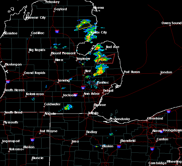 At 815 pm edt, a confirmed tornado was located near kingston, or near marlette, moving northeast at 40 mph (weather spotters confirmed tornado). Hazards include damaging tornado. Flying debris will be dangerous to those caught without shelter. mobile homes will be damaged or destroyed. damage to roofs, windows, and vehicles will occur. tree damage is likely. the tornado will be near, argyle around 835 pm edt. deckerville around 845 pm edt. Other locations impacted by this tornadic thunderstorm include deckerville, sandusky, kingston, argyle, decker, palms, wilmot, snover, elmer and juhl. At 815 pm edt, a confirmed tornado was located near kingston, or near marlette, moving northeast at 40 mph (weather spotters confirmed tornado). Hazards include damaging tornado. Flying debris will be dangerous to those caught without shelter. mobile homes will be damaged or destroyed. damage to roofs, windows, and vehicles will occur. tree damage is likely. the tornado will be near, argyle around 835 pm edt. deckerville around 845 pm edt. Other locations impacted by this tornadic thunderstorm include deckerville, sandusky, kingston, argyle, decker, palms, wilmot, snover, elmer and juhl.
|
| 7/23/2017 6:52 PM EDT |
 At 651 pm edt, severe thunderstorms were located along a line extending from 6 miles southwest of cass city to otisville, moving southeast at 20 mph (radar indicated). Hazards include 60 mph wind gusts and quarter size hail. Hail damage to vehicles is expected. expect wind damage to roofs, siding, and trees. these severe storms will be near, columbiaville around 705 pm edt. kingston around 710 pm edt. lapeer around 730 pm edt. Other locations impacted by these severe thunderstorms include columbiaville, cass city, north branch, lapeer, mayville, otisville, kingston, otter lake, clifford and east dayton. At 651 pm edt, severe thunderstorms were located along a line extending from 6 miles southwest of cass city to otisville, moving southeast at 20 mph (radar indicated). Hazards include 60 mph wind gusts and quarter size hail. Hail damage to vehicles is expected. expect wind damage to roofs, siding, and trees. these severe storms will be near, columbiaville around 705 pm edt. kingston around 710 pm edt. lapeer around 730 pm edt. Other locations impacted by these severe thunderstorms include columbiaville, cass city, north branch, lapeer, mayville, otisville, kingston, otter lake, clifford and east dayton.
|
| 7/23/2017 6:33 PM EDT |
 At 632 pm edt, severe thunderstorms were located along a line extending from 6 miles northeast of caro to 6 miles northeast of clio, moving east at 20 mph (radar indicated). Hazards include 60 mph wind gusts and quarter size hail. Hail damage to vehicles is expected. expect wind damage to roofs, siding, and trees. severe thunderstorms will be near, otter lake around 705 pm edt. columbiaville around 715 pm edt. Other locations impacted by these severe thunderstorms include caro, columbiaville, cass city, north branch, lapeer, mayville, vassar, millington, otisville and kingston. At 632 pm edt, severe thunderstorms were located along a line extending from 6 miles northeast of caro to 6 miles northeast of clio, moving east at 20 mph (radar indicated). Hazards include 60 mph wind gusts and quarter size hail. Hail damage to vehicles is expected. expect wind damage to roofs, siding, and trees. severe thunderstorms will be near, otter lake around 705 pm edt. columbiaville around 715 pm edt. Other locations impacted by these severe thunderstorms include caro, columbiaville, cass city, north branch, lapeer, mayville, vassar, millington, otisville and kingston.
|
| 6/17/2017 6:23 PM EDT |
 At 622 pm edt, severe thunderstorms were located along a line extending from near argyle to near marlette, moving east at 40 mph (radar indicated). Hazards include 60 mph wind gusts. Expect damage to roofs, siding, and trees. these severe storms will be near, argyle around 630 pm edt. sandusky around 645 pm edt. deckerville, forestville and carsonville around 655 pm edt. Other locations impacted by these severe thunderstorms include deckerville, marlette, port sanilac, forestville, sandusky, kingston, applegate, carsonville, argyle and mcgregor. At 622 pm edt, severe thunderstorms were located along a line extending from near argyle to near marlette, moving east at 40 mph (radar indicated). Hazards include 60 mph wind gusts. Expect damage to roofs, siding, and trees. these severe storms will be near, argyle around 630 pm edt. sandusky around 645 pm edt. deckerville, forestville and carsonville around 655 pm edt. Other locations impacted by these severe thunderstorms include deckerville, marlette, port sanilac, forestville, sandusky, kingston, applegate, carsonville, argyle and mcgregor.
|
| 6/17/2017 6:05 PM EDT |
 At 605 pm edt, severe thunderstorms were located along a line extending from 6 miles southwest of cass city to near mayville, moving east at 40 mph (radar indicated). Hazards include 60 mph wind gusts. Expect damage to roofs, siding, and trees. severe thunderstorms will be near, cass city around 615 pm edt. kingston around 620 pm edt. marlette around 625 pm edt. argyle around 630 pm edt. sandusky around 645 pm edt. deckerville, forestville and carsonville around 655 pm edt. Other locations impacted by these severe thunderstorms include deckerville, sandusky, marlette, port sanilac, forestville, kingston, argyle, applegate, carsonville and ellington. At 605 pm edt, severe thunderstorms were located along a line extending from 6 miles southwest of cass city to near mayville, moving east at 40 mph (radar indicated). Hazards include 60 mph wind gusts. Expect damage to roofs, siding, and trees. severe thunderstorms will be near, cass city around 615 pm edt. kingston around 620 pm edt. marlette around 625 pm edt. argyle around 630 pm edt. sandusky around 645 pm edt. deckerville, forestville and carsonville around 655 pm edt. Other locations impacted by these severe thunderstorms include deckerville, sandusky, marlette, port sanilac, forestville, kingston, argyle, applegate, carsonville and ellington.
|
| 11/18/2016 8:34 PM EST |
 At 834 pm est, severe thunderstorms were located along a line extending from near sebewaing to 8 miles east of kingston to near brown city, moving northeast at 75 mph (radar indicated). Hazards include 60 mph wind gusts. Expect damage to roofs. siding. and trees. these severe storms will be near, argyle and owendale around 840 pm est. caseville and pigeon around 845 pm est. sandusky and carsonville around 850 pm est. deckerville and port austin around 855 pm est. harbor beach, port hope and forestville around 900 pm est. Other locations impacted by these severe thunderstorms include marlette, sandusky, deckerville, forestville, port sanilac, ubly, yale, port hope, harbor beach and cass city. At 834 pm est, severe thunderstorms were located along a line extending from near sebewaing to 8 miles east of kingston to near brown city, moving northeast at 75 mph (radar indicated). Hazards include 60 mph wind gusts. Expect damage to roofs. siding. and trees. these severe storms will be near, argyle and owendale around 840 pm est. caseville and pigeon around 845 pm est. sandusky and carsonville around 850 pm est. deckerville and port austin around 855 pm est. harbor beach, port hope and forestville around 900 pm est. Other locations impacted by these severe thunderstorms include marlette, sandusky, deckerville, forestville, port sanilac, ubly, yale, port hope, harbor beach and cass city.
|
| 11/18/2016 8:10 PM EST |
 At 809 pm est, severe thunderstorms were located along a line extending from near birch run to near lapeer to near ortonville, moving northeast at 70 mph (radar indicated). Hazards include 60 mph wind gusts. Expect damage to roofs. siding. and trees. severe thunderstorms will be near, reese around 820 pm est. akron, fairgrove and clifford around 825 pm est. brown city, unionville and kingston around 830 pm est. marlette and sebewaing around 835 pm est. pigeon and argyle around 840 pm est. sandusky and caseville around 845 pm est. deckerville around 850 pm est. harbor beach, port austin and forestville around 855 pm est. Other locations impacted by these severe thunderstorms include marlette, sandusky, deckerville, forestville, port sanilac, ubly, mayville, millington, yale and port hope. At 809 pm est, severe thunderstorms were located along a line extending from near birch run to near lapeer to near ortonville, moving northeast at 70 mph (radar indicated). Hazards include 60 mph wind gusts. Expect damage to roofs. siding. and trees. severe thunderstorms will be near, reese around 820 pm est. akron, fairgrove and clifford around 825 pm est. brown city, unionville and kingston around 830 pm est. marlette and sebewaing around 835 pm est. pigeon and argyle around 840 pm est. sandusky and caseville around 845 pm est. deckerville around 850 pm est. harbor beach, port austin and forestville around 855 pm est. Other locations impacted by these severe thunderstorms include marlette, sandusky, deckerville, forestville, port sanilac, ubly, mayville, millington, yale and port hope.
|
| 7/8/2016 6:03 PM EDT |
 At 602 pm edt, a severe thunderstorm was located over clifford, or near marlette, moving east at 30 mph (radar indicated). Hazards include 60 mph wind gusts and quarter size hail. Hail damage to vehicles is expected. expect wind damage to roofs, siding, and trees. This severe thunderstorm will remain over mainly rural areas of northern lapeer and southern tuscola counties, including the following locations: millington, vassar, reese, north branch, mayville, clifford, kingston, east dayton, fostoria and watrousville. At 602 pm edt, a severe thunderstorm was located over clifford, or near marlette, moving east at 30 mph (radar indicated). Hazards include 60 mph wind gusts and quarter size hail. Hail damage to vehicles is expected. expect wind damage to roofs, siding, and trees. This severe thunderstorm will remain over mainly rural areas of northern lapeer and southern tuscola counties, including the following locations: millington, vassar, reese, north branch, mayville, clifford, kingston, east dayton, fostoria and watrousville.
|
| 7/8/2016 6:00 PM EDT | Large trees down blocking roads. power lines down. via tuscola county dispatc in tuscola county MI, 0.2 miles NE of Kingston, MI |
| 7/8/2016 5:43 PM EDT |
 At 542 pm edt, a severe thunderstorm was located over mayville, moving east at 35 mph (radar indicated). Hazards include golf ball size hail and 60 mph wind gusts. People and animals outdoors will be injured. expect hail damage to roofs, siding, windows, and vehicles. expect wind damage to roofs, siding, and trees. this severe storm will be near, kingston and clifford around 600 pm edt. Other locations impacted by this severe thunderstorm include millington, vassar, reese, north branch, mayville, clifford, kingston, east dayton, fostoria and watrousville. At 542 pm edt, a severe thunderstorm was located over mayville, moving east at 35 mph (radar indicated). Hazards include golf ball size hail and 60 mph wind gusts. People and animals outdoors will be injured. expect hail damage to roofs, siding, windows, and vehicles. expect wind damage to roofs, siding, and trees. this severe storm will be near, kingston and clifford around 600 pm edt. Other locations impacted by this severe thunderstorm include millington, vassar, reese, north branch, mayville, clifford, kingston, east dayton, fostoria and watrousville.
|
| 7/8/2016 5:29 PM EDT |
 At 529 pm edt, a severe thunderstorm was located over vassar, moving east at 30 mph (radar indicated). Hazards include golf ball size hail and 60 mph wind gusts. People and animals outdoors will be injured. expect hail damage to roofs, siding, windows, and vehicles. expect wind damage to roofs, siding, and trees. this severe thunderstorm will be near, mayville around 550 pm edt. kingston and clifford around 605 pm edt. Other locations impacted by this severe thunderstorm include millington, vassar, reese, north branch, mayville, clifford, kingston, east dayton, fostoria and watrousville. At 529 pm edt, a severe thunderstorm was located over vassar, moving east at 30 mph (radar indicated). Hazards include golf ball size hail and 60 mph wind gusts. People and animals outdoors will be injured. expect hail damage to roofs, siding, windows, and vehicles. expect wind damage to roofs, siding, and trees. this severe thunderstorm will be near, mayville around 550 pm edt. kingston and clifford around 605 pm edt. Other locations impacted by this severe thunderstorm include millington, vassar, reese, north branch, mayville, clifford, kingston, east dayton, fostoria and watrousville.
|
| 7/8/2016 5:25 PM EDT |
 The severe thunderstorm warning for tuscola county will expire at 530 pm edt, the storms which prompted the warning have weakened below severe limits, and no longer pose an immediate threat to life or property. therefore, the warning will be allowed to expire. however, heavy rain is still possible with these thunderstorms. a severe thunderstorm watch remains in effect until 800 pm edt for southeastern michigan. The severe thunderstorm warning for tuscola county will expire at 530 pm edt, the storms which prompted the warning have weakened below severe limits, and no longer pose an immediate threat to life or property. therefore, the warning will be allowed to expire. however, heavy rain is still possible with these thunderstorms. a severe thunderstorm watch remains in effect until 800 pm edt for southeastern michigan.
|
| 7/8/2016 5:06 PM EDT |
 At 506 pm edt, severe thunderstorms were located along a line extending from near quanicassee to gagetown, moving northeast at 30 mph (radar indicated). Hazards include golf ball size hail and 60 mph wind gusts. People and animals outdoors will be injured. expect hail damage to roofs, siding, windows, and vehicles. expect wind damage to roofs, siding, and trees. these severe storms will be near, cass city and gagetown around 510 pm edt. unionville around 525 pm edt. Other locations impacted by these severe thunderstorms include reese, caro, cass city, akron, unionville, quanicassee, fairgrove, gagetown, kingston and east dayton. At 506 pm edt, severe thunderstorms were located along a line extending from near quanicassee to gagetown, moving northeast at 30 mph (radar indicated). Hazards include golf ball size hail and 60 mph wind gusts. People and animals outdoors will be injured. expect hail damage to roofs, siding, windows, and vehicles. expect wind damage to roofs, siding, and trees. these severe storms will be near, cass city and gagetown around 510 pm edt. unionville around 525 pm edt. Other locations impacted by these severe thunderstorms include reese, caro, cass city, akron, unionville, quanicassee, fairgrove, gagetown, kingston and east dayton.
|
| 7/8/2016 4:50 PM EDT |
 At 450 pm edt, severe thunderstorms were located along a line extending from near munger to near unionville, moving east at 30 mph (radar indicated). Hazards include golf ball size hail and 60 mph wind gusts. People and animals outdoors will be injured. expect hail damage to roofs, siding, windows, and vehicles. expect wind damage to roofs, siding, and trees. these severe storms will be near, gagetown around 505 pm edt. cass city and quanicassee around 510 pm edt. fairgrove around 520 pm edt. akron around 525 pm edt. unionville around 530 pm edt. Other locations impacted by these severe thunderstorms include bay city, reese, akron, caro, cass city, essexville, unionville, fairgrove, zilwaukee and kingston. At 450 pm edt, severe thunderstorms were located along a line extending from near munger to near unionville, moving east at 30 mph (radar indicated). Hazards include golf ball size hail and 60 mph wind gusts. People and animals outdoors will be injured. expect hail damage to roofs, siding, windows, and vehicles. expect wind damage to roofs, siding, and trees. these severe storms will be near, gagetown around 505 pm edt. cass city and quanicassee around 510 pm edt. fairgrove around 520 pm edt. akron around 525 pm edt. unionville around 530 pm edt. Other locations impacted by these severe thunderstorms include bay city, reese, akron, caro, cass city, essexville, unionville, fairgrove, zilwaukee and kingston.
|
| 7/8/2016 4:36 PM EDT |
 At 435 pm edt, a severe thunderstorm was located near akron, moving east at 30 mph (radar indicated). Hazards include golf ball size hail and 60 mph wind gusts. People and animals outdoors will be injured. expect hail damage to roofs, siding, windows, and vehicles. expect wind damage to roofs, siding, and trees. this severe thunderstorm will be near, gagetown around 500 pm edt. cass city around 505 pm edt. a second storm was located near bay city and is also capable of producing golf ball sized hail and wind gusts to 60 mph. this storm was also moving east at 30 mph. Other locations impacted by this severe thunderstorm include bay city, reese, akron, caro, cass city, essexville, unionville, fairgrove, zilwaukee and kingston. At 435 pm edt, a severe thunderstorm was located near akron, moving east at 30 mph (radar indicated). Hazards include golf ball size hail and 60 mph wind gusts. People and animals outdoors will be injured. expect hail damage to roofs, siding, windows, and vehicles. expect wind damage to roofs, siding, and trees. this severe thunderstorm will be near, gagetown around 500 pm edt. cass city around 505 pm edt. a second storm was located near bay city and is also capable of producing golf ball sized hail and wind gusts to 60 mph. this storm was also moving east at 30 mph. Other locations impacted by this severe thunderstorm include bay city, reese, akron, caro, cass city, essexville, unionville, fairgrove, zilwaukee and kingston.
|
| 7/7/2016 11:36 PM EDT |
 At 1136 pm edt, severe thunderstorms were located along a line extending from 6 miles northwest of kingston to clifford to near north branch, moving east at 20 mph (radar indicated). Hazards include 60 mph wind gusts. Expect damage to roofs. siding. and trees. these severe storms will be near, clifford around 1140 pm edt. marlette around 1155 pm edt. brown city around 1215 am edt. peck and melvin around 1230 am edt. Other locations impacted by these severe thunderstorms include marlette, sandusky, deckerville, port sanilac, lexington, brown city, cass city, croswell, north branch and clifford. At 1136 pm edt, severe thunderstorms were located along a line extending from 6 miles northwest of kingston to clifford to near north branch, moving east at 20 mph (radar indicated). Hazards include 60 mph wind gusts. Expect damage to roofs. siding. and trees. these severe storms will be near, clifford around 1140 pm edt. marlette around 1155 pm edt. brown city around 1215 am edt. peck and melvin around 1230 am edt. Other locations impacted by these severe thunderstorms include marlette, sandusky, deckerville, port sanilac, lexington, brown city, cass city, croswell, north branch and clifford.
|
| 7/7/2016 11:26 PM EDT |
 At 1125 pm edt, severe thunderstorms were located along a line extending from near caro to near clifford to near north branch, moving east at 30 mph (radar indicated). Hazards include 60 mph wind gusts. Expect damage to roofs. siding. and trees. these severe storms will be near, kingston and clifford around 1130 pm edt. marlette and north branch around 1140 pm edt. brown city around 1155 pm edt. argyle around 1205 am edt. melvin around 1210 am edt. peck around 1215 am edt. sandusky around 1220 am edt. deckerville around 1225 am edt. Other locations impacted by these severe thunderstorms include columbiaville, marlette, sandusky, deckerville, port sanilac, mayville, lexington, caro, brown city and cass city. At 1125 pm edt, severe thunderstorms were located along a line extending from near caro to near clifford to near north branch, moving east at 30 mph (radar indicated). Hazards include 60 mph wind gusts. Expect damage to roofs. siding. and trees. these severe storms will be near, kingston and clifford around 1130 pm edt. marlette and north branch around 1140 pm edt. brown city around 1155 pm edt. argyle around 1205 am edt. melvin around 1210 am edt. peck around 1215 am edt. sandusky around 1220 am edt. deckerville around 1225 am edt. Other locations impacted by these severe thunderstorms include columbiaville, marlette, sandusky, deckerville, port sanilac, mayville, lexington, caro, brown city and cass city.
|
| 7/7/2016 11:14 PM EDT |
 At 1113 pm edt, severe thunderstorms were located along a line extending from near fairgrove to mayville to otter lake, moving east at 20 mph (radar indicated). Hazards include 60 mph wind gusts. Expect damage to roofs. siding. and trees. severe thunderstorms will be near, mayville around 1120 pm edt. clifford around 1140 pm edt. kingston around 1145 pm edt. north branch around 1155 pm edt. cass city and marlette around 1200 am edt. brown city around 1220 am edt. sandusky, argyle and melvin around 1230 am edt. Other locations impacted by these severe thunderstorms include columbiaville, marlette, sandusky, deckerville, port sanilac, akron, mayville, millington, lexington and vassar. At 1113 pm edt, severe thunderstorms were located along a line extending from near fairgrove to mayville to otter lake, moving east at 20 mph (radar indicated). Hazards include 60 mph wind gusts. Expect damage to roofs. siding. and trees. severe thunderstorms will be near, mayville around 1120 pm edt. clifford around 1140 pm edt. kingston around 1145 pm edt. north branch around 1155 pm edt. cass city and marlette around 1200 am edt. brown city around 1220 am edt. sandusky, argyle and melvin around 1230 am edt. Other locations impacted by these severe thunderstorms include columbiaville, marlette, sandusky, deckerville, port sanilac, akron, mayville, millington, lexington and vassar.
|
| 8/19/2015 4:53 PM EDT |
 The severe thunderstorm warning for southeastern tuscola county will expire at 500 pm edt, the storm which prompted the warning has weakened below severe limits and exited the warned area. therefore the warning will be allowed to expire. however gusty winds and heavy rain are still possible with this thunderstorm. The severe thunderstorm warning for southeastern tuscola county will expire at 500 pm edt, the storm which prompted the warning has weakened below severe limits and exited the warned area. therefore the warning will be allowed to expire. however gusty winds and heavy rain are still possible with this thunderstorm.
|
| 8/19/2015 4:35 PM EDT |
 At 434 pm edt, a severe thunderstorm was located near kingston, or near mayville, moving north at 40 mph (radar indicated). Hazards include 60 mph wind gusts. Expect damage to roofs. siding and trees. this severe storm will be near, kingston around 440 pm edt. Other locations impacted by this severe thunderstorm include east dayton, wilmot, deford and silverwood. At 434 pm edt, a severe thunderstorm was located near kingston, or near mayville, moving north at 40 mph (radar indicated). Hazards include 60 mph wind gusts. Expect damage to roofs. siding and trees. this severe storm will be near, kingston around 440 pm edt. Other locations impacted by this severe thunderstorm include east dayton, wilmot, deford and silverwood.
|
| 8/19/2015 4:25 PM EDT |
 At 425 pm edt, a severe thunderstorm was located near clifford, or near mayville, moving northeast at 40 mph (radar indicated). Hazards include 60 mph wind gusts. Expect damage to roofs. siding and trees. this severe storm will be near, clifford around 430 pm edt. kingston around 440 pm edt. Other locations impacted by this severe thunderstorm include east dayton, wilmot, fostoria, silverwood and deford. At 425 pm edt, a severe thunderstorm was located near clifford, or near mayville, moving northeast at 40 mph (radar indicated). Hazards include 60 mph wind gusts. Expect damage to roofs. siding and trees. this severe storm will be near, clifford around 430 pm edt. kingston around 440 pm edt. Other locations impacted by this severe thunderstorm include east dayton, wilmot, fostoria, silverwood and deford.
|
| 8/19/2015 4:19 PM EDT |
 At 418 pm edt, a severe thunderstorm was located near columbiaville, moving north at 40 mph (radar indicated). Hazards include 60 mph wind gusts. Expect damage to roofs. siding and trees. this severe thunderstorm will be near, mayville and clifford around 430 pm edt. kingston around 440 pm edt. Other locations impacted by this severe thunderstorm include east dayton, wilmot, fostoria, kings mill, silverwood and deford. At 418 pm edt, a severe thunderstorm was located near columbiaville, moving north at 40 mph (radar indicated). Hazards include 60 mph wind gusts. Expect damage to roofs. siding and trees. this severe thunderstorm will be near, mayville and clifford around 430 pm edt. kingston around 440 pm edt. Other locations impacted by this severe thunderstorm include east dayton, wilmot, fostoria, kings mill, silverwood and deford.
|
| 8/2/2015 7:39 PM EDT |
 The severe thunderstorm warning for northwestern sanilac and tuscola counties will expire at 745 pm edt, the storms which prompted the warning have weakened below severe limits, and no longer pose an immediate threat to life or property. therefore the warning will be allowed to expire. however gusty winds and heavy rain are still possible with these thunderstorms. a severe thunderstorm watch remains in effect until 200 am edt for southeastern michigan. The severe thunderstorm warning for northwestern sanilac and tuscola counties will expire at 745 pm edt, the storms which prompted the warning have weakened below severe limits, and no longer pose an immediate threat to life or property. therefore the warning will be allowed to expire. however gusty winds and heavy rain are still possible with these thunderstorms. a severe thunderstorm watch remains in effect until 200 am edt for southeastern michigan.
|
| 8/2/2015 7:18 PM EDT |
 At 716 pm edt, severe thunderstorms were located along a line extending from near argyle to akron, moving east at 30 mph (radar indicated). Hazards include 60 mph wind gusts and quarter size hail. Hail damage to vehicles is expected. expect wind damage to roofs, siding and trees. these severe storms will be near, cass city and gagetown around 745 pm edt. Other locations impacted by these severe thunderstorms include east dayton, colwood, ellington, tyre, colling, watrousville, bay park, new greenleaf, decker and wilmot. At 716 pm edt, severe thunderstorms were located along a line extending from near argyle to akron, moving east at 30 mph (radar indicated). Hazards include 60 mph wind gusts and quarter size hail. Hail damage to vehicles is expected. expect wind damage to roofs, siding and trees. these severe storms will be near, cass city and gagetown around 745 pm edt. Other locations impacted by these severe thunderstorms include east dayton, colwood, ellington, tyre, colling, watrousville, bay park, new greenleaf, decker and wilmot.
|
| 8/2/2015 6:51 PM EDT |
 At 651 pm edt, severe thunderstorms were located along a line extending from near ubly to near fairgrove, moving southeast at 45 mph (radar indicated). Hazards include 70 mph wind gusts and quarter size hail. Hail damage to vehicles is expected. expect considerable tree damage. wind damage is also likely to mobile homes, roofs and outbuildings. these severe storms will be near, argyle around 705 pm edt. mayville around 710 pm edt. marlette around 725 pm edt. Other locations impacted by these severe thunderstorms include east dayton, colwood, ellington, tyre, bach, colling, ivanhoe, watrousville, bay park and new greenleaf. At 651 pm edt, severe thunderstorms were located along a line extending from near ubly to near fairgrove, moving southeast at 45 mph (radar indicated). Hazards include 70 mph wind gusts and quarter size hail. Hail damage to vehicles is expected. expect considerable tree damage. wind damage is also likely to mobile homes, roofs and outbuildings. these severe storms will be near, argyle around 705 pm edt. mayville around 710 pm edt. marlette around 725 pm edt. Other locations impacted by these severe thunderstorms include east dayton, colwood, ellington, tyre, bach, colling, ivanhoe, watrousville, bay park and new greenleaf.
|
| 8/2/2015 6:32 PM EDT |
 At 632 pm edt, severe thunderstorms were located along a line extending from pigeon to near quanicassee, moving southeast at 40 mph (radar indicated). Hazards include 70 mph wind gusts and quarter size hail. Hail damage to vehicles is expected. expect considerable tree damage. wind damage is also likely to mobile homes, roofs and outbuildings. these severe storms will be near, owendale around 640 pm edt. fairgrove and gagetown around 650 pm edt. cass city around 655 pm edt. argyle around 710 pm edt. mayville around 715 pm edt. Other locations impacted by these severe thunderstorms include east dayton, colwood, ellington, tyre, bach, colling, ivanhoe, watrousville, bay park and new greenleaf. At 632 pm edt, severe thunderstorms were located along a line extending from pigeon to near quanicassee, moving southeast at 40 mph (radar indicated). Hazards include 70 mph wind gusts and quarter size hail. Hail damage to vehicles is expected. expect considerable tree damage. wind damage is also likely to mobile homes, roofs and outbuildings. these severe storms will be near, owendale around 640 pm edt. fairgrove and gagetown around 650 pm edt. cass city around 655 pm edt. argyle around 710 pm edt. mayville around 715 pm edt. Other locations impacted by these severe thunderstorms include east dayton, colwood, ellington, tyre, bach, colling, ivanhoe, watrousville, bay park and new greenleaf.
|
| 8/2/2015 6:24 PM EDT |
 At 623 pm edt, severe thunderstorms were located along a line extending from near pigeon to 6 miles northeast of essexville, moving southeast at 40 mph (radar indicated). Hazards include 60 mph wind gusts and quarter size hail. Hail damage to vehicles is expected. expect wind damage to roofs, siding and trees. severe thunderstorms will be near, quanicassee around 635 pm edt. owendale around 640 pm edt. fairgrove and gagetown around 650 pm edt. cass city around 655 pm edt. mayville around 710 pm edt. Other locations impacted by these severe thunderstorms include east dayton, colwood, ellington, tyre, bach, colling, ivanhoe, watrousville, bay park and new greenleaf. At 623 pm edt, severe thunderstorms were located along a line extending from near pigeon to 6 miles northeast of essexville, moving southeast at 40 mph (radar indicated). Hazards include 60 mph wind gusts and quarter size hail. Hail damage to vehicles is expected. expect wind damage to roofs, siding and trees. severe thunderstorms will be near, quanicassee around 635 pm edt. owendale around 640 pm edt. fairgrove and gagetown around 650 pm edt. cass city around 655 pm edt. mayville around 710 pm edt. Other locations impacted by these severe thunderstorms include east dayton, colwood, ellington, tyre, bach, colling, ivanhoe, watrousville, bay park and new greenleaf.
|
| 8/2/2015 4:21 PM EDT |
 The severe thunderstorm warning for sanilac and tuscola counties will expire at 430 pm edt, the storms which prompted the warning have weakened below severe limits, and no longer pose an immediate threat to life or property. therefore the warning will be allowed to expire. however small. The severe thunderstorm warning for sanilac and tuscola counties will expire at 430 pm edt, the storms which prompted the warning have weakened below severe limits, and no longer pose an immediate threat to life or property. therefore the warning will be allowed to expire. however small.
|
| 8/2/2015 4:03 PM EDT |
 At 403 pm edt, severe thunderstorms were located along a line extending from 6 miles northwest of sandusky to vassar, moving east at 40 mph (radar indicated). Hazards include 60 mph wind gusts and quarter size hail. Hail damage to vehicles is expected. expect wind damage to roofs, siding and trees. these severe storms will be near, sandusky around 410 pm edt. deckerville around 415 pm edt. mayville and carsonville around 420 pm edt. port sanilac and kingston around 430 pm edt. Other locations impacted by these severe thunderstorms include east dayton, elmer, colwood, ellington, richmondville, gilford, tyre, juhl, palms and colling. At 403 pm edt, severe thunderstorms were located along a line extending from 6 miles northwest of sandusky to vassar, moving east at 40 mph (radar indicated). Hazards include 60 mph wind gusts and quarter size hail. Hail damage to vehicles is expected. expect wind damage to roofs, siding and trees. these severe storms will be near, sandusky around 410 pm edt. deckerville around 415 pm edt. mayville and carsonville around 420 pm edt. port sanilac and kingston around 430 pm edt. Other locations impacted by these severe thunderstorms include east dayton, elmer, colwood, ellington, richmondville, gilford, tyre, juhl, palms and colling.
|
| 8/2/2015 3:34 PM EDT |
 At 333 pm edt, severe thunderstorms were located along a line extending from near forestville to near vassar, moving east at 40 mph (radar indicated). Hazards include 60 mph wind gusts and quarter size hail. Hail damage to vehicles is expected. expect wind damage to roofs, siding and trees. severe thunderstorms will be near, mayville around 350 pm edt. kingston around 400 pm edt. marlette around 405 pm edt. applegate around 430 pm edt. Other locations impacted by these severe thunderstorms include east dayton, elmer, colwood, ellington, richmondville, gilford, tyre, juhl, palms and colling. At 333 pm edt, severe thunderstorms were located along a line extending from near forestville to near vassar, moving east at 40 mph (radar indicated). Hazards include 60 mph wind gusts and quarter size hail. Hail damage to vehicles is expected. expect wind damage to roofs, siding and trees. severe thunderstorms will be near, mayville around 350 pm edt. kingston around 400 pm edt. marlette around 405 pm edt. applegate around 430 pm edt. Other locations impacted by these severe thunderstorms include east dayton, elmer, colwood, ellington, richmondville, gilford, tyre, juhl, palms and colling.
|
| 8/2/2015 3:14 PM EDT |
 At 313 pm edt, severe thunderstorms were located along a line extending from near cass city to reese, moving southeast at 15 mph (radar indicated). Hazards include 60 mph wind gusts and quarter size hail. Hail damage to vehicles is expected. expect wind damage to roofs, siding and trees. these severe storms will be near, cass city around 320 pm edt. argyle around 345 pm edt. Other locations impacted by these severe thunderstorms include east dayton, elmer, colwood, ellington, richmondville, gilford, tyre, juhl, palms and colling. At 313 pm edt, severe thunderstorms were located along a line extending from near cass city to reese, moving southeast at 15 mph (radar indicated). Hazards include 60 mph wind gusts and quarter size hail. Hail damage to vehicles is expected. expect wind damage to roofs, siding and trees. these severe storms will be near, cass city around 320 pm edt. argyle around 345 pm edt. Other locations impacted by these severe thunderstorms include east dayton, elmer, colwood, ellington, richmondville, gilford, tyre, juhl, palms and colling.
|
| 8/2/2015 2:54 PM EDT |
 At 253 pm edt, severe thunderstorms were located along a line extending from gagetown to reese, moving east at 30 mph (radar indicated). Hazards include 60 mph wind gusts and quarter size hail. Hail damage to vehicles is expected. expect wind damage to roofs, siding and trees. these severe storms will be near, gagetown around 300 pm edt. cass city around 305 pm edt. mayville and argyle around 330 pm edt. deckerville and kingston around 345 pm edt. Other locations impacted by these severe thunderstorms include east dayton, elmer, colwood, ellington, richmondville, gilford, tyre, juhl, palms and colling. At 253 pm edt, severe thunderstorms were located along a line extending from gagetown to reese, moving east at 30 mph (radar indicated). Hazards include 60 mph wind gusts and quarter size hail. Hail damage to vehicles is expected. expect wind damage to roofs, siding and trees. these severe storms will be near, gagetown around 300 pm edt. cass city around 305 pm edt. mayville and argyle around 330 pm edt. deckerville and kingston around 345 pm edt. Other locations impacted by these severe thunderstorms include east dayton, elmer, colwood, ellington, richmondville, gilford, tyre, juhl, palms and colling.
|
| 8/2/2015 2:38 PM EDT |
 At 238 pm edt, severe thunderstorms were located along a line extending from near unionville to reese, moving east at 50 mph (radar indicated). Hazards include 60 mph wind gusts and quarter size hail. Hail damage to vehicles is expected. expect wind damage to roofs, siding and trees. these severe storms will be near, gagetown around 245 pm edt. cass city around 250 pm edt. caro around 300 pm edt. kingston around 310 pm edt. forestville around 325 pm edt. sandusky around 330 pm edt. deckerville around 335 pm edt. carsonville around 340 pm edt. Other locations impacted by these severe thunderstorms include east dayton, elmer, colwood, ellington, richmondville, gilford, tyre, juhl, palms and colling. At 238 pm edt, severe thunderstorms were located along a line extending from near unionville to reese, moving east at 50 mph (radar indicated). Hazards include 60 mph wind gusts and quarter size hail. Hail damage to vehicles is expected. expect wind damage to roofs, siding and trees. these severe storms will be near, gagetown around 245 pm edt. cass city around 250 pm edt. caro around 300 pm edt. kingston around 310 pm edt. forestville around 325 pm edt. sandusky around 330 pm edt. deckerville around 335 pm edt. carsonville around 340 pm edt. Other locations impacted by these severe thunderstorms include east dayton, elmer, colwood, ellington, richmondville, gilford, tyre, juhl, palms and colling.
|
| 8/2/2015 2:24 PM EDT |
 At 224 pm edt, severe thunderstorms were located along a line extending from near unionville to near zilwaukee, moving east at 55 mph (radar indicated). Hazards include 60 mph wind gusts and quarter size hail. Hail damage to vehicles is expected. expect wind damage to roofs, siding and trees. severe thunderstorms will be near, unionville around 230 pm edt. gagetown around 240 pm edt. vassar and cass city around 245 pm edt. mayville around 255 pm edt. argyle around 300 pm edt. kingston around 305 pm edt. marlette and deckerville around 310 pm edt. sandusky around 325 pm edt. Other locations impacted by these severe thunderstorms include east dayton, elmer, colwood, ellington, richmondville, gilford, tyre, juhl, palms and colling. At 224 pm edt, severe thunderstorms were located along a line extending from near unionville to near zilwaukee, moving east at 55 mph (radar indicated). Hazards include 60 mph wind gusts and quarter size hail. Hail damage to vehicles is expected. expect wind damage to roofs, siding and trees. severe thunderstorms will be near, unionville around 230 pm edt. gagetown around 240 pm edt. vassar and cass city around 245 pm edt. mayville around 255 pm edt. argyle around 300 pm edt. kingston around 305 pm edt. marlette and deckerville around 310 pm edt. sandusky around 325 pm edt. Other locations impacted by these severe thunderstorms include east dayton, elmer, colwood, ellington, richmondville, gilford, tyre, juhl, palms and colling.
|
| 6/22/2015 9:42 PM EDT |
 At 941 pm edt, severe thunderstorms were located along a line extending from near elkton to near gagetown to near akron, moving east at 45 mph (radar indicated). Hazards include 60 mph wind gusts and penny size hail. Expect damage to roofs. siding and trees. these severe storms will be near, elkton around 945 pm edt. bad axe, cass city and kinde around 950 pm edt. other locations impacted by these severe thunderstorms include pinnebog, east dayton, colwood, ellington, gilford, filion, bach, colling, ivanhoe and watrousville. A tornado watch remains in effect until 300 am edt for southeastern michigan. At 941 pm edt, severe thunderstorms were located along a line extending from near elkton to near gagetown to near akron, moving east at 45 mph (radar indicated). Hazards include 60 mph wind gusts and penny size hail. Expect damage to roofs. siding and trees. these severe storms will be near, elkton around 945 pm edt. bad axe, cass city and kinde around 950 pm edt. other locations impacted by these severe thunderstorms include pinnebog, east dayton, colwood, ellington, gilford, filion, bach, colling, ivanhoe and watrousville. A tornado watch remains in effect until 300 am edt for southeastern michigan.
|
| 6/22/2015 9:06 PM EDT |
 At 905 pm edt, severe thunderstorms were located along a line extending from 11 miles north of caseville to near zilwaukee, moving east at 35 mph (radar indicated). Hazards include 60 mph wind gusts and penny size hail. Expect damage to roofs. siding and trees. severe thunderstorms will be near, reese, port austin and quanicassee around 925 pm edt. fairgrove around 935 pm edt. akron around 940 pm edt. caro around 950 pm edt. cass city and kingston around 1005 pm edt. Other locations impacted by these severe thunderstorms include pinnebog, east dayton, colwood, ellington, gilford, filion, bach, colling, ivanhoe and watrousville. At 905 pm edt, severe thunderstorms were located along a line extending from 11 miles north of caseville to near zilwaukee, moving east at 35 mph (radar indicated). Hazards include 60 mph wind gusts and penny size hail. Expect damage to roofs. siding and trees. severe thunderstorms will be near, reese, port austin and quanicassee around 925 pm edt. fairgrove around 935 pm edt. akron around 940 pm edt. caro around 950 pm edt. cass city and kingston around 1005 pm edt. Other locations impacted by these severe thunderstorms include pinnebog, east dayton, colwood, ellington, gilford, filion, bach, colling, ivanhoe and watrousville.
|
| 1/1/0001 12:00 AM | Central dispatch reports three trees down in the area in tuscola county MI, 0.2 miles NE of Kingston, MI |
Hail Maps for Kingston, MI
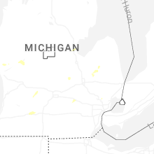


Connect with Interactive Hail Maps