

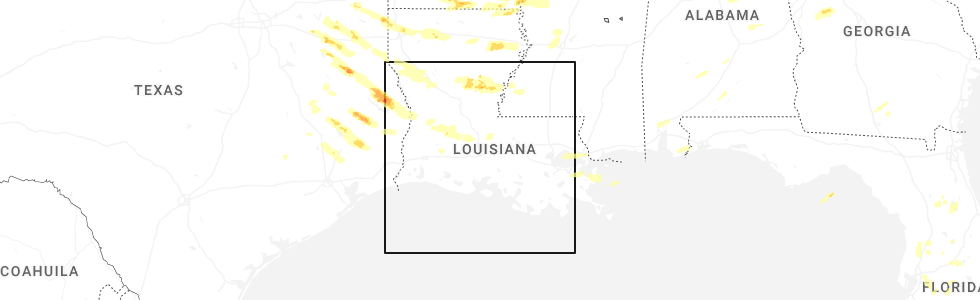
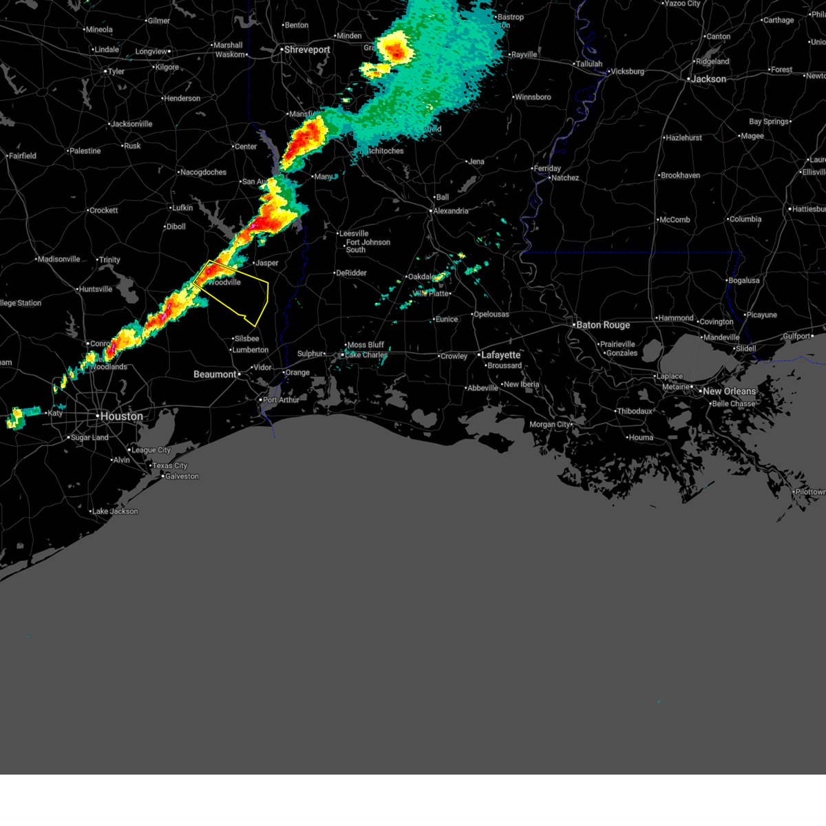
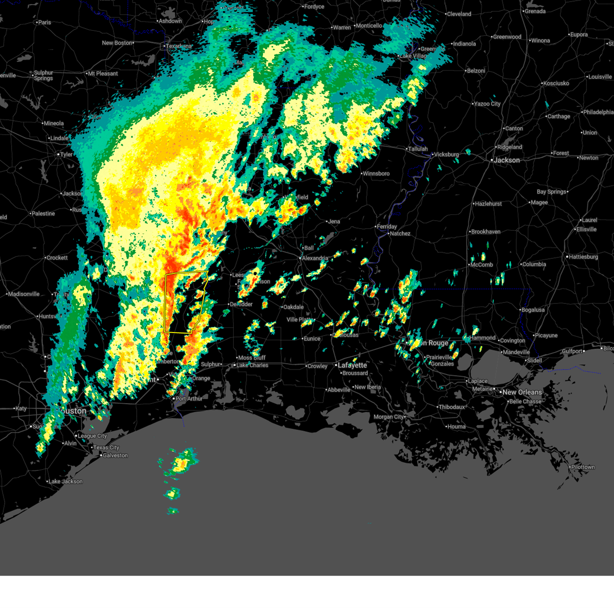
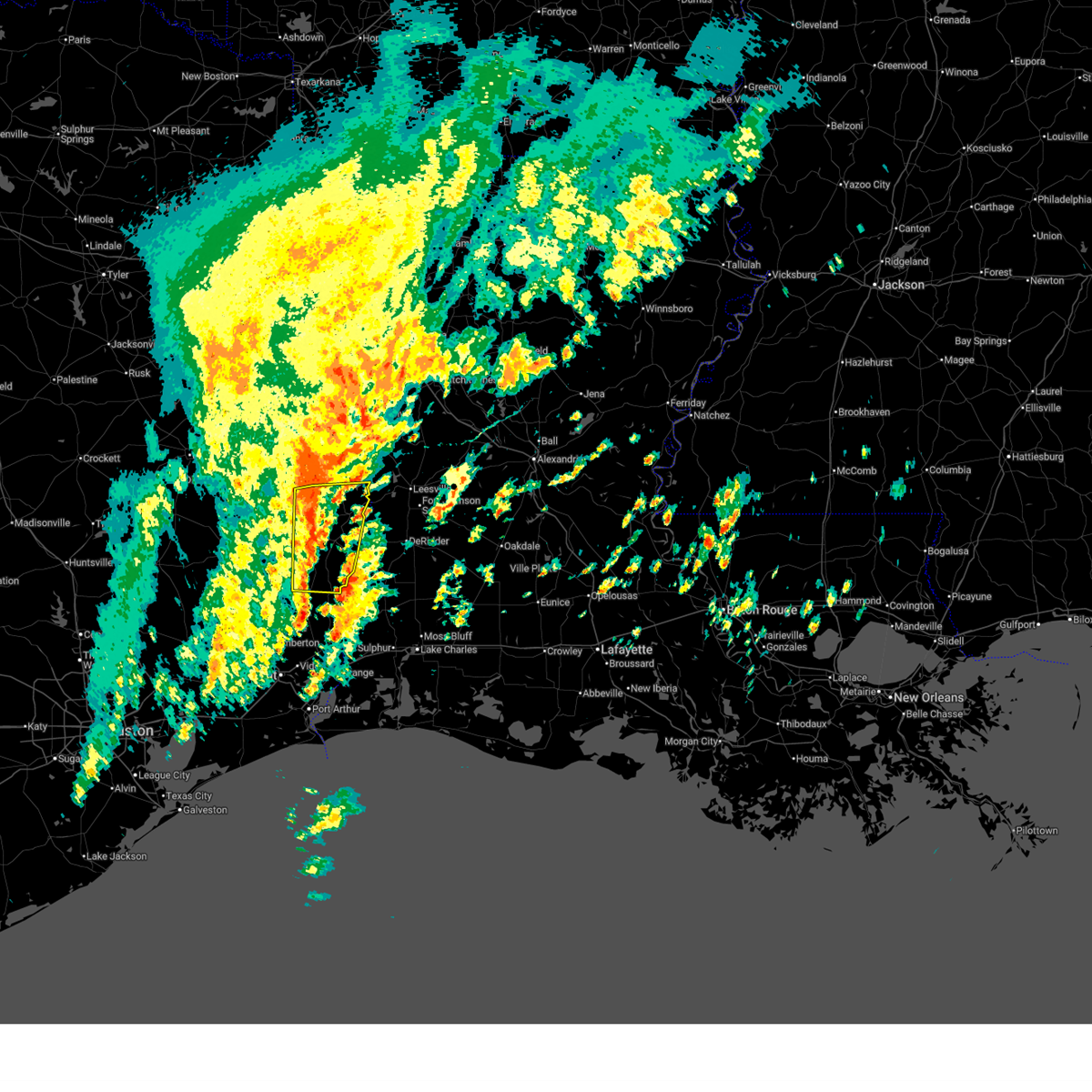
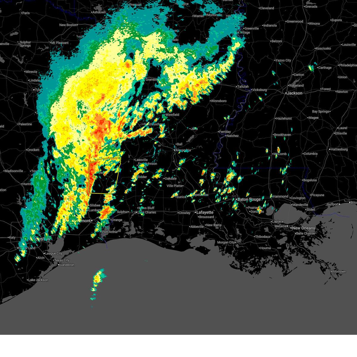
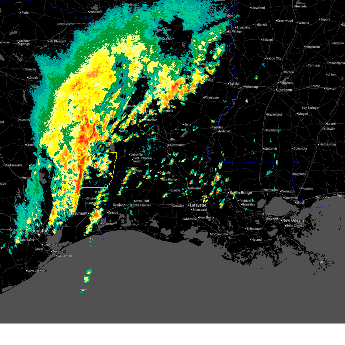
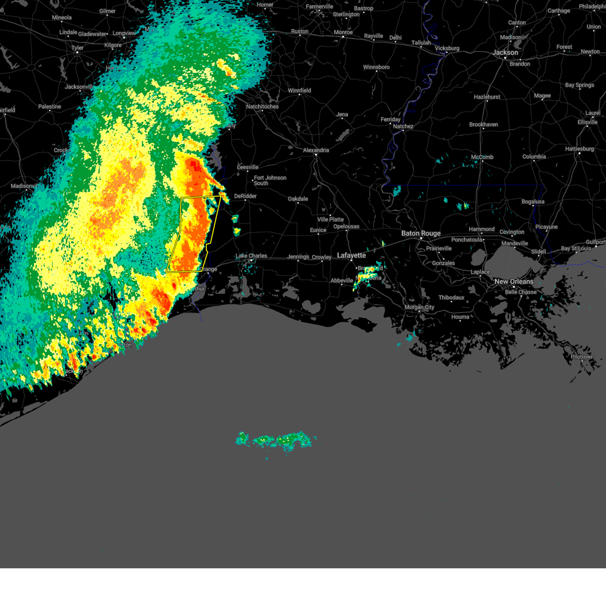
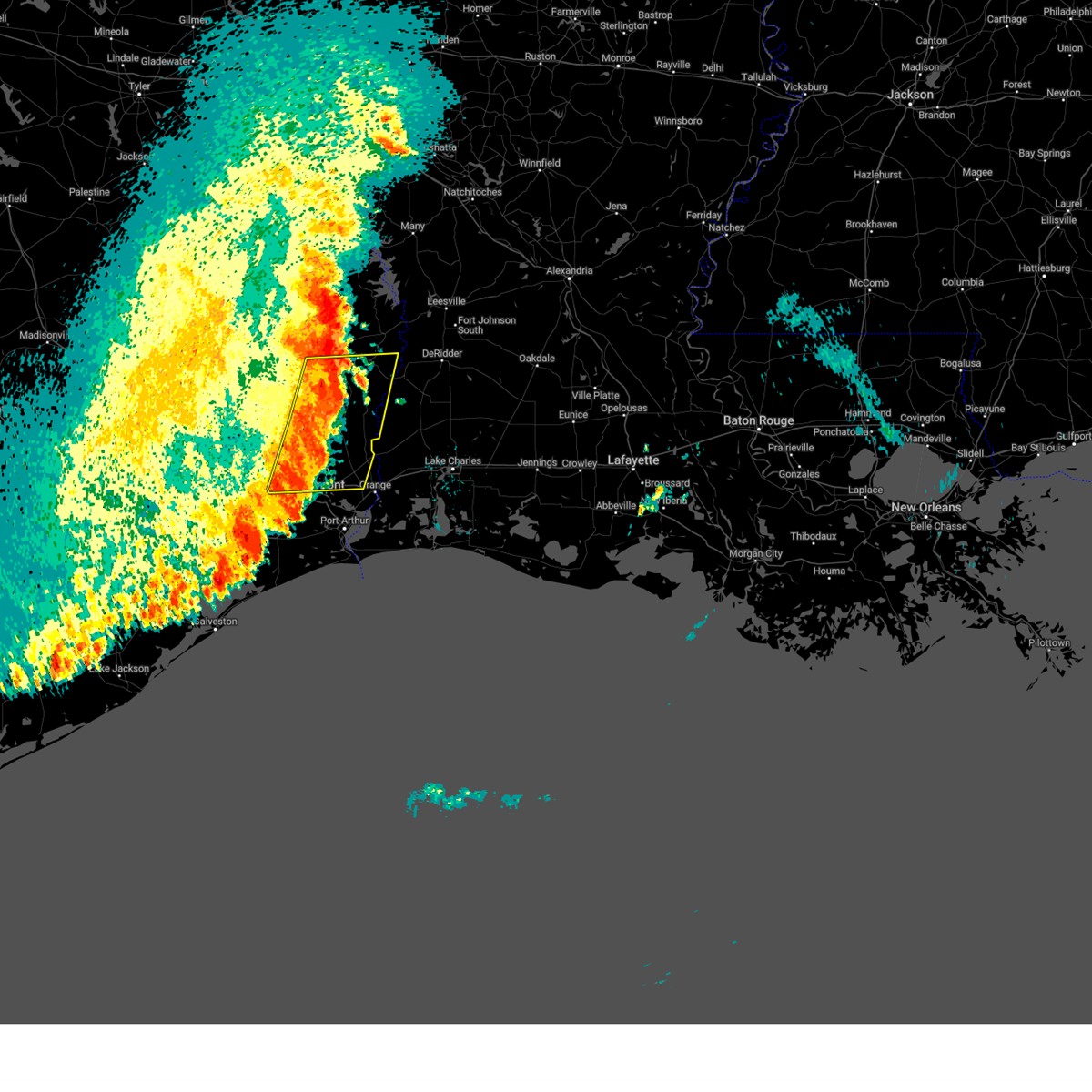
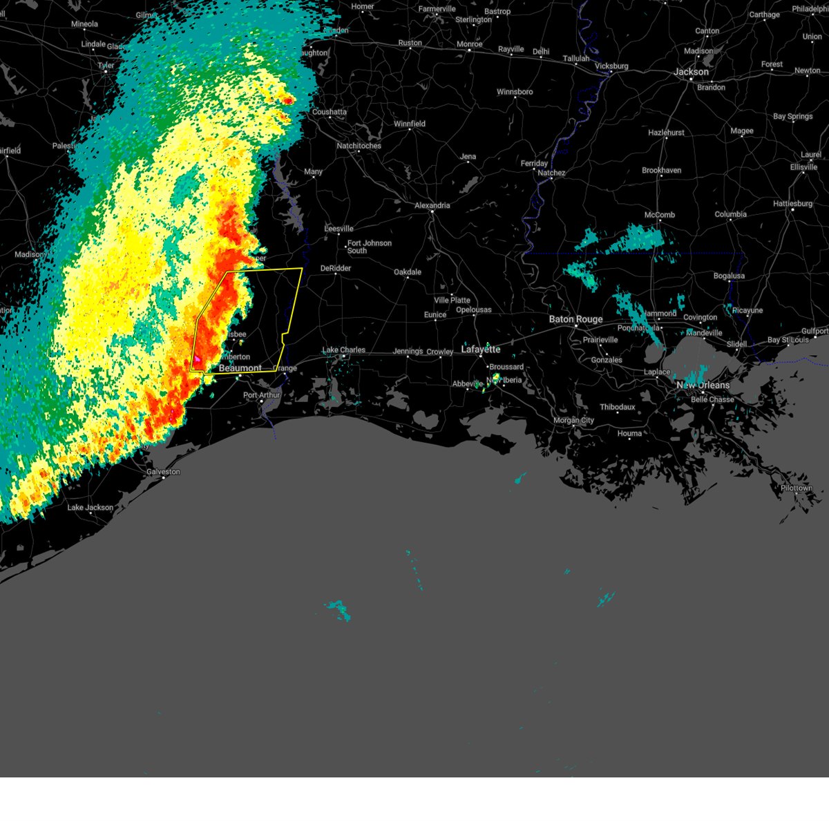
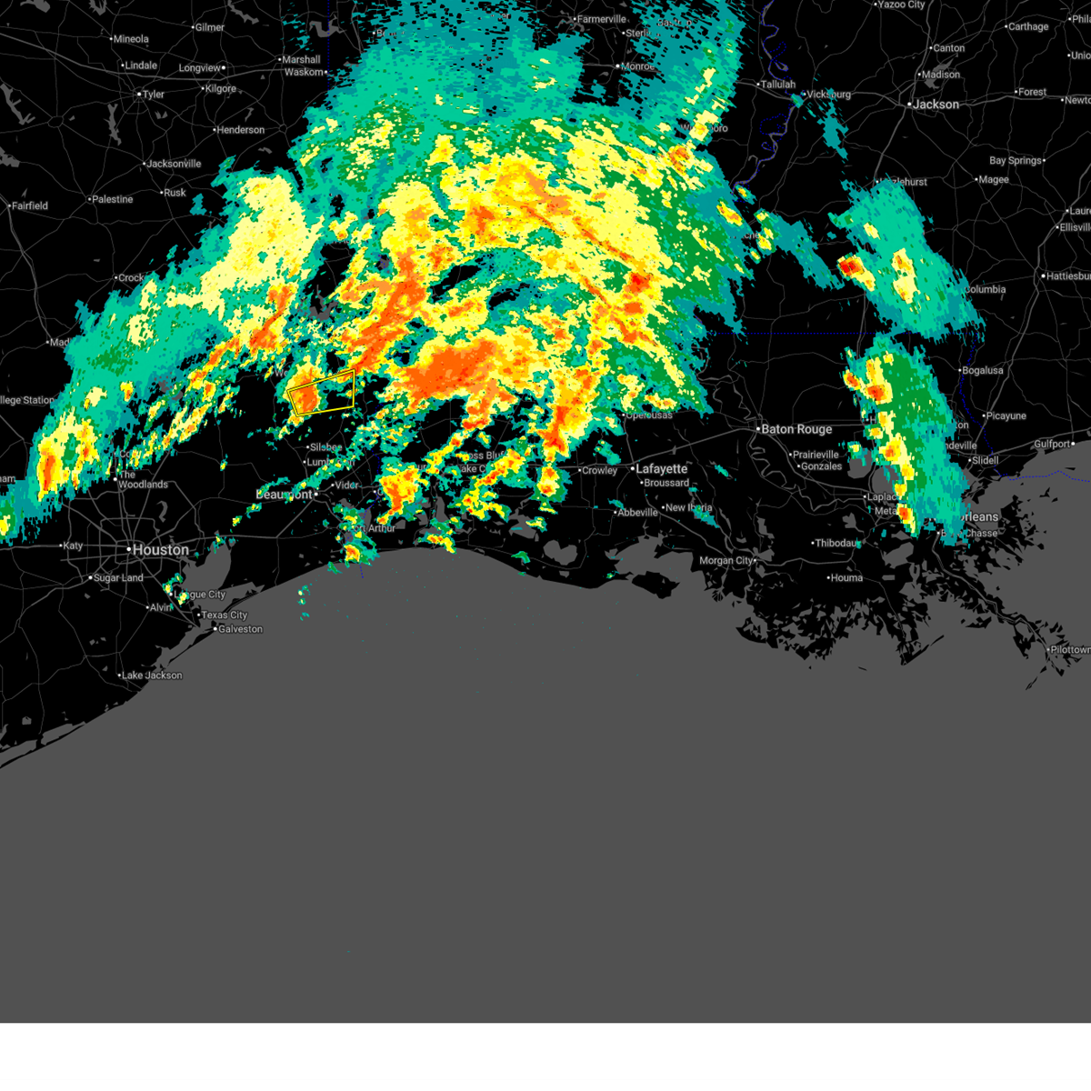
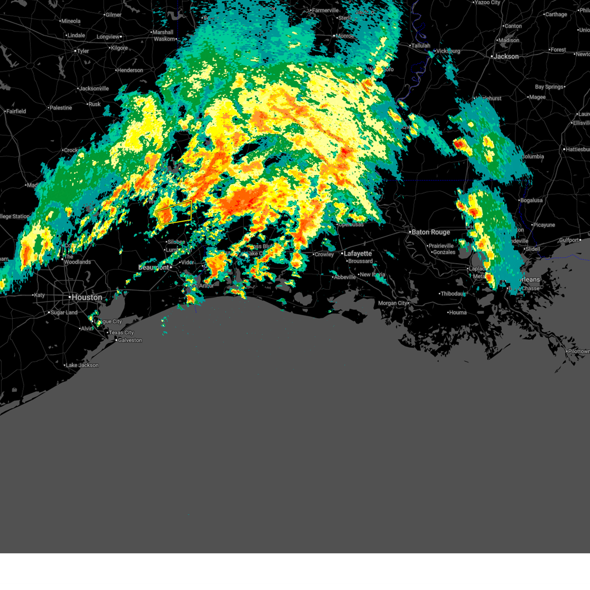
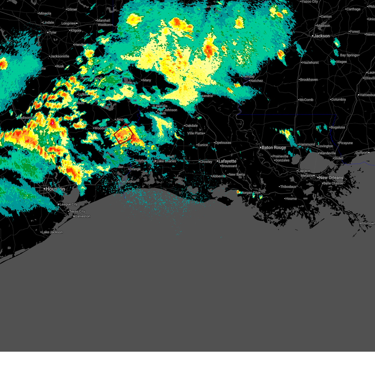
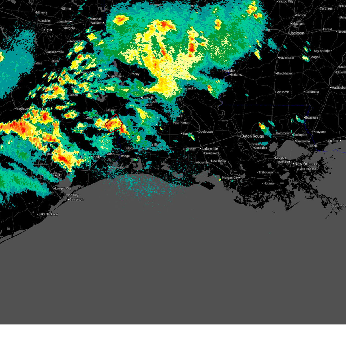
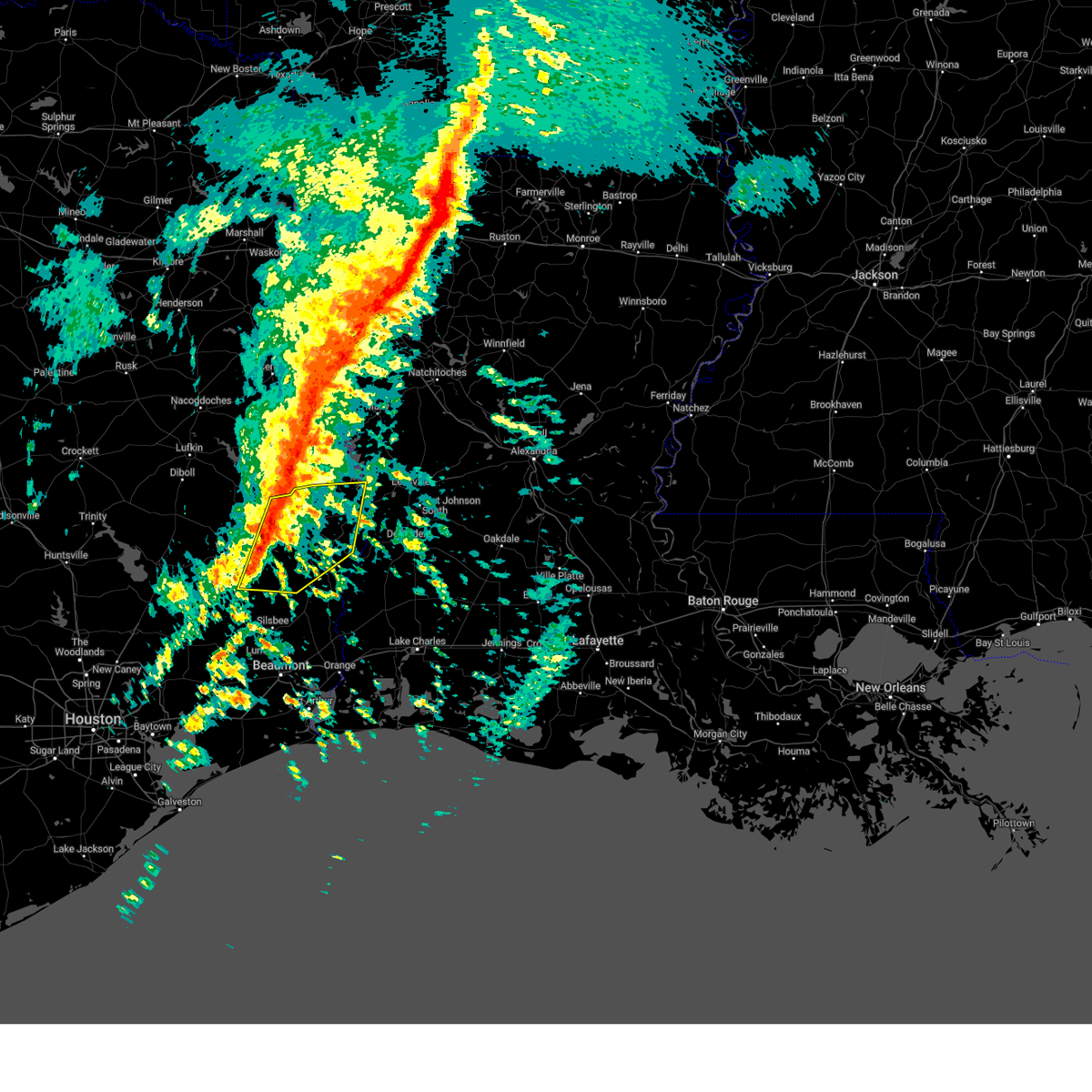
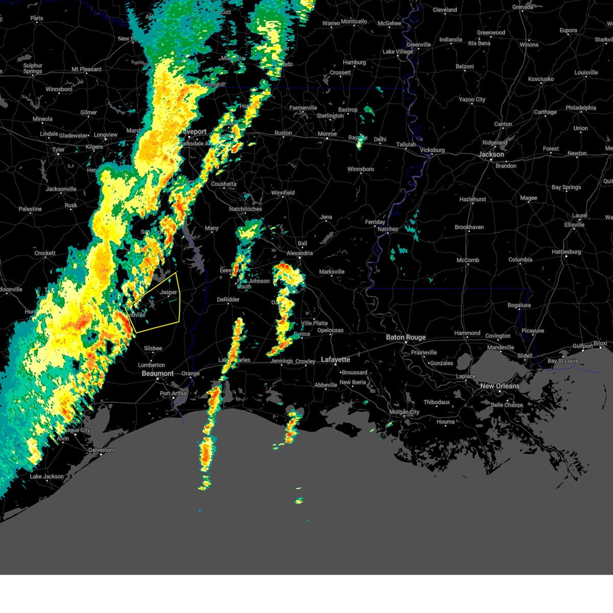
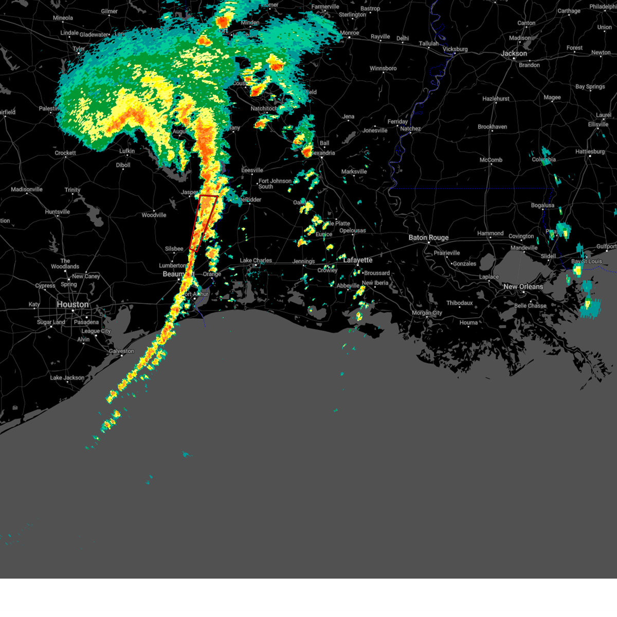
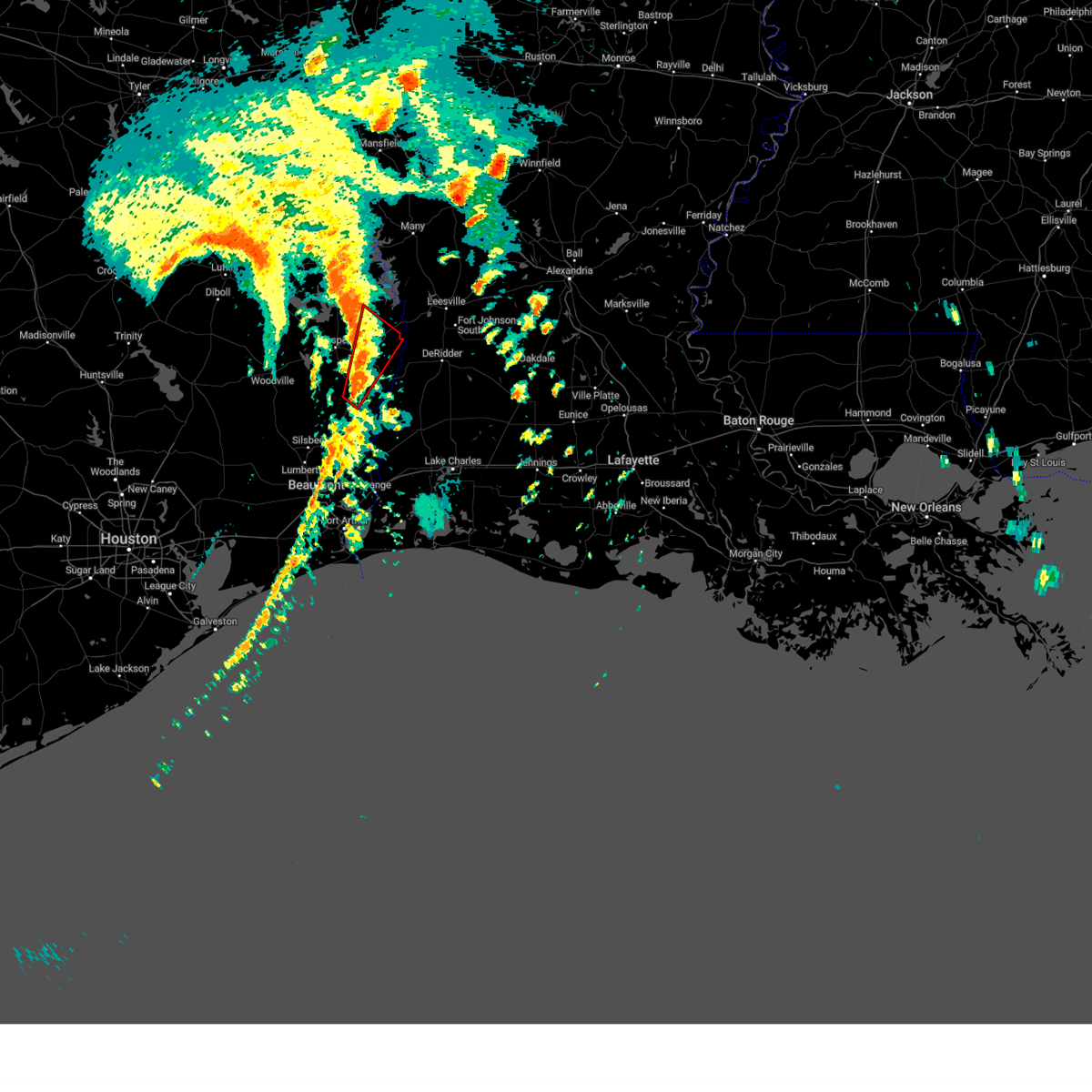
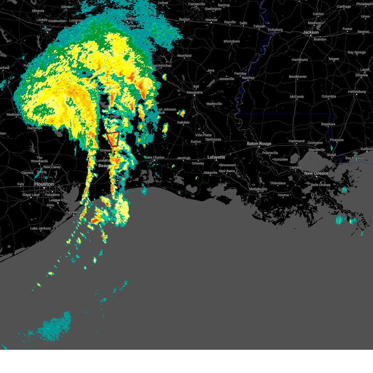
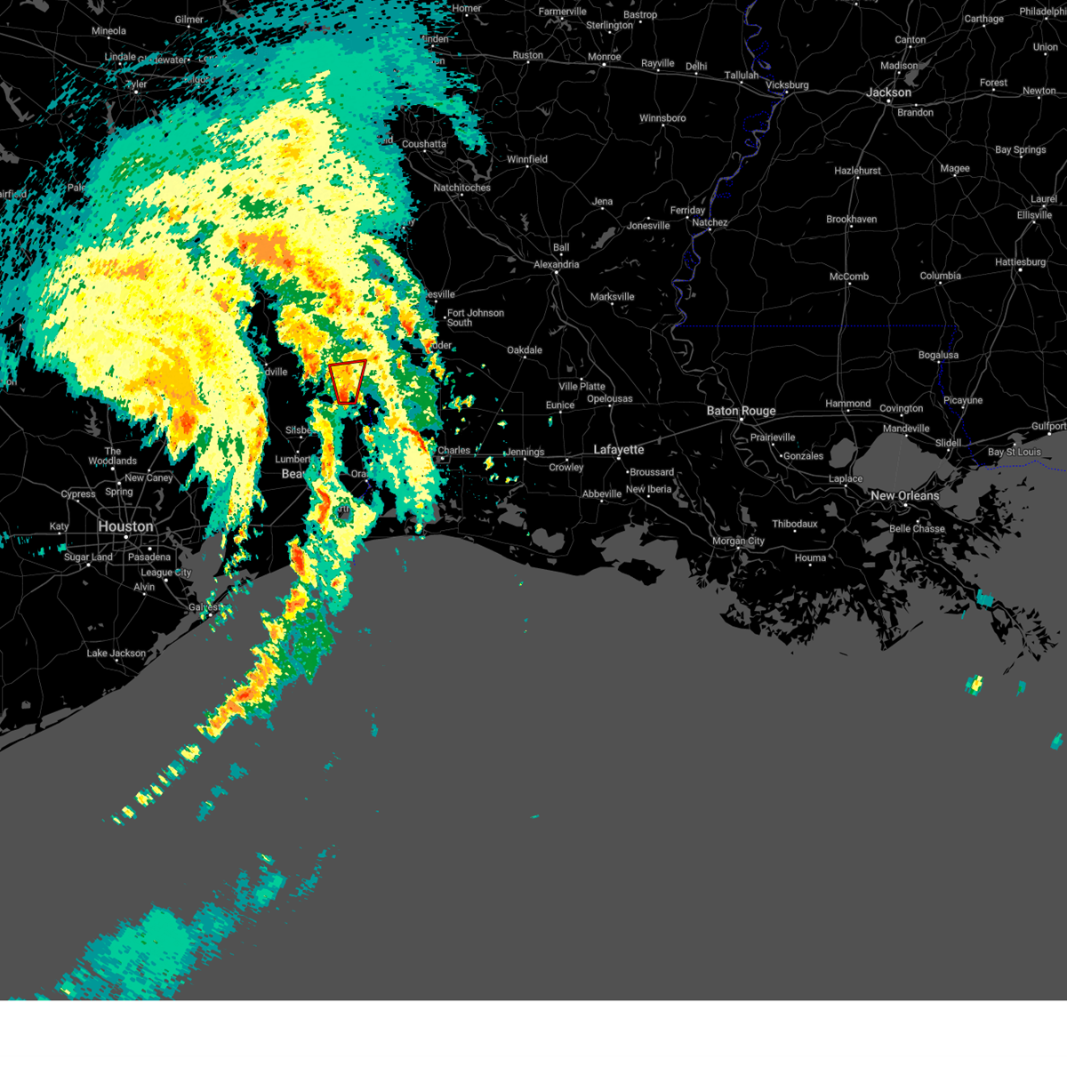
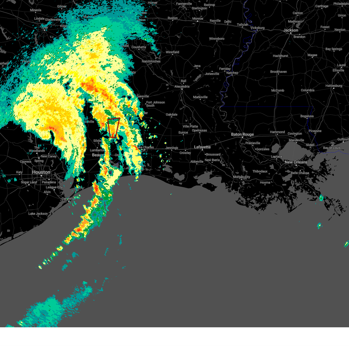
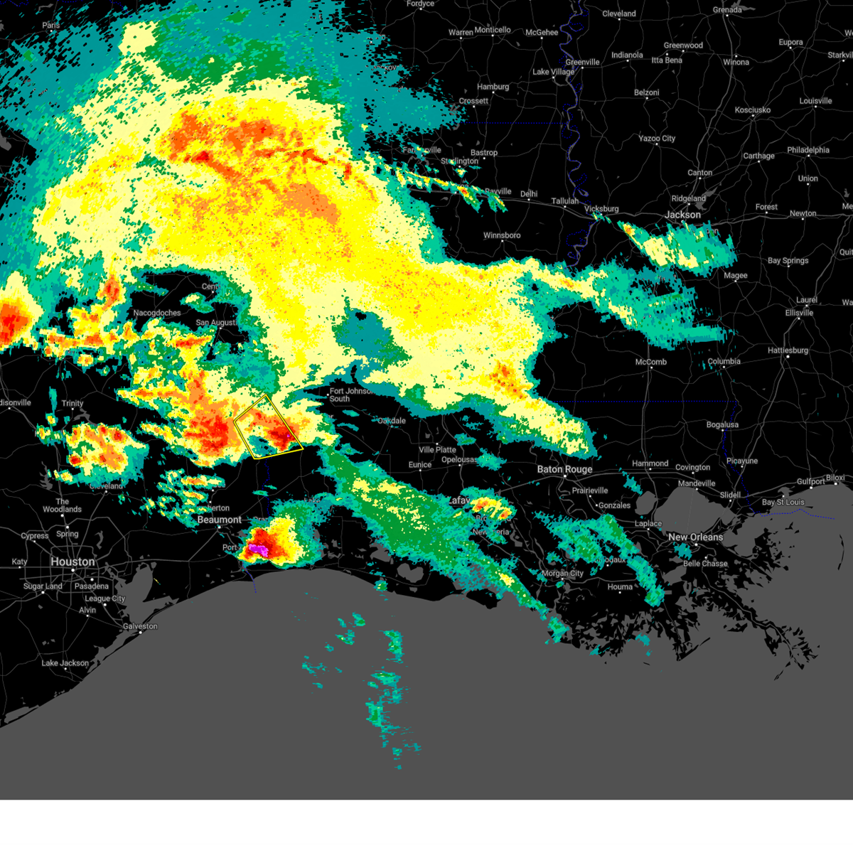
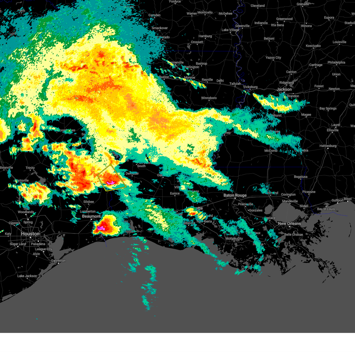
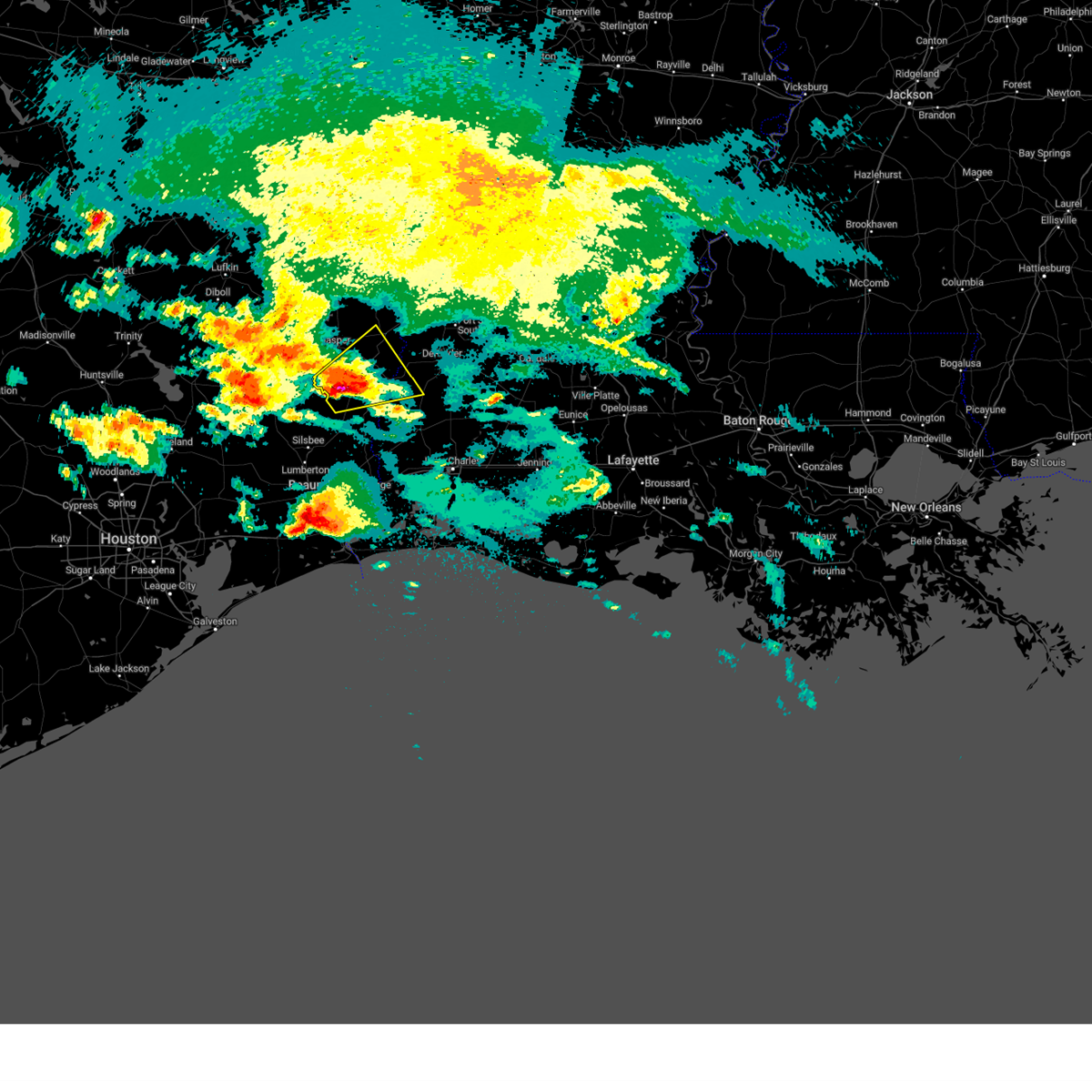
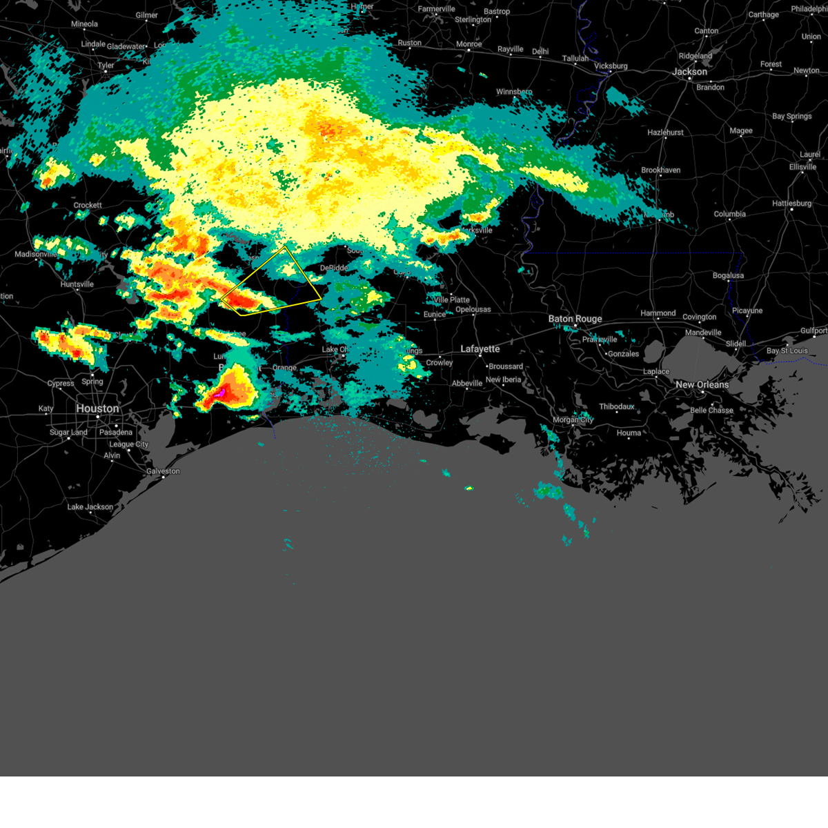
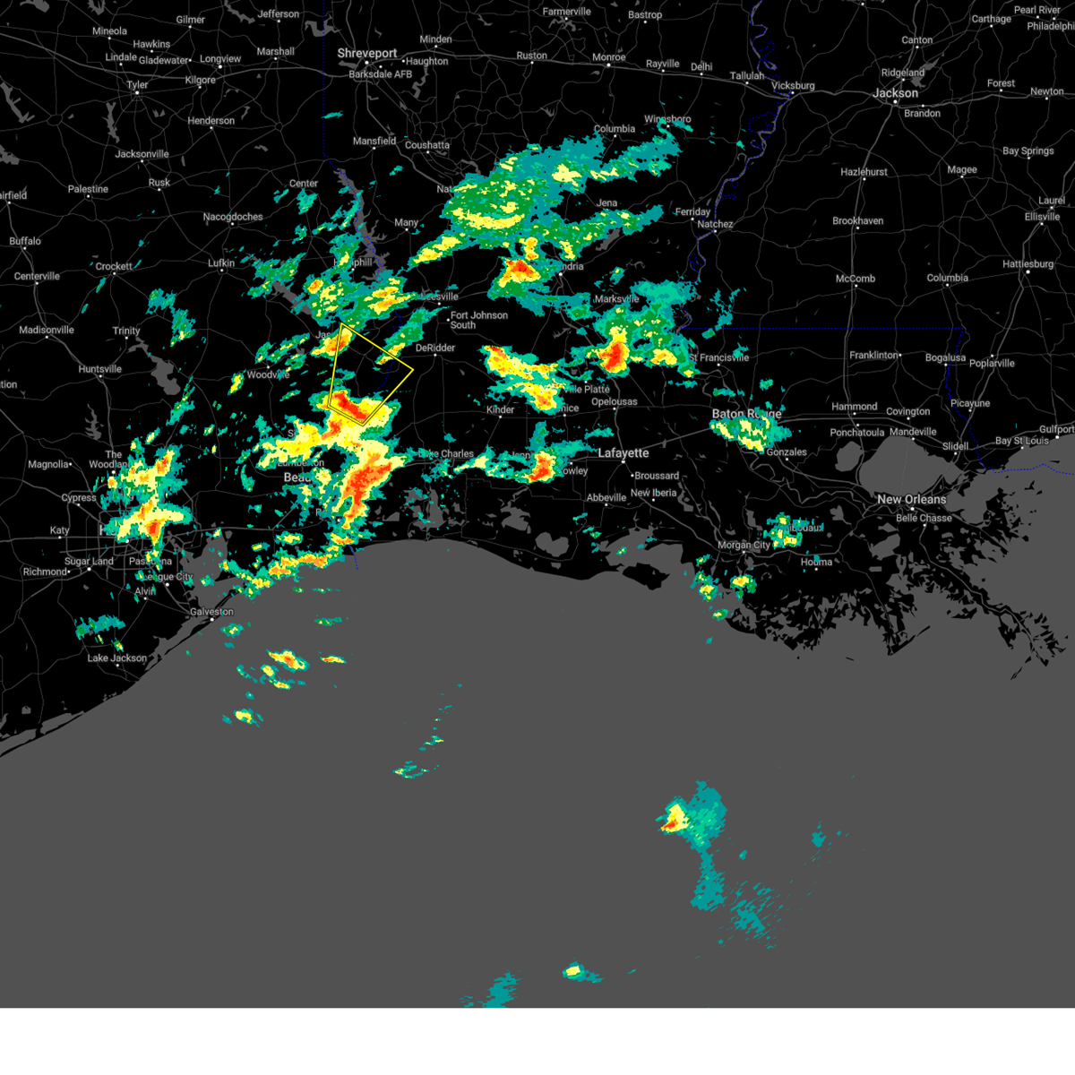
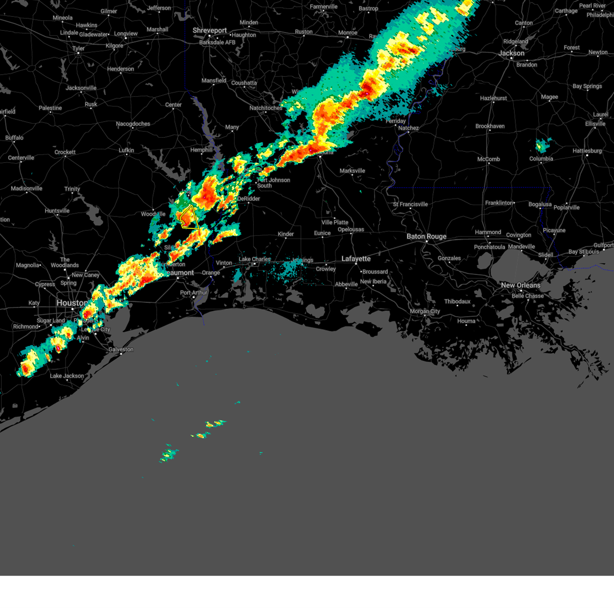
Hail Map for Kirbyville, TX
The Kirbyville, TX area has had 12 reports of on-the-ground hail by trained spotters, and has been under severe weather warnings 18 times during the past 12 months. Doppler radar has detected hail at or near Kirbyville, TX on 74 occasions, including 4 occasions during the past year.
| Name: | Kirbyville, TX |
| Where Located: | 40.1 miles NNW of Beaumont, TX |
| Map: | Google Map for Kirbyville, TX |
| Population: | 2142 |
| Housing Units: | 984 |
| More Info: | Search Google for Kirbyville, TX |
1
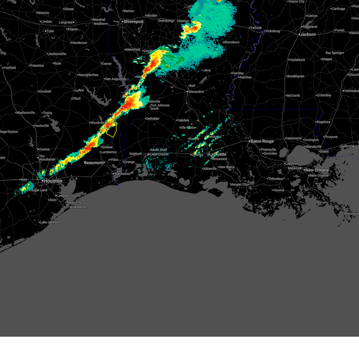
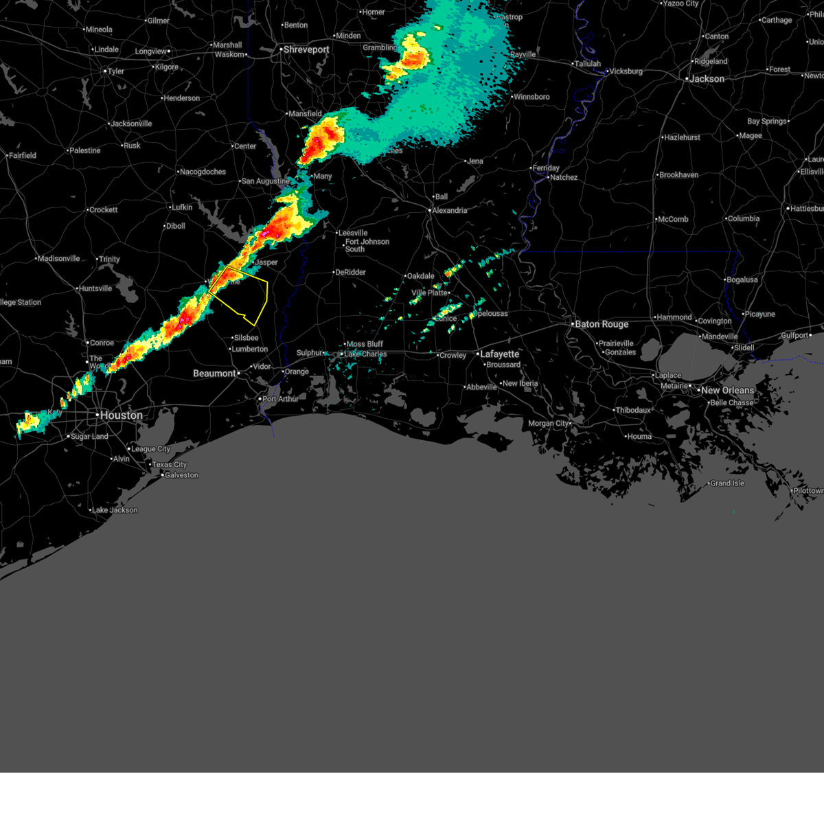
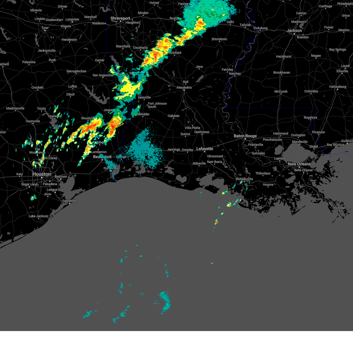
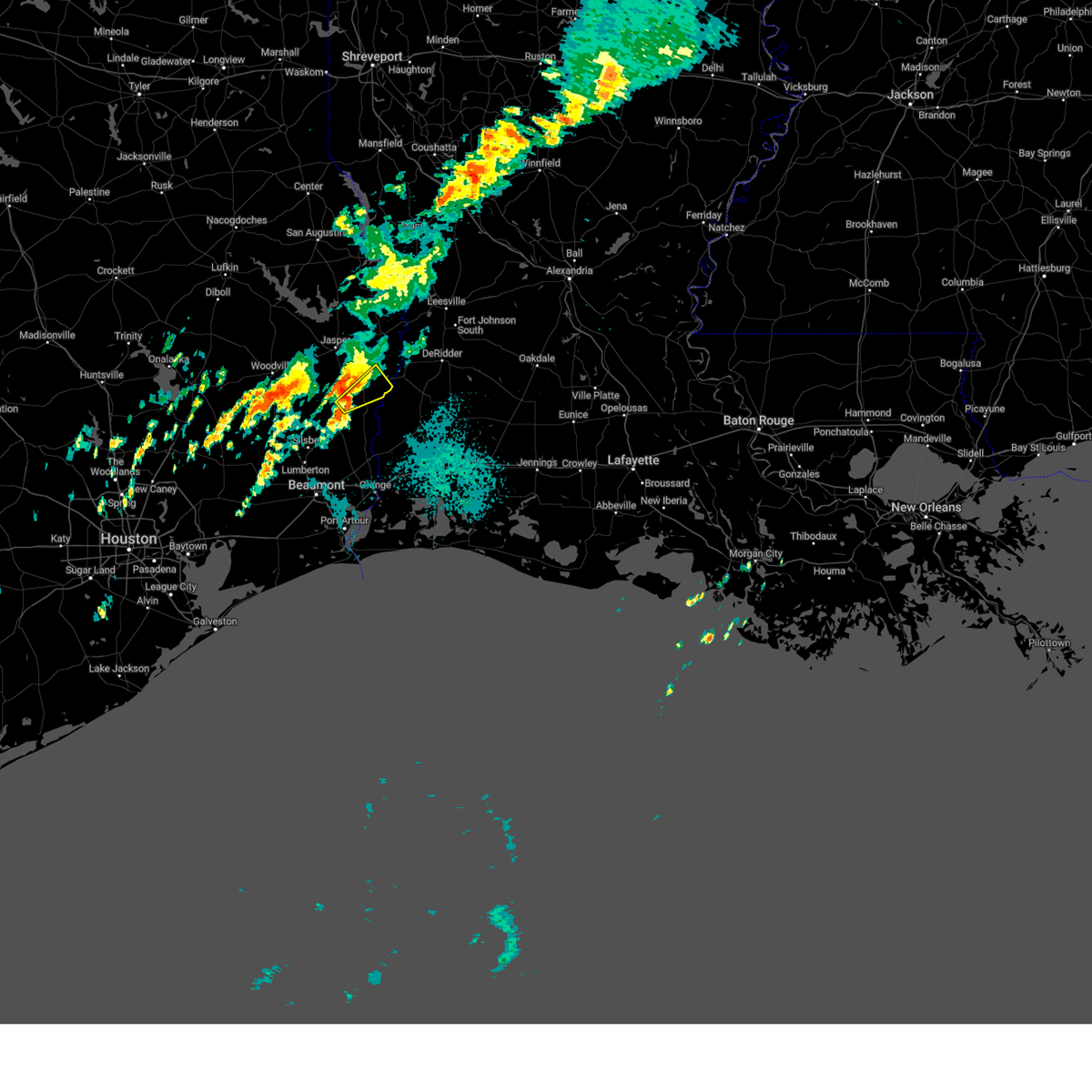
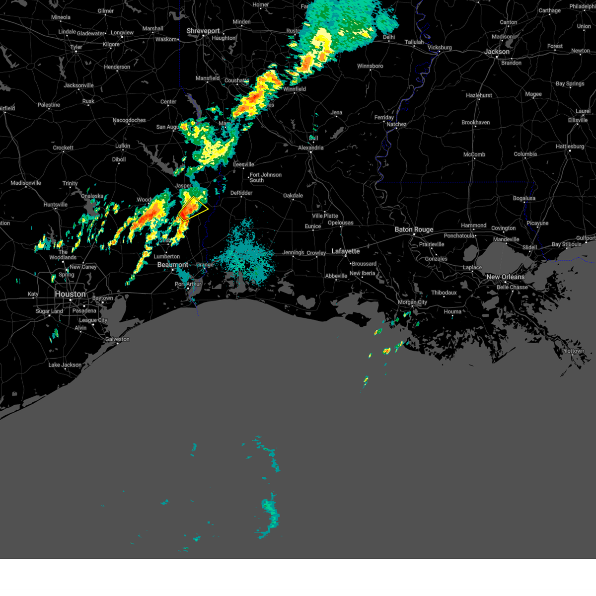
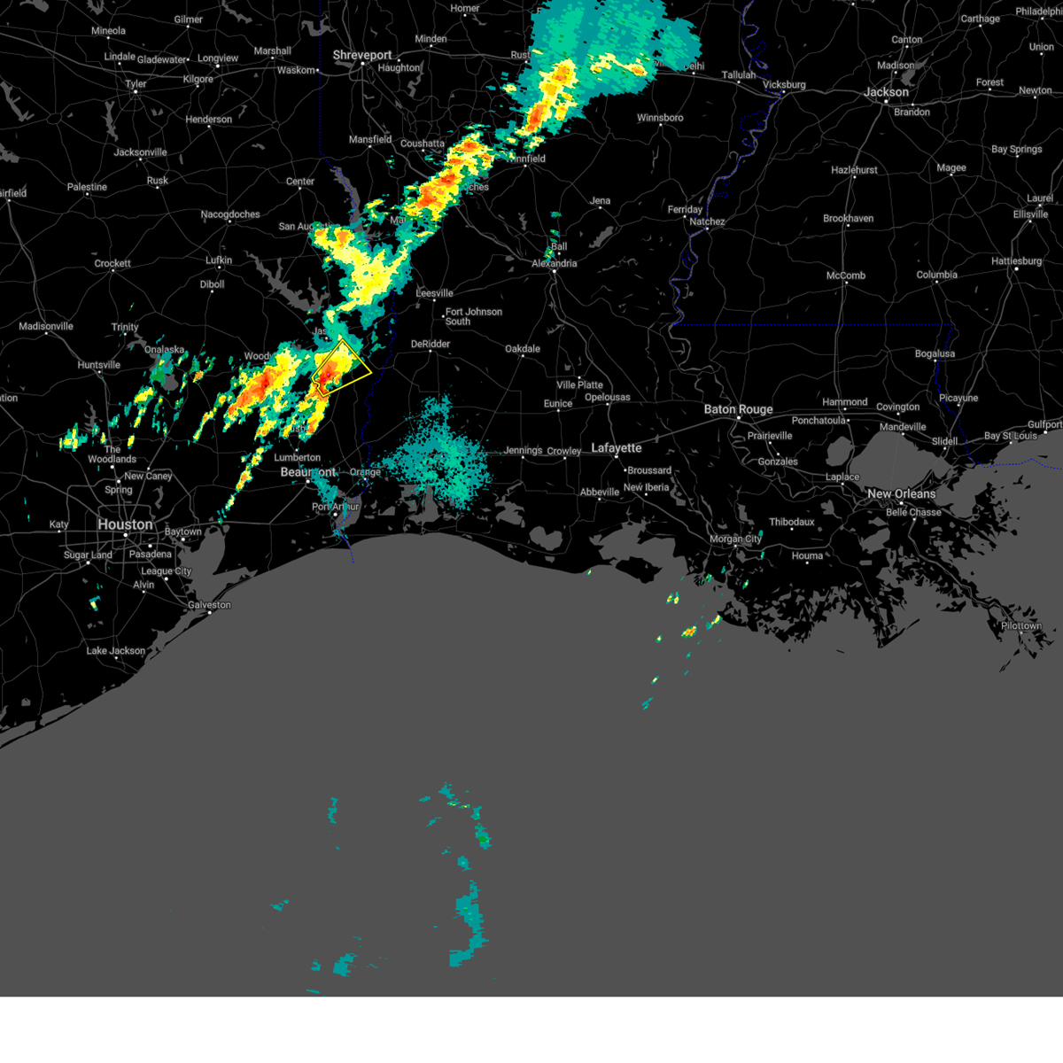
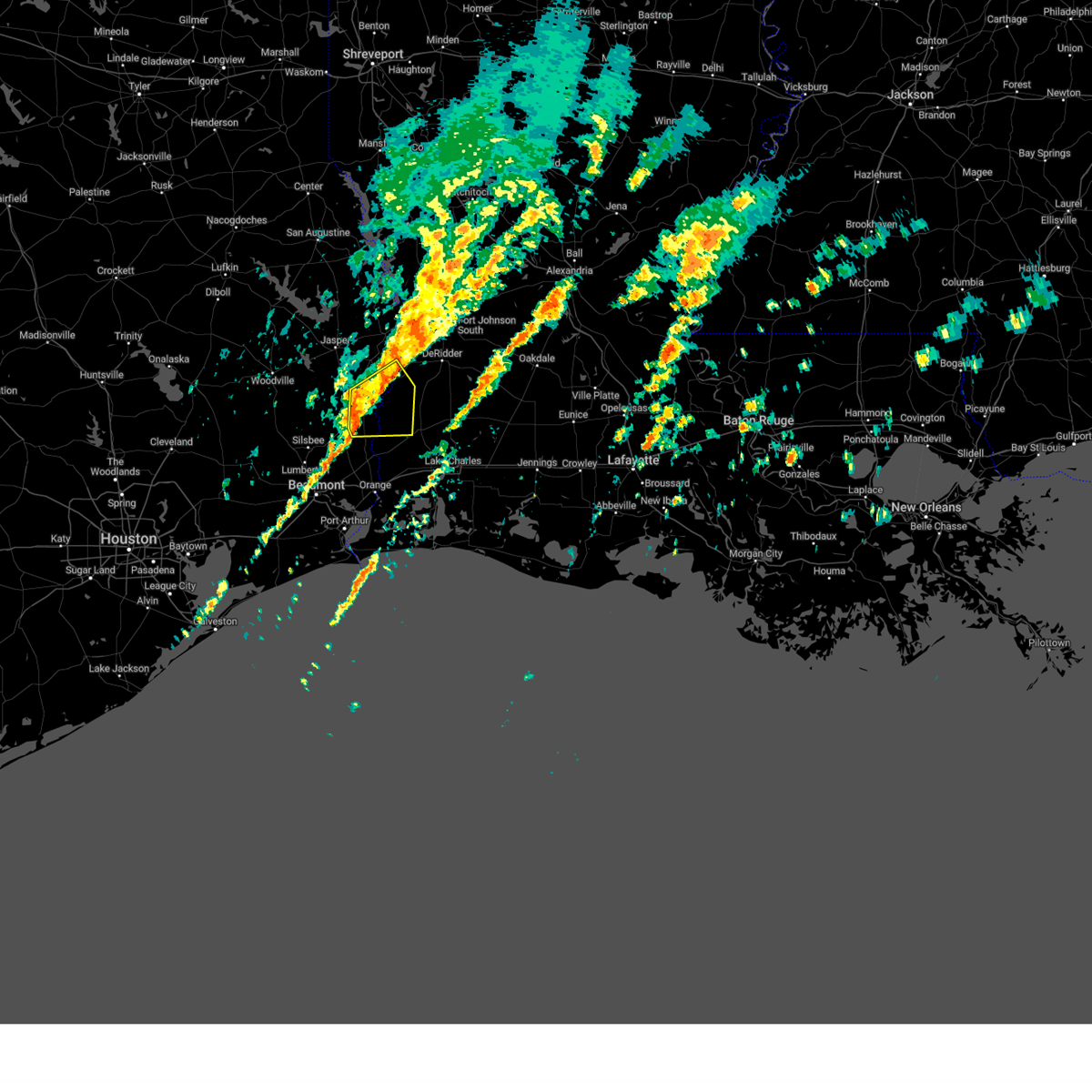
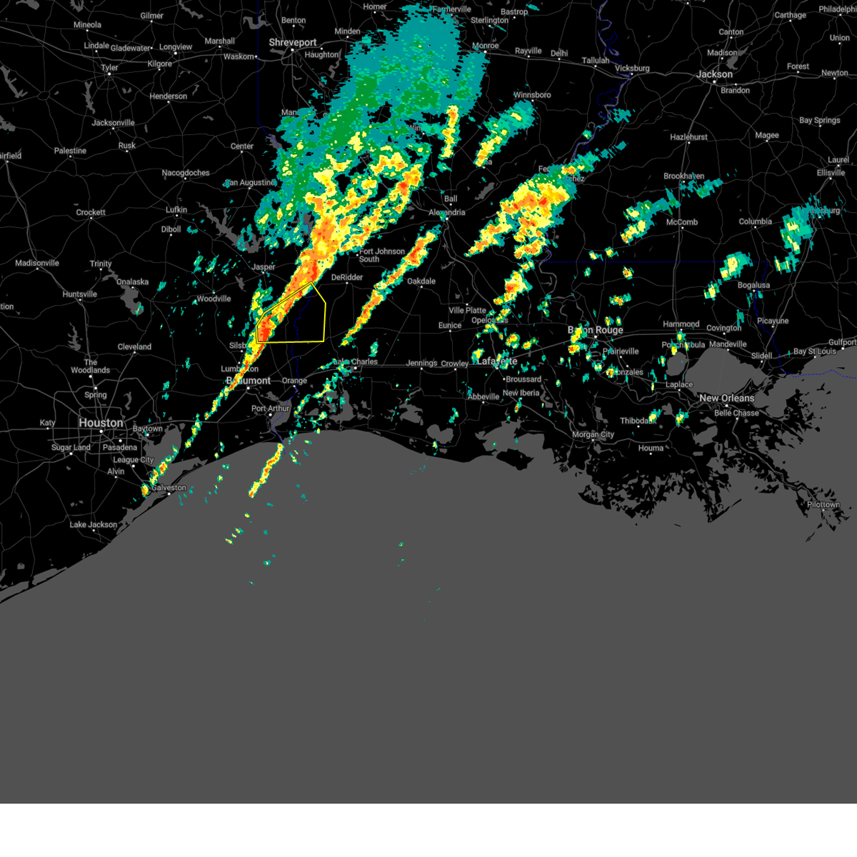
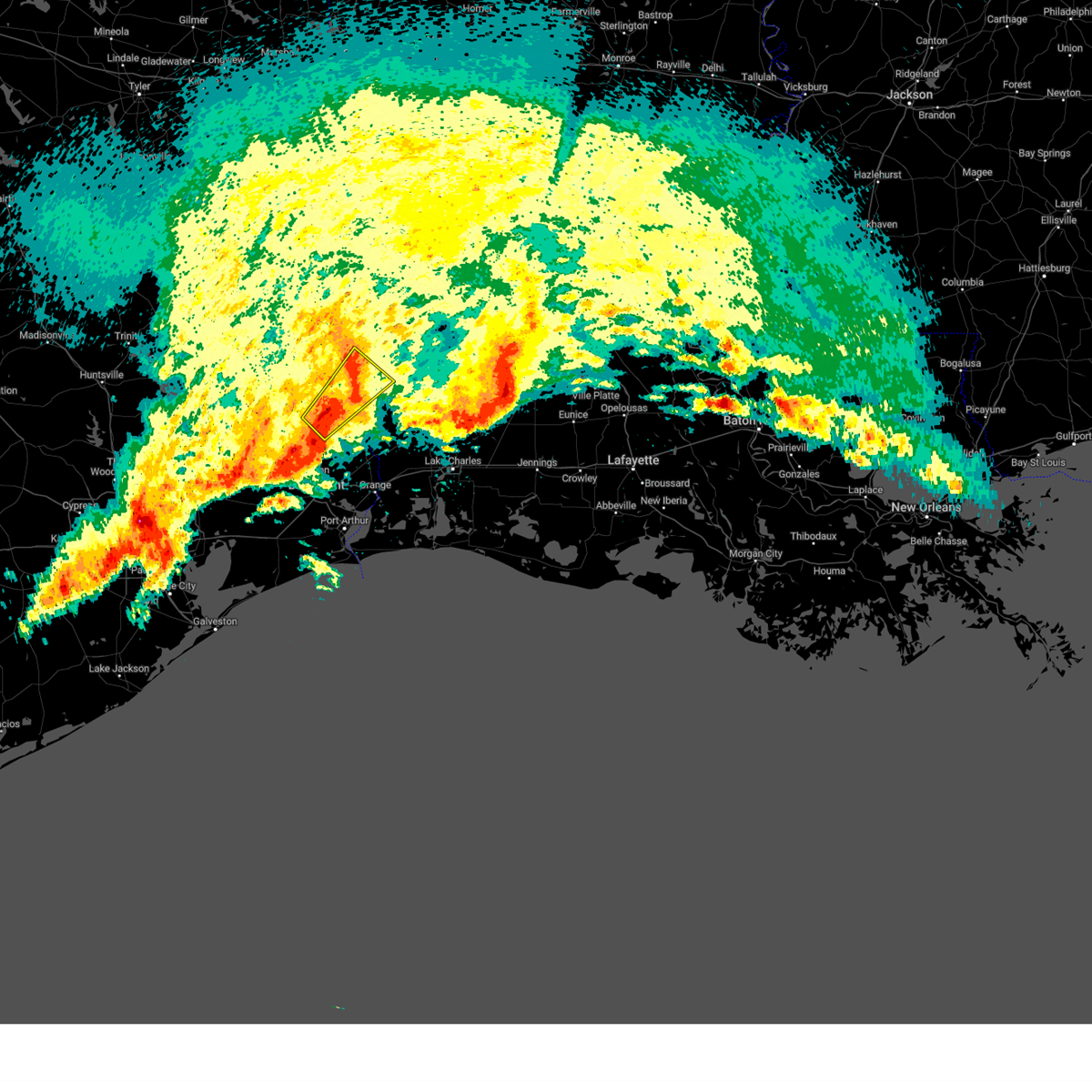
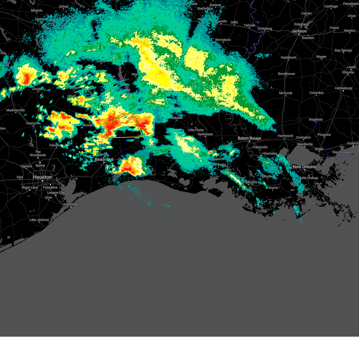
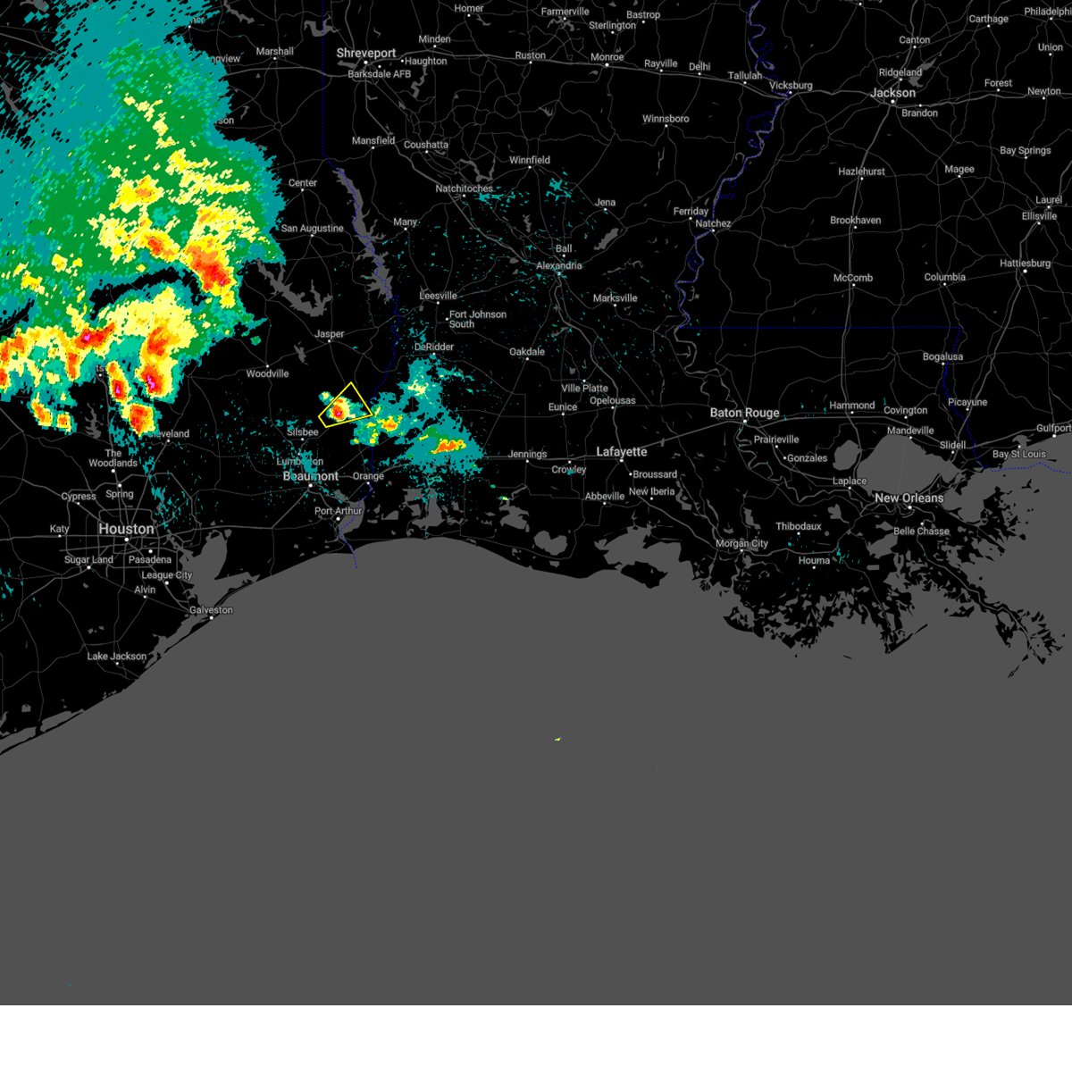
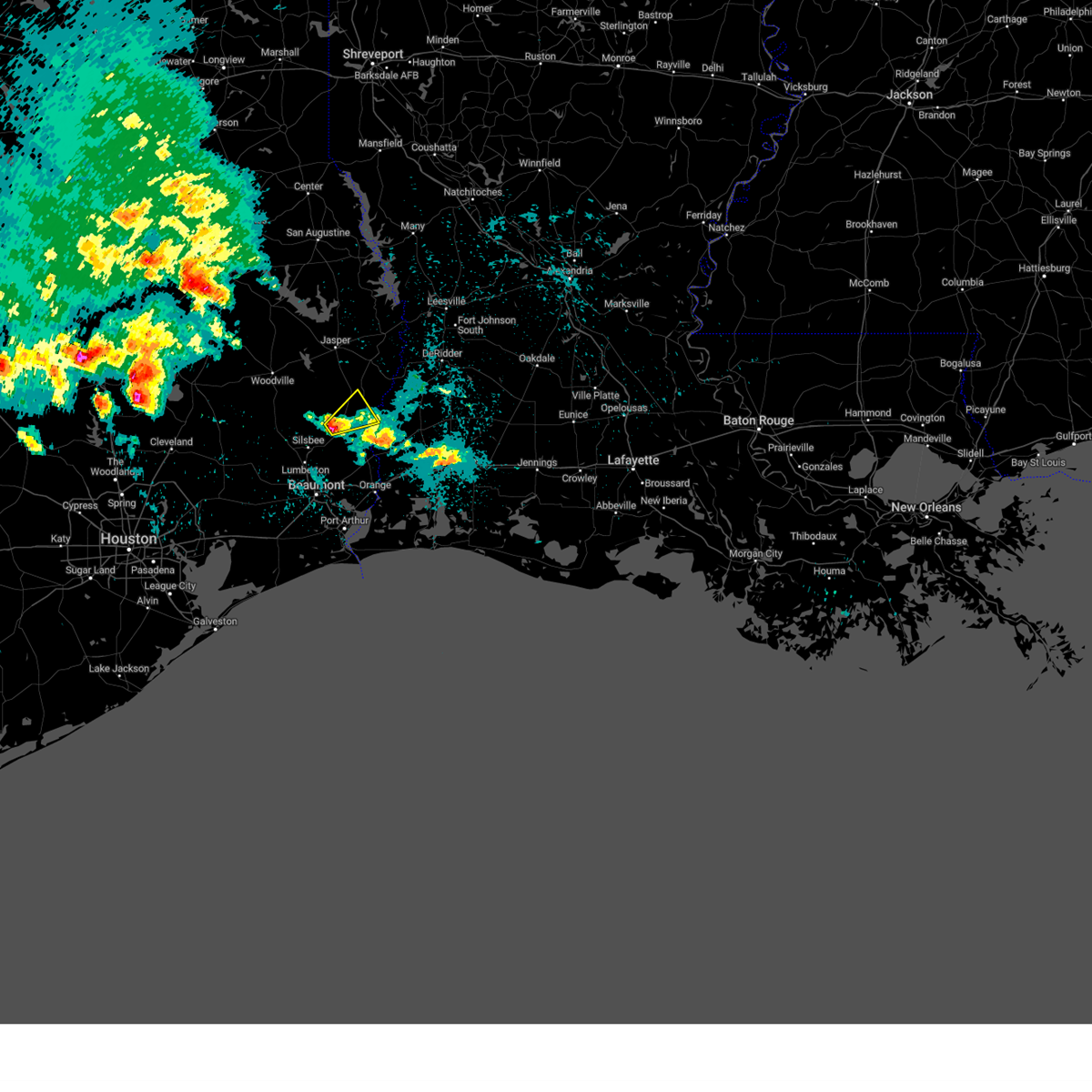
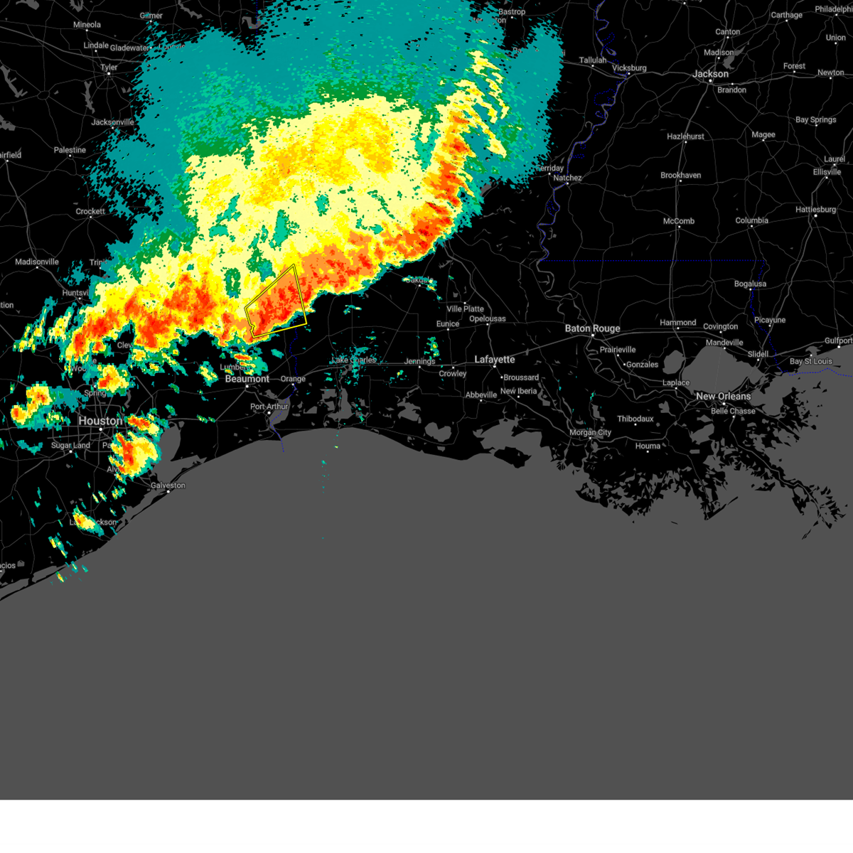
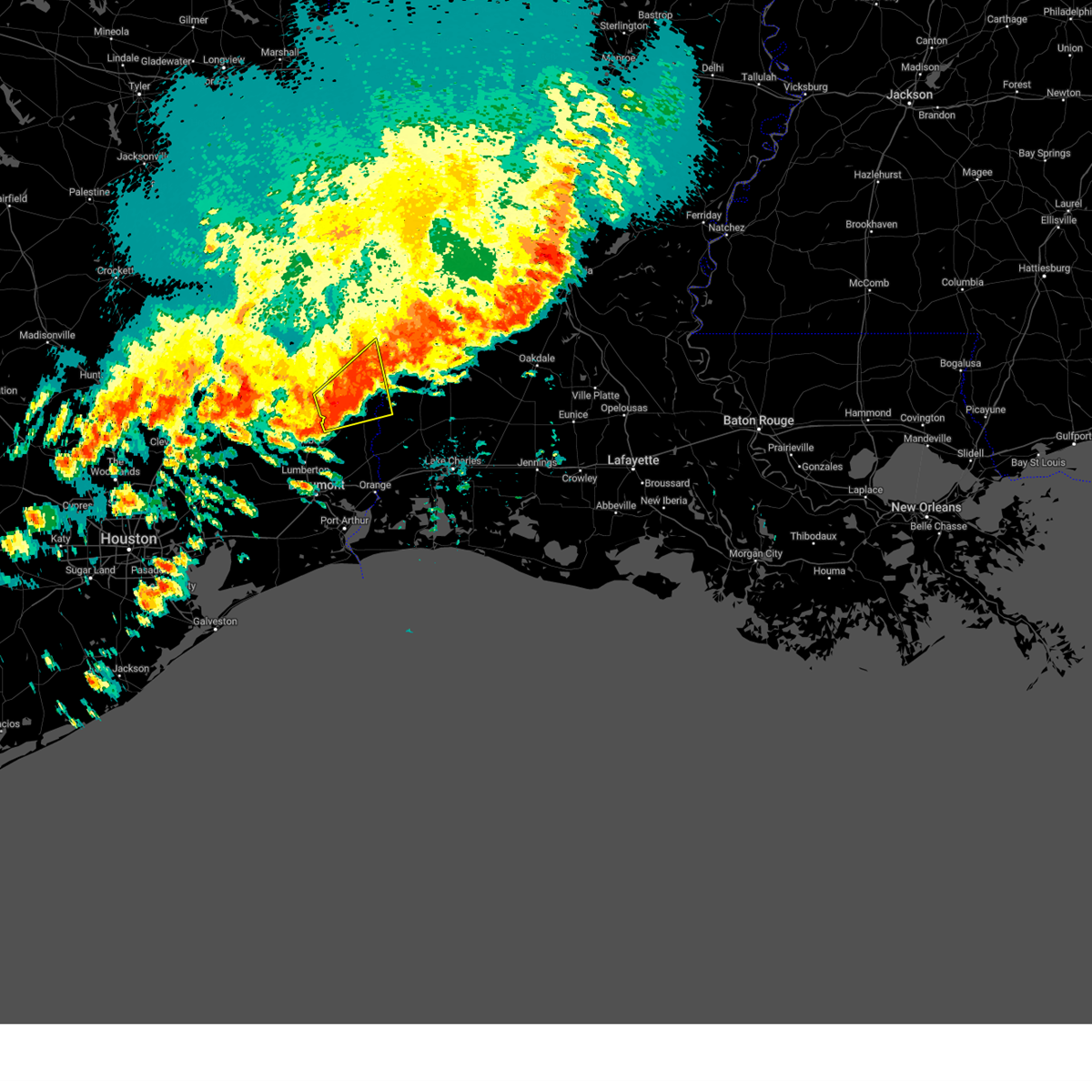
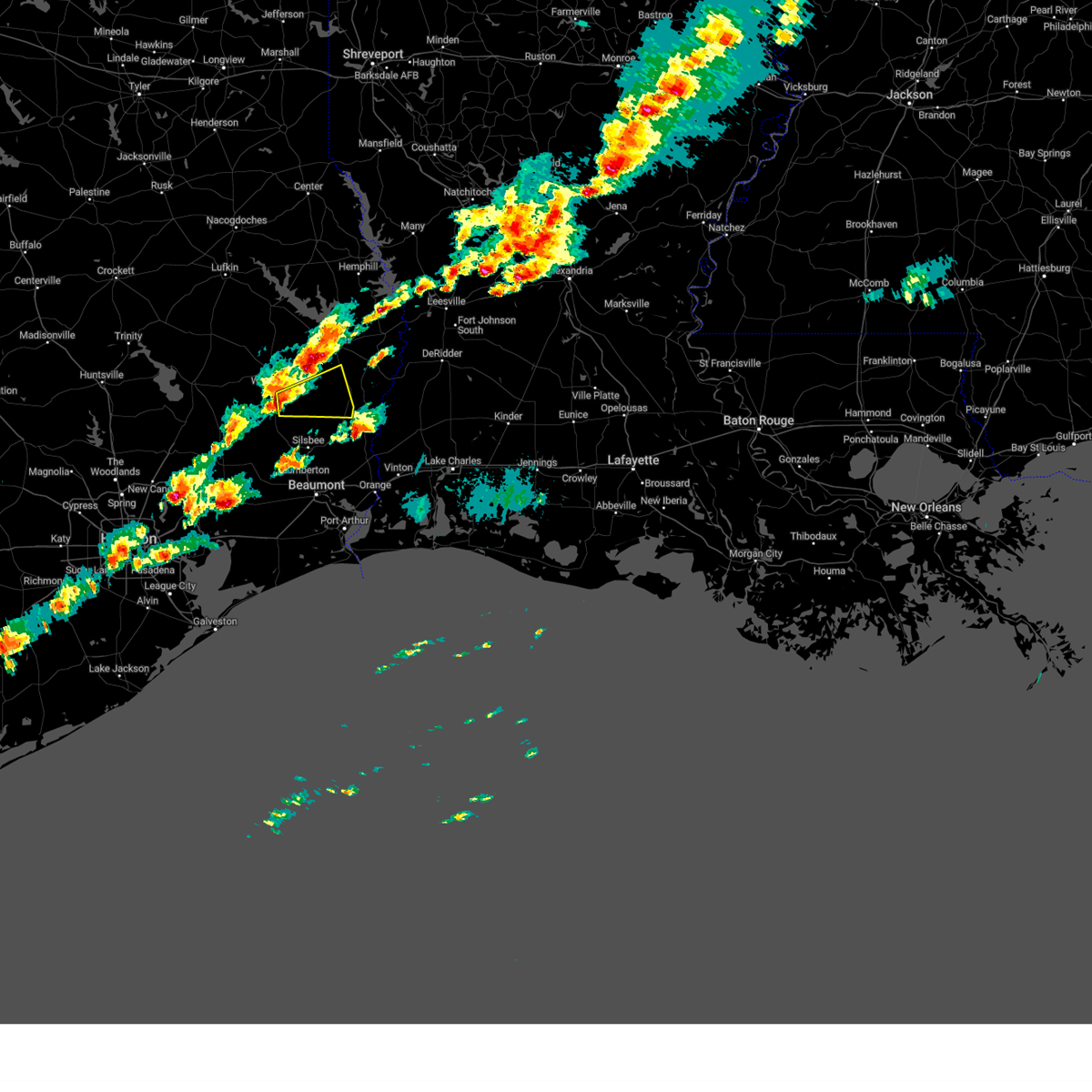
The Top Recent Hail Date for Kirbyville, TX is Sunday, March 15, 2026 (23rd out of 74)
Hail and Wind Damage Spotted near Kirbyville, TX
| Date / Time | Report Details |
|---|---|
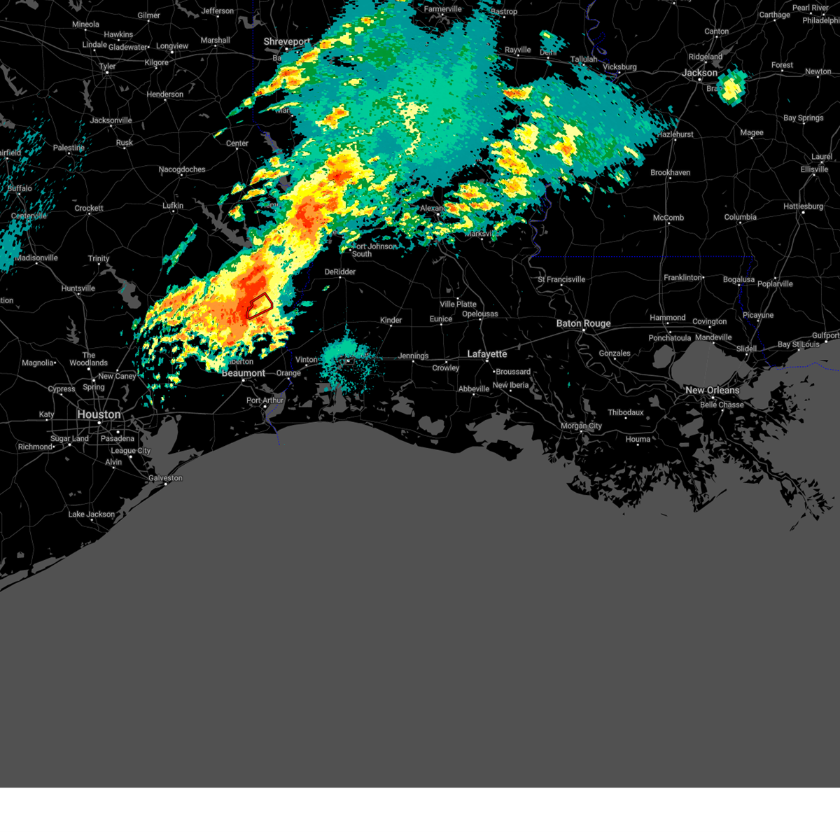
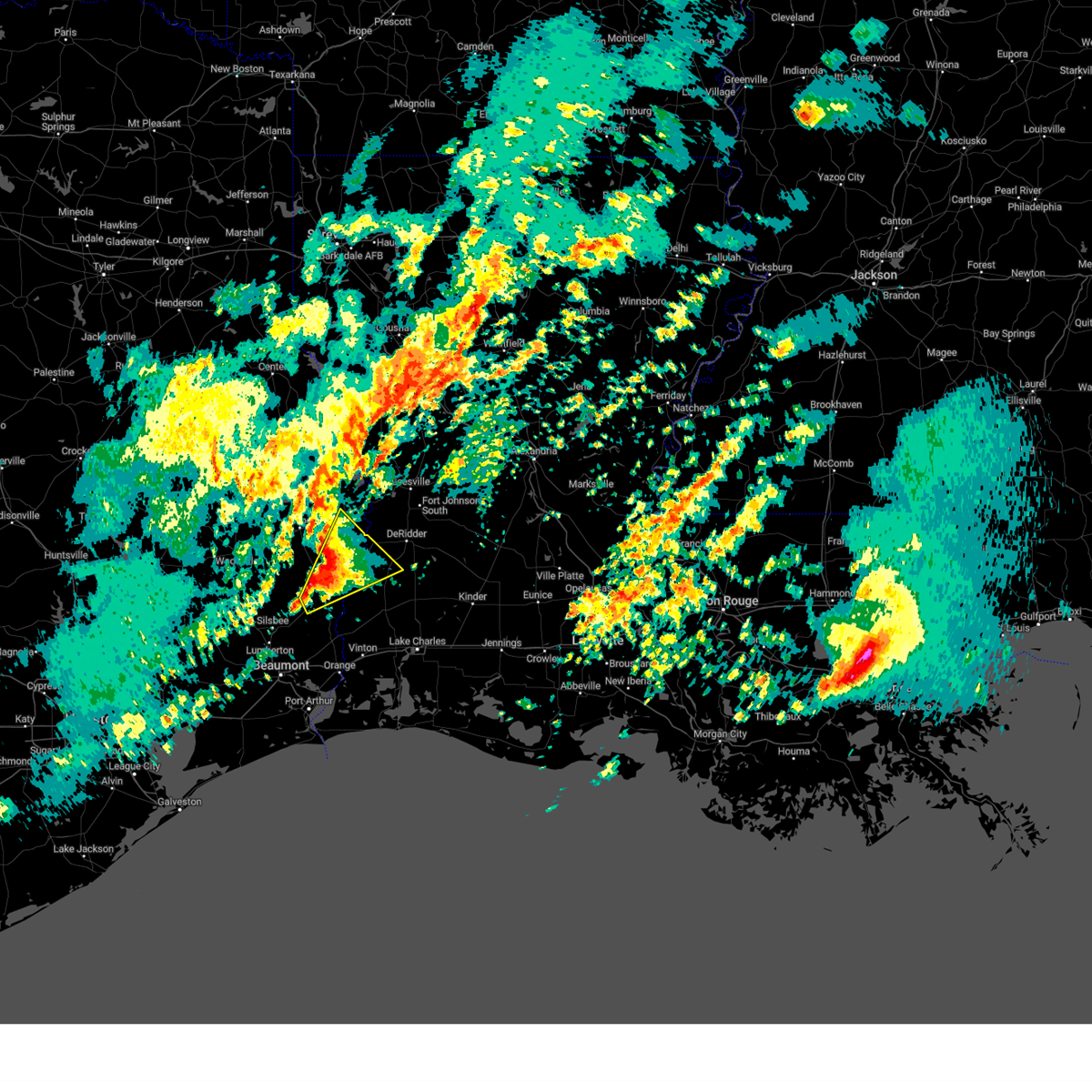
| 3/15/2026 8:22 PM CDT |
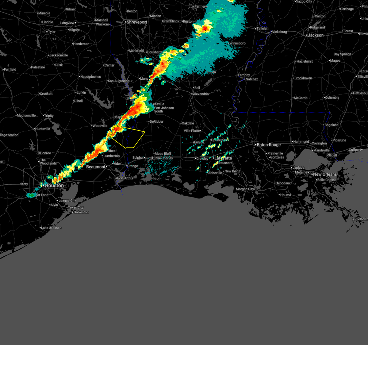 Svrlch the national weather service in lake charles has issued a * severe thunderstorm warning for, southwestern beauregard parish in southwestern louisiana, southwestern newton county in southeastern texas, east central jasper county in southeastern texas, * until 915 pm cdt. * at 822 pm cdt, a severe thunderstorm was located over kirbyville, moving east at 40 mph (radar indicated). Hazards include 60 mph wind gusts and half dollar size hail. Hail damage to vehicles is expected. Expect wind damage to roofs, siding, and trees. Svrlch the national weather service in lake charles has issued a * severe thunderstorm warning for, southwestern beauregard parish in southwestern louisiana, southwestern newton county in southeastern texas, east central jasper county in southeastern texas, * until 915 pm cdt. * at 822 pm cdt, a severe thunderstorm was located over kirbyville, moving east at 40 mph (radar indicated). Hazards include 60 mph wind gusts and half dollar size hail. Hail damage to vehicles is expected. Expect wind damage to roofs, siding, and trees.
|
| 3/15/2026 8:15 PM CDT |
 the severe thunderstorm warning has been cancelled and is no longer in effect the severe thunderstorm warning has been cancelled and is no longer in effect
|
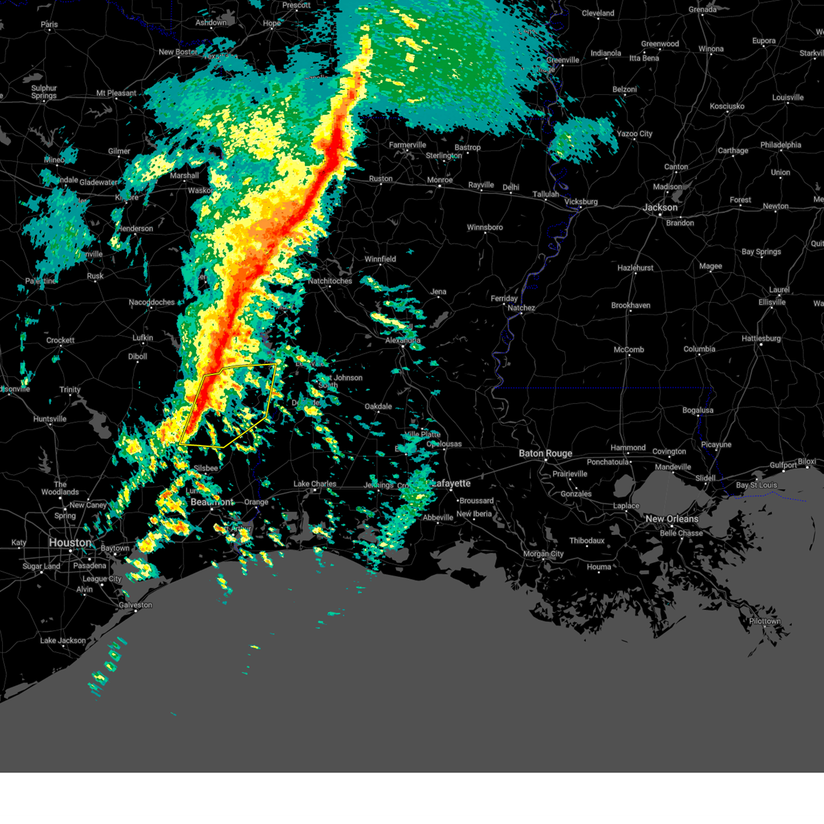
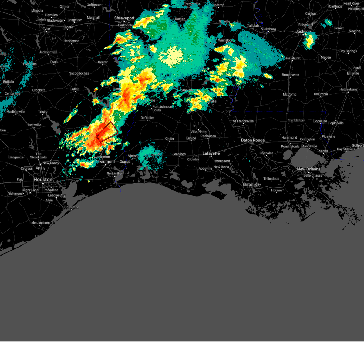
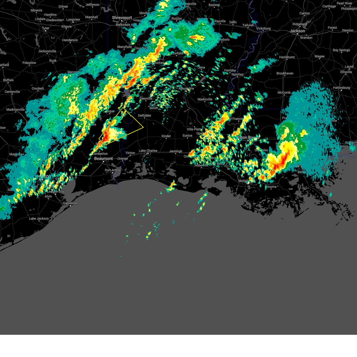
| 3/15/2026 8:15 PM CDT |
 At 815 pm cdt, a severe thunderstorm was located over mt. union, or 7 miles west of kirbyville, moving east at 40 mph (radar indicated). Hazards include 60 mph wind gusts and quarter size hail. Hail damage to vehicles is expected. expect wind damage to roofs, siding, and trees. locations impacted include, kirbyville, mt. Union, and magnolia springs. At 815 pm cdt, a severe thunderstorm was located over mt. union, or 7 miles west of kirbyville, moving east at 40 mph (radar indicated). Hazards include 60 mph wind gusts and quarter size hail. Hail damage to vehicles is expected. expect wind damage to roofs, siding, and trees. locations impacted include, kirbyville, mt. Union, and magnolia springs.
|
| 3/15/2026 7:54 PM CDT |
 At 754 pm cdt, a severe thunderstorm was located near spurger, or near town bluff, moving southeast at 30 mph (radar indicated). Hazards include 60 mph wind gusts and quarter size hail. Hail damage to vehicles is expected. expect wind damage to roofs, siding, and trees. locations impacted include, kirbyville, fred, town bluff, spurger, magnolia springs, and mt. Union. At 754 pm cdt, a severe thunderstorm was located near spurger, or near town bluff, moving southeast at 30 mph (radar indicated). Hazards include 60 mph wind gusts and quarter size hail. Hail damage to vehicles is expected. expect wind damage to roofs, siding, and trees. locations impacted include, kirbyville, fred, town bluff, spurger, magnolia springs, and mt. Union.
|
| 3/15/2026 7:36 PM CDT |
 Svrlch the national weather service in lake charles has issued a * severe thunderstorm warning for, central tyler county in southeastern texas, southeastern jasper county in southeastern texas, * until 830 pm cdt. * at 736 pm cdt, a severe thunderstorm was located near woodville, moving southeast at 30 mph (radar indicated). Hazards include 60 mph wind gusts and half dollar size hail. Hail damage to vehicles is expected. Expect wind damage to roofs, siding, and trees. Svrlch the national weather service in lake charles has issued a * severe thunderstorm warning for, central tyler county in southeastern texas, southeastern jasper county in southeastern texas, * until 830 pm cdt. * at 736 pm cdt, a severe thunderstorm was located near woodville, moving southeast at 30 mph (radar indicated). Hazards include 60 mph wind gusts and half dollar size hail. Hail damage to vehicles is expected. Expect wind damage to roofs, siding, and trees.
|
| 3/11/2026 3:49 PM CDT |
 At 349 pm cdt, severe thunderstorms were located along a line extending from near browndell to near jasper to near mt. union, moving northeast at 45 mph (radar indicated). Hazards include 60 mph wind gusts. Expect damage to roofs, siding, and trees. locations impacted include, jasper, newton, kirbyville, toledo bend dam, call, bon weir, burkeville, browndell, trout creek, farrsville, magnolia springs, mayflower, mt. Union, jamestown, roganville, harrisburg, stringtown, bleakwood, and wiergate. At 349 pm cdt, severe thunderstorms were located along a line extending from near browndell to near jasper to near mt. union, moving northeast at 45 mph (radar indicated). Hazards include 60 mph wind gusts. Expect damage to roofs, siding, and trees. locations impacted include, jasper, newton, kirbyville, toledo bend dam, call, bon weir, burkeville, browndell, trout creek, farrsville, magnolia springs, mayflower, mt. Union, jamestown, roganville, harrisburg, stringtown, bleakwood, and wiergate.
|
| 3/11/2026 3:49 PM CDT |
 the severe thunderstorm warning has been cancelled and is no longer in effect the severe thunderstorm warning has been cancelled and is no longer in effect
|
| 3/11/2026 3:36 PM CDT |
 At 336 pm cdt, severe thunderstorms were located along a line extending from 6 miles southwest of browndell to near jasper to near mt. union, moving northeast at 30 mph (radar indicated). Hazards include 60 mph wind gusts. Expect damage to roofs, siding, and trees. locations impacted include, jasper, newton, kirbyville, toledo bend dam, call, bon weir, burkeville, browndell, trout creek, farrsville, magnolia springs, mayflower, mt. Union, jamestown, roganville, harrisburg, stringtown, sam rayburn dam, bleakwood, and wiergate. At 336 pm cdt, severe thunderstorms were located along a line extending from 6 miles southwest of browndell to near jasper to near mt. union, moving northeast at 30 mph (radar indicated). Hazards include 60 mph wind gusts. Expect damage to roofs, siding, and trees. locations impacted include, jasper, newton, kirbyville, toledo bend dam, call, bon weir, burkeville, browndell, trout creek, farrsville, magnolia springs, mayflower, mt. Union, jamestown, roganville, harrisburg, stringtown, sam rayburn dam, bleakwood, and wiergate.
|
| 3/11/2026 3:26 PM CDT |
 At 326 pm cdt, severe thunderstorms were located along a line extending from ebenezer to near town bluff to near fred, moving northeast at 40 mph (radar indicated). Hazards include 60 mph wind gusts. Expect damage to roofs, siding, and trees. locations impacted include, jasper, newton, kirbyville, toledo bend dam, call, ebenezer, fred, town bluff, bon weir, burkeville, browndell, trout creek, farrsville, magnolia springs, mayflower, mt. Union, spurger, jamestown, roganville, and harrisburg. At 326 pm cdt, severe thunderstorms were located along a line extending from ebenezer to near town bluff to near fred, moving northeast at 40 mph (radar indicated). Hazards include 60 mph wind gusts. Expect damage to roofs, siding, and trees. locations impacted include, jasper, newton, kirbyville, toledo bend dam, call, ebenezer, fred, town bluff, bon weir, burkeville, browndell, trout creek, farrsville, magnolia springs, mayflower, mt. Union, spurger, jamestown, roganville, and harrisburg.
|
| 3/11/2026 3:09 PM CDT |
 Svrlch the national weather service in lake charles has issued a * severe thunderstorm warning for, eastern tyler county in southeastern texas, newton county in southeastern texas, jasper county in southeastern texas, * until 400 pm cdt. * at 308 pm cdt, severe thunderstorms were located along a line extending from 6 miles east of rockland to near town bluff to 6 miles southeast of warren, moving northeast at 45 mph (radar indicated). Hazards include 60 mph wind gusts. expect damage to roofs, siding, and trees Svrlch the national weather service in lake charles has issued a * severe thunderstorm warning for, eastern tyler county in southeastern texas, newton county in southeastern texas, jasper county in southeastern texas, * until 400 pm cdt. * at 308 pm cdt, severe thunderstorms were located along a line extending from 6 miles east of rockland to near town bluff to 6 miles southeast of warren, moving northeast at 45 mph (radar indicated). Hazards include 60 mph wind gusts. expect damage to roofs, siding, and trees
|
| 2/14/2026 7:41 PM CST |
 At 741 pm cst, a severe thunderstorm was located over bivens, or near fields, moving east at 45 mph (radar indicated). Hazards include 60 mph wind gusts. Expect damage to roofs, siding, and trees. Locations impacted include, de ridder, newton, kirbyville, merryville, call, singer, fields, bon weir, trout creek, bivens, old salem, bancroft, junction, oretta, and bleakwood. At 741 pm cst, a severe thunderstorm was located over bivens, or near fields, moving east at 45 mph (radar indicated). Hazards include 60 mph wind gusts. Expect damage to roofs, siding, and trees. Locations impacted include, de ridder, newton, kirbyville, merryville, call, singer, fields, bon weir, trout creek, bivens, old salem, bancroft, junction, oretta, and bleakwood.
|
| 2/14/2026 7:16 PM CST |
 Svrlch the national weather service in lake charles has issued a * severe thunderstorm warning for, western beauregard parish in southwestern louisiana, central newton county in southeastern texas, east central jasper county in southeastern texas, * until 800 pm cst. * at 716 pm cst, a severe thunderstorm was located over kirbyville, moving east at 35 mph (radar indicated). Hazards include 60 mph wind gusts. expect damage to roofs, siding, and trees Svrlch the national weather service in lake charles has issued a * severe thunderstorm warning for, western beauregard parish in southwestern louisiana, central newton county in southeastern texas, east central jasper county in southeastern texas, * until 800 pm cst. * at 716 pm cst, a severe thunderstorm was located over kirbyville, moving east at 35 mph (radar indicated). Hazards include 60 mph wind gusts. expect damage to roofs, siding, and trees
|
| 10/25/2025 10:52 PM CDT | Svrlch the national weather service in lake charles has issued a * severe thunderstorm warning for, beauregard parish in southwestern louisiana, calcasieu parish in southwestern louisiana, southern newton county in southeastern texas, northeastern orange county in southeastern texas, southeastern jasper county in southeastern texas, * until 1145 pm cdt. * at 1051 pm cdt, severe thunderstorms were located along a line extending from near trout creek to near devils pocket to near mauriceville, moving east at 35 mph (radar indicated). Hazards include 60 mph wind gusts. expect damage to roofs, siding, and trees |
| 10/25/2025 5:53 AM CDT | the severe thunderstorm warning has been cancelled and is no longer in effect |
| 10/25/2025 5:53 AM CDT | At 553 am cdt, severe thunderstorms were located along a line extending from near jasper to near wrights settlement to gist, moving east at 30 mph (radar indicated). Hazards include 60 mph wind gusts. Expect damage to roofs, siding, and trees. Locations impacted include, jasper, newton, kirbyville, merryville, singer, deweyville, evadale, de quincy, call, starks, fields, bon weir, buna, burkeville, weiss bluff, gist, trout creek, lunita, bivens, and hartburg. |
| 10/25/2025 5:38 AM CDT | Svrlch the national weather service in lake charles has issued a * severe thunderstorm warning for, western beauregard parish in southwestern louisiana, northwestern calcasieu parish in southwestern louisiana, southeastern tyler county in southeastern texas, newton county in southeastern texas, northeastern hardin county in southeastern texas, jasper county in southeastern texas, * until 645 am cdt. * at 537 am cdt, severe thunderstorms were located along a line extending from near town bluff to near buna to near pine forest, moving east at 30 mph (radar indicated). Hazards include 60 mph wind gusts. expect damage to roofs, siding, and trees |
| 10/25/2025 5:17 AM CDT | At 517 am cdt, severe thunderstorms were located along a line extending from 6 miles northeast of woodville to near caney head to near bevil oaks, moving east at 35 mph (radar indicated). Hazards include 60 mph wind gusts. Expect damage to roofs, siding, and trees. Locations impacted include, lumberton, jasper, silsbee, woodville, kirbyville, kountze, sour lake, colmesneil, chester, evadale, rockland, warren, town bluff, ebenezer, fred, buna, bevil oaks, weiss bluff, gist, and spurger. |
| 10/25/2025 4:39 AM CDT | Svrlch the national weather service in lake charles has issued a * severe thunderstorm warning for, tyler county in southeastern texas, hardin county in southeastern texas, jasper county in southeastern texas, * until 545 am cdt. * at 439 am cdt, severe thunderstorms were located along a line extending from near alabama-coushatta reservation to near honey island to near anahuac, moving east at 35 mph (radar indicated). Hazards include 60 mph wind gusts. expect damage to roofs, siding, and trees |
| 5/27/2025 2:05 AM CDT |
 At 205 am cdt, severe thunderstorms were located along a line extending from near stringtown to near old salem to mauriceville, moving east at 50 mph (radar indicated). Hazards include 60 mph wind gusts and penny size hail. Expect damage to roofs, siding, and trees. Locations impacted include, beaumont, orange, lumberton, vidor, newton, kirbyville, deweyville, evadale, call, bon weir, mauriceville, buna, rose city, pine forest, lakeview, weiss bluff, gist, trout creek, hartburg, and wrights settlement. At 205 am cdt, severe thunderstorms were located along a line extending from near stringtown to near old salem to mauriceville, moving east at 50 mph (radar indicated). Hazards include 60 mph wind gusts and penny size hail. Expect damage to roofs, siding, and trees. Locations impacted include, beaumont, orange, lumberton, vidor, newton, kirbyville, deweyville, evadale, call, bon weir, mauriceville, buna, rose city, pine forest, lakeview, weiss bluff, gist, trout creek, hartburg, and wrights settlement.
|
| 5/27/2025 2:05 AM CDT |
 the severe thunderstorm warning has been cancelled and is no longer in effect the severe thunderstorm warning has been cancelled and is no longer in effect
|
| 5/27/2025 1:45 AM CDT |
 At 145 am cdt, severe thunderstorms were located along a line extending from near jamestown to near buna to near lakeview, moving east at 50 mph (radar indicated). Hazards include 60 mph wind gusts and penny size hail. Expect damage to roofs, siding, and trees. Locations impacted include, beaumont, orange, lumberton, vidor, silsbee, newton, kirbyville, kountze, sour lake, deweyville, evadale, town bluff, call, fred, bon weir, mauriceville, buna, bevil oaks, rose city, and pine forest. At 145 am cdt, severe thunderstorms were located along a line extending from near jamestown to near buna to near lakeview, moving east at 50 mph (radar indicated). Hazards include 60 mph wind gusts and penny size hail. Expect damage to roofs, siding, and trees. Locations impacted include, beaumont, orange, lumberton, vidor, silsbee, newton, kirbyville, kountze, sour lake, deweyville, evadale, town bluff, call, fred, bon weir, mauriceville, buna, bevil oaks, rose city, and pine forest.
|
| 5/27/2025 1:27 AM CDT |
 Svrlch the national weather service in lake charles has issued a * severe thunderstorm warning for, southwestern beauregard parish in southwestern louisiana, northwestern jefferson county in southeastern texas, southeastern tyler county in southeastern texas, southern newton county in southeastern texas, hardin county in southeastern texas, northern orange county in southeastern texas, jasper county in southeastern texas, * until 215 am cdt. * at 127 am cdt, severe thunderstorms were located along a line extending from 6 miles southwest of jasper to near kountze to sour lake, moving east at 50 mph (radar indicated). Hazards include 60 mph wind gusts and penny size hail. expect damage to roofs, siding, and trees Svrlch the national weather service in lake charles has issued a * severe thunderstorm warning for, southwestern beauregard parish in southwestern louisiana, northwestern jefferson county in southeastern texas, southeastern tyler county in southeastern texas, southern newton county in southeastern texas, hardin county in southeastern texas, northern orange county in southeastern texas, jasper county in southeastern texas, * until 215 am cdt. * at 127 am cdt, severe thunderstorms were located along a line extending from 6 miles southwest of jasper to near kountze to sour lake, moving east at 50 mph (radar indicated). Hazards include 60 mph wind gusts and penny size hail. expect damage to roofs, siding, and trees
|
| 5/6/2025 6:18 PM CDT |
 the severe thunderstorm warning has been cancelled and is no longer in effect the severe thunderstorm warning has been cancelled and is no longer in effect
|
| 5/6/2025 6:18 PM CDT |
 At 618 pm cdt, a severe thunderstorm was located near fred, moving northeast at 50 mph (radar indicated). Hazards include 60 mph wind gusts and penny size hail. Expect damage to roofs, siding, and trees. locations impacted include, spurger, fred, magnolia springs, mt. Union, and kirbyville. At 618 pm cdt, a severe thunderstorm was located near fred, moving northeast at 50 mph (radar indicated). Hazards include 60 mph wind gusts and penny size hail. Expect damage to roofs, siding, and trees. locations impacted include, spurger, fred, magnolia springs, mt. Union, and kirbyville.
|
| 5/6/2025 5:59 PM CDT |
 Svrlch the national weather service in lake charles has issued a * severe thunderstorm warning for, southeastern tyler county in southeastern texas, northeastern hardin county in southeastern texas, east central jasper county in southeastern texas, * until 645 pm cdt. * at 559 pm cdt, a severe thunderstorm was located near village mills, or near wildwood, moving east at 50 mph (radar indicated). Hazards include 60 mph wind gusts and penny size hail. expect damage to roofs, siding, and trees Svrlch the national weather service in lake charles has issued a * severe thunderstorm warning for, southeastern tyler county in southeastern texas, northeastern hardin county in southeastern texas, east central jasper county in southeastern texas, * until 645 pm cdt. * at 559 pm cdt, a severe thunderstorm was located near village mills, or near wildwood, moving east at 50 mph (radar indicated). Hazards include 60 mph wind gusts and penny size hail. expect damage to roofs, siding, and trees
|
| 5/2/2025 4:08 PM CDT |
 the tornado warning has been cancelled and is no longer in effect the tornado warning has been cancelled and is no longer in effect
|
| 5/2/2025 3:58 PM CDT |
 Torlch the national weather service in lake charles has issued a * tornado warning for, west central newton county in southeastern texas, east central jasper county in southeastern texas, * until 430 pm cdt. * at 358 pm cdt, a severe thunderstorm capable of producing a tornado was located over kirbyville, moving northeast at 15 mph (radar indicated rotation). Hazards include tornado. Flying debris will be dangerous to those caught without shelter. mobile homes will be damaged or destroyed. damage to roofs, windows, and vehicles will occur. tree damage is likely. this dangerous storm will be near, trout creek and kirbyville around 405 pm cdt. Other locations impacted by this tornadic thunderstorm include bleakwood. Torlch the national weather service in lake charles has issued a * tornado warning for, west central newton county in southeastern texas, east central jasper county in southeastern texas, * until 430 pm cdt. * at 358 pm cdt, a severe thunderstorm capable of producing a tornado was located over kirbyville, moving northeast at 15 mph (radar indicated rotation). Hazards include tornado. Flying debris will be dangerous to those caught without shelter. mobile homes will be damaged or destroyed. damage to roofs, windows, and vehicles will occur. tree damage is likely. this dangerous storm will be near, trout creek and kirbyville around 405 pm cdt. Other locations impacted by this tornadic thunderstorm include bleakwood.
|
| 4/21/2025 3:51 AM CDT |
 At 350 am cdt, a severe thunderstorm was located near kirbyville, moving northeast at 15 mph (radar indicated). Hazards include 60 mph wind gusts and penny size hail. Expect damage to roofs, siding, and trees. Locations impacted include, bleakwood, roganville, and kirbyville. At 350 am cdt, a severe thunderstorm was located near kirbyville, moving northeast at 15 mph (radar indicated). Hazards include 60 mph wind gusts and penny size hail. Expect damage to roofs, siding, and trees. Locations impacted include, bleakwood, roganville, and kirbyville.
|
| 4/21/2025 3:47 AM CDT |
 Svrlch the national weather service in lake charles has issued a * severe thunderstorm warning for, west central newton county in southeastern texas, east central jasper county in southeastern texas, * until 430 am cdt. * at 346 am cdt, a severe thunderstorm was located near kirbyville, moving northeast at 15 mph (radar indicated). Hazards include 60 mph wind gusts and penny size hail. expect damage to roofs, siding, and trees Svrlch the national weather service in lake charles has issued a * severe thunderstorm warning for, west central newton county in southeastern texas, east central jasper county in southeastern texas, * until 430 am cdt. * at 346 am cdt, a severe thunderstorm was located near kirbyville, moving northeast at 15 mph (radar indicated). Hazards include 60 mph wind gusts and penny size hail. expect damage to roofs, siding, and trees
|
| 4/21/2025 3:39 AM CDT |
 At 338 am cdt, a severe thunderstorm was located near mt. union, or near kirbyville, moving northeast at 25 mph (radar indicated). Hazards include 60 mph wind gusts and penny size hail. Expect damage to roofs, siding, and trees. locations impacted include, bleakwood, mt. Union, roganville, and kirbyville. At 338 am cdt, a severe thunderstorm was located near mt. union, or near kirbyville, moving northeast at 25 mph (radar indicated). Hazards include 60 mph wind gusts and penny size hail. Expect damage to roofs, siding, and trees. locations impacted include, bleakwood, mt. Union, roganville, and kirbyville.
|
| 4/21/2025 3:24 AM CDT |
 Svrlch the national weather service in lake charles has issued a * severe thunderstorm warning for, west central newton county in southeastern texas, east central jasper county in southeastern texas, * until 430 am cdt. * at 324 am cdt, a severe thunderstorm was located near mt. union, or 7 miles west of kirbyville, moving northeast at 25 mph (radar indicated). Hazards include 60 mph wind gusts and penny size hail. expect damage to roofs, siding, and trees Svrlch the national weather service in lake charles has issued a * severe thunderstorm warning for, west central newton county in southeastern texas, east central jasper county in southeastern texas, * until 430 am cdt. * at 324 am cdt, a severe thunderstorm was located near mt. union, or 7 miles west of kirbyville, moving northeast at 25 mph (radar indicated). Hazards include 60 mph wind gusts and penny size hail. expect damage to roofs, siding, and trees
|
| 3/4/2025 10:16 AM CST |
 the severe thunderstorm warning has been cancelled and is no longer in effect the severe thunderstorm warning has been cancelled and is no longer in effect
|
| 3/4/2025 10:16 AM CST |
 At 1015 am cst, severe thunderstorms were located along a line extending from near pineland to 6 miles southwest of spurger, moving northeast at 70 mph (radar indicated). Hazards include 60 mph wind gusts. Expect damage to roofs, siding, and trees. locations impacted include, toledo bend dam, sam rayburn dam, ebenezer, farrsville, bleakwood, fred, magnolia springs, mayflower, mt. Union, wiergate, kirbyville, spurger, newton, jasper, jamestown, town bluff, roganville, burkeville, harrisburg, and browndell. At 1015 am cst, severe thunderstorms were located along a line extending from near pineland to 6 miles southwest of spurger, moving northeast at 70 mph (radar indicated). Hazards include 60 mph wind gusts. Expect damage to roofs, siding, and trees. locations impacted include, toledo bend dam, sam rayburn dam, ebenezer, farrsville, bleakwood, fred, magnolia springs, mayflower, mt. Union, wiergate, kirbyville, spurger, newton, jasper, jamestown, town bluff, roganville, burkeville, harrisburg, and browndell.
|
| 3/4/2025 9:59 AM CST |
 Svrlch the national weather service in lake charles has issued a * severe thunderstorm warning for, tyler county in southeastern texas, northwestern newton county in southeastern texas, northern hardin county in southeastern texas, jasper county in southeastern texas, * until 1045 am cst. * at 958 am cst, severe thunderstorms were located along a line extending from near ebenezer to near wildwood, moving northeast at 70 mph (radar indicated). Hazards include 60 mph wind gusts. expect damage to roofs, siding, and trees Svrlch the national weather service in lake charles has issued a * severe thunderstorm warning for, tyler county in southeastern texas, northwestern newton county in southeastern texas, northern hardin county in southeastern texas, jasper county in southeastern texas, * until 1045 am cst. * at 958 am cst, severe thunderstorms were located along a line extending from near ebenezer to near wildwood, moving northeast at 70 mph (radar indicated). Hazards include 60 mph wind gusts. expect damage to roofs, siding, and trees
|
| 2/12/2025 2:23 PM CST |
 The storm which prompted the warning has weakened below severe limits, and no longer poses an immediate threat to life or property. therefore, the warning will be allowed to expire. however gusty winds are still possible with this thunderstorm. a tornado watch remains in effect until 800 pm cst for southwestern louisiana. The storm which prompted the warning has weakened below severe limits, and no longer poses an immediate threat to life or property. therefore, the warning will be allowed to expire. however gusty winds are still possible with this thunderstorm. a tornado watch remains in effect until 800 pm cst for southwestern louisiana.
|
| 2/12/2025 2:05 PM CST |
 At 205 pm cst, a severe thunderstorm was located over old salem, or near call, moving northeast at 45 mph (radar indicated). Hazards include 60 mph wind gusts and penny size hail. Expect damage to roofs, siding, and trees. Locations impacted include, call, wrights settlement, devils pocket, fields, trout creek, bon weir, bivens, bancroft, bleakwood, old salem, merryville, and kirbyville. At 205 pm cst, a severe thunderstorm was located over old salem, or near call, moving northeast at 45 mph (radar indicated). Hazards include 60 mph wind gusts and penny size hail. Expect damage to roofs, siding, and trees. Locations impacted include, call, wrights settlement, devils pocket, fields, trout creek, bon weir, bivens, bancroft, bleakwood, old salem, merryville, and kirbyville.
|
| 2/12/2025 1:49 PM CST |
 Svrlch the national weather service in lake charles has issued a * severe thunderstorm warning for, western beauregard parish in southwestern louisiana, southern newton county in southeastern texas, southeastern jasper county in southeastern texas, * until 230 pm cst. * at 148 pm cst, a severe thunderstorm was located over buna, moving northeast at 45 mph (radar indicated). Hazards include 60 mph wind gusts and penny size hail. expect damage to roofs, siding, and trees Svrlch the national weather service in lake charles has issued a * severe thunderstorm warning for, western beauregard parish in southwestern louisiana, southern newton county in southeastern texas, southeastern jasper county in southeastern texas, * until 230 pm cst. * at 148 pm cst, a severe thunderstorm was located over buna, moving northeast at 45 mph (radar indicated). Hazards include 60 mph wind gusts and penny size hail. expect damage to roofs, siding, and trees
|
| 12/28/2024 2:41 PM CST | Public report of trees and power lines down northwest of kirbyvill in jasper county TX, 6.5 miles SE of Kirbyville, TX |
| 12/26/2024 5:32 PM CST |
 Svrlch the national weather service in lake charles has issued a * severe thunderstorm warning for, eastern tyler county in southeastern texas, central newton county in southeastern texas, east central jasper county in southeastern texas, * until 630 pm cst. * at 532 pm cst, a severe thunderstorm was located 7 miles south of mt. union, or 7 miles east of fred, moving northeast at 35 mph (radar indicated). Hazards include 60 mph wind gusts. expect damage to roofs, siding, and trees Svrlch the national weather service in lake charles has issued a * severe thunderstorm warning for, eastern tyler county in southeastern texas, central newton county in southeastern texas, east central jasper county in southeastern texas, * until 630 pm cst. * at 532 pm cst, a severe thunderstorm was located 7 miles south of mt. union, or 7 miles east of fred, moving northeast at 35 mph (radar indicated). Hazards include 60 mph wind gusts. expect damage to roofs, siding, and trees
|
| 11/5/2024 8:41 AM CST |
 the severe thunderstorm warning has been cancelled and is no longer in effect the severe thunderstorm warning has been cancelled and is no longer in effect
|
| 11/5/2024 8:21 AM CST |
 At 820 am cst, severe thunderstorms were located along a line extending from 6 miles northeast of woodville to near fred, moving east at 35 mph (radar indicated). Hazards include 60 mph wind gusts. Expect damage to roofs, siding, and trees. locations impacted include, jasper, kirbyville, town bluff, browndell, spurger, roganville, magnolia springs, harrisburg, and mt. Union. At 820 am cst, severe thunderstorms were located along a line extending from 6 miles northeast of woodville to near fred, moving east at 35 mph (radar indicated). Hazards include 60 mph wind gusts. Expect damage to roofs, siding, and trees. locations impacted include, jasper, kirbyville, town bluff, browndell, spurger, roganville, magnolia springs, harrisburg, and mt. Union.
|
| 11/5/2024 8:07 AM CST |
 Svrlch the national weather service in lake charles has issued a * severe thunderstorm warning for, central tyler county in southeastern texas, northeastern jasper county in southeastern texas, * until 900 am cst. * at 807 am cst, severe thunderstorms were located along a line extending from woodville to near warren, moving northeast at 35 mph (radar indicated). Hazards include 60 mph wind gusts. expect damage to roofs, siding, and trees Svrlch the national weather service in lake charles has issued a * severe thunderstorm warning for, central tyler county in southeastern texas, northeastern jasper county in southeastern texas, * until 900 am cst. * at 807 am cst, severe thunderstorms were located along a line extending from woodville to near warren, moving northeast at 35 mph (radar indicated). Hazards include 60 mph wind gusts. expect damage to roofs, siding, and trees
|
| 7/8/2024 3:13 PM CDT |
 Torlch the national weather service in lake charles has issued a * tornado warning for, west central newton county in southeastern texas, southeastern jasper county in southeastern texas, * until 345 pm cdt. * at 313 pm cdt, a severe thunderstorm capable of producing a tornado was located over buna, moving north at 75 mph (radar indicated rotation). Hazards include tornado. Flying debris will be dangerous to those caught without shelter. mobile homes will be damaged or destroyed. damage to roofs, windows, and vehicles will occur. tree damage is likely. this dangerous storm will be near, kirbyville, call, and trout creek around 320 pm cdt. newton around 330 pm cdt. jamestown around 335 pm cdt. Other locations impacted by this tornadic thunderstorm include bleakwood. Torlch the national weather service in lake charles has issued a * tornado warning for, west central newton county in southeastern texas, southeastern jasper county in southeastern texas, * until 345 pm cdt. * at 313 pm cdt, a severe thunderstorm capable of producing a tornado was located over buna, moving north at 75 mph (radar indicated rotation). Hazards include tornado. Flying debris will be dangerous to those caught without shelter. mobile homes will be damaged or destroyed. damage to roofs, windows, and vehicles will occur. tree damage is likely. this dangerous storm will be near, kirbyville, call, and trout creek around 320 pm cdt. newton around 330 pm cdt. jamestown around 335 pm cdt. Other locations impacted by this tornadic thunderstorm include bleakwood.
|
| 7/8/2024 2:41 PM CDT |
 Torlch the national weather service in lake charles has issued a * tornado warning for, northern newton county in southeastern texas, east central jasper county in southeastern texas, * until 315 pm cdt. * at 240 pm cdt, a severe thunderstorm capable of producing a tornado was located over kirbyville, moving northeast at 55 mph (radar indicated rotation). Hazards include tornado. Flying debris will be dangerous to those caught without shelter. mobile homes will be damaged or destroyed. damage to roofs, windows, and vehicles will occur. tree damage is likely. this dangerous storm will be near, newton and roganville around 245 pm cdt. jamestown around 255 pm cdt. burkeville, stringtown, and farrsville around 300 pm cdt. mayflower around 305 pm cdt. Other locations impacted by this tornadic thunderstorm include bleakwood and wiergate. Torlch the national weather service in lake charles has issued a * tornado warning for, northern newton county in southeastern texas, east central jasper county in southeastern texas, * until 315 pm cdt. * at 240 pm cdt, a severe thunderstorm capable of producing a tornado was located over kirbyville, moving northeast at 55 mph (radar indicated rotation). Hazards include tornado. Flying debris will be dangerous to those caught without shelter. mobile homes will be damaged or destroyed. damage to roofs, windows, and vehicles will occur. tree damage is likely. this dangerous storm will be near, newton and roganville around 245 pm cdt. jamestown around 255 pm cdt. burkeville, stringtown, and farrsville around 300 pm cdt. mayflower around 305 pm cdt. Other locations impacted by this tornadic thunderstorm include bleakwood and wiergate.
|
| 7/8/2024 2:27 PM CDT |
 The tornado warning that was previously in effect has been reissued for jasper county and is in effect until 245 pm cdt. please refer to that bulletin for the latest severe weather information. a tornado watch remains in effect until 1000 pm cdt for southeastern texas. The tornado warning that was previously in effect has been reissued for jasper county and is in effect until 245 pm cdt. please refer to that bulletin for the latest severe weather information. a tornado watch remains in effect until 1000 pm cdt for southeastern texas.
|
| 7/8/2024 1:59 PM CDT |
 Torlch the national weather service in lake charles has issued a * tornado warning for, northwestern newton county in southeastern texas, northeastern jasper county in southeastern texas, * until 230 pm cdt. * at 159 pm cdt, a severe thunderstorm capable of producing a tornado was located near call, moving north at 40 mph (radar indicated rotation). Hazards include tornado. Flying debris will be dangerous to those caught without shelter. mobile homes will be damaged or destroyed. damage to roofs, windows, and vehicles will occur. tree damage is likely. this dangerous storm will be near, kirbyville, call, and mt. union around 205 pm cdt. magnolia springs around 210 pm cdt. roganville around 215 pm cdt. Other locations impacted by this tornadic thunderstorm include sam rayburn dam. Torlch the national weather service in lake charles has issued a * tornado warning for, northwestern newton county in southeastern texas, northeastern jasper county in southeastern texas, * until 230 pm cdt. * at 159 pm cdt, a severe thunderstorm capable of producing a tornado was located near call, moving north at 40 mph (radar indicated rotation). Hazards include tornado. Flying debris will be dangerous to those caught without shelter. mobile homes will be damaged or destroyed. damage to roofs, windows, and vehicles will occur. tree damage is likely. this dangerous storm will be near, kirbyville, call, and mt. union around 205 pm cdt. magnolia springs around 210 pm cdt. roganville around 215 pm cdt. Other locations impacted by this tornadic thunderstorm include sam rayburn dam.
|
| 7/8/2024 12:53 PM CDT |
 the tornado warning has been cancelled and is no longer in effect the tornado warning has been cancelled and is no longer in effect
|
| 7/8/2024 12:53 PM CDT |
 At 1252 pm cdt, a severe thunderstorm capable of producing a tornado was located 7 miles northwest of buna, moving north at 55 mph (radar indicated rotation). Hazards include tornado. Flying debris will be dangerous to those caught without shelter. mobile homes will be damaged or destroyed. damage to roofs, windows, and vehicles will occur. tree damage is likely. This dangerous storm will be near, kirbyville around 100 pm cdt. At 1252 pm cdt, a severe thunderstorm capable of producing a tornado was located 7 miles northwest of buna, moving north at 55 mph (radar indicated rotation). Hazards include tornado. Flying debris will be dangerous to those caught without shelter. mobile homes will be damaged or destroyed. damage to roofs, windows, and vehicles will occur. tree damage is likely. This dangerous storm will be near, kirbyville around 100 pm cdt.
|
| 7/8/2024 12:36 PM CDT |
 Torlch the national weather service in lake charles has issued a * tornado warning for, southeastern tyler county in southeastern texas, northeastern hardin county in southeastern texas, southeastern jasper county in southeastern texas, * until 100 pm cdt. * at 1236 pm cdt, a severe thunderstorm capable of producing a tornado was located near evadale, moving north at 60 mph (radar indicated rotation). Hazards include tornado. Flying debris will be dangerous to those caught without shelter. mobile homes will be damaged or destroyed. damage to roofs, windows, and vehicles will occur. tree damage is likely. this dangerous storm will be near, buna and evadale around 1240 pm cdt. Fred around 1250 pm cdt. Torlch the national weather service in lake charles has issued a * tornado warning for, southeastern tyler county in southeastern texas, northeastern hardin county in southeastern texas, southeastern jasper county in southeastern texas, * until 100 pm cdt. * at 1236 pm cdt, a severe thunderstorm capable of producing a tornado was located near evadale, moving north at 60 mph (radar indicated rotation). Hazards include tornado. Flying debris will be dangerous to those caught without shelter. mobile homes will be damaged or destroyed. damage to roofs, windows, and vehicles will occur. tree damage is likely. this dangerous storm will be near, buna and evadale around 1240 pm cdt. Fred around 1250 pm cdt.
|
| 7/8/2024 12:03 PM CDT |
 At 1203 pm cdt, a severe thunderstorm capable of producing a tornado was located over call, moving north at 55 mph (radar indicated rotation). Hazards include tornado. Flying debris will be dangerous to those caught without shelter. mobile homes will be damaged or destroyed. damage to roofs, windows, and vehicles will occur. tree damage is likely. this dangerous storm will be near, kirbyville around 1210 pm cdt. Other locations impacted by this tornadic thunderstorm include bleakwood. At 1203 pm cdt, a severe thunderstorm capable of producing a tornado was located over call, moving north at 55 mph (radar indicated rotation). Hazards include tornado. Flying debris will be dangerous to those caught without shelter. mobile homes will be damaged or destroyed. damage to roofs, windows, and vehicles will occur. tree damage is likely. this dangerous storm will be near, kirbyville around 1210 pm cdt. Other locations impacted by this tornadic thunderstorm include bleakwood.
|
| 7/8/2024 11:55 AM CDT |
 Torlch the national weather service in lake charles has issued a * tornado warning for, west central newton county in southeastern texas, east central jasper county in southeastern texas, * until 1215 pm cdt. * at 1155 am cdt, a severe thunderstorm capable of producing a tornado was located near wrights settlement, or near buna, moving north at 55 mph (radar indicated rotation). Hazards include tornado. Flying debris will be dangerous to those caught without shelter. mobile homes will be damaged or destroyed. damage to roofs, windows, and vehicles will occur. tree damage is likely. this dangerous storm will be near, kirbyville, call, and trout creek around 1200 pm cdt. Other locations impacted by this tornadic thunderstorm include bleakwood. Torlch the national weather service in lake charles has issued a * tornado warning for, west central newton county in southeastern texas, east central jasper county in southeastern texas, * until 1215 pm cdt. * at 1155 am cdt, a severe thunderstorm capable of producing a tornado was located near wrights settlement, or near buna, moving north at 55 mph (radar indicated rotation). Hazards include tornado. Flying debris will be dangerous to those caught without shelter. mobile homes will be damaged or destroyed. damage to roofs, windows, and vehicles will occur. tree damage is likely. this dangerous storm will be near, kirbyville, call, and trout creek around 1200 pm cdt. Other locations impacted by this tornadic thunderstorm include bleakwood.
|
| 7/8/2024 10:44 AM CDT |
 At 1044 am cdt, a severe thunderstorm capable of producing a tornado was located near magnolia springs, or 9 miles south of jasper, moving north at 45 mph (radar indicated rotation). Hazards include tornado. Flying debris will be dangerous to those caught without shelter. mobile homes will be damaged or destroyed. damage to roofs, windows, and vehicles will occur. tree damage is likely. this dangerous storm will be near, jasper around 1050 am cdt. Other locations impacted by this tornadic thunderstorm include bleakwood. At 1044 am cdt, a severe thunderstorm capable of producing a tornado was located near magnolia springs, or 9 miles south of jasper, moving north at 45 mph (radar indicated rotation). Hazards include tornado. Flying debris will be dangerous to those caught without shelter. mobile homes will be damaged or destroyed. damage to roofs, windows, and vehicles will occur. tree damage is likely. this dangerous storm will be near, jasper around 1050 am cdt. Other locations impacted by this tornadic thunderstorm include bleakwood.
|
| 7/8/2024 10:44 AM CDT |
 the tornado warning has been cancelled and is no longer in effect the tornado warning has been cancelled and is no longer in effect
|
| 7/8/2024 10:29 AM CDT |
 Torlch the national weather service in lake charles has issued a * tornado warning for, northeastern tyler county in southeastern texas, western newton county in southeastern texas, eastern jasper county in southeastern texas, * until 1115 am cdt. * at 1028 am cdt, a severe thunderstorm capable of producing a tornado was located near kirbyville, moving north at 40 mph (radar indicated rotation). Hazards include tornado. Flying debris will be dangerous to those caught without shelter. mobile homes will be damaged or destroyed. damage to roofs, windows, and vehicles will occur. tree damage is likely. this dangerous storm will be near, kirbyville, mt. union, and magnolia springs around 1035 am cdt. roganville around 1040 am cdt. jasper around 1045 am cdt. Other locations impacted by this tornadic thunderstorm include bleakwood. Torlch the national weather service in lake charles has issued a * tornado warning for, northeastern tyler county in southeastern texas, western newton county in southeastern texas, eastern jasper county in southeastern texas, * until 1115 am cdt. * at 1028 am cdt, a severe thunderstorm capable of producing a tornado was located near kirbyville, moving north at 40 mph (radar indicated rotation). Hazards include tornado. Flying debris will be dangerous to those caught without shelter. mobile homes will be damaged or destroyed. damage to roofs, windows, and vehicles will occur. tree damage is likely. this dangerous storm will be near, kirbyville, mt. union, and magnolia springs around 1035 am cdt. roganville around 1040 am cdt. jasper around 1045 am cdt. Other locations impacted by this tornadic thunderstorm include bleakwood.
|
| 5/30/2024 8:40 PM CDT |
 The storms which prompted the warning have weakened below severe limits, and no longer pose an immediate threat to life or property. therefore, the warning will be allowed to expire. a severe thunderstorm watch remains in effect until 1100 pm cdt for southwestern and west central louisiana, and southeastern texas. The storms which prompted the warning have weakened below severe limits, and no longer pose an immediate threat to life or property. therefore, the warning will be allowed to expire. a severe thunderstorm watch remains in effect until 1100 pm cdt for southwestern and west central louisiana, and southeastern texas.
|
| 5/30/2024 8:11 PM CDT |
 Svrlch the national weather service in lake charles has issued a * severe thunderstorm warning for, western beauregard parish in southwestern louisiana, southwestern vernon parish in west central louisiana, northwestern jefferson county in southeastern texas, southern tyler county in southeastern texas, newton county in southeastern texas, hardin county in southeastern texas, northwestern orange county in southeastern texas, jasper county in southeastern texas, * until 845 pm cdt. * at 811 pm cdt, severe thunderstorms were located along a line extending from near newton to near fred to near honey island, moving south at 45 mph (radar indicated). Hazards include 60 mph wind gusts and nickel size hail. expect damage to roofs, siding, and trees Svrlch the national weather service in lake charles has issued a * severe thunderstorm warning for, western beauregard parish in southwestern louisiana, southwestern vernon parish in west central louisiana, northwestern jefferson county in southeastern texas, southern tyler county in southeastern texas, newton county in southeastern texas, hardin county in southeastern texas, northwestern orange county in southeastern texas, jasper county in southeastern texas, * until 845 pm cdt. * at 811 pm cdt, severe thunderstorms were located along a line extending from near newton to near fred to near honey island, moving south at 45 mph (radar indicated). Hazards include 60 mph wind gusts and nickel size hail. expect damage to roofs, siding, and trees
|
| 5/16/2024 6:44 PM CDT |
 Svrlch the national weather service in lake charles has issued a * severe thunderstorm warning for, southeastern tyler county in southeastern texas, west central newton county in southeastern texas, northeastern hardin county in southeastern texas, southeastern jasper county in southeastern texas, * until 715 pm cdt. * at 643 pm cdt, a severe thunderstorm was located 8 miles northwest of buna, moving northeast at 75 mph (radar indicated). Hazards include 60 mph wind gusts and quarter size hail. Hail damage to vehicles is expected. Expect wind damage to roofs, siding, and trees. Svrlch the national weather service in lake charles has issued a * severe thunderstorm warning for, southeastern tyler county in southeastern texas, west central newton county in southeastern texas, northeastern hardin county in southeastern texas, southeastern jasper county in southeastern texas, * until 715 pm cdt. * at 643 pm cdt, a severe thunderstorm was located 8 miles northwest of buna, moving northeast at 75 mph (radar indicated). Hazards include 60 mph wind gusts and quarter size hail. Hail damage to vehicles is expected. Expect wind damage to roofs, siding, and trees.
|
| 5/16/2024 5:04 PM CDT |
 Svrlch the national weather service in lake charles has issued a * severe thunderstorm warning for, northwestern beauregard parish in southwestern louisiana, southwestern vernon parish in west central louisiana, central newton county in southeastern texas, east central jasper county in southeastern texas, * until 530 pm cdt. * at 503 pm cdt, a severe thunderstorm was located over roganville, or 8 miles west of newton, moving east at 35 mph (radar indicated). Hazards include 60 mph wind gusts and penny size hail. expect damage to roofs, siding, and trees Svrlch the national weather service in lake charles has issued a * severe thunderstorm warning for, northwestern beauregard parish in southwestern louisiana, southwestern vernon parish in west central louisiana, central newton county in southeastern texas, east central jasper county in southeastern texas, * until 530 pm cdt. * at 503 pm cdt, a severe thunderstorm was located over roganville, or 8 miles west of newton, moving east at 35 mph (radar indicated). Hazards include 60 mph wind gusts and penny size hail. expect damage to roofs, siding, and trees
|
| 5/12/2024 2:01 PM CDT | Golf Ball sized hail reported 5.2 miles WSW of Kirbyville, TX, photo received of golf ball size hail at bleakwood. |
| 5/12/2024 1:49 PM CDT |
 Svrlch the national weather service in lake charles has issued a * severe thunderstorm warning for, northwestern beauregard parish in southwestern louisiana, central newton county in southeastern texas, east central jasper county in southeastern texas, * until 230 pm cdt. * at 149 pm cdt, a severe thunderstorm was located near kirbyville, moving east at 45 mph (radar indicated). Hazards include 70 mph wind gusts and half dollar size hail. Hail damage to vehicles is expected. expect considerable tree damage. Wind damage is also likely to mobile homes, roofs, and outbuildings. Svrlch the national weather service in lake charles has issued a * severe thunderstorm warning for, northwestern beauregard parish in southwestern louisiana, central newton county in southeastern texas, east central jasper county in southeastern texas, * until 230 pm cdt. * at 149 pm cdt, a severe thunderstorm was located near kirbyville, moving east at 45 mph (radar indicated). Hazards include 70 mph wind gusts and half dollar size hail. Hail damage to vehicles is expected. expect considerable tree damage. Wind damage is also likely to mobile homes, roofs, and outbuildings.
|
| 5/12/2024 1:31 PM CDT |
 The storm which prompted the warning has moved out of the area. therefore, the warning has been allowed to expire. a tornado watch remains in effect until 700 pm cdt for southwestern louisiana, and southeastern texas. The storm which prompted the warning has moved out of the area. therefore, the warning has been allowed to expire. a tornado watch remains in effect until 700 pm cdt for southwestern louisiana, and southeastern texas.
|
| 5/12/2024 1:17 PM CDT |
 At 117 pm cdt, a severe thunderstorm was located near stringtown, or near bon weir, moving northeast at 45 mph (radar indicated). Hazards include two inch hail and 60 mph wind gusts. People and animals outdoors will be injured. expect hail damage to roofs, siding, windows, and vehicles. expect wind damage to roofs, siding, and trees. Locations impacted include, newton, merryville, bon weir, jamestown, trout creek, bivens, farrsville, roganville, stringtown, bleakwood, and wiergate. At 117 pm cdt, a severe thunderstorm was located near stringtown, or near bon weir, moving northeast at 45 mph (radar indicated). Hazards include two inch hail and 60 mph wind gusts. People and animals outdoors will be injured. expect hail damage to roofs, siding, windows, and vehicles. expect wind damage to roofs, siding, and trees. Locations impacted include, newton, merryville, bon weir, jamestown, trout creek, bivens, farrsville, roganville, stringtown, bleakwood, and wiergate.
|
| 5/12/2024 12:55 PM CDT |
 the severe thunderstorm warning has been cancelled and is no longer in effect the severe thunderstorm warning has been cancelled and is no longer in effect
|
| 5/12/2024 12:55 PM CDT |
 At 1255 pm cdt, a severe thunderstorm was located near kirbyville, moving northeast at 45 mph (radar indicated). Hazards include quarter size hail. Damage to vehicles is expected. locations impacted include, newton, kirbyville, merryville, call, bon weir, trout creek, bivens, farrsville, magnolia springs, mt. Union, jamestown, roganville, stringtown, bleakwood, and wiergate. At 1255 pm cdt, a severe thunderstorm was located near kirbyville, moving northeast at 45 mph (radar indicated). Hazards include quarter size hail. Damage to vehicles is expected. locations impacted include, newton, kirbyville, merryville, call, bon weir, trout creek, bivens, farrsville, magnolia springs, mt. Union, jamestown, roganville, stringtown, bleakwood, and wiergate.
|
| 5/12/2024 12:38 PM CDT |
 Svrlch the national weather service in lake charles has issued a * severe thunderstorm warning for, northwestern beauregard parish in southwestern louisiana, southeastern tyler county in southeastern texas, central newton county in southeastern texas, east central jasper county in southeastern texas, * until 130 pm cdt. * at 1238 pm cdt, a severe thunderstorm was located near mt. union, or 7 miles northeast of fred, moving northeast at 45 mph (radar indicated). Hazards include quarter size hail. damage to vehicles is expected Svrlch the national weather service in lake charles has issued a * severe thunderstorm warning for, northwestern beauregard parish in southwestern louisiana, southeastern tyler county in southeastern texas, central newton county in southeastern texas, east central jasper county in southeastern texas, * until 130 pm cdt. * at 1238 pm cdt, a severe thunderstorm was located near mt. union, or 7 miles northeast of fred, moving northeast at 45 mph (radar indicated). Hazards include quarter size hail. damage to vehicles is expected
|
| 5/9/2024 10:43 PM CDT |
 Svrlch the national weather service in lake charles has issued a * severe thunderstorm warning for, central newton county in southeastern texas, northeastern jasper county in southeastern texas, * until 1145 pm cdt. * at 1042 pm cdt, severe thunderstorms were located along a line extending from near jasper to near magnolia springs, moving east at 25 mph (radar indicated). Hazards include 60 mph wind gusts and quarter size hail. Hail damage to vehicles is expected. Expect wind damage to roofs, siding, and trees. Svrlch the national weather service in lake charles has issued a * severe thunderstorm warning for, central newton county in southeastern texas, northeastern jasper county in southeastern texas, * until 1145 pm cdt. * at 1042 pm cdt, severe thunderstorms were located along a line extending from near jasper to near magnolia springs, moving east at 25 mph (radar indicated). Hazards include 60 mph wind gusts and quarter size hail. Hail damage to vehicles is expected. Expect wind damage to roofs, siding, and trees.
|
| 5/5/2024 12:49 AM CDT |
 the severe thunderstorm warning has been cancelled and is no longer in effect the severe thunderstorm warning has been cancelled and is no longer in effect
|
| 5/5/2024 12:33 AM CDT |
 Svrlch the national weather service in lake charles has issued a * severe thunderstorm warning for, west central newton county in southeastern texas, southeastern jasper county in southeastern texas, * until 100 am cdt. * at 1233 am cdt, a severe thunderstorm was located over buna, moving northeast at 20 mph (radar indicated). Hazards include quarter size hail. damage to vehicles is expected Svrlch the national weather service in lake charles has issued a * severe thunderstorm warning for, west central newton county in southeastern texas, southeastern jasper county in southeastern texas, * until 100 am cdt. * at 1233 am cdt, a severe thunderstorm was located over buna, moving northeast at 20 mph (radar indicated). Hazards include quarter size hail. damage to vehicles is expected
|
| 4/29/2024 3:27 AM CDT |
 The severe thunderstorm which prompted the warning has been replaced by warning number 88. therefore, the warning will be allowed to expire. however hail and gusty winds are still possible with this thunderstorm. a severe thunderstorm watch remains in effect until 900 am cdt for southwestern louisiana, and southeastern texas. The severe thunderstorm which prompted the warning has been replaced by warning number 88. therefore, the warning will be allowed to expire. however hail and gusty winds are still possible with this thunderstorm. a severe thunderstorm watch remains in effect until 900 am cdt for southwestern louisiana, and southeastern texas.
|
| 4/29/2024 2:57 AM CDT |
 Svrlch the national weather service in lake charles has issued a * severe thunderstorm warning for, southwestern beauregard parish in southwestern louisiana, southwestern newton county in southeastern texas, southeastern jasper county in southeastern texas, * until 330 am cdt. * at 257 am cdt, a severe thunderstorm was located over buna, moving northeast at 30 mph (radar indicated). Hazards include 60 mph wind gusts and quarter size hail. Hail damage to vehicles is expected. Expect wind damage to roofs, siding, and trees. Svrlch the national weather service in lake charles has issued a * severe thunderstorm warning for, southwestern beauregard parish in southwestern louisiana, southwestern newton county in southeastern texas, southeastern jasper county in southeastern texas, * until 330 am cdt. * at 257 am cdt, a severe thunderstorm was located over buna, moving northeast at 30 mph (radar indicated). Hazards include 60 mph wind gusts and quarter size hail. Hail damage to vehicles is expected. Expect wind damage to roofs, siding, and trees.
|
| 4/29/2024 2:15 AM CDT |
 At 215 am cdt, a severe thunderstorm was located over kirbyville, moving northeast at 30 mph (radar indicated). Hazards include ping pong ball size hail and 60 mph wind gusts. People and animals outdoors will be injured. expect hail damage to roofs, siding, windows, and vehicles. expect wind damage to roofs, siding, and trees. locations impacted include, newton, kirbyville, call, trout creek, roganville, bancroft, magnolia springs, old salem, mt. Union, and bleakwood. At 215 am cdt, a severe thunderstorm was located over kirbyville, moving northeast at 30 mph (radar indicated). Hazards include ping pong ball size hail and 60 mph wind gusts. People and animals outdoors will be injured. expect hail damage to roofs, siding, windows, and vehicles. expect wind damage to roofs, siding, and trees. locations impacted include, newton, kirbyville, call, trout creek, roganville, bancroft, magnolia springs, old salem, mt. Union, and bleakwood.
|
| 4/29/2024 1:52 AM CDT |
 Svrlch the national weather service in lake charles has issued a * severe thunderstorm warning for, west central beauregard parish in southwestern louisiana, southeastern tyler county in southeastern texas, west central newton county in southeastern texas, southeastern jasper county in southeastern texas, * until 230 am cdt. * at 152 am cdt, a severe thunderstorm was located near mt. union, or 8 miles west of kirbyville, moving northeast at 30 mph (radar indicated). Hazards include ping pong ball size hail and 60 mph wind gusts. People and animals outdoors will be injured. expect hail damage to roofs, siding, windows, and vehicles. Expect wind damage to roofs, siding, and trees. Svrlch the national weather service in lake charles has issued a * severe thunderstorm warning for, west central beauregard parish in southwestern louisiana, southeastern tyler county in southeastern texas, west central newton county in southeastern texas, southeastern jasper county in southeastern texas, * until 230 am cdt. * at 152 am cdt, a severe thunderstorm was located near mt. union, or 8 miles west of kirbyville, moving northeast at 30 mph (radar indicated). Hazards include ping pong ball size hail and 60 mph wind gusts. People and animals outdoors will be injured. expect hail damage to roofs, siding, windows, and vehicles. Expect wind damage to roofs, siding, and trees.
|
| 4/28/2024 11:40 PM CDT |
 Svrlch the national weather service in lake charles has issued a * severe thunderstorm warning for, central tyler county in southeastern texas, northern newton county in southeastern texas, jasper county in southeastern texas, * until 1215 am cdt. * at 1140 pm cdt, severe thunderstorms were located along a line extending from near browndell to jasper to 7 miles east of warren, moving east at 35 mph (radar indicated). Hazards include 60 mph wind gusts and penny size hail. expect damage to roofs, siding, and trees Svrlch the national weather service in lake charles has issued a * severe thunderstorm warning for, central tyler county in southeastern texas, northern newton county in southeastern texas, jasper county in southeastern texas, * until 1215 am cdt. * at 1140 pm cdt, severe thunderstorms were located along a line extending from near browndell to jasper to 7 miles east of warren, moving east at 35 mph (radar indicated). Hazards include 60 mph wind gusts and penny size hail. expect damage to roofs, siding, and trees
|
| 4/10/2024 6:00 AM CDT |
 the severe thunderstorm warning has been cancelled and is no longer in effect the severe thunderstorm warning has been cancelled and is no longer in effect
|
| 4/10/2024 5:19 AM CDT |
 Svrlch the national weather service in lake charles has issued a * severe thunderstorm warning for, west central calcasieu parish in southwestern louisiana, northwestern jefferson county in southeastern texas, southeastern tyler county in southeastern texas, southwestern newton county in southeastern texas, hardin county in southeastern texas, northern orange county in southeastern texas, southeastern jasper county in southeastern texas, * until 615 am cdt. * at 518 am cdt, severe thunderstorms were located along a line extending from village mills to near kountze to near nome, moving east at 35 mph (radar indicated). Hazards include 60 mph wind gusts. expect damage to roofs, siding, and trees Svrlch the national weather service in lake charles has issued a * severe thunderstorm warning for, west central calcasieu parish in southwestern louisiana, northwestern jefferson county in southeastern texas, southeastern tyler county in southeastern texas, southwestern newton county in southeastern texas, hardin county in southeastern texas, northern orange county in southeastern texas, southeastern jasper county in southeastern texas, * until 615 am cdt. * at 518 am cdt, severe thunderstorms were located along a line extending from village mills to near kountze to near nome, moving east at 35 mph (radar indicated). Hazards include 60 mph wind gusts. expect damage to roofs, siding, and trees
|
| 4/9/2024 10:03 PM CDT |
 the tornado warning has been cancelled and is no longer in effect the tornado warning has been cancelled and is no longer in effect
|
| 4/9/2024 10:03 PM CDT |
 At 1002 pm cdt, a severe thunderstorm capable of producing a tornado was located 8 miles south of mt. union, or 8 miles east of fred, moving east at 30 mph (radar indicated rotation). Hazards include tornado. Flying debris will be dangerous to those caught without shelter. mobile homes will be damaged or destroyed. damage to roofs, windows, and vehicles will occur. tree damage is likely. This dangerous storm will be near, kirbyville around 1010 pm cdt. At 1002 pm cdt, a severe thunderstorm capable of producing a tornado was located 8 miles south of mt. union, or 8 miles east of fred, moving east at 30 mph (radar indicated rotation). Hazards include tornado. Flying debris will be dangerous to those caught without shelter. mobile homes will be damaged or destroyed. damage to roofs, windows, and vehicles will occur. tree damage is likely. This dangerous storm will be near, kirbyville around 1010 pm cdt.
|
| 4/9/2024 9:42 PM CDT |
 Torlch the national weather service in lake charles has issued a * tornado warning for, southeastern tyler county in southeastern texas, northern hardin county in southeastern texas, east central jasper county in southeastern texas, * until 1015 pm cdt. * at 942 pm cdt, a severe thunderstorm capable of producing a tornado was located over fred, moving northeast at 30 mph (radar indicated rotation). Hazards include tornado. Flying debris will be dangerous to those caught without shelter. mobile homes will be damaged or destroyed. damage to roofs, windows, and vehicles will occur. tree damage is likely. this dangerous storm will be near, fred around 945 pm cdt. mt. union around 1000 pm cdt. Magnolia springs around 1005 pm cdt. Torlch the national weather service in lake charles has issued a * tornado warning for, southeastern tyler county in southeastern texas, northern hardin county in southeastern texas, east central jasper county in southeastern texas, * until 1015 pm cdt. * at 942 pm cdt, a severe thunderstorm capable of producing a tornado was located over fred, moving northeast at 30 mph (radar indicated rotation). Hazards include tornado. Flying debris will be dangerous to those caught without shelter. mobile homes will be damaged or destroyed. damage to roofs, windows, and vehicles will occur. tree damage is likely. this dangerous storm will be near, fred around 945 pm cdt. mt. union around 1000 pm cdt. Magnolia springs around 1005 pm cdt.
|
| 1/26/2024 5:42 PM CST |
 At 541 pm cst, a severe thunderstorm was located near kirbyville, moving north at 50 mph (radar indicated). Hazards include 60 mph wind gusts and quarter size hail. Hail damage to vehicles is expected. expect wind damage to roofs, siding, and trees. locations impacted include, newton, kirbyville, merryville, call, bon weir, trout creek, bivens, old salem, jamestown, roganville, bancroft, harrisburg, and bleakwood. hail threat, radar indicated max hail size, 1. 00 in wind threat, radar indicated max wind gust, 60 mph. At 541 pm cst, a severe thunderstorm was located near kirbyville, moving north at 50 mph (radar indicated). Hazards include 60 mph wind gusts and quarter size hail. Hail damage to vehicles is expected. expect wind damage to roofs, siding, and trees. locations impacted include, newton, kirbyville, merryville, call, bon weir, trout creek, bivens, old salem, jamestown, roganville, bancroft, harrisburg, and bleakwood. hail threat, radar indicated max hail size, 1. 00 in wind threat, radar indicated max wind gust, 60 mph.
|
| 1/26/2024 5:35 PM CST | Golf Ball sized hail reported 0.7 miles NW of Kirbyville, TX, jasper co sheriff department received reports of hail in kirbyville. |
| 1/26/2024 5:33 PM CST |
 At 533 pm cst, a severe thunderstorm was located over call, moving north at 50 mph (radar indicated). Hazards include quarter size hail. damage to vehicles is expected At 533 pm cst, a severe thunderstorm was located over call, moving north at 50 mph (radar indicated). Hazards include quarter size hail. damage to vehicles is expected
|
| 1/8/2024 5:00 PM CST |
 At 500 pm cst, a severe thunderstorm was located near trout creek, or near kirbyville, moving northeast at 45 mph (radar indicated). Hazards include 60 mph wind gusts and quarter size hail. Hail damage to vehicles is expected. expect wind damage to roofs, siding, and trees. locations impacted include, newton, kirbyville, merryville, singer, call, bon weir, trout creek, bivens, old salem, bancroft, junction, stringtown, bleakwood, and wiergate. hail threat, radar indicated max hail size, 1. 00 in wind threat, radar indicated max wind gust, 60 mph. At 500 pm cst, a severe thunderstorm was located near trout creek, or near kirbyville, moving northeast at 45 mph (radar indicated). Hazards include 60 mph wind gusts and quarter size hail. Hail damage to vehicles is expected. expect wind damage to roofs, siding, and trees. locations impacted include, newton, kirbyville, merryville, singer, call, bon weir, trout creek, bivens, old salem, bancroft, junction, stringtown, bleakwood, and wiergate. hail threat, radar indicated max hail size, 1. 00 in wind threat, radar indicated max wind gust, 60 mph.
|
| 1/8/2024 4:39 PM CST |
 At 439 pm cst, a severe thunderstorm was located near buna, moving northeast at 55 mph (radar indicated). Hazards include 60 mph wind gusts and quarter size hail. Hail damage to vehicles is expected. Expect wind damage to roofs, siding, and trees. At 439 pm cst, a severe thunderstorm was located near buna, moving northeast at 55 mph (radar indicated). Hazards include 60 mph wind gusts and quarter size hail. Hail damage to vehicles is expected. Expect wind damage to roofs, siding, and trees.
|
| 12/9/2023 6:36 PM CST |
 At 636 pm cst, a severe thunderstorm was located near mt. union, or 7 miles west of kirbyville, moving east at 35 mph (radar indicated). Hazards include 60 mph wind gusts and quarter size hail. Hail damage to vehicles is expected. expect wind damage to roofs, siding, and trees. locations impacted include, kirbyville, mt. union, and magnolia springs. hail threat, radar indicated max hail size, 1. 00 in wind threat, radar indicated max wind gust, 60 mph. At 636 pm cst, a severe thunderstorm was located near mt. union, or 7 miles west of kirbyville, moving east at 35 mph (radar indicated). Hazards include 60 mph wind gusts and quarter size hail. Hail damage to vehicles is expected. expect wind damage to roofs, siding, and trees. locations impacted include, kirbyville, mt. union, and magnolia springs. hail threat, radar indicated max hail size, 1. 00 in wind threat, radar indicated max wind gust, 60 mph.
|
| 12/9/2023 6:23 PM CST |
 At 622 pm cst, a severe thunderstorm was located near fred, moving east at 35 mph (radar indicated). Hazards include 60 mph wind gusts and quarter size hail. Hail damage to vehicles is expected. expect wind damage to roofs, siding, and trees. locations impacted include, kirbyville, spurger, magnolia springs, and mt. union. hail threat, radar indicated max hail size, 1. 00 in wind threat, radar indicated max wind gust, 60 mph. At 622 pm cst, a severe thunderstorm was located near fred, moving east at 35 mph (radar indicated). Hazards include 60 mph wind gusts and quarter size hail. Hail damage to vehicles is expected. expect wind damage to roofs, siding, and trees. locations impacted include, kirbyville, spurger, magnolia springs, and mt. union. hail threat, radar indicated max hail size, 1. 00 in wind threat, radar indicated max wind gust, 60 mph.
|
| 12/9/2023 6:08 PM CST |
 At 608 pm cst, a severe thunderstorm was located near warren, moving east at 35 mph (radar indicated). Hazards include 60 mph wind gusts and quarter size hail. Hail damage to vehicles is expected. expect wind damage to roofs, siding, and trees. locations impacted include, kirbyville, fred, spurger, magnolia springs, and mt. union. hail threat, radar indicated max hail size, 1. 00 in wind threat, radar indicated max wind gust, 60 mph. At 608 pm cst, a severe thunderstorm was located near warren, moving east at 35 mph (radar indicated). Hazards include 60 mph wind gusts and quarter size hail. Hail damage to vehicles is expected. expect wind damage to roofs, siding, and trees. locations impacted include, kirbyville, fred, spurger, magnolia springs, and mt. union. hail threat, radar indicated max hail size, 1. 00 in wind threat, radar indicated max wind gust, 60 mph.
|
| 12/9/2023 5:56 PM CST |
 At 556 pm cst, a severe thunderstorm was located over warren, moving east at 35 mph (radar indicated). Hazards include 60 mph wind gusts and quarter size hail. Hail damage to vehicles is expected. Expect wind damage to roofs, siding, and trees. At 556 pm cst, a severe thunderstorm was located over warren, moving east at 35 mph (radar indicated). Hazards include 60 mph wind gusts and quarter size hail. Hail damage to vehicles is expected. Expect wind damage to roofs, siding, and trees.
|
| 9/8/2023 1:35 PM CDT | Report estimating 50 mph winds and trees down northwest of kirbyvill in jasper county TX, 7 miles SE of Kirbyville, TX |
| 9/8/2023 1:20 PM CDT |
 At 119 pm cdt, severe thunderstorms were located along a line extending from 7 miles north of chester to roganville, moving south at 35 mph (radar indicated). Hazards include 60 mph wind gusts and penny size hail. expect damage to roofs, siding, and trees At 119 pm cdt, severe thunderstorms were located along a line extending from 7 miles north of chester to roganville, moving south at 35 mph (radar indicated). Hazards include 60 mph wind gusts and penny size hail. expect damage to roofs, siding, and trees
|
| 6/10/2023 8:01 PM CDT |
 At 800 pm cdt, severe thunderstorms were located along a line extending from near magnolia springs to near wildwood, moving southeast at 15 mph (radar indicated). Hazards include ping pong ball size hail and 60 mph wind gusts. People and animals outdoors will be injured. expect hail damage to roofs, siding, windows, and vehicles. expect wind damage to roofs, siding, and trees. locations impacted include, kirbyville, warren, fred, wildwood, spurger, caney head, honey island, magnolia springs, village mills, mt. union, ivanhoe and hillister. hail threat, radar indicated max hail size, 1. 50 in wind threat, radar indicated max wind gust, 60 mph. At 800 pm cdt, severe thunderstorms were located along a line extending from near magnolia springs to near wildwood, moving southeast at 15 mph (radar indicated). Hazards include ping pong ball size hail and 60 mph wind gusts. People and animals outdoors will be injured. expect hail damage to roofs, siding, windows, and vehicles. expect wind damage to roofs, siding, and trees. locations impacted include, kirbyville, warren, fred, wildwood, spurger, caney head, honey island, magnolia springs, village mills, mt. union, ivanhoe and hillister. hail threat, radar indicated max hail size, 1. 50 in wind threat, radar indicated max wind gust, 60 mph.
|
| 6/10/2023 7:53 PM CDT |
 At 753 pm cdt, severe thunderstorms were located along a line extending from near magnolia springs to near wildwood, moving southeast at 15 mph (radar indicated). Hazards include ping pong ball size hail and 60 mph wind gusts. People and animals outdoors will be injured. expect hail damage to roofs, siding, windows, and vehicles. Expect wind damage to roofs, siding, and trees. At 753 pm cdt, severe thunderstorms were located along a line extending from near magnolia springs to near wildwood, moving southeast at 15 mph (radar indicated). Hazards include ping pong ball size hail and 60 mph wind gusts. People and animals outdoors will be injured. expect hail damage to roofs, siding, windows, and vehicles. Expect wind damage to roofs, siding, and trees.
|
| 4/27/2023 12:51 AM CDT |
 At 1250 am cdt, a severe thunderstorm was located over devils pocket, or near deweyville, moving east at 45 mph (radar indicated). Hazards include 60 mph wind gusts and half dollar size hail. Hail damage to vehicles is expected. expect wind damage to roofs, siding, and trees. locations impacted include, silsbee, kirbyville, call, buna, evadale, fred, caney head, wrights settlement, devils pocket, trout creek, bancroft and old salem. hail threat, radar indicated max hail size, 1. 25 in wind threat, radar indicated max wind gust, 60 mph. At 1250 am cdt, a severe thunderstorm was located over devils pocket, or near deweyville, moving east at 45 mph (radar indicated). Hazards include 60 mph wind gusts and half dollar size hail. Hail damage to vehicles is expected. expect wind damage to roofs, siding, and trees. locations impacted include, silsbee, kirbyville, call, buna, evadale, fred, caney head, wrights settlement, devils pocket, trout creek, bancroft and old salem. hail threat, radar indicated max hail size, 1. 25 in wind threat, radar indicated max wind gust, 60 mph.
|
| 4/27/2023 12:33 AM CDT |
 At 1231 am cdt, severe thunderstorms were located along a line extending from near mayflower to near jamestown to near kirbyville, moving east at 45 mph (radar indicated). Hazards include 60 mph wind gusts and half dollar size hail. Hail damage to vehicles is expected. expect wind damage to roofs, siding, and trees. locations impacted include, jasper, newton, kirbyville, burkeville, browndell, farrsville, magnolia springs, mayflower, mt. union, jamestown, roganville, harrisburg, stringtown, bleakwood and wiergate. hail threat, radar indicated max hail size, 1. 25 in wind threat, radar indicated max wind gust, 60 mph. At 1231 am cdt, severe thunderstorms were located along a line extending from near mayflower to near jamestown to near kirbyville, moving east at 45 mph (radar indicated). Hazards include 60 mph wind gusts and half dollar size hail. Hail damage to vehicles is expected. expect wind damage to roofs, siding, and trees. locations impacted include, jasper, newton, kirbyville, burkeville, browndell, farrsville, magnolia springs, mayflower, mt. union, jamestown, roganville, harrisburg, stringtown, bleakwood and wiergate. hail threat, radar indicated max hail size, 1. 25 in wind threat, radar indicated max wind gust, 60 mph.
|
| 4/27/2023 12:33 AM CDT |
 At 1233 am cdt, a severe thunderstorm was located near caney head, or 7 miles northwest of buna, moving east at 35 mph (radar indicated). Hazards include 60 mph wind gusts and half dollar size hail. Hail damage to vehicles is expected. Expect wind damage to roofs, siding, and trees. At 1233 am cdt, a severe thunderstorm was located near caney head, or 7 miles northwest of buna, moving east at 35 mph (radar indicated). Hazards include 60 mph wind gusts and half dollar size hail. Hail damage to vehicles is expected. Expect wind damage to roofs, siding, and trees.
|
| 4/27/2023 12:19 AM CDT |
 At 1219 am cdt, severe thunderstorms were located along a line extending from near browndell to near jasper to magnolia springs, moving east at 45 mph (radar indicated). Hazards include 60 mph wind gusts and half dollar size hail. Hail damage to vehicles is expected. Expect wind damage to roofs, siding, and trees. At 1219 am cdt, severe thunderstorms were located along a line extending from near browndell to near jasper to magnolia springs, moving east at 45 mph (radar indicated). Hazards include 60 mph wind gusts and half dollar size hail. Hail damage to vehicles is expected. Expect wind damage to roofs, siding, and trees.
|
| 3/26/2023 2:37 PM CDT |
 The severe thunderstorm warning for west central newton and east central jasper counties will expire at 245 pm cdt, the storm which prompted the warning has moved out of the area. therefore, the warning will be allowed to expire. however small hail and gusty winds are still possible with this thunderstorm. a tornado watch remains in effect until 700 pm cdt for southeastern texas. to report severe weather, contact your nearest law enforcement agency. they will relay your report to the national weather service lake charles. The severe thunderstorm warning for west central newton and east central jasper counties will expire at 245 pm cdt, the storm which prompted the warning has moved out of the area. therefore, the warning will be allowed to expire. however small hail and gusty winds are still possible with this thunderstorm. a tornado watch remains in effect until 700 pm cdt for southeastern texas. to report severe weather, contact your nearest law enforcement agency. they will relay your report to the national weather service lake charles.
|
| 3/26/2023 2:26 PM CDT |
 At 226 pm cdt, a severe thunderstorm was located near newton, moving northeast at 55 mph (radar indicated). Hazards include ping pong ball size hail and 60 mph wind gusts. People and animals outdoors will be injured. expect hail damage to roofs, siding, windows, and vehicles. expect wind damage to roofs, siding, and trees. locations impacted include, newton, kirbyville, jamestown, roganville, magnolia springs, mt. union and bleakwood. hail threat, radar indicated max hail size, 1. 50 in wind threat, radar indicated max wind gust, 60 mph. At 226 pm cdt, a severe thunderstorm was located near newton, moving northeast at 55 mph (radar indicated). Hazards include ping pong ball size hail and 60 mph wind gusts. People and animals outdoors will be injured. expect hail damage to roofs, siding, windows, and vehicles. expect wind damage to roofs, siding, and trees. locations impacted include, newton, kirbyville, jamestown, roganville, magnolia springs, mt. union and bleakwood. hail threat, radar indicated max hail size, 1. 50 in wind threat, radar indicated max wind gust, 60 mph.
|
| 3/26/2023 2:14 PM CDT |
 At 213 pm cdt, a severe thunderstorm was located over magnolia springs, or 8 miles northwest of kirbyville, moving northeast at 55 mph (radar indicated). Hazards include ping pong ball size hail and 60 mph wind gusts. People and animals outdoors will be injured. expect hail damage to roofs, siding, windows, and vehicles. Expect wind damage to roofs, siding, and trees. At 213 pm cdt, a severe thunderstorm was located over magnolia springs, or 8 miles northwest of kirbyville, moving northeast at 55 mph (radar indicated). Hazards include ping pong ball size hail and 60 mph wind gusts. People and animals outdoors will be injured. expect hail damage to roofs, siding, windows, and vehicles. Expect wind damage to roofs, siding, and trees.
|
| 10/25/2022 3:06 AM CDT |
 The severe thunderstorm warning for southwestern newton and southeastern jasper counties will expire at 315 am cdt, the storms which prompted the warning has moved out of the area. therefore, the warning will be allowed to expire. The severe thunderstorm warning for southwestern newton and southeastern jasper counties will expire at 315 am cdt, the storms which prompted the warning has moved out of the area. therefore, the warning will be allowed to expire.
|
| 10/25/2022 2:32 AM CDT |
 At 231 am cdt, severe thunderstorms were located along a line extending from near trout creek to near wrights settlement to near gist, moving east at 40 mph (radar indicated). Hazards include 60 mph wind gusts and nickel size hail. Expect damage to roofs, siding, and trees. locations impacted include, kirbyville, call, buna, wrights settlement, gist, devils pocket, trout creek, old salem and bleakwood. hail threat, radar indicated max hail size, 0. 88 in wind threat, radar indicated max wind gust, 60 mph. At 231 am cdt, severe thunderstorms were located along a line extending from near trout creek to near wrights settlement to near gist, moving east at 40 mph (radar indicated). Hazards include 60 mph wind gusts and nickel size hail. Expect damage to roofs, siding, and trees. locations impacted include, kirbyville, call, buna, wrights settlement, gist, devils pocket, trout creek, old salem and bleakwood. hail threat, radar indicated max hail size, 0. 88 in wind threat, radar indicated max wind gust, 60 mph.
|
| 10/25/2022 2:12 AM CDT |
 At 211 am cdt, severe thunderstorms were located along a line extending from near mt. union to 6 miles northwest of buna to near weiss bluff, moving east at 40 mph (radar indicated). Hazards include 60 mph wind gusts and nickel size hail. expect damage to roofs, siding, and trees At 211 am cdt, severe thunderstorms were located along a line extending from near mt. union to 6 miles northwest of buna to near weiss bluff, moving east at 40 mph (radar indicated). Hazards include 60 mph wind gusts and nickel size hail. expect damage to roofs, siding, and trees
|
| 9/7/2022 6:45 PM CDT |
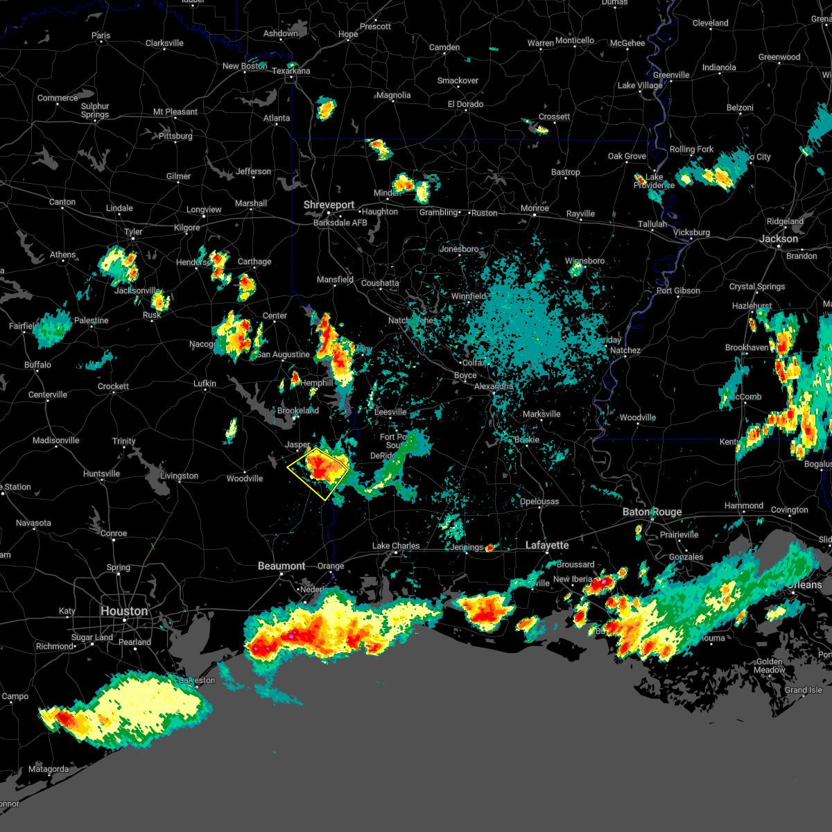 At 644 pm cdt, a severe thunderstorm was located near roganville, or 7 miles southwest of newton, moving southwest at 25 mph (radar indicated). Hazards include 70 mph wind gusts and quarter size hail. Hail damage to vehicles is expected. expect considerable tree damage. wind damage is also likely to mobile homes, roofs, and outbuildings. locations impacted include, newton, kirbyville, bon weir, jamestown, trout creek, roganville and bleakwood. thunderstorm damage threat, considerable hail threat, radar indicated max hail size, 1. 00 in wind threat, radar indicated max wind gust, 70 mph. At 644 pm cdt, a severe thunderstorm was located near roganville, or 7 miles southwest of newton, moving southwest at 25 mph (radar indicated). Hazards include 70 mph wind gusts and quarter size hail. Hail damage to vehicles is expected. expect considerable tree damage. wind damage is also likely to mobile homes, roofs, and outbuildings. locations impacted include, newton, kirbyville, bon weir, jamestown, trout creek, roganville and bleakwood. thunderstorm damage threat, considerable hail threat, radar indicated max hail size, 1. 00 in wind threat, radar indicated max wind gust, 70 mph.
|
| 9/7/2022 6:34 PM CDT |
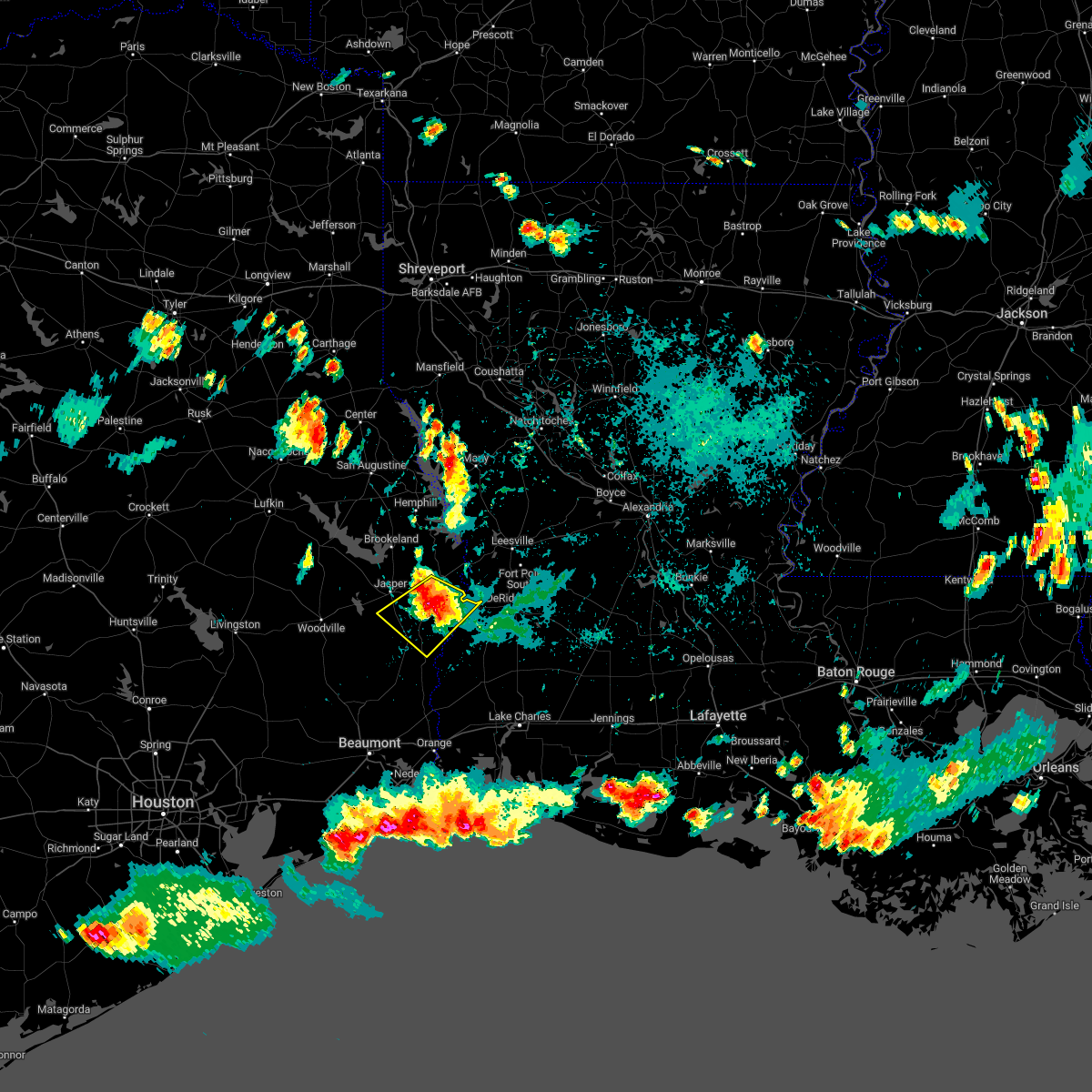 At 633 pm cdt, a severe thunderstorm was located near newton, moving southwest at 20 mph (radar indicated). Hazards include 70 mph wind gusts and half dollar size hail. Hail damage to vehicles is expected. expect considerable tree damage. Wind damage is also likely to mobile homes, roofs, and outbuildings. At 633 pm cdt, a severe thunderstorm was located near newton, moving southwest at 20 mph (radar indicated). Hazards include 70 mph wind gusts and half dollar size hail. Hail damage to vehicles is expected. expect considerable tree damage. Wind damage is also likely to mobile homes, roofs, and outbuildings.
|
| 9/7/2022 6:25 PM CDT |
 At 624 pm cdt, a severe thunderstorm was located over newton, moving southwest at 15 mph (radar indicated). Hazards include 60 mph wind gusts and half dollar size hail. Hail damage to vehicles is expected. Expect wind damage to roofs, siding, and trees. At 624 pm cdt, a severe thunderstorm was located over newton, moving southwest at 15 mph (radar indicated). Hazards include 60 mph wind gusts and half dollar size hail. Hail damage to vehicles is expected. Expect wind damage to roofs, siding, and trees.
|
| 9/7/2022 6:25 PM CDT |
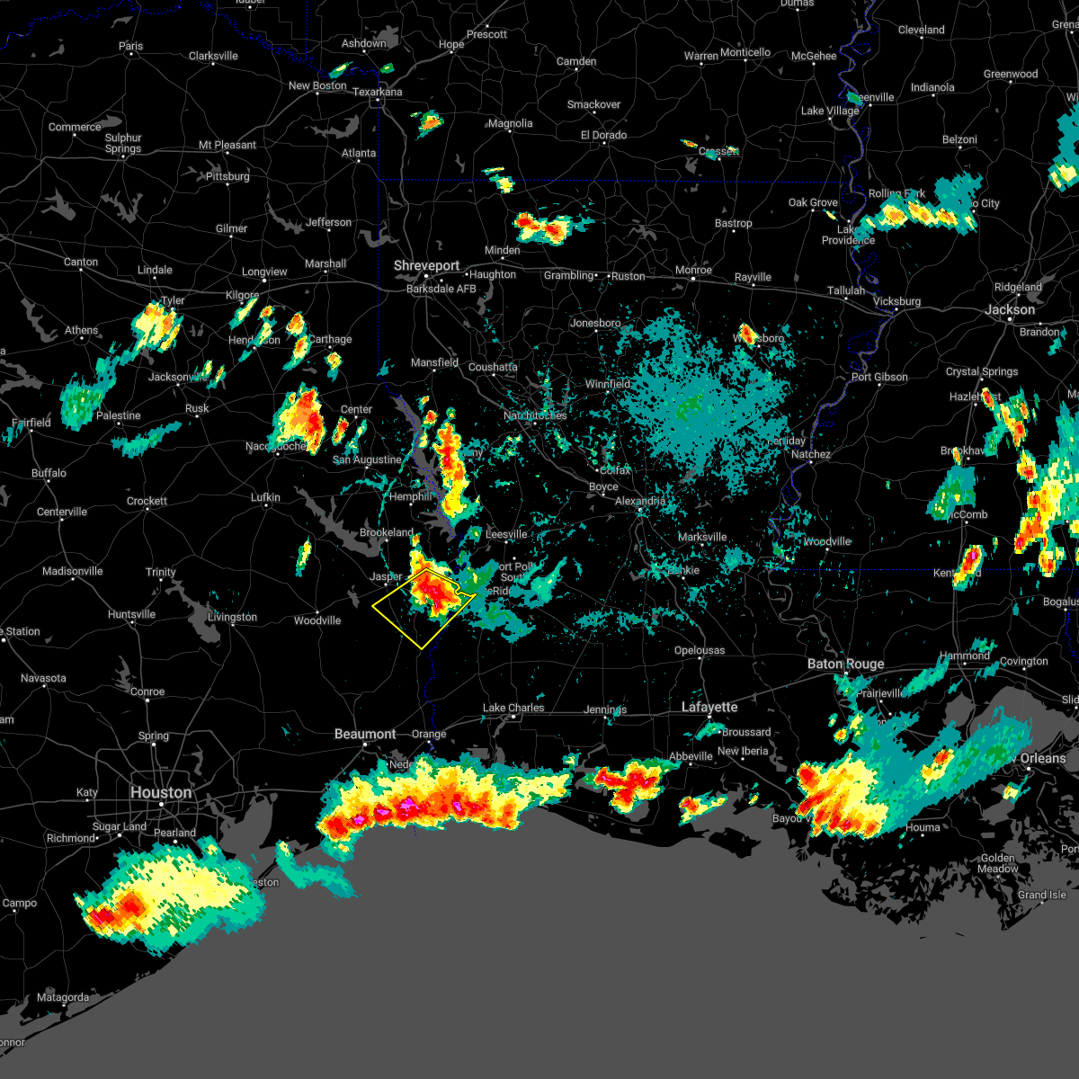 At 624 pm cdt, a severe thunderstorm was located over newton, moving southwest at 15 mph (radar indicated). Hazards include 60 mph wind gusts and half dollar size hail. Hail damage to vehicles is expected. Expect wind damage to roofs, siding, and trees. At 624 pm cdt, a severe thunderstorm was located over newton, moving southwest at 15 mph (radar indicated). Hazards include 60 mph wind gusts and half dollar size hail. Hail damage to vehicles is expected. Expect wind damage to roofs, siding, and trees.
|
| 3/30/2022 12:05 PM CDT | Mesonet station krbt2 kirbyville: t in newton county TX, 4.5 miles WNW of Kirbyville, TX |
| 3/22/2022 8:25 AM CDT |
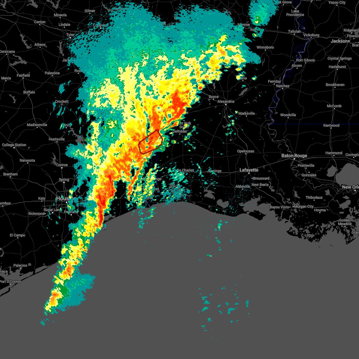 At 825 am cdt, a severe squall line capable of producing both tornadoes and extensive straight line wind damage was located near kirbyville, moving northeast at 60 mph (radar indicated rotation). Hazards include tornado. Flying debris will be dangerous to those caught without shelter. mobile homes will be damaged or destroyed. damage to roofs, windows, and vehicles will occur. tree damage is likely. these dangerous storms will be near, newton around 835 am cdt. bon weir around 840 am cdt. Other locations impacted by this tornadic thunderstorm include bleakwood. At 825 am cdt, a severe squall line capable of producing both tornadoes and extensive straight line wind damage was located near kirbyville, moving northeast at 60 mph (radar indicated rotation). Hazards include tornado. Flying debris will be dangerous to those caught without shelter. mobile homes will be damaged or destroyed. damage to roofs, windows, and vehicles will occur. tree damage is likely. these dangerous storms will be near, newton around 835 am cdt. bon weir around 840 am cdt. Other locations impacted by this tornadic thunderstorm include bleakwood.
|
| 3/22/2022 8:13 AM CDT |
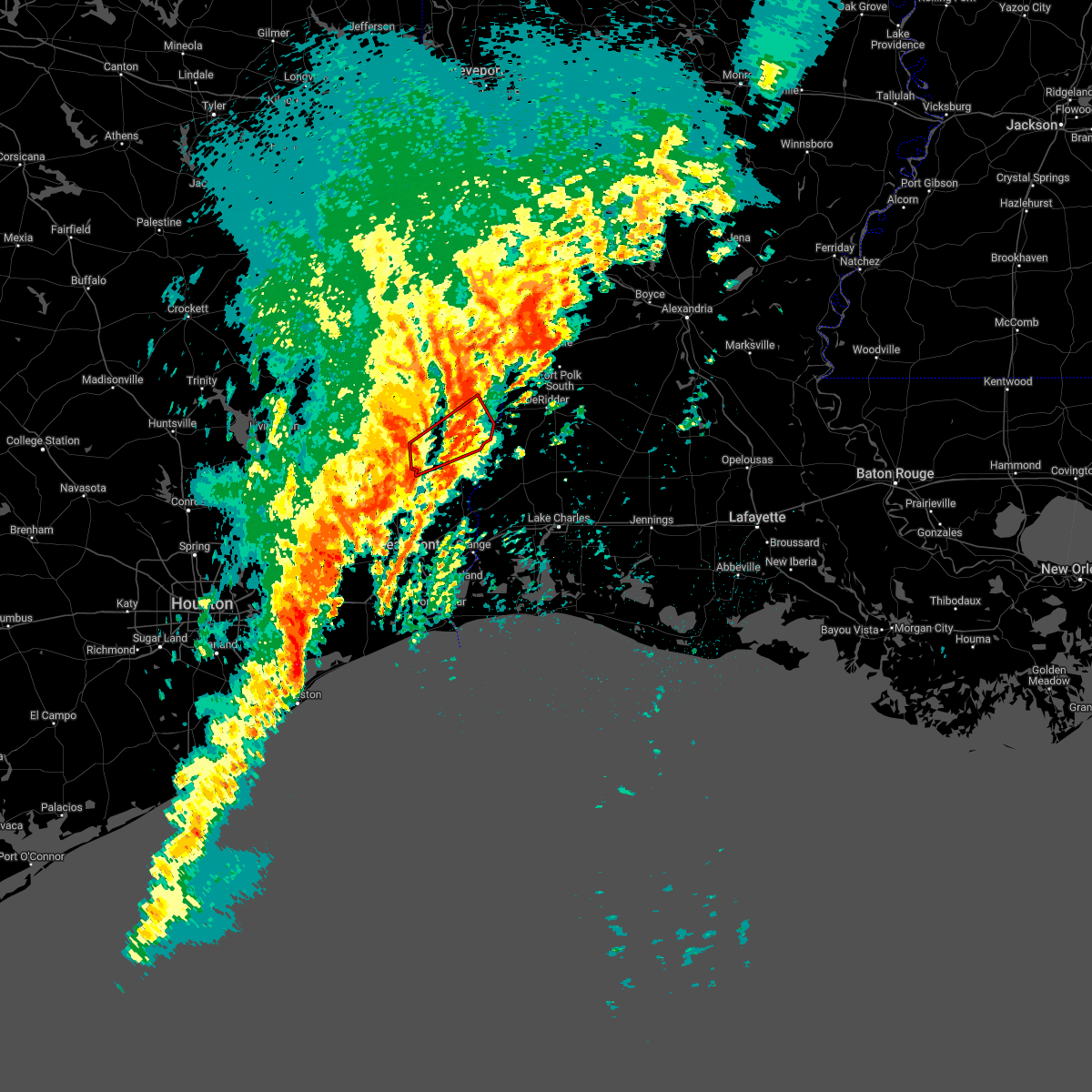 At 813 am cdt, severe thunderstorms capable of producing both tornadoes and extensive straight line wind damage were located near mt. union, or 7 miles southwest of kirbyville, moving northeast at 60 mph (radar indicated rotation). Hazards include tornado. Flying debris will be dangerous to those caught without shelter. mobile homes will be damaged or destroyed. damage to roofs, windows, and vehicles will occur. tree damage is likely. these dangerous storms will be near, kirbyville and call around 820 am cdt. trout creek around 825 am cdt. newton around 835 am cdt. bon weir around 840 am cdt. Other locations impacted by this tornadic thunderstorm include bleakwood. At 813 am cdt, severe thunderstorms capable of producing both tornadoes and extensive straight line wind damage were located near mt. union, or 7 miles southwest of kirbyville, moving northeast at 60 mph (radar indicated rotation). Hazards include tornado. Flying debris will be dangerous to those caught without shelter. mobile homes will be damaged or destroyed. damage to roofs, windows, and vehicles will occur. tree damage is likely. these dangerous storms will be near, kirbyville and call around 820 am cdt. trout creek around 825 am cdt. newton around 835 am cdt. bon weir around 840 am cdt. Other locations impacted by this tornadic thunderstorm include bleakwood.
|
| 3/14/2022 11:54 PM CDT |
 At 1154 pm cdt, a severe thunderstorm was located near trout creek, or 7 miles southwest of bon weir, moving east at 50 mph (radar indicated). Hazards include 60 mph wind gusts and penny size hail. Expect damage to roofs, siding, and trees. locations impacted include, kirbyville, call, bon weir, trout creek, bivens, roganville, bancroft, old salem, mt. union and bleakwood. hail threat, radar indicated max hail size, 0. 75 in wind threat, radar indicated max wind gust, 60 mph. At 1154 pm cdt, a severe thunderstorm was located near trout creek, or 7 miles southwest of bon weir, moving east at 50 mph (radar indicated). Hazards include 60 mph wind gusts and penny size hail. Expect damage to roofs, siding, and trees. locations impacted include, kirbyville, call, bon weir, trout creek, bivens, roganville, bancroft, old salem, mt. union and bleakwood. hail threat, radar indicated max hail size, 0. 75 in wind threat, radar indicated max wind gust, 60 mph.
|
| 3/14/2022 11:40 PM CDT |
 At 1140 pm cdt, a severe thunderstorm was located near kirbyville, moving east at 50 mph (radar indicated). Hazards include 60 mph wind gusts and penny size hail. expect damage to roofs, siding, and trees At 1140 pm cdt, a severe thunderstorm was located near kirbyville, moving east at 50 mph (radar indicated). Hazards include 60 mph wind gusts and penny size hail. expect damage to roofs, siding, and trees
|
| 3/14/2022 11:40 PM CDT |
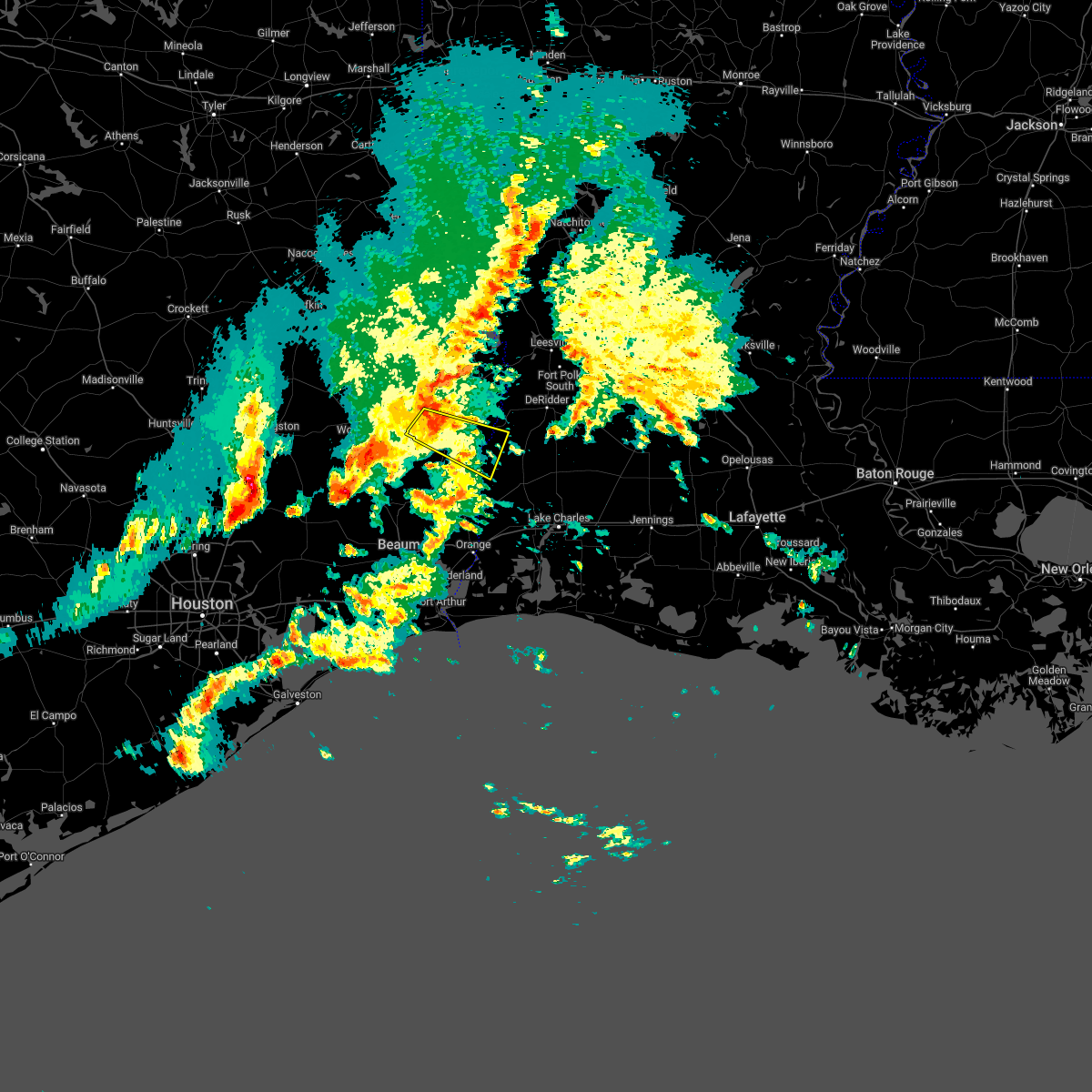 At 1140 pm cdt, a severe thunderstorm was located near kirbyville, moving east at 50 mph (radar indicated). Hazards include 60 mph wind gusts and penny size hail. expect damage to roofs, siding, and trees At 1140 pm cdt, a severe thunderstorm was located near kirbyville, moving east at 50 mph (radar indicated). Hazards include 60 mph wind gusts and penny size hail. expect damage to roofs, siding, and trees
|
| 12/18/2021 12:28 PM CST |
 At 1228 pm cst, severe thunderstorms were located along a line extending from jasper to caney head, moving east at 20 mph (radar indicated). Hazards include 60 mph wind gusts and penny size hail. expect damage to roofs, siding, and trees At 1228 pm cst, severe thunderstorms were located along a line extending from jasper to caney head, moving east at 20 mph (radar indicated). Hazards include 60 mph wind gusts and penny size hail. expect damage to roofs, siding, and trees
|
| 6/3/2021 3:33 PM CDT | Social media post of tree down on a house off trout street near kirbyvill in jasper county TX, 0.5 miles WSW of Kirbyville, TX |
| 6/3/2021 3:33 PM CDT | Mobile home sustained roof damage with pieces of sheet metal laying around the yard. two trees around a foot in diameter snapped at this locatio in jasper county TX, 4.5 miles ESE of Kirbyville, TX |
| 6/3/2021 3:30 PM CDT |
 At 329 pm cdt, a severe thunderstorm was located over mt. union, or near kirbyville, moving northwest at 5 mph (radar indicated). Hazards include 60 mph wind gusts and quarter size hail. Hail damage to vehicles is expected. Expect wind damage to roofs, siding, and trees. At 329 pm cdt, a severe thunderstorm was located over mt. union, or near kirbyville, moving northwest at 5 mph (radar indicated). Hazards include 60 mph wind gusts and quarter size hail. Hail damage to vehicles is expected. Expect wind damage to roofs, siding, and trees.
|
| 5/11/2021 6:54 PM CDT |
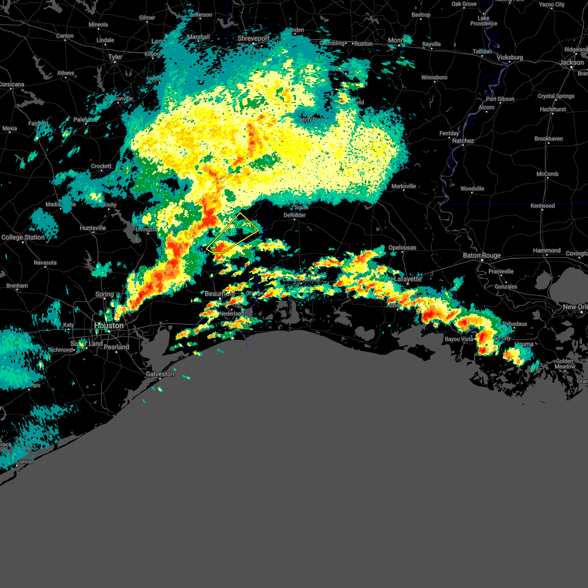 At 654 pm cdt, a severe thunderstorm was located over fred, moving northeast at 35 mph (radar indicated). Hazards include 60 mph wind gusts and quarter size hail. Hail damage to vehicles is expected. Expect wind damage to roofs, siding, and trees. At 654 pm cdt, a severe thunderstorm was located over fred, moving northeast at 35 mph (radar indicated). Hazards include 60 mph wind gusts and quarter size hail. Hail damage to vehicles is expected. Expect wind damage to roofs, siding, and trees.
|
| 4/23/2021 7:51 PM CDT |
 At 751 pm cdt, a severe thunderstorm capable of producing a tornado was located over bancroft, or 8 miles east of call, moving east at 45 mph (radar indicated rotation). Hazards include tornado. Flying debris will be dangerous to those caught without shelter. mobile homes will be damaged or destroyed. damage to roofs, windows, and vehicles will occur. tree damage is likely. This tornadic thunderstorm will remain over mainly rural areas of southwestern newton and east central jasper counties. At 751 pm cdt, a severe thunderstorm capable of producing a tornado was located over bancroft, or 8 miles east of call, moving east at 45 mph (radar indicated rotation). Hazards include tornado. Flying debris will be dangerous to those caught without shelter. mobile homes will be damaged or destroyed. damage to roofs, windows, and vehicles will occur. tree damage is likely. This tornadic thunderstorm will remain over mainly rural areas of southwestern newton and east central jasper counties.
|
| 4/23/2021 7:45 PM CDT |
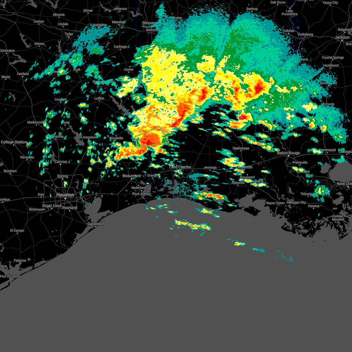 At 745 pm cdt, a severe thunderstorm was located near kirbyville, moving east at 45 mph (radar indicated). Hazards include 60 mph wind gusts and quarter size hail. Hail damage to vehicles is expected. Expect wind damage to roofs, siding, and trees. At 745 pm cdt, a severe thunderstorm was located near kirbyville, moving east at 45 mph (radar indicated). Hazards include 60 mph wind gusts and quarter size hail. Hail damage to vehicles is expected. Expect wind damage to roofs, siding, and trees.
|
| 4/23/2021 7:37 PM CDT |
 At 736 pm cdt, a severe thunderstorm capable of producing a tornado was located near call, moving east at 45 mph (radar indicated rotation). Hazards include tornado. Flying debris will be dangerous to those caught without shelter. mobile homes will be damaged or destroyed. damage to roofs, windows, and vehicles will occur. tree damage is likely. this dangerous storm will be near, call around 740 pm cdt. trout creek around 745 pm cdt. Old salem around 750 pm cdt. At 736 pm cdt, a severe thunderstorm capable of producing a tornado was located near call, moving east at 45 mph (radar indicated rotation). Hazards include tornado. Flying debris will be dangerous to those caught without shelter. mobile homes will be damaged or destroyed. damage to roofs, windows, and vehicles will occur. tree damage is likely. this dangerous storm will be near, call around 740 pm cdt. trout creek around 745 pm cdt. Old salem around 750 pm cdt.
|
| 4/23/2021 7:30 PM CDT |
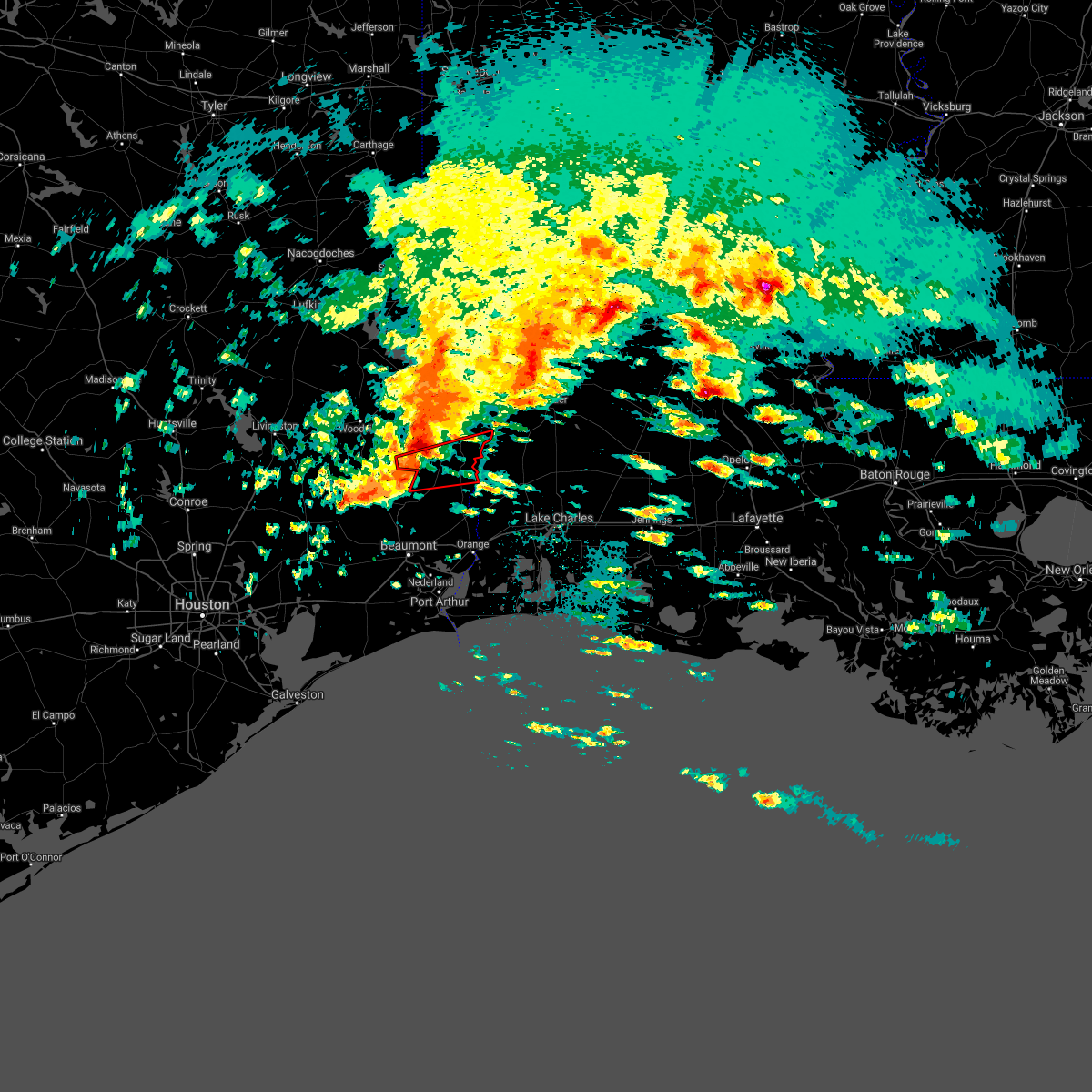 At 730 pm cdt, a severe thunderstorm capable of producing a tornado was located 7 miles northwest of buna, moving east at 45 mph (radar indicated rotation). Hazards include tornado. Flying debris will be dangerous to those caught without shelter. mobile homes will be damaged or destroyed. damage to roofs, windows, and vehicles will occur. tree damage is likely. this dangerous storm will be near, call around 740 pm cdt. trout creek around 745 pm cdt. Old salem around 750 pm cdt. At 730 pm cdt, a severe thunderstorm capable of producing a tornado was located 7 miles northwest of buna, moving east at 45 mph (radar indicated rotation). Hazards include tornado. Flying debris will be dangerous to those caught without shelter. mobile homes will be damaged or destroyed. damage to roofs, windows, and vehicles will occur. tree damage is likely. this dangerous storm will be near, call around 740 pm cdt. trout creek around 745 pm cdt. Old salem around 750 pm cdt.
|
| 4/23/2021 7:20 PM CDT |
 At 719 pm cdt, severe thunderstorms were located along a line extending from 7 miles west of town bluff to near wildwood, moving east at 35 mph (radar indicated). Hazards include 60 mph wind gusts and nickel size hail. Expect damage to roofs, siding, and trees. locations impacted include, jasper, kirbyville, kountze, ebenezer, fred, town bluff, browndell, caney head, magnolia springs, mt. Union, spurger, roganville, harrisburg and sam rayburn dam. At 719 pm cdt, severe thunderstorms were located along a line extending from 7 miles west of town bluff to near wildwood, moving east at 35 mph (radar indicated). Hazards include 60 mph wind gusts and nickel size hail. Expect damage to roofs, siding, and trees. locations impacted include, jasper, kirbyville, kountze, ebenezer, fred, town bluff, browndell, caney head, magnolia springs, mt. Union, spurger, roganville, harrisburg and sam rayburn dam.
|
| 4/23/2021 7:03 PM CDT |
 At 703 pm cdt, severe thunderstorms were located along a line extending from woodville to near wildwood, moving east at 35 mph (radar indicated). Hazards include 60 mph wind gusts and nickel size hail. Expect damage to roofs, siding, and trees. locations impacted include, jasper, woodville, kirbyville, kountze, colmesneil, ebenezer, fred, rockland, wildwood, warren, town bluff, browndell, caney head, honey island, magnolia springs, mt. Union, spurger, roganville, harrisburg and village mills. At 703 pm cdt, severe thunderstorms were located along a line extending from woodville to near wildwood, moving east at 35 mph (radar indicated). Hazards include 60 mph wind gusts and nickel size hail. Expect damage to roofs, siding, and trees. locations impacted include, jasper, woodville, kirbyville, kountze, colmesneil, ebenezer, fred, rockland, wildwood, warren, town bluff, browndell, caney head, honey island, magnolia springs, mt. Union, spurger, roganville, harrisburg and village mills.
|
| 4/23/2021 6:42 PM CDT |
 At 642 pm cdt, severe thunderstorms were located along a line extending from near alabama-coushatta reservation to near votaw, moving east at 35 mph (radar indicated). Hazards include 60 mph wind gusts and nickel size hail. expect damage to roofs, siding, and trees At 642 pm cdt, severe thunderstorms were located along a line extending from near alabama-coushatta reservation to near votaw, moving east at 35 mph (radar indicated). Hazards include 60 mph wind gusts and nickel size hail. expect damage to roofs, siding, and trees
|
| 4/16/2021 3:01 AM CDT |
 At 301 am cdt, severe thunderstorms were located along a line extending from roganville to call, moving east at 55 mph (radar indicated). Hazards include 60 mph wind gusts and quarter size hail. Hail damage to vehicles is expected. expect wind damage to roofs, siding, and trees. Locations impacted include, newton, kirbyville, call, trout creek, roganville, old salem, stringtown and bleakwood. At 301 am cdt, severe thunderstorms were located along a line extending from roganville to call, moving east at 55 mph (radar indicated). Hazards include 60 mph wind gusts and quarter size hail. Hail damage to vehicles is expected. expect wind damage to roofs, siding, and trees. Locations impacted include, newton, kirbyville, call, trout creek, roganville, old salem, stringtown and bleakwood.
|
| 4/16/2021 3:00 AM CDT | Trees down along with 1/2 inch hai in newton county TX, 3.7 miles NNW of Kirbyville, TX |
| 4/16/2021 3:00 AM CDT | Powerlines dow in jasper county TX, 0.2 miles SSE of Kirbyville, TX |
| 4/16/2021 2:52 AM CDT |
 At 251 am cdt, severe thunderstorms were located along a line extending from near roganville to 6 miles south of mt. union, moving east at 55 mph (radar indicated). Hazards include 60 mph wind gusts and quarter size hail. Hail damage to vehicles is expected. expect wind damage to roofs, siding, and trees. locations impacted include, newton, kirbyville, call, trout creek, roganville, magnolia springs, old salem, mt. Union, stringtown and bleakwood. At 251 am cdt, severe thunderstorms were located along a line extending from near roganville to 6 miles south of mt. union, moving east at 55 mph (radar indicated). Hazards include 60 mph wind gusts and quarter size hail. Hail damage to vehicles is expected. expect wind damage to roofs, siding, and trees. locations impacted include, newton, kirbyville, call, trout creek, roganville, magnolia springs, old salem, mt. Union, stringtown and bleakwood.
|
| 4/16/2021 2:43 AM CDT |
 At 242 am cdt, severe thunderstorms were located along a line extending from near magnolia springs to near fred, moving east at 55 mph (radar indicated). Hazards include 60 mph wind gusts and nickel size hail. expect damage to roofs, siding, and trees At 242 am cdt, severe thunderstorms were located along a line extending from near magnolia springs to near fred, moving east at 55 mph (radar indicated). Hazards include 60 mph wind gusts and nickel size hail. expect damage to roofs, siding, and trees
|
| 4/15/2021 11:57 PM CDT |
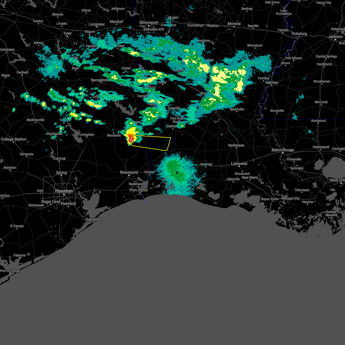 At 1157 pm cdt, a severe thunderstorm was located over mt. union, or 8 miles west of kirbyville, moving east at 45 mph (radar indicated). Hazards include half dollar size hail. damage to vehicles is expected At 1157 pm cdt, a severe thunderstorm was located over mt. union, or 8 miles west of kirbyville, moving east at 45 mph (radar indicated). Hazards include half dollar size hail. damage to vehicles is expected
|
| 4/15/2021 11:57 PM CDT |
 The national weather service in lake charles has issued a * severe thunderstorm warning for. southwestern beauregard parish in southwestern louisiana. west central newton county in southeastern texas. east central jasper county in southeastern texas. Until 100 am cdt. The national weather service in lake charles has issued a * severe thunderstorm warning for. southwestern beauregard parish in southwestern louisiana. west central newton county in southeastern texas. east central jasper county in southeastern texas. Until 100 am cdt.
|
| 4/14/2021 6:39 AM CDT | Golf Ball sized hail reported 0.2 miles SSE of Kirbyville, TX, deputy reports golf ball size hail. |
| 4/14/2021 6:28 AM CDT |
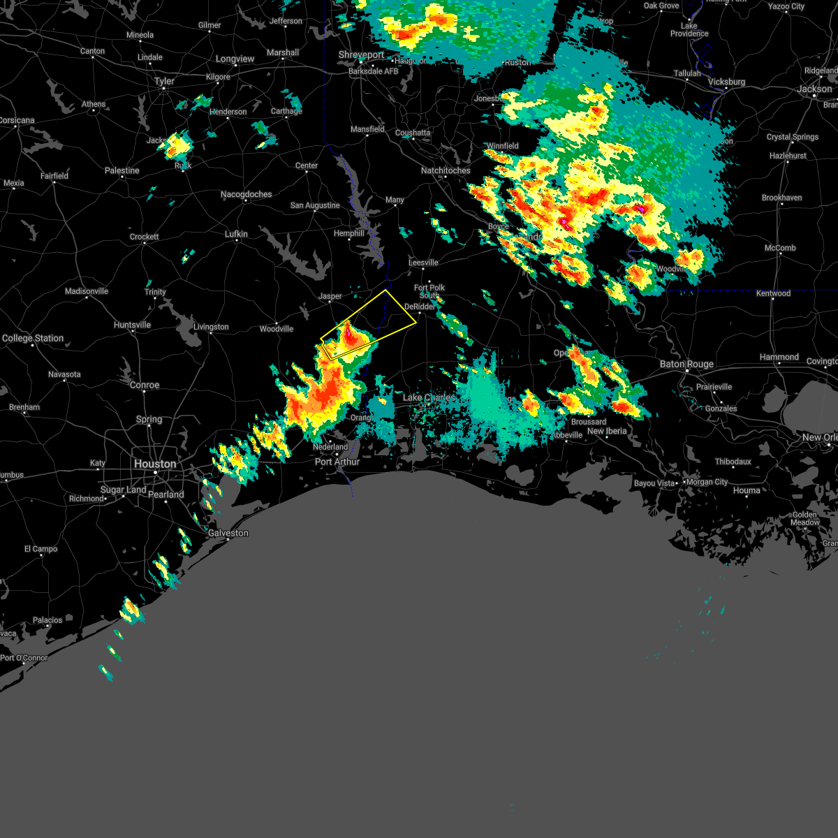 At 628 am cdt, a severe thunderstorm was located over kirbyville, moving northeast at 50 mph (radar indicated). Hazards include 60 mph wind gusts and quarter size hail. Hail damage to vehicles is expected. Expect wind damage to roofs, siding, and trees. At 628 am cdt, a severe thunderstorm was located over kirbyville, moving northeast at 50 mph (radar indicated). Hazards include 60 mph wind gusts and quarter size hail. Hail damage to vehicles is expected. Expect wind damage to roofs, siding, and trees.
|
| 12/23/2020 7:12 PM CST |
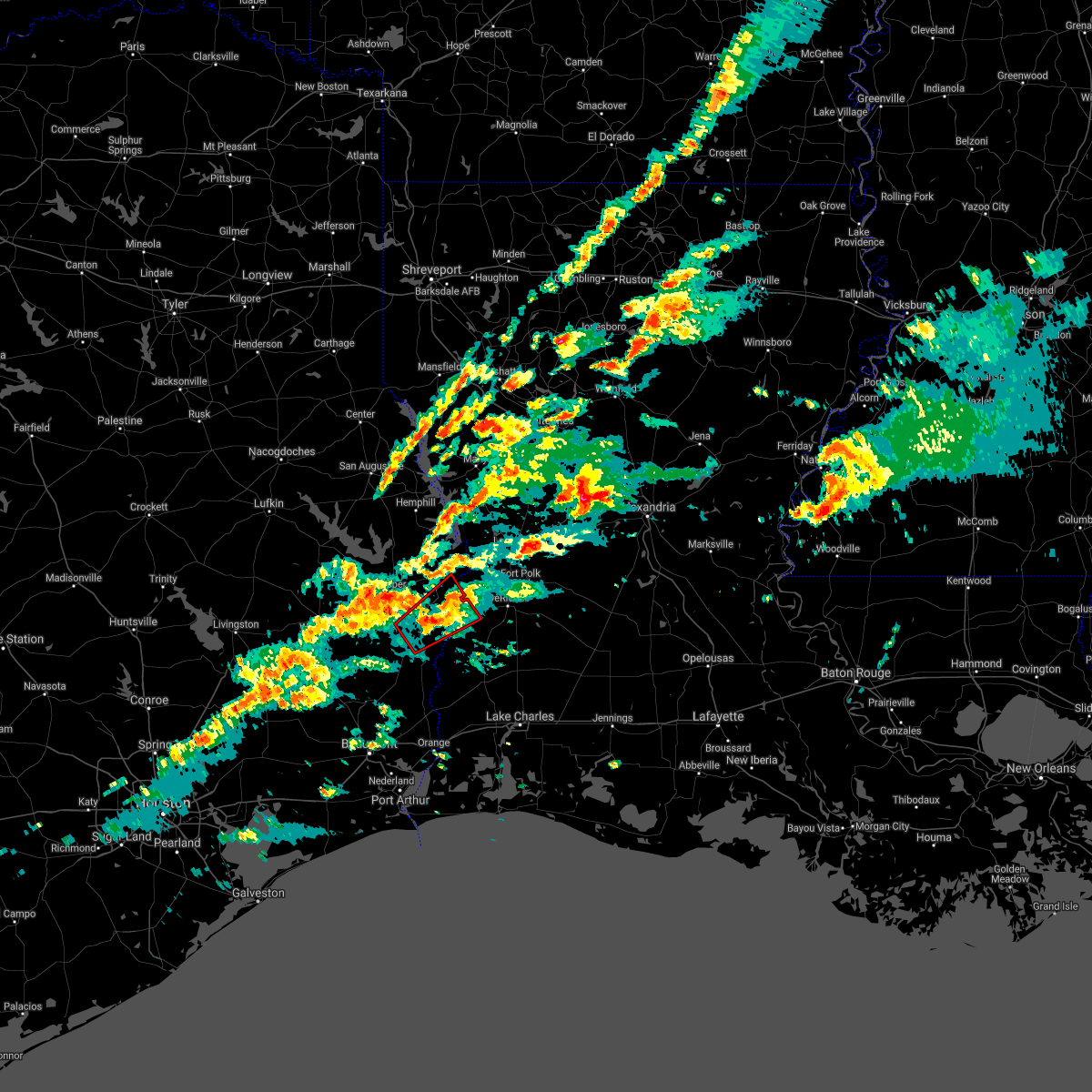 At 711 pm cst, a severe thunderstorm capable of producing a tornado was located near roganville, or 7 miles northeast of kirbyville, moving northeast at 30 mph (radar indicated rotation). Hazards include tornado. Flying debris will be dangerous to those caught without shelter. mobile homes will be damaged or destroyed. damage to roofs, windows, and vehicles will occur. tree damage is likely. this dangerous storm will be near, newton around 725 pm cst. bon weir around 730 pm cst. stringtown and junction around 745 pm cst. Other locations impacted by this tornadic thunderstorm include bleakwood. At 711 pm cst, a severe thunderstorm capable of producing a tornado was located near roganville, or 7 miles northeast of kirbyville, moving northeast at 30 mph (radar indicated rotation). Hazards include tornado. Flying debris will be dangerous to those caught without shelter. mobile homes will be damaged or destroyed. damage to roofs, windows, and vehicles will occur. tree damage is likely. this dangerous storm will be near, newton around 725 pm cst. bon weir around 730 pm cst. stringtown and junction around 745 pm cst. Other locations impacted by this tornadic thunderstorm include bleakwood.
|
| 12/23/2020 3:53 PM CST | Emergency manager reported damage to homes... trees... and outbuildings along fm 1416. possible tornado. time estimated from rada in newton county TX, 11.3 miles W of Kirbyville, TX |
| 5/28/2020 2:43 PM CDT |
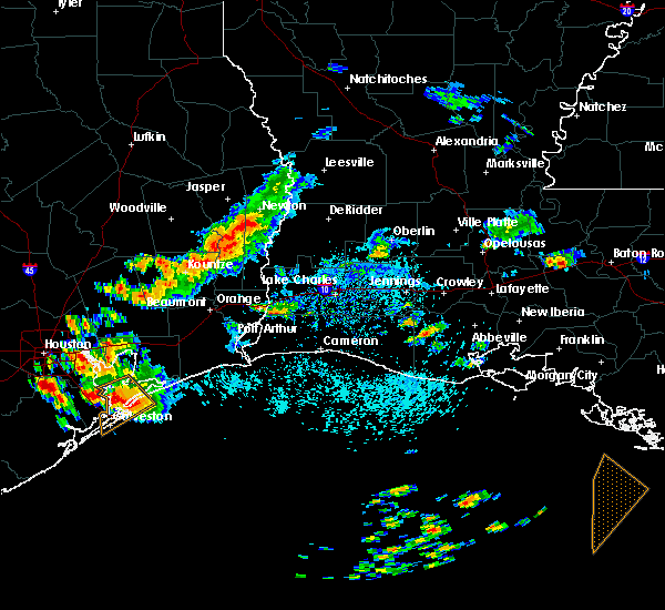 At 242 pm cdt, a severe thunderstorm was located near kirbyville, moving southeast at 25 mph (radar indicated). Hazards include 60 mph wind gusts and quarter size hail. Hail damage to vehicles is expected. Expect wind damage to roofs, siding, and trees. At 242 pm cdt, a severe thunderstorm was located near kirbyville, moving southeast at 25 mph (radar indicated). Hazards include 60 mph wind gusts and quarter size hail. Hail damage to vehicles is expected. Expect wind damage to roofs, siding, and trees.
|
| 4/29/2020 3:23 AM CDT |
 At 322 am cdt, severe thunderstorms were located along a line extending from 6 miles southeast of archie to 6 miles east of fort polk to near colmesneil, moving south at 45 mph (radar indicated). Hazards include 60 mph wind gusts and quarter size hail. Hail damage to vehicles is expected. expect wind damage to roofs, siding, and trees. locations impacted include, alexandria, pineville, de ridder, oakdale, jasper, leesville, marksville, woodville, newton, kirbyville, rosepine, glenmora, merryville, boyce, moreauville, anacoco, cheneyville, colmesneil, elizabeth and chester. This includes interstate 49 between mile markers 54 and 109. At 322 am cdt, severe thunderstorms were located along a line extending from 6 miles southeast of archie to 6 miles east of fort polk to near colmesneil, moving south at 45 mph (radar indicated). Hazards include 60 mph wind gusts and quarter size hail. Hail damage to vehicles is expected. expect wind damage to roofs, siding, and trees. locations impacted include, alexandria, pineville, de ridder, oakdale, jasper, leesville, marksville, woodville, newton, kirbyville, rosepine, glenmora, merryville, boyce, moreauville, anacoco, cheneyville, colmesneil, elizabeth and chester. This includes interstate 49 between mile markers 54 and 109.
|
| 4/29/2020 2:47 AM CDT |
 At 247 am cdt, severe thunderstorms were located along a line extending from near rosefield to near kurthwood to near huntington, moving south at 40 mph (radar indicated). Hazards include 60 mph wind gusts and quarter size hail. Hail damage to vehicles is expected. Expect wind damage to roofs, siding, and trees. At 247 am cdt, severe thunderstorms were located along a line extending from near rosefield to near kurthwood to near huntington, moving south at 40 mph (radar indicated). Hazards include 60 mph wind gusts and quarter size hail. Hail damage to vehicles is expected. Expect wind damage to roofs, siding, and trees.
|
| 4/19/2020 5:17 PM CDT |
 At 516 pm cdt, a severe thunderstorm was located near wrights settlement, or near buna, moving east at 50 mph (radar indicated). Hazards include 70 mph wind gusts and quarter size hail. Hail damage to vehicles is expected. expect considerable tree damage. wind damage is also likely to mobile homes, roofs, and outbuildings. Locations impacted include, kirbyville, singer, call, fields, de quincy, buna, trout creek, bivens, old salem, devils pocket, wrights settlement, bancroft and oretta. At 516 pm cdt, a severe thunderstorm was located near wrights settlement, or near buna, moving east at 50 mph (radar indicated). Hazards include 70 mph wind gusts and quarter size hail. Hail damage to vehicles is expected. expect considerable tree damage. wind damage is also likely to mobile homes, roofs, and outbuildings. Locations impacted include, kirbyville, singer, call, fields, de quincy, buna, trout creek, bivens, old salem, devils pocket, wrights settlement, bancroft and oretta.
|
| 4/19/2020 5:02 PM CDT |
 At 502 pm cdt, a severe thunderstorm was located near caney head, or near silsbee, moving east at 60 mph (radar indicated). Hazards include 70 mph wind gusts and quarter size hail. Hail damage to vehicles is expected. expect considerable tree damage. Wind damage is also likely to mobile homes, roofs, and outbuildings. At 502 pm cdt, a severe thunderstorm was located near caney head, or near silsbee, moving east at 60 mph (radar indicated). Hazards include 70 mph wind gusts and quarter size hail. Hail damage to vehicles is expected. expect considerable tree damage. Wind damage is also likely to mobile homes, roofs, and outbuildings.
|
| 4/9/2020 7:35 PM CDT |
 At 734 pm cdt, severe thunderstorms were located along a line extending from near trout creek to near caney head, moving east at 40 mph (radar indicated). Hazards include 60 mph wind gusts and nickel size hail. expect damage to roofs, siding, and trees At 734 pm cdt, severe thunderstorms were located along a line extending from near trout creek to near caney head, moving east at 40 mph (radar indicated). Hazards include 60 mph wind gusts and nickel size hail. expect damage to roofs, siding, and trees
|
| 1/11/2020 2:16 AM CST |
 At 216 am cst, severe thunderstorms were located along a line extending from 7 miles north of toledo bend dam to call to 16 miles south of high island, moving east at 40 mph (radar indicated). Hazards include 60 mph wind gusts. expect damage to roofs, siding, and trees At 216 am cst, severe thunderstorms were located along a line extending from 7 miles north of toledo bend dam to call to 16 miles south of high island, moving east at 40 mph (radar indicated). Hazards include 60 mph wind gusts. expect damage to roofs, siding, and trees
|
| 1/11/2020 1:57 AM CST |
 At 155 am cst, severe thunderstorms were located along a line extending from near pineland to magnolia springs to near gilchrist, moving east at 35 mph (radar indicated. at 1:40 am cst a wind gust to 59 mph was reported by local media at pinewood, texas). Hazards include 60 mph wind gusts. Expect damage to roofs, siding, and trees. locations impacted include, beaumont, port arthur, lumberton, jasper, silsbee, kirbyville, kountze, sour lake, nome, evadale, town bluff, hamshire, fred, buna, bevil oaks, china, rose city, pine forest, browndell and lakeview. This includes interstate 10 in texas between mile markers 860 and 832. At 155 am cst, severe thunderstorms were located along a line extending from near pineland to magnolia springs to near gilchrist, moving east at 35 mph (radar indicated. at 1:40 am cst a wind gust to 59 mph was reported by local media at pinewood, texas). Hazards include 60 mph wind gusts. Expect damage to roofs, siding, and trees. locations impacted include, beaumont, port arthur, lumberton, jasper, silsbee, kirbyville, kountze, sour lake, nome, evadale, town bluff, hamshire, fred, buna, bevil oaks, china, rose city, pine forest, browndell and lakeview. This includes interstate 10 in texas between mile markers 860 and 832.
|
| 1/11/2020 1:31 AM CST |
 At 130 am cst, severe thunderstorms were located along a line extending from 9 miles west of pineland to near spurger to near crystal beach, moving east at 35 mph (radar indicated). Hazards include 60 mph wind gusts. expect damage to roofs, siding, and trees At 130 am cst, severe thunderstorms were located along a line extending from 9 miles west of pineland to near spurger to near crystal beach, moving east at 35 mph (radar indicated). Hazards include 60 mph wind gusts. expect damage to roofs, siding, and trees
|
| 12/16/2019 10:50 AM CST |
 At 1049 am cst, a severe thunderstorm was located over call, moving northeast at 40 mph (radar indicated). Hazards include 60 mph wind gusts. expect damage to roofs, siding, and trees At 1049 am cst, a severe thunderstorm was located over call, moving northeast at 40 mph (radar indicated). Hazards include 60 mph wind gusts. expect damage to roofs, siding, and trees
|
| 10/21/2019 7:12 AM CDT |
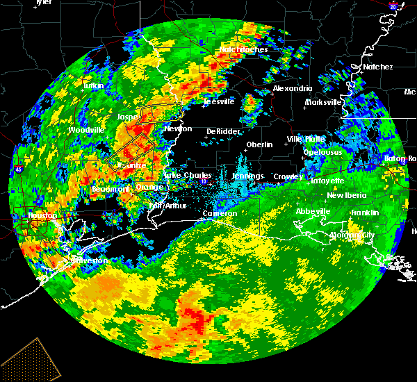 At 712 am cdt, a severe thunderstorm was located over fred, moving northeast at 45 mph (radar indicated). Hazards include 60 mph wind gusts. Expect damage to roofs, siding, and trees. locations impacted include, kirbyville, fred, caney head, magnolia springs and mt. Union. At 712 am cdt, a severe thunderstorm was located over fred, moving northeast at 45 mph (radar indicated). Hazards include 60 mph wind gusts. Expect damage to roofs, siding, and trees. locations impacted include, kirbyville, fred, caney head, magnolia springs and mt. Union.
|
| 10/21/2019 6:54 AM CDT |
 At 654 am cdt, a severe thunderstorm was located near village mills, or near wildwood, moving northeast at 45 mph (radar indicated). Hazards include 60 mph wind gusts. expect damage to roofs, siding, and trees At 654 am cdt, a severe thunderstorm was located near village mills, or near wildwood, moving northeast at 45 mph (radar indicated). Hazards include 60 mph wind gusts. expect damage to roofs, siding, and trees
|
| 5/19/2019 1:53 AM CDT |
 At 153 am cdt, a severe thunderstorm was located near kirbyville, moving northeast at 30 mph (radar indicated). Hazards include ping pong ball size hail. People and animals outdoors will be injured. expect damage to roofs, siding, windows, and vehicles. Locations impacted include, newton, kirbyville, call, bon weir, trout creek, bivens and bleakwood. At 153 am cdt, a severe thunderstorm was located near kirbyville, moving northeast at 30 mph (radar indicated). Hazards include ping pong ball size hail. People and animals outdoors will be injured. expect damage to roofs, siding, windows, and vehicles. Locations impacted include, newton, kirbyville, call, bon weir, trout creek, bivens and bleakwood.
|
| 5/19/2019 1:53 AM CDT |
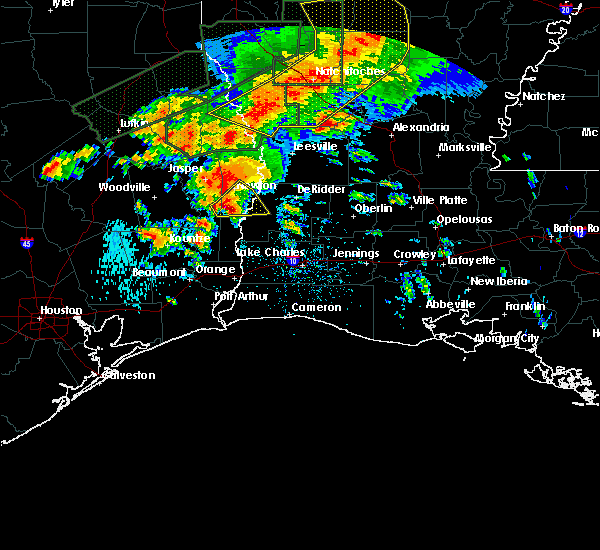 At 153 am cdt, a severe thunderstorm was located near kirbyville, moving northeast at 30 mph (radar indicated). Hazards include ping pong ball size hail. People and animals outdoors will be injured. expect damage to roofs, siding, windows, and vehicles. Locations impacted include, newton, kirbyville, call, bon weir, trout creek, bivens and bleakwood. At 153 am cdt, a severe thunderstorm was located near kirbyville, moving northeast at 30 mph (radar indicated). Hazards include ping pong ball size hail. People and animals outdoors will be injured. expect damage to roofs, siding, windows, and vehicles. Locations impacted include, newton, kirbyville, call, bon weir, trout creek, bivens and bleakwood.
|
| 5/19/2019 1:45 AM CDT | Quarter sized hail reported 0.2 miles SSE of Kirbyville, TX, broadcast media shared photo of quarter sized hail. |
| 5/19/2019 1:44 AM CDT | Tree down in kirbyville in jasper county TX, 0.2 miles SSE of Kirbyville, TX |
| 5/19/2019 1:43 AM CDT |
 At 143 am cdt, a severe thunderstorm was located over kirbyville, moving northeast at 30 mph (radar indicated). Hazards include quarter size hail. damage to vehicles is expected At 143 am cdt, a severe thunderstorm was located over kirbyville, moving northeast at 30 mph (radar indicated). Hazards include quarter size hail. damage to vehicles is expected
|
| 5/9/2019 6:38 PM CDT |
 At 638 pm cdt, a severe thunderstorm was located near mt. union, or 7 miles west of kirbyville, moving northeast at 35 mph (radar indicated). Hazards include 60 mph wind gusts and quarter size hail. Hail damage to vehicles is expected. Expect wind damage to roofs, siding, and trees. At 638 pm cdt, a severe thunderstorm was located near mt. union, or 7 miles west of kirbyville, moving northeast at 35 mph (radar indicated). Hazards include 60 mph wind gusts and quarter size hail. Hail damage to vehicles is expected. Expect wind damage to roofs, siding, and trees.
|
| 4/18/2019 6:29 AM CDT |
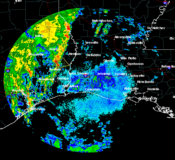 At 628 am cdt, a severe thunderstorm was located near caney head, or 7 miles southeast of fred, moving northeast at 40 mph (radar indicated). Hazards include 60 mph wind gusts and quarter size hail. Hail damage to vehicles is expected. expect wind damage to roofs, siding, and trees. Locations impacted include, kirbyville, call, old salem and trout creek. At 628 am cdt, a severe thunderstorm was located near caney head, or 7 miles southeast of fred, moving northeast at 40 mph (radar indicated). Hazards include 60 mph wind gusts and quarter size hail. Hail damage to vehicles is expected. expect wind damage to roofs, siding, and trees. Locations impacted include, kirbyville, call, old salem and trout creek.
|
| 4/18/2019 6:15 AM CDT |
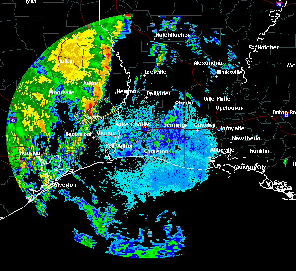 At 615 am cdt, a severe thunderstorm was located near caney head, or 7 miles north of silsbee, moving northeast at 40 mph (radar indicated). Hazards include 60 mph wind gusts and quarter size hail. Hail damage to vehicles is expected. Expect wind damage to roofs, siding, and trees. At 615 am cdt, a severe thunderstorm was located near caney head, or 7 miles north of silsbee, moving northeast at 40 mph (radar indicated). Hazards include 60 mph wind gusts and quarter size hail. Hail damage to vehicles is expected. Expect wind damage to roofs, siding, and trees.
|
| 4/7/2019 3:00 PM CDT |
 At 259 pm cdt, severe thunderstorms were located along a line extending from jasper to near fields to near holly beach, moving northeast at 50 mph. thunderstorms in calcasieu and cameron parishes have fallen below severe limits, however wind gusts of 50 mph remain possible along with small hail (radar indicated). Hazards include 60 mph wind gusts and quarter size hail. Hail damage to vehicles is expected. expect wind damage to roofs, siding, and trees. Locations impacted include, kirbyville, singer, call, bon weir, trout creek, bivens, roganville, bancroft and bleakwood. At 259 pm cdt, severe thunderstorms were located along a line extending from jasper to near fields to near holly beach, moving northeast at 50 mph. thunderstorms in calcasieu and cameron parishes have fallen below severe limits, however wind gusts of 50 mph remain possible along with small hail (radar indicated). Hazards include 60 mph wind gusts and quarter size hail. Hail damage to vehicles is expected. expect wind damage to roofs, siding, and trees. Locations impacted include, kirbyville, singer, call, bon weir, trout creek, bivens, roganville, bancroft and bleakwood.
|
| 4/7/2019 3:00 PM CDT |
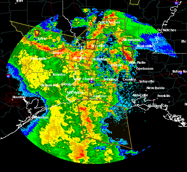 At 259 pm cdt, severe thunderstorms were located along a line extending from jasper to near fields to near holly beach, moving northeast at 50 mph. thunderstorms in calcasieu and cameron parishes have fallen below severe limits, however wind gusts of 50 mph remain possible along with small hail (radar indicated). Hazards include 60 mph wind gusts and quarter size hail. Hail damage to vehicles is expected. expect wind damage to roofs, siding, and trees. Locations impacted include, kirbyville, singer, call, bon weir, trout creek, bivens, roganville, bancroft and bleakwood. At 259 pm cdt, severe thunderstorms were located along a line extending from jasper to near fields to near holly beach, moving northeast at 50 mph. thunderstorms in calcasieu and cameron parishes have fallen below severe limits, however wind gusts of 50 mph remain possible along with small hail (radar indicated). Hazards include 60 mph wind gusts and quarter size hail. Hail damage to vehicles is expected. expect wind damage to roofs, siding, and trees. Locations impacted include, kirbyville, singer, call, bon weir, trout creek, bivens, roganville, bancroft and bleakwood.
|
| 4/7/2019 2:53 PM CDT |
 At 253 pm cdt, severe thunderstorms were located along a line extending from near jasper to near bancroft to 6 miles south of holly beach, moving northeast at 50 mph (radar indicated). Hazards include 60 mph wind gusts and quarter size hail. Hail damage to vehicles is expected. expect wind damage to roofs, siding, and trees. Locations impacted include, lake charles, sulphur, cameron, westlake, vinton, kirbyville, colmesneil, grand lake, singer, johnsons bayou, town bluff, de quincy, call, lake charles regional airport, starks, sabine national wildlife, fields, bon weir, dequincy and trout creek. At 253 pm cdt, severe thunderstorms were located along a line extending from near jasper to near bancroft to 6 miles south of holly beach, moving northeast at 50 mph (radar indicated). Hazards include 60 mph wind gusts and quarter size hail. Hail damage to vehicles is expected. expect wind damage to roofs, siding, and trees. Locations impacted include, lake charles, sulphur, cameron, westlake, vinton, kirbyville, colmesneil, grand lake, singer, johnsons bayou, town bluff, de quincy, call, lake charles regional airport, starks, sabine national wildlife, fields, bon weir, dequincy and trout creek.
|
| 4/7/2019 2:36 PM CDT |
 At 236 pm cdt, severe thunderstorms were located along a line extending from near town bluff to wrights settlement to 11 miles south of johnsons bayou, moving northeast at 50 mph (radar indicated). Hazards include 60 mph wind gusts and quarter size hail. Hail damage to vehicles is expected. expect wind damage to roofs, siding, and trees. Locations impacted include, beaumont, lake charles, port arthur, sulphur, orange, nederland, groves, port neches, vidor, bridge city, cameron, westlake, west orange, vinton, woodville, kirbyville, colmesneil, chester, singer and johnsons bayou. At 236 pm cdt, severe thunderstorms were located along a line extending from near town bluff to wrights settlement to 11 miles south of johnsons bayou, moving northeast at 50 mph (radar indicated). Hazards include 60 mph wind gusts and quarter size hail. Hail damage to vehicles is expected. expect wind damage to roofs, siding, and trees. Locations impacted include, beaumont, lake charles, port arthur, sulphur, orange, nederland, groves, port neches, vidor, bridge city, cameron, westlake, west orange, vinton, woodville, kirbyville, colmesneil, chester, singer and johnsons bayou.
|
| 4/7/2019 2:10 PM CDT |
 At 210 pm cdt, severe thunderstorms were located along a line extending from near wildwood to near lumberton to 19 miles south of sabine pass, moving northeast at 50 mph (radar indicated). Hazards include 60 mph wind gusts and quarter size hail. Hail damage to vehicles is expected. Expect wind damage to roofs, siding, and trees. At 210 pm cdt, severe thunderstorms were located along a line extending from near wildwood to near lumberton to 19 miles south of sabine pass, moving northeast at 50 mph (radar indicated). Hazards include 60 mph wind gusts and quarter size hail. Hail damage to vehicles is expected. Expect wind damage to roofs, siding, and trees.
|
| 4/4/2019 2:37 AM CDT |
 At 237 am cdt, a severe thunderstorm was located near caney head, or 7 miles north of silsbee, moving northeast at 40 mph (radar indicated). Hazards include quarter size hail. damage to vehicles is expected At 237 am cdt, a severe thunderstorm was located near caney head, or 7 miles north of silsbee, moving northeast at 40 mph (radar indicated). Hazards include quarter size hail. damage to vehicles is expected
|
| 2/26/2019 5:59 PM CST |
 At 558 pm cst, a severe thunderstorm was located over caney head, or near fred, moving east at 35 mph (radar indicated). Hazards include quarter size hail. damage to vehicles is expected At 558 pm cst, a severe thunderstorm was located over caney head, or near fred, moving east at 35 mph (radar indicated). Hazards include quarter size hail. damage to vehicles is expected
|
| 10/31/2018 8:32 PM CDT |
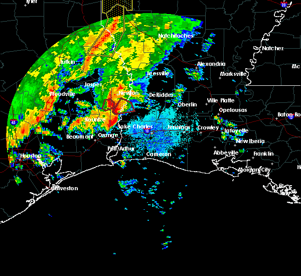 At 832 pm cdt, a severe thunderstorm capable of producing a tornado was located near kirbyville, moving northeast at 20 mph (radar indicated rotation). Hazards include tornado. Flying debris will be dangerous to those caught without shelter. mobile homes will be damaged or destroyed. damage to roofs, windows, and vehicles will occur. tree damage is likely. This tornadic thunderstorm will remain over mainly rural areas of west central newton and east central jasper counties, including the following locations, bleakwood. At 832 pm cdt, a severe thunderstorm capable of producing a tornado was located near kirbyville, moving northeast at 20 mph (radar indicated rotation). Hazards include tornado. Flying debris will be dangerous to those caught without shelter. mobile homes will be damaged or destroyed. damage to roofs, windows, and vehicles will occur. tree damage is likely. This tornadic thunderstorm will remain over mainly rural areas of west central newton and east central jasper counties, including the following locations, bleakwood.
|
| 10/31/2018 8:10 PM CDT |
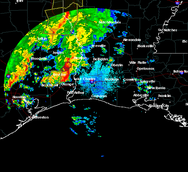 At 809 pm cdt, a severe thunderstorm capable of producing a tornado was located near kirbyville, moving northeast at 15 mph (radar indicated rotation). Hazards include tornado. Flying debris will be dangerous to those caught without shelter. mobile homes will be damaged or destroyed. damage to roofs, windows, and vehicles will occur. tree damage is likely. this dangerous storm will be near, call around 820 pm cdt. kirbyville around 825 pm cdt. Other locations impacted by this tornadic thunderstorm include bleakwood. At 809 pm cdt, a severe thunderstorm capable of producing a tornado was located near kirbyville, moving northeast at 15 mph (radar indicated rotation). Hazards include tornado. Flying debris will be dangerous to those caught without shelter. mobile homes will be damaged or destroyed. damage to roofs, windows, and vehicles will occur. tree damage is likely. this dangerous storm will be near, call around 820 pm cdt. kirbyville around 825 pm cdt. Other locations impacted by this tornadic thunderstorm include bleakwood.
|
| 10/31/2018 7:14 PM CDT |
 At 714 pm cdt, a severe thunderstorm capable of producing a tornado was located near kirbyville, moving northeast at 20 mph (radar indicated rotation). Hazards include tornado. Flying debris will be dangerous to those caught without shelter. mobile homes will be damaged or destroyed. damage to roofs, windows, and vehicles will occur. tree damage is likely. this dangerous storm will be near, kirbyville around 725 pm cdt. roganville around 750 pm cdt. Other locations impacted by this tornadic thunderstorm include bleakwood. At 714 pm cdt, a severe thunderstorm capable of producing a tornado was located near kirbyville, moving northeast at 20 mph (radar indicated rotation). Hazards include tornado. Flying debris will be dangerous to those caught without shelter. mobile homes will be damaged or destroyed. damage to roofs, windows, and vehicles will occur. tree damage is likely. this dangerous storm will be near, kirbyville around 725 pm cdt. roganville around 750 pm cdt. Other locations impacted by this tornadic thunderstorm include bleakwood.
|
| 10/31/2018 7:04 PM CDT |
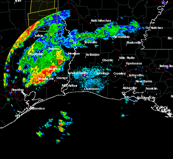 At 704 pm cdt, a severe thunderstorm capable of producing a tornado was located 8 miles north of buna, moving northeast at 20 mph (radar indicated rotation). Hazards include tornado. Flying debris will be dangerous to those caught without shelter. mobile homes will be damaged or destroyed. damage to roofs, windows, and vehicles will occur. tree damage is likely. This tornadic thunderstorm will remain over mainly rural areas of east central jasper county. At 704 pm cdt, a severe thunderstorm capable of producing a tornado was located 8 miles north of buna, moving northeast at 20 mph (radar indicated rotation). Hazards include tornado. Flying debris will be dangerous to those caught without shelter. mobile homes will be damaged or destroyed. damage to roofs, windows, and vehicles will occur. tree damage is likely. This tornadic thunderstorm will remain over mainly rural areas of east central jasper county.
|
| 10/31/2018 6:52 PM CDT |
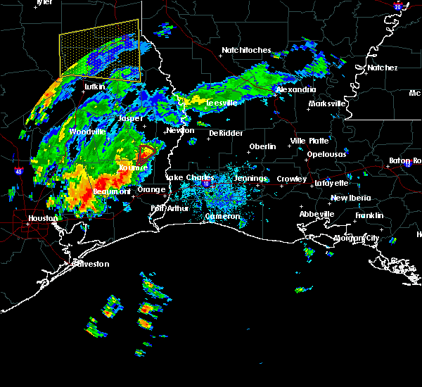 At 651 pm cdt, a severe thunderstorm capable of producing a tornado was located 7 miles northwest of buna, moving north at 25 mph (radar indicated rotation). Hazards include tornado. Flying debris will be dangerous to those caught without shelter. mobile homes will be damaged or destroyed. damage to roofs, windows, and vehicles will occur. tree damage is likely. This tornadic thunderstorm will remain over mainly rural areas of east central jasper county. At 651 pm cdt, a severe thunderstorm capable of producing a tornado was located 7 miles northwest of buna, moving north at 25 mph (radar indicated rotation). Hazards include tornado. Flying debris will be dangerous to those caught without shelter. mobile homes will be damaged or destroyed. damage to roofs, windows, and vehicles will occur. tree damage is likely. This tornadic thunderstorm will remain over mainly rural areas of east central jasper county.
|
| 6/3/2018 6:34 PM CDT |
 At 633 pm cdt, a severe thunderstorm was located near carlyss, or 8 miles southwest of sulphur, and is nearly stationary (radar indicated). Hazards include 60 mph wind gusts and quarter size hail. Hail damage to vehicles is expected. expect wind damage to roofs, siding, and trees. Locations impacted include, jasper, kirbyville, call, buna, jamestown, trout creek, roganville and bleakwood. At 633 pm cdt, a severe thunderstorm was located near carlyss, or 8 miles southwest of sulphur, and is nearly stationary (radar indicated). Hazards include 60 mph wind gusts and quarter size hail. Hail damage to vehicles is expected. expect wind damage to roofs, siding, and trees. Locations impacted include, jasper, kirbyville, call, buna, jamestown, trout creek, roganville and bleakwood.
|
| 6/3/2018 6:01 PM CDT |
 At 601 pm cdt, a severe thunderstorm was located near jasper, moving south at 30 mph (radar indicated). Hazards include 60 mph wind gusts and quarter size hail. Hail damage to vehicles is expected. Expect wind damage to roofs, siding, and trees. At 601 pm cdt, a severe thunderstorm was located near jasper, moving south at 30 mph (radar indicated). Hazards include 60 mph wind gusts and quarter size hail. Hail damage to vehicles is expected. Expect wind damage to roofs, siding, and trees.
|
| 4/7/2018 2:47 AM CDT |
 At 246 am cdt, a severe thunderstorm was located near evadale, moving east at 60 mph (radar indicated). Hazards include 60 mph wind gusts and nickel size hail. expect damage to roofs, siding, and trees At 246 am cdt, a severe thunderstorm was located near evadale, moving east at 60 mph (radar indicated). Hazards include 60 mph wind gusts and nickel size hail. expect damage to roofs, siding, and trees
|
| 4/7/2018 1:03 AM CDT |
 At 102 am cdt, severe thunderstorms were located along a line extending from 6 miles east of burkeville to near stringtown to near roganville to near magnolia springs, moving southeast at 40 mph (radar indicated). Hazards include 60 mph wind gusts and quarter size hail. Hail damage to vehicles is expected. Expect wind damage to roofs, siding, and trees. At 102 am cdt, severe thunderstorms were located along a line extending from 6 miles east of burkeville to near stringtown to near roganville to near magnolia springs, moving southeast at 40 mph (radar indicated). Hazards include 60 mph wind gusts and quarter size hail. Hail damage to vehicles is expected. Expect wind damage to roofs, siding, and trees.
|
| 4/7/2018 12:42 AM CDT |
 At 1241 am cdt, severe thunderstorms were located along a line extending from near harrisburg to 6 miles north of town bluff, moving southeast at 30 mph (radar indicated). Hazards include 60 mph wind gusts and quarter size hail. Hail damage to vehicles is expected. Expect wind damage to roofs, siding, and trees. At 1241 am cdt, severe thunderstorms were located along a line extending from near harrisburg to 6 miles north of town bluff, moving southeast at 30 mph (radar indicated). Hazards include 60 mph wind gusts and quarter size hail. Hail damage to vehicles is expected. Expect wind damage to roofs, siding, and trees.
|
| 3/18/2018 10:04 PM CDT |
 At 1003 pm cdt, severe thunderstorms were located along a line extending from near roganville to near kirbyville to near call, moving east at 55 mph (radar indicated). Hazards include 70 mph wind gusts. Expect considerable tree damage. damage is likely to mobile homes, roofs, and outbuildings. Locations impacted include, newton, kirbyville, merryville, singer, call, bon weir, deridder, trout creek, bivens, magnolia springs, roganville, junction, stringtown, bancroft and bleakwood. At 1003 pm cdt, severe thunderstorms were located along a line extending from near roganville to near kirbyville to near call, moving east at 55 mph (radar indicated). Hazards include 70 mph wind gusts. Expect considerable tree damage. damage is likely to mobile homes, roofs, and outbuildings. Locations impacted include, newton, kirbyville, merryville, singer, call, bon weir, deridder, trout creek, bivens, magnolia springs, roganville, junction, stringtown, bancroft and bleakwood.
|
| 3/18/2018 9:56 PM CDT |
 At 955 pm cdt, severe thunderstorms were located along a line extending from near magnolia springs to near kirbyville to 6 miles southwest of call, moving east at 55 mph (radar indicated). Hazards include 70 mph wind gusts. Expect considerable tree damage. damage is likely to mobile homes, roofs, and outbuildings. locations impacted include, newton, kirbyville, merryville, singer, call, town bluff, bon weir, deridder, trout creek, bivens, magnolia springs, mt. Union, spurger, roganville, junction, stringtown, bancroft and bleakwood. At 955 pm cdt, severe thunderstorms were located along a line extending from near magnolia springs to near kirbyville to 6 miles southwest of call, moving east at 55 mph (radar indicated). Hazards include 70 mph wind gusts. Expect considerable tree damage. damage is likely to mobile homes, roofs, and outbuildings. locations impacted include, newton, kirbyville, merryville, singer, call, town bluff, bon weir, deridder, trout creek, bivens, magnolia springs, mt. Union, spurger, roganville, junction, stringtown, bancroft and bleakwood.
|
| 3/18/2018 9:45 PM CDT |
 At 944 pm cdt, severe thunderstorms were located along a line extending from near town bluff to 6 miles southwest of mt. union to near caney head, moving east at 50 mph (radar indicated). Hazards include 70 mph wind gusts. Expect considerable tree damage. Damage is likely to mobile homes, roofs, and outbuildings. At 944 pm cdt, severe thunderstorms were located along a line extending from near town bluff to 6 miles southwest of mt. union to near caney head, moving east at 50 mph (radar indicated). Hazards include 70 mph wind gusts. Expect considerable tree damage. Damage is likely to mobile homes, roofs, and outbuildings.
|
| 8/28/2017 9:49 AM CDT | Sheriffs dept reports tree dow in newton county TX, 3.7 miles NNW of Kirbyville, TX |
| 5/23/2017 8:54 PM CDT |
 The severe thunderstorm warning for southwestern beauregard and northwestern calcasieu parishes, southwestern newton and southeastern jasper counties will expire at 900 pm cdt, the storm which prompted the warning has weakened below severe limits, and no longer poses an immediate threat to life or property. therefore the warning will be allowed to expire. however gusty winds are still possible with this thunderstorm. The severe thunderstorm warning for southwestern beauregard and northwestern calcasieu parishes, southwestern newton and southeastern jasper counties will expire at 900 pm cdt, the storm which prompted the warning has weakened below severe limits, and no longer poses an immediate threat to life or property. therefore the warning will be allowed to expire. however gusty winds are still possible with this thunderstorm.
|
| 5/23/2017 8:39 PM CDT |
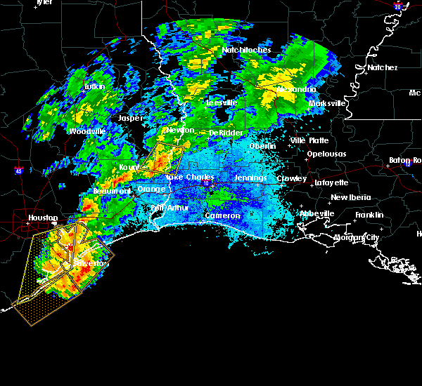 At 839 pm cdt, a severe thunderstorm was located near wrights settlement, or near call, moving east at 45 mph (radar indicated). Hazards include 60 mph wind gusts and penny size hail. Expect damage to roofs, siding, and trees. Locations impacted include, call, buna, wrights settlement, devils pocket, trout creek, bivens, bancroft, old salem and bleakwood. At 839 pm cdt, a severe thunderstorm was located near wrights settlement, or near call, moving east at 45 mph (radar indicated). Hazards include 60 mph wind gusts and penny size hail. Expect damage to roofs, siding, and trees. Locations impacted include, call, buna, wrights settlement, devils pocket, trout creek, bivens, bancroft, old salem and bleakwood.
|
| 5/23/2017 8:39 PM CDT |
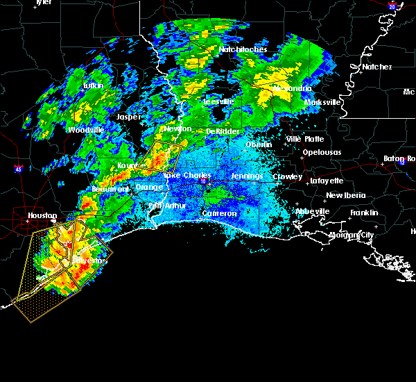 At 839 pm cdt, a severe thunderstorm was located near wrights settlement, or near call, moving east at 45 mph (radar indicated). Hazards include 60 mph wind gusts and penny size hail. Expect damage to roofs, siding, and trees. Locations impacted include, call, buna, wrights settlement, devils pocket, trout creek, bivens, bancroft, old salem and bleakwood. At 839 pm cdt, a severe thunderstorm was located near wrights settlement, or near call, moving east at 45 mph (radar indicated). Hazards include 60 mph wind gusts and penny size hail. Expect damage to roofs, siding, and trees. Locations impacted include, call, buna, wrights settlement, devils pocket, trout creek, bivens, bancroft, old salem and bleakwood.
|
| 5/23/2017 8:22 PM CDT |
 At 821 pm cdt, a severe thunderstorm was located near fred, moving east at 45 mph (radar indicated). Hazards include 60 mph wind gusts and quarter size hail. Hail damage to vehicles is expected. Expect wind damage to roofs, siding, and trees. At 821 pm cdt, a severe thunderstorm was located near fred, moving east at 45 mph (radar indicated). Hazards include 60 mph wind gusts and quarter size hail. Hail damage to vehicles is expected. Expect wind damage to roofs, siding, and trees.
|
| 5/20/2017 7:15 PM CDT |
 At 714 pm cdt, severe thunderstorms were located along a line extending from 6 miles west of fred to 6 miles southwest of wildwood, moving east at 15 mph (radar indicated). Hazards include quarter size hail. damage to vehicles is expected At 714 pm cdt, severe thunderstorms were located along a line extending from 6 miles west of fred to 6 miles southwest of wildwood, moving east at 15 mph (radar indicated). Hazards include quarter size hail. damage to vehicles is expected
|
| 5/20/2017 4:40 PM CDT |
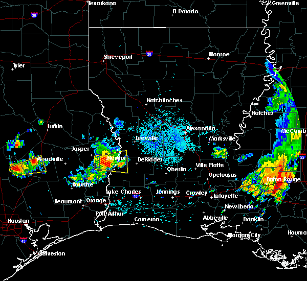 At 439 pm cdt, a severe thunderstorm was located near roganville, or near newton, moving east at 20 mph (radar indicated). Hazards include 60 mph wind gusts and quarter size hail. Hail damage to vehicles is expected. Expect wind damage to roofs, siding, and trees. At 439 pm cdt, a severe thunderstorm was located near roganville, or near newton, moving east at 20 mph (radar indicated). Hazards include 60 mph wind gusts and quarter size hail. Hail damage to vehicles is expected. Expect wind damage to roofs, siding, and trees.
|
| 5/20/2017 4:15 PM CDT | Public reported thunderstorm winds of 50-60 mph near magnolia spring in jasper county TX, 6.5 miles SE of Kirbyville, TX |
| 5/20/2017 3:54 PM CDT |
 At 354 pm cdt, a severe thunderstorm was located near magnolia springs, or 7 miles east of town bluff, moving east at 15 mph (radar indicated). Hazards include 60 mph wind gusts and quarter size hail. Hail damage to vehicles is expected. Expect wind damage to roofs, siding, and trees. At 354 pm cdt, a severe thunderstorm was located near magnolia springs, or 7 miles east of town bluff, moving east at 15 mph (radar indicated). Hazards include 60 mph wind gusts and quarter size hail. Hail damage to vehicles is expected. Expect wind damage to roofs, siding, and trees.
|
| 5/3/2017 8:36 PM CDT |
 The severe thunderstorm warning for western beauregard parish, southern newton and southeastern jasper counties will expire at 845 pm cdt, the storms which prompted the warning have weakened below severe limits, and no longer pose an immediate threat to life or property. therefore the warning will be allowed to expire. however gusty winds and heavy rain are still possible with these thunderstorms. a severe thunderstorm watch remains in effect until midnight cdt for southwestern louisiana, and southeastern texas. The severe thunderstorm warning for western beauregard parish, southern newton and southeastern jasper counties will expire at 845 pm cdt, the storms which prompted the warning have weakened below severe limits, and no longer pose an immediate threat to life or property. therefore the warning will be allowed to expire. however gusty winds and heavy rain are still possible with these thunderstorms. a severe thunderstorm watch remains in effect until midnight cdt for southwestern louisiana, and southeastern texas.
|
| 5/3/2017 8:13 PM CDT |
 At 812 pm cdt, severe thunderstorms were located along a line extending from near trout creek to 7 miles north of buna, moving east at 35 mph (radar indicated). Hazards include 60 mph wind gusts and quarter size hail. Hail damage to vehicles is expected. Expect wind damage to roofs, siding, and trees. At 812 pm cdt, severe thunderstorms were located along a line extending from near trout creek to 7 miles north of buna, moving east at 35 mph (radar indicated). Hazards include 60 mph wind gusts and quarter size hail. Hail damage to vehicles is expected. Expect wind damage to roofs, siding, and trees.
|
| 5/3/2017 7:50 PM CDT |
 At 750 pm cdt, a severe thunderstorm was located over fred, moving east at 40 mph (radar indicated). Hazards include 60 mph wind gusts and quarter size hail. Hail damage to vehicles is expected. expect wind damage to roofs, siding, and trees. locations impacted include, silsbee, kirbyville, buna, fred, spurger, caney head, roganville, magnolia springs and mt. Union. At 750 pm cdt, a severe thunderstorm was located over fred, moving east at 40 mph (radar indicated). Hazards include 60 mph wind gusts and quarter size hail. Hail damage to vehicles is expected. expect wind damage to roofs, siding, and trees. locations impacted include, silsbee, kirbyville, buna, fred, spurger, caney head, roganville, magnolia springs and mt. Union.
|
| 5/3/2017 7:27 PM CDT |
 At 726 pm cdt, a severe thunderstorm was located near warren, moving east at 50 mph (radar indicated). Hazards include 60 mph wind gusts and quarter size hail. Hail damage to vehicles is expected. Expect wind damage to roofs, siding, and trees. At 726 pm cdt, a severe thunderstorm was located near warren, moving east at 50 mph (radar indicated). Hazards include 60 mph wind gusts and quarter size hail. Hail damage to vehicles is expected. Expect wind damage to roofs, siding, and trees.
|
| 4/26/2017 6:38 PM CDT | Quarter sized hail reported 0.2 miles SSE of Kirbyville, TX |
| 4/26/2017 6:38 PM CDT |
 At 638 pm cdt, severe thunderstorms were located along a line extending from leesville to 6 miles north of trout creek, moving east at 45 mph (radar indicated). Hazards include 60 mph wind gusts and quarter size hail. Hail damage to vehicles is expected. expect wind damage to roofs, siding, and trees. locations impacted include, leesville, newton, kirbyville, anacoco, call, bon weir, slagle, burkeville, fort polk, new llano, hornbeck, trout creek, hutton, burr ferry, kurthwood, stringtown, roganville, bleakwood, wiergate and evans. A tornado watch remains in effect until 1100 pm cdt for central, southwestern and west central louisiana, and southeastern texas. At 638 pm cdt, severe thunderstorms were located along a line extending from leesville to 6 miles north of trout creek, moving east at 45 mph (radar indicated). Hazards include 60 mph wind gusts and quarter size hail. Hail damage to vehicles is expected. expect wind damage to roofs, siding, and trees. locations impacted include, leesville, newton, kirbyville, anacoco, call, bon weir, slagle, burkeville, fort polk, new llano, hornbeck, trout creek, hutton, burr ferry, kurthwood, stringtown, roganville, bleakwood, wiergate and evans. A tornado watch remains in effect until 1100 pm cdt for central, southwestern and west central louisiana, and southeastern texas.
|
| 4/26/2017 6:25 PM CDT | Quarter sized hail reported 9.7 miles SE of Kirbyville, TX, public relayed photo via social media of esitmated quarter size hail near magnolia springs. |
| 4/26/2017 6:22 PM CDT | Quarter sized hail reported 9.7 miles SE of Kirbyville, TX, public relayed photo via social media of estimated quarter size hail near magnolia springs. |
| 4/26/2017 6:22 PM CDT |
 At 621 pm cdt, severe thunderstorms were located along a line extending from near burr ferry to near mt. union, moving east at 45 mph (radar indicated). Hazards include 60 mph wind gusts and quarter size hail. Hail damage to vehicles is expected. expect wind damage to roofs, siding, and trees. locations impacted include, leesville, newton, kirbyville, anacoco, slagle, toledo bend dam, call, bon weir, burkeville, fort polk, new llano, hornbeck, trout creek, hutton, mayflower, kurthwood, stringtown, farrsville, magnolia springs and burr ferry. A tornado watch remains in effect until 1100 pm cdt for central, southwestern and west central louisiana, and southeastern texas. At 621 pm cdt, severe thunderstorms were located along a line extending from near burr ferry to near mt. union, moving east at 45 mph (radar indicated). Hazards include 60 mph wind gusts and quarter size hail. Hail damage to vehicles is expected. expect wind damage to roofs, siding, and trees. locations impacted include, leesville, newton, kirbyville, anacoco, slagle, toledo bend dam, call, bon weir, burkeville, fort polk, new llano, hornbeck, trout creek, hutton, mayflower, kurthwood, stringtown, farrsville, magnolia springs and burr ferry. A tornado watch remains in effect until 1100 pm cdt for central, southwestern and west central louisiana, and southeastern texas.
|
| 4/26/2017 5:57 PM CDT |
 The national weather service in lake charles has issued a * severe thunderstorm warning for. western vernon parish in west central louisiana. southeastern tyler county in southeastern texas. newton county in southeastern texas. Northeastern jasper county in southeastern texas. The national weather service in lake charles has issued a * severe thunderstorm warning for. western vernon parish in west central louisiana. southeastern tyler county in southeastern texas. newton county in southeastern texas. Northeastern jasper county in southeastern texas.
|
| 4/2/2017 2:42 PM CDT |
 At 242 pm cdt, severe thunderstorms were located along a line extending from 6 miles west of toledo bend dam to near fred, moving east at 20 mph (radar indicated). Hazards include 70 mph wind gusts and quarter size hail. Hail damage to vehicles is expected. expect considerable tree damage. Wind damage is also likely to mobile homes, roofs, and outbuildings. At 242 pm cdt, severe thunderstorms were located along a line extending from 6 miles west of toledo bend dam to near fred, moving east at 20 mph (radar indicated). Hazards include 70 mph wind gusts and quarter size hail. Hail damage to vehicles is expected. expect considerable tree damage. Wind damage is also likely to mobile homes, roofs, and outbuildings.
|
| 3/25/2017 12:37 AM CDT |
 The severe thunderstorm warning for southeastern tyler, northeastern hardin and southeastern jasper counties will expire at 1245 am cdt, the storms which prompted the warning have weakened below severe limits, and have exited the warned area. therefore the warning will be allowed to expire. however gusty winds are still possible with these thunderstorms. a tornado watch remains in effect until 400 am cdt for southeastern texas. The severe thunderstorm warning for southeastern tyler, northeastern hardin and southeastern jasper counties will expire at 1245 am cdt, the storms which prompted the warning have weakened below severe limits, and have exited the warned area. therefore the warning will be allowed to expire. however gusty winds are still possible with these thunderstorms. a tornado watch remains in effect until 400 am cdt for southeastern texas.
|
| 3/25/2017 12:17 AM CDT |
 At 1216 am cdt, severe thunderstorms were located along a line extending from near fred to lumberton, moving east at 45 mph (radar indicated). Hazards include 60 mph wind gusts. Expect damage to roofs, siding, and trees. locations impacted include, silsbee, buna, evadale, fred and caney head. A tornado watch remains in effect until 400 am cdt for southeastern texas. At 1216 am cdt, severe thunderstorms were located along a line extending from near fred to lumberton, moving east at 45 mph (radar indicated). Hazards include 60 mph wind gusts. Expect damage to roofs, siding, and trees. locations impacted include, silsbee, buna, evadale, fred and caney head. A tornado watch remains in effect until 400 am cdt for southeastern texas.
|
| 3/25/2017 12:00 AM CDT |
 At 1200 am cdt, severe thunderstorms were located along a line extending from 6 miles west of fred to 6 miles north of sour lake, moving east at 40 mph (radar indicated). Hazards include 60 mph wind gusts. Expect damage to roofs, siding, and trees. locations impacted include, beaumont, lumberton, silsbee, kountze, buna, evadale, fred, caney head, weiss bluff and village mills. A tornado watch remains in effect until 400 am cdt for southeastern texas. At 1200 am cdt, severe thunderstorms were located along a line extending from 6 miles west of fred to 6 miles north of sour lake, moving east at 40 mph (radar indicated). Hazards include 60 mph wind gusts. Expect damage to roofs, siding, and trees. locations impacted include, beaumont, lumberton, silsbee, kountze, buna, evadale, fred, caney head, weiss bluff and village mills. A tornado watch remains in effect until 400 am cdt for southeastern texas.
|
| 3/24/2017 11:40 PM CDT |
 At 1140 pm cdt, severe thunderstorms were located along a line extending from near wildwood to near daisetta, moving northeast at 40 mph (radar indicated). Hazards include 60 mph wind gusts. expect damage to roofs, siding, and trees At 1140 pm cdt, severe thunderstorms were located along a line extending from near wildwood to near daisetta, moving northeast at 40 mph (radar indicated). Hazards include 60 mph wind gusts. expect damage to roofs, siding, and trees
|
| 1/2/2017 9:07 AM CST |
 At 906 am cst, severe thunderstorms were located along a line extending from near jasper to 7 miles southwest of kountze, moving east at 40 mph (radar indicated). Hazards include 70 mph wind gusts and nickel size hail. Expect considerable tree damage. Damage is likely to mobile homes, roofs, and outbuildings. At 906 am cst, severe thunderstorms were located along a line extending from near jasper to 7 miles southwest of kountze, moving east at 40 mph (radar indicated). Hazards include 70 mph wind gusts and nickel size hail. Expect considerable tree damage. Damage is likely to mobile homes, roofs, and outbuildings.
|
| 5/27/2016 4:04 PM CDT |
 At 403 pm cdt, severe thunderstorms were located along a line extending from near burkeville to near devers, moving southeast at 15 mph (radar indicated). Hazards include 60 mph wind gusts and nickel size hail. Expect damage to roofs. siding. and trees. Locations impacted include, beaumont, lumberton, vidor, jasper, silsbee, newton, kirbyville, kountze, sour lake, thicket, fred, saratoga, bon weir, buna, burkeville, evadale, call, bevil oaks, china and rose city. At 403 pm cdt, severe thunderstorms were located along a line extending from near burkeville to near devers, moving southeast at 15 mph (radar indicated). Hazards include 60 mph wind gusts and nickel size hail. Expect damage to roofs. siding. and trees. Locations impacted include, beaumont, lumberton, vidor, jasper, silsbee, newton, kirbyville, kountze, sour lake, thicket, fred, saratoga, bon weir, buna, burkeville, evadale, call, bevil oaks, china and rose city.
|
| 5/27/2016 3:23 PM CDT |
 At 323 pm cdt, severe thunderstorms were located along a line extending from near mayflower to near daisetta, moving southeast at 15 mph (radar indicated). Hazards include 60 mph wind gusts. Expect damage to roofs. siding. And trees. At 323 pm cdt, severe thunderstorms were located along a line extending from near mayflower to near daisetta, moving southeast at 15 mph (radar indicated). Hazards include 60 mph wind gusts. Expect damage to roofs. siding. And trees.
|
| 4/30/2016 9:02 AM CDT | Jasper county sheriff has received several reports of damage to trees and powerlines in call. possible tornad in newton county TX, 3.7 miles NNW of Kirbyville, TX |
| 4/30/2016 6:25 AM CDT |
 At 624 am cdt, a severe thunderstorm capable of producing a tornado was located over call, moving northeast at 30 mph (radar indicated rotation. public also reported a lowering wall cloud just west of call at 6:21 am). Hazards include tornado and quarter size hail. Flying debris will be dangerous to those caught without shelter. mobile homes will be damaged or destroyed. damage to roofs, windows, and vehicles will occur. tree damage is likely. this dangerous storm will be near, trout creek and old salem around 630 am cdt. Other locations impacted by this tornadic thunderstorm include bleakwood. At 624 am cdt, a severe thunderstorm capable of producing a tornado was located over call, moving northeast at 30 mph (radar indicated rotation. public also reported a lowering wall cloud just west of call at 6:21 am). Hazards include tornado and quarter size hail. Flying debris will be dangerous to those caught without shelter. mobile homes will be damaged or destroyed. damage to roofs, windows, and vehicles will occur. tree damage is likely. this dangerous storm will be near, trout creek and old salem around 630 am cdt. Other locations impacted by this tornadic thunderstorm include bleakwood.
|
| 4/30/2016 6:10 AM CDT |
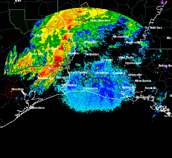 At 610 am cdt, a severe thunderstorm capable of producing a tornado was located 7 miles southwest of call, moving east at 30 mph (radar indicated rotation). Hazards include tornado and quarter size hail. Flying debris will be dangerous to those caught without shelter. mobile homes will be damaged or destroyed. damage to roofs, windows, and vehicles will occur. tree damage is likely. this dangerous storm will be near, kirbyville and call around 625 am cdt. trout creek and old salem around 635 am cdt. Other locations impacted by this tornadic thunderstorm include bleakwood. At 610 am cdt, a severe thunderstorm capable of producing a tornado was located 7 miles southwest of call, moving east at 30 mph (radar indicated rotation). Hazards include tornado and quarter size hail. Flying debris will be dangerous to those caught without shelter. mobile homes will be damaged or destroyed. damage to roofs, windows, and vehicles will occur. tree damage is likely. this dangerous storm will be near, kirbyville and call around 625 am cdt. trout creek and old salem around 635 am cdt. Other locations impacted by this tornadic thunderstorm include bleakwood.
|
| 4/30/2016 6:08 AM CDT |
 At 606 am cdt, a severe thunderstorm was located near buna, moving east at 45 mph (radar indicated). Hazards include 60 mph wind gusts and quarter size hail. Hail damage to vehicles is expected. Expect wind damage to roofs, siding, and trees. At 606 am cdt, a severe thunderstorm was located near buna, moving east at 45 mph (radar indicated). Hazards include 60 mph wind gusts and quarter size hail. Hail damage to vehicles is expected. Expect wind damage to roofs, siding, and trees.
|
| 4/27/2016 6:42 AM CDT |
 At 639 am cdt, severe thunderstorms were located along a line extending from hemphill to near jamestown to near kirbyville to 6 miles west of old salem to 6 miles southeast of buna to wrights settlement to near gist to near vidor to 6 miles east of high island, moving east at 45 mph (radar indicated). Hazards include 60 mph wind gusts and penny size hail. Expect damage to roofs. siding. and trees. Locations impacted include, beaumont, port arthur, orange, nederland, groves, port neches, lumberton, vidor, bridge city, jasper, silsbee, west orange, newton, kirbyville, nome, deweyville, fred, bon weir, hamshire and burkeville. At 639 am cdt, severe thunderstorms were located along a line extending from hemphill to near jamestown to near kirbyville to 6 miles west of old salem to 6 miles southeast of buna to wrights settlement to near gist to near vidor to 6 miles east of high island, moving east at 45 mph (radar indicated). Hazards include 60 mph wind gusts and penny size hail. Expect damage to roofs. siding. and trees. Locations impacted include, beaumont, port arthur, orange, nederland, groves, port neches, lumberton, vidor, bridge city, jasper, silsbee, west orange, newton, kirbyville, nome, deweyville, fred, bon weir, hamshire and burkeville.
|
| 4/27/2016 6:15 AM CDT |
 At 614 am cdt, severe thunderstorms were located along a line extending from 6 miles south of macune to 6 miles west of jasper to near spurger to caney head to 7 miles east of kountze to 8 miles northwest of evadale to silsbee to near lumberton to bevil oaks to near winnie to 7 miles southeast of anahuac, moving east at 45 mph (radar indicated). Hazards include 60 mph wind gusts. Expect damage to roofs. siding. And trees. At 614 am cdt, severe thunderstorms were located along a line extending from 6 miles south of macune to 6 miles west of jasper to near spurger to caney head to 7 miles east of kountze to 8 miles northwest of evadale to silsbee to near lumberton to bevil oaks to near winnie to 7 miles southeast of anahuac, moving east at 45 mph (radar indicated). Hazards include 60 mph wind gusts. Expect damage to roofs. siding. And trees.
|
| 1/21/2016 12:34 PM CST | At 1234 pm cst, a severe thunderstorm was located near buna, moving northeast at 35 mph (radar indicated). Hazards include 60 mph wind gusts and quarter size hail. Hail damage to vehicles is expected. Expect wind damage to roofs, siding and trees. |
| 10/31/2015 8:33 AM CDT | Trees snapped and report of a roof blown off a barn on cr 509. time estimated from rada in jasper county TX, 6 miles SE of Kirbyville, TX |
| 10/31/2015 8:33 AM CDT | Public posted photos of trees down on hwy 252. time estimated from rada in jasper county TX, 8 miles SE of Kirbyville, TX |
| 10/31/2015 6:19 AM CDT |
 At 618 am cdt, severe thunderstorms were located along a line extending from 6 miles south of mt. union to buna to near weiss bluff, moving northeast at 30 mph (radar indicated). Hazards include 60 mph wind gusts and nickel size hail. Expect damage to roofs. siding and trees. locations impacted include, kirbyville, evadale, call, buna, bon weir, old salem, trout creek, weiss bluff, wrights settlement, devils pocket, gist and bleakwood. A tornado watch remains in effect until 1000 am cdt for southeastern texas. At 618 am cdt, severe thunderstorms were located along a line extending from 6 miles south of mt. union to buna to near weiss bluff, moving northeast at 30 mph (radar indicated). Hazards include 60 mph wind gusts and nickel size hail. Expect damage to roofs. siding and trees. locations impacted include, kirbyville, evadale, call, buna, bon weir, old salem, trout creek, weiss bluff, wrights settlement, devils pocket, gist and bleakwood. A tornado watch remains in effect until 1000 am cdt for southeastern texas.
|
| 10/31/2015 6:00 AM CDT |
 The national weather service in lake charles has issued a * severe thunderstorm warning for. southeastern tyler county in southeastern texas. eastern hardin county in southeastern texas. southeastern jasper county in southeastern texas. Southwestern newton county in southeastern texas. The national weather service in lake charles has issued a * severe thunderstorm warning for. southeastern tyler county in southeastern texas. eastern hardin county in southeastern texas. southeastern jasper county in southeastern texas. Southwestern newton county in southeastern texas.
|
| 8/24/2015 9:03 PM CDT |
 At 902 pm cdt, doppler radar indicated a severe thunderstorm capable of producing damaging winds in excess of 60 mph. this storm was located over roganville, or 9 miles southeast of jasper, moving south at 25 mph. locations impacted include, jasper, newton, roganville, jamestown, holly springs and bleakwood. At 902 pm cdt, doppler radar indicated a severe thunderstorm capable of producing damaging winds in excess of 60 mph. this storm was located over roganville, or 9 miles southeast of jasper, moving south at 25 mph. locations impacted include, jasper, newton, roganville, jamestown, holly springs and bleakwood.
|
| 8/24/2015 8:37 PM CDT |
 At 836 pm cdt, doppler radar indicated a severe thunderstorm capable of producing quarter size hail and damaging winds in excess of 60 mph. this storm was located near jamestown, or near jasper, and moving southeast at 20 mph. At 836 pm cdt, doppler radar indicated a severe thunderstorm capable of producing quarter size hail and damaging winds in excess of 60 mph. this storm was located near jamestown, or near jasper, and moving southeast at 20 mph.
|
| 6/17/2015 10:16 PM CDT |
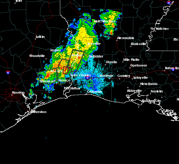 At 1016 pm cdt, doppler radar indicated a severe thunderstorm capable of producing a tornado. this dangerous storm was located near call, and moving north at 30 mph. At 1016 pm cdt, doppler radar indicated a severe thunderstorm capable of producing a tornado. this dangerous storm was located near call, and moving north at 30 mph.
|
| 5/27/2015 5:44 AM CDT | At 543 am cdt, doppler radar indicated a line of severe thunderstorms capable of producing quarter size hail and damaging winds in excess of 60 mph. these storms were located along a line extending from 8 miles west of rosepine to near singer to evadale, moving southeast at 30 mph. locations impacted include, beaumont, lumberton, silsbee, newton, kirbyville, kountze, sour lake, merryville, saratoga, bon weir, buna, burkeville, evadale, call, toledo bend dam, gist, caney head, old salem, trout creek and junction. |
| 5/27/2015 5:44 AM CDT | At 543 am cdt, doppler radar indicated a line of severe thunderstorms capable of producing quarter size hail and damaging winds in excess of 60 mph. these storms were located along a line extending from 8 miles west of rosepine to near singer to evadale, moving southeast at 30 mph. locations impacted include, beaumont, lumberton, silsbee, newton, kirbyville, kountze, sour lake, merryville, saratoga, bon weir, buna, burkeville, evadale, call, toledo bend dam, gist, caney head, old salem, trout creek and junction. |
| 5/27/2015 4:53 AM CDT | At 453 am cdt, doppler radar indicated a line of severe thunderstorms capable of producing quarter size hail and damaging winds in excess of 60 mph. these storms were located along a line extending from near mayflower to near roganville to wildwood, and moving southeast at 35 mph. |
| 5/27/2015 4:53 AM CDT | At 453 am cdt, doppler radar indicated a line of severe thunderstorms capable of producing quarter size hail and damaging winds in excess of 60 mph. these storms were located along a line extending from near mayflower to near roganville to wildwood, and moving southeast at 35 mph. |
| 5/27/2015 4:10 AM CDT | At 410 am cdt, trained weather spotters reported a line of severe thunderstorms producing quarter size hail and damaging winds in excess of 60 mph. these storms were located along a line extending from near ebenezer to near woodville to 10 miles northwest of warren, and moving southeast at 25 mph. |
| 5/25/2015 9:39 PM CDT | At 938 pm cdt, doppler radar indicated a line of severe thunderstorms capable of producing quarter size hail and damaging winds in excess of 60 mph. these storms were located along a line extending from toledo bend dam to near bon weir to 6 miles northwest of buna, moving east at 35 mph. locations impacted include, jasper, newton, kirbyville, call, toledo bend dam, bon weir, ebenezer, buna, burkeville, browndell, roganville, harrisburg, mt. union, magnolia springs, stringtown, mayflower, old salem, farrsville, trout creek and wrights settlement. a tornado watch remains in effect until 200 am cdt for southwestern louisiana and southeastern texas. |
| 5/25/2015 9:06 PM CDT | At 906 pm cdt, doppler radar indicated a line of severe thunderstorms capable of producing quarter size hail and damaging winds in excess of 60 mph. these storms were located along a line extending from near browndell to 7 miles west of call, and moving northeast at 35 mph. |
| 4/27/2015 2:42 PM CDT | At 240 pm cdt, doppler radar indicated a severe thunderstorm capable of producing half dollar size hail. this storm was located near roganville, or near kirbyville, moving northeast at 40 mph. in addition, at 230 pm half dollar size hail was reported 7 miles northwest of kirbyville or near mount union. locations impacted include, newton, kirbyville, burkeville, roganville, jamestown, stringtown, wiergate and bleakwood. |
| 4/27/2015 2:42 PM CDT | At 240 pm cdt, doppler radar indicated a severe thunderstorm capable of producing half dollar size hail. this storm was located near roganville, or near kirbyville, moving northeast at 40 mph. in addition, at 230 pm half dollar size hail was reported 7 miles northwest of kirbyville or near mount union. locations impacted include, newton, kirbyville, burkeville, roganville, jamestown, stringtown, wiergate and bleakwood. |
| 4/27/2015 2:35 PM CDT | Ping Pong Ball sized hail reported 7.9 miles ESE of Kirbyville, TX, public posted photo of measured one and a half inch hail |
| 4/27/2015 2:30 PM CDT | Half Dollar sized hail reported 7 miles SE of Kirbyville, TX, public measured one and a quarter inch hail. |
| 4/27/2015 2:28 PM CDT | At 227 pm cdt, doppler radar indicated a severe thunderstorm capable of producing quarter size hail. this storm was located over mt. union, or 7 miles west of kirbyville, and moving northeast at 40 mph. |
| 4/27/2015 2:28 PM CDT | At 227 pm cdt, doppler radar indicated a severe thunderstorm capable of producing quarter size hail. this storm was located over mt. union, or 7 miles west of kirbyville, and moving northeast at 40 mph. |
| 4/27/2015 6:18 AM CDT | At 617 am cdt, doppler radar indicated a line of severe thunderstorms capable of producing quarter size hail and damaging winds in excess of 60 mph. these storms were located along a line extending from near harrisburg to buna to bevil oaks, moving east at 50 mph. locations impacted include, beaumont, lumberton, jasper, silsbee, newton, kirbyville, deweyville, bon weir, buna, burkeville, evadale, call, toledo bend dam, mauriceville, pine forest, browndell, lakeview, roganville, gist and mayflower. a tornado watch remains in effect until 900 am cdt for southeastern texas. a tornado watch also remains in effect until 100 pm cdt for southwestern louisiana and southeastern texas. |
| 4/27/2015 5:53 AM CDT | At 553 am cdt, doppler radar indicated a line of severe thunderstorms capable of producing quarter size hail and damaging winds in excess of 60 mph. these storms were located along a line extending from ebenezer to near kountze to 6 miles east of daisetta, and moving east at 50 mph. |
| 4/24/2015 12:32 PM CDT | At 1231 pm cdt, doppler radar indicated a severe thunderstorm capable of producing a tornado. this dangerous storm was located over bancroft, or 7 miles northwest of fields, moving east southeast at 45 mph. locations impacted include, kirbyville, merryville, fields, call, de quincy, bon weir, singer, dequincy, bivens, old salem, trout creek, bancroft, oretta and bleakwood. |
| 4/24/2015 12:32 PM CDT | At 1231 pm cdt, doppler radar indicated a severe thunderstorm capable of producing a tornado. this dangerous storm was located over bancroft, or 7 miles northwest of fields, moving east southeast at 45 mph. locations impacted include, kirbyville, merryville, fields, call, de quincy, bon weir, singer, dequincy, bivens, old salem, trout creek, bancroft, oretta and bleakwood. |
| 4/24/2015 12:30 PM CDT | Law enforcement reported trees down in call in newton county TX, 3.7 miles NNW of Kirbyville, TX |
| 4/24/2015 12:20 PM CDT | Storm damage reported in jasper county TX, 7 miles SE of Kirbyville, TX |
| 4/24/2015 12:18 PM CDT | At 1217 pm cdt, doppler radar indicated a severe thunderstorm capable of producing a tornado. this dangerous storm was located over kirbyville, and moving east at 50 mph. in addition, at 1215, a wind gust of 60 mph was reported 7 miles west of kirbyville. |
| 4/24/2015 12:18 PM CDT | At 1217 pm cdt, doppler radar indicated a severe thunderstorm capable of producing a tornado. this dangerous storm was located over kirbyville, and moving east at 50 mph. in addition, at 1215, a wind gust of 60 mph was reported 7 miles west of kirbyville. |
| 4/24/2015 11:58 AM CDT | At 1157 am cdt, doppler radar indicated a severe thunderstorm capable of producing quarter size hail and damaging winds in excess of 60 mph. this storm was located over magnolia springs, or 9 miles southeast of town bluff, and moving east at 50 mph. |
| 4/24/2015 11:58 AM CDT | At 1157 am cdt, doppler radar indicated a severe thunderstorm capable of producing quarter size hail and damaging winds in excess of 60 mph. this storm was located over magnolia springs, or 9 miles southeast of town bluff, and moving east at 50 mph. |
| 4/19/2015 8:08 PM CDT | The severe thunderstorm warning for east central jasper and central newton counties will expire at 815 pm cdt, the storm which prompted the warning has weakened below severe limits, and no longer poses an immediate threat to life or property. therefore the warning will be allowed to expire. |
| 4/19/2015 7:43 PM CDT | At 743 pm cdt, doppler radar indicated a severe thunderstorm capable of producing quarter size hail. this storm was located near roganville, or near kirbyville, moving east at 30 mph. locations impacted include, newton, kirbyville, bon weir, roganville and bleakwood. |
| 4/19/2015 7:40 PM CDT | Quarter sized hail reported 4.3 miles S of Kirbyville, TX, public reported hail between quarter and golf ball size |
| 4/19/2015 7:30 PM CDT | Hen Egg sized hail reported 9.7 miles SE of Kirbyville, TX, public measured two inch hail and also observed golf ball sized hail. |
| 4/19/2015 7:25 PM CDT | The national weather service in lake charles has issued a * severe thunderstorm warning for. east central jasper county in southeastern texas. central newton county in southeastern texas. until 815 pm cdt * at 725 pm cdt. Doppler radar indicated a severe thunderstorm. |
| 12/23/2014 10:50 AM CST | Quarter sized hail reported 0.2 miles SSE of Kirbyville, TX |
| 3/28/2014 8:20 PM CDT | Jasper county sheriff reports trees down along fm 1004 in kirbyvill in jasper county TX, 0.2 miles SSE of Kirbyville, TX |
| 3/28/2014 8:20 PM CDT | Jasper county sheriff reports trees down along fm 1013 in magnolia spring in jasper county TX, 9.7 miles SE of Kirbyville, TX |
| 12/21/2013 2:25 PM CST | Report from jasper sheriff of damage to a home in mt union with additional trees down in jasper county TX, 7.8 miles ESE of Kirbyville, TX |
| 6/6/2012 3:30 PM CDT | Public report of trees down in kirbyville. relayed by kbmt-tv. event time estimated by rada in jasper county TX, 0.2 miles SSE of Kirbyville, TX |
| 4/2/2012 10:31 AM CDT | Newton county sheriff report trees down in bleakwood west of hwy 190 in newton county TX, 5.2 miles WSW of Kirbyville, TX |
| 4/2/2012 10:30 AM CDT | Trampolines blown over in kirbyvill in jasper county TX, 0.2 miles SSE of Kirbyville, TX |
Hail Maps for Kirbyville, TX

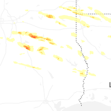
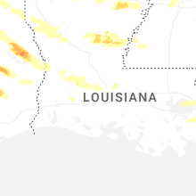
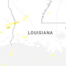


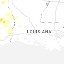


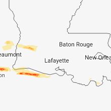


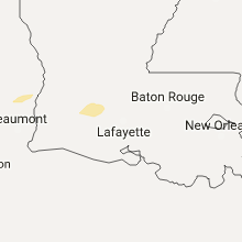


Connect with Interactive Hail Maps