

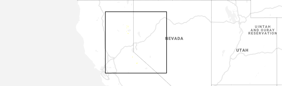
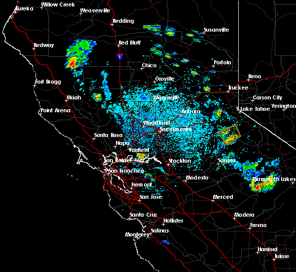
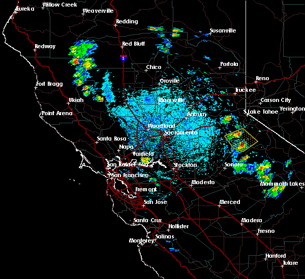
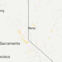
Hail Map for Kirkwood, CA
The Kirkwood, CA area has had 3 reports of on-the-ground hail by trained spotters, and has been under severe weather warnings 0 times during the past 12 months. Doppler radar has detected hail at or near Kirkwood, CA on 8 occasions.
| Name: | Kirkwood, CA |
| Where Located: | 58.9 miles SSW of Reno, NV |
| Map: | Google Map for Kirkwood, CA |
| Population: | 158 |
| Housing Units: | 757 |
| More Info: | Search Google for Kirkwood, CA |
5
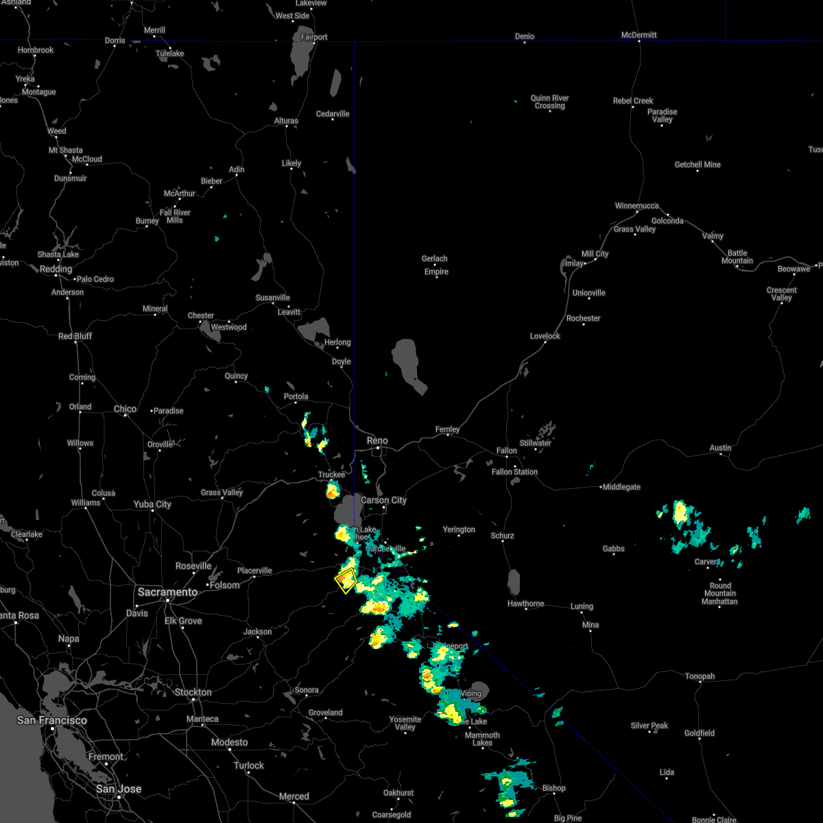
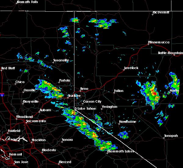
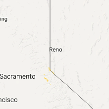
The Top Recent Hail Date for Kirkwood, CA is Tuesday, June 23, 2020 (1st out of 8)
Hail and Wind Damage Spotted near Kirkwood, CA
| Date / Time | Report Details |
|---|---|
| 6/23/2020 3:42 PM PDT |
 The severe thunderstorm warning for northwestern alpine, east central el dorado and northeastern amador counties will expire at 345 pm pdt, the storm which prompted the warning has weakened below severe limits, and no longer poses an immediate threat to life or property. therefore, the warning will be allowed to expire. however small hail is still possible with this thunderstorm. The severe thunderstorm warning for northwestern alpine, east central el dorado and northeastern amador counties will expire at 345 pm pdt, the storm which prompted the warning has weakened below severe limits, and no longer poses an immediate threat to life or property. therefore, the warning will be allowed to expire. however small hail is still possible with this thunderstorm.
|
| 6/23/2020 3:30 PM PDT | Quarter sized hail reported 1.1 miles ENE of Kirkwood, CA, 1 inch hail was reported at the meadows kirkwood... ca around 3:30 pm. photo sent to us via social media. |
| 6/23/2020 3:30 PM PDT | Golf Ball sized hail reported 1.6 miles E of Kirkwood, CA, golf ball size hail reported at dangberg drive kirkwood... ca around 3:30 pm. photos sent to us via social media. |
| 6/23/2020 3:22 PM PDT |
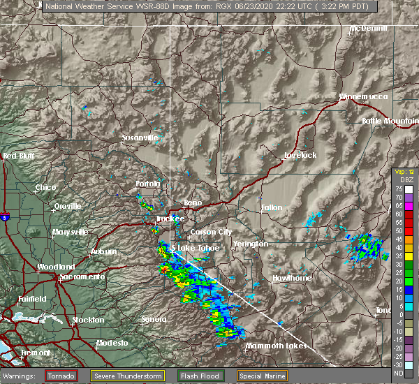 At 322 pm pdt, a severe thunderstorm was located over kirkwood meadows, or over kirkwood, moving north at 10 mph (radar indicated). Hazards include 60 mph wind gusts and half dollar size hail. Hail damage to vehicles is expected. Expect wind damage to roofs, siding, and trees. At 322 pm pdt, a severe thunderstorm was located over kirkwood meadows, or over kirkwood, moving north at 10 mph (radar indicated). Hazards include 60 mph wind gusts and half dollar size hail. Hail damage to vehicles is expected. Expect wind damage to roofs, siding, and trees.
|
| 6/23/2020 3:05 PM PDT | Hen Egg sized hail reported 1.1 miles ENE of Kirkwood, CA, 2 inch hail reported at the meadows kirkwood... ca just after 3 pm. |
| 9/8/2017 4:46 PM PDT |
 At 440 pm pdt, a severe thunderstorm was located near kit carson, or 8 miles south of kyburz, moving northwest at 15 mph towards kyburz. two other strong thunderstorms were located north of bear valley to southwest of kit carson (radar indicated). Hazards include quarter size hail. Large hail, and dangerous lightning. Locations impacted include, bear valley, lake alpine, tamarack, kit carson, shriner lake campground and kyburz. At 440 pm pdt, a severe thunderstorm was located near kit carson, or 8 miles south of kyburz, moving northwest at 15 mph towards kyburz. two other strong thunderstorms were located north of bear valley to southwest of kit carson (radar indicated). Hazards include quarter size hail. Large hail, and dangerous lightning. Locations impacted include, bear valley, lake alpine, tamarack, kit carson, shriner lake campground and kyburz.
|
| 9/8/2017 4:23 PM PDT |
 At 422 pm pdt, severe thunderstorms were located near kit carson and bear valley, moving northwest at 15 mph (radar indicated). Hazards include quarter size hail. dangerous lighting and large hail At 422 pm pdt, severe thunderstorms were located near kit carson and bear valley, moving northwest at 15 mph (radar indicated). Hazards include quarter size hail. dangerous lighting and large hail
|
| 9/5/2017 2:54 PM PDT |
 At 254 pm pdt, a severe thunderstorm was located over kirkwood, moving west at 10 mph (radar indicated). Hazards include 60 mph wind gusts and quarter size hail. Hail damage to vehicles is expected. Expect wind damage to roofs, siding, and trees. At 254 pm pdt, a severe thunderstorm was located over kirkwood, moving west at 10 mph (radar indicated). Hazards include 60 mph wind gusts and quarter size hail. Hail damage to vehicles is expected. Expect wind damage to roofs, siding, and trees.
|
| 8/1/2015 4:30 PM PDT |
 At 429 pm pdt, doppler radar indicated a severe thunderstorm capable of producing quarter size hail and damaging winds in excess of 60 mph. this storm was located over lake alpine, moving northwest at 10 mph. locations impacted include, bear valley, carson pass, lake alpine, kirkwood, lookout peak, upper blue lake, kirkwood ski area and hermit valley basin. At 429 pm pdt, doppler radar indicated a severe thunderstorm capable of producing quarter size hail and damaging winds in excess of 60 mph. this storm was located over lake alpine, moving northwest at 10 mph. locations impacted include, bear valley, carson pass, lake alpine, kirkwood, lookout peak, upper blue lake, kirkwood ski area and hermit valley basin.
|
| 8/1/2015 4:06 PM PDT |
 At 405 pm pdt, doppler radar indicated a severe thunderstorm capable of producing quarter size hail and damaging winds in excess of 60 mph. this storm was located near lake alpine, and moving northwest at 10 mph. At 405 pm pdt, doppler radar indicated a severe thunderstorm capable of producing quarter size hail and damaging winds in excess of 60 mph. this storm was located near lake alpine, and moving northwest at 10 mph.
|
| 7/20/2015 4:22 PM PDT |
 At 421 pm pdt, trained weather spotters reported a cluster of severe thunderstorms producing large damaging hail up to golf ball size and damaging winds in excess of 60 mph. these storms were located along a line extending from near tamarack to near shriner lake campground, moving northwest at 10 mph. locations impacted include, bear valley, lake alpine, kirkwood, kirkwood meadows, kit carson, shriner lake campground, tamarack, black springs and kirkwood ski area. At 421 pm pdt, trained weather spotters reported a cluster of severe thunderstorms producing large damaging hail up to golf ball size and damaging winds in excess of 60 mph. these storms were located along a line extending from near tamarack to near shriner lake campground, moving northwest at 10 mph. locations impacted include, bear valley, lake alpine, kirkwood, kirkwood meadows, kit carson, shriner lake campground, tamarack, black springs and kirkwood ski area.
|
| 7/20/2015 4:05 PM PDT |
 At 401 pm pdt, trained weather spotters reported a severe thunderstorm producing large damaging hail up to golf ball size and damaging winds in excess of 60 mph. this storm was located over bear valley, moving northwest at 10 mph. in addition, a trained spotter reported golf ball size hail near tamarack at 355 pm. locations impacted include, bear valley, lake alpine, kirkwood, kirkwood meadows, kit carson, shriner lake campground, tamarack, black springs, lookout peak, kirkwood ski area and hermit valley basin. At 401 pm pdt, trained weather spotters reported a severe thunderstorm producing large damaging hail up to golf ball size and damaging winds in excess of 60 mph. this storm was located over bear valley, moving northwest at 10 mph. in addition, a trained spotter reported golf ball size hail near tamarack at 355 pm. locations impacted include, bear valley, lake alpine, kirkwood, kirkwood meadows, kit carson, shriner lake campground, tamarack, black springs, lookout peak, kirkwood ski area and hermit valley basin.
|
| 7/20/2015 3:41 PM PDT |
 At 338 pm pdt, doppler radar indicated a severe thunderstorm capable of producing quarter size hail and damaging winds in excess of 60 mph. this storm was located over tamarack, or over bear valley along highway 4, and moving northwest at 10 mph. At 338 pm pdt, doppler radar indicated a severe thunderstorm capable of producing quarter size hail and damaging winds in excess of 60 mph. this storm was located over tamarack, or over bear valley along highway 4, and moving northwest at 10 mph.
|
| 7/8/2015 12:23 PM PDT |
 At 1223 pm pdt, doppler radar indicated a severe thunderstorm capable of producing quarter size hail. this storm was located over lookout peak, or 7 miles northeast of lake alpine, and moving northwest at 15 mph. At 1223 pm pdt, doppler radar indicated a severe thunderstorm capable of producing quarter size hail. this storm was located over lookout peak, or 7 miles northeast of lake alpine, and moving northwest at 15 mph.
|
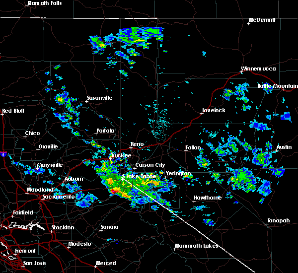
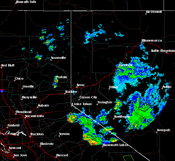
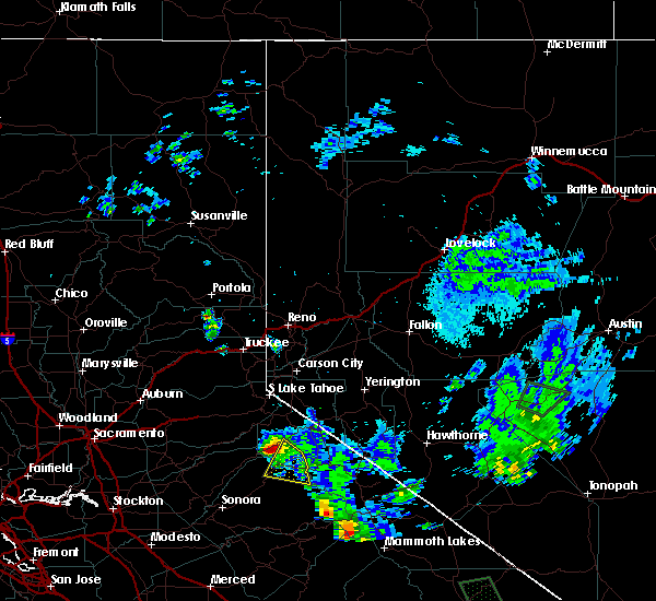
Hail Maps for Kirkwood, CA


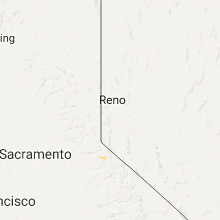

Connect with Interactive Hail Maps