

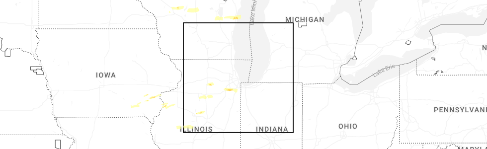
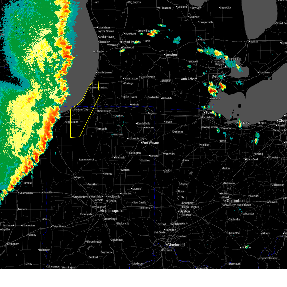
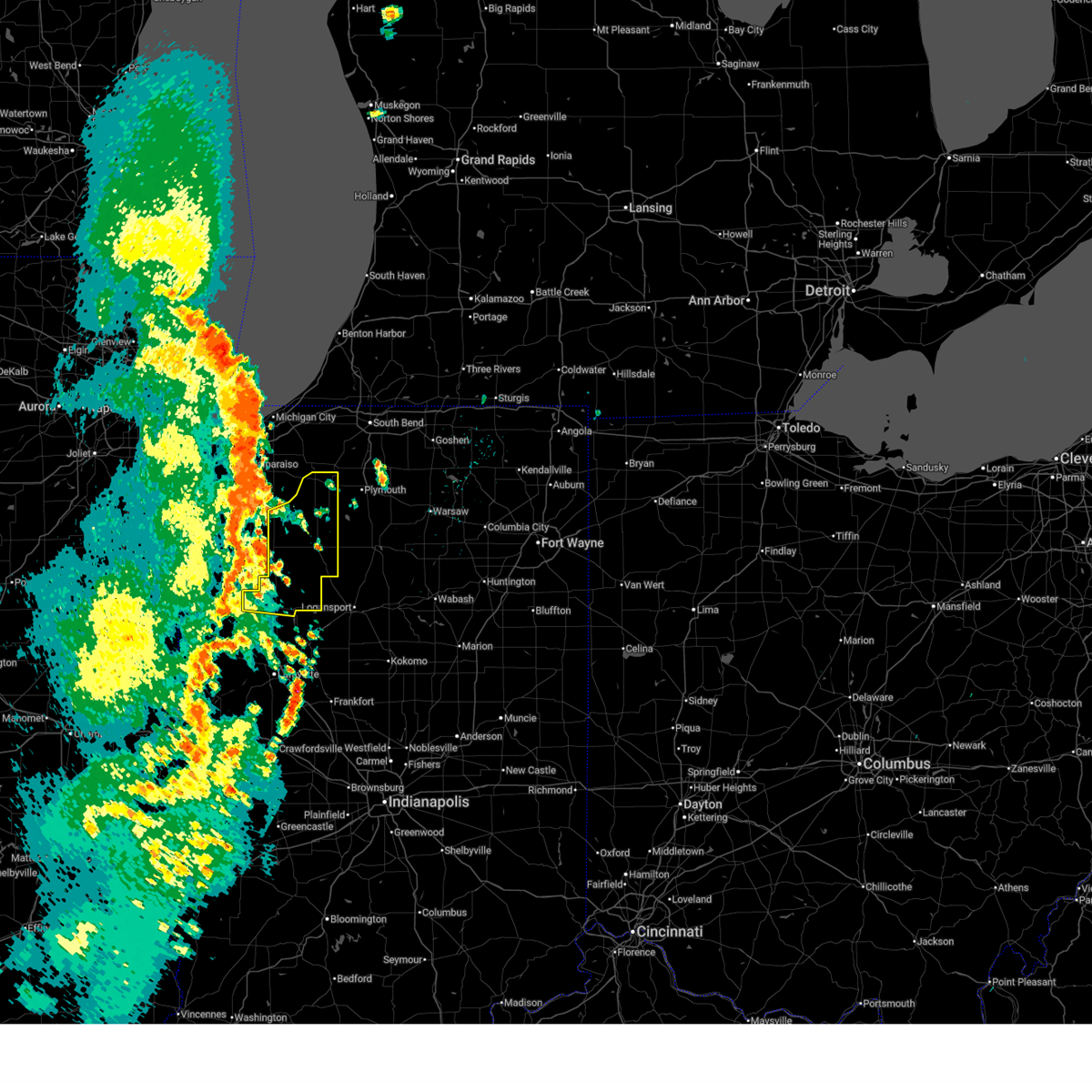
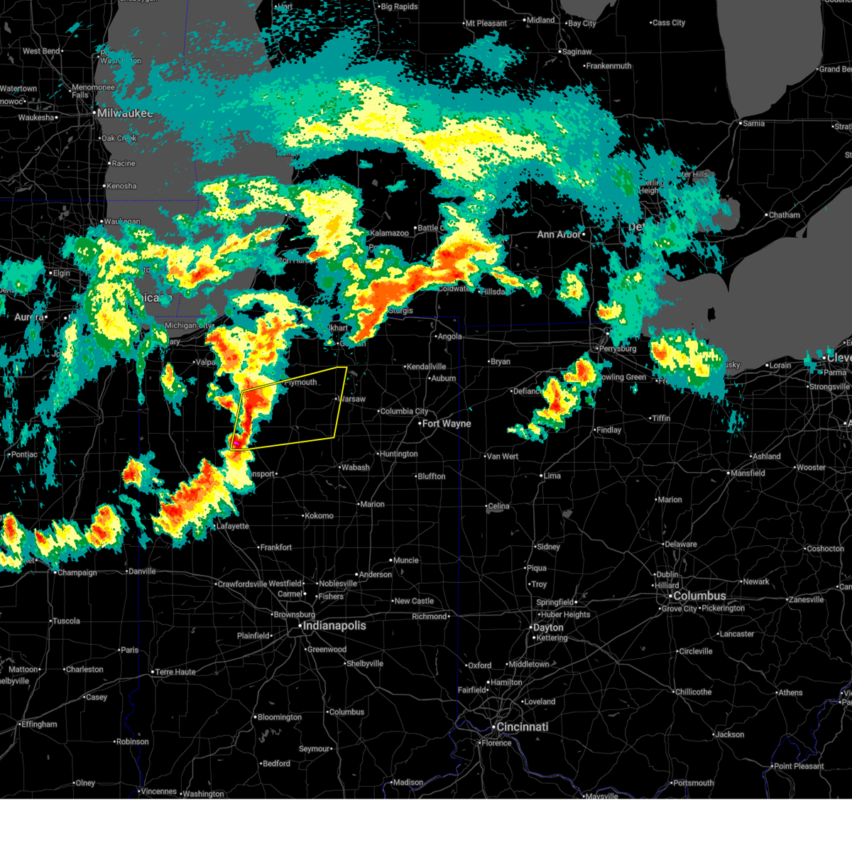
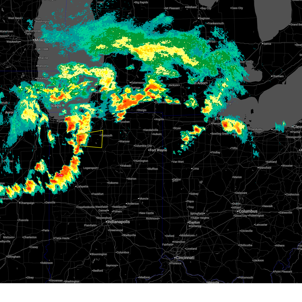
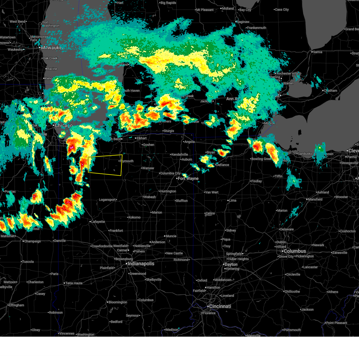
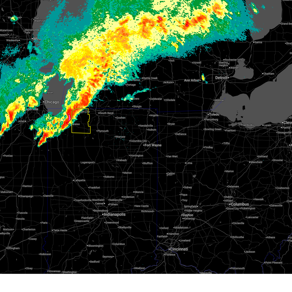
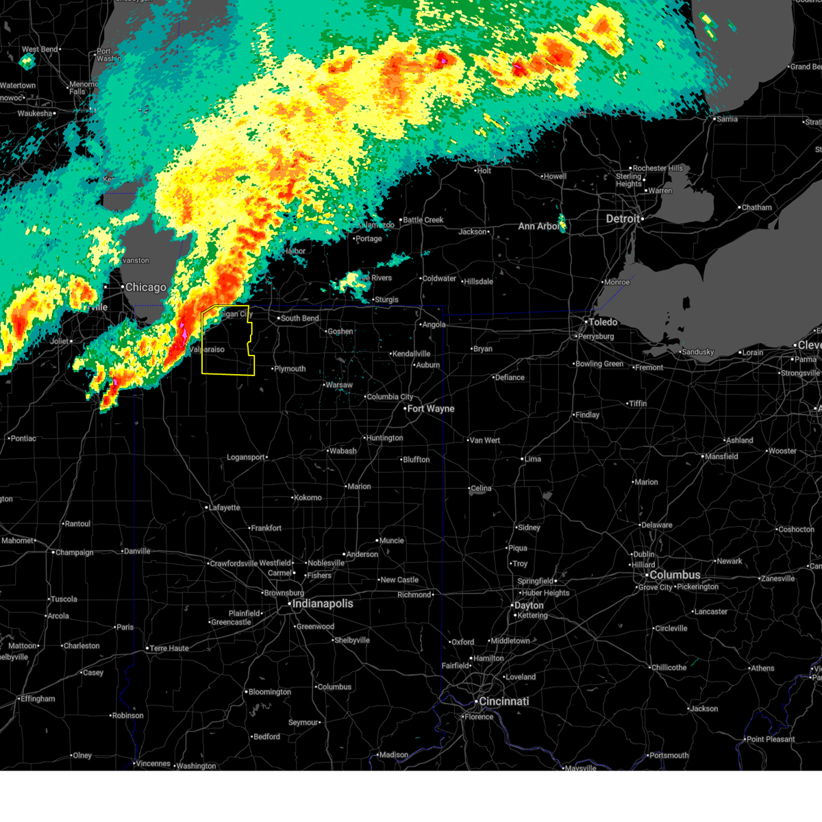
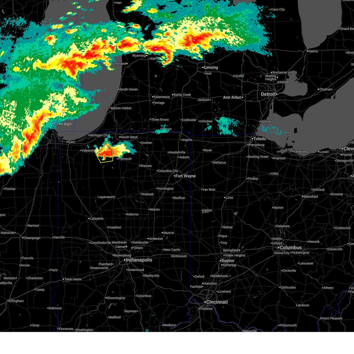
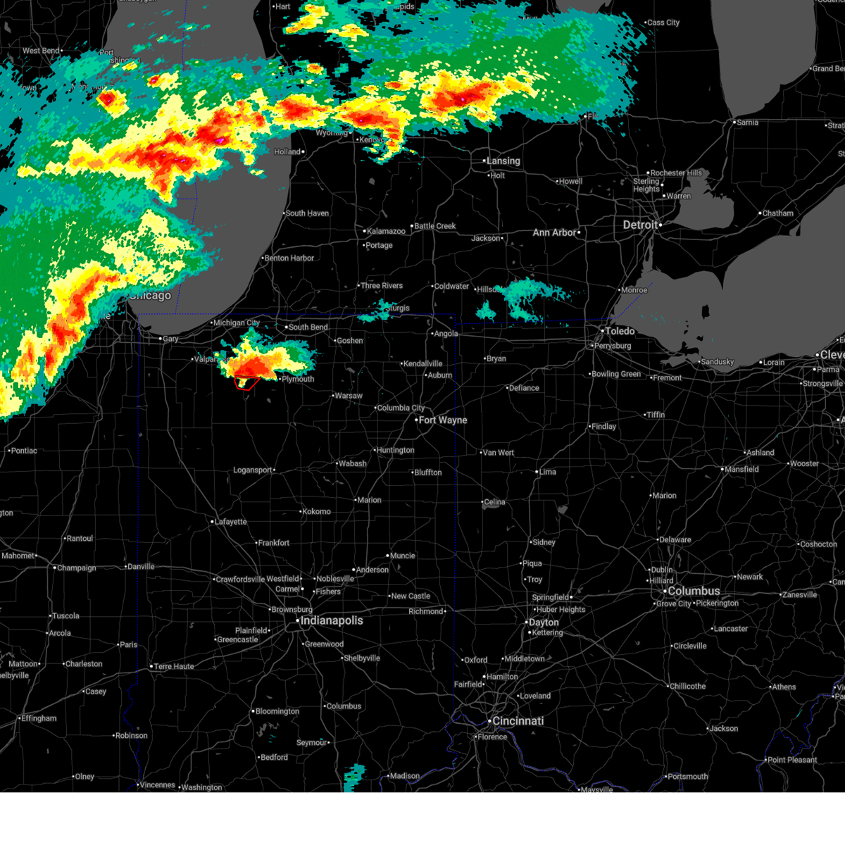
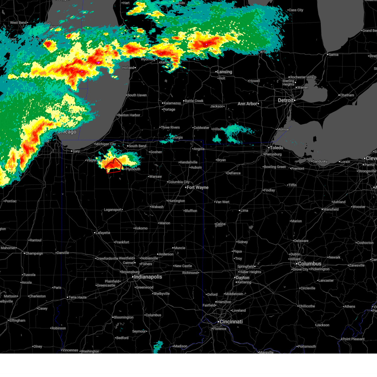
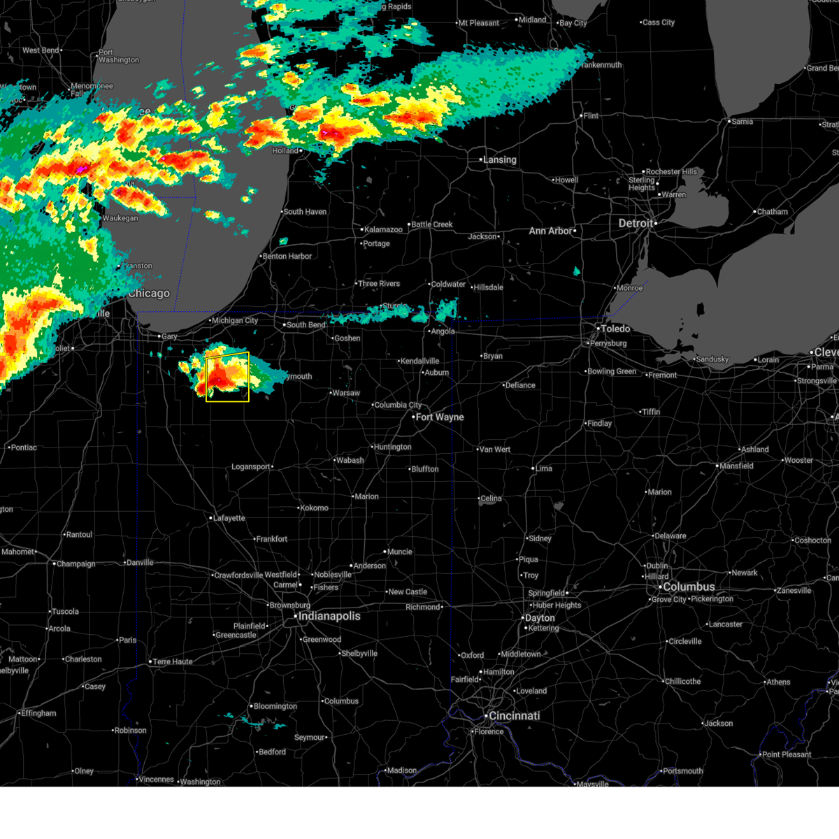
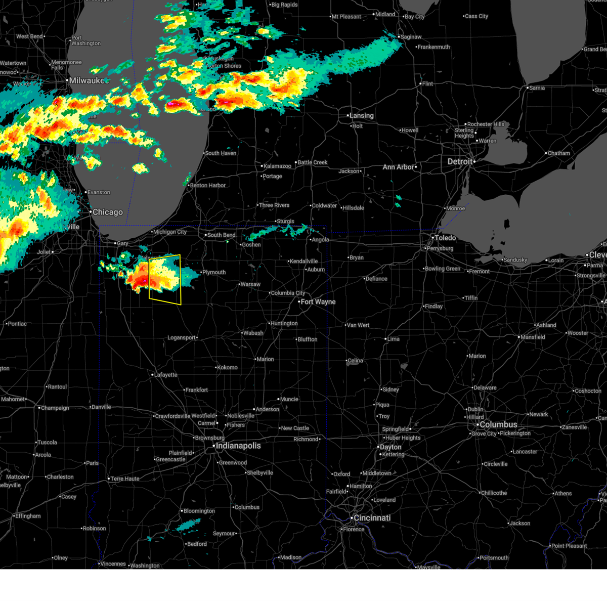
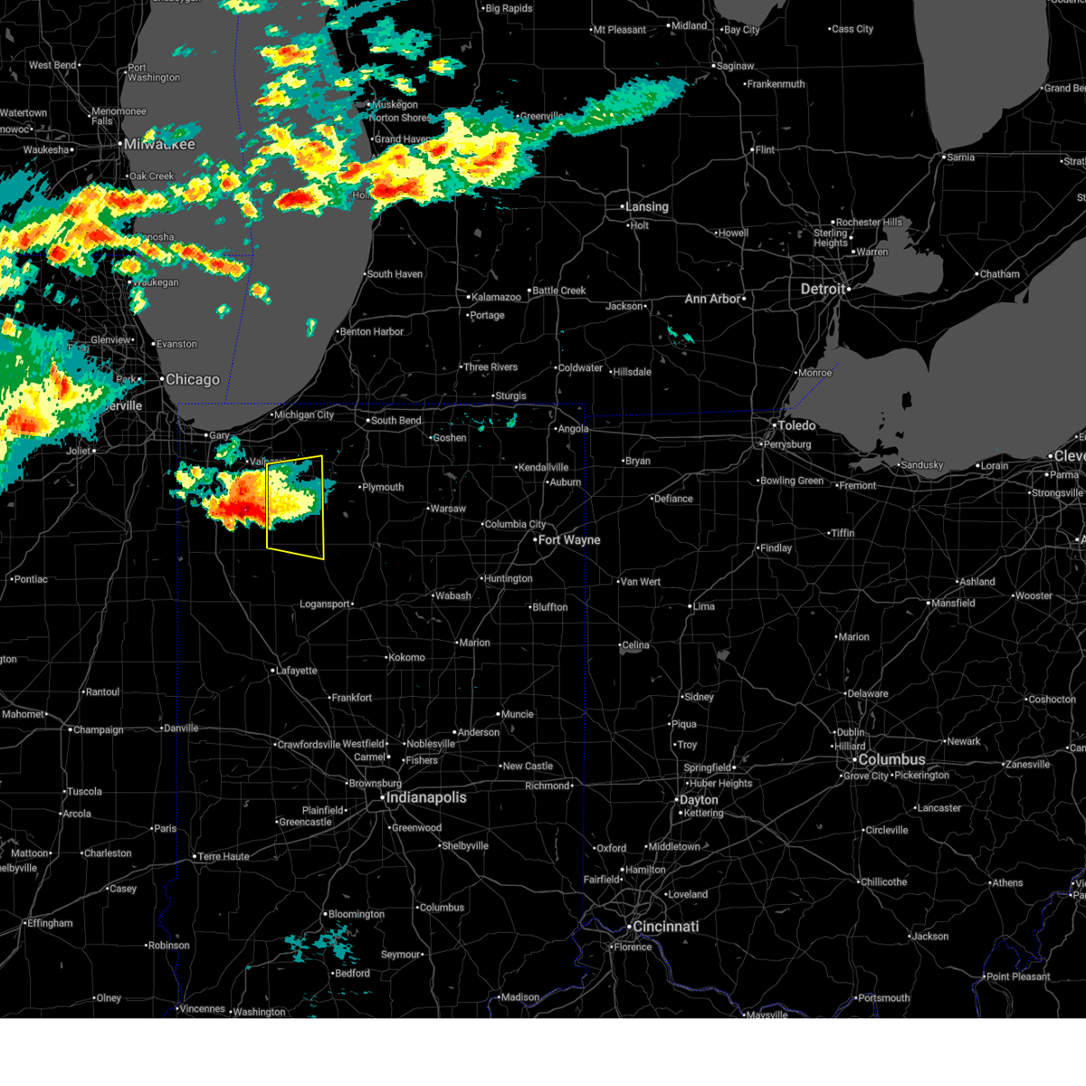
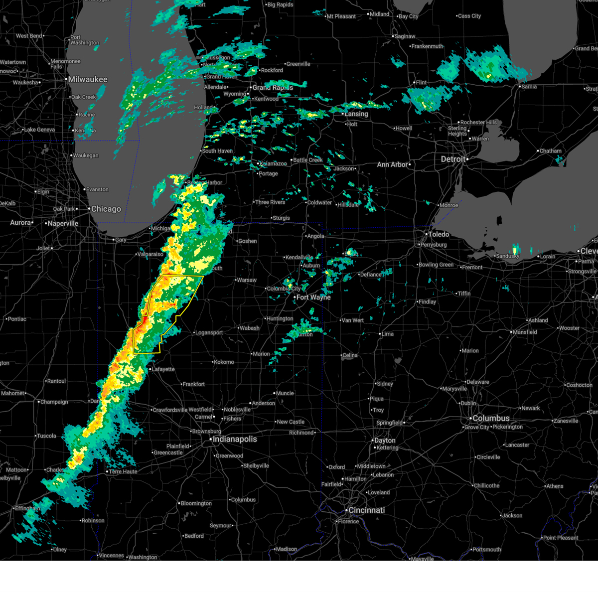
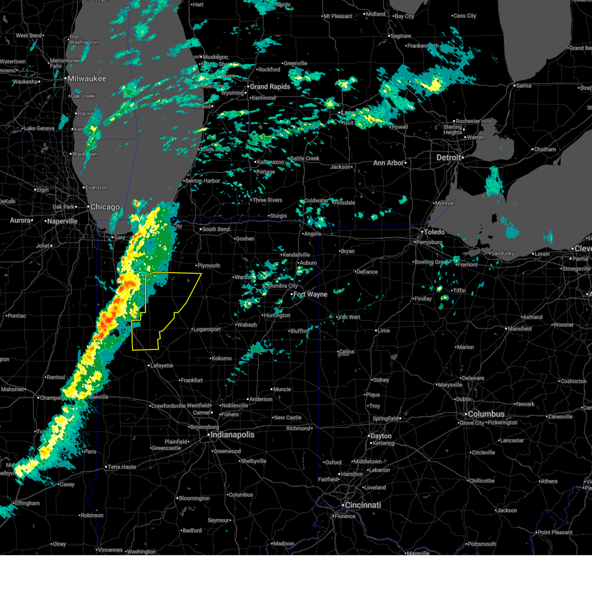
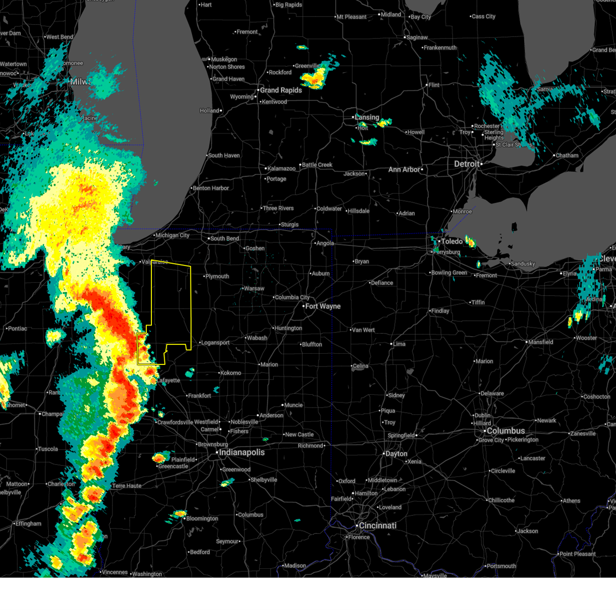
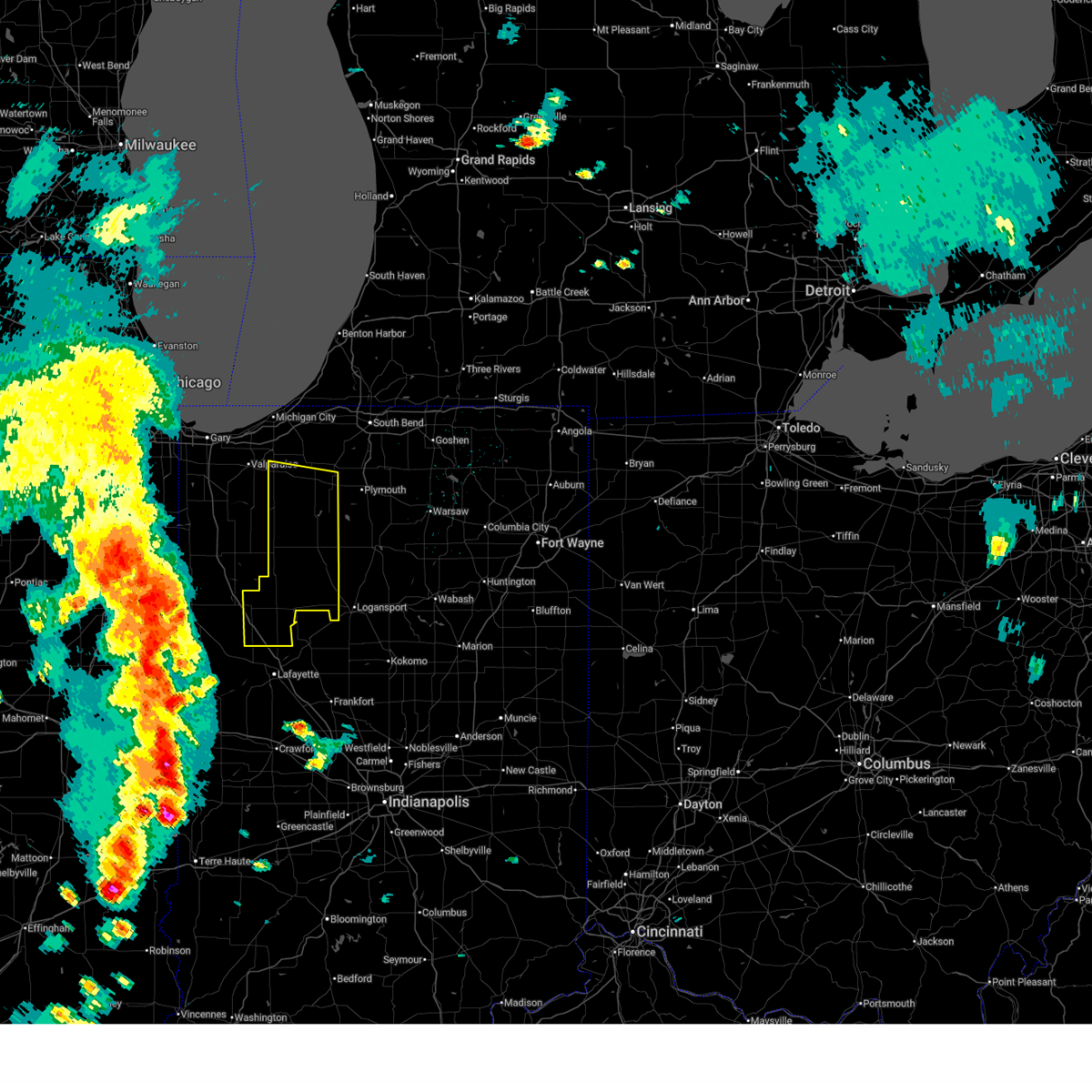
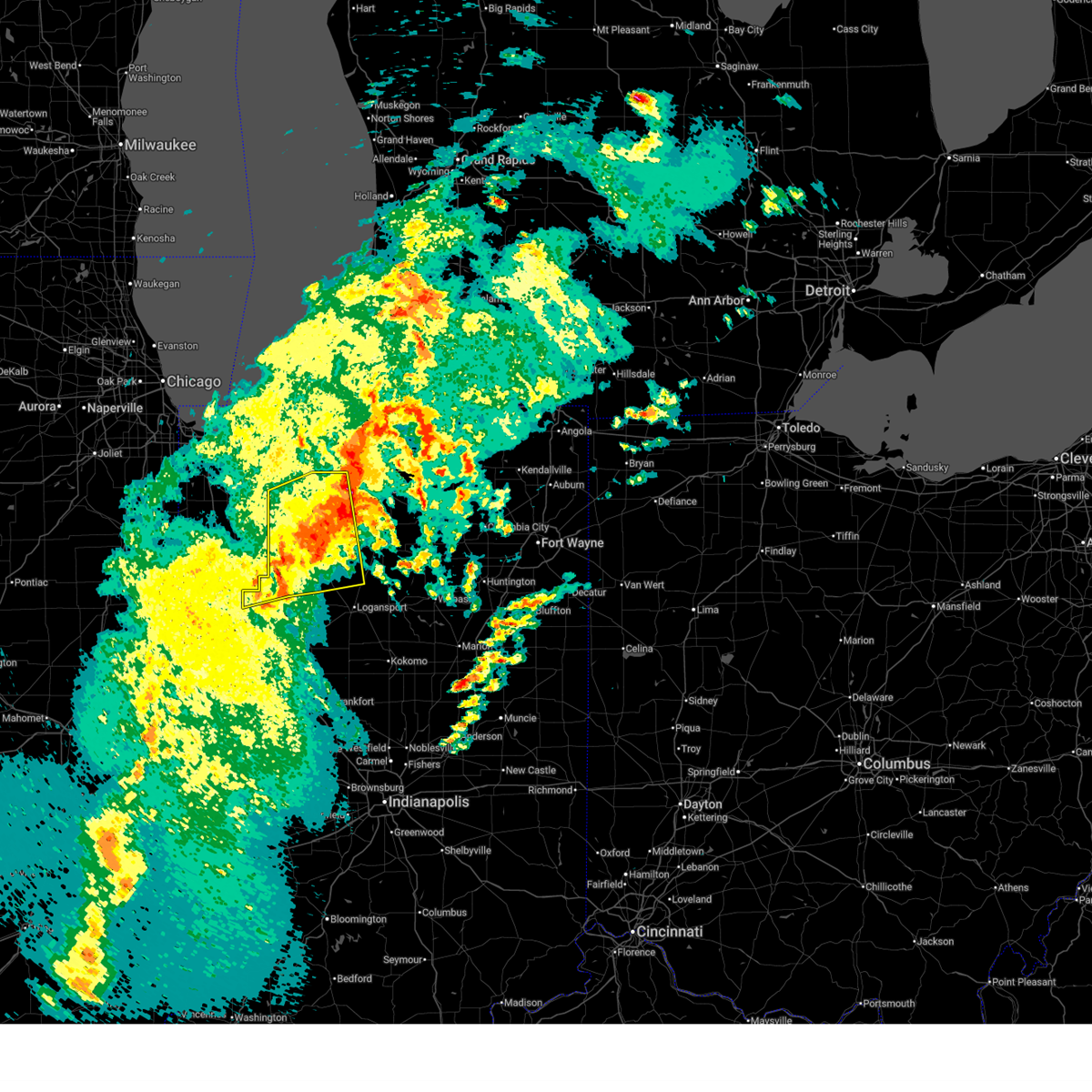
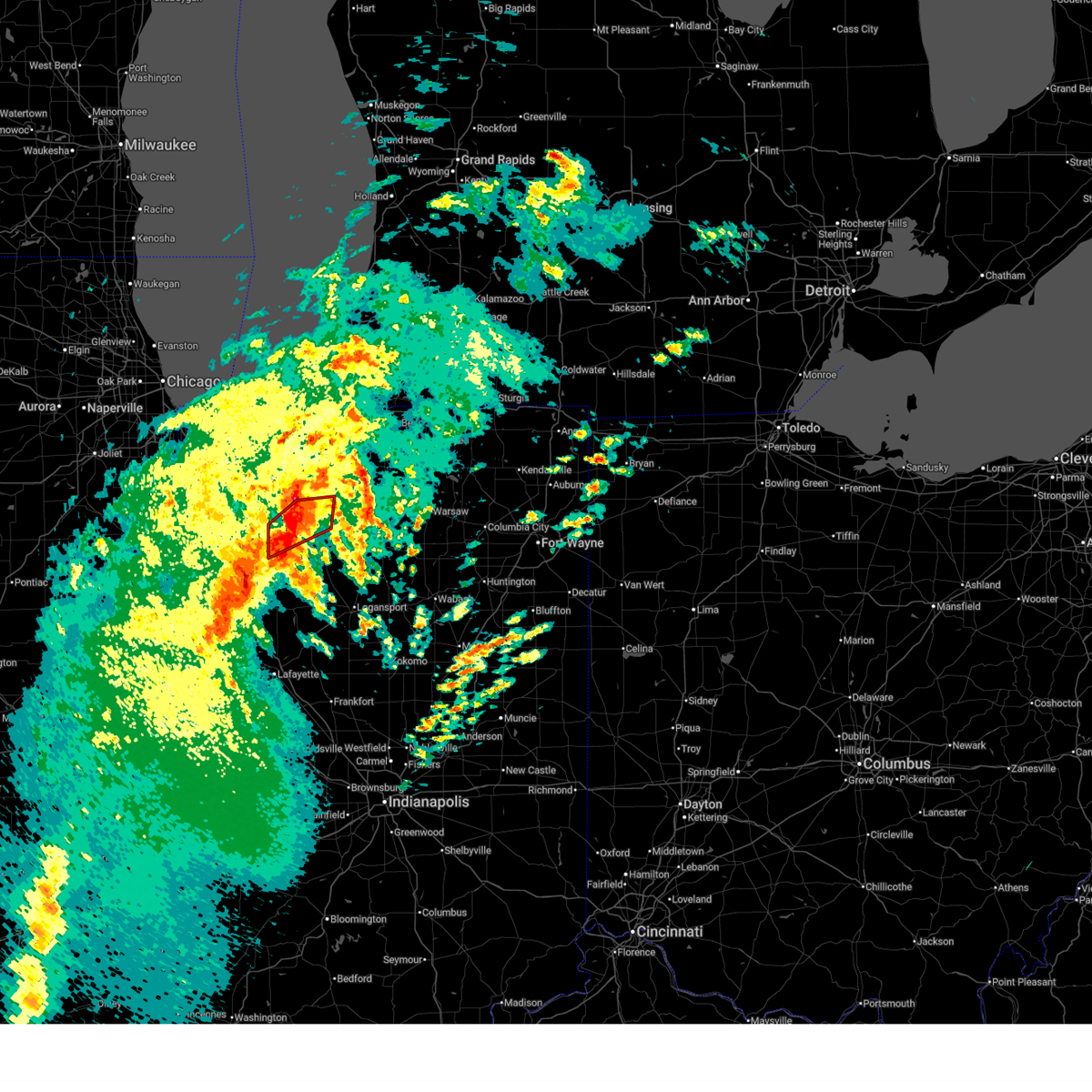
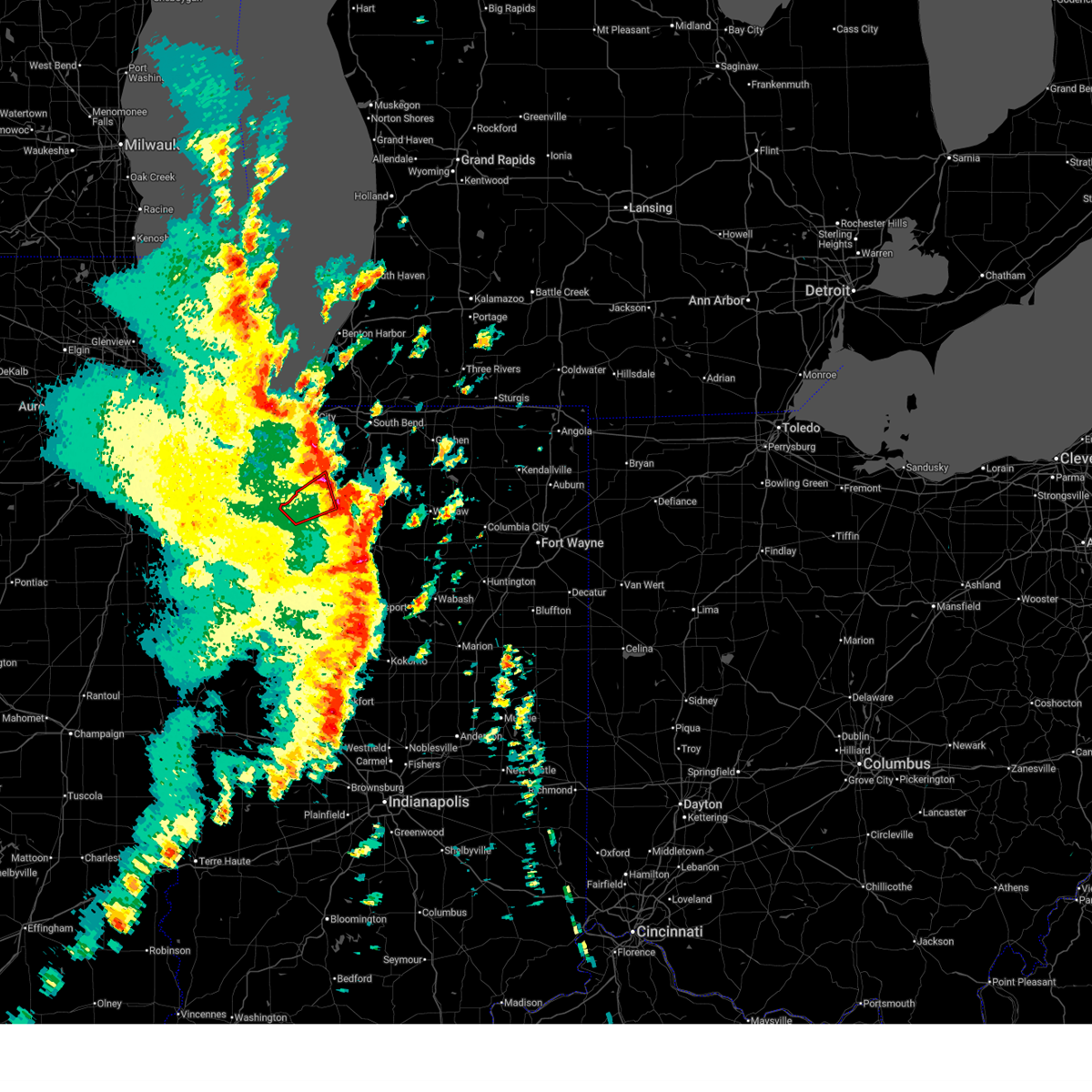
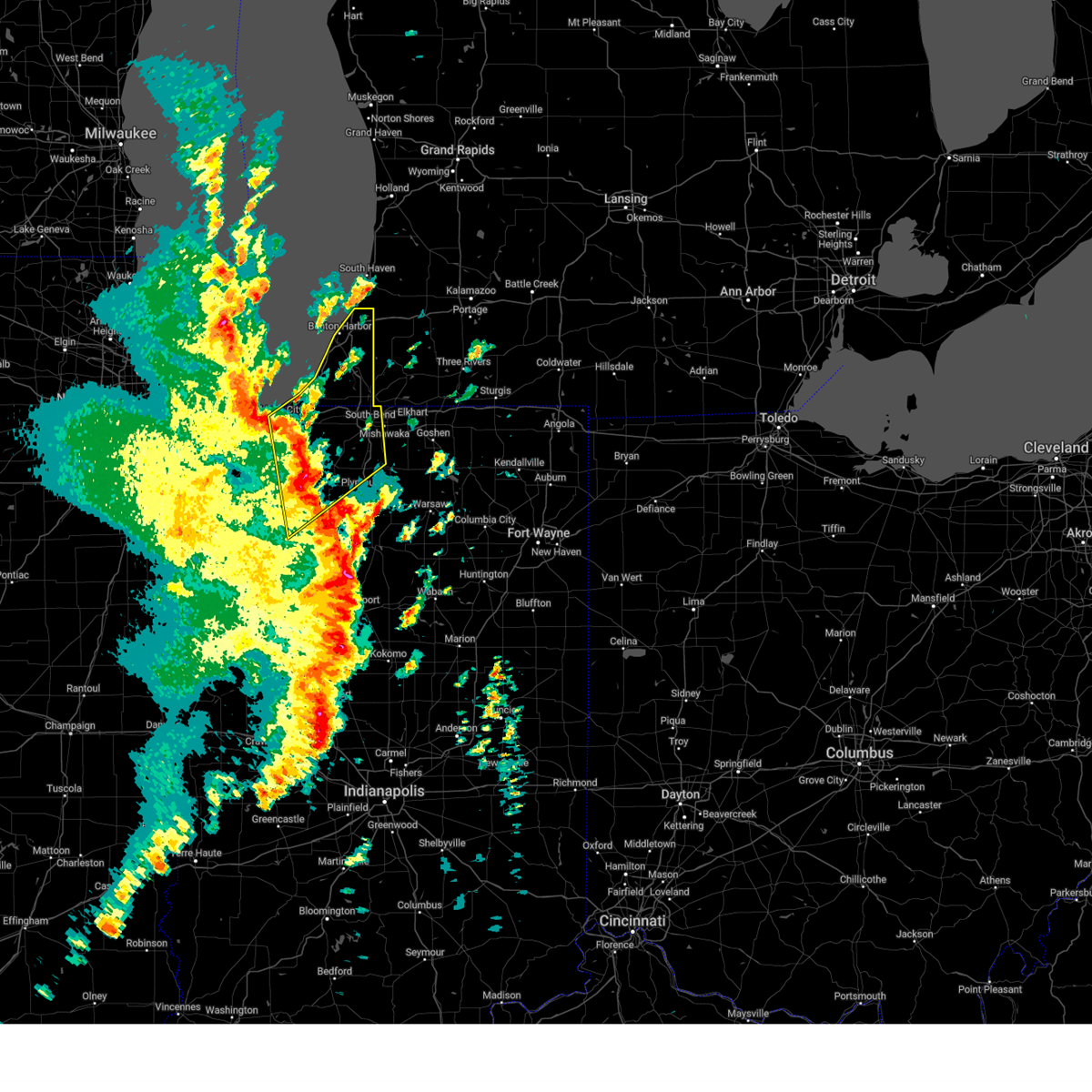
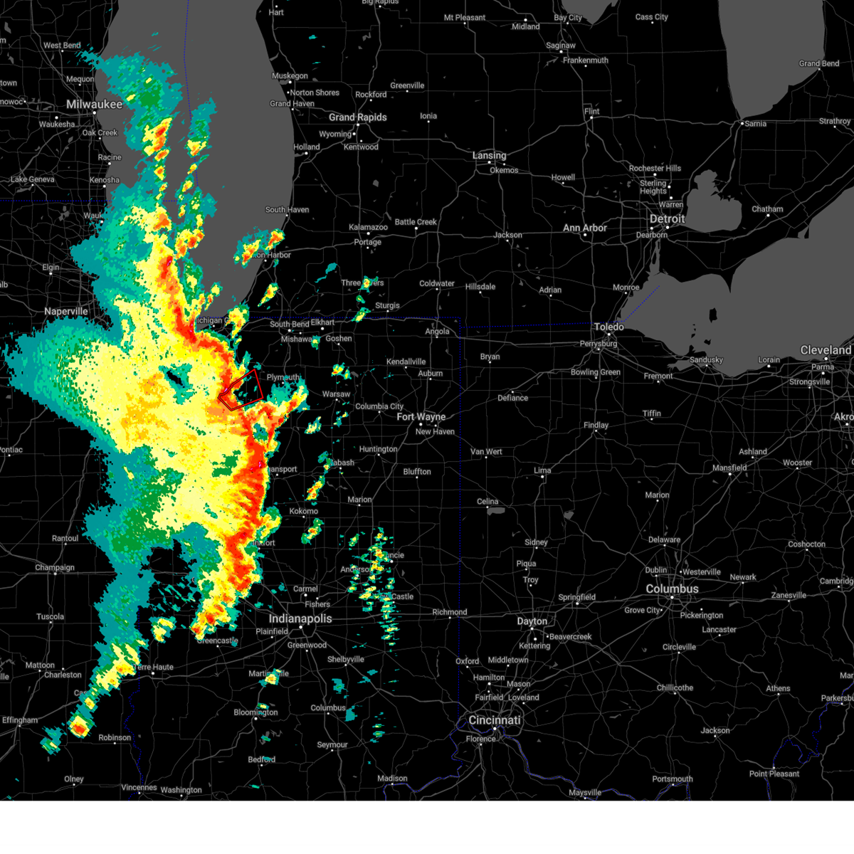
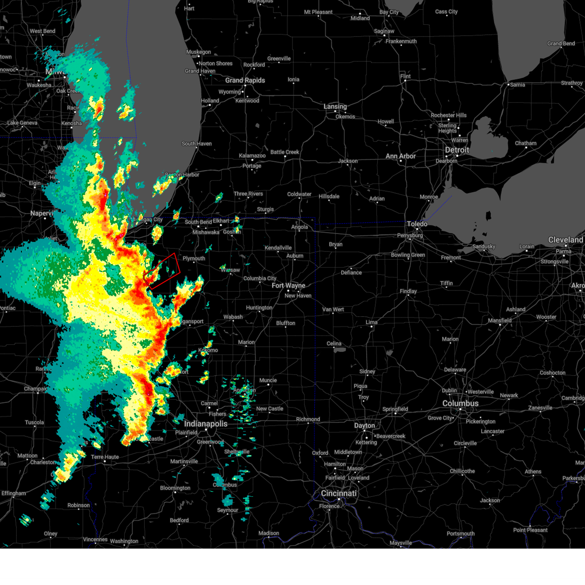
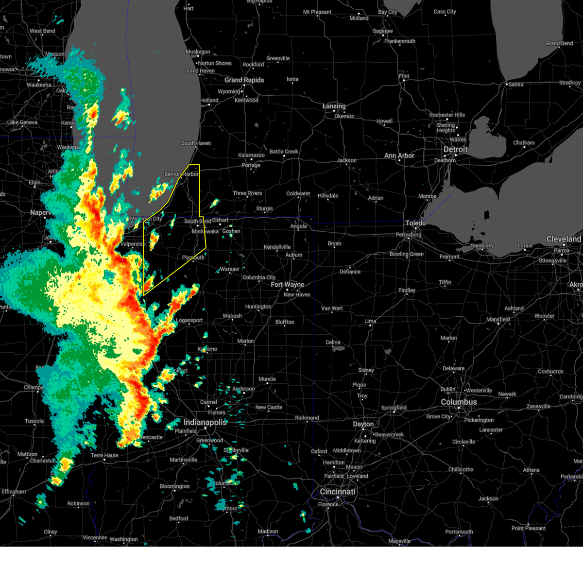
Hail Map for Knox, IN
The Knox, IN area has had 12 reports of on-the-ground hail by trained spotters, and has been under severe weather warnings 41 times during the past 12 months. Doppler radar has detected hail at or near Knox, IN on 54 occasions, including 4 occasions during the past year.
| Name: | Knox, IN |
| Where Located: | 66.5 miles SE of Chicago, IL |
| Map: | Google Map for Knox, IN |
| Population: | 3704 |
| Housing Units: | 1633 |
| More Info: | Search Google for Knox, IN |
1
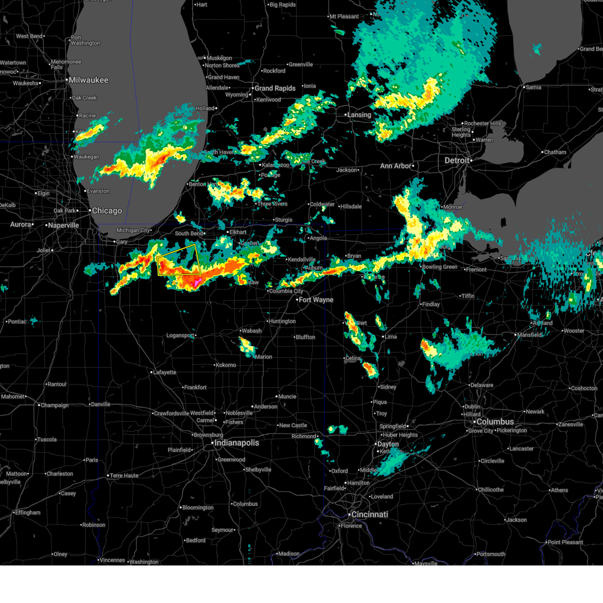
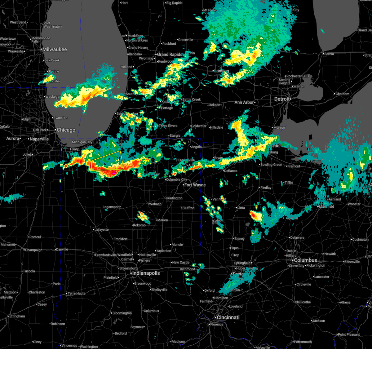
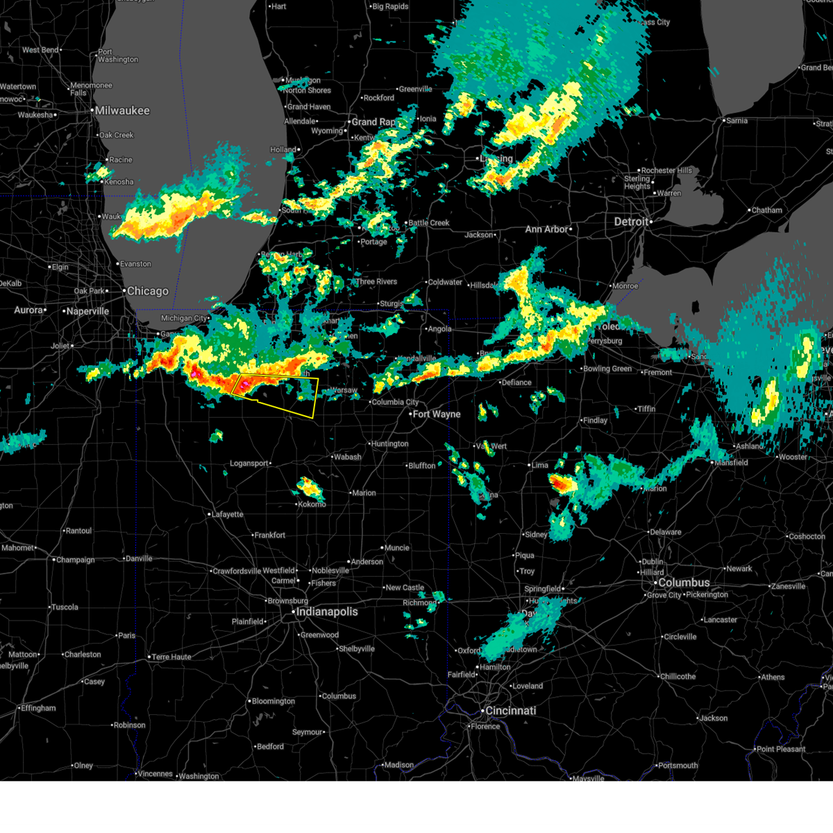
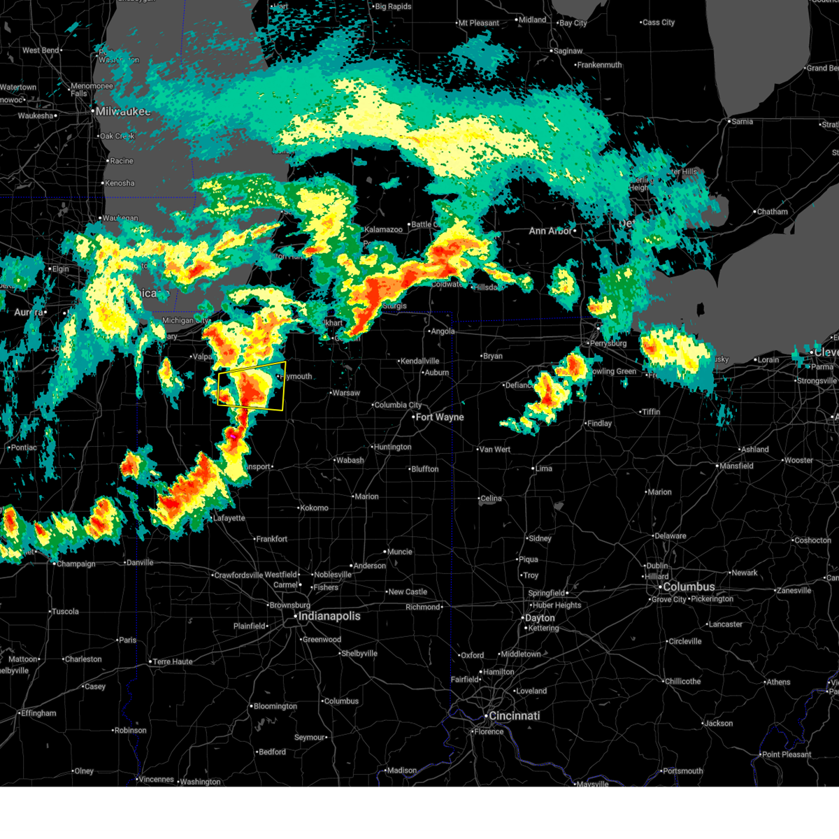
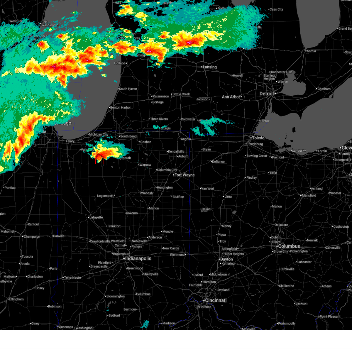
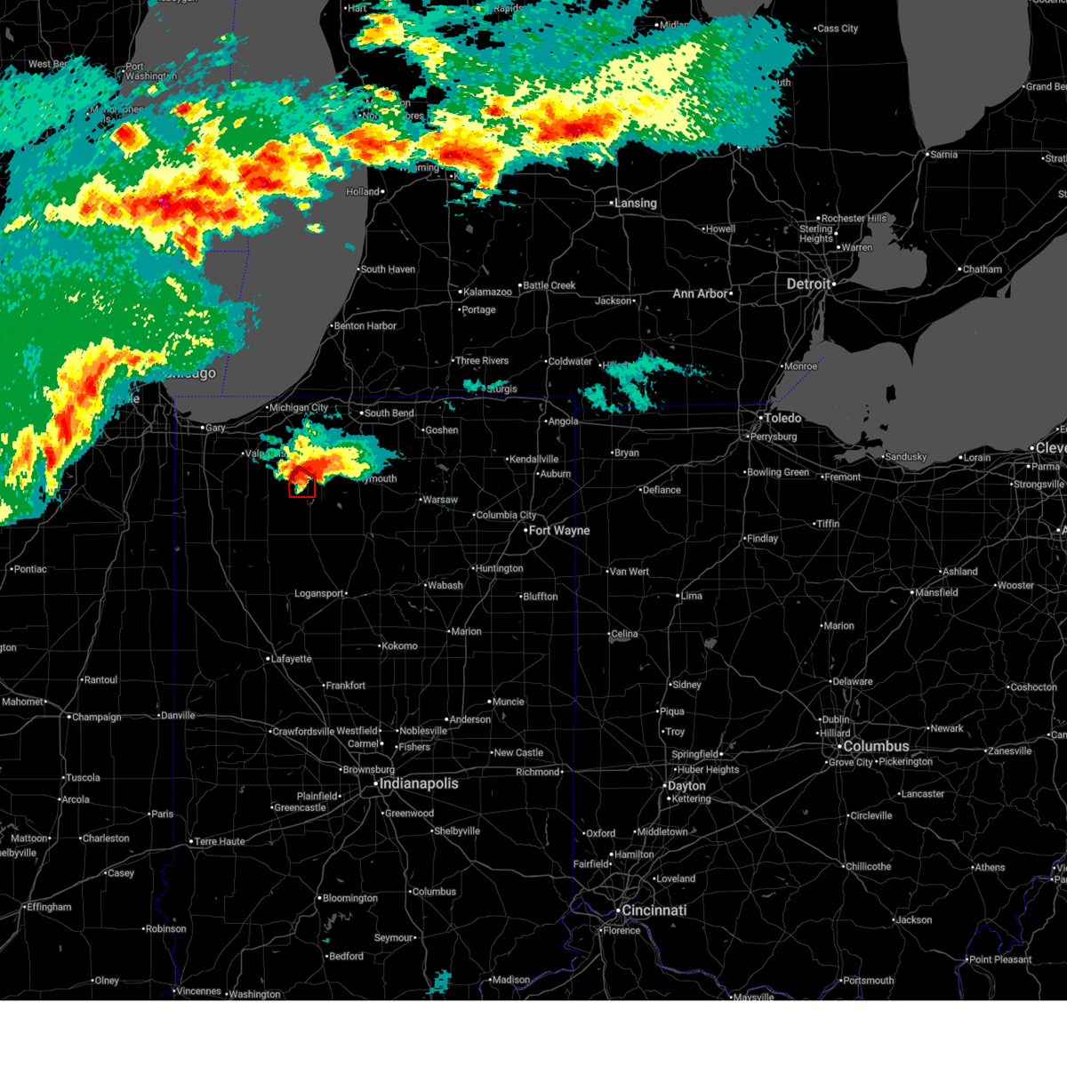
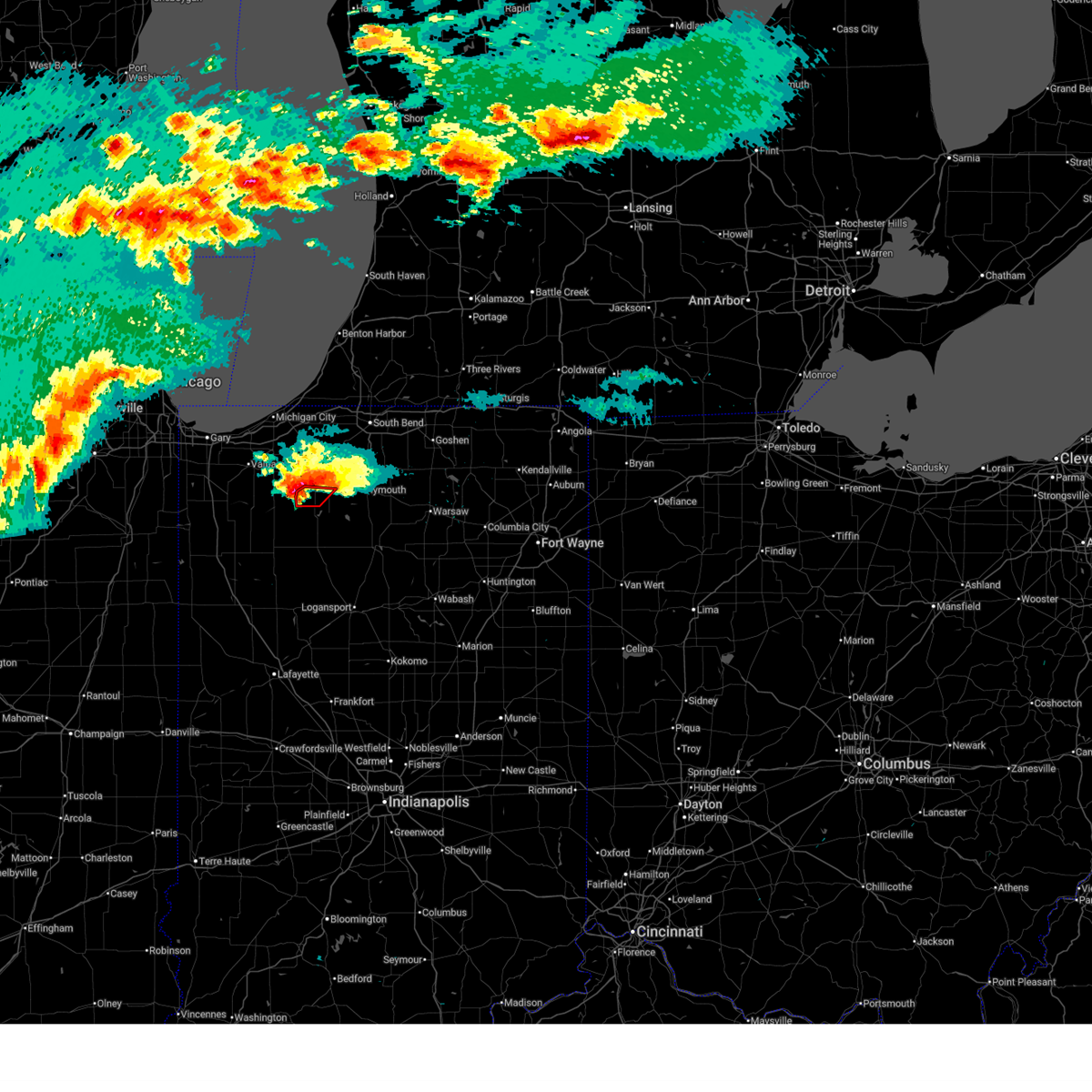
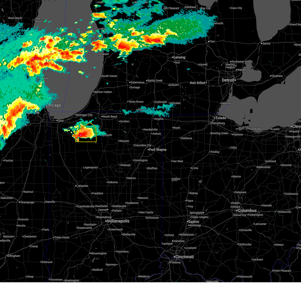
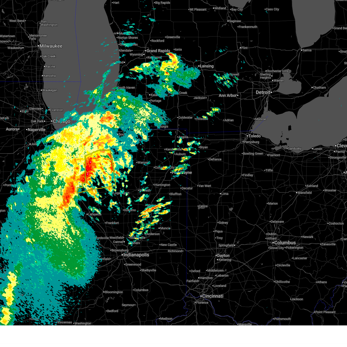
The Top Recent Hail Date for Knox, IN is Tuesday, March 31, 2026 (10th out of 54)
Hail and Wind Damage Spotted near Knox, IN
| Date / Time | Report Details |
|---|---|
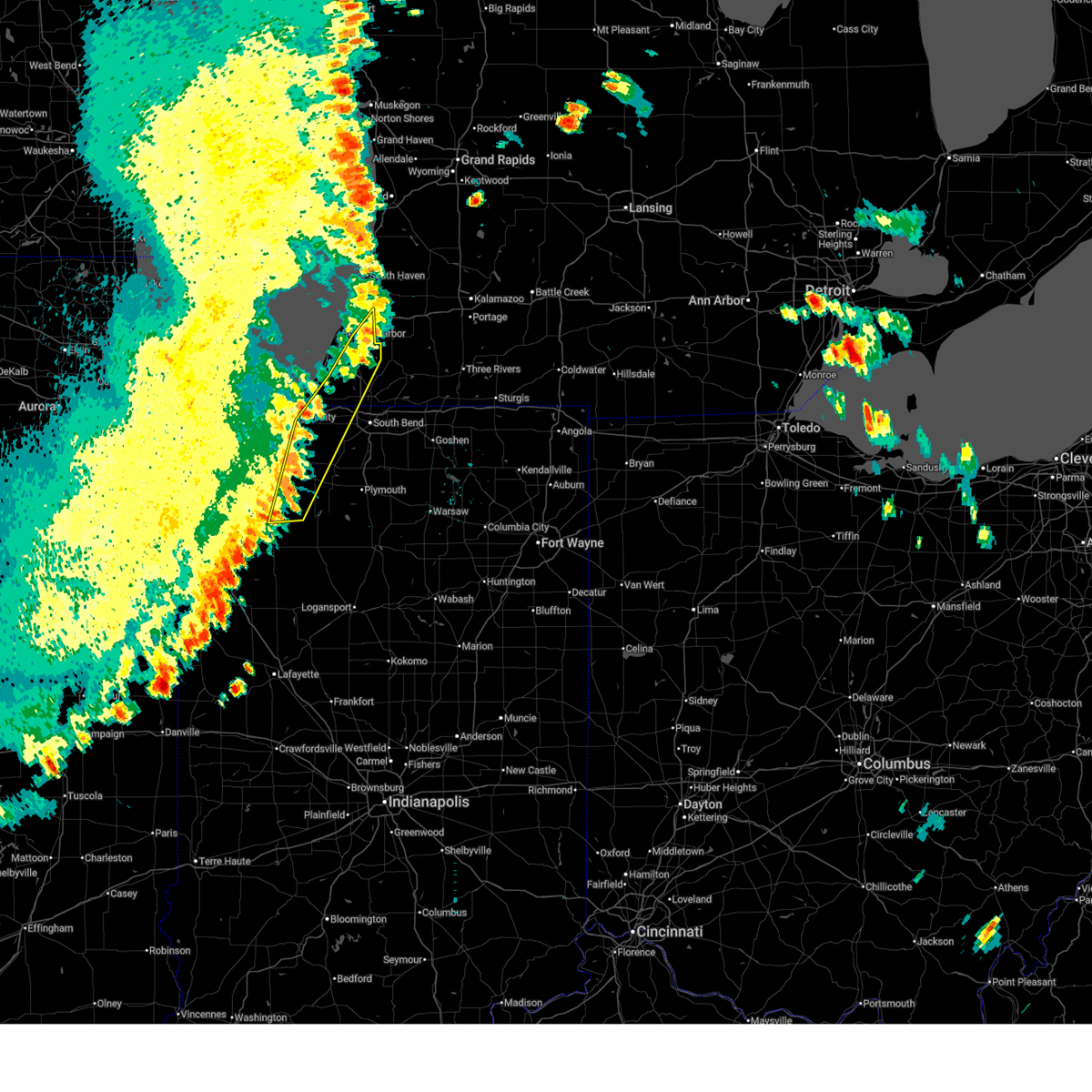
| 6/10/2026 6:40 PM EDT |
 The storms which prompted the warning have moved out of the area. therefore, the warning will be allowed to expire. however, heavy rain is still possible with these thunderstorms. a severe thunderstorm watch remains in effect until 1100 pm edt/1000 pm cdt/ for north central and northwestern indiana, and southwestern michigan. The storms which prompted the warning have moved out of the area. therefore, the warning will be allowed to expire. however, heavy rain is still possible with these thunderstorms. a severe thunderstorm watch remains in effect until 1100 pm edt/1000 pm cdt/ for north central and northwestern indiana, and southwestern michigan.
|
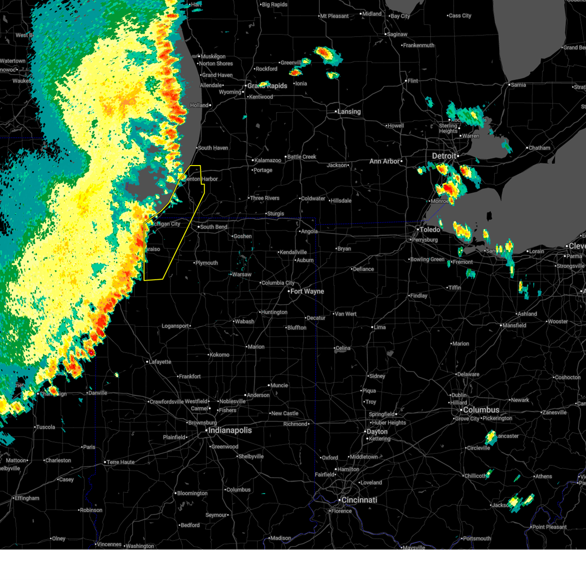
| 6/10/2026 6:26 PM EDT |
 At 625 pm edt/525 pm cdt/, severe thunderstorms were located along a line extending from 6 miles southeast of watervliet to near buchanan to near new carlisle to near north judson, moving east at 50 mph (official observation). Hazards include 60 mph wind gusts and penny size hail. at 603 pm edt, the benton harbor airport recorded a 63 mph wind gust. the strong winds are ahead of the main line. Expect damage to roofs, siding, and trees. locations impacted include, la porte, buchanan, knox, new carlisle, berrien springs, north judson, watervliet, three oaks, kingsford heights, hamlet, paw paw lake, dayton, sodus, hanna, baroda, eau claire, galien, kingsbury, dewey lake, and lomax. this includes the following highways, interstate 80 in indiana between mile markers 48 and 71. Interstate 94 in michigan between mile markers 39 and 42. At 625 pm edt/525 pm cdt/, severe thunderstorms were located along a line extending from 6 miles southeast of watervliet to near buchanan to near new carlisle to near north judson, moving east at 50 mph (official observation). Hazards include 60 mph wind gusts and penny size hail. at 603 pm edt, the benton harbor airport recorded a 63 mph wind gust. the strong winds are ahead of the main line. Expect damage to roofs, siding, and trees. locations impacted include, la porte, buchanan, knox, new carlisle, berrien springs, north judson, watervliet, three oaks, kingsford heights, hamlet, paw paw lake, dayton, sodus, hanna, baroda, eau claire, galien, kingsbury, dewey lake, and lomax. this includes the following highways, interstate 80 in indiana between mile markers 48 and 71. Interstate 94 in michigan between mile markers 39 and 42.
|
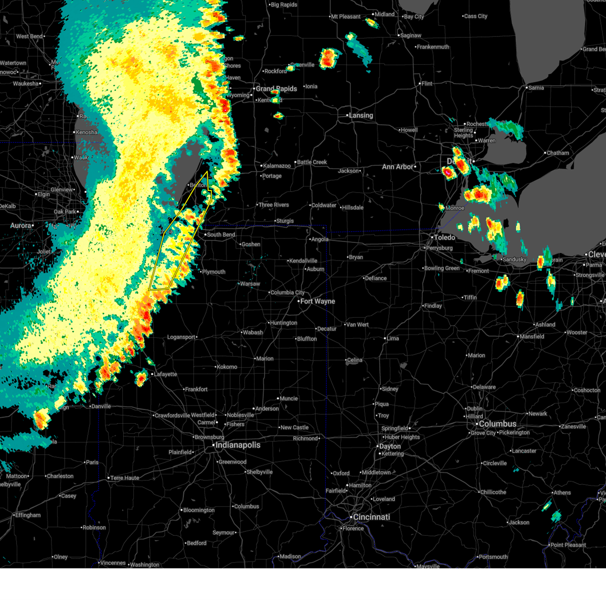
| 6/10/2026 5:18 PM CDT | Starke county airpor in starke county IN, 3.4 miles SE of Knox, IN |
| 6/10/2026 6:11 PM EDT |
 At 610 pm edt/510 pm cdt/, severe thunderstorms were located along a line extending from 18 miles west of van buren sp to near shorewood-tower hill to wheatfield, moving east at 45 mph (radar indicated). Hazards include 60 mph wind gusts and nickel size hail. a 55 mph gust was recorded at valparaiso airport. Expect damage to roofs, siding, and trees. locations impacted include, michigan city, la porte, benton harbor, st. joseph, westville, buchanan, knox, trail creek, benton heights, fair plain, bridgman, new buffalo, new carlisle, berrien springs, north judson, watervliet, three oaks, coloma, kingsford heights, and long beach. this includes the following highways, interstate 196 between mile markers 0 and 7. interstate 80 in indiana between mile markers 38 and 71. interstate 94 in indiana between mile markers 33 and 45. Interstate 94 in michigan between mile markers 0 and 42. At 610 pm edt/510 pm cdt/, severe thunderstorms were located along a line extending from 18 miles west of van buren sp to near shorewood-tower hill to wheatfield, moving east at 45 mph (radar indicated). Hazards include 60 mph wind gusts and nickel size hail. a 55 mph gust was recorded at valparaiso airport. Expect damage to roofs, siding, and trees. locations impacted include, michigan city, la porte, benton harbor, st. joseph, westville, buchanan, knox, trail creek, benton heights, fair plain, bridgman, new buffalo, new carlisle, berrien springs, north judson, watervliet, three oaks, coloma, kingsford heights, and long beach. this includes the following highways, interstate 196 between mile markers 0 and 7. interstate 80 in indiana between mile markers 38 and 71. interstate 94 in indiana between mile markers 33 and 45. Interstate 94 in michigan between mile markers 0 and 42.
|
| 6/10/2026 5:43 PM EDT |
 Svriwx the national weather service in northern indiana has issued a * severe thunderstorm warning for, northwestern st. joseph county in north central indiana, central starke county in northwestern indiana, la porte county in northwestern indiana, northwestern cass county in southwestern michigan, berrien county in southwestern michigan, * until 645 pm edt/545 pm cdt/. * at 543 pm edt/443 pm cdt/, severe thunderstorms were located along a line extending from 31 miles northwest of st. joseph to 9 miles northwest of beverly shores to near shelby, moving east at 50 mph (radar indicated). Hazards include 60 mph wind gusts and nickel size hail. expect damage to roofs, siding, and trees Svriwx the national weather service in northern indiana has issued a * severe thunderstorm warning for, northwestern st. joseph county in north central indiana, central starke county in northwestern indiana, la porte county in northwestern indiana, northwestern cass county in southwestern michigan, berrien county in southwestern michigan, * until 645 pm edt/545 pm cdt/. * at 543 pm edt/443 pm cdt/, severe thunderstorms were located along a line extending from 31 miles northwest of st. joseph to 9 miles northwest of beverly shores to near shelby, moving east at 50 mph (radar indicated). Hazards include 60 mph wind gusts and nickel size hail. expect damage to roofs, siding, and trees
|
| 5/18/2026 12:23 PM CDT |
 The storm which prompted the warning has weakened below severe limits, and has exited the warned area. therefore, the warning will be allowed to expire. however, heavy rain is still possible with this thunderstorm. a severe thunderstorm watch remains in effect until 600 pm edt/500 pm cdt/ for northwestern indiana. The storm which prompted the warning has weakened below severe limits, and has exited the warned area. therefore, the warning will be allowed to expire. however, heavy rain is still possible with this thunderstorm. a severe thunderstorm watch remains in effect until 600 pm edt/500 pm cdt/ for northwestern indiana.
|
| 5/18/2026 12:05 PM CDT |
 At 105 pm edt/1205 pm cdt/, a severe thunderstorm was located over winamac, moving east at 45 mph (radar indicated). Hazards include 60 mph wind gusts. Expect damage to roofs, siding, and trees. Locations impacted include, knox, north judson, hamlet, medaryville, koontz lake, oak grove, ripley, monterey, beardstown, ober, english lake, vanmeter park, denham, brems, toto, clarks, winona, bass lake, san pierre, and grovertown. At 105 pm edt/1205 pm cdt/, a severe thunderstorm was located over winamac, moving east at 45 mph (radar indicated). Hazards include 60 mph wind gusts. Expect damage to roofs, siding, and trees. Locations impacted include, knox, north judson, hamlet, medaryville, koontz lake, oak grove, ripley, monterey, beardstown, ober, english lake, vanmeter park, denham, brems, toto, clarks, winona, bass lake, san pierre, and grovertown.
|
| 5/18/2026 12:05 PM CDT |
 the severe thunderstorm warning has been cancelled and is no longer in effect the severe thunderstorm warning has been cancelled and is no longer in effect
|
| 5/18/2026 12:58 PM EDT |
 At 1257 pm edt/1157 am cdt/, a severe thunderstorm was located near winamac, moving east at 45 mph (radar indicated). Hazards include 60 mph wind gusts. Expect damage to roofs, siding, and trees. Locations impacted include, monticello, knox, winamac, monon, north judson, wolcott, francesville, hamlet, medaryville, koontz lake, pulaski, oak grove, ripley, reynolds, burnettsville, monterey, beardstown, ober, english lake, and denham. At 1257 pm edt/1157 am cdt/, a severe thunderstorm was located near winamac, moving east at 45 mph (radar indicated). Hazards include 60 mph wind gusts. Expect damage to roofs, siding, and trees. Locations impacted include, monticello, knox, winamac, monon, north judson, wolcott, francesville, hamlet, medaryville, koontz lake, pulaski, oak grove, ripley, reynolds, burnettsville, monterey, beardstown, ober, english lake, and denham.
|
| 5/18/2026 12:43 PM EDT |
 Svriwx the national weather service in northern indiana has issued a * severe thunderstorm warning for, white county in northwestern indiana, pulaski county in northwestern indiana, starke county in northwestern indiana, * until 130 pm edt/1230 pm cdt/. * at 1243 pm edt/1143 am cdt/, a severe thunderstorm was located over francesville, or 12 miles east of rensselaer, moving east at 45 mph (radar indicated). Hazards include 60 mph wind gusts. expect damage to roofs, siding, and trees Svriwx the national weather service in northern indiana has issued a * severe thunderstorm warning for, white county in northwestern indiana, pulaski county in northwestern indiana, starke county in northwestern indiana, * until 130 pm edt/1230 pm cdt/. * at 1243 pm edt/1143 am cdt/, a severe thunderstorm was located over francesville, or 12 miles east of rensselaer, moving east at 45 mph (radar indicated). Hazards include 60 mph wind gusts. expect damage to roofs, siding, and trees
|
| 4/18/2026 12:26 AM EDT |
 Svriwx the national weather service in northern indiana has issued a * severe thunderstorm warning for, st. joseph county in north central indiana, northwestern fulton county in north central indiana, eastern pulaski county in northwestern indiana, starke county in northwestern indiana, marshall county in north central indiana, la porte county in northwestern indiana, western cass county in southwestern michigan, berrien county in southwestern michigan, * until 130 am edt/1230 am cdt/. * at 1226 am edt/1126 pm cdt/, severe thunderstorms were located along a line extending from 13 miles northwest of new buffalo to winamac, moving northeast at 55 mph (radar indicated). Hazards include 60 mph wind gusts. expect damage to roofs, siding, and trees Svriwx the national weather service in northern indiana has issued a * severe thunderstorm warning for, st. joseph county in north central indiana, northwestern fulton county in north central indiana, eastern pulaski county in northwestern indiana, starke county in northwestern indiana, marshall county in north central indiana, la porte county in northwestern indiana, western cass county in southwestern michigan, berrien county in southwestern michigan, * until 130 am edt/1230 am cdt/. * at 1226 am edt/1126 pm cdt/, severe thunderstorms were located along a line extending from 13 miles northwest of new buffalo to winamac, moving northeast at 55 mph (radar indicated). Hazards include 60 mph wind gusts. expect damage to roofs, siding, and trees
|
| 4/17/2026 10:57 PM CDT |
 At 1157 pm edt/1057 pm cdt/, severe thunderstorms were located along a line extending from 10 miles north of ogden dunes to near rensselaer to near remington, moving east at 55 mph (radar indicated). Hazards include 60 mph wind gusts. Expect damage to roofs, siding, and trees. locations impacted include, michigan city, la porte, westville, knox, winamac, trail creek, bridgman, new buffalo, new carlisle, monon, north judson, three oaks, kingsford heights, long beach, wanatah, wolcott, francesville, hamlet, medaryville, and la crosse. this includes the following highways, interstate 65 between mile markers 197 and 198. interstate 80 in indiana between mile markers 38 and 61. interstate 94 in indiana between mile markers 33 and 45. Interstate 94 in michigan between mile markers 0 and 17. At 1157 pm edt/1057 pm cdt/, severe thunderstorms were located along a line extending from 10 miles north of ogden dunes to near rensselaer to near remington, moving east at 55 mph (radar indicated). Hazards include 60 mph wind gusts. Expect damage to roofs, siding, and trees. locations impacted include, michigan city, la porte, westville, knox, winamac, trail creek, bridgman, new buffalo, new carlisle, monon, north judson, three oaks, kingsford heights, long beach, wanatah, wolcott, francesville, hamlet, medaryville, and la crosse. this includes the following highways, interstate 65 between mile markers 197 and 198. interstate 80 in indiana between mile markers 38 and 61. interstate 94 in indiana between mile markers 33 and 45. Interstate 94 in michigan between mile markers 0 and 17.
|
| 4/17/2026 10:36 PM CDT |
 Svriwx the national weather service in northern indiana has issued a * severe thunderstorm warning for, northern white county in northwestern indiana, pulaski county in northwestern indiana, northwestern cass county in north central indiana, starke county in northwestern indiana, la porte county in northwestern indiana, southwestern berrien county in southwestern michigan, * until 1230 am edt/1130 pm cdt/. * at 1135 pm edt/1035 pm cdt/, severe thunderstorms were located along a line extending from roseland to near kentland, moving east at 55 mph (radar indicated). Hazards include 60 mph wind gusts. expect damage to roofs, siding, and trees Svriwx the national weather service in northern indiana has issued a * severe thunderstorm warning for, northern white county in northwestern indiana, pulaski county in northwestern indiana, northwestern cass county in north central indiana, starke county in northwestern indiana, la porte county in northwestern indiana, southwestern berrien county in southwestern michigan, * until 1230 am edt/1130 pm cdt/. * at 1135 pm edt/1035 pm cdt/, severe thunderstorms were located along a line extending from roseland to near kentland, moving east at 55 mph (radar indicated). Hazards include 60 mph wind gusts. expect damage to roofs, siding, and trees
|
| 3/31/2026 5:05 PM CDT |
 The storm which prompted the warning has weakened below severe limits, and no longer poses an immediate threat to life or property. therefore, the warning will be allowed to expire. a severe thunderstorm watch remains in effect until midnight edt/1100 pm cdt/ for north central and northwestern indiana. The storm which prompted the warning has weakened below severe limits, and no longer poses an immediate threat to life or property. therefore, the warning will be allowed to expire. a severe thunderstorm watch remains in effect until midnight edt/1100 pm cdt/ for north central and northwestern indiana.
|
| 3/31/2026 4:57 PM CDT |
 At 557 pm edt/457 pm cdt/, a severe thunderstorm was located near kingsford heights, or 9 miles northwest of knox, moving east at 45 mph (radar indicated). Hazards include 60 mph wind gusts and quarter size hail. Hail damage to vehicles is expected. expect wind damage to roofs, siding, and trees. Locations impacted include, plymouth, walkerton, north liberty, kingsford heights, hamlet, koontz lake, hanna, thomaston, teegarden, south center, salem heights, brems, tracy, tyner, donaldson, and grovertown. At 557 pm edt/457 pm cdt/, a severe thunderstorm was located near kingsford heights, or 9 miles northwest of knox, moving east at 45 mph (radar indicated). Hazards include 60 mph wind gusts and quarter size hail. Hail damage to vehicles is expected. expect wind damage to roofs, siding, and trees. Locations impacted include, plymouth, walkerton, north liberty, kingsford heights, hamlet, koontz lake, hanna, thomaston, teegarden, south center, salem heights, brems, tracy, tyner, donaldson, and grovertown.
|
| 3/31/2026 4:47 PM CDT |
 Svriwx the national weather service in northern indiana has issued a * severe thunderstorm warning for, southwestern st. joseph county in north central indiana, northeastern starke county in northwestern indiana, northwestern marshall county in north central indiana, southern la porte county in northwestern indiana, * until 615 pm edt/515 pm cdt/. * at 547 pm edt/447 pm cdt/, a severe thunderstorm was located near wanatah, or 11 miles south of westville, moving east at 45 mph (radar indicated). Hazards include 60 mph wind gusts and quarter size hail. Hail damage to vehicles is expected. Expect wind damage to roofs, siding, and trees. Svriwx the national weather service in northern indiana has issued a * severe thunderstorm warning for, southwestern st. joseph county in north central indiana, northeastern starke county in northwestern indiana, northwestern marshall county in north central indiana, southern la porte county in northwestern indiana, * until 615 pm edt/515 pm cdt/. * at 547 pm edt/447 pm cdt/, a severe thunderstorm was located near wanatah, or 11 miles south of westville, moving east at 45 mph (radar indicated). Hazards include 60 mph wind gusts and quarter size hail. Hail damage to vehicles is expected. Expect wind damage to roofs, siding, and trees.
|
| 3/31/2026 5:40 PM EDT |
 Svriwx the national weather service in northern indiana has issued a * severe thunderstorm warning for, northern fulton county in north central indiana, southwestern kosciusko county in north central indiana, southeastern starke county in northwestern indiana, southern marshall county in north central indiana, * until 615 pm edt/515 pm cdt/. * at 540 pm edt/440 pm cdt/, a severe thunderstorm was located near culver, or 7 miles southeast of knox, moving east at 45 mph (radar indicated). Hazards include 60 mph wind gusts and quarter size hail. Hail damage to vehicles is expected. Expect wind damage to roofs, siding, and trees. Svriwx the national weather service in northern indiana has issued a * severe thunderstorm warning for, northern fulton county in north central indiana, southwestern kosciusko county in north central indiana, southeastern starke county in northwestern indiana, southern marshall county in north central indiana, * until 615 pm edt/515 pm cdt/. * at 540 pm edt/440 pm cdt/, a severe thunderstorm was located near culver, or 7 miles southeast of knox, moving east at 45 mph (radar indicated). Hazards include 60 mph wind gusts and quarter size hail. Hail damage to vehicles is expected. Expect wind damage to roofs, siding, and trees.
|
| 3/26/2026 5:21 PM CDT |
 The storm which prompted the warning will be moving out of the area. therefore, the warning will be allowed to expire. a severe thunderstorm watch remains in effect until midnight edt/1100 pm cdt/ for north central and northwestern indiana. The storm which prompted the warning will be moving out of the area. therefore, the warning will be allowed to expire. a severe thunderstorm watch remains in effect until midnight edt/1100 pm cdt/ for north central and northwestern indiana.
|
| 3/26/2026 6:15 PM EDT |
 Svriwx the national weather service in northern indiana has issued a * severe thunderstorm warning for, northwestern wabash county in north central indiana, fulton county in north central indiana, eastern pulaski county in northwestern indiana, kosciusko county in north central indiana, northwestern miami county in north central indiana, southeastern starke county in northwestern indiana, marshall county in north central indiana, * until 645 pm edt/545 pm cdt/. * at 615 pm edt/515 pm cdt/, severe thunderstorms were located along a line extending from near knox to 9 miles southwest of winamac, moving east at 85 mph (radar indicated). Hazards include quarter size hail. damage to vehicles is expected Svriwx the national weather service in northern indiana has issued a * severe thunderstorm warning for, northwestern wabash county in north central indiana, fulton county in north central indiana, eastern pulaski county in northwestern indiana, kosciusko county in north central indiana, northwestern miami county in north central indiana, southeastern starke county in northwestern indiana, marshall county in north central indiana, * until 645 pm edt/545 pm cdt/. * at 615 pm edt/515 pm cdt/, severe thunderstorms were located along a line extending from near knox to 9 miles southwest of winamac, moving east at 85 mph (radar indicated). Hazards include quarter size hail. damage to vehicles is expected
|
| 3/26/2026 5:10 PM CDT |
 At 610 pm edt/510 pm cdt/, a severe thunderstorm was located over knox, moving east at 70 mph (radar indicated). Hazards include quarter size hail. Damage to vehicles is expected. Locations impacted include, plymouth, knox, north judson, culver, hamlet, koontz lake, oak grove, monterey, ober, english lake, denham, brems, tyner, hibbard, winona, delong, donaldson, linkville, grovertown, and twin lakes. At 610 pm edt/510 pm cdt/, a severe thunderstorm was located over knox, moving east at 70 mph (radar indicated). Hazards include quarter size hail. Damage to vehicles is expected. Locations impacted include, plymouth, knox, north judson, culver, hamlet, koontz lake, oak grove, monterey, ober, english lake, denham, brems, tyner, hibbard, winona, delong, donaldson, linkville, grovertown, and twin lakes.
|
| 3/26/2026 4:57 PM CDT |
 Svriwx the national weather service in northern indiana has issued a * severe thunderstorm warning for, northwestern fulton county in north central indiana, northeastern pulaski county in northwestern indiana, starke county in northwestern indiana, western marshall county in north central indiana, southwestern la porte county in northwestern indiana, * until 630 pm edt/530 pm cdt/. * at 557 pm edt/457 pm cdt/, a severe thunderstorm was located over kouts, or 8 miles northeast of wheatfield, moving east at 70 mph (radar indicated). Hazards include quarter size hail. damage to vehicles is expected Svriwx the national weather service in northern indiana has issued a * severe thunderstorm warning for, northwestern fulton county in north central indiana, northeastern pulaski county in northwestern indiana, starke county in northwestern indiana, western marshall county in north central indiana, southwestern la porte county in northwestern indiana, * until 630 pm edt/530 pm cdt/. * at 557 pm edt/457 pm cdt/, a severe thunderstorm was located over kouts, or 8 miles northeast of wheatfield, moving east at 70 mph (radar indicated). Hazards include quarter size hail. damage to vehicles is expected
|
| 3/10/2026 10:27 PM CDT |
 Svriwx the national weather service in northern indiana has issued a * severe thunderstorm warning for, northeastern starke county in northwestern indiana, la porte county in northwestern indiana, * until 1115 pm cdt. * at 1027 pm cdt, a severe thunderstorm was located near chesterton, moving east at 55 mph (radar indicated). Hazards include 70 mph wind gusts and ping pong ball size hail. People and animals outdoors will be injured. expect hail damage to roofs, siding, windows, and vehicles. expect considerable tree damage. Wind damage is also likely to mobile homes, roofs, and outbuildings. Svriwx the national weather service in northern indiana has issued a * severe thunderstorm warning for, northeastern starke county in northwestern indiana, la porte county in northwestern indiana, * until 1115 pm cdt. * at 1027 pm cdt, a severe thunderstorm was located near chesterton, moving east at 55 mph (radar indicated). Hazards include 70 mph wind gusts and ping pong ball size hail. People and animals outdoors will be injured. expect hail damage to roofs, siding, windows, and vehicles. expect considerable tree damage. Wind damage is also likely to mobile homes, roofs, and outbuildings.
|
| 3/10/2026 10:25 PM CDT |
 Svriwx the national weather service in northern indiana has issued a * severe thunderstorm warning for, northeastern starke county in northwestern indiana, la porte county in northwestern indiana, * until 1115 pm cdt. * at 1024 pm cdt, a severe thunderstorm was located over chesterton, moving east at 55 mph (radar indicated). Hazards include ping pong ball size hail and 60 mph wind gusts. People and animals outdoors will be injured. expect hail damage to roofs, siding, windows, and vehicles. Expect wind damage to roofs, siding, and trees. Svriwx the national weather service in northern indiana has issued a * severe thunderstorm warning for, northeastern starke county in northwestern indiana, la porte county in northwestern indiana, * until 1115 pm cdt. * at 1024 pm cdt, a severe thunderstorm was located over chesterton, moving east at 55 mph (radar indicated). Hazards include ping pong ball size hail and 60 mph wind gusts. People and animals outdoors will be injured. expect hail damage to roofs, siding, windows, and vehicles. Expect wind damage to roofs, siding, and trees.
|
| 3/10/2026 8:58 PM CDT |
 At 958 pm edt/858 pm cdt/, a severe thunderstorm was located over koontz lake, or 10 miles northeast of knox, moving northeast at 25 mph (radar indicated). Hazards include 60 mph wind gusts and quarter size hail. Hail damage to vehicles is expected. expect wind damage to roofs, siding, and trees. Locations impacted include, knox, walkerton, hamlet, koontz lake, south center, donaldson, salem heights, tyner, and grovertown. At 958 pm edt/858 pm cdt/, a severe thunderstorm was located over koontz lake, or 10 miles northeast of knox, moving northeast at 25 mph (radar indicated). Hazards include 60 mph wind gusts and quarter size hail. Hail damage to vehicles is expected. expect wind damage to roofs, siding, and trees. Locations impacted include, knox, walkerton, hamlet, koontz lake, south center, donaldson, salem heights, tyner, and grovertown.
|
| 3/10/2026 8:53 PM CDT |
 The tornado warning that was previously in effect has been reissued for downstream. please refer to that bulletin for the latest severe weather information. a tornado watch remains in effect until 100 am cdt for northwestern indiana. remember, a tornado warning still remains in effect for starke county. The tornado warning that was previously in effect has been reissued for downstream. please refer to that bulletin for the latest severe weather information. a tornado watch remains in effect until 100 am cdt for northwestern indiana. remember, a tornado warning still remains in effect for starke county.
|
| 3/10/2026 8:50 PM CDT |
 Toriwx the national weather service in northern indiana has issued a * tornado warning for, southwestern st. joseph county in north central indiana, northeastern starke county in northwestern indiana, northwestern marshall county in north central indiana, * until 1015 pm edt/915 pm cdt/. * at 950 pm edt/850 pm cdt/, a confirmed large and extremely dangerous tornado was located over hamlet, or near knox, moving northeast at 30 mph. this is a particularly dangerous situation. take cover now! (emergency management confirmed tornado). Hazards include damaging tornado. You are in a life-threatening situation. flying debris may be deadly to those caught without shelter. mobile homes will be destroyed. considerable damage to homes, businesses, and vehicles is likely and complete destruction is possible. the tornado will be near, hamlet and koontz lake around 855 pm cdt. walkerton around 1000 pm edt. Other locations impacted by this tornadic thunderstorm include donaldson, tyner, and grovertown. Toriwx the national weather service in northern indiana has issued a * tornado warning for, southwestern st. joseph county in north central indiana, northeastern starke county in northwestern indiana, northwestern marshall county in north central indiana, * until 1015 pm edt/915 pm cdt/. * at 950 pm edt/850 pm cdt/, a confirmed large and extremely dangerous tornado was located over hamlet, or near knox, moving northeast at 30 mph. this is a particularly dangerous situation. take cover now! (emergency management confirmed tornado). Hazards include damaging tornado. You are in a life-threatening situation. flying debris may be deadly to those caught without shelter. mobile homes will be destroyed. considerable damage to homes, businesses, and vehicles is likely and complete destruction is possible. the tornado will be near, hamlet and koontz lake around 855 pm cdt. walkerton around 1000 pm edt. Other locations impacted by this tornadic thunderstorm include donaldson, tyner, and grovertown.
|
| 3/10/2026 8:47 PM CDT |
 At 846 pm cdt, a confirmed large and destructive tornado was located over knox, moving east at 30 mph. tornado emergency for city of knox. this is a particularly dangerous situation. take cover now! (emergency management confirmed tornado). Hazards include deadly tornado. You are in a life-threatening situation. flying debris may be deadly to those caught without shelter. mobile homes will be destroyed. considerable damage to homes, businesses, and vehicles is likely and complete destruction is possible. the tornado will be near, knox around 850 pm cdt. Other locations impacted by this tornadic thunderstorm include brems. At 846 pm cdt, a confirmed large and destructive tornado was located over knox, moving east at 30 mph. tornado emergency for city of knox. this is a particularly dangerous situation. take cover now! (emergency management confirmed tornado). Hazards include deadly tornado. You are in a life-threatening situation. flying debris may be deadly to those caught without shelter. mobile homes will be destroyed. considerable damage to homes, businesses, and vehicles is likely and complete destruction is possible. the tornado will be near, knox around 850 pm cdt. Other locations impacted by this tornadic thunderstorm include brems.
|
| 3/10/2026 8:43 PM CDT |
 At 943 pm edt/843 pm cdt/, a severe thunderstorm was located over hamlet, or 7 miles north of knox, moving northeast at 25 mph (radar indicated). Hazards include tennis ball size hail and 60 mph wind gusts. People and animals outdoors will be injured. expect hail damage to roofs, siding, windows, and vehicles. expect wind damage to roofs, siding, and trees. Locations impacted include, knox, walkerton, kingsford heights, hamlet, koontz lake, oak grove, hanna, ober, south center, salem heights, burr oak, brems, tracy, tyner, toto, donaldson, grovertown, and bass lake. At 943 pm edt/843 pm cdt/, a severe thunderstorm was located over hamlet, or 7 miles north of knox, moving northeast at 25 mph (radar indicated). Hazards include tennis ball size hail and 60 mph wind gusts. People and animals outdoors will be injured. expect hail damage to roofs, siding, windows, and vehicles. expect wind damage to roofs, siding, and trees. Locations impacted include, knox, walkerton, kingsford heights, hamlet, koontz lake, oak grove, hanna, ober, south center, salem heights, burr oak, brems, tracy, tyner, toto, donaldson, grovertown, and bass lake.
|
| 3/10/2026 8:41 PM CDT |
 the tornado warning has been cancelled and is no longer in effect the tornado warning has been cancelled and is no longer in effect
|
| 3/10/2026 8:41 PM CDT |
 At 840 pm cdt, a confirmed large and extremely dangerous tornado was located over knox, moving east at 30 mph. this is a particularly dangerous situation. take cover now! (weather spotters confirmed tornado). Hazards include damaging tornado. You are in a life-threatening situation. flying debris may be deadly to those caught without shelter. mobile homes will be destroyed. considerable damage to homes, businesses, and vehicles is likely and complete destruction is possible. the tornado will be near, knox around 845 pm cdt. Other locations impacted by this tornadic thunderstorm include brems, toto, and bass lake. At 840 pm cdt, a confirmed large and extremely dangerous tornado was located over knox, moving east at 30 mph. this is a particularly dangerous situation. take cover now! (weather spotters confirmed tornado). Hazards include damaging tornado. You are in a life-threatening situation. flying debris may be deadly to those caught without shelter. mobile homes will be destroyed. considerable damage to homes, businesses, and vehicles is likely and complete destruction is possible. the tornado will be near, knox around 845 pm cdt. Other locations impacted by this tornadic thunderstorm include brems, toto, and bass lake.
|
| 3/10/2026 8:37 PM CDT | Report of a barn destroyed with debris on route 8 just west of the starke county airport. time estimated via rada in starke county IN, 5.6 miles ESE of Knox, IN |
| 3/10/2026 8:37 PM CDT |
 Toriwx the national weather service in northern indiana has issued a * tornado warning for, central starke county in northwestern indiana, * until 900 pm cdt. * at 836 pm cdt, a confirmed large and destructive tornado was observed near knox, moving east at 30 mph. tornado emergency for the city of knox. this is a particularly dangerous situation. take cover now! (weather spotters confirmed tornado). Hazards include deadly tornado. You are in a life-threatening situation. flying debris may be deadly to those caught without shelter. mobile homes will be destroyed. considerable damage to homes, businesses, and vehicles is likely and complete destruction is possible. the tornado will be near, knox around 840 pm cdt. Other locations impacted by this tornadic thunderstorm include brems and bass lake. Toriwx the national weather service in northern indiana has issued a * tornado warning for, central starke county in northwestern indiana, * until 900 pm cdt. * at 836 pm cdt, a confirmed large and destructive tornado was observed near knox, moving east at 30 mph. tornado emergency for the city of knox. this is a particularly dangerous situation. take cover now! (weather spotters confirmed tornado). Hazards include deadly tornado. You are in a life-threatening situation. flying debris may be deadly to those caught without shelter. mobile homes will be destroyed. considerable damage to homes, businesses, and vehicles is likely and complete destruction is possible. the tornado will be near, knox around 840 pm cdt. Other locations impacted by this tornadic thunderstorm include brems and bass lake.
|
| 3/10/2026 8:27 PM CDT |
 Svriwx the national weather service in northern indiana has issued a * severe thunderstorm warning for, southwestern st. joseph county in north central indiana, starke county in northwestern indiana, western marshall county in north central indiana, southern la porte county in northwestern indiana, * until 1015 pm edt/915 pm cdt/. * at 926 pm edt/826 pm cdt/, a severe thunderstorm was located 7 miles east of la crosse, or 8 miles northwest of knox, moving northeast at 25 mph (radar indicated). Hazards include tennis ball size hail and 60 mph wind gusts. People and animals outdoors will be injured. expect hail damage to roofs, siding, windows, and vehicles. Expect wind damage to roofs, siding, and trees. Svriwx the national weather service in northern indiana has issued a * severe thunderstorm warning for, southwestern st. joseph county in north central indiana, starke county in northwestern indiana, western marshall county in north central indiana, southern la porte county in northwestern indiana, * until 1015 pm edt/915 pm cdt/. * at 926 pm edt/826 pm cdt/, a severe thunderstorm was located 7 miles east of la crosse, or 8 miles northwest of knox, moving northeast at 25 mph (radar indicated). Hazards include tennis ball size hail and 60 mph wind gusts. People and animals outdoors will be injured. expect hail damage to roofs, siding, windows, and vehicles. Expect wind damage to roofs, siding, and trees.
|
| 3/10/2026 8:25 PM CDT |
 Toriwx the national weather service in northern indiana has issued a * tornado warning for, central starke county in northwestern indiana, south central la porte county in northwestern indiana, * until 900 pm cdt. * at 825 pm cdt, a confirmed large and extremely dangerous tornado was located near north judson, or 10 miles west of knox, moving east at 20 mph. this is a particularly dangerous situation. take cover now! (weather spotters confirmed tornado). Hazards include damaging tornado. You are in a life-threatening situation. flying debris may be deadly to those caught without shelter. mobile homes will be destroyed. considerable damage to homes, businesses, and vehicles is likely and complete destruction is possible. the tornado will be near, north judson around 830 pm cdt. knox around 845 pm cdt. Other locations impacted by this tornadic thunderstorm include toto, brems, english lake, and bass lake. Toriwx the national weather service in northern indiana has issued a * tornado warning for, central starke county in northwestern indiana, south central la porte county in northwestern indiana, * until 900 pm cdt. * at 825 pm cdt, a confirmed large and extremely dangerous tornado was located near north judson, or 10 miles west of knox, moving east at 20 mph. this is a particularly dangerous situation. take cover now! (weather spotters confirmed tornado). Hazards include damaging tornado. You are in a life-threatening situation. flying debris may be deadly to those caught without shelter. mobile homes will be destroyed. considerable damage to homes, businesses, and vehicles is likely and complete destruction is possible. the tornado will be near, north judson around 830 pm cdt. knox around 845 pm cdt. Other locations impacted by this tornadic thunderstorm include toto, brems, english lake, and bass lake.
|
| 3/10/2026 8:14 PM CDT |
 At 813 pm cdt, a severe thunderstorm was located near la crosse, or 10 miles west of knox, moving east at 30 mph (radar indicated). Hazards include tennis ball size hail and 60 mph wind gusts. People and animals outdoors will be injured. expect hail damage to roofs, siding, windows, and vehicles. expect wind damage to roofs, siding, and trees. Locations impacted include, knox, north judson, kingsford heights, wanatah, hamlet, la crosse, hanna, thomaston, lomax, south center, english lake, salem heights, south wanatah, brems, tracy, toto, winona, bass lake, and san pierre. At 813 pm cdt, a severe thunderstorm was located near la crosse, or 10 miles west of knox, moving east at 30 mph (radar indicated). Hazards include tennis ball size hail and 60 mph wind gusts. People and animals outdoors will be injured. expect hail damage to roofs, siding, windows, and vehicles. expect wind damage to roofs, siding, and trees. Locations impacted include, knox, north judson, kingsford heights, wanatah, hamlet, la crosse, hanna, thomaston, lomax, south center, english lake, salem heights, south wanatah, brems, tracy, toto, winona, bass lake, and san pierre.
|
| 3/10/2026 8:14 PM CDT |
 the severe thunderstorm warning has been cancelled and is no longer in effect the severe thunderstorm warning has been cancelled and is no longer in effect
|
| 3/10/2026 8:01 PM CDT |
 At 900 pm edt/800 pm cdt/, a severe thunderstorm was located near la crosse, or 8 miles northeast of wheatfield, moving northeast at 25 mph (radar indicated). Hazards include tennis ball size hail and 60 mph wind gusts. People and animals outdoors will be injured. expect hail damage to roofs, siding, windows, and vehicles. expect wind damage to roofs, siding, and trees. Locations impacted include, knox, winamac, north judson, kingsford heights, wanatah, hamlet, la crosse, ripley, hanna, lomax, beardstown, english lake, salem heights, denham, brems, clarks, winona, san pierre, thomaston, and south center. At 900 pm edt/800 pm cdt/, a severe thunderstorm was located near la crosse, or 8 miles northeast of wheatfield, moving northeast at 25 mph (radar indicated). Hazards include tennis ball size hail and 60 mph wind gusts. People and animals outdoors will be injured. expect hail damage to roofs, siding, windows, and vehicles. expect wind damage to roofs, siding, and trees. Locations impacted include, knox, winamac, north judson, kingsford heights, wanatah, hamlet, la crosse, ripley, hanna, lomax, beardstown, english lake, salem heights, denham, brems, clarks, winona, san pierre, thomaston, and south center.
|
| 3/10/2026 7:41 PM CDT |
 Svriwx the national weather service in northern indiana has issued a * severe thunderstorm warning for, northern pulaski county in northwestern indiana, starke county in northwestern indiana, southern la porte county in northwestern indiana, * until 930 pm edt/830 pm cdt/. * at 840 pm edt/740 pm cdt/, a severe thunderstorm was located over wheatfield, moving east at 35 mph (radar indicated). Hazards include tennis ball size hail and 60 mph wind gusts. People and animals outdoors will be injured. expect hail damage to roofs, siding, windows, and vehicles. Expect wind damage to roofs, siding, and trees. Svriwx the national weather service in northern indiana has issued a * severe thunderstorm warning for, northern pulaski county in northwestern indiana, starke county in northwestern indiana, southern la porte county in northwestern indiana, * until 930 pm edt/830 pm cdt/. * at 840 pm edt/740 pm cdt/, a severe thunderstorm was located over wheatfield, moving east at 35 mph (radar indicated). Hazards include tennis ball size hail and 60 mph wind gusts. People and animals outdoors will be injured. expect hail damage to roofs, siding, windows, and vehicles. Expect wind damage to roofs, siding, and trees.
|
| 12/28/2025 5:56 PM EST |
 At 555 pm est/455 pm cst/, severe thunderstorms were located along a line extending from near hamlet to near francesville to 8 miles north of otterbein, moving east at 50 mph (radar indicated). Hazards include 60 mph wind gusts. Expect damage to roofs, siding, and trees. locations impacted include, monticello, knox, winamac, monon, north judson, brookston, culver, wolcott, francesville, medaryville, pulaski, ripley, kewanna, reynolds, chalmers, monterey, leiters ford, beardstown, ober, and smithson. This includes interstate 65 between mile markers 185 and 198. At 555 pm est/455 pm cst/, severe thunderstorms were located along a line extending from near hamlet to near francesville to 8 miles north of otterbein, moving east at 50 mph (radar indicated). Hazards include 60 mph wind gusts. Expect damage to roofs, siding, and trees. locations impacted include, monticello, knox, winamac, monon, north judson, brookston, culver, wolcott, francesville, medaryville, pulaski, ripley, kewanna, reynolds, chalmers, monterey, leiters ford, beardstown, ober, and smithson. This includes interstate 65 between mile markers 185 and 198.
|
| 12/28/2025 5:27 PM EST |
 Svriwx the national weather service in northern indiana has issued a * severe thunderstorm warning for, white county in northwestern indiana, northwestern fulton county in north central indiana, pulaski county in northwestern indiana, southern starke county in northwestern indiana, southwestern marshall county in north central indiana, * until 630 pm est/530 pm cst/. * at 526 pm est/426 pm cst/, severe thunderstorms were located along a line extending from near wheatfield to near goodland to near hoopeston, moving east at 55 mph (radar indicated). Hazards include 60 mph wind gusts. expect damage to roofs, siding, and trees Svriwx the national weather service in northern indiana has issued a * severe thunderstorm warning for, white county in northwestern indiana, northwestern fulton county in north central indiana, pulaski county in northwestern indiana, southern starke county in northwestern indiana, southwestern marshall county in north central indiana, * until 630 pm est/530 pm cst/. * at 526 pm est/426 pm cst/, severe thunderstorms were located along a line extending from near wheatfield to near goodland to near hoopeston, moving east at 55 mph (radar indicated). Hazards include 60 mph wind gusts. expect damage to roofs, siding, and trees
|
| 9/20/2025 3:35 PM CDT | A few large trees and limbs snapped. powerline down as wel in starke county IN, 6.2 miles W of Knox, IN |
| 6/30/2025 4:52 PM CDT |
 The severe thunderstorm which prompted the warning has weakened therefore, the warning will be allowed to expire. however, gusty winds of 40 to 50 mph and heavy rain are still likely with this thunderstorm. The severe thunderstorm which prompted the warning has weakened therefore, the warning will be allowed to expire. however, gusty winds of 40 to 50 mph and heavy rain are still likely with this thunderstorm.
|
| 6/30/2025 4:26 PM CDT |
 At 425 pm cdt, a severe thunderstorm was located near knox, moving southeast at 15 mph (radar indicated). Hazards include 60 mph wind gusts. Expect damage to roofs, siding, and trees. Locations impacted include, knox, brems, and toto. At 425 pm cdt, a severe thunderstorm was located near knox, moving southeast at 15 mph (radar indicated). Hazards include 60 mph wind gusts. Expect damage to roofs, siding, and trees. Locations impacted include, knox, brems, and toto.
|
| 6/30/2025 4:12 PM CDT |
 Svriwx the national weather service in northern indiana has issued a * severe thunderstorm warning for, central starke county in northwestern indiana, southwestern la porte county in northwestern indiana, * until 500 pm cdt. * at 412 pm cdt, a severe thunderstorm was located 7 miles northeast of la crosse, or 8 miles northwest of knox, moving southeast at 10 mph (radar indicated). Hazards include 60 mph wind gusts and penny size hail. expect damage to roofs, siding, and trees Svriwx the national weather service in northern indiana has issued a * severe thunderstorm warning for, central starke county in northwestern indiana, southwestern la porte county in northwestern indiana, * until 500 pm cdt. * at 412 pm cdt, a severe thunderstorm was located 7 miles northeast of la crosse, or 8 miles northwest of knox, moving southeast at 10 mph (radar indicated). Hazards include 60 mph wind gusts and penny size hail. expect damage to roofs, siding, and trees
|
| 6/18/2025 3:46 PM EDT | At 345 pm edt/245 pm cdt/, severe thunderstorms were located along a line extending from near westville to near knox to near logansport, moving northeast at 60 mph (radar indicated and frequent lightning). Hazards include 70 mph wind gusts. Expect considerable tree damage. damage is likely to mobile homes, roofs, and outbuildings. locations impacted include, south bend, la porte, logansport, plymouth, rochester, westville, knox, winamac, walkerton, north liberty, north judson, argos, kingsford heights, culver, wanatah, royal center, hamlet, lakeville, koontz lake, and pulaski. This includes interstate 80 in indiana between mile markers 38 and 42. |
| 6/18/2025 3:46 PM EDT | the severe thunderstorm warning has been cancelled and is no longer in effect |
| 6/18/2025 3:30 PM EDT | Svriwx the national weather service in northern indiana has issued a * severe thunderstorm warning for, white county in northwestern indiana, southwestern st. joseph county in north central indiana, fulton county in north central indiana, pulaski county in northwestern indiana, northwestern cass county in north central indiana, starke county in northwestern indiana, western marshall county in north central indiana, la porte county in northwestern indiana, * until 415 pm edt/315 pm cdt/. * at 330 pm edt/230 pm cdt/, severe thunderstorms were located along a line extending from near la crosse to 6 miles northwest of winamac to near royal center, moving northeast at 50 mph (radar indicated). Hazards include 70 mph wind gusts. Expect considerable tree damage. Damage is likely to mobile homes, roofs, and outbuildings. |
| 6/18/2025 3:00 PM EDT |
 At 259 pm edt/159 pm cdt/, severe thunderstorms were located along a line extending from roselawn to near wolcott to near brookston, moving northeast at 75 mph (radar indicated). Hazards include 70 mph wind gusts and penny size hail. Expect considerable tree damage. damage is likely to mobile homes, roofs, and outbuildings. locations impacted include, monticello, knox, winamac, monon, north judson, brookston, wanatah, wolcott, francesville, royal center, hamlet, medaryville, la crosse, koontz lake, pulaski, oak grove, ripley, hanna, reynolds, and chalmers. This includes interstate 65 between mile markers 185 and 198. At 259 pm edt/159 pm cdt/, severe thunderstorms were located along a line extending from roselawn to near wolcott to near brookston, moving northeast at 75 mph (radar indicated). Hazards include 70 mph wind gusts and penny size hail. Expect considerable tree damage. damage is likely to mobile homes, roofs, and outbuildings. locations impacted include, monticello, knox, winamac, monon, north judson, brookston, wanatah, wolcott, francesville, royal center, hamlet, medaryville, la crosse, koontz lake, pulaski, oak grove, ripley, hanna, reynolds, and chalmers. This includes interstate 65 between mile markers 185 and 198.
|
| 6/18/2025 2:31 PM EDT |
 Svriwx the national weather service in northern indiana has issued a * severe thunderstorm warning for, white county in northwestern indiana, pulaski county in northwestern indiana, northwestern cass county in north central indiana, starke county in northwestern indiana, southern la porte county in northwestern indiana, * until 330 pm edt/230 pm cdt/. * at 230 pm edt/130 pm cdt/, severe thunderstorms were located along a line extending from near bradley to morocco to 6 miles northwest of williamsport, moving northeast at 50 mph (radar indicated). Hazards include 70 mph wind gusts and penny size hail. Expect considerable tree damage. Damage is likely to mobile homes, roofs, and outbuildings. Svriwx the national weather service in northern indiana has issued a * severe thunderstorm warning for, white county in northwestern indiana, pulaski county in northwestern indiana, northwestern cass county in north central indiana, starke county in northwestern indiana, southern la porte county in northwestern indiana, * until 330 pm edt/230 pm cdt/. * at 230 pm edt/130 pm cdt/, severe thunderstorms were located along a line extending from near bradley to morocco to 6 miles northwest of williamsport, moving northeast at 50 mph (radar indicated). Hazards include 70 mph wind gusts and penny size hail. Expect considerable tree damage. Damage is likely to mobile homes, roofs, and outbuildings.
|
| 4/2/2025 7:55 PM EDT |
 The storms which prompted the warning have moved out of the area. therefore, the warning will be allowed to expire. however, gusty winds to 40 mph and heavy rain are still possible with these thunderstorms through 830 pm edt. a tornado watch remains in effect until 1100 pm edt/1000 pm cdt/ for north central and northwestern indiana. The storms which prompted the warning have moved out of the area. therefore, the warning will be allowed to expire. however, gusty winds to 40 mph and heavy rain are still possible with these thunderstorms through 830 pm edt. a tornado watch remains in effect until 1100 pm edt/1000 pm cdt/ for north central and northwestern indiana.
|
| 4/2/2025 6:32 PM CDT |
 the tornado warning has been cancelled and is no longer in effect the tornado warning has been cancelled and is no longer in effect
|
| 4/2/2025 7:29 PM EDT |
 At 728 pm edt/628 pm cdt/, severe thunderstorms were located along a line extending from near hamlet to 6 miles west of winamac to near wolcott, moving northeast at 70 mph (radar indicated). Hazards include 60 mph wind gusts and half dollar size hail. Hail damage to vehicles is expected. expect wind damage to roofs, siding, and trees. Locations impacted include, lomax, beardstown, la crosse, brems, knox, hibbard, clarks, medaryville, star city, thornhope, north judson, grovertown, buffalo, vanmeter park, oak grove, burr oak, maxinkuckee, headlee, winamac, and lawton. At 728 pm edt/628 pm cdt/, severe thunderstorms were located along a line extending from near hamlet to 6 miles west of winamac to near wolcott, moving northeast at 70 mph (radar indicated). Hazards include 60 mph wind gusts and half dollar size hail. Hail damage to vehicles is expected. expect wind damage to roofs, siding, and trees. Locations impacted include, lomax, beardstown, la crosse, brems, knox, hibbard, clarks, medaryville, star city, thornhope, north judson, grovertown, buffalo, vanmeter park, oak grove, burr oak, maxinkuckee, headlee, winamac, and lawton.
|
| 4/2/2025 7:29 PM EDT |
 Toriwx the national weather service in northern indiana has issued a * tornado warning for, central st. joseph county in north central indiana, eastern starke county in northwestern indiana, northwestern marshall county in north central indiana, southeastern la porte county in northwestern indiana, * until 800 pm edt/700 pm cdt/. * at 729 pm edt/629 pm cdt/, a severe thunderstorm capable of producing a tornado was located near knox, moving northeast at 70 mph (radar indicated rotation). Hazards include tornado and half dollar size hail. Flying debris will be dangerous to those caught without shelter. mobile homes will be damaged or destroyed. damage to roofs, windows, and vehicles will occur. Tree damage is likely. Toriwx the national weather service in northern indiana has issued a * tornado warning for, central st. joseph county in north central indiana, eastern starke county in northwestern indiana, northwestern marshall county in north central indiana, southeastern la porte county in northwestern indiana, * until 800 pm edt/700 pm cdt/. * at 729 pm edt/629 pm cdt/, a severe thunderstorm capable of producing a tornado was located near knox, moving northeast at 70 mph (radar indicated rotation). Hazards include tornado and half dollar size hail. Flying debris will be dangerous to those caught without shelter. mobile homes will be damaged or destroyed. damage to roofs, windows, and vehicles will occur. Tree damage is likely.
|
| 4/2/2025 6:11 PM CDT |
 Toriwx the national weather service in northern indiana has issued a * tornado warning for, northern pulaski county in northwestern indiana, southern starke county in northwestern indiana, * until 745 pm edt/645 pm cdt/. * at 710 pm edt/610 pm cdt/, a severe thunderstorm capable of producing a tornado was located near medaryville, or 11 miles southeast of wheatfield, moving northeast at 65 mph (radar indicated rotation). Hazards include tornado and half dollar size hail. Flying debris will be dangerous to those caught without shelter. mobile homes will be damaged or destroyed. damage to roofs, windows, and vehicles will occur. Tree damage is likely. Toriwx the national weather service in northern indiana has issued a * tornado warning for, northern pulaski county in northwestern indiana, southern starke county in northwestern indiana, * until 745 pm edt/645 pm cdt/. * at 710 pm edt/610 pm cdt/, a severe thunderstorm capable of producing a tornado was located near medaryville, or 11 miles southeast of wheatfield, moving northeast at 65 mph (radar indicated rotation). Hazards include tornado and half dollar size hail. Flying debris will be dangerous to those caught without shelter. mobile homes will be damaged or destroyed. damage to roofs, windows, and vehicles will occur. Tree damage is likely.
|
| 4/2/2025 7:04 PM EDT |
 At 703 pm edt/603 pm cdt/, severe thunderstorms were located along a line extending from la crosse to medaryville to near remington, moving northeast at 60 mph (radar indicated). Hazards include 60 mph wind gusts and half dollar size hail. Hail damage to vehicles is expected. expect wind damage to roofs, siding, and trees. Locations impacted include, lomax, beardstown, la crosse, brems, knox, hibbard, clarks, medaryville, star city, thornhope, north judson, grovertown, buffalo, vanmeter park, oak grove, burr oak, maxinkuckee, headlee, winamac, and lawton. At 703 pm edt/603 pm cdt/, severe thunderstorms were located along a line extending from la crosse to medaryville to near remington, moving northeast at 60 mph (radar indicated). Hazards include 60 mph wind gusts and half dollar size hail. Hail damage to vehicles is expected. expect wind damage to roofs, siding, and trees. Locations impacted include, lomax, beardstown, la crosse, brems, knox, hibbard, clarks, medaryville, star city, thornhope, north judson, grovertown, buffalo, vanmeter park, oak grove, burr oak, maxinkuckee, headlee, winamac, and lawton.
|
| 4/2/2025 6:39 PM EDT |
 Svriwx the national weather service in northern indiana has issued a * severe thunderstorm warning for, northern white county in northwestern indiana, western fulton county in north central indiana, pulaski county in northwestern indiana, northern cass county in north central indiana, starke county in northwestern indiana, southwestern marshall county in north central indiana, southwestern la porte county in northwestern indiana, * until 800 pm edt/700 pm cdt/. * at 637 pm edt/537 pm cdt/, severe thunderstorms were located along a line extending from demotte to 6 miles northeast of oxford, moving east at 50 mph (radar indicated). Hazards include 60 mph wind gusts and half dollar size hail. Hail damage to vehicles is expected. Expect wind damage to roofs, siding, and trees. Svriwx the national weather service in northern indiana has issued a * severe thunderstorm warning for, northern white county in northwestern indiana, western fulton county in north central indiana, pulaski county in northwestern indiana, northern cass county in north central indiana, starke county in northwestern indiana, southwestern marshall county in north central indiana, southwestern la porte county in northwestern indiana, * until 800 pm edt/700 pm cdt/. * at 637 pm edt/537 pm cdt/, severe thunderstorms were located along a line extending from demotte to 6 miles northeast of oxford, moving east at 50 mph (radar indicated). Hazards include 60 mph wind gusts and half dollar size hail. Hail damage to vehicles is expected. Expect wind damage to roofs, siding, and trees.
|
| 3/30/2025 3:25 PM CDT |
 The storm which prompted the warning has weakened below severe limits, and has exited the warned area. therefore, the warning will be allowed to expire. however, gusty winds are still possible with this thunderstorm. a tornado watch remains in effect until 700 pm cdt for northwestern indiana. remember, a severe thunderstorm warning still remains in effect. The storm which prompted the warning has weakened below severe limits, and has exited the warned area. therefore, the warning will be allowed to expire. however, gusty winds are still possible with this thunderstorm. a tornado watch remains in effect until 700 pm cdt for northwestern indiana. remember, a severe thunderstorm warning still remains in effect.
|
| 3/30/2025 4:20 PM EDT |
 At 419 pm edt/319 pm cdt/, severe thunderstorms were located along a line extending from near trail creek to knox, moving northeast at 65 mph (emergency management). Hazards include 70 mph wind gusts and nickel size hail. Expect considerable tree damage. damage is likely to mobile homes, roofs, and outbuildings. locations impacted include, harbert, shorewood-tower hill, paw paw lake, tyner, new carlisle, lake michigan beach, north judson, grovertown, byron, grand beach, niles, oak grove, roseland, walkerton, union mills, buchanan, watervliet, springville, hamlet, and coloma. this includes the following highways, interstate 196 between mile markers 0 and 7. interstate 80 in indiana between mile markers 39 and 80. interstate 94 in indiana between mile markers 34 and 45. Interstate 94 in michigan between mile markers 0 and 42. At 419 pm edt/319 pm cdt/, severe thunderstorms were located along a line extending from near trail creek to knox, moving northeast at 65 mph (emergency management). Hazards include 70 mph wind gusts and nickel size hail. Expect considerable tree damage. damage is likely to mobile homes, roofs, and outbuildings. locations impacted include, harbert, shorewood-tower hill, paw paw lake, tyner, new carlisle, lake michigan beach, north judson, grovertown, byron, grand beach, niles, oak grove, roseland, walkerton, union mills, buchanan, watervliet, springville, hamlet, and coloma. this includes the following highways, interstate 196 between mile markers 0 and 7. interstate 80 in indiana between mile markers 39 and 80. interstate 94 in indiana between mile markers 34 and 45. Interstate 94 in michigan between mile markers 0 and 42.
|
| 3/30/2025 3:10 PM CDT |
 the tornado warning has been cancelled and is no longer in effect the tornado warning has been cancelled and is no longer in effect
|
| 3/30/2025 3:10 PM CDT |
 At 310 pm cdt, a severe thunderstorm capable of producing a tornado was located near north judson, or 7 miles west of knox, moving northeast at 55 mph (radar indicated rotation). Hazards include tornado. Flying debris will be dangerous to those caught without shelter. mobile homes will be damaged or destroyed. damage to roofs, windows, and vehicles will occur. tree damage is likely. this dangerous storm will be near, knox around 315 pm cdt. hamlet around 320 pm cdt. Other locations impacted by this tornadic thunderstorm include toto, brems, ober, winona, english lake, and bass lake. At 310 pm cdt, a severe thunderstorm capable of producing a tornado was located near north judson, or 7 miles west of knox, moving northeast at 55 mph (radar indicated rotation). Hazards include tornado. Flying debris will be dangerous to those caught without shelter. mobile homes will be damaged or destroyed. damage to roofs, windows, and vehicles will occur. tree damage is likely. this dangerous storm will be near, knox around 315 pm cdt. hamlet around 320 pm cdt. Other locations impacted by this tornadic thunderstorm include toto, brems, ober, winona, english lake, and bass lake.
|
| 3/30/2025 3:05 PM CDT |
 Toriwx the national weather service in northern indiana has issued a * tornado warning for, northwestern pulaski county in northwestern indiana, starke county in northwestern indiana, * until 430 pm edt/330 pm cdt/. * at 405 pm edt/305 pm cdt/, a severe thunderstorm capable of producing a tornado was located near north judson, or 11 miles east of wheatfield, moving northeast at 50 mph (radar indicated rotation). Hazards include tornado. Flying debris will be dangerous to those caught without shelter. mobile homes will be damaged or destroyed. damage to roofs, windows, and vehicles will occur. tree damage is likely. this dangerous storm will be near, north judson around 310 pm cdt. knox around 315 pm cdt. hamlet around 320 pm cdt. Other locations impacted by this tornadic thunderstorm include toto, ober, winona, english lake, bass lake, san pierre, denham, and brems. Toriwx the national weather service in northern indiana has issued a * tornado warning for, northwestern pulaski county in northwestern indiana, starke county in northwestern indiana, * until 430 pm edt/330 pm cdt/. * at 405 pm edt/305 pm cdt/, a severe thunderstorm capable of producing a tornado was located near north judson, or 11 miles east of wheatfield, moving northeast at 50 mph (radar indicated rotation). Hazards include tornado. Flying debris will be dangerous to those caught without shelter. mobile homes will be damaged or destroyed. damage to roofs, windows, and vehicles will occur. tree damage is likely. this dangerous storm will be near, north judson around 310 pm cdt. knox around 315 pm cdt. hamlet around 320 pm cdt. Other locations impacted by this tornadic thunderstorm include toto, ober, winona, english lake, bass lake, san pierre, denham, and brems.
|
| 3/30/2025 4:03 PM EDT |
 At 403 pm edt/303 pm cdt/, severe thunderstorms were located along a line extending from near porter to 6 miles west of medaryville, moving northeast at 60 mph (radar indicated). Hazards include 70 mph wind gusts and nickel size hail. Expect considerable tree damage. damage is likely to mobile homes, roofs, and outbuildings. locations impacted include, harbert, la crosse, shorewood-tower hill, paw paw lake, tyner, clarks, medaryville, new carlisle, lake michigan beach, haskell, north judson, grovertown, byron, grand beach, niles, oak grove, roseland, walkerton, union mills, and buchanan. this includes the following highways, interstate 196 between mile markers 0 and 7. interstate 80 in indiana between mile markers 38 and 80. interstate 94 in indiana between mile markers 33 and 45. Interstate 94 in michigan between mile markers 0 and 42. At 403 pm edt/303 pm cdt/, severe thunderstorms were located along a line extending from near porter to 6 miles west of medaryville, moving northeast at 60 mph (radar indicated). Hazards include 70 mph wind gusts and nickel size hail. Expect considerable tree damage. damage is likely to mobile homes, roofs, and outbuildings. locations impacted include, harbert, la crosse, shorewood-tower hill, paw paw lake, tyner, clarks, medaryville, new carlisle, lake michigan beach, haskell, north judson, grovertown, byron, grand beach, niles, oak grove, roseland, walkerton, union mills, and buchanan. this includes the following highways, interstate 196 between mile markers 0 and 7. interstate 80 in indiana between mile markers 38 and 80. interstate 94 in indiana between mile markers 33 and 45. Interstate 94 in michigan between mile markers 0 and 42.
|
| 3/30/2025 3:51 PM EDT |
 Svriwx the national weather service in northern indiana has issued a * severe thunderstorm warning for, st. joseph county in north central indiana, northwestern pulaski county in northwestern indiana, starke county in northwestern indiana, northwestern marshall county in north central indiana, la porte county in northwestern indiana, berrien county in southwestern michigan, * until 500 pm edt/400 pm cdt/. * at 351 pm edt/251 pm cdt/, severe thunderstorms were located along a line extending from near portage to rensselaer, moving northeast at 60 mph (radar indicated). Hazards include 60 mph wind gusts and nickel size hail. expect damage to roofs, siding, and trees Svriwx the national weather service in northern indiana has issued a * severe thunderstorm warning for, st. joseph county in north central indiana, northwestern pulaski county in northwestern indiana, starke county in northwestern indiana, northwestern marshall county in north central indiana, la porte county in northwestern indiana, berrien county in southwestern michigan, * until 500 pm edt/400 pm cdt/. * at 351 pm edt/251 pm cdt/, severe thunderstorms were located along a line extending from near portage to rensselaer, moving northeast at 60 mph (radar indicated). Hazards include 60 mph wind gusts and nickel size hail. expect damage to roofs, siding, and trees
|
| 3/30/2025 3:31 PM EDT |
 Svriwx the national weather service in northern indiana has issued a * severe thunderstorm warning for, white county in northwestern indiana, western fulton county in north central indiana, pulaski county in northwestern indiana, cass county in north central indiana, starke county in northwestern indiana, * until 400 pm edt/300 pm cdt/. * at 330 pm edt/230 pm cdt/, severe thunderstorms were located along a line extending from earl park to near oxford, moving northeast at 55 mph (radar indicated). Hazards include 70 mph wind gusts and nickel size hail. Expect considerable tree damage. Damage is likely to mobile homes, roofs, and outbuildings. Svriwx the national weather service in northern indiana has issued a * severe thunderstorm warning for, white county in northwestern indiana, western fulton county in north central indiana, pulaski county in northwestern indiana, cass county in north central indiana, starke county in northwestern indiana, * until 400 pm edt/300 pm cdt/. * at 330 pm edt/230 pm cdt/, severe thunderstorms were located along a line extending from earl park to near oxford, moving northeast at 55 mph (radar indicated). Hazards include 70 mph wind gusts and nickel size hail. Expect considerable tree damage. Damage is likely to mobile homes, roofs, and outbuildings.
|
| 3/15/2025 2:20 AM CDT |
 Svriwx the national weather service in northern indiana has issued a * severe thunderstorm warning for, southwestern st. joseph county in north central indiana, starke county in northwestern indiana, northwestern marshall county in north central indiana, la porte county in northwestern indiana, * until 400 am edt/300 am cdt/. * at 319 am edt/219 am cdt/, severe thunderstorms were located along a line extending from wanatah to near north judson, moving northeast at 60 mph (radar indicated). Hazards include 60 mph wind gusts. expect damage to roofs, siding, and trees Svriwx the national weather service in northern indiana has issued a * severe thunderstorm warning for, southwestern st. joseph county in north central indiana, starke county in northwestern indiana, northwestern marshall county in north central indiana, la porte county in northwestern indiana, * until 400 am edt/300 am cdt/. * at 319 am edt/219 am cdt/, severe thunderstorms were located along a line extending from wanatah to near north judson, moving northeast at 60 mph (radar indicated). Hazards include 60 mph wind gusts. expect damage to roofs, siding, and trees
|
| 7/15/2024 10:58 PM CDT |
 The storms which prompted the warning have moved out of the area. therefore, the warning will be allowed to expire. however, gusty winds and heavy rain are still possible with these thunderstorms. a tornado watch remains in effect until 200 am edt/100 am cdt/ for north central and northwestern indiana, and southwestern michigan. The storms which prompted the warning have moved out of the area. therefore, the warning will be allowed to expire. however, gusty winds and heavy rain are still possible with these thunderstorms. a tornado watch remains in effect until 200 am edt/100 am cdt/ for north central and northwestern indiana, and southwestern michigan.
|
| 7/15/2024 10:25 PM CDT |
 At 1125 pm edt/1025 pm cdt/, a severe squall line capable of producing both tornadoes and extensive straight line wind damage was located along a line extending from near beverly shores to near valparaiso to near wanatah, moving east at 60 mph (radar indicated rotation). Hazards include tornado. Flying debris will be dangerous to those caught without shelter. mobile homes will be damaged or destroyed. damage to roofs, windows, and vehicles will occur. tree damage is likely. these dangerous storms will be near, michigan city, westville, trail creek, long beach, wanatah, and pottawattamie park around 1130 pm edt. la porte, new buffalo, and kingsford heights around 1135 pm edt. walkerton, new carlisle, and three oaks around 1145 pm edt. north liberty around 1150 pm edt. other locations impacted by these tornadic storms include union pier, lomax, waterford, ober, michiana shores, harbert, pinhook, english lake, salem heights, and fish lake. this includes the following highways, interstate 80 in indiana between mile markers 38 and 66. interstate 94 in indiana between mile markers 33 and 45. Interstate 94 in michigan between mile markers 0 and 11. At 1125 pm edt/1025 pm cdt/, a severe squall line capable of producing both tornadoes and extensive straight line wind damage was located along a line extending from near beverly shores to near valparaiso to near wanatah, moving east at 60 mph (radar indicated rotation). Hazards include tornado. Flying debris will be dangerous to those caught without shelter. mobile homes will be damaged or destroyed. damage to roofs, windows, and vehicles will occur. tree damage is likely. these dangerous storms will be near, michigan city, westville, trail creek, long beach, wanatah, and pottawattamie park around 1130 pm edt. la porte, new buffalo, and kingsford heights around 1135 pm edt. walkerton, new carlisle, and three oaks around 1145 pm edt. north liberty around 1150 pm edt. other locations impacted by these tornadic storms include union pier, lomax, waterford, ober, michiana shores, harbert, pinhook, english lake, salem heights, and fish lake. this includes the following highways, interstate 80 in indiana between mile markers 38 and 66. interstate 94 in indiana between mile markers 33 and 45. Interstate 94 in michigan between mile markers 0 and 11.
|
| 7/15/2024 10:10 PM CDT |
 Toriwx the national weather service in northern indiana has issued a * tornado warning for, western st. joseph county in north central indiana, starke county in northwestern indiana, northwestern marshall county in north central indiana, la porte county in northwestern indiana, southwestern berrien county in southwestern michigan, * until midnight edt/1100 pm cdt/. * at 1109 pm edt/1009 pm cdt/, severe thunderstorms capable of producing both tornadoes and extensive straight line wind damage were located along a line extending from near lake station to winfield to near hebron, moving east at 60 mph. wind gusts up to 80 mph and isolated tornadoes are possible with this line of thunderstorms! (radar indicated rotation). Hazards include tornado. Flying debris will be dangerous to those caught without shelter. mobile homes will be damaged or destroyed. damage to roofs, windows, and vehicles will occur. tree damage is likely. these dangerous storms will be near, michigan city, westville, wanatah, and la crosse around 1125 pm edt. trail creek, long beach, and pottawattamie park around 1130 pm edt. la porte and kingsford heights around 1135 pm edt. hamlet around 1140 pm edt. walkerton, new carlisle, and koontz lake around 1145 pm edt. north liberty around 1150 pm edt. other locations impacted by these tornadic storms include union pier, lomax, waterford, ober, michiana shores, harbert, pinhook, english lake, salem heights, and fish lake. this includes the following highways, interstate 80 in indiana between mile markers 38 and 66. interstate 94 in indiana between mile markers 33 and 45. Interstate 94 in michigan between mile markers 0 and 11. Toriwx the national weather service in northern indiana has issued a * tornado warning for, western st. joseph county in north central indiana, starke county in northwestern indiana, northwestern marshall county in north central indiana, la porte county in northwestern indiana, southwestern berrien county in southwestern michigan, * until midnight edt/1100 pm cdt/. * at 1109 pm edt/1009 pm cdt/, severe thunderstorms capable of producing both tornadoes and extensive straight line wind damage were located along a line extending from near lake station to winfield to near hebron, moving east at 60 mph. wind gusts up to 80 mph and isolated tornadoes are possible with this line of thunderstorms! (radar indicated rotation). Hazards include tornado. Flying debris will be dangerous to those caught without shelter. mobile homes will be damaged or destroyed. damage to roofs, windows, and vehicles will occur. tree damage is likely. these dangerous storms will be near, michigan city, westville, wanatah, and la crosse around 1125 pm edt. trail creek, long beach, and pottawattamie park around 1130 pm edt. la porte and kingsford heights around 1135 pm edt. hamlet around 1140 pm edt. walkerton, new carlisle, and koontz lake around 1145 pm edt. north liberty around 1150 pm edt. other locations impacted by these tornadic storms include union pier, lomax, waterford, ober, michiana shores, harbert, pinhook, english lake, salem heights, and fish lake. this includes the following highways, interstate 80 in indiana between mile markers 38 and 66. interstate 94 in indiana between mile markers 33 and 45. Interstate 94 in michigan between mile markers 0 and 11.
|
| 3/14/2024 10:22 AM EDT |
 Svriwx the national weather service in northern indiana has issued a * severe thunderstorm warning for, fulton county in north central indiana, eastern pulaski county in northwestern indiana, southeastern starke county in northwestern indiana, southwestern marshall county in north central indiana, * until 1100 am edt/1000 am cdt/. * at 1021 am edt/921 am cdt/, a severe thunderstorm was located near winamac, moving east at 30 mph (radar indicated). Hazards include 60 mph wind gusts and nickel size hail. expect damage to roofs, siding, and trees Svriwx the national weather service in northern indiana has issued a * severe thunderstorm warning for, fulton county in north central indiana, eastern pulaski county in northwestern indiana, southeastern starke county in northwestern indiana, southwestern marshall county in north central indiana, * until 1100 am edt/1000 am cdt/. * at 1021 am edt/921 am cdt/, a severe thunderstorm was located near winamac, moving east at 30 mph (radar indicated). Hazards include 60 mph wind gusts and nickel size hail. expect damage to roofs, siding, and trees
|
| 7/29/2023 1:10 AM CDT |
 The severe thunderstorm warning for northeastern white, western fulton, pulaski, northwestern cass, eastern starke and western marshall counties will expire at 215 am edt/115 am cdt/, the storms which prompted the warning have moved out of the area. therefore, the warning will be allowed to expire. a severe thunderstorm watch remains in effect until 500 am edt/400 am cdt/ for north central and northwestern indiana. The severe thunderstorm warning for northeastern white, western fulton, pulaski, northwestern cass, eastern starke and western marshall counties will expire at 215 am edt/115 am cdt/, the storms which prompted the warning have moved out of the area. therefore, the warning will be allowed to expire. a severe thunderstorm watch remains in effect until 500 am edt/400 am cdt/ for north central and northwestern indiana.
|
| 7/29/2023 12:42 AM CDT |
 At 141 am edt/1241 am cdt/, severe thunderstorms were located along a line extending from near koontz lake to 9 miles southeast of francesville, moving east at 45 mph (radar indicated). Hazards include 60 mph wind gusts. Expect damage to roofs, siding, and trees. locations impacted include, plymouth, knox, winamac, walkerton, monon, culver, francesville, royal center, hamlet, koontz lake, pulaski, oak grove, ripley, kewanna, la paz, monterey, beardstown, tyner, hibbard, and linkville. hail threat, radar indicated max hail size, <. 75 in wind threat, radar indicated max wind gust, 60 mph. At 141 am edt/1241 am cdt/, severe thunderstorms were located along a line extending from near koontz lake to 9 miles southeast of francesville, moving east at 45 mph (radar indicated). Hazards include 60 mph wind gusts. Expect damage to roofs, siding, and trees. locations impacted include, plymouth, knox, winamac, walkerton, monon, culver, francesville, royal center, hamlet, koontz lake, pulaski, oak grove, ripley, kewanna, la paz, monterey, beardstown, tyner, hibbard, and linkville. hail threat, radar indicated max hail size, <. 75 in wind threat, radar indicated max wind gust, 60 mph.
|
| 7/29/2023 12:15 AM CDT |
 At 115 am edt/1215 am cdt/, severe thunderstorms were located along a line extending from near wanatah to near rensselaer, moving east at 50 mph (radar indicated). Hazards include 70 mph wind gusts. Expect considerable tree damage. Damage is likely to mobile homes, roofs, and outbuildings. At 115 am edt/1215 am cdt/, severe thunderstorms were located along a line extending from near wanatah to near rensselaer, moving east at 50 mph (radar indicated). Hazards include 70 mph wind gusts. Expect considerable tree damage. Damage is likely to mobile homes, roofs, and outbuildings.
|
| 7/14/2023 11:50 PM CDT |
 The severe thunderstorm warning for western st. joseph, starke and la porte counties will expire at 100 am edt/midnight cdt/, the storms which prompted the warning have weakened below severe limits, and no longer pose an immediate threat to life or property. therefore, the warning will be allowed to expire. The severe thunderstorm warning for western st. joseph, starke and la porte counties will expire at 100 am edt/midnight cdt/, the storms which prompted the warning have weakened below severe limits, and no longer pose an immediate threat to life or property. therefore, the warning will be allowed to expire.
|
| 7/14/2023 11:13 PM CDT |
 At 1212 am edt/1112 pm cdt/, severe thunderstorms were located along a line extending from near westville to kouts, moving east at 40 mph (radar indicated). Hazards include 60 mph wind gusts. expect damage to roofs, siding, and trees At 1212 am edt/1112 pm cdt/, severe thunderstorms were located along a line extending from near westville to kouts, moving east at 40 mph (radar indicated). Hazards include 60 mph wind gusts. expect damage to roofs, siding, and trees
|
| 6/25/2023 1:47 PM CDT | Golf Ball sized hail reported 2 miles W of Knox, IN |
| 6/25/2023 1:45 PM CDT | Quarter sized hail reported 0.2 miles NNE of Knox, IN, trained spotter reports quarter size hail in knox... in. |
| 6/25/2023 1:42 PM CDT | Golf Ball sized hail reported 0.2 miles NNE of Knox, IN, broadcast media report of golf ball size hail in knox... in. time estimated from radar. |
| 6/25/2023 1:40 PM CDT | Tea Cup sized hail reported 0.2 miles NNE of Knox, IN, multiple pictures on facebook of 2 inch hailstones and one 3 inch hailstone that fell in knox... in around 1:40 pm ct. |
| 6/25/2023 2:40 PM EDT |
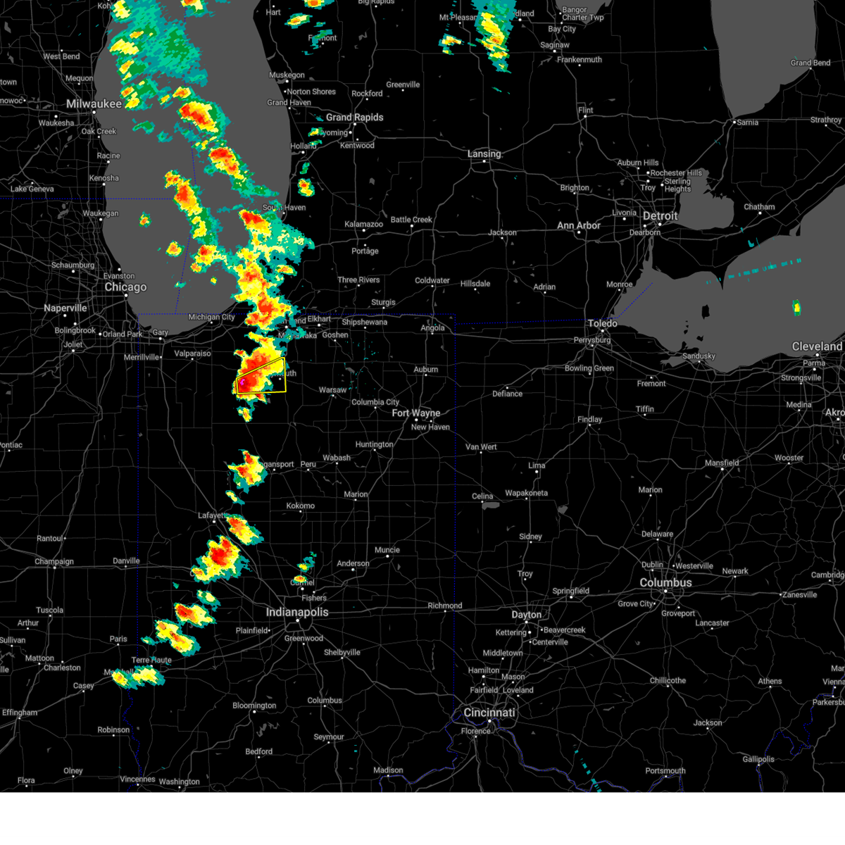 At 238 pm edt/138 pm cdt/, a severe thunderstorm was located near hamlet, or near knox, moving northeast at 35 mph. this is a destructive storm for northeast starke and northwest marshall counties (radar indicated). Hazards include baseball size hail and 60 mph wind gusts. People and animals outdoors will be severely injured. Expect shattered windows, extensive damage to roofs, siding, and vehicles. At 238 pm edt/138 pm cdt/, a severe thunderstorm was located near hamlet, or near knox, moving northeast at 35 mph. this is a destructive storm for northeast starke and northwest marshall counties (radar indicated). Hazards include baseball size hail and 60 mph wind gusts. People and animals outdoors will be severely injured. Expect shattered windows, extensive damage to roofs, siding, and vehicles.
|
| 6/25/2023 1:36 PM CDT | Ping Pong Ball sized hail reported 0.2 miles NNE of Knox, IN |
| 6/25/2023 1:36 PM CDT | Quarter sized hail reported 4.8 miles ENE of Knox, IN |
| 6/25/2023 1:35 PM CDT | Golf Ball sized hail reported 1 miles W of Knox, IN |
| 6/25/2023 1:34 PM CDT | Hen Egg sized hail reported 2.8 miles SW of Knox, IN, reported by not trained spotter. |
| 6/25/2023 1:30 PM CDT |
 At 230 pm edt/130 pm cdt/, a severe thunderstorm was located over hamlet, or near knox, moving northeast at 50 mph (radar indicated). Hazards include golf ball size hail and 60 mph wind gusts. People and animals outdoors will be injured. expect hail damage to roofs, siding, windows, and vehicles. expect wind damage to roofs, siding, and trees. this severe storm will be near, walkerton and koontz lake around 240 pm edt. plymouth and north liberty around 245 pm edt. other locations impacted by this severe thunderstorm include ober, twin lakes, teegarden, south center, rutland, oak grove, salem heights, burr oak, maxinkuckee and brems. thunderstorm damage threat, considerable hail threat, radar indicated max hail size, 1. 75 in wind threat, radar indicated max wind gust, 60 mph. At 230 pm edt/130 pm cdt/, a severe thunderstorm was located over hamlet, or near knox, moving northeast at 50 mph (radar indicated). Hazards include golf ball size hail and 60 mph wind gusts. People and animals outdoors will be injured. expect hail damage to roofs, siding, windows, and vehicles. expect wind damage to roofs, siding, and trees. this severe storm will be near, walkerton and koontz lake around 240 pm edt. plymouth and north liberty around 245 pm edt. other locations impacted by this severe thunderstorm include ober, twin lakes, teegarden, south center, rutland, oak grove, salem heights, burr oak, maxinkuckee and brems. thunderstorm damage threat, considerable hail threat, radar indicated max hail size, 1. 75 in wind threat, radar indicated max wind gust, 60 mph.
|
| 6/25/2023 1:05 PM CDT |
 At 204 pm edt/104 pm cdt/, a severe thunderstorm was located near knox, moving east at 30 mph (radar indicated). Hazards include golf ball size hail and 60 mph wind gusts. People and animals outdoors will be injured. expect hail damage to roofs, siding, windows, and vehicles. expect wind damage to roofs, siding, and trees. this severe thunderstorm will be near, knox around 210 pm edt. hamlet around 215 pm edt. walkerton and koontz lake around 230 pm edt. plymouth and north liberty around 240 pm edt. other locations impacted by this severe thunderstorm include lomax, ober, teegarden, english lake, salem heights, hanna, brems, tyner, hibbard and winona. thunderstorm damage threat, considerable hail threat, radar indicated max hail size, 1. 75 in wind threat, radar indicated max wind gust, 60 mph. At 204 pm edt/104 pm cdt/, a severe thunderstorm was located near knox, moving east at 30 mph (radar indicated). Hazards include golf ball size hail and 60 mph wind gusts. People and animals outdoors will be injured. expect hail damage to roofs, siding, windows, and vehicles. expect wind damage to roofs, siding, and trees. this severe thunderstorm will be near, knox around 210 pm edt. hamlet around 215 pm edt. walkerton and koontz lake around 230 pm edt. plymouth and north liberty around 240 pm edt. other locations impacted by this severe thunderstorm include lomax, ober, teegarden, english lake, salem heights, hanna, brems, tyner, hibbard and winona. thunderstorm damage threat, considerable hail threat, radar indicated max hail size, 1. 75 in wind threat, radar indicated max wind gust, 60 mph.
|
| 4/5/2023 9:40 AM CDT |
 The severe thunderstorm warning for western st. joseph, northwestern fulton, pulaski, starke, western marshall, la porte and berrien counties will expire at 1045 am edt/945 am cdt/, the storms which prompted the warning have moved out of the area. therefore, the warning will be allowed to expire. a tornado watch remains in effect until 400 pm edt/300 pm cdt/ for north central and northwestern indiana, and southwestern michigan. The severe thunderstorm warning for western st. joseph, northwestern fulton, pulaski, starke, western marshall, la porte and berrien counties will expire at 1045 am edt/945 am cdt/, the storms which prompted the warning have moved out of the area. therefore, the warning will be allowed to expire. a tornado watch remains in effect until 400 pm edt/300 pm cdt/ for north central and northwestern indiana, and southwestern michigan.
|
| 4/5/2023 10:36 AM EDT |
 At 1035 am edt/935 am cdt/, severe thunderstorms were located along a line extending from near hartford to new carlisle to 7 miles east of la crosse, moving east at 50 mph (radar indicated). Hazards include 60 mph wind gusts and penny size hail. Expect damage to roofs, siding, and trees. severe thunderstorms will be near, south bend around 1045 am edt. georgetown and roseland around 1050 am edt. mishawaka, niles, walkerton and koontz lake around 1055 am edt. other locations in the path of these severe thunderstorms include plymouth, granger, north liberty, edwardsburg, elkhart, simonton lake, cassopolis, lakeville, bremen, nappanee, wakarusa and white pigeon. this includes interstate 80 in indiana between mile markers 72 and 111. hail threat, radar indicated max hail size, 0. 75 in wind threat, radar indicated max wind gust, 60 mph. At 1035 am edt/935 am cdt/, severe thunderstorms were located along a line extending from near hartford to new carlisle to 7 miles east of la crosse, moving east at 50 mph (radar indicated). Hazards include 60 mph wind gusts and penny size hail. Expect damage to roofs, siding, and trees. severe thunderstorms will be near, south bend around 1045 am edt. georgetown and roseland around 1050 am edt. mishawaka, niles, walkerton and koontz lake around 1055 am edt. other locations in the path of these severe thunderstorms include plymouth, granger, north liberty, edwardsburg, elkhart, simonton lake, cassopolis, lakeville, bremen, nappanee, wakarusa and white pigeon. this includes interstate 80 in indiana between mile markers 72 and 111. hail threat, radar indicated max hail size, 0. 75 in wind threat, radar indicated max wind gust, 60 mph.
|
| 4/5/2023 9:17 AM CDT |
 At 1017 am edt/917 am cdt/, severe thunderstorms were located along a line extending from benton heights to near three oaks to la crosse, moving east at 50 mph (radar indicated). Hazards include 60 mph wind gusts and penny size hail. Expect damage to roofs, siding, and trees. these severe storms will be near, benton harbor, st. joseph, benton heights and fair plain around 1020 am edt. other locations in the path of these severe thunderstorms include buchanan, watervliet, coloma, berrien springs, paw paw lake, knox, georgetown, hamlet, niles, walkerton, koontz lake and plymouth. this includes the following highways, interstate 196 between mile markers 0 and 7. interstate 80 in indiana between mile markers 38 and 77. interstate 94 in indiana between mile markers 33 and 45. interstate 94 in michigan between mile markers 0 and 42. hail threat, radar indicated max hail size, 0. 75 in wind threat, radar indicated max wind gust, 60 mph. At 1017 am edt/917 am cdt/, severe thunderstorms were located along a line extending from benton heights to near three oaks to la crosse, moving east at 50 mph (radar indicated). Hazards include 60 mph wind gusts and penny size hail. Expect damage to roofs, siding, and trees. these severe storms will be near, benton harbor, st. joseph, benton heights and fair plain around 1020 am edt. other locations in the path of these severe thunderstorms include buchanan, watervliet, coloma, berrien springs, paw paw lake, knox, georgetown, hamlet, niles, walkerton, koontz lake and plymouth. this includes the following highways, interstate 196 between mile markers 0 and 7. interstate 80 in indiana between mile markers 38 and 77. interstate 94 in indiana between mile markers 33 and 45. interstate 94 in michigan between mile markers 0 and 42. hail threat, radar indicated max hail size, 0. 75 in wind threat, radar indicated max wind gust, 60 mph.
|
| 4/5/2023 9:02 AM CDT |
 At 1002 am edt/902 am cdt/, severe thunderstorms were located along a line extending from 7 miles west of st. joseph to new buffalo to near hebron, moving east at 50 mph (radar indicated). Hazards include 60 mph wind gusts and penny size hail. expect damage to roofs, siding, and trees At 1002 am edt/902 am cdt/, severe thunderstorms were located along a line extending from 7 miles west of st. joseph to new buffalo to near hebron, moving east at 50 mph (radar indicated). Hazards include 60 mph wind gusts and penny size hail. expect damage to roofs, siding, and trees
|
| 4/5/2023 7:14 AM CDT |
 At 814 am edt/714 am cdt/, a severe thunderstorm was located over north judson, or 8 miles west of knox, moving northeast at 60 mph (radar indicated). Hazards include ping pong ball size hail and 60 mph wind gusts. People and animals outdoors will be injured. expect hail damage to roofs, siding, windows, and vehicles. Expect wind damage to roofs, siding, and trees. At 814 am edt/714 am cdt/, a severe thunderstorm was located over north judson, or 8 miles west of knox, moving northeast at 60 mph (radar indicated). Hazards include ping pong ball size hail and 60 mph wind gusts. People and animals outdoors will be injured. expect hail damage to roofs, siding, windows, and vehicles. Expect wind damage to roofs, siding, and trees.
|
| 3/22/2023 4:45 PM CDT |
 At 545 pm edt/445 pm cdt/, a severe thunderstorm was located near north judson, or near knox, moving east at 60 mph (radar indicated). Hazards include quarter size hail. damage to vehicles is expected At 545 pm edt/445 pm cdt/, a severe thunderstorm was located near north judson, or near knox, moving east at 60 mph (radar indicated). Hazards include quarter size hail. damage to vehicles is expected
|
| 8/29/2022 3:35 PM EDT |
 At 334 pm edt/234 pm cdt/, severe thunderstorms were located along a line extending from near koontz lake to near winamac, moving east at 55 mph (radar indicated). Hazards include 70 mph wind gusts. Expect considerable tree damage. damage is likely to mobile homes, roofs, and outbuildings. Locations impacted include, plymouth, rochester, argos and bourbon. At 334 pm edt/234 pm cdt/, severe thunderstorms were located along a line extending from near koontz lake to near winamac, moving east at 55 mph (radar indicated). Hazards include 70 mph wind gusts. Expect considerable tree damage. damage is likely to mobile homes, roofs, and outbuildings. Locations impacted include, plymouth, rochester, argos and bourbon.
|
| 8/29/2022 2:30 PM CDT | Large tree branch blocking the roa in starke county IN, 7.1 miles N of Knox, IN |
| 8/29/2022 3:14 PM EDT | At 313 pm edt/213 pm cdt/, severe thunderstorms were located along a line extending from near wanatah to near medaryville, moving east at 55 mph. destructive storms spreading into sw la porte, western starke and northwest pulaski county! (radar indicated). Hazards include 80 mph wind gusts. Flying debris will be dangerous to those caught without shelter. mobile homes will be heavily damaged. expect considerable damage to roofs, windows, and vehicles. extensive tree damage and power outages are likely. Locations impacted include, kingsford heights, knox, hamlet, winamac, walkerton, koontz lake, plymouth, rochester, argos and bourbon. |
| 8/29/2022 2:56 PM EDT | At 255 pm edt/155 pm cdt/, severe thunderstorms were located along a line extending from lincoln hills to de motte, moving east at 60 mph. these are destructive storms for areas along and north of us30 (radar indicated). Hazards include 80 mph wind gusts. Flying debris will be dangerous to those caught without shelter. mobile homes will be heavily damaged. expect considerable damage to roofs, windows, and vehicles. extensive tree damage and power outages are likely. severe thunderstorms will be near, wanatah around 305 pm edt. medaryville around 310 pm edt. north judson and kingsford heights around 315 pm edt. knox and hamlet around 320 pm edt. winamac, walkerton and koontz lake around 325 pm edt. plymouth and culver around 335 pm edt. rochester, bremen and bourbon around 345 pm edt. Other locations impacted by these severe thunderstorms include lomax, beardstown, nyena lake, brems, tyner, hibbard, tippecanoe, clarks, linkville and star city. |
| 8/28/2022 11:07 PM EDT | At 1107 pm edt/1007 pm cdt/, a severe thunderstorm was located 7 miles north of winamac, moving northeast at 45 mph (radar indicated). Hazards include 60 mph wind gusts. expect damage to roofs, siding, and trees |
| 8/7/2022 2:05 PM CDT |
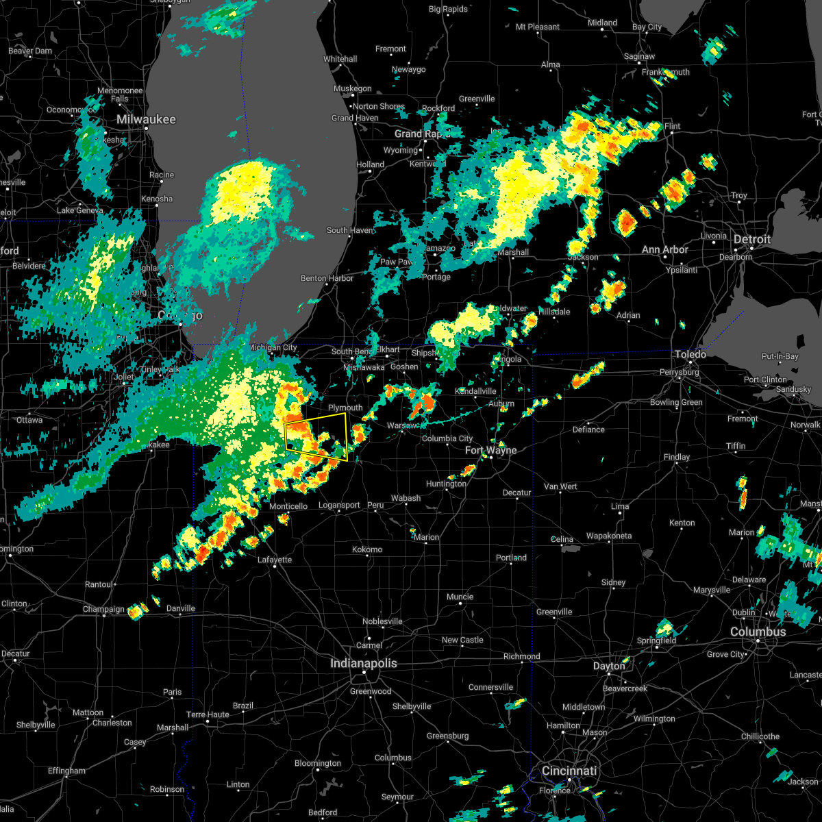 The severe thunderstorm warning for northeastern pulaski, northwestern fulton, southeastern starke and southwestern marshall counties will expire at 315 pm edt/215 pm cdt/, the storm which prompted the warning has weakened below severe limits, and no longer poses an immediate threat to life or property. therefore, the warning will be allowed to expire. however heavy rain is still possible with this thunderstorm. The severe thunderstorm warning for northeastern pulaski, northwestern fulton, southeastern starke and southwestern marshall counties will expire at 315 pm edt/215 pm cdt/, the storm which prompted the warning has weakened below severe limits, and no longer poses an immediate threat to life or property. therefore, the warning will be allowed to expire. however heavy rain is still possible with this thunderstorm.
|
| 8/7/2022 2:00 PM CDT |
 At 259 pm edt/159 pm cdt/, a severe thunderstorm was located near culver, or 8 miles southeast of knox, moving east at 35 mph (radar indicated). Hazards include 60 mph wind gusts. Expect damage to roofs, siding, and trees. locations impacted include, plymouth, knox, north judson, culver, oak grove, monterey, leiters ford, beardstown, ober, twin lakes, rutland, burr oak, maxinkuckee, denham, toto, hibbard, winona, delong, bass lake and ora. hail threat, radar indicated max hail size, <. 75 in wind threat, radar indicated max wind gust, 60 mph. At 259 pm edt/159 pm cdt/, a severe thunderstorm was located near culver, or 8 miles southeast of knox, moving east at 35 mph (radar indicated). Hazards include 60 mph wind gusts. Expect damage to roofs, siding, and trees. locations impacted include, plymouth, knox, north judson, culver, oak grove, monterey, leiters ford, beardstown, ober, twin lakes, rutland, burr oak, maxinkuckee, denham, toto, hibbard, winona, delong, bass lake and ora. hail threat, radar indicated max hail size, <. 75 in wind threat, radar indicated max wind gust, 60 mph.
|
| 8/7/2022 2:46 PM EDT |
 At 245 pm edt/145 pm cdt/, a severe thunderstorm was located near knox, moving east at 35 mph (radar indicated). Hazards include 60 mph wind gusts. Expect damage to roofs, siding, and trees. locations impacted include, plymouth, knox, winamac, north judson, culver, medaryville, oak grove, ripley, kewanna, monterey, leiters ford, lomax, beardstown, ober, english lake, denham, hibbard, clarks, winona and delong. hail threat, radar indicated max hail size, <. 75 in wind threat, radar indicated max wind gust, 60 mph. At 245 pm edt/145 pm cdt/, a severe thunderstorm was located near knox, moving east at 35 mph (radar indicated). Hazards include 60 mph wind gusts. Expect damage to roofs, siding, and trees. locations impacted include, plymouth, knox, winamac, north judson, culver, medaryville, oak grove, ripley, kewanna, monterey, leiters ford, lomax, beardstown, ober, english lake, denham, hibbard, clarks, winona and delong. hail threat, radar indicated max hail size, <. 75 in wind threat, radar indicated max wind gust, 60 mph.
|
| 8/7/2022 2:15 PM EDT |
 At 215 pm edt/115 pm cdt/, a severe thunderstorm was located over dunns bridge, moving east at 35 mph (radar indicated). Hazards include 60 mph wind gusts. expect damage to roofs, siding, and trees At 215 pm edt/115 pm cdt/, a severe thunderstorm was located over dunns bridge, moving east at 35 mph (radar indicated). Hazards include 60 mph wind gusts. expect damage to roofs, siding, and trees
|
| 8/3/2022 4:00 PM CDT |
 At 500 pm edt/400 pm cdt/, severe thunderstorms were located along a line extending from near walkerton to near francesville, moving east at 30 mph (radar indicated). Hazards include 60 mph wind gusts. Expect damage to roofs, siding, and trees. locations impacted include, knox, north judson, francesville, hamlet, medaryville, toto, clarks, denham, brems, grovertown and bass lake. hail threat, radar indicated max hail size, <. 75 in wind threat, radar indicated max wind gust, 60 mph. At 500 pm edt/400 pm cdt/, severe thunderstorms were located along a line extending from near walkerton to near francesville, moving east at 30 mph (radar indicated). Hazards include 60 mph wind gusts. Expect damage to roofs, siding, and trees. locations impacted include, knox, north judson, francesville, hamlet, medaryville, toto, clarks, denham, brems, grovertown and bass lake. hail threat, radar indicated max hail size, <. 75 in wind threat, radar indicated max wind gust, 60 mph.
|
| 8/3/2022 4:29 PM EDT |
 At 429 pm edt/329 pm cdt/, severe thunderstorms were located along a line extending from 6 miles southwest of kingsford heights to rensselaer, moving east at 25 mph (radar indicated). Hazards include 60 mph wind gusts. Expect damage to roofs, siding, and trees. locations impacted include, knox, north judson, francesville, hamlet, medaryville, la crosse, lomax, english lake, denham, brems, toto, clarks, san pierre, grovertown and bass lake. hail threat, radar indicated max hail size, <. 75 in wind threat, radar indicated max wind gust, 60 mph. At 429 pm edt/329 pm cdt/, severe thunderstorms were located along a line extending from 6 miles southwest of kingsford heights to rensselaer, moving east at 25 mph (radar indicated). Hazards include 60 mph wind gusts. Expect damage to roofs, siding, and trees. locations impacted include, knox, north judson, francesville, hamlet, medaryville, la crosse, lomax, english lake, denham, brems, toto, clarks, san pierre, grovertown and bass lake. hail threat, radar indicated max hail size, <. 75 in wind threat, radar indicated max wind gust, 60 mph.
|
| 8/3/2022 4:12 PM EDT |
 At 411 pm edt/311 pm cdt/, severe thunderstorms were located along a line extending from near la crosse to near surrey, moving east at 30 mph (radar indicated). Hazards include 60 mph wind gusts and penny size hail. expect damage to roofs, siding, and trees At 411 pm edt/311 pm cdt/, severe thunderstorms were located along a line extending from near la crosse to near surrey, moving east at 30 mph (radar indicated). Hazards include 60 mph wind gusts and penny size hail. expect damage to roofs, siding, and trees
|
| 7/23/2022 7:25 AM EDT |
 At 725 am edt/625 am cdt/, severe thunderstorms were located along a line extending from near bourbon to near culver to near north judson, moving southeast at 20 mph (radar indicated). Hazards include 60 mph wind gusts and quarter size hail. Hail damage to vehicles is expected. Expect wind damage to roofs, siding, and trees. At 725 am edt/625 am cdt/, severe thunderstorms were located along a line extending from near bourbon to near culver to near north judson, moving southeast at 20 mph (radar indicated). Hazards include 60 mph wind gusts and quarter size hail. Hail damage to vehicles is expected. Expect wind damage to roofs, siding, and trees.
|
| 7/23/2022 6:10 AM CDT |
 At 710 am edt/610 am cdt/, a severe thunderstorm was located over koontz lake, or 9 miles west of plymouth, moving southeast at 30 mph (radar indicated). Hazards include 60 mph wind gusts and quarter size hail. Hail damage to vehicles is expected. expect wind damage to roofs, siding, and trees. locations impacted include, plymouth, knox, walkerton, north liberty, kingsford heights, hamlet, la crosse, koontz lake, oak grove, hanna, la paz, lomax, ober, teegarden, english lake, salem heights, brems, tyner, hibbard and donaldson. hail threat, radar indicated max hail size, 1. 00 in wind threat, radar indicated max wind gust, 60 mph. At 710 am edt/610 am cdt/, a severe thunderstorm was located over koontz lake, or 9 miles west of plymouth, moving southeast at 30 mph (radar indicated). Hazards include 60 mph wind gusts and quarter size hail. Hail damage to vehicles is expected. expect wind damage to roofs, siding, and trees. locations impacted include, plymouth, knox, walkerton, north liberty, kingsford heights, hamlet, la crosse, koontz lake, oak grove, hanna, la paz, lomax, ober, teegarden, english lake, salem heights, brems, tyner, hibbard and donaldson. hail threat, radar indicated max hail size, 1. 00 in wind threat, radar indicated max wind gust, 60 mph.
|
| 7/23/2022 5:34 AM CDT |
 At 634 am edt/534 am cdt/, a severe thunderstorm was located near la porte, moving southeast at 30 mph (radar indicated). Hazards include 60 mph wind gusts and half dollar size hail. Hail damage to vehicles is expected. Expect wind damage to roofs, siding, and trees. At 634 am edt/534 am cdt/, a severe thunderstorm was located near la porte, moving southeast at 30 mph (radar indicated). Hazards include 60 mph wind gusts and half dollar size hail. Hail damage to vehicles is expected. Expect wind damage to roofs, siding, and trees.
|
| 6/13/2022 8:18 PM CDT |
 The national weather service in northern indiana has issued a * severe thunderstorm warning for. north central pulaski county in northwestern indiana. starke county in northwestern indiana. southwestern la porte county in northwestern indiana. Until 1000 pm edt/900 pm cdt/. The national weather service in northern indiana has issued a * severe thunderstorm warning for. north central pulaski county in northwestern indiana. starke county in northwestern indiana. southwestern la porte county in northwestern indiana. Until 1000 pm edt/900 pm cdt/.
|
| 6/13/2022 8:01 PM CDT |
 The national weather service in northern indiana has issued a * severe thunderstorm warning for. southern st. joseph county in north central indiana. northeastern starke county in northwestern indiana. northwestern marshall county in north central indiana. La porte county in northwestern indiana. The national weather service in northern indiana has issued a * severe thunderstorm warning for. southern st. joseph county in north central indiana. northeastern starke county in northwestern indiana. northwestern marshall county in north central indiana. La porte county in northwestern indiana.
|
| 3/25/2022 6:20 PM CDT | Public reports large pine tree limbs down. time estimated from rada in starke county IN, 0.5 miles S of Knox, IN |
| 10/11/2021 5:29 PM CDT |
 At 628 pm edt/528 pm cdt/, a severe thunderstorm was located near koontz lake, or 8 miles northeast of knox, moving northeast at 60 mph (public). Hazards include 70 mph wind gusts. Expect considerable tree damage. Damage is likely to mobile homes, roofs, and outbuildings. At 628 pm edt/528 pm cdt/, a severe thunderstorm was located near koontz lake, or 8 miles northeast of knox, moving northeast at 60 mph (public). Hazards include 70 mph wind gusts. Expect considerable tree damage. Damage is likely to mobile homes, roofs, and outbuildings.
|
| 10/11/2021 5:23 PM CDT | Report via spotter network of 74.6mph wind in starke county IN, 4.2 miles E of Knox, IN |
| 8/10/2021 10:25 PM CDT | Several trees and powerlines down. time estimate in starke county IN, 5.8 miles N of Knox, IN |
| 8/10/2021 10:02 PM CDT |
 At 1102 pm edt/1002 pm cdt/, a severe thunderstorm was located near gifford, moving east at 50 mph (radar indicated). Hazards include 60 mph wind gusts and penny size hail. expect damage to roofs, siding, and trees At 1102 pm edt/1002 pm cdt/, a severe thunderstorm was located near gifford, moving east at 50 mph (radar indicated). Hazards include 60 mph wind gusts and penny size hail. expect damage to roofs, siding, and trees
|
| 8/10/2021 10:18 PM EDT |
 At 1018 pm edt/918 pm cdt/, a severe thunderstorm was located near kingsford heights, or 9 miles southeast of westville, moving northeast at 35 mph (radar indicated). Hazards include 60 mph wind gusts and quarter size hail. Hail damage to vehicles is expected. Expect wind damage to roofs, siding, and trees. At 1018 pm edt/918 pm cdt/, a severe thunderstorm was located near kingsford heights, or 9 miles southeast of westville, moving northeast at 35 mph (radar indicated). Hazards include 60 mph wind gusts and quarter size hail. Hail damage to vehicles is expected. Expect wind damage to roofs, siding, and trees.
|
| 8/6/2021 5:59 PM CDT |
 At 559 pm cdt, a severe thunderstorm was located near knox, moving east at 20 mph (radar indicated). Hazards include 60 mph wind gusts. Expect damage to roofs, siding, and trees. locations impacted include, knox, hamlet, koontz lake, oak grove, toto, ober, winona, brems, grovertown and bass lake. hail threat, radar indicated max hail size, <. 75 in wind threat, radar indicated max wind gust, 60 mph. At 559 pm cdt, a severe thunderstorm was located near knox, moving east at 20 mph (radar indicated). Hazards include 60 mph wind gusts. Expect damage to roofs, siding, and trees. locations impacted include, knox, hamlet, koontz lake, oak grove, toto, ober, winona, brems, grovertown and bass lake. hail threat, radar indicated max hail size, <. 75 in wind threat, radar indicated max wind gust, 60 mph.
|
| 8/6/2021 5:47 PM CDT |
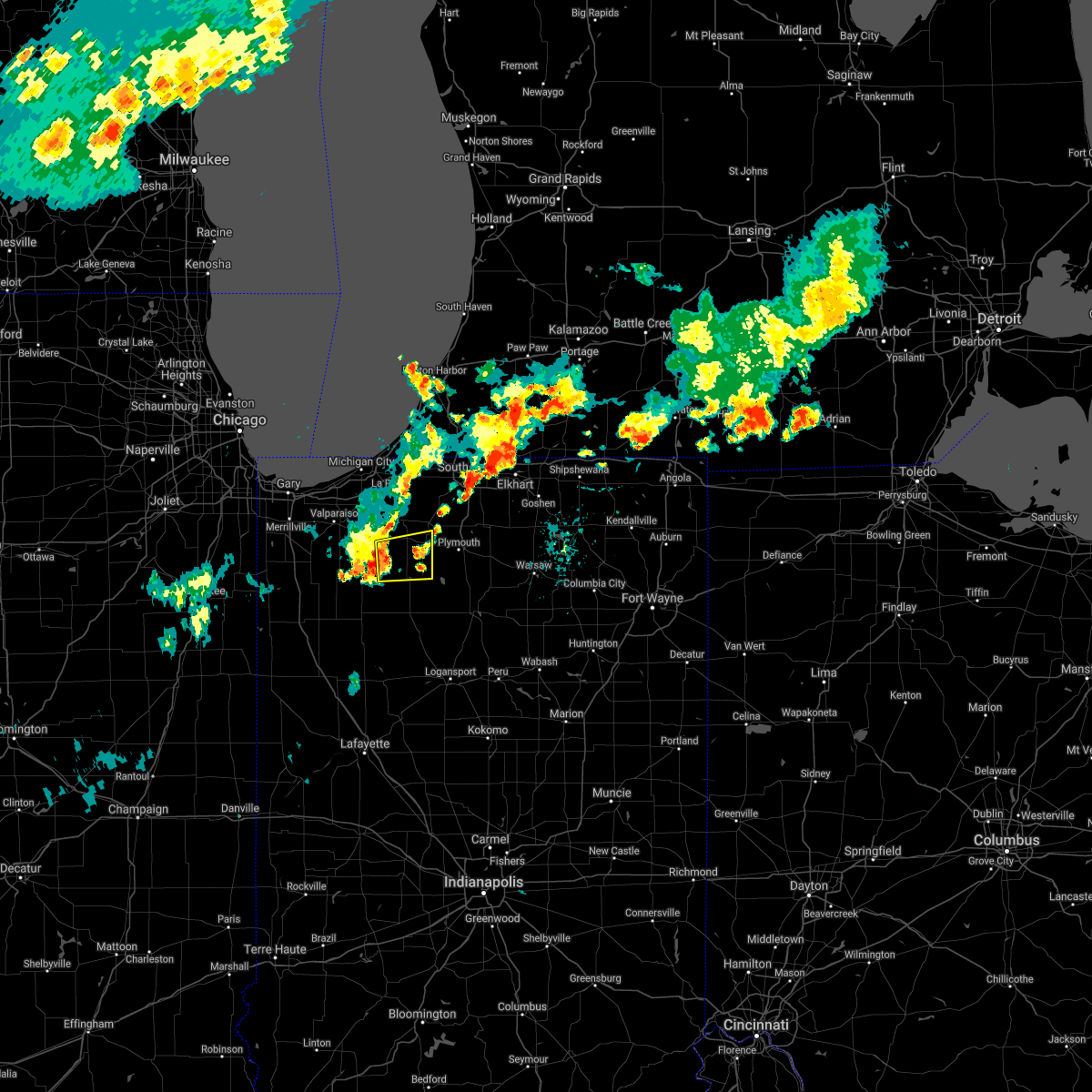 At 547 pm cdt, a severe thunderstorm was located near knox, moving east at 25 mph (radar indicated). Hazards include 60 mph wind gusts. expect damage to roofs, siding, and trees At 547 pm cdt, a severe thunderstorm was located near knox, moving east at 25 mph (radar indicated). Hazards include 60 mph wind gusts. expect damage to roofs, siding, and trees
|
| 7/24/2021 6:52 PM CDT |
 At 752 pm edt/652 pm cdt/, severe thunderstorms were located along a line extending from near lakeville to near kouts, moving southeast at 30 mph (radar indicated). Hazards include 60 mph wind gusts. Expect damage to roofs, siding, and trees. Locations impacted include, plymouth, knox, walkerton, bourbon, north judson, argos, culver, hamlet, la crosse, koontz lake, tippecanoe, oak grove, hanna, la paz, lomax, ober, teegarden, english lake, brems and tyner. At 752 pm edt/652 pm cdt/, severe thunderstorms were located along a line extending from near lakeville to near kouts, moving southeast at 30 mph (radar indicated). Hazards include 60 mph wind gusts. Expect damage to roofs, siding, and trees. Locations impacted include, plymouth, knox, walkerton, bourbon, north judson, argos, culver, hamlet, la crosse, koontz lake, tippecanoe, oak grove, hanna, la paz, lomax, ober, teegarden, english lake, brems and tyner.
|
| 7/24/2021 6:24 PM CDT |
 At 723 pm edt/623 pm cdt/, severe thunderstorms were located along a line extending from near new carlisle to near lakes of the four seasons, moving southeast at 30 mph (radar indicated). Hazards include 60 mph wind gusts. expect damage to roofs, siding, and trees At 723 pm edt/623 pm cdt/, severe thunderstorms were located along a line extending from near new carlisle to near lakes of the four seasons, moving southeast at 30 mph (radar indicated). Hazards include 60 mph wind gusts. expect damage to roofs, siding, and trees
|
| 7/7/2021 7:26 PM EDT |
 At 725 pm edt/625 pm cdt/, a severe thunderstorm was located near culver, or 7 miles southeast of knox, moving east at 40 mph (radar indicated). Hazards include 60 mph wind gusts and quarter size hail. Hail damage to vehicles is expected. Expect wind damage to roofs, siding, and trees. At 725 pm edt/625 pm cdt/, a severe thunderstorm was located near culver, or 7 miles southeast of knox, moving east at 40 mph (radar indicated). Hazards include 60 mph wind gusts and quarter size hail. Hail damage to vehicles is expected. Expect wind damage to roofs, siding, and trees.
|
| 6/26/2021 6:32 PM CDT |
 At 732 pm edt/632 pm cdt/, severe thunderstorms were located along a line extending from near new carlisle to near kingsford heights to near koontz lake to culver to 6 miles east of medaryville, moving east at 60 mph (radar indicated). Hazards include 70 mph wind gusts. Expect considerable tree damage. damage is likely to mobile homes, roofs, and outbuildings. Locations impacted include, la porte, knox, north judson, kingsford heights, francesville, hamlet, ripley, kingsbury, monterey, beardstown, ober, salem heights, fish lake, denham, stillwell, winona, byron, hudson lake, south center and vanmeter park. At 732 pm edt/632 pm cdt/, severe thunderstorms were located along a line extending from near new carlisle to near kingsford heights to near koontz lake to culver to 6 miles east of medaryville, moving east at 60 mph (radar indicated). Hazards include 70 mph wind gusts. Expect considerable tree damage. damage is likely to mobile homes, roofs, and outbuildings. Locations impacted include, la porte, knox, north judson, kingsford heights, francesville, hamlet, ripley, kingsbury, monterey, beardstown, ober, salem heights, fish lake, denham, stillwell, winona, byron, hudson lake, south center and vanmeter park.
|
| 6/26/2021 7:20 PM EDT |
 At 720 pm edt/620 pm cdt/, severe thunderstorms were located along a line extending from near three oaks to kingsford heights to near hamlet to 6 miles south of knox, moving northeast at 60 mph (radar indicated). Hazards include 70 mph wind gusts. Expect considerable tree damage. Damage is likely to mobile homes, roofs, and outbuildings. At 720 pm edt/620 pm cdt/, severe thunderstorms were located along a line extending from near three oaks to kingsford heights to near hamlet to 6 miles south of knox, moving northeast at 60 mph (radar indicated). Hazards include 70 mph wind gusts. Expect considerable tree damage. Damage is likely to mobile homes, roofs, and outbuildings.
|
| 6/26/2021 6:13 PM CDT | Numerous trees and power lines down across the count in starke county IN, 0.2 miles NNE of Knox, IN |
| 6/26/2021 6:08 PM CDT |
 At 708 pm edt/608 pm cdt/, severe thunderstorms were located along a line extending from beverly shores to near westville to near la crosse to 6 miles south of north judson to hanging grove, moving east at 60 mph (radar indicated). Hazards include 70 mph wind gusts. Expect considerable tree damage. damage is likely to mobile homes, roofs, and outbuildings. Locations impacted include, michigan city, la porte, westville, knox, winamac, trail creek, north judson, kingsford heights, wanatah, francesville, hamlet, medaryville, la crosse, pulaski, ripley, hanna, kingsbury, monterey, lomax and beardstown. At 708 pm edt/608 pm cdt/, severe thunderstorms were located along a line extending from beverly shores to near westville to near la crosse to 6 miles south of north judson to hanging grove, moving east at 60 mph (radar indicated). Hazards include 70 mph wind gusts. Expect considerable tree damage. damage is likely to mobile homes, roofs, and outbuildings. Locations impacted include, michigan city, la porte, westville, knox, winamac, trail creek, north judson, kingsford heights, wanatah, francesville, hamlet, medaryville, la crosse, pulaski, ripley, hanna, kingsbury, monterey, lomax and beardstown.
|
| 6/26/2021 5:44 PM CDT |
 At 643 pm edt/543 pm cdt/, severe thunderstorms were located along a line extending from south haven to near hebron to near fair oaks to near percy junction, moving east at 55 mph (radar indicated). Hazards include 60 mph wind gusts. expect damage to roofs, siding, and trees At 643 pm edt/543 pm cdt/, severe thunderstorms were located along a line extending from south haven to near hebron to near fair oaks to near percy junction, moving east at 55 mph (radar indicated). Hazards include 60 mph wind gusts. expect damage to roofs, siding, and trees
|
| 6/21/2021 1:55 AM EDT |
 At 155 am edt/1255 am cdt/, severe thunderstorms were located along a line extending from near georgetown to near knox to near north judson to gifford, moving east at 45 mph (radar indicated). Hazards include 60 mph wind gusts and quarter size hail. Hail damage to vehicles is expected. expect wind damage to roofs, siding, and trees. Locations impacted include, south bend, elkhart, mishawaka, niles, plymouth, nappanee, rochester, bremen, knox, georgetown, winamac, gulivoire park, granger, simonton lake, osceola, walkerton, north liberty, bourbon, wakarusa and argos. At 155 am edt/1255 am cdt/, severe thunderstorms were located along a line extending from near georgetown to near knox to near north judson to gifford, moving east at 45 mph (radar indicated). Hazards include 60 mph wind gusts and quarter size hail. Hail damage to vehicles is expected. expect wind damage to roofs, siding, and trees. Locations impacted include, south bend, elkhart, mishawaka, niles, plymouth, nappanee, rochester, bremen, knox, georgetown, winamac, gulivoire park, granger, simonton lake, osceola, walkerton, north liberty, bourbon, wakarusa and argos.
|
| 6/21/2021 1:30 AM EDT |
 At 130 am edt/1230 am cdt/, severe thunderstorms were located along a line extending from new buffalo to near moody, moving east at 60 mph (radar indicated). Hazards include 70 mph wind gusts and quarter size hail. Hail damage to vehicles is expected. expect considerable tree damage. Wind damage is also likely to mobile homes, roofs, and outbuildings. At 130 am edt/1230 am cdt/, severe thunderstorms were located along a line extending from new buffalo to near moody, moving east at 60 mph (radar indicated). Hazards include 70 mph wind gusts and quarter size hail. Hail damage to vehicles is expected. expect considerable tree damage. Wind damage is also likely to mobile homes, roofs, and outbuildings.
|
| 6/20/2021 5:14 PM CDT | Trees downs across much of western starke count in starke county IN, 5.4 miles SE of Knox, IN |
| 6/20/2021 4:57 PM CDT |
 At 456 pm cdt, a severe thunderstorm was located near la crosse, or 8 miles northeast of dunns bridge, moving northeast at 20 mph (radar indicated). Hazards include 60 mph wind gusts and quarter size hail. Hail damage to vehicles is expected. Expect wind damage to roofs, siding, and trees. At 456 pm cdt, a severe thunderstorm was located near la crosse, or 8 miles northeast of dunns bridge, moving northeast at 20 mph (radar indicated). Hazards include 60 mph wind gusts and quarter size hail. Hail damage to vehicles is expected. Expect wind damage to roofs, siding, and trees.
|
| 6/19/2021 9:15 PM CDT | Reports of trees and limbs down along sr 8 between n cr 100 w and n range roa in starke county IN, 5.1 miles ESE of Knox, IN |
| 6/19/2021 9:14 PM CDT |
 At 1014 pm edt/914 pm cdt/, a severe thunderstorm was located over knox, moving southeast at 20 mph (radar indicated). Hazards include 60 mph wind gusts and penny size hail. Expect damage to roofs, siding, and trees. Locations impacted include, knox, north judson, culver, oak grove, ober, rutland, burr oak, maxinkuckee, brems, toto, hibbard, winona, bass lake and ora. At 1014 pm edt/914 pm cdt/, a severe thunderstorm was located over knox, moving southeast at 20 mph (radar indicated). Hazards include 60 mph wind gusts and penny size hail. Expect damage to roofs, siding, and trees. Locations impacted include, knox, north judson, culver, oak grove, ober, rutland, burr oak, maxinkuckee, brems, toto, hibbard, winona, bass lake and ora.
|
| 6/19/2021 8:43 PM CDT |
 At 943 pm edt/843 pm cdt/, a severe thunderstorm was located near hamlet, or near knox, moving southeast at 30 mph (radar indicated). Hazards include 60 mph wind gusts and penny size hail. expect damage to roofs, siding, and trees At 943 pm edt/843 pm cdt/, a severe thunderstorm was located near hamlet, or near knox, moving southeast at 30 mph (radar indicated). Hazards include 60 mph wind gusts and penny size hail. expect damage to roofs, siding, and trees
|
| 10/12/2020 3:34 PM CDT |
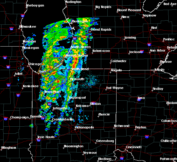 At 334 pm cdt, a severe thunderstorm was located near knox, moving northeast at 55 mph (radar indicated). Hazards include 60 mph wind gusts and quarter size hail. Hail damage to vehicles is expected. expect wind damage to roofs, siding, and trees. Locations impacted include, knox, hamlet, koontz lake, south center, salem heights, brems and grovertown. At 334 pm cdt, a severe thunderstorm was located near knox, moving northeast at 55 mph (radar indicated). Hazards include 60 mph wind gusts and quarter size hail. Hail damage to vehicles is expected. expect wind damage to roofs, siding, and trees. Locations impacted include, knox, hamlet, koontz lake, south center, salem heights, brems and grovertown.
|
| 10/12/2020 3:21 PM CDT |
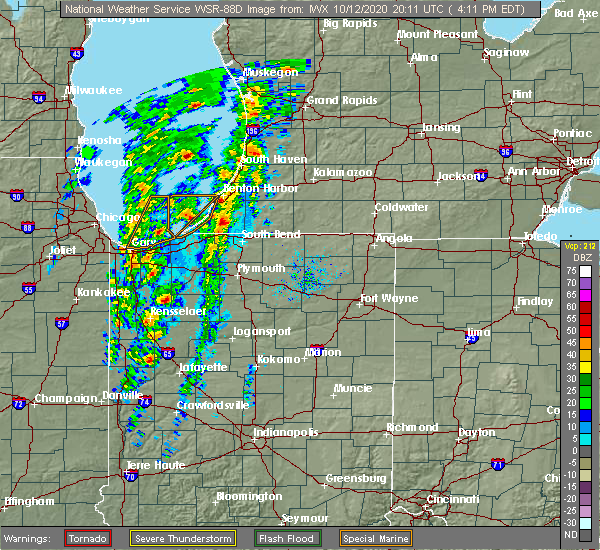 At 321 pm cdt, a severe thunderstorm was located near north judson, or near dunns bridge, moving northeast at 55 mph (radar indicated). Hazards include 60 mph wind gusts and quarter size hail. Hail damage to vehicles is expected. Expect wind damage to roofs, siding, and trees. At 321 pm cdt, a severe thunderstorm was located near north judson, or near dunns bridge, moving northeast at 55 mph (radar indicated). Hazards include 60 mph wind gusts and quarter size hail. Hail damage to vehicles is expected. Expect wind damage to roofs, siding, and trees.
|
| 8/10/2020 6:19 PM EDT |
 At 618 pm edt/518 pm cdt/, severe thunderstorms were located along a line extending from near dowagiac to near gulivoire park to near bremen to near culver, moving east at 60 mph. these are very dangerous storms (trained weather spotters quarter sized hail and tree branches down in baroda, michigan). Hazards include 80 mph wind gusts and quarter size hail. Flying debris will be dangerous to those caught without shelter. mobile homes will be heavily damaged. expect considerable damage to roofs, windows, and vehicles. extensive tree damage and power outages are likely. these severe storms will be near, dowagiac around 625 pm edt. osceola and bourbon around 630 pm edt. Other locations impacted by these severe thunderstorms include dewey lake, harbert, bertrand, fish lake, brems, crumstown, tyner, millburg, hibbard and tippecanoe. At 618 pm edt/518 pm cdt/, severe thunderstorms were located along a line extending from near dowagiac to near gulivoire park to near bremen to near culver, moving east at 60 mph. these are very dangerous storms (trained weather spotters quarter sized hail and tree branches down in baroda, michigan). Hazards include 80 mph wind gusts and quarter size hail. Flying debris will be dangerous to those caught without shelter. mobile homes will be heavily damaged. expect considerable damage to roofs, windows, and vehicles. extensive tree damage and power outages are likely. these severe storms will be near, dowagiac around 625 pm edt. osceola and bourbon around 630 pm edt. Other locations impacted by these severe thunderstorms include dewey lake, harbert, bertrand, fish lake, brems, crumstown, tyner, millburg, hibbard and tippecanoe.
|
| 8/10/2020 6:11 PM EDT |
 At 610 pm edt/510 pm cdt/, severe thunderstorms were located along a line extending from berrien springs to 6 miles southeast of new carlisle to 6 miles northwest of plymouth to near culver, moving east at 60 mph. these are very dangerous storms (trained weather spotters quarter sized hail and tree branches down in baroda, michigan). Hazards include 80 mph wind gusts and quarter size hail. Flying debris will be dangerous to those caught without shelter. mobile homes will be heavily damaged. expect considerable damage to roofs, windows, and vehicles. extensive tree damage and power outages are likely. these severe storms will be near, south bend and plymouth around 615 pm edt. niles, gulivoire park, lakeville and roseland around 620 pm edt. mishawaka, dowagiac, bremen and argos around 625 pm edt. osceola and bourbon around 630 pm edt. Other locations impacted by these severe thunderstorms include dewey lake, lomax, waterford, michiana shores, harbert, bertrand, fish lake, brems, crumstown and tyner. At 610 pm edt/510 pm cdt/, severe thunderstorms were located along a line extending from berrien springs to 6 miles southeast of new carlisle to 6 miles northwest of plymouth to near culver, moving east at 60 mph. these are very dangerous storms (trained weather spotters quarter sized hail and tree branches down in baroda, michigan). Hazards include 80 mph wind gusts and quarter size hail. Flying debris will be dangerous to those caught without shelter. mobile homes will be heavily damaged. expect considerable damage to roofs, windows, and vehicles. extensive tree damage and power outages are likely. these severe storms will be near, south bend and plymouth around 615 pm edt. niles, gulivoire park, lakeville and roseland around 620 pm edt. mishawaka, dowagiac, bremen and argos around 625 pm edt. osceola and bourbon around 630 pm edt. Other locations impacted by these severe thunderstorms include dewey lake, lomax, waterford, michiana shores, harbert, bertrand, fish lake, brems, crumstown and tyner.
|
| 8/10/2020 5:10 PM CDT | Storm damage reported in starke county IN, 3.9 miles SSE of Knox, IN |
| 8/10/2020 5:42 PM EDT |
 At 541 pm edt/441 pm cdt/, severe thunderstorms were located along a line extending from 9 miles northwest of new buffalo to near westville to wanatah to near dunns bridge, moving east at 60 mph. these are very dangerous storms (radar indicated). Hazards include 80 mph wind gusts and quarter size hail. Flying debris will be dangerous to those caught without shelter. mobile homes will be heavily damaged. expect considerable damage to roofs, windows, and vehicles. extensive tree damage and power outages are likely. these severe storms will be near, trail creek around 545 pm edt. new buffalo and kingsford heights around 550 pm edt. la porte, bridgman, north judson, shorewood-tower hills-harbert and shorewood-tower hill around 555 pm edt. knox, stevensville and hamlet around 600 pm edt. buchanan, walkerton, new carlisle and koontz lake around 605 pm edt. plymouth, north liberty and berrien springs around 610 pm edt. south bend, niles and culver around 615 pm edt. bremen, georgetown, gulivoire park, lakeville and roseland around 620 pm edt. Other locations impacted by these severe thunderstorms include dewey lake, lomax, waterford, michiana shores, harbert, bertrand, fish lake, brems, crumstown and tyner. At 541 pm edt/441 pm cdt/, severe thunderstorms were located along a line extending from 9 miles northwest of new buffalo to near westville to wanatah to near dunns bridge, moving east at 60 mph. these are very dangerous storms (radar indicated). Hazards include 80 mph wind gusts and quarter size hail. Flying debris will be dangerous to those caught without shelter. mobile homes will be heavily damaged. expect considerable damage to roofs, windows, and vehicles. extensive tree damage and power outages are likely. these severe storms will be near, trail creek around 545 pm edt. new buffalo and kingsford heights around 550 pm edt. la porte, bridgman, north judson, shorewood-tower hills-harbert and shorewood-tower hill around 555 pm edt. knox, stevensville and hamlet around 600 pm edt. buchanan, walkerton, new carlisle and koontz lake around 605 pm edt. plymouth, north liberty and berrien springs around 610 pm edt. south bend, niles and culver around 615 pm edt. bremen, georgetown, gulivoire park, lakeville and roseland around 620 pm edt. Other locations impacted by these severe thunderstorms include dewey lake, lomax, waterford, michiana shores, harbert, bertrand, fish lake, brems, crumstown and tyner.
|
| 8/10/2020 5:19 PM EDT |
 At 517 pm edt/417 pm cdt/, severe thunderstorms were located along a line extending from 16 miles northeast of hyde park to near gary to near crown point to near lake village, moving east at 55 mph. these are very dangerous storms (radar indicated). Hazards include 80 mph wind gusts and quarter size hail. Flying debris will be dangerous to those caught without shelter. mobile homes will be heavily damaged. expect considerable damage to roofs, windows, and vehicles. extensive tree damage and power outages are likely. severe thunderstorms will be near, wanatah and la crosse around 540 pm edt. westville and trail creek around 545 pm edt. new buffalo and kingsford heights around 550 pm edt. la porte, knox, bridgman, north judson, three oaks, hamlet, shorewood-tower hills-harbert and shorewood-tower hill around 555 pm edt. stevensville around 600 pm edt. buchanan, walkerton, new carlisle and koontz lake around 605 pm edt. plymouth, north liberty and berrien springs around 610 pm edt. south bend, niles and culver around 615 pm edt. this includes the following highways, interstate 196 between mile markers 0 and 7. interstate 80 in indiana between mile markers 38 and 87. interstate 94 in indiana between mile markers 33 and 45. Interstate 94 in michigan between mile markers 0 and 42. At 517 pm edt/417 pm cdt/, severe thunderstorms were located along a line extending from 16 miles northeast of hyde park to near gary to near crown point to near lake village, moving east at 55 mph. these are very dangerous storms (radar indicated). Hazards include 80 mph wind gusts and quarter size hail. Flying debris will be dangerous to those caught without shelter. mobile homes will be heavily damaged. expect considerable damage to roofs, windows, and vehicles. extensive tree damage and power outages are likely. severe thunderstorms will be near, wanatah and la crosse around 540 pm edt. westville and trail creek around 545 pm edt. new buffalo and kingsford heights around 550 pm edt. la porte, knox, bridgman, north judson, three oaks, hamlet, shorewood-tower hills-harbert and shorewood-tower hill around 555 pm edt. stevensville around 600 pm edt. buchanan, walkerton, new carlisle and koontz lake around 605 pm edt. plymouth, north liberty and berrien springs around 610 pm edt. south bend, niles and culver around 615 pm edt. this includes the following highways, interstate 196 between mile markers 0 and 7. interstate 80 in indiana between mile markers 38 and 87. interstate 94 in indiana between mile markers 33 and 45. Interstate 94 in michigan between mile markers 0 and 42.
|
| 6/26/2020 9:41 PM CDT |
 The severe thunderstorm warning for starke and south central la porte counties will expire at 945 pm cdt, the storm which prompted the warning has moved out of the area. therefore, the warning will be allowed to expire. however gusty winds are still possible with other thunderstorms. a severe thunderstorm watch remains in effect until 400 am cdt for northwestern indiana. The severe thunderstorm warning for starke and south central la porte counties will expire at 945 pm cdt, the storm which prompted the warning has moved out of the area. therefore, the warning will be allowed to expire. however gusty winds are still possible with other thunderstorms. a severe thunderstorm watch remains in effect until 400 am cdt for northwestern indiana.
|
| 6/26/2020 9:30 PM CDT |
 At 929 pm cdt, a severe thunderstorm was located near hamlet, or near knox, moving east at 60 mph (radar indicated). Hazards include 70 mph wind gusts. Expect considerable tree damage. damage is likely to mobile homes, roofs, and outbuildings. Locations impacted include, knox, north judson, hamlet, oak grove, hanna, toto, ober, winona, bass lake, brems, grovertown and ora. At 929 pm cdt, a severe thunderstorm was located near hamlet, or near knox, moving east at 60 mph (radar indicated). Hazards include 70 mph wind gusts. Expect considerable tree damage. damage is likely to mobile homes, roofs, and outbuildings. Locations impacted include, knox, north judson, hamlet, oak grove, hanna, toto, ober, winona, bass lake, brems, grovertown and ora.
|
| 6/26/2020 9:25 PM CDT | Several trees and powerlines dow in starke county IN, 0.5 miles S of Knox, IN |
| 6/26/2020 9:00 PM CDT |
 At 900 pm cdt, a severe thunderstorm was located near lincoln hills, moving east at 65 mph (radar indicated). Hazards include 70 mph wind gusts. Expect considerable tree damage. Damage is likely to mobile homes, roofs, and outbuildings. At 900 pm cdt, a severe thunderstorm was located near lincoln hills, moving east at 65 mph (radar indicated). Hazards include 70 mph wind gusts. Expect considerable tree damage. Damage is likely to mobile homes, roofs, and outbuildings.
|
| 5/23/2020 9:15 PM CDT | Tree down on roa in starke county IN, 7 miles WSW of Knox, IN |
| 5/23/2020 9:00 PM CDT |
 At 900 pm cdt, a severe thunderstorm was located near hamlet, or 7 miles north of knox, moving east at 20 mph (radar indicated). Hazards include 60 mph wind gusts and half dollar size hail. Hail damage to vehicles is expected. expect wind damage to roofs, siding, and trees. Locations impacted include, knox, kingsford heights, hamlet, koontz lake, oak grove, toto, ober, south center, salem heights, brems, grovertown and bass lake. At 900 pm cdt, a severe thunderstorm was located near hamlet, or 7 miles north of knox, moving east at 20 mph (radar indicated). Hazards include 60 mph wind gusts and half dollar size hail. Hail damage to vehicles is expected. expect wind damage to roofs, siding, and trees. Locations impacted include, knox, kingsford heights, hamlet, koontz lake, oak grove, toto, ober, south center, salem heights, brems, grovertown and bass lake.
|
| 5/23/2020 8:46 PM CDT |
 At 845 pm cdt, a severe thunderstorm was located near la crosse, or 9 miles west of knox, moving east at 35 mph. another potentially severe thunderstorm was located near kingsford heights also moving east at 35 mph. at 821 pm cdt, half dollar size hail was reported west of wanatah (radar indicated). Hazards include 60 mph wind gusts and quarter size hail. Hail damage to vehicles is expected. Expect wind damage to roofs, siding, and trees. At 845 pm cdt, a severe thunderstorm was located near la crosse, or 9 miles west of knox, moving east at 35 mph. another potentially severe thunderstorm was located near kingsford heights also moving east at 35 mph. at 821 pm cdt, half dollar size hail was reported west of wanatah (radar indicated). Hazards include 60 mph wind gusts and quarter size hail. Hail damage to vehicles is expected. Expect wind damage to roofs, siding, and trees.
|
| 5/23/2020 8:23 PM CDT |
 At 821 pm cdt, a severe thunderstorm was located near wanatah, or 9 miles southeast of westville, moving east at 25 mph. another potentially severe thunderstorm was located over kouts which may move east into southern starke county (radar indicated). Hazards include 60 mph wind gusts and quarter size hail. Hail damage to vehicles is expected. expect wind damage to roofs, siding, and trees. Locations impacted include, westville, knox, kingsford heights, wanatah, hamlet, la crosse, hanna, kingsbury, thomaston, south center, salem heights, south wanatah, brems, tracy, stillwell, union mills and haskell. At 821 pm cdt, a severe thunderstorm was located near wanatah, or 9 miles southeast of westville, moving east at 25 mph. another potentially severe thunderstorm was located over kouts which may move east into southern starke county (radar indicated). Hazards include 60 mph wind gusts and quarter size hail. Hail damage to vehicles is expected. expect wind damage to roofs, siding, and trees. Locations impacted include, westville, knox, kingsford heights, wanatah, hamlet, la crosse, hanna, kingsbury, thomaston, south center, salem heights, south wanatah, brems, tracy, stillwell, union mills and haskell.
|
| 5/23/2020 7:56 PM CDT |
 At 755 pm cdt, a severe thunderstorm was located over malden, moving east at 25 mph (radar indicated). Hazards include 60 mph wind gusts and quarter size hail. Hail damage to vehicles is expected. Expect wind damage to roofs, siding, and trees. At 755 pm cdt, a severe thunderstorm was located over malden, moving east at 25 mph (radar indicated). Hazards include 60 mph wind gusts and quarter size hail. Hail damage to vehicles is expected. Expect wind damage to roofs, siding, and trees.
|
| 5/14/2020 11:15 PM CDT |
 At 1213 am edt/1113 pm cdt/, severe thunderstorms were located along a line extending from near malden to dunns bridge to moody, moving northeast at 40 mph (radar indicated). Hazards include 60 mph wind gusts and nickel size hail. expect damage to roofs, siding, and trees At 1213 am edt/1113 pm cdt/, severe thunderstorms were located along a line extending from near malden to dunns bridge to moody, moving northeast at 40 mph (radar indicated). Hazards include 60 mph wind gusts and nickel size hail. expect damage to roofs, siding, and trees
|
| 7/21/2019 4:05 PM EDT |
 At 305 pm cdt, severe thunderstorms were located along a line extending from near north judson to 10 miles east of medaryville to 6 miles southwest of winamac, moving east at 30 mph (radar indicated). Hazards include 60 mph wind gusts. Expect damage to roofs, siding, and trees. Locations impacted include, knox, winamac, north judson, francesville, medaryville, ripley, monterey, beardstown, ober, vanmeter park, denham, lawton, toto, clarks, winona, bass lake, san pierre and ora. At 305 pm cdt, severe thunderstorms were located along a line extending from near north judson to 10 miles east of medaryville to 6 miles southwest of winamac, moving east at 30 mph (radar indicated). Hazards include 60 mph wind gusts. Expect damage to roofs, siding, and trees. Locations impacted include, knox, winamac, north judson, francesville, medaryville, ripley, monterey, beardstown, ober, vanmeter park, denham, lawton, toto, clarks, winona, bass lake, san pierre and ora.
|
| 7/21/2019 3:53 PM EDT |
 At 253 pm cdt, severe thunderstorms were located along a line extending from dunns bridge to near medaryville to near francesville, moving east at 30 mph (radar indicated). Hazards include 60 mph wind gusts. expect damage to roofs, siding, and trees At 253 pm cdt, severe thunderstorms were located along a line extending from dunns bridge to near medaryville to near francesville, moving east at 30 mph (radar indicated). Hazards include 60 mph wind gusts. expect damage to roofs, siding, and trees
|
| 5/23/2019 4:26 AM EDT |
 The severe thunderstorm warning for eastern white, southwestern st. joseph, eastern pulaski, fulton, western cass, eastern starke and marshall counties will expire at 430 am edt/330 am cdt/, the storms which prompted the warning have moved out of the area. therefore, the warning will be allowed to expire. a severe thunderstorm watch remains in effect until 1000 am edt/900 am cdt/ for north central and northwestern indiana. The severe thunderstorm warning for eastern white, southwestern st. joseph, eastern pulaski, fulton, western cass, eastern starke and marshall counties will expire at 430 am edt/330 am cdt/, the storms which prompted the warning have moved out of the area. therefore, the warning will be allowed to expire. a severe thunderstorm watch remains in effect until 1000 am edt/900 am cdt/ for north central and northwestern indiana.
|
| 5/23/2019 4:13 AM EDT |
 At 411 am edt/311 am cdt/, severe thunderstorms were located along a line extending from near gulivoire park to 6 miles south of culver to 7 miles east of delphi, moving northeast at 65 mph (radar indicated). Hazards include 70 mph wind gusts. Expect considerable tree damage. damage is likely to mobile homes, roofs, and outbuildings. locations impacted include, logansport, plymouth, rochester, monticello, bremen, knox, winamac, walkerton, argos, brookston, culver, royal center, hamlet, lakeville, koontz lake, pulaski, walnut, oak grove, ripley and kewanna. this is a dangerous line of storms. These storms have a history of producing damaging wind gusts to 70 mph. At 411 am edt/311 am cdt/, severe thunderstorms were located along a line extending from near gulivoire park to 6 miles south of culver to 7 miles east of delphi, moving northeast at 65 mph (radar indicated). Hazards include 70 mph wind gusts. Expect considerable tree damage. damage is likely to mobile homes, roofs, and outbuildings. locations impacted include, logansport, plymouth, rochester, monticello, bremen, knox, winamac, walkerton, argos, brookston, culver, royal center, hamlet, lakeville, koontz lake, pulaski, walnut, oak grove, ripley and kewanna. this is a dangerous line of storms. These storms have a history of producing damaging wind gusts to 70 mph.
|
| 5/23/2019 3:48 AM EDT |
 At 347 am edt/247 am cdt/, severe thunderstorms were located along a line extending from near kingsford heights to near francesville to near west lafayette, moving northeast at 65 mph (radar indicated). Hazards include 70 mph wind gusts and penny size hail. Expect considerable tree damage. damage is likely to mobile homes, roofs, and outbuildings. locations impacted include, logansport, plymouth, rochester, monticello, bremen, knox, winamac, walkerton, monon, north judson, argos, brookston, culver, wolcott, francesville, royal center, hamlet, lakeville, medaryville and la crosse. this is a very dangerous storm. This storm has a history of producing 70 to 80 mph wind gusts across northeast illinois. At 347 am edt/247 am cdt/, severe thunderstorms were located along a line extending from near kingsford heights to near francesville to near west lafayette, moving northeast at 65 mph (radar indicated). Hazards include 70 mph wind gusts and penny size hail. Expect considerable tree damage. damage is likely to mobile homes, roofs, and outbuildings. locations impacted include, logansport, plymouth, rochester, monticello, bremen, knox, winamac, walkerton, monon, north judson, argos, brookston, culver, wolcott, francesville, royal center, hamlet, lakeville, medaryville and la crosse. this is a very dangerous storm. This storm has a history of producing 70 to 80 mph wind gusts across northeast illinois.
|
| 5/23/2019 3:15 AM EDT |
 At 313 am edt/213 am cdt/, severe thunderstorms were located along a line extending from near momence to raub to near danville, moving northeast at 65 mph (radar indicated). Hazards include 70 mph wind gusts and penny size hail. Expect considerable tree damage. Damage is likely to mobile homes, roofs, and outbuildings. At 313 am edt/213 am cdt/, severe thunderstorms were located along a line extending from near momence to raub to near danville, moving northeast at 65 mph (radar indicated). Hazards include 70 mph wind gusts and penny size hail. Expect considerable tree damage. Damage is likely to mobile homes, roofs, and outbuildings.
|
| 3/14/2019 2:44 PM CDT |
 At 244 pm cdt, a severe thunderstorm was located 7 miles northeast of la crosse, or 8 miles northwest of knox, moving northeast at 55 mph (radar indicated). Hazards include 60 mph wind gusts and quarter size hail. Hail damage to vehicles is expected. expect wind damage to roofs, siding, and trees. Locations impacted include, knox, north judson, kingsford heights, hamlet, koontz lake, hanna, kingsbury, thomaston, south center, english lake, salem heights, brems, tracy, union mills, toto, grovertown and lomax. At 244 pm cdt, a severe thunderstorm was located 7 miles northeast of la crosse, or 8 miles northwest of knox, moving northeast at 55 mph (radar indicated). Hazards include 60 mph wind gusts and quarter size hail. Hail damage to vehicles is expected. expect wind damage to roofs, siding, and trees. Locations impacted include, knox, north judson, kingsford heights, hamlet, koontz lake, hanna, kingsbury, thomaston, south center, english lake, salem heights, brems, tracy, union mills, toto, grovertown and lomax.
|
| 3/14/2019 2:32 PM CDT |
 At 231 pm cdt, a severe thunderstorm was located near dunns bridge, moving northeast at 55 mph (radar indicated). Hazards include 60 mph wind gusts and quarter size hail. Hail damage to vehicles is expected. Expect wind damage to roofs, siding, and trees. At 231 pm cdt, a severe thunderstorm was located near dunns bridge, moving northeast at 55 mph (radar indicated). Hazards include 60 mph wind gusts and quarter size hail. Hail damage to vehicles is expected. Expect wind damage to roofs, siding, and trees.
|
| 9/3/2018 4:36 PM CDT |
 The severe thunderstorm warning for northeastern pulaski, starke and western marshall counties will expire at 545 pm edt/445 pm cdt/, the storms which prompted the warning have weakened. therefore, the severe thunderstorm warning will be allowed to expire at 545 pm edt. however, strong wind gusts to 50 to 55 mph are still possible with these storms across marshall county through 615 pm edt. some minor tree damage is possible. The severe thunderstorm warning for northeastern pulaski, starke and western marshall counties will expire at 545 pm edt/445 pm cdt/, the storms which prompted the warning have weakened. therefore, the severe thunderstorm warning will be allowed to expire at 545 pm edt. however, strong wind gusts to 50 to 55 mph are still possible with these storms across marshall county through 615 pm edt. some minor tree damage is possible.
|
| 9/3/2018 4:20 PM CDT |
 At 520 pm edt/420 pm cdt/, severe thunderstorms were located along a line extending from near hamlet to near culver to near winamac, moving northeast at 35 mph (radar indicated). Hazards include 60 mph wind gusts and nickel size hail. Expect damage to roofs, siding, and trees. Locations impacted include, plymouth, knox, culver, hamlet, koontz lake, oak grove, ripley, monterey, beardstown, ober, twin lakes, rutland, burr oak, maxinkuckee, denham, brems, tyner, toto, hibbard and winona. At 520 pm edt/420 pm cdt/, severe thunderstorms were located along a line extending from near hamlet to near culver to near winamac, moving northeast at 35 mph (radar indicated). Hazards include 60 mph wind gusts and nickel size hail. Expect damage to roofs, siding, and trees. Locations impacted include, plymouth, knox, culver, hamlet, koontz lake, oak grove, ripley, monterey, beardstown, ober, twin lakes, rutland, burr oak, maxinkuckee, denham, brems, tyner, toto, hibbard and winona.
|
| 9/3/2018 4:05 PM CDT |
 At 505 pm edt/405 pm cdt/, severe thunderstorms were located along a line extending from near knox to near north judson to near winamac, moving northeast at 35 mph (radar indicated). Hazards include 60 mph wind gusts. expect damage to roofs, siding, and trees At 505 pm edt/405 pm cdt/, severe thunderstorms were located along a line extending from near knox to near north judson to near winamac, moving northeast at 35 mph (radar indicated). Hazards include 60 mph wind gusts. expect damage to roofs, siding, and trees
|
| 5/9/2018 5:30 PM CDT | Barn buildings knocked over and roofs collapse in starke county IN, 5.4 miles SE of Knox, IN |
| 5/9/2018 5:29 PM CDT |
 At 629 pm edt/529 pm cdt/, a severe thunderstorm was located near knox, moving northeast at 45 mph (radar indicated). Hazards include 60 mph wind gusts and nickel size hail. Expect damage to roofs, siding, and trees. this severe thunderstorm will be near, hamlet around 635 pm edt. koontz lake around 645 pm edt. plymouth and walkerton around 650 pm edt. north liberty around 655 pm edt. lakeville around 700 pm edt. Other locations impacted by this severe thunderstorm include thomaston, teegarden, south center, salem heights, la paz, hanna, brems, tracy, tyner and toto. At 629 pm edt/529 pm cdt/, a severe thunderstorm was located near knox, moving northeast at 45 mph (radar indicated). Hazards include 60 mph wind gusts and nickel size hail. Expect damage to roofs, siding, and trees. this severe thunderstorm will be near, hamlet around 635 pm edt. koontz lake around 645 pm edt. plymouth and walkerton around 650 pm edt. north liberty around 655 pm edt. lakeville around 700 pm edt. Other locations impacted by this severe thunderstorm include thomaston, teegarden, south center, salem heights, la paz, hanna, brems, tracy, tyner and toto.
|
| 5/2/2018 7:56 PM EDT |
 At 756 pm edt/656 pm cdt/, a severe thunderstorm was located near knox, moving east at 45 mph (public). Hazards include 60 mph wind gusts and quarter size hail. Hail damage to vehicles is expected. Expect wind damage to roofs, siding, and trees. At 756 pm edt/656 pm cdt/, a severe thunderstorm was located near knox, moving east at 45 mph (public). Hazards include 60 mph wind gusts and quarter size hail. Hail damage to vehicles is expected. Expect wind damage to roofs, siding, and trees.
|
| 5/2/2018 6:45 PM CDT |
 At 645 pm cdt, a severe thunderstorm was located near north judson, or 8 miles west of knox, moving east at 35 mph (radar indicated). Hazards include 60 mph wind gusts and quarter size hail. Hail damage to vehicles is expected. expect wind damage to roofs, siding, and trees. Locations impacted include, knox, north judson, hamlet, la crosse, thomaston, winona, san pierre and ora. At 645 pm cdt, a severe thunderstorm was located near north judson, or 8 miles west of knox, moving east at 35 mph (radar indicated). Hazards include 60 mph wind gusts and quarter size hail. Hail damage to vehicles is expected. expect wind damage to roofs, siding, and trees. Locations impacted include, knox, north judson, hamlet, la crosse, thomaston, winona, san pierre and ora.
|
| 5/2/2018 6:25 PM CDT |
 At 624 pm cdt, a severe thunderstorm was located near dunns bridge, moving east at 35 mph (radar indicated). Hazards include 60 mph wind gusts and quarter size hail. Hail damage to vehicles is expected. Expect wind damage to roofs, siding, and trees. At 624 pm cdt, a severe thunderstorm was located near dunns bridge, moving east at 35 mph (radar indicated). Hazards include 60 mph wind gusts and quarter size hail. Hail damage to vehicles is expected. Expect wind damage to roofs, siding, and trees.
|
| 7/23/2017 6:26 PM CDT |
 At 726 pm edt/626 pm cdt/, a severe thunderstorm was located over hamlet, or 8 miles north of knox, moving east at 40 mph (radar indicated). Hazards include 60 mph wind gusts and quarter size hail. Hail damage to vehicles is expected. expect wind damage to roofs, siding, and trees. Locations impacted include, knox, hamlet, koontz lake, oak grove, south center, donaldson, salem heights, brems, tyner, grovertown and ober. At 726 pm edt/626 pm cdt/, a severe thunderstorm was located over hamlet, or 8 miles north of knox, moving east at 40 mph (radar indicated). Hazards include 60 mph wind gusts and quarter size hail. Hail damage to vehicles is expected. expect wind damage to roofs, siding, and trees. Locations impacted include, knox, hamlet, koontz lake, oak grove, south center, donaldson, salem heights, brems, tyner, grovertown and ober.
|
| 7/23/2017 6:08 PM CDT |
 At 708 pm edt/608 pm cdt/, a severe thunderstorm was located near wanatah, or 7 miles southeast of westville, moving east at 40 mph (radar indicated). Hazards include 60 mph wind gusts and quarter size hail. Hail damage to vehicles is expected. Expect wind damage to roofs, siding, and trees. At 708 pm edt/608 pm cdt/, a severe thunderstorm was located near wanatah, or 7 miles southeast of westville, moving east at 40 mph (radar indicated). Hazards include 60 mph wind gusts and quarter size hail. Hail damage to vehicles is expected. Expect wind damage to roofs, siding, and trees.
|
| 7/7/2017 8:08 AM CDT |
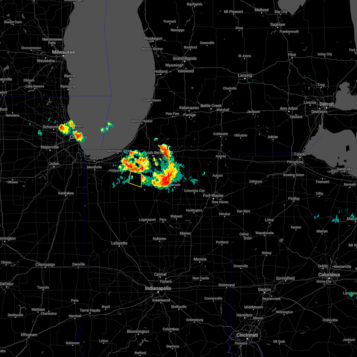 The severe thunderstorm warning for northeastern starke and east central la porte counties will expire at 815 am cdt, the storm which prompted the warning has moved out of the area. therefore the warning will be allowed to expire. to report severe weather, contact your nearest law enforcement agency. they will relay your report to the national weather service northern indiana. The severe thunderstorm warning for northeastern starke and east central la porte counties will expire at 815 am cdt, the storm which prompted the warning has moved out of the area. therefore the warning will be allowed to expire. to report severe weather, contact your nearest law enforcement agency. they will relay your report to the national weather service northern indiana.
|
| 7/7/2017 7:59 AM CDT |
 At 759 am cdt, a severe thunderstorm was located near koontz lake, or 8 miles northeast of knox, moving east at 40 mph (radar indicated). Hazards include quarter size hail. Damage to vehicles is expected. Locations impacted include, knox, hamlet, koontz lake, oak grove, ober, south center, salem heights, grovertown and bass lake. At 759 am cdt, a severe thunderstorm was located near koontz lake, or 8 miles northeast of knox, moving east at 40 mph (radar indicated). Hazards include quarter size hail. Damage to vehicles is expected. Locations impacted include, knox, hamlet, koontz lake, oak grove, ober, south center, salem heights, grovertown and bass lake.
|
| 7/7/2017 7:40 AM CDT |
 At 740 am cdt, a severe thunderstorm was located near kingsford heights, or 11 miles northwest of knox, moving east at 40 mph (radar indicated). Hazards include quarter size hail. damage to vehicles is expected At 740 am cdt, a severe thunderstorm was located near kingsford heights, or 11 miles northwest of knox, moving east at 40 mph (radar indicated). Hazards include quarter size hail. damage to vehicles is expected
|
| 7/2/2017 9:24 PM EDT |
 The severe thunderstorm warning for east central starke and central marshall counties will expire at 930 pm edt/830 pm cdt/. the storms which prompted the warning have weakened below severe limits, and have exited the warned area. therefore the warning will be allowed to expire. However heavy rain is still possible with these thunderstorms. The severe thunderstorm warning for east central starke and central marshall counties will expire at 930 pm edt/830 pm cdt/. the storms which prompted the warning have weakened below severe limits, and have exited the warned area. therefore the warning will be allowed to expire. However heavy rain is still possible with these thunderstorms.
|
| 7/2/2017 9:16 PM EDT |
 At 915 pm edt/815 pm cdt/, severe thunderstorms were located along a line extending from near nappanee to near culver, moving southeast at 35 mph. the strongest winds may be felt several minutes before the rain arrives (radar indicated). Hazards include 60 mph wind gusts. Expect damage to roofs, siding, and trees. Locations impacted include, plymouth, bremen, knox, culver, oak grove, la paz, ober, twin lakes, rutland, burr oak, tyner, hibbard, winona, donaldson, linkville, lake of the woods and bass lake. At 915 pm edt/815 pm cdt/, severe thunderstorms were located along a line extending from near nappanee to near culver, moving southeast at 35 mph. the strongest winds may be felt several minutes before the rain arrives (radar indicated). Hazards include 60 mph wind gusts. Expect damage to roofs, siding, and trees. Locations impacted include, plymouth, bremen, knox, culver, oak grove, la paz, ober, twin lakes, rutland, burr oak, tyner, hibbard, winona, donaldson, linkville, lake of the woods and bass lake.
|
| 7/2/2017 9:03 PM EDT |
 At 903 pm edt/803 pm cdt/, severe thunderstorms were located along a line extending from near bremen to near knox, moving southeast at 40 mph (radar indicated). Hazards include 60 mph wind gusts. Expect damage to roofs, siding, and trees. Locations impacted include, plymouth, bremen, knox, walkerton, north liberty, culver, hamlet, lakeville, koontz lake, oak grove, la paz, ober, teegarden, tyner, hibbard, winona, donaldson, linkville, lake of the woods and wyatt. At 903 pm edt/803 pm cdt/, severe thunderstorms were located along a line extending from near bremen to near knox, moving southeast at 40 mph (radar indicated). Hazards include 60 mph wind gusts. Expect damage to roofs, siding, and trees. Locations impacted include, plymouth, bremen, knox, walkerton, north liberty, culver, hamlet, lakeville, koontz lake, oak grove, la paz, ober, teegarden, tyner, hibbard, winona, donaldson, linkville, lake of the woods and wyatt.
|
| 7/2/2017 8:46 PM EDT |
 At 845 pm edt/745 pm cdt/, severe thunderstorms were located along a line extending from near north liberty to near la crosse, moving southeast at 35 mph. a 55 mph wind gust was recorded at the laporte automated weather station at 735 pm cdt (radar indicated). Hazards include 60 mph wind gusts. expect damage to roofs, siding, and trees At 845 pm edt/745 pm cdt/, severe thunderstorms were located along a line extending from near north liberty to near la crosse, moving southeast at 35 mph. a 55 mph wind gust was recorded at the laporte automated weather station at 735 pm cdt (radar indicated). Hazards include 60 mph wind gusts. expect damage to roofs, siding, and trees
|
| 6/14/2017 5:23 PM EDT |
 At 523 pm edt/423 pm cdt/, severe thunderstorms were located along a line extending from near north judson to near monon, moving northeast at 25 mph (radar indicated). Hazards include 60 mph wind gusts and quarter size hail. Hail damage to vehicles is expected. expect wind damage to roofs, siding, and trees. Locations impacted include, knox, winamac, monon, north judson, wolcott, francesville, medaryville, pulaski, ripley, beardstown, english lake, vanmeter park, lakeside in pulaski county, denham, brems, lee, lawton, toto, clarks and bass lake. At 523 pm edt/423 pm cdt/, severe thunderstorms were located along a line extending from near north judson to near monon, moving northeast at 25 mph (radar indicated). Hazards include 60 mph wind gusts and quarter size hail. Hail damage to vehicles is expected. expect wind damage to roofs, siding, and trees. Locations impacted include, knox, winamac, monon, north judson, wolcott, francesville, medaryville, pulaski, ripley, beardstown, english lake, vanmeter park, lakeside in pulaski county, denham, brems, lee, lawton, toto, clarks and bass lake.
|
| 6/14/2017 4:52 PM EDT |
 At 451 pm edt/351 pm cdt/, severe thunderstorms were located along a line extending from near dunns bridge to near mccoysburg, moving northeast at 35 mph (radar indicated). Hazards include 60 mph wind gusts and quarter size hail. Hail damage to vehicles is expected. Expect wind damage to roofs, siding, and trees. At 451 pm edt/351 pm cdt/, severe thunderstorms were located along a line extending from near dunns bridge to near mccoysburg, moving northeast at 35 mph (radar indicated). Hazards include 60 mph wind gusts and quarter size hail. Hail damage to vehicles is expected. Expect wind damage to roofs, siding, and trees.
|
| 3/1/2017 1:43 AM EST |
 At 142 am est/1242 am cst/, a severe thunderstorm was located over winamac, moving northeast at 70 mph (radar indicated). Hazards include 70 mph wind gusts and quarter size hail. Hail damage to vehicles is expected. expect considerable tree damage. Wind damage is also likely to mobile homes, roofs, and outbuildings. At 142 am est/1242 am cst/, a severe thunderstorm was located over winamac, moving northeast at 70 mph (radar indicated). Hazards include 70 mph wind gusts and quarter size hail. Hail damage to vehicles is expected. expect considerable tree damage. Wind damage is also likely to mobile homes, roofs, and outbuildings.
|
| 3/1/2017 12:19 AM CST |
 At 119 am est/1219 am cst/, severe thunderstorms were located along a line extending from hamlet to near north judson to near medaryville, moving east at 60 mph (radar indicated). Hazards include 60 mph wind gusts and quarter size hail. Hail damage to vehicles is expected. expect wind damage to roofs, siding, and trees. locations impacted include, plymouth, knox, winamac, bourbon, north judson, argos, culver, hamlet, medaryville, walnut, oak grove, ripley, kewanna, monterey, leiters ford, lomax, beardstown, ober, english lake and denham. A tornado watch remains in effect until 700 am est/600 am cst/ for north central and northwestern indiana. At 119 am est/1219 am cst/, severe thunderstorms were located along a line extending from hamlet to near north judson to near medaryville, moving east at 60 mph (radar indicated). Hazards include 60 mph wind gusts and quarter size hail. Hail damage to vehicles is expected. expect wind damage to roofs, siding, and trees. locations impacted include, plymouth, knox, winamac, bourbon, north judson, argos, culver, hamlet, medaryville, walnut, oak grove, ripley, kewanna, monterey, leiters ford, lomax, beardstown, ober, english lake and denham. A tornado watch remains in effect until 700 am est/600 am cst/ for north central and northwestern indiana.
|
| 2/28/2017 11:56 PM CST |
 At 1256 am est/1156 pm cst/, severe thunderstorms were located along a line extending from near kvpz to near kouts to near gifford, moving east at 60 mph (radar indicated). Hazards include 60 mph wind gusts and penny size hail. expect damage to roofs, siding, and trees At 1256 am est/1156 pm cst/, severe thunderstorms were located along a line extending from near kvpz to near kouts to near gifford, moving east at 60 mph (radar indicated). Hazards include 60 mph wind gusts and penny size hail. expect damage to roofs, siding, and trees
|
| 2/24/2017 4:12 PM CST | Shed blown dow in starke county IN, 5.8 miles N of Knox, IN |
| 7/21/2016 2:23 PM CDT |
 At 223 pm cdt, a severe thunderstorm was located over knox, moving southeast at 45 mph (radar indicated). Hazards include 60 mph wind gusts and nickel size hail. Expect damage to roofs. siding and trees. Locations impacted include, knox, hamlet, koontz lake, oak grove, grovertown, ober, toto, winona, bass lake and brems. At 223 pm cdt, a severe thunderstorm was located over knox, moving southeast at 45 mph (radar indicated). Hazards include 60 mph wind gusts and nickel size hail. Expect damage to roofs. siding and trees. Locations impacted include, knox, hamlet, koontz lake, oak grove, grovertown, ober, toto, winona, bass lake and brems.
|
| 7/21/2016 2:09 PM CDT |
 At 209 pm cdt, a severe thunderstorm was located near wanatah, or 11 miles northwest of knox, moving east at 45 mph (radar indicated). Hazards include 60 mph wind gusts and nickel size hail. Expect damage to roofs. Siding and trees. At 209 pm cdt, a severe thunderstorm was located near wanatah, or 11 miles northwest of knox, moving east at 45 mph (radar indicated). Hazards include 60 mph wind gusts and nickel size hail. Expect damage to roofs. Siding and trees.
|
| 6/22/2016 10:35 PM CDT |
 At 1035 pm cdt, a severe thunderstorm was located near north judson, or 9 miles southwest of knox, moving southeast at 40 mph (radar indicated). Hazards include 60 mph wind gusts. Expect damage to roofs. siding and trees. this severe thunderstorm will remain over mainly rural areas of southeastern starke and northeastern pulaski counties, including the following locations, denham, toto, monterey, vanmeter park, winona, ora, ripley, bass lake and beardstown. A tornado watch remains in effect until 400 am cdt for northwestern indiana. At 1035 pm cdt, a severe thunderstorm was located near north judson, or 9 miles southwest of knox, moving southeast at 40 mph (radar indicated). Hazards include 60 mph wind gusts. Expect damage to roofs. siding and trees. this severe thunderstorm will remain over mainly rural areas of southeastern starke and northeastern pulaski counties, including the following locations, denham, toto, monterey, vanmeter park, winona, ora, ripley, bass lake and beardstown. A tornado watch remains in effect until 400 am cdt for northwestern indiana.
|
| 6/22/2016 10:15 PM CDT |
 At 1015 pm cdt, a severe thunderstorm was located over dunns bridge, moving southeast at 40 mph (radar indicated). Hazards include 60 mph wind gusts. Expect damage to roofs. siding and trees. this severe thunderstorm will be near, north judson around 1030 pm cdt. winamac around 1045 pm cdt. other locations impacted by this severe thunderstorm include denham, clarks, vanmeter park, winona, ora, san pierre, toto, lawton, monterey and english lake. A tornado watch remains in effect until 400 am cdt for northwestern indiana. At 1015 pm cdt, a severe thunderstorm was located over dunns bridge, moving southeast at 40 mph (radar indicated). Hazards include 60 mph wind gusts. Expect damage to roofs. siding and trees. this severe thunderstorm will be near, north judson around 1030 pm cdt. winamac around 1045 pm cdt. other locations impacted by this severe thunderstorm include denham, clarks, vanmeter park, winona, ora, san pierre, toto, lawton, monterey and english lake. A tornado watch remains in effect until 400 am cdt for northwestern indiana.
|
| 8/3/2015 12:28 AM CDT |
 At 1228 am cdt, severe thunderstorms were located along a line extending from near koontz lake to near dunns bridge, moving southeast at 40 mph (trained weather spotters). Hazards include 60 mph wind gusts and penny size hail. Expect damage to roofs. siding and trees. Locations impacted include, knox, north judson, wanatah, hamlet, la crosse, oak grove, hanna, san pierre, ora, ober, winona, toto, lomax, grovertown, south wanatah, thomaston, brems, bass lake and english lake. At 1228 am cdt, severe thunderstorms were located along a line extending from near koontz lake to near dunns bridge, moving southeast at 40 mph (trained weather spotters). Hazards include 60 mph wind gusts and penny size hail. Expect damage to roofs. siding and trees. Locations impacted include, knox, north judson, wanatah, hamlet, la crosse, oak grove, hanna, san pierre, ora, ober, winona, toto, lomax, grovertown, south wanatah, thomaston, brems, bass lake and english lake.
|
| 8/2/2015 11:56 PM CDT |
 At 1155 pm cdt, severe thunderstorms were located along a line extending from westville to lowell, moving southeast at 40 mph (trained weather spotters. at 1150 pm cdt... 60 to 65 mph winds were reported in valparaiso). Hazards include 60 mph wind gusts and quarter size hail. Hail damage to vehicles is expected. Expect wind damage to roofs, siding and trees. At 1155 pm cdt, severe thunderstorms were located along a line extending from westville to lowell, moving southeast at 40 mph (trained weather spotters. at 1150 pm cdt... 60 to 65 mph winds were reported in valparaiso). Hazards include 60 mph wind gusts and quarter size hail. Hail damage to vehicles is expected. Expect wind damage to roofs, siding and trees.
|
| 6/11/2015 3:53 PM CDT | Multiple reports of trees and powerlines down in kno in starke county IN, 0.8 miles SE of Knox, IN |
| 6/11/2015 3:53 PM CDT |
 At 452 pm edt /352 pm cdt/, a severe thunderstorm was located near hamlet, or near knox, moving northeast at 25 mph (radar indicated). Hazards include 60 mph wind gusts and quarter size hail. Hail damage to vehicles is expected. expect wind damage to roofs, siding and trees. this severe storm will be near, hamlet around 400 pm cdt. koontz lake around 520 pm edt. Other locations impacted by this severe thunderstorm include brems, donaldson, grovertown, tyner and bass lake. At 452 pm edt /352 pm cdt/, a severe thunderstorm was located near hamlet, or near knox, moving northeast at 25 mph (radar indicated). Hazards include 60 mph wind gusts and quarter size hail. Hail damage to vehicles is expected. expect wind damage to roofs, siding and trees. this severe storm will be near, hamlet around 400 pm cdt. koontz lake around 520 pm edt. Other locations impacted by this severe thunderstorm include brems, donaldson, grovertown, tyner and bass lake.
|
| 6/11/2015 3:39 PM CDT |
 At 438 pm edt /338 pm cdt/, a severe thunderstorm was located near knox, moving northeast at 25 mph (radar indicated). Hazards include 60 mph wind gusts and quarter size hail. Hail damage to vehicles is expected. expect wind damage to roofs, siding and trees. this severe thunderstorm will be near, knox around 345 pm cdt. hamlet around 400 pm cdt. koontz lake around 520 pm edt. Other locations impacted by this severe thunderstorm include brems, toto, tyner, salem heights, donaldson, grovertown, ober and bass lake. At 438 pm edt /338 pm cdt/, a severe thunderstorm was located near knox, moving northeast at 25 mph (radar indicated). Hazards include 60 mph wind gusts and quarter size hail. Hail damage to vehicles is expected. expect wind damage to roofs, siding and trees. this severe thunderstorm will be near, knox around 345 pm cdt. hamlet around 400 pm cdt. koontz lake around 520 pm edt. Other locations impacted by this severe thunderstorm include brems, toto, tyner, salem heights, donaldson, grovertown, ober and bass lake.
|
| 6/8/2015 5:37 PM CDT | At 535 pm cdt, severe thunderstorms were located along a line extending from koontz lake to 5 miles southeast of knox to 7 miles east of medaryville, and moving east at 30 mph (radar indicated). Hazards include 60 mph wind gusts and penny size hail. Expect damage to roofs. siding and trees. Locations impacted include, winamac, plymouth, culver, donaldson, ripley, beardstown, ora, burr oak, hibbard, monterey, vanmeter park, twin lakes, maxinkuckee, rutland, delong, lake bruce, leiters ford and bruce lake station. |
| 6/8/2015 5:19 PM CDT | At 517 pm cdt, severe thunderstorms were located along a line extending from hamlet to knox to medaryville, and moving east at 30 mph (radar indicated). Hazards include quarter size hail and 60 mph wind gusts. Hail damage to vehicles is expected. Expect wind damage to roofs, siding and trees. |
| 6/8/2015 5:02 PM CDT | At 600 pm edt/500 pm cdt/, severe thunderstorms were located along a line extending from north liberty to hamlet to north judson, and moving southeast at 40 mph (radar indicated). Hazards include quarter size hail and 60 mph wind gusts. Hail damage to vehicles is expected. expect wind damage to roofs, siding and trees. Locations impacted include, knox, plymouth, toto, tyner, donaldson, la paz, oak grove, linkville, ober, winona, bass lake, burr oak, twin lakes and hibbard. |
| 6/8/2015 4:37 PM CDT | At 433 pm cdt, a severe thunderstorm was located near kingsford heights, and moving southeast at 40 mph (radar indicated). Hazards include quarter size hail and 60 mph wind gusts. Hail damage to vehicles is expected. Expect wind damage to roofs, siding and trees. |
| 6/7/2015 6:54 PM EDT | At 550 pm cdt, severe thunderstorms were located along a line extending from knox to 6 miles north of winamac to 6 miles south of winamac, and moving east at 40 mph (trained weather spotters). Hazards include 70 mph wind gusts. Expect considerable tree damage. Damage is likely to mobile homes, roofs and outbuildings. |
| 6/7/2015 6:47 PM EDT | At 543 pm cdt, a severe thunderstorm was located 7 miles northwest of winamac, and moving east at 45 mph (public. several uprooted trees were reported 8 miles west of denham). Hazards include quarter size hail and 70 mph wind gusts. Expect considerable tree damage. wind damage is also likely to mobile homes, roofs and outbuildings. Locations impacted include, knox, winamac, bass lake, beardstown, winona, vanmeter park, ora, star city, ober, lawton, thornhope and oak grove. |
| 6/7/2015 6:27 PM EDT | At 523 pm cdt, a severe thunderstorm was located 6 miles northwest of medaryville, and moving east at 45 mph (radar indicated). Hazards include quarter size hail and 60 mph wind gusts. Hail damage to vehicles is expected. Expect wind damage to roofs, siding and trees. |
| 8/21/2014 6:05 PM CDT | Tree down at sr-8 and 39 in starke county IN, 6.4 miles E of Knox, IN |
| 6/24/2013 7:10 PM CDT | Trees and utility lines down across entire count in starke county IN, 0.8 miles SE of Knox, IN |
| 8/4/2012 4:58 PM CDT | Quarter sized hail reported 5.4 miles WNW of Knox, IN |
| 8/4/2012 4:38 PM CDT | Quarter sized hail reported 6.4 miles N of Knox, IN |
| 7/24/2012 7:48 AM CDT | Winds estimated up to 70 mph in knox. trees uprooted and down on cars near the county court house. time estimated from rada in starke county IN, 0.8 miles SE of Knox, IN |
| 7/24/2012 7:48 AM CDT | Wind gust noted by observer on awos before loss of powe in starke county IN, 3.7 miles SE of Knox, IN |
| 7/24/2012 7:48 AM CDT | Substantial damage to airline hangar at the knox airport with damage to several planes in starke county IN, 3.7 miles SE of Knox, IN |
| 7/1/2012 1:57 PM CDT | Reports of trees and power lines down in the knox area. time estimated from rada in starke county IN, 0.8 miles SE of Knox, IN |
| 6/28/2012 8:27 PM CDT | 50 to 60 mph wind gusts with pea sized hail in starke county IN, 4.8 miles ENE of Knox, IN |
| 1/1/0001 12:00 AM | Trees down at the intersection of state roads 39 and 8 in starke county IN, 6.6 miles ESE of Knox, IN |
| 1/1/0001 12:00 AM | Quarter sized hail reported 0.8 miles SE of Knox, IN, hail ranging from pea sized to 1.00 inch |
| 1/1/0001 12:00 AM | Quarter sized hail reported 3.7 miles NNW of Knox, IN, hail ranging from 0.75 inch to 1.00 inch |
| 1/1/0001 12:00 AM | Tree down at 400 s and 300 e. another tree down on sr35 just north of sr10...time estimated from rada in starke county IN, 1.2 miles ESE of Knox, IN |
Hail Maps for Knox, IN

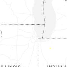
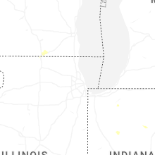


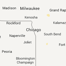


Connect with Interactive Hail Maps