

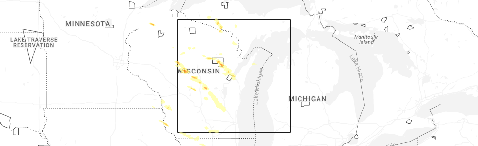
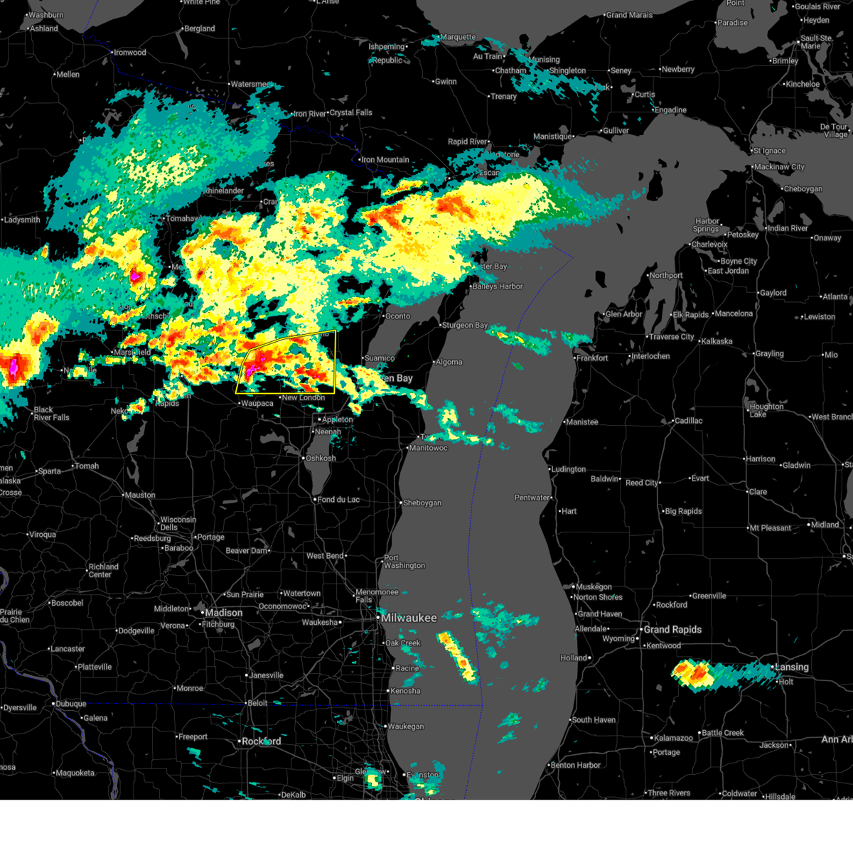
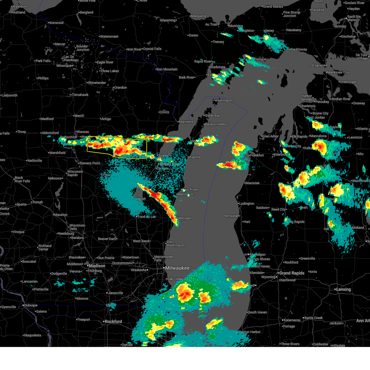
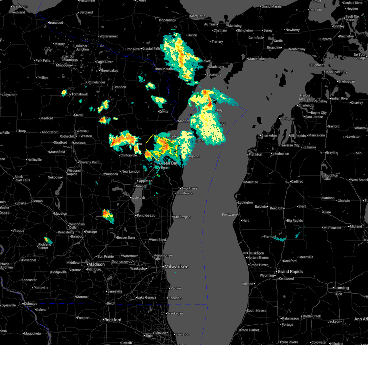
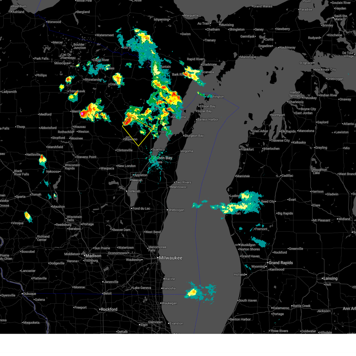
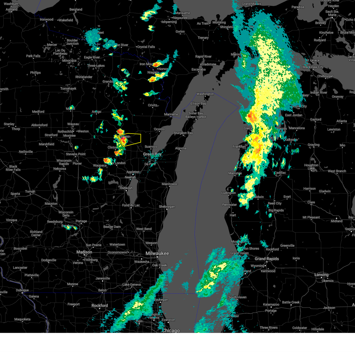
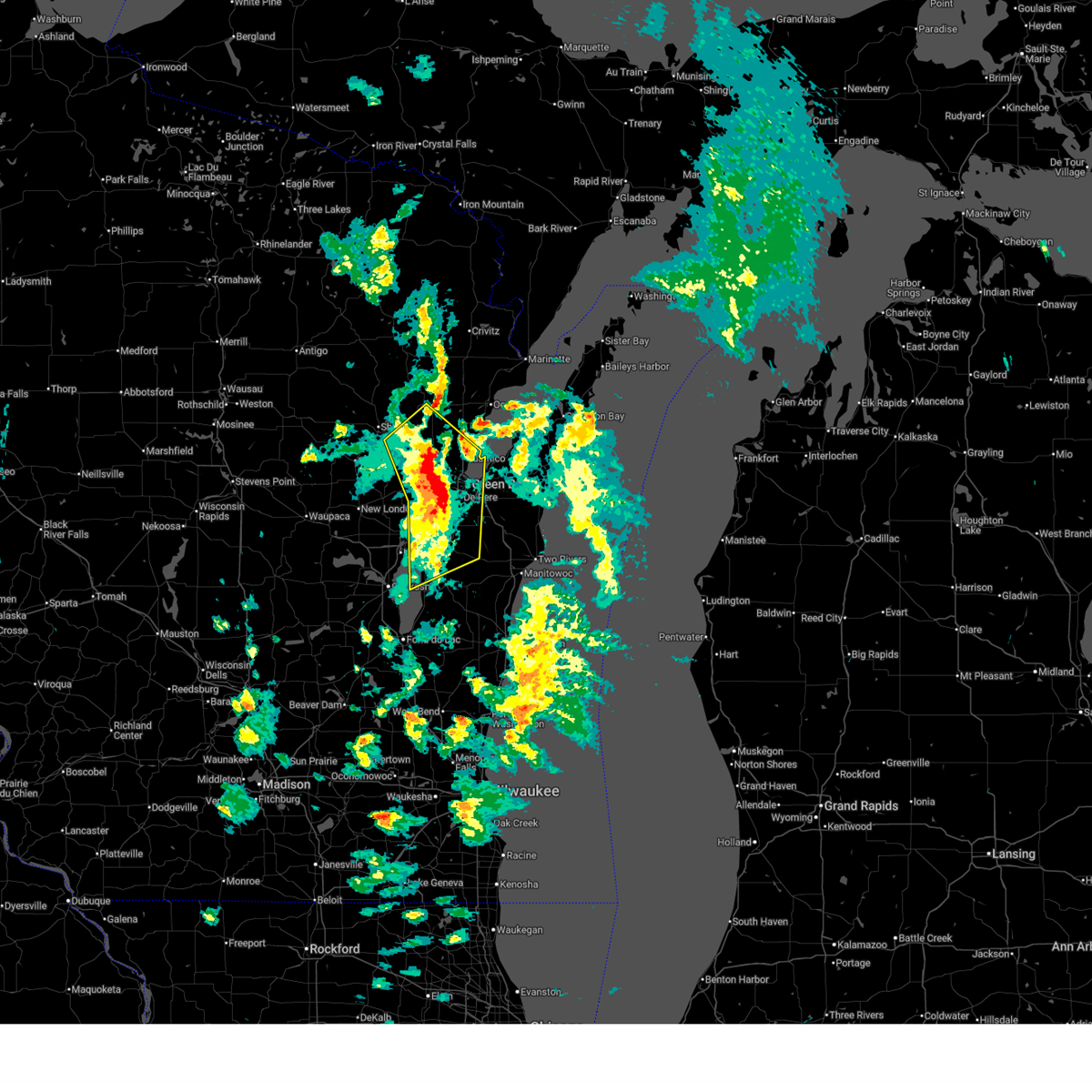
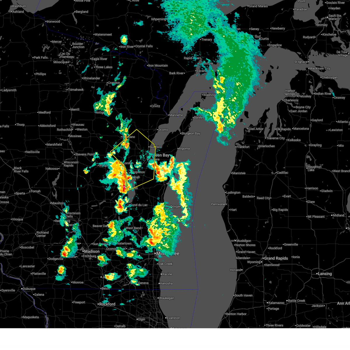
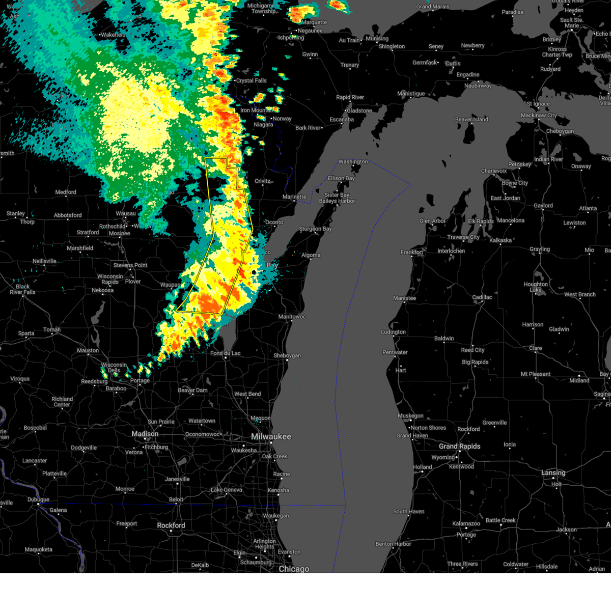
Hail Map for Krakow, WI
The Krakow, WI area has had 5 reports of on-the-ground hail by trained spotters, and has been under severe weather warnings 28 times during the past 12 months. Doppler radar has detected hail at or near Krakow, WI on 38 occasions, including 4 occasions during the past year.
| Name: | Krakow, WI |
| Where Located: | 21.2 miles NW of Green Bay, WI |
| Map: | Google Map for Krakow, WI |
| Population: | 354 |
| Housing Units: | 161 |
| More Info: | Search Google for Krakow, WI |
2
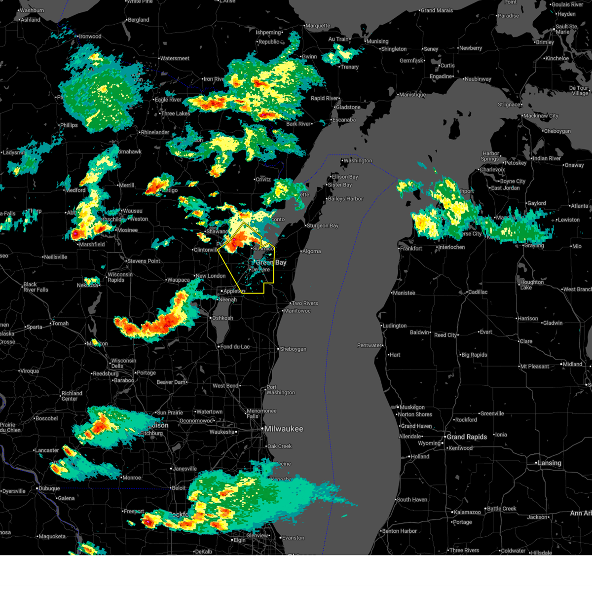
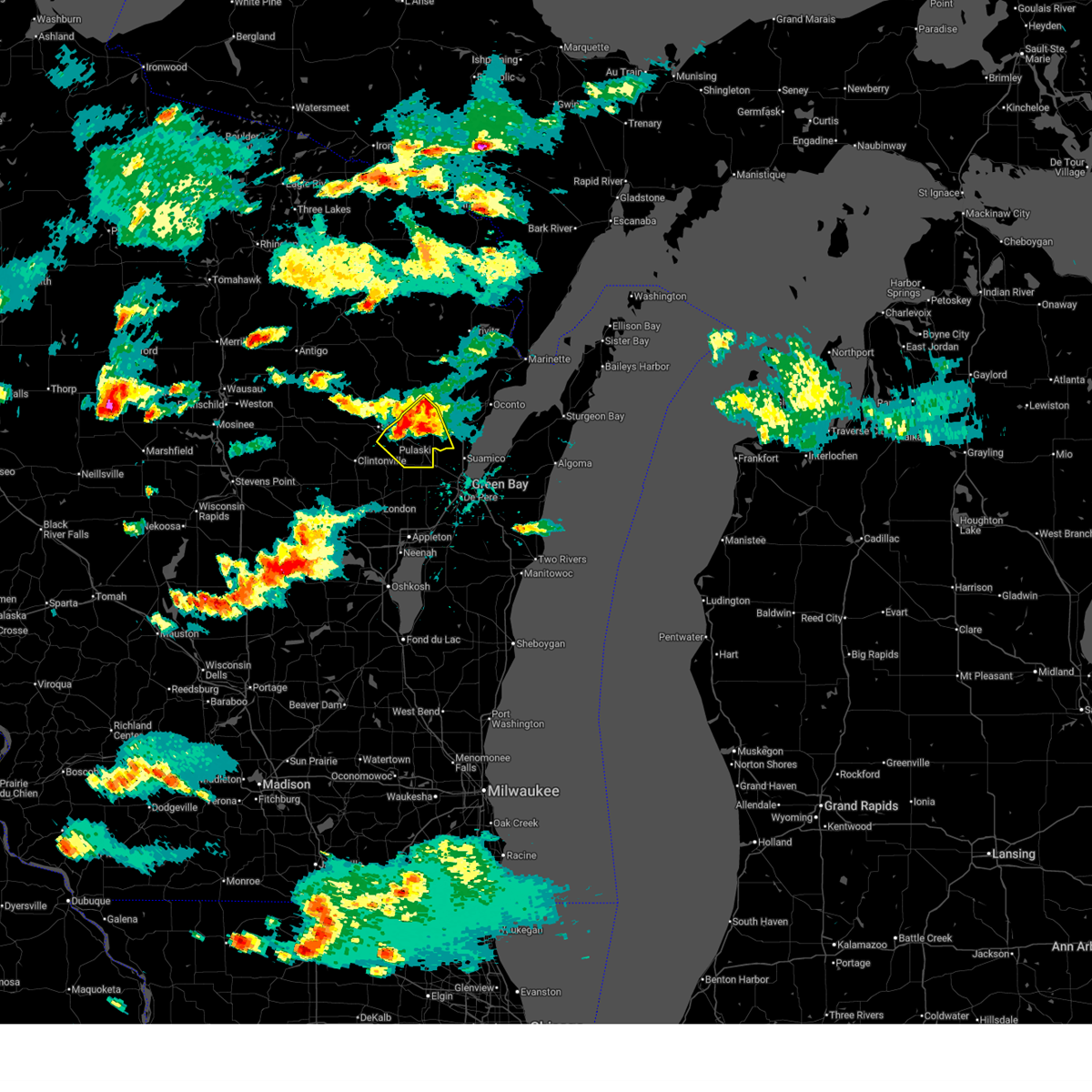
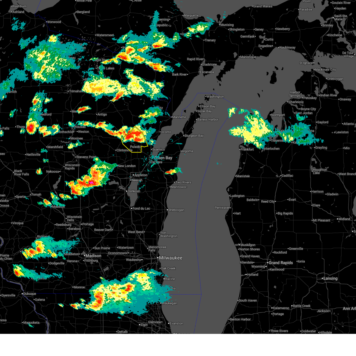
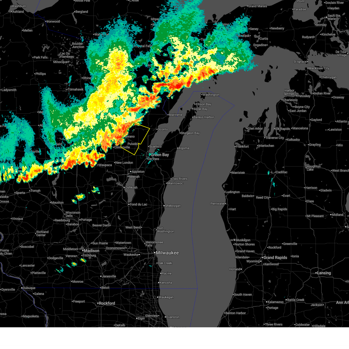
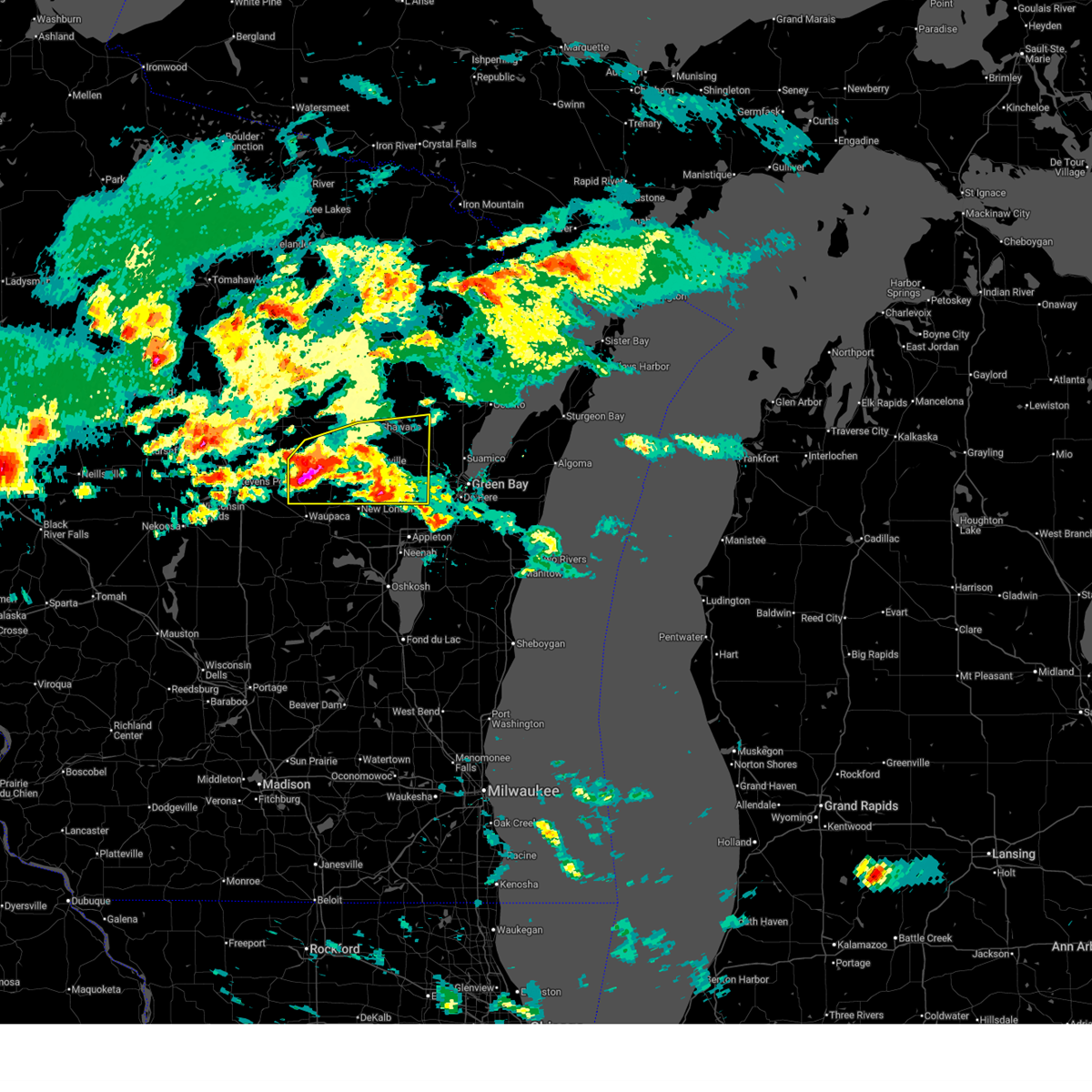
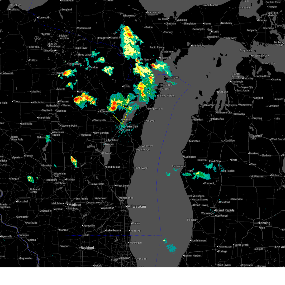
The Top Recent Hail Date for Krakow, WI is Wednesday, June 24, 2026 (7th out of 38)
Hail and Wind Damage Spotted near Krakow, WI
| Date / Time | Report Details |
|---|---|
| 6/24/2026 5:25 PM CDT |
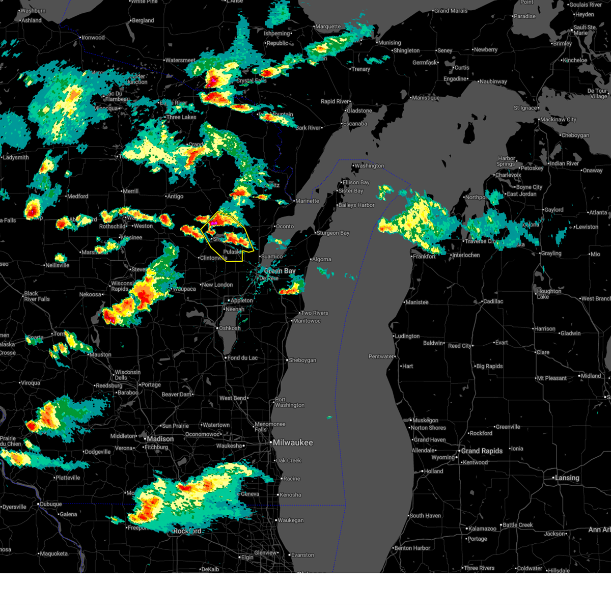
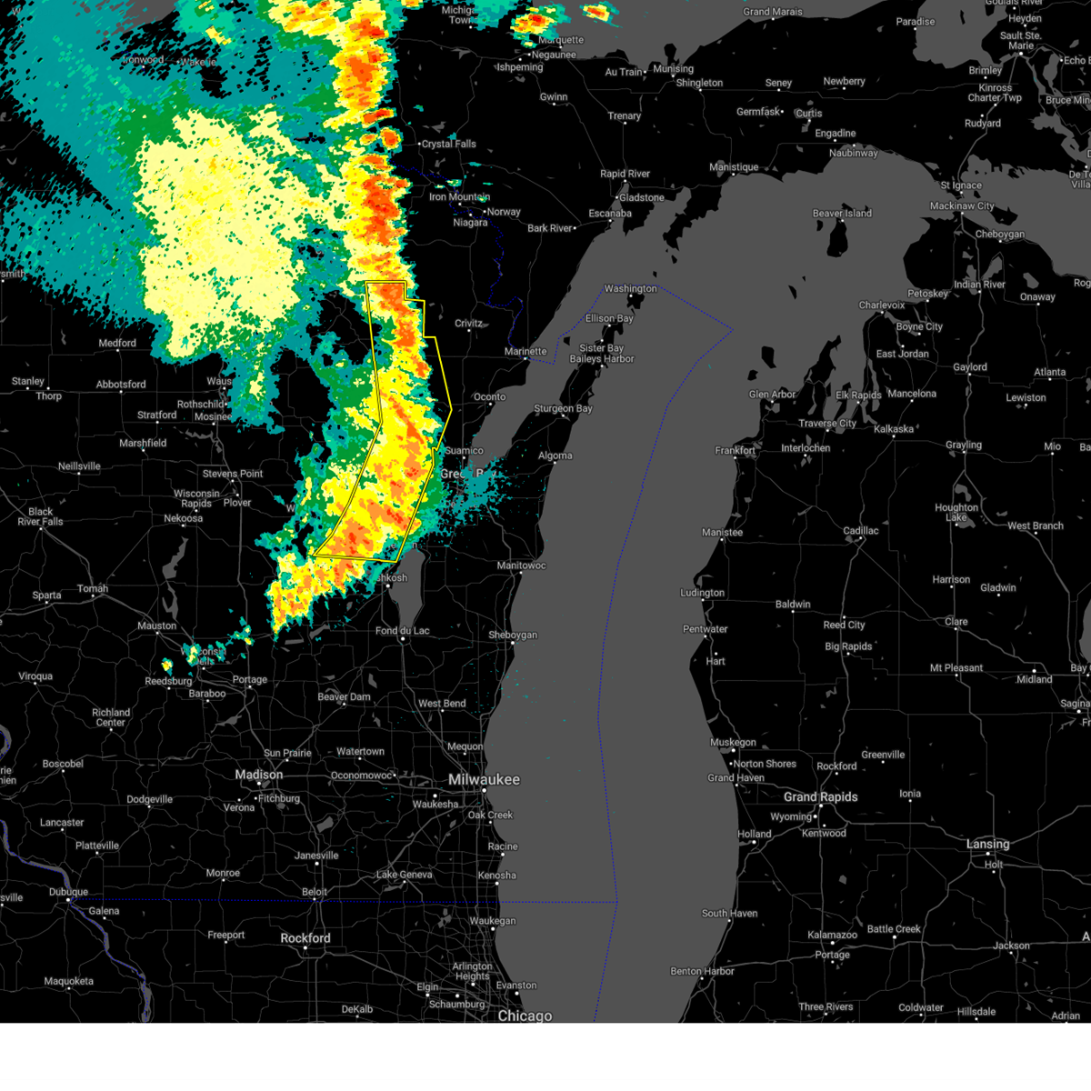
 Svrgrb the national weather service in green bay has issued a * severe thunderstorm warning for, brown county in northeastern wisconsin, south central oconto county in northeastern wisconsin, northeastern outagamie county in northeastern wisconsin, eastern shawano county in northeastern wisconsin, * until 630 pm cdt. * at 525 pm cdt, severe thunderstorms were located along a line from 7 miles northeast of pulaski to 6 miles southwest of pulaski, or along a line from 15 miles northwest of green bay to 15 miles west of green bay, moving southeast at 25 mph (trained spotters reported). Hazards include half dollar size hail. Damage to vehicles is expected. this severe thunderstorm will be near, pulaski around 530 pm cdt. long tail point light and green bay harbor entrance light around 550 pm cdt. bellevue town around 600 pm cdt. Other locations impacted by the severe thunderstorm include kunesh, pittsfield, south chase, sobieski, rose lawn, chase, laney, hofa park, sampson and angelica. Svrgrb the national weather service in green bay has issued a * severe thunderstorm warning for, brown county in northeastern wisconsin, south central oconto county in northeastern wisconsin, northeastern outagamie county in northeastern wisconsin, eastern shawano county in northeastern wisconsin, * until 630 pm cdt. * at 525 pm cdt, severe thunderstorms were located along a line from 7 miles northeast of pulaski to 6 miles southwest of pulaski, or along a line from 15 miles northwest of green bay to 15 miles west of green bay, moving southeast at 25 mph (trained spotters reported). Hazards include half dollar size hail. Damage to vehicles is expected. this severe thunderstorm will be near, pulaski around 530 pm cdt. long tail point light and green bay harbor entrance light around 550 pm cdt. bellevue town around 600 pm cdt. Other locations impacted by the severe thunderstorm include kunesh, pittsfield, south chase, sobieski, rose lawn, chase, laney, hofa park, sampson and angelica.
|
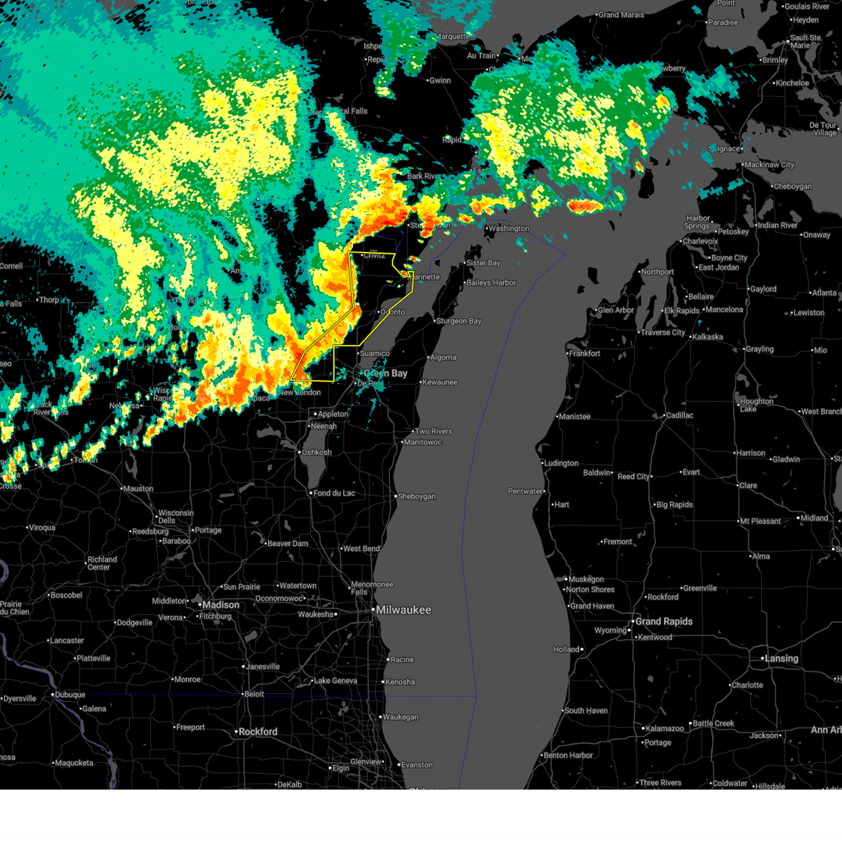
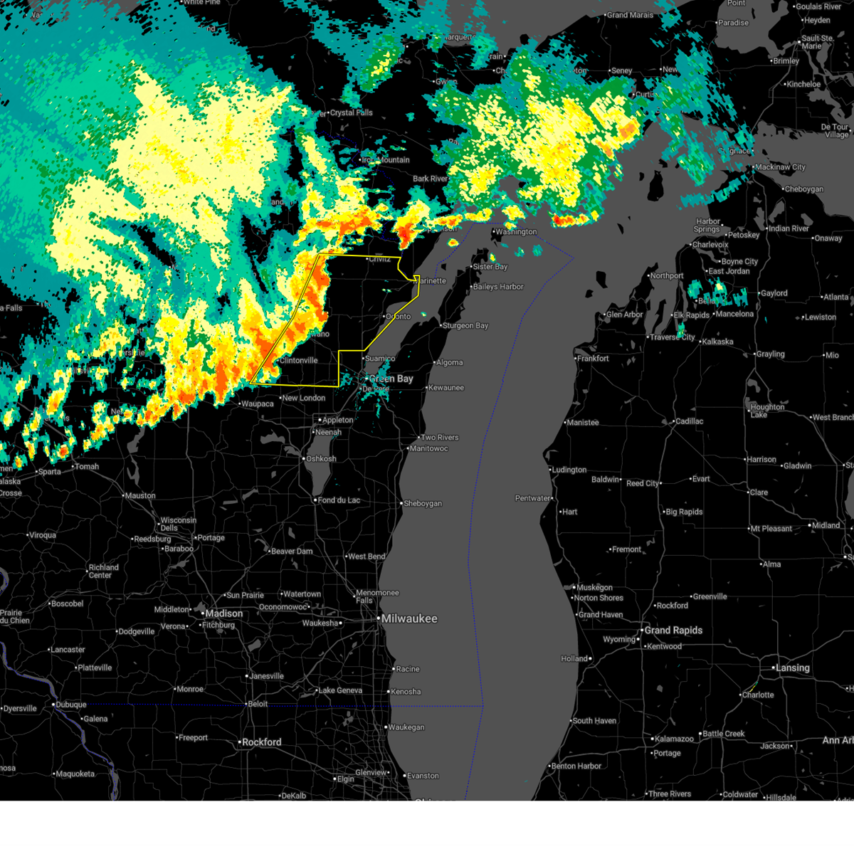
| 6/24/2026 5:20 PM CDT | Quarter sized hail reported 0.6 miles WNW of Krakow, WI |
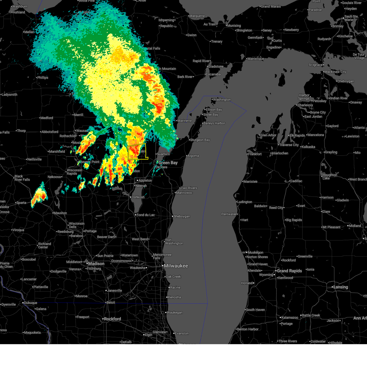
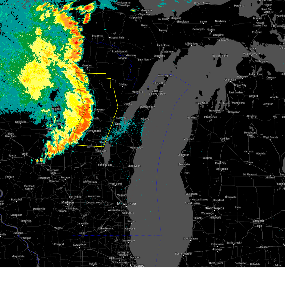
| 6/24/2026 4:58 PM CDT |
 At 458 pm cdt, a severe thunderstorm was located 9 miles northeast of navarino wildlife area, or 8 miles east of shawano, moving southeast at 20 mph (radar indicated). Hazards include 60 mph wind gusts and quarter size hail. Hail damage to vehicles is expected. expect wind damage to roofs, siding, and trees. this severe thunderstorm will be near, pulaski around 510 pm cdt. Other locations impacted by the severe thunderstorm include bonduel, cecil, lunds, pulcifer, advance, zachow, frazer corners, angelica, landstad and krakow. At 458 pm cdt, a severe thunderstorm was located 9 miles northeast of navarino wildlife area, or 8 miles east of shawano, moving southeast at 20 mph (radar indicated). Hazards include 60 mph wind gusts and quarter size hail. Hail damage to vehicles is expected. expect wind damage to roofs, siding, and trees. this severe thunderstorm will be near, pulaski around 510 pm cdt. Other locations impacted by the severe thunderstorm include bonduel, cecil, lunds, pulcifer, advance, zachow, frazer corners, angelica, landstad and krakow.
|
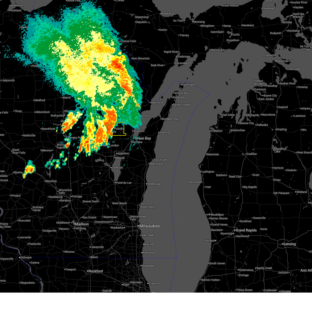
| 6/24/2026 4:47 PM CDT |
 At 447 pm cdt, a severe thunderstorm was located 5 miles east of shawano, moving southeast at 20 mph (radar indicated). Hazards include ping pong ball size hail and 60 mph wind gusts. People and animals outdoors will be injured. expect hail damage to roofs, siding, windows, and vehicles. expect wind damage to roofs, siding, and trees. this severe thunderstorm will be near, legend lake around 450 pm cdt. pulaski around 510 pm cdt. Other locations impacted by the severe thunderstorm include cecil, shawano lake, lunds, bonduel, pulcifer, advance, zachow, frazer corners, angelica and landstad. At 447 pm cdt, a severe thunderstorm was located 5 miles east of shawano, moving southeast at 20 mph (radar indicated). Hazards include ping pong ball size hail and 60 mph wind gusts. People and animals outdoors will be injured. expect hail damage to roofs, siding, windows, and vehicles. expect wind damage to roofs, siding, and trees. this severe thunderstorm will be near, legend lake around 450 pm cdt. pulaski around 510 pm cdt. Other locations impacted by the severe thunderstorm include cecil, shawano lake, lunds, bonduel, pulcifer, advance, zachow, frazer corners, angelica and landstad.
|
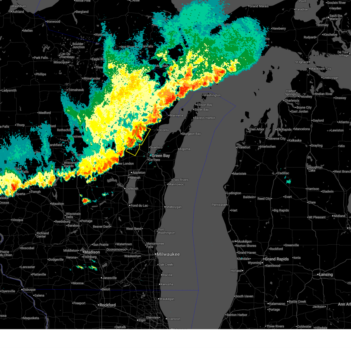
| 6/24/2026 4:22 PM CDT |
 Svrgrb the national weather service in green bay has issued a * severe thunderstorm warning for, southeastern menominee county in northeastern wisconsin, southern oconto county in northeastern wisconsin, eastern shawano county in northeastern wisconsin, * until 515 pm cdt. * at 422 pm cdt, a severe thunderstorm was located over keshena, or 7 miles north of shawano, moving southeast at 20 mph (radar indicated). Hazards include ping pong ball size hail and 60 mph wind gusts. People and animals outdoors will be injured. expect hail damage to roofs, siding, windows, and vehicles. expect wind damage to roofs, siding, and trees. this severe thunderstorm will be near, keshena and legend lake around 425 pm cdt. pulaski around 510 pm cdt. Other locations impacted by the severe thunderstorm include college of menominee nation, red river, thornton, shawano lake, cecil, underhill, pulcifer, lunds, bonduel and zachow. Svrgrb the national weather service in green bay has issued a * severe thunderstorm warning for, southeastern menominee county in northeastern wisconsin, southern oconto county in northeastern wisconsin, eastern shawano county in northeastern wisconsin, * until 515 pm cdt. * at 422 pm cdt, a severe thunderstorm was located over keshena, or 7 miles north of shawano, moving southeast at 20 mph (radar indicated). Hazards include ping pong ball size hail and 60 mph wind gusts. People and animals outdoors will be injured. expect hail damage to roofs, siding, windows, and vehicles. expect wind damage to roofs, siding, and trees. this severe thunderstorm will be near, keshena and legend lake around 425 pm cdt. pulaski around 510 pm cdt. Other locations impacted by the severe thunderstorm include college of menominee nation, red river, thornton, shawano lake, cecil, underhill, pulcifer, lunds, bonduel and zachow.
|
| 6/10/2026 9:36 AM CDT |
 At 936 am cdt, a severe thunderstorm was located 5 miles east of navarino wildlife area, or 11 miles southeast of shawano, moving east at 30 mph (radar indicated). Hazards include 60 mph wind gusts and half dollar size hail. Hail damage to vehicles is expected. expect wind damage to roofs, siding, and trees. this severe thunderstorm will be near, navarino wildlife area around 940 am cdt. pulaski around 955 am cdt. Other locations impacted by the severe thunderstorm include landstad, briarton, bonduel, navarino, frazer corners, hofa park, zachow, rose lawn, angelica and laney. At 936 am cdt, a severe thunderstorm was located 5 miles east of navarino wildlife area, or 11 miles southeast of shawano, moving east at 30 mph (radar indicated). Hazards include 60 mph wind gusts and half dollar size hail. Hail damage to vehicles is expected. expect wind damage to roofs, siding, and trees. this severe thunderstorm will be near, navarino wildlife area around 940 am cdt. pulaski around 955 am cdt. Other locations impacted by the severe thunderstorm include landstad, briarton, bonduel, navarino, frazer corners, hofa park, zachow, rose lawn, angelica and laney.
|
| 6/10/2026 9:21 AM CDT |
 Svrgrb the national weather service in green bay has issued a * severe thunderstorm warning for, northeastern outagamie county in northeastern wisconsin, eastern shawano county in northeastern wisconsin, northeastern waupaca county in northeastern wisconsin, * until 1015 am cdt. * at 921 am cdt, a severe thunderstorm was located over navarino wildlife area, or 9 miles south of shawano, moving east at 30 mph (radar indicated). Hazards include 60 mph wind gusts and quarter size hail. Hail damage to vehicles is expected. expect wind damage to roofs, siding, and trees. this severe thunderstorm will be near, navarino wildlife area around 925 am cdt. pulaski around 955 am cdt. Other locations impacted by the severe thunderstorm include lunds, leeman, navarino, nichols, landstad, bonduel, briarton, frazer corners, hofa park and zachow. Svrgrb the national weather service in green bay has issued a * severe thunderstorm warning for, northeastern outagamie county in northeastern wisconsin, eastern shawano county in northeastern wisconsin, northeastern waupaca county in northeastern wisconsin, * until 1015 am cdt. * at 921 am cdt, a severe thunderstorm was located over navarino wildlife area, or 9 miles south of shawano, moving east at 30 mph (radar indicated). Hazards include 60 mph wind gusts and quarter size hail. Hail damage to vehicles is expected. expect wind damage to roofs, siding, and trees. this severe thunderstorm will be near, navarino wildlife area around 925 am cdt. pulaski around 955 am cdt. Other locations impacted by the severe thunderstorm include lunds, leeman, navarino, nichols, landstad, bonduel, briarton, frazer corners, hofa park and zachow.
|
| 6/5/2026 8:13 PM CDT |
 Svrgrb the national weather service in green bay has issued a * severe thunderstorm warning for, northern brown county in northeastern wisconsin, southern oconto county in northeastern wisconsin, eastern shawano county in northeastern wisconsin, * until 900 pm cdt. * at 812 pm cdt, severe thunderstorms were located along a line extending from 7 miles west of oconto to near pulaski, moving southeast at 35 mph (radar indicated). Hazards include 60 mph wind gusts. Expect damage to roofs, siding, powerlines, and trees. severe thunderstorms will be near, oconto and pulaski around 815 pm cdt. green bay around 825 pm cdt. bay shore park around 835 pm cdt. Other locations impacted by these severe thunderstorms include hofa park, sobieski, kunesh, south chase, pensaukee, zachow, landstad, morgan, abrams, and frazer corners. Svrgrb the national weather service in green bay has issued a * severe thunderstorm warning for, northern brown county in northeastern wisconsin, southern oconto county in northeastern wisconsin, eastern shawano county in northeastern wisconsin, * until 900 pm cdt. * at 812 pm cdt, severe thunderstorms were located along a line extending from 7 miles west of oconto to near pulaski, moving southeast at 35 mph (radar indicated). Hazards include 60 mph wind gusts. Expect damage to roofs, siding, powerlines, and trees. severe thunderstorms will be near, oconto and pulaski around 815 pm cdt. green bay around 825 pm cdt. bay shore park around 835 pm cdt. Other locations impacted by these severe thunderstorms include hofa park, sobieski, kunesh, south chase, pensaukee, zachow, landstad, morgan, abrams, and frazer corners.
|
| 6/5/2026 8:10 PM CDT |
 At 809 pm cdt, severe thunderstorms were located along a line extending from 7 miles southeast of gillett to 7 miles north of black creek, moving southeast at 35 mph. this storm has produced wind damage across eastern shawano county (radar indicated). Hazards include 60 mph wind gusts. Expect damage to roofs, siding, and trees. these severe storms will be near, pulaski around 815 pm cdt. Other locations impacted by these severe thunderstorms include nichols, briarton, advance, stiles, oconto falls, hofa park, rose lawn, zachow, laney, and morgan. At 809 pm cdt, severe thunderstorms were located along a line extending from 7 miles southeast of gillett to 7 miles north of black creek, moving southeast at 35 mph. this storm has produced wind damage across eastern shawano county (radar indicated). Hazards include 60 mph wind gusts. Expect damage to roofs, siding, and trees. these severe storms will be near, pulaski around 815 pm cdt. Other locations impacted by these severe thunderstorms include nichols, briarton, advance, stiles, oconto falls, hofa park, rose lawn, zachow, laney, and morgan.
|
| 6/5/2026 7:47 PM CDT |
 Svrgrb the national weather service in green bay has issued a * severe thunderstorm warning for, southern oconto county in northeastern wisconsin, north central outagamie county in northeastern wisconsin, eastern shawano county in northeastern wisconsin, * until 815 pm cdt. * at 746 pm cdt, severe thunderstorms were located along a line extending from near gillett to near navarino wildlife area, moving southeast at 35 mph (radar indicated). Hazards include 60 mph wind gusts. Expect damage to roofs, siding, and trees. severe thunderstorms will be near, gillett and navarino wildlife area around 750 pm cdt. pulaski around 805 pm cdt. Other locations impacted by these severe thunderstorms include nichols, pulcifer, underhill, briarton, advance, stiles, oconto falls, hofa park, rose lawn, and zachow. Svrgrb the national weather service in green bay has issued a * severe thunderstorm warning for, southern oconto county in northeastern wisconsin, north central outagamie county in northeastern wisconsin, eastern shawano county in northeastern wisconsin, * until 815 pm cdt. * at 746 pm cdt, severe thunderstorms were located along a line extending from near gillett to near navarino wildlife area, moving southeast at 35 mph (radar indicated). Hazards include 60 mph wind gusts. Expect damage to roofs, siding, and trees. severe thunderstorms will be near, gillett and navarino wildlife area around 750 pm cdt. pulaski around 805 pm cdt. Other locations impacted by these severe thunderstorms include nichols, pulcifer, underhill, briarton, advance, stiles, oconto falls, hofa park, rose lawn, and zachow.
|
| 4/13/2026 7:48 PM CDT |
 At 748 pm cdt, severe thunderstorms were located along a line from near pulaski to near black creek, or along a line from 16 miles southeast of shawano to 17 miles south of shawano, moving east at 30 mph (radar indicated). Hazards include ping pong ball size hail and 60 mph wind gusts. People and animals outdoors will be injured. expect hail damage to roofs, siding, windows, and vehicles. expect wind damage to roofs, siding, and trees. Locations impacted include, shawano, black creek, navarino wildlife area, oneida, seymour, angelica, bonduel, shiocton, green valley, navarino, nichols, briarton, landstad, hofa park, frazer corners, rose lawn, leeman and laney. At 748 pm cdt, severe thunderstorms were located along a line from near pulaski to near black creek, or along a line from 16 miles southeast of shawano to 17 miles south of shawano, moving east at 30 mph (radar indicated). Hazards include ping pong ball size hail and 60 mph wind gusts. People and animals outdoors will be injured. expect hail damage to roofs, siding, windows, and vehicles. expect wind damage to roofs, siding, and trees. Locations impacted include, shawano, black creek, navarino wildlife area, oneida, seymour, angelica, bonduel, shiocton, green valley, navarino, nichols, briarton, landstad, hofa park, frazer corners, rose lawn, leeman and laney.
|
| 4/13/2026 7:36 PM CDT |
 At 736 pm cdt, severe thunderstorms were located along a line from near navarino wildlife area to 7 miles west of black creek, or along a line from 12 miles southeast of shawano to 19 miles south of shawano, moving east at 25 mph (radar indicated). Hazards include golf ball size hail and 60 mph wind gusts. People and animals outdoors will be injured. expect hail damage to roofs, siding, windows, and vehicles. expect wind damage to roofs, siding, and trees. this severe thunderstorm will be near, navarino wildlife area around 740 pm cdt. black creek around 750 pm cdt. pulaski around 755 pm cdt. Other locations impacted by the severe thunderstorm include leeman, navarino, wolf river bottoms wildlife area, landstad, shiocton, lunds, bonduel, frazer corners, nichols and zachow. At 736 pm cdt, severe thunderstorms were located along a line from near navarino wildlife area to 7 miles west of black creek, or along a line from 12 miles southeast of shawano to 19 miles south of shawano, moving east at 25 mph (radar indicated). Hazards include golf ball size hail and 60 mph wind gusts. People and animals outdoors will be injured. expect hail damage to roofs, siding, windows, and vehicles. expect wind damage to roofs, siding, and trees. this severe thunderstorm will be near, navarino wildlife area around 740 pm cdt. black creek around 750 pm cdt. pulaski around 755 pm cdt. Other locations impacted by the severe thunderstorm include leeman, navarino, wolf river bottoms wildlife area, landstad, shiocton, lunds, bonduel, frazer corners, nichols and zachow.
|
| 4/13/2026 7:22 PM CDT |
 Svrgrb the national weather service in green bay has issued a * severe thunderstorm warning for, outagamie county in northeastern wisconsin, eastern shawano county in northeastern wisconsin, northeastern waupaca county in northeastern wisconsin, * until 800 pm cdt. * at 722 pm cdt, severe thunderstorms were located along a line from over navarino wildlife area to 6 miles north of new london, or along a line from 7 miles southeast of shawano to 20 miles northeast of waupaca, moving east at 40 mph (radar indicated). Hazards include golf ball size hail and 60 mph wind gusts. People and animals outdoors will be injured. expect hail damage to roofs, siding, windows, and vehicles. expect wind damage to roofs, siding, and trees. this severe thunderstorm will be near, navarino wildlife area, clintonville and embarrass around 725 pm cdt. black creek around 740 pm cdt. pulaski around 745 pm cdt. Other locations impacted by the severe thunderstorm include deer creek wildlife area, lunds, sugar bush, bear creek, adams beach, fitzgerald corners, belle plaine, leeman, landstad and navarino. Svrgrb the national weather service in green bay has issued a * severe thunderstorm warning for, outagamie county in northeastern wisconsin, eastern shawano county in northeastern wisconsin, northeastern waupaca county in northeastern wisconsin, * until 800 pm cdt. * at 722 pm cdt, severe thunderstorms were located along a line from over navarino wildlife area to 6 miles north of new london, or along a line from 7 miles southeast of shawano to 20 miles northeast of waupaca, moving east at 40 mph (radar indicated). Hazards include golf ball size hail and 60 mph wind gusts. People and animals outdoors will be injured. expect hail damage to roofs, siding, windows, and vehicles. expect wind damage to roofs, siding, and trees. this severe thunderstorm will be near, navarino wildlife area, clintonville and embarrass around 725 pm cdt. black creek around 740 pm cdt. pulaski around 745 pm cdt. Other locations impacted by the severe thunderstorm include deer creek wildlife area, lunds, sugar bush, bear creek, adams beach, fitzgerald corners, belle plaine, leeman, landstad and navarino.
|
| 4/13/2026 7:16 PM CDT |
 At 716 pm cdt, severe thunderstorms were located along a line from near embarrass to 7 miles northwest of new london, or along a line from 6 miles southwest of shawano to 16 miles northeast of waupaca, moving east at 25 mph (radar indicated). Hazards include golf ball size hail and 60 mph wind gusts. People and animals outdoors will be injured. expect hail damage to roofs, siding, windows, and vehicles. expect wind damage to roofs, siding, and trees. this severe thunderstorm will be near, clintonville and embarrass around 720 pm cdt. navarino wildlife area around 725 pm cdt. Other locations impacted by the severe thunderstorm include fitzgerald corners, belle plaine, adams beach, symco, manawa, buckbee, bear creek, deer creek wildlife area, sugar bush and lunds. At 716 pm cdt, severe thunderstorms were located along a line from near embarrass to 7 miles northwest of new london, or along a line from 6 miles southwest of shawano to 16 miles northeast of waupaca, moving east at 25 mph (radar indicated). Hazards include golf ball size hail and 60 mph wind gusts. People and animals outdoors will be injured. expect hail damage to roofs, siding, windows, and vehicles. expect wind damage to roofs, siding, and trees. this severe thunderstorm will be near, clintonville and embarrass around 720 pm cdt. navarino wildlife area around 725 pm cdt. Other locations impacted by the severe thunderstorm include fitzgerald corners, belle plaine, adams beach, symco, manawa, buckbee, bear creek, deer creek wildlife area, sugar bush and lunds.
|
| 4/13/2026 7:02 PM CDT |
 At 702 pm cdt, a severe thunderstorm was located 12 miles northeast of waupaca, moving east at 25 mph (radar indicated). Hazards include golf ball size hail and 60 mph wind gusts. People and animals outdoors will be injured. expect hail damage to roofs, siding, windows, and vehicles. expect wind damage to roofs, siding, and trees. this severe thunderstorm will be near, clintonville around 725 pm cdt. Other locations impacted by the severe thunderstorm include manawa, ogdensburg, big falls, symco, fitzgerald corners, bear creek and sugar bush. At 702 pm cdt, a severe thunderstorm was located 12 miles northeast of waupaca, moving east at 25 mph (radar indicated). Hazards include golf ball size hail and 60 mph wind gusts. People and animals outdoors will be injured. expect hail damage to roofs, siding, windows, and vehicles. expect wind damage to roofs, siding, and trees. this severe thunderstorm will be near, clintonville around 725 pm cdt. Other locations impacted by the severe thunderstorm include manawa, ogdensburg, big falls, symco, fitzgerald corners, bear creek and sugar bush.
|
| 4/13/2026 6:49 PM CDT |
 Svrgrb the national weather service in green bay has issued a * severe thunderstorm warning for, northern outagamie county in northeastern wisconsin, shawano county in northeastern wisconsin, northern waupaca county in northeastern wisconsin, * until 730 pm cdt. * at 649 pm cdt, severe thunderstorms were located along a line from 6 miles west of clintonville to 12 miles north of waupaca, or along a line from 18 miles southwest of shawano to 12 miles north of waupaca, moving east at 40 mph (radar indicated). Hazards include ping pong ball size hail and 60 mph wind gusts. People and animals outdoors will be injured. expect hail damage to roofs, siding, windows, and vehicles. expect wind damage to roofs, siding, and trees. this severe thunderstorm will be near, clintonville around 700 pm cdt. embarrass around 705 pm cdt. Other locations impacted by the severe thunderstorm include marion, big falls, ogdensburg, iola, caroline, schmidt corner, scandinavia, buckbee, manawa and symco. Svrgrb the national weather service in green bay has issued a * severe thunderstorm warning for, northern outagamie county in northeastern wisconsin, shawano county in northeastern wisconsin, northern waupaca county in northeastern wisconsin, * until 730 pm cdt. * at 649 pm cdt, severe thunderstorms were located along a line from 6 miles west of clintonville to 12 miles north of waupaca, or along a line from 18 miles southwest of shawano to 12 miles north of waupaca, moving east at 40 mph (radar indicated). Hazards include ping pong ball size hail and 60 mph wind gusts. People and animals outdoors will be injured. expect hail damage to roofs, siding, windows, and vehicles. expect wind damage to roofs, siding, and trees. this severe thunderstorm will be near, clintonville around 700 pm cdt. embarrass around 705 pm cdt. Other locations impacted by the severe thunderstorm include marion, big falls, ogdensburg, iola, caroline, schmidt corner, scandinavia, buckbee, manawa and symco.
|
| 3/30/2026 11:54 PM CDT |
 The storm which prompted the warning has weakened below severe limits, and has exited the warned area. therefore, the warning will be allowed to expire. however, small hail is still possible with this thunderstorm. The storm which prompted the warning has weakened below severe limits, and has exited the warned area. therefore, the warning will be allowed to expire. however, small hail is still possible with this thunderstorm.
|
| 3/30/2026 11:27 PM CDT |
 At 1127 pm cdt, a severe thunderstorm was located near navarino wildlife area, or near shawano, moving east at 45 mph (radar indicated). Hazards include quarter size hail. Damage to vehicles is expected. this severe storm will be near, pulaski around 1145 pm cdt. Other locations impacted by this severe thunderstorm include college of menominee nation, hofa park, landstad, zachow, tigerton, lunds, whitcomb, thornton, gresham, and frazer corners. At 1127 pm cdt, a severe thunderstorm was located near navarino wildlife area, or near shawano, moving east at 45 mph (radar indicated). Hazards include quarter size hail. Damage to vehicles is expected. this severe storm will be near, pulaski around 1145 pm cdt. Other locations impacted by this severe thunderstorm include college of menominee nation, hofa park, landstad, zachow, tigerton, lunds, whitcomb, thornton, gresham, and frazer corners.
|
| 3/30/2026 11:27 PM CDT |
 the severe thunderstorm warning has been cancelled and is no longer in effect the severe thunderstorm warning has been cancelled and is no longer in effect
|
| 3/30/2026 11:15 PM CDT |
 Svrgrb the national weather service in green bay has issued a * severe thunderstorm warning for, southeastern marathon county in central wisconsin, northern waupaca county in northeastern wisconsin, shawano county in northeastern wisconsin, * until midnight cdt. * at 1115 pm cdt, a severe thunderstorm was located near embarrass, or 11 miles southwest of shawano, moving east at 30 mph (radar indicated). Hazards include quarter size hail. Damage to vehicles is expected. this severe thunderstorm will be near, embarrass around 1120 pm cdt. shawano around 1130 pm cdt. Other locations impacted by this severe thunderstorm include college of menominee nation, elderon, hofa park, pike lake, landstad, zachow, holt, tigerton, eland, and lunds. Svrgrb the national weather service in green bay has issued a * severe thunderstorm warning for, southeastern marathon county in central wisconsin, northern waupaca county in northeastern wisconsin, shawano county in northeastern wisconsin, * until midnight cdt. * at 1115 pm cdt, a severe thunderstorm was located near embarrass, or 11 miles southwest of shawano, moving east at 30 mph (radar indicated). Hazards include quarter size hail. Damage to vehicles is expected. this severe thunderstorm will be near, embarrass around 1120 pm cdt. shawano around 1130 pm cdt. Other locations impacted by this severe thunderstorm include college of menominee nation, elderon, hofa park, pike lake, landstad, zachow, holt, tigerton, eland, and lunds.
|
| 8/9/2025 3:09 PM CDT |
 The storms which prompted the warning have moved out of the area. therefore, the warning has been allowed to expire. however, gusty winds and heavy rain are still possible with these thunderstorms. The storms which prompted the warning have moved out of the area. therefore, the warning has been allowed to expire. however, gusty winds and heavy rain are still possible with these thunderstorms.
|
| 8/9/2025 2:47 PM CDT |
 the severe thunderstorm warning has been cancelled and is no longer in effect the severe thunderstorm warning has been cancelled and is no longer in effect
|
| 8/9/2025 2:47 PM CDT |
 At 246 pm cdt, severe thunderstorms were located along a line extending from 7 miles south of gillett to near pulaski to 7 miles northeast of kaukauna, moving northeast at 50 mph (radar indicated). Hazards include 60 mph wind gusts. Expect damage to roofs, siding, and trees. these severe storms will be near, green bay and pulaski around 250 pm cdt. bellevue town around 255 pm cdt. Other locations impacted by these severe thunderstorms include nichols, hofa park, rose lawn, kunesh, south chase, de pere, lambeau field, freedom, landstad, and zachow. At 246 pm cdt, severe thunderstorms were located along a line extending from 7 miles south of gillett to near pulaski to 7 miles northeast of kaukauna, moving northeast at 50 mph (radar indicated). Hazards include 60 mph wind gusts. Expect damage to roofs, siding, and trees. these severe storms will be near, green bay and pulaski around 250 pm cdt. bellevue town around 255 pm cdt. Other locations impacted by these severe thunderstorms include nichols, hofa park, rose lawn, kunesh, south chase, de pere, lambeau field, freedom, landstad, and zachow.
|
| 8/9/2025 2:16 PM CDT |
 Svrgrb the national weather service in green bay has issued a * severe thunderstorm warning for, northwestern brown county in northeastern wisconsin, northeastern waupaca county in northeastern wisconsin, south central oconto county in northeastern wisconsin, outagamie county in northeastern wisconsin, eastern shawano county in northeastern wisconsin, * until 300 pm cdt. * at 216 pm cdt, severe thunderstorms were located along a line extending from clintonville to 8 miles northwest of menasha, moving east at 45 mph (radar indicated). Hazards include 60 mph wind gusts. Expect damage to roofs, siding, and trees. severe thunderstorms will be near, clintonville and embarrass around 220 pm cdt. black creek and navarino wildlife area around 225 pm cdt. green bay and pulaski around 245 pm cdt. bellevue town around 250 pm cdt. Other locations impacted by these severe thunderstorms include nichols, leeman, hofa park, rose lawn, kunesh, south chase, de pere, lambeau field, freedom, and landstad. Svrgrb the national weather service in green bay has issued a * severe thunderstorm warning for, northwestern brown county in northeastern wisconsin, northeastern waupaca county in northeastern wisconsin, south central oconto county in northeastern wisconsin, outagamie county in northeastern wisconsin, eastern shawano county in northeastern wisconsin, * until 300 pm cdt. * at 216 pm cdt, severe thunderstorms were located along a line extending from clintonville to 8 miles northwest of menasha, moving east at 45 mph (radar indicated). Hazards include 60 mph wind gusts. Expect damage to roofs, siding, and trees. severe thunderstorms will be near, clintonville and embarrass around 220 pm cdt. black creek and navarino wildlife area around 225 pm cdt. green bay and pulaski around 245 pm cdt. bellevue town around 250 pm cdt. Other locations impacted by these severe thunderstorms include nichols, leeman, hofa park, rose lawn, kunesh, south chase, de pere, lambeau field, freedom, and landstad.
|
| 7/23/2025 6:03 PM CDT |
 the severe thunderstorm warning has been cancelled and is no longer in effect the severe thunderstorm warning has been cancelled and is no longer in effect
|
| 7/23/2025 6:03 PM CDT |
 At 602 pm cdt, severe thunderstorms were located along a line extending from 6 miles southeast of crivitz to oconto to near black creek, moving east at 50 mph (radar indicated). Hazards include 60 mph wind gusts. Expect damage to roofs, siding, and trees. these severe storms will be near, marinette and oconto around 610 pm cdt. Other locations impacted by these severe thunderstorms include nichols, leeman, cullen, hofa park, rose lawn, sobieski, south chase, pensaukee, landstad, and zachow. At 602 pm cdt, severe thunderstorms were located along a line extending from 6 miles southeast of crivitz to oconto to near black creek, moving east at 50 mph (radar indicated). Hazards include 60 mph wind gusts. Expect damage to roofs, siding, and trees. these severe storms will be near, marinette and oconto around 610 pm cdt. Other locations impacted by these severe thunderstorms include nichols, leeman, cullen, hofa park, rose lawn, sobieski, south chase, pensaukee, landstad, and zachow.
|
| 7/23/2025 5:37 PM CDT |
 Svrgrb the national weather service in green bay has issued a * severe thunderstorm warning for, southern marinette county in northeastern wisconsin, eastern menominee county in northeastern wisconsin, northeastern waupaca county in northeastern wisconsin, oconto county in northeastern wisconsin, northern outagamie county in northeastern wisconsin, eastern shawano county in northeastern wisconsin, * until 615 pm cdt. * at 536 pm cdt, severe thunderstorms were located along a line extending from near bear paw scout camp to gillett to 7 miles south of clintonville, moving east at 50 mph (radar indicated). Hazards include 60 mph wind gusts. Expect damage to roofs, siding, and trees. severe thunderstorms will be near, gillett and navarino wildlife area around 540 pm cdt. pulaski, black creek, crivitz, and pound around 550 pm cdt. oconto around 555 pm cdt. Other locations impacted by these severe thunderstorms include college of menominee nation, leeman, breed, sugar bush, rose lawn, hayes, wolf river bottoms wildlife area, hickory corners, frazer corners, and angelica. Svrgrb the national weather service in green bay has issued a * severe thunderstorm warning for, southern marinette county in northeastern wisconsin, eastern menominee county in northeastern wisconsin, northeastern waupaca county in northeastern wisconsin, oconto county in northeastern wisconsin, northern outagamie county in northeastern wisconsin, eastern shawano county in northeastern wisconsin, * until 615 pm cdt. * at 536 pm cdt, severe thunderstorms were located along a line extending from near bear paw scout camp to gillett to 7 miles south of clintonville, moving east at 50 mph (radar indicated). Hazards include 60 mph wind gusts. Expect damage to roofs, siding, and trees. severe thunderstorms will be near, gillett and navarino wildlife area around 540 pm cdt. pulaski, black creek, crivitz, and pound around 550 pm cdt. oconto around 555 pm cdt. Other locations impacted by these severe thunderstorms include college of menominee nation, leeman, breed, sugar bush, rose lawn, hayes, wolf river bottoms wildlife area, hickory corners, frazer corners, and angelica.
|
| 6/29/2025 2:30 PM CDT |
 At 229 pm cdt, a severe thunderstorm was located over navarino wildlife area, or near shawano, moving northeast at 15 mph (radar indicated). Hazards include 60 mph wind gusts and nickel size hail. Expect damage to roofs, siding, and trees. this severe storm will be near, navarino wildlife area around 235 pm cdt. Other locations impacted by this severe thunderstorm include pulcifer, college of menominee nation, hofa park, advance, landstad, zachow, shawano lake, adams beach, laney, and lunds. At 229 pm cdt, a severe thunderstorm was located over navarino wildlife area, or near shawano, moving northeast at 15 mph (radar indicated). Hazards include 60 mph wind gusts and nickel size hail. Expect damage to roofs, siding, and trees. this severe storm will be near, navarino wildlife area around 235 pm cdt. Other locations impacted by this severe thunderstorm include pulcifer, college of menominee nation, hofa park, advance, landstad, zachow, shawano lake, adams beach, laney, and lunds.
|
| 6/29/2025 2:11 PM CDT |
 Svrgrb the national weather service in green bay has issued a * severe thunderstorm warning for, northeastern waupaca county in northeastern wisconsin, south central oconto county in northeastern wisconsin, eastern shawano county in northeastern wisconsin, * until 300 pm cdt. * at 210 pm cdt, a severe thunderstorm was located over embarrass, or 9 miles southwest of shawano, moving northeast at 15 mph. another severe storm was located near angelica (radar indicated). Hazards include 60 mph wind gusts and quarter size hail. Hail damage to vehicles is expected. expect wind damage to roofs, siding, and trees. this severe thunderstorm will be near, embarrass around 215 pm cdt. shawano around 225 pm cdt. Other locations impacted by this severe thunderstorm include pulcifer, college of menominee nation, hofa park, advance, landstad, zachow, shawano lake, adams beach, laney, and lunds. Svrgrb the national weather service in green bay has issued a * severe thunderstorm warning for, northeastern waupaca county in northeastern wisconsin, south central oconto county in northeastern wisconsin, eastern shawano county in northeastern wisconsin, * until 300 pm cdt. * at 210 pm cdt, a severe thunderstorm was located over embarrass, or 9 miles southwest of shawano, moving northeast at 15 mph. another severe storm was located near angelica (radar indicated). Hazards include 60 mph wind gusts and quarter size hail. Hail damage to vehicles is expected. expect wind damage to roofs, siding, and trees. this severe thunderstorm will be near, embarrass around 215 pm cdt. shawano around 225 pm cdt. Other locations impacted by this severe thunderstorm include pulcifer, college of menominee nation, hofa park, advance, landstad, zachow, shawano lake, adams beach, laney, and lunds.
|
| 6/19/2025 6:39 PM CDT |
 The storm which prompted the warning has moved out of the area. therefore, the warning will be allowed to expire. The storm which prompted the warning has moved out of the area. therefore, the warning will be allowed to expire.
|
| 6/19/2025 6:17 PM CDT |
 the severe thunderstorm warning has been cancelled and is no longer in effect the severe thunderstorm warning has been cancelled and is no longer in effect
|
| 6/19/2025 6:09 PM CDT |
 Svrgrb the national weather service in green bay has issued a * severe thunderstorm warning for, north central brown county in northeastern wisconsin, southern oconto county in northeastern wisconsin, * until 645 pm cdt. * at 609 pm cdt, a severe thunderstorm was located 8 miles southeast of gillett, or 19 miles east of shawano, moving southeast at 35 mph (radar indicated). Hazards include 60 mph wind gusts and quarter size hail. Hail damage to vehicles is expected. expect wind damage to roofs, siding, and trees. This severe thunderstorm will remain over mainly rural areas of north central brown and southern oconto counties, including the following locations, stiles, oconto falls, sobieski, south chase, pensaukee, chase, suamico, little suamico, morgan, and abrams. Svrgrb the national weather service in green bay has issued a * severe thunderstorm warning for, north central brown county in northeastern wisconsin, southern oconto county in northeastern wisconsin, * until 645 pm cdt. * at 609 pm cdt, a severe thunderstorm was located 8 miles southeast of gillett, or 19 miles east of shawano, moving southeast at 35 mph (radar indicated). Hazards include 60 mph wind gusts and quarter size hail. Hail damage to vehicles is expected. expect wind damage to roofs, siding, and trees. This severe thunderstorm will remain over mainly rural areas of north central brown and southern oconto counties, including the following locations, stiles, oconto falls, sobieski, south chase, pensaukee, chase, suamico, little suamico, morgan, and abrams.
|
| 6/19/2025 6:03 PM CDT |
 At 602 pm cdt, a severe thunderstorm was located near gillett, or 17 miles east of shawano, moving southeast at 35 mph (radar indicated). Hazards include 60 mph wind gusts and quarter size hail. Hail damage to vehicles is expected. expect wind damage to roofs, siding, and trees. This severe thunderstorm will remain over mainly rural areas of south central oconto and east central shawano counties, including the following locations, spruce, pulcifer, morgan, oconto falls, green valley, advance, krakow, and zachow. At 602 pm cdt, a severe thunderstorm was located near gillett, or 17 miles east of shawano, moving southeast at 35 mph (radar indicated). Hazards include 60 mph wind gusts and quarter size hail. Hail damage to vehicles is expected. expect wind damage to roofs, siding, and trees. This severe thunderstorm will remain over mainly rural areas of south central oconto and east central shawano counties, including the following locations, spruce, pulcifer, morgan, oconto falls, green valley, advance, krakow, and zachow.
|
| 6/19/2025 5:50 PM CDT |
 At 550 pm cdt, a severe thunderstorm was located over gillett, or 14 miles northeast of shawano, moving southeast at 35 mph (radar indicated). Hazards include 60 mph wind gusts and quarter size hail. Hail damage to vehicles is expected. expect wind damage to roofs, siding, and trees. this severe storm will be near, gillett around 555 pm cdt. Other locations impacted by this severe thunderstorm include spruce, pulcifer, underhill, oconto falls, advance, hayes, zachow, hickory corners, morgan, and green valley. At 550 pm cdt, a severe thunderstorm was located over gillett, or 14 miles northeast of shawano, moving southeast at 35 mph (radar indicated). Hazards include 60 mph wind gusts and quarter size hail. Hail damage to vehicles is expected. expect wind damage to roofs, siding, and trees. this severe storm will be near, gillett around 555 pm cdt. Other locations impacted by this severe thunderstorm include spruce, pulcifer, underhill, oconto falls, advance, hayes, zachow, hickory corners, morgan, and green valley.
|
| 6/19/2025 5:50 PM CDT |
 the severe thunderstorm warning has been cancelled and is no longer in effect the severe thunderstorm warning has been cancelled and is no longer in effect
|
| 6/19/2025 5:39 PM CDT |
 Svrgrb the national weather service in green bay has issued a * severe thunderstorm warning for, southeastern menominee county in northeastern wisconsin, southern oconto county in northeastern wisconsin, east central shawano county in northeastern wisconsin, * until 630 pm cdt. * at 539 pm cdt, a severe thunderstorm was located near south branch, or 14 miles northeast of shawano, moving southeast at 40 mph (radar indicated). Hazards include 60 mph wind gusts and quarter size hail. Hail damage to vehicles is expected. expect wind damage to roofs, siding, and trees. this severe thunderstorm will be near, gillett around 545 pm cdt. other locations impacted by this severe thunderstorm include spruce, pulcifer, underhill, breed, oconto falls, advance, hayes, zachow, st. Joseph lake, and hickory corners. Svrgrb the national weather service in green bay has issued a * severe thunderstorm warning for, southeastern menominee county in northeastern wisconsin, southern oconto county in northeastern wisconsin, east central shawano county in northeastern wisconsin, * until 630 pm cdt. * at 539 pm cdt, a severe thunderstorm was located near south branch, or 14 miles northeast of shawano, moving southeast at 40 mph (radar indicated). Hazards include 60 mph wind gusts and quarter size hail. Hail damage to vehicles is expected. expect wind damage to roofs, siding, and trees. this severe thunderstorm will be near, gillett around 545 pm cdt. other locations impacted by this severe thunderstorm include spruce, pulcifer, underhill, breed, oconto falls, advance, hayes, zachow, st. Joseph lake, and hickory corners.
|
| 6/8/2025 5:42 PM CDT |
 The storm which prompted the warning has weakened below severe limits, and no longer poses an immediate threat to life or property. therefore, the warning will be allowed to expire. however, small hail is still possible with this thunderstorm. The storm which prompted the warning has weakened below severe limits, and no longer poses an immediate threat to life or property. therefore, the warning will be allowed to expire. however, small hail is still possible with this thunderstorm.
|
| 6/8/2025 5:35 PM CDT |
 At 535 pm cdt, a severe thunderstorm was located near gillett, or 12 miles east of shawano, moving east at 35 mph (radar indicated). Hazards include quarter size hail. Damage to vehicles is expected. This severe thunderstorm will remain over mainly rural areas of east central shawano county, including the following locations, pulcifer, green valley, advance, zachow, krakow, and cecil. At 535 pm cdt, a severe thunderstorm was located near gillett, or 12 miles east of shawano, moving east at 35 mph (radar indicated). Hazards include quarter size hail. Damage to vehicles is expected. This severe thunderstorm will remain over mainly rural areas of east central shawano county, including the following locations, pulcifer, green valley, advance, zachow, krakow, and cecil.
|
| 6/8/2025 5:23 PM CDT |
 At 523 pm cdt, a severe thunderstorm was located near shawano, moving east at 35 mph (radar indicated). Hazards include quarter size hail. Damage to vehicles is expected. This severe thunderstorm will remain over mainly rural areas of eastern shawano county, including the following locations, pulcifer, green valley, advance, cecil, bonduel, zachow, shawano lake, and krakow. At 523 pm cdt, a severe thunderstorm was located near shawano, moving east at 35 mph (radar indicated). Hazards include quarter size hail. Damage to vehicles is expected. This severe thunderstorm will remain over mainly rural areas of eastern shawano county, including the following locations, pulcifer, green valley, advance, cecil, bonduel, zachow, shawano lake, and krakow.
|
| 6/8/2025 5:15 PM CDT |
 Svrgrb the national weather service in green bay has issued a * severe thunderstorm warning for, eastern shawano county in northeastern wisconsin, * until 545 pm cdt. * at 514 pm cdt, a severe thunderstorm was located over shawano, moving east at 35 mph (radar indicated). Hazards include quarter size hail. Damage to vehicles is expected. this severe thunderstorm will be near, shawano around 520 pm cdt. Other locations impacted by this severe thunderstorm include pulcifer, lunds, thornton, green valley, advance, cecil, bonduel, red river, zachow, and shawano lake. Svrgrb the national weather service in green bay has issued a * severe thunderstorm warning for, eastern shawano county in northeastern wisconsin, * until 545 pm cdt. * at 514 pm cdt, a severe thunderstorm was located over shawano, moving east at 35 mph (radar indicated). Hazards include quarter size hail. Damage to vehicles is expected. this severe thunderstorm will be near, shawano around 520 pm cdt. Other locations impacted by this severe thunderstorm include pulcifer, lunds, thornton, green valley, advance, cecil, bonduel, red river, zachow, and shawano lake.
|
| 5/16/2025 5:54 PM CDT |
 the severe thunderstorm warning has been cancelled and is no longer in effect the severe thunderstorm warning has been cancelled and is no longer in effect
|
| 5/16/2025 5:54 PM CDT |
 At 554 pm cdt, severe thunderstorms were located along a line extending from near pulaski to 7 miles northwest of green bay to 7 miles north of brillion, moving northeast at 55 mph (radar indicated). Hazards include 70 mph wind gusts. Expect considerable tree damage. damage is likely to mobile homes, roofs, and outbuildings. these severe storms will be near, green bay and bellevue town around 600 pm cdt. Other locations impacted by these severe thunderstorms include wayside, morrison, rose lawn, freedom, ledgeview, leo frigo bridge, askeaton, howard, st john, and frazer corners. At 554 pm cdt, severe thunderstorms were located along a line extending from near pulaski to 7 miles northwest of green bay to 7 miles north of brillion, moving northeast at 55 mph (radar indicated). Hazards include 70 mph wind gusts. Expect considerable tree damage. damage is likely to mobile homes, roofs, and outbuildings. these severe storms will be near, green bay and bellevue town around 600 pm cdt. Other locations impacted by these severe thunderstorms include wayside, morrison, rose lawn, freedom, ledgeview, leo frigo bridge, askeaton, howard, st john, and frazer corners.
|
| 5/16/2025 5:27 PM CDT |
 Svrgrb the national weather service in green bay has issued a * severe thunderstorm warning for, brown county in northeastern wisconsin, northern calumet county in east central wisconsin, northeastern winnebago county in east central wisconsin, northeastern waupaca county in northeastern wisconsin, south central oconto county in northeastern wisconsin, outagamie county in northeastern wisconsin, eastern shawano county in northeastern wisconsin, west central manitowoc county in east central wisconsin, * until 615 pm cdt. * at 527 pm cdt, severe thunderstorms were located along a line extending from 9 miles northeast of new london to near black creek to near central lake winnebago, moving northeast at 55 mph (radar indicated). Hazards include 70 mph wind gusts. Expect considerable tree damage. damage is likely to mobile homes, roofs, and outbuildings. severe thunderstorms will be near, appleton, menasha, kaukauna, little chute, kimberly, black creek, darboy, high cliff state park, and northern lake winnebago around 535 pm cdt. green bay around 540 pm cdt. pulaski around 545 pm cdt. bellevue town around 550 pm cdt. Other locations impacted by these severe thunderstorms include mackville, leeman, wayside, morrison, sugar bush, rose lawn, freedom, ledgeview, wolf river bottoms wildlife area, and leo frigo bridge. Svrgrb the national weather service in green bay has issued a * severe thunderstorm warning for, brown county in northeastern wisconsin, northern calumet county in east central wisconsin, northeastern winnebago county in east central wisconsin, northeastern waupaca county in northeastern wisconsin, south central oconto county in northeastern wisconsin, outagamie county in northeastern wisconsin, eastern shawano county in northeastern wisconsin, west central manitowoc county in east central wisconsin, * until 615 pm cdt. * at 527 pm cdt, severe thunderstorms were located along a line extending from 9 miles northeast of new london to near black creek to near central lake winnebago, moving northeast at 55 mph (radar indicated). Hazards include 70 mph wind gusts. Expect considerable tree damage. damage is likely to mobile homes, roofs, and outbuildings. severe thunderstorms will be near, appleton, menasha, kaukauna, little chute, kimberly, black creek, darboy, high cliff state park, and northern lake winnebago around 535 pm cdt. green bay around 540 pm cdt. pulaski around 545 pm cdt. bellevue town around 550 pm cdt. Other locations impacted by these severe thunderstorms include mackville, leeman, wayside, morrison, sugar bush, rose lawn, freedom, ledgeview, wolf river bottoms wildlife area, and leo frigo bridge.
|
| 8/27/2024 12:42 AM CDT |
 The storms which prompted the warning have moved out of the area. therefore, the warning will be allowed to expire. however, heavy rain is still possible with these thunderstorms. a severe thunderstorm watch remains in effect until 400 am cdt for central, north central, northeastern and east central wisconsin. remember, a severe thunderstorm warning still remains in effect for portions of these counties until 130 am cdt. The storms which prompted the warning have moved out of the area. therefore, the warning will be allowed to expire. however, heavy rain is still possible with these thunderstorms. a severe thunderstorm watch remains in effect until 400 am cdt for central, north central, northeastern and east central wisconsin. remember, a severe thunderstorm warning still remains in effect for portions of these counties until 130 am cdt.
|
| 8/27/2024 12:34 AM CDT |
 the severe thunderstorm warning has been cancelled and is no longer in effect the severe thunderstorm warning has been cancelled and is no longer in effect
|
| 8/27/2024 12:34 AM CDT |
 At 1232 am cdt, severe thunderstorms were located along a line extending from 7 miles southeast of goodman to 6 miles west of oconto to menasha, moving east at 55 mph (radar indicated). Hazards include 60 mph wind gusts. Expect damage to roofs, siding, and trees. Locations impacted include, appleton, shawano, menasha, new london, pulaski, gillett, black creek, mountain, fremont, and carter. At 1232 am cdt, severe thunderstorms were located along a line extending from 7 miles southeast of goodman to 6 miles west of oconto to menasha, moving east at 55 mph (radar indicated). Hazards include 60 mph wind gusts. Expect damage to roofs, siding, and trees. Locations impacted include, appleton, shawano, menasha, new london, pulaski, gillett, black creek, mountain, fremont, and carter.
|
| 8/26/2024 11:53 PM CDT |
 Svrgrb the national weather service in green bay has issued a * severe thunderstorm warning for, southern forest county in northeastern wisconsin, menominee county in northeastern wisconsin, northern winnebago county in east central wisconsin, northeastern waushara county in central wisconsin, waupaca county in northeastern wisconsin, oconto county in northeastern wisconsin, outagamie county in northeastern wisconsin, central langlade county in north central wisconsin, shawano county in northeastern wisconsin, * until 1245 am cdt. * at 1153 pm cdt, severe thunderstorms were located along a line extending from near crandon to near shawano to near napowan scout camp, moving east at 55 mph (radar indicated). Hazards include 60 mph wind gusts and penny size hail. expect damage to roofs, siding, and trees Svrgrb the national weather service in green bay has issued a * severe thunderstorm warning for, southern forest county in northeastern wisconsin, menominee county in northeastern wisconsin, northern winnebago county in east central wisconsin, northeastern waushara county in central wisconsin, waupaca county in northeastern wisconsin, oconto county in northeastern wisconsin, outagamie county in northeastern wisconsin, central langlade county in north central wisconsin, shawano county in northeastern wisconsin, * until 1245 am cdt. * at 1153 pm cdt, severe thunderstorms were located along a line extending from near crandon to near shawano to near napowan scout camp, moving east at 55 mph (radar indicated). Hazards include 60 mph wind gusts and penny size hail. expect damage to roofs, siding, and trees
|
| 5/21/2024 9:07 PM CDT |
 Svrgrb the national weather service in green bay has issued a * severe thunderstorm warning for, southern marinette county in northeastern wisconsin, eastern menominee county in northeastern wisconsin, oconto county in northeastern wisconsin, east central langlade county in north central wisconsin, eastern shawano county in northeastern wisconsin, * until 1000 pm cdt. * at 906 pm cdt, severe thunderstorms were located along a line extending from near woodlawn to near gardner dam scout camp to keshena, moving northeast at 55 mph (trained weather spotters). Hazards include 70 mph wind gusts. Expect considerable tree damage. Damage is likely to mobile homes, roofs, and outbuildings. Svrgrb the national weather service in green bay has issued a * severe thunderstorm warning for, southern marinette county in northeastern wisconsin, eastern menominee county in northeastern wisconsin, oconto county in northeastern wisconsin, east central langlade county in north central wisconsin, eastern shawano county in northeastern wisconsin, * until 1000 pm cdt. * at 906 pm cdt, severe thunderstorms were located along a line extending from near woodlawn to near gardner dam scout camp to keshena, moving northeast at 55 mph (trained weather spotters). Hazards include 70 mph wind gusts. Expect considerable tree damage. Damage is likely to mobile homes, roofs, and outbuildings.
|
| 10/24/2023 1:12 PM CDT |
 The severe thunderstorm warning for eastern shawano county will expire at 115 pm cdt, the storm which prompted the warning has moved out of the area. therefore, the warning will be allowed to expire. The severe thunderstorm warning for eastern shawano county will expire at 115 pm cdt, the storm which prompted the warning has moved out of the area. therefore, the warning will be allowed to expire.
|
| 10/24/2023 1:07 PM CDT | Quarter sized hail reported 1.9 miles S of Krakow, WI, corner of funk road and highway 32. time estimated by radar. |
| 10/24/2023 1:07 PM CDT | Hen Egg sized hail reported 1.9 miles S of Krakow, WI, time estimated by radar. photo sent via broadcast media. size at least 2 inches... compared to diameter of a soda can. |
| 10/24/2023 1:07 PM CDT | Ping Pong Ball sized hail reported 1.9 miles S of Krakow, WI |
| 10/24/2023 1:06 PM CDT |
 At 106 pm cdt, a severe thunderstorm was located near gillett, or 10 miles east of shawano, moving east at 35 mph (trained weather spotters). Hazards include quarter size hail. damage to vehicles is expected At 106 pm cdt, a severe thunderstorm was located near gillett, or 10 miles east of shawano, moving east at 35 mph (trained weather spotters). Hazards include quarter size hail. damage to vehicles is expected
|
| 10/24/2023 12:44 PM CDT |
 At 1244 pm cdt, a severe thunderstorm was located over shawano, moving east at 35 mph (radar indicated). Hazards include quarter size hail. damage to vehicles is expected At 1244 pm cdt, a severe thunderstorm was located over shawano, moving east at 35 mph (radar indicated). Hazards include quarter size hail. damage to vehicles is expected
|
| 8/25/2023 7:42 PM CDT |
 The severe thunderstorm warning for eastern shawano county will expire at 745 pm cdt, the storm which prompted the warning has weakened below severe limits, and no longer poses an immediate threat to life or property. therefore, the warning will be allowed to expire. however, gusty winds to 50 mph and small hail are still possible with this thunderstorm. The severe thunderstorm warning for eastern shawano county will expire at 745 pm cdt, the storm which prompted the warning has weakened below severe limits, and no longer poses an immediate threat to life or property. therefore, the warning will be allowed to expire. however, gusty winds to 50 mph and small hail are still possible with this thunderstorm.
|
| 8/25/2023 7:33 PM CDT |
 At 732 pm cdt, a severe thunderstorm was located near shawano, moving southeast at 35 mph (radar indicated). Hazards include 60 mph wind gusts and quarter size hail. Hail damage to vehicles is expected. expect wind damage to roofs, siding, and trees. this severe thunderstorm will remain over mainly rural areas of eastern shawano county, including the following locations, lunds, advance, navarino, frazer corners, cecil, bonduel, landstad, zachow, shawano lake, and krakow. hail threat, observed max hail size, 1. 00 in wind threat, radar indicated max wind gust, 60 mph. At 732 pm cdt, a severe thunderstorm was located near shawano, moving southeast at 35 mph (radar indicated). Hazards include 60 mph wind gusts and quarter size hail. Hail damage to vehicles is expected. expect wind damage to roofs, siding, and trees. this severe thunderstorm will remain over mainly rural areas of eastern shawano county, including the following locations, lunds, advance, navarino, frazer corners, cecil, bonduel, landstad, zachow, shawano lake, and krakow. hail threat, observed max hail size, 1. 00 in wind threat, radar indicated max wind gust, 60 mph.
|
| 8/25/2023 7:19 PM CDT |
 At 719 pm cdt, a severe thunderstorm was located near shawano, moving southeast at 35 mph (radar indicated). Hazards include 60 mph wind gusts and quarter size hail. Hail damage to vehicles is expected. expect wind damage to roofs, siding, and trees. this severe thunderstorm will be near, shawano around 725 pm cdt. other locations impacted by this severe thunderstorm include college of menominee nation, advance, landstad, zachow, shawano lake, lunds, thornton, navarino, frazer corners, and cecil. hail threat, radar indicated max hail size, 1. 00 in wind threat, radar indicated max wind gust, 60 mph. At 719 pm cdt, a severe thunderstorm was located near shawano, moving southeast at 35 mph (radar indicated). Hazards include 60 mph wind gusts and quarter size hail. Hail damage to vehicles is expected. expect wind damage to roofs, siding, and trees. this severe thunderstorm will be near, shawano around 725 pm cdt. other locations impacted by this severe thunderstorm include college of menominee nation, advance, landstad, zachow, shawano lake, lunds, thornton, navarino, frazer corners, and cecil. hail threat, radar indicated max hail size, 1. 00 in wind threat, radar indicated max wind gust, 60 mph.
|
| 7/25/2023 7:28 PM CDT |
 At 728 pm cdt, severe thunderstorms were located along a line extending from near pulaski to 13 miles southeast of gillett to 12 miles southwest of oconto, moving southeast at 35 mph (radar indicated). Hazards include 60 mph wind gusts and quarter size hail. Hail damage to vehicles is expected. expect wind damage to roofs, siding, and trees. locations impacted include, pulaski, little suamico, chase, oconto falls, abrams, stiles, morgan, sampson, green valley and pulcifer. hail threat, radar indicated max hail size, 1. 00 in wind threat, radar indicated max wind gust, 60 mph. At 728 pm cdt, severe thunderstorms were located along a line extending from near pulaski to 13 miles southeast of gillett to 12 miles southwest of oconto, moving southeast at 35 mph (radar indicated). Hazards include 60 mph wind gusts and quarter size hail. Hail damage to vehicles is expected. expect wind damage to roofs, siding, and trees. locations impacted include, pulaski, little suamico, chase, oconto falls, abrams, stiles, morgan, sampson, green valley and pulcifer. hail threat, radar indicated max hail size, 1. 00 in wind threat, radar indicated max wind gust, 60 mph.
|
| 7/25/2023 7:09 PM CDT |
 At 709 pm cdt, severe thunderstorms were located along a line extending from near gillett to 12 miles north of pulaski to 14 miles southwest of pound, moving southeast at 35 mph (radar indicated). Hazards include 60 mph wind gusts and quarter size hail. Hail damage to vehicles is expected. Expect wind damage to roofs, siding, and trees. At 709 pm cdt, severe thunderstorms were located along a line extending from near gillett to 12 miles north of pulaski to 14 miles southwest of pound, moving southeast at 35 mph (radar indicated). Hazards include 60 mph wind gusts and quarter size hail. Hail damage to vehicles is expected. Expect wind damage to roofs, siding, and trees.
|
| 7/22/2023 5:01 PM CDT |
 At 501 pm cdt, a severe thunderstorm was located near gillett, or 16 miles east of shawano, moving east at 10 mph (radar indicated). Hazards include quarter size hail. Damage to vehicles is expected. this severe thunderstorm will remain over mainly rural areas of south central oconto and east central shawano counties, including the following locations, morgan, oconto falls, advance, green valley, sampson and krakow. hail threat, radar indicated max hail size, 1. 00 in wind threat, radar indicated max wind gust, <50 mph. At 501 pm cdt, a severe thunderstorm was located near gillett, or 16 miles east of shawano, moving east at 10 mph (radar indicated). Hazards include quarter size hail. Damage to vehicles is expected. this severe thunderstorm will remain over mainly rural areas of south central oconto and east central shawano counties, including the following locations, morgan, oconto falls, advance, green valley, sampson and krakow. hail threat, radar indicated max hail size, 1. 00 in wind threat, radar indicated max wind gust, <50 mph.
|
| 5/7/2023 12:06 AM CDT |
 The severe thunderstorm warning for southeastern menominee, southern oconto and central shawano counties will expire at 1215 am cdt, the storm which prompted the warning has weakened below severe limits, and no longer poses an immediate threat to life or property. therefore, the warning will be allowed to expire. however small hail and heavy rain are still possible with this thunderstorm. The severe thunderstorm warning for southeastern menominee, southern oconto and central shawano counties will expire at 1215 am cdt, the storm which prompted the warning has weakened below severe limits, and no longer poses an immediate threat to life or property. therefore, the warning will be allowed to expire. however small hail and heavy rain are still possible with this thunderstorm.
|
| 5/6/2023 11:54 PM CDT |
 At 1154 pm cdt, a severe thunderstorm was located near gillett, or 9 miles northeast of shawano, moving east at 20 mph (radar indicated). Hazards include quarter size hail. Damage to vehicles is expected. locations impacted include, shawano, gillett, legend lake, keshena, belle plaine, bonduel, red river, marion, underhill and pella. hail threat, radar indicated max hail size, 1. 00 in wind threat, radar indicated max wind gust, <50 mph. At 1154 pm cdt, a severe thunderstorm was located near gillett, or 9 miles northeast of shawano, moving east at 20 mph (radar indicated). Hazards include quarter size hail. Damage to vehicles is expected. locations impacted include, shawano, gillett, legend lake, keshena, belle plaine, bonduel, red river, marion, underhill and pella. hail threat, radar indicated max hail size, 1. 00 in wind threat, radar indicated max wind gust, <50 mph.
|
| 5/6/2023 11:40 PM CDT |
 At 1139 pm cdt, a severe thunderstorm was located near shawano, moving northeast at 20 mph (radar indicated). Hazards include quarter size hail. Damage to vehicles is expected. locations impacted include, shawano, pulaski, gillett, wittenberg, legend lake, keshena, belle plaine, angelica, bonduel and red river. hail threat, radar indicated max hail size, 1. 00 in wind threat, radar indicated max wind gust, <50 mph. At 1139 pm cdt, a severe thunderstorm was located near shawano, moving northeast at 20 mph (radar indicated). Hazards include quarter size hail. Damage to vehicles is expected. locations impacted include, shawano, pulaski, gillett, wittenberg, legend lake, keshena, belle plaine, angelica, bonduel and red river. hail threat, radar indicated max hail size, 1. 00 in wind threat, radar indicated max wind gust, <50 mph.
|
| 5/6/2023 11:26 PM CDT |
 At 1125 pm cdt, a severe thunderstorm was located 9 miles northwest of embarrass, or 13 miles west of shawano, moving northeast at 20 mph (radar indicated). Hazards include quarter size hail. Damage to vehicles is expected. locations impacted include, shawano, clintonville, pulaski, gillett, wittenberg, embarrass, navarino wildlife area, legend lake, keshena and belle plaine. hail threat, radar indicated max hail size, 1. 00 in wind threat, radar indicated max wind gust, <50 mph. At 1125 pm cdt, a severe thunderstorm was located 9 miles northwest of embarrass, or 13 miles west of shawano, moving northeast at 20 mph (radar indicated). Hazards include quarter size hail. Damage to vehicles is expected. locations impacted include, shawano, clintonville, pulaski, gillett, wittenberg, embarrass, navarino wildlife area, legend lake, keshena and belle plaine. hail threat, radar indicated max hail size, 1. 00 in wind threat, radar indicated max wind gust, <50 mph.
|
| 5/6/2023 11:15 PM CDT |
 At 1114 pm cdt, a severe thunderstorm was located near bevent, or 17 miles northeast of stevens point, moving east at 25 mph (radar indicated). Hazards include quarter size hail. Damage to vehicles is expected. this severe thunderstorm will remain over mainly rural areas of northeastern portage, southeastern marathon, southeastern menominee, northern waupaca, southern oconto and shawano counties, including the following locations, college of menominee nation, underhill, elderon, hofa park, pike lake, landstad, zachow, holt, tigerton and lunds. hail threat, radar indicated max hail size, 1. 00 in wind threat, radar indicated max wind gust, <50 mph. At 1114 pm cdt, a severe thunderstorm was located near bevent, or 17 miles northeast of stevens point, moving east at 25 mph (radar indicated). Hazards include quarter size hail. Damage to vehicles is expected. this severe thunderstorm will remain over mainly rural areas of northeastern portage, southeastern marathon, southeastern menominee, northern waupaca, southern oconto and shawano counties, including the following locations, college of menominee nation, underhill, elderon, hofa park, pike lake, landstad, zachow, holt, tigerton and lunds. hail threat, radar indicated max hail size, 1. 00 in wind threat, radar indicated max wind gust, <50 mph.
|
| 6/15/2022 6:40 PM CDT |
 The tornado warning for southern oconto and east central shawano counties will expire at 645 pm cdt, the tornado warning that was previously in effect has been reissued for southern oconty county and is in effect until 715 pm. please refer to that bulletin for the latest severe weather information. a tornado watch remains in effect until 1000 pm cdt for northeastern wisconsin. The tornado warning for southern oconto and east central shawano counties will expire at 645 pm cdt, the tornado warning that was previously in effect has been reissued for southern oconty county and is in effect until 715 pm. please refer to that bulletin for the latest severe weather information. a tornado watch remains in effect until 1000 pm cdt for northeastern wisconsin.
|
| 6/15/2022 6:34 PM CDT |
 At 633 pm cdt, severe thunderstorms were located along a line extending from near gillett to 8 miles northeast of pulaski to near green bay to near bellevue town, moving northeast at 70 mph (radar indicated). Hazards include 70 mph wind gusts. Expect considerable tree damage. damage is likely to mobile homes, roofs, and outbuildings. locations impacted include, bay shore park, oconto, luxemburg, kewaunee, algoma, marinette, sturgeon bay, menominee and egg harbor. thunderstorm damage threat, considerable hail threat, radar indicated max hail size, <. 75 in wind threat, radar indicated max wind gust, 70 mph. At 633 pm cdt, severe thunderstorms were located along a line extending from near gillett to 8 miles northeast of pulaski to near green bay to near bellevue town, moving northeast at 70 mph (radar indicated). Hazards include 70 mph wind gusts. Expect considerable tree damage. damage is likely to mobile homes, roofs, and outbuildings. locations impacted include, bay shore park, oconto, luxemburg, kewaunee, algoma, marinette, sturgeon bay, menominee and egg harbor. thunderstorm damage threat, considerable hail threat, radar indicated max hail size, <. 75 in wind threat, radar indicated max wind gust, 70 mph.
|
| 6/15/2022 6:18 PM CDT |
 At 618 pm cdt, a confirmed tornado was located 7 miles west of pulaski, or 11 miles southeast of shawano, moving northeast at 70 mph (weather spotters confirmed tornado). Hazards include damaging tornado. Flying debris will be dangerous to those caught without shelter. mobile homes will be damaged or destroyed. damage to roofs, windows, and vehicles will occur. tree damage is likely. this tornado will be near, gillett around 630 pm cdt. Other locations in the path of this tornadic thunderstorm include oconto. At 618 pm cdt, a confirmed tornado was located 7 miles west of pulaski, or 11 miles southeast of shawano, moving northeast at 70 mph (weather spotters confirmed tornado). Hazards include damaging tornado. Flying debris will be dangerous to those caught without shelter. mobile homes will be damaged or destroyed. damage to roofs, windows, and vehicles will occur. tree damage is likely. this tornado will be near, gillett around 630 pm cdt. Other locations in the path of this tornadic thunderstorm include oconto.
|
| 6/15/2022 6:17 PM CDT |
 At 616 pm cdt, a severe thunderstorm capable of producing a tornado was located near navarino wildlife area, or 11 miles southeast of shawano, moving northeast at 70 mph (radar indicated rotation). Hazards include tornado. Flying debris will be dangerous to those caught without shelter. mobile homes will be damaged or destroyed. damage to roofs, windows, and vehicles will occur. tree damage is likely. this dangerous storm will be near, pulaski around 625 pm cdt. Other locations in the path of this tornadic thunderstorm include oconto. At 616 pm cdt, a severe thunderstorm capable of producing a tornado was located near navarino wildlife area, or 11 miles southeast of shawano, moving northeast at 70 mph (radar indicated rotation). Hazards include tornado. Flying debris will be dangerous to those caught without shelter. mobile homes will be damaged or destroyed. damage to roofs, windows, and vehicles will occur. tree damage is likely. this dangerous storm will be near, pulaski around 625 pm cdt. Other locations in the path of this tornadic thunderstorm include oconto.
|
| 6/15/2022 6:15 PM CDT |
 At 615 pm cdt, severe thunderstorms were located along a line extending from near navarino wildlife area to 8 miles north of black creek to 9 miles north of little chute to near darboy, moving northeast at 75 mph (radar indicated). Hazards include 70 mph wind gusts. Expect considerable tree damage. damage is likely to mobile homes, roofs, and outbuildings. severe thunderstorms will be near, green bay, pulaski and bellevue town around 625 pm cdt. gillett around 630 pm cdt. bay shore park and denmark around 635 pm cdt. other locations in the path of these severe thunderstorms include oconto, luxemburg, kewaunee, algoma, marinette, sturgeon bay, menominee and egg harbor. thunderstorm damage threat, considerable hail threat, radar indicated max hail size, <. 75 in wind threat, radar indicated max wind gust, 70 mph. At 615 pm cdt, severe thunderstorms were located along a line extending from near navarino wildlife area to 8 miles north of black creek to 9 miles north of little chute to near darboy, moving northeast at 75 mph (radar indicated). Hazards include 70 mph wind gusts. Expect considerable tree damage. damage is likely to mobile homes, roofs, and outbuildings. severe thunderstorms will be near, green bay, pulaski and bellevue town around 625 pm cdt. gillett around 630 pm cdt. bay shore park and denmark around 635 pm cdt. other locations in the path of these severe thunderstorms include oconto, luxemburg, kewaunee, algoma, marinette, sturgeon bay, menominee and egg harbor. thunderstorm damage threat, considerable hail threat, radar indicated max hail size, <. 75 in wind threat, radar indicated max wind gust, 70 mph.
|
| 8/27/2021 8:07 PM CDT |
 At 807 pm cdt, severe thunderstorms were located along a line extending from near pulaski to 6 miles northwest of green bay to 8 miles north of kaukauna, moving east at 45 mph (radar indicated). Hazards include 60 mph wind gusts. Expect damage to roofs, siding, and trees. these severe storms will be near, green bay around 810 pm cdt. bellevue town around 815 pm cdt. other locations in the path of these severe thunderstorms include bay shore park and denmark. hail threat, radar indicated max hail size, <. 75 in wind threat, radar indicated max wind gust, 60 mph. At 807 pm cdt, severe thunderstorms were located along a line extending from near pulaski to 6 miles northwest of green bay to 8 miles north of kaukauna, moving east at 45 mph (radar indicated). Hazards include 60 mph wind gusts. Expect damage to roofs, siding, and trees. these severe storms will be near, green bay around 810 pm cdt. bellevue town around 815 pm cdt. other locations in the path of these severe thunderstorms include bay shore park and denmark. hail threat, radar indicated max hail size, <. 75 in wind threat, radar indicated max wind gust, 60 mph.
|
| 8/27/2021 7:55 PM CDT |
 At 755 pm cdt, severe thunderstorms were located along a line extending from 6 miles northwest of pulaski to near black creek, moving east at 40 mph (radar indicated). Hazards include 60 mph wind gusts. Expect damage to roofs, siding, and trees. severe thunderstorms will be near, pulaski around 800 pm cdt. other locations in the path of these severe thunderstorms include bellevue town, bay shore park and denmark. hail threat, radar indicated max hail size, <. 75 in wind threat, radar indicated max wind gust, 60 mph. At 755 pm cdt, severe thunderstorms were located along a line extending from 6 miles northwest of pulaski to near black creek, moving east at 40 mph (radar indicated). Hazards include 60 mph wind gusts. Expect damage to roofs, siding, and trees. severe thunderstorms will be near, pulaski around 800 pm cdt. other locations in the path of these severe thunderstorms include bellevue town, bay shore park and denmark. hail threat, radar indicated max hail size, <. 75 in wind threat, radar indicated max wind gust, 60 mph.
|
| 8/11/2021 3:48 PM CDT |
 At 347 pm cdt, severe thunderstorms were located along a line extending from 9 miles northwest of bay shore park to near green bay to near bellevue town, moving east at 55 mph. gusts to 47 mph were reported at austin straubel airport in green bay (radar indicated). Hazards include 60 mph wind gusts. Expect damage to roofs, siding, and trees. locations impacted include, green bay, kewaunee, bay shore park, pulaski, algoma, luxemburg, black creek, bellevue town, oneida and de pere. hail threat, radar indicated max hail size, <. 75 in wind threat, radar indicated max wind gust, 60 mph. At 347 pm cdt, severe thunderstorms were located along a line extending from 9 miles northwest of bay shore park to near green bay to near bellevue town, moving east at 55 mph. gusts to 47 mph were reported at austin straubel airport in green bay (radar indicated). Hazards include 60 mph wind gusts. Expect damage to roofs, siding, and trees. locations impacted include, green bay, kewaunee, bay shore park, pulaski, algoma, luxemburg, black creek, bellevue town, oneida and de pere. hail threat, radar indicated max hail size, <. 75 in wind threat, radar indicated max wind gust, 60 mph.
|
| 8/11/2021 3:36 PM CDT |
 At 336 pm cdt, severe thunderstorms were located along a line extending from near pulaski to 9 miles northwest of green bay to near black creek, moving east at 60 mph (radar indicated). Hazards include 70 mph wind gusts. Expect considerable tree damage. damage is likely to mobile homes, roofs, and outbuildings. locations impacted include, green bay, kewaunee, bay shore park, pulaski, algoma, luxemburg, black creek, bellevue town, oneida and de pere. thunderstorm damage threat, considerable hail threat, radar indicated max hail size, <. 75 in wind threat, radar indicated max wind gust, 70 mph. At 336 pm cdt, severe thunderstorms were located along a line extending from near pulaski to 9 miles northwest of green bay to near black creek, moving east at 60 mph (radar indicated). Hazards include 70 mph wind gusts. Expect considerable tree damage. damage is likely to mobile homes, roofs, and outbuildings. locations impacted include, green bay, kewaunee, bay shore park, pulaski, algoma, luxemburg, black creek, bellevue town, oneida and de pere. thunderstorm damage threat, considerable hail threat, radar indicated max hail size, <. 75 in wind threat, radar indicated max wind gust, 70 mph.
|
| 8/11/2021 3:30 PM CDT |
 At 330 pm cdt, severe thunderstorms were located along a line extending from near pulaski to 13 miles southeast of navarino wildlife area to near black creek, moving east at 55 mph (radar indicated). Hazards include 60 mph wind gusts. expect damage to roofs, siding, and trees At 330 pm cdt, severe thunderstorms were located along a line extending from near pulaski to 13 miles southeast of navarino wildlife area to near black creek, moving east at 55 mph (radar indicated). Hazards include 60 mph wind gusts. expect damage to roofs, siding, and trees
|
| 8/11/2021 2:05 PM CDT |
 At 204 pm cdt, a severe thunderstorm was located near pulaski, or 13 miles southeast of shawano, moving northeast at 35 mph (radar indicated). Hazards include 60 mph wind gusts and nickel size hail. Expect damage to roofs, siding, and trees. Locations impacted include, shawano, pulaski, chase, angelica, bonduel, morgan, sampson, cecil, green valley and pulcifer. At 204 pm cdt, a severe thunderstorm was located near pulaski, or 13 miles southeast of shawano, moving northeast at 35 mph (radar indicated). Hazards include 60 mph wind gusts and nickel size hail. Expect damage to roofs, siding, and trees. Locations impacted include, shawano, pulaski, chase, angelica, bonduel, morgan, sampson, cecil, green valley and pulcifer.
|
| 8/11/2021 1:47 PM CDT |
 At 146 pm cdt, a severe thunderstorm was located near navarino wildlife area, or 8 miles southeast of shawano, moving northeast at 40 mph (radar indicated). Hazards include 60 mph wind gusts and nickel size hail. Expect damage to roofs, siding, and trees. Locations impacted include, pulaski. At 146 pm cdt, a severe thunderstorm was located near navarino wildlife area, or 8 miles southeast of shawano, moving northeast at 40 mph (radar indicated). Hazards include 60 mph wind gusts and nickel size hail. Expect damage to roofs, siding, and trees. Locations impacted include, pulaski.
|
| 8/11/2021 1:31 PM CDT |
 At 130 pm cdt, a severe thunderstorm was located near embarrass, or 10 miles south of shawano, moving east at 50 mph (radar indicated). Hazards include 60 mph wind gusts and nickel size hail. Expect damage to roofs, siding, and trees. this severe thunderstorm will be near, navarino wildlife area around 140 pm cdt. Other locations in the path of this severe thunderstorm include pulaski. At 130 pm cdt, a severe thunderstorm was located near embarrass, or 10 miles south of shawano, moving east at 50 mph (radar indicated). Hazards include 60 mph wind gusts and nickel size hail. Expect damage to roofs, siding, and trees. this severe thunderstorm will be near, navarino wildlife area around 140 pm cdt. Other locations in the path of this severe thunderstorm include pulaski.
|
| 7/27/2021 12:48 AM CDT |
 At 1248 am cdt, severe thunderstorms were located along a line extending from near marinette to 6 miles southwest of bay shore park to little chute, moving southeast at 55 mph (radar indicated). Hazards include 60 mph wind gusts. Expect damage to roofs, siding, and trees. Locations impacted include, green bay, marinette, bay shore park, menominee, oconto, pulaski, denmark, crivitz, pound and bellevue town. At 1248 am cdt, severe thunderstorms were located along a line extending from near marinette to 6 miles southwest of bay shore park to little chute, moving southeast at 55 mph (radar indicated). Hazards include 60 mph wind gusts. Expect damage to roofs, siding, and trees. Locations impacted include, green bay, marinette, bay shore park, menominee, oconto, pulaski, denmark, crivitz, pound and bellevue town.
|
| 7/27/2021 12:24 AM CDT |
 At 1224 am cdt, severe thunderstorms were located along a line extending from near crivitz to near pulaski to near new london, moving southeast at 55 mph (radar indicated). Hazards include 70 mph wind gusts. Expect considerable tree damage. damage is likely to mobile homes, roofs, and outbuildings. severe thunderstorms will be near, pulaski around 1230 am cdt. green bay and marinette around 1240 am cdt. Other locations in the path of these severe thunderstorms include menominee, bellevue town and bay shore park. At 1224 am cdt, severe thunderstorms were located along a line extending from near crivitz to near pulaski to near new london, moving southeast at 55 mph (radar indicated). Hazards include 70 mph wind gusts. Expect considerable tree damage. damage is likely to mobile homes, roofs, and outbuildings. severe thunderstorms will be near, pulaski around 1230 am cdt. green bay and marinette around 1240 am cdt. Other locations in the path of these severe thunderstorms include menominee, bellevue town and bay shore park.
|
| 7/27/2021 12:15 AM CDT |
 At 1214 am cdt, severe thunderstorms were located along a line extending from near crivitz to near navarino wildlife area, moving east at 60 mph (law enforcement). Hazards include 70 mph wind gusts and penny size hail. Expect considerable tree damage. damage is likely to mobile homes, roofs, and outbuildings. these severe storms will be near, crivitz around 1220 am cdt. pulaski around 1230 am cdt. marinette around 1235 am cdt. menominee around 1240 am cdt. Other locations impacted by these severe thunderstorms include college of menominee nation, breed, hayes, tigerton, high falls reservoir, hickory corners, whitcomb, mcclintock county park, caldron falls reservoir and frazer corners. At 1214 am cdt, severe thunderstorms were located along a line extending from near crivitz to near navarino wildlife area, moving east at 60 mph (law enforcement). Hazards include 70 mph wind gusts and penny size hail. Expect considerable tree damage. damage is likely to mobile homes, roofs, and outbuildings. these severe storms will be near, crivitz around 1220 am cdt. pulaski around 1230 am cdt. marinette around 1235 am cdt. menominee around 1240 am cdt. Other locations impacted by these severe thunderstorms include college of menominee nation, breed, hayes, tigerton, high falls reservoir, hickory corners, whitcomb, mcclintock county park, caldron falls reservoir and frazer corners.
|
| 7/26/2021 11:49 PM CDT |
 At 1148 pm cdt, severe thunderstorms were located along a line extending from 7 miles north of mccaslin mountain natural area to near wittenberg to near mosinee, moving southeast at 35 mph (law enforcement. at 1132 pm 58 mph winds were measured at the wausau airport). Hazards include 70 mph wind gusts and penny size hail. Expect considerable tree damage. damage is likely to mobile homes, roofs, and outbuildings. Locations impacted include, wausaukee, crivitz and navarino wildlife area. At 1148 pm cdt, severe thunderstorms were located along a line extending from 7 miles north of mccaslin mountain natural area to near wittenberg to near mosinee, moving southeast at 35 mph (law enforcement. at 1132 pm 58 mph winds were measured at the wausau airport). Hazards include 70 mph wind gusts and penny size hail. Expect considerable tree damage. damage is likely to mobile homes, roofs, and outbuildings. Locations impacted include, wausaukee, crivitz and navarino wildlife area.
|
| 7/26/2021 11:33 PM CDT |
 At 1132 pm cdt, severe thunderstorms were located along a line extending from 9 miles north of carter to 8 miles southwest of antigo to near rib mountain, moving east at 55 mph (law enforcement). Hazards include 60 mph wind gusts and penny size hail. expect damage to roofs, siding, and trees At 1132 pm cdt, severe thunderstorms were located along a line extending from 9 miles north of carter to 8 miles southwest of antigo to near rib mountain, moving east at 55 mph (law enforcement). Hazards include 60 mph wind gusts and penny size hail. expect damage to roofs, siding, and trees
|
| 4/20/2020 7:40 PM CDT |
 The severe thunderstorm warning for winnebago, eastern waushara, eastern waupaca, outagamie and eastern shawano counties will expire at 745 pm cdt, the storms which prompted the warning have moved out of the area. therefore, the warning will be allowed to expire. however, a severe thunderstorm warning has been reissued for eastern outagamie and winnebago county until 845 pm. The severe thunderstorm warning for winnebago, eastern waushara, eastern waupaca, outagamie and eastern shawano counties will expire at 745 pm cdt, the storms which prompted the warning have moved out of the area. therefore, the warning will be allowed to expire. however, a severe thunderstorm warning has been reissued for eastern outagamie and winnebago county until 845 pm.
|
| 4/20/2020 7:29 PM CDT |
 At 728 pm cdt, severe thunderstorms were located along a line extending from near navarino wildlife area to near lake poygan to montello, moving southeast at 55 mph (radar indicated). Hazards include 60 mph wind gusts and penny size hail. Expect damage to roofs, siding, and trees. these severe storms will be near, black creek around 735 pm cdt. oshkosh around 745 pm cdt. central lake winnebago around 800 pm cdt. Other locations impacted by these severe thunderstorms include pickett, butte des morts, mackville, leeman, larsen, northport, orihula, sugar bush, rose lawn and freedom. At 728 pm cdt, severe thunderstorms were located along a line extending from near navarino wildlife area to near lake poygan to montello, moving southeast at 55 mph (radar indicated). Hazards include 60 mph wind gusts and penny size hail. Expect damage to roofs, siding, and trees. these severe storms will be near, black creek around 735 pm cdt. oshkosh around 745 pm cdt. central lake winnebago around 800 pm cdt. Other locations impacted by these severe thunderstorms include pickett, butte des morts, mackville, leeman, larsen, northport, orihula, sugar bush, rose lawn and freedom.
|
| 4/20/2020 7:15 PM CDT |
 At 715 pm cdt, severe thunderstorms were located along a line extending from near navarino wildlife area to near lake poygan to near westfield, moving southeast at 55 mph (radar indicated). Hazards include 60 mph wind gusts. Expect damage to roofs, siding, and trees. these severe storms will be near, fremont, lake poygan and navarino wildlife area around 720 pm cdt. black creek around 730 pm cdt. oshkosh around 740 pm cdt. Other locations impacted by these severe thunderstorms include pickett, butte des morts, northport, rose lawn, freedom, borth, zittau, harbor springs, allenville and frazer corners. At 715 pm cdt, severe thunderstorms were located along a line extending from near navarino wildlife area to near lake poygan to near westfield, moving southeast at 55 mph (radar indicated). Hazards include 60 mph wind gusts. Expect damage to roofs, siding, and trees. these severe storms will be near, fremont, lake poygan and navarino wildlife area around 720 pm cdt. black creek around 730 pm cdt. oshkosh around 740 pm cdt. Other locations impacted by these severe thunderstorms include pickett, butte des morts, northport, rose lawn, freedom, borth, zittau, harbor springs, allenville and frazer corners.
|
| 4/20/2020 6:58 PM CDT |
 At 657 pm cdt, severe thunderstorms were located along a line extending from 10 miles northwest of embarrass to near chain o` lakes-king to 6 miles east of adams, moving southeast at 55 mph (radar indicated). Hazards include 60 mph wind gusts. Expect damage to roofs, siding, and trees. severe thunderstorms will be near, waupaca and napowan scout camp around 705 pm cdt. shawano, clintonville and embarrass around 710 pm cdt. fremont around 715 pm cdt. lake poygan and navarino wildlife area around 720 pm cdt. black creek around 730 pm cdt. oshkosh around 735 pm cdt. central lake winnebago around 745 pm cdt. Other locations impacted by these severe thunderstorms include pickett, butte des morts, northport, rose lawn, freedom, borth, whitcomb, zittau, harbor springs and allenville. At 657 pm cdt, severe thunderstorms were located along a line extending from 10 miles northwest of embarrass to near chain o` lakes-king to 6 miles east of adams, moving southeast at 55 mph (radar indicated). Hazards include 60 mph wind gusts. Expect damage to roofs, siding, and trees. severe thunderstorms will be near, waupaca and napowan scout camp around 705 pm cdt. shawano, clintonville and embarrass around 710 pm cdt. fremont around 715 pm cdt. lake poygan and navarino wildlife area around 720 pm cdt. black creek around 730 pm cdt. oshkosh around 735 pm cdt. central lake winnebago around 745 pm cdt. Other locations impacted by these severe thunderstorms include pickett, butte des morts, northport, rose lawn, freedom, borth, whitcomb, zittau, harbor springs and allenville.
|
| 8/7/2019 6:06 PM CDT |
 The severe thunderstorm warning for northwestern brown, southern oconto, northeastern outagamie and eastern shawano counties will expire at 615 pm cdt, the storm which prompted the warning has moved out of the area. therefore, the warning will be allowed to expire. remember, a severe thunderstorm warning still remains in effect for portions of northeast brown county. The severe thunderstorm warning for northwestern brown, southern oconto, northeastern outagamie and eastern shawano counties will expire at 615 pm cdt, the storm which prompted the warning has moved out of the area. therefore, the warning will be allowed to expire. remember, a severe thunderstorm warning still remains in effect for portions of northeast brown county.
|
| 8/7/2019 5:57 PM CDT |
 At 544 pm cdt, a severe thunderstorm was located near green bay, moving east at 40 mph (radar indicated). Hazards include 60 mph wind gusts and quarter size hail. Hail damage to vehicles is expected. expect wind damage to roofs, siding, and trees. locations impacted include, green bay, pulaski, black creek, bellevue town, oneida, de pere, howard, ashwaubenon, allouez and suamico. People at downtown green bay should seek safe shelter immediately!. At 544 pm cdt, a severe thunderstorm was located near green bay, moving east at 40 mph (radar indicated). Hazards include 60 mph wind gusts and quarter size hail. Hail damage to vehicles is expected. expect wind damage to roofs, siding, and trees. locations impacted include, green bay, pulaski, black creek, bellevue town, oneida, de pere, howard, ashwaubenon, allouez and suamico. People at downtown green bay should seek safe shelter immediately!.
|
| 8/7/2019 5:45 PM CDT |
 At 544 pm cdt, a severe thunderstorm was located near green bay, moving east at 40 mph (radar indicated). Hazards include 60 mph wind gusts and quarter size hail. Hail damage to vehicles is expected. expect wind damage to roofs, siding, and trees. locations impacted include, green bay, pulaski, black creek, bellevue town, oneida, de pere, howard, ashwaubenon, allouez and suamico. People at downtown green bay should seek safe shelter immediately!. At 544 pm cdt, a severe thunderstorm was located near green bay, moving east at 40 mph (radar indicated). Hazards include 60 mph wind gusts and quarter size hail. Hail damage to vehicles is expected. expect wind damage to roofs, siding, and trees. locations impacted include, green bay, pulaski, black creek, bellevue town, oneida, de pere, howard, ashwaubenon, allouez and suamico. People at downtown green bay should seek safe shelter immediately!.
|
| 8/7/2019 5:38 PM CDT |
 The severe thunderstorm warning for northeastern waupaca, northern outagamie and eastern shawano counties will expire at 545 pm cdt, the storm which prompted the warning has moved out of the area. therefore, the warning will be allowed to expire. remember, a severe thunderstorm warning still remains in effect for portions of outagamie, shawano, brown, and oconto county. The severe thunderstorm warning for northeastern waupaca, northern outagamie and eastern shawano counties will expire at 545 pm cdt, the storm which prompted the warning has moved out of the area. therefore, the warning will be allowed to expire. remember, a severe thunderstorm warning still remains in effect for portions of outagamie, shawano, brown, and oconto county.
|
| 8/7/2019 5:27 PM CDT |
 At 527 pm cdt, a severe thunderstorm was located near navarino wildlife area, or 9 miles southeast of shawano, moving east at 45 mph (radar indicated). Hazards include 60 mph wind gusts and quarter size hail. Hail damage to vehicles is expected. expect wind damage to roofs, siding, and trees. Locations impacted include, shawano, pulaski, embarrass, navarino wildlife area, pittsfield, belle plaine, angelica, bonduel, red river and cecil. At 527 pm cdt, a severe thunderstorm was located near navarino wildlife area, or 9 miles southeast of shawano, moving east at 45 mph (radar indicated). Hazards include 60 mph wind gusts and quarter size hail. Hail damage to vehicles is expected. expect wind damage to roofs, siding, and trees. Locations impacted include, shawano, pulaski, embarrass, navarino wildlife area, pittsfield, belle plaine, angelica, bonduel, red river and cecil.
|
| 8/7/2019 5:23 PM CDT |
 At 523 pm cdt, a severe thunderstorm was located near pulaski, or 15 miles west of green bay, moving east at 45 mph (radar indicated). Hazards include 60 mph wind gusts and quarter size hail. Hail damage to vehicles is expected. Expect wind damage to roofs, siding, and trees. At 523 pm cdt, a severe thunderstorm was located near pulaski, or 15 miles west of green bay, moving east at 45 mph (radar indicated). Hazards include 60 mph wind gusts and quarter size hail. Hail damage to vehicles is expected. Expect wind damage to roofs, siding, and trees.
|
| 8/7/2019 5:17 PM CDT |
 At 517 pm cdt, a severe thunderstorm was located near navarino wildlife area, or near shawano, moving east at 40 mph (radar indicated). Hazards include 60 mph wind gusts and quarter size hail. Hail damage to vehicles is expected. expect wind damage to roofs, siding, and trees. Locations impacted include, shawano, clintonville, pulaski, embarrass, navarino wildlife area, pittsfield, belle plaine, angelica, bonduel and red river. At 517 pm cdt, a severe thunderstorm was located near navarino wildlife area, or near shawano, moving east at 40 mph (radar indicated). Hazards include 60 mph wind gusts and quarter size hail. Hail damage to vehicles is expected. expect wind damage to roofs, siding, and trees. Locations impacted include, shawano, clintonville, pulaski, embarrass, navarino wildlife area, pittsfield, belle plaine, angelica, bonduel and red river.
|
| 8/7/2019 5:03 PM CDT |
 The national weather service in green bay has issued a * severe thunderstorm warning for. northeastern waupaca county in northeastern wisconsin. northern outagamie county in northeastern wisconsin. eastern shawano county in northeastern wisconsin. Until 545 pm cdt. The national weather service in green bay has issued a * severe thunderstorm warning for. northeastern waupaca county in northeastern wisconsin. northern outagamie county in northeastern wisconsin. eastern shawano county in northeastern wisconsin. Until 545 pm cdt.
|
| 8/5/2019 7:05 PM CDT |
 The severe thunderstorm warning for eastern menominee, central oconto and eastern shawano counties will expire at 715 pm cdt, the storms which prompted the warning have moved out of the area. therefore, the warning will be allowed to expire. however gusty winds are still possible with these thunderstorms. a severe thunderstorm watch remains in effect until 1000 pm cdt for northeastern wisconsin. The severe thunderstorm warning for eastern menominee, central oconto and eastern shawano counties will expire at 715 pm cdt, the storms which prompted the warning have moved out of the area. therefore, the warning will be allowed to expire. however gusty winds are still possible with these thunderstorms. a severe thunderstorm watch remains in effect until 1000 pm cdt for northeastern wisconsin.
|
| 8/5/2019 6:52 PM CDT |
 At 651 pm cdt, severe thunderstorms were located along a line extending from 10 miles north of gillett to near navarino wildlife area, moving east at 40 mph (radar indicated). Hazards include 60 mph wind gusts. Expect damage to roofs, siding, and trees. Locations impacted include, shawano, pulaski, gillett, navarino wildlife area, south branch, legend lake, keshena, chase, oconto falls and angelica. At 651 pm cdt, severe thunderstorms were located along a line extending from 10 miles north of gillett to near navarino wildlife area, moving east at 40 mph (radar indicated). Hazards include 60 mph wind gusts. Expect damage to roofs, siding, and trees. Locations impacted include, shawano, pulaski, gillett, navarino wildlife area, south branch, legend lake, keshena, chase, oconto falls and angelica.
|
| 8/5/2019 6:21 PM CDT |
 At 620 pm cdt, severe thunderstorms were located along a line extending from near gardner dam scout camp to 6 miles northwest of clintonville, moving east at 40 mph (radar indicated). Hazards include 60 mph wind gusts. expect damage to roofs, siding, and trees At 620 pm cdt, severe thunderstorms were located along a line extending from near gardner dam scout camp to 6 miles northwest of clintonville, moving east at 40 mph (radar indicated). Hazards include 60 mph wind gusts. expect damage to roofs, siding, and trees
|
| 8/5/2019 3:38 PM CDT |
 The severe thunderstorm warning for southern oconto and eastern shawano counties will expire at 345 pm cdt, the storms which prompted the warning have weakened below severe limits, and no longer pose an immediate threat to life or property. therefore, the warning will be allowed to expire. however wind gusts to 45 mph are still possible with these thunderstorms. a severe thunderstorm watch remains in effect until 1000 pm cdt for northeastern wisconsin. The severe thunderstorm warning for southern oconto and eastern shawano counties will expire at 345 pm cdt, the storms which prompted the warning have weakened below severe limits, and no longer pose an immediate threat to life or property. therefore, the warning will be allowed to expire. however wind gusts to 45 mph are still possible with these thunderstorms. a severe thunderstorm watch remains in effect until 1000 pm cdt for northeastern wisconsin.
|
| 8/5/2019 3:25 PM CDT |
 At 324 pm cdt, severe thunderstorms were located along a line extending from 7 miles south of pound to near gillett to 7 miles east of shawano to near navarino wildlife area, moving southeast at 40 mph. radar indicated that the strongest winds were occurring near the underhill, gillett and pulcifer areas (radar indicated). Hazards include 60 mph wind gusts. Expect damage to roofs, siding, and trees. Locations impacted include, shawano, oconto, pulaski, gillett, navarino wildlife area, chase, oconto falls, abrams, belle plaine and angelica. At 324 pm cdt, severe thunderstorms were located along a line extending from 7 miles south of pound to near gillett to 7 miles east of shawano to near navarino wildlife area, moving southeast at 40 mph. radar indicated that the strongest winds were occurring near the underhill, gillett and pulcifer areas (radar indicated). Hazards include 60 mph wind gusts. Expect damage to roofs, siding, and trees. Locations impacted include, shawano, oconto, pulaski, gillett, navarino wildlife area, chase, oconto falls, abrams, belle plaine and angelica.
|
| 8/5/2019 3:09 PM CDT |
 At 309 pm cdt, severe thunderstorms were located along a line extending from 7 miles north of gillett to near keshena to 7 miles northwest of embarrass, moving southeast at 35 mph (radar indicated). Hazards include 60 mph wind gusts. Expect damage to roofs, siding, and trees. Locations impacted include, shawano, oconto, pulaski, gillett, navarino wildlife area, legend lake, keshena, chase, oconto falls and abrams. At 309 pm cdt, severe thunderstorms were located along a line extending from 7 miles north of gillett to near keshena to 7 miles northwest of embarrass, moving southeast at 35 mph (radar indicated). Hazards include 60 mph wind gusts. Expect damage to roofs, siding, and trees. Locations impacted include, shawano, oconto, pulaski, gillett, navarino wildlife area, legend lake, keshena, chase, oconto falls and abrams.
|
| 8/5/2019 2:54 PM CDT |
 At 253 pm cdt, severe thunderstorms were located along a line extending from 6 miles south of bear paw scout camp to big smokey falls to 6 miles south of neopit to 8 miles east of wittenberg, moving southeast at 35 mph (radar indicated). Hazards include 60 mph wind gusts. expect damage to roofs, siding, and trees At 253 pm cdt, severe thunderstorms were located along a line extending from 6 miles south of bear paw scout camp to big smokey falls to 6 miles south of neopit to 8 miles east of wittenberg, moving southeast at 35 mph (radar indicated). Hazards include 60 mph wind gusts. expect damage to roofs, siding, and trees
|
| 7/20/2019 12:06 PM CDT |
 At 1205 pm cdt, severe thunderstorms were located along a line extending from 9 miles east of gillett to 9 miles northwest of bay shore park to 6 miles west of luxemburg to 6 miles northwest of two creeks to 8 miles northwest of manitowoc to near st anna, moving east at 55 mph. these are very dangerous storms (radar indicated). Hazards include 80 mph wind gusts. Flying debris will be dangerous to those caught without shelter. mobile homes will be heavily damaged. expect considerable damage to roofs, windows, and vehicles. extensive tree damage and power outages are likely. these severe storms will be near, bay shore park, luxemburg and two creeks around 1210 pm cdt. kewaunee and valders around 1215 pm cdt. other locations impacted by these severe thunderstorms include curran, wayside, gregorville, rankin, rose lawn, freedom, newtonberg, howard, st john and shirley. People at pulaski community park should seek safe shelter immediately!. At 1205 pm cdt, severe thunderstorms were located along a line extending from 9 miles east of gillett to 9 miles northwest of bay shore park to 6 miles west of luxemburg to 6 miles northwest of two creeks to 8 miles northwest of manitowoc to near st anna, moving east at 55 mph. these are very dangerous storms (radar indicated). Hazards include 80 mph wind gusts. Flying debris will be dangerous to those caught without shelter. mobile homes will be heavily damaged. expect considerable damage to roofs, windows, and vehicles. extensive tree damage and power outages are likely. these severe storms will be near, bay shore park, luxemburg and two creeks around 1210 pm cdt. kewaunee and valders around 1215 pm cdt. other locations impacted by these severe thunderstorms include curran, wayside, gregorville, rankin, rose lawn, freedom, newtonberg, howard, st john and shirley. People at pulaski community park should seek safe shelter immediately!.
|
| 7/20/2019 11:45 AM CDT |
 At 1144 am cdt, severe thunderstorms were located along a line extending from near legend lake to near pulaski to 8 miles west of green bay to 9 miles west of denmark to near brillion to near southern lake winnebago, moving east at 55 mph (radar indicated). Hazards include 70 mph wind gusts and quarter size hail. Hail damage to vehicles is expected. expect considerable tree damage. wind damage is also likely to mobile homes, roofs, and outbuildings. these severe storms will be near, green bay and brillion around 1150 am cdt. denmark, valders and bellevue town around 1155 am cdt. bay shore park, chilton and st anna around 1205 pm cdt. luxemburg and two creeks around 1210 pm cdt. kewaunee, st. nazianz and camp rokilio scout camp around 1215 pm cdt. other locations impacted by these severe thunderstorms include wayside, gregorville, freedom, whitcomb, allenville, frazer corners, metz, buckbee, uw fox valley and dyckesville. People at pulaski community park, downtown green bay, ford festival park, and experimental aircraft association grounds should seek safe shelter immediately! a tornado warning remains in effect until noon for western brown and outagamie counties. At 1144 am cdt, severe thunderstorms were located along a line extending from near legend lake to near pulaski to 8 miles west of green bay to 9 miles west of denmark to near brillion to near southern lake winnebago, moving east at 55 mph (radar indicated). Hazards include 70 mph wind gusts and quarter size hail. Hail damage to vehicles is expected. expect considerable tree damage. wind damage is also likely to mobile homes, roofs, and outbuildings. these severe storms will be near, green bay and brillion around 1150 am cdt. denmark, valders and bellevue town around 1155 am cdt. bay shore park, chilton and st anna around 1205 pm cdt. luxemburg and two creeks around 1210 pm cdt. kewaunee, st. nazianz and camp rokilio scout camp around 1215 pm cdt. other locations impacted by these severe thunderstorms include wayside, gregorville, freedom, whitcomb, allenville, frazer corners, metz, buckbee, uw fox valley and dyckesville. People at pulaski community park, downtown green bay, ford festival park, and experimental aircraft association grounds should seek safe shelter immediately! a tornado warning remains in effect until noon for western brown and outagamie counties.
|
| 7/20/2019 11:21 AM CDT |
 The national weather service in green bay has issued a * severe thunderstorm warning for. brown county in northeastern wisconsin. kewaunee county in northeastern wisconsin. calumet county in east central wisconsin. Winnebago county in east central wisconsin. The national weather service in green bay has issued a * severe thunderstorm warning for. brown county in northeastern wisconsin. kewaunee county in northeastern wisconsin. calumet county in east central wisconsin. Winnebago county in east central wisconsin.
|
| 7/19/2019 9:22 PM CDT |
 At 922 pm cdt, severe thunderstorms were located along a line extending from near wausaukee to 6 miles west of menominee to near oconto to pulaski, moving east at 60 mph (radar indicated). Hazards include 70 mph wind gusts. Expect considerable tree damage. damage is likely to mobile homes, roofs, and outbuildings. locations impacted include, marinette, sturgeon bay, bay shore park, menominee, oconto, pulaski, algoma, luxemburg, crivitz and jacksonport. People at pulaski community park should seek safe shelter immediately!. At 922 pm cdt, severe thunderstorms were located along a line extending from near wausaukee to 6 miles west of menominee to near oconto to pulaski, moving east at 60 mph (radar indicated). Hazards include 70 mph wind gusts. Expect considerable tree damage. damage is likely to mobile homes, roofs, and outbuildings. locations impacted include, marinette, sturgeon bay, bay shore park, menominee, oconto, pulaski, algoma, luxemburg, crivitz and jacksonport. People at pulaski community park should seek safe shelter immediately!.
|
| 7/19/2019 9:08 PM CDT |
 At 907 pm cdt, severe thunderstorms were located along a line extending from 11 miles northwest of wausaukee to near pound to 10 miles east of gillett to near navarino wildlife area, moving east at 60 mph (radar indicated). Hazards include 70 mph wind gusts. Expect considerable tree damage. Damage is likely to mobile homes, roofs, and outbuildings. At 907 pm cdt, severe thunderstorms were located along a line extending from 11 miles northwest of wausaukee to near pound to 10 miles east of gillett to near navarino wildlife area, moving east at 60 mph (radar indicated). Hazards include 70 mph wind gusts. Expect considerable tree damage. Damage is likely to mobile homes, roofs, and outbuildings.
|
| 7/19/2019 8:44 PM CDT |
 At 842 pm cdt, severe thunderstorms were located along a line extending from 11 miles east of north otter creek natural area to mountain to near big smokey falls to 7 miles northeast of wittenberg, moving east at 70 mph. these are very dangerous storms (radar indicated). Hazards include 90 mph wind gusts and quarter size hail. You are in a life-threatening situation. flying debris may be deadly to those caught without shelter. mobile homes will be heavily damaged or destroyed. homes and businesses will have substantial roof and window damage. expect extensive tree damage and power outages. Locations impacted include, marinette, shawano, crandon, menominee, oconto, gillett, crivitz, mountain, wausaukee and pound. At 842 pm cdt, severe thunderstorms were located along a line extending from 11 miles east of north otter creek natural area to mountain to near big smokey falls to 7 miles northeast of wittenberg, moving east at 70 mph. these are very dangerous storms (radar indicated). Hazards include 90 mph wind gusts and quarter size hail. You are in a life-threatening situation. flying debris may be deadly to those caught without shelter. mobile homes will be heavily damaged or destroyed. homes and businesses will have substantial roof and window damage. expect extensive tree damage and power outages. Locations impacted include, marinette, shawano, crandon, menominee, oconto, gillett, crivitz, mountain, wausaukee and pound.
|
| 7/19/2019 8:33 PM CDT |
 At 832 pm cdt, severe thunderstorms were located along a line extending from near north otter creek natural area to near white lake to 8 miles northwest of neopit to 10 miles northwest of wittenberg, moving east at 70 mph. these are very dangerous storms (radar indicated). Hazards include 80 mph wind gusts and quarter size hail. Flying debris will be dangerous to those caught without shelter. mobile homes will be heavily damaged. expect considerable damage to roofs, windows, and vehicles. extensive tree damage and power outages are likely. Locations impacted include, wausau, marinette, shawano, antigo, crandon, weston, menominee, oconto, gillett and crivitz. At 832 pm cdt, severe thunderstorms were located along a line extending from near north otter creek natural area to near white lake to 8 miles northwest of neopit to 10 miles northwest of wittenberg, moving east at 70 mph. these are very dangerous storms (radar indicated). Hazards include 80 mph wind gusts and quarter size hail. Flying debris will be dangerous to those caught without shelter. mobile homes will be heavily damaged. expect considerable damage to roofs, windows, and vehicles. extensive tree damage and power outages are likely. Locations impacted include, wausau, marinette, shawano, antigo, crandon, weston, menominee, oconto, gillett and crivitz.
|
| 7/19/2019 8:19 PM CDT |
 A severe thunderstorm warning remains in effect until 915 pm cdt for southern forest. northeastern marathon. marinette. southeastern oneida. menominee. oconto. langlade and shawano counties. At 818 pm cdt, severe thunderstorms were located along a line extending from 7 miles northwest of crandon to near veterans memorial. A severe thunderstorm warning remains in effect until 915 pm cdt for southern forest. northeastern marathon. marinette. southeastern oneida. menominee. oconto. langlade and shawano counties. At 818 pm cdt, severe thunderstorms were located along a line extending from 7 miles northwest of crandon to near veterans memorial.
|
| 7/19/2019 8:12 PM CDT |
 At 811 pm cdt, severe thunderstorms were located along a line extending from 9 miles northwest of crandon to near veterans memorial county park to 7 miles west of wausau, moving east at 70 mph. these are very dangerous storms (radar indicated). Hazards include 80 mph wind gusts and ping pong ball size hail. Flying debris will be dangerous to those caught without shelter. mobile homes will be heavily damaged. expect considerable damage to roofs, windows, and vehicles. Extensive tree damage and power outages are likely. At 811 pm cdt, severe thunderstorms were located along a line extending from 9 miles northwest of crandon to near veterans memorial county park to 7 miles west of wausau, moving east at 70 mph. these are very dangerous storms (radar indicated). Hazards include 80 mph wind gusts and ping pong ball size hail. Flying debris will be dangerous to those caught without shelter. mobile homes will be heavily damaged. expect considerable damage to roofs, windows, and vehicles. Extensive tree damage and power outages are likely.
|
| 6/27/2019 5:45 PM CDT |
 At 545 pm cdt, severe thunderstorms were located along a line extending from 6 miles north of pulaski to near green bay to near denmark, moving northeast at 40 mph (radar indicated). Hazards include 60 mph wind gusts. Expect damage to roofs, siding, and trees. these severe storms will be near, bay shore park around 600 pm cdt. Other locations impacted by these severe thunderstorms include wayside, morrison, humboldt, ledgeview, leo frigo bridge, askeaton, howard, shirley, frazer corners and angelica. At 545 pm cdt, severe thunderstorms were located along a line extending from 6 miles north of pulaski to near green bay to near denmark, moving northeast at 40 mph (radar indicated). Hazards include 60 mph wind gusts. Expect damage to roofs, siding, and trees. these severe storms will be near, bay shore park around 600 pm cdt. Other locations impacted by these severe thunderstorms include wayside, morrison, humboldt, ledgeview, leo frigo bridge, askeaton, howard, shirley, frazer corners and angelica.
|
| 6/27/2019 5:18 PM CDT |
 At 518 pm cdt, severe thunderstorms were located along a line extending from navarino wildlife area to 11 miles east of black creek to 6 miles southeast of kaukauna, moving northeast at 40 mph (radar indicated). Hazards include 60 mph wind gusts. Expect damage to roofs, siding, and trees. severe thunderstorms will be near, green bay around 535 pm cdt. denmark and bellevue town around 545 pm cdt. bay shore park around 610 pm cdt. Other locations impacted by these severe thunderstorms include wayside, morrison, humboldt, ledgeview, leo frigo bridge, askeaton, howard, shirley, frazer corners and angelica. At 518 pm cdt, severe thunderstorms were located along a line extending from navarino wildlife area to 11 miles east of black creek to 6 miles southeast of kaukauna, moving northeast at 40 mph (radar indicated). Hazards include 60 mph wind gusts. Expect damage to roofs, siding, and trees. severe thunderstorms will be near, green bay around 535 pm cdt. denmark and bellevue town around 545 pm cdt. bay shore park around 610 pm cdt. Other locations impacted by these severe thunderstorms include wayside, morrison, humboldt, ledgeview, leo frigo bridge, askeaton, howard, shirley, frazer corners and angelica.
|
| 5/31/2019 6:16 PM CDT |
 At 615 pm cdt, a severe thunderstorm was located 7 miles southeast of gillett, or 21 miles east of shawano, moving southeast at 40 mph (radar indicated). Hazards include 60 mph wind gusts and penny size hail. Expect damage to roofs, siding, and trees. Locations impacted include, oconto, gillett, little suamico, chase, oconto falls, abrams, stiles, pensaukee, morgan and sampson. At 615 pm cdt, a severe thunderstorm was located 7 miles southeast of gillett, or 21 miles east of shawano, moving southeast at 40 mph (radar indicated). Hazards include 60 mph wind gusts and penny size hail. Expect damage to roofs, siding, and trees. Locations impacted include, oconto, gillett, little suamico, chase, oconto falls, abrams, stiles, pensaukee, morgan and sampson.
|
| 5/31/2019 5:57 PM CDT |
 The national weather service in green bay has issued a * severe thunderstorm warning for. southeastern menominee county in northeastern wisconsin. southern oconto county in northeastern wisconsin. east central shawano county in northeastern wisconsin. Until 645 pm cdt. The national weather service in green bay has issued a * severe thunderstorm warning for. southeastern menominee county in northeastern wisconsin. southern oconto county in northeastern wisconsin. east central shawano county in northeastern wisconsin. Until 645 pm cdt.
|
| 9/21/2018 12:06 AM CDT |
 At 1151 pm cdt, a severe thunderstorm was located 7 miles southeast of gillett, or 20 miles east of shawano, moving east at 55 mph (radar indicated). Hazards include 60 mph wind gusts. Expect damage to roofs, siding, and trees. Locations impacted include, gillett, oconto falls, abrams, morgan, green valley, pulcifer and advance. At 1151 pm cdt, a severe thunderstorm was located 7 miles southeast of gillett, or 20 miles east of shawano, moving east at 55 mph (radar indicated). Hazards include 60 mph wind gusts. Expect damage to roofs, siding, and trees. Locations impacted include, gillett, oconto falls, abrams, morgan, green valley, pulcifer and advance.
|
| 9/20/2018 11:57 PM CDT |
 At 1141 pm cdt, a severe thunderstorm was located 7 miles southwest of gillett, or 9 miles east of shawano, moving east at 65 mph (radar indicated). Hazards include 60 mph wind gusts. expect damage to roofs, siding, and trees At 1141 pm cdt, a severe thunderstorm was located 7 miles southwest of gillett, or 9 miles east of shawano, moving east at 65 mph (radar indicated). Hazards include 60 mph wind gusts. expect damage to roofs, siding, and trees
|
| 9/20/2018 11:41 PM CDT |
 The national weather service in green bay has issued a * severe thunderstorm warning for. south central oconto county in northeastern wisconsin. east central shawano county in northeastern wisconsin. until 1215 am cdt. At 1141 pm cdt, a severe thunderstorm was located 7 miles southwest. The national weather service in green bay has issued a * severe thunderstorm warning for. south central oconto county in northeastern wisconsin. east central shawano county in northeastern wisconsin. until 1215 am cdt. At 1141 pm cdt, a severe thunderstorm was located 7 miles southwest.
|
| 8/27/2018 10:19 PM CDT |
 At 1019 pm cdt, a severe thunderstorm was located over oconto, or 18 miles southwest of marinette, moving northeast at 55 mph (radar indicated). Hazards include 60 mph wind gusts. Expect damage to roofs, siding, and trees. Locations impacted include, oconto, little suamico, chase, oconto falls, abrams, angelica, stiles, pensaukee, morgan and sampson. At 1019 pm cdt, a severe thunderstorm was located over oconto, or 18 miles southwest of marinette, moving northeast at 55 mph (radar indicated). Hazards include 60 mph wind gusts. Expect damage to roofs, siding, and trees. Locations impacted include, oconto, little suamico, chase, oconto falls, abrams, angelica, stiles, pensaukee, morgan and sampson.
|
| 8/27/2018 9:48 PM CDT |
 At 948 pm cdt, a severe thunderstorm was located 7 miles northeast of navarino wildlife area, or 10 miles southeast of shawano, moving northeast at 55 mph (radar indicated). Hazards include 60 mph wind gusts. Expect damage to roofs, siding, and trees. this severe thunderstorm will be near, pulaski around 955 pm cdt. oconto around 1020 pm cdt. Other locations impacted by this severe thunderstorm include cullen, underhill, hofa park, sobieski, south chase, pensaukee, landstad, zachow, lunds and morgan. At 948 pm cdt, a severe thunderstorm was located 7 miles northeast of navarino wildlife area, or 10 miles southeast of shawano, moving northeast at 55 mph (radar indicated). Hazards include 60 mph wind gusts. Expect damage to roofs, siding, and trees. this severe thunderstorm will be near, pulaski around 955 pm cdt. oconto around 1020 pm cdt. Other locations impacted by this severe thunderstorm include cullen, underhill, hofa park, sobieski, south chase, pensaukee, landstad, zachow, lunds and morgan.
|
| 6/17/2018 9:49 PM CDT |
 At 949 pm cdt, severe thunderstorms were located along a line extending from 7 miles west of oconto to near pulaski, moving east at 40 mph (radar indicated). Hazards include 60 mph wind gusts. Expect damage to roofs, siding, and trees. Locations impacted include, oconto, pulaski, howard, suamico, little suamico, chase, oconto falls, pittsfield, abrams and angelica. At 949 pm cdt, severe thunderstorms were located along a line extending from 7 miles west of oconto to near pulaski, moving east at 40 mph (radar indicated). Hazards include 60 mph wind gusts. Expect damage to roofs, siding, and trees. Locations impacted include, oconto, pulaski, howard, suamico, little suamico, chase, oconto falls, pittsfield, abrams and angelica.
|
| 6/17/2018 9:36 PM CDT |
 At 936 pm cdt, a severe squall line capable of producing both tornadoes and extensive straight line wind damage was located 10 miles northeast of pulaski, or 20 miles northwest of bay shore park, moving east at 45 mph (radar indicated rotation). Hazards include tornado. Flying debris will be dangerous to those caught without shelter. mobile homes will be damaged or destroyed. damage to roofs, windows, and vehicles will occur. tree damage is likely. This tornadic thunderstorm will remain over mainly rural areas of southern oconto and east central shawano counties, including the following locations, stiles, sobieski, south chase, pensaukee, chase, little suamico, morgan, abrams, brookside and green valley. At 936 pm cdt, a severe squall line capable of producing both tornadoes and extensive straight line wind damage was located 10 miles northeast of pulaski, or 20 miles northwest of bay shore park, moving east at 45 mph (radar indicated rotation). Hazards include tornado. Flying debris will be dangerous to those caught without shelter. mobile homes will be damaged or destroyed. damage to roofs, windows, and vehicles will occur. tree damage is likely. This tornadic thunderstorm will remain over mainly rural areas of southern oconto and east central shawano counties, including the following locations, stiles, sobieski, south chase, pensaukee, chase, little suamico, morgan, abrams, brookside and green valley.
|
| 6/17/2018 9:31 PM CDT |
 At 931 pm cdt, severe thunderstorms were located along a line extending from near gillett to 8 miles north of pulaski to near navarino wildlife area, moving east at 40 mph (radar indicated). Hazards include 70 mph wind gusts. Expect considerable tree damage. damage is likely to mobile homes, roofs, and outbuildings. Locations impacted include, oconto, pulaski, gillett, navarino wildlife area, howard, suamico, little suamico, chase, oconto falls and pittsfield. At 931 pm cdt, severe thunderstorms were located along a line extending from near gillett to 8 miles north of pulaski to near navarino wildlife area, moving east at 40 mph (radar indicated). Hazards include 70 mph wind gusts. Expect considerable tree damage. damage is likely to mobile homes, roofs, and outbuildings. Locations impacted include, oconto, pulaski, gillett, navarino wildlife area, howard, suamico, little suamico, chase, oconto falls and pittsfield.
|
| 6/17/2018 9:24 PM CDT |
 At 924 pm cdt, severe thunderstorms capable of producing both tornadoes and extensive straight line wind damage were located 7 miles south of gillett, or 12 miles east of shawano, moving east at 40 mph (radar indicated rotation). Hazards include tornado. Flying debris will be dangerous to those caught without shelter. mobile homes will be damaged or destroyed. damage to roofs, windows, and vehicles will occur. tree damage is likely. these dangerous storms will be near, pulaski around 935 pm cdt. Other locations impacted by this tornadic thunderstorm include pulcifer, underhill, stiles, advance, sobieski, south chase, pensaukee, zachow, chase and little suamico. At 924 pm cdt, severe thunderstorms capable of producing both tornadoes and extensive straight line wind damage were located 7 miles south of gillett, or 12 miles east of shawano, moving east at 40 mph (radar indicated rotation). Hazards include tornado. Flying debris will be dangerous to those caught without shelter. mobile homes will be damaged or destroyed. damage to roofs, windows, and vehicles will occur. tree damage is likely. these dangerous storms will be near, pulaski around 935 pm cdt. Other locations impacted by this tornadic thunderstorm include pulcifer, underhill, stiles, advance, sobieski, south chase, pensaukee, zachow, chase and little suamico.
|
| 6/17/2018 9:12 PM CDT |
 At 912 pm cdt, severe thunderstorms were located along a line extending from near legend lake to near shawano to near embarrass, moving east at 40 mph (radar indicated). Hazards include 60 mph wind gusts. expect damage to roofs, siding, and trees At 912 pm cdt, severe thunderstorms were located along a line extending from near legend lake to near shawano to near embarrass, moving east at 40 mph (radar indicated). Hazards include 60 mph wind gusts. expect damage to roofs, siding, and trees
|
| 6/17/2018 9:00 PM CDT |
 At 859 pm cdt, severe thunderstorms were located along a line extending from 7 miles northwest of legend lake to keshena to 10 miles northwest of embarrass, moving east at 45 mph (radar indicated). Hazards include 60 mph wind gusts. Expect damage to roofs, siding, and trees. these severe storms will be near, keshena around 905 pm cdt. legend lake around 910 pm cdt. shawano and gillett around 915 pm cdt. Other locations impacted by these severe thunderstorms include college of menominee nation, underhill, breed, hayes, zachow, tigerton, lunds, hickory corners, whitcomb and thornton. At 859 pm cdt, severe thunderstorms were located along a line extending from 7 miles northwest of legend lake to keshena to 10 miles northwest of embarrass, moving east at 45 mph (radar indicated). Hazards include 60 mph wind gusts. Expect damage to roofs, siding, and trees. these severe storms will be near, keshena around 905 pm cdt. legend lake around 910 pm cdt. shawano and gillett around 915 pm cdt. Other locations impacted by these severe thunderstorms include college of menominee nation, underhill, breed, hayes, zachow, tigerton, lunds, hickory corners, whitcomb and thornton.
|
| 6/17/2018 8:44 PM CDT |
 At 844 pm cdt, severe thunderstorms were located along a line extending from 7 miles southwest of white lake to near neopit to 7 miles southeast of wittenberg, moving east at 50 mph (radar indicated). Hazards include 70 mph wind gusts. Expect considerable tree damage. damage is likely to mobile homes, roofs, and outbuildings. these severe storms will be near, white lake around 850 pm cdt. keshena around 855 pm cdt. legend lake around 900 pm cdt. shawano and mountain around 905 pm cdt. gillett around 910 pm cdt. Other locations impacted by these severe thunderstorms include college of menominee nation, breed, mattoon, polar, hayes, birnamwood, tigerton, hickory corners, whitcomb and frazer corners. At 844 pm cdt, severe thunderstorms were located along a line extending from 7 miles southwest of white lake to near neopit to 7 miles southeast of wittenberg, moving east at 50 mph (radar indicated). Hazards include 70 mph wind gusts. Expect considerable tree damage. damage is likely to mobile homes, roofs, and outbuildings. these severe storms will be near, white lake around 850 pm cdt. keshena around 855 pm cdt. legend lake around 900 pm cdt. shawano and mountain around 905 pm cdt. gillett around 910 pm cdt. Other locations impacted by these severe thunderstorms include college of menominee nation, breed, mattoon, polar, hayes, birnamwood, tigerton, hickory corners, whitcomb and frazer corners.
|
| 6/17/2018 8:24 PM CDT |
 At 816 pm cdt, severe thunderstorms were located along a line extending from 12 miles southwest of antigo to 12 miles northwest of wittenberg to 7 miles west of bevent, moving east at 65 mph (radar indicated). Hazards include 70 mph wind gusts. Expect considerable tree damage. Damage is likely to mobile homes, roofs, and outbuildings. At 816 pm cdt, severe thunderstorms were located along a line extending from 12 miles southwest of antigo to 12 miles northwest of wittenberg to 7 miles west of bevent, moving east at 65 mph (radar indicated). Hazards include 70 mph wind gusts. Expect considerable tree damage. Damage is likely to mobile homes, roofs, and outbuildings.
|
| 6/17/2018 8:16 PM CDT |
 At 816 pm cdt, severe thunderstorms were located along a line extending from 12 miles southwest of antigo to 12 miles northwest of wittenberg to 7 miles west of bevent, moving east at 65 mph (radar indicated). Hazards include 70 mph wind gusts. Expect considerable tree damage. Damage is likely to mobile homes, roofs, and outbuildings. At 816 pm cdt, severe thunderstorms were located along a line extending from 12 miles southwest of antigo to 12 miles northwest of wittenberg to 7 miles west of bevent, moving east at 65 mph (radar indicated). Hazards include 70 mph wind gusts. Expect considerable tree damage. Damage is likely to mobile homes, roofs, and outbuildings.
|
| 7/22/2017 7:19 PM CDT |
 At 719 pm cdt, a severe thunderstorm was located over morgan, or 18 miles east of shawano, moving southeast at 35 mph (radar indicated). Hazards include 60 mph wind gusts and quarter size hail. Hail damage to vehicles is expected. expect wind damage to roofs, siding, and trees. Locations impacted include, pulaski, gillett, chase, oconto falls, abrams, morgan, sampson, green valley, pulcifer and krakow. At 719 pm cdt, a severe thunderstorm was located over morgan, or 18 miles east of shawano, moving southeast at 35 mph (radar indicated). Hazards include 60 mph wind gusts and quarter size hail. Hail damage to vehicles is expected. expect wind damage to roofs, siding, and trees. Locations impacted include, pulaski, gillett, chase, oconto falls, abrams, morgan, sampson, green valley, pulcifer and krakow.
|
| 7/22/2017 7:07 PM CDT |
 At 706 pm cdt, a severe thunderstorm was located over underhill, or 13 miles northeast of shawano, moving southeast at 30 mph (radar indicated. a funnel cloud was reported 5 miles northwest of gillet at 703 pm). Hazards include 60 mph wind gusts and quarter size hail. Hail damage to vehicles is expected. expect wind damage to roofs, siding, and trees. this severe storm will be near, pulaski around 735 pm cdt. Other locations impacted by this severe thunderstorm include pulcifer, morgan, underhill, abrams, oconto falls, green valley, advance, krakow, chase and sampson. At 706 pm cdt, a severe thunderstorm was located over underhill, or 13 miles northeast of shawano, moving southeast at 30 mph (radar indicated. a funnel cloud was reported 5 miles northwest of gillet at 703 pm). Hazards include 60 mph wind gusts and quarter size hail. Hail damage to vehicles is expected. expect wind damage to roofs, siding, and trees. this severe storm will be near, pulaski around 735 pm cdt. Other locations impacted by this severe thunderstorm include pulcifer, morgan, underhill, abrams, oconto falls, green valley, advance, krakow, chase and sampson.
|
| 7/22/2017 7:00 PM CDT |
 At 700 pm cdt, a severe thunderstorm was located over underhill, or 13 miles northeast of shawano, moving southeast at 30 mph (radar indicated). Hazards include 60 mph wind gusts and quarter size hail. Hail damage to vehicles is expected. expect wind damage to roofs, siding, and trees. this severe thunderstorm will be near, gillett around 705 pm cdt. pulaski around 735 pm cdt. Other locations impacted by this severe thunderstorm include pulcifer, morgan, underhill, abrams, oconto falls, green valley, advance, krakow, suring and chase. At 700 pm cdt, a severe thunderstorm was located over underhill, or 13 miles northeast of shawano, moving southeast at 30 mph (radar indicated). Hazards include 60 mph wind gusts and quarter size hail. Hail damage to vehicles is expected. expect wind damage to roofs, siding, and trees. this severe thunderstorm will be near, gillett around 705 pm cdt. pulaski around 735 pm cdt. Other locations impacted by this severe thunderstorm include pulcifer, morgan, underhill, abrams, oconto falls, green valley, advance, krakow, suring and chase.
|
| 7/18/2017 6:02 PM CDT |
 At 601 pm cdt, severe thunderstorms were located along a line extending from 12 miles southwest of oconto to near pulaski to near black creek, moving east at 25 mph (radar indicated). Hazards include 60 mph wind gusts and quarter size hail. Hail damage to vehicles is expected. expect wind damage to roofs, siding, and trees. these severe storms will be near, pulaski around 610 pm cdt. green bay around 615 pm cdt. Other locations impacted by these severe thunderstorms include nichols, hofa park, rose lawn, sobieski, kunesh, south chase, hobart, morgan, abrams and frazer corners. At 601 pm cdt, severe thunderstorms were located along a line extending from 12 miles southwest of oconto to near pulaski to near black creek, moving east at 25 mph (radar indicated). Hazards include 60 mph wind gusts and quarter size hail. Hail damage to vehicles is expected. expect wind damage to roofs, siding, and trees. these severe storms will be near, pulaski around 610 pm cdt. green bay around 615 pm cdt. Other locations impacted by these severe thunderstorms include nichols, hofa park, rose lawn, sobieski, kunesh, south chase, hobart, morgan, abrams and frazer corners.
|
| 7/18/2017 5:46 PM CDT |
 At 544 pm cdt, severe thunderstorms were located along a line extending from 7 miles north of pulaski to 6 miles southeast of navarino wildlife area to 8 miles west of black creek, moving east at 25 mph (radar indicated). Hazards include 60 mph wind gusts and quarter size hail. Hail damage to vehicles is expected. expect wind damage to roofs, siding, and trees. these severe storms will be near, pulaski around 605 pm cdt. green bay around 615 pm cdt. Other locations impacted by these severe thunderstorms include nichols, leeman, hofa park, rose lawn, sobieski, kunesh, south chase, landstad, zachow and wolf river bottoms wildlife area. At 544 pm cdt, severe thunderstorms were located along a line extending from 7 miles north of pulaski to 6 miles southeast of navarino wildlife area to 8 miles west of black creek, moving east at 25 mph (radar indicated). Hazards include 60 mph wind gusts and quarter size hail. Hail damage to vehicles is expected. expect wind damage to roofs, siding, and trees. these severe storms will be near, pulaski around 605 pm cdt. green bay around 615 pm cdt. Other locations impacted by these severe thunderstorms include nichols, leeman, hofa park, rose lawn, sobieski, kunesh, south chase, landstad, zachow and wolf river bottoms wildlife area.
|
| 7/18/2017 5:32 PM CDT |
 At 531 pm cdt, severe thunderstorms were located along a line extending from 8 miles north of pulaski to 8 miles southeast of clintonville, moving east at 25 mph (radar indicated). Hazards include 60 mph wind gusts and quarter size hail. Hail damage to vehicles is expected. Expect wind damage to roofs, siding, and trees. At 531 pm cdt, severe thunderstorms were located along a line extending from 8 miles north of pulaski to 8 miles southeast of clintonville, moving east at 25 mph (radar indicated). Hazards include 60 mph wind gusts and quarter size hail. Hail damage to vehicles is expected. Expect wind damage to roofs, siding, and trees.
|
| 7/15/2017 7:32 PM CDT |
 At 731 pm cdt, a severe thunderstorm was located 7 miles north of pulaski, or 19 miles northwest of green bay, moving south at 25 mph (trained weather spotters). Hazards include 60 mph wind gusts and penny size hail. Expect damage to roofs, siding, and trees. This severe thunderstorm will remain over mainly rural areas of south central oconto and east central shawano counties, including the following locations: morgan, abrams, stiles, oconto falls, green valley, krakow, sobieski, chase and sampson. At 731 pm cdt, a severe thunderstorm was located 7 miles north of pulaski, or 19 miles northwest of green bay, moving south at 25 mph (trained weather spotters). Hazards include 60 mph wind gusts and penny size hail. Expect damage to roofs, siding, and trees. This severe thunderstorm will remain over mainly rural areas of south central oconto and east central shawano counties, including the following locations: morgan, abrams, stiles, oconto falls, green valley, krakow, sobieski, chase and sampson.
|
| 7/15/2017 7:24 PM CDT |
 At 723 pm cdt, a severe thunderstorm was located 8 miles southeast of gillett, or 20 miles east of shawano, moving south at 30 mph (trained weather spotters). Hazards include 60 mph wind gusts and penny size hail. Expect damage to roofs, siding, and trees. This severe thunderstorm will remain over mainly rural areas of south central oconto and east central shawano counties, including the following locations: spruce, morgan, abrams, stiles, oconto falls, green valley, krakow, sobieski, chase and sampson. At 723 pm cdt, a severe thunderstorm was located 8 miles southeast of gillett, or 20 miles east of shawano, moving south at 30 mph (trained weather spotters). Hazards include 60 mph wind gusts and penny size hail. Expect damage to roofs, siding, and trees. This severe thunderstorm will remain over mainly rural areas of south central oconto and east central shawano counties, including the following locations: spruce, morgan, abrams, stiles, oconto falls, green valley, krakow, sobieski, chase and sampson.
|
| 7/15/2017 7:04 PM CDT |
 At 702 pm cdt, a severe thunderstorm was located 7 miles northeast of gillett, near spruce, moving south at 25 mph (radar indicated). Hazards include 60 mph wind gusts and quarter size hail. Hail damage to vehicles is expected. Expect wind damage to roofs, siding, and trees. At 702 pm cdt, a severe thunderstorm was located 7 miles northeast of gillett, near spruce, moving south at 25 mph (radar indicated). Hazards include 60 mph wind gusts and quarter size hail. Hail damage to vehicles is expected. Expect wind damage to roofs, siding, and trees.
|
| 6/16/2017 9:46 PM CDT |
 At 946 pm cdt, severe thunderstorms were located along a line extending from 9 miles south of mountain to 7 miles east of shawano to near navarino wildlife area, moving east at 35 mph (radar indicated). Hazards include 60 mph wind gusts. Expect damage to roofs, siding, and trees. Locations impacted include, shawano, clintonville, pulaski, gillett, embarrass, navarino wildlife area, legend lake, keshena, neopit and belle plaine. At 946 pm cdt, severe thunderstorms were located along a line extending from 9 miles south of mountain to 7 miles east of shawano to near navarino wildlife area, moving east at 35 mph (radar indicated). Hazards include 60 mph wind gusts. Expect damage to roofs, siding, and trees. Locations impacted include, shawano, clintonville, pulaski, gillett, embarrass, navarino wildlife area, legend lake, keshena, neopit and belle plaine.
|
| 6/16/2017 9:31 PM CDT |
 At 931 pm cdt, severe thunderstorms were located along a line extending from 9 miles south of mountain to near randolph, moving east at 30 mph (radar indicated). Hazards include 60 mph wind gusts. Expect damage to roofs, siding, and trees. these severe storms will be near, clintonville around 1000 pm cdt. embarrass around 1005 pm cdt. shawano and navarino wildlife area around 1015 pm cdt. Other locations impacted by these severe thunderstorms include college of menominee nation, schmidt corner, underhill, breed, hofa park, hayes, landstad, zachow, tigerton and hickory corners. At 931 pm cdt, severe thunderstorms were located along a line extending from 9 miles south of mountain to near randolph, moving east at 30 mph (radar indicated). Hazards include 60 mph wind gusts. Expect damage to roofs, siding, and trees. these severe storms will be near, clintonville around 1000 pm cdt. embarrass around 1005 pm cdt. shawano and navarino wildlife area around 1015 pm cdt. Other locations impacted by these severe thunderstorms include college of menominee nation, schmidt corner, underhill, breed, hofa park, hayes, landstad, zachow, tigerton and hickory corners.
|
| 6/16/2017 9:17 PM CDT |
 At 916 pm cdt, severe thunderstorms were located along a line extending from 8 miles northeast of neopit to 8 miles northwest of randolph, moving east at 40 mph (radar indicated). Hazards include 60 mph wind gusts. Expect damage to roofs, siding, and trees. severe thunderstorms will be near, clintonville around 950 pm cdt. embarrass around 955 pm cdt. shawano and navarino wildlife area around 1005 pm cdt. Other locations impacted by these severe thunderstorms include college of menominee nation, schmidt corner, underhill, breed, hofa park, hayes, landstad, zachow, tigerton and hickory corners. At 916 pm cdt, severe thunderstorms were located along a line extending from 8 miles northeast of neopit to 8 miles northwest of randolph, moving east at 40 mph (radar indicated). Hazards include 60 mph wind gusts. Expect damage to roofs, siding, and trees. severe thunderstorms will be near, clintonville around 950 pm cdt. embarrass around 955 pm cdt. shawano and navarino wildlife area around 1005 pm cdt. Other locations impacted by these severe thunderstorms include college of menominee nation, schmidt corner, underhill, breed, hofa park, hayes, landstad, zachow, tigerton and hickory corners.
|
| 6/16/2017 3:28 PM CDT |
 At 326 pm cdt, a severe thunderstorm was located over pulaski, or 15 miles northwest of green bay, moving east at 40 mph. the storm had weakened over the past 15 minutes and if this trend continues, the warning will be canceled shortly (radar indicated). Hazards include 60 mph wind gusts and quarter size hail. Hail damage to vehicles is expected. expect wind damage to roofs, siding, and trees. Locations impacted include, green bay, bay shore park, pulaski, howard, suamico, little suamico, chase, pittsfield, angelica and humboldt. At 326 pm cdt, a severe thunderstorm was located over pulaski, or 15 miles northwest of green bay, moving east at 40 mph. the storm had weakened over the past 15 minutes and if this trend continues, the warning will be canceled shortly (radar indicated). Hazards include 60 mph wind gusts and quarter size hail. Hail damage to vehicles is expected. expect wind damage to roofs, siding, and trees. Locations impacted include, green bay, bay shore park, pulaski, howard, suamico, little suamico, chase, pittsfield, angelica and humboldt.
|
| 6/16/2017 3:24 PM CDT |
 The severe thunderstorm warning for south central oconto and east central shawano counties will expire at 330 pm cdt, the storm which prompted the warning has weakened below severe limits, and no longer poses an immediate threat to life or property. therefore the warning will be allowed to expire. however gusty winds to 40 mph are still possible with this thunderstorm. The severe thunderstorm warning for south central oconto and east central shawano counties will expire at 330 pm cdt, the storm which prompted the warning has weakened below severe limits, and no longer poses an immediate threat to life or property. therefore the warning will be allowed to expire. however gusty winds to 40 mph are still possible with this thunderstorm.
|
| 6/16/2017 3:15 PM CDT |
 At 314 pm cdt, a severe thunderstorm was located 7 miles east of navarino wildlife area, or 12 miles southeast of shawano, moving east at 40 mph (radar indicated). Hazards include 60 mph wind gusts and quarter size hail. Hail damage to vehicles is expected. expect wind damage to roofs, siding, and trees. Locations impacted include, green bay, bay shore park, pulaski, howard, suamico, little suamico, chase, pittsfield, angelica and bonduel. At 314 pm cdt, a severe thunderstorm was located 7 miles east of navarino wildlife area, or 12 miles southeast of shawano, moving east at 40 mph (radar indicated). Hazards include 60 mph wind gusts and quarter size hail. Hail damage to vehicles is expected. expect wind damage to roofs, siding, and trees. Locations impacted include, green bay, bay shore park, pulaski, howard, suamico, little suamico, chase, pittsfield, angelica and bonduel.
|
| 6/16/2017 3:11 PM CDT |
 At 310 pm cdt, a severe thunderstorm was located 8 miles north of pulaski, or 18 miles east of shawano, moving east at 25 mph (radar indicated). Hazards include 60 mph wind gusts and quarter size hail. Hail damage to vehicles is expected. expect wind damage to roofs, siding, and trees. Locations impacted include, oconto falls, abrams, stiles, morgan, sampson, green valley, pulcifer, brookside and advance. At 310 pm cdt, a severe thunderstorm was located 8 miles north of pulaski, or 18 miles east of shawano, moving east at 25 mph (radar indicated). Hazards include 60 mph wind gusts and quarter size hail. Hail damage to vehicles is expected. expect wind damage to roofs, siding, and trees. Locations impacted include, oconto falls, abrams, stiles, morgan, sampson, green valley, pulcifer, brookside and advance.
|
| 6/16/2017 3:03 PM CDT |
 At 302 pm cdt, a severe thunderstorm was located over navarino wildlife area, or 7 miles south of shawano, moving east at 40 mph (radar indicated). Hazards include 60 mph wind gusts and quarter size hail. Hail damage to vehicles is expected. Expect wind damage to roofs, siding, and trees. At 302 pm cdt, a severe thunderstorm was located over navarino wildlife area, or 7 miles south of shawano, moving east at 40 mph (radar indicated). Hazards include 60 mph wind gusts and quarter size hail. Hail damage to vehicles is expected. Expect wind damage to roofs, siding, and trees.
|
| 6/16/2017 2:58 PM CDT |
 At 258 pm cdt, a severe thunderstorm was located 8 miles south of gillett, or 13 miles east of shawano, moving east at 30 mph (radar indicated). Hazards include 60 mph wind gusts and quarter size hail. Hail damage to vehicles is expected. expect wind damage to roofs, siding, and trees. Locations impacted include, gillett, oconto falls, abrams, stiles, bonduel, morgan, sampson, underhill, cecil and green valley. At 258 pm cdt, a severe thunderstorm was located 8 miles south of gillett, or 13 miles east of shawano, moving east at 30 mph (radar indicated). Hazards include 60 mph wind gusts and quarter size hail. Hail damage to vehicles is expected. expect wind damage to roofs, siding, and trees. Locations impacted include, gillett, oconto falls, abrams, stiles, bonduel, morgan, sampson, underhill, cecil and green valley.
|
| 6/16/2017 2:40 PM CDT |
 At 239 pm cdt, a severe thunderstorm was located near shawano, moving east at 30 mph (radar indicated). Hazards include 60 mph wind gusts and quarter size hail. Hail damage to vehicles is expected. expect wind damage to roofs, siding, and trees. this severe thunderstorm will be near, gillett around 255 pm cdt. Other locations impacted by this severe thunderstorm include spruce, pulcifer, underhill, stiles, oconto falls, advance, lena, shawano lake, morgan and abrams. At 239 pm cdt, a severe thunderstorm was located near shawano, moving east at 30 mph (radar indicated). Hazards include 60 mph wind gusts and quarter size hail. Hail damage to vehicles is expected. expect wind damage to roofs, siding, and trees. this severe thunderstorm will be near, gillett around 255 pm cdt. Other locations impacted by this severe thunderstorm include spruce, pulcifer, underhill, stiles, oconto falls, advance, lena, shawano lake, morgan and abrams.
|
| 6/14/2017 4:08 PM CDT |
 At 405 pm cdt, a severe squall line capable of producing both tornadoes and extensive straight line wind damage was located near pulaski, or 17 miles east of shawano, moving northeast at 30 mph. another possible tornadic storm is located 1 miles n of sobieski and a possible waterspout over the southern bay of green bay east of suamico (radar indicated rotation). Hazards include tornado. Flying debris will be dangerous to those caught without shelter. mobile homes will be damaged or destroyed. damage to roofs, windows, and vehicles will occur. tree damage is likely. Locations impacted include, green bay, pulaski, denmark, bellevue town, oneida, de pere, howard, ashwaubenon, bellevue and allouez. At 405 pm cdt, a severe squall line capable of producing both tornadoes and extensive straight line wind damage was located near pulaski, or 17 miles east of shawano, moving northeast at 30 mph. another possible tornadic storm is located 1 miles n of sobieski and a possible waterspout over the southern bay of green bay east of suamico (radar indicated rotation). Hazards include tornado. Flying debris will be dangerous to those caught without shelter. mobile homes will be damaged or destroyed. damage to roofs, windows, and vehicles will occur. tree damage is likely. Locations impacted include, green bay, pulaski, denmark, bellevue town, oneida, de pere, howard, ashwaubenon, bellevue and allouez.
|
| 6/14/2017 4:02 PM CDT |
 A tornado warning remains in effect until 430 pm cdt for brown. southwestern kewaunee. south central oconto and eastern shawano counties. At 359 pm cdt, a severe squall line capable of producing both tornadoes and extensive straight line wind damage was located along a line extending from near pulaski to 8 miles northwest of green bay. A tornado warning remains in effect until 430 pm cdt for brown. southwestern kewaunee. south central oconto and eastern shawano counties. At 359 pm cdt, a severe squall line capable of producing both tornadoes and extensive straight line wind damage was located along a line extending from near pulaski to 8 miles northwest of green bay.
|
| 6/14/2017 3:56 PM CDT |
 At 354 pm cdt, tornado producing storms were located along a line extending from 6 miles west of pulaski to 10 miles west of green bay to 7 miles southwest of bellevue town, moving northeast at 40 mph. tornado on the ground in the town of lessor (law enforcement confirmed tornado). Hazards include damaging tornado. Flying debris will be dangerous to those caught without shelter. mobile homes will be damaged or destroyed. damage to roofs, windows, and vehicles will occur. tree damage is likely. these tornadic storms will be near, green bay and bellevue town around 405 pm cdt. Other locations impacted by these tornadic storms include rose lawn, humboldt, ledgeview, leo frigo bridge, howard, shirley, frazer corners, angelica, bonduel and wrightstown. At 354 pm cdt, tornado producing storms were located along a line extending from 6 miles west of pulaski to 10 miles west of green bay to 7 miles southwest of bellevue town, moving northeast at 40 mph. tornado on the ground in the town of lessor (law enforcement confirmed tornado). Hazards include damaging tornado. Flying debris will be dangerous to those caught without shelter. mobile homes will be damaged or destroyed. damage to roofs, windows, and vehicles will occur. tree damage is likely. these tornadic storms will be near, green bay and bellevue town around 405 pm cdt. Other locations impacted by these tornadic storms include rose lawn, humboldt, ledgeview, leo frigo bridge, howard, shirley, frazer corners, angelica, bonduel and wrightstown.
|
| 6/14/2017 3:51 PM CDT |
 At 350 pm cdt, a severe squall line capable of producing both tornadoes and extensive straight line wind damage was located along a line extending from near navarino wildlife area to 9 miles south of pulaski to 8 miles northeast of kaukauna, moving northeast at 35 mph (law enforcement reported a tornado on the ground between the shawano and outagamie county line near navarino). Hazards include tornado. Flying debris will be dangerous to those caught without shelter. mobile homes will be damaged or destroyed. damage to roofs, windows, and vehicles will occur. tree damage is likely. these dangerous storms will be near, green bay, pulaski and bellevue town around 405 pm cdt. denmark around 410 pm cdt. Other locations impacted by these tornadic storms include rose lawn, humboldt, ledgeview, leo frigo bridge, howard, shirley, frazer corners, angelica, bonduel and wrightstown. At 350 pm cdt, a severe squall line capable of producing both tornadoes and extensive straight line wind damage was located along a line extending from near navarino wildlife area to 9 miles south of pulaski to 8 miles northeast of kaukauna, moving northeast at 35 mph (law enforcement reported a tornado on the ground between the shawano and outagamie county line near navarino). Hazards include tornado. Flying debris will be dangerous to those caught without shelter. mobile homes will be damaged or destroyed. damage to roofs, windows, and vehicles will occur. tree damage is likely. these dangerous storms will be near, green bay, pulaski and bellevue town around 405 pm cdt. denmark around 410 pm cdt. Other locations impacted by these tornadic storms include rose lawn, humboldt, ledgeview, leo frigo bridge, howard, shirley, frazer corners, angelica, bonduel and wrightstown.
|
| 6/14/2017 3:45 PM CDT |
 At 345 pm cdt, severe thunderstorms capable of producing both tornadoes and extensive straight line wind damage were located along a line extending from near navarino wildlife area to 7 miles northeast of black creek to 6 miles northeast of kaukauna, moving northeast at 35 mph (radar indicated rotation). Hazards include tornado. Flying debris will be dangerous to those caught without shelter. mobile homes will be damaged or destroyed. damage to roofs, windows, and vehicles will occur. tree damage is likely. these dangerous storms will be near, green bay, pulaski and bellevue town around 405 pm cdt. denmark around 410 pm cdt. Other locations impacted by these tornadic storms include rose lawn, humboldt, ledgeview, leo frigo bridge, howard, shirley, frazer corners, angelica, bonduel and wrightstown. At 345 pm cdt, severe thunderstorms capable of producing both tornadoes and extensive straight line wind damage were located along a line extending from near navarino wildlife area to 7 miles northeast of black creek to 6 miles northeast of kaukauna, moving northeast at 35 mph (radar indicated rotation). Hazards include tornado. Flying debris will be dangerous to those caught without shelter. mobile homes will be damaged or destroyed. damage to roofs, windows, and vehicles will occur. tree damage is likely. these dangerous storms will be near, green bay, pulaski and bellevue town around 405 pm cdt. denmark around 410 pm cdt. Other locations impacted by these tornadic storms include rose lawn, humboldt, ledgeview, leo frigo bridge, howard, shirley, frazer corners, angelica, bonduel and wrightstown.
|
| 6/14/2017 3:25 PM CDT |
 At 325 pm cdt, severe thunderstorms were located along a line extending from near clintonville to 6 miles north of new london to 9 miles southwest of black creek to near central lake winnebago, moving northeast at 55 mph (radar indicated). Hazards include 60 mph wind gusts and quarter size hail. Hail damage to vehicles is expected. Expect wind damage to roofs, siding, and trees. At 325 pm cdt, severe thunderstorms were located along a line extending from near clintonville to 6 miles north of new london to 9 miles southwest of black creek to near central lake winnebago, moving northeast at 55 mph (radar indicated). Hazards include 60 mph wind gusts and quarter size hail. Hail damage to vehicles is expected. Expect wind damage to roofs, siding, and trees.
|
| 6/12/2017 7:09 PM CDT |
 At 708 pm cdt, severe thunderstorms were located along a line extending from 7 miles southwest of neopit to near navarino wildlife area to near menasha, moving east at 45 mph (radar indicated). Hazards include 60 mph wind gusts and penny size hail. Expect damage to roofs, siding, and trees. severe thunderstorms will be near, appleton and navarino wildlife area around 715 pm cdt. little chute, kimberly and darboy around 720 pm cdt. shawano and kaukauna around 725 pm cdt. pulaski around 735 pm cdt. other locations impacted by these severe thunderstorms include college of menominee nation, leeman, mackville, northport, sugar bush, rose lawn, freedom, birnamwood, tigerton and wolf river bottoms wildlife area. This warning extends the warning already in effect for outagamie and shawano counties. At 708 pm cdt, severe thunderstorms were located along a line extending from 7 miles southwest of neopit to near navarino wildlife area to near menasha, moving east at 45 mph (radar indicated). Hazards include 60 mph wind gusts and penny size hail. Expect damage to roofs, siding, and trees. severe thunderstorms will be near, appleton and navarino wildlife area around 715 pm cdt. little chute, kimberly and darboy around 720 pm cdt. shawano and kaukauna around 725 pm cdt. pulaski around 735 pm cdt. other locations impacted by these severe thunderstorms include college of menominee nation, leeman, mackville, northport, sugar bush, rose lawn, freedom, birnamwood, tigerton and wolf river bottoms wildlife area. This warning extends the warning already in effect for outagamie and shawano counties.
|
| 6/11/2017 1:22 PM CDT |
 At 121 pm cdt, severe thunderstorms were located along a line extending from near wausaukee to near pound to 15 miles south of crivitz to 9 miles west of oconto to 7 miles south of gillett, moving east at 65 mph (radar indicated). Hazards include 70 mph wind gusts and penny size hail. Expect considerable tree damage. damage is likely to mobile homes, roofs, and outbuildings. these severe storms will be near, crivitz and wausaukee around 125 pm cdt. oconto around 130 pm cdt. marinette and menominee around 145 pm cdt. other locations impacted by these severe thunderstorms include cullen, middle inlet, sobieski, south chase, pensaukee, zachow, high falls reservoir, hickory corners, morgan and porterfield. those attending the porterfield country music festival and copperfest are in the path of these storms and should prepare for imminent dangerous weather conditions. Seek shelter now!. At 121 pm cdt, severe thunderstorms were located along a line extending from near wausaukee to near pound to 15 miles south of crivitz to 9 miles west of oconto to 7 miles south of gillett, moving east at 65 mph (radar indicated). Hazards include 70 mph wind gusts and penny size hail. Expect considerable tree damage. damage is likely to mobile homes, roofs, and outbuildings. these severe storms will be near, crivitz and wausaukee around 125 pm cdt. oconto around 130 pm cdt. marinette and menominee around 145 pm cdt. other locations impacted by these severe thunderstorms include cullen, middle inlet, sobieski, south chase, pensaukee, zachow, high falls reservoir, hickory corners, morgan and porterfield. those attending the porterfield country music festival and copperfest are in the path of these storms and should prepare for imminent dangerous weather conditions. Seek shelter now!.
|
| 6/11/2017 1:11 PM CDT |
 At 110 pm cdt, severe thunderstorms were located along a line extending from 15 miles west of wausaukee to 7 miles southeast of mountain to 12 miles southwest of pound to gillett to near shawano, moving east at 55 mph. radar indicated rotation in central oconto county (radar indicated). Hazards include 70 mph wind gusts and quarter size hail. Hail damage to vehicles is expected. expect considerable tree damage. wind damage is also likely to mobile homes, roofs, and outbuildings. these severe storms will be near, wausaukee and pound around 125 pm cdt. crivitz around 130 pm cdt. marinette and oconto around 140 pm cdt. menominee around 145 pm cdt. other locations impacted by these severe thunderstorms include college of menominee nation, breed, hayes, high falls reservoir, hickory corners, caldron falls reservoir, belle plaine, bonduel, lake noquebay and intersection of hwy 55 and county m. those attending the porterfield country music festival or copperfest are in the path of these storms and should prepare for dangerous weather conditions. Seek shelter now!. At 110 pm cdt, severe thunderstorms were located along a line extending from 15 miles west of wausaukee to 7 miles southeast of mountain to 12 miles southwest of pound to gillett to near shawano, moving east at 55 mph. radar indicated rotation in central oconto county (radar indicated). Hazards include 70 mph wind gusts and quarter size hail. Hail damage to vehicles is expected. expect considerable tree damage. wind damage is also likely to mobile homes, roofs, and outbuildings. these severe storms will be near, wausaukee and pound around 125 pm cdt. crivitz around 130 pm cdt. marinette and oconto around 140 pm cdt. menominee around 145 pm cdt. other locations impacted by these severe thunderstorms include college of menominee nation, breed, hayes, high falls reservoir, hickory corners, caldron falls reservoir, belle plaine, bonduel, lake noquebay and intersection of hwy 55 and county m. those attending the porterfield country music festival or copperfest are in the path of these storms and should prepare for dangerous weather conditions. Seek shelter now!.
|
| 6/11/2017 12:59 PM CDT |
 At 1257 pm cdt, severe thunderstorms were located along a line extending from 9 miles east of carter to near mountain to 9 miles northeast of keshena to legend lake to 6 miles west of shawano, moving east at 65 mph. radar was indicating some rotation in eastern menominee county and northern oconto county (radar indicated). Hazards include 70 mph wind gusts and quarter size hail. Hail damage to vehicles is expected. expect considerable tree damage. wind damage is also likely to mobile homes, roofs, and outbuildings. locations impacted include, marinette, shawano, menominee, oconto, gillett, crivitz, mountain, wausaukee, pound and white lake. those attending copperfest or the portfield country music festival are in the path of these storms and should prepare for dangerous weather conditions. Seek shelter now!. At 1257 pm cdt, severe thunderstorms were located along a line extending from 9 miles east of carter to near mountain to 9 miles northeast of keshena to legend lake to 6 miles west of shawano, moving east at 65 mph. radar was indicating some rotation in eastern menominee county and northern oconto county (radar indicated). Hazards include 70 mph wind gusts and quarter size hail. Hail damage to vehicles is expected. expect considerable tree damage. wind damage is also likely to mobile homes, roofs, and outbuildings. locations impacted include, marinette, shawano, menominee, oconto, gillett, crivitz, mountain, wausaukee, pound and white lake. those attending copperfest or the portfield country music festival are in the path of these storms and should prepare for dangerous weather conditions. Seek shelter now!.
|
| 6/11/2017 12:48 PM CDT |
 At 1248 pm cdt, severe thunderstorms were located along a line extending from near carter to near neopit to 10 miles southeast of wittenberg, moving east at 55 mph (radar indicated). Hazards include 70 mph wind gusts and quarter size hail. Hail damage to vehicles is expected. expect considerable tree damage. Wind damage is also likely to mobile homes, roofs, and outbuildings. At 1248 pm cdt, severe thunderstorms were located along a line extending from near carter to near neopit to 10 miles southeast of wittenberg, moving east at 55 mph (radar indicated). Hazards include 70 mph wind gusts and quarter size hail. Hail damage to vehicles is expected. expect considerable tree damage. Wind damage is also likely to mobile homes, roofs, and outbuildings.
|
| 6/3/2017 7:57 PM CDT |
 A severe thunderstorm warning remains in effect until 815 pm cdt for southern marinette. southern oconto and eastern shawano counties. At 755 pm cdt, severe thunderstorms were located along a line extending from 12 miles west of oconto to 6 miles southeast of gillett to 8 miles east of shawano, moving southeast at 30 mph. A severe thunderstorm warning remains in effect until 815 pm cdt for southern marinette. southern oconto and eastern shawano counties. At 755 pm cdt, severe thunderstorms were located along a line extending from 12 miles west of oconto to 6 miles southeast of gillett to 8 miles east of shawano, moving southeast at 30 mph.
|
| 6/3/2017 7:37 PM CDT |
 At 736 pm cdt, severe thunderstorms were located along a line extending from 10 miles southeast of marinette to oconto to near legend lake, moving southeast at 45 mph (radar indicated). Hazards include 60 mph wind gusts and quarter size hail. Hail damage to vehicles is expected. expect wind damage to roofs, siding, and trees. locations impacted include, marinette, shawano, menominee, oconto, pulaski, gillett, navarino wildlife area, legend lake, keshena and little suamico. People at memorial park in shawano should seek safe shelter immediately!. At 736 pm cdt, severe thunderstorms were located along a line extending from 10 miles southeast of marinette to oconto to near legend lake, moving southeast at 45 mph (radar indicated). Hazards include 60 mph wind gusts and quarter size hail. Hail damage to vehicles is expected. expect wind damage to roofs, siding, and trees. locations impacted include, marinette, shawano, menominee, oconto, pulaski, gillett, navarino wildlife area, legend lake, keshena and little suamico. People at memorial park in shawano should seek safe shelter immediately!.
|
| 6/3/2017 7:13 PM CDT |
 At 712 pm cdt, severe thunderstorms were located along a line extending from near marinette to 8 miles southeast of pound to 8 miles south of mountain, moving southeast at 60 mph (radar indicated). Hazards include 60 mph wind gusts and quarter size hail. Hail damage to vehicles is expected. expect wind damage to roofs, siding, and trees. severe thunderstorms will be near, oconto around 720 pm cdt. other locations impacted by these severe thunderstorms include college of menominee nation, cullen, underhill, breed, hofa park, sobieski, hayes, south chase, pensaukee and landstad. People at memorial park in shawano should seek safe shelter immediately!. At 712 pm cdt, severe thunderstorms were located along a line extending from near marinette to 8 miles southeast of pound to 8 miles south of mountain, moving southeast at 60 mph (radar indicated). Hazards include 60 mph wind gusts and quarter size hail. Hail damage to vehicles is expected. expect wind damage to roofs, siding, and trees. severe thunderstorms will be near, oconto around 720 pm cdt. other locations impacted by these severe thunderstorms include college of menominee nation, cullen, underhill, breed, hofa park, sobieski, hayes, south chase, pensaukee and landstad. People at memorial park in shawano should seek safe shelter immediately!.
|
| 5/17/2017 10:35 PM CDT |
 A severe thunderstorm warning remains in effect until 1115 pm cdt for brown. kewaunee. southern oconto. northeastern outagamie. manitowoc and eastern shawano counties. At 1034 pm cdt, severe thunderstorms were located along a line extending from near gillett to near green bay to near bellevue town to near cleveland, moving northeast at 55 mph. A severe thunderstorm warning remains in effect until 1115 pm cdt for brown. kewaunee. southern oconto. northeastern outagamie. manitowoc and eastern shawano counties. At 1034 pm cdt, severe thunderstorms were located along a line extending from near gillett to near green bay to near bellevue town to near cleveland, moving northeast at 55 mph.
|
| 5/17/2017 10:35 PM CDT |
 At 1034 pm cdt, severe thunderstorms were located along a line extending from near gillett to near green bay to near bellevue town to near cleveland, moving northeast at 55 mph (radar indicated). Hazards include 60 mph wind gusts. a wind gust to 55 mph was reported at austin straubel airport in green bay. Expect damage to roofs, siding, and trees. these severe storms will be near, manitowoc around 1040 pm cdt. bay shore park around 1050 pm cdt. luxemburg around 1055 pm cdt. other locations impacted by these severe thunderstorms include curran, wayside, gregorville, rankin, newtonberg, howard, shirley, lincoln, cooperstown and stiles. A tornado watch remains in effect until 100 am cdt for northeastern and east central wisconsin. At 1034 pm cdt, severe thunderstorms were located along a line extending from near gillett to near green bay to near bellevue town to near cleveland, moving northeast at 55 mph (radar indicated). Hazards include 60 mph wind gusts. a wind gust to 55 mph was reported at austin straubel airport in green bay. Expect damage to roofs, siding, and trees. these severe storms will be near, manitowoc around 1040 pm cdt. bay shore park around 1050 pm cdt. luxemburg around 1055 pm cdt. other locations impacted by these severe thunderstorms include curran, wayside, gregorville, rankin, newtonberg, howard, shirley, lincoln, cooperstown and stiles. A tornado watch remains in effect until 100 am cdt for northeastern and east central wisconsin.
|
| 5/17/2017 10:25 PM CDT |
 At 1025 pm cdt, severe thunderstorms were located along a line extending from near legend lake to 10 miles west of green bay to 9 miles northeast of kaukauna to near st anna, moving northeast at 55 mph (radar indicated). Hazards include 60 mph wind gusts. Expect damage to roofs, siding, and trees. these severe storms will be near, green bay, st. nazianz and bellevue town around 1035 pm cdt. denmark, gillett and valders around 1040 pm cdt. manitowoc around 1045 pm cdt. bay shore park and luxemburg around 1050 pm cdt. kewaunee around 1100 pm cdt. other locations impacted by these severe thunderstorms include curran, wayside, gregorville, rankin, rose lawn, hayes, freedom, newtonberg, howard and st john. A tornado watch remains in effect until 100 am cdt for northeastern and east central wisconsin. At 1025 pm cdt, severe thunderstorms were located along a line extending from near legend lake to 10 miles west of green bay to 9 miles northeast of kaukauna to near st anna, moving northeast at 55 mph (radar indicated). Hazards include 60 mph wind gusts. Expect damage to roofs, siding, and trees. these severe storms will be near, green bay, st. nazianz and bellevue town around 1035 pm cdt. denmark, gillett and valders around 1040 pm cdt. manitowoc around 1045 pm cdt. bay shore park and luxemburg around 1050 pm cdt. kewaunee around 1100 pm cdt. other locations impacted by these severe thunderstorms include curran, wayside, gregorville, rankin, rose lawn, hayes, freedom, newtonberg, howard and st john. A tornado watch remains in effect until 100 am cdt for northeastern and east central wisconsin.
|
| 5/17/2017 10:14 PM CDT |
 At 1013 pm cdt, severe thunderstorms were located along a line extending from near shawano to 6 miles southeast of black creek to near st anna, moving northeast at 55 mph (radar indicated). Hazards include 60 mph wind gusts. a gust to 61 mph was reported at appleton international airport at 1005 pm. expect damage to roofs, siding, and trees At 1013 pm cdt, severe thunderstorms were located along a line extending from near shawano to 6 miles southeast of black creek to near st anna, moving northeast at 55 mph (radar indicated). Hazards include 60 mph wind gusts. a gust to 61 mph was reported at appleton international airport at 1005 pm. expect damage to roofs, siding, and trees
|
| 5/16/2017 4:21 PM CDT |
 At 420 pm cdt, a severe thunderstorm was located over embarrass, or 7 miles southwest of shawano, moving east at 25 mph (radar indicated). Hazards include 60 mph wind gusts and penny size hail. Expect damage to roofs, siding, and trees. this severe thunderstorm will be near, pulaski around 505 pm cdt. other locations impacted by this severe thunderstorm include lunds, krakow, frazer corners, angelica, belle plaine, bonduel, zachow, adams beach and landstad. This storm has produced a funnel cloud while in northeast waupaca county. At 420 pm cdt, a severe thunderstorm was located over embarrass, or 7 miles southwest of shawano, moving east at 25 mph (radar indicated). Hazards include 60 mph wind gusts and penny size hail. Expect damage to roofs, siding, and trees. this severe thunderstorm will be near, pulaski around 505 pm cdt. other locations impacted by this severe thunderstorm include lunds, krakow, frazer corners, angelica, belle plaine, bonduel, zachow, adams beach and landstad. This storm has produced a funnel cloud while in northeast waupaca county.
|
| 3/7/2017 12:08 AM CST |
 The severe thunderstorm warning for northwestern brown, south central oconto, northeastern outagamie and eastern shawano counties will expire at 1215 am cst, the storm which prompted the warning has weakened below severe limits, and no longer pose an immediate threat to life or property. therefore the warning will be allowed to expire. however gusty winds and heavy rain are still possible with this thunderstorm. The severe thunderstorm warning for northwestern brown, south central oconto, northeastern outagamie and eastern shawano counties will expire at 1215 am cst, the storm which prompted the warning has weakened below severe limits, and no longer pose an immediate threat to life or property. therefore the warning will be allowed to expire. however gusty winds and heavy rain are still possible with this thunderstorm.
|
| 3/7/2017 12:03 AM CST |
 At 1202 am cst, a severe thunderstorm was located near pulaski, or 15 miles west of green bay, moving northeast at 50 mph (radar indicated). Hazards include 60 mph wind gusts. Expect damage to roofs, siding, and trees. this severe storm will be near, pulaski around 1210 am cst. Other locations impacted by this severe thunderstorm include nichols, leeman, hofa park, rose lawn, kunesh, landstad, zachow, wolf river bottoms wildlife area, morgan and frazer corners. At 1202 am cst, a severe thunderstorm was located near pulaski, or 15 miles west of green bay, moving northeast at 50 mph (radar indicated). Hazards include 60 mph wind gusts. Expect damage to roofs, siding, and trees. this severe storm will be near, pulaski around 1210 am cst. Other locations impacted by this severe thunderstorm include nichols, leeman, hofa park, rose lawn, kunesh, landstad, zachow, wolf river bottoms wildlife area, morgan and frazer corners.
|
| 3/6/2017 11:48 PM CST |
 At 1147 pm cst, a severe thunderstorm was located near black creek, or 18 miles northwest of appleton, moving northeast at 50 mph (radar indicated). Hazards include 70 mph wind gusts. Expect considerable tree damage. Damage is likely to mobile homes, roofs, and outbuildings. At 1147 pm cst, a severe thunderstorm was located near black creek, or 18 miles northwest of appleton, moving northeast at 50 mph (radar indicated). Hazards include 70 mph wind gusts. Expect considerable tree damage. Damage is likely to mobile homes, roofs, and outbuildings.
|
| 7/21/2016 8:15 AM CDT |
 At 814 am cdt, severe thunderstorms were located along a line extending from marinette to 7 miles southeast of oconto to 6 miles northeast of black creek, moving east at 60 mph (radar indicated). Hazards include 70 mph wind gusts and nickel size hail. Expect considerable tree damage. damage is likely to mobile homes, roofs, and outbuildings. These severe thunderstorms will impact the following locations: morgan, krakow, landstad, sobieski, south chase, brookside, stiles, navarino, frazer corners and zachow. At 814 am cdt, severe thunderstorms were located along a line extending from marinette to 7 miles southeast of oconto to 6 miles northeast of black creek, moving east at 60 mph (radar indicated). Hazards include 70 mph wind gusts and nickel size hail. Expect considerable tree damage. damage is likely to mobile homes, roofs, and outbuildings. These severe thunderstorms will impact the following locations: morgan, krakow, landstad, sobieski, south chase, brookside, stiles, navarino, frazer corners and zachow.
|
| 7/21/2016 8:05 AM CDT |
 At 803 am cdt, severe thunderstorms were located along a line extending from 8 miles west of menominee to near oconto to near navarino wildlife area, moving east at 65 mph. these are very dangerous storms producing widespread wind damage (radar indicated). Hazards include 80 mph wind gusts and nickel size hail. Flying debris will be dangerous to those caught without shelter. mobile homes will be heavily damaged. expect considerable damage to roofs, windows, and vehicles. extensive tree damage and power outages are likely. these severe storms will be near, oconto around 810 am cdt. Other locations impacted by these severe thunderstorms include sobieski, stiles, navarino, zachow, abrams, chase, pulcifer, c ecil, lena and lunds. At 803 am cdt, severe thunderstorms were located along a line extending from 8 miles west of menominee to near oconto to near navarino wildlife area, moving east at 65 mph. these are very dangerous storms producing widespread wind damage (radar indicated). Hazards include 80 mph wind gusts and nickel size hail. Flying debris will be dangerous to those caught without shelter. mobile homes will be heavily damaged. expect considerable damage to roofs, windows, and vehicles. extensive tree damage and power outages are likely. these severe storms will be near, oconto around 810 am cdt. Other locations impacted by these severe thunderstorms include sobieski, stiles, navarino, zachow, abrams, chase, pulcifer, c ecil, lena and lunds.
|
| 7/21/2016 7:57 AM CDT |
 At 756 am cdt, severe thunderstorms were located along a line extending from near crivitz to 10 miles west of oconto to embarrass, moving east at 50 mph (radar indicated). Hazards include 70 mph wind gusts and nickel size hail. Expect considerable tree damage. damage is likely to mobile homes, roofs, and outbuildings. these severe storms will be near, oconto around 805 am cdt. pulaski around 820 am cdt. Other locations impacted by these severe thunderstorms include hickory corners, caroline, pella, sobieski, leopolis, stiles, navarino, zachow, abrams and chase. At 756 am cdt, severe thunderstorms were located along a line extending from near crivitz to 10 miles west of oconto to embarrass, moving east at 50 mph (radar indicated). Hazards include 70 mph wind gusts and nickel size hail. Expect considerable tree damage. damage is likely to mobile homes, roofs, and outbuildings. these severe storms will be near, oconto around 805 am cdt. pulaski around 820 am cdt. Other locations impacted by these severe thunderstorms include hickory corners, caroline, pella, sobieski, leopolis, stiles, navarino, zachow, abrams and chase.
|
| 7/21/2016 7:44 AM CDT |
 At 742 am cdt, severe thunderstorms were located along a line extending from 8 miles west of crivitz to near gillett to 11 miles northwest of clintonville, moving east at 45 mph (radar indicated). Hazards include 70 mph wind gusts and nickel size hail. Expect considerable tree damage. damage is likely to mobile homes, roofs, and outbuildings. these severe storms will be near, gillett around 745 am cdt. navarino wildlife area around 805 am cdt. oconto around 810 am cdt. pulaski around 820 am cdt. Other locations impacted by these severe thunderstorms include shepley, college of menominee nation, pella, sobieski, stiles, navarino, abrams, whitcomb, lena and tigerton. At 742 am cdt, severe thunderstorms were located along a line extending from 8 miles west of crivitz to near gillett to 11 miles northwest of clintonville, moving east at 45 mph (radar indicated). Hazards include 70 mph wind gusts and nickel size hail. Expect considerable tree damage. damage is likely to mobile homes, roofs, and outbuildings. these severe storms will be near, gillett around 745 am cdt. navarino wildlife area around 805 am cdt. oconto around 810 am cdt. pulaski around 820 am cdt. Other locations impacted by these severe thunderstorms include shepley, college of menominee nation, pella, sobieski, stiles, navarino, abrams, whitcomb, lena and tigerton.
|
| 7/21/2016 7:24 AM CDT |
 At 724 am cdt, severe thunderstorms were located along a line extending from 7 miles north of mountain to 8 miles east of neopit to 6 miles east of bevent, moving southeast at 50 mph (radar indicated). Hazards include 70 mph wind gusts and nickel size hail. Expect considerable tree damage. damage is likely to mobile homes, roofs, and outbuildings. these severe storms will be near, mountain and keshena around 730 am cdt. legend lake around 740 am cdt. gillett around 745 am cdt. oconto around 815 am cdt. Other locations impacted by these severe thunderstorms include shepley, boulder lake campground, townsend, college of menominee nation, pella, sobieski, zoar, stiles, navarino and abrams. At 724 am cdt, severe thunderstorms were located along a line extending from 7 miles north of mountain to 8 miles east of neopit to 6 miles east of bevent, moving southeast at 50 mph (radar indicated). Hazards include 70 mph wind gusts and nickel size hail. Expect considerable tree damage. damage is likely to mobile homes, roofs, and outbuildings. these severe storms will be near, mountain and keshena around 730 am cdt. legend lake around 740 am cdt. gillett around 745 am cdt. oconto around 815 am cdt. Other locations impacted by these severe thunderstorms include shepley, boulder lake campground, townsend, college of menominee nation, pella, sobieski, zoar, stiles, navarino and abrams.
|
| 6/10/2016 7:56 PM CDT |
 At 755 pm cdt, severe thunderstorms were located along a line extending from near luxemburg to navarino wildlife area, moving southeast at 30 mph (radar indicated). Hazards include 60 mph wind gusts and penny size hail. Expect damage to roofs. siding. and trees. Locations impacted include, shawano, clintonville, pulaski, embarrass, navarino wildlife area, howard, suamico, little suamico, chase and pittsfield. At 755 pm cdt, severe thunderstorms were located along a line extending from near luxemburg to navarino wildlife area, moving southeast at 30 mph (radar indicated). Hazards include 60 mph wind gusts and penny size hail. Expect damage to roofs. siding. and trees. Locations impacted include, shawano, clintonville, pulaski, embarrass, navarino wildlife area, howard, suamico, little suamico, chase and pittsfield.
|
| 6/10/2016 7:40 PM CDT |
 At 739 pm cdt, severe thunderstorms were located along a line extending from near bay shore park to 7 miles southwest of keshena, moving southeast at 20 mph (radar indicated). Hazards include 60 mph wind gusts. Expect damage to roofs. siding. and trees. Locations impacted include, shawano, clintonville, pulaski, embarrass, navarino wildlife area, keshena, legend lake, howard, suamico and little suamico. At 739 pm cdt, severe thunderstorms were located along a line extending from near bay shore park to 7 miles southwest of keshena, moving southeast at 20 mph (radar indicated). Hazards include 60 mph wind gusts. Expect damage to roofs. siding. and trees. Locations impacted include, shawano, clintonville, pulaski, embarrass, navarino wildlife area, keshena, legend lake, howard, suamico and little suamico.
|
| 6/10/2016 7:31 PM CDT |
 At 730 pm cdt, severe thunderstorms were located along a line extending from 7 miles northwest of bay shore park to 8 miles west of keshena, moving southeast at 20 mph (radar indicated). Hazards include 60 mph wind gusts. Expect damage to roofs. siding. and trees. Locations impacted include, shawano, clintonville, pulaski, gillett, embarrass, legend lake, navarino wildlife area, keshena, howard and suamico. At 730 pm cdt, severe thunderstorms were located along a line extending from 7 miles northwest of bay shore park to 8 miles west of keshena, moving southeast at 20 mph (radar indicated). Hazards include 60 mph wind gusts. Expect damage to roofs. siding. and trees. Locations impacted include, shawano, clintonville, pulaski, gillett, embarrass, legend lake, navarino wildlife area, keshena, howard and suamico.
|
| 6/10/2016 7:29 PM CDT |
 At 728 pm cdt, severe thunderstorms were located along a line extending from 7 miles northwest of bay shore park to 8 miles west of keshena, moving southeast at 20 mph (radar indicated). Hazards include 60 mph wind gusts. Expect damage to roofs. siding. And trees. At 728 pm cdt, severe thunderstorms were located along a line extending from 7 miles northwest of bay shore park to 8 miles west of keshena, moving southeast at 20 mph (radar indicated). Hazards include 60 mph wind gusts. Expect damage to roofs. siding. And trees.
|
| 6/10/2016 7:15 PM CDT |
 At 715 pm cdt, severe thunderstorms were located along a line extending from near bay shore park to near shawano, moving southeast at 35 mph (radar indicated). Hazards include 60 mph wind gusts. Expect damage to roofs. siding. and trees. Locations impacted include, shawano, gillett, legend lake, keshena, oconto falls, abrams, stiles, red river, morgan and sampson. At 715 pm cdt, severe thunderstorms were located along a line extending from near bay shore park to near shawano, moving southeast at 35 mph (radar indicated). Hazards include 60 mph wind gusts. Expect damage to roofs. siding. and trees. Locations impacted include, shawano, gillett, legend lake, keshena, oconto falls, abrams, stiles, red river, morgan and sampson.
|
| 6/10/2016 6:53 PM CDT |
 At 652 pm cdt, severe thunderstorms were located along a line extending from near oconto to near keshena, moving southeast at 35 mph (radar indicated). Hazards include 60 mph wind gusts. Expect damage to roofs. siding. And trees. At 652 pm cdt, severe thunderstorms were located along a line extending from near oconto to near keshena, moving southeast at 35 mph (radar indicated). Hazards include 60 mph wind gusts. Expect damage to roofs. siding. And trees.
|
| 6/5/2016 5:37 PM CDT |
 At 534 pm cdt, severe thunderstorms were located along a line extending from zachow to black creek to hortonville, moving east at 50 mph (radar indicated). Hazards include 70 mph wind gusts and penny size hail. Expect considerable tree damage. damage is likely to mobile homes, roofs, and outbuildings. these severe storms will be near, seymour around 540 pm appleton around 540 pm cdt. Other locations impacted by these severe thunderstorms include landstad, briarton, bonduel, twelve corners, leeman, hortonville, binghamton, seymour, greenville and mackville. At 534 pm cdt, severe thunderstorms were located along a line extending from zachow to black creek to hortonville, moving east at 50 mph (radar indicated). Hazards include 70 mph wind gusts and penny size hail. Expect considerable tree damage. damage is likely to mobile homes, roofs, and outbuildings. these severe storms will be near, seymour around 540 pm appleton around 540 pm cdt. Other locations impacted by these severe thunderstorms include landstad, briarton, bonduel, twelve corners, leeman, hortonville, binghamton, seymour, greenville and mackville.
|
| 6/5/2016 5:25 PM CDT |
 At 523 pm cdt, severe thunderstorms were located along a line extending from near shawano to near new london to near hartman creek state park, moving southeast at 50 mph (radar indicated). Hazards include 60 mph wind gusts and penny size hail. Expect damage to roofs. siding. and trees. these severe storms will be near, black creek around 540 pm cdt. appleton and fremont around 545 pm cdt. Other locations impacted by these severe thunderstorms include leeman, seymour, northport, king, navarino, zachow, manawa, shiocton, lind center and medina. At 523 pm cdt, severe thunderstorms were located along a line extending from near shawano to near new london to near hartman creek state park, moving southeast at 50 mph (radar indicated). Hazards include 60 mph wind gusts and penny size hail. Expect damage to roofs. siding. and trees. these severe storms will be near, black creek around 540 pm cdt. appleton and fremont around 545 pm cdt. Other locations impacted by these severe thunderstorms include leeman, seymour, northport, king, navarino, zachow, manawa, shiocton, lind center and medina.
|
| 6/5/2016 5:16 PM CDT |
 At 516 pm cdt, severe thunderstorms were located along a line extending from shawano to 8 miles northwest of new london to near hartman creek state park, moving southeast at 50 mph (radar indicated). Hazards include 60 mph wind gusts and penny size hail. Expect damage to roofs. siding. and trees. these severe storms will be near, new london and navarino wildlife area around 525 pm cdt. appleton around 545 pm cdt. Other locations impacted by these severe thunderstorms include leeman, pella, northport, king, navarino, shiocton, readfield, nichols, dale and buckbee. At 516 pm cdt, severe thunderstorms were located along a line extending from shawano to 8 miles northwest of new london to near hartman creek state park, moving southeast at 50 mph (radar indicated). Hazards include 60 mph wind gusts and penny size hail. Expect damage to roofs. siding. and trees. these severe storms will be near, new london and navarino wildlife area around 525 pm cdt. appleton around 545 pm cdt. Other locations impacted by these severe thunderstorms include leeman, pella, northport, king, navarino, shiocton, readfield, nichols, dale and buckbee.
|
| 6/5/2016 5:01 PM CDT |
 At 500 pm cdt, severe thunderstorms were located along a line extending from near neopit to 12 miles east of randolph to 6 miles east of whiting, moving southeast at 45 mph (radar indicated). Hazards include 70 mph wind gusts and penny size hail. Expect considerable tree damage. damage is likely to mobile homes, roofs, and outbuildings. severe thunderstorms will be near, keshena around 515 pm cdt. shawano, clintonville and hartman creek state park around 520 pm cdt. chain o` lakes-king around 525 pm cdt. waupaca around 535 pm cdt. black creek and fremont around 545 pm cdt. new london around 550 pm cdt. other locations impacted by these severe thunderstorms include leeman, college of menominee nation, pella, northport, king, navarino, big falls, shiocton, polonia and jordan. This warning replaces the severe thunderstorm warning that was already in effect for portions of shawano, portage and waupaca counties. At 500 pm cdt, severe thunderstorms were located along a line extending from near neopit to 12 miles east of randolph to 6 miles east of whiting, moving southeast at 45 mph (radar indicated). Hazards include 70 mph wind gusts and penny size hail. Expect considerable tree damage. damage is likely to mobile homes, roofs, and outbuildings. severe thunderstorms will be near, keshena around 515 pm cdt. shawano, clintonville and hartman creek state park around 520 pm cdt. chain o` lakes-king around 525 pm cdt. waupaca around 535 pm cdt. black creek and fremont around 545 pm cdt. new london around 550 pm cdt. other locations impacted by these severe thunderstorms include leeman, college of menominee nation, pella, northport, king, navarino, big falls, shiocton, polonia and jordan. This warning replaces the severe thunderstorm warning that was already in effect for portions of shawano, portage and waupaca counties.
|
| 8/14/2015 4:26 PM CDT |
 At 425 pm cdt, severe thunderstorms were located along a line extending from 7 miles north of luxemburg to near pulaski to near navarino wildlife area, moving southeast at 25 mph (radar indicated). Hazards include 70 mph wind gusts and half dollar size hail. Hail damage to vehicles is expected. expect considerable tree damage. wind damage is also likely to mobile homes, roofs and outbuildings. these severe storms will be near, green bay around 435 pm cdt. luxemburg and black creek around 440 pm cdt. bellevue town around 445 pm cdt. Other locations impacted by these severe thunderstorms include kunesh, stangelville, chicago corners, chase, frazer corners, little suamico, de pere, brookside, oneida and ledgeview. At 425 pm cdt, severe thunderstorms were located along a line extending from 7 miles north of luxemburg to near pulaski to near navarino wildlife area, moving southeast at 25 mph (radar indicated). Hazards include 70 mph wind gusts and half dollar size hail. Hail damage to vehicles is expected. expect considerable tree damage. wind damage is also likely to mobile homes, roofs and outbuildings. these severe storms will be near, green bay around 435 pm cdt. luxemburg and black creek around 440 pm cdt. bellevue town around 445 pm cdt. Other locations impacted by these severe thunderstorms include kunesh, stangelville, chicago corners, chase, frazer corners, little suamico, de pere, brookside, oneida and ledgeview.
|
| 8/14/2015 4:11 PM CDT |
 At 410 pm cdt, a severe thunderstorm was located 10 miles northeast of pulaski, or 13 miles northwest of bay shore park, moving south at 25 mph (radar indicated). Hazards include 70 mph wind gusts and quarter size hail. Hail damage to vehicles is expected. expect considerable tree damage. wind damage is also likely to mobile homes, roofs and outbuildings. this severe thunderstorm will be near, green bay around 450 pm cdt. bellevue town around 505 pm cdt. Other locations impacted by this severe thunderstorm include kunesh, stangelville, chicago corners, chase, frazer corners, little suamico, de pere, brookside, oneida and ledgeview. At 410 pm cdt, a severe thunderstorm was located 10 miles northeast of pulaski, or 13 miles northwest of bay shore park, moving south at 25 mph (radar indicated). Hazards include 70 mph wind gusts and quarter size hail. Hail damage to vehicles is expected. expect considerable tree damage. wind damage is also likely to mobile homes, roofs and outbuildings. this severe thunderstorm will be near, green bay around 450 pm cdt. bellevue town around 505 pm cdt. Other locations impacted by this severe thunderstorm include kunesh, stangelville, chicago corners, chase, frazer corners, little suamico, de pere, brookside, oneida and ledgeview.
|
| 8/2/2015 3:23 PM CDT |
 At 322 pm cdt, a severe thunderstorm was located near bonduel, or 12 miles southeast of shawano, moving east at 55 mph (trained weather spotters). Hazards include golf ball size hail and 70 mph wind gusts. People and animals outdoors will be injured. expect hail damage to roofs, siding, windows and vehicles. expect considerable tree damage. wind damage is also likely to mobile homes, roofs and outbuildings. Locations impacted include, shawano, pulaski, navarino wildlife area, howard, suamico, little suamico, chase, abrams, angelica, bonduel, morgan, sampson, cecil, green valley, kunesh, pulcifer, frazer corners, anston, brookside and hofa park. At 322 pm cdt, a severe thunderstorm was located near bonduel, or 12 miles southeast of shawano, moving east at 55 mph (trained weather spotters). Hazards include golf ball size hail and 70 mph wind gusts. People and animals outdoors will be injured. expect hail damage to roofs, siding, windows and vehicles. expect considerable tree damage. wind damage is also likely to mobile homes, roofs and outbuildings. Locations impacted include, shawano, pulaski, navarino wildlife area, howard, suamico, little suamico, chase, abrams, angelica, bonduel, morgan, sampson, cecil, green valley, kunesh, pulcifer, frazer corners, anston, brookside and hofa park.
|
| 8/2/2015 3:12 PM CDT | Tennis Ball sized hail reported 1 miles NW of Krakow, WI, hail size estimated by photo on social media. time estimated by radar. |
| 8/2/2015 3:12 PM CDT |
 At 311 pm cdt, a severe thunderstorm was located near shawano, moving east at 45 mph (trained weather spotters). Hazards include golf ball size hail and 60 mph wind gusts. People and animals outdoors will be injured. expect hail damage to roofs, siding, windows and vehicles. expect wind damage to roofs, siding and trees. Locations impacted include, shawano, pulaski, navarino wildlife area, howard, suamico, little suamico, chase, abrams, belle plaine, angelica, bonduel, red river, morgan, sampson, pella, gresham, cecil, green valley, kunesh and pulcifer. At 311 pm cdt, a severe thunderstorm was located near shawano, moving east at 45 mph (trained weather spotters). Hazards include golf ball size hail and 60 mph wind gusts. People and animals outdoors will be injured. expect hail damage to roofs, siding, windows and vehicles. expect wind damage to roofs, siding and trees. Locations impacted include, shawano, pulaski, navarino wildlife area, howard, suamico, little suamico, chase, abrams, belle plaine, angelica, bonduel, red river, morgan, sampson, pella, gresham, cecil, green valley, kunesh and pulcifer.
|
| 8/2/2015 3:02 PM CDT |
 At 302 pm cdt, a severe thunderstorm was located 9 miles east of shawano, moving east at 45 mph. other strong to severe thunderstorms were located west of shawano (radar indicated). Hazards include 60 mph wind gusts and half dollar size hail. Hail damage to vehicles is expected. Expect wind damage to roofs, siding and trees. At 302 pm cdt, a severe thunderstorm was located 9 miles east of shawano, moving east at 45 mph. other strong to severe thunderstorms were located west of shawano (radar indicated). Hazards include 60 mph wind gusts and half dollar size hail. Hail damage to vehicles is expected. Expect wind damage to roofs, siding and trees.
|
| 7/6/2015 5:56 PM CDT |
 The tornado warning for east central shawano county will expire at 600 pm cdt, the storm which prompted the warning has moved out of the area. therefore, the warning will be allowed to expire. however, heavy rain is still possible with this storm. The tornado warning for east central shawano county will expire at 600 pm cdt, the storm which prompted the warning has moved out of the area. therefore, the warning will be allowed to expire. however, heavy rain is still possible with this storm.
|
| 7/6/2015 5:40 PM CDT |
 At 538 pm cdt, a severe thunderstorm capable of producing a tornado was located 7 miles east of shawano, moving northeast at 25 mph (radar indicated rotation). Hazards include tornado. Flying debris will be dangerous to those caught without shelter. mobile homes will be damaged or destroyed. damage to roofs, windows and vehicles will occur. tree damage is likely. Locations impacted include, cecil, green valley, and pulcifer. At 538 pm cdt, a severe thunderstorm capable of producing a tornado was located 7 miles east of shawano, moving northeast at 25 mph (radar indicated rotation). Hazards include tornado. Flying debris will be dangerous to those caught without shelter. mobile homes will be damaged or destroyed. damage to roofs, windows and vehicles will occur. tree damage is likely. Locations impacted include, cecil, green valley, and pulcifer.
|
| 7/6/2015 5:28 PM CDT |
 At 527 pm cdt, a confirmed tornado was located over 5 miles southeast of shawano, moving northeast at 25 mph (weather spotters confirmed tornado). Hazards include damaging tornado. Flying debris will be dangerous to those caught without shelter. mobile homes will be damaged or destroyed. damage to roofs, windows and vehicles will occur. tree damage is likely. This tornadic thunderstorm will remain over mainly rural areas of east central shawano county, including the following locations, pulcifer, shawano lake, advance, green valley, cecil, krakow, zachow and bonduel. At 527 pm cdt, a confirmed tornado was located over 5 miles southeast of shawano, moving northeast at 25 mph (weather spotters confirmed tornado). Hazards include damaging tornado. Flying debris will be dangerous to those caught without shelter. mobile homes will be damaged or destroyed. damage to roofs, windows and vehicles will occur. tree damage is likely. This tornadic thunderstorm will remain over mainly rural areas of east central shawano county, including the following locations, pulcifer, shawano lake, advance, green valley, cecil, krakow, zachow and bonduel.
|
Hail Maps for Krakow, WI
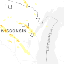
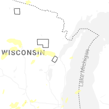
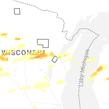
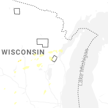
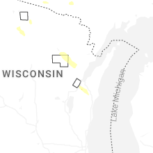


Connect with Interactive Hail Maps