

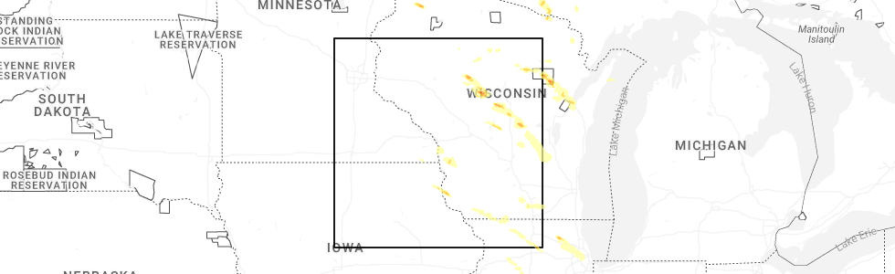
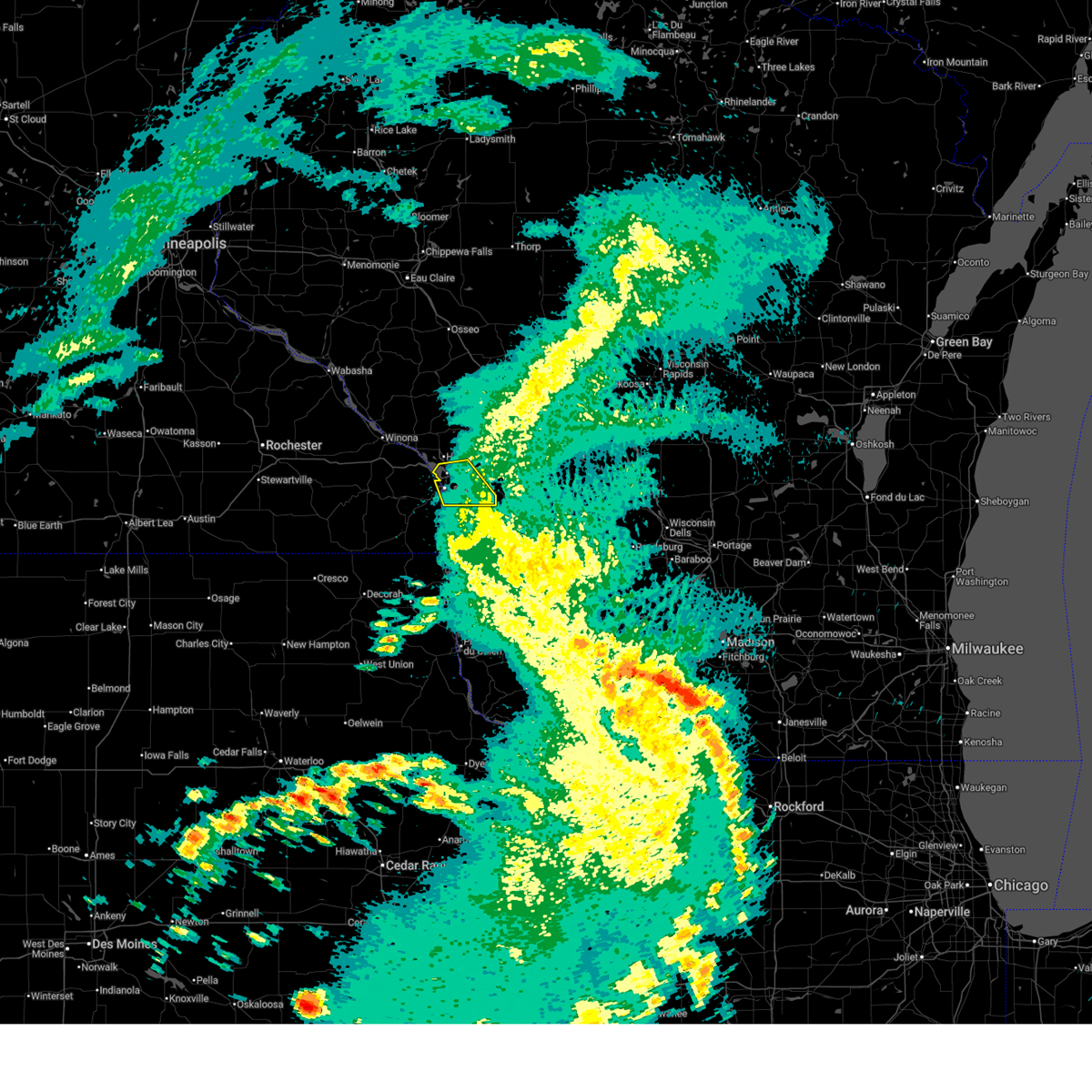
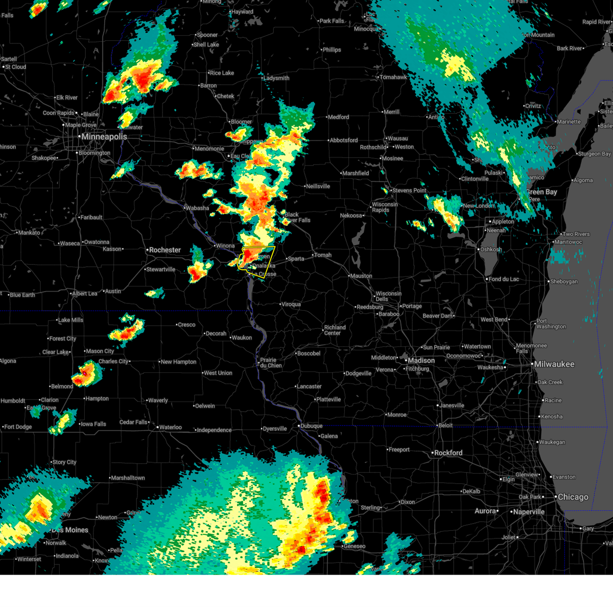
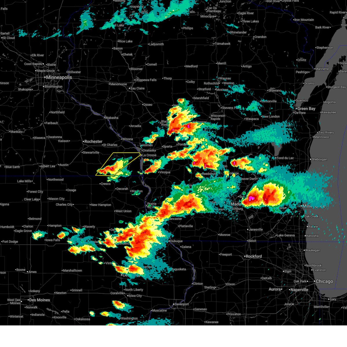
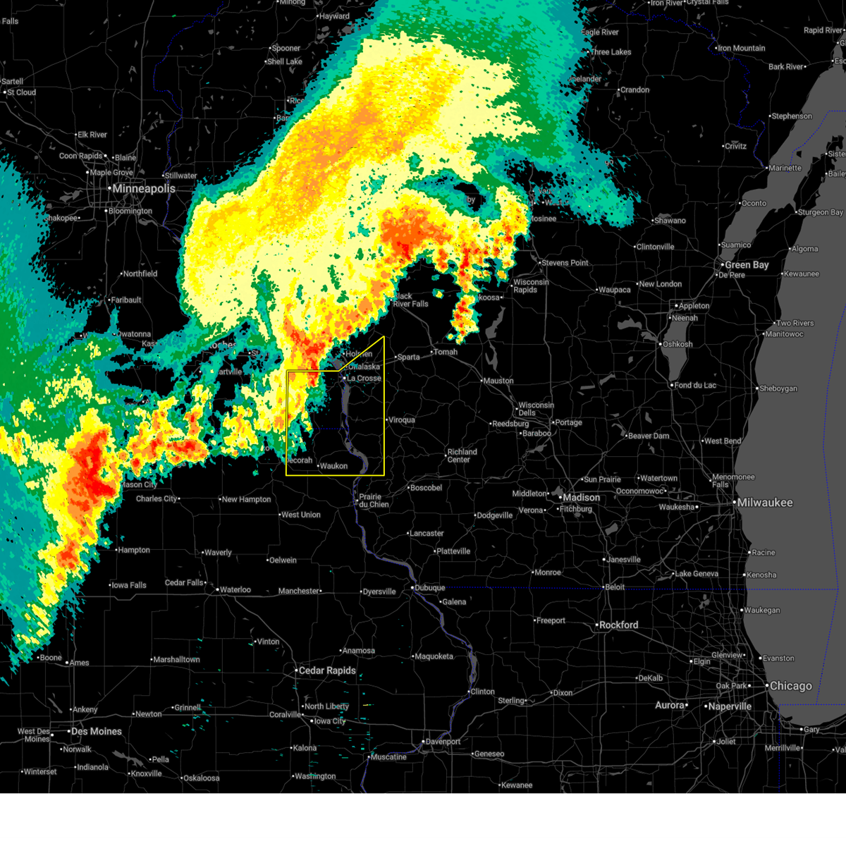
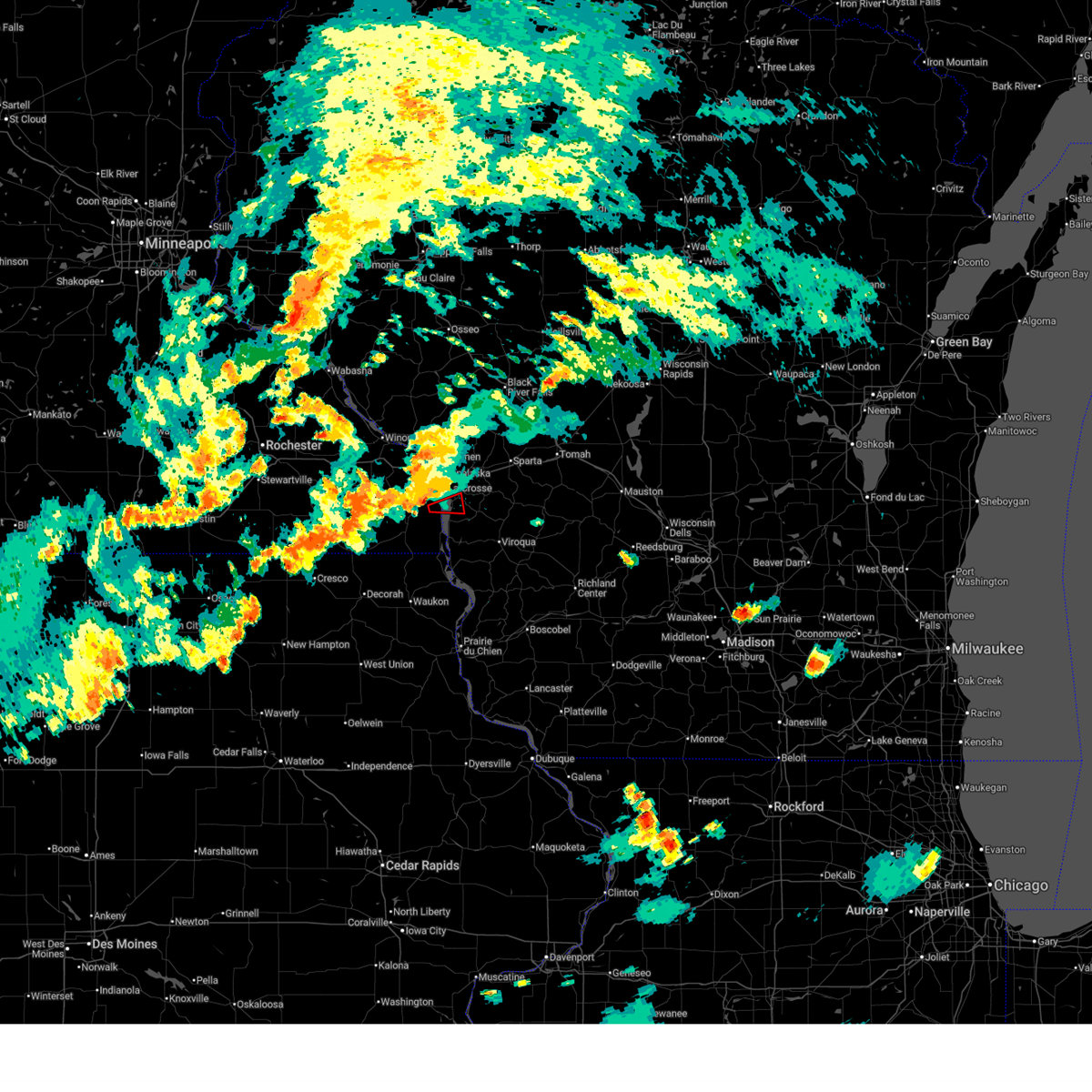
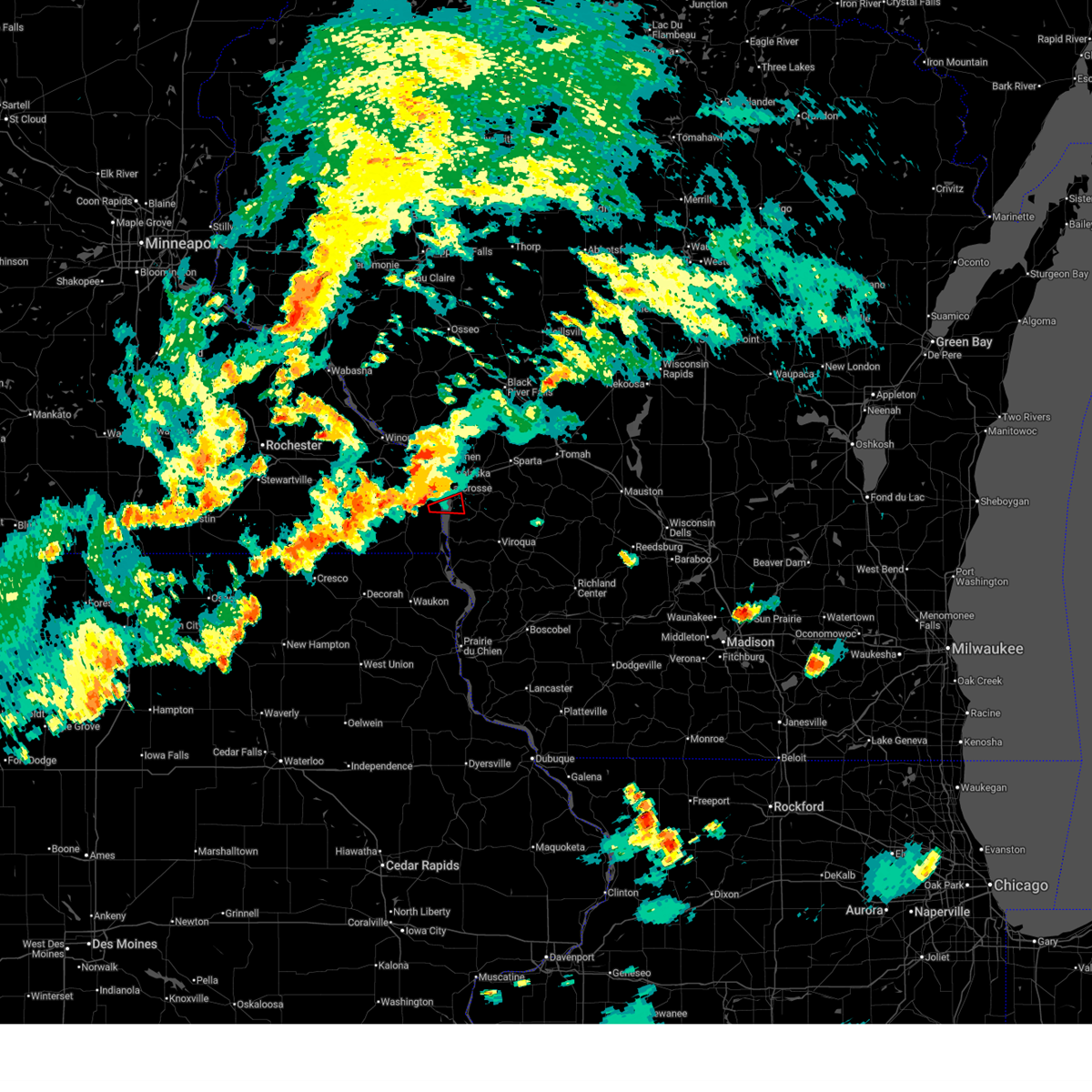
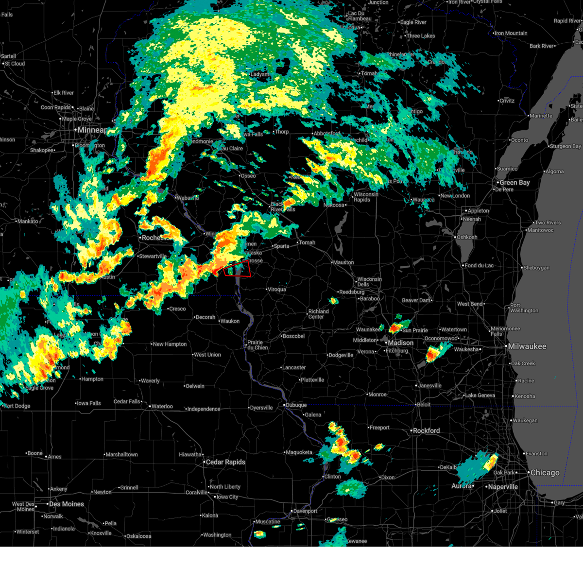
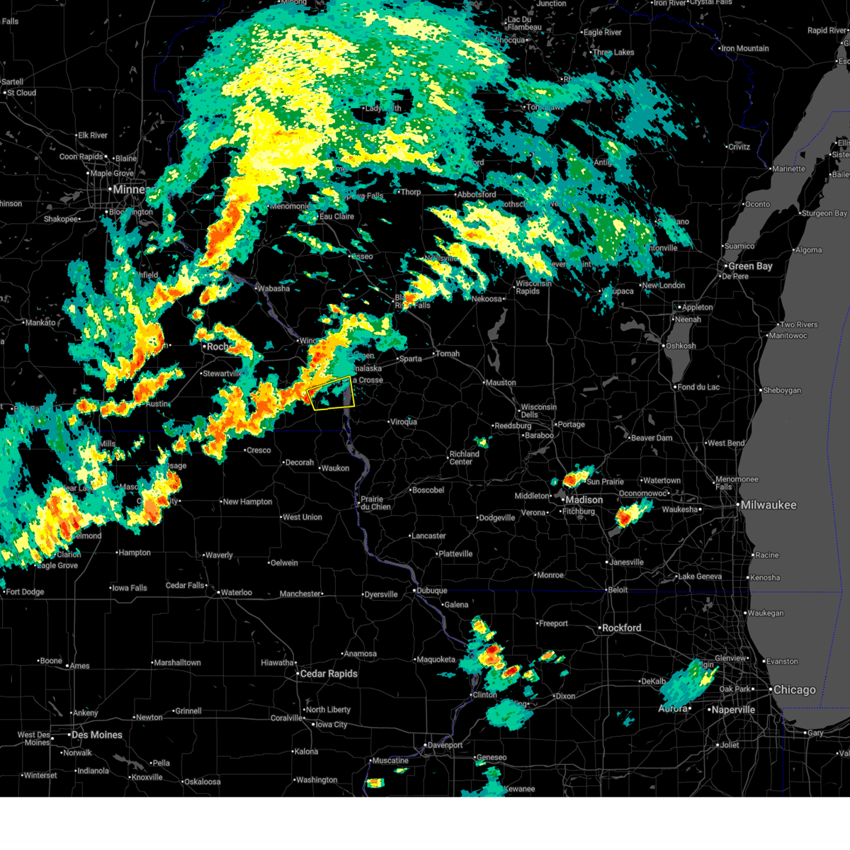
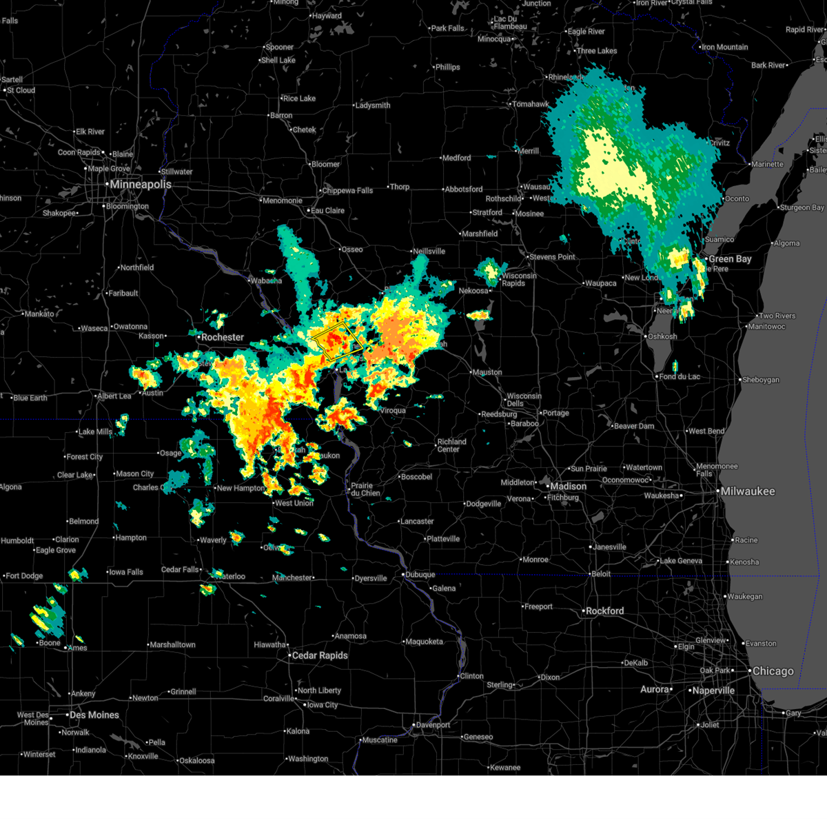
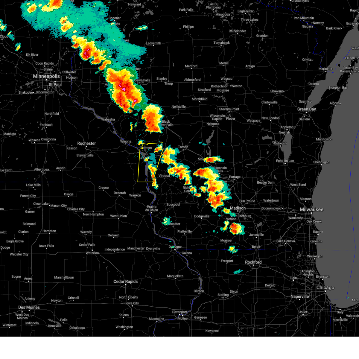
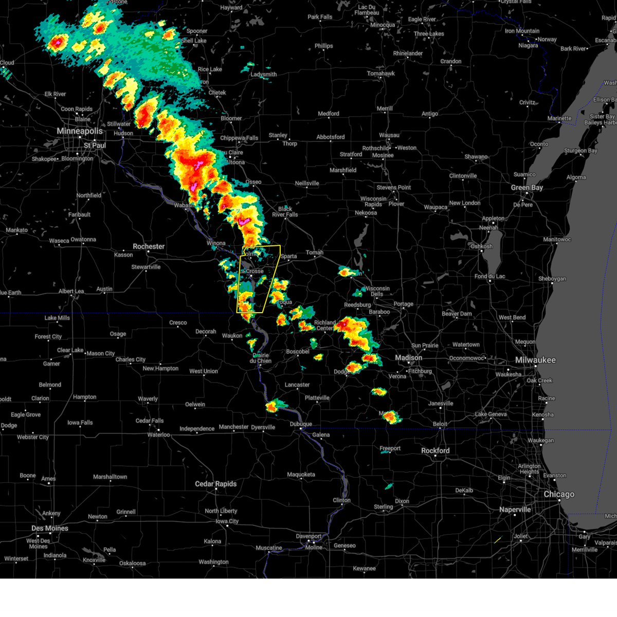
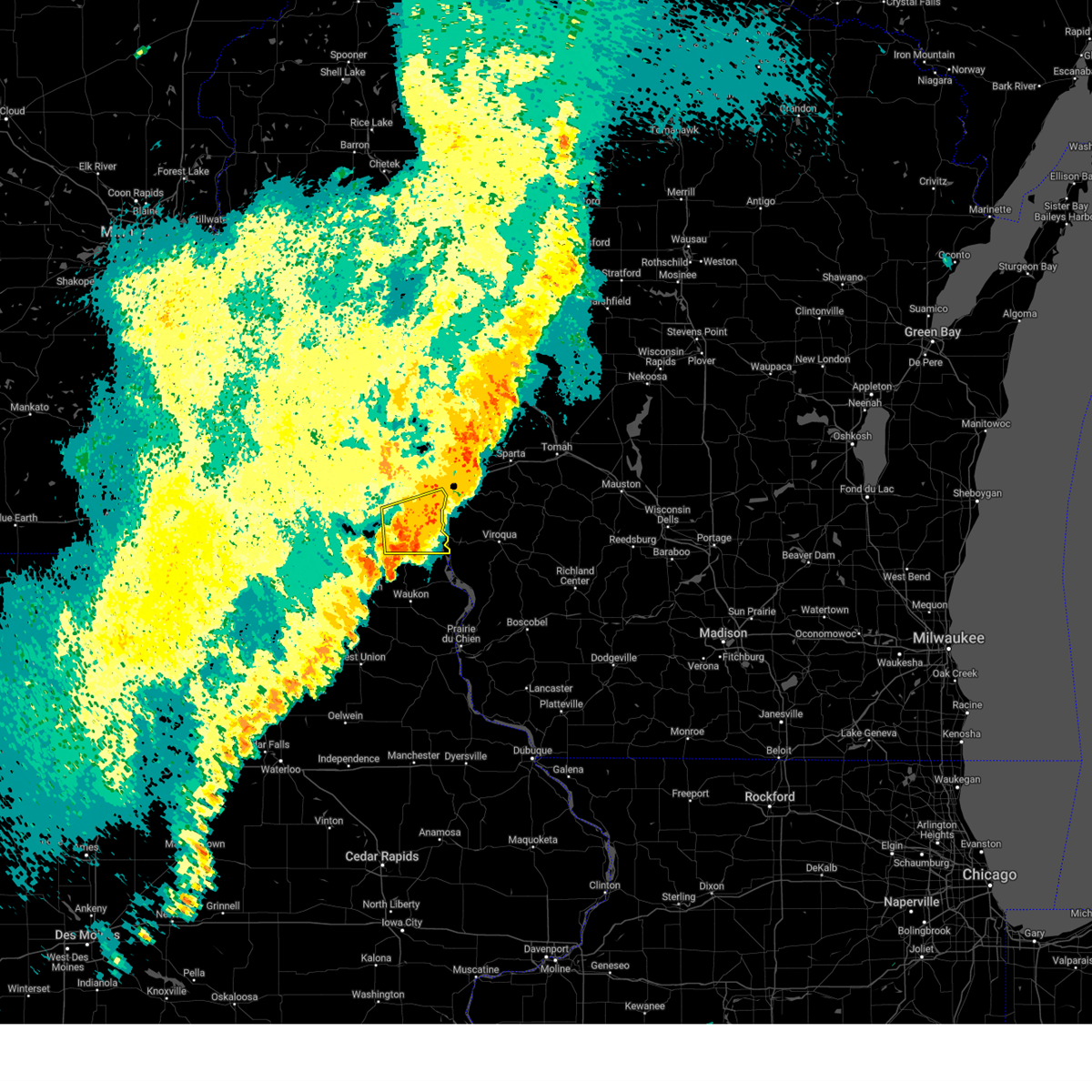
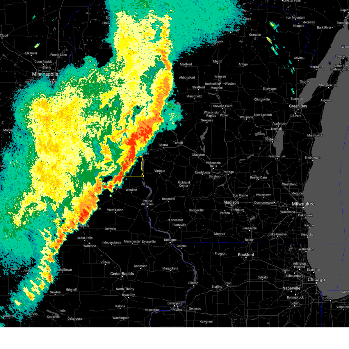
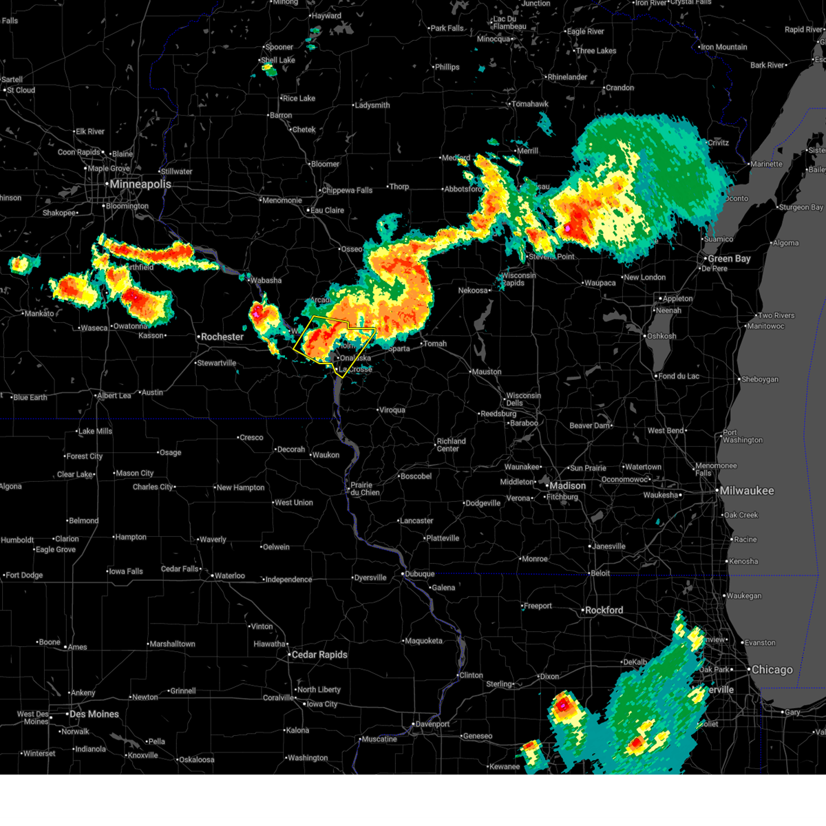
Hail Map for La Crosse, WI
The La Crosse, WI area has had 22 reports of on-the-ground hail by trained spotters, and has been under severe weather warnings 33 times during the past 12 months. Doppler radar has detected hail at or near La Crosse, WI on 83 occasions, including 5 occasions during the past year.
| Name: | La Crosse, WI |
| Where Located: | 1.7 miles ENE of La Crosse, WI |
| Map: | Google Map for La Crosse, WI |
| Population: | 51320 |
| Housing Units: | 22628 |
| More Info: | Search Google for La Crosse, WI |
1
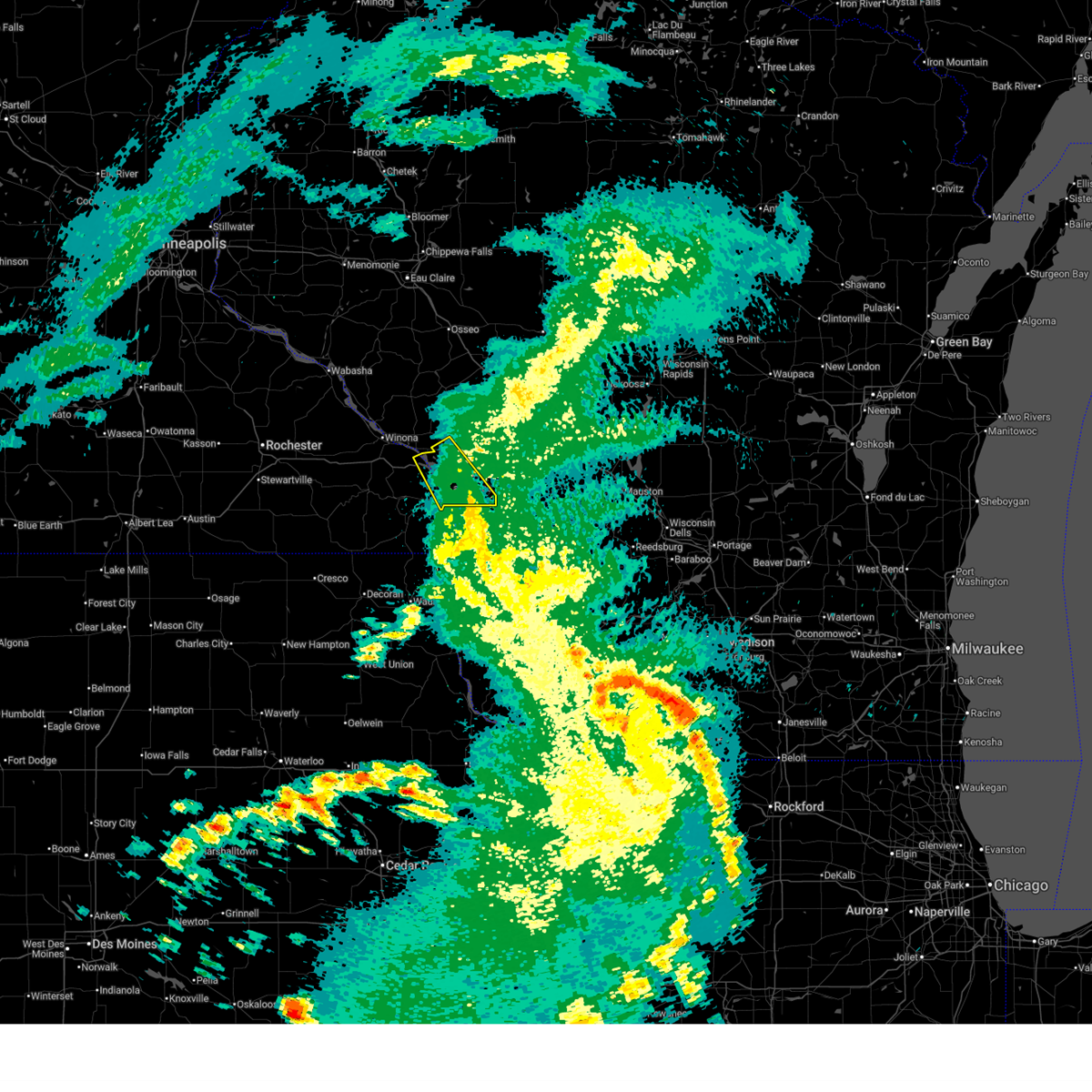
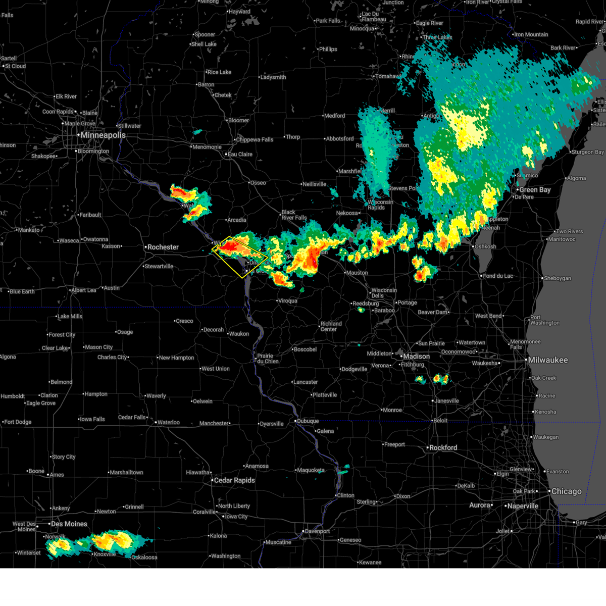
The Top Recent Hail Date for La Crosse, WI is Wednesday, June 24, 2026 (27th out of 83)
Hail and Wind Damage Spotted near La Crosse, WI
| Date / Time | Report Details |
|---|---|
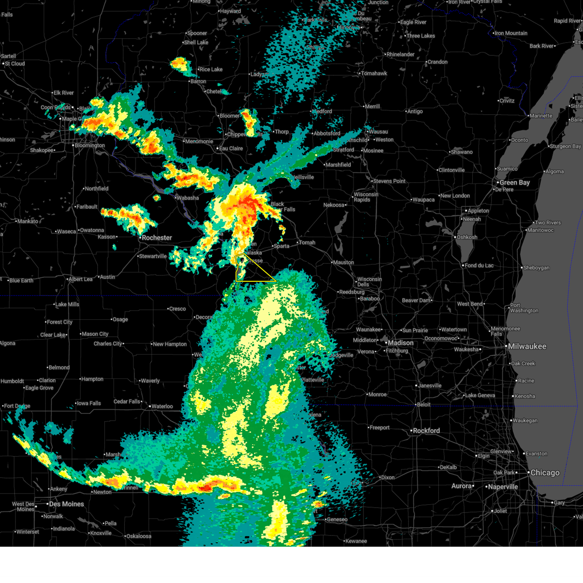
| 6/24/2026 2:35 PM CDT |
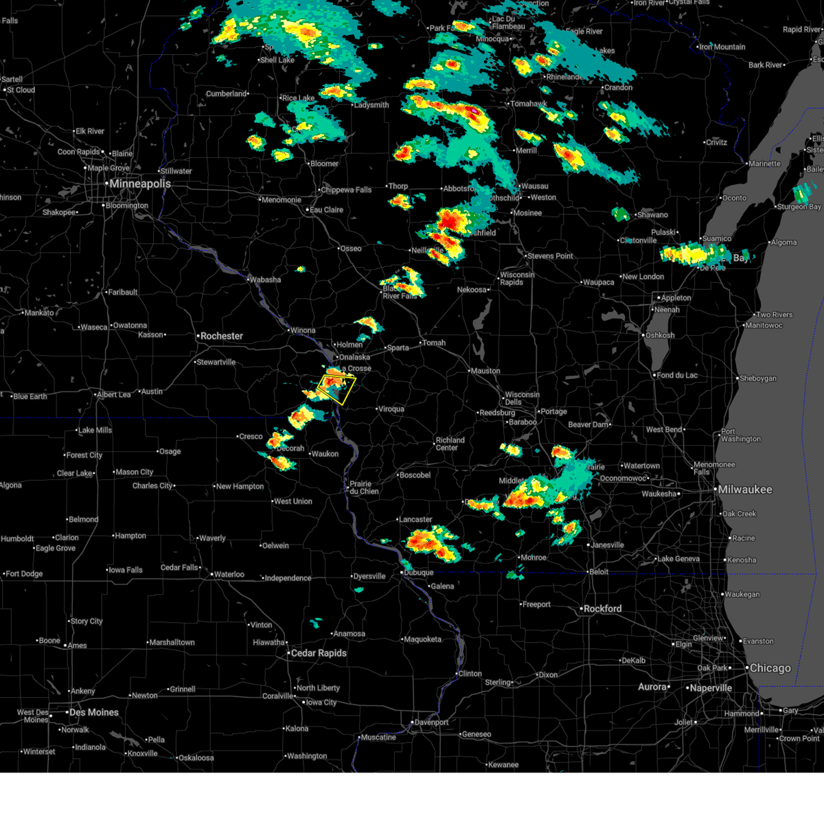 At 235 pm cdt, a severe thunderstorm was located over brownsville, or 8 miles south of la crosse, moving east at 25 mph (radar indicated). Hazards include 60 mph wind gusts and quarter size hail. Hail damage to vehicles is expected. expect wind damage to roofs, siding, and trees. this severe storm will be near, la crosse and stoddard around 240 pm cdt. Other locations impacted by this severe thunderstorm include mount la crosse, brinkman ridge, county roads 3 and 24, goose island, and highways 14 61 and county m m. At 235 pm cdt, a severe thunderstorm was located over brownsville, or 8 miles south of la crosse, moving east at 25 mph (radar indicated). Hazards include 60 mph wind gusts and quarter size hail. Hail damage to vehicles is expected. expect wind damage to roofs, siding, and trees. this severe storm will be near, la crosse and stoddard around 240 pm cdt. Other locations impacted by this severe thunderstorm include mount la crosse, brinkman ridge, county roads 3 and 24, goose island, and highways 14 61 and county m m.
|
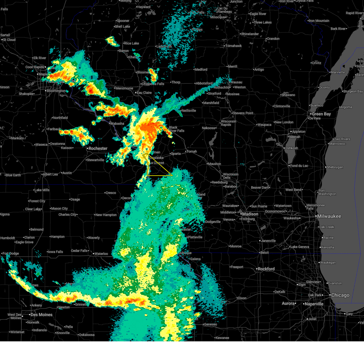
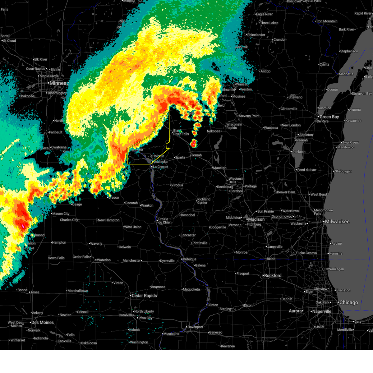
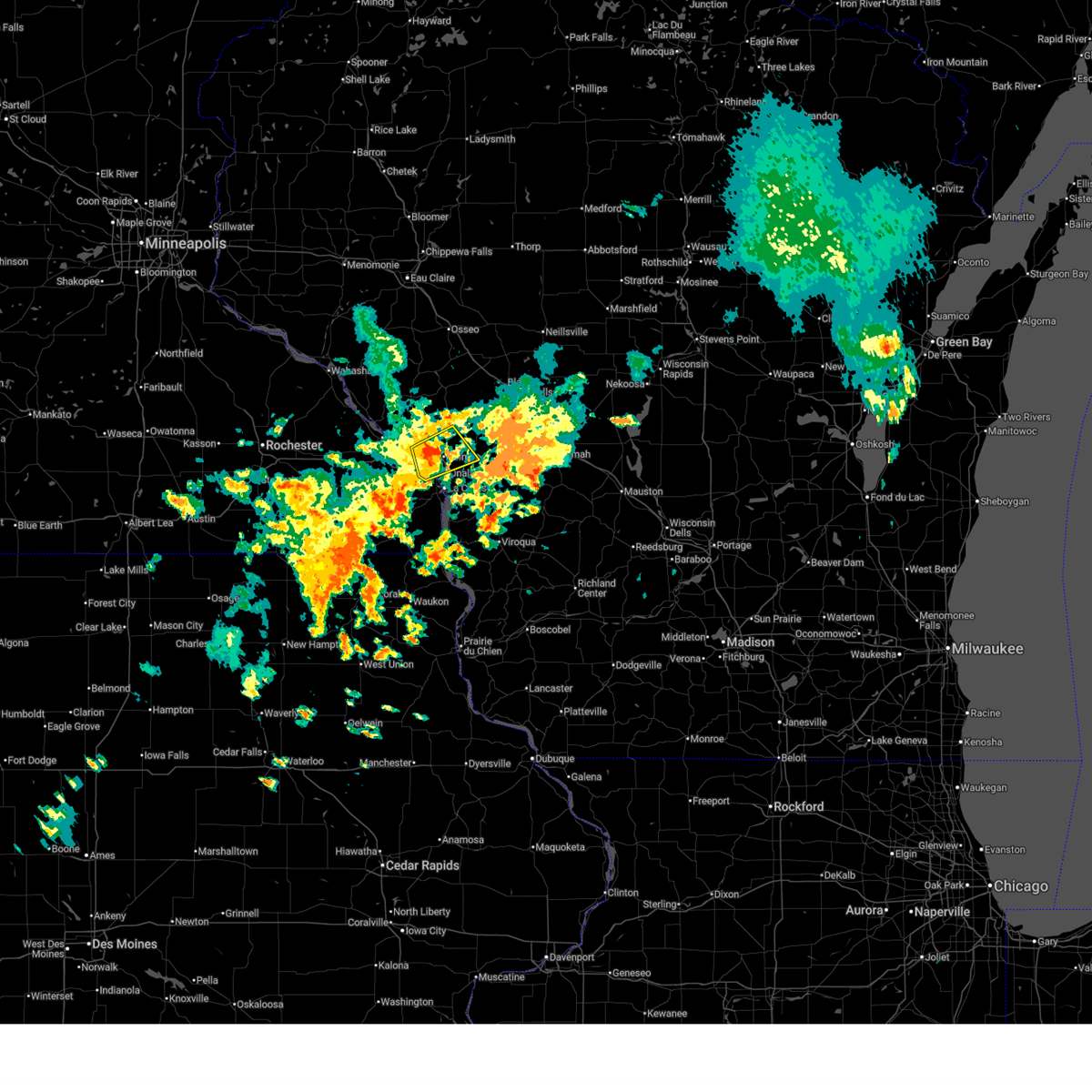
| 6/24/2026 2:24 PM CDT |
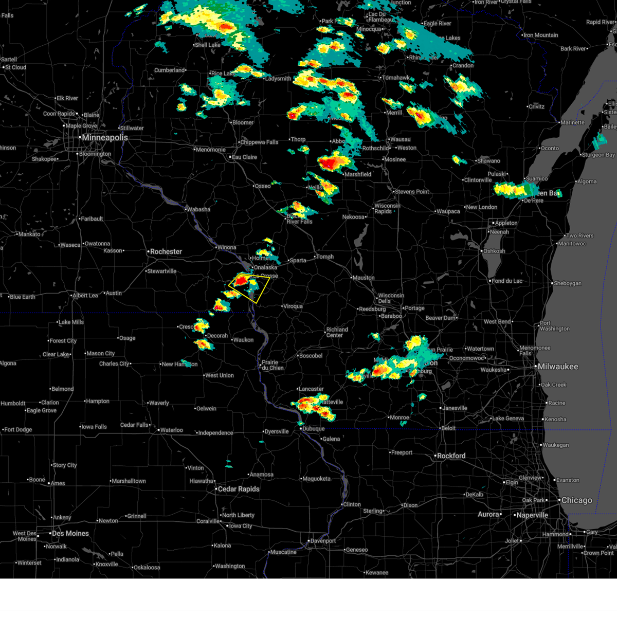 At 224 pm cdt, a severe thunderstorm was located over hokah, or near la crescent, moving east at 30 mph (radar indicated). Hazards include 60 mph wind gusts and quarter size hail. Hail damage to vehicles is expected. expect wind damage to roofs, siding, and trees. this severe storm will be near, la crosse and brownsville around 230 pm cdt. stoddard around 235 pm cdt. Other locations impacted by this severe thunderstorm include mount la crosse, brinkman ridge, irish hill, highway 44 and sanden road, highway 33 and county o a, county roads 3 and 24, and highway 33 and losey boulevard. At 224 pm cdt, a severe thunderstorm was located over hokah, or near la crescent, moving east at 30 mph (radar indicated). Hazards include 60 mph wind gusts and quarter size hail. Hail damage to vehicles is expected. expect wind damage to roofs, siding, and trees. this severe storm will be near, la crosse and brownsville around 230 pm cdt. stoddard around 235 pm cdt. Other locations impacted by this severe thunderstorm include mount la crosse, brinkman ridge, irish hill, highway 44 and sanden road, highway 33 and county o a, county roads 3 and 24, and highway 33 and losey boulevard.
|
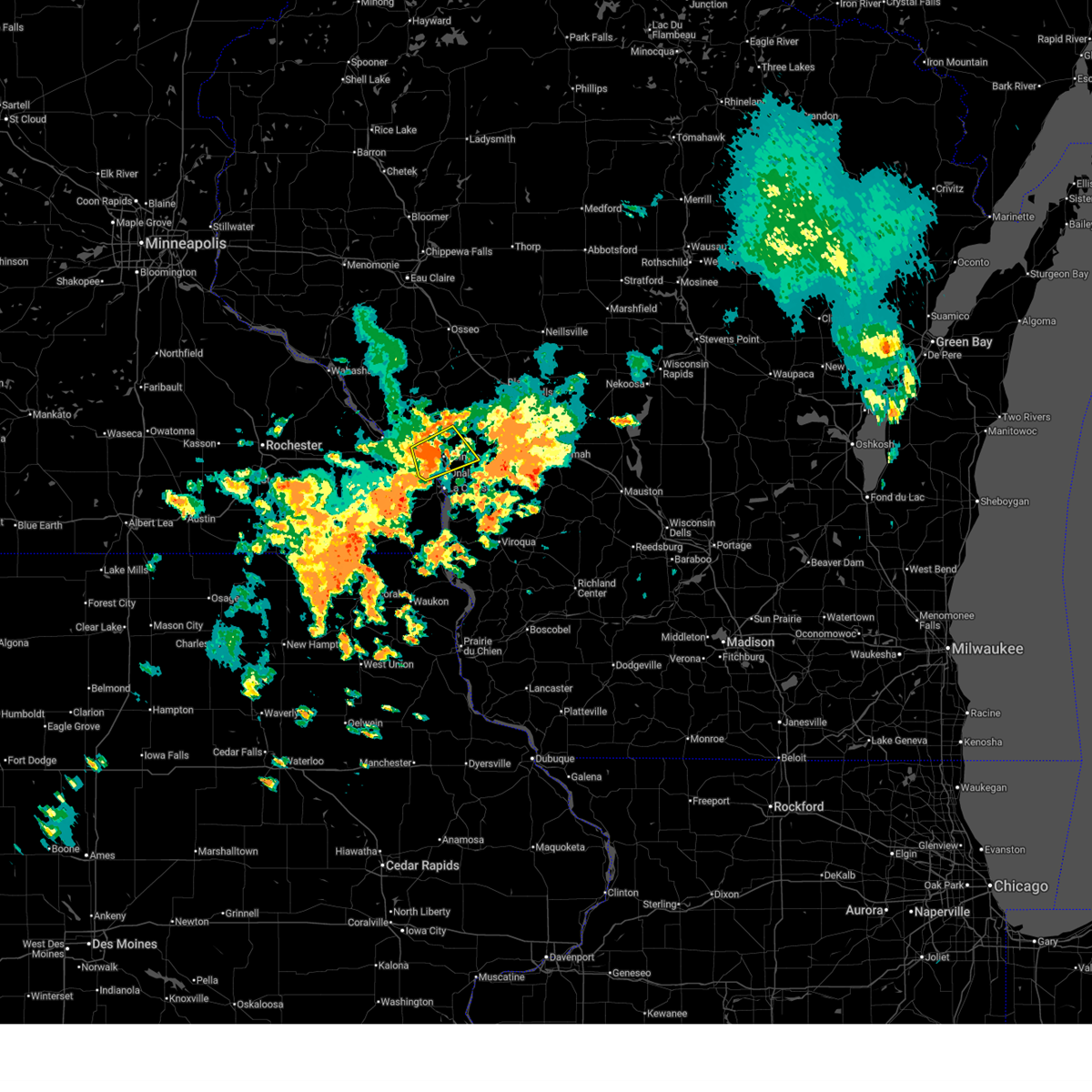
| 6/24/2026 2:14 PM CDT |
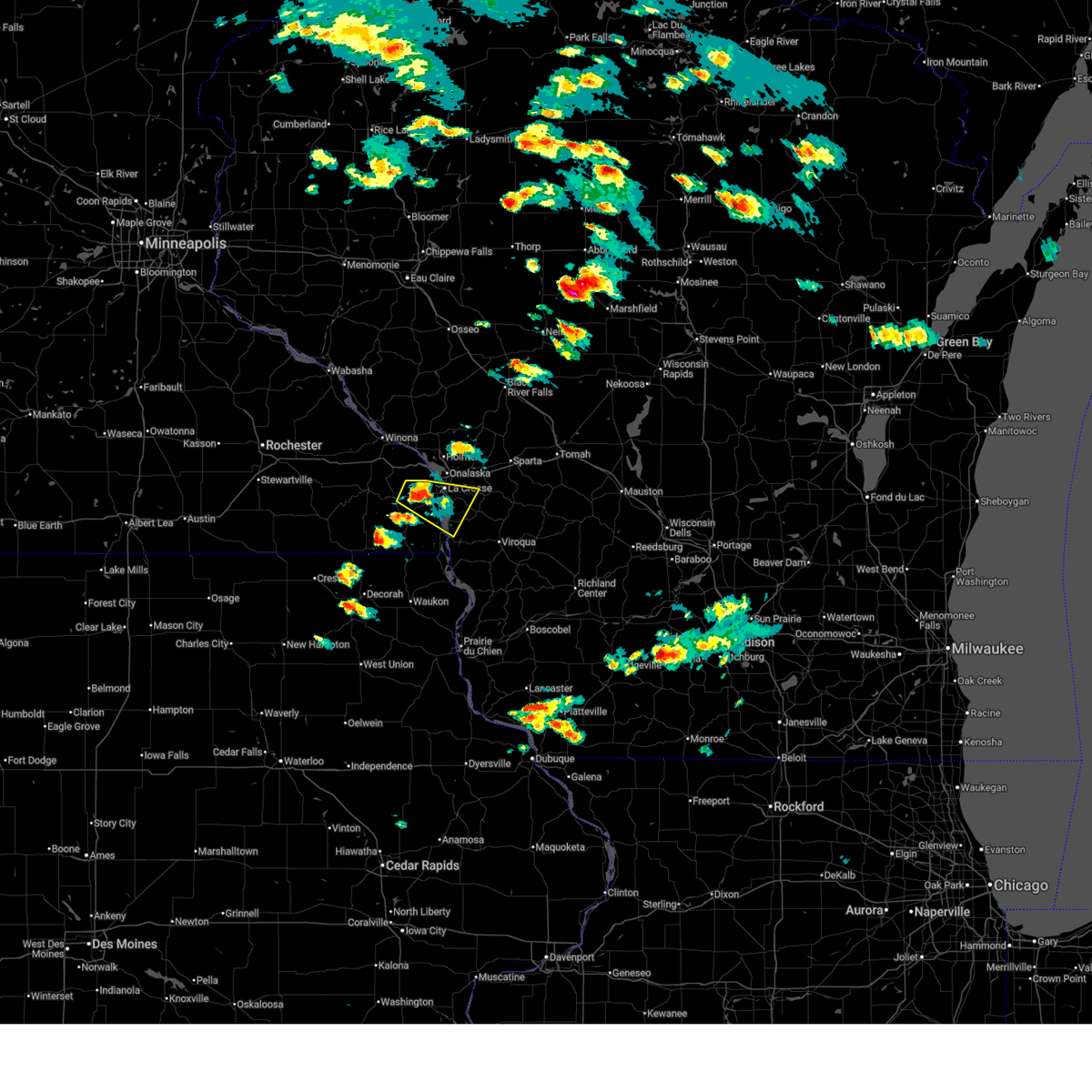 Svrarx the national weather service in la crosse has issued a * severe thunderstorm warning for, northeastern houston county in southeastern minnesota, southeastern la crosse county in west central wisconsin, northwestern vernon county in southwestern wisconsin, * until 300 pm cdt. * at 214 pm cdt, a severe thunderstorm was located near hokah, or 7 miles southwest of la crescent, moving east at 25 mph (radar indicated). Hazards include 60 mph wind gusts and quarter size hail. Hail damage to vehicles is expected. expect wind damage to roofs, siding, and trees. this severe thunderstorm will be near, la crescent and hokah around 220 pm cdt. la crosse around 225 pm cdt. brownsville around 230 pm cdt. Other locations impacted by this severe thunderstorm include mount la crosse, brinkman ridge, irish hill, highway 44 and sanden road, highway 33 and county o a, county roads 3 and 24, and highway 33 and losey boulevard. Svrarx the national weather service in la crosse has issued a * severe thunderstorm warning for, northeastern houston county in southeastern minnesota, southeastern la crosse county in west central wisconsin, northwestern vernon county in southwestern wisconsin, * until 300 pm cdt. * at 214 pm cdt, a severe thunderstorm was located near hokah, or 7 miles southwest of la crescent, moving east at 25 mph (radar indicated). Hazards include 60 mph wind gusts and quarter size hail. Hail damage to vehicles is expected. expect wind damage to roofs, siding, and trees. this severe thunderstorm will be near, la crescent and hokah around 220 pm cdt. la crosse around 225 pm cdt. brownsville around 230 pm cdt. Other locations impacted by this severe thunderstorm include mount la crosse, brinkman ridge, irish hill, highway 44 and sanden road, highway 33 and county o a, county roads 3 and 24, and highway 33 and losey boulevard.
|
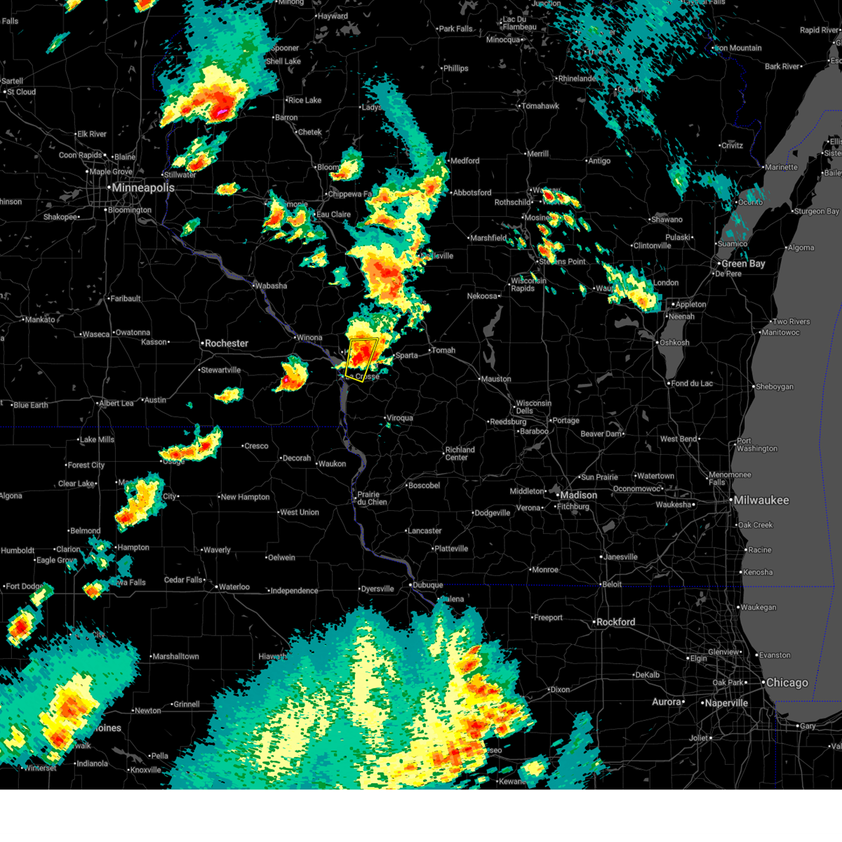
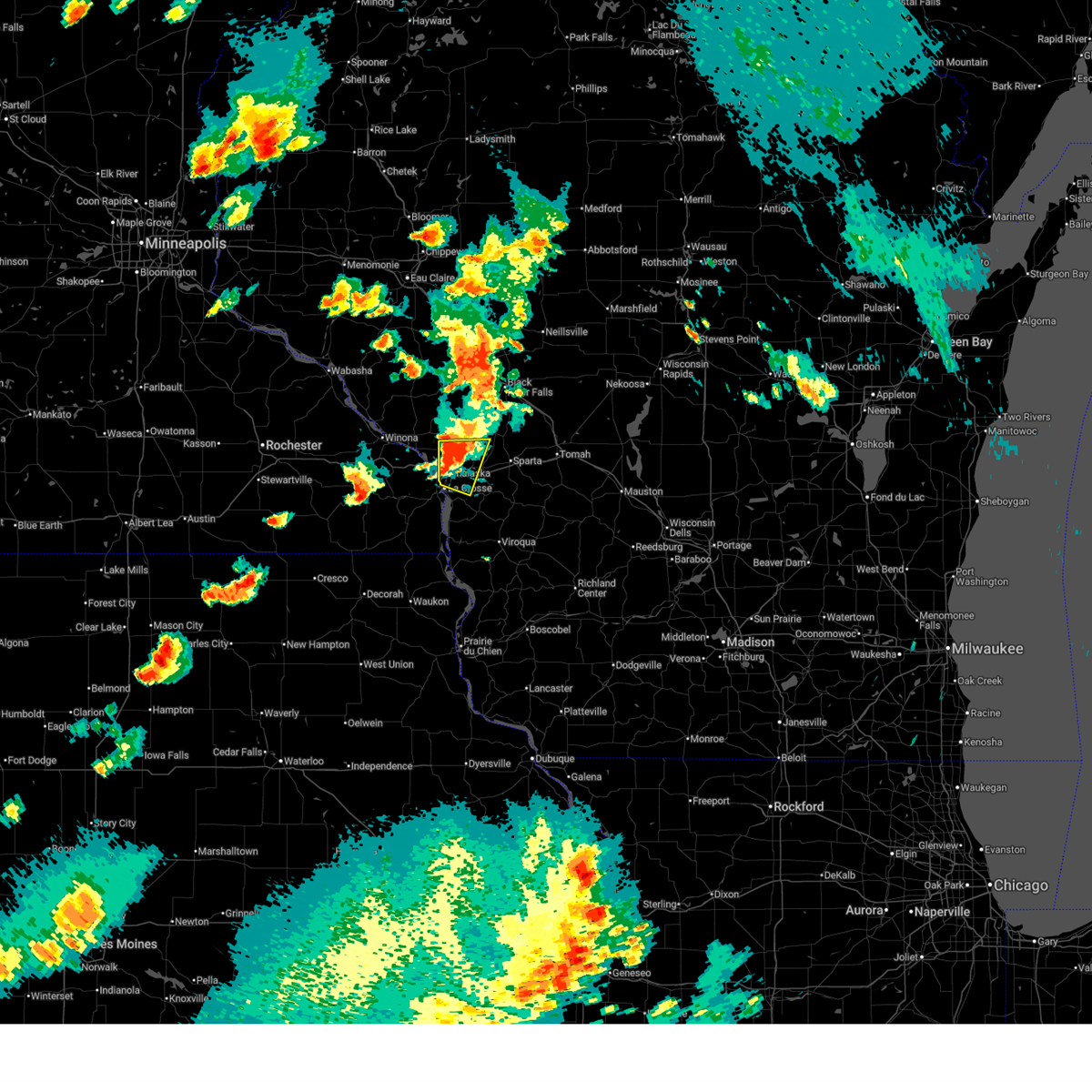
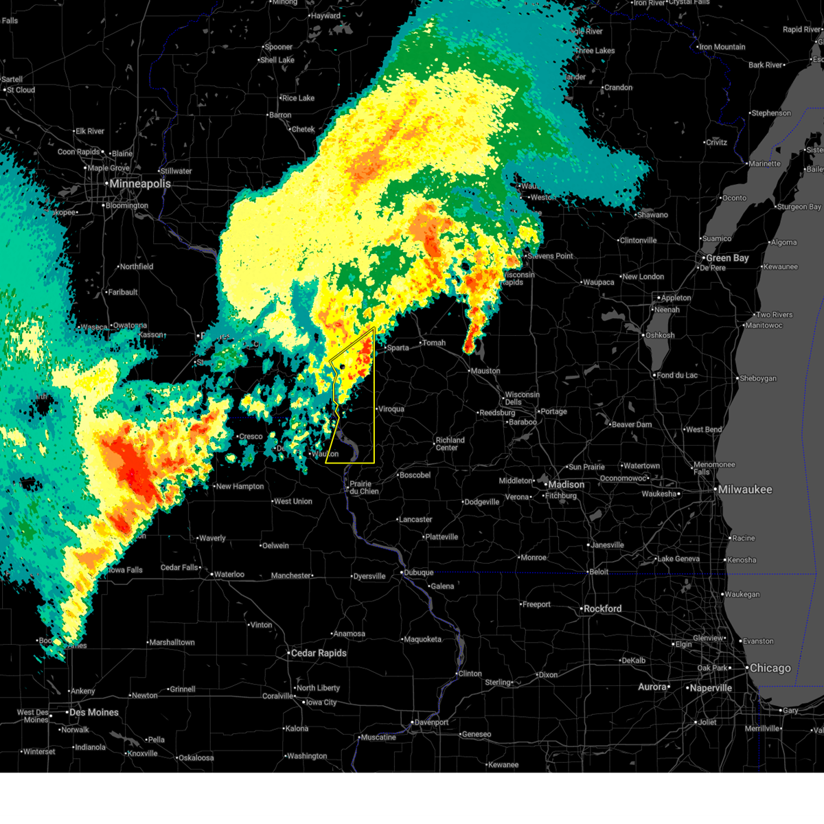
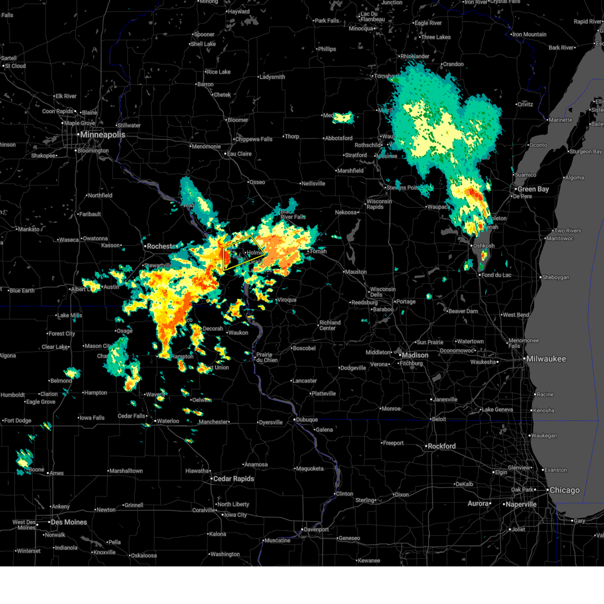
| 6/11/2026 11:22 AM CDT |
 At 1122 am cdt, a severe thunderstorm was located near la crosse, moving southeast at 35 mph (radar indicated. winds gusts of 40 to 50 mph and power outages have been reported with these winds). Hazards include 60 mph wind gusts. Expect damage to roofs, siding, and trees. locations impacted include, la crosse, la crescent, onalaska, holmen, west salem, french island, la crosse airport, brice prairie, medary, county roads g and h, irish hill, north side of la crosse, south side of la crosse, goose island, highways 14 61 and county m m, blue bird campground, highway 33 and county o a, newburg corners, barre mills, and norskedalen. This includes interstate 90 in wisconsin between mile markers 1 and 13. At 1122 am cdt, a severe thunderstorm was located near la crosse, moving southeast at 35 mph (radar indicated. winds gusts of 40 to 50 mph and power outages have been reported with these winds). Hazards include 60 mph wind gusts. Expect damage to roofs, siding, and trees. locations impacted include, la crosse, la crescent, onalaska, holmen, west salem, french island, la crosse airport, brice prairie, medary, county roads g and h, irish hill, north side of la crosse, south side of la crosse, goose island, highways 14 61 and county m m, blue bird campground, highway 33 and county o a, newburg corners, barre mills, and norskedalen. This includes interstate 90 in wisconsin between mile markers 1 and 13.
|
| 6/11/2026 11:15 AM CDT | Tree down near 23rd and pine street. time estimated from rada in la crosse county WI, 0.3 miles NNW of La Crosse, WI |
| 6/11/2026 11:10 AM CDT | Tree down on two cars. time estimated from rada in la crosse county WI, 1 miles ESE of La Crosse, WI |
| 6/11/2026 11:10 AM CDT | A number of trees and limbs down in la crosse and onalaska. time estimated from rada in la crosse county WI, 2.5 miles S of La Crosse, WI |
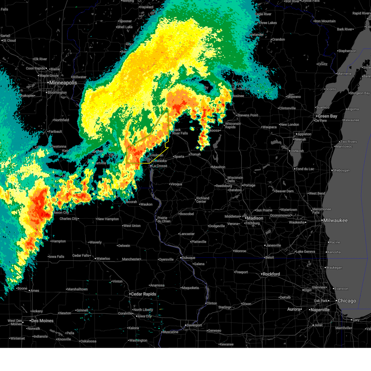
| 6/11/2026 11:09 AM CDT |
 Svrarx the national weather service in la crosse has issued a * severe thunderstorm warning for, southeastern winona county in southeastern minnesota, northeastern houston county in southeastern minnesota, la crosse county in west central wisconsin, * until noon cdt. * at 1109 am cdt, a severe thunderstorm was located over la crosse airport, or near la crescent, moving southeast at 30 mph (radar indicated). Hazards include 60 mph wind gusts. expect damage to roofs, siding, and trees Svrarx the national weather service in la crosse has issued a * severe thunderstorm warning for, southeastern winona county in southeastern minnesota, northeastern houston county in southeastern minnesota, la crosse county in west central wisconsin, * until noon cdt. * at 1109 am cdt, a severe thunderstorm was located over la crosse airport, or near la crescent, moving southeast at 30 mph (radar indicated). Hazards include 60 mph wind gusts. expect damage to roofs, siding, and trees
|
| 6/10/2026 6:51 PM CDT |
 The storm which prompted the warning has weakened below severe limits, and no longer poses an immediate threat to life or property. therefore, the warning will be allowed to expire. a severe thunderstorm watch remains in effect until 900 pm cdt for west central wisconsin. The storm which prompted the warning has weakened below severe limits, and no longer poses an immediate threat to life or property. therefore, the warning will be allowed to expire. a severe thunderstorm watch remains in effect until 900 pm cdt for west central wisconsin.
|
| 6/10/2026 6:47 PM CDT |
 At 647 pm cdt, a severe thunderstorm was located over west salem, or 9 miles northeast of la crosse, moving east at 25 mph (trained weather spotters). Hazards include 60 mph wind gusts and quarter size hail. Hail damage to vehicles is expected. expect wind damage to roofs, siding, and trees. this severe storm will be near, west salem around 650 pm cdt. other locations impacted by this severe thunderstorm include stevenstown, the valley view mall, blue bird campground, county roads d e and e, county roads m and w, mindoro cut, and severson coulee. This includes interstate 90 in wisconsin between mile markers 5 and 14. At 647 pm cdt, a severe thunderstorm was located over west salem, or 9 miles northeast of la crosse, moving east at 25 mph (trained weather spotters). Hazards include 60 mph wind gusts and quarter size hail. Hail damage to vehicles is expected. expect wind damage to roofs, siding, and trees. this severe storm will be near, west salem around 650 pm cdt. other locations impacted by this severe thunderstorm include stevenstown, the valley view mall, blue bird campground, county roads d e and e, county roads m and w, mindoro cut, and severson coulee. This includes interstate 90 in wisconsin between mile markers 5 and 14.
|
| 6/10/2026 6:35 PM CDT |
 the severe thunderstorm warning has been cancelled and is no longer in effect the severe thunderstorm warning has been cancelled and is no longer in effect
|
| 6/10/2026 6:35 PM CDT |
 At 634 pm cdt, a severe thunderstorm was located over holmen, or 7 miles north of la crosse, moving east at 25 mph (trained weather spotters). Hazards include ping pong ball size hail and 60 mph wind gusts. People and animals outdoors will be injured. expect hail damage to roofs, siding, windows, and vehicles. expect wind damage to roofs, siding, and trees. this severe storm will be near, la crosse, onalaska, and west salem around 640 pm cdt. other locations impacted by this severe thunderstorm include north side of la crosse, stevenstown, the valley view mall, blue bird campground, county roads d e and e, county roads m and w, and mindoro cut. This includes interstate 90 in wisconsin between mile markers 1 and 14. At 634 pm cdt, a severe thunderstorm was located over holmen, or 7 miles north of la crosse, moving east at 25 mph (trained weather spotters). Hazards include ping pong ball size hail and 60 mph wind gusts. People and animals outdoors will be injured. expect hail damage to roofs, siding, windows, and vehicles. expect wind damage to roofs, siding, and trees. this severe storm will be near, la crosse, onalaska, and west salem around 640 pm cdt. other locations impacted by this severe thunderstorm include north side of la crosse, stevenstown, the valley view mall, blue bird campground, county roads d e and e, county roads m and w, and mindoro cut. This includes interstate 90 in wisconsin between mile markers 1 and 14.
|
| 6/10/2026 6:23 PM CDT |
 At 623 pm cdt, a severe thunderstorm was located over brice prairie, or 7 miles north of la crescent, moving east at 25 mph (trained weather spotters). Hazards include ping pong ball size hail and 60 mph wind gusts. People and animals outdoors will be injured. expect hail damage to roofs, siding, windows, and vehicles. expect wind damage to roofs, siding, and trees. this severe storm will be near, la crosse, onalaska, holmen, brice prairie, and french island around 630 pm cdt. west salem around 640 pm cdt. other locations impacted by this severe thunderstorm include north side of la crosse, stevenstown, the valley view mall, blue bird campground, county roads d e and e, county roads m and w, and mindoro cut. this includes the following highways, interstate 90 in minnesota between mile markers 270 and 276. Interstate 90 in wisconsin between mile markers 1 and 14. At 623 pm cdt, a severe thunderstorm was located over brice prairie, or 7 miles north of la crescent, moving east at 25 mph (trained weather spotters). Hazards include ping pong ball size hail and 60 mph wind gusts. People and animals outdoors will be injured. expect hail damage to roofs, siding, windows, and vehicles. expect wind damage to roofs, siding, and trees. this severe storm will be near, la crosse, onalaska, holmen, brice prairie, and french island around 630 pm cdt. west salem around 640 pm cdt. other locations impacted by this severe thunderstorm include north side of la crosse, stevenstown, the valley view mall, blue bird campground, county roads d e and e, county roads m and w, and mindoro cut. this includes the following highways, interstate 90 in minnesota between mile markers 270 and 276. Interstate 90 in wisconsin between mile markers 1 and 14.
|
| 6/10/2026 6:10 PM CDT |
 Svrarx the national weather service in la crosse has issued a * severe thunderstorm warning for, southeastern winona county in southeastern minnesota, central la crosse county in west central wisconsin, south central trempealeau county in west central wisconsin, * until 700 pm cdt. * at 610 pm cdt, a severe thunderstorm was located near dakota, or 10 miles northwest of la crescent, moving east at 25 mph (radar indicated). Hazards include 60 mph wind gusts and quarter size hail. Hail damage to vehicles is expected. expect wind damage to roofs, siding, and trees. this severe thunderstorm will be near, dakota and brice prairie around 615 pm cdt. holmen around 620 pm cdt. la crosse, onalaska, and french island around 625 pm cdt. west salem around 640 pm cdt. other locations impacted by this severe thunderstorm include north side of la crosse, perrot state park, stevenstown, blue bird campground, county roads d e and e, severson coulee, and mindoro. this includes the following highways, interstate 90 in minnesota between mile markers 263 and 276. Interstate 90 in wisconsin between mile markers 1 and 14. Svrarx the national weather service in la crosse has issued a * severe thunderstorm warning for, southeastern winona county in southeastern minnesota, central la crosse county in west central wisconsin, south central trempealeau county in west central wisconsin, * until 700 pm cdt. * at 610 pm cdt, a severe thunderstorm was located near dakota, or 10 miles northwest of la crescent, moving east at 25 mph (radar indicated). Hazards include 60 mph wind gusts and quarter size hail. Hail damage to vehicles is expected. expect wind damage to roofs, siding, and trees. this severe thunderstorm will be near, dakota and brice prairie around 615 pm cdt. holmen around 620 pm cdt. la crosse, onalaska, and french island around 625 pm cdt. west salem around 640 pm cdt. other locations impacted by this severe thunderstorm include north side of la crosse, perrot state park, stevenstown, blue bird campground, county roads d e and e, severson coulee, and mindoro. this includes the following highways, interstate 90 in minnesota between mile markers 263 and 276. Interstate 90 in wisconsin between mile markers 1 and 14.
|
| 6/5/2026 9:11 PM CDT |
 At 911 pm cdt, a severe thunderstorm was located over dakota, or near la crescent, moving southeast at 25 mph (radar indicated). Hazards include 60 mph wind gusts and quarter size hail. Hail damage to vehicles is expected. expect wind damage to roofs, siding, and trees. this severe storm will be near, la crosse, la crescent, onalaska, holmen, dakota, la crosse airport, brice prairie, and french island around 915 pm cdt. other locations impacted by this severe thunderstorm include north side of la crosse, the valley view mall, new hartford, county roads m and w, dresbach, new amsterdam, and nathan hill. this includes the following highways, interstate 90 in minnesota between mile markers 262 and 276. Interstate 90 in wisconsin between mile markers 1 and 12. At 911 pm cdt, a severe thunderstorm was located over dakota, or near la crescent, moving southeast at 25 mph (radar indicated). Hazards include 60 mph wind gusts and quarter size hail. Hail damage to vehicles is expected. expect wind damage to roofs, siding, and trees. this severe storm will be near, la crosse, la crescent, onalaska, holmen, dakota, la crosse airport, brice prairie, and french island around 915 pm cdt. other locations impacted by this severe thunderstorm include north side of la crosse, the valley view mall, new hartford, county roads m and w, dresbach, new amsterdam, and nathan hill. this includes the following highways, interstate 90 in minnesota between mile markers 262 and 276. Interstate 90 in wisconsin between mile markers 1 and 12.
|
| 6/5/2026 9:05 PM CDT |
 At 904 pm cdt, a severe thunderstorm was located over dakota, or 8 miles northwest of la crescent, moving southeast at 25 mph (radar indicated). Hazards include quarter size hail. Damage to vehicles is expected. this severe storm will be near, dakota, brice prairie, and french island around 910 pm cdt. la crosse, la crescent, onalaska, holmen, and la crosse airport around 915 pm cdt. other locations impacted by this severe thunderstorm include north side of la crosse, the valley view mall, new hartford, county roads m and w, dresbach, new amsterdam, and nathan hill. this includes the following highways, interstate 90 in minnesota between mile markers 262 and 276. Interstate 90 in wisconsin between mile markers 1 and 12. At 904 pm cdt, a severe thunderstorm was located over dakota, or 8 miles northwest of la crescent, moving southeast at 25 mph (radar indicated). Hazards include quarter size hail. Damage to vehicles is expected. this severe storm will be near, dakota, brice prairie, and french island around 910 pm cdt. la crosse, la crescent, onalaska, holmen, and la crosse airport around 915 pm cdt. other locations impacted by this severe thunderstorm include north side of la crosse, the valley view mall, new hartford, county roads m and w, dresbach, new amsterdam, and nathan hill. this includes the following highways, interstate 90 in minnesota between mile markers 262 and 276. Interstate 90 in wisconsin between mile markers 1 and 12.
|
| 6/5/2026 9:05 PM CDT |
 the severe thunderstorm warning has been cancelled and is no longer in effect the severe thunderstorm warning has been cancelled and is no longer in effect
|
| 6/5/2026 8:40 PM CDT |
 Svrarx the national weather service in la crosse has issued a * severe thunderstorm warning for, southeastern winona county in southeastern minnesota, northeastern houston county in southeastern minnesota, central la crosse county in west central wisconsin, southwestern trempealeau county in west central wisconsin, * until 930 pm cdt. * at 840 pm cdt, a severe thunderstorm was located near winona, moving southeast at 25 mph (radar indicated). Hazards include half dollar size hail. Damage to vehicles is expected. this severe thunderstorm will be near, trempealeau around 845 pm cdt. dakota and brice prairie around 900 pm cdt. la crosse and french island around 910 pm cdt. la crescent, onalaska, holmen, and la crosse airport around 915 pm cdt. other locations impacted by this severe thunderstorm include north side of la crosse, perrot state park, the valley view mall, pickwick, new hartford, county roads m and w, and dresbach. this includes the following highways, interstate 90 in minnesota between mile markers 262 and 276. Interstate 90 in wisconsin between mile markers 1 and 12. Svrarx the national weather service in la crosse has issued a * severe thunderstorm warning for, southeastern winona county in southeastern minnesota, northeastern houston county in southeastern minnesota, central la crosse county in west central wisconsin, southwestern trempealeau county in west central wisconsin, * until 930 pm cdt. * at 840 pm cdt, a severe thunderstorm was located near winona, moving southeast at 25 mph (radar indicated). Hazards include half dollar size hail. Damage to vehicles is expected. this severe thunderstorm will be near, trempealeau around 845 pm cdt. dakota and brice prairie around 900 pm cdt. la crosse and french island around 910 pm cdt. la crescent, onalaska, holmen, and la crosse airport around 915 pm cdt. other locations impacted by this severe thunderstorm include north side of la crosse, perrot state park, the valley view mall, pickwick, new hartford, county roads m and w, and dresbach. this includes the following highways, interstate 90 in minnesota between mile markers 262 and 276. Interstate 90 in wisconsin between mile markers 1 and 12.
|
| 4/23/2026 9:33 PM CDT |
 At 933 pm cdt, severe thunderstorms were located along a line extending from near independence to near blair to holmen, moving east at 35 mph (radar indicated). Hazards include 60 mph wind gusts. Expect damage to roofs, siding, and trees. these severe storms will be near, whitehall, blair, and north bend around 940 pm cdt. other locations impacted by these severe thunderstorms include franklin, camp decorah, stevenstown, chimney rock, rockland, county roads d e and e, and mindoro. this includes the following highways, interstate 94 between mile markers 88 and 112. Interstate 90 in wisconsin between mile markers 2 and 23. At 933 pm cdt, severe thunderstorms were located along a line extending from near independence to near blair to holmen, moving east at 35 mph (radar indicated). Hazards include 60 mph wind gusts. Expect damage to roofs, siding, and trees. these severe storms will be near, whitehall, blair, and north bend around 940 pm cdt. other locations impacted by these severe thunderstorms include franklin, camp decorah, stevenstown, chimney rock, rockland, county roads d e and e, and mindoro. this includes the following highways, interstate 94 between mile markers 88 and 112. Interstate 90 in wisconsin between mile markers 2 and 23.
|
| 4/23/2026 9:16 PM CDT |
 Svrarx the national weather service in la crosse has issued a * severe thunderstorm warning for, southeastern winona county in southeastern minnesota, east central buffalo county in west central wisconsin, la crosse county in west central wisconsin, southwestern jackson county in west central wisconsin, northwestern monroe county in west central wisconsin, trempealeau county in west central wisconsin, * until 1015 pm cdt. * at 916 pm cdt, severe thunderstorms were located along a line extending from 9 miles southeast of modena to arcadia to near dakota, moving east at 30 mph (radar indicated). Hazards include 60 mph wind gusts. Expect damage to roofs, siding, and trees. severe thunderstorms will be near, arcadia, trempealeau, galesville, dakota, and brice prairie around 920 pm cdt. holmen and independence around 925 pm cdt. onalaska around 930 pm cdt. whitehall and blair around 935 pm cdt. north bend around 945 pm cdt. other locations impacted by these severe thunderstorms include franklin, camp decorah, stevenstown, chimney rock, rockland, county roads d e and e, and mindoro. this includes the following highways, interstate 94 between mile markers 88 and 112. interstate 90 in minnesota between mile markers 265 and 276. Interstate 90 in wisconsin between mile markers 3 and 23. Svrarx the national weather service in la crosse has issued a * severe thunderstorm warning for, southeastern winona county in southeastern minnesota, east central buffalo county in west central wisconsin, la crosse county in west central wisconsin, southwestern jackson county in west central wisconsin, northwestern monroe county in west central wisconsin, trempealeau county in west central wisconsin, * until 1015 pm cdt. * at 916 pm cdt, severe thunderstorms were located along a line extending from 9 miles southeast of modena to arcadia to near dakota, moving east at 30 mph (radar indicated). Hazards include 60 mph wind gusts. Expect damage to roofs, siding, and trees. severe thunderstorms will be near, arcadia, trempealeau, galesville, dakota, and brice prairie around 920 pm cdt. holmen and independence around 925 pm cdt. onalaska around 930 pm cdt. whitehall and blair around 935 pm cdt. north bend around 945 pm cdt. other locations impacted by these severe thunderstorms include franklin, camp decorah, stevenstown, chimney rock, rockland, county roads d e and e, and mindoro. this includes the following highways, interstate 94 between mile markers 88 and 112. interstate 90 in minnesota between mile markers 265 and 276. Interstate 90 in wisconsin between mile markers 3 and 23.
|
| 4/14/2026 6:19 PM CDT |
 At 619 pm cdt, a severe thunderstorm was located near rushford, or 15 miles east of preston, moving northeast at 45 mph (radar indicated). Hazards include quarter size hail. Damage to vehicles is expected. this severe storm will be near, rushford around 625 pm cdt. Other locations impacted by this severe thunderstorm include choice, perkins, mound prairie, peterson, money creek, bratsberg, and rushford village. At 619 pm cdt, a severe thunderstorm was located near rushford, or 15 miles east of preston, moving northeast at 45 mph (radar indicated). Hazards include quarter size hail. Damage to vehicles is expected. this severe storm will be near, rushford around 625 pm cdt. Other locations impacted by this severe thunderstorm include choice, perkins, mound prairie, peterson, money creek, bratsberg, and rushford village.
|
| 4/14/2026 6:10 PM CDT |
 At 610 pm cdt, a severe thunderstorm was located 7 miles south of rushford, or 12 miles west of caledonia, moving northeast at 40 mph (radar indicated). Hazards include quarter size hail. Damage to vehicles is expected. this severe storm will be near, houston around 620 pm cdt. Other locations impacted by this severe thunderstorm include henrytown, choice, perkins, mound prairie, hutton, riceford, and peterson. At 610 pm cdt, a severe thunderstorm was located 7 miles south of rushford, or 12 miles west of caledonia, moving northeast at 40 mph (radar indicated). Hazards include quarter size hail. Damage to vehicles is expected. this severe storm will be near, houston around 620 pm cdt. Other locations impacted by this severe thunderstorm include henrytown, choice, perkins, mound prairie, hutton, riceford, and peterson.
|
| 4/14/2026 6:00 PM CDT |
 Svrarx the national weather service in la crosse has issued a * severe thunderstorm warning for, northwestern houston county in southeastern minnesota, eastern fillmore county in southeastern minnesota, * until 645 pm cdt. * at 600 pm cdt, a severe thunderstorm was located 8 miles north of mabel, or 12 miles east of preston, moving northeast at 40 mph (radar indicated). Hazards include quarter size hail. Damage to vehicles is expected. this severe thunderstorm will be near, houston around 620 pm cdt. Other locations impacted by this severe thunderstorm include henrytown, choice, perkins, mound prairie, hutton, riceford, and peterson. Svrarx the national weather service in la crosse has issued a * severe thunderstorm warning for, northwestern houston county in southeastern minnesota, eastern fillmore county in southeastern minnesota, * until 645 pm cdt. * at 600 pm cdt, a severe thunderstorm was located 8 miles north of mabel, or 12 miles east of preston, moving northeast at 40 mph (radar indicated). Hazards include quarter size hail. Damage to vehicles is expected. this severe thunderstorm will be near, houston around 620 pm cdt. Other locations impacted by this severe thunderstorm include henrytown, choice, perkins, mound prairie, hutton, riceford, and peterson.
|
| 4/13/2026 9:55 PM CDT |
 At 954 pm cdt, severe thunderstorms were located along a line extending from near lanesboro to near canton, moving east at 50 mph (trained weather spotters). Hazards include 60 mph wind gusts. Expect damage to roofs, siding, and trees. these severe storms will be near, rushford and mabel around 1000 pm cdt. spring grove around 1005 pm cdt. houston around 1010 pm cdt. caledonia around 1015 pm cdt. la crescent, hokah, and brownsville around 1025 pm cdt. la crosse around 1030 pm cdt. Other locations impacted by these severe thunderstorms include choice, riceford, county 5 and peyton road, peterson, newhouse, eitzen, and beaver creek valley state park. At 954 pm cdt, severe thunderstorms were located along a line extending from near lanesboro to near canton, moving east at 50 mph (trained weather spotters). Hazards include 60 mph wind gusts. Expect damage to roofs, siding, and trees. these severe storms will be near, rushford and mabel around 1000 pm cdt. spring grove around 1005 pm cdt. houston around 1010 pm cdt. caledonia around 1015 pm cdt. la crescent, hokah, and brownsville around 1025 pm cdt. la crosse around 1030 pm cdt. Other locations impacted by these severe thunderstorms include choice, riceford, county 5 and peyton road, peterson, newhouse, eitzen, and beaver creek valley state park.
|
| 4/13/2026 9:42 PM CDT |
 Svrarx the national weather service in la crosse has issued a * severe thunderstorm warning for, houston county in southeastern minnesota, eastern fillmore county in southeastern minnesota, * until 1045 pm cdt. * at 942 pm cdt, severe thunderstorms were located along a line extending from near fountain to near harmony, moving east at 50 mph (trained weather spotters). Hazards include 60 mph wind gusts. Expect damage to roofs, siding, and trees. severe thunderstorms will be near, lanesboro and canton around 950 pm cdt. mabel around 955 pm cdt. rushford around 1000 pm cdt. spring grove around 1005 pm cdt. caledonia and houston around 1010 pm cdt. la crescent, hokah, and brownsville around 1025 pm cdt. la crosse around 1030 pm cdt. Other locations impacted by these severe thunderstorms include choice, isinours, hutton, riceford, county 5 and peyton road, peterson, and newhouse. Svrarx the national weather service in la crosse has issued a * severe thunderstorm warning for, houston county in southeastern minnesota, eastern fillmore county in southeastern minnesota, * until 1045 pm cdt. * at 942 pm cdt, severe thunderstorms were located along a line extending from near fountain to near harmony, moving east at 50 mph (trained weather spotters). Hazards include 60 mph wind gusts. Expect damage to roofs, siding, and trees. severe thunderstorms will be near, lanesboro and canton around 950 pm cdt. mabel around 955 pm cdt. rushford around 1000 pm cdt. spring grove around 1005 pm cdt. caledonia and houston around 1010 pm cdt. la crescent, hokah, and brownsville around 1025 pm cdt. la crosse around 1030 pm cdt. Other locations impacted by these severe thunderstorms include choice, isinours, hutton, riceford, county 5 and peyton road, peterson, and newhouse.
|
| 8/15/2025 7:48 PM CDT |
 the severe thunderstorm warning has been cancelled and is no longer in effect the severe thunderstorm warning has been cancelled and is no longer in effect
|
| 8/15/2025 7:36 PM CDT |
 At 736 pm cdt, a severe thunderstorm was located over la crosse, moving southeast at 40 mph (radar indicated). Hazards include 60 mph wind gusts. Expect damage to roofs, siding, and trees. this severe storm will be near, la crosse around 740 pm cdt. coon valley around 750 pm cdt. westby around 800 pm cdt. other locations impacted by this severe thunderstorm include mount la crosse, brinkman ridge, irish hill, north side of la crosse, south side of la crosse, esofea, and spring ridge. This includes interstate 90 in wisconsin near mile marker 7. At 736 pm cdt, a severe thunderstorm was located over la crosse, moving southeast at 40 mph (radar indicated). Hazards include 60 mph wind gusts. Expect damage to roofs, siding, and trees. this severe storm will be near, la crosse around 740 pm cdt. coon valley around 750 pm cdt. westby around 800 pm cdt. other locations impacted by this severe thunderstorm include mount la crosse, brinkman ridge, irish hill, north side of la crosse, south side of la crosse, esofea, and spring ridge. This includes interstate 90 in wisconsin near mile marker 7.
|
| 8/15/2025 7:27 PM CDT |
 Svrarx the national weather service in la crosse has issued a * severe thunderstorm warning for, southwestern la crosse county in west central wisconsin, northwestern vernon county in southwestern wisconsin, * until 830 pm cdt. * at 727 pm cdt, a severe thunderstorm was located over la crosse airport, or near la crescent, moving southeast at 40 mph (radar indicated). Hazards include 60 mph wind gusts. Expect damage to roofs, siding, and trees. this severe thunderstorm will be near, la crosse, onalaska, la crosse airport, and french island around 730 pm cdt. coon valley around 750 pm cdt. westby around 800 pm cdt. other locations impacted by this severe thunderstorm include mount la crosse, brinkman ridge, irish hill, north side of la crosse, south side of la crosse, esofea, and spring ridge. This includes interstate 90 in wisconsin between mile markers 1 and 7. Svrarx the national weather service in la crosse has issued a * severe thunderstorm warning for, southwestern la crosse county in west central wisconsin, northwestern vernon county in southwestern wisconsin, * until 830 pm cdt. * at 727 pm cdt, a severe thunderstorm was located over la crosse airport, or near la crescent, moving southeast at 40 mph (radar indicated). Hazards include 60 mph wind gusts. Expect damage to roofs, siding, and trees. this severe thunderstorm will be near, la crosse, onalaska, la crosse airport, and french island around 730 pm cdt. coon valley around 750 pm cdt. westby around 800 pm cdt. other locations impacted by this severe thunderstorm include mount la crosse, brinkman ridge, irish hill, north side of la crosse, south side of la crosse, esofea, and spring ridge. This includes interstate 90 in wisconsin between mile markers 1 and 7.
|
| 7/29/2025 12:53 AM CDT | Asos station klse la crosse regional airpor in la crosse county WI, 4.1 miles SSE of La Crosse, WI |
| 7/29/2025 12:52 AM CDT |
 The storms which prompted the warning have weakened below severe limits, and have exited the warned area. therefore, the warning will be allowed to expire. a severe thunderstorm watch remains in effect until 400 am cdt for northeastern iowa, southeastern minnesota, and southwestern and west central wisconsin. The storms which prompted the warning have weakened below severe limits, and have exited the warned area. therefore, the warning will be allowed to expire. a severe thunderstorm watch remains in effect until 400 am cdt for northeastern iowa, southeastern minnesota, and southwestern and west central wisconsin.
|
| 7/29/2025 12:41 AM CDT |
 the severe thunderstorm warning has been cancelled and is no longer in effect the severe thunderstorm warning has been cancelled and is no longer in effect
|
| 7/29/2025 12:41 AM CDT |
 At 1240 am cdt, severe thunderstorms were located along a line extending from 6 miles southeast of bangor to near viroqua to 6 miles west of harpers ferry, moving east at 50 mph (radar indicated). Hazards include 60 mph wind gusts. Expect damage to roofs, siding, and trees. Locations impacted include, la crosse, lansing, onalaska, west salem, bangor, stoddard, coon valley, brownsville, la crosse airport, french island, medary, springville, burns, seneca, rockland, de soto, chaseburg, genoa, mount sterling, and ferryville. At 1240 am cdt, severe thunderstorms were located along a line extending from 6 miles southeast of bangor to near viroqua to 6 miles west of harpers ferry, moving east at 50 mph (radar indicated). Hazards include 60 mph wind gusts. Expect damage to roofs, siding, and trees. Locations impacted include, la crosse, lansing, onalaska, west salem, bangor, stoddard, coon valley, brownsville, la crosse airport, french island, medary, springville, burns, seneca, rockland, de soto, chaseburg, genoa, mount sterling, and ferryville.
|
| 7/29/2025 12:30 AM CDT | Large tree and some smaller trees down across bliss roa in la crosse county WI, 1.8 miles WNW of La Crosse, WI |
| 7/29/2025 12:25 AM CDT | Asos station klse la crosse regional airpor in la crosse county WI, 4.1 miles SSE of La Crosse, WI |
| 7/29/2025 12:20 AM CDT | Asos station klse la crosse regional airpor in la crosse county WI, 4.1 miles SSE of La Crosse, WI |
| 7/29/2025 12:12 AM CDT |
 At 1211 am cdt, severe thunderstorms were located along a line extending from near hatfield to near north bend to 7 miles west of dakota, moving east at 45 mph (radar indicated). Hazards include 60 mph wind gusts. Expect damage to roofs, siding, and trees. These severe storms will be near, onalaska, holmen, dakota, and brice prairie around 1215 am cdt. At 1211 am cdt, severe thunderstorms were located along a line extending from near hatfield to near north bend to 7 miles west of dakota, moving east at 45 mph (radar indicated). Hazards include 60 mph wind gusts. Expect damage to roofs, siding, and trees. These severe storms will be near, onalaska, holmen, dakota, and brice prairie around 1215 am cdt.
|
| 7/29/2025 12:11 AM CDT |
 At 1210 am cdt, severe thunderstorms were located along a line extending from trempealeau to near caledonia to near decorah, moving east at 50 mph (radar indicated). Hazards include 60 mph wind gusts. Expect damage to roofs, siding, and trees. locations impacted include, la crosse, la crescent, caledonia, onalaska, hokah, brownsville, la crosse airport, french island, stoddard, waukon, west salem, new albin, bangor, coon valley and lansing. This includes interstate 90 in wisconsin between mile markers 1 and 20. At 1210 am cdt, severe thunderstorms were located along a line extending from trempealeau to near caledonia to near decorah, moving east at 50 mph (radar indicated). Hazards include 60 mph wind gusts. Expect damage to roofs, siding, and trees. locations impacted include, la crosse, la crescent, caledonia, onalaska, hokah, brownsville, la crosse airport, french island, stoddard, waukon, west salem, new albin, bangor, coon valley and lansing. This includes interstate 90 in wisconsin between mile markers 1 and 20.
|
| 7/28/2025 11:59 PM CDT |
 Svrarx the national weather service in la crosse has issued a * severe thunderstorm warning for, southeastern winona county in southeastern minnesota, southeastern buffalo county in west central wisconsin, northern la crosse county in west central wisconsin, western jackson county in west central wisconsin, southern trempealeau county in west central wisconsin, * until 1230 am cdt. * at 1157 pm cdt, severe thunderstorms were located along a line extending from humbird to 7 miles northwest of north bend to near winona, moving southeast at 45 mph (radar indicated). Hazards include 70 mph wind gusts. Expect considerable tree damage. damage is likely to mobile homes, roofs, and outbuildings. severe thunderstorms will be near, holmen, trempealeau, north bend, and brice prairie around 1205 am cdt. dakota around 1210 am cdt. La crosse, onalaska, la crosse airport, and french island around 1215 am cdt. Svrarx the national weather service in la crosse has issued a * severe thunderstorm warning for, southeastern winona county in southeastern minnesota, southeastern buffalo county in west central wisconsin, northern la crosse county in west central wisconsin, western jackson county in west central wisconsin, southern trempealeau county in west central wisconsin, * until 1230 am cdt. * at 1157 pm cdt, severe thunderstorms were located along a line extending from humbird to 7 miles northwest of north bend to near winona, moving southeast at 45 mph (radar indicated). Hazards include 70 mph wind gusts. Expect considerable tree damage. damage is likely to mobile homes, roofs, and outbuildings. severe thunderstorms will be near, holmen, trempealeau, north bend, and brice prairie around 1205 am cdt. dakota around 1210 am cdt. La crosse, onalaska, la crosse airport, and french island around 1215 am cdt.
|
| 7/28/2025 11:47 PM CDT |
 Svrarx the national weather service in la crosse has issued a * severe thunderstorm warning for, allamakee county in northeastern iowa, northeastern winneshiek county in northeastern iowa, southeastern winona county in southeastern minnesota, houston county in southeastern minnesota, southeastern fillmore county in southeastern minnesota, la crosse county in west central wisconsin, western vernon county in southwestern wisconsin, northwestern crawford county in southwestern wisconsin, * until 100 am cdt. * at 1146 pm cdt, severe thunderstorms were located along a line extending from near fountain city to 6 miles west of rushford to 7 miles northeast of lime springs, moving southeast at 45 mph (radar indicated). Hazards include 70 mph wind gusts. Expect considerable tree damage. damage is likely to mobile homes, roofs, and outbuildings. severe thunderstorms will be near, la crescent, caledonia, and spring grove around 1210 am cdt. la crosse, onalaska, la crosse airport, and french island around 1215 am cdt. Decorah, west salem, and brownsville around 1220 am cdt. Svrarx the national weather service in la crosse has issued a * severe thunderstorm warning for, allamakee county in northeastern iowa, northeastern winneshiek county in northeastern iowa, southeastern winona county in southeastern minnesota, houston county in southeastern minnesota, southeastern fillmore county in southeastern minnesota, la crosse county in west central wisconsin, western vernon county in southwestern wisconsin, northwestern crawford county in southwestern wisconsin, * until 100 am cdt. * at 1146 pm cdt, severe thunderstorms were located along a line extending from near fountain city to 6 miles west of rushford to 7 miles northeast of lime springs, moving southeast at 45 mph (radar indicated). Hazards include 70 mph wind gusts. Expect considerable tree damage. damage is likely to mobile homes, roofs, and outbuildings. severe thunderstorms will be near, la crescent, caledonia, and spring grove around 1210 am cdt. la crosse, onalaska, la crosse airport, and french island around 1215 am cdt. Decorah, west salem, and brownsville around 1220 am cdt.
|
| 7/28/2025 11:16 PM CDT |
 Svrarx the national weather service in la crosse has issued a * severe thunderstorm warning for, eastern winona county in southeastern minnesota, southeastern buffalo county in west central wisconsin, northern la crosse county in west central wisconsin, western jackson county in west central wisconsin, trempealeau county in west central wisconsin, * until midnight cdt. * at 1116 pm cdt, severe thunderstorms were located along a line extending from near lake hallie to near mondovi to near kellogg, moving east at 55 mph (radar indicated). Hazards include 70 mph wind gusts. Expect considerable tree damage. damage is likely to mobile homes, roofs, and outbuildings. severe thunderstorms will be near, osseo and independence around 1135 pm cdt. arcadia and whitehall around 1140 pm cdt. fairchild and price around 1145 pm cdt. Blair around 1150 pm cdt. Svrarx the national weather service in la crosse has issued a * severe thunderstorm warning for, eastern winona county in southeastern minnesota, southeastern buffalo county in west central wisconsin, northern la crosse county in west central wisconsin, western jackson county in west central wisconsin, trempealeau county in west central wisconsin, * until midnight cdt. * at 1116 pm cdt, severe thunderstorms were located along a line extending from near lake hallie to near mondovi to near kellogg, moving east at 55 mph (radar indicated). Hazards include 70 mph wind gusts. Expect considerable tree damage. damage is likely to mobile homes, roofs, and outbuildings. severe thunderstorms will be near, osseo and independence around 1135 pm cdt. arcadia and whitehall around 1140 pm cdt. fairchild and price around 1145 pm cdt. Blair around 1150 pm cdt.
|
| 6/25/2025 6:28 PM CDT |
 The storm which prompted the warning has weakened below severe limits, and no longer poses an immediate threat to life or property. therefore, the warning will be allowed to expire. a tornado watch remains in effect until 1000 pm cdt for southeastern minnesota, and southwestern and west central wisconsin. The storm which prompted the warning has weakened below severe limits, and no longer poses an immediate threat to life or property. therefore, the warning will be allowed to expire. a tornado watch remains in effect until 1000 pm cdt for southeastern minnesota, and southwestern and west central wisconsin.
|
| 6/25/2025 6:28 PM CDT |
 The storm which prompted the warning has weakened below severe limits, and has exited the warned area. therefore, the warning will be allowed to expire. a tornado watch remains in effect until 1000 pm cdt for southeastern minnesota, and southwestern and west central wisconsin. The storm which prompted the warning has weakened below severe limits, and has exited the warned area. therefore, the warning will be allowed to expire. a tornado watch remains in effect until 1000 pm cdt for southeastern minnesota, and southwestern and west central wisconsin.
|
| 6/25/2025 6:16 PM CDT |
 At 616 pm cdt, a severe thunderstorm capable of producing a tornado was located over brownsville, or 7 miles south of la crescent, moving east at 10 mph (radar indicated rotation). Hazards include tornado. Flying debris will be dangerous to those caught without shelter. mobile homes will be damaged or destroyed. damage to roofs, windows, and vehicles will occur. tree damage is likely. this dangerous storm will be near, brownsville around 620 pm cdt. Other locations impacted by this tornadic thunderstorm include mount la crosse and goose island. At 616 pm cdt, a severe thunderstorm capable of producing a tornado was located over brownsville, or 7 miles south of la crescent, moving east at 10 mph (radar indicated rotation). Hazards include tornado. Flying debris will be dangerous to those caught without shelter. mobile homes will be damaged or destroyed. damage to roofs, windows, and vehicles will occur. tree damage is likely. this dangerous storm will be near, brownsville around 620 pm cdt. Other locations impacted by this tornadic thunderstorm include mount la crosse and goose island.
|
| 6/25/2025 6:12 PM CDT |
 At 612 pm cdt, a severe thunderstorm capable of producing a tornado was located near hokah, or 7 miles south of la crescent, moving east at 15 mph (radar indicated rotation). Hazards include tornado. Flying debris will be dangerous to those caught without shelter. mobile homes will be damaged or destroyed. damage to roofs, windows, and vehicles will occur. tree damage is likely. this dangerous storm will be near, hokah and brownsville around 615 pm cdt. la crosse around 620 pm cdt. Other locations impacted by this tornadic thunderstorm include mount la crosse, brinkman ridge, irish hill, highway 33 and losey boulevard, south side of la crosse, goose island, and highways 14 61 and county m m. At 612 pm cdt, a severe thunderstorm capable of producing a tornado was located near hokah, or 7 miles south of la crescent, moving east at 15 mph (radar indicated rotation). Hazards include tornado. Flying debris will be dangerous to those caught without shelter. mobile homes will be damaged or destroyed. damage to roofs, windows, and vehicles will occur. tree damage is likely. this dangerous storm will be near, hokah and brownsville around 615 pm cdt. la crosse around 620 pm cdt. Other locations impacted by this tornadic thunderstorm include mount la crosse, brinkman ridge, irish hill, highway 33 and losey boulevard, south side of la crosse, goose island, and highways 14 61 and county m m.
|
| 6/25/2025 6:06 PM CDT |
 Torarx the national weather service in la crosse has issued a * tornado warning for, east central houston county in southeastern minnesota, south central la crosse county in west central wisconsin, northwestern vernon county in southwestern wisconsin, * until 630 pm cdt. * at 606 pm cdt, a confirmed tornado was located over hokah, or 7 miles south of la crescent, moving east at 20 mph (law enforcement confirmed tornado). Hazards include damaging tornado. Flying debris will be dangerous to those caught without shelter. mobile homes will be damaged or destroyed. damage to roofs, windows, and vehicles will occur. tree damage is likely. the tornado will be near, hokah and brownsville around 610 pm cdt. la crosse around 615 pm cdt. Other locations impacted by this tornadic thunderstorm include mount la crosse, brinkman ridge, irish hill, highway 33 and losey boulevard, south side of la crosse, goose island, and highways 14 61 and county m m. Torarx the national weather service in la crosse has issued a * tornado warning for, east central houston county in southeastern minnesota, south central la crosse county in west central wisconsin, northwestern vernon county in southwestern wisconsin, * until 630 pm cdt. * at 606 pm cdt, a confirmed tornado was located over hokah, or 7 miles south of la crescent, moving east at 20 mph (law enforcement confirmed tornado). Hazards include damaging tornado. Flying debris will be dangerous to those caught without shelter. mobile homes will be damaged or destroyed. damage to roofs, windows, and vehicles will occur. tree damage is likely. the tornado will be near, hokah and brownsville around 610 pm cdt. la crosse around 615 pm cdt. Other locations impacted by this tornadic thunderstorm include mount la crosse, brinkman ridge, irish hill, highway 33 and losey boulevard, south side of la crosse, goose island, and highways 14 61 and county m m.
|
| 6/25/2025 5:52 PM CDT |
 Svrarx the national weather service in la crosse has issued a * severe thunderstorm warning for, northeastern houston county in southeastern minnesota, south central la crosse county in west central wisconsin, northwestern vernon county in southwestern wisconsin, * until 630 pm cdt. * at 551 pm cdt, a severe thunderstorm was located near caledonia, moving east at 20 mph (radar indicated). Hazards include 60 mph wind gusts. Expect damage to roofs, siding, and trees. this severe thunderstorm will be near, caledonia around 555 pm cdt. hokah and brownsville around 610 pm cdt. Other locations impacted by this severe thunderstorm include highway 44 and sanden road, county roads 3 and 24, highway 33 and losey boulevard, mound prairie, south side of la crosse, and goose island. Svrarx the national weather service in la crosse has issued a * severe thunderstorm warning for, northeastern houston county in southeastern minnesota, south central la crosse county in west central wisconsin, northwestern vernon county in southwestern wisconsin, * until 630 pm cdt. * at 551 pm cdt, a severe thunderstorm was located near caledonia, moving east at 20 mph (radar indicated). Hazards include 60 mph wind gusts. Expect damage to roofs, siding, and trees. this severe thunderstorm will be near, caledonia around 555 pm cdt. hokah and brownsville around 610 pm cdt. Other locations impacted by this severe thunderstorm include highway 44 and sanden road, county roads 3 and 24, highway 33 and losey boulevard, mound prairie, south side of la crosse, and goose island.
|
| 6/23/2025 3:37 PM CDT |
 the severe thunderstorm warning has been cancelled and is no longer in effect the severe thunderstorm warning has been cancelled and is no longer in effect
|
| 6/23/2025 3:37 PM CDT |
 At 336 pm cdt, a severe thunderstorm was located near holmen, or 11 miles north of la crosse, moving northeast at 40 mph (automated weather observations. a 53 mph wind gust occured at rideway in southwest winona county at 320 pm). Hazards include 60 mph wind gusts. Expect damage to roofs, siding, and trees. This severe thunderstorm will affect the following locations, county roads m and w, mindoro cut, severson coulee, mindoro, camp decorah, new amsterdam, and stevenstown. At 336 pm cdt, a severe thunderstorm was located near holmen, or 11 miles north of la crosse, moving northeast at 40 mph (automated weather observations. a 53 mph wind gust occured at rideway in southwest winona county at 320 pm). Hazards include 60 mph wind gusts. Expect damage to roofs, siding, and trees. This severe thunderstorm will affect the following locations, county roads m and w, mindoro cut, severson coulee, mindoro, camp decorah, new amsterdam, and stevenstown.
|
| 6/23/2025 3:32 PM CDT |
 At 331 pm cdt, a severe thunderstorm was located over holmen, or 10 miles north of la crescent, moving northeast at 45 mph (radar indicated). Hazards include 60 mph wind gusts. Expect damage to roofs, siding, and trees. this severe thunderstorm will affect county roads m and w, mindoro cut, dresbach, severson coulee, mindoro, camp decorah, and new amsterdam. This includes interstate 90 in minnesota between mile markers 268 and 275. At 331 pm cdt, a severe thunderstorm was located over holmen, or 10 miles north of la crescent, moving northeast at 45 mph (radar indicated). Hazards include 60 mph wind gusts. Expect damage to roofs, siding, and trees. this severe thunderstorm will affect county roads m and w, mindoro cut, dresbach, severson coulee, mindoro, camp decorah, and new amsterdam. This includes interstate 90 in minnesota between mile markers 268 and 275.
|
| 6/23/2025 3:32 PM CDT |
 the severe thunderstorm warning has been cancelled and is no longer in effect the severe thunderstorm warning has been cancelled and is no longer in effect
|
| 6/23/2025 3:22 PM CDT |
 Svrarx the national weather service in la crosse has issued a * severe thunderstorm warning for, southeastern winona county in southeastern minnesota, north central houston county in southeastern minnesota, northern la crosse county in west central wisconsin, southeastern trempealeau county in west central wisconsin, * until 400 pm cdt. * at 321 pm cdt, a severe thunderstorm was located near dakota, or 9 miles northwest of la crescent, moving northeast at 40 mph (radar indicated). Hazards include 60 mph wind gusts. Expect damage to roofs, siding, and trees. this severe thunderstorm will be near, holmen, dakota, and brice prairie around 325 pm cdt. other locations impacted by this severe thunderstorm include camp decorah, stevenstown, council bay, new hartford, county roads m and w, mindoro cut, and dresbach. This includes interstate 90 in minnesota between mile markers 263 and 275. Svrarx the national weather service in la crosse has issued a * severe thunderstorm warning for, southeastern winona county in southeastern minnesota, north central houston county in southeastern minnesota, northern la crosse county in west central wisconsin, southeastern trempealeau county in west central wisconsin, * until 400 pm cdt. * at 321 pm cdt, a severe thunderstorm was located near dakota, or 9 miles northwest of la crescent, moving northeast at 40 mph (radar indicated). Hazards include 60 mph wind gusts. Expect damage to roofs, siding, and trees. this severe thunderstorm will be near, holmen, dakota, and brice prairie around 325 pm cdt. other locations impacted by this severe thunderstorm include camp decorah, stevenstown, council bay, new hartford, county roads m and w, mindoro cut, and dresbach. This includes interstate 90 in minnesota between mile markers 263 and 275.
|
| 5/15/2025 3:54 PM CDT |
 the severe thunderstorm warning has been cancelled and is no longer in effect the severe thunderstorm warning has been cancelled and is no longer in effect
|
| 5/15/2025 3:34 PM CDT |
 Svrarx the national weather service in la crosse has issued a * severe thunderstorm warning for, southeastern winona county in southeastern minnesota, eastern houston county in southeastern minnesota, la crosse county in west central wisconsin, northwestern vernon county in southwestern wisconsin, * until 415 pm cdt. * at 334 pm cdt, a severe thunderstorm was located near new albin, or 11 miles east of caledonia, moving north at 60 mph (radar indicated). Hazards include 60 mph wind gusts and quarter size hail. Hail damage to vehicles is expected. expect wind damage to roofs, siding, and trees. this severe thunderstorm will be near, stoddard and brownsville around 340 pm cdt. la crosse around 345 pm cdt. onalaska around 350 pm cdt. west salem and french island around 355 pm cdt. other locations impacted by this severe thunderstorm include brinkman ridge, irish hill, north side of la crosse, south side of la crosse, goose island, stevenstown, and highways 14 61 and county m m. this includes the following highways, interstate 90 in minnesota between mile markers 271 and 276. Interstate 90 in wisconsin between mile markers 1 and 18. Svrarx the national weather service in la crosse has issued a * severe thunderstorm warning for, southeastern winona county in southeastern minnesota, eastern houston county in southeastern minnesota, la crosse county in west central wisconsin, northwestern vernon county in southwestern wisconsin, * until 415 pm cdt. * at 334 pm cdt, a severe thunderstorm was located near new albin, or 11 miles east of caledonia, moving north at 60 mph (radar indicated). Hazards include 60 mph wind gusts and quarter size hail. Hail damage to vehicles is expected. expect wind damage to roofs, siding, and trees. this severe thunderstorm will be near, stoddard and brownsville around 340 pm cdt. la crosse around 345 pm cdt. onalaska around 350 pm cdt. west salem and french island around 355 pm cdt. other locations impacted by this severe thunderstorm include brinkman ridge, irish hill, north side of la crosse, south side of la crosse, goose island, stevenstown, and highways 14 61 and county m m. this includes the following highways, interstate 90 in minnesota between mile markers 271 and 276. Interstate 90 in wisconsin between mile markers 1 and 18.
|
| 8/29/2024 9:10 PM CDT |
 the severe thunderstorm warning has been cancelled and is no longer in effect the severe thunderstorm warning has been cancelled and is no longer in effect
|
| 8/29/2024 8:41 PM CDT |
 Svrarx the national weather service in la crosse has issued a * severe thunderstorm warning for, houston county in southeastern minnesota, * until 930 pm cdt. * at 841 pm cdt, severe thunderstorms were located along a line extending from near caledonia to 6 miles southeast of spring grove, moving east at 20 mph (radar indicated). Hazards include 60 mph wind gusts. Expect damage to roofs, siding, and trees. severe thunderstorms will be near, caledonia around 845 pm cdt. hokah around 900 pm cdt. brownsville around 905 pm cdt. new albin around 910 pm cdt. Other locations impacted by these severe thunderstorms include dun romin park campground, eitzen, beaver creek valley state park, and reno. Svrarx the national weather service in la crosse has issued a * severe thunderstorm warning for, houston county in southeastern minnesota, * until 930 pm cdt. * at 841 pm cdt, severe thunderstorms were located along a line extending from near caledonia to 6 miles southeast of spring grove, moving east at 20 mph (radar indicated). Hazards include 60 mph wind gusts. Expect damage to roofs, siding, and trees. severe thunderstorms will be near, caledonia around 845 pm cdt. hokah around 900 pm cdt. brownsville around 905 pm cdt. new albin around 910 pm cdt. Other locations impacted by these severe thunderstorms include dun romin park campground, eitzen, beaver creek valley state park, and reno.
|
| 7/13/2024 7:21 PM CDT |
 The storm which prompted the warning has weakened below severe limits, and no longer poses an immediate threat to life or property. therefore, the warning will be allowed to expire. however, gusty winds are still possible with this thunderstorm. a severe thunderstorm watch remains in effect until 1000 pm cdt for southeastern minnesota, and west central wisconsin. The storm which prompted the warning has weakened below severe limits, and no longer poses an immediate threat to life or property. therefore, the warning will be allowed to expire. however, gusty winds are still possible with this thunderstorm. a severe thunderstorm watch remains in effect until 1000 pm cdt for southeastern minnesota, and west central wisconsin.
|
| 7/13/2024 7:07 PM CDT |
 At 707 pm cdt, a severe thunderstorm was located over brice prairie, or near la crescent, moving southeast at 20 mph (radar indicated). Hazards include 60 mph wind gusts and quarter size hail. Hail damage to vehicles is expected. expect wind damage to roofs, siding, and trees. this severe storm will be near, la crosse, onalaska, holmen, dakota, la crosse airport, brice prairie, and french island around 710 pm cdt. la crescent around 715 pm cdt. other locations impacted by this severe thunderstorm include county roads m and w, dresbach, midway, new amsterdam, and lock and dam 7. this includes the following highways, interstate 90 in minnesota between mile markers 271 and 276. Interstate 90 in wisconsin between mile markers 1 and 2. At 707 pm cdt, a severe thunderstorm was located over brice prairie, or near la crescent, moving southeast at 20 mph (radar indicated). Hazards include 60 mph wind gusts and quarter size hail. Hail damage to vehicles is expected. expect wind damage to roofs, siding, and trees. this severe storm will be near, la crosse, onalaska, holmen, dakota, la crosse airport, brice prairie, and french island around 710 pm cdt. la crescent around 715 pm cdt. other locations impacted by this severe thunderstorm include county roads m and w, dresbach, midway, new amsterdam, and lock and dam 7. this includes the following highways, interstate 90 in minnesota between mile markers 271 and 276. Interstate 90 in wisconsin between mile markers 1 and 2.
|
| 7/13/2024 6:46 PM CDT |
 Svrarx the national weather service in la crosse has issued a * severe thunderstorm warning for, southeastern winona county in southeastern minnesota, northwestern la crosse county in west central wisconsin, south central trempealeau county in west central wisconsin, * until 730 pm cdt. * at 645 pm cdt, a severe thunderstorm was located over trempealeau, or 11 miles east of winona, moving southeast at 20 mph (law enforcement reports golf ball size hail near pickwick at 645 pm). Hazards include ping pong ball size hail and 60 mph wind gusts. People and animals outdoors will be injured. expect hail damage to roofs, siding, windows, and vehicles. expect wind damage to roofs, siding, and trees. this severe thunderstorm will be near, trempealeau around 650 pm cdt. dakota and brice prairie around 655 pm cdt. holmen around 705 pm cdt. la crosse, onalaska, la crosse airport, and french island around 710 pm cdt. la crescent around 715 pm cdt. other locations impacted by this severe thunderstorm include county roads m and w, dresbach, new amsterdam, perrot state park, nodine, midway, and lock and dam 7. this includes the following highways, interstate 90 in minnesota between mile markers 264 and 276. Interstate 90 in wisconsin between mile markers 1 and 2. Svrarx the national weather service in la crosse has issued a * severe thunderstorm warning for, southeastern winona county in southeastern minnesota, northwestern la crosse county in west central wisconsin, south central trempealeau county in west central wisconsin, * until 730 pm cdt. * at 645 pm cdt, a severe thunderstorm was located over trempealeau, or 11 miles east of winona, moving southeast at 20 mph (law enforcement reports golf ball size hail near pickwick at 645 pm). Hazards include ping pong ball size hail and 60 mph wind gusts. People and animals outdoors will be injured. expect hail damage to roofs, siding, windows, and vehicles. expect wind damage to roofs, siding, and trees. this severe thunderstorm will be near, trempealeau around 650 pm cdt. dakota and brice prairie around 655 pm cdt. holmen around 705 pm cdt. la crosse, onalaska, la crosse airport, and french island around 710 pm cdt. la crescent around 715 pm cdt. other locations impacted by this severe thunderstorm include county roads m and w, dresbach, new amsterdam, perrot state park, nodine, midway, and lock and dam 7. this includes the following highways, interstate 90 in minnesota between mile markers 264 and 276. Interstate 90 in wisconsin between mile markers 1 and 2.
|
| 7/13/2024 5:53 PM CDT | Asos station klse la crosse regional airpor in la crosse county WI, 4.1 miles SSE of La Crosse, WI |
| 7/13/2024 5:43 PM CDT |
 the severe thunderstorm warning has been cancelled and is no longer in effect the severe thunderstorm warning has been cancelled and is no longer in effect
|
| 7/13/2024 5:43 PM CDT |
 At 543 pm cdt, a severe thunderstorm was located near west salem, or near la crosse, moving southeast at 30 mph (radar indicated). Hazards include 60 mph wind gusts and quarter size hail. Hail damage to vehicles is expected. expect wind damage to roofs, siding, and trees. this severe thunderstorm will remain over mainly rural areas of southeastern la crosse county, including the following locations, mount la crosse, irish hill, north side of la crosse, south side of la crosse, goose island, the valley view mall, and highways 14 61 and county m m. People attending maple grove venues should seek safe shelter immediately! this includes interstate 90 in wisconsin between mile markers 1 and 20. At 543 pm cdt, a severe thunderstorm was located near west salem, or near la crosse, moving southeast at 30 mph (radar indicated). Hazards include 60 mph wind gusts and quarter size hail. Hail damage to vehicles is expected. expect wind damage to roofs, siding, and trees. this severe thunderstorm will remain over mainly rural areas of southeastern la crosse county, including the following locations, mount la crosse, irish hill, north side of la crosse, south side of la crosse, goose island, the valley view mall, and highways 14 61 and county m m. People attending maple grove venues should seek safe shelter immediately! this includes interstate 90 in wisconsin between mile markers 1 and 20.
|
| 7/13/2024 5:32 PM CDT |
 At 532 pm cdt, a severe thunderstorm was located over onalaska, or near la crosse, moving southeast at 30 mph (radar indicated). Hazards include 60 mph wind gusts and quarter size hail. Hail damage to vehicles is expected. expect wind damage to roofs, siding, and trees. this severe storm will be near, la crosse, onalaska, and west salem around 535 pm cdt. other locations impacted by this severe thunderstorm include irish hill, north side of la crosse, south side of la crosse, goose island, highways 14 61 and county m m, blue bird campground, and highway 33 and county o a. people attending maple grove venues should seek safe shelter immediately! this includes the following highways, interstate 90 in minnesota between mile markers 273 and 276. Interstate 90 in wisconsin between mile markers 1 and 20. At 532 pm cdt, a severe thunderstorm was located over onalaska, or near la crosse, moving southeast at 30 mph (radar indicated). Hazards include 60 mph wind gusts and quarter size hail. Hail damage to vehicles is expected. expect wind damage to roofs, siding, and trees. this severe storm will be near, la crosse, onalaska, and west salem around 535 pm cdt. other locations impacted by this severe thunderstorm include irish hill, north side of la crosse, south side of la crosse, goose island, highways 14 61 and county m m, blue bird campground, and highway 33 and county o a. people attending maple grove venues should seek safe shelter immediately! this includes the following highways, interstate 90 in minnesota between mile markers 273 and 276. Interstate 90 in wisconsin between mile markers 1 and 20.
|
| 7/13/2024 5:27 PM CDT |
 Svrarx the national weather service in la crosse has issued a * severe thunderstorm warning for, southeastern winona county in southeastern minnesota, la crosse county in west central wisconsin, * until 615 pm cdt. * at 527 pm cdt, a severe thunderstorm was located over onalaska, or near la crosse, moving southeast at 25 mph (radar indicated). Hazards include 70 mph wind gusts and quarter size hail. Hail damage to vehicles is expected. expect considerable tree damage. wind damage is also likely to mobile homes, roofs, and outbuildings. this severe thunderstorm will be near, la crosse, onalaska, and west salem around 535 pm cdt. other locations impacted by this severe thunderstorm include irish hill, north side of la crosse, south side of la crosse, goose island, highways 14 61 and county m m, blue bird campground, and highway 33 and county o a. people attending maple grove venues should seek safe shelter immediately! this includes the following highways, interstate 90 in minnesota between mile markers 272 and 276. Interstate 90 in wisconsin between mile markers 1 and 20. Svrarx the national weather service in la crosse has issued a * severe thunderstorm warning for, southeastern winona county in southeastern minnesota, la crosse county in west central wisconsin, * until 615 pm cdt. * at 527 pm cdt, a severe thunderstorm was located over onalaska, or near la crosse, moving southeast at 25 mph (radar indicated). Hazards include 70 mph wind gusts and quarter size hail. Hail damage to vehicles is expected. expect considerable tree damage. wind damage is also likely to mobile homes, roofs, and outbuildings. this severe thunderstorm will be near, la crosse, onalaska, and west salem around 535 pm cdt. other locations impacted by this severe thunderstorm include irish hill, north side of la crosse, south side of la crosse, goose island, highways 14 61 and county m m, blue bird campground, and highway 33 and county o a. people attending maple grove venues should seek safe shelter immediately! this includes the following highways, interstate 90 in minnesota between mile markers 272 and 276. Interstate 90 in wisconsin between mile markers 1 and 20.
|
| 7/13/2024 5:22 PM CDT |
 At 521 pm cdt, a severe thunderstorm was located near west salem, or 10 miles northeast of la crosse, moving east at 35 mph (trained weather spotters). Hazards include 70 mph wind gusts and quarter size hail. Hail damage to vehicles is expected. expect considerable tree damage. wind damage is also likely to mobile homes, roofs, and outbuildings. this severe storm will be near, west salem around 525 pm cdt. other locations impacted by this severe thunderstorm include north side of la crosse, stevenstown, county roads d e and e, blue bird campground, severson coulee, mindoro, and four corners. people attending maple grove venues should seek safe shelter immediately! this includes the following highways, interstate 90 in minnesota between mile markers 269 and 276. Interstate 90 in wisconsin between mile markers 1 and 12. At 521 pm cdt, a severe thunderstorm was located near west salem, or 10 miles northeast of la crosse, moving east at 35 mph (trained weather spotters). Hazards include 70 mph wind gusts and quarter size hail. Hail damage to vehicles is expected. expect considerable tree damage. wind damage is also likely to mobile homes, roofs, and outbuildings. this severe storm will be near, west salem around 525 pm cdt. other locations impacted by this severe thunderstorm include north side of la crosse, stevenstown, county roads d e and e, blue bird campground, severson coulee, mindoro, and four corners. people attending maple grove venues should seek safe shelter immediately! this includes the following highways, interstate 90 in minnesota between mile markers 269 and 276. Interstate 90 in wisconsin between mile markers 1 and 12.
|
| 7/13/2024 5:22 PM CDT |
 the severe thunderstorm warning has been cancelled and is no longer in effect the severe thunderstorm warning has been cancelled and is no longer in effect
|
| 7/13/2024 5:08 PM CDT |
 At 507 pm cdt, a severe thunderstorm was located over holmen, or 10 miles north of la crescent, moving east at 35 mph (law enforcement reports golfball size hail near pickwick at 507 pm). Hazards include golf ball size hail and 60 mph wind gusts. People and animals outdoors will be injured. expect hail damage to roofs, siding, windows, and vehicles. expect wind damage to roofs, siding, and trees. this severe storm will be near, onalaska around 515 pm cdt. west salem around 520 pm cdt. other locations impacted by this severe thunderstorm include north side of la crosse, camp decorah, perrot state park, stevenstown, county roads d e and e, blue bird campground, and severson coulee. people attending maple grove venues should seek safe shelter immediately! this includes the following highways, interstate 90 in minnesota between mile markers 264 and 276. Interstate 90 in wisconsin between mile markers 1 and 12. At 507 pm cdt, a severe thunderstorm was located over holmen, or 10 miles north of la crescent, moving east at 35 mph (law enforcement reports golfball size hail near pickwick at 507 pm). Hazards include golf ball size hail and 60 mph wind gusts. People and animals outdoors will be injured. expect hail damage to roofs, siding, windows, and vehicles. expect wind damage to roofs, siding, and trees. this severe storm will be near, onalaska around 515 pm cdt. west salem around 520 pm cdt. other locations impacted by this severe thunderstorm include north side of la crosse, camp decorah, perrot state park, stevenstown, county roads d e and e, blue bird campground, and severson coulee. people attending maple grove venues should seek safe shelter immediately! this includes the following highways, interstate 90 in minnesota between mile markers 264 and 276. Interstate 90 in wisconsin between mile markers 1 and 12.
|
| 7/13/2024 5:05 PM CDT |
 At 505 pm cdt, a severe thunderstorm was located near holmen, or 10 miles north of la crescent, moving east at 35 mph (law enforcement reports quarter size hail in pickwick at 505 pm). Hazards include 60 mph wind gusts and quarter size hail. Hail damage to vehicles is expected. expect wind damage to roofs, siding, and trees. this severe storm will be near, onalaska, holmen, and brice prairie around 510 pm cdt. west salem around 520 pm cdt. other locations impacted by this severe thunderstorm include north side of la crosse, camp decorah, perrot state park, stevenstown, county roads d e and e, blue bird campground, and severson coulee. people attending maple grove venues should seek safe shelter immediately! this includes the following highways, interstate 90 in minnesota between mile markers 261 and 276. Interstate 90 in wisconsin between mile markers 1 and 12. At 505 pm cdt, a severe thunderstorm was located near holmen, or 10 miles north of la crescent, moving east at 35 mph (law enforcement reports quarter size hail in pickwick at 505 pm). Hazards include 60 mph wind gusts and quarter size hail. Hail damage to vehicles is expected. expect wind damage to roofs, siding, and trees. this severe storm will be near, onalaska, holmen, and brice prairie around 510 pm cdt. west salem around 520 pm cdt. other locations impacted by this severe thunderstorm include north side of la crosse, camp decorah, perrot state park, stevenstown, county roads d e and e, blue bird campground, and severson coulee. people attending maple grove venues should seek safe shelter immediately! this includes the following highways, interstate 90 in minnesota between mile markers 261 and 276. Interstate 90 in wisconsin between mile markers 1 and 12.
|
| 7/13/2024 4:51 PM CDT |
 Svrarx the national weather service in la crosse has issued a * severe thunderstorm warning for, southeastern winona county in southeastern minnesota, la crosse county in west central wisconsin, southeastern trempealeau county in west central wisconsin, * until 530 pm cdt. * at 451 pm cdt, a severe thunderstorm was located over trempealeau, or 9 miles east of winona, moving east at 35 mph (radar indicated). Hazards include 60 mph wind gusts and quarter size hail. Hail damage to vehicles is expected. expect wind damage to roofs, siding, and trees. this severe thunderstorm will be near, trempealeau around 455 pm cdt. holmen and brice prairie around 500 pm cdt. onalaska around 510 pm cdt. west salem around 520 pm cdt. other locations impacted by this severe thunderstorm include north side of la crosse, camp decorah, perrot state park, stevenstown, county roads d e and e, blue bird campground, and severson coulee. people attending maple grove venues should seek safe shelter immediately! this includes the following highways, interstate 90 in minnesota between mile markers 261 and 276. Interstate 90 in wisconsin between mile markers 1 and 12. Svrarx the national weather service in la crosse has issued a * severe thunderstorm warning for, southeastern winona county in southeastern minnesota, la crosse county in west central wisconsin, southeastern trempealeau county in west central wisconsin, * until 530 pm cdt. * at 451 pm cdt, a severe thunderstorm was located over trempealeau, or 9 miles east of winona, moving east at 35 mph (radar indicated). Hazards include 60 mph wind gusts and quarter size hail. Hail damage to vehicles is expected. expect wind damage to roofs, siding, and trees. this severe thunderstorm will be near, trempealeau around 455 pm cdt. holmen and brice prairie around 500 pm cdt. onalaska around 510 pm cdt. west salem around 520 pm cdt. other locations impacted by this severe thunderstorm include north side of la crosse, camp decorah, perrot state park, stevenstown, county roads d e and e, blue bird campground, and severson coulee. people attending maple grove venues should seek safe shelter immediately! this includes the following highways, interstate 90 in minnesota between mile markers 261 and 276. Interstate 90 in wisconsin between mile markers 1 and 12.
|
| 6/21/2024 3:37 PM CDT |
 the severe thunderstorm warning has been cancelled and is no longer in effect the severe thunderstorm warning has been cancelled and is no longer in effect
|
| 6/21/2024 3:34 PM CDT |
 At 334 pm cdt, a severe thunderstorm was located over hokah, or near la crescent, moving east at 20 mph (radar indicated). Hazards include quarter size hail. Damage to vehicles is expected. This severe thunderstorm will remain over mainly rural areas of northeastern houston county. At 334 pm cdt, a severe thunderstorm was located over hokah, or near la crescent, moving east at 20 mph (radar indicated). Hazards include quarter size hail. Damage to vehicles is expected. This severe thunderstorm will remain over mainly rural areas of northeastern houston county.
|
| 6/21/2024 3:26 PM CDT |
 At 325 pm cdt, a severe thunderstorm was located over hokah, or near la crescent, moving east at 20 mph (radar indicated). Hazards include quarter size hail. Damage to vehicles is expected. This severe storm will be near, la crosse, la crescent, hokah, and brownsville around 330 pm cdt. At 325 pm cdt, a severe thunderstorm was located over hokah, or near la crescent, moving east at 20 mph (radar indicated). Hazards include quarter size hail. Damage to vehicles is expected. This severe storm will be near, la crosse, la crescent, hokah, and brownsville around 330 pm cdt.
|
| 6/21/2024 3:18 PM CDT |
 At 317 pm cdt, a severe thunderstorm was located near hokah, or near caledonia, moving east at 20 mph (radar indicated). Hazards include quarter size hail. Damage to vehicles is expected. this severe storm will be near, hokah around 325 pm cdt. Brownsville around 330 pm cdt. At 317 pm cdt, a severe thunderstorm was located near hokah, or near caledonia, moving east at 20 mph (radar indicated). Hazards include quarter size hail. Damage to vehicles is expected. this severe storm will be near, hokah around 325 pm cdt. Brownsville around 330 pm cdt.
|
| 6/21/2024 3:13 PM CDT |
 At 313 pm cdt, a severe thunderstorm was located near houston, or near caledonia, moving east at 20 mph (radar indicated). Hazards include quarter size hail. Damage to vehicles is expected. this severe storm will be near, hokah around 320 pm cdt. Other locations in the path of this severe thunderstorm include brownsville. At 313 pm cdt, a severe thunderstorm was located near houston, or near caledonia, moving east at 20 mph (radar indicated). Hazards include quarter size hail. Damage to vehicles is expected. this severe storm will be near, hokah around 320 pm cdt. Other locations in the path of this severe thunderstorm include brownsville.
|
| 6/21/2024 3:09 PM CDT |
 At 309 pm cdt, a severe thunderstorm was located near houston, or near caledonia, moving east at 20 mph (radar indicated). Hazards include quarter size hail. Damage to vehicles is expected. this severe storm will be near, hokah around 320 pm cdt. Other locations in the path of this severe thunderstorm include brownsville. At 309 pm cdt, a severe thunderstorm was located near houston, or near caledonia, moving east at 20 mph (radar indicated). Hazards include quarter size hail. Damage to vehicles is expected. this severe storm will be near, hokah around 320 pm cdt. Other locations in the path of this severe thunderstorm include brownsville.
|
| 6/21/2024 3:04 PM CDT |
 At 304 pm cdt, a severe thunderstorm was located near houston, or near caledonia, moving east at 20 mph (radar indicated). Hazards include quarter size hail. Damage to vehicles is expected. Locations impacted include, hokah and brownsville. At 304 pm cdt, a severe thunderstorm was located near houston, or near caledonia, moving east at 20 mph (radar indicated). Hazards include quarter size hail. Damage to vehicles is expected. Locations impacted include, hokah and brownsville.
|
| 6/21/2024 2:56 PM CDT |
 Svrarx the national weather service in la crosse has issued a * severe thunderstorm warning for, northern houston county in southeastern minnesota, * until 400 pm cdt. * at 256 pm cdt, a severe thunderstorm was located near houston, or 7 miles northwest of caledonia, moving east at 15 mph (radar indicated). Hazards include quarter size hail. Damage to vehicles is expected. this severe thunderstorm will be near, houston around 300 pm cdt. Hokah around 330 pm cdt. Svrarx the national weather service in la crosse has issued a * severe thunderstorm warning for, northern houston county in southeastern minnesota, * until 400 pm cdt. * at 256 pm cdt, a severe thunderstorm was located near houston, or 7 miles northwest of caledonia, moving east at 15 mph (radar indicated). Hazards include quarter size hail. Damage to vehicles is expected. this severe thunderstorm will be near, houston around 300 pm cdt. Hokah around 330 pm cdt.
|
| 6/5/2024 8:44 PM CDT | Asos station klse la crosse regional airpor in la crosse county WI, 4.1 miles SSE of La Crosse, WI |
| 5/21/2024 7:17 PM CDT |
 At 716 pm cdt, severe thunderstorms were located along a line extending from 6 miles west of dakota to near la crosse to near stoddard to near lansing, moving northeast at 45 mph (radar indicated). Hazards include 70 mph wind gusts and penny size hail. Expect considerable tree damage. damage is likely to mobile homes, roofs, and outbuildings. Locations impacted include, la crosse, la crescent, caledonia, lansing, houston, hokah, new albin, brownsville, mound prairie, wilmington, reno, sheldon, eitzen, hanover, quandahl, county 5 and peyton road, red barn and sanden road. At 716 pm cdt, severe thunderstorms were located along a line extending from 6 miles west of dakota to near la crosse to near stoddard to near lansing, moving northeast at 45 mph (radar indicated). Hazards include 70 mph wind gusts and penny size hail. Expect considerable tree damage. damage is likely to mobile homes, roofs, and outbuildings. Locations impacted include, la crosse, la crescent, caledonia, lansing, houston, hokah, new albin, brownsville, mound prairie, wilmington, reno, sheldon, eitzen, hanover, quandahl, county 5 and peyton road, red barn and sanden road.
|
| 5/21/2024 7:17 PM CDT |
 the severe thunderstorm warning has been cancelled and is no longer in effect the severe thunderstorm warning has been cancelled and is no longer in effect
|
| 5/21/2024 7:07 PM CDT |
 At 706 pm cdt, severe thunderstorms were located along a line extending from 6 miles south of boyd to near fairchild to near hatfield to cataract, moving northeast at 65 mph (radar indicated). Hazards include 70 mph wind gusts and penny size hail. Expect considerable tree damage. damage is likely to mobile homes, roofs, and outbuildings. Locations impacted include, la crosse, onalaska, holmen, west salem, osseo, trempealeau, galesville, bangor, blair, fairchild, north bend, dakota, price, la crosse airport, brice prairie, french island, franklin, medary, burns, and york. At 706 pm cdt, severe thunderstorms were located along a line extending from 6 miles south of boyd to near fairchild to near hatfield to cataract, moving northeast at 65 mph (radar indicated). Hazards include 70 mph wind gusts and penny size hail. Expect considerable tree damage. damage is likely to mobile homes, roofs, and outbuildings. Locations impacted include, la crosse, onalaska, holmen, west salem, osseo, trempealeau, galesville, bangor, blair, fairchild, north bend, dakota, price, la crosse airport, brice prairie, french island, franklin, medary, burns, and york.
|
| 5/21/2024 7:07 PM CDT |
 the severe thunderstorm warning has been cancelled and is no longer in effect the severe thunderstorm warning has been cancelled and is no longer in effect
|
| 5/21/2024 7:05 PM CDT |
 At 705 pm cdt, severe thunderstorms were located along a line extending from 6 miles east of rushford to near hokah to near stoddard to near waukon, moving northeast at 50 mph (radar indicated). Hazards include 70 mph wind gusts and penny size hail. Expect considerable tree damage. damage is likely to mobile homes, roofs, and outbuildings. locations impacted include, la crescent, lansing, hokah, new albin, brownsville and dakota. This includes interstate 90 in minnesota between mile markers 257 and 276. At 705 pm cdt, severe thunderstorms were located along a line extending from 6 miles east of rushford to near hokah to near stoddard to near waukon, moving northeast at 50 mph (radar indicated). Hazards include 70 mph wind gusts and penny size hail. Expect considerable tree damage. damage is likely to mobile homes, roofs, and outbuildings. locations impacted include, la crescent, lansing, hokah, new albin, brownsville and dakota. This includes interstate 90 in minnesota between mile markers 257 and 276.
|
| 5/21/2024 6:47 PM CDT | 55 kt in la crosse county WI, 3.5 miles SSE of La Crosse, WI |
| 5/21/2024 6:47 PM CDT |
 Svrarx the national weather service in la crosse has issued a * severe thunderstorm warning for, southeastern la crosse county in west central wisconsin, vernon county in southwestern wisconsin, southwestern monroe county in west central wisconsin, * until 730 pm cdt. * at 646 pm cdt, severe thunderstorms were located along a line extending from onalaska to near stoddard to near new albin, moving northeast at 60 mph (radar indicated). Hazards include 70 mph wind gusts and penny size hail. Expect considerable tree damage. damage is likely to mobile homes, roofs, and outbuildings. severe thunderstorms will be near, la crosse and coon valley around 650 pm cdt. viroqua, westby, and cashton around 705 pm cdt. Other locations impacted by these severe thunderstorms include county roads g and h, brinkman ridge, jersey valley county park, irish hill, north side of la crosse, south side of la crosse, and goose island. Svrarx the national weather service in la crosse has issued a * severe thunderstorm warning for, southeastern la crosse county in west central wisconsin, vernon county in southwestern wisconsin, southwestern monroe county in west central wisconsin, * until 730 pm cdt. * at 646 pm cdt, severe thunderstorms were located along a line extending from onalaska to near stoddard to near new albin, moving northeast at 60 mph (radar indicated). Hazards include 70 mph wind gusts and penny size hail. Expect considerable tree damage. damage is likely to mobile homes, roofs, and outbuildings. severe thunderstorms will be near, la crosse and coon valley around 650 pm cdt. viroqua, westby, and cashton around 705 pm cdt. Other locations impacted by these severe thunderstorms include county roads g and h, brinkman ridge, jersey valley county park, irish hill, north side of la crosse, south side of la crosse, and goose island.
|
| 5/21/2024 6:45 PM CDT | Several branches down... damaging some car in la crosse county WI, 1.9 miles NNE of La Crosse, WI |
| 5/21/2024 6:42 PM CDT | Large tree down over road in northside of la cross in la crosse county WI, 1.2 miles SSE of La Crosse, WI |
| 5/21/2024 6:33 PM CDT |
 At 633 pm cdt, severe thunderstorms were located along a line extending from near mondovi to near independence to galesville to near hokah, moving northeast at 70 mph (radar indicated). Hazards include 70 mph wind gusts and penny size hail. Expect considerable tree damage. damage is likely to mobile homes, roofs, and outbuildings. locations impacted include, la crosse, whitehall, onalaska, holmen, blair, strum, dakota, la crosse airport, brice prairie, french island, west salem, osseo, north bend, fairchild and price. this includes the following highways, interstate 94 between mile markers 88 and 111. Interstate 90 in wisconsin between mile markers 1 and 20. At 633 pm cdt, severe thunderstorms were located along a line extending from near mondovi to near independence to galesville to near hokah, moving northeast at 70 mph (radar indicated). Hazards include 70 mph wind gusts and penny size hail. Expect considerable tree damage. damage is likely to mobile homes, roofs, and outbuildings. locations impacted include, la crosse, whitehall, onalaska, holmen, blair, strum, dakota, la crosse airport, brice prairie, french island, west salem, osseo, north bend, fairchild and price. this includes the following highways, interstate 94 between mile markers 88 and 111. Interstate 90 in wisconsin between mile markers 1 and 20.
|
| 5/21/2024 6:28 PM CDT |
 Svrarx the national weather service in la crosse has issued a * severe thunderstorm warning for, northwestern allamakee county in northeastern iowa, winneshiek county in northeastern iowa, winona county in southeastern minnesota, houston county in southeastern minnesota, eastern fillmore county in southeastern minnesota, * until 730 pm cdt. * at 627 pm cdt, severe thunderstorms were located along a line extending from near lanesboro to 7 miles south of rushford to near spring grove to fort atkinson, moving northeast at 50 mph (radar indicated). Hazards include 70 mph wind gusts and penny size hail. Expect considerable tree damage. damage is likely to mobile homes, roofs, and outbuildings. severe thunderstorms will be near, decorah, caledonia, rushford, and houston around 635 pm cdt. hokah around 645 pm cdt. la crescent and brownsville around 650 pm cdt. la crosse, new albin, and dakota around 655 pm cdt. Lansing around 710 pm cdt. Svrarx the national weather service in la crosse has issued a * severe thunderstorm warning for, northwestern allamakee county in northeastern iowa, winneshiek county in northeastern iowa, winona county in southeastern minnesota, houston county in southeastern minnesota, eastern fillmore county in southeastern minnesota, * until 730 pm cdt. * at 627 pm cdt, severe thunderstorms were located along a line extending from near lanesboro to 7 miles south of rushford to near spring grove to fort atkinson, moving northeast at 50 mph (radar indicated). Hazards include 70 mph wind gusts and penny size hail. Expect considerable tree damage. damage is likely to mobile homes, roofs, and outbuildings. severe thunderstorms will be near, decorah, caledonia, rushford, and houston around 635 pm cdt. hokah around 645 pm cdt. la crescent and brownsville around 650 pm cdt. la crosse, new albin, and dakota around 655 pm cdt. Lansing around 710 pm cdt.
|
| 5/21/2024 6:09 PM CDT |
 Svrarx the national weather service in la crosse has issued a * severe thunderstorm warning for, buffalo county in west central wisconsin, la crosse county in west central wisconsin, western jackson county in west central wisconsin, northwestern monroe county in west central wisconsin, trempealeau county in west central wisconsin, * until 715 pm cdt. * at 609 pm cdt, severe thunderstorms were located along a line extending from near plainview to near rollingstone to near rushford to near mabel, moving northeast at 70 mph (radar indicated). Hazards include 70 mph wind gusts and penny size hail. Expect considerable tree damage. damage is likely to mobile homes, roofs, and outbuildings. severe thunderstorms will be near, winona, alma, buffalo, buffalo city, and fountain city around 615 pm cdt. arcadia and trempealeau around 625 pm cdt. galesville, independence, dakota, and brice prairie around 630 pm cdt. La crosse, whitehall, onalaska, holmen, la crosse airport, and french island around 635 pm cdt. Svrarx the national weather service in la crosse has issued a * severe thunderstorm warning for, buffalo county in west central wisconsin, la crosse county in west central wisconsin, western jackson county in west central wisconsin, northwestern monroe county in west central wisconsin, trempealeau county in west central wisconsin, * until 715 pm cdt. * at 609 pm cdt, severe thunderstorms were located along a line extending from near plainview to near rollingstone to near rushford to near mabel, moving northeast at 70 mph (radar indicated). Hazards include 70 mph wind gusts and penny size hail. Expect considerable tree damage. damage is likely to mobile homes, roofs, and outbuildings. severe thunderstorms will be near, winona, alma, buffalo, buffalo city, and fountain city around 615 pm cdt. arcadia and trempealeau around 625 pm cdt. galesville, independence, dakota, and brice prairie around 630 pm cdt. La crosse, whitehall, onalaska, holmen, la crosse airport, and french island around 635 pm cdt.
|
| 8/11/2023 8:11 PM CDT |
 At 809 pm cdt, severe thunderstorms were located along a line extending from 6 miles south of black river falls to near brownsville, moving southeast at 45 mph (automated observation stations. a 60 mph wind gust was measured at the la crosse airport). Hazards include 60 mph wind gusts. Expect damage to roofs, siding, and trees. these severe storms will be near, sparta and fort mc coy around 815 pm cdt. cashton and millston around 820 pm cdt. tomah and westby around 835 pm cdt. other locations impacted by these severe thunderstorms include county roads g and h, brinkman ridge, jersey valley county park, shamrock, irish hill, north side of la crosse and south side of la crosse. this includes the following highways, interstate 94 between mile markers 117 and 145. interstate 90 in wisconsin between mile markers 8 and 9, and between mile markers 12 and 43. hail threat, radar indicated max hail size, <. 75 in wind threat, observed max wind gust, 60 mph. At 809 pm cdt, severe thunderstorms were located along a line extending from 6 miles south of black river falls to near brownsville, moving southeast at 45 mph (automated observation stations. a 60 mph wind gust was measured at the la crosse airport). Hazards include 60 mph wind gusts. Expect damage to roofs, siding, and trees. these severe storms will be near, sparta and fort mc coy around 815 pm cdt. cashton and millston around 820 pm cdt. tomah and westby around 835 pm cdt. other locations impacted by these severe thunderstorms include county roads g and h, brinkman ridge, jersey valley county park, shamrock, irish hill, north side of la crosse and south side of la crosse. this includes the following highways, interstate 94 between mile markers 117 and 145. interstate 90 in wisconsin between mile markers 8 and 9, and between mile markers 12 and 43. hail threat, radar indicated max hail size, <. 75 in wind threat, observed max wind gust, 60 mph.
|
| 8/11/2023 8:04 PM CDT | La crosse county sheriffs office reported tree(s) down on county road oa. time estimated via rada in la crosse county WI, 5.8 miles WNW of La Crosse, WI |
| 8/11/2023 8:01 PM CDT | Asos station klse la crosse regional airpor in la crosse county WI, 4.1 miles SSE of La Crosse, WI |
| 8/11/2023 8:01 PM CDT | La crosse county sheriffs office reported 8 trees down within the city of la crosse. time estimated via rada in la crosse county WI, 1 miles NNE of La Crosse, WI |
| 8/11/2023 7:54 PM CDT |
 At 753 pm cdt, severe thunderstorms were located along a line extending from 9 miles west of black river falls to near west salem to 6 miles southwest of dakota, moving southeast at 45 mph (radar indicated). Hazards include 60 mph wind gusts. Expect damage to roofs, siding, and trees. severe thunderstorms will be near, west salem and bangor around 800 pm cdt. black river falls and cataract around 805 pm cdt. sparta around 810 pm cdt. fort mc coy around 815 pm cdt. cashton, coon valley and millston around 820 pm cdt. tomah and westby around 835 pm cdt. other locations impacted by these severe thunderstorms include county roads g and h, brinkman ridge, jersey valley county park, shamrock, irish hill, north side of la crosse and south side of la crosse. this includes the following highways, interstate 94 between mile markers 113 and 145. interstate 90 in wisconsin between mile markers 1 and 43. hail threat, radar indicated max hail size, <. 75 in wind threat, radar indicated max wind gust, 60 mph. At 753 pm cdt, severe thunderstorms were located along a line extending from 9 miles west of black river falls to near west salem to 6 miles southwest of dakota, moving southeast at 45 mph (radar indicated). Hazards include 60 mph wind gusts. Expect damage to roofs, siding, and trees. severe thunderstorms will be near, west salem and bangor around 800 pm cdt. black river falls and cataract around 805 pm cdt. sparta around 810 pm cdt. fort mc coy around 815 pm cdt. cashton, coon valley and millston around 820 pm cdt. tomah and westby around 835 pm cdt. other locations impacted by these severe thunderstorms include county roads g and h, brinkman ridge, jersey valley county park, shamrock, irish hill, north side of la crosse and south side of la crosse. this includes the following highways, interstate 94 between mile markers 113 and 145. interstate 90 in wisconsin between mile markers 1 and 43. hail threat, radar indicated max hail size, <. 75 in wind threat, radar indicated max wind gust, 60 mph.
|
| 8/11/2023 7:39 PM CDT |
 At 739 pm cdt, severe thunderstorms were located along a line extending from near blair to near north bend to 7 miles south of winona, moving southeast at 50 mph (radar indicated). Hazards include 60 mph wind gusts. Expect damage to roofs, siding, and trees. severe thunderstorms will be near, north bend around 745 pm cdt. dakota around 755 pm cdt. la crosse, la crosse airport and french island around 800 pm cdt. other locations impacted by these severe thunderstorms include franklin, melrose, north side of la crosse, camp decorah, stevenstown, rockland and county roads d e and e. this includes the following highways, interstate 90 in minnesota between mile markers 261 and 276. interstate 90 in wisconsin between mile markers 1 and 20. hail threat, radar indicated max hail size, <. 75 in wind threat, radar indicated max wind gust, 60 mph. At 739 pm cdt, severe thunderstorms were located along a line extending from near blair to near north bend to 7 miles south of winona, moving southeast at 50 mph (radar indicated). Hazards include 60 mph wind gusts. Expect damage to roofs, siding, and trees. severe thunderstorms will be near, north bend around 745 pm cdt. dakota around 755 pm cdt. la crosse, la crosse airport and french island around 800 pm cdt. other locations impacted by these severe thunderstorms include franklin, melrose, north side of la crosse, camp decorah, stevenstown, rockland and county roads d e and e. this includes the following highways, interstate 90 in minnesota between mile markers 261 and 276. interstate 90 in wisconsin between mile markers 1 and 20. hail threat, radar indicated max hail size, <. 75 in wind threat, radar indicated max wind gust, 60 mph.
|
| 7/28/2023 7:59 PM CDT |
 At 758 pm cdt, a severe thunderstorm was located near bangor, or 12 miles east of la crosse, moving southeast at 45 mph (trained weather spotters reported 65 mph winds in onalaska). Hazards include two inch hail and 60 mph wind gusts. People and animals outdoors will be injured. expect hail damage to roofs, siding, windows, and vehicles. expect wind damage to roofs, siding, and trees. this severe storm will be near, cashton around 810 pm cdt. westby around 815 pm cdt. other locations impacted by this severe thunderstorm include county roads g and h, brinkman ridge, jersey valley county park, irish hill, north side of la crosse, portland and south side of la crosse. this includes interstate 90 in wisconsin between mile markers 2 and 20. thunderstorm damage threat, considerable hail threat, radar indicated max hail size, 2. 00 in wind threat, radar indicated max wind gust, 60 mph. At 758 pm cdt, a severe thunderstorm was located near bangor, or 12 miles east of la crosse, moving southeast at 45 mph (trained weather spotters reported 65 mph winds in onalaska). Hazards include two inch hail and 60 mph wind gusts. People and animals outdoors will be injured. expect hail damage to roofs, siding, windows, and vehicles. expect wind damage to roofs, siding, and trees. this severe storm will be near, cashton around 810 pm cdt. westby around 815 pm cdt. other locations impacted by this severe thunderstorm include county roads g and h, brinkman ridge, jersey valley county park, irish hill, north side of la crosse, portland and south side of la crosse. this includes interstate 90 in wisconsin between mile markers 2 and 20. thunderstorm damage threat, considerable hail threat, radar indicated max hail size, 2. 00 in wind threat, radar indicated max wind gust, 60 mph.
|
| 7/28/2023 7:41 PM CDT |
 At 740 pm cdt, a severe thunderstorm was located over onalaska, or near la crosse, moving southeast at 40 mph. this is a destructive storm (trained weather spotters reported golf ball size hail near galesville). Hazards include 80 mph wind gusts and golf ball size hail. Flying debris will be dangerous to those caught without shelter. mobile homes will be heavily damaged. expect considerable damage to roofs, windows, and vehicles. extensive tree damage and power outages are likely. this severe thunderstorm will be near, west salem around 745 pm cdt. bangor around 750 pm cdt. coon valley around 805 pm cdt. westby and cashton around 815 pm cdt. other locations impacted by this severe thunderstorm include county roads g and h, brinkman ridge, jersey valley county park, irish hill, north side of la crosse, south side of la crosse and goose island. this includes interstate 90 in wisconsin between mile markers 1 and 20. thunderstorm damage threat, destructive hail threat, radar indicated max hail size, 1. 75 in wind threat, radar indicated max wind gust, 80 mph. At 740 pm cdt, a severe thunderstorm was located over onalaska, or near la crosse, moving southeast at 40 mph. this is a destructive storm (trained weather spotters reported golf ball size hail near galesville). Hazards include 80 mph wind gusts and golf ball size hail. Flying debris will be dangerous to those caught without shelter. mobile homes will be heavily damaged. expect considerable damage to roofs, windows, and vehicles. extensive tree damage and power outages are likely. this severe thunderstorm will be near, west salem around 745 pm cdt. bangor around 750 pm cdt. coon valley around 805 pm cdt. westby and cashton around 815 pm cdt. other locations impacted by this severe thunderstorm include county roads g and h, brinkman ridge, jersey valley county park, irish hill, north side of la crosse, south side of la crosse and goose island. this includes interstate 90 in wisconsin between mile markers 1 and 20. thunderstorm damage threat, destructive hail threat, radar indicated max hail size, 1. 75 in wind threat, radar indicated max wind gust, 80 mph.
|
| 7/28/2023 7:21 PM CDT |
 At 720 pm cdt, a severe thunderstorm was located over galesville, or 13 miles southeast of arcadia, moving southeast at 35 mph (radar indicated). Hazards include tennis ball size hail and 60 mph wind gusts. People and animals outdoors will be injured. expect hail damage to roofs, siding, windows, and vehicles. expect wind damage to roofs, siding, and trees. this severe thunderstorm will be near, brice prairie around 735 pm cdt. onalaska and holmen around 740 pm cdt. la crosse, french island and la crosse airport around 745 pm cdt. west salem around 750 pm cdt. bangor around 800 pm cdt. other locations impacted by this severe thunderstorm include county roads g and h, irish hill, north side of la crosse, camp decorah, south side of la crosse, goose island and stevenstown. this includes the following highways, interstate 90 in minnesota between mile markers 267 and 276. interstate 90 in wisconsin between mile markers 1 and 20. thunderstorm damage threat, considerable hail threat, radar indicated max hail size, 2. 50 in wind threat, radar indicated max wind gust, 60 mph. At 720 pm cdt, a severe thunderstorm was located over galesville, or 13 miles southeast of arcadia, moving southeast at 35 mph (radar indicated). Hazards include tennis ball size hail and 60 mph wind gusts. People and animals outdoors will be injured. expect hail damage to roofs, siding, windows, and vehicles. expect wind damage to roofs, siding, and trees. this severe thunderstorm will be near, brice prairie around 735 pm cdt. onalaska and holmen around 740 pm cdt. la crosse, french island and la crosse airport around 745 pm cdt. west salem around 750 pm cdt. bangor around 800 pm cdt. other locations impacted by this severe thunderstorm include county roads g and h, irish hill, north side of la crosse, camp decorah, south side of la crosse, goose island and stevenstown. this includes the following highways, interstate 90 in minnesota between mile markers 267 and 276. interstate 90 in wisconsin between mile markers 1 and 20. thunderstorm damage threat, considerable hail threat, radar indicated max hail size, 2. 50 in wind threat, radar indicated max wind gust, 60 mph.
|
| 7/14/2023 1:03 AM CDT |
 At 102 am cdt, a severe thunderstorm was located near stoddard, or 13 miles south of la crosse, moving southeast at 35 mph (radar indicated). Hazards include quarter size hail. Damage to vehicles is expected. this severe thunderstorm will remain over mainly rural areas of eastern houston, south central la crosse and northwestern vernon counties, including the following locations, mount la crosse, brinkman ridge, mound prairie, south side of la crosse, goose island, highways 14 61 and county m m and romance. hail threat, radar indicated max hail size, 1. 00 in wind threat, radar indicated max wind gust, <50 mph. At 102 am cdt, a severe thunderstorm was located near stoddard, or 13 miles south of la crosse, moving southeast at 35 mph (radar indicated). Hazards include quarter size hail. Damage to vehicles is expected. this severe thunderstorm will remain over mainly rural areas of eastern houston, south central la crosse and northwestern vernon counties, including the following locations, mount la crosse, brinkman ridge, mound prairie, south side of la crosse, goose island, highways 14 61 and county m m and romance. hail threat, radar indicated max hail size, 1. 00 in wind threat, radar indicated max wind gust, <50 mph.
|
| 7/14/2023 12:44 AM CDT |
 At 1244 am cdt, a severe thunderstorm was located over hokah, or near la crescent, moving southeast at 40 mph (radar indicated). Hazards include quarter size hail. Damage to vehicles is expected. this severe storm will be near, stoddard around 1255 am cdt. other locations impacted by this severe thunderstorm include mount la crosse, brinkman ridge, perkins, mound prairie, south side of la crosse, goose island and highways 14 61 and county m m. people attending uw la crosse should seek safe shelter immediately! hail threat, radar indicated max hail size, 1. 00 in wind threat, radar indicated max wind gust, <50 mph. At 1244 am cdt, a severe thunderstorm was located over hokah, or near la crescent, moving southeast at 40 mph (radar indicated). Hazards include quarter size hail. Damage to vehicles is expected. this severe storm will be near, stoddard around 1255 am cdt. other locations impacted by this severe thunderstorm include mount la crosse, brinkman ridge, perkins, mound prairie, south side of la crosse, goose island and highways 14 61 and county m m. people attending uw la crosse should seek safe shelter immediately! hail threat, radar indicated max hail size, 1. 00 in wind threat, radar indicated max wind gust, <50 mph.
|
| 7/14/2023 12:34 AM CDT |
 At 1234 am cdt, a severe thunderstorm was located near hokah, or 7 miles west of la crescent, moving southeast at 35 mph (radar indicated). Hazards include golf ball size hail. People and animals outdoors will be injured. expect damage to roofs, siding, windows, and vehicles. this severe storm will be near, la crescent around 1240 am cdt. hokah around 1245 am cdt. brownsville around 1250 am cdt. stoddard around 100 am cdt. other locations impacted by this severe thunderstorm include mount la crosse, brinkman ridge, perkins, mound prairie, south side of la crosse, goose island and highways 14 61 and county m m. people attending uw la crosse should seek safe shelter immediately! thunderstorm damage threat, considerable hail threat, radar indicated max hail size, 1. 75 in wind threat, radar indicated max wind gust, <50 mph. At 1234 am cdt, a severe thunderstorm was located near hokah, or 7 miles west of la crescent, moving southeast at 35 mph (radar indicated). Hazards include golf ball size hail. People and animals outdoors will be injured. expect damage to roofs, siding, windows, and vehicles. this severe storm will be near, la crescent around 1240 am cdt. hokah around 1245 am cdt. brownsville around 1250 am cdt. stoddard around 100 am cdt. other locations impacted by this severe thunderstorm include mount la crosse, brinkman ridge, perkins, mound prairie, south side of la crosse, goose island and highways 14 61 and county m m. people attending uw la crosse should seek safe shelter immediately! thunderstorm damage threat, considerable hail threat, radar indicated max hail size, 1. 75 in wind threat, radar indicated max wind gust, <50 mph.
|
| 7/14/2023 12:15 AM CDT |
 At 1215 am cdt, a severe thunderstorm was located 8 miles northeast of rushford, or 10 miles south of winona, moving southeast at 35 mph (radar indicated). Hazards include tennis ball size hail. People and animals outdoors will be injured. expect damage to roofs, siding, windows, and vehicles. this severe thunderstorm will be near, houston around 1230 am cdt. la crescent around 1240 am cdt. hokah around 1245 am cdt. brownsville around 1255 am cdt. stoddard around 100 am cdt. other locations impacted by this severe thunderstorm include mount la crosse, brinkman ridge, perkins, mound prairie, south side of la crosse, goose island and highways 14 61 and county m m. people attending uw la crosse should seek safe shelter immediately! thunderstorm damage threat, considerable hail threat, radar indicated max hail size, 2. 50 in wind threat, radar indicated max wind gust, <50 mph. At 1215 am cdt, a severe thunderstorm was located 8 miles northeast of rushford, or 10 miles south of winona, moving southeast at 35 mph (radar indicated). Hazards include tennis ball size hail. People and animals outdoors will be injured. expect damage to roofs, siding, windows, and vehicles. this severe thunderstorm will be near, houston around 1230 am cdt. la crescent around 1240 am cdt. hokah around 1245 am cdt. brownsville around 1255 am cdt. stoddard around 100 am cdt. other locations impacted by this severe thunderstorm include mount la crosse, brinkman ridge, perkins, mound prairie, south side of la crosse, goose island and highways 14 61 and county m m. people attending uw la crosse should seek safe shelter immediately! thunderstorm damage threat, considerable hail threat, radar indicated max hail size, 2. 50 in wind threat, radar indicated max wind gust, <50 mph.
|
| 7/10/2023 10:25 PM CDT |
 The severe thunderstorm warning for northwestern la crosse and southeastern trempealeau counties will expire at 1030 pm cdt, the storm which prompted the warning has weakened below severe limits, and no longer poses an immediate threat to life or property. therefore, the warning will be allowed to expire. however gusty winds and heavy rain are still possible with this thunderstorm. a severe thunderstorm watch remains in effect until midnight cdt for west central wisconsin. a severe thunderstorm watch also remains in effect until midnight cdt for southeastern minnesota. The severe thunderstorm warning for northwestern la crosse and southeastern trempealeau counties will expire at 1030 pm cdt, the storm which prompted the warning has weakened below severe limits, and no longer poses an immediate threat to life or property. therefore, the warning will be allowed to expire. however gusty winds and heavy rain are still possible with this thunderstorm. a severe thunderstorm watch remains in effect until midnight cdt for west central wisconsin. a severe thunderstorm watch also remains in effect until midnight cdt for southeastern minnesota.
|
| 7/10/2023 10:06 PM CDT |
 At 1005 pm cdt, a severe thunderstorm was located over galesville, or 14 miles east of winona, moving southeast at 35 mph (radar indicated). Hazards include 60 mph wind gusts and nickel size hail. Expect damage to roofs, siding, and trees. this severe thunderstorm will be near, dakota and brice prairie around 1015 pm cdt. onalaska and holmen around 1025 pm cdt. la crosse and french island around 1030 pm cdt. other locations impacted by this severe thunderstorm include county roads m and w, mindoro cut, severson coulee, camp decorah, new amsterdam, perrot state park and stevenstown. people attending the trempealeau county fairgrounds should seek safe shelter immediately! hail threat, radar indicated max hail size, 0. 88 in wind threat, radar indicated max wind gust, 60 mph. At 1005 pm cdt, a severe thunderstorm was located over galesville, or 14 miles east of winona, moving southeast at 35 mph (radar indicated). Hazards include 60 mph wind gusts and nickel size hail. Expect damage to roofs, siding, and trees. this severe thunderstorm will be near, dakota and brice prairie around 1015 pm cdt. onalaska and holmen around 1025 pm cdt. la crosse and french island around 1030 pm cdt. other locations impacted by this severe thunderstorm include county roads m and w, mindoro cut, severson coulee, camp decorah, new amsterdam, perrot state park and stevenstown. people attending the trempealeau county fairgrounds should seek safe shelter immediately! hail threat, radar indicated max hail size, 0. 88 in wind threat, radar indicated max wind gust, 60 mph.
|
| 3/31/2023 5:47 PM CDT | Quarter sized hail reported 3.9 miles WNW of La Crosse, WI |
| 7/23/2022 4:43 PM CDT | Large tree snapped down the middl in la crosse county WI, 1.7 miles NNE of La Crosse, WI |
| 7/23/2022 3:43 PM CDT |
 At 342 pm cdt, severe thunderstorms were located along a line extending from near bangor to 6 miles northeast of coon valley to 8 miles west of viroqua, moving east at 50 mph (radar indicated). Hazards include 70 mph wind gusts. Expect considerable tree damage. damage is likely to mobile homes, roofs, and outbuildings. these severe thunderstorms will remain over mainly rural areas of southeastern la crosse and northwestern vernon counties, including the following locations, mount la crosse, county roads g and h, brinkman ridge, irish hill, north side of la crosse, south side of la crosse and esofea. thunderstorm damage threat, considerable hail threat, radar indicated max hail size, <. 75 in wind threat, radar indicated max wind gust, 70 mph. At 342 pm cdt, severe thunderstorms were located along a line extending from near bangor to 6 miles northeast of coon valley to 8 miles west of viroqua, moving east at 50 mph (radar indicated). Hazards include 70 mph wind gusts. Expect considerable tree damage. damage is likely to mobile homes, roofs, and outbuildings. these severe thunderstorms will remain over mainly rural areas of southeastern la crosse and northwestern vernon counties, including the following locations, mount la crosse, county roads g and h, brinkman ridge, irish hill, north side of la crosse, south side of la crosse and esofea. thunderstorm damage threat, considerable hail threat, radar indicated max hail size, <. 75 in wind threat, radar indicated max wind gust, 70 mph.
|
| 7/23/2022 3:37 PM CDT |
 At 336 pm cdt, a severe thunderstorm was located over west salem, or 7 miles northeast of la crosse, moving east at 35 mph (radar indicated). Hazards include 60 mph wind gusts. Expect damage to roofs, siding, and trees. this severe storm will be near, west salem around 340 pm cdt. bangor around 345 pm cdt. other locations impacted by this severe thunderstorm include the valley view mall, highway 162 and county e e, rockland, county roads d e and e, county roads m and w, mindoro cut and severson coulee. people attending the la crosse interstate fairgrounds should seek safe shelter immediately! this includes interstate 90 in wisconsin between mile markers 2 and 20. hail threat, radar indicated max hail size, <. 75 in wind threat, radar indicated max wind gust, 60 mph. At 336 pm cdt, a severe thunderstorm was located over west salem, or 7 miles northeast of la crosse, moving east at 35 mph (radar indicated). Hazards include 60 mph wind gusts. Expect damage to roofs, siding, and trees. this severe storm will be near, west salem around 340 pm cdt. bangor around 345 pm cdt. other locations impacted by this severe thunderstorm include the valley view mall, highway 162 and county e e, rockland, county roads d e and e, county roads m and w, mindoro cut and severson coulee. people attending the la crosse interstate fairgrounds should seek safe shelter immediately! this includes interstate 90 in wisconsin between mile markers 2 and 20. hail threat, radar indicated max hail size, <. 75 in wind threat, radar indicated max wind gust, 60 mph.
|
| 7/23/2022 3:30 PM CDT | Storm damage reported in la crosse county WI, 3.2 miles SE of La Crosse, WI |
| 7/23/2022 3:25 PM CDT | Multiple large trees downed throughout the city of la crosse... some causing damage to homes and other structure in la crosse county WI, 0.6 miles SE of La Crosse, WI |
| 7/23/2022 3:23 PM CDT |
 At 323 pm cdt, a severe thunderstorm was located over la crosse airport, or near la crescent, moving east at 35 mph (radar indicated). Hazards include 60 mph wind gusts. Expect damage to roofs, siding, and trees. this severe thunderstorm will be near, west salem around 340 pm cdt. bangor around 345 pm cdt. other locations impacted by this severe thunderstorm include the valley view mall, highway 162 and county e e, rockland, county roads d e and e, county roads m and w, mindoro cut and dresbach. people attending the la crosse interstate fairgrounds should seek safe shelter immediately! this includes the following highways, interstate 90 in minnesota between mile markers 270 and 276. interstate 90 in wisconsin between mile markers 1 and 20. hail threat, radar indicated max hail size, <. 75 in wind threat, radar indicated max wind gust, 60 mph. At 323 pm cdt, a severe thunderstorm was located over la crosse airport, or near la crescent, moving east at 35 mph (radar indicated). Hazards include 60 mph wind gusts. Expect damage to roofs, siding, and trees. this severe thunderstorm will be near, west salem around 340 pm cdt. bangor around 345 pm cdt. other locations impacted by this severe thunderstorm include the valley view mall, highway 162 and county e e, rockland, county roads d e and e, county roads m and w, mindoro cut and dresbach. people attending the la crosse interstate fairgrounds should seek safe shelter immediately! this includes the following highways, interstate 90 in minnesota between mile markers 270 and 276. interstate 90 in wisconsin between mile markers 1 and 20. hail threat, radar indicated max hail size, <. 75 in wind threat, radar indicated max wind gust, 60 mph.
|
| 7/23/2022 3:11 PM CDT |
 At 310 pm cdt, severe thunderstorms were located along a line extending from near la crescent to near caledonia, moving east at 50 mph (radar indicated). Hazards include 70 mph wind gusts. Expect considerable tree damage. damage is likely to mobile homes, roofs, and outbuildings. severe thunderstorms will be near, la crescent, hokah and brownsville around 315 pm cdt. la crosse and french island around 320 pm cdt. stoddard around 330 pm cdt. coon valley around 335 pm cdt. other locations impacted by these severe thunderstorms include brinkman ridge, irish hill, north side of la crosse, south side of la crosse, esofea and goose island. thunderstorm damage threat, considerable hail threat, radar indicated max hail size, <. 75 in wind threat, radar indicated max wind gust, 70 mph. At 310 pm cdt, severe thunderstorms were located along a line extending from near la crescent to near caledonia, moving east at 50 mph (radar indicated). Hazards include 70 mph wind gusts. Expect considerable tree damage. damage is likely to mobile homes, roofs, and outbuildings. severe thunderstorms will be near, la crescent, hokah and brownsville around 315 pm cdt. la crosse and french island around 320 pm cdt. stoddard around 330 pm cdt. coon valley around 335 pm cdt. other locations impacted by these severe thunderstorms include brinkman ridge, irish hill, north side of la crosse, south side of la crosse, esofea and goose island. thunderstorm damage threat, considerable hail threat, radar indicated max hail size, <. 75 in wind threat, radar indicated max wind gust, 70 mph.
|
| 7/23/2022 3:08 PM CDT |
 At 308 pm cdt, a confirmed tornado was located near houston, or 9 miles west of la crescent, moving east at 45 mph (radar confirmed tornado). Hazards include damaging tornado. Flying debris will be dangerous to those caught without shelter. mobile homes will be damaged or destroyed. damage to roofs, windows, and vehicles will occur. tree damage is likely. this tornado will be near, la crescent, hokah and brownsville around 320 pm cdt. Other locations impacted by this tornadic thunderstorm include highway 44 and sanden road, county 9 and sather valley road, perkins, county roads 3 and 24, mound prairie and money creek. At 308 pm cdt, a confirmed tornado was located near houston, or 9 miles west of la crescent, moving east at 45 mph (radar confirmed tornado). Hazards include damaging tornado. Flying debris will be dangerous to those caught without shelter. mobile homes will be damaged or destroyed. damage to roofs, windows, and vehicles will occur. tree damage is likely. this tornado will be near, la crescent, hokah and brownsville around 320 pm cdt. Other locations impacted by this tornadic thunderstorm include highway 44 and sanden road, county 9 and sather valley road, perkins, county roads 3 and 24, mound prairie and money creek.
|
| 7/23/2022 3:02 PM CDT |
 At 301 pm cdt, a severe thunderstorm capable of producing a tornado was located over houston, or 11 miles north of caledonia, moving east at 45 mph (radar indicated rotation). Hazards include tornado. Flying debris will be dangerous to those caught without shelter. mobile homes will be damaged or destroyed. damage to roofs, windows, and vehicles will occur. tree damage is likely. this dangerous storm will be near, la crescent, hokah and brownsville around 320 pm cdt. Other locations impacted by this tornadic thunderstorm include highway 44 and sanden road, county 9 and sather valley road, perkins, county roads 3 and 24, mound prairie and money creek. At 301 pm cdt, a severe thunderstorm capable of producing a tornado was located over houston, or 11 miles north of caledonia, moving east at 45 mph (radar indicated rotation). Hazards include tornado. Flying debris will be dangerous to those caught without shelter. mobile homes will be damaged or destroyed. damage to roofs, windows, and vehicles will occur. tree damage is likely. this dangerous storm will be near, la crescent, hokah and brownsville around 320 pm cdt. Other locations impacted by this tornadic thunderstorm include highway 44 and sanden road, county 9 and sather valley road, perkins, county roads 3 and 24, mound prairie and money creek.
|
| 7/23/2022 2:47 PM CDT |
 At 247 pm cdt, severe thunderstorms were located along a line extending from rushford to near canton, moving east at 50 mph (radar indicated). Hazards include 60 mph wind gusts and quarter size hail. Hail damage to vehicles is expected. expect wind damage to roofs, siding, and trees. severe thunderstorms will be near, houston around 300 pm cdt. spring grove around 305 pm cdt. caledonia around 310 pm cdt. la crescent and hokah around 315 pm cdt. la crosse around 320 pm cdt. new albin around 325 pm cdt. other locations impacted by these severe thunderstorms include county 16 and 4 corners drive, perkins, mound prairie, riceford, county 5 and peyton road, money creek and newhouse. hail threat, radar indicated max hail size, 1. 00 in wind threat, radar indicated max wind gust, 60 mph. At 247 pm cdt, severe thunderstorms were located along a line extending from rushford to near canton, moving east at 50 mph (radar indicated). Hazards include 60 mph wind gusts and quarter size hail. Hail damage to vehicles is expected. expect wind damage to roofs, siding, and trees. severe thunderstorms will be near, houston around 300 pm cdt. spring grove around 305 pm cdt. caledonia around 310 pm cdt. la crescent and hokah around 315 pm cdt. la crosse around 320 pm cdt. new albin around 325 pm cdt. other locations impacted by these severe thunderstorms include county 16 and 4 corners drive, perkins, mound prairie, riceford, county 5 and peyton road, money creek and newhouse. hail threat, radar indicated max hail size, 1. 00 in wind threat, radar indicated max wind gust, 60 mph.
|
| 7/2/2022 2:25 PM CDT |
 At 224 pm cdt, a severe thunderstorm was located over coon valley, or 12 miles northwest of viroqua, moving east at 40 mph (radar indicated). Hazards include quarter size hail. Damage to vehicles is expected. this severe storm will be near, westby around 235 pm cdt. cashton around 240 pm cdt. other locations impacted by this severe thunderstorm include mount la crosse, county roads g and h, brinkman ridge, jersey valley county park, st marys, portland and esofea. hail threat, radar indicated max hail size, 1. 00 in wind threat, radar indicated max wind gust, <50 mph. At 224 pm cdt, a severe thunderstorm was located over coon valley, or 12 miles northwest of viroqua, moving east at 40 mph (radar indicated). Hazards include quarter size hail. Damage to vehicles is expected. this severe storm will be near, westby around 235 pm cdt. cashton around 240 pm cdt. other locations impacted by this severe thunderstorm include mount la crosse, county roads g and h, brinkman ridge, jersey valley county park, st marys, portland and esofea. hail threat, radar indicated max hail size, 1. 00 in wind threat, radar indicated max wind gust, <50 mph.
|
| 7/2/2022 2:18 PM CDT |
 At 218 pm cdt, a severe thunderstorm was located near stoddard, or 8 miles southeast of la crosse, moving east at 40 mph (radar indicated). Hazards include quarter size hail. Damage to vehicles is expected. this severe thunderstorm will be near, coon valley around 225 pm cdt. westby around 240 pm cdt. cashton around 245 pm cdt. other locations impacted by this severe thunderstorm include mount la crosse, county roads g and h, brinkman ridge, jersey valley county park, st marys, portland and south side of la crosse. hail threat, radar indicated max hail size, 1. 00 in wind threat, radar indicated max wind gust, <50 mph. At 218 pm cdt, a severe thunderstorm was located near stoddard, or 8 miles southeast of la crosse, moving east at 40 mph (radar indicated). Hazards include quarter size hail. Damage to vehicles is expected. this severe thunderstorm will be near, coon valley around 225 pm cdt. westby around 240 pm cdt. cashton around 245 pm cdt. other locations impacted by this severe thunderstorm include mount la crosse, county roads g and h, brinkman ridge, jersey valley county park, st marys, portland and south side of la crosse. hail threat, radar indicated max hail size, 1. 00 in wind threat, radar indicated max wind gust, <50 mph.
|
| 6/15/2022 12:41 PM CDT | Numerous trees and branches down... including one large tree uproote in la crosse county WI, 3.7 miles N of La Crosse, WI |
| 6/15/2022 11:53 AM CDT | Corrects previous tstm wnd dmg report from 4 sse la crosse. numerous trees and branches down... including one large tree uproote in la crosse county WI, 3.7 miles N of La Crosse, WI |
| 5/19/2022 11:01 PM CDT |
 At 1101 pm cdt, a severe thunderstorm was located over west salem, or 7 miles northeast of la crosse, moving east at 30 mph (radar indicated). Hazards include 60 mph wind gusts. Expect damage to roofs, siding, and trees. this severe storm will be near, bangor around 1110 pm cdt. other locations impacted by this severe thunderstorm include north side of la crosse, the valley view mall, the coulee experimental forest, highway 162 and county e e, rockland, blue bird campground and middle ridge. this includes interstate 90 in wisconsin between mile markers 3 and 20. hail threat, radar indicated max hail size, <. 75 in wind threat, radar indicated max wind gust, 60 mph. At 1101 pm cdt, a severe thunderstorm was located over west salem, or 7 miles northeast of la crosse, moving east at 30 mph (radar indicated). Hazards include 60 mph wind gusts. Expect damage to roofs, siding, and trees. this severe storm will be near, bangor around 1110 pm cdt. other locations impacted by this severe thunderstorm include north side of la crosse, the valley view mall, the coulee experimental forest, highway 162 and county e e, rockland, blue bird campground and middle ridge. this includes interstate 90 in wisconsin between mile markers 3 and 20. hail threat, radar indicated max hail size, <. 75 in wind threat, radar indicated max wind gust, 60 mph.
|
| 5/19/2022 10:37 PM CDT |
 At 1037 pm cdt, a severe thunderstorm was located over dakota, or near la crescent, moving east at 30 mph (radar indicated). Hazards include 60 mph wind gusts. Expect damage to roofs, siding, and trees. this severe thunderstorm will be near, la crosse and onalaska around 1045 pm cdt. west salem around 1100 pm cdt. bangor around 1110 pm cdt. other locations impacted by this severe thunderstorm include north side of la crosse, the valley view mall, the coulee experimental forest, highway 162 and county e e, rockland, blue bird campground and middle ridge. this includes the following highways, interstate 90 in minnesota between mile markers 270 and 276. interstate 90 in wisconsin between mile markers 1 and 20. hail threat, radar indicated max hail size, <. 75 in wind threat, radar indicated max wind gust, 60 mph. At 1037 pm cdt, a severe thunderstorm was located over dakota, or near la crescent, moving east at 30 mph (radar indicated). Hazards include 60 mph wind gusts. Expect damage to roofs, siding, and trees. this severe thunderstorm will be near, la crosse and onalaska around 1045 pm cdt. west salem around 1100 pm cdt. bangor around 1110 pm cdt. other locations impacted by this severe thunderstorm include north side of la crosse, the valley view mall, the coulee experimental forest, highway 162 and county e e, rockland, blue bird campground and middle ridge. this includes the following highways, interstate 90 in minnesota between mile markers 270 and 276. interstate 90 in wisconsin between mile markers 1 and 20. hail threat, radar indicated max hail size, <. 75 in wind threat, radar indicated max wind gust, 60 mph.
|
| 5/19/2022 9:51 PM CDT |
 At 951 pm cdt, severe thunderstorms were located along a line extending from stewartville to trempealeau, moving east at 30 mph (radar indicated). Hazards include quarter size hail. Damage to vehicles is expected. severe thunderstorms will be near, trempealeau and dakota around 955 pm cdt. galesville and brice prairie around 1000 pm cdt. onalaska and holmen around 1010 pm cdt. chatfield around 1025 pm cdt. dover around 1030 pm cdt. other locations impacted by these severe thunderstorms include north side of la crosse, lock and dam 5 a, camp decorah, county roads 6 and 33, wyattville, perrot state park and ridgeway. this includes the following highways, interstate 90 in minnesota between mile markers 213 and 276. interstate 90 in wisconsin between mile markers 1 and 6. hail threat, radar indicated max hail size, 1. 00 in wind threat, radar indicated max wind gust, <50 mph. At 951 pm cdt, severe thunderstorms were located along a line extending from stewartville to trempealeau, moving east at 30 mph (radar indicated). Hazards include quarter size hail. Damage to vehicles is expected. severe thunderstorms will be near, trempealeau and dakota around 955 pm cdt. galesville and brice prairie around 1000 pm cdt. onalaska and holmen around 1010 pm cdt. chatfield around 1025 pm cdt. dover around 1030 pm cdt. other locations impacted by these severe thunderstorms include north side of la crosse, lock and dam 5 a, camp decorah, county roads 6 and 33, wyattville, perrot state park and ridgeway. this includes the following highways, interstate 90 in minnesota between mile markers 213 and 276. interstate 90 in wisconsin between mile markers 1 and 6. hail threat, radar indicated max hail size, 1. 00 in wind threat, radar indicated max wind gust, <50 mph.
|
| 5/19/2022 9:42 PM CDT |
 At 942 pm cdt, a severe thunderstorm was located near bangor, or near sparta, moving east at 45 mph (radar indicated). Hazards include quarter size hail. Damage to vehicles is expected. this severe storm will be near, sparta around 950 pm cdt. fort mc coy around 1000 pm cdt. tomah around 1010 pm cdt. other locations impacted by this severe thunderstorm include jackson pass, the valley view mall, the coulee experimental forest, highway 162 and county e e, rockland, tunnel city and county roads d e and e. this includes interstate 90 in wisconsin between mile markers 4 and 40. hail threat, radar indicated max hail size, 1. 00 in wind threat, radar indicated max wind gust, <50 mph. At 942 pm cdt, a severe thunderstorm was located near bangor, or near sparta, moving east at 45 mph (radar indicated). Hazards include quarter size hail. Damage to vehicles is expected. this severe storm will be near, sparta around 950 pm cdt. fort mc coy around 1000 pm cdt. tomah around 1010 pm cdt. other locations impacted by this severe thunderstorm include jackson pass, the valley view mall, the coulee experimental forest, highway 162 and county e e, rockland, tunnel city and county roads d e and e. this includes interstate 90 in wisconsin between mile markers 4 and 40. hail threat, radar indicated max hail size, 1. 00 in wind threat, radar indicated max wind gust, <50 mph.
|
| 5/19/2022 9:03 PM CDT |
 At 903 pm cdt, a severe thunderstorm was located near onalaska, or near la crosse, moving east at 35 mph (radar indicated). Hazards include 60 mph wind gusts and half dollar size hail. Hail damage to vehicles is expected. expect wind damage to roofs, siding, and trees. this severe thunderstorm will be near, bangor around 915 pm cdt. sparta around 935 pm cdt. fort mc coy around 945 pm cdt. tomah around 1000 pm cdt. other locations impacted by this severe thunderstorm include jackson pass, the valley view mall, the coulee experimental forest, highway 162 and county e e, rockland, tunnel city and county roads d e and e. this includes interstate 90 in wisconsin between mile markers 4 and 40. hail threat, radar indicated max hail size, 1. 25 in wind threat, radar indicated max wind gust, 60 mph. At 903 pm cdt, a severe thunderstorm was located near onalaska, or near la crosse, moving east at 35 mph (radar indicated). Hazards include 60 mph wind gusts and half dollar size hail. Hail damage to vehicles is expected. expect wind damage to roofs, siding, and trees. this severe thunderstorm will be near, bangor around 915 pm cdt. sparta around 935 pm cdt. fort mc coy around 945 pm cdt. tomah around 1000 pm cdt. other locations impacted by this severe thunderstorm include jackson pass, the valley view mall, the coulee experimental forest, highway 162 and county e e, rockland, tunnel city and county roads d e and e. this includes interstate 90 in wisconsin between mile markers 4 and 40. hail threat, radar indicated max hail size, 1. 25 in wind threat, radar indicated max wind gust, 60 mph.
|
| 5/19/2022 8:40 PM CDT | Half Dollar sized hail reported 8.2 miles WNW of La Crosse, WI |
| 5/19/2022 8:39 PM CDT |
 At 839 pm cdt, severe thunderstorms were located along a line extending from 8 miles southwest of trempealeau to hokah, moving northeast at 25 mph (radar indicated). Hazards include 60 mph wind gusts and quarter size hail. Hail damage to vehicles is expected. expect wind damage to roofs, siding, and trees. severe thunderstorms will be near, hokah and brownsville around 845 pm cdt. la crescent around 850 pm cdt. la crosse and dakota around 900 pm cdt. other locations impacted by these severe thunderstorms include witoka, dresbach, mound prairie, nodine, ridgeway, county 9 and sather valley road and new hartford. this includes interstate 90 in minnesota between mile markers 256 and 276. hail threat, radar indicated max hail size, 1. 00 in wind threat, radar indicated max wind gust, 60 mph. At 839 pm cdt, severe thunderstorms were located along a line extending from 8 miles southwest of trempealeau to hokah, moving northeast at 25 mph (radar indicated). Hazards include 60 mph wind gusts and quarter size hail. Hail damage to vehicles is expected. expect wind damage to roofs, siding, and trees. severe thunderstorms will be near, hokah and brownsville around 845 pm cdt. la crescent around 850 pm cdt. la crosse and dakota around 900 pm cdt. other locations impacted by these severe thunderstorms include witoka, dresbach, mound prairie, nodine, ridgeway, county 9 and sather valley road and new hartford. this includes interstate 90 in minnesota between mile markers 256 and 276. hail threat, radar indicated max hail size, 1. 00 in wind threat, radar indicated max wind gust, 60 mph.
|
| 5/19/2022 8:37 PM CDT | Quarter sized hail reported 1.7 miles ENE of La Crosse, WI |
| 5/19/2022 8:30 PM CDT | Quarter sized hail reported 2.3 miles N of La Crosse, WI |
| 5/19/2022 8:28 PM CDT | Quarter sized hail reported 3.7 miles N of La Crosse, WI, report from mping: quarter (1.00 in.). |
| 5/19/2022 8:24 PM CDT |
 At 824 pm cdt, a severe thunderstorm was located near brownsville, or near la crosse, moving east at 50 mph (radar indicated). Hazards include ping pong ball size hail and 60 mph wind gusts. People and animals outdoors will be injured. expect hail damage to roofs, siding, windows, and vehicles. expect wind damage to roofs, siding, and trees. this severe thunderstorm will remain over mainly rural areas of northeastern houston county, including the following locations, highway 44 and sanden road, county 9 and sather valley road, county roads 3 and 24 and mound prairie. hail threat, radar indicated max hail size, 1. 50 in wind threat, radar indicated max wind gust, 60 mph. At 824 pm cdt, a severe thunderstorm was located near brownsville, or near la crosse, moving east at 50 mph (radar indicated). Hazards include ping pong ball size hail and 60 mph wind gusts. People and animals outdoors will be injured. expect hail damage to roofs, siding, windows, and vehicles. expect wind damage to roofs, siding, and trees. this severe thunderstorm will remain over mainly rural areas of northeastern houston county, including the following locations, highway 44 and sanden road, county 9 and sather valley road, county roads 3 and 24 and mound prairie. hail threat, radar indicated max hail size, 1. 50 in wind threat, radar indicated max wind gust, 60 mph.
|
| 5/19/2022 8:20 PM CDT | Quarter sized hail reported 1.6 miles W of La Crosse, WI |
| 5/19/2022 8:20 PM CDT |
 At 820 pm cdt, a severe thunderstorm was located over brownsville, or near la crescent, moving east at 45 mph (radar indicated). Hazards include 60 mph wind gusts and quarter size hail. Hail damage to vehicles is expected. expect wind damage to roofs, siding, and trees. this severe thunderstorm will be near, stoddard around 830 pm cdt. coon valley around 840 pm cdt. viroqua and westby around 850 pm cdt. cashton around 855 pm cdt. other locations impacted by this severe thunderstorm include county roads g and h, brinkman ridge, jersey valley county park, irish hill, portland, south side of la crosse and esofea. hail threat, radar indicated max hail size, 1. 00 in wind threat, radar indicated max wind gust, 60 mph. At 820 pm cdt, a severe thunderstorm was located over brownsville, or near la crescent, moving east at 45 mph (radar indicated). Hazards include 60 mph wind gusts and quarter size hail. Hail damage to vehicles is expected. expect wind damage to roofs, siding, and trees. this severe thunderstorm will be near, stoddard around 830 pm cdt. coon valley around 840 pm cdt. viroqua and westby around 850 pm cdt. cashton around 855 pm cdt. other locations impacted by this severe thunderstorm include county roads g and h, brinkman ridge, jersey valley county park, irish hill, portland, south side of la crosse and esofea. hail threat, radar indicated max hail size, 1. 00 in wind threat, radar indicated max wind gust, 60 mph.
|
| 5/19/2022 8:08 PM CDT |
 At 808 pm cdt, a severe thunderstorm was located near houston, or 8 miles north of caledonia, moving east at 45 mph (radar indicated). Hazards include ping pong ball size hail and 60 mph wind gusts. People and animals outdoors will be injured. expect hail damage to roofs, siding, windows, and vehicles. this severe storm will be near, la crescent and hokah around 815 pm cdt. brownsville around 820 pm cdt. other locations impacted by this severe thunderstorm include highway 44 and sanden road, perkins, county roads 3 and 24, mound prairie, yucatan, sheldon and county roads 15 and 4. hail threat, radar indicated max hail size, 1. 50 in wind threat, radar indicated max wind gust, 60 mph. At 808 pm cdt, a severe thunderstorm was located near houston, or 8 miles north of caledonia, moving east at 45 mph (radar indicated). Hazards include ping pong ball size hail and 60 mph wind gusts. People and animals outdoors will be injured. expect hail damage to roofs, siding, windows, and vehicles. this severe storm will be near, la crescent and hokah around 815 pm cdt. brownsville around 820 pm cdt. other locations impacted by this severe thunderstorm include highway 44 and sanden road, perkins, county roads 3 and 24, mound prairie, yucatan, sheldon and county roads 15 and 4. hail threat, radar indicated max hail size, 1. 50 in wind threat, radar indicated max wind gust, 60 mph.
|
| 5/19/2022 7:57 PM CDT |
 At 757 pm cdt, a severe thunderstorm was located near west salem, or near la crosse, moving east at 55 mph (radar indicated). Hazards include 60 mph wind gusts and quarter size hail. Hail damage to vehicles is expected. expect wind damage to roofs, siding, and trees. this severe thunderstorm will be near, coon valley around 805 pm cdt. cashton around 820 pm cdt. other locations impacted by this severe thunderstorm include county roads g and h, brinkman ridge, jersey valley county park, irish hill, north side of la crosse, portland and south side of la crosse. this includes interstate 90 in wisconsin between mile markers 1 and 20. hail threat, radar indicated max hail size, 1. 00 in wind threat, radar indicated max wind gust, 60 mph. At 757 pm cdt, a severe thunderstorm was located near west salem, or near la crosse, moving east at 55 mph (radar indicated). Hazards include 60 mph wind gusts and quarter size hail. Hail damage to vehicles is expected. expect wind damage to roofs, siding, and trees. this severe thunderstorm will be near, coon valley around 805 pm cdt. cashton around 820 pm cdt. other locations impacted by this severe thunderstorm include county roads g and h, brinkman ridge, jersey valley county park, irish hill, north side of la crosse, portland and south side of la crosse. this includes interstate 90 in wisconsin between mile markers 1 and 20. hail threat, radar indicated max hail size, 1. 00 in wind threat, radar indicated max wind gust, 60 mph.
|
| 5/19/2022 7:55 PM CDT | Asos station klse la crosse regional airpor in la crosse county WI, 4.1 miles SSE of La Crosse, WI |
| 5/19/2022 7:51 PM CDT |
 At 751 pm cdt, a severe thunderstorm was located over rushford, or 15 miles northwest of caledonia, moving east at 50 mph (radar indicated). Hazards include ping pong ball size hail and 60 mph wind gusts. People and animals outdoors will be injured. expect hail damage to roofs, siding, windows, and vehicles. expect wind damage to roofs, siding, and trees. this severe thunderstorm will be near, houston around 800 pm cdt. la crescent and hokah around 815 pm cdt. la crosse and brownsville around 820 pm cdt. other locations impacted by this severe thunderstorm include highway 44 and sanden road, perkins, county roads 3 and 24, mound prairie, yucatan, sheldon and county roads 15 and 4. hail threat, radar indicated max hail size, 1. 50 in wind threat, radar indicated max wind gust, 60 mph. At 751 pm cdt, a severe thunderstorm was located over rushford, or 15 miles northwest of caledonia, moving east at 50 mph (radar indicated). Hazards include ping pong ball size hail and 60 mph wind gusts. People and animals outdoors will be injured. expect hail damage to roofs, siding, windows, and vehicles. expect wind damage to roofs, siding, and trees. this severe thunderstorm will be near, houston around 800 pm cdt. la crescent and hokah around 815 pm cdt. la crosse and brownsville around 820 pm cdt. other locations impacted by this severe thunderstorm include highway 44 and sanden road, perkins, county roads 3 and 24, mound prairie, yucatan, sheldon and county roads 15 and 4. hail threat, radar indicated max hail size, 1. 50 in wind threat, radar indicated max wind gust, 60 mph.
|
| 4/13/2022 12:24 AM CDT |
 The severe thunderstorm warning for southeastern winona, eastern houston, la crosse and northwestern vernon counties will expire at 1230 am cdt, the storms which prompted the warning have weakened below severe limits, and no longer pose an immediate threat to life or property. therefore, the warning will be allowed to expire. however gusty winds and heavy rain are still possible with these thunderstorms. a severe thunderstorm watch remains in effect until 300 am cdt for southeastern minnesota, and southwestern and west central wisconsin. The severe thunderstorm warning for southeastern winona, eastern houston, la crosse and northwestern vernon counties will expire at 1230 am cdt, the storms which prompted the warning have weakened below severe limits, and no longer pose an immediate threat to life or property. therefore, the warning will be allowed to expire. however gusty winds and heavy rain are still possible with these thunderstorms. a severe thunderstorm watch remains in effect until 300 am cdt for southeastern minnesota, and southwestern and west central wisconsin.
|
| 4/13/2022 12:12 AM CDT |
 At 1212 am cdt, severe thunderstorms were located along a line extending from near trempealeau to la crosse airport to near new albin, moving east at 60 mph (radar indicated). Hazards include 60 mph wind gusts. Expect damage to roofs, siding, and trees. these severe storms will be near, la crosse around 1215 am cdt. west salem and stoddard around 1220 am cdt. bangor around 1225 am cdt. coon valley around 1235 am cdt. this includes the following highways, interstate 90 in minnesota between mile markers 262 and 276. interstate 90 in wisconsin between mile markers 1 and 20. hail threat, radar indicated max hail size, <. 75 in wind threat, radar indicated max wind gust, 60 mph. At 1212 am cdt, severe thunderstorms were located along a line extending from near trempealeau to la crosse airport to near new albin, moving east at 60 mph (radar indicated). Hazards include 60 mph wind gusts. Expect damage to roofs, siding, and trees. these severe storms will be near, la crosse around 1215 am cdt. west salem and stoddard around 1220 am cdt. bangor around 1225 am cdt. coon valley around 1235 am cdt. this includes the following highways, interstate 90 in minnesota between mile markers 262 and 276. interstate 90 in wisconsin between mile markers 1 and 20. hail threat, radar indicated max hail size, <. 75 in wind threat, radar indicated max wind gust, 60 mph.
|
| 4/13/2022 12:03 AM CDT |
 At 1202 am cdt, severe thunderstorms were located along a line extending from near trempealeau to near la crescent to 7 miles southeast of spring grove, moving east at 55 mph (radar indicated). Hazards include 60 mph wind gusts. Expect damage to roofs, siding, and trees. these severe storms will be near, la crescent around 1210 am cdt. la crosse around 1215 am cdt. west salem and stoddard around 1220 am cdt. bangor around 1225 am cdt. coon valley around 1230 am cdt. other locations impacted by these severe thunderstorms include county roads g and h, brinkman ridge, irish hill, north side of la crosse, camp decorah, south side of la crosse and goose island. this includes the following highways, interstate 90 in minnesota between mile markers 254 and 276. interstate 90 in wisconsin between mile markers 1 and 20. hail threat, radar indicated max hail size, <. 75 in wind threat, radar indicated max wind gust, 60 mph. At 1202 am cdt, severe thunderstorms were located along a line extending from near trempealeau to near la crescent to 7 miles southeast of spring grove, moving east at 55 mph (radar indicated). Hazards include 60 mph wind gusts. Expect damage to roofs, siding, and trees. these severe storms will be near, la crescent around 1210 am cdt. la crosse around 1215 am cdt. west salem and stoddard around 1220 am cdt. bangor around 1225 am cdt. coon valley around 1230 am cdt. other locations impacted by these severe thunderstorms include county roads g and h, brinkman ridge, irish hill, north side of la crosse, camp decorah, south side of la crosse and goose island. this includes the following highways, interstate 90 in minnesota between mile markers 254 and 276. interstate 90 in wisconsin between mile markers 1 and 20. hail threat, radar indicated max hail size, <. 75 in wind threat, radar indicated max wind gust, 60 mph.
|
| 4/12/2022 11:43 PM CDT |
 At 1142 pm cdt, severe thunderstorms were located along a line extending from 6 miles southwest of lewiston to near rushford to 7 miles south of canton, moving east at 60 mph (radar indicated). Hazards include 60 mph wind gusts. Expect damage to roofs, siding, and trees. severe thunderstorms will be near, rushford around 1145 pm cdt. winona around 1155 pm cdt. la crescent, dakota and brice prairie around 1205 am cdt. la crosse around 1210 am cdt. bangor and stoddard around 1220 am cdt. other locations impacted by these severe thunderstorms include county roads g and h, north side of la crosse, camp decorah, south side of la crosse, stevenstown, riceford and rockland. this includes the following highways, interstate 90 in minnesota between mile markers 243 and 276. interstate 90 in wisconsin between mile markers 1 and 20. hail threat, radar indicated max hail size, <. 75 in wind threat, radar indicated max wind gust, 60 mph. At 1142 pm cdt, severe thunderstorms were located along a line extending from 6 miles southwest of lewiston to near rushford to 7 miles south of canton, moving east at 60 mph (radar indicated). Hazards include 60 mph wind gusts. Expect damage to roofs, siding, and trees. severe thunderstorms will be near, rushford around 1145 pm cdt. winona around 1155 pm cdt. la crescent, dakota and brice prairie around 1205 am cdt. la crosse around 1210 am cdt. bangor and stoddard around 1220 am cdt. other locations impacted by these severe thunderstorms include county roads g and h, north side of la crosse, camp decorah, south side of la crosse, stevenstown, riceford and rockland. this includes the following highways, interstate 90 in minnesota between mile markers 243 and 276. interstate 90 in wisconsin between mile markers 1 and 20. hail threat, radar indicated max hail size, <. 75 in wind threat, radar indicated max wind gust, 60 mph.
|
| 4/12/2022 3:32 PM CDT | Storm damage reported in la crosse county WI, 3.7 miles SSE of La Crosse, WI |
| 9/20/2021 6:19 PM CDT | Storm damage reported in la crosse county WI, 4.3 miles SSE of La Crosse, WI |
| 8/11/2021 2:33 PM CDT |
 At 233 pm cdt, a severe thunderstorm was located near coon valley, or 12 miles northwest of viroqua, moving east at 35 mph (radar indicated). Hazards include 60 mph wind gusts and quarter size hail. Hail damage to vehicles is expected. expect wind damage to roofs, siding, and trees. locations impacted include, viroqua, westby and cashton. hail threat, radar indicated max hail size, 1. 00 in wind threat, radar indicated max wind gust, 60 mph. At 233 pm cdt, a severe thunderstorm was located near coon valley, or 12 miles northwest of viroqua, moving east at 35 mph (radar indicated). Hazards include 60 mph wind gusts and quarter size hail. Hail damage to vehicles is expected. expect wind damage to roofs, siding, and trees. locations impacted include, viroqua, westby and cashton. hail threat, radar indicated max hail size, 1. 00 in wind threat, radar indicated max wind gust, 60 mph.
|
| 8/11/2021 2:18 PM CDT |
 At 217 pm cdt, a severe thunderstorm was located over stoddard, or 11 miles east of caledonia, moving east at 35 mph (radar indicated). Hazards include 60 mph wind gusts and quarter size hail. Hail damage to vehicles is expected. expect wind damage to roofs, siding, and trees. this severe thunderstorm will be near, coon valley around 240 pm cdt. viroqua around 250 pm cdt. westby around 255 pm cdt. cashton around 300 pm cdt. hail threat, radar indicated max hail size, 1. 00 in wind threat, radar indicated max wind gust, 60 mph. At 217 pm cdt, a severe thunderstorm was located over stoddard, or 11 miles east of caledonia, moving east at 35 mph (radar indicated). Hazards include 60 mph wind gusts and quarter size hail. Hail damage to vehicles is expected. expect wind damage to roofs, siding, and trees. this severe thunderstorm will be near, coon valley around 240 pm cdt. viroqua around 250 pm cdt. westby around 255 pm cdt. cashton around 300 pm cdt. hail threat, radar indicated max hail size, 1. 00 in wind threat, radar indicated max wind gust, 60 mph.
|
| 8/7/2021 11:44 AM CDT |
 At 1143 am cdt, a severe thunderstorm was located near la crosse, moving northeast at 30 mph (radar indicated). Hazards include quarter size hail. Damage to vehicles is expected. locations impacted include, la crosse, west salem, bangor, brownsville, and mount la crosse. this includes interstate 90 in wisconsin between mile markers 12 and 18. hail threat, radar indicated max hail size, 1. 00 in wind threat, radar indicated max wind gust, <50 mph. At 1143 am cdt, a severe thunderstorm was located near la crosse, moving northeast at 30 mph (radar indicated). Hazards include quarter size hail. Damage to vehicles is expected. locations impacted include, la crosse, west salem, bangor, brownsville, and mount la crosse. this includes interstate 90 in wisconsin between mile markers 12 and 18. hail threat, radar indicated max hail size, 1. 00 in wind threat, radar indicated max wind gust, <50 mph.
|
| 8/7/2021 11:24 AM CDT |
 At 1124 am cdt, a severe thunderstorm was located near hokah, or 7 miles northeast of caledonia, moving northeast at 30 mph (radar indicated). Hazards include quarter size hail. damage to vehicles is expected At 1124 am cdt, a severe thunderstorm was located near hokah, or 7 miles northeast of caledonia, moving northeast at 30 mph (radar indicated). Hazards include quarter size hail. damage to vehicles is expected
|
| 7/27/2021 12:20 PM CDT |
 At 1220 pm cdt, a severe thunderstorm was located near west salem, or 11 miles west of sparta, moving southeast at 40 mph (radar indicated). Hazards include ping pong ball size hail and 60 mph wind gusts. People and animals outdoors will be injured. expect hail damage to roofs, siding, windows, and vehicles. expect wind damage to roofs, siding, and trees. this severe storm will be near, bangor around 1230 pm cdt. This includes interstate 90 in wisconsin between mile markers 9 and 20. At 1220 pm cdt, a severe thunderstorm was located near west salem, or 11 miles west of sparta, moving southeast at 40 mph (radar indicated). Hazards include ping pong ball size hail and 60 mph wind gusts. People and animals outdoors will be injured. expect hail damage to roofs, siding, windows, and vehicles. expect wind damage to roofs, siding, and trees. this severe storm will be near, bangor around 1230 pm cdt. This includes interstate 90 in wisconsin between mile markers 9 and 20.
|
| 7/27/2021 12:20 PM CDT |
 At 1219 pm cdt, a severe thunderstorm was located near north bend, or 14 miles northeast of la crosse, moving southeast at 40 mph (radar indicated). Hazards include ping pong ball size hail and 60 mph wind gusts. People and animals outdoors will be injured. expect hail damage to roofs, siding, windows, and vehicles. expect wind damage to roofs, siding, and trees. this severe storm will be near, west salem around 1225 pm cdt. bangor around 1230 pm cdt. other locations impacted by this severe thunderstorm include stevenstown, the coulee experimental forest, highway 162 and county t, burr oak, highway 162 and county e e, rockland and county roads d e and e. This includes interstate 90 in wisconsin between mile markers 9 and 20. At 1219 pm cdt, a severe thunderstorm was located near north bend, or 14 miles northeast of la crosse, moving southeast at 40 mph (radar indicated). Hazards include ping pong ball size hail and 60 mph wind gusts. People and animals outdoors will be injured. expect hail damage to roofs, siding, windows, and vehicles. expect wind damage to roofs, siding, and trees. this severe storm will be near, west salem around 1225 pm cdt. bangor around 1230 pm cdt. other locations impacted by this severe thunderstorm include stevenstown, the coulee experimental forest, highway 162 and county t, burr oak, highway 162 and county e e, rockland and county roads d e and e. This includes interstate 90 in wisconsin between mile markers 9 and 20.
|
| 7/27/2021 12:15 PM CDT |
 At 1215 pm cdt, a severe thunderstorm was located near north bend, or 14 miles northeast of la crosse, moving southeast at 40 mph (radar indicated). Hazards include ping pong ball size hail and 60 mph wind gusts. People and animals outdoors will be injured. expect hail damage to roofs, siding, windows, and vehicles. expect wind damage to roofs, siding, and trees. this severe storm will be near, west salem around 1220 pm cdt. other locations in the path of this severe thunderstorm include bangor. This includes interstate 90 in wisconsin between mile markers 9 and 20. At 1215 pm cdt, a severe thunderstorm was located near north bend, or 14 miles northeast of la crosse, moving southeast at 40 mph (radar indicated). Hazards include ping pong ball size hail and 60 mph wind gusts. People and animals outdoors will be injured. expect hail damage to roofs, siding, windows, and vehicles. expect wind damage to roofs, siding, and trees. this severe storm will be near, west salem around 1220 pm cdt. other locations in the path of this severe thunderstorm include bangor. This includes interstate 90 in wisconsin between mile markers 9 and 20.
|
| 7/27/2021 12:15 PM CDT |
 At 1215 pm cdt, a severe thunderstorm was located near north bend, or 13 miles northeast of la crosse, moving southeast at 40 mph (radar indicated). Hazards include ping pong ball size hail and 60 mph wind gusts. People and animals outdoors will be injured. expect hail damage to roofs, siding, windows, and vehicles. expect wind damage to roofs, siding, and trees. this severe storm will be near, west salem around 1220 pm cdt. bangor around 1230 pm cdt. other locations impacted by this severe thunderstorm include camp decorah, stevenstown, the coulee experimental forest, highway 162 and county t, council bay, burr oak and highway 162 and county e e. This includes interstate 90 in wisconsin between mile markers 9 and 20. At 1215 pm cdt, a severe thunderstorm was located near north bend, or 13 miles northeast of la crosse, moving southeast at 40 mph (radar indicated). Hazards include ping pong ball size hail and 60 mph wind gusts. People and animals outdoors will be injured. expect hail damage to roofs, siding, windows, and vehicles. expect wind damage to roofs, siding, and trees. this severe storm will be near, west salem around 1220 pm cdt. bangor around 1230 pm cdt. other locations impacted by this severe thunderstorm include camp decorah, stevenstown, the coulee experimental forest, highway 162 and county t, council bay, burr oak and highway 162 and county e e. This includes interstate 90 in wisconsin between mile markers 9 and 20.
|
| 7/27/2021 12:09 PM CDT |
 At 1208 pm cdt, a severe thunderstorm was located near north bend, or 15 miles north of la crosse, moving southeast at 40 mph (radar indicated). Hazards include ping pong ball size hail and 60 mph wind gusts. People and animals outdoors will be injured. expect hail damage to roofs, siding, windows, and vehicles. expect wind damage to roofs, siding, and trees. this severe storm will be near, west salem around 1220 pm cdt. bangor around 1230 pm cdt. other locations impacted by this severe thunderstorm include camp decorah, stevenstown, rockland, county roads d e and e, severson coulee, mindoro and newburg corners. This includes interstate 90 in wisconsin between mile markers 9 and 20. At 1208 pm cdt, a severe thunderstorm was located near north bend, or 15 miles north of la crosse, moving southeast at 40 mph (radar indicated). Hazards include ping pong ball size hail and 60 mph wind gusts. People and animals outdoors will be injured. expect hail damage to roofs, siding, windows, and vehicles. expect wind damage to roofs, siding, and trees. this severe storm will be near, west salem around 1220 pm cdt. bangor around 1230 pm cdt. other locations impacted by this severe thunderstorm include camp decorah, stevenstown, rockland, county roads d e and e, severson coulee, mindoro and newburg corners. This includes interstate 90 in wisconsin between mile markers 9 and 20.
|
| 7/27/2021 12:03 PM CDT |
 At 1203 pm cdt, a severe thunderstorm was located near galesville, or 16 miles southeast of arcadia, moving southeast at 40 mph (radar indicated). Hazards include two inch hail and 60 mph wind gusts. People and animals outdoors will be injured. expect hail damage to roofs, siding, windows, and vehicles. expect wind damage to roofs, siding, and trees. this severe storm will be near, north bend around 1210 pm cdt. other locations in the path of this severe thunderstorm include west salem and bangor. This includes interstate 90 in wisconsin between mile markers 9 and 20. At 1203 pm cdt, a severe thunderstorm was located near galesville, or 16 miles southeast of arcadia, moving southeast at 40 mph (radar indicated). Hazards include two inch hail and 60 mph wind gusts. People and animals outdoors will be injured. expect hail damage to roofs, siding, windows, and vehicles. expect wind damage to roofs, siding, and trees. this severe storm will be near, north bend around 1210 pm cdt. other locations in the path of this severe thunderstorm include west salem and bangor. This includes interstate 90 in wisconsin between mile markers 9 and 20.
|
| 7/27/2021 12:00 PM CDT |
 At 1200 pm cdt, a severe thunderstorm was located near galesville, or 14 miles southeast of arcadia, moving southeast at 40 mph (radar indicated). Hazards include two inch hail and 60 mph wind gusts. People and animals outdoors will be injured. expect hail damage to roofs, siding, windows, and vehicles. expect wind damage to roofs, siding, and trees. this severe thunderstorm will be near, north bend around 1210 pm cdt. west salem around 1225 pm cdt. bangor around 1230 pm cdt. This includes interstate 90 in wisconsin between mile markers 9 and 20. At 1200 pm cdt, a severe thunderstorm was located near galesville, or 14 miles southeast of arcadia, moving southeast at 40 mph (radar indicated). Hazards include two inch hail and 60 mph wind gusts. People and animals outdoors will be injured. expect hail damage to roofs, siding, windows, and vehicles. expect wind damage to roofs, siding, and trees. this severe thunderstorm will be near, north bend around 1210 pm cdt. west salem around 1225 pm cdt. bangor around 1230 pm cdt. This includes interstate 90 in wisconsin between mile markers 9 and 20.
|
| 7/27/2021 11:54 AM CDT |
 At 1154 am cdt, a severe thunderstorm was located near galesville, or 10 miles southeast of arcadia, moving southeast at 40 mph (radar indicated). Hazards include 60 mph wind gusts and quarter size hail. Hail damage to vehicles is expected. expect wind damage to roofs, siding, and trees. this severe thunderstorm will be near, north bend around 1210 pm cdt. west salem around 1225 pm cdt. bangor around 1230 pm cdt. other locations impacted by this severe thunderstorm include camp decorah, stevenstown, rockland, county roads d e and e, severson coulee, mindoro and newburg corners. This includes interstate 90 in wisconsin between mile markers 9 and 20. At 1154 am cdt, a severe thunderstorm was located near galesville, or 10 miles southeast of arcadia, moving southeast at 40 mph (radar indicated). Hazards include 60 mph wind gusts and quarter size hail. Hail damage to vehicles is expected. expect wind damage to roofs, siding, and trees. this severe thunderstorm will be near, north bend around 1210 pm cdt. west salem around 1225 pm cdt. bangor around 1230 pm cdt. other locations impacted by this severe thunderstorm include camp decorah, stevenstown, rockland, county roads d e and e, severson coulee, mindoro and newburg corners. This includes interstate 90 in wisconsin between mile markers 9 and 20.
|
| 7/27/2021 8:59 AM CDT |
 At 859 am cdt, a severe thunderstorm was located near stoddard, or 11 miles south of la crosse, moving southeast at 20 mph (radar indicated). Hazards include quarter size hail. Damage to vehicles is expected. this severe storm will be near, viroqua around 935 am cdt. Other locations impacted by this severe thunderstorm include brinkman ridge, south side of la crosse, goose island, red mound, runge hollow, county roads b and y and folsom. At 859 am cdt, a severe thunderstorm was located near stoddard, or 11 miles south of la crosse, moving southeast at 20 mph (radar indicated). Hazards include quarter size hail. Damage to vehicles is expected. this severe storm will be near, viroqua around 935 am cdt. Other locations impacted by this severe thunderstorm include brinkman ridge, south side of la crosse, goose island, red mound, runge hollow, county roads b and y and folsom.
|
| 7/27/2021 8:57 AM CDT |
 At 856 am cdt, a severe thunderstorm was located over stoddard, or 10 miles south of la crosse, moving southeast at 20 mph (radar indicated). Hazards include quarter size hail. Damage to vehicles is expected. This severe storm will be near, viroqua around 935 am cdt. At 856 am cdt, a severe thunderstorm was located over stoddard, or 10 miles south of la crosse, moving southeast at 20 mph (radar indicated). Hazards include quarter size hail. Damage to vehicles is expected. This severe storm will be near, viroqua around 935 am cdt.
|
| 7/27/2021 8:46 AM CDT |
 At 845 am cdt, a severe thunderstorm was located near stoddard, or 10 miles southeast of la crosse, moving southeast at 30 mph (trained weather spotters). Hazards include quarter size hail reported northeast stoddard 840 am cdt. Damage to vehicles is expected. This severe storm will be near, viroqua around 915 am cdt. At 845 am cdt, a severe thunderstorm was located near stoddard, or 10 miles southeast of la crosse, moving southeast at 30 mph (trained weather spotters). Hazards include quarter size hail reported northeast stoddard 840 am cdt. Damage to vehicles is expected. This severe storm will be near, viroqua around 915 am cdt.
|
| 7/27/2021 8:42 AM CDT |
 At 840 am cdt, a severe thunderstorm was located over stoddard, or 10 miles south of la crosse, moving southeast at 30 mph (public). Hazards include quarter size hail. Damage to vehicles is expected. This severe thunderstorm will remain over mainly rural areas of northeastern houston, south central la crosse and western vernon counties, including the following locations, brinkman ridge, south side of la crosse, goose island, red mound, runge hollow, county roads b and y and folsom. At 840 am cdt, a severe thunderstorm was located over stoddard, or 10 miles south of la crosse, moving southeast at 30 mph (public). Hazards include quarter size hail. Damage to vehicles is expected. This severe thunderstorm will remain over mainly rural areas of northeastern houston, south central la crosse and western vernon counties, including the following locations, brinkman ridge, south side of la crosse, goose island, red mound, runge hollow, county roads b and y and folsom.
|
| 7/27/2021 8:35 AM CDT | Quarter sized hail reported 3.7 miles N of La Crosse, WI, time estimated from radar. |
| 7/27/2021 8:32 AM CDT |
 At 832 am cdt, a severe thunderstorm was located near brownsville, or near la crosse, moving southeast at 30 mph (public). Hazards include quarter size hail. Damage to vehicles is expected. this severe storm will be near, stoddard around 840 am cdt. Other locations impacted by this severe thunderstorm include brinkman ridge, south side of la crosse, goose island, red mound, runge hollow, county roads b and y and folsom. At 832 am cdt, a severe thunderstorm was located near brownsville, or near la crosse, moving southeast at 30 mph (public). Hazards include quarter size hail. Damage to vehicles is expected. this severe storm will be near, stoddard around 840 am cdt. Other locations impacted by this severe thunderstorm include brinkman ridge, south side of la crosse, goose island, red mound, runge hollow, county roads b and y and folsom.
|
| 7/27/2021 8:23 AM CDT |
 At 822 am cdt, a severe thunderstorm was located near hokah, or near la crescent, moving southeast at 30 mph (public reported quarter size just west of la crescent at 817 am cdt). Hazards include quarter size hail. Damage to vehicles is expected. this severe storm will be near, brownsville around 835 am cdt. stoddard around 840 am cdt. other locations impacted by this severe thunderstorm include brinkman ridge, irish hill, north side of la crosse, south side of la crosse, esofea, goose island and red mound. This includes interstate 90 in wisconsin between mile markers 1 and 4. At 822 am cdt, a severe thunderstorm was located near hokah, or near la crescent, moving southeast at 30 mph (public reported quarter size just west of la crescent at 817 am cdt). Hazards include quarter size hail. Damage to vehicles is expected. this severe storm will be near, brownsville around 835 am cdt. stoddard around 840 am cdt. other locations impacted by this severe thunderstorm include brinkman ridge, irish hill, north side of la crosse, south side of la crosse, esofea, goose island and red mound. This includes interstate 90 in wisconsin between mile markers 1 and 4.
|
| 7/27/2021 8:17 AM CDT |
 At 816 am cdt, a severe thunderstorm was located over la crescent, moving southeast at 30 mph (radar indicated). Hazards include quarter size hail. Damage to vehicles is expected. this severe thunderstorm will be near, brownsville around 830 am cdt. stoddard around 835 am cdt. other locations impacted by this severe thunderstorm include brinkman ridge, irish hill, north side of la crosse, south side of la crosse, esofea, goose island and red mound. This includes interstate 90 in wisconsin between mile markers 1 and 4. At 816 am cdt, a severe thunderstorm was located over la crescent, moving southeast at 30 mph (radar indicated). Hazards include quarter size hail. Damage to vehicles is expected. this severe thunderstorm will be near, brownsville around 830 am cdt. stoddard around 835 am cdt. other locations impacted by this severe thunderstorm include brinkman ridge, irish hill, north side of la crosse, south side of la crosse, esofea, goose island and red mound. This includes interstate 90 in wisconsin between mile markers 1 and 4.
|
| 7/6/2021 3:48 PM CDT |
 At 348 pm cdt, a severe thunderstorm was located near brice prairie, or 12 miles north of la crescent, moving east at 20 mph (radar indicated). Hazards include 60 mph wind gusts and quarter size hail. Hail damage to vehicles is expected. expect wind damage to roofs, siding, and trees. this severe storm will be near, onalaska and holmen around 405 pm cdt. Other locations impacted by this severe thunderstorm include county roads m and w, council bay, midway, camp decorah, new amsterdam and stevenstown. At 348 pm cdt, a severe thunderstorm was located near brice prairie, or 12 miles north of la crescent, moving east at 20 mph (radar indicated). Hazards include 60 mph wind gusts and quarter size hail. Hail damage to vehicles is expected. expect wind damage to roofs, siding, and trees. this severe storm will be near, onalaska and holmen around 405 pm cdt. Other locations impacted by this severe thunderstorm include county roads m and w, council bay, midway, camp decorah, new amsterdam and stevenstown.
|
| 7/6/2021 3:33 PM CDT |
 At 333 pm cdt, a severe thunderstorm was located over trempealeau, or 10 miles east of winona, moving east at 20 mph (radar indicated). Hazards include 60 mph wind gusts and nickel size hail. Expect damage to roofs, siding, and trees. this severe thunderstorm will be near, brice prairie around 355 pm cdt. onalaska and holmen around 410 pm cdt. Other locations impacted by this severe thunderstorm include county roads m and w, new amsterdam, perrot state park, stevenstown, council bay, midway and lock and dam 6. At 333 pm cdt, a severe thunderstorm was located over trempealeau, or 10 miles east of winona, moving east at 20 mph (radar indicated). Hazards include 60 mph wind gusts and nickel size hail. Expect damage to roofs, siding, and trees. this severe thunderstorm will be near, brice prairie around 355 pm cdt. onalaska and holmen around 410 pm cdt. Other locations impacted by this severe thunderstorm include county roads m and w, new amsterdam, perrot state park, stevenstown, council bay, midway and lock and dam 6.
|
| 6/17/2021 11:23 PM CDT |
 The severe thunderstorm warning for northeastern houston, la crosse and west central monroe counties will expire at 1130 pm cdt, the severe thunderstorm which prompted the warning has weakened. therefore, the warning will be allowed to expire. a severe thunderstorm watch remains in effect until 400 am cdt for southeastern minnesota, and southwestern and west central wisconsin. The severe thunderstorm warning for northeastern houston, la crosse and west central monroe counties will expire at 1130 pm cdt, the severe thunderstorm which prompted the warning has weakened. therefore, the warning will be allowed to expire. a severe thunderstorm watch remains in effect until 400 am cdt for southeastern minnesota, and southwestern and west central wisconsin.
|
| 6/17/2021 11:18 PM CDT |
 At 1117 pm cdt, a severe thunderstorm was located near coon valley, or 12 miles east of la crosse, moving southeast at 55 mph (radar indicated). Hazards include 60 mph wind gusts and quarter size hail. Hail damage to vehicles is expected. expect wind damage to roofs, siding, and trees. this severe thunderstorm will remain over mainly rural areas of northeastern houston, la crosse and west central monroe counties, including the following locations, irish hill, north side of la crosse, south side of la crosse, goose island, highways 14 61 and county m m, rockland and county roads d e and e. This includes interstate 90 in wisconsin between mile markers 2 and 27. At 1117 pm cdt, a severe thunderstorm was located near coon valley, or 12 miles east of la crosse, moving southeast at 55 mph (radar indicated). Hazards include 60 mph wind gusts and quarter size hail. Hail damage to vehicles is expected. expect wind damage to roofs, siding, and trees. this severe thunderstorm will remain over mainly rural areas of northeastern houston, la crosse and west central monroe counties, including the following locations, irish hill, north side of la crosse, south side of la crosse, goose island, highways 14 61 and county m m, rockland and county roads d e and e. This includes interstate 90 in wisconsin between mile markers 2 and 27.
|
| 6/17/2021 11:05 PM CDT |
 At 1104 pm cdt, a severe thunderstorm was located over onalaska, or near la crosse, moving southeast at 55 mph (trained weather spotters reported golf ball size hail near nodine, mn). Hazards include golf ball size hail and 60 mph wind gusts. People and animals outdoors will be injured. expect hail damage to roofs, siding, windows, and vehicles. expect wind damage to roofs, siding, and trees. this severe storm will be near, west salem around 1110 pm cdt. bangor around 1115 pm cdt. other locations impacted by this severe thunderstorm include irish hill, north side of la crosse, camp decorah, south side of la crosse, goose island, stevenstown and highways 14 61 and county m m. this includes the following highways, interstate 90 in minnesota between mile markers 262 and 276. Interstate 90 in wisconsin between mile markers 1 and 27. At 1104 pm cdt, a severe thunderstorm was located over onalaska, or near la crosse, moving southeast at 55 mph (trained weather spotters reported golf ball size hail near nodine, mn). Hazards include golf ball size hail and 60 mph wind gusts. People and animals outdoors will be injured. expect hail damage to roofs, siding, windows, and vehicles. expect wind damage to roofs, siding, and trees. this severe storm will be near, west salem around 1110 pm cdt. bangor around 1115 pm cdt. other locations impacted by this severe thunderstorm include irish hill, north side of la crosse, camp decorah, south side of la crosse, goose island, stevenstown and highways 14 61 and county m m. this includes the following highways, interstate 90 in minnesota between mile markers 262 and 276. Interstate 90 in wisconsin between mile markers 1 and 27.
|
| 6/17/2021 10:46 PM CDT |
 At 1045 pm cdt, severe thunderstorms were located along a line extending from galesville to 7 miles southeast of winona, moving east at 45 mph (trained weather spotters). Hazards include golf ball size hail and 60 mph wind gusts. People and animals outdoors will be injured. expect hail damage to roofs, siding, windows, and vehicles. expect wind damage to roofs, siding, and trees. severe thunderstorms will be near, dakota and brice prairie around 1100 pm cdt. la crescent around 1105 pm cdt. la crosse, onalaska, holmen, french island and la crosse airport around 1110 pm cdt. sparta and west salem around 1120 pm cdt. bangor and fort mc coy around 1125 pm cdt. other locations impacted by these severe thunderstorms include irish hill, north side of la crosse, camp decorah, south side of la crosse, goose island, stevenstown and highways 14 61 and county m m. this includes the following highways, interstate 90 in minnesota between mile markers 259 and 276. Interstate 90 in wisconsin between mile markers 1 and 27. At 1045 pm cdt, severe thunderstorms were located along a line extending from galesville to 7 miles southeast of winona, moving east at 45 mph (trained weather spotters). Hazards include golf ball size hail and 60 mph wind gusts. People and animals outdoors will be injured. expect hail damage to roofs, siding, windows, and vehicles. expect wind damage to roofs, siding, and trees. severe thunderstorms will be near, dakota and brice prairie around 1100 pm cdt. la crescent around 1105 pm cdt. la crosse, onalaska, holmen, french island and la crosse airport around 1110 pm cdt. sparta and west salem around 1120 pm cdt. bangor and fort mc coy around 1125 pm cdt. other locations impacted by these severe thunderstorms include irish hill, north side of la crosse, camp decorah, south side of la crosse, goose island, stevenstown and highways 14 61 and county m m. this includes the following highways, interstate 90 in minnesota between mile markers 259 and 276. Interstate 90 in wisconsin between mile markers 1 and 27.
|
| 8/15/2020 12:11 AM CDT | Asos station klse la crosse regional airpor in la crosse county WI, 4.1 miles SSE of La Crosse, WI |
| 8/10/2020 7:13 AM CDT |
 The severe thunderstorm warning for la crosse and southwestern jackson counties will expire at 715 am cdt, the storms which prompted the warning have moved out of the area. therefore, the warning will be allowed to expire. however heavy rain is still possible with the thunderstorms in eastern la crosse county. remember, a severe thunderstorm warning still remains in effect for eastern jackson county until 745 am cdt. The severe thunderstorm warning for la crosse and southwestern jackson counties will expire at 715 am cdt, the storms which prompted the warning have moved out of the area. therefore, the warning will be allowed to expire. however heavy rain is still possible with the thunderstorms in eastern la crosse county. remember, a severe thunderstorm warning still remains in effect for eastern jackson county until 745 am cdt.
|
| 8/10/2020 6:55 AM CDT |
 At 654 am cdt, severe thunderstorms were located along a line extending from near black river falls to near west salem to 6 miles southeast of la crosse, moving east at 50 mph (radar indicated). Hazards include 60 mph wind gusts and quarter size hail. Hail damage to vehicles is expected. expect wind damage to roofs, siding, and trees. These severe thunderstorms will impact the following locations, franklin, north side of la crosse, south side of la crosse, goose island and stevenstown. At 654 am cdt, severe thunderstorms were located along a line extending from near black river falls to near west salem to 6 miles southeast of la crosse, moving east at 50 mph (radar indicated). Hazards include 60 mph wind gusts and quarter size hail. Hail damage to vehicles is expected. expect wind damage to roofs, siding, and trees. These severe thunderstorms will impact the following locations, franklin, north side of la crosse, south side of la crosse, goose island and stevenstown.
|
| 8/10/2020 6:40 AM CDT |
 At 640 am cdt, severe thunderstorms were located along a line extending from 6 miles northeast of blair to french island to hokah, moving east at 45 mph (radar indicated). Hazards include golf ball size hail and 60 mph wind gusts. People and animals outdoors will be injured. expect hail damage to roofs, siding, windows, and vehicles. expect wind damage to roofs, siding, and trees. these severe storms will be near, west salem around 650 am cdt. bangor around 700 am cdt. Other locations impacted by these severe thunderstorms include franklin, county roads g and h, irish hill, north side of la crosse, camp decorah, south side of la crosse and goose island. At 640 am cdt, severe thunderstorms were located along a line extending from 6 miles northeast of blair to french island to hokah, moving east at 45 mph (radar indicated). Hazards include golf ball size hail and 60 mph wind gusts. People and animals outdoors will be injured. expect hail damage to roofs, siding, windows, and vehicles. expect wind damage to roofs, siding, and trees. these severe storms will be near, west salem around 650 am cdt. bangor around 700 am cdt. Other locations impacted by these severe thunderstorms include franklin, county roads g and h, irish hill, north side of la crosse, camp decorah, south side of la crosse and goose island.
|
| 8/10/2020 6:37 AM CDT |
 At 637 am cdt, a severe thunderstorm was located over brice prairie, or near la crescent, moving east at 45 mph (radar indicated). Hazards include golf ball size hail and 60 mph wind gusts. People and animals outdoors will be injured. expect hail damage to roofs, siding, windows, and vehicles. expect wind damage to roofs, siding, and trees. This severe thunderstorm will remain over mainly rural areas of southeastern winona and northern houston counties, including the following locations, perkins, mound prairie, i 90 exit 257, wilson, ridgeway, i 90 exit 275 and pickwick. At 637 am cdt, a severe thunderstorm was located over brice prairie, or near la crescent, moving east at 45 mph (radar indicated). Hazards include golf ball size hail and 60 mph wind gusts. People and animals outdoors will be injured. expect hail damage to roofs, siding, windows, and vehicles. expect wind damage to roofs, siding, and trees. This severe thunderstorm will remain over mainly rural areas of southeastern winona and northern houston counties, including the following locations, perkins, mound prairie, i 90 exit 257, wilson, ridgeway, i 90 exit 275 and pickwick.
|
| 8/10/2020 6:26 AM CDT |
 At 625 am cdt, a severe thunderstorm was located near dakota, or 10 miles northwest of la crescent, moving east at 35 mph (radar indicated). Hazards include 60 mph wind gusts and quarter size hail. Hail damage to vehicles is expected. expect wind damage to roofs, siding, and trees. this severe storm will be near, dakota around 635 am cdt. la crescent around 640 am cdt. la crosse around 645 am cdt. Other locations impacted by this severe thunderstorm include perkins, mound prairie, i 90 exit 257, wilson, ridgeway, i 90 exit 275 and pickwick. At 625 am cdt, a severe thunderstorm was located near dakota, or 10 miles northwest of la crescent, moving east at 35 mph (radar indicated). Hazards include 60 mph wind gusts and quarter size hail. Hail damage to vehicles is expected. expect wind damage to roofs, siding, and trees. this severe storm will be near, dakota around 635 am cdt. la crescent around 640 am cdt. la crosse around 645 am cdt. Other locations impacted by this severe thunderstorm include perkins, mound prairie, i 90 exit 257, wilson, ridgeway, i 90 exit 275 and pickwick.
|
| 8/10/2020 6:20 AM CDT |
 At 619 am cdt, severe thunderstorms were located along a line extending from near independence to galesville to near houston, moving east at 50 mph (radar indicated). Hazards include 60 mph wind gusts and quarter size hail. Hail damage to vehicles is expected. expect wind damage to roofs, siding, and trees. severe thunderstorms will be near, whitehall and galesville around 625 am cdt. blair around 630 am cdt. north bend around 635 am cdt. la crosse, french island and la crosse airport around 645 am cdt. Other locations impacted by these severe thunderstorms include franklin, county roads g and h, irish hill, north side of la crosse, camp decorah, south side of la crosse and goose island. At 619 am cdt, severe thunderstorms were located along a line extending from near independence to galesville to near houston, moving east at 50 mph (radar indicated). Hazards include 60 mph wind gusts and quarter size hail. Hail damage to vehicles is expected. expect wind damage to roofs, siding, and trees. severe thunderstorms will be near, whitehall and galesville around 625 am cdt. blair around 630 am cdt. north bend around 635 am cdt. la crosse, french island and la crosse airport around 645 am cdt. Other locations impacted by these severe thunderstorms include franklin, county roads g and h, irish hill, north side of la crosse, camp decorah, south side of la crosse and goose island.
|
| 8/10/2020 5:56 AM CDT |
 At 556 am cdt, a severe thunderstorm was located near lewiston, or 14 miles southwest of winona, moving east at 45 mph (radar indicated). Hazards include 60 mph wind gusts and quarter size hail. Hail damage to vehicles is expected. expect wind damage to roofs, siding, and trees. this severe thunderstorm will be near, trempealeau around 630 am cdt. dakota around 635 am cdt. Other locations impacted by this severe thunderstorm include county roads 6 and 33, wyattville, i 90 exit 257, ridgeway, i 90 exit 275, utica and peterson. At 556 am cdt, a severe thunderstorm was located near lewiston, or 14 miles southwest of winona, moving east at 45 mph (radar indicated). Hazards include 60 mph wind gusts and quarter size hail. Hail damage to vehicles is expected. expect wind damage to roofs, siding, and trees. this severe thunderstorm will be near, trempealeau around 630 am cdt. dakota around 635 am cdt. Other locations impacted by this severe thunderstorm include county roads 6 and 33, wyattville, i 90 exit 257, ridgeway, i 90 exit 275, utica and peterson.
|
| 7/18/2020 8:43 AM CDT | Peak wind gust on backside of departing showers and storms. asos station klse la crosse regional airpor in la crosse county WI, 4.1 miles SSE of La Crosse, WI |
| 7/9/2020 2:57 PM CDT |
 The national weather service in la crosse has issued a * severe thunderstorm warning for. central houston county in southeastern minnesota. until 415 pm cdt. At 256 pm cdt, a severe thunderstorm was located near caledonia, moving northeast at 20 mph. The national weather service in la crosse has issued a * severe thunderstorm warning for. central houston county in southeastern minnesota. until 415 pm cdt. At 256 pm cdt, a severe thunderstorm was located near caledonia, moving northeast at 20 mph.
|
| 7/7/2020 3:05 PM CDT |
 The severe thunderstorm warning for houston county will expire at 315 pm cdt, the storms which prompted the warning have weakened below severe limits, and no longer pose an immediate threat to life or property. therefore, the warning will be allowed to expire. however small hail, gusty winds and heavy rain are still possible with these thunderstorms. The severe thunderstorm warning for houston county will expire at 315 pm cdt, the storms which prompted the warning have weakened below severe limits, and no longer pose an immediate threat to life or property. therefore, the warning will be allowed to expire. however small hail, gusty winds and heavy rain are still possible with these thunderstorms.
|
| 7/7/2020 2:38 PM CDT |
 A severe thunderstorm warning remains in effect until 315 pm cdt for houston county. at 237 pm cdt, severe thunderstorms were located along a line extending from near houston to caledonia to near spring grove, moving northeast at 30 mph. hazard. 60 mph wind gusts and quarter size hail. A severe thunderstorm warning remains in effect until 315 pm cdt for houston county. at 237 pm cdt, severe thunderstorms were located along a line extending from near houston to caledonia to near spring grove, moving northeast at 30 mph. hazard. 60 mph wind gusts and quarter size hail.
|
| 7/7/2020 2:23 PM CDT |
 At 223 pm cdt, severe thunderstorms were located along a line extending from 11 miles southwest of houston to spring grove to 6 miles southeast of mabel, moving northeast at 25 mph (radar indicated). Hazards include 60 mph wind gusts and quarter size hail. Hail damage to vehicles is expected. expect wind damage to roofs, siding, and trees. severe thunderstorms will be near, caledonia around 245 pm cdt. houston around 250 pm cdt. brownsville around 310 pm cdt. la crescent and hokah around 315 pm cdt. Other locations impacted by these severe thunderstorms include county 16 and 4 corners drive, choice, mound prairie, riceford, county 5 and peyton road, newhouse and dun romin park campground. At 223 pm cdt, severe thunderstorms were located along a line extending from 11 miles southwest of houston to spring grove to 6 miles southeast of mabel, moving northeast at 25 mph (radar indicated). Hazards include 60 mph wind gusts and quarter size hail. Hail damage to vehicles is expected. expect wind damage to roofs, siding, and trees. severe thunderstorms will be near, caledonia around 245 pm cdt. houston around 250 pm cdt. brownsville around 310 pm cdt. la crescent and hokah around 315 pm cdt. Other locations impacted by these severe thunderstorms include county 16 and 4 corners drive, choice, mound prairie, riceford, county 5 and peyton road, newhouse and dun romin park campground.
|
| 7/7/2020 1:49 PM CDT |
 At 148 pm cdt, a severe thunderstorm was located near west salem, or 11 miles northeast of la crosse, moving northeast at 15 mph (trained weather spotters). Hazards include quarter size hail. Damage to vehicles is expected. This severe thunderstorm will remain over mainly rural areas of northeastern la crosse county, including the following locations, i 90 exit 4, burr oak, i 90 exit 5, highway 162 and county e e, county roads d e and e, county roads m and w and mindoro cut. At 148 pm cdt, a severe thunderstorm was located near west salem, or 11 miles northeast of la crosse, moving northeast at 15 mph (trained weather spotters). Hazards include quarter size hail. Damage to vehicles is expected. This severe thunderstorm will remain over mainly rural areas of northeastern la crosse county, including the following locations, i 90 exit 4, burr oak, i 90 exit 5, highway 162 and county e e, county roads d e and e, county roads m and w and mindoro cut.
|
| 7/7/2020 1:34 PM CDT |
 At 133 pm cdt, a severe thunderstorm was located over onalaska, or 8 miles north of la crosse, moving northeast at 15 mph (trained weather spotters). Hazards include quarter size hail. Damage to vehicles is expected. this severe thunderstorm will be near, west salem around 145 pm cdt. Other locations impacted by this severe thunderstorm include i 90 exit 4, burr oak, i 90 exit 5, highway 162 and county e e, county roads d e and e, county roads m and w and mindoro cut. At 133 pm cdt, a severe thunderstorm was located over onalaska, or 8 miles north of la crosse, moving northeast at 15 mph (trained weather spotters). Hazards include quarter size hail. Damage to vehicles is expected. this severe thunderstorm will be near, west salem around 145 pm cdt. Other locations impacted by this severe thunderstorm include i 90 exit 4, burr oak, i 90 exit 5, highway 162 and county e e, county roads d e and e, county roads m and w and mindoro cut.
|
| 6/2/2020 8:18 PM CDT |
 At 817 pm cdt, severe thunderstorms were located along a line extending from near eyota to chatfield to near harmony, moving east at 40 mph (trained weather spotters. at 809 pm, a 60 mph wind gust was recorded 5 miles west of chatfield). Hazards include 60 mph wind gusts. Expect damage to roofs, siding, and trees. severe thunderstorms will be near, preston around 820 pm cdt. harmony around 825 pm cdt. canton around 830 pm cdt. st. charles around 835 pm cdt. rushford, lewiston and altura around 850 pm cdt. spring grove around 855 pm cdt. houston, stockton and rollingstone around 900 pm cdt. winona, caledonia, goodview and fountain city around 905 pm cdt. Other locations impacted by these severe thunderstorms include choice, isinours, i 90 exit 257, hutton, riceford, ridgeway and county roads 28 and 31. At 817 pm cdt, severe thunderstorms were located along a line extending from near eyota to chatfield to near harmony, moving east at 40 mph (trained weather spotters. at 809 pm, a 60 mph wind gust was recorded 5 miles west of chatfield). Hazards include 60 mph wind gusts. Expect damage to roofs, siding, and trees. severe thunderstorms will be near, preston around 820 pm cdt. harmony around 825 pm cdt. canton around 830 pm cdt. st. charles around 835 pm cdt. rushford, lewiston and altura around 850 pm cdt. spring grove around 855 pm cdt. houston, stockton and rollingstone around 900 pm cdt. winona, caledonia, goodview and fountain city around 905 pm cdt. Other locations impacted by these severe thunderstorms include choice, isinours, i 90 exit 257, hutton, riceford, ridgeway and county roads 28 and 31.
|
| 6/2/2020 6:54 PM CDT | Storm damage reported in la crosse county WI, 4.7 miles WNW of La Crosse, WI |
| 6/2/2020 6:42 PM CDT |
 At 642 pm cdt, severe thunderstorms were located along a line extending from near sparta to 6 miles north of spring grove, moving southeast at 65 mph (trained weather spotters). Hazards include two inch hail and 70 mph wind gusts. People and animals outdoors will be injured. expect hail damage to roofs, siding, windows, and vehicles. expect considerable tree damage. wind damage is also likely to mobile homes, roofs, and outbuildings. these severe storms will be near, cashton around 645 pm cdt. new albin around 700 pm cdt. Other locations impacted by these severe thunderstorms include wildcat mountain state park, county roads g and h, brinkman ridge, jersey valley county park, irish hill, north side of la crosse and south side of la crosse. At 642 pm cdt, severe thunderstorms were located along a line extending from near sparta to 6 miles north of spring grove, moving southeast at 65 mph (trained weather spotters). Hazards include two inch hail and 70 mph wind gusts. People and animals outdoors will be injured. expect hail damage to roofs, siding, windows, and vehicles. expect considerable tree damage. wind damage is also likely to mobile homes, roofs, and outbuildings. these severe storms will be near, cashton around 645 pm cdt. new albin around 700 pm cdt. Other locations impacted by these severe thunderstorms include wildcat mountain state park, county roads g and h, brinkman ridge, jersey valley county park, irish hill, north side of la crosse and south side of la crosse.
|
| 6/2/2020 6:36 PM CDT | One large limb down on corner of losey blvd and main st. time estimated from rada in la crosse county WI, 0.9 miles N of La Crosse, WI |
| 6/2/2020 6:35 PM CDT | Two large limbs down on bliss road... partially blocking downhill lane. time estimated from rada in la crosse county WI, 1.4 miles NW of La Crosse, WI |
| 6/2/2020 6:34 PM CDT |
 At 633 pm cdt, severe thunderstorms were located along a line extending from near west salem to near lanesboro, moving southeast at 25 mph. at 535 pm golf ball sized hail was reported near holmen (trained weather spotters). Hazards include golf ball size hail and 70 mph wind gusts. People and animals outdoors will be injured. expect hail damage to roofs, siding, windows, and vehicles. expect considerable tree damage. wind damage is also likely to mobile homes, roofs, and outbuildings. these severe storms will be near, west salem and bangor around 640 pm cdt. coon valley around 700 pm cdt. Other locations impacted by these severe thunderstorms include wildcat mountain state park, county roads g and h, brinkman ridge, jersey valley county park, irish hill, north side of la crosse and south side of la crosse. At 633 pm cdt, severe thunderstorms were located along a line extending from near west salem to near lanesboro, moving southeast at 25 mph. at 535 pm golf ball sized hail was reported near holmen (trained weather spotters). Hazards include golf ball size hail and 70 mph wind gusts. People and animals outdoors will be injured. expect hail damage to roofs, siding, windows, and vehicles. expect considerable tree damage. wind damage is also likely to mobile homes, roofs, and outbuildings. these severe storms will be near, west salem and bangor around 640 pm cdt. coon valley around 700 pm cdt. Other locations impacted by these severe thunderstorms include wildcat mountain state park, county roads g and h, brinkman ridge, jersey valley county park, irish hill, north side of la crosse and south side of la crosse.
|
| 6/2/2020 6:32 PM CDT |
 At 632 pm cdt, severe thunderstorms were located along a line extending from near west salem to near lanesboro, moving southeast at 25 mph (radar indicated). Hazards include 70 mph wind gusts and ping pong ball size hail. People and animals outdoors will be injured. expect hail damage to roofs, siding, windows, and vehicles. expect considerable tree damage. wind damage is also likely to mobile homes, roofs, and outbuildings. severe thunderstorms will be near, west salem and bangor around 640 pm cdt. coon valley around 700 pm cdt. viroqua and westby around 715 pm cdt. Other locations impacted by these severe thunderstorms include wildcat mountain state park, county roads g and h, brinkman ridge, jersey valley county park, irish hill, north side of la crosse and south side of la crosse. At 632 pm cdt, severe thunderstorms were located along a line extending from near west salem to near lanesboro, moving southeast at 25 mph (radar indicated). Hazards include 70 mph wind gusts and ping pong ball size hail. People and animals outdoors will be injured. expect hail damage to roofs, siding, windows, and vehicles. expect considerable tree damage. wind damage is also likely to mobile homes, roofs, and outbuildings. severe thunderstorms will be near, west salem and bangor around 640 pm cdt. coon valley around 700 pm cdt. viroqua and westby around 715 pm cdt. Other locations impacted by these severe thunderstorms include wildcat mountain state park, county roads g and h, brinkman ridge, jersey valley county park, irish hill, north side of la crosse and south side of la crosse.
|
| 6/2/2020 6:29 PM CDT |
 At 627 pm cdt, a severe thunderstorm was located near onalaska, or 8 miles northeast of la crosse, moving southeast at 25 mph. trained spotters have reported hail up to half dollar size and trees down (trained weather spotters). Hazards include 70 mph wind gusts and ping pong ball size hail. People and animals outdoors will be injured. expect hail damage to roofs, siding, windows, and vehicles. expect considerable tree damage. wind damage is also likely to mobile homes, roofs, and outbuildings. this severe storm will be near, west salem around 635 pm cdt. bangor around 645 pm cdt. Other locations impacted by this severe thunderstorm include stevenstown, i 90 exit 4, i 90 exit 5, county roads d e and e, i 90 exit 12, severson coulee and mindoro. At 627 pm cdt, a severe thunderstorm was located near onalaska, or 8 miles northeast of la crosse, moving southeast at 25 mph. trained spotters have reported hail up to half dollar size and trees down (trained weather spotters). Hazards include 70 mph wind gusts and ping pong ball size hail. People and animals outdoors will be injured. expect hail damage to roofs, siding, windows, and vehicles. expect considerable tree damage. wind damage is also likely to mobile homes, roofs, and outbuildings. this severe storm will be near, west salem around 635 pm cdt. bangor around 645 pm cdt. Other locations impacted by this severe thunderstorm include stevenstown, i 90 exit 4, i 90 exit 5, county roads d e and e, i 90 exit 12, severson coulee and mindoro.
|
| 6/2/2020 6:27 PM CDT | Corrected from non-tstm wnd gst to tstm wind gust. asos station klse la crosse regional airpor in la crosse county WI, 4.1 miles SSE of La Crosse, WI |
| 6/2/2020 6:18 PM CDT |
 At 617 pm cdt, a severe thunderstorm was located over holmen, or 9 miles northeast of la crescent, moving east at 25 mph (radar indicated). Hazards include 60 mph wind gusts and half dollar size hail. Hail damage to vehicles is expected. expect wind damage to roofs, siding, and trees. this severe storm will be near, west salem around 630 pm cdt. bangor around 645 pm cdt. Other locations impacted by this severe thunderstorm include stevenstown, i 90 exit 4, i 90 exit 5, county roads d e and e, i 90 exit 12, severson coulee and mindoro. At 617 pm cdt, a severe thunderstorm was located over holmen, or 9 miles northeast of la crescent, moving east at 25 mph (radar indicated). Hazards include 60 mph wind gusts and half dollar size hail. Hail damage to vehicles is expected. expect wind damage to roofs, siding, and trees. this severe storm will be near, west salem around 630 pm cdt. bangor around 645 pm cdt. Other locations impacted by this severe thunderstorm include stevenstown, i 90 exit 4, i 90 exit 5, county roads d e and e, i 90 exit 12, severson coulee and mindoro.
|
| 6/2/2020 5:58 PM CDT |
 At 558 pm cdt, a severe thunderstorm was located over holmen, or 10 miles north of la crescent, moving east at 30 mph (radar indicated). Hazards include 60 mph wind gusts and quarter size hail. Hail damage to vehicles is expected. expect wind damage to roofs, siding, and trees. this severe thunderstorm will be near, la crosse and onalaska around 605 pm cdt. west salem around 620 pm cdt. bangor around 630 pm cdt. Other locations impacted by this severe thunderstorm include stevenstown, i 90 exit 4, i 90 exit 5, county roads d e and e, blue bird campground, i 90 exit 12 and severson coulee. At 558 pm cdt, a severe thunderstorm was located over holmen, or 10 miles north of la crescent, moving east at 30 mph (radar indicated). Hazards include 60 mph wind gusts and quarter size hail. Hail damage to vehicles is expected. expect wind damage to roofs, siding, and trees. this severe thunderstorm will be near, la crosse and onalaska around 605 pm cdt. west salem around 620 pm cdt. bangor around 630 pm cdt. Other locations impacted by this severe thunderstorm include stevenstown, i 90 exit 4, i 90 exit 5, county roads d e and e, blue bird campground, i 90 exit 12 and severson coulee.
|
| 6/2/2020 5:42 PM CDT |
 At 541 pm cdt, a severe thunderstorm was located over trempealeau, or 11 miles northwest of la crescent, moving east at 25 mph. at 535 pm, golf ball sized hail was reported in pickwick (public). Hazards include golf ball size hail and 60 mph wind gusts. People and animals outdoors will be injured. expect hail damage to roofs, siding, windows, and vehicles. expect wind damage to roofs, siding, and trees. this severe storm will be near, dakota and brice prairie around 550 pm cdt. la crosse, onalaska, holmen, french island and la crosse airport around 605 pm cdt. Other locations impacted by this severe thunderstorm include i 90 exit 272, dresbach, new amsterdam, perrot state park, i 90 exit 270, midway and i 90 exit 2. At 541 pm cdt, a severe thunderstorm was located over trempealeau, or 11 miles northwest of la crescent, moving east at 25 mph. at 535 pm, golf ball sized hail was reported in pickwick (public). Hazards include golf ball size hail and 60 mph wind gusts. People and animals outdoors will be injured. expect hail damage to roofs, siding, windows, and vehicles. expect wind damage to roofs, siding, and trees. this severe storm will be near, dakota and brice prairie around 550 pm cdt. la crosse, onalaska, holmen, french island and la crosse airport around 605 pm cdt. Other locations impacted by this severe thunderstorm include i 90 exit 272, dresbach, new amsterdam, perrot state park, i 90 exit 270, midway and i 90 exit 2.
|
| 6/2/2020 5:25 PM CDT |
 At 524 pm cdt, a severe thunderstorm was located near trempealeau, or 8 miles southeast of winona, moving southeast at 25 mph. at 519 pm, emergency management reported 2 inch hail near winona (emergency management). Hazards include two inch hail and 60 mph wind gusts. People and animals outdoors will be injured. expect hail damage to roofs, siding, windows, and vehicles. expect wind damage to roofs, siding, and trees. this severe storm will be near, trempealeau around 530 pm cdt. dakota and brice prairie around 545 pm cdt. la crosse, onalaska, holmen, french island and la crosse airport around 600 pm cdt. Other locations impacted by this severe thunderstorm include perrot state park, marshland, i 90 exit 275, pickwick, i 90 exit 2, i 90 exit 266 and i 90 exit 272. At 524 pm cdt, a severe thunderstorm was located near trempealeau, or 8 miles southeast of winona, moving southeast at 25 mph. at 519 pm, emergency management reported 2 inch hail near winona (emergency management). Hazards include two inch hail and 60 mph wind gusts. People and animals outdoors will be injured. expect hail damage to roofs, siding, windows, and vehicles. expect wind damage to roofs, siding, and trees. this severe storm will be near, trempealeau around 530 pm cdt. dakota and brice prairie around 545 pm cdt. la crosse, onalaska, holmen, french island and la crosse airport around 600 pm cdt. Other locations impacted by this severe thunderstorm include perrot state park, marshland, i 90 exit 275, pickwick, i 90 exit 2, i 90 exit 266 and i 90 exit 272.
|
| 6/2/2020 5:25 PM CDT |
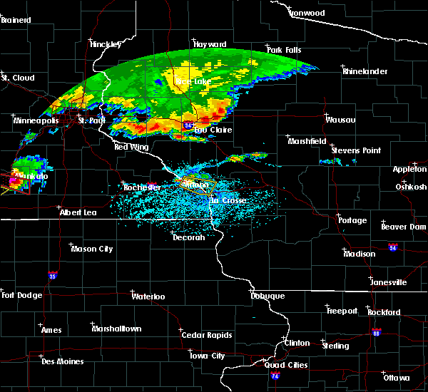 At 524 pm cdt, a severe thunderstorm was located near trempealeau, or 8 miles southeast of winona, moving southeast at 25 mph. at 519 pm, emergency management reported 2 inch hail near winona (emergency management). Hazards include two inch hail and 60 mph wind gusts. People and animals outdoors will be injured. expect hail damage to roofs, siding, windows, and vehicles. expect wind damage to roofs, siding, and trees. this severe storm will be near, trempealeau around 530 pm cdt. dakota and brice prairie around 545 pm cdt. la crosse, onalaska, holmen, french island and la crosse airport around 600 pm cdt. Other locations impacted by this severe thunderstorm include perrot state park, marshland, i 90 exit 275, pickwick, i 90 exit 2, i 90 exit 266 and i 90 exit 272. At 524 pm cdt, a severe thunderstorm was located near trempealeau, or 8 miles southeast of winona, moving southeast at 25 mph. at 519 pm, emergency management reported 2 inch hail near winona (emergency management). Hazards include two inch hail and 60 mph wind gusts. People and animals outdoors will be injured. expect hail damage to roofs, siding, windows, and vehicles. expect wind damage to roofs, siding, and trees. this severe storm will be near, trempealeau around 530 pm cdt. dakota and brice prairie around 545 pm cdt. la crosse, onalaska, holmen, french island and la crosse airport around 600 pm cdt. Other locations impacted by this severe thunderstorm include perrot state park, marshland, i 90 exit 275, pickwick, i 90 exit 2, i 90 exit 266 and i 90 exit 272.
|
| 6/2/2020 5:18 PM CDT |
 At 518 pm cdt, a severe thunderstorm was located near trempealeau, or near winona, moving east at 25 mph (radar indicated). Hazards include two inch hail and 60 mph wind gusts. People and animals outdoors will be injured. expect hail damage to roofs, siding, windows, and vehicles. expect wind damage to roofs, siding, and trees. this severe thunderstorm will be near, trempealeau around 530 pm cdt. dakota around 540 pm cdt. brice prairie around 545 pm cdt. onalaska, holmen and la crosse airport around 555 pm cdt. la crosse and french island around 600 pm cdt. Other locations impacted by this severe thunderstorm include perrot state park, marshland, i 90 exit 275, pickwick, i 90 exit 2, i 90 exit 266 and i 90 exit 272. At 518 pm cdt, a severe thunderstorm was located near trempealeau, or near winona, moving east at 25 mph (radar indicated). Hazards include two inch hail and 60 mph wind gusts. People and animals outdoors will be injured. expect hail damage to roofs, siding, windows, and vehicles. expect wind damage to roofs, siding, and trees. this severe thunderstorm will be near, trempealeau around 530 pm cdt. dakota around 540 pm cdt. brice prairie around 545 pm cdt. onalaska, holmen and la crosse airport around 555 pm cdt. la crosse and french island around 600 pm cdt. Other locations impacted by this severe thunderstorm include perrot state park, marshland, i 90 exit 275, pickwick, i 90 exit 2, i 90 exit 266 and i 90 exit 272.
|
| 5/26/2020 6:45 PM CDT | Reports of trees down in la crosse... onalaska... and barre mills. power pole blown over in onalaska. time estimated from rada in la crosse county WI, 1.4 miles E of La Crosse, WI |
| 9/12/2019 5:06 PM CDT |
 At 500 pm cdt, a severe thunderstorm was located over hokah, or 7 miles southwest of la crescent, moving east at 35 mph (radar indicated). Hazards include 60 mph wind gusts. Expect damage to roofs, siding, and trees. this severe storm will be near, hokah and brownsville around 505 pm cdt. la crescent around 510 pm cdt. la crosse around 515 pm cdt. Other locations impacted by this severe thunderstorm include county roads 3 and 24, mound prairie and highway 44 and sanden road. At 500 pm cdt, a severe thunderstorm was located over hokah, or 7 miles southwest of la crescent, moving east at 35 mph (radar indicated). Hazards include 60 mph wind gusts. Expect damage to roofs, siding, and trees. this severe storm will be near, hokah and brownsville around 505 pm cdt. la crescent around 510 pm cdt. la crosse around 515 pm cdt. Other locations impacted by this severe thunderstorm include county roads 3 and 24, mound prairie and highway 44 and sanden road.
|
| 9/12/2019 5:01 PM CDT |
 At 452 pm cdt, a severe thunderstorm was located near caledonia, moving east at 45 mph (radar indicated). Hazards include 60 mph wind gusts. Expect damage to roofs, siding, and trees. this severe storm will be near, hokah and brownsville around 505 pm cdt. Other locations impacted by this severe thunderstorm include beaver creek valley state park, highway 44 and sanden road, willington grove, county roads 3 and 24, mound prairie, sheldon and freeburg. At 452 pm cdt, a severe thunderstorm was located near caledonia, moving east at 45 mph (radar indicated). Hazards include 60 mph wind gusts. Expect damage to roofs, siding, and trees. this severe storm will be near, hokah and brownsville around 505 pm cdt. Other locations impacted by this severe thunderstorm include beaver creek valley state park, highway 44 and sanden road, willington grove, county roads 3 and 24, mound prairie, sheldon and freeburg.
|
| 9/12/2019 4:52 PM CDT |
 At 452 pm cdt, a severe thunderstorm was located near caledonia, moving east at 45 mph (radar indicated). Hazards include 60 mph wind gusts. Expect damage to roofs, siding, and trees. this severe storm will be near, hokah and brownsville around 505 pm cdt. Other locations impacted by this severe thunderstorm include beaver creek valley state park, highway 44 and sanden road, willington grove, county roads 3 and 24, mound prairie, sheldon and freeburg. At 452 pm cdt, a severe thunderstorm was located near caledonia, moving east at 45 mph (radar indicated). Hazards include 60 mph wind gusts. Expect damage to roofs, siding, and trees. this severe storm will be near, hokah and brownsville around 505 pm cdt. Other locations impacted by this severe thunderstorm include beaver creek valley state park, highway 44 and sanden road, willington grove, county roads 3 and 24, mound prairie, sheldon and freeburg.
|
| 9/12/2019 4:31 PM CDT |
 At 430 pm cdt, a severe thunderstorm was located 9 miles north of mabel, or 14 miles west of caledonia, moving east at 45 mph (radar indicated). Hazards include 60 mph wind gusts. Expect damage to roofs, siding, and trees. this severe thunderstorm will be near, caledonia and houston around 450 pm cdt. hokah and brownsville around 505 pm cdt. Other locations impacted by this severe thunderstorm include beaver creek valley state park, highway 44 and sanden road, willington grove, perkins, county roads 3 and 24, mound prairie and yucatan. At 430 pm cdt, a severe thunderstorm was located 9 miles north of mabel, or 14 miles west of caledonia, moving east at 45 mph (radar indicated). Hazards include 60 mph wind gusts. Expect damage to roofs, siding, and trees. this severe thunderstorm will be near, caledonia and houston around 450 pm cdt. hokah and brownsville around 505 pm cdt. Other locations impacted by this severe thunderstorm include beaver creek valley state park, highway 44 and sanden road, willington grove, perkins, county roads 3 and 24, mound prairie and yucatan.
|
| 8/5/2019 6:07 PM CDT |
 At 607 pm cdt, a severe thunderstorm was located near dakota, or near la crescent, moving east at 30 mph (radar indicated). Hazards include 60 mph wind gusts and half dollar size hail. Hail damage to vehicles is expected. expect wind damage to roofs, siding, and trees. this severe storm will be near, la crescent and hokah around 615 pm cdt. Other locations impacted by this severe thunderstorm include nodine, county 9 and sather valley road, perkins, mound prairie, money creek and new hartford. At 607 pm cdt, a severe thunderstorm was located near dakota, or near la crescent, moving east at 30 mph (radar indicated). Hazards include 60 mph wind gusts and half dollar size hail. Hail damage to vehicles is expected. expect wind damage to roofs, siding, and trees. this severe storm will be near, la crescent and hokah around 615 pm cdt. Other locations impacted by this severe thunderstorm include nodine, county 9 and sather valley road, perkins, mound prairie, money creek and new hartford.
|
| 8/5/2019 5:29 PM CDT |
 The national weather service in la crosse has issued a * severe thunderstorm warning for. southern winona county in southeastern minnesota. northern houston county in southeastern minnesota. northeastern fillmore county in southeastern minnesota. Until 615 pm cdt. The national weather service in la crosse has issued a * severe thunderstorm warning for. southern winona county in southeastern minnesota. northern houston county in southeastern minnesota. northeastern fillmore county in southeastern minnesota. Until 615 pm cdt.
|
| 7/20/2019 12:44 PM CDT |
 At 1243 pm cdt, severe thunderstorms were located along a line extending from 7 miles northwest of black river falls to near new albin, moving east at 50 mph (radar indicated). Hazards include 60 mph wind gusts. Expect damage to roofs, siding, and trees. Locations impacted include, la crosse, onalaska, holmen, west salem, bangor, stoddard, coon valley, north bend, la crosse airport, brice prairie, french island, franklin, medary, springville, burns, rockland, melrose, de soto, chaseburg and genoa. At 1243 pm cdt, severe thunderstorms were located along a line extending from 7 miles northwest of black river falls to near new albin, moving east at 50 mph (radar indicated). Hazards include 60 mph wind gusts. Expect damage to roofs, siding, and trees. Locations impacted include, la crosse, onalaska, holmen, west salem, bangor, stoddard, coon valley, north bend, la crosse airport, brice prairie, french island, franklin, medary, springville, burns, rockland, melrose, de soto, chaseburg and genoa.
|
| 7/20/2019 12:31 PM CDT |
 At 1229 pm cdt, severe thunderstorms were located along a line extending from 6 miles northeast of blair to 6 miles southeast of spring grove, moving east at 70 mph (radar indicated). Hazards include 60 mph wind gusts. Expect damage to roofs, siding, and trees. locations impacted include, la crosse, winona, arcadia, onalaska, holmen, west salem, trempealeau, galesville, bangor, blair, fountain city, stoddard, coon valley, north bend, la crosse airport, brice prairie, french island, dodge, franklin and medary. those attending the la crosse interstate fair are in the path of these storms and should prepare for wind gusts of 50 to 60 mph. seek a safe shelter in a sturdy building until the storms pass. A quick half inch of rain is also expected. At 1229 pm cdt, severe thunderstorms were located along a line extending from 6 miles northeast of blair to 6 miles southeast of spring grove, moving east at 70 mph (radar indicated). Hazards include 60 mph wind gusts. Expect damage to roofs, siding, and trees. locations impacted include, la crosse, winona, arcadia, onalaska, holmen, west salem, trempealeau, galesville, bangor, blair, fountain city, stoddard, coon valley, north bend, la crosse airport, brice prairie, french island, dodge, franklin and medary. those attending the la crosse interstate fair are in the path of these storms and should prepare for wind gusts of 50 to 60 mph. seek a safe shelter in a sturdy building until the storms pass. A quick half inch of rain is also expected.
|
| 7/20/2019 12:10 PM CDT |
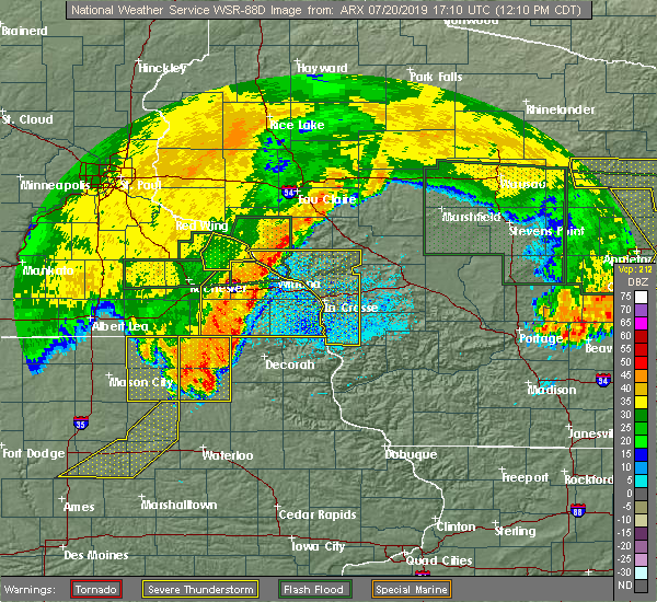 At 1210 pm cdt, severe thunderstorms were located along a line extending from near independence to near canton, moving east at 50 mph (radar indicated). Hazards include 60 mph wind gusts. expect damage to roofs, siding, and trees At 1210 pm cdt, severe thunderstorms were located along a line extending from near independence to near canton, moving east at 50 mph (radar indicated). Hazards include 60 mph wind gusts. expect damage to roofs, siding, and trees
|
| 7/20/2019 12:03 PM CDT |
 At 1202 pm cdt, severe thunderstorms were located along a line extending from 6 miles northeast of buffalo city to near harmony, moving east at 65 mph (radar indicated. this storm has a history of producing 60 to 65 mph wind gusts). Hazards include 70 mph wind gusts. Expect considerable tree damage. damage is likely to mobile homes, roofs, and outbuildings. these severe storms will be near, spring grove around 1225 pm cdt. caledonia around 1230 pm cdt. Other locations impacted by these severe thunderstorms include forestville state park, choice, county roads 9 and 10, isinours, i 90 exit 257, hutton and riceford. At 1202 pm cdt, severe thunderstorms were located along a line extending from 6 miles northeast of buffalo city to near harmony, moving east at 65 mph (radar indicated. this storm has a history of producing 60 to 65 mph wind gusts). Hazards include 70 mph wind gusts. Expect considerable tree damage. damage is likely to mobile homes, roofs, and outbuildings. these severe storms will be near, spring grove around 1225 pm cdt. caledonia around 1230 pm cdt. Other locations impacted by these severe thunderstorms include forestville state park, choice, county roads 9 and 10, isinours, i 90 exit 257, hutton and riceford.
|
| 7/20/2019 11:36 AM CDT |
 At 1134 am cdt, severe thunderstorms were located along a line extending from near wabasha to near adams, moving east at 65 mph (radar indicated. this storm has a history of producing 60 to 65 mph wind gusts). Hazards include 70 mph wind gusts. Expect considerable tree damage. damage is likely to mobile homes, roofs, and outbuildings. severe thunderstorms will be near, harmony around 1205 pm cdt. canton around 1210 pm cdt. mabel around 1215 pm cdt. other locations impacted by these severe thunderstorms include forestville state park, potsdam, isinours, i 90 exit 257, riceford, fillmore and county roads 28 and 31. People attending the fillmore county fair, and rushford days should seek safe shelter immediately!. At 1134 am cdt, severe thunderstorms were located along a line extending from near wabasha to near adams, moving east at 65 mph (radar indicated. this storm has a history of producing 60 to 65 mph wind gusts). Hazards include 70 mph wind gusts. Expect considerable tree damage. damage is likely to mobile homes, roofs, and outbuildings. severe thunderstorms will be near, harmony around 1205 pm cdt. canton around 1210 pm cdt. mabel around 1215 pm cdt. other locations impacted by these severe thunderstorms include forestville state park, potsdam, isinours, i 90 exit 257, riceford, fillmore and county roads 28 and 31. People attending the fillmore county fair, and rushford days should seek safe shelter immediately!.
|
| 7/20/2019 10:23 AM CDT |
 The severe thunderstorm warning for la crosse county will expire at 1030 am cdt, the storms which prompted the warning have weakened below severe limits, and no longer pose an immediate threat to life or property. therefore, the warning will be allowed to expire. a severe thunderstorm watch remains in effect until 400 pm cdt for southeastern minnesota, and west central wisconsin. The severe thunderstorm warning for la crosse county will expire at 1030 am cdt, the storms which prompted the warning have weakened below severe limits, and no longer pose an immediate threat to life or property. therefore, the warning will be allowed to expire. a severe thunderstorm watch remains in effect until 400 pm cdt for southeastern minnesota, and west central wisconsin.
|
| 7/20/2019 10:15 AM CDT |
 At 1014 am cdt, severe thunderstorms were located along a line extending from near cataract to near la crosse, moving east at 35 mph (radar indicated). Hazards include 60 mph wind gusts. Expect damage to roofs, siding, and trees. These severe storms will be near, bangor around 1030 am cdt. At 1014 am cdt, severe thunderstorms were located along a line extending from near cataract to near la crosse, moving east at 35 mph (radar indicated). Hazards include 60 mph wind gusts. Expect damage to roofs, siding, and trees. These severe storms will be near, bangor around 1030 am cdt.
|
| 7/20/2019 9:55 AM CDT |
 At 954 am cdt, severe thunderstorms were located along a line extending from 9 miles east of shortville to 10 miles east of millston to near fort mc coy, moving east at 55 mph (radar indicated). Hazards include 70 mph wind gusts and penny size hail. Expect considerable tree damage. damage is likely to mobile homes, roofs, and outbuildings. these severe storms will be near, necedah around 1025 am cdt. dellwood around 1030 am cdt. Other locations impacted by these severe thunderstorms include new miner, franklin, shamrock, potters flowage, rockland, county roads d e and e and johnson hill. At 954 am cdt, severe thunderstorms were located along a line extending from 9 miles east of shortville to 10 miles east of millston to near fort mc coy, moving east at 55 mph (radar indicated). Hazards include 70 mph wind gusts and penny size hail. Expect considerable tree damage. damage is likely to mobile homes, roofs, and outbuildings. these severe storms will be near, necedah around 1025 am cdt. dellwood around 1030 am cdt. Other locations impacted by these severe thunderstorms include new miner, franklin, shamrock, potters flowage, rockland, county roads d e and e and johnson hill.
|
| 7/20/2019 9:51 AM CDT |
 At 951 am cdt, severe thunderstorms were located along a line extending from near galesville to near dakota, moving east at 60 mph (radar indicated). Hazards include 60 mph wind gusts. Expect damage to roofs, siding, and trees. severe thunderstorms will be near, brice prairie around 955 am cdt. la crosse, onalaska, holmen, la crosse airport and french island around 1000 am cdt. west salem around 1010 am cdt. bangor around 1015 am cdt. People attending the la crosse interstate fair should seek safe shelter immediately!. At 951 am cdt, severe thunderstorms were located along a line extending from near galesville to near dakota, moving east at 60 mph (radar indicated). Hazards include 60 mph wind gusts. Expect damage to roofs, siding, and trees. severe thunderstorms will be near, brice prairie around 955 am cdt. la crosse, onalaska, holmen, la crosse airport and french island around 1000 am cdt. west salem around 1010 am cdt. bangor around 1015 am cdt. People attending the la crosse interstate fair should seek safe shelter immediately!.
|
| 7/20/2019 9:37 AM CDT |
 At 937 am cdt, severe thunderstorms were located along a line extending from near hatfield to near sparta, moving east at 40 mph (radar indicated. multiple reports of trees down across northern la crosse county). Hazards include 70 mph wind gusts and penny size hail. Expect considerable tree damage. damage is likely to mobile homes, roofs, and outbuildings. these severe storms will be near, hatfield around 940 am cdt. fort mc coy around 950 am cdt. new lisbon around 1025 am cdt. mauston around 1030 am cdt. Other locations impacted by these severe thunderstorms include new miner, franklin, shamrock, potters flowage, rockland, county roads d e and e and johnson hill. At 937 am cdt, severe thunderstorms were located along a line extending from near hatfield to near sparta, moving east at 40 mph (radar indicated. multiple reports of trees down across northern la crosse county). Hazards include 70 mph wind gusts and penny size hail. Expect considerable tree damage. damage is likely to mobile homes, roofs, and outbuildings. these severe storms will be near, hatfield around 940 am cdt. fort mc coy around 950 am cdt. new lisbon around 1025 am cdt. mauston around 1030 am cdt. Other locations impacted by these severe thunderstorms include new miner, franklin, shamrock, potters flowage, rockland, county roads d e and e and johnson hill.
|
| 7/20/2019 9:22 AM CDT |
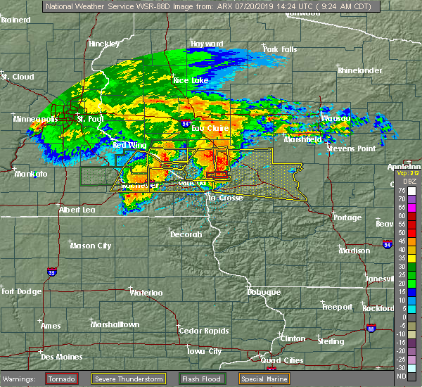 At 922 am cdt, severe thunderstorms were located along a line extending from 10 miles northwest of black river falls to west salem, moving east at 45 mph (radar indicated). Hazards include 70 mph wind gusts and penny size hail. Expect considerable tree damage. damage is likely to mobile homes, roofs, and outbuildings. severe thunderstorms will be near, bangor around 930 am cdt. sparta and black river falls around 940 am cdt. hatfield around 945 am cdt. fort mc coy around 950 am cdt. tomah around 1000 am cdt. new lisbon around 1025 am cdt. mauston, necedah and dellwood around 1030 am cdt. other locations impacted by these severe thunderstorms include new miner, franklin, shamrock, potters flowage, rockland. People attending the la crosse interstate fair, and ussa summerfest should seek safe shelter immediately!. At 922 am cdt, severe thunderstorms were located along a line extending from 10 miles northwest of black river falls to west salem, moving east at 45 mph (radar indicated). Hazards include 70 mph wind gusts and penny size hail. Expect considerable tree damage. damage is likely to mobile homes, roofs, and outbuildings. severe thunderstorms will be near, bangor around 930 am cdt. sparta and black river falls around 940 am cdt. hatfield around 945 am cdt. fort mc coy around 950 am cdt. tomah around 1000 am cdt. new lisbon around 1025 am cdt. mauston, necedah and dellwood around 1030 am cdt. other locations impacted by these severe thunderstorms include new miner, franklin, shamrock, potters flowage, rockland. People attending the la crosse interstate fair, and ussa summerfest should seek safe shelter immediately!.
|
| 7/18/2019 11:12 PM CDT |
 At 1112 pm cdt, a severe thunderstorm was located near bangor, or 10 miles southwest of sparta, moving east at 20 mph (radar indicated). Hazards include 60 mph wind gusts and penny size hail. Expect damage to roofs, siding, and trees. this severe thunderstorm will be near, cashton around 1145 pm cdt. Other locations impacted by this severe thunderstorm include brinkman ridge, jersey valley county park, irish hill, portland, esofea and goose island. At 1112 pm cdt, a severe thunderstorm was located near bangor, or 10 miles southwest of sparta, moving east at 20 mph (radar indicated). Hazards include 60 mph wind gusts and penny size hail. Expect damage to roofs, siding, and trees. this severe thunderstorm will be near, cashton around 1145 pm cdt. Other locations impacted by this severe thunderstorm include brinkman ridge, jersey valley county park, irish hill, portland, esofea and goose island.
|
| 7/18/2019 11:00 PM CDT | Report of trees down blocking north bound lane on yy. time estimated based on rada in la crosse county WI, 6.1 miles W of La Crosse, WI |
| 6/27/2019 1:30 PM CDT | Trees and power lines down in the city of la crosse. boat flipped over on french islan in la crosse county WI, 0.6 miles SE of La Crosse, WI |
| 6/4/2019 7:58 PM CDT |
 At 757 pm cdt, severe thunderstorms were located along a line extending from near bangor to 6 miles southeast of stoddard, moving east at 35 mph (trained weather spotters. these storms have a history of producing damaging winds). Hazards include 60 mph wind gusts. Expect damage to roofs, siding, and trees. These severe thunderstorms will remain over mainly rural areas of southeastern la crosse and northwestern vernon counties, including the following locations, mount la crosse, county roads g and h, brinkman ridge, esofea, highways 14 61 and county m m, the coulee experimental forest and spring ridge. At 757 pm cdt, severe thunderstorms were located along a line extending from near bangor to 6 miles southeast of stoddard, moving east at 35 mph (trained weather spotters. these storms have a history of producing damaging winds). Hazards include 60 mph wind gusts. Expect damage to roofs, siding, and trees. These severe thunderstorms will remain over mainly rural areas of southeastern la crosse and northwestern vernon counties, including the following locations, mount la crosse, county roads g and h, brinkman ridge, esofea, highways 14 61 and county m m, the coulee experimental forest and spring ridge.
|
| 6/4/2019 7:46 PM CDT |
 At 745 pm cdt, severe thunderstorms were located along a line extending from near north bend to near west salem, moving east at 30 mph (trained weather spotters. these storms have a history of producing damaging winds). Hazards include 60 mph wind gusts. Expect damage to roofs, siding, and trees. these severe storms will be near, bangor around 755 pm cdt. Other locations impacted by these severe thunderstorms include melrose, north side of la crosse, stevenstown, i 90 exit 4, i 90 exit 5, rockland and county roads d e and e. At 745 pm cdt, severe thunderstorms were located along a line extending from near north bend to near west salem, moving east at 30 mph (trained weather spotters. these storms have a history of producing damaging winds). Hazards include 60 mph wind gusts. Expect damage to roofs, siding, and trees. these severe storms will be near, bangor around 755 pm cdt. Other locations impacted by these severe thunderstorms include melrose, north side of la crosse, stevenstown, i 90 exit 4, i 90 exit 5, rockland and county roads d e and e.
|
| 6/4/2019 7:43 PM CDT |
 At 743 pm cdt, severe thunderstorms were located along a line extending from near la crosse to near stoddard, moving east at 45 mph (trained weather spotters. these storms have a history of producing damaging wind gusts). Hazards include 60 mph wind gusts and penny size hail. Expect damage to roofs, siding, and trees. These severe thunderstorms will remain over mainly rural areas of northeastern houston county, including the following locations, county roads 3 and 24, mound prairie and highway 44 and sanden road. At 743 pm cdt, severe thunderstorms were located along a line extending from near la crosse to near stoddard, moving east at 45 mph (trained weather spotters. these storms have a history of producing damaging wind gusts). Hazards include 60 mph wind gusts and penny size hail. Expect damage to roofs, siding, and trees. These severe thunderstorms will remain over mainly rural areas of northeastern houston county, including the following locations, county roads 3 and 24, mound prairie and highway 44 and sanden road.
|
| 6/4/2019 7:31 PM CDT |
 At 730 pm cdt, severe thunderstorms were located along a line extending from near galesville to near houston, moving east at 30 mph (trained weather spotters. these storms have a history of producing 70 mph wind gusts). Hazards include 70 mph wind gusts and penny size hail. Expect considerable tree damage. damage is likely to mobile homes, roofs, and outbuildings. these severe storms will be near, brownsville around 755 pm cdt. Other locations impacted by these severe thunderstorms include beaver creek valley state park, highway 44 and sanden road, perkins, county roads 3 and 24, mound prairie, yucatan and sheldon. At 730 pm cdt, severe thunderstorms were located along a line extending from near galesville to near houston, moving east at 30 mph (trained weather spotters. these storms have a history of producing 70 mph wind gusts). Hazards include 70 mph wind gusts and penny size hail. Expect considerable tree damage. damage is likely to mobile homes, roofs, and outbuildings. these severe storms will be near, brownsville around 755 pm cdt. Other locations impacted by these severe thunderstorms include beaver creek valley state park, highway 44 and sanden road, perkins, county roads 3 and 24, mound prairie, yucatan and sheldon.
|
| 6/4/2019 7:26 PM CDT |
 At 726 pm cdt, severe thunderstorms were located along a line extending from la crescent to caledonia, moving east at 45 mph (trained weather spotters. these storms have a history of producing 70 mph wind gusts). Hazards include 70 mph wind gusts and penny size hail. Expect considerable tree damage. damage is likely to mobile homes, roofs, and outbuildings. severe thunderstorms will be near, la crosse and french island around 730 pm cdt. stoddard around 745 pm cdt. coon valley around 800 pm cdt. Other locations impacted by these severe thunderstorms include county roads g and h, brinkman ridge, irish hill, north side of la crosse, south side of la crosse, esofea and goose island. At 726 pm cdt, severe thunderstorms were located along a line extending from la crescent to caledonia, moving east at 45 mph (trained weather spotters. these storms have a history of producing 70 mph wind gusts). Hazards include 70 mph wind gusts and penny size hail. Expect considerable tree damage. damage is likely to mobile homes, roofs, and outbuildings. severe thunderstorms will be near, la crosse and french island around 730 pm cdt. stoddard around 745 pm cdt. coon valley around 800 pm cdt. Other locations impacted by these severe thunderstorms include county roads g and h, brinkman ridge, irish hill, north side of la crosse, south side of la crosse, esofea and goose island.
|
| 6/4/2019 7:10 PM CDT |
 At 709 pm cdt, severe thunderstorms were located along a line extending from near trempealeau to near houston, moving east at 50 mph (trained spotters. these storms have a history of producing 70 mph wind gusts). Hazards include 70 mph wind gusts and penny size hail. Expect considerable tree damage. damage is likely to mobile homes, roofs, and outbuildings. severe thunderstorms will be near, galesville and brice prairie around 715 pm cdt. la crosse, onalaska, holmen, north bend, french island and la crosse airport around 730 pm cdt. west salem around 740 pm cdt. bangor around 745 pm cdt. Other locations impacted by these severe thunderstorms include melrose, north side of la crosse, camp decorah, stevenstown, i 90 exit 4, i 90 exit 5 and rockland. At 709 pm cdt, severe thunderstorms were located along a line extending from near trempealeau to near houston, moving east at 50 mph (trained spotters. these storms have a history of producing 70 mph wind gusts). Hazards include 70 mph wind gusts and penny size hail. Expect considerable tree damage. damage is likely to mobile homes, roofs, and outbuildings. severe thunderstorms will be near, galesville and brice prairie around 715 pm cdt. la crosse, onalaska, holmen, north bend, french island and la crosse airport around 730 pm cdt. west salem around 740 pm cdt. bangor around 745 pm cdt. Other locations impacted by these severe thunderstorms include melrose, north side of la crosse, camp decorah, stevenstown, i 90 exit 4, i 90 exit 5 and rockland.
|
| 6/4/2019 7:07 PM CDT |
 At 706 pm cdt, severe thunderstorms were located along a line extending from near trempealeau to 7 miles southwest of houston, moving east at 50 mph (trained weather spotters. these storms have a history of producing 70 mph winds). Hazards include 70 mph wind gusts and quarter size hail. Hail damage to vehicles is expected. expect considerable tree damage. wind damage is also likely to mobile homes, roofs, and outbuildings. these severe storms will be near, trempealeau around 710 pm cdt. caledonia around 720 pm cdt. hokah around 725 pm cdt. brownsville around 730 pm cdt. Other locations impacted by these severe thunderstorms include lock and dam 5 a, dodge, perrot state park, i 90 exit 257, ridgeway, i 90 exit 275 and new hartford. At 706 pm cdt, severe thunderstorms were located along a line extending from near trempealeau to 7 miles southwest of houston, moving east at 50 mph (trained weather spotters. these storms have a history of producing 70 mph winds). Hazards include 70 mph wind gusts and quarter size hail. Hail damage to vehicles is expected. expect considerable tree damage. wind damage is also likely to mobile homes, roofs, and outbuildings. these severe storms will be near, trempealeau around 710 pm cdt. caledonia around 720 pm cdt. hokah around 725 pm cdt. brownsville around 730 pm cdt. Other locations impacted by these severe thunderstorms include lock and dam 5 a, dodge, perrot state park, i 90 exit 257, ridgeway, i 90 exit 275 and new hartford.
|
| 6/4/2019 6:50 PM CDT |
 At 649 pm cdt, severe thunderstorms were located along a line extending from near buffalo city to 6 miles west of rushford, moving east at 30 mph (trained weather spotters. these storms has a history of producing 70 mph wind gusts near chatfield). Hazards include 70 mph wind gusts and quarter size hail. Hail damage to vehicles is expected. expect considerable tree damage. wind damage is also likely to mobile homes, roofs, and outbuildings. severe thunderstorms will be near, winona, goodview and fountain city around 700 pm cdt. houston around 720 pm cdt. arcadia around 725 pm cdt. hokah and dakota around 745 pm cdt. la crescent around 750 pm cdt. Other locations impacted by these severe thunderstorms include lock and dam 5 a, dodge, perrot state park, i 90 exit 257, ridgeway, i 90 exit 275 and new hartford. At 649 pm cdt, severe thunderstorms were located along a line extending from near buffalo city to 6 miles west of rushford, moving east at 30 mph (trained weather spotters. these storms has a history of producing 70 mph wind gusts near chatfield). Hazards include 70 mph wind gusts and quarter size hail. Hail damage to vehicles is expected. expect considerable tree damage. wind damage is also likely to mobile homes, roofs, and outbuildings. severe thunderstorms will be near, winona, goodview and fountain city around 700 pm cdt. houston around 720 pm cdt. arcadia around 725 pm cdt. hokah and dakota around 745 pm cdt. la crescent around 750 pm cdt. Other locations impacted by these severe thunderstorms include lock and dam 5 a, dodge, perrot state park, i 90 exit 257, ridgeway, i 90 exit 275 and new hartford.
|
| 5/24/2019 8:01 PM CDT |
 At 801 pm cdt, severe thunderstorms were located along a line extending from 6 miles northwest of coon valley to la crosse to near spring grove, moving northeast at 45 mph (radar indicated). Hazards include 60 mph wind gusts. Expect damage to roofs, siding, and trees. these severe storms will be near, la crescent and hokah around 805 pm cdt. Other locations impacted by these severe thunderstorms include county 16 and 4 corners drive, mound prairie, riceford, county 5 and peyton road, newhouse, dun romin park campground and eitzen. At 801 pm cdt, severe thunderstorms were located along a line extending from 6 miles northwest of coon valley to la crosse to near spring grove, moving northeast at 45 mph (radar indicated). Hazards include 60 mph wind gusts. Expect damage to roofs, siding, and trees. these severe storms will be near, la crescent and hokah around 805 pm cdt. Other locations impacted by these severe thunderstorms include county 16 and 4 corners drive, mound prairie, riceford, county 5 and peyton road, newhouse, dun romin park campground and eitzen.
|
| 5/24/2019 7:37 PM CDT |
 At 736 pm cdt, severe thunderstorms were located along a line extending from 7 miles southwest of brownsville to caledonia to near canton, moving northeast at 45 mph (radar indicated). Hazards include 60 mph wind gusts. Expect damage to roofs, siding, and trees. severe thunderstorms will be near, caledonia around 740 pm cdt. brownsville around 745 pm cdt. hokah around 755 pm cdt. la crescent and spring grove around 800 pm cdt. Other locations impacted by these severe thunderstorms include hesper, highlandville, quandahl, riceford, county 5 and peyton road, bluffton and locust. At 736 pm cdt, severe thunderstorms were located along a line extending from 7 miles southwest of brownsville to caledonia to near canton, moving northeast at 45 mph (radar indicated). Hazards include 60 mph wind gusts. Expect damage to roofs, siding, and trees. severe thunderstorms will be near, caledonia around 740 pm cdt. brownsville around 745 pm cdt. hokah around 755 pm cdt. la crescent and spring grove around 800 pm cdt. Other locations impacted by these severe thunderstorms include hesper, highlandville, quandahl, riceford, county 5 and peyton road, bluffton and locust.
|
| 7/4/2018 4:31 PM CDT |
 At 431 pm cdt, a severe thunderstorm was located near bangor, or 10 miles east of la crosse, moving northeast at 35 mph (radar indicated). Hazards include 60 mph wind gusts. Expect damage to roofs, siding, and trees. this severe storm will be near, bangor around 435 pm cdt. other locations impacted by this severe thunderstorm include medary, rockland, county roads g and h, irish hill and north side of la crosse. People attending riverfest in la crosse should seek safe shelter immediately!. At 431 pm cdt, a severe thunderstorm was located near bangor, or 10 miles east of la crosse, moving northeast at 35 mph (radar indicated). Hazards include 60 mph wind gusts. Expect damage to roofs, siding, and trees. this severe storm will be near, bangor around 435 pm cdt. other locations impacted by this severe thunderstorm include medary, rockland, county roads g and h, irish hill and north side of la crosse. People attending riverfest in la crosse should seek safe shelter immediately!.
|
| 7/4/2018 4:26 PM CDT |
 At 426 pm cdt, a severe thunderstorm was located near west salem, or 8 miles east of la crosse, moving northeast at 35 mph (radar indicated). Hazards include 60 mph wind gusts. Expect damage to roofs, siding, and trees. this severe storm will be near, west salem around 430 pm cdt. bangor around 435 pm cdt. other locations impacted by this severe thunderstorm include medary, rockland, county roads g and h, irish hill and north side of la crosse. People attending riverfest in la crosse should seek safe shelter immediately!. At 426 pm cdt, a severe thunderstorm was located near west salem, or 8 miles east of la crosse, moving northeast at 35 mph (radar indicated). Hazards include 60 mph wind gusts. Expect damage to roofs, siding, and trees. this severe storm will be near, west salem around 430 pm cdt. bangor around 435 pm cdt. other locations impacted by this severe thunderstorm include medary, rockland, county roads g and h, irish hill and north side of la crosse. People attending riverfest in la crosse should seek safe shelter immediately!.
|
| 7/4/2018 4:24 PM CDT | Storm damage reported in la crosse county WI, 3.5 miles SSE of La Crosse, WI |
| 7/4/2018 4:22 PM CDT |
 At 422 pm cdt, a severe thunderstorm was located near la crosse, moving southeast at 15 mph (radar indicated). Hazards include 60 mph wind gusts. Expect damage to roofs, siding, and trees. this severe storm will be near, west salem around 425 pm cdt. bangor around 440 pm cdt. other locations impacted by this severe thunderstorm include medary, rockland, county roads g and h, irish hill and north side of la crosse. People attending riverfest in la crosse should seek safe shelter immediately!. At 422 pm cdt, a severe thunderstorm was located near la crosse, moving southeast at 15 mph (radar indicated). Hazards include 60 mph wind gusts. Expect damage to roofs, siding, and trees. this severe storm will be near, west salem around 425 pm cdt. bangor around 440 pm cdt. other locations impacted by this severe thunderstorm include medary, rockland, county roads g and h, irish hill and north side of la crosse. People attending riverfest in la crosse should seek safe shelter immediately!.
|
| 7/4/2018 4:17 PM CDT |
 At 417 pm cdt, a severe thunderstorm was located over la crosse, moving southeast at 15 mph (radar indicated). Hazards include 60 mph wind gusts. Expect damage to roofs, siding, and trees. this severe storm will be near, west salem around 425 pm cdt. bangor around 440 pm cdt. other locations impacted by this severe thunderstorm include medary, rockland, county roads g and h, irish hill and north side of la crosse. People attending riverfest in la crosse should seek safe shelter immediately!. At 417 pm cdt, a severe thunderstorm was located over la crosse, moving southeast at 15 mph (radar indicated). Hazards include 60 mph wind gusts. Expect damage to roofs, siding, and trees. this severe storm will be near, west salem around 425 pm cdt. bangor around 440 pm cdt. other locations impacted by this severe thunderstorm include medary, rockland, county roads g and h, irish hill and north side of la crosse. People attending riverfest in la crosse should seek safe shelter immediately!.
|
| 7/4/2018 4:14 PM CDT | Correction to previous lsr with a time stamp of 424 p in la crosse county WI, 3.5 miles SSE of La Crosse, WI |
| 7/4/2018 4:12 PM CDT |
 At 412 pm cdt, a severe thunderstorm was located over onalaska, or near la crosse, moving east at 15 mph (radar indicated). Hazards include 60 mph wind gusts. Expect damage to roofs, siding, and trees. this severe thunderstorm will be near, west salem around 430 pm cdt. bangor around 450 pm cdt. other locations impacted by this severe thunderstorm include medary, rockland, county roads g and h, irish hill and north side of la crosse. People attending riverfest in la crosse should seek safe shelter immediately!. At 412 pm cdt, a severe thunderstorm was located over onalaska, or near la crosse, moving east at 15 mph (radar indicated). Hazards include 60 mph wind gusts. Expect damage to roofs, siding, and trees. this severe thunderstorm will be near, west salem around 430 pm cdt. bangor around 450 pm cdt. other locations impacted by this severe thunderstorm include medary, rockland, county roads g and h, irish hill and north side of la crosse. People attending riverfest in la crosse should seek safe shelter immediately!.
|
| 6/30/2018 8:01 PM CDT |
 At 800 pm cdt, severe thunderstorms were located along a line extending from near holmen to near onalaska to 6 miles southeast of la crosse, moving east at 50 mph. very little rainfall is occurring with these storms, but strong wind gusts up to 60 mph are expected (radar indicated). Hazards include 60 mph wind gusts. Expect damage to roofs, siding, and trees. these severe storms will be near, west salem around 805 pm cdt. bangor around 810 pm cdt. Other locations impacted by these severe thunderstorms include medary, burns, rockland, irish hill and north side of la crosse. At 800 pm cdt, severe thunderstorms were located along a line extending from near holmen to near onalaska to 6 miles southeast of la crosse, moving east at 50 mph. very little rainfall is occurring with these storms, but strong wind gusts up to 60 mph are expected (radar indicated). Hazards include 60 mph wind gusts. Expect damage to roofs, siding, and trees. these severe storms will be near, west salem around 805 pm cdt. bangor around 810 pm cdt. Other locations impacted by these severe thunderstorms include medary, burns, rockland, irish hill and north side of la crosse.
|
| 6/30/2018 7:56 PM CDT |
 The severe thunderstorm warning for southern winona, northern houston and northeastern fillmore counties will expire at 800 pm cdt, the storms which prompted the warning have weakened below severe limits, and have exited the warned area. therefore the warning will be allowed to expire. a severe thunderstorm watch remains in effect until 900 pm cdt for southeastern minnesota, and west central wisconsin. to report severe weather, contact your nearest law enforcement agency. they will relay your report to the national weather service la crosse. The severe thunderstorm warning for southern winona, northern houston and northeastern fillmore counties will expire at 800 pm cdt, the storms which prompted the warning have weakened below severe limits, and have exited the warned area. therefore the warning will be allowed to expire. a severe thunderstorm watch remains in effect until 900 pm cdt for southeastern minnesota, and west central wisconsin. to report severe weather, contact your nearest law enforcement agency. they will relay your report to the national weather service la crosse.
|
| 6/30/2018 7:48 PM CDT |
 At 748 pm cdt, severe thunderstorms were located along a line extending from near trempealeau to near dakota to hokah, moving east at 50 mph (radar indicated). Hazards include 60 mph wind gusts. Expect damage to roofs, siding, and trees. severe thunderstorms will be near, la crosse, la crosse airport, french island and onalaska around 755 pm cdt. brice prairie around 800 pm cdt. west salem and holmen around 805 pm cdt. bangor around 810 pm cdt. Other locations impacted by these severe thunderstorms include medary, burns, rockland, irish hill and north side of la crosse. At 748 pm cdt, severe thunderstorms were located along a line extending from near trempealeau to near dakota to hokah, moving east at 50 mph (radar indicated). Hazards include 60 mph wind gusts. Expect damage to roofs, siding, and trees. severe thunderstorms will be near, la crosse, la crosse airport, french island and onalaska around 755 pm cdt. brice prairie around 800 pm cdt. west salem and holmen around 805 pm cdt. bangor around 810 pm cdt. Other locations impacted by these severe thunderstorms include medary, burns, rockland, irish hill and north side of la crosse.
|
| 6/30/2018 7:45 PM CDT |
 At 745 pm cdt, severe thunderstorms were located along a line extending from near winona to near dakota to near caledonia, moving east at 50 mph (radar indicated). Hazards include 70 mph wind gusts. Expect considerable tree damage. damage is likely to mobile homes, roofs, and outbuildings. these severe storms will be near, la crescent, dakota and hokah around 750 pm cdt. la crosse around 755 pm cdt. Other locations impacted by these severe thunderstorms include new hartford, rushford village, wilson, saratoga and mound prairie. At 745 pm cdt, severe thunderstorms were located along a line extending from near winona to near dakota to near caledonia, moving east at 50 mph (radar indicated). Hazards include 70 mph wind gusts. Expect considerable tree damage. damage is likely to mobile homes, roofs, and outbuildings. these severe storms will be near, la crescent, dakota and hokah around 750 pm cdt. la crosse around 755 pm cdt. Other locations impacted by these severe thunderstorms include new hartford, rushford village, wilson, saratoga and mound prairie.
|
| 6/30/2018 7:29 PM CDT |
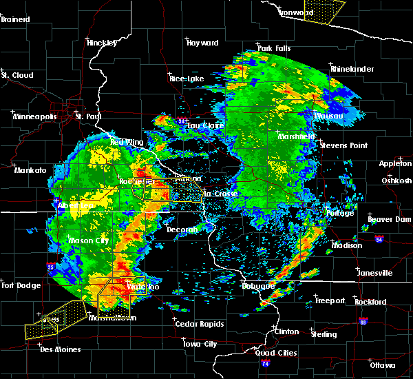 At 728 pm cdt, severe thunderstorms were located along a line extending from lewiston to near rushford to near spring grove, moving east at 50 mph (radar indicated). Hazards include 70 mph wind gusts. Expect considerable tree damage. damage is likely to mobile homes, roofs, and outbuildings. these severe storms will be near, houston around 735 pm cdt. dakota and hokah around 750 pm cdt. la crosse, la crescent and brownsville around 755 pm cdt. Other locations impacted by these severe thunderstorms include new hartford, rushford village, wilson, saratoga and mound prairie. At 728 pm cdt, severe thunderstorms were located along a line extending from lewiston to near rushford to near spring grove, moving east at 50 mph (radar indicated). Hazards include 70 mph wind gusts. Expect considerable tree damage. damage is likely to mobile homes, roofs, and outbuildings. these severe storms will be near, houston around 735 pm cdt. dakota and hokah around 750 pm cdt. la crosse, la crescent and brownsville around 755 pm cdt. Other locations impacted by these severe thunderstorms include new hartford, rushford village, wilson, saratoga and mound prairie.
|
| 6/30/2018 7:24 PM CDT |
 At 724 pm cdt, severe thunderstorms were located along a line extending from near st. charles to near rushford to 6 miles north of mabel, moving east at 55 mph (radar indicated). Hazards include 70 mph wind gusts. Expect considerable tree damage. damage is likely to mobile homes, roofs, and outbuildings. these severe storms will be near, caledonia and houston around 740 pm cdt. la crescent and dakota around 750 pm cdt. la crosse, brownsville and hokah around 755 pm cdt. Other locations impacted by these severe thunderstorms include new hartford, rushford village, wilson, saratoga and mound prairie. At 724 pm cdt, severe thunderstorms were located along a line extending from near st. charles to near rushford to 6 miles north of mabel, moving east at 55 mph (radar indicated). Hazards include 70 mph wind gusts. Expect considerable tree damage. damage is likely to mobile homes, roofs, and outbuildings. these severe storms will be near, caledonia and houston around 740 pm cdt. la crescent and dakota around 750 pm cdt. la crosse, brownsville and hokah around 755 pm cdt. Other locations impacted by these severe thunderstorms include new hartford, rushford village, wilson, saratoga and mound prairie.
|
| 6/30/2018 7:03 PM CDT |
 At 703 pm cdt, severe thunderstorms were located along a line extending from 6 miles southwest of eyota to fountain to 7 miles southwest of preston, moving east at 50 mph (trained weather spotters. wind damage has been reported across mower county, and the rochester airport gusted to 69 mph with these storms). Hazards include 70 mph wind gusts. Expect considerable tree damage. damage is likely to mobile homes, roofs, and outbuildings. severe thunderstorms will be near, lanesboro and st. charles around 715 pm cdt. rushford around 725 pm cdt. lewiston around 730 pm cdt. houston around 740 pm cdt. caledonia around 745 pm cdt. hokah around 750 pm cdt. la crescent and brownsville around 755 pm cdt. la crosse and dakota around 800 pm cdt. Other locations impacted by these severe thunderstorms include new hartford, rushford village, wilson, saratoga and mound prairie. At 703 pm cdt, severe thunderstorms were located along a line extending from 6 miles southwest of eyota to fountain to 7 miles southwest of preston, moving east at 50 mph (trained weather spotters. wind damage has been reported across mower county, and the rochester airport gusted to 69 mph with these storms). Hazards include 70 mph wind gusts. Expect considerable tree damage. damage is likely to mobile homes, roofs, and outbuildings. severe thunderstorms will be near, lanesboro and st. charles around 715 pm cdt. rushford around 725 pm cdt. lewiston around 730 pm cdt. houston around 740 pm cdt. caledonia around 745 pm cdt. hokah around 750 pm cdt. la crescent and brownsville around 755 pm cdt. la crosse and dakota around 800 pm cdt. Other locations impacted by these severe thunderstorms include new hartford, rushford village, wilson, saratoga and mound prairie.
|
| 6/30/2018 5:28 PM CDT |
 At 526 pm cdt, severe thunderstorms were located along a line extending from near west salem to near la crosse, moving east at 20 mph (trained weather spotters. 59 mph winds were reported at the la crosse airport at 501 pm. a few tree branches were downed in the city of la crosse). Hazards include 60 mph wind gusts. Expect damage to roofs, siding, and trees. These severe thunderstorms will remain over mainly rural areas of southeastern la crosse county, including the following locations, mount la crosse, county roads g and h, highway 33 and county o a, newburg corners and norskedalen. At 526 pm cdt, severe thunderstorms were located along a line extending from near west salem to near la crosse, moving east at 20 mph (trained weather spotters. 59 mph winds were reported at the la crosse airport at 501 pm. a few tree branches were downed in the city of la crosse). Hazards include 60 mph wind gusts. Expect damage to roofs, siding, and trees. These severe thunderstorms will remain over mainly rural areas of southeastern la crosse county, including the following locations, mount la crosse, county roads g and h, highway 33 and county o a, newburg corners and norskedalen.
|
| 6/30/2018 5:15 PM CDT |
 At 511 pm cdt, severe thunderstorms were located along a line extending from near west salem to la crosse, moving southeast at 20 mph (trained weather spotters. wind reports of 45 to 55 mph have been reported on the north side of la crosse and french island). Hazards include 60 mph wind gusts. Expect damage to roofs, siding, and trees. These severe storms will be near, cashton by 530 pm south side of la crosse by 530 pm other locations impacted by these severe thunderstorms include medary, county roads g and h, irish hill, north side of la crosse and south side of la crosse. At 511 pm cdt, severe thunderstorms were located along a line extending from near west salem to la crosse, moving southeast at 20 mph (trained weather spotters. wind reports of 45 to 55 mph have been reported on the north side of la crosse and french island). Hazards include 60 mph wind gusts. Expect damage to roofs, siding, and trees. These severe storms will be near, cashton by 530 pm south side of la crosse by 530 pm other locations impacted by these severe thunderstorms include medary, county roads g and h, irish hill, north side of la crosse and south side of la crosse.
|
| 6/30/2018 5:10 PM CDT | Large tree branch down blocking gillette stree in la crosse county WI, 1.9 miles SSE of La Crosse, WI |
| 6/30/2018 5:01 PM CDT | Storm damage reported in la crosse county WI, 3.7 miles SSE of La Crosse, WI |
| 6/30/2018 4:59 PM CDT |
 The national weather service in la crosse has issued a * severe thunderstorm warning for. southeastern winona county in southeastern minnesota. northeastern houston county in southeastern minnesota. southern la crosse county in west central wisconsin. Until 545 pm cdt. The national weather service in la crosse has issued a * severe thunderstorm warning for. southeastern winona county in southeastern minnesota. northeastern houston county in southeastern minnesota. southern la crosse county in west central wisconsin. Until 545 pm cdt.
|
| 7/20/2017 2:42 AM CDT |
 At 242 am cdt, a severe thunderstorm was located near coon valley, or 8 miles southeast of la crosse, moving southeast at 40 mph (radar indicated). Hazards include 60 mph wind gusts and quarter size hail. Hail damage to vehicles is expected. expect wind damage to roofs, siding, and trees. This severe thunderstorm will remain over mainly rural areas of northeastern houston and southeastern la crosse counties, including the following locations: medary, mound prairie, rockland, county roads g and h and irish hill. At 242 am cdt, a severe thunderstorm was located near coon valley, or 8 miles southeast of la crosse, moving southeast at 40 mph (radar indicated). Hazards include 60 mph wind gusts and quarter size hail. Hail damage to vehicles is expected. expect wind damage to roofs, siding, and trees. This severe thunderstorm will remain over mainly rural areas of northeastern houston and southeastern la crosse counties, including the following locations: medary, mound prairie, rockland, county roads g and h and irish hill.
|
| 7/20/2017 2:30 AM CDT |
 At 230 am cdt, a severe thunderstorm was located over french island, or over la crosse, moving southeast at 40 mph (radar indicated). Hazards include 60 mph wind gusts and quarter size hail. Hail damage to vehicles is expected. expect wind damage to roofs, siding, and trees. this severe storm will be near, west salem around 235 am cdt. bangor around 240 am cdt. other locations impacted by this severe thunderstorm include medary, burns, new hartford, mound prairie and rockland. People attending the la crosse county interstate fair should seek safe shelter immediately!. At 230 am cdt, a severe thunderstorm was located over french island, or over la crosse, moving southeast at 40 mph (radar indicated). Hazards include 60 mph wind gusts and quarter size hail. Hail damage to vehicles is expected. expect wind damage to roofs, siding, and trees. this severe storm will be near, west salem around 235 am cdt. bangor around 240 am cdt. other locations impacted by this severe thunderstorm include medary, burns, new hartford, mound prairie and rockland. People attending the la crosse county interstate fair should seek safe shelter immediately!.
|
| 7/20/2017 2:13 AM CDT |
 At 213 am cdt, a severe thunderstorm was located near trempealeau, or 10 miles northwest of la crescent, moving southeast at 40 mph (radar indicated). Hazards include 60 mph wind gusts and quarter size hail. Hail damage to vehicles is expected. expect wind damage to roofs, siding, and trees. this severe thunderstorm will be near, brice prairie around 220 am cdt. la crescent, onalaska and holmen around 225 am cdt. la crosse, french island, la crosse airport and hokah around 230 am cdt. west salem around 235 am cdt. bangor around 240 am cdt. other locations impacted by this severe thunderstorm include medary, burns, new hartford, mound prairie and rockland. People attending the la crosse county interstate fair should seek safe shelter immediately!. At 213 am cdt, a severe thunderstorm was located near trempealeau, or 10 miles northwest of la crescent, moving southeast at 40 mph (radar indicated). Hazards include 60 mph wind gusts and quarter size hail. Hail damage to vehicles is expected. expect wind damage to roofs, siding, and trees. this severe thunderstorm will be near, brice prairie around 220 am cdt. la crescent, onalaska and holmen around 225 am cdt. la crosse, french island, la crosse airport and hokah around 230 am cdt. west salem around 235 am cdt. bangor around 240 am cdt. other locations impacted by this severe thunderstorm include medary, burns, new hartford, mound prairie and rockland. People attending the la crosse county interstate fair should seek safe shelter immediately!.
|
| 7/20/2017 12:57 AM CDT |
 At 1256 am cdt, a severe thunderstorm was located near coon valley, or 7 miles southeast of la crosse, moving southeast at 25 mph (radar indicated). Hazards include quarter size hail. Damage to vehicles is expected. this severe storm will be near, coon valley around 110 am cdt. Other locations impacted by this severe thunderstorm include leon, portland, burns, rockland and chaseburg. At 1256 am cdt, a severe thunderstorm was located near coon valley, or 7 miles southeast of la crosse, moving southeast at 25 mph (radar indicated). Hazards include quarter size hail. Damage to vehicles is expected. this severe storm will be near, coon valley around 110 am cdt. Other locations impacted by this severe thunderstorm include leon, portland, burns, rockland and chaseburg.
|
| 7/20/2017 12:44 AM CDT |
 At 1243 am cdt, a severe thunderstorm was located over la crosse, moving southeast at 20 mph (radar indicated). Hazards include half dollar size hail. Damage to vehicles is expected. This severe thunderstorm will remain over southeastern winona and central la crosse counties, including the following locations: medary, dresbach, north side of la crosse, county roads d e and e and blue bird campground. At 1243 am cdt, a severe thunderstorm was located over la crosse, moving southeast at 20 mph (radar indicated). Hazards include half dollar size hail. Damage to vehicles is expected. This severe thunderstorm will remain over southeastern winona and central la crosse counties, including the following locations: medary, dresbach, north side of la crosse, county roads d e and e and blue bird campground.
|
| 7/20/2017 12:39 AM CDT |
 At 1238 am cdt, a severe thunderstorm was located over la crosse airport, or near la crescent, moving southeast at 20 mph (radar indicated). Hazards include half dollar size hail. Damage to vehicles is expected. this severe thunderstorm will be near, la crosse and west salem around 1245 am cdt. hokah around 1250 am cdt. bangor around 1255 am cdt. brownsville around 105 am cdt. stoddard around 115 am cdt. coon valley around 125 am cdt. other locations impacted by this severe thunderstorm include leon, portland, burns, rockland and chaseburg. People attending the la crosse county interstate fair should seek safe shelter immediately!. At 1238 am cdt, a severe thunderstorm was located over la crosse airport, or near la crescent, moving southeast at 20 mph (radar indicated). Hazards include half dollar size hail. Damage to vehicles is expected. this severe thunderstorm will be near, la crosse and west salem around 1245 am cdt. hokah around 1250 am cdt. bangor around 1255 am cdt. brownsville around 105 am cdt. stoddard around 115 am cdt. coon valley around 125 am cdt. other locations impacted by this severe thunderstorm include leon, portland, burns, rockland and chaseburg. People attending the la crosse county interstate fair should seek safe shelter immediately!.
|
| 7/20/2017 12:28 AM CDT |
 At 1226 am cdt, a severe thunderstorm was located over trempealeau, or 11 miles southeast of winona, moving southeast at 40 mph (radar indicated). Hazards include half dollar size hail. Damage to vehicles is expected. this severe storm will be near, dakota and brice prairie around 1235 am cdt. la crosse, la crosse airport, french island and onalaska around 1245 am cdt. west salem around 1255 am cdt. other locations impacted by this severe thunderstorm include medary, dresbach, north side of la crosse, camp decorah and stevenstown. People attending the la crosse county interstate fair should seek safe shelter immediately!. At 1226 am cdt, a severe thunderstorm was located over trempealeau, or 11 miles southeast of winona, moving southeast at 40 mph (radar indicated). Hazards include half dollar size hail. Damage to vehicles is expected. this severe storm will be near, dakota and brice prairie around 1235 am cdt. la crosse, la crosse airport, french island and onalaska around 1245 am cdt. west salem around 1255 am cdt. other locations impacted by this severe thunderstorm include medary, dresbach, north side of la crosse, camp decorah and stevenstown. People attending the la crosse county interstate fair should seek safe shelter immediately!.
|
| 7/20/2017 12:09 AM CDT |
 The national weather service in la crosse has issued a * severe thunderstorm warning for. central winona county in southeastern minnesota. southeastern buffalo county in west central wisconsin. central la crosse county in west central wisconsin. Southern trempealeau county in west central wisconsin. The national weather service in la crosse has issued a * severe thunderstorm warning for. central winona county in southeastern minnesota. southeastern buffalo county in west central wisconsin. central la crosse county in west central wisconsin. Southern trempealeau county in west central wisconsin.
|
| 7/20/2017 12:09 AM CDT |
 At 1209 am cdt, a severe thunderstorm was located over winona, moving southeast at 40 mph (radar indicated). Hazards include half dollar size hail. Damage to vehicles is expected. this severe thunderstorm will be near, trempealeau and galesville around 1225 am cdt. dakota and brice prairie around 1235 am cdt. la crosse, la crescent, la crosse airport and french island around 1245 am cdt. west salem around 1255 am cdt. other locations impacted by this severe thunderstorm include dodge, medary, dresbach, minnesota city and north side of la crosse. People attending the la crosse county interstate fair should seek safe shelter immediately!. At 1209 am cdt, a severe thunderstorm was located over winona, moving southeast at 40 mph (radar indicated). Hazards include half dollar size hail. Damage to vehicles is expected. this severe thunderstorm will be near, trempealeau and galesville around 1225 am cdt. dakota and brice prairie around 1235 am cdt. la crosse, la crescent, la crosse airport and french island around 1245 am cdt. west salem around 1255 am cdt. other locations impacted by this severe thunderstorm include dodge, medary, dresbach, minnesota city and north side of la crosse. People attending the la crosse county interstate fair should seek safe shelter immediately!.
|
| 7/19/2017 6:51 PM CDT | Branches dow in la crosse county WI, 0.9 miles N of La Crosse, WI |
| 7/19/2017 6:48 PM CDT |
 At 647 pm cdt, severe thunderstorms were located along a line extending from near coon valley to 8 miles southeast of stoddard, moving southeast at 65 mph (public). Hazards include 60 mph wind gusts. Expect damage to roofs, siding, and trees. severe thunderstorms will be near, viroqua and westby around 700 pm cdt. Other locations impacted by these severe thunderstorms include newton, springville, readstown, de soto and chaseburg. At 647 pm cdt, severe thunderstorms were located along a line extending from near coon valley to 8 miles southeast of stoddard, moving southeast at 65 mph (public). Hazards include 60 mph wind gusts. Expect damage to roofs, siding, and trees. severe thunderstorms will be near, viroqua and westby around 700 pm cdt. Other locations impacted by these severe thunderstorms include newton, springville, readstown, de soto and chaseburg.
|
| 7/19/2017 6:41 PM CDT | Large branches down along south ave in la crosse county WI, 5.3 miles NNE of La Crosse, WI |
| 7/19/2017 6:11 PM CDT |
 At 610 pm cdt, severe thunderstorms were located along a line extending from near dakota to 8 miles southeast of spring grove, moving east at 50 mph (law enforcement. winds of 30 to 50 mph have been received but also some sporadic tree damage). Hazards include 60 mph wind gusts. Expect damage to roofs, siding, and trees. these severe storms will be near, la crescent, dakota and hokah around 615 pm cdt. new albin around 620 pm cdt. Other locations impacted by these severe thunderstorms include new hartford, mound prairie, money creek, dresbach and wilmington. At 610 pm cdt, severe thunderstorms were located along a line extending from near dakota to 8 miles southeast of spring grove, moving east at 50 mph (law enforcement. winds of 30 to 50 mph have been received but also some sporadic tree damage). Hazards include 60 mph wind gusts. Expect damage to roofs, siding, and trees. these severe storms will be near, la crescent, dakota and hokah around 615 pm cdt. new albin around 620 pm cdt. Other locations impacted by these severe thunderstorms include new hartford, mound prairie, money creek, dresbach and wilmington.
|
| 7/19/2017 5:38 PM CDT |
 At 537 pm cdt, severe thunderstorms were located along a line extending from near lewiston to near harmony, moving east at 50 mph (trained weather spotters). Hazards include 70 mph wind gusts. Expect considerable tree damage. damage is likely to mobile homes, roofs, and outbuildings. these severe storms will be near, stockton around 540 pm cdt. houston around 555 pm cdt. spring grove around 600 pm cdt. dakota around 605 pm cdt. la crescent and hokah around 610 pm cdt. brownsville around 615 pm cdt. New albin around 620 pm cdt. At 537 pm cdt, severe thunderstorms were located along a line extending from near lewiston to near harmony, moving east at 50 mph (trained weather spotters). Hazards include 70 mph wind gusts. Expect considerable tree damage. damage is likely to mobile homes, roofs, and outbuildings. these severe storms will be near, stockton around 540 pm cdt. houston around 555 pm cdt. spring grove around 600 pm cdt. dakota around 605 pm cdt. la crescent and hokah around 610 pm cdt. brownsville around 615 pm cdt. New albin around 620 pm cdt.
|
| 7/19/2017 5:19 PM CDT |
 At 519 pm cdt, severe thunderstorms were located along a line extending from st. charles to near le roy, moving east at 50 mph (trained weather spotters). Hazards include 70 mph wind gusts. Expect considerable tree damage. damage is likely to mobile homes, roofs, and outbuildings. severe thunderstorms will be near, stockton around 535 pm cdt. winona around 540 pm cdt. houston around 550 pm cdt. dakota around 600 pm cdt. la crescent and hokah around 605 pm cdt. la crosse around 610 pm cdt. new albin around 625 pm cdt. Other locations impacted by these severe thunderstorms include new hartford, wilson, mound prairie, money creek and dresbach. At 519 pm cdt, severe thunderstorms were located along a line extending from st. charles to near le roy, moving east at 50 mph (trained weather spotters). Hazards include 70 mph wind gusts. Expect considerable tree damage. damage is likely to mobile homes, roofs, and outbuildings. severe thunderstorms will be near, stockton around 535 pm cdt. winona around 540 pm cdt. houston around 550 pm cdt. dakota around 600 pm cdt. la crescent and hokah around 605 pm cdt. la crosse around 610 pm cdt. new albin around 625 pm cdt. Other locations impacted by these severe thunderstorms include new hartford, wilson, mound prairie, money creek and dresbach.
|
| 7/6/2017 8:52 PM CDT |
 At 851 pm cdt, a severe thunderstorm was located near coon valley, or 10 miles east of la crosse, moving southeast at 20 mph (trained weather spotters. this storm has a long history of producing golf ball sized hail or larger). Hazards include golf ball size hail. People and animals outdoors will be injured. Expect damage to roofs, siding, windows, and vehicles. At 851 pm cdt, a severe thunderstorm was located near coon valley, or 10 miles east of la crosse, moving southeast at 20 mph (trained weather spotters. this storm has a long history of producing golf ball sized hail or larger). Hazards include golf ball size hail. People and animals outdoors will be injured. Expect damage to roofs, siding, windows, and vehicles.
|
| 7/6/2017 8:48 PM CDT | Golf Ball sized hail reported 6.8 miles WNW of La Crosse, WI |
| 7/6/2017 8:43 PM CDT |
 At 842 pm cdt, a severe thunderstorm was located near west salem, or near la crosse, moving southeast at 25 mph (trained weather spotters. ping pong ball sized hail was reported in onalaska at 835 pm). Hazards include ping pong ball size hail. People and animals outdoors will be injured. expect damage to roofs, siding, windows, and vehicles. this severe storm will be near, barre mills around 845 pm cdt. st. joseph around 850 pm cdt. Other locations impacted by this severe thunderstorm include medary, rockland, county roads g and h, irish hill and north side of la crosse. At 842 pm cdt, a severe thunderstorm was located near west salem, or near la crosse, moving southeast at 25 mph (trained weather spotters. ping pong ball sized hail was reported in onalaska at 835 pm). Hazards include ping pong ball size hail. People and animals outdoors will be injured. expect damage to roofs, siding, windows, and vehicles. this severe storm will be near, barre mills around 845 pm cdt. st. joseph around 850 pm cdt. Other locations impacted by this severe thunderstorm include medary, rockland, county roads g and h, irish hill and north side of la crosse.
|
| 7/6/2017 8:29 PM CDT |
 At 827 pm cdt, a severe thunderstorm was located over onalaska, or near la crosse, moving southeast at 30 mph (trained weather spotters. several reports of large hail from golf ball to baseball size have been received from this storm over the past hour). Hazards include golf ball size hail. People and animals outdoors will be injured. expect damage to roofs, siding, windows, and vehicles. this severe storm will be near, barre mills and bangor around 840 pm cdt. st. joseph around 845 pm cdt. Other locations impacted by this severe thunderstorm include medary, rockland, county roads g and h, north side of la crosse and south side of la crosse. At 827 pm cdt, a severe thunderstorm was located over onalaska, or near la crosse, moving southeast at 30 mph (trained weather spotters. several reports of large hail from golf ball to baseball size have been received from this storm over the past hour). Hazards include golf ball size hail. People and animals outdoors will be injured. expect damage to roofs, siding, windows, and vehicles. this severe storm will be near, barre mills and bangor around 840 pm cdt. st. joseph around 845 pm cdt. Other locations impacted by this severe thunderstorm include medary, rockland, county roads g and h, north side of la crosse and south side of la crosse.
|
| 7/6/2017 8:10 PM CDT |
 At 809 pm cdt, a severe thunderstorm was located over brice prairie, or near la crescent, moving southeast at 30 mph (trained weather spotters. numerous reports of golf ball sized hail have been received from this storm). Hazards include golf ball size hail. People and animals outdoors will be injured. expect damage to roofs, siding, windows, and vehicles. this severe thunderstorm will be near, onalaska and la crosse airport around 815 pm cdt. la crosse and french island around 820 pm cdt. west salem around 825 pm cdt. bangor around 835 pm cdt. Other locations impacted by this severe thunderstorm include medary, rockland, county roads g and h, north side of la crosse and south side of la crosse. At 809 pm cdt, a severe thunderstorm was located over brice prairie, or near la crescent, moving southeast at 30 mph (trained weather spotters. numerous reports of golf ball sized hail have been received from this storm). Hazards include golf ball size hail. People and animals outdoors will be injured. expect damage to roofs, siding, windows, and vehicles. this severe thunderstorm will be near, onalaska and la crosse airport around 815 pm cdt. la crosse and french island around 820 pm cdt. west salem around 825 pm cdt. bangor around 835 pm cdt. Other locations impacted by this severe thunderstorm include medary, rockland, county roads g and h, north side of la crosse and south side of la crosse.
|
| 6/16/2017 7:16 PM CDT |
 At 714 pm cdt, a severe thunderstorm was located near coon valley, or 13 miles southwest of sparta, moving east at 35 mph (national weather service employees reported a 54 mph wind gust at 703 pm at the national weather service office). Hazards include 60 mph wind gusts and penny size hail. Expect damage to roofs, siding, and trees. this severe storm will be near, cashton around 725 pm cdt. sparta around 730 pm cdt. Other locations impacted by this severe thunderstorm include newton, medary, springville, leon and portland. At 714 pm cdt, a severe thunderstorm was located near coon valley, or 13 miles southwest of sparta, moving east at 35 mph (national weather service employees reported a 54 mph wind gust at 703 pm at the national weather service office). Hazards include 60 mph wind gusts and penny size hail. Expect damage to roofs, siding, and trees. this severe storm will be near, cashton around 725 pm cdt. sparta around 730 pm cdt. Other locations impacted by this severe thunderstorm include newton, medary, springville, leon and portland.
|
| 6/16/2017 7:08 PM CDT |
 The severe thunderstorm warning for southeastern winona and northeastern houston counties will expire at 715 pm cdt, the storm which prompted the warning has moved out of the area. therefore the warning will be allowed to expire. a severe thunderstorm watch remains in effect until 1000 pm cdt for southeastern minnesota, and west central wisconsin. The severe thunderstorm warning for southeastern winona and northeastern houston counties will expire at 715 pm cdt, the storm which prompted the warning has moved out of the area. therefore the warning will be allowed to expire. a severe thunderstorm watch remains in effect until 1000 pm cdt for southeastern minnesota, and west central wisconsin.
|
| 6/16/2017 7:02 PM CDT | 1 tree down in downtown la crosse; 1 tree down northern losey blvd; light pole down at copeland par in la crosse county WI, 0.9 miles ENE of La Crosse, WI |
| 6/16/2017 6:57 PM CDT | Large branch blown down. possibly struck a vehicle. reported near walmart. relayed via wxo in la crosse county WI, 3.7 miles N of La Crosse, WI |
| 6/16/2017 6:54 PM CDT |
 At 653 pm cdt, a severe thunderstorm was located over la crosse, moving northeast at 45 mph (radar indicated). Hazards include 60 mph wind gusts and penny size hail. Expect damage to roofs, siding, and trees. this severe thunderstorm will be near, west salem and coon valley around 705 pm cdt. bangor around 710 pm cdt. cashton around 720 pm cdt. sparta around 725 pm cdt. Other locations impacted by this severe thunderstorm include newton, medary, springville, leon and portland. At 653 pm cdt, a severe thunderstorm was located over la crosse, moving northeast at 45 mph (radar indicated). Hazards include 60 mph wind gusts and penny size hail. Expect damage to roofs, siding, and trees. this severe thunderstorm will be near, west salem and coon valley around 705 pm cdt. bangor around 710 pm cdt. cashton around 720 pm cdt. sparta around 725 pm cdt. Other locations impacted by this severe thunderstorm include newton, medary, springville, leon and portland.
|
| 6/16/2017 6:46 PM CDT |
 At 645 pm cdt, a severe thunderstorm was located over hokah, or 7 miles southwest of la crescent, moving east at 25 mph (radar indicated). Hazards include 60 mph wind gusts and nickel size hail. Expect damage to roofs, siding, and trees. this severe thunderstorm will be near, hokah around 650 pm cdt. dakota around 655 pm cdt. la crescent around 700 pm cdt. la crosse around 705 pm cdt. Other locations impacted by this severe thunderstorm include new hartford, mound prairie, dresbach, i 90 exit 257 and ridgeway. At 645 pm cdt, a severe thunderstorm was located over hokah, or 7 miles southwest of la crescent, moving east at 25 mph (radar indicated). Hazards include 60 mph wind gusts and nickel size hail. Expect damage to roofs, siding, and trees. this severe thunderstorm will be near, hokah around 650 pm cdt. dakota around 655 pm cdt. la crescent around 700 pm cdt. la crosse around 705 pm cdt. Other locations impacted by this severe thunderstorm include new hartford, mound prairie, dresbach, i 90 exit 257 and ridgeway.
|
| 6/12/2017 4:00 PM CDT | Reports of trees/power lines down in south la cross in la crosse county WI, 1.9 miles NNE of La Crosse, WI |
| 6/12/2017 3:57 PM CDT |
 At 356 pm cdt, severe thunderstorms were located along a line extending from near blair to near north bend to la crosse, moving east at 40 mph (law enforcement. tree damage has been reported with these storms near arcadia). Hazards include 60 mph wind gusts. Expect damage to roofs, siding, and trees. these severe storms will be near, north bend around 400 pm cdt. west salem around 405 pm cdt. bangor around 415 pm cdt. Other locations impacted by these severe thunderstorms include franklin, medary, burns, rockland and ettrick. At 356 pm cdt, severe thunderstorms were located along a line extending from near blair to near north bend to la crosse, moving east at 40 mph (law enforcement. tree damage has been reported with these storms near arcadia). Hazards include 60 mph wind gusts. Expect damage to roofs, siding, and trees. these severe storms will be near, north bend around 400 pm cdt. west salem around 405 pm cdt. bangor around 415 pm cdt. Other locations impacted by these severe thunderstorms include franklin, medary, burns, rockland and ettrick.
|
| 6/12/2017 3:37 PM CDT |
 At 336 pm cdt, severe thunderstorms were located along a line extending from near arcadia to near dakota, moving east at 40 mph (radar indicated). Hazards include 60 mph wind gusts. Expect damage to roofs, siding, and trees. severe thunderstorms will be near, galesville around 340 pm cdt. brice prairie around 345 pm cdt. la crosse, la crosse airport, french island and onalaska around 350 pm cdt. north bend around 355 pm cdt. west salem around 400 pm cdt. bangor around 410 pm cdt. Other locations impacted by these severe thunderstorms include franklin, medary, burns, new hartford and rockland. At 336 pm cdt, severe thunderstorms were located along a line extending from near arcadia to near dakota, moving east at 40 mph (radar indicated). Hazards include 60 mph wind gusts. Expect damage to roofs, siding, and trees. severe thunderstorms will be near, galesville around 340 pm cdt. brice prairie around 345 pm cdt. la crosse, la crosse airport, french island and onalaska around 350 pm cdt. north bend around 355 pm cdt. west salem around 400 pm cdt. bangor around 410 pm cdt. Other locations impacted by these severe thunderstorms include franklin, medary, burns, new hartford and rockland.
|
| 5/17/2017 8:10 PM CDT |
 At 808 pm cdt, severe thunderstorms were located along a line extending from west salem to 8 miles south of hillsboro to spring green, moving northeast at 60 mph (law enforcement. many power lines and trees are downed in richland county in southwest wisconsin. winds further north toward la crosse have been measured in the 40-50 mph range). Hazards include 70 mph wind gusts. Expect considerable tree damage. damage is likely to mobile homes, roofs, and outbuildings. these severe storms will be near, sparta and hillsboro around 815 pm cdt. other locations impacted by these severe thunderstorms include germantown, medary, springville, leon and portland. A tornado watch remains in effect until 1100 pm cdt for southeastern minnesota, and central, southwestern and west central wisconsin. At 808 pm cdt, severe thunderstorms were located along a line extending from west salem to 8 miles south of hillsboro to spring green, moving northeast at 60 mph (law enforcement. many power lines and trees are downed in richland county in southwest wisconsin. winds further north toward la crosse have been measured in the 40-50 mph range). Hazards include 70 mph wind gusts. Expect considerable tree damage. damage is likely to mobile homes, roofs, and outbuildings. these severe storms will be near, sparta and hillsboro around 815 pm cdt. other locations impacted by these severe thunderstorms include germantown, medary, springville, leon and portland. A tornado watch remains in effect until 1100 pm cdt for southeastern minnesota, and central, southwestern and west central wisconsin.
|
| 5/17/2017 7:52 PM CDT |
 At 751 pm cdt, severe thunderstorms were located along a line extending from near brownsville to 8 miles west of richland center to near dodgeville, moving north at 65 mph (law enforcement. 45 mph winds were reported in desoto in vernon county and 65 mph winds were reported in eastman in crawford county at 745 pm). Hazards include 70 mph wind gusts. Expect considerable tree damage. damage is likely to mobile homes, roofs, and outbuildings. these severe storms will be near, richland center, stoddard and coon valley around 755 pm cdt. la crosse around 800 pm cdt. west salem, onalaska, bangor and la farge around 805 pm cdt. hillsboro around 815 pm cdt. other locations impacted by these severe thunderstorms include germantown, westport, newton, excelsior and medary. A tornado watch remains in effect until 1100 pm cdt for northeastern iowa, southeastern minnesota, and central, southwestern and west central wisconsin. At 751 pm cdt, severe thunderstorms were located along a line extending from near brownsville to 8 miles west of richland center to near dodgeville, moving north at 65 mph (law enforcement. 45 mph winds were reported in desoto in vernon county and 65 mph winds were reported in eastman in crawford county at 745 pm). Hazards include 70 mph wind gusts. Expect considerable tree damage. damage is likely to mobile homes, roofs, and outbuildings. these severe storms will be near, richland center, stoddard and coon valley around 755 pm cdt. la crosse around 800 pm cdt. west salem, onalaska, bangor and la farge around 805 pm cdt. hillsboro around 815 pm cdt. other locations impacted by these severe thunderstorms include germantown, westport, newton, excelsior and medary. A tornado watch remains in effect until 1100 pm cdt for northeastern iowa, southeastern minnesota, and central, southwestern and west central wisconsin.
|
| 5/17/2017 7:41 PM CDT |
 At 741 pm cdt, severe thunderstorms were located along a line extending from near winona to 7 miles north of houston to near hokah, moving east at 60 mph (radar indicated. these storms have a history of damaging winds). Hazards include 70 mph wind gusts. Expect considerable tree damage. damage is likely to mobile homes, roofs, and outbuildings. these severe storms will be near, hokah around 745 pm cdt. brownsville around 750 pm cdt. la crescent and la crosse airport around 755 pm cdt. la crosse, brice prairie, french island and dakota around 800 pm cdt. other locations impacted by these severe thunderstorms include medary, new hartford, mound prairie, money creek and dresbach. A tornado watch remains in effect until 1100 pm cdt for northeastern iowa, southeastern minnesota, and southwestern and west central wisconsin. At 741 pm cdt, severe thunderstorms were located along a line extending from near winona to 7 miles north of houston to near hokah, moving east at 60 mph (radar indicated. these storms have a history of damaging winds). Hazards include 70 mph wind gusts. Expect considerable tree damage. damage is likely to mobile homes, roofs, and outbuildings. these severe storms will be near, hokah around 745 pm cdt. brownsville around 750 pm cdt. la crescent and la crosse airport around 755 pm cdt. la crosse, brice prairie, french island and dakota around 800 pm cdt. other locations impacted by these severe thunderstorms include medary, new hartford, mound prairie, money creek and dresbach. A tornado watch remains in effect until 1100 pm cdt for northeastern iowa, southeastern minnesota, and southwestern and west central wisconsin.
|
| 5/17/2017 7:37 PM CDT |
 At 735 pm cdt, severe thunderstorms were located along a line extending from 6 miles north of houston, to near boscobel to cuba city, moving north at 60 mph (law enforcement. in southwest wisconsin...65-75 mph winds have caused extensive damage to trees and outbuildings. further north toward the minnesota-iowa border, 50-60 mph winds have been reported). Hazards include 70 mph wind gusts. Expect considerable tree damage. damage is likely to mobile homes, roofs, and outbuildings. these severe storms will be near, clayton around 750 pm cdt. la farge around 805 pm cdt. hillsboro around 815 pm cdt. other locations impacted by these severe thunderstorms include germantown, westport, newton, excelsior and medary. A tornado watch remains in effect until 1100 pm cdt for northeastern iowa, southeastern minnesota, and central, southwestern and west central wisconsin. At 735 pm cdt, severe thunderstorms were located along a line extending from 6 miles north of houston, to near boscobel to cuba city, moving north at 60 mph (law enforcement. in southwest wisconsin...65-75 mph winds have caused extensive damage to trees and outbuildings. further north toward the minnesota-iowa border, 50-60 mph winds have been reported). Hazards include 70 mph wind gusts. Expect considerable tree damage. damage is likely to mobile homes, roofs, and outbuildings. these severe storms will be near, clayton around 750 pm cdt. la farge around 805 pm cdt. hillsboro around 815 pm cdt. other locations impacted by these severe thunderstorms include germantown, westport, newton, excelsior and medary. A tornado watch remains in effect until 1100 pm cdt for northeastern iowa, southeastern minnesota, and central, southwestern and west central wisconsin.
|
| 5/17/2017 7:34 PM CDT |
 At 733 pm cdt, severe thunderstorms were located along a line extending from near rushford to houston to near caledonia, moving north at 60 mph (radar indicated. these storms have a history of damaging winds). Hazards include 70 mph wind gusts. Expect considerable tree damage. damage is likely to mobile homes, roofs, and outbuildings. these severe storms will be near, la crescent, la crosse, la crosse airport and french island around 750 pm cdt. dakota, onalaska and holmen around 755 pm cdt. brice prairie around 800 pm cdt. other locations impacted by these severe thunderstorms include medary, new hartford, mound prairie, money creek and dresbach. A tornado watch remains in effect until 1100 pm cdt for northeastern iowa, southeastern minnesota, and southwestern and west central wisconsin. At 733 pm cdt, severe thunderstorms were located along a line extending from near rushford to houston to near caledonia, moving north at 60 mph (radar indicated. these storms have a history of damaging winds). Hazards include 70 mph wind gusts. Expect considerable tree damage. damage is likely to mobile homes, roofs, and outbuildings. these severe storms will be near, la crescent, la crosse, la crosse airport and french island around 750 pm cdt. dakota, onalaska and holmen around 755 pm cdt. brice prairie around 800 pm cdt. other locations impacted by these severe thunderstorms include medary, new hartford, mound prairie, money creek and dresbach. A tornado watch remains in effect until 1100 pm cdt for northeastern iowa, southeastern minnesota, and southwestern and west central wisconsin.
|
| 5/17/2017 7:31 PM CDT |
 At 730 pm cdt, severe thunderstorms were located along a line extending from caledonia to platteville, moving north at 80 mph (law enforcement. 75 mph winds were reported at patch grove southwet wisconsin and 70 mph winds in glen haven sconsin between 710 and 720 pm). Hazards include 70 mph wind gusts. Expect considerable tree damage. damage is likely to mobile homes, roofs, and outbuildings. severe thunderstorms will be near, la crosse around 745 pm cdt. onalaska and west salem around 750 pm cdt. muscoda around 755 pm cdt. other locations impacted by these severe thunderstorms include germantown, westport, newton, excelsior and medary. A tornado watch remains in effect until 1100 pm cdt for northeastern iowa, southeastern minnesota, and central, southwestern and west central wisconsin. At 730 pm cdt, severe thunderstorms were located along a line extending from caledonia to platteville, moving north at 80 mph (law enforcement. 75 mph winds were reported at patch grove southwet wisconsin and 70 mph winds in glen haven sconsin between 710 and 720 pm). Hazards include 70 mph wind gusts. Expect considerable tree damage. damage is likely to mobile homes, roofs, and outbuildings. severe thunderstorms will be near, la crosse around 745 pm cdt. onalaska and west salem around 750 pm cdt. muscoda around 755 pm cdt. other locations impacted by these severe thunderstorms include germantown, westport, newton, excelsior and medary. A tornado watch remains in effect until 1100 pm cdt for northeastern iowa, southeastern minnesota, and central, southwestern and west central wisconsin.
|
| 5/17/2017 7:19 PM CDT |
 At 719 pm cdt, severe thunderstorms were located along a line extending from 8 miles south of rushford to near spring grove to 9 miles west of new albin, moving north at 55 mph (radar indicated. this storm has a history of damaging winds). Hazards include 70 mph wind gusts. Expect considerable tree damage. damage is likely to mobile homes, roofs, and outbuildings. severe thunderstorms will be near, houston around 730 pm cdt. brownsville around 740 pm cdt. hokah around 745 pm cdt. la crescent, la crosse, la crosse airport and french island around 750 pm cdt. dakota, brice prairie, onalaska and holmen around 755 pm cdt. other locations impacted by these severe thunderstorms include medary, new hartford, mound prairie, money creek and dresbach. A tornado watch remains in effect until 1100 pm cdt for northeastern iowa, southeastern minnesota, and southwestern and west central wisconsin. At 719 pm cdt, severe thunderstorms were located along a line extending from 8 miles south of rushford to near spring grove to 9 miles west of new albin, moving north at 55 mph (radar indicated. this storm has a history of damaging winds). Hazards include 70 mph wind gusts. Expect considerable tree damage. damage is likely to mobile homes, roofs, and outbuildings. severe thunderstorms will be near, houston around 730 pm cdt. brownsville around 740 pm cdt. hokah around 745 pm cdt. la crescent, la crosse, la crosse airport and french island around 750 pm cdt. dakota, brice prairie, onalaska and holmen around 755 pm cdt. other locations impacted by these severe thunderstorms include medary, new hartford, mound prairie, money creek and dresbach. A tornado watch remains in effect until 1100 pm cdt for northeastern iowa, southeastern minnesota, and southwestern and west central wisconsin.
|
| 5/17/2017 5:24 PM CDT |
 At 517 pm cdt, a severe thunderstorm capable of producing a tornado was located near west salem, or 13 miles northeast of la crosse, moving northeast at 40 mph (radar indicated rotation). Hazards include tornado and quarter size hail. Flying debris will be dangerous to those caught without shelter. mobile homes will be damaged or destroyed. damage to roofs, windows, and vehicles will occur. tree damage is likely. Locations impacted include, onalaska, holmen, brice prairie, burns, county roads d e and e, severson coulee, mindoro, four corners, nathan hill, midway, highway 162 and county t, burr oak, highway 162 and county e e, county roads m and w, mindoro cut and county roads m and s. At 517 pm cdt, a severe thunderstorm capable of producing a tornado was located near west salem, or 13 miles northeast of la crosse, moving northeast at 40 mph (radar indicated rotation). Hazards include tornado and quarter size hail. Flying debris will be dangerous to those caught without shelter. mobile homes will be damaged or destroyed. damage to roofs, windows, and vehicles will occur. tree damage is likely. Locations impacted include, onalaska, holmen, brice prairie, burns, county roads d e and e, severson coulee, mindoro, four corners, nathan hill, midway, highway 162 and county t, burr oak, highway 162 and county e e, county roads m and w, mindoro cut and county roads m and s.
|
| 5/17/2017 5:09 PM CDT |
 At 509 pm cdt, a severe thunderstorm capable of producing a tornado was located near holmen, or 10 miles northeast of la crescent, moving northeast at 50 mph (radar indicated rotation). Hazards include tornado and quarter size hail. Flying debris will be dangerous to those caught without shelter. mobile homes will be damaged or destroyed. damage to roofs, windows, and vehicles will occur. tree damage is likely. This tornadic thunderstorm will remain over mainly rural areas of northern la crosse county, including the following locations: burns, county roads d e and e, severson coulee, mindoro and four corners. At 509 pm cdt, a severe thunderstorm capable of producing a tornado was located near holmen, or 10 miles northeast of la crescent, moving northeast at 50 mph (radar indicated rotation). Hazards include tornado and quarter size hail. Flying debris will be dangerous to those caught without shelter. mobile homes will be damaged or destroyed. damage to roofs, windows, and vehicles will occur. tree damage is likely. This tornadic thunderstorm will remain over mainly rural areas of northern la crosse county, including the following locations: burns, county roads d e and e, severson coulee, mindoro and four corners.
|
| 5/17/2017 12:08 AM CDT |
 At 1207 am cdt, severe thunderstorms were located along a line extending from near blair to near trempealeau, moving east at 45 mph (radar indicated). Hazards include 60 mph wind gusts. Expect damage to roofs, siding, and trees. severe thunderstorms will be near, blair around 1210 am cdt. brice prairie around 1215 am cdt. onalaska and holmen around 1220 am cdt. west salem around 1230 am cdt. black river falls around 1235 am cdt. Other locations impacted by these severe thunderstorms include franklin, ettrick, melrose, taylor and camp decorah. At 1207 am cdt, severe thunderstorms were located along a line extending from near blair to near trempealeau, moving east at 45 mph (radar indicated). Hazards include 60 mph wind gusts. Expect damage to roofs, siding, and trees. severe thunderstorms will be near, blair around 1210 am cdt. brice prairie around 1215 am cdt. onalaska and holmen around 1220 am cdt. west salem around 1230 am cdt. black river falls around 1235 am cdt. Other locations impacted by these severe thunderstorms include franklin, ettrick, melrose, taylor and camp decorah.
|
| 5/15/2017 11:02 PM CDT |
 At 1102 pm cdt, a severe thunderstorm was located near rushford, or 12 miles northwest of caledonia, moving east at 25 mph (radar indicated). Hazards include quarter size hail. Damage to vehicles is expected. this severe storm will be near, houston and hokah around 1115 pm cdt. Other locations impacted by this severe thunderstorm include new hartford, rushford village, mound prairie, money creek and dresbach. At 1102 pm cdt, a severe thunderstorm was located near rushford, or 12 miles northwest of caledonia, moving east at 25 mph (radar indicated). Hazards include quarter size hail. Damage to vehicles is expected. this severe storm will be near, houston and hokah around 1115 pm cdt. Other locations impacted by this severe thunderstorm include new hartford, rushford village, mound prairie, money creek and dresbach.
|
| 5/15/2017 10:54 PM CDT |
 At 1053 pm cdt, a severe thunderstorm was located near houston, or 14 miles northwest of caledonia, moving east at 45 mph (radar indicated). Hazards include ping pong ball size hail. People and animals outdoors will be injured. expect damage to roofs, siding, windows, and vehicles. this severe storm will be near, hokah around 1110 pm cdt. Other locations impacted by this severe thunderstorm include new hartford, rushford village, mound prairie, money creek and dresbach. At 1053 pm cdt, a severe thunderstorm was located near houston, or 14 miles northwest of caledonia, moving east at 45 mph (radar indicated). Hazards include ping pong ball size hail. People and animals outdoors will be injured. expect damage to roofs, siding, windows, and vehicles. this severe storm will be near, hokah around 1110 pm cdt. Other locations impacted by this severe thunderstorm include new hartford, rushford village, mound prairie, money creek and dresbach.
|
| 5/15/2017 10:48 PM CDT |
 At 1047 pm cdt, a severe thunderstorm was located over rushford, or 16 miles northwest of caledonia, moving east at 45 mph (radar indicated). Hazards include ping pong ball size hail. People and animals outdoors will be injured. expect damage to roofs, siding, windows, and vehicles. this severe storm will be near, houston around 1100 pm cdt. hokah around 1110 pm cdt. Other locations impacted by this severe thunderstorm include new hartford, rushford village, mound prairie, money creek and highland. At 1047 pm cdt, a severe thunderstorm was located over rushford, or 16 miles northwest of caledonia, moving east at 45 mph (radar indicated). Hazards include ping pong ball size hail. People and animals outdoors will be injured. expect damage to roofs, siding, windows, and vehicles. this severe storm will be near, houston around 1100 pm cdt. hokah around 1110 pm cdt. Other locations impacted by this severe thunderstorm include new hartford, rushford village, mound prairie, money creek and highland.
|
| 5/15/2017 10:42 PM CDT |
 At 1042 pm cdt, a severe thunderstorm was located near rushford, or 14 miles northeast of preston, moving east at 25 mph (radar indicated). Hazards include half dollar size hail. Damage to vehicles is expected. this severe storm will be near, rushford around 1050 pm cdt. houston around 1110 pm cdt. Hokah around 1115 pm cdt. At 1042 pm cdt, a severe thunderstorm was located near rushford, or 14 miles northeast of preston, moving east at 25 mph (radar indicated). Hazards include half dollar size hail. Damage to vehicles is expected. this severe storm will be near, rushford around 1050 pm cdt. houston around 1110 pm cdt. Hokah around 1115 pm cdt.
|
| 5/15/2017 10:34 PM CDT |
 At 1034 pm cdt, a severe thunderstorm was located near rushford, or 13 miles south of winona, moving northeast at 45 mph (radar indicated). Hazards include quarter size hail. Damage to vehicles is expected. this severe storm will be near, houston around 1040 pm cdt. Other locations impacted by this severe thunderstorm include new hartford, rushford village, mound prairie, money creek and highland. At 1034 pm cdt, a severe thunderstorm was located near rushford, or 13 miles south of winona, moving northeast at 45 mph (radar indicated). Hazards include quarter size hail. Damage to vehicles is expected. this severe storm will be near, houston around 1040 pm cdt. Other locations impacted by this severe thunderstorm include new hartford, rushford village, mound prairie, money creek and highland.
|
| 5/15/2017 10:27 PM CDT |
 At 1027 pm cdt, a severe thunderstorm was located over rushford, or 17 miles south of winona, moving east at 45 mph (radar indicated). Hazards include quarter size hail. Damage to vehicles is expected. this severe storm will be near, houston around 1035 pm cdt. hokah around 1050 pm cdt. la crescent and dakota around 1055 pm cdt. la crosse around 1100 pm cdt. Other locations impacted by this severe thunderstorm include new hartford, rushford village, mound prairie, money creek and highland. At 1027 pm cdt, a severe thunderstorm was located over rushford, or 17 miles south of winona, moving east at 45 mph (radar indicated). Hazards include quarter size hail. Damage to vehicles is expected. this severe storm will be near, houston around 1035 pm cdt. hokah around 1050 pm cdt. la crescent and dakota around 1055 pm cdt. la crosse around 1100 pm cdt. Other locations impacted by this severe thunderstorm include new hartford, rushford village, mound prairie, money creek and highland.
|
| 5/15/2017 10:18 PM CDT |
 At 1018 pm cdt, a severe thunderstorm was located near lanesboro, or 11 miles northeast of preston, moving east at 45 mph (radar indicated). Hazards include quarter size hail. Damage to vehicles is expected. this severe storm will be near, rushford around 1025 pm cdt. houston around 1040 pm cdt. hokah around 1050 pm cdt. Other locations impacted by this severe thunderstorm include new hartford, rushford village, mound prairie, money creek and highland. At 1018 pm cdt, a severe thunderstorm was located near lanesboro, or 11 miles northeast of preston, moving east at 45 mph (radar indicated). Hazards include quarter size hail. Damage to vehicles is expected. this severe storm will be near, rushford around 1025 pm cdt. houston around 1040 pm cdt. hokah around 1050 pm cdt. Other locations impacted by this severe thunderstorm include new hartford, rushford village, mound prairie, money creek and highland.
|
| 5/15/2017 10:08 PM CDT |
 At 1007 pm cdt, a severe thunderstorm was located near fountain, or near preston, moving east at 45 mph (radar indicated). Hazards include quarter size hail. Damage to vehicles is expected. this severe thunderstorm will be near, rushford around 1030 pm cdt. houston around 1040 pm cdt. hokah around 1050 pm cdt. Other locations impacted by this severe thunderstorm include new hartford, rushford village, mound prairie, money creek and highland. At 1007 pm cdt, a severe thunderstorm was located near fountain, or near preston, moving east at 45 mph (radar indicated). Hazards include quarter size hail. Damage to vehicles is expected. this severe thunderstorm will be near, rushford around 1030 pm cdt. houston around 1040 pm cdt. hokah around 1050 pm cdt. Other locations impacted by this severe thunderstorm include new hartford, rushford village, mound prairie, money creek and highland.
|
| 3/6/2017 9:00 PM CST | Storm damage reported in la crosse county WI, 7 miles WNW of La Crosse, WI |
| 3/6/2017 8:45 PM CST |
 At 843 pm cst, severe thunderstorms were located along a line extending from near holmen to 8 miles east of new albin, moving east at 70 mph (trained weather spotters. 50 to 60 mph winds were reported in la crescent minnesota around 830 pm. the nws in la crosse observed 50 mph winds at 840 pm). Hazards include 60 mph wind gusts and penny size hail. Expect damage to roofs, siding, and trees. these severe storms will be near, bangor around 850 pm cst. viroqua around 855 pm cst. Other locations impacted by these severe thunderstorms include newton, medary, springville, burns and rockland. At 843 pm cst, severe thunderstorms were located along a line extending from near holmen to 8 miles east of new albin, moving east at 70 mph (trained weather spotters. 50 to 60 mph winds were reported in la crescent minnesota around 830 pm. the nws in la crosse observed 50 mph winds at 840 pm). Hazards include 60 mph wind gusts and penny size hail. Expect damage to roofs, siding, and trees. these severe storms will be near, bangor around 850 pm cst. viroqua around 855 pm cst. Other locations impacted by these severe thunderstorms include newton, medary, springville, burns and rockland.
|
| 3/6/2017 8:41 PM CST | Light post and business sign blown down in downtown la crosse. time estimated from rada in la crosse county WI, 1.7 miles ENE of La Crosse, WI |
| 3/6/2017 8:33 PM CST |
 At 832 pm cst, severe thunderstorms were located along a line extending from near trempealeau to near new albin, moving northeast at 55 mph (law enforcement. these storms have a history of large hail and pockets of damaging winds to 60 mph). Hazards include 60 mph wind gusts and quarter size hail. Hail damage to vehicles is expected. expect wind damage to roofs, siding, and trees. severe thunderstorms will be near, la crosse, brice prairie, holmen and onalaska around 840 pm cst. west salem around 845 pm cst. viroqua and coon valley around 855 pm cst. Other locations impacted by these severe thunderstorms include newton, medary, springville, burns and rockland. At 832 pm cst, severe thunderstorms were located along a line extending from near trempealeau to near new albin, moving northeast at 55 mph (law enforcement. these storms have a history of large hail and pockets of damaging winds to 60 mph). Hazards include 60 mph wind gusts and quarter size hail. Hail damage to vehicles is expected. expect wind damage to roofs, siding, and trees. severe thunderstorms will be near, la crosse, brice prairie, holmen and onalaska around 840 pm cst. west salem around 845 pm cst. viroqua and coon valley around 855 pm cst. Other locations impacted by these severe thunderstorms include newton, medary, springville, burns and rockland.
|
| 3/6/2017 8:28 PM CST |
 At 827 pm cst, severe thunderstorms were located along a line extending from near trempealeau to near caledonia, moving northeast at 55 mph (law enforcement). Hazards include 60 mph wind gusts and half dollar size hail. Hail damage to vehicles is expected. expect wind damage to roofs, siding, and trees. these severe storms will be near, la crosse, la crescent and dakota around 835 pm cst. other locations impacted by these severe thunderstorms include new hartford, mound prairie, dresbach, wilmington and reno. a tornado watch remains in effect until 1000 pm cst for northeastern iowa. A tornado watch also remains in effect until 1000 pm cst for southeastern minnesota. At 827 pm cst, severe thunderstorms were located along a line extending from near trempealeau to near caledonia, moving northeast at 55 mph (law enforcement). Hazards include 60 mph wind gusts and half dollar size hail. Hail damage to vehicles is expected. expect wind damage to roofs, siding, and trees. these severe storms will be near, la crosse, la crescent and dakota around 835 pm cst. other locations impacted by these severe thunderstorms include new hartford, mound prairie, dresbach, wilmington and reno. a tornado watch remains in effect until 1000 pm cst for northeastern iowa. A tornado watch also remains in effect until 1000 pm cst for southeastern minnesota.
|
| 3/6/2017 8:16 PM CST |
 At 814 pm cst, severe thunderstorms were located along a line extending from near rushford to near spring grove, moving northeast at 55 mph (law enforcement. small hail covering the ground in harmony was reported at 745 pm. winds in the 50 to 55 mph range were also reported there). Hazards include 60 mph wind gusts and half dollar size hail. Hail damage to vehicles is expected. expect wind damage to roofs, siding, and trees. these severe storms will be near, houston around 820 pm cst. caledonia around 825 pm cst. la crescent, dakota and new albin around 830 pm cst. brownsville and hokah around 840 pm cst. other locations impacted by these severe thunderstorms include new hartford, mound prairie, money creek, dresbach and wilmington. A tornado watch also remains in effect until 1000 pm cst for southeastern minnesota. At 814 pm cst, severe thunderstorms were located along a line extending from near rushford to near spring grove, moving northeast at 55 mph (law enforcement. small hail covering the ground in harmony was reported at 745 pm. winds in the 50 to 55 mph range were also reported there). Hazards include 60 mph wind gusts and half dollar size hail. Hail damage to vehicles is expected. expect wind damage to roofs, siding, and trees. these severe storms will be near, houston around 820 pm cst. caledonia around 825 pm cst. la crescent, dakota and new albin around 830 pm cst. brownsville and hokah around 840 pm cst. other locations impacted by these severe thunderstorms include new hartford, mound prairie, money creek, dresbach and wilmington. A tornado watch also remains in effect until 1000 pm cst for southeastern minnesota.
|
| 3/6/2017 8:01 PM CST |
 At 759 pm cst, severe thunderstorms were located along a line extending from near lanesboro to near canton, moving northeast at 55 mph (law enforcement. in harmony, 56 mph winds were reported at 747 pm). Hazards include 60 mph wind gusts and nickel size hail. Expect damage to roofs, siding, and trees. severe thunderstorms will be near, spring grove around 805 pm cst. rushford around 810 pm cst. houston around 820 pm cst. la crescent, la crosse and dakota around 835 pm cst. other locations impacted by these severe thunderstorms include new hartford, rushford village, mound prairie, money creek and dresbach. a tornado watch remains in effect until 1000 pm cst for northeastern iowa. A tornado watch also remains in effect until 1000 pm cst for southeastern minnesota. At 759 pm cst, severe thunderstorms were located along a line extending from near lanesboro to near canton, moving northeast at 55 mph (law enforcement. in harmony, 56 mph winds were reported at 747 pm). Hazards include 60 mph wind gusts and nickel size hail. Expect damage to roofs, siding, and trees. severe thunderstorms will be near, spring grove around 805 pm cst. rushford around 810 pm cst. houston around 820 pm cst. la crescent, la crosse and dakota around 835 pm cst. other locations impacted by these severe thunderstorms include new hartford, rushford village, mound prairie, money creek and dresbach. a tornado watch remains in effect until 1000 pm cst for northeastern iowa. A tornado watch also remains in effect until 1000 pm cst for southeastern minnesota.
|
| 8/18/2016 6:45 PM CDT |
 At 644 pm cdt, severe thunderstorms were located along a line extending from near dakota to stoddard to near new albin, moving east at 45 mph (trained weather spotters have been reported isolated wind damage through central fillmore county when these storms moved through). Hazards include 60 mph wind gusts. Expect damage to roofs. siding. and trees. There have been no reports of wind damage in the last 30 minutes. At 644 pm cdt, severe thunderstorms were located along a line extending from near dakota to stoddard to near new albin, moving east at 45 mph (trained weather spotters have been reported isolated wind damage through central fillmore county when these storms moved through). Hazards include 60 mph wind gusts. Expect damage to roofs. siding. and trees. There have been no reports of wind damage in the last 30 minutes.
|
| 8/18/2016 6:19 PM CDT |
 At 616 pm cdt, severe thunderstorms were located along a line extending from 6 miles south of lewiston to rushford to near mabel, moving east at 35 mph (trained weather spotters reported winds in the 60 to 70 mph range near preston at 615 pm). Hazards include 60 mph wind gusts. Expect damage to roofs. siding. and trees. these severe storms will be near, houston and spring grove around 625 pm cdt. caledonia around 635 pm cdt. hokah around 645 pm cdt. brownsville around 650 pm cdt. New albin around 655 pm cdt. At 616 pm cdt, severe thunderstorms were located along a line extending from 6 miles south of lewiston to rushford to near mabel, moving east at 35 mph (trained weather spotters reported winds in the 60 to 70 mph range near preston at 615 pm). Hazards include 60 mph wind gusts. Expect damage to roofs. siding. and trees. these severe storms will be near, houston and spring grove around 625 pm cdt. caledonia around 635 pm cdt. hokah around 645 pm cdt. brownsville around 650 pm cdt. New albin around 655 pm cdt.
|
| 8/18/2016 5:50 PM CDT |
 At 547 pm cdt, severe thunderstorms were located along a line extending from near eyota to near fountain to 6 miles west of harmony, moving east at 40 mph (trained spotters have reported winds in the 50 to 60 mph range). Hazards include 60 mph wind gusts. Expect damage to roofs. siding. and trees. severe thunderstorms will be near, preston around 550 pm cdt. harmony and lanesboro around 555 pm cdt. st. charles around 605 pm cdt. rushford around 610 pm cdt. mabel around 615 pm cdt. houston and spring grove around 625 pm cdt. Caledonia around 635 pm cdt. At 547 pm cdt, severe thunderstorms were located along a line extending from near eyota to near fountain to 6 miles west of harmony, moving east at 40 mph (trained spotters have reported winds in the 50 to 60 mph range). Hazards include 60 mph wind gusts. Expect damage to roofs. siding. and trees. severe thunderstorms will be near, preston around 550 pm cdt. harmony and lanesboro around 555 pm cdt. st. charles around 605 pm cdt. rushford around 610 pm cdt. mabel around 615 pm cdt. houston and spring grove around 625 pm cdt. Caledonia around 635 pm cdt.
|
| 8/4/2016 3:54 PM CDT |
 At 351 pm cdt, a severe thunderstorm line was exiting la crosse county, moving southeast at 35 mph (public. many reports of wind damage have been received in the city of la crosse and in the surrounding communities). Hazards include 60 mph wind gusts. Expect damage to roofs. siding. and trees. This severe thunderstorm threat will diminish by 415 pm and the warning will be cancelled. At 351 pm cdt, a severe thunderstorm line was exiting la crosse county, moving southeast at 35 mph (public. many reports of wind damage have been received in the city of la crosse and in the surrounding communities). Hazards include 60 mph wind gusts. Expect damage to roofs. siding. and trees. This severe thunderstorm threat will diminish by 415 pm and the warning will be cancelled.
|
| 8/4/2016 3:36 PM CDT |
 At 334 pm cdt, a severe thunderstorm was located near coon valley, or 10 miles southeast of la crosse, moving southeast at 45 mph (public. tree and wind damage is occuring with this storm). Hazards include 60 mph wind gusts. Expect damage to roofs. siding. and trees. Locations impacted include, la crosse, onalaska, holmen, dakota, french island, la crosse airport, brice prairie, medary, south side of la crosse, goose island, norskedalen, north side of la crosse, highway 33 and losey boulevard, nathan hill, county roads g and h, barre mills, mount la crosse, st joseph, highways 14 61 and county m m and midway. At 334 pm cdt, a severe thunderstorm was located near coon valley, or 10 miles southeast of la crosse, moving southeast at 45 mph (public. tree and wind damage is occuring with this storm). Hazards include 60 mph wind gusts. Expect damage to roofs. siding. and trees. Locations impacted include, la crosse, onalaska, holmen, dakota, french island, la crosse airport, brice prairie, medary, south side of la crosse, goose island, norskedalen, north side of la crosse, highway 33 and losey boulevard, nathan hill, county roads g and h, barre mills, mount la crosse, st joseph, highways 14 61 and county m m and midway.
|
| 8/4/2016 3:30 PM CDT | Estimated 60 mph gusts... several small trees down. minor street floodin in la crosse county WI, 0.6 miles SE of La Crosse, WI |
| 8/4/2016 3:23 PM CDT | Measured at the nws office. several branches dow in la crosse county WI, 1.8 miles WNW of La Crosse, WI |
| 8/4/2016 3:23 PM CDT |
 At 323 pm cdt, a severe thunderstorm was located near la crosse, moving southeast at 50 mph (radar indicated). Hazards include 60 mph wind gusts. Expect damage to roofs. siding. and trees. This severe thunderstorm will remain over mainly rural areas of southeastern winona, northeastern houston and southern la crosse counties, including the following locations: medary, dresbach, south side of la crosse, goose island and norskedalen. At 323 pm cdt, a severe thunderstorm was located near la crosse, moving southeast at 50 mph (radar indicated). Hazards include 60 mph wind gusts. Expect damage to roofs. siding. and trees. This severe thunderstorm will remain over mainly rural areas of southeastern winona, northeastern houston and southern la crosse counties, including the following locations: medary, dresbach, south side of la crosse, goose island and norskedalen.
|
| 7/7/2016 5:20 AM CDT |
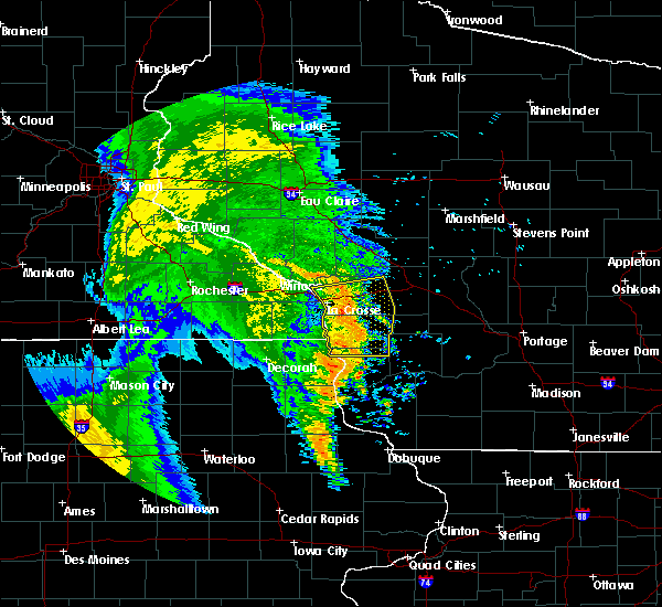 The severe thunderstorm warning for northern crawford, western monroe, la crosse and vernon counties will expire at 530 am cdt, the storms which prompted the warning have weakened below severe limits, and no longer pose an immediate threat to life or property. therefore the warning will be allowed to expire. however gusty winds to 40 mph and heavy rain are still possible with these thunderstorms. The severe thunderstorm warning for northern crawford, western monroe, la crosse and vernon counties will expire at 530 am cdt, the storms which prompted the warning have weakened below severe limits, and no longer pose an immediate threat to life or property. therefore the warning will be allowed to expire. however gusty winds to 40 mph and heavy rain are still possible with these thunderstorms.
|
| 7/7/2016 5:12 AM CDT |
 At 511 am cdt, severe thunderstorms were located along a line extending from near holmen to near coon valley to 8 miles east of lansing, moving east at 40 mph (radar indicated). Hazards include 60 mph wind gusts. Expect damage to roofs. siding. and trees. these severe storms will be near, coon valley and west salem around 515 am cdt. bangor and westby around 520 am cdt. sparta, clayton and cashton around 530 am cdt. Other locations impacted by these severe thunderstorms include newton, medary, springville, leon and portland. At 511 am cdt, severe thunderstorms were located along a line extending from near holmen to near coon valley to 8 miles east of lansing, moving east at 40 mph (radar indicated). Hazards include 60 mph wind gusts. Expect damage to roofs. siding. and trees. these severe storms will be near, coon valley and west salem around 515 am cdt. bangor and westby around 520 am cdt. sparta, clayton and cashton around 530 am cdt. Other locations impacted by these severe thunderstorms include newton, medary, springville, leon and portland.
|
| 7/7/2016 5:08 AM CDT |
 The severe thunderstorm warning for central allamakee, southeastern winona and eastern houston counties will expire at 515 am cdt, the strongest winds these these storms have moved out of the area. therefore the warning will be allowed to expire. if you experienced severe weather, please relay it to law enforcement or contact the national weather service on facebook or twitter. The severe thunderstorm warning for central allamakee, southeastern winona and eastern houston counties will expire at 515 am cdt, the strongest winds these these storms have moved out of the area. therefore the warning will be allowed to expire. if you experienced severe weather, please relay it to law enforcement or contact the national weather service on facebook or twitter.
|
| 7/7/2016 5:02 AM CDT |
 At 502 am cdt, severe thunderstorms were located along a line extending from near brice prairie to near stoddard to near lansing, moving east at 35 mph (radar indicated). Hazards include 60 mph wind gusts and penny size hail. Expect damage to roofs. siding. and trees. These severe thunderstorms will remain over mainly rural areas of central allamakee, southeastern winona and eastern houston counties, including the following locations: dresbach, reno, waterville, village creek and i 90 exit 266. At 502 am cdt, severe thunderstorms were located along a line extending from near brice prairie to near stoddard to near lansing, moving east at 35 mph (radar indicated). Hazards include 60 mph wind gusts and penny size hail. Expect damage to roofs. siding. and trees. These severe thunderstorms will remain over mainly rural areas of central allamakee, southeastern winona and eastern houston counties, including the following locations: dresbach, reno, waterville, village creek and i 90 exit 266.
|
| 7/7/2016 4:51 AM CDT |
 At 451 am cdt, severe thunderstorms were located along a line extending from near trempealeau to near brownsville to near lansing, moving east at 35 mph (radar indicated). Hazards include 60 mph wind gusts and penny size hail. Expect damage to roofs. siding. and trees. these severe storms will be near, brownsville around 455 am cdt. lansing, la crescent and dakota around 500 am cdt. la crosse around 510 am cdt. Other locations impacted by these severe thunderstorms include new hartford, mound prairie, dresbach, reno and eitzen. At 451 am cdt, severe thunderstorms were located along a line extending from near trempealeau to near brownsville to near lansing, moving east at 35 mph (radar indicated). Hazards include 60 mph wind gusts and penny size hail. Expect damage to roofs. siding. and trees. these severe storms will be near, brownsville around 455 am cdt. lansing, la crescent and dakota around 500 am cdt. la crosse around 510 am cdt. Other locations impacted by these severe thunderstorms include new hartford, mound prairie, dresbach, reno and eitzen.
|
| 7/7/2016 4:49 AM CDT |
 At 448 am cdt, severe thunderstorms were located along a line extending from near dakota to brownsville to 7 miles east of waukon, moving east at 50 mph (radar indicated). Hazards include 60 mph wind gusts. Expect damage to roofs. siding. and trees. severe thunderstorms will be near, brice prairie and stoddard around 455 am cdt. la crosse, holmen, onalaska and french island around 500 am cdt. coon valley around 505 am cdt. west salem around 510 am cdt. bangor and westby around 515 am cdt. cashton around 520 am cdt. sparta around 525 am cdt. clayton around 530 am cdt. Other locations impacted by these severe thunderstorms include newton, medary, springville, leon and portland. At 448 am cdt, severe thunderstorms were located along a line extending from near dakota to brownsville to 7 miles east of waukon, moving east at 50 mph (radar indicated). Hazards include 60 mph wind gusts. Expect damage to roofs. siding. and trees. severe thunderstorms will be near, brice prairie and stoddard around 455 am cdt. la crosse, holmen, onalaska and french island around 500 am cdt. coon valley around 505 am cdt. west salem around 510 am cdt. bangor and westby around 515 am cdt. cashton around 520 am cdt. sparta around 525 am cdt. clayton around 530 am cdt. Other locations impacted by these severe thunderstorms include newton, medary, springville, leon and portland.
|
| 7/7/2016 4:34 AM CDT |
 At 434 am cdt, severe thunderstorms were located along a line extending from 7 miles northeast of rushford to caledonia to 6 miles north of waukon, moving east at 55 mph (radar indicated). Hazards include 60 mph wind gusts and penny size hail. Expect damage to roofs. siding. and trees. these severe storms will be near, brownsville and hokah around 445 am cdt. lansing, dakota and new albin around 450 am cdt. la crosse and la crescent around 455 am cdt. Other locations impacted by these severe thunderstorms include new hartford, rushford village, mound prairie, money creek and dresbach. At 434 am cdt, severe thunderstorms were located along a line extending from 7 miles northeast of rushford to caledonia to 6 miles north of waukon, moving east at 55 mph (radar indicated). Hazards include 60 mph wind gusts and penny size hail. Expect damage to roofs. siding. and trees. these severe storms will be near, brownsville and hokah around 445 am cdt. lansing, dakota and new albin around 450 am cdt. la crosse and la crescent around 455 am cdt. Other locations impacted by these severe thunderstorms include new hartford, rushford village, mound prairie, money creek and dresbach.
|
| 7/7/2016 4:11 AM CDT |
 At 409 am cdt, severe thunderstorms were located along a line extending from 9 miles north of lanesboro to near decorah, moving east at 35 mph (trained weather spotters). Hazards include 60 mph wind gusts and penny size hail. Expect damage to roofs. siding. and trees. severe thunderstorms will be near, rushford around 425 am cdt. waukon around 435 am cdt. houston around 440 am cdt. new albin around 455 am cdt. lansing, la crescent and dakota around 500 am cdt. la crosse around 505 am cdt. other locations impacted by these severe thunderstorms include new hartford, rushford village, mound prairie, money creek and highland. Wind gusts near 60 mph have been reported along this line, including a wind gust of 62 mph at preston minnesota. At 409 am cdt, severe thunderstorms were located along a line extending from 9 miles north of lanesboro to near decorah, moving east at 35 mph (trained weather spotters). Hazards include 60 mph wind gusts and penny size hail. Expect damage to roofs. siding. and trees. severe thunderstorms will be near, rushford around 425 am cdt. waukon around 435 am cdt. houston around 440 am cdt. new albin around 455 am cdt. lansing, la crescent and dakota around 500 am cdt. la crosse around 505 am cdt. other locations impacted by these severe thunderstorms include new hartford, rushford village, mound prairie, money creek and highland. Wind gusts near 60 mph have been reported along this line, including a wind gust of 62 mph at preston minnesota.
|
| 7/5/2016 10:25 PM CDT |
 At 1024 pm cdt, severe thunderstorms were located along a line extending from near millston to 9 miles southeast of stoddard, moving east at 60 mph (trained weather spotters). Hazards include 70 mph wind gusts. Expect considerable tree damage. damage is likely to mobile homes, roofs, and outbuildings. these severe storms will be near, tomah and fort mc coy around 1030 pm cdt. la farge around 1045 pm cdt. Other locations impacted by these severe thunderstorms include newton, medary, springville, leon and portland. At 1024 pm cdt, severe thunderstorms were located along a line extending from near millston to 9 miles southeast of stoddard, moving east at 60 mph (trained weather spotters). Hazards include 70 mph wind gusts. Expect considerable tree damage. damage is likely to mobile homes, roofs, and outbuildings. these severe storms will be near, tomah and fort mc coy around 1030 pm cdt. la farge around 1045 pm cdt. Other locations impacted by these severe thunderstorms include newton, medary, springville, leon and portland.
|
| 7/5/2016 10:12 PM CDT |
 At 1010 pm cdt, severe thunderstorms were located along a line extending from near cataract to near new albin, moving east at 60 mph (spotters reported). Hazards include 70 mph wind gusts. Expect considerable tree damage. damage is likely to mobile homes, roofs, and outbuildings. these severe storms will be near, sparta and cataract around 1015 pm cdt. fort mc coy around 1020 pm cdt. tomah and coon valley around 1030 pm cdt. viroqua and westby around 1035 pm cdt. la farge around 1045 pm cdt. Other locations impacted by these severe thunderstorms include newton, medary, springville, leon and portland. At 1010 pm cdt, severe thunderstorms were located along a line extending from near cataract to near new albin, moving east at 60 mph (spotters reported). Hazards include 70 mph wind gusts. Expect considerable tree damage. damage is likely to mobile homes, roofs, and outbuildings. these severe storms will be near, sparta and cataract around 1015 pm cdt. fort mc coy around 1020 pm cdt. tomah and coon valley around 1030 pm cdt. viroqua and westby around 1035 pm cdt. la farge around 1045 pm cdt. Other locations impacted by these severe thunderstorms include newton, medary, springville, leon and portland.
|
| 7/5/2016 10:00 PM CDT |
 At 959 pm cdt, severe thunderstorms were located along a line extending from north bend to near spring grove, moving east at 60 mph (radar indicated). Hazards include 60 mph wind gusts. Expect damage to roofs. siding. and trees. these severe storms will be near, sparta, cataract, stoddard and brownsville around 1015 pm cdt. fort mc coy around 1020 pm cdt. coon valley around 1025 pm cdt. Viroqua and tomah around 1030 pm cdt. At 959 pm cdt, severe thunderstorms were located along a line extending from north bend to near spring grove, moving east at 60 mph (radar indicated). Hazards include 60 mph wind gusts. Expect damage to roofs. siding. and trees. these severe storms will be near, sparta, cataract, stoddard and brownsville around 1015 pm cdt. fort mc coy around 1020 pm cdt. coon valley around 1025 pm cdt. Viroqua and tomah around 1030 pm cdt.
|
| 7/5/2016 9:58 PM CDT | Asos station la crosse regional airport /lse in la crosse county WI, 4.3 miles SSE of La Crosse, WI |
| 7/5/2016 9:49 PM CDT |
 At 949 pm cdt, severe thunderstorms were located along a line extending from galesville to mabel, moving east at 60 mph (radar indicated). Hazards include 60 mph wind gusts. Expect damage to roofs. siding. and trees. severe thunderstorms will be near, brice prairie, holmen and onalaska around 955 pm cdt. new albin around 1010 pm cdt. sparta, cataract, stoddard and brownsville around 1015 pm cdt. fort mc coy around 1020 pm cdt. Other locations impacted by these severe thunderstorms include newton, medary, springville, leon and portland. At 949 pm cdt, severe thunderstorms were located along a line extending from galesville to mabel, moving east at 60 mph (radar indicated). Hazards include 60 mph wind gusts. Expect damage to roofs. siding. and trees. severe thunderstorms will be near, brice prairie, holmen and onalaska around 955 pm cdt. new albin around 1010 pm cdt. sparta, cataract, stoddard and brownsville around 1015 pm cdt. fort mc coy around 1020 pm cdt. Other locations impacted by these severe thunderstorms include newton, medary, springville, leon and portland.
|
| 6/30/2016 1:42 PM CDT | Tree uprooted on main st between 21st and 22nd st. also a tree down near the alpine inn on bliss roa in la crosse county WI, 0.6 miles SE of La Crosse, WI |
| 6/26/2016 12:42 AM CDT |
 At 1238 am cdt, severe thunderstorms were located along a line extending from 6 miles northwest of sparta to near westby, moving east at 50 mph. at 1220 am cdt, la crosse police department reported power lines down in the city (radar indicated). Hazards include 60 mph wind gusts. Expect damage to roofs. siding. and trees. these severe storms will be near, viroqua around 1245 am cdt. westby around 1250 am cdt. la farge around 100 am cdt. Other locations impacted by these severe thunderstorms include newton, springville, viola, liberty and chaseburg. At 1238 am cdt, severe thunderstorms were located along a line extending from 6 miles northwest of sparta to near westby, moving east at 50 mph. at 1220 am cdt, la crosse police department reported power lines down in the city (radar indicated). Hazards include 60 mph wind gusts. Expect damage to roofs. siding. and trees. these severe storms will be near, viroqua around 1245 am cdt. westby around 1250 am cdt. la farge around 100 am cdt. Other locations impacted by these severe thunderstorms include newton, springville, viola, liberty and chaseburg.
|
| 6/26/2016 12:29 AM CDT |
 At 1229 am cdt, severe thunderstorms were located along a line extending from near bangor to near coon valley, moving east at 60 mph (radar indicated). Hazards include 60 mph wind gusts. Expect damage to roofs. siding. and trees. these severe storms will be near, viroqua and westby around 1240 am cdt. la farge around 1250 am cdt. Other locations impacted by these severe thunderstorms include newton, springville, viola, liberty and chaseburg. At 1229 am cdt, severe thunderstorms were located along a line extending from near bangor to near coon valley, moving east at 60 mph (radar indicated). Hazards include 60 mph wind gusts. Expect damage to roofs. siding. and trees. these severe storms will be near, viroqua and westby around 1240 am cdt. la farge around 1250 am cdt. Other locations impacted by these severe thunderstorms include newton, springville, viola, liberty and chaseburg.
|
| 6/26/2016 12:23 AM CDT |
 At 1222 am cdt, severe thunderstorms were located along a line extending from la crosse to near stoddard, moving east at 45 mph (radar indicated). Hazards include 60 mph wind gusts. Expect damage to roofs. siding. and trees. these severe storms will be near, coon valley around 1235 am cdt. viroqua and westby around 1245 am cdt. la farge around 100 am cdt. Other locations impacted by these severe thunderstorms include newton, springville, viola, liberty and reno. At 1222 am cdt, severe thunderstorms were located along a line extending from la crosse to near stoddard, moving east at 45 mph (radar indicated). Hazards include 60 mph wind gusts. Expect damage to roofs. siding. and trees. these severe storms will be near, coon valley around 1235 am cdt. viroqua and westby around 1245 am cdt. la farge around 100 am cdt. Other locations impacted by these severe thunderstorms include newton, springville, viola, liberty and reno.
|
| 6/26/2016 12:20 AM CDT | Several reports of trees and branches down around the city. power out in some locations. light pole dow in la crosse county WI, 1.7 miles ENE of La Crosse, WI |
| 6/26/2016 12:16 AM CDT |
 At 1215 am cdt, severe thunderstorms were located along a line extending from la crescent to near stoddard, moving east at 45 mph (radar indicated). Hazards include 60 mph wind gusts. Expect damage to roofs. siding. and trees. these severe storms will be near, stoddard around 1220 am cdt. coon valley around 1235 am cdt. viroqua around 1240 am cdt. westby around 1245 am cdt. la farge around 100 am cdt. Other locations impacted by these severe thunderstorms include newton, springville, viola, liberty and reno. At 1215 am cdt, severe thunderstorms were located along a line extending from la crescent to near stoddard, moving east at 45 mph (radar indicated). Hazards include 60 mph wind gusts. Expect damage to roofs. siding. and trees. these severe storms will be near, stoddard around 1220 am cdt. coon valley around 1235 am cdt. viroqua around 1240 am cdt. westby around 1245 am cdt. la farge around 100 am cdt. Other locations impacted by these severe thunderstorms include newton, springville, viola, liberty and reno.
|
| 6/26/2016 12:13 AM CDT |
 At 1212 am cdt, severe thunderstorms were located along a line extending from la crescent to 6 miles southwest of stoddard, moving east at 45 mph (radar indicated). Hazards include 60 mph wind gusts. Expect damage to roofs. siding. and trees. these severe storms will be near, coon valley around 1235 am cdt. viroqua and westby around 1240 am cdt. la farge around 100 am cdt. Other locations impacted by these severe thunderstorms include newton, springville, viola, mound prairie and liberty. At 1212 am cdt, severe thunderstorms were located along a line extending from la crescent to 6 miles southwest of stoddard, moving east at 45 mph (radar indicated). Hazards include 60 mph wind gusts. Expect damage to roofs. siding. and trees. these severe storms will be near, coon valley around 1235 am cdt. viroqua and westby around 1240 am cdt. la farge around 100 am cdt. Other locations impacted by these severe thunderstorms include newton, springville, viola, mound prairie and liberty.
|
| 6/26/2016 12:09 AM CDT |
 At 1209 am cdt, severe thunderstorms were located along a line extending from near houston to near caledonia, moving east at 45 mph (radar indicated). Hazards include 60 mph wind gusts. Expect damage to roofs. siding. and trees. severe thunderstorms will be near, la crescent, hokah, new albin and brownsville around 1225 am cdt. la crosse, french island and stoddard around 1230 am cdt. coon valley around 1245 am cdt. viroqua and westby around 1250 am cdt. la farge around 100 am cdt. Other locations impacted by these severe thunderstorms include newton, springville, viola, mound prairie and liberty. At 1209 am cdt, severe thunderstorms were located along a line extending from near houston to near caledonia, moving east at 45 mph (radar indicated). Hazards include 60 mph wind gusts. Expect damage to roofs. siding. and trees. severe thunderstorms will be near, la crescent, hokah, new albin and brownsville around 1225 am cdt. la crosse, french island and stoddard around 1230 am cdt. coon valley around 1245 am cdt. viroqua and westby around 1250 am cdt. la farge around 100 am cdt. Other locations impacted by these severe thunderstorms include newton, springville, viola, mound prairie and liberty.
|
| 7/18/2015 3:30 AM CDT |
 At 328 am cdt, severe thunderstorms were located along a line extending from 9 miles northeast of neillsville to near sparta, moving northeast at 70 mph (law enforcement. trees were reported down in jackson and trempealeau counties. meanwhile wind gusts of 50 to 60 mph were reported at the la crosse airport into onalaska). Hazards include 60 mph wind gusts. Expect damage to roofs. siding and trees. these severe storms will be near, tomah around 345 am cdt. Other locations impacted by these severe thunderstorms include medary, leon, burns, irving and norwalk. At 328 am cdt, severe thunderstorms were located along a line extending from 9 miles northeast of neillsville to near sparta, moving northeast at 70 mph (law enforcement. trees were reported down in jackson and trempealeau counties. meanwhile wind gusts of 50 to 60 mph were reported at the la crosse airport into onalaska). Hazards include 60 mph wind gusts. Expect damage to roofs. siding and trees. these severe storms will be near, tomah around 345 am cdt. Other locations impacted by these severe thunderstorms include medary, leon, burns, irving and norwalk.
|
| 7/18/2015 3:06 AM CDT |
 At 305 am cdt, severe thunderstorms were located along a line extending from near humbird to onalaska, moving east at 45 mph (law enforcement. numerous reports of trees down in arcadia and near eleva). Hazards include 60 mph wind gusts. Expect damage to roofs. siding and trees. these severe storms will be near, hatfield around 310 am cdt. sparta around 330 am cdt. fort mc coy around 340 am cdt. tomah around 350 am cdt. Other locations impacted by these severe thunderstorms include franklin, medary, leon, burns and new hartford. At 305 am cdt, severe thunderstorms were located along a line extending from near humbird to onalaska, moving east at 45 mph (law enforcement. numerous reports of trees down in arcadia and near eleva). Hazards include 60 mph wind gusts. Expect damage to roofs. siding and trees. these severe storms will be near, hatfield around 310 am cdt. sparta around 330 am cdt. fort mc coy around 340 am cdt. tomah around 350 am cdt. Other locations impacted by these severe thunderstorms include franklin, medary, leon, burns and new hartford.
|
| 7/18/2015 3:02 AM CDT |
 At 301 am cdt, severe thunderstorms were located along a line extending from near fairchild to near la crosse airport, moving east at 45 mph (law enforcement. numerous reports of trees down from buffalo city to fountain city in buffalo county with these storms). Hazards include 60 mph wind gusts. Expect damage to roofs. siding and trees. these severe storms will be near, fairchild around 305 am cdt. hatfield around 310 am cdt. bangor around 320 am cdt. sparta around 330 am cdt. fort mc coy around 340 am cdt. tomah around 350 am cdt. Other locations impacted by these severe thunderstorms include franklin, medary, leon, burns and new hartford. At 301 am cdt, severe thunderstorms were located along a line extending from near fairchild to near la crosse airport, moving east at 45 mph (law enforcement. numerous reports of trees down from buffalo city to fountain city in buffalo county with these storms). Hazards include 60 mph wind gusts. Expect damage to roofs. siding and trees. these severe storms will be near, fairchild around 305 am cdt. hatfield around 310 am cdt. bangor around 320 am cdt. sparta around 330 am cdt. fort mc coy around 340 am cdt. tomah around 350 am cdt. Other locations impacted by these severe thunderstorms include franklin, medary, leon, burns and new hartford.
|
| 7/18/2015 2:43 AM CDT |
 At 239 am cdt, severe thunderstorms were located along a line extending from near osseo to 9 miles northeast of rushford, moving east at 55 mph (law enforcement. numerous reports of trees down from buffalo city to fountain city in buffalo county with these storms). Hazards include 60 mph wind gusts. Expect damage to roofs. siding and trees. severe thunderstorms will be near, price around 245 am cdt. fairchild and galesville around 255 am cdt. la crosse, onalaska, holmen and la crosse airport around 300 am cdt. west salem and north bend around 310 am cdt. bangor around 315 am cdt. sparta and cataract around 325 am cdt. fort mc coy around 335 am cdt. tomah around 345 am cdt. People at the la crosse county fair in west salem should seek safe shelter immediately!. At 239 am cdt, severe thunderstorms were located along a line extending from near osseo to 9 miles northeast of rushford, moving east at 55 mph (law enforcement. numerous reports of trees down from buffalo city to fountain city in buffalo county with these storms). Hazards include 60 mph wind gusts. Expect damage to roofs. siding and trees. severe thunderstorms will be near, price around 245 am cdt. fairchild and galesville around 255 am cdt. la crosse, onalaska, holmen and la crosse airport around 300 am cdt. west salem and north bend around 310 am cdt. bangor around 315 am cdt. sparta and cataract around 325 am cdt. fort mc coy around 335 am cdt. tomah around 345 am cdt. People at the la crosse county fair in west salem should seek safe shelter immediately!.
|
| 7/13/2015 4:42 PM CDT |
 At 441 pm cdt, a severe thunderstorm was located near coon valley, or 10 miles east of la crosse, moving southeast at 40 mph (trained weather spotters). Hazards include ping pong ball size hail and 60 mph wind gusts. People and animals outdoors will be injured. expect hail damage to roofs, siding, windows and vehicles. expect wind damage to roofs, siding and trees. Locations impacted include, county roads m and w, county roads m and s, the coulee experimental forest, county roads d e and e, mindoro cut, county roads g and h, highway 162 and county e e and mount la crosse. At 441 pm cdt, a severe thunderstorm was located near coon valley, or 10 miles east of la crosse, moving southeast at 40 mph (trained weather spotters). Hazards include ping pong ball size hail and 60 mph wind gusts. People and animals outdoors will be injured. expect hail damage to roofs, siding, windows and vehicles. expect wind damage to roofs, siding and trees. Locations impacted include, county roads m and w, county roads m and s, the coulee experimental forest, county roads d e and e, mindoro cut, county roads g and h, highway 162 and county e e and mount la crosse.
|
| 7/13/2015 4:31 PM CDT |
 At 422 pm, hail up to ping pong ball sized was reported in the town of burns in la crosse county. there were other storms in far southeast part of the county and in the holmen area (trained weather spotters). Hazards include ping pong ball size hail and 60 mph wind gusts. People and animals outdoors will be injured. expect hail damage to roofs, siding, windows and vehicles. expect wind damage to roofs, siding and trees. Locations impacted include, burns, rockland, i 90 exit 12, norskedalen, i 90 exit 15, burr oak, highway 33 and losey boulevard, nathan hill, county roads m and w and county roads m and s. At 422 pm, hail up to ping pong ball sized was reported in the town of burns in la crosse county. there were other storms in far southeast part of the county and in the holmen area (trained weather spotters). Hazards include ping pong ball size hail and 60 mph wind gusts. People and animals outdoors will be injured. expect hail damage to roofs, siding, windows and vehicles. expect wind damage to roofs, siding and trees. Locations impacted include, burns, rockland, i 90 exit 12, norskedalen, i 90 exit 15, burr oak, highway 33 and losey boulevard, nathan hill, county roads m and w and county roads m and s.
|
| 7/13/2015 4:16 PM CDT |
 At 410 pm, a trailer was blown off the road in west salem wisconsin. nickel sized hail continued to fall from storms near trempealeau, bangor, west salem, and middle ridge (law enforcement). Hazards include 60 mph wind gusts and quarter size hail. Hail damage to vehicles is expected. expect wind damage to roofs, siding and trees. This severe thunderstorm will remain over mainly rural areas of la crosse county, including the following locations, medary, burns, and rockland. At 410 pm, a trailer was blown off the road in west salem wisconsin. nickel sized hail continued to fall from storms near trempealeau, bangor, west salem, and middle ridge (law enforcement). Hazards include 60 mph wind gusts and quarter size hail. Hail damage to vehicles is expected. expect wind damage to roofs, siding and trees. This severe thunderstorm will remain over mainly rural areas of la crosse county, including the following locations, medary, burns, and rockland.
|
| 7/13/2015 4:08 PM CDT |
 At 407 pm cdt, a severe thunderstorm was located about 4 miles east of la crosse, and another storm was moving into other parts of the county from the trempealeau wisconsin area, moving east at 15 mph. these storms have a history of producing nickel sized hail (radar indicated). Hazards include quarter size hail. Damage to vehicles is expected. this severe thunderstorm will be near, bangor around 425 pm cdt. Other locations impacted by this severe thunderstorm include medary, burns, rockland, i 90 exit 12 and goose island. At 407 pm cdt, a severe thunderstorm was located about 4 miles east of la crosse, and another storm was moving into other parts of the county from the trempealeau wisconsin area, moving east at 15 mph. these storms have a history of producing nickel sized hail (radar indicated). Hazards include quarter size hail. Damage to vehicles is expected. this severe thunderstorm will be near, bangor around 425 pm cdt. Other locations impacted by this severe thunderstorm include medary, burns, rockland, i 90 exit 12 and goose island.
|
| 6/29/2015 5:20 PM CDT |
 At 519 pm cdt, a severe thunderstorm was located over hokah, or near la crosse, moving south at 25 mph (public reported ping pong ball sized hail at wxow tv 3 miles west of la crescent). Hazards include ping pong ball size hail and 60 mph wind gusts. People and animals outdoors will be injured. expect hail damage to roofs, siding, windows and vehicles. expect wind damage to roofs, siding and trees. This severe thunderstorm will remain over mainly rural areas of northeastern houston, southeastern winona and southwestern la crosse counties, including the following locations, mound prairie, highway 33 and county o a, highways 14 61 and county m m, blue bird campground and goose island. At 519 pm cdt, a severe thunderstorm was located over hokah, or near la crosse, moving south at 25 mph (public reported ping pong ball sized hail at wxow tv 3 miles west of la crescent). Hazards include ping pong ball size hail and 60 mph wind gusts. People and animals outdoors will be injured. expect hail damage to roofs, siding, windows and vehicles. expect wind damage to roofs, siding and trees. This severe thunderstorm will remain over mainly rural areas of northeastern houston, southeastern winona and southwestern la crosse counties, including the following locations, mound prairie, highway 33 and county o a, highways 14 61 and county m m, blue bird campground and goose island.
|
| 6/29/2015 5:12 PM CDT |
 At 512 pm cdt, a severe thunderstorm was located over hokah, or over la crescent, and is nearly stationary (radar indicated). Hazards include 60 mph wind gusts and quarter size hail. Hail damage to vehicles is expected. expect wind damage to roofs, siding and trees. this severe storm will be near, la crosse and hokah around 515 pm cdt. Other locations impacted by this severe thunderstorm include mound prairie, dresbach, highway 33 and county o a, blue bird campground and county 9 and sather valley road. At 512 pm cdt, a severe thunderstorm was located over hokah, or over la crescent, and is nearly stationary (radar indicated). Hazards include 60 mph wind gusts and quarter size hail. Hail damage to vehicles is expected. expect wind damage to roofs, siding and trees. this severe storm will be near, la crosse and hokah around 515 pm cdt. Other locations impacted by this severe thunderstorm include mound prairie, dresbach, highway 33 and county o a, blue bird campground and county 9 and sather valley road.
|
| 6/29/2015 4:57 PM CDT |
 At 456 pm cdt, a severe thunderstorm was located over dakota, moving south at 25 mph (trained weather spotters. this storm has a history of producing hail up to golf ball size). Hazards include golf ball size hail and 60 mph wind gusts. People and animals outdoors will be injured. expect hail damage to roofs, siding, windows and vehicles. expect wind damage to roofs, siding and trees. this severe thunderstorm will be near, onalaska around 500 pm cdt. la crescent around 505 pm cdt. la crosse and french island around 510 pm cdt. hokah around 515 pm cdt. Other locations impacted by this severe thunderstorm include mound prairie, dresbach, highway 33 and county o a, blue bird campground and nodine. At 456 pm cdt, a severe thunderstorm was located over dakota, moving south at 25 mph (trained weather spotters. this storm has a history of producing hail up to golf ball size). Hazards include golf ball size hail and 60 mph wind gusts. People and animals outdoors will be injured. expect hail damage to roofs, siding, windows and vehicles. expect wind damage to roofs, siding and trees. this severe thunderstorm will be near, onalaska around 500 pm cdt. la crescent around 505 pm cdt. la crosse and french island around 510 pm cdt. hokah around 515 pm cdt. Other locations impacted by this severe thunderstorm include mound prairie, dresbach, highway 33 and county o a, blue bird campground and nodine.
|
| 6/29/2015 4:47 PM CDT |
 At 445 pm cdt, a severe thunderstorm was located near trempealeau, moving south-southeast at 30 mph (public. golf ball sized hail has been reported with this storm in the centerville area. hail up to quarters have also been reported east of pickwick). Hazards include golf ball size hail and 60 mph wind gusts. People and animals outdoors will be injured. expect hail damage to roofs, siding, windows and vehicles. expect wind damage to roofs, siding and trees. this severe storm will be near, brice prairie around 450 pm cdt. dakota and town of holland around 455 pm cdt. holmen, onalaska and french island around 500 pm cdt. Other locations impacted by this severe thunderstorm include ettrick, dresbach, mindoro, lock and dam 6 and nodine. At 445 pm cdt, a severe thunderstorm was located near trempealeau, moving south-southeast at 30 mph (public. golf ball sized hail has been reported with this storm in the centerville area. hail up to quarters have also been reported east of pickwick). Hazards include golf ball size hail and 60 mph wind gusts. People and animals outdoors will be injured. expect hail damage to roofs, siding, windows and vehicles. expect wind damage to roofs, siding and trees. this severe storm will be near, brice prairie around 450 pm cdt. dakota and town of holland around 455 pm cdt. holmen, onalaska and french island around 500 pm cdt. Other locations impacted by this severe thunderstorm include ettrick, dresbach, mindoro, lock and dam 6 and nodine.
|
| 6/29/2015 4:37 PM CDT |
 At 436 pm cdt, a severe thunderstorm was located near trempealeau, or 9 miles northwest of holmen, and is nearly stationary (public reported golf ball size hail 3 miles north of centerville at 435 pm cdt). Hazards include golf ball size hail and 60 mph wind gusts. People and animals outdoors will be injured. expect hail damage to roofs, siding, windows and vehicles. expect wind damage to roofs, siding and trees. this severe storm will be near, brice prairie and dakota around 455 pm cdt. holmen, onalaska, town of holland and french island around 500 pm cdt. Other locations impacted by this severe thunderstorm include dodge, ettrick, dresbach, mindoro and lock and dam 6. At 436 pm cdt, a severe thunderstorm was located near trempealeau, or 9 miles northwest of holmen, and is nearly stationary (public reported golf ball size hail 3 miles north of centerville at 435 pm cdt). Hazards include golf ball size hail and 60 mph wind gusts. People and animals outdoors will be injured. expect hail damage to roofs, siding, windows and vehicles. expect wind damage to roofs, siding and trees. this severe storm will be near, brice prairie and dakota around 455 pm cdt. holmen, onalaska, town of holland and french island around 500 pm cdt. Other locations impacted by this severe thunderstorm include dodge, ettrick, dresbach, mindoro and lock and dam 6.
|
| 6/29/2015 4:28 PM CDT |
 At 427 pm cdt, a severe thunderstorm was located near galesville, or 11 miles east of winona, moving south-southeast at 25 mph (radar indicated). Hazards include 60 mph wind gusts and quarter size hail. Hail damage to vehicles is expected. expect wind damage to roofs, siding and trees. this severe thunderstorm will be near, trempealeau and galesville around 435 pm cdt. brice prairie around 450 pm cdt. dakota and town of holland around 455 pm cdt. holmen, onalaska and french island around 500 pm cdt. Other locations impacted by this severe thunderstorm include dodge, ettrick, dresbach, mindoro and lock and dam 6. At 427 pm cdt, a severe thunderstorm was located near galesville, or 11 miles east of winona, moving south-southeast at 25 mph (radar indicated). Hazards include 60 mph wind gusts and quarter size hail. Hail damage to vehicles is expected. expect wind damage to roofs, siding and trees. this severe thunderstorm will be near, trempealeau and galesville around 435 pm cdt. brice prairie around 450 pm cdt. dakota and town of holland around 455 pm cdt. holmen, onalaska and french island around 500 pm cdt. Other locations impacted by this severe thunderstorm include dodge, ettrick, dresbach, mindoro and lock and dam 6.
|
| 5/6/2015 7:08 PM CDT | Large tree branch down in la crosse county WI, 3.1 miles N of La Crosse, WI |
| 6/28/2014 8:50 PM CDT | Many branches down ranging up to 6 inches. significant street flooding cass and madison street are in la crosse county WI, 0.6 miles SE of La Crosse, WI |
| 6/28/2014 8:50 PM CDT | Trees down near the intersection of green bay and east ave. report received via twitte in la crosse county WI, 2.2 miles NE of La Crosse, WI |
| 6/16/2014 9:10 PM CDT | Several trees down near uw la crosse and in downtown la crosse in la crosse county WI, 0.5 miles ENE of La Crosse, WI |
| 4/12/2014 10:07 AM CDT | Quarter sized hail reported 0.6 miles SE of La Crosse, WI, at wkbt studio in downtown la crosse. |
| 4/12/2014 10:00 AM CDT | Quarter sized hail reported 0.6 miles SE of La Crosse, WI, falling at city hall. |
| 7/25/2013 2:56 PM CDT | Tennis Ball sized hail reported 4.3 miles SSE of La Crosse, WI, official observer for la crosse airport |
| 7/22/2013 7:25 PM CDT | Large branches down in vernon county WI, 8 miles NNW of La Crosse, WI |
| 6/21/2013 6:23 AM CDT | Several large branches blown down at forest hills golf course and along bliss roa in la crosse county WI, 1.6 miles WSW of La Crosse, WI |
| 6/21/2013 6:23 AM CDT | A couple of trees blow down in la crosse county WI, 1.7 miles NNE of La Crosse, WI |
| 5/30/2013 6:46 PM CDT | 13 inch diameter trees down on ferry st between 11th and west ave...and on 6th street in la crosse county WI, 0.6 miles SE of La Crosse, WI |
| 4/9/2013 9:35 PM CDT | Quarter sized hail reported 3.1 miles N of La Crosse, WI |
| 4/9/2013 9:35 PM CDT | Quarter sized hail reported 1.7 miles ENE of La Crosse, WI |
| 4/9/2013 9:27 PM CDT | Quarter sized hail reported 0.9 miles N of La Crosse, WI |
| 9/4/2012 6:13 PM CDT | 4 inch diameter branches down around the campground. several small branches down als in la crosse county WI, 5.8 miles N of La Crosse, WI |
| 6/16/2012 8:40 PM CDT | Tree down on north side of la cross in la crosse county WI, 1.2 miles SSE of La Crosse, WI |
| 6/16/2012 8:40 PM CDT | Branches and powerlines down at pettibone park. also a road sign blown into highwa in la crosse county WI, 1.5 miles ESE of La Crosse, WI |
| 5/3/2012 7:30 AM CDT | Some downed power lines in town of shelby in la crosse county WI, 1.1 miles NNW of La Crosse, WI |
| 1/1/0001 12:00 AM | Multiple trees down on 16th and south ave and areas northward. most are 1 to 2 foot diameter in la crosse county WI, 2.3 miles NW of La Crosse, WI |
| 1/1/0001 12:00 AM | Trees and power lines down on losey blvd/main in la crosse county WI, 0.6 miles SE of La Crosse, WI |
| 1/1/0001 12:00 AM | Tree down on apartment bulding on 33rd street south just south of state road. also trees took power lines down one block east on drive-in roa in la crosse county WI, 2.3 miles WNW of La Crosse, WI |
| 1/1/0001 12:00 AM | Two trees down on boma road and highway 33. shelby ball field in la crosse county WI, 2.3 miles NW of La Crosse, WI |
| 1/1/0001 12:00 AM | Tree down in copeland park in la crosse county WI, 0.6 miles SE of La Crosse, WI |
| 1/1/0001 12:00 AM | Few trees down on grand st on west side of la crosse airport. tree down on house on island park blvd on sw side of la crosse airpor in la crosse county WI, 4.3 miles SSE of La Crosse, WI |
| 1/1/0001 12:00 AM | Quarter sized hail reported 5.2 miles WSW of La Crosse, WI |
| 1/1/0001 12:00 AM | Measured near 16th street and denton in la crosse as tornado passed by. anemometer is at 35 fee in la crosse county WI, 0.6 miles SE of La Crosse, WI |
| 1/1/0001 12:00 AM | Tree down near 19th and denton in la crosse county WI, 0.6 miles SE of La Crosse, WI |
| 1/1/0001 12:00 AM | Golf Ball sized hail reported 2.6 miles W of La Crosse, WI, at hwy 14 and cth mm |
| 1/1/0001 12:00 AM | Golf Ball sized hail reported 2.6 miles W of La Crosse, WI, at nws office |
| 1/1/0001 12:00 AM | Hen Egg sized hail reported 1.7 miles NNE of La Crosse, WI, south side |
| 1/1/0001 12:00 AM | Hen Egg sized hail reported 1.7 miles NNE of La Crosse, WI, extensive hail damage on the south side of la crosse near wal mart. windows broken and siding damaged to an estimated 10 to 15 homes. several vehicles also damaged with |
| 1/1/0001 12:00 AM | Tennis Ball sized hail reported 2.3 miles NW of La Crosse, WI, at southern bluffs school |
| 1/1/0001 12:00 AM | Quarter sized hail reported 1.7 miles NNE of La Crosse, WI, on ward avenue in south la crosse |
| 1/1/0001 12:00 AM | Ping Pong Ball sized hail reported 1.7 miles NNE of La Crosse, WI, half dollar size hail |
| 1/1/0001 12:00 AM | Storm damage reported in la crosse county WI, 1.7 miles NNE of La Crosse, WI |
Hail Maps for La Crosse, WI
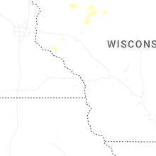

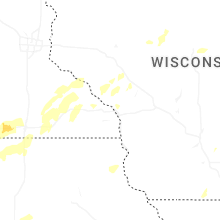
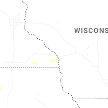


Connect with Interactive Hail Maps