

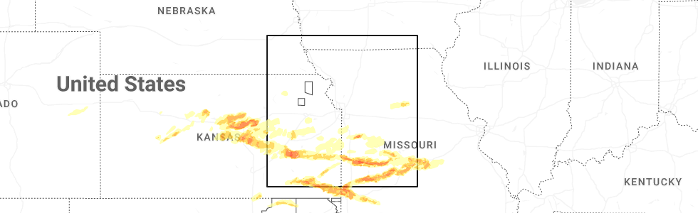
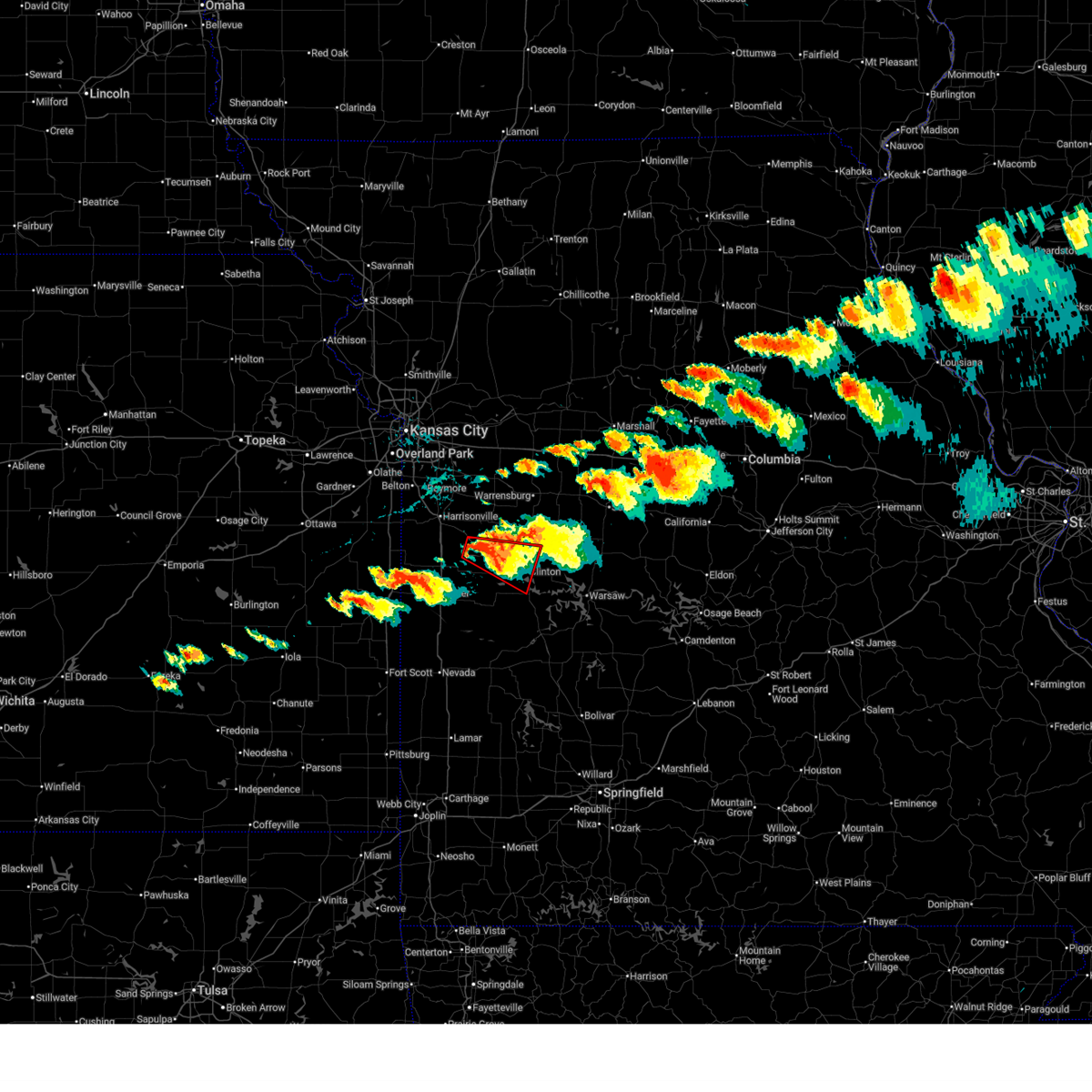
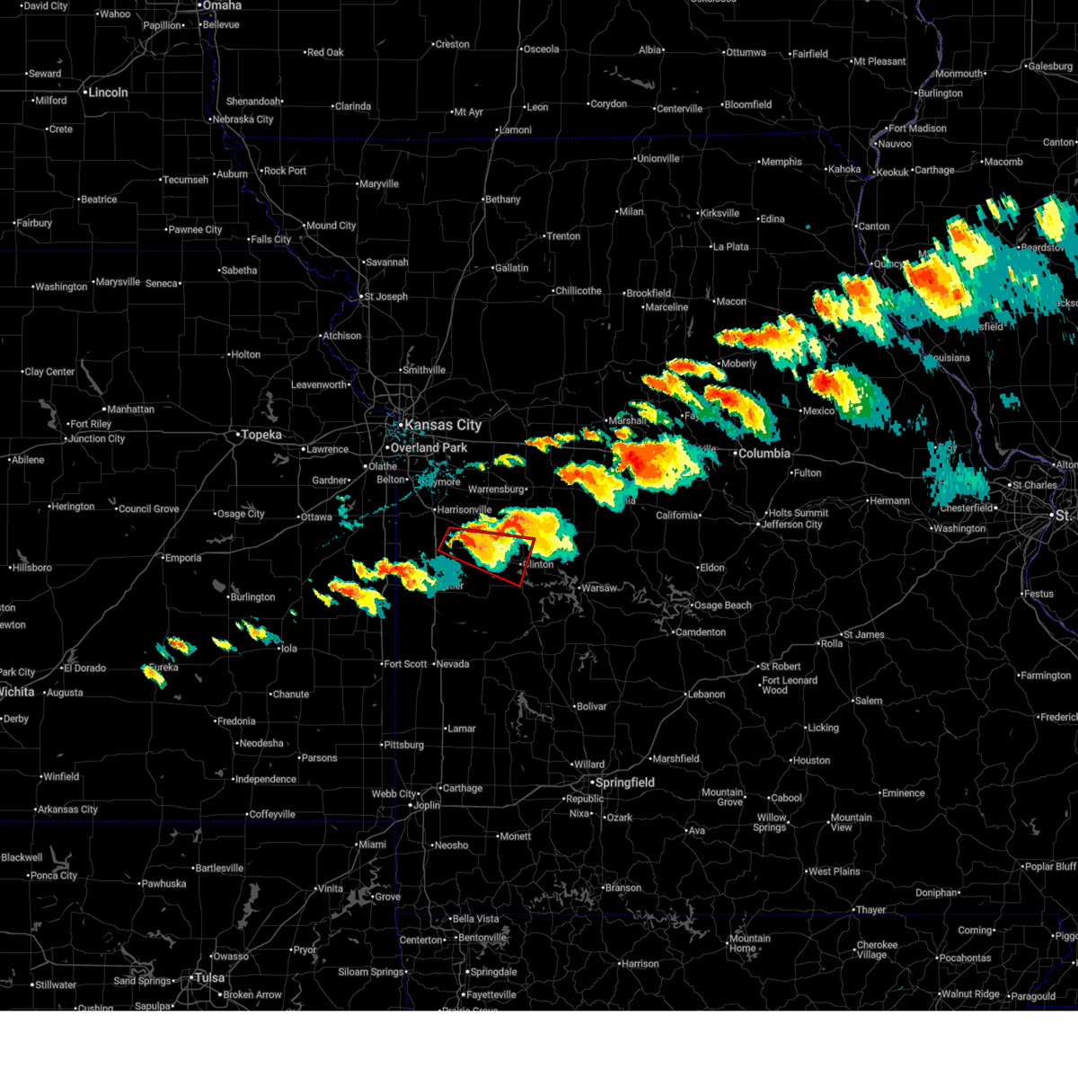
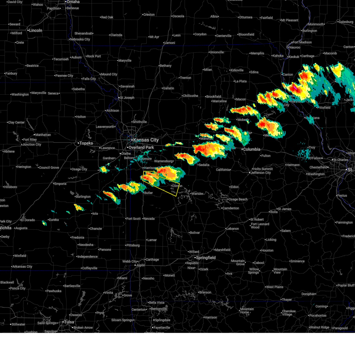
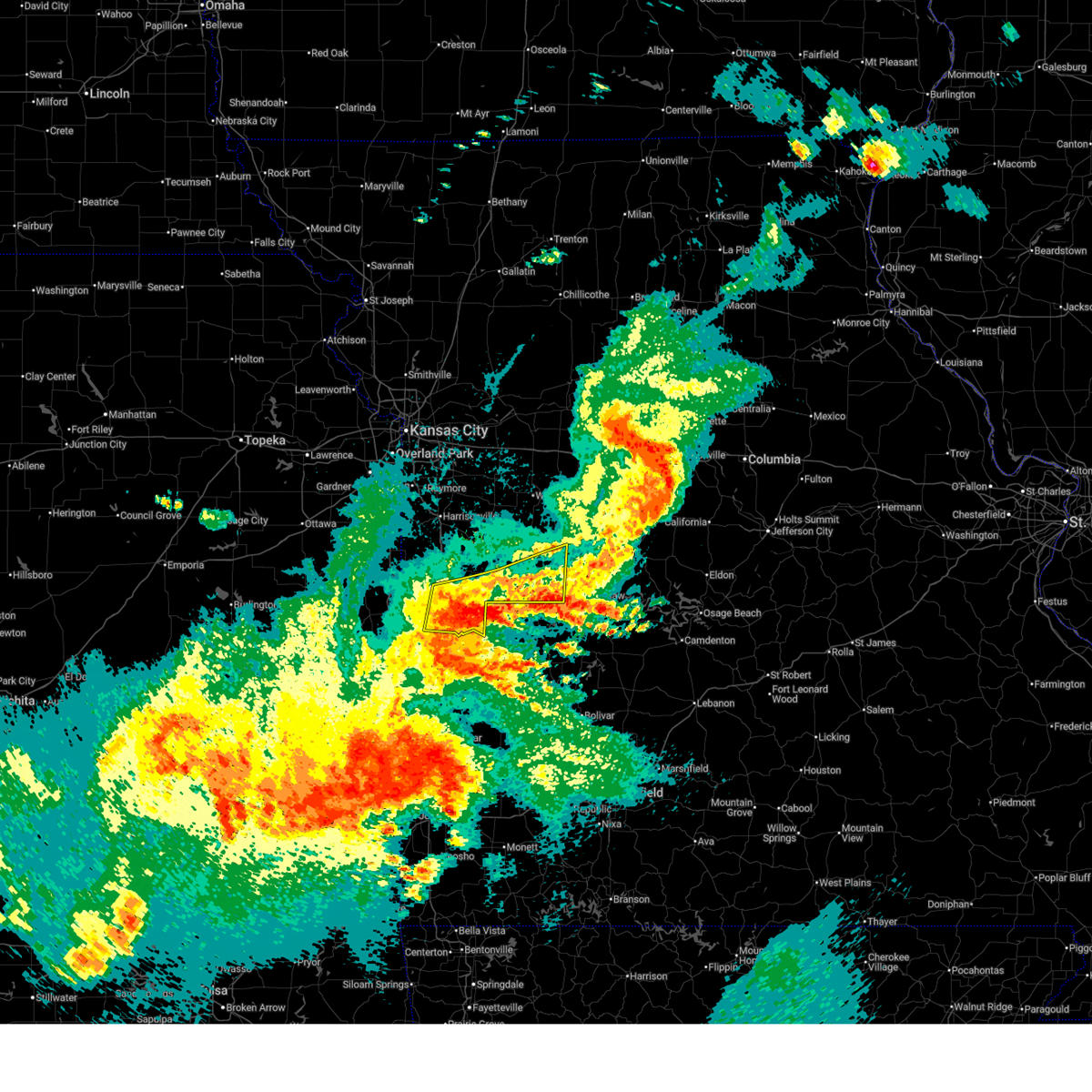
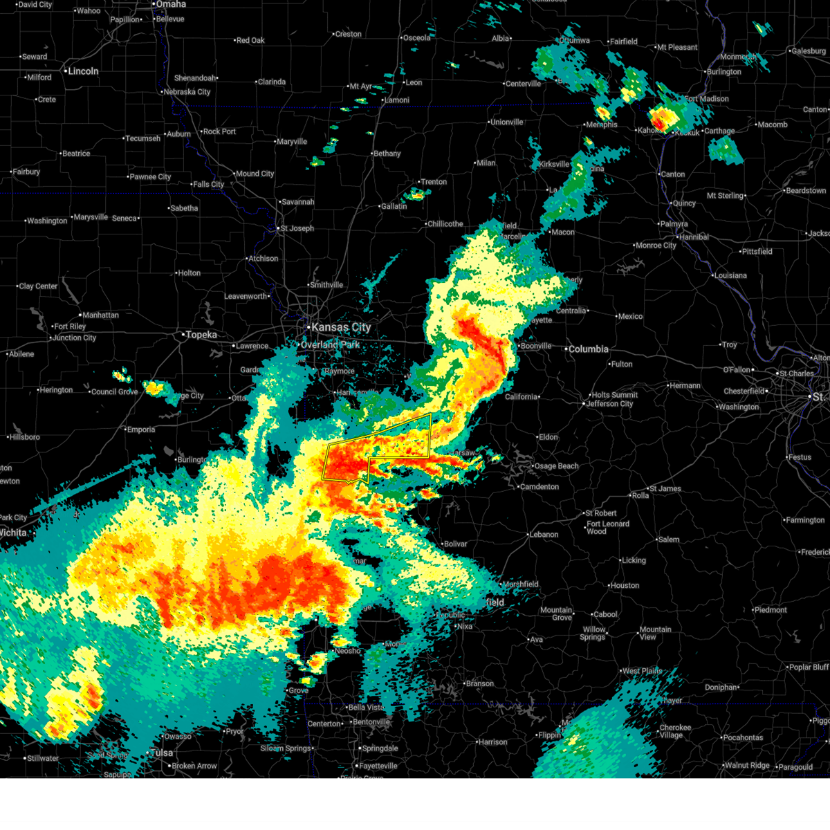
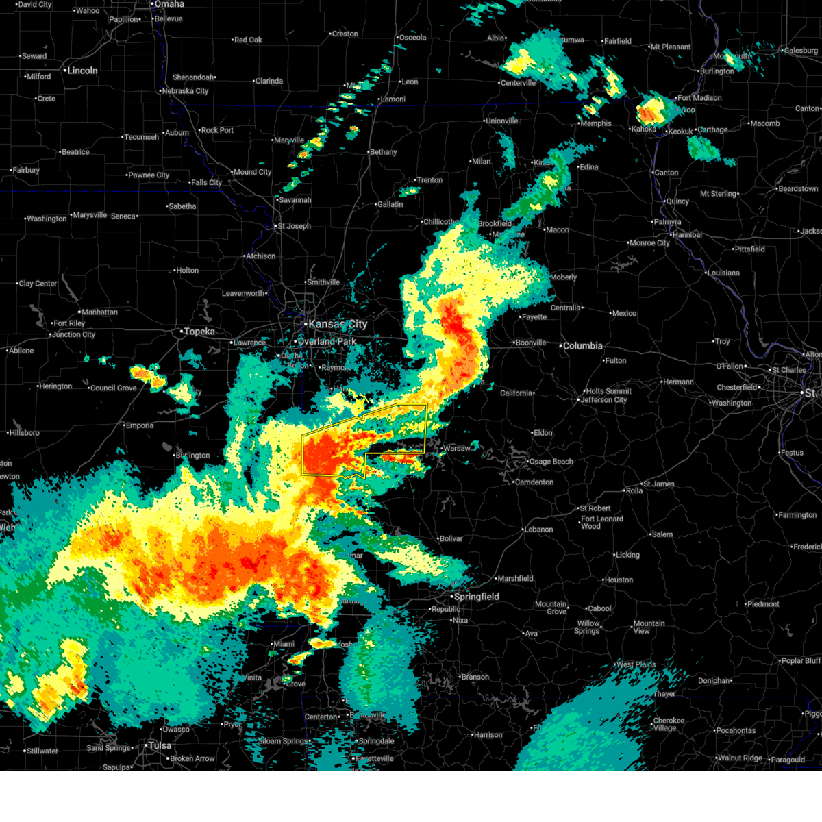
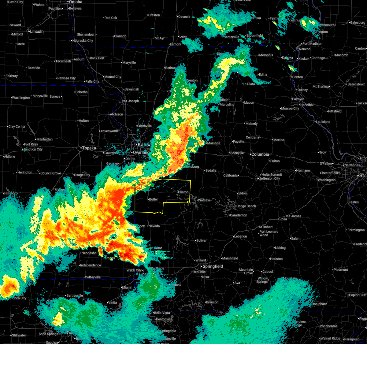
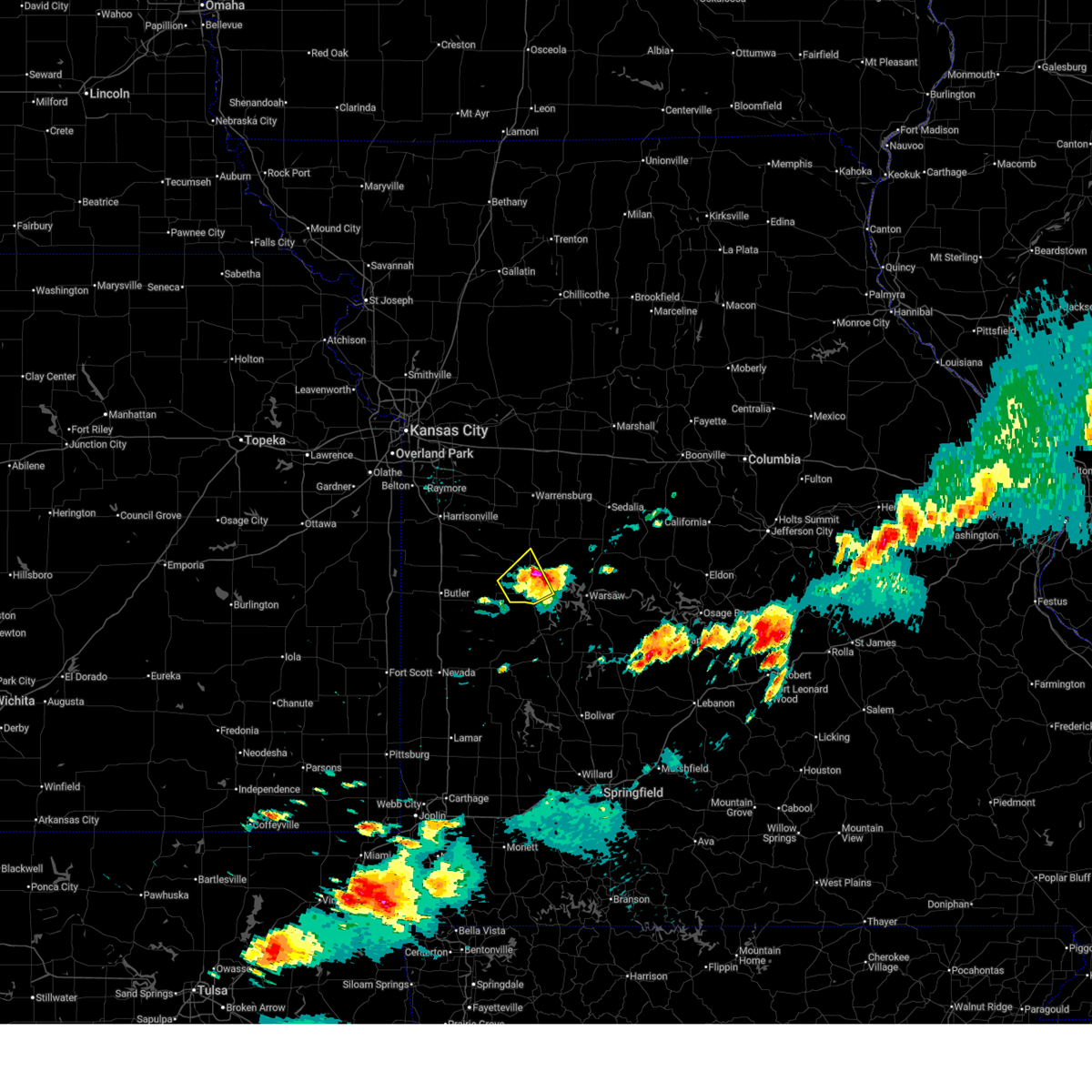
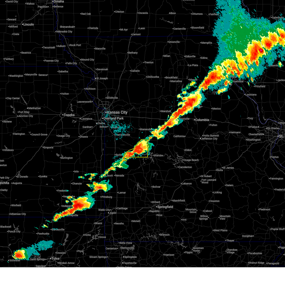
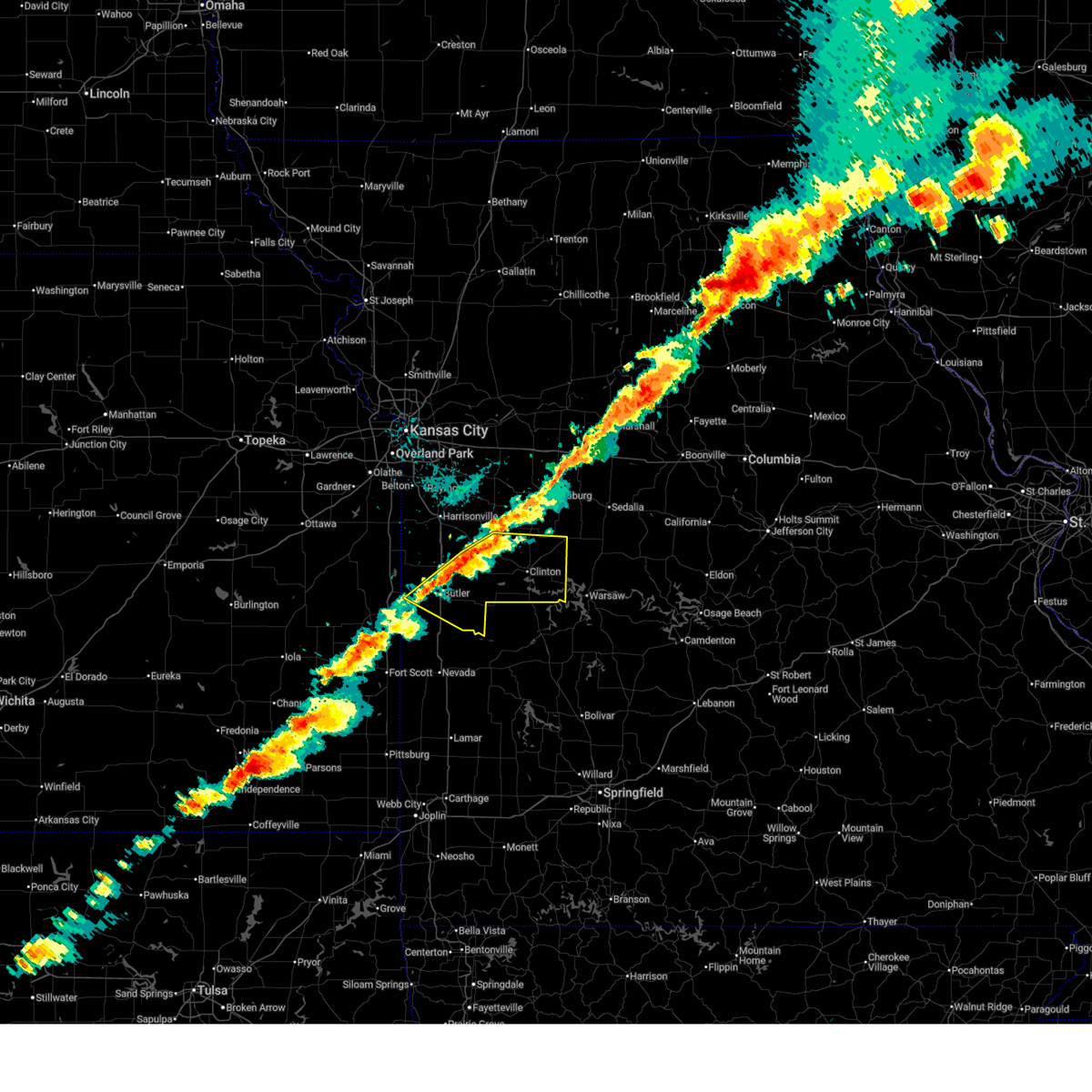
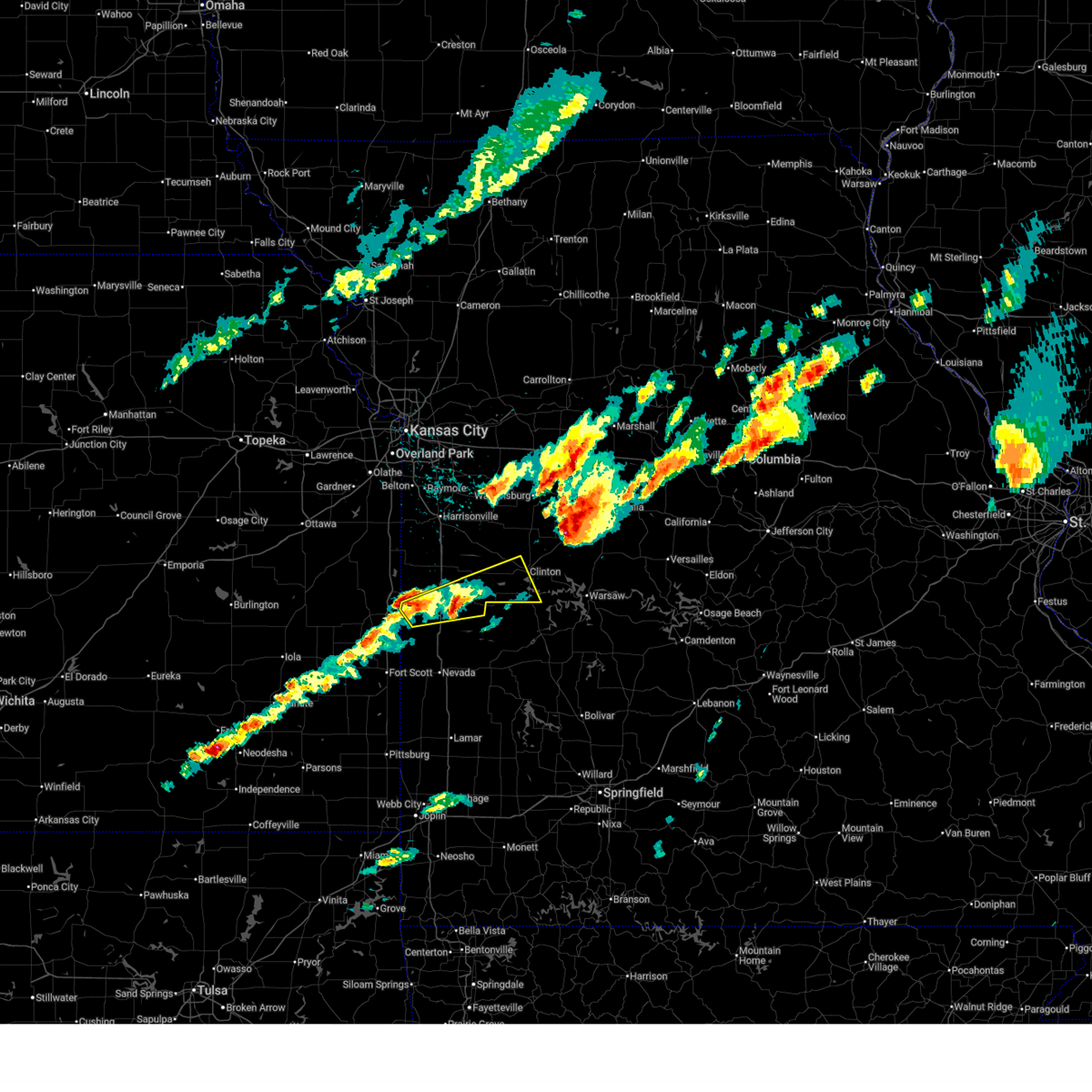
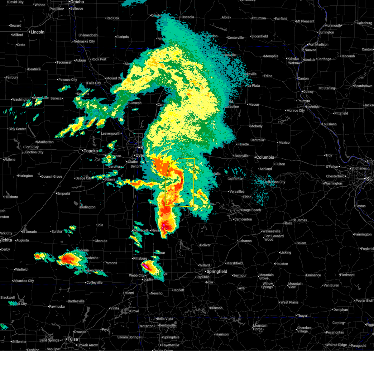
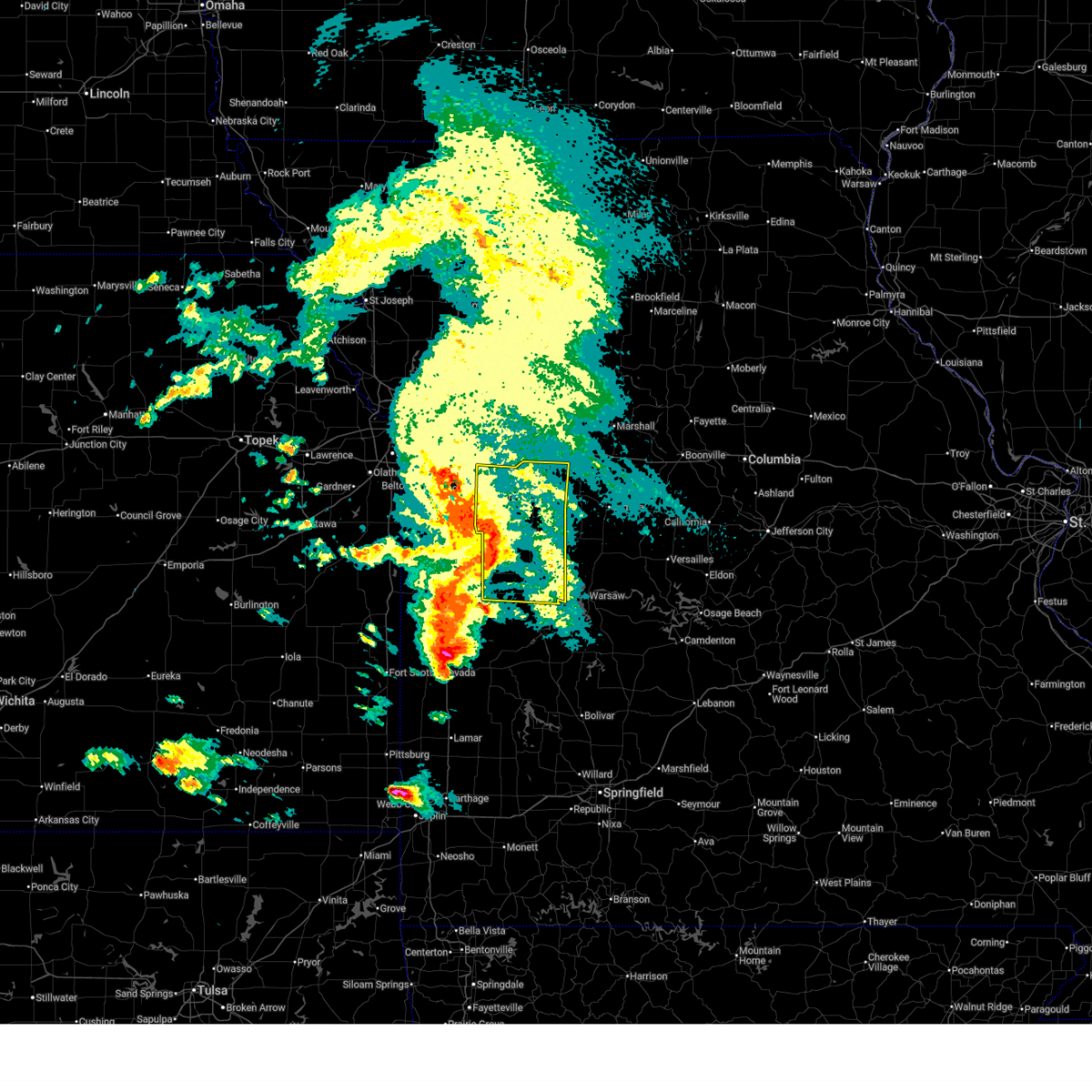
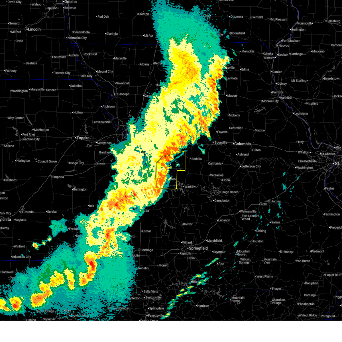
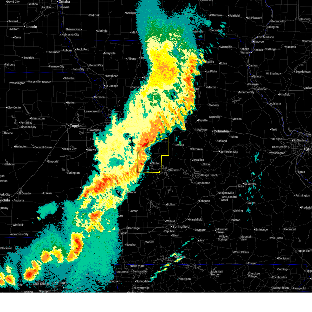
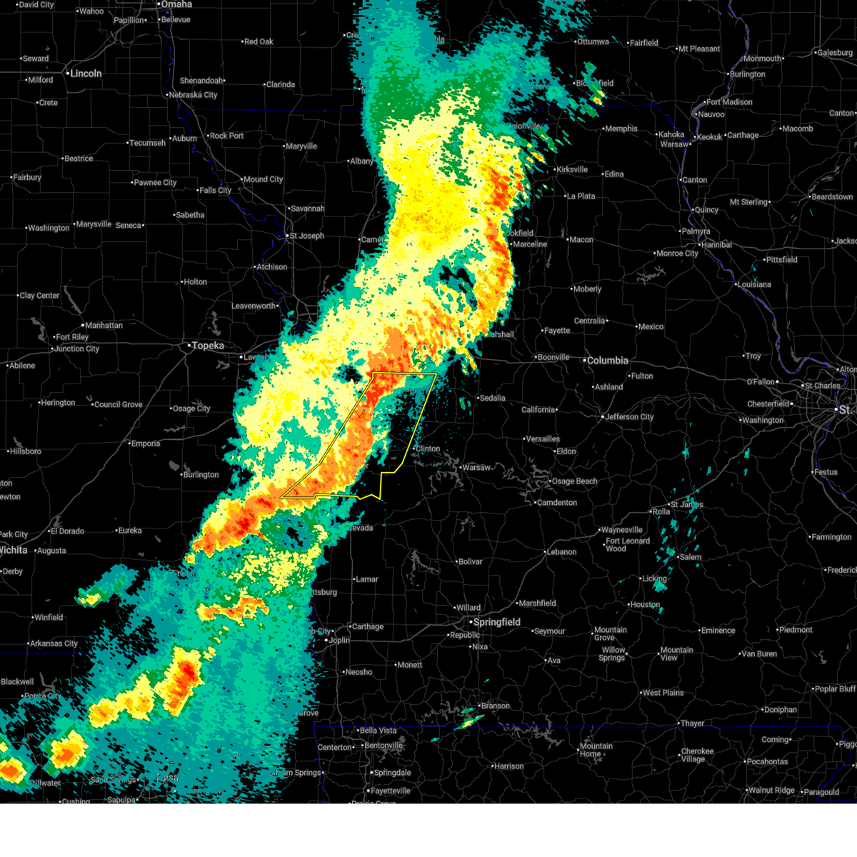
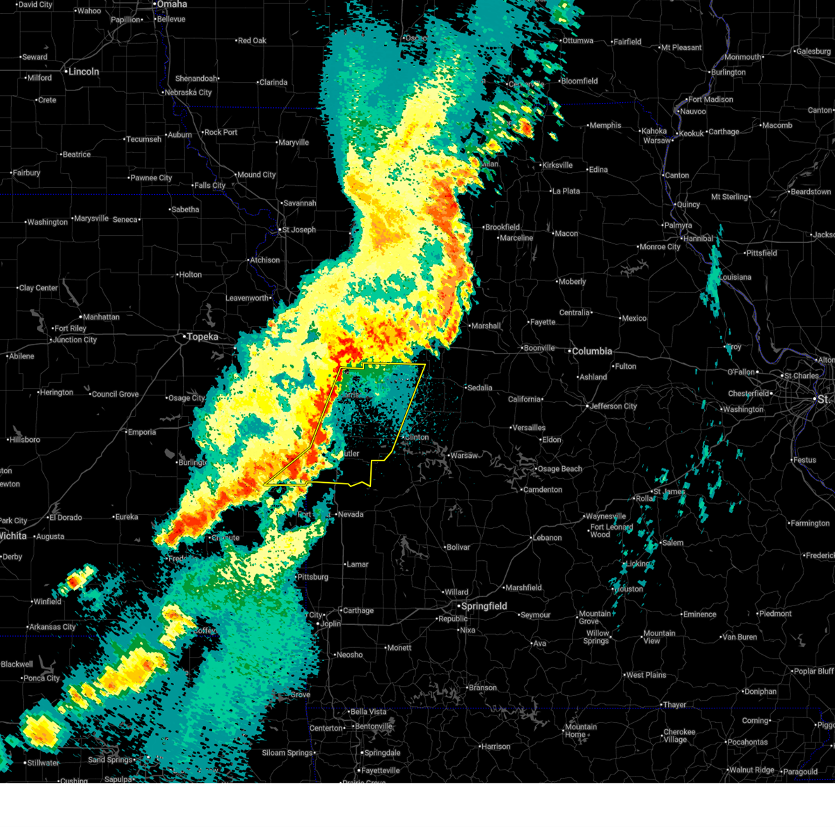
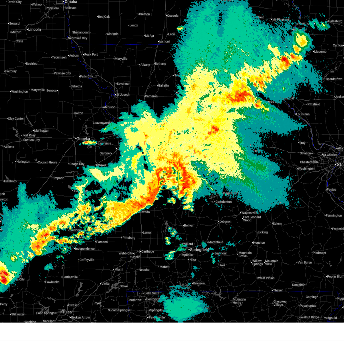
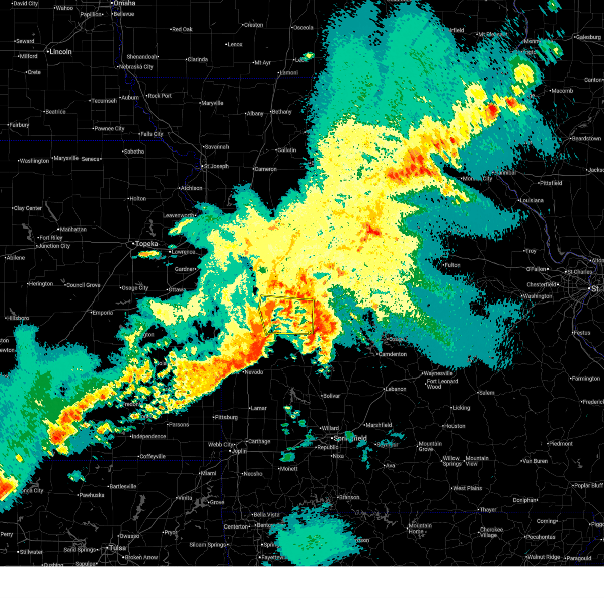
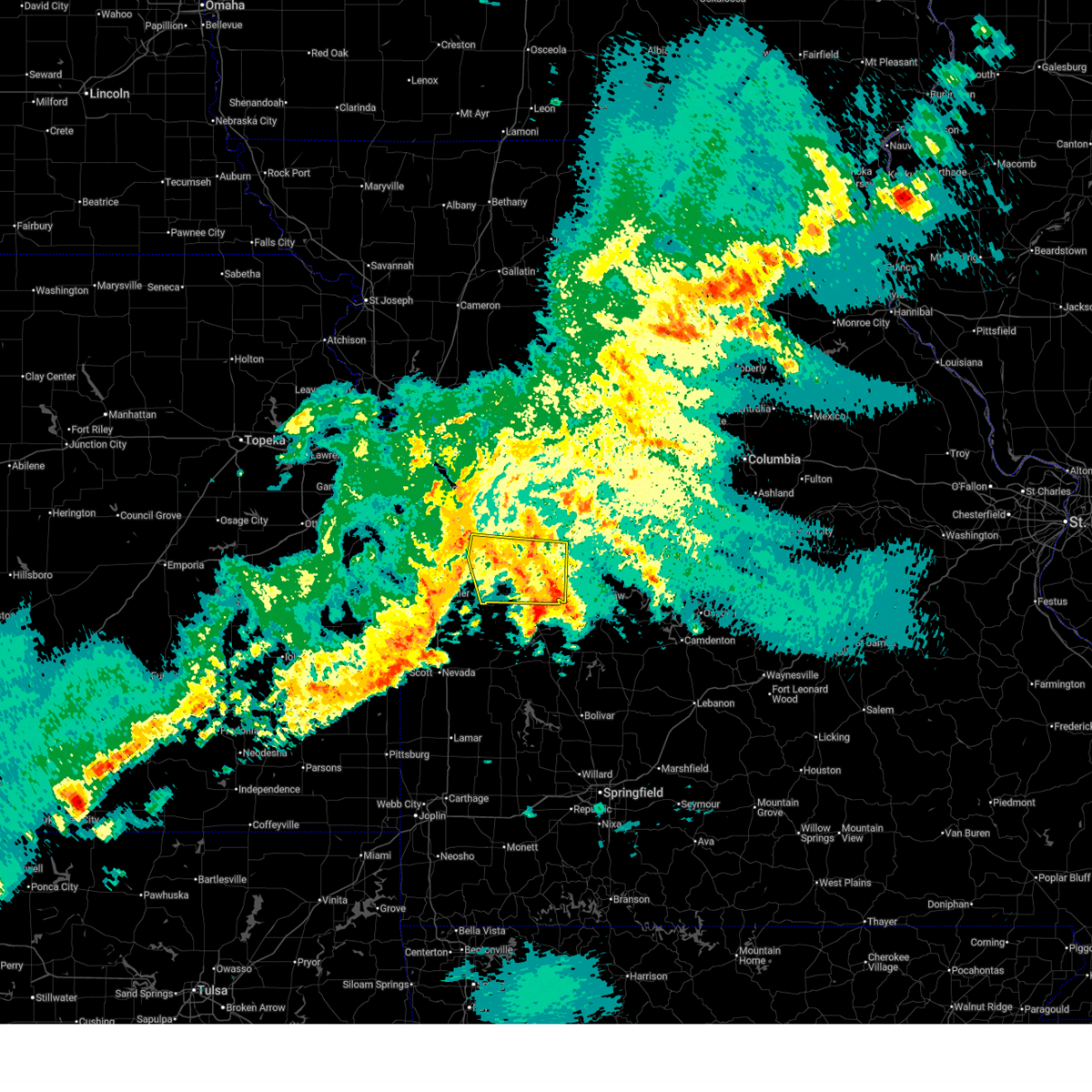
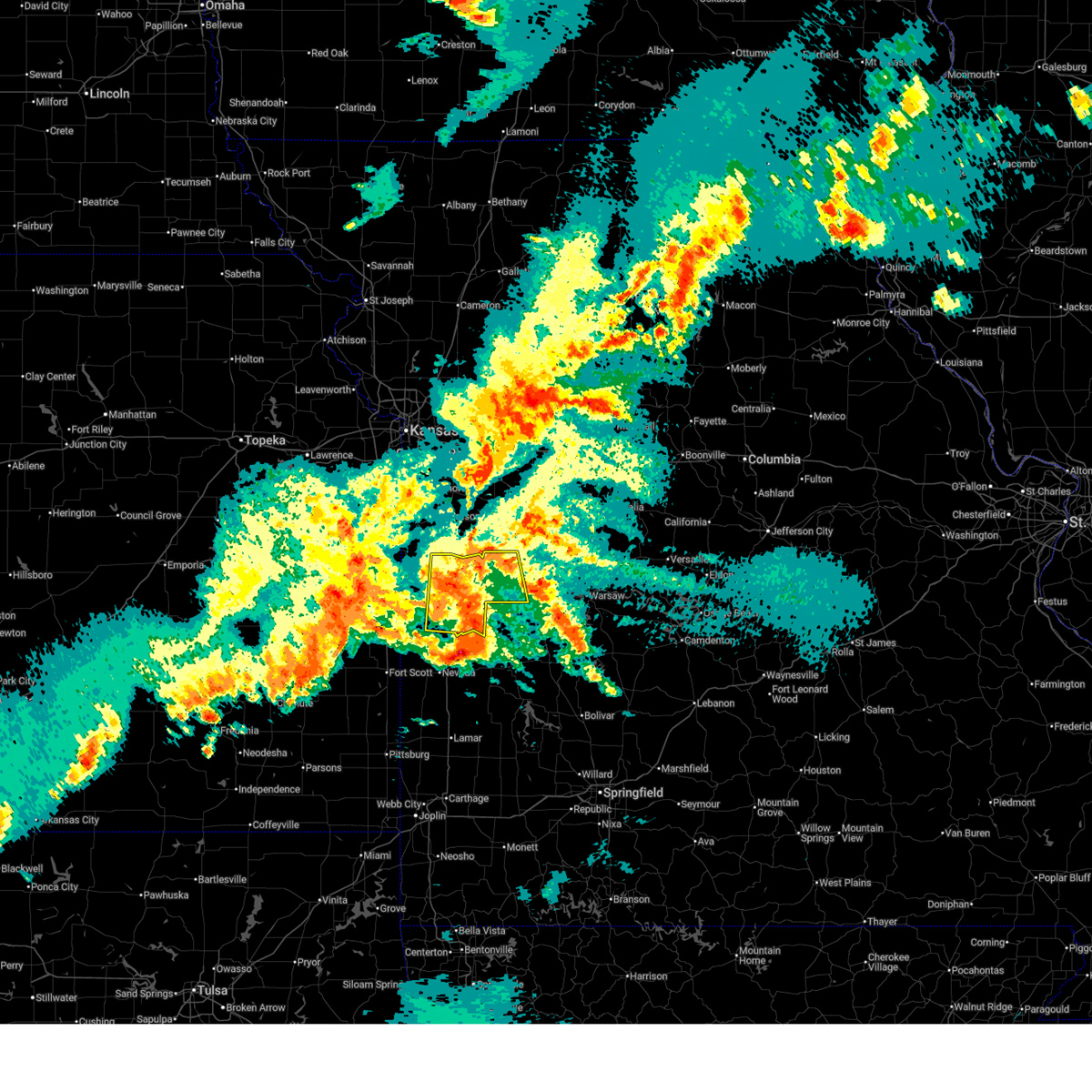
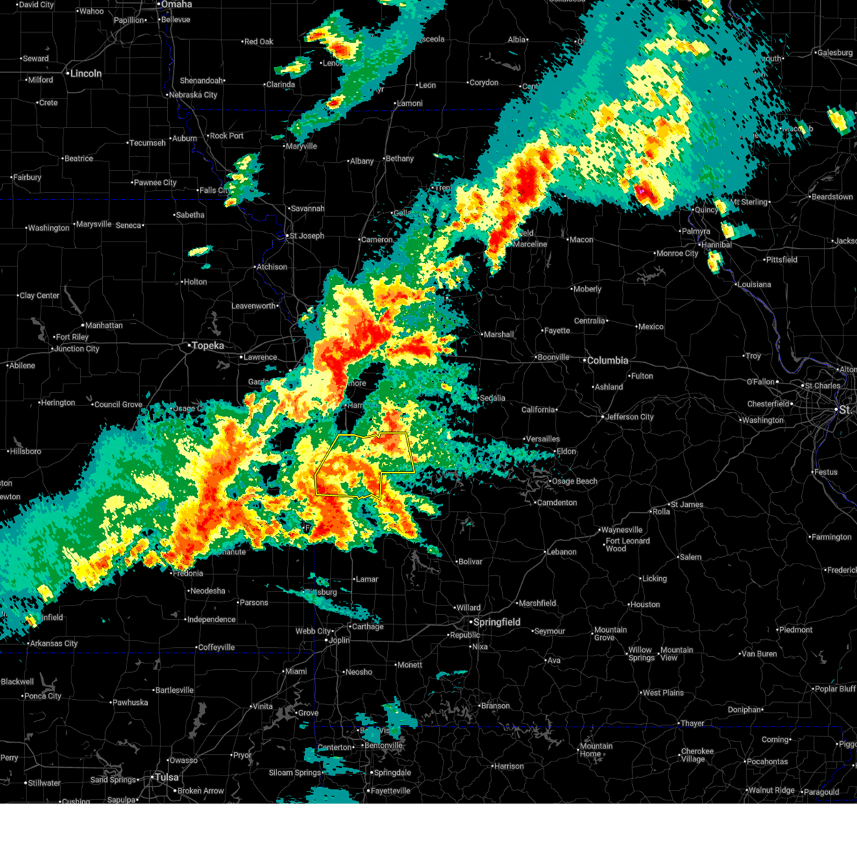
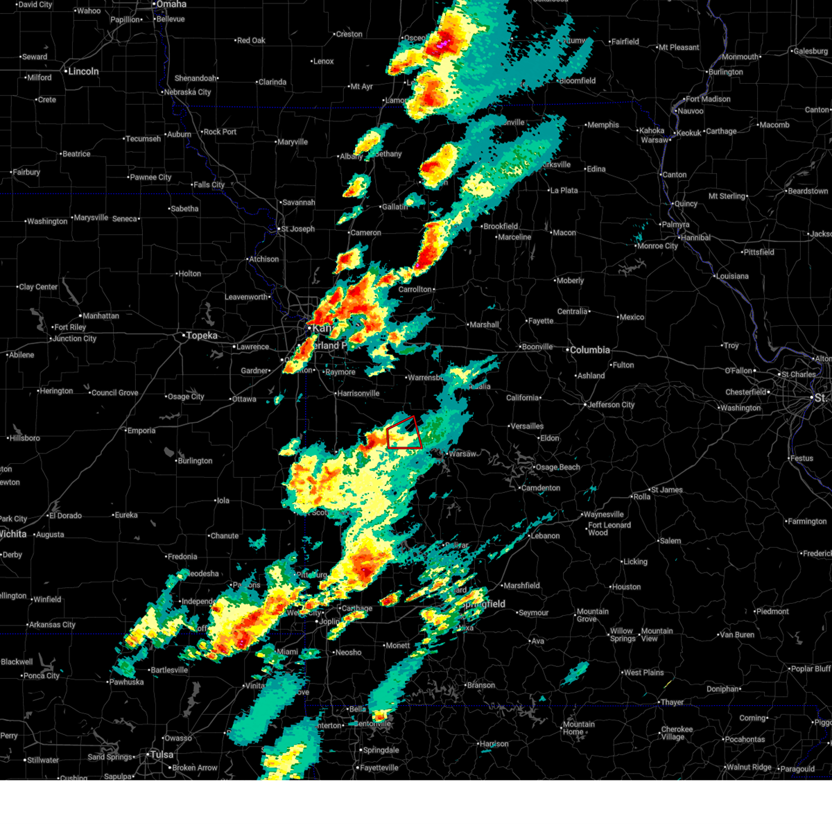
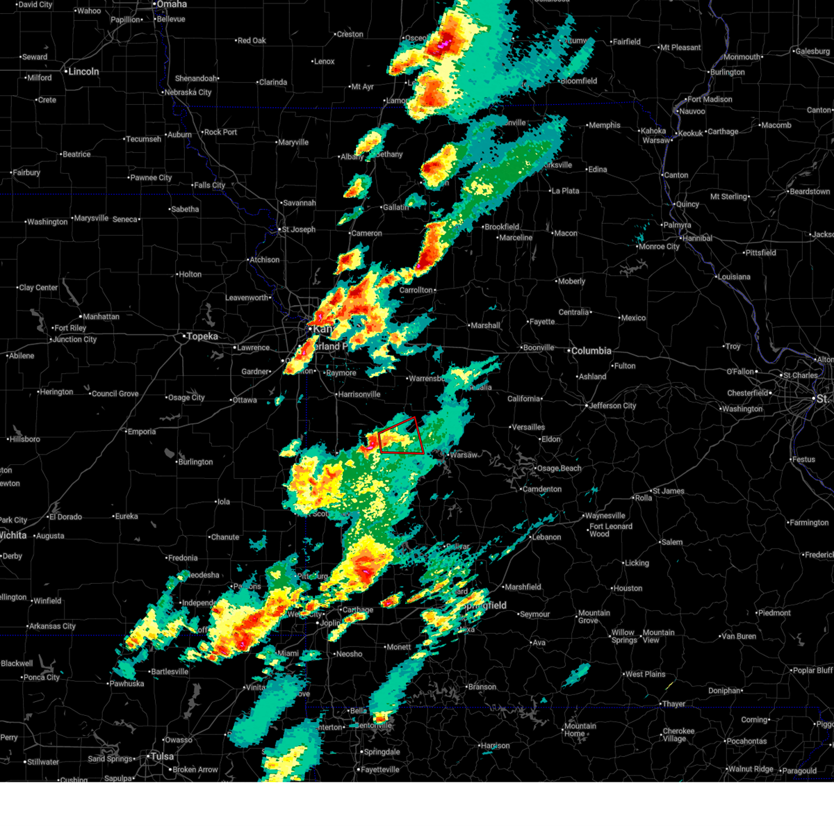
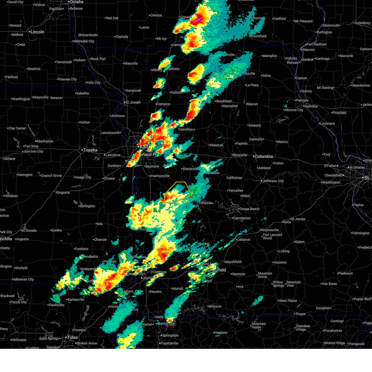
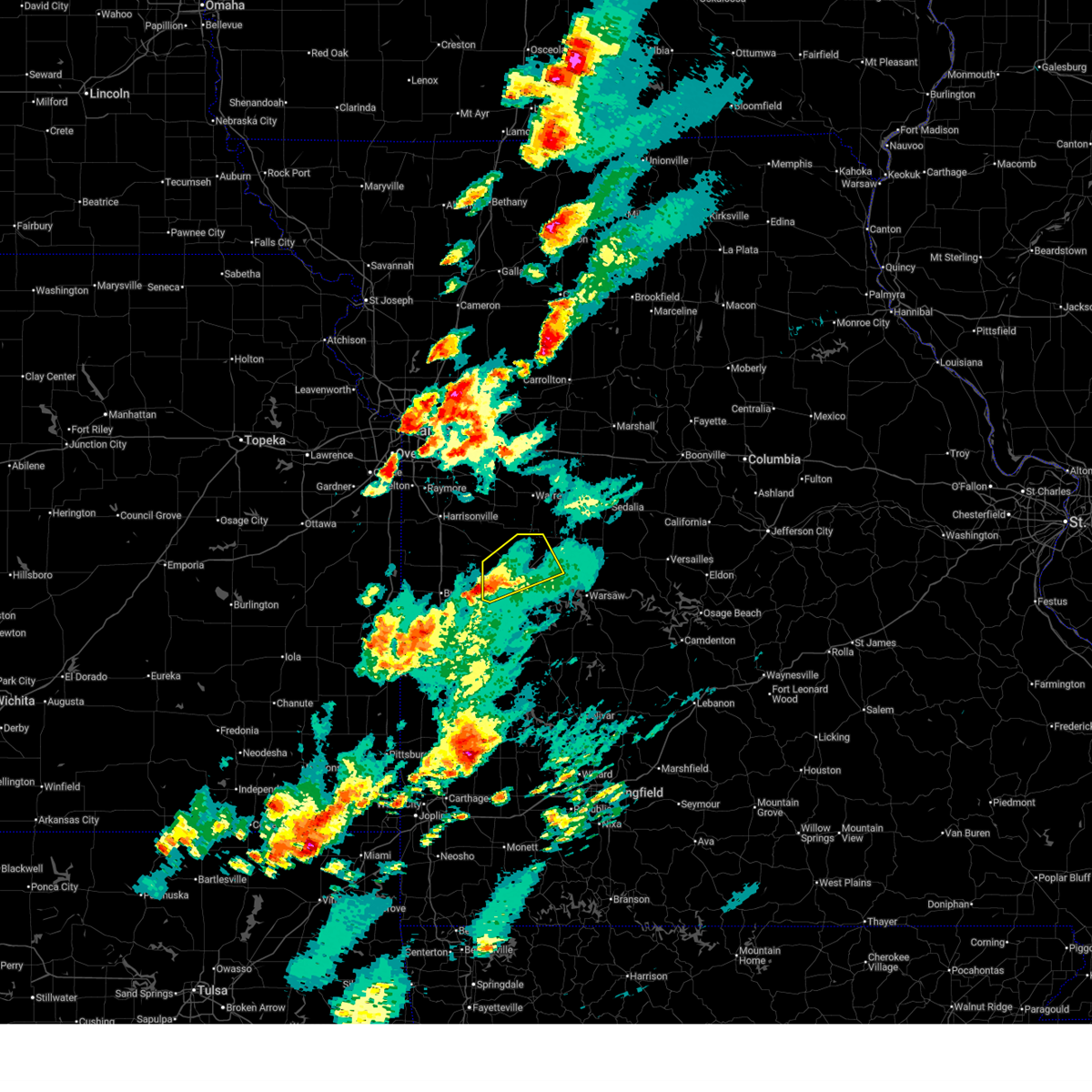
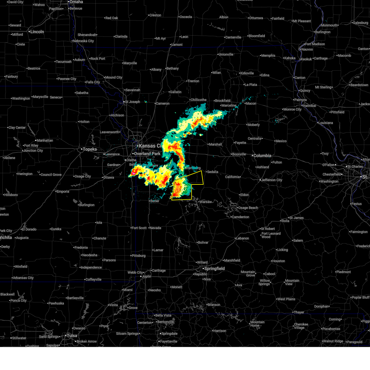
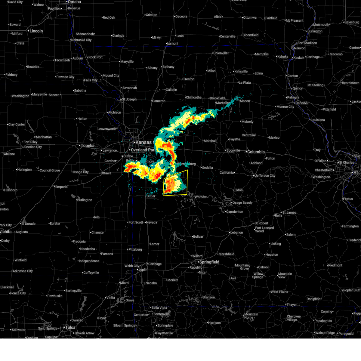
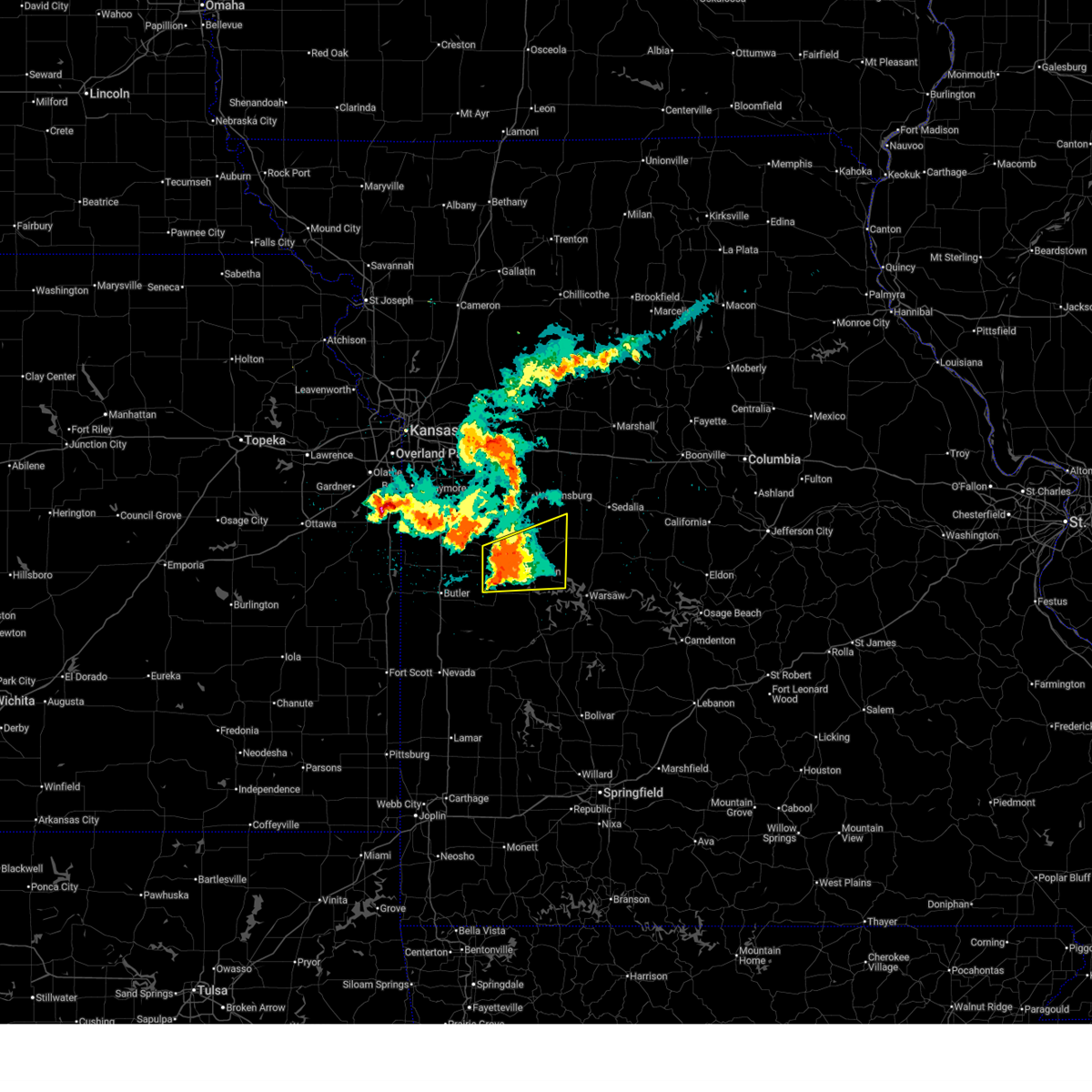
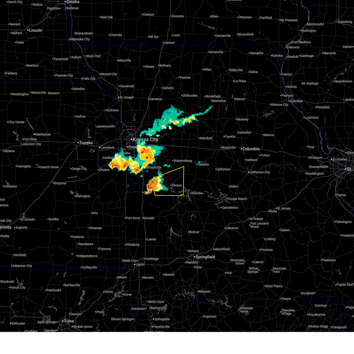
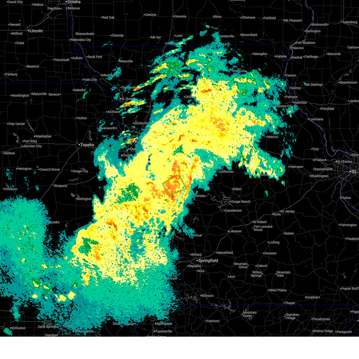
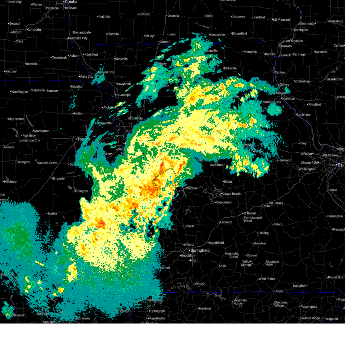
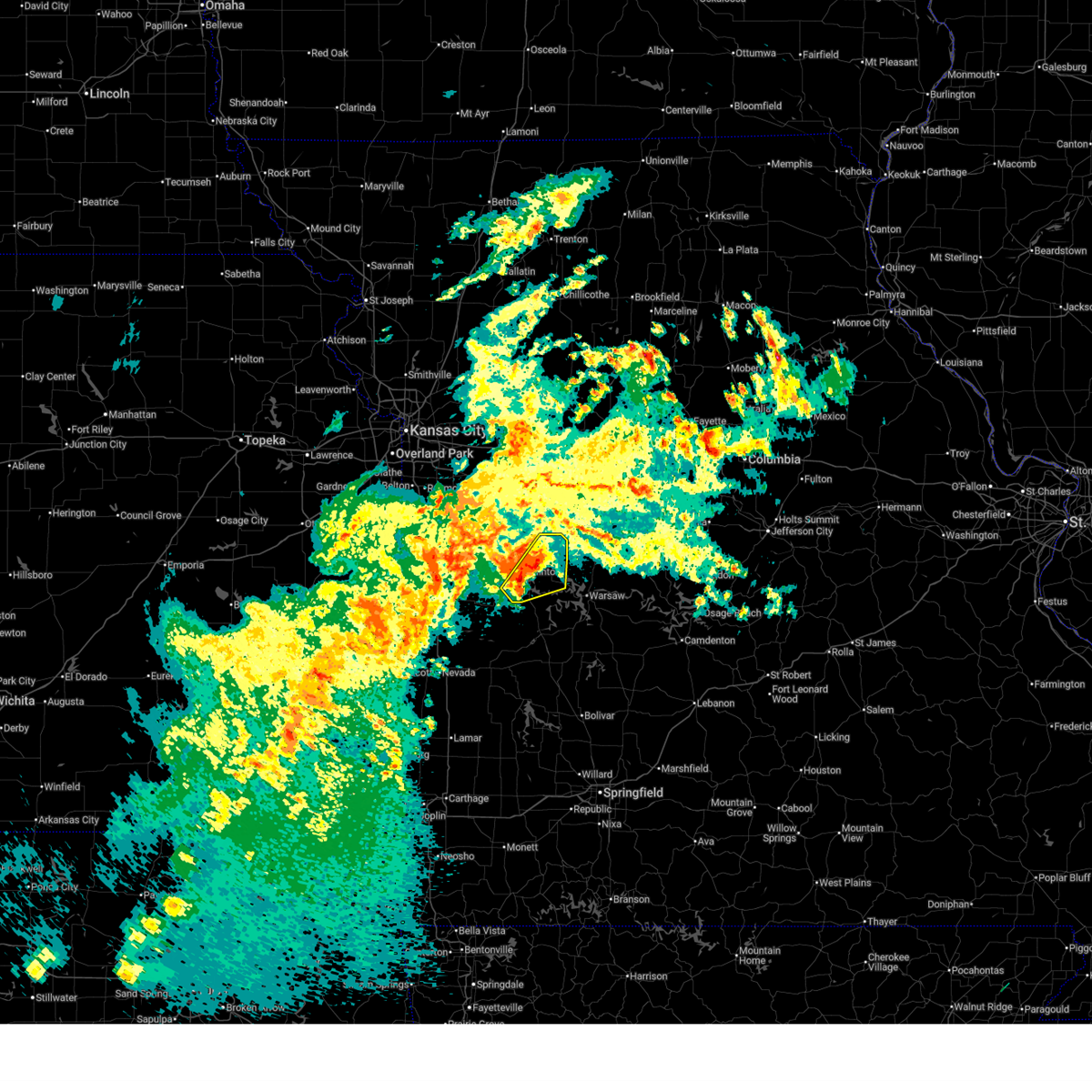
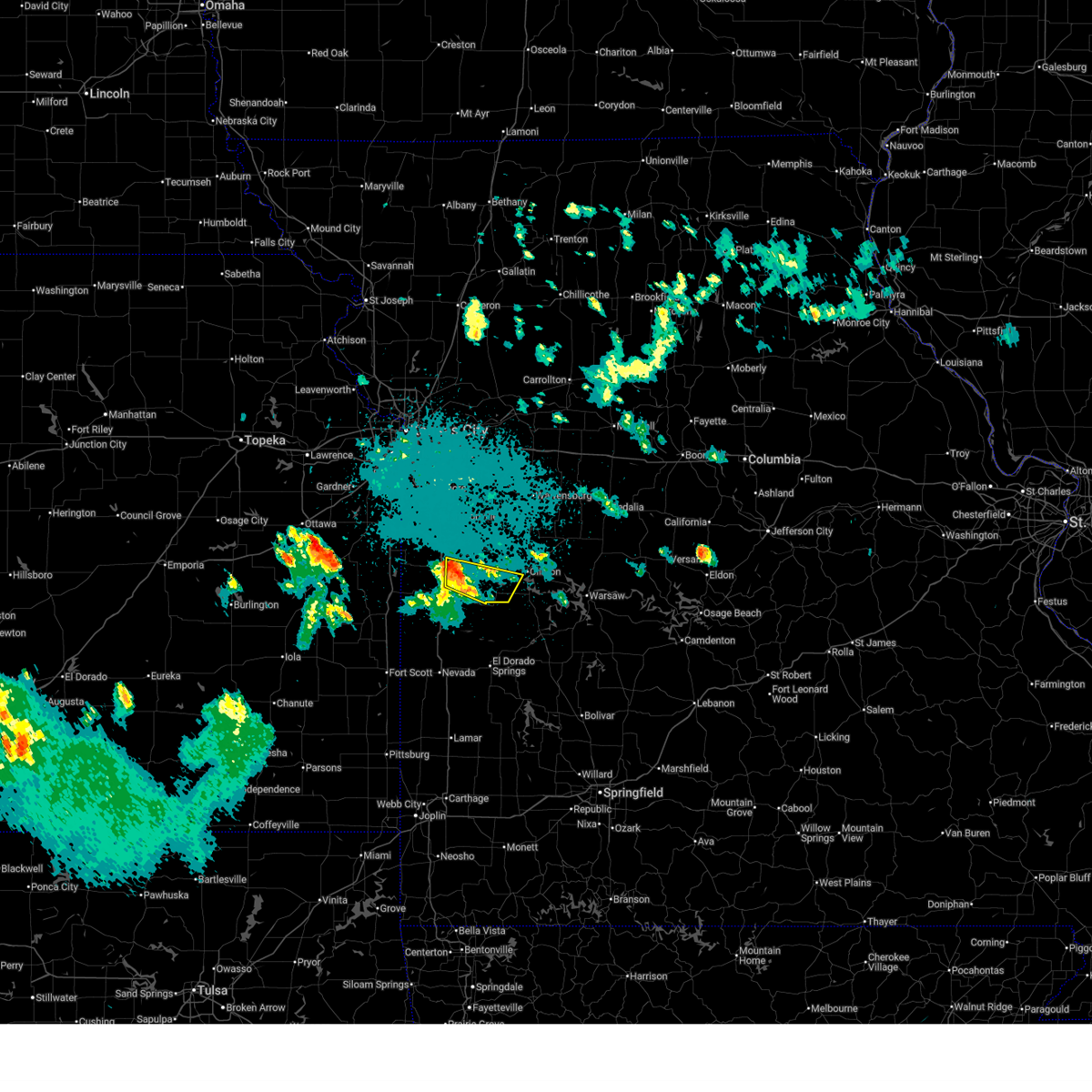
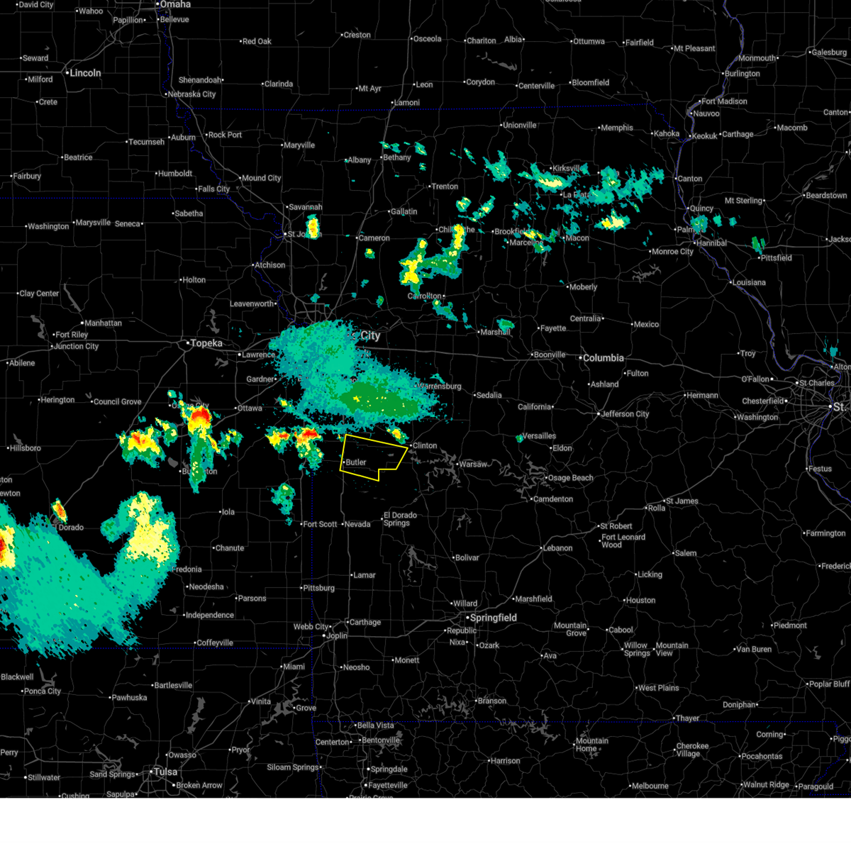
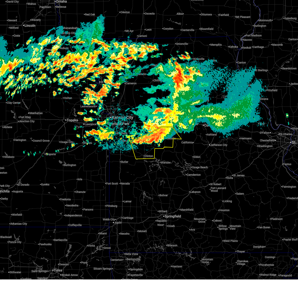
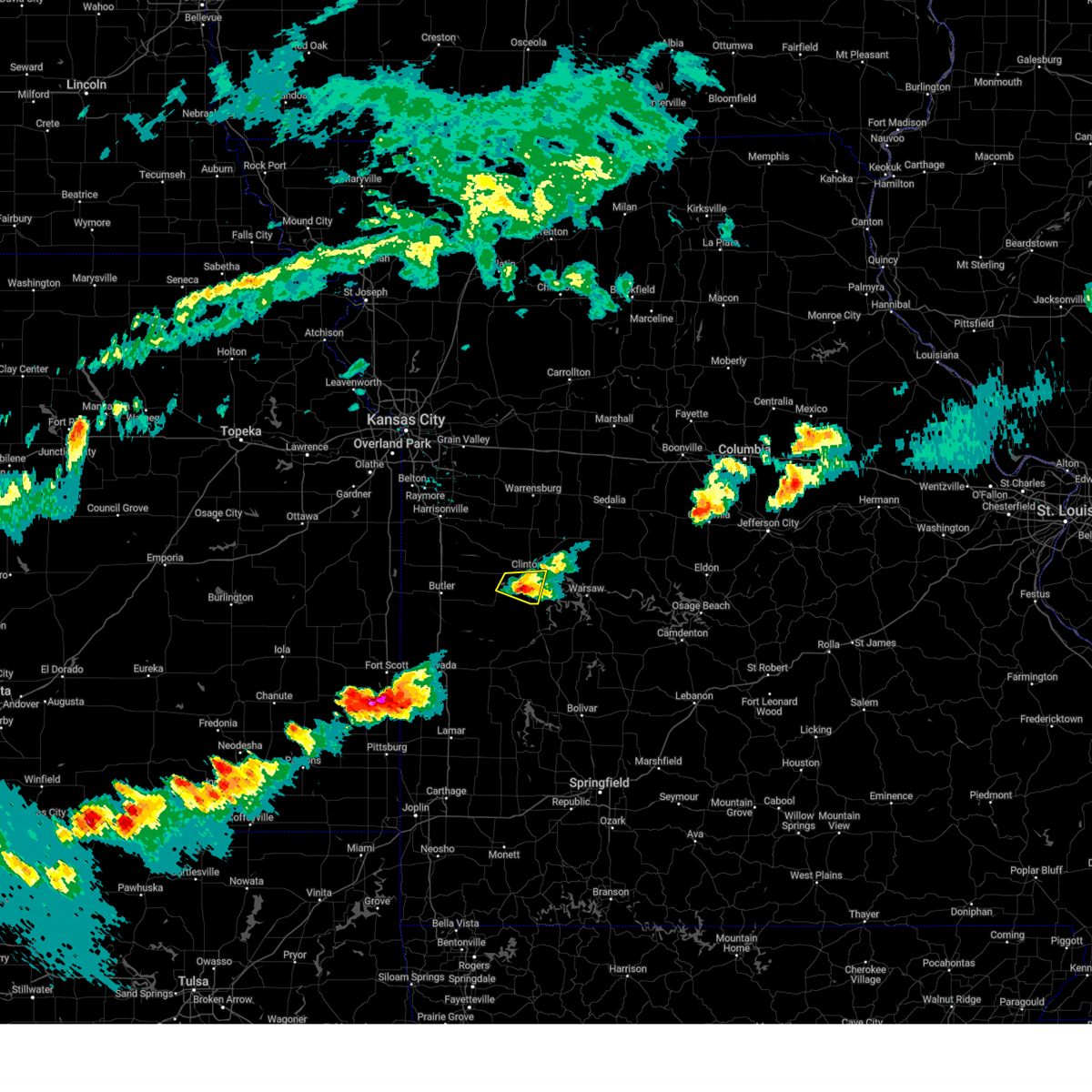
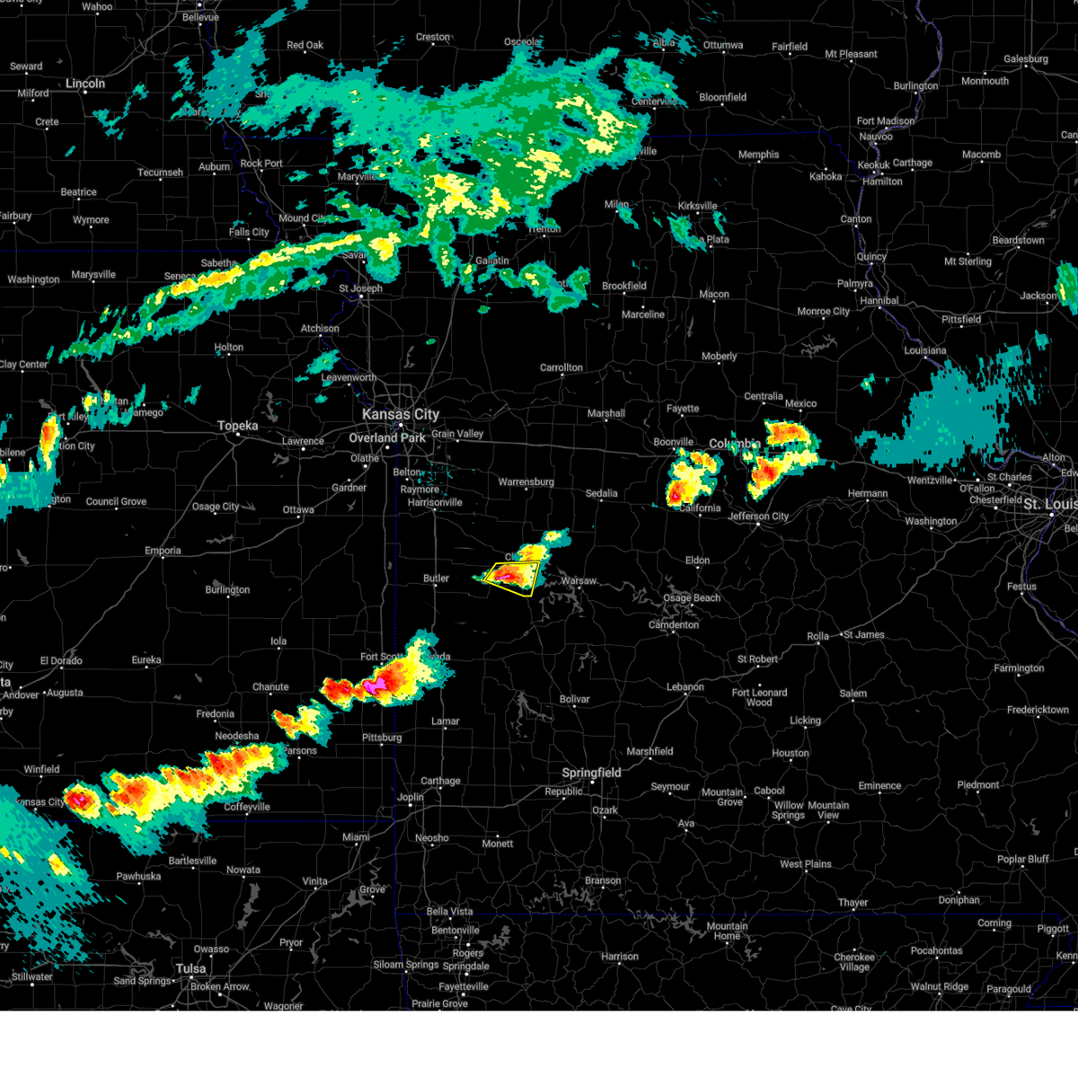
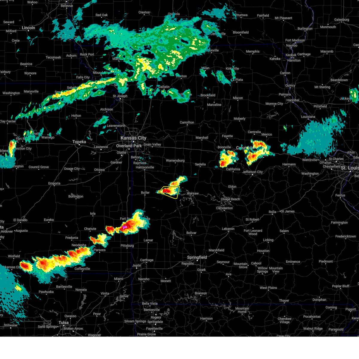
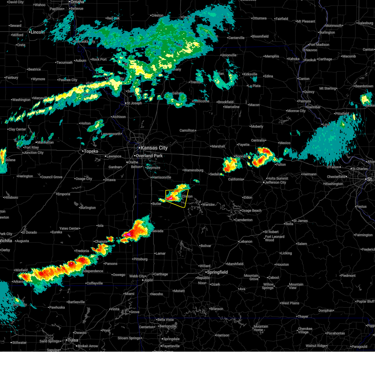
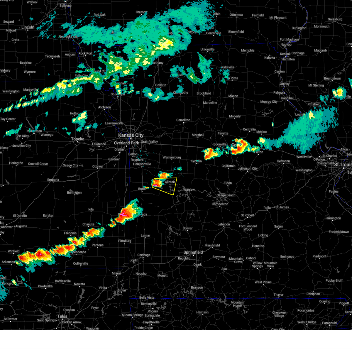
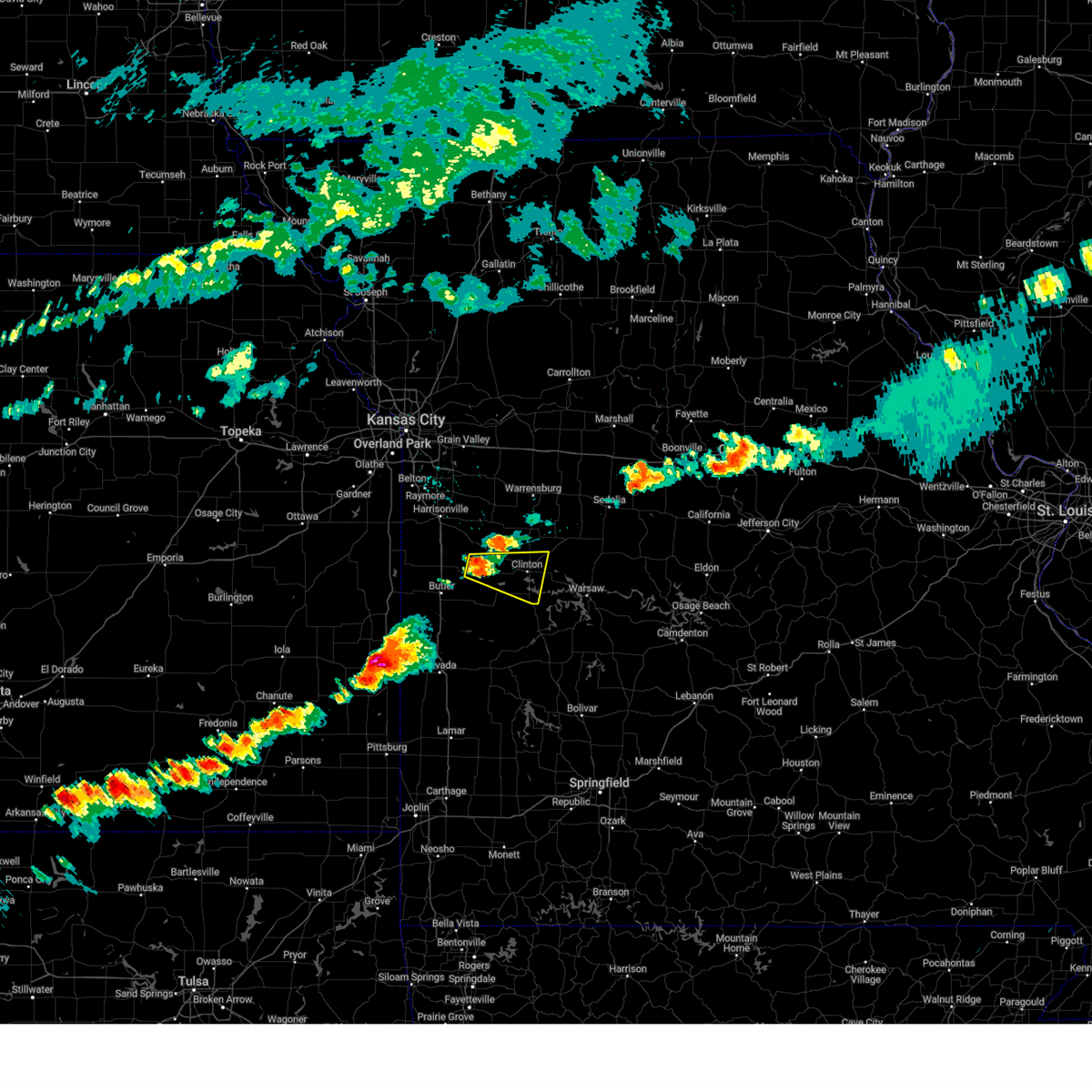
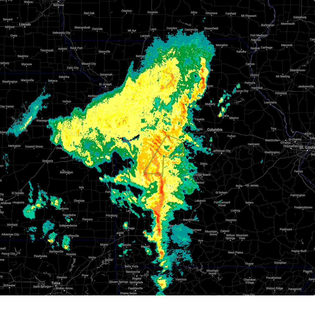
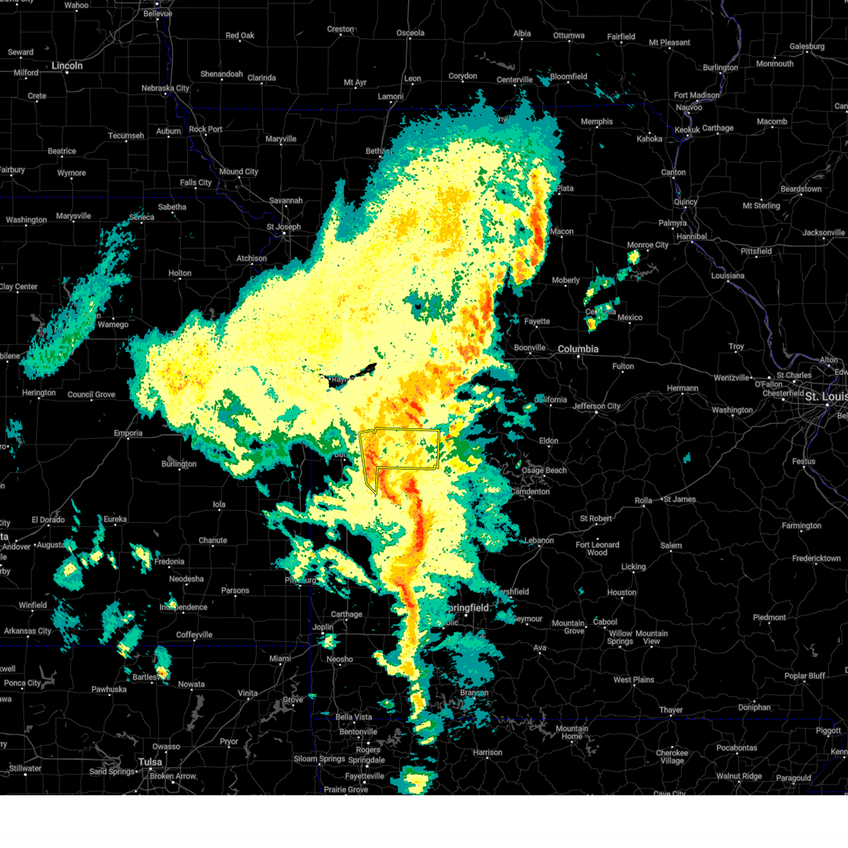
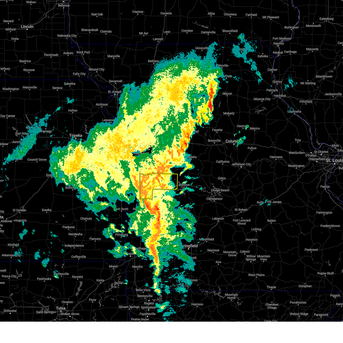
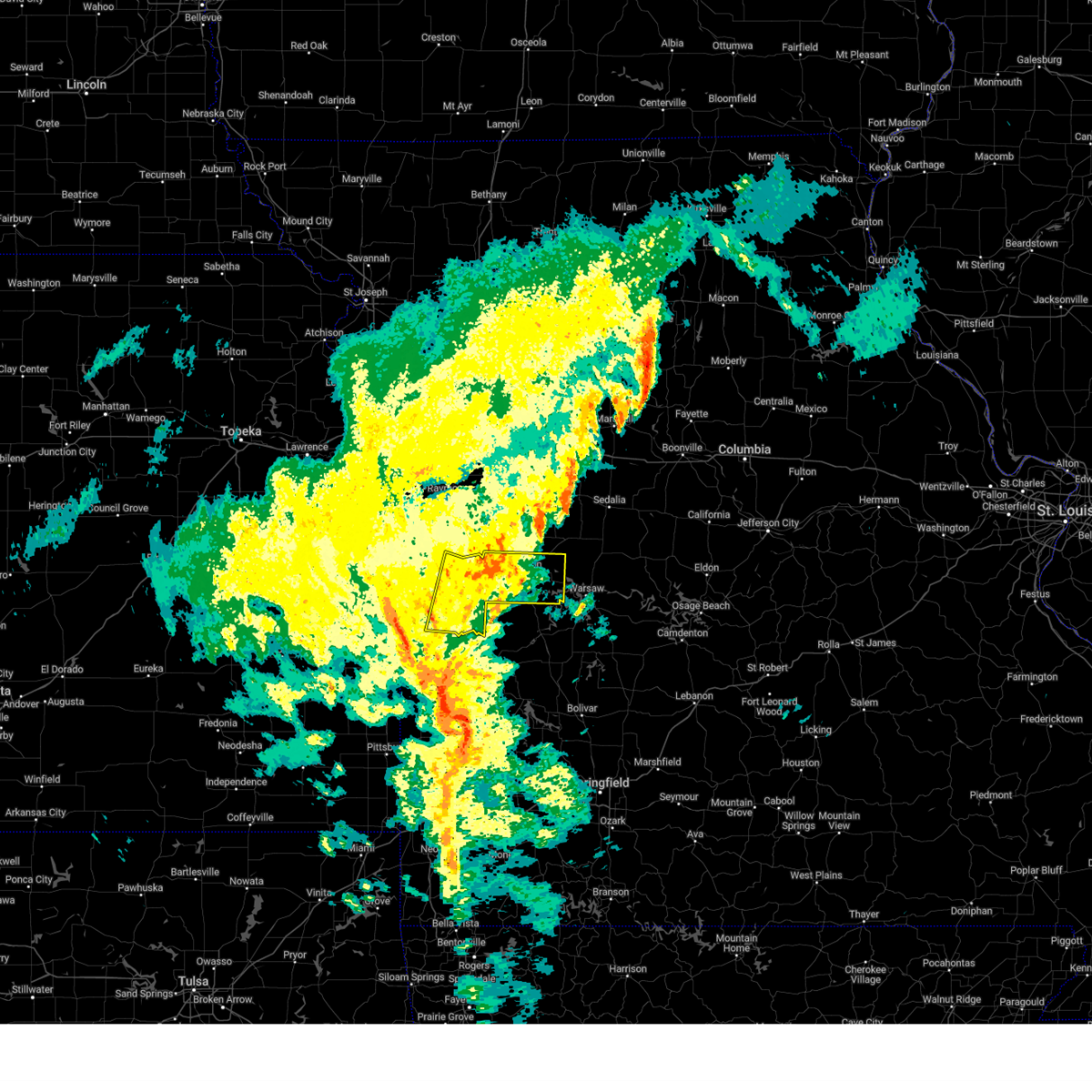
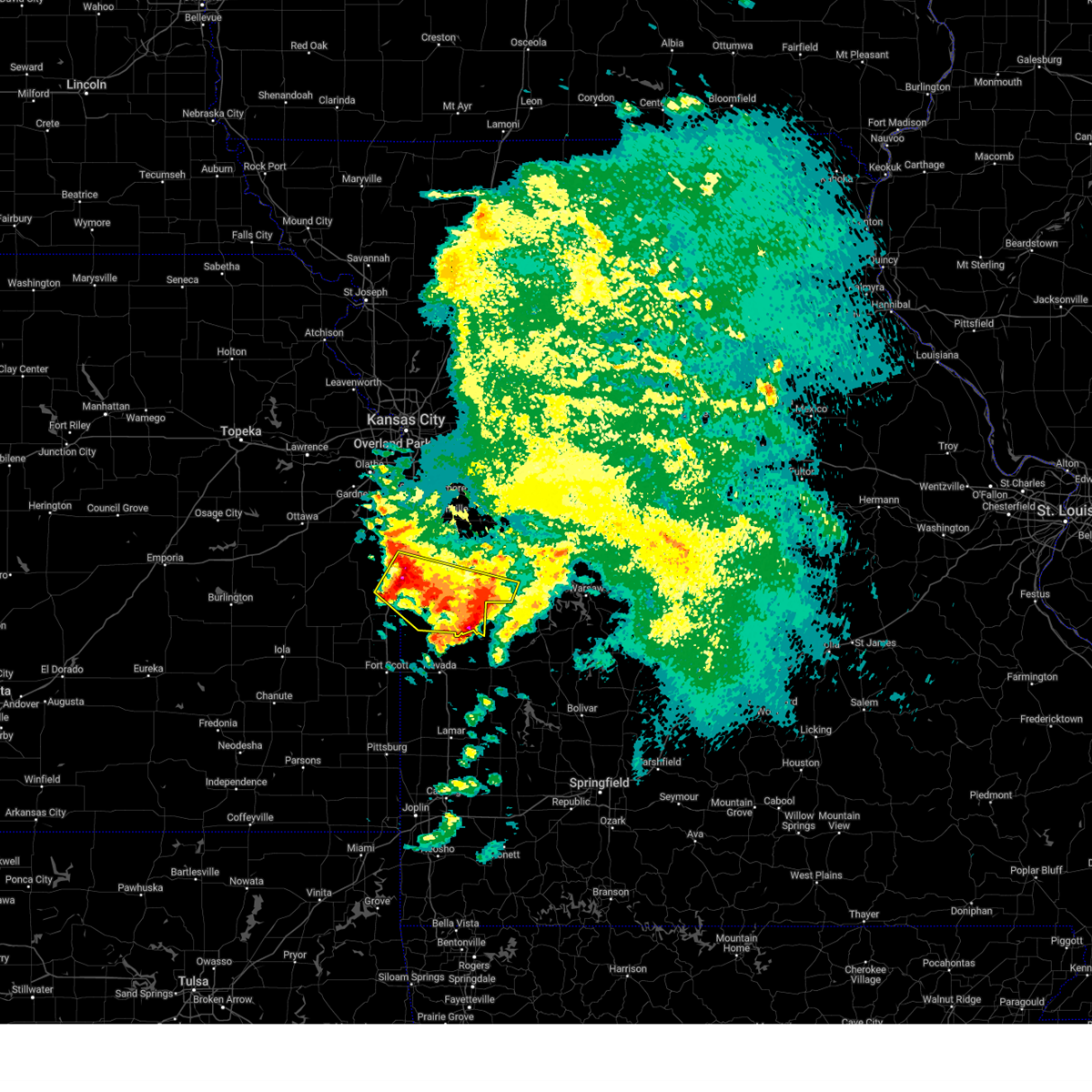
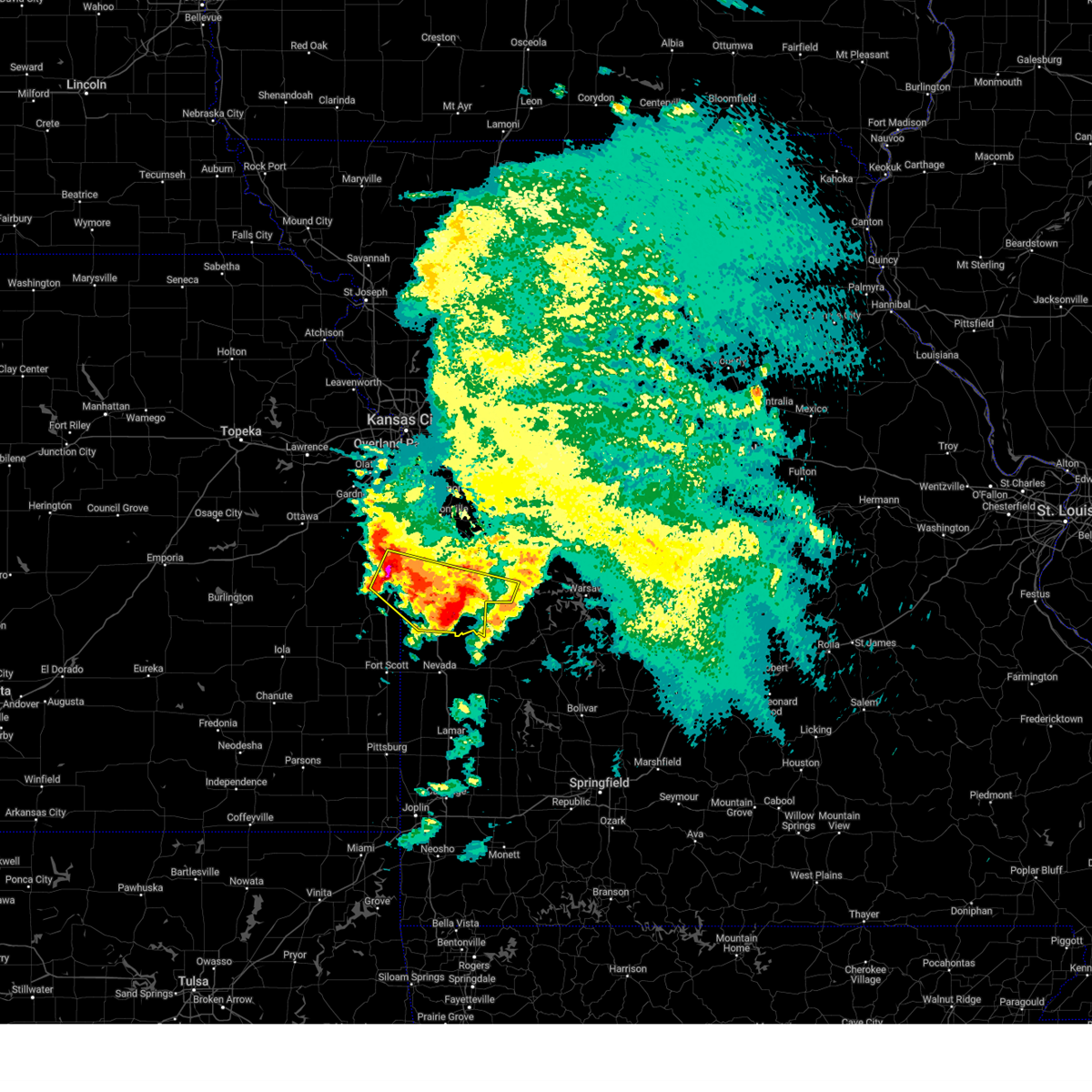
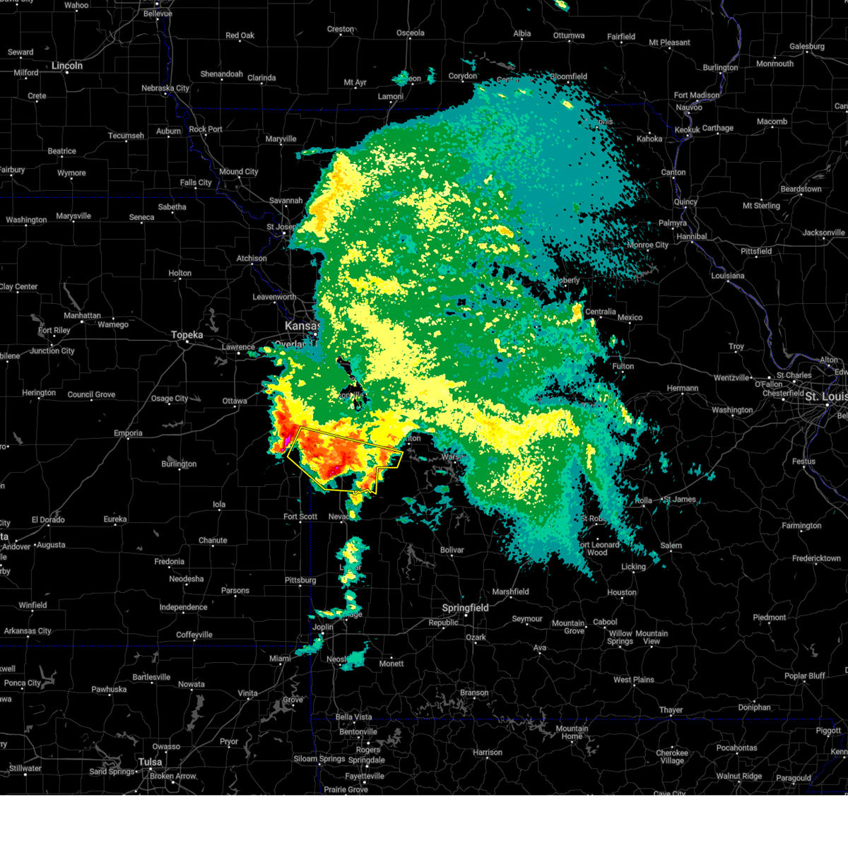
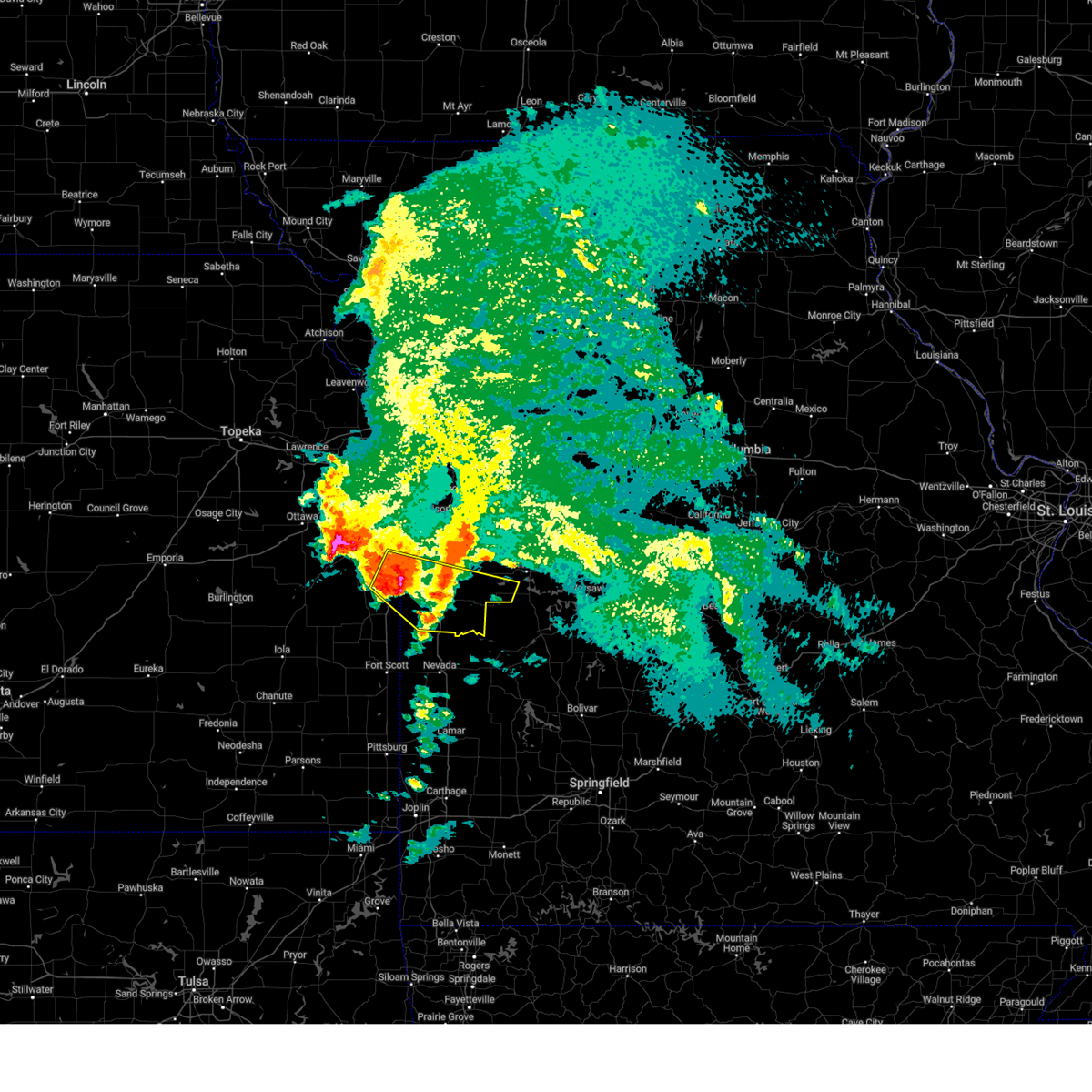
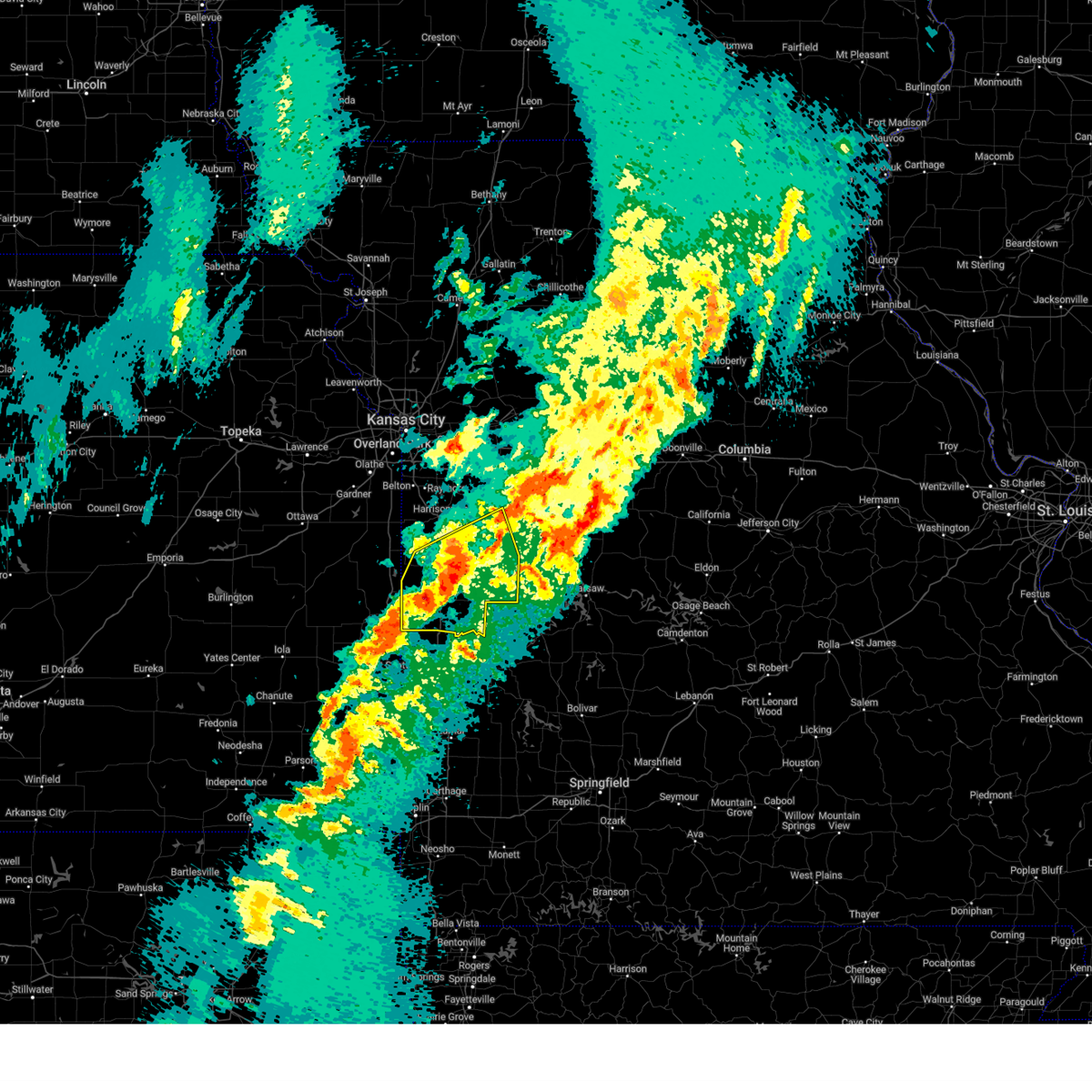
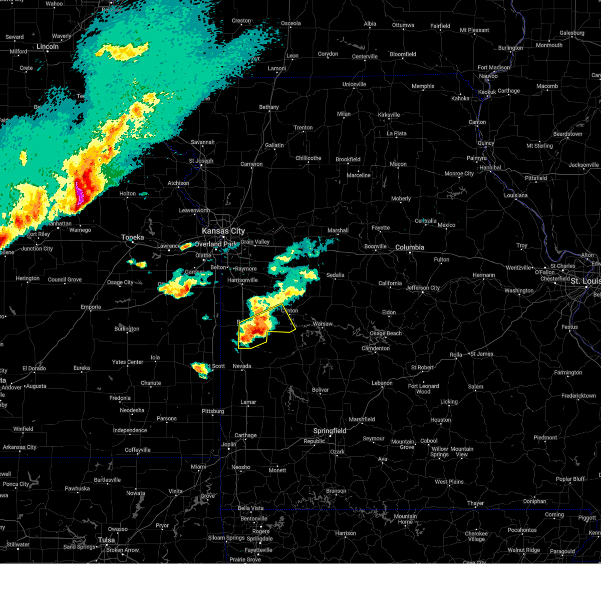
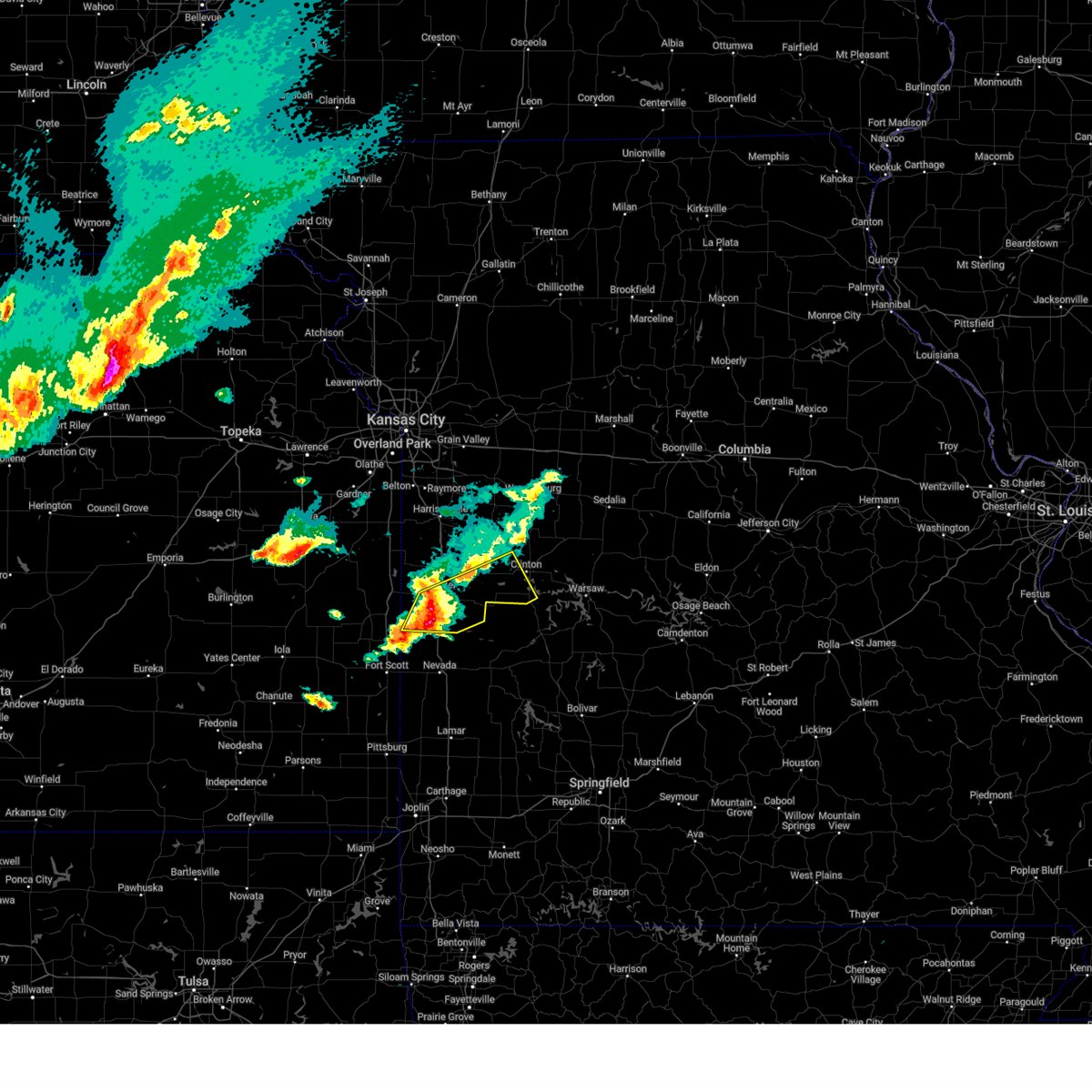
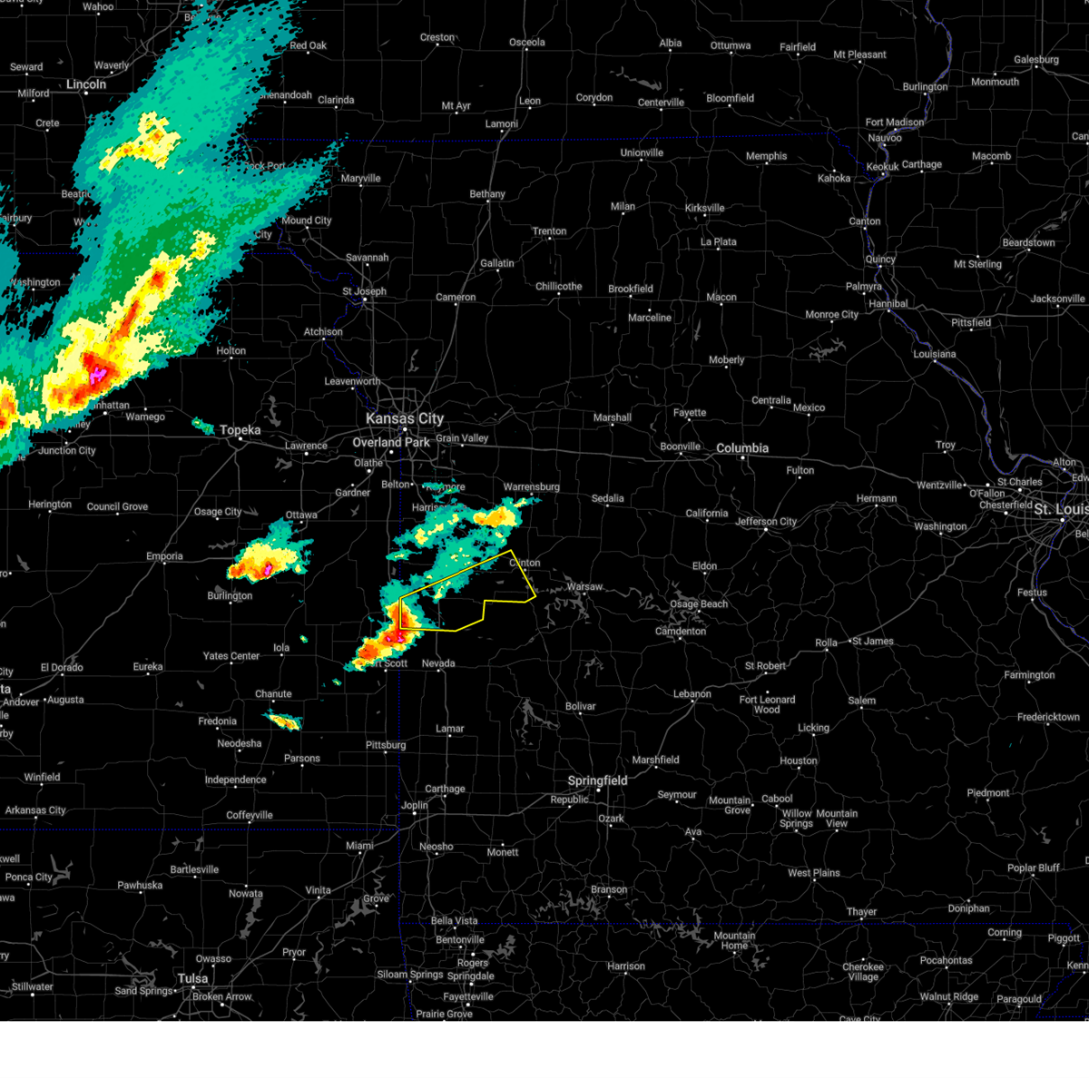
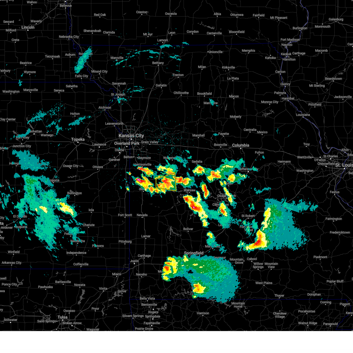
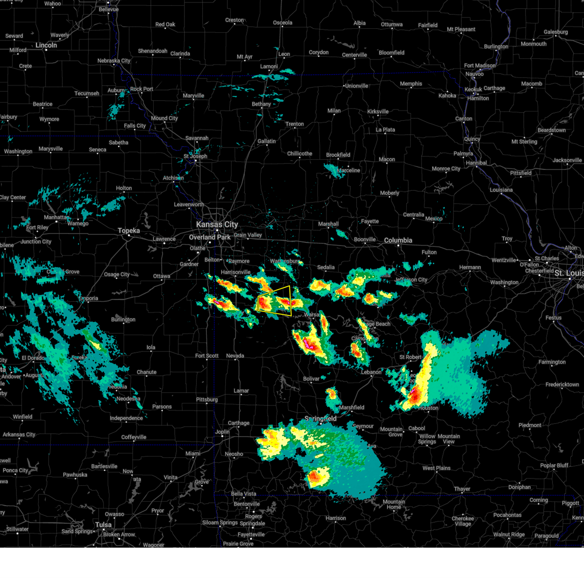
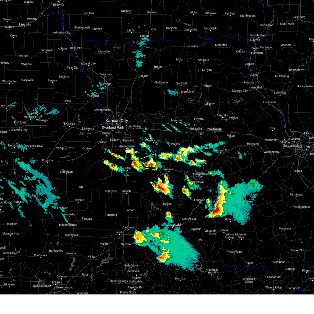
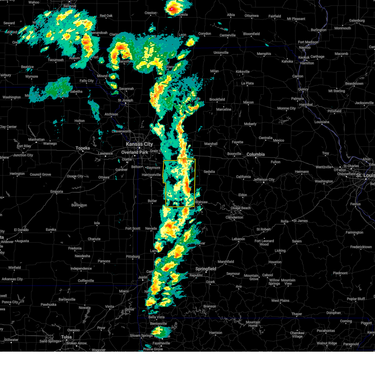
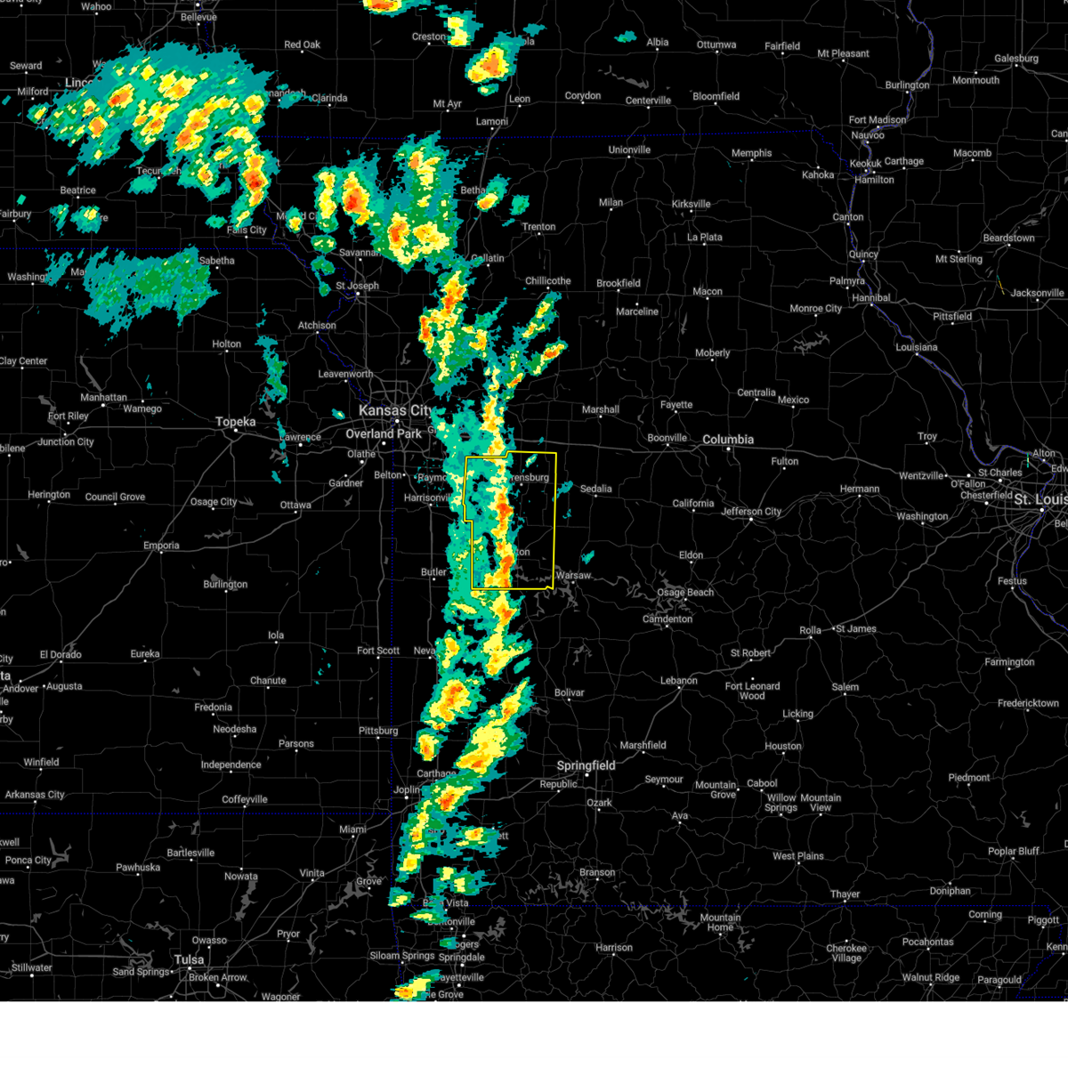
Hail Map for La Due, MO
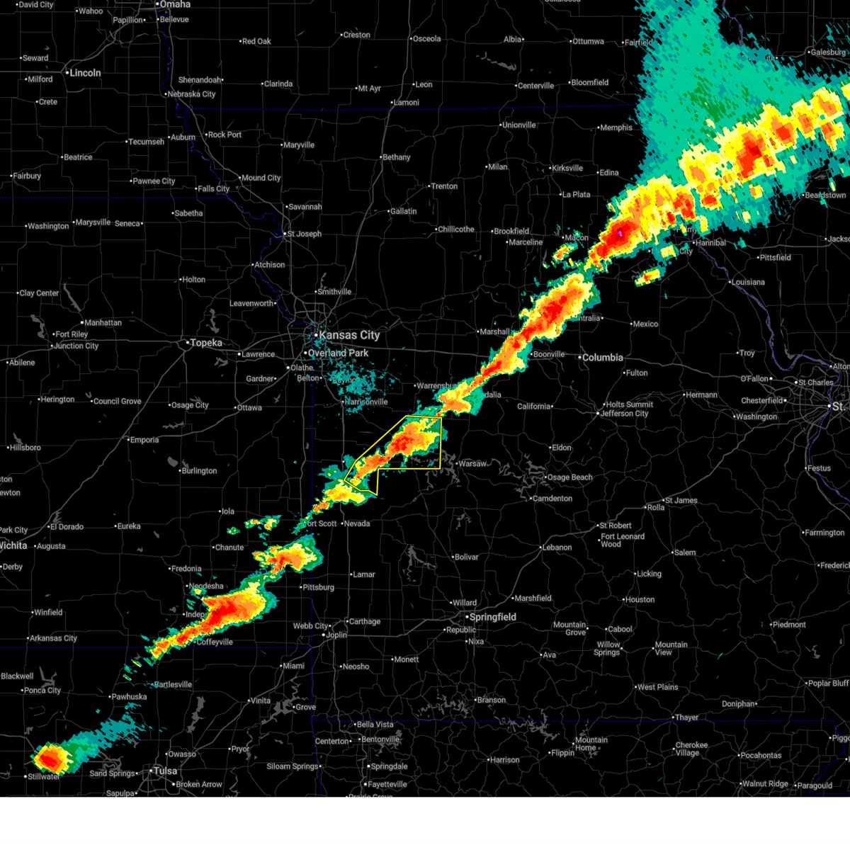
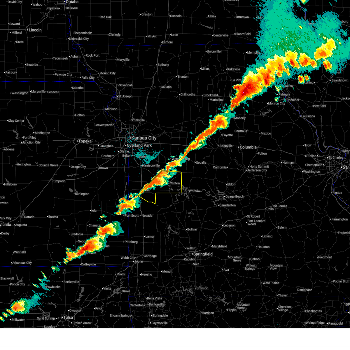
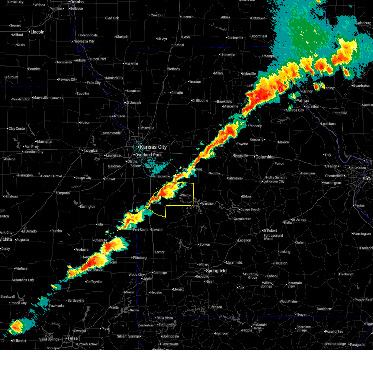
The La Due, MO area has had 0 reports of on-the-ground hail by trained spotters, and has been under severe weather warnings 53 times during the past 12 months. Doppler radar has detected hail at or near La Due, MO on 61 occasions, including 6 occasions during the past year.
| Name: | La Due, MO |
| Where Located: | 66.5 miles SE of Kansas City, MO |
| Map: | Google Map for La Due, MO |
| Population: | 28 |
| Housing Units: | 24 |
| More Info: | Search Google for La Due, MO |
3
The Top Recent Hail Date for La Due, MO is Sunday, April 26, 2026 (8th out of 61)
Hail and Wind Damage Spotted near La Due, MO
| Date / Time | Report Details |
|---|---|
| 6/17/2026 5:14 PM CDT |
 At 514 pm cdt, a severe thunderstorm capable of producing a tornado was located near creighton, or 8 miles south of garden city, moving east at 35 mph (radar indicated rotation). Hazards include tornado and quarter size hail. Flying debris will be dangerous to those caught without shelter. mobile homes will be damaged or destroyed. damage to roofs, windows, and vehicles will occur. tree damage is likely. Locations impacted include, clinton, urich, deepwater, creighton, hartwell, and la due. At 514 pm cdt, a severe thunderstorm capable of producing a tornado was located near creighton, or 8 miles south of garden city, moving east at 35 mph (radar indicated rotation). Hazards include tornado and quarter size hail. Flying debris will be dangerous to those caught without shelter. mobile homes will be damaged or destroyed. damage to roofs, windows, and vehicles will occur. tree damage is likely. Locations impacted include, clinton, urich, deepwater, creighton, hartwell, and la due.
|
| 6/17/2026 5:04 PM CDT |
 Toreax the national weather service in pleasant hill has issued a * tornado warning for, southeastern cass county in west central missouri, western henry county in west central missouri, northeastern bates county in west central missouri, * until 545 pm cdt. * at 504 pm cdt, a severe thunderstorm capable of producing a tornado was located near garden city, moving east at 30 mph (radar indicated rotation). Hazards include tornado. Flying debris will be dangerous to those caught without shelter. mobile homes will be damaged or destroyed. damage to roofs, windows, and vehicles will occur. Tree damage is likely. Toreax the national weather service in pleasant hill has issued a * tornado warning for, southeastern cass county in west central missouri, western henry county in west central missouri, northeastern bates county in west central missouri, * until 545 pm cdt. * at 504 pm cdt, a severe thunderstorm capable of producing a tornado was located near garden city, moving east at 30 mph (radar indicated rotation). Hazards include tornado. Flying debris will be dangerous to those caught without shelter. mobile homes will be damaged or destroyed. damage to roofs, windows, and vehicles will occur. Tree damage is likely.
|
| 6/17/2026 4:58 PM CDT |
 Svreax the national weather service in pleasant hill has issued a * severe thunderstorm warning for, southeastern cass county in west central missouri, central henry county in west central missouri, northeastern bates county in west central missouri, * until 545 pm cdt. * at 458 pm cdt, a severe thunderstorm was located near garden city, moving east at 40 mph (radar indicated). Hazards include 60 mph wind gusts and quarter size hail. Hail damage to vehicles is expected. Expect wind damage to roofs, siding, and trees. Svreax the national weather service in pleasant hill has issued a * severe thunderstorm warning for, southeastern cass county in west central missouri, central henry county in west central missouri, northeastern bates county in west central missouri, * until 545 pm cdt. * at 458 pm cdt, a severe thunderstorm was located near garden city, moving east at 40 mph (radar indicated). Hazards include 60 mph wind gusts and quarter size hail. Hail damage to vehicles is expected. Expect wind damage to roofs, siding, and trees.
|
| 6/13/2026 11:02 PM CDT |
 the severe thunderstorm warning has been cancelled and is no longer in effect the severe thunderstorm warning has been cancelled and is no longer in effect
|
| 6/13/2026 10:47 PM CDT |
 At 1047 pm cdt, severe thunderstorms were located along a line extending from near green ridge to near clinton to near butler to 7 miles north of nevada, moving east at 30 mph (radar indicated). Hazards include 60 mph wind gusts and quarter size hail. Hail damage to vehicles is expected. expect wind damage to roofs, siding, and trees. locations impacted include, clinton, butler, rich hill, calhoun, deepwater, montrose, coal, rockville, brownington, tightwad, la due, and truman lake. This includes interstate 49 between mile markers 118 and 135. At 1047 pm cdt, severe thunderstorms were located along a line extending from near green ridge to near clinton to near butler to 7 miles north of nevada, moving east at 30 mph (radar indicated). Hazards include 60 mph wind gusts and quarter size hail. Hail damage to vehicles is expected. expect wind damage to roofs, siding, and trees. locations impacted include, clinton, butler, rich hill, calhoun, deepwater, montrose, coal, rockville, brownington, tightwad, la due, and truman lake. This includes interstate 49 between mile markers 118 and 135.
|
| 6/13/2026 10:39 PM CDT |
 At 1038 pm cdt, severe thunderstorms were located along a line extending from near green ridge to near urich to near butler to 9 miles southwest of rich hill, moving east at 30 mph (radar indicated). Hazards include 60 mph wind gusts and quarter size hail. Hail damage to vehicles is expected. expect wind damage to roofs, siding, and trees. locations impacted include, clinton, butler, windsor, adrian, rich hill, urich, calhoun, deepwater, montrose, hume, coal, amoret, rockville, foster, brownington, tightwad, passaic, worland, ballard, and hartwell. This includes interstate 49 between mile markers 118 and 142. At 1038 pm cdt, severe thunderstorms were located along a line extending from near green ridge to near urich to near butler to 9 miles southwest of rich hill, moving east at 30 mph (radar indicated). Hazards include 60 mph wind gusts and quarter size hail. Hail damage to vehicles is expected. expect wind damage to roofs, siding, and trees. locations impacted include, clinton, butler, windsor, adrian, rich hill, urich, calhoun, deepwater, montrose, hume, coal, amoret, rockville, foster, brownington, tightwad, passaic, worland, ballard, and hartwell. This includes interstate 49 between mile markers 118 and 142.
|
| 6/13/2026 10:39 PM CDT |
 the severe thunderstorm warning has been cancelled and is no longer in effect the severe thunderstorm warning has been cancelled and is no longer in effect
|
| 6/13/2026 10:03 PM CDT |
 Svreax the national weather service in pleasant hill has issued a * severe thunderstorm warning for, southern cass county in west central missouri, henry county in west central missouri, bates county in west central missouri, * until 1115 pm cdt. * at 1003 pm cdt, severe thunderstorms were located along a line extending from near chilhowee to near archie to near la cygne to fulton, moving east at 30 mph (radar indicated). Hazards include 60 mph wind gusts and quarter size hail. Hail damage to vehicles is expected. Expect wind damage to roofs, siding, and trees. Svreax the national weather service in pleasant hill has issued a * severe thunderstorm warning for, southern cass county in west central missouri, henry county in west central missouri, bates county in west central missouri, * until 1115 pm cdt. * at 1003 pm cdt, severe thunderstorms were located along a line extending from near chilhowee to near archie to near la cygne to fulton, moving east at 30 mph (radar indicated). Hazards include 60 mph wind gusts and quarter size hail. Hail damage to vehicles is expected. Expect wind damage to roofs, siding, and trees.
|
| 6/11/2026 8:55 PM CDT |
 The storm which prompted the warning has moved out of the area. therefore, the warning will be allowed to expire. however, small hail is still possible with this thunderstorm. to report severe weather, contact your nearest law enforcement agency. they will relay your report to the national weather service pleasant hill. remember, a severe thunderstorm warning still remains in effect for eastern henry county until 930 pm cdt. The storm which prompted the warning has moved out of the area. therefore, the warning will be allowed to expire. however, small hail is still possible with this thunderstorm. to report severe weather, contact your nearest law enforcement agency. they will relay your report to the national weather service pleasant hill. remember, a severe thunderstorm warning still remains in effect for eastern henry county until 930 pm cdt.
|
| 6/11/2026 8:42 PM CDT |
 At 841 pm cdt, a severe thunderstorm was located over clinton, moving northeast at 45 mph (emergency management). Hazards include ping pong ball size hail. People and animals outdoors will be injured. expect damage to roofs, siding, windows, and vehicles. Locations impacted include, clinton, deepwater, brownington, la due, and truman lake. At 841 pm cdt, a severe thunderstorm was located over clinton, moving northeast at 45 mph (emergency management). Hazards include ping pong ball size hail. People and animals outdoors will be injured. expect damage to roofs, siding, windows, and vehicles. Locations impacted include, clinton, deepwater, brownington, la due, and truman lake.
|
| 6/11/2026 8:28 PM CDT |
 At 827 pm cdt, a severe thunderstorm was located near deepwater, or 11 miles southwest of clinton, moving northeast at 45 mph (radar indicated). Hazards include 60 mph wind gusts and half dollar size hail. Hail damage to vehicles is expected. expect wind damage to roofs, siding, and trees. Locations impacted include, clinton, deepwater, montrose, brownington, la due, and truman lake. At 827 pm cdt, a severe thunderstorm was located near deepwater, or 11 miles southwest of clinton, moving northeast at 45 mph (radar indicated). Hazards include 60 mph wind gusts and half dollar size hail. Hail damage to vehicles is expected. expect wind damage to roofs, siding, and trees. Locations impacted include, clinton, deepwater, montrose, brownington, la due, and truman lake.
|
| 6/11/2026 8:12 PM CDT |
 Svreax the national weather service in pleasant hill has issued a * severe thunderstorm warning for, southeastern henry county in west central missouri, east central bates county in west central missouri, * until 900 pm cdt. * at 812 pm cdt, a severe thunderstorm was located near appleton city, or 16 miles east of rich hill, moving northeast at 45 mph (radar indicated). Hazards include 60 mph wind gusts and half dollar size hail. Hail damage to vehicles is expected. Expect wind damage to roofs, siding, and trees. Svreax the national weather service in pleasant hill has issued a * severe thunderstorm warning for, southeastern henry county in west central missouri, east central bates county in west central missouri, * until 900 pm cdt. * at 812 pm cdt, a severe thunderstorm was located near appleton city, or 16 miles east of rich hill, moving northeast at 45 mph (radar indicated). Hazards include 60 mph wind gusts and half dollar size hail. Hail damage to vehicles is expected. Expect wind damage to roofs, siding, and trees.
|
| 6/11/2026 5:41 PM CDT |
 Svreax the national weather service in pleasant hill has issued a * severe thunderstorm warning for, eastern henry county in west central missouri, * until 630 pm cdt. * at 540 pm cdt, severe thunderstorms were located along a line extending from 11 miles northeast of lowry city to deepwater to near appleton city, moving southeast at 25 mph (radar indicated). Hazards include 60 mph wind gusts and half dollar size hail. Hail damage to vehicles is expected. Expect wind damage to roofs, siding, and trees. Svreax the national weather service in pleasant hill has issued a * severe thunderstorm warning for, eastern henry county in west central missouri, * until 630 pm cdt. * at 540 pm cdt, severe thunderstorms were located along a line extending from 11 miles northeast of lowry city to deepwater to near appleton city, moving southeast at 25 mph (radar indicated). Hazards include 60 mph wind gusts and half dollar size hail. Hail damage to vehicles is expected. Expect wind damage to roofs, siding, and trees.
|
| 6/11/2026 5:35 PM CDT |
 At 535 pm cdt, severe thunderstorms were located along a line extending from near calhoun to near deepwater to near appleton city, moving east at 50 mph (radar indicated). Hazards include 60 mph wind gusts and half dollar size hail. Hail damage to vehicles is expected. expect wind damage to roofs, siding, and trees. Locations impacted include, clinton, windsor, calhoun, deepwater, montrose, coal, brownington, tightwad, la due, and truman lake. At 535 pm cdt, severe thunderstorms were located along a line extending from near calhoun to near deepwater to near appleton city, moving east at 50 mph (radar indicated). Hazards include 60 mph wind gusts and half dollar size hail. Hail damage to vehicles is expected. expect wind damage to roofs, siding, and trees. Locations impacted include, clinton, windsor, calhoun, deepwater, montrose, coal, brownington, tightwad, la due, and truman lake.
|
| 6/11/2026 5:30 PM CDT |
 At 530 pm cdt, severe thunderstorms were located along a line extending from near calhoun to near deepwater to near appleton city, moving east at 50 mph (radar indicated). Hazards include 60 mph wind gusts and half dollar size hail. Hail damage to vehicles is expected. expect wind damage to roofs, siding, and trees. Locations impacted include, clinton, windsor, calhoun, deepwater, montrose, coal, brownington, tightwad, la due, and truman lake. At 530 pm cdt, severe thunderstorms were located along a line extending from near calhoun to near deepwater to near appleton city, moving east at 50 mph (radar indicated). Hazards include 60 mph wind gusts and half dollar size hail. Hail damage to vehicles is expected. expect wind damage to roofs, siding, and trees. Locations impacted include, clinton, windsor, calhoun, deepwater, montrose, coal, brownington, tightwad, la due, and truman lake.
|
| 6/11/2026 5:22 PM CDT |
 At 522 pm cdt, severe thunderstorms were located along a line extending from near clinton to near montrose to 9 miles southeast of butler, moving east at 35 mph (radar indicated). Hazards include 60 mph wind gusts and quarter size hail. Hail damage to vehicles is expected. expect wind damage to roofs, siding, and trees. Locations impacted include, clinton, windsor, calhoun, deepwater, montrose, coal, rockville, brownington, tightwad, hartwell, la due, and truman lake. At 522 pm cdt, severe thunderstorms were located along a line extending from near clinton to near montrose to 9 miles southeast of butler, moving east at 35 mph (radar indicated). Hazards include 60 mph wind gusts and quarter size hail. Hail damage to vehicles is expected. expect wind damage to roofs, siding, and trees. Locations impacted include, clinton, windsor, calhoun, deepwater, montrose, coal, rockville, brownington, tightwad, hartwell, la due, and truman lake.
|
| 6/11/2026 5:08 PM CDT |
 At 507 pm cdt, severe thunderstorms were located along a line extending from near chilhowee to 7 miles northeast of montrose to near butler, moving east at 50 mph (radar indicated). Hazards include 60 mph wind gusts and quarter size hail. Hail damage to vehicles is expected. expect wind damage to roofs, siding, and trees. locations impacted include, clinton, butler, windsor, urich, calhoun, deepwater, montrose, coal, rockville, brownington, tightwad, ballard, hartwell, la due, and truman lake. This includes interstate 49 between mile markers 124 and 129. At 507 pm cdt, severe thunderstorms were located along a line extending from near chilhowee to 7 miles northeast of montrose to near butler, moving east at 50 mph (radar indicated). Hazards include 60 mph wind gusts and quarter size hail. Hail damage to vehicles is expected. expect wind damage to roofs, siding, and trees. locations impacted include, clinton, butler, windsor, urich, calhoun, deepwater, montrose, coal, rockville, brownington, tightwad, ballard, hartwell, la due, and truman lake. This includes interstate 49 between mile markers 124 and 129.
|
| 6/11/2026 4:56 PM CDT |
 At 456 pm cdt, severe thunderstorms were located along a line extending from near chilhowee to near montrose to near butler, moving east at 40 mph (radar indicated). Hazards include 60 mph wind gusts and quarter size hail. Hail damage to vehicles is expected. expect wind damage to roofs, siding, and trees. locations impacted include, clinton, butler, windsor, urich, calhoun, deepwater, montrose, creighton, coal, rockville, brownington, blairstown, tightwad, ballard, hartwell, la due, and truman lake. This includes interstate 49 between mile markers 124 and 134. At 456 pm cdt, severe thunderstorms were located along a line extending from near chilhowee to near montrose to near butler, moving east at 40 mph (radar indicated). Hazards include 60 mph wind gusts and quarter size hail. Hail damage to vehicles is expected. expect wind damage to roofs, siding, and trees. locations impacted include, clinton, butler, windsor, urich, calhoun, deepwater, montrose, creighton, coal, rockville, brownington, blairstown, tightwad, ballard, hartwell, la due, and truman lake. This includes interstate 49 between mile markers 124 and 134.
|
| 6/11/2026 4:38 PM CDT |
 Svreax the national weather service in pleasant hill has issued a * severe thunderstorm warning for, southeastern cass county in west central missouri, henry county in west central missouri, bates county in west central missouri, * until 545 pm cdt. * at 438 pm cdt, severe thunderstorms were located along a line extending from near urich to near creighton to 8 miles north of hume, moving east at 50 mph (radar indicated). Hazards include 60 mph wind gusts and quarter size hail. Hail damage to vehicles is expected. Expect wind damage to roofs, siding, and trees. Svreax the national weather service in pleasant hill has issued a * severe thunderstorm warning for, southeastern cass county in west central missouri, henry county in west central missouri, bates county in west central missouri, * until 545 pm cdt. * at 438 pm cdt, severe thunderstorms were located along a line extending from near urich to near creighton to 8 miles north of hume, moving east at 50 mph (radar indicated). Hazards include 60 mph wind gusts and quarter size hail. Hail damage to vehicles is expected. Expect wind damage to roofs, siding, and trees.
|
| 6/9/2026 1:25 AM CDT |
 Svreax the national weather service in pleasant hill has issued a * severe thunderstorm warning for, cass county in west central missouri, western henry county in west central missouri, northern bates county in west central missouri, southwestern lafayette county in west central missouri, southern jackson county in west central missouri, western johnson county in west central missouri, * until 200 am cdt. * at 124 am cdt, a severe thunderstorm was located over baldwin park, or over pleasant hill, moving east at 60 mph (radar indicated). Hazards include 60 mph wind gusts. expect damage to roofs, siding, and trees Svreax the national weather service in pleasant hill has issued a * severe thunderstorm warning for, cass county in west central missouri, western henry county in west central missouri, northern bates county in west central missouri, southwestern lafayette county in west central missouri, southern jackson county in west central missouri, western johnson county in west central missouri, * until 200 am cdt. * at 124 am cdt, a severe thunderstorm was located over baldwin park, or over pleasant hill, moving east at 60 mph (radar indicated). Hazards include 60 mph wind gusts. expect damage to roofs, siding, and trees
|
| 6/7/2026 4:25 PM CDT |
 At 425 pm cdt, a severe thunderstorm was located near urich, or 7 miles west of clinton, moving north at 30 mph (radar indicated). Hazards include 60 mph wind gusts. Expect damage to roofs, siding, and trees. Locations impacted include, clinton, urich, montrose, hartwell, la due, and truman lake. At 425 pm cdt, a severe thunderstorm was located near urich, or 7 miles west of clinton, moving north at 30 mph (radar indicated). Hazards include 60 mph wind gusts. Expect damage to roofs, siding, and trees. Locations impacted include, clinton, urich, montrose, hartwell, la due, and truman lake.
|
| 6/7/2026 3:57 PM CDT |
 Svreax the national weather service in pleasant hill has issued a * severe thunderstorm warning for, henry county in west central missouri, * until 500 pm cdt. * at 356 pm cdt, a severe thunderstorm was located near appleton city, or 17 miles southwest of clinton, moving north at 30 mph (radar indicated). Hazards include 60 mph wind gusts. expect damage to roofs, siding, and trees Svreax the national weather service in pleasant hill has issued a * severe thunderstorm warning for, henry county in west central missouri, * until 500 pm cdt. * at 356 pm cdt, a severe thunderstorm was located near appleton city, or 17 miles southwest of clinton, moving north at 30 mph (radar indicated). Hazards include 60 mph wind gusts. expect damage to roofs, siding, and trees
|
| 4/27/2026 3:17 PM CDT |
 Svreax the national weather service in pleasant hill has issued a * severe thunderstorm warning for, southwestern henry county in west central missouri, central bates county in west central missouri, * until 400 pm cdt. * at 317 pm cdt, a severe thunderstorm was located near rich hill, moving east at 45 mph (radar indicated). Hazards include 60 mph wind gusts and half dollar size hail. Hail damage to vehicles is expected. Expect wind damage to roofs, siding, and trees. Svreax the national weather service in pleasant hill has issued a * severe thunderstorm warning for, southwestern henry county in west central missouri, central bates county in west central missouri, * until 400 pm cdt. * at 317 pm cdt, a severe thunderstorm was located near rich hill, moving east at 45 mph (radar indicated). Hazards include 60 mph wind gusts and half dollar size hail. Hail damage to vehicles is expected. Expect wind damage to roofs, siding, and trees.
|
| 4/26/2026 6:14 PM CDT |
 At 614 pm cdt, severe thunderstorms were located along a line extending from near holden to 6 miles south of warrensburg to near leeton to near clinton, moving northeast at 40 mph (radar indicated). Hazards include 60 mph wind gusts and penny size hail. Expect damage to roofs, siding, and trees. Locations impacted include, warrensburg, clinton, windsor, knob noster, holden, whiteman air force base, leeton, urich, calhoun, deepwater, montrose, creighton, chilhowee, whiteman afb, coal, centerview, brownington, blairstown, tightwad, and hartwell. At 614 pm cdt, severe thunderstorms were located along a line extending from near holden to 6 miles south of warrensburg to near leeton to near clinton, moving northeast at 40 mph (radar indicated). Hazards include 60 mph wind gusts and penny size hail. Expect damage to roofs, siding, and trees. Locations impacted include, warrensburg, clinton, windsor, knob noster, holden, whiteman air force base, leeton, urich, calhoun, deepwater, montrose, creighton, chilhowee, whiteman afb, coal, centerview, brownington, blairstown, tightwad, and hartwell.
|
| 4/26/2026 5:55 PM CDT |
 Svreax the national weather service in pleasant hill has issued a * severe thunderstorm warning for, henry county in west central missouri, johnson county in west central missouri, * until 700 pm cdt. * at 555 pm cdt, severe thunderstorms were located along a line extending from near kingsville to 6 miles west of chilhowee to near urich, moving northeast at 45 mph (radar indicated). Hazards include 60 mph wind gusts and penny size hail. expect damage to roofs, siding, and trees Svreax the national weather service in pleasant hill has issued a * severe thunderstorm warning for, henry county in west central missouri, johnson county in west central missouri, * until 700 pm cdt. * at 555 pm cdt, severe thunderstorms were located along a line extending from near kingsville to 6 miles west of chilhowee to near urich, moving northeast at 45 mph (radar indicated). Hazards include 60 mph wind gusts and penny size hail. expect damage to roofs, siding, and trees
|
| 4/23/2026 11:22 PM CDT |
 At 1122 pm cdt, severe thunderstorms were located along a line extending from near knob noster to near chilhowee to near deepwater, moving east at 40 mph (radar indicated). Hazards include 60 mph wind gusts. Expect damage to roofs, siding, and trees. Locations impacted include, warrensburg, clinton, windsor, knob noster, whiteman air force base, la monte, leeton, green ridge, calhoun, deepwater, montrose, chilhowee, whiteman afb, coal, brownington, blairstown, tightwad, post oak, hartwell, and la due. At 1122 pm cdt, severe thunderstorms were located along a line extending from near knob noster to near chilhowee to near deepwater, moving east at 40 mph (radar indicated). Hazards include 60 mph wind gusts. Expect damage to roofs, siding, and trees. Locations impacted include, warrensburg, clinton, windsor, knob noster, whiteman air force base, la monte, leeton, green ridge, calhoun, deepwater, montrose, chilhowee, whiteman afb, coal, brownington, blairstown, tightwad, post oak, hartwell, and la due.
|
| 4/23/2026 11:05 PM CDT |
 Svreax the national weather service in pleasant hill has issued a * severe thunderstorm warning for, henry county in west central missouri, east central bates county in west central missouri, southwestern pettis county in central missouri, southeastern johnson county in west central missouri, * until 1145 pm cdt. * at 1105 pm cdt, severe thunderstorms were located along a line extending from near warrensburg to 7 miles northeast of creighton to near appleton city, moving east at 40 mph (radar indicated). Hazards include 60 mph wind gusts. expect damage to roofs, siding, and trees Svreax the national weather service in pleasant hill has issued a * severe thunderstorm warning for, henry county in west central missouri, east central bates county in west central missouri, southwestern pettis county in central missouri, southeastern johnson county in west central missouri, * until 1145 pm cdt. * at 1105 pm cdt, severe thunderstorms were located along a line extending from near warrensburg to 7 miles northeast of creighton to near appleton city, moving east at 40 mph (radar indicated). Hazards include 60 mph wind gusts. expect damage to roofs, siding, and trees
|
| 4/23/2026 10:55 PM CDT |
 At 1055 pm cdt, severe thunderstorms were located along a line extending from near holden to near creighton to 10 miles east of butler to near hume, moving east at 55 mph (radar indicated). Hazards include 60 mph wind gusts and quarter size hail. Hail damage to vehicles is expected. expect wind damage to roofs, siding, and trees. locations impacted include, warrensburg, butler, holden, adrian, garden city, rich hill, pleasanton, archie, urich, montrose, creighton, hume, chilhowee, east lynne, kingsville, prescott, centerview, amoret, rockville, and strasburg. This includes interstate 49 between mile markers 118 and 151. At 1055 pm cdt, severe thunderstorms were located along a line extending from near holden to near creighton to 10 miles east of butler to near hume, moving east at 55 mph (radar indicated). Hazards include 60 mph wind gusts and quarter size hail. Hail damage to vehicles is expected. expect wind damage to roofs, siding, and trees. locations impacted include, warrensburg, butler, holden, adrian, garden city, rich hill, pleasanton, archie, urich, montrose, creighton, hume, chilhowee, east lynne, kingsville, prescott, centerview, amoret, rockville, and strasburg. This includes interstate 49 between mile markers 118 and 151.
|
| 4/23/2026 10:30 PM CDT |
 Svreax the national weather service in pleasant hill has issued a * severe thunderstorm warning for, southeastern linn county in east central kansas, cass county in west central missouri, western henry county in west central missouri, bates county in west central missouri, johnson county in west central missouri, * until 1115 pm cdt. * at 1030 pm cdt, severe thunderstorms were located along a line extending from near pleasant hill to 9 miles west of butler to near mound city, moving east at 45 mph (radar indicated). Hazards include 60 mph wind gusts and quarter size hail. Hail damage to vehicles is expected. Expect wind damage to roofs, siding, and trees. Svreax the national weather service in pleasant hill has issued a * severe thunderstorm warning for, southeastern linn county in east central kansas, cass county in west central missouri, western henry county in west central missouri, bates county in west central missouri, johnson county in west central missouri, * until 1115 pm cdt. * at 1030 pm cdt, severe thunderstorms were located along a line extending from near pleasant hill to 9 miles west of butler to near mound city, moving east at 45 mph (radar indicated). Hazards include 60 mph wind gusts and quarter size hail. Hail damage to vehicles is expected. Expect wind damage to roofs, siding, and trees.
|
| 4/17/2026 7:02 PM CDT |
 At 702 pm cdt, a severe thunderstorm was located over deepwater, or 8 miles south of clinton, moving east at 55 mph (radar indicated). Hazards include 60 mph wind gusts and penny size hail. Expect damage to roofs, siding, and trees. Locations impacted include, clinton, calhoun, deepwater, coal, brownington, tightwad, la due, and truman lake. At 702 pm cdt, a severe thunderstorm was located over deepwater, or 8 miles south of clinton, moving east at 55 mph (radar indicated). Hazards include 60 mph wind gusts and penny size hail. Expect damage to roofs, siding, and trees. Locations impacted include, clinton, calhoun, deepwater, coal, brownington, tightwad, la due, and truman lake.
|
| 4/17/2026 6:54 PM CDT |
 At 654 pm cdt, severe thunderstorms were located along a line extending from near chilhowee to 7 miles west of clinton to near appleton city, moving northeast at 60 mph (radar indicated). Hazards include 60 mph wind gusts and penny size hail. Expect damage to roofs, siding, and trees. Locations impacted include, clinton, windsor, urich, calhoun, deepwater, montrose, creighton, coal, brownington, tightwad, hartwell, la due, and truman lake. At 654 pm cdt, severe thunderstorms were located along a line extending from near chilhowee to 7 miles west of clinton to near appleton city, moving northeast at 60 mph (radar indicated). Hazards include 60 mph wind gusts and penny size hail. Expect damage to roofs, siding, and trees. Locations impacted include, clinton, windsor, urich, calhoun, deepwater, montrose, creighton, coal, brownington, tightwad, hartwell, la due, and truman lake.
|
| 4/17/2026 6:48 PM CDT |
 At 647 pm cdt, severe thunderstorms were located along a line extending from urich to near appleton city, moving northeast at 110 mph (radar indicated). Hazards include 60 mph wind gusts and quarter size hail. Hail damage to vehicles is expected. expect wind damage to roofs, siding, and trees. Locations impacted include, clinton, windsor, urich, calhoun, deepwater, montrose, creighton, coal, brownington, tightwad, hartwell, la due, and truman lake. At 647 pm cdt, severe thunderstorms were located along a line extending from urich to near appleton city, moving northeast at 110 mph (radar indicated). Hazards include 60 mph wind gusts and quarter size hail. Hail damage to vehicles is expected. expect wind damage to roofs, siding, and trees. Locations impacted include, clinton, windsor, urich, calhoun, deepwater, montrose, creighton, coal, brownington, tightwad, hartwell, la due, and truman lake.
|
| 4/17/2026 6:30 PM CDT |
 Svreax the national weather service in pleasant hill has issued a * severe thunderstorm warning for, southeastern cass county in west central missouri, henry county in west central missouri, northeastern bates county in west central missouri, * until 715 pm cdt. * at 629 pm cdt, severe thunderstorms were located along a line extending from 6 miles northeast of adrian to lowry city, moving northeast at 40 mph (radar indicated). Hazards include 60 mph wind gusts and quarter size hail. Hail damage to vehicles is expected. Expect wind damage to roofs, siding, and trees. Svreax the national weather service in pleasant hill has issued a * severe thunderstorm warning for, southeastern cass county in west central missouri, henry county in west central missouri, northeastern bates county in west central missouri, * until 715 pm cdt. * at 629 pm cdt, severe thunderstorms were located along a line extending from 6 miles northeast of adrian to lowry city, moving northeast at 40 mph (radar indicated). Hazards include 60 mph wind gusts and quarter size hail. Hail damage to vehicles is expected. Expect wind damage to roofs, siding, and trees.
|
| 4/17/2026 6:10 PM CDT |
 At 610 pm cdt, severe thunderstorms were located along a line extending from near adrian to near appleton city, moving northeast at 40 mph (public. multiple reports of power lines down and power outages have been reported in bates county). Hazards include 60 mph wind gusts and penny size hail. Expect damage to roofs, siding, and trees. locations impacted include, butler, adrian, rich hill, urich, deepwater, montrose, rockville, passaic, ballard, hartwell, and la due. This includes interstate 49 between mile markers 118 and 146. At 610 pm cdt, severe thunderstorms were located along a line extending from near adrian to near appleton city, moving northeast at 40 mph (public. multiple reports of power lines down and power outages have been reported in bates county). Hazards include 60 mph wind gusts and penny size hail. Expect damage to roofs, siding, and trees. locations impacted include, butler, adrian, rich hill, urich, deepwater, montrose, rockville, passaic, ballard, hartwell, and la due. This includes interstate 49 between mile markers 118 and 146.
|
| 4/17/2026 5:55 PM CDT |
 At 554 pm cdt, severe thunderstorms were located along a line extending from near butler to near schell city, moving northeast at 55 mph (radar indicated). Hazards include 60 mph wind gusts and penny size hail. Expect damage to roofs, siding, and trees. locations impacted include, butler, adrian, rich hill, urich, deepwater, montrose, rockville, passaic, ballard, hartwell, and la due. This includes interstate 49 between mile markers 118 and 146. At 554 pm cdt, severe thunderstorms were located along a line extending from near butler to near schell city, moving northeast at 55 mph (radar indicated). Hazards include 60 mph wind gusts and penny size hail. Expect damage to roofs, siding, and trees. locations impacted include, butler, adrian, rich hill, urich, deepwater, montrose, rockville, passaic, ballard, hartwell, and la due. This includes interstate 49 between mile markers 118 and 146.
|
| 4/17/2026 5:39 PM CDT |
 Svreax the national weather service in pleasant hill has issued a * severe thunderstorm warning for, southwestern henry county in west central missouri, bates county in west central missouri, * until 645 pm cdt. * at 539 pm cdt, severe thunderstorms were located along a line extending from 7 miles northeast of hume to near walker, moving northeast at 40 mph (radar indicated). Hazards include 60 mph wind gusts and penny size hail. expect damage to roofs, siding, and trees Svreax the national weather service in pleasant hill has issued a * severe thunderstorm warning for, southwestern henry county in west central missouri, bates county in west central missouri, * until 645 pm cdt. * at 539 pm cdt, severe thunderstorms were located along a line extending from 7 miles northeast of hume to near walker, moving northeast at 40 mph (radar indicated). Hazards include 60 mph wind gusts and penny size hail. expect damage to roofs, siding, and trees
|
| 4/15/2026 5:58 PM CDT |
 At 557 pm cdt, a severe thunderstorm capable of producing a tornado was located near clinton, moving east at 30 mph (radar indicated rotation). Hazards include tornado. Flying debris will be dangerous to those caught without shelter. mobile homes will be damaged or destroyed. damage to roofs, windows, and vehicles will occur. tree damage is likely. Locations impacted include, clinton, coal, la due, and truman lake. At 557 pm cdt, a severe thunderstorm capable of producing a tornado was located near clinton, moving east at 30 mph (radar indicated rotation). Hazards include tornado. Flying debris will be dangerous to those caught without shelter. mobile homes will be damaged or destroyed. damage to roofs, windows, and vehicles will occur. tree damage is likely. Locations impacted include, clinton, coal, la due, and truman lake.
|
| 4/15/2026 5:51 PM CDT |
 Toreax the national weather service in pleasant hill has issued a * tornado warning for, central henry county in west central missouri, * until 615 pm cdt. * at 550 pm cdt, a severe thunderstorm capable of producing a tornado was located near montrose, or 9 miles southwest of clinton, moving east at 30 mph (radar indicated rotation). Hazards include tornado. Flying debris will be dangerous to those caught without shelter. mobile homes will be damaged or destroyed. damage to roofs, windows, and vehicles will occur. Tree damage is likely. Toreax the national weather service in pleasant hill has issued a * tornado warning for, central henry county in west central missouri, * until 615 pm cdt. * at 550 pm cdt, a severe thunderstorm capable of producing a tornado was located near montrose, or 9 miles southwest of clinton, moving east at 30 mph (radar indicated rotation). Hazards include tornado. Flying debris will be dangerous to those caught without shelter. mobile homes will be damaged or destroyed. damage to roofs, windows, and vehicles will occur. Tree damage is likely.
|
| 4/15/2026 5:44 PM CDT |
 At 544 pm cdt, a severe thunderstorm was located near montrose, or 10 miles southwest of clinton, moving northeast at 30 mph (radar indicated). Hazards include 60 mph wind gusts and quarter size hail. Hail damage to vehicles is expected. expect wind damage to roofs, siding, and trees. Locations impacted include, clinton, calhoun, montrose, hartwell, la due, and truman lake. At 544 pm cdt, a severe thunderstorm was located near montrose, or 10 miles southwest of clinton, moving northeast at 30 mph (radar indicated). Hazards include 60 mph wind gusts and quarter size hail. Hail damage to vehicles is expected. expect wind damage to roofs, siding, and trees. Locations impacted include, clinton, calhoun, montrose, hartwell, la due, and truman lake.
|
| 4/15/2026 5:36 PM CDT |
 Svreax the national weather service in pleasant hill has issued a * severe thunderstorm warning for, henry county in west central missouri, * until 615 pm cdt. * at 535 pm cdt, a severe thunderstorm was located near montrose, or 14 miles west of clinton, moving northeast at 35 mph (radar indicated). Hazards include 60 mph wind gusts and quarter size hail. Hail damage to vehicles is expected. Expect wind damage to roofs, siding, and trees. Svreax the national weather service in pleasant hill has issued a * severe thunderstorm warning for, henry county in west central missouri, * until 615 pm cdt. * at 535 pm cdt, a severe thunderstorm was located near montrose, or 14 miles west of clinton, moving northeast at 35 mph (radar indicated). Hazards include 60 mph wind gusts and quarter size hail. Hail damage to vehicles is expected. Expect wind damage to roofs, siding, and trees.
|
| 4/13/2026 9:58 PM CDT |
 Svreax the national weather service in pleasant hill has issued a * severe thunderstorm warning for, eastern henry county in west central missouri, southwestern pettis county in central missouri, southeastern johnson county in west central missouri, * until 1045 pm cdt. * at 958 pm cdt, severe thunderstorms were located along a line extending from leeton to near calhoun to near clinton to near montrose, moving east at 30 mph (radar indicated). Hazards include 60 mph wind gusts and nickel size hail. expect damage to roofs, siding, and trees Svreax the national weather service in pleasant hill has issued a * severe thunderstorm warning for, eastern henry county in west central missouri, southwestern pettis county in central missouri, southeastern johnson county in west central missouri, * until 1045 pm cdt. * at 958 pm cdt, severe thunderstorms were located along a line extending from leeton to near calhoun to near clinton to near montrose, moving east at 30 mph (radar indicated). Hazards include 60 mph wind gusts and nickel size hail. expect damage to roofs, siding, and trees
|
| 4/13/2026 9:50 PM CDT |
 At 950 pm cdt, severe thunderstorms were located along a line extending from near leeton to near clinton to near montrose, moving northeast at 25 mph (radar indicated). Hazards include 60 mph wind gusts and quarter size hail. Hail damage to vehicles is expected. expect wind damage to roofs, siding, and trees. Locations impacted include, clinton, windsor, leeton, calhoun, montrose, coal, tightwad, post oak, hartwell, la due, and truman lake. At 950 pm cdt, severe thunderstorms were located along a line extending from near leeton to near clinton to near montrose, moving northeast at 25 mph (radar indicated). Hazards include 60 mph wind gusts and quarter size hail. Hail damage to vehicles is expected. expect wind damage to roofs, siding, and trees. Locations impacted include, clinton, windsor, leeton, calhoun, montrose, coal, tightwad, post oak, hartwell, la due, and truman lake.
|
| 4/13/2026 9:39 PM CDT |
 At 939 pm cdt, severe thunderstorms were located along a line extending from near chilhowee to 10 miles east of urich to near clinton, moving east at 35 mph (radar indicated). Hazards include 60 mph wind gusts and quarter size hail. Hail damage to vehicles is expected. expect wind damage to roofs, siding, and trees. Locations impacted include, clinton, windsor, leeton, urich, calhoun, montrose, creighton, coal, tightwad, post oak, hartwell, la due, and truman lake. At 939 pm cdt, severe thunderstorms were located along a line extending from near chilhowee to 10 miles east of urich to near clinton, moving east at 35 mph (radar indicated). Hazards include 60 mph wind gusts and quarter size hail. Hail damage to vehicles is expected. expect wind damage to roofs, siding, and trees. Locations impacted include, clinton, windsor, leeton, urich, calhoun, montrose, creighton, coal, tightwad, post oak, hartwell, la due, and truman lake.
|
| 4/13/2026 9:20 PM CDT |
 Svreax the national weather service in pleasant hill has issued a * severe thunderstorm warning for, henry county in west central missouri, northeastern bates county in west central missouri, southeastern johnson county in west central missouri, * until 1000 pm cdt. * at 920 pm cdt, a severe thunderstorm was located 9 miles west of montrose, or 10 miles east of butler, moving east at 45 mph (radar indicated). Hazards include 60 mph wind gusts and quarter size hail. Hail damage to vehicles is expected. Expect wind damage to roofs, siding, and trees. Svreax the national weather service in pleasant hill has issued a * severe thunderstorm warning for, henry county in west central missouri, northeastern bates county in west central missouri, southeastern johnson county in west central missouri, * until 1000 pm cdt. * at 920 pm cdt, a severe thunderstorm was located 9 miles west of montrose, or 10 miles east of butler, moving east at 45 mph (radar indicated). Hazards include 60 mph wind gusts and quarter size hail. Hail damage to vehicles is expected. Expect wind damage to roofs, siding, and trees.
|
| 4/1/2026 10:28 PM CDT |
 At 1028 pm cdt, a severe thunderstorm was located over clinton, moving northeast at 35 mph (radar indicated). Hazards include 60 mph wind gusts. Expect damage to roofs, siding, and trees. Locations impacted include, clinton, calhoun, coal, hartwell, la due, and truman lake. At 1028 pm cdt, a severe thunderstorm was located over clinton, moving northeast at 35 mph (radar indicated). Hazards include 60 mph wind gusts. Expect damage to roofs, siding, and trees. Locations impacted include, clinton, calhoun, coal, hartwell, la due, and truman lake.
|
| 4/1/2026 10:11 PM CDT |
 Svreax the national weather service in pleasant hill has issued a * severe thunderstorm warning for, central henry county in west central missouri, * until 1100 pm cdt. * at 1011 pm cdt, a severe thunderstorm was located near montrose, or 10 miles southwest of clinton, moving northeast at 30 mph (radar indicated). Hazards include 60 mph wind gusts. expect damage to roofs, siding, and trees Svreax the national weather service in pleasant hill has issued a * severe thunderstorm warning for, central henry county in west central missouri, * until 1100 pm cdt. * at 1011 pm cdt, a severe thunderstorm was located near montrose, or 10 miles southwest of clinton, moving northeast at 30 mph (radar indicated). Hazards include 60 mph wind gusts. expect damage to roofs, siding, and trees
|
| 4/1/2026 9:04 PM CDT |
 Svreax the national weather service in pleasant hill has issued a * severe thunderstorm warning for, eastern henry county in west central missouri, * until 945 pm cdt. * at 903 pm cdt, a severe thunderstorm was located near deepwater, or 7 miles southwest of clinton, moving northeast at 40 mph (radar indicated). Hazards include 60 mph wind gusts and penny size hail. expect damage to roofs, siding, and trees Svreax the national weather service in pleasant hill has issued a * severe thunderstorm warning for, eastern henry county in west central missouri, * until 945 pm cdt. * at 903 pm cdt, a severe thunderstorm was located near deepwater, or 7 miles southwest of clinton, moving northeast at 40 mph (radar indicated). Hazards include 60 mph wind gusts and penny size hail. expect damage to roofs, siding, and trees
|
| 9/3/2025 8:35 PM CDT |
 At 835 pm cdt, a severe thunderstorm was located near montrose, or 13 miles west of clinton, moving east at 40 mph (radar indicated). Hazards include 60 mph wind gusts and quarter size hail. Hail damage to vehicles is expected. expect wind damage to roofs, siding, and trees. Locations impacted include, montrose, ballard, and la due. At 835 pm cdt, a severe thunderstorm was located near montrose, or 13 miles west of clinton, moving east at 40 mph (radar indicated). Hazards include 60 mph wind gusts and quarter size hail. Hail damage to vehicles is expected. expect wind damage to roofs, siding, and trees. Locations impacted include, montrose, ballard, and la due.
|
| 9/3/2025 8:26 PM CDT |
 At 824 pm cdt, a severe thunderstorm was located 7 miles northwest of montrose, or 13 miles east of butler, moving east at 45 mph (emergency management reported power outages in altona missouri. this is where a notable downburst signature occurred on radar). Hazards include 60 mph wind gusts and quarter size hail. Hail damage to vehicles is expected. expect wind damage to roofs, siding, and trees. Locations impacted include, montrose, ballard, and la due. At 824 pm cdt, a severe thunderstorm was located 7 miles northwest of montrose, or 13 miles east of butler, moving east at 45 mph (emergency management reported power outages in altona missouri. this is where a notable downburst signature occurred on radar). Hazards include 60 mph wind gusts and quarter size hail. Hail damage to vehicles is expected. expect wind damage to roofs, siding, and trees. Locations impacted include, montrose, ballard, and la due.
|
| 9/3/2025 8:19 PM CDT |
 At 819 pm cdt, a severe thunderstorm was located 10 miles east of adrian, moving east at 45 mph (radar indicated). Hazards include 60 mph wind gusts and quarter size hail. Hail damage to vehicles is expected. expect wind damage to roofs, siding, and trees. locations impacted include, butler, adrian, montrose, passaic, ballard, and la due. This includes interstate 49 between mile markers 128 and 139. At 819 pm cdt, a severe thunderstorm was located 10 miles east of adrian, moving east at 45 mph (radar indicated). Hazards include 60 mph wind gusts and quarter size hail. Hail damage to vehicles is expected. expect wind damage to roofs, siding, and trees. locations impacted include, butler, adrian, montrose, passaic, ballard, and la due. This includes interstate 49 between mile markers 128 and 139.
|
| 9/3/2025 8:07 PM CDT |
 Svreax the national weather service in pleasant hill has issued a * severe thunderstorm warning for, southwestern henry county in west central missouri, northeastern bates county in west central missouri, * until 845 pm cdt. * at 807 pm cdt, a severe thunderstorm was located near adrian, moving east at 45 mph (radar indicated). Hazards include 60 mph wind gusts and quarter size hail. Hail damage to vehicles is expected. Expect wind damage to roofs, siding, and trees. Svreax the national weather service in pleasant hill has issued a * severe thunderstorm warning for, southwestern henry county in west central missouri, northeastern bates county in west central missouri, * until 845 pm cdt. * at 807 pm cdt, a severe thunderstorm was located near adrian, moving east at 45 mph (radar indicated). Hazards include 60 mph wind gusts and quarter size hail. Hail damage to vehicles is expected. Expect wind damage to roofs, siding, and trees.
|
| 7/17/2025 12:29 AM CDT |
 At 1229 am cdt, severe thunderstorms were located along a line extending from 6 miles southwest of smithton to near windsor to 6 miles south of chilhowee, moving southeast at 20 mph (radar indicated). Hazards include 60 mph wind gusts. Expect damage to roofs, siding, and trees. Locations impacted include, sedalia, warrensburg, clinton, windsor, knob noster, whiteman air force base, la monte, smithton, leeton, urich, green ridge, calhoun, otterville, chilhowee, houstonia, whiteman afb, coal, hughesville, blairstown, and clifton city. At 1229 am cdt, severe thunderstorms were located along a line extending from 6 miles southwest of smithton to near windsor to 6 miles south of chilhowee, moving southeast at 20 mph (radar indicated). Hazards include 60 mph wind gusts. Expect damage to roofs, siding, and trees. Locations impacted include, sedalia, warrensburg, clinton, windsor, knob noster, whiteman air force base, la monte, smithton, leeton, urich, green ridge, calhoun, otterville, chilhowee, houstonia, whiteman afb, coal, hughesville, blairstown, and clifton city.
|
| 7/16/2025 11:56 PM CDT |
 Svreax the national weather service in pleasant hill has issued a * severe thunderstorm warning for, henry county in west central missouri, pettis county in central missouri, southwestern cooper county in central missouri, southern johnson county in west central missouri, * until 100 am cdt. * at 1156 pm cdt, severe thunderstorms were located along a line extending from near sedalia to near leeton to 7 miles southwest of holden, moving southeast at 20 mph (radar indicated). Hazards include 60 mph wind gusts. expect damage to roofs, siding, and trees Svreax the national weather service in pleasant hill has issued a * severe thunderstorm warning for, henry county in west central missouri, pettis county in central missouri, southwestern cooper county in central missouri, southern johnson county in west central missouri, * until 100 am cdt. * at 1156 pm cdt, severe thunderstorms were located along a line extending from near sedalia to near leeton to 7 miles southwest of holden, moving southeast at 20 mph (radar indicated). Hazards include 60 mph wind gusts. expect damage to roofs, siding, and trees
|
| 6/8/2025 3:59 PM CDT |
 The storm which prompted warning 111 has moved out of the area. therefore, warning 111 will be allowed to expire. however severe thunderstorm warning 112 has been issued downstream, and still is expected to produce severe hail. please see severe thunderstorm warning 112 for further details. a severe thunderstorm watch remains in effect until 1000 pm cdt for west central missouri. The storm which prompted warning 111 has moved out of the area. therefore, warning 111 will be allowed to expire. however severe thunderstorm warning 112 has been issued downstream, and still is expected to produce severe hail. please see severe thunderstorm warning 112 for further details. a severe thunderstorm watch remains in effect until 1000 pm cdt for west central missouri.
|
| 6/8/2025 3:50 PM CDT |
 At 349 pm cdt, a severe thunderstorm was located near deepwater, or 7 miles southwest of clinton, moving east at 25 mph (emergency management reported 2 inch hail near ladue at 349pm cdt). Hazards include two inch hail and 60 mph wind gusts. People and animals outdoors will be injured. expect hail damage to roofs, siding, windows, and vehicles. expect wind damage to roofs, siding, and trees. Locations impacted include, clinton, deepwater, brownington, la due, and truman lake. At 349 pm cdt, a severe thunderstorm was located near deepwater, or 7 miles southwest of clinton, moving east at 25 mph (emergency management reported 2 inch hail near ladue at 349pm cdt). Hazards include two inch hail and 60 mph wind gusts. People and animals outdoors will be injured. expect hail damage to roofs, siding, windows, and vehicles. expect wind damage to roofs, siding, and trees. Locations impacted include, clinton, deepwater, brownington, la due, and truman lake.
|
| 6/8/2025 3:46 PM CDT |
 At 345 pm cdt, a severe thunderstorm was located near clinton, moving east at 30 mph (emergency management reported quarter size hail near german town around 332pm cdt). Hazards include ping pong ball size hail and 60 mph wind gusts. People and animals outdoors will be injured. expect hail damage to roofs, siding, windows, and vehicles. expect wind damage to roofs, siding, and trees. Locations impacted include, clinton, deepwater, brownington, la due, and truman lake. At 345 pm cdt, a severe thunderstorm was located near clinton, moving east at 30 mph (emergency management reported quarter size hail near german town around 332pm cdt). Hazards include ping pong ball size hail and 60 mph wind gusts. People and animals outdoors will be injured. expect hail damage to roofs, siding, windows, and vehicles. expect wind damage to roofs, siding, and trees. Locations impacted include, clinton, deepwater, brownington, la due, and truman lake.
|
| 6/8/2025 3:42 PM CDT |
 At 341 pm cdt, a severe thunderstorm was located near clinton, moving east at 30 mph (radar indicated). Hazards include ping pong ball size hail and 60 mph wind gusts. People and animals outdoors will be injured. expect hail damage to roofs, siding, windows, and vehicles. expect wind damage to roofs, siding, and trees. Locations impacted include, clinton, deepwater, brownington, la due, and truman lake. At 341 pm cdt, a severe thunderstorm was located near clinton, moving east at 30 mph (radar indicated). Hazards include ping pong ball size hail and 60 mph wind gusts. People and animals outdoors will be injured. expect hail damage to roofs, siding, windows, and vehicles. expect wind damage to roofs, siding, and trees. Locations impacted include, clinton, deepwater, brownington, la due, and truman lake.
|
| 6/8/2025 3:33 PM CDT |
 At 333 pm cdt, a severe thunderstorm was located near montrose, or 10 miles west of clinton, moving east at 35 mph (radar indicated). Hazards include ping pong ball size hail and 60 mph wind gusts. People and animals outdoors will be injured. expect hail damage to roofs, siding, windows, and vehicles. expect wind damage to roofs, siding, and trees. Locations impacted include, clinton, urich, calhoun, deepwater, brownington, hartwell, la due, and truman lake. At 333 pm cdt, a severe thunderstorm was located near montrose, or 10 miles west of clinton, moving east at 35 mph (radar indicated). Hazards include ping pong ball size hail and 60 mph wind gusts. People and animals outdoors will be injured. expect hail damage to roofs, siding, windows, and vehicles. expect wind damage to roofs, siding, and trees. Locations impacted include, clinton, urich, calhoun, deepwater, brownington, hartwell, la due, and truman lake.
|
| 6/8/2025 3:33 PM CDT |
 the severe thunderstorm warning has been cancelled and is no longer in effect the severe thunderstorm warning has been cancelled and is no longer in effect
|
| 6/8/2025 3:24 PM CDT |
 At 324 pm cdt, a severe thunderstorm was located near montrose, or 14 miles west of clinton, moving east at 25 mph (radar indicated). Hazards include ping pong ball size hail and 60 mph wind gusts. People and animals outdoors will be injured. expect hail damage to roofs, siding, windows, and vehicles. expect wind damage to roofs, siding, and trees. Locations impacted include, clinton, urich, calhoun, deepwater, brownington, hartwell, la due, and truman lake. At 324 pm cdt, a severe thunderstorm was located near montrose, or 14 miles west of clinton, moving east at 25 mph (radar indicated). Hazards include ping pong ball size hail and 60 mph wind gusts. People and animals outdoors will be injured. expect hail damage to roofs, siding, windows, and vehicles. expect wind damage to roofs, siding, and trees. Locations impacted include, clinton, urich, calhoun, deepwater, brownington, hartwell, la due, and truman lake.
|
| 6/8/2025 3:18 PM CDT |
 Svreax the national weather service in pleasant hill has issued a * severe thunderstorm warning for, southeastern cass county in west central missouri, central henry county in west central missouri, northeastern bates county in west central missouri, * until 400 pm cdt. * at 318 pm cdt, a severe thunderstorm was located 7 miles southwest of urich, or 15 miles southeast of garden city, moving east at 30 mph (radar indicated). Hazards include 60 mph wind gusts and quarter size hail. Hail damage to vehicles is expected. Expect wind damage to roofs, siding, and trees. Svreax the national weather service in pleasant hill has issued a * severe thunderstorm warning for, southeastern cass county in west central missouri, central henry county in west central missouri, northeastern bates county in west central missouri, * until 400 pm cdt. * at 318 pm cdt, a severe thunderstorm was located 7 miles southwest of urich, or 15 miles southeast of garden city, moving east at 30 mph (radar indicated). Hazards include 60 mph wind gusts and quarter size hail. Hail damage to vehicles is expected. Expect wind damage to roofs, siding, and trees.
|
| 4/20/2025 3:43 PM CDT |
 Svreax the national weather service in pleasant hill has issued a * severe thunderstorm warning for, eastern henry county in west central missouri, pettis county in central missouri, southeastern johnson county in west central missouri, * until 430 pm cdt. * at 342 pm cdt, severe thunderstorms were located along a line extending from near clinton to 12 miles east of deepwater to 8 miles southwest of warsaw, moving northeast at 65 mph (radar indicated). Hazards include 60 mph wind gusts. expect damage to roofs, siding, and trees Svreax the national weather service in pleasant hill has issued a * severe thunderstorm warning for, eastern henry county in west central missouri, pettis county in central missouri, southeastern johnson county in west central missouri, * until 430 pm cdt. * at 342 pm cdt, severe thunderstorms were located along a line extending from near clinton to 12 miles east of deepwater to 8 miles southwest of warsaw, moving northeast at 65 mph (radar indicated). Hazards include 60 mph wind gusts. expect damage to roofs, siding, and trees
|
| 4/20/2025 3:30 PM CDT |
 At 330 pm cdt, severe thunderstorms were located along a line extending from near montrose to 7 miles southeast of appleton city to 6 miles west of osceola, moving northeast at 45 mph (radar indicated). Hazards include 60 mph wind gusts. Expect damage to roofs, siding, and trees. Locations impacted include, montrose, clinton, rockville, ballard, urich, truman lake, coal, deepwater, tightwad, hartwell, brownington, la due, and calhoun. At 330 pm cdt, severe thunderstorms were located along a line extending from near montrose to 7 miles southeast of appleton city to 6 miles west of osceola, moving northeast at 45 mph (radar indicated). Hazards include 60 mph wind gusts. Expect damage to roofs, siding, and trees. Locations impacted include, montrose, clinton, rockville, ballard, urich, truman lake, coal, deepwater, tightwad, hartwell, brownington, la due, and calhoun.
|
| 4/20/2025 3:09 PM CDT |
 At 308 pm cdt, severe thunderstorms were located along a line extending from near rich hill to 7 miles north of schell city to near el dorado springs, moving north at 45 mph (radar indicated). Hazards include 60 mph wind gusts. Expect damage to roofs, siding, and trees. Locations impacted include, montrose, clinton, rockville, ballard, urich, truman lake, coal, deepwater, tightwad, hartwell, brownington, la due, calhoun, and butler. At 308 pm cdt, severe thunderstorms were located along a line extending from near rich hill to 7 miles north of schell city to near el dorado springs, moving north at 45 mph (radar indicated). Hazards include 60 mph wind gusts. Expect damage to roofs, siding, and trees. Locations impacted include, montrose, clinton, rockville, ballard, urich, truman lake, coal, deepwater, tightwad, hartwell, brownington, la due, calhoun, and butler.
|
| 4/20/2025 2:48 PM CDT |
 Svreax the national weather service in pleasant hill has issued a * severe thunderstorm warning for, henry county in west central missouri, eastern bates county in west central missouri, * until 345 pm cdt. * at 247 pm cdt, severe thunderstorms were located along a line extending from near nevada to walker to 8 miles northeast of sheldon, moving north at 45 mph (radar indicated). Hazards include 60 mph wind gusts. expect damage to roofs, siding, and trees Svreax the national weather service in pleasant hill has issued a * severe thunderstorm warning for, henry county in west central missouri, eastern bates county in west central missouri, * until 345 pm cdt. * at 247 pm cdt, severe thunderstorms were located along a line extending from near nevada to walker to 8 miles northeast of sheldon, moving north at 45 mph (radar indicated). Hazards include 60 mph wind gusts. expect damage to roofs, siding, and trees
|
| 4/17/2025 6:48 AM CDT |
 At 647 am cdt, a severe thunderstorm was located 10 miles southeast of linn valley, or 11 miles west of butler, moving east at 40 mph (law enforcement reported quarter size hail near linn valley around 635am). Hazards include 60 mph wind gusts and quarter size hail. Hail damage to vehicles is expected. expect wind damage to roofs, siding, and trees. Locations impacted include, amoret, worland, adrian, rich hill, merwin, passaic, montrose, rockville, ballard, foster, amsterdam, butler, la due, linn valley, and pleasanton. At 647 am cdt, a severe thunderstorm was located 10 miles southeast of linn valley, or 11 miles west of butler, moving east at 40 mph (law enforcement reported quarter size hail near linn valley around 635am). Hazards include 60 mph wind gusts and quarter size hail. Hail damage to vehicles is expected. expect wind damage to roofs, siding, and trees. Locations impacted include, amoret, worland, adrian, rich hill, merwin, passaic, montrose, rockville, ballard, foster, amsterdam, butler, la due, linn valley, and pleasanton.
|
| 4/17/2025 6:37 AM CDT |
 At 636 am cdt, a severe thunderstorm was located near schell city, or 13 miles east of rich hill, moving southeast at 55 mph (public. the trailing storm to the northwest produced half- dollar size hail in fontana around 625am). Hazards include 60 mph wind gusts and half dollar size hail. Hail damage to vehicles is expected. expect wind damage to roofs, siding, and trees. Locations impacted include, amoret, la cygne, worland, adrian, rich hill, merwin, passaic, montrose, rockville, ballard, foster, amsterdam, linn valley, butler, la due, and pleasanton. At 636 am cdt, a severe thunderstorm was located near schell city, or 13 miles east of rich hill, moving southeast at 55 mph (public. the trailing storm to the northwest produced half- dollar size hail in fontana around 625am). Hazards include 60 mph wind gusts and half dollar size hail. Hail damage to vehicles is expected. expect wind damage to roofs, siding, and trees. Locations impacted include, amoret, la cygne, worland, adrian, rich hill, merwin, passaic, montrose, rockville, ballard, foster, amsterdam, linn valley, butler, la due, and pleasanton.
|
| 4/17/2025 6:28 AM CDT |
 At 627 am cdt, a severe thunderstorm was located near rich hill, moving southeast at 55 mph (radar indicated). Hazards include 60 mph wind gusts and quarter size hail. Hail damage to vehicles is expected. expect wind damage to roofs, siding, and trees. Locations impacted include, amoret, la cygne, worland, adrian, rich hill, merwin, passaic, montrose, rockville, ballard, foster, amsterdam, linn valley, butler, la due, and pleasanton. At 627 am cdt, a severe thunderstorm was located near rich hill, moving southeast at 55 mph (radar indicated). Hazards include 60 mph wind gusts and quarter size hail. Hail damage to vehicles is expected. expect wind damage to roofs, siding, and trees. Locations impacted include, amoret, la cygne, worland, adrian, rich hill, merwin, passaic, montrose, rockville, ballard, foster, amsterdam, linn valley, butler, la due, and pleasanton.
|
| 4/17/2025 6:08 AM CDT |
 Svreax the national weather service in pleasant hill has issued a * severe thunderstorm warning for, southeastern miami county in east central kansas, northeastern linn county in east central kansas, southwestern henry county in west central missouri, bates county in west central missouri, * until 700 am cdt. * at 608 am cdt, a severe thunderstorm was located 8 miles northeast of pleasanton, moving southeast at 55 mph (radar indicated). Hazards include 60 mph wind gusts and quarter size hail. Hail damage to vehicles is expected. Expect wind damage to roofs, siding, and trees. Svreax the national weather service in pleasant hill has issued a * severe thunderstorm warning for, southeastern miami county in east central kansas, northeastern linn county in east central kansas, southwestern henry county in west central missouri, bates county in west central missouri, * until 700 am cdt. * at 608 am cdt, a severe thunderstorm was located 8 miles northeast of pleasanton, moving southeast at 55 mph (radar indicated). Hazards include 60 mph wind gusts and quarter size hail. Hail damage to vehicles is expected. Expect wind damage to roofs, siding, and trees.
|
| 4/2/2025 6:54 AM CDT |
 the severe thunderstorm warning has been cancelled and is no longer in effect the severe thunderstorm warning has been cancelled and is no longer in effect
|
| 4/2/2025 6:54 AM CDT |
 At 653 am cdt, a severe thunderstorm was located over butler, moving northeast at 50 mph (radar indicated). Hazards include 70 mph wind gusts and penny size hail. Expect considerable tree damage. damage is likely to mobile homes, roofs, and outbuildings. Locations impacted include, amoret, blairstown, worland, adrian, hume, rich hill, passaic, la tour, garden city, montrose, rockville, ballard, foster, urich, archie, creighton, amsterdam, hartwell, butler, and la due. At 653 am cdt, a severe thunderstorm was located over butler, moving northeast at 50 mph (radar indicated). Hazards include 70 mph wind gusts and penny size hail. Expect considerable tree damage. damage is likely to mobile homes, roofs, and outbuildings. Locations impacted include, amoret, blairstown, worland, adrian, hume, rich hill, passaic, la tour, garden city, montrose, rockville, ballard, foster, urich, archie, creighton, amsterdam, hartwell, butler, and la due.
|
| 4/2/2025 6:32 AM CDT |
 Svreax the national weather service in pleasant hill has issued a * severe thunderstorm warning for, southeastern miami county in east central kansas, eastern linn county in east central kansas, southern cass county in west central missouri, western henry county in west central missouri, bates county in west central missouri, southwestern johnson county in west central missouri, * until 715 am cdt. * at 631 am cdt, a severe thunderstorm was located 8 miles east of pleasanton, moving northeast at 60 mph (radar indicated). Hazards include 60 mph wind gusts and penny size hail. expect damage to roofs, siding, and trees Svreax the national weather service in pleasant hill has issued a * severe thunderstorm warning for, southeastern miami county in east central kansas, eastern linn county in east central kansas, southern cass county in west central missouri, western henry county in west central missouri, bates county in west central missouri, southwestern johnson county in west central missouri, * until 715 am cdt. * at 631 am cdt, a severe thunderstorm was located 8 miles east of pleasanton, moving northeast at 60 mph (radar indicated). Hazards include 60 mph wind gusts and penny size hail. expect damage to roofs, siding, and trees
|
| 4/1/2025 11:16 PM CDT |
 A new severe thunderstorm warning is in effect for henry county until midnight cdt. A new severe thunderstorm warning is in effect for henry county until midnight cdt.
|
| 4/1/2025 11:13 PM CDT |
 Svreax the national weather service in pleasant hill has issued a * severe thunderstorm warning for, henry county in west central missouri, * until midnight cdt. * at 1113 pm cdt, a severe thunderstorm was located over montrose, or 12 miles southwest of clinton, moving northeast at 40 mph (radar indicated). Hazards include 60 mph wind gusts and quarter size hail. Hail damage to vehicles is expected. Expect wind damage to roofs, siding, and trees. Svreax the national weather service in pleasant hill has issued a * severe thunderstorm warning for, henry county in west central missouri, * until midnight cdt. * at 1113 pm cdt, a severe thunderstorm was located over montrose, or 12 miles southwest of clinton, moving northeast at 40 mph (radar indicated). Hazards include 60 mph wind gusts and quarter size hail. Hail damage to vehicles is expected. Expect wind damage to roofs, siding, and trees.
|
| 4/1/2025 10:56 PM CDT |
 At 1055 pm cdt, a severe thunderstorm was located near appleton city, or 11 miles east of butler, moving northeast at 50 mph (emergency management). Hazards include 60 mph wind gusts and quarter size hail. Hail damage to vehicles is expected. expect wind damage to roofs, siding, and trees. Locations impacted include, ballard, rich hill, deepwater, hartwell, montrose, brownington, butler, la due, and truman lake. At 1055 pm cdt, a severe thunderstorm was located near appleton city, or 11 miles east of butler, moving northeast at 50 mph (emergency management). Hazards include 60 mph wind gusts and quarter size hail. Hail damage to vehicles is expected. expect wind damage to roofs, siding, and trees. Locations impacted include, ballard, rich hill, deepwater, hartwell, montrose, brownington, butler, la due, and truman lake.
|
| 4/1/2025 10:40 PM CDT |
 At 1040 pm cdt, a severe thunderstorm was located over rich hill, moving northeast at 50 mph (emergency management. quarter size hail was reported six miles west of rich hill at 1035 pm). Hazards include 60 mph wind gusts and quarter size hail. Hail damage to vehicles is expected. expect wind damage to roofs, siding, and trees. Locations impacted include, ballard, foster, hume, rich hill, deepwater, hartwell, montrose, brownington, butler, la due, and truman lake. At 1040 pm cdt, a severe thunderstorm was located over rich hill, moving northeast at 50 mph (emergency management. quarter size hail was reported six miles west of rich hill at 1035 pm). Hazards include 60 mph wind gusts and quarter size hail. Hail damage to vehicles is expected. expect wind damage to roofs, siding, and trees. Locations impacted include, ballard, foster, hume, rich hill, deepwater, hartwell, montrose, brownington, butler, la due, and truman lake.
|
| 4/1/2025 10:30 PM CDT |
 Svreax the national weather service in pleasant hill has issued a * severe thunderstorm warning for, southwestern henry county in west central missouri, southern bates county in west central missouri, * until 1115 pm cdt. * at 1029 pm cdt, a severe thunderstorm was located near hume, or 8 miles west of rich hill, moving northeast at 50 mph (radar indicated). Hazards include 60 mph wind gusts and quarter size hail. Hail damage to vehicles is expected. Expect wind damage to roofs, siding, and trees. Svreax the national weather service in pleasant hill has issued a * severe thunderstorm warning for, southwestern henry county in west central missouri, southern bates county in west central missouri, * until 1115 pm cdt. * at 1029 pm cdt, a severe thunderstorm was located near hume, or 8 miles west of rich hill, moving northeast at 50 mph (radar indicated). Hazards include 60 mph wind gusts and quarter size hail. Hail damage to vehicles is expected. Expect wind damage to roofs, siding, and trees.
|
| 3/23/2025 12:08 AM CDT |
 The storm which prompted the warning has weakened below severe limits, and no longer poses an immediate threat to life or property. therefore, the warning will be allowed to expire. however, small hail and heavy rain are still possible with this thunderstorm. The storm which prompted the warning has weakened below severe limits, and no longer poses an immediate threat to life or property. therefore, the warning will be allowed to expire. however, small hail and heavy rain are still possible with this thunderstorm.
|
| 3/22/2025 11:55 PM CDT |
 At 1154 pm cdt, a severe thunderstorm was located near urich, or 13 miles west of clinton, moving east at 40 mph (radar indicated). Hazards include 60 mph wind gusts and quarter size hail. Hail damage to vehicles is expected. expect wind damage to roofs, siding, and trees. Locations impacted include, hartwell, urich, clinton, la due, and truman lake. At 1154 pm cdt, a severe thunderstorm was located near urich, or 13 miles west of clinton, moving east at 40 mph (radar indicated). Hazards include 60 mph wind gusts and quarter size hail. Hail damage to vehicles is expected. expect wind damage to roofs, siding, and trees. Locations impacted include, hartwell, urich, clinton, la due, and truman lake.
|
| 3/22/2025 11:55 PM CDT |
 the severe thunderstorm warning has been cancelled and is no longer in effect the severe thunderstorm warning has been cancelled and is no longer in effect
|
| 3/22/2025 11:42 PM CDT |
 Svreax the national weather service in pleasant hill has issued a * severe thunderstorm warning for, central henry county in west central missouri, northeastern bates county in west central missouri, * until 1215 am cdt. * at 1141 pm cdt, a severe thunderstorm was located 8 miles southwest of creighton, or 11 miles east of adrian, moving east at 45 mph (radar indicated). Hazards include 60 mph wind gusts and quarter size hail. Hail damage to vehicles is expected. Expect wind damage to roofs, siding, and trees. Svreax the national weather service in pleasant hill has issued a * severe thunderstorm warning for, central henry county in west central missouri, northeastern bates county in west central missouri, * until 1215 am cdt. * at 1141 pm cdt, a severe thunderstorm was located 8 miles southwest of creighton, or 11 miles east of adrian, moving east at 45 mph (radar indicated). Hazards include 60 mph wind gusts and quarter size hail. Hail damage to vehicles is expected. Expect wind damage to roofs, siding, and trees.
|
| 3/14/2025 4:26 PM CDT |
 A new warning has been issued for eastern johnson and henry counties. a severe thunderstorm watch remains in effect until 700 pm cdt for west central missouri. A new warning has been issued for eastern johnson and henry counties. a severe thunderstorm watch remains in effect until 700 pm cdt for west central missouri.
|
| 3/14/2025 4:07 PM CDT |
 At 404 pm cdt, severe thunderstorms were located along a line extending from 7 miles southwest of oak grove to near chilhowee to near deepwater, moving northeast at 50 mph (radar indicated). Hazards include 70 mph wind gusts and penny size hail. Expect considerable tree damage. damage is likely to mobile homes, roofs, and outbuildings. Locations impacted include, chilhowee, blairstown, windsor, leeton, montrose, kingsville, warrensburg, urich, pittsville, coal, knob noster, tightwad, hartwell, brownington, la due, quick city, fayetteville, holden, calhoun, and whiteman afb. At 404 pm cdt, severe thunderstorms were located along a line extending from 7 miles southwest of oak grove to near chilhowee to near deepwater, moving northeast at 50 mph (radar indicated). Hazards include 70 mph wind gusts and penny size hail. Expect considerable tree damage. damage is likely to mobile homes, roofs, and outbuildings. Locations impacted include, chilhowee, blairstown, windsor, leeton, montrose, kingsville, warrensburg, urich, pittsville, coal, knob noster, tightwad, hartwell, brownington, la due, quick city, fayetteville, holden, calhoun, and whiteman afb.
|
| 3/14/2025 4:07 PM CDT |
 the severe thunderstorm warning has been cancelled and is no longer in effect the severe thunderstorm warning has been cancelled and is no longer in effect
|
| 3/14/2025 3:43 PM CDT |
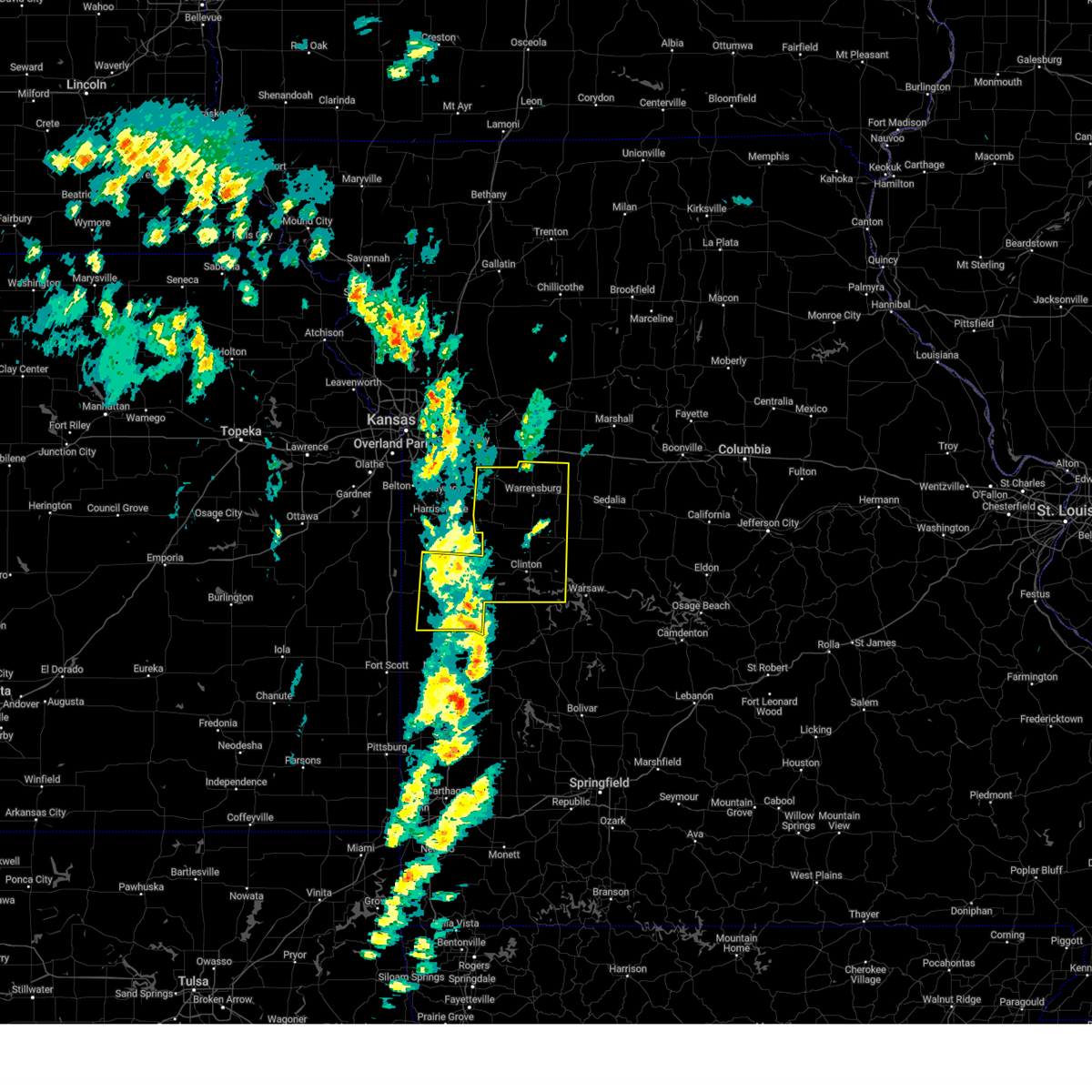 Svreax the national weather service in pleasant hill has issued a * severe thunderstorm warning for, henry county in west central missouri, bates county in west central missouri, johnson county in west central missouri, * until 430 pm cdt. * at 343 pm cdt, a severe thunderstorm was located near garden city, moving northeast at 65 mph (radar indicated). Hazards include 70 mph wind gusts and penny size hail. Expect considerable tree damage. Damage is likely to mobile homes, roofs, and outbuildings. Svreax the national weather service in pleasant hill has issued a * severe thunderstorm warning for, henry county in west central missouri, bates county in west central missouri, johnson county in west central missouri, * until 430 pm cdt. * at 343 pm cdt, a severe thunderstorm was located near garden city, moving northeast at 65 mph (radar indicated). Hazards include 70 mph wind gusts and penny size hail. Expect considerable tree damage. Damage is likely to mobile homes, roofs, and outbuildings.
|
| 9/19/2024 5:37 PM CDT |
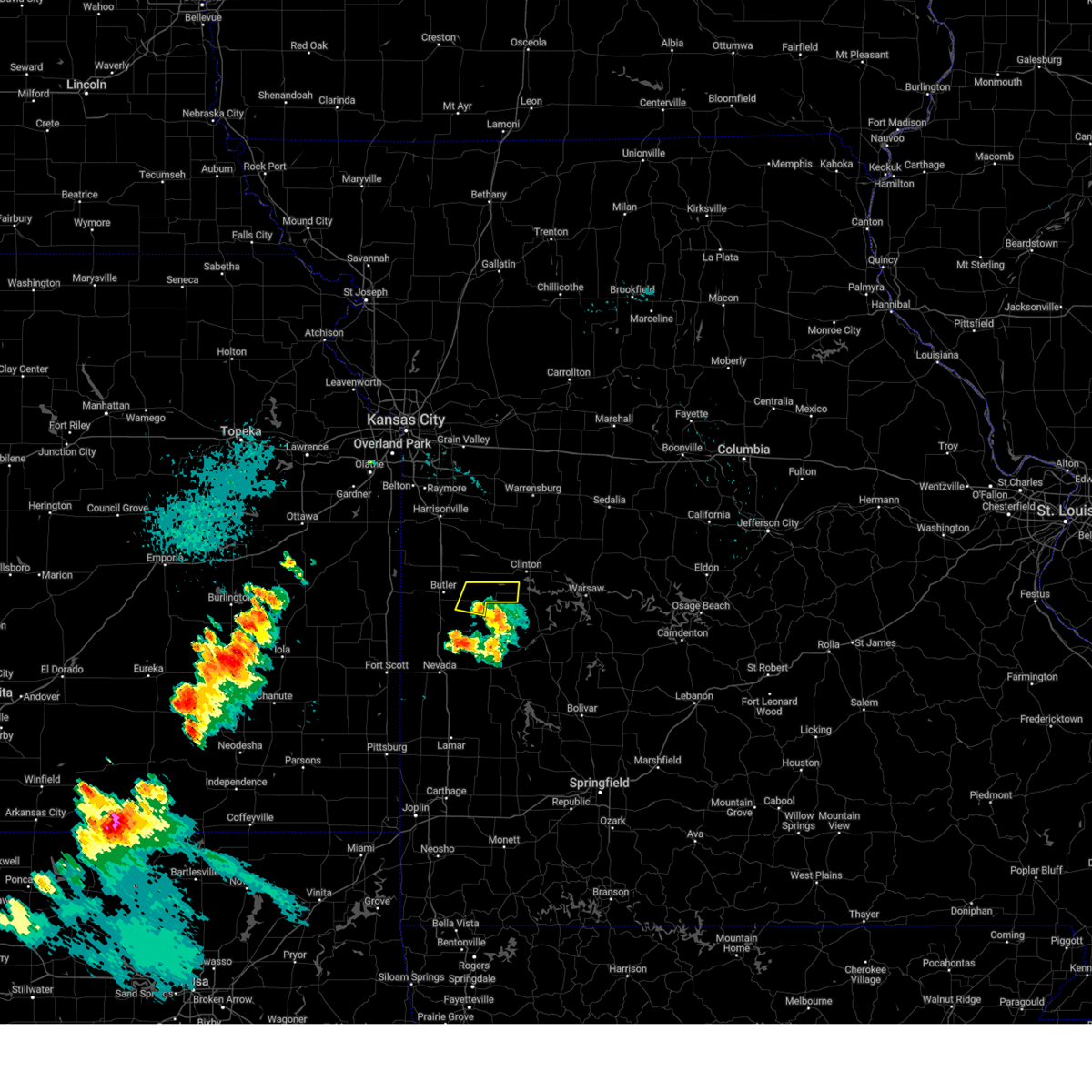 The storm which prompted the warning has weakened below severe limits, and will be exiting the warned area. therefore, the warning will be allowed to expire. a severe thunderstorm watch remains in effect until midnight cdt for west central missouri. The storm which prompted the warning has weakened below severe limits, and will be exiting the warned area. therefore, the warning will be allowed to expire. a severe thunderstorm watch remains in effect until midnight cdt for west central missouri.
|
| 9/19/2024 5:23 PM CDT |
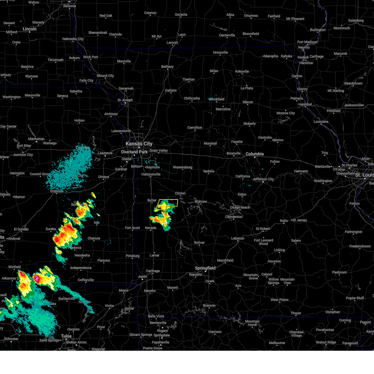 At 523 pm cdt, a severe thunderstorm was located 7 miles northwest of appleton city, or 10 miles east of butler, moving east at 20 mph (radar indicated). Hazards include 60 mph wind gusts. Expect damage to roofs, siding, and trees. Locations impacted include, montrose. At 523 pm cdt, a severe thunderstorm was located 7 miles northwest of appleton city, or 10 miles east of butler, moving east at 20 mph (radar indicated). Hazards include 60 mph wind gusts. Expect damage to roofs, siding, and trees. Locations impacted include, montrose.
|
| 9/19/2024 5:05 PM CDT |
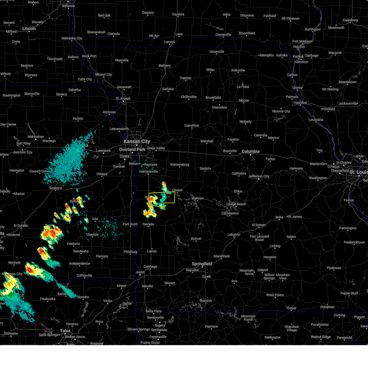 Svreax the national weather service in pleasant hill has issued a * severe thunderstorm warning for, southwestern henry county in west central missouri, east central bates county in west central missouri, * until 545 pm cdt. * at 505 pm cdt, a severe thunderstorm was located near butler, moving east at 20 mph (radar indicated). Hazards include 60 mph wind gusts. expect damage to roofs, siding, and trees Svreax the national weather service in pleasant hill has issued a * severe thunderstorm warning for, southwestern henry county in west central missouri, east central bates county in west central missouri, * until 545 pm cdt. * at 505 pm cdt, a severe thunderstorm was located near butler, moving east at 20 mph (radar indicated). Hazards include 60 mph wind gusts. expect damage to roofs, siding, and trees
|
| 7/11/2024 7:50 PM CDT |
 Svreax the national weather service in pleasant hill has issued a * severe thunderstorm warning for, eastern henry county in west central missouri, * until 830 pm cdt. * at 749 pm cdt, a severe thunderstorm was located near deepwater, or near clinton, moving northeast at 20 mph (radar indicated). Hazards include 60 mph wind gusts and quarter size hail. Hail damage to vehicles is expected. Expect wind damage to roofs, siding, and trees. Svreax the national weather service in pleasant hill has issued a * severe thunderstorm warning for, eastern henry county in west central missouri, * until 830 pm cdt. * at 749 pm cdt, a severe thunderstorm was located near deepwater, or near clinton, moving northeast at 20 mph (radar indicated). Hazards include 60 mph wind gusts and quarter size hail. Hail damage to vehicles is expected. Expect wind damage to roofs, siding, and trees.
|
| 7/11/2024 7:35 PM CDT |
 At 735 pm cdt, a severe thunderstorm was located near appleton city, or 12 miles east of butler, moving east at 15 mph (radar indicated). Hazards include 60 mph wind gusts and quarter size hail. Hail damage to vehicles is expected. expect wind damage to roofs, siding, and trees. Locations impacted include, montrose and la due. At 735 pm cdt, a severe thunderstorm was located near appleton city, or 12 miles east of butler, moving east at 15 mph (radar indicated). Hazards include 60 mph wind gusts and quarter size hail. Hail damage to vehicles is expected. expect wind damage to roofs, siding, and trees. Locations impacted include, montrose and la due.
|
| 7/11/2024 7:15 PM CDT |
 Svreax the national weather service in pleasant hill has issued a * severe thunderstorm warning for, southwestern henry county in west central missouri, east central bates county in west central missouri, * until 800 pm cdt. * at 715 pm cdt, a severe thunderstorm was located 9 miles northwest of appleton city, or 9 miles east of butler, moving northeast at 15 mph (radar indicated). Hazards include 60 mph wind gusts and quarter size hail. Hail damage to vehicles is expected. Expect wind damage to roofs, siding, and trees. Svreax the national weather service in pleasant hill has issued a * severe thunderstorm warning for, southwestern henry county in west central missouri, east central bates county in west central missouri, * until 800 pm cdt. * at 715 pm cdt, a severe thunderstorm was located 9 miles northwest of appleton city, or 9 miles east of butler, moving northeast at 15 mph (radar indicated). Hazards include 60 mph wind gusts and quarter size hail. Hail damage to vehicles is expected. Expect wind damage to roofs, siding, and trees.
|
| 6/28/2024 10:59 PM CDT |
 Svreax the national weather service in pleasant hill has issued a * severe thunderstorm warning for, eastern cass county in west central missouri, henry county in west central missouri, northeastern bates county in west central missouri, johnson county in west central missouri, * until midnight cdt. * at 1059 pm cdt, a severe thunderstorm was located near garden city, moving east at 30 mph (radar indicated). Hazards include 60 mph wind gusts. expect damage to roofs, siding, and trees Svreax the national weather service in pleasant hill has issued a * severe thunderstorm warning for, eastern cass county in west central missouri, henry county in west central missouri, northeastern bates county in west central missouri, johnson county in west central missouri, * until midnight cdt. * at 1059 pm cdt, a severe thunderstorm was located near garden city, moving east at 30 mph (radar indicated). Hazards include 60 mph wind gusts. expect damage to roofs, siding, and trees
|
| 5/25/2024 11:20 PM CDT |
 Svreax the national weather service in pleasant hill has issued a * severe thunderstorm warning for, henry county in west central missouri, * until midnight cdt. * at 1119 pm cdt, a severe thunderstorm was located near clinton, moving northeast at 45 mph (radar indicated). Hazards include 60 mph wind gusts and penny size hail. expect damage to roofs, siding, and trees Svreax the national weather service in pleasant hill has issued a * severe thunderstorm warning for, henry county in west central missouri, * until midnight cdt. * at 1119 pm cdt, a severe thunderstorm was located near clinton, moving northeast at 45 mph (radar indicated). Hazards include 60 mph wind gusts and penny size hail. expect damage to roofs, siding, and trees
|
| 5/21/2024 5:32 PM CDT |
 At 531 pm cdt, severe thunderstorms were located along a line extending from 9 miles east of deepwater to 6 miles southeast of green ridge, moving east at 60 mph (law enforcement reported large tree limbs down with this storm in clinton). Hazards include 60 mph wind gusts and quarter size hail. Hail damage to vehicles is expected. expect wind damage to roofs, siding, and trees. Locations impacted include, clinton, windsor, calhoun, deepwater, coal, brownington, tightwad, la due, and truman lake. At 531 pm cdt, severe thunderstorms were located along a line extending from 9 miles east of deepwater to 6 miles southeast of green ridge, moving east at 60 mph (law enforcement reported large tree limbs down with this storm in clinton). Hazards include 60 mph wind gusts and quarter size hail. Hail damage to vehicles is expected. expect wind damage to roofs, siding, and trees. Locations impacted include, clinton, windsor, calhoun, deepwater, coal, brownington, tightwad, la due, and truman lake.
|
| 5/21/2024 5:13 PM CDT |
 At 513 pm cdt, severe thunderstorms were located along a line extending from near montrose to near calhoun, moving east at 60 mph (radar indicated). Hazards include 60 mph wind gusts and quarter size hail. Hail damage to vehicles is expected. expect wind damage to roofs, siding, and trees. Locations impacted include, clinton, windsor, calhoun, deepwater, montrose, coal, brownington, tightwad, la due, and truman lake. At 513 pm cdt, severe thunderstorms were located along a line extending from near montrose to near calhoun, moving east at 60 mph (radar indicated). Hazards include 60 mph wind gusts and quarter size hail. Hail damage to vehicles is expected. expect wind damage to roofs, siding, and trees. Locations impacted include, clinton, windsor, calhoun, deepwater, montrose, coal, brownington, tightwad, la due, and truman lake.
|
| 5/21/2024 5:10 PM CDT |
 Svreax the national weather service in pleasant hill has issued a * severe thunderstorm warning for, henry county in west central missouri, * until 545 pm cdt. * at 509 pm cdt, severe thunderstorms were located along a line extending from near montrose to near calhoun, moving east at 60 mph (radar indicated). Hazards include 60 mph wind gusts. expect damage to roofs, siding, and trees Svreax the national weather service in pleasant hill has issued a * severe thunderstorm warning for, henry county in west central missouri, * until 545 pm cdt. * at 509 pm cdt, severe thunderstorms were located along a line extending from near montrose to near calhoun, moving east at 60 mph (radar indicated). Hazards include 60 mph wind gusts. expect damage to roofs, siding, and trees
|
| 5/21/2024 5:01 PM CDT |
 At 501 pm cdt, severe thunderstorms were located along a line extending from near la monte to 6 miles southeast of appleton city, moving east at 70 mph (radar indicated). Hazards include 60 mph wind gusts and penny size hail. Expect damage to roofs, siding, and trees. Locations impacted include, warrensburg, clinton, butler, windsor, knob noster, holden, adrian, rich hill, whiteman air force base, leeton, urich, calhoun, deepwater, montrose, creighton, chilhowee, whiteman afb, coal, centerview, and rockville. At 501 pm cdt, severe thunderstorms were located along a line extending from near la monte to 6 miles southeast of appleton city, moving east at 70 mph (radar indicated). Hazards include 60 mph wind gusts and penny size hail. Expect damage to roofs, siding, and trees. Locations impacted include, warrensburg, clinton, butler, windsor, knob noster, holden, adrian, rich hill, whiteman air force base, leeton, urich, calhoun, deepwater, montrose, creighton, chilhowee, whiteman afb, coal, centerview, and rockville.
|
| 5/21/2024 5:01 PM CDT |
 the severe thunderstorm warning has been cancelled and is no longer in effect the severe thunderstorm warning has been cancelled and is no longer in effect
|
| 5/21/2024 4:39 PM CDT |
 Svreax the national weather service in pleasant hill has issued a * severe thunderstorm warning for, southeastern cass county in west central missouri, henry county in west central missouri, bates county in west central missouri, johnson county in west central missouri, * until 515 pm cdt. * at 439 pm cdt, severe thunderstorms were located along a line extending from near chilhowee to rich hill, moving east at 70 mph (radar indicated). Hazards include 60 mph wind gusts and nickel size hail. expect damage to roofs, siding, and trees Svreax the national weather service in pleasant hill has issued a * severe thunderstorm warning for, southeastern cass county in west central missouri, henry county in west central missouri, bates county in west central missouri, johnson county in west central missouri, * until 515 pm cdt. * at 439 pm cdt, severe thunderstorms were located along a line extending from near chilhowee to rich hill, moving east at 70 mph (radar indicated). Hazards include 60 mph wind gusts and nickel size hail. expect damage to roofs, siding, and trees
|
| 5/8/2024 2:40 PM CDT |
 The storm which prompted the warning has weakened below severe limits, and no longer poses an immediate threat to life or property. therefore, the warning will be allowed to expire. however, small hail and gusty winds are still possible with this thunderstorm. a severe thunderstorm watch remains in effect until 400 pm cdt for west central missouri. The storm which prompted the warning has weakened below severe limits, and no longer poses an immediate threat to life or property. therefore, the warning will be allowed to expire. however, small hail and gusty winds are still possible with this thunderstorm. a severe thunderstorm watch remains in effect until 400 pm cdt for west central missouri.
|
| 5/8/2024 2:30 PM CDT |
 At 230 pm cdt, a severe thunderstorm was located near clinton, moving northeast at 35 mph (radar indicated). Hazards include 60 mph wind gusts and quarter size hail. Hail damage to vehicles is expected. expect wind damage to roofs, siding, and trees. Locations impacted include, clinton, hartwell, and la due. At 230 pm cdt, a severe thunderstorm was located near clinton, moving northeast at 35 mph (radar indicated). Hazards include 60 mph wind gusts and quarter size hail. Hail damage to vehicles is expected. expect wind damage to roofs, siding, and trees. Locations impacted include, clinton, hartwell, and la due.
|
| 5/8/2024 2:18 PM CDT |
 Svreax the national weather service in pleasant hill has issued a * severe thunderstorm warning for, henry county in west central missouri, * until 245 pm cdt. * at 217 pm cdt, a severe thunderstorm was located near montrose, or 10 miles southwest of clinton, moving northeast at 35 mph (radar indicated). Hazards include 60 mph wind gusts and quarter size hail. Hail damage to vehicles is expected. Expect wind damage to roofs, siding, and trees. Svreax the national weather service in pleasant hill has issued a * severe thunderstorm warning for, henry county in west central missouri, * until 245 pm cdt. * at 217 pm cdt, a severe thunderstorm was located near montrose, or 10 miles southwest of clinton, moving northeast at 35 mph (radar indicated). Hazards include 60 mph wind gusts and quarter size hail. Hail damage to vehicles is expected. Expect wind damage to roofs, siding, and trees.
|
| 5/6/2024 11:36 PM CDT |
 Svreax the national weather service in pleasant hill has issued a * severe thunderstorm warning for, henry county in west central missouri, johnson county in west central missouri, * until 1245 am cdt. * at 1136 pm cdt, severe thunderstorms were located along a line extending from lone jack to 6 miles southeast of rich hill, moving northeast at 40 mph (radar indicated). Hazards include 60 mph wind gusts and penny size hail. expect damage to roofs, siding, and trees Svreax the national weather service in pleasant hill has issued a * severe thunderstorm warning for, henry county in west central missouri, johnson county in west central missouri, * until 1245 am cdt. * at 1136 pm cdt, severe thunderstorms were located along a line extending from lone jack to 6 miles southeast of rich hill, moving northeast at 40 mph (radar indicated). Hazards include 60 mph wind gusts and penny size hail. expect damage to roofs, siding, and trees
|
| 4/27/2024 9:30 PM CDT |
 At 930 pm cdt, severe thunderstorms were located along a line extending from near warrensburg to near calhoun to 9 miles southwest of windsor to 6 miles east of clinton to near deepwater, moving east at 40 mph (radar indicated). Hazards include 60 mph wind gusts and quarter size hail. Hail damage to vehicles is expected. expect wind damage to roofs, siding, and trees. Locations impacted include, warrensburg, clinton, windsor, knob noster, whiteman air force base, la monte, leeton, green ridge, calhoun, deepwater, chilhowee, houstonia, whiteman afb, coal, centerview, brownington, tightwad, post oak, hartwell, and la due. At 930 pm cdt, severe thunderstorms were located along a line extending from near warrensburg to near calhoun to 9 miles southwest of windsor to 6 miles east of clinton to near deepwater, moving east at 40 mph (radar indicated). Hazards include 60 mph wind gusts and quarter size hail. Hail damage to vehicles is expected. expect wind damage to roofs, siding, and trees. Locations impacted include, warrensburg, clinton, windsor, knob noster, whiteman air force base, la monte, leeton, green ridge, calhoun, deepwater, chilhowee, houstonia, whiteman afb, coal, centerview, brownington, tightwad, post oak, hartwell, and la due.
|
| 4/27/2024 9:07 PM CDT |
 Svreax the national weather service in pleasant hill has issued a * severe thunderstorm warning for, henry county in west central missouri, western pettis county in central missouri, johnson county in west central missouri, * until 945 pm cdt. * at 907 pm cdt, severe thunderstorms were located along a line extending from near holden to 7 miles south of chilhowee to clinton to near deepwater to 6 miles east of appleton city, moving east at 40 mph (radar indicated). Hazards include 60 mph wind gusts and quarter size hail. Hail damage to vehicles is expected. Expect wind damage to roofs, siding, and trees. Svreax the national weather service in pleasant hill has issued a * severe thunderstorm warning for, henry county in west central missouri, western pettis county in central missouri, johnson county in west central missouri, * until 945 pm cdt. * at 907 pm cdt, severe thunderstorms were located along a line extending from near holden to 7 miles south of chilhowee to clinton to near deepwater to 6 miles east of appleton city, moving east at 40 mph (radar indicated). Hazards include 60 mph wind gusts and quarter size hail. Hail damage to vehicles is expected. Expect wind damage to roofs, siding, and trees.
|
| 4/27/2024 9:02 PM CDT |
 At 902 pm cdt, severe thunderstorms were located along a line extending from near creighton to near montrose to 10 miles southeast of appleton city to schell city, moving east at 35 mph (radar indicated). Hazards include 60 mph wind gusts and quarter size hail. Hail damage to vehicles is expected. expect wind damage to roofs, siding, and trees. Locations impacted include, harrisonville, holden, garden city, urich, montrose, creighton, east lynne, kingsville, rockville, gunn city, blairstown, la tour, hartwell, la due, and quick city. At 902 pm cdt, severe thunderstorms were located along a line extending from near creighton to near montrose to 10 miles southeast of appleton city to schell city, moving east at 35 mph (radar indicated). Hazards include 60 mph wind gusts and quarter size hail. Hail damage to vehicles is expected. expect wind damage to roofs, siding, and trees. Locations impacted include, harrisonville, holden, garden city, urich, montrose, creighton, east lynne, kingsville, rockville, gunn city, blairstown, la tour, hartwell, la due, and quick city.
|
| 4/27/2024 8:54 PM CDT |
 At 853 pm cdt, tornado producing storms were located along a line extending from 6 miles north of creighton to near urich to near montrose, moving northeast at 50 mph (weather spotters confirmed tornado. spotters reported a tornado 3 miles north of montrose at 848 pm). Hazards include damaging tornado. Flying debris will be dangerous to those caught without shelter. mobile homes will be damaged or destroyed. damage to roofs, windows, and vehicles will occur. tree damage is likely. Locations impacted include, clinton, urich, deepwater, montrose, creighton, chilhowee, blairstown, hartwell, la due, quick city, and truman lake. At 853 pm cdt, tornado producing storms were located along a line extending from 6 miles north of creighton to near urich to near montrose, moving northeast at 50 mph (weather spotters confirmed tornado. spotters reported a tornado 3 miles north of montrose at 848 pm). Hazards include damaging tornado. Flying debris will be dangerous to those caught without shelter. mobile homes will be damaged or destroyed. damage to roofs, windows, and vehicles will occur. tree damage is likely. Locations impacted include, clinton, urich, deepwater, montrose, creighton, chilhowee, blairstown, hartwell, la due, quick city, and truman lake.
|
| 4/27/2024 8:54 PM CDT |
 the tornado warning has been cancelled and is no longer in effect the tornado warning has been cancelled and is no longer in effect
|
| 4/27/2024 8:35 PM CDT |
 Toreax the national weather service in pleasant hill has issued a * tornado warning for, southeastern cass county in west central missouri, western henry county in west central missouri, southwestern johnson county in west central missouri, * until 915 pm cdt. * at 835 pm cdt, severe thunderstorms capable of producing both tornadoes and extensive straight line wind damage were located along a line extending from near archie to 9 miles southwest of creighton to 7 miles southwest of appleton city, moving northeast at 50 mph (radar indicated rotation). Hazards include tornado. Flying debris will be dangerous to those caught without shelter. mobile homes will be damaged or destroyed. damage to roofs, windows, and vehicles will occur. Tree damage is likely. Toreax the national weather service in pleasant hill has issued a * tornado warning for, southeastern cass county in west central missouri, western henry county in west central missouri, southwestern johnson county in west central missouri, * until 915 pm cdt. * at 835 pm cdt, severe thunderstorms capable of producing both tornadoes and extensive straight line wind damage were located along a line extending from near archie to 9 miles southwest of creighton to 7 miles southwest of appleton city, moving northeast at 50 mph (radar indicated rotation). Hazards include tornado. Flying debris will be dangerous to those caught without shelter. mobile homes will be damaged or destroyed. damage to roofs, windows, and vehicles will occur. Tree damage is likely.
|
| 4/27/2024 8:31 PM CDT |
 Svreax the national weather service in pleasant hill has issued a * severe thunderstorm warning for, southeastern cass county in west central missouri, western henry county in west central missouri, eastern bates county in west central missouri, southwestern johnson county in west central missouri, * until 915 pm cdt. * at 831 pm cdt, severe thunderstorms were located along a line extending from near archie to 6 miles east of butler to 7 miles northwest of schell city to near rich hill, moving east at 35 mph (radar indicated). Hazards include 60 mph wind gusts and quarter size hail. Hail damage to vehicles is expected. Expect wind damage to roofs, siding, and trees. Svreax the national weather service in pleasant hill has issued a * severe thunderstorm warning for, southeastern cass county in west central missouri, western henry county in west central missouri, eastern bates county in west central missouri, southwestern johnson county in west central missouri, * until 915 pm cdt. * at 831 pm cdt, severe thunderstorms were located along a line extending from near archie to 6 miles east of butler to 7 miles northwest of schell city to near rich hill, moving east at 35 mph (radar indicated). Hazards include 60 mph wind gusts and quarter size hail. Hail damage to vehicles is expected. Expect wind damage to roofs, siding, and trees.
|
| 4/26/2024 7:53 PM CDT |
 The storm which prompted the warning has weakened below severe limits, and no longer poses an immediate threat to life or property. therefore, the warning will be allowed to expire. however, gusty winds are still possible with this thunderstorm. a tornado watch remains in effect until midnight cdt for west central missouri. The storm which prompted the warning has weakened below severe limits, and no longer poses an immediate threat to life or property. therefore, the warning will be allowed to expire. however, gusty winds are still possible with this thunderstorm. a tornado watch remains in effect until midnight cdt for west central missouri.
|
| 4/26/2024 7:40 PM CDT |
 the severe thunderstorm warning has been cancelled and is no longer in effect the severe thunderstorm warning has been cancelled and is no longer in effect
|
| 4/26/2024 7:40 PM CDT |
 At 740 pm cdt, a severe thunderstorm was located near calhoun, or near clinton, moving northeast at 60 mph (radar indicated). Hazards include 60 mph wind gusts and quarter size hail. Hail damage to vehicles is expected. expect wind damage to roofs, siding, and trees. Locations impacted include, clinton, calhoun, montrose, coal, la due, and truman lake. At 740 pm cdt, a severe thunderstorm was located near calhoun, or near clinton, moving northeast at 60 mph (radar indicated). Hazards include 60 mph wind gusts and quarter size hail. Hail damage to vehicles is expected. expect wind damage to roofs, siding, and trees. Locations impacted include, clinton, calhoun, montrose, coal, la due, and truman lake.
|
| 4/26/2024 7:19 PM CDT |
 At 719 pm cdt, a severe thunderstorm capable of producing a tornado was located near deepwater, or near clinton, moving northeast at 40 mph (radar indicated rotation). Hazards include tornado and half dollar size hail. Flying debris will be dangerous to those caught without shelter. mobile homes will be damaged or destroyed. damage to roofs, windows, and vehicles will occur. tree damage is likely. Locations impacted include, deepwater and la due. At 719 pm cdt, a severe thunderstorm capable of producing a tornado was located near deepwater, or near clinton, moving northeast at 40 mph (radar indicated rotation). Hazards include tornado and half dollar size hail. Flying debris will be dangerous to those caught without shelter. mobile homes will be damaged or destroyed. damage to roofs, windows, and vehicles will occur. tree damage is likely. Locations impacted include, deepwater and la due.
|
| 4/26/2024 7:09 PM CDT |
 Svreax the national weather service in pleasant hill has issued a * severe thunderstorm warning for, henry county in west central missouri, southeastern bates county in west central missouri, * until 800 pm cdt. * at 709 pm cdt, a severe thunderstorm was located near butler, moving northeast at 35 mph (radar indicated). Hazards include 60 mph wind gusts and half dollar size hail. Hail damage to vehicles is expected. Expect wind damage to roofs, siding, and trees. Svreax the national weather service in pleasant hill has issued a * severe thunderstorm warning for, henry county in west central missouri, southeastern bates county in west central missouri, * until 800 pm cdt. * at 709 pm cdt, a severe thunderstorm was located near butler, moving northeast at 35 mph (radar indicated). Hazards include 60 mph wind gusts and half dollar size hail. Hail damage to vehicles is expected. Expect wind damage to roofs, siding, and trees.
|
| 4/26/2024 6:58 PM CDT |
 At 657 pm cdt, a severe thunderstorm capable of producing a tornado was located near montrose, or 15 miles southwest of clinton, moving northeast at 40 mph (radar indicated rotation). Hazards include tornado and ping pong ball size hail. Flying debris will be dangerous to those caught without shelter. mobile homes will be damaged or destroyed. damage to roofs, windows, and vehicles will occur. tree damage is likely. Locations impacted include, deepwater, montrose, and la due. At 657 pm cdt, a severe thunderstorm capable of producing a tornado was located near montrose, or 15 miles southwest of clinton, moving northeast at 40 mph (radar indicated rotation). Hazards include tornado and ping pong ball size hail. Flying debris will be dangerous to those caught without shelter. mobile homes will be damaged or destroyed. damage to roofs, windows, and vehicles will occur. tree damage is likely. Locations impacted include, deepwater, montrose, and la due.
|
| 4/26/2024 6:58 PM CDT |
 the tornado warning has been cancelled and is no longer in effect the tornado warning has been cancelled and is no longer in effect
|
| 4/26/2024 6:42 PM CDT |
 Toreax the national weather service in pleasant hill has issued a * tornado warning for, southwestern henry county in west central missouri, southeastern bates county in west central missouri, * until 730 pm cdt. * at 642 pm cdt, a severe thunderstorm capable of producing a tornado was located near appleton city, or 13 miles east of rich hill, moving northeast at 40 mph (radar indicated rotation). Hazards include tornado and golf ball size hail. Flying debris will be dangerous to those caught without shelter. mobile homes will be damaged or destroyed. damage to roofs, windows, and vehicles will occur. Tree damage is likely. Toreax the national weather service in pleasant hill has issued a * tornado warning for, southwestern henry county in west central missouri, southeastern bates county in west central missouri, * until 730 pm cdt. * at 642 pm cdt, a severe thunderstorm capable of producing a tornado was located near appleton city, or 13 miles east of rich hill, moving northeast at 40 mph (radar indicated rotation). Hazards include tornado and golf ball size hail. Flying debris will be dangerous to those caught without shelter. mobile homes will be damaged or destroyed. damage to roofs, windows, and vehicles will occur. Tree damage is likely.
|
| 4/18/2024 1:09 PM CDT |
 Svreax the national weather service in pleasant hill has issued a * severe thunderstorm warning for, southeastern henry county in west central missouri, * until 200 pm cdt. * at 108 pm cdt, a severe thunderstorm was located over clinton, moving east at 35 mph (radar indicated). Hazards include 60 mph wind gusts and half dollar size hail. Hail damage to vehicles is expected. Expect wind damage to roofs, siding, and trees. Svreax the national weather service in pleasant hill has issued a * severe thunderstorm warning for, southeastern henry county in west central missouri, * until 200 pm cdt. * at 108 pm cdt, a severe thunderstorm was located over clinton, moving east at 35 mph (radar indicated). Hazards include 60 mph wind gusts and half dollar size hail. Hail damage to vehicles is expected. Expect wind damage to roofs, siding, and trees.
|
| 4/18/2024 1:04 PM CDT |
 the severe thunderstorm warning has been cancelled and is no longer in effect the severe thunderstorm warning has been cancelled and is no longer in effect
|
| 4/18/2024 1:04 PM CDT |
 At 104 pm cdt, a severe thunderstorm was located near clinton, moving northeast at 30 mph (radar indicated). Hazards include 60 mph wind gusts and half dollar size hail. Hail damage to vehicles is expected. expect wind damage to roofs, siding, and trees. Locations impacted include, clinton, deepwater, montrose, brownington, and la due. At 104 pm cdt, a severe thunderstorm was located near clinton, moving northeast at 30 mph (radar indicated). Hazards include 60 mph wind gusts and half dollar size hail. Hail damage to vehicles is expected. expect wind damage to roofs, siding, and trees. Locations impacted include, clinton, deepwater, montrose, brownington, and la due.
|
| 4/18/2024 12:50 PM CDT |
 At 1250 pm cdt, severe thunderstorms were located along a line extending from 6 miles south of chilhowee to near montrose, moving northeast at 30 mph (radar indicated). Hazards include 60 mph wind gusts and half dollar size hail. Hail damage to vehicles is expected. expect wind damage to roofs, siding, and trees. Locations impacted include, clinton, leeton, deepwater, montrose, brownington, post oak, hartwell, and la due. At 1250 pm cdt, severe thunderstorms were located along a line extending from 6 miles south of chilhowee to near montrose, moving northeast at 30 mph (radar indicated). Hazards include 60 mph wind gusts and half dollar size hail. Hail damage to vehicles is expected. expect wind damage to roofs, siding, and trees. Locations impacted include, clinton, leeton, deepwater, montrose, brownington, post oak, hartwell, and la due.
|
| 4/18/2024 12:36 PM CDT |
 At 1235 pm cdt, a severe thunderstorm was located over urich, or 12 miles west of clinton, moving east at 25 mph (radar indicated). Hazards include golf ball size hail and 60 mph wind gusts. People and animals outdoors will be injured. expect hail damage to roofs, siding, windows, and vehicles. expect wind damage to roofs, siding, and trees. Locations impacted include, clinton, leeton, urich, deepwater, montrose, brownington, ballard, post oak, hartwell, and la due. At 1235 pm cdt, a severe thunderstorm was located over urich, or 12 miles west of clinton, moving east at 25 mph (radar indicated). Hazards include golf ball size hail and 60 mph wind gusts. People and animals outdoors will be injured. expect hail damage to roofs, siding, windows, and vehicles. expect wind damage to roofs, siding, and trees. Locations impacted include, clinton, leeton, urich, deepwater, montrose, brownington, ballard, post oak, hartwell, and la due.
|
| 4/18/2024 12:26 PM CDT |
 Svreax the national weather service in pleasant hill has issued a * severe thunderstorm warning for, henry county in west central missouri, northeastern bates county in west central missouri, south central johnson county in west central missouri, * until 115 pm cdt. * at 1225 pm cdt, a severe thunderstorm was located near urich, or 13 miles southeast of garden city, moving east at 30 mph (radar indicated). Hazards include 60 mph wind gusts and quarter size hail. Hail damage to vehicles is expected. Expect wind damage to roofs, siding, and trees. Svreax the national weather service in pleasant hill has issued a * severe thunderstorm warning for, henry county in west central missouri, northeastern bates county in west central missouri, south central johnson county in west central missouri, * until 115 pm cdt. * at 1225 pm cdt, a severe thunderstorm was located near urich, or 13 miles southeast of garden city, moving east at 30 mph (radar indicated). Hazards include 60 mph wind gusts and quarter size hail. Hail damage to vehicles is expected. Expect wind damage to roofs, siding, and trees.
|
| 3/14/2024 4:24 AM CDT |
 At 424 am cdt, a severe thunderstorm was located 8 miles east of deepwater, or 8 miles southeast of clinton, moving east at 45 mph (radar indicated). Hazards include 60 mph wind gusts and quarter size hail. Hail damage to vehicles is expected. expect wind damage to roofs, siding, and trees. Locations impacted include, clinton, deepwater, coal, brownington, tightwad, la due, and truman lake. At 424 am cdt, a severe thunderstorm was located 8 miles east of deepwater, or 8 miles southeast of clinton, moving east at 45 mph (radar indicated). Hazards include 60 mph wind gusts and quarter size hail. Hail damage to vehicles is expected. expect wind damage to roofs, siding, and trees. Locations impacted include, clinton, deepwater, coal, brownington, tightwad, la due, and truman lake.
|
| 3/14/2024 4:09 AM CDT | Svreax the national weather service in pleasant hill has issued a * severe thunderstorm warning for, henry county in west central missouri, * until 445 am cdt. * at 409 am cdt, a severe thunderstorm was located near deepwater, or near clinton, moving east at 65 mph (radar indicated). Hazards include 60 mph wind gusts and quarter size hail. Hail damage to vehicles is expected. Expect wind damage to roofs, siding, and trees. |
| 3/14/2024 3:59 AM CDT |
 At 359 am cdt, a severe thunderstorm was located near chilhowee, or 9 miles south of warrensburg, moving northeast at 60 mph (radar indicated). Hazards include 60 mph wind gusts and quarter size hail. Hail damage to vehicles is expected. expect wind damage to roofs, siding, and trees. Locations impacted include, clinton, holden, leeton, urich, calhoun, deepwater, montrose, creighton, chilhowee, kingsville, coal, centerview, rockville, brownington, blairstown, tightwad, ballard, post oak, hartwell, and la due. At 359 am cdt, a severe thunderstorm was located near chilhowee, or 9 miles south of warrensburg, moving northeast at 60 mph (radar indicated). Hazards include 60 mph wind gusts and quarter size hail. Hail damage to vehicles is expected. expect wind damage to roofs, siding, and trees. Locations impacted include, clinton, holden, leeton, urich, calhoun, deepwater, montrose, creighton, chilhowee, kingsville, coal, centerview, rockville, brownington, blairstown, tightwad, ballard, post oak, hartwell, and la due.
|
| 3/14/2024 3:50 AM CDT |
 At 350 am cdt, a severe thunderstorm was located near chilhowee, or 10 miles south of holden, moving northeast at 60 mph (radar indicated). Hazards include 60 mph wind gusts and quarter size hail. Hail damage to vehicles is expected. expect wind damage to roofs, siding, and trees. Locations impacted include, clinton, butler, holden, adrian, garden city, rich hill, archie, leeton, urich, calhoun, deepwater, montrose, creighton, hume, chilhowee, east lynne, kingsville, coal, centerview, and rockville. At 350 am cdt, a severe thunderstorm was located near chilhowee, or 10 miles south of holden, moving northeast at 60 mph (radar indicated). Hazards include 60 mph wind gusts and quarter size hail. Hail damage to vehicles is expected. expect wind damage to roofs, siding, and trees. Locations impacted include, clinton, butler, holden, adrian, garden city, rich hill, archie, leeton, urich, calhoun, deepwater, montrose, creighton, hume, chilhowee, east lynne, kingsville, coal, centerview, and rockville.
|
| 3/14/2024 3:39 AM CDT |
 Svreax the national weather service in pleasant hill has issued a * severe thunderstorm warning for, southern cass county in west central missouri, henry county in west central missouri, bates county in west central missouri, southwestern johnson county in west central missouri, * until 415 am cdt. * at 338 am cdt, a severe thunderstorm was located near creighton, or near garden city, moving northeast at 60 mph (radar indicated). Hazards include 60 mph wind gusts and quarter size hail. Hail damage to vehicles is expected. Expect wind damage to roofs, siding, and trees. Svreax the national weather service in pleasant hill has issued a * severe thunderstorm warning for, southern cass county in west central missouri, henry county in west central missouri, bates county in west central missouri, southwestern johnson county in west central missouri, * until 415 am cdt. * at 338 am cdt, a severe thunderstorm was located near creighton, or near garden city, moving northeast at 60 mph (radar indicated). Hazards include 60 mph wind gusts and quarter size hail. Hail damage to vehicles is expected. Expect wind damage to roofs, siding, and trees.
|
| 9/23/2023 6:57 PM CDT |
 The severe thunderstorm warning for eastern henry county will expire at 700 pm cdt, the storm which prompted the warning has weakened below severe limits, and no longer poses an immediate threat to life or property. therefore, the warning will be allowed to expire. however small hail, gusty winds and heavy rain are still possible with this thunderstorm. a severe thunderstorm watch remains in effect until 900 pm cdt for west central missouri. The severe thunderstorm warning for eastern henry county will expire at 700 pm cdt, the storm which prompted the warning has weakened below severe limits, and no longer poses an immediate threat to life or property. therefore, the warning will be allowed to expire. however small hail, gusty winds and heavy rain are still possible with this thunderstorm. a severe thunderstorm watch remains in effect until 900 pm cdt for west central missouri.
|
| 9/23/2023 6:25 PM CDT |
 At 625 pm cdt, a severe thunderstorm was located over clinton, moving east at 35 mph (radar indicated). Hazards include 60 mph wind gusts and quarter size hail. Hail damage to vehicles is expected. Expect wind damage to roofs, siding, and trees. At 625 pm cdt, a severe thunderstorm was located over clinton, moving east at 35 mph (radar indicated). Hazards include 60 mph wind gusts and quarter size hail. Hail damage to vehicles is expected. Expect wind damage to roofs, siding, and trees.
|
| 9/23/2023 6:18 PM CDT |
 At 618 pm cdt, a severe thunderstorm was located over calhoun, or 8 miles southwest of windsor, moving east at 35 mph (radar indicated). Hazards include 60 mph wind gusts and quarter size hail. Hail damage to vehicles is expected. expect wind damage to roofs, siding, and trees. locations impacted include, clinton, windsor, urich, calhoun, deepwater, creighton, coal, brownington, blairstown, tightwad, hartwell, la due and truman lake. hail threat, radar indicated max hail size, 1. 00 in wind threat, radar indicated max wind gust, 60 mph. At 618 pm cdt, a severe thunderstorm was located over calhoun, or 8 miles southwest of windsor, moving east at 35 mph (radar indicated). Hazards include 60 mph wind gusts and quarter size hail. Hail damage to vehicles is expected. expect wind damage to roofs, siding, and trees. locations impacted include, clinton, windsor, urich, calhoun, deepwater, creighton, coal, brownington, blairstown, tightwad, hartwell, la due and truman lake. hail threat, radar indicated max hail size, 1. 00 in wind threat, radar indicated max wind gust, 60 mph.
|
| 9/23/2023 6:03 PM CDT |
 At 603 pm cdt, a severe thunderstorm was located near calhoun, or 7 miles north of clinton, moving east at 30 mph (radar indicated). Hazards include 60 mph wind gusts and quarter size hail. Hail damage to vehicles is expected. expect wind damage to roofs, siding, and trees. locations impacted include, clinton, windsor, holden, leeton, urich, calhoun, deepwater, creighton, chilhowee, coal, brownington, blairstown, tightwad, post oak, hartwell, la due, quick city and truman lake. hail threat, radar indicated max hail size, 1. 00 in wind threat, radar indicated max wind gust, 60 mph. At 603 pm cdt, a severe thunderstorm was located near calhoun, or 7 miles north of clinton, moving east at 30 mph (radar indicated). Hazards include 60 mph wind gusts and quarter size hail. Hail damage to vehicles is expected. expect wind damage to roofs, siding, and trees. locations impacted include, clinton, windsor, holden, leeton, urich, calhoun, deepwater, creighton, chilhowee, coal, brownington, blairstown, tightwad, post oak, hartwell, la due, quick city and truman lake. hail threat, radar indicated max hail size, 1. 00 in wind threat, radar indicated max wind gust, 60 mph.
|
| 9/23/2023 5:35 PM CDT |
 At 535 pm cdt, a severe thunderstorm was located near urich, or 13 miles east of garden city, moving east at 35 mph (radar indicated). Hazards include 60 mph wind gusts and quarter size hail. Hail damage to vehicles is expected. Expect wind damage to roofs, siding, and trees. At 535 pm cdt, a severe thunderstorm was located near urich, or 13 miles east of garden city, moving east at 35 mph (radar indicated). Hazards include 60 mph wind gusts and quarter size hail. Hail damage to vehicles is expected. Expect wind damage to roofs, siding, and trees.
|
| 9/5/2023 7:58 PM CDT |
 At 758 pm cdt, a severe thunderstorm was located over montrose, or 13 miles southwest of clinton, moving east at 20 mph (radar indicated). Hazards include 60 mph wind gusts and quarter size hail. Hail damage to vehicles is expected. Expect wind damage to roofs, siding, and trees. At 758 pm cdt, a severe thunderstorm was located over montrose, or 13 miles southwest of clinton, moving east at 20 mph (radar indicated). Hazards include 60 mph wind gusts and quarter size hail. Hail damage to vehicles is expected. Expect wind damage to roofs, siding, and trees.
|
| 9/5/2023 7:49 PM CDT |
 At 749 pm cdt, a severe thunderstorm was located over montrose, or 15 miles southwest of clinton, moving east at 20 mph (radar indicated). Hazards include 60 mph wind gusts and quarter size hail. Hail damage to vehicles is expected. expect wind damage to roofs, siding, and trees. locations impacted include, montrose and la due. hail threat, radar indicated max hail size, 1. 00 in wind threat, radar indicated max wind gust, 60 mph. At 749 pm cdt, a severe thunderstorm was located over montrose, or 15 miles southwest of clinton, moving east at 20 mph (radar indicated). Hazards include 60 mph wind gusts and quarter size hail. Hail damage to vehicles is expected. expect wind damage to roofs, siding, and trees. locations impacted include, montrose and la due. hail threat, radar indicated max hail size, 1. 00 in wind threat, radar indicated max wind gust, 60 mph.
|
| 9/5/2023 7:31 PM CDT |
 At 731 pm cdt, a severe thunderstorm was located 8 miles west of montrose, or 12 miles east of butler, moving east at 25 mph (radar indicated). Hazards include 60 mph wind gusts and half dollar size hail. Hail damage to vehicles is expected. Expect wind damage to roofs, siding, and trees. At 731 pm cdt, a severe thunderstorm was located 8 miles west of montrose, or 12 miles east of butler, moving east at 25 mph (radar indicated). Hazards include 60 mph wind gusts and half dollar size hail. Hail damage to vehicles is expected. Expect wind damage to roofs, siding, and trees.
|
| 7/30/2023 9:42 PM CDT |
 At 941 pm cdt, a severe thunderstorm was located near schell city, or 8 miles east of rich hill, moving southeast at 35 mph (radar indicated). Hazards include 70 mph wind gusts. Expect considerable tree damage. Damage is likely to mobile homes, roofs, and outbuildings. At 941 pm cdt, a severe thunderstorm was located near schell city, or 8 miles east of rich hill, moving southeast at 35 mph (radar indicated). Hazards include 70 mph wind gusts. Expect considerable tree damage. Damage is likely to mobile homes, roofs, and outbuildings.
|
| 7/30/2023 9:33 PM CDT |
 At 932 pm cdt, severe thunderstorms were located along a line extending from near windsor to montrose to near fulton, moving east at 45 mph (radar indicated). Hazards include 70 mph wind gusts. Expect considerable tree damage. damage is likely to mobile homes, roofs, and outbuildings. locations impacted include, clinton, butler, windsor, adrian, rich hill, pleasanton, mound city, leeton, urich, calhoun, deepwater, montrose, creighton, hume, chilhowee, blue mound, prescott, coal, amoret and rockville. thunderstorm damage threat, considerable hail threat, radar indicated max hail size, <. 75 in wind threat, radar indicated max wind gust, 70 mph. At 932 pm cdt, severe thunderstorms were located along a line extending from near windsor to montrose to near fulton, moving east at 45 mph (radar indicated). Hazards include 70 mph wind gusts. Expect considerable tree damage. damage is likely to mobile homes, roofs, and outbuildings. locations impacted include, clinton, butler, windsor, adrian, rich hill, pleasanton, mound city, leeton, urich, calhoun, deepwater, montrose, creighton, hume, chilhowee, blue mound, prescott, coal, amoret and rockville. thunderstorm damage threat, considerable hail threat, radar indicated max hail size, <. 75 in wind threat, radar indicated max wind gust, 70 mph.
|
| 7/30/2023 8:50 PM CDT |
 At 849 pm cdt, severe thunderstorms were located along a line extending from near oak grove to near archie to near parker, moving southeast at 40 mph (radar indicated). Hazards include 70 mph wind gusts. Expect considerable tree damage. Damage is likely to mobile homes, roofs, and outbuildings. At 849 pm cdt, severe thunderstorms were located along a line extending from near oak grove to near archie to near parker, moving southeast at 40 mph (radar indicated). Hazards include 70 mph wind gusts. Expect considerable tree damage. Damage is likely to mobile homes, roofs, and outbuildings.
|
| 7/24/2023 10:05 AM CDT |
 At 1005 am cdt, severe thunderstorms were located along a line extending from near osceola to near walker, moving southeast at 50 mph (public). Hazards include 60 mph wind gusts. Expect damage to roofs, siding, and trees. locations impacted include, clinton, butler, deepwater, montrose, rockville, brownington, la due and truman lake. hail threat, radar indicated max hail size, <. 75 in wind threat, observed max wind gust, 60 mph. At 1005 am cdt, severe thunderstorms were located along a line extending from near osceola to near walker, moving southeast at 50 mph (public). Hazards include 60 mph wind gusts. Expect damage to roofs, siding, and trees. locations impacted include, clinton, butler, deepwater, montrose, rockville, brownington, la due and truman lake. hail threat, radar indicated max hail size, <. 75 in wind threat, observed max wind gust, 60 mph.
|
| 7/24/2023 9:41 AM CDT |
 At 941 am cdt, a severe thunderstorm was located near appleton city, or 16 miles southwest of clinton, moving southeast at 50 mph (radar indicated). Hazards include 60 mph wind gusts. Expect damage to roofs, siding, and trees. locations impacted include, clinton, butler, adrian, urich, montrose, blairstown, passaic, ballard, hartwell and la due. hail threat, radar indicated max hail size, <. 75 in wind threat, radar indicated max wind gust, 60 mph. At 941 am cdt, a severe thunderstorm was located near appleton city, or 16 miles southwest of clinton, moving southeast at 50 mph (radar indicated). Hazards include 60 mph wind gusts. Expect damage to roofs, siding, and trees. locations impacted include, clinton, butler, adrian, urich, montrose, blairstown, passaic, ballard, hartwell and la due. hail threat, radar indicated max hail size, <. 75 in wind threat, radar indicated max wind gust, 60 mph.
|
| 7/24/2023 9:37 AM CDT |
 At 937 am cdt, severe thunderstorms were located along a line extending from near deepwater to near hume, moving southeast at 50 mph (public). Hazards include 60 mph wind gusts. expect damage to roofs, siding, and trees At 937 am cdt, severe thunderstorms were located along a line extending from near deepwater to near hume, moving southeast at 50 mph (public). Hazards include 60 mph wind gusts. expect damage to roofs, siding, and trees
|
| 7/24/2023 9:17 AM CDT |
 At 917 am cdt, a severe thunderstorm was located over garden city, moving southeast at 30 mph (radar indicated). Hazards include 60 mph wind gusts. expect damage to roofs, siding, and trees At 917 am cdt, a severe thunderstorm was located over garden city, moving southeast at 30 mph (radar indicated). Hazards include 60 mph wind gusts. expect damage to roofs, siding, and trees
|
| 7/12/2023 11:08 PM CDT |
 The severe thunderstorm warning for southwestern henry county will expire at 1115 pm cdt, the storm which prompted the warning has weakened below severe limits, and no longer poses an immediate threat to life or property. therefore, the warning will be allowed to expire. a severe thunderstorm watch remains in effect until 300 am cdt for west central missouri. The severe thunderstorm warning for southwestern henry county will expire at 1115 pm cdt, the storm which prompted the warning has weakened below severe limits, and no longer poses an immediate threat to life or property. therefore, the warning will be allowed to expire. a severe thunderstorm watch remains in effect until 300 am cdt for west central missouri.
|
| 7/12/2023 11:06 PM CDT |
 At 1106 pm cdt, a severe thunderstorm was located near montrose, or 15 miles east of butler, moving east at 35 mph (radar indicated). Hazards include 60 mph wind gusts and penny size hail. Expect damage to roofs, siding, and trees. locations impacted include, montrose and la due. hail threat, radar indicated max hail size, 0. 75 in wind threat, radar indicated max wind gust, 60 mph. At 1106 pm cdt, a severe thunderstorm was located near montrose, or 15 miles east of butler, moving east at 35 mph (radar indicated). Hazards include 60 mph wind gusts and penny size hail. Expect damage to roofs, siding, and trees. locations impacted include, montrose and la due. hail threat, radar indicated max hail size, 0. 75 in wind threat, radar indicated max wind gust, 60 mph.
|
| 7/12/2023 10:55 PM CDT |
 At 1055 pm cdt, a severe thunderstorm was located 9 miles east of butler, moving east at 35 mph (radar indicated). Hazards include 70 mph wind gusts and penny size hail. Expect considerable tree damage. damage is likely to mobile homes, roofs, and outbuildings. locations impacted include, montrose, ballard and la due. thunderstorm damage threat, considerable hail threat, radar indicated max hail size, 0. 75 in wind threat, radar indicated max wind gust, 70 mph. At 1055 pm cdt, a severe thunderstorm was located 9 miles east of butler, moving east at 35 mph (radar indicated). Hazards include 70 mph wind gusts and penny size hail. Expect considerable tree damage. damage is likely to mobile homes, roofs, and outbuildings. locations impacted include, montrose, ballard and la due. thunderstorm damage threat, considerable hail threat, radar indicated max hail size, 0. 75 in wind threat, radar indicated max wind gust, 70 mph.
|
| 7/12/2023 10:43 PM CDT |
 At 1043 pm cdt, a severe thunderstorm was located over butler, moving east at 35 mph (radar indicated). Hazards include 70 mph wind gusts and quarter size hail. Hail damage to vehicles is expected. expect considerable tree damage. Wind damage is also likely to mobile homes, roofs, and outbuildings. At 1043 pm cdt, a severe thunderstorm was located over butler, moving east at 35 mph (radar indicated). Hazards include 70 mph wind gusts and quarter size hail. Hail damage to vehicles is expected. expect considerable tree damage. Wind damage is also likely to mobile homes, roofs, and outbuildings.
|
| 7/12/2023 9:40 PM CDT |
 At 940 pm cdt, a severe thunderstorm was located near calhoun, or near clinton, moving east at 35 mph (radar indicated). Hazards include 70 mph wind gusts and ping pong ball size hail. People and animals outdoors will be injured. expect hail damage to roofs, siding, windows, and vehicles. expect considerable tree damage. wind damage is also likely to mobile homes, roofs, and outbuildings. locations impacted include, clinton, windsor, calhoun, deepwater, montrose, coal, brownington, blairstown, tightwad, hartwell, la due and truman lake. thunderstorm damage threat, considerable hail threat, radar indicated max hail size, 1. 50 in wind threat, radar indicated max wind gust, 70 mph. At 940 pm cdt, a severe thunderstorm was located near calhoun, or near clinton, moving east at 35 mph (radar indicated). Hazards include 70 mph wind gusts and ping pong ball size hail. People and animals outdoors will be injured. expect hail damage to roofs, siding, windows, and vehicles. expect considerable tree damage. wind damage is also likely to mobile homes, roofs, and outbuildings. locations impacted include, clinton, windsor, calhoun, deepwater, montrose, coal, brownington, blairstown, tightwad, hartwell, la due and truman lake. thunderstorm damage threat, considerable hail threat, radar indicated max hail size, 1. 50 in wind threat, radar indicated max wind gust, 70 mph.
|
| 7/12/2023 9:28 PM CDT | At 928 pm cdt, a severe thunderstorm was located near urich, or 10 miles west of clinton, moving east at 20 mph (radar indicated). Hazards include 60 mph wind gusts and quarter size hail. Hail damage to vehicles is expected. Expect wind damage to roofs, siding, and trees. |
| 7/12/2023 9:18 PM CDT |
 At 917 pm cdt, a severe thunderstorm was located near montrose, or 11 miles west of clinton, moving east at 25 mph (radar indicated). Hazards include 60 mph wind gusts and quarter size hail. Hail damage to vehicles is expected. expect wind damage to roofs, siding, and trees. locations impacted include, clinton, butler, adrian, urich, deepwater, montrose, brownington, ballard, hartwell, la due and truman lake. hail threat, radar indicated max hail size, 1. 00 in wind threat, radar indicated max wind gust, 60 mph. At 917 pm cdt, a severe thunderstorm was located near montrose, or 11 miles west of clinton, moving east at 25 mph (radar indicated). Hazards include 60 mph wind gusts and quarter size hail. Hail damage to vehicles is expected. expect wind damage to roofs, siding, and trees. locations impacted include, clinton, butler, adrian, urich, deepwater, montrose, brownington, ballard, hartwell, la due and truman lake. hail threat, radar indicated max hail size, 1. 00 in wind threat, radar indicated max wind gust, 60 mph.
|
| 7/12/2023 9:06 PM CDT |
 At 906 pm cdt, a severe thunderstorm was located near montrose, or 15 miles west of clinton, moving east at 25 mph (radar indicated). Hazards include 60 mph wind gusts and quarter size hail. Hail damage to vehicles is expected. Expect wind damage to roofs, siding, and trees. At 906 pm cdt, a severe thunderstorm was located near montrose, or 15 miles west of clinton, moving east at 25 mph (radar indicated). Hazards include 60 mph wind gusts and quarter size hail. Hail damage to vehicles is expected. Expect wind damage to roofs, siding, and trees.
|
| 5/9/2023 7:20 PM CDT |
 The severe thunderstorm warning for henry and eastern bates counties will expire at 730 pm cdt, the storms which prompted the warning have weakened below severe limits, and no longer pose an immediate threat to life or property. therefore, the warning will be allowed to expire. however gusty winds are still possible with these thunderstorms. a severe thunderstorm watch remains in effect until 1100 pm cdt for west central missouri. The severe thunderstorm warning for henry and eastern bates counties will expire at 730 pm cdt, the storms which prompted the warning have weakened below severe limits, and no longer pose an immediate threat to life or property. therefore, the warning will be allowed to expire. however gusty winds are still possible with these thunderstorms. a severe thunderstorm watch remains in effect until 1100 pm cdt for west central missouri.
|
| 5/9/2023 6:44 PM CDT |
 At 644 pm cdt, severe thunderstorms were located along a line extending from 10 miles northeast of butler to 6 miles west of appleton city to near schell city, moving east at 30 mph (radar indicated). Hazards include 60 mph wind gusts and quarter size hail. Hail damage to vehicles is expected. Expect wind damage to roofs, siding, and trees. At 644 pm cdt, severe thunderstorms were located along a line extending from 10 miles northeast of butler to 6 miles west of appleton city to near schell city, moving east at 30 mph (radar indicated). Hazards include 60 mph wind gusts and quarter size hail. Hail damage to vehicles is expected. Expect wind damage to roofs, siding, and trees.
|
| 4/5/2023 2:42 AM CDT |
 At 241 am cdt, a severe thunderstorm was located near windsor, moving northeast at 60 mph (radar indicated). Hazards include 60 mph wind gusts and quarter size hail. Hail damage to vehicles is expected. Expect wind damage to roofs, siding, and trees. At 241 am cdt, a severe thunderstorm was located near windsor, moving northeast at 60 mph (radar indicated). Hazards include 60 mph wind gusts and quarter size hail. Hail damage to vehicles is expected. Expect wind damage to roofs, siding, and trees.
|
| 4/5/2023 2:35 AM CDT |
 At 235 am cdt, a severe thunderstorm was located near leeton, or 7 miles northwest of windsor, moving northeast at 65 mph (radar indicated). Hazards include 60 mph wind gusts and quarter size hail. Hail damage to vehicles is expected. expect wind damage to roofs, siding, and trees. locations impacted include, warrensburg, clinton, windsor, knob noster, whiteman air force base, leeton, urich, green ridge, calhoun, chilhowee, whiteman afb, centerview, blairstown, post oak, hartwell, la due and truman lake. hail threat, radar indicated max hail size, 1. 00 in wind threat, radar indicated max wind gust, 60 mph. At 235 am cdt, a severe thunderstorm was located near leeton, or 7 miles northwest of windsor, moving northeast at 65 mph (radar indicated). Hazards include 60 mph wind gusts and quarter size hail. Hail damage to vehicles is expected. expect wind damage to roofs, siding, and trees. locations impacted include, warrensburg, clinton, windsor, knob noster, whiteman air force base, leeton, urich, green ridge, calhoun, chilhowee, whiteman afb, centerview, blairstown, post oak, hartwell, la due and truman lake. hail threat, radar indicated max hail size, 1. 00 in wind threat, radar indicated max wind gust, 60 mph.
|
| 4/5/2023 2:20 AM CDT |
 At 220 am cdt, a severe thunderstorm was located near urich, or 9 miles northwest of clinton, moving northeast at 65 mph (radar indicated). Hazards include 60 mph wind gusts and quarter size hail. Hail damage to vehicles is expected. Expect wind damage to roofs, siding, and trees. At 220 am cdt, a severe thunderstorm was located near urich, or 9 miles northwest of clinton, moving northeast at 65 mph (radar indicated). Hazards include 60 mph wind gusts and quarter size hail. Hail damage to vehicles is expected. Expect wind damage to roofs, siding, and trees.
|
| 6/8/2022 2:56 AM CDT |
 The severe thunderstorm warning for henry, east central bates, pettis, southwestern saline and southeastern johnson counties will expire at 300 am cdt, the storms which prompted the warning have moved out of the area. therefore, the warning will be allowed to expire. a severe thunderstorm warning remains in effect for southeast pettis county. a severe thunderstorm watch remains in effect until 500 am cdt for central and west central missouri. The severe thunderstorm warning for henry, east central bates, pettis, southwestern saline and southeastern johnson counties will expire at 300 am cdt, the storms which prompted the warning have moved out of the area. therefore, the warning will be allowed to expire. a severe thunderstorm warning remains in effect for southeast pettis county. a severe thunderstorm watch remains in effect until 500 am cdt for central and west central missouri.
|
| 6/8/2022 2:43 AM CDT |
 At 242 am cdt, severe thunderstorms were located along a line extending from 7 miles northeast of houstonia to 6 miles north of sedalia to near green ridge to near lowry city, moving east at 55 mph (radar indicated). Hazards include 60 mph wind gusts. Expect damage to roofs, siding, and trees. locations impacted include, sedalia, clinton, windsor, knob noster, sweet springs, whiteman air force base, la monte, leeton, green ridge, calhoun, deepwater, montrose, houstonia, whiteman afb, coal, emma, hughesville, brownington, ionia and tightwad. this includes interstate 70 in missouri between mile markers 63 and 70. hail threat, radar indicated max hail size, <. 75 in wind threat, radar indicated max wind gust, 60 mph. At 242 am cdt, severe thunderstorms were located along a line extending from 7 miles northeast of houstonia to 6 miles north of sedalia to near green ridge to near lowry city, moving east at 55 mph (radar indicated). Hazards include 60 mph wind gusts. Expect damage to roofs, siding, and trees. locations impacted include, sedalia, clinton, windsor, knob noster, sweet springs, whiteman air force base, la monte, leeton, green ridge, calhoun, deepwater, montrose, houstonia, whiteman afb, coal, emma, hughesville, brownington, ionia and tightwad. this includes interstate 70 in missouri between mile markers 63 and 70. hail threat, radar indicated max hail size, <. 75 in wind threat, radar indicated max wind gust, 60 mph.
|
| 6/8/2022 2:30 AM CDT |
 At 230 am cdt, severe thunderstorms were located along a line extending from near concordia to near leeton to appleton city, moving east at 55 mph (radar indicated). Hazards include 60 mph wind gusts. Expect damage to roofs, siding, and trees. locations impacted include, sedalia, warrensburg, clinton, windsor, knob noster, concordia, sweet springs, whiteman air force base, la monte, leeton, urich, green ridge, calhoun, deepwater, montrose, chilhowee, houstonia, whiteman afb, coal and centerview. this includes interstate 70 in missouri between mile markers 51 and 71. hail threat, radar indicated max hail size, <. 75 in wind threat, radar indicated max wind gust, 60 mph. At 230 am cdt, severe thunderstorms were located along a line extending from near concordia to near leeton to appleton city, moving east at 55 mph (radar indicated). Hazards include 60 mph wind gusts. Expect damage to roofs, siding, and trees. locations impacted include, sedalia, warrensburg, clinton, windsor, knob noster, concordia, sweet springs, whiteman air force base, la monte, leeton, urich, green ridge, calhoun, deepwater, montrose, chilhowee, houstonia, whiteman afb, coal and centerview. this includes interstate 70 in missouri between mile markers 51 and 71. hail threat, radar indicated max hail size, <. 75 in wind threat, radar indicated max wind gust, 60 mph.
|
| 6/8/2022 2:16 AM CDT |
 At 215 am cdt, severe thunderstorms were located along a line extending from higginsville to 7 miles southwest of warrensburg to 7 miles east of butler, moving southeast at 45 mph (radar indicated). Hazards include 60 mph wind gusts. expect damage to roofs, siding, and trees At 215 am cdt, severe thunderstorms were located along a line extending from higginsville to 7 miles southwest of warrensburg to 7 miles east of butler, moving southeast at 45 mph (radar indicated). Hazards include 60 mph wind gusts. expect damage to roofs, siding, and trees
|
| 5/15/2022 9:39 AM CDT |
 At 938 am cdt, severe thunderstorms were located along a line extending from near leeton to near deepwater to 6 miles east of schell city, moving east at 45 mph (radar indicated). Hazards include 60 mph wind gusts and penny size hail. Expect damage to roofs, siding, and trees. locations impacted include, clinton, windsor, calhoun, deepwater, montrose, coal, rockville, brownington, tightwad, la due and truman lake. hail threat, radar indicated max hail size, 0. 75 in wind threat, radar indicated max wind gust, 60 mph. At 938 am cdt, severe thunderstorms were located along a line extending from near leeton to near deepwater to 6 miles east of schell city, moving east at 45 mph (radar indicated). Hazards include 60 mph wind gusts and penny size hail. Expect damage to roofs, siding, and trees. locations impacted include, clinton, windsor, calhoun, deepwater, montrose, coal, rockville, brownington, tightwad, la due and truman lake. hail threat, radar indicated max hail size, 0. 75 in wind threat, radar indicated max wind gust, 60 mph.
|
| 5/15/2022 9:12 AM CDT |
 At 912 am cdt, severe thunderstorms were located along a line extending from near holden to near montrose to rich hill, moving east at 45 mph (radar indicated). Hazards include 60 mph wind gusts and penny size hail. expect damage to roofs, siding, and trees At 912 am cdt, severe thunderstorms were located along a line extending from near holden to near montrose to rich hill, moving east at 45 mph (radar indicated). Hazards include 60 mph wind gusts and penny size hail. expect damage to roofs, siding, and trees
|
| 3/30/2022 12:20 AM CDT |
 At 1220 am cdt, a severe thunderstorm capable of producing a tornado was located 7 miles west of clinton, moving east at 50 mph (radar indicated rotation). Hazards include tornado. Flying debris will be dangerous to those caught without shelter. mobile homes will be damaged or destroyed. damage to roofs, windows, and vehicles will occur. Tree damage is likely. At 1220 am cdt, a severe thunderstorm capable of producing a tornado was located 7 miles west of clinton, moving east at 50 mph (radar indicated rotation). Hazards include tornado. Flying debris will be dangerous to those caught without shelter. mobile homes will be damaged or destroyed. damage to roofs, windows, and vehicles will occur. Tree damage is likely.
|
| 3/5/2022 7:15 PM CST |
 At 715 pm cst, severe thunderstorms were located along a line extending from 7 miles northeast of knob noster to 7 miles north of clinton to 6 miles north of schell city, moving east at 40 mph (radar indicated). Hazards include 60 mph wind gusts and quarter size hail. Hail damage to vehicles is expected. Expect wind damage to roofs, siding, and trees. At 715 pm cst, severe thunderstorms were located along a line extending from 7 miles northeast of knob noster to 7 miles north of clinton to 6 miles north of schell city, moving east at 40 mph (radar indicated). Hazards include 60 mph wind gusts and quarter size hail. Hail damage to vehicles is expected. Expect wind damage to roofs, siding, and trees.
|
| 6/11/2021 4:42 PM CDT |
 At 440 pm cdt, severe thunderstorms were located along a line extending from near concordia to near holden to near harrisonville, moving southeast at 35 mph (radar indicated). Hazards include 70 mph wind gusts and nickel size hail. Expect considerable tree damage. damage is likely to mobile homes, roofs, and outbuildings. severe thunderstorms will be near, warrensburg and chilhowee around 455 pm cdt. Other locations in the path of these severe thunderstorms include leeton, creighton, windsor and urich. At 440 pm cdt, severe thunderstorms were located along a line extending from near concordia to near holden to near harrisonville, moving southeast at 35 mph (radar indicated). Hazards include 70 mph wind gusts and nickel size hail. Expect considerable tree damage. damage is likely to mobile homes, roofs, and outbuildings. severe thunderstorms will be near, warrensburg and chilhowee around 455 pm cdt. Other locations in the path of these severe thunderstorms include leeton, creighton, windsor and urich.
|
| 11/14/2020 7:16 PM CST |
 At 715 pm cst, a severe thunderstorm was located 7 miles southeast of urich, or 8 miles west of clinton, moving east at 70 mph (radar indicated). Hazards include 60 mph wind gusts and quarter size hail. Hail damage to vehicles is expected. expect wind damage to roofs, siding, and trees. Locations impacted include, sedalia, clinton, windsor, leeton, urich, green ridge, calhoun, montrose, chilhowee, coal, blairstown, tightwad, post oak, hartwell, la due and truman lake. At 715 pm cst, a severe thunderstorm was located 7 miles southeast of urich, or 8 miles west of clinton, moving east at 70 mph (radar indicated). Hazards include 60 mph wind gusts and quarter size hail. Hail damage to vehicles is expected. expect wind damage to roofs, siding, and trees. Locations impacted include, sedalia, clinton, windsor, leeton, urich, green ridge, calhoun, montrose, chilhowee, coal, blairstown, tightwad, post oak, hartwell, la due and truman lake.
|
| 11/14/2020 7:11 PM CST |
 At 711 pm cst, a severe thunderstorm was located near montrose, or 14 miles west of clinton, moving east at 70 mph (radar indicated). Hazards include 60 mph wind gusts and quarter size hail. Hail damage to vehicles is expected. Expect wind damage to roofs, siding, and trees. At 711 pm cst, a severe thunderstorm was located near montrose, or 14 miles west of clinton, moving east at 70 mph (radar indicated). Hazards include 60 mph wind gusts and quarter size hail. Hail damage to vehicles is expected. Expect wind damage to roofs, siding, and trees.
|
| 8/15/2020 9:06 AM CDT |
 At 905 am cdt, a severe thunderstorm was located over deepwater, or 7 miles south of clinton, moving southeast at 35 mph (radar indicated). Hazards include 60 mph wind gusts and quarter size hail. Hail damage to vehicles is expected. expect wind damage to roofs, siding, and trees. Locations impacted include, clinton, deepwater, brownington, la due and truman lake. At 905 am cdt, a severe thunderstorm was located over deepwater, or 7 miles south of clinton, moving southeast at 35 mph (radar indicated). Hazards include 60 mph wind gusts and quarter size hail. Hail damage to vehicles is expected. expect wind damage to roofs, siding, and trees. Locations impacted include, clinton, deepwater, brownington, la due and truman lake.
|
| 8/15/2020 8:47 AM CDT |
 At 847 am cdt, a severe thunderstorm was located near clinton, moving south at 35 mph (radar indicated). Hazards include 60 mph wind gusts and quarter size hail. Hail damage to vehicles is expected. expect wind damage to roofs, siding, and trees. Locations impacted include, clinton, deepwater, montrose, brownington, hartwell, la due and truman lake. At 847 am cdt, a severe thunderstorm was located near clinton, moving south at 35 mph (radar indicated). Hazards include 60 mph wind gusts and quarter size hail. Hail damage to vehicles is expected. expect wind damage to roofs, siding, and trees. Locations impacted include, clinton, deepwater, montrose, brownington, hartwell, la due and truman lake.
|
| 8/15/2020 8:30 AM CDT |
 At 829 am cdt, a severe thunderstorm was located near chilhowee, or 10 miles south of holden, moving south at 35 mph (radar indicated). Hazards include 60 mph wind gusts and quarter size hail. Hail damage to vehicles is expected. Expect wind damage to roofs, siding, and trees. At 829 am cdt, a severe thunderstorm was located near chilhowee, or 10 miles south of holden, moving south at 35 mph (radar indicated). Hazards include 60 mph wind gusts and quarter size hail. Hail damage to vehicles is expected. Expect wind damage to roofs, siding, and trees.
|
| 6/5/2020 4:54 AM CDT |
 At 454 am cdt, severe thunderstorms were located along a line extending from near sweet springs to near calhoun to 6 miles east of appleton city, moving southeast at 55 mph (radar indicated). Hazards include 60 mph wind gusts and nickel size hail. expect damage to roofs, siding, and trees At 454 am cdt, severe thunderstorms were located along a line extending from near sweet springs to near calhoun to 6 miles east of appleton city, moving southeast at 55 mph (radar indicated). Hazards include 60 mph wind gusts and nickel size hail. expect damage to roofs, siding, and trees
|
| 6/5/2020 4:48 AM CDT |
 At 448 am cdt, severe thunderstorms were located along a line extending from near urich to near appleton city to walker, moving southeast at 45 mph (radar indicated). Hazards include 70 mph wind gusts and nickel size hail. Expect considerable tree damage. damage is likely to mobile homes, roofs, and outbuildings. Locations impacted include, clinton, garden city, urich, deepwater, montrose, creighton, rockville, brownington, ballard, hartwell, la due and truman lake. At 448 am cdt, severe thunderstorms were located along a line extending from near urich to near appleton city to walker, moving southeast at 45 mph (radar indicated). Hazards include 70 mph wind gusts and nickel size hail. Expect considerable tree damage. damage is likely to mobile homes, roofs, and outbuildings. Locations impacted include, clinton, garden city, urich, deepwater, montrose, creighton, rockville, brownington, ballard, hartwell, la due and truman lake.
|
| 6/5/2020 4:33 AM CDT |
 At 432 am cdt, severe thunderstorms were located along a line extending from near creighton to 7 miles west of appleton city to 8 miles south of rich hill, moving southeast at 55 mph (radar indicated). Hazards include 70 mph wind gusts and nickel size hail. Expect considerable tree damage. damage is likely to mobile homes, roofs, and outbuildings. Locations impacted include, harrisonville, clinton, butler, adrian, garden city, rich hill, archie, urich, deepwater, montrose, creighton, hume, rockville, foster, brownington, passaic, ballard, hartwell, la due and truman lake. At 432 am cdt, severe thunderstorms were located along a line extending from near creighton to 7 miles west of appleton city to 8 miles south of rich hill, moving southeast at 55 mph (radar indicated). Hazards include 70 mph wind gusts and nickel size hail. Expect considerable tree damage. damage is likely to mobile homes, roofs, and outbuildings. Locations impacted include, harrisonville, clinton, butler, adrian, garden city, rich hill, archie, urich, deepwater, montrose, creighton, hume, rockville, foster, brownington, passaic, ballard, hartwell, la due and truman lake.
|
| 6/5/2020 4:12 AM CDT |
 At 412 am cdt, severe thunderstorms were located along a line extending from near harrisonville to 6 miles northwest of butler to hume, moving southeast at 50 mph (radar indicated). Hazards include 70 mph wind gusts and nickel size hail. Expect considerable tree damage. Damage is likely to mobile homes, roofs, and outbuildings. At 412 am cdt, severe thunderstorms were located along a line extending from near harrisonville to 6 miles northwest of butler to hume, moving southeast at 50 mph (radar indicated). Hazards include 70 mph wind gusts and nickel size hail. Expect considerable tree damage. Damage is likely to mobile homes, roofs, and outbuildings.
|
| 6/4/2020 3:35 AM CDT |
 At 335 am cdt, severe thunderstorms were located along a line extending from 9 miles west of pilot grove to 6 miles northwest of cole camp to 6 miles southeast of deepwater, moving southeast at 60 mph (radar indicated). Hazards include 60 mph wind gusts and nickel size hail. Expect damage to roofs, siding, and trees. Locations impacted include, sedalia, marshall, clinton, windsor, la monte, pilot grove, smithton, green ridge, calhoun, otterville, deepwater, houstonia, coal, nelson, hughesville, blackwater, brownington, tightwad, arrow rock and clifton city. At 335 am cdt, severe thunderstorms were located along a line extending from 9 miles west of pilot grove to 6 miles northwest of cole camp to 6 miles southeast of deepwater, moving southeast at 60 mph (radar indicated). Hazards include 60 mph wind gusts and nickel size hail. Expect damage to roofs, siding, and trees. Locations impacted include, sedalia, marshall, clinton, windsor, la monte, pilot grove, smithton, green ridge, calhoun, otterville, deepwater, houstonia, coal, nelson, hughesville, blackwater, brownington, tightwad, arrow rock and clifton city.
|
| 6/4/2020 3:06 AM CDT |
 At 304 am cdt, severe thunderstorms were located along a line extending from near waverly to warrensburg to near creighton, moving southeast at 60 mph (radar indicated). Hazards include 60 mph wind gusts and nickel size hail. expect damage to roofs, siding, and trees At 304 am cdt, severe thunderstorms were located along a line extending from near waverly to warrensburg to near creighton, moving southeast at 60 mph (radar indicated). Hazards include 60 mph wind gusts and nickel size hail. expect damage to roofs, siding, and trees
|
| 6/4/2020 3:04 AM CDT |
 At 303 am cdt, severe thunderstorms were located along a line extending from near waverly to near warrensburg to near creighton, moving southeast at 60 mph (radar indicated). Hazards include 60 mph wind gusts and nickel size hail. expect damage to roofs, siding, and trees At 303 am cdt, severe thunderstorms were located along a line extending from near waverly to near warrensburg to near creighton, moving southeast at 60 mph (radar indicated). Hazards include 60 mph wind gusts and nickel size hail. expect damage to roofs, siding, and trees
|
| 6/4/2020 2:55 AM CDT |
 At 255 am cdt, severe thunderstorms were located along a line extending from near garden city to near blue mound, moving southeast at 80 mph (radar indicated). Hazards include 60 mph wind gusts and nickel size hail. expect damage to roofs, siding, and trees At 255 am cdt, severe thunderstorms were located along a line extending from near garden city to near blue mound, moving southeast at 80 mph (radar indicated). Hazards include 60 mph wind gusts and nickel size hail. expect damage to roofs, siding, and trees
|
| 5/15/2020 1:00 AM CDT |
 At 1259 am cdt, severe thunderstorms were located along a line extending from near knob noster to 6 miles east of appleton city, moving east at 50 mph (radar indicated). Hazards include 70 mph wind gusts. Expect considerable tree damage. Damage is likely to mobile homes, roofs, and outbuildings. At 1259 am cdt, severe thunderstorms were located along a line extending from near knob noster to 6 miles east of appleton city, moving east at 50 mph (radar indicated). Hazards include 70 mph wind gusts. Expect considerable tree damage. Damage is likely to mobile homes, roofs, and outbuildings.
|
| 5/4/2020 12:51 PM CDT |
 At 1250 pm cdt, severe thunderstorms were located along a line extending from near calhoun to near lowry city, moving east at 65 mph (radar indicated). Hazards include 60 mph wind gusts. Expect damage to roofs, siding, and trees. Locations impacted include, clinton, deepwater, montrose, coal, brownington, tightwad, la due and truman lake. At 1250 pm cdt, severe thunderstorms were located along a line extending from near calhoun to near lowry city, moving east at 65 mph (radar indicated). Hazards include 60 mph wind gusts. Expect damage to roofs, siding, and trees. Locations impacted include, clinton, deepwater, montrose, coal, brownington, tightwad, la due and truman lake.
|
| 5/4/2020 12:29 PM CDT |
 At 1229 pm cdt, severe thunderstorms were located along a line extending from 6 miles southeast of urich to near schell city, moving east at 65 mph (radar indicated). Hazards include 60 mph wind gusts. expect damage to roofs, siding, and trees At 1229 pm cdt, severe thunderstorms were located along a line extending from 6 miles southeast of urich to near schell city, moving east at 65 mph (radar indicated). Hazards include 60 mph wind gusts. expect damage to roofs, siding, and trees
|
| 5/4/2020 11:10 AM CDT |
 The severe thunderstorm warning for southwestern henry county will expire at 1115 am cdt, the storm which prompted the warning has weakened below severe limits, and has exited the warned area. therefore, the warning will be allowed to expire. a severe thunderstorm watch remains in effect until 300 pm cdt for west central missouri. The severe thunderstorm warning for southwestern henry county will expire at 1115 am cdt, the storm which prompted the warning has weakened below severe limits, and has exited the warned area. therefore, the warning will be allowed to expire. a severe thunderstorm watch remains in effect until 300 pm cdt for west central missouri.
|
| 5/4/2020 10:55 AM CDT |
 At 1054 am cdt, a severe thunderstorm was located near montrose, or 10 miles southwest of clinton, moving east at 45 mph (radar indicated). Hazards include 60 mph wind gusts and quarter size hail. Hail damage to vehicles is expected. expect wind damage to roofs, siding, and trees. Locations impacted include, montrose and la due. At 1054 am cdt, a severe thunderstorm was located near montrose, or 10 miles southwest of clinton, moving east at 45 mph (radar indicated). Hazards include 60 mph wind gusts and quarter size hail. Hail damage to vehicles is expected. expect wind damage to roofs, siding, and trees. Locations impacted include, montrose and la due.
|
| 5/4/2020 10:42 AM CDT |
 At 1042 am cdt, a severe thunderstorm was located 10 miles northeast of butler, moving east at 45 mph (radar indicated). Hazards include 60 mph wind gusts and quarter size hail. Hail damage to vehicles is expected. expect wind damage to roofs, siding, and trees. Locations impacted include, urich, montrose, ballard, hartwell and la due. At 1042 am cdt, a severe thunderstorm was located 10 miles northeast of butler, moving east at 45 mph (radar indicated). Hazards include 60 mph wind gusts and quarter size hail. Hail damage to vehicles is expected. expect wind damage to roofs, siding, and trees. Locations impacted include, urich, montrose, ballard, hartwell and la due.
|
| 5/4/2020 10:29 AM CDT |
 At 1029 am cdt, a severe thunderstorm was located near butler, moving east at 45 mph (radar indicated). Hazards include 60 mph wind gusts and quarter size hail. Hail damage to vehicles is expected. Expect wind damage to roofs, siding, and trees. At 1029 am cdt, a severe thunderstorm was located near butler, moving east at 45 mph (radar indicated). Hazards include 60 mph wind gusts and quarter size hail. Hail damage to vehicles is expected. Expect wind damage to roofs, siding, and trees.
|
| 6/22/2019 11:24 PM CDT |
 At 1124 pm cdt, severe thunderstorms were located along a line extending from 6 miles south of concordia to near deepwater, moving east at 45 mph (radar indicated). Hazards include 70 mph wind gusts. Expect considerable tree damage. Damage is likely to mobile homes, roofs, and outbuildings. At 1124 pm cdt, severe thunderstorms were located along a line extending from 6 miles south of concordia to near deepwater, moving east at 45 mph (radar indicated). Hazards include 70 mph wind gusts. Expect considerable tree damage. Damage is likely to mobile homes, roofs, and outbuildings.
|
| 6/22/2019 11:00 PM CDT |
 At 1059 pm cdt, severe thunderstorms were located along a line extending from near warrensburg to 7 miles northeast of montrose to near rich hill, moving southeast at 40 mph (radar indicated). Hazards include 70 mph wind gusts and penny size hail. isolated areas of higher wind gusts will be possible near clinton, post oak, and leeton. Expect considerable tree damage. damage is likely to mobile homes, roofs, and outbuildings. Locations impacted include, clinton, butler, windsor, rich hill, leeton, urich, calhoun, deepwater, montrose, creighton, hume, chilhowee, coal, rockville, foster, brownington, blairstown, tightwad, ballard and post oak. At 1059 pm cdt, severe thunderstorms were located along a line extending from near warrensburg to 7 miles northeast of montrose to near rich hill, moving southeast at 40 mph (radar indicated). Hazards include 70 mph wind gusts and penny size hail. isolated areas of higher wind gusts will be possible near clinton, post oak, and leeton. Expect considerable tree damage. damage is likely to mobile homes, roofs, and outbuildings. Locations impacted include, clinton, butler, windsor, rich hill, leeton, urich, calhoun, deepwater, montrose, creighton, hume, chilhowee, coal, rockville, foster, brownington, blairstown, tightwad, ballard and post oak.
|
| 6/22/2019 10:43 PM CDT |
 The national weather service in pleasant hill has issued a * severe thunderstorm warning for. henry county in west central missouri. central bates county in west central missouri. southwestern pettis county in central missouri. Southeastern johnson county in west central missouri. The national weather service in pleasant hill has issued a * severe thunderstorm warning for. henry county in west central missouri. central bates county in west central missouri. southwestern pettis county in central missouri. Southeastern johnson county in west central missouri.
|
| 6/21/2019 11:42 AM CDT |
 At 1141 am cdt, a severe thunderstorm was located 7 miles west of montrose, or 11 miles east of butler, moving east at 40 mph (radar indicated). Hazards include 60 mph wind gusts. expect damage to roofs, siding, and trees At 1141 am cdt, a severe thunderstorm was located 7 miles west of montrose, or 11 miles east of butler, moving east at 40 mph (radar indicated). Hazards include 60 mph wind gusts. expect damage to roofs, siding, and trees
|
| 6/21/2019 10:58 AM CDT |
 At 1057 am cdt, a severe thunderstorm was located near garden city, moving southeast at 40 mph (radar indicated). Hazards include 60 mph wind gusts. expect damage to roofs, siding, and trees At 1057 am cdt, a severe thunderstorm was located near garden city, moving southeast at 40 mph (radar indicated). Hazards include 60 mph wind gusts. expect damage to roofs, siding, and trees
|
| 6/12/2019 4:55 PM CDT |
 The severe thunderstorm warning for southern cass, henry, northern bates and southeastern johnson counties will expire at 500 pm cdt, the storms which prompted the warning have weakened below severe limits, and no longer pose an immediate threat to life or property. therefore, the warning will be allowed to expire. however gusty winds are still possible with these thunderstorms. The severe thunderstorm warning for southern cass, henry, northern bates and southeastern johnson counties will expire at 500 pm cdt, the storms which prompted the warning have weakened below severe limits, and no longer pose an immediate threat to life or property. therefore, the warning will be allowed to expire. however gusty winds are still possible with these thunderstorms.
|
| 6/12/2019 4:52 PM CDT |
 At 451 pm cdt, severe thunderstorms were located along a line extending from near calhoun to near clinton to near urich to near archie, moving south at 45 mph (radar indicated). Hazards include 60 mph wind gusts and penny size hail. Expect damage to roofs, siding, and trees. Locations impacted include, clinton, windsor, adrian, archie, leeton, urich, calhoun, creighton, passaic, ballard, post oak, hartwell, la due and truman lake. At 451 pm cdt, severe thunderstorms were located along a line extending from near calhoun to near clinton to near urich to near archie, moving south at 45 mph (radar indicated). Hazards include 60 mph wind gusts and penny size hail. Expect damage to roofs, siding, and trees. Locations impacted include, clinton, windsor, adrian, archie, leeton, urich, calhoun, creighton, passaic, ballard, post oak, hartwell, la due and truman lake.
|
| 6/12/2019 4:31 PM CDT |
 At 430 pm cdt, severe thunderstorms were located along a line extending from near warrensburg to near chilhowee to near east lynne to near peculiar, moving south at 45 mph (radar indicated). Hazards include 60 mph wind gusts and penny size hail. Expect damage to roofs, siding, and trees. the strongest winds with this storm will be along the gust front ahead of any thunderstorm activity. Locations impacted include, belton, raymore, warrensburg, harrisonville, clinton, peculiar, windsor, holden, adrian, garden city, archie, leeton, urich, freeman, calhoun, creighton, chilhowee, east lynne, lake annette and centerview. At 430 pm cdt, severe thunderstorms were located along a line extending from near warrensburg to near chilhowee to near east lynne to near peculiar, moving south at 45 mph (radar indicated). Hazards include 60 mph wind gusts and penny size hail. Expect damage to roofs, siding, and trees. the strongest winds with this storm will be along the gust front ahead of any thunderstorm activity. Locations impacted include, belton, raymore, warrensburg, harrisonville, clinton, peculiar, windsor, holden, adrian, garden city, archie, leeton, urich, freeman, calhoun, creighton, chilhowee, east lynne, lake annette and centerview.
|
| 6/12/2019 4:19 PM CDT |
 At 412 pm cdt, severe thunderstorms were located along a line extending from 10 miles south of mayview to 9 miles northwest of warrensburg to lone jack to grandview, moving south at 40 mph (radar indicated). Hazards include 60 mph wind gusts and nickel size hail. expect damage to roofs, siding, and trees At 412 pm cdt, severe thunderstorms were located along a line extending from 10 miles south of mayview to 9 miles northwest of warrensburg to lone jack to grandview, moving south at 40 mph (radar indicated). Hazards include 60 mph wind gusts and nickel size hail. expect damage to roofs, siding, and trees
|
| 6/12/2019 4:13 PM CDT |
 At 412 pm cdt, severe thunderstorms were located along a line extending from 10 miles south of mayview to 9 miles northwest of warrensburg to lone jack to grandview, moving south at 40 mph (radar indicated). Hazards include 60 mph wind gusts and nickel size hail. expect damage to roofs, siding, and trees At 412 pm cdt, severe thunderstorms were located along a line extending from 10 miles south of mayview to 9 miles northwest of warrensburg to lone jack to grandview, moving south at 40 mph (radar indicated). Hazards include 60 mph wind gusts and nickel size hail. expect damage to roofs, siding, and trees
|
| 7/19/2018 5:31 PM CDT |
 At 530 pm cdt, severe thunderstorms were located along a line extending from near montrose to near el dorado springs, moving southeast at 45 mph (radar indicated). Hazards include 60 mph wind gusts. Expect damage to roofs, siding, and trees. Locations impacted include, clinton, deepwater, montrose, coal, brownington, tightwad, hartwell, la due and truman lake. At 530 pm cdt, severe thunderstorms were located along a line extending from near montrose to near el dorado springs, moving southeast at 45 mph (radar indicated). Hazards include 60 mph wind gusts. Expect damage to roofs, siding, and trees. Locations impacted include, clinton, deepwater, montrose, coal, brownington, tightwad, hartwell, la due and truman lake.
|
| 7/19/2018 5:10 PM CDT |
 At 509 pm cdt, severe thunderstorms were located along a line extending from 6 miles southwest of creighton to near walker, moving southeast at 45 mph (radar indicated). Hazards include 60 mph wind gusts and quarter size hail. Hail damage to vehicles is expected. Expect wind damage to roofs, siding, and trees. At 509 pm cdt, severe thunderstorms were located along a line extending from 6 miles southwest of creighton to near walker, moving southeast at 45 mph (radar indicated). Hazards include 60 mph wind gusts and quarter size hail. Hail damage to vehicles is expected. Expect wind damage to roofs, siding, and trees.
|
| 7/19/2018 3:53 PM CDT |
 At 353 pm cdt, a severe thunderstorm was located near appleton city, or 17 miles southeast of butler, moving south at 35 mph (radar indicated). Hazards include 60 mph wind gusts and quarter size hail. Hail damage to vehicles is expected. expect wind damage to roofs, siding, and trees. Locations impacted include, deepwater, montrose and la due. At 353 pm cdt, a severe thunderstorm was located near appleton city, or 17 miles southeast of butler, moving south at 35 mph (radar indicated). Hazards include 60 mph wind gusts and quarter size hail. Hail damage to vehicles is expected. expect wind damage to roofs, siding, and trees. Locations impacted include, deepwater, montrose and la due.
|
| 7/19/2018 3:39 PM CDT |
 At 339 pm cdt, a severe thunderstorm was located near appleton city, or 12 miles east of butler, moving south at 35 mph (radar indicated). Hazards include 60 mph wind gusts and half dollar size hail. Hail damage to vehicles is expected. expect wind damage to roofs, siding, and trees. Locations impacted include, deepwater, montrose, ballard and la due. At 339 pm cdt, a severe thunderstorm was located near appleton city, or 12 miles east of butler, moving south at 35 mph (radar indicated). Hazards include 60 mph wind gusts and half dollar size hail. Hail damage to vehicles is expected. expect wind damage to roofs, siding, and trees. Locations impacted include, deepwater, montrose, ballard and la due.
|
| 7/19/2018 3:23 PM CDT |
 At 323 pm cdt, a severe thunderstorm was located 8 miles southwest of creighton, or 10 miles east of adrian, moving south at 35 mph (trained weather spotters). Hazards include ping pong ball size hail and 60 mph wind gusts. People and animals outdoors will be injured. expect hail damage to roofs, siding, windows, and vehicles. Expect wind damage to roofs, siding, and trees. At 323 pm cdt, a severe thunderstorm was located 8 miles southwest of creighton, or 10 miles east of adrian, moving south at 35 mph (trained weather spotters). Hazards include ping pong ball size hail and 60 mph wind gusts. People and animals outdoors will be injured. expect hail damage to roofs, siding, windows, and vehicles. Expect wind damage to roofs, siding, and trees.
|
| 7/19/2018 3:10 PM CDT |
 The severe thunderstorm warning for southwestern henry county will expire at 315 pm cdt, the storm which prompted the warning has weakened below severe limits, and has exited the warned area. therefore, the warning will be allowed to expire. a severe thunderstorm watch remains in effect until 900 pm cdt for west central missouri. The severe thunderstorm warning for southwestern henry county will expire at 315 pm cdt, the storm which prompted the warning has weakened below severe limits, and has exited the warned area. therefore, the warning will be allowed to expire. a severe thunderstorm watch remains in effect until 900 pm cdt for west central missouri.
|
| 7/19/2018 3:03 PM CDT |
 At 303 pm cdt, a severe thunderstorm was located 7 miles west of clinton, moving southeast at 25 mph (radar indicated). Hazards include 60 mph wind gusts and quarter size hail. Hail damage to vehicles is expected. expect wind damage to roofs, siding, and trees. Locations impacted include, clinton, deepwater, montrose, brownington, la due and truman lake. At 303 pm cdt, a severe thunderstorm was located 7 miles west of clinton, moving southeast at 25 mph (radar indicated). Hazards include 60 mph wind gusts and quarter size hail. Hail damage to vehicles is expected. expect wind damage to roofs, siding, and trees. Locations impacted include, clinton, deepwater, montrose, brownington, la due and truman lake.
|
| 7/19/2018 2:43 PM CDT |
 At 243 pm cdt, a severe thunderstorm was located over urich, or 11 miles northwest of clinton, moving southeast at 25 mph (radar indicated). Hazards include 60 mph wind gusts and quarter size hail. Hail damage to vehicles is expected. Expect wind damage to roofs, siding, and trees. At 243 pm cdt, a severe thunderstorm was located over urich, or 11 miles northwest of clinton, moving southeast at 25 mph (radar indicated). Hazards include 60 mph wind gusts and quarter size hail. Hail damage to vehicles is expected. Expect wind damage to roofs, siding, and trees.
|
| 7/19/2018 2:20 PM CDT |
 At 220 pm cdt, a severe thunderstorm was located near urich, or 11 miles east of garden city, moving southeast at 25 mph (radar indicated). Hazards include ping pong ball size hail and 60 mph wind gusts. People and animals outdoors will be injured. expect hail damage to roofs, siding, windows, and vehicles. Expect wind damage to roofs, siding, and trees. At 220 pm cdt, a severe thunderstorm was located near urich, or 11 miles east of garden city, moving southeast at 25 mph (radar indicated). Hazards include ping pong ball size hail and 60 mph wind gusts. People and animals outdoors will be injured. expect hail damage to roofs, siding, windows, and vehicles. Expect wind damage to roofs, siding, and trees.
|
| 5/19/2018 4:57 PM CDT |
 The national weather service in pleasant hill has issued a * severe thunderstorm warning for. southern henry county in west central missouri. until 545 pm cdt. At 457 pm cdt, a severe thunderstorm was located near deepwater, or 11 miles south of clinton, moving east at 35 mph. The national weather service in pleasant hill has issued a * severe thunderstorm warning for. southern henry county in west central missouri. until 545 pm cdt. At 457 pm cdt, a severe thunderstorm was located near deepwater, or 11 miles south of clinton, moving east at 35 mph.
|
| 5/2/2018 10:43 PM CDT |
 A severe thunderstorm warning remains in effect until 1100 pm cdt for henry. southwestern carroll. eastern lafayette and johnson counties. At 1043 pm cdt, severe thunderstorms were located along a line extending from near waverly to near sweet springs to near knob noster to near leeton to near calhoun to 6 miles southwest of lowry city,. A severe thunderstorm warning remains in effect until 1100 pm cdt for henry. southwestern carroll. eastern lafayette and johnson counties. At 1043 pm cdt, severe thunderstorms were located along a line extending from near waverly to near sweet springs to near knob noster to near leeton to near calhoun to 6 miles southwest of lowry city,.
|
| 5/2/2018 10:21 PM CDT |
 A severe thunderstorm warning remains in effect until 1100 pm cdt for henry. eastern bates. southeastern ray. southwestern carroll. lafayette and johnson counties. At 1020 pm cdt, severe thunderstorms were located along a line extending from near norborne to higginsville to near warrensburg to near chilhowee to 6 miles east of urich to near appleton city, moving. A severe thunderstorm warning remains in effect until 1100 pm cdt for henry. eastern bates. southeastern ray. southwestern carroll. lafayette and johnson counties. At 1020 pm cdt, severe thunderstorms were located along a line extending from near norborne to higginsville to near warrensburg to near chilhowee to 6 miles east of urich to near appleton city, moving.
|
| 5/2/2018 9:57 PM CDT |
 At 956 pm cdt, severe thunderstorms were located along a line extending from near orrick to near odessa to near kingsville to near garden city to 8 miles southwest of creighton to near rich hill, moving east at 40 mph (radar indicated). Hazards include 70 mph wind gusts. Expect considerable tree damage. Damage is likely to mobile homes, roofs, and outbuildings. At 956 pm cdt, severe thunderstorms were located along a line extending from near orrick to near odessa to near kingsville to near garden city to 8 miles southwest of creighton to near rich hill, moving east at 40 mph (radar indicated). Hazards include 70 mph wind gusts. Expect considerable tree damage. Damage is likely to mobile homes, roofs, and outbuildings.
|
| 5/2/2018 9:22 PM CDT |
 At 921 pm cdt, severe thunderstorms were located along a line extending from near raytown to 8 miles southeast of drexel to near prescott, moving east at 55 mph. this is a dangerous line of storms with potential for embedded tornadoes and 70 mph winds (radar indicated). Hazards include 70 mph wind gusts. Expect considerable tree damage. Damage is likely to mobile homes, roofs, and outbuildings. At 921 pm cdt, severe thunderstorms were located along a line extending from near raytown to 8 miles southeast of drexel to near prescott, moving east at 55 mph. this is a dangerous line of storms with potential for embedded tornadoes and 70 mph winds (radar indicated). Hazards include 70 mph wind gusts. Expect considerable tree damage. Damage is likely to mobile homes, roofs, and outbuildings.
|
| 12/4/2017 3:30 PM CST |
 At 329 pm cst, a severe thunderstorm was located 8 miles west of appleton city, or 10 miles southeast of butler, moving northeast at 40 mph (radar indicated). Hazards include 60 mph wind gusts and quarter size hail. Hail damage to vehicles is expected. Expect wind damage to roofs, siding, and trees. At 329 pm cst, a severe thunderstorm was located 8 miles west of appleton city, or 10 miles southeast of butler, moving northeast at 40 mph (radar indicated). Hazards include 60 mph wind gusts and quarter size hail. Hail damage to vehicles is expected. Expect wind damage to roofs, siding, and trees.
|
| 10/21/2017 11:22 PM CDT |
 The severe thunderstorm warning for henry county will expire at 1130 pm cdt, the storms which prompted the warning have weakened below severe limits, and no longer pose an immediate threat to life or property. therefore the warning will be allowed to expire. however heavy rain is still possible with these thunderstorms. The severe thunderstorm warning for henry county will expire at 1130 pm cdt, the storms which prompted the warning have weakened below severe limits, and no longer pose an immediate threat to life or property. therefore the warning will be allowed to expire. however heavy rain is still possible with these thunderstorms.
|
| 10/21/2017 10:57 PM CDT |
 At 1056 pm cdt, severe thunderstorms were located along a line extending from 6 miles north of montrose to near schell city, moving east at 25 mph (radar indicated). Hazards include 60 mph wind gusts. Expect damage to roofs, siding, and trees. Locations impacted include, clinton, calhoun, deepwater, montrose, coal, brownington, tightwad, la due and truman lake. At 1056 pm cdt, severe thunderstorms were located along a line extending from 6 miles north of montrose to near schell city, moving east at 25 mph (radar indicated). Hazards include 60 mph wind gusts. Expect damage to roofs, siding, and trees. Locations impacted include, clinton, calhoun, deepwater, montrose, coal, brownington, tightwad, la due and truman lake.
|
| 10/21/2017 10:39 PM CDT |
 At 1039 pm cdt, severe thunderstorms were located along a line extending from 6 miles northwest of montrose to near rich hill, moving east at 25 mph (radar indicated). Hazards include 60 mph wind gusts. expect damage to roofs, siding, and trees At 1039 pm cdt, severe thunderstorms were located along a line extending from 6 miles northwest of montrose to near rich hill, moving east at 25 mph (radar indicated). Hazards include 60 mph wind gusts. expect damage to roofs, siding, and trees
|
| 8/16/2017 7:13 PM CDT |
 At 712 pm cdt, a severe thunderstorm was located over clinton, moving east at 50 mph (radar indicated). Hazards include 60 mph wind gusts. expect damage to roofs, siding, and trees At 712 pm cdt, a severe thunderstorm was located over clinton, moving east at 50 mph (radar indicated). Hazards include 60 mph wind gusts. expect damage to roofs, siding, and trees
|
| 6/17/2017 2:00 AM CDT |
 At 200 am cdt, severe thunderstorms were located along a line extending from 6 miles north of leeton to near clinton to butler, moving southeast at 45 mph (radar indicated). Hazards include 60 mph wind gusts. expect damage to roofs, siding, and trees At 200 am cdt, severe thunderstorms were located along a line extending from 6 miles north of leeton to near clinton to butler, moving southeast at 45 mph (radar indicated). Hazards include 60 mph wind gusts. expect damage to roofs, siding, and trees
|
| 5/31/2017 3:19 PM CDT |
 At 319 pm cdt, severe thunderstorms were located along a line extending from montrose to near schell city to near nevada, moving southeast at 35 mph (radar indicated). Hazards include 60 mph wind gusts and quarter size hail. Hail damage to vehicles is expected. expect wind damage to roofs, siding, and trees. Locations impacted include, deepwater, montrose, rockville, brownington, ballard and truman lake. At 319 pm cdt, severe thunderstorms were located along a line extending from montrose to near schell city to near nevada, moving southeast at 35 mph (radar indicated). Hazards include 60 mph wind gusts and quarter size hail. Hail damage to vehicles is expected. expect wind damage to roofs, siding, and trees. Locations impacted include, deepwater, montrose, rockville, brownington, ballard and truman lake.
|
| 5/27/2017 1:38 PM CDT |
 The tornado warning for southern henry county will expire at 145 pm cdt, the storm which prompted the warning has become less tornadic, and no longer appears capable of producing a tornado. therefore the warning will be allowed to expire. however hail and severe winds are still possible with these thunderstorms. a tornado watch remains in effect until 700 pm cdt for west central missouri. The tornado warning for southern henry county will expire at 145 pm cdt, the storm which prompted the warning has become less tornadic, and no longer appears capable of producing a tornado. therefore the warning will be allowed to expire. however hail and severe winds are still possible with these thunderstorms. a tornado watch remains in effect until 700 pm cdt for west central missouri.
|
| 5/27/2017 1:24 PM CDT |
 At 124 pm cdt, severe thunderstorms were located along a line extending from near mayview to near warrensburg to near clinton, moving east at 40 mph (trained weather spotters). Hazards include two inch hail and 70 mph wind gusts. People and animals outdoors will be injured. expect hail damage to roofs, siding, windows, and vehicles. expect considerable tree damage. wind damage is also likely to mobile homes, roofs, and outbuildings. locations impacted include, warrensburg, clinton, higginsville, windsor, knob noster, concordia, whiteman air force base, leeton, urich, calhoun, deepwater, chilhowee, mayview, whiteman afb, coal, emma, brownington, aullville, blairstown and tightwad. this includes interstate 70 in missouri between mile markers 43 and 62. A tornado watch remains in effect until 700 pm cdt for central and west central missouri. At 124 pm cdt, severe thunderstorms were located along a line extending from near mayview to near warrensburg to near clinton, moving east at 40 mph (trained weather spotters). Hazards include two inch hail and 70 mph wind gusts. People and animals outdoors will be injured. expect hail damage to roofs, siding, windows, and vehicles. expect considerable tree damage. wind damage is also likely to mobile homes, roofs, and outbuildings. locations impacted include, warrensburg, clinton, higginsville, windsor, knob noster, concordia, whiteman air force base, leeton, urich, calhoun, deepwater, chilhowee, mayview, whiteman afb, coal, emma, brownington, aullville, blairstown and tightwad. this includes interstate 70 in missouri between mile markers 43 and 62. A tornado watch remains in effect until 700 pm cdt for central and west central missouri.
|
| 5/27/2017 1:15 PM CDT |
 At 115 pm cdt, a severe thunderstorm capable of producing a tornado was located near clinton, moving southeast at 40 mph (radar indicated rotation). Hazards include tornado and baseball size hail. Flying debris will be dangerous to those caught without shelter. mobile homes will be damaged or destroyed. damage to roofs, windows, and vehicles will occur. Tree damage is likely. At 115 pm cdt, a severe thunderstorm capable of producing a tornado was located near clinton, moving southeast at 40 mph (radar indicated rotation). Hazards include tornado and baseball size hail. Flying debris will be dangerous to those caught without shelter. mobile homes will be damaged or destroyed. damage to roofs, windows, and vehicles will occur. Tree damage is likely.
|
| 5/27/2017 1:04 PM CDT |
 At 103 pm cdt, severe thunderstorms were located along a line extending from near oak grove to holden to 8 miles northwest of montrose, moving east at 40 mph. these are very dangerous storms (trained weather spotters). Hazards include baseball size hail and 70 mph wind gusts. ***the most severe portion of the storm will move across henry county, where winds up to 70 mph and baseball size hail is likely***. People and animals outdoors will be severely injured. expect shattered windows, extensive damage to roofs, siding, and vehicles. locations impacted include, warrensburg, clinton, oak grove, odessa, higginsville, windsor, knob noster, concordia, holden, whiteman air force base, leeton, urich, calhoun, deepwater, creighton, chilhowee, kingsville, mayview, whiteman afb and lake lafayette. this includes interstate 70 in missouri between mile markers 30 and 62. A tornado watch remains in effect until 700 pm cdt for central and west central missouri. At 103 pm cdt, severe thunderstorms were located along a line extending from near oak grove to holden to 8 miles northwest of montrose, moving east at 40 mph. these are very dangerous storms (trained weather spotters). Hazards include baseball size hail and 70 mph wind gusts. ***the most severe portion of the storm will move across henry county, where winds up to 70 mph and baseball size hail is likely***. People and animals outdoors will be severely injured. expect shattered windows, extensive damage to roofs, siding, and vehicles. locations impacted include, warrensburg, clinton, oak grove, odessa, higginsville, windsor, knob noster, concordia, holden, whiteman air force base, leeton, urich, calhoun, deepwater, creighton, chilhowee, kingsville, mayview, whiteman afb and lake lafayette. this includes interstate 70 in missouri between mile markers 30 and 62. A tornado watch remains in effect until 700 pm cdt for central and west central missouri.
|
| 5/27/2017 12:49 PM CDT |
 At 1248 pm cdt, severe thunderstorms were located along a line extending from near blue springs to near kingsville to 7 miles east of adrian, moving east at 40 mph (trained weather spotters). Hazards include 60 mph wind gusts and quarter size hail. Hail damage to vehicles is expected. Expect wind damage to roofs, siding, and trees. At 1248 pm cdt, severe thunderstorms were located along a line extending from near blue springs to near kingsville to 7 miles east of adrian, moving east at 40 mph (trained weather spotters). Hazards include 60 mph wind gusts and quarter size hail. Hail damage to vehicles is expected. Expect wind damage to roofs, siding, and trees.
|
| 3/9/2017 2:58 PM CST |
 At 258 pm cst, a severe thunderstorm was located near clinton, moving east at 55 mph (radar indicated). Hazards include quarter size hail. damage to vehicles is expected At 258 pm cst, a severe thunderstorm was located near clinton, moving east at 55 mph (radar indicated). Hazards include quarter size hail. damage to vehicles is expected
|
| 3/9/2017 1:26 PM CST |
 At 125 pm cst, a severe thunderstorm was located over montrose, or 15 miles southwest of clinton, moving east at 30 mph (radar indicated). Hazards include half dollar size hail. damage to vehicles is expected At 125 pm cst, a severe thunderstorm was located over montrose, or 15 miles southwest of clinton, moving east at 30 mph (radar indicated). Hazards include half dollar size hail. damage to vehicles is expected
|
| 3/9/2017 1:09 PM CST |
 At 109 pm cst, a severe thunderstorm was located near appleton city, or 12 miles east of butler, moving east at 35 mph (radar indicated). Hazards include ping pong ball size hail. People and animals outdoors will be injured. expect damage to roofs, siding, windows, and vehicles. Locations impacted include, montrose and la due. At 109 pm cst, a severe thunderstorm was located near appleton city, or 12 miles east of butler, moving east at 35 mph (radar indicated). Hazards include ping pong ball size hail. People and animals outdoors will be injured. expect damage to roofs, siding, windows, and vehicles. Locations impacted include, montrose and la due.
|
| 3/9/2017 12:47 PM CST |
 At 1247 pm cst, a severe thunderstorm was located over butler, moving east at 40 mph (radar indicated). Hazards include quarter size hail. damage to vehicles is expected At 1247 pm cst, a severe thunderstorm was located over butler, moving east at 40 mph (radar indicated). Hazards include quarter size hail. damage to vehicles is expected
|
| 3/6/2017 9:01 PM CST |
 At 901 pm cst, severe thunderstorms were located along a line extending from near warrensburg to 8 miles east of butler, moving southeast at 55 mph (radar indicated). Hazards include 70 mph wind gusts and nickel size hail. Expect considerable tree damage. Damage is likely to mobile homes, roofs, and outbuildings. At 901 pm cst, severe thunderstorms were located along a line extending from near warrensburg to 8 miles east of butler, moving southeast at 55 mph (radar indicated). Hazards include 70 mph wind gusts and nickel size hail. Expect considerable tree damage. Damage is likely to mobile homes, roofs, and outbuildings.
|
| 3/6/2017 8:58 PM CST |
 At 858 pm cst, a severe thunderstorm capable of producing a tornado was located near montrose, or 15 miles east of butler, moving east at 60 mph (radar indicated rotation). Hazards include tornado. Flying debris will be dangerous to those caught without shelter. mobile homes will be damaged or destroyed. damage to roofs, windows, and vehicles will occur. Tree damage is likely. At 858 pm cst, a severe thunderstorm capable of producing a tornado was located near montrose, or 15 miles east of butler, moving east at 60 mph (radar indicated rotation). Hazards include tornado. Flying debris will be dangerous to those caught without shelter. mobile homes will be damaged or destroyed. damage to roofs, windows, and vehicles will occur. Tree damage is likely.
|
| 3/6/2017 8:25 PM CST |
 At 824 pm cst, severe thunderstorms were located along a line extending from lake annette to blue mound, moving east at 45 mph (radar indicated). Hazards include 60 mph wind gusts and quarter size hail. Hail damage to vehicles is expected. Expect wind damage to roofs, siding, and trees. At 824 pm cst, severe thunderstorms were located along a line extending from lake annette to blue mound, moving east at 45 mph (radar indicated). Hazards include 60 mph wind gusts and quarter size hail. Hail damage to vehicles is expected. Expect wind damage to roofs, siding, and trees.
|
| 7/12/2016 6:29 AM CDT |
 At 628 am cdt, a severe thunderstorm was located 8 miles northwest of montrose, or 12 miles east of butler, moving southeast at 50 mph (radar indicated). Hazards include 60 mph wind gusts. Expect damage to roofs. siding. And trees. At 628 am cdt, a severe thunderstorm was located 8 miles northwest of montrose, or 12 miles east of butler, moving southeast at 50 mph (radar indicated). Hazards include 60 mph wind gusts. Expect damage to roofs. siding. And trees.
|
| 7/7/2016 6:19 AM CDT |
 At 618 am cdt, severe thunderstorms were located along a line extending from 6 miles southeast of windsor to near deepwater to near appleton city to near rich hill to near hume, moving southeast at 45 mph (radar indicated). Hazards include 60 mph wind gusts. Expect damage to roofs. siding. and trees. Locations impacted include, clinton, windsor, rich hill, pleasanton, mound city, calhoun, deepwater, montrose, hume, blue mound, prescott, coal, rockville, foster, brownington, tightwad, la due and worland. At 618 am cdt, severe thunderstorms were located along a line extending from 6 miles southeast of windsor to near deepwater to near appleton city to near rich hill to near hume, moving southeast at 45 mph (radar indicated). Hazards include 60 mph wind gusts. Expect damage to roofs. siding. and trees. Locations impacted include, clinton, windsor, rich hill, pleasanton, mound city, calhoun, deepwater, montrose, hume, blue mound, prescott, coal, rockville, foster, brownington, tightwad, la due and worland.
|
| 7/7/2016 6:04 AM CDT |
 At 604 am cdt, severe thunderstorms were located along a line extending from near windsor to near clinton to 6 miles west of montrose to 7 miles northeast of pleasanton, moving southeast at 65 mph (radar indicated). Hazards include 60 mph wind gusts. Expect damage to roofs. siding. and trees. Locations impacted include, clinton, butler, windsor, adrian, rich hill, pleasanton, la cygne, mound city, linn valley, leeton, calhoun, deepwater, montrose, hume, parker, blue mound, prescott, coal, amsterdam and amoret. At 604 am cdt, severe thunderstorms were located along a line extending from near windsor to near clinton to 6 miles west of montrose to 7 miles northeast of pleasanton, moving southeast at 65 mph (radar indicated). Hazards include 60 mph wind gusts. Expect damage to roofs. siding. and trees. Locations impacted include, clinton, butler, windsor, adrian, rich hill, pleasanton, la cygne, mound city, linn valley, leeton, calhoun, deepwater, montrose, hume, parker, blue mound, prescott, coal, amsterdam and amoret.
|
| 7/7/2016 5:42 AM CDT |
 At 541 am cdt, severe thunderstorms were located along a line extending from 6 miles northwest of warrensburg to near garden city to archie to near osawatomie, moving southeast at 40 mph. this storm has a history of producing 60 mph winds knocking tree limbs down (radar indicated). Hazards include 60 mph wind gusts. Expect damage to roofs. siding. And trees. At 541 am cdt, severe thunderstorms were located along a line extending from 6 miles northwest of warrensburg to near garden city to archie to near osawatomie, moving southeast at 40 mph. this storm has a history of producing 60 mph winds knocking tree limbs down (radar indicated). Hazards include 60 mph wind gusts. Expect damage to roofs. siding. And trees.
|
| 4/10/2016 5:17 PM CDT |
 At 517 pm cdt, a severe thunderstorm was located near clinton, moving east at 40 mph (radar indicated). Hazards include 60 mph wind gusts and quarter size hail. Hail damage to vehicles is expected. expect wind damage to roofs, siding, and trees. Locations impacted include, clinton, deepwater, brownington and la due. At 517 pm cdt, a severe thunderstorm was located near clinton, moving east at 40 mph (radar indicated). Hazards include 60 mph wind gusts and quarter size hail. Hail damage to vehicles is expected. expect wind damage to roofs, siding, and trees. Locations impacted include, clinton, deepwater, brownington and la due.
|
| 4/10/2016 5:07 PM CDT |
 At 507 pm cdt, a severe thunderstorm was located near montrose, or 8 miles west of clinton, moving northeast at 30 mph (radar indicated). Hazards include 60 mph wind gusts and quarter size hail. Hail damage to vehicles is expected. expect wind damage to roofs, siding, and trees. Locations impacted include, clinton, deepwater, brownington and la due. At 507 pm cdt, a severe thunderstorm was located near montrose, or 8 miles west of clinton, moving northeast at 30 mph (radar indicated). Hazards include 60 mph wind gusts and quarter size hail. Hail damage to vehicles is expected. expect wind damage to roofs, siding, and trees. Locations impacted include, clinton, deepwater, brownington and la due.
|
| 4/10/2016 5:02 PM CDT |
 At 501 pm cdt, a severe thunderstorm was located near montrose, or 11 miles west of clinton, moving northeast at 30 mph (radar indicated). Hazards include 60 mph wind gusts and quarter size hail. Hail damage to vehicles is expected. Expect wind damage to roofs, siding, and trees. At 501 pm cdt, a severe thunderstorm was located near montrose, or 11 miles west of clinton, moving northeast at 30 mph (radar indicated). Hazards include 60 mph wind gusts and quarter size hail. Hail damage to vehicles is expected. Expect wind damage to roofs, siding, and trees.
|
| 8/10/2015 5:36 AM CDT |
 At 535 am cdt, a severe thunderstorm was located 9 miles east of deepwater, or 11 miles west of warsaw, moving southeast at 40 mph (radar indicated). Hazards include 70 mph wind gusts. Expect considerable tree damage. damage is likely to mobile homes, roofs and outbuildings. at 535 am the awos station in clinton missouri reported 63 mph winds. Locations impacted include, clinton, deepwater, montrose, coal, brownington, tightwad and la due. At 535 am cdt, a severe thunderstorm was located 9 miles east of deepwater, or 11 miles west of warsaw, moving southeast at 40 mph (radar indicated). Hazards include 70 mph wind gusts. Expect considerable tree damage. damage is likely to mobile homes, roofs and outbuildings. at 535 am the awos station in clinton missouri reported 63 mph winds. Locations impacted include, clinton, deepwater, montrose, coal, brownington, tightwad and la due.
|
| 8/10/2015 5:12 AM CDT |
 At 512 am cdt, a severe thunderstorm was located over clinton, moving southeast at 40 mph (radar indicated). Hazards include 60 mph wind gusts. Expect damage to roofs. Siding and trees. At 512 am cdt, a severe thunderstorm was located over clinton, moving southeast at 40 mph (radar indicated). Hazards include 60 mph wind gusts. Expect damage to roofs. Siding and trees.
|
| 7/1/2015 2:49 AM CDT |
 At 247 am cdt, severe thunderstorms were located along a line extending from 7 miles northeast of rich hill to 7 miles southeast of montrose to 9 miles east of clinton, and moving south at 45 mph (trained weather spotters). Hazards include 60 mph wind gusts. Expect damage to roofs. siding and trees. Locations impacted include, rockville. At 247 am cdt, severe thunderstorms were located along a line extending from 7 miles northeast of rich hill to 7 miles southeast of montrose to 9 miles east of clinton, and moving south at 45 mph (trained weather spotters). Hazards include 60 mph wind gusts. Expect damage to roofs. siding and trees. Locations impacted include, rockville.
|
| 7/1/2015 2:31 AM CDT |
 At 229 am cdt, severe thunderstorms were located along a line extending from adrian to 7 miles north of montrose to 9 miles south of calhoun, and moving south at 45 mph. at 222 am, trained weather spotters reported large trees down in urich (radar indicated). Hazards include 60 mph wind gusts. Expect damage to roofs. Siding and trees. At 229 am cdt, severe thunderstorms were located along a line extending from adrian to 7 miles north of montrose to 9 miles south of calhoun, and moving south at 45 mph. at 222 am, trained weather spotters reported large trees down in urich (radar indicated). Hazards include 60 mph wind gusts. Expect damage to roofs. Siding and trees.
|
| 6/26/2015 2:57 AM CDT |
 At 254 am cdt, severe thunderstorms were located along a line extending from knob noster to 7 miles northwest of clinton to 9 miles east of butler, and moving southeast at 35 mph (radar indicated). Hazards include 60 mph wind gusts. Expect damage to roofs. siding and trees. Locations impacted include, knob noster, whiteman air force base, clinton, windsor, sedalia, leeton, montrose, la monte, calhoun, deepwater, green ridge, smithton, la due, rockville, coal, brownington, tightwad and sedalia memorial arpt. At 254 am cdt, severe thunderstorms were located along a line extending from knob noster to 7 miles northwest of clinton to 9 miles east of butler, and moving southeast at 35 mph (radar indicated). Hazards include 60 mph wind gusts. Expect damage to roofs. siding and trees. Locations impacted include, knob noster, whiteman air force base, clinton, windsor, sedalia, leeton, montrose, la monte, calhoun, deepwater, green ridge, smithton, la due, rockville, coal, brownington, tightwad and sedalia memorial arpt.
|
| 6/26/2015 2:38 AM CDT |
 At 236 am cdt, severe thunderstorms were located along a line extending from 9 miles south of mayview to 5 miles northeast of creighton to adrian, and moving southeast at 45 mph (radar indicated). Hazards include 60 mph wind gusts. Expect damage to roofs. Siding and trees. At 236 am cdt, severe thunderstorms were located along a line extending from 9 miles south of mayview to 5 miles northeast of creighton to adrian, and moving southeast at 45 mph (radar indicated). Hazards include 60 mph wind gusts. Expect damage to roofs. Siding and trees.
|
| 5/17/2015 12:43 AM CDT | At 1239 am cdt, severe thunderstorms were located along a line extending from mayview to appleton city, and moving east at 50 mph. at 1207 am, local law enforcement reported straight line wind damage in adrian. winds up to 80 mph will be possible in holden, centerview, warrensburg, knob knoster, and whiteman air force base (radar indicated). Hazards include 60 mph wind gusts. Expect damage to roofs. Siding and trees. |
| 5/17/2015 12:31 AM CDT | At 1207 am, local law enforcement reported straight line wind damage in adrian. at 1228 am cdt, severe thunderstorms were located along a line extending from 7 miles east of lone jack to 6 miles north of schell city, and moving east at 40 mph (radar indicated). Hazards include 60 mph wind gusts. Expect damage to roofs. siding and trees. locations impacted include, holden, odessa, urich, montrose, chilhowee, rockville, quick city, pittsville, lake lafayette, blairstown, hartwell, centerview and la due. winds up to 80 mph are possible near lake lafayette and odessa. this will impact i-70 between mile markers 32 and 49. 75in. |
| 5/17/2015 12:21 AM CDT | At 1218 am cdt, severe thunderstorms were located along a line extending from lone jack to 6 miles east of rich hill, and moving east at 40 mph (radar indicated). Hazards include 60 mph wind gusts. Expect damage to roofs. siding and trees. locations impacted include, holden, odessa, kingsville, creighton, urich, montrose, chilhowee, la tour, ballard, bates city, pittsville, rockville, lake lafayette, quick city, blairstown, hartwell, centerview and la due. winds up to 80 mph are possible near creighton, garden city, la tour, and east lynn this will impact i-70 between mile markers 32 and 49. 75in. |
| 5/17/2015 12:07 AM CDT | At 1205 am cdt, severe thunderstorms were located along a line extending from greenwood to rich hill, and moving east at 35 mph (radar indicated). Hazards include 60 mph wind gusts. Expect damage to roofs. siding and trees. locations impacted include, adrian, rich hill, butler, pleasant hill, lake lotawana, garden city, holden, odessa, archie, east lynne, lone jack, kingsville, creighton, urich, montrose, chilhowee, passaic, tarsney lakes, strasburg and gunn city. winds around 70 to 80 mph are possible near adrian. this will impact the following interstates, i-70 between mile markers 32 and 49. i-470 between mile markers 2 and 11. 75in. |
| 5/17/2015 12:03 AM CDT | At midnight cdt, severe thunderstorms were located along a line extending from lake winnebago to 5 miles southeast of hume, and moving east at 35 mph (radar indicated). Hazards include 60 mph wind gusts. Expect damage to roofs. Siding and trees. |
| 4/8/2015 5:09 PM CDT | A severe thunderstorm warning remains in effect for southwestern johnson. henry and central cass counties in west central missouri until 515 pm cdt. at 438 pm. trained weather spotters reported a 61 mph wind gust west of butler. at 502 pm. The public reported a 60 mph wind gust 5 miles east of. |
| 4/8/2015 5:02 PM CDT | A severe thunderstorm warning remains in effect for southwestern johnson. henry. southern cass and eastern bates counties in west central missouri until 515 pm cdt. at 438 pm. trained weather spotters reported a 61 mph wind gust west of butler. at 438 pm. The public reported a 50 mph wind gust 2 miles north of. |
| 4/8/2015 4:53 PM CDT | A severe thunderstorm warning remains in effect for southwestern johnson. henry. southern cass and northeastern bates counties in west central missouri until 515 pm cdt. at 435 pm. local law enforcement reported a 60 mph wind gust in amsterdam. at 438 pm. Trained weather spotters reported a 61 mph wind gust west. |
| 4/8/2015 4:36 PM CDT | The national weather service in pleasant hill has issued a * severe thunderstorm warning for. northeastern linn county in east central kansas. southeastern miami county in east central kansas. bates county in west central missouri. Southern cass county in west central missouri. |
| 4/8/2015 4:36 PM CDT | The national weather service in pleasant hill has issued a * severe thunderstorm warning for. northeastern linn county in east central kansas. southeastern miami county in east central kansas. bates county in west central missouri. Southern cass county in west central missouri. |
Hail Maps for La Due, MO
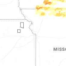
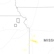

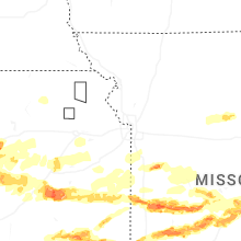

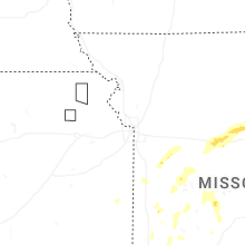
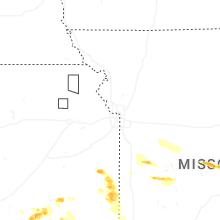
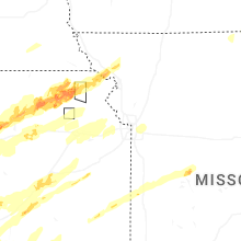
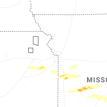


Connect with Interactive Hail Maps