

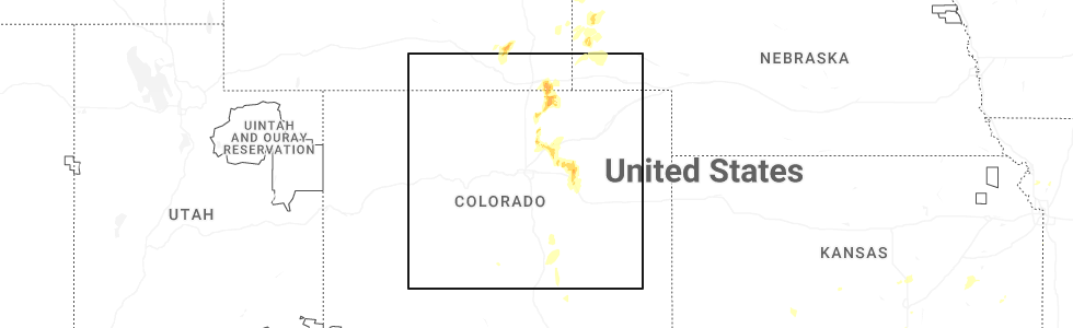
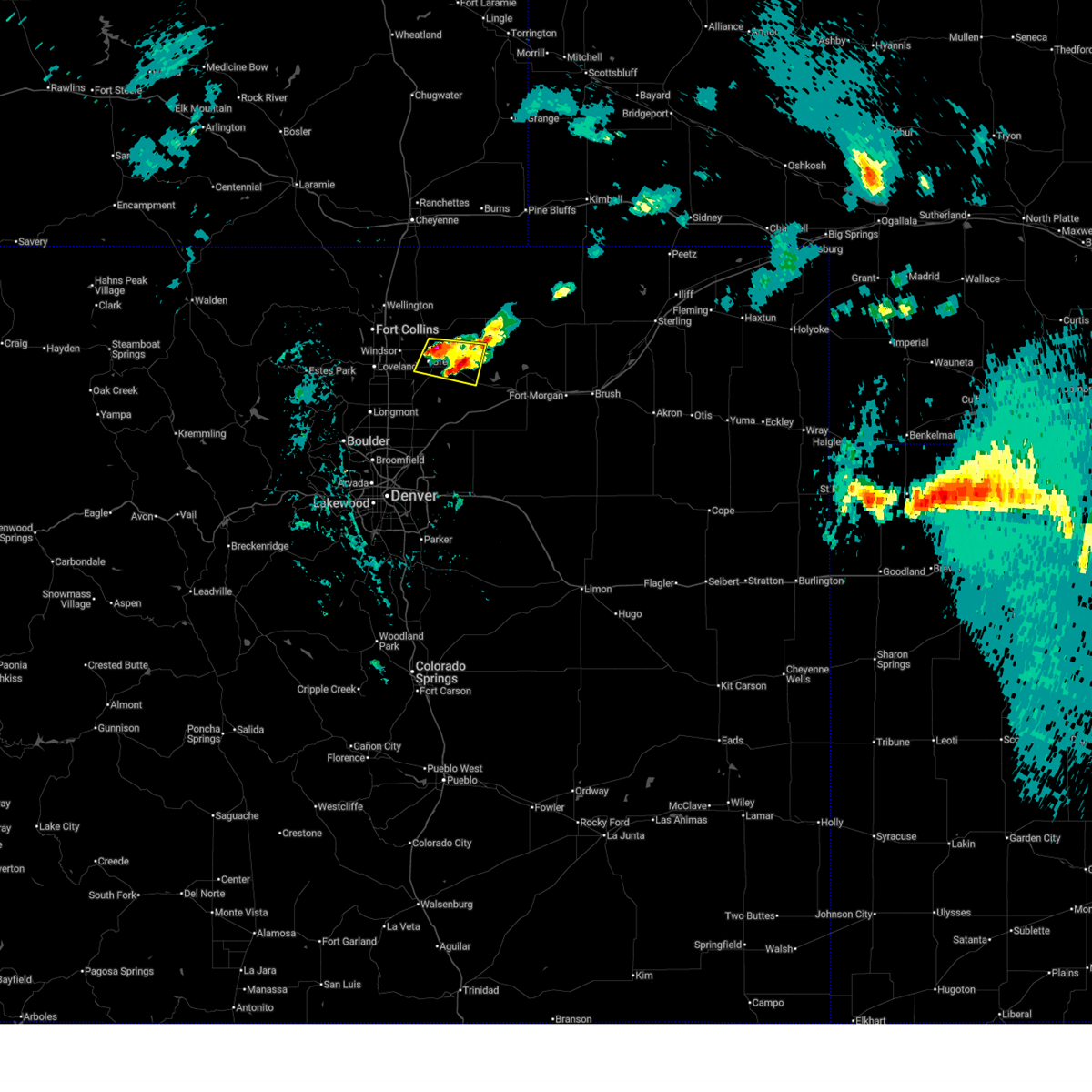
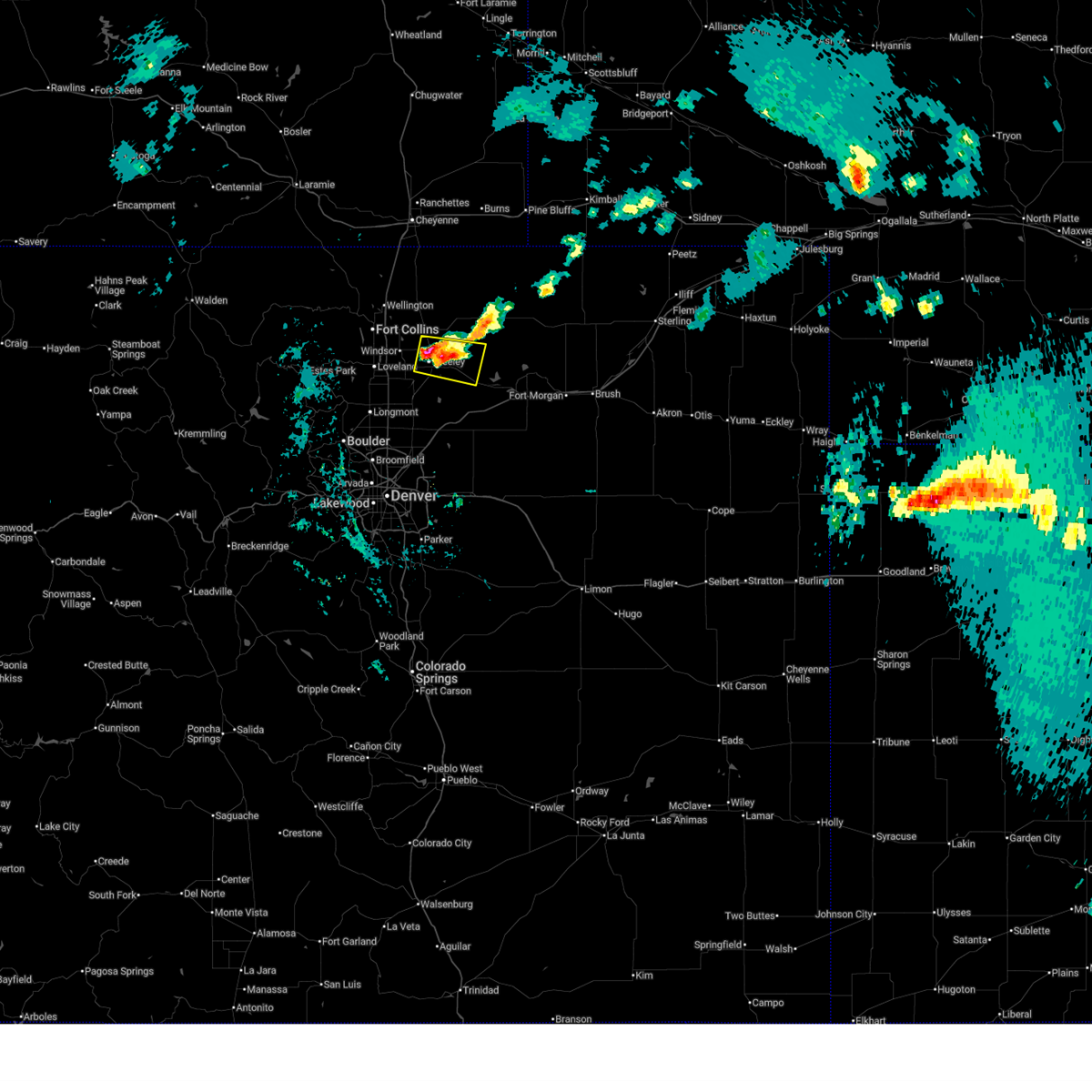
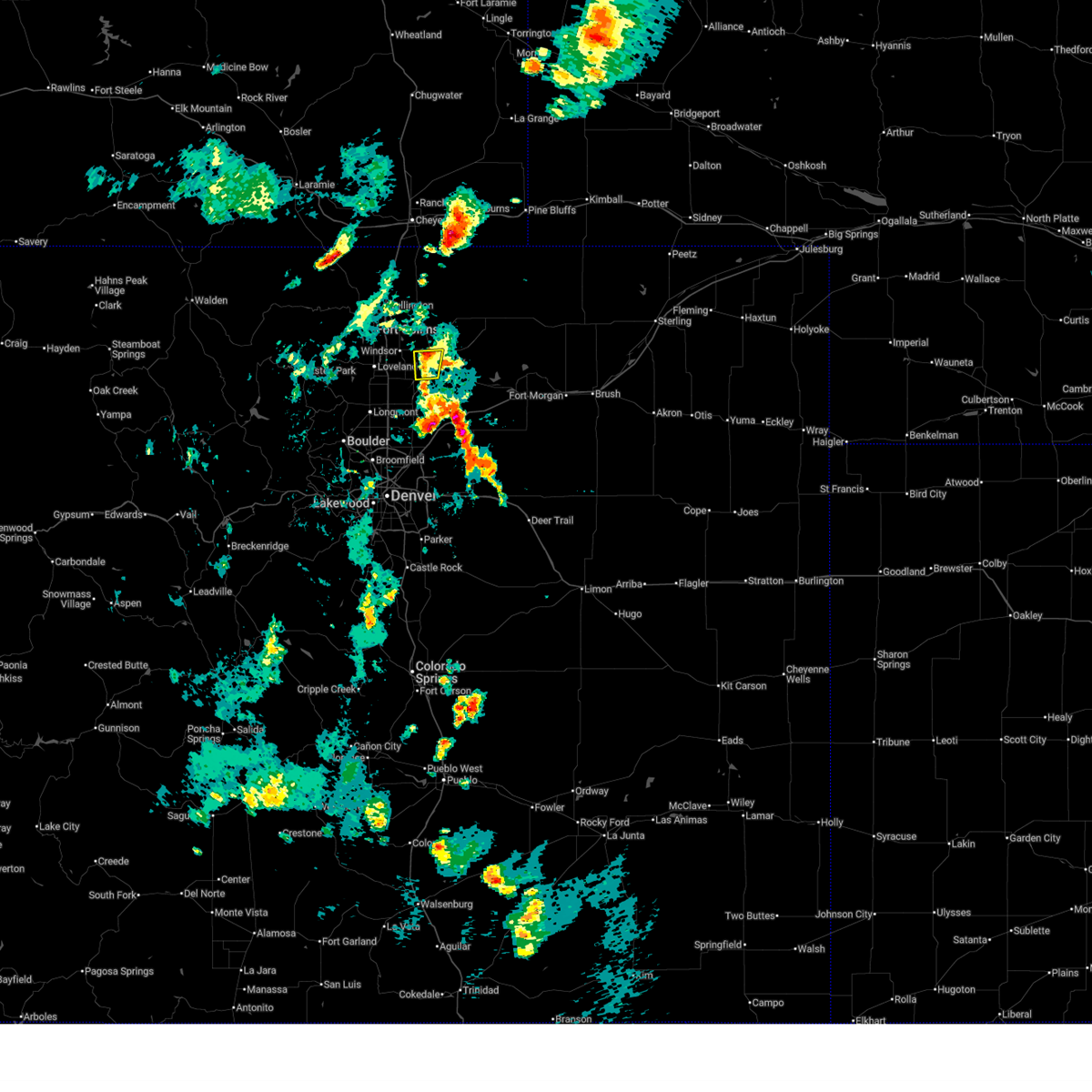
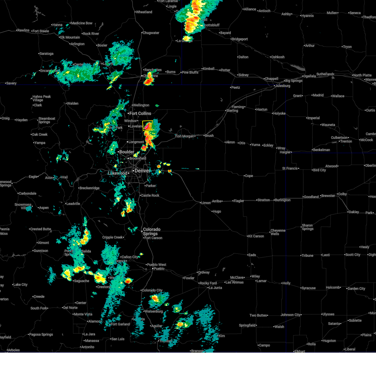
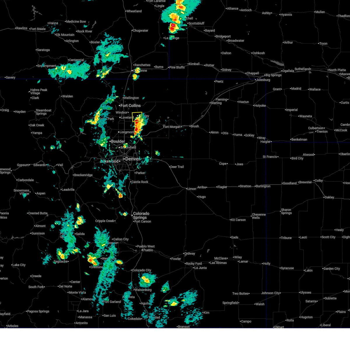
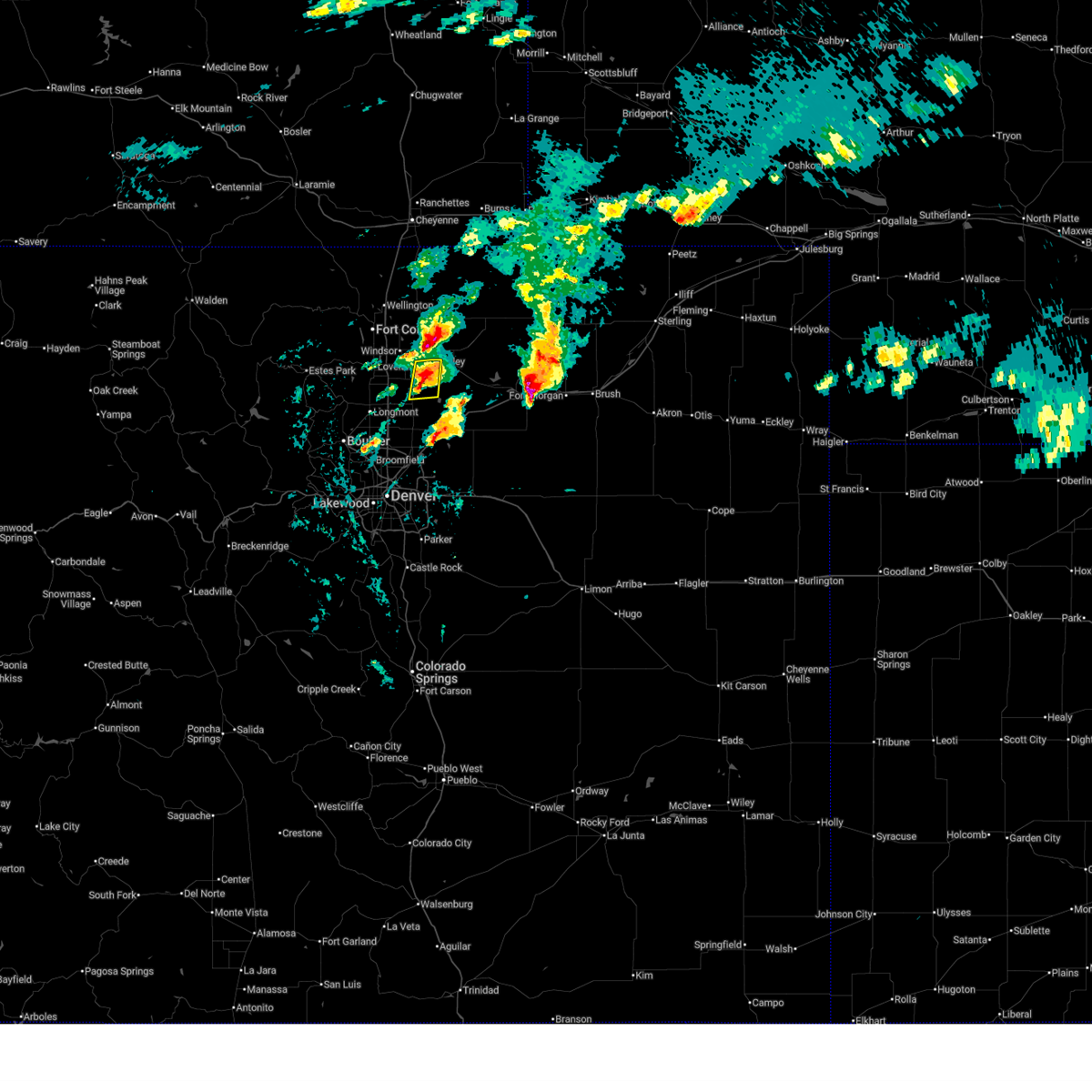
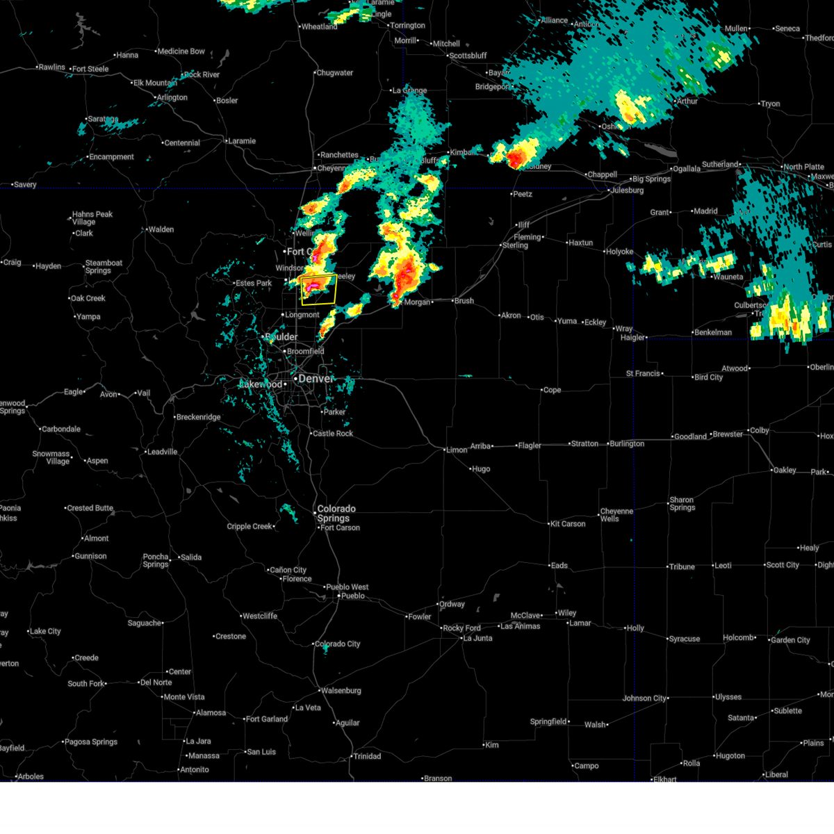
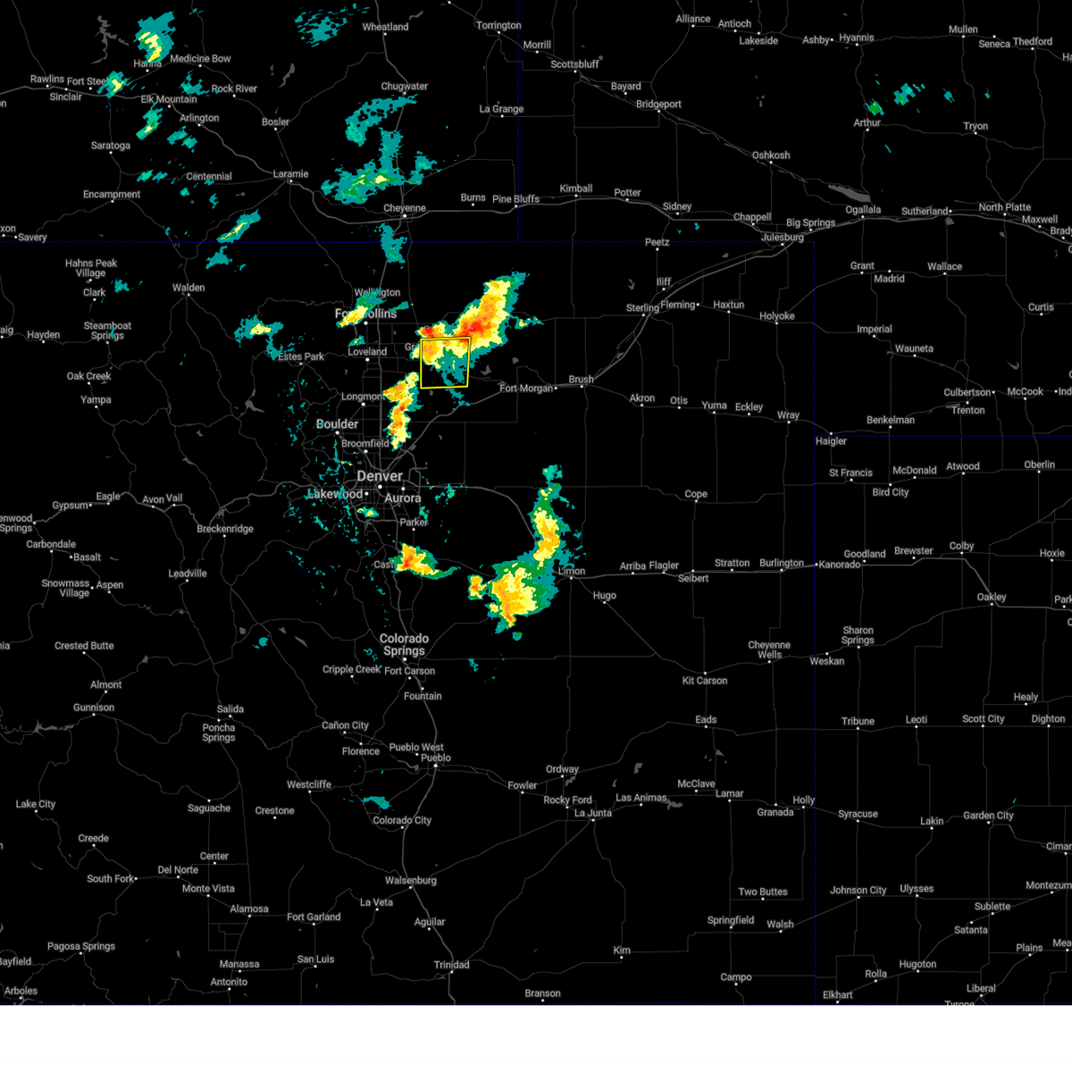
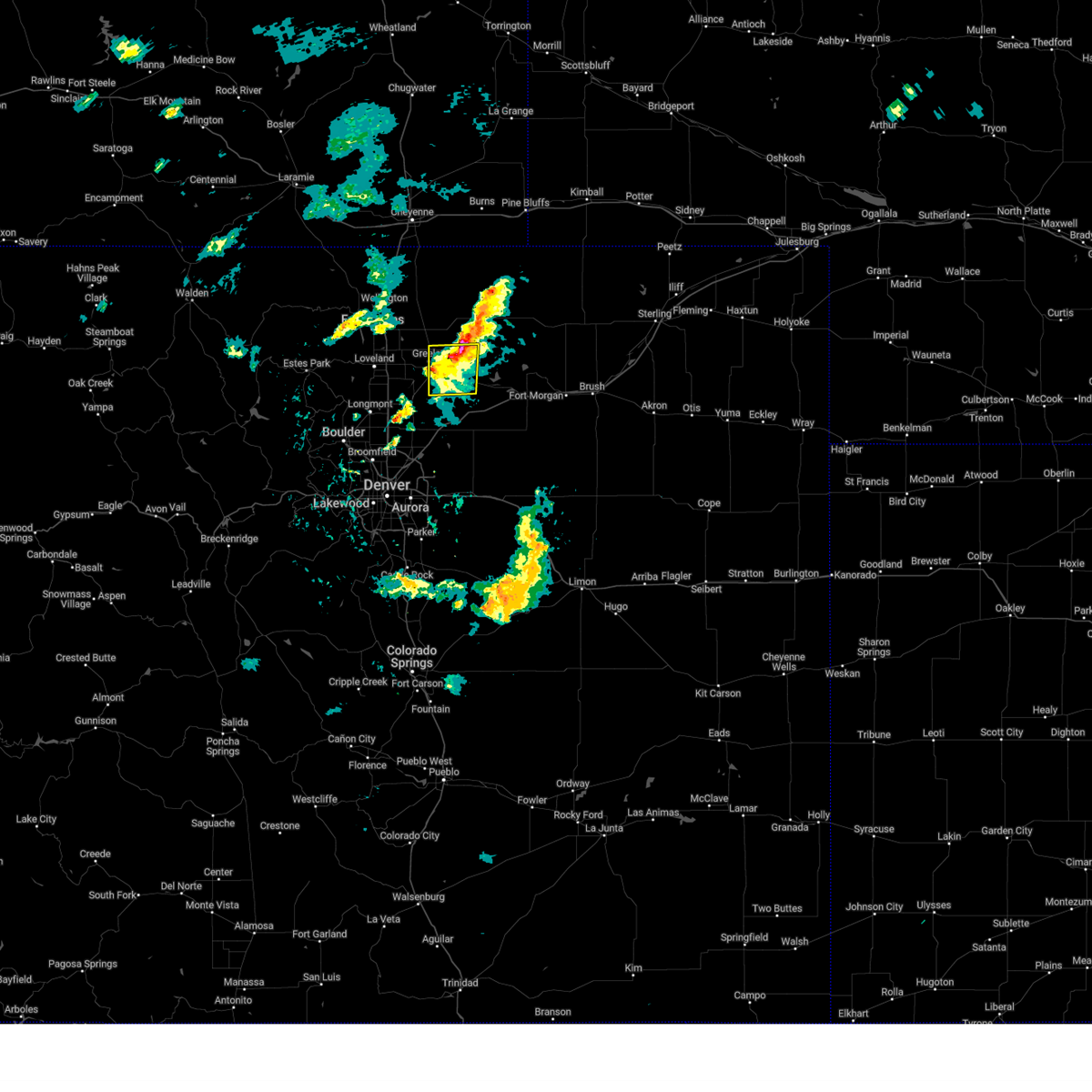
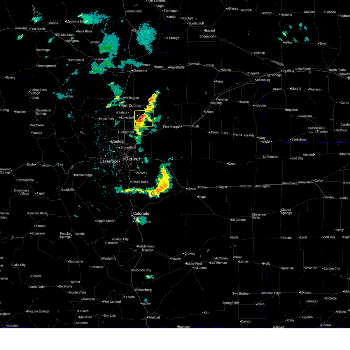
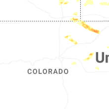
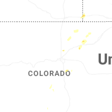
Hail Map for La Salle, CO
The La Salle, CO area has had 9 reports of on-the-ground hail by trained spotters, and has been under severe weather warnings 5 times during the past 12 months. Doppler radar has detected hail at or near La Salle, CO on 70 occasions, including 4 occasions during the past year.
| Name: | La Salle, CO |
| Where Located: | 44.8 miles NNE of Denver, CO |
| Map: | Google Map for La Salle, CO |
| Population: | 1955 |
| Housing Units: | 746 |
| More Info: | Search Google for La Salle, CO |
1
The Top Recent Hail Date for La Salle, CO is Thursday, July 24, 2025 (11th out of 70)
Hail and Wind Damage Spotted near La Salle, CO
| Date / Time | Report Details |
|---|---|
| 6/20/2026 10:32 PM MDT |
 At 1032 pm mdt, a severe thunderstorm was located 5 miles south of galeton, or 7 miles east of greeley. another severe thunderstorm was located near kersey. both thunderstorms were moving east at 25 mph (radar indicated). Hazards include ping pong ball size hail and 60 mph wind gusts. People and animals outdoors will be injured. expect hail damage to roofs, siding, windows, and vehicles. expect wind damage to roofs, siding, and trees. Locations impacted include, greeley, evans, eaton, lasalle, kersey, gill, barnesville, galeton, lucerne, garden city, lower latham reservoir and hardin. At 1032 pm mdt, a severe thunderstorm was located 5 miles south of galeton, or 7 miles east of greeley. another severe thunderstorm was located near kersey. both thunderstorms were moving east at 25 mph (radar indicated). Hazards include ping pong ball size hail and 60 mph wind gusts. People and animals outdoors will be injured. expect hail damage to roofs, siding, windows, and vehicles. expect wind damage to roofs, siding, and trees. Locations impacted include, greeley, evans, eaton, lasalle, kersey, gill, barnesville, galeton, lucerne, garden city, lower latham reservoir and hardin.
|
| 6/20/2026 10:22 PM MDT |
 Svrbou the national weather service in denver has issued a * severe thunderstorm warning for, west central weld county in northeastern colorado, * until 1100 pm mdt. * at 1022 pm mdt, a severe thunderstorm was located near lucerne, or near greeley, moving east at 25 mph (radar indicated). Hazards include 60 mph wind gusts and half dollar size hail. Hail damage to vehicles is expected. Expect wind damage to roofs, siding, and trees. Svrbou the national weather service in denver has issued a * severe thunderstorm warning for, west central weld county in northeastern colorado, * until 1100 pm mdt. * at 1022 pm mdt, a severe thunderstorm was located near lucerne, or near greeley, moving east at 25 mph (radar indicated). Hazards include 60 mph wind gusts and half dollar size hail. Hail damage to vehicles is expected. Expect wind damage to roofs, siding, and trees.
|
| 7/31/2025 4:58 PM MDT | Quarter sized hail reported 8.7 miles NW of La Salle, CO |
| 7/24/2025 4:38 PM MDT |
 The storm which prompted the warning has weakened below severe limits, and no longer poses an immediate threat to life or property. therefore, the warning will be allowed to expire. however, heavy rain is still possible with this thunderstorm. The storm which prompted the warning has weakened below severe limits, and no longer poses an immediate threat to life or property. therefore, the warning will be allowed to expire. however, heavy rain is still possible with this thunderstorm.
|
| 7/24/2025 4:11 PM MDT |
 At 411 pm mdt, a severe thunderstorm was located over evans, or near southern greeley, moving north at 10 mph (public reported quarter sized hail). Hazards include 60 mph wind gusts and quarter size hail. Hail damage to vehicles is expected. expect wind damage to roofs, siding, and trees. Locations impacted include, greeley, evans, lasalle and garden city. At 411 pm mdt, a severe thunderstorm was located over evans, or near southern greeley, moving north at 10 mph (public reported quarter sized hail). Hazards include 60 mph wind gusts and quarter size hail. Hail damage to vehicles is expected. expect wind damage to roofs, siding, and trees. Locations impacted include, greeley, evans, lasalle and garden city.
|
| 7/24/2025 4:02 PM MDT |
 Svrbou the national weather service in denver has issued a * severe thunderstorm warning for, west central weld county in northeastern colorado, * until 445 pm mdt. * at 402 pm mdt, a severe thunderstorm was located over evans, or near greeley, moving north at 10 mph (radar indicated). Hazards include 60 mph wind gusts and quarter size hail. Hail damage to vehicles is expected. Expect wind damage to roofs, siding, and trees. Svrbou the national weather service in denver has issued a * severe thunderstorm warning for, west central weld county in northeastern colorado, * until 445 pm mdt. * at 402 pm mdt, a severe thunderstorm was located over evans, or near greeley, moving north at 10 mph (radar indicated). Hazards include 60 mph wind gusts and quarter size hail. Hail damage to vehicles is expected. Expect wind damage to roofs, siding, and trees.
|
| 6/17/2025 3:50 AM MDT |
 At 350 am mdt, a severe thunderstorm was located over lasalle, or 7 miles south of greeley, moving east at 20 mph (radar indicated). Hazards include golf ball size hail. People and animals outdoors will be injured. expect damage to roofs, siding, windows, and vehicles. Locations impacted include, southern greeley, evans, platteville, lasalle, gilcrest, garden city, peckham and lower latham reservoir. At 350 am mdt, a severe thunderstorm was located over lasalle, or 7 miles south of greeley, moving east at 20 mph (radar indicated). Hazards include golf ball size hail. People and animals outdoors will be injured. expect damage to roofs, siding, windows, and vehicles. Locations impacted include, southern greeley, evans, platteville, lasalle, gilcrest, garden city, peckham and lower latham reservoir.
|
| 6/17/2025 3:32 AM MDT |
 Svrbou the national weather service in denver has issued a * severe thunderstorm warning for, west central weld county in northeastern colorado, * until 400 am mdt. * at 332 am mdt, a severe thunderstorm was located over milliken, or 9 miles southwest of greeley, moving east at 15 mph. this is a destructive storm for johnstown and milliken (radar indicated). Hazards include baseball size hail. People and animals outdoors will be severely injured. Expect shattered windows, extensive damage to roofs, siding, and vehicles. Svrbou the national weather service in denver has issued a * severe thunderstorm warning for, west central weld county in northeastern colorado, * until 400 am mdt. * at 332 am mdt, a severe thunderstorm was located over milliken, or 9 miles southwest of greeley, moving east at 15 mph. this is a destructive storm for johnstown and milliken (radar indicated). Hazards include baseball size hail. People and animals outdoors will be severely injured. Expect shattered windows, extensive damage to roofs, siding, and vehicles.
|
| 4/24/2025 4:55 PM MDT |
 The storm which prompted the warning has moved out of the area. therefore, the warning will be allowed to expire. The storm which prompted the warning has moved out of the area. therefore, the warning will be allowed to expire.
|
| 4/24/2025 4:34 PM MDT |
 At 434 pm mdt, a severe thunderstorm was located over gill, or 11 miles east of greeley, moving northeast at 20 mph (radar indicated). Hazards include half dollar size hail. Damage to vehicles is expected. Locations impacted include, eastern greeley, evans, lasalle, kersey, gill, barnesville, lucerne, garden city, lower latham reservoir and hardin. At 434 pm mdt, a severe thunderstorm was located over gill, or 11 miles east of greeley, moving northeast at 20 mph (radar indicated). Hazards include half dollar size hail. Damage to vehicles is expected. Locations impacted include, eastern greeley, evans, lasalle, kersey, gill, barnesville, lucerne, garden city, lower latham reservoir and hardin.
|
| 4/24/2025 4:19 PM MDT |
 Svrbou the national weather service in denver has issued a * severe thunderstorm warning for, west central weld county in northeastern colorado, * until 500 pm mdt. * at 419 pm mdt, a severe thunderstorm was located near kersey, or 9 miles southeast of greeley, moving east at 15 mph (radar indicated). Hazards include half dollar size hail. damage to vehicles is expected Svrbou the national weather service in denver has issued a * severe thunderstorm warning for, west central weld county in northeastern colorado, * until 500 pm mdt. * at 419 pm mdt, a severe thunderstorm was located near kersey, or 9 miles southeast of greeley, moving east at 15 mph (radar indicated). Hazards include half dollar size hail. damage to vehicles is expected
|
| 6/20/2024 4:36 PM MDT | Multiple power lines down 22628 county road 39... about 1.5 miles south of la sall in weld county CO, 2.2 miles N of La Salle, CO |
| 6/20/2024 3:56 PM MDT |
 The storm which prompted the warning has moved out of the area. therefore, the warning will be allowed to expire. a severe thunderstorm watch remains in effect until 700 pm mdt for northeastern colorado. The storm which prompted the warning has moved out of the area. therefore, the warning will be allowed to expire. a severe thunderstorm watch remains in effect until 700 pm mdt for northeastern colorado.
|
| 6/20/2024 3:33 PM MDT |
 Svrbou the national weather service in denver colorado has issued a * severe thunderstorm warning for, west central weld county in northeastern colorado, southeastern larimer county in north central colorado, * until 400 pm mdt. * at 333 pm mdt, a severe thunderstorm was located near mead, or 16 miles southwest of greeley, moving northeast at 20 mph (radar indicated). Hazards include quarter size hail. damage to vehicles is expected Svrbou the national weather service in denver colorado has issued a * severe thunderstorm warning for, west central weld county in northeastern colorado, southeastern larimer county in north central colorado, * until 400 pm mdt. * at 333 pm mdt, a severe thunderstorm was located near mead, or 16 miles southwest of greeley, moving northeast at 20 mph (radar indicated). Hazards include quarter size hail. damage to vehicles is expected
|
| 6/15/2024 4:49 PM MDT |
 the severe thunderstorm warning has been cancelled and is no longer in effect the severe thunderstorm warning has been cancelled and is no longer in effect
|
| 6/15/2024 4:34 PM MDT |
 Svrbou the national weather service in denver colorado has issued a * severe thunderstorm warning for, west central weld county in northeastern colorado, * until 515 pm mdt. * at 434 pm mdt, a severe thunderstorm was located 4 miles northeast of milliken, or 4 miles southwest of greeley, moving east at 20 mph (radar indicated). Hazards include 60 mph wind gusts and quarter size hail. Expect damage to roofs, siding, and trees. Hail damage to vehicles is expected. Svrbou the national weather service in denver colorado has issued a * severe thunderstorm warning for, west central weld county in northeastern colorado, * until 515 pm mdt. * at 434 pm mdt, a severe thunderstorm was located 4 miles northeast of milliken, or 4 miles southwest of greeley, moving east at 20 mph (radar indicated). Hazards include 60 mph wind gusts and quarter size hail. Expect damage to roofs, siding, and trees. Hail damage to vehicles is expected.
|
| 5/28/2024 11:17 PM MDT |
 The storm which prompted the warning has weakened below severe limits, and no longer poses an immediate threat to life or property. therefore, the warning has been allowed to expire. street and field flooding continues from eastern greeley north into the lucerne and gill areas. avoid flooded roads and give the rain time to run off. a flood advisory is in effect in those areas until midnight. The storm which prompted the warning has weakened below severe limits, and no longer poses an immediate threat to life or property. therefore, the warning has been allowed to expire. street and field flooding continues from eastern greeley north into the lucerne and gill areas. avoid flooded roads and give the rain time to run off. a flood advisory is in effect in those areas until midnight.
|
| 5/28/2024 11:03 PM MDT |
 At 1102 pm mdt, a severe thunderstorm was located over lasalle, or 6 miles southeast of greeley, moving south at 5 mph (radar indicated). Hazards include 60 mph wind gusts and quarter size hail. Expect damage to roofs, siding, and trees. hail damage to vehicles is expected. Locations impacted include, greeley, evans, milliken, lasalle, and gilcrest. At 1102 pm mdt, a severe thunderstorm was located over lasalle, or 6 miles southeast of greeley, moving south at 5 mph (radar indicated). Hazards include 60 mph wind gusts and quarter size hail. Expect damage to roofs, siding, and trees. hail damage to vehicles is expected. Locations impacted include, greeley, evans, milliken, lasalle, and gilcrest.
|
| 5/28/2024 10:29 PM MDT |
 Svrbou the national weather service in denver colorado has issued a * severe thunderstorm warning for, west central weld county in northeastern colorado, * until 1115 pm mdt. * at 1028 pm mdt, a severe thunderstorm was located over evans, or 4 miles southeast of greeley, moving south at 5 mph. another severe thunderstorm was located over johnstown (trained weather spotters. at 1028 pm, golf ball size hail was reported in johnstown. large quantities of hail have fallen in southeast greeley and on us 34 north of johnstown). Hazards include golf ball size hail and 60 mph wind gusts. Expect damage to roofs, siding, and trees. people and animals outdoors will be injured. expect hail damage to roofs, siding, windows, and vehicles. Hail may accumulate on roadways causing hazardous travel. Svrbou the national weather service in denver colorado has issued a * severe thunderstorm warning for, west central weld county in northeastern colorado, * until 1115 pm mdt. * at 1028 pm mdt, a severe thunderstorm was located over evans, or 4 miles southeast of greeley, moving south at 5 mph. another severe thunderstorm was located over johnstown (trained weather spotters. at 1028 pm, golf ball size hail was reported in johnstown. large quantities of hail have fallen in southeast greeley and on us 34 north of johnstown). Hazards include golf ball size hail and 60 mph wind gusts. Expect damage to roofs, siding, and trees. people and animals outdoors will be injured. expect hail damage to roofs, siding, windows, and vehicles. Hail may accumulate on roadways causing hazardous travel.
|
| 5/28/2024 10:17 PM MDT |
 At 1014 pm mdt, a severe thunderstorm was located over southeastern greeley, moving southwest at 5 mph. another severe thunderstorm was located 2 miles northwest of johnstown (trained weather spotters). Hazards include golf ball size hail and 60 mph wind gusts. large quantities of hail have fallen in southeast greeley and on us 34 south of windsor. Expect damage to roofs, siding, and trees. people and animals outdoors will be injured. expect hail damage to roofs, siding, windows, and vehicles. hail may accumulate on roadways causing hazardous travel. Locations impacted include, greeley, evans, johnstown, milliken, platteville, lasalle, kersey, gilcrest, and milton reservoir. At 1014 pm mdt, a severe thunderstorm was located over southeastern greeley, moving southwest at 5 mph. another severe thunderstorm was located 2 miles northwest of johnstown (trained weather spotters). Hazards include golf ball size hail and 60 mph wind gusts. large quantities of hail have fallen in southeast greeley and on us 34 south of windsor. Expect damage to roofs, siding, and trees. people and animals outdoors will be injured. expect hail damage to roofs, siding, windows, and vehicles. hail may accumulate on roadways causing hazardous travel. Locations impacted include, greeley, evans, johnstown, milliken, platteville, lasalle, kersey, gilcrest, and milton reservoir.
|
| 5/28/2024 9:53 PM MDT |
 Svrbou the national weather service in denver colorado has issued a * severe thunderstorm warning for, southwestern weld county in northeastern colorado, * until 1030 pm mdt. * at 951 pm mdt, a severe thunderstorm was located 4 miles northeast of evans, or 5 miles east of greeley, moving south at 10 mph. additional severe thunderstorms were developing from 5 miles south of windsor to 5 miles east of windsor (radar indicated). Hazards include golf ball size hail and 60 mph wind gusts. Expect damage to roofs, siding, and trees. people and animals outdoors will be injured. Expect hail damage to roofs, siding, windows, and vehicles. Svrbou the national weather service in denver colorado has issued a * severe thunderstorm warning for, southwestern weld county in northeastern colorado, * until 1030 pm mdt. * at 951 pm mdt, a severe thunderstorm was located 4 miles northeast of evans, or 5 miles east of greeley, moving south at 10 mph. additional severe thunderstorms were developing from 5 miles south of windsor to 5 miles east of windsor (radar indicated). Hazards include golf ball size hail and 60 mph wind gusts. Expect damage to roofs, siding, and trees. people and animals outdoors will be injured. Expect hail damage to roofs, siding, windows, and vehicles.
|
| 8/3/2023 6:30 PM MDT |
 At 630 pm mdt, a severe thunderstorm was located over northern greeley, moving east at 10 mph (radar indicated). Hazards include 60 mph wind gusts and quarter size hail. Expect damage to roofs, siding, and trees. hail damage to vehicles is expected. this severe thunderstorm will be near, greeley around 635 pm mdt. eaton around 640 pm mdt. lucerne around 645 pm mdt. other locations in the path of this severe thunderstorm include evans, lasalle, kersey, gill and galeton. hail threat, radar indicated max hail size, 1. 00 in wind threat, radar indicated max wind gust, 60 mph. At 630 pm mdt, a severe thunderstorm was located over northern greeley, moving east at 10 mph (radar indicated). Hazards include 60 mph wind gusts and quarter size hail. Expect damage to roofs, siding, and trees. hail damage to vehicles is expected. this severe thunderstorm will be near, greeley around 635 pm mdt. eaton around 640 pm mdt. lucerne around 645 pm mdt. other locations in the path of this severe thunderstorm include evans, lasalle, kersey, gill and galeton. hail threat, radar indicated max hail size, 1. 00 in wind threat, radar indicated max wind gust, 60 mph.
|
| 7/4/2023 6:55 PM MDT |
 The severe thunderstorm warning for southwestern weld county will expire at 700 pm mdt, the storm which prompted the warning has weakened below severe limits, and no longer poses an immediate threat to life or property. therefore, the warning will be allowed to expire. a severe thunderstorm watch remains in effect until 1100 pm mdt for northeastern colorado. The severe thunderstorm warning for southwestern weld county will expire at 700 pm mdt, the storm which prompted the warning has weakened below severe limits, and no longer poses an immediate threat to life or property. therefore, the warning will be allowed to expire. a severe thunderstorm watch remains in effect until 1100 pm mdt for northeastern colorado.
|
| 7/4/2023 6:40 PM MDT |
 At 640 pm mdt, a severe thunderstorm was located over milton reservoir, or 13 miles south of greeley, moving east at 30 mph (radar indicated). Hazards include 60 mph wind gusts and quarter size hail. Expect damage to roofs, siding, and trees. hail damage to vehicles is expected. locations impacted include, keenesburg. hail threat, radar indicated max hail size, 1. 00 in wind threat, radar indicated max wind gust, 60 mph. At 640 pm mdt, a severe thunderstorm was located over milton reservoir, or 13 miles south of greeley, moving east at 30 mph (radar indicated). Hazards include 60 mph wind gusts and quarter size hail. Expect damage to roofs, siding, and trees. hail damage to vehicles is expected. locations impacted include, keenesburg. hail threat, radar indicated max hail size, 1. 00 in wind threat, radar indicated max wind gust, 60 mph.
|
| 7/4/2023 6:26 PM MDT |
 At 626 pm mdt, a severe thunderstorm was located over platteville, or 13 miles south of greeley, moving east at 30 mph (radar indicated). Hazards include golf ball size hail and 60 mph wind gusts. Expect damage to roofs, siding, and trees. people and animals outdoors will be injured. expect hail damage to roofs, siding, windows, and vehicles. this severe thunderstorm will be near, milton reservoir around 645 pm mdt. other locations in the path of this severe thunderstorm include keenesburg. thunderstorm damage threat, considerable hail threat, radar indicated max hail size, 1. 75 in wind threat, radar indicated max wind gust, 60 mph. At 626 pm mdt, a severe thunderstorm was located over platteville, or 13 miles south of greeley, moving east at 30 mph (radar indicated). Hazards include golf ball size hail and 60 mph wind gusts. Expect damage to roofs, siding, and trees. people and animals outdoors will be injured. expect hail damage to roofs, siding, windows, and vehicles. this severe thunderstorm will be near, milton reservoir around 645 pm mdt. other locations in the path of this severe thunderstorm include keenesburg. thunderstorm damage threat, considerable hail threat, radar indicated max hail size, 1. 75 in wind threat, radar indicated max wind gust, 60 mph.
|
| 5/31/2023 4:38 PM MDT |
 At 438 pm mdt, a severe thunderstorm was located near milton reservoir, or 16 miles south of greeley, moving north at 25 mph (radar indicated). Hazards include 60 mph wind gusts and quarter size hail. Expect damage to roofs, siding, and trees. Hail damage to vehicles is expected. At 438 pm mdt, a severe thunderstorm was located near milton reservoir, or 16 miles south of greeley, moving north at 25 mph (radar indicated). Hazards include 60 mph wind gusts and quarter size hail. Expect damage to roofs, siding, and trees. Hail damage to vehicles is expected.
|
| 5/27/2023 3:27 PM MDT |
 At 327 pm mdt, a severe thunderstorm was located over firestone, or 22 miles southwest of greeley, moving northeast at 25 mph (radar indicated). Hazards include quarter size hail. Damage to vehicles is expected. this severe thunderstorm will be near, fort lupton around 345 pm mdt. Other locations in the path of this severe thunderstorm include platteville, gilcrest, milton reservoir and lasalle. At 327 pm mdt, a severe thunderstorm was located over firestone, or 22 miles southwest of greeley, moving northeast at 25 mph (radar indicated). Hazards include quarter size hail. Damage to vehicles is expected. this severe thunderstorm will be near, fort lupton around 345 pm mdt. Other locations in the path of this severe thunderstorm include platteville, gilcrest, milton reservoir and lasalle.
|
| 5/26/2023 3:23 PM MDT |
 At 323 pm mdt, a severe thunderstorm was located over lasalle, or 5 miles south of greeley, moving north at 15 mph (radar indicated). Hazards include ping pong ball size hail. People and animals outdoors will be injured. expect damage to roofs, siding, windows, and vehicles. locations impacted include, evans, greeley, lucerne, eaton, ault and purcell. hail threat, radar indicated max hail size, 1. 50 in wind threat, radar indicated max wind gust, <50 mph. At 323 pm mdt, a severe thunderstorm was located over lasalle, or 5 miles south of greeley, moving north at 15 mph (radar indicated). Hazards include ping pong ball size hail. People and animals outdoors will be injured. expect damage to roofs, siding, windows, and vehicles. locations impacted include, evans, greeley, lucerne, eaton, ault and purcell. hail threat, radar indicated max hail size, 1. 50 in wind threat, radar indicated max wind gust, <50 mph.
|
| 5/26/2023 2:58 PM MDT |
 At 257 pm mdt, a severe thunderstorm was located near gilcrest, or 11 miles south of greeley, moving north at 15 mph (radar indicated). Hazards include half dollar size hail. Damage to vehicles is expected. this severe thunderstorm will be near, gilcrest around 310 pm mdt. other locations in the path of this severe thunderstorm include johnstown, milliken, lasalle, evans, greeley and lucerne. hail threat, radar indicated max hail size, 1. 25 in wind threat, radar indicated max wind gust, <50 mph. At 257 pm mdt, a severe thunderstorm was located near gilcrest, or 11 miles south of greeley, moving north at 15 mph (radar indicated). Hazards include half dollar size hail. Damage to vehicles is expected. this severe thunderstorm will be near, gilcrest around 310 pm mdt. other locations in the path of this severe thunderstorm include johnstown, milliken, lasalle, evans, greeley and lucerne. hail threat, radar indicated max hail size, 1. 25 in wind threat, radar indicated max wind gust, <50 mph.
|
| 5/10/2023 1:04 AM MDT |
 At 104 am mdt, severe thunderstorms were located along a line extending from near galeton to near hudson, or along a line extending from 9 miles northeast of greeley to 27 miles northeast of denver, moving east at 20 mph (radar indicated). Hazards include 60 mph wind gusts and quarter size hail. Expect damage to roofs, siding, and trees. hail damage to vehicles is expected. locations impacted include, kersey, gill, barnesville and keenesburg. hail threat, radar indicated max hail size, 1. 00 in wind threat, radar indicated max wind gust, 60 mph. At 104 am mdt, severe thunderstorms were located along a line extending from near galeton to near hudson, or along a line extending from 9 miles northeast of greeley to 27 miles northeast of denver, moving east at 20 mph (radar indicated). Hazards include 60 mph wind gusts and quarter size hail. Expect damage to roofs, siding, and trees. hail damage to vehicles is expected. locations impacted include, kersey, gill, barnesville and keenesburg. hail threat, radar indicated max hail size, 1. 00 in wind threat, radar indicated max wind gust, 60 mph.
|
| 5/10/2023 12:42 AM MDT |
 The severe thunderstorm warning for southwestern weld county will expire at 1245 am mdt, the storms which prompted the warning have moved out of the area. therefore, the warning will be allowed to expire. however small hail is still possible with these thunderstorms. remember, a severe thunderstorm warning still remains in effect for southern and central weld county. The severe thunderstorm warning for southwestern weld county will expire at 1245 am mdt, the storms which prompted the warning have moved out of the area. therefore, the warning will be allowed to expire. however small hail is still possible with these thunderstorms. remember, a severe thunderstorm warning still remains in effect for southern and central weld county.
|
| 5/10/2023 12:41 AM MDT |
 At 1239 am mdt, severe thunderstorms were located along a line extending from near lucerne to near fort lupton, or along a line extending from 4 miles north of greeley to 23 miles north of denver, moving east at 20 mph (radar indicated). Hazards include 60 mph wind gusts and quarter size hail. Expect damage to roofs, siding, and trees. hail damage to vehicles is expected. severe thunderstorms will be near, greeley, evans and lucerne around 1245 am mdt. other locations in the path of these severe thunderstorms include kersey, galeton, gill, hudson, barnesville and keenesburg. hail threat, radar indicated max hail size, 1. 00 in wind threat, radar indicated max wind gust, 60 mph. At 1239 am mdt, severe thunderstorms were located along a line extending from near lucerne to near fort lupton, or along a line extending from 4 miles north of greeley to 23 miles north of denver, moving east at 20 mph (radar indicated). Hazards include 60 mph wind gusts and quarter size hail. Expect damage to roofs, siding, and trees. hail damage to vehicles is expected. severe thunderstorms will be near, greeley, evans and lucerne around 1245 am mdt. other locations in the path of these severe thunderstorms include kersey, galeton, gill, hudson, barnesville and keenesburg. hail threat, radar indicated max hail size, 1. 00 in wind threat, radar indicated max wind gust, 60 mph.
|
| 5/10/2023 12:27 AM MDT |
 At 1227 am mdt, severe thunderstorms were located along a line extending from 3 miles northeast of lucerne to near hudson, or along a line extending from 7 miles northeast of greeley to 27 miles northeast of denver, moving east at 25 mph (trained weather spotters). Hazards include 60 mph wind gusts and half dollar size hail. Expect damage to roofs, siding, and trees. hail damage to vehicles is expected. hail may accumulate on roadways causing hazardous travel. locations impacted include, galeton, gill, keenesburg, barnesville, prospect valley and roggen. hail threat, observed max hail size, 1. 25 in wind threat, radar indicated max wind gust, 60 mph. At 1227 am mdt, severe thunderstorms were located along a line extending from 3 miles northeast of lucerne to near hudson, or along a line extending from 7 miles northeast of greeley to 27 miles northeast of denver, moving east at 25 mph (trained weather spotters). Hazards include 60 mph wind gusts and half dollar size hail. Expect damage to roofs, siding, and trees. hail damage to vehicles is expected. hail may accumulate on roadways causing hazardous travel. locations impacted include, galeton, gill, keenesburg, barnesville, prospect valley and roggen. hail threat, observed max hail size, 1. 25 in wind threat, radar indicated max wind gust, 60 mph.
|
| 5/9/2023 11:52 PM MDT |
 At 1150 pm mdt, severe thunderstorms were located along a line extending from near windsor to near todd creek, or along a line extending from 9 miles west of greeley to 19 miles north of denver, moving east at 25 mph (trained weather spotters). Hazards include 60 mph wind gusts and half dollar size hail. Expect damage to roofs, siding, and trees. hail damage to vehicles is expected. hail may accumulate on roadways causing hazardous travel. severe thunderstorms will be near, windsor and milliken around 1155 pm mdt. brighton around 1200 am mdt. greeley and severance around 1210 am mdt. other locations in the path of these severe thunderstorms include evans, fort lupton, lochbuie, eaton, lucerne, hudson, galeton, gill, keenesburg, barnesville and prospect valley. hail threat, observed max hail size, 1. 25 in wind threat, radar indicated max wind gust, 60 mph. At 1150 pm mdt, severe thunderstorms were located along a line extending from near windsor to near todd creek, or along a line extending from 9 miles west of greeley to 19 miles north of denver, moving east at 25 mph (trained weather spotters). Hazards include 60 mph wind gusts and half dollar size hail. Expect damage to roofs, siding, and trees. hail damage to vehicles is expected. hail may accumulate on roadways causing hazardous travel. severe thunderstorms will be near, windsor and milliken around 1155 pm mdt. brighton around 1200 am mdt. greeley and severance around 1210 am mdt. other locations in the path of these severe thunderstorms include evans, fort lupton, lochbuie, eaton, lucerne, hudson, galeton, gill, keenesburg, barnesville and prospect valley. hail threat, observed max hail size, 1. 25 in wind threat, radar indicated max wind gust, 60 mph.
|
| 7/27/2022 8:02 PM MDT |
 At 801 pm mdt, a severe thunderstorm was located 4 miles northwest of severance, or 8 miles east of fort collins, moving south at 25 mph. this is a destructive storm for severance, windsor, timnath (radar indicated). Hazards include three inch hail and 60 mph wind gusts. People and animals outdoors will be severely injured. expect shattered windows, extensive damage to roofs, siding, and vehicles. this severe thunderstorm will be near, severance around 805 pm mdt. windsor and timnath around 810 pm mdt. greeley and northeastern loveland around 820 pm mdt. Other locations in the path of this severe thunderstorm include milliken and johnstown. At 801 pm mdt, a severe thunderstorm was located 4 miles northwest of severance, or 8 miles east of fort collins, moving south at 25 mph. this is a destructive storm for severance, windsor, timnath (radar indicated). Hazards include three inch hail and 60 mph wind gusts. People and animals outdoors will be severely injured. expect shattered windows, extensive damage to roofs, siding, and vehicles. this severe thunderstorm will be near, severance around 805 pm mdt. windsor and timnath around 810 pm mdt. greeley and northeastern loveland around 820 pm mdt. Other locations in the path of this severe thunderstorm include milliken and johnstown.
|
| 6/13/2021 7:10 PM MDT | Quarter sized hail reported 0.2 miles ENE of La Salle, CO |
| 6/13/2021 6:58 PM MDT |
 At 658 pm mdt, a severe thunderstorm was located near lasalle, or 7 miles south of greeley, moving north at 10 mph (radar indicated). Hazards include quarter size hail. damage to vehicles is expected At 658 pm mdt, a severe thunderstorm was located near lasalle, or 7 miles south of greeley, moving north at 10 mph (radar indicated). Hazards include quarter size hail. damage to vehicles is expected
|
| 6/13/2021 6:31 PM MDT |
 At 631 pm mdt, a severe thunderstorm was located over milton reservoir, or 14 miles southeast of greeley, moving north at 5 mph (radar indicated). Hazards include half dollar size hail. damage to vehicles is expected At 631 pm mdt, a severe thunderstorm was located over milton reservoir, or 14 miles southeast of greeley, moving north at 5 mph (radar indicated). Hazards include half dollar size hail. damage to vehicles is expected
|
| 8/4/2020 4:30 PM MDT |
 At 429 pm mdt, a severe thunderstorm was located near kersey, or 7 miles east of greeley, moving southeast at 30 mph (trained weather spotters reported hail up to two inches in diameter in eaton and northeast greeley). Hazards include two inch hail and 60 mph wind gusts. Expect damage to roofs, siding, and trees. people and animals outdoors will be injured. Expect hail damage to roofs, siding, windows, and vehicles. At 429 pm mdt, a severe thunderstorm was located near kersey, or 7 miles east of greeley, moving southeast at 30 mph (trained weather spotters reported hail up to two inches in diameter in eaton and northeast greeley). Hazards include two inch hail and 60 mph wind gusts. Expect damage to roofs, siding, and trees. people and animals outdoors will be injured. Expect hail damage to roofs, siding, windows, and vehicles.
|
| 8/4/2020 3:47 PM MDT |
 At 346 pm mdt, a severe thunderstorm was located near kersey, or 10 miles east of greeley, moving southeast at 30 mph. another severe storm was near pierce, moving southeast at 20 mph (radar indicated). Hazards include ping pong ball size hail and 60 mph wind gusts. Expect damage to roofs, siding, and trees. people and animals outdoors will be injured. expect hail damage to roofs, siding, windows, and vehicles. Hail may accumulate on roadways causing hazardous travel. At 346 pm mdt, a severe thunderstorm was located near kersey, or 10 miles east of greeley, moving southeast at 30 mph. another severe storm was near pierce, moving southeast at 20 mph (radar indicated). Hazards include ping pong ball size hail and 60 mph wind gusts. Expect damage to roofs, siding, and trees. people and animals outdoors will be injured. expect hail damage to roofs, siding, windows, and vehicles. Hail may accumulate on roadways causing hazardous travel.
|
| 7/30/2020 4:30 PM MDT |
 At 429 pm mdt, a severe thunderstorm was located near lasalle, or 4 miles south of greeley, moving southeast at 25 mph (radar indicated). Hazards include quarter size hail and torrential rainfall. damage to vehicles is expected At 429 pm mdt, a severe thunderstorm was located near lasalle, or 4 miles south of greeley, moving southeast at 25 mph (radar indicated). Hazards include quarter size hail and torrential rainfall. damage to vehicles is expected
|
| 7/13/2020 4:34 PM MDT |
 At 433 pm mdt, severe thunderstorms were located along a line extending from 8 miles west of carpenter to milliken, or along a line extending from 16 miles southeast of cheyenne to 8 miles southwest of greeley, moving east at 45 mph (radar indicated). Hazards include 70 mph wind gusts. up to 80 mph gust and possible landspout tornado in the rockport and grover areas of far northern weld county. Expect considerable tree damage. damage is likely to mobile homes, roofs, and outbuildings. Locations impacted include, eastern fort collins, greeley, eastern loveland, windsor, evans, johnstown, milliken, berthoud, eaton, mead, severance, lasalle, ault, kersey, gilcrest, pierce, timnath, nunn, grover and purcell. At 433 pm mdt, severe thunderstorms were located along a line extending from 8 miles west of carpenter to milliken, or along a line extending from 16 miles southeast of cheyenne to 8 miles southwest of greeley, moving east at 45 mph (radar indicated). Hazards include 70 mph wind gusts. up to 80 mph gust and possible landspout tornado in the rockport and grover areas of far northern weld county. Expect considerable tree damage. damage is likely to mobile homes, roofs, and outbuildings. Locations impacted include, eastern fort collins, greeley, eastern loveland, windsor, evans, johnstown, milliken, berthoud, eaton, mead, severance, lasalle, ault, kersey, gilcrest, pierce, timnath, nunn, grover and purcell.
|
| 7/13/2020 4:16 PM MDT |
 At 416 pm mdt, severe thunderstorms were located along a line extending from 6 miles southeast of south greeley to near berthoud, or along a line extending from 8 miles southeast of cheyenne to 18 miles south of fort collins, moving east at 45 mph (radar indicated). Hazards include 60 mph wind gusts. expect damage to roofs, siding, and trees At 416 pm mdt, severe thunderstorms were located along a line extending from 6 miles southeast of south greeley to near berthoud, or along a line extending from 8 miles southeast of cheyenne to 18 miles south of fort collins, moving east at 45 mph (radar indicated). Hazards include 60 mph wind gusts. expect damage to roofs, siding, and trees
|
| 7/13/2020 4:08 PM MDT |
 At 407 pm mdt, severe thunderstorms were located along a line extending from 5 miles east of pumpkin vine to fort collins to 4 miles south of carter lake, or along a line extending from 22 miles southeast of laramie to 21 miles northwest of greeley to 40 miles north of denver, moving east at 45 mph (radar indicated). Hazards include 60 mph wind gusts. Expect damage to roofs, siding, and trees. Locations impacted include, fort collins, greeley, loveland, windsor, evans, johnstown, wellington, milliken, berthoud, eaton, mead, severance, platteville, lyons, lasalle, ault, gilcrest, pierce, timnath and nunn. At 407 pm mdt, severe thunderstorms were located along a line extending from 5 miles east of pumpkin vine to fort collins to 4 miles south of carter lake, or along a line extending from 22 miles southeast of laramie to 21 miles northwest of greeley to 40 miles north of denver, moving east at 45 mph (radar indicated). Hazards include 60 mph wind gusts. Expect damage to roofs, siding, and trees. Locations impacted include, fort collins, greeley, loveland, windsor, evans, johnstown, wellington, milliken, berthoud, eaton, mead, severance, platteville, lyons, lasalle, ault, gilcrest, pierce, timnath and nunn.
|
| 7/13/2020 3:36 PM MDT |
 At 335 pm mdt, severe thunderstorms were located along a line extending from 11 miles south of hutton lake to 6 miles west of buckhorn mountain to near allenspark, or along a line extending from 22 miles south of laramie to 20 miles west of fort collins to 43 miles northwest of denver, moving east at 45 mph (radar indicated). Hazards include 60 mph wind gusts. expect damage to roofs, siding, and trees At 335 pm mdt, severe thunderstorms were located along a line extending from 11 miles south of hutton lake to 6 miles west of buckhorn mountain to near allenspark, or along a line extending from 22 miles south of laramie to 20 miles west of fort collins to 43 miles northwest of denver, moving east at 45 mph (radar indicated). Hazards include 60 mph wind gusts. expect damage to roofs, siding, and trees
|
| 7/9/2020 8:26 PM MDT |
 At 826 pm mdt, a severe thunderstorm was located over todd creek, or 17 miles north of denver, moving northeast at 15 mph (radar indicated). Hazards include 60 mph wind gusts and quarter size hail. Expect damage to roofs, siding, and trees. Hail damage to vehicles is expected. At 826 pm mdt, a severe thunderstorm was located over todd creek, or 17 miles north of denver, moving northeast at 15 mph (radar indicated). Hazards include 60 mph wind gusts and quarter size hail. Expect damage to roofs, siding, and trees. Hail damage to vehicles is expected.
|
| 6/6/2020 3:56 PM MDT |
 At 355 pm mdt, severe thunderstorms were located along a line extending from 6 miles south of carr to 3 miles east of dacono to aurora to 5 miles east of greenland, or along a line extending from 21 miles northeast of fort collins to 24 miles south of greeley to 10 miles east of denver to 22 miles north of colorado springs, moving northeast at 60 mph. these are very dangerous storms (radar indicated). Hazards include 80 mph wind gusts. Flying debris will be dangerous to those caught without shelter. mobile homes will be heavily damaged. expect considerable damage to roofs, windows, and vehicles. Extensive tree damage and power outages are likely. At 355 pm mdt, severe thunderstorms were located along a line extending from 6 miles south of carr to 3 miles east of dacono to aurora to 5 miles east of greenland, or along a line extending from 21 miles northeast of fort collins to 24 miles south of greeley to 10 miles east of denver to 22 miles north of colorado springs, moving northeast at 60 mph. these are very dangerous storms (radar indicated). Hazards include 80 mph wind gusts. Flying debris will be dangerous to those caught without shelter. mobile homes will be heavily damaged. expect considerable damage to roofs, windows, and vehicles. Extensive tree damage and power outages are likely.
|
| 6/6/2020 3:46 PM MDT |
 At 342 pm mdt, severe thunderstorms were located along a line extending from 3 miles north of drake to near aspen springs to 7 miles west of elevenmile canyon reservoir, or along a line extending from 15 miles west of fort collins to 28 miles west of denver to 39 miles north of hayden pass burn scar, the storms are moving northeast at 60 mph. these are very dangerous storms (an automated weather station in lakewood recorded a peak wind gust to 70 mph at bear creek golf club in southwest lakewood). Hazards include 75 mph wind gusts. Flying debris will be dangerous to those caught without shelter. mobile homes will be heavily damaged. expect considerable damage to roofs, windows, and vehicles. extensive tree damage and power outages are likely. Locations impacted include, denver, fort collins, greeley, aurora, lakewood, thornton, arvada, westminster, centennial, boulder, longmont, loveland, broomfield, highlands ranch, castle rock, commerce city, parker, littleton, northglenn and brighton. At 342 pm mdt, severe thunderstorms were located along a line extending from 3 miles north of drake to near aspen springs to 7 miles west of elevenmile canyon reservoir, or along a line extending from 15 miles west of fort collins to 28 miles west of denver to 39 miles north of hayden pass burn scar, the storms are moving northeast at 60 mph. these are very dangerous storms (an automated weather station in lakewood recorded a peak wind gust to 70 mph at bear creek golf club in southwest lakewood). Hazards include 75 mph wind gusts. Flying debris will be dangerous to those caught without shelter. mobile homes will be heavily damaged. expect considerable damage to roofs, windows, and vehicles. extensive tree damage and power outages are likely. Locations impacted include, denver, fort collins, greeley, aurora, lakewood, thornton, arvada, westminster, centennial, boulder, longmont, loveland, broomfield, highlands ranch, castle rock, commerce city, parker, littleton, northglenn and brighton.
|
| 6/6/2020 3:03 PM MDT |
 At 303 pm mdt, severe thunderstorms were located along a line extending from 3 miles north of drake to near aspen springs to 8 miles west of elevenmile canyon reservoir, or along a line extending from 15 miles west of fort collins to 28 miles west of denver to 39 miles north of hayden pass burn scar, moving northeast at 65 mph. these are very dangerous storms (radar indicated). Hazards include 80 mph wind gusts. Flying debris will be dangerous to those caught without shelter. mobile homes will be heavily damaged. expect considerable damage to roofs, windows, and vehicles. Extensive tree damage and power outages are likely. At 303 pm mdt, severe thunderstorms were located along a line extending from 3 miles north of drake to near aspen springs to 8 miles west of elevenmile canyon reservoir, or along a line extending from 15 miles west of fort collins to 28 miles west of denver to 39 miles north of hayden pass burn scar, moving northeast at 65 mph. these are very dangerous storms (radar indicated). Hazards include 80 mph wind gusts. Flying debris will be dangerous to those caught without shelter. mobile homes will be heavily damaged. expect considerable damage to roofs, windows, and vehicles. Extensive tree damage and power outages are likely.
|
| 9/11/2019 5:58 PM MDT |
 At 557 pm mdt, a severe thunderstorm was located near firestone, or 22 miles southwest of greeley, moving northeast at 40 mph (radar indicated). Hazards include half dollar size hail. damage to vehicles is expected At 557 pm mdt, a severe thunderstorm was located near firestone, or 22 miles southwest of greeley, moving northeast at 40 mph (radar indicated). Hazards include half dollar size hail. damage to vehicles is expected
|
| 9/11/2019 4:58 PM MDT |
 At 458 pm mdt, a severe thunderstorm was located near johnstown, or 7 miles southwest of greeley, moving northeast at 40 mph (radar indicated). Hazards include half dollar size hail. damage to vehicles is expected At 458 pm mdt, a severe thunderstorm was located near johnstown, or 7 miles southwest of greeley, moving northeast at 40 mph (radar indicated). Hazards include half dollar size hail. damage to vehicles is expected
|
| 9/11/2019 4:44 PM MDT |
 At 443 pm mdt, a severe thunderstorm was located 4 miles north of mead, or 15 miles southwest of greeley, moving northeast at 45 mph (radar indicated). Hazards include half dollar size hail. Damage to vehicles is expected. Locations impacted include, southwestern greeley, windsor, johnstown, milliken, berthoud, mead, lasalle and gilcrest. At 443 pm mdt, a severe thunderstorm was located 4 miles north of mead, or 15 miles southwest of greeley, moving northeast at 45 mph (radar indicated). Hazards include half dollar size hail. Damage to vehicles is expected. Locations impacted include, southwestern greeley, windsor, johnstown, milliken, berthoud, mead, lasalle and gilcrest.
|
| 9/11/2019 4:29 PM MDT |
 At 429 pm mdt, a severe thunderstorm was located over northwestern longmont, or 24 miles south of fort collins, moving northeast at 45 mph (radar indicated). Hazards include quarter size hail. damage to vehicles is expected At 429 pm mdt, a severe thunderstorm was located over northwestern longmont, or 24 miles south of fort collins, moving northeast at 45 mph (radar indicated). Hazards include quarter size hail. damage to vehicles is expected
|
| 9/10/2019 6:00 PM MDT |
 At 559 pm mdt, a severe thunderstorm was located over southern greeley, moving northeast at 30 mph (radar indicated). Hazards include 60 mph wind gusts and quarter size hail. Expect damage to roofs, siding, and trees. hail damage to vehicles is expected. Locations impacted include, greeley, evans, eaton, lasalle and lucerne. At 559 pm mdt, a severe thunderstorm was located over southern greeley, moving northeast at 30 mph (radar indicated). Hazards include 60 mph wind gusts and quarter size hail. Expect damage to roofs, siding, and trees. hail damage to vehicles is expected. Locations impacted include, greeley, evans, eaton, lasalle and lucerne.
|
| 9/10/2019 5:40 PM MDT |
 The national weather service in denver colorado has issued a * severe thunderstorm warning for. southwestern weld county in northeastern colorado. until 630 pm mdt. At 540 pm mdt, a severe thunderstorm was located 4 miles east of longmont, or 24 miles southwest of greeley, moving northeast at 20. The national weather service in denver colorado has issued a * severe thunderstorm warning for. southwestern weld county in northeastern colorado. until 630 pm mdt. At 540 pm mdt, a severe thunderstorm was located 4 miles east of longmont, or 24 miles southwest of greeley, moving northeast at 20.
|
| 6/8/2019 9:09 PM MDT |
 At 859 pm mdt, a severe thunderstorm was located near milton reservoir, or 13 miles southeast of greeley, moving east at 45 mph (radar indicated). Hazards include quarter size hail. Damage to vehicles is expected. Locations impacted include, southeastern greeley, evans, milliken, platteville, lasalle, kersey, gilcrest, gill and milton reservoir. At 859 pm mdt, a severe thunderstorm was located near milton reservoir, or 13 miles southeast of greeley, moving east at 45 mph (radar indicated). Hazards include quarter size hail. Damage to vehicles is expected. Locations impacted include, southeastern greeley, evans, milliken, platteville, lasalle, kersey, gilcrest, gill and milton reservoir.
|
| 6/8/2019 8:59 PM MDT |
 At 859 pm mdt, a severe thunderstorm was located near milton reservoir, or 13 miles southeast of greeley, moving east at 45 mph (radar indicated). Hazards include quarter size hail. Damage to vehicles is expected. Locations impacted include, southeastern greeley, evans, milliken, platteville, lasalle, kersey, gilcrest, gill and milton reservoir. At 859 pm mdt, a severe thunderstorm was located near milton reservoir, or 13 miles southeast of greeley, moving east at 45 mph (radar indicated). Hazards include quarter size hail. Damage to vehicles is expected. Locations impacted include, southeastern greeley, evans, milliken, platteville, lasalle, kersey, gilcrest, gill and milton reservoir.
|
| 6/8/2019 8:43 PM MDT |
 At 842 pm mdt, a severe thunderstorm was located near platteville, or 12 miles southwest of greeley, moving east at 40 mph (radar indicated). Hazards include quarter size hail. damage to vehicles is expected At 842 pm mdt, a severe thunderstorm was located near platteville, or 12 miles southwest of greeley, moving east at 40 mph (radar indicated). Hazards include quarter size hail. damage to vehicles is expected
|
| 5/27/2019 5:40 PM MDT |
 At 458 pm mdt, severe thunderstorms were located along a line extending from 6 miles north of purcell to near milton reservoir, or along a line extending from 26 miles northeast of fort collins to 16 miles southeast of greeley, moving northeast at 15 mph (radar indicated). Hazards include quarter size hail. damage to vehicles is expected At 458 pm mdt, severe thunderstorms were located along a line extending from 6 miles north of purcell to near milton reservoir, or along a line extending from 26 miles northeast of fort collins to 16 miles southeast of greeley, moving northeast at 15 mph (radar indicated). Hazards include quarter size hail. damage to vehicles is expected
|
| 5/27/2019 4:58 PM MDT |
 At 458 pm mdt, severe thunderstorms were located along a line extending from 6 miles north of purcell to near milton reservoir, or along a line extending from 26 miles northeast of fort collins to 16 miles southeast of greeley, moving northeast at 15 mph (radar indicated). Hazards include quarter size hail. damage to vehicles is expected At 458 pm mdt, severe thunderstorms were located along a line extending from 6 miles north of purcell to near milton reservoir, or along a line extending from 26 miles northeast of fort collins to 16 miles southeast of greeley, moving northeast at 15 mph (radar indicated). Hazards include quarter size hail. damage to vehicles is expected
|
| 5/17/2019 2:55 PM MDT |
 At 254 pm mdt, severe thunderstorms were located along a line extending from 5 miles west of pawnee buttes to 3 miles south of kersey, or along a line extending from 34 miles southwest of kimball to 11 miles southeast of greeley, moving northeast at 25 mph (radar indicated). Hazards include 70 mph wind gusts and quarter size hail. Expect considerable tree damage. damage is likely to mobile homes, roofs, and outbuildings. hail damage to vehicles is expected. Locations impacted include, southeastern greeley, evans, lasalle, kersey, galeton, gill, jackson reservoir, barnesville, keota, orchard, riverside reservoir, milton reservoir, briggsdale, pawnee buttes and roggen. At 254 pm mdt, severe thunderstorms were located along a line extending from 5 miles west of pawnee buttes to 3 miles south of kersey, or along a line extending from 34 miles southwest of kimball to 11 miles southeast of greeley, moving northeast at 25 mph (radar indicated). Hazards include 70 mph wind gusts and quarter size hail. Expect considerable tree damage. damage is likely to mobile homes, roofs, and outbuildings. hail damage to vehicles is expected. Locations impacted include, southeastern greeley, evans, lasalle, kersey, galeton, gill, jackson reservoir, barnesville, keota, orchard, riverside reservoir, milton reservoir, briggsdale, pawnee buttes and roggen.
|
| 5/17/2019 2:41 PM MDT |
 At 240 pm mdt, severe thunderstorms were located along a line extending from 7 miles south of keota to 3 miles north of roggen, or along a line extending from 28 miles northwest of fort morgan to 23 miles southeast of greeley, moving northeast at 35 mph (radar indicated). Hazards include 70 mph wind gusts and quarter size hail. Expect considerable tree damage. damage is likely to mobile homes, roofs, and outbuildings. Hail damage to vehicles is expected. At 240 pm mdt, severe thunderstorms were located along a line extending from 7 miles south of keota to 3 miles north of roggen, or along a line extending from 28 miles northwest of fort morgan to 23 miles southeast of greeley, moving northeast at 35 mph (radar indicated). Hazards include 70 mph wind gusts and quarter size hail. Expect considerable tree damage. damage is likely to mobile homes, roofs, and outbuildings. Hail damage to vehicles is expected.
|
| 7/29/2018 7:53 PM MDT | Quarter sized hail reported 3.1 miles WNW of La Salle, CO |
| 7/29/2018 7:37 PM MDT | Half Dollar sized hail reported 8.4 miles NW of La Salle, CO |
| 7/29/2018 7:28 PM MDT |
 At 728 pm mdt, a severe thunderstorm was located near la salle, or 8 miles southeast of greeley, moving southeast at 50 mph (radar indicated). Hazards include two inch hail and 60 mph wind gusts. Expect damage to roofs, siding, and trees. people and animals outdoors will be injured. Expect hail damage to roofs, siding, windows, and vehicles. At 728 pm mdt, a severe thunderstorm was located near la salle, or 8 miles southeast of greeley, moving southeast at 50 mph (radar indicated). Hazards include two inch hail and 60 mph wind gusts. Expect damage to roofs, siding, and trees. people and animals outdoors will be injured. Expect hail damage to roofs, siding, windows, and vehicles.
|
| 7/29/2018 7:23 PM MDT |
 At 703 pm mdt, a severe thunderstorm was located 4 miles north of severance, or 10 miles east of fort collins, moving southeast at 40 mph (radar indicated). Hazards include two inch hail and 70 mph wind gusts. Expect considerable tree damage. damage is likely to mobile homes, roofs, and outbuildings. people and animals outdoors will be injured. Expect hail damage to roofs, siding, windows, and vehicles. At 703 pm mdt, a severe thunderstorm was located 4 miles north of severance, or 10 miles east of fort collins, moving southeast at 40 mph (radar indicated). Hazards include two inch hail and 70 mph wind gusts. Expect considerable tree damage. damage is likely to mobile homes, roofs, and outbuildings. people and animals outdoors will be injured. Expect hail damage to roofs, siding, windows, and vehicles.
|
| 7/29/2018 7:04 PM MDT |
 At 703 pm mdt, a severe thunderstorm was located 4 miles north of severance, or 10 miles east of fort collins, moving southeast at 40 mph (radar indicated). Hazards include two inch hail and 70 mph wind gusts. Expect considerable tree damage. damage is likely to mobile homes, roofs, and outbuildings. people and animals outdoors will be injured. Expect hail damage to roofs, siding, windows, and vehicles. At 703 pm mdt, a severe thunderstorm was located 4 miles north of severance, or 10 miles east of fort collins, moving southeast at 40 mph (radar indicated). Hazards include two inch hail and 70 mph wind gusts. Expect considerable tree damage. damage is likely to mobile homes, roofs, and outbuildings. people and animals outdoors will be injured. Expect hail damage to roofs, siding, windows, and vehicles.
|
| 7/26/2018 8:51 PM MDT |
 The severe thunderstorm warning for southwestern weld county will expire at 900 pm mdt, the storm which prompted the warning has weakened below severe limits, and has exited the warned area. therefore, the warning will be allowed to expire. a severe thunderstorm watch remains in effect until 900 pm mdt for northeastern colorado. The severe thunderstorm warning for southwestern weld county will expire at 900 pm mdt, the storm which prompted the warning has weakened below severe limits, and has exited the warned area. therefore, the warning will be allowed to expire. a severe thunderstorm watch remains in effect until 900 pm mdt for northeastern colorado.
|
| 7/26/2018 8:44 PM MDT |
 At 844 pm mdt, a severe thunderstorm was located near gilcrest, or 10 miles south of greeley, moving south at 40 mph (radar indicated). Hazards include 60 mph wind gusts and quarter size hail. Expect damage to roofs, siding, and trees. hail damage to vehicles is expected. Locations impacted include, southeastern greeley, evans, milliken, platteville, la salle and gilcrest. At 844 pm mdt, a severe thunderstorm was located near gilcrest, or 10 miles south of greeley, moving south at 40 mph (radar indicated). Hazards include 60 mph wind gusts and quarter size hail. Expect damage to roofs, siding, and trees. hail damage to vehicles is expected. Locations impacted include, southeastern greeley, evans, milliken, platteville, la salle and gilcrest.
|
| 7/26/2018 8:24 PM MDT |
 The national weather service in denver colorado has issued a * severe thunderstorm warning for. southwestern weld county in northeastern colorado. until 900 pm mdt. At 823 pm mdt, a severe thunderstorm was located near greeley, moving southeast at 30 mph. The national weather service in denver colorado has issued a * severe thunderstorm warning for. southwestern weld county in northeastern colorado. until 900 pm mdt. At 823 pm mdt, a severe thunderstorm was located near greeley, moving southeast at 30 mph.
|
| 6/19/2018 12:56 PM MDT |
 At 1256 pm mdt, a severe thunderstorm was located over southeastern greeley, moving east at 15 mph (trained weather spotters). Hazards include ping pong ball size hail and 60 mph wind gusts. Expect damage to roofs, siding, and trees. people and animals outdoors will be injured. Expect hail damage to roofs, siding, windows, and vehicles. At 1256 pm mdt, a severe thunderstorm was located over southeastern greeley, moving east at 15 mph (trained weather spotters). Hazards include ping pong ball size hail and 60 mph wind gusts. Expect damage to roofs, siding, and trees. people and animals outdoors will be injured. Expect hail damage to roofs, siding, windows, and vehicles.
|
| 6/18/2018 6:48 PM MDT |
 At 647 pm mdt, a severe thunderstorm was located near la salle, or 8 miles south of greeley, moving east at 25 mph (trained weather spotters). Hazards include golf ball size hail. People and animals outdoors will be injured. Expect damage to roofs, siding, windows, and vehicles. At 647 pm mdt, a severe thunderstorm was located near la salle, or 8 miles south of greeley, moving east at 25 mph (trained weather spotters). Hazards include golf ball size hail. People and animals outdoors will be injured. Expect damage to roofs, siding, windows, and vehicles.
|
| 8/10/2017 3:26 PM MDT |
 At 324 pm mdt, a severe thunderstorm was located near windsor, or 8 miles east of fort collins, moving southeast at 35 mph (radar indicated). Hazards include half dollar size hail. this storm produced quarter size hail and extensive street flooding in fort collins. Damage to vehicles is expected. Locations impacted include, greeley, windsor, evans, milliken, eaton, severance, la salle, ault, gilcrest, galeton and lucerne. At 324 pm mdt, a severe thunderstorm was located near windsor, or 8 miles east of fort collins, moving southeast at 35 mph (radar indicated). Hazards include half dollar size hail. this storm produced quarter size hail and extensive street flooding in fort collins. Damage to vehicles is expected. Locations impacted include, greeley, windsor, evans, milliken, eaton, severance, la salle, ault, gilcrest, galeton and lucerne.
|
| 8/10/2017 3:02 PM MDT |
 At 301 pm mdt, a severe thunderstorm was located near bellvue, or 5 miles northwest of fort collins, moving southeast at 35 mph (radar indicated). Hazards include half dollar size hail. damage to vehicles is expected At 301 pm mdt, a severe thunderstorm was located near bellvue, or 5 miles northwest of fort collins, moving southeast at 35 mph (radar indicated). Hazards include half dollar size hail. damage to vehicles is expected
|
| 8/10/2017 3:01 PM MDT | Storm damage reported in weld county CO, 8.4 miles NW of La Salle, CO |
| 5/8/2017 4:14 PM MDT |
 At 413 pm mdt, a severe thunderstorm was located near kersey, or 6 miles east of greeley, moving east at 20 mph (trained weather spotters). Hazards include quarter size hail. Damage to vehicles is expected. Locations impacted include, greeley, windsor, evans, eaton, la salle, ault, kersey, purcell, galeton, gill, lucerne and barnesville. At 413 pm mdt, a severe thunderstorm was located near kersey, or 6 miles east of greeley, moving east at 20 mph (trained weather spotters). Hazards include quarter size hail. Damage to vehicles is expected. Locations impacted include, greeley, windsor, evans, eaton, la salle, ault, kersey, purcell, galeton, gill, lucerne and barnesville.
|
| 5/8/2017 3:51 PM MDT |
 At 350 pm mdt, a severe thunderstorm was located over southern greeley, moving east at 20 mph (radar indicated). Hazards include quarter size hail. damage to vehicles is expected At 350 pm mdt, a severe thunderstorm was located over southern greeley, moving east at 20 mph (radar indicated). Hazards include quarter size hail. damage to vehicles is expected
|
| 8/19/2016 3:41 PM MDT |
 At 339 pm mdt, a severe thunderstorm was located over kersey, or 8 miles east of greeley, moving southeast at 25 mph. this is a very dangerous storm (radar indicated hail size. greeley airport observed 81 mph wind). Hazards include 80 mph wind gusts and ping pong ball size hail. Flying debris will be dangerous to those caught without shelter. mobile homes will be heavily damaged. expect considerable damage to roofs, windows, and vehicles. extensive tree damage and power outages are likely. Locations impacted include, southeastern greeley, evans, la salle and kersey. At 339 pm mdt, a severe thunderstorm was located over kersey, or 8 miles east of greeley, moving southeast at 25 mph. this is a very dangerous storm (radar indicated hail size. greeley airport observed 81 mph wind). Hazards include 80 mph wind gusts and ping pong ball size hail. Flying debris will be dangerous to those caught without shelter. mobile homes will be heavily damaged. expect considerable damage to roofs, windows, and vehicles. extensive tree damage and power outages are likely. Locations impacted include, southeastern greeley, evans, la salle and kersey.
|
| 8/19/2016 3:19 PM MDT |
 At 318 pm mdt, a severe thunderstorm was located near lucerne, or 4 miles north of greeley, moving southeast at 25 mph (radar indicated). Hazards include ping pong ball size hail and 60 mph wind gusts. People and animals outdoors will be injured. expect hail damage to roofs, siding, windows, and vehicles. expect wind damage to roofs, siding, and trees. Locations impacted include, greeley, evans, eaton, la salle, kersey, gilcrest and lucerne. At 318 pm mdt, a severe thunderstorm was located near lucerne, or 4 miles north of greeley, moving southeast at 25 mph (radar indicated). Hazards include ping pong ball size hail and 60 mph wind gusts. People and animals outdoors will be injured. expect hail damage to roofs, siding, windows, and vehicles. expect wind damage to roofs, siding, and trees. Locations impacted include, greeley, evans, eaton, la salle, kersey, gilcrest and lucerne.
|
| 8/19/2016 2:59 PM MDT |
 At 259 pm mdt, a severe thunderstorm was located 4 miles northwest of severance, or 9 miles east of fort collins, moving southeast at 25 mph (radar indicated). Hazards include 60 mph wind gusts and quarter size hail. Hail damage to vehicles is expected. Expect wind damage to roofs, siding, and trees. At 259 pm mdt, a severe thunderstorm was located 4 miles northwest of severance, or 9 miles east of fort collins, moving southeast at 25 mph (radar indicated). Hazards include 60 mph wind gusts and quarter size hail. Hail damage to vehicles is expected. Expect wind damage to roofs, siding, and trees.
|
| 8/2/2016 4:57 PM MDT | The severe thunderstorm warning for southwestern weld county will expire at 500 pm mdt, the storm which prompted the warning has weakened below severe limits, and no longer poses an immediate threat to life or property. therefore the warning will be allowed to expire. however, heavy rain is still possible with this thunderstorm. localized street flooding will continue through 6 pm, especially in the towns of lasalle and evans. |
| 8/2/2016 4:42 PM MDT |
 At 440 pm mdt, a severe thunderstorm was located near la salle, or 8 miles southeast of greeley, moving east at 5 mph. this storm has produced quarter-sized hail in lasalle along with very heavy rainfall. localized street flooding is occurring. the storm will continue producing heavy rainfall through 5 pm mdt (trained weather spotters). Hazards include ping pong ball size hail. People and animals outdoors will be injured. expect damage to roofs, siding, windows, and vehicles. Locations impacted include, southeastern greeley, evans, la salle, kersey and gilcrest. At 440 pm mdt, a severe thunderstorm was located near la salle, or 8 miles southeast of greeley, moving east at 5 mph. this storm has produced quarter-sized hail in lasalle along with very heavy rainfall. localized street flooding is occurring. the storm will continue producing heavy rainfall through 5 pm mdt (trained weather spotters). Hazards include ping pong ball size hail. People and animals outdoors will be injured. expect damage to roofs, siding, windows, and vehicles. Locations impacted include, southeastern greeley, evans, la salle, kersey and gilcrest.
|
| 8/2/2016 4:32 PM MDT | Quarter sized hail reported 0.3 miles WNW of La Salle, CO |
| 8/2/2016 4:16 PM MDT |
 At 414 pm mdt, a severe thunderstorm was located near gilcrest, or 7 miles south of greeley, and is nearly stationary (radar indicated). Hazards include ping pong ball size hail. People and animals outdoors will be injured. Expect damage to roofs, siding, windows, and vehicles. At 414 pm mdt, a severe thunderstorm was located near gilcrest, or 7 miles south of greeley, and is nearly stationary (radar indicated). Hazards include ping pong ball size hail. People and animals outdoors will be injured. Expect damage to roofs, siding, windows, and vehicles.
|
| 7/29/2016 7:35 PM MDT | Tennis Ball sized hail reported 10.1 miles NNW of La Salle, CO |
| 7/29/2016 7:26 PM MDT | Golf Ball sized hail reported 8.4 miles NW of La Salle, CO |
| 7/29/2016 7:02 PM MDT |
 At 700 pm mdt, a severe thunderstorm was located near lucerne, or 7 miles northeast of greeley, moving southeast at 25 mph. another severe thunderstorm was located near pierce, and following the same path as the first severe storm (trained weather spotters). Hazards include golf ball size hail and 60 mph wind gusts. People and animals outdoors will be injured. expect hail damage to roofs, siding, windows, and vehicles. expect wind damage to roofs, siding, and trees. Locations impacted include, greeley, evans, eaton, la salle, ault, kersey, pierce, gill, lucerne and galeton. At 700 pm mdt, a severe thunderstorm was located near lucerne, or 7 miles northeast of greeley, moving southeast at 25 mph. another severe thunderstorm was located near pierce, and following the same path as the first severe storm (trained weather spotters). Hazards include golf ball size hail and 60 mph wind gusts. People and animals outdoors will be injured. expect hail damage to roofs, siding, windows, and vehicles. expect wind damage to roofs, siding, and trees. Locations impacted include, greeley, evans, eaton, la salle, ault, kersey, pierce, gill, lucerne and galeton.
|
| 7/29/2016 6:41 PM MDT |
 At 641 pm mdt, a severe thunderstorm was located over pierce, or 13 miles north of greeley, moving southeast at 25 mph (trained weather spotters). Hazards include tennis ball size hail and 60 mph wind gusts. People and animals outdoors will be injured. expect hail damage to roofs, siding, windows, and vehicles. Expect wind damage to roofs, siding, and trees. At 641 pm mdt, a severe thunderstorm was located over pierce, or 13 miles north of greeley, moving southeast at 25 mph (trained weather spotters). Hazards include tennis ball size hail and 60 mph wind gusts. People and animals outdoors will be injured. expect hail damage to roofs, siding, windows, and vehicles. Expect wind damage to roofs, siding, and trees.
|
| 7/24/2016 3:51 PM MDT |
 At 350 pm mdt, a severe thunderstorm was located over milliken, or 9 miles southwest of greeley, moving east at 30 mph (radar indicated). Hazards include 60 mph wind gusts and quarter size hail. Hail damage to vehicles is expected. Expect wind damage to roofs, siding, and trees. At 350 pm mdt, a severe thunderstorm was located over milliken, or 9 miles southwest of greeley, moving east at 30 mph (radar indicated). Hazards include 60 mph wind gusts and quarter size hail. Hail damage to vehicles is expected. Expect wind damage to roofs, siding, and trees.
|
| 7/18/2016 5:02 PM MDT |
 At 502 pm mdt, a severe thunderstorm was located over greeley, moving north at 25 mph (radar indicated). Hazards include 60 mph wind gusts and half dollar size hail. Hail damage to vehicles is expected. Expect wind damage to roofs, siding, and trees. At 502 pm mdt, a severe thunderstorm was located over greeley, moving north at 25 mph (radar indicated). Hazards include 60 mph wind gusts and half dollar size hail. Hail damage to vehicles is expected. Expect wind damage to roofs, siding, and trees.
|
| 7/17/2016 10:24 PM MDT |
 At 1024 pm mdt, a severe thunderstorm was located 4 miles south of milton reservoir, or 17 miles south of greeley, moving east at 15 mph (radar indicated). Hazards include quarter size hail. Damage to vehicles is expected. Locations impacted include, southeastern greeley, evans, la salle, kersey, keenesburg, roggen and milton reservoir. At 1024 pm mdt, a severe thunderstorm was located 4 miles south of milton reservoir, or 17 miles south of greeley, moving east at 15 mph (radar indicated). Hazards include quarter size hail. Damage to vehicles is expected. Locations impacted include, southeastern greeley, evans, la salle, kersey, keenesburg, roggen and milton reservoir.
|
| 7/17/2016 10:04 PM MDT |
 At 1004 pm mdt, a severe thunderstorm was located 4 miles south of milton reservoir, or 17 miles south of greeley, moving east at 15 mph (radar indicated). Hazards include ping pong ball size hail. People and animals outdoors will be injured. Expect damage to roofs, siding, windows, and vehicles. At 1004 pm mdt, a severe thunderstorm was located 4 miles south of milton reservoir, or 17 miles south of greeley, moving east at 15 mph (radar indicated). Hazards include ping pong ball size hail. People and animals outdoors will be injured. Expect damage to roofs, siding, windows, and vehicles.
|
| 5/24/2016 3:16 PM MDT |
 At 314 pm mdt, a severe thunderstorm was located near milton reservoir, or 13 miles south of greeley, moving northeast at 5 mph (radar indicated). Hazards include quarter size hail. this storm will also produce a period of heavy rainfall, up to a half inch in 15 minutes. brief funnel clouds may also develop. Damage to vehicles is expected. locations impacted include, evans, platteville, la salle, kersey, gilcrest, gill, barnesville and milton reservoir. A tornado watch remains in effect until 800 pm mdt for northeastern colorado. At 314 pm mdt, a severe thunderstorm was located near milton reservoir, or 13 miles south of greeley, moving northeast at 5 mph (radar indicated). Hazards include quarter size hail. this storm will also produce a period of heavy rainfall, up to a half inch in 15 minutes. brief funnel clouds may also develop. Damage to vehicles is expected. locations impacted include, evans, platteville, la salle, kersey, gilcrest, gill, barnesville and milton reservoir. A tornado watch remains in effect until 800 pm mdt for northeastern colorado.
|
| 5/7/2016 2:40 PM MDT |
 The severe thunderstorm warning for southwestern weld county will expire at 245 pm mdt, the storm which prompted the warning has weakened below severe limits, and no longer poses an immediate threat to life or property. therefore the warning will be allowed to expire. however small. The severe thunderstorm warning for southwestern weld county will expire at 245 pm mdt, the storm which prompted the warning has weakened below severe limits, and no longer poses an immediate threat to life or property. therefore the warning will be allowed to expire. however small.
|
| 5/7/2016 2:21 PM MDT |
 At 221 pm mdt, a severe thunderstorm was located over kersey, or 11 miles east of greeley, moving northeast at 35 mph (radar indicated). Hazards include half dollar size hail and 60 mph wind gusts. Hail damage to vehicles is expected. expect wind damage to roofs, siding and trees. locations impacted include, southeastern greeley, evans, la salle, kersey, gill, barnesville and galeton. A tornado watch remains in effect until 700 pm mdt for northeastern colorado. At 221 pm mdt, a severe thunderstorm was located over kersey, or 11 miles east of greeley, moving northeast at 35 mph (radar indicated). Hazards include half dollar size hail and 60 mph wind gusts. Hail damage to vehicles is expected. expect wind damage to roofs, siding and trees. locations impacted include, southeastern greeley, evans, la salle, kersey, gill, barnesville and galeton. A tornado watch remains in effect until 700 pm mdt for northeastern colorado.
|
| 5/7/2016 2:10 PM MDT |
 At 210 pm mdt, a severe thunderstorm was located 5 miles south of kersey, or 11 miles southeast of greeley, moving northeast at 35 mph (radar indicated). Hazards include 60 mph wind gusts and half dollar size hail. Hail damage to vehicles is expected. Expect wind damage to roofs, siding and trees. At 210 pm mdt, a severe thunderstorm was located 5 miles south of kersey, or 11 miles southeast of greeley, moving northeast at 35 mph (radar indicated). Hazards include 60 mph wind gusts and half dollar size hail. Hail damage to vehicles is expected. Expect wind damage to roofs, siding and trees.
|
| 6/28/2015 6:33 PM MDT |
 At 630 pm mdt, a severe thunderstorm was located near hudson, or 26 miles south of greeley, moving southeast at 10 mph. additional thunderstorms were located along extending north to near lasalle. spotters in the fort lupton and hudson areas have been reporting pea sized hail from these thunderstorms. additional strengthening of the storms is still possible (radar indicated). Hazards include quarter size hail. Damage to vehicles is expected. Locations impacted include, northeastern commerce city, brighton, fort lupton, lochbuie, platteville, hudson, la salle, gilcrest, barr lake and milton reservoir. At 630 pm mdt, a severe thunderstorm was located near hudson, or 26 miles south of greeley, moving southeast at 10 mph. additional thunderstorms were located along extending north to near lasalle. spotters in the fort lupton and hudson areas have been reporting pea sized hail from these thunderstorms. additional strengthening of the storms is still possible (radar indicated). Hazards include quarter size hail. Damage to vehicles is expected. Locations impacted include, northeastern commerce city, brighton, fort lupton, lochbuie, platteville, hudson, la salle, gilcrest, barr lake and milton reservoir.
|
| 6/28/2015 6:14 PM MDT |
 At 612 pm mdt, a severe thunderstorm was located near fort lupton, or 24 miles south of greeley, moving south at 15 mph. another strong thunderstorm was located 3 miles west of lasalle, moving south at 15 mph (radar indicated). Hazards include quarter size hail. damage to vehicles is expected At 612 pm mdt, a severe thunderstorm was located near fort lupton, or 24 miles south of greeley, moving south at 15 mph. another strong thunderstorm was located 3 miles west of lasalle, moving south at 15 mph (radar indicated). Hazards include quarter size hail. damage to vehicles is expected
|
| 6/25/2015 3:55 PM MDT | Quarter sized hail reported 10.4 miles NNW of La Salle, CO |
| 6/3/2015 11:48 PM MDT | At 1147 pm mdt, a severe thunderstorm was located near milliken, or 6 miles southwest of greeley, moving northeast at 25 mph (radar indicated). Hazards include ping pong ball size hail. People and animals outdoors will be injured. Expect damage to roofs, siding, windows and vehicles. |
| 5/15/2015 2:30 PM MDT | Quarter sized hail reported 0.2 miles ENE of La Salle, CO |
Hail Maps for La Salle, CO


Connect with Interactive Hail Maps