

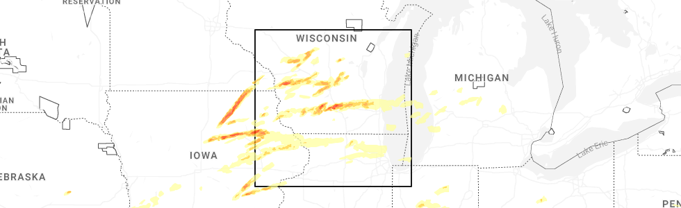
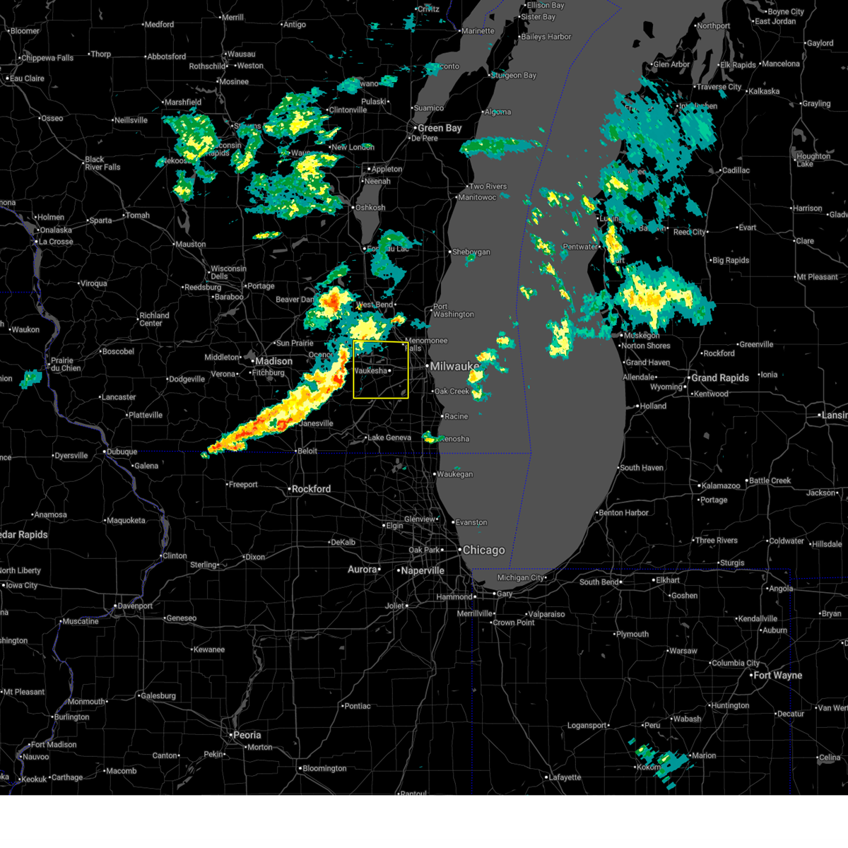
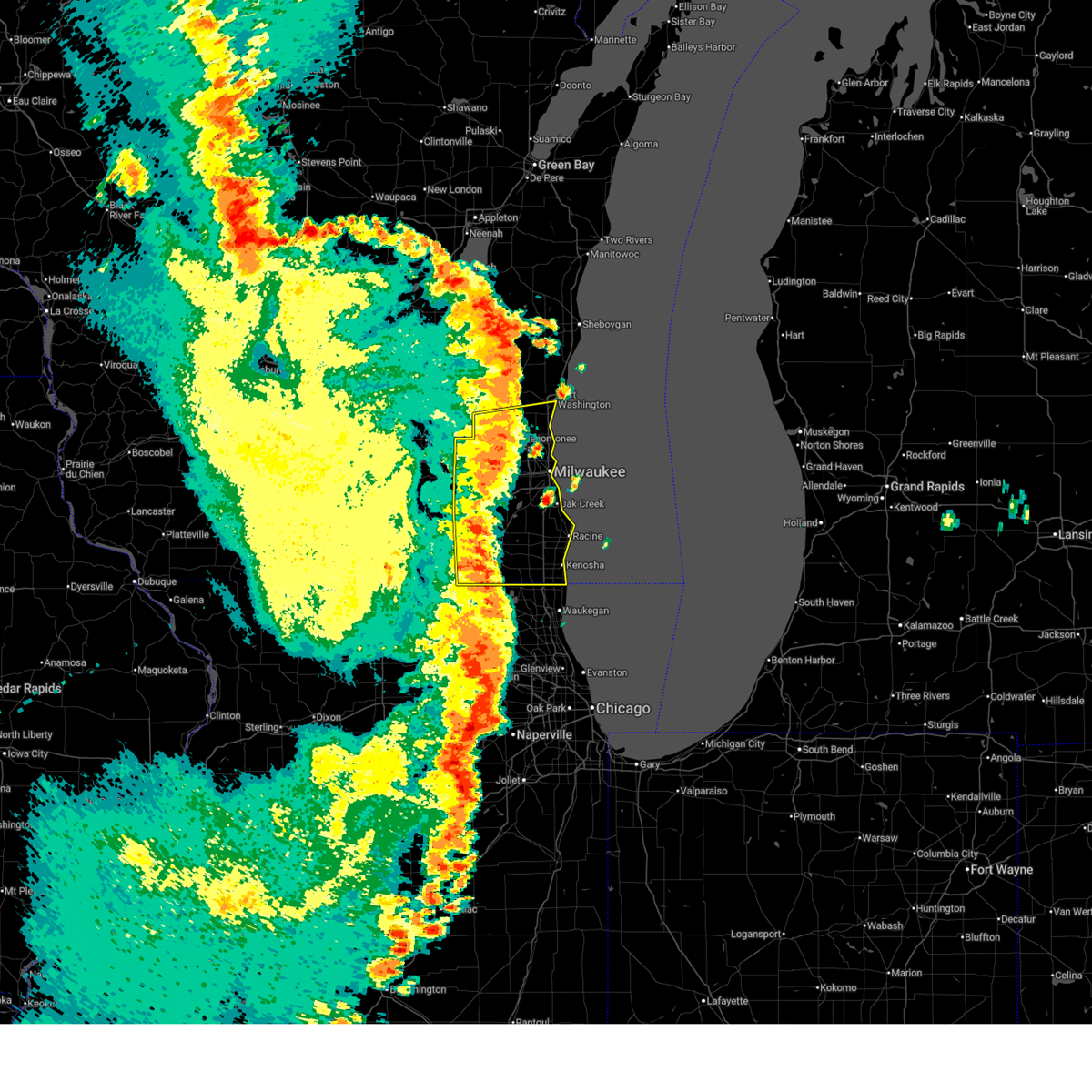
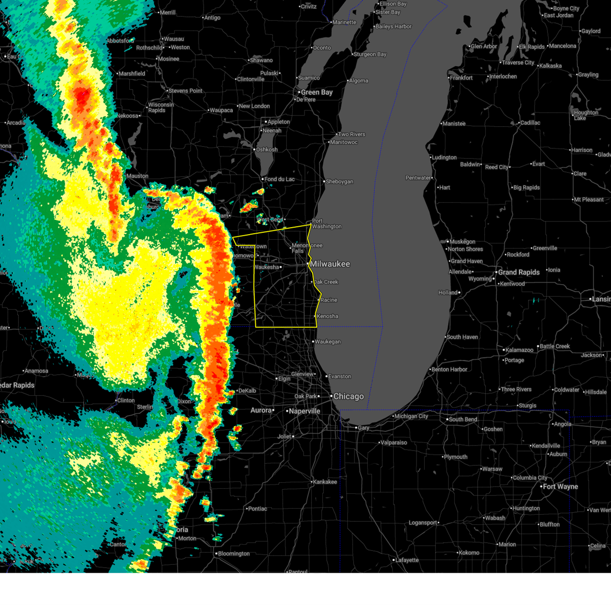
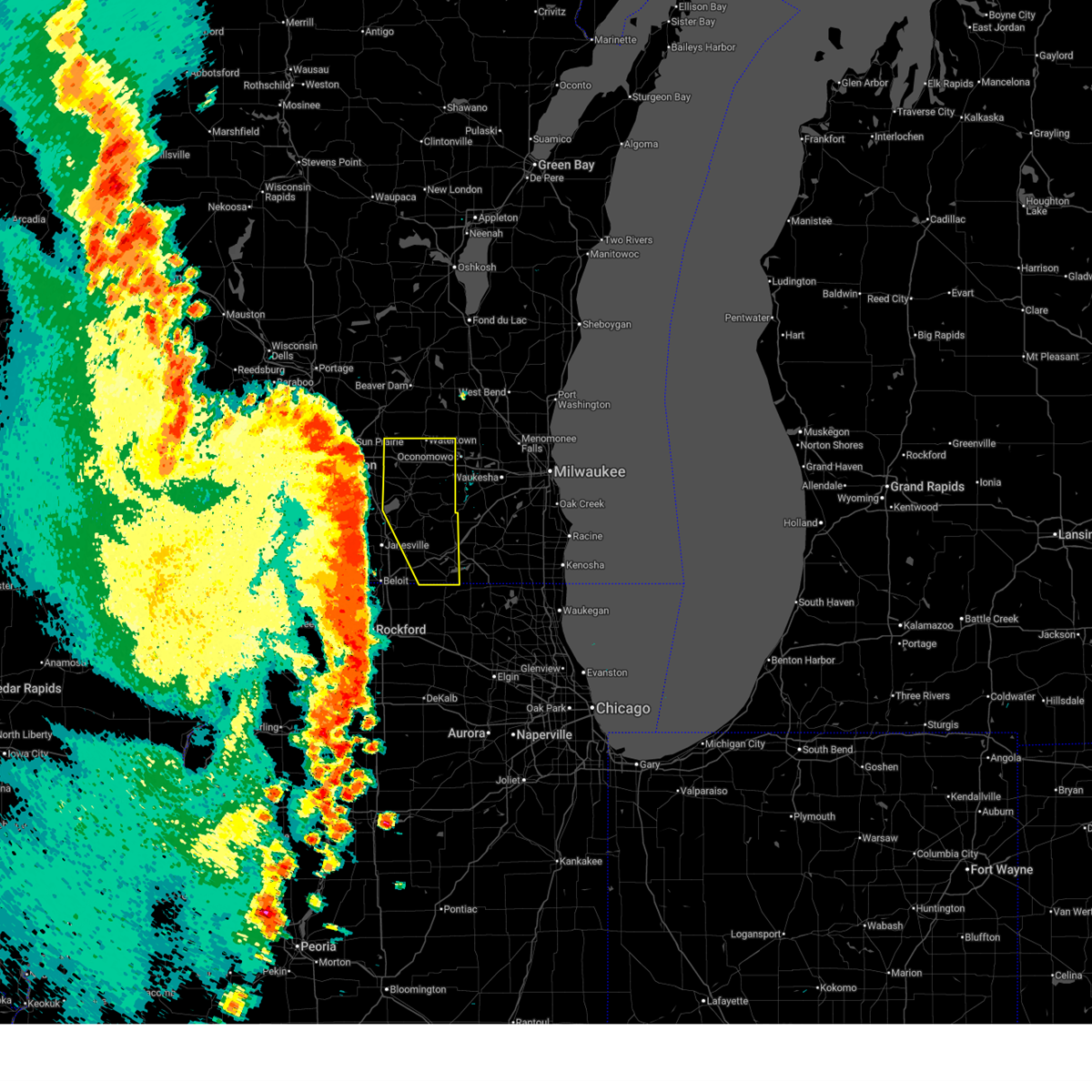
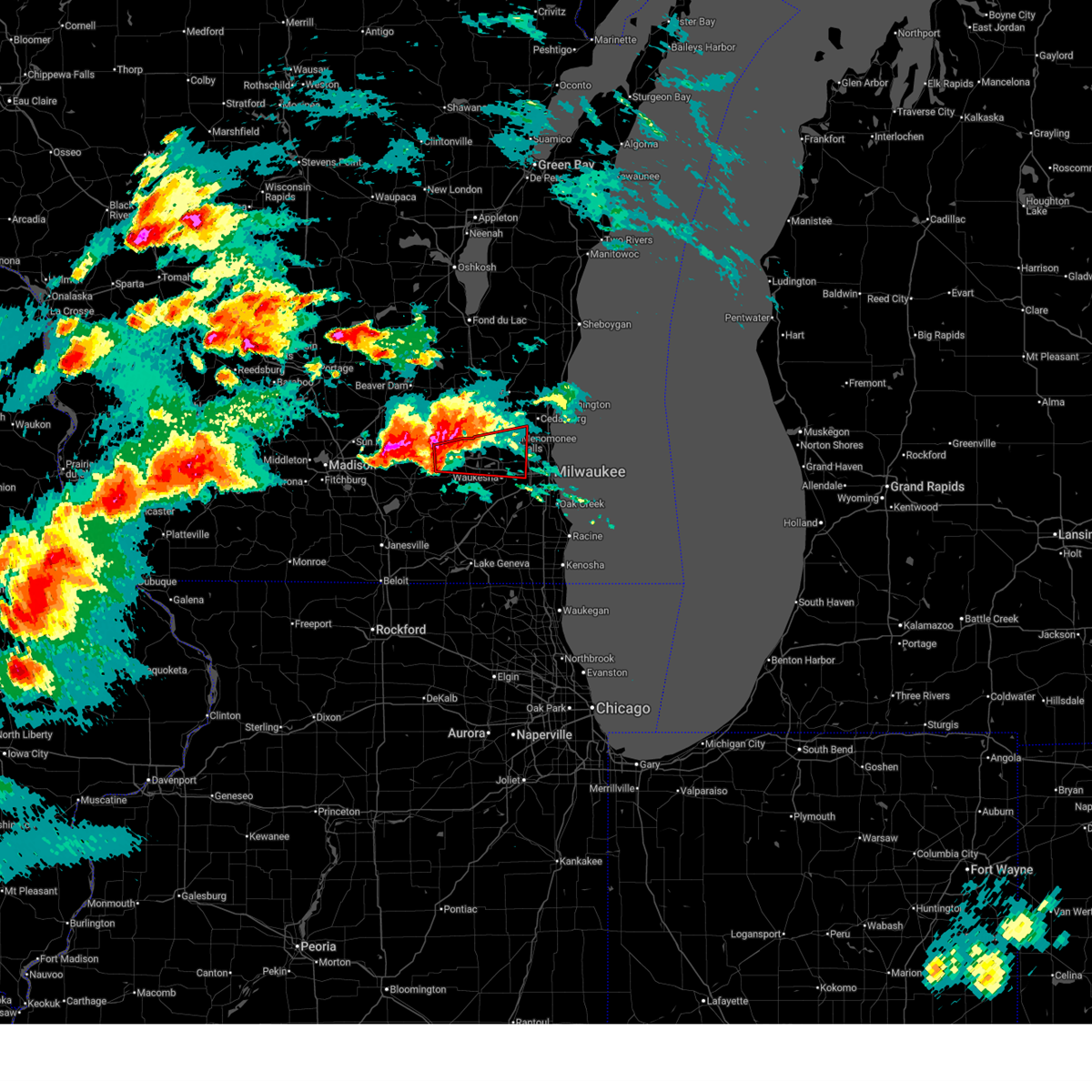
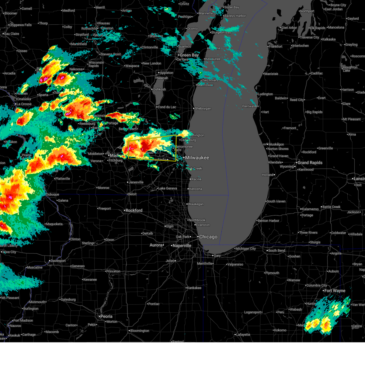
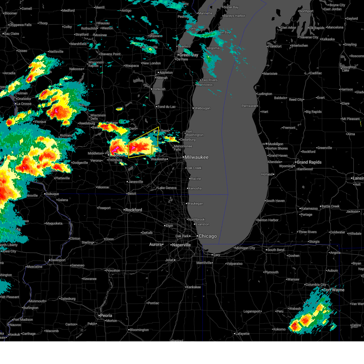
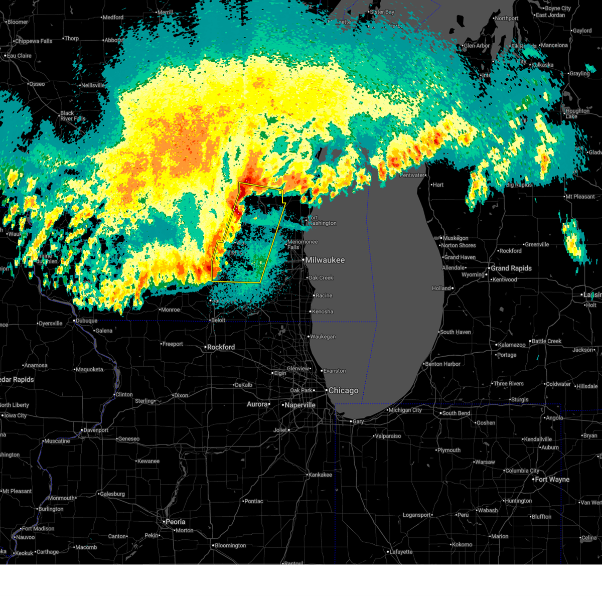
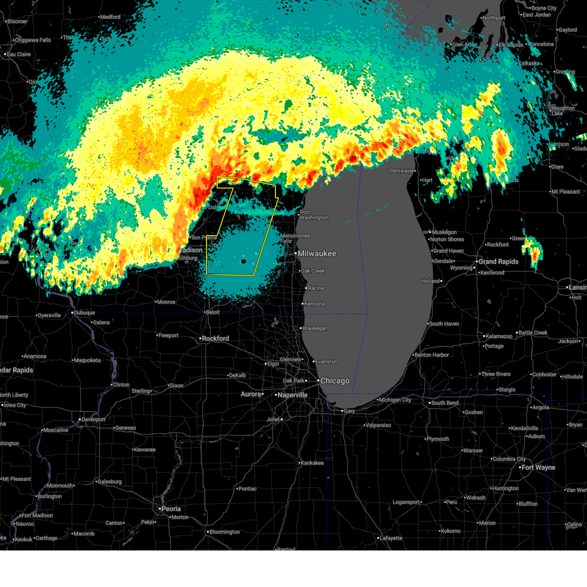
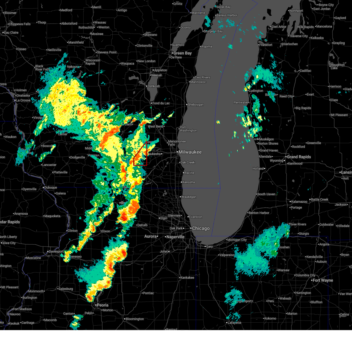
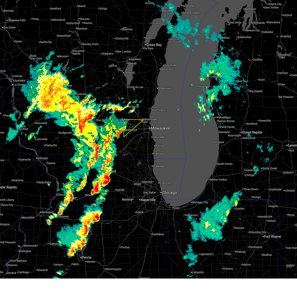
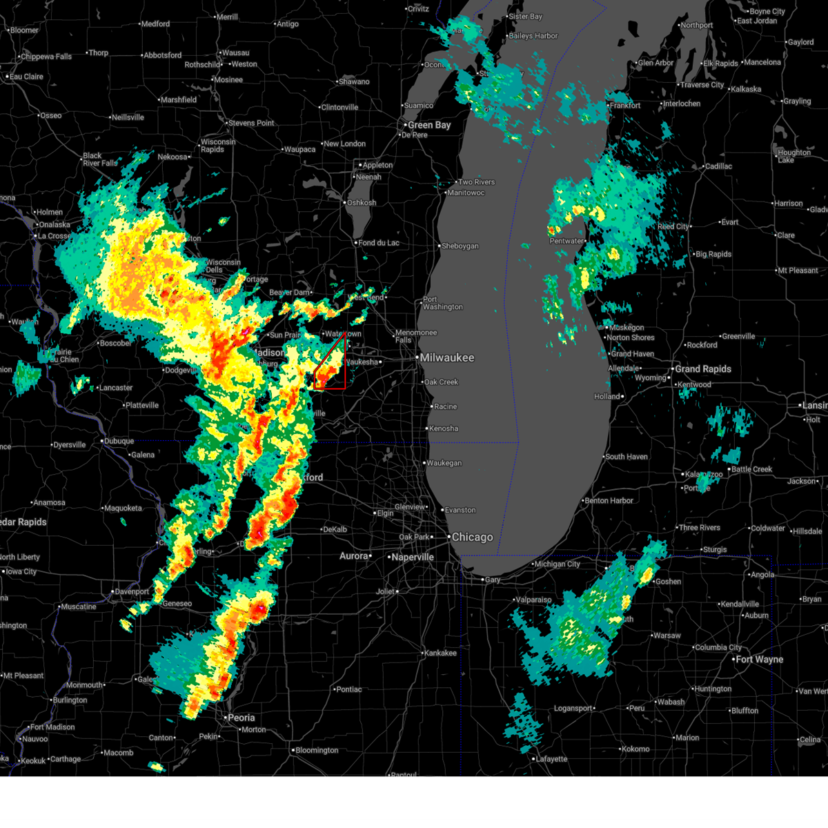
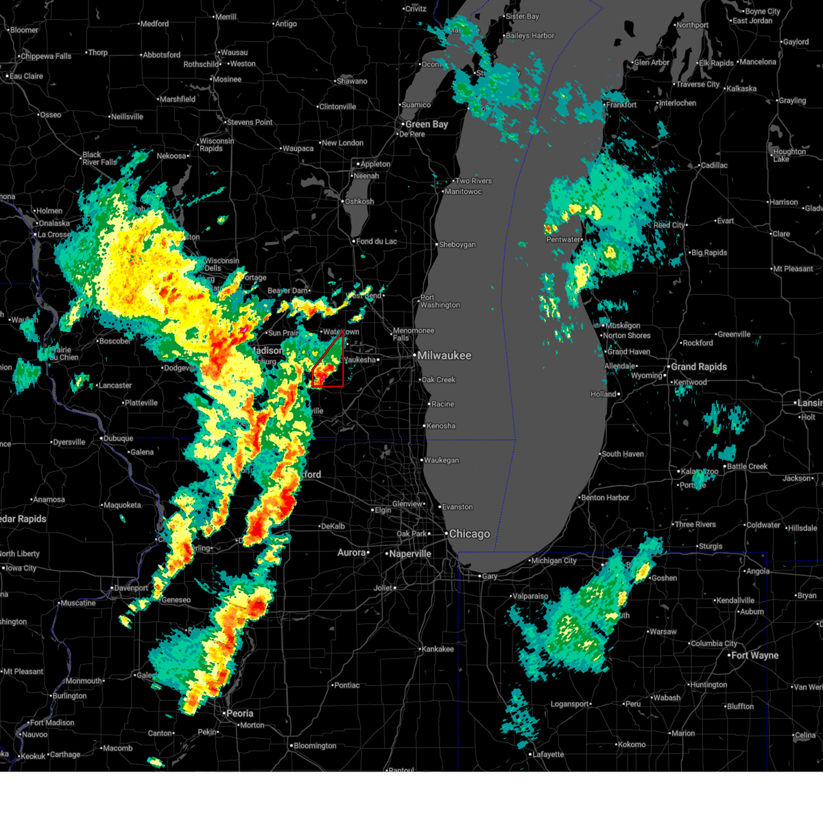
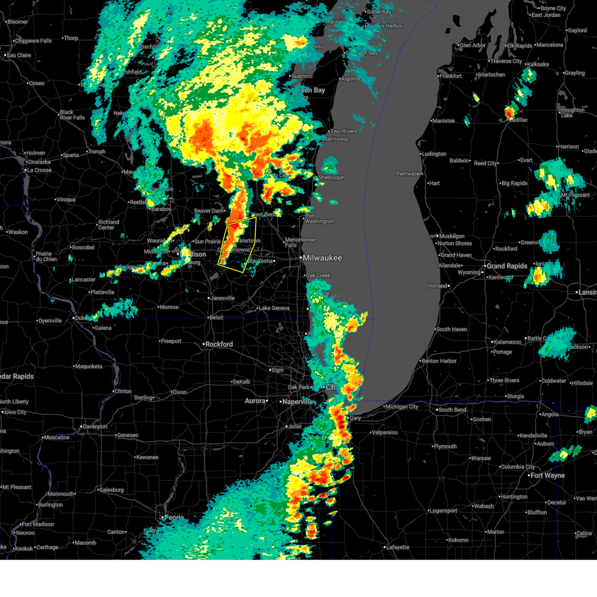
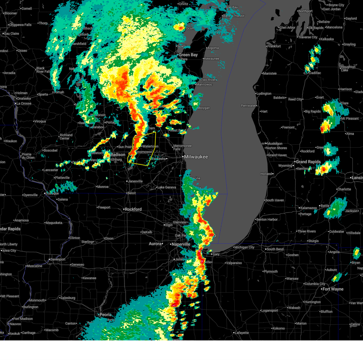
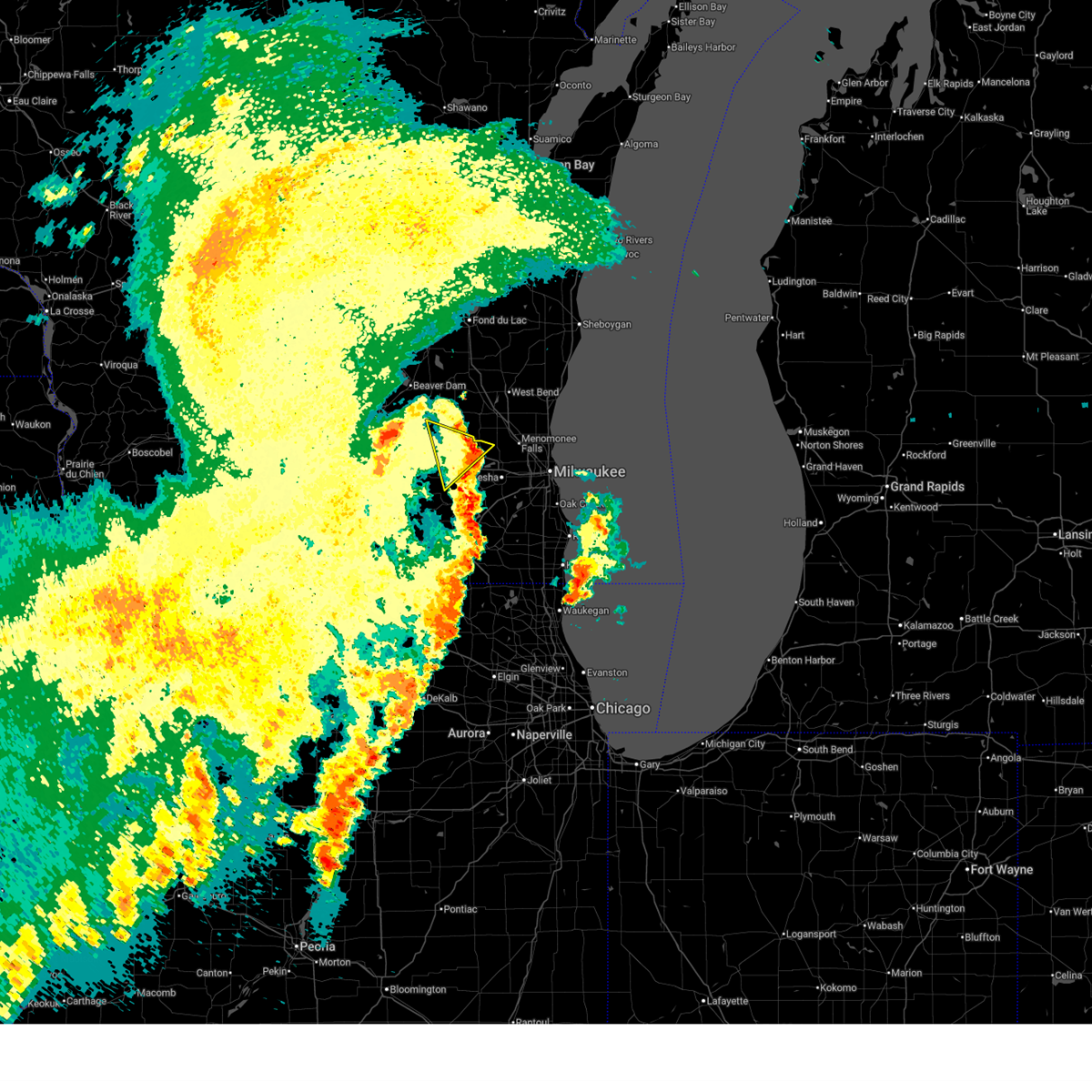
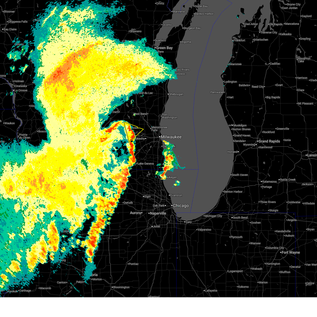
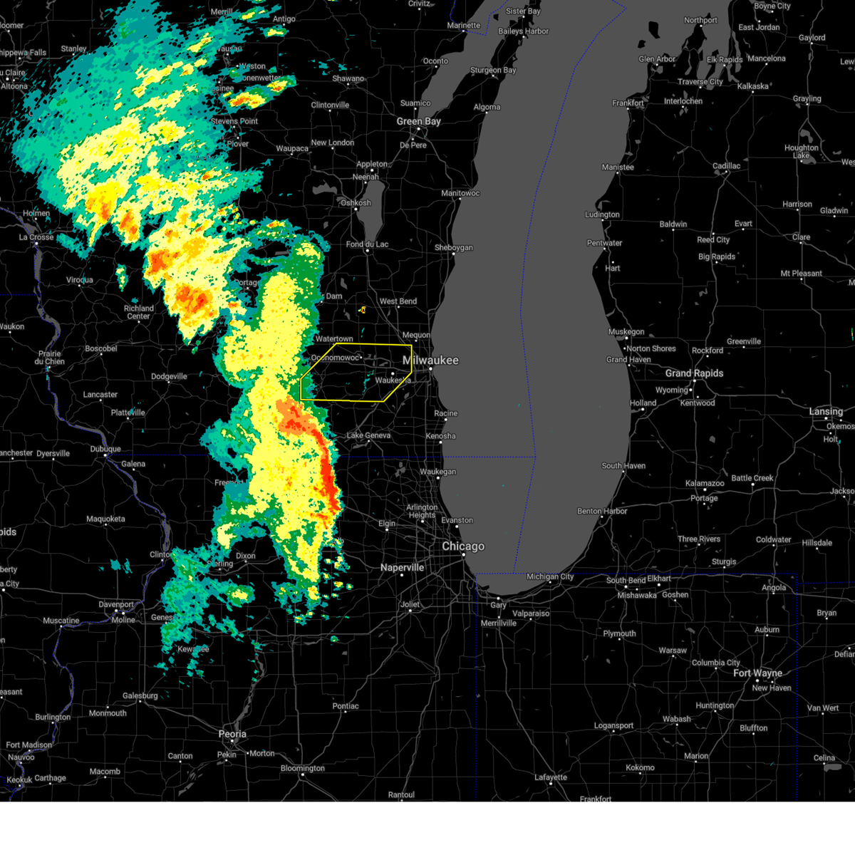
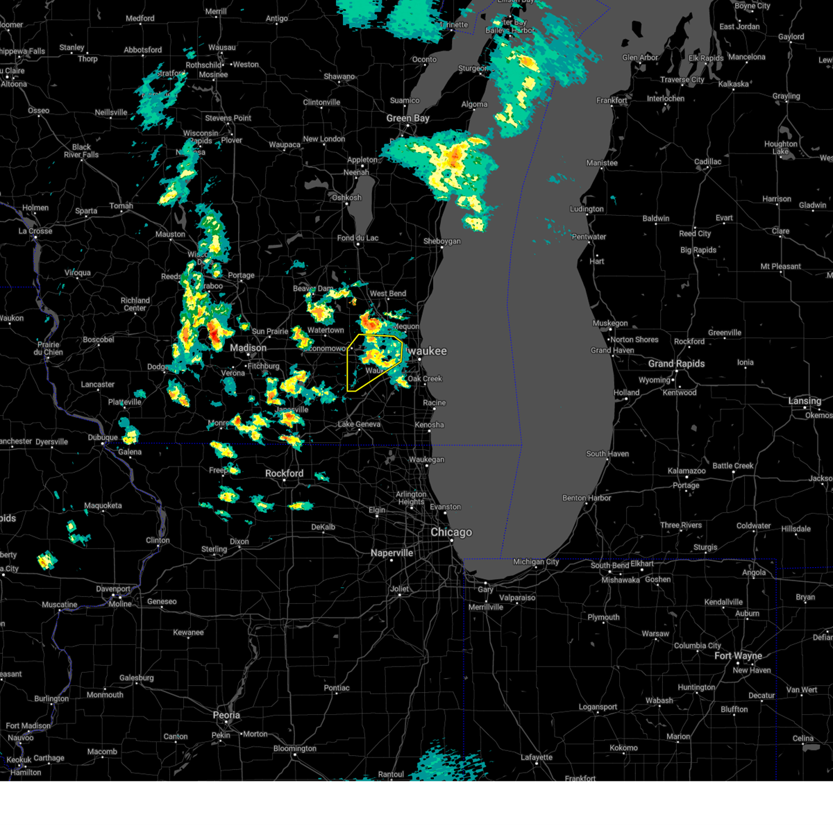
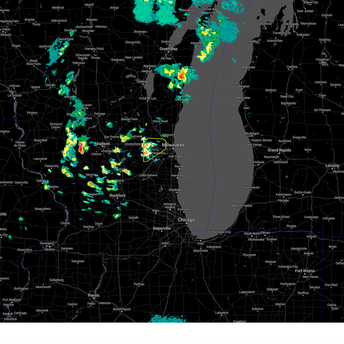
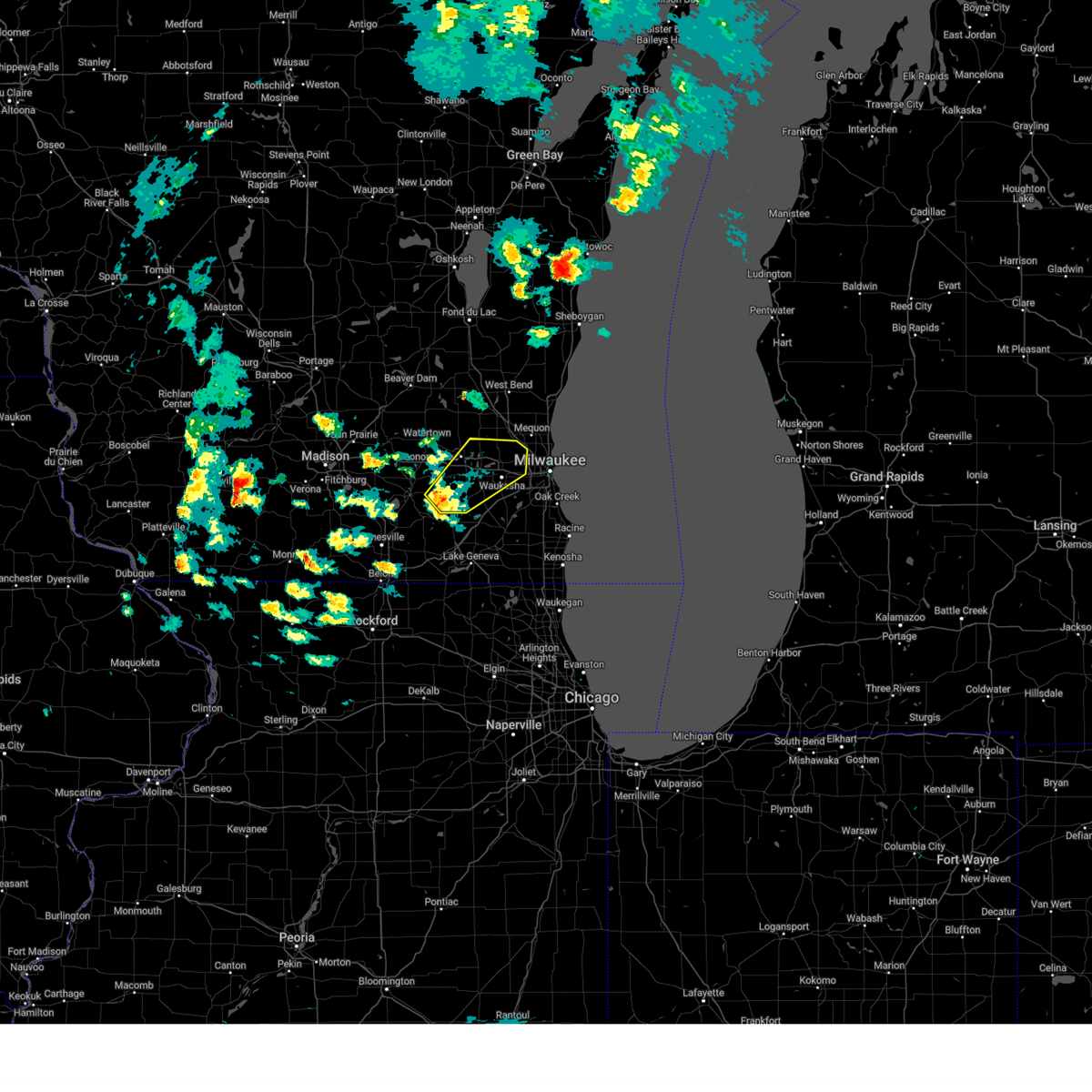
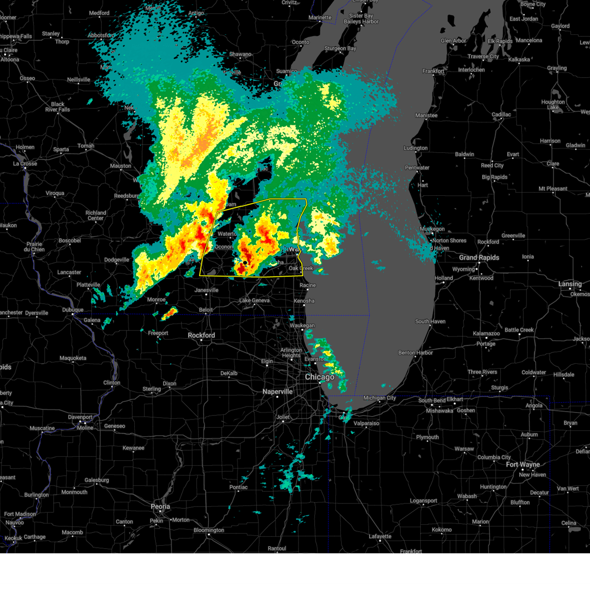
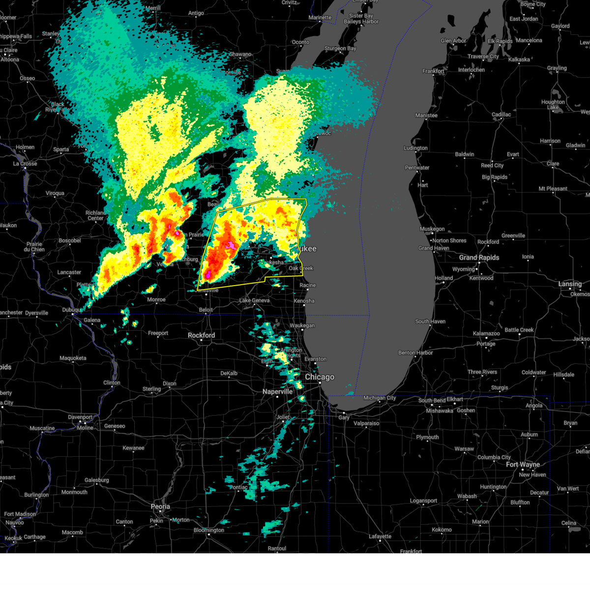
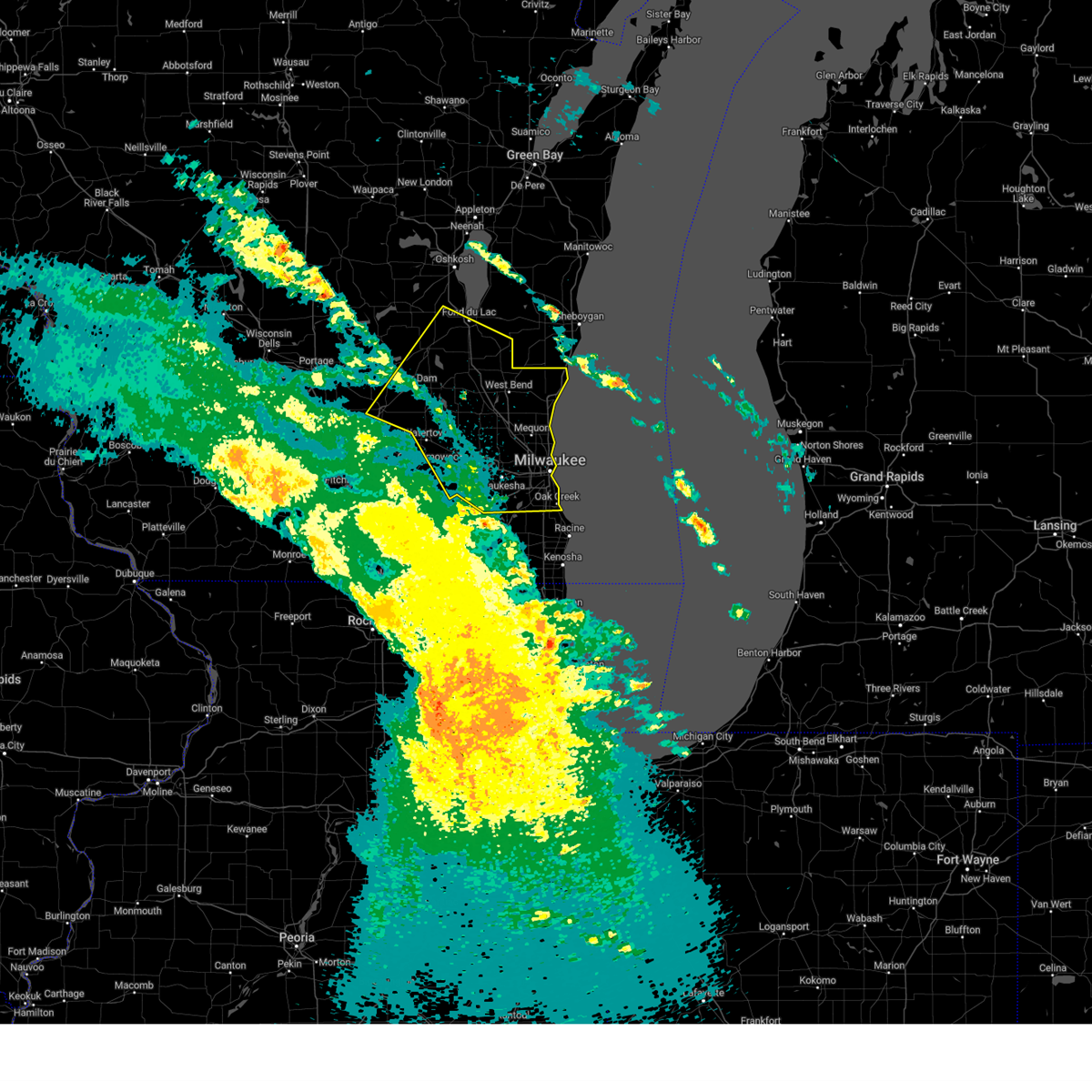
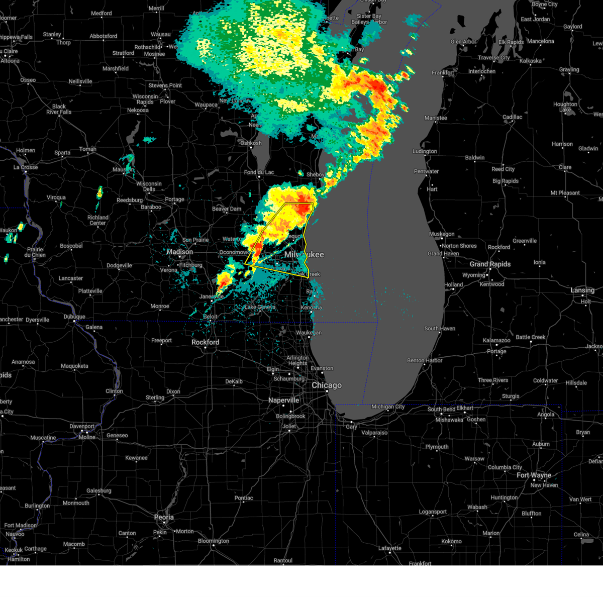
Hail Map for Lac La Belle, WI
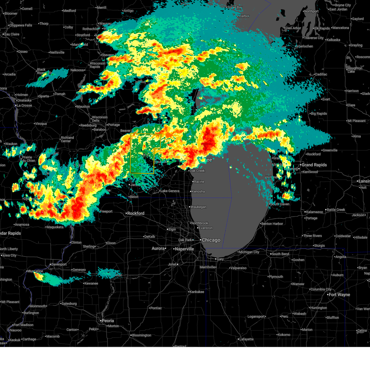
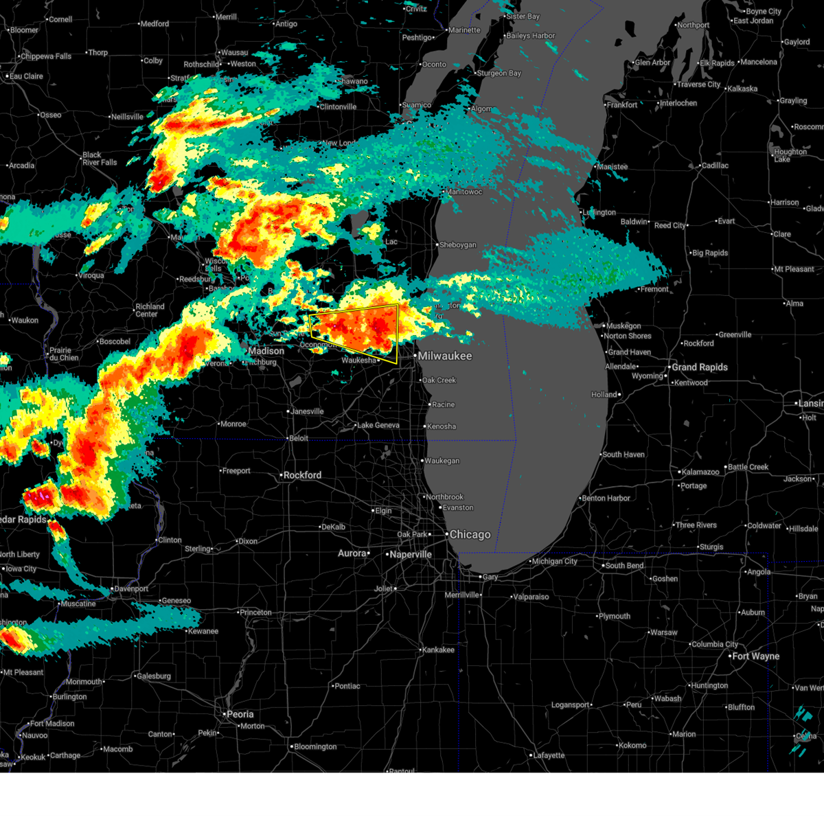
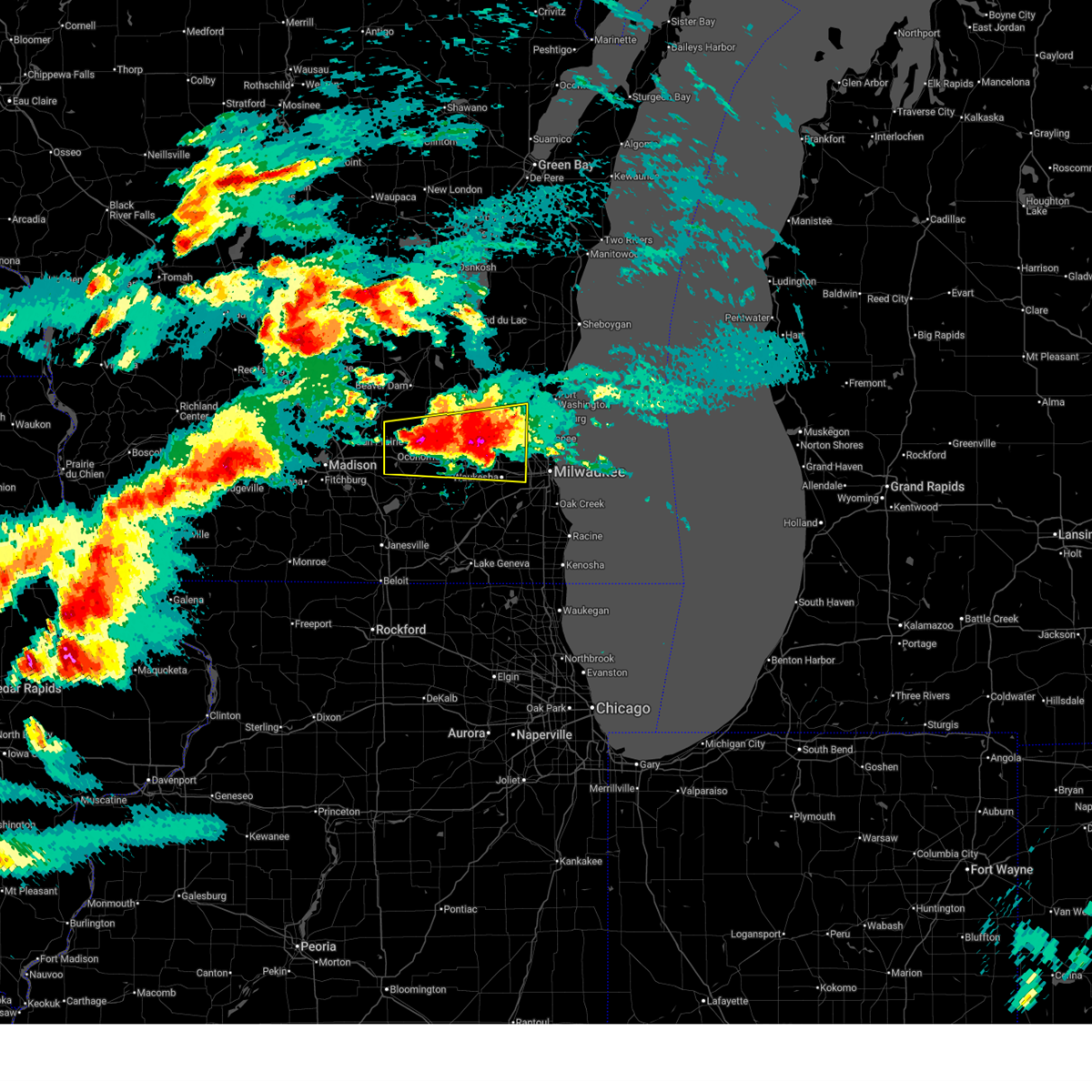
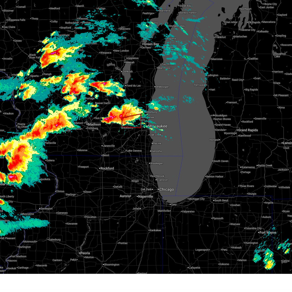
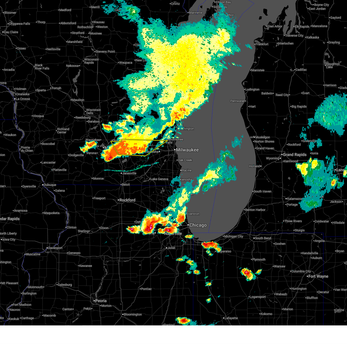
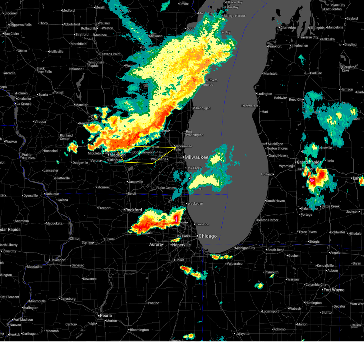
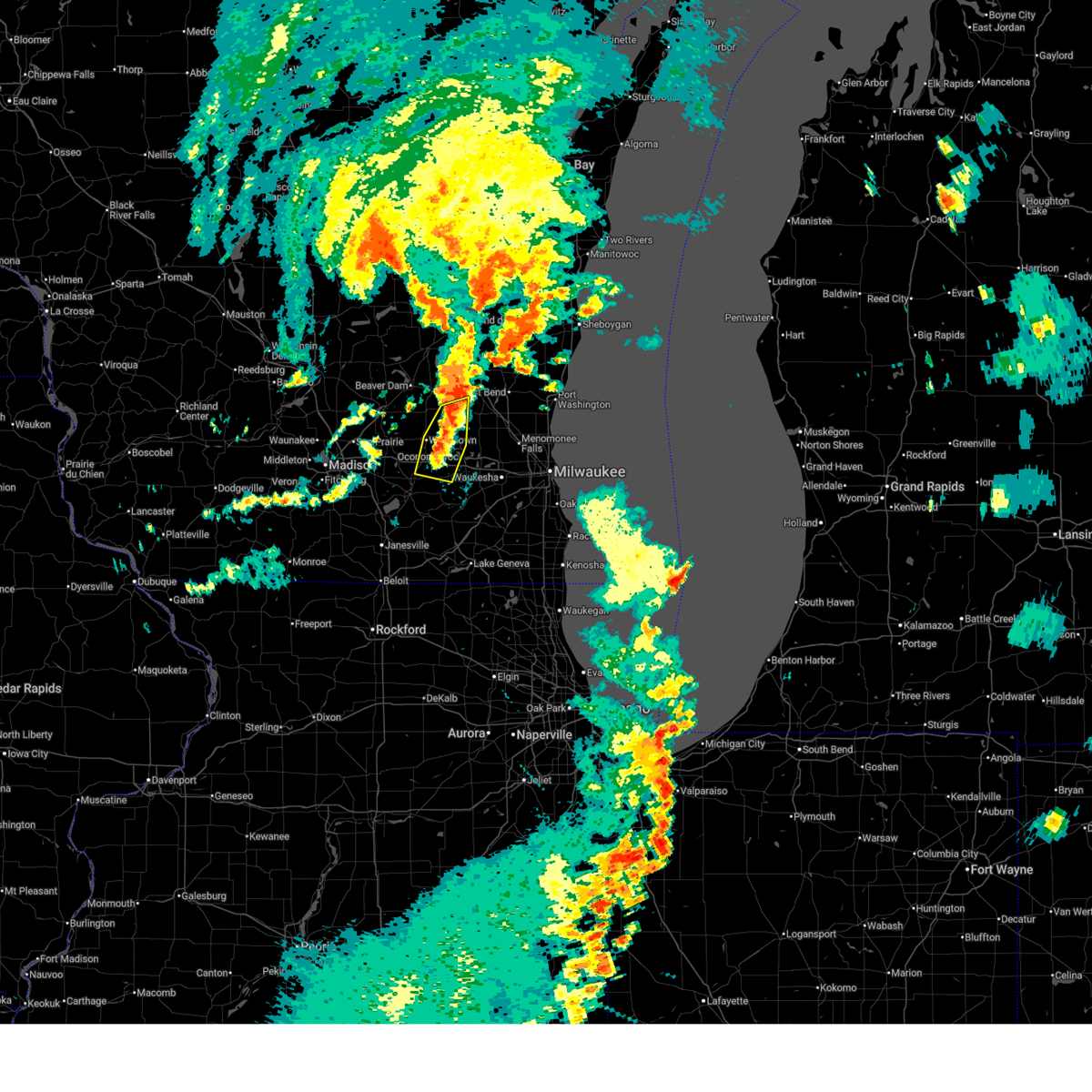
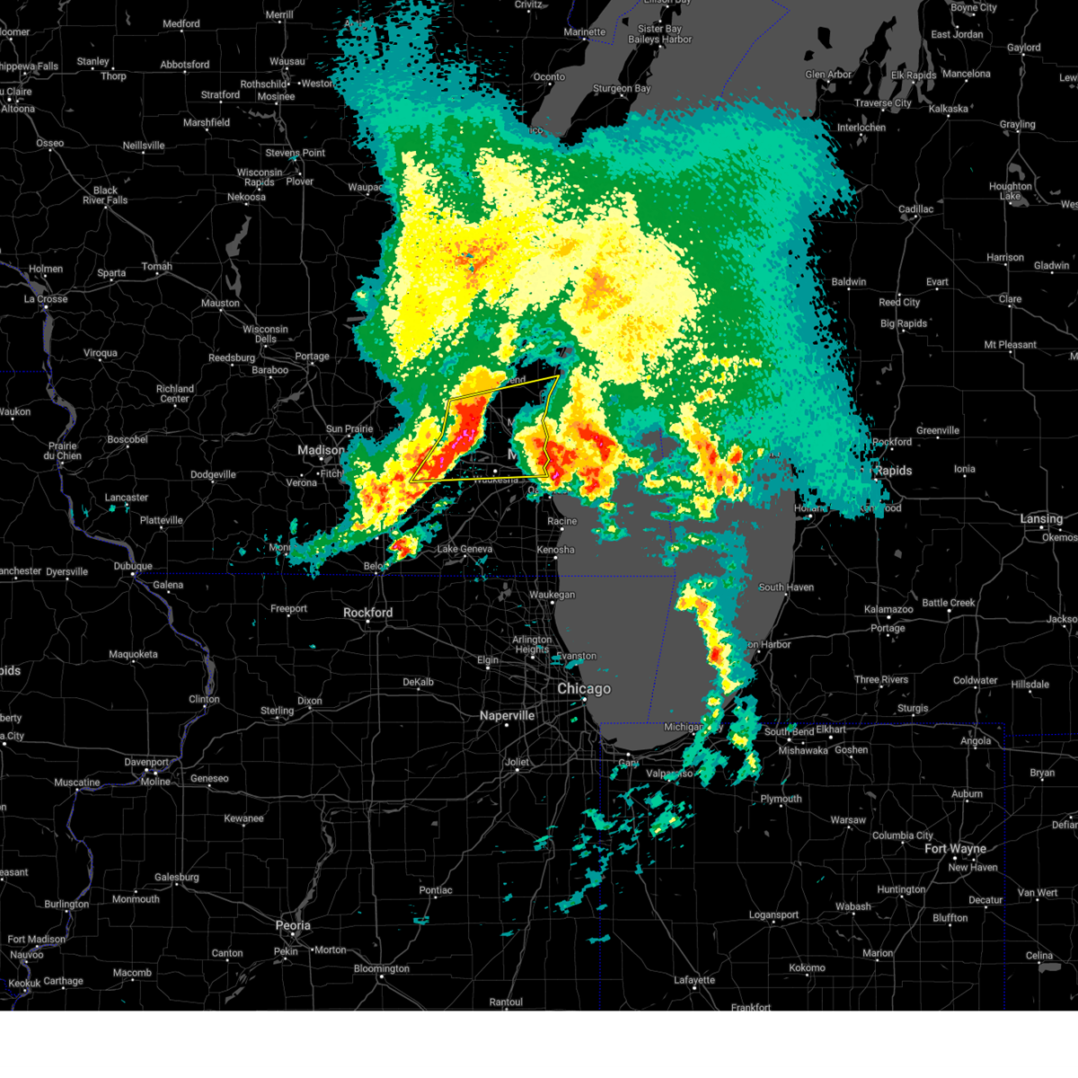
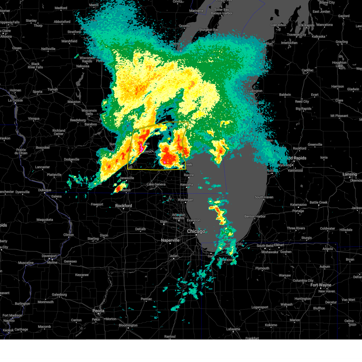
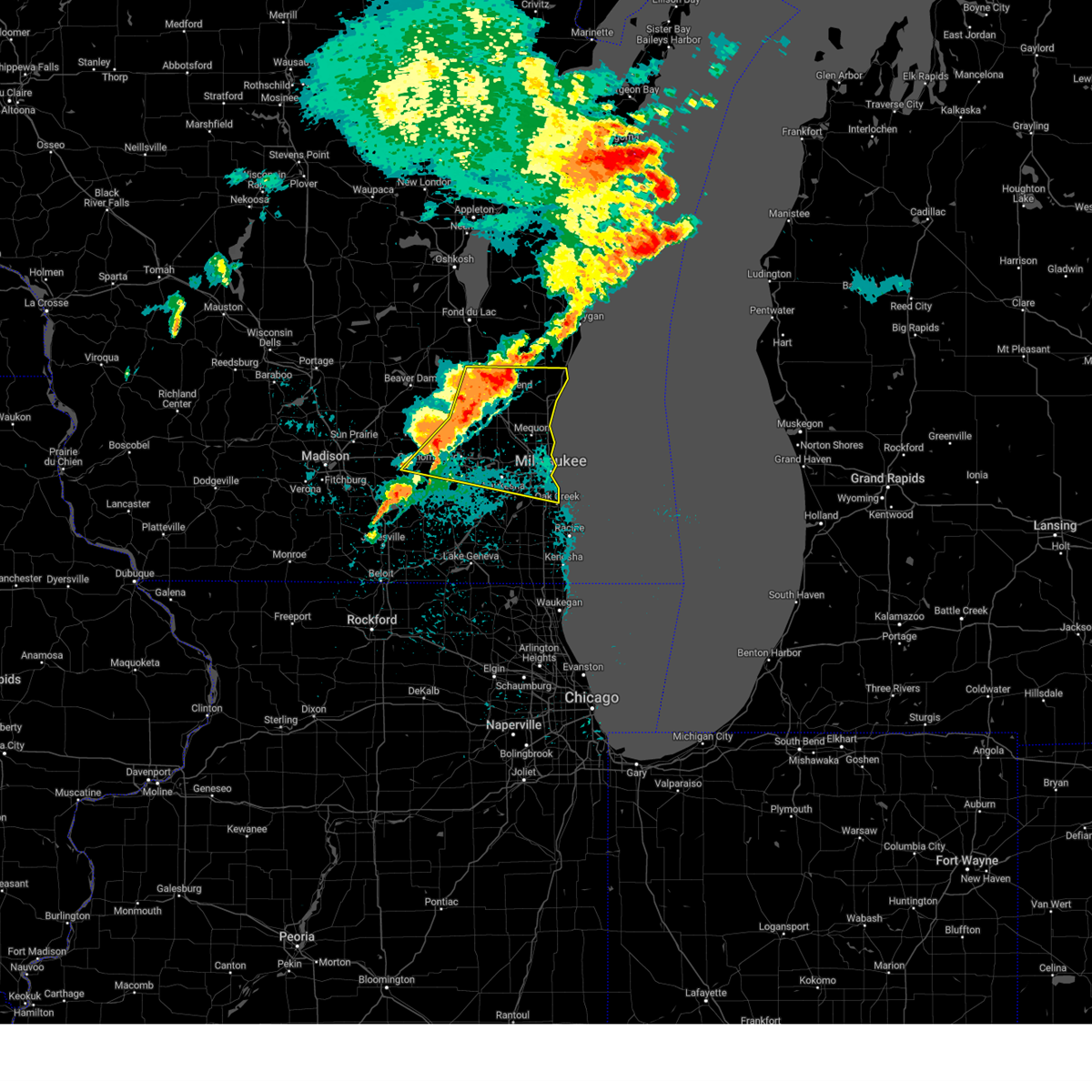
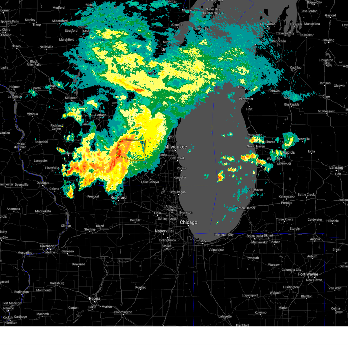
The Lac La Belle, WI area has had 0 reports of on-the-ground hail by trained spotters, and has been under severe weather warnings 45 times during the past 12 months. Doppler radar has detected hail at or near Lac La Belle, WI on 56 occasions, including 3 occasions during the past year.
| Name: | Lac La Belle, WI |
| Where Located: | 43.8 miles E of Madison, WI |
| Map: | Google Map for Lac La Belle, WI |
| Population: | 290 |
| Housing Units: | 135 |
| More Info: | Search Google for Lac La Belle, WI |
2
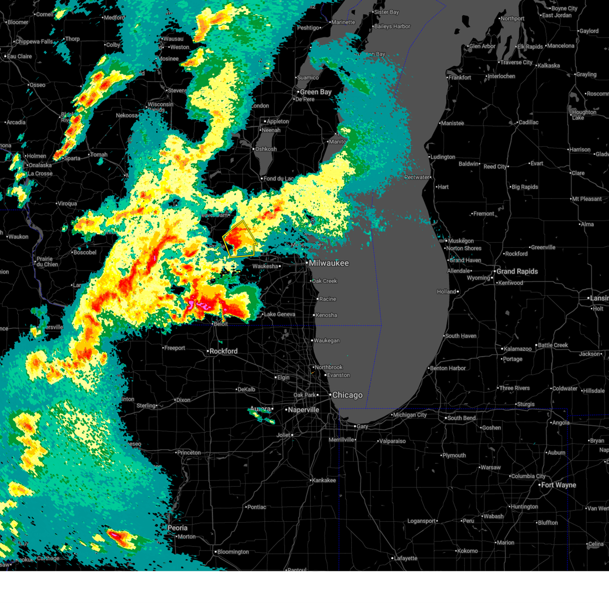
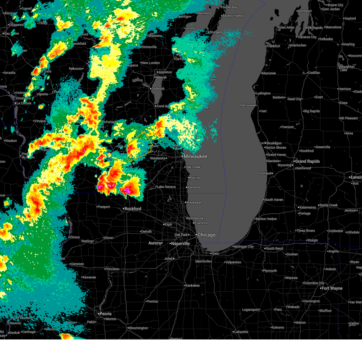
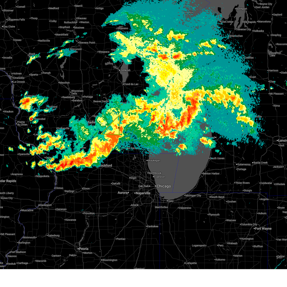
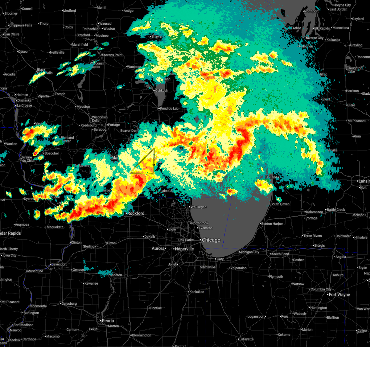
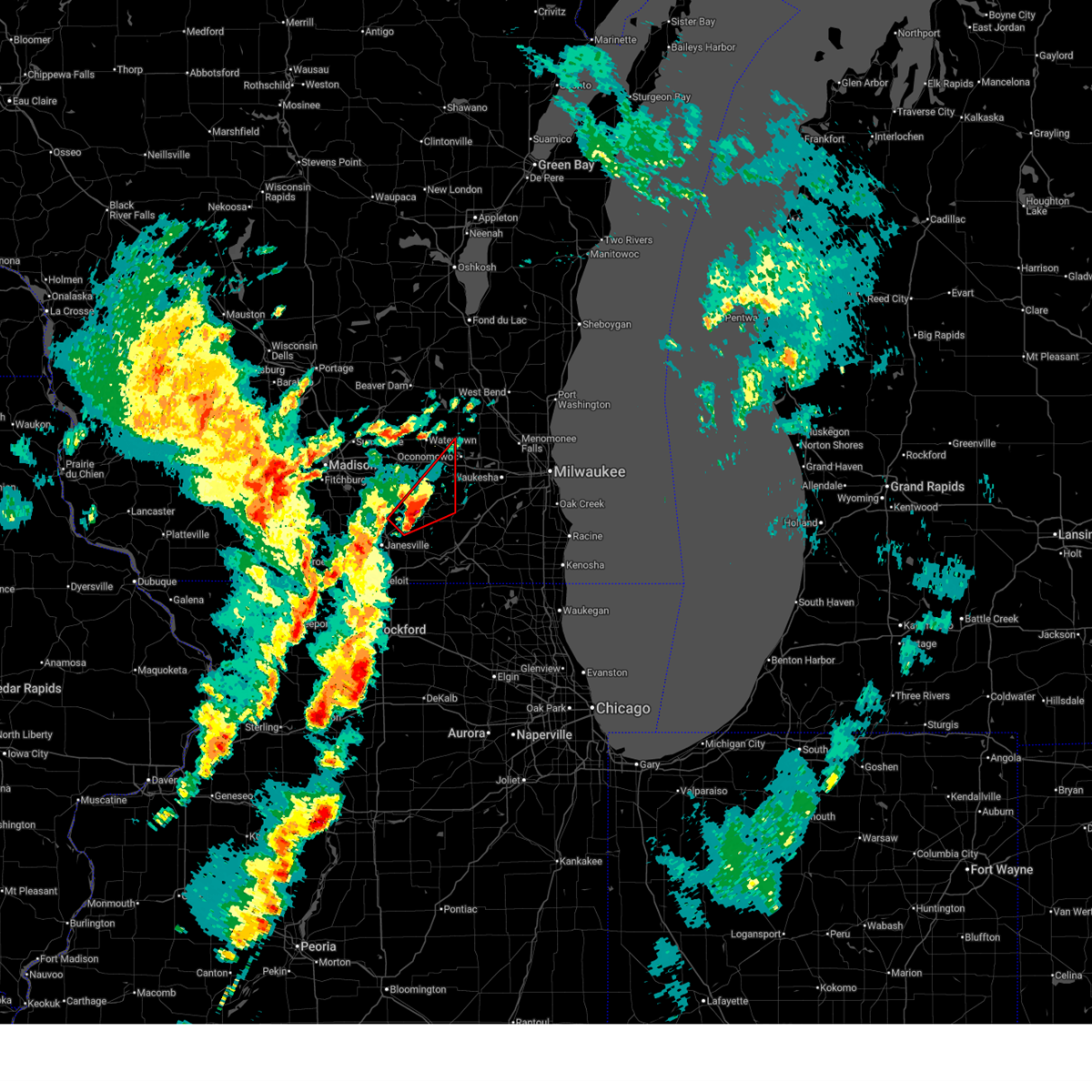
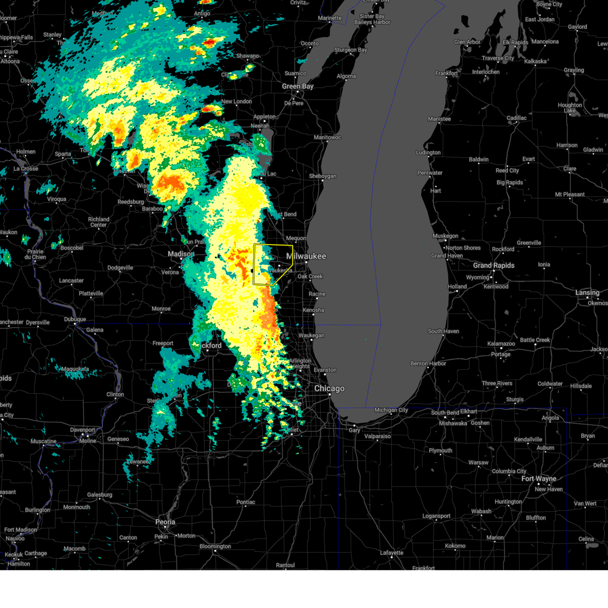
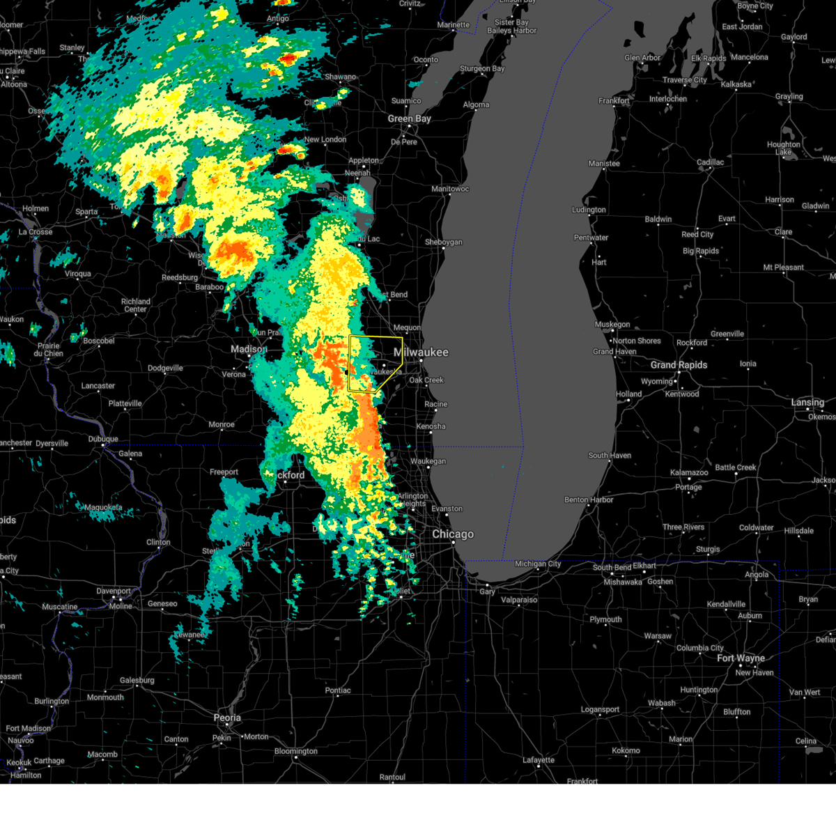
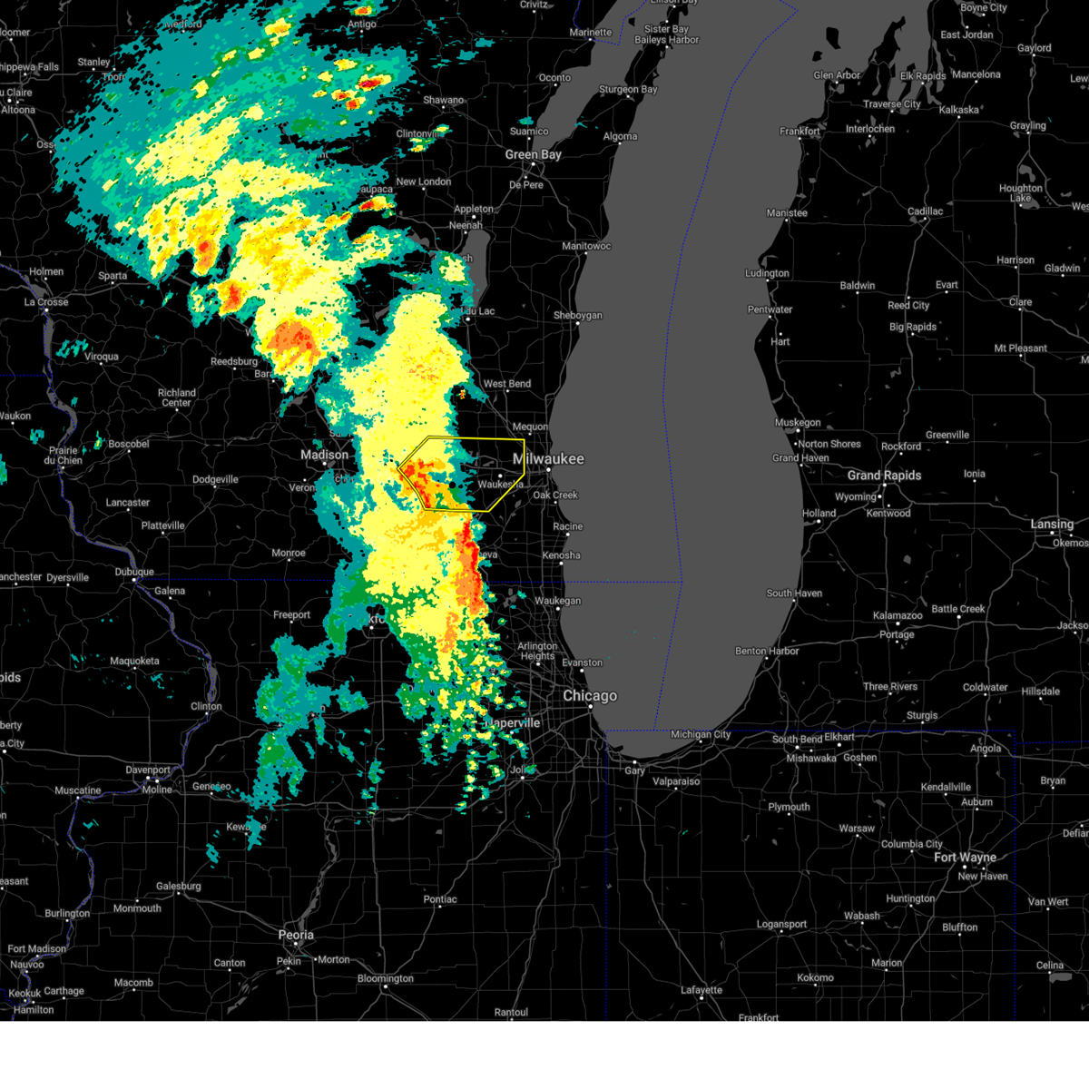
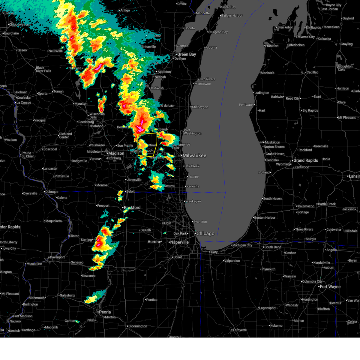
The Top Recent Hail Date for Lac La Belle, WI is Tuesday, April 14, 2026 (5th out of 56)
Hail and Wind Damage Spotted near Lac La Belle, WI
| Date / Time | Report Details |
|---|---|
| 6/17/2026 7:49 PM CDT |
 Svrmkx the national weather service in milwaukee/sullivan has issued a * severe thunderstorm warning for, waukesha county in southeastern wisconsin, * until 845 pm cdt. * at 749 pm cdt, severe thunderstorms were located along a line extending from near lac la belle to near palmyra to whitewater, moving east at 45 mph (radar indicated). Hazards include 60 mph wind gusts. expect damage to roofs, siding, and trees Svrmkx the national weather service in milwaukee/sullivan has issued a * severe thunderstorm warning for, waukesha county in southeastern wisconsin, * until 845 pm cdt. * at 749 pm cdt, severe thunderstorms were located along a line extending from near lac la belle to near palmyra to whitewater, moving east at 45 mph (radar indicated). Hazards include 60 mph wind gusts. expect damage to roofs, siding, and trees
|
| 6/10/2026 3:27 PM CDT |
 At 327 pm cdt, severe thunderstorms were located along a line extending from mequon to grayslake, moving east at 45 mph (radar indicated). Hazards include 70 mph wind gusts and penny size hail. Expect considerable tree damage. damage is likely to mobile homes, roofs, and outbuildings. locations impacted include, milwaukee, kenosha, racine, waukesha, west allis, wauwatosa, new berlin, brookfield, greenfield, menomonee falls, oak creek, mount pleasant, muskego, mequon, south milwaukee, pleasant prairie, cudahy, antioch, hartford, and whitefish bay. People attending wednesday night live at state fair , and glendale live at the oasis should seek safe shelter immediately!. At 327 pm cdt, severe thunderstorms were located along a line extending from mequon to grayslake, moving east at 45 mph (radar indicated). Hazards include 70 mph wind gusts and penny size hail. Expect considerable tree damage. damage is likely to mobile homes, roofs, and outbuildings. locations impacted include, milwaukee, kenosha, racine, waukesha, west allis, wauwatosa, new berlin, brookfield, greenfield, menomonee falls, oak creek, mount pleasant, muskego, mequon, south milwaukee, pleasant prairie, cudahy, antioch, hartford, and whitefish bay. People attending wednesday night live at state fair , and glendale live at the oasis should seek safe shelter immediately!.
|
| 6/10/2026 3:27 PM CDT |
 the severe thunderstorm warning has been cancelled and is no longer in effect the severe thunderstorm warning has been cancelled and is no longer in effect
|
| 6/10/2026 2:40 PM CDT |
 Svrmkx the national weather service in milwaukee/sullivan has issued a * severe thunderstorm warning for, southwestern ozaukee county in southeastern wisconsin, milwaukee county in southeastern wisconsin, eastern walworth county in southeastern wisconsin, racine county in southeastern wisconsin, waukesha county in southeastern wisconsin, southern washington county in southeastern wisconsin, southeastern dodge county in southeastern wisconsin, kenosha county in southeastern wisconsin, * until 400 pm cdt. * at 239 pm cdt, severe thunderstorms were located along a line extending from near watertown to near capron, moving east at 45 mph (radar indicated). Hazards include 70 mph wind gusts and penny size hail. Expect considerable tree damage. Damage is likely to mobile homes, roofs, and outbuildings. Svrmkx the national weather service in milwaukee/sullivan has issued a * severe thunderstorm warning for, southwestern ozaukee county in southeastern wisconsin, milwaukee county in southeastern wisconsin, eastern walworth county in southeastern wisconsin, racine county in southeastern wisconsin, waukesha county in southeastern wisconsin, southern washington county in southeastern wisconsin, southeastern dodge county in southeastern wisconsin, kenosha county in southeastern wisconsin, * until 400 pm cdt. * at 239 pm cdt, severe thunderstorms were located along a line extending from near watertown to near capron, moving east at 45 mph (radar indicated). Hazards include 70 mph wind gusts and penny size hail. Expect considerable tree damage. Damage is likely to mobile homes, roofs, and outbuildings.
|
| 6/10/2026 2:08 PM CDT |
 Svrmkx the national weather service in milwaukee/sullivan has issued a * severe thunderstorm warning for, western walworth county in southeastern wisconsin, northeastern rock county in south central wisconsin, jefferson county in southeastern wisconsin, * until 315 pm cdt. * at 208 pm cdt, severe thunderstorms were located along a line extending from near cottage grove to 6 miles southwest of edgerton to rockford airport, moving northeast at 45 mph (radar indicated). Hazards include 70 mph wind gusts and penny size hail. Expect considerable tree damage. Damage is likely to mobile homes, roofs, and outbuildings. Svrmkx the national weather service in milwaukee/sullivan has issued a * severe thunderstorm warning for, western walworth county in southeastern wisconsin, northeastern rock county in south central wisconsin, jefferson county in southeastern wisconsin, * until 315 pm cdt. * at 208 pm cdt, severe thunderstorms were located along a line extending from near cottage grove to 6 miles southwest of edgerton to rockford airport, moving northeast at 45 mph (radar indicated). Hazards include 70 mph wind gusts and penny size hail. Expect considerable tree damage. Damage is likely to mobile homes, roofs, and outbuildings.
|
| 5/16/2026 1:51 AM CDT |
 The storms which prompted the warning have weakened below severe limits, and have exited the warned area. therefore, the warning will be allowed to expire. a severe thunderstorm watch remains in effect until 500 am cdt for southeastern wisconsin. The storms which prompted the warning have weakened below severe limits, and have exited the warned area. therefore, the warning will be allowed to expire. a severe thunderstorm watch remains in effect until 500 am cdt for southeastern wisconsin.
|
| 5/16/2026 1:41 AM CDT |
 At 140 am cdt, severe thunderstorms were located along a line extending from near lac la belle to near elkhorn to near hebron, moving east at 45 mph (radar indicated). Hazards include 60 mph wind gusts. Expect damage to roofs, siding, and trees. Locations impacted include, watertown, whitewater, elkhorn, delavan, lake geneva, east troy, williams bay, genoa city, walworth, johnson creek, richmond, palmyra, fontana-on-geneva lake, como, pell lake, potter lake, powers lake, burlington, ixonia, and springfield. At 140 am cdt, severe thunderstorms were located along a line extending from near lac la belle to near elkhorn to near hebron, moving east at 45 mph (radar indicated). Hazards include 60 mph wind gusts. Expect damage to roofs, siding, and trees. Locations impacted include, watertown, whitewater, elkhorn, delavan, lake geneva, east troy, williams bay, genoa city, walworth, johnson creek, richmond, palmyra, fontana-on-geneva lake, como, pell lake, potter lake, powers lake, burlington, ixonia, and springfield.
|
| 5/16/2026 1:06 AM CDT |
 Svrmkx the national weather service in milwaukee/sullivan has issued a * severe thunderstorm warning for, walworth county in southeastern wisconsin, eastern rock county in south central wisconsin, jefferson county in southeastern wisconsin, * until 200 am cdt. * at 106 am cdt, severe thunderstorms were located along a line extending from near marshall to near footville to near lake summerset, moving east at 55 mph (radar indicated). Hazards include 60 mph wind gusts. expect damage to roofs, siding, and trees Svrmkx the national weather service in milwaukee/sullivan has issued a * severe thunderstorm warning for, walworth county in southeastern wisconsin, eastern rock county in south central wisconsin, jefferson county in southeastern wisconsin, * until 200 am cdt. * at 106 am cdt, severe thunderstorms were located along a line extending from near marshall to near footville to near lake summerset, moving east at 55 mph (radar indicated). Hazards include 60 mph wind gusts. expect damage to roofs, siding, and trees
|
| 4/17/2026 5:42 PM CDT |
 At 542 pm cdt, a severe thunderstorm was located near watertown, moving northeast at 25 mph (radar indicated). Hazards include 60 mph wind gusts and half dollar size hail. Hail damage to vehicles is expected. expect wind damage to roofs, siding, and trees. Locations impacted include, watertown, juneau, johnson creek, ixonia, ashippun, lebanon, reeseville, richwood, clyman, pipersville, and lake lac la belle. At 542 pm cdt, a severe thunderstorm was located near watertown, moving northeast at 25 mph (radar indicated). Hazards include 60 mph wind gusts and half dollar size hail. Hail damage to vehicles is expected. expect wind damage to roofs, siding, and trees. Locations impacted include, watertown, juneau, johnson creek, ixonia, ashippun, lebanon, reeseville, richwood, clyman, pipersville, and lake lac la belle.
|
| 4/17/2026 5:16 PM CDT |
 Svrmkx the national weather service in milwaukee/sullivan has issued a * severe thunderstorm warning for, northern jefferson county in southeastern wisconsin, southwestern dodge county in southeastern wisconsin, * until 615 pm cdt. * at 516 pm cdt, a severe thunderstorm was located near lake mills, moving northeast at 25 mph (radar indicated). Hazards include 60 mph wind gusts and quarter size hail. Hail damage to vehicles is expected. Expect wind damage to roofs, siding, and trees. Svrmkx the national weather service in milwaukee/sullivan has issued a * severe thunderstorm warning for, northern jefferson county in southeastern wisconsin, southwestern dodge county in southeastern wisconsin, * until 615 pm cdt. * at 516 pm cdt, a severe thunderstorm was located near lake mills, moving northeast at 25 mph (radar indicated). Hazards include 60 mph wind gusts and quarter size hail. Hail damage to vehicles is expected. Expect wind damage to roofs, siding, and trees.
|
| 4/14/2026 8:25 PM CDT |
 The storms which prompted the warning have weakened below severe limits, and no longer pose an immediate threat to life or property. therefore, the warning will be allowed to expire. a tornado watch remains in effect until 1000 pm cdt for southeastern wisconsin. The storms which prompted the warning have weakened below severe limits, and no longer pose an immediate threat to life or property. therefore, the warning will be allowed to expire. a tornado watch remains in effect until 1000 pm cdt for southeastern wisconsin.
|
| 4/14/2026 8:19 PM CDT |
 At 818 pm cdt, severe thunderstorms were located along a line extending from near slinger to merton to north prairie, moving east at 45 mph (radar indicated). Hazards include 60 mph wind gusts and quarter size hail. Hail damage to vehicles is expected. expect wind damage to roofs, siding, and trees. Locations impacted include, whitewater, fort atkinson, jefferson, palmyra, lake koshkonong, ixonia, rome, hebron, sullivan, helenville, nws milwaukee/sullivan, and lake lac la belle. At 818 pm cdt, severe thunderstorms were located along a line extending from near slinger to merton to north prairie, moving east at 45 mph (radar indicated). Hazards include 60 mph wind gusts and quarter size hail. Hail damage to vehicles is expected. expect wind damage to roofs, siding, and trees. Locations impacted include, whitewater, fort atkinson, jefferson, palmyra, lake koshkonong, ixonia, rome, hebron, sullivan, helenville, nws milwaukee/sullivan, and lake lac la belle.
|
| 4/14/2026 8:19 PM CDT |
 the severe thunderstorm warning has been cancelled and is no longer in effect the severe thunderstorm warning has been cancelled and is no longer in effect
|
| 4/14/2026 7:28 PM CDT |
 Svrmkx the national weather service in milwaukee/sullivan has issued a * severe thunderstorm warning for, jefferson county in southeastern wisconsin, southern dodge county in southeastern wisconsin, * until 830 pm cdt. * at 728 pm cdt, severe thunderstorms were located along a line extending from fall river to marshall to near stoughton, moving east at 50 mph (radar indicated). Hazards include 60 mph wind gusts and quarter size hail. Hail damage to vehicles is expected. Expect wind damage to roofs, siding, and trees. Svrmkx the national weather service in milwaukee/sullivan has issued a * severe thunderstorm warning for, jefferson county in southeastern wisconsin, southern dodge county in southeastern wisconsin, * until 830 pm cdt. * at 728 pm cdt, severe thunderstorms were located along a line extending from fall river to marshall to near stoughton, moving east at 50 mph (radar indicated). Hazards include 60 mph wind gusts and quarter size hail. Hail damage to vehicles is expected. Expect wind damage to roofs, siding, and trees.
|
| 4/14/2026 6:34 PM CDT |
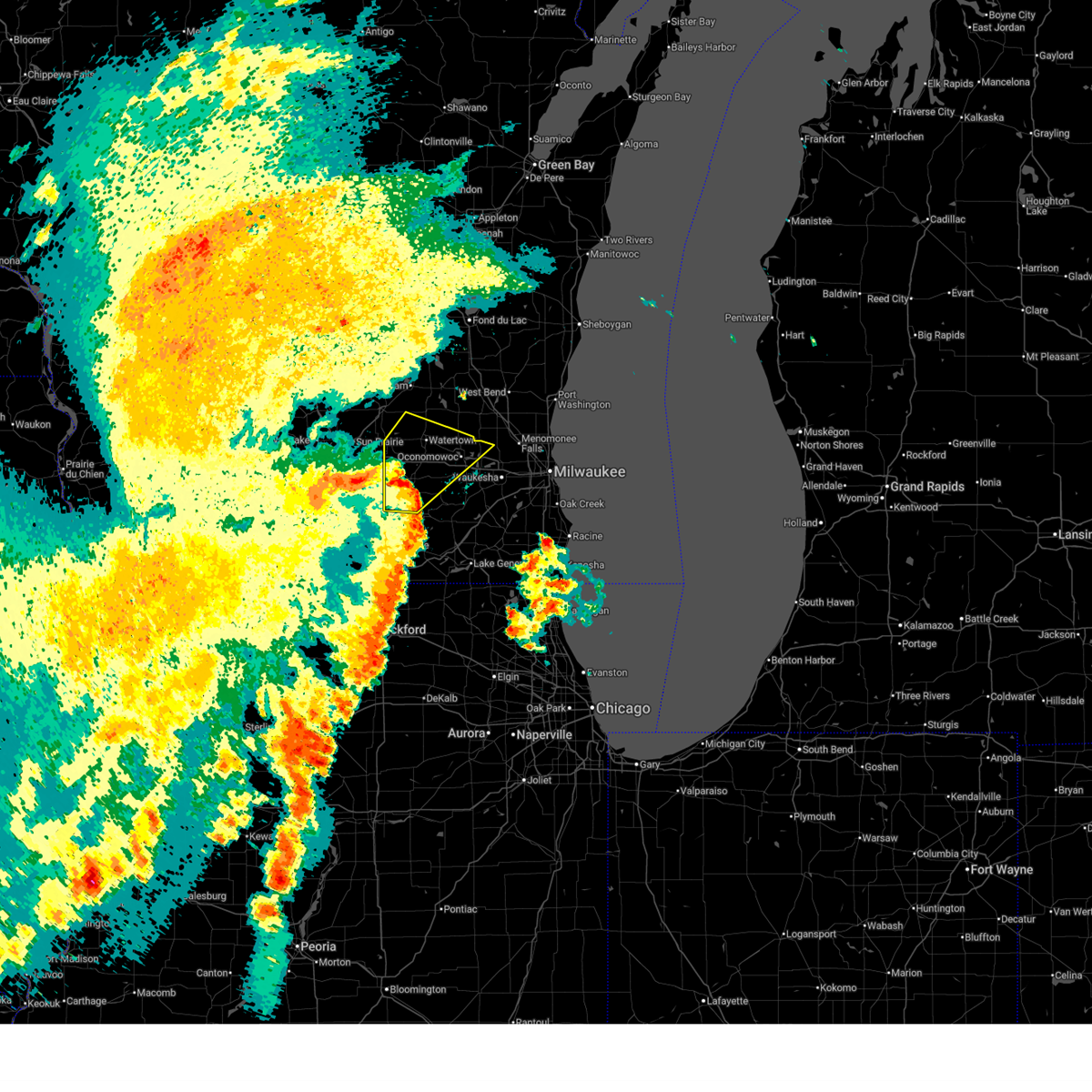
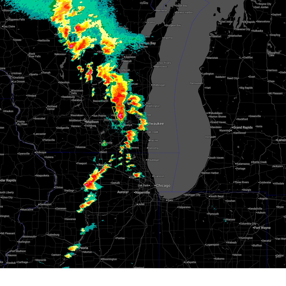
 At 634 pm cdt, a severe thunderstorm was located near lac la belle, or near okauchee lake, moving east at 35 mph (trained weather spotters). Hazards include tennis ball size hail and 60 mph wind gusts. People and animals outdoors will be injured. expect hail damage to roofs, siding, windows, and vehicles. expect wind damage to roofs, siding, and trees. Locations impacted include, waukesha, new berlin, brookfield, menomonee falls, watertown, hartford, pewaukee, sussex, hartland, delafield, jackson, elm grove, slinger, germantown, okauchee lake, oconomowoc, lisbon, merton, butler, and lannon. At 634 pm cdt, a severe thunderstorm was located near lac la belle, or near okauchee lake, moving east at 35 mph (trained weather spotters). Hazards include tennis ball size hail and 60 mph wind gusts. People and animals outdoors will be injured. expect hail damage to roofs, siding, windows, and vehicles. expect wind damage to roofs, siding, and trees. Locations impacted include, waukesha, new berlin, brookfield, menomonee falls, watertown, hartford, pewaukee, sussex, hartland, delafield, jackson, elm grove, slinger, germantown, okauchee lake, oconomowoc, lisbon, merton, butler, and lannon.
|
| 4/14/2026 6:18 PM CDT |
 At 618 pm cdt, a severe thunderstorm was located near watertown, moving east at 35 mph (trained weather spotters report 1 inch hail in both watertown and hartland). Hazards include tennis ball size hail and 60 mph wind gusts. People and animals outdoors will be injured. expect hail damage to roofs, siding, windows, and vehicles. expect wind damage to roofs, siding, and trees. Locations impacted include, waukesha, new berlin, brookfield, menomonee falls, watertown, hartford, pewaukee, sussex, hartland, jefferson, delafield, jackson, elm grove, lake mills, slinger, waterloo, wales, okauchee lake, germantown, and oconomowoc. At 618 pm cdt, a severe thunderstorm was located near watertown, moving east at 35 mph (trained weather spotters report 1 inch hail in both watertown and hartland). Hazards include tennis ball size hail and 60 mph wind gusts. People and animals outdoors will be injured. expect hail damage to roofs, siding, windows, and vehicles. expect wind damage to roofs, siding, and trees. Locations impacted include, waukesha, new berlin, brookfield, menomonee falls, watertown, hartford, pewaukee, sussex, hartland, jefferson, delafield, jackson, elm grove, lake mills, slinger, waterloo, wales, okauchee lake, germantown, and oconomowoc.
|
| 4/14/2026 6:12 PM CDT |
 At 612 pm cdt, a severe thunderstorm was located over watertown, moving east at 35 mph (trained weather spotters report 1 inch hail near oconomowoc). Hazards include tennis ball size hail and 60 mph wind gusts. People and animals outdoors will be injured. expect hail damage to roofs, siding, windows, and vehicles. expect wind damage to roofs, siding, and trees. Locations impacted include, waukesha, new berlin, brookfield, menomonee falls, watertown, hartford, pewaukee, sussex, hartland, jefferson, delafield, jackson, elm grove, lake mills, slinger, waterloo, wales, okauchee lake, germantown, and oconomowoc. At 612 pm cdt, a severe thunderstorm was located over watertown, moving east at 35 mph (trained weather spotters report 1 inch hail near oconomowoc). Hazards include tennis ball size hail and 60 mph wind gusts. People and animals outdoors will be injured. expect hail damage to roofs, siding, windows, and vehicles. expect wind damage to roofs, siding, and trees. Locations impacted include, waukesha, new berlin, brookfield, menomonee falls, watertown, hartford, pewaukee, sussex, hartland, jefferson, delafield, jackson, elm grove, lake mills, slinger, waterloo, wales, okauchee lake, germantown, and oconomowoc.
|
| 4/14/2026 6:11 PM CDT |
 At 610 pm cdt, a severe thunderstorm capable of producing a tornado was located over okauchee lake, moving east at 40 mph (radar indicated rotation). Hazards include tornado and ping pong ball size hail. Flying debris will be dangerous to those caught without shelter. mobile homes will be damaged or destroyed. damage to roofs, windows, and vehicles will occur. tree damage is likely. this dangerous storm will be near, waukesha, brookfield, menomonee falls, pewaukee, sussex, hartland, delafield, germantown, lisbon, and merton around 615 pm cdt. mequon, elm grove, and butler around 625 pm cdt. Other locations impacted by this tornadic thunderstorm include oconomowoc lake, colgate, nashotah, chenequa, mapleton, monches, stone bank, lapham peak st park, summit, and monterey. At 610 pm cdt, a severe thunderstorm capable of producing a tornado was located over okauchee lake, moving east at 40 mph (radar indicated rotation). Hazards include tornado and ping pong ball size hail. Flying debris will be dangerous to those caught without shelter. mobile homes will be damaged or destroyed. damage to roofs, windows, and vehicles will occur. tree damage is likely. this dangerous storm will be near, waukesha, brookfield, menomonee falls, pewaukee, sussex, hartland, delafield, germantown, lisbon, and merton around 615 pm cdt. mequon, elm grove, and butler around 625 pm cdt. Other locations impacted by this tornadic thunderstorm include oconomowoc lake, colgate, nashotah, chenequa, mapleton, monches, stone bank, lapham peak st park, summit, and monterey.
|
| 4/14/2026 5:59 PM CDT |
 Tormkx the national weather service in milwaukee/sullivan has issued a * tornado warning for, northern waukesha county in southeastern wisconsin, southern washington county in southeastern wisconsin, northeastern jefferson county in southeastern wisconsin, * until 645 pm cdt. * at 559 pm cdt, a severe thunderstorm capable of producing a tornado was located over lac la belle, or near okauchee lake, moving east at 40 mph (radar indicated rotation). Hazards include tornado. Flying debris will be dangerous to those caught without shelter. mobile homes will be damaged or destroyed. damage to roofs, windows, and vehicles will occur. tree damage is likely. this dangerous storm will be near, pewaukee, hartland, delafield, okauchee lake, oconomowoc, and merton around 605 pm cdt. waukesha, sussex, and lisbon around 610 pm cdt. brookfield, menomonee falls, germantown, lannon, and brookfield around 615 pm cdt. elm grove and butler around 625 pm cdt. other locations impacted by this tornadic thunderstorm include colgate, ixonia, chenequa, mapleton, stone bank, summit, north lake, pipersville, oconomowoc lake, and nashotah. Other landmarks included are the following location pewaukee lake. Tormkx the national weather service in milwaukee/sullivan has issued a * tornado warning for, northern waukesha county in southeastern wisconsin, southern washington county in southeastern wisconsin, northeastern jefferson county in southeastern wisconsin, * until 645 pm cdt. * at 559 pm cdt, a severe thunderstorm capable of producing a tornado was located over lac la belle, or near okauchee lake, moving east at 40 mph (radar indicated rotation). Hazards include tornado. Flying debris will be dangerous to those caught without shelter. mobile homes will be damaged or destroyed. damage to roofs, windows, and vehicles will occur. tree damage is likely. this dangerous storm will be near, pewaukee, hartland, delafield, okauchee lake, oconomowoc, and merton around 605 pm cdt. waukesha, sussex, and lisbon around 610 pm cdt. brookfield, menomonee falls, germantown, lannon, and brookfield around 615 pm cdt. elm grove and butler around 625 pm cdt. other locations impacted by this tornadic thunderstorm include colgate, ixonia, chenequa, mapleton, stone bank, summit, north lake, pipersville, oconomowoc lake, and nashotah. Other landmarks included are the following location pewaukee lake.
|
| 4/14/2026 5:53 PM CDT |
 Svrmkx the national weather service in milwaukee/sullivan has issued a * severe thunderstorm warning for, northern waukesha county in southeastern wisconsin, southern washington county in southeastern wisconsin, northern jefferson county in southeastern wisconsin, southern dodge county in southeastern wisconsin, * until 715 pm cdt. * at 553 pm cdt, a severe thunderstorm was located over waterloo, moving east at 35 mph (radar indicated). Hazards include tennis ball size hail and 60 mph wind gusts. People and animals outdoors will be injured. expect hail damage to roofs, siding, windows, and vehicles. Expect wind damage to roofs, siding, and trees. Svrmkx the national weather service in milwaukee/sullivan has issued a * severe thunderstorm warning for, northern waukesha county in southeastern wisconsin, southern washington county in southeastern wisconsin, northern jefferson county in southeastern wisconsin, southern dodge county in southeastern wisconsin, * until 715 pm cdt. * at 553 pm cdt, a severe thunderstorm was located over waterloo, moving east at 35 mph (radar indicated). Hazards include tennis ball size hail and 60 mph wind gusts. People and animals outdoors will be injured. expect hail damage to roofs, siding, windows, and vehicles. Expect wind damage to roofs, siding, and trees.
|
| 4/14/2026 5:22 PM CDT |
 Svrmkx the national weather service in milwaukee/sullivan has issued a * severe thunderstorm warning for, northern jefferson county in southeastern wisconsin, southern dodge county in southeastern wisconsin, * until 600 pm cdt. * at 522 pm cdt, a severe thunderstorm was located near waterloo, moving east at 40 mph. this is a destructive storm for waterloo (radar indicated). Hazards include baseball size hail and 60 mph wind gusts. People and animals outdoors will be severely injured. Expect shattered windows, extensive damage to roofs, siding, and vehicles. Svrmkx the national weather service in milwaukee/sullivan has issued a * severe thunderstorm warning for, northern jefferson county in southeastern wisconsin, southern dodge county in southeastern wisconsin, * until 600 pm cdt. * at 522 pm cdt, a severe thunderstorm was located near waterloo, moving east at 40 mph. this is a destructive storm for waterloo (radar indicated). Hazards include baseball size hail and 60 mph wind gusts. People and animals outdoors will be severely injured. Expect shattered windows, extensive damage to roofs, siding, and vehicles.
|
| 4/14/2026 1:04 AM CDT |
 At 104 am cdt, severe thunderstorms were located along a line extending from near lomira to near fort atkinson, moving east at 55 mph (radar indicated). Hazards include 70 mph wind gusts. Expect considerable tree damage. damage is likely to mobile homes, roofs, and outbuildings. Locations impacted include, west bend, watertown, whitewater, hartford, fort atkinson, hartland, jefferson, delafield, lake mills, mayville, slinger, kewaskum, horicon, juneau, wales, okauchee lake, oconomowoc, ottawa, merton, and johnson creek. At 104 am cdt, severe thunderstorms were located along a line extending from near lomira to near fort atkinson, moving east at 55 mph (radar indicated). Hazards include 70 mph wind gusts. Expect considerable tree damage. damage is likely to mobile homes, roofs, and outbuildings. Locations impacted include, west bend, watertown, whitewater, hartford, fort atkinson, hartland, jefferson, delafield, lake mills, mayville, slinger, kewaskum, horicon, juneau, wales, okauchee lake, oconomowoc, ottawa, merton, and johnson creek.
|
| 4/14/2026 12:37 AM CDT |
 Svrmkx the national weather service in milwaukee/sullivan has issued a * severe thunderstorm warning for, southern fond du lac county in east central wisconsin, western waukesha county in southeastern wisconsin, western washington county in southeastern wisconsin, jefferson county in southeastern wisconsin, dodge county in southeastern wisconsin, * until 130 am cdt. * at 1237 am cdt, severe thunderstorms were located along a line extending from near waupun to near stoughton, moving east at 55 mph (radar indicated). Hazards include 60 mph wind gusts. expect damage to roofs, siding, and trees Svrmkx the national weather service in milwaukee/sullivan has issued a * severe thunderstorm warning for, southern fond du lac county in east central wisconsin, western waukesha county in southeastern wisconsin, western washington county in southeastern wisconsin, jefferson county in southeastern wisconsin, dodge county in southeastern wisconsin, * until 130 am cdt. * at 1237 am cdt, severe thunderstorms were located along a line extending from near waupun to near stoughton, moving east at 55 mph (radar indicated). Hazards include 60 mph wind gusts. expect damage to roofs, siding, and trees
|
| 4/2/2026 7:35 PM CDT |
 At 734 pm cdt, severe thunderstorms were located along a line extending from near watertown to near dousman to near palmyra, moving northeast at 65 mph (radar indicated). Hazards include 60 mph wind gusts. Expect damage to roofs, siding, and trees. Locations impacted include, delafield, okauchee lake, oconomowoc, ottawa, dousman, north prairie, palmyra, lac la belle, ixonia, rome, eagle, nashotah, waterville, sullivan, oconomowoc lake, mapleton, summit, monterey, nws milwaukee/sullivan, and lake lac la belle. At 734 pm cdt, severe thunderstorms were located along a line extending from near watertown to near dousman to near palmyra, moving northeast at 65 mph (radar indicated). Hazards include 60 mph wind gusts. Expect damage to roofs, siding, and trees. Locations impacted include, delafield, okauchee lake, oconomowoc, ottawa, dousman, north prairie, palmyra, lac la belle, ixonia, rome, eagle, nashotah, waterville, sullivan, oconomowoc lake, mapleton, summit, monterey, nws milwaukee/sullivan, and lake lac la belle.
|
| 4/2/2026 7:35 PM CDT |
 the severe thunderstorm warning has been cancelled and is no longer in effect the severe thunderstorm warning has been cancelled and is no longer in effect
|
| 4/2/2026 7:21 PM CDT |
 At 721 pm cdt, severe thunderstorms were located along a line extending from near lake mills to near whitewater to 9 miles north of darien, moving northeast at 65 mph (radar indicated). Hazards include 60 mph wind gusts. Expect damage to roofs, siding, and trees. Locations impacted include, watertown, whitewater, fort atkinson, jefferson, delafield, lake mills, okauchee lake, oconomowoc, ottawa, johnson creek, dousman, north prairie, palmyra, cambridge, lac la belle, lake ripley, lake koshkonong, ixonia, rome, and la grange. At 721 pm cdt, severe thunderstorms were located along a line extending from near lake mills to near whitewater to 9 miles north of darien, moving northeast at 65 mph (radar indicated). Hazards include 60 mph wind gusts. Expect damage to roofs, siding, and trees. Locations impacted include, watertown, whitewater, fort atkinson, jefferson, delafield, lake mills, okauchee lake, oconomowoc, ottawa, johnson creek, dousman, north prairie, palmyra, cambridge, lac la belle, lake ripley, lake koshkonong, ixonia, rome, and la grange.
|
| 4/2/2026 7:14 PM CDT |
 Svrmkx the national weather service in milwaukee/sullivan has issued a * severe thunderstorm warning for, northwestern walworth county in southeastern wisconsin, northeastern rock county in south central wisconsin, western waukesha county in southeastern wisconsin, jefferson county in southeastern wisconsin, * until 745 pm cdt. * at 714 pm cdt, severe thunderstorms were located along a line extending from lake ripley to near milton to 8 miles east of janesville, moving northeast at 65 mph (radar indicated). Hazards include 60 mph wind gusts. expect damage to roofs, siding, and trees Svrmkx the national weather service in milwaukee/sullivan has issued a * severe thunderstorm warning for, northwestern walworth county in southeastern wisconsin, northeastern rock county in south central wisconsin, western waukesha county in southeastern wisconsin, jefferson county in southeastern wisconsin, * until 745 pm cdt. * at 714 pm cdt, severe thunderstorms were located along a line extending from lake ripley to near milton to 8 miles east of janesville, moving northeast at 65 mph (radar indicated). Hazards include 60 mph wind gusts. expect damage to roofs, siding, and trees
|
| 4/2/2026 7:09 PM CDT |
 the tornado warning has been cancelled and is no longer in effect the tornado warning has been cancelled and is no longer in effect
|
| 4/2/2026 7:03 PM CDT |
 Svrmkx the national weather service in milwaukee/sullivan has issued a * severe thunderstorm warning for, northern waukesha county in southeastern wisconsin, * until 800 pm cdt. * at 703 pm cdt, a severe thunderstorm was located near dousman, or 10 miles west of wales, moving northeast at 30 mph (radar indicated). Hazards include 60 mph wind gusts and quarter size hail. Hail damage to vehicles is expected. Expect wind damage to roofs, siding, and trees. Svrmkx the national weather service in milwaukee/sullivan has issued a * severe thunderstorm warning for, northern waukesha county in southeastern wisconsin, * until 800 pm cdt. * at 703 pm cdt, a severe thunderstorm was located near dousman, or 10 miles west of wales, moving northeast at 30 mph (radar indicated). Hazards include 60 mph wind gusts and quarter size hail. Hail damage to vehicles is expected. Expect wind damage to roofs, siding, and trees.
|
| 4/2/2026 6:54 PM CDT |
 the tornado warning has been cancelled and is no longer in effect the tornado warning has been cancelled and is no longer in effect
|
| 4/2/2026 6:54 PM CDT |
 At 654 pm cdt, a severe thunderstorm capable of producing a tornado was located near whitewater, moving northeast at 35 mph (radar indicated rotation). Hazards include tornado and half dollar size hail. Flying debris will be dangerous to those caught without shelter. mobile homes will be damaged or destroyed. damage to roofs, windows, and vehicles will occur. tree damage is likely. this dangerous storm will be near, palmyra around 700 pm cdt. Other locations impacted by this tornadic thunderstorm include rome, sullivan, hebron, ixonia, helenville, nws milwaukee/sullivan, and lake lac la belle. At 654 pm cdt, a severe thunderstorm capable of producing a tornado was located near whitewater, moving northeast at 35 mph (radar indicated rotation). Hazards include tornado and half dollar size hail. Flying debris will be dangerous to those caught without shelter. mobile homes will be damaged or destroyed. damage to roofs, windows, and vehicles will occur. tree damage is likely. this dangerous storm will be near, palmyra around 700 pm cdt. Other locations impacted by this tornadic thunderstorm include rome, sullivan, hebron, ixonia, helenville, nws milwaukee/sullivan, and lake lac la belle.
|
| 4/2/2026 6:39 PM CDT |
 Tormkx the national weather service in milwaukee/sullivan has issued a * tornado warning for, northwestern walworth county in southeastern wisconsin, northeastern rock county in south central wisconsin, southeastern jefferson county in southeastern wisconsin, * until 745 pm cdt. * at 639 pm cdt, a severe thunderstorm capable of producing a tornado was located near whitewater, moving northeast at 35 mph (weather spotters reported funnel cloud). Hazards include tornado and half dollar size hail. Flying debris will be dangerous to those caught without shelter. mobile homes will be damaged or destroyed. damage to roofs, windows, and vehicles will occur. tree damage is likely. this dangerous storm will be near, whitewater, fort atkinson, and lake koshkonong around 645 pm cdt. palmyra around 650 pm cdt. Other locations impacted by this tornadic thunderstorm include rome, sullivan, hebron, ixonia, helenville, lima center, nws milwaukee/sullivan, and lake lac la belle. Tormkx the national weather service in milwaukee/sullivan has issued a * tornado warning for, northwestern walworth county in southeastern wisconsin, northeastern rock county in south central wisconsin, southeastern jefferson county in southeastern wisconsin, * until 745 pm cdt. * at 639 pm cdt, a severe thunderstorm capable of producing a tornado was located near whitewater, moving northeast at 35 mph (weather spotters reported funnel cloud). Hazards include tornado and half dollar size hail. Flying debris will be dangerous to those caught without shelter. mobile homes will be damaged or destroyed. damage to roofs, windows, and vehicles will occur. tree damage is likely. this dangerous storm will be near, whitewater, fort atkinson, and lake koshkonong around 645 pm cdt. palmyra around 650 pm cdt. Other locations impacted by this tornadic thunderstorm include rome, sullivan, hebron, ixonia, helenville, lima center, nws milwaukee/sullivan, and lake lac la belle.
|
| 9/22/2025 8:24 PM CDT | At 824 pm cdt, severe thunderstorms were located along a line extending from just south of hartford to near dousman, moving southeast at 25 mph (radar indicated). Hazards include 60 mph wind gusts and quarter size hail. Hail damage to vehicles is expected. expect wind damage to roofs, siding, and trees. Locations impacted include, waukesha, pewaukee, sussex, hartland, delafield, wales, okauchee lake, germantown, oconomowoc, lisbon, merton, dousman, lac la belle, ixonia, ashippun, nashotah, waterville, oconomowoc lake, chenequa, and mapleton. |
| 9/22/2025 8:05 PM CDT | Svrmkx the national weather service in milwaukee/sullivan has issued a * severe thunderstorm warning for, northwestern waukesha county in southeastern wisconsin, southwestern washington county in southeastern wisconsin, northeastern jefferson county in southeastern wisconsin, southeastern dodge county in southeastern wisconsin, * until 845 pm cdt. * at 804 pm cdt, severe thunderstorms were located along a line extending from just south of hartford to near oconomowoc, moving southeast at 25 mph (radar indicated). Hazards include 60 mph wind gusts and quarter size hail. Hail damage to vehicles is expected. Expect wind damage to roofs, siding, and trees. |
| 9/22/2025 7:54 PM CDT | At 754 pm cdt, severe thunderstorms were located along a line extending from near hustisford to near lac la belle, moving east at 35 mph (radar indicated). Hazards include 60 mph wind gusts and quarter size hail. Hail damage to vehicles is expected. expect wind damage to roofs, siding, and trees. these severe storms will be near, hartford, okauchee lake, oconomowoc, and lac la belle around 800 pm cdt. Other locations impacted by these severe thunderstorms include ashippun, rubicon, richwood, mapleton, woodland, lebanon, clyman, lowell, monterey, and lake lac la belle. |
| 9/22/2025 7:36 PM CDT | Svrmkx the national weather service in milwaukee/sullivan has issued a * severe thunderstorm warning for, northwestern waukesha county in southeastern wisconsin, northeastern jefferson county in southeastern wisconsin, southeastern dodge county in southeastern wisconsin, * until 815 pm cdt. * at 736 pm cdt, severe thunderstorms were located along a line extending from near juneau to near watertown, moving east at 35 mph (radar indicated). Hazards include 60 mph wind gusts and quarter size hail. Hail damage to vehicles is expected. expect wind damage to roofs, siding, and trees. severe thunderstorms will be near, watertown, juneau, and hustisford around 740 pm cdt. lac la belle around 745 pm cdt. hartford, okauchee lake, and oconomowoc around 750 pm cdt. Other locations impacted by these severe thunderstorms include ashippun, rubicon, richwood, mapleton, woodland, lebanon, clyman, lowell, monterey, and lake lac la belle. |
| 8/16/2025 5:00 PM CDT |
 the severe thunderstorm warning has been cancelled and is no longer in effect the severe thunderstorm warning has been cancelled and is no longer in effect
|
| 8/16/2025 4:25 PM CDT |
 Svrmkx the national weather service in milwaukee/sullivan has issued a * severe thunderstorm warning for, northern waukesha county in southeastern wisconsin, east central dane county in south central wisconsin, jefferson county in southeastern wisconsin, * until 530 pm cdt. * at 424 pm cdt, severe thunderstorms were located along a line extending from near theresa to 6 miles east of waterloo to sun prairie, moving southeast at 45 mph (radar indicated). Hazards include 60 mph wind gusts. expect damage to roofs, siding, and trees Svrmkx the national weather service in milwaukee/sullivan has issued a * severe thunderstorm warning for, northern waukesha county in southeastern wisconsin, east central dane county in south central wisconsin, jefferson county in southeastern wisconsin, * until 530 pm cdt. * at 424 pm cdt, severe thunderstorms were located along a line extending from near theresa to 6 miles east of waterloo to sun prairie, moving southeast at 45 mph (radar indicated). Hazards include 60 mph wind gusts. expect damage to roofs, siding, and trees
|
| 7/16/2025 4:44 PM CDT |
 The storms which prompted the warning have weakened below severe limits, and no longer pose an immediate threat to life or property. therefore, the warning will be allowed to expire. however, gusty winds are still possible with these thunderstorms. a tornado watch remains in effect until 700 pm cdt for southeastern wisconsin. The storms which prompted the warning have weakened below severe limits, and no longer pose an immediate threat to life or property. therefore, the warning will be allowed to expire. however, gusty winds are still possible with these thunderstorms. a tornado watch remains in effect until 700 pm cdt for southeastern wisconsin.
|
| 7/16/2025 4:34 PM CDT |
 At 434 pm cdt, severe thunderstorms were located along a line extending from near hustisford to near watertown to near johnson creek, moving east at 25 mph (radar indicated). Hazards include 60 mph wind gusts. Expect damage to roofs, siding, and trees. Locations impacted include, watertown, oconomowoc, johnson creek, hustisford, lac la belle, ixonia, ashippun, rubicon, lebanon, woodland, sullivan, neosho, pipersville, helenville, monterey, lake lac la belle, and summit. At 434 pm cdt, severe thunderstorms were located along a line extending from near hustisford to near watertown to near johnson creek, moving east at 25 mph (radar indicated). Hazards include 60 mph wind gusts. Expect damage to roofs, siding, and trees. Locations impacted include, watertown, oconomowoc, johnson creek, hustisford, lac la belle, ixonia, ashippun, rubicon, lebanon, woodland, sullivan, neosho, pipersville, helenville, monterey, lake lac la belle, and summit.
|
| 7/16/2025 4:24 PM CDT |
 At 424 pm cdt, severe thunderstorms were located along a line extending from 6 miles southwest of hustisford to watertown to near jefferson, moving east at 25 mph (radar indicated). Hazards include 60 mph wind gusts. Expect damage to roofs, siding, and trees. Locations impacted include, watertown, fort atkinson, jefferson, lake mills, oconomowoc, johnson creek, hustisford, lac la belle, ixonia, rome, ashippun, rubicon, lebanon, milford, hebron, woodland, sullivan, neosho, richwood, and clyman. At 424 pm cdt, severe thunderstorms were located along a line extending from 6 miles southwest of hustisford to watertown to near jefferson, moving east at 25 mph (radar indicated). Hazards include 60 mph wind gusts. Expect damage to roofs, siding, and trees. Locations impacted include, watertown, fort atkinson, jefferson, lake mills, oconomowoc, johnson creek, hustisford, lac la belle, ixonia, rome, ashippun, rubicon, lebanon, milford, hebron, woodland, sullivan, neosho, richwood, and clyman.
|
| 7/16/2025 4:11 PM CDT |
 Svrmkx the national weather service in milwaukee/sullivan has issued a * severe thunderstorm warning for, northwestern waukesha county in southeastern wisconsin, jefferson county in southeastern wisconsin, southern dodge county in southeastern wisconsin, * until 445 pm cdt. * at 410 pm cdt, severe thunderstorms were located along a line extending from 8 miles southwest of juneau to near watertown to near lake mills, moving east at 25 mph (radar indicated). Hazards include 60 mph wind gusts. expect damage to roofs, siding, and trees Svrmkx the national weather service in milwaukee/sullivan has issued a * severe thunderstorm warning for, northwestern waukesha county in southeastern wisconsin, jefferson county in southeastern wisconsin, southern dodge county in southeastern wisconsin, * until 445 pm cdt. * at 410 pm cdt, severe thunderstorms were located along a line extending from 8 miles southwest of juneau to near watertown to near lake mills, moving east at 25 mph (radar indicated). Hazards include 60 mph wind gusts. expect damage to roofs, siding, and trees
|
| 7/11/2025 7:55 PM CDT |
 The storms which prompted the warning have moved out of the area. therefore, the warning will be allowed to expire. a tornado watch remains in effect until 1100 pm cdt for southeastern wisconsin. The storms which prompted the warning have moved out of the area. therefore, the warning will be allowed to expire. a tornado watch remains in effect until 1100 pm cdt for southeastern wisconsin.
|
| 7/11/2025 7:44 PM CDT |
 At 744 pm cdt, severe thunderstorms were located along a line extending from 9 miles northeast of waterloo to 6 miles east of watertown to near dousman, moving northeast at 35 mph (radar indicated). Hazards include 60 mph wind gusts and nickel size hail. Expect damage to roofs, siding, and trees. Locations impacted include, watertown, delafield, okauchee lake, oconomowoc, merton, lac la belle, ixonia, rome, ashippun, lebanon, nashotah, sullivan, oconomowoc lake, chenequa, mapleton, stone bank, summit, north lake, pipersville, and monterey. At 744 pm cdt, severe thunderstorms were located along a line extending from 9 miles northeast of waterloo to 6 miles east of watertown to near dousman, moving northeast at 35 mph (radar indicated). Hazards include 60 mph wind gusts and nickel size hail. Expect damage to roofs, siding, and trees. Locations impacted include, watertown, delafield, okauchee lake, oconomowoc, merton, lac la belle, ixonia, rome, ashippun, lebanon, nashotah, sullivan, oconomowoc lake, chenequa, mapleton, stone bank, summit, north lake, pipersville, and monterey.
|
| 7/11/2025 7:12 PM CDT |
 Svrmkx the national weather service in milwaukee/sullivan has issued a * severe thunderstorm warning for, northwestern waukesha county in southeastern wisconsin, jefferson county in southeastern wisconsin, southern dodge county in southeastern wisconsin, * until 800 pm cdt. * at 712 pm cdt, severe thunderstorms were located along a line extending from near lake ripley to near fort atkinson to whitewater, moving northeast at 40 mph (radar indicated). Hazards include 70 mph wind gusts and nickel size hail. Expect considerable tree damage. Damage is likely to mobile homes, roofs, and outbuildings. Svrmkx the national weather service in milwaukee/sullivan has issued a * severe thunderstorm warning for, northwestern waukesha county in southeastern wisconsin, jefferson county in southeastern wisconsin, southern dodge county in southeastern wisconsin, * until 800 pm cdt. * at 712 pm cdt, severe thunderstorms were located along a line extending from near lake ripley to near fort atkinson to whitewater, moving northeast at 40 mph (radar indicated). Hazards include 70 mph wind gusts and nickel size hail. Expect considerable tree damage. Damage is likely to mobile homes, roofs, and outbuildings.
|
| 6/3/2025 2:04 PM CDT |
 the severe thunderstorm warning has been cancelled and is no longer in effect the severe thunderstorm warning has been cancelled and is no longer in effect
|
| 6/3/2025 2:04 PM CDT |
 At 203 pm cdt, severe thunderstorms were located along a line extending from near oconomowoc to near wind lake, moving east at 55 mph (radar indicated). Hazards include 60 mph wind gusts. Expect damage to roofs, siding, and trees. Locations impacted include, waukesha, new berlin, brookfield, menomonee falls, pewaukee, sussex, hartland, mukwonago, delafield, elm grove, wales, okauchee lake, oconomowoc, lisbon, vernon, ottawa, merton, dousman, north prairie, and butler. At 203 pm cdt, severe thunderstorms were located along a line extending from near oconomowoc to near wind lake, moving east at 55 mph (radar indicated). Hazards include 60 mph wind gusts. Expect damage to roofs, siding, and trees. Locations impacted include, waukesha, new berlin, brookfield, menomonee falls, pewaukee, sussex, hartland, mukwonago, delafield, elm grove, wales, okauchee lake, oconomowoc, lisbon, vernon, ottawa, merton, dousman, north prairie, and butler.
|
| 6/3/2025 1:58 PM CDT |
 At 158 pm cdt, severe thunderstorms were located along a line extending from near dousman to waterford north, moving northeast at 55 mph (radar indicated). Hazards include 60 mph wind gusts. Expect damage to roofs, siding, and trees. Locations impacted include, waukesha, new berlin, brookfield, menomonee falls, watertown, pewaukee, sussex, hartland, mukwonago, delafield, elm grove, wales, okauchee lake, oconomowoc, lisbon, vernon, ottawa, merton, dousman, and north prairie. At 158 pm cdt, severe thunderstorms were located along a line extending from near dousman to waterford north, moving northeast at 55 mph (radar indicated). Hazards include 60 mph wind gusts. Expect damage to roofs, siding, and trees. Locations impacted include, waukesha, new berlin, brookfield, menomonee falls, watertown, pewaukee, sussex, hartland, mukwonago, delafield, elm grove, wales, okauchee lake, oconomowoc, lisbon, vernon, ottawa, merton, dousman, and north prairie.
|
| 6/3/2025 1:54 PM CDT |
 At 154 pm cdt, severe thunderstorms were located along a line extending from near dousman to near waterford north, moving northeast at 55 mph (radar indicated). Hazards include 60 mph wind gusts. Expect damage to roofs, siding, and trees. Locations impacted include, waukesha, new berlin, brookfield, menomonee falls, watertown, whitewater, pewaukee, fort atkinson, sussex, hartland, jefferson, mukwonago, delafield, elm grove, lake mills, wales, okauchee lake, oconomowoc, lisbon, and vernon. At 154 pm cdt, severe thunderstorms were located along a line extending from near dousman to near waterford north, moving northeast at 55 mph (radar indicated). Hazards include 60 mph wind gusts. Expect damage to roofs, siding, and trees. Locations impacted include, waukesha, new berlin, brookfield, menomonee falls, watertown, whitewater, pewaukee, fort atkinson, sussex, hartland, jefferson, mukwonago, delafield, elm grove, lake mills, wales, okauchee lake, oconomowoc, lisbon, and vernon.
|
| 6/3/2025 1:31 PM CDT |
 Svrmkx the national weather service in milwaukee/sullivan has issued a * severe thunderstorm warning for, waukesha county in southeastern wisconsin, jefferson county in southeastern wisconsin, * until 215 pm cdt. * at 131 pm cdt, severe thunderstorms were located along a line extending from near lake koshkonong to near elkhorn, moving northeast at 55 mph (radar indicated). Hazards include 60 mph wind gusts. expect damage to roofs, siding, and trees Svrmkx the national weather service in milwaukee/sullivan has issued a * severe thunderstorm warning for, waukesha county in southeastern wisconsin, jefferson county in southeastern wisconsin, * until 215 pm cdt. * at 131 pm cdt, severe thunderstorms were located along a line extending from near lake koshkonong to near elkhorn, moving northeast at 55 mph (radar indicated). Hazards include 60 mph wind gusts. expect damage to roofs, siding, and trees
|
| 5/16/2025 3:57 PM CDT |
 the severe thunderstorm warning has been cancelled and is no longer in effect the severe thunderstorm warning has been cancelled and is no longer in effect
|
| 5/16/2025 3:42 PM CDT |
 At 342 pm cdt, a severe thunderstorm was located over wales, moving northeast at 50 mph (radar indicated). Hazards include 60 mph wind gusts. Expect damage to roofs, siding, and trees. Locations impacted include, waukesha, wauwatosa, new berlin, brookfield, menomonee falls, pewaukee, sussex, hartland, delafield, elm grove, wales, okauchee lake, oconomowoc, lisbon, ottawa, merton, dousman, north prairie, butler, and lannon. At 342 pm cdt, a severe thunderstorm was located over wales, moving northeast at 50 mph (radar indicated). Hazards include 60 mph wind gusts. Expect damage to roofs, siding, and trees. Locations impacted include, waukesha, wauwatosa, new berlin, brookfield, menomonee falls, pewaukee, sussex, hartland, delafield, elm grove, wales, okauchee lake, oconomowoc, lisbon, ottawa, merton, dousman, north prairie, butler, and lannon.
|
| 5/16/2025 3:42 PM CDT |
 the severe thunderstorm warning has been cancelled and is no longer in effect the severe thunderstorm warning has been cancelled and is no longer in effect
|
| 5/16/2025 3:30 PM CDT |
 Svrmkx the national weather service in milwaukee/sullivan has issued a * severe thunderstorm warning for, waukesha county in southeastern wisconsin, southeastern jefferson county in southeastern wisconsin, * until 415 pm cdt. * at 330 pm cdt, a severe thunderstorm was located near palmyra, or 10 miles northeast of whitewater, moving northeast at 50 mph (radar indicated). Hazards include 60 mph wind gusts and penny size hail. expect damage to roofs, siding, and trees Svrmkx the national weather service in milwaukee/sullivan has issued a * severe thunderstorm warning for, waukesha county in southeastern wisconsin, southeastern jefferson county in southeastern wisconsin, * until 415 pm cdt. * at 330 pm cdt, a severe thunderstorm was located near palmyra, or 10 miles northeast of whitewater, moving northeast at 50 mph (radar indicated). Hazards include 60 mph wind gusts and penny size hail. expect damage to roofs, siding, and trees
|
| 5/15/2025 6:18 PM CDT |
 At 618 pm cdt, a severe thunderstorm was located near lac la belle, or 7 miles east of watertown, moving north at 35 mph (law enforcement reported hail of golf ball to two inch near ixonia). Hazards include two inch hail and 60 mph wind gusts. People and animals outdoors will be injured. expect hail damage to roofs, siding, windows, and vehicles. expect wind damage to roofs, siding, and trees. Locations impacted include, hartford, okauchee lake, oconomowoc, hustisford, lac la belle, ixonia, ashippun, rubicon, lebanon, oconomowoc lake, neosho, mapleton, monterey, and lake lac la belle. At 618 pm cdt, a severe thunderstorm was located near lac la belle, or 7 miles east of watertown, moving north at 35 mph (law enforcement reported hail of golf ball to two inch near ixonia). Hazards include two inch hail and 60 mph wind gusts. People and animals outdoors will be injured. expect hail damage to roofs, siding, windows, and vehicles. expect wind damage to roofs, siding, and trees. Locations impacted include, hartford, okauchee lake, oconomowoc, hustisford, lac la belle, ixonia, ashippun, rubicon, lebanon, oconomowoc lake, neosho, mapleton, monterey, and lake lac la belle.
|
| 5/15/2025 5:59 PM CDT |
 Svrmkx the national weather service in milwaukee/sullivan has issued a * severe thunderstorm warning for, northwestern waukesha county in southeastern wisconsin, northeastern jefferson county in southeastern wisconsin, southeastern dodge county in southeastern wisconsin, * until 700 pm cdt. * at 559 pm cdt, a severe thunderstorm was located near johnson creek, or 8 miles northeast of jefferson, moving north at 35 mph (radar indicated). Hazards include 60 mph wind gusts and half dollar size hail. Hail damage to vehicles is expected. Expect wind damage to roofs, siding, and trees. Svrmkx the national weather service in milwaukee/sullivan has issued a * severe thunderstorm warning for, northwestern waukesha county in southeastern wisconsin, northeastern jefferson county in southeastern wisconsin, southeastern dodge county in southeastern wisconsin, * until 700 pm cdt. * at 559 pm cdt, a severe thunderstorm was located near johnson creek, or 8 miles northeast of jefferson, moving north at 35 mph (radar indicated). Hazards include 60 mph wind gusts and half dollar size hail. Hail damage to vehicles is expected. Expect wind damage to roofs, siding, and trees.
|
| 4/18/2025 8:11 AM CDT |
 Svrmkx the national weather service in milwaukee/sullivan has issued a * severe thunderstorm warning for, ozaukee county in southeastern wisconsin, northern milwaukee county in southeastern wisconsin, waukesha county in southeastern wisconsin, washington county in southeastern wisconsin, northeastern jefferson county in southeastern wisconsin, southeastern dodge county in southeastern wisconsin, * until 900 am cdt. * at 810 am cdt, severe thunderstorms were located along a line extending from near slinger to merton to near dousman, moving east at 65 mph (radar indicated). Hazards include half dollar size hail. damage to vehicles is expected Svrmkx the national weather service in milwaukee/sullivan has issued a * severe thunderstorm warning for, ozaukee county in southeastern wisconsin, northern milwaukee county in southeastern wisconsin, waukesha county in southeastern wisconsin, washington county in southeastern wisconsin, northeastern jefferson county in southeastern wisconsin, southeastern dodge county in southeastern wisconsin, * until 900 am cdt. * at 810 am cdt, severe thunderstorms were located along a line extending from near slinger to merton to near dousman, moving east at 65 mph (radar indicated). Hazards include half dollar size hail. damage to vehicles is expected
|
| 4/18/2025 8:01 AM CDT |
 the severe thunderstorm warning has been cancelled and is no longer in effect the severe thunderstorm warning has been cancelled and is no longer in effect
|
| 4/18/2025 8:01 AM CDT |
 At 800 am cdt, severe thunderstorms were located along a line extending from near cedar grove to 17 miles southeast of port washington to cudahy, moving east at 75 mph (radar indicated. 1.25 inch hail was reported in watertown). Hazards include golf ball size hail and 60 mph wind gusts. People and animals outdoors will be injured. expect hail damage to roofs, siding, windows, and vehicles. expect wind damage to roofs, siding, and trees. Locations impacted include, milwaukee, franklin, nenno, pewaukee, wales, uw- milwaukee, dousman, fillmore, grafton, west allis, summit, mukwonago, north lake, glendale, lac la belle, okauchee lake, cudahy, iron ridge, ottawa, and eagle. At 800 am cdt, severe thunderstorms were located along a line extending from near cedar grove to 17 miles southeast of port washington to cudahy, moving east at 75 mph (radar indicated. 1.25 inch hail was reported in watertown). Hazards include golf ball size hail and 60 mph wind gusts. People and animals outdoors will be injured. expect hail damage to roofs, siding, windows, and vehicles. expect wind damage to roofs, siding, and trees. Locations impacted include, milwaukee, franklin, nenno, pewaukee, wales, uw- milwaukee, dousman, fillmore, grafton, west allis, summit, mukwonago, north lake, glendale, lac la belle, okauchee lake, cudahy, iron ridge, ottawa, and eagle.
|
| 4/18/2025 7:36 AM CDT |
 the severe thunderstorm warning has been cancelled and is no longer in effect the severe thunderstorm warning has been cancelled and is no longer in effect
|
| 4/18/2025 7:36 AM CDT |
 At 736 am cdt, severe thunderstorms were located along a line extending from near west bend to near germantown to near potter lake, moving east at 75 mph (radar indicated). Hazards include two inch hail and 60 mph wind gusts. People and animals outdoors will be injured. expect hail damage to roofs, siding, windows, and vehicles. expect wind damage to roofs, siding, and trees. Locations impacted include, milwaukee, franklin, nenno, pewaukee, wales, uw- milwaukee, dousman, fillmore, grafton, west allis, summit, mukwonago, cambridge, north lake, glendale, lac la belle, okauchee lake, cudahy, iron ridge, and ottawa. At 736 am cdt, severe thunderstorms were located along a line extending from near west bend to near germantown to near potter lake, moving east at 75 mph (radar indicated). Hazards include two inch hail and 60 mph wind gusts. People and animals outdoors will be injured. expect hail damage to roofs, siding, windows, and vehicles. expect wind damage to roofs, siding, and trees. Locations impacted include, milwaukee, franklin, nenno, pewaukee, wales, uw- milwaukee, dousman, fillmore, grafton, west allis, summit, mukwonago, cambridge, north lake, glendale, lac la belle, okauchee lake, cudahy, iron ridge, and ottawa.
|
| 4/18/2025 7:18 AM CDT |
 Svrmkx the national weather service in milwaukee/sullivan has issued a * severe thunderstorm warning for, ozaukee county in southeastern wisconsin, milwaukee county in southeastern wisconsin, northern walworth county in southeastern wisconsin, northeastern rock county in south central wisconsin, waukesha county in southeastern wisconsin, southeastern dane county in south central wisconsin, washington county in southeastern wisconsin, jefferson county in southeastern wisconsin, southern dodge county in southeastern wisconsin, * until 815 am cdt. * at 717 am cdt, severe thunderstorms were located along a line extending from near juneau to near lac la belle to near milton, moving east at 75 mph (radar indicated). Hazards include two inch hail and 60 mph wind gusts. People and animals outdoors will be injured. expect hail damage to roofs, siding, windows, and vehicles. Expect wind damage to roofs, siding, and trees. Svrmkx the national weather service in milwaukee/sullivan has issued a * severe thunderstorm warning for, ozaukee county in southeastern wisconsin, milwaukee county in southeastern wisconsin, northern walworth county in southeastern wisconsin, northeastern rock county in south central wisconsin, waukesha county in southeastern wisconsin, southeastern dane county in south central wisconsin, washington county in southeastern wisconsin, jefferson county in southeastern wisconsin, southern dodge county in southeastern wisconsin, * until 815 am cdt. * at 717 am cdt, severe thunderstorms were located along a line extending from near juneau to near lac la belle to near milton, moving east at 75 mph (radar indicated). Hazards include two inch hail and 60 mph wind gusts. People and animals outdoors will be injured. expect hail damage to roofs, siding, windows, and vehicles. Expect wind damage to roofs, siding, and trees.
|
| 3/15/2025 12:30 AM CDT |
 Svrmkx the national weather service in milwaukee/sullivan has issued a * severe thunderstorm warning for, ozaukee county in southeastern wisconsin, southern fond du lac county in east central wisconsin, milwaukee county in southeastern wisconsin, southeastern columbia county in south central wisconsin, waukesha county in southeastern wisconsin, washington county in southeastern wisconsin, northeastern jefferson county in southeastern wisconsin, dodge county in southeastern wisconsin, * until 115 am cdt. * at 1229 am cdt, severe thunderstorms were located along a line extending from near beaver dam to near hartford to near waukesha, moving northeast at 60 mph (radar indicated). Hazards include 60 mph wind gusts. expect damage to roofs, siding, and trees Svrmkx the national weather service in milwaukee/sullivan has issued a * severe thunderstorm warning for, ozaukee county in southeastern wisconsin, southern fond du lac county in east central wisconsin, milwaukee county in southeastern wisconsin, southeastern columbia county in south central wisconsin, waukesha county in southeastern wisconsin, washington county in southeastern wisconsin, northeastern jefferson county in southeastern wisconsin, dodge county in southeastern wisconsin, * until 115 am cdt. * at 1229 am cdt, severe thunderstorms were located along a line extending from near beaver dam to near hartford to near waukesha, moving northeast at 60 mph (radar indicated). Hazards include 60 mph wind gusts. expect damage to roofs, siding, and trees
|
| 8/27/2024 12:19 PM CDT |
 At 1219 pm cdt, severe thunderstorms were located along a line extending from near belgium to near germantown to north prairie, moving southeast at 30 mph (radar indicated). Hazards include 60 mph wind gusts. Expect damage to roofs, siding, and trees. Locations impacted include, milwaukee, waukesha, west allis, wauwatosa, new berlin, brookfield, greenfield, menomonee falls, oak creek, west bend, muskego, mequon, south milwaukee, cudahy, hartford, whitefish bay, greendale, pewaukee, brown deer, and grafton. At 1219 pm cdt, severe thunderstorms were located along a line extending from near belgium to near germantown to north prairie, moving southeast at 30 mph (radar indicated). Hazards include 60 mph wind gusts. Expect damage to roofs, siding, and trees. Locations impacted include, milwaukee, waukesha, west allis, wauwatosa, new berlin, brookfield, greenfield, menomonee falls, oak creek, west bend, muskego, mequon, south milwaukee, cudahy, hartford, whitefish bay, greendale, pewaukee, brown deer, and grafton.
|
| 8/27/2024 11:59 AM CDT |
 Svrmkx the national weather service in milwaukee/sullivan has issued a * severe thunderstorm warning for, ozaukee county in southeastern wisconsin, milwaukee county in southeastern wisconsin, waukesha county in southeastern wisconsin, washington county in southeastern wisconsin, northeastern jefferson county in southeastern wisconsin, southeastern dodge county in southeastern wisconsin, * until 1245 pm cdt. * at 1158 am cdt, severe thunderstorms were located along a line extending from near random lake to near slinger to 8 miles east of jefferson, moving southeast at 35 mph (radar indicated). Hazards include 60 mph wind gusts and penny size hail. expect damage to roofs, siding, and trees Svrmkx the national weather service in milwaukee/sullivan has issued a * severe thunderstorm warning for, ozaukee county in southeastern wisconsin, milwaukee county in southeastern wisconsin, waukesha county in southeastern wisconsin, washington county in southeastern wisconsin, northeastern jefferson county in southeastern wisconsin, southeastern dodge county in southeastern wisconsin, * until 1245 pm cdt. * at 1158 am cdt, severe thunderstorms were located along a line extending from near random lake to near slinger to 8 miles east of jefferson, moving southeast at 35 mph (radar indicated). Hazards include 60 mph wind gusts and penny size hail. expect damage to roofs, siding, and trees
|
| 8/6/2024 1:21 AM CDT |
 Svrmkx the national weather service in milwaukee/sullivan has issued a * severe thunderstorm warning for, east central dane county in south central wisconsin, jefferson county in southeastern wisconsin, * until 145 am cdt. * at 120 am cdt, a severe thunderstorm was located over cambridge, or near lake mills, moving east at 40 mph (radar indicated). Hazards include 60 mph wind gusts. expect damage to roofs, siding, and trees Svrmkx the national weather service in milwaukee/sullivan has issued a * severe thunderstorm warning for, east central dane county in south central wisconsin, jefferson county in southeastern wisconsin, * until 145 am cdt. * at 120 am cdt, a severe thunderstorm was located over cambridge, or near lake mills, moving east at 40 mph (radar indicated). Hazards include 60 mph wind gusts. expect damage to roofs, siding, and trees
|
| 6/22/2024 7:58 PM CDT |
 At 758 pm cdt, severe thunderstorms were located along a line extending from near hartford to near lac la belle to 6 miles west of dousman to near whitewater, moving east at 30 mph (radar indicated). Hazards include 60 mph wind gusts and quarter size hail. Hail damage to vehicles is expected. expect wind damage to roofs, siding, and trees. Locations impacted include, watertown, whitewater, hartford, fort atkinson, jefferson, horicon, juneau, johnson creek, palmyra, hustisford, iron ridge, lake koshkonong, ixonia, rome, ashippun, rubicon, lebanon, milford, hebron, and woodland. At 758 pm cdt, severe thunderstorms were located along a line extending from near hartford to near lac la belle to 6 miles west of dousman to near whitewater, moving east at 30 mph (radar indicated). Hazards include 60 mph wind gusts and quarter size hail. Hail damage to vehicles is expected. expect wind damage to roofs, siding, and trees. Locations impacted include, watertown, whitewater, hartford, fort atkinson, jefferson, horicon, juneau, johnson creek, palmyra, hustisford, iron ridge, lake koshkonong, ixonia, rome, ashippun, rubicon, lebanon, milford, hebron, and woodland.
|
| 6/22/2024 7:58 PM CDT |
 the severe thunderstorm warning has been cancelled and is no longer in effect the severe thunderstorm warning has been cancelled and is no longer in effect
|
| 6/22/2024 7:52 PM CDT |
 Svrmkx the national weather service in milwaukee/sullivan has issued a * severe thunderstorm warning for, waukesha county in southeastern wisconsin, washington county in southeastern wisconsin, eastern jefferson county in southeastern wisconsin, southeastern dodge county in southeastern wisconsin, * until 845 pm cdt. * at 752 pm cdt, severe thunderstorms were located along a line extending from near iron ridge to near johnson creek to near lake koshkonong, moving east at 50 mph (radar indicated). Hazards include 60 mph wind gusts and quarter size hail. Hail damage to vehicles is expected. Expect wind damage to roofs, siding, and trees. Svrmkx the national weather service in milwaukee/sullivan has issued a * severe thunderstorm warning for, waukesha county in southeastern wisconsin, washington county in southeastern wisconsin, eastern jefferson county in southeastern wisconsin, southeastern dodge county in southeastern wisconsin, * until 845 pm cdt. * at 752 pm cdt, severe thunderstorms were located along a line extending from near iron ridge to near johnson creek to near lake koshkonong, moving east at 50 mph (radar indicated). Hazards include 60 mph wind gusts and quarter size hail. Hail damage to vehicles is expected. Expect wind damage to roofs, siding, and trees.
|
| 6/22/2024 7:27 PM CDT |
 Svrmkx the national weather service in milwaukee/sullivan has issued a * severe thunderstorm warning for, southeastern columbia county in south central wisconsin, eastern dane county in south central wisconsin, jefferson county in southeastern wisconsin, southern dodge county in southeastern wisconsin, * until 815 pm cdt. * at 726 pm cdt, severe thunderstorms were located along a line extending from near columbus to near lake mills to near cambridge to brooklyn, moving east at 40 mph (radar indicated). Hazards include 60 mph wind gusts and quarter size hail. Hail damage to vehicles is expected. Expect wind damage to roofs, siding, and trees. Svrmkx the national weather service in milwaukee/sullivan has issued a * severe thunderstorm warning for, southeastern columbia county in south central wisconsin, eastern dane county in south central wisconsin, jefferson county in southeastern wisconsin, southern dodge county in southeastern wisconsin, * until 815 pm cdt. * at 726 pm cdt, severe thunderstorms were located along a line extending from near columbus to near lake mills to near cambridge to brooklyn, moving east at 40 mph (radar indicated). Hazards include 60 mph wind gusts and quarter size hail. Hail damage to vehicles is expected. Expect wind damage to roofs, siding, and trees.
|
| 6/17/2024 11:26 PM CDT |
 At 1125 pm cdt, a severe thunderstorm was located over merton, or near hartland, moving northeast at 35 mph (dot weather station at highway 67 and i-94). Hazards include 63 mph wind gusts. Expect damage to roofs, siding, and trees. Locations impacted include, west bend, hartford, hartland, delafield, jackson, slinger, okauchee lake, germantown, oconomowoc, merton, lac la belle, richfield, nashotah, oconomowoc lake, chenequa, mapleton, stone bank, north lake, monches, and keowns. At 1125 pm cdt, a severe thunderstorm was located over merton, or near hartland, moving northeast at 35 mph (dot weather station at highway 67 and i-94). Hazards include 63 mph wind gusts. Expect damage to roofs, siding, and trees. Locations impacted include, west bend, hartford, hartland, delafield, jackson, slinger, okauchee lake, germantown, oconomowoc, merton, lac la belle, richfield, nashotah, oconomowoc lake, chenequa, mapleton, stone bank, north lake, monches, and keowns.
|
| 6/17/2024 11:22 PM CDT |
 Svrmkx the national weather service in milwaukee/sullivan has issued a * severe thunderstorm warning for, northwestern waukesha county in southeastern wisconsin, washington county in southeastern wisconsin, * until midnight cdt. * at 1122 pm cdt, a severe thunderstorm was located over merton, or near hartland, moving northeast at 35 mph (radar indicated). Hazards include 60 mph wind gusts. expect damage to roofs, siding, and trees Svrmkx the national weather service in milwaukee/sullivan has issued a * severe thunderstorm warning for, northwestern waukesha county in southeastern wisconsin, washington county in southeastern wisconsin, * until midnight cdt. * at 1122 pm cdt, a severe thunderstorm was located over merton, or near hartland, moving northeast at 35 mph (radar indicated). Hazards include 60 mph wind gusts. expect damage to roofs, siding, and trees
|
| 5/24/2024 11:18 AM CDT |
 At 1117 am cdt, severe thunderstorms were located along a line extending from near lac la belle to near wales to vernon, moving northeast at 40 mph (radar indicated). Hazards include 60 mph wind gusts and penny size hail. Expect damage to roofs, siding, and trees. Locations impacted include, milwaukee, waukesha, west allis, wauwatosa, new berlin, brookfield, greenfield, menomonee falls, west bend, muskego, mequon, cudahy, whitefish bay, greendale, pewaukee, brown deer, grafton, cedarburg, port washington, and sussex. At 1117 am cdt, severe thunderstorms were located along a line extending from near lac la belle to near wales to vernon, moving northeast at 40 mph (radar indicated). Hazards include 60 mph wind gusts and penny size hail. Expect damage to roofs, siding, and trees. Locations impacted include, milwaukee, waukesha, west allis, wauwatosa, new berlin, brookfield, greenfield, menomonee falls, west bend, muskego, mequon, cudahy, whitefish bay, greendale, pewaukee, brown deer, grafton, cedarburg, port washington, and sussex.
|
| 5/24/2024 11:07 AM CDT |
 the severe thunderstorm warning has been cancelled and is no longer in effect the severe thunderstorm warning has been cancelled and is no longer in effect
|
| 5/24/2024 11:07 AM CDT |
 At 1107 am cdt, severe thunderstorms were located along a line extending from near dousman to mukwonago, moving northeast at 40 mph (radar indicated). Hazards include 60 mph wind gusts and penny size hail. Expect damage to roofs, siding, and trees. Locations impacted include, mukwonago, delafield, wales, okauchee lake, oconomowoc, ottawa, dousman, north prairie, lac la belle, eagle, nashotah, waterville, oconomowoc lake, chenequa, summit, genesee depot, genesee, lapham peak st park, stone bank, and lake lac la belle. At 1107 am cdt, severe thunderstorms were located along a line extending from near dousman to mukwonago, moving northeast at 40 mph (radar indicated). Hazards include 60 mph wind gusts and penny size hail. Expect damage to roofs, siding, and trees. Locations impacted include, mukwonago, delafield, wales, okauchee lake, oconomowoc, ottawa, dousman, north prairie, lac la belle, eagle, nashotah, waterville, oconomowoc lake, chenequa, summit, genesee depot, genesee, lapham peak st park, stone bank, and lake lac la belle.
|
| 5/24/2024 11:05 AM CDT |
 Svrmkx the national weather service in milwaukee/sullivan has issued a * severe thunderstorm warning for, ozaukee county in southeastern wisconsin, milwaukee county in southeastern wisconsin, waukesha county in southeastern wisconsin, southern washington county in southeastern wisconsin, southeastern dodge county in southeastern wisconsin, * until 1145 am cdt. * at 1105 am cdt, severe thunderstorms were located along a line extending from near lac la belle to ottawa to mukwonago, moving northeast at 40 mph (radar indicated). Hazards include 60 mph wind gusts and penny size hail. expect damage to roofs, siding, and trees Svrmkx the national weather service in milwaukee/sullivan has issued a * severe thunderstorm warning for, ozaukee county in southeastern wisconsin, milwaukee county in southeastern wisconsin, waukesha county in southeastern wisconsin, southern washington county in southeastern wisconsin, southeastern dodge county in southeastern wisconsin, * until 1145 am cdt. * at 1105 am cdt, severe thunderstorms were located along a line extending from near lac la belle to ottawa to mukwonago, moving northeast at 40 mph (radar indicated). Hazards include 60 mph wind gusts and penny size hail. expect damage to roofs, siding, and trees
|
| 5/24/2024 10:50 AM CDT |
 the severe thunderstorm warning has been cancelled and is no longer in effect the severe thunderstorm warning has been cancelled and is no longer in effect
|
| 5/24/2024 10:50 AM CDT |
 At 1049 am cdt, severe thunderstorms were located along a line extending from near whitewater to 7 miles south of palmyra, moving east at 40 mph (radar indicated). Hazards include 60 mph wind gusts and penny size hail. Expect damage to roofs, siding, and trees. Locations impacted include, fort atkinson, jefferson, mukwonago, delafield, east troy, wales, okauchee lake, oconomowoc, ottawa, dousman, north prairie, palmyra, lac la belle, potter lake, ixonia, rome, la grange, eagle, nashotah, and hebron. At 1049 am cdt, severe thunderstorms were located along a line extending from near whitewater to 7 miles south of palmyra, moving east at 40 mph (radar indicated). Hazards include 60 mph wind gusts and penny size hail. Expect damage to roofs, siding, and trees. Locations impacted include, fort atkinson, jefferson, mukwonago, delafield, east troy, wales, okauchee lake, oconomowoc, ottawa, dousman, north prairie, palmyra, lac la belle, potter lake, ixonia, rome, la grange, eagle, nashotah, and hebron.
|
| 5/24/2024 10:36 AM CDT |
 Svrmkx the national weather service in milwaukee/sullivan has issued a * severe thunderstorm warning for, northwestern walworth county in southeastern wisconsin, northeastern rock county in south central wisconsin, western waukesha county in southeastern wisconsin, southern jefferson county in southeastern wisconsin, * until 1115 am cdt. * at 1036 am cdt, severe thunderstorms were located along a line extending from near fort atkinson to 7 miles north of delavan, moving northeast at 40 mph (radar indicated). Hazards include 60 mph wind gusts and penny size hail. expect damage to roofs, siding, and trees Svrmkx the national weather service in milwaukee/sullivan has issued a * severe thunderstorm warning for, northwestern walworth county in southeastern wisconsin, northeastern rock county in south central wisconsin, western waukesha county in southeastern wisconsin, southern jefferson county in southeastern wisconsin, * until 1115 am cdt. * at 1036 am cdt, severe thunderstorms were located along a line extending from near fort atkinson to 7 miles north of delavan, moving northeast at 40 mph (radar indicated). Hazards include 60 mph wind gusts and penny size hail. expect damage to roofs, siding, and trees
|
| 5/21/2024 11:33 PM CDT |
 Svrmkx the national weather service in milwaukee/sullivan has issued a * severe thunderstorm warning for, northwestern walworth county in southeastern wisconsin, waukesha county in southeastern wisconsin, southeastern jefferson county in southeastern wisconsin, * until 1215 am cdt. * at 1133 pm cdt, a severe thunderstorm was located near whitewater, moving northeast at 60 mph (radar indicated). Hazards include 60 mph wind gusts and nickel size hail. expect damage to roofs, siding, and trees Svrmkx the national weather service in milwaukee/sullivan has issued a * severe thunderstorm warning for, northwestern walworth county in southeastern wisconsin, waukesha county in southeastern wisconsin, southeastern jefferson county in southeastern wisconsin, * until 1215 am cdt. * at 1133 pm cdt, a severe thunderstorm was located near whitewater, moving northeast at 60 mph (radar indicated). Hazards include 60 mph wind gusts and nickel size hail. expect damage to roofs, siding, and trees
|
| 5/21/2024 11:18 PM CDT |
 the severe thunderstorm warning has been cancelled and is no longer in effect the severe thunderstorm warning has been cancelled and is no longer in effect
|
| 5/21/2024 11:18 PM CDT |
 At 1117 pm cdt, severe thunderstorms were located along a line extending from near watertown to near clinton, moving northeast at 65 mph (radar indicated). Hazards include 60 mph wind gusts. Expect damage to roofs, siding, and trees. Locations impacted include, janesville, beloit, watertown, whitewater, fort atkinson, jefferson, milton, johnson creek, palmyra, lake koshkonong, ixonia, rome, milford, hebron, sullivan, tiffany, avalon, helenville, lima center, and nws milwaukee/sullivan. At 1117 pm cdt, severe thunderstorms were located along a line extending from near watertown to near clinton, moving northeast at 65 mph (radar indicated). Hazards include 60 mph wind gusts. Expect damage to roofs, siding, and trees. Locations impacted include, janesville, beloit, watertown, whitewater, fort atkinson, jefferson, milton, johnson creek, palmyra, lake koshkonong, ixonia, rome, milford, hebron, sullivan, tiffany, avalon, helenville, lima center, and nws milwaukee/sullivan.
|
| 5/21/2024 10:48 PM CDT |
 Svrmkx the national weather service in milwaukee/sullivan has issued a * severe thunderstorm warning for, rock county in south central wisconsin, southeastern dane county in south central wisconsin, jefferson county in southeastern wisconsin, * until 1130 pm cdt. * at 1048 pm cdt, severe thunderstorms were located along a line extending from near watertown to near orfordville to beloit, moving northeast at 65 mph (radar indicated). Hazards include 60 mph wind gusts. expect damage to roofs, siding, and trees Svrmkx the national weather service in milwaukee/sullivan has issued a * severe thunderstorm warning for, rock county in south central wisconsin, southeastern dane county in south central wisconsin, jefferson county in southeastern wisconsin, * until 1130 pm cdt. * at 1048 pm cdt, severe thunderstorms were located along a line extending from near watertown to near orfordville to beloit, moving northeast at 65 mph (radar indicated). Hazards include 60 mph wind gusts. expect damage to roofs, siding, and trees
|
| 5/21/2024 9:43 PM CDT |
 the severe thunderstorm warning has been cancelled and is no longer in effect the severe thunderstorm warning has been cancelled and is no longer in effect
|
| 5/21/2024 9:40 PM CDT |
 The storms which prompted the warning have weakened below severe limits, and have exited the warned area. therefore, the warning will be allowed to expire. a tornado watch remains in effect until midnight cdt for southeastern wisconsin. The storms which prompted the warning have weakened below severe limits, and have exited the warned area. therefore, the warning will be allowed to expire. a tornado watch remains in effect until midnight cdt for southeastern wisconsin.
|
| 5/21/2024 9:13 PM CDT |
 Svrmkx the national weather service in milwaukee/sullivan has issued a * severe thunderstorm warning for, waukesha county in southeastern wisconsin, jefferson county in southeastern wisconsin, * until 945 pm cdt. * at 913 pm cdt, severe thunderstorms were located along a line extending from near lake koshkonong to potter lake, moving northeast at 65 mph (radar indicated). Hazards include 60 mph wind gusts. expect damage to roofs, siding, and trees Svrmkx the national weather service in milwaukee/sullivan has issued a * severe thunderstorm warning for, waukesha county in southeastern wisconsin, jefferson county in southeastern wisconsin, * until 945 pm cdt. * at 913 pm cdt, severe thunderstorms were located along a line extending from near lake koshkonong to potter lake, moving northeast at 65 mph (radar indicated). Hazards include 60 mph wind gusts. expect damage to roofs, siding, and trees
|
| 5/21/2024 9:10 PM CDT |
 At 910 pm cdt, severe thunderstorms were located along a line extending from near oakfield to near watertown, moving northeast at 90 mph (radar indicated). Hazards include 60 mph wind gusts. Expect damage to roofs, siding, and trees. locations impacted include, madison, sun prairie, fitchburg, watertown, whitewater, stoughton, fort atkinson, oregon, jefferson, mcfarland, monona, lake mills, edgerton, marshall, waterloo, cottage grove, johnson creek, deerfield, palmyra, and shorewood hills. People attending bratfest in madison should seek safe shelter immediately!. At 910 pm cdt, severe thunderstorms were located along a line extending from near oakfield to near watertown, moving northeast at 90 mph (radar indicated). Hazards include 60 mph wind gusts. Expect damage to roofs, siding, and trees. locations impacted include, madison, sun prairie, fitchburg, watertown, whitewater, stoughton, fort atkinson, oregon, jefferson, mcfarland, monona, lake mills, edgerton, marshall, waterloo, cottage grove, johnson creek, deerfield, palmyra, and shorewood hills. People attending bratfest in madison should seek safe shelter immediately!.
|
| 5/21/2024 9:10 PM CDT |
 the severe thunderstorm warning has been cancelled and is no longer in effect the severe thunderstorm warning has been cancelled and is no longer in effect
|
| 5/21/2024 9:07 PM CDT |
 At 907 pm cdt, severe thunderstorms were located along a line extending from near waupun to 6 miles east of waterloo, moving northeast at 90 mph (radar indicated). Hazards include 60 mph wind gusts. Expect damage to roofs, siding, and trees. locations impacted include, madison, sun prairie, fitchburg, watertown, whitewater, stoughton, fort atkinson, oregon, jefferson, mcfarland, monona, lake mills, edgerton, evansville, marshall, waterloo, oconomowoc, cottage grove, johnson creek, and deerfield. People attending bratfest in madison should seek safe shelter immediately!. At 907 pm cdt, severe thunderstorms were located along a line extending from near waupun to 6 miles east of waterloo, moving northeast at 90 mph (radar indicated). Hazards include 60 mph wind gusts. Expect damage to roofs, siding, and trees. locations impacted include, madison, sun prairie, fitchburg, watertown, whitewater, stoughton, fort atkinson, oregon, jefferson, mcfarland, monona, lake mills, edgerton, evansville, marshall, waterloo, oconomowoc, cottage grove, johnson creek, and deerfield. People attending bratfest in madison should seek safe shelter immediately!.
|
| 5/21/2024 8:57 PM CDT |
 At 856 pm cdt, severe thunderstorms were located along a line extending from near beaver dam to near cambridge, moving northeast at 90 mph (radar indicated). Hazards include 70 mph wind gusts. Expect considerable tree damage. damage is likely to mobile homes, roofs, and outbuildings. locations impacted include, madison, sun prairie, fitchburg, watertown, whitewater, stoughton, fort atkinson, oregon, jefferson, mcfarland, monona, delafield, lake mills, edgerton, evansville, marshall, waterloo, okauchee lake, oconomowoc, and cottage grove. People attending bratfest in madison should seek safe shelter immediately!. At 856 pm cdt, severe thunderstorms were located along a line extending from near beaver dam to near cambridge, moving northeast at 90 mph (radar indicated). Hazards include 70 mph wind gusts. Expect considerable tree damage. damage is likely to mobile homes, roofs, and outbuildings. locations impacted include, madison, sun prairie, fitchburg, watertown, whitewater, stoughton, fort atkinson, oregon, jefferson, mcfarland, monona, delafield, lake mills, edgerton, evansville, marshall, waterloo, okauchee lake, oconomowoc, and cottage grove. People attending bratfest in madison should seek safe shelter immediately!.
|
| 5/21/2024 8:38 PM CDT |
 At 837 pm cdt, severe thunderstorms were located along a line extending from sun prairie to near albany, moving northeast at 60 mph. these are destructive storms for southeastern dane, northwest rock, and jefferson counties (radar indicated). Hazards include 80 mph wind gusts. Flying debris will be dangerous to those caught without shelter. mobile homes will be heavily damaged. expect considerable damage to roofs, windows, and vehicles. extensive tree damage and power outages are likely. locations impacted include, madison, janesville, sun prairie, fitchburg, watertown, whitewater, stoughton, fort atkinson, oregon, jefferson, mcfarland, monona, delafield, lake mills, milton, edgerton, evansville, marshall, waterloo, and brodhead. People attending bratfest in madison should seek safe shelter immediately!. At 837 pm cdt, severe thunderstorms were located along a line extending from sun prairie to near albany, moving northeast at 60 mph. these are destructive storms for southeastern dane, northwest rock, and jefferson counties (radar indicated). Hazards include 80 mph wind gusts. Flying debris will be dangerous to those caught without shelter. mobile homes will be heavily damaged. expect considerable damage to roofs, windows, and vehicles. extensive tree damage and power outages are likely. locations impacted include, madison, janesville, sun prairie, fitchburg, watertown, whitewater, stoughton, fort atkinson, oregon, jefferson, mcfarland, monona, delafield, lake mills, milton, edgerton, evansville, marshall, waterloo, and brodhead. People attending bratfest in madison should seek safe shelter immediately!.
|
| 5/21/2024 8:32 PM CDT |
 Svrmkx the national weather service in milwaukee/sullivan has issued a * severe thunderstorm warning for, eastern green county in south central wisconsin, rock county in south central wisconsin, western waukesha county in southeastern wisconsin, southeastern dane county in south central wisconsin, jefferson county in southeastern wisconsin, southeastern dodge county in southeastern wisconsin, * until 1000 pm cdt. * at 832 pm cdt, severe thunderstorms were located along a line extending from near sun prairie to albany, moving northeast at 90 mph (radar indicated). Hazards include 70 mph wind gusts. Expect considerable tree damage. Damage is likely to mobile homes, roofs, and outbuildings. Svrmkx the national weather service in milwaukee/sullivan has issued a * severe thunderstorm warning for, eastern green county in south central wisconsin, rock county in south central wisconsin, western waukesha county in southeastern wisconsin, southeastern dane county in south central wisconsin, jefferson county in southeastern wisconsin, southeastern dodge county in southeastern wisconsin, * until 1000 pm cdt. * at 832 pm cdt, severe thunderstorms were located along a line extending from near sun prairie to albany, moving northeast at 90 mph (radar indicated). Hazards include 70 mph wind gusts. Expect considerable tree damage. Damage is likely to mobile homes, roofs, and outbuildings.
|
| 5/7/2024 8:56 PM CDT |
 The storms which prompted the warning have moved out of the area. therefore, the warning will be allowed to expire. The storms which prompted the warning have moved out of the area. therefore, the warning will be allowed to expire.
|
| 5/7/2024 8:37 PM CDT |
 the tornado warning has been cancelled and is no longer in effect the tornado warning has been cancelled and is no longer in effect
|
| 5/7/2024 8:37 PM CDT |
 At 836 pm cdt, a severe squall line capable of producing both tornadoes and extensive straight line wind damage was located over wales, moving east at 40 mph (radar indicated rotation). Hazards include tornado and quarter size hail. Flying debris will be dangerous to those caught without shelter. mobile homes will be damaged or destroyed. damage to roofs, windows, and vehicles will occur. tree damage is likely. Locations impacted include, waukesha, pewaukee, hartland, mukwonago, delafield, wales, okauchee lake, oconomowoc, vernon, ottawa, dousman, north prairie, big bend, lac la belle, nashotah, waterville, oconomowoc lake, chenequa, mapleton, and stone bank. At 836 pm cdt, a severe squall line capable of producing both tornadoes and extensive straight line wind damage was located over wales, moving east at 40 mph (radar indicated rotation). Hazards include tornado and quarter size hail. Flying debris will be dangerous to those caught without shelter. mobile homes will be damaged or destroyed. damage to roofs, windows, and vehicles will occur. tree damage is likely. Locations impacted include, waukesha, pewaukee, hartland, mukwonago, delafield, wales, okauchee lake, oconomowoc, vernon, ottawa, dousman, north prairie, big bend, lac la belle, nashotah, waterville, oconomowoc lake, chenequa, mapleton, and stone bank.
|
| 5/7/2024 8:28 PM CDT |
 At 827 pm cdt, a severe squall line capable of producing both tornadoes and extensive straight line wind damage was located over ottawa, or near wales, moving east at 40 mph (radar indicated rotation). Hazards include tornado and quarter size hail. Flying debris will be dangerous to those caught without shelter. mobile homes will be damaged or destroyed. damage to roofs, windows, and vehicles will occur. tree damage is likely. Locations impacted include, waukesha, pewaukee, hartland, mukwonago, delafield, wales, okauchee lake, oconomowoc, vernon, ottawa, dousman, north prairie, big bend, lac la belle, ixonia, eagle, nashotah, waterville, sullivan, and oconomowoc lake. At 827 pm cdt, a severe squall line capable of producing both tornadoes and extensive straight line wind damage was located over ottawa, or near wales, moving east at 40 mph (radar indicated rotation). Hazards include tornado and quarter size hail. Flying debris will be dangerous to those caught without shelter. mobile homes will be damaged or destroyed. damage to roofs, windows, and vehicles will occur. tree damage is likely. Locations impacted include, waukesha, pewaukee, hartland, mukwonago, delafield, wales, okauchee lake, oconomowoc, vernon, ottawa, dousman, north prairie, big bend, lac la belle, ixonia, eagle, nashotah, waterville, sullivan, and oconomowoc lake.
|
| 5/7/2024 8:23 PM CDT |
 Svrmkx the national weather service in milwaukee/sullivan has issued a * severe thunderstorm warning for, northeastern walworth county in southeastern wisconsin, waukesha county in southeastern wisconsin, eastern jefferson county in southeastern wisconsin, * until 900 pm cdt. * at 816 pm cdt, severe thunderstorms were located along a line extending from 6 miles west of watertown to near jefferson to 6 miles southwest of whitewater, moving east at 45 mph (radar indicated). Hazards include ping pong ball size hail and 60 mph wind gusts. People and animals outdoors will be injured. expect hail damage to roofs, siding, windows, and vehicles. Expect wind damage to roofs, siding, and trees. Svrmkx the national weather service in milwaukee/sullivan has issued a * severe thunderstorm warning for, northeastern walworth county in southeastern wisconsin, waukesha county in southeastern wisconsin, eastern jefferson county in southeastern wisconsin, * until 900 pm cdt. * at 816 pm cdt, severe thunderstorms were located along a line extending from 6 miles west of watertown to near jefferson to 6 miles southwest of whitewater, moving east at 45 mph (radar indicated). Hazards include ping pong ball size hail and 60 mph wind gusts. People and animals outdoors will be injured. expect hail damage to roofs, siding, windows, and vehicles. Expect wind damage to roofs, siding, and trees.
|
| 5/7/2024 8:15 PM CDT |
 Tormkx the national weather service in milwaukee/sullivan has issued a * tornado warning for, western waukesha county in southeastern wisconsin, eastern jefferson county in southeastern wisconsin, * until 845 pm cdt. * at 814 pm cdt, severe thunderstorms capable of producing both tornadoes and extensive straight line wind damage were located near palmyra, or 8 miles northeast of whitewater, moving east at 40 mph (radar indicated rotation). Hazards include tornado and quarter size hail. Flying debris will be dangerous to those caught without shelter. mobile homes will be damaged or destroyed. damage to roofs, windows, and vehicles will occur. Tree damage is likely. Tormkx the national weather service in milwaukee/sullivan has issued a * tornado warning for, western waukesha county in southeastern wisconsin, eastern jefferson county in southeastern wisconsin, * until 845 pm cdt. * at 814 pm cdt, severe thunderstorms capable of producing both tornadoes and extensive straight line wind damage were located near palmyra, or 8 miles northeast of whitewater, moving east at 40 mph (radar indicated rotation). Hazards include tornado and quarter size hail. Flying debris will be dangerous to those caught without shelter. mobile homes will be damaged or destroyed. damage to roofs, windows, and vehicles will occur. Tree damage is likely.
|
| 2/8/2024 6:45 PM CST |
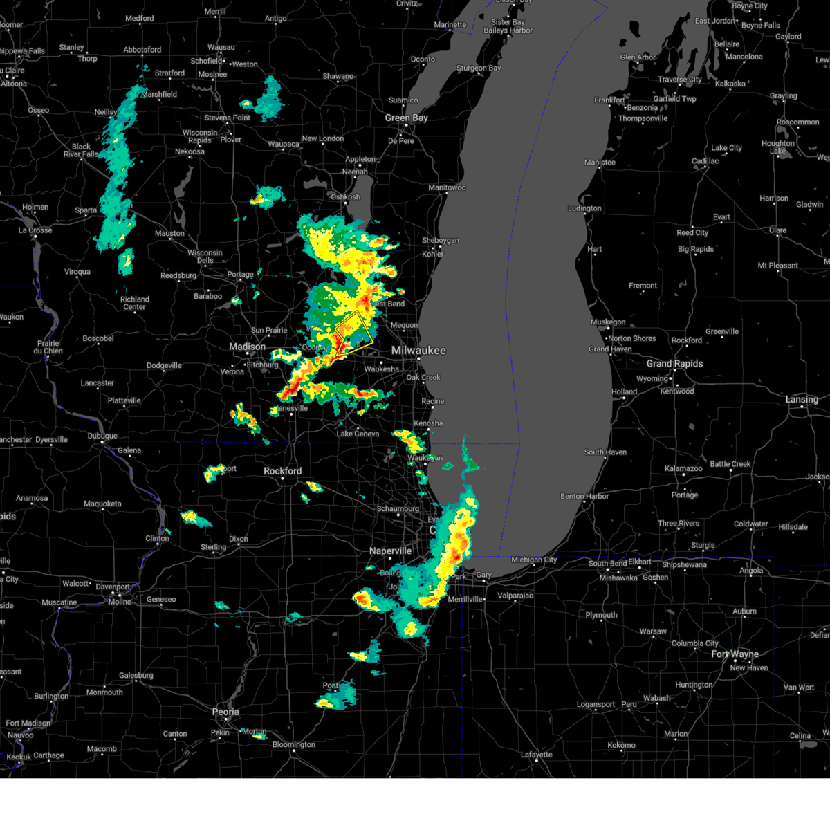 At 644 pm cst, a severe thunderstorm was located near lac la belle, or near okauchee lake, moving northeast at 45 mph (radar indicated). Hazards include quarter size hail. Damage to vehicles is expected. locations impacted include, okauchee lake, oconomowoc, merton, lac la belle, ixonia, ashippun, oconomowoc lake, chenequa, mapleton, stone bank, north lake, monches, monterey, lake lac la belle, and summit. hail threat, radar indicated max hail size, 1. 00 in wind threat, radar indicated max wind gust, <50 mph. At 644 pm cst, a severe thunderstorm was located near lac la belle, or near okauchee lake, moving northeast at 45 mph (radar indicated). Hazards include quarter size hail. Damage to vehicles is expected. locations impacted include, okauchee lake, oconomowoc, merton, lac la belle, ixonia, ashippun, oconomowoc lake, chenequa, mapleton, stone bank, north lake, monches, monterey, lake lac la belle, and summit. hail threat, radar indicated max hail size, 1. 00 in wind threat, radar indicated max wind gust, <50 mph.
|
| 2/8/2024 6:33 PM CST |
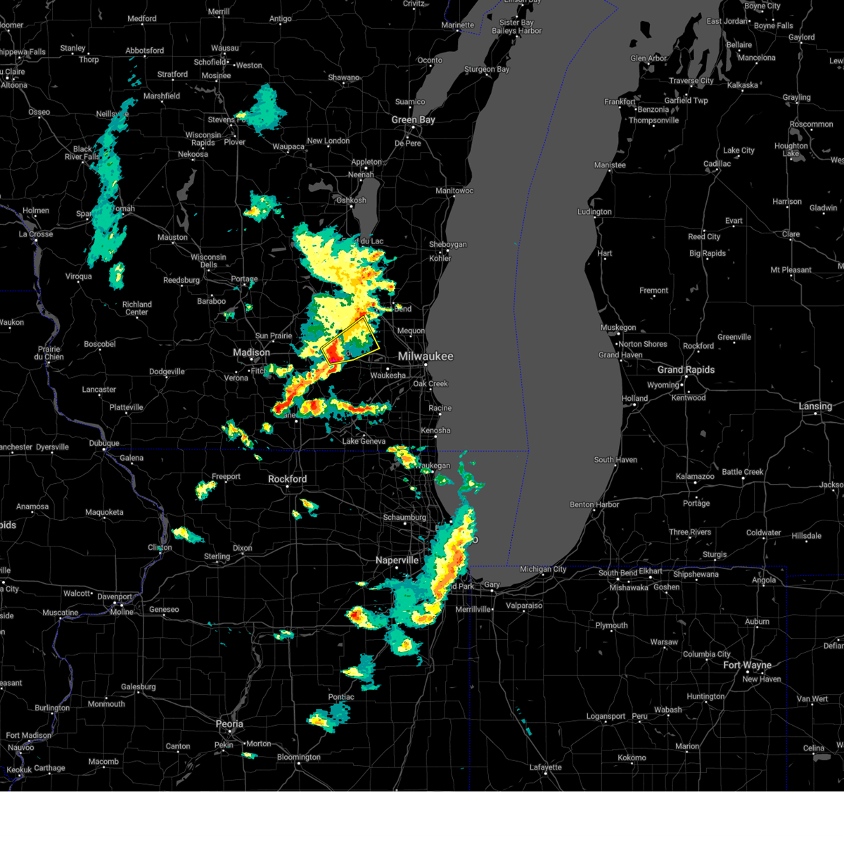 At 633 pm cst, a severe thunderstorm was located near watertown, moving northeast at 45 mph (radar indicated). Hazards include quarter size hail. damage to vehicles is expected At 633 pm cst, a severe thunderstorm was located near watertown, moving northeast at 45 mph (radar indicated). Hazards include quarter size hail. damage to vehicles is expected
|
| 8/24/2023 5:37 PM CDT |
 At 537 pm cdt, severe thunderstorms were located along a line extending from near lake mills to near lac la belle, moving southeast at 30 mph (radar indicated). Hazards include 60 mph wind gusts and penny size hail. Expect damage to roofs, siding, and trees. locations impacted include, watertown, fort atkinson, jefferson, lake mills, marshall, waterloo, johnson creek, cambridge, lac la belle, lake ripley, ixonia, rome, milford, sullivan, hubbleton, pipersville, helenville, nws milwaukee/sullivan, lake lac la belle, and summit. hail threat, radar indicated max hail size, 0. 75 in wind threat, radar indicated max wind gust, 60 mph. At 537 pm cdt, severe thunderstorms were located along a line extending from near lake mills to near lac la belle, moving southeast at 30 mph (radar indicated). Hazards include 60 mph wind gusts and penny size hail. Expect damage to roofs, siding, and trees. locations impacted include, watertown, fort atkinson, jefferson, lake mills, marshall, waterloo, johnson creek, cambridge, lac la belle, lake ripley, ixonia, rome, milford, sullivan, hubbleton, pipersville, helenville, nws milwaukee/sullivan, lake lac la belle, and summit. hail threat, radar indicated max hail size, 0. 75 in wind threat, radar indicated max wind gust, 60 mph.
|
| 8/24/2023 5:26 PM CDT |
 At 526 pm cdt, severe thunderstorms were located along a line extending from near marshall to near watertown, moving southeast at 30 mph (radar indicated). Hazards include 60 mph wind gusts and penny size hail. expect damage to roofs, siding, and trees At 526 pm cdt, severe thunderstorms were located along a line extending from near marshall to near watertown, moving southeast at 30 mph (radar indicated). Hazards include 60 mph wind gusts and penny size hail. expect damage to roofs, siding, and trees
|
| 7/28/2023 10:55 PM CDT |
 The severe thunderstorm warning for northern walworth, western waukesha and eastern jefferson counties will expire at 1100 pm cdt, the storms which prompted the warning have moved out of the area. therefore, the warning will be allowed to expire. a severe thunderstorm watch remains in effect until midnight cdt for south central and southeastern wisconsin. The severe thunderstorm warning for northern walworth, western waukesha and eastern jefferson counties will expire at 1100 pm cdt, the storms which prompted the warning have moved out of the area. therefore, the warning will be allowed to expire. a severe thunderstorm watch remains in effect until midnight cdt for south central and southeastern wisconsin.
|
| 7/28/2023 10:43 PM CDT |
 At 1042 pm cdt, severe thunderstorms were located along a line extending from near jackson to near potter lake to lake geneva to loves park, moving southeast at 60 mph (radar indicated). Hazards include 70 mph wind gusts and penny size hail. Expect considerable tree damage. damage is likely to mobile homes, roofs, and outbuildings. locations impacted include, whitewater, elkhorn, hartland, mukwonago, delafield, east troy, wales, okauchee lake, oconomowoc, ottawa, merton, dousman, north prairie, palmyra, lac la belle, potter lake, ixonia, richmond, rome, and la grange. People attending the cowalunga bike tour should seek safe shelter immediately!. At 1042 pm cdt, severe thunderstorms were located along a line extending from near jackson to near potter lake to lake geneva to loves park, moving southeast at 60 mph (radar indicated). Hazards include 70 mph wind gusts and penny size hail. Expect considerable tree damage. damage is likely to mobile homes, roofs, and outbuildings. locations impacted include, whitewater, elkhorn, hartland, mukwonago, delafield, east troy, wales, okauchee lake, oconomowoc, ottawa, merton, dousman, north prairie, palmyra, lac la belle, potter lake, ixonia, richmond, rome, and la grange. People attending the cowalunga bike tour should seek safe shelter immediately!.
|
| 7/28/2023 9:59 PM CDT |
 At 958 pm cdt, severe thunderstorms were located along a line extending from near ripon to 7 miles southeast of columbus to near deerfield to new glarus, moving southeast at 60 mph (radar indicated). Hazards include 70 mph wind gusts and penny size hail. Expect considerable tree damage. Damage is likely to mobile homes, roofs, and outbuildings. At 958 pm cdt, severe thunderstorms were located along a line extending from near ripon to 7 miles southeast of columbus to near deerfield to new glarus, moving southeast at 60 mph (radar indicated). Hazards include 70 mph wind gusts and penny size hail. Expect considerable tree damage. Damage is likely to mobile homes, roofs, and outbuildings.
|
| 4/19/2023 2:14 PM CDT |
 At 214 pm cdt, a severe thunderstorm was located over johnson creek, or near lake mills, moving northeast at 45 mph (radar indicated). Hazards include quarter size hail. damage to vehicles is expected At 214 pm cdt, a severe thunderstorm was located over johnson creek, or near lake mills, moving northeast at 45 mph (radar indicated). Hazards include quarter size hail. damage to vehicles is expected
|
| 4/4/2023 10:59 PM CDT |
 At 1059 pm cdt, severe thunderstorms were located along a line extending from near lake ripley to near raymond, moving northeast at 70 mph (trained weather spotters). Hazards include half dollar size hail. damage to vehicles is expected At 1059 pm cdt, severe thunderstorms were located along a line extending from near lake ripley to near raymond, moving northeast at 70 mph (trained weather spotters). Hazards include half dollar size hail. damage to vehicles is expected
|
| 10/12/2022 11:31 AM CDT |
 At 1131 am cdt, a severe thunderstorm capable of producing a tornado was located near lac la belle, or 7 miles west of okauchee lake, moving east at 35 mph (radar indicated rotation). Hazards include tornado. Flying debris will be dangerous to those caught without shelter. mobile homes will be damaged or destroyed. damage to roofs, windows, and vehicles will occur. Tree damage is likely. At 1131 am cdt, a severe thunderstorm capable of producing a tornado was located near lac la belle, or 7 miles west of okauchee lake, moving east at 35 mph (radar indicated rotation). Hazards include tornado. Flying debris will be dangerous to those caught without shelter. mobile homes will be damaged or destroyed. damage to roofs, windows, and vehicles will occur. Tree damage is likely.
|
| 9/25/2022 5:59 PM CDT |
 At 559 pm cdt, severe thunderstorms were located along a line extending from germantown to oconomowoc to fort atkinson, moving southeast at 65 mph (emergency management). Hazards include 60 mph wind gusts and nickel size hail. expect damage to roofs, siding, and trees At 559 pm cdt, severe thunderstorms were located along a line extending from germantown to oconomowoc to fort atkinson, moving southeast at 65 mph (emergency management). Hazards include 60 mph wind gusts and nickel size hail. expect damage to roofs, siding, and trees
|
| 9/25/2022 5:47 PM CDT |
 At 547 pm cdt, severe thunderstorms were located along a line extending from hartford to near deerfield, moving southeast at 55 mph (radar indicated). Hazards include 60 mph wind gusts and nickel size hail. Expect damage to roofs, siding, and trees. locations impacted include, menomonee falls, watertown, hartford, pewaukee, fort atkinson, sussex, hartland, jefferson, delafield, lake mills, slinger, marshall, waterloo, okauchee lake, germantown, oconomowoc, lisbon, cottage grove, merton and johnson creek. hail threat, radar indicated max hail size, 0. 88 in wind threat, radar indicated max wind gust, 60 mph. At 547 pm cdt, severe thunderstorms were located along a line extending from hartford to near deerfield, moving southeast at 55 mph (radar indicated). Hazards include 60 mph wind gusts and nickel size hail. Expect damage to roofs, siding, and trees. locations impacted include, menomonee falls, watertown, hartford, pewaukee, fort atkinson, sussex, hartland, jefferson, delafield, lake mills, slinger, marshall, waterloo, okauchee lake, germantown, oconomowoc, lisbon, cottage grove, merton and johnson creek. hail threat, radar indicated max hail size, 0. 88 in wind threat, radar indicated max wind gust, 60 mph.
|
| 9/25/2022 5:32 PM CDT |
 At 532 pm cdt, severe thunderstorms were located along a line extending from near mayville to sun prairie, moving southeast at 50 mph (radar indicated). Hazards include 60 mph wind gusts and nickel size hail. Expect damage to roofs, siding, and trees. locations impacted include, menomonee falls, sun prairie, watertown, hartford, pewaukee, fort atkinson, sussex, hartland, jefferson, delafield, windsor, lake mills, mayville, slinger, columbus, marshall, horicon, waterloo, juneau and okauchee lake. hail threat, radar indicated max hail size, 0. 88 in wind threat, radar indicated max wind gust, 60 mph. At 532 pm cdt, severe thunderstorms were located along a line extending from near mayville to sun prairie, moving southeast at 50 mph (radar indicated). Hazards include 60 mph wind gusts and nickel size hail. Expect damage to roofs, siding, and trees. locations impacted include, menomonee falls, sun prairie, watertown, hartford, pewaukee, fort atkinson, sussex, hartland, jefferson, delafield, windsor, lake mills, mayville, slinger, columbus, marshall, horicon, waterloo, juneau and okauchee lake. hail threat, radar indicated max hail size, 0. 88 in wind threat, radar indicated max wind gust, 60 mph.
|
| 9/25/2022 5:20 PM CDT |
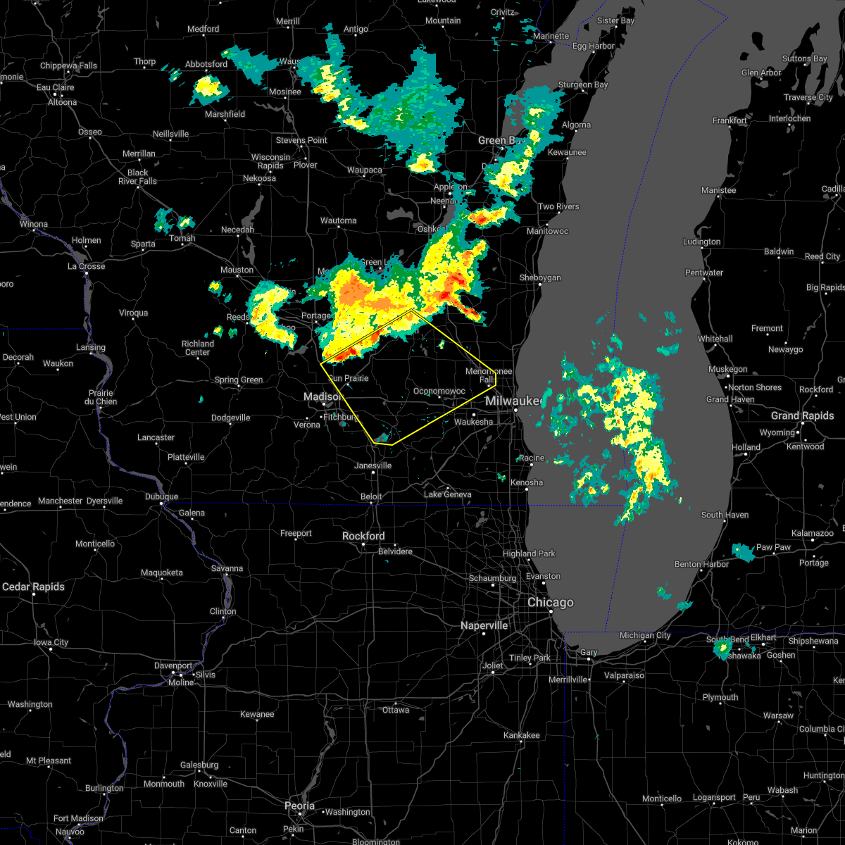 At 520 pm cdt, severe thunderstorms were located along a line extending from 6 miles southeast of waupun to near deforest, moving southeast at 50 mph (radar indicated). Hazards include 60 mph wind gusts and nickel size hail. expect damage to roofs, siding, and trees At 520 pm cdt, severe thunderstorms were located along a line extending from 6 miles southeast of waupun to near deforest, moving southeast at 50 mph (radar indicated). Hazards include 60 mph wind gusts and nickel size hail. expect damage to roofs, siding, and trees
|
| 8/28/2022 4:41 PM CDT | At 440 pm cdt, severe thunderstorms were located along a line extending from near okauchee lake to twin lakes, moving east at 40 mph (radar indicated). Hazards include 60 mph wind gusts and nickel size hail. Expect damage to roofs, siding, and trees. Locations impacted include, waukesha, new berlin, brookfield, menomonee falls, muskego, antioch, pewaukee, sussex, elkhorn, hartland, lake geneva, mukwonago, delafield, elm grove, union grove, east troy, paddock lake, wales, camp lake and okauchee lake. |
| 8/28/2022 4:13 PM CDT | At 413 pm cdt, severe thunderstorms were located along a line extending from watertown to near harvard, moving east at 55 mph (radar indicated). Hazards include 60 mph wind gusts and nickel size hail. expect damage to roofs, siding, and trees |
| 8/28/2022 4:04 PM CDT | At 404 pm cdt, severe thunderstorms were located along a line extending from near watertown to elkhorn, moving northeast at 45 mph (radar indicated). Hazards include 60 mph wind gusts and nickel size hail. Expect damage to roofs, siding, and trees. locations impacted include, watertown, whitewater, fort atkinson, elkhorn, delavan, jefferson, lake geneva, lake mills, east troy, waterloo, williams bay, walworth, johnson creek, clinton, palmyra, fontana-on-geneva lake, sharon, darien, como and lake koshkonong. People attending the uw- whitewater move in should seek safe shelter immediately!. |
| 8/28/2022 3:29 PM CDT | At 329 pm cdt, severe thunderstorms were located along a line extending from mcfarland to near south beloit, moving northeast at 45 mph (radar indicated). Hazards include 60 mph wind gusts and nickel size hail. expect damage to roofs, siding, and trees |
| 7/24/2022 2:41 AM CDT |
 At 241 am cdt, severe thunderstorms were located along a line extending from near lac la belle to near elkhorn to near clinton, moving east at 45 mph (public). Hazards include 60 mph wind gusts. expect damage to roofs, siding, and trees At 241 am cdt, severe thunderstorms were located along a line extending from near lac la belle to near elkhorn to near clinton, moving east at 45 mph (public). Hazards include 60 mph wind gusts. expect damage to roofs, siding, and trees
|
| 7/24/2022 2:32 AM CDT |
 At 231 am cdt, severe thunderstorms were located along a line extending from watertown to 7 miles east of janesville, moving northeast at 55 mph (radar indicated). Hazards include 60 mph wind gusts. Expect damage to roofs, siding, and trees. locations impacted include, janesville, beloit, watertown, whitewater, fort atkinson, elkhorn, hartland, delavan, jefferson, lake geneva, mukwonago, delafield, lake mills, milton, east troy, williams bay, wales, okauchee lake, oconomowoc and ottawa. hail threat, radar indicated max hail size, <. 75 in wind threat, radar indicated max wind gust, 60 mph. At 231 am cdt, severe thunderstorms were located along a line extending from watertown to 7 miles east of janesville, moving northeast at 55 mph (radar indicated). Hazards include 60 mph wind gusts. Expect damage to roofs, siding, and trees. locations impacted include, janesville, beloit, watertown, whitewater, fort atkinson, elkhorn, hartland, delavan, jefferson, lake geneva, mukwonago, delafield, lake mills, milton, east troy, williams bay, wales, okauchee lake, oconomowoc and ottawa. hail threat, radar indicated max hail size, <. 75 in wind threat, radar indicated max wind gust, 60 mph.
|
| 7/24/2022 2:03 AM CDT |
 At 203 am cdt, severe thunderstorms were located along a line extending from near cottage grove to near durand, moving northeast at 55 mph (radar indicated). Hazards include 60 mph wind gusts. expect damage to roofs, siding, and trees At 203 am cdt, severe thunderstorms were located along a line extending from near cottage grove to near durand, moving northeast at 55 mph (radar indicated). Hazards include 60 mph wind gusts. expect damage to roofs, siding, and trees
|
| 7/23/2022 11:12 PM CDT |
 At 1112 pm cdt, severe thunderstorms were located along a line extending from 8 miles northeast of bayside to near germantown to 6 miles south of hustisford, moving southeast at 45 mph (radar indicated). Hazards include 60 mph wind gusts and penny size hail. expect damage to roofs, siding, and trees At 1112 pm cdt, severe thunderstorms were located along a line extending from 8 miles northeast of bayside to near germantown to 6 miles south of hustisford, moving southeast at 45 mph (radar indicated). Hazards include 60 mph wind gusts and penny size hail. expect damage to roofs, siding, and trees
|
| 7/23/2022 6:45 PM CDT |
 At 644 pm cdt, severe thunderstorms were located along a line extending from near waterloo to near mount horeb, moving east at 15 mph (radar indicated). Hazards include 60 mph wind gusts and penny size hail. Expect damage to roofs, siding, and trees. locations impacted include, madison, sun prairie, fitchburg, watertown, middleton, stoughton, waunakee, verona, oregon, jefferson, mcfarland, monona, mount horeb, windsor, lake mills, marshall, waterloo, okauchee lake, oconomowoc and deforest. people attending the dane county fair in madison should seek safe shelter immediately! hail threat, radar indicated max hail size, 0. 75 in wind threat, radar indicated max wind gust, 60 mph. At 644 pm cdt, severe thunderstorms were located along a line extending from near waterloo to near mount horeb, moving east at 15 mph (radar indicated). Hazards include 60 mph wind gusts and penny size hail. Expect damage to roofs, siding, and trees. locations impacted include, madison, sun prairie, fitchburg, watertown, middleton, stoughton, waunakee, verona, oregon, jefferson, mcfarland, monona, mount horeb, windsor, lake mills, marshall, waterloo, okauchee lake, oconomowoc and deforest. people attending the dane county fair in madison should seek safe shelter immediately! hail threat, radar indicated max hail size, 0. 75 in wind threat, radar indicated max wind gust, 60 mph.
|
| 7/23/2022 6:28 PM CDT |
 At 627 pm cdt, severe thunderstorms were located along a line extending from near columbus to 8 miles northwest of mount horeb, moving southeast at 25 mph (radar indicated). Hazards include 70 mph wind gusts and half dollar size hail. Hail damage to vehicles is expected. expect considerable tree damage. wind damage is also likely to mobile homes, roofs, and outbuildings. locations impacted include, madison, sun prairie, fitchburg, watertown, middleton, stoughton, waunakee, verona, oregon, jefferson, mcfarland, monona, mount horeb, windsor, lake mills, columbus, dodgeville, marshall, waterloo and okauchee lake. people attending the dane county fair in madison should seek safe shelter immediately! thunderstorm damage threat, considerable hail threat, radar indicated max hail size, 1. 25 in wind threat, radar indicated max wind gust, 70 mph. At 627 pm cdt, severe thunderstorms were located along a line extending from near columbus to 8 miles northwest of mount horeb, moving southeast at 25 mph (radar indicated). Hazards include 70 mph wind gusts and half dollar size hail. Hail damage to vehicles is expected. expect considerable tree damage. wind damage is also likely to mobile homes, roofs, and outbuildings. locations impacted include, madison, sun prairie, fitchburg, watertown, middleton, stoughton, waunakee, verona, oregon, jefferson, mcfarland, monona, mount horeb, windsor, lake mills, columbus, dodgeville, marshall, waterloo and okauchee lake. people attending the dane county fair in madison should seek safe shelter immediately! thunderstorm damage threat, considerable hail threat, radar indicated max hail size, 1. 25 in wind threat, radar indicated max wind gust, 70 mph.
|
| 7/23/2022 6:12 PM CDT |
 At 611 pm cdt, severe thunderstorms were located along a line extending from near columbus to 8 miles northeast of dodgeville, moving southeast at 25 mph (radar indicated). Hazards include 60 mph wind gusts. expect damage to roofs, siding, and trees At 611 pm cdt, severe thunderstorms were located along a line extending from near columbus to 8 miles northeast of dodgeville, moving southeast at 25 mph (radar indicated). Hazards include 60 mph wind gusts. expect damage to roofs, siding, and trees
|
| 6/15/2022 8:24 PM CDT |
 The severe thunderstorm warning for eastern jefferson county will expire at 830 pm cdt, the storms which prompted the warning have weakened below severe limits, and no longer pose an immediate threat to life or property. therefore, the warning will be allowed to expire. however gusty winds are still possible with these thunderstorms. a tornado watch remains in effect until 1000 pm cdt for southeastern wisconsin. The severe thunderstorm warning for eastern jefferson county will expire at 830 pm cdt, the storms which prompted the warning have weakened below severe limits, and no longer pose an immediate threat to life or property. therefore, the warning will be allowed to expire. however gusty winds are still possible with these thunderstorms. a tornado watch remains in effect until 1000 pm cdt for southeastern wisconsin.
|
| 6/15/2022 8:19 PM CDT |
 At 819 pm cdt, severe thunderstorms were located along a line extending from okauchee lake to near palmyra, moving east at 40 mph (radar indicated). Hazards include 60 mph wind gusts and nickel size hail. Expect damage to roofs, siding, and trees. locations impacted include, whitewater, fort atkinson, jefferson, johnson creek, palmyra, ixonia, rome, hebron, sullivan, pipersville, helenville, nws milwaukee/sullivan and lake lac la belle. hail threat, radar indicated max hail size, 0. 88 in wind threat, radar indicated max wind gust, 60 mph. At 819 pm cdt, severe thunderstorms were located along a line extending from okauchee lake to near palmyra, moving east at 40 mph (radar indicated). Hazards include 60 mph wind gusts and nickel size hail. Expect damage to roofs, siding, and trees. locations impacted include, whitewater, fort atkinson, jefferson, johnson creek, palmyra, ixonia, rome, hebron, sullivan, pipersville, helenville, nws milwaukee/sullivan and lake lac la belle. hail threat, radar indicated max hail size, 0. 88 in wind threat, radar indicated max wind gust, 60 mph.
|
| 6/15/2022 8:06 PM CDT |
 At 806 pm cdt, severe thunderstorms were located along a line extending from near lac la belle to near whitewater, moving east at 40 mph (radar indicated). Hazards include 60 mph wind gusts and quarter size hail. Hail damage to vehicles is expected. expect wind damage to roofs, siding, and trees. Locations impacted include, whitewater, fort atkinson, jefferson, lake mills, johnson creek, palmyra, lake ripley, lake koshkonong, ixonia, rome, milford, hebron, sullivan, busseyville, pipersville, helenville, nws milwaukee/sullivan and lake lac la belle. At 806 pm cdt, severe thunderstorms were located along a line extending from near lac la belle to near whitewater, moving east at 40 mph (radar indicated). Hazards include 60 mph wind gusts and quarter size hail. Hail damage to vehicles is expected. expect wind damage to roofs, siding, and trees. Locations impacted include, whitewater, fort atkinson, jefferson, lake mills, johnson creek, palmyra, lake ripley, lake koshkonong, ixonia, rome, milford, hebron, sullivan, busseyville, pipersville, helenville, nws milwaukee/sullivan and lake lac la belle.
|
| 6/15/2022 7:35 PM CDT |
 At 735 pm cdt, severe thunderstorms were located along a line extending from near lake mills to near edgerton, moving east at 40 mph (radar indicated). Hazards include 60 mph wind gusts and quarter size hail. Hail damage to vehicles is expected. Expect wind damage to roofs, siding, and trees. At 735 pm cdt, severe thunderstorms were located along a line extending from near lake mills to near edgerton, moving east at 40 mph (radar indicated). Hazards include 60 mph wind gusts and quarter size hail. Hail damage to vehicles is expected. Expect wind damage to roofs, siding, and trees.
|
| 6/10/2022 5:46 PM CDT |
 At 545 pm cdt, a severe thunderstorm was located over okauchee lake, moving southeast at 15 mph (radar indicated). Hazards include 60 mph wind gusts and quarter size hail. Hail damage to vehicles is expected. Expect wind damage to roofs, siding, and trees. At 545 pm cdt, a severe thunderstorm was located over okauchee lake, moving southeast at 15 mph (radar indicated). Hazards include 60 mph wind gusts and quarter size hail. Hail damage to vehicles is expected. Expect wind damage to roofs, siding, and trees.
|
| 6/10/2022 5:29 PM CDT |
 At 529 pm cdt, a severe thunderstorm was located over okauchee lake, moving southeast at 20 mph (radar indicated). Hazards include 60 mph wind gusts and quarter size hail. Hail damage to vehicles is expected. Expect wind damage to roofs, siding, and trees. At 529 pm cdt, a severe thunderstorm was located over okauchee lake, moving southeast at 20 mph (radar indicated). Hazards include 60 mph wind gusts and quarter size hail. Hail damage to vehicles is expected. Expect wind damage to roofs, siding, and trees.
|
| 3/5/2022 10:28 PM CST |
 At 1026 pm cst, a severe thunderstorm was located near johnson creek, or 7 miles northeast of jefferson, moving east at 40 mph (radar indicated). Hazards include 60 mph wind gusts. Expect damage to roofs, siding, and trees. locations impacted include, waukesha, pewaukee, hartland, delafield, wales, okauchee lake, oconomowoc, ottawa, merton, dousman, lac la belle, ixonia, rome, ashippun, nashotah, waterville, sullivan, oconomowoc lake, chenequa and mapleton. hail threat, radar indicated max hail size, <. 75 in wind threat, radar indicated max wind gust, 60 mph. At 1026 pm cst, a severe thunderstorm was located near johnson creek, or 7 miles northeast of jefferson, moving east at 40 mph (radar indicated). Hazards include 60 mph wind gusts. Expect damage to roofs, siding, and trees. locations impacted include, waukesha, pewaukee, hartland, delafield, wales, okauchee lake, oconomowoc, ottawa, merton, dousman, lac la belle, ixonia, rome, ashippun, nashotah, waterville, sullivan, oconomowoc lake, chenequa and mapleton. hail threat, radar indicated max hail size, <. 75 in wind threat, radar indicated max wind gust, 60 mph.
|
| 3/5/2022 10:18 PM CST |
 At 1017 pm cst, a severe thunderstorm was located over jefferson, moving east at 40 mph (radar indicated). Hazards include 60 mph wind gusts. expect damage to roofs, siding, and trees At 1017 pm cst, a severe thunderstorm was located over jefferson, moving east at 40 mph (radar indicated). Hazards include 60 mph wind gusts. expect damage to roofs, siding, and trees
|
| 9/13/2021 3:12 AM CDT |
 At 311 am cdt, a severe thunderstorm was located over dousman, or 7 miles southwest of delafield, moving east at 30 mph (radar indicated). Hazards include quarter size hail. Damage to vehicles is expected. locations impacted include, hartland, delafield, wales, okauchee lake, oconomowoc, ottawa, dousman, lac la belle, nashotah, waterville, oconomowoc lake, chenequa, summit and lapham peak st park. hail threat, radar indicated max hail size, 1. 00 in wind threat, radar indicated max wind gust, <50 mph. At 311 am cdt, a severe thunderstorm was located over dousman, or 7 miles southwest of delafield, moving east at 30 mph (radar indicated). Hazards include quarter size hail. Damage to vehicles is expected. locations impacted include, hartland, delafield, wales, okauchee lake, oconomowoc, ottawa, dousman, lac la belle, nashotah, waterville, oconomowoc lake, chenequa, summit and lapham peak st park. hail threat, radar indicated max hail size, 1. 00 in wind threat, radar indicated max wind gust, <50 mph.
|
| 9/13/2021 2:38 AM CDT |
 At 237 am cdt, a severe thunderstorm was located over lake mills, moving east at 35 mph (radar indicated). Hazards include quarter size hail. damage to vehicles is expected At 237 am cdt, a severe thunderstorm was located over lake mills, moving east at 35 mph (radar indicated). Hazards include quarter size hail. damage to vehicles is expected
|
| 9/7/2021 11:58 AM CDT |
 The severe thunderstorm warning for southeastern dane, jefferson and southern dodge counties will expire at noon cdt, the storms which prompted the warning have moved out of much of the area. therefore, the warning will be allowed to expire. a seperate severe thunderstorm warning continues for far southeast jefferson county for large hail. a severe thunderstorm watch remains in effect until 600 pm cdt for south central and southeastern wisconsin. The severe thunderstorm warning for southeastern dane, jefferson and southern dodge counties will expire at noon cdt, the storms which prompted the warning have moved out of much of the area. therefore, the warning will be allowed to expire. a seperate severe thunderstorm warning continues for far southeast jefferson county for large hail. a severe thunderstorm watch remains in effect until 600 pm cdt for south central and southeastern wisconsin.
|
| 9/7/2021 11:27 AM CDT |
 At 1126 am cdt, severe thunderstorms were located along a line extending from near hustisford to johnson creek, moving east at 55 mph (radar indicated). Hazards include 60 mph wind gusts and quarter size hail. Hail damage to vehicles is expected. expect wind damage to roofs, siding, and trees. severe thunderstorms will be near, hartford, oconomowoc and lac la belle around 1135 am cdt. delafield and okauchee lake around 1140 am cdt. hartland and merton around 1145 am cdt. waukesha, pewaukee, sussex, jackson, germantown and lisbon around 1150 am cdt. brookfield, cedarburg, elm grove, thiensville, butler and brookfield around 1155 am cdt. wauwatosa, mequon, grafton and bayside around 1200 pm cdt. whitefish bay and glendale around 1205 pm cdt. other locations impacted by these severe thunderstorms include marquette university, colgate, chenequa, richfield, uw- milwaukee, mapleton, stone bank, summit, north lake and holy hill. hail threat, radar indicated max hail size, 1. 00 in wind threat, radar indicated max wind gust, 60 mph. At 1126 am cdt, severe thunderstorms were located along a line extending from near hustisford to johnson creek, moving east at 55 mph (radar indicated). Hazards include 60 mph wind gusts and quarter size hail. Hail damage to vehicles is expected. expect wind damage to roofs, siding, and trees. severe thunderstorms will be near, hartford, oconomowoc and lac la belle around 1135 am cdt. delafield and okauchee lake around 1140 am cdt. hartland and merton around 1145 am cdt. waukesha, pewaukee, sussex, jackson, germantown and lisbon around 1150 am cdt. brookfield, cedarburg, elm grove, thiensville, butler and brookfield around 1155 am cdt. wauwatosa, mequon, grafton and bayside around 1200 pm cdt. whitefish bay and glendale around 1205 pm cdt. other locations impacted by these severe thunderstorms include marquette university, colgate, chenequa, richfield, uw- milwaukee, mapleton, stone bank, summit, north lake and holy hill. hail threat, radar indicated max hail size, 1. 00 in wind threat, radar indicated max wind gust, 60 mph.
|
| 9/7/2021 11:16 AM CDT |
 At 1116 am cdt, severe thunderstorms were located along a line extending from 6 miles northeast of waterloo to brooklyn, moving east at 60 mph (trained weather spotters). Hazards include quarter size hail. Damage to vehicles is expected. these severe storms will be near, watertown and stoughton around 1125 am cdt. edgerton around 1135 am cdt. lake koshkonong around 1140 am cdt. whitewater around 1150 am cdt. palmyra around 1155 am cdt. other locations impacted by these severe thunderstorms include busseyville, ashippun, milford, richwood, ixonia, hubbleton, utica, rockdale, lebanon and pipersville. hail threat, observed max hail size, 1. 00 in wind threat, radar indicated max wind gust, <50 mph. At 1116 am cdt, severe thunderstorms were located along a line extending from 6 miles northeast of waterloo to brooklyn, moving east at 60 mph (trained weather spotters). Hazards include quarter size hail. Damage to vehicles is expected. these severe storms will be near, watertown and stoughton around 1125 am cdt. edgerton around 1135 am cdt. lake koshkonong around 1140 am cdt. whitewater around 1150 am cdt. palmyra around 1155 am cdt. other locations impacted by these severe thunderstorms include busseyville, ashippun, milford, richwood, ixonia, hubbleton, utica, rockdale, lebanon and pipersville. hail threat, observed max hail size, 1. 00 in wind threat, radar indicated max wind gust, <50 mph.
|
| 9/7/2021 11:01 AM CDT |
 At 1100 am cdt, severe thunderstorms were located along a line extending from 6 miles north of sun prairie to near new glarus, moving east at 60 mph (radar indicated). Hazards include quarter size hail. Damage to vehicles is expected. severe thunderstorms will be near, sun prairie around 1105 am cdt. columbus, marshall and waterloo around 1110 am cdt. oregon and brooklyn around 1115 am cdt. watertown and stoughton around 1125 am cdt. edgerton around 1135 am cdt. lake koshkonong around 1140 am cdt. whitewater around 1150 am cdt. palmyra around 1155 am cdt. other locations impacted by these severe thunderstorms include busseyville, richwood, hubbleton, utica, rockdale, rome, token creek, henry vilas zoo, hebron and helenville. hail threat, radar indicated max hail size, 1. 00 in wind threat, radar indicated max wind gust, <50 mph. At 1100 am cdt, severe thunderstorms were located along a line extending from 6 miles north of sun prairie to near new glarus, moving east at 60 mph (radar indicated). Hazards include quarter size hail. Damage to vehicles is expected. severe thunderstorms will be near, sun prairie around 1105 am cdt. columbus, marshall and waterloo around 1110 am cdt. oregon and brooklyn around 1115 am cdt. watertown and stoughton around 1125 am cdt. edgerton around 1135 am cdt. lake koshkonong around 1140 am cdt. whitewater around 1150 am cdt. palmyra around 1155 am cdt. other locations impacted by these severe thunderstorms include busseyville, richwood, hubbleton, utica, rockdale, rome, token creek, henry vilas zoo, hebron and helenville. hail threat, radar indicated max hail size, 1. 00 in wind threat, radar indicated max wind gust, <50 mph.
|
| 8/10/2021 7:29 PM CDT |
 At 727 pm cdt, severe thunderstorms were located along a line extending from near random lake to near pleasant prairie, moving east at 40 mph (trained weather spotters reported trees down in waukesha county). Hazards include 70 mph wind gusts. Expect considerable tree damage. damage is likely to mobile homes, roofs, and outbuildings. locations impacted include, waukesha, west allis, wauwatosa, new berlin, brookfield, menomonee falls, west bend, muskego, hartford, pewaukee, sussex, elkhorn, hartland, hales corners, lake geneva, mukwonago, delafield, jackson, elm grove and slinger. thunderstorm damage threat, considerable hail threat, radar indicated max hail size, <. 75 in wind threat, radar indicated max wind gust, 70 mph. At 727 pm cdt, severe thunderstorms were located along a line extending from near random lake to near pleasant prairie, moving east at 40 mph (trained weather spotters reported trees down in waukesha county). Hazards include 70 mph wind gusts. Expect considerable tree damage. damage is likely to mobile homes, roofs, and outbuildings. locations impacted include, waukesha, west allis, wauwatosa, new berlin, brookfield, menomonee falls, west bend, muskego, hartford, pewaukee, sussex, elkhorn, hartland, hales corners, lake geneva, mukwonago, delafield, jackson, elm grove and slinger. thunderstorm damage threat, considerable hail threat, radar indicated max hail size, <. 75 in wind threat, radar indicated max wind gust, 70 mph.
|
| 8/10/2021 7:14 PM CDT |
 At 713 pm cdt, severe thunderstorms were located along a line extending from near kewaskum to camp lake, moving east at 40 mph (trained weather spotters. several reports of wind gusts between 60 and 75mph. trees and limbs downed). Hazards include 70 mph wind gusts. Expect considerable tree damage. damage is likely to mobile homes, roofs, and outbuildings. locations impacted include, waukesha, west allis, wauwatosa, new berlin, brookfield, menomonee falls, west bend, muskego, whitewater, hartford, pewaukee, sussex, elkhorn, hartland, delavan, hales corners, lake geneva, mukwonago, delafield and jackson. thunderstorm damage threat, considerable hail threat, radar indicated max hail size, <. 75 in wind threat, radar indicated max wind gust, 70 mph. At 713 pm cdt, severe thunderstorms were located along a line extending from near kewaskum to camp lake, moving east at 40 mph (trained weather spotters. several reports of wind gusts between 60 and 75mph. trees and limbs downed). Hazards include 70 mph wind gusts. Expect considerable tree damage. damage is likely to mobile homes, roofs, and outbuildings. locations impacted include, waukesha, west allis, wauwatosa, new berlin, brookfield, menomonee falls, west bend, muskego, whitewater, hartford, pewaukee, sussex, elkhorn, hartland, delavan, hales corners, lake geneva, mukwonago, delafield and jackson. thunderstorm damage threat, considerable hail threat, radar indicated max hail size, <. 75 in wind threat, radar indicated max wind gust, 70 mph.
|
| 8/10/2021 7:03 PM CDT |
 At 702 pm cdt, severe thunderstorms were located along a line extending from near campbellsport to twin lakes, moving east at 50 mph (trained weather spotters reported a localized wind gust to 77 mph near eagle). Hazards include 60 mph wind gusts. Expect damage to roofs, siding, and trees. locations impacted include, waukesha, west allis, wauwatosa, new berlin, brookfield, menomonee falls, west bend, muskego, whitewater, hartford, pewaukee, sussex, elkhorn, hartland, delavan, hales corners, lake geneva, mukwonago, delafield and jackson. hail threat, radar indicated max hail size, <. 75 in wind threat, radar indicated max wind gust, 60 mph. At 702 pm cdt, severe thunderstorms were located along a line extending from near campbellsport to twin lakes, moving east at 50 mph (trained weather spotters reported a localized wind gust to 77 mph near eagle). Hazards include 60 mph wind gusts. Expect damage to roofs, siding, and trees. locations impacted include, waukesha, west allis, wauwatosa, new berlin, brookfield, menomonee falls, west bend, muskego, whitewater, hartford, pewaukee, sussex, elkhorn, hartland, delavan, hales corners, lake geneva, mukwonago, delafield and jackson. hail threat, radar indicated max hail size, <. 75 in wind threat, radar indicated max wind gust, 60 mph.
|
| 8/10/2021 6:08 PM CDT |
 At 608 pm cdt, severe thunderstorms were located along a line extending from randolph to near beloit, moving east at 40 mph (radar indicated). Hazards include 60 mph wind gusts. expect damage to roofs, siding, and trees At 608 pm cdt, severe thunderstorms were located along a line extending from randolph to near beloit, moving east at 40 mph (radar indicated). Hazards include 60 mph wind gusts. expect damage to roofs, siding, and trees
|
| 8/7/2021 1:02 PM CDT |
 At 101 pm cdt, a severe thunderstorm was located near oconomowoc, or near okauchee lake, moving southeast at 25 mph (radar indicated). Hazards include 60 mph wind gusts. Expect damage to roofs, siding, and trees. locations impacted include, lac la belle, ixonia, rome, sullivan, helenville, nws milwaukee/sullivan and lake lac la belle. hail threat, radar indicated max hail size, <. 75 in wind threat, radar indicated max wind gust, 60 mph. At 101 pm cdt, a severe thunderstorm was located near oconomowoc, or near okauchee lake, moving southeast at 25 mph (radar indicated). Hazards include 60 mph wind gusts. Expect damage to roofs, siding, and trees. locations impacted include, lac la belle, ixonia, rome, sullivan, helenville, nws milwaukee/sullivan and lake lac la belle. hail threat, radar indicated max hail size, <. 75 in wind threat, radar indicated max wind gust, 60 mph.
|
| 8/7/2021 12:54 PM CDT |
 At 1253 pm cdt, a severe thunderstorm was located near lac la belle, or 8 miles southeast of watertown, moving southeast at 20 mph (radar indicated). Hazards include 60 mph wind gusts. expect damage to roofs, siding, and trees At 1253 pm cdt, a severe thunderstorm was located near lac la belle, or 8 miles southeast of watertown, moving southeast at 20 mph (radar indicated). Hazards include 60 mph wind gusts. expect damage to roofs, siding, and trees
|
| 8/7/2021 12:39 PM CDT |
 At 1238 pm cdt, a severe thunderstorm was located near watertown, moving southeast at 25 mph (trained weather spotter reports 60 mph winds in watertown). Hazards include 60 mph wind gusts. Expect damage to roofs, siding, and trees. locations impacted include, watertown, johnson creek, lac la belle, ixonia, rome, milford, sullivan, pipersville, helenville, nws milwaukee/sullivan and lake lac la belle. hail threat, radar indicated max hail size, <. 75 in wind threat, radar indicated max wind gust, 60 mph. At 1238 pm cdt, a severe thunderstorm was located near watertown, moving southeast at 25 mph (trained weather spotter reports 60 mph winds in watertown). Hazards include 60 mph wind gusts. Expect damage to roofs, siding, and trees. locations impacted include, watertown, johnson creek, lac la belle, ixonia, rome, milford, sullivan, pipersville, helenville, nws milwaukee/sullivan and lake lac la belle. hail threat, radar indicated max hail size, <. 75 in wind threat, radar indicated max wind gust, 60 mph.
|
| 8/7/2021 12:32 PM CDT |
 At 1232 pm cdt, a severe thunderstorm was located near watertown, moving southeast at 25 mph (radar indicated). Hazards include 60 mph wind gusts. expect damage to roofs, siding, and trees At 1232 pm cdt, a severe thunderstorm was located near watertown, moving southeast at 25 mph (radar indicated). Hazards include 60 mph wind gusts. expect damage to roofs, siding, and trees
|
| 7/29/2021 1:32 AM CDT |
 At 131 am cdt, severe thunderstorms were located along a line extending from near germantown to palmyra to near footville, moving southeast at 45 mph (trained weather spotter reports winds of 60 mph in oconomowoc). Hazards include 70 mph wind gusts. Expect considerable tree damage. damage is likely to mobile homes, roofs, and outbuildings. locations impacted include, milwaukee, kenosha, racine, waukesha, janesville, west allis, wauwatosa, new berlin, brookfield, beloit, greenfield, menomonee falls, oak creek, mount pleasant, muskego, south milwaukee, pleasant prairie, cudahy, whitewater and whitefish bay. People attending the waukesha kennel club dog show, the rock county 4h fair in janesville, and the racine county fair in union grove should seek safe shelter immediately!. At 131 am cdt, severe thunderstorms were located along a line extending from near germantown to palmyra to near footville, moving southeast at 45 mph (trained weather spotter reports winds of 60 mph in oconomowoc). Hazards include 70 mph wind gusts. Expect considerable tree damage. damage is likely to mobile homes, roofs, and outbuildings. locations impacted include, milwaukee, kenosha, racine, waukesha, janesville, west allis, wauwatosa, new berlin, brookfield, beloit, greenfield, menomonee falls, oak creek, mount pleasant, muskego, south milwaukee, pleasant prairie, cudahy, whitewater and whitefish bay. People attending the waukesha kennel club dog show, the rock county 4h fair in janesville, and the racine county fair in union grove should seek safe shelter immediately!.
|
| 7/29/2021 1:21 AM CDT |
 At 120 am cdt, tornado producing storms were located along a line extending from lac la belle to near oconomowoc to near jefferson, moving east at 50 mph (multiple radar confirmed tornado in eastern jefferson county). Hazards include damaging tornado. Flying debris will be dangerous to those caught without shelter. mobile homes will be damaged or destroyed. damage to roofs, windows, and vehicles will occur. tree damage is likely. Locations impacted include, watertown, whitewater, fort atkinson, hartland, jefferson, delafield, lake mills, wales, okauchee lake, oconomowoc, ottawa, merton, johnson creek, dousman, north prairie, palmyra, lac la belle, lake ripley, lake koshkonong and ixonia. At 120 am cdt, tornado producing storms were located along a line extending from lac la belle to near oconomowoc to near jefferson, moving east at 50 mph (multiple radar confirmed tornado in eastern jefferson county). Hazards include damaging tornado. Flying debris will be dangerous to those caught without shelter. mobile homes will be damaged or destroyed. damage to roofs, windows, and vehicles will occur. tree damage is likely. Locations impacted include, watertown, whitewater, fort atkinson, hartland, jefferson, delafield, lake mills, wales, okauchee lake, oconomowoc, ottawa, merton, johnson creek, dousman, north prairie, palmyra, lac la belle, lake ripley, lake koshkonong and ixonia.
|
| 7/29/2021 1:17 AM CDT |
 At 116 am cdt, severe thunderstorms were located along a line extending from slinger to near jefferson to near brooklyn, moving southeast at 45 mph (trained weather spotter estimated 70 mph winds in johnson creek ). Hazards include 70 mph wind gusts. Expect considerable tree damage. Damage is likely to mobile homes, roofs, and outbuildings. At 116 am cdt, severe thunderstorms were located along a line extending from slinger to near jefferson to near brooklyn, moving southeast at 45 mph (trained weather spotter estimated 70 mph winds in johnson creek ). Hazards include 70 mph wind gusts. Expect considerable tree damage. Damage is likely to mobile homes, roofs, and outbuildings.
|
| 7/29/2021 1:14 AM CDT |
 At 113 am cdt, tornado producing storms were located along a line extending from near lac la belle to 6 miles east of johnson creek to near jefferson, moving east at 50 mph (radar confirmed tornado south-southwest of watertown). Hazards include damaging tornado. Flying debris will be dangerous to those caught without shelter. mobile homes will be damaged or destroyed. damage to roofs, windows, and vehicles will occur. tree damage is likely. Locations impacted include, watertown, whitewater, fort atkinson, hartland, jefferson, delafield, lake mills, wales, okauchee lake, oconomowoc, ottawa, merton, johnson creek, dousman, north prairie, palmyra, lac la belle, lake ripley, lake koshkonong and ixonia. At 113 am cdt, tornado producing storms were located along a line extending from near lac la belle to 6 miles east of johnson creek to near jefferson, moving east at 50 mph (radar confirmed tornado south-southwest of watertown). Hazards include damaging tornado. Flying debris will be dangerous to those caught without shelter. mobile homes will be damaged or destroyed. damage to roofs, windows, and vehicles will occur. tree damage is likely. Locations impacted include, watertown, whitewater, fort atkinson, hartland, jefferson, delafield, lake mills, wales, okauchee lake, oconomowoc, ottawa, merton, johnson creek, dousman, north prairie, palmyra, lac la belle, lake ripley, lake koshkonong and ixonia.
|
| 7/29/2021 1:08 AM CDT |
 At 107 am cdt, severe thunderstorms capable of producing a tornado were located along a line extending from near watertown to near johnson creek to jefferson, moving east at 45 mph (radar indicated rotation). Hazards include tornado. Flying debris will be dangerous to those caught without shelter. mobile homes will be damaged or destroyed. damage to roofs, windows, and vehicles will occur. Tree damage is likely. At 107 am cdt, severe thunderstorms capable of producing a tornado were located along a line extending from near watertown to near johnson creek to jefferson, moving east at 45 mph (radar indicated rotation). Hazards include tornado. Flying debris will be dangerous to those caught without shelter. mobile homes will be damaged or destroyed. damage to roofs, windows, and vehicles will occur. Tree damage is likely.
|
| 7/29/2021 12:45 AM CDT |
 At 1245 am cdt, severe thunderstorms were located along a line extending from near fall river to near marshall to near cross plains, moving southeast at 50 mph (radar indicated). Hazards include 60 mph wind gusts. expect damage to roofs, siding, and trees At 1245 am cdt, severe thunderstorms were located along a line extending from near fall river to near marshall to near cross plains, moving southeast at 50 mph (radar indicated). Hazards include 60 mph wind gusts. expect damage to roofs, siding, and trees
|
| 8/25/2020 2:13 AM CDT |
 At 213 am cdt, a severe thunderstorm was located over lac la belle, or near okauchee lake, moving southeast at 25 mph (radar indicated). Hazards include 60 mph wind gusts and quarter size hail. Hail damage to vehicles is expected. expect wind damage to roofs, siding, and trees. Locations impacted include, watertown, hartland, jefferson, delafield, wales, okauchee lake, oconomowoc, ottawa, johnson creek, dousman, lac la belle, ixonia, rome, nashotah, milford, hebron, waterville, sullivan, oconomowoc lake and summit. At 213 am cdt, a severe thunderstorm was located over lac la belle, or near okauchee lake, moving southeast at 25 mph (radar indicated). Hazards include 60 mph wind gusts and quarter size hail. Hail damage to vehicles is expected. expect wind damage to roofs, siding, and trees. Locations impacted include, watertown, hartland, jefferson, delafield, wales, okauchee lake, oconomowoc, ottawa, johnson creek, dousman, lac la belle, ixonia, rome, nashotah, milford, hebron, waterville, sullivan, oconomowoc lake and summit.
|
| 8/25/2020 1:45 AM CDT |
 At 144 am cdt, a severe thunderstorm was located near watertown, moving southeast at 25 mph (radar indicated). Hazards include 60 mph wind gusts and quarter size hail. Hail damage to vehicles is expected. Expect wind damage to roofs, siding, and trees. At 144 am cdt, a severe thunderstorm was located near watertown, moving southeast at 25 mph (radar indicated). Hazards include 60 mph wind gusts and quarter size hail. Hail damage to vehicles is expected. Expect wind damage to roofs, siding, and trees.
|
| 8/9/2020 5:37 PM CDT |
 At 537 pm cdt, a severe thunderstorm was located over wales, moving east at 35 mph (radar indicated). Hazards include 60 mph wind gusts and quarter size hail. Hail damage to vehicles is expected. expect wind damage to roofs, siding, and trees. Locations impacted include, waukesha, new berlin, brookfield, menomonee falls, muskego, pewaukee, sussex, hartland, mukwonago, delafield, elm grove, wales, okauchee lake, oconomowoc, lisbon, vernon, ottawa, merton, dousman and north prairie. At 537 pm cdt, a severe thunderstorm was located over wales, moving east at 35 mph (radar indicated). Hazards include 60 mph wind gusts and quarter size hail. Hail damage to vehicles is expected. expect wind damage to roofs, siding, and trees. Locations impacted include, waukesha, new berlin, brookfield, menomonee falls, muskego, pewaukee, sussex, hartland, mukwonago, delafield, elm grove, wales, okauchee lake, oconomowoc, lisbon, vernon, ottawa, merton, dousman and north prairie.
|
| 8/9/2020 5:35 PM CDT |
 At 535 pm cdt, a severe thunderstorm was located over delafield, moving east at 35 mph (radar indicated). Hazards include 60 mph wind gusts. Expect damage to roofs, siding, and trees. Locations impacted include, whitewater, palmyra, ixonia, rome, hebron, sullivan, pipersville, helenville, nws milwaukee/sullivan and lake lac la belle. At 535 pm cdt, a severe thunderstorm was located over delafield, moving east at 35 mph (radar indicated). Hazards include 60 mph wind gusts. Expect damage to roofs, siding, and trees. Locations impacted include, whitewater, palmyra, ixonia, rome, hebron, sullivan, pipersville, helenville, nws milwaukee/sullivan and lake lac la belle.
|
| 8/9/2020 5:21 PM CDT |
 At 521 pm cdt, a severe thunderstorm was located near dousman, or 8 miles southwest of okauchee lake, moving east at 35 mph (radar indicated). Hazards include 60 mph wind gusts and quarter size hail. Hail damage to vehicles is expected. expect wind damage to roofs, siding, and trees. Locations impacted include, whitewater, fort atkinson, jefferson, johnson creek, palmyra, lake koshkonong, ixonia, rome, milford, hebron, sullivan, pipersville, helenville, nws milwaukee/sullivan and lake lac la belle. At 521 pm cdt, a severe thunderstorm was located near dousman, or 8 miles southwest of okauchee lake, moving east at 35 mph (radar indicated). Hazards include 60 mph wind gusts and quarter size hail. Hail damage to vehicles is expected. expect wind damage to roofs, siding, and trees. Locations impacted include, whitewater, fort atkinson, jefferson, johnson creek, palmyra, lake koshkonong, ixonia, rome, milford, hebron, sullivan, pipersville, helenville, nws milwaukee/sullivan and lake lac la belle.
|
| 8/9/2020 5:20 PM CDT |
 At 519 pm cdt, a severe thunderstorm was located near dousman, or 9 miles west of wales, moving east at 35 mph (radar indicated). Hazards include 60 mph wind gusts and quarter size hail. Hail damage to vehicles is expected. Expect wind damage to roofs, siding, and trees. At 519 pm cdt, a severe thunderstorm was located near dousman, or 9 miles west of wales, moving east at 35 mph (radar indicated). Hazards include 60 mph wind gusts and quarter size hail. Hail damage to vehicles is expected. Expect wind damage to roofs, siding, and trees.
|
| 8/9/2020 5:00 PM CDT |
 At 500 pm cdt, a severe thunderstorm was located over jefferson, moving east at 35 mph (radar indicated). Hazards include 60 mph wind gusts and quarter size hail. Hail damage to vehicles is expected. Expect wind damage to roofs, siding, and trees. At 500 pm cdt, a severe thunderstorm was located over jefferson, moving east at 35 mph (radar indicated). Hazards include 60 mph wind gusts and quarter size hail. Hail damage to vehicles is expected. Expect wind damage to roofs, siding, and trees.
|
| 7/9/2020 6:59 PM CDT |
 At 657 pm cdt, severe thunderstorms were located along a line extending from lake mills to potter lake, moving northeast at 30 mph (public. trees have been reported down across portions of walworth county with these storms). Hazards include 60 mph wind gusts and penny size hail. expect damage to roofs, siding, and trees At 657 pm cdt, severe thunderstorms were located along a line extending from lake mills to potter lake, moving northeast at 30 mph (public. trees have been reported down across portions of walworth county with these storms). Hazards include 60 mph wind gusts and penny size hail. expect damage to roofs, siding, and trees
|
| 6/29/2020 2:46 PM CDT |
 At 246 pm cdt, severe thunderstorms were located along a line extending from lake mills to near fort atkinson to lake koshkonong, moving east at 20 mph (radar indicated). Hazards include 60 mph wind gusts. Expect damage to roofs, siding, and trees. Locations impacted include, whitewater, fort atkinson, jefferson, lake mills, johnson creek, palmyra, lake ripley, lake koshkonong, ixonia, rome, milford, hebron, sullivan, busseyville, pipersville, helenville, nws milwaukee/sullivan and lake lac la belle. At 246 pm cdt, severe thunderstorms were located along a line extending from lake mills to near fort atkinson to lake koshkonong, moving east at 20 mph (radar indicated). Hazards include 60 mph wind gusts. Expect damage to roofs, siding, and trees. Locations impacted include, whitewater, fort atkinson, jefferson, lake mills, johnson creek, palmyra, lake ripley, lake koshkonong, ixonia, rome, milford, hebron, sullivan, busseyville, pipersville, helenville, nws milwaukee/sullivan and lake lac la belle.
|
| 6/29/2020 2:29 PM CDT |
 At 228 pm cdt, severe thunderstorms were located along a broken line extending from near lake mills to near lake ripley to near edgerton, moving east at 20 mph (radar indicated). Hazards include 60 mph wind gusts. Expect damage to roofs, siding, and trees. Locations impacted include, whitewater, fort atkinson, jefferson, lake mills, edgerton, johnson creek, deerfield, palmyra, cambridge, lake ripley, lake koshkonong, ixonia, rome, albion, milford, hebron, sullivan, utica, rockdale and busseyville. At 228 pm cdt, severe thunderstorms were located along a broken line extending from near lake mills to near lake ripley to near edgerton, moving east at 20 mph (radar indicated). Hazards include 60 mph wind gusts. Expect damage to roofs, siding, and trees. Locations impacted include, whitewater, fort atkinson, jefferson, lake mills, edgerton, johnson creek, deerfield, palmyra, cambridge, lake ripley, lake koshkonong, ixonia, rome, albion, milford, hebron, sullivan, utica, rockdale and busseyville.
|
| 6/29/2020 2:11 PM CDT |
 At 211 pm cdt, severe thunderstorms were located along a broken line extending from deerfield to near cambridge to near edgerton, moving east at 20 mph (radar indicated). Hazards include 60 mph wind gusts. expect damage to roofs, siding, and trees At 211 pm cdt, severe thunderstorms were located along a broken line extending from deerfield to near cambridge to near edgerton, moving east at 20 mph (radar indicated). Hazards include 60 mph wind gusts. expect damage to roofs, siding, and trees
|
| 6/11/2020 4:50 PM CDT |
 At 450 pm cdt, a severe thunderstorm was located 7 miles east of johnson creek, or 9 miles east of jefferson, moving east at 45 mph (radar indicated). Hazards include 60 mph wind gusts. Expect damage to roofs, siding, and trees. locations impacted include, hartland, mukwonago, delafield, wales, okauchee lake, oconomowoc, merton, dousman, north prairie, lac la belle, ixonia, rome, nashotah, sullivan, oconomowoc lake, chenequa, stone bank, genesee depot, genesee and lapham peak st park. People attending outdoor testing at aurora in summit should seek safe shelter immediately!. At 450 pm cdt, a severe thunderstorm was located 7 miles east of johnson creek, or 9 miles east of jefferson, moving east at 45 mph (radar indicated). Hazards include 60 mph wind gusts. Expect damage to roofs, siding, and trees. locations impacted include, hartland, mukwonago, delafield, wales, okauchee lake, oconomowoc, merton, dousman, north prairie, lac la belle, ixonia, rome, nashotah, sullivan, oconomowoc lake, chenequa, stone bank, genesee depot, genesee and lapham peak st park. People attending outdoor testing at aurora in summit should seek safe shelter immediately!.
|
| 6/11/2020 4:38 PM CDT |
 At 438 pm cdt, a severe thunderstorm was located over johnson creek, or near lake mills, moving east at 45 mph (radar indicated). Hazards include 60 mph wind gusts. expect damage to roofs, siding, and trees At 438 pm cdt, a severe thunderstorm was located over johnson creek, or near lake mills, moving east at 45 mph (radar indicated). Hazards include 60 mph wind gusts. expect damage to roofs, siding, and trees
|
| 6/30/2019 12:01 PM CDT |
 At 1200 pm cdt, severe thunderstorms were located along a line extending from near lannon to near milton, moving southeast at 40 mph (law enforcement. there have been numerous reports of tree damage and power outages). Hazards include 60 mph wind gusts. Expect damage to roofs, siding, and trees. Locations impacted include, watertown, whitewater, fort atkinson, jefferson, delafield, lake mills, waterloo, wales, okauchee lake, oconomowoc, johnson creek, dousman, north prairie, palmyra, lac la belle, lake ripley, lake koshkonong, ixonia, rome and eagle. At 1200 pm cdt, severe thunderstorms were located along a line extending from near lannon to near milton, moving southeast at 40 mph (law enforcement. there have been numerous reports of tree damage and power outages). Hazards include 60 mph wind gusts. Expect damage to roofs, siding, and trees. Locations impacted include, watertown, whitewater, fort atkinson, jefferson, delafield, lake mills, waterloo, wales, okauchee lake, oconomowoc, johnson creek, dousman, north prairie, palmyra, lac la belle, lake ripley, lake koshkonong, ixonia, rome and eagle.
|
| 6/30/2019 11:37 AM CDT |
 At 1136 am cdt, severe thunderstorms were located along a line extending from near hartford to near edgerton, moving south at 30 mph (law enforcement. there have been numerous reports of tree and power line damage at the leading edge of these storms). Hazards include 60 mph wind gusts. Expect damage to roofs, siding, and trees. Locations impacted include, watertown, whitewater, hartford, fort atkinson, jefferson, delafield, lake mills, waterloo, wales, okauchee lake, oconomowoc, johnson creek, dousman, north prairie, palmyra, lac la belle, lake ripley, lake koshkonong, ixonia and rome. At 1136 am cdt, severe thunderstorms were located along a line extending from near hartford to near edgerton, moving south at 30 mph (law enforcement. there have been numerous reports of tree and power line damage at the leading edge of these storms). Hazards include 60 mph wind gusts. Expect damage to roofs, siding, and trees. Locations impacted include, watertown, whitewater, hartford, fort atkinson, jefferson, delafield, lake mills, waterloo, wales, okauchee lake, oconomowoc, johnson creek, dousman, north prairie, palmyra, lac la belle, lake ripley, lake koshkonong, ixonia and rome.
|
| 6/30/2019 11:26 AM CDT |
 At 1126 am cdt, severe thunderstorms were located along a line extending from near campbellsport to near lake mills, moving southeast at 40 mph (law enforcement. there have been numerous reports of tree damage and power outages). Hazards include 60 mph wind gusts. expect damage to roofs, siding, and trees At 1126 am cdt, severe thunderstorms were located along a line extending from near campbellsport to near lake mills, moving southeast at 40 mph (law enforcement. there have been numerous reports of tree damage and power outages). Hazards include 60 mph wind gusts. expect damage to roofs, siding, and trees
|
| 6/27/2019 4:53 PM CDT |
 The severe thunderstorm warning for northwestern walworth, southeastern rock, northwestern waukesha, southeastern jefferson and eastern dodge counties will expire at 500 pm cdt, the storms which prompted the warning have weakened below severe limits, and no longer pose an immediate threat to life or property. therefore, the warning will be allowed to expire. however gusty winds and frequent lightning are still possible with these thunderstorms. a severe thunderstorm watch remains in effect until 900 pm cdt for south central, southeastern and east central wisconsin. to report severe weather, contact your nearest law enforcement agency. they will relay your report to the national weather service milwaukee/sullivan. The severe thunderstorm warning for northwestern walworth, southeastern rock, northwestern waukesha, southeastern jefferson and eastern dodge counties will expire at 500 pm cdt, the storms which prompted the warning have weakened below severe limits, and no longer pose an immediate threat to life or property. therefore, the warning will be allowed to expire. however gusty winds and frequent lightning are still possible with these thunderstorms. a severe thunderstorm watch remains in effect until 900 pm cdt for south central, southeastern and east central wisconsin. to report severe weather, contact your nearest law enforcement agency. they will relay your report to the national weather service milwaukee/sullivan.
|
| 6/27/2019 4:35 PM CDT |
 At 434 pm cdt, severe thunderstorms were located along a line extending from near waupun to 6 miles east of johnson creek to near beloit, moving east at 50 mph (emergency management. trees down have been reported in the beaver dam area. in addition the observation site at juneau has measured a wind gust of 63 mph). Hazards include 60 mph wind gusts and penny size hail. Expect damage to roofs, siding, and trees. Locations impacted include, janesville, beloit, watertown, beaver dam, whitewater, hartford, fort atkinson, waupun, jefferson, delafield, lake mills, milton, edgerton, mayville, evansville, horicon, waterloo, juneau, okauchee lake and oconomowoc. At 434 pm cdt, severe thunderstorms were located along a line extending from near waupun to 6 miles east of johnson creek to near beloit, moving east at 50 mph (emergency management. trees down have been reported in the beaver dam area. in addition the observation site at juneau has measured a wind gust of 63 mph). Hazards include 60 mph wind gusts and penny size hail. Expect damage to roofs, siding, and trees. Locations impacted include, janesville, beloit, watertown, beaver dam, whitewater, hartford, fort atkinson, waupun, jefferson, delafield, lake mills, milton, edgerton, mayville, evansville, horicon, waterloo, juneau, okauchee lake and oconomowoc.
|
| 6/27/2019 4:15 PM CDT |
 At 415 pm cdt, severe thunderstorms were located along a line extending from 6 miles northeast of randolph to near lake mills to near orfordville, moving east at 40 mph (radar indicated. these storms have a history of producing wind gusts between 50 and 60 mph with sporadic trees down). Hazards include 60 mph wind gusts and penny size hail. Expect damage to roofs, siding, and trees. Locations impacted include, janesville, beloit, watertown, beaver dam, whitewater, hartford, fort atkinson, waupun, jefferson, delafield, lake mills, milton, edgerton, mayville, evansville, horicon, waterloo, juneau, okauchee lake and oconomowoc. At 415 pm cdt, severe thunderstorms were located along a line extending from 6 miles northeast of randolph to near lake mills to near orfordville, moving east at 40 mph (radar indicated. these storms have a history of producing wind gusts between 50 and 60 mph with sporadic trees down). Hazards include 60 mph wind gusts and penny size hail. Expect damage to roofs, siding, and trees. Locations impacted include, janesville, beloit, watertown, beaver dam, whitewater, hartford, fort atkinson, waupun, jefferson, delafield, lake mills, milton, edgerton, mayville, evansville, horicon, waterloo, juneau, okauchee lake and oconomowoc.
|
| 6/27/2019 4:08 PM CDT |
 At 407 pm cdt, severe thunderstorms were located along a line extending from near randolph to near deerfield to brodhead, moving east at 40 mph (radar indicated). Hazards include 60 mph wind gusts and penny size hail. expect damage to roofs, siding, and trees At 407 pm cdt, severe thunderstorms were located along a line extending from near randolph to near deerfield to brodhead, moving east at 40 mph (radar indicated). Hazards include 60 mph wind gusts and penny size hail. expect damage to roofs, siding, and trees
|
| 3/14/2019 2:26 PM CDT |
 At 226 pm cdt, severe thunderstorms were located along a line extending from near lake mills to near johnson creek to 7 miles east of jefferson, moving northeast at 50 mph (radar indicated). Hazards include 60 mph wind gusts and quarter size hail. Hail damage to vehicles is expected. expect wind damage to roofs, siding, and trees. Locations impacted include, watertown, johnson creek, ixonia, rome, milford, sullivan, pipersville, hubbleton, helenville and lake lac la belle. At 226 pm cdt, severe thunderstorms were located along a line extending from near lake mills to near johnson creek to 7 miles east of jefferson, moving northeast at 50 mph (radar indicated). Hazards include 60 mph wind gusts and quarter size hail. Hail damage to vehicles is expected. expect wind damage to roofs, siding, and trees. Locations impacted include, watertown, johnson creek, ixonia, rome, milford, sullivan, pipersville, hubbleton, helenville and lake lac la belle.
|
| 3/14/2019 2:10 PM CDT |
 At 210 pm cdt, severe thunderstorms were located along a line extending from near lake ripley to fort atkinson to near whitewater, moving northeast at 55 mph (radar indicated). Hazards include 60 mph wind gusts and quarter size hail. Hail damage to vehicles is expected. expect wind damage to roofs, siding, and trees. Locations impacted include, watertown, whitewater, fort atkinson, jefferson, lake mills, johnson creek, lake koshkonong, lake ripley, ixonia, rome, milford, hebron, sullivan, hubbleton, pipersville, helenville and lake lac la belle. At 210 pm cdt, severe thunderstorms were located along a line extending from near lake ripley to fort atkinson to near whitewater, moving northeast at 55 mph (radar indicated). Hazards include 60 mph wind gusts and quarter size hail. Hail damage to vehicles is expected. expect wind damage to roofs, siding, and trees. Locations impacted include, watertown, whitewater, fort atkinson, jefferson, lake mills, johnson creek, lake koshkonong, lake ripley, ixonia, rome, milford, hebron, sullivan, hubbleton, pipersville, helenville and lake lac la belle.
|
| 3/14/2019 1:59 PM CDT |
 At 158 pm cdt, a severe thunderstorm was located over milton, moving northeast at 55 mph (radar indicated). Hazards include 60 mph wind gusts and quarter size hail. Hail damage to vehicles is expected. Expect wind damage to roofs, siding, and trees. At 158 pm cdt, a severe thunderstorm was located over milton, moving northeast at 55 mph (radar indicated). Hazards include 60 mph wind gusts and quarter size hail. Hail damage to vehicles is expected. Expect wind damage to roofs, siding, and trees.
|
| 8/28/2018 4:41 PM CDT |
 At 441 pm cdt, severe thunderstorms were located along a line extending from near west bend to near hartford to 6 miles north of lac la belle, moving east at 40 mph (radar indicated). Hazards include 60 mph wind gusts. expect damage to roofs, siding, and trees At 441 pm cdt, severe thunderstorms were located along a line extending from near west bend to near hartford to 6 miles north of lac la belle, moving east at 40 mph (radar indicated). Hazards include 60 mph wind gusts. expect damage to roofs, siding, and trees
|
| 8/26/2018 9:57 PM CDT |
 The severe thunderstorm warning for western waukesha and eastern jefferson counties will expire at 1000 pm cdt, the storms which prompted the warning have moved out of the area. therefore, the warning will be allowed to expire. The severe thunderstorm warning for western waukesha and eastern jefferson counties will expire at 1000 pm cdt, the storms which prompted the warning have moved out of the area. therefore, the warning will be allowed to expire.
|
| 8/26/2018 9:42 PM CDT |
 At 942 pm cdt, severe thunderstorms were located along a line extending from near lac la belle to near palmyra, moving east at 55 mph (radar indicated). Hazards include 60 mph wind gusts and penny size hail. Expect damage to roofs, siding, and trees. Locations impacted include, watertown, hartland, delafield, wales, okauchee lake, oconomowoc, merton, dousman, north prairie, lac la belle, ixonia, rome, nashotah, hebron, sullivan, oconomowoc lake, chenequa, mapleton, stone bank and north lake. At 942 pm cdt, severe thunderstorms were located along a line extending from near lac la belle to near palmyra, moving east at 55 mph (radar indicated). Hazards include 60 mph wind gusts and penny size hail. Expect damage to roofs, siding, and trees. Locations impacted include, watertown, hartland, delafield, wales, okauchee lake, oconomowoc, merton, dousman, north prairie, lac la belle, ixonia, rome, nashotah, hebron, sullivan, oconomowoc lake, chenequa, mapleton, stone bank and north lake.
|
| 8/26/2018 9:35 PM CDT |
 At 934 pm cdt, severe thunderstorms were located along a line extending from near lac la belle to near palmyra, moving northeast at 45 mph (law enforcement). Hazards include 70 mph wind gusts. Expect considerable tree damage. damage is likely to mobile homes, roofs, and outbuildings. Locations impacted include, watertown, hartland, delafield, wales, okauchee lake, oconomowoc, merton, dousman, north prairie, lac la belle, ixonia, rome, nashotah, hebron, sullivan, oconomowoc lake, chenequa, mapleton, stone bank and north lake. At 934 pm cdt, severe thunderstorms were located along a line extending from near lac la belle to near palmyra, moving northeast at 45 mph (law enforcement). Hazards include 70 mph wind gusts. Expect considerable tree damage. damage is likely to mobile homes, roofs, and outbuildings. Locations impacted include, watertown, hartland, delafield, wales, okauchee lake, oconomowoc, merton, dousman, north prairie, lac la belle, ixonia, rome, nashotah, hebron, sullivan, oconomowoc lake, chenequa, mapleton, stone bank and north lake.
|
| 8/26/2018 9:29 PM CDT |
 At 928 pm cdt, a severe thunderstorm was located 8 miles west of dousman, or 8 miles east of jefferson, moving east at 45 mph (law enforcement). Hazards include 60 to 70 mph wind gusts. expect damage to roofs, siding, and trees At 928 pm cdt, a severe thunderstorm was located 8 miles west of dousman, or 8 miles east of jefferson, moving east at 45 mph (law enforcement). Hazards include 60 to 70 mph wind gusts. expect damage to roofs, siding, and trees
|
| 8/26/2018 9:19 PM CDT |
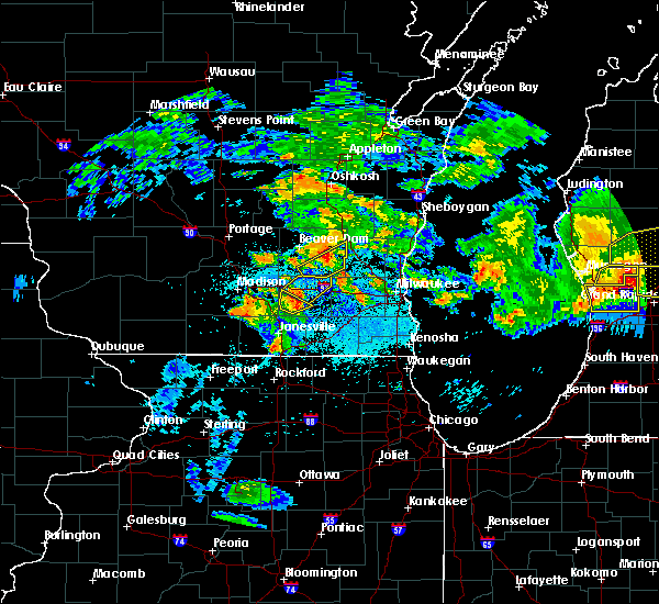 At 919 pm cdt, a severe thunderstorm was located over jefferson, moving northeast at 35 mph (radar indicated). Hazards include 60 mph wind gusts and quarter size hail. Hail damage to vehicles is expected. expect wind damage to roofs, siding, and trees. Locations impacted include, watertown, jefferson, lake mills, johnson creek, ixonia, milford, pipersville, helenville and lake lac la belle. At 919 pm cdt, a severe thunderstorm was located over jefferson, moving northeast at 35 mph (radar indicated). Hazards include 60 mph wind gusts and quarter size hail. Hail damage to vehicles is expected. expect wind damage to roofs, siding, and trees. Locations impacted include, watertown, jefferson, lake mills, johnson creek, ixonia, milford, pipersville, helenville and lake lac la belle.
|
| 8/26/2018 9:10 PM CDT |
 At 910 pm cdt, a severe thunderstorm was located near lake ripley, or near lake mills, moving northeast at 45 mph (radar indicated). Hazards include 60 mph wind gusts and half dollar size hail. Hail damage to vehicles is expected. Expect wind damage to roofs, siding, and trees. At 910 pm cdt, a severe thunderstorm was located near lake ripley, or near lake mills, moving northeast at 45 mph (radar indicated). Hazards include 60 mph wind gusts and half dollar size hail. Hail damage to vehicles is expected. Expect wind damage to roofs, siding, and trees.
|
| 6/15/2018 9:57 AM CDT |
 At 946 am cdt, a severe thunderstorm was located near lac la belle, or near okauchee lake, moving east at 10 mph (radar indicated). Hazards include quarter size hail. Damage to vehicles is expected. Locations impacted include, delafield, okauchee lake, oconomowoc, lac la belle, ixonia, oconomowoc lake, pipersville, mapleton, monterey and lake lac la belle. At 946 am cdt, a severe thunderstorm was located near lac la belle, or near okauchee lake, moving east at 10 mph (radar indicated). Hazards include quarter size hail. Damage to vehicles is expected. Locations impacted include, delafield, okauchee lake, oconomowoc, lac la belle, ixonia, oconomowoc lake, pipersville, mapleton, monterey and lake lac la belle.
|
| 6/15/2018 9:46 AM CDT |
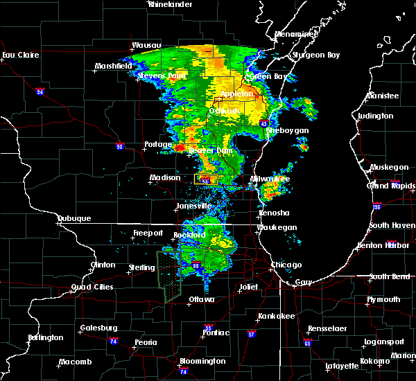 At 946 am cdt, a severe thunderstorm was located near lac la belle, or near okauchee lake, moving east at 10 mph (radar indicated). Hazards include quarter size hail. Damage to vehicles is expected. Locations impacted include, delafield, okauchee lake, oconomowoc, lac la belle, ixonia, oconomowoc lake, pipersville, mapleton, monterey and lake lac la belle. At 946 am cdt, a severe thunderstorm was located near lac la belle, or near okauchee lake, moving east at 10 mph (radar indicated). Hazards include quarter size hail. Damage to vehicles is expected. Locations impacted include, delafield, okauchee lake, oconomowoc, lac la belle, ixonia, oconomowoc lake, pipersville, mapleton, monterey and lake lac la belle.
|
| 6/15/2018 9:22 AM CDT |
 At 922 am cdt, a severe thunderstorm was located near watertown, and is nearly stationary (radar indicated). Hazards include quarter size hail. damage to vehicles is expected At 922 am cdt, a severe thunderstorm was located near watertown, and is nearly stationary (radar indicated). Hazards include quarter size hail. damage to vehicles is expected
|
| 5/27/2018 4:50 PM CDT |
 At 450 pm cdt, a severe thunderstorm was located near merton, or 7 miles south of hartford, moving southeast at 20 mph (radar indicated). Hazards include 60 mph wind gusts and quarter size hail. Hail damage to vehicles is expected. expect wind damage to roofs, siding, and trees. Locations impacted include, waukesha, new berlin, brookfield, menomonee falls, hartford, pewaukee, sussex, hartland, delafield, elm grove, okauchee lake, merton, butler, lannon, lac la belle, richfield, ashippun, nashotah, chenequa and neosho. At 450 pm cdt, a severe thunderstorm was located near merton, or 7 miles south of hartford, moving southeast at 20 mph (radar indicated). Hazards include 60 mph wind gusts and quarter size hail. Hail damage to vehicles is expected. expect wind damage to roofs, siding, and trees. Locations impacted include, waukesha, new berlin, brookfield, menomonee falls, hartford, pewaukee, sussex, hartland, delafield, elm grove, okauchee lake, merton, butler, lannon, lac la belle, richfield, ashippun, nashotah, chenequa and neosho.
|
| 5/27/2018 4:19 PM CDT |
 The national weather service in milwaukee/sullivan has issued a * severe thunderstorm warning for. northern waukesha county in southeastern wisconsin. southern washington county in southeastern wisconsin. northeastern jefferson county in southeastern wisconsin. Southeastern dodge county in southeastern wisconsin. The national weather service in milwaukee/sullivan has issued a * severe thunderstorm warning for. northern waukesha county in southeastern wisconsin. southern washington county in southeastern wisconsin. northeastern jefferson county in southeastern wisconsin. Southeastern dodge county in southeastern wisconsin.
|
| 5/2/2018 8:17 PM CDT |
 At 817 pm cdt, a severe thunderstorm was located near lac la belle, or near okauchee lake, moving east at 25 mph (radar indicated). Hazards include 60 mph wind gusts and quarter size hail. Hail damage to vehicles is expected. Expect wind damage to roofs, siding, and trees. At 817 pm cdt, a severe thunderstorm was located near lac la belle, or near okauchee lake, moving east at 25 mph (radar indicated). Hazards include 60 mph wind gusts and quarter size hail. Hail damage to vehicles is expected. Expect wind damage to roofs, siding, and trees.
|
| 5/2/2018 8:12 PM CDT |
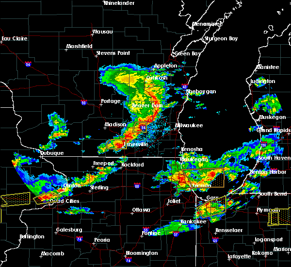 At 812 pm cdt, a severe thunderstorm was located near johnson creek, or near watertown, moving east at 40 mph (radar indicated). Hazards include 60 mph wind gusts and quarter size hail. Hail damage to vehicles is expected. expect wind damage to roofs, siding, and trees. Locations impacted include, watertown, jefferson, johnson creek, ixonia, sullivan, pipersville, helenville and lake lac la belle. At 812 pm cdt, a severe thunderstorm was located near johnson creek, or near watertown, moving east at 40 mph (radar indicated). Hazards include 60 mph wind gusts and quarter size hail. Hail damage to vehicles is expected. expect wind damage to roofs, siding, and trees. Locations impacted include, watertown, jefferson, johnson creek, ixonia, sullivan, pipersville, helenville and lake lac la belle.
|
| 5/2/2018 8:00 PM CDT |
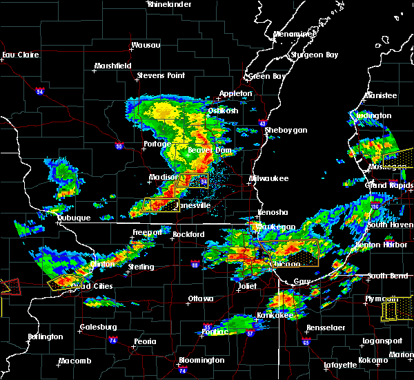 At 800 pm cdt, a severe thunderstorm was located near lake mills, moving east at 40 mph (radar indicated). Hazards include 60 mph wind gusts and quarter size hail. Hail damage to vehicles is expected. expect wind damage to roofs, siding, and trees. Locations impacted include, watertown, jefferson, lake mills, johnson creek, ixonia, milford, sullivan, pipersville, hubbleton, helenville and lake lac la belle. At 800 pm cdt, a severe thunderstorm was located near lake mills, moving east at 40 mph (radar indicated). Hazards include 60 mph wind gusts and quarter size hail. Hail damage to vehicles is expected. expect wind damage to roofs, siding, and trees. Locations impacted include, watertown, jefferson, lake mills, johnson creek, ixonia, milford, sullivan, pipersville, hubbleton, helenville and lake lac la belle.
|
| 5/2/2018 7:48 PM CDT |
 At 748 pm cdt, a severe thunderstorm was located near marshall, moving east at 40 mph (radar indicated). Hazards include 60 mph wind gusts and quarter size hail. Hail damage to vehicles is expected. Expect wind damage to roofs, siding, and trees. At 748 pm cdt, a severe thunderstorm was located near marshall, moving east at 40 mph (radar indicated). Hazards include 60 mph wind gusts and quarter size hail. Hail damage to vehicles is expected. Expect wind damage to roofs, siding, and trees.
|
| 7/19/2017 7:53 PM CDT |
 At 752 pm cdt, a severe thunderstorm was located over evansville, moving east at 45 mph (radar indicated). Hazards include 60 mph wind gusts. expect damage to roofs, siding, and trees At 752 pm cdt, a severe thunderstorm was located over evansville, moving east at 45 mph (radar indicated). Hazards include 60 mph wind gusts. expect damage to roofs, siding, and trees
|
| 7/15/2017 11:54 PM CDT |
 The severe thunderstorm warning for milwaukee, waukesha and eastern jefferson counties will expire at midnight cdt, the storms which prompted the warning have weakened. therefore, the warning will be allowed to expire. however gusty winds and heavy rain are still possible with these thunderstorms. a severe thunderstorm watch remains in effect until 100 am cdt for southeastern wisconsin. The severe thunderstorm warning for milwaukee, waukesha and eastern jefferson counties will expire at midnight cdt, the storms which prompted the warning have weakened. therefore, the warning will be allowed to expire. however gusty winds and heavy rain are still possible with these thunderstorms. a severe thunderstorm watch remains in effect until 100 am cdt for southeastern wisconsin.
|
| 7/15/2017 11:44 PM CDT |
 At 1143 pm cdt, severe thunderstorms were located along a line extending from near oconomowoc to west allis, moving southeast at 30 mph (radar indicated). Hazards include 60 mph wind gusts and quarter size hail. Hail damage to vehicles is expected. expect wind damage to roofs, siding, and trees. locations impacted include, milwaukee, waukesha, west allis, wauwatosa, new berlin, brookfield, greenfield, menomonee falls, oak creek, muskego, watertown, south milwaukee, cudahy, greendale, pewaukee, sussex, st. Francis, hartland, hales corners and mukwonago. At 1143 pm cdt, severe thunderstorms were located along a line extending from near oconomowoc to west allis, moving southeast at 30 mph (radar indicated). Hazards include 60 mph wind gusts and quarter size hail. Hail damage to vehicles is expected. expect wind damage to roofs, siding, and trees. locations impacted include, milwaukee, waukesha, west allis, wauwatosa, new berlin, brookfield, greenfield, menomonee falls, oak creek, muskego, watertown, south milwaukee, cudahy, greendale, pewaukee, sussex, st. Francis, hartland, hales corners and mukwonago.
|
| 7/15/2017 11:31 PM CDT |
 At 1131 pm cdt, severe thunderstorms were located along a line extending from lac la belle to brookfield, moving southeast at 30 mph (radar indicated). Hazards include golf ball size hail and 60 mph wind gusts. People and animals outdoors will be injured. expect hail damage to roofs, siding, windows, and vehicles. expect wind damage to roofs, siding, and trees. locations impacted include, milwaukee, waukesha, west allis, wauwatosa, new berlin, brookfield, greenfield, menomonee falls, oak creek, muskego, watertown, south milwaukee, cudahy, whitefish bay, greendale, pewaukee, brown deer, sussex, st. Francis and hartland. At 1131 pm cdt, severe thunderstorms were located along a line extending from lac la belle to brookfield, moving southeast at 30 mph (radar indicated). Hazards include golf ball size hail and 60 mph wind gusts. People and animals outdoors will be injured. expect hail damage to roofs, siding, windows, and vehicles. expect wind damage to roofs, siding, and trees. locations impacted include, milwaukee, waukesha, west allis, wauwatosa, new berlin, brookfield, greenfield, menomonee falls, oak creek, muskego, watertown, south milwaukee, cudahy, whitefish bay, greendale, pewaukee, brown deer, sussex, st. Francis and hartland.
|
| 7/15/2017 11:20 PM CDT |
 At 1120 pm cdt, severe thunderstorms were located along a line extending from 6 miles northeast of watertown to lannon, moving southeast at 30 mph (radar indicated). Hazards include 60 mph wind gusts and quarter size hail. Hail damage to vehicles is expected. Expect wind damage to roofs, siding, and trees. At 1120 pm cdt, severe thunderstorms were located along a line extending from 6 miles northeast of watertown to lannon, moving southeast at 30 mph (radar indicated). Hazards include 60 mph wind gusts and quarter size hail. Hail damage to vehicles is expected. Expect wind damage to roofs, siding, and trees.
|
| 7/6/2017 11:41 PM CDT |
 The severe thunderstorm warning for northwestern waukesha, southwestern washington, northeastern jefferson and southeastern dodge counties will expire at 1145 pm cdt, the storm which prompted the warning has weakened below severe limits, and no longer poses an immediate threat to life or property. therefore the warning will be allowed to expire. however gusty winds are still possible with this thunderstorm. The severe thunderstorm warning for northwestern waukesha, southwestern washington, northeastern jefferson and southeastern dodge counties will expire at 1145 pm cdt, the storm which prompted the warning has weakened below severe limits, and no longer poses an immediate threat to life or property. therefore the warning will be allowed to expire. however gusty winds are still possible with this thunderstorm.
|
| 7/6/2017 11:29 PM CDT |
 At 1129 pm cdt, a severe thunderstorm was located over okauchee lake, moving southeast at 35 mph (radar indicated). Hazards include 60 mph wind gusts. Expect damage to roofs, siding, and trees. Locations impacted include, hartford, hartland, delafield, jackson, slinger, wales, okauchee lake, oconomowoc, merton, lac la belle, nashotah, oconomowoc lake, chenequa, mapleton, stone bank, north lake, holy hill, saint lawrence, lapham peak st park and monterey. At 1129 pm cdt, a severe thunderstorm was located over okauchee lake, moving southeast at 35 mph (radar indicated). Hazards include 60 mph wind gusts. Expect damage to roofs, siding, and trees. Locations impacted include, hartford, hartland, delafield, jackson, slinger, wales, okauchee lake, oconomowoc, merton, lac la belle, nashotah, oconomowoc lake, chenequa, mapleton, stone bank, north lake, holy hill, saint lawrence, lapham peak st park and monterey.
|
| 7/6/2017 11:22 PM CDT |
 At 1122 pm cdt, a severe thunderstorm was located over lac la belle, or near okauchee lake, moving southeast at 35 mph (radar indicated). Hazards include 60 mph wind gusts. Expect damage to roofs, siding, and trees. Locations impacted include, hartford, hartland, delafield, jackson, slinger, wales, okauchee lake, oconomowoc, merton, lac la belle, ixonia, ashippun, rubicon, nashotah, oconomowoc lake, chenequa, neosho, mapleton, stone bank and north lake. At 1122 pm cdt, a severe thunderstorm was located over lac la belle, or near okauchee lake, moving southeast at 35 mph (radar indicated). Hazards include 60 mph wind gusts. Expect damage to roofs, siding, and trees. Locations impacted include, hartford, hartland, delafield, jackson, slinger, wales, okauchee lake, oconomowoc, merton, lac la belle, ixonia, ashippun, rubicon, nashotah, oconomowoc lake, chenequa, neosho, mapleton, stone bank and north lake.
|
| 7/6/2017 11:13 PM CDT |
 At 1113 pm cdt, a severe thunderstorm was located near watertown, moving southeast at 35 mph (radar indicated). Hazards include 60 mph wind gusts. expect damage to roofs, siding, and trees At 1113 pm cdt, a severe thunderstorm was located near watertown, moving southeast at 35 mph (radar indicated). Hazards include 60 mph wind gusts. expect damage to roofs, siding, and trees
|
| 6/28/2017 3:05 PM CDT |
 The severe thunderstorm warning for jefferson county will expire at 815 pm cdt, the storms which prompted the warning have weakened below severe limits, and have exited the warned area. therefore the warning will be allowed to expire. however heavy rain is still possible with these thunderstorms. a tornado watch remains in effect until 1000 pm cdt for southeastern wisconsin. The severe thunderstorm warning for jefferson county will expire at 815 pm cdt, the storms which prompted the warning have weakened below severe limits, and have exited the warned area. therefore the warning will be allowed to expire. however heavy rain is still possible with these thunderstorms. a tornado watch remains in effect until 1000 pm cdt for southeastern wisconsin.
|
| 6/28/2017 2:58 PM CDT |
 At 757 pm cdt, severe thunderstorms were located along a line extending from near oconomowoc to near palmyra to near fort atkinson, moving southeast at 35 mph (radar indicated). Hazards include 60 mph wind gusts and penny size hail. Expect damage to roofs, siding, and trees. locations impacted include, watertown, whitewater, fort atkinson, jefferson, johnson creek, palmyra, lake koshkonong, ixonia, rome, hebron, sullivan, pipersville, helenville, nws milwaukee/sullivan and lake lac la belle. A tornado watch remains in effect until 1000 pm cdt for southeastern wisconsin. At 757 pm cdt, severe thunderstorms were located along a line extending from near oconomowoc to near palmyra to near fort atkinson, moving southeast at 35 mph (radar indicated). Hazards include 60 mph wind gusts and penny size hail. Expect damage to roofs, siding, and trees. locations impacted include, watertown, whitewater, fort atkinson, jefferson, johnson creek, palmyra, lake koshkonong, ixonia, rome, hebron, sullivan, pipersville, helenville, nws milwaukee/sullivan and lake lac la belle. A tornado watch remains in effect until 1000 pm cdt for southeastern wisconsin.
|
| 6/28/2017 2:45 PM CDT |
 At 745 pm cdt, severe thunderstorms were located along a line extending from near watertown to near whitewater, moving southeast at 55 mph (radar indicated). Hazards include 60 mph wind gusts and penny size hail. expect damage to roofs, siding, and trees At 745 pm cdt, severe thunderstorms were located along a line extending from near watertown to near whitewater, moving southeast at 55 mph (radar indicated). Hazards include 60 mph wind gusts and penny size hail. expect damage to roofs, siding, and trees
|
| 6/28/2017 2:43 PM CDT |
 At 742 pm cdt, severe thunderstorms were located along a line extending from near watertown to 6 miles southeast of johnson creek to lake koshkonong, moving east at 55 mph (radar indicated). Hazards include 60 mph wind gusts and penny size hail. Expect damage to roofs, siding, and trees. locations impacted include, watertown, whitewater, fort atkinson, jefferson, lake mills, edgerton, waterloo, johnson creek, deerfield, palmyra, cambridge, lake ripley, lake koshkonong, ixonia, rome, albion, milford, hebron, sullivan and utica. A tornado watch remains in effect until 1000 pm cdt for south central and southeastern wisconsin. At 742 pm cdt, severe thunderstorms were located along a line extending from near watertown to 6 miles southeast of johnson creek to lake koshkonong, moving east at 55 mph (radar indicated). Hazards include 60 mph wind gusts and penny size hail. Expect damage to roofs, siding, and trees. locations impacted include, watertown, whitewater, fort atkinson, jefferson, lake mills, edgerton, waterloo, johnson creek, deerfield, palmyra, cambridge, lake ripley, lake koshkonong, ixonia, rome, albion, milford, hebron, sullivan and utica. A tornado watch remains in effect until 1000 pm cdt for south central and southeastern wisconsin.
|
| 6/28/2017 2:30 PM CDT |
 At 729 pm cdt, severe thunderstorms were located along a line extending from near waterloo to lake mills to near stoughton, moving east at 55 mph (radar indicated). Hazards include 60 mph wind gusts and penny size hail. Expect damage to roofs, siding, and trees. locations impacted include, watertown, whitewater, stoughton, fort atkinson, jefferson, lake mills, edgerton, marshall, waterloo, cottage grove, johnson creek, deerfield, palmyra, cambridge, brooklyn, lake ripley, lake koshkonong, ixonia, rome and albion. A tornado watch remains in effect until 1000 pm cdt for south central and southeastern wisconsin. At 729 pm cdt, severe thunderstorms were located along a line extending from near waterloo to lake mills to near stoughton, moving east at 55 mph (radar indicated). Hazards include 60 mph wind gusts and penny size hail. Expect damage to roofs, siding, and trees. locations impacted include, watertown, whitewater, stoughton, fort atkinson, jefferson, lake mills, edgerton, marshall, waterloo, cottage grove, johnson creek, deerfield, palmyra, cambridge, brooklyn, lake ripley, lake koshkonong, ixonia, rome and albion. A tornado watch remains in effect until 1000 pm cdt for south central and southeastern wisconsin.
|
| 6/28/2017 2:21 PM CDT |
 At 720 pm cdt, severe thunderstorms were located along a line extending from near waterloo to near deerfield to near brooklyn, moving east at 55 mph (radar indicated). Hazards include 60 mph wind gusts and penny size hail. Expect damage to roofs, siding, and trees. locations impacted include, madison, sun prairie, fitchburg, watertown, whitewater, stoughton, fort atkinson, waunakee, verona, oregon, jefferson, mcfarland, monona, windsor, lake mills, edgerton, marshall, waterloo, deforest and cottage grove. People attending concerts on the square in madison should seek safe shelter immediately! a tornado watch remains in effect until 1000 pm cdt for south central and southeastern wisconsin. At 720 pm cdt, severe thunderstorms were located along a line extending from near waterloo to near deerfield to near brooklyn, moving east at 55 mph (radar indicated). Hazards include 60 mph wind gusts and penny size hail. Expect damage to roofs, siding, and trees. locations impacted include, madison, sun prairie, fitchburg, watertown, whitewater, stoughton, fort atkinson, waunakee, verona, oregon, jefferson, mcfarland, monona, windsor, lake mills, edgerton, marshall, waterloo, deforest and cottage grove. People attending concerts on the square in madison should seek safe shelter immediately! a tornado watch remains in effect until 1000 pm cdt for south central and southeastern wisconsin.
|
| 6/28/2017 2:08 PM CDT |
 At 708 pm cdt, severe thunderstorms were located along a line extending from 6 miles southwest of columbus to near brooklyn, moving southeast at 50 mph (radar indicated). Hazards include 60 mph wind gusts and penny size hail. expect damage to roofs, siding, and trees At 708 pm cdt, severe thunderstorms were located along a line extending from 6 miles southwest of columbus to near brooklyn, moving southeast at 50 mph (radar indicated). Hazards include 60 mph wind gusts and penny size hail. expect damage to roofs, siding, and trees
|
| 6/28/2017 1:55 PM CDT |
 At 655 pm cdt, severe thunderstorms were located along a line extending from near cedarburg to near mequon to sussex, moving east at 50 mph (radar indicated). Hazards include 60 mph wind gusts and penny size hail. Expect damage to roofs, siding, and trees. locations impacted include, milwaukee, wauwatosa, brookfield, menomonee falls, mequon, whitefish bay, pewaukee, brown deer, grafton, cedarburg, sussex, hartland, delafield, jackson, fox point, elm grove, slinger, bayside, thiensville and okauchee lake. A tornado watch remains in effect until 1000 pm cdt for southeastern wisconsin. At 655 pm cdt, severe thunderstorms were located along a line extending from near cedarburg to near mequon to sussex, moving east at 50 mph (radar indicated). Hazards include 60 mph wind gusts and penny size hail. Expect damage to roofs, siding, and trees. locations impacted include, milwaukee, wauwatosa, brookfield, menomonee falls, mequon, whitefish bay, pewaukee, brown deer, grafton, cedarburg, sussex, hartland, delafield, jackson, fox point, elm grove, slinger, bayside, thiensville and okauchee lake. A tornado watch remains in effect until 1000 pm cdt for southeastern wisconsin.
|
| 6/28/2017 1:45 PM CDT |
 At 645 pm cdt, severe thunderstorms were located along a line extending from jackson to merton, moving east at 50 mph (radar indicated). Hazards include 60 mph wind gusts and penny size hail. expect damage to roofs, siding, and trees At 645 pm cdt, severe thunderstorms were located along a line extending from jackson to merton, moving east at 50 mph (radar indicated). Hazards include 60 mph wind gusts and penny size hail. expect damage to roofs, siding, and trees
|
| 5/17/2017 9:37 PM CDT |
 At 937 pm cdt, severe thunderstorms were located along a line extending from near watertown to near milton to near durand, moving east at 40 mph (radar indicated). Hazards include 60 mph wind gusts. Expect damage to roofs, siding, and trees. locations impacted include, janesville, beloit, watertown, whitewater, stoughton, fort atkinson, elkhorn, hartland, delavan, jefferson, delafield, lake mills, milton, edgerton, evansville, waterloo, brodhead, wales, okauchee lake and oconomowoc. A tornado watch remains in effect until 100 am cdt for south central and southeastern wisconsin. At 937 pm cdt, severe thunderstorms were located along a line extending from near watertown to near milton to near durand, moving east at 40 mph (radar indicated). Hazards include 60 mph wind gusts. Expect damage to roofs, siding, and trees. locations impacted include, janesville, beloit, watertown, whitewater, stoughton, fort atkinson, elkhorn, hartland, delavan, jefferson, delafield, lake mills, milton, edgerton, evansville, waterloo, brodhead, wales, okauchee lake and oconomowoc. A tornado watch remains in effect until 100 am cdt for south central and southeastern wisconsin.
|
| 5/17/2017 9:25 PM CDT |
 At 924 pm cdt, severe thunderstorms were located along a line extending from near waterloo to near edgerton to near rock city, moving east at 40 mph (radar indicated). Hazards include 60 mph wind gusts and penny size hail. expect damage to roofs, siding, and trees At 924 pm cdt, severe thunderstorms were located along a line extending from near waterloo to near edgerton to near rock city, moving east at 40 mph (radar indicated). Hazards include 60 mph wind gusts and penny size hail. expect damage to roofs, siding, and trees
|
| 5/17/2017 7:39 PM CDT |
 The severe thunderstorm warning for northwestern waukesha, southwestern washington and southeastern dodge counties will expire at 745 pm cdt, the storm which prompted the warning has weakened below severe limits and is exiting the warned area. therefore, the warning will be allowed to expire. a tornado watch remains in effect until 1100 pm cdt for southeastern wisconsin. The severe thunderstorm warning for northwestern waukesha, southwestern washington and southeastern dodge counties will expire at 745 pm cdt, the storm which prompted the warning has weakened below severe limits and is exiting the warned area. therefore, the warning will be allowed to expire. a tornado watch remains in effect until 1100 pm cdt for southeastern wisconsin.
|
| 5/17/2017 7:32 PM CDT |
 At 731 pm cdt, a severe thunderstorm was located near merton, or near hartland, moving northeast at 55 mph (trained weather spotters). Hazards include 70 mph wind gusts and quarter size hail. Hail damage to vehicles is expected. expect considerable tree damage. wind damage is also likely to mobile homes, roofs, and outbuildings. locations impacted include, menomonee falls, hartford, pewaukee, sussex, hartland, delafield, okauchee lake, oconomowoc, merton, lannon, lac la belle, ashippun, nashotah, oconomowoc lake, chenequa, colgate, mapleton, stone bank, north lake and holy hill. A tornado watch remains in effect until 1100 pm cdt for southeastern wisconsin. At 731 pm cdt, a severe thunderstorm was located near merton, or near hartland, moving northeast at 55 mph (trained weather spotters). Hazards include 70 mph wind gusts and quarter size hail. Hail damage to vehicles is expected. expect considerable tree damage. wind damage is also likely to mobile homes, roofs, and outbuildings. locations impacted include, menomonee falls, hartford, pewaukee, sussex, hartland, delafield, okauchee lake, oconomowoc, merton, lannon, lac la belle, ashippun, nashotah, oconomowoc lake, chenequa, colgate, mapleton, stone bank, north lake and holy hill. A tornado watch remains in effect until 1100 pm cdt for southeastern wisconsin.
|
| 5/17/2017 7:18 PM CDT |
 At 718 pm cdt, a severe thunderstorm was located over dousman, or near delafield, moving northeast at 55 mph (trained weather spotters). Hazards include 70 mph wind gusts and quarter size hail. Hail damage to vehicles is expected. expect considerable tree damage. wind damage is also likely to mobile homes, roofs, and outbuildings. locations impacted include, menomonee falls, hartford, pewaukee, sussex, hartland, delafield, wales, okauchee lake, oconomowoc, merton, dousman, lannon, lac la belle, ixonia, rome, ashippun, nashotah, sullivan, oconomowoc lake and chenequa. A tornado watch remains in effect until 1100 pm cdt for southeastern wisconsin. At 718 pm cdt, a severe thunderstorm was located over dousman, or near delafield, moving northeast at 55 mph (trained weather spotters). Hazards include 70 mph wind gusts and quarter size hail. Hail damage to vehicles is expected. expect considerable tree damage. wind damage is also likely to mobile homes, roofs, and outbuildings. locations impacted include, menomonee falls, hartford, pewaukee, sussex, hartland, delafield, wales, okauchee lake, oconomowoc, merton, dousman, lannon, lac la belle, ixonia, rome, ashippun, nashotah, sullivan, oconomowoc lake and chenequa. A tornado watch remains in effect until 1100 pm cdt for southeastern wisconsin.
|
| 5/17/2017 7:11 PM CDT |
 At 710 pm cdt, a severe thunderstorm was located near palmyra, or 10 miles east of jefferson, moving northeast at 55 mph (radar indicated). Hazards include 70 mph wind gusts and quarter size hail. Hail damage to vehicles is expected. expect considerable tree damage. Wind damage is also likely to mobile homes, roofs, and outbuildings. At 710 pm cdt, a severe thunderstorm was located near palmyra, or 10 miles east of jefferson, moving northeast at 55 mph (radar indicated). Hazards include 70 mph wind gusts and quarter size hail. Hail damage to vehicles is expected. expect considerable tree damage. Wind damage is also likely to mobile homes, roofs, and outbuildings.
|
| 5/15/2017 10:39 PM CDT |
 The severe thunderstorm warning for walworth, western waukesha and jefferson counties will expire at 1045 pm cdt, the storms which prompted the warning are moving out of the area. therefore the warning will be allowed to expire. a severe thunderstorm watch remains in effect until 200 am cdt for south central and southeastern wisconsin. The severe thunderstorm warning for walworth, western waukesha and jefferson counties will expire at 1045 pm cdt, the storms which prompted the warning are moving out of the area. therefore the warning will be allowed to expire. a severe thunderstorm watch remains in effect until 200 am cdt for south central and southeastern wisconsin.
|
| 5/15/2017 10:26 PM CDT |
 At 1026 pm cdt, severe thunderstorms were located along a line extending from near lac la belle to near dousman to near fontana-on-geneva lake, moving east at 50 mph (trained weather spotters. a wind gust of 57 mph was measured at the national weather service in sullivan). Hazards include 60 mph wind gusts. Expect damage to roofs, siding, and trees. Locations impacted include, watertown, whitewater, fort atkinson, elkhorn, hartland, delavan, jefferson, lake geneva, mukwonago, delafield, lake mills, east troy, waterloo, williams bay, wales, okauchee lake, oconomowoc, merton, genoa city and walworth. At 1026 pm cdt, severe thunderstorms were located along a line extending from near lac la belle to near dousman to near fontana-on-geneva lake, moving east at 50 mph (trained weather spotters. a wind gust of 57 mph was measured at the national weather service in sullivan). Hazards include 60 mph wind gusts. Expect damage to roofs, siding, and trees. Locations impacted include, watertown, whitewater, fort atkinson, elkhorn, hartland, delavan, jefferson, lake geneva, mukwonago, delafield, lake mills, east troy, waterloo, williams bay, wales, okauchee lake, oconomowoc, merton, genoa city and walworth.
|
| 5/15/2017 10:07 PM CDT |
 At 1007 pm cdt, severe thunderstorms were located along a line extending from near waterloo to near sharon, moving east at 55 mph (radar indicated). Hazards include 60 mph wind gusts. expect damage to roofs, siding, and trees At 1007 pm cdt, severe thunderstorms were located along a line extending from near waterloo to near sharon, moving east at 55 mph (radar indicated). Hazards include 60 mph wind gusts. expect damage to roofs, siding, and trees
|
| 3/7/2017 12:28 AM CST |
 At 1227 am cst, severe thunderstorms were located along a line extending from near merton to near hebron, moving east at 55 mph (radar indicated). Hazards include 60 mph wind gusts and penny size hail. expect damage to roofs, siding, and trees At 1227 am cst, severe thunderstorms were located along a line extending from near merton to near hebron, moving east at 55 mph (radar indicated). Hazards include 60 mph wind gusts and penny size hail. expect damage to roofs, siding, and trees
|
| 9/25/2016 3:42 PM CDT |
 The severe thunderstorm warning for northeastern jefferson and northwestern waukesha counties will expire at 345 pm cdt, the storm which prompted the warning has weakened below severe limits, and no longer poses an immediate threat to life or property. therefore, the warning will be allowed to expire. however gusty winds up to 50 mph are still possible with this thunderstorm. The severe thunderstorm warning for northeastern jefferson and northwestern waukesha counties will expire at 345 pm cdt, the storm which prompted the warning has weakened below severe limits, and no longer poses an immediate threat to life or property. therefore, the warning will be allowed to expire. however gusty winds up to 50 mph are still possible with this thunderstorm.
|
| 9/25/2016 3:28 PM CDT |
 At 328 pm cdt, a severe thunderstorm was located near dousman, or 7 miles west of delafield, moving northeast at 35 mph (radar indicated). Hazards include 60 mph wind gusts. Expect damage to roofs. siding. and trees. Locations impacted include, hartland, delafield, wales, okauchee lake, oconomowoc, dousman, lac la belle, ixonia, nashotah, oconomowoc lake, chenequa, mapleton, lapham peak st park, monterey, lake lac la belle and stone bank. At 328 pm cdt, a severe thunderstorm was located near dousman, or 7 miles west of delafield, moving northeast at 35 mph (radar indicated). Hazards include 60 mph wind gusts. Expect damage to roofs. siding. and trees. Locations impacted include, hartland, delafield, wales, okauchee lake, oconomowoc, dousman, lac la belle, ixonia, nashotah, oconomowoc lake, chenequa, mapleton, lapham peak st park, monterey, lake lac la belle and stone bank.
|
| 9/25/2016 3:23 PM CDT |
 At 323 pm cdt, a severe thunderstorm was located near dousman, or 10 miles west of wales, moving northeast at 35 mph (radar indicated). Hazards include 60 mph wind gusts. Expect damage to roofs. siding. and trees. Locations impacted include, hartland, delafield, wales, okauchee lake, oconomowoc, dousman, lac la belle, ixonia, rome, nashotah, sullivan, oconomowoc lake, chenequa, mapleton, lapham peak st park, monterey, lake lac la belle, helenville, nws milwaukee/sullivan and stone bank. At 323 pm cdt, a severe thunderstorm was located near dousman, or 10 miles west of wales, moving northeast at 35 mph (radar indicated). Hazards include 60 mph wind gusts. Expect damage to roofs. siding. and trees. Locations impacted include, hartland, delafield, wales, okauchee lake, oconomowoc, dousman, lac la belle, ixonia, rome, nashotah, sullivan, oconomowoc lake, chenequa, mapleton, lapham peak st park, monterey, lake lac la belle, helenville, nws milwaukee/sullivan and stone bank.
|
| 9/25/2016 3:18 PM CDT |
 At 317 pm cdt, a severe thunderstorm was located 7 miles north of palmyra, or 8 miles east of jefferson, moving northeast at 35 mph (public). Hazards include 60 mph wind gusts. Expect damage to roofs. siding. and trees. Locations impacted include, pewaukee, hartland, delafield, wales, okauchee lake, oconomowoc, dousman, lac la belle, ixonia, rome, nashotah, hebron, sullivan, oconomowoc lake, chenequa, mapleton, lapham peak st park, monterey, lake lac la belle and helenville. At 317 pm cdt, a severe thunderstorm was located 7 miles north of palmyra, or 8 miles east of jefferson, moving northeast at 35 mph (public). Hazards include 60 mph wind gusts. Expect damage to roofs. siding. and trees. Locations impacted include, pewaukee, hartland, delafield, wales, okauchee lake, oconomowoc, dousman, lac la belle, ixonia, rome, nashotah, hebron, sullivan, oconomowoc lake, chenequa, mapleton, lapham peak st park, monterey, lake lac la belle and helenville.
|
| 9/25/2016 3:11 PM CDT |
 At 310 pm cdt, a severe thunderstorm was located near fort atkinson, moving northeast at 35 mph. trees and branches were reported down with this storm in milton and near lake koshkonong (public reported). Hazards include 60 mph wind gusts. Expect damage to roofs. siding. And trees. At 310 pm cdt, a severe thunderstorm was located near fort atkinson, moving northeast at 35 mph. trees and branches were reported down with this storm in milton and near lake koshkonong (public reported). Hazards include 60 mph wind gusts. Expect damage to roofs. siding. And trees.
|
| 7/21/2016 6:37 PM CDT |
 At 637 pm cdt, a severe thunderstorm was located near potter lake, or near east troy, moving southeast at 40 mph (law enforcement). Hazards include 60 mph wind gusts. Expect damage to roofs. siding. and trees. locations impacted include, waukesha, new berlin, brookfield, menomonee falls, muskego, whitewater, hartford, pewaukee, sussex, elkhorn, hartland, delavan, mukwonago, delafield, jackson, elm grove, slinger, east troy, wales and okauchee lake. People attending the waukesha county fair should seek safe shelter immediately!. At 637 pm cdt, a severe thunderstorm was located near potter lake, or near east troy, moving southeast at 40 mph (law enforcement). Hazards include 60 mph wind gusts. Expect damage to roofs. siding. and trees. locations impacted include, waukesha, new berlin, brookfield, menomonee falls, muskego, whitewater, hartford, pewaukee, sussex, elkhorn, hartland, delavan, mukwonago, delafield, jackson, elm grove, slinger, east troy, wales and okauchee lake. People attending the waukesha county fair should seek safe shelter immediately!.
|
| 7/21/2016 6:08 PM CDT |
 At 607 pm cdt, a severe thunderstorm was located near dousman, or 8 miles west of wales, moving southeast at 40 mph (radar indicated). Hazards include 70 mph wind gusts. Expect considerable tree damage. Damage is likely to mobile homes, roofs, and outbuildings. At 607 pm cdt, a severe thunderstorm was located near dousman, or 8 miles west of wales, moving southeast at 40 mph (radar indicated). Hazards include 70 mph wind gusts. Expect considerable tree damage. Damage is likely to mobile homes, roofs, and outbuildings.
|
| 7/21/2016 5:55 PM CDT |
 At 553 pm cdt, a severe thunderstorm was located over lac la belle, or near okauchee lake, moving southeast at 50 mph (law enforcement). Hazards include 70 mph wind gusts. Expect considerable tree damage. damage is likely to mobile homes, roofs, and outbuildings. Locations impacted include, waterloo, watertown, whitewater, hartford, fort atkinson, jefferson, delafield, lake mills, okauchee lake, oconomowoc, johnson creek, dousman, palmyra, lac la belle, lake ripley, lake koshkonong, ixonia, rome, ashippun, rubicon and lebanon. At 553 pm cdt, a severe thunderstorm was located over lac la belle, or near okauchee lake, moving southeast at 50 mph (law enforcement). Hazards include 70 mph wind gusts. Expect considerable tree damage. damage is likely to mobile homes, roofs, and outbuildings. Locations impacted include, waterloo, watertown, whitewater, hartford, fort atkinson, jefferson, delafield, lake mills, okauchee lake, oconomowoc, johnson creek, dousman, palmyra, lac la belle, lake ripley, lake koshkonong, ixonia, rome, ashippun, rubicon and lebanon.
|
| 7/21/2016 5:30 PM CDT |
 At 530 pm cdt, a severe thunderstorm was located 8 miles southeast of columbus, moving southeast at 50 mph (radar indicated). Hazards include 70 mph wind gusts. Expect considerable tree damage. Damage is likely to mobile homes, roofs, and outbuildings. At 530 pm cdt, a severe thunderstorm was located 8 miles southeast of columbus, moving southeast at 50 mph (radar indicated). Hazards include 70 mph wind gusts. Expect considerable tree damage. Damage is likely to mobile homes, roofs, and outbuildings.
|
| 7/6/2016 12:43 AM CDT |
 At 1241 am cdt, severe thunderstorms were located along a line extending from 6 miles south of juneau to near evansville, moving east at 55 mph (radar indicated). Hazards include 60 mph wind gusts. Expect damage to roofs. siding. and trees. Locations impacted include, watertown, whitewater, fort atkinson, jefferson, lake mills, edgerton, waterloo, johnson creek, deerfield, palmyra, cambridge, lake koshkonong, lake ripley, ixonia, rome, albion, milford, hebron, sullivan and utica. At 1241 am cdt, severe thunderstorms were located along a line extending from 6 miles south of juneau to near evansville, moving east at 55 mph (radar indicated). Hazards include 60 mph wind gusts. Expect damage to roofs. siding. and trees. Locations impacted include, watertown, whitewater, fort atkinson, jefferson, lake mills, edgerton, waterloo, johnson creek, deerfield, palmyra, cambridge, lake koshkonong, lake ripley, ixonia, rome, albion, milford, hebron, sullivan and utica.
|
| 7/6/2016 12:36 AM CDT |
 At 1235 am cdt, a severe thunderstorm was located near deerfield, or near lake mills, moving east at 50 mph (radar indicated). Hazards include 60 mph wind gusts. Expect damage to roofs. siding. And trees. At 1235 am cdt, a severe thunderstorm was located near deerfield, or near lake mills, moving east at 50 mph (radar indicated). Hazards include 60 mph wind gusts. Expect damage to roofs. siding. And trees.
|
| 6/5/2016 7:00 PM CDT |
 At 659 pm cdt, a severe thunderstorms was located near sullivan, moving southeast at 45 mph. this storm has a history of producing widespread damaging winds. seek shelter now!! (radar indicated). Hazards include 70 mph wind gusts. Expect considerable tree damage. damage is likely to mobile homes, roofs, and outbuildings. Locations impacted include, waukesha, new berlin, whitewater, fort atkinson, mukwonago, delafield, wales, oconomowoc, dousman, north prairie, palmyra, big bend, lac la belle, potter lake, lake koshkonong, richmond, rome, la grange, eagle and hebron. At 659 pm cdt, a severe thunderstorms was located near sullivan, moving southeast at 45 mph. this storm has a history of producing widespread damaging winds. seek shelter now!! (radar indicated). Hazards include 70 mph wind gusts. Expect considerable tree damage. damage is likely to mobile homes, roofs, and outbuildings. Locations impacted include, waukesha, new berlin, whitewater, fort atkinson, mukwonago, delafield, wales, oconomowoc, dousman, north prairie, palmyra, big bend, lac la belle, potter lake, lake koshkonong, richmond, rome, la grange, eagle and hebron.
|
| 6/5/2016 6:48 PM CDT |
 At 648 pm cdt, severe thunderstorms were located along a line extending from near watertown to near lake mills, moving southeast at 45 mph (radar indicated). Hazards include 70 mph wind gusts. Expect considerable tree damage. damage is likely to mobile homes, roofs, and outbuildings. severe thunderstorms will be near, lac la belle around 655 pm cdt. delafield and oconomowoc around 700 pm cdt. dousman around 705 pm cdt. whitewater, wales, north prairie and palmyra around 710 pm cdt. mukwonago around 720 pm cdt. big bend and potter lake around 725 pm cdt. Other locations impacted by these severe thunderstorms include millard, ixonia, eagle, hebron, johnstown center, richmond, pipersville, tibbets, oconomowoc lake and milford. At 648 pm cdt, severe thunderstorms were located along a line extending from near watertown to near lake mills, moving southeast at 45 mph (radar indicated). Hazards include 70 mph wind gusts. Expect considerable tree damage. damage is likely to mobile homes, roofs, and outbuildings. severe thunderstorms will be near, lac la belle around 655 pm cdt. delafield and oconomowoc around 700 pm cdt. dousman around 705 pm cdt. whitewater, wales, north prairie and palmyra around 710 pm cdt. mukwonago around 720 pm cdt. big bend and potter lake around 725 pm cdt. Other locations impacted by these severe thunderstorms include millard, ixonia, eagle, hebron, johnstown center, richmond, pipersville, tibbets, oconomowoc lake and milford.
|
| 8/14/2015 7:48 PM CDT |
 At 748 pm cdt, a severe thunderstorm was located over north prairie, or near mukwonago, moving south at 20 mph (radar indicated). Hazards include 60 mph wind gusts and penny size hail. Expect damage to roofs. siding and trees. Locations impacted include, waukesha, new berlin, brookfield, menomonee falls, muskego, pewaukee, sussex, hartland, delafield, elm grove, wales, okauchee lake, oconomowoc, merton, dousman, north prairie, butler, lannon, lac la belle and nashotah. At 748 pm cdt, a severe thunderstorm was located over north prairie, or near mukwonago, moving south at 20 mph (radar indicated). Hazards include 60 mph wind gusts and penny size hail. Expect damage to roofs. siding and trees. Locations impacted include, waukesha, new berlin, brookfield, menomonee falls, muskego, pewaukee, sussex, hartland, delafield, elm grove, wales, okauchee lake, oconomowoc, merton, dousman, north prairie, butler, lannon, lac la belle and nashotah.
|
| 8/14/2015 7:31 PM CDT |
 At 731 pm cdt, a severe thunderstorm was located over north prairie, or near wales, and is nearly stationary (radar indicated). Hazards include 60 mph wind gusts and penny size hail. Expect damage to roofs. siding and trees. Locations impacted include, waukesha, new berlin, brookfield, menomonee falls, muskego, pewaukee, sussex, hartland, delafield, elm grove, wales, okauchee lake, oconomowoc, merton, dousman, north prairie, butler, lannon, lac la belle and nashotah. At 731 pm cdt, a severe thunderstorm was located over north prairie, or near wales, and is nearly stationary (radar indicated). Hazards include 60 mph wind gusts and penny size hail. Expect damage to roofs. siding and trees. Locations impacted include, waukesha, new berlin, brookfield, menomonee falls, muskego, pewaukee, sussex, hartland, delafield, elm grove, wales, okauchee lake, oconomowoc, merton, dousman, north prairie, butler, lannon, lac la belle and nashotah.
|
| 8/14/2015 7:14 PM CDT |
 At 714 pm cdt, a severe thunderstorm was located over hartland, moving southwest at 40 mph (radar indicated). Hazards include 60 mph wind gusts and penny size hail. Expect damage to roofs. Siding and trees. At 714 pm cdt, a severe thunderstorm was located over hartland, moving southwest at 40 mph (radar indicated). Hazards include 60 mph wind gusts and penny size hail. Expect damage to roofs. Siding and trees.
|
| 7/18/2015 2:42 PM CDT |
 At 241 pm cdt, severe thunderstorms were located along a line extending from near okauchee lake to near whitewater to 6 miles southeast of orfordville, moving east at 20 mph (radar indicated). Hazards include 60 mph wind gusts and quarter size hail. Hail damage to vehicles is expected. expect wind damage to roofs, siding and trees. these severe storms will be near, whitewater, delafield, okauchee lake, oconomowoc and lac la belle around 245 pm cdt. hartland, merton and palmyra around 300 pm cdt. waukesha around 305 pm cdt. sussex around 310 pm cdt. brookfield, menomonee falls, butler and lannon around 315 pm cdt. other locations impacted by these severe thunderstorms include lake lac la belle, johnstown center, mapleton, monterey, emerald grove, genesee, nashotah, ixonia, richmond and hanover. People attending the waukesha county fair should seek safe shelter immediately! a tornado watch remains in effect until 1000 pm cdt for southeastern wisconsin. At 241 pm cdt, severe thunderstorms were located along a line extending from near okauchee lake to near whitewater to 6 miles southeast of orfordville, moving east at 20 mph (radar indicated). Hazards include 60 mph wind gusts and quarter size hail. Hail damage to vehicles is expected. expect wind damage to roofs, siding and trees. these severe storms will be near, whitewater, delafield, okauchee lake, oconomowoc and lac la belle around 245 pm cdt. hartland, merton and palmyra around 300 pm cdt. waukesha around 305 pm cdt. sussex around 310 pm cdt. brookfield, menomonee falls, butler and lannon around 315 pm cdt. other locations impacted by these severe thunderstorms include lake lac la belle, johnstown center, mapleton, monterey, emerald grove, genesee, nashotah, ixonia, richmond and hanover. People attending the waukesha county fair should seek safe shelter immediately! a tornado watch remains in effect until 1000 pm cdt for southeastern wisconsin.
|
| 7/18/2015 2:24 PM CDT |
 At 223 pm cdt, a severe thunderstorm was located near wales, moving east at 110 mph (radar indicated). Hazards include 60 mph wind gusts and quarter size hail. Hail damage to vehicles is expected. Expect wind damage to roofs, siding and trees. At 223 pm cdt, a severe thunderstorm was located near wales, moving east at 110 mph (radar indicated). Hazards include 60 mph wind gusts and quarter size hail. Hail damage to vehicles is expected. Expect wind damage to roofs, siding and trees.
|
| 7/18/2015 2:20 PM CDT |
 At 220 pm cdt, severe thunderstorms were located along a line extending from near oconomowoc to orfordville, moving east at 45 mph (radar indicated). Hazards include 60 mph wind gusts and quarter size hail. Hail damage to vehicles is expected. expect wind damage to roofs, siding and trees. these severe thunderstorms will remain over mainly rural areas of jefferson, southeastern dane, rock and green counties, including the following locations, lake lac la belle, dayton, johnstown center, magnolia, pipersville, emerald grove, rockdale, albion, ixonia and milford. A tornado watch remains in effect until 1000 pm cdt for southeastern wisconsin. At 220 pm cdt, severe thunderstorms were located along a line extending from near oconomowoc to orfordville, moving east at 45 mph (radar indicated). Hazards include 60 mph wind gusts and quarter size hail. Hail damage to vehicles is expected. expect wind damage to roofs, siding and trees. these severe thunderstorms will remain over mainly rural areas of jefferson, southeastern dane, rock and green counties, including the following locations, lake lac la belle, dayton, johnstown center, magnolia, pipersville, emerald grove, rockdale, albion, ixonia and milford. A tornado watch remains in effect until 1000 pm cdt for southeastern wisconsin.
|
| 7/18/2015 1:59 PM CDT |
 At 158 pm cdt, a severe thunderstorm was located near edgerton, moving east at 75 mph (radar indicated). Hazards include 60 mph wind gusts and quarter size hail. Hail damage to vehicles is expected. Expect wind damage to roofs, siding and trees. At 158 pm cdt, a severe thunderstorm was located near edgerton, moving east at 75 mph (radar indicated). Hazards include 60 mph wind gusts and quarter size hail. Hail damage to vehicles is expected. Expect wind damage to roofs, siding and trees.
|
| 7/13/2015 7:50 PM CDT |
 At 747 pm cdt, a line of severe thunderstorms was located along a watertown, jefferson to fort atkinson line, moving east at 45 mph (radar indicated). Hazards include 60 mph wind gusts and quarter size hail. Hail damage to vehicles is expected. expect wind damage to roofs, siding and trees. Locations impacted include, watertown, fort atkinson, jefferson, lake mills, waterloo, oconomowoc, johnson creek, deerfield, cambridge, lac la belle, lake ripley, ixonia, rome, ashippun, lebanon, milford, hebron, reeseville, sullivan and richwood. At 747 pm cdt, a line of severe thunderstorms was located along a watertown, jefferson to fort atkinson line, moving east at 45 mph (radar indicated). Hazards include 60 mph wind gusts and quarter size hail. Hail damage to vehicles is expected. expect wind damage to roofs, siding and trees. Locations impacted include, watertown, fort atkinson, jefferson, lake mills, waterloo, oconomowoc, johnson creek, deerfield, cambridge, lac la belle, lake ripley, ixonia, rome, ashippun, lebanon, milford, hebron, reeseville, sullivan and richwood.
|
| 7/13/2015 7:31 PM CDT |
 At 728 pm cdt, a line of severe thunderstorms extended from near columbus, to waterloo and deerfield, moving east at 45 mph (radar indicated). Hazards include 60 mph wind gusts and quarter size hail. Hail damage to vehicles is expected. expect wind damage to roofs, siding and trees. Locations impacted include, eastern madison, sun prairie, watertown, fort atkinson, jefferson, lake mills, columbus, marshall, waterloo, oconomowoc, cottage grove, johnson creek, deerfield, fall river, cambridge, lac la belle, lake ripley, ixonia, rome and ashippun. At 728 pm cdt, a line of severe thunderstorms extended from near columbus, to waterloo and deerfield, moving east at 45 mph (radar indicated). Hazards include 60 mph wind gusts and quarter size hail. Hail damage to vehicles is expected. expect wind damage to roofs, siding and trees. Locations impacted include, eastern madison, sun prairie, watertown, fort atkinson, jefferson, lake mills, columbus, marshall, waterloo, oconomowoc, cottage grove, johnson creek, deerfield, fall river, cambridge, lac la belle, lake ripley, ixonia, rome and ashippun.
|
| 7/13/2015 7:15 PM CDT |
 At 714 pm cdt, a severe thunderstorm was located near columbus, moving southeast at 45 mph (radar indicated). Hazards include 60 mph wind gusts and quarter size hail. Hail damage to vehicles is expected. Expect wind damage to roofs, siding and trees. At 714 pm cdt, a severe thunderstorm was located near columbus, moving southeast at 45 mph (radar indicated). Hazards include 60 mph wind gusts and quarter size hail. Hail damage to vehicles is expected. Expect wind damage to roofs, siding and trees.
|
| 7/13/2015 4:57 AM CDT | The severe thunderstorm warning for washington, southwestern sheboygan, southeastern dodge, southeastern fond du lac and waukesha counties will expire at 500 am cdt, the storms which prompted the warning has moved out of the area. therefore the warning will be allowed to expire. however gusty winds are still possible with these storms. a severe thunderstorm watch remains in effect until 1000 am cdt for southeastern wisconsin. |
| 7/13/2015 4:40 AM CDT |
 At 438 am cdt, a severe thunderstorm was located near lac la belle, or near okauchee lake, moving east at 50 mph. there have been multiple reports of trees down with these storms. this is a dangerous situation, take cover now! (trained weather spotters). Hazards include 70 mph wind gusts. Expect considerable tree damage. damage is likely to mobile homes, roofs and outbuildings. Locations impacted include, waukesha, new berlin, brookfield, menomonee falls, west bend, muskego, hartford, pewaukee, sussex, hartland, mukwonago, delafield, jackson, elm grove, slinger, kewaskum, wales, okauchee lake, oconomowoc and merton. At 438 am cdt, a severe thunderstorm was located near lac la belle, or near okauchee lake, moving east at 50 mph. there have been multiple reports of trees down with these storms. this is a dangerous situation, take cover now! (trained weather spotters). Hazards include 70 mph wind gusts. Expect considerable tree damage. damage is likely to mobile homes, roofs and outbuildings. Locations impacted include, waukesha, new berlin, brookfield, menomonee falls, west bend, muskego, hartford, pewaukee, sussex, hartland, mukwonago, delafield, jackson, elm grove, slinger, kewaskum, wales, okauchee lake, oconomowoc and merton.
|
| 7/13/2015 4:31 AM CDT |
 At 429 am cdt, severe thunderstorms were located along a line extending from near watertown to cambridge to near mineral point, moving southeast at 45 mph. at 415 am, many trees were reported down in mount horeb. this is a dangerous situation, seek shelter now! (public). Hazards include 70 mph wind gusts. Expect considerable tree damage. damage is likely to mobile homes, roofs and outbuildings. locations impacted include, madison, janesville, fitchburg, watertown, middleton, whitewater, hartford, stoughton, fort atkinson, monroe, verona, oregon, jefferson, mcfarland, monona, mount horeb, lake mills, milton, edgerton and mayville. People attending the jefferson county fair should seek safe shelter immediately!. At 429 am cdt, severe thunderstorms were located along a line extending from near watertown to cambridge to near mineral point, moving southeast at 45 mph. at 415 am, many trees were reported down in mount horeb. this is a dangerous situation, seek shelter now! (public). Hazards include 70 mph wind gusts. Expect considerable tree damage. damage is likely to mobile homes, roofs and outbuildings. locations impacted include, madison, janesville, fitchburg, watertown, middleton, whitewater, hartford, stoughton, fort atkinson, monroe, verona, oregon, jefferson, mcfarland, monona, mount horeb, lake mills, milton, edgerton and mayville. People attending the jefferson county fair should seek safe shelter immediately!.
|
| 7/13/2015 4:22 AM CDT |
 At 421 am cdt, a line of severe thunderstorms was located from dodge into northern jefferson counties, moving east at 50 mph (emergency management). Hazards include 70 mph wind gusts. Expect considerable tree damage. Damage is likely to mobile homes, roofs and outbuildings. At 421 am cdt, a line of severe thunderstorms was located from dodge into northern jefferson counties, moving east at 50 mph (emergency management). Hazards include 70 mph wind gusts. Expect considerable tree damage. Damage is likely to mobile homes, roofs and outbuildings.
|
| 7/13/2015 4:21 AM CDT |
 At 420 am cdt, severe thunderstorms were located along a line extending from near waterloo to deerfield to 7 miles north of belmont, moving southeast at 45 mph. at 334 am, lone rock reported a wind gust of 68 mph (radar indicated). Hazards include 70 mph wind gusts. Expect considerable tree damage. damage is likely to mobile homes, roofs and outbuildings. locations impacted include, madison, janesville, fitchburg, watertown, middleton, whitewater, hartford, stoughton, fort atkinson, monroe, verona, oregon, jefferson, mcfarland, monona, mount horeb, lake mills, milton, edgerton and mayville. People attending the jefferson county fair should seek safe shelter immediately!. At 420 am cdt, severe thunderstorms were located along a line extending from near waterloo to deerfield to 7 miles north of belmont, moving southeast at 45 mph. at 334 am, lone rock reported a wind gust of 68 mph (radar indicated). Hazards include 70 mph wind gusts. Expect considerable tree damage. damage is likely to mobile homes, roofs and outbuildings. locations impacted include, madison, janesville, fitchburg, watertown, middleton, whitewater, hartford, stoughton, fort atkinson, monroe, verona, oregon, jefferson, mcfarland, monona, mount horeb, lake mills, milton, edgerton and mayville. People attending the jefferson county fair should seek safe shelter immediately!.
|
| 7/13/2015 4:06 AM CDT |
 At 404 am cdt, severe thunderstorms were located along a line extending from near columbus to near sun prairie to 8 miles southeast of fennimore, moving southeast at 45 mph. at 334 am, a wind gust of 68 mph was reported at lone rock (radar indicated). Hazards include 70 mph wind gusts. Expect considerable tree damage. damage is likely to mobile homes, roofs and outbuildings. locations impacted include, madison, janesville, fitchburg, watertown, middleton, whitewater, hartford, stoughton, fort atkinson, monroe, verona, oregon, jefferson, mcfarland, monona, mount horeb, lake mills, milton, edgerton and mayville. People attending the jefferson county fair should seek safe shelter immediately!. At 404 am cdt, severe thunderstorms were located along a line extending from near columbus to near sun prairie to 8 miles southeast of fennimore, moving southeast at 45 mph. at 334 am, a wind gust of 68 mph was reported at lone rock (radar indicated). Hazards include 70 mph wind gusts. Expect considerable tree damage. damage is likely to mobile homes, roofs and outbuildings. locations impacted include, madison, janesville, fitchburg, watertown, middleton, whitewater, hartford, stoughton, fort atkinson, monroe, verona, oregon, jefferson, mcfarland, monona, mount horeb, lake mills, milton, edgerton and mayville. People attending the jefferson county fair should seek safe shelter immediately!.
|
| 7/13/2015 3:52 AM CDT |
 At 352 am cdt, severe thunderstorms were located along a line extending from near rio to near waunakee to fennimore, moving southeast at 45 mph (radar indicated). Hazards include 70 mph wind gusts. Expect considerable tree damage. Damage is likely to mobile homes, roofs and outbuildings. At 352 am cdt, severe thunderstorms were located along a line extending from near rio to near waunakee to fennimore, moving southeast at 45 mph (radar indicated). Hazards include 70 mph wind gusts. Expect considerable tree damage. Damage is likely to mobile homes, roofs and outbuildings.
|
| 6/22/2015 11:02 AM CDT |
 At 1101 am cdt, severe thunderstorms were located along a line extending from near west bend to hales corners to near browns lake to harvard, moving east at 60 mph (radar indicated). Hazards include 60 mph wind gusts. Expect damage to roofs. siding and trees. locations impacted include, waukesha, milwaukee, burlington, racine, kenosha, brookfield. People attending cycling classic in waukesha should seek safe shelter immediately!. At 1101 am cdt, severe thunderstorms were located along a line extending from near west bend to hales corners to near browns lake to harvard, moving east at 60 mph (radar indicated). Hazards include 60 mph wind gusts. Expect damage to roofs. siding and trees. locations impacted include, waukesha, milwaukee, burlington, racine, kenosha, brookfield. People attending cycling classic in waukesha should seek safe shelter immediately!.
|
| 6/22/2015 10:56 AM CDT |
 The severe thunderstorm warning for eastern columbia, jefferson, western walworth, dodge, eastern dane and rock counties will expire at 1100 am cdt, the storms which prompted the warning have moved out of the area. therefore the warning will be allowed to expire. however gusty winds are still possible with these thunderstorms. a severe thunderstorm watch remains in effect until 100 pm cdt for south central wisconsin. a severe thunderstorm watch also remains in effect until 300 pm cdt for southeastern wisconsin. The severe thunderstorm warning for eastern columbia, jefferson, western walworth, dodge, eastern dane and rock counties will expire at 1100 am cdt, the storms which prompted the warning have moved out of the area. therefore the warning will be allowed to expire. however gusty winds are still possible with these thunderstorms. a severe thunderstorm watch remains in effect until 100 pm cdt for south central wisconsin. a severe thunderstorm watch also remains in effect until 300 pm cdt for southeastern wisconsin.
|
| 6/22/2015 10:45 AM CDT |
 At 1043 am cdt, severe thunderstorms were located along a line extending from near brandon to near lac la belle to near east troy to timberlane, moving east at 60 mph. widespread tree and power line damage was reported in green, southern dane, and rock counties (radar indicated). Hazards include 70 mph wind gusts. Expect considerable tree damage. damage is likely to mobile homes, roofs and outbuildings. These severe thunderstorms will remain over mainly rural areas of eastern columbia, jefferson, western walworth, dodge, eastern dane and rock counties, including the following locations, east bristol, shopiere, millard, lake lac la belle, johnstown center, fox lake, burnett, minnesota junction, emerald grove and rockdale. At 1043 am cdt, severe thunderstorms were located along a line extending from near brandon to near lac la belle to near east troy to timberlane, moving east at 60 mph. widespread tree and power line damage was reported in green, southern dane, and rock counties (radar indicated). Hazards include 70 mph wind gusts. Expect considerable tree damage. damage is likely to mobile homes, roofs and outbuildings. These severe thunderstorms will remain over mainly rural areas of eastern columbia, jefferson, western walworth, dodge, eastern dane and rock counties, including the following locations, east bristol, shopiere, millard, lake lac la belle, johnstown center, fox lake, burnett, minnesota junction, emerald grove and rockdale.
|
| 6/22/2015 10:38 AM CDT |
 At 1037 am cdt, severe thunderstorms were located along a line extending from near markesan to near jefferson to near rockton, moving east at 55 mph (radar indicated). Hazards include 70 mph wind gusts. Expect considerable tree damage. damage is likely to mobile homes, roofs and outbuildings. severe thunderstorms will be near, whitewater and jefferson around 1040 am cdt. palmyra around 1045 am cdt. dousman around 1050 am cdt. wales and north prairie around 1055 am cdt. waukesha, pewaukee, mukwonago, sharon and darien around 1100 am cdt. new berlin, delavan lake, walworth, fontana-on-geneva lake and big bend around 1105 am cdt. muskego, elm grove, williams bay and como around 1110 am cdt. west allis, greenfield, greendale, hales corners and lake geneva around 1115 am cdt. other locations impacted by these severe thunderstorms include kansasville, franklin, waterford, millard, lake lac la belle, franksville, burlington, mapleton, honey creek and genesee. People attending cyling classic in waukesha should seek safe shelter immediately!. At 1037 am cdt, severe thunderstorms were located along a line extending from near markesan to near jefferson to near rockton, moving east at 55 mph (radar indicated). Hazards include 70 mph wind gusts. Expect considerable tree damage. damage is likely to mobile homes, roofs and outbuildings. severe thunderstorms will be near, whitewater and jefferson around 1040 am cdt. palmyra around 1045 am cdt. dousman around 1050 am cdt. wales and north prairie around 1055 am cdt. waukesha, pewaukee, mukwonago, sharon and darien around 1100 am cdt. new berlin, delavan lake, walworth, fontana-on-geneva lake and big bend around 1105 am cdt. muskego, elm grove, williams bay and como around 1110 am cdt. west allis, greenfield, greendale, hales corners and lake geneva around 1115 am cdt. other locations impacted by these severe thunderstorms include kansasville, franklin, waterford, millard, lake lac la belle, franksville, burlington, mapleton, honey creek and genesee. People attending cyling classic in waukesha should seek safe shelter immediately!.
|
| 6/22/2015 10:31 AM CDT |
 At 1028 am cdt, severe thunderstorms were located along a line extending from near markesan to waterloo to 6 miles south of whitewater to near pecatonica, moving east at 60 mph. this storm has a history of producing widespread tree and power line damage, including hollandale and blanchardville (radar indicated). Hazards include 70 mph wind gusts. Expect considerable tree damage. damage is likely to mobile homes, roofs and outbuildings. these severe storms will be near, watertown, elkhorn and johnson creek around 1040 am cdt. waupun and lac la belle around 1050 am cdt. Other locations impacted by these severe thunderstorms include east bristol, shopiere, millard, lake lac la belle, johnstown center, fox lake, magnolia, merrimac, burnett and paoli. At 1028 am cdt, severe thunderstorms were located along a line extending from near markesan to waterloo to 6 miles south of whitewater to near pecatonica, moving east at 60 mph. this storm has a history of producing widespread tree and power line damage, including hollandale and blanchardville (radar indicated). Hazards include 70 mph wind gusts. Expect considerable tree damage. damage is likely to mobile homes, roofs and outbuildings. these severe storms will be near, watertown, elkhorn and johnson creek around 1040 am cdt. waupun and lac la belle around 1050 am cdt. Other locations impacted by these severe thunderstorms include east bristol, shopiere, millard, lake lac la belle, johnstown center, fox lake, magnolia, merrimac, burnett and paoli.
|
| 6/22/2015 10:16 AM CDT |
 At 1013 am cdt, severe thunderstorms were located along a line extending from montello to near sun prairie to 6 miles south of edgerton to near forreston, moving east at 60 mph. widespread tree and power line damage was reported in iowa and lafayette counties (radar indicated). Hazards include 70 mph wind gusts and quarter size hail. Expect considerable tree damage. wind damage is also likely to mobile homes, roofs and outbuildings. these severe storms will be near, milton and edgerton around 1020 am cdt. marshall and waterloo around 1025 am cdt. lake mills around 1030 am cdt. whitewater around 1035 am cdt. watertown and palmyra around 1040 am cdt. lac la belle around 1050 am cdt. Other locations impacted by these severe thunderstorms include east bristol, mount vernon, shopiere, pine bluff, millard, lake lac la belle, johnstown center, fox lake, magnolia and merrimac. At 1013 am cdt, severe thunderstorms were located along a line extending from montello to near sun prairie to 6 miles south of edgerton to near forreston, moving east at 60 mph. widespread tree and power line damage was reported in iowa and lafayette counties (radar indicated). Hazards include 70 mph wind gusts and quarter size hail. Expect considerable tree damage. wind damage is also likely to mobile homes, roofs and outbuildings. these severe storms will be near, milton and edgerton around 1020 am cdt. marshall and waterloo around 1025 am cdt. lake mills around 1030 am cdt. whitewater around 1035 am cdt. watertown and palmyra around 1040 am cdt. lac la belle around 1050 am cdt. Other locations impacted by these severe thunderstorms include east bristol, mount vernon, shopiere, pine bluff, millard, lake lac la belle, johnstown center, fox lake, magnolia and merrimac.
|
| 6/22/2015 9:58 AM CDT |
 At 958 am cdt, severe thunderstorms were located along a line extending from 8 miles south of plainfield to near belleville to near pearl city, moving east at 65 mph (radar indicated). Hazards include 70 mph wind gusts. Expect considerable tree damage. damage is likely to mobile homes, roofs and outbuildings. severe thunderstorms will be near, brooklyn around 1005 am cdt. evansville around 1010 am cdt. edgerton around 1020 am cdt. milton around 1025 am cdt. lake koshkonong around 1030 am cdt. whitewater around 1035 am cdt. palmyra around 1040 am cdt. Other locations impacted by these severe thunderstorms include east bristol, mount vernon, shopiere, pine bluff, millard, lake lac la belle, johnstown center, fox lake, magnolia and merrimac. At 958 am cdt, severe thunderstorms were located along a line extending from 8 miles south of plainfield to near belleville to near pearl city, moving east at 65 mph (radar indicated). Hazards include 70 mph wind gusts. Expect considerable tree damage. damage is likely to mobile homes, roofs and outbuildings. severe thunderstorms will be near, brooklyn around 1005 am cdt. evansville around 1010 am cdt. edgerton around 1020 am cdt. milton around 1025 am cdt. lake koshkonong around 1030 am cdt. whitewater around 1035 am cdt. palmyra around 1040 am cdt. Other locations impacted by these severe thunderstorms include east bristol, mount vernon, shopiere, pine bluff, millard, lake lac la belle, johnstown center, fox lake, magnolia and merrimac.
|
| 8/30/2013 3:16 PM CDT | Storm damage reported in waukesha county WI, 1.4 miles WSW of Lac La Belle, WI |
Hail Maps for Lac La Belle, WI

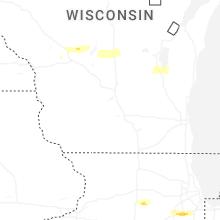
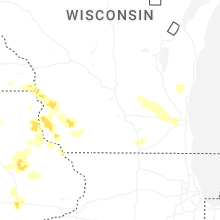


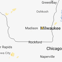


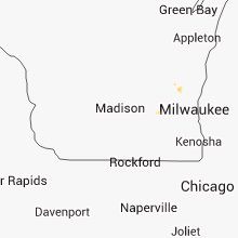


Connect with Interactive Hail Maps