

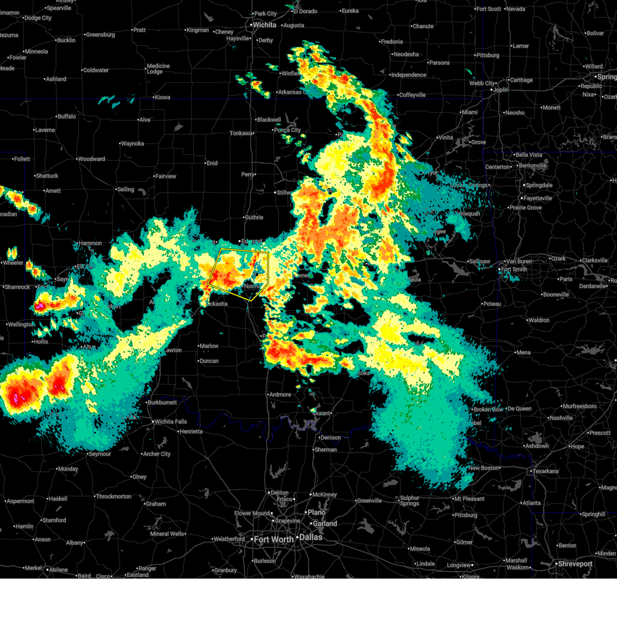
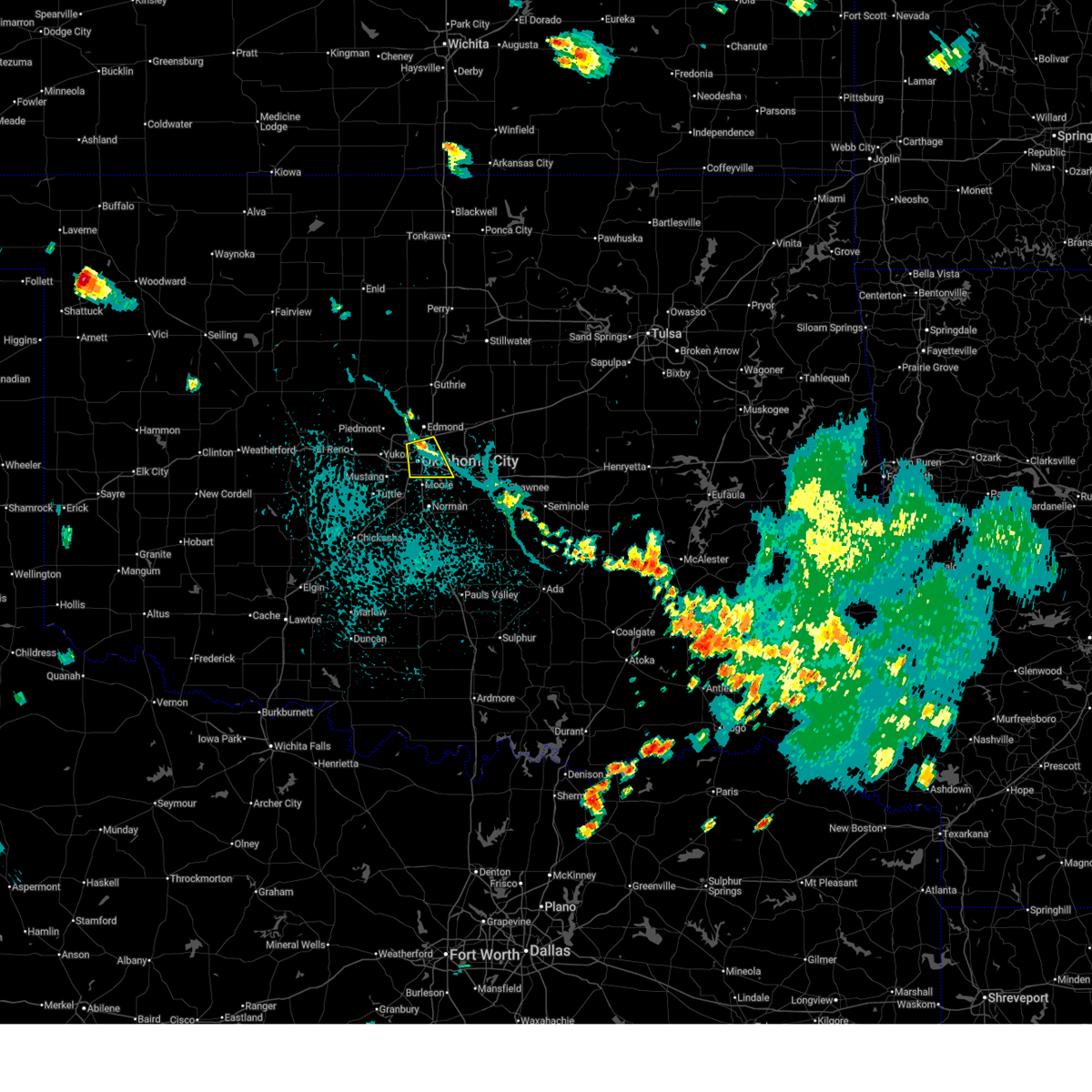
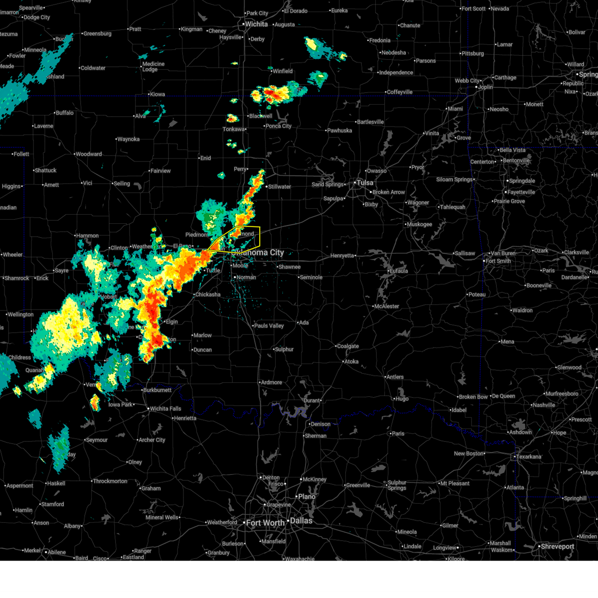
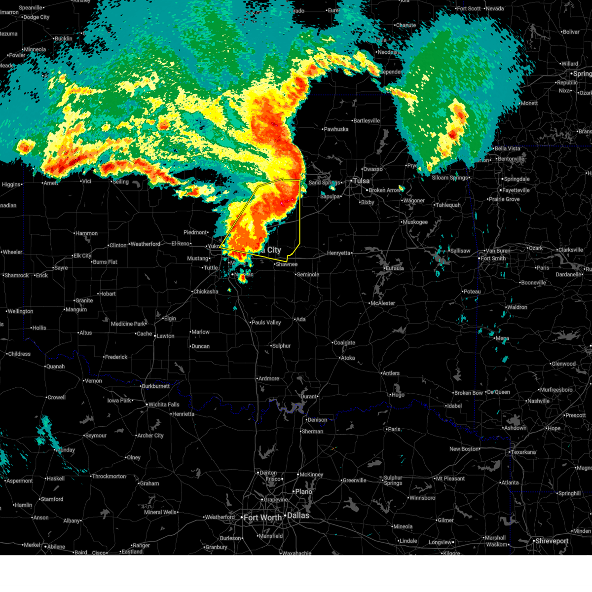
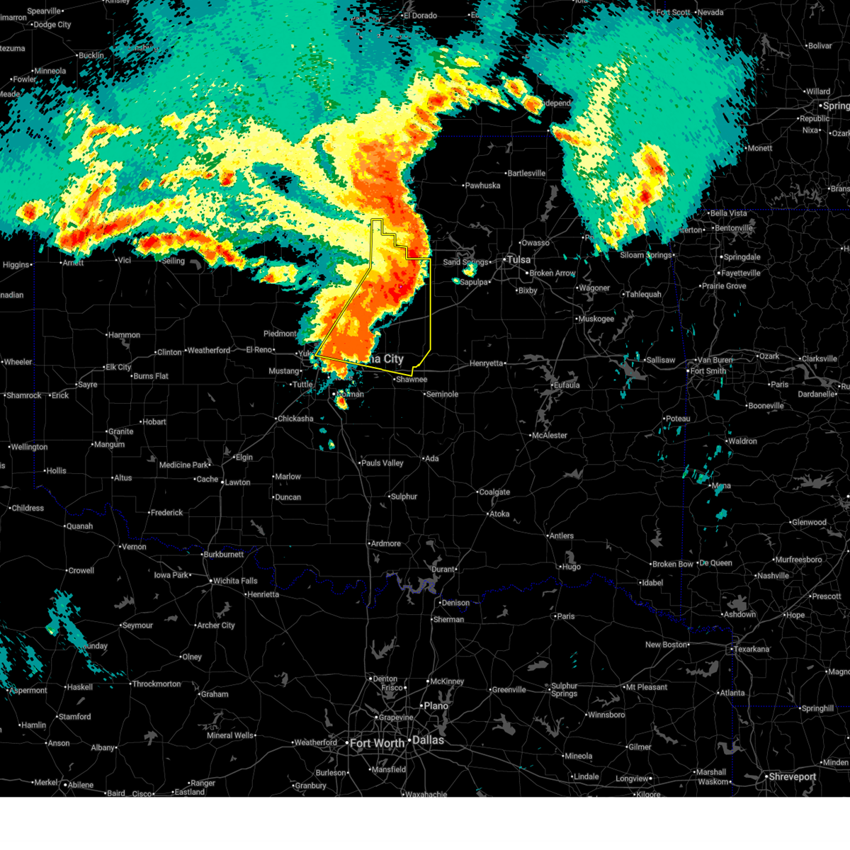
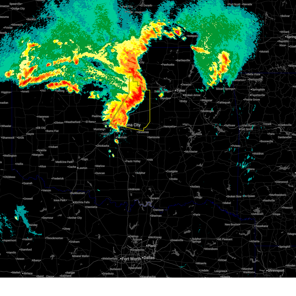
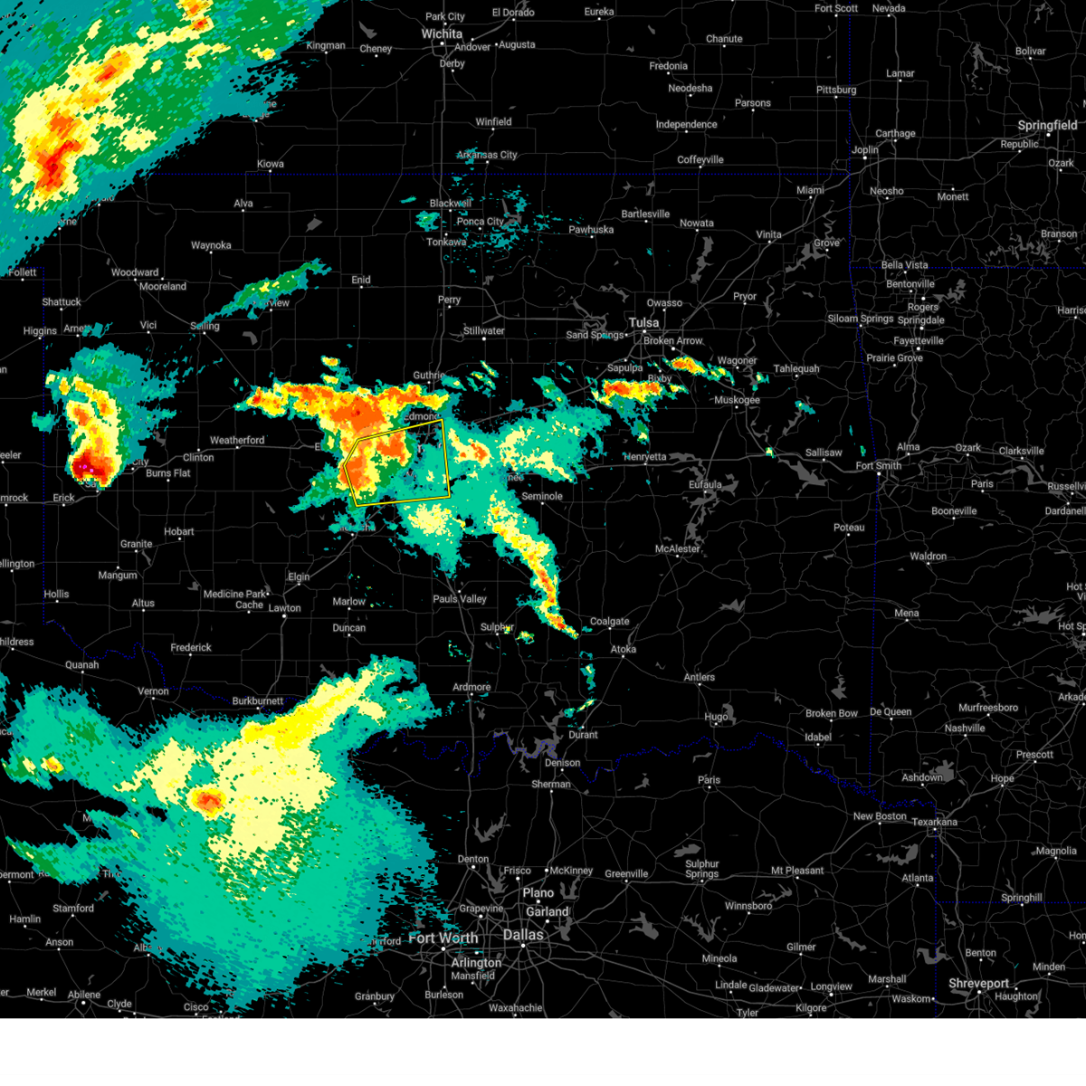
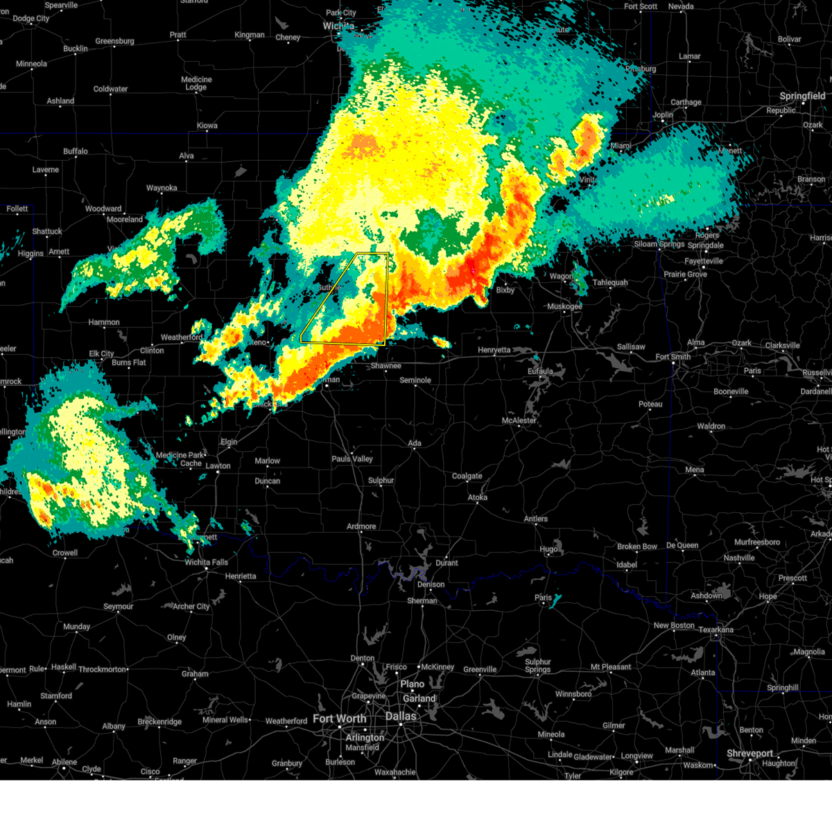
Hail Map for Lake Aluma, OK
The Lake Aluma, OK area has had 0 reports of on-the-ground hail by trained spotters, and has been under severe weather warnings 43 times during the past 12 months. Doppler radar has detected hail at or near Lake Aluma, OK on 107 occasions, including 9 occasions during the past year.
| Name: | Lake Aluma, OK |
| Where Located: | 5.9 miles NE of Oklahoma City, OK |
| Map: | Google Map for Lake Aluma, OK |
| Population: | 88 |
| Housing Units: | 40 |
| More Info: | Search Google for Lake Aluma, OK |
2
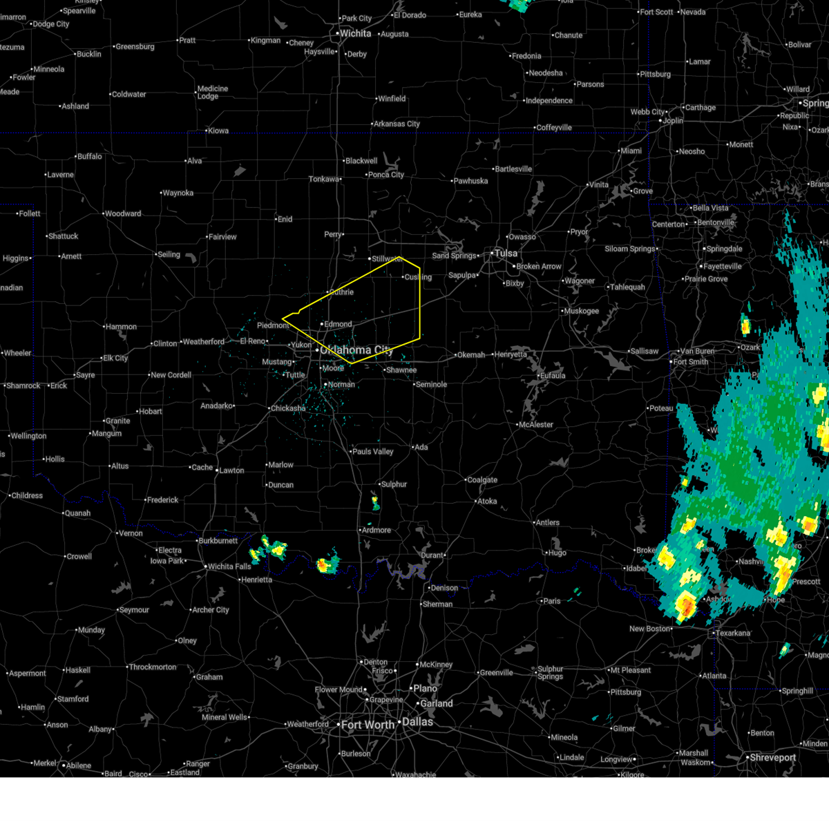
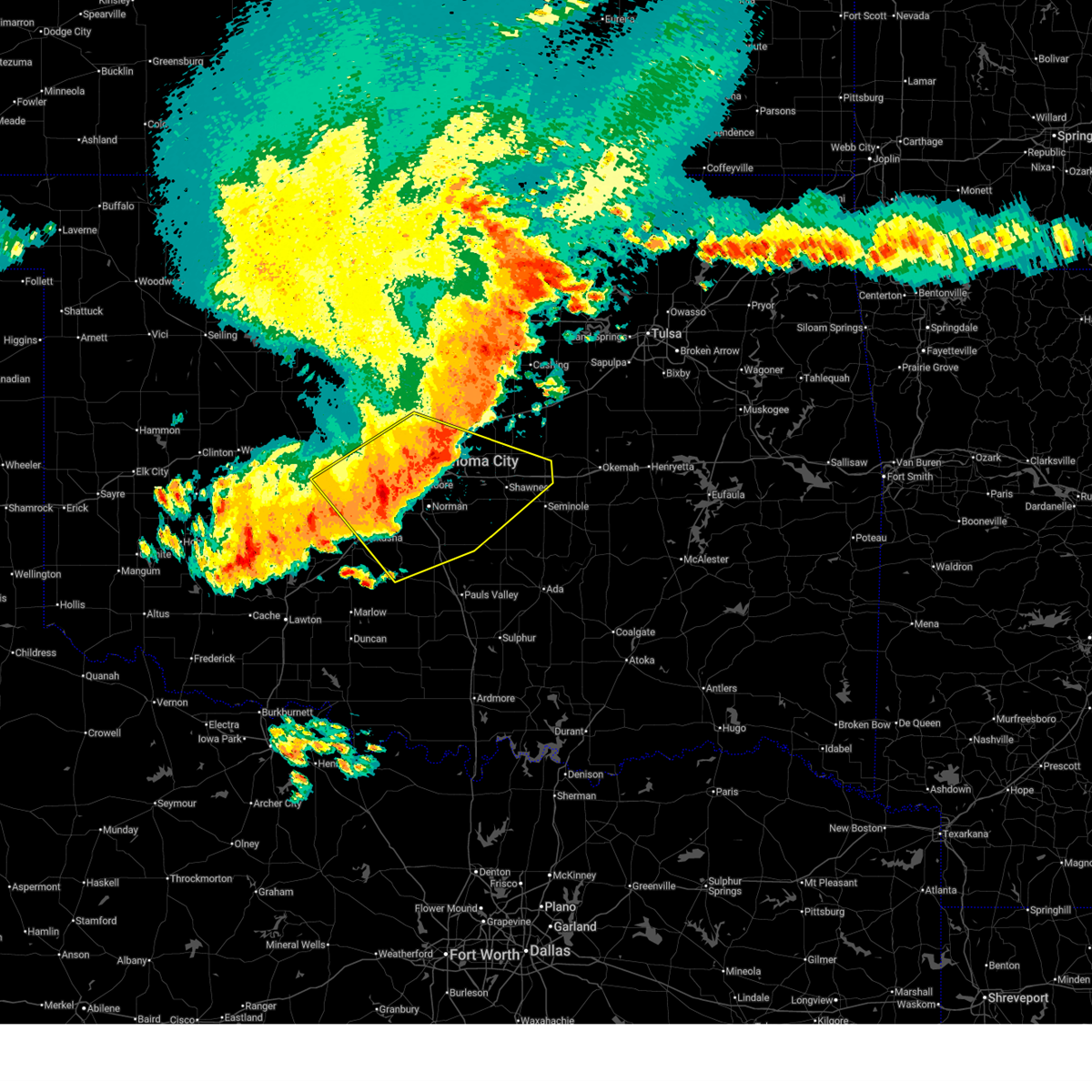
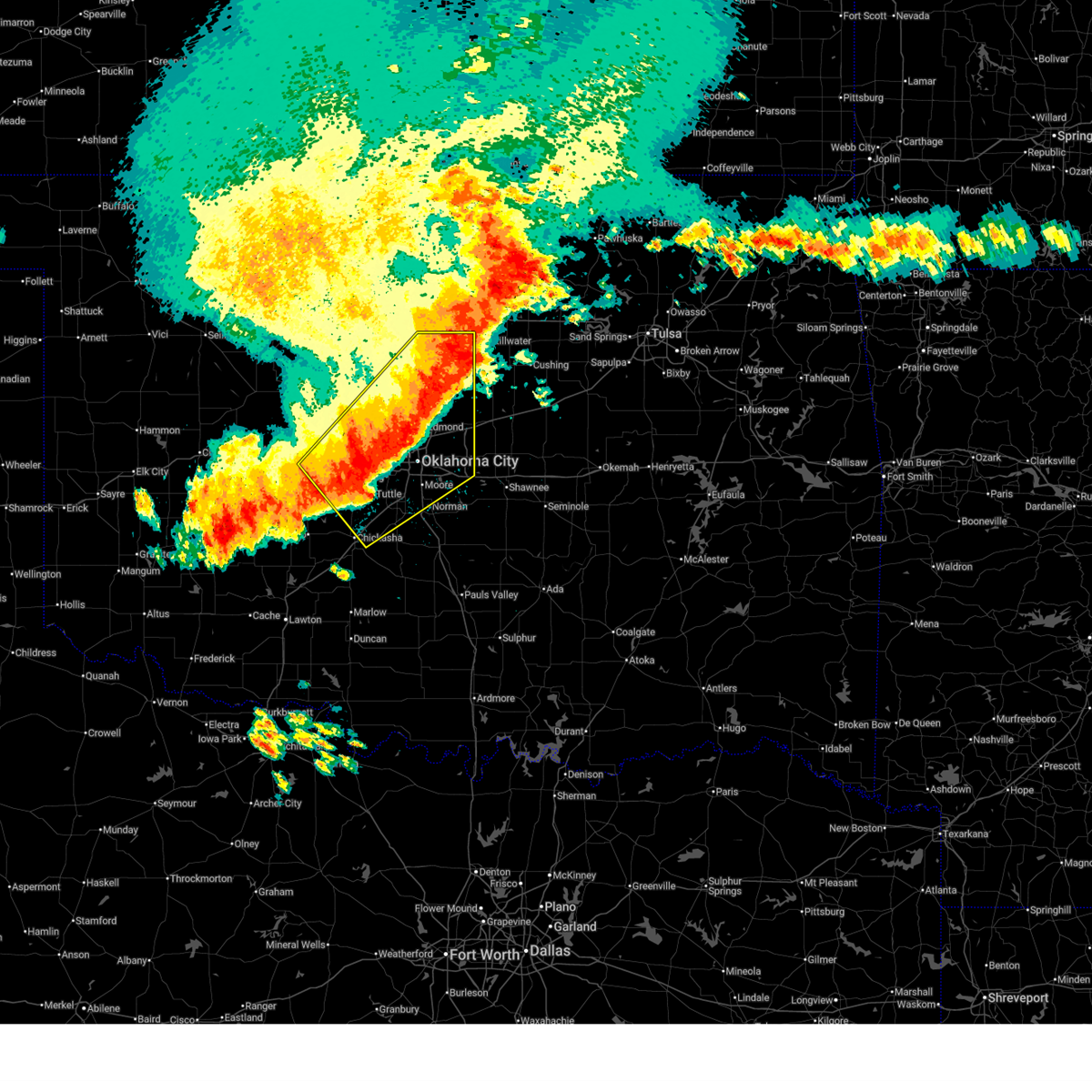
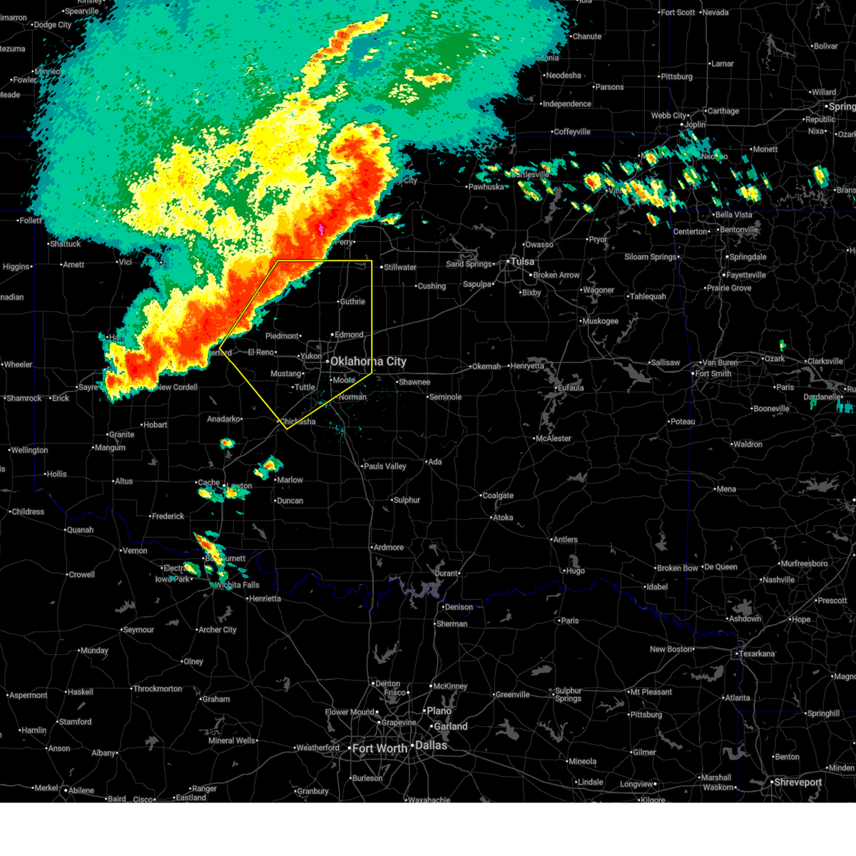
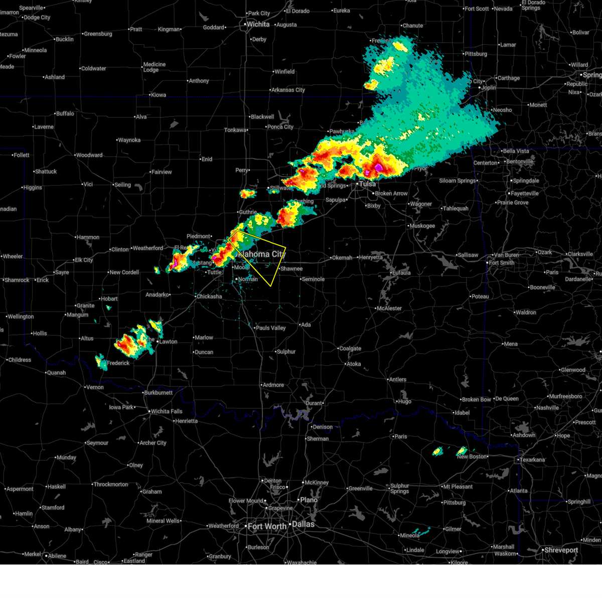
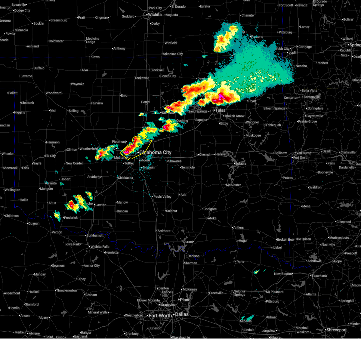
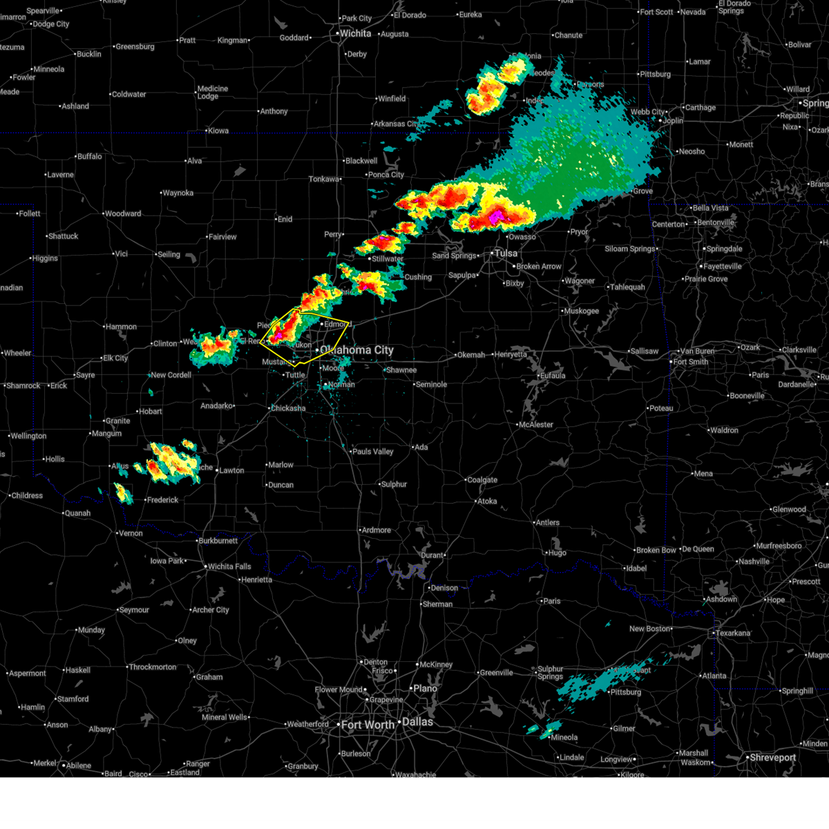
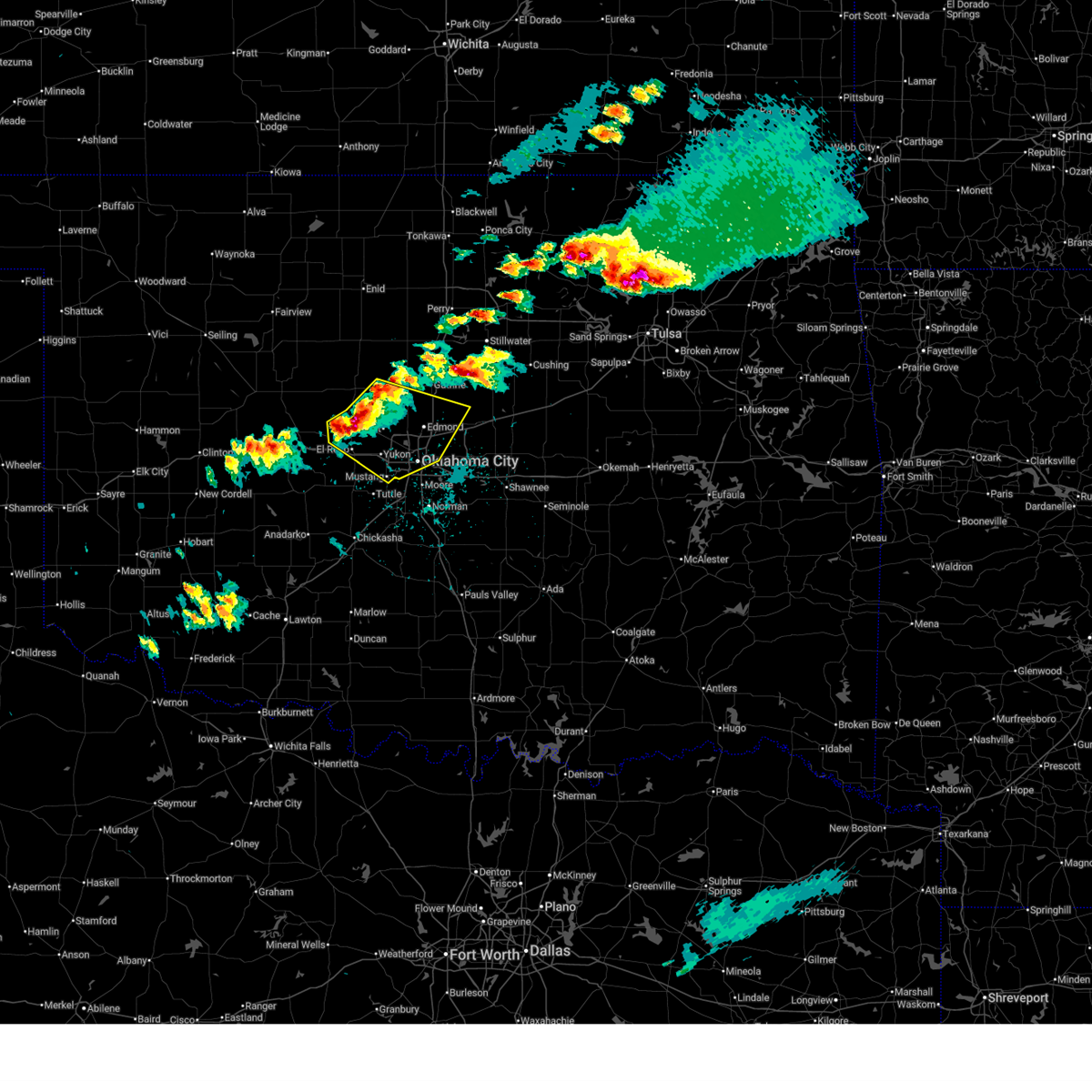
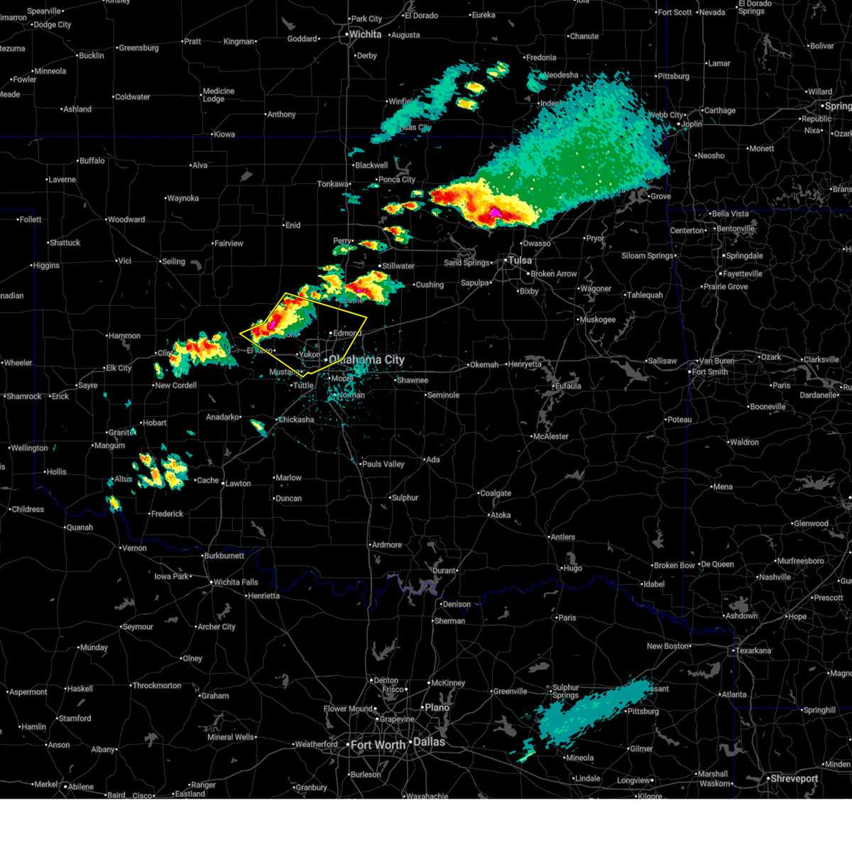
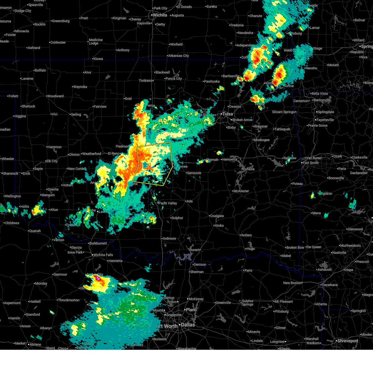
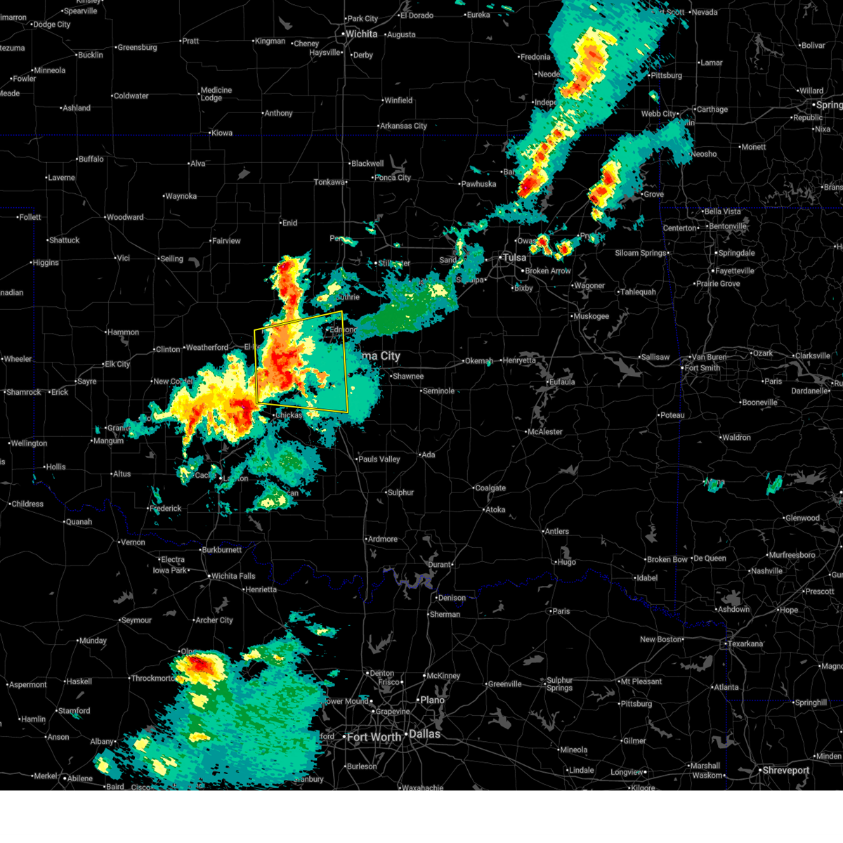
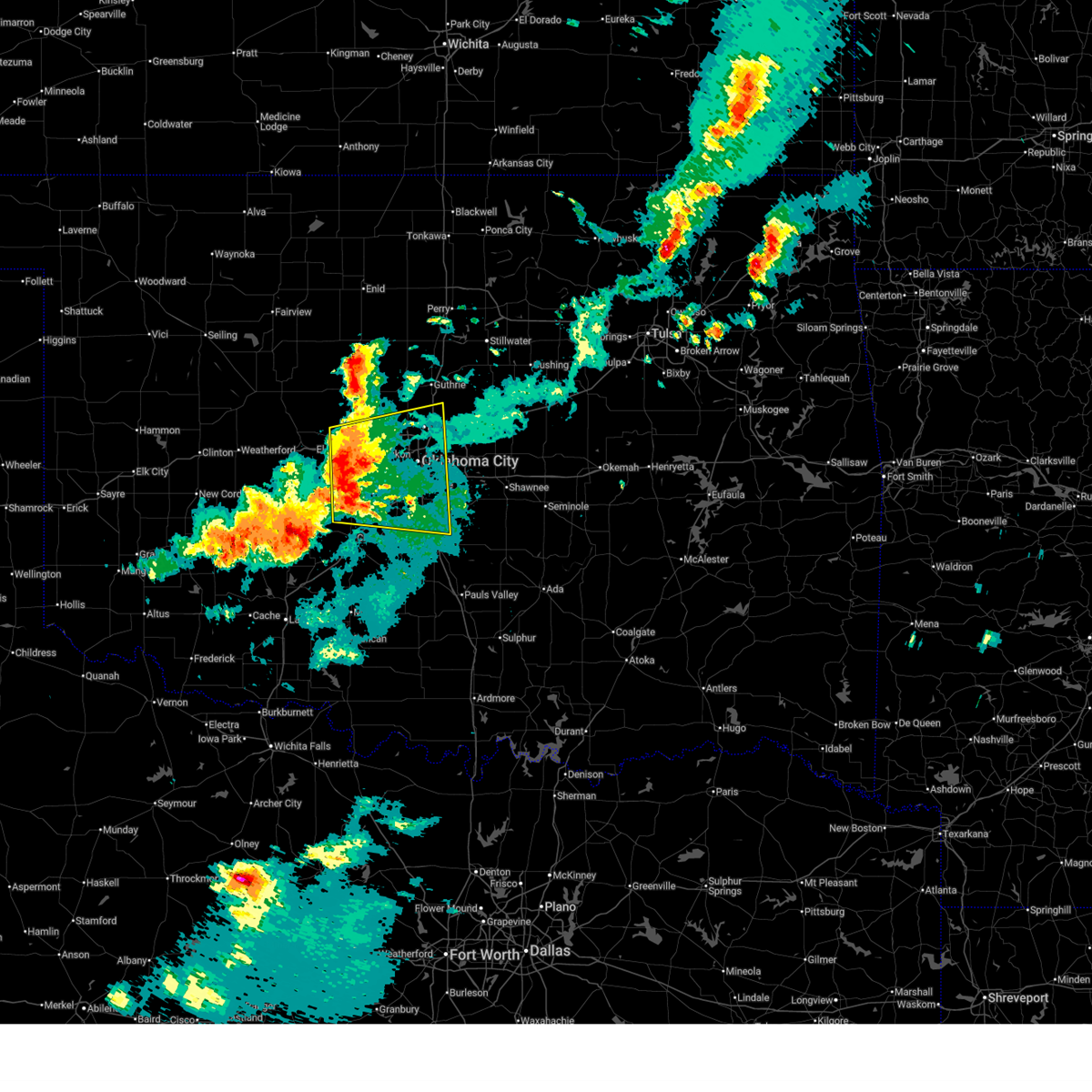
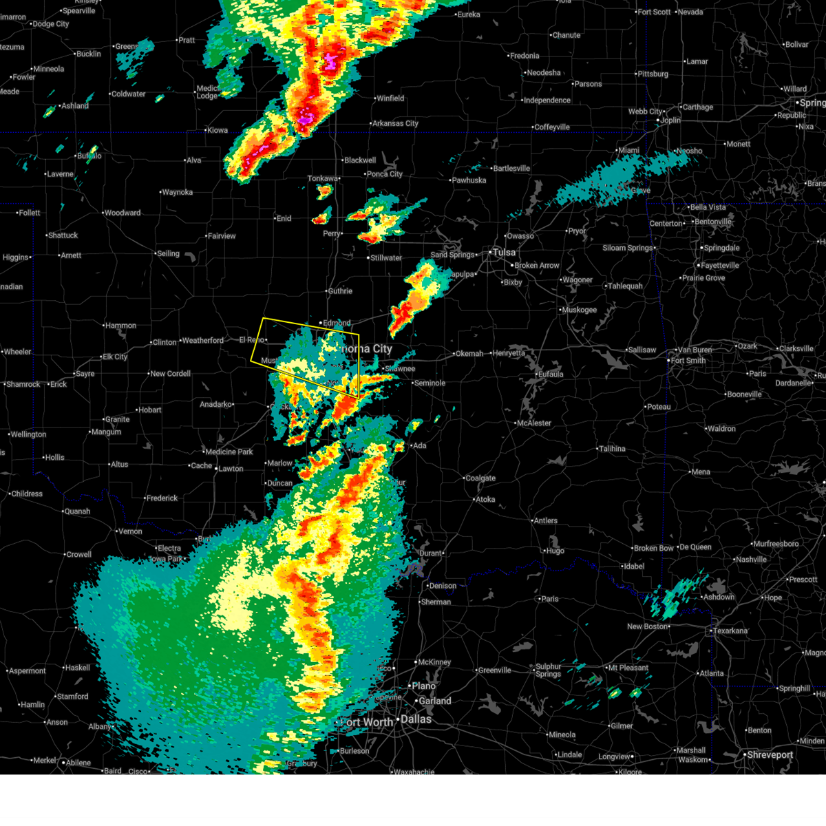
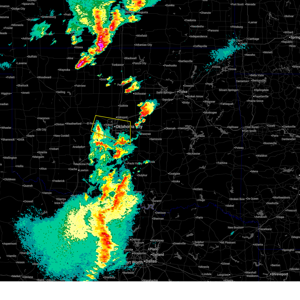
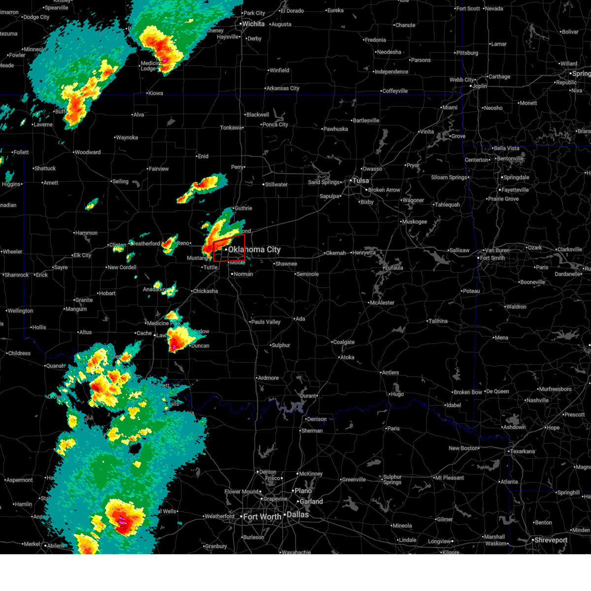
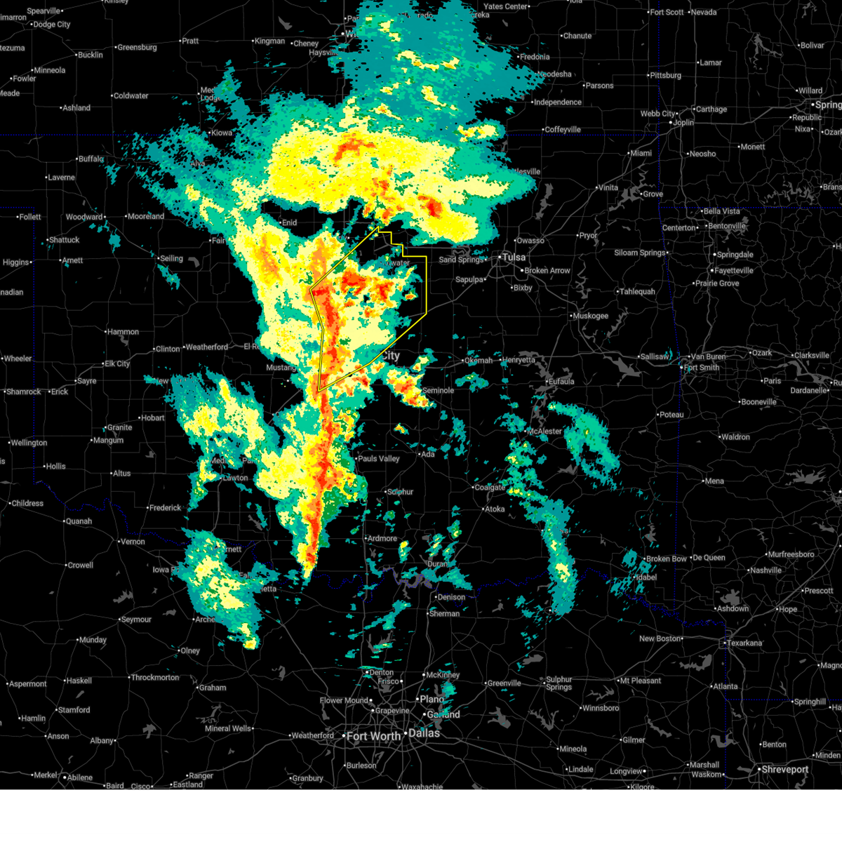
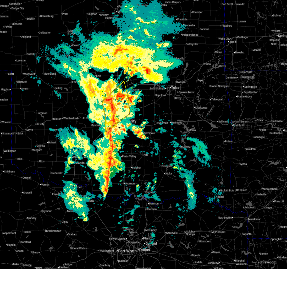
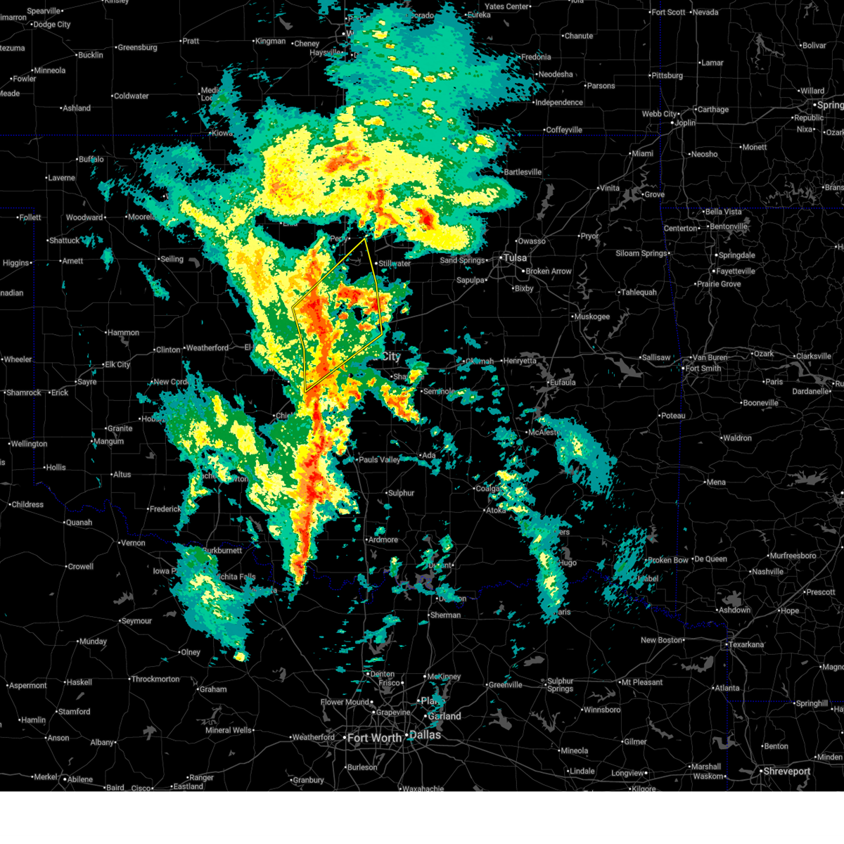
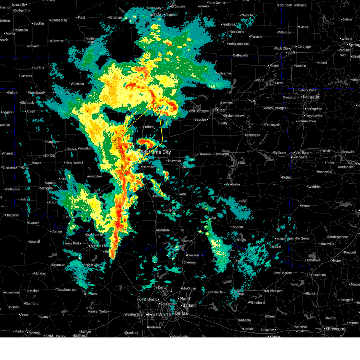
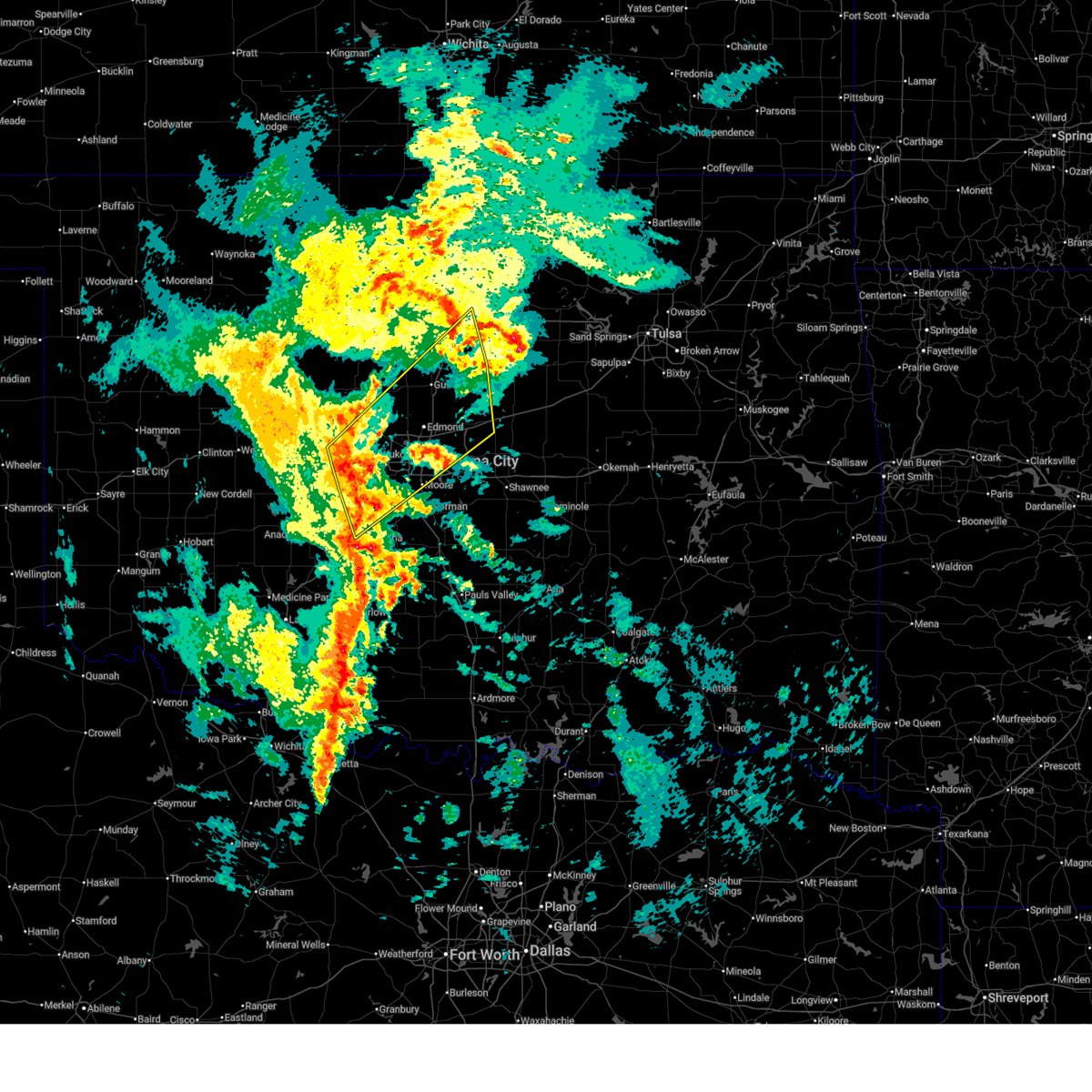
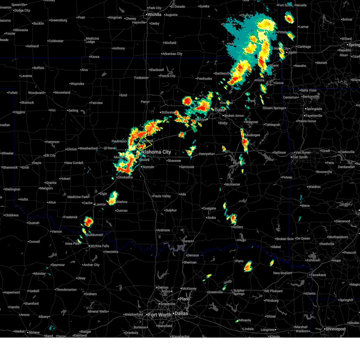
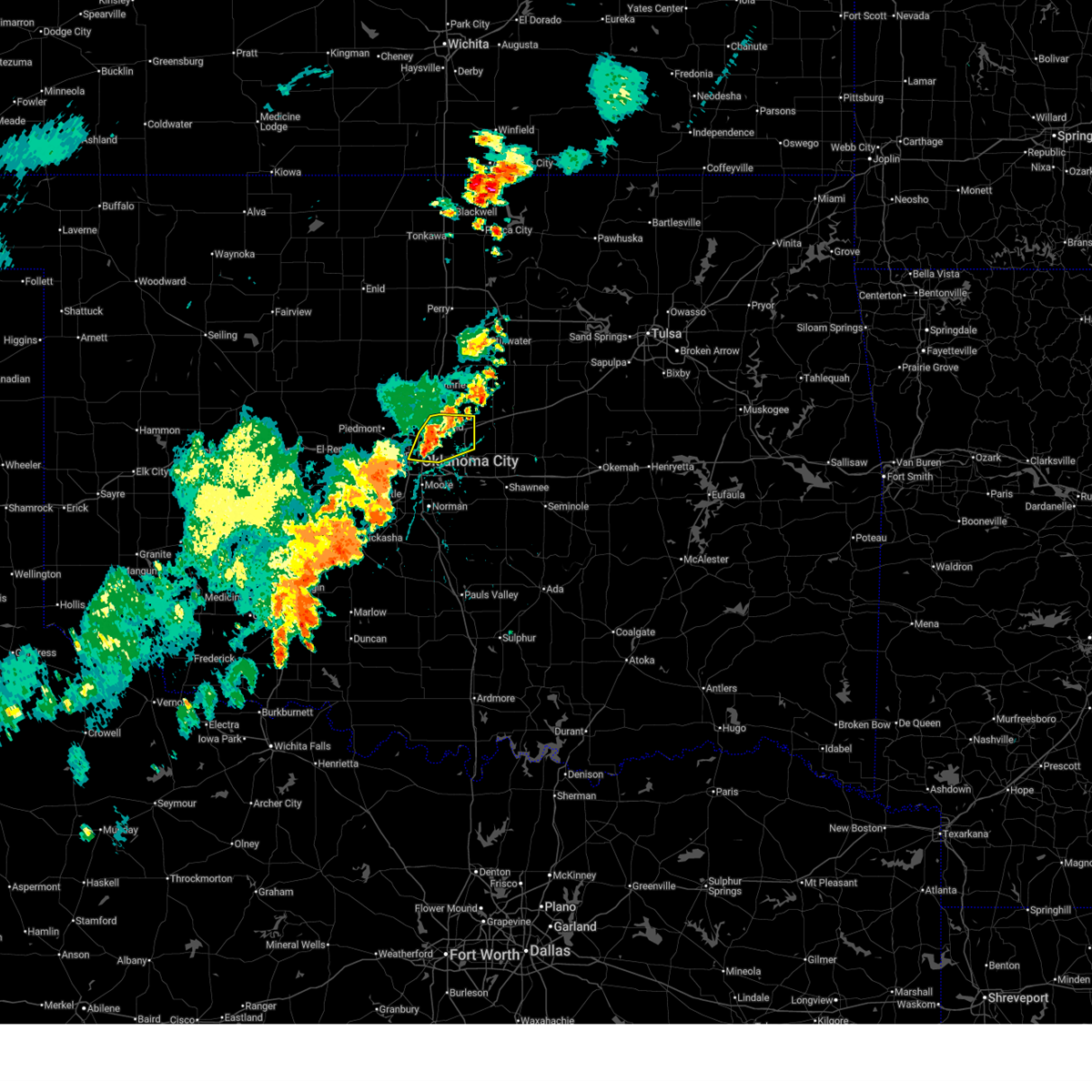
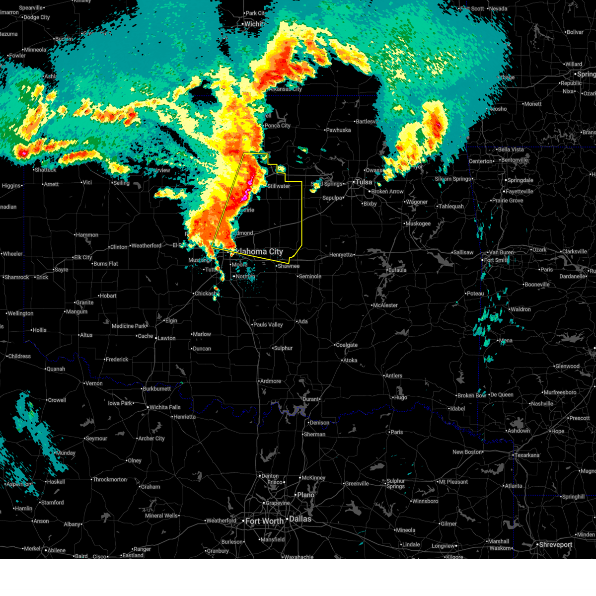
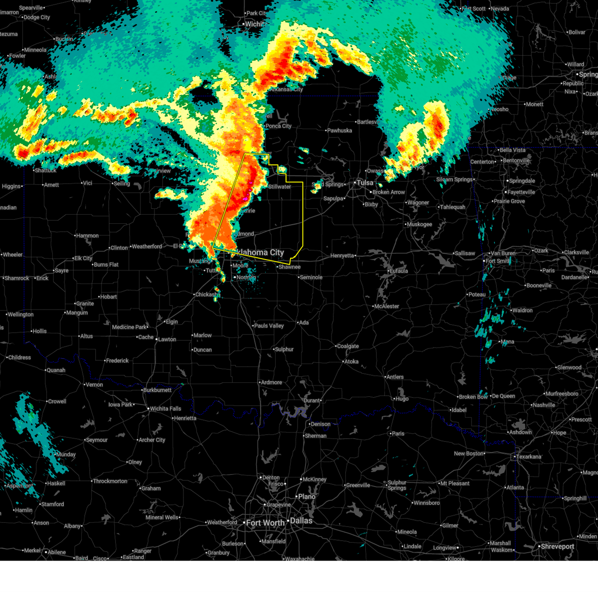
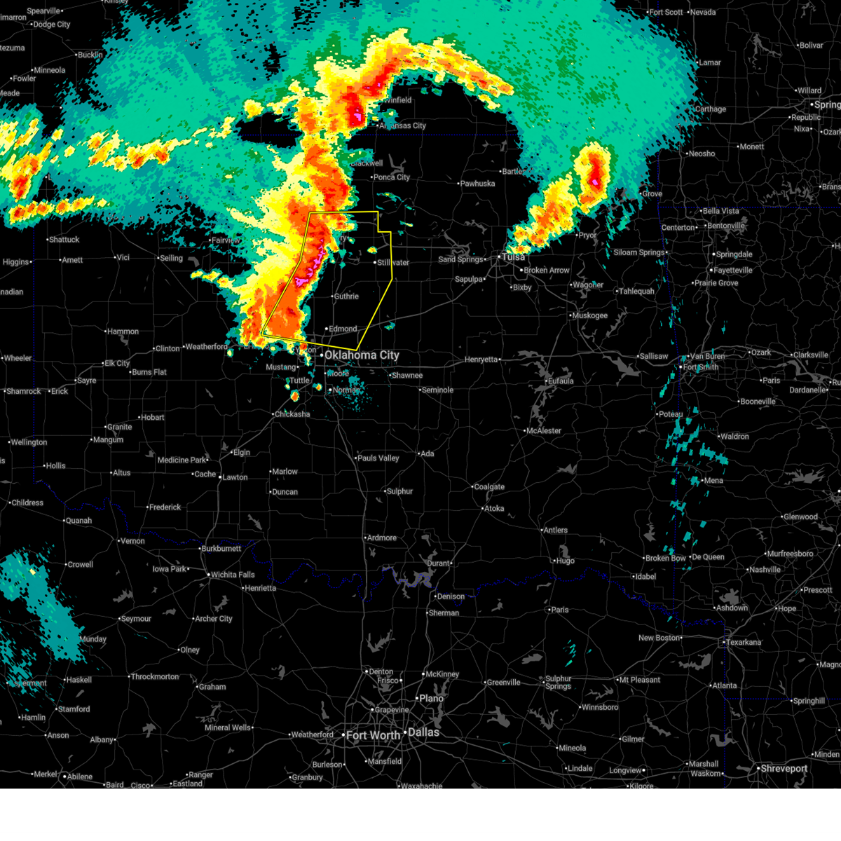
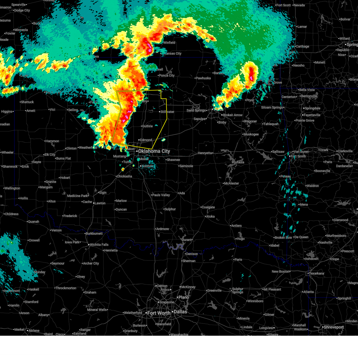
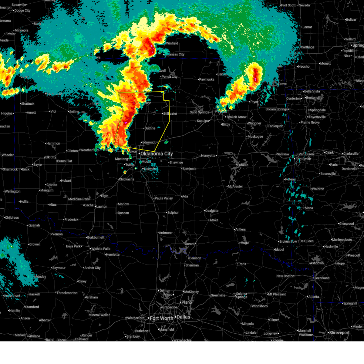
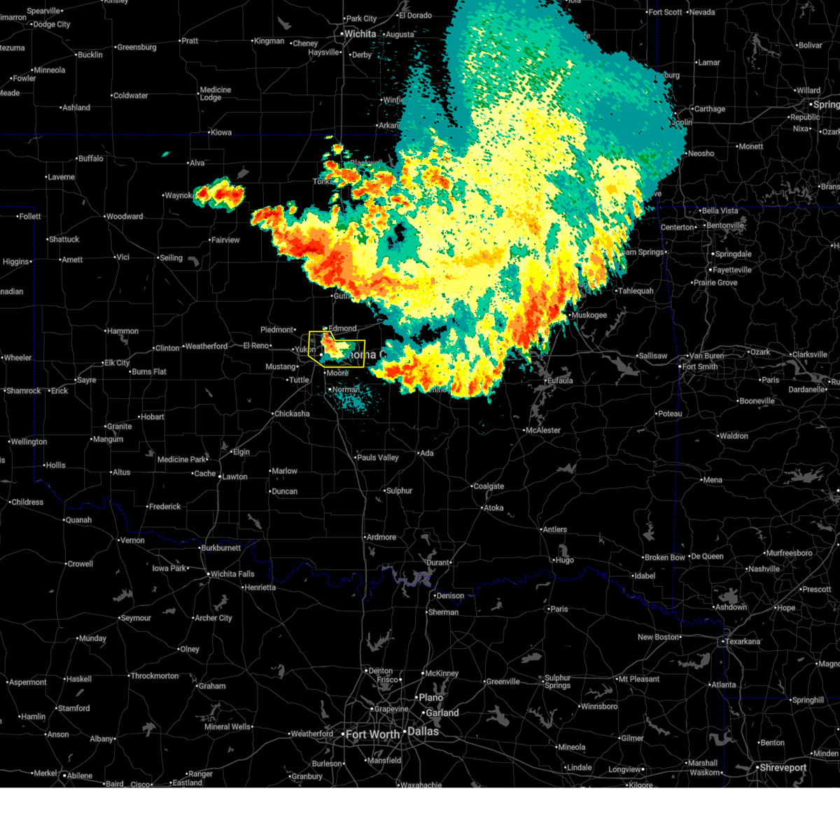
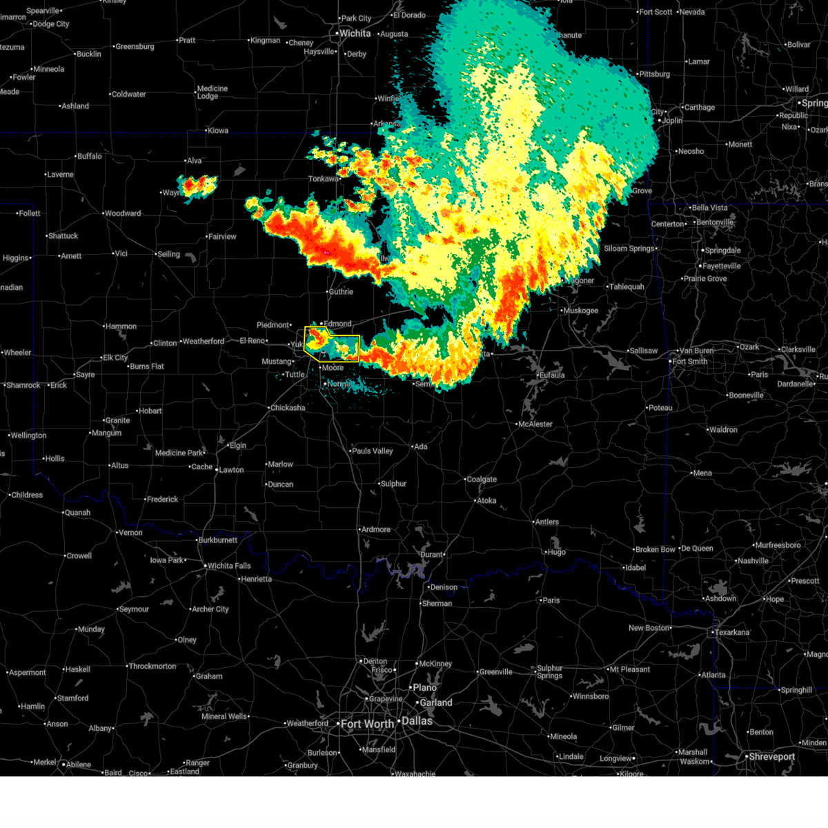
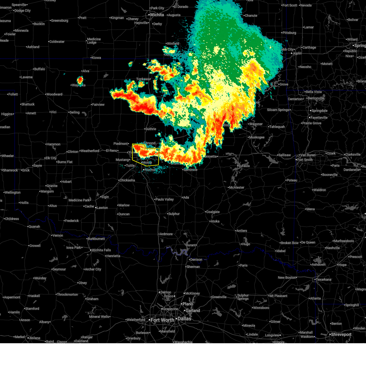
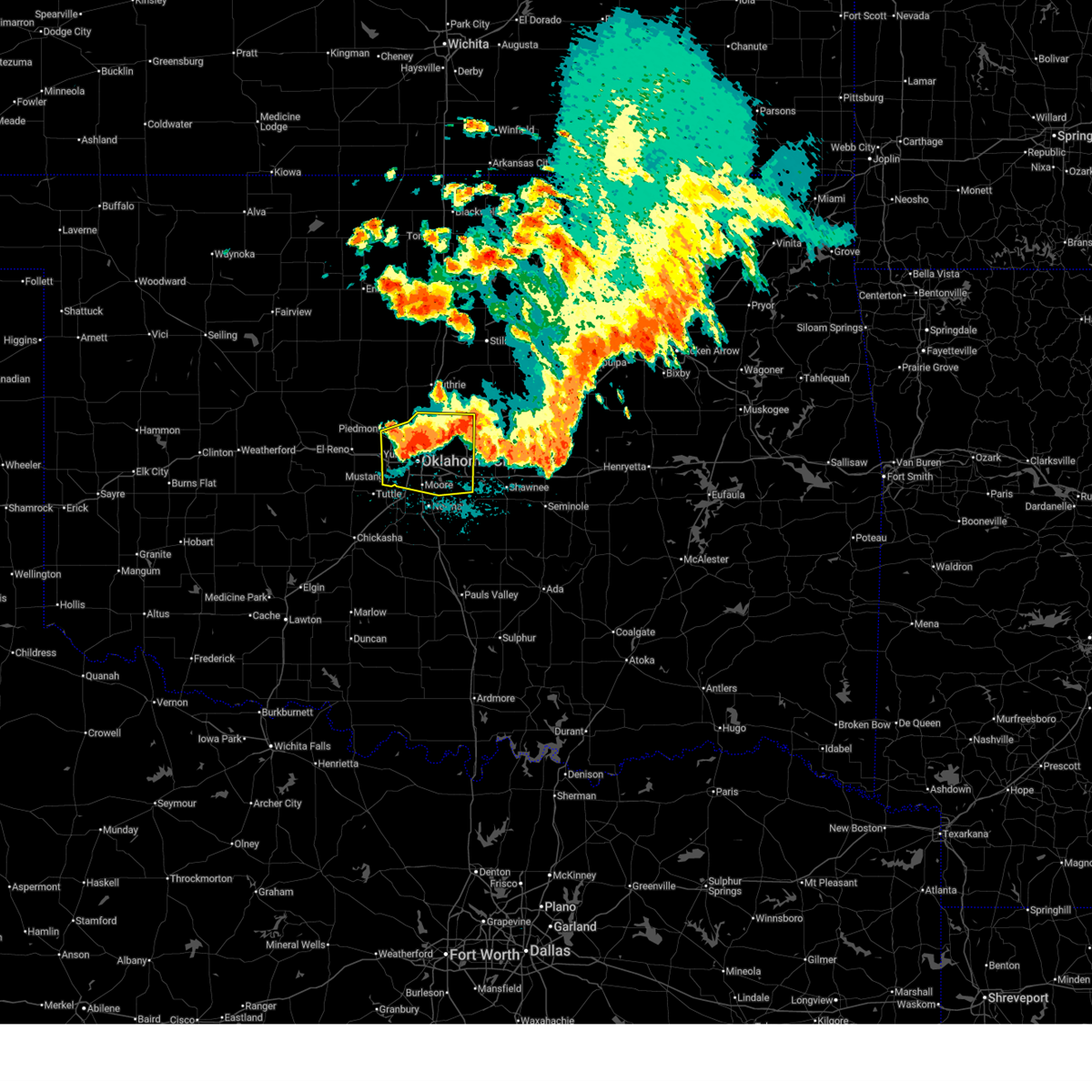
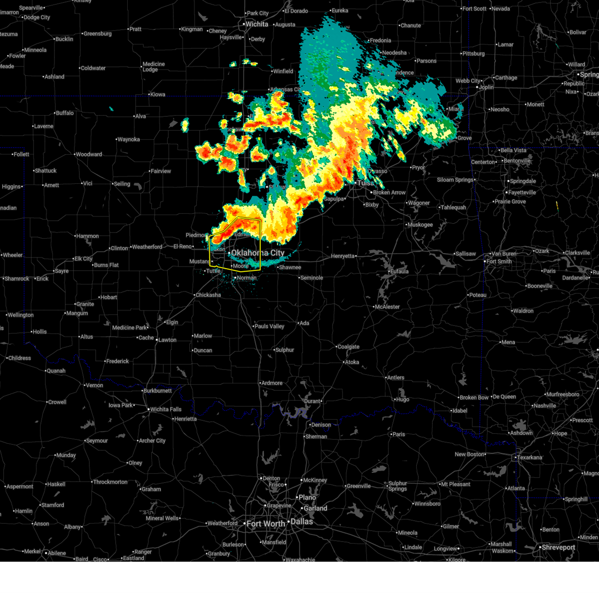
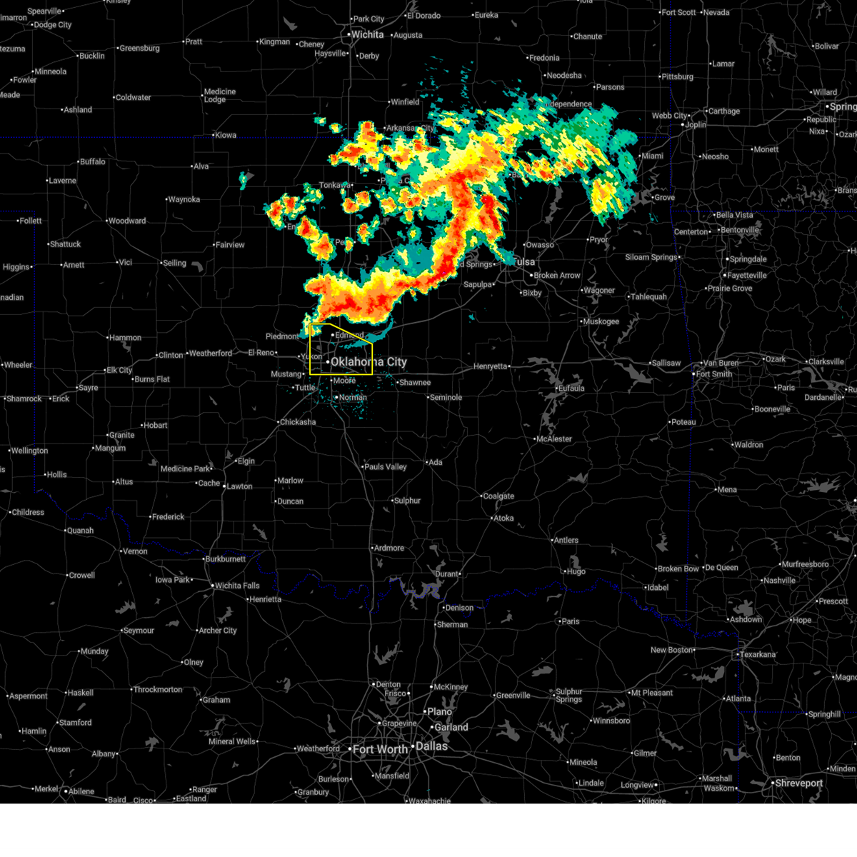
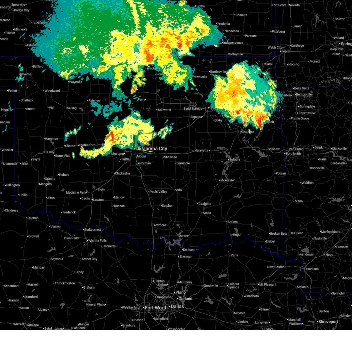
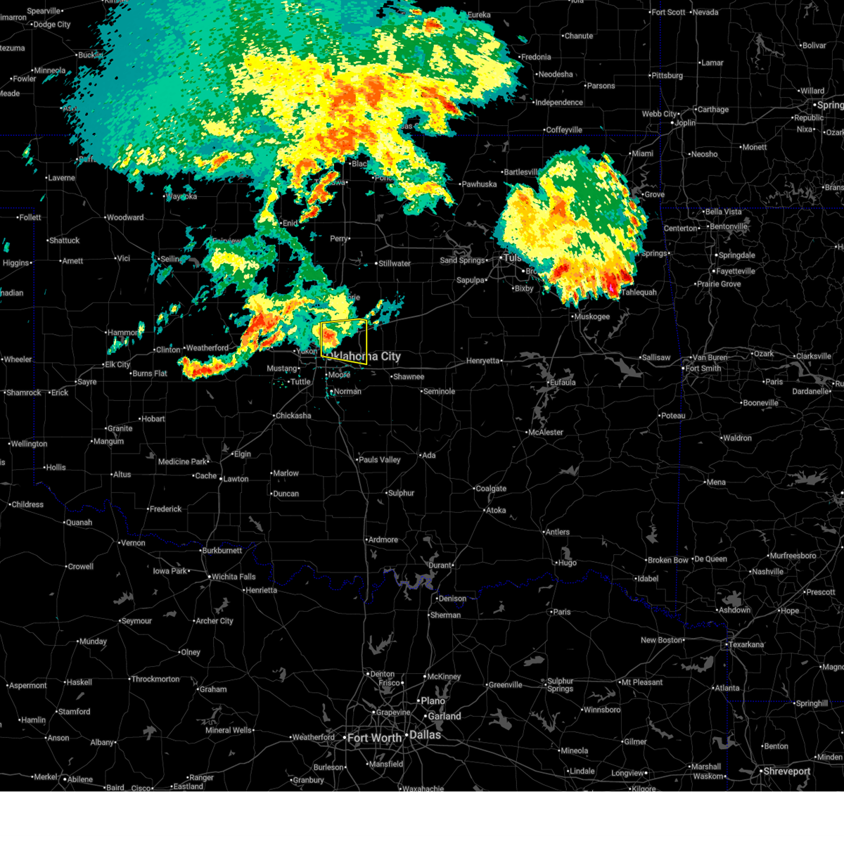
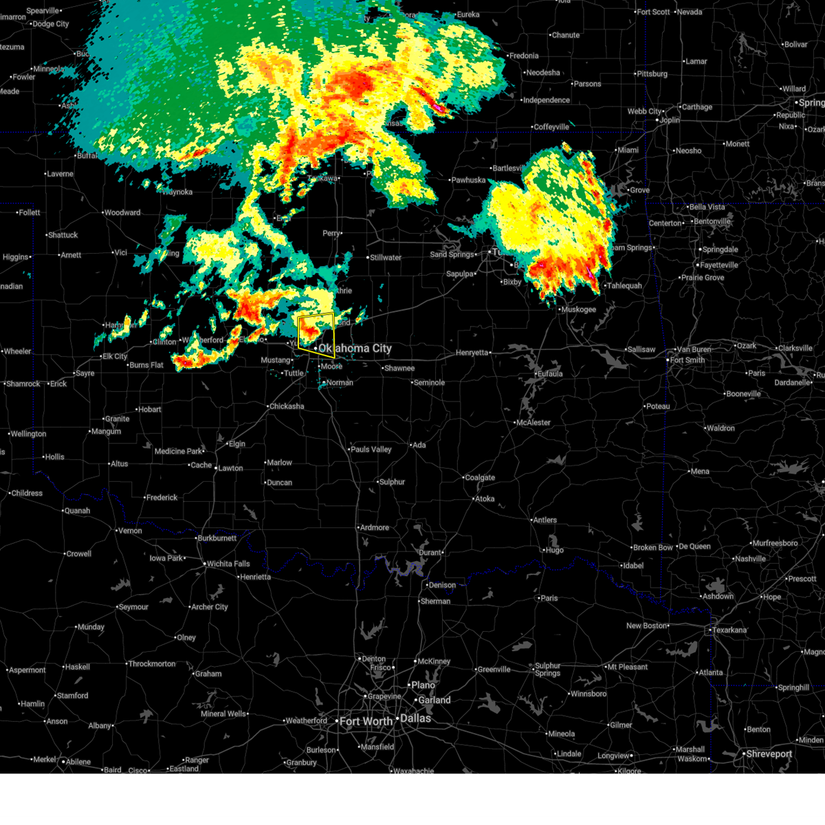
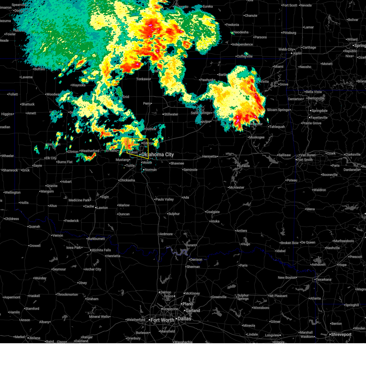
The Top Recent Hail Date for Lake Aluma, OK is Tuesday, March 10, 2026 (5th out of 107)

Hail and Wind Damage Spotted near Lake Aluma, OK
| Date / Time | Report Details |
|---|---|
| 7/4/2026 9:37 PM CDT |
 Svroun the national weather service in norman has issued a * severe thunderstorm warning for, oklahoma county in central oklahoma, northern cleveland county in central oklahoma, southeastern canadian county in central oklahoma, * until 1015 pm cdt. * at 935 pm cdt, a severe thunderstorm was located near yukon, moving southeast at 25 mph. this storm is capable of producing quarter size hail. other strong to severe thunderstorms extend into oklahoma city that will be capable of producing localized 60 mph winds (radar indicated). Hazards include 60 mph wind gusts and quarter size hail. Hail damage to vehicles is expected. Expect wind damage to roofs, siding, and trees. Svroun the national weather service in norman has issued a * severe thunderstorm warning for, oklahoma county in central oklahoma, northern cleveland county in central oklahoma, southeastern canadian county in central oklahoma, * until 1015 pm cdt. * at 935 pm cdt, a severe thunderstorm was located near yukon, moving southeast at 25 mph. this storm is capable of producing quarter size hail. other strong to severe thunderstorms extend into oklahoma city that will be capable of producing localized 60 mph winds (radar indicated). Hazards include 60 mph wind gusts and quarter size hail. Hail damage to vehicles is expected. Expect wind damage to roofs, siding, and trees.
|
| 7/4/2026 9:11 PM CDT |
 At 910 pm cdt, severe thunderstorms were located along a line extending from 8 miles southeast of davenport to near oklahoma city, moving southeast at 20 mph (radar indicated). Hazards include 60 mph wind gusts and half dollar size hail. Hail damage to vehicles is expected. expect wind damage to roofs, siding, and trees. Locations impacted include, northeastern oklahoma city, edmond, midwest city, chandler, choctaw, the village, piedmont, harrah, mcloud, spencer, nichols hills, jones, stroud, nicoma park, luther, meeker, davenport, wellston, carney, and tryon. At 910 pm cdt, severe thunderstorms were located along a line extending from 8 miles southeast of davenport to near oklahoma city, moving southeast at 20 mph (radar indicated). Hazards include 60 mph wind gusts and half dollar size hail. Hail damage to vehicles is expected. expect wind damage to roofs, siding, and trees. Locations impacted include, northeastern oklahoma city, edmond, midwest city, chandler, choctaw, the village, piedmont, harrah, mcloud, spencer, nichols hills, jones, stroud, nicoma park, luther, meeker, davenport, wellston, carney, and tryon.
|
| 7/4/2026 8:44 PM CDT |
 Svroun the national weather service in norman has issued a * severe thunderstorm warning for, oklahoma county in central oklahoma, lincoln county in central oklahoma, southern logan county in central oklahoma, southeastern payne county in central oklahoma, northeastern canadian county in central oklahoma, northwestern pottawatomie county in central oklahoma, * until 930 pm cdt. * at 843 pm cdt, severe thunderstorms were located along a line extending from 3 miles northwest of avery to near the village, moving southeast at 45 mph. the most likely area to receive large hail will be from southeast logan county toward wellson and warwick (radar indicated). Hazards include ping pong ball size hail and 60 mph wind gusts. People and animals outdoors will be injured. expect hail damage to roofs, siding, windows, and vehicles. Expect wind damage to roofs, siding, and trees. Svroun the national weather service in norman has issued a * severe thunderstorm warning for, oklahoma county in central oklahoma, lincoln county in central oklahoma, southern logan county in central oklahoma, southeastern payne county in central oklahoma, northeastern canadian county in central oklahoma, northwestern pottawatomie county in central oklahoma, * until 930 pm cdt. * at 843 pm cdt, severe thunderstorms were located along a line extending from 3 miles northwest of avery to near the village, moving southeast at 45 mph. the most likely area to receive large hail will be from southeast logan county toward wellson and warwick (radar indicated). Hazards include ping pong ball size hail and 60 mph wind gusts. People and animals outdoors will be injured. expect hail damage to roofs, siding, windows, and vehicles. Expect wind damage to roofs, siding, and trees.
|
| 6/27/2026 12:54 AM CDT |
 Svroun the national weather service in norman has issued a * severe thunderstorm warning for, oklahoma county in central oklahoma, southern lincoln county in central oklahoma, northern cleveland county in central oklahoma, northwestern pottawatomie county in central oklahoma, * until 145 am cdt. * at 1254 am cdt, severe thunderstorms were located along a line extending from near luther to 3 miles north of harrah to near oklahoma city to near norman, moving east at 40 mph (radar indicated). Hazards include 70 mph wind gusts. Expect considerable tree damage. Damage is likely to mobile homes, roofs, and outbuildings. Svroun the national weather service in norman has issued a * severe thunderstorm warning for, oklahoma county in central oklahoma, southern lincoln county in central oklahoma, northern cleveland county in central oklahoma, northwestern pottawatomie county in central oklahoma, * until 145 am cdt. * at 1254 am cdt, severe thunderstorms were located along a line extending from near luther to 3 miles north of harrah to near oklahoma city to near norman, moving east at 40 mph (radar indicated). Hazards include 70 mph wind gusts. Expect considerable tree damage. Damage is likely to mobile homes, roofs, and outbuildings.
|
| 6/27/2026 12:26 AM CDT |
 At 1226 am cdt, severe thunderstorms were located along a line extending from near edmond to near oklahoma city to near valley brook, moving east at 35 mph (radar indicated). Hazards include 70 mph wind gusts and quarter size hail. Hail damage to vehicles is expected. expect considerable tree damage. wind damage is also likely to mobile homes, roofs, and outbuildings. Locations impacted include, oklahoma city, edmond, midwest city, del city, choctaw, warr acres, the village, harrah, spencer, nichols hills, jones, nicoma park, valley brook, arcadia, tinker air force base, forest park, lake aluma, and smith village. At 1226 am cdt, severe thunderstorms were located along a line extending from near edmond to near oklahoma city to near valley brook, moving east at 35 mph (radar indicated). Hazards include 70 mph wind gusts and quarter size hail. Hail damage to vehicles is expected. expect considerable tree damage. wind damage is also likely to mobile homes, roofs, and outbuildings. Locations impacted include, oklahoma city, edmond, midwest city, del city, choctaw, warr acres, the village, harrah, spencer, nichols hills, jones, nicoma park, valley brook, arcadia, tinker air force base, forest park, lake aluma, and smith village.
|
| 6/27/2026 12:10 AM CDT |
 Svroun the national weather service in norman has issued a * severe thunderstorm warning for, oklahoma county in central oklahoma, northeastern canadian county in central oklahoma, * until 100 am cdt. * at 1210 am cdt, severe thunderstorms were located along a line extending from 6 miles east of piedmont to near oklahoma city to near bethany, moving east at 35 mph (radar indicated). Hazards include 60 mph wind gusts and quarter size hail. Hail damage to vehicles is expected. Expect wind damage to roofs, siding, and trees. Svroun the national weather service in norman has issued a * severe thunderstorm warning for, oklahoma county in central oklahoma, northeastern canadian county in central oklahoma, * until 100 am cdt. * at 1210 am cdt, severe thunderstorms were located along a line extending from 6 miles east of piedmont to near oklahoma city to near bethany, moving east at 35 mph (radar indicated). Hazards include 60 mph wind gusts and quarter size hail. Hail damage to vehicles is expected. Expect wind damage to roofs, siding, and trees.
|
| 6/23/2026 1:52 PM CDT |
 At 151 pm cdt, severe thunderstorms were located along a line extending from near oklahoma city to near tuttle, moving east at 30 mph (asos. at 145 pm cdt, a 70 mph wind gust was measured at okc will rogers international airport). Hazards include 70 mph wind gusts and quarter size hail. Hail damage to vehicles is expected. expect considerable tree damage. wind damage is also likely to mobile homes, roofs, and outbuildings. Locations impacted include, oklahoma city, norman, moore, midwest city, del city, newcastle, yukon, bethany, mustang, choctaw, warr acres, the village, noble, tuttle, harrah, slaughterville, spencer, nichols hills, jones, and nicoma park. At 151 pm cdt, severe thunderstorms were located along a line extending from near oklahoma city to near tuttle, moving east at 30 mph (asos. at 145 pm cdt, a 70 mph wind gust was measured at okc will rogers international airport). Hazards include 70 mph wind gusts and quarter size hail. Hail damage to vehicles is expected. expect considerable tree damage. wind damage is also likely to mobile homes, roofs, and outbuildings. Locations impacted include, oklahoma city, norman, moore, midwest city, del city, newcastle, yukon, bethany, mustang, choctaw, warr acres, the village, noble, tuttle, harrah, slaughterville, spencer, nichols hills, jones, and nicoma park.
|
| 6/23/2026 1:41 PM CDT |
 At 141 pm cdt, severe thunderstorms were located along a line extending from near oklahoma city to 4 miles east of minco, moving east at 35 mph (radar indicated). Hazards include 70 mph wind gusts and quarter size hail. Hail damage to vehicles is expected. expect considerable tree damage. wind damage is also likely to mobile homes, roofs, and outbuildings. Locations impacted include, oklahoma city, norman, moore, midwest city, del city, newcastle, yukon, bethany, mustang, choctaw, warr acres, the village, noble, tuttle, harrah, slaughterville, spencer, nichols hills, jones, and nicoma park. At 141 pm cdt, severe thunderstorms were located along a line extending from near oklahoma city to 4 miles east of minco, moving east at 35 mph (radar indicated). Hazards include 70 mph wind gusts and quarter size hail. Hail damage to vehicles is expected. expect considerable tree damage. wind damage is also likely to mobile homes, roofs, and outbuildings. Locations impacted include, oklahoma city, norman, moore, midwest city, del city, newcastle, yukon, bethany, mustang, choctaw, warr acres, the village, noble, tuttle, harrah, slaughterville, spencer, nichols hills, jones, and nicoma park.
|
| 6/23/2026 1:38 PM CDT |
 Svroun the national weather service in norman has issued a * severe thunderstorm warning for, northeastern grady county in central oklahoma, southern oklahoma county in central oklahoma, cleveland county in central oklahoma, southeastern canadian county in central oklahoma, northwestern mcclain county in central oklahoma, * until 230 pm cdt. * at 137 pm cdt, severe thunderstorms were located along a line extending from near oklahoma city to 3 miles southeast of union city, moving east at 30 mph (radar indicated). Hazards include 60 mph wind gusts and quarter size hail. Hail damage to vehicles is expected. Expect wind damage to roofs, siding, and trees. Svroun the national weather service in norman has issued a * severe thunderstorm warning for, northeastern grady county in central oklahoma, southern oklahoma county in central oklahoma, cleveland county in central oklahoma, southeastern canadian county in central oklahoma, northwestern mcclain county in central oklahoma, * until 230 pm cdt. * at 137 pm cdt, severe thunderstorms were located along a line extending from near oklahoma city to 3 miles southeast of union city, moving east at 30 mph (radar indicated). Hazards include 60 mph wind gusts and quarter size hail. Hail damage to vehicles is expected. Expect wind damage to roofs, siding, and trees.
|
| 6/22/2026 2:06 AM CDT |
 Svroun the national weather service in norman has issued a * severe thunderstorm warning for, northwestern garvin county in southern oklahoma, northern grady county in central oklahoma, northwestern seminole county in east central oklahoma, east central caddo county in southwestern oklahoma, oklahoma county in central oklahoma, southern lincoln county in central oklahoma, cleveland county in central oklahoma, southeastern canadian county in central oklahoma, pottawatomie county in central oklahoma, mcclain county in central oklahoma, * until 245 am cdt. * at 205 am cdt, severe thunderstorms were located along a line extending from 4 miles east of jones to 3 miles southeast of amber, moving southeast at 40 mph (radar indicated). Hazards include 70 mph wind gusts and quarter size hail. Hail damage to vehicles is expected. expect considerable tree damage. Wind damage is also likely to mobile homes, roofs, and outbuildings. Svroun the national weather service in norman has issued a * severe thunderstorm warning for, northwestern garvin county in southern oklahoma, northern grady county in central oklahoma, northwestern seminole county in east central oklahoma, east central caddo county in southwestern oklahoma, oklahoma county in central oklahoma, southern lincoln county in central oklahoma, cleveland county in central oklahoma, southeastern canadian county in central oklahoma, pottawatomie county in central oklahoma, mcclain county in central oklahoma, * until 245 am cdt. * at 205 am cdt, severe thunderstorms were located along a line extending from 4 miles east of jones to 3 miles southeast of amber, moving southeast at 40 mph (radar indicated). Hazards include 70 mph wind gusts and quarter size hail. Hail damage to vehicles is expected. expect considerable tree damage. Wind damage is also likely to mobile homes, roofs, and outbuildings.
|
| 6/22/2026 1:51 AM CDT |
 At 150 am cdt, severe thunderstorms were located along a line extending from near meridian to near oklahoma city to 3 miles south of minco, moving southeast at 50 mph. these are destructive storms for the oklahoma city metro! (radar indicated). Hazards include 80 mph wind gusts and quarter size hail. Flying debris will be dangerous to those caught without shelter. mobile homes will be heavily damaged. expect considerable damage to roofs, windows, and vehicles. extensive tree damage and power outages are likely. Locations impacted include, oklahoma city, northwestern norman, edmond, moore, midwest city, del city, el reno, guthrie, newcastle, blanchard, yukon, bethany, mustang, choctaw, warr acres, the village, tuttle, piedmont, harrah, and spencer. At 150 am cdt, severe thunderstorms were located along a line extending from near meridian to near oklahoma city to 3 miles south of minco, moving southeast at 50 mph. these are destructive storms for the oklahoma city metro! (radar indicated). Hazards include 80 mph wind gusts and quarter size hail. Flying debris will be dangerous to those caught without shelter. mobile homes will be heavily damaged. expect considerable damage to roofs, windows, and vehicles. extensive tree damage and power outages are likely. Locations impacted include, oklahoma city, northwestern norman, edmond, moore, midwest city, del city, el reno, guthrie, newcastle, blanchard, yukon, bethany, mustang, choctaw, warr acres, the village, tuttle, piedmont, harrah, and spencer.
|
| 6/22/2026 1:13 AM CDT |
 Svroun the national weather service in norman has issued a * severe thunderstorm warning for, kingfisher county in central oklahoma, northern grady county in central oklahoma, northeastern caddo county in southwestern oklahoma, oklahoma county in central oklahoma, northwestern cleveland county in central oklahoma, southeastern blaine county in northwestern oklahoma, logan county in central oklahoma, southwestern payne county in central oklahoma, canadian county in central oklahoma, northwestern mcclain county in central oklahoma, * until 215 am cdt. * at 112 am cdt, severe thunderstorms were located along a line extending from 5 miles southwest of marshall to 3 miles northwest of okarche to near bridgeport, moving southeast at 50 mph. these are destructive storms for the oklahoma city metro! (radar indicated). Hazards include 80 mph wind gusts and quarter size hail. Flying debris will be dangerous to those caught without shelter. mobile homes will be heavily damaged. expect considerable damage to roofs, windows, and vehicles. Extensive tree damage and power outages are likely. Svroun the national weather service in norman has issued a * severe thunderstorm warning for, kingfisher county in central oklahoma, northern grady county in central oklahoma, northeastern caddo county in southwestern oklahoma, oklahoma county in central oklahoma, northwestern cleveland county in central oklahoma, southeastern blaine county in northwestern oklahoma, logan county in central oklahoma, southwestern payne county in central oklahoma, canadian county in central oklahoma, northwestern mcclain county in central oklahoma, * until 215 am cdt. * at 112 am cdt, severe thunderstorms were located along a line extending from 5 miles southwest of marshall to 3 miles northwest of okarche to near bridgeport, moving southeast at 50 mph. these are destructive storms for the oklahoma city metro! (radar indicated). Hazards include 80 mph wind gusts and quarter size hail. Flying debris will be dangerous to those caught without shelter. mobile homes will be heavily damaged. expect considerable damage to roofs, windows, and vehicles. Extensive tree damage and power outages are likely.
|
| 5/15/2026 9:02 PM CDT |
 At 901 pm cdt, a severe thunderstorm was located over northwestern oklahoma city, or near wiley post airport, moving east at 20 mph (radar indicated). Hazards include 60 mph wind gusts. Expect damage to roofs, siding, and trees. Locations impacted include, oklahoma city, edmond, midwest city, del city, yukon, bethany, warr acres, the village, piedmont, spencer, nichols hills, forest park, woodlawn park, lake aluma, smith village, and richland. At 901 pm cdt, a severe thunderstorm was located over northwestern oklahoma city, or near wiley post airport, moving east at 20 mph (radar indicated). Hazards include 60 mph wind gusts. Expect damage to roofs, siding, and trees. Locations impacted include, oklahoma city, edmond, midwest city, del city, yukon, bethany, warr acres, the village, piedmont, spencer, nichols hills, forest park, woodlawn park, lake aluma, smith village, and richland.
|
| 5/15/2026 9:02 PM CDT |
 the severe thunderstorm warning has been cancelled and is no longer in effect the severe thunderstorm warning has been cancelled and is no longer in effect
|
| 5/15/2026 8:29 PM CDT |
 Svroun the national weather service in norman has issued a * severe thunderstorm warning for, southeastern kingfisher county in central oklahoma, western oklahoma county in central oklahoma, southwestern logan county in central oklahoma, eastern canadian county in central oklahoma, * until 915 pm cdt. * at 828 pm cdt, a severe thunderstorm was located 4 miles west of yukon, moving east at 30 mph. other showers and storms capable of producing 60 mph winds extend north from near yukon to near kingfisher (radar indicated). Hazards include 60 mph wind gusts and penny size hail. expect damage to roofs, siding, and trees Svroun the national weather service in norman has issued a * severe thunderstorm warning for, southeastern kingfisher county in central oklahoma, western oklahoma county in central oklahoma, southwestern logan county in central oklahoma, eastern canadian county in central oklahoma, * until 915 pm cdt. * at 828 pm cdt, a severe thunderstorm was located 4 miles west of yukon, moving east at 30 mph. other showers and storms capable of producing 60 mph winds extend north from near yukon to near kingfisher (radar indicated). Hazards include 60 mph wind gusts and penny size hail. expect damage to roofs, siding, and trees
|
| 5/8/2026 5:58 PM CDT |
 Svroun the national weather service in norman has issued a * severe thunderstorm warning for, eastern oklahoma county in central oklahoma, southwestern lincoln county in central oklahoma, northeastern cleveland county in central oklahoma, northwestern pottawatomie county in central oklahoma, * until 645 pm cdt. * at 558 pm cdt, the leading edge of winds from a line of severe thunderstorms was located along a line extending from near edmond to near oklahoma city, moving southeast at 35 mph (radar indicated). Hazards include 60 mph wind gusts and penny size hail. expect damage to roofs, siding, and trees Svroun the national weather service in norman has issued a * severe thunderstorm warning for, eastern oklahoma county in central oklahoma, southwestern lincoln county in central oklahoma, northeastern cleveland county in central oklahoma, northwestern pottawatomie county in central oklahoma, * until 645 pm cdt. * at 558 pm cdt, the leading edge of winds from a line of severe thunderstorms was located along a line extending from near edmond to near oklahoma city, moving southeast at 35 mph (radar indicated). Hazards include 60 mph wind gusts and penny size hail. expect damage to roofs, siding, and trees
|
| 5/8/2026 5:48 PM CDT |
 the severe thunderstorm warning has been cancelled and is no longer in effect the severe thunderstorm warning has been cancelled and is no longer in effect
|
| 5/8/2026 5:48 PM CDT |
 At 547 pm cdt, severe thunderstorms were located along a line extending from near oklahoma city to near warr acres to 4 miles south of yukon, moving southeast at 40 mph (golf ball size hail was reported near yukon). Hazards include golf ball size hail and 60 mph wind gusts. People and animals outdoors will be injured. expect hail damage to roofs, siding, windows, and vehicles. expect wind damage to roofs, siding, and trees. accumulating hail is possible. Locations impacted include, oklahoma city, edmond, midwest city, del city, yukon, bethany, mustang, warr acres, the village, spencer, nichols hills, jones, arcadia, forest park, woodlawn park, lake aluma, and smith village. At 547 pm cdt, severe thunderstorms were located along a line extending from near oklahoma city to near warr acres to 4 miles south of yukon, moving southeast at 40 mph (golf ball size hail was reported near yukon). Hazards include golf ball size hail and 60 mph wind gusts. People and animals outdoors will be injured. expect hail damage to roofs, siding, windows, and vehicles. expect wind damage to roofs, siding, and trees. accumulating hail is possible. Locations impacted include, oklahoma city, edmond, midwest city, del city, yukon, bethany, mustang, warr acres, the village, spencer, nichols hills, jones, arcadia, forest park, woodlawn park, lake aluma, and smith village.
|
| 5/8/2026 5:30 PM CDT |
 At 530 pm cdt, severe thunderstorms were located along a line extending from near piedmont to near oklahoma city to 4 miles northeast of el reno, moving southeast at 40 mph (radar indicated). Hazards include 60 mph wind gusts and quarter size hail. Hail damage to vehicles is expected. expect wind damage to roofs, siding, and trees. accumulating hail is possible. Locations impacted include, oklahoma city, edmond, midwest city, del city, el reno, yukon, bethany, mustang, warr acres, the village, piedmont, spencer, nichols hills, jones, arcadia, forest park, woodlawn park, lake aluma, smith village, and richland. At 530 pm cdt, severe thunderstorms were located along a line extending from near piedmont to near oklahoma city to 4 miles northeast of el reno, moving southeast at 40 mph (radar indicated). Hazards include 60 mph wind gusts and quarter size hail. Hail damage to vehicles is expected. expect wind damage to roofs, siding, and trees. accumulating hail is possible. Locations impacted include, oklahoma city, edmond, midwest city, del city, el reno, yukon, bethany, mustang, warr acres, the village, piedmont, spencer, nichols hills, jones, arcadia, forest park, woodlawn park, lake aluma, smith village, and richland.
|
| 5/8/2026 5:15 PM CDT |
 At 515 pm cdt, severe thunderstorms were located along a line extending from 6 miles west of cashion to 5 miles southeast of okarche to 3 miles west of concho, moving southeast at 35 mph (radar indicated). Hazards include 60 mph wind gusts and quarter size hail. Hail damage to vehicles is expected. expect wind damage to roofs, siding, and trees. accumulating hail is possible. Locations impacted include, oklahoma city, edmond, midwest city, del city, el reno, guthrie, yukon, bethany, mustang, warr acres, the village, piedmont, spencer, nichols hills, jones, okarche, cashion, calumet, arcadia, and concho. At 515 pm cdt, severe thunderstorms were located along a line extending from 6 miles west of cashion to 5 miles southeast of okarche to 3 miles west of concho, moving southeast at 35 mph (radar indicated). Hazards include 60 mph wind gusts and quarter size hail. Hail damage to vehicles is expected. expect wind damage to roofs, siding, and trees. accumulating hail is possible. Locations impacted include, oklahoma city, edmond, midwest city, del city, el reno, guthrie, yukon, bethany, mustang, warr acres, the village, piedmont, spencer, nichols hills, jones, okarche, cashion, calumet, arcadia, and concho.
|
| 5/8/2026 5:09 PM CDT |
 Svroun the national weather service in norman has issued a * severe thunderstorm warning for, southeastern kingfisher county in central oklahoma, oklahoma county in central oklahoma, southern logan county in central oklahoma, northeastern canadian county in central oklahoma, * until 600 pm cdt. * at 509 pm cdt, severe thunderstorms were located along a line extending from 4 miles east of kingfisher to near okarche to 3 miles north of calumet, moving southeast at 35 mph (radar indicated). Hazards include 60 mph wind gusts and half dollar size hail. Hail damage to vehicles is expected. Expect wind damage to roofs, siding, and trees. Svroun the national weather service in norman has issued a * severe thunderstorm warning for, southeastern kingfisher county in central oklahoma, oklahoma county in central oklahoma, southern logan county in central oklahoma, northeastern canadian county in central oklahoma, * until 600 pm cdt. * at 509 pm cdt, severe thunderstorms were located along a line extending from 4 miles east of kingfisher to near okarche to 3 miles north of calumet, moving southeast at 35 mph (radar indicated). Hazards include 60 mph wind gusts and half dollar size hail. Hail damage to vehicles is expected. Expect wind damage to roofs, siding, and trees.
|
| 4/3/2026 9:08 PM CDT |
 Svroun the national weather service in norman has issued a * severe thunderstorm warning for, northeastern grady county in central oklahoma, southwestern lincoln county in central oklahoma, oklahoma county in central oklahoma, cleveland county in central oklahoma, northwestern pottawatomie county in central oklahoma, northwestern mcclain county in central oklahoma, * until 1000 pm cdt. * at 907 pm cdt, severe thunderstorms were located along a line extending from near nichols hills to near oklahoma city to near blanchard, moving east at 30 mph (radar indicated). Hazards include 70 mph wind gusts and penny size hail. Expect considerable tree damage. Damage is likely to mobile homes, roofs, and outbuildings. Svroun the national weather service in norman has issued a * severe thunderstorm warning for, northeastern grady county in central oklahoma, southwestern lincoln county in central oklahoma, oklahoma county in central oklahoma, cleveland county in central oklahoma, northwestern pottawatomie county in central oklahoma, northwestern mcclain county in central oklahoma, * until 1000 pm cdt. * at 907 pm cdt, severe thunderstorms were located along a line extending from near nichols hills to near oklahoma city to near blanchard, moving east at 30 mph (radar indicated). Hazards include 70 mph wind gusts and penny size hail. Expect considerable tree damage. Damage is likely to mobile homes, roofs, and outbuildings.
|
| 4/3/2026 8:36 PM CDT |
 At 836 pm cdt, a severe thunderstorm was located 4 miles east of union city, moving east at 30 mph (radar indicated). Hazards include 60 mph wind gusts and nickel size hail. Expect damage to roofs, siding, and trees. Locations impacted include, oklahoma city, norman, edmond, moore, midwest city, del city, el reno, newcastle, blanchard, yukon, bethany, mustang, warr acres, the village, noble, tuttle, piedmont, slaughterville, spencer, and nichols hills. At 836 pm cdt, a severe thunderstorm was located 4 miles east of union city, moving east at 30 mph (radar indicated). Hazards include 60 mph wind gusts and nickel size hail. Expect damage to roofs, siding, and trees. Locations impacted include, oklahoma city, norman, edmond, moore, midwest city, del city, el reno, newcastle, blanchard, yukon, bethany, mustang, warr acres, the village, noble, tuttle, piedmont, slaughterville, spencer, and nichols hills.
|
| 4/3/2026 8:25 PM CDT |
 Svroun the national weather service in norman has issued a * severe thunderstorm warning for, northern grady county in central oklahoma, oklahoma county in central oklahoma, northwestern cleveland county in central oklahoma, south central logan county in central oklahoma, canadian county in central oklahoma, northwestern mcclain county in central oklahoma, * until 915 pm cdt. * at 825 pm cdt, a severe thunderstorm was located near union city, moving east at 25 mph (radar indicated). Hazards include 60 mph wind gusts and nickel size hail. expect damage to roofs, siding, and trees Svroun the national weather service in norman has issued a * severe thunderstorm warning for, northern grady county in central oklahoma, oklahoma county in central oklahoma, northwestern cleveland county in central oklahoma, south central logan county in central oklahoma, canadian county in central oklahoma, northwestern mcclain county in central oklahoma, * until 915 pm cdt. * at 825 pm cdt, a severe thunderstorm was located near union city, moving east at 25 mph (radar indicated). Hazards include 60 mph wind gusts and nickel size hail. expect damage to roofs, siding, and trees
|
| 3/10/2026 9:16 PM CDT |
 the severe thunderstorm warning has been cancelled and is no longer in effect the severe thunderstorm warning has been cancelled and is no longer in effect
|
| 3/10/2026 8:54 PM CDT |
 Svroun the national weather service in norman has issued a * severe thunderstorm warning for, northeastern grady county in central oklahoma, oklahoma county in central oklahoma, cleveland county in central oklahoma, eastern canadian county in central oklahoma, northwestern mcclain county in central oklahoma, * until 1000 pm cdt. * at 854 pm cdt, the leading edge of winds from a line of severe thunderstorms was located along a line extending from 3 miles northwest of union city to near norman, moving northeast at 25 mph (radar indicated). Hazards include 60 mph wind gusts. expect damage to roofs, siding, and trees Svroun the national weather service in norman has issued a * severe thunderstorm warning for, northeastern grady county in central oklahoma, oklahoma county in central oklahoma, cleveland county in central oklahoma, eastern canadian county in central oklahoma, northwestern mcclain county in central oklahoma, * until 1000 pm cdt. * at 854 pm cdt, the leading edge of winds from a line of severe thunderstorms was located along a line extending from 3 miles northwest of union city to near norman, moving northeast at 25 mph (radar indicated). Hazards include 60 mph wind gusts. expect damage to roofs, siding, and trees
|
| 3/10/2026 7:28 PM CDT |
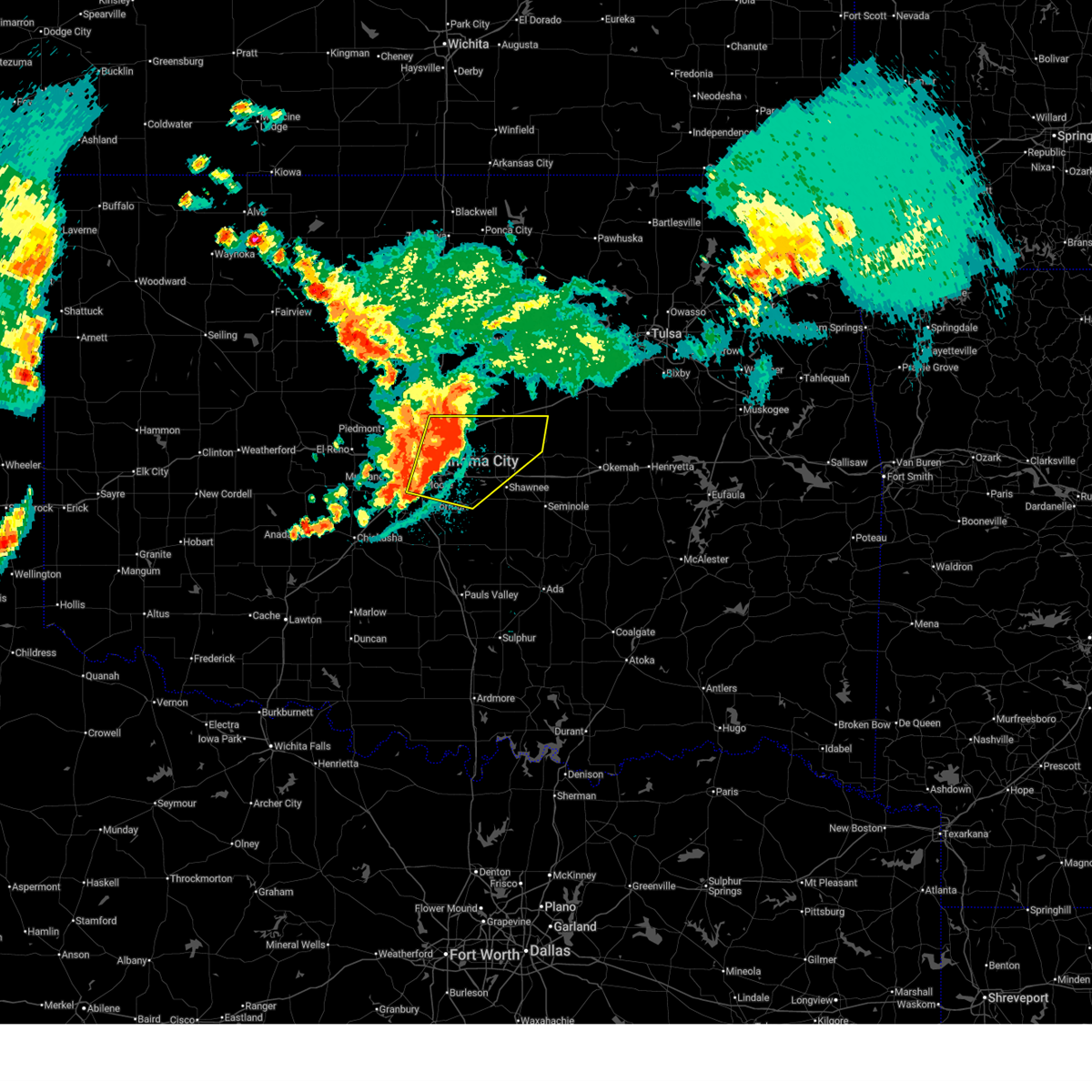
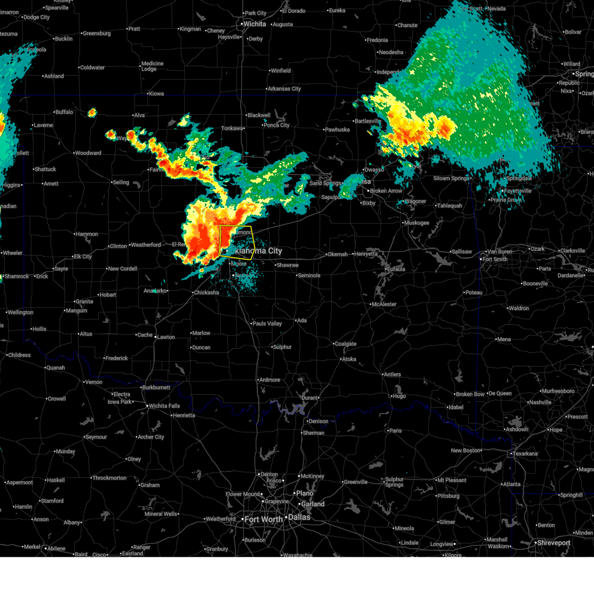
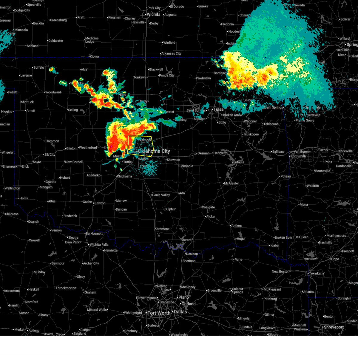
 At 728 pm cdt, a severe thunderstorm capable of producing a tornado was located near del city, moving east at 30 mph (radar indicated rotation). Hazards include tornado and tennis ball size hail. Flying debris will be dangerous to those caught without shelter. mobile homes will be damaged or destroyed. damage to roofs, windows, and vehicles will occur. tree damage is likely. locations impacted include, oklahoma city, midwest city, del city, choctaw, spencer, jones, nicoma park, tinker air force base, forest park, lake aluma, and smith village. this includes the following highways, interstate 35 between mile markers 124 and 137. interstate 40 between mile markers 151 and 161. Interstate 44 between mile markers 128 and 130. At 728 pm cdt, a severe thunderstorm capable of producing a tornado was located near del city, moving east at 30 mph (radar indicated rotation). Hazards include tornado and tennis ball size hail. Flying debris will be dangerous to those caught without shelter. mobile homes will be damaged or destroyed. damage to roofs, windows, and vehicles will occur. tree damage is likely. locations impacted include, oklahoma city, midwest city, del city, choctaw, spencer, jones, nicoma park, tinker air force base, forest park, lake aluma, and smith village. this includes the following highways, interstate 35 between mile markers 124 and 137. interstate 40 between mile markers 151 and 161. Interstate 44 between mile markers 128 and 130.
|
| 3/10/2026 7:12 PM CDT |
 the tornado warning has been cancelled and is no longer in effect the tornado warning has been cancelled and is no longer in effect
|
| 3/10/2026 7:12 PM CDT |
 At 712 pm cdt, a severe thunderstorm capable of producing a tornado was located over southwestern oklahoma city, or near the fairgrounds, moving east at 30 mph (radar indicated rotation). Hazards include tornado and tennis ball size hail. Flying debris will be dangerous to those caught without shelter. mobile homes will be damaged or destroyed. damage to roofs, windows, and vehicles will occur. tree damage is likely. locations impacted include, oklahoma city, midwest city, del city, bethany, choctaw, warr acres, the village, spencer, nichols hills, jones, nicoma park, valley brook, tinker air force base, forest park, woodlawn park, lake aluma, and smith village. this includes the following highways, interstate 35 between mile markers 122 and 137. interstate 40 between mile markers 142 and 164. interstate 44 between mile markers 115 and 130. Interstate 240 between mile markers 1 and 6, and between mile markers 15 and 16. At 712 pm cdt, a severe thunderstorm capable of producing a tornado was located over southwestern oklahoma city, or near the fairgrounds, moving east at 30 mph (radar indicated rotation). Hazards include tornado and tennis ball size hail. Flying debris will be dangerous to those caught without shelter. mobile homes will be damaged or destroyed. damage to roofs, windows, and vehicles will occur. tree damage is likely. locations impacted include, oklahoma city, midwest city, del city, bethany, choctaw, warr acres, the village, spencer, nichols hills, jones, nicoma park, valley brook, tinker air force base, forest park, woodlawn park, lake aluma, and smith village. this includes the following highways, interstate 35 between mile markers 122 and 137. interstate 40 between mile markers 142 and 164. interstate 44 between mile markers 115 and 130. Interstate 240 between mile markers 1 and 6, and between mile markers 15 and 16.
|
| 3/10/2026 6:55 PM CDT |
 Toroun the national weather service in norman has issued a * tornado warning for, southwestern oklahoma county in central oklahoma, northern cleveland county in central oklahoma, * until 745 pm cdt. * at 654 pm cdt, a severe thunderstorm capable of producing a tornado was located over mustang, moving east at 35 mph (radar indicated rotation). Hazards include tornado and tennis ball size hail. Flying debris will be dangerous to those caught without shelter. mobile homes will be damaged or destroyed. damage to roofs, windows, and vehicles will occur. Tree damage is likely. Toroun the national weather service in norman has issued a * tornado warning for, southwestern oklahoma county in central oklahoma, northern cleveland county in central oklahoma, * until 745 pm cdt. * at 654 pm cdt, a severe thunderstorm capable of producing a tornado was located over mustang, moving east at 35 mph (radar indicated rotation). Hazards include tornado and tennis ball size hail. Flying debris will be dangerous to those caught without shelter. mobile homes will be damaged or destroyed. damage to roofs, windows, and vehicles will occur. Tree damage is likely.
|
| 1/8/2026 7:28 AM CST |
 Svroun the national weather service in norman has issued a * severe thunderstorm warning for, lincoln county in central oklahoma, oklahoma county in central oklahoma, southeastern noble county in northern oklahoma, north central cleveland county in central oklahoma, logan county in central oklahoma, payne county in central oklahoma, northwestern pottawatomie county in central oklahoma, * until 815 am cst. * at 728 am cst, severe thunderstorms were located along a line extending from near mulhall to 4 miles northeast of arcadia to near oklahoma city, moving northeast at 70 mph (radar indicated). Hazards include 60 mph wind gusts and penny size hail. expect damage to roofs, siding, and trees Svroun the national weather service in norman has issued a * severe thunderstorm warning for, lincoln county in central oklahoma, oklahoma county in central oklahoma, southeastern noble county in northern oklahoma, north central cleveland county in central oklahoma, logan county in central oklahoma, payne county in central oklahoma, northwestern pottawatomie county in central oklahoma, * until 815 am cst. * at 728 am cst, severe thunderstorms were located along a line extending from near mulhall to 4 miles northeast of arcadia to near oklahoma city, moving northeast at 70 mph (radar indicated). Hazards include 60 mph wind gusts and penny size hail. expect damage to roofs, siding, and trees
|
| 1/8/2026 7:23 AM CST |
 At 723 am cst, severe thunderstorms were located along a line extending from 5 miles southwest of mulhall to 5 miles northeast of edmond to near nicoma park, moving northeast at 70 mph (radar indicated). Hazards include 60 mph wind gusts. Expect damage to roofs, siding, and trees. Locations impacted include, oklahoma city, edmond, moore, midwest city, stillwater, del city, guthrie, newcastle, bethany, choctaw, warr acres, the village, harrah, spencer, nichols hills, jones, nicoma park, langston, crescent, and luther. At 723 am cst, severe thunderstorms were located along a line extending from 5 miles southwest of mulhall to 5 miles northeast of edmond to near nicoma park, moving northeast at 70 mph (radar indicated). Hazards include 60 mph wind gusts. Expect damage to roofs, siding, and trees. Locations impacted include, oklahoma city, edmond, moore, midwest city, stillwater, del city, guthrie, newcastle, bethany, choctaw, warr acres, the village, harrah, spencer, nichols hills, jones, nicoma park, langston, crescent, and luther.
|
| 1/8/2026 7:23 AM CST |
 the severe thunderstorm warning has been cancelled and is no longer in effect the severe thunderstorm warning has been cancelled and is no longer in effect
|
| 1/8/2026 7:16 AM CST |
 the severe thunderstorm warning has been cancelled and is no longer in effect the severe thunderstorm warning has been cancelled and is no longer in effect
|
| 1/8/2026 7:16 AM CST |
 At 716 am cst, severe thunderstorms were located along a line extending from 3 miles north of cedar valley to near edmond to near oklahoma city, moving northeast at 60 mph (radar indicated). Hazards include 60 mph wind gusts. Expect damage to roofs, siding, and trees. Locations impacted include, oklahoma city, edmond, moore, midwest city, stillwater, del city, guthrie, newcastle, bethany, mustang, choctaw, warr acres, the village, piedmont, harrah, spencer, nichols hills, jones, nicoma park, and langston. At 716 am cst, severe thunderstorms were located along a line extending from 3 miles north of cedar valley to near edmond to near oklahoma city, moving northeast at 60 mph (radar indicated). Hazards include 60 mph wind gusts. Expect damage to roofs, siding, and trees. Locations impacted include, oklahoma city, edmond, moore, midwest city, stillwater, del city, guthrie, newcastle, bethany, mustang, choctaw, warr acres, the village, piedmont, harrah, spencer, nichols hills, jones, nicoma park, and langston.
|
| 1/8/2026 7:04 AM CST |
 At 704 am cst, severe thunderstorms were located along a line extending from near piedmont to near oklahoma city to 3 miles northeast of bridge creek, moving northeast at 70 mph (radar indicated). Hazards include 60 mph wind gusts. Expect damage to roofs, siding, and trees. Locations impacted include, oklahoma city, edmond, moore, midwest city, stillwater, del city, el reno, guthrie, newcastle, yukon, bethany, mustang, choctaw, warr acres, the village, tuttle, piedmont, harrah, spencer, and nichols hills. At 704 am cst, severe thunderstorms were located along a line extending from near piedmont to near oklahoma city to 3 miles northeast of bridge creek, moving northeast at 70 mph (radar indicated). Hazards include 60 mph wind gusts. Expect damage to roofs, siding, and trees. Locations impacted include, oklahoma city, edmond, moore, midwest city, stillwater, del city, el reno, guthrie, newcastle, yukon, bethany, mustang, choctaw, warr acres, the village, tuttle, piedmont, harrah, spencer, and nichols hills.
|
| 1/8/2026 6:52 AM CST |
 Svroun the national weather service in norman has issued a * severe thunderstorm warning for, southeastern kingfisher county in central oklahoma, northern grady county in central oklahoma, northwestern lincoln county in central oklahoma, oklahoma county in central oklahoma, south central noble county in northern oklahoma, northwestern cleveland county in central oklahoma, logan county in central oklahoma, western payne county in central oklahoma, canadian county in central oklahoma, northwestern mcclain county in central oklahoma, * until 730 am cst. * at 652 am cst, severe thunderstorms were located along a line extending from near el reno to 3 miles northeast of minco to near amber, moving northeast at 70 mph (radar indicated). Hazards include 60 mph wind gusts and penny size hail. expect damage to roofs, siding, and trees Svroun the national weather service in norman has issued a * severe thunderstorm warning for, southeastern kingfisher county in central oklahoma, northern grady county in central oklahoma, northwestern lincoln county in central oklahoma, oklahoma county in central oklahoma, south central noble county in northern oklahoma, northwestern cleveland county in central oklahoma, logan county in central oklahoma, western payne county in central oklahoma, canadian county in central oklahoma, northwestern mcclain county in central oklahoma, * until 730 am cst. * at 652 am cst, severe thunderstorms were located along a line extending from near el reno to 3 miles northeast of minco to near amber, moving northeast at 70 mph (radar indicated). Hazards include 60 mph wind gusts and penny size hail. expect damage to roofs, siding, and trees
|
| 10/23/2025 8:13 PM CDT | Svroun the national weather service in norman has issued a * severe thunderstorm warning for, southeastern oklahoma county in central oklahoma, * until 900 pm cdt. * at 813 pm cdt, a severe thunderstorm was located near del city, moving east at 10 mph (radar indicated). Hazards include two inch hail and 60 mph wind gusts. People and animals outdoors will be injured. expect hail damage to roofs, siding, windows, and vehicles. Expect wind damage to roofs, siding, and trees. |
| 10/23/2025 8:04 PM CDT | At 804 pm cdt, a severe thunderstorm was located near del city, moving east at 20 mph (radar indicated). Hazards include two inch hail and 60 mph wind gusts. People and animals outdoors will be injured. expect hail damage to roofs, siding, windows, and vehicles. expect wind damage to roofs, siding, and trees. Locations impacted include, oklahoma city, midwest city, del city, choctaw, spencer, nichols hills, jones, nicoma park, tinker air force base, forest park, lake aluma, and smith village. |
| 10/23/2025 7:43 PM CDT | the severe thunderstorm warning has been cancelled and is no longer in effect |
| 10/23/2025 7:43 PM CDT | At 743 pm cdt, a severe thunderstorm was located over western oklahoma city, or near the fairgrounds, moving east at 25 mph (radar indicated). Hazards include ping pong ball size hail and 60 mph wind gusts. People and animals outdoors will be injured. expect hail damage to roofs, siding, windows, and vehicles. expect wind damage to roofs, siding, and trees. Locations impacted include, oklahoma city, southeastern edmond, midwest city, del city, bethany, choctaw, warr acres, the village, spencer, nichols hills, jones, nicoma park, valley brook, arcadia, tinker air force base, forest park, woodlawn park, lake aluma, and smith village. |
| 10/23/2025 7:27 PM CDT | Svroun the national weather service in norman has issued a * severe thunderstorm warning for, central oklahoma county in central oklahoma, east central canadian county in central oklahoma, * until 815 pm cdt. * at 727 pm cdt, a severe thunderstorm was located over western oklahoma city, or near woodlawn park, moving east at 25 mph (radar indicated). Hazards include 60 mph wind gusts and quarter size hail. Hail damage to vehicles is expected. Expect wind damage to roofs, siding, and trees. |
| 8/11/2025 4:12 PM CDT |
 Svroun the national weather service in norman has issued a * severe thunderstorm warning for, central oklahoma county in central oklahoma, * until 500 pm cdt. * at 411 pm cdt, a severe thunderstorm was located over northeastern oklahoma city just north of the interstate 35-interstate 44 interchange, moving northeast at 15 mph (radar indicated). Hazards include 60 mph wind gusts and quarter size hail. Hail damage to vehicles is expected. Expect wind damage to roofs, siding, and trees. Svroun the national weather service in norman has issued a * severe thunderstorm warning for, central oklahoma county in central oklahoma, * until 500 pm cdt. * at 411 pm cdt, a severe thunderstorm was located over northeastern oklahoma city just north of the interstate 35-interstate 44 interchange, moving northeast at 15 mph (radar indicated). Hazards include 60 mph wind gusts and quarter size hail. Hail damage to vehicles is expected. Expect wind damage to roofs, siding, and trees.
|
| 7/8/2025 4:47 PM CDT |
 the severe thunderstorm warning has been cancelled and is no longer in effect the severe thunderstorm warning has been cancelled and is no longer in effect
|
| 7/8/2025 4:20 PM CDT |
 Svroun the national weather service in norman has issued a * severe thunderstorm warning for, southwestern oklahoma county in central oklahoma, * until 500 pm cdt. * at 420 pm cdt, a severe thunderstorm was located over northwestern oklahoma city, moving south at 10 mph (radar indicated). Hazards include 60 mph wind gusts and quarter size hail. Hail damage to vehicles is expected. Expect wind damage to roofs, siding, and trees. Svroun the national weather service in norman has issued a * severe thunderstorm warning for, southwestern oklahoma county in central oklahoma, * until 500 pm cdt. * at 420 pm cdt, a severe thunderstorm was located over northwestern oklahoma city, moving south at 10 mph (radar indicated). Hazards include 60 mph wind gusts and quarter size hail. Hail damage to vehicles is expected. Expect wind damage to roofs, siding, and trees.
|
| 6/26/2025 5:52 PM CDT |
 The storms which prompted the warning have weakened below severe limits, therefore the warning will be allowed to expire. however, gusty winds and heavy rain are still possible with these thunderstorms. The storms which prompted the warning have weakened below severe limits, therefore the warning will be allowed to expire. however, gusty winds and heavy rain are still possible with these thunderstorms.
|
| 6/26/2025 5:41 PM CDT |
 the severe thunderstorm warning has been cancelled and is no longer in effect the severe thunderstorm warning has been cancelled and is no longer in effect
|
| 6/26/2025 5:41 PM CDT |
 At 539 pm cdt, severe thunderstorms were located along a line extending from near arcadia to near downtown oklahoma city, moving east at 10 mph (radar indicated). Hazards include 60 mph wind gusts. Expect damage to roofs, siding, and trees. Locations impacted include, oklahoma city, edmond, midwest city, del city, choctaw, spencer, nichols hills, jones, nicoma park, luther, arcadia, forest park, and lake aluma. At 539 pm cdt, severe thunderstorms were located along a line extending from near arcadia to near downtown oklahoma city, moving east at 10 mph (radar indicated). Hazards include 60 mph wind gusts. Expect damage to roofs, siding, and trees. Locations impacted include, oklahoma city, edmond, midwest city, del city, choctaw, spencer, nichols hills, jones, nicoma park, luther, arcadia, forest park, and lake aluma.
|
| 6/26/2025 5:10 PM CDT |
 Svroun the national weather service in norman has issued a * severe thunderstorm warning for, oklahoma county in central oklahoma, east central canadian county in central oklahoma, * until 600 pm cdt. * at 509 pm cdt, severe thunderstorms were located over central edmond, just east of nichols hills, and near bethany, moving east at 20 mph (radar indicated). Hazards include 60 mph wind gusts and quarter size hail. Hail damage to vehicles is expected. Expect wind damage to roofs, siding, and trees. Svroun the national weather service in norman has issued a * severe thunderstorm warning for, oklahoma county in central oklahoma, east central canadian county in central oklahoma, * until 600 pm cdt. * at 509 pm cdt, severe thunderstorms were located over central edmond, just east of nichols hills, and near bethany, moving east at 20 mph (radar indicated). Hazards include 60 mph wind gusts and quarter size hail. Hail damage to vehicles is expected. Expect wind damage to roofs, siding, and trees.
|
| 6/17/2025 11:28 PM CDT |
 the severe thunderstorm warning has been cancelled and is no longer in effect the severe thunderstorm warning has been cancelled and is no longer in effect
|
| 6/17/2025 11:28 PM CDT |
 At 1128 pm cdt, severe thunderstorms were located along a line extending from near maramec to near avery to 3 miles east of mcloud, moving east at 55 mph (radar indicated). Hazards include 70 mph wind gusts and quarter size hail. Hail damage to vehicles is expected. expect considerable tree damage. wind damage is also likely to mobile homes, roofs, and outbuildings. Locations impacted include, oklahoma city, edmond, midwest city, stillwater, shawnee, del city, cushing, chandler, choctaw, the village, harrah, mcloud, spencer, nichols hills, perkins, jones, stroud, nicoma park, prague, and langston. At 1128 pm cdt, severe thunderstorms were located along a line extending from near maramec to near avery to 3 miles east of mcloud, moving east at 55 mph (radar indicated). Hazards include 70 mph wind gusts and quarter size hail. Hail damage to vehicles is expected. expect considerable tree damage. wind damage is also likely to mobile homes, roofs, and outbuildings. Locations impacted include, oklahoma city, edmond, midwest city, stillwater, shawnee, del city, cushing, chandler, choctaw, the village, harrah, mcloud, spencer, nichols hills, perkins, jones, stroud, nicoma park, prague, and langston.
|
| 6/17/2025 11:23 PM CDT |
 At 1123 pm cdt, severe thunderstorms were located along a line extending from 4 miles south of pawnee to near agra to near mcloud, moving east at 55 mph (emergency management reported a 76 mph wind gust near cushing). Hazards include 70 mph wind gusts and quarter size hail. Hail damage to vehicles is expected. expect considerable tree damage. wind damage is also likely to mobile homes, roofs, and outbuildings. Locations impacted include, oklahoma city, edmond, midwest city, stillwater, shawnee, del city, cushing, chandler, choctaw, the village, harrah, mcloud, spencer, nichols hills, perkins, jones, stroud, nicoma park, prague, and langston. At 1123 pm cdt, severe thunderstorms were located along a line extending from 4 miles south of pawnee to near agra to near mcloud, moving east at 55 mph (emergency management reported a 76 mph wind gust near cushing). Hazards include 70 mph wind gusts and quarter size hail. Hail damage to vehicles is expected. expect considerable tree damage. wind damage is also likely to mobile homes, roofs, and outbuildings. Locations impacted include, oklahoma city, edmond, midwest city, stillwater, shawnee, del city, cushing, chandler, choctaw, the village, harrah, mcloud, spencer, nichols hills, perkins, jones, stroud, nicoma park, prague, and langston.
|
| 6/17/2025 11:21 PM CDT |
 the severe thunderstorm warning has been cancelled and is no longer in effect the severe thunderstorm warning has been cancelled and is no longer in effect
|
| 6/17/2025 11:21 PM CDT |
 At 1120 pm cdt, severe thunderstorms were located along a line extending from 3 miles south of pawnee to near agra to near harrah, moving east at 55 mph (radar indicated). Hazards include 60 mph wind gusts and quarter size hail. Hail damage to vehicles is expected. expect wind damage to roofs, siding, and trees. Locations impacted include, oklahoma city, edmond, midwest city, stillwater, shawnee, del city, cushing, chandler, choctaw, the village, harrah, mcloud, spencer, nichols hills, perkins, jones, stroud, nicoma park, prague, and langston. At 1120 pm cdt, severe thunderstorms were located along a line extending from 3 miles south of pawnee to near agra to near harrah, moving east at 55 mph (radar indicated). Hazards include 60 mph wind gusts and quarter size hail. Hail damage to vehicles is expected. expect wind damage to roofs, siding, and trees. Locations impacted include, oklahoma city, edmond, midwest city, stillwater, shawnee, del city, cushing, chandler, choctaw, the village, harrah, mcloud, spencer, nichols hills, perkins, jones, stroud, nicoma park, prague, and langston.
|
| 6/17/2025 11:08 PM CDT |
 the severe thunderstorm warning has been cancelled and is no longer in effect the severe thunderstorm warning has been cancelled and is no longer in effect
|
| 6/17/2025 11:08 PM CDT |
 At 1107 pm cdt, severe thunderstorms were located along a line extending from near morrison to 4 miles southwest of perkins to near spencer, moving east at 55 mph (radar indicated). Hazards include 70 mph wind gusts and quarter size hail. Hail damage to vehicles is expected. expect considerable tree damage. wind damage is also likely to mobile homes, roofs, and outbuildings. Locations impacted include, oklahoma city, edmond, midwest city, stillwater, shawnee, del city, guthrie, cushing, perry, chandler, yukon, bethany, choctaw, warr acres, the village, harrah, mcloud, spencer, nichols hills, and perkins. At 1107 pm cdt, severe thunderstorms were located along a line extending from near morrison to 4 miles southwest of perkins to near spencer, moving east at 55 mph (radar indicated). Hazards include 70 mph wind gusts and quarter size hail. Hail damage to vehicles is expected. expect considerable tree damage. wind damage is also likely to mobile homes, roofs, and outbuildings. Locations impacted include, oklahoma city, edmond, midwest city, stillwater, shawnee, del city, guthrie, cushing, perry, chandler, yukon, bethany, choctaw, warr acres, the village, harrah, mcloud, spencer, nichols hills, and perkins.
|
| 6/17/2025 10:56 PM CDT |
 Svroun the national weather service in norman has issued a * severe thunderstorm warning for, southeastern kingfisher county in central oklahoma, lincoln county in central oklahoma, oklahoma county in central oklahoma, southern noble county in northern oklahoma, logan county in central oklahoma, payne county in central oklahoma, southeastern garfield county in northern oklahoma, northeastern canadian county in central oklahoma, northwestern pottawatomie county in central oklahoma, * until 1145 pm cdt. * at 1055 pm cdt, severe thunderstorms were located along a line extending from 6 miles northeast of perry to near langston to near oklahoma city, moving east at 55 mph (numerous reports of 60-70 mph wind gusts). Hazards include 70 mph wind gusts and quarter size hail. Hail damage to vehicles is expected. expect considerable tree damage. Wind damage is also likely to mobile homes, roofs, and outbuildings. Svroun the national weather service in norman has issued a * severe thunderstorm warning for, southeastern kingfisher county in central oklahoma, lincoln county in central oklahoma, oklahoma county in central oklahoma, southern noble county in northern oklahoma, logan county in central oklahoma, payne county in central oklahoma, southeastern garfield county in northern oklahoma, northeastern canadian county in central oklahoma, northwestern pottawatomie county in central oklahoma, * until 1145 pm cdt. * at 1055 pm cdt, severe thunderstorms were located along a line extending from 6 miles northeast of perry to near langston to near oklahoma city, moving east at 55 mph (numerous reports of 60-70 mph wind gusts). Hazards include 70 mph wind gusts and quarter size hail. Hail damage to vehicles is expected. expect considerable tree damage. Wind damage is also likely to mobile homes, roofs, and outbuildings.
|
| 6/17/2025 10:50 PM CDT |
 At 1050 pm cdt, severe thunderstorms were located along a line extending from 8 miles west of red rock to 5 miles west of langston to near oklahoma city, moving east at 70 mph (radar indicated). Hazards include 70 mph wind gusts and quarter size hail. Hail damage to vehicles is expected. expect considerable tree damage. wind damage is also likely to mobile homes, roofs, and outbuildings. Locations impacted include, northern oklahoma city, edmond, stillwater, guthrie, perry, choctaw, the village, piedmont, spencer, nichols hills, perkins, jones, langston, crescent, luther, garber, cashion, morrison, carney, and glencoe. At 1050 pm cdt, severe thunderstorms were located along a line extending from 8 miles west of red rock to 5 miles west of langston to near oklahoma city, moving east at 70 mph (radar indicated). Hazards include 70 mph wind gusts and quarter size hail. Hail damage to vehicles is expected. expect considerable tree damage. wind damage is also likely to mobile homes, roofs, and outbuildings. Locations impacted include, northern oklahoma city, edmond, stillwater, guthrie, perry, choctaw, the village, piedmont, spencer, nichols hills, perkins, jones, langston, crescent, luther, garber, cashion, morrison, carney, and glencoe.
|
| 6/17/2025 10:38 PM CDT |
 the severe thunderstorm warning has been cancelled and is no longer in effect the severe thunderstorm warning has been cancelled and is no longer in effect
|
| 6/17/2025 10:38 PM CDT |
 At 1037 pm cdt, severe thunderstorms were located along a line extending from near garber to near crescent to 6 miles southwest of piedmont, moving east at 60 mph (radar indicated). Hazards include 70 mph wind gusts and quarter size hail. Hail damage to vehicles is expected. expect considerable tree damage. wind damage is also likely to mobile homes, roofs, and outbuildings. Locations impacted include, northern oklahoma city, edmond, enid, stillwater, guthrie, perry, kingfisher, choctaw, the village, piedmont, spencer, nichols hills, perkins, jones, langston, crescent, luther, okarche, garber, and cashion. At 1037 pm cdt, severe thunderstorms were located along a line extending from near garber to near crescent to 6 miles southwest of piedmont, moving east at 60 mph (radar indicated). Hazards include 70 mph wind gusts and quarter size hail. Hail damage to vehicles is expected. expect considerable tree damage. wind damage is also likely to mobile homes, roofs, and outbuildings. Locations impacted include, northern oklahoma city, edmond, enid, stillwater, guthrie, perry, kingfisher, choctaw, the village, piedmont, spencer, nichols hills, perkins, jones, langston, crescent, luther, okarche, garber, and cashion.
|
| 6/17/2025 10:22 PM CDT |
 Svroun the national weather service in norman has issued a * severe thunderstorm warning for, kingfisher county in central oklahoma, northwestern lincoln county in central oklahoma, northern oklahoma county in central oklahoma, noble county in northern oklahoma, central blaine county in northwestern oklahoma, logan county in central oklahoma, western payne county in central oklahoma, garfield county in northern oklahoma, southeastern major county in northwestern oklahoma, northern canadian county in central oklahoma, * until 1100 pm cdt. * at 1022 pm cdt, severe thunderstorms were located along a line extending from 3 miles south of kremlin to 3 miles northeast of dover to 3 miles northeast of calumet, moving east at 60 mph (radar indicated). Hazards include 70 mph wind gusts and quarter size hail. Hail damage to vehicles is expected. expect considerable tree damage. Wind damage is also likely to mobile homes, roofs, and outbuildings. Svroun the national weather service in norman has issued a * severe thunderstorm warning for, kingfisher county in central oklahoma, northwestern lincoln county in central oklahoma, northern oklahoma county in central oklahoma, noble county in northern oklahoma, central blaine county in northwestern oklahoma, logan county in central oklahoma, western payne county in central oklahoma, garfield county in northern oklahoma, southeastern major county in northwestern oklahoma, northern canadian county in central oklahoma, * until 1100 pm cdt. * at 1022 pm cdt, severe thunderstorms were located along a line extending from 3 miles south of kremlin to 3 miles northeast of dover to 3 miles northeast of calumet, moving east at 60 mph (radar indicated). Hazards include 70 mph wind gusts and quarter size hail. Hail damage to vehicles is expected. expect considerable tree damage. Wind damage is also likely to mobile homes, roofs, and outbuildings.
|
| 6/15/2025 2:40 AM CDT |
 the severe thunderstorm warning has been cancelled and is no longer in effect the severe thunderstorm warning has been cancelled and is no longer in effect
|
| 6/15/2025 2:10 AM CDT |
 Svroun the national weather service in norman has issued a * severe thunderstorm warning for, west central lincoln county in central oklahoma, northern oklahoma county in central oklahoma, southern logan county in central oklahoma, * until 300 am cdt. * at 209 am cdt, severe thunderstorms were located along a line extending from 4 miles south of cedar valley to near edmond to near fallis, moving south at 20 mph (radar indicated). Hazards include 60 mph wind gusts and quarter size hail. Hail damage to vehicles is expected. Expect wind damage to roofs, siding, and trees. Svroun the national weather service in norman has issued a * severe thunderstorm warning for, west central lincoln county in central oklahoma, northern oklahoma county in central oklahoma, southern logan county in central oklahoma, * until 300 am cdt. * at 209 am cdt, severe thunderstorms were located along a line extending from 4 miles south of cedar valley to near edmond to near fallis, moving south at 20 mph (radar indicated). Hazards include 60 mph wind gusts and quarter size hail. Hail damage to vehicles is expected. Expect wind damage to roofs, siding, and trees.
|
| 6/15/2025 1:38 AM CDT |
 The storms which prompted the warning have weakened below severe limits, therefore the warning will be allowed to expire. The storms which prompted the warning have weakened below severe limits, therefore the warning will be allowed to expire.
|
| 6/15/2025 1:17 AM CDT |
 At 117 am cdt, severe thunderstorms were located along a line extending from 3 miles southeast of choctaw to near oklahoma city to near warr acres, moving southeast at 10 mph (radar indicated). Hazards include 60 mph wind gusts and quarter size hail. Hail damage to vehicles is expected. expect wind damage to roofs, siding, and trees. Locations impacted include, oklahoma city, southwestern edmond, midwest city, del city, bethany, choctaw, warr acres, the village, harrah, spencer, nichols hills, jones, nicoma park, valley brook, tinker air force base, newalla, forest park, lake aluma, and smith village. At 117 am cdt, severe thunderstorms were located along a line extending from 3 miles southeast of choctaw to near oklahoma city to near warr acres, moving southeast at 10 mph (radar indicated). Hazards include 60 mph wind gusts and quarter size hail. Hail damage to vehicles is expected. expect wind damage to roofs, siding, and trees. Locations impacted include, oklahoma city, southwestern edmond, midwest city, del city, bethany, choctaw, warr acres, the village, harrah, spencer, nichols hills, jones, nicoma park, valley brook, tinker air force base, newalla, forest park, lake aluma, and smith village.
|
| 6/15/2025 1:17 AM CDT |
 the severe thunderstorm warning has been cancelled and is no longer in effect the severe thunderstorm warning has been cancelled and is no longer in effect
|
| 6/15/2025 12:55 AM CDT |
 Svroun the national weather service in norman has issued a * severe thunderstorm warning for, oklahoma county in central oklahoma, northeastern cleveland county in central oklahoma, * until 145 am cdt. * at 1255 am cdt, severe thunderstorms were located along a line extending from near choctaw to near del city to near oklahoma city, moving southeast at 15 mph (radar indicated). Hazards include 60 mph wind gusts and half dollar size hail. Hail damage to vehicles is expected. Expect wind damage to roofs, siding, and trees. Svroun the national weather service in norman has issued a * severe thunderstorm warning for, oklahoma county in central oklahoma, northeastern cleveland county in central oklahoma, * until 145 am cdt. * at 1255 am cdt, severe thunderstorms were located along a line extending from near choctaw to near del city to near oklahoma city, moving southeast at 15 mph (radar indicated). Hazards include 60 mph wind gusts and half dollar size hail. Hail damage to vehicles is expected. Expect wind damage to roofs, siding, and trees.
|
| 6/15/2025 12:21 AM CDT |
 the severe thunderstorm warning has been cancelled and is no longer in effect the severe thunderstorm warning has been cancelled and is no longer in effect
|
| 6/15/2025 12:21 AM CDT |
 At 1220 am cdt, severe thunderstorms were located along a line extending from near oklahoma city to 3 miles north of spencer to 3 miles northeast of arcadia, moving southeast at 15 mph (radar indicated). Hazards include ping pong ball size hail and 60 mph wind gusts. People and animals outdoors will be injured. expect hail damage to roofs, siding, windows, and vehicles. expect wind damage to roofs, siding, and trees. Locations impacted include, oklahoma city, northern norman, edmond, moore, midwest city, del city, yukon, bethany, mustang, choctaw, warr acres, the village, piedmont, harrah, spencer, nichols hills, jones, nicoma park, luther, and valley brook. At 1220 am cdt, severe thunderstorms were located along a line extending from near oklahoma city to 3 miles north of spencer to 3 miles northeast of arcadia, moving southeast at 15 mph (radar indicated). Hazards include ping pong ball size hail and 60 mph wind gusts. People and animals outdoors will be injured. expect hail damage to roofs, siding, windows, and vehicles. expect wind damage to roofs, siding, and trees. Locations impacted include, oklahoma city, northern norman, edmond, moore, midwest city, del city, yukon, bethany, mustang, choctaw, warr acres, the village, piedmont, harrah, spencer, nichols hills, jones, nicoma park, luther, and valley brook.
|
| 6/15/2025 12:07 AM CDT |
 Svroun the national weather service in norman has issued a * severe thunderstorm warning for, oklahoma county in central oklahoma, northern cleveland county in central oklahoma, southeastern logan county in central oklahoma, southeastern canadian county in central oklahoma, * until 100 am cdt. * at 1207 am cdt, severe thunderstorms were located along a line extending from near bethany to near oklahoma city to 4 miles north of arcadia, moving southeast at 15 mph (public). Hazards include golf ball size hail and 60 mph wind gusts. People and animals outdoors will be injured. expect hail damage to roofs, siding, windows, and vehicles. Expect wind damage to roofs, siding, and trees. Svroun the national weather service in norman has issued a * severe thunderstorm warning for, oklahoma county in central oklahoma, northern cleveland county in central oklahoma, southeastern logan county in central oklahoma, southeastern canadian county in central oklahoma, * until 100 am cdt. * at 1207 am cdt, severe thunderstorms were located along a line extending from near bethany to near oklahoma city to 4 miles north of arcadia, moving southeast at 15 mph (public). Hazards include golf ball size hail and 60 mph wind gusts. People and animals outdoors will be injured. expect hail damage to roofs, siding, windows, and vehicles. Expect wind damage to roofs, siding, and trees.
|
| 6/14/2025 11:26 PM CDT |
 Svroun the national weather service in norman has issued a * severe thunderstorm warning for, oklahoma county in central oklahoma, * until 1215 am cdt. * at 1124 pm cdt, a severe thunderstorm was located 7 miles northwest of edmond, moving south at 25 mph (radar indicated). Hazards include 60 mph wind gusts and quarter size hail. Hail damage to vehicles is expected. expect wind damage to roofs, siding, and trees. this severe thunderstorm will be near, edmond and oklahoma city around 1130 pm cdt. the village and nichols hills around 1140 pm cdt. midwest city and del city around 1200 am cdt. tinker air force base around 1205 am cdt. Other locations impacted by this severe thunderstorm include downtown edmond, smith village, the capitol, wiley post airport, forest park, will rogers airport, the fairgrounds, woodlawn park, and lake aluma. Svroun the national weather service in norman has issued a * severe thunderstorm warning for, oklahoma county in central oklahoma, * until 1215 am cdt. * at 1124 pm cdt, a severe thunderstorm was located 7 miles northwest of edmond, moving south at 25 mph (radar indicated). Hazards include 60 mph wind gusts and quarter size hail. Hail damage to vehicles is expected. expect wind damage to roofs, siding, and trees. this severe thunderstorm will be near, edmond and oklahoma city around 1130 pm cdt. the village and nichols hills around 1140 pm cdt. midwest city and del city around 1200 am cdt. tinker air force base around 1205 am cdt. Other locations impacted by this severe thunderstorm include downtown edmond, smith village, the capitol, wiley post airport, forest park, will rogers airport, the fairgrounds, woodlawn park, and lake aluma.
|
| 6/14/2025 9:46 AM CDT |
 the severe thunderstorm warning has been cancelled and is no longer in effect the severe thunderstorm warning has been cancelled and is no longer in effect
|
| 6/14/2025 9:26 AM CDT |
 Svroun the national weather service in norman has issued a * severe thunderstorm warning for, eastern oklahoma county in central oklahoma, * until 1000 am cdt. * at 926 am cdt, a severe thunderstorm was located over northeastern oklahoma city, or near lake aluma, moving east at 20 mph (radar indicated). Hazards include 60 mph wind gusts. expect damage to roofs, siding, and trees Svroun the national weather service in norman has issued a * severe thunderstorm warning for, eastern oklahoma county in central oklahoma, * until 1000 am cdt. * at 926 am cdt, a severe thunderstorm was located over northeastern oklahoma city, or near lake aluma, moving east at 20 mph (radar indicated). Hazards include 60 mph wind gusts. expect damage to roofs, siding, and trees
|
| 6/14/2025 9:16 AM CDT |
 the severe thunderstorm warning has been cancelled and is no longer in effect the severe thunderstorm warning has been cancelled and is no longer in effect
|
| 6/14/2025 9:16 AM CDT |
 At 916 am cdt, a severe thunderstorm was located over northern oklahoma city, or near nichols hills, moving east at 20 mph (radar indicated). Hazards include 60 mph wind gusts and penny size hail. Expect damage to roofs, siding, and trees. Locations impacted include, oklahoma city, edmond, midwest city, del city, bethany, warr acres, the village, spencer, nichols hills, tinker air force base, forest park, woodlawn park, lake aluma, and smith village. At 916 am cdt, a severe thunderstorm was located over northern oklahoma city, or near nichols hills, moving east at 20 mph (radar indicated). Hazards include 60 mph wind gusts and penny size hail. Expect damage to roofs, siding, and trees. Locations impacted include, oklahoma city, edmond, midwest city, del city, bethany, warr acres, the village, spencer, nichols hills, tinker air force base, forest park, woodlawn park, lake aluma, and smith village.
|
| 6/14/2025 8:52 AM CDT |
 Svroun the national weather service in norman has issued a * severe thunderstorm warning for, western oklahoma county in central oklahoma, northeastern canadian county in central oklahoma, * until 930 am cdt. * at 851 am cdt, a severe thunderstorm was located over northwestern oklahoma city, or near wiley post airport, moving east at 15 mph (radar indicated). Hazards include 60 mph wind gusts and nickel size hail. expect damage to roofs, siding, and trees Svroun the national weather service in norman has issued a * severe thunderstorm warning for, western oklahoma county in central oklahoma, northeastern canadian county in central oklahoma, * until 930 am cdt. * at 851 am cdt, a severe thunderstorm was located over northwestern oklahoma city, or near wiley post airport, moving east at 15 mph (radar indicated). Hazards include 60 mph wind gusts and nickel size hail. expect damage to roofs, siding, and trees
|
| 6/7/2025 12:28 AM CDT |
 the severe thunderstorm warning has been cancelled and is no longer in effect the severe thunderstorm warning has been cancelled and is no longer in effect
|
| 6/7/2025 12:21 AM CDT |
 At 1221 am cdt, severe thunderstorms were located along a line extending from near oklahoma city to 4 miles northeast of newcastle, moving east at 40 mph (radar indicated). Hazards include 60 mph wind gusts and quarter size hail. Hail damage to vehicles is expected. expect wind damage to roofs, siding, and trees. Locations impacted include, oklahoma city, northern norman, southern edmond, moore, midwest city, del city, newcastle, yukon, bethany, mustang, choctaw, warr acres, the village, tuttle, spencer, nichols hills, nicoma park, valley brook, tinker air force base, and stanley draper lake. At 1221 am cdt, severe thunderstorms were located along a line extending from near oklahoma city to 4 miles northeast of newcastle, moving east at 40 mph (radar indicated). Hazards include 60 mph wind gusts and quarter size hail. Hail damage to vehicles is expected. expect wind damage to roofs, siding, and trees. Locations impacted include, oklahoma city, northern norman, southern edmond, moore, midwest city, del city, newcastle, yukon, bethany, mustang, choctaw, warr acres, the village, tuttle, spencer, nichols hills, nicoma park, valley brook, tinker air force base, and stanley draper lake.
|
| 6/7/2025 12:02 AM CDT |
 Svroun the national weather service in norman has issued a * severe thunderstorm warning for, northeastern grady county in central oklahoma, western oklahoma county in central oklahoma, northwestern cleveland county in central oklahoma, southeastern canadian county in central oklahoma, northwestern mcclain county in central oklahoma, * until 1245 am cdt. * at 1202 am cdt, severe thunderstorms were located along a line extending from near yukon to near bridge creek, moving east at 40 mph (radar indicated). Hazards include 60 mph wind gusts and quarter size hail. Hail damage to vehicles is expected. Expect wind damage to roofs, siding, and trees. Svroun the national weather service in norman has issued a * severe thunderstorm warning for, northeastern grady county in central oklahoma, western oklahoma county in central oklahoma, northwestern cleveland county in central oklahoma, southeastern canadian county in central oklahoma, northwestern mcclain county in central oklahoma, * until 1245 am cdt. * at 1202 am cdt, severe thunderstorms were located along a line extending from near yukon to near bridge creek, moving east at 40 mph (radar indicated). Hazards include 60 mph wind gusts and quarter size hail. Hail damage to vehicles is expected. Expect wind damage to roofs, siding, and trees.
|
| 6/6/2025 4:58 AM CDT |
 The storms which prompted the warning have moved out of the area. therefore the warning will be allowed to expire. a severe thunderstorm watch remains in effect until 800 am cdt for central and northern oklahoma. to report severe weather, contact your nearest law enforcement agency. they will relay your report to the national weather service norman. The storms which prompted the warning have moved out of the area. therefore the warning will be allowed to expire. a severe thunderstorm watch remains in effect until 800 am cdt for central and northern oklahoma. to report severe weather, contact your nearest law enforcement agency. they will relay your report to the national weather service norman.
|
| 6/6/2025 4:37 AM CDT |
 At 436 am cdt, severe thunderstorms were located along a line extending from near perkins to luther to midwest city, moving east at 50 mph (radar indicated. at 425 am cdt...a wind gust of 77 mph was measured in guthrie with these storms). Hazards include 70 mph wind gusts and quarter size hail. Hail damage to vehicles is expected. expect considerable tree damage. wind damage is also likely to mobile homes, roofs, and outbuildings. Locations impacted include, warwick, coyle, wiley post airport, carney, downtown edmond, jones, the village, guthrie, stillwater, luther, wellston, langston, nichols hills, perkins, edmond, meridian, tryon, arcadia, fallis, and lake aluma. At 436 am cdt, severe thunderstorms were located along a line extending from near perkins to luther to midwest city, moving east at 50 mph (radar indicated. at 425 am cdt...a wind gust of 77 mph was measured in guthrie with these storms). Hazards include 70 mph wind gusts and quarter size hail. Hail damage to vehicles is expected. expect considerable tree damage. wind damage is also likely to mobile homes, roofs, and outbuildings. Locations impacted include, warwick, coyle, wiley post airport, carney, downtown edmond, jones, the village, guthrie, stillwater, luther, wellston, langston, nichols hills, perkins, edmond, meridian, tryon, arcadia, fallis, and lake aluma.
|
| 6/6/2025 4:37 AM CDT |
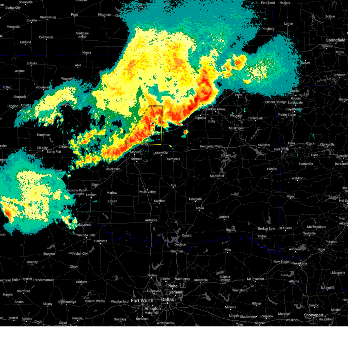 the severe thunderstorm warning has been cancelled and is no longer in effect the severe thunderstorm warning has been cancelled and is no longer in effect
|
| 6/6/2025 4:21 AM CDT |
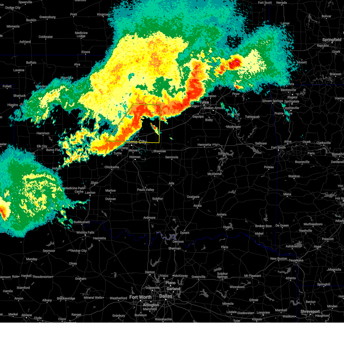 At 421 am cdt, severe thunderstorms were located along a line extending from near mulhall to guthrie to warr acres, moving east at 50 mph (radar indicated). Hazards include 70 mph wind gusts and quarter size hail. Hail damage to vehicles is expected. expect considerable tree damage. wind damage is also likely to mobile homes, roofs, and outbuildings. Locations impacted include, warwick, coyle, cedar valley, wiley post airport, seward, richland, carney, downtown edmond, navina, jones, the village, cimarron city, mulhall, cashion, guthrie, stillwater, luther, wellston, lake carl blackwell, and langston. At 421 am cdt, severe thunderstorms were located along a line extending from near mulhall to guthrie to warr acres, moving east at 50 mph (radar indicated). Hazards include 70 mph wind gusts and quarter size hail. Hail damage to vehicles is expected. expect considerable tree damage. wind damage is also likely to mobile homes, roofs, and outbuildings. Locations impacted include, warwick, coyle, cedar valley, wiley post airport, seward, richland, carney, downtown edmond, navina, jones, the village, cimarron city, mulhall, cashion, guthrie, stillwater, luther, wellston, lake carl blackwell, and langston.
|
| 6/6/2025 3:56 AM CDT |
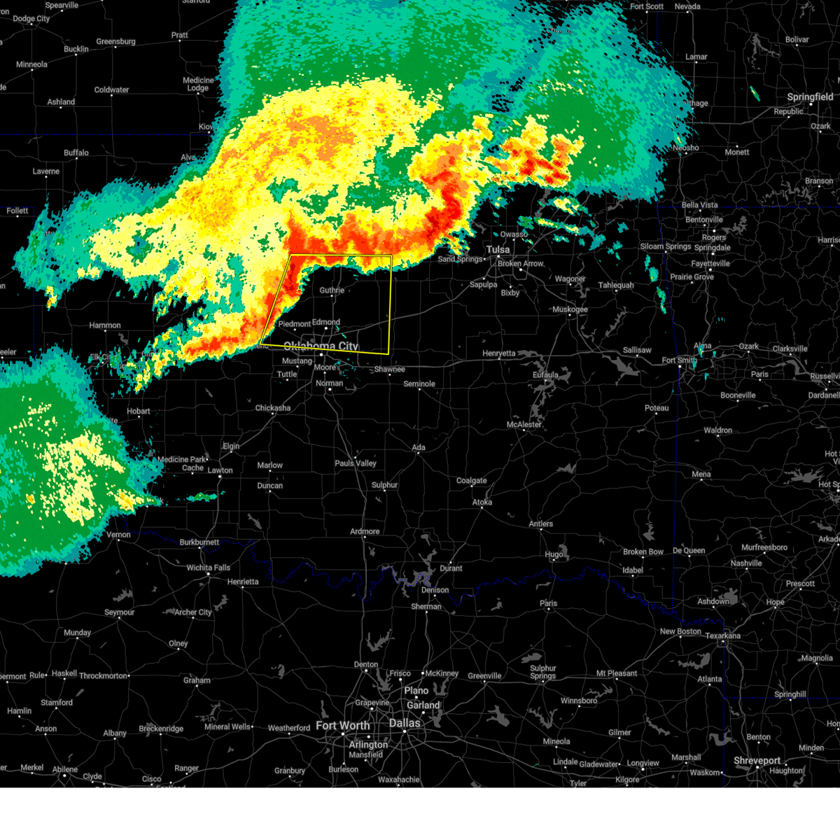 Svroun the national weather service in norman has issued a * severe thunderstorm warning for, eastern kingfisher county in central oklahoma, western lincoln county in central oklahoma, oklahoma county in central oklahoma, logan county in central oklahoma, southwestern payne county in central oklahoma, northeastern canadian county in central oklahoma, * until 500 am cdt. * at 355 am cdt, severe thunderstorms were located along a line extending from near marshall to near cashion to concho, moving southeast at 45 mph (radar indicated). Hazards include 70 mph wind gusts and quarter size hail. Hail damage to vehicles is expected. expect considerable tree damage. Wind damage is also likely to mobile homes, roofs, and outbuildings. Svroun the national weather service in norman has issued a * severe thunderstorm warning for, eastern kingfisher county in central oklahoma, western lincoln county in central oklahoma, oklahoma county in central oklahoma, logan county in central oklahoma, southwestern payne county in central oklahoma, northeastern canadian county in central oklahoma, * until 500 am cdt. * at 355 am cdt, severe thunderstorms were located along a line extending from near marshall to near cashion to concho, moving southeast at 45 mph (radar indicated). Hazards include 70 mph wind gusts and quarter size hail. Hail damage to vehicles is expected. expect considerable tree damage. Wind damage is also likely to mobile homes, roofs, and outbuildings.
|
| 6/3/2025 5:17 PM CDT |
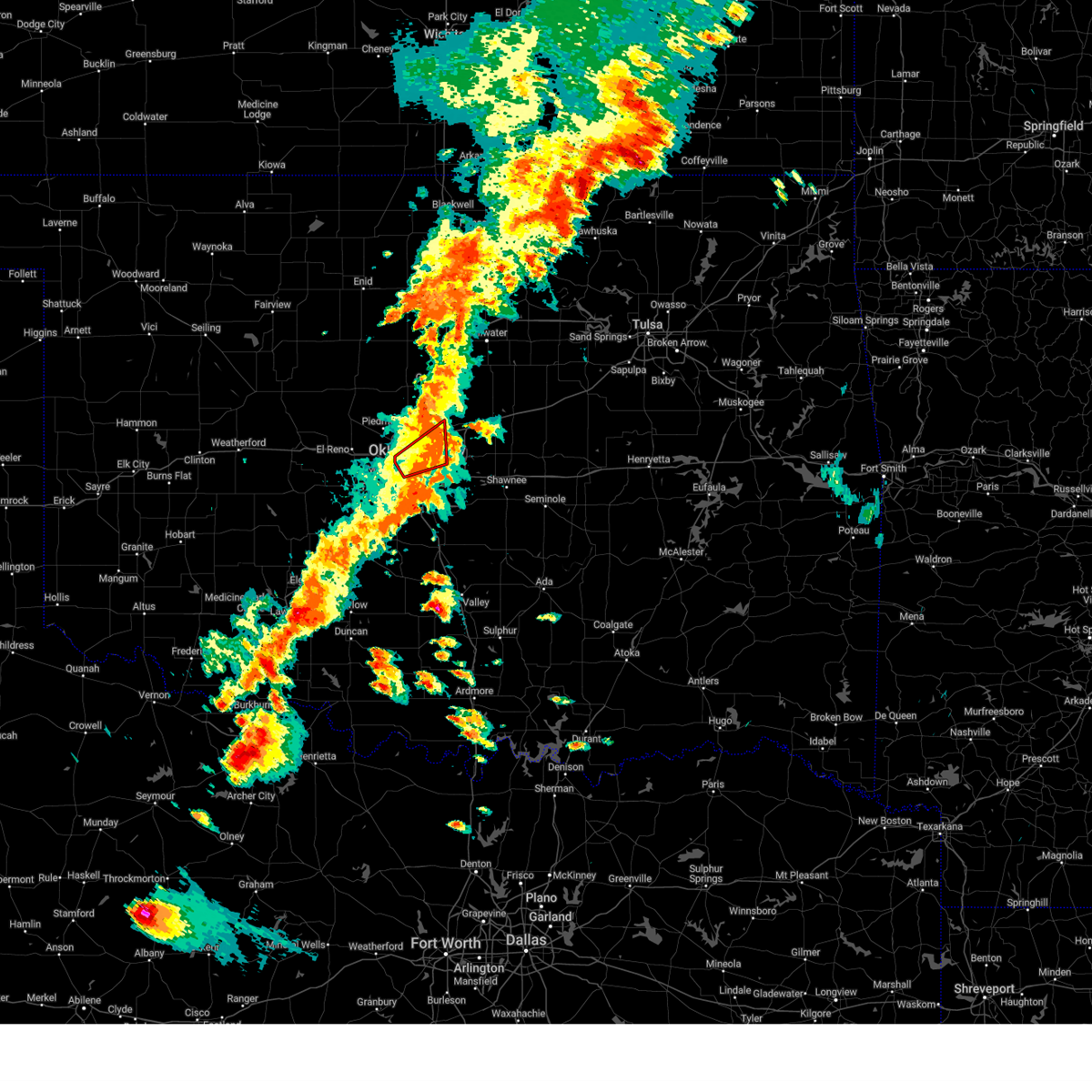 the tornado warning has been cancelled and is no longer in effect the tornado warning has been cancelled and is no longer in effect
|
| 6/3/2025 4:51 PM CDT |
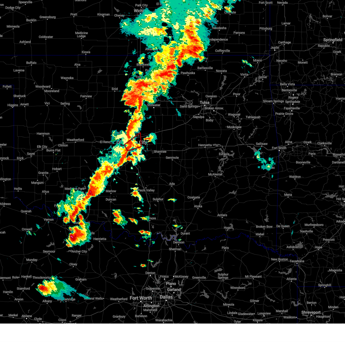 the tornado warning has been cancelled and is no longer in effect the tornado warning has been cancelled and is no longer in effect
|
| 6/3/2025 4:51 PM CDT |
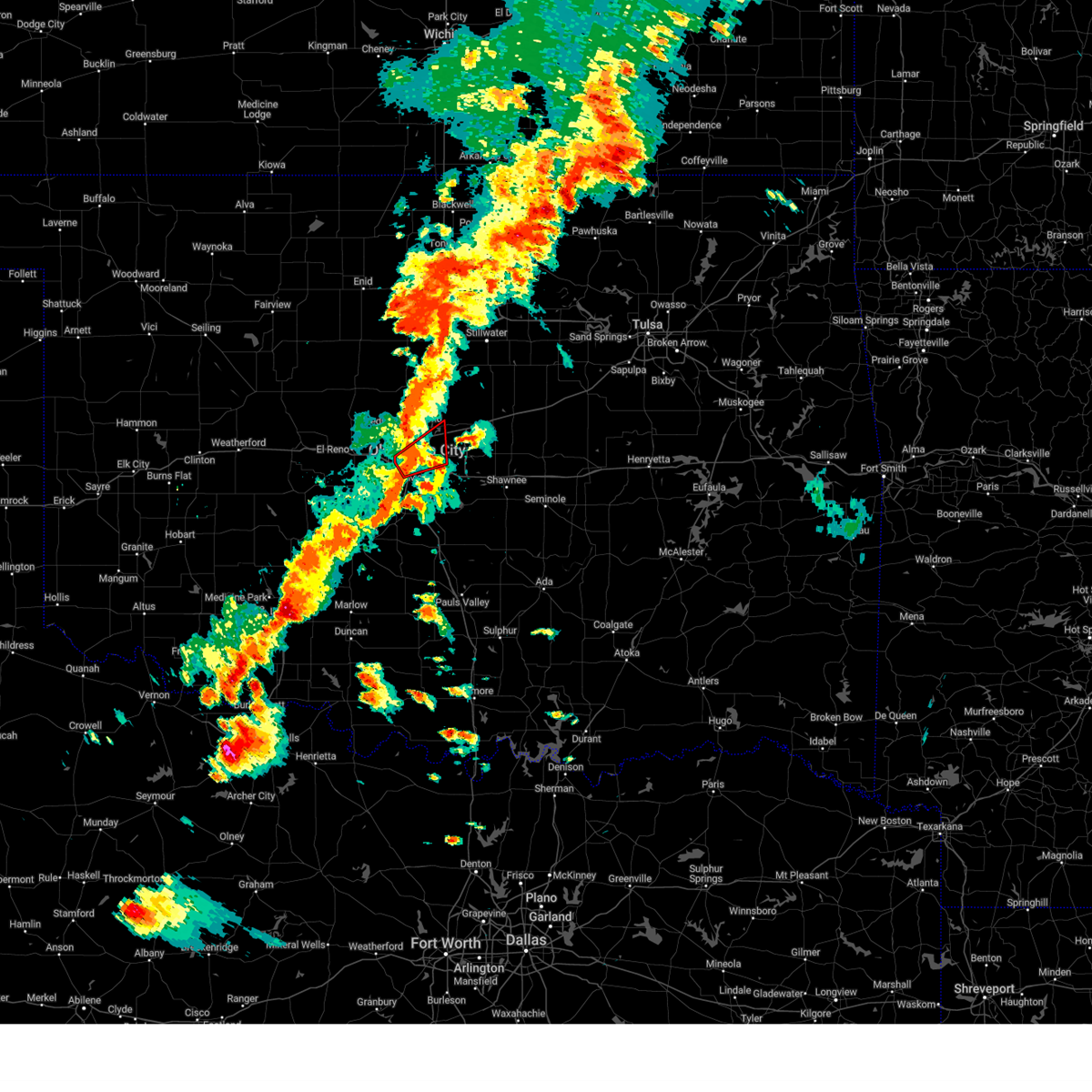 At 451 pm cdt, a severe thunderstorm capable of producing a tornado was located 3 miles west of oklahoma city, moving northeast at 40 mph (radar indicated rotation). Hazards include tornado. Flying debris will be dangerous to those caught without shelter. mobile homes will be damaged or destroyed. damage to roofs, windows, and vehicles will occur. tree damage is likely. Locations in or near the path include, midwest city, smith village, oklahoma city, the capitol, nichols hills, the fairgrounds, spencer, nicoma park, del city, forest park, will rogers airport, lake aluma, bethany, warr acres, the village, tinker air force base, edmond, choctaw,. At 451 pm cdt, a severe thunderstorm capable of producing a tornado was located 3 miles west of oklahoma city, moving northeast at 40 mph (radar indicated rotation). Hazards include tornado. Flying debris will be dangerous to those caught without shelter. mobile homes will be damaged or destroyed. damage to roofs, windows, and vehicles will occur. tree damage is likely. Locations in or near the path include, midwest city, smith village, oklahoma city, the capitol, nichols hills, the fairgrounds, spencer, nicoma park, del city, forest park, will rogers airport, lake aluma, bethany, warr acres, the village, tinker air force base, edmond, choctaw,.
|
| 6/3/2025 4:39 PM CDT |
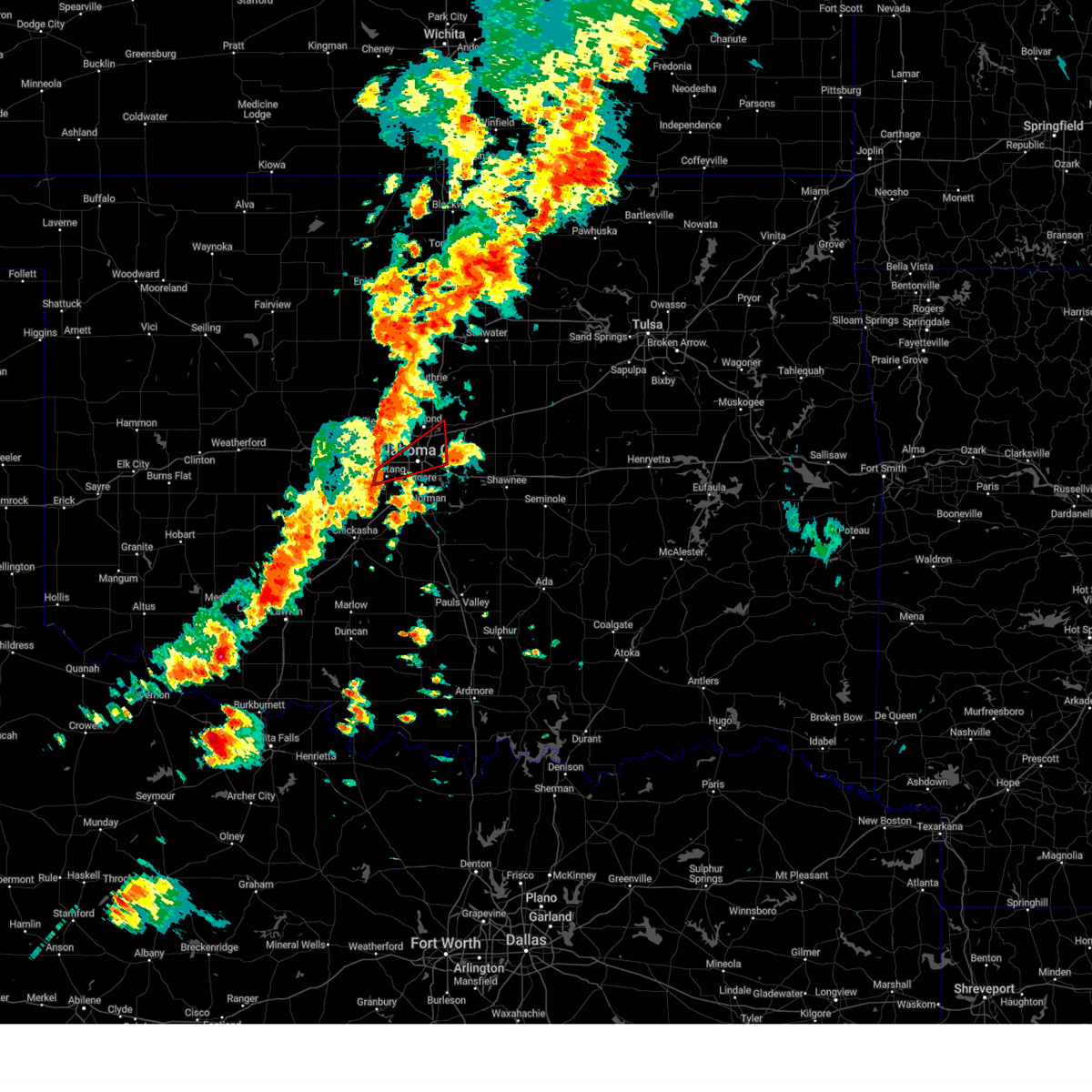 Toroun the national weather service in norman has issued a * tornado warning for, western oklahoma county in central oklahoma, southeastern canadian county in central oklahoma, * until 530 pm cdt. * at 439 pm cdt, a severe thunderstorm capable of producing a tornado was located over mustang, moving northeast at 30 mph (radar indicated rotation). Hazards include tornado. Flying debris will be dangerous to those caught without shelter. mobile homes will be damaged or destroyed. damage to roofs, windows, and vehicles will occur. tree damage is likely. Locations in or near the path include, mustang, midwest city, smith village, oklahoma city, the capitol, nichols hills, the fairgrounds, spencer, nicoma park, del city, forest park, will rogers airport, lake aluma, bethany, warr acres, the village, tinker air force base, edmond, choctaw,. Toroun the national weather service in norman has issued a * tornado warning for, western oklahoma county in central oklahoma, southeastern canadian county in central oklahoma, * until 530 pm cdt. * at 439 pm cdt, a severe thunderstorm capable of producing a tornado was located over mustang, moving northeast at 30 mph (radar indicated rotation). Hazards include tornado. Flying debris will be dangerous to those caught without shelter. mobile homes will be damaged or destroyed. damage to roofs, windows, and vehicles will occur. tree damage is likely. Locations in or near the path include, mustang, midwest city, smith village, oklahoma city, the capitol, nichols hills, the fairgrounds, spencer, nicoma park, del city, forest park, will rogers airport, lake aluma, bethany, warr acres, the village, tinker air force base, edmond, choctaw,.
|
| 6/3/2025 4:32 PM CDT |
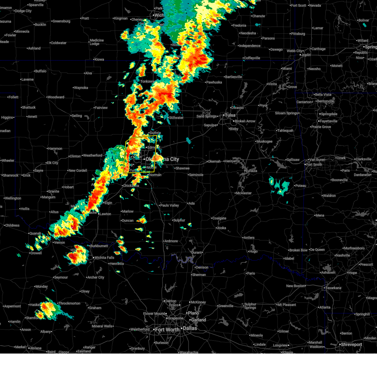 Svroun the national weather service in norman has issued a * severe thunderstorm warning for, southeastern kingfisher county in central oklahoma, northeastern grady county in central oklahoma, oklahoma county in central oklahoma, northwestern cleveland county in central oklahoma, southwestern logan county in central oklahoma, eastern canadian county in central oklahoma, northwestern mcclain county in central oklahoma, * until 515 pm cdt. * at 432 pm cdt, severe thunderstorms were located along a line extending from 2 miles northwest of piedmont to 3 miles northwest of tuttle, moving northeast at 35 mph (radar indicated). Hazards include 60 mph wind gusts and penny size hail. Expect damage to roofs, siding, and trees. Locations in or near the path include, smith village, oklahoma city, the capitol, wiley post airport, seward, the fairgrounds, woodlawn park, richland, downtown edmond, moore, navina, the village, yukon, will rogers airport, stanley draper lake, mustang, midwest city, nichols hills, tuttle, edmond,. Svroun the national weather service in norman has issued a * severe thunderstorm warning for, southeastern kingfisher county in central oklahoma, northeastern grady county in central oklahoma, oklahoma county in central oklahoma, northwestern cleveland county in central oklahoma, southwestern logan county in central oklahoma, eastern canadian county in central oklahoma, northwestern mcclain county in central oklahoma, * until 515 pm cdt. * at 432 pm cdt, severe thunderstorms were located along a line extending from 2 miles northwest of piedmont to 3 miles northwest of tuttle, moving northeast at 35 mph (radar indicated). Hazards include 60 mph wind gusts and penny size hail. Expect damage to roofs, siding, and trees. Locations in or near the path include, smith village, oklahoma city, the capitol, wiley post airport, seward, the fairgrounds, woodlawn park, richland, downtown edmond, moore, navina, the village, yukon, will rogers airport, stanley draper lake, mustang, midwest city, nichols hills, tuttle, edmond,.
|
| 6/3/2025 3:42 PM CDT |
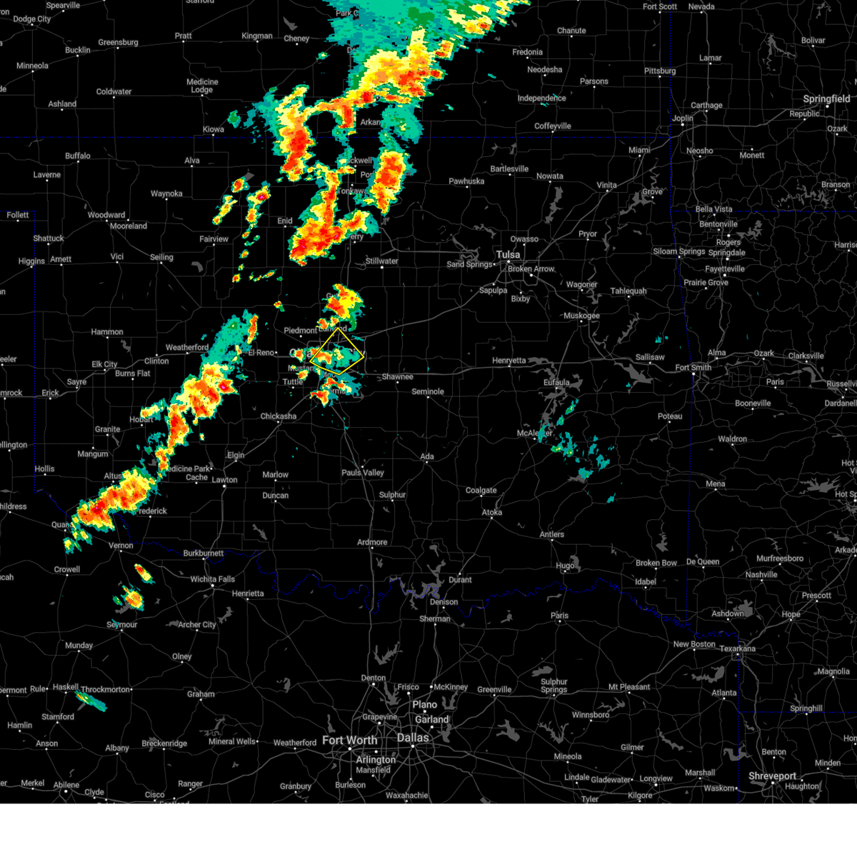 the severe thunderstorm warning has been cancelled and is no longer in effect the severe thunderstorm warning has been cancelled and is no longer in effect
|
| 6/3/2025 3:42 PM CDT |
 At 342 pm cdt, a severe thunderstorm was located over oklahoma city, moving northeast at 25 mph (radar indicated). Hazards include 60 mph wind gusts and penny size hail. Expect damage to roofs, siding, and trees. Locations in or near the path include, midwest city, smith village, oklahoma city, the capitol, nichols hills, edmond, the fairgrounds, spencer, tinker air force base, downtown edmond, valley brook, jones, the village, nicoma park, del city, forest park, choctaw, lake aluma, warr acres, bethany,. At 342 pm cdt, a severe thunderstorm was located over oklahoma city, moving northeast at 25 mph (radar indicated). Hazards include 60 mph wind gusts and penny size hail. Expect damage to roofs, siding, and trees. Locations in or near the path include, midwest city, smith village, oklahoma city, the capitol, nichols hills, edmond, the fairgrounds, spencer, tinker air force base, downtown edmond, valley brook, jones, the village, nicoma park, del city, forest park, choctaw, lake aluma, warr acres, bethany,.
|
| 6/3/2025 3:15 PM CDT |
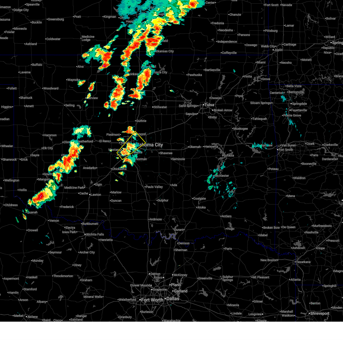 Svroun the national weather service in norman has issued a * severe thunderstorm warning for, northeastern grady county in central oklahoma, oklahoma county in central oklahoma, northwestern cleveland county in central oklahoma, southeastern canadian county in central oklahoma, northwestern mcclain county in central oklahoma, * until 400 pm cdt. * at 315 pm cdt, a severe thunderstorm was located 4 miles southeast of mustang, moving northeast at 25 mph (radar indicated). Hazards include 60 mph wind gusts and quarter size hail. Hail damage to vehicles is expected. expect wind damage to roofs, siding, and trees. Locations in or near the path include, smith village, oklahoma city, the capitol, the fairgrounds, downtown edmond, jones, the village, will rogers airport, mustang, midwest city, nichols hills, tuttle, edmond, spencer, tinker air force base, valley brook, nicoma park, del city, forest park, choctaw,. Svroun the national weather service in norman has issued a * severe thunderstorm warning for, northeastern grady county in central oklahoma, oklahoma county in central oklahoma, northwestern cleveland county in central oklahoma, southeastern canadian county in central oklahoma, northwestern mcclain county in central oklahoma, * until 400 pm cdt. * at 315 pm cdt, a severe thunderstorm was located 4 miles southeast of mustang, moving northeast at 25 mph (radar indicated). Hazards include 60 mph wind gusts and quarter size hail. Hail damage to vehicles is expected. expect wind damage to roofs, siding, and trees. Locations in or near the path include, smith village, oklahoma city, the capitol, the fairgrounds, downtown edmond, jones, the village, will rogers airport, mustang, midwest city, nichols hills, tuttle, edmond, spencer, tinker air force base, valley brook, nicoma park, del city, forest park, choctaw,.
|
| 6/1/2025 4:55 AM CDT |
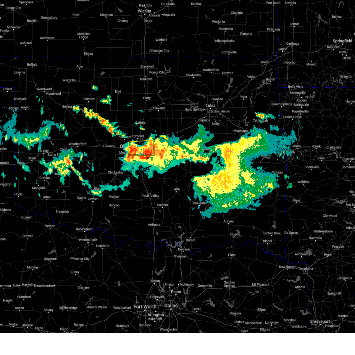 the severe thunderstorm warning has been cancelled and is no longer in effect the severe thunderstorm warning has been cancelled and is no longer in effect
|
| 6/1/2025 4:48 AM CDT |
 the severe thunderstorm warning has been cancelled and is no longer in effect the severe thunderstorm warning has been cancelled and is no longer in effect
|
| 6/1/2025 4:48 AM CDT |
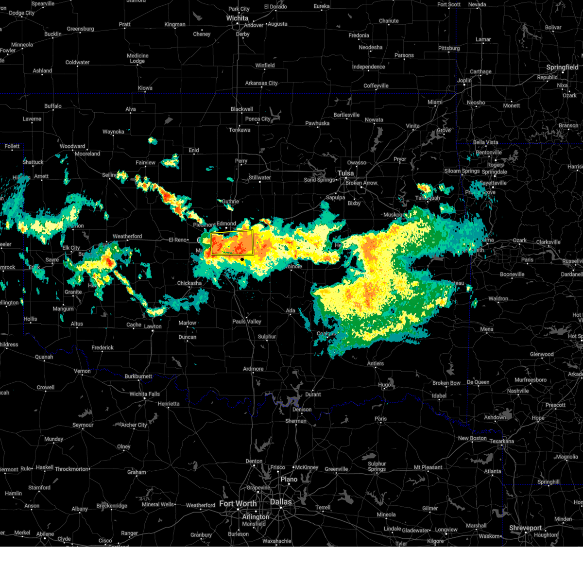 At 448 am cdt, severe thunderstorms were located along a line extending from near oklahoma city to near nicoma park, moving south at 35 mph (radar indicated). Hazards include 60 mph wind gusts and nickel size hail. Expect damage to roofs, siding, and trees. Locations impacted include, oklahoma city, midwest city, del city, bethany, choctaw, warr acres, the village, harrah, spencer, nichols hills, jones, nicoma park, valley brook, tinker air force base, newalla, forest park, woodlawn park, lake aluma, and smith village. At 448 am cdt, severe thunderstorms were located along a line extending from near oklahoma city to near nicoma park, moving south at 35 mph (radar indicated). Hazards include 60 mph wind gusts and nickel size hail. Expect damage to roofs, siding, and trees. Locations impacted include, oklahoma city, midwest city, del city, bethany, choctaw, warr acres, the village, harrah, spencer, nichols hills, jones, nicoma park, valley brook, tinker air force base, newalla, forest park, woodlawn park, lake aluma, and smith village.
|
| 6/1/2025 4:29 AM CDT |
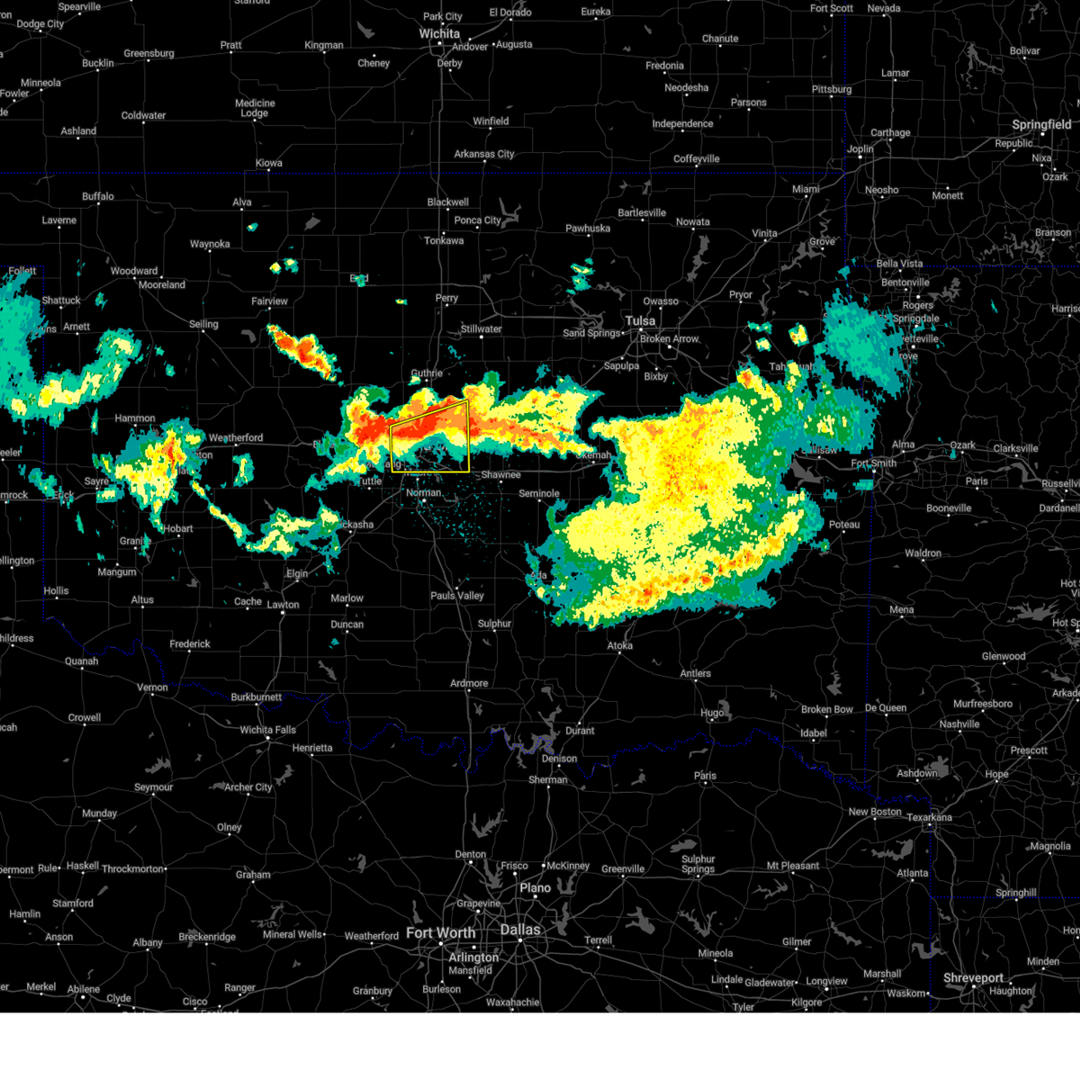 Svroun the national weather service in norman has issued a * severe thunderstorm warning for, oklahoma county in central oklahoma, southeastern logan county in central oklahoma, * until 515 am cdt. * at 428 am cdt, severe thunderstorms were located along a line extending from near warr acres to near oklahoma city, moving south at 35 mph (radar indicated). Hazards include 60 mph wind gusts and nickel size hail. expect damage to roofs, siding, and trees Svroun the national weather service in norman has issued a * severe thunderstorm warning for, oklahoma county in central oklahoma, southeastern logan county in central oklahoma, * until 515 am cdt. * at 428 am cdt, severe thunderstorms were located along a line extending from near warr acres to near oklahoma city, moving south at 35 mph (radar indicated). Hazards include 60 mph wind gusts and nickel size hail. expect damage to roofs, siding, and trees
|
| 5/25/2025 8:24 PM CDT |
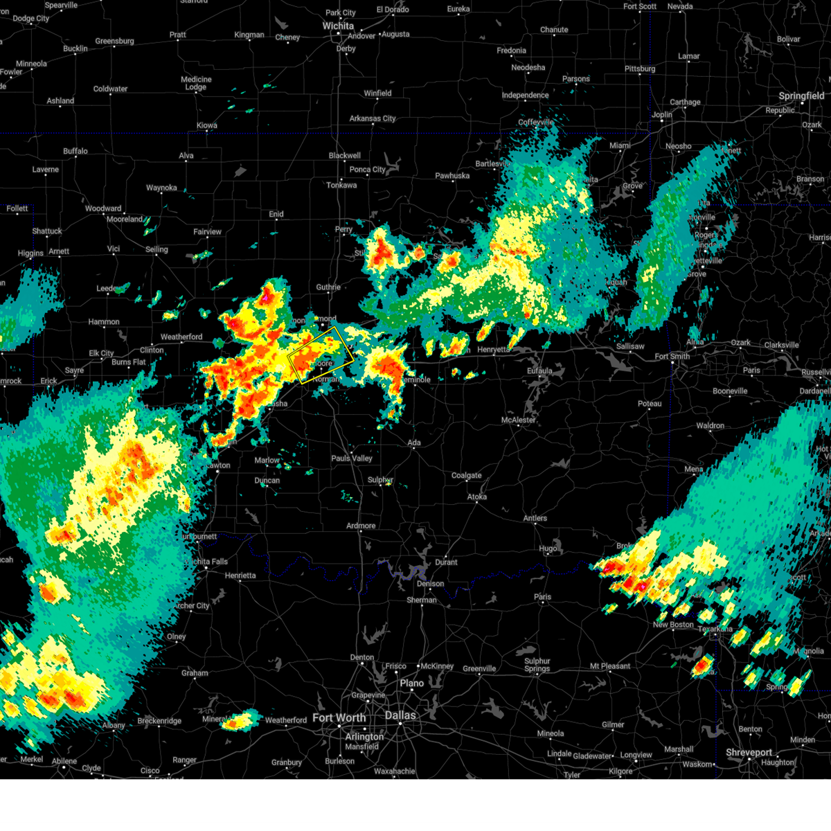 the severe thunderstorm warning has been cancelled and is no longer in effect the severe thunderstorm warning has been cancelled and is no longer in effect
|
| 5/25/2025 8:17 PM CDT |
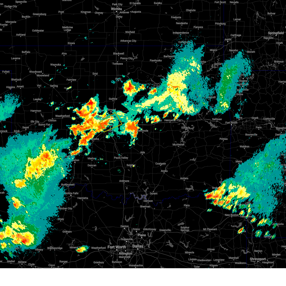 Svroun the national weather service in norman has issued a * severe thunderstorm warning for, northeastern grady county in central oklahoma, southern oklahoma county in central oklahoma, northwestern cleveland county in central oklahoma, southeastern canadian county in central oklahoma, northwestern mcclain county in central oklahoma, * until 845 pm cdt. * at 817 pm cdt, a severe thunderstorm was located over southwestern oklahoma city, or near will rogers airport, moving northeast at 35 mph (radar indicated). Hazards include 60 mph wind gusts and quarter size hail. Hail damage to vehicles is expected. Expect wind damage to roofs, siding, and trees. Svroun the national weather service in norman has issued a * severe thunderstorm warning for, northeastern grady county in central oklahoma, southern oklahoma county in central oklahoma, northwestern cleveland county in central oklahoma, southeastern canadian county in central oklahoma, northwestern mcclain county in central oklahoma, * until 845 pm cdt. * at 817 pm cdt, a severe thunderstorm was located over southwestern oklahoma city, or near will rogers airport, moving northeast at 35 mph (radar indicated). Hazards include 60 mph wind gusts and quarter size hail. Hail damage to vehicles is expected. Expect wind damage to roofs, siding, and trees.
|
| 5/25/2025 6:51 PM CDT |
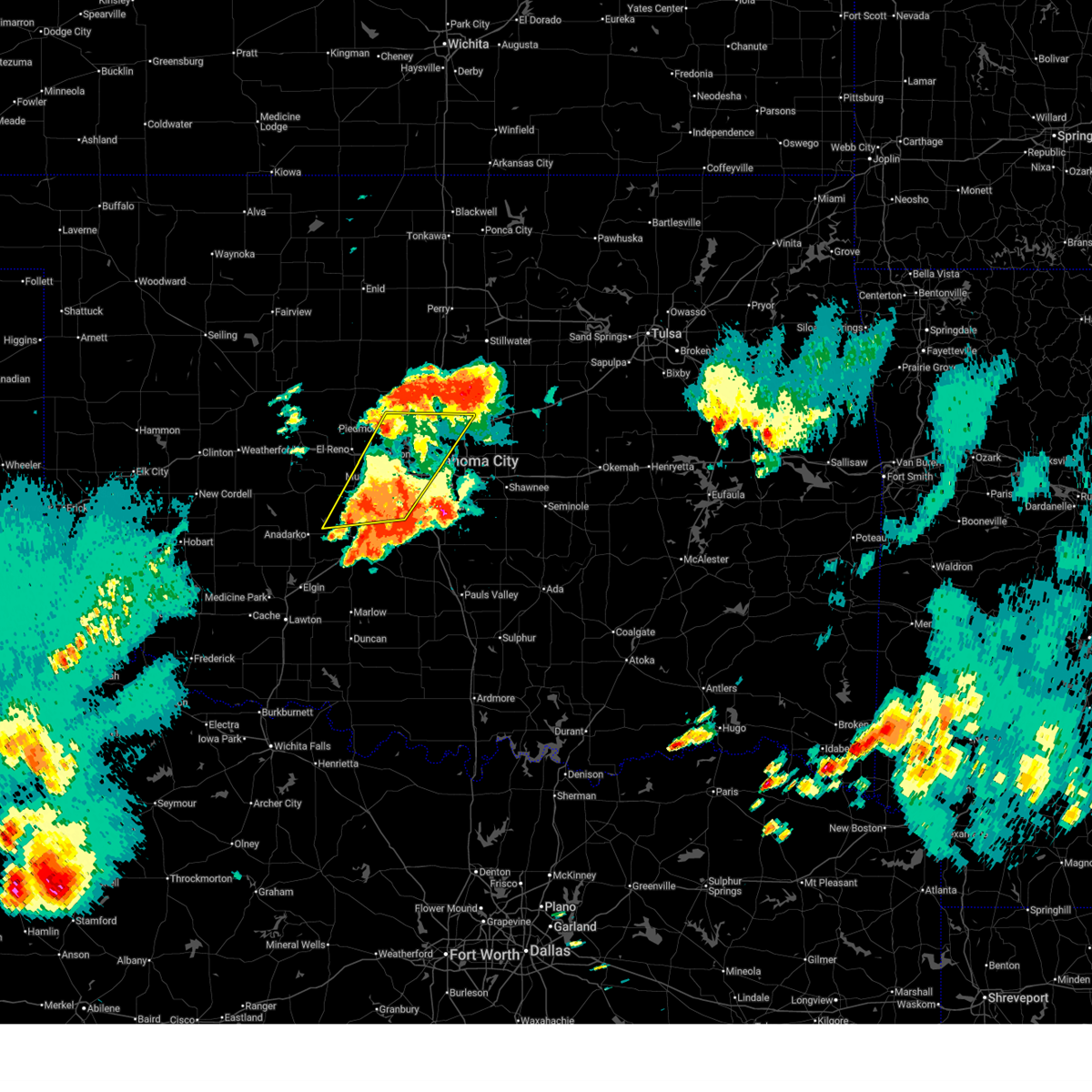 The storms which prompted the warning have moved out of the area. therefore, the warning will be allowed to expire. however, small hail and gusty winds are still possible with these thunderstorms. The storms which prompted the warning have moved out of the area. therefore, the warning will be allowed to expire. however, small hail and gusty winds are still possible with these thunderstorms.
|
| 5/25/2025 6:22 PM CDT |
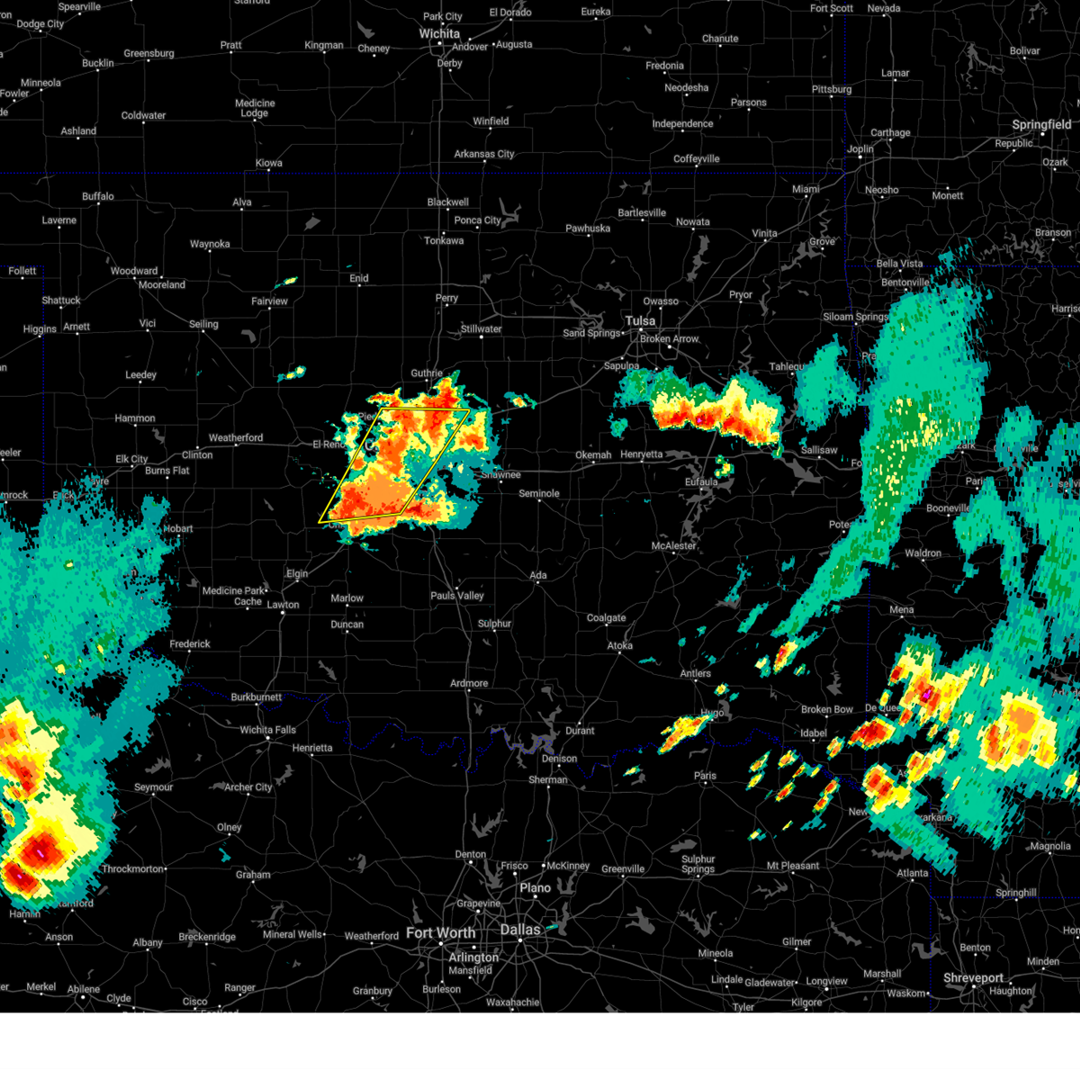 Svroun the national weather service in norman has issued a * severe thunderstorm warning for, northern grady county in central oklahoma, eastern caddo county in southwestern oklahoma, oklahoma county in central oklahoma, northwestern cleveland county in central oklahoma, eastern canadian county in central oklahoma, northwestern mcclain county in central oklahoma, * until 700 pm cdt. * at 621 pm cdt, severe thunderstorms were located along a line extending from near oklahoma city to near pocasset, moving northeast at 15 mph (radar indicated). Hazards include 60 mph wind gusts and quarter size hail. Hail damage to vehicles is expected. Expect wind damage to roofs, siding, and trees. Svroun the national weather service in norman has issued a * severe thunderstorm warning for, northern grady county in central oklahoma, eastern caddo county in southwestern oklahoma, oklahoma county in central oklahoma, northwestern cleveland county in central oklahoma, eastern canadian county in central oklahoma, northwestern mcclain county in central oklahoma, * until 700 pm cdt. * at 621 pm cdt, severe thunderstorms were located along a line extending from near oklahoma city to near pocasset, moving northeast at 15 mph (radar indicated). Hazards include 60 mph wind gusts and quarter size hail. Hail damage to vehicles is expected. Expect wind damage to roofs, siding, and trees.
|
| 5/25/2025 6:22 PM CDT |
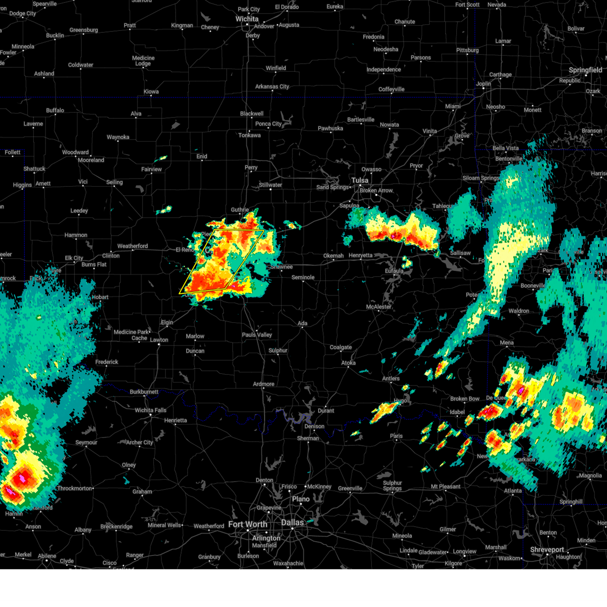 Svroun the national weather service in norman has issued a * severe thunderstorm warning for, northern grady county in central oklahoma, eastern caddo county in southwestern oklahoma, oklahoma county in central oklahoma, northwestern cleveland county in central oklahoma, eastern canadian county in central oklahoma, northwestern mcclain county in central oklahoma, * until 700 pm cdt. * at 621 pm cdt, severe thunderstorms were located along a line extending from near oklahoma city to near pocasset, moving northeast at 15 mph (radar indicated). Hazards include 60 mph wind gusts and quarter size hail. Hail damage to vehicles is expected. Expect wind damage to roofs, siding, and trees. Svroun the national weather service in norman has issued a * severe thunderstorm warning for, northern grady county in central oklahoma, eastern caddo county in southwestern oklahoma, oklahoma county in central oklahoma, northwestern cleveland county in central oklahoma, eastern canadian county in central oklahoma, northwestern mcclain county in central oklahoma, * until 700 pm cdt. * at 621 pm cdt, severe thunderstorms were located along a line extending from near oklahoma city to near pocasset, moving northeast at 15 mph (radar indicated). Hazards include 60 mph wind gusts and quarter size hail. Hail damage to vehicles is expected. Expect wind damage to roofs, siding, and trees.
|
| 5/25/2025 5:07 PM CDT |
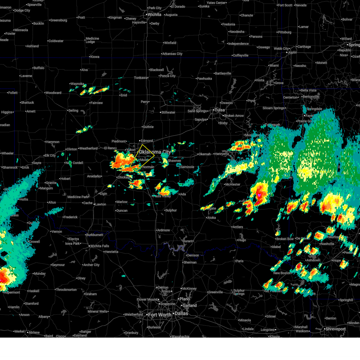 Svroun the national weather service in norman has issued a * severe thunderstorm warning for, southeastern oklahoma county in central oklahoma, northwestern cleveland county in central oklahoma, northwestern mcclain county in central oklahoma, * until 600 pm cdt. * at 507 pm cdt, a severe thunderstorm was located near newcastle, moving northeast at 25 mph (radar indicated). Hazards include 60 mph wind gusts and half dollar size hail. Hail damage to vehicles is expected. Expect wind damage to roofs, siding, and trees. Svroun the national weather service in norman has issued a * severe thunderstorm warning for, southeastern oklahoma county in central oklahoma, northwestern cleveland county in central oklahoma, northwestern mcclain county in central oklahoma, * until 600 pm cdt. * at 507 pm cdt, a severe thunderstorm was located near newcastle, moving northeast at 25 mph (radar indicated). Hazards include 60 mph wind gusts and half dollar size hail. Hail damage to vehicles is expected. Expect wind damage to roofs, siding, and trees.
|
| 5/24/2025 1:53 AM CDT |
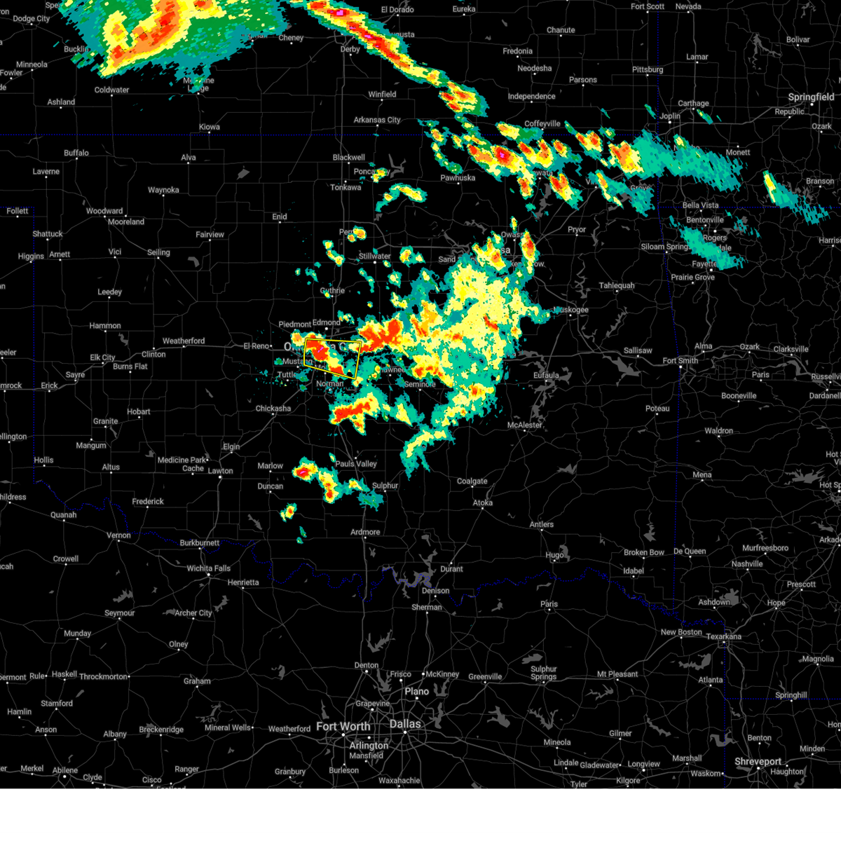 At 153 am cdt, a severe thunderstorm was located over western oklahoma city, or over the capitol, moving east at 30 mph (trained weather spotters quarter hail south of nichols hills). Hazards include half dollar size hail. Damage to vehicles is expected. Locations impacted include, oklahoma city, northeastern norman, moore, midwest city, del city, bethany, choctaw, warr acres, the village, harrah, spencer, nichols hills, jones, nicoma park, valley brook, tinker air force base, stanley draper lake, forest park, woodlawn park, and lake aluma. At 153 am cdt, a severe thunderstorm was located over western oklahoma city, or over the capitol, moving east at 30 mph (trained weather spotters quarter hail south of nichols hills). Hazards include half dollar size hail. Damage to vehicles is expected. Locations impacted include, oklahoma city, northeastern norman, moore, midwest city, del city, bethany, choctaw, warr acres, the village, harrah, spencer, nichols hills, jones, nicoma park, valley brook, tinker air force base, stanley draper lake, forest park, woodlawn park, and lake aluma.
|
| 5/24/2025 1:44 AM CDT |
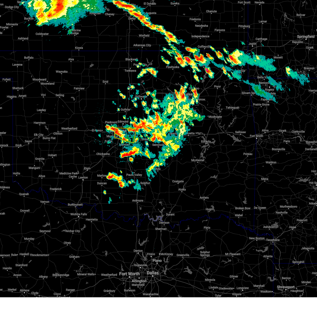 Svroun the national weather service in norman has issued a * severe thunderstorm warning for, southern oklahoma county in central oklahoma, north central cleveland county in central oklahoma, * until 215 am cdt. * at 144 am cdt, a severe thunderstorm was located over western oklahoma city, or near the fairgrounds, moving east at 30 mph (radar indicated). Hazards include half dollar size hail. damage to vehicles is expected Svroun the national weather service in norman has issued a * severe thunderstorm warning for, southern oklahoma county in central oklahoma, north central cleveland county in central oklahoma, * until 215 am cdt. * at 144 am cdt, a severe thunderstorm was located over western oklahoma city, or near the fairgrounds, moving east at 30 mph (radar indicated). Hazards include half dollar size hail. damage to vehicles is expected
|
| 5/19/2025 4:59 PM CDT |
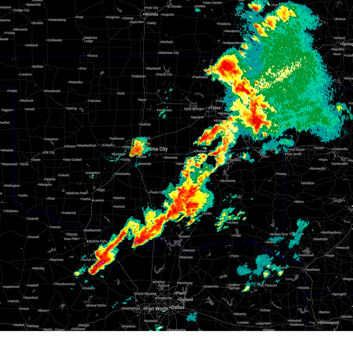 the severe thunderstorm warning has been cancelled and is no longer in effect the severe thunderstorm warning has been cancelled and is no longer in effect
|
| 5/19/2025 4:59 PM CDT |
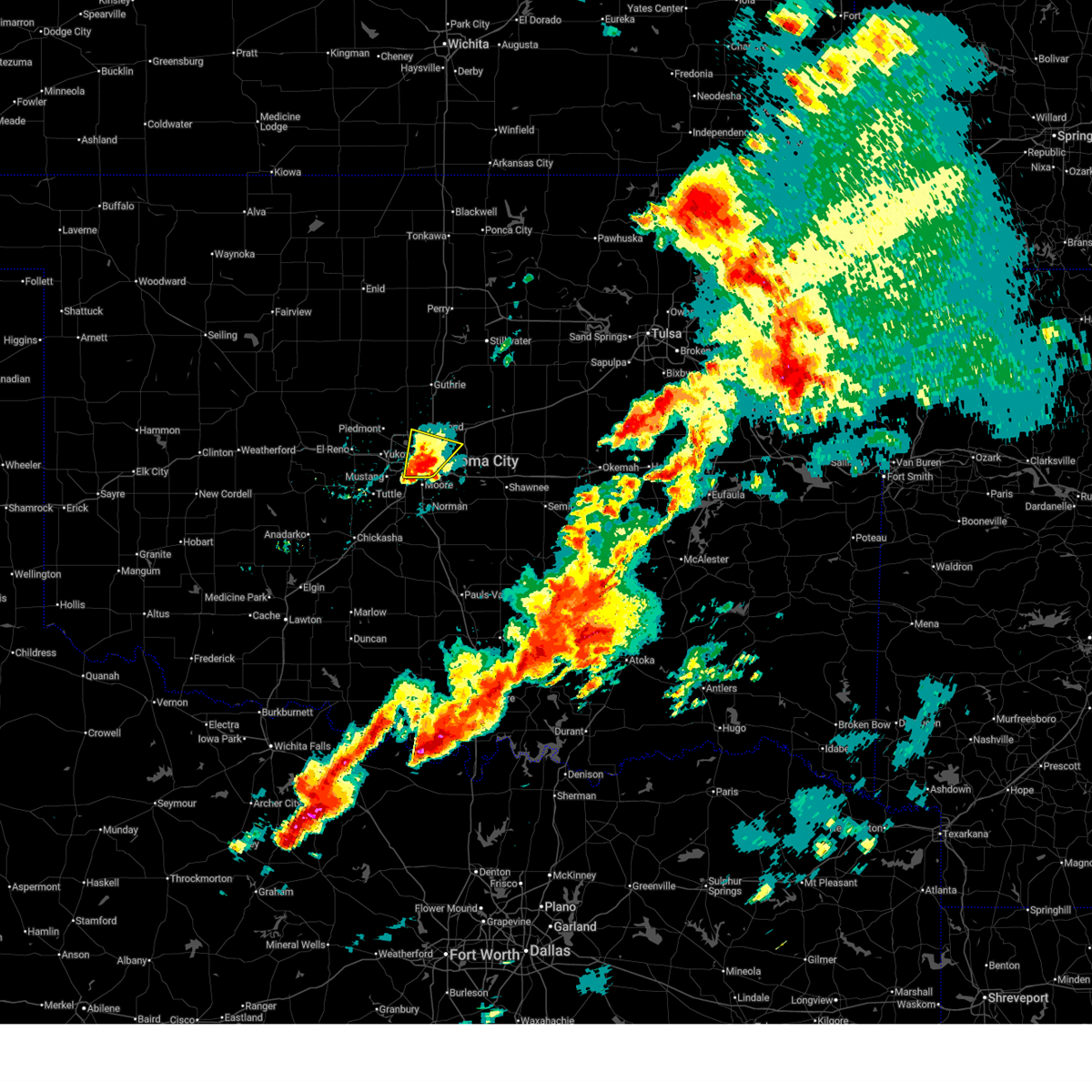 At 459 pm cdt, a severe thunderstorm was located over northeastern oklahoma city, or near forest park, moving north at 30 mph (radar indicated). Hazards include 60 mph wind gusts and quarter size hail. Hail damage to vehicles is expected. expect wind damage to roofs, siding, and trees. Locations impacted include, oklahoma city, southwestern edmond, midwest city, del city, choctaw, the village, spencer, nichols hills, jones, nicoma park, valley brook, tinker air force base, forest park, lake aluma, and smith village. At 459 pm cdt, a severe thunderstorm was located over northeastern oklahoma city, or near forest park, moving north at 30 mph (radar indicated). Hazards include 60 mph wind gusts and quarter size hail. Hail damage to vehicles is expected. expect wind damage to roofs, siding, and trees. Locations impacted include, oklahoma city, southwestern edmond, midwest city, del city, choctaw, the village, spencer, nichols hills, jones, nicoma park, valley brook, tinker air force base, forest park, lake aluma, and smith village.
|
| 5/19/2025 4:51 PM CDT |
 At 450 pm cdt, a severe thunderstorm was located over southwestern oklahoma city, or near will rogers airport, moving north at 35 mph. numerous reportrs of quarter size hail have been received in southwest oklahoma city (radar indicated). Hazards include 60 mph wind gusts and quarter size hail. Hail damage to vehicles is expected. expect wind damage to roofs, siding, and trees. Locations impacted include, oklahoma city, southwestern edmond, moore, midwest city, del city, bethany, choctaw, warr acres, the village, spencer, nichols hills, jones, nicoma park, valley brook, tinker air force base, forest park, lake aluma, and smith village. At 450 pm cdt, a severe thunderstorm was located over southwestern oklahoma city, or near will rogers airport, moving north at 35 mph. numerous reportrs of quarter size hail have been received in southwest oklahoma city (radar indicated). Hazards include 60 mph wind gusts and quarter size hail. Hail damage to vehicles is expected. expect wind damage to roofs, siding, and trees. Locations impacted include, oklahoma city, southwestern edmond, moore, midwest city, del city, bethany, choctaw, warr acres, the village, spencer, nichols hills, jones, nicoma park, valley brook, tinker air force base, forest park, lake aluma, and smith village.
|
| 5/19/2025 4:38 PM CDT |
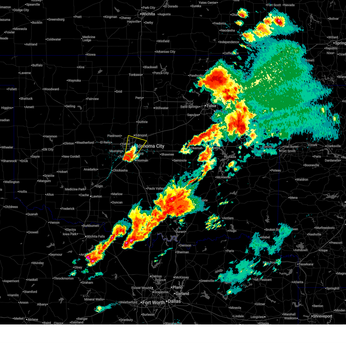 Svroun the national weather service in norman has issued a * severe thunderstorm warning for, southern oklahoma county in central oklahoma, northwestern cleveland county in central oklahoma, * until 530 pm cdt. * at 438 pm cdt, a severe thunderstorm was located near newcastle, moving north at 25 mph. quarter size hail has been reported with the storm in newcastle (radar indicated). Hazards include 60 mph wind gusts and quarter size hail. Hail damage to vehicles is expected. Expect wind damage to roofs, siding, and trees. Svroun the national weather service in norman has issued a * severe thunderstorm warning for, southern oklahoma county in central oklahoma, northwestern cleveland county in central oklahoma, * until 530 pm cdt. * at 438 pm cdt, a severe thunderstorm was located near newcastle, moving north at 25 mph. quarter size hail has been reported with the storm in newcastle (radar indicated). Hazards include 60 mph wind gusts and quarter size hail. Hail damage to vehicles is expected. Expect wind damage to roofs, siding, and trees.
|
| 5/18/2025 1:29 AM CDT |
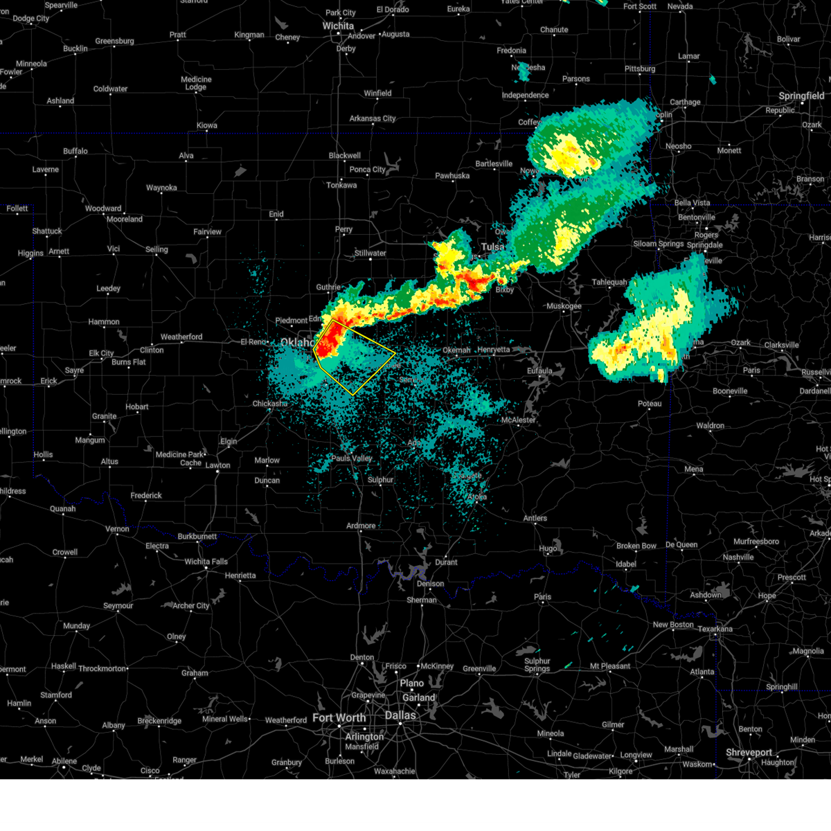 At 129 am cdt, a severe thunderstorm was located over southeastern oklahoma city, or 4 miles southwest of choctaw, moving southeast at 45 mph (radar indicated). Hazards include 60 mph wind gusts and quarter size hail. Hail damage to vehicles is expected. expect wind damage to roofs, siding, and trees. Locations impacted include, oklahoma city, eastern norman, edmond, moore, midwest city, shawnee, del city, choctaw, harrah, mcloud, spencer, jones, nicoma park, pink, meeker, valley brook, arcadia, stanley draper lake, newalla, and stella. At 129 am cdt, a severe thunderstorm was located over southeastern oklahoma city, or 4 miles southwest of choctaw, moving southeast at 45 mph (radar indicated). Hazards include 60 mph wind gusts and quarter size hail. Hail damage to vehicles is expected. expect wind damage to roofs, siding, and trees. Locations impacted include, oklahoma city, eastern norman, edmond, moore, midwest city, shawnee, del city, choctaw, harrah, mcloud, spencer, jones, nicoma park, pink, meeker, valley brook, arcadia, stanley draper lake, newalla, and stella.
|
| 5/18/2025 1:28 AM CDT |
 Svroun the national weather service in norman has issued a * severe thunderstorm warning for, southwestern lincoln county in central oklahoma, oklahoma county in central oklahoma, northeastern cleveland county in central oklahoma, northwestern pottawatomie county in central oklahoma, * until 200 am cdt. * at 128 am cdt, a severe thunderstorm was located over southeastern oklahoma city, or 4 miles east of tinker air force base, moving southeast at 40 mph (radar indicated). Hazards include 60 mph wind gusts and quarter size hail. Hail damage to vehicles is expected. Expect wind damage to roofs, siding, and trees. Svroun the national weather service in norman has issued a * severe thunderstorm warning for, southwestern lincoln county in central oklahoma, oklahoma county in central oklahoma, northeastern cleveland county in central oklahoma, northwestern pottawatomie county in central oklahoma, * until 200 am cdt. * at 128 am cdt, a severe thunderstorm was located over southeastern oklahoma city, or 4 miles east of tinker air force base, moving southeast at 40 mph (radar indicated). Hazards include 60 mph wind gusts and quarter size hail. Hail damage to vehicles is expected. Expect wind damage to roofs, siding, and trees.
|
| 5/18/2025 1:18 AM CDT |
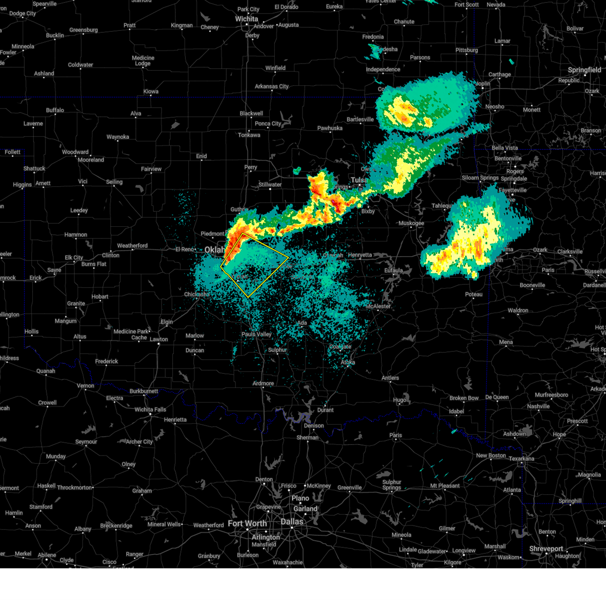 Svroun the national weather service in norman has issued a * severe thunderstorm warning for, southwestern lincoln county in central oklahoma, oklahoma county in central oklahoma, cleveland county in central oklahoma, northwestern pottawatomie county in central oklahoma, * until 145 am cdt. * at 118 am cdt, a severe thunderstorm was located near del city, moving southeast at 40 mph (radar indicated). Hazards include 60 mph wind gusts and quarter size hail. Hail damage to vehicles is expected. Expect wind damage to roofs, siding, and trees. Svroun the national weather service in norman has issued a * severe thunderstorm warning for, southwestern lincoln county in central oklahoma, oklahoma county in central oklahoma, cleveland county in central oklahoma, northwestern pottawatomie county in central oklahoma, * until 145 am cdt. * at 118 am cdt, a severe thunderstorm was located near del city, moving southeast at 40 mph (radar indicated). Hazards include 60 mph wind gusts and quarter size hail. Hail damage to vehicles is expected. Expect wind damage to roofs, siding, and trees.
|
| 5/17/2025 10:00 PM CDT |
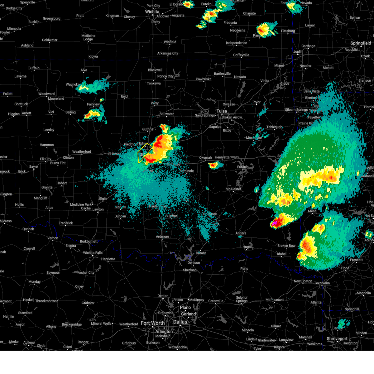 the severe thunderstorm warning has been cancelled and is no longer in effect the severe thunderstorm warning has been cancelled and is no longer in effect
|
| 5/17/2025 9:45 PM CDT |
 At 945 pm cdt, a severe thunderstorm was located over northwestern oklahoma city, or near warr acres, moving northeast at 20 mph (public). Hazards include 60 mph wind gusts and half dollar size hail. Hail damage to vehicles is expected. expect wind damage to roofs, siding, and trees. Locations impacted include, northern oklahoma city, edmond, warr acres, the village, nichols hills, forest park, and lake aluma. At 945 pm cdt, a severe thunderstorm was located over northwestern oklahoma city, or near warr acres, moving northeast at 20 mph (public). Hazards include 60 mph wind gusts and half dollar size hail. Hail damage to vehicles is expected. expect wind damage to roofs, siding, and trees. Locations impacted include, northern oklahoma city, edmond, warr acres, the village, nichols hills, forest park, and lake aluma.
|
| 5/17/2025 9:45 PM CDT |
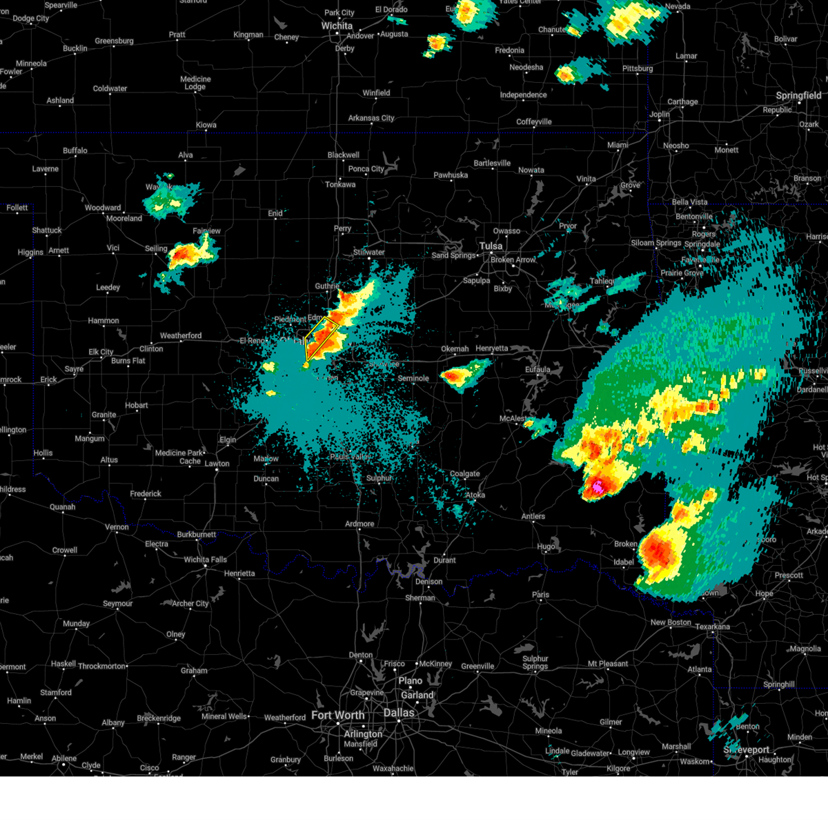 the severe thunderstorm warning has been cancelled and is no longer in effect the severe thunderstorm warning has been cancelled and is no longer in effect
|
| 5/17/2025 9:44 PM CDT |
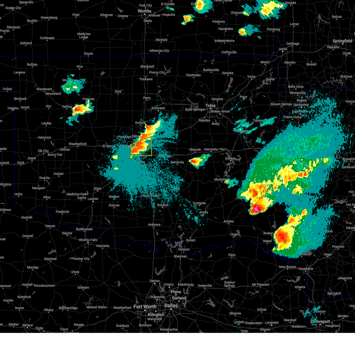 Svroun the national weather service in norman has issued a * severe thunderstorm warning for, oklahoma county in central oklahoma, north central cleveland county in central oklahoma, * until 1030 pm cdt. * at 943 pm cdt, a severe thunderstorm was located near oklahoma city, or near the fairgrounds, moving east at 20 mph (radar indicated). Hazards include 60 mph wind gusts and half dollar size hail. Hail damage to vehicles is expected. Expect wind damage to roofs, siding, and trees. Svroun the national weather service in norman has issued a * severe thunderstorm warning for, oklahoma county in central oklahoma, north central cleveland county in central oklahoma, * until 1030 pm cdt. * at 943 pm cdt, a severe thunderstorm was located near oklahoma city, or near the fairgrounds, moving east at 20 mph (radar indicated). Hazards include 60 mph wind gusts and half dollar size hail. Hail damage to vehicles is expected. Expect wind damage to roofs, siding, and trees.
|
| 5/17/2025 9:33 PM CDT |
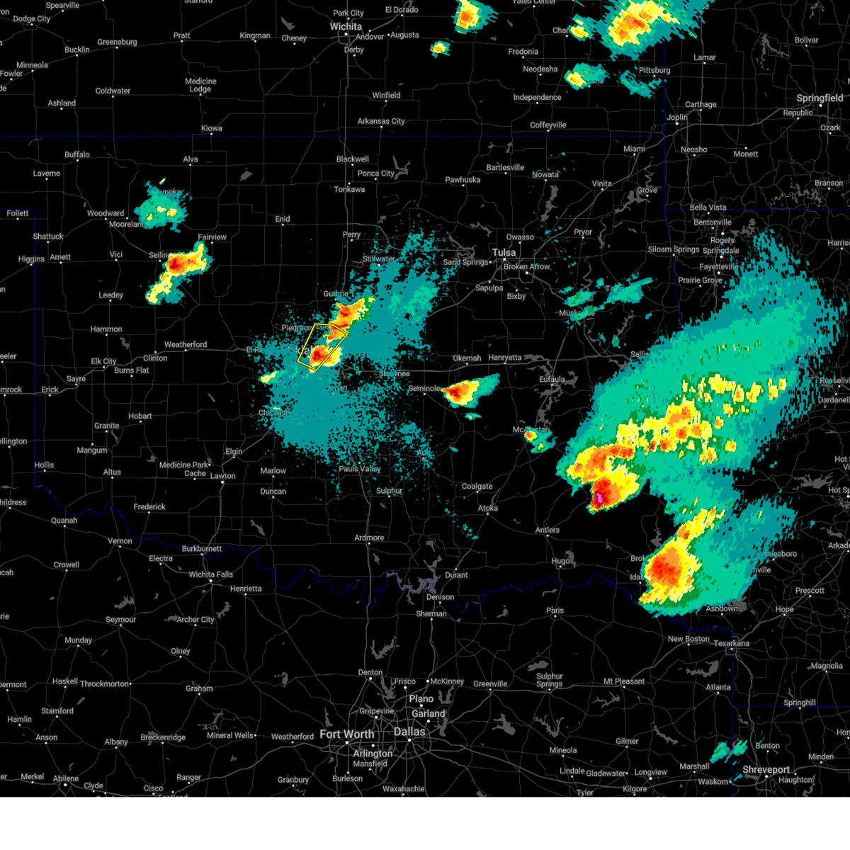 At 933 pm cdt, a severe thunderstorm was located over western oklahoma city, or near bethany, moving northeast at 20 mph (public). Hazards include half dollar size hail. Damage to vehicles is expected. Locations impacted include, northwestern oklahoma city, edmond, yukon, bethany, warr acres, the village, nichols hills, forest park, woodlawn park, and lake aluma. At 933 pm cdt, a severe thunderstorm was located over western oklahoma city, or near bethany, moving northeast at 20 mph (public). Hazards include half dollar size hail. Damage to vehicles is expected. Locations impacted include, northwestern oklahoma city, edmond, yukon, bethany, warr acres, the village, nichols hills, forest park, woodlawn park, and lake aluma.
|
| 5/17/2025 9:29 PM CDT |
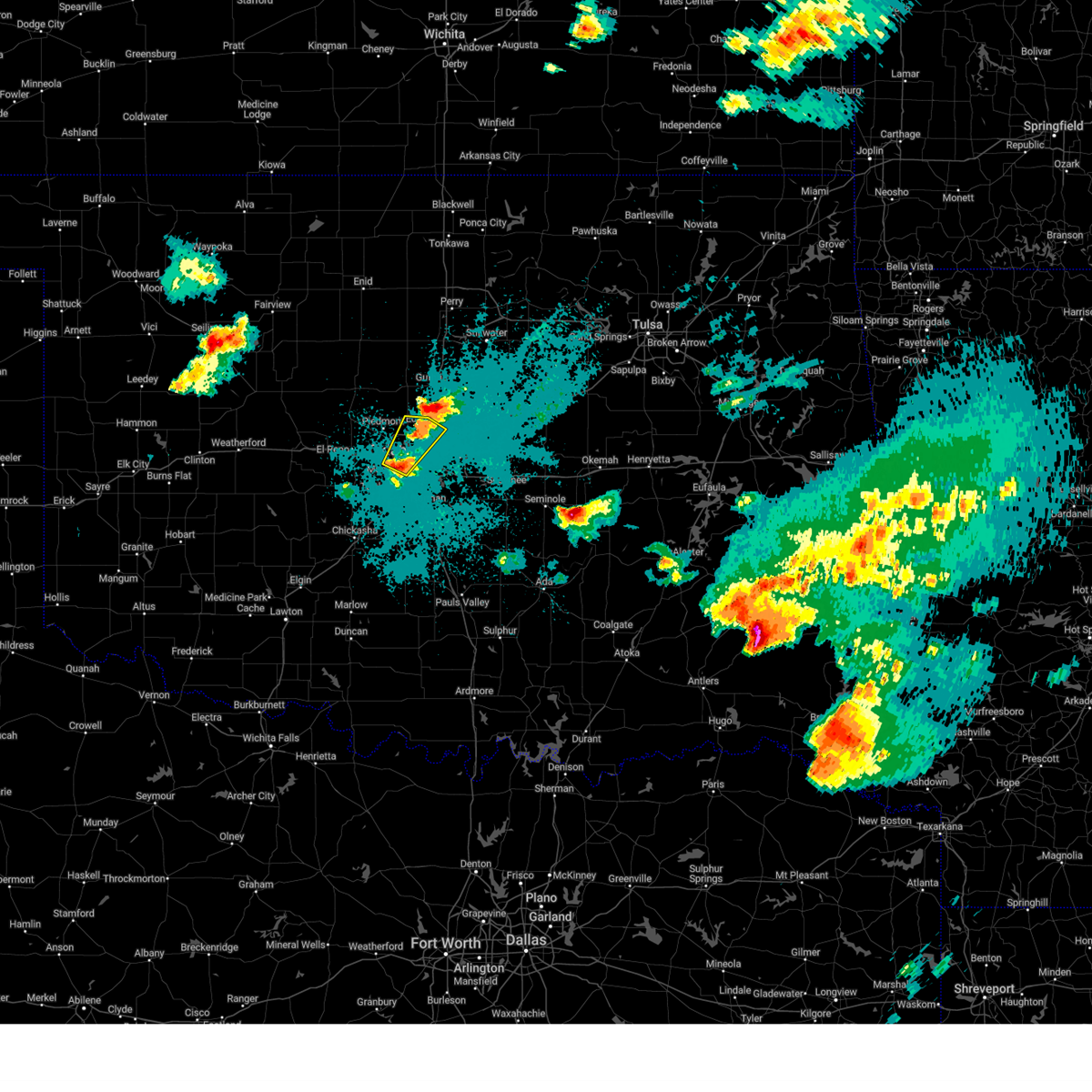 Svroun the national weather service in norman has issued a * severe thunderstorm warning for, western oklahoma county in central oklahoma, east central canadian county in central oklahoma, * until 1015 pm cdt. * at 929 pm cdt, a severe thunderstorm was located over southwestern oklahoma city, or 4 miles south of bethany, moving northeast at 20 mph (radar indicated). Hazards include quarter size hail. damage to vehicles is expected Svroun the national weather service in norman has issued a * severe thunderstorm warning for, western oklahoma county in central oklahoma, east central canadian county in central oklahoma, * until 1015 pm cdt. * at 929 pm cdt, a severe thunderstorm was located over southwestern oklahoma city, or 4 miles south of bethany, moving northeast at 20 mph (radar indicated). Hazards include quarter size hail. damage to vehicles is expected
|
| 5/2/2025 2:24 AM CDT |
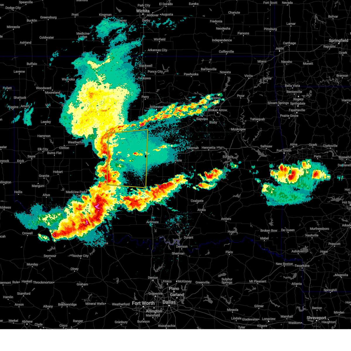 Svroun the national weather service in norman has issued a * severe thunderstorm warning for, southeastern kingfisher county in central oklahoma, northwestern garvin county in southern oklahoma, grady county in central oklahoma, oklahoma county in central oklahoma, cleveland county in central oklahoma, southwestern logan county in central oklahoma, canadian county in central oklahoma, mcclain county in central oklahoma, * until 315 am cdt. * at 223 am cdt, severe thunderstorms were located along a line extending from 3 miles north of okarche to near agawam, moving east at 40 mph (radar indicated). Hazards include 60 mph wind gusts and penny size hail. expect damage to roofs, siding, and trees Svroun the national weather service in norman has issued a * severe thunderstorm warning for, southeastern kingfisher county in central oklahoma, northwestern garvin county in southern oklahoma, grady county in central oklahoma, oklahoma county in central oklahoma, cleveland county in central oklahoma, southwestern logan county in central oklahoma, canadian county in central oklahoma, mcclain county in central oklahoma, * until 315 am cdt. * at 223 am cdt, severe thunderstorms were located along a line extending from 3 miles north of okarche to near agawam, moving east at 40 mph (radar indicated). Hazards include 60 mph wind gusts and penny size hail. expect damage to roofs, siding, and trees
|
| 4/29/2025 6:38 AM CDT |
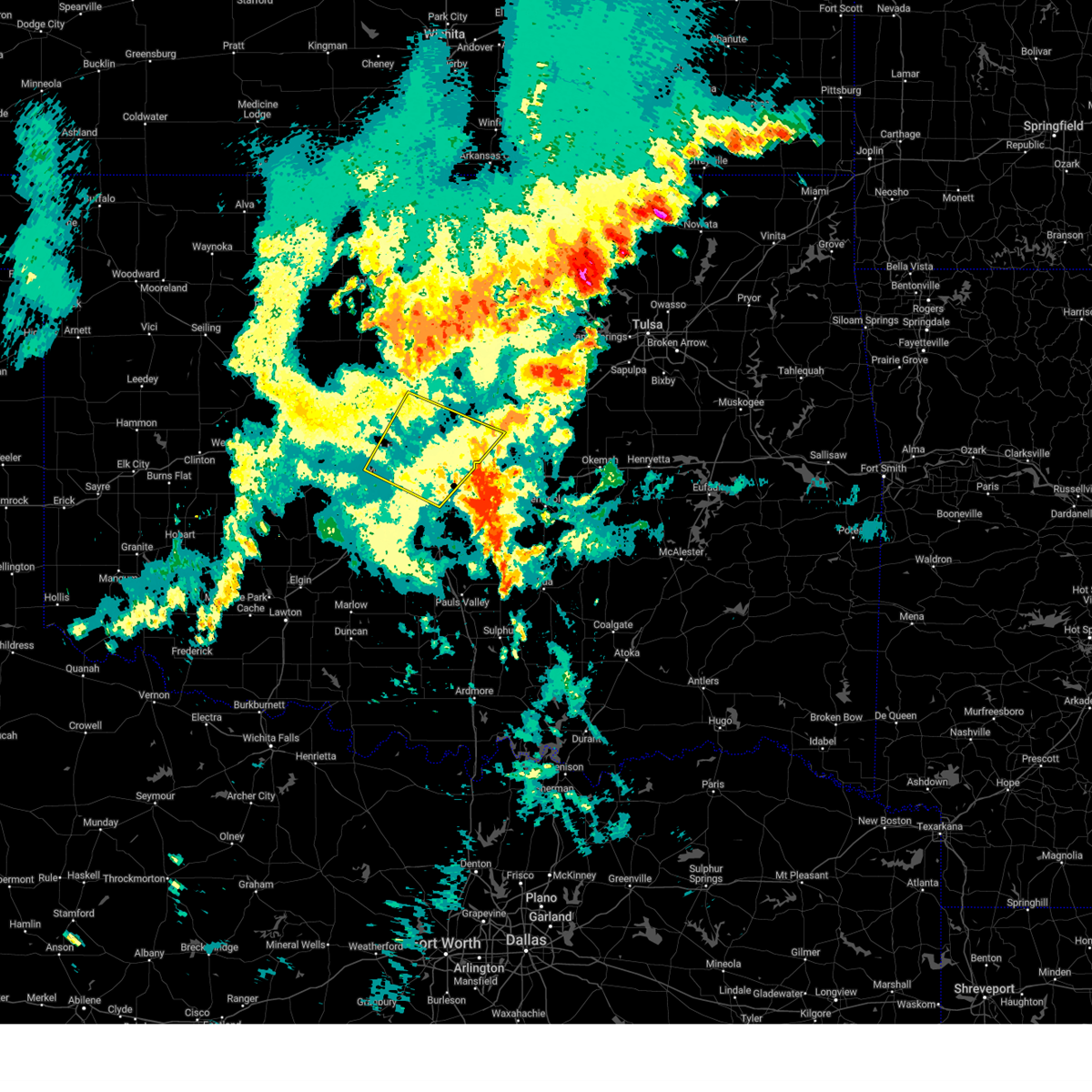 the severe thunderstorm warning has been cancelled and is no longer in effect the severe thunderstorm warning has been cancelled and is no longer in effect
|
| 4/29/2025 6:21 AM CDT |
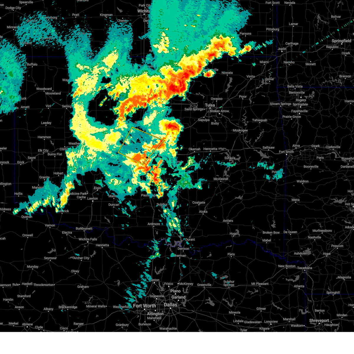 Svroun the national weather service in norman has issued a * severe thunderstorm warning for, southwestern lincoln county in central oklahoma, oklahoma county in central oklahoma, northwestern cleveland county in central oklahoma, southwestern logan county in central oklahoma, southeastern canadian county in central oklahoma, * until 700 am cdt. * at 620 am cdt, severe thunderstorms were located along a line extending from near oklahoma city to 4 miles southeast of moore, moving northeast at 45 mph (radar indicated). Hazards include 60 mph wind gusts. expect damage to roofs, siding, and trees Svroun the national weather service in norman has issued a * severe thunderstorm warning for, southwestern lincoln county in central oklahoma, oklahoma county in central oklahoma, northwestern cleveland county in central oklahoma, southwestern logan county in central oklahoma, southeastern canadian county in central oklahoma, * until 700 am cdt. * at 620 am cdt, severe thunderstorms were located along a line extending from near oklahoma city to 4 miles southeast of moore, moving northeast at 45 mph (radar indicated). Hazards include 60 mph wind gusts. expect damage to roofs, siding, and trees
|
| 4/19/2025 12:06 AM CDT |
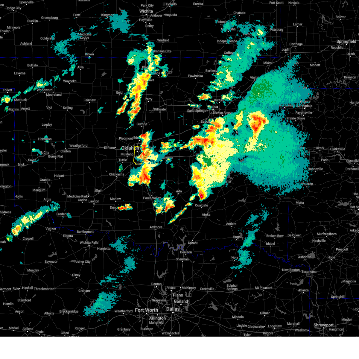 The storm which prompted the warning has moved out of the area. therefore, the warning will be allowed to expire. The storm which prompted the warning has moved out of the area. therefore, the warning will be allowed to expire.
|
| 4/18/2025 11:53 PM CDT |
 At 1153 pm cdt, a severe thunderstorm was located over southern oklahoma city, or 6 miles southwest of valley brook, moving north at 40 mph (public). Hazards include ping pong ball size hail. People and animals outdoors will be injured. expect damage to roofs, siding, windows, and vehicles. Locations impacted include, oklahoma city, western norman, moore, midwest city, del city, choctaw, spencer, nichols hills, nicoma park, valley brook, tinker air force base, forest park, lake aluma, and smith village. At 1153 pm cdt, a severe thunderstorm was located over southern oklahoma city, or 6 miles southwest of valley brook, moving north at 40 mph (public). Hazards include ping pong ball size hail. People and animals outdoors will be injured. expect damage to roofs, siding, windows, and vehicles. Locations impacted include, oklahoma city, western norman, moore, midwest city, del city, choctaw, spencer, nichols hills, nicoma park, valley brook, tinker air force base, forest park, lake aluma, and smith village.
|
| 4/18/2025 11:53 PM CDT |
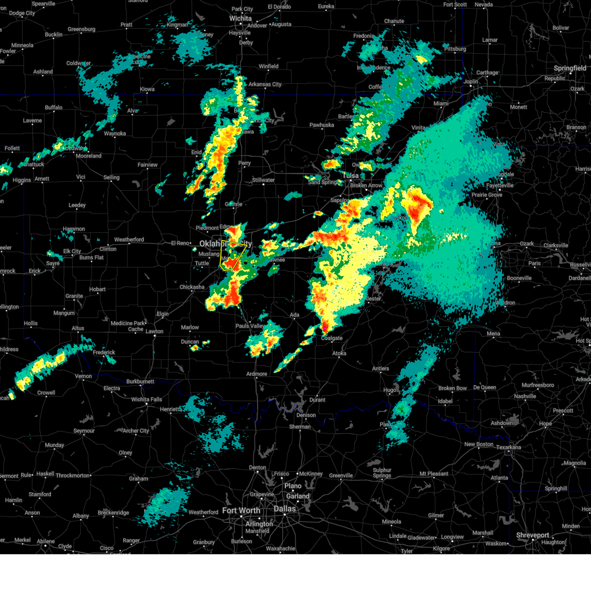 the severe thunderstorm warning has been cancelled and is no longer in effect the severe thunderstorm warning has been cancelled and is no longer in effect
|
| 4/18/2025 11:49 PM CDT |
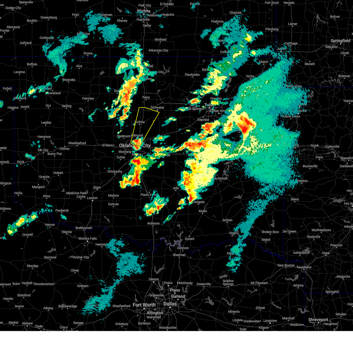 Svroun the national weather service in norman has issued a * severe thunderstorm warning for, northwestern oklahoma county in central oklahoma, central logan county in central oklahoma, southwestern payne county in central oklahoma, * until 1230 am cdt. * at 1149 pm cdt, a severe thunderstorm was located over southwestern edmond, or near downtown edmond, moving northeast at 50 mph (radar indicated). Hazards include quarter size hail. damage to vehicles is expected Svroun the national weather service in norman has issued a * severe thunderstorm warning for, northwestern oklahoma county in central oklahoma, central logan county in central oklahoma, southwestern payne county in central oklahoma, * until 1230 am cdt. * at 1149 pm cdt, a severe thunderstorm was located over southwestern edmond, or near downtown edmond, moving northeast at 50 mph (radar indicated). Hazards include quarter size hail. damage to vehicles is expected
|
| 4/18/2025 11:37 PM CDT |
 Svroun the national weather service in norman has issued a * severe thunderstorm warning for, southern oklahoma county in central oklahoma, northwestern cleveland county in central oklahoma, northwestern mcclain county in central oklahoma, * until 1215 am cdt. * at 1136 pm cdt, a severe thunderstorm was located 4 miles north of cole, moving north at 40 mph (radar indicated). Hazards include half dollar size hail. damage to vehicles is expected Svroun the national weather service in norman has issued a * severe thunderstorm warning for, southern oklahoma county in central oklahoma, northwestern cleveland county in central oklahoma, northwestern mcclain county in central oklahoma, * until 1215 am cdt. * at 1136 pm cdt, a severe thunderstorm was located 4 miles north of cole, moving north at 40 mph (radar indicated). Hazards include half dollar size hail. damage to vehicles is expected
|
| 4/2/2025 5:41 AM CDT |
 At 539 am cdt, a severe thunderstorm was located near harrah, moving northeast at 70 mph. in addition, a line of strong to severe thunderstorms extended from luther to lake stanley draper to west norman moving east-northeast (radar indicated). Hazards include 60 mph wind gusts and quarter size hail. Hail damage to vehicles is expected. expect wind damage to roofs, siding, and trees. Locations impacted include, midwest city, smith village, harrah, spencer, tinker air force base, moore, valley brook, jones, nicoma park, del city, arcadia, forest park, choctaw, stanley draper lake, lake aluma, luther, oklahoma city, newcastle, edmond, and norman. At 539 am cdt, a severe thunderstorm was located near harrah, moving northeast at 70 mph. in addition, a line of strong to severe thunderstorms extended from luther to lake stanley draper to west norman moving east-northeast (radar indicated). Hazards include 60 mph wind gusts and quarter size hail. Hail damage to vehicles is expected. expect wind damage to roofs, siding, and trees. Locations impacted include, midwest city, smith village, harrah, spencer, tinker air force base, moore, valley brook, jones, nicoma park, del city, arcadia, forest park, choctaw, stanley draper lake, lake aluma, luther, oklahoma city, newcastle, edmond, and norman.
|
| 4/2/2025 5:41 AM CDT |
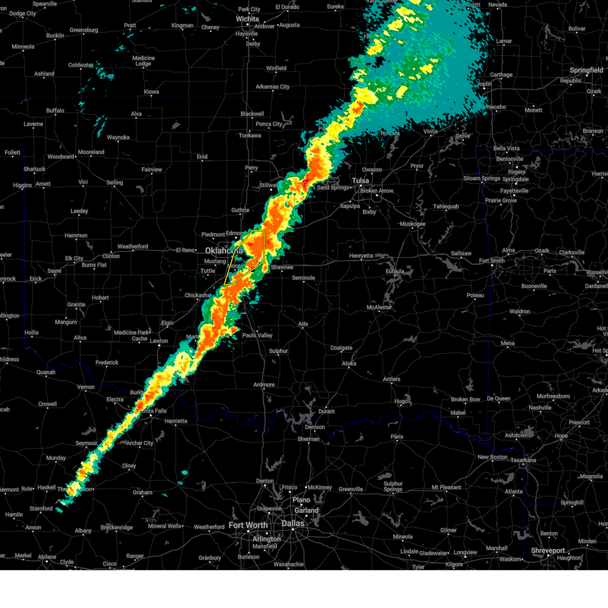 the severe thunderstorm warning has been cancelled and is no longer in effect the severe thunderstorm warning has been cancelled and is no longer in effect
|
| 4/2/2025 5:19 AM CDT |
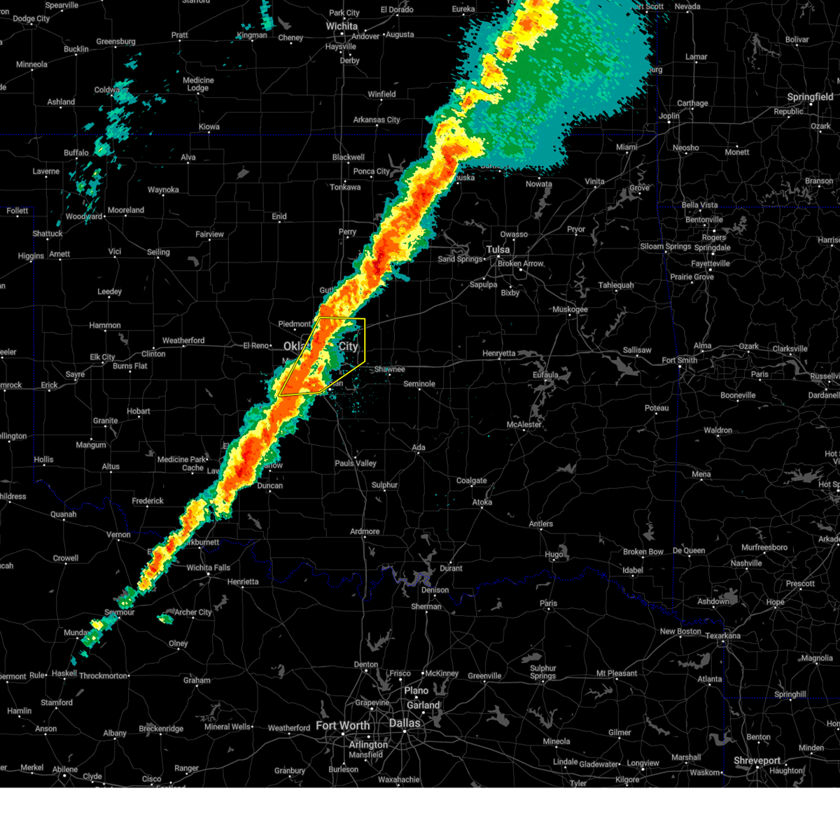 Svroun the national weather service in norman has issued a * severe thunderstorm warning for, northeastern grady county in central oklahoma, oklahoma county in central oklahoma, northwestern cleveland county in central oklahoma, southeastern canadian county in central oklahoma, northwestern mcclain county in central oklahoma, * until 600 am cdt. * at 518 am cdt, a severe thunderstorm was located near newcastle, moving northeast at 60 mph. this storm will be capable of producing half dollar size hail and 60 mph winds. in addition, a line of strong to severe thunderstorms extended from edmond to central oklahoma city to tuttle that will be capable of producing 60 mph winds (radar indicated). Hazards include 60 mph wind gusts and half dollar size hail. Hail damage to vehicles is expected. Expect wind damage to roofs, siding, and trees. Svroun the national weather service in norman has issued a * severe thunderstorm warning for, northeastern grady county in central oklahoma, oklahoma county in central oklahoma, northwestern cleveland county in central oklahoma, southeastern canadian county in central oklahoma, northwestern mcclain county in central oklahoma, * until 600 am cdt. * at 518 am cdt, a severe thunderstorm was located near newcastle, moving northeast at 60 mph. this storm will be capable of producing half dollar size hail and 60 mph winds. in addition, a line of strong to severe thunderstorms extended from edmond to central oklahoma city to tuttle that will be capable of producing 60 mph winds (radar indicated). Hazards include 60 mph wind gusts and half dollar size hail. Hail damage to vehicles is expected. Expect wind damage to roofs, siding, and trees.
|
| 3/30/2025 12:13 AM CDT |
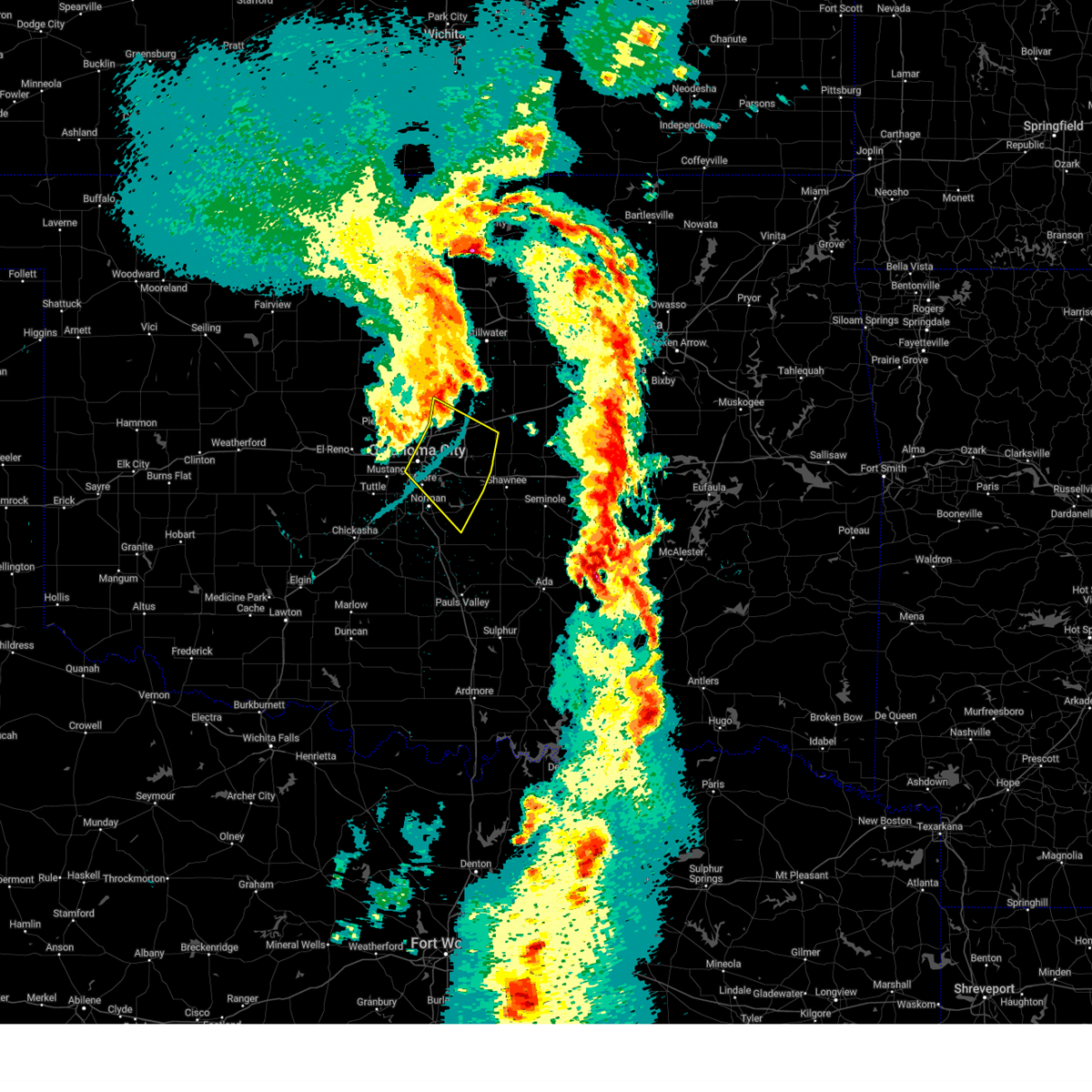 The storms which prompted the warning have weakened below severe limits, therefore the warning will be allowed to expire. The storms which prompted the warning have weakened below severe limits, therefore the warning will be allowed to expire.
|
| 3/30/2025 12:01 AM CDT |
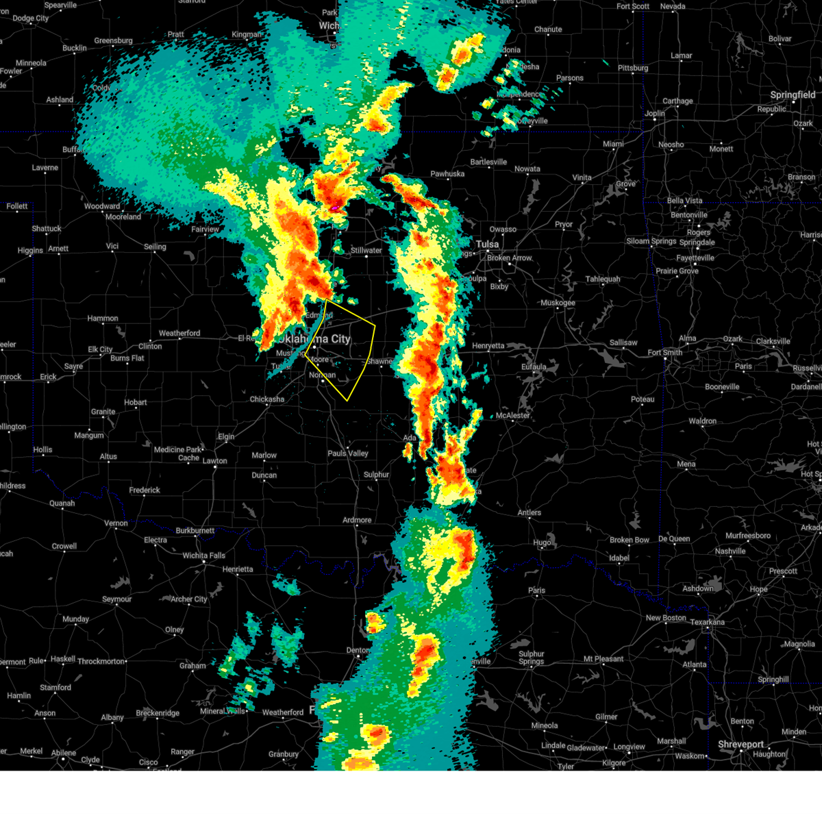 Svroun the national weather service in norman has issued a * severe thunderstorm warning for, southwestern lincoln county in central oklahoma, oklahoma county in central oklahoma, northeastern cleveland county in central oklahoma, south central logan county in central oklahoma, northwestern pottawatomie county in central oklahoma, * until 1215 am cdt. * at 1201 am cdt, the leading edge of winds from a line of severe thunderstorms was located along a line extending from 4 miles northwest of arcadia to near edmond to 4 miles northwest of spencer to near oklahoma city, moving southeast at 45 mph (radar indicated). Hazards include 60 mph wind gusts. expect damage to roofs, siding, and trees Svroun the national weather service in norman has issued a * severe thunderstorm warning for, southwestern lincoln county in central oklahoma, oklahoma county in central oklahoma, northeastern cleveland county in central oklahoma, south central logan county in central oklahoma, northwestern pottawatomie county in central oklahoma, * until 1215 am cdt. * at 1201 am cdt, the leading edge of winds from a line of severe thunderstorms was located along a line extending from 4 miles northwest of arcadia to near edmond to 4 miles northwest of spencer to near oklahoma city, moving southeast at 45 mph (radar indicated). Hazards include 60 mph wind gusts. expect damage to roofs, siding, and trees
|
| 11/18/2024 6:37 AM CST |
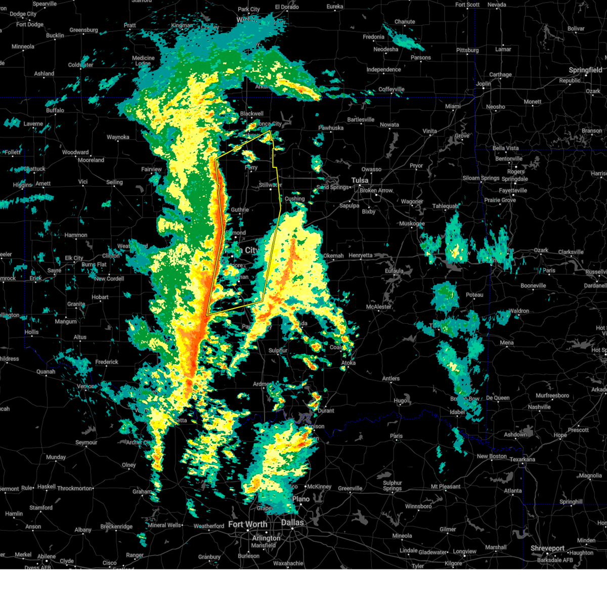 Svroun the national weather service in norman has issued a * severe thunderstorm warning for, south central kay county in northern oklahoma, northeastern grady county in central oklahoma, western lincoln county in central oklahoma, oklahoma county in central oklahoma, noble county in northern oklahoma, cleveland county in central oklahoma, logan county in central oklahoma, western payne county in central oklahoma, southeastern garfield county in northern oklahoma, southeastern canadian county in central oklahoma, northwestern pottawatomie county in central oklahoma, western mcclain county in central oklahoma, * until 715 am cst. * at 637 am cst, severe thunderstorms were located along a line extending from near fairmont to 5 miles southeast of cashion to 4 miles north of alex, moving east at 35 mph (radar indicated). Hazards include 70 mph wind gusts and penny size hail. Expect considerable tree damage. Damage is likely to mobile homes, roofs, and outbuildings. Svroun the national weather service in norman has issued a * severe thunderstorm warning for, south central kay county in northern oklahoma, northeastern grady county in central oklahoma, western lincoln county in central oklahoma, oklahoma county in central oklahoma, noble county in northern oklahoma, cleveland county in central oklahoma, logan county in central oklahoma, western payne county in central oklahoma, southeastern garfield county in northern oklahoma, southeastern canadian county in central oklahoma, northwestern pottawatomie county in central oklahoma, western mcclain county in central oklahoma, * until 715 am cst. * at 637 am cst, severe thunderstorms were located along a line extending from near fairmont to 5 miles southeast of cashion to 4 miles north of alex, moving east at 35 mph (radar indicated). Hazards include 70 mph wind gusts and penny size hail. Expect considerable tree damage. Damage is likely to mobile homes, roofs, and outbuildings.
|
| 11/18/2024 6:04 AM CST |
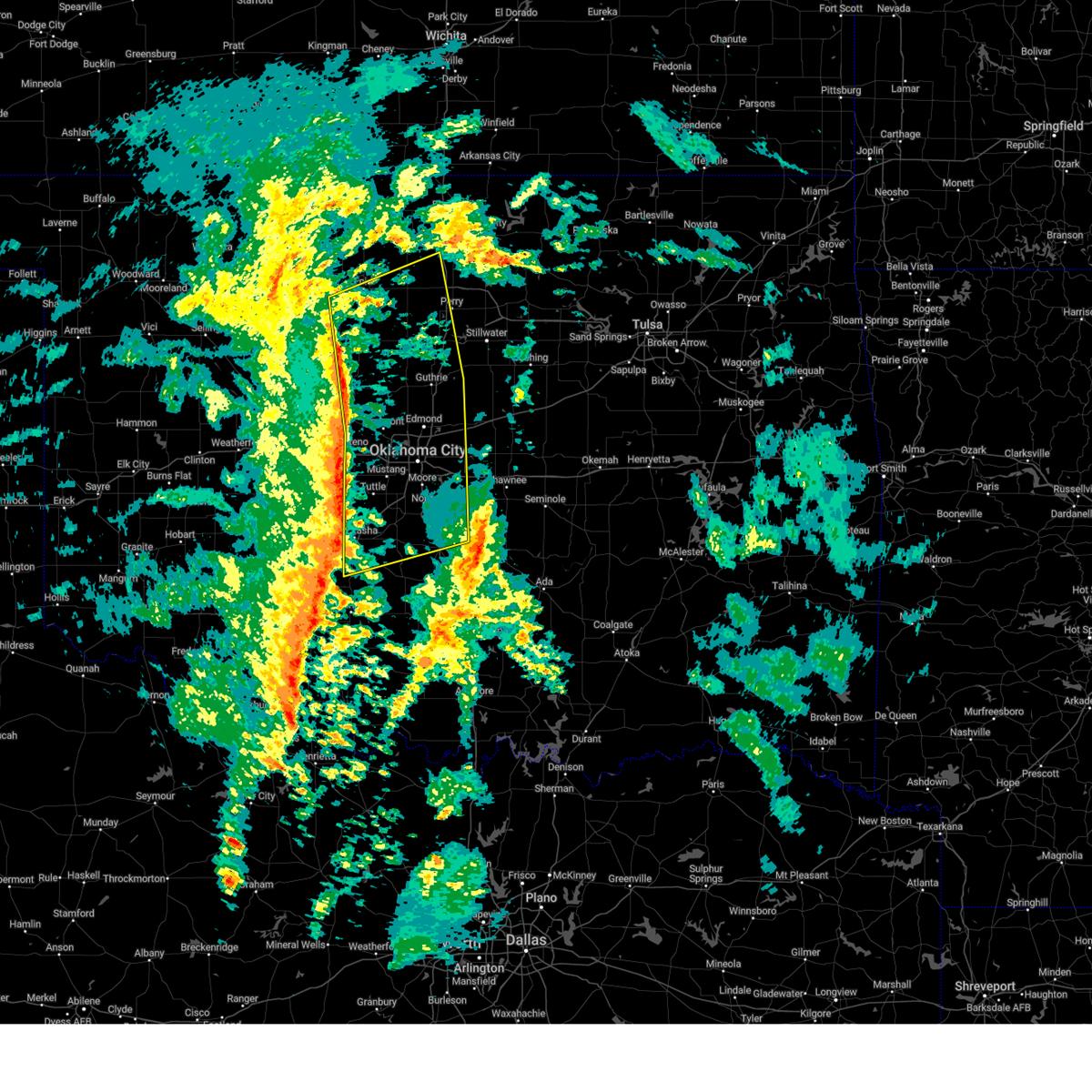 Svroun the national weather service in norman has issued a * severe thunderstorm warning for, kingfisher county in central oklahoma, central grady county in central oklahoma, oklahoma county in central oklahoma, western noble county in northern oklahoma, cleveland county in central oklahoma, logan county in central oklahoma, southwestern payne county in central oklahoma, garfield county in northern oklahoma, eastern canadian county in central oklahoma, western mcclain county in central oklahoma, * until 645 am cst. * at 604 am cst, severe thunderstorms were located along a line extending from 8 miles south of drummond to near concho to near norge, moving northeast at 45 mph (radar indicated). Hazards include 70 mph wind gusts and penny size hail. Expect considerable tree damage. Damage is likely to mobile homes, roofs, and outbuildings. Svroun the national weather service in norman has issued a * severe thunderstorm warning for, kingfisher county in central oklahoma, central grady county in central oklahoma, oklahoma county in central oklahoma, western noble county in northern oklahoma, cleveland county in central oklahoma, logan county in central oklahoma, southwestern payne county in central oklahoma, garfield county in northern oklahoma, eastern canadian county in central oklahoma, western mcclain county in central oklahoma, * until 645 am cst. * at 604 am cst, severe thunderstorms were located along a line extending from 8 miles south of drummond to near concho to near norge, moving northeast at 45 mph (radar indicated). Hazards include 70 mph wind gusts and penny size hail. Expect considerable tree damage. Damage is likely to mobile homes, roofs, and outbuildings.
|
| 11/4/2024 6:34 AM CST |
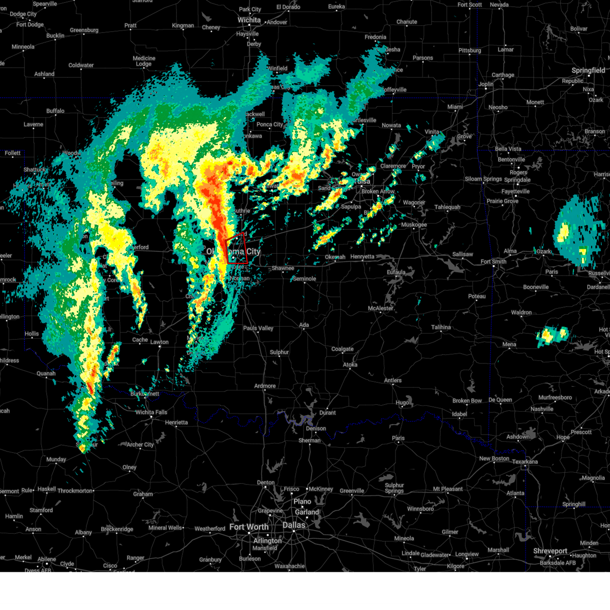 At 634 am cst, severe thunderstorms capable of producing tornadoes were located along a line extending from near oklahoma city to 4 miles south of nichols hills, moving east at 35 mph (radar indicated rotation). Hazards include tornado. Flying debris will be dangerous to those caught without shelter. mobile homes will be damaged or destroyed. damage to roofs, windows, and vehicles will occur. tree damage is likely. locations impacted include, oklahoma city, edmond, midwest city, del city, the village, spencer, nichols hills, tinker air force base, forest park, lake aluma, and smith village. this includes the following highways, interstate 35 between mile markers 123 and 145. interstate 40 between mile markers 147 and 160. Interstate 44 between mile markers 117 and 138. At 634 am cst, severe thunderstorms capable of producing tornadoes were located along a line extending from near oklahoma city to 4 miles south of nichols hills, moving east at 35 mph (radar indicated rotation). Hazards include tornado. Flying debris will be dangerous to those caught without shelter. mobile homes will be damaged or destroyed. damage to roofs, windows, and vehicles will occur. tree damage is likely. locations impacted include, oklahoma city, edmond, midwest city, del city, the village, spencer, nichols hills, tinker air force base, forest park, lake aluma, and smith village. this includes the following highways, interstate 35 between mile markers 123 and 145. interstate 40 between mile markers 147 and 160. Interstate 44 between mile markers 117 and 138.
|
| 11/4/2024 6:34 AM CST |
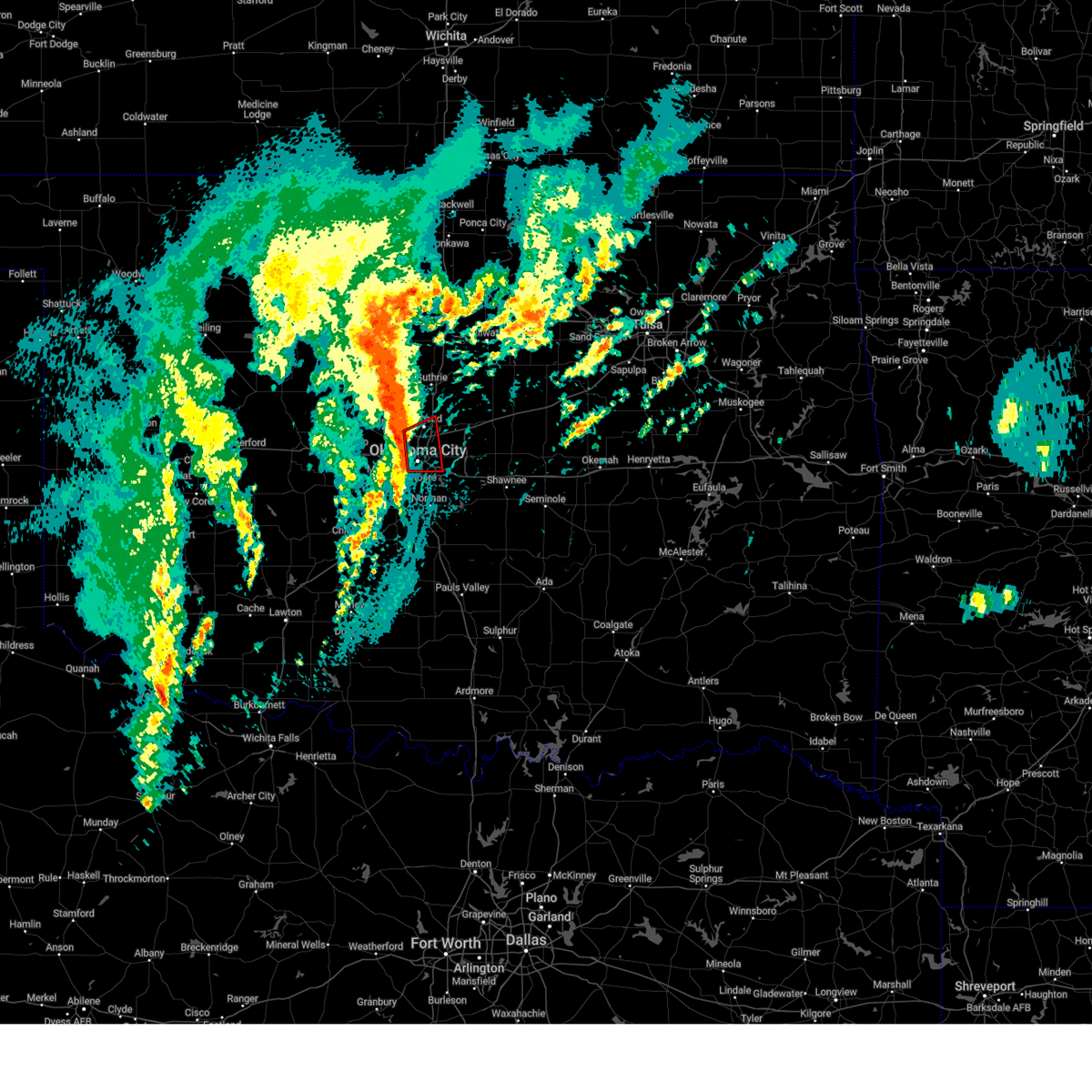 the tornado warning has been cancelled and is no longer in effect the tornado warning has been cancelled and is no longer in effect
|
| 11/4/2024 6:23 AM CST |
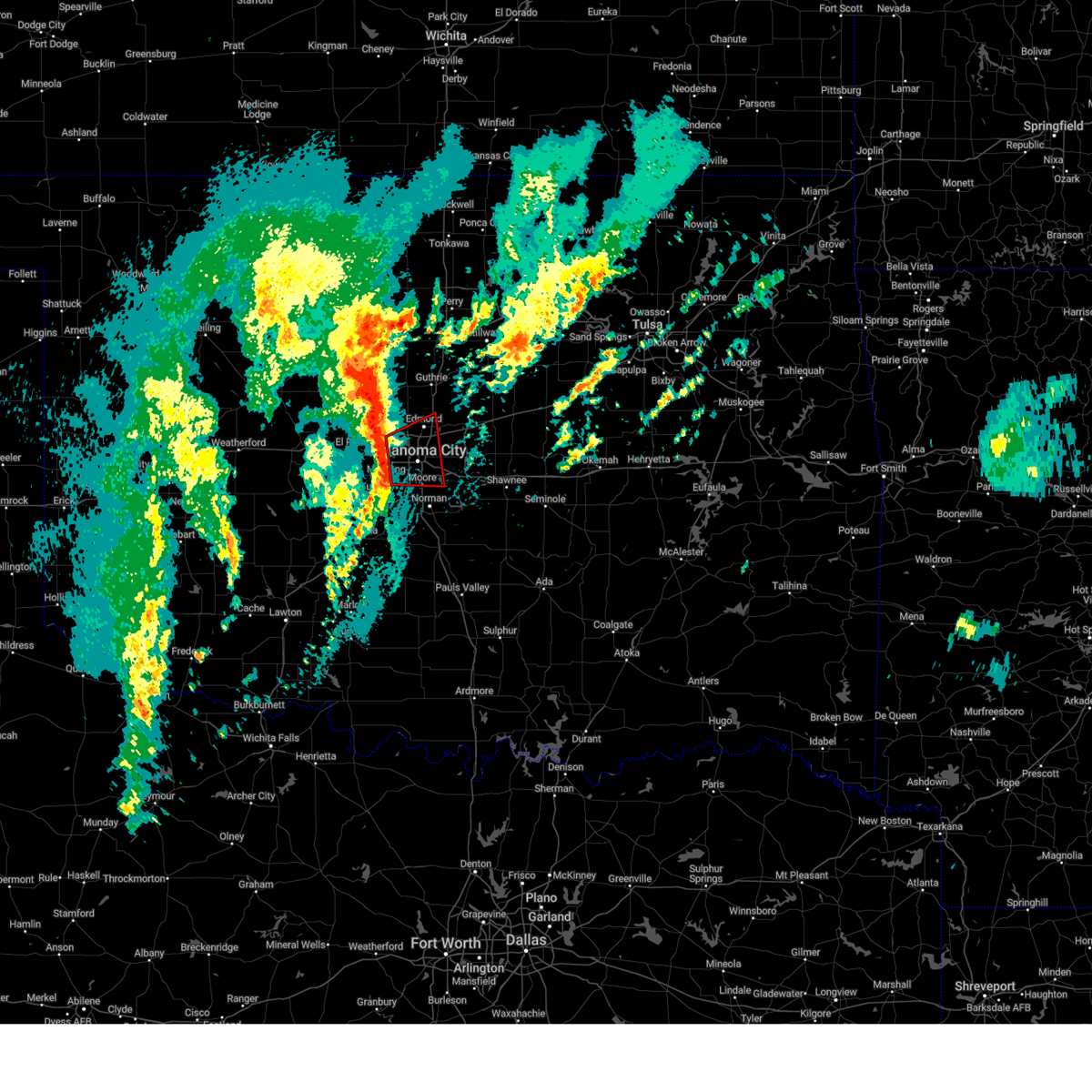 At 623 am cst, severe thunderstorms capable of producing tornadoes were located along a line extending from near oklahoma city to 4 miles east of mustang, moving east at 35 mph (radar indicated rotation). Hazards include tornado. Flying debris will be dangerous to those caught without shelter. mobile homes will be damaged or destroyed. damage to roofs, windows, and vehicles will occur. tree damage is likely. locations impacted include, oklahoma city, edmond, moore, midwest city, del city, yukon, bethany, mustang, warr acres, the village, spencer, nichols hills, valley brook, tinker air force base, stanley draper lake, forest park, woodlawn park, lake aluma, and smith village. this includes the following highways, interstate 35 between mile markers 118 and 146. interstate 40 between mile markers 140 and 160. interstate 44 between mile markers 112 and 138. Interstate 240 between mile markers 1 and 12. At 623 am cst, severe thunderstorms capable of producing tornadoes were located along a line extending from near oklahoma city to 4 miles east of mustang, moving east at 35 mph (radar indicated rotation). Hazards include tornado. Flying debris will be dangerous to those caught without shelter. mobile homes will be damaged or destroyed. damage to roofs, windows, and vehicles will occur. tree damage is likely. locations impacted include, oklahoma city, edmond, moore, midwest city, del city, yukon, bethany, mustang, warr acres, the village, spencer, nichols hills, valley brook, tinker air force base, stanley draper lake, forest park, woodlawn park, lake aluma, and smith village. this includes the following highways, interstate 35 between mile markers 118 and 146. interstate 40 between mile markers 140 and 160. interstate 44 between mile markers 112 and 138. Interstate 240 between mile markers 1 and 12.
|
| 11/4/2024 6:23 AM CST |
 the tornado warning has been cancelled and is no longer in effect the tornado warning has been cancelled and is no longer in effect
|
| 11/4/2024 6:11 AM CST |
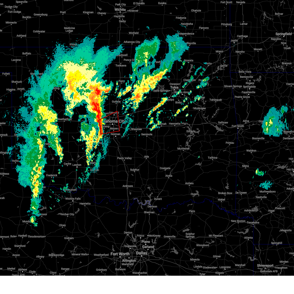 Toroun the national weather service in norman has issued a * tornado warning for, northeastern grady county in central oklahoma, western oklahoma county in central oklahoma, northwestern cleveland county in central oklahoma, southeastern canadian county in central oklahoma, northwestern mcclain county in central oklahoma, * until 645 am cst. * at 609 am cst, a line of thunderstorms was located along a line extending from near oklahoma city to near tuttle, moving east at 35 mph. several circulations along the line, near yukon and mustang, could lead to a few tornadoes (radar indicated rotation). Hazards include tornado. Flying debris will be dangerous to those caught without shelter. mobile homes will be damaged or destroyed. damage to roofs, windows, and vehicles will occur. Tree damage is likely. Toroun the national weather service in norman has issued a * tornado warning for, northeastern grady county in central oklahoma, western oklahoma county in central oklahoma, northwestern cleveland county in central oklahoma, southeastern canadian county in central oklahoma, northwestern mcclain county in central oklahoma, * until 645 am cst. * at 609 am cst, a line of thunderstorms was located along a line extending from near oklahoma city to near tuttle, moving east at 35 mph. several circulations along the line, near yukon and mustang, could lead to a few tornadoes (radar indicated rotation). Hazards include tornado. Flying debris will be dangerous to those caught without shelter. mobile homes will be damaged or destroyed. damage to roofs, windows, and vehicles will occur. Tree damage is likely.
|
| 11/3/2024 3:46 PM CST |
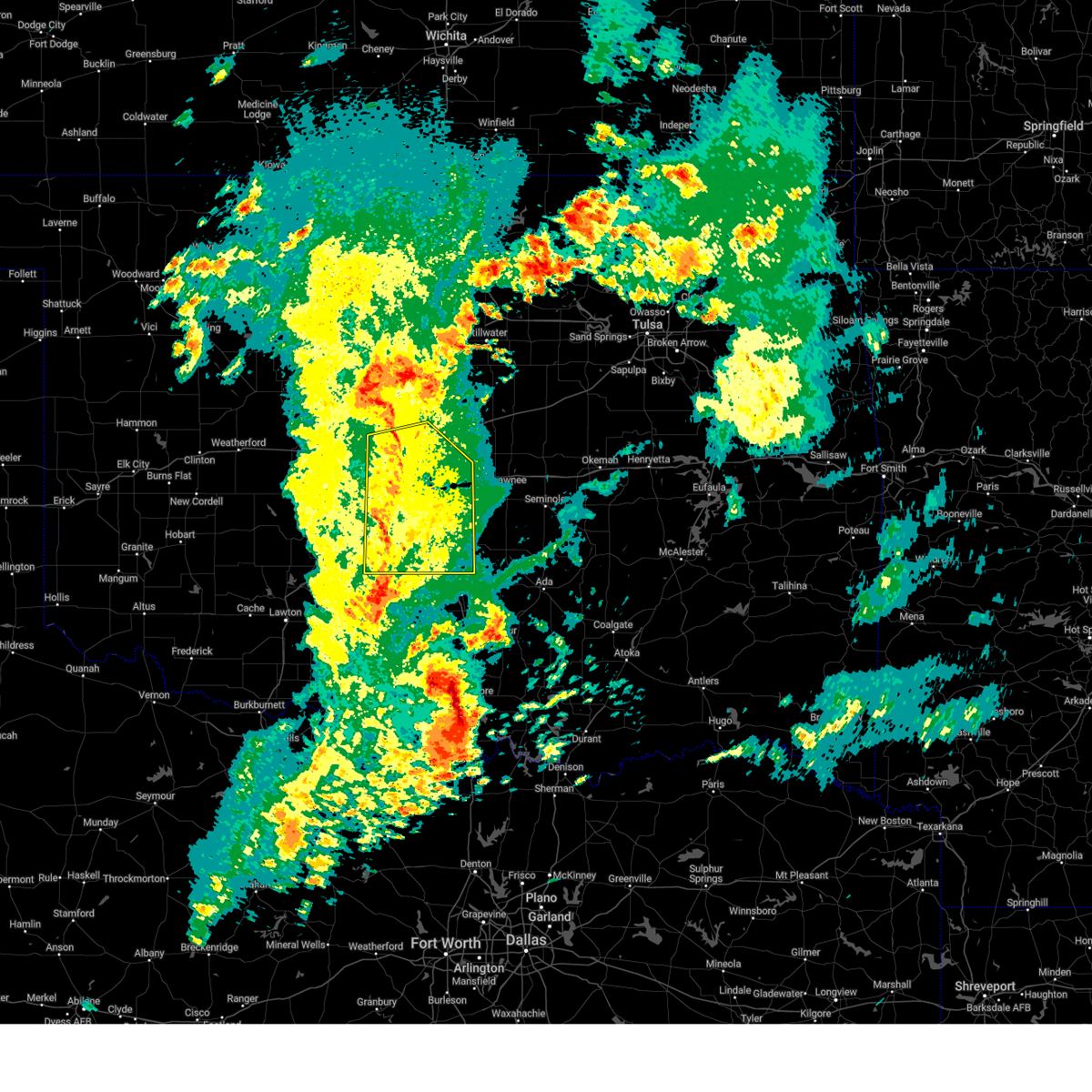 At 346 pm cst, severe thunderstorms were located along a line extending from near oklahoma city to near newcastle to 5 miles west of criner, moving east at 45 mph (radar indicated). Hazards include 60 mph wind gusts. Expect damage to roofs, siding, and trees. Locations impacted include, oklahoma city, norman, southwestern edmond, moore, midwest city, del city, newcastle, blanchard, purcell, yukon, bethany, mustang, choctaw, warr acres, the village, noble, tuttle, piedmont, harrah, and slaughterville. At 346 pm cst, severe thunderstorms were located along a line extending from near oklahoma city to near newcastle to 5 miles west of criner, moving east at 45 mph (radar indicated). Hazards include 60 mph wind gusts. Expect damage to roofs, siding, and trees. Locations impacted include, oklahoma city, norman, southwestern edmond, moore, midwest city, del city, newcastle, blanchard, purcell, yukon, bethany, mustang, choctaw, warr acres, the village, noble, tuttle, piedmont, harrah, and slaughterville.
|
| 11/3/2024 3:46 PM CST |
 the severe thunderstorm warning has been cancelled and is no longer in effect the severe thunderstorm warning has been cancelled and is no longer in effect
|
| 11/3/2024 3:08 PM CST |
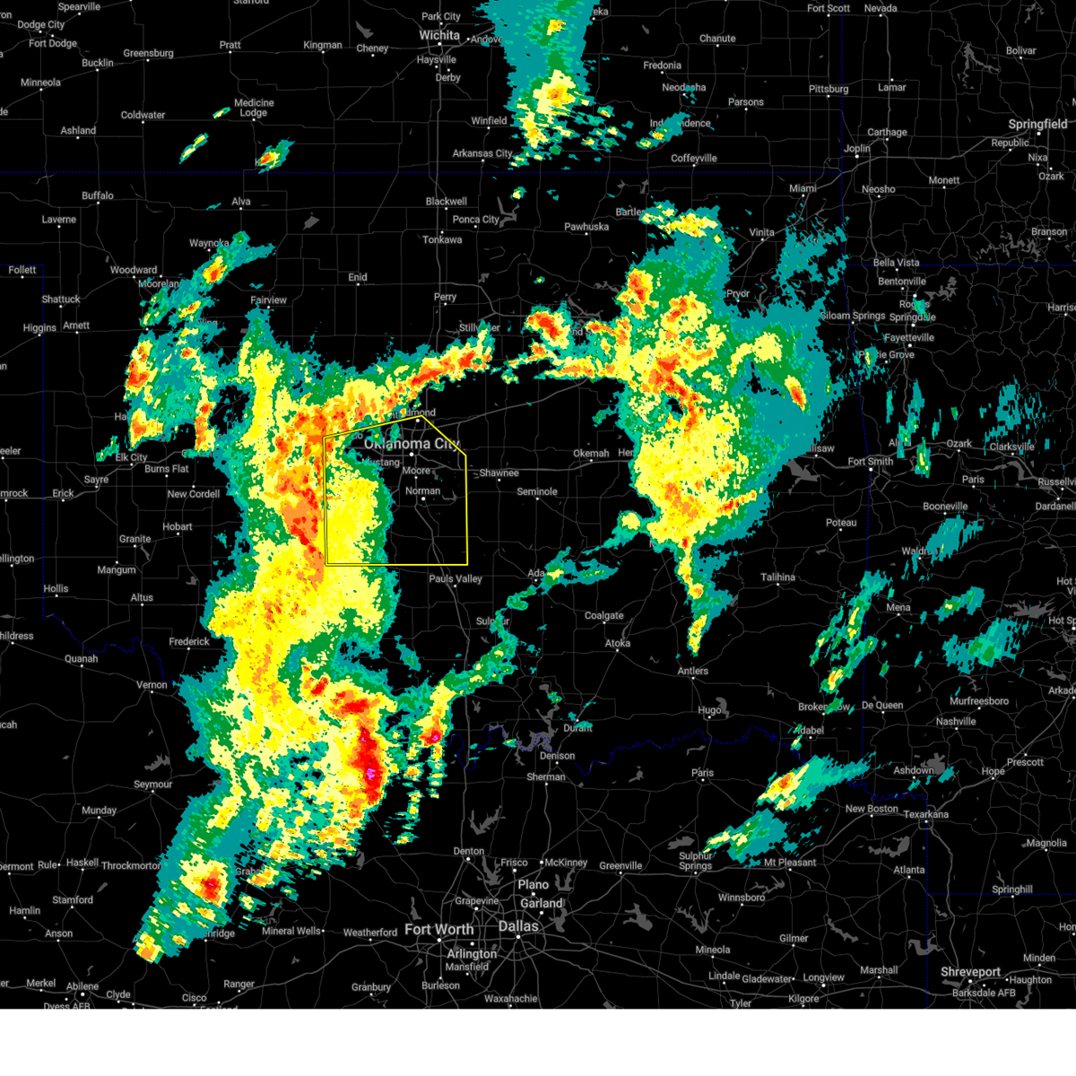 Svroun the national weather service in norman has issued a * severe thunderstorm warning for, grady county in central oklahoma, east central caddo county in southwestern oklahoma, oklahoma county in central oklahoma, cleveland county in central oklahoma, southeastern canadian county in central oklahoma, mcclain county in central oklahoma, * until 415 pm cst. * at 308 pm cst, severe thunderstorms were located along a line extending from 5 miles southwest of el reno to 3 miles west of agawam, moving east at 35 mph (radar indicated). Hazards include 70 mph wind gusts. Expect considerable tree damage. Damage is likely to mobile homes, roofs, and outbuildings. Svroun the national weather service in norman has issued a * severe thunderstorm warning for, grady county in central oklahoma, east central caddo county in southwestern oklahoma, oklahoma county in central oklahoma, cleveland county in central oklahoma, southeastern canadian county in central oklahoma, mcclain county in central oklahoma, * until 415 pm cst. * at 308 pm cst, severe thunderstorms were located along a line extending from 5 miles southwest of el reno to 3 miles west of agawam, moving east at 35 mph (radar indicated). Hazards include 70 mph wind gusts. Expect considerable tree damage. Damage is likely to mobile homes, roofs, and outbuildings.
|
| 11/3/2024 12:25 AM CST |
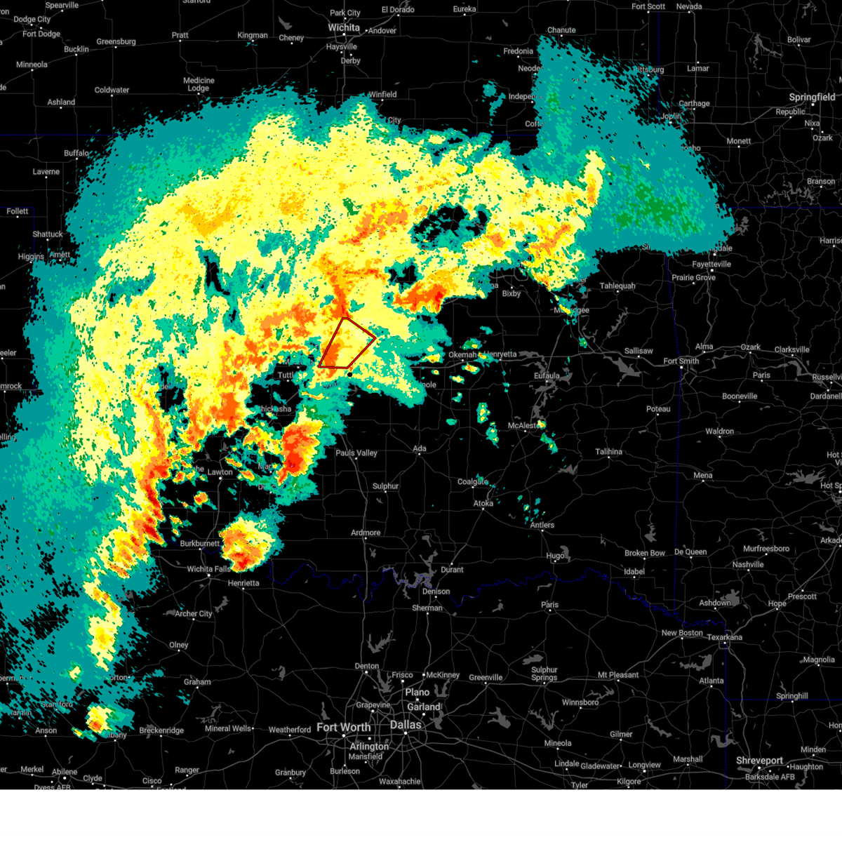 At 124 am cdt, a confirmed large and extremely dangerous tornado was located over southeastern oklahoma city, or near tinker air force base, moving northeast at 35 mph. this is a particularly dangerous situation. take cover now! (radar confirmed tornado). Hazards include damaging tornado. You are in a life-threatening situation. flying debris may be deadly to those caught without shelter. mobile homes will be destroyed. considerable damage to homes, businesses, and vehicles is likely and complete destruction is possible. locations impacted include, oklahoma city, eastern edmond, midwest city, del city, choctaw, harrah, spencer, jones, nicoma park, luther, valley brook, arcadia, tinker air force base, forest park, lake aluma, and smith village. this includes the following highways, interstate 35 between mile markers 122 and 133. interstate 40 between mile markers 151 and 165. interstate 44 between mile markers 136 and 150. Interstate 240 between mile markers 2 and 16. At 124 am cdt, a confirmed large and extremely dangerous tornado was located over southeastern oklahoma city, or near tinker air force base, moving northeast at 35 mph. this is a particularly dangerous situation. take cover now! (radar confirmed tornado). Hazards include damaging tornado. You are in a life-threatening situation. flying debris may be deadly to those caught without shelter. mobile homes will be destroyed. considerable damage to homes, businesses, and vehicles is likely and complete destruction is possible. locations impacted include, oklahoma city, eastern edmond, midwest city, del city, choctaw, harrah, spencer, jones, nicoma park, luther, valley brook, arcadia, tinker air force base, forest park, lake aluma, and smith village. this includes the following highways, interstate 35 between mile markers 122 and 133. interstate 40 between mile markers 151 and 165. interstate 44 between mile markers 136 and 150. Interstate 240 between mile markers 2 and 16.
|
| 11/3/2024 12:25 AM CST |
 the tornado warning has been cancelled and is no longer in effect the tornado warning has been cancelled and is no longer in effect
|
| 11/3/2024 12:21 AM CST |
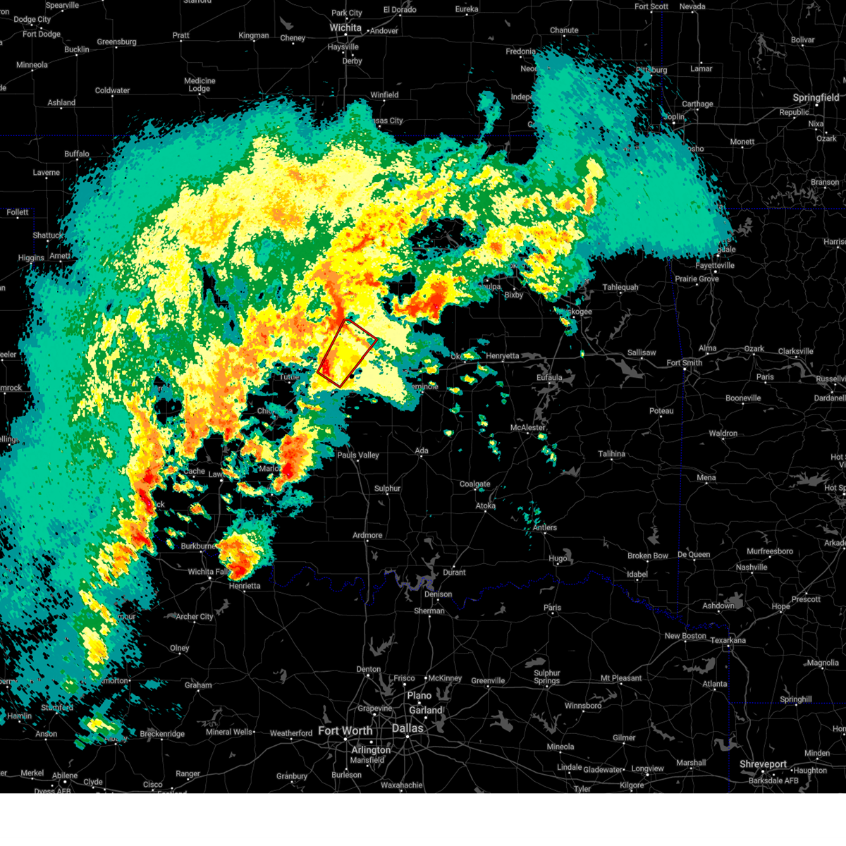 Toroun the national weather service in norman has issued a * tornado warning for, southwestern lincoln county in central oklahoma, eastern oklahoma county in central oklahoma, north central cleveland county in central oklahoma, * until 100 am cst. * at 121 am cdt, a severe thunderstorm capable of producing a tornado was located over southeastern oklahoma city, or near valley brook, moving northeast at 35 mph (radar indicated rotation). Hazards include tornado and golf ball size hail. Flying debris will be dangerous to those caught without shelter. mobile homes will be damaged or destroyed. damage to roofs, windows, and vehicles will occur. Tree damage is likely. Toroun the national weather service in norman has issued a * tornado warning for, southwestern lincoln county in central oklahoma, eastern oklahoma county in central oklahoma, north central cleveland county in central oklahoma, * until 100 am cst. * at 121 am cdt, a severe thunderstorm capable of producing a tornado was located over southeastern oklahoma city, or near valley brook, moving northeast at 35 mph (radar indicated rotation). Hazards include tornado and golf ball size hail. Flying debris will be dangerous to those caught without shelter. mobile homes will be damaged or destroyed. damage to roofs, windows, and vehicles will occur. Tree damage is likely.
|
| 11/3/2024 12:17 AM CST |
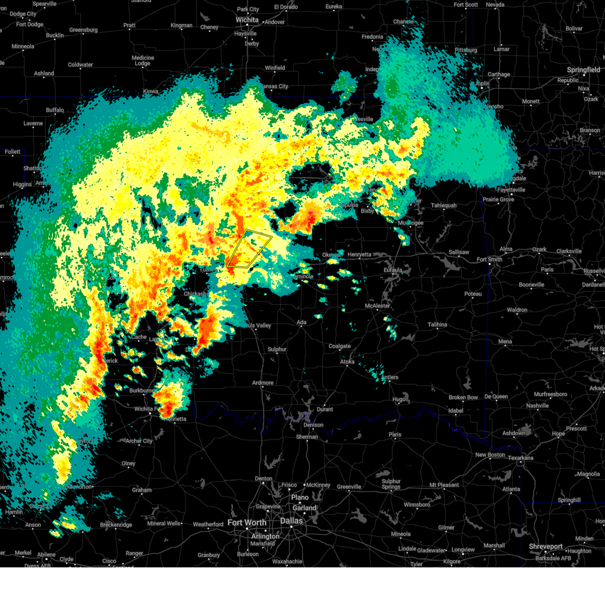 Svroun the national weather service in norman has issued a * severe thunderstorm warning for, west central lincoln county in central oklahoma, eastern oklahoma county in central oklahoma, north central cleveland county in central oklahoma, * until 100 am cst. * at 117 am cdt, a severe thunderstorm was located near moore, moving northeast at 35 mph (radar indicated). Hazards include 60 mph wind gusts and penny size hail. expect damage to roofs, siding, and trees Svroun the national weather service in norman has issued a * severe thunderstorm warning for, west central lincoln county in central oklahoma, eastern oklahoma county in central oklahoma, north central cleveland county in central oklahoma, * until 100 am cst. * at 117 am cdt, a severe thunderstorm was located near moore, moving northeast at 35 mph (radar indicated). Hazards include 60 mph wind gusts and penny size hail. expect damage to roofs, siding, and trees
|
| 9/24/2024 6:43 PM CDT |
 At 643 pm cdt, a severe thunderstorm was located over del city, moving southeast at 20 mph (radar indicated). Hazards include tennis ball size hail and 60 mph wind gusts. People and animals outdoors will be injured. expect hail damage to roofs, siding, windows, and vehicles. expect wind damage to roofs, siding, and trees. Locations impacted include, oklahoma city, norman, moore, midwest city, del city, choctaw, noble, harrah, spencer, jones, nicoma park, valley brook, tinker air force base, stanley draper lake, newalla, western lake thunderbird, forest park, lake aluma, and smith village. At 643 pm cdt, a severe thunderstorm was located over del city, moving southeast at 20 mph (radar indicated). Hazards include tennis ball size hail and 60 mph wind gusts. People and animals outdoors will be injured. expect hail damage to roofs, siding, windows, and vehicles. expect wind damage to roofs, siding, and trees. Locations impacted include, oklahoma city, norman, moore, midwest city, del city, choctaw, noble, harrah, spencer, jones, nicoma park, valley brook, tinker air force base, stanley draper lake, newalla, western lake thunderbird, forest park, lake aluma, and smith village.
|
| 9/24/2024 6:32 PM CDT |
 At 632 pm cdt, a severe thunderstorm was located over northeastern oklahoma city, or near forest park, moving southeast at 20 mph. this is a destructive storm for forest park, oklahoma city, del city, midwest city (radar indicated). Hazards include baseball size hail and 60 mph wind gusts. People and animals outdoors will be severely injured. expect shattered windows, extensive damage to roofs, siding, and vehicles. Locations impacted include, oklahoma city, norman, moore, midwest city, del city, choctaw, the village, noble, harrah, spencer, nichols hills, jones, nicoma park, valley brook, tinker air force base, stanley draper lake, newalla, western lake thunderbird, forest park, and lake aluma. At 632 pm cdt, a severe thunderstorm was located over northeastern oklahoma city, or near forest park, moving southeast at 20 mph. this is a destructive storm for forest park, oklahoma city, del city, midwest city (radar indicated). Hazards include baseball size hail and 60 mph wind gusts. People and animals outdoors will be severely injured. expect shattered windows, extensive damage to roofs, siding, and vehicles. Locations impacted include, oklahoma city, norman, moore, midwest city, del city, choctaw, the village, noble, harrah, spencer, nichols hills, jones, nicoma park, valley brook, tinker air force base, stanley draper lake, newalla, western lake thunderbird, forest park, and lake aluma.
|
| 9/24/2024 6:27 PM CDT |
 Svroun the national weather service in norman has issued a * severe thunderstorm warning for, southwestern lincoln county in central oklahoma, southern oklahoma county in central oklahoma, northeastern cleveland county in central oklahoma, * until 715 pm cdt. * at 626 pm cdt, a severe thunderstorm was located over northeastern oklahoma city, or over lake aluma, moving southeast at 20 mph (trained weather spotters). Hazards include two inch hail and 60 mph wind gusts. People and animals outdoors will be injured. expect hail damage to roofs, siding, windows, and vehicles. Expect wind damage to roofs, siding, and trees. Svroun the national weather service in norman has issued a * severe thunderstorm warning for, southwestern lincoln county in central oklahoma, southern oklahoma county in central oklahoma, northeastern cleveland county in central oklahoma, * until 715 pm cdt. * at 626 pm cdt, a severe thunderstorm was located over northeastern oklahoma city, or over lake aluma, moving southeast at 20 mph (trained weather spotters). Hazards include two inch hail and 60 mph wind gusts. People and animals outdoors will be injured. expect hail damage to roofs, siding, windows, and vehicles. Expect wind damage to roofs, siding, and trees.
|
| 9/24/2024 6:22 PM CDT |
 At 622 pm cdt, a severe thunderstorm was located over northeastern oklahoma city, or near lake aluma, moving southeast at 20 mph (trained weather spotters). Hazards include tennis ball size hail and 70 mph wind gusts. People and animals outdoors will be injured. expect hail damage to roofs, siding, windows, and vehicles. expect considerable tree damage. wind damage is also likely to mobile homes, roofs, and outbuildings. Locations impacted include, eastern oklahoma city, southeastern edmond, midwest city, del city, choctaw, the village, spencer, nichols hills, jones, nicoma park, tinker air force base, forest park, and lake aluma. At 622 pm cdt, a severe thunderstorm was located over northeastern oklahoma city, or near lake aluma, moving southeast at 20 mph (trained weather spotters). Hazards include tennis ball size hail and 70 mph wind gusts. People and animals outdoors will be injured. expect hail damage to roofs, siding, windows, and vehicles. expect considerable tree damage. wind damage is also likely to mobile homes, roofs, and outbuildings. Locations impacted include, eastern oklahoma city, southeastern edmond, midwest city, del city, choctaw, the village, spencer, nichols hills, jones, nicoma park, tinker air force base, forest park, and lake aluma.
|
| 9/24/2024 6:17 PM CDT |
 At 615 pm cdt, a severe thunderstorm was located over northern oklahoma city, or near the village, moving southeast at 20 mph. this is a destructive storm for south edmond, lake aluma, spencer, nicoma park (trained weather spotters reported baseball hail near 150th and penn). Hazards include baseball size hail and 70 mph wind gusts. People and animals outdoors will be severely injured. expect shattered windows, extensive damage to roofs, siding, and vehicles. Locations impacted include, oklahoma city, edmond, midwest city, del city, choctaw, the village, spencer, nichols hills, jones, nicoma park, luther, arcadia, tinker air force base, forest park, and lake aluma. At 615 pm cdt, a severe thunderstorm was located over northern oklahoma city, or near the village, moving southeast at 20 mph. this is a destructive storm for south edmond, lake aluma, spencer, nicoma park (trained weather spotters reported baseball hail near 150th and penn). Hazards include baseball size hail and 70 mph wind gusts. People and animals outdoors will be severely injured. expect shattered windows, extensive damage to roofs, siding, and vehicles. Locations impacted include, oklahoma city, edmond, midwest city, del city, choctaw, the village, spencer, nichols hills, jones, nicoma park, luther, arcadia, tinker air force base, forest park, and lake aluma.
|
| 9/24/2024 6:14 PM CDT |
 At 613 pm cdt, a severe thunderstorm was located over northern oklahoma city, or near the village, moving southeast at 20 mph (public reported golf ball size hail 5 miles east of edmond). Hazards include golf ball size hail and 70 mph wind gusts. People and animals outdoors will be injured. expect hail damage to roofs, siding, windows, and vehicles. expect considerable tree damage. wind damage is also likely to mobile homes, roofs, and outbuildings. Locations impacted include, oklahoma city, edmond, midwest city, del city, choctaw, the village, spencer, nichols hills, jones, nicoma park, luther, arcadia, tinker air force base, forest park, and lake aluma. At 613 pm cdt, a severe thunderstorm was located over northern oklahoma city, or near the village, moving southeast at 20 mph (public reported golf ball size hail 5 miles east of edmond). Hazards include golf ball size hail and 70 mph wind gusts. People and animals outdoors will be injured. expect hail damage to roofs, siding, windows, and vehicles. expect considerable tree damage. wind damage is also likely to mobile homes, roofs, and outbuildings. Locations impacted include, oklahoma city, edmond, midwest city, del city, choctaw, the village, spencer, nichols hills, jones, nicoma park, luther, arcadia, tinker air force base, forest park, and lake aluma.
|
| 9/24/2024 6:09 PM CDT |
 At 609 pm cdt, a severe thunderstorm was located over northwestern oklahoma city, or near the village, moving southeast at 20 mph (radar indicated). Hazards include 70 mph wind gusts and ping pong ball size hail. People and animals outdoors will be injured. expect hail damage to roofs, siding, windows, and vehicles. expect considerable tree damage. wind damage is also likely to mobile homes, roofs, and outbuildings. Locations impacted include, eastern oklahoma city, edmond, midwest city, del city, choctaw, the village, spencer, nichols hills, jones, nicoma park, luther, arcadia, tinker air force base, forest park, and lake aluma. At 609 pm cdt, a severe thunderstorm was located over northwestern oklahoma city, or near the village, moving southeast at 20 mph (radar indicated). Hazards include 70 mph wind gusts and ping pong ball size hail. People and animals outdoors will be injured. expect hail damage to roofs, siding, windows, and vehicles. expect considerable tree damage. wind damage is also likely to mobile homes, roofs, and outbuildings. Locations impacted include, eastern oklahoma city, edmond, midwest city, del city, choctaw, the village, spencer, nichols hills, jones, nicoma park, luther, arcadia, tinker air force base, forest park, and lake aluma.
|
| 9/24/2024 6:00 PM CDT |
 the severe thunderstorm warning has been cancelled and is no longer in effect the severe thunderstorm warning has been cancelled and is no longer in effect
|
| 9/24/2024 6:00 PM CDT |
 At 559 pm cdt, a severe thunderstorm was located over northwestern oklahoma city, or 4 miles north of the village and 3 miles west of edmond, moving southeast at 25 mph (radar indicated). Hazards include 70 mph wind gusts and half dollar size hail. Hail damage to vehicles is expected. expect considerable tree damage. wind damage is also likely to mobile homes, roofs, and outbuildings. Locations impacted include, eastern oklahoma city, edmond, midwest city, del city, choctaw, the village, spencer, nichols hills, jones, nicoma park, luther, arcadia, tinker air force base, forest park, and lake aluma. At 559 pm cdt, a severe thunderstorm was located over northwestern oklahoma city, or 4 miles north of the village and 3 miles west of edmond, moving southeast at 25 mph (radar indicated). Hazards include 70 mph wind gusts and half dollar size hail. Hail damage to vehicles is expected. expect considerable tree damage. wind damage is also likely to mobile homes, roofs, and outbuildings. Locations impacted include, eastern oklahoma city, edmond, midwest city, del city, choctaw, the village, spencer, nichols hills, jones, nicoma park, luther, arcadia, tinker air force base, forest park, and lake aluma.
|
| 9/24/2024 5:45 PM CDT |
 Svroun the national weather service in norman has issued a * severe thunderstorm warning for, southeastern kingfisher county in central oklahoma, central oklahoma county in central oklahoma, southwestern logan county in central oklahoma, northeastern canadian county in central oklahoma, * until 630 pm cdt. * at 545 pm cdt, a severe thunderstorm was located 4 miles northeast of piedmont, moving east at 25 mph (radar indicated). Hazards include 60 mph wind gusts and half dollar size hail. Hail damage to vehicles is expected. Expect wind damage to roofs, siding, and trees. Svroun the national weather service in norman has issued a * severe thunderstorm warning for, southeastern kingfisher county in central oklahoma, central oklahoma county in central oklahoma, southwestern logan county in central oklahoma, northeastern canadian county in central oklahoma, * until 630 pm cdt. * at 545 pm cdt, a severe thunderstorm was located 4 miles northeast of piedmont, moving east at 25 mph (radar indicated). Hazards include 60 mph wind gusts and half dollar size hail. Hail damage to vehicles is expected. Expect wind damage to roofs, siding, and trees.
|
| 6/25/2024 11:36 PM CDT |
 At 1136 pm cdt, a severe thunderstorm was located over southern oklahoma city, or near valley brook, moving south at 25 mph (radar indicated). Hazards include 60 mph wind gusts and quarter size hail. Hail damage to vehicles is expected. expect wind damage to roofs, siding, and trees. Locations impacted include, oklahoma city, moore, midwest city, del city, the village, nichols hills, valley brook, stanley draper lake, tinker air force base, forest park, lake aluma, and smith village. At 1136 pm cdt, a severe thunderstorm was located over southern oklahoma city, or near valley brook, moving south at 25 mph (radar indicated). Hazards include 60 mph wind gusts and quarter size hail. Hail damage to vehicles is expected. expect wind damage to roofs, siding, and trees. Locations impacted include, oklahoma city, moore, midwest city, del city, the village, nichols hills, valley brook, stanley draper lake, tinker air force base, forest park, lake aluma, and smith village.
|
| 6/25/2024 11:22 PM CDT |
 At 1120 pm cdt, a severe thunderstorm was located over western oklahoma city, or over the capitol, moving south at 20 mph (public reported two inch hail north of the village). Hazards include two inch hail and 60 mph wind gusts. People and animals outdoors will be injured. expect hail damage to roofs, siding, windows, and vehicles. expect wind damage to roofs, siding, and trees. Locations impacted include, oklahoma city, moore, midwest city, del city, the village, nichols hills, valley brook, stanley draper lake, tinker air force base, forest park, lake aluma, and smith village. At 1120 pm cdt, a severe thunderstorm was located over western oklahoma city, or over the capitol, moving south at 20 mph (public reported two inch hail north of the village). Hazards include two inch hail and 60 mph wind gusts. People and animals outdoors will be injured. expect hail damage to roofs, siding, windows, and vehicles. expect wind damage to roofs, siding, and trees. Locations impacted include, oklahoma city, moore, midwest city, del city, the village, nichols hills, valley brook, stanley draper lake, tinker air force base, forest park, lake aluma, and smith village.
|
| 6/25/2024 11:08 PM CDT |
 Svroun the national weather service in norman has issued a * severe thunderstorm warning for, southwestern oklahoma county in central oklahoma, north central cleveland county in central oklahoma, * until midnight cdt. * at 1108 pm cdt, a severe thunderstorm was located over northwestern oklahoma city, or near nichols hills, moving south at 25 mph (radar indicated). Hazards include golf ball size hail and 60 mph wind gusts. People and animals outdoors will be injured. expect hail damage to roofs, siding, windows, and vehicles. Expect wind damage to roofs, siding, and trees. Svroun the national weather service in norman has issued a * severe thunderstorm warning for, southwestern oklahoma county in central oklahoma, north central cleveland county in central oklahoma, * until midnight cdt. * at 1108 pm cdt, a severe thunderstorm was located over northwestern oklahoma city, or near nichols hills, moving south at 25 mph (radar indicated). Hazards include golf ball size hail and 60 mph wind gusts. People and animals outdoors will be injured. expect hail damage to roofs, siding, windows, and vehicles. Expect wind damage to roofs, siding, and trees.
|
| 6/25/2024 10:40 PM CDT |
 Svroun the national weather service in norman has issued a * severe thunderstorm warning for, southwestern lincoln county in central oklahoma, oklahoma county in central oklahoma, northern cleveland county in central oklahoma, northwestern pottawatomie county in central oklahoma, northwestern mcclain county in central oklahoma, * until 1115 pm cdt. * at 1040 pm cdt, severe thunderstorms were located along a line extending from near oklahoma city to near valley brook to near harrah, moving south at 30 mph (radar indicated). Hazards include ping pong ball size hail and 60 mph wind gusts. People and animals outdoors will be injured. expect hail damage to roofs, siding, windows, and vehicles. Expect wind damage to roofs, siding, and trees. Svroun the national weather service in norman has issued a * severe thunderstorm warning for, southwestern lincoln county in central oklahoma, oklahoma county in central oklahoma, northern cleveland county in central oklahoma, northwestern pottawatomie county in central oklahoma, northwestern mcclain county in central oklahoma, * until 1115 pm cdt. * at 1040 pm cdt, severe thunderstorms were located along a line extending from near oklahoma city to near valley brook to near harrah, moving south at 30 mph (radar indicated). Hazards include ping pong ball size hail and 60 mph wind gusts. People and animals outdoors will be injured. expect hail damage to roofs, siding, windows, and vehicles. Expect wind damage to roofs, siding, and trees.
|
| 6/25/2024 10:31 PM CDT |
 Svroun the national weather service in norman has issued a * severe thunderstorm warning for, south central oklahoma county in central oklahoma, northeastern cleveland county in central oklahoma, * until 1100 pm cdt. * at 1030 pm cdt, a severe thunderstorm was located over northeastern oklahoma city, or over lake aluma, moving south at 25 mph. this is a destructive storm for oklahoma city (radar indicated). Hazards include 80 mph wind gusts and ping pong ball size hail. Flying debris will be dangerous to those caught without shelter. mobile homes will be heavily damaged. expect considerable damage to roofs, windows, and vehicles. Extensive tree damage and power outages are likely. Svroun the national weather service in norman has issued a * severe thunderstorm warning for, south central oklahoma county in central oklahoma, northeastern cleveland county in central oklahoma, * until 1100 pm cdt. * at 1030 pm cdt, a severe thunderstorm was located over northeastern oklahoma city, or over lake aluma, moving south at 25 mph. this is a destructive storm for oklahoma city (radar indicated). Hazards include 80 mph wind gusts and ping pong ball size hail. Flying debris will be dangerous to those caught without shelter. mobile homes will be heavily damaged. expect considerable damage to roofs, windows, and vehicles. Extensive tree damage and power outages are likely.
|
| 6/25/2024 10:29 PM CDT |
 At 1029 pm cdt, severe thunderstorms were located along a line extending from near oklahoma city to 6 miles south of luther to 4 miles west of sparks, moving south at 25 mph (radar indicated). Hazards include golf ball size hail and 70 mph wind gusts. People and animals outdoors will be injured. expect hail damage to roofs, siding, windows, and vehicles. expect considerable tree damage. wind damage is also likely to mobile homes, roofs, and outbuildings. Locations impacted include, oklahoma city, northern norman, edmond, moore, midwest city, shawnee, del city, bethany, choctaw, warr acres, the village, harrah, mcloud, spencer, nichols hills, jones, nicoma park, luther, meeker, and cashion. At 1029 pm cdt, severe thunderstorms were located along a line extending from near oklahoma city to 6 miles south of luther to 4 miles west of sparks, moving south at 25 mph (radar indicated). Hazards include golf ball size hail and 70 mph wind gusts. People and animals outdoors will be injured. expect hail damage to roofs, siding, windows, and vehicles. expect considerable tree damage. wind damage is also likely to mobile homes, roofs, and outbuildings. Locations impacted include, oklahoma city, northern norman, edmond, moore, midwest city, shawnee, del city, bethany, choctaw, warr acres, the village, harrah, mcloud, spencer, nichols hills, jones, nicoma park, luther, meeker, and cashion.
|
| 6/25/2024 10:29 PM CDT |
 the severe thunderstorm warning has been cancelled and is no longer in effect the severe thunderstorm warning has been cancelled and is no longer in effect
|
| 6/25/2024 10:18 PM CDT |
 At 1017 pm cdt, a severe thunderstorm was located over northern oklahoma city, or 4 miles northwest of lake aluma, moving southeast at 35 mph. this is a destructive storm for edmond and north oklahoma city (radar indicated). Hazards include 80 mph wind gusts and golf ball size hail. Flying debris will be dangerous to those caught without shelter. mobile homes will be heavily damaged. expect considerable damage to roofs, windows, and vehicles. extensive tree damage and power outages are likely. Locations impacted include, oklahoma city, edmond, midwest city, del city, choctaw, warr acres, the village, spencer, nichols hills, jones, nicoma park, valley brook, tinker air force base, forest park, lake aluma, and smith village. At 1017 pm cdt, a severe thunderstorm was located over northern oklahoma city, or 4 miles northwest of lake aluma, moving southeast at 35 mph. this is a destructive storm for edmond and north oklahoma city (radar indicated). Hazards include 80 mph wind gusts and golf ball size hail. Flying debris will be dangerous to those caught without shelter. mobile homes will be heavily damaged. expect considerable damage to roofs, windows, and vehicles. extensive tree damage and power outages are likely. Locations impacted include, oklahoma city, edmond, midwest city, del city, choctaw, warr acres, the village, spencer, nichols hills, jones, nicoma park, valley brook, tinker air force base, forest park, lake aluma, and smith village.
|
| 6/25/2024 10:18 PM CDT |
 the severe thunderstorm warning has been cancelled and is no longer in effect the severe thunderstorm warning has been cancelled and is no longer in effect
|
| 6/25/2024 10:03 PM CDT |
 Svroun the national weather service in norman has issued a * severe thunderstorm warning for, central oklahoma county in central oklahoma, southwestern logan county in central oklahoma, * until 1030 pm cdt. * at 1002 pm cdt, a severe thunderstorm was located 5 miles northwest of downtown edmond, moving southeast at 35 mph. this is a destructive storm for edmond (radar indicated). Hazards include 80 mph wind gusts and baseball size hail. Flying debris will be dangerous to those caught without shelter. mobile homes will be heavily damaged. expect considerable damage to roofs, windows, and vehicles. Extensive tree damage and power outages are likely. Svroun the national weather service in norman has issued a * severe thunderstorm warning for, central oklahoma county in central oklahoma, southwestern logan county in central oklahoma, * until 1030 pm cdt. * at 1002 pm cdt, a severe thunderstorm was located 5 miles northwest of downtown edmond, moving southeast at 35 mph. this is a destructive storm for edmond (radar indicated). Hazards include 80 mph wind gusts and baseball size hail. Flying debris will be dangerous to those caught without shelter. mobile homes will be heavily damaged. expect considerable damage to roofs, windows, and vehicles. Extensive tree damage and power outages are likely.
|
| 6/25/2024 9:59 PM CDT |
 Svroun the national weather service in norman has issued a * severe thunderstorm warning for, southeastern kingfisher county in central oklahoma, western lincoln county in central oklahoma, oklahoma county in central oklahoma, northern cleveland county in central oklahoma, logan county in central oklahoma, southwestern payne county in central oklahoma, eastern canadian county in central oklahoma, northwestern pottawatomie county in central oklahoma, * until 1045 pm cdt. * at 959 pm cdt, severe thunderstorms were located along a line extending from 3 miles east of piedmont to 3 miles south of carney, moving south at 35 mph (radar indicated). Hazards include golf ball size hail and 70 mph wind gusts. People and animals outdoors will be injured. expect hail damage to roofs, siding, windows, and vehicles. expect considerable tree damage. Wind damage is also likely to mobile homes, roofs, and outbuildings. Svroun the national weather service in norman has issued a * severe thunderstorm warning for, southeastern kingfisher county in central oklahoma, western lincoln county in central oklahoma, oklahoma county in central oklahoma, northern cleveland county in central oklahoma, logan county in central oklahoma, southwestern payne county in central oklahoma, eastern canadian county in central oklahoma, northwestern pottawatomie county in central oklahoma, * until 1045 pm cdt. * at 959 pm cdt, severe thunderstorms were located along a line extending from 3 miles east of piedmont to 3 miles south of carney, moving south at 35 mph (radar indicated). Hazards include golf ball size hail and 70 mph wind gusts. People and animals outdoors will be injured. expect hail damage to roofs, siding, windows, and vehicles. expect considerable tree damage. Wind damage is also likely to mobile homes, roofs, and outbuildings.
|
| 5/23/2024 4:47 PM CDT |
 At 447 pm cdt, a severe thunderstorm was located over northeastern oklahoma city, or near lake aluma, moving northeast at 25 mph (trained weather spotters reported quarter size hail across the oklahoma city metro). Hazards include 60 mph wind gusts and quarter size hail. Hail damage to vehicles is expected. expect wind damage to roofs, siding, and trees. Locations impacted include, eastern oklahoma city, edmond, midwest city, del city, choctaw, spencer, jones, nicoma park, arcadia, forest park, and lake aluma. At 447 pm cdt, a severe thunderstorm was located over northeastern oklahoma city, or near lake aluma, moving northeast at 25 mph (trained weather spotters reported quarter size hail across the oklahoma city metro). Hazards include 60 mph wind gusts and quarter size hail. Hail damage to vehicles is expected. expect wind damage to roofs, siding, and trees. Locations impacted include, eastern oklahoma city, edmond, midwest city, del city, choctaw, spencer, jones, nicoma park, arcadia, forest park, and lake aluma.
|
| 5/23/2024 4:31 PM CDT |
 the severe thunderstorm warning has been cancelled and is no longer in effect the severe thunderstorm warning has been cancelled and is no longer in effect
|
| 5/23/2024 4:31 PM CDT |
 At 430 pm cdt, a severe thunderstorm was located over southern oklahoma city, or near smith village, moving northeast at 25 mph (trained weather spotters reported quarter size hail in south oklahoma city). Hazards include 60 mph wind gusts and quarter size hail. Hail damage to vehicles is expected. expect wind damage to roofs, siding, and trees. Locations impacted include, oklahoma city, edmond, midwest city, del city, choctaw, the village, spencer, nichols hills, jones, nicoma park, valley brook, arcadia, tinker air force base, forest park, lake aluma, and smith village. At 430 pm cdt, a severe thunderstorm was located over southern oklahoma city, or near smith village, moving northeast at 25 mph (trained weather spotters reported quarter size hail in south oklahoma city). Hazards include 60 mph wind gusts and quarter size hail. Hail damage to vehicles is expected. expect wind damage to roofs, siding, and trees. Locations impacted include, oklahoma city, edmond, midwest city, del city, choctaw, the village, spencer, nichols hills, jones, nicoma park, valley brook, arcadia, tinker air force base, forest park, lake aluma, and smith village.
|
| 5/23/2024 4:23 PM CDT |
 Svroun the national weather service in norman has issued a * severe thunderstorm warning for, central oklahoma county in central oklahoma, north central cleveland county in central oklahoma, * until 515 pm cdt. * at 423 pm cdt, a severe thunderstorm was located over southwestern oklahoma city, or near valley brook, moving northeast at 25 mph (radar indicated). Hazards include 60 mph wind gusts and quarter size hail. Hail damage to vehicles is expected. Expect wind damage to roofs, siding, and trees. Svroun the national weather service in norman has issued a * severe thunderstorm warning for, central oklahoma county in central oklahoma, north central cleveland county in central oklahoma, * until 515 pm cdt. * at 423 pm cdt, a severe thunderstorm was located over southwestern oklahoma city, or near valley brook, moving northeast at 25 mph (radar indicated). Hazards include 60 mph wind gusts and quarter size hail. Hail damage to vehicles is expected. Expect wind damage to roofs, siding, and trees.
|
| 5/19/2024 10:46 PM CDT |
 At 1045 pm cdt, a severe thunderstorm was located near choctaw, moving east at 25 mph (radar indicated). Hazards include golf ball size hail and 60 mph wind gusts. People and animals outdoors will be injured. expect hail damage to roofs, siding, windows, and vehicles. expect wind damage to roofs, siding, and trees. Locations impacted include, eastern oklahoma city, northeastern norman, midwest city, del city, choctaw, harrah, spencer, jones, nicoma park, stella, tinker air force base, stanley draper lake, newalla, forest park, and lake aluma. At 1045 pm cdt, a severe thunderstorm was located near choctaw, moving east at 25 mph (radar indicated). Hazards include golf ball size hail and 60 mph wind gusts. People and animals outdoors will be injured. expect hail damage to roofs, siding, windows, and vehicles. expect wind damage to roofs, siding, and trees. Locations impacted include, eastern oklahoma city, northeastern norman, midwest city, del city, choctaw, harrah, spencer, jones, nicoma park, stella, tinker air force base, stanley draper lake, newalla, forest park, and lake aluma.
|
| 5/19/2024 10:24 PM CDT |
 Svroun the national weather service in norman has issued a * severe thunderstorm warning for, southern oklahoma county in central oklahoma, northeastern cleveland county in central oklahoma, * until 1115 pm cdt. * at 1023 pm cdt, a severe thunderstorm was located over del city, moving east at 30 mph (radar indicated). Hazards include 70 mph wind gusts and ping pong ball size hail. People and animals outdoors will be injured. expect hail damage to roofs, siding, windows, and vehicles. expect considerable tree damage. Wind damage is also likely to mobile homes, roofs, and outbuildings. Svroun the national weather service in norman has issued a * severe thunderstorm warning for, southern oklahoma county in central oklahoma, northeastern cleveland county in central oklahoma, * until 1115 pm cdt. * at 1023 pm cdt, a severe thunderstorm was located over del city, moving east at 30 mph (radar indicated). Hazards include 70 mph wind gusts and ping pong ball size hail. People and animals outdoors will be injured. expect hail damage to roofs, siding, windows, and vehicles. expect considerable tree damage. Wind damage is also likely to mobile homes, roofs, and outbuildings.
|
| 5/19/2024 10:09 PM CDT |
 At 1009 pm cdt, a severe thunderstorm capable of producing a tornado was located over southwestern oklahoma city, or near will rogers airport, moving east at 25 mph (radar indicated rotation). Hazards include tornado and golf ball size hail. Flying debris will be dangerous to those caught without shelter. mobile homes will be damaged or destroyed. damage to roofs, windows, and vehicles will occur. tree damage is likely. locations impacted include, oklahoma city, western norman, moore, midwest city, del city, bethany, warr acres, valley brook, tinker air force base, forest park, woodlawn park, lake aluma, and smith village. this includes the following highways, interstate 35 between mile markers 115 and 133. interstate 40 between mile markers 142 and 157. interstate 44 between mile markers 110 and 128. Interstate 240 between mile markers 1 and 9. At 1009 pm cdt, a severe thunderstorm capable of producing a tornado was located over southwestern oklahoma city, or near will rogers airport, moving east at 25 mph (radar indicated rotation). Hazards include tornado and golf ball size hail. Flying debris will be dangerous to those caught without shelter. mobile homes will be damaged or destroyed. damage to roofs, windows, and vehicles will occur. tree damage is likely. locations impacted include, oklahoma city, western norman, moore, midwest city, del city, bethany, warr acres, valley brook, tinker air force base, forest park, woodlawn park, lake aluma, and smith village. this includes the following highways, interstate 35 between mile markers 115 and 133. interstate 40 between mile markers 142 and 157. interstate 44 between mile markers 110 and 128. Interstate 240 between mile markers 1 and 9.
|
| 5/19/2024 10:09 PM CDT |
 the tornado warning has been cancelled and is no longer in effect the tornado warning has been cancelled and is no longer in effect
|
| 5/19/2024 9:56 PM CDT |
 Toroun the national weather service in norman has issued a * tornado warning for, southwestern oklahoma county in central oklahoma, northwestern cleveland county in central oklahoma, southeastern canadian county in central oklahoma, northwestern mcclain county in central oklahoma, * until 1045 pm cdt. * at 955 pm cdt, a severe thunderstorm capable of producing a tornado was located over southwestern oklahoma city, or near mustang, moving east at 25 mph. this storm has a history of producing tornadoes! (radar indicated rotation). Hazards include tornado and golf ball size hail. Flying debris will be dangerous to those caught without shelter. mobile homes will be damaged or destroyed. damage to roofs, windows, and vehicles will occur. Tree damage is likely. Toroun the national weather service in norman has issued a * tornado warning for, southwestern oklahoma county in central oklahoma, northwestern cleveland county in central oklahoma, southeastern canadian county in central oklahoma, northwestern mcclain county in central oklahoma, * until 1045 pm cdt. * at 955 pm cdt, a severe thunderstorm capable of producing a tornado was located over southwestern oklahoma city, or near mustang, moving east at 25 mph. this storm has a history of producing tornadoes! (radar indicated rotation). Hazards include tornado and golf ball size hail. Flying debris will be dangerous to those caught without shelter. mobile homes will be damaged or destroyed. damage to roofs, windows, and vehicles will occur. Tree damage is likely.
|
| 5/16/2024 12:25 AM CDT |
 Svroun the national weather service in norman has issued a * severe thunderstorm warning for, northern oklahoma county in central oklahoma, * until 115 am cdt. * at 1225 am cdt, a severe thunderstorm was located over northern oklahoma city, or near the village, moving east at 30 mph (radar indicated). Hazards include 60 mph wind gusts. expect damage to roofs, siding, and trees Svroun the national weather service in norman has issued a * severe thunderstorm warning for, northern oklahoma county in central oklahoma, * until 115 am cdt. * at 1225 am cdt, a severe thunderstorm was located over northern oklahoma city, or near the village, moving east at 30 mph (radar indicated). Hazards include 60 mph wind gusts. expect damage to roofs, siding, and trees
|
| 5/13/2024 4:16 AM CDT |
 At 415 am cdt, severe thunderstorms were located along a line extending from 3 miles northwest of meridian to near oklahoma city to near valley brook, moving east at 35 mph (radar indicated). Hazards include 60 mph wind gusts. Expect damage to roofs, siding, and trees. Locations impacted include, oklahoma city, edmond, midwest city, del city, guthrie, choctaw, harrah, mcloud, spencer, jones, nicoma park, luther, wellston, valley brook, carney, arcadia, warwick, meridian, fallis, and newalla. At 415 am cdt, severe thunderstorms were located along a line extending from 3 miles northwest of meridian to near oklahoma city to near valley brook, moving east at 35 mph (radar indicated). Hazards include 60 mph wind gusts. Expect damage to roofs, siding, and trees. Locations impacted include, oklahoma city, edmond, midwest city, del city, guthrie, choctaw, harrah, mcloud, spencer, jones, nicoma park, luther, wellston, valley brook, carney, arcadia, warwick, meridian, fallis, and newalla.
|
| 5/13/2024 4:07 AM CDT |
 Svroun the national weather service in norman has issued a * severe thunderstorm warning for, western lincoln county in central oklahoma, oklahoma county in central oklahoma, southern logan county in central oklahoma, northwestern pottawatomie county in central oklahoma, * until 430 am cdt. * at 407 am cdt, severe thunderstorms were located along a line extending from 3 miles south of guthrie to near arcadia to near oklahoma city, moving east at 35 mph (radar indicated). Hazards include 60 mph wind gusts. expect damage to roofs, siding, and trees Svroun the national weather service in norman has issued a * severe thunderstorm warning for, western lincoln county in central oklahoma, oklahoma county in central oklahoma, southern logan county in central oklahoma, northwestern pottawatomie county in central oklahoma, * until 430 am cdt. * at 407 am cdt, severe thunderstorms were located along a line extending from 3 miles south of guthrie to near arcadia to near oklahoma city, moving east at 35 mph (radar indicated). Hazards include 60 mph wind gusts. expect damage to roofs, siding, and trees
|
| 5/6/2024 11:54 PM CDT |
 Svroun the national weather service in norman has issued a * severe thunderstorm warning for, northwestern seminole county in east central oklahoma, southern lincoln county in central oklahoma, southeastern oklahoma county in central oklahoma, northeastern cleveland county in central oklahoma, pottawatomie county in central oklahoma, * until 1245 am cdt. * at 1154 pm cdt, severe thunderstorms were located along a line extending from near oklahoma city to 3 miles east of stanley draper lake to near norman, moving east at 50 mph (radar indicated). Hazards include 70 mph wind gusts and quarter size hail. Hail damage to vehicles is expected. expect considerable tree damage. Wind damage is also likely to mobile homes, roofs, and outbuildings. Svroun the national weather service in norman has issued a * severe thunderstorm warning for, northwestern seminole county in east central oklahoma, southern lincoln county in central oklahoma, southeastern oklahoma county in central oklahoma, northeastern cleveland county in central oklahoma, pottawatomie county in central oklahoma, * until 1245 am cdt. * at 1154 pm cdt, severe thunderstorms were located along a line extending from near oklahoma city to 3 miles east of stanley draper lake to near norman, moving east at 50 mph (radar indicated). Hazards include 70 mph wind gusts and quarter size hail. Hail damage to vehicles is expected. expect considerable tree damage. Wind damage is also likely to mobile homes, roofs, and outbuildings.
|
| 4/27/2024 9:50 PM CDT |
 Svroun the national weather service in norman has issued a * severe thunderstorm warning for, northeastern garvin county in southern oklahoma, seminole county in east central oklahoma, lincoln county in central oklahoma, oklahoma county in central oklahoma, cleveland county in central oklahoma, northwestern pontotoc county in east central oklahoma, southeastern logan county in central oklahoma, southeastern payne county in central oklahoma, pottawatomie county in central oklahoma, northwestern hughes county in southeastern oklahoma, southern mcclain county in central oklahoma, * until 1030 pm cdt. * at 950 pm cdt, severe thunderstorms were located along a line extending from near edmond to near shawnee to near asher, moving northeast at 55 mph (radar indicated). Hazards include 70 mph wind gusts and quarter size hail. Hail damage to vehicles is expected. expect considerable tree damage. Wind damage is also likely to mobile homes, roofs, and outbuildings. Svroun the national weather service in norman has issued a * severe thunderstorm warning for, northeastern garvin county in southern oklahoma, seminole county in east central oklahoma, lincoln county in central oklahoma, oklahoma county in central oklahoma, cleveland county in central oklahoma, northwestern pontotoc county in east central oklahoma, southeastern logan county in central oklahoma, southeastern payne county in central oklahoma, pottawatomie county in central oklahoma, northwestern hughes county in southeastern oklahoma, southern mcclain county in central oklahoma, * until 1030 pm cdt. * at 950 pm cdt, severe thunderstorms were located along a line extending from near edmond to near shawnee to near asher, moving northeast at 55 mph (radar indicated). Hazards include 70 mph wind gusts and quarter size hail. Hail damage to vehicles is expected. expect considerable tree damage. Wind damage is also likely to mobile homes, roofs, and outbuildings.
|
| 4/27/2024 9:21 PM CDT |
 Svroun the national weather service in norman has issued a * severe thunderstorm warning for, jefferson county in southern oklahoma, western garvin county in southern oklahoma, eastern grady county in central oklahoma, southwestern lincoln county in central oklahoma, oklahoma county in central oklahoma, eastern cotton county in southwestern oklahoma, stephens county in southern oklahoma, northwestern carter county in southern oklahoma, cleveland county in central oklahoma, southeastern canadian county in central oklahoma, western pottawatomie county in central oklahoma, mcclain county in central oklahoma, * until 1000 pm cdt. * at 921 pm cdt, severe thunderstorms were located along a line extending from near norman to near wayne to 3 miles northwest of byers, moving northeast at 35 mph (radar indicated). Hazards include 70 mph wind gusts and half dollar size hail. Hail damage to vehicles is expected. expect considerable tree damage. Wind damage is also likely to mobile homes, roofs, and outbuildings. Svroun the national weather service in norman has issued a * severe thunderstorm warning for, jefferson county in southern oklahoma, western garvin county in southern oklahoma, eastern grady county in central oklahoma, southwestern lincoln county in central oklahoma, oklahoma county in central oklahoma, eastern cotton county in southwestern oklahoma, stephens county in southern oklahoma, northwestern carter county in southern oklahoma, cleveland county in central oklahoma, southeastern canadian county in central oklahoma, western pottawatomie county in central oklahoma, mcclain county in central oklahoma, * until 1000 pm cdt. * at 921 pm cdt, severe thunderstorms were located along a line extending from near norman to near wayne to 3 miles northwest of byers, moving northeast at 35 mph (radar indicated). Hazards include 70 mph wind gusts and half dollar size hail. Hail damage to vehicles is expected. expect considerable tree damage. Wind damage is also likely to mobile homes, roofs, and outbuildings.
|
| 4/26/2024 2:55 AM CDT |
 the severe thunderstorm warning has been cancelled and is no longer in effect the severe thunderstorm warning has been cancelled and is no longer in effect
|
| 4/26/2024 2:44 AM CDT |
 At 244 am cdt, a severe thunderstorm was located over southwestern edmond, or near downtown edmond, moving northeast at 35 mph (radar indicated). Hazards include quarter size hail. Damage to vehicles is expected. Locations impacted include, northern oklahoma city, edmond, guthrie, the village, arcadia, and meridian. At 244 am cdt, a severe thunderstorm was located over southwestern edmond, or near downtown edmond, moving northeast at 35 mph (radar indicated). Hazards include quarter size hail. Damage to vehicles is expected. Locations impacted include, northern oklahoma city, edmond, guthrie, the village, arcadia, and meridian.
|
| 4/26/2024 2:31 AM CDT |
 Svroun the national weather service in norman has issued a * severe thunderstorm warning for, northwestern oklahoma county in central oklahoma, southeastern logan county in central oklahoma, * until 315 am cdt. * at 231 am cdt, a severe thunderstorm was located over northwestern oklahoma city, or near nichols hills, moving northeast at 35 mph (radar indicated). Hazards include quarter size hail. damage to vehicles is expected Svroun the national weather service in norman has issued a * severe thunderstorm warning for, northwestern oklahoma county in central oklahoma, southeastern logan county in central oklahoma, * until 315 am cdt. * at 231 am cdt, a severe thunderstorm was located over northwestern oklahoma city, or near nichols hills, moving northeast at 35 mph (radar indicated). Hazards include quarter size hail. damage to vehicles is expected
|
| 4/6/2024 6:02 PM CDT |
 the severe thunderstorm warning has been cancelled and is no longer in effect the severe thunderstorm warning has been cancelled and is no longer in effect
|
| 4/6/2024 5:52 PM CDT |
 At 552 pm cdt, severe thunderstorms were located along a line extending from near edmond to near nicoma park to near oklahoma city, moving northeast at 30 mph (radar indicated). Hazards include 60 mph wind gusts and penny size hail. Expect damage to roofs, siding, and trees. Locations impacted include, eastern oklahoma city, edmond, moore, midwest city, del city, choctaw, harrah, spencer, jones, nicoma park, luther, wellston, valley brook, carney, arcadia, warwick, fallis, tinker air force base, newalla, and stanley draper lake. At 552 pm cdt, severe thunderstorms were located along a line extending from near edmond to near nicoma park to near oklahoma city, moving northeast at 30 mph (radar indicated). Hazards include 60 mph wind gusts and penny size hail. Expect damage to roofs, siding, and trees. Locations impacted include, eastern oklahoma city, edmond, moore, midwest city, del city, choctaw, harrah, spencer, jones, nicoma park, luther, wellston, valley brook, carney, arcadia, warwick, fallis, tinker air force base, newalla, and stanley draper lake.
|
| 4/6/2024 5:39 PM CDT |
 At 538 pm cdt, severe thunderstorms were located along a line extending from near edmond to near oklahoma city to near moore, moving northeast at 35 mph (radar indicated). Hazards include 60 mph wind gusts. Expect damage to roofs, siding, and trees. Locations impacted include, oklahoma city, northern norman, edmond, moore, midwest city, del city, choctaw, the village, harrah, spencer, nichols hills, jones, nicoma park, luther, wellston, valley brook, carney, arcadia, warwick, and fallis. At 538 pm cdt, severe thunderstorms were located along a line extending from near edmond to near oklahoma city to near moore, moving northeast at 35 mph (radar indicated). Hazards include 60 mph wind gusts. Expect damage to roofs, siding, and trees. Locations impacted include, oklahoma city, northern norman, edmond, moore, midwest city, del city, choctaw, the village, harrah, spencer, nichols hills, jones, nicoma park, luther, wellston, valley brook, carney, arcadia, warwick, and fallis.
|
| 4/6/2024 5:39 PM CDT |
 the severe thunderstorm warning has been cancelled and is no longer in effect the severe thunderstorm warning has been cancelled and is no longer in effect
|
| 4/6/2024 5:25 PM CDT |
 Svroun the national weather service in norman has issued a * severe thunderstorm warning for, southwestern lincoln county in central oklahoma, oklahoma county in central oklahoma, northern cleveland county in central oklahoma, southeastern logan county in central oklahoma, northwestern mcclain county in central oklahoma, * until 615 pm cdt. * at 525 pm cdt, severe thunderstorms were located along a line extending from near oklahoma city to 4 miles west of valley brook to near newcastle, moving northeast at 45 mph (radar indicated). Hazards include 60 mph wind gusts and penny size hail. expect damage to roofs, siding, and trees Svroun the national weather service in norman has issued a * severe thunderstorm warning for, southwestern lincoln county in central oklahoma, oklahoma county in central oklahoma, northern cleveland county in central oklahoma, southeastern logan county in central oklahoma, northwestern mcclain county in central oklahoma, * until 615 pm cdt. * at 525 pm cdt, severe thunderstorms were located along a line extending from near oklahoma city to 4 miles west of valley brook to near newcastle, moving northeast at 45 mph (radar indicated). Hazards include 60 mph wind gusts and penny size hail. expect damage to roofs, siding, and trees
|
| 9/19/2023 9:03 PM CDT |
 At 903 pm cdt, a severe thunderstorm was located 7 miles north of the village, moving east at 25 mph (emergency management). Hazards include 60 mph wind gusts and half dollar size hail. Hail damage to vehicles is expected. Expect wind damage to roofs, siding, and trees. At 903 pm cdt, a severe thunderstorm was located 7 miles north of the village, moving east at 25 mph (emergency management). Hazards include 60 mph wind gusts and half dollar size hail. Hail damage to vehicles is expected. Expect wind damage to roofs, siding, and trees.
|
| 9/19/2023 8:47 PM CDT |
 At 847 pm cdt, a severe thunderstorm was located near blanchard, moving east at 45 mph (radar indicated). Hazards include 60 mph wind gusts and half dollar size hail. Hail damage to vehicles is expected. expect wind damage to roofs, siding, and trees. locations impacted include, oklahoma city, norman, moore, midwest city, del city, newcastle, blanchard, mustang, choctaw, noble, tuttle, spencer, nicoma park, goldsby, valley brook, bridge creek, stanley draper lake, stella, tinker air force base, and middleberg. hail threat, radar indicated max hail size, 1. 25 in wind threat, radar indicated max wind gust, 60 mph. At 847 pm cdt, a severe thunderstorm was located near blanchard, moving east at 45 mph (radar indicated). Hazards include 60 mph wind gusts and half dollar size hail. Hail damage to vehicles is expected. expect wind damage to roofs, siding, and trees. locations impacted include, oklahoma city, norman, moore, midwest city, del city, newcastle, blanchard, mustang, choctaw, noble, tuttle, spencer, nicoma park, goldsby, valley brook, bridge creek, stanley draper lake, stella, tinker air force base, and middleberg. hail threat, radar indicated max hail size, 1. 25 in wind threat, radar indicated max wind gust, 60 mph.
|
| 9/19/2023 8:37 PM CDT |
 At 837 pm cdt, a severe thunderstorm was located near bridge creek, moving northeast at 45 mph (radar indicated). Hazards include golf ball size hail and 70 mph wind gusts. People and animals outdoors will be injured. expect hail damage to roofs, siding, windows, and vehicles. expect considerable tree damage. Wind damage is also likely to mobile homes, roofs, and outbuildings. At 837 pm cdt, a severe thunderstorm was located near bridge creek, moving northeast at 45 mph (radar indicated). Hazards include golf ball size hail and 70 mph wind gusts. People and animals outdoors will be injured. expect hail damage to roofs, siding, windows, and vehicles. expect considerable tree damage. Wind damage is also likely to mobile homes, roofs, and outbuildings.
|
| 8/13/2023 11:26 PM CDT |
 At 1126 pm cdt, a severe thunderstorm was located near arcadia, moving northeast at 45 mph (radar indicated). Hazards include 60 mph wind gusts. Expect damage to roofs, siding, and trees. locations impacted include, oklahoma city, edmond, midwest city, del city, choctaw, spencer, nichols hills, jones, nicoma park, luther, arcadia, fallis, forest park, and lake aluma. hail threat, radar indicated max hail size, <. 75 in wind threat, radar indicated max wind gust, 60 mph. At 1126 pm cdt, a severe thunderstorm was located near arcadia, moving northeast at 45 mph (radar indicated). Hazards include 60 mph wind gusts. Expect damage to roofs, siding, and trees. locations impacted include, oklahoma city, edmond, midwest city, del city, choctaw, spencer, nichols hills, jones, nicoma park, luther, arcadia, fallis, forest park, and lake aluma. hail threat, radar indicated max hail size, <. 75 in wind threat, radar indicated max wind gust, 60 mph.
|
| 8/13/2023 11:01 PM CDT |
 At 1101 pm cdt, a severe thunderstorm was located over northwestern oklahoma city, or near the village, moving northeast at 45 mph (radar indicated). Hazards include 60 mph wind gusts. expect damage to roofs, siding, and trees At 1101 pm cdt, a severe thunderstorm was located over northwestern oklahoma city, or near the village, moving northeast at 45 mph (radar indicated). Hazards include 60 mph wind gusts. expect damage to roofs, siding, and trees
|
| 7/13/2023 10:42 PM CDT |
 The severe thunderstorm warning for northwestern oklahoma, southwestern logan and northeastern canadian counties will expire at 1045 pm cdt, the storm which prompted the warning has weakened below severe limits, and has exited the warned area. therefore, the warning will be allowed to expire. however, gusty winds and heavy rain are still possible with this thunderstorm. The severe thunderstorm warning for northwestern oklahoma, southwestern logan and northeastern canadian counties will expire at 1045 pm cdt, the storm which prompted the warning has weakened below severe limits, and has exited the warned area. therefore, the warning will be allowed to expire. however, gusty winds and heavy rain are still possible with this thunderstorm.
|
| 7/13/2023 10:03 PM CDT |
 At 1003 pm cdt, a severe thunderstorm was located over northwestern oklahoma city, or 5 miles northwest of the village, moving east at 10 mph (radar indicated). Hazards include 60 mph wind gusts and quarter size hail. Hail damage to vehicles is expected. Expect wind damage to roofs, siding, and trees. At 1003 pm cdt, a severe thunderstorm was located over northwestern oklahoma city, or 5 miles northwest of the village, moving east at 10 mph (radar indicated). Hazards include 60 mph wind gusts and quarter size hail. Hail damage to vehicles is expected. Expect wind damage to roofs, siding, and trees.
|
| 7/11/2023 1:41 AM CDT |
 At 141 am cdt, a severe thunderstorm was located near jones, moving southeast at 30 mph (radar indicated). Hazards include 60 mph wind gusts and quarter size hail. Hail damage to vehicles is expected. expect wind damage to roofs, siding, and trees. locations impacted include, eastern oklahoma city, edmond, midwest city, del city, choctaw, spencer, jones, nicoma park, arcadia, tinker air force base, forest park, and lake aluma. hail threat, radar indicated max hail size, 1. 00 in wind threat, radar indicated max wind gust, 60 mph. At 141 am cdt, a severe thunderstorm was located near jones, moving southeast at 30 mph (radar indicated). Hazards include 60 mph wind gusts and quarter size hail. Hail damage to vehicles is expected. expect wind damage to roofs, siding, and trees. locations impacted include, eastern oklahoma city, edmond, midwest city, del city, choctaw, spencer, jones, nicoma park, arcadia, tinker air force base, forest park, and lake aluma. hail threat, radar indicated max hail size, 1. 00 in wind threat, radar indicated max wind gust, 60 mph.
|
| 7/11/2023 1:19 AM CDT |
 At 119 am cdt, a severe thunderstorm was located over northwestern edmond, or near downtown edmond, moving southeast at 25 mph (radar indicated). Hazards include 60 mph wind gusts and half dollar size hail. Hail damage to vehicles is expected. Expect wind damage to roofs, siding, and trees. At 119 am cdt, a severe thunderstorm was located over northwestern edmond, or near downtown edmond, moving southeast at 25 mph (radar indicated). Hazards include 60 mph wind gusts and half dollar size hail. Hail damage to vehicles is expected. Expect wind damage to roofs, siding, and trees.
|
| 7/11/2023 1:13 AM CDT |
 At 113 am cdt, a severe thunderstorm was located over northwestern edmond, or 4 miles north of downtown edmond, moving southeast at 25 mph (radar indicated). Hazards include 60 mph wind gusts and penny size hail. expect damage to roofs, siding, and trees At 113 am cdt, a severe thunderstorm was located over northwestern edmond, or 4 miles north of downtown edmond, moving southeast at 25 mph (radar indicated). Hazards include 60 mph wind gusts and penny size hail. expect damage to roofs, siding, and trees
|
| 7/9/2023 3:29 AM CDT |
 At 329 am cdt, a severe thunderstorm was located 5 miles east of el reno, moving east at 20 mph (radar indicated). Hazards include 60 mph wind gusts and quarter size hail. Hail damage to vehicles is expected. Expect wind damage to roofs, siding, and trees. At 329 am cdt, a severe thunderstorm was located 5 miles east of el reno, moving east at 20 mph (radar indicated). Hazards include 60 mph wind gusts and quarter size hail. Hail damage to vehicles is expected. Expect wind damage to roofs, siding, and trees.
|
| 7/9/2023 3:27 AM CDT |
 At 326 am cdt, a severe thunderstorm was located over southwestern oklahoma city, or near will rogers airport, moving east at 25 mph (radar indicated). Hazards include tennis ball size hail and 60 mph wind gusts. People and animals outdoors will be injured. expect hail damage to roofs, siding, windows, and vehicles. expect wind damage to roofs, siding, and trees. locations impacted include, oklahoma city, norman, moore, midwest city, del city, bethany, mustang, choctaw, warr acres, the village, harrah, spencer, nichols hills, jones, nicoma park, valley brook, tinker air force base, stanley draper lake, forest park, and woodlawn park. thunderstorm damage threat, considerable hail threat, radar indicated max hail size, 2. 50 in wind threat, radar indicated max wind gust, 60 mph. At 326 am cdt, a severe thunderstorm was located over southwestern oklahoma city, or near will rogers airport, moving east at 25 mph (radar indicated). Hazards include tennis ball size hail and 60 mph wind gusts. People and animals outdoors will be injured. expect hail damage to roofs, siding, windows, and vehicles. expect wind damage to roofs, siding, and trees. locations impacted include, oklahoma city, norman, moore, midwest city, del city, bethany, mustang, choctaw, warr acres, the village, harrah, spencer, nichols hills, jones, nicoma park, valley brook, tinker air force base, stanley draper lake, forest park, and woodlawn park. thunderstorm damage threat, considerable hail threat, radar indicated max hail size, 2. 50 in wind threat, radar indicated max wind gust, 60 mph.
|
| 7/9/2023 3:12 AM CDT |
 At 312 am cdt, a severe thunderstorm was located over southwestern oklahoma city, or near the fairgrounds, moving east at 25 mph (radar indicated). Hazards include tennis ball size hail and 60 mph wind gusts. People and animals outdoors will be injured. expect hail damage to roofs, siding, windows, and vehicles. Expect wind damage to roofs, siding, and trees. At 312 am cdt, a severe thunderstorm was located over southwestern oklahoma city, or near the fairgrounds, moving east at 25 mph (radar indicated). Hazards include tennis ball size hail and 60 mph wind gusts. People and animals outdoors will be injured. expect hail damage to roofs, siding, windows, and vehicles. Expect wind damage to roofs, siding, and trees.
|
| 7/9/2023 2:50 AM CDT |
 At 250 am cdt, a severe thunderstorm was located near yukon, moving east at 10 mph (radar indicated). Hazards include tennis ball size hail and 60 mph wind gusts. People and animals outdoors will be injured. expect hail damage to roofs, siding, windows, and vehicles. expect wind damage to roofs, siding, and trees. locations impacted include, oklahoma city, southwestern edmond, del city, yukon, bethany, warr acres, the village, piedmont, nichols hills, valley brook, forest park, woodlawn park, lake aluma, smith village, and richland. thunderstorm damage threat, considerable hail threat, radar indicated max hail size, 2. 50 in wind threat, radar indicated max wind gust, 60 mph. At 250 am cdt, a severe thunderstorm was located near yukon, moving east at 10 mph (radar indicated). Hazards include tennis ball size hail and 60 mph wind gusts. People and animals outdoors will be injured. expect hail damage to roofs, siding, windows, and vehicles. expect wind damage to roofs, siding, and trees. locations impacted include, oklahoma city, southwestern edmond, del city, yukon, bethany, warr acres, the village, piedmont, nichols hills, valley brook, forest park, woodlawn park, lake aluma, smith village, and richland. thunderstorm damage threat, considerable hail threat, radar indicated max hail size, 2. 50 in wind threat, radar indicated max wind gust, 60 mph.
|
| 7/9/2023 2:45 AM CDT |
 At 245 am cdt, a severe thunderstorm was located near yukon, moving east at 10 mph (radar indicated). Hazards include golf ball size hail and 60 mph wind gusts. People and animals outdoors will be injured. expect hail damage to roofs, siding, windows, and vehicles. Expect wind damage to roofs, siding, and trees. At 245 am cdt, a severe thunderstorm was located near yukon, moving east at 10 mph (radar indicated). Hazards include golf ball size hail and 60 mph wind gusts. People and animals outdoors will be injured. expect hail damage to roofs, siding, windows, and vehicles. Expect wind damage to roofs, siding, and trees.
|
| 7/7/2023 8:12 AM CDT |
 At 811 am cdt, severe thunderstorms were located along a line extending from near oklahoma city to 3 miles northeast of stanley draper lake to near norman, moving east at 45 mph. a 61 mph gust was recorded at will rogers airport at 806 am (public). Hazards include 60 mph wind gusts. Expect damage to roofs, siding, and trees. locations impacted include, oklahoma city, norman, edmond, moore, midwest city, shawnee, del city, newcastle, tecumseh, bethany, mustang, choctaw, warr acres, the village, noble, tuttle, piedmont, harrah, slaughterville, and mcloud. hail threat, radar indicated max hail size, <. 75 in wind threat, radar indicated max wind gust, 60 mph. At 811 am cdt, severe thunderstorms were located along a line extending from near oklahoma city to 3 miles northeast of stanley draper lake to near norman, moving east at 45 mph. a 61 mph gust was recorded at will rogers airport at 806 am (public). Hazards include 60 mph wind gusts. Expect damage to roofs, siding, and trees. locations impacted include, oklahoma city, norman, edmond, moore, midwest city, shawnee, del city, newcastle, tecumseh, bethany, mustang, choctaw, warr acres, the village, noble, tuttle, piedmont, harrah, slaughterville, and mcloud. hail threat, radar indicated max hail size, <. 75 in wind threat, radar indicated max wind gust, 60 mph.
|
| 7/7/2023 7:57 AM CDT |
 At 757 am cdt, severe thunderstorms were located along a line extending from near oklahoma city to near del city to near norman, moving east at 40 mph (radar indicated). Hazards include 60 mph wind gusts. expect damage to roofs, siding, and trees At 757 am cdt, severe thunderstorms were located along a line extending from near oklahoma city to near del city to near norman, moving east at 40 mph (radar indicated). Hazards include 60 mph wind gusts. expect damage to roofs, siding, and trees
|
| 7/7/2023 7:48 AM CDT |
 At 748 am cdt, severe thunderstorms were located along a line extending from 5 miles northwest of edmond to near oklahoma city to 5 miles southeast of mustang, moving east at 45 mph (radar indicated). Hazards include 60 mph wind gusts. Expect damage to roofs, siding, and trees. locations impacted include, oklahoma city, western norman, edmond, moore, midwest city, del city, el reno, newcastle, kingfisher, yukon, bethany, mustang, choctaw, warr acres, the village, tuttle, piedmont, spencer, nichols hills, and jones. hail threat, radar indicated max hail size, <. 75 in wind threat, radar indicated max wind gust, 60 mph. At 748 am cdt, severe thunderstorms were located along a line extending from 5 miles northwest of edmond to near oklahoma city to 5 miles southeast of mustang, moving east at 45 mph (radar indicated). Hazards include 60 mph wind gusts. Expect damage to roofs, siding, and trees. locations impacted include, oklahoma city, western norman, edmond, moore, midwest city, del city, el reno, newcastle, kingfisher, yukon, bethany, mustang, choctaw, warr acres, the village, tuttle, piedmont, spencer, nichols hills, and jones. hail threat, radar indicated max hail size, <. 75 in wind threat, radar indicated max wind gust, 60 mph.
|
| 7/7/2023 7:29 AM CDT |
 At 729 am cdt, severe thunderstorms were located along a line extending from near cashion to near oklahoma city to 6 miles northeast of union city, moving east at 50 mph (radar indicated). Hazards include 60 mph wind gusts. Expect damage to roofs, siding, and trees. locations impacted include, oklahoma city, western norman, edmond, moore, midwest city, del city, el reno, guthrie, newcastle, kingfisher, yukon, bethany, mustang, choctaw, warr acres, the village, tuttle, piedmont, spencer, and nichols hills. hail threat, radar indicated max hail size, <. 75 in wind threat, radar indicated max wind gust, 60 mph. At 729 am cdt, severe thunderstorms were located along a line extending from near cashion to near oklahoma city to 6 miles northeast of union city, moving east at 50 mph (radar indicated). Hazards include 60 mph wind gusts. Expect damage to roofs, siding, and trees. locations impacted include, oklahoma city, western norman, edmond, moore, midwest city, del city, el reno, guthrie, newcastle, kingfisher, yukon, bethany, mustang, choctaw, warr acres, the village, tuttle, piedmont, spencer, and nichols hills. hail threat, radar indicated max hail size, <. 75 in wind threat, radar indicated max wind gust, 60 mph.
|
| 7/7/2023 7:15 AM CDT |
 At 714 am cdt, severe thunderstorms were located along a line extending from 7 miles northeast of kingfisher to 6 miles east of concho to near el reno, moving east at 60 mph (radar indicated). Hazards include 60 mph wind gusts. expect damage to roofs, siding, and trees At 714 am cdt, severe thunderstorms were located along a line extending from 7 miles northeast of kingfisher to 6 miles east of concho to near el reno, moving east at 60 mph (radar indicated). Hazards include 60 mph wind gusts. expect damage to roofs, siding, and trees
|
| 6/23/2023 12:56 PM CDT |
 At 1256 pm cdt, severe thunderstorms were located along a line extending from 3 miles northeast of arcadia to near norman to near bray, moving east at 50 mph (radar indicated). Hazards include 60 mph wind gusts and quarter size hail. Hail damage to vehicles is expected. expect wind damage to roofs, siding, and trees. locations impacted include, oklahoma city, norman, edmond, moore, midwest city, shawnee, duncan, del city, guthrie, newcastle, blanchard, tecumseh, pauls valley, purcell, marlow, chandler, choctaw, the village, noble, and harrah. hail threat, radar indicated max hail size, 1. 00 in wind threat, radar indicated max wind gust, 60 mph. At 1256 pm cdt, severe thunderstorms were located along a line extending from 3 miles northeast of arcadia to near norman to near bray, moving east at 50 mph (radar indicated). Hazards include 60 mph wind gusts and quarter size hail. Hail damage to vehicles is expected. expect wind damage to roofs, siding, and trees. locations impacted include, oklahoma city, norman, edmond, moore, midwest city, shawnee, duncan, del city, guthrie, newcastle, blanchard, tecumseh, pauls valley, purcell, marlow, chandler, choctaw, the village, noble, and harrah. hail threat, radar indicated max hail size, 1. 00 in wind threat, radar indicated max wind gust, 60 mph.
|
| 6/23/2023 12:43 PM CDT |
 At 1243 pm cdt, severe thunderstorms were located along a line extending from 5 miles northwest of edmond to near newcastle to near marlow, moving east at 50 mph (radar indicated). Hazards include 70 mph wind gusts and quarter size hail. Hail damage to vehicles is expected. expect considerable tree damage. Wind damage is also likely to mobile homes, roofs, and outbuildings. At 1243 pm cdt, severe thunderstorms were located along a line extending from 5 miles northwest of edmond to near newcastle to near marlow, moving east at 50 mph (radar indicated). Hazards include 70 mph wind gusts and quarter size hail. Hail damage to vehicles is expected. expect considerable tree damage. Wind damage is also likely to mobile homes, roofs, and outbuildings.
|
| 6/23/2023 12:33 PM CDT |
 At 1233 pm cdt, severe thunderstorms were located along a line extending from 6 miles northwest of cashion to near oklahoma city to near chickasha to near boone, moving east at 45 mph (radar indicated). Hazards include 70 mph wind gusts and quarter size hail. Hail damage to vehicles is expected. expect considerable tree damage. wind damage is also likely to mobile homes, roofs, and outbuildings. locations impacted include, oklahoma city, norman, edmond, moore, midwest city, del city, el reno, chickasha, guthrie, newcastle, blanchard, anadarko, purcell, marlow, kingfisher, yukon, bethany, mustang, choctaw, and warr acres. thunderstorm damage threat, considerable hail threat, radar indicated max hail size, 1. 00 in wind threat, radar indicated max wind gust, 70 mph. At 1233 pm cdt, severe thunderstorms were located along a line extending from 6 miles northwest of cashion to near oklahoma city to near chickasha to near boone, moving east at 45 mph (radar indicated). Hazards include 70 mph wind gusts and quarter size hail. Hail damage to vehicles is expected. expect considerable tree damage. wind damage is also likely to mobile homes, roofs, and outbuildings. locations impacted include, oklahoma city, norman, edmond, moore, midwest city, del city, el reno, chickasha, guthrie, newcastle, blanchard, anadarko, purcell, marlow, kingfisher, yukon, bethany, mustang, choctaw, and warr acres. thunderstorm damage threat, considerable hail threat, radar indicated max hail size, 1. 00 in wind threat, radar indicated max wind gust, 70 mph.
|
| 6/23/2023 12:26 PM CDT |
 At 1225 pm cdt, severe thunderstorms were located along a line extending from 4 miles east of kingfisher to 5 miles east of el reno to near norge to 4 miles west of boone, moving east at 45 mph. these are destructive storms for caddo and canadian counties (fort cobb mesonet site reported 76 mph wind gust). Hazards include 80 mph wind gusts and quarter size hail. Flying debris will be dangerous to those caught without shelter. mobile homes will be heavily damaged. expect considerable damage to roofs, windows, and vehicles. extensive tree damage and power outages are likely. locations impacted include, oklahoma city, norman, edmond, moore, midwest city, del city, el reno, chickasha, guthrie, newcastle, blanchard, anadarko, purcell, marlow, kingfisher, yukon, bethany, mustang, choctaw, and warr acres. thunderstorm damage threat, destructive hail threat, radar indicated max hail size, 1. 00 in wind threat, radar indicated max wind gust, 80 mph. At 1225 pm cdt, severe thunderstorms were located along a line extending from 4 miles east of kingfisher to 5 miles east of el reno to near norge to 4 miles west of boone, moving east at 45 mph. these are destructive storms for caddo and canadian counties (fort cobb mesonet site reported 76 mph wind gust). Hazards include 80 mph wind gusts and quarter size hail. Flying debris will be dangerous to those caught without shelter. mobile homes will be heavily damaged. expect considerable damage to roofs, windows, and vehicles. extensive tree damage and power outages are likely. locations impacted include, oklahoma city, norman, edmond, moore, midwest city, del city, el reno, chickasha, guthrie, newcastle, blanchard, anadarko, purcell, marlow, kingfisher, yukon, bethany, mustang, choctaw, and warr acres. thunderstorm damage threat, destructive hail threat, radar indicated max hail size, 1. 00 in wind threat, radar indicated max wind gust, 80 mph.
|
| 6/23/2023 12:11 PM CDT |
 At 1209 pm cdt, severe thunderstorms were located along a line extending from 7 miles west of kingfisher to 5 miles west of el reno to 4 miles south of anadarko to 8 miles east of cooperton, moving east at 45 mph. these are destructive storms for blaine, caddo, and canadian counties (fort cobb mesonet site reported 76 mph wind gust). Hazards include 80 mph wind gusts and quarter size hail. Flying debris will be dangerous to those caught without shelter. mobile homes will be heavily damaged. expect considerable damage to roofs, windows, and vehicles. Extensive tree damage and power outages are likely. At 1209 pm cdt, severe thunderstorms were located along a line extending from 7 miles west of kingfisher to 5 miles west of el reno to 4 miles south of anadarko to 8 miles east of cooperton, moving east at 45 mph. these are destructive storms for blaine, caddo, and canadian counties (fort cobb mesonet site reported 76 mph wind gust). Hazards include 80 mph wind gusts and quarter size hail. Flying debris will be dangerous to those caught without shelter. mobile homes will be heavily damaged. expect considerable damage to roofs, windows, and vehicles. Extensive tree damage and power outages are likely.
|
| 6/17/2023 11:33 PM CDT |
 At 1132 pm cdt, severe thunderstorms were located along a line extending from 4 miles south of calumet to near jones, moving east at 40 mph (radar indicated). Hazards include 60 mph wind gusts and quarter size hail. Hail damage to vehicles is expected. Expect wind damage to roofs, siding, and trees. At 1132 pm cdt, severe thunderstorms were located along a line extending from 4 miles south of calumet to near jones, moving east at 40 mph (radar indicated). Hazards include 60 mph wind gusts and quarter size hail. Hail damage to vehicles is expected. Expect wind damage to roofs, siding, and trees.
|
| 6/17/2023 11:17 PM CDT |
 At 1116 pm cdt, severe thunderstorms were located along a line extending from near tryon to near mcloud to near cole, moving east at 65 mph. numerous reports of wind gusts of 60-70 mph have been reported across the oklahoma city metro area (public). Hazards include 70 mph wind gusts and quarter size hail. Hail damage to vehicles is expected. expect considerable tree damage. wind damage is also likely to mobile homes, roofs, and outbuildings. locations impacted include, oklahoma city, norman, edmond, moore, midwest city, stillwater, shawnee, del city, guthrie, cushing, newcastle, blanchard, tecumseh, purcell, chandler, bethany, mustang, choctaw, warr acres, and the village. thunderstorm damage threat, considerable hail threat, radar indicated max hail size, 1. 00 in wind threat, radar indicated max wind gust, 70 mph. At 1116 pm cdt, severe thunderstorms were located along a line extending from near tryon to near mcloud to near cole, moving east at 65 mph. numerous reports of wind gusts of 60-70 mph have been reported across the oklahoma city metro area (public). Hazards include 70 mph wind gusts and quarter size hail. Hail damage to vehicles is expected. expect considerable tree damage. wind damage is also likely to mobile homes, roofs, and outbuildings. locations impacted include, oklahoma city, norman, edmond, moore, midwest city, stillwater, shawnee, del city, guthrie, cushing, newcastle, blanchard, tecumseh, purcell, chandler, bethany, mustang, choctaw, warr acres, and the village. thunderstorm damage threat, considerable hail threat, radar indicated max hail size, 1. 00 in wind threat, radar indicated max wind gust, 70 mph.
|
| 6/17/2023 10:52 PM CDT |
 At 1052 pm cdt, severe thunderstorms were located along a line extending from 4 miles southeast of mulhall to near oklahoma city to 3 miles northwest of pocasset, moving east at 65 mph (radar indicated). Hazards include 70 mph wind gusts and quarter size hail. Hail damage to vehicles is expected. expect considerable tree damage. Wind damage is also likely to mobile homes, roofs, and outbuildings. At 1052 pm cdt, severe thunderstorms were located along a line extending from 4 miles southeast of mulhall to near oklahoma city to 3 miles northwest of pocasset, moving east at 65 mph (radar indicated). Hazards include 70 mph wind gusts and quarter size hail. Hail damage to vehicles is expected. expect considerable tree damage. Wind damage is also likely to mobile homes, roofs, and outbuildings.
|
| 6/17/2023 10:19 PM CDT |
 At 1019 pm cdt, severe thunderstorms were located along a line extending from 4 miles southwest of hennessey to 6 miles west of okarche to 5 miles south of hydro, moving east at 40 mph (radar indicated). Hazards include 70 mph wind gusts and quarter size hail. Hail damage to vehicles is expected. expect considerable tree damage. Wind damage is also likely to mobile homes, roofs, and outbuildings. At 1019 pm cdt, severe thunderstorms were located along a line extending from 4 miles southwest of hennessey to 6 miles west of okarche to 5 miles south of hydro, moving east at 40 mph (radar indicated). Hazards include 70 mph wind gusts and quarter size hail. Hail damage to vehicles is expected. expect considerable tree damage. Wind damage is also likely to mobile homes, roofs, and outbuildings.
|
| 6/15/2023 9:55 PM CDT |
 At 954 pm cdt, severe thunderstorms were located along a line extending from 3 miles east of carney to near oklahoma city to 4 miles southeast of chickasha, moving southeast at 55 mph (radar indicated). Hazards include 70 mph wind gusts. Expect considerable tree damage. Damage is likely to mobile homes, roofs, and outbuildings. At 954 pm cdt, severe thunderstorms were located along a line extending from 3 miles east of carney to near oklahoma city to 4 miles southeast of chickasha, moving southeast at 55 mph (radar indicated). Hazards include 70 mph wind gusts. Expect considerable tree damage. Damage is likely to mobile homes, roofs, and outbuildings.
|
| 6/15/2023 9:20 PM CDT |
 At 919 pm cdt, severe thunderstorms were located along a line extending from near guthrie to 5 miles east of gracemont, moving southeast at 40 mph (radar indicated). Hazards include 70 mph wind gusts. Expect considerable tree damage. Damage is likely to mobile homes, roofs, and outbuildings. At 919 pm cdt, severe thunderstorms were located along a line extending from near guthrie to 5 miles east of gracemont, moving southeast at 40 mph (radar indicated). Hazards include 70 mph wind gusts. Expect considerable tree damage. Damage is likely to mobile homes, roofs, and outbuildings.
|
| 6/10/2023 6:42 AM CDT |
 At 641 am cdt, a severe thunderstorm was located over northeastern oklahoma city, or near forest park, moving east at 30 mph (radar indicated). Hazards include quarter size hail. Damage to vehicles is expected. locations impacted include, oklahoma city, moore, midwest city, del city, yukon, bethany, mustang, warr acres, the village, spencer, nichols hills, valley brook, tinker air force base, forest park, woodlawn park, lake aluma, and smith village. hail threat, radar indicated max hail size, 1. 00 in wind threat, radar indicated max wind gust, <50 mph. At 641 am cdt, a severe thunderstorm was located over northeastern oklahoma city, or near forest park, moving east at 30 mph (radar indicated). Hazards include quarter size hail. Damage to vehicles is expected. locations impacted include, oklahoma city, moore, midwest city, del city, yukon, bethany, mustang, warr acres, the village, spencer, nichols hills, valley brook, tinker air force base, forest park, woodlawn park, lake aluma, and smith village. hail threat, radar indicated max hail size, 1. 00 in wind threat, radar indicated max wind gust, <50 mph.
|
| 6/10/2023 6:26 AM CDT | At 625 am cdt, a severe thunderstorm was located over western oklahoma city, or near the fairgrounds, moving east at 15 mph (radar indicated). Hazards include quarter size hail. damage to vehicles is expected |
| 5/13/2023 5:55 PM CDT |
 The severe thunderstorm warning for northeastern oklahoma and southern logan counties will expire at 600 pm cdt, the storms which prompted the warning have weakened below severe limits, therefore the warning will be allowed to expire. however, gusty winds and heavy rain are still possible with these thunderstorms. The severe thunderstorm warning for northeastern oklahoma and southern logan counties will expire at 600 pm cdt, the storms which prompted the warning have weakened below severe limits, therefore the warning will be allowed to expire. however, gusty winds and heavy rain are still possible with these thunderstorms.
|
| 5/13/2023 5:24 PM CDT |
 At 524 pm cdt, severe thunderstorms were located along a line extending from 4 miles southwest of guthrie to near edmond to near spencer, moving north at 40 mph (radar indicated). Hazards include 60 mph wind gusts and dime size hail. expect damage to roofs, siding, and trees At 524 pm cdt, severe thunderstorms were located along a line extending from 4 miles southwest of guthrie to near edmond to near spencer, moving north at 40 mph (radar indicated). Hazards include 60 mph wind gusts and dime size hail. expect damage to roofs, siding, and trees
|
| 4/19/2023 8:16 PM CDT |
 At 815 pm cdt, a severe thunderstorm was located over southwestern oklahoma city, or near valley brook, moving northeast at 25 mph (radar indicated). Hazards include golf ball size hail and 60 mph wind gusts. People and animals outdoors will be injured. expect hail damage to roofs, siding, windows, and vehicles. expect wind damage to roofs, siding, and trees. locations impacted include, oklahoma city, southern edmond, midwest city, del city, choctaw, spencer, nichols hills, jones, nicoma park, valley brook, tinker air force base, forest park, lake aluma, and smith village. thunderstorm damage threat, considerable hail threat, radar indicated max hail size, 1. 75 in wind threat, radar indicated max wind gust, 60 mph. At 815 pm cdt, a severe thunderstorm was located over southwestern oklahoma city, or near valley brook, moving northeast at 25 mph (radar indicated). Hazards include golf ball size hail and 60 mph wind gusts. People and animals outdoors will be injured. expect hail damage to roofs, siding, windows, and vehicles. expect wind damage to roofs, siding, and trees. locations impacted include, oklahoma city, southern edmond, midwest city, del city, choctaw, spencer, nichols hills, jones, nicoma park, valley brook, tinker air force base, forest park, lake aluma, and smith village. thunderstorm damage threat, considerable hail threat, radar indicated max hail size, 1. 75 in wind threat, radar indicated max wind gust, 60 mph.
|
| 4/19/2023 8:01 PM CDT |
 At 801 pm cdt, a severe thunderstorm was located over southwestern oklahoma city, or near will rogers airport, moving east at 25 mph (radar indicated). Hazards include ping pong ball size hail and 60 mph wind gusts. People and animals outdoors will be injured. expect hail damage to roofs, siding, windows, and vehicles. expect wind damage to roofs, siding, and trees. locations impacted include, oklahoma city, southwestern edmond, midwest city, del city, bethany, mustang, choctaw, warr acres, the village, spencer, nichols hills, jones, nicoma park, valley brook, tinker air force base, forest park, lake aluma, and smith village. hail threat, radar indicated max hail size, 1. 50 in wind threat, radar indicated max wind gust, 60 mph. At 801 pm cdt, a severe thunderstorm was located over southwestern oklahoma city, or near will rogers airport, moving east at 25 mph (radar indicated). Hazards include ping pong ball size hail and 60 mph wind gusts. People and animals outdoors will be injured. expect hail damage to roofs, siding, windows, and vehicles. expect wind damage to roofs, siding, and trees. locations impacted include, oklahoma city, southwestern edmond, midwest city, del city, bethany, mustang, choctaw, warr acres, the village, spencer, nichols hills, jones, nicoma park, valley brook, tinker air force base, forest park, lake aluma, and smith village. hail threat, radar indicated max hail size, 1. 50 in wind threat, radar indicated max wind gust, 60 mph.
|
| 4/19/2023 7:50 PM CDT |
 At 750 pm cdt, a severe thunderstorm was located over southwestern oklahoma city, or near will rogers airport, moving northeast at 30 mph (radar indicated). Hazards include 60 mph wind gusts and half dollar size hail. Hail damage to vehicles is expected. Expect wind damage to roofs, siding, and trees. At 750 pm cdt, a severe thunderstorm was located over southwestern oklahoma city, or near will rogers airport, moving northeast at 30 mph (radar indicated). Hazards include 60 mph wind gusts and half dollar size hail. Hail damage to vehicles is expected. Expect wind damage to roofs, siding, and trees.
|
| 4/19/2023 5:45 PM CDT |
 At 545 pm cdt, a severe thunderstorm was located over northwestern oklahoma city, or near the village, moving northeast at 40 mph (radar indicated). Hazards include golf ball size hail and 60 mph wind gusts. People and animals outdoors will be injured. expect hail damage to roofs, siding, windows, and vehicles. Expect wind damage to roofs, siding, and trees. At 545 pm cdt, a severe thunderstorm was located over northwestern oklahoma city, or near the village, moving northeast at 40 mph (radar indicated). Hazards include golf ball size hail and 60 mph wind gusts. People and animals outdoors will be injured. expect hail damage to roofs, siding, windows, and vehicles. Expect wind damage to roofs, siding, and trees.
|
| 4/19/2023 5:43 PM CDT |
 At 542 pm cdt, a severe thunderstorm was located over southwestern oklahoma city, or near the fairgrounds, moving northeast at 30 mph (trained weather spotters reported quarter size hail in mustang). Hazards include 60 mph wind gusts and quarter size hail. Hail damage to vehicles is expected. Expect wind damage to roofs, siding, and trees. At 542 pm cdt, a severe thunderstorm was located over southwestern oklahoma city, or near the fairgrounds, moving northeast at 30 mph (trained weather spotters reported quarter size hail in mustang). Hazards include 60 mph wind gusts and quarter size hail. Hail damage to vehicles is expected. Expect wind damage to roofs, siding, and trees.
|
| 4/19/2023 5:17 PM CDT |
 At 517 pm cdt, a severe thunderstorm was located 4 miles east of tuttle, moving northeast at 30 mph (radar indicated). Hazards include 60 mph wind gusts and quarter size hail. Hail damage to vehicles is expected. Expect wind damage to roofs, siding, and trees. At 517 pm cdt, a severe thunderstorm was located 4 miles east of tuttle, moving northeast at 30 mph (radar indicated). Hazards include 60 mph wind gusts and quarter size hail. Hail damage to vehicles is expected. Expect wind damage to roofs, siding, and trees.
|
| 4/10/2023 7:19 PM CDT |
 At 718 pm cdt, a severe thunderstorm was located over northeastern oklahoma city, or near jones, moving south at 20 mph (radar indicated). Hazards include golf ball size hail. People and animals outdoors will be injured. expect damage to roofs, siding, windows, and vehicles. locations impacted include, oklahoma city, midwest city, del city, choctaw, spencer, jones, nicoma park, tinker air force base, forest park, and lake aluma. thunderstorm damage threat, considerable hail threat, radar indicated max hail size, 1. 75 in wind threat, radar indicated max wind gust, <50 mph. At 718 pm cdt, a severe thunderstorm was located over northeastern oklahoma city, or near jones, moving south at 20 mph (radar indicated). Hazards include golf ball size hail. People and animals outdoors will be injured. expect damage to roofs, siding, windows, and vehicles. locations impacted include, oklahoma city, midwest city, del city, choctaw, spencer, jones, nicoma park, tinker air force base, forest park, and lake aluma. thunderstorm damage threat, considerable hail threat, radar indicated max hail size, 1. 75 in wind threat, radar indicated max wind gust, <50 mph.
|
| 4/10/2023 7:11 PM CDT |
 At 711 pm cdt, a severe thunderstorm was located over northeastern oklahoma city, or near jones, moving southwest at 10 mph (radar indicated). Hazards include 60 mph wind gusts and quarter size hail. Hail damage to vehicles is expected. Expect wind damage to roofs, siding, and trees. At 711 pm cdt, a severe thunderstorm was located over northeastern oklahoma city, or near jones, moving southwest at 10 mph (radar indicated). Hazards include 60 mph wind gusts and quarter size hail. Hail damage to vehicles is expected. Expect wind damage to roofs, siding, and trees.
|
| 2/26/2023 9:19 PM CST |
 At 919 pm cst, severe thunderstorms were located along a line extending from near moore to near criner to 5 miles southwest of bray to 4 miles south of hastings, moving east at 60 mph (trained weather spotters). Hazards include 70 mph wind gusts and quarter size hail. Hail damage to vehicles is expected. expect considerable tree damage. wind damage is also likely to mobile homes, roofs, and outbuildings. Locations impacted include, oklahoma city, norman, moore, midwest city, duncan, del city, newcastle, blanchard, purcell, marlow, waurika, bethany, choctaw, warr acres, noble, tuttle, harrah, slaughterville, spencer and lindsay. At 919 pm cst, severe thunderstorms were located along a line extending from near moore to near criner to 5 miles southwest of bray to 4 miles south of hastings, moving east at 60 mph (trained weather spotters). Hazards include 70 mph wind gusts and quarter size hail. Hail damage to vehicles is expected. expect considerable tree damage. wind damage is also likely to mobile homes, roofs, and outbuildings. Locations impacted include, oklahoma city, norman, moore, midwest city, duncan, del city, newcastle, blanchard, purcell, marlow, waurika, bethany, choctaw, warr acres, noble, tuttle, harrah, slaughterville, spencer and lindsay.
|
| 2/26/2023 9:12 PM CST |
 At 912 pm cst, a tornado producing storm was located over southwestern oklahoma city, or near mustang, moving northeast at 40 mph (radar confirmed tornado). Hazards include damaging tornado. Flying debris will be dangerous to those caught without shelter. mobile homes will be damaged or destroyed. damage to roofs, windows, and vehicles will occur. Tree damage is likely. At 912 pm cst, a tornado producing storm was located over southwestern oklahoma city, or near mustang, moving northeast at 40 mph (radar confirmed tornado). Hazards include damaging tornado. Flying debris will be dangerous to those caught without shelter. mobile homes will be damaged or destroyed. damage to roofs, windows, and vehicles will occur. Tree damage is likely.
|
| 2/26/2023 9:05 PM CST |
 At 905 pm cst, severe thunderstorms were located along a line extending from near tuttle to 3 miles north of alex to 10 miles northwest of duncan to 5 miles east of randlett, moving east at 60 mph (trained weather spotters). Hazards include 70 mph wind gusts and quarter size hail. Hail damage to vehicles is expected. expect considerable tree damage. wind damage is also likely to mobile homes, roofs, and outbuildings. Locations impacted include, oklahoma city, norman, moore, midwest city, duncan, del city, chickasha, newcastle, blanchard, purcell, marlow, walters, waurika, yukon, bethany, mustang, choctaw, warr acres, noble and tuttle. At 905 pm cst, severe thunderstorms were located along a line extending from near tuttle to 3 miles north of alex to 10 miles northwest of duncan to 5 miles east of randlett, moving east at 60 mph (trained weather spotters). Hazards include 70 mph wind gusts and quarter size hail. Hail damage to vehicles is expected. expect considerable tree damage. wind damage is also likely to mobile homes, roofs, and outbuildings. Locations impacted include, oklahoma city, norman, moore, midwest city, duncan, del city, chickasha, newcastle, blanchard, purcell, marlow, walters, waurika, yukon, bethany, mustang, choctaw, warr acres, noble and tuttle.
|
| 2/26/2023 8:45 PM CST |
 At 845 pm cst, severe thunderstorms were located along a line extending from 4 miles east of cogar to 3 miles northeast of cement to near lawton to 3 miles south of grandfield, moving east at 60 mph (radar indicated). Hazards include 70 mph wind gusts and quarter size hail. Hail damage to vehicles is expected. expect considerable tree damage. Wind damage is also likely to mobile homes, roofs, and outbuildings. At 845 pm cst, severe thunderstorms were located along a line extending from 4 miles east of cogar to 3 miles northeast of cement to near lawton to 3 miles south of grandfield, moving east at 60 mph (radar indicated). Hazards include 70 mph wind gusts and quarter size hail. Hail damage to vehicles is expected. expect considerable tree damage. Wind damage is also likely to mobile homes, roofs, and outbuildings.
|
| 10/24/2022 9:28 AM CDT |
 The severe thunderstorm warning for southern oklahoma county will expire at 930 am cdt, the storm which prompted the warning has weakened below severe limits, therefore the warning will be allowed to expire. however gusty winds are still possible with this thunderstorm. The severe thunderstorm warning for southern oklahoma county will expire at 930 am cdt, the storm which prompted the warning has weakened below severe limits, therefore the warning will be allowed to expire. however gusty winds are still possible with this thunderstorm.
|
| 10/24/2022 9:03 AM CDT |
 At 903 am cdt, a severe thunderstorm was located over southeastern oklahoma city, or near smith village, moving east at 30 mph (radar indicated). Hazards include 60 mph wind gusts. expect damage to roofs, siding, and trees At 903 am cdt, a severe thunderstorm was located over southeastern oklahoma city, or near smith village, moving east at 30 mph (radar indicated). Hazards include 60 mph wind gusts. expect damage to roofs, siding, and trees
|
| 10/15/2022 10:53 PM CDT |
 At 1052 pm cdt, severe thunderstorms were located along a line extending from 4 miles northeast of jones to near choctaw to near moore, moving east at 45 mph (radar indicated). Hazards include 60 mph wind gusts. Expect damage to roofs, siding, and trees. locations impacted include, oklahoma city, northern norman, southeastern edmond, moore, midwest city, del city, choctaw, harrah, spencer, jones, nicoma park, valley brook, stella, tinker air force base, stanley draper lake, newalla, northern lake thunderbird, forest park, lake aluma and smith village. hail threat, radar indicated max hail size, <. 75 in wind threat, radar indicated max wind gust, 60 mph. At 1052 pm cdt, severe thunderstorms were located along a line extending from 4 miles northeast of jones to near choctaw to near moore, moving east at 45 mph (radar indicated). Hazards include 60 mph wind gusts. Expect damage to roofs, siding, and trees. locations impacted include, oklahoma city, northern norman, southeastern edmond, moore, midwest city, del city, choctaw, harrah, spencer, jones, nicoma park, valley brook, stella, tinker air force base, stanley draper lake, newalla, northern lake thunderbird, forest park, lake aluma and smith village. hail threat, radar indicated max hail size, <. 75 in wind threat, radar indicated max wind gust, 60 mph.
|
| 10/15/2022 10:37 PM CDT |
 At 1037 pm cdt, severe thunderstorms were located along a line extending from 3 miles north of edmond to near oklahoma city to 5 miles southeast of mustang, moving east at 40 mph (radar indicated). Hazards include 60 mph wind gusts. expect damage to roofs, siding, and trees At 1037 pm cdt, severe thunderstorms were located along a line extending from 3 miles north of edmond to near oklahoma city to 5 miles southeast of mustang, moving east at 40 mph (radar indicated). Hazards include 60 mph wind gusts. expect damage to roofs, siding, and trees
|
| 10/15/2022 10:31 PM CDT |
 At 1030 pm cdt, severe thunderstorms were located along a line extending from near edmond to near oklahoma city to 4 miles northeast of mustang, moving east at 25 mph (wiley post reported a 59 mph wind gust). Hazards include 60 mph wind gusts. Expect damage to roofs, siding, and trees. locations impacted include, oklahoma city, edmond, midwest city, del city, yukon, bethany, choctaw, warr acres, the village, spencer, nichols hills, jones, nicoma park, valley brook, arcadia, tinker air force base, forest park, woodlawn park, lake aluma and smith village. hail threat, radar indicated max hail size, <. 75 in wind threat, observed max wind gust, 60 mph. At 1030 pm cdt, severe thunderstorms were located along a line extending from near edmond to near oklahoma city to 4 miles northeast of mustang, moving east at 25 mph (wiley post reported a 59 mph wind gust). Hazards include 60 mph wind gusts. Expect damage to roofs, siding, and trees. locations impacted include, oklahoma city, edmond, midwest city, del city, yukon, bethany, choctaw, warr acres, the village, spencer, nichols hills, jones, nicoma park, valley brook, arcadia, tinker air force base, forest park, woodlawn park, lake aluma and smith village. hail threat, radar indicated max hail size, <. 75 in wind threat, observed max wind gust, 60 mph.
|
| 10/15/2022 10:19 PM CDT |
 At 1019 pm cdt, severe thunderstorms were located along a line extending from near edmond to near oklahoma city to 4 miles northwest of mustang, moving east at 25 mph (radar indicated). Hazards include 60 mph wind gusts. expect damage to roofs, siding, and trees At 1019 pm cdt, severe thunderstorms were located along a line extending from near edmond to near oklahoma city to 4 miles northwest of mustang, moving east at 25 mph (radar indicated). Hazards include 60 mph wind gusts. expect damage to roofs, siding, and trees
|
| 9/4/2022 6:43 AM CDT |
 At 642 am cdt, severe thunderstorms were located along a line extending from near spencer to 4 miles northeast of del city, moving southeast at 25 mph (radar indicated). Hazards include 60 mph wind gusts and quarter size hail. Hail damage to vehicles is expected. expect wind damage to roofs, siding, and trees. locations impacted include, oklahoma city, midwest city, del city, choctaw, warr acres, harrah, spencer, jones, nicoma park, valley brook, tinker air force base, newalla, forest park, lake aluma and smith village. hail threat, radar indicated max hail size, 1. 00 in wind threat, radar indicated max wind gust, 60 mph. At 642 am cdt, severe thunderstorms were located along a line extending from near spencer to 4 miles northeast of del city, moving southeast at 25 mph (radar indicated). Hazards include 60 mph wind gusts and quarter size hail. Hail damage to vehicles is expected. expect wind damage to roofs, siding, and trees. locations impacted include, oklahoma city, midwest city, del city, choctaw, warr acres, harrah, spencer, jones, nicoma park, valley brook, tinker air force base, newalla, forest park, lake aluma and smith village. hail threat, radar indicated max hail size, 1. 00 in wind threat, radar indicated max wind gust, 60 mph.
|
| 9/4/2022 6:23 AM CDT |
 At 621 am cdt, severe thunderstorms were located along a line extending from near the i-35 and kilpatrick turnpike interchange in north oklahoma city to near nichols hills, moving southeast at 25 mph (radar indicated). Hazards include 60 mph wind gusts and quarter size hail. Hail damage to vehicles is expected. Expect wind damage to roofs, siding, and trees. At 621 am cdt, severe thunderstorms were located along a line extending from near the i-35 and kilpatrick turnpike interchange in north oklahoma city to near nichols hills, moving southeast at 25 mph (radar indicated). Hazards include 60 mph wind gusts and quarter size hail. Hail damage to vehicles is expected. Expect wind damage to roofs, siding, and trees.
|
| 8/28/2022 6:48 PM CDT | At 648 pm cdt, a severe thunderstorm was located over northern oklahoma city, or near downtown edmond, moving southeast at 20 mph (radar indicated). Hazards include 60 mph wind gusts and quarter size hail. Hail damage to vehicles is expected. Expect wind damage to roofs, siding, and trees. |
| 8/28/2022 3:17 PM CDT | At 317 pm cdt, a severe thunderstorm was located over northeastern oklahoma city, or 4 miles north of spencer, moving northeast at 15 mph (radar indicated). Hazards include 60 mph wind gusts and quarter size hail. Hail damage to vehicles is expected. Expect wind damage to roofs, siding, and trees. |
| 7/28/2022 6:19 PM CDT |
 At 619 pm cdt, a severe thunderstorm was located near spencer, moving northeast at 10 mph (radar indicated). Hazards include 60 mph wind gusts and quarter size hail. Hail damage to vehicles is expected. Expect wind damage to roofs, siding, and trees. At 619 pm cdt, a severe thunderstorm was located near spencer, moving northeast at 10 mph (radar indicated). Hazards include 60 mph wind gusts and quarter size hail. Hail damage to vehicles is expected. Expect wind damage to roofs, siding, and trees.
|
| 7/8/2022 6:24 PM CDT |
 The severe thunderstorm warning for northwestern oklahoma county will expire at 630 pm cdt, the storm which prompted the warning has weakened below severe limits, therefore the warning will be allowed to expire. however gusty winds and heavy rain are still possible with this thunderstorm. The severe thunderstorm warning for northwestern oklahoma county will expire at 630 pm cdt, the storm which prompted the warning has weakened below severe limits, therefore the warning will be allowed to expire. however gusty winds and heavy rain are still possible with this thunderstorm.
|
| 7/8/2022 5:50 PM CDT |
 At 550 pm cdt, a severe thunderstorm was located over northern oklahoma city, or near nichols hills, and is nearly stationary (radar indicated). Hazards include 60 mph wind gusts and nickel size hail. expect damage to roofs, siding, and trees At 550 pm cdt, a severe thunderstorm was located over northern oklahoma city, or near nichols hills, and is nearly stationary (radar indicated). Hazards include 60 mph wind gusts and nickel size hail. expect damage to roofs, siding, and trees
|
| 7/8/2022 5:28 PM CDT |
 At 528 pm cdt, a severe thunderstorm was located over southwestern oklahoma city, or near the fairgrounds, and is nearly stationary (radar indicated). Hazards include 70 mph wind gusts and quarter size hail. Hail damage to vehicles is expected. expect considerable tree damage. Wind damage is also likely to mobile homes, roofs, and outbuildings. At 528 pm cdt, a severe thunderstorm was located over southwestern oklahoma city, or near the fairgrounds, and is nearly stationary (radar indicated). Hazards include 70 mph wind gusts and quarter size hail. Hail damage to vehicles is expected. expect considerable tree damage. Wind damage is also likely to mobile homes, roofs, and outbuildings.
|
| 7/8/2022 5:06 PM CDT |
 At 505 pm cdt, severe thunderstorms were located along a line extending from near oklahoma city to 6 miles northwest of mustang, and are nearly stationary. wind damage has been reported along with half dollar size hail (law enforcement). Hazards include 70 mph wind gusts and half dollar size hail. Hail damage to vehicles is expected. expect considerable tree damage. wind damage is also likely to mobile homes, roofs, and outbuildings. locations impacted include, oklahoma city, southern edmond, moore, midwest city, del city, el reno, yukon, bethany, mustang, warr acres, the village, tuttle, spencer, nichols hills, nicoma park, valley brook, tinker air force base, forest park, woodlawn park and lake aluma. thunderstorm damage threat, considerable hail threat, radar indicated max hail size, 1. 25 in wind threat, radar indicated max wind gust, 70 mph. At 505 pm cdt, severe thunderstorms were located along a line extending from near oklahoma city to 6 miles northwest of mustang, and are nearly stationary. wind damage has been reported along with half dollar size hail (law enforcement). Hazards include 70 mph wind gusts and half dollar size hail. Hail damage to vehicles is expected. expect considerable tree damage. wind damage is also likely to mobile homes, roofs, and outbuildings. locations impacted include, oklahoma city, southern edmond, moore, midwest city, del city, el reno, yukon, bethany, mustang, warr acres, the village, tuttle, spencer, nichols hills, nicoma park, valley brook, tinker air force base, forest park, woodlawn park and lake aluma. thunderstorm damage threat, considerable hail threat, radar indicated max hail size, 1. 25 in wind threat, radar indicated max wind gust, 70 mph.
|
| 7/8/2022 4:51 PM CDT |
 At 450 pm cdt, a severe thunderstorm was located over western oklahoma city, or 4 miles southwest of yukon, and is nearly stationary. another storm was rapidly developing over central oklahoma city (radar indicated). Hazards include 70 mph wind gusts and half dollar size hail. Hail damage to vehicles is expected. expect considerable tree damage. Wind damage is also likely to mobile homes, roofs, and outbuildings. At 450 pm cdt, a severe thunderstorm was located over western oklahoma city, or 4 miles southwest of yukon, and is nearly stationary. another storm was rapidly developing over central oklahoma city (radar indicated). Hazards include 70 mph wind gusts and half dollar size hail. Hail damage to vehicles is expected. expect considerable tree damage. Wind damage is also likely to mobile homes, roofs, and outbuildings.
|
| 6/10/2022 5:53 AM CDT |
 The severe thunderstorm warning for seminole, southern lincoln, southeastern oklahoma, northeastern cleveland, pottawatomie and northern hughes counties will expire at 600 am cdt, the storms which prompted the warning have weakened below severe limits, therefore the warning will be allowed to expire. however gusty winds are still possible with these thunderstorms. The severe thunderstorm warning for seminole, southern lincoln, southeastern oklahoma, northeastern cleveland, pottawatomie and northern hughes counties will expire at 600 am cdt, the storms which prompted the warning have weakened below severe limits, therefore the warning will be allowed to expire. however gusty winds are still possible with these thunderstorms.
|
| 6/10/2022 5:43 AM CDT |
 At 542 am cdt, the leading edge of winds from severe thunderstorms was located along a line extending from near cromwell to near earlsboro to near oklahoma city, moving south at 55 mph (radar indicated). Hazards include 60 mph wind gusts. Expect damage to roofs, siding, and trees. locations impacted include, eastern oklahoma city, norman, midwest city, shawnee, del city, seminole, tecumseh, holdenville, chandler, choctaw, harrah, slaughterville, mcloud, spencer, wewoka, jones, nicoma park, prague, pink and wetumka. hail threat, radar indicated max hail size, <. 75 in wind threat, radar indicated max wind gust, 60 mph. At 542 am cdt, the leading edge of winds from severe thunderstorms was located along a line extending from near cromwell to near earlsboro to near oklahoma city, moving south at 55 mph (radar indicated). Hazards include 60 mph wind gusts. Expect damage to roofs, siding, and trees. locations impacted include, eastern oklahoma city, norman, midwest city, shawnee, del city, seminole, tecumseh, holdenville, chandler, choctaw, harrah, slaughterville, mcloud, spencer, wewoka, jones, nicoma park, prague, pink and wetumka. hail threat, radar indicated max hail size, <. 75 in wind threat, radar indicated max wind gust, 60 mph.
|
| 6/10/2022 5:35 AM CDT |
 At 534 am cdt, the leading edge of winds from severe thunderstorms was located along a line extending from 3 miles southwest of castle to 4 miles south of johnson to near oklahoma city, moving south at 60 mph (the chandler mesonet measured a 60 mph wind gust). Hazards include 70 mph wind gusts. Expect considerable tree damage. damage is likely to mobile homes, roofs, and outbuildings. locations impacted include, eastern oklahoma city, norman, edmond, midwest city, shawnee, del city, seminole, tecumseh, holdenville, chandler, choctaw, harrah, slaughterville, mcloud, spencer, wewoka, jones, nicoma park, prague and pink. thunderstorm damage threat, considerable hail threat, radar indicated max hail size, <. 75 in wind threat, observed max wind gust, 70 mph. At 534 am cdt, the leading edge of winds from severe thunderstorms was located along a line extending from 3 miles southwest of castle to 4 miles south of johnson to near oklahoma city, moving south at 60 mph (the chandler mesonet measured a 60 mph wind gust). Hazards include 70 mph wind gusts. Expect considerable tree damage. damage is likely to mobile homes, roofs, and outbuildings. locations impacted include, eastern oklahoma city, norman, edmond, midwest city, shawnee, del city, seminole, tecumseh, holdenville, chandler, choctaw, harrah, slaughterville, mcloud, spencer, wewoka, jones, nicoma park, prague and pink. thunderstorm damage threat, considerable hail threat, radar indicated max hail size, <. 75 in wind threat, observed max wind gust, 70 mph.
|
| 6/10/2022 5:16 AM CDT | At 516 am cdt, the leading edge of winds from a line of severe thunderstorms was located along a line extending from 8 miles northwest of welty to 6 miles west of sparks to near edmond, moving south at 60 mph (radar indicated). Hazards include 70 mph wind gusts. Expect considerable tree damage. Damage is likely to mobile homes, roofs, and outbuildings. |
| 6/10/2022 3:01 AM CDT |
 At 301 am cdt, a severe thunderstorm was located near midwest city, moving east at 15 mph (radar indicated). Hazards include 60 mph wind gusts. Expect damage to roofs, siding, and trees. locations impacted include, eastern oklahoma city, northeastern norman, midwest city, del city, choctaw, harrah, spencer, jones, nicoma park, valley brook, stella, tinker air force base, stanley draper lake, forest park, lake aluma and smith village. hail threat, radar indicated max hail size, <. 75 in wind threat, radar indicated max wind gust, 60 mph. At 301 am cdt, a severe thunderstorm was located near midwest city, moving east at 15 mph (radar indicated). Hazards include 60 mph wind gusts. Expect damage to roofs, siding, and trees. locations impacted include, eastern oklahoma city, northeastern norman, midwest city, del city, choctaw, harrah, spencer, jones, nicoma park, valley brook, stella, tinker air force base, stanley draper lake, forest park, lake aluma and smith village. hail threat, radar indicated max hail size, <. 75 in wind threat, radar indicated max wind gust, 60 mph.
|
| 6/10/2022 2:38 AM CDT |
 At 238 am cdt, a severe thunderstorm was located over southern oklahoma city, or near smith village, moving east at 10 mph (radar indicated). Hazards include 60 mph wind gusts and nickel size hail. expect damage to roofs, siding, and trees At 238 am cdt, a severe thunderstorm was located over southern oklahoma city, or near smith village, moving east at 10 mph (radar indicated). Hazards include 60 mph wind gusts and nickel size hail. expect damage to roofs, siding, and trees
|
| 6/1/2022 1:59 AM CDT |
 At 158 am cdt, severe thunderstorms were located along a line extending from near oklahoma city to near mcloud to near pink, moving northeast at 45 mph (radar indicated). Hazards include 60 mph wind gusts. Expect damage to roofs, siding, and trees. locations impacted include, oklahoma city, norman, southeastern edmond, moore, midwest city, shawnee, del city, tecumseh, choctaw, noble, harrah, mcloud, spencer, jones, nicoma park, pink, luther, meeker, wellston and valley brook. hail threat, radar indicated max hail size, <. 75 in wind threat, radar indicated max wind gust, 60 mph. At 158 am cdt, severe thunderstorms were located along a line extending from near oklahoma city to near mcloud to near pink, moving northeast at 45 mph (radar indicated). Hazards include 60 mph wind gusts. Expect damage to roofs, siding, and trees. locations impacted include, oklahoma city, norman, southeastern edmond, moore, midwest city, shawnee, del city, tecumseh, choctaw, noble, harrah, mcloud, spencer, jones, nicoma park, pink, luther, meeker, wellston and valley brook. hail threat, radar indicated max hail size, <. 75 in wind threat, radar indicated max wind gust, 60 mph.
|
| 6/1/2022 1:40 AM CDT |
 At 139 am cdt, severe thunderstorms were located along a line extending from near oklahoma city to near stanley draper lake to near norman, moving northeast at 45 mph (radar indicated). Hazards include 70 mph wind gusts and nickel size hail. Expect considerable tree damage. Damage is likely to mobile homes, roofs, and outbuildings. At 139 am cdt, severe thunderstorms were located along a line extending from near oklahoma city to near stanley draper lake to near norman, moving northeast at 45 mph (radar indicated). Hazards include 70 mph wind gusts and nickel size hail. Expect considerable tree damage. Damage is likely to mobile homes, roofs, and outbuildings.
|
| 6/1/2022 1:28 AM CDT |
 At 128 am cdt, severe thunderstorms were located along a line extending from near oklahoma city to near norman to near washington, moving northeast at 50 mph (the chickasha awos measured a 76 mph wind gust). Hazards include 70 mph wind gusts and quarter size hail. Hail damage to vehicles is expected. expect considerable tree damage. wind damage is also likely to mobile homes, roofs, and outbuildings. locations impacted include, oklahoma city, norman, moore, midwest city, del city, newcastle, blanchard, purcell, mustang, choctaw, noble, tuttle, slaughterville, spencer, goldsby, dibble, valley brook, washington, cole and bridge creek. thunderstorm damage threat, considerable hail threat, radar indicated max hail size, 1. 00 in wind threat, radar indicated max wind gust, 70 mph. At 128 am cdt, severe thunderstorms were located along a line extending from near oklahoma city to near norman to near washington, moving northeast at 50 mph (the chickasha awos measured a 76 mph wind gust). Hazards include 70 mph wind gusts and quarter size hail. Hail damage to vehicles is expected. expect considerable tree damage. wind damage is also likely to mobile homes, roofs, and outbuildings. locations impacted include, oklahoma city, norman, moore, midwest city, del city, newcastle, blanchard, purcell, mustang, choctaw, noble, tuttle, slaughterville, spencer, goldsby, dibble, valley brook, washington, cole and bridge creek. thunderstorm damage threat, considerable hail threat, radar indicated max hail size, 1. 00 in wind threat, radar indicated max wind gust, 70 mph.
|
| 6/1/2022 1:10 AM CDT |
 At 110 am cdt, severe thunderstorms were located along a line extending from near pocasset to near middleberg to 3 miles east of alex, moving northeast at 45 mph (radar indicated). Hazards include 70 mph wind gusts and quarter size hail. Hail damage to vehicles is expected. expect considerable tree damage. Wind damage is also likely to mobile homes, roofs, and outbuildings. At 110 am cdt, severe thunderstorms were located along a line extending from near pocasset to near middleberg to 3 miles east of alex, moving northeast at 45 mph (radar indicated). Hazards include 70 mph wind gusts and quarter size hail. Hail damage to vehicles is expected. expect considerable tree damage. Wind damage is also likely to mobile homes, roofs, and outbuildings.
|
| 5/5/2022 10:04 AM CDT |
 At 1004 am cdt, a severe thunderstorm was located near del city, moving northeast at 45 mph (emergency management). Hazards include quarter size hail. Damage to vehicles is expected. locations impacted include, oklahoma city, edmond, midwest city, del city, choctaw, spencer, jones, nicoma park, luther, valley brook, arcadia, tinker air force base, forest park, lake aluma and smith village. hail threat, observed max hail size, 1. 00 in wind threat, radar indicated max wind gust, <50 mph. At 1004 am cdt, a severe thunderstorm was located near del city, moving northeast at 45 mph (emergency management). Hazards include quarter size hail. Damage to vehicles is expected. locations impacted include, oklahoma city, edmond, midwest city, del city, choctaw, spencer, jones, nicoma park, luther, valley brook, arcadia, tinker air force base, forest park, lake aluma and smith village. hail threat, observed max hail size, 1. 00 in wind threat, radar indicated max wind gust, <50 mph.
|
| 5/5/2022 9:56 AM CDT |
 At 956 am cdt, a severe thunderstorm was located over southern oklahoma city, or over valley brook, moving northeast at 45 mph (radar indicated). Hazards include ping pong ball size hail and 60 mph wind gusts. People and animals outdoors will be injured. expect hail damage to roofs, siding, windows, and vehicles. Expect wind damage to roofs, siding, and trees. At 956 am cdt, a severe thunderstorm was located over southern oklahoma city, or over valley brook, moving northeast at 45 mph (radar indicated). Hazards include ping pong ball size hail and 60 mph wind gusts. People and animals outdoors will be injured. expect hail damage to roofs, siding, windows, and vehicles. Expect wind damage to roofs, siding, and trees.
|
| 5/2/2022 6:17 PM CDT |
 At 617 pm cdt, severe thunderstorms were located along a line extending from 4 miles northwest of luther to near oklahoma city to 3 miles east of lake chickasha, moving southeast at 30 mph (radar indicated). Hazards include 70 mph wind gusts and ping pong ball size hail. People and animals outdoors will be injured. expect hail damage to roofs, siding, windows, and vehicles. expect considerable tree damage. Wind damage is also likely to mobile homes, roofs, and outbuildings. At 617 pm cdt, severe thunderstorms were located along a line extending from 4 miles northwest of luther to near oklahoma city to 3 miles east of lake chickasha, moving southeast at 30 mph (radar indicated). Hazards include 70 mph wind gusts and ping pong ball size hail. People and animals outdoors will be injured. expect hail damage to roofs, siding, windows, and vehicles. expect considerable tree damage. Wind damage is also likely to mobile homes, roofs, and outbuildings.
|
| 5/2/2022 6:15 PM CDT |
 At 615 pm cdt, severe thunderstorms were located along a line extending from near oklahoma city to 4 miles east of mustang to 5 miles west of tuttle, moving southeast at 40 mph (radar indicated). Hazards include 70 mph wind gusts and ping pong ball size hail. People and animals outdoors will be injured. expect hail damage to roofs, siding, windows, and vehicles. expect considerable tree damage. wind damage is also likely to mobile homes, roofs, and outbuildings. locations impacted include, oklahoma city, southwestern edmond, el reno, newcastle, yukon, bethany, mustang, warr acres, the village, tuttle, piedmont, nichols hills, union city, minco, forest park, woodlawn park, lake aluma and richland. thunderstorm damage threat, considerable hail threat, radar indicated max hail size, 1. 50 in wind threat, radar indicated max wind gust, 70 mph. At 615 pm cdt, severe thunderstorms were located along a line extending from near oklahoma city to 4 miles east of mustang to 5 miles west of tuttle, moving southeast at 40 mph (radar indicated). Hazards include 70 mph wind gusts and ping pong ball size hail. People and animals outdoors will be injured. expect hail damage to roofs, siding, windows, and vehicles. expect considerable tree damage. wind damage is also likely to mobile homes, roofs, and outbuildings. locations impacted include, oklahoma city, southwestern edmond, el reno, newcastle, yukon, bethany, mustang, warr acres, the village, tuttle, piedmont, nichols hills, union city, minco, forest park, woodlawn park, lake aluma and richland. thunderstorm damage threat, considerable hail threat, radar indicated max hail size, 1. 50 in wind threat, radar indicated max wind gust, 70 mph.
|
| 5/2/2022 6:07 PM CDT |
 At 606 pm cdt, severe thunderstorms were located along a line extending from near oklahoma city to 3 miles north of mustang to near minco, moving southeast at 40 mph (radar indicated). Hazards include golf ball size hail and 70 mph wind gusts. People and animals outdoors will be injured. expect hail damage to roofs, siding, windows, and vehicles. expect considerable tree damage. wind damage is also likely to mobile homes, roofs, and outbuildings. locations impacted include, oklahoma city, southwestern edmond, el reno, newcastle, yukon, bethany, mustang, warr acres, the village, tuttle, piedmont, nichols hills, union city, minco, forest park, woodlawn park, lake aluma and richland. thunderstorm damage threat, considerable hail threat, radar indicated max hail size, 1. 75 in wind threat, radar indicated max wind gust, 70 mph. At 606 pm cdt, severe thunderstorms were located along a line extending from near oklahoma city to 3 miles north of mustang to near minco, moving southeast at 40 mph (radar indicated). Hazards include golf ball size hail and 70 mph wind gusts. People and animals outdoors will be injured. expect hail damage to roofs, siding, windows, and vehicles. expect considerable tree damage. wind damage is also likely to mobile homes, roofs, and outbuildings. locations impacted include, oklahoma city, southwestern edmond, el reno, newcastle, yukon, bethany, mustang, warr acres, the village, tuttle, piedmont, nichols hills, union city, minco, forest park, woodlawn park, lake aluma and richland. thunderstorm damage threat, considerable hail threat, radar indicated max hail size, 1. 75 in wind threat, radar indicated max wind gust, 70 mph.
|
| 5/2/2022 5:57 PM CDT |
 At 557 pm cdt, a severe thunderstorm was located over yukon, moving east at 40 mph (radar indicated). Hazards include two inch hail and 70 mph wind gusts. People and animals outdoors will be injured. expect hail damage to roofs, siding, windows, and vehicles. expect considerable tree damage. wind damage is also likely to mobile homes, roofs, and outbuildings. locations impacted include, oklahoma city, southwestern edmond, el reno, newcastle, yukon, bethany, mustang, warr acres, the village, tuttle, piedmont, nichols hills, union city, minco, cogar, forest park, woodlawn park, lake aluma and richland. thunderstorm damage threat, considerable hail threat, radar indicated max hail size, 2. 00 in wind threat, radar indicated max wind gust, 70 mph. At 557 pm cdt, a severe thunderstorm was located over yukon, moving east at 40 mph (radar indicated). Hazards include two inch hail and 70 mph wind gusts. People and animals outdoors will be injured. expect hail damage to roofs, siding, windows, and vehicles. expect considerable tree damage. wind damage is also likely to mobile homes, roofs, and outbuildings. locations impacted include, oklahoma city, southwestern edmond, el reno, newcastle, yukon, bethany, mustang, warr acres, the village, tuttle, piedmont, nichols hills, union city, minco, cogar, forest park, woodlawn park, lake aluma and richland. thunderstorm damage threat, considerable hail threat, radar indicated max hail size, 2. 00 in wind threat, radar indicated max wind gust, 70 mph.
|
| 5/2/2022 5:37 PM CDT |
 At 537 pm cdt, a severe thunderstorm was located near concho, moving east at 40 mph (radar indicated). Hazards include two inch hail and 60 mph wind gusts. People and animals outdoors will be injured. expect hail damage to roofs, siding, windows, and vehicles. Expect wind damage to roofs, siding, and trees. At 537 pm cdt, a severe thunderstorm was located near concho, moving east at 40 mph (radar indicated). Hazards include two inch hail and 60 mph wind gusts. People and animals outdoors will be injured. expect hail damage to roofs, siding, windows, and vehicles. Expect wind damage to roofs, siding, and trees.
|
| 4/23/2022 7:59 PM CDT |
 At 758 pm cdt, a severe thunderstorm capable of producing a tornado was located over southeastern oklahoma city, or near tinker air force base, moving east at 30 mph (radar indicated rotation). Hazards include tornado and ping pong ball size hail. Flying debris will be dangerous to those caught without shelter. mobile homes will be damaged or destroyed. damage to roofs, windows, and vehicles will occur. tree damage is likely. locations impacted include, eastern oklahoma city, midwest city, del city, choctaw, harrah, spencer, jones, nicoma park, tinker air force base, newalla, forest park, lake aluma and smith village. this includes the following highways, interstate 35 near mile marker 132. interstate 40 between mile markers 154 and 173. Interstate 240 between mile markers 7 and 16. At 758 pm cdt, a severe thunderstorm capable of producing a tornado was located over southeastern oklahoma city, or near tinker air force base, moving east at 30 mph (radar indicated rotation). Hazards include tornado and ping pong ball size hail. Flying debris will be dangerous to those caught without shelter. mobile homes will be damaged or destroyed. damage to roofs, windows, and vehicles will occur. tree damage is likely. locations impacted include, eastern oklahoma city, midwest city, del city, choctaw, harrah, spencer, jones, nicoma park, tinker air force base, newalla, forest park, lake aluma and smith village. this includes the following highways, interstate 35 near mile marker 132. interstate 40 between mile markers 154 and 173. Interstate 240 between mile markers 7 and 16.
|
| 4/23/2022 7:47 PM CDT |
 At 747 pm cdt, a severe thunderstorm capable of producing a tornado was located over southeastern oklahoma city, or near valley brook, moving east at 30 mph (radar indicated rotation). Hazards include tornado and golf ball size hail. Flying debris will be dangerous to those caught without shelter. mobile homes will be damaged or destroyed. damage to roofs, windows, and vehicles will occur. tree damage is likely. locations impacted include, oklahoma city, midwest city, del city, choctaw, harrah, spencer, jones, nicoma park, valley brook, tinker air force base, newalla, forest park, lake aluma and smith village. this includes the following highways, interstate 35 between mile markers 121 and 132. interstate 40 between mile markers 149 and 173. Interstate 240 between mile markers 2 and 16. At 747 pm cdt, a severe thunderstorm capable of producing a tornado was located over southeastern oklahoma city, or near valley brook, moving east at 30 mph (radar indicated rotation). Hazards include tornado and golf ball size hail. Flying debris will be dangerous to those caught without shelter. mobile homes will be damaged or destroyed. damage to roofs, windows, and vehicles will occur. tree damage is likely. locations impacted include, oklahoma city, midwest city, del city, choctaw, harrah, spencer, jones, nicoma park, valley brook, tinker air force base, newalla, forest park, lake aluma and smith village. this includes the following highways, interstate 35 between mile markers 121 and 132. interstate 40 between mile markers 149 and 173. Interstate 240 between mile markers 2 and 16.
|
| 4/23/2022 7:37 PM CDT |
 At 736 pm cdt, a severe thunderstorm capable of producing a tornado was located over southwestern oklahoma city, or near will rogers airport, moving east at 30 mph (radar indicated rotation). Hazards include tornado and golf ball size hail. Flying debris will be dangerous to those caught without shelter. mobile homes will be damaged or destroyed. damage to roofs, windows, and vehicles will occur. Tree damage is likely. At 736 pm cdt, a severe thunderstorm capable of producing a tornado was located over southwestern oklahoma city, or near will rogers airport, moving east at 30 mph (radar indicated rotation). Hazards include tornado and golf ball size hail. Flying debris will be dangerous to those caught without shelter. mobile homes will be damaged or destroyed. damage to roofs, windows, and vehicles will occur. Tree damage is likely.
|
| 3/17/2022 8:00 PM CDT |
 A severe thunderstorm warning remains in effect until 830 pm cdt for northwestern oklahoma county. at 759 pm cdt, a severe thunderstorm was located over northwestern oklahoma city, or 4 miles west of downtown edmond, moving northeast at 25 mph. hazard. 60 mph wind gusts, quarter size hail, and accumulating. A severe thunderstorm warning remains in effect until 830 pm cdt for northwestern oklahoma county. at 759 pm cdt, a severe thunderstorm was located over northwestern oklahoma city, or 4 miles west of downtown edmond, moving northeast at 25 mph. hazard. 60 mph wind gusts, quarter size hail, and accumulating.
|
| 3/17/2022 7:44 PM CDT |
 The national weather service in norman has issued a * severe thunderstorm warning for. western oklahoma county in central oklahoma. northeastern canadian county in central oklahoma. until 830 pm cdt. At 742 pm cdt, a severe thunderstorm was located over western. The national weather service in norman has issued a * severe thunderstorm warning for. western oklahoma county in central oklahoma. northeastern canadian county in central oklahoma. until 830 pm cdt. At 742 pm cdt, a severe thunderstorm was located over western.
|
| 11/10/2021 6:13 PM CST |
 At 613 pm cst, severe thunderstorms were located along a line extending from 4 miles northwest of carney to near oklahoma city, moving east at 30 mph (trained weather spotters reported quarter size hail in northeast oklahoma city). Hazards include 60 mph wind gusts and quarter size hail. Hail damage to vehicles is expected. expect wind damage to roofs, siding, and trees. locations impacted include, oklahoma city, eastern edmond, midwest city, del city, cushing, choctaw, harrah, spencer, perkins, jones, nicoma park, luther, wellston, carney, tryon, agra, arcadia, warwick, fallis and forest park. hail threat, observed max hail size, 1. 00 in wind threat, radar indicated max wind gust, 60 mph. At 613 pm cst, severe thunderstorms were located along a line extending from 4 miles northwest of carney to near oklahoma city, moving east at 30 mph (trained weather spotters reported quarter size hail in northeast oklahoma city). Hazards include 60 mph wind gusts and quarter size hail. Hail damage to vehicles is expected. expect wind damage to roofs, siding, and trees. locations impacted include, oklahoma city, eastern edmond, midwest city, del city, cushing, choctaw, harrah, spencer, perkins, jones, nicoma park, luther, wellston, carney, tryon, agra, arcadia, warwick, fallis and forest park. hail threat, observed max hail size, 1. 00 in wind threat, radar indicated max wind gust, 60 mph.
|
| 11/10/2021 5:48 PM CST |
 At 548 pm cst, severe thunderstorms were located along a line extending from 3 miles southeast of coyle to near oklahoma city, moving east at 25 mph (trained weather spotters reported quarter size hail in edmond). Hazards include 60 mph wind gusts and quarter size hail. Hail damage to vehicles is expected. Expect wind damage to roofs, siding, and trees. At 548 pm cst, severe thunderstorms were located along a line extending from 3 miles southeast of coyle to near oklahoma city, moving east at 25 mph (trained weather spotters reported quarter size hail in edmond). Hazards include 60 mph wind gusts and quarter size hail. Hail damage to vehicles is expected. Expect wind damage to roofs, siding, and trees.
|
| 10/27/2021 12:43 AM CDT |
 At 1242 am cdt, severe thunderstorms were located along a line extending from 4 miles southeast of marshall to near oklahoma city to 4 miles east of antioch, moving east at 45 mph (radar indicated). Hazards include 70 mph wind gusts and penny size hail. Expect considerable tree damage. Damage is likely to mobile homes, roofs, and outbuildings. At 1242 am cdt, severe thunderstorms were located along a line extending from 4 miles southeast of marshall to near oklahoma city to 4 miles east of antioch, moving east at 45 mph (radar indicated). Hazards include 70 mph wind gusts and penny size hail. Expect considerable tree damage. Damage is likely to mobile homes, roofs, and outbuildings.
|
| 10/27/2021 12:35 AM CDT |
 At 1235 am cdt, severe thunderstorms were located along a line extending from 3 miles south of douglas to near edmond to near maysville, moving northeast at 45 mph. brief circulations along the leading edge of the line may locally enhance the potential for wind damage (radar indicated). Hazards include 70 mph wind gusts and quarter size hail. Hail damage to vehicles is expected. expect considerable tree damage. wind damage is also likely to mobile homes, roofs, and outbuildings. Locations impacted include, oklahoma city, norman, edmond, moore, midwest city, del city, guthrie, newcastle, blanchard, pauls valley, purcell, bethany, choctaw, warr acres, the village, noble, harrah, slaughterville, spencer and nichols hills. At 1235 am cdt, severe thunderstorms were located along a line extending from 3 miles south of douglas to near edmond to near maysville, moving northeast at 45 mph. brief circulations along the leading edge of the line may locally enhance the potential for wind damage (radar indicated). Hazards include 70 mph wind gusts and quarter size hail. Hail damage to vehicles is expected. expect considerable tree damage. wind damage is also likely to mobile homes, roofs, and outbuildings. Locations impacted include, oklahoma city, norman, edmond, moore, midwest city, del city, guthrie, newcastle, blanchard, pauls valley, purcell, bethany, choctaw, warr acres, the village, noble, harrah, slaughterville, spencer and nichols hills.
|
| 10/27/2021 12:25 AM CDT |
 At 1225 am cdt, severe thunderstorms were located along a line extending from 7 miles east of bison to near oklahoma city to 6 miles northwest of antioch, moving northeast at 45 mph (radar indicated). Hazards include 70 mph wind gusts and quarter size hail. Hail damage to vehicles is expected. expect considerable tree damage. wind damage is also likely to mobile homes, roofs, and outbuildings. Locations impacted include, oklahoma city, norman, edmond, moore, midwest city, del city, guthrie, newcastle, blanchard, pauls valley, purcell, kingfisher, yukon, bethany, mustang, choctaw, warr acres, the village, noble and tuttle. At 1225 am cdt, severe thunderstorms were located along a line extending from 7 miles east of bison to near oklahoma city to 6 miles northwest of antioch, moving northeast at 45 mph (radar indicated). Hazards include 70 mph wind gusts and quarter size hail. Hail damage to vehicles is expected. expect considerable tree damage. wind damage is also likely to mobile homes, roofs, and outbuildings. Locations impacted include, oklahoma city, norman, edmond, moore, midwest city, del city, guthrie, newcastle, blanchard, pauls valley, purcell, kingfisher, yukon, bethany, mustang, choctaw, warr acres, the village, noble and tuttle.
|
| 10/27/2021 12:21 AM CDT |
 At 1220 am cdt, severe thunderstorms were located along a line extending from 4 miles northeast of hennessey to near oklahoma city to 7 miles south of lindsay, moving northeast at 45 mph (radar indicated). Hazards include 70 mph wind gusts and nickel size hail. Expect considerable tree damage. damage is likely to mobile homes, roofs, and outbuildings. Locations impacted include, oklahoma city, norman, edmond, moore, midwest city, del city, guthrie, newcastle, blanchard, pauls valley, purcell, kingfisher, yukon, bethany, mustang, choctaw, warr acres, the village, noble and tuttle. At 1220 am cdt, severe thunderstorms were located along a line extending from 4 miles northeast of hennessey to near oklahoma city to 7 miles south of lindsay, moving northeast at 45 mph (radar indicated). Hazards include 70 mph wind gusts and nickel size hail. Expect considerable tree damage. damage is likely to mobile homes, roofs, and outbuildings. Locations impacted include, oklahoma city, norman, edmond, moore, midwest city, del city, guthrie, newcastle, blanchard, pauls valley, purcell, kingfisher, yukon, bethany, mustang, choctaw, warr acres, the village, noble and tuttle.
|
| 10/27/2021 12:08 AM CDT |
 At 1207 am cdt, severe thunderstorms were located along a line extending from 6 miles west of hennessey to near yukon to 7 miles south of bradley, moving northeast at 45 mph (radar indicated). Hazards include 70 mph wind gusts and nickel size hail. Expect considerable tree damage. damage is likely to mobile homes, roofs, and outbuildings. Locations impacted include, oklahoma city, norman, edmond, moore, midwest city, del city, el reno, chickasha, guthrie, newcastle, blanchard, pauls valley, purcell, kingfisher, yukon, bethany, mustang, choctaw, warr acres and the village. At 1207 am cdt, severe thunderstorms were located along a line extending from 6 miles west of hennessey to near yukon to 7 miles south of bradley, moving northeast at 45 mph (radar indicated). Hazards include 70 mph wind gusts and nickel size hail. Expect considerable tree damage. damage is likely to mobile homes, roofs, and outbuildings. Locations impacted include, oklahoma city, norman, edmond, moore, midwest city, del city, el reno, chickasha, guthrie, newcastle, blanchard, pauls valley, purcell, kingfisher, yukon, bethany, mustang, choctaw, warr acres and the village.
|
| 10/26/2021 11:52 PM CDT |
 At 1151 pm cdt, severe thunderstorms were located along a line extending from 4 miles northeast of okeene to near union city to 4 miles northeast of marlow, moving northeast at 45 mph (radar indicated). Hazards include 70 mph wind gusts and nickel size hail. Expect considerable tree damage. Damage is likely to mobile homes, roofs, and outbuildings. At 1151 pm cdt, severe thunderstorms were located along a line extending from 4 miles northeast of okeene to near union city to 4 miles northeast of marlow, moving northeast at 45 mph (radar indicated). Hazards include 70 mph wind gusts and nickel size hail. Expect considerable tree damage. Damage is likely to mobile homes, roofs, and outbuildings.
|
| 10/15/2021 12:30 AM CDT |
 At 1229 am cdt, a severe thunderstorm was located over southeastern oklahoma city, or over tinker air force base, moving east at 30 mph (radar indicated). Hazards include golf ball size hail and 70 mph wind gusts. People and animals outdoors will be injured. expect hail damage to roofs, siding, windows, and vehicles. expect considerable tree damage. wind damage is also likely to mobile homes, roofs, and outbuildings. locations impacted include, oklahoma city, moore, midwest city, del city, choctaw, harrah, spencer, jones, nicoma park, luther, valley brook, tinker air force base, stanley draper lake, newalla, forest park, lake aluma and smith village. thunderstorm damage threat, considerable hail threat, radar indicated max hail size, 1. 75 in wind threat, radar indicated max wind gust, 70 mph. At 1229 am cdt, a severe thunderstorm was located over southeastern oklahoma city, or over tinker air force base, moving east at 30 mph (radar indicated). Hazards include golf ball size hail and 70 mph wind gusts. People and animals outdoors will be injured. expect hail damage to roofs, siding, windows, and vehicles. expect considerable tree damage. wind damage is also likely to mobile homes, roofs, and outbuildings. locations impacted include, oklahoma city, moore, midwest city, del city, choctaw, harrah, spencer, jones, nicoma park, luther, valley brook, tinker air force base, stanley draper lake, newalla, forest park, lake aluma and smith village. thunderstorm damage threat, considerable hail threat, radar indicated max hail size, 1. 75 in wind threat, radar indicated max wind gust, 70 mph.
|
| 10/15/2021 12:16 AM CDT |
 At 1216 am cdt, a severe thunderstorm was located over southwestern oklahoma city, or near valley brook, moving east at 30 mph (radar indicated). Hazards include golf ball size hail and 70 mph wind gusts. People and animals outdoors will be injured. expect hail damage to roofs, siding, windows, and vehicles. expect considerable tree damage. wind damage is also likely to mobile homes, roofs, and outbuildings. Locations impacted include, oklahoma city, moore, midwest city, del city, newcastle, bethany, choctaw, warr acres, harrah, spencer, nichols hills, jones, nicoma park, luther, valley brook, tinker air force base, stanley draper lake, newalla, forest park and woodlawn park. At 1216 am cdt, a severe thunderstorm was located over southwestern oklahoma city, or near valley brook, moving east at 30 mph (radar indicated). Hazards include golf ball size hail and 70 mph wind gusts. People and animals outdoors will be injured. expect hail damage to roofs, siding, windows, and vehicles. expect considerable tree damage. wind damage is also likely to mobile homes, roofs, and outbuildings. Locations impacted include, oklahoma city, moore, midwest city, del city, newcastle, bethany, choctaw, warr acres, harrah, spencer, nichols hills, jones, nicoma park, luther, valley brook, tinker air force base, stanley draper lake, newalla, forest park and woodlawn park.
|
| 10/15/2021 12:12 AM CDT |
 At 1212 am cdt, a severe thunderstorm was located over southwestern oklahoma city, or near will rogers airport, moving east at 30 mph (radar indicated). Hazards include 70 mph wind gusts and ping pong ball size hail. People and animals outdoors will be injured. expect hail damage to roofs, siding, windows, and vehicles. expect considerable tree damage. Wind damage is also likely to mobile homes, roofs, and outbuildings. At 1212 am cdt, a severe thunderstorm was located over southwestern oklahoma city, or near will rogers airport, moving east at 30 mph (radar indicated). Hazards include 70 mph wind gusts and ping pong ball size hail. People and animals outdoors will be injured. expect hail damage to roofs, siding, windows, and vehicles. expect considerable tree damage. Wind damage is also likely to mobile homes, roofs, and outbuildings.
|
| 10/13/2021 5:27 AM CDT |
 At 527 am cdt, a severe thunderstorm capable of producing a tornado was located over northeastern oklahoma city, or near spencer, moving northeast at 55 mph (radar indicated rotation). Hazards include tornado. Flying debris will be dangerous to those caught without shelter. mobile homes will be damaged or destroyed. damage to roofs, windows, and vehicles will occur. Tree damage is likely. At 527 am cdt, a severe thunderstorm capable of producing a tornado was located over northeastern oklahoma city, or near spencer, moving northeast at 55 mph (radar indicated rotation). Hazards include tornado. Flying debris will be dangerous to those caught without shelter. mobile homes will be damaged or destroyed. damage to roofs, windows, and vehicles will occur. Tree damage is likely.
|
| 10/13/2021 5:20 AM CDT |
 At 520 am cdt, a severe thunderstorm capable of producing a tornado was located over northern oklahoma city, or near the capitol, moving east at 55 mph (radar indicated rotation). Hazards include tornado. Flying debris will be dangerous to those caught without shelter. mobile homes will be damaged or destroyed. damage to roofs, windows, and vehicles will occur. tree damage is likely. locations impacted include, oklahoma city, southeastern edmond, midwest city, del city, choctaw, harrah, spencer, jones, nicoma park, arcadia, forest park and lake aluma. this includes the following highways, interstate 35 between mile markers 127 and 139. interstate 40 between mile markers 149 and 154. Interstate 44 between mile markers 124 and 143. At 520 am cdt, a severe thunderstorm capable of producing a tornado was located over northern oklahoma city, or near the capitol, moving east at 55 mph (radar indicated rotation). Hazards include tornado. Flying debris will be dangerous to those caught without shelter. mobile homes will be damaged or destroyed. damage to roofs, windows, and vehicles will occur. tree damage is likely. locations impacted include, oklahoma city, southeastern edmond, midwest city, del city, choctaw, harrah, spencer, jones, nicoma park, arcadia, forest park and lake aluma. this includes the following highways, interstate 35 between mile markers 127 and 139. interstate 40 between mile markers 149 and 154. Interstate 44 between mile markers 124 and 143.
|
| 10/13/2021 5:14 AM CDT |
 At 513 am cdt, a severe thunderstorm capable of producing a tornado was located over western oklahoma city, or over the fairgrounds, moving east at 55 mph (radar indicated rotation). Hazards include tornado. Flying debris will be dangerous to those caught without shelter. mobile homes will be damaged or destroyed. damage to roofs, windows, and vehicles will occur. tree damage is likely. locations impacted include, oklahoma city, southeastern edmond, midwest city, del city, bethany, choctaw, warr acres, harrah, spencer, nichols hills, jones, nicoma park, arcadia, forest park, lake aluma and smith village. this includes the following highways, interstate 35 between mile markers 125 and 140. interstate 40 between mile markers 142 and 156. Interstate 44 between mile markers 117 and 143. At 513 am cdt, a severe thunderstorm capable of producing a tornado was located over western oklahoma city, or over the fairgrounds, moving east at 55 mph (radar indicated rotation). Hazards include tornado. Flying debris will be dangerous to those caught without shelter. mobile homes will be damaged or destroyed. damage to roofs, windows, and vehicles will occur. tree damage is likely. locations impacted include, oklahoma city, southeastern edmond, midwest city, del city, bethany, choctaw, warr acres, harrah, spencer, nichols hills, jones, nicoma park, arcadia, forest park, lake aluma and smith village. this includes the following highways, interstate 35 between mile markers 125 and 140. interstate 40 between mile markers 142 and 156. Interstate 44 between mile markers 117 and 143.
|
| 10/13/2021 5:07 AM CDT |
 At 506 am cdt, a severe thunderstorm capable of producing a tornado was located over western oklahoma city, or 4 miles northeast of mustang, moving east at 55 mph (radar indicated rotation). Hazards include tornado. Flying debris will be dangerous to those caught without shelter. mobile homes will be damaged or destroyed. damage to roofs, windows, and vehicles will occur. Tree damage is likely. At 506 am cdt, a severe thunderstorm capable of producing a tornado was located over western oklahoma city, or 4 miles northeast of mustang, moving east at 55 mph (radar indicated rotation). Hazards include tornado. Flying debris will be dangerous to those caught without shelter. mobile homes will be damaged or destroyed. damage to roofs, windows, and vehicles will occur. Tree damage is likely.
|
| 10/10/2021 7:24 PM CDT |
 At 723 pm cdt, severe thunderstorms were located along a line extending from 5 miles northeast of el reno to near bridge creek to 5 miles northeast of agawam, moving east-northeast at 55 mph. winds of 60 to 70 mph will be possible along this line of storms. the most significant hail will be from amber to blanchard to norman (radar indicated). Hazards include tennis ball size hail and 70 mph wind gusts. People and animals outdoors will be injured. expect hail damage to roofs, siding, windows, and vehicles. expect considerable tree damage. Wind damage is also likely to mobile homes, roofs, and outbuildings. At 723 pm cdt, severe thunderstorms were located along a line extending from 5 miles northeast of el reno to near bridge creek to 5 miles northeast of agawam, moving east-northeast at 55 mph. winds of 60 to 70 mph will be possible along this line of storms. the most significant hail will be from amber to blanchard to norman (radar indicated). Hazards include tennis ball size hail and 70 mph wind gusts. People and animals outdoors will be injured. expect hail damage to roofs, siding, windows, and vehicles. expect considerable tree damage. Wind damage is also likely to mobile homes, roofs, and outbuildings.
|
| 8/16/2021 7:08 PM CDT |
 At 708 pm cdt, a severe thunderstorm was located over southwestern oklahoma city, or near will rogers airport, moving east at 10 mph (radar indicated). Hazards include 60 mph wind gusts and dime size hail. Expect damage to roofs, siding, and trees. locations impacted include, oklahoma city, western norman, moore, midwest city, del city, newcastle, bethany, mustang, warr acres, the village, spencer, nichols hills, valley brook, tinker air force base, stanley draper lake, forest park, woodlawn park, lake aluma and smith village. hail threat, radar indicated max hail size, 0. 75 in wind threat, radar indicated max wind gust, 60 mph. At 708 pm cdt, a severe thunderstorm was located over southwestern oklahoma city, or near will rogers airport, moving east at 10 mph (radar indicated). Hazards include 60 mph wind gusts and dime size hail. Expect damage to roofs, siding, and trees. locations impacted include, oklahoma city, western norman, moore, midwest city, del city, newcastle, bethany, mustang, warr acres, the village, spencer, nichols hills, valley brook, tinker air force base, stanley draper lake, forest park, woodlawn park, lake aluma and smith village. hail threat, radar indicated max hail size, 0. 75 in wind threat, radar indicated max wind gust, 60 mph.
|
| 8/16/2021 6:50 PM CDT |
 At 650 pm cdt, a severe thunderstorm was located over southwestern oklahoma city, or near will rogers airport, moving southeast at 10 mph (radar indicated). Hazards include 60 mph wind gusts and quarter size hail. Hail damage to vehicles is expected. Expect wind damage to roofs, siding, and trees. At 650 pm cdt, a severe thunderstorm was located over southwestern oklahoma city, or near will rogers airport, moving southeast at 10 mph (radar indicated). Hazards include 60 mph wind gusts and quarter size hail. Hail damage to vehicles is expected. Expect wind damage to roofs, siding, and trees.
|
| 8/13/2021 3:43 PM CDT |
 At 342 pm cdt, severe thunderstorms were located along a line extending from 6 miles north of meeker to 5 miles northeast of harrah to near oklahoma city to 3 miles northeast of the village, and are nearly stationary (radar indicated). Hazards include 60 mph wind gusts and nickel size hail. expect damage to roofs, siding, and trees At 342 pm cdt, severe thunderstorms were located along a line extending from 6 miles north of meeker to 5 miles northeast of harrah to near oklahoma city to 3 miles northeast of the village, and are nearly stationary (radar indicated). Hazards include 60 mph wind gusts and nickel size hail. expect damage to roofs, siding, and trees
|
| 8/13/2021 3:20 PM CDT |
 At 319 pm cdt, a severe thunderstorm was located near warr acres, and is nearly stationary (radar indicated). Hazards include 60 mph wind gusts and nickel size hail. expect damage to roofs, siding, and trees At 319 pm cdt, a severe thunderstorm was located near warr acres, and is nearly stationary (radar indicated). Hazards include 60 mph wind gusts and nickel size hail. expect damage to roofs, siding, and trees
|
| 7/10/2021 9:11 PM CDT |
 At 911 pm cdt, severe thunderstorms were located along a line extending from near bethany to near midwest city to 4 miles north of mcloud, moving south at 25 mph (radar indicated). Hazards include 60 mph wind gusts and quarter size hail. Hail damage to vehicles is expected. Expect wind damage to roofs, siding, and trees. At 911 pm cdt, severe thunderstorms were located along a line extending from near bethany to near midwest city to 4 miles north of mcloud, moving south at 25 mph (radar indicated). Hazards include 60 mph wind gusts and quarter size hail. Hail damage to vehicles is expected. Expect wind damage to roofs, siding, and trees.
|
| 7/10/2021 9:02 PM CDT |
 At 902 pm cdt, severe thunderstorms were located along a line extending from 4 miles northwest of paden to near meeker to near oklahoma city, moving southeast at 30 mph (radar indicated). Hazards include 60 mph wind gusts and quarter size hail. Hail damage to vehicles is expected. expect wind damage to roofs, siding, and trees. Locations impacted include, oklahoma city, edmond, midwest city, shawnee, del city, chandler, bethany, choctaw, warr acres, the village, harrah, mcloud, spencer, nichols hills, jones, nicoma park, prague, luther, meeker and davenport. At 902 pm cdt, severe thunderstorms were located along a line extending from 4 miles northwest of paden to near meeker to near oklahoma city, moving southeast at 30 mph (radar indicated). Hazards include 60 mph wind gusts and quarter size hail. Hail damage to vehicles is expected. expect wind damage to roofs, siding, and trees. Locations impacted include, oklahoma city, edmond, midwest city, shawnee, del city, chandler, bethany, choctaw, warr acres, the village, harrah, mcloud, spencer, nichols hills, jones, nicoma park, prague, luther, meeker and davenport.
|
| 7/10/2021 8:41 PM CDT |
 At 840 pm cdt, severe thunderstorms were located along a line extending from 6 miles southeast of stroud to 4 miles west of sparks to 6 miles north of the village, moving southeast at 35 mph (the public reported ping pong size hail south of guthrie). Hazards include ping pong ball size hail and 60 mph wind gusts. People and animals outdoors will be injured. expect hail damage to roofs, siding, windows, and vehicles. expect wind damage to roofs, siding, and trees. Locations impacted include, oklahoma city, edmond, midwest city, shawnee, del city, guthrie, chandler, bethany, choctaw, warr acres, the village, harrah, mcloud, spencer, nichols hills, jones, stroud, nicoma park, prague and luther. At 840 pm cdt, severe thunderstorms were located along a line extending from 6 miles southeast of stroud to 4 miles west of sparks to 6 miles north of the village, moving southeast at 35 mph (the public reported ping pong size hail south of guthrie). Hazards include ping pong ball size hail and 60 mph wind gusts. People and animals outdoors will be injured. expect hail damage to roofs, siding, windows, and vehicles. expect wind damage to roofs, siding, and trees. Locations impacted include, oklahoma city, edmond, midwest city, shawnee, del city, guthrie, chandler, bethany, choctaw, warr acres, the village, harrah, mcloud, spencer, nichols hills, jones, stroud, nicoma park, prague and luther.
|
| 7/10/2021 8:25 PM CDT |
 At 824 pm cdt, severe thunderstorms were located along a line extending from near stroud to near warwick to 4 miles south of cashion, moving southeast at 40 mph (radar indicated). Hazards include 60 mph wind gusts and quarter size hail. Hail damage to vehicles is expected. Expect wind damage to roofs, siding, and trees. At 824 pm cdt, severe thunderstorms were located along a line extending from near stroud to near warwick to 4 miles south of cashion, moving southeast at 40 mph (radar indicated). Hazards include 60 mph wind gusts and quarter size hail. Hail damage to vehicles is expected. Expect wind damage to roofs, siding, and trees.
|
| 6/26/2021 4:27 AM CDT |
 The severe thunderstorm warning for western lincoln, oklahoma, northern cleveland, southeastern logan and northwestern pottawatomie counties will expire at 430 am cdt, the storms which prompted the warning have weakened below severe limits, therefore the warning will be allowed to expire. however gusty winds and heavy rain are still possible with these thunderstorms. The severe thunderstorm warning for western lincoln, oklahoma, northern cleveland, southeastern logan and northwestern pottawatomie counties will expire at 430 am cdt, the storms which prompted the warning have weakened below severe limits, therefore the warning will be allowed to expire. however gusty winds and heavy rain are still possible with these thunderstorms.
|
| 6/26/2021 4:13 AM CDT |
 At 413 am cdt, severe thunderstorms were located along a line extending from 3 miles east of meridian to near luther to near oklahoma city, moving east at 40 mph (radar indicated). Hazards include 60 mph wind gusts. Expect damage to roofs, siding, and trees. Locations impacted include, oklahoma city, northeastern norman, edmond, moore, midwest city, del city, guthrie, bethany, choctaw, warr acres, the village, harrah, mcloud, spencer, nichols hills, jones, nicoma park, luther, wellston and valley brook. At 413 am cdt, severe thunderstorms were located along a line extending from 3 miles east of meridian to near luther to near oklahoma city, moving east at 40 mph (radar indicated). Hazards include 60 mph wind gusts. Expect damage to roofs, siding, and trees. Locations impacted include, oklahoma city, northeastern norman, edmond, moore, midwest city, del city, guthrie, bethany, choctaw, warr acres, the village, harrah, mcloud, spencer, nichols hills, jones, nicoma park, luther, wellston and valley brook.
|
| 6/26/2021 3:52 AM CDT |
 At 352 am cdt, severe thunderstorms were located along a line extending from near guthrie to near edmond to near oklahoma city, moving east at 35 mph (radar indicated). Hazards include 70 mph wind gusts. Expect considerable tree damage. Damage is likely to mobile homes, roofs, and outbuildings. At 352 am cdt, severe thunderstorms were located along a line extending from near guthrie to near edmond to near oklahoma city, moving east at 35 mph (radar indicated). Hazards include 70 mph wind gusts. Expect considerable tree damage. Damage is likely to mobile homes, roofs, and outbuildings.
|
| 6/26/2021 3:43 AM CDT |
 At 343 am cdt, severe thunderstorms were located along a line extending from near cashion to near oklahoma city to near mustang, moving east at 40 mph (radar indicated). Hazards include 70 mph wind gusts. Expect considerable tree damage. damage is likely to mobile homes, roofs, and outbuildings. Locations impacted include, oklahoma city, western edmond, del city, el reno, guthrie, yukon, bethany, mustang, warr acres, the village, piedmont, nichols hills, cashion, cedar valley, cimarron city, forest park, woodlawn park, lake aluma, seward and richland. At 343 am cdt, severe thunderstorms were located along a line extending from near cashion to near oklahoma city to near mustang, moving east at 40 mph (radar indicated). Hazards include 70 mph wind gusts. Expect considerable tree damage. damage is likely to mobile homes, roofs, and outbuildings. Locations impacted include, oklahoma city, western edmond, del city, el reno, guthrie, yukon, bethany, mustang, warr acres, the village, piedmont, nichols hills, cashion, cedar valley, cimarron city, forest park, woodlawn park, lake aluma, seward and richland.
|
| 6/26/2021 3:36 AM CDT |
 At 336 am cdt, severe thunderstorms were located along a line extending from 4 miles west of cashion to 3 miles northwest of yukon to 6 miles east of union city, moving east at 40 mph (radar indicated). Hazards include 60 mph wind gusts. Expect damage to roofs, siding, and trees. Locations impacted include, oklahoma city, western edmond, del city, el reno, guthrie, kingfisher, yukon, bethany, mustang, warr acres, the village, piedmont, nichols hills, union city, okarche, cashion, cedar valley, cimarron city, concho and forest park. At 336 am cdt, severe thunderstorms were located along a line extending from 4 miles west of cashion to 3 miles northwest of yukon to 6 miles east of union city, moving east at 40 mph (radar indicated). Hazards include 60 mph wind gusts. Expect damage to roofs, siding, and trees. Locations impacted include, oklahoma city, western edmond, del city, el reno, guthrie, kingfisher, yukon, bethany, mustang, warr acres, the village, piedmont, nichols hills, union city, okarche, cashion, cedar valley, cimarron city, concho and forest park.
|
| 6/26/2021 3:14 AM CDT |
 At 314 am cdt, severe thunderstorms were located along a line extending from 10 miles south of loyal to 3 miles northwest of el reno to 6 miles west of union city, moving east at 40 mph (radar indicated). Hazards include 60 mph wind gusts. expect damage to roofs, siding, and trees At 314 am cdt, severe thunderstorms were located along a line extending from 10 miles south of loyal to 3 miles northwest of el reno to 6 miles west of union city, moving east at 40 mph (radar indicated). Hazards include 60 mph wind gusts. expect damage to roofs, siding, and trees
|
| 5/27/2021 6:03 PM CDT |
 At 602 pm cdt, severe thunderstorms were located along a line extending from meeker to choctaw to mustang, moving east southeast at 50 mph (radar indicated). Hazards include 60 mph wind gusts and quarter size hail. Hail damage to vehicles is expected. Expect wind damage to roofs, siding, and trees. At 602 pm cdt, severe thunderstorms were located along a line extending from meeker to choctaw to mustang, moving east southeast at 50 mph (radar indicated). Hazards include 60 mph wind gusts and quarter size hail. Hail damage to vehicles is expected. Expect wind damage to roofs, siding, and trees.
|
| 5/27/2021 5:19 PM CDT |
 At 519 pm cdt, severe thunderstorms were located along a line extending from 4 miles southeast of meridian to near edmond to near oklahoma city, moving east at 35 mph (radar indicated). Hazards include 60 mph wind gusts and quarter size hail. Hail damage to vehicles is expected. Expect wind damage to roofs, siding, and trees. At 519 pm cdt, severe thunderstorms were located along a line extending from 4 miles southeast of meridian to near edmond to near oklahoma city, moving east at 35 mph (radar indicated). Hazards include 60 mph wind gusts and quarter size hail. Hail damage to vehicles is expected. Expect wind damage to roofs, siding, and trees.
|
| 8/31/2020 4:59 PM CDT |
 At 444 pm cdt, a severe thunderstorm was located near mustang, moving east at 15 mph (radar indicated). Hazards include golf ball size hail. People and animals outdoors will be injured. Expect damage to roofs, siding, windows, and vehicles. At 444 pm cdt, a severe thunderstorm was located near mustang, moving east at 15 mph (radar indicated). Hazards include golf ball size hail. People and animals outdoors will be injured. Expect damage to roofs, siding, windows, and vehicles.
|
| 8/31/2020 4:44 PM CDT |
 At 444 pm cdt, a severe thunderstorm was located near mustang, moving east at 15 mph (radar indicated). Hazards include golf ball size hail. People and animals outdoors will be injured. Expect damage to roofs, siding, windows, and vehicles. At 444 pm cdt, a severe thunderstorm was located near mustang, moving east at 15 mph (radar indicated). Hazards include golf ball size hail. People and animals outdoors will be injured. Expect damage to roofs, siding, windows, and vehicles.
|
| 8/11/2020 12:33 AM CDT |
 At 1233 am cdt, severe thunderstorms were located along a line extending from near edmond to near oklahoma city to near goldsby, moving east at 35 mph (radar indicated). Hazards include 60 mph wind gusts. Expect damage to roofs, siding, and trees. Locations impacted include, oklahoma city, norman, edmond, moore, midwest city, del city, guthrie, newcastle, blanchard, yukon, bethany, mustang, choctaw, warr acres, the village, tuttle, piedmont, spencer, nichols hills and jones. At 1233 am cdt, severe thunderstorms were located along a line extending from near edmond to near oklahoma city to near goldsby, moving east at 35 mph (radar indicated). Hazards include 60 mph wind gusts. Expect damage to roofs, siding, and trees. Locations impacted include, oklahoma city, norman, edmond, moore, midwest city, del city, guthrie, newcastle, blanchard, yukon, bethany, mustang, choctaw, warr acres, the village, tuttle, piedmont, spencer, nichols hills and jones.
|
| 8/11/2020 12:00 AM CDT |
 At 1200 am cdt, severe thunderstorms were located along a line extending from 5 miles northwest of piedmont to 5 miles northeast of union city to 5 miles west of bridge creek, moving east at 20 mph (radar indicated). Hazards include 60 mph wind gusts and penny size hail. expect damage to roofs, siding, and trees At 1200 am cdt, severe thunderstorms were located along a line extending from 5 miles northwest of piedmont to 5 miles northeast of union city to 5 miles west of bridge creek, moving east at 20 mph (radar indicated). Hazards include 60 mph wind gusts and penny size hail. expect damage to roofs, siding, and trees
|
| 7/12/2020 2:14 AM CDT |
 At 214 am cdt, a severe thunderstorm was located over northwestern oklahoma city, or near the village, moving southeast at 25 mph. heat bursts may occur with this thunderstorm (radar indicated). Hazards include 60 mph wind gusts. expect damage to roofs, siding, and trees At 214 am cdt, a severe thunderstorm was located over northwestern oklahoma city, or near the village, moving southeast at 25 mph. heat bursts may occur with this thunderstorm (radar indicated). Hazards include 60 mph wind gusts. expect damage to roofs, siding, and trees
|
| 7/12/2020 1:37 AM CDT |
 At 137 am cdt, severe thunderstorms were located along a line extending from 4 miles northeast of loyal to near the village, moving southeast at 20 mph (radar indicated). Hazards include 60 mph wind gusts. expect damage to roofs, siding, and trees At 137 am cdt, severe thunderstorms were located along a line extending from 4 miles northeast of loyal to near the village, moving southeast at 20 mph (radar indicated). Hazards include 60 mph wind gusts. expect damage to roofs, siding, and trees
|
| 7/12/2020 12:11 AM CDT |
 At 1210 am cdt, severe thunderstorms were located along a line extending from near oklahoma city to near noble, moving east at 50 mph. these are very dangerous storms (the norman mesonet measured a 78 mph wind gust). Hazards include 80 mph wind gusts and quarter size hail. Flying debris will be dangerous to those caught without shelter. mobile homes will be heavily damaged. expect considerable damage to roofs, windows, and vehicles. extensive tree damage and power outages are likely. Locations impacted include, oklahoma city, norman, southwestern edmond, moore, midwest city, del city, el reno, newcastle, blanchard, purcell, yukon, bethany, mustang, choctaw, warr acres, the village, noble, tuttle, piedmont and harrah. At 1210 am cdt, severe thunderstorms were located along a line extending from near oklahoma city to near noble, moving east at 50 mph. these are very dangerous storms (the norman mesonet measured a 78 mph wind gust). Hazards include 80 mph wind gusts and quarter size hail. Flying debris will be dangerous to those caught without shelter. mobile homes will be heavily damaged. expect considerable damage to roofs, windows, and vehicles. extensive tree damage and power outages are likely. Locations impacted include, oklahoma city, norman, southwestern edmond, moore, midwest city, del city, el reno, newcastle, blanchard, purcell, yukon, bethany, mustang, choctaw, warr acres, the village, noble, tuttle, piedmont and harrah.
|
| 7/11/2020 11:58 PM CDT |
 At 1157 pm cdt, severe thunderstorms were located along a line extending from near spencer to 4 miles southeast of newcastle, moving southeast at 50 mph. these are very dangerous storms (radar indicated). Hazards include 90 mph wind gusts and quarter size hail. You are in a life-threatening situation. flying debris may be deadly to those caught without shelter. mobile homes will be heavily damaged or destroyed. homes and businesses will have substantial roof and window damage. expect extensive tree damage and power outages. Locations impacted include, oklahoma city, norman, edmond, moore, midwest city, del city, el reno, newcastle, blanchard, purcell, yukon, bethany, mustang, choctaw, warr acres, the village, noble, tuttle, piedmont and harrah. At 1157 pm cdt, severe thunderstorms were located along a line extending from near spencer to 4 miles southeast of newcastle, moving southeast at 50 mph. these are very dangerous storms (radar indicated). Hazards include 90 mph wind gusts and quarter size hail. You are in a life-threatening situation. flying debris may be deadly to those caught without shelter. mobile homes will be heavily damaged or destroyed. homes and businesses will have substantial roof and window damage. expect extensive tree damage and power outages. Locations impacted include, oklahoma city, norman, edmond, moore, midwest city, del city, el reno, newcastle, blanchard, purcell, yukon, bethany, mustang, choctaw, warr acres, the village, noble, tuttle, piedmont and harrah.
|
| 7/11/2020 11:54 PM CDT |
 At 1154 pm cdt, severe thunderstorms were located along a line extending from 4 miles north of del city to near newcastle, moving southeast at 50 mph. these are very dangerous storms (radar indicated). Hazards include 80 mph wind gusts and quarter size hail. Flying debris will be dangerous to those caught without shelter. mobile homes will be heavily damaged. expect considerable damage to roofs, windows, and vehicles. extensive tree damage and power outages are likely. Locations impacted include, oklahoma city, norman, edmond, moore, midwest city, del city, el reno, newcastle, blanchard, purcell, yukon, bethany, mustang, choctaw, warr acres, the village, noble, tuttle, piedmont and harrah. At 1154 pm cdt, severe thunderstorms were located along a line extending from 4 miles north of del city to near newcastle, moving southeast at 50 mph. these are very dangerous storms (radar indicated). Hazards include 80 mph wind gusts and quarter size hail. Flying debris will be dangerous to those caught without shelter. mobile homes will be heavily damaged. expect considerable damage to roofs, windows, and vehicles. extensive tree damage and power outages are likely. Locations impacted include, oklahoma city, norman, edmond, moore, midwest city, del city, el reno, newcastle, blanchard, purcell, yukon, bethany, mustang, choctaw, warr acres, the village, noble, tuttle, piedmont and harrah.
|
| 7/11/2020 11:41 PM CDT |
 At 1133 pm cdt, severe thunderstorms were located along a line extending from near piedmont to near union city, moving southeast at 35 mph (radar indicated). Hazards include 70 mph wind gusts and quarter size hail. Hail damage to vehicles is expected. expect considerable tree damage. Wind damage is also likely to mobile homes, roofs, and outbuildings. At 1133 pm cdt, severe thunderstorms were located along a line extending from near piedmont to near union city, moving southeast at 35 mph (radar indicated). Hazards include 70 mph wind gusts and quarter size hail. Hail damage to vehicles is expected. expect considerable tree damage. Wind damage is also likely to mobile homes, roofs, and outbuildings.
|
| 7/11/2020 11:33 PM CDT |
 At 1133 pm cdt, severe thunderstorms were located along a line extending from near piedmont to near union city, moving southeast at 35 mph (radar indicated). Hazards include 70 mph wind gusts and quarter size hail. Hail damage to vehicles is expected. expect considerable tree damage. Wind damage is also likely to mobile homes, roofs, and outbuildings. At 1133 pm cdt, severe thunderstorms were located along a line extending from near piedmont to near union city, moving southeast at 35 mph (radar indicated). Hazards include 70 mph wind gusts and quarter size hail. Hail damage to vehicles is expected. expect considerable tree damage. Wind damage is also likely to mobile homes, roofs, and outbuildings.
|
| 7/10/2020 11:07 AM CDT |
 At 1107 am cdt, a severe thunderstorm was located over southeastern oklahoma city, or near valley brook, moving southeast at 35 mph (radar indicated). Hazards include 70 mph wind gusts. Expect considerable tree damage. damage is likely to mobile homes, roofs, and outbuildings. Locations impacted include, oklahoma city, norman, moore, midwest city, del city, bethany, choctaw, warr acres, the village, harrah, spencer, nichols hills, jones, nicoma park, valley brook, stella, tinker air force base, stanley draper lake, newalla and lake thunderbird. At 1107 am cdt, a severe thunderstorm was located over southeastern oklahoma city, or near valley brook, moving southeast at 35 mph (radar indicated). Hazards include 70 mph wind gusts. Expect considerable tree damage. damage is likely to mobile homes, roofs, and outbuildings. Locations impacted include, oklahoma city, norman, moore, midwest city, del city, bethany, choctaw, warr acres, the village, harrah, spencer, nichols hills, jones, nicoma park, valley brook, stella, tinker air force base, stanley draper lake, newalla and lake thunderbird.
|
| 7/10/2020 11:06 AM CDT |
 At 1106 am cdt, severe thunderstorms were located along a line extending from near harrah to near oklahoma city, moving south at 25 mph (radar indicated). Hazards include 70 mph wind gusts. Expect considerable tree damage. damage is likely to mobile homes, roofs, and outbuildings. Locations impacted include, oklahoma city, edmond, midwest city, del city, bethany, choctaw, warr acres, the village, harrah, spencer, nichols hills, jones, nicoma park, luther, arcadia, forest park, woodlawn park and lake aluma. At 1106 am cdt, severe thunderstorms were located along a line extending from near harrah to near oklahoma city, moving south at 25 mph (radar indicated). Hazards include 70 mph wind gusts. Expect considerable tree damage. damage is likely to mobile homes, roofs, and outbuildings. Locations impacted include, oklahoma city, edmond, midwest city, del city, bethany, choctaw, warr acres, the village, harrah, spencer, nichols hills, jones, nicoma park, luther, arcadia, forest park, woodlawn park and lake aluma.
|
| 7/10/2020 10:45 AM CDT |
 At 1045 am cdt, severe thunderstorms were located along a line extending from 3 miles northeast of arcadia to near oklahoma city, moving southeast at 30 mph (radar indicated). Hazards include 60 mph wind gusts. expect damage to roofs, siding, and trees At 1045 am cdt, severe thunderstorms were located along a line extending from 3 miles northeast of arcadia to near oklahoma city, moving southeast at 30 mph (radar indicated). Hazards include 60 mph wind gusts. expect damage to roofs, siding, and trees
|
| 7/10/2020 10:38 AM CDT |
 At 1038 am cdt, a severe thunderstorm was located over southwestern oklahoma city, or near will rogers airport, moving east at 15 mph (radar indicated). Hazards include 60 mph wind gusts and quarter size hail. Hail damage to vehicles is expected. Expect wind damage to roofs, siding, and trees. At 1038 am cdt, a severe thunderstorm was located over southwestern oklahoma city, or near will rogers airport, moving east at 15 mph (radar indicated). Hazards include 60 mph wind gusts and quarter size hail. Hail damage to vehicles is expected. Expect wind damage to roofs, siding, and trees.
|
| 7/10/2020 10:06 AM CDT |
 At 1006 am cdt, severe thunderstorms were located along a line extending from 6 miles southwest of meridian to near edmond to near oklahoma city, moving southeast at 30 mph (radar indicated). Hazards include 60 mph wind gusts and quarter size hail. Hail damage to vehicles is expected. expect wind damage to roofs, siding, and trees. Locations impacted include, oklahoma city, edmond, midwest city, del city, guthrie, yukon, bethany, mustang, choctaw, warr acres, the village, piedmont, harrah, spencer, nichols hills, jones, nicoma park, luther, valley brook and arcadia. At 1006 am cdt, severe thunderstorms were located along a line extending from 6 miles southwest of meridian to near edmond to near oklahoma city, moving southeast at 30 mph (radar indicated). Hazards include 60 mph wind gusts and quarter size hail. Hail damage to vehicles is expected. expect wind damage to roofs, siding, and trees. Locations impacted include, oklahoma city, edmond, midwest city, del city, guthrie, yukon, bethany, mustang, choctaw, warr acres, the village, piedmont, harrah, spencer, nichols hills, jones, nicoma park, luther, valley brook and arcadia.
|
| 7/10/2020 9:53 AM CDT |
 At 953 am cdt, severe thunderstorms were located along a line extending from near guthrie to 8 miles west of edmond to 5 miles southwest of piedmont, moving southeast at 20 mph (radar indicated). Hazards include 60 mph wind gusts and nickel size hail. expect damage to roofs, siding, and trees At 953 am cdt, severe thunderstorms were located along a line extending from near guthrie to 8 miles west of edmond to 5 miles southwest of piedmont, moving southeast at 20 mph (radar indicated). Hazards include 60 mph wind gusts and nickel size hail. expect damage to roofs, siding, and trees
|
| 7/4/2020 3:17 AM CDT |
 At 317 am cdt, a severe thunderstorm was located near midwest city, moving southeast at 20 mph (radar indicated). Hazards include 60 mph wind gusts and quarter size hail. Hail damage to vehicles is expected. expect wind damage to roofs, siding, and trees. Locations impacted include, oklahoma city, midwest city, del city, bethany, choctaw, spencer, nicoma park, valley brook, tinker air force base, forest park, lake aluma and smith village. At 317 am cdt, a severe thunderstorm was located near midwest city, moving southeast at 20 mph (radar indicated). Hazards include 60 mph wind gusts and quarter size hail. Hail damage to vehicles is expected. expect wind damage to roofs, siding, and trees. Locations impacted include, oklahoma city, midwest city, del city, bethany, choctaw, spencer, nicoma park, valley brook, tinker air force base, forest park, lake aluma and smith village.
|
| 7/4/2020 2:54 AM CDT |
 The national weather service in norman has issued a * severe thunderstorm warning for. southwestern oklahoma county in central oklahoma. until 330 am cdt. At 254 am cdt, a severe thunderstorm was located over nichols hills, moving southeast at 15 mph. The national weather service in norman has issued a * severe thunderstorm warning for. southwestern oklahoma county in central oklahoma. until 330 am cdt. At 254 am cdt, a severe thunderstorm was located over nichols hills, moving southeast at 15 mph.
|
| 6/21/2020 6:40 AM CDT |
 At 640 am cdt, severe thunderstorms were located along a line extending from near edmond to western oklahoma city southwest of bethany, moving southeast at 25 mph (radar indicated). Hazards include 60 mph wind gusts and quarter size hail. Hail damage to vehicles is expected. expect wind damage to roofs, siding, and trees. Locations impacted include, oklahoma city, edmond, midwest city, del city, guthrie, yukon, bethany, choctaw, warr acres, the village, harrah, spencer, nichols hills, jones, nicoma park, valley brook, arcadia, tinker air force base, forest park and woodlawn park. At 640 am cdt, severe thunderstorms were located along a line extending from near edmond to western oklahoma city southwest of bethany, moving southeast at 25 mph (radar indicated). Hazards include 60 mph wind gusts and quarter size hail. Hail damage to vehicles is expected. expect wind damage to roofs, siding, and trees. Locations impacted include, oklahoma city, edmond, midwest city, del city, guthrie, yukon, bethany, choctaw, warr acres, the village, harrah, spencer, nichols hills, jones, nicoma park, valley brook, arcadia, tinker air force base, forest park and woodlawn park.
|
| 6/21/2020 6:14 AM CDT |
 At 614 am cdt, severe thunderstorms were located along a line extending from 7 miles south of guthrie to near piedmont, moving southeast at 20 mph (radar indicated). Hazards include 60 mph wind gusts and quarter size hail. Hail damage to vehicles is expected. Expect wind damage to roofs, siding, and trees. At 614 am cdt, severe thunderstorms were located along a line extending from 7 miles south of guthrie to near piedmont, moving southeast at 20 mph (radar indicated). Hazards include 60 mph wind gusts and quarter size hail. Hail damage to vehicles is expected. Expect wind damage to roofs, siding, and trees.
|
| 5/24/2020 12:34 AM CDT |
 At 1233 am cdt, severe thunderstorms were located along a line extending from near edmond to 3 miles northwest of tatums, moving east at 60 mph (radar indicated). Hazards include 60 mph wind gusts and penny size hail. Expect damage to roofs, siding, and trees. Locations impacted include, oklahoma city, norman, edmond, moore, midwest city, duncan, del city, el reno, chickasha, newcastle, blanchard, pauls valley, purcell, marlow, yukon, bethany, mustang, choctaw, warr acres and the village. At 1233 am cdt, severe thunderstorms were located along a line extending from near edmond to 3 miles northwest of tatums, moving east at 60 mph (radar indicated). Hazards include 60 mph wind gusts and penny size hail. Expect damage to roofs, siding, and trees. Locations impacted include, oklahoma city, norman, edmond, moore, midwest city, duncan, del city, el reno, chickasha, newcastle, blanchard, pauls valley, purcell, marlow, yukon, bethany, mustang, choctaw, warr acres and the village.
|
| 5/23/2020 11:57 PM CDT |
 At 1157 pm cdt, severe thunderstorms were located along a line extending from 5 miles southwest of okarche to 6 miles northwest of duncan, moving east at 55 mph (radar indicated). Hazards include 60 mph wind gusts and penny size hail. expect damage to roofs, siding, and trees At 1157 pm cdt, severe thunderstorms were located along a line extending from 5 miles southwest of okarche to 6 miles northwest of duncan, moving east at 55 mph (radar indicated). Hazards include 60 mph wind gusts and penny size hail. expect damage to roofs, siding, and trees
|
| 5/22/2020 5:07 AM CDT |
 At 507 am cdt, severe thunderstorms were located along a line extending from 3 miles northwest of pawnee to near oklahoma city, moving east at 45 mph (radar indicated). Hazards include 70 mph wind gusts and nickel size hail. Expect considerable tree damage. Damage is likely to mobile homes, roofs, and outbuildings. At 507 am cdt, severe thunderstorms were located along a line extending from 3 miles northwest of pawnee to near oklahoma city, moving east at 45 mph (radar indicated). Hazards include 70 mph wind gusts and nickel size hail. Expect considerable tree damage. Damage is likely to mobile homes, roofs, and outbuildings.
|
| 4/28/2020 5:54 PM CDT |
 At 554 pm cdt, a severe thunderstorm was located over northwestern oklahoma city, or near warr acres, moving southeast at 25 mph (radar indicated). Hazards include 60 mph wind gusts and quarter size hail. Hail damage to vehicles is expected. expect wind damage to roofs, siding, and trees. Locations impacted include, oklahoma city, midwest city, del city, bethany, choctaw, warr acres, the village, harrah, spencer, nichols hills, jones, nicoma park, valley brook, tinker air force base, stanley draper lake, forest park, woodlawn park, lake aluma and smith village. At 554 pm cdt, a severe thunderstorm was located over northwestern oklahoma city, or near warr acres, moving southeast at 25 mph (radar indicated). Hazards include 60 mph wind gusts and quarter size hail. Hail damage to vehicles is expected. expect wind damage to roofs, siding, and trees. Locations impacted include, oklahoma city, midwest city, del city, bethany, choctaw, warr acres, the village, harrah, spencer, nichols hills, jones, nicoma park, valley brook, tinker air force base, stanley draper lake, forest park, woodlawn park, lake aluma and smith village.
|
| 4/28/2020 5:43 PM CDT |
 At 543 pm cdt, a severe thunderstorm was located over northwestern oklahoma city, or near warr acres, moving southeast at 25 mph (radar indicated). Hazards include ping pong ball size hail and 60 mph wind gusts. People and animals outdoors will be injured. expect hail damage to roofs, siding, windows, and vehicles. Expect wind damage to roofs, siding, and trees. At 543 pm cdt, a severe thunderstorm was located over northwestern oklahoma city, or near warr acres, moving southeast at 25 mph (radar indicated). Hazards include ping pong ball size hail and 60 mph wind gusts. People and animals outdoors will be injured. expect hail damage to roofs, siding, windows, and vehicles. Expect wind damage to roofs, siding, and trees.
|
| 4/28/2020 5:39 PM CDT |
 At 539 pm cdt, severe thunderstorms were located along a line extending from near oklahoma city to 4 miles northwest of yukon, moving southeast at 25 mph (trained weather spotters reported ping pong ball size hail on northwest expressway in northwest oklahoma city). Hazards include ping pong ball size hail and 60 mph wind gusts. People and animals outdoors will be injured. expect hail damage to roofs, siding, windows, and vehicles. expect wind damage to roofs, siding, and trees. Locations impacted include, northwestern oklahoma city, yukon, bethany, mustang, warr acres, the village, nichols hills, forest park, woodlawn park and lake aluma. At 539 pm cdt, severe thunderstorms were located along a line extending from near oklahoma city to 4 miles northwest of yukon, moving southeast at 25 mph (trained weather spotters reported ping pong ball size hail on northwest expressway in northwest oklahoma city). Hazards include ping pong ball size hail and 60 mph wind gusts. People and animals outdoors will be injured. expect hail damage to roofs, siding, windows, and vehicles. expect wind damage to roofs, siding, and trees. Locations impacted include, northwestern oklahoma city, yukon, bethany, mustang, warr acres, the village, nichols hills, forest park, woodlawn park and lake aluma.
|
| 4/28/2020 5:34 PM CDT |
 At 534 pm cdt, a severe thunderstorm was located over northwestern oklahoma city, or near wiley post airport, moving southeast at 25 mph (radar indicated). Hazards include ping pong ball size hail and 60 mph wind gusts. People and animals outdoors will be injured. expect hail damage to roofs, siding, windows, and vehicles. expect wind damage to roofs, siding, and trees. Locations impacted include, western oklahoma city, yukon, bethany, mustang, warr acres, the village, tuttle, piedmont, nichols hills, forest park, woodlawn park, lake aluma and richland. At 534 pm cdt, a severe thunderstorm was located over northwestern oklahoma city, or near wiley post airport, moving southeast at 25 mph (radar indicated). Hazards include ping pong ball size hail and 60 mph wind gusts. People and animals outdoors will be injured. expect hail damage to roofs, siding, windows, and vehicles. expect wind damage to roofs, siding, and trees. Locations impacted include, western oklahoma city, yukon, bethany, mustang, warr acres, the village, tuttle, piedmont, nichols hills, forest park, woodlawn park, lake aluma and richland.
|
| 4/28/2020 5:18 PM CDT |
 At 518 pm cdt, a severe thunderstorm was located 4 miles southwest of piedmont, moving southeast at 25 mph (radar indicated). Hazards include ping pong ball size hail and 60 mph wind gusts. People and animals outdoors will be injured. expect hail damage to roofs, siding, windows, and vehicles. Expect wind damage to roofs, siding, and trees. At 518 pm cdt, a severe thunderstorm was located 4 miles southwest of piedmont, moving southeast at 25 mph (radar indicated). Hazards include ping pong ball size hail and 60 mph wind gusts. People and animals outdoors will be injured. expect hail damage to roofs, siding, windows, and vehicles. Expect wind damage to roofs, siding, and trees.
|
| 4/22/2020 12:03 PM CDT |
 At 1203 pm cdt, a severe thunderstorm was located over northern oklahoma city, or near lake aluma, moving northeast at 50 mph (radar indicated). Hazards include golf ball size hail and 60 mph wind gusts. People and animals outdoors will be injured. expect hail damage to roofs, siding, windows, and vehicles. Expect wind damage to roofs, siding, and trees. At 1203 pm cdt, a severe thunderstorm was located over northern oklahoma city, or near lake aluma, moving northeast at 50 mph (radar indicated). Hazards include golf ball size hail and 60 mph wind gusts. People and animals outdoors will be injured. expect hail damage to roofs, siding, windows, and vehicles. Expect wind damage to roofs, siding, and trees.
|
| 4/20/2020 6:26 PM CDT |
 At 626 pm cdt, a severe thunderstorm was located over eastern oklahoma city, or near forest park, moving southeast at 25 mph (radar indicated). Hazards include quarter size hail. Damage to vehicles is expected. Locations impacted include, oklahoma city, midwest city, del city, choctaw, harrah, spencer, nicoma park, valley brook, tinker air force base, stanley draper lake, forest park, lake aluma and smith village. At 626 pm cdt, a severe thunderstorm was located over eastern oklahoma city, or near forest park, moving southeast at 25 mph (radar indicated). Hazards include quarter size hail. Damage to vehicles is expected. Locations impacted include, oklahoma city, midwest city, del city, choctaw, harrah, spencer, nicoma park, valley brook, tinker air force base, stanley draper lake, forest park, lake aluma and smith village.
|
| 4/20/2020 6:06 PM CDT |
 At 606 pm cdt, a severe thunderstorm was located over northwestern oklahoma city, or near nichols hills, moving southeast at 25 mph (radar indicated). Hazards include 60 mph wind gusts and quarter size hail. Hail damage to vehicles is expected. Expect wind damage to roofs, siding, and trees. At 606 pm cdt, a severe thunderstorm was located over northwestern oklahoma city, or near nichols hills, moving southeast at 25 mph (radar indicated). Hazards include 60 mph wind gusts and quarter size hail. Hail damage to vehicles is expected. Expect wind damage to roofs, siding, and trees.
|
| 3/28/2020 4:21 AM CDT |
 At 420 am cdt, a severe thunderstorm was located near minco, moving northeast at 75 mph (radar indicated). Hazards include 60 mph wind gusts and quarter size hail. Hail damage to vehicles is expected. Expect wind damage to roofs, siding, and trees. At 420 am cdt, a severe thunderstorm was located near minco, moving northeast at 75 mph (radar indicated). Hazards include 60 mph wind gusts and quarter size hail. Hail damage to vehicles is expected. Expect wind damage to roofs, siding, and trees.
|
| 3/27/2020 1:48 PM CDT |
 At 147 pm cdt, a severe thunderstorm was located near del city, moving northeast at 60 mph (radar indicated). Hazards include half dollar to ping pong ball size hail. People and animals outdoors will be injured. expect damage to roofs, siding, windows, and vehicles. Locations impacted include, oklahoma city, edmond, midwest city, del city, choctaw, warr acres, the village, spencer, nichols hills, jones, nicoma park, tinker air force base, forest park, lake aluma and smith village. At 147 pm cdt, a severe thunderstorm was located near del city, moving northeast at 60 mph (radar indicated). Hazards include half dollar to ping pong ball size hail. People and animals outdoors will be injured. expect damage to roofs, siding, windows, and vehicles. Locations impacted include, oklahoma city, edmond, midwest city, del city, choctaw, warr acres, the village, spencer, nichols hills, jones, nicoma park, tinker air force base, forest park, lake aluma and smith village.
|
| 3/27/2020 1:36 PM CDT |
 At 135 pm cdt, a severe thunderstorm was located over southwestern oklahoma city, or near will rogers airport, moving northeast at 60 mph (radar indicated). Hazards include 60 mph wind gusts and quarter size hail. Hail damage to vehicles is expected. Expect wind damage to roofs, siding, and trees. At 135 pm cdt, a severe thunderstorm was located over southwestern oklahoma city, or near will rogers airport, moving northeast at 60 mph (radar indicated). Hazards include 60 mph wind gusts and quarter size hail. Hail damage to vehicles is expected. Expect wind damage to roofs, siding, and trees.
|
| 3/27/2020 1:14 PM CDT |
 At 113 pm cdt, a severe thunderstorm was located over northwestern oklahoma city, or 4 miles north of wiley post airport, moving northeast at 60 mph. ping pong sized hail has been reported with this storm (radar indicated). Hazards include ping pong ball size hail. People and animals outdoors will be injured. expect damage to roofs, siding, windows, and vehicles. Locations impacted include, northwestern oklahoma city, southwestern edmond, yukon, bethany, warr acres, the village, piedmont, nichols hills, woodlawn park, lake aluma and richland. At 113 pm cdt, a severe thunderstorm was located over northwestern oklahoma city, or 4 miles north of wiley post airport, moving northeast at 60 mph. ping pong sized hail has been reported with this storm (radar indicated). Hazards include ping pong ball size hail. People and animals outdoors will be injured. expect damage to roofs, siding, windows, and vehicles. Locations impacted include, northwestern oklahoma city, southwestern edmond, yukon, bethany, warr acres, the village, piedmont, nichols hills, woodlawn park, lake aluma and richland.
|
| 3/27/2020 1:01 PM CDT |
 At 101 pm cdt, a severe thunderstorm was located 6 miles west of yukon, moving northeast at 60 mph (radar indicated). Hazards include quarter size hail. damage to vehicles is expected At 101 pm cdt, a severe thunderstorm was located 6 miles west of yukon, moving northeast at 60 mph (radar indicated). Hazards include quarter size hail. damage to vehicles is expected
|
| 3/19/2020 4:21 AM CDT |
 The severe thunderstorm warning for oklahoma and northeastern cleveland counties will expire at 430 am cdt, the storms which prompted the warning have weakened below severe limits, therefore the warning will be allowed to expire. however gusty winds up to 50 mph and heavy rain are still possible with these thunderstorms. The severe thunderstorm warning for oklahoma and northeastern cleveland counties will expire at 430 am cdt, the storms which prompted the warning have weakened below severe limits, therefore the warning will be allowed to expire. however gusty winds up to 50 mph and heavy rain are still possible with these thunderstorms.
|
| 3/19/2020 4:12 AM CDT |
 At 411 am cdt, severe thunderstorms were located along a line extending from near oklahoma city to near norman, moving northeast at 50 mph (radar indicated). Hazards include 60 mph wind gusts. Expect damage to roofs, siding, and trees. Locations impacted include, oklahoma city, norman, edmond, moore, midwest city, del city, choctaw, warr acres, the village, harrah, spencer, nichols hills, jones, nicoma park, luther, valley brook, arcadia, stanley draper lake, newalla and stella. At 411 am cdt, severe thunderstorms were located along a line extending from near oklahoma city to near norman, moving northeast at 50 mph (radar indicated). Hazards include 60 mph wind gusts. Expect damage to roofs, siding, and trees. Locations impacted include, oklahoma city, norman, edmond, moore, midwest city, del city, choctaw, warr acres, the village, harrah, spencer, nichols hills, jones, nicoma park, luther, valley brook, arcadia, stanley draper lake, newalla and stella.
|
| 3/19/2020 4:05 AM CDT |
 At 404 am cdt, severe thunderstorms were located along a line extending from near oklahoma city to near norman, moving northeast at 50 mph (radar indicated). Hazards include 70 mph wind gusts. Expect considerable tree damage. damage is likely to mobile homes, roofs, and outbuildings. Locations impacted include, oklahoma city, norman, edmond, moore, midwest city, del city, newcastle, yukon, bethany, mustang, choctaw, warr acres, the village, harrah, spencer, nichols hills, jones, nicoma park, goldsby and luther. At 404 am cdt, severe thunderstorms were located along a line extending from near oklahoma city to near norman, moving northeast at 50 mph (radar indicated). Hazards include 70 mph wind gusts. Expect considerable tree damage. damage is likely to mobile homes, roofs, and outbuildings. Locations impacted include, oklahoma city, norman, edmond, moore, midwest city, del city, newcastle, yukon, bethany, mustang, choctaw, warr acres, the village, harrah, spencer, nichols hills, jones, nicoma park, goldsby and luther.
|
| 3/19/2020 3:59 AM CDT |
 A severe thunderstorm warning remains in effect until 430 am cdt for northeastern grady. oklahoma. northern cleveland and northwestern mcclain counties. At 358 am cdt, severe thunderstorms were located along a line extending from near oklahoma city to 3 miles west of goldsby, moving northeast at 50 mph. A severe thunderstorm warning remains in effect until 430 am cdt for northeastern grady. oklahoma. northern cleveland and northwestern mcclain counties. At 358 am cdt, severe thunderstorms were located along a line extending from near oklahoma city to 3 miles west of goldsby, moving northeast at 50 mph.
|
| 3/19/2020 3:42 AM CDT |
 At 341 am cdt, severe thunderstorms were located along a line extending from 3 miles southwest of tuttle to near middleberg, moving northeast at 50 mph (radar indicated). Hazards include 60 mph wind gusts. expect damage to roofs, siding, and trees At 341 am cdt, severe thunderstorms were located along a line extending from 3 miles southwest of tuttle to near middleberg, moving northeast at 50 mph (radar indicated). Hazards include 60 mph wind gusts. expect damage to roofs, siding, and trees
|
| 10/20/2019 9:40 PM CDT |
 At 940 pm cdt, severe thunderstorms were located along a line extending from near cushing to near carney to near oklahoma city, moving east at 55 mph (radar indicated). Hazards include 60 mph wind gusts and quarter size hail. Hail damage to vehicles is expected. expect wind damage to roofs, siding, and trees. Locations impacted include, northeastern oklahoma city, eastern edmond, stillwater, cushing, perkins, jones, langston, luther, wellston, carney, tryon, ripley, agra, coyle, arcadia, meridian, fallis, avery, forest park and lake aluma. At 940 pm cdt, severe thunderstorms were located along a line extending from near cushing to near carney to near oklahoma city, moving east at 55 mph (radar indicated). Hazards include 60 mph wind gusts and quarter size hail. Hail damage to vehicles is expected. expect wind damage to roofs, siding, and trees. Locations impacted include, northeastern oklahoma city, eastern edmond, stillwater, cushing, perkins, jones, langston, luther, wellston, carney, tryon, ripley, agra, coyle, arcadia, meridian, fallis, avery, forest park and lake aluma.
|
| 10/20/2019 9:10 PM CDT |
 At 910 pm cdt, a severe thunderstorm was located over northwestern edmond, or near downtown edmond, moving northeast at 60 mph (radar indicated). Hazards include 60 mph wind gusts and quarter size hail. Hail damage to vehicles is expected. Expect wind damage to roofs, siding, and trees. At 910 pm cdt, a severe thunderstorm was located over northwestern edmond, or near downtown edmond, moving northeast at 60 mph (radar indicated). Hazards include 60 mph wind gusts and quarter size hail. Hail damage to vehicles is expected. Expect wind damage to roofs, siding, and trees.
|
| 8/26/2019 10:26 PM CDT |
 At 1025 pm cdt, severe thunderstorms were located along a line extending from 3 miles northeast of dale to 5 miles west of tecumseh to near norman to 4 miles east of cogar, moving southeast at 25 mph (radar indicated). Hazards include 70 mph wind gusts and ping pong ball size hail. People and animals outdoors will be injured. expect hail damage to roofs, siding, windows, and vehicles. expect considerable tree damage. Wind damage is also likely to mobile homes, roofs, and outbuildings. At 1025 pm cdt, severe thunderstorms were located along a line extending from 3 miles northeast of dale to 5 miles west of tecumseh to near norman to 4 miles east of cogar, moving southeast at 25 mph (radar indicated). Hazards include 70 mph wind gusts and ping pong ball size hail. People and animals outdoors will be injured. expect hail damage to roofs, siding, windows, and vehicles. expect considerable tree damage. Wind damage is also likely to mobile homes, roofs, and outbuildings.
|
| 8/26/2019 10:17 PM CDT |
 At 1006 pm cdt, severe thunderstorms were located along a line extending from near mcloud to 4 miles north of pink to near norman to near oklahoma city, moving southeast at 30 mph (radar indicated). Hazards include 70 mph wind gusts and ping pong ball size hail. People and animals outdoors will be injured. expect hail damage to roofs, siding, windows, and vehicles. expect considerable tree damage. wind damage is also likely to mobile homes, roofs, and outbuildings. Locations impacted include, oklahoma city, norman, moore, midwest city, shawnee, del city, newcastle, blanchard, tecumseh, yukon, bethany, mustang, choctaw, warr acres, noble, tuttle, harrah, slaughterville, mcloud and spencer. At 1006 pm cdt, severe thunderstorms were located along a line extending from near mcloud to 4 miles north of pink to near norman to near oklahoma city, moving southeast at 30 mph (radar indicated). Hazards include 70 mph wind gusts and ping pong ball size hail. People and animals outdoors will be injured. expect hail damage to roofs, siding, windows, and vehicles. expect considerable tree damage. wind damage is also likely to mobile homes, roofs, and outbuildings. Locations impacted include, oklahoma city, norman, moore, midwest city, shawnee, del city, newcastle, blanchard, tecumseh, yukon, bethany, mustang, choctaw, warr acres, noble, tuttle, harrah, slaughterville, mcloud and spencer.
|
| 8/26/2019 10:07 PM CDT |
 At 1006 pm cdt, severe thunderstorms were located along a line extending from near mcloud to 4 miles north of pink to near norman to near oklahoma city, moving southeast at 30 mph (radar indicated). Hazards include 70 mph wind gusts and ping pong ball size hail. People and animals outdoors will be injured. expect hail damage to roofs, siding, windows, and vehicles. expect considerable tree damage. wind damage is also likely to mobile homes, roofs, and outbuildings. Locations impacted include, oklahoma city, norman, moore, midwest city, shawnee, del city, newcastle, blanchard, tecumseh, yukon, bethany, mustang, choctaw, warr acres, noble, tuttle, harrah, slaughterville, mcloud and spencer. At 1006 pm cdt, severe thunderstorms were located along a line extending from near mcloud to 4 miles north of pink to near norman to near oklahoma city, moving southeast at 30 mph (radar indicated). Hazards include 70 mph wind gusts and ping pong ball size hail. People and animals outdoors will be injured. expect hail damage to roofs, siding, windows, and vehicles. expect considerable tree damage. wind damage is also likely to mobile homes, roofs, and outbuildings. Locations impacted include, oklahoma city, norman, moore, midwest city, shawnee, del city, newcastle, blanchard, tecumseh, yukon, bethany, mustang, choctaw, warr acres, noble, tuttle, harrah, slaughterville, mcloud and spencer.
|
| 8/26/2019 9:46 PM CDT |
 At 944 pm cdt, severe thunderstorms were located along a line extending from 5 miles south of luther to near oklahoma city to near mustang, moving southeast at 30 mph. the most dangerous part of the thunderstorm is currently across the south okc metro. these are very dangerous storms! (radar indicated). Hazards include 80 mph wind gusts and ping pong ball size hail. Flying debris will be dangerous to those caught without shelter. mobile homes will be heavily damaged. expect considerable damage to roofs, windows, and vehicles. Extensive tree damage and power outages are likely. At 944 pm cdt, severe thunderstorms were located along a line extending from 5 miles south of luther to near oklahoma city to near mustang, moving southeast at 30 mph. the most dangerous part of the thunderstorm is currently across the south okc metro. these are very dangerous storms! (radar indicated). Hazards include 80 mph wind gusts and ping pong ball size hail. Flying debris will be dangerous to those caught without shelter. mobile homes will be heavily damaged. expect considerable damage to roofs, windows, and vehicles. Extensive tree damage and power outages are likely.
|
| 8/26/2019 9:36 PM CDT |
 At 935 pm cdt, severe thunderstorms were located along a line extending from 3 miles southeast of luther to near oklahoma city to near spencer to 4 miles northeast of mustang, moving southeast at 25 mph. these are very dangerous storms! (radar indicated). Hazards include 80 mph wind gusts and ping pong ball size hail. Flying debris will be dangerous to those caught without shelter. mobile homes will be heavily damaged. expect considerable damage to roofs, windows, and vehicles. extensive tree damage and power outages are likely. Locations impacted include, oklahoma city, northern norman, edmond, moore, midwest city, del city, el reno, yukon, bethany, mustang, choctaw, warr acres, the village, piedmont, harrah, spencer, nichols hills, jones, nicoma park and luther. At 935 pm cdt, severe thunderstorms were located along a line extending from 3 miles southeast of luther to near oklahoma city to near spencer to 4 miles northeast of mustang, moving southeast at 25 mph. these are very dangerous storms! (radar indicated). Hazards include 80 mph wind gusts and ping pong ball size hail. Flying debris will be dangerous to those caught without shelter. mobile homes will be heavily damaged. expect considerable damage to roofs, windows, and vehicles. extensive tree damage and power outages are likely. Locations impacted include, oklahoma city, northern norman, edmond, moore, midwest city, del city, el reno, yukon, bethany, mustang, choctaw, warr acres, the village, piedmont, harrah, spencer, nichols hills, jones, nicoma park and luther.
|
| 8/26/2019 9:25 PM CDT |
 The national weather service in norman has issued a * severe thunderstorm warning for. oklahoma county in central oklahoma. northern cleveland county in central oklahoma. eastern canadian county in central oklahoma. Until 1015 pm cdt. The national weather service in norman has issued a * severe thunderstorm warning for. oklahoma county in central oklahoma. northern cleveland county in central oklahoma. eastern canadian county in central oklahoma. Until 1015 pm cdt.
|
| 8/26/2019 9:10 PM CDT |
 At 910 pm cdt, severe thunderstorms were located along a line extending from near cashion to 3 miles north of yukon to 6 miles southeast of el reno, moving southeast at 25 mph (radar indicated). Hazards include 70 mph wind gusts and quarter size hail. Hail damage to vehicles is expected. expect considerable tree damage. wind damage is also likely to mobile homes, roofs, and outbuildings. Locations impacted include, oklahoma city, edmond, del city, el reno, yukon, bethany, mustang, warr acres, the village, piedmont, nichols hills, cashion, valley brook, forest park, woodlawn park, lake aluma, smith village, richland and navina. At 910 pm cdt, severe thunderstorms were located along a line extending from near cashion to 3 miles north of yukon to 6 miles southeast of el reno, moving southeast at 25 mph (radar indicated). Hazards include 70 mph wind gusts and quarter size hail. Hail damage to vehicles is expected. expect considerable tree damage. wind damage is also likely to mobile homes, roofs, and outbuildings. Locations impacted include, oklahoma city, edmond, del city, el reno, yukon, bethany, mustang, warr acres, the village, piedmont, nichols hills, cashion, valley brook, forest park, woodlawn park, lake aluma, smith village, richland and navina.
|
| 8/26/2019 9:03 PM CDT |
 At 903 pm cdt, severe thunderstorms were located along a line extending from near cashion to near oklahoma city to 3 miles southeast of el reno, moving southeast at 25 mph (radar indicated). Hazards include 60 mph wind gusts and quarter size hail. Hail damage to vehicles is expected. Expect wind damage to roofs, siding, and trees. At 903 pm cdt, severe thunderstorms were located along a line extending from near cashion to near oklahoma city to 3 miles southeast of el reno, moving southeast at 25 mph (radar indicated). Hazards include 60 mph wind gusts and quarter size hail. Hail damage to vehicles is expected. Expect wind damage to roofs, siding, and trees.
|
| 8/22/2019 7:05 PM CDT |
 A severe thunderstorm warning remains in effect until 745 pm cdt for southwestern oklahoma. northwestern cleveland and eastern canadian counties. At 704 pm cdt, severe thunderstorms were located along a line extending from 6 miles southwest of yukon to near oklahoma city, moving northeast at 25 mph. A severe thunderstorm warning remains in effect until 745 pm cdt for southwestern oklahoma. northwestern cleveland and eastern canadian counties. At 704 pm cdt, severe thunderstorms were located along a line extending from 6 miles southwest of yukon to near oklahoma city, moving northeast at 25 mph.
|
| 8/22/2019 6:53 PM CDT |
 At 652 pm cdt, severe thunderstorms were located along a line extending from near union city to 4 miles south of mustang, moving northeast at 20 mph (radar indicated). Hazards include 60 mph wind gusts and quarter size hail. Hail damage to vehicles is expected. expect wind damage to roofs, siding, and trees. Locations impacted include, oklahoma city, southwestern edmond, moore, midwest city, del city, el reno, newcastle, yukon, bethany, mustang, choctaw, warr acres, the village, tuttle, piedmont, harrah, spencer, nichols hills, nicoma park and union city. At 652 pm cdt, severe thunderstorms were located along a line extending from near union city to 4 miles south of mustang, moving northeast at 20 mph (radar indicated). Hazards include 60 mph wind gusts and quarter size hail. Hail damage to vehicles is expected. expect wind damage to roofs, siding, and trees. Locations impacted include, oklahoma city, southwestern edmond, moore, midwest city, del city, el reno, newcastle, yukon, bethany, mustang, choctaw, warr acres, the village, tuttle, piedmont, harrah, spencer, nichols hills, nicoma park and union city.
|
| 8/22/2019 6:38 PM CDT |
 At 638 pm cdt, a severe thunderstorm was located near tuttle, moving northeast at 25 mph (radar indicated). Hazards include 60 mph wind gusts and quarter size hail. Hail damage to vehicles is expected. Expect wind damage to roofs, siding, and trees. At 638 pm cdt, a severe thunderstorm was located near tuttle, moving northeast at 25 mph (radar indicated). Hazards include 60 mph wind gusts and quarter size hail. Hail damage to vehicles is expected. Expect wind damage to roofs, siding, and trees.
|
| 6/19/2019 1:04 AM CDT |
 At 103 am cdt, severe thunderstorms were located along a line extending from near oklahoma city to 4 miles northwest of valley brook to 4 miles south of mustang, moving east at 40 mph (radar indicated). Hazards include 60 mph wind gusts and quarter size hail. Hail damage to vehicles is expected. Expect wind damage to roofs, siding, and trees. At 103 am cdt, severe thunderstorms were located along a line extending from near oklahoma city to 4 miles northwest of valley brook to 4 miles south of mustang, moving east at 40 mph (radar indicated). Hazards include 60 mph wind gusts and quarter size hail. Hail damage to vehicles is expected. Expect wind damage to roofs, siding, and trees.
|
| 6/15/2019 11:38 PM CDT |
 At 1135 pm cdt, severe thunderstorms were located along a line extending from near drummond to near edmond to near norman, moving east at 45 mph (a 68 mph wind gust was measured in moore). Hazards include 70 mph wind gusts and quarter size hail. brief gustnadoes may occur on the leading edge of the line. Hail damage to vehicles is expected. expect considerable tree damage. wind damage is also likely to mobile homes, roofs, and outbuildings. Locations impacted include, oklahoma city, norman, edmond, moore, midwest city, enid, del city, guthrie, newcastle, blanchard, kingfisher, fairview, yukon, bethany, mustang, choctaw, warr acres, the village, noble and piedmont. At 1135 pm cdt, severe thunderstorms were located along a line extending from near drummond to near edmond to near norman, moving east at 45 mph (a 68 mph wind gust was measured in moore). Hazards include 70 mph wind gusts and quarter size hail. brief gustnadoes may occur on the leading edge of the line. Hail damage to vehicles is expected. expect considerable tree damage. wind damage is also likely to mobile homes, roofs, and outbuildings. Locations impacted include, oklahoma city, norman, edmond, moore, midwest city, enid, del city, guthrie, newcastle, blanchard, kingfisher, fairview, yukon, bethany, mustang, choctaw, warr acres, the village, noble and piedmont.
|
| 6/15/2019 11:10 PM CDT |
 At 1110 pm cdt, severe thunderstorms were located along a line extending from 5 miles southeast of ames to near oklahoma city to near blanchard, moving east at 45 mph (radar indicated). Hazards include 70 mph wind gusts and quarter size hail. Hail damage to vehicles is expected. expect considerable tree damage. Wind damage is also likely to mobile homes, roofs, and outbuildings. At 1110 pm cdt, severe thunderstorms were located along a line extending from 5 miles southeast of ames to near oklahoma city to near blanchard, moving east at 45 mph (radar indicated). Hazards include 70 mph wind gusts and quarter size hail. Hail damage to vehicles is expected. expect considerable tree damage. Wind damage is also likely to mobile homes, roofs, and outbuildings.
|
| 6/15/2019 11:06 PM CDT |
 At 1104 pm cdt, severe thunderstorms were located along a line extending from near ames to near piedmont to near bridge creek, moving east at 45 mph (radar indicated). Hazards include 70 mph wind gusts and quarter size hail. brief gustnadoes may occur on the leading edge of the line. Hail damage to vehicles is expected. expect considerable tree damage. wind damage is also likely to mobile homes, roofs, and outbuildings. Locations impacted include, oklahoma city, southwestern norman, edmond, moore, midwest city, enid, del city, el reno, guthrie, newcastle, blanchard, watonga, kingfisher, fairview, yukon, bethany, mustang, warr acres, the village and noble. At 1104 pm cdt, severe thunderstorms were located along a line extending from near ames to near piedmont to near bridge creek, moving east at 45 mph (radar indicated). Hazards include 70 mph wind gusts and quarter size hail. brief gustnadoes may occur on the leading edge of the line. Hail damage to vehicles is expected. expect considerable tree damage. wind damage is also likely to mobile homes, roofs, and outbuildings. Locations impacted include, oklahoma city, southwestern norman, edmond, moore, midwest city, enid, del city, el reno, guthrie, newcastle, blanchard, watonga, kingfisher, fairview, yukon, bethany, mustang, warr acres, the village and noble.
|
| 6/15/2019 10:43 PM CDT |
 At 1043 pm cdt, severe thunderstorms were located along a line extending from 5 miles northeast of longdale to near concho to near pocasset, moving east at 45 mph (radar indicated). Hazards include 70 mph wind gusts and quarter size hail. Hail damage to vehicles is expected. expect considerable tree damage. Wind damage is also likely to mobile homes, roofs, and outbuildings. At 1043 pm cdt, severe thunderstorms were located along a line extending from 5 miles northeast of longdale to near concho to near pocasset, moving east at 45 mph (radar indicated). Hazards include 70 mph wind gusts and quarter size hail. Hail damage to vehicles is expected. expect considerable tree damage. Wind damage is also likely to mobile homes, roofs, and outbuildings.
|
| 6/9/2019 8:37 AM CDT |
 At 837 am cdt, a severe thunderstorm was located over southwestern oklahoma city, or near the capitol, moving southeast at 35 mph (radar indicated). Hazards include golf ball size hail and 60 mph wind gusts. People and animals outdoors will be injured. expect hail damage to roofs, siding, windows, and vehicles. Expect wind damage to roofs, siding, and trees. At 837 am cdt, a severe thunderstorm was located over southwestern oklahoma city, or near the capitol, moving southeast at 35 mph (radar indicated). Hazards include golf ball size hail and 60 mph wind gusts. People and animals outdoors will be injured. expect hail damage to roofs, siding, windows, and vehicles. Expect wind damage to roofs, siding, and trees.
|
| 6/9/2019 8:23 AM CDT |
 The national weather service in norman has issued a * severe thunderstorm warning for. eastern oklahoma county in central oklahoma. until 915 am cdt. At 822 am cdt, a severe thunderstorm was located over northeastern oklahoma city, or 5 miles northeast of lake aluma, moving southeast. The national weather service in norman has issued a * severe thunderstorm warning for. eastern oklahoma county in central oklahoma. until 915 am cdt. At 822 am cdt, a severe thunderstorm was located over northeastern oklahoma city, or 5 miles northeast of lake aluma, moving southeast.
|
| 6/1/2019 1:57 PM CDT |
 At 157 pm cdt, a severe thunderstorm was located over spencer, moving southeast at 35 mph (radar indicated). Hazards include 60 mph wind gusts and quarter size hail. Hail damage to vehicles is expected. Expect wind damage to roofs, siding, and trees. At 157 pm cdt, a severe thunderstorm was located over spencer, moving southeast at 35 mph (radar indicated). Hazards include 60 mph wind gusts and quarter size hail. Hail damage to vehicles is expected. Expect wind damage to roofs, siding, and trees.
|
| 6/1/2019 1:48 PM CDT |
 At 147 pm cdt, severe thunderstorms were located along a line extending from near arcadia to near oklahoma city to near amber, moving southeast at 35 mph (radar indicated). Hazards include 70 mph wind gusts and quarter size hail. Hail damage to vehicles is expected. expect considerable tree damage. wind damage is also likely to mobile homes, roofs, and outbuildings. locations impacted include, oklahoma city, edmond, moore, midwest city, del city, bethany, mustang, choctaw, warr acres, the village, spencer, nichols hills, jones, nicoma park, luther, valley brook, arcadia, tinker air force base, forest park and woodlawn park. this includes the following highways, interstate 35 between mile markers 120 and 146. interstate 40 between mile markers 141 and 158. interstate 44 between mile markers 112 and 151. Interstate 240 between mile markers 1 and 6. At 147 pm cdt, severe thunderstorms were located along a line extending from near arcadia to near oklahoma city to near amber, moving southeast at 35 mph (radar indicated). Hazards include 70 mph wind gusts and quarter size hail. Hail damage to vehicles is expected. expect considerable tree damage. wind damage is also likely to mobile homes, roofs, and outbuildings. locations impacted include, oklahoma city, edmond, moore, midwest city, del city, bethany, mustang, choctaw, warr acres, the village, spencer, nichols hills, jones, nicoma park, luther, valley brook, arcadia, tinker air force base, forest park and woodlawn park. this includes the following highways, interstate 35 between mile markers 120 and 146. interstate 40 between mile markers 141 and 158. interstate 44 between mile markers 112 and 151. Interstate 240 between mile markers 1 and 6.
|
| 6/1/2019 1:38 PM CDT |
 At 137 pm cdt, severe thunderstorms were located along a line extending from near edmond to near oklahoma city to near pocasset, moving southeast at 35 mph (radar indicated). Hazards include 60 mph wind gusts and quarter size hail. Hail damage to vehicles is expected. expect wind damage to roofs, siding, and trees. locations impacted include, oklahoma city, edmond, moore, midwest city, del city, guthrie, newcastle, yukon, bethany, mustang, choctaw, warr acres, the village, tuttle, piedmont, spencer, nichols hills, jones, nicoma park and minco. this includes the following highways, interstate 35 between mile markers 120 and 152. interstate 40 between mile markers 135 and 159. interstate 44 between mile markers 109 and 151. Interstate 240 between mile markers 1 and 7. At 137 pm cdt, severe thunderstorms were located along a line extending from near edmond to near oklahoma city to near pocasset, moving southeast at 35 mph (radar indicated). Hazards include 60 mph wind gusts and quarter size hail. Hail damage to vehicles is expected. expect wind damage to roofs, siding, and trees. locations impacted include, oklahoma city, edmond, moore, midwest city, del city, guthrie, newcastle, yukon, bethany, mustang, choctaw, warr acres, the village, tuttle, piedmont, spencer, nichols hills, jones, nicoma park and minco. this includes the following highways, interstate 35 between mile markers 120 and 152. interstate 40 between mile markers 135 and 159. interstate 44 between mile markers 109 and 151. Interstate 240 between mile markers 1 and 7.
|
| 6/1/2019 1:19 PM CDT |
 At 117 pm cdt, severe thunderstorms were located along a line extending from 4 miles east of cashion to 6 miles southwest of yukon to 6 miles northeast of gracemont, moving southeast at 35 mph (radar indicated). Hazards include 60 mph wind gusts and quarter size hail. Hail damage to vehicles is expected. Expect wind damage to roofs, siding, and trees. At 117 pm cdt, severe thunderstorms were located along a line extending from 4 miles east of cashion to 6 miles southwest of yukon to 6 miles northeast of gracemont, moving southeast at 35 mph (radar indicated). Hazards include 60 mph wind gusts and quarter size hail. Hail damage to vehicles is expected. Expect wind damage to roofs, siding, and trees.
|
| 5/25/2019 10:57 PM CDT |
 At 1057 pm cdt, severe thunderstorms were located along a line extending from near oklahoma city to 3 miles west of spencer to near cole, moving east at 50 mph (radar indicated). Hazards include 70 mph wind gusts. Expect considerable tree damage. damage is likely to mobile homes, roofs, and outbuildings. Locations impacted include, oklahoma city, norman, edmond, moore, midwest city, del city, newcastle, blanchard, purcell, bethany, choctaw, warr acres, the village, noble, harrah, slaughterville, spencer, nichols hills, jones and nicoma park. At 1057 pm cdt, severe thunderstorms were located along a line extending from near oklahoma city to 3 miles west of spencer to near cole, moving east at 50 mph (radar indicated). Hazards include 70 mph wind gusts. Expect considerable tree damage. damage is likely to mobile homes, roofs, and outbuildings. Locations impacted include, oklahoma city, norman, edmond, moore, midwest city, del city, newcastle, blanchard, purcell, bethany, choctaw, warr acres, the village, noble, harrah, slaughterville, spencer, nichols hills, jones and nicoma park.
|
| 5/25/2019 10:55 PM CDT |
 At 1055 pm cdt, a severe thunderstorm capable of producing a tornado was located over northern oklahoma city, or near the capitol, moving northeast at 40 mph (radar indicated rotation). Hazards include tornado. Flying debris will be dangerous to those caught without shelter. mobile homes will be damaged or destroyed. damage to roofs, windows, and vehicles will occur. tree damage is likely. Locations impacted include, oklahoma city, southern edmond, spencer, forest park and lake aluma. At 1055 pm cdt, a severe thunderstorm capable of producing a tornado was located over northern oklahoma city, or near the capitol, moving northeast at 40 mph (radar indicated rotation). Hazards include tornado. Flying debris will be dangerous to those caught without shelter. mobile homes will be damaged or destroyed. damage to roofs, windows, and vehicles will occur. tree damage is likely. Locations impacted include, oklahoma city, southern edmond, spencer, forest park and lake aluma.
|
| 5/25/2019 10:49 PM CDT |
 At 1049 pm cdt, a severe thunderstorm capable of producing a tornado was located over western oklahoma city, or near the fairgrounds, moving east at 40 mph (radar indicated rotation). Hazards include tornado. Flying debris will be dangerous to those caught without shelter. mobile homes will be damaged or destroyed. damage to roofs, windows, and vehicles will occur. Tree damage is likely. At 1049 pm cdt, a severe thunderstorm capable of producing a tornado was located over western oklahoma city, or near the fairgrounds, moving east at 40 mph (radar indicated rotation). Hazards include tornado. Flying debris will be dangerous to those caught without shelter. mobile homes will be damaged or destroyed. damage to roofs, windows, and vehicles will occur. Tree damage is likely.
|
| 5/25/2019 10:22 PM CDT |
 At 1022 pm cdt, severe thunderstorms were located along a line extending from near calumet to near el reno to 4 miles northeast of verden, moving east at 50 mph (radar indicated). Hazards include 70 mph wind gusts. Expect considerable tree damage. Damage is likely to mobile homes, roofs, and outbuildings. At 1022 pm cdt, severe thunderstorms were located along a line extending from near calumet to near el reno to 4 miles northeast of verden, moving east at 50 mph (radar indicated). Hazards include 70 mph wind gusts. Expect considerable tree damage. Damage is likely to mobile homes, roofs, and outbuildings.
|
| 5/24/2019 9:43 PM CDT |
 At 943 pm cdt, severe thunderstorms were located along a line extending from near edmond to near oklahoma city, moving east at 40 mph (radar indicated). Hazards include 60 mph wind gusts. expect damage to roofs, siding, and trees At 943 pm cdt, severe thunderstorms were located along a line extending from near edmond to near oklahoma city, moving east at 40 mph (radar indicated). Hazards include 60 mph wind gusts. expect damage to roofs, siding, and trees
|
| 5/24/2019 9:38 PM CDT |
 At 938 pm cdt, severe thunderstorms were located along a line extending from near oklahoma city to near midwest city to near stanley draper lake to near norman, moving northeast at 55 mph (radar indicated. a 65 mph wind gust occurred at will rogers airport). Hazards include 70 mph wind gusts. Expect considerable tree damage. damage is likely to mobile homes, roofs, and outbuildings. Locations impacted include, oklahoma city, norman, southeastern edmond, moore, midwest city, del city, newcastle, bethany, choctaw, warr acres, the village, harrah, spencer, nichols hills, jones, nicoma park, valley brook, arcadia, stanley draper lake and newalla. At 938 pm cdt, severe thunderstorms were located along a line extending from near oklahoma city to near midwest city to near stanley draper lake to near norman, moving northeast at 55 mph (radar indicated. a 65 mph wind gust occurred at will rogers airport). Hazards include 70 mph wind gusts. Expect considerable tree damage. damage is likely to mobile homes, roofs, and outbuildings. Locations impacted include, oklahoma city, norman, southeastern edmond, moore, midwest city, del city, newcastle, bethany, choctaw, warr acres, the village, harrah, spencer, nichols hills, jones, nicoma park, valley brook, arcadia, stanley draper lake and newalla.
|
| 5/24/2019 9:24 PM CDT |
 At 911 pm cdt, severe thunderstorms were located along a line extending from near mustang to near newcastle, moving northeast at 50 mph (radar indicated). Hazards include 70 mph wind gusts. Expect considerable tree damage. damage is likely to mobile homes, roofs, and outbuildings. Locations impacted include, oklahoma city, norman, eastern edmond, moore, midwest city, del city, newcastle, bethany, choctaw, warr acres, the village, harrah, spencer, nichols hills, jones, nicoma park, valley brook, arcadia, stanley draper lake and newalla. At 911 pm cdt, severe thunderstorms were located along a line extending from near mustang to near newcastle, moving northeast at 50 mph (radar indicated). Hazards include 70 mph wind gusts. Expect considerable tree damage. damage is likely to mobile homes, roofs, and outbuildings. Locations impacted include, oklahoma city, norman, eastern edmond, moore, midwest city, del city, newcastle, bethany, choctaw, warr acres, the village, harrah, spencer, nichols hills, jones, nicoma park, valley brook, arcadia, stanley draper lake and newalla.
|
| 5/24/2019 9:11 PM CDT |
 At 911 pm cdt, severe thunderstorms were located along a line extending from near mustang to near newcastle, moving northeast at 50 mph (radar indicated). Hazards include 70 mph wind gusts. Expect considerable tree damage. damage is likely to mobile homes, roofs, and outbuildings. Locations impacted include, oklahoma city, norman, eastern edmond, moore, midwest city, del city, newcastle, bethany, choctaw, warr acres, the village, harrah, spencer, nichols hills, jones, nicoma park, valley brook, arcadia, stanley draper lake and newalla. At 911 pm cdt, severe thunderstorms were located along a line extending from near mustang to near newcastle, moving northeast at 50 mph (radar indicated). Hazards include 70 mph wind gusts. Expect considerable tree damage. damage is likely to mobile homes, roofs, and outbuildings. Locations impacted include, oklahoma city, norman, eastern edmond, moore, midwest city, del city, newcastle, bethany, choctaw, warr acres, the village, harrah, spencer, nichols hills, jones, nicoma park, valley brook, arcadia, stanley draper lake and newalla.
|
| 5/24/2019 9:08 PM CDT |
 At 907 pm cdt, a severe thunderstorm was located near bridge creek, moving east at 50 mph (radar indicated). Hazards include 60 mph wind gusts. expect damage to roofs, siding, and trees At 907 pm cdt, a severe thunderstorm was located near bridge creek, moving east at 50 mph (radar indicated). Hazards include 60 mph wind gusts. expect damage to roofs, siding, and trees
|
| 5/20/2019 8:43 PM CDT |
 At 843 pm cdt, a severe thunderstorm was located over southeastern edmond, or 4 miles east of downtown edmond, moving east at 40 mph (radar indicated). Hazards include 60 mph wind gusts and quarter size hail. Hail damage to vehicles is expected. expect wind damage to roofs, siding, and trees. Locations impacted include, northern oklahoma city, edmond, midwest city, choctaw, the village, spencer, nichols hills, jones, luther, arcadia, forest park and lake aluma. At 843 pm cdt, a severe thunderstorm was located over southeastern edmond, or 4 miles east of downtown edmond, moving east at 40 mph (radar indicated). Hazards include 60 mph wind gusts and quarter size hail. Hail damage to vehicles is expected. expect wind damage to roofs, siding, and trees. Locations impacted include, northern oklahoma city, edmond, midwest city, choctaw, the village, spencer, nichols hills, jones, luther, arcadia, forest park and lake aluma.
|
| 5/20/2019 8:24 PM CDT |
 At 824 pm cdt, a severe thunderstorm was located over northwestern oklahoma city, or 4 miles east of piedmont, moving east at 30 mph (radar indicated). Hazards include 60 mph wind gusts and penny size hail. expect damage to roofs, siding, and trees At 824 pm cdt, a severe thunderstorm was located over northwestern oklahoma city, or 4 miles east of piedmont, moving east at 30 mph (radar indicated). Hazards include 60 mph wind gusts and penny size hail. expect damage to roofs, siding, and trees
|
| 5/18/2019 7:30 AM CDT |
 At 729 am cdt, a severe thunderstorm was located over southwestern oklahoma city, or near the fairgrounds, moving north at 35 mph (radar indicated). Hazards include 60 mph wind gusts and quarter size hail. Hail damage to vehicles is expected. Expect wind damage to roofs, siding, and trees. At 729 am cdt, a severe thunderstorm was located over southwestern oklahoma city, or near the fairgrounds, moving north at 35 mph (radar indicated). Hazards include 60 mph wind gusts and quarter size hail. Hail damage to vehicles is expected. Expect wind damage to roofs, siding, and trees.
|
| 5/7/2019 10:40 PM CDT |
 The severe thunderstorm warning for western oklahoma county will expire at 1045 pm cdt, the storm which prompted the warning has weakened below severe limits. therefore, the warning will be allowed to expire. The severe thunderstorm warning for western oklahoma county will expire at 1045 pm cdt, the storm which prompted the warning has weakened below severe limits. therefore, the warning will be allowed to expire.
|
| 5/7/2019 10:29 PM CDT |
 A severe thunderstorm warning remains in effect until 1045 pm cdt for western oklahoma county. at 1028 pm cdt, a severe thunderstorm was located over northwestern oklahoma city, or near the capitol, moving north at 25 mph. hazard. 60 mph wind gusts and quarter size hail. source. Radar indicated. A severe thunderstorm warning remains in effect until 1045 pm cdt for western oklahoma county. at 1028 pm cdt, a severe thunderstorm was located over northwestern oklahoma city, or near the capitol, moving north at 25 mph. hazard. 60 mph wind gusts and quarter size hail. source. Radar indicated.
|
| 5/7/2019 10:15 PM CDT |
 At 1015 pm cdt, a severe thunderstorm was located over southwestern oklahoma city, about 5 miles west of moore, moving north at 25 mph (radar indicated). Hazards include 70 mph wind gusts and quarter size hail. Hail damage to vehicles is expected. expect considerable tree damage. wind damage is also likely to mobile homes, roofs, and outbuildings. Locations impacted include, oklahoma city, southern edmond, moore, del city, bethany, warr acres, the village, nichols hills, valley brook, forest park, lake aluma and smith village. At 1015 pm cdt, a severe thunderstorm was located over southwestern oklahoma city, about 5 miles west of moore, moving north at 25 mph (radar indicated). Hazards include 70 mph wind gusts and quarter size hail. Hail damage to vehicles is expected. expect considerable tree damage. wind damage is also likely to mobile homes, roofs, and outbuildings. Locations impacted include, oklahoma city, southern edmond, moore, del city, bethany, warr acres, the village, nichols hills, valley brook, forest park, lake aluma and smith village.
|
| 5/7/2019 10:07 PM CDT |
 At 1005 pm cdt, severe thunderstorms were located along a line extending from 5 miles west of moore to 3 miles southwest of valley brook, moving north at 30 mph (radar indicated). Hazards include 60 mph wind gusts and quarter size hail. Hail damage to vehicles is expected. expect wind damage to roofs, siding, and trees. Locations impacted include, oklahoma city, southern edmond, moore, del city, bethany, warr acres, the village, nichols hills, valley brook, forest park, lake aluma and smith village. At 1005 pm cdt, severe thunderstorms were located along a line extending from 5 miles west of moore to 3 miles southwest of valley brook, moving north at 30 mph (radar indicated). Hazards include 60 mph wind gusts and quarter size hail. Hail damage to vehicles is expected. expect wind damage to roofs, siding, and trees. Locations impacted include, oklahoma city, southern edmond, moore, del city, bethany, warr acres, the village, nichols hills, valley brook, forest park, lake aluma and smith village.
|
| 5/7/2019 9:53 PM CDT |
 At 953 pm cdt, a severe thunderstorm was located over southwestern oklahoma city, or 6 miles south of will rogers airport, moving north at 30 mph (radar indicated). Hazards include 60 mph wind gusts and quarter size hail. Hail damage to vehicles is expected. Expect wind damage to roofs, siding, and trees. At 953 pm cdt, a severe thunderstorm was located over southwestern oklahoma city, or 6 miles south of will rogers airport, moving north at 30 mph (radar indicated). Hazards include 60 mph wind gusts and quarter size hail. Hail damage to vehicles is expected. Expect wind damage to roofs, siding, and trees.
|
| 5/6/2019 1:26 AM CDT |
 The severe thunderstorm warning for oklahoma county will expire at 130 am cdt, the storms which prompted the warning have weakened below severe limits, and no longer pose an immediate threat to life or property. therefore, the warning will be allowed to expire. however gusty winds are still possible with these thunderstorms. The severe thunderstorm warning for oklahoma county will expire at 130 am cdt, the storms which prompted the warning have weakened below severe limits, and no longer pose an immediate threat to life or property. therefore, the warning will be allowed to expire. however gusty winds are still possible with these thunderstorms.
|
| 5/6/2019 1:09 AM CDT |
 At 1250 am cdt, severe thunderstorms were located along a line extending from near arcadia to 6 miles east of piedmont, moving south at 25 mph (radar indicated). Hazards include 60 mph wind gusts. expect damage to roofs, siding, and trees At 1250 am cdt, severe thunderstorms were located along a line extending from near arcadia to 6 miles east of piedmont, moving south at 25 mph (radar indicated). Hazards include 60 mph wind gusts. expect damage to roofs, siding, and trees
|
| 5/6/2019 12:50 AM CDT |
 At 1250 am cdt, severe thunderstorms were located along a line extending from near arcadia to 6 miles east of piedmont, moving south at 25 mph (radar indicated). Hazards include 60 mph wind gusts. expect damage to roofs, siding, and trees At 1250 am cdt, severe thunderstorms were located along a line extending from near arcadia to 6 miles east of piedmont, moving south at 25 mph (radar indicated). Hazards include 60 mph wind gusts. expect damage to roofs, siding, and trees
|
| 4/17/2019 11:13 PM CDT |
 The severe thunderstorm warning for central oklahoma, northwestern cleveland and northwestern mcclain counties will expire at 1115 pm cdt, the storms which prompted the warning have weakened below severe limits. however small hail and heavy rain are still possible with these thunderstorms. The severe thunderstorm warning for central oklahoma, northwestern cleveland and northwestern mcclain counties will expire at 1115 pm cdt, the storms which prompted the warning have weakened below severe limits. however small hail and heavy rain are still possible with these thunderstorms.
|
| 4/17/2019 11:01 PM CDT |
 At 1100 pm cdt, severe thunderstorms were located along a line extending from near jones to near oklahoma city to near newcastle, moving east at 20 mph (radar indicated. storm spotters reported quarter size hail in oklahoma city at 1045 pm). Hazards include up to quarter size hail. Damage to vehicles is possible. Locations impacted include, eastern oklahoma city, western norman, southeastern edmond, moore, midwest city, del city, newcastle, choctaw, spencer, jones, nicoma park, luther, valley brook, tinker air force base, forest park, lake aluma and smith village. At 1100 pm cdt, severe thunderstorms were located along a line extending from near jones to near oklahoma city to near newcastle, moving east at 20 mph (radar indicated. storm spotters reported quarter size hail in oklahoma city at 1045 pm). Hazards include up to quarter size hail. Damage to vehicles is possible. Locations impacted include, eastern oklahoma city, western norman, southeastern edmond, moore, midwest city, del city, newcastle, choctaw, spencer, jones, nicoma park, luther, valley brook, tinker air force base, forest park, lake aluma and smith village.
|
| 4/17/2019 10:50 PM CDT |
 At 1049 pm cdt, severe thunderstorms were located along a line extending from near oklahoma city to near del city to near bridge creek, moving east at 25 mph (radar indicated. spotters have reported nickel to quarter size hail across the oklahoma city area). Hazards include up to quarter size hail. Damage to vehicles is possible. Locations impacted include, oklahoma city, western norman, southeastern edmond, moore, midwest city, del city, newcastle, choctaw, tuttle, spencer, jones, nicoma park, luther, valley brook, bridge creek, arcadia, tinker air force base, forest park, lake aluma and smith village. At 1049 pm cdt, severe thunderstorms were located along a line extending from near oklahoma city to near del city to near bridge creek, moving east at 25 mph (radar indicated. spotters have reported nickel to quarter size hail across the oklahoma city area). Hazards include up to quarter size hail. Damage to vehicles is possible. Locations impacted include, oklahoma city, western norman, southeastern edmond, moore, midwest city, del city, newcastle, choctaw, tuttle, spencer, jones, nicoma park, luther, valley brook, bridge creek, arcadia, tinker air force base, forest park, lake aluma and smith village.
|
| 4/17/2019 10:38 PM CDT |
 At 1037 pm cdt, severe thunderstorms were located along a line extending from near oklahoma city to 5 miles east of mustang to near bridge creek, moving east at 35 mph (radar indicated. numerous reports of hail up to quarter size have been received from storm spotters). Hazards include up to 60 mph wind gusts and quarter size hail. large amounts of hail could accumulate causing travel difficulties. Hail damage to vehicles is expected. expect wind damage to roofs, siding, and trees. Locations impacted include, oklahoma city, western norman, edmond, moore, midwest city, del city, newcastle, bethany, mustang, choctaw, warr acres, the village, tuttle, spencer, nichols hills, jones, nicoma park, luther, valley brook and bridge creek. At 1037 pm cdt, severe thunderstorms were located along a line extending from near oklahoma city to 5 miles east of mustang to near bridge creek, moving east at 35 mph (radar indicated. numerous reports of hail up to quarter size have been received from storm spotters). Hazards include up to 60 mph wind gusts and quarter size hail. large amounts of hail could accumulate causing travel difficulties. Hail damage to vehicles is expected. expect wind damage to roofs, siding, and trees. Locations impacted include, oklahoma city, western norman, edmond, moore, midwest city, del city, newcastle, bethany, mustang, choctaw, warr acres, the village, tuttle, spencer, nichols hills, jones, nicoma park, luther, valley brook and bridge creek.
|
| 4/17/2019 10:29 PM CDT |
 At 1029 pm cdt, severe thunderstorms were located along a line extending from near edmond to near warr acres to near tuttle to near chickasha, moving northeast at 20 mph (radar indicated and numerous reports from spotters). Hazards include 60 mph wind gusts and quarter size hail. Hail damage to vehicles is possible. wind damage to roofs, siding, and trees is also possible. Locations impacted include, oklahoma city, western norman, edmond, moore, midwest city, del city, newcastle, yukon, bethany, mustang, choctaw, warr acres, the village, tuttle, spencer, nichols hills, jones, nicoma park, luther and valley brook. At 1029 pm cdt, severe thunderstorms were located along a line extending from near edmond to near warr acres to near tuttle to near chickasha, moving northeast at 20 mph (radar indicated and numerous reports from spotters). Hazards include 60 mph wind gusts and quarter size hail. Hail damage to vehicles is possible. wind damage to roofs, siding, and trees is also possible. Locations impacted include, oklahoma city, western norman, edmond, moore, midwest city, del city, newcastle, yukon, bethany, mustang, choctaw, warr acres, the village, tuttle, spencer, nichols hills, jones, nicoma park, luther and valley brook.
|
| 4/17/2019 10:24 PM CDT |
 At 1023 pm cdt, severe thunderstorms were located along a line extending from near edmond to near bethany to near tuttle to near chickasha, moving northeast at 30 mph (radar indicated). Hazards include quarter to possibly ping pong ball size hail and wind gusts up to 60 mph. Hail damage to roofs, siding, windows, and vehicles is possible. wind damage is also possible. Locations impacted include, oklahoma city, western norman, edmond, moore, midwest city, del city, newcastle, yukon, bethany, mustang, choctaw, warr acres, the village, tuttle, spencer, nichols hills, jones, nicoma park, luther and valley brook. At 1023 pm cdt, severe thunderstorms were located along a line extending from near edmond to near bethany to near tuttle to near chickasha, moving northeast at 30 mph (radar indicated). Hazards include quarter to possibly ping pong ball size hail and wind gusts up to 60 mph. Hail damage to roofs, siding, windows, and vehicles is possible. wind damage is also possible. Locations impacted include, oklahoma city, western norman, edmond, moore, midwest city, del city, newcastle, yukon, bethany, mustang, choctaw, warr acres, the village, tuttle, spencer, nichols hills, jones, nicoma park, luther and valley brook.
|
| 4/17/2019 10:14 PM CDT |
 At 1013 pm cdt, severe thunderstorms were located along a line extending from 5 miles north of edmond to 3 miles east of minco, moving northeast at 20 mph (radar indicated). Hazards include 60 mph wind gusts and quarter size hail. Hail damage to vehicles is expected. Expect wind damage to roofs, siding, and trees. At 1013 pm cdt, severe thunderstorms were located along a line extending from 5 miles north of edmond to 3 miles east of minco, moving northeast at 20 mph (radar indicated). Hazards include 60 mph wind gusts and quarter size hail. Hail damage to vehicles is expected. Expect wind damage to roofs, siding, and trees.
|
| 4/4/2019 1:37 AM CDT |
 The severe thunderstorm warning for oklahoma, western lincoln, southeastern logan and northwestern pottawatomie counties will expire at 145 am cdt, the storms which prompted the warning have weakened below severe limits, and no longer pose an immediate threat to life or property. therefore the warning will be allowed to expire. however gusty winds are still possible with these thunderstorms. to report severe weather, contact your nearest law enforcement agency. they will relay your report to the national weather service norman. The severe thunderstorm warning for oklahoma, western lincoln, southeastern logan and northwestern pottawatomie counties will expire at 145 am cdt, the storms which prompted the warning have weakened below severe limits, and no longer pose an immediate threat to life or property. therefore the warning will be allowed to expire. however gusty winds are still possible with these thunderstorms. to report severe weather, contact your nearest law enforcement agency. they will relay your report to the national weather service norman.
|
| 4/4/2019 1:07 AM CDT |
 At 107 am cdt, severe thunderstorms were located along a line extending from oklahoma city to 6 miles east of mustang, moving east at 45 mph (radar indicated). Hazards include 60 mph wind gusts and nickel size hail. Expect damage to roofs, siding, and trees. locations in or near the path include, oklahoma city, edmond, midwest city, shawnee, del city, bethany, choctaw, warr acres, the village, harrah, mcloud, spencer, nichols hills, jones, nicoma park, luther, wellston, valley brook, carney, arcadia, this includes the following highways, interstate 40 in oklahoma between mile markers 171 and 183. Interstate 44 between mile markers 147 and 159. At 107 am cdt, severe thunderstorms were located along a line extending from oklahoma city to 6 miles east of mustang, moving east at 45 mph (radar indicated). Hazards include 60 mph wind gusts and nickel size hail. Expect damage to roofs, siding, and trees. locations in or near the path include, oklahoma city, edmond, midwest city, shawnee, del city, bethany, choctaw, warr acres, the village, harrah, mcloud, spencer, nichols hills, jones, nicoma park, luther, wellston, valley brook, carney, arcadia, this includes the following highways, interstate 40 in oklahoma between mile markers 171 and 183. Interstate 44 between mile markers 147 and 159.
|
| 12/26/2018 8:41 PM CST |
 The severe thunderstorm warning for northeastern garvin, southwestern seminole, eastern oklahoma, southwestern lincoln, cleveland, northwestern pontotoc, pottawatomie and southeastern mcclain counties will expire at 845 pm cst, the storms which prompted the warning have weakened below severe limits, and no longer pose an immediate threat to life or property. therefore, the warning will be allowed to expire. however gusty winds are still possible with these thunderstorms from near shawnee north through eastern oklahoma county. The severe thunderstorm warning for northeastern garvin, southwestern seminole, eastern oklahoma, southwestern lincoln, cleveland, northwestern pontotoc, pottawatomie and southeastern mcclain counties will expire at 845 pm cst, the storms which prompted the warning have weakened below severe limits, and no longer pose an immediate threat to life or property. therefore, the warning will be allowed to expire. however gusty winds are still possible with these thunderstorms from near shawnee north through eastern oklahoma county.
|
| 12/26/2018 8:30 PM CST |
 At 830 pm cst, severe thunderstorms were located along a line extending from near edmond to 3 miles north of pink to 6 miles west of byng, moving northeast at 45 mph (radar indicated). Hazards include 60 mph wind gusts. Expect damage to roofs, siding, and trees. Locations impacted include, oklahoma city, norman, southeastern edmond, moore, midwest city, shawnee, del city, ada, tecumseh, choctaw, noble, harrah, slaughterville, mcloud, spencer, nichols hills, jones, nicoma park, pink and stratford. At 830 pm cst, severe thunderstorms were located along a line extending from near edmond to 3 miles north of pink to 6 miles west of byng, moving northeast at 45 mph (radar indicated). Hazards include 60 mph wind gusts. Expect damage to roofs, siding, and trees. Locations impacted include, oklahoma city, norman, southeastern edmond, moore, midwest city, shawnee, del city, ada, tecumseh, choctaw, noble, harrah, slaughterville, mcloud, spencer, nichols hills, jones, nicoma park, pink and stratford.
|
| 12/26/2018 7:55 PM CST |
 At 755 pm cst, severe thunderstorms were located along a line extending from near oklahoma city to 4 miles south of washington to 4 miles southwest of wynnewood, moving northeast at 60 mph (radar indicated). Hazards include 60 mph wind gusts. expect damage to roofs, siding, and trees At 755 pm cst, severe thunderstorms were located along a line extending from near oklahoma city to 4 miles south of washington to 4 miles southwest of wynnewood, moving northeast at 60 mph (radar indicated). Hazards include 60 mph wind gusts. expect damage to roofs, siding, and trees
|
| 10/9/2018 8:50 AM CDT |
 The severe thunderstorm warning for southeastern kingfisher, oklahoma, cleveland, southwestern logan, northeastern canadian and south central mcclain counties will expire at 900 am cdt, the storms which prompted the warning have moved out of the area. therefore, the warning will be allowed to expire. however heavy rain is still possible with these thunderstorms. The severe thunderstorm warning for southeastern kingfisher, oklahoma, cleveland, southwestern logan, northeastern canadian and south central mcclain counties will expire at 900 am cdt, the storms which prompted the warning have moved out of the area. therefore, the warning will be allowed to expire. however heavy rain is still possible with these thunderstorms.
|
| 10/9/2018 8:15 AM CDT |
 At 814 am cdt, severe thunderstorms were located along a line extending from near piedmont to near oklahoma city to near purcell, moving north at 20 mph. low level rotation is being observed just southwest of downtown oklahoma city (radar indicated). Hazards include 70 mph wind gusts. Expect considerable tree damage. Damage is likely to mobile homes, roofs, and outbuildings. At 814 am cdt, severe thunderstorms were located along a line extending from near piedmont to near oklahoma city to near purcell, moving north at 20 mph. low level rotation is being observed just southwest of downtown oklahoma city (radar indicated). Hazards include 70 mph wind gusts. Expect considerable tree damage. Damage is likely to mobile homes, roofs, and outbuildings.
|
| 8/14/2018 7:59 PM CDT |
 At 758 pm cdt, severe thunderstorms were located along a line extending from near oklahoma city to near moore to 3 miles southwest of newcastle, moving east at 25 mph (radar indicated). Hazards include 70 mph wind gusts and quarter size hail. Hail damage to vehicles is expected. expect considerable tree damage. wind damage is also likely to mobile homes, roofs, and outbuildings. locations impacted include, oklahoma city, norman, moore, midwest city, del city, newcastle, choctaw, warr acres, harrah, spencer, jones, nicoma park, valley brook, stella, tinker air force base, stanley draper lake, newalla, lake thunderbird, forest park and lake aluma. this includes the following highways, interstate 35 between mile markers 108 and 132. interstate 40 between mile markers 146 and 173. interstate 44 between mile markers 102 and 127. Interstate 240 between mile markers 1 and 16. At 758 pm cdt, severe thunderstorms were located along a line extending from near oklahoma city to near moore to 3 miles southwest of newcastle, moving east at 25 mph (radar indicated). Hazards include 70 mph wind gusts and quarter size hail. Hail damage to vehicles is expected. expect considerable tree damage. wind damage is also likely to mobile homes, roofs, and outbuildings. locations impacted include, oklahoma city, norman, moore, midwest city, del city, newcastle, choctaw, warr acres, harrah, spencer, jones, nicoma park, valley brook, stella, tinker air force base, stanley draper lake, newalla, lake thunderbird, forest park and lake aluma. this includes the following highways, interstate 35 between mile markers 108 and 132. interstate 40 between mile markers 146 and 173. interstate 44 between mile markers 102 and 127. Interstate 240 between mile markers 1 and 16.
|
| 8/14/2018 7:56 PM CDT |
 At 756 pm cdt, severe thunderstorms were located along a line extending from near oklahoma city to near moore to 3 miles southwest of newcastle, moving southeast at 25 mph (radar indicated). Hazards include 60 mph wind gusts and quarter size hail. Hail damage to vehicles is expected. Expect wind damage to roofs, siding, and trees. At 756 pm cdt, severe thunderstorms were located along a line extending from near oklahoma city to near moore to 3 miles southwest of newcastle, moving southeast at 25 mph (radar indicated). Hazards include 60 mph wind gusts and quarter size hail. Hail damage to vehicles is expected. Expect wind damage to roofs, siding, and trees.
|
| 8/14/2018 7:32 PM CDT |
 At 732 pm cdt, a severe thunderstorm was located over western oklahoma city, or near the fairgrounds, moving southeast at 20 mph (radar indicated). Hazards include ping pong ball size hail and 60 mph wind gusts. People and animals outdoors will be injured. expect hail damage to roofs, siding, windows, and vehicles. expect wind damage to roofs, siding, and trees. locations impacted include, oklahoma city, midwest city, del city, el reno, yukon, bethany, mustang, choctaw, warr acres, the village, piedmont, spencer, nichols hills, nicoma park, valley brook, tinker air force base, forest park, woodlawn park, lake aluma and smith village. this includes the following highways, interstate 35 between mile markers 121 and 135. interstate 40 between mile markers 125 and 170. interstate 44 between mile markers 115 and 130. Interstate 240 between mile markers 1 and 16. At 732 pm cdt, a severe thunderstorm was located over western oklahoma city, or near the fairgrounds, moving southeast at 20 mph (radar indicated). Hazards include ping pong ball size hail and 60 mph wind gusts. People and animals outdoors will be injured. expect hail damage to roofs, siding, windows, and vehicles. expect wind damage to roofs, siding, and trees. locations impacted include, oklahoma city, midwest city, del city, el reno, yukon, bethany, mustang, choctaw, warr acres, the village, piedmont, spencer, nichols hills, nicoma park, valley brook, tinker air force base, forest park, woodlawn park, lake aluma and smith village. this includes the following highways, interstate 35 between mile markers 121 and 135. interstate 40 between mile markers 125 and 170. interstate 44 between mile markers 115 and 130. Interstate 240 between mile markers 1 and 16.
|
| 8/14/2018 7:10 PM CDT |
 At 710 pm cdt, a severe thunderstorm was located over northwestern oklahoma city, or over wiley post airport, moving southeast at 25 mph (radar indicated). Hazards include golf ball size hail and 70 mph wind gusts. People and animals outdoors will be injured. expect hail damage to roofs, siding, windows, and vehicles. expect considerable tree damage. Wind damage is also likely to mobile homes, roofs, and outbuildings. At 710 pm cdt, a severe thunderstorm was located over northwestern oklahoma city, or over wiley post airport, moving southeast at 25 mph (radar indicated). Hazards include golf ball size hail and 70 mph wind gusts. People and animals outdoors will be injured. expect hail damage to roofs, siding, windows, and vehicles. expect considerable tree damage. Wind damage is also likely to mobile homes, roofs, and outbuildings.
|
| 7/30/2018 3:32 AM CDT |
 At 331 am cdt, severe thunderstorms were located along a line extending from near oklahoma city to 3 miles west of newalla to near norman, moving southeast at 35 mph (radar indicated). Hazards include 60 mph wind gusts. Expect damage to roofs, siding, and trees. Locations impacted include, oklahoma city, norman, edmond, moore, midwest city, del city, newcastle, yukon, bethany, mustang, choctaw, warr acres, the village, noble, piedmont, harrah, slaughterville, spencer, nichols hills and jones. At 331 am cdt, severe thunderstorms were located along a line extending from near oklahoma city to 3 miles west of newalla to near norman, moving southeast at 35 mph (radar indicated). Hazards include 60 mph wind gusts. Expect damage to roofs, siding, and trees. Locations impacted include, oklahoma city, norman, edmond, moore, midwest city, del city, newcastle, yukon, bethany, mustang, choctaw, warr acres, the village, noble, piedmont, harrah, slaughterville, spencer, nichols hills and jones.
|
| 7/30/2018 3:20 AM CDT |
 At 319 am cdt, severe thunderstorms were located along a line extending from near edmond to near midwest city to near newcastle, moving east at 30 mph (radar indicated. a wind gust of 74 mph occurred in yukon). Hazards include up to 70 mph wind gusts. Expect considerable tree damage. damage is likely to mobile homes, roofs, and outbuildings. Locations impacted include, oklahoma city, norman, edmond, moore, midwest city, del city, guthrie, newcastle, blanchard, purcell, yukon, bethany, mustang, choctaw, warr acres, the village, noble, tuttle, piedmont and harrah. At 319 am cdt, severe thunderstorms were located along a line extending from near edmond to near midwest city to near newcastle, moving east at 30 mph (radar indicated. a wind gust of 74 mph occurred in yukon). Hazards include up to 70 mph wind gusts. Expect considerable tree damage. damage is likely to mobile homes, roofs, and outbuildings. Locations impacted include, oklahoma city, norman, edmond, moore, midwest city, del city, guthrie, newcastle, blanchard, purcell, yukon, bethany, mustang, choctaw, warr acres, the village, noble, tuttle, piedmont and harrah.
|
| 7/30/2018 3:00 AM CDT |
 At 258 am cdt, severe thunderstorms were located along a line extending from near cashion to near oklahoma city to near mustang, moving southeast at 35 mph (radar indicated. this line of storms has a history of producing wind gusts over 70 mph). Hazards include 60 to 70 mph wind gusts. Expect considerable tree damage. damage is likely to mobile homes, roofs, and outbuildings. Locations impacted include, oklahoma city, norman, edmond, moore, midwest city, del city, guthrie, newcastle, blanchard, purcell, yukon, bethany, mustang, choctaw, warr acres, the village, noble, tuttle, piedmont and harrah. At 258 am cdt, severe thunderstorms were located along a line extending from near cashion to near oklahoma city to near mustang, moving southeast at 35 mph (radar indicated. this line of storms has a history of producing wind gusts over 70 mph). Hazards include 60 to 70 mph wind gusts. Expect considerable tree damage. damage is likely to mobile homes, roofs, and outbuildings. Locations impacted include, oklahoma city, norman, edmond, moore, midwest city, del city, guthrie, newcastle, blanchard, purcell, yukon, bethany, mustang, choctaw, warr acres, the village, noble, tuttle, piedmont and harrah.
|
| 7/30/2018 2:26 AM CDT |
 At 224 am cdt, severe thunderstorms were located along a line extending from 3 miles southeast of kingfisher to near okarche to 4 miles west of el reno, moving southeast at 30 mph (radar indicated. this line of storms produced a 77 mph wind gust as it moved through okarche). Hazards include 70 mph wind gusts. Expect considerable tree damage. Damage is likely to mobile homes, roofs, and outbuildings. At 224 am cdt, severe thunderstorms were located along a line extending from 3 miles southeast of kingfisher to near okarche to 4 miles west of el reno, moving southeast at 30 mph (radar indicated. this line of storms produced a 77 mph wind gust as it moved through okarche). Hazards include 70 mph wind gusts. Expect considerable tree damage. Damage is likely to mobile homes, roofs, and outbuildings.
|
| 6/30/2018 4:27 PM CDT |
 At 426 pm cdt, severe thunderstorms were located along a line extending from just west of guthrie through oklahoma city and norman to near elmore city, moving northeast at 45 mph (radar indicated). Hazards include 70 mph wind gusts and quarter size hail. Hail damage to vehicles is expected. expect considerable tree damage. Wind damage is also likely to mobile homes, roofs, and outbuildings. At 426 pm cdt, severe thunderstorms were located along a line extending from just west of guthrie through oklahoma city and norman to near elmore city, moving northeast at 45 mph (radar indicated). Hazards include 70 mph wind gusts and quarter size hail. Hail damage to vehicles is expected. expect considerable tree damage. Wind damage is also likely to mobile homes, roofs, and outbuildings.
|
| 6/30/2018 4:06 PM CDT |
 At 405 pm cdt, the leading edge of winds from severe thunderstorms was located along a line extending from near okarche to near nichols hills to near washington, moving northeast at 30 mph (radar indicated). Hazards include 70 mph wind gusts and nickel size hail. Expect considerable tree damage. damage is likely to mobile homes, roofs, and outbuildings. Locations impacted include, oklahoma city, norman, edmond, moore, midwest city, del city, el reno, chickasha, newcastle, blanchard, yukon, bethany, mustang, choctaw, warr acres, the village, noble, tuttle, piedmont and harrah. At 405 pm cdt, the leading edge of winds from severe thunderstorms was located along a line extending from near okarche to near nichols hills to near washington, moving northeast at 30 mph (radar indicated). Hazards include 70 mph wind gusts and nickel size hail. Expect considerable tree damage. damage is likely to mobile homes, roofs, and outbuildings. Locations impacted include, oklahoma city, norman, edmond, moore, midwest city, del city, el reno, chickasha, newcastle, blanchard, yukon, bethany, mustang, choctaw, warr acres, the village, noble, tuttle, piedmont and harrah.
|
| 6/30/2018 3:40 PM CDT |
 At 339 pm cdt, the leading edge of winds from a line of severe thunderstorms was located along a line extending from near calumet to near mustang to near bradley, moving northeast at 55 mph (radar indicated). Hazards include 70 mph wind gusts and quarter size hail. Hail damage to vehicles is expected. expect considerable tree damage. Wind damage is also likely to mobile homes, roofs, and outbuildings. At 339 pm cdt, the leading edge of winds from a line of severe thunderstorms was located along a line extending from near calumet to near mustang to near bradley, moving northeast at 55 mph (radar indicated). Hazards include 70 mph wind gusts and quarter size hail. Hail damage to vehicles is expected. expect considerable tree damage. Wind damage is also likely to mobile homes, roofs, and outbuildings.
|
| 6/25/2018 3:12 AM CDT |
 At 312 am cdt, severe thunderstorms were located along a line extending from near yale to near oklahoma city to near rush springs, moving southeast at 35 mph (radar indicated). Hazards include 60 mph wind gusts and nickel size hail. Expect damage to roofs, siding, and trees. locations impacted include, oklahoma city, norman, eastern edmond, moore, midwest city, shawnee, duncan, del city, chickasha, cushing, newcastle, blanchard, tecumseh, purcell, marlow, chandler, choctaw, noble, tuttle and harrah. this includes the following highways, interstate 35 between mile markers 81 and 133. interstate 40 between mile markers 150 and 194. interstate 44 between mile markers 71 and 115, and between mile markers 137 and 182. Interstate 240 between mile markers 1 and 16. At 312 am cdt, severe thunderstorms were located along a line extending from near yale to near oklahoma city to near rush springs, moving southeast at 35 mph (radar indicated). Hazards include 60 mph wind gusts and nickel size hail. Expect damage to roofs, siding, and trees. locations impacted include, oklahoma city, norman, eastern edmond, moore, midwest city, shawnee, duncan, del city, chickasha, cushing, newcastle, blanchard, tecumseh, purcell, marlow, chandler, choctaw, noble, tuttle and harrah. this includes the following highways, interstate 35 between mile markers 81 and 133. interstate 40 between mile markers 150 and 194. interstate 44 between mile markers 71 and 115, and between mile markers 137 and 182. Interstate 240 between mile markers 1 and 16.
|
| 6/25/2018 2:44 AM CDT |
 At 243 am cdt, severe thunderstorms were located along a line extending from near foraker to near jones to near norge, moving south at 50 mph (radar indicated). Hazards include 60 mph wind gusts and quarter size hail. Hail damage to vehicles is expected. Expect wind damage to roofs, siding, and trees. At 243 am cdt, severe thunderstorms were located along a line extending from near foraker to near jones to near norge, moving south at 50 mph (radar indicated). Hazards include 60 mph wind gusts and quarter size hail. Hail damage to vehicles is expected. Expect wind damage to roofs, siding, and trees.
|
| 6/25/2018 2:17 AM CDT |
 At 217 am cdt, severe thunderstorms were located along a line extending from near kildare to near mustang to near verden, moving southeast at 50 mph (radar indicated). Hazards include 70 mph wind gusts and quarter size hail. Hail damage to vehicles is expected. expect considerable tree damage. wind damage is also likely to mobile homes, roofs, and outbuildings. locations impacted include, oklahoma city, norman, edmond, moore, midwest city, stillwater, ponca city, del city, el reno, chickasha, guthrie, cushing, newcastle, blanchard, blackwell, purcell, perry, marlow, kingfisher and tonkawa. this includes the following highways, interstate 35 between mile markers 87 and 216. interstate 40 between mile markers 94 and 182. interstate 44 between mile markers 73 and 168. Interstate 240 between mile markers 1 and 16. At 217 am cdt, severe thunderstorms were located along a line extending from near kildare to near mustang to near verden, moving southeast at 50 mph (radar indicated). Hazards include 70 mph wind gusts and quarter size hail. Hail damage to vehicles is expected. expect considerable tree damage. wind damage is also likely to mobile homes, roofs, and outbuildings. locations impacted include, oklahoma city, norman, edmond, moore, midwest city, stillwater, ponca city, del city, el reno, chickasha, guthrie, cushing, newcastle, blanchard, blackwell, purcell, perry, marlow, kingfisher and tonkawa. this includes the following highways, interstate 35 between mile markers 87 and 216. interstate 40 between mile markers 94 and 182. interstate 44 between mile markers 73 and 168. Interstate 240 between mile markers 1 and 16.
|
| 6/25/2018 2:05 AM CDT |
 At 204 am cdt, severe thunderstorms were located along a line extending from 3 miles southwest of chilocco to near yukon to 4 miles east of gracemont, moving southeast at 50 mph (radar indicated). Hazards include 70 mph wind gusts and quarter size hail. Hail damage to vehicles is expected. expect considerable tree damage. Wind damage is also likely to mobile homes, roofs, and outbuildings. At 204 am cdt, severe thunderstorms were located along a line extending from 3 miles southwest of chilocco to near yukon to 4 miles east of gracemont, moving southeast at 50 mph (radar indicated). Hazards include 70 mph wind gusts and quarter size hail. Hail damage to vehicles is expected. expect considerable tree damage. Wind damage is also likely to mobile homes, roofs, and outbuildings.
|
| 6/24/2018 4:32 AM CDT |
 At 431 am cdt, severe thunderstorms were located along a line extending from 7 miles south of warwick to near oklahoma city to near moore, moving southeast at 50 mph (radar indicated). Hazards include 60 mph wind gusts and penny size hail. Expect damage to roofs, siding, and trees. locations impacted include, oklahoma city, northern norman, moore, midwest city, shawnee, del city, newcastle, tecumseh, bethany, choctaw, warr acres, harrah, mcloud, spencer, jones, nicoma park, prague, pink, luther and meeker. this includes the following highways, interstate 35 between mile markers 112 and 135. interstate 40 between mile markers 142 and 194. interstate 44 between mile markers 109 and 130, and between mile markers 147 and 157. Interstate 240 between mile markers 1 and 16. At 431 am cdt, severe thunderstorms were located along a line extending from 7 miles south of warwick to near oklahoma city to near moore, moving southeast at 50 mph (radar indicated). Hazards include 60 mph wind gusts and penny size hail. Expect damage to roofs, siding, and trees. locations impacted include, oklahoma city, northern norman, moore, midwest city, shawnee, del city, newcastle, tecumseh, bethany, choctaw, warr acres, harrah, mcloud, spencer, jones, nicoma park, prague, pink, luther and meeker. this includes the following highways, interstate 35 between mile markers 112 and 135. interstate 40 between mile markers 142 and 194. interstate 44 between mile markers 109 and 130, and between mile markers 147 and 157. Interstate 240 between mile markers 1 and 16.
|
| 6/24/2018 4:09 AM CDT |
 At 409 am cdt, severe thunderstorms were located along a line extending from 3 miles northwest of luther to near oklahoma city to 4 miles northwest of yukon, moving southeast at 40 mph (radar indicated). Hazards include 60 mph wind gusts and quarter size hail. Hail damage to vehicles is expected. Expect wind damage to roofs, siding, and trees. At 409 am cdt, severe thunderstorms were located along a line extending from 3 miles northwest of luther to near oklahoma city to 4 miles northwest of yukon, moving southeast at 40 mph (radar indicated). Hazards include 60 mph wind gusts and quarter size hail. Hail damage to vehicles is expected. Expect wind damage to roofs, siding, and trees.
|
| 6/22/2018 11:31 PM CDT |
 At 1131 pm cdt, severe thunderstorms were located along a line extending from near meeker to near slaughterville to 4 miles southeast of agawam, moving southeast at 40 mph (radar indicated). Hazards include 70 mph wind gusts. Expect considerable tree damage. damage is likely to mobile homes, roofs, and outbuildings. locations impacted include, oklahoma city, norman, southern edmond, moore, midwest city, shawnee, del city, el reno, chickasha, newcastle, blanchard, tecumseh, purcell, chandler, yukon, bethany, mustang, choctaw, warr acres and the village. this includes the following highways, interstate 35 between mile markers 78 and 142. interstate 40 between mile markers 117 and 204. interstate 44 between mile markers 71 and 168. Interstate 240 between mile markers 1 and 16. At 1131 pm cdt, severe thunderstorms were located along a line extending from near meeker to near slaughterville to 4 miles southeast of agawam, moving southeast at 40 mph (radar indicated). Hazards include 70 mph wind gusts. Expect considerable tree damage. damage is likely to mobile homes, roofs, and outbuildings. locations impacted include, oklahoma city, norman, southern edmond, moore, midwest city, shawnee, del city, el reno, chickasha, newcastle, blanchard, tecumseh, purcell, chandler, yukon, bethany, mustang, choctaw, warr acres and the village. this includes the following highways, interstate 35 between mile markers 78 and 142. interstate 40 between mile markers 117 and 204. interstate 44 between mile markers 71 and 168. Interstate 240 between mile markers 1 and 16.
|
| 6/22/2018 11:06 PM CDT |
 At 1106 pm cdt, severe thunderstorms were located along a line extending from near wellston to near moore to 3 miles southeast of verden, moving southeast at 40 mph (radar indicated). Hazards include 70 mph wind gusts. Expect considerable tree damage. Damage is likely to mobile homes, roofs, and outbuildings. At 1106 pm cdt, severe thunderstorms were located along a line extending from near wellston to near moore to 3 miles southeast of verden, moving southeast at 40 mph (radar indicated). Hazards include 70 mph wind gusts. Expect considerable tree damage. Damage is likely to mobile homes, roofs, and outbuildings.
|
| 6/22/2018 10:53 PM CDT |
 At 1053 pm cdt, severe thunderstorms were located along a line extending from 5 miles north of ripley to near oklahoma city to near cogar, moving southeast at 50 mph (radar indicated). Hazards include 70 mph wind gusts. Expect considerable tree damage. damage is likely to mobile homes, roofs, and outbuildings. locations impacted include, oklahoma city, norman, edmond, moore, midwest city, stillwater, del city, el reno, chickasha, guthrie, cushing, newcastle, blanchard, watonga, kingfisher, chandler, yukon, bethany, mustang and choctaw. this includes the following highways, interstate 35 between mile markers 98 and 182. interstate 40 between mile markers 88 and 174. interstate 44 between mile markers 75 and 170. Interstate 240 between mile markers 1 and 16. At 1053 pm cdt, severe thunderstorms were located along a line extending from 5 miles north of ripley to near oklahoma city to near cogar, moving southeast at 50 mph (radar indicated). Hazards include 70 mph wind gusts. Expect considerable tree damage. damage is likely to mobile homes, roofs, and outbuildings. locations impacted include, oklahoma city, norman, edmond, moore, midwest city, stillwater, del city, el reno, chickasha, guthrie, cushing, newcastle, blanchard, watonga, kingfisher, chandler, yukon, bethany, mustang and choctaw. this includes the following highways, interstate 35 between mile markers 98 and 182. interstate 40 between mile markers 88 and 174. interstate 44 between mile markers 75 and 170. Interstate 240 between mile markers 1 and 16.
|
| 6/22/2018 10:28 PM CDT |
 At 1022 pm cdt, severe thunderstorms were located along a line extending from near mulhall to 3 miles northeast of binger, moving southeast at 65 mph (radar indicated). Hazards include 70 mph wind gusts. Expect considerable tree damage. Damage is likely to mobile homes, roofs, and outbuildings. At 1022 pm cdt, severe thunderstorms were located along a line extending from near mulhall to 3 miles northeast of binger, moving southeast at 65 mph (radar indicated). Hazards include 70 mph wind gusts. Expect considerable tree damage. Damage is likely to mobile homes, roofs, and outbuildings.
|
| 6/22/2018 10:23 PM CDT |
 At 1022 pm cdt, severe thunderstorms were located along a line extending from near mulhall to 3 miles northeast of binger, moving southeast at 65 mph (radar indicated). Hazards include 70 mph wind gusts. Expect considerable tree damage. Damage is likely to mobile homes, roofs, and outbuildings. At 1022 pm cdt, severe thunderstorms were located along a line extending from near mulhall to 3 miles northeast of binger, moving southeast at 65 mph (radar indicated). Hazards include 70 mph wind gusts. Expect considerable tree damage. Damage is likely to mobile homes, roofs, and outbuildings.
|
| 6/7/2018 10:40 AM CDT |
 At 1040 am cdt, severe thunderstorms were located along a line extending from near oklahoma city to 3 miles east of nichols hills to 3 miles southeast of bethany, moving east at 15 mph (radar indicated). Hazards include 60 mph wind gusts and quarter size hail. Hail damage to vehicles is expected. Expect wind damage to roofs, siding, and trees. At 1040 am cdt, severe thunderstorms were located along a line extending from near oklahoma city to 3 miles east of nichols hills to 3 miles southeast of bethany, moving east at 15 mph (radar indicated). Hazards include 60 mph wind gusts and quarter size hail. Hail damage to vehicles is expected. Expect wind damage to roofs, siding, and trees.
|
| 6/7/2018 10:04 AM CDT |
 At 1004 am cdt, severe thunderstorms were located along a line extending from near oklahoma city to near bethany, moving east at 15 mph (radar indicated). Hazards include quarter size hail. Damage to vehicles is expected. locations impacted include, northern oklahoma city, southwestern edmond, yukon, bethany, warr acres, the village, spencer, nichols hills, jones, forest park, woodlawn park and lake aluma. this includes the following highways, interstate 35 between mile markers 131 and 141. interstate 40 between mile markers 141 and 147. Interstate 44 between mile markers 120 and 139. At 1004 am cdt, severe thunderstorms were located along a line extending from near oklahoma city to near bethany, moving east at 15 mph (radar indicated). Hazards include quarter size hail. Damage to vehicles is expected. locations impacted include, northern oklahoma city, southwestern edmond, yukon, bethany, warr acres, the village, spencer, nichols hills, jones, forest park, woodlawn park and lake aluma. this includes the following highways, interstate 35 between mile markers 131 and 141. interstate 40 between mile markers 141 and 147. Interstate 44 between mile markers 120 and 139.
|
| 6/7/2018 9:49 AM CDT |
 At 948 am cdt, severe thunderstorms were located along a line extending from near oklahoma city to 3 miles northeast of yukon, moving east at 15 mph (public reported quarter size hail northwest of bethany). Hazards include 60 mph wind gusts and quarter size hail. Hail damage to vehicles is expected. Expect wind damage to roofs, siding, and trees. At 948 am cdt, severe thunderstorms were located along a line extending from near oklahoma city to 3 miles northeast of yukon, moving east at 15 mph (public reported quarter size hail northwest of bethany). Hazards include 60 mph wind gusts and quarter size hail. Hail damage to vehicles is expected. Expect wind damage to roofs, siding, and trees.
|
| 6/7/2018 9:22 AM CDT |
 At 921 am cdt, a new severe thunderstorm was located over northwestern oklahoma city, or 4 miles north of wiley post airport, moving east at 15 mph. the previous severe thunderstorm has weakened (radar indicated). Hazards include 60 mph wind gusts and quarter size hail. Hail damage to vehicles is expected. expect wind damage to roofs, siding, and trees. locations impacted include, northern oklahoma city, western edmond, yukon, bethany, warr acres, the village, piedmont, nichols hills, forest park, woodlawn park and lake aluma. this includes the following highways, interstate 35 between mile markers 131 and 137. Interstate 44 between mile markers 123 and 130. At 921 am cdt, a new severe thunderstorm was located over northwestern oklahoma city, or 4 miles north of wiley post airport, moving east at 15 mph. the previous severe thunderstorm has weakened (radar indicated). Hazards include 60 mph wind gusts and quarter size hail. Hail damage to vehicles is expected. expect wind damage to roofs, siding, and trees. locations impacted include, northern oklahoma city, western edmond, yukon, bethany, warr acres, the village, piedmont, nichols hills, forest park, woodlawn park and lake aluma. this includes the following highways, interstate 35 between mile markers 131 and 137. Interstate 44 between mile markers 123 and 130.
|
| 6/7/2018 8:58 AM CDT |
 At 858 am cdt, a severe thunderstorm was located over northwestern oklahoma city, or 4 miles north of wiley post airport, moving east at 20 mph (radar indicated). Hazards include 60 mph wind gusts and quarter size hail. Hail damage to vehicles is expected. Expect wind damage to roofs, siding, and trees. At 858 am cdt, a severe thunderstorm was located over northwestern oklahoma city, or 4 miles north of wiley post airport, moving east at 20 mph (radar indicated). Hazards include 60 mph wind gusts and quarter size hail. Hail damage to vehicles is expected. Expect wind damage to roofs, siding, and trees.
|
| 5/31/2018 2:17 AM CDT |
 At 217 am cdt, severe thunderstorms were located along a line extending from near grainola to 4 miles southeast of burbank to near yale to near avery to 3 miles southeast of warwick to near oklahoma city, moving east at 45 mph (radar indicated). Hazards include 60 mph wind gusts and nickel size hail. Expect damage to roofs, siding, and trees. locations impacted include, eastern oklahoma city, edmond, midwest city, del city, cushing, choctaw, harrah, spencer, jones, nicoma park, yale, luther, wellston, carney, glencoe, tryon, ripley, agra, arcadia and warwick. this includes the following highways, interstate 35 between mile markers 131 and 144. interstate 40 between mile markers 158 and 163. interstate 44 between mile markers 129 and 165. Interstate 240 near mile marker 13. At 217 am cdt, severe thunderstorms were located along a line extending from near grainola to 4 miles southeast of burbank to near yale to near avery to 3 miles southeast of warwick to near oklahoma city, moving east at 45 mph (radar indicated). Hazards include 60 mph wind gusts and nickel size hail. Expect damage to roofs, siding, and trees. locations impacted include, eastern oklahoma city, edmond, midwest city, del city, cushing, choctaw, harrah, spencer, jones, nicoma park, yale, luther, wellston, carney, glencoe, tryon, ripley, agra, arcadia and warwick. this includes the following highways, interstate 35 between mile markers 131 and 144. interstate 40 between mile markers 158 and 163. interstate 44 between mile markers 129 and 165. Interstate 240 near mile marker 13.
|
| 5/31/2018 2:02 AM CDT |
 At 202 am cdt, severe thunderstorms were located along a line extending from 3 miles southeast of hardy to 5 miles southwest of burbank to near glencoe to 4 miles east of perkins to near wellston to near oklahoma city, moving southeast at 30 mph (radar indicated). Hazards include 60 mph wind gusts and quarter size hail. Hail damage to vehicles is expected. expect wind damage to roofs, siding, and trees. locations impacted include, eastern oklahoma city, edmond, midwest city, stillwater, ponca city, del city, guthrie, cushing, perry, choctaw, harrah, spencer, perkins, jones, nicoma park, newkirk, langston, crescent, yale and luther. this includes the following highways, interstate 35 between mile markers 131 and 193. interstate 40 between mile markers 158 and 163. interstate 44 between mile markers 129 and 165. Interstate 240 near mile marker 13. At 202 am cdt, severe thunderstorms were located along a line extending from 3 miles southeast of hardy to 5 miles southwest of burbank to near glencoe to 4 miles east of perkins to near wellston to near oklahoma city, moving southeast at 30 mph (radar indicated). Hazards include 60 mph wind gusts and quarter size hail. Hail damage to vehicles is expected. expect wind damage to roofs, siding, and trees. locations impacted include, eastern oklahoma city, edmond, midwest city, stillwater, ponca city, del city, guthrie, cushing, perry, choctaw, harrah, spencer, perkins, jones, nicoma park, newkirk, langston, crescent, yale and luther. this includes the following highways, interstate 35 between mile markers 131 and 193. interstate 40 between mile markers 158 and 163. interstate 44 between mile markers 129 and 165. Interstate 240 near mile marker 13.
|
| 5/31/2018 1:29 AM CDT |
 At 128 am cdt, severe thunderstorms were located along a line extending from near chilocco to 6 miles east of marland to 4 miles southwest of lake carl blackwell to 7 miles northwest of piedmont, moving east at 40 mph (radar indicated). Hazards include 60 mph wind gusts and quarter size hail. Hail damage to vehicles is expected. Expect wind damage to roofs, siding, and trees. At 128 am cdt, severe thunderstorms were located along a line extending from near chilocco to 6 miles east of marland to 4 miles southwest of lake carl blackwell to 7 miles northwest of piedmont, moving east at 40 mph (radar indicated). Hazards include 60 mph wind gusts and quarter size hail. Hail damage to vehicles is expected. Expect wind damage to roofs, siding, and trees.
|
| 5/3/2018 7:58 AM CDT |
 The severe thunderstorm warning for eastern oklahoma county will expire at 800 am cdt, the storms which prompted the warning have moved out of the area. therefore the warning will be allowed to expire. The severe thunderstorm warning for eastern oklahoma county will expire at 800 am cdt, the storms which prompted the warning have moved out of the area. therefore the warning will be allowed to expire.
|
| 5/3/2018 7:32 AM CDT |
 At 731 am cdt, severe thunderstorms were located along a line extending across eastern oklahoma city and midwest city, moving northeast at 50 mph (radar indicated). Hazards include 60 mph wind gusts. expect damage to roofs, siding, and trees At 731 am cdt, severe thunderstorms were located along a line extending across eastern oklahoma city and midwest city, moving northeast at 50 mph (radar indicated). Hazards include 60 mph wind gusts. expect damage to roofs, siding, and trees
|
| 5/3/2018 1:53 AM CDT |
 At 153 am cdt, a severe thunderstorm was located over western norman, or 7 miles north of goldsby, moving northeast at 60 mph (radar indicated). Hazards include 60 mph wind gusts. expect damage to roofs, siding, and trees At 153 am cdt, a severe thunderstorm was located over western norman, or 7 miles north of goldsby, moving northeast at 60 mph (radar indicated). Hazards include 60 mph wind gusts. expect damage to roofs, siding, and trees
|
| 5/2/2018 8:57 PM CDT |
 At 857 pm cdt, severe thunderstorms were located along a line extending from near jones to near newalla to near norman, moving northeast at 45 mph (radar indicated). Hazards include 60 mph wind gusts and nickel size hail. expect damage to roofs, siding, and trees At 857 pm cdt, severe thunderstorms were located along a line extending from near jones to near newalla to near norman, moving northeast at 45 mph (radar indicated). Hazards include 60 mph wind gusts and nickel size hail. expect damage to roofs, siding, and trees
|
| 10/21/2017 9:06 PM CDT |
 At 905 pm cdt, a severe thunderstorm was located near nicoma park, moving northeast at 45 mph (public). Hazards include 60 mph wind gusts and quarter size hail. Hail damage to vehicles is expected. expect wind damage to roofs, siding, and trees. locations impacted include, eastern oklahoma city, southeastern edmond, midwest city, del city, choctaw, harrah, spencer, jones, nicoma park, luther, arcadia, tinker air force base, stanley draper lake, newalla, forest park, lake aluma and smith village. this includes the following highways, interstate 35 between mile markers 129 and 140. interstate 40 between mile markers 154 and 172. interstate 44 between mile markers 129 and 151. Interstate 240 between mile markers 8 and 16. At 905 pm cdt, a severe thunderstorm was located near nicoma park, moving northeast at 45 mph (public). Hazards include 60 mph wind gusts and quarter size hail. Hail damage to vehicles is expected. expect wind damage to roofs, siding, and trees. locations impacted include, eastern oklahoma city, southeastern edmond, midwest city, del city, choctaw, harrah, spencer, jones, nicoma park, luther, arcadia, tinker air force base, stanley draper lake, newalla, forest park, lake aluma and smith village. this includes the following highways, interstate 35 between mile markers 129 and 140. interstate 40 between mile markers 154 and 172. interstate 44 between mile markers 129 and 151. Interstate 240 between mile markers 8 and 16.
|
| 10/21/2017 8:48 PM CDT |
 At 848 pm cdt, a severe thunderstorm was located over southern oklahoma city, or near valley brook, moving northeast at 45 mph (radar indicated). Hazards include 60 mph wind gusts and quarter size hail. Hail damage to vehicles is expected. Expect wind damage to roofs, siding, and trees. At 848 pm cdt, a severe thunderstorm was located over southern oklahoma city, or near valley brook, moving northeast at 45 mph (radar indicated). Hazards include 60 mph wind gusts and quarter size hail. Hail damage to vehicles is expected. Expect wind damage to roofs, siding, and trees.
|
| 10/21/2017 8:24 PM CDT |
 At 823 pm cdt, a severe thunderstorm was located over southwestern edmond, or near downtown edmond, moving northeast at 45 mph (radar indicated). Hazards include 60 mph wind gusts and penny size hail. Expect damage to roofs, siding, and trees. locations impacted include, oklahoma city, western edmond, moore, del city, bethany, warr acres, the village, nichols hills, valley brook, forest park, woodlawn park, lake aluma and smith village. this includes the following highways, interstate 35 between mile markers 119 and 137. interstate 40 between mile markers 142 and 154. interstate 44 between mile markers 111 and 130. Interstate 240 between mile markers 1 and 7. At 823 pm cdt, a severe thunderstorm was located over southwestern edmond, or near downtown edmond, moving northeast at 45 mph (radar indicated). Hazards include 60 mph wind gusts and penny size hail. Expect damage to roofs, siding, and trees. locations impacted include, oklahoma city, western edmond, moore, del city, bethany, warr acres, the village, nichols hills, valley brook, forest park, woodlawn park, lake aluma and smith village. this includes the following highways, interstate 35 between mile markers 119 and 137. interstate 40 between mile markers 142 and 154. interstate 44 between mile markers 111 and 130. Interstate 240 between mile markers 1 and 7.
|
| 10/21/2017 7:56 PM CDT |
 At 756 pm cdt, a severe thunderstorm was located over western oklahoma city, or near yukon, moving northeast at 45 mph (radar indicated). Hazards include 60 mph wind gusts and penny size hail. expect damage to roofs, siding, and trees At 756 pm cdt, a severe thunderstorm was located over western oklahoma city, or near yukon, moving northeast at 45 mph (radar indicated). Hazards include 60 mph wind gusts and penny size hail. expect damage to roofs, siding, and trees
|
| 10/14/2017 11:32 PM CDT |
 At 1131 pm cdt, the leading edge of severe thunderstorms was located along a line extending from far northeast oklahoma city to jones, spencer, midwest city, tinker air force base and moore, moving east at 30 mph (radar indicated). Hazards include 70 mph wind gusts. Expect considerable tree damage. damage is likely to mobile homes, roofs, and outbuildings. Locations impacted include, oklahoma city, norman, edmond, moore, midwest city, del city, bethany, choctaw, warr acres, the village, harrah, spencer, nichols hills, jones, nicoma park, luther, valley brook, arcadia, stanley draper lake and newalla. At 1131 pm cdt, the leading edge of severe thunderstorms was located along a line extending from far northeast oklahoma city to jones, spencer, midwest city, tinker air force base and moore, moving east at 30 mph (radar indicated). Hazards include 70 mph wind gusts. Expect considerable tree damage. damage is likely to mobile homes, roofs, and outbuildings. Locations impacted include, oklahoma city, norman, edmond, moore, midwest city, del city, bethany, choctaw, warr acres, the village, harrah, spencer, nichols hills, jones, nicoma park, luther, valley brook, arcadia, stanley draper lake and newalla.
|
| 10/14/2017 11:07 PM CDT |
 At 1107 pm cdt, severe thunderstorms were located along a line extending from 4 miles northwest of edmond to southwest oklahoma city, moving east at 45 mph (radar indicated). Hazards include 70 mph wind gusts. Expect considerable tree damage. Damage is likely to mobile homes, roofs, and outbuildings. At 1107 pm cdt, severe thunderstorms were located along a line extending from 4 miles northwest of edmond to southwest oklahoma city, moving east at 45 mph (radar indicated). Hazards include 70 mph wind gusts. Expect considerable tree damage. Damage is likely to mobile homes, roofs, and outbuildings.
|
| 8/22/2017 7:58 PM CDT |
 At 758 pm cdt, a severe thunderstorm was located over southern oklahoma city, moving south at 5 mph (radar indicated). Hazards include 60 mph wind gusts and nickel size hail. Expect damage to roofs, siding, and trees. Locations impacted include, oklahoma city, midwest city, del city, bethany, choctaw, warr acres, spencer, nichols hills, nicoma park, valley brook, tinker air force base, forest park, lake aluma and smith village. At 758 pm cdt, a severe thunderstorm was located over southern oklahoma city, moving south at 5 mph (radar indicated). Hazards include 60 mph wind gusts and nickel size hail. Expect damage to roofs, siding, and trees. Locations impacted include, oklahoma city, midwest city, del city, bethany, choctaw, warr acres, spencer, nichols hills, nicoma park, valley brook, tinker air force base, forest park, lake aluma and smith village.
|
| 8/22/2017 7:41 PM CDT |
 At 740 pm cdt, a severe thunderstorm was located over oklahoma city, near and just northwest of downtown, moving south at 15 mph. damaging winds are likely with this storm (radar indicated). Hazards include 60 mph wind gusts and quarter size hail. Hail damage to vehicles is expected. Expect wind damage to roofs, siding, and trees. At 740 pm cdt, a severe thunderstorm was located over oklahoma city, near and just northwest of downtown, moving south at 15 mph. damaging winds are likely with this storm (radar indicated). Hazards include 60 mph wind gusts and quarter size hail. Hail damage to vehicles is expected. Expect wind damage to roofs, siding, and trees.
|
| 8/22/2017 7:23 PM CDT |
 At 723 pm cdt, a severe thunderstorm was located over northwestern oklahoma city, or near the village, moving southeast at 15 mph (radar indicated). Hazards include ping pong ball size hail and 60 mph wind gusts. People and animals outdoors will be injured. expect hail damage to roofs, siding, windows, and vehicles. expect wind damage to roofs, siding, and trees. Locations impacted include, oklahoma city, western edmond, midwest city, del city, the village, spencer, nichols hills, valley brook, tinker air force base, forest park, lake aluma and smith village. At 723 pm cdt, a severe thunderstorm was located over northwestern oklahoma city, or near the village, moving southeast at 15 mph (radar indicated). Hazards include ping pong ball size hail and 60 mph wind gusts. People and animals outdoors will be injured. expect hail damage to roofs, siding, windows, and vehicles. expect wind damage to roofs, siding, and trees. Locations impacted include, oklahoma city, western edmond, midwest city, del city, the village, spencer, nichols hills, valley brook, tinker air force base, forest park, lake aluma and smith village.
|
| 8/22/2017 7:11 PM CDT |
 At 710 pm cdt, one severe thunderstorm was located over south oklahoma just west of del city that was drifting slowly east. a second severe storm was located northwest oklahoma city just west of edmond that was moving southeast at 15 mph (radar indicated). Hazards include 60 mph wind gusts and quarter size hail. Hail damage to vehicles is expected. Expect wind damage to roofs, siding, and trees. At 710 pm cdt, one severe thunderstorm was located over south oklahoma just west of del city that was drifting slowly east. a second severe storm was located northwest oklahoma city just west of edmond that was moving southeast at 15 mph (radar indicated). Hazards include 60 mph wind gusts and quarter size hail. Hail damage to vehicles is expected. Expect wind damage to roofs, siding, and trees.
|
| 8/22/2017 6:42 PM CDT |
 At 641 pm cdt, a severe thunderstorm was centered over southern oklahoma city, about 2 miles south of downtown, moving northeast at 5 mph (radar indicated). Hazards include 60 mph wind gusts and half dollar size hail. Hail damage to vehicles is expected. Expect wind damage to roofs, siding, and trees. At 641 pm cdt, a severe thunderstorm was centered over southern oklahoma city, about 2 miles south of downtown, moving northeast at 5 mph (radar indicated). Hazards include 60 mph wind gusts and half dollar size hail. Hail damage to vehicles is expected. Expect wind damage to roofs, siding, and trees.
|
| 8/10/2017 5:32 PM CDT |
 At 531 pm cdt, severe thunderstorms were located along a line extending from 5 miles southwest of cashion to 4 miles east of el reno to 5 miles southwest of calumet, moving southeast at 35 mph. winds of 70 mph will be possible, especially in el reno, richland, yukon and western oklahoma city (radar indicated). Hazards include 70 mph wind gusts and quarter size hail. Hail damage to vehicles is expected. expect considerable tree damage. wind damage is also likely to mobile homes, roofs, and outbuildings. Locations impacted include, oklahoma city, edmond, midwest city, del city, el reno, kingfisher, yukon, bethany, mustang, choctaw, warr acres, the village, tuttle, piedmont, spencer, nichols hills, jones, nicoma park, union city and okarche. At 531 pm cdt, severe thunderstorms were located along a line extending from 5 miles southwest of cashion to 4 miles east of el reno to 5 miles southwest of calumet, moving southeast at 35 mph. winds of 70 mph will be possible, especially in el reno, richland, yukon and western oklahoma city (radar indicated). Hazards include 70 mph wind gusts and quarter size hail. Hail damage to vehicles is expected. expect considerable tree damage. wind damage is also likely to mobile homes, roofs, and outbuildings. Locations impacted include, oklahoma city, edmond, midwest city, del city, el reno, kingfisher, yukon, bethany, mustang, choctaw, warr acres, the village, tuttle, piedmont, spencer, nichols hills, jones, nicoma park, union city and okarche.
|
| 8/10/2017 5:11 PM CDT |
 At 509 pm cdt, severe thunderstorms were located along a line extending from 6 miles east of kingfisher to 3 miles east of okarche to near calumet, moving southeast at 40 mph. although severe weather is possible anywhere along this line, the strongest storm will move from near okarche to piedmont into northwest oklahoma city (radar indicated). Hazards include 70 mph wind gusts and quarter size hail. Hail damage to vehicles is expected. expect considerable tree damage. Wind damage is also likely to mobile homes, roofs, and outbuildings. At 509 pm cdt, severe thunderstorms were located along a line extending from 6 miles east of kingfisher to 3 miles east of okarche to near calumet, moving southeast at 40 mph. although severe weather is possible anywhere along this line, the strongest storm will move from near okarche to piedmont into northwest oklahoma city (radar indicated). Hazards include 70 mph wind gusts and quarter size hail. Hail damage to vehicles is expected. expect considerable tree damage. Wind damage is also likely to mobile homes, roofs, and outbuildings.
|
| 7/15/2017 3:23 PM CDT |
 At 323 pm cdt, a severe thunderstorm was located over southern oklahoma city, or near valley brook, moving southeast at 10 mph (radar indicated). Hazards include 60 mph wind gusts. expect damage to roofs, siding, and trees At 323 pm cdt, a severe thunderstorm was located over southern oklahoma city, or near valley brook, moving southeast at 10 mph (radar indicated). Hazards include 60 mph wind gusts. expect damage to roofs, siding, and trees
|
| 7/3/2017 9:59 PM CDT |
 The national weather service in norman has issued a * severe thunderstorm warning for. eastern oklahoma county in central oklahoma. lincoln county in central oklahoma. southeastern noble county in northern oklahoma. Northeastern cleveland county in central oklahoma. The national weather service in norman has issued a * severe thunderstorm warning for. eastern oklahoma county in central oklahoma. lincoln county in central oklahoma. southeastern noble county in northern oklahoma. Northeastern cleveland county in central oklahoma.
|
| 7/3/2017 9:34 PM CDT |
 At 934 pm cdt, severe thunderstorms were located along a line extending from 4 miles southwest of grainola to 7 miles west of ralston to near carney to near oklahoma city to near apache, moving east at 30 mph (radar indicated. in addition, tinker air force base just recorded a 58 mph wind gust). Hazards include 70 mph wind gusts and nickel size hail. Expect considerable tree damage. damage is likely to mobile homes, roofs, and outbuildings. locations impacted include, oklahoma city, norman, edmond, moore, midwest city, stillwater, ponca city, del city, chickasha, guthrie, cushing, newcastle, blanchard, anadarko, perry, chandler, yukon, bethany, mustang and choctaw. this includes the following highways, interstate 35 between mile markers 102 and 178. interstate 40 between mile markers 130 and 174. interstate 44 between mile markers 44 and 178. Interstate 240 between mile markers 1 and 16. At 934 pm cdt, severe thunderstorms were located along a line extending from 4 miles southwest of grainola to 7 miles west of ralston to near carney to near oklahoma city to near apache, moving east at 30 mph (radar indicated. in addition, tinker air force base just recorded a 58 mph wind gust). Hazards include 70 mph wind gusts and nickel size hail. Expect considerable tree damage. damage is likely to mobile homes, roofs, and outbuildings. locations impacted include, oklahoma city, norman, edmond, moore, midwest city, stillwater, ponca city, del city, chickasha, guthrie, cushing, newcastle, blanchard, anadarko, perry, chandler, yukon, bethany, mustang and choctaw. this includes the following highways, interstate 35 between mile markers 102 and 178. interstate 40 between mile markers 130 and 174. interstate 44 between mile markers 44 and 178. Interstate 240 between mile markers 1 and 16.
|
| 7/3/2017 9:08 PM CDT |
 At 907 pm cdt, severe thunderstorms were located along a line extending from 7 miles northeast of newkirk to 4 miles southeast of marland to near meridian to near oklahoma city to 6 miles west of boone, moving east at 30 mph (at 905 pm, a personal weather station reported 68 mph wind gusts in edmond). Hazards include 70 mph wind gusts and quarter size hail. Hail damage to vehicles is expected. expect considerable tree damage. wind damage is also likely to mobile homes, roofs, and outbuildings. locations impacted include, oklahoma city, norman, edmond, moore, midwest city, stillwater, ponca city, del city, el reno, chickasha, guthrie, cushing, newcastle, blanchard, blackwell, anadarko, perry, tonkawa, chandler and yukon. this includes the following highways, interstate 35 between mile markers 102 and 236. interstate 40 between mile markers 115 and 174. interstate 44 between mile markers 44 and 178. Interstate 240 between mile markers 1 and 16. At 907 pm cdt, severe thunderstorms were located along a line extending from 7 miles northeast of newkirk to 4 miles southeast of marland to near meridian to near oklahoma city to 6 miles west of boone, moving east at 30 mph (at 905 pm, a personal weather station reported 68 mph wind gusts in edmond). Hazards include 70 mph wind gusts and quarter size hail. Hail damage to vehicles is expected. expect considerable tree damage. wind damage is also likely to mobile homes, roofs, and outbuildings. locations impacted include, oklahoma city, norman, edmond, moore, midwest city, stillwater, ponca city, del city, el reno, chickasha, guthrie, cushing, newcastle, blanchard, blackwell, anadarko, perry, tonkawa, chandler and yukon. this includes the following highways, interstate 35 between mile markers 102 and 236. interstate 40 between mile markers 115 and 174. interstate 44 between mile markers 44 and 178. Interstate 240 between mile markers 1 and 16.
|
| 7/3/2017 8:58 PM CDT |
 The national weather service in norman has issued a * severe thunderstorm warning for. southeastern washita county in western oklahoma. northern comanche county in southwestern oklahoma. southeastern kingfisher county in central oklahoma. Grady county in central oklahoma. The national weather service in norman has issued a * severe thunderstorm warning for. southeastern washita county in western oklahoma. northern comanche county in southwestern oklahoma. southeastern kingfisher county in central oklahoma. Grady county in central oklahoma.
|
| 7/3/2017 8:40 PM CDT |
 At 840 pm cdt, severe thunderstorms were located along a line extending from 3 miles west of orlando to near oklahoma city, moving east at 20 mph (radar indicated). Hazards include 60 mph wind gusts and quarter size hail. Hail damage to vehicles is expected. Expect wind damage to roofs, siding, and trees. At 840 pm cdt, severe thunderstorms were located along a line extending from 3 miles west of orlando to near oklahoma city, moving east at 20 mph (radar indicated). Hazards include 60 mph wind gusts and quarter size hail. Hail damage to vehicles is expected. Expect wind damage to roofs, siding, and trees.
|
| 5/18/2017 7:43 PM CDT |
 At 742 pm cdt, severe thunderstorms were located along a line extending from near pink to near oklahoma city, moving northeast at 30 mph (will rogers world airport reported a 71 mph wind gust at 7:36 pm). Hazards include 70 mph wind gusts and quarter size hail. Hail damage to vehicles is expected. expect considerable tree damage. Wind damage is also likely to mobile homes, roofs, and outbuildings. At 742 pm cdt, severe thunderstorms were located along a line extending from near pink to near oklahoma city, moving northeast at 30 mph (will rogers world airport reported a 71 mph wind gust at 7:36 pm). Hazards include 70 mph wind gusts and quarter size hail. Hail damage to vehicles is expected. expect considerable tree damage. Wind damage is also likely to mobile homes, roofs, and outbuildings.
|
| 5/18/2017 5:47 PM CDT |
 At 546 pm cdt, severe thunderstorms were located along a line extending from near jones to near oklahoma city to near norman, moving east at 35 mph (radar indicated). Hazards include 60 mph wind gusts and quarter size hail. Hail damage to vehicles is expected. expect wind damage to roofs, siding, and trees. locations impacted include, eastern oklahoma city, norman, southeastern edmond, midwest city, choctaw, harrah, mcloud, spencer, jones, nicoma park, pink, luther, stella, stanley draper lake, dale, newalla, lake thunderbird, tinker air force base, bethel acres and forest park. this includes the following highways, interstate 35 between mile markers 135 and 138. interstate 40 between mile markers 159 and 181. interstate 44 between mile markers 136 and 153. Interstate 240 between mile markers 13 and 16. At 546 pm cdt, severe thunderstorms were located along a line extending from near jones to near oklahoma city to near norman, moving east at 35 mph (radar indicated). Hazards include 60 mph wind gusts and quarter size hail. Hail damage to vehicles is expected. expect wind damage to roofs, siding, and trees. locations impacted include, eastern oklahoma city, norman, southeastern edmond, midwest city, choctaw, harrah, mcloud, spencer, jones, nicoma park, pink, luther, stella, stanley draper lake, dale, newalla, lake thunderbird, tinker air force base, bethel acres and forest park. this includes the following highways, interstate 35 between mile markers 135 and 138. interstate 40 between mile markers 159 and 181. interstate 44 between mile markers 136 and 153. Interstate 240 between mile markers 13 and 16.
|
| 5/18/2017 5:27 PM CDT |
 At 526 pm cdt, severe thunderstorms were located along a line extending from near oklahoma city to near noble, moving east at 35 mph (radar indicated). Hazards include 60 mph wind gusts and quarter size hail. Hail damage to vehicles is expected. expect wind damage to roofs, siding, and trees. locations impacted include, oklahoma city, norman, southeastern edmond, moore, midwest city, del city, choctaw, the village, noble, harrah, mcloud, spencer, nichols hills, jones, nicoma park, pink, luther, valley brook, stanley draper lake and newalla. this includes the following highways, interstate 35 between mile markers 116 and 138. interstate 40 between mile markers 148 and 181. interstate 44 between mile markers 122 and 153. Interstate 240 between mile markers 3 and 16. At 526 pm cdt, severe thunderstorms were located along a line extending from near oklahoma city to near noble, moving east at 35 mph (radar indicated). Hazards include 60 mph wind gusts and quarter size hail. Hail damage to vehicles is expected. expect wind damage to roofs, siding, and trees. locations impacted include, oklahoma city, norman, southeastern edmond, moore, midwest city, del city, choctaw, the village, noble, harrah, mcloud, spencer, nichols hills, jones, nicoma park, pink, luther, valley brook, stanley draper lake and newalla. this includes the following highways, interstate 35 between mile markers 116 and 138. interstate 40 between mile markers 148 and 181. interstate 44 between mile markers 122 and 153. Interstate 240 between mile markers 3 and 16.
|
| 5/18/2017 5:15 PM CDT |
 At 515 pm cdt, severe thunderstorms were located along a line extending from near oklahoma city to near cole, moving east at 35 mph (radar indicated). Hazards include 60 mph wind gusts and quarter size hail. Hail damage to vehicles is expected. Expect wind damage to roofs, siding, and trees. At 515 pm cdt, severe thunderstorms were located along a line extending from near oklahoma city to near cole, moving east at 35 mph (radar indicated). Hazards include 60 mph wind gusts and quarter size hail. Hail damage to vehicles is expected. Expect wind damage to roofs, siding, and trees.
|
| 5/17/2017 1:02 AM CDT |
 At 101 am cdt, severe thunderstorms were located along a line extending from northwest oklahoma city north of the village to near valley brook, moving east at 50 mph (radar indicated). Hazards include 60 mph wind gusts. expect damage to roofs, siding, and trees At 101 am cdt, severe thunderstorms were located along a line extending from northwest oklahoma city north of the village to near valley brook, moving east at 50 mph (radar indicated). Hazards include 60 mph wind gusts. expect damage to roofs, siding, and trees
|
| 4/29/2017 5:15 AM CDT |
 At 514 am cdt, a severe thunderstorm was located over southwestern oklahoma city, or near the fairgrounds, moving northeast at 35 mph (trained weather spotters reported winds of at least 60 mph as the storms moved through mustang). Hazards include up to 70 mph wind gusts and penny size hail. Expect considerable tree damage. damage is likely to mobile homes, roofs, and outbuildings. Locations impacted include, oklahoma city, edmond, moore, midwest city, del city, newcastle, bethany, choctaw, warr acres, the village, harrah, spencer, nichols hills, jones, nicoma park, luther, valley brook, arcadia and stanley draper lake. At 514 am cdt, a severe thunderstorm was located over southwestern oklahoma city, or near the fairgrounds, moving northeast at 35 mph (trained weather spotters reported winds of at least 60 mph as the storms moved through mustang). Hazards include up to 70 mph wind gusts and penny size hail. Expect considerable tree damage. damage is likely to mobile homes, roofs, and outbuildings. Locations impacted include, oklahoma city, edmond, moore, midwest city, del city, newcastle, bethany, choctaw, warr acres, the village, harrah, spencer, nichols hills, jones, nicoma park, luther, valley brook, arcadia and stanley draper lake.
|
| 4/29/2017 5:06 AM CDT |
 At 505 am cdt, severe thunderstorms were located along a line extending from near yukon to 5 miles northwest of newcastle, moving northeast at 40 mph (trained weather spotters). Hazards include 70 mph wind gusts and nickel size hail. Expect considerable tree damage. damage is likely to mobile homes, roofs, and outbuildings. Locations impacted include, oklahoma city, northern norman, edmond, moore, midwest city, del city, newcastle, bethany, choctaw, warr acres, the village, harrah, spencer, nichols hills, jones, nicoma park, luther, valley brook, arcadia and stanley draper lake. At 505 am cdt, severe thunderstorms were located along a line extending from near yukon to 5 miles northwest of newcastle, moving northeast at 40 mph (trained weather spotters). Hazards include 70 mph wind gusts and nickel size hail. Expect considerable tree damage. damage is likely to mobile homes, roofs, and outbuildings. Locations impacted include, oklahoma city, northern norman, edmond, moore, midwest city, del city, newcastle, bethany, choctaw, warr acres, the village, harrah, spencer, nichols hills, jones, nicoma park, luther, valley brook, arcadia and stanley draper lake.
|
| 4/29/2017 4:56 AM CDT |
 At 456 am cdt, severe thunderstorms were located along a line extending from 5 miles southwest of yukon to 3 miles north of bridge creek, moving northeast at 40 mph (radar indicated). Hazards include 60 mph wind gusts and nickel size hail. expect damage to roofs, siding, and trees At 456 am cdt, severe thunderstorms were located along a line extending from 5 miles southwest of yukon to 3 miles north of bridge creek, moving northeast at 40 mph (radar indicated). Hazards include 60 mph wind gusts and nickel size hail. expect damage to roofs, siding, and trees
|
| 4/21/2017 9:44 AM CDT |
 At 943 am cdt, severe thunderstorms were located along a line extending from near fallis to 4 miles south of choctaw to near dibble to near agawam, moving east at 45 mph (radar indicated). Hazards include 60 mph wind gusts. Expect damage to roofs, siding, and trees. Locations impacted include, oklahoma city, norman, edmond, moore, midwest city, del city, chickasha, guthrie, newcastle, blanchard, choctaw, the village, noble, tuttle, harrah, spencer, nichols hills, jones, nicoma park and goldsby. At 943 am cdt, severe thunderstorms were located along a line extending from near fallis to 4 miles south of choctaw to near dibble to near agawam, moving east at 45 mph (radar indicated). Hazards include 60 mph wind gusts. Expect damage to roofs, siding, and trees. Locations impacted include, oklahoma city, norman, edmond, moore, midwest city, del city, chickasha, guthrie, newcastle, blanchard, choctaw, the village, noble, tuttle, harrah, spencer, nichols hills, jones, nicoma park and goldsby.
|
| 4/21/2017 9:24 AM CDT |
 At 923 am cdt, severe thunderstorms were located along a line extending from 5 miles southwest of guthrie to near oklahoma city to near chickasha to near cyril, moving east at 40 mph (radar indicated. a 62 mph wind gust was measured in chickasha). Hazards include 60 mph wind gusts and penny size hail. Expect damage to roofs, siding, and trees. Locations impacted include, oklahoma city, norman, edmond, moore, midwest city, del city, chickasha, guthrie, newcastle, blanchard, anadarko, yukon, bethany, mustang, choctaw, warr acres, the village, noble, tuttle and piedmont. At 923 am cdt, severe thunderstorms were located along a line extending from 5 miles southwest of guthrie to near oklahoma city to near chickasha to near cyril, moving east at 40 mph (radar indicated. a 62 mph wind gust was measured in chickasha). Hazards include 60 mph wind gusts and penny size hail. Expect damage to roofs, siding, and trees. Locations impacted include, oklahoma city, norman, edmond, moore, midwest city, del city, chickasha, guthrie, newcastle, blanchard, anadarko, yukon, bethany, mustang, choctaw, warr acres, the village, noble, tuttle and piedmont.
|
| 4/21/2017 9:16 AM CDT |
 At 916 am cdt, severe thunderstorms were located along a line extending from 4 miles southeast of cedar valley to near chickasha, moving east at 35 mph (radar indicated). Hazards include 60 mph wind gusts. expect damage to roofs, siding, and trees At 916 am cdt, severe thunderstorms were located along a line extending from 4 miles southeast of cedar valley to near chickasha, moving east at 35 mph (radar indicated). Hazards include 60 mph wind gusts. expect damage to roofs, siding, and trees
|
| 3/28/2017 10:07 PM CDT |
 At 1007 pm cdt, severe thunderstorms were located along a line extending from 3 miles north of bridge creek to near cole, moving northeast at 25 mph. quarter size hail was reported northwest of middleburg on interstate 44 (radar indicated). Hazards include 60 mph wind gusts and quarter size hail. Hail damage to vehicles is expected. Expect wind damage to roofs, siding, and trees. At 1007 pm cdt, severe thunderstorms were located along a line extending from 3 miles north of bridge creek to near cole, moving northeast at 25 mph. quarter size hail was reported northwest of middleburg on interstate 44 (radar indicated). Hazards include 60 mph wind gusts and quarter size hail. Hail damage to vehicles is expected. Expect wind damage to roofs, siding, and trees.
|
| 3/28/2017 9:41 PM CDT |
 At 941 pm cdt, severe thunderstorms were located along a line extending from 7 miles west of crescent to near cedar valley to near edmond to near oklahoma city, moving northeast at 50 mph (radar indicated). Hazards include 70 mph wind gusts and penny size hail. Expect considerable tree damage. Damage is likely to mobile homes, roofs, and outbuildings. At 941 pm cdt, severe thunderstorms were located along a line extending from 7 miles west of crescent to near cedar valley to near edmond to near oklahoma city, moving northeast at 50 mph (radar indicated). Hazards include 70 mph wind gusts and penny size hail. Expect considerable tree damage. Damage is likely to mobile homes, roofs, and outbuildings.
|
| 3/28/2017 9:35 PM CDT |
 At 935 pm cdt, severe thunderstorms were located along a line extending from 4 miles northwest of dover to 3 miles southwest of cimarron city to near oklahoma city to 5 miles northwest of newcastle, moving east at 55 mph (radar indicated). Hazards include 70 mph wind gusts and nickel size hail. Expect considerable tree damage. damage is likely to mobile homes, roofs, and outbuildings. locations impacted include, oklahoma city, western edmond, moore, del city, guthrie, newcastle, kingfisher, yukon, bethany, mustang, warr acres, the village, tuttle, piedmont, nichols hills, hennessey, crescent, cashion, valley brook and dover. this includes the following highways, interstate 35 between mile markers 118 and 137. interstate 40 between mile markers 133 and 155. interstate 44 between mile markers 108 and 130. Interstate 240 between mile markers 1 and 8. At 935 pm cdt, severe thunderstorms were located along a line extending from 4 miles northwest of dover to 3 miles southwest of cimarron city to near oklahoma city to 5 miles northwest of newcastle, moving east at 55 mph (radar indicated). Hazards include 70 mph wind gusts and nickel size hail. Expect considerable tree damage. damage is likely to mobile homes, roofs, and outbuildings. locations impacted include, oklahoma city, western edmond, moore, del city, guthrie, newcastle, kingfisher, yukon, bethany, mustang, warr acres, the village, tuttle, piedmont, nichols hills, hennessey, crescent, cashion, valley brook and dover. this includes the following highways, interstate 35 between mile markers 118 and 137. interstate 40 between mile markers 133 and 155. interstate 44 between mile markers 108 and 130. Interstate 240 between mile markers 1 and 8.
|
| 3/28/2017 9:14 PM CDT |
 At 913 pm cdt, severe thunderstorms were located along a line extending from 6 miles northeast of greenfield to 4 miles southeast of okarche to 3 miles northwest of yukon to 3 miles south of tuttle, moving northeast at 55 mph (radar indicated). Hazards include 70 mph wind gusts and nickel size hail. Expect considerable tree damage. damage is likely to mobile homes, roofs, and outbuildings. locations impacted include, oklahoma city, western edmond, moore, del city, el reno, guthrie, newcastle, kingfisher, yukon, bethany, mustang, warr acres, the village, tuttle, piedmont, nichols hills, hennessey, union city, minco and crescent. this includes the following highways, interstate 35 between mile markers 118 and 137. interstate 40 between mile markers 113 and 155. interstate 44 between mile markers 108 and 130. Interstate 240 between mile markers 1 and 8. At 913 pm cdt, severe thunderstorms were located along a line extending from 6 miles northeast of greenfield to 4 miles southeast of okarche to 3 miles northwest of yukon to 3 miles south of tuttle, moving northeast at 55 mph (radar indicated). Hazards include 70 mph wind gusts and nickel size hail. Expect considerable tree damage. damage is likely to mobile homes, roofs, and outbuildings. locations impacted include, oklahoma city, western edmond, moore, del city, el reno, guthrie, newcastle, kingfisher, yukon, bethany, mustang, warr acres, the village, tuttle, piedmont, nichols hills, hennessey, union city, minco and crescent. this includes the following highways, interstate 35 between mile markers 118 and 137. interstate 40 between mile markers 113 and 155. interstate 44 between mile markers 108 and 130. Interstate 240 between mile markers 1 and 8.
|
| 3/28/2017 8:58 PM CDT |
 At 858 pm cdt, severe thunderstorms were located along a line extending from 3 miles west of geary to 4 miles southwest of el reno to 3 miles southwest of pocasset, moving northeast at 55 mph (radar indicated). Hazards include 70 mph wind gusts and nickel size hail. Expect considerable tree damage. Damage is likely to mobile homes, roofs, and outbuildings. At 858 pm cdt, severe thunderstorms were located along a line extending from 3 miles west of geary to 4 miles southwest of el reno to 3 miles southwest of pocasset, moving northeast at 55 mph (radar indicated). Hazards include 70 mph wind gusts and nickel size hail. Expect considerable tree damage. Damage is likely to mobile homes, roofs, and outbuildings.
|
| 3/6/2017 9:05 PM CST |
 At 904 pm cst, severe thunderstorms were located along a line extending from near fallis to near del city, moving east at 45 mph (radar indicated). Hazards include 60 mph wind gusts and quarter size hail. Hail damage to vehicles is expected. Expect wind damage to roofs, siding, and trees. At 904 pm cst, severe thunderstorms were located along a line extending from near fallis to near del city, moving east at 45 mph (radar indicated). Hazards include 60 mph wind gusts and quarter size hail. Hail damage to vehicles is expected. Expect wind damage to roofs, siding, and trees.
|
| 2/19/2017 10:50 PM CST |
 The severe thunderstorm warning for central garvin, southwestern oklahoma, northwestern carter, cleveland, western murray and western mcclain counties will expire at 1100 pm cst, the storms which prompted the warning have weakened below severe limits, and no longer pose an immediate threat to life or property. therefore the warning will be allowed to expire. however gusty winds and heavy rain are still possible with these thunderstorms. The severe thunderstorm warning for central garvin, southwestern oklahoma, northwestern carter, cleveland, western murray and western mcclain counties will expire at 1100 pm cst, the storms which prompted the warning have weakened below severe limits, and no longer pose an immediate threat to life or property. therefore the warning will be allowed to expire. however gusty winds and heavy rain are still possible with these thunderstorms.
|
| 2/19/2017 10:48 PM CST |
 At 1048 pm cst, severe thunderstorms were located along a line extending from near oklahoma city to near paoli to 3 miles north of milo, moving east at 20 mph (radar indicated). Hazards include 60 mph wind gusts. Expect damage to roofs, siding, and trees. locations impacted include, oklahoma city, norman, moore, midwest city, del city, newcastle, pauls valley, purcell, choctaw, noble, slaughterville, spencer, nicoma park, wynnewood, lexington, goldsby, valley brook, elmore city, wayne and washington. this includes the following highways, interstate 35 between mile markers 57 and 133. interstate 40 between mile markers 144 and 164. interstate 44 between mile markers 112 and 122. Interstate 240 between mile markers 1 and 15. At 1048 pm cst, severe thunderstorms were located along a line extending from near oklahoma city to near paoli to 3 miles north of milo, moving east at 20 mph (radar indicated). Hazards include 60 mph wind gusts. Expect damage to roofs, siding, and trees. locations impacted include, oklahoma city, norman, moore, midwest city, del city, newcastle, pauls valley, purcell, choctaw, noble, slaughterville, spencer, nicoma park, wynnewood, lexington, goldsby, valley brook, elmore city, wayne and washington. this includes the following highways, interstate 35 between mile markers 57 and 133. interstate 40 between mile markers 144 and 164. interstate 44 between mile markers 112 and 122. Interstate 240 between mile markers 1 and 15.
|
| 2/19/2017 10:07 PM CST |
 The national weather service in norman has issued a * severe thunderstorm warning for. northeastern jefferson county in southern oklahoma. southeastern kingfisher county in central oklahoma. garvin county in southern oklahoma. Northwestern love county in southern oklahoma. The national weather service in norman has issued a * severe thunderstorm warning for. northeastern jefferson county in southern oklahoma. southeastern kingfisher county in central oklahoma. garvin county in southern oklahoma. Northwestern love county in southern oklahoma.
|
| 2/19/2017 9:50 PM CST |
 At 949 pm cst, severe thunderstorms were located along a line extending from 5 miles east of okarche to 5 miles west of antioch to 5 miles southeast of oscar, moving northeast at 20 mph (radar indicated). Hazards include 60 mph wind gusts. Expect damage to roofs, siding, and trees. locations impacted include, oklahoma city, norman, edmond, moore, midwest city, ardmore, del city, el reno, guthrie, newcastle, blanchard, pauls valley, purcell, davis, yukon, bethany, mustang, choctaw, warr acres and the village. this includes the following highways, interstate 35 between mile markers 26 and 162. interstate 40 between mile markers 121 and 171. interstate 44 between mile markers 86 and 145. Interstate 240 between mile markers 1 and 16. At 949 pm cst, severe thunderstorms were located along a line extending from 5 miles east of okarche to 5 miles west of antioch to 5 miles southeast of oscar, moving northeast at 20 mph (radar indicated). Hazards include 60 mph wind gusts. Expect damage to roofs, siding, and trees. locations impacted include, oklahoma city, norman, edmond, moore, midwest city, ardmore, del city, el reno, guthrie, newcastle, blanchard, pauls valley, purcell, davis, yukon, bethany, mustang, choctaw, warr acres and the village. this includes the following highways, interstate 35 between mile markers 26 and 162. interstate 40 between mile markers 121 and 171. interstate 44 between mile markers 86 and 145. Interstate 240 between mile markers 1 and 16.
|
| 2/19/2017 9:27 PM CST |
 At 927 pm cst, severe thunderstorms were located along a line extending from 3 miles north of concho to 8 miles west of foster to 7 miles northwest of nocona, moving northeast at 40 mph (radar indicated). Hazards include 60 mph wind gusts. expect damage to roofs, siding, and trees At 927 pm cst, severe thunderstorms were located along a line extending from 3 miles north of concho to 8 miles west of foster to 7 miles northwest of nocona, moving northeast at 40 mph (radar indicated). Hazards include 60 mph wind gusts. expect damage to roofs, siding, and trees
|
| 10/6/2016 9:52 PM CDT |
 At 952 pm cdt, severe thunderstorms were located along a line extending from 3 miles south of guthrie to near oklahoma city, moving east at 40 mph (radar indicated). Hazards include 60 mph wind gusts. Expect damage to roofs. siding. And trees. At 952 pm cdt, severe thunderstorms were located along a line extending from 3 miles south of guthrie to near oklahoma city, moving east at 40 mph (radar indicated). Hazards include 60 mph wind gusts. Expect damage to roofs. siding. And trees.
|
| 10/4/2016 9:22 PM CDT |
 At 920 pm cdt, a severe thunderstorm was located over northeastern oklahoma city, or about 8 miles southeast of edmond, moving northeast at 25 mph (radar indicated). Hazards include 60 mph wind gusts and quarter size hail. Hail damage to vehicles is expected. expect wind damage to roofs, siding, and trees. Locations impacted include, northeastern oklahoma city, southern edmond, jones, arcadia and lake aluma. At 920 pm cdt, a severe thunderstorm was located over northeastern oklahoma city, or about 8 miles southeast of edmond, moving northeast at 25 mph (radar indicated). Hazards include 60 mph wind gusts and quarter size hail. Hail damage to vehicles is expected. expect wind damage to roofs, siding, and trees. Locations impacted include, northeastern oklahoma city, southern edmond, jones, arcadia and lake aluma.
|
| 10/4/2016 9:08 PM CDT |
 At 907 pm cdt, a severe thunderstorm was located over northern oklahoma city, or 4 miles southeast of nichols hills, moving northeast at 30 mph (radar indicated). Hazards include 60 mph wind gusts and half dollar size hail. Hail damage to vehicles is expected. expect wind damage to roofs, siding, and trees. locations impacted include, oklahoma city, edmond, midwest city, choctaw, the village, spencer, nichols hills, jones, luther, arcadia, forest park and lake aluma. this includes the following highways, interstate 35 between mile markers 129 and 146. interstate 40 near mile marker 151. Interstate 44 between mile markers 125 and 151. At 907 pm cdt, a severe thunderstorm was located over northern oklahoma city, or 4 miles southeast of nichols hills, moving northeast at 30 mph (radar indicated). Hazards include 60 mph wind gusts and half dollar size hail. Hail damage to vehicles is expected. expect wind damage to roofs, siding, and trees. locations impacted include, oklahoma city, edmond, midwest city, choctaw, the village, spencer, nichols hills, jones, luther, arcadia, forest park and lake aluma. this includes the following highways, interstate 35 between mile markers 129 and 146. interstate 40 near mile marker 151. Interstate 44 between mile markers 125 and 151.
|
| 10/4/2016 8:52 PM CDT |
 At 852 pm cdt, a severe thunderstorm was located over western oklahoma city, or near the fairgrounds, moving northeast at 35 mph (radar indicated). Hazards include 60 mph wind gusts and half dollar size hail. Hail damage to vehicles is expected. Expect wind damage to roofs, siding, and trees. At 852 pm cdt, a severe thunderstorm was located over western oklahoma city, or near the fairgrounds, moving northeast at 35 mph (radar indicated). Hazards include 60 mph wind gusts and half dollar size hail. Hail damage to vehicles is expected. Expect wind damage to roofs, siding, and trees.
|
| 10/4/2016 8:16 PM CDT |
 At 815 pm cdt, the leading edge of a large severe thunderstorm was located over southwestern oklahoma city, or 4 miles southwest of will rogers airport, moving east-northeast at 35 mph (radar indicated). Hazards include ping pong ball size hail and 60 mph wind gusts. People and animals outdoors will be injured. expect hail damage to roofs, siding, windows, and vehicles. expect wind damage to roofs, siding, and trees. Locations impacted include, oklahoma city, northern norman, moore, midwest city, del city, newcastle, choctaw, harrah, spencer, jones, nicoma park, valley brook, stanley draper lake, tinker air force base, stella, northern lake thunderbird, forest park, lake aluma and smith village. At 815 pm cdt, the leading edge of a large severe thunderstorm was located over southwestern oklahoma city, or 4 miles southwest of will rogers airport, moving east-northeast at 35 mph (radar indicated). Hazards include ping pong ball size hail and 60 mph wind gusts. People and animals outdoors will be injured. expect hail damage to roofs, siding, windows, and vehicles. expect wind damage to roofs, siding, and trees. Locations impacted include, oklahoma city, northern norman, moore, midwest city, del city, newcastle, choctaw, harrah, spencer, jones, nicoma park, valley brook, stanley draper lake, tinker air force base, stella, northern lake thunderbird, forest park, lake aluma and smith village.
|
| 10/4/2016 7:55 PM CDT |
 At 754 pm cdt, the leading edge of a severe thunderstorm was located 5 miles south of mustang, moving east-northeast at 40 mph (radar indicated). Hazards include ping pong ball size hail and 60 mph wind gusts. People and animals outdoors will be injured. expect hail damage to roofs, siding, windows, and vehicles. Expect wind damage to roofs, siding, and trees. At 754 pm cdt, the leading edge of a severe thunderstorm was located 5 miles south of mustang, moving east-northeast at 40 mph (radar indicated). Hazards include ping pong ball size hail and 60 mph wind gusts. People and animals outdoors will be injured. expect hail damage to roofs, siding, windows, and vehicles. Expect wind damage to roofs, siding, and trees.
|
| 9/17/2016 5:46 PM CDT |
 At 546 pm cdt, severe thunderstorms were located along a line extending from near oklahoma city to near norman to near maysville, moving east at 40 mph (radar indicated). Hazards include 60 mph wind gusts. Expect damage to roofs. siding. and trees. Locations impacted include, oklahoma city, norman, moore, midwest city, del city, newcastle, pauls valley, purcell, bethany, mustang, choctaw, warr acres, noble, slaughterville, spencer, nichols hills, jones, nicoma park, lexington and goldsby. At 546 pm cdt, severe thunderstorms were located along a line extending from near oklahoma city to near norman to near maysville, moving east at 40 mph (radar indicated). Hazards include 60 mph wind gusts. Expect damage to roofs. siding. and trees. Locations impacted include, oklahoma city, norman, moore, midwest city, del city, newcastle, pauls valley, purcell, bethany, mustang, choctaw, warr acres, noble, slaughterville, spencer, nichols hills, jones, nicoma park, lexington and goldsby.
|
| 9/17/2016 5:37 PM CDT |
 At 535 pm cdt, severe thunderstorms were located along a line extending from the west side of oklahoma city to near new castle to near purcell, moving east at 35 mph (radar indicated). Hazards include 60 mph wind gusts and penny size hail. Expect damage to roofs. siding. and trees. locations impacted include, oklahoma city, norman, southern edmond, moore, midwest city, del city, newcastle, blanchard, pauls valley, purcell, yukon, bethany, mustang, choctaw, warr acres, the village, noble, tuttle, slaughterville and spencer. Thunderstorms are occurring ahead of this line of storms across the norman area and may produce strong wind gusts also. At 535 pm cdt, severe thunderstorms were located along a line extending from the west side of oklahoma city to near new castle to near purcell, moving east at 35 mph (radar indicated). Hazards include 60 mph wind gusts and penny size hail. Expect damage to roofs. siding. and trees. locations impacted include, oklahoma city, norman, southern edmond, moore, midwest city, del city, newcastle, blanchard, pauls valley, purcell, yukon, bethany, mustang, choctaw, warr acres, the village, noble, tuttle, slaughterville and spencer. Thunderstorms are occurring ahead of this line of storms across the norman area and may produce strong wind gusts also.
|
| 9/17/2016 5:23 PM CDT |
 At 523 pm cdt, severe thunderstorms were located along a line extending from 3 miles northeast of tuttle to 3 miles north of alex to 5 miles southwest of purcell, moving east at 40 mph (radar indicated). Hazards include 60 mph wind gusts and nickel size hail. Expect damage to roofs. siding. And trees. At 523 pm cdt, severe thunderstorms were located along a line extending from 3 miles northeast of tuttle to 3 miles north of alex to 5 miles southwest of purcell, moving east at 40 mph (radar indicated). Hazards include 60 mph wind gusts and nickel size hail. Expect damage to roofs. siding. And trees.
|
| 9/15/2016 3:42 PM CDT |
 At 341 pm cdt, a severe thunderstorm was located over southern oklahoma city, or near smith village, moving east at 20 mph (radar indicated. at 327 pm...a peak wind gust of 68 mph was reported at will rogers airport). Hazards include 60 mph wind gusts. Expect damage to roofs. siding. and trees. locations impacted include, oklahoma city, midwest city, del city, choctaw, spencer, nicoma park, valley brook, tinker air force base, forest park, lake aluma and smith village. this includes the following highways, interstate 35 between mile markers 121 and 133. interstate 40 between mile markers 148 and 163. Interstate 240 between mile markers 1 and 15. At 341 pm cdt, a severe thunderstorm was located over southern oklahoma city, or near smith village, moving east at 20 mph (radar indicated. at 327 pm...a peak wind gust of 68 mph was reported at will rogers airport). Hazards include 60 mph wind gusts. Expect damage to roofs. siding. and trees. locations impacted include, oklahoma city, midwest city, del city, choctaw, spencer, nicoma park, valley brook, tinker air force base, forest park, lake aluma and smith village. this includes the following highways, interstate 35 between mile markers 121 and 133. interstate 40 between mile markers 148 and 163. Interstate 240 between mile markers 1 and 15.
|
| 9/15/2016 3:33 PM CDT |
 At 332 pm cdt, a severe thunderstorm was located over southwestern oklahoma city, or near will rogers airport, moving east at 20 mph (radar indicated. at 327 pm...a peak wind gust of 68 mph was reported will rogers airport). Hazards include 60 mph wind gusts. Expect damage to roofs. siding. And trees. At 332 pm cdt, a severe thunderstorm was located over southwestern oklahoma city, or near will rogers airport, moving east at 20 mph (radar indicated. at 327 pm...a peak wind gust of 68 mph was reported will rogers airport). Hazards include 60 mph wind gusts. Expect damage to roofs. siding. And trees.
|
| 9/9/2016 10:42 PM CDT |
 At 1042 pm cdt, the leading edge of winds from a line of severe thunderstorms was located along a line extending from near avery to near oklahoma city, moving southeast at 45 mph (radar indicated). Hazards include 60 mph wind gusts and penny size hail. Expect damage to roofs. siding. And trees. At 1042 pm cdt, the leading edge of winds from a line of severe thunderstorms was located along a line extending from near avery to near oklahoma city, moving southeast at 45 mph (radar indicated). Hazards include 60 mph wind gusts and penny size hail. Expect damage to roofs. siding. And trees.
|
| 9/9/2016 9:59 PM CDT |
 At 959 pm cdt, the leading edge of winds from a line of severe thunderstorms was located along a line extending from 4 miles west of stillwater to near guthrie to 5 miles southeast of okarche, moving southeast at 65 mph (radar indicated). Hazards include 60 mph wind gusts and nickel size hail. Expect damage to roofs. siding. And trees. At 959 pm cdt, the leading edge of winds from a line of severe thunderstorms was located along a line extending from 4 miles west of stillwater to near guthrie to 5 miles southeast of okarche, moving southeast at 65 mph (radar indicated). Hazards include 60 mph wind gusts and nickel size hail. Expect damage to roofs. siding. And trees.
|
| 7/29/2016 7:15 AM CDT |
 At 714 am cdt, severe thunderstorms were located along a line extending from 5 miles northwest of chandler to near choctaw to near oklahoma city, moving southeast at 35 mph (radar indicated). Hazards include 60 mph wind gusts. Expect damage to roofs. siding. and trees. locations impacted include, oklahoma city, edmond, midwest city, del city, el reno, guthrie, chandler, yukon, bethany, mustang, choctaw, warr acres, the village, piedmont, harrah, mcloud, spencer, nichols hills, jones and nicoma park. this includes the following highways, interstate 35 between mile markers 121 and 157. interstate 40 between mile markers 124 and 178, and between mile markers 181 and 182. interstate 44 between mile markers 115 and 170. Interstate 240 between mile markers 1 and 16. At 714 am cdt, severe thunderstorms were located along a line extending from 5 miles northwest of chandler to near choctaw to near oklahoma city, moving southeast at 35 mph (radar indicated). Hazards include 60 mph wind gusts. Expect damage to roofs. siding. and trees. locations impacted include, oklahoma city, edmond, midwest city, del city, el reno, guthrie, chandler, yukon, bethany, mustang, choctaw, warr acres, the village, piedmont, harrah, mcloud, spencer, nichols hills, jones and nicoma park. this includes the following highways, interstate 35 between mile markers 121 and 157. interstate 40 between mile markers 124 and 178, and between mile markers 181 and 182. interstate 44 between mile markers 115 and 170. Interstate 240 between mile markers 1 and 16.
|
| 7/29/2016 6:23 AM CDT |
 At 623 am cdt, severe thunderstorms were located along a line extending from 5 miles north of coyle to 7 miles south of cedar valley to 5 miles northeast of calumet, moving southeast at 25 mph (radar indicated). Hazards include 60 mph wind gusts. Expect damage to roofs. siding. And trees. At 623 am cdt, severe thunderstorms were located along a line extending from 5 miles north of coyle to 7 miles south of cedar valley to 5 miles northeast of calumet, moving southeast at 25 mph (radar indicated). Hazards include 60 mph wind gusts. Expect damage to roofs. siding. And trees.
|
| 7/8/2016 6:37 PM CDT |
 The severe thunderstorm warning for oklahoma county will expire at 645 pm cdt, the storm which prompted the warning has weakened below severe limits, and no longer pose an immediate threat to life or property. therefore the warning will be allowed to expire. however heavy rain is still possible with this thunderstorm. The severe thunderstorm warning for oklahoma county will expire at 645 pm cdt, the storm which prompted the warning has weakened below severe limits, and no longer pose an immediate threat to life or property. therefore the warning will be allowed to expire. however heavy rain is still possible with this thunderstorm.
|
| 7/8/2016 5:58 PM CDT |
 At 557 pm cdt, a severe thunderstorm was located over southwestern oklahoma city, or near will rogers airport, moving northeast at 20 mph. other strong to severe storms were located from warr acres to the village, over jones and just south of tinker air force base (radar indicated). Hazards include 60 mph wind gusts and half dollar size hail. Hail damage to vehicles is expected. Expect wind damage to roofs, siding, and trees. At 557 pm cdt, a severe thunderstorm was located over southwestern oklahoma city, or near will rogers airport, moving northeast at 20 mph. other strong to severe storms were located from warr acres to the village, over jones and just south of tinker air force base (radar indicated). Hazards include 60 mph wind gusts and half dollar size hail. Hail damage to vehicles is expected. Expect wind damage to roofs, siding, and trees.
|
| 5/31/2016 5:52 PM CDT |
 At 552 pm cdt, a severe thunderstorm was located over northeastern oklahoma city, or near lake aluma, and is nearly stationary (radar indicated). Hazards include 60 mph wind gusts and quarter size hail. Hail damage to vehicles is expected. Expect wind damage to roofs, siding, and trees. At 552 pm cdt, a severe thunderstorm was located over northeastern oklahoma city, or near lake aluma, and is nearly stationary (radar indicated). Hazards include 60 mph wind gusts and quarter size hail. Hail damage to vehicles is expected. Expect wind damage to roofs, siding, and trees.
|
| 5/27/2016 6:25 PM CDT |
 At 625 pm cdt, a severe thunderstorm was located near mustang, moving northeast at 25 mph (radar indicated). Hazards include golf ball size hail and 60 mph wind gusts. People and animals outdoors will be injured. expect hail damage to roofs, siding, windows, and vehicles. expect wind damage to roofs, siding, and trees. locations impacted include, oklahoma city, southwestern edmond, newcastle, yukon, bethany, mustang, warr acres, the village, tuttle, piedmont, nichols hills, forest park, woodlawn park, lake aluma and richland. this includes the following highways, interstate 35 near mile marker 127, and between mile markers 130 and 137. interstate 40 between mile markers 131 and 151. interstate 44 between mile markers 112 and 130. Interstate 240 near mile marker 1. At 625 pm cdt, a severe thunderstorm was located near mustang, moving northeast at 25 mph (radar indicated). Hazards include golf ball size hail and 60 mph wind gusts. People and animals outdoors will be injured. expect hail damage to roofs, siding, windows, and vehicles. expect wind damage to roofs, siding, and trees. locations impacted include, oklahoma city, southwestern edmond, newcastle, yukon, bethany, mustang, warr acres, the village, tuttle, piedmont, nichols hills, forest park, woodlawn park, lake aluma and richland. this includes the following highways, interstate 35 near mile marker 127, and between mile markers 130 and 137. interstate 40 between mile markers 131 and 151. interstate 44 between mile markers 112 and 130. Interstate 240 near mile marker 1.
|
| 5/27/2016 6:19 PM CDT |
 At 619 pm cdt, a severe thunderstorm was located near tuttle, moving northeast at 20 mph (radar indicated). Hazards include 60 mph wind gusts and half dollar size hail. Hail damage to vehicles is expected. Expect wind damage to roofs, siding, and trees. At 619 pm cdt, a severe thunderstorm was located near tuttle, moving northeast at 20 mph (radar indicated). Hazards include 60 mph wind gusts and half dollar size hail. Hail damage to vehicles is expected. Expect wind damage to roofs, siding, and trees.
|
| 5/17/2016 12:53 AM CDT |
 At 1252 am cdt, severe thunderstorms were located along a line extending from 6 miles northwest of edmond to 5 miles north of newcastle, moving east at 35 mph (radar indicated). Hazards include 60 mph wind gusts. Expect damage to roofs. siding. And trees. At 1252 am cdt, severe thunderstorms were located along a line extending from 6 miles northwest of edmond to 5 miles north of newcastle, moving east at 35 mph (radar indicated). Hazards include 60 mph wind gusts. Expect damage to roofs. siding. And trees.
|
| 4/26/2016 8:41 PM CDT |
 At 841 pm cdt, severe thunderstorms were located along a line extending from near mulhall to near edmond to near norman to 4 miles west of wayne, moving east at 45 mph (radar indicated). Hazards include 70 mph wind gusts. Expect considerable tree damage. Damage is likely to mobile homes, roofs, and outbuildings. At 841 pm cdt, severe thunderstorms were located along a line extending from near mulhall to near edmond to near norman to 4 miles west of wayne, moving east at 45 mph (radar indicated). Hazards include 70 mph wind gusts. Expect considerable tree damage. Damage is likely to mobile homes, roofs, and outbuildings.
|
| 4/26/2016 8:10 PM CDT |
 At 810 pm cdt, severe thunderstorms were located along a line extending from near dover to near mustang to 3 miles north of agawam, moving northeast at 50 mph (radar indicated). Hazards include 60 mph wind gusts and quarter size hail. Hail damage to vehicles is expected. Expect wind damage to roofs, siding, and trees. At 810 pm cdt, severe thunderstorms were located along a line extending from near dover to near mustang to 3 miles north of agawam, moving northeast at 50 mph (radar indicated). Hazards include 60 mph wind gusts and quarter size hail. Hail damage to vehicles is expected. Expect wind damage to roofs, siding, and trees.
|
| 4/26/2016 7:01 PM CDT |
 At 700 pm cdt, a severe thunderstorm was located near dibble, moving north at 60 mph (radar indicated). Hazards include ping pong ball size hail and 60 mph wind gusts. People and animals outdoors will be injured. expect hail damage to roofs, siding, windows, and vehicles. Expect wind damage to roofs, siding, and trees. At 700 pm cdt, a severe thunderstorm was located near dibble, moving north at 60 mph (radar indicated). Hazards include ping pong ball size hail and 60 mph wind gusts. People and animals outdoors will be injured. expect hail damage to roofs, siding, windows, and vehicles. Expect wind damage to roofs, siding, and trees.
|
| 11/5/2015 10:38 AM CST |
 At 1037 am cst, a severe thunderstorm was located over southwestern oklahoma city, moving northeast at 60 mph (radar indicated). Hazards include 60 mph wind gusts and quarter size hail. Hail damage to vehicles is expected. expect wind damage to roofs, siding and trees. Locations impacted include, oklahoma city, southwestern edmond, midwest city, del city, yukon, bethany, mustang, warr acres, the village, tuttle, spencer, nichols hills, valley brook, tinker air force base, forest park, woodlawn park, lake aluma and smith village. At 1037 am cst, a severe thunderstorm was located over southwestern oklahoma city, moving northeast at 60 mph (radar indicated). Hazards include 60 mph wind gusts and quarter size hail. Hail damage to vehicles is expected. expect wind damage to roofs, siding and trees. Locations impacted include, oklahoma city, southwestern edmond, midwest city, del city, yukon, bethany, mustang, warr acres, the village, tuttle, spencer, nichols hills, valley brook, tinker air force base, forest park, woodlawn park, lake aluma and smith village.
|
| 11/5/2015 10:23 AM CST |
 At 1022 am cst, a severe thunderstorm was located over southwestern oklahoma city, moving northeast at 55 mph (radar indicated). Hazards include 60 mph wind gusts and half dollar size hail. Hail damage to vehicles is expected. expect wind damage to roofs, siding and trees. Locations impacted include, oklahoma city, southwestern edmond, moore, midwest city, del city, newcastle, yukon, bethany, mustang, warr acres, the village, tuttle, spencer, nichols hills, union city, minco, valley brook, pocasset, tinker air force base and forest park. At 1022 am cst, a severe thunderstorm was located over southwestern oklahoma city, moving northeast at 55 mph (radar indicated). Hazards include 60 mph wind gusts and half dollar size hail. Hail damage to vehicles is expected. expect wind damage to roofs, siding and trees. Locations impacted include, oklahoma city, southwestern edmond, moore, midwest city, del city, newcastle, yukon, bethany, mustang, warr acres, the village, tuttle, spencer, nichols hills, union city, minco, valley brook, pocasset, tinker air force base and forest park.
|
| 11/5/2015 10:13 AM CST |
 At 1012 am cst, a severe thunderstorm was located near minco, moving northeast at 55 mph (radar indicated). Hazards include 60 mph wind gusts and half dollar size hail. Hail damage to vehicles is expected. Expect wind damage to roofs, siding and trees. At 1012 am cst, a severe thunderstorm was located near minco, moving northeast at 55 mph (radar indicated). Hazards include 60 mph wind gusts and half dollar size hail. Hail damage to vehicles is expected. Expect wind damage to roofs, siding and trees.
|
| 9/8/2015 5:45 PM CDT |
 At 544 pm cdt, a severe thunderstorm was located over northeastern oklahoma city, moving east at 30 mph (radar indicated). Hazards include 60 mph wind gusts. Expect damage to roofs. Siding and trees. At 544 pm cdt, a severe thunderstorm was located over northeastern oklahoma city, moving east at 30 mph (radar indicated). Hazards include 60 mph wind gusts. Expect damage to roofs. Siding and trees.
|
| 9/8/2015 5:35 PM CDT |
 At 533 pm cdt, a severe thunderstorm was located over northeastern oklahoma city, moving east at 30 mph (radar indicated). Hazards include 60 mph wind gusts. Expect damage to roofs. siding and trees. locations impacted include, oklahoma city, edmond, midwest city, del city, bethany, choctaw, warr acres, the village, spencer, nichols hills, jones, nicoma park, arcadia, tinker air force base, forest park, woodlawn park, lake aluma and smith village. The strongest winds will affect downtown oklahoma city to the northeast near arcadia. At 533 pm cdt, a severe thunderstorm was located over northeastern oklahoma city, moving east at 30 mph (radar indicated). Hazards include 60 mph wind gusts. Expect damage to roofs. siding and trees. locations impacted include, oklahoma city, edmond, midwest city, del city, bethany, choctaw, warr acres, the village, spencer, nichols hills, jones, nicoma park, arcadia, tinker air force base, forest park, woodlawn park, lake aluma and smith village. The strongest winds will affect downtown oklahoma city to the northeast near arcadia.
|
| 9/8/2015 5:19 PM CDT |
 At 519 pm cdt, a severe thunderstorm was located over northwestern oklahoma city, moving east at 30 mph (radar indicated). Hazards include 60 mph wind gusts. Expect damage to roofs. Siding and trees. At 519 pm cdt, a severe thunderstorm was located over northwestern oklahoma city, moving east at 30 mph (radar indicated). Hazards include 60 mph wind gusts. Expect damage to roofs. Siding and trees.
|
| 8/5/2015 9:58 PM CDT |
 At 955 pm cdt, a severe thunderstorm was located over spencer, moving southeast at 10 mph. wind damage will be likely near spencer. although the strongest storm is currently located near spencer, strong and potentially damaging winds will be possible from thunderstorms along the line from luther to midwest city (radar indicated). Hazards include golf ball size hail and 70 mph wind gusts. People and animals outdoors will be injured. expect hail damage to roofs, siding, windows and vehicles. expect considerable tree damage. wind damage is also likely to mobile homes, roofs and outbuildings. Locations impacted include, oklahoma city, southeastern edmond, midwest city, del city, choctaw, harrah, spencer, jones, nicoma park, luther, arcadia, tinker air force base, forest park, lake aluma and smith village. At 955 pm cdt, a severe thunderstorm was located over spencer, moving southeast at 10 mph. wind damage will be likely near spencer. although the strongest storm is currently located near spencer, strong and potentially damaging winds will be possible from thunderstorms along the line from luther to midwest city (radar indicated). Hazards include golf ball size hail and 70 mph wind gusts. People and animals outdoors will be injured. expect hail damage to roofs, siding, windows and vehicles. expect considerable tree damage. wind damage is also likely to mobile homes, roofs and outbuildings. Locations impacted include, oklahoma city, southeastern edmond, midwest city, del city, choctaw, harrah, spencer, jones, nicoma park, luther, arcadia, tinker air force base, forest park, lake aluma and smith village.
|
| 8/5/2015 9:50 PM CDT |
 At 948 pm cdt, a severe thunderstorm was located over northeastern oklahoma city about 5 miles east of spencer, moving southeast at 15 mph. strong to severe storms extend northeast to near jones (radar indicated). Hazards include 60 mph wind gusts and half dollar size hail. Hail damage to vehicles is expected. Expect wind damage to roofs, siding and trees. At 948 pm cdt, a severe thunderstorm was located over northeastern oklahoma city about 5 miles east of spencer, moving southeast at 15 mph. strong to severe storms extend northeast to near jones (radar indicated). Hazards include 60 mph wind gusts and half dollar size hail. Hail damage to vehicles is expected. Expect wind damage to roofs, siding and trees.
|
| 8/5/2015 9:05 PM CDT |
 At 905 pm cdt, a severe thunderstorm was located 6 miles east of piedmont, moving southeast at 20 mph. the storm is weakening but still may be capable of producing 60 mph wind gusts for a short time (radar indicated). Hazards include 60 mph wind gusts and penny size hail. Expect damage to roofs. siding and trees. Locations impacted include, northwestern oklahoma city, edmond, the village, piedmont and nichols hills. At 905 pm cdt, a severe thunderstorm was located 6 miles east of piedmont, moving southeast at 20 mph. the storm is weakening but still may be capable of producing 60 mph wind gusts for a short time (radar indicated). Hazards include 60 mph wind gusts and penny size hail. Expect damage to roofs. siding and trees. Locations impacted include, northwestern oklahoma city, edmond, the village, piedmont and nichols hills.
|
| 8/5/2015 8:50 PM CDT |
 At 850 pm cdt, a severe thunderstorm was located 4 miles north of piedmont, moving southeast at 20 mph (radar indicated). Hazards include 60 mph wind gusts and half dollar size hail. Hail damage to vehicles is expected. Expect wind damage to roofs, siding and trees. At 850 pm cdt, a severe thunderstorm was located 4 miles north of piedmont, moving southeast at 20 mph (radar indicated). Hazards include 60 mph wind gusts and half dollar size hail. Hail damage to vehicles is expected. Expect wind damage to roofs, siding and trees.
|
| 7/2/2015 8:41 PM CDT |
 At 840 pm cdt, a large complex of strong to severe thunderstorms was located over edmond and northern oklahoma city, moving southeast at 15 mph (radar indicated). Hazards include 60 mph wind gusts and quarter size hail. Hail damage to vehicles is expected. expect wind damage to roofs, siding and trees. Locations impacted include, northern oklahoma city, edmond, the village, spencer, nichols hills, jones, arcadia, forest park and lake aluma. At 840 pm cdt, a large complex of strong to severe thunderstorms was located over edmond and northern oklahoma city, moving southeast at 15 mph (radar indicated). Hazards include 60 mph wind gusts and quarter size hail. Hail damage to vehicles is expected. expect wind damage to roofs, siding and trees. Locations impacted include, northern oklahoma city, edmond, the village, spencer, nichols hills, jones, arcadia, forest park and lake aluma.
|
| 7/2/2015 8:17 PM CDT |
 At 817 pm cdt, a severe thunderstorm was located over western edmond, moving southeast at 15 mph (radar indicated). Hazards include 60 mph wind gusts and quarter size hail. Hail damage to vehicles is expected. Expect wind damage to roofs, siding and trees. At 817 pm cdt, a severe thunderstorm was located over western edmond, moving southeast at 15 mph (radar indicated). Hazards include 60 mph wind gusts and quarter size hail. Hail damage to vehicles is expected. Expect wind damage to roofs, siding and trees.
|
| 5/28/2015 5:21 AM CDT | At 521 am cdt, a severe thunderstorm was located over western oklahoma city, moving east at 40 mph (radar indicated). Hazards include 60 mph wind gusts and nickel size hail. Expect damage to roofs. Siding and trees. |
| 5/26/2015 2:41 PM CDT | At 240 pm cdt, a severe thunderstorm was located near del city, moving northeast at 40 mph. strong storms extend down to moore which may also produce hail (radar indicated). Hazards include quarter size hail. Damage to vehicles is expected. Locations impacted include, oklahoma city, southeastern edmond, moore, midwest city, del city, choctaw, harrah, spencer, jones, nicoma park, valley brook, tinker air force base, forest park, lake aluma and smith village. |
| 5/26/2015 2:16 PM CDT | At 215 pm cdt, a severe thunderstorm was located 5 miles northwest of newcastle, moving northeast at 40 mph (radar indicated). Hazards include quarter size hail. damage to vehicles is expected |
| 5/23/2015 5:56 PM CDT | At 555 pm cdt, a severe thunderstorm was located 3 miles north of mustang, moving northeast at 35 mph (radar indicated). Hazards include 60 mph wind gusts and quarter size hail. Hail damage to vehicles is expected. Expect wind damage to roofs, siding and trees. |
| 5/16/2015 9:14 PM CDT | At 913 pm cdt, severe thunderstorms were located along a line extending from edmond to eastern oklahoma city to near lindsay, moving northeast at 60 mph (radar indicated). Hazards include 60 mph wind gusts and quarter size hail. Hail damage to vehicles is expected. Expect wind damage to roofs, siding and trees. |
| 5/16/2015 8:31 PM CDT | At 830 pm cdt, severe thunderstorms were located along a line extending from near el reno to 4 miles east of amber to near rush springs, moving northeast at 35 mph (radar indicated). Hazards include 60 mph wind gusts and quarter size hail. Hail damage to vehicles is expected. Expect wind damage to roofs, siding and trees. |
| 5/6/2015 9:21 PM CDT | At 921 pm cdt, a severe thunderstorm was located over eastern norman, moving east at 20 mph (radar indicated). Hazards include two inch hail and 60 mph wind gusts. People and animals outdoors will be injured. expect hail damage to roofs, siding, windows and vehicles. expect wind damage to roofs, siding and trees. locations impacted include, oklahoma city, norman, moore, midwest city, del city, newcastle, bethany, choctaw, warr acres, the village, noble, harrah, spencer, nichols hills, jones, nicoma park, goldsby, valley brook, etowah and lake thunderbird. 2. 00in. |
| 5/6/2015 9:12 PM CDT | At 911 pm cdt, a large severe thunderstorm was located over southern oklahoma city south into moore and northeastern norman, moving east at 20 mph (radar indicated). Hazards include ping pong ball size hail and 60 mph wind gusts. People and animals outdoors will be injured. expect hail damage to roofs, siding, windows and vehicles. Expect wind damage to roofs, siding and trees. |
| 5/6/2015 8:34 PM CDT | At 832 pm cdt, a very lagre severe thunderstorm was located over southern oklahoma city southward across newcastle, moving east at 25 mph (radar indicated). Hazards include 60 mph wind gusts and half dollar size hail. Hail damage to vehicles is expected. Expect wind damage to roofs, siding and trees. |
| 5/6/2015 7:02 PM CDT | At 702 pm cdt, severe thunderstorms were located along a line extending from near oklahoma city to near mustang to 3 miles east of tuttle, moving northeast at 20 mph (radar indicated). Hazards include 60 mph wind gusts and half dollar size hail. Hail damage to vehicles is expected. Expect wind damage to roofs, siding and trees. |
| 5/6/2015 12:58 AM CDT | At 1257 am cdt, severe thunderstorms were located along a line extending from 3 miles west of crescent to just east of downtown oklahoma city to near goldsby, moving east at 40 mph (radar indicated). Hazards include 60 mph wind gusts. Expect damage to roofs. siding and trees. locations impacted include, oklahoma city, norman, edmond, moore, midwest city, del city, guthrie, newcastle, blanchard, purcell, bethany, mustang, choctaw, warr acres, the village, noble, tuttle, piedmont, harrah and slaughterville. 75in. |
| 5/6/2015 12:27 AM CDT | At 1227 am cdt, severe thunderstorms were located along a line extending from 6 miles west of kingfisher to 6 miles northeast of union city to near tabler, moving east at 50 mph (radar indicated). Hazards include 60 mph wind gusts and penny size hail. Expect damage to roofs. Siding and trees. |
| 4/18/2015 7:13 PM CDT | At 713 pm cdt, a severe thunderstorm was located over southeastern oklahoma city, moving northeast at 40 mph (trained weather spotters). Hazards include 60 mph wind gusts and quarter size hail. Hail damage to vehicles is expected. expect wind damage to roofs, siding and trees. locations impacted include, oklahoma city, norman, moore, midwest city, del city, newcastle, blanchard, bethany, mustang, warr acres, the village, noble, tuttle, spencer, nichols hills, goldsby, valley brook, cole, lake thunderbird and tinker air force base. 1. 00in. |
| 4/18/2015 6:49 PM CDT | At 649 pm cdt, a severe thunderstorm was located 4 miles north of blanchard, moving northeast at 35 mph (trained weather spotters). Hazards include 60 mph wind gusts and half dollar size hail. Hail damage to vehicles is expected. expect wind damage to roofs, siding and trees. locations impacted include, oklahoma city, norman, moore, midwest city, del city, newcastle, blanchard, bethany, mustang, warr acres, the village, noble, tuttle, spencer, nichols hills, goldsby, valley brook, cole, bridge creek and lake thunderbird. 1. 25in. |
| 4/18/2015 6:38 PM CDT | At 638 pm cdt, a severe thunderstorm was located 4 miles north of middleberg, moving northeast at 40 mph (radar indicated). Hazards include 60 mph wind gusts and half dollar size hail. Hail damage to vehicles is expected. Expect wind damage to roofs, siding and trees. |
| 4/1/2015 12:13 AM CDT | The national weather service in norman has issued a * severe thunderstorm warning for. oklahoma county in central oklahoma. southwestern lincoln county in central oklahoma. northwestern pottawatomie county in central oklahoma. Northeastern cleveland county in central oklahoma. |
| 4/1/2015 12:00 AM CDT | A severe thunderstorm warning remains in effect until 1215 am cdt for northwestern mcclain. southeastern logan. oklahoma. southwestern lincoln. southeastern canadian. northeastern grady and northern cleveland counties. at 1158 pm cdt. a severe thunderstorm extended from near newcastle and moore. to north oklahoma city. This storm was moving east at 35. |
| 3/31/2015 11:38 PM CDT | The national weather service in norman has issued a * severe thunderstorm warning for. northwestern mcclain county in central oklahoma. southeastern logan county in central oklahoma. oklahoma county in central oklahoma. Southwestern lincoln county in central oklahoma. |
| 3/25/2015 7:10 PM CDT | A severe thunderstorm warning remains in effect until 745 pm cdt for southern oklahoma. southwestern lincoln. northwestern pottawatomie and northern cleveland counties. at 710 pm cdt. a severe thunderstorm was located over southeastern oklahoma city. moving east at 40 mph. This is a very dangerous storm. |
| 3/25/2015 6:59 PM CDT | The national weather service in norman has issued a * severe thunderstorm warning for. southern oklahoma county in central oklahoma. southwestern lincoln county in central oklahoma. northwestern pottawatomie county in central oklahoma. Northern cleveland county in central oklahoma. |
| 3/25/2015 6:49 PM CDT | A severe thunderstorm warning remains in effect until 715 pm cdt for southwestern oklahoma county. at 649 pm cdt. a severe thunderstorm was located over western oklahoma city. moving east at 30 mph. this is a very dangerous storm. hazard. 80 mph wind gusts and golf ball size hail. |
| 3/25/2015 6:41 PM CDT | The national weather service in norman has issued a * tornado warning for. western oklahoma county in central oklahoma. southeastern canadian county in central oklahoma. until 715 pm cdt * at 639 pm cdt. A severe thunderstorm capable of producing a. |
| 3/25/2015 6:34 PM CDT | A severe thunderstorm warning remains in effect until 715 pm cdt for western oklahoma and southeastern canadian counties. at 633 pm cdt. a severe thunderstorm was located over western oklahoma city. moving east at 30 mph. hazard. golf ball size hail and 70 mph wind gusts. source. Radar indicated. |
| 3/25/2015 6:28 PM CDT | A severe thunderstorm warning remains in effect until 715 pm cdt for western oklahoma and southeastern canadian counties. at 627 pm cdt. a severe thunderstorm was located over yukon. moving east at 30 mph. hazard. golf ball size hail and 60 mph wind gusts. source. Radar indicated. |
| 3/25/2015 6:09 PM CDT | The national weather service in norman has issued a * severe thunderstorm warning for. oklahoma county in central oklahoma. eastern canadian county in central oklahoma. until 715 pm cdt * at 609 pm cdt. A severe thunderstorm was located near el reno. |
Hail Maps for Lake Aluma, OK
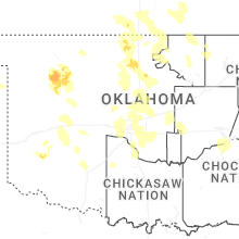
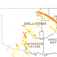
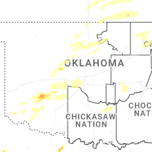

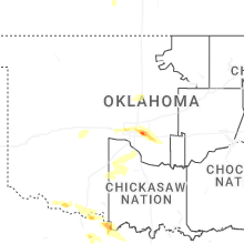
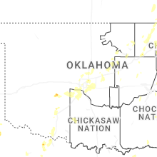
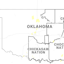
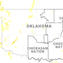
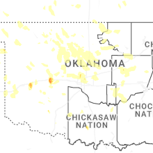
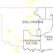


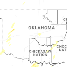


Connect with Interactive Hail Maps