

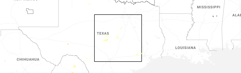
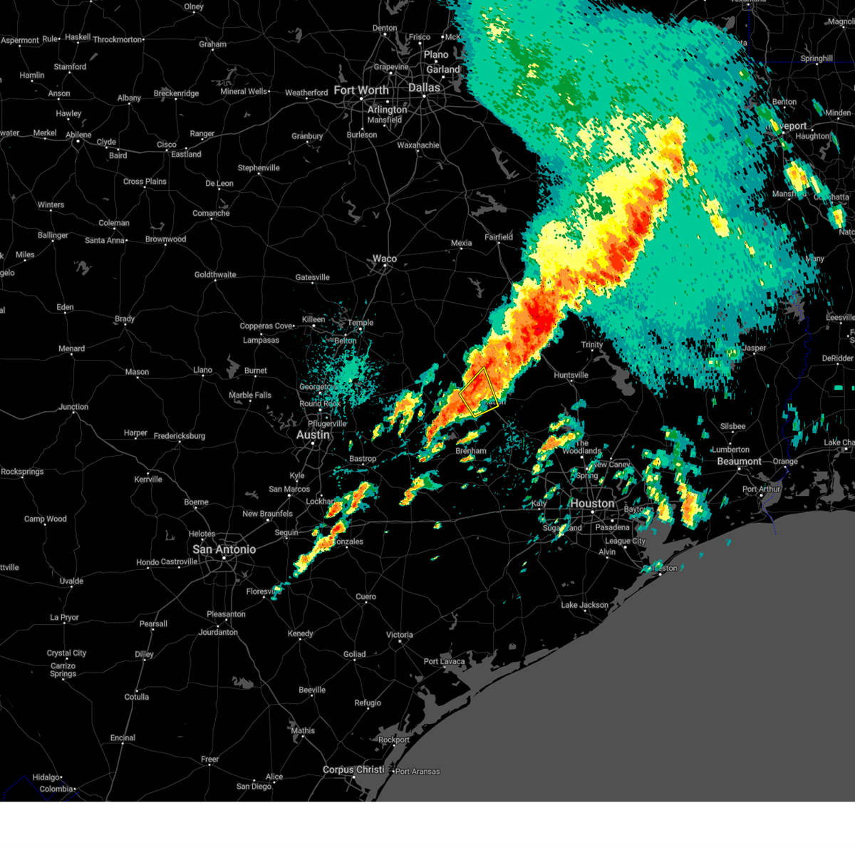
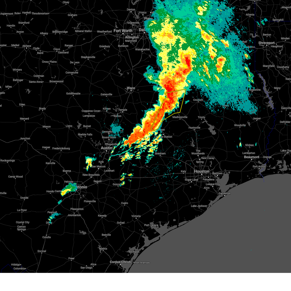
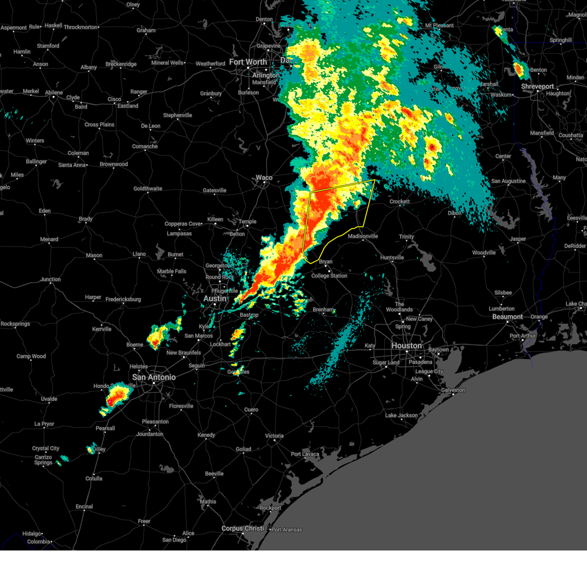
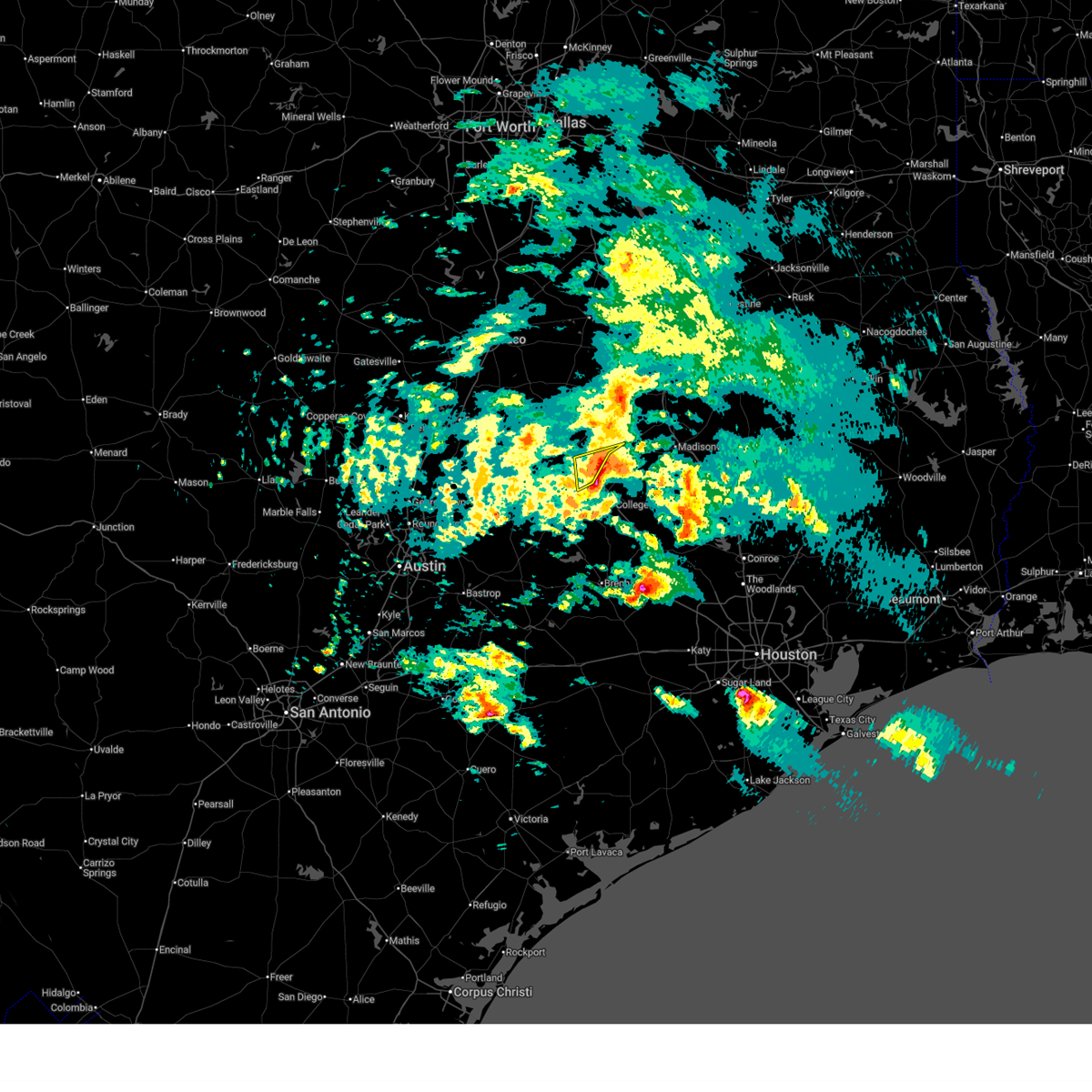
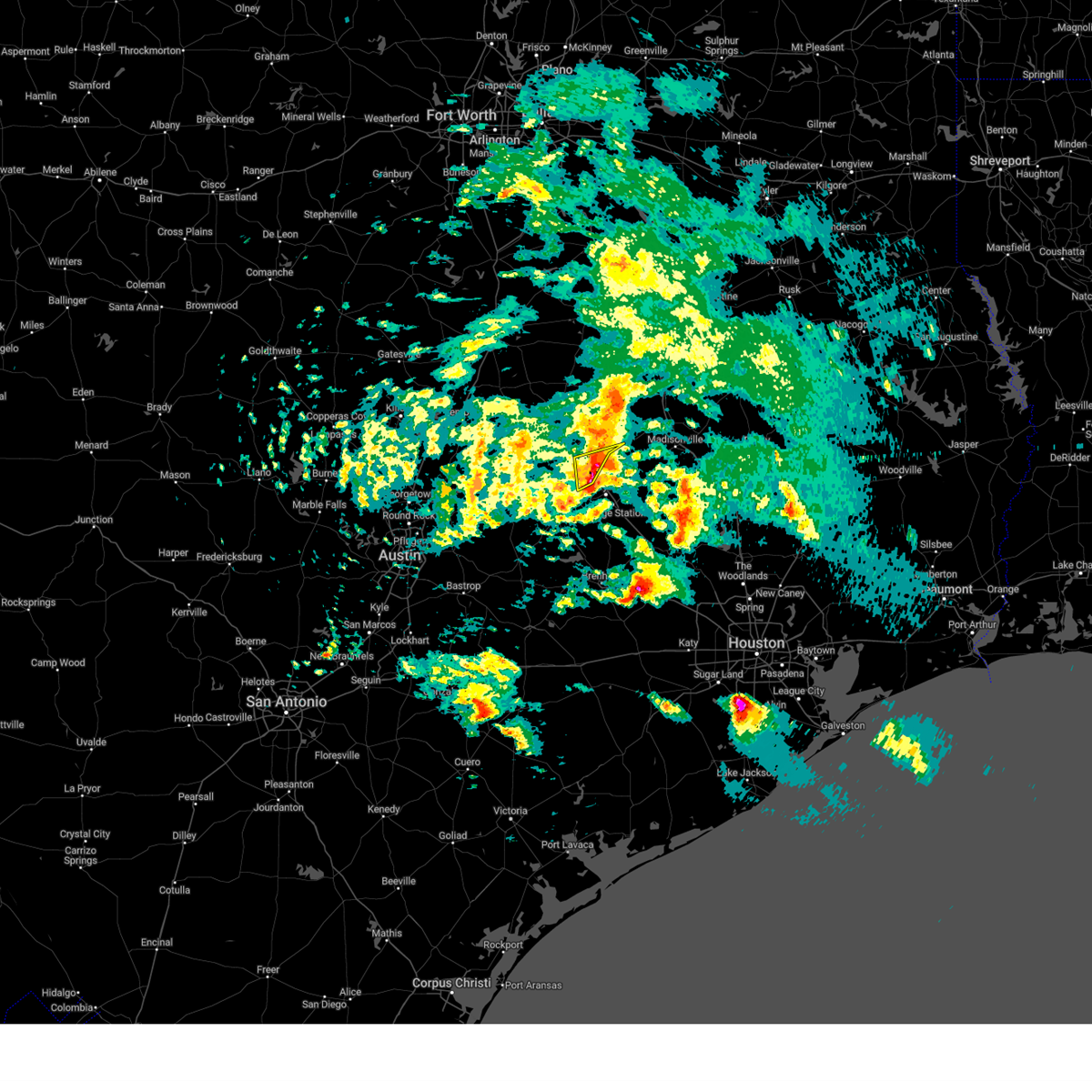
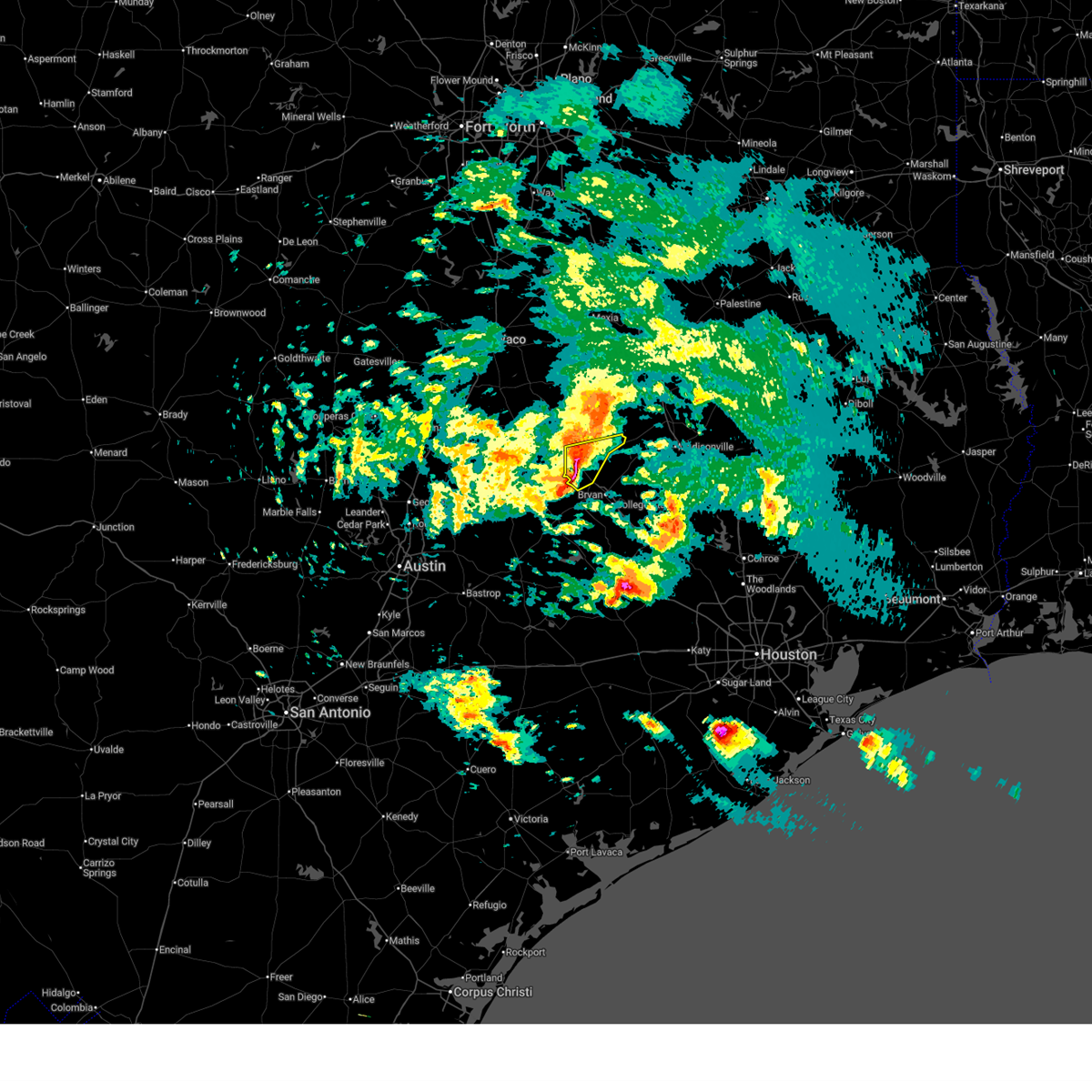
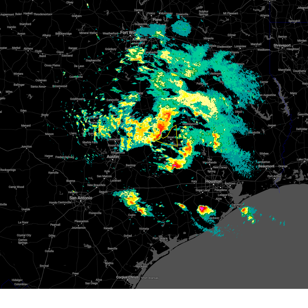
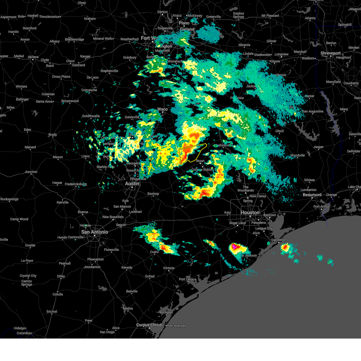
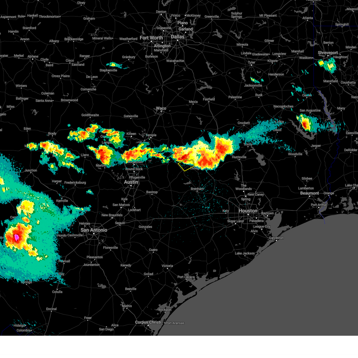
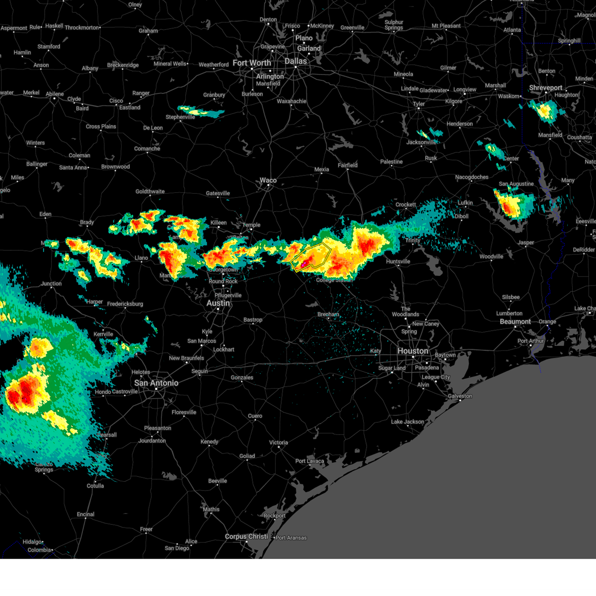
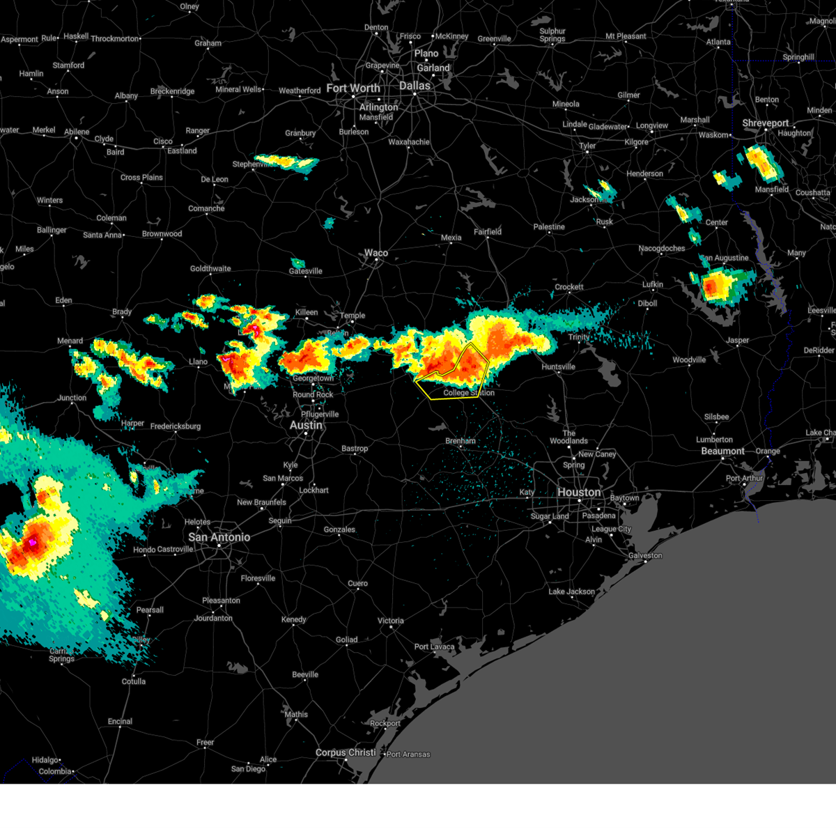
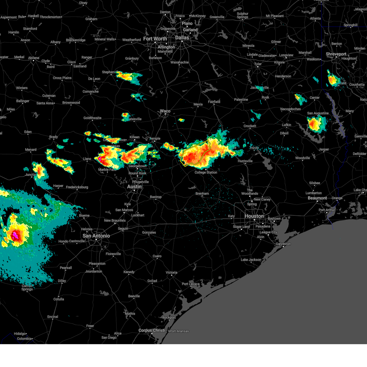
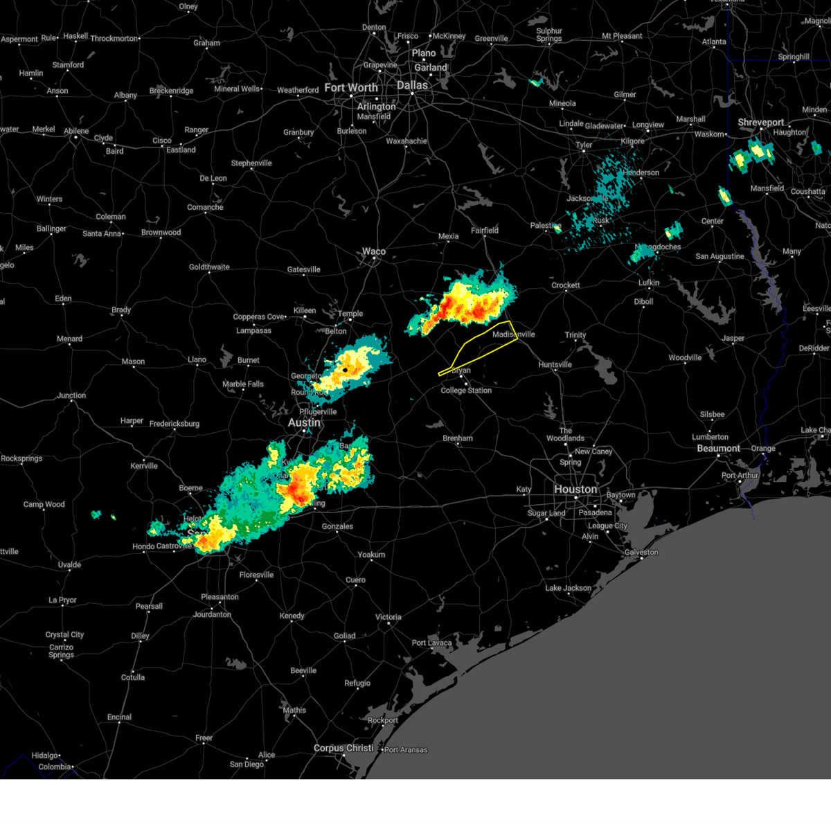
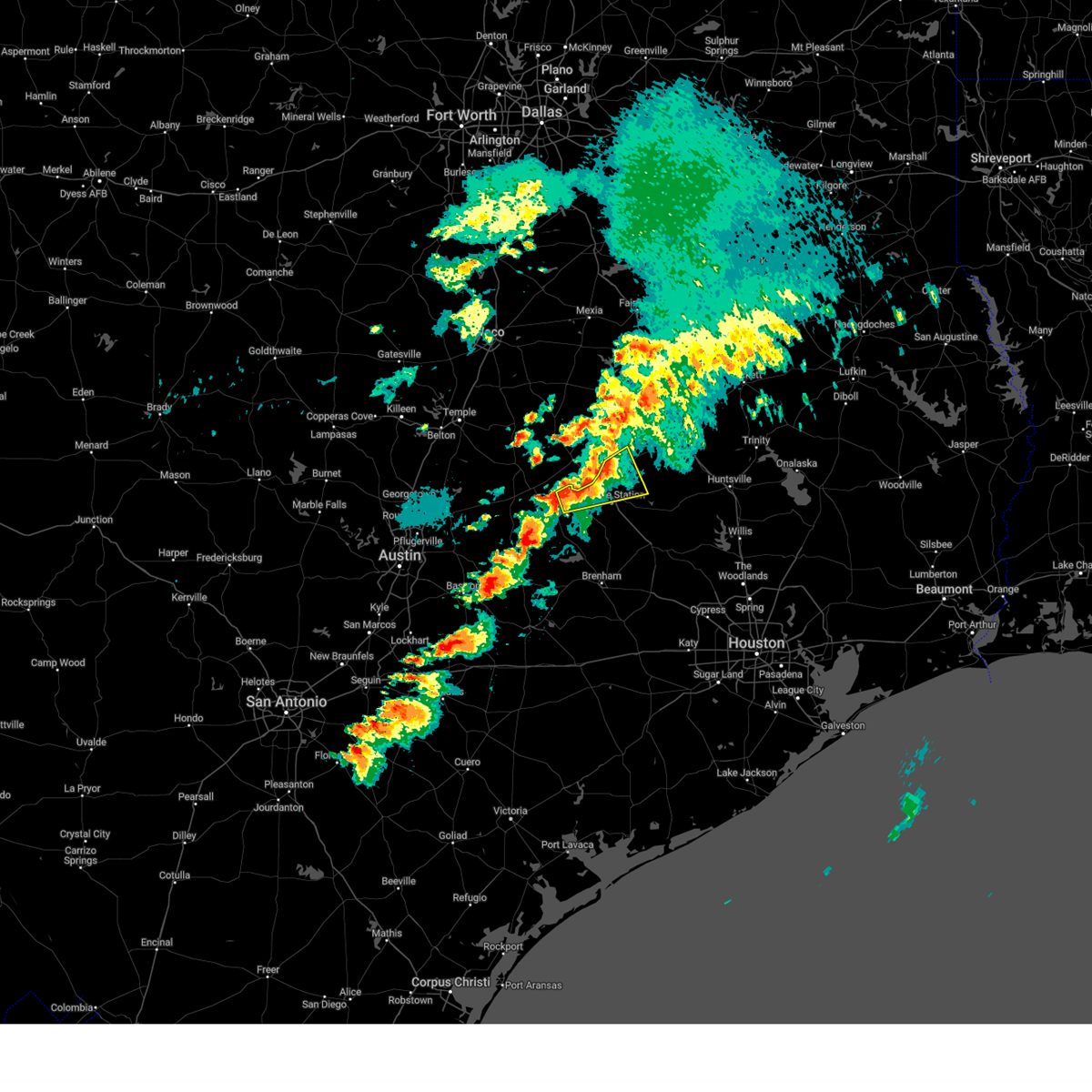
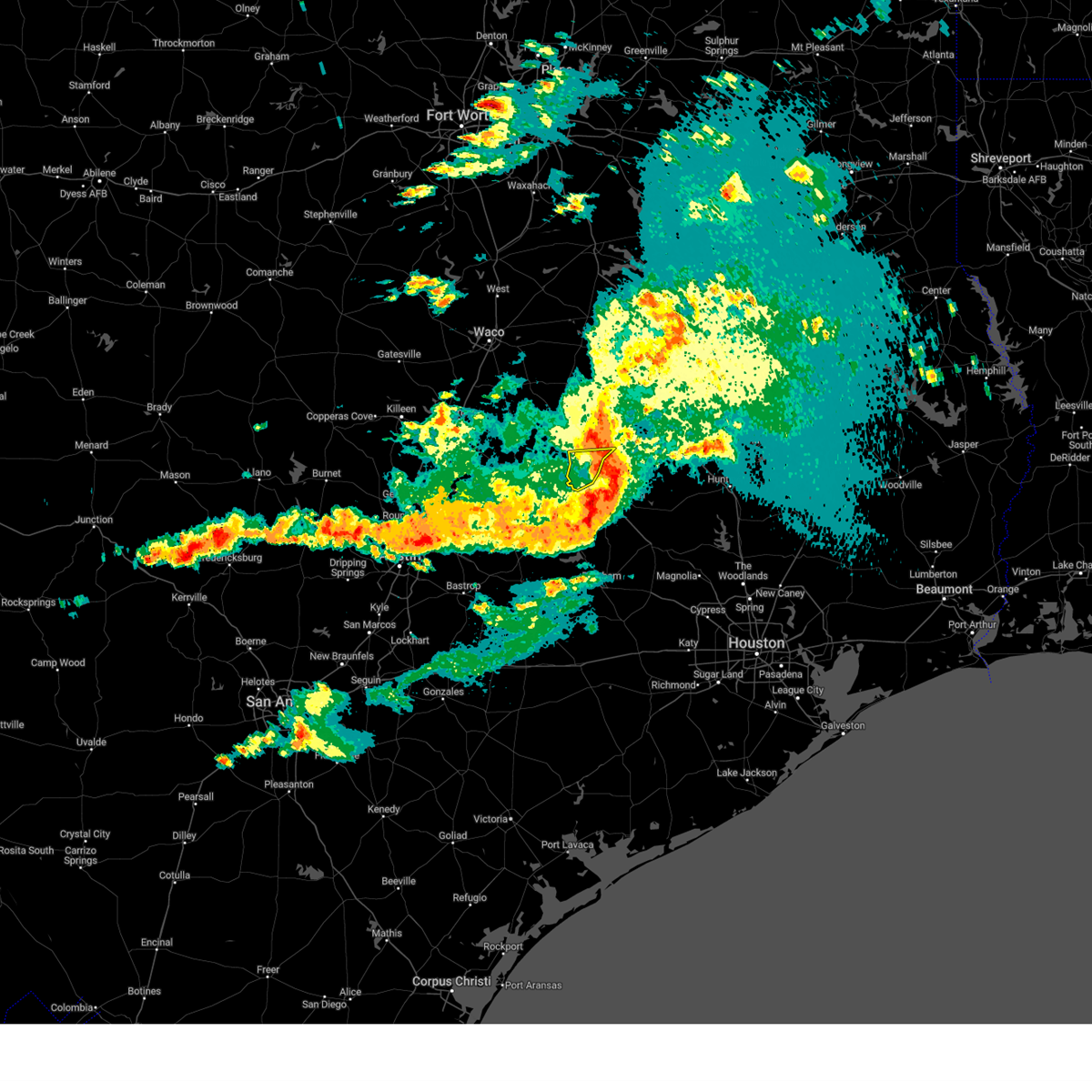
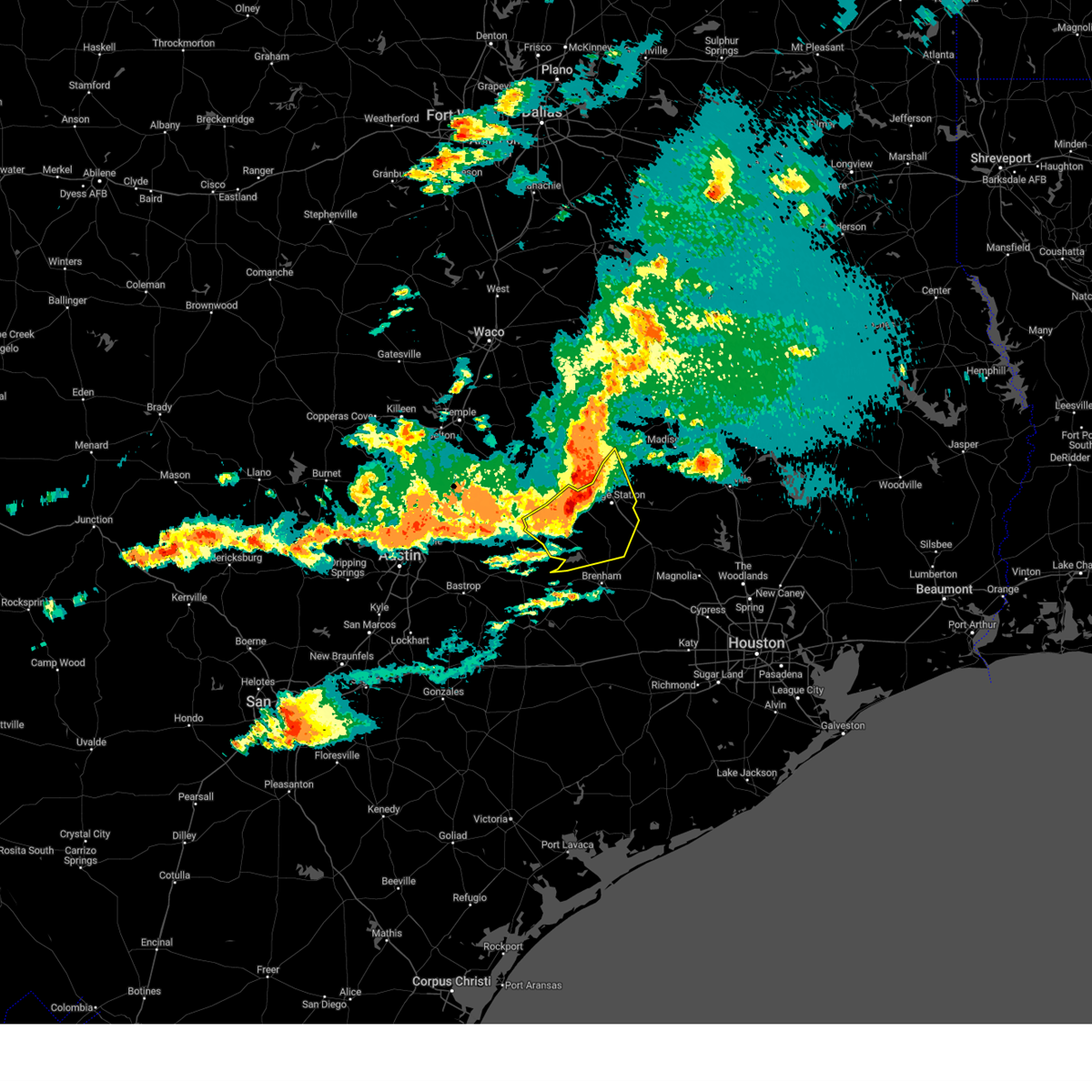
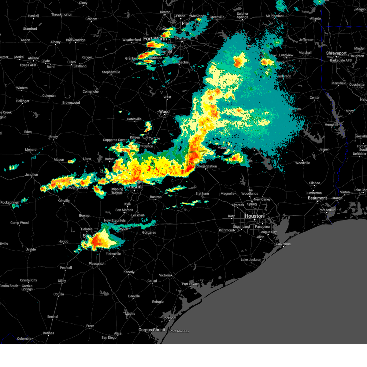
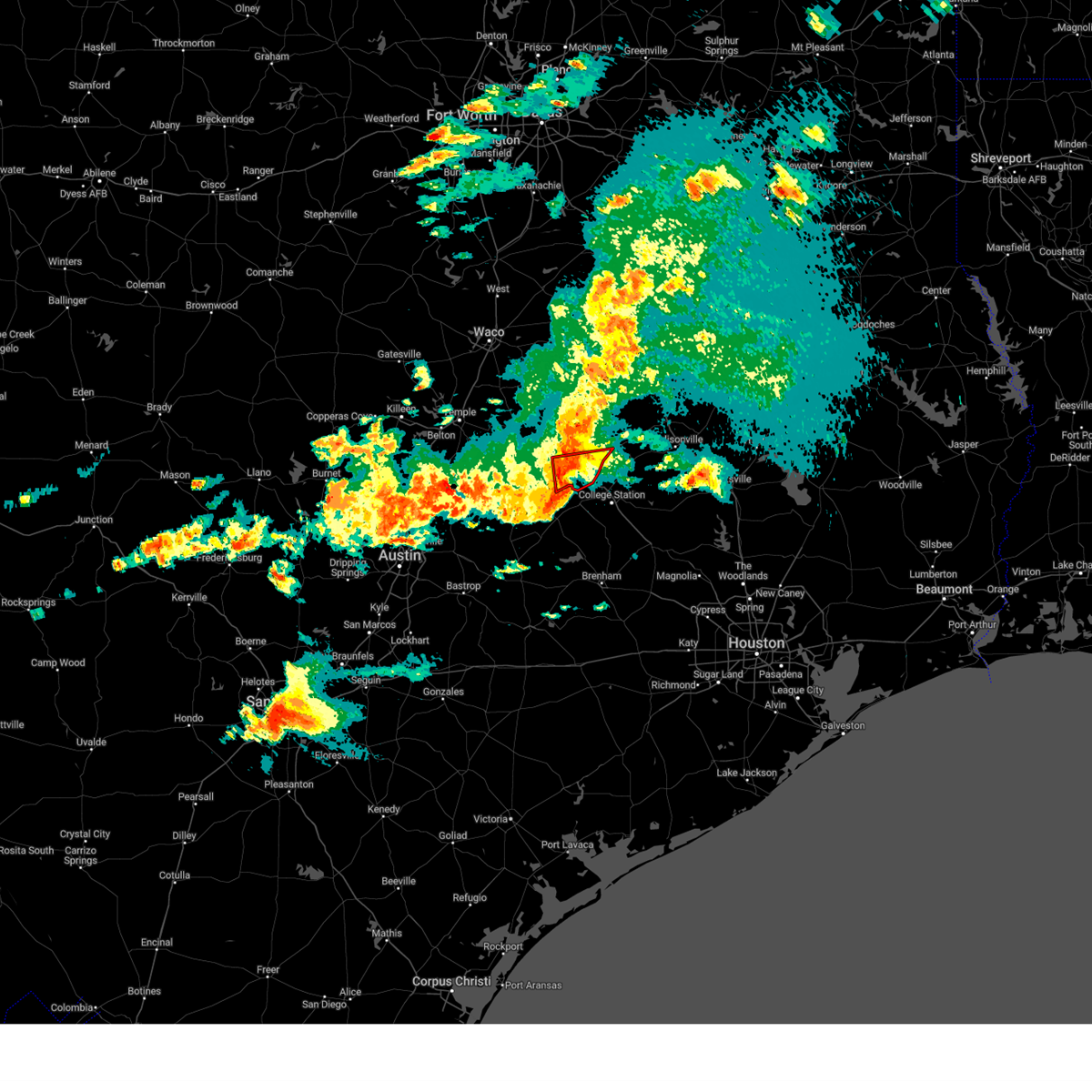
Hail Map for Lake Bryan, TX
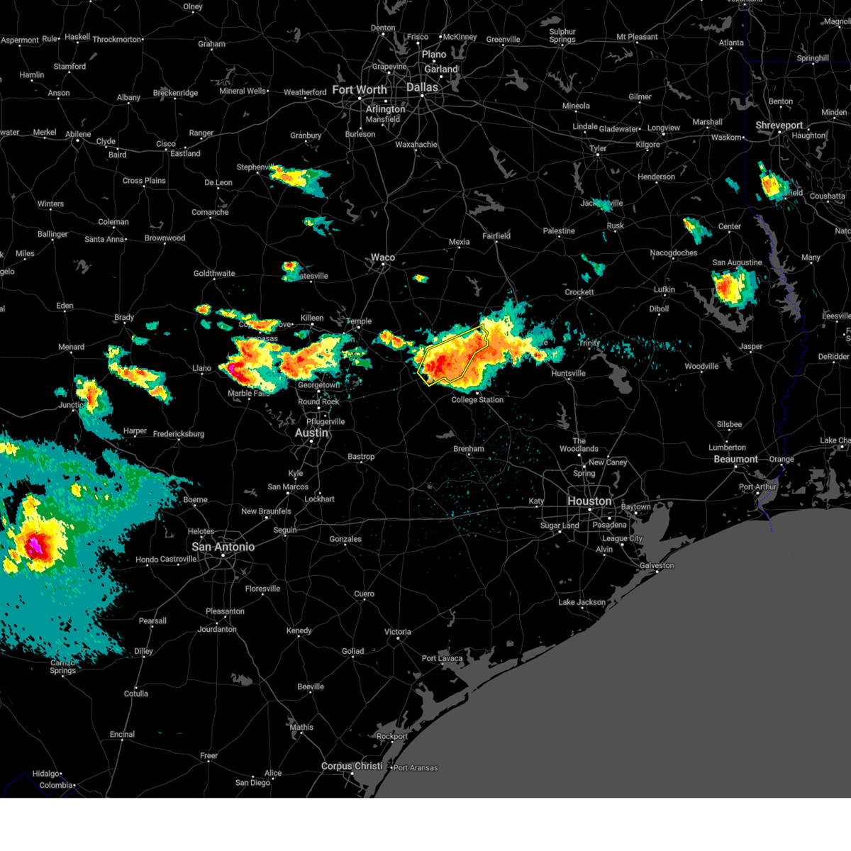
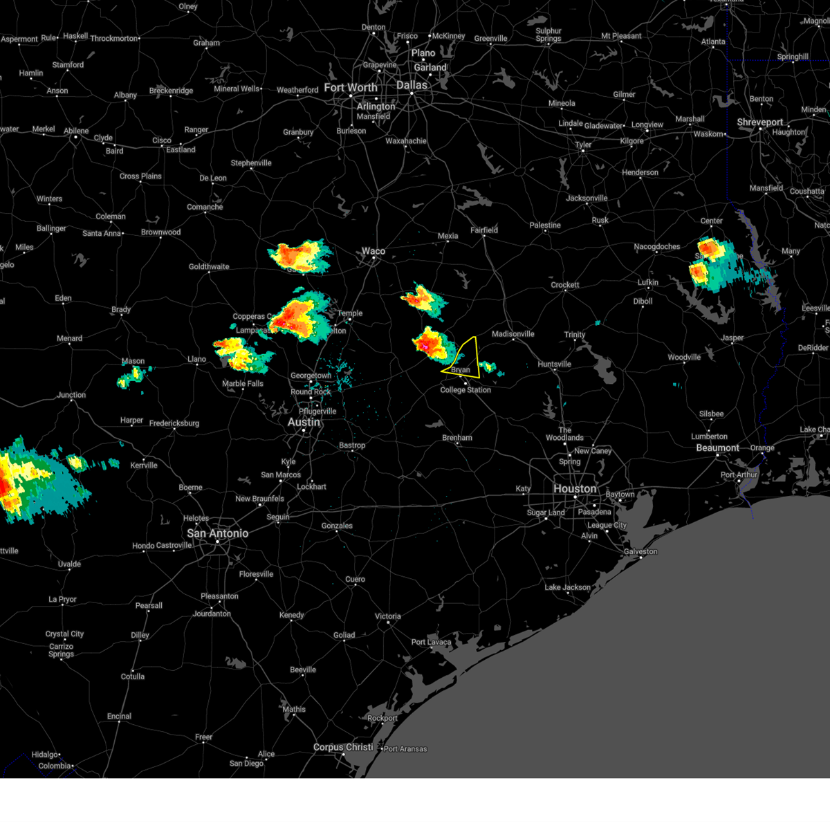
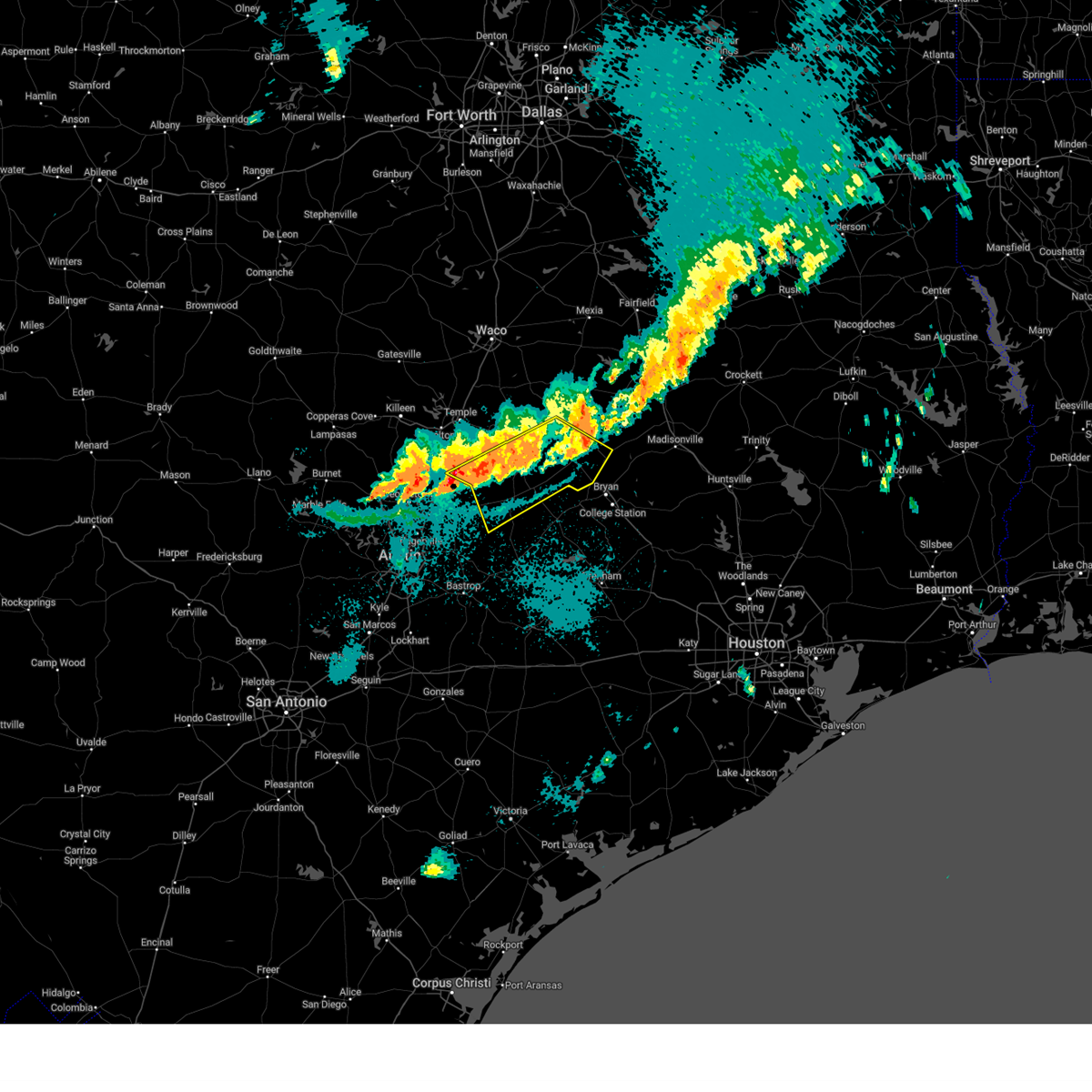
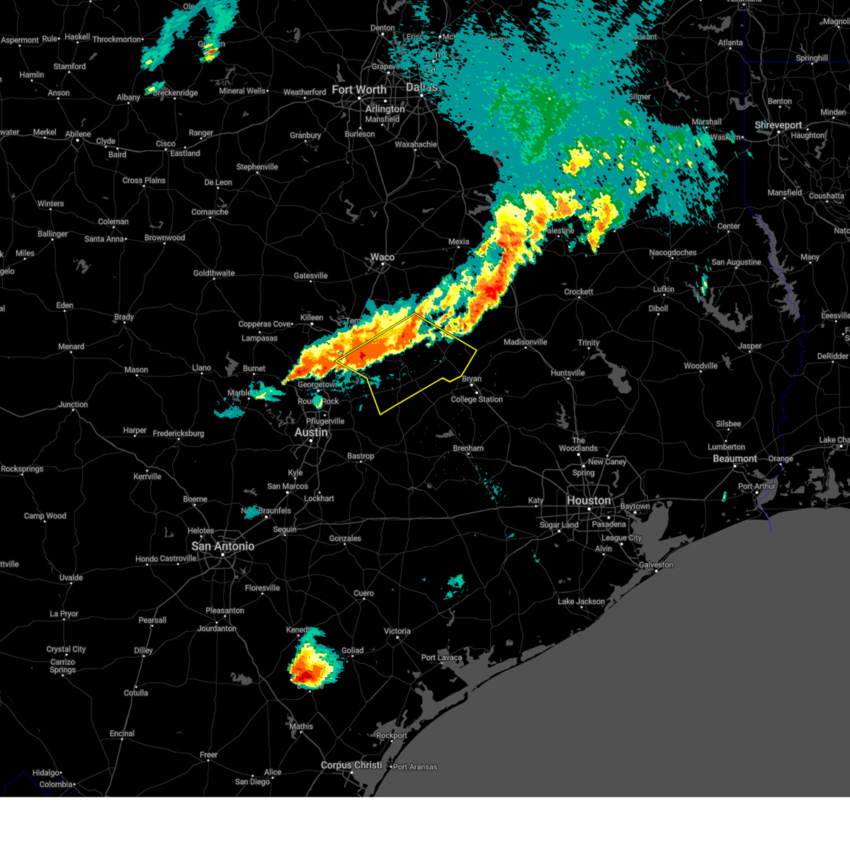
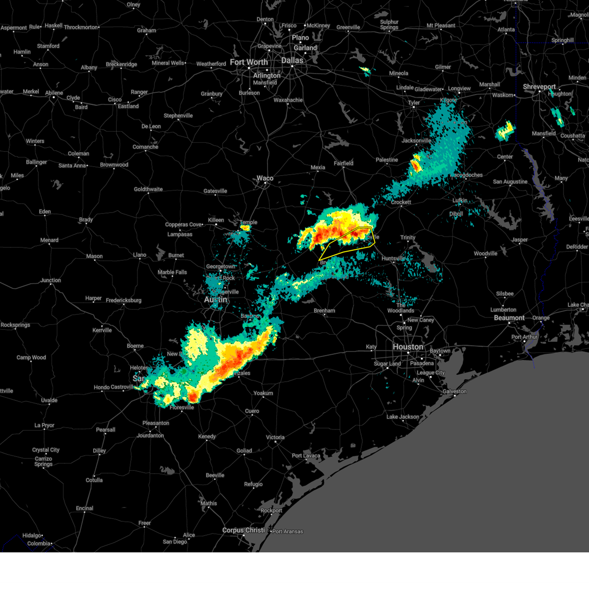
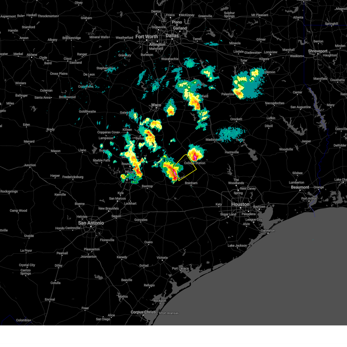
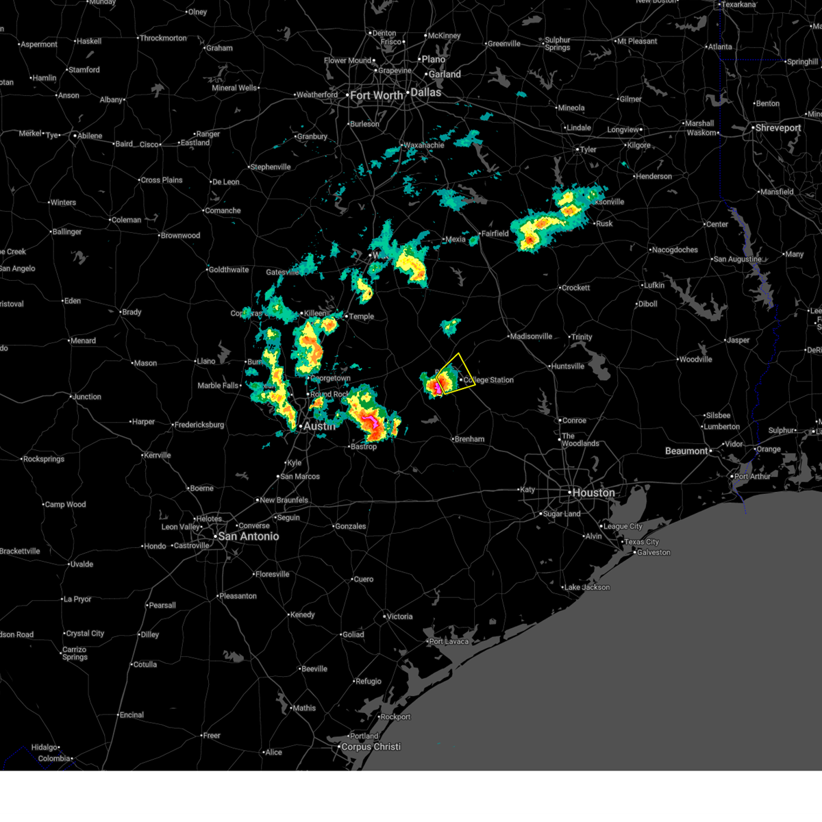
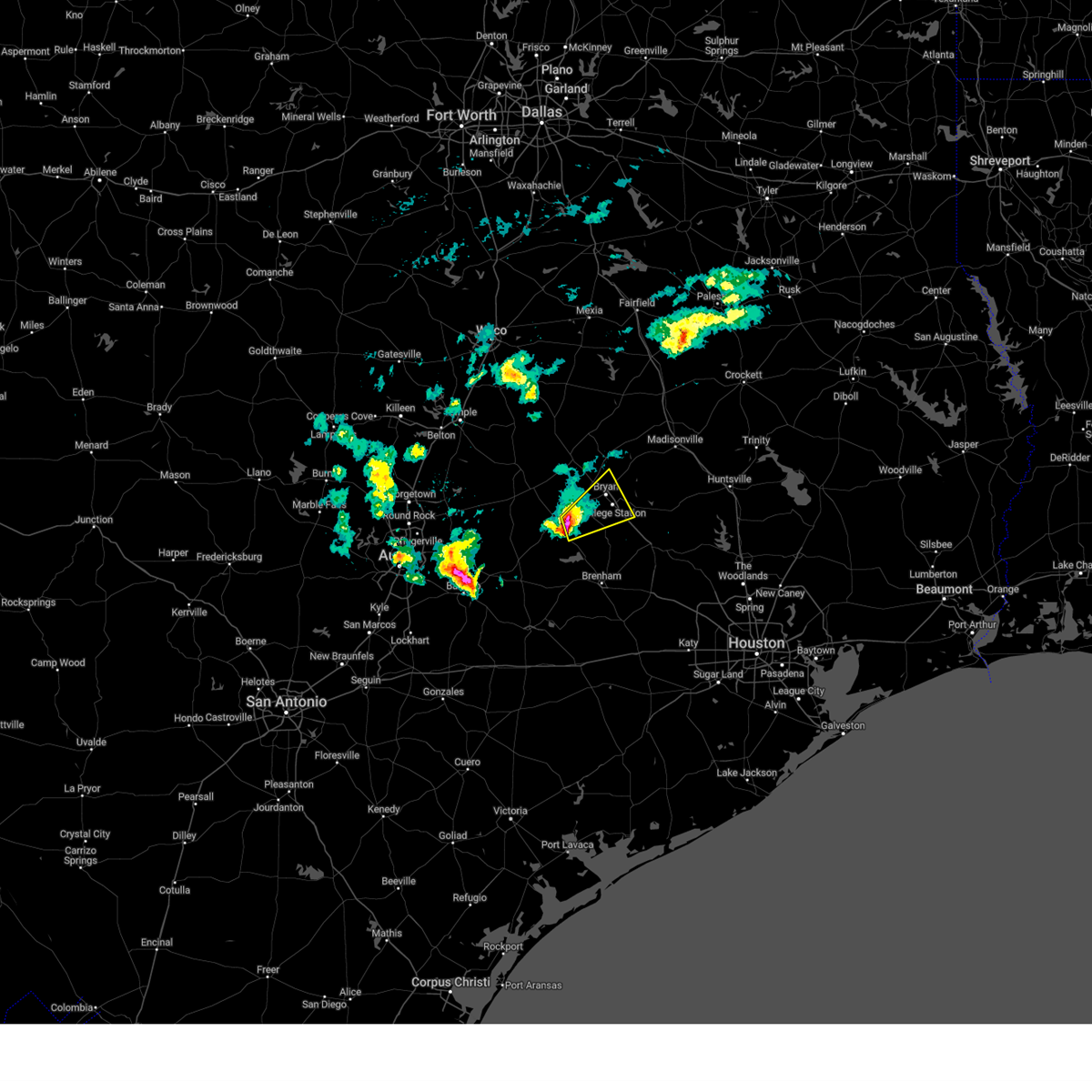
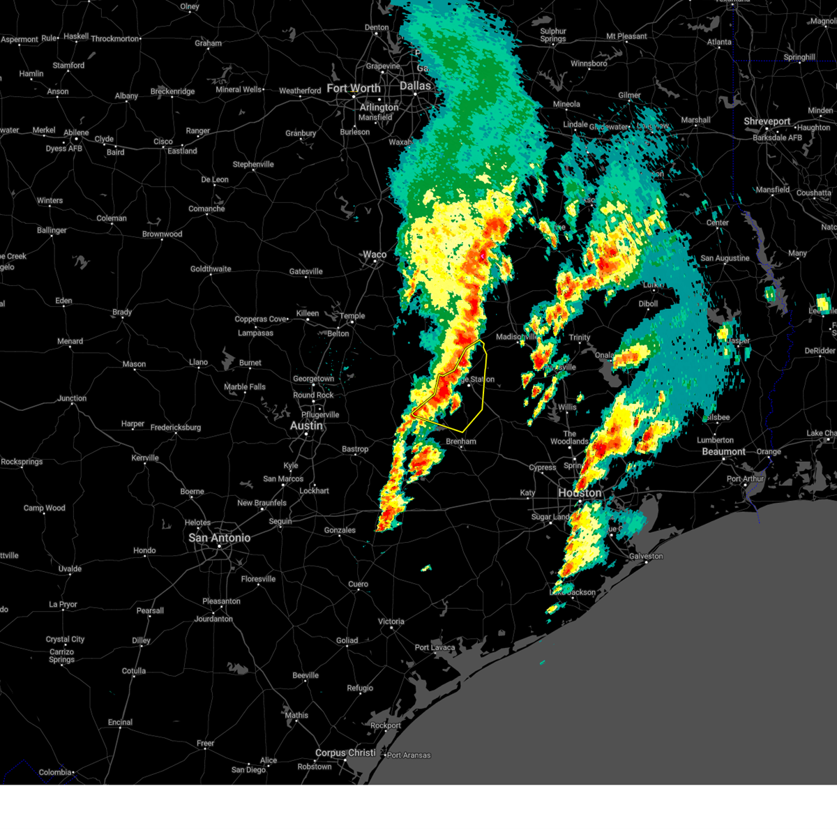
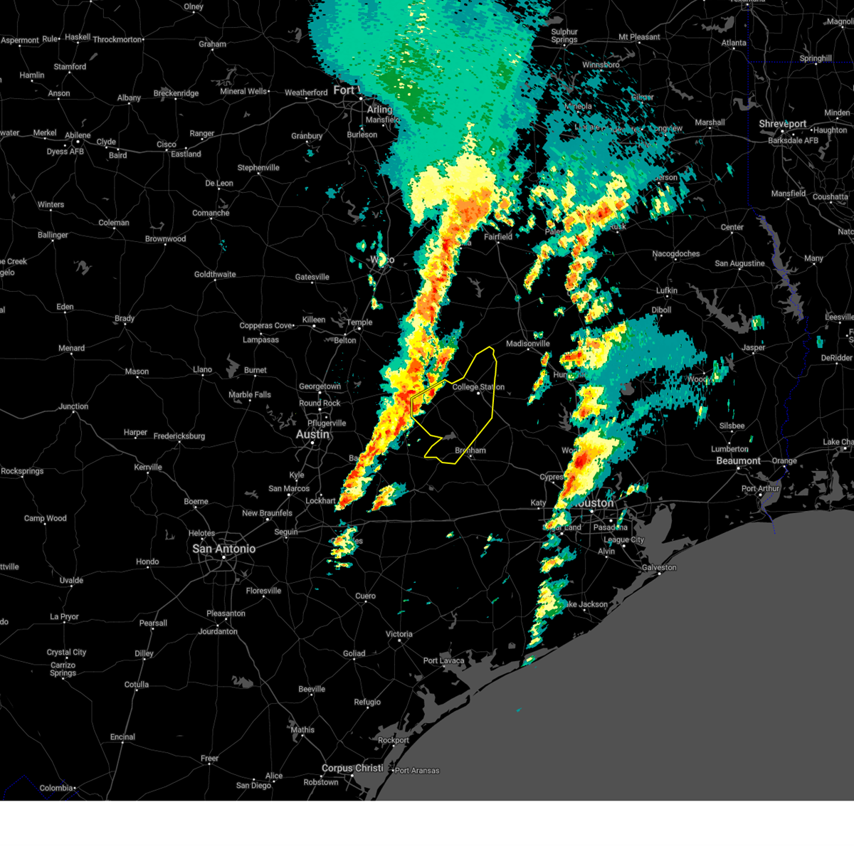
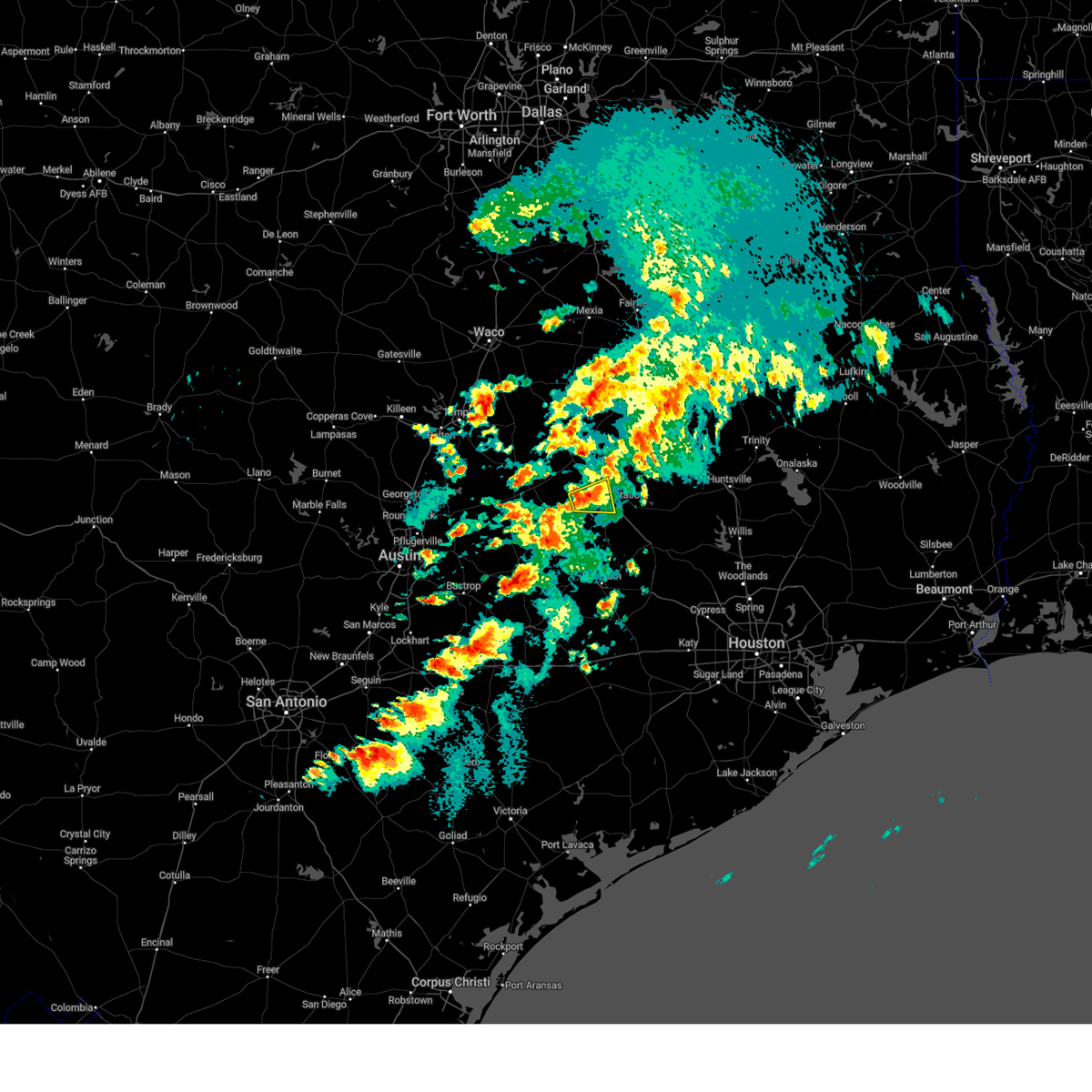
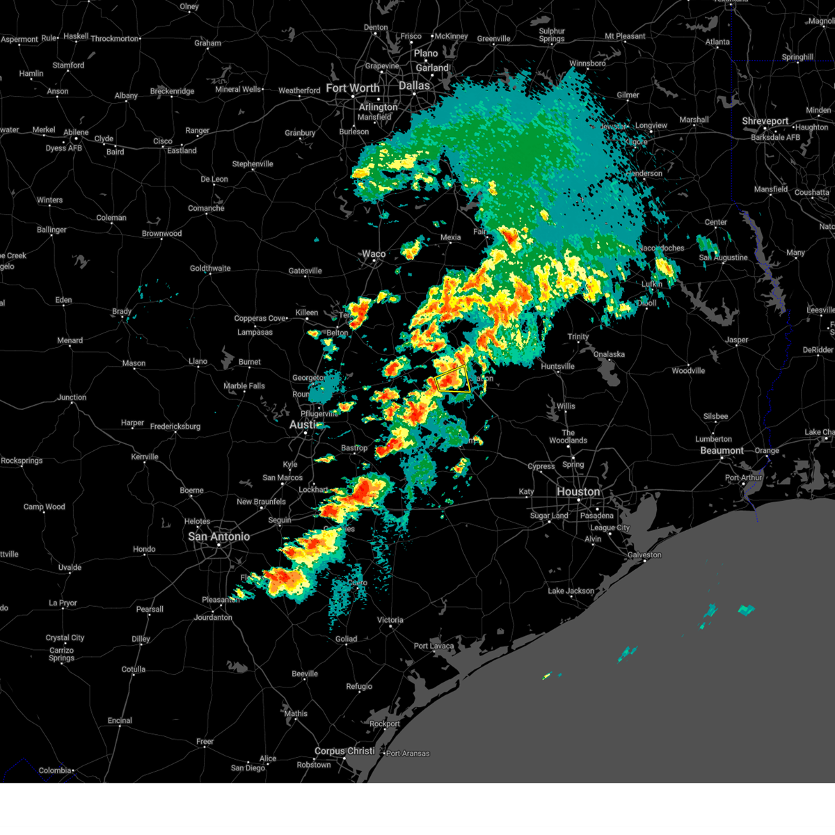
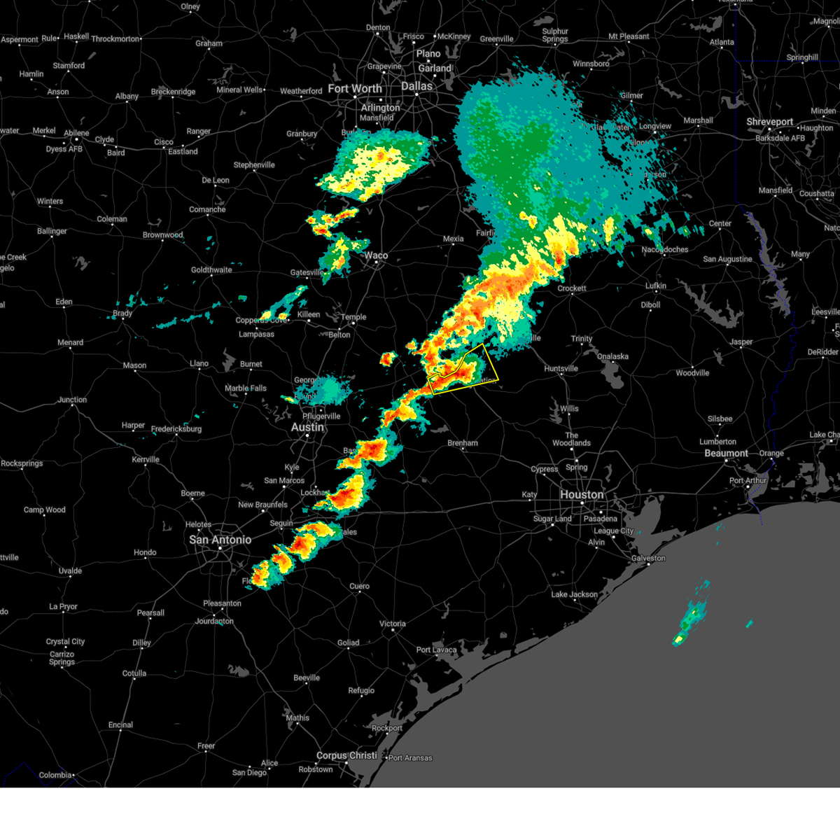
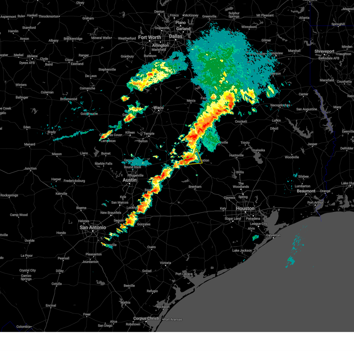
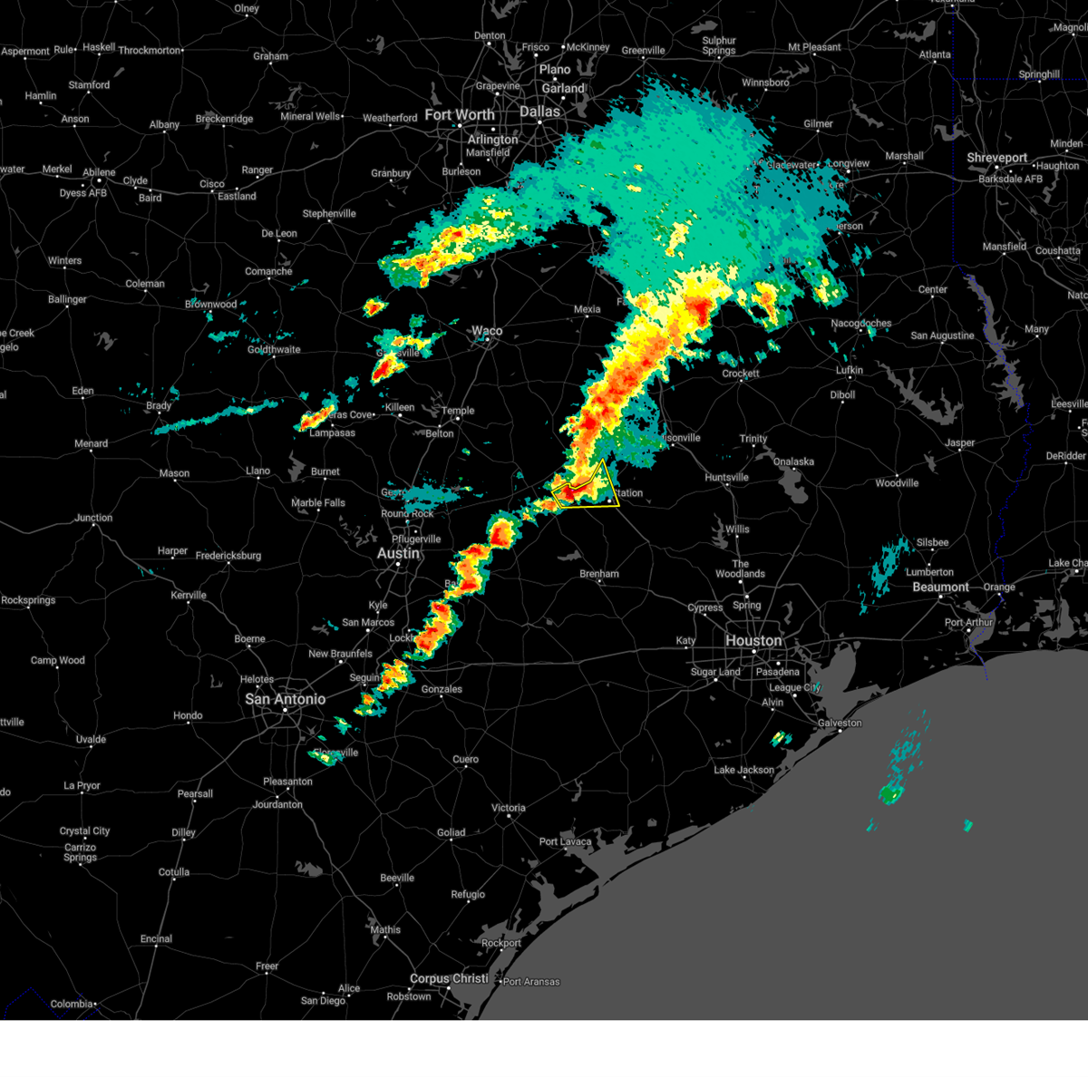
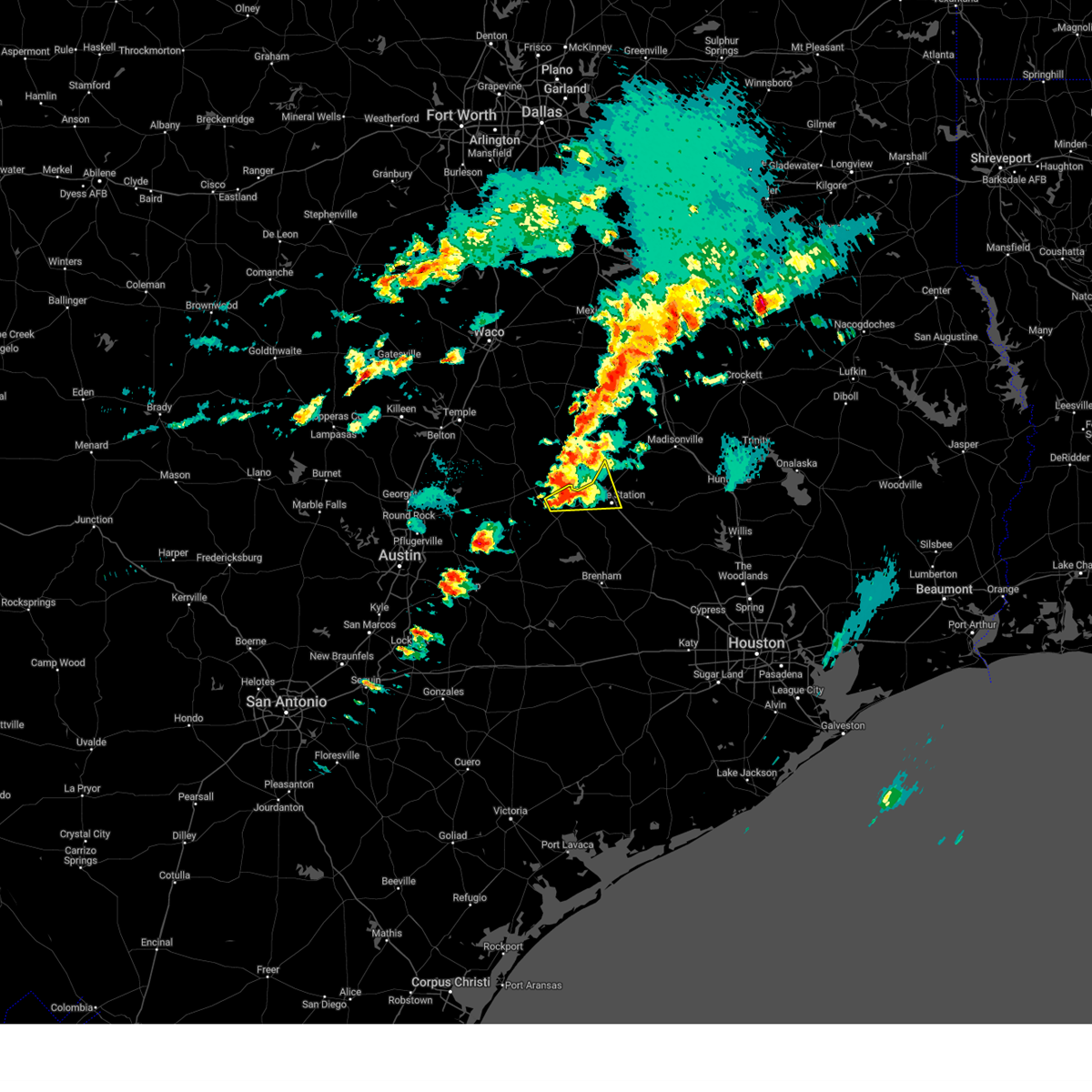
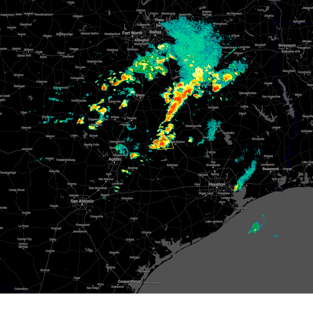
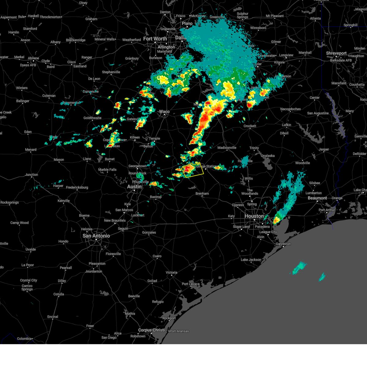
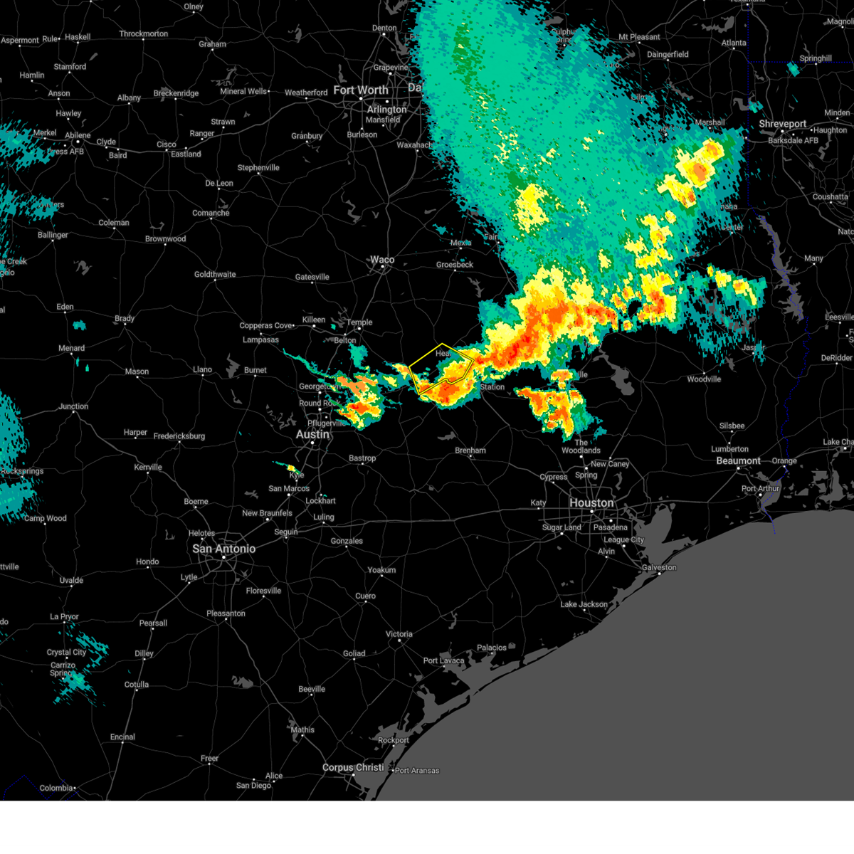
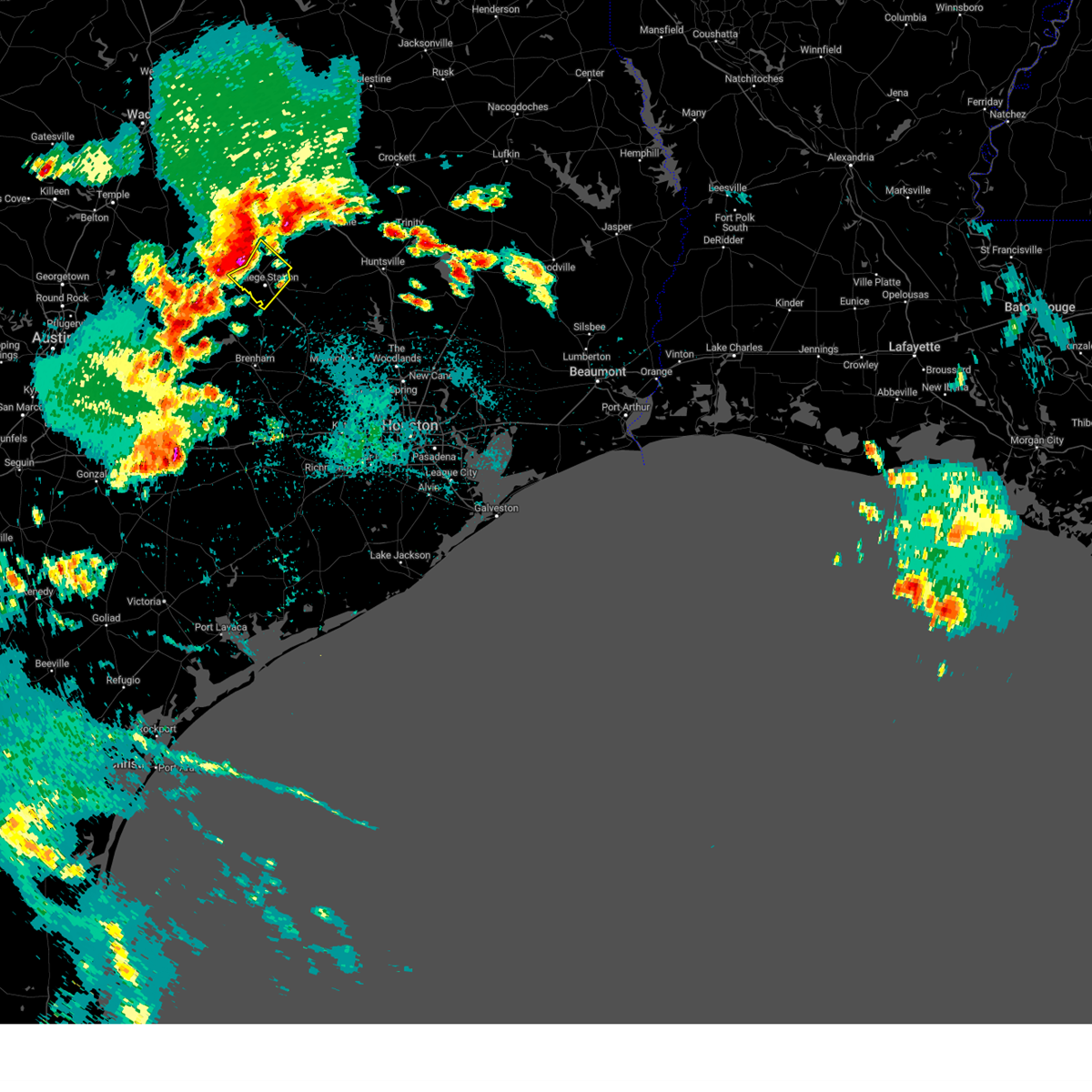
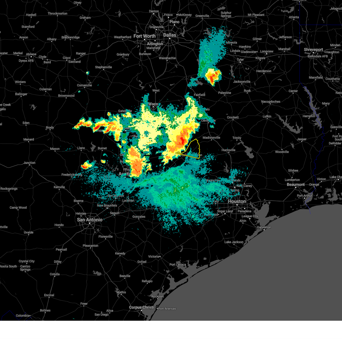
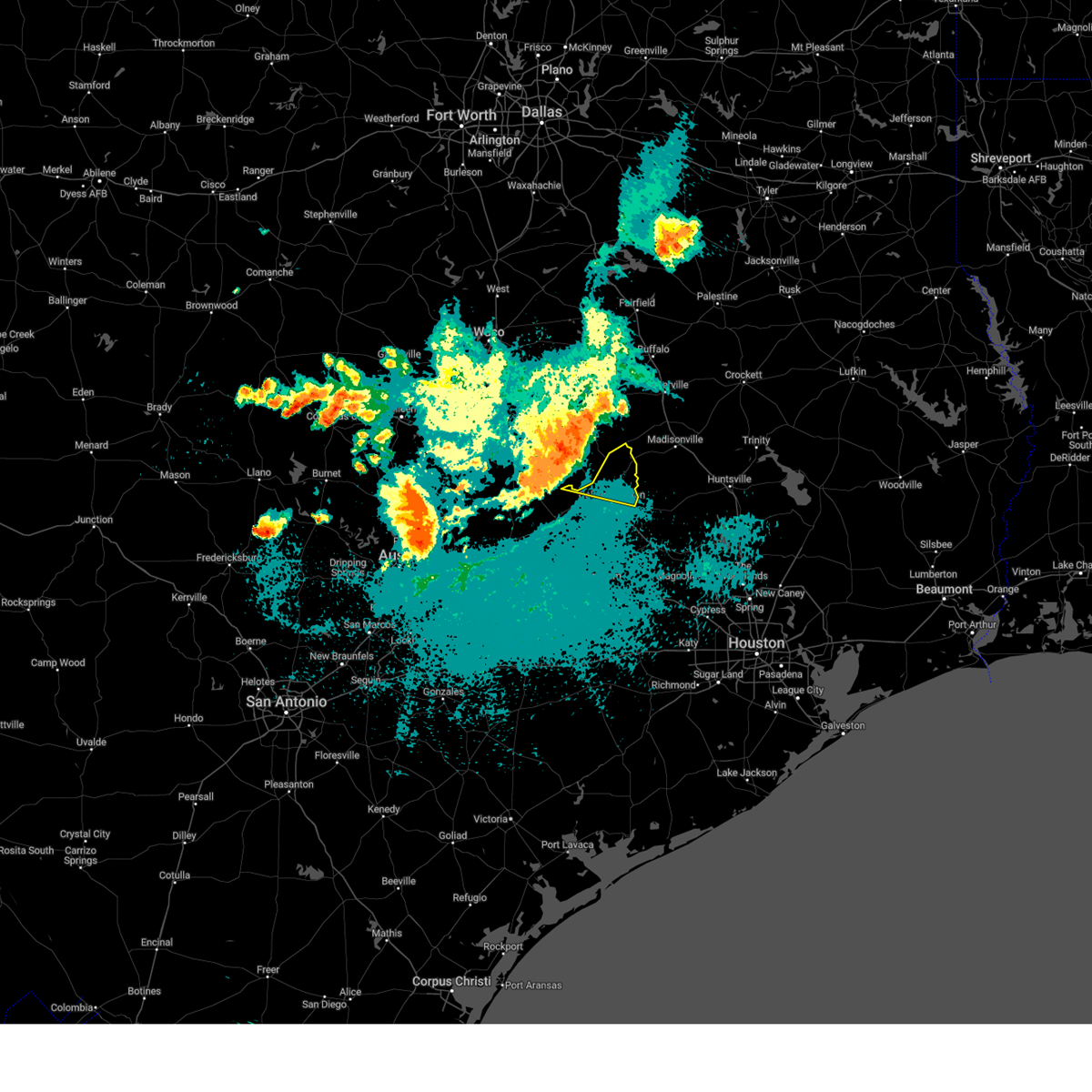
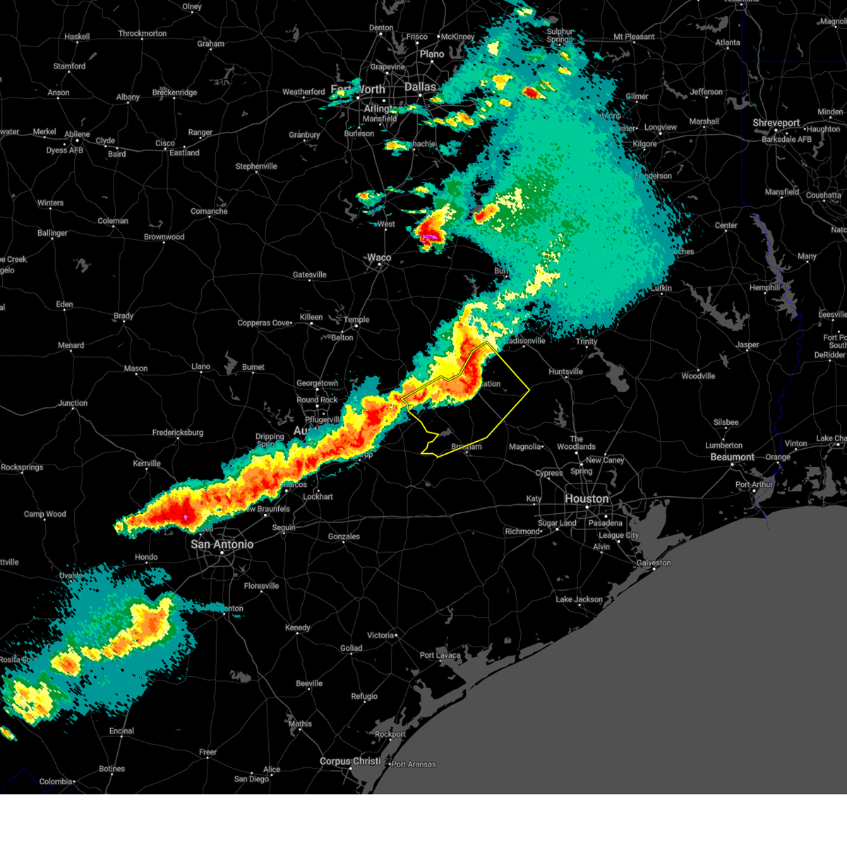
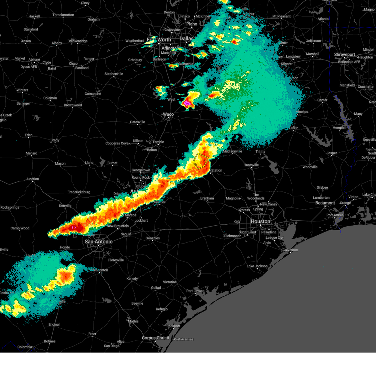
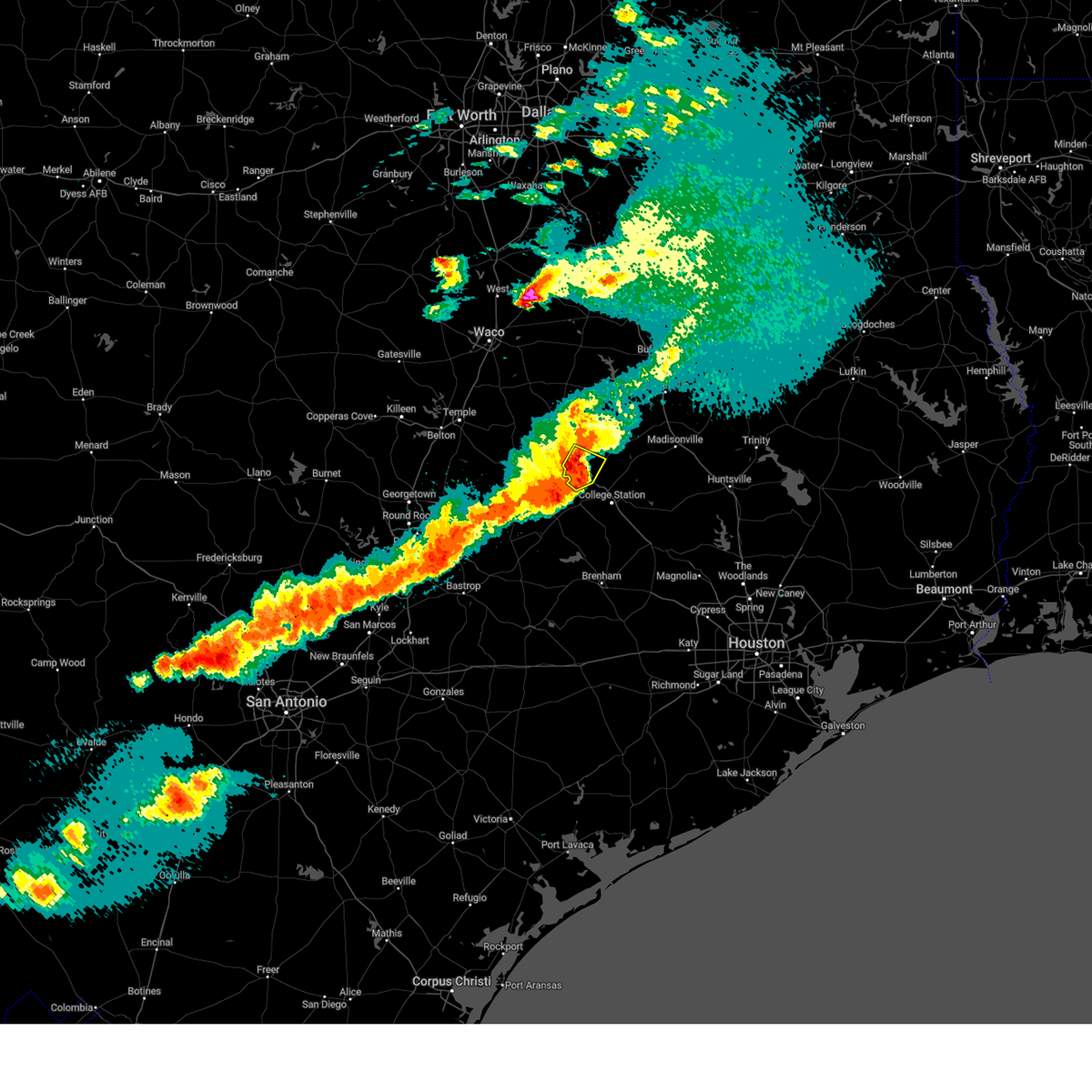
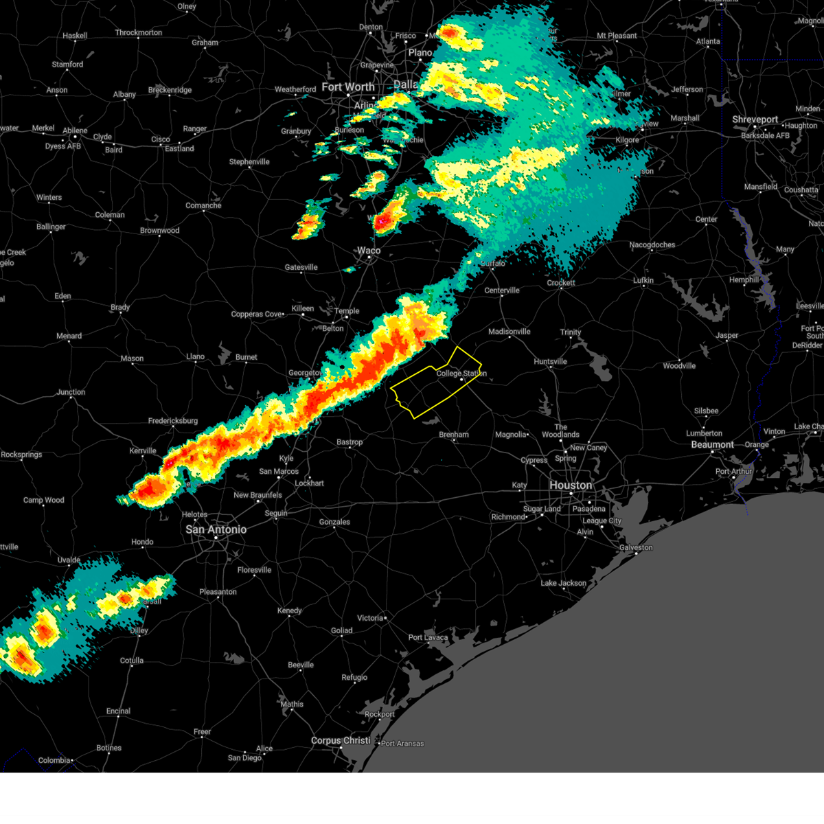
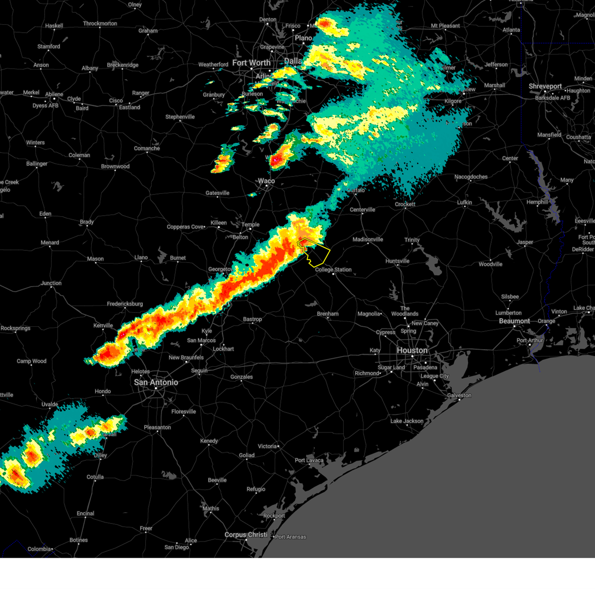
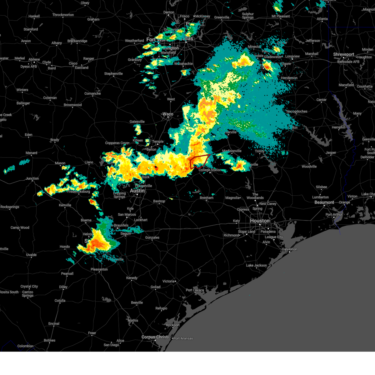
The Lake Bryan, TX area has had 1 report of on-the-ground hail by trained spotters, and has been under severe weather warnings 1 time during the past 12 months. Doppler radar has detected hail at or near Lake Bryan, TX on 50 occasions, including 2 occasions during the past year.
| Name: | Lake Bryan, TX |
| Where Located: | 81.1 miles ESE of Killeen, TX |
| Map: | Google Map for Lake Bryan, TX |
| Population: | 1728 |
| Housing Units: | 596 |
| More Info: | Search Google for Lake Bryan, TX |
1
The Top Recent Hail Date for Lake Bryan, TX is Sunday, April 12, 2026 (17th out of 50)
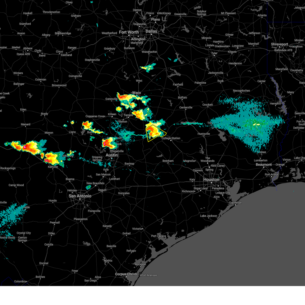
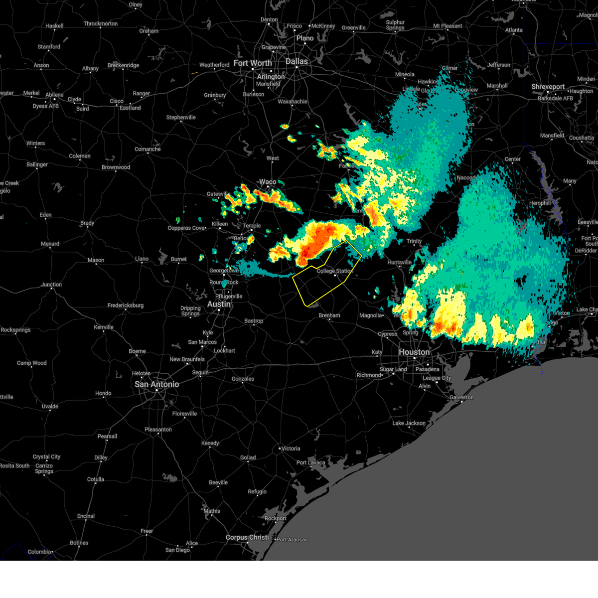
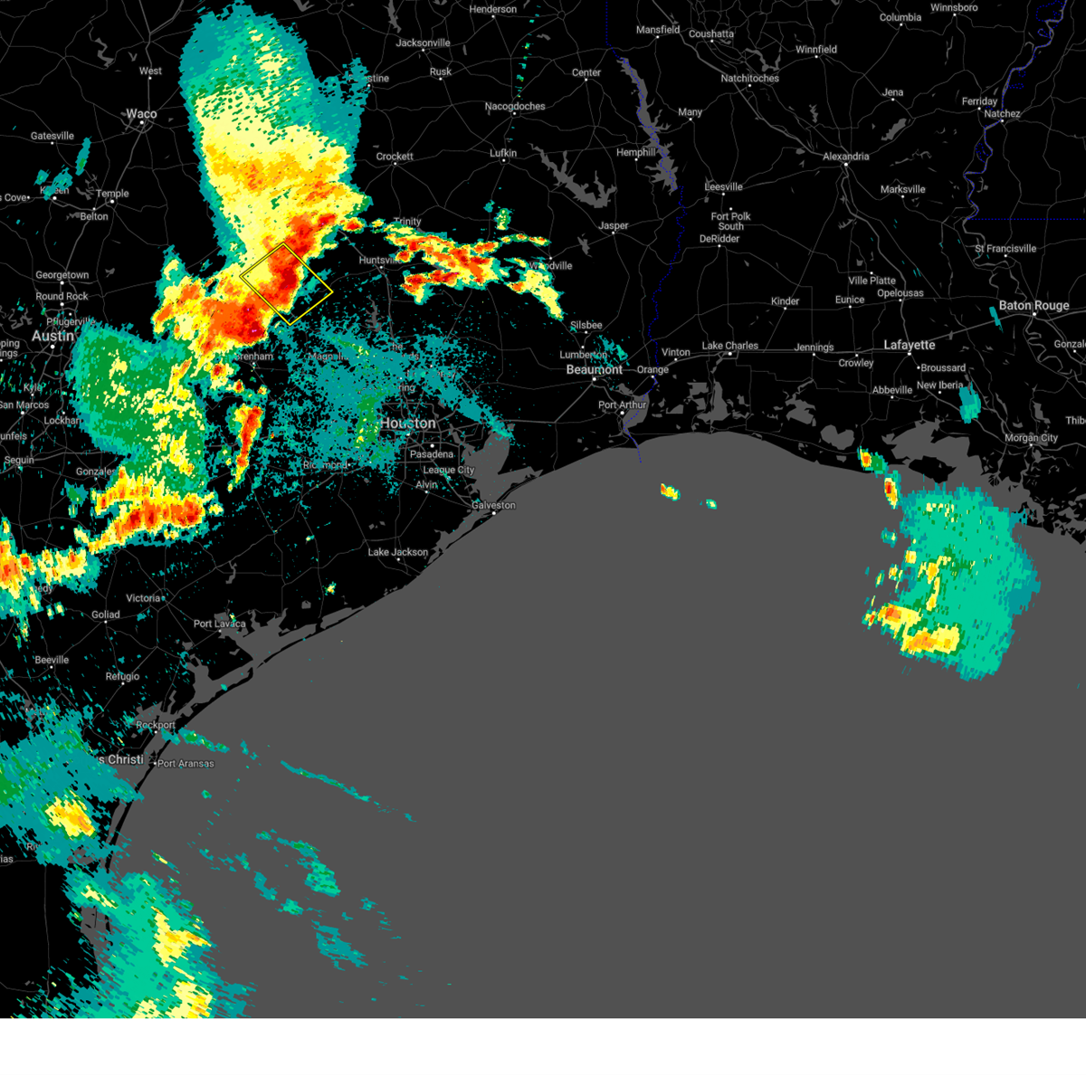
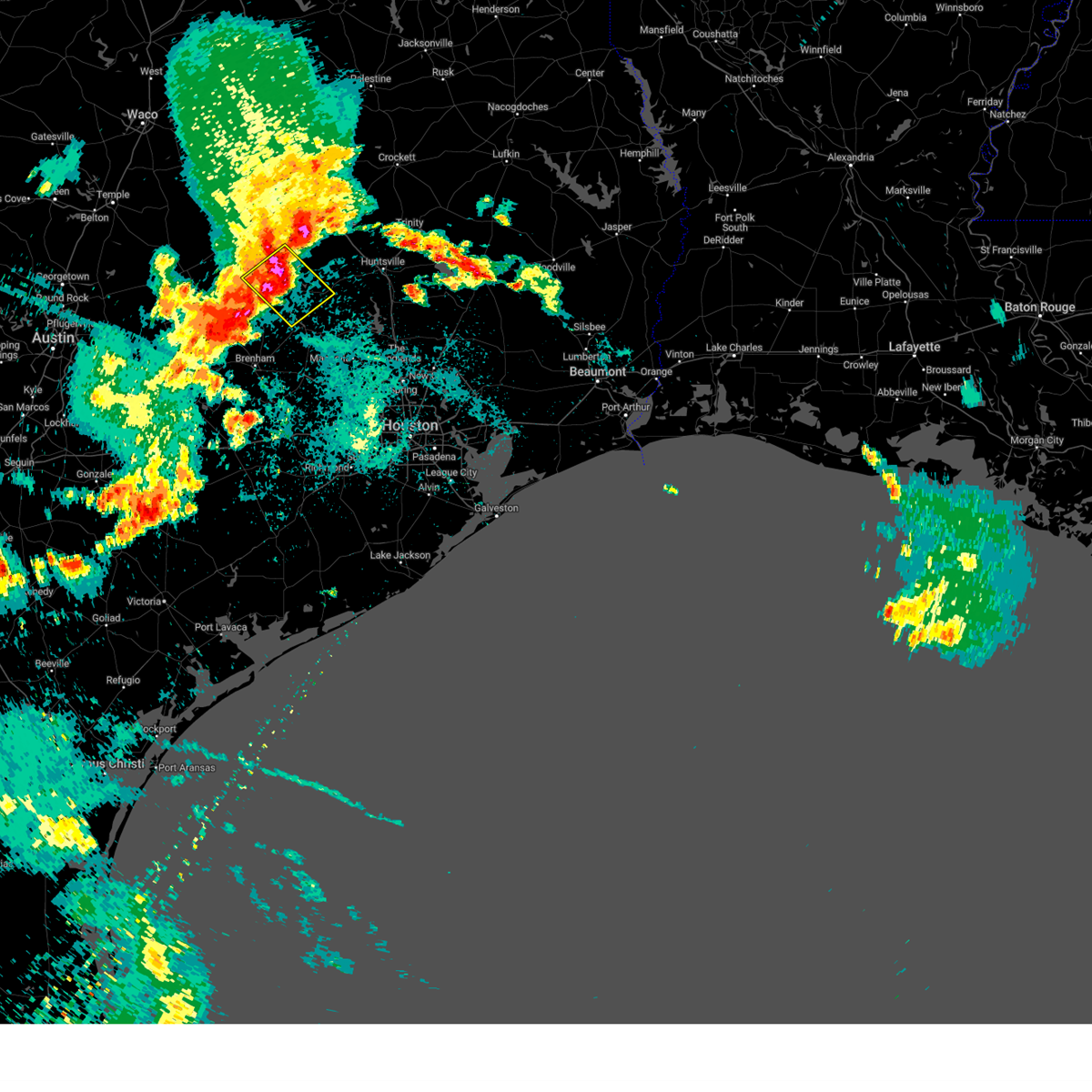
Hail and Wind Damage Spotted near Lake Bryan, TX
| Date / Time | Report Details |
|---|---|
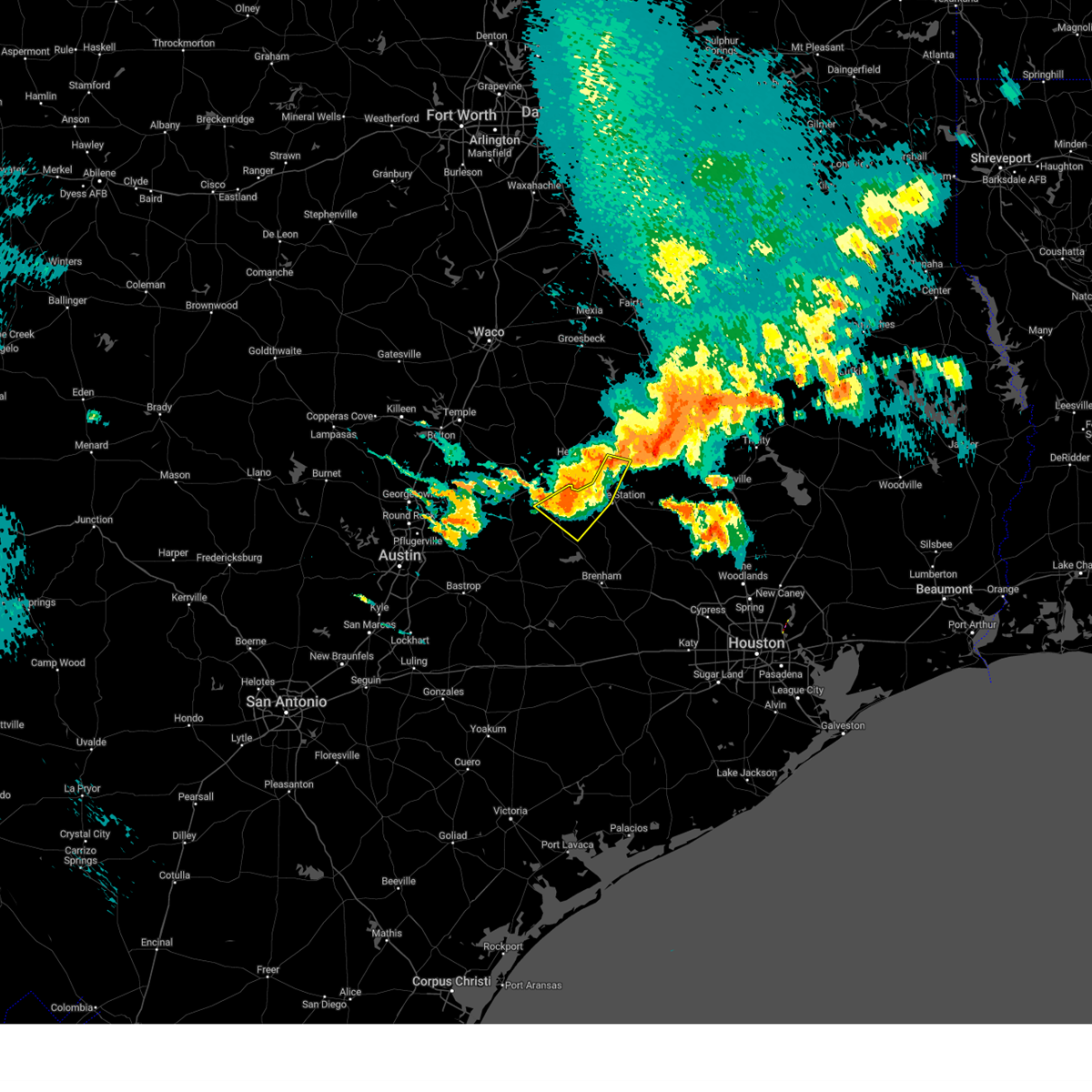
| 5/23/2026 4:03 AM CDT | Svrfwd the national weather service in fort worth has issued a * severe thunderstorm warning for, southern robertson county in central texas, northeastern milam county in central texas, * until 500 am cdt. * at 403 am cdt, a severe thunderstorm was located 10 miles northeast of rockdale, moving east at 25 mph (radar indicated). Hazards include 60 mph wind gusts and half dollar size hail. Hail damage to vehicles is expected. expect wind damage to roofs, siding, and trees. This severe thunderstorm will remain over mainly rural areas of southern robertson and northeastern milam counties, including the following locations, hanover, maysfield, hoyte, crossroads, benchley, milano, new baden, jones prairie, elevation, and wheelock. |
| 5/26/2025 10:59 PM CDT |
 The storms which prompted the warning have weakened below severe limits, and no longer pose an immediate threat to life or property. therefore, the warning will be allowed to expire. however, gusty winds are still possible with these thunderstorms. a severe thunderstorm watch remains in effect until 500 am cdt for southeastern texas. The storms which prompted the warning have weakened below severe limits, and no longer pose an immediate threat to life or property. therefore, the warning will be allowed to expire. however, gusty winds are still possible with these thunderstorms. a severe thunderstorm watch remains in effect until 500 am cdt for southeastern texas.
|
| 5/26/2025 10:10 PM CDT |
 Svrhgx the national weather service in league city has issued a * severe thunderstorm warning for, burleson county in southeastern texas, northwestern grimes county in southeastern texas, brazos county in southeastern texas, northern washington county in southeastern texas, western madison county in southeastern texas, * until 1100 pm cdt. * at 1009 pm cdt, severe thunderstorms were located along a line extending from near bremond to near hearne to near caldwell to near dime box to near paige, moving east at 40 mph (radar indicated). Hazards include 60 mph wind gusts. expect damage to roofs, siding, and trees Svrhgx the national weather service in league city has issued a * severe thunderstorm warning for, burleson county in southeastern texas, northwestern grimes county in southeastern texas, brazos county in southeastern texas, northern washington county in southeastern texas, western madison county in southeastern texas, * until 1100 pm cdt. * at 1009 pm cdt, severe thunderstorms were located along a line extending from near bremond to near hearne to near caldwell to near dime box to near paige, moving east at 40 mph (radar indicated). Hazards include 60 mph wind gusts. expect damage to roofs, siding, and trees
|
| 5/26/2025 10:08 PM CDT |
 Svrfwd the national weather service in fort worth has issued a * severe thunderstorm warning for, robertson county in central texas, leon county in central texas, * until 1115 pm cdt. * at 1007 pm cdt, a severe thunderstorm was located near franklin, or 12 miles north of hearne, moving east at 50 mph (radar indicated). Hazards include 60 mph wind gusts and quarter size hail. Hail damage to vehicles is expected. expect wind damage to roofs, siding, and trees. this severe thunderstorm will be near, franklin around 1015 pm cdt. camp creek lake around 1020 pm cdt. other locations impacted by this severe thunderstorm include pleasant springs, jewett, flo, easterly, benchley, robbins, new baden, eunice, bald prairie, and redland. This includes interstate 45 between mile markers 151 and 177. Svrfwd the national weather service in fort worth has issued a * severe thunderstorm warning for, robertson county in central texas, leon county in central texas, * until 1115 pm cdt. * at 1007 pm cdt, a severe thunderstorm was located near franklin, or 12 miles north of hearne, moving east at 50 mph (radar indicated). Hazards include 60 mph wind gusts and quarter size hail. Hail damage to vehicles is expected. expect wind damage to roofs, siding, and trees. this severe thunderstorm will be near, franklin around 1015 pm cdt. camp creek lake around 1020 pm cdt. other locations impacted by this severe thunderstorm include pleasant springs, jewett, flo, easterly, benchley, robbins, new baden, eunice, bald prairie, and redland. This includes interstate 45 between mile markers 151 and 177.
|
| 5/26/2025 9:26 PM CDT |
 Svrfwd the national weather service in fort worth has issued a * severe thunderstorm warning for, robertson county in central texas, milam county in central texas, eastern bell county in central texas, southeastern limestone county in central texas, falls county in central texas, * until 1015 pm cdt. * at 925 pm cdt, a severe thunderstorm was located near cameron, moving east at 55 mph (trained weather spotters). Hazards include 70 mph wind gusts and quarter size hail. Hail damage to vehicles is expected. expect considerable tree damage. wind damage is also likely to mobile homes, roofs, and outbuildings. this severe thunderstorm will be near, cameron around 930 pm cdt. calvert and hearne around 945 pm cdt. other locations impacted by this severe thunderstorm include barclay, moffat, sharp, yarrelton, hoyte, pettibone, reagan, new baden, davilla, and elevation. This includes interstate 35 between mile markers 290 and 313. Svrfwd the national weather service in fort worth has issued a * severe thunderstorm warning for, robertson county in central texas, milam county in central texas, eastern bell county in central texas, southeastern limestone county in central texas, falls county in central texas, * until 1015 pm cdt. * at 925 pm cdt, a severe thunderstorm was located near cameron, moving east at 55 mph (trained weather spotters). Hazards include 70 mph wind gusts and quarter size hail. Hail damage to vehicles is expected. expect considerable tree damage. wind damage is also likely to mobile homes, roofs, and outbuildings. this severe thunderstorm will be near, cameron around 930 pm cdt. calvert and hearne around 945 pm cdt. other locations impacted by this severe thunderstorm include barclay, moffat, sharp, yarrelton, hoyte, pettibone, reagan, new baden, davilla, and elevation. This includes interstate 35 between mile markers 290 and 313.
|
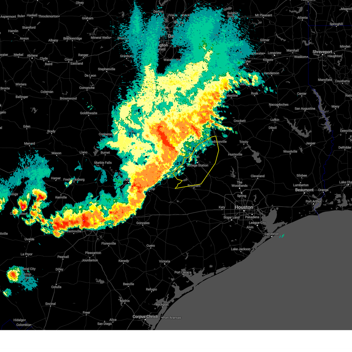
| 5/6/2025 2:53 PM CDT |
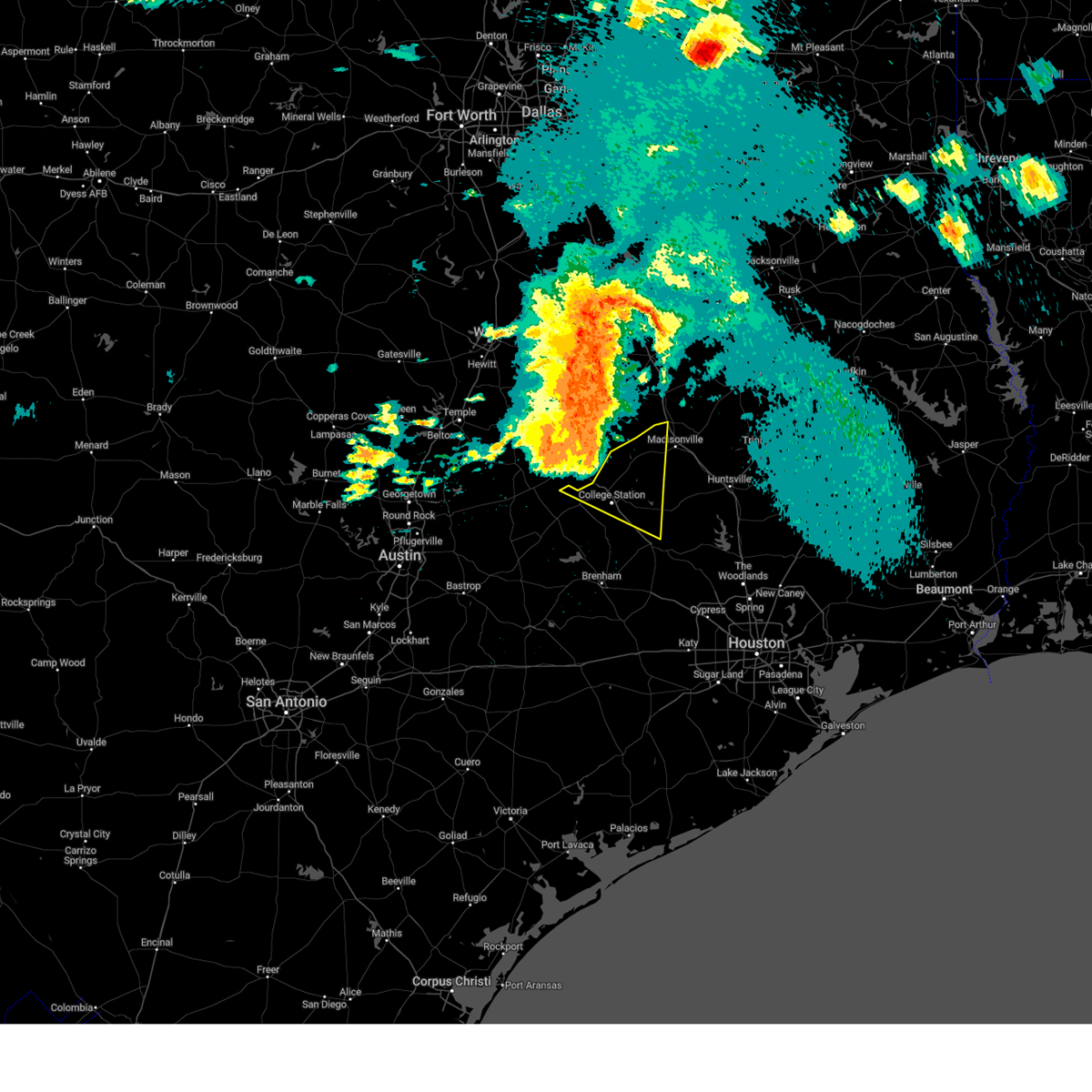
 At 253 pm cdt, a severe thunderstorm was located near college station, moving northeast at 50 mph (radar indicated). Hazards include 60 mph wind gusts and quarter size hail. Hail damage to vehicles is expected. expect wind damage to roofs, siding, and trees. Locations impacted include, college station, bryan, kurten, wixon valley, kyle field, iola, wellborn, north zulch, and carlos. At 253 pm cdt, a severe thunderstorm was located near college station, moving northeast at 50 mph (radar indicated). Hazards include 60 mph wind gusts and quarter size hail. Hail damage to vehicles is expected. expect wind damage to roofs, siding, and trees. Locations impacted include, college station, bryan, kurten, wixon valley, kyle field, iola, wellborn, north zulch, and carlos.
|
| 5/6/2025 2:52 PM CDT |
 Svrhgx the national weather service in league city has issued a * severe thunderstorm warning for, northwestern grimes county in southeastern texas, central brazos county in southeastern texas, southwestern madison county in southeastern texas, * until 330 pm cdt. * at 252 pm cdt, a severe thunderstorm was located near college station, moving northeast at 50 mph (radar indicated). Hazards include 60 mph wind gusts and quarter size hail. Hail damage to vehicles is expected. Expect wind damage to roofs, siding, and trees. Svrhgx the national weather service in league city has issued a * severe thunderstorm warning for, northwestern grimes county in southeastern texas, central brazos county in southeastern texas, southwestern madison county in southeastern texas, * until 330 pm cdt. * at 252 pm cdt, a severe thunderstorm was located near college station, moving northeast at 50 mph (radar indicated). Hazards include 60 mph wind gusts and quarter size hail. Hail damage to vehicles is expected. Expect wind damage to roofs, siding, and trees.
|
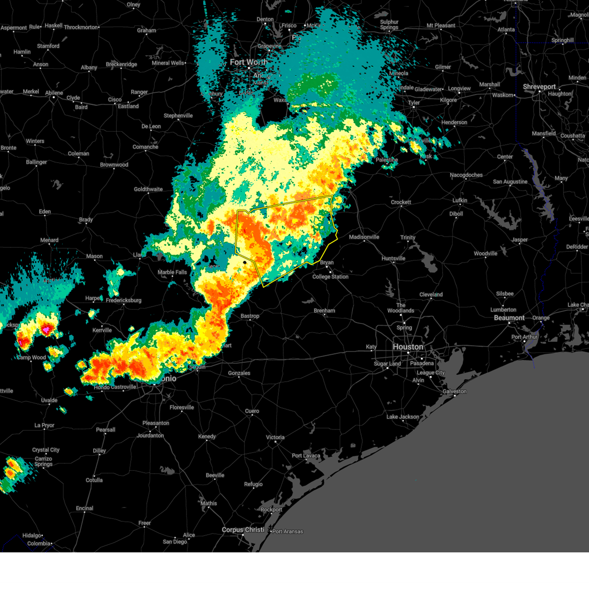
| 5/6/2025 2:41 PM CDT |
 Svrhgx the national weather service in league city has issued a * severe thunderstorm warning for, east central burleson county in southeastern texas, central brazos county in southeastern texas, * until 300 pm cdt. * at 240 pm cdt, a severe thunderstorm was located over southwestern college station, moving northeast at 40 mph (radar indicated). Hazards include 60 mph wind gusts and quarter size hail. Hail damage to vehicles is expected. Expect wind damage to roofs, siding, and trees. Svrhgx the national weather service in league city has issued a * severe thunderstorm warning for, east central burleson county in southeastern texas, central brazos county in southeastern texas, * until 300 pm cdt. * at 240 pm cdt, a severe thunderstorm was located over southwestern college station, moving northeast at 40 mph (radar indicated). Hazards include 60 mph wind gusts and quarter size hail. Hail damage to vehicles is expected. Expect wind damage to roofs, siding, and trees.
|
| 5/6/2025 1:18 PM CDT |
 the severe thunderstorm warning has been cancelled and is no longer in effect the severe thunderstorm warning has been cancelled and is no longer in effect
|
| 5/6/2025 1:18 PM CDT |
 At 117 pm cdt, severe thunderstorms were located along a line extending from near buffalo to camp creek lake, moving east at 45 mph (radar indicated). Hazards include 60 mph wind gusts and quarter size hail. Hail damage to vehicles is expected. expect wind damage to roofs, siding, and trees. these severe storms will be near, centerville and fort boggy state park around 130 pm cdt. Other locations impacted by these severe thunderstorms include pleasant springs, jewett, flo, easterly, benchley, donie, robbins, new baden, redland, and wheelock. At 117 pm cdt, severe thunderstorms were located along a line extending from near buffalo to camp creek lake, moving east at 45 mph (radar indicated). Hazards include 60 mph wind gusts and quarter size hail. Hail damage to vehicles is expected. expect wind damage to roofs, siding, and trees. these severe storms will be near, centerville and fort boggy state park around 130 pm cdt. Other locations impacted by these severe thunderstorms include pleasant springs, jewett, flo, easterly, benchley, donie, robbins, new baden, redland, and wheelock.
|
| 5/6/2025 12:51 PM CDT |
 Svrfwd the national weather service in fort worth has issued a * severe thunderstorm warning for, southeastern freestone county in central texas, robertson county in central texas, leon county in central texas, southeastern limestone county in central texas, * until 145 pm cdt. * at 1250 pm cdt, severe thunderstorms were located along a line extending from lake limestone to near hearne, moving east at 35 mph (radar indicated). Hazards include 60 mph wind gusts and quarter size hail. Hail damage to vehicles is expected. expect wind damage to roofs, siding, and trees. severe thunderstorms will be near, twin oak reservoir, franklin, and lake limestone around 1255 pm cdt. camp creek lake around 105 pm cdt. buffalo around 120 pm cdt. centerville and fort boggy state park around 135 pm cdt. other locations impacted by these severe thunderstorms include pleasant springs, jewett, flo, seale, easterly, benchley, donie, robbins, new baden, and bald prairie. This includes interstate 45 between mile markers 152 and 184. Svrfwd the national weather service in fort worth has issued a * severe thunderstorm warning for, southeastern freestone county in central texas, robertson county in central texas, leon county in central texas, southeastern limestone county in central texas, * until 145 pm cdt. * at 1250 pm cdt, severe thunderstorms were located along a line extending from lake limestone to near hearne, moving east at 35 mph (radar indicated). Hazards include 60 mph wind gusts and quarter size hail. Hail damage to vehicles is expected. expect wind damage to roofs, siding, and trees. severe thunderstorms will be near, twin oak reservoir, franklin, and lake limestone around 1255 pm cdt. camp creek lake around 105 pm cdt. buffalo around 120 pm cdt. centerville and fort boggy state park around 135 pm cdt. other locations impacted by these severe thunderstorms include pleasant springs, jewett, flo, seale, easterly, benchley, donie, robbins, new baden, and bald prairie. This includes interstate 45 between mile markers 152 and 184.
|
| 5/5/2025 5:05 PM CDT |
 the severe thunderstorm warning has been cancelled and is no longer in effect the severe thunderstorm warning has been cancelled and is no longer in effect
|
| 5/5/2025 4:49 PM CDT |
 At 448 pm cdt, a severe thunderstorm was located 7 miles north of bryan utilities lake, or 9 miles southeast of hearne, moving east at 30 mph (radar indicated. at 424 pm cdt...a wind gust of 51 mph was measured at the hearne municipal airport with this storm). Hazards include 60 mph wind gusts and quarter size hail. Hail damage to vehicles is expected. expect wind damage to roofs, siding, and trees. Locations impacted include, benchley, wheelock, mumford, and hearne. At 448 pm cdt, a severe thunderstorm was located 7 miles north of bryan utilities lake, or 9 miles southeast of hearne, moving east at 30 mph (radar indicated. at 424 pm cdt...a wind gust of 51 mph was measured at the hearne municipal airport with this storm). Hazards include 60 mph wind gusts and quarter size hail. Hail damage to vehicles is expected. expect wind damage to roofs, siding, and trees. Locations impacted include, benchley, wheelock, mumford, and hearne.
|
| 5/5/2025 4:37 PM CDT |
 the severe thunderstorm warning has been cancelled and is no longer in effect the severe thunderstorm warning has been cancelled and is no longer in effect
|
| 5/5/2025 4:37 PM CDT |
 At 436 pm cdt, a severe thunderstorm was located near hearne, moving east at 30 mph (radar indicated). Hazards include 65 mph wind gusts and half dollar size hail. Hail damage to vehicles is expected. expect wind damage to roofs, siding, and trees. This severe thunderstorm will remain over mainly rural areas of southeastern robertson county, including the following locations, benchley, wheelock, and mumford. At 436 pm cdt, a severe thunderstorm was located near hearne, moving east at 30 mph (radar indicated). Hazards include 65 mph wind gusts and half dollar size hail. Hail damage to vehicles is expected. expect wind damage to roofs, siding, and trees. This severe thunderstorm will remain over mainly rural areas of southeastern robertson county, including the following locations, benchley, wheelock, and mumford.
|
| 5/5/2025 4:34 PM CDT |
 Svrhgx the national weather service in league city has issued a * severe thunderstorm warning for, northeastern burleson county in southeastern texas, central brazos county in southeastern texas, * until 515 pm cdt. * at 434 pm cdt, a severe thunderstorm was located near bryan utilities lake, or 8 miles southeast of hearne, moving east at 30 mph (radar indicated). Hazards include 60 mph wind gusts and quarter size hail. Hail damage to vehicles is expected. Expect wind damage to roofs, siding, and trees. Svrhgx the national weather service in league city has issued a * severe thunderstorm warning for, northeastern burleson county in southeastern texas, central brazos county in southeastern texas, * until 515 pm cdt. * at 434 pm cdt, a severe thunderstorm was located near bryan utilities lake, or 8 miles southeast of hearne, moving east at 30 mph (radar indicated). Hazards include 60 mph wind gusts and quarter size hail. Hail damage to vehicles is expected. Expect wind damage to roofs, siding, and trees.
|
| 5/5/2025 4:26 PM CDT |
 Svrfwd the national weather service in fort worth has issued a * severe thunderstorm warning for, southern robertson county in central texas, east central milam county in central texas, * until 530 pm cdt. * at 426 pm cdt, a severe thunderstorm was located near hearne, moving east at 30 mph (radar indicated). Hazards include 60 mph wind gusts and quarter size hail. Hail damage to vehicles is expected. expect wind damage to roofs, siding, and trees. this severe thunderstorm will be near, hearne around 430 pm cdt. Other locations impacted by this severe thunderstorm include branchville, gause, benchley, wheelock, and mumford. Svrfwd the national weather service in fort worth has issued a * severe thunderstorm warning for, southern robertson county in central texas, east central milam county in central texas, * until 530 pm cdt. * at 426 pm cdt, a severe thunderstorm was located near hearne, moving east at 30 mph (radar indicated). Hazards include 60 mph wind gusts and quarter size hail. Hail damage to vehicles is expected. expect wind damage to roofs, siding, and trees. this severe thunderstorm will be near, hearne around 430 pm cdt. Other locations impacted by this severe thunderstorm include branchville, gause, benchley, wheelock, and mumford.
|
| 5/1/2025 7:03 PM CDT |
 the severe thunderstorm warning has been cancelled and is no longer in effect the severe thunderstorm warning has been cancelled and is no longer in effect
|
| 5/1/2025 7:03 PM CDT |
 At 703 pm cdt, a severe thunderstorm was located 7 miles southwest of bryan utilities lake, or 10 miles northeast of caldwell, moving east at 15 mph (radar indicated). Hazards include 60 mph wind gusts and quarter size hail. Hail damage to vehicles is expected. expect wind damage to roofs, siding, and trees. This severe thunderstorm will remain over mainly rural areas of north central burleson and west central brazos counties. At 703 pm cdt, a severe thunderstorm was located 7 miles southwest of bryan utilities lake, or 10 miles northeast of caldwell, moving east at 15 mph (radar indicated). Hazards include 60 mph wind gusts and quarter size hail. Hail damage to vehicles is expected. expect wind damage to roofs, siding, and trees. This severe thunderstorm will remain over mainly rural areas of north central burleson and west central brazos counties.
|
| 5/1/2025 6:55 PM CDT |
 Svrfwd the national weather service in fort worth has issued a * severe thunderstorm warning for, southern robertson county in central texas, east central milam county in central texas, * until 800 pm cdt. * at 655 pm cdt, a severe thunderstorm was located 11 miles southwest of hearne, moving south at 5 mph (radar indicated). Hazards include 60 mph wind gusts and half dollar size hail. Hail damage to vehicles is expected. expect wind damage to roofs, siding, and trees. This severe thunderstorm will remain over mainly rural areas of southern robertson and east central milam counties, including the following locations, gause, benchley, wheelock, and mumford. Svrfwd the national weather service in fort worth has issued a * severe thunderstorm warning for, southern robertson county in central texas, east central milam county in central texas, * until 800 pm cdt. * at 655 pm cdt, a severe thunderstorm was located 11 miles southwest of hearne, moving south at 5 mph (radar indicated). Hazards include 60 mph wind gusts and half dollar size hail. Hail damage to vehicles is expected. expect wind damage to roofs, siding, and trees. This severe thunderstorm will remain over mainly rural areas of southern robertson and east central milam counties, including the following locations, gause, benchley, wheelock, and mumford.
|
| 5/1/2025 6:44 PM CDT |
 Svrhgx the national weather service in league city has issued a * severe thunderstorm warning for, northeastern burleson county in southeastern texas, northwestern grimes county in southeastern texas, brazos county in southeastern texas, * until 715 pm cdt. * at 644 pm cdt, a severe thunderstorm was located over western college station, moving southeast at 15 mph (radar indicated). Hazards include 60 mph wind gusts and quarter size hail. Hail damage to vehicles is expected. Expect wind damage to roofs, siding, and trees. Svrhgx the national weather service in league city has issued a * severe thunderstorm warning for, northeastern burleson county in southeastern texas, northwestern grimes county in southeastern texas, brazos county in southeastern texas, * until 715 pm cdt. * at 644 pm cdt, a severe thunderstorm was located over western college station, moving southeast at 15 mph (radar indicated). Hazards include 60 mph wind gusts and quarter size hail. Hail damage to vehicles is expected. Expect wind damage to roofs, siding, and trees.
|
| 5/1/2025 6:42 PM CDT |
 At 642 pm cdt, a severe thunderstorm was located 8 miles northwest of bryan utilities lake, or 8 miles south of hearne, moving southeast at 15 mph (radar indicated). Hazards include 60 mph wind gusts and half dollar size hail. Hail damage to vehicles is expected. expect wind damage to roofs, siding, and trees. Locations impacted include, gause, benchley, wheelock, mumford, and hearne. At 642 pm cdt, a severe thunderstorm was located 8 miles northwest of bryan utilities lake, or 8 miles south of hearne, moving southeast at 15 mph (radar indicated). Hazards include 60 mph wind gusts and half dollar size hail. Hail damage to vehicles is expected. expect wind damage to roofs, siding, and trees. Locations impacted include, gause, benchley, wheelock, mumford, and hearne.
|
| 5/1/2025 6:23 PM CDT |
 At 623 pm cdt, a severe thunderstorm was located near hearne, moving southeast at 5 mph (radar indicated). Hazards include 60 mph wind gusts and half dollar size hail. Hail damage to vehicles is expected. expect wind damage to roofs, siding, and trees. This severe thunderstorm will remain over mainly rural areas of southern robertson and east central milam counties, including the following locations, wheelock, mumford, branchville, gause, benchley, new baden, and hanover. At 623 pm cdt, a severe thunderstorm was located near hearne, moving southeast at 5 mph (radar indicated). Hazards include 60 mph wind gusts and half dollar size hail. Hail damage to vehicles is expected. expect wind damage to roofs, siding, and trees. This severe thunderstorm will remain over mainly rural areas of southern robertson and east central milam counties, including the following locations, wheelock, mumford, branchville, gause, benchley, new baden, and hanover.
|
| 5/1/2025 6:23 PM CDT |
 the severe thunderstorm warning has been cancelled and is no longer in effect the severe thunderstorm warning has been cancelled and is no longer in effect
|
| 5/1/2025 6:16 PM CDT |
 Svrhgx the national weather service in league city has issued a * severe thunderstorm warning for, northeastern burleson county in southeastern texas, northwestern grimes county in southeastern texas, central brazos county in southeastern texas, * until 645 pm cdt. * at 615 pm cdt, a severe thunderstorm was located near bryan utilities lake, or near bryan, moving southeast at 15 mph (public). Hazards include 70 mph wind gusts and ping pong ball size hail. People and animals outdoors will be injured. expect hail damage to roofs, siding, windows, and vehicles. expect considerable tree damage. Wind damage is also likely to mobile homes, roofs, and outbuildings. Svrhgx the national weather service in league city has issued a * severe thunderstorm warning for, northeastern burleson county in southeastern texas, northwestern grimes county in southeastern texas, central brazos county in southeastern texas, * until 645 pm cdt. * at 615 pm cdt, a severe thunderstorm was located near bryan utilities lake, or near bryan, moving southeast at 15 mph (public). Hazards include 70 mph wind gusts and ping pong ball size hail. People and animals outdoors will be injured. expect hail damage to roofs, siding, windows, and vehicles. expect considerable tree damage. Wind damage is also likely to mobile homes, roofs, and outbuildings.
|
| 5/1/2025 5:56 PM CDT |
 Svrfwd the national weather service in fort worth has issued a * severe thunderstorm warning for, robertson county in central texas, northeastern milam county in central texas, southwestern leon county in central texas, * until 700 pm cdt. * at 556 pm cdt, a severe thunderstorm was located near hearne, moving east at 25 mph (radar indicated). Hazards include 60 mph wind gusts and half dollar size hail. Hail damage to vehicles is expected. expect wind damage to roofs, siding, and trees. this severe thunderstorm will be near, hearne around 600 pm cdt. Other locations impacted by this severe thunderstorm include hanover, wheelock, mumford, branchville, easterly, gause, benchley, hilltop lakes, new baden, and ridge. Svrfwd the national weather service in fort worth has issued a * severe thunderstorm warning for, robertson county in central texas, northeastern milam county in central texas, southwestern leon county in central texas, * until 700 pm cdt. * at 556 pm cdt, a severe thunderstorm was located near hearne, moving east at 25 mph (radar indicated). Hazards include 60 mph wind gusts and half dollar size hail. Hail damage to vehicles is expected. expect wind damage to roofs, siding, and trees. this severe thunderstorm will be near, hearne around 600 pm cdt. Other locations impacted by this severe thunderstorm include hanover, wheelock, mumford, branchville, easterly, gause, benchley, hilltop lakes, new baden, and ridge.
|
| 5/1/2025 5:05 PM CDT |
 Svrhgx the national weather service in league city has issued a * severe thunderstorm warning for, northwestern brazos county in southeastern texas, * until 530 pm cdt. * at 505 pm cdt, a severe thunderstorm was located near hearne, moving east at 20 mph (radar indicated). Hazards include 60 mph wind gusts and quarter size hail. Hail damage to vehicles is expected. Expect wind damage to roofs, siding, and trees. Svrhgx the national weather service in league city has issued a * severe thunderstorm warning for, northwestern brazos county in southeastern texas, * until 530 pm cdt. * at 505 pm cdt, a severe thunderstorm was located near hearne, moving east at 20 mph (radar indicated). Hazards include 60 mph wind gusts and quarter size hail. Hail damage to vehicles is expected. Expect wind damage to roofs, siding, and trees.
|
| 5/1/2025 4:24 PM CDT |
 Svrhgx the national weather service in league city has issued a * severe thunderstorm warning for, northwestern brazos county in southeastern texas, * until 500 pm cdt. * at 423 pm cdt, a severe thunderstorm was located over hearne, moving east at 40 mph (radar indicated). Hazards include 60 mph wind gusts and half dollar size hail. Hail damage to vehicles is expected. Expect wind damage to roofs, siding, and trees. Svrhgx the national weather service in league city has issued a * severe thunderstorm warning for, northwestern brazos county in southeastern texas, * until 500 pm cdt. * at 423 pm cdt, a severe thunderstorm was located over hearne, moving east at 40 mph (radar indicated). Hazards include 60 mph wind gusts and half dollar size hail. Hail damage to vehicles is expected. Expect wind damage to roofs, siding, and trees.
|
| 4/30/2025 9:13 PM CDT |
 the severe thunderstorm warning has been cancelled and is no longer in effect the severe thunderstorm warning has been cancelled and is no longer in effect
|
| 4/30/2025 9:13 PM CDT |
 At 913 pm cdt, a severe thunderstorm was located near cameron, moving east at 20 mph (radar indicated). Hazards include 60 mph wind gusts and quarter size hail. Hail damage to vehicles is expected. expect wind damage to roofs, siding, and trees. This severe thunderstorm will remain over mainly rural areas of southern robertson, milam and south central bell counties, including the following locations, minerva, hanover, ben arnold, san gabriel, baileyville, sharp, maysfield, yarrelton, hoyte, and crossroads. At 913 pm cdt, a severe thunderstorm was located near cameron, moving east at 20 mph (radar indicated). Hazards include 60 mph wind gusts and quarter size hail. Hail damage to vehicles is expected. expect wind damage to roofs, siding, and trees. This severe thunderstorm will remain over mainly rural areas of southern robertson, milam and south central bell counties, including the following locations, minerva, hanover, ben arnold, san gabriel, baileyville, sharp, maysfield, yarrelton, hoyte, and crossroads.
|
| 4/30/2025 8:41 PM CDT |
 Svrfwd the national weather service in fort worth has issued a * severe thunderstorm warning for, southern robertson county in central texas, milam county in central texas, southeastern bell county in central texas, south central falls county in central texas, * until 945 pm cdt. * at 840 pm cdt, a severe thunderstorm was located near buckholts, or 8 miles northwest of cameron, moving east at 20 mph (radar indicated). Hazards include 60 mph wind gusts and quarter size hail. Hail damage to vehicles is expected. expect wind damage to roofs, siding, and trees. this severe thunderstorm will be near, cameron around 850 pm cdt. Other locations impacted by this severe thunderstorm include hanover, ben arnold, baileyville, sharp, yarrelton, hoyte, crossroads, pettibone, davilla, and elevation. Svrfwd the national weather service in fort worth has issued a * severe thunderstorm warning for, southern robertson county in central texas, milam county in central texas, southeastern bell county in central texas, south central falls county in central texas, * until 945 pm cdt. * at 840 pm cdt, a severe thunderstorm was located near buckholts, or 8 miles northwest of cameron, moving east at 20 mph (radar indicated). Hazards include 60 mph wind gusts and quarter size hail. Hail damage to vehicles is expected. expect wind damage to roofs, siding, and trees. this severe thunderstorm will be near, cameron around 850 pm cdt. Other locations impacted by this severe thunderstorm include hanover, ben arnold, baileyville, sharp, yarrelton, hoyte, crossroads, pettibone, davilla, and elevation.
|
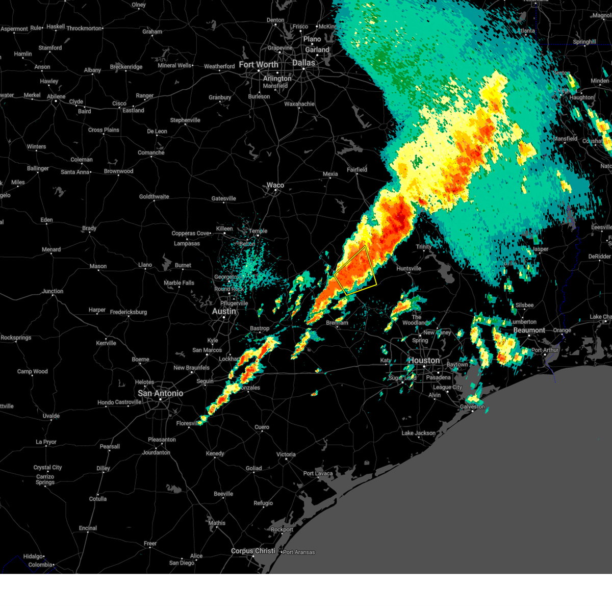
| 3/23/2025 11:30 PM CDT |
 Svrhgx the national weather service in league city has issued a * severe thunderstorm warning for, northeastern brazos county in southeastern texas, madison county in southeastern texas, * until midnight cdt. * at 1129 pm cdt, a severe thunderstorm was located near madisonville, moving southeast at 20 mph (radar indicated). Hazards include 60 mph wind gusts and quarter size hail. Hail damage to vehicles is expected. Expect wind damage to roofs, siding, and trees. Svrhgx the national weather service in league city has issued a * severe thunderstorm warning for, northeastern brazos county in southeastern texas, madison county in southeastern texas, * until midnight cdt. * at 1129 pm cdt, a severe thunderstorm was located near madisonville, moving southeast at 20 mph (radar indicated). Hazards include 60 mph wind gusts and quarter size hail. Hail damage to vehicles is expected. Expect wind damage to roofs, siding, and trees.
|
| 3/23/2025 10:53 PM CDT |
 Svrhgx the national weather service in league city has issued a * severe thunderstorm warning for, northern brazos county in southeastern texas, western madison county in southeastern texas, * until 1130 pm cdt. * at 1052 pm cdt, a severe thunderstorm was located near camp creek lake, or 20 miles northeast of hearne, moving south at 20 mph (radar indicated). Hazards include 60 mph wind gusts and quarter size hail. Hail damage to vehicles is expected. Expect wind damage to roofs, siding, and trees. Svrhgx the national weather service in league city has issued a * severe thunderstorm warning for, northern brazos county in southeastern texas, western madison county in southeastern texas, * until 1130 pm cdt. * at 1052 pm cdt, a severe thunderstorm was located near camp creek lake, or 20 miles northeast of hearne, moving south at 20 mph (radar indicated). Hazards include 60 mph wind gusts and quarter size hail. Hail damage to vehicles is expected. Expect wind damage to roofs, siding, and trees.
|
| 3/15/2025 3:15 AM CDT |
 Svrhgx the national weather service in league city has issued a * severe thunderstorm warning for, burleson county in southeastern texas, southwestern brazos county in southeastern texas, northwestern washington county in southeastern texas, * until 345 am cdt. * at 314 am cdt, a severe thunderstorm was located near lake somerville state park & trailway, or 9 miles south of caldwell, moving northeast at around 40 mph (radar indicated). Hazards include ping pong ball size hail and 60 mph wind gusts. People and animals outdoors will be injured. expect hail damage to roofs, siding, windows, and vehicles. Expect wind damage to roofs, siding, and trees. Svrhgx the national weather service in league city has issued a * severe thunderstorm warning for, burleson county in southeastern texas, southwestern brazos county in southeastern texas, northwestern washington county in southeastern texas, * until 345 am cdt. * at 314 am cdt, a severe thunderstorm was located near lake somerville state park & trailway, or 9 miles south of caldwell, moving northeast at around 40 mph (radar indicated). Hazards include ping pong ball size hail and 60 mph wind gusts. People and animals outdoors will be injured. expect hail damage to roofs, siding, windows, and vehicles. Expect wind damage to roofs, siding, and trees.
|
| 3/15/2025 3:00 AM CDT |
 At 259 am cdt, a severe thunderstorm was located near kyle field, or near bryan, moving northeast at around 40 mph (radar indicated). Hazards include 60 mph wind gusts and quarter size hail. Hail damage to vehicles is expected. expect wind damage to roofs, siding, and trees. Locations impacted include, bryan, bryan utilities lake, wixon valley, college station, and kyle field. At 259 am cdt, a severe thunderstorm was located near kyle field, or near bryan, moving northeast at around 40 mph (radar indicated). Hazards include 60 mph wind gusts and quarter size hail. Hail damage to vehicles is expected. expect wind damage to roofs, siding, and trees. Locations impacted include, bryan, bryan utilities lake, wixon valley, college station, and kyle field.
|
| 3/15/2025 2:43 AM CDT |
 Svrhgx the national weather service in league city has issued a * severe thunderstorm warning for, central burleson county in southeastern texas, central brazos county in southeastern texas, * until 315 am cdt. * at 243 am cdt, a severe thunderstorm was located near snook, or 7 miles east of caldwell, moving northeast at 35 to 45 mph (radar indicated). Hazards include 60 mph wind gusts and quarter size hail. Hail damage to vehicles is expected. Expect wind damage to roofs, siding, and trees. Svrhgx the national weather service in league city has issued a * severe thunderstorm warning for, central burleson county in southeastern texas, central brazos county in southeastern texas, * until 315 am cdt. * at 243 am cdt, a severe thunderstorm was located near snook, or 7 miles east of caldwell, moving northeast at 35 to 45 mph (radar indicated). Hazards include 60 mph wind gusts and quarter size hail. Hail damage to vehicles is expected. Expect wind damage to roofs, siding, and trees.
|
| 12/28/2024 12:29 PM CST |
 At 1229 pm cst, severe thunderstorms were located along a line extending from near bryan utilities lake to near snook to lake somerville state park & trailway, moving east at 30 mph (radar indicated). Hazards include 60 mph wind gusts and penny size hail. Expect damage to roofs, siding, and trees. Locations impacted include, college station, bryan, somerville, snook, kurten, wixon valley, millican, lake somerville dam, kyle field, bryan utilities lake, lyons, deanville, and wellborn. At 1229 pm cst, severe thunderstorms were located along a line extending from near bryan utilities lake to near snook to lake somerville state park & trailway, moving east at 30 mph (radar indicated). Hazards include 60 mph wind gusts and penny size hail. Expect damage to roofs, siding, and trees. Locations impacted include, college station, bryan, somerville, snook, kurten, wixon valley, millican, lake somerville dam, kyle field, bryan utilities lake, lyons, deanville, and wellborn.
|
| 12/28/2024 11:46 AM CST |
 Svrhgx the national weather service in league city has issued a * severe thunderstorm warning for, northwestern grimes county in southeastern texas, burleson county in southeastern texas, brazos county in southeastern texas, western washington county in southeastern texas, * until 1245 pm cst. * at 1145 am cst, severe thunderstorms were located along a line extending from 10 miles east of cameron to 7 miles west of caldwell to near lexington, moving east at 25 mph (radar indicated). Hazards include 60 mph wind gusts. expect damage to roofs, siding, and trees Svrhgx the national weather service in league city has issued a * severe thunderstorm warning for, northwestern grimes county in southeastern texas, burleson county in southeastern texas, brazos county in southeastern texas, western washington county in southeastern texas, * until 1245 pm cst. * at 1145 am cst, severe thunderstorms were located along a line extending from 10 miles east of cameron to 7 miles west of caldwell to near lexington, moving east at 25 mph (radar indicated). Hazards include 60 mph wind gusts. expect damage to roofs, siding, and trees
|
| 12/24/2024 9:09 PM CST |
 the severe thunderstorm warning has been cancelled and is no longer in effect the severe thunderstorm warning has been cancelled and is no longer in effect
|
| 12/24/2024 8:59 PM CST |
 Svrhgx the national weather service in league city has issued a * severe thunderstorm warning for, northeastern burleson county in southeastern texas, west central brazos county in southeastern texas, * until 930 pm cst. * at 857 pm cst, a severe thunderstorm was located near bryan utilities lake, or 9 miles west of bryan, moving east at 15 mph (radar indicated). Hazards include 60 mph wind gusts and quarter size hail. Hail damage to vehicles is expected. Expect wind damage to roofs, siding, and trees. Svrhgx the national weather service in league city has issued a * severe thunderstorm warning for, northeastern burleson county in southeastern texas, west central brazos county in southeastern texas, * until 930 pm cst. * at 857 pm cst, a severe thunderstorm was located near bryan utilities lake, or 9 miles west of bryan, moving east at 15 mph (radar indicated). Hazards include 60 mph wind gusts and quarter size hail. Hail damage to vehicles is expected. Expect wind damage to roofs, siding, and trees.
|
| 12/24/2024 8:27 PM CST |
 The storm which prompted the warning has weakened below severe limits, and no longer poses an immediate threat to life or property. therefore, the warning will be allowed to expire. however, small hail, gusty winds and heavy rain are still possible with this thunderstorm. a severe thunderstorm watch remains in effect until midnight cst for southeastern texas. remember, a severe thunderstorm warning still remains in effect for western burleson county. The storm which prompted the warning has weakened below severe limits, and no longer poses an immediate threat to life or property. therefore, the warning will be allowed to expire. however, small hail, gusty winds and heavy rain are still possible with this thunderstorm. a severe thunderstorm watch remains in effect until midnight cst for southeastern texas. remember, a severe thunderstorm warning still remains in effect for western burleson county.
|
| 12/24/2024 8:01 PM CST |
 Svrhgx the national weather service in league city has issued a * severe thunderstorm warning for, western grimes county in southeastern texas, north central burleson county in southeastern texas, central brazos county in southeastern texas, southwestern madison county in southeastern texas, * until 830 pm cst. * at 801 pm cst, a severe thunderstorm was located near bryan utilities lake, or near bryan, moving northeast at 20 mph (radar indicated). Hazards include 60 mph wind gusts and half dollar size hail. Hail damage to vehicles is expected. Expect wind damage to roofs, siding, and trees. Svrhgx the national weather service in league city has issued a * severe thunderstorm warning for, western grimes county in southeastern texas, north central burleson county in southeastern texas, central brazos county in southeastern texas, southwestern madison county in southeastern texas, * until 830 pm cst. * at 801 pm cst, a severe thunderstorm was located near bryan utilities lake, or near bryan, moving northeast at 20 mph (radar indicated). Hazards include 60 mph wind gusts and half dollar size hail. Hail damage to vehicles is expected. Expect wind damage to roofs, siding, and trees.
|
| 12/24/2024 7:31 PM CST |
 Svrhgx the national weather service in league city has issued a * severe thunderstorm warning for, north central burleson county in southeastern texas, northwestern brazos county in southeastern texas, * until 800 pm cst. * at 731 pm cst, a severe thunderstorm was located near bryan utilities lake, or 9 miles west of bryan, moving northeast at 15 mph (broadcast media reported and radar indicated). Hazards include 60 mph wind gusts and half dollar size hail. Hail damage to vehicles is expected. Expect wind damage to roofs, siding, and trees. Svrhgx the national weather service in league city has issued a * severe thunderstorm warning for, north central burleson county in southeastern texas, northwestern brazos county in southeastern texas, * until 800 pm cst. * at 731 pm cst, a severe thunderstorm was located near bryan utilities lake, or 9 miles west of bryan, moving northeast at 15 mph (broadcast media reported and radar indicated). Hazards include 60 mph wind gusts and half dollar size hail. Hail damage to vehicles is expected. Expect wind damage to roofs, siding, and trees.
|
| 12/24/2024 7:20 PM CST |
 At 720 pm cst, a severe thunderstorm was located near bryan utilities lake, or 10 miles west of bryan, moving northeast at 10 mph (radar indicated). Hazards include 60 mph wind gusts and half dollar size hail. Hail damage to vehicles is expected. expect wind damage to roofs, siding, and trees. Locations impacted include, northern college station, bryan, bryan utilities lake, and kyle field. At 720 pm cst, a severe thunderstorm was located near bryan utilities lake, or 10 miles west of bryan, moving northeast at 10 mph (radar indicated). Hazards include 60 mph wind gusts and half dollar size hail. Hail damage to vehicles is expected. expect wind damage to roofs, siding, and trees. Locations impacted include, northern college station, bryan, bryan utilities lake, and kyle field.
|
| 12/24/2024 7:04 PM CST |
 Svrhgx the national weather service in league city has issued a * severe thunderstorm warning for, north central burleson county in southeastern texas, northwestern brazos county in southeastern texas, * until 730 pm cst. * at 704 pm cst, a severe thunderstorm was located 7 miles southwest of bryan utilities lake, or 11 miles northeast of caldwell, moving northeast at 10 mph (radar indicated). Hazards include 60 mph wind gusts and quarter size hail. Hail damage to vehicles is expected. Expect wind damage to roofs, siding, and trees. Svrhgx the national weather service in league city has issued a * severe thunderstorm warning for, north central burleson county in southeastern texas, northwestern brazos county in southeastern texas, * until 730 pm cst. * at 704 pm cst, a severe thunderstorm was located 7 miles southwest of bryan utilities lake, or 11 miles northeast of caldwell, moving northeast at 10 mph (radar indicated). Hazards include 60 mph wind gusts and quarter size hail. Hail damage to vehicles is expected. Expect wind damage to roofs, siding, and trees.
|
| 12/24/2024 6:36 PM CST |
 At 636 pm cst, a severe thunderstorm was located near caldwell, moving northeast at 10 mph (radar indicated). Hazards include 60 mph wind gusts and quarter size hail. Hail damage to vehicles is expected. expect wind damage to roofs, siding, and trees. Locations impacted include, southwestern bryan, caldwell, bryan utilities lake, and chriesman. At 636 pm cst, a severe thunderstorm was located near caldwell, moving northeast at 10 mph (radar indicated). Hazards include 60 mph wind gusts and quarter size hail. Hail damage to vehicles is expected. expect wind damage to roofs, siding, and trees. Locations impacted include, southwestern bryan, caldwell, bryan utilities lake, and chriesman.
|
| 12/24/2024 6:25 PM CST |
 Svrhgx the national weather service in league city has issued a * severe thunderstorm warning for, northeastern burleson county in southeastern texas, west central brazos county in southeastern texas, * until 700 pm cst. * at 625 pm cst, a severe thunderstorm was located near caldwell, moving northeast at 15 mph (radar indicated). Hazards include 60 mph wind gusts and quarter size hail. Hail damage to vehicles is expected. Expect wind damage to roofs, siding, and trees. Svrhgx the national weather service in league city has issued a * severe thunderstorm warning for, northeastern burleson county in southeastern texas, west central brazos county in southeastern texas, * until 700 pm cst. * at 625 pm cst, a severe thunderstorm was located near caldwell, moving northeast at 15 mph (radar indicated). Hazards include 60 mph wind gusts and quarter size hail. Hail damage to vehicles is expected. Expect wind damage to roofs, siding, and trees.
|
| 5/31/2024 5:03 AM CDT |
 At 501 am cdt, severe thunderstorms were located along a line extending from 10 miles southeast of fort boggy state park to 8 miles north of lake somerville state park & trailway, moving southeast at around 45 mph (radar indicated). Hazards include 60 mph wind gusts and penny size hail. Expect damage to roofs, siding, and trees. Locations impacted include, college station, bryan, huntsville, brenham, navasota, madisonville, caldwell, austonio, washington, trinity, somerville, lovelady, snook, riverside, bedias, kurten, burton, wixon valley, millican, and anderson. At 501 am cdt, severe thunderstorms were located along a line extending from 10 miles southeast of fort boggy state park to 8 miles north of lake somerville state park & trailway, moving southeast at around 45 mph (radar indicated). Hazards include 60 mph wind gusts and penny size hail. Expect damage to roofs, siding, and trees. Locations impacted include, college station, bryan, huntsville, brenham, navasota, madisonville, caldwell, austonio, washington, trinity, somerville, lovelady, snook, riverside, bedias, kurten, burton, wixon valley, millican, and anderson.
|
| 5/31/2024 4:36 AM CDT |
 Svrhgx the national weather service in league city has issued a * severe thunderstorm warning for, west central trinity county in southeastern texas, grimes county in southeastern texas, burleson county in southeastern texas, brazos county in southeastern texas, washington county in southeastern texas, northwestern montgomery county in southeastern texas, southwestern houston county in southeastern texas, madison county in southeastern texas, walker county in southeastern texas, * until 530 am cdt. * at 435 am cdt, severe thunderstorms were located along a line extending from 9 miles west of fort boggy state park to near tanglewood, moving southeast at around 50 mph (radar indicated). Hazards include 60 mph wind gusts and penny size hail. expect damage to roofs, siding, and trees Svrhgx the national weather service in league city has issued a * severe thunderstorm warning for, west central trinity county in southeastern texas, grimes county in southeastern texas, burleson county in southeastern texas, brazos county in southeastern texas, washington county in southeastern texas, northwestern montgomery county in southeastern texas, southwestern houston county in southeastern texas, madison county in southeastern texas, walker county in southeastern texas, * until 530 am cdt. * at 435 am cdt, severe thunderstorms were located along a line extending from 9 miles west of fort boggy state park to near tanglewood, moving southeast at around 50 mph (radar indicated). Hazards include 60 mph wind gusts and penny size hail. expect damage to roofs, siding, and trees
|
| 5/30/2024 6:31 PM CDT |
 the severe thunderstorm warning has been cancelled and is no longer in effect the severe thunderstorm warning has been cancelled and is no longer in effect
|
| 5/30/2024 6:24 PM CDT |
 At 624 pm cdt, severe thunderstorms were located along a line extending from 6 miles northwest of wixon valley to bryan utilities lake to near snook, moving east at 15 mph (radar indicated). Hazards include 60 mph wind gusts and quarter size hail. Hail damage to vehicles is expected. expect wind damage to roofs, siding, and trees. Locations impacted include, western college station, bryan, caldwell, snook, kurten, wixon valley, bryan utilities lake, and chriesman. At 624 pm cdt, severe thunderstorms were located along a line extending from 6 miles northwest of wixon valley to bryan utilities lake to near snook, moving east at 15 mph (radar indicated). Hazards include 60 mph wind gusts and quarter size hail. Hail damage to vehicles is expected. expect wind damage to roofs, siding, and trees. Locations impacted include, western college station, bryan, caldwell, snook, kurten, wixon valley, bryan utilities lake, and chriesman.
|
| 5/30/2024 6:01 PM CDT |
 Svrhgx the national weather service in league city has issued a * severe thunderstorm warning for, central burleson county in southeastern texas, central brazos county in southeastern texas, * until 645 pm cdt. * at 601 pm cdt, severe thunderstorms were located along a line extending from 8 miles east of hearne to near bryan utilities lake to near caldwell, moving southeast at 15 mph (radar indicated). Hazards include quarter size hail. damage to vehicles is expected Svrhgx the national weather service in league city has issued a * severe thunderstorm warning for, central burleson county in southeastern texas, central brazos county in southeastern texas, * until 645 pm cdt. * at 601 pm cdt, severe thunderstorms were located along a line extending from 8 miles east of hearne to near bryan utilities lake to near caldwell, moving southeast at 15 mph (radar indicated). Hazards include quarter size hail. damage to vehicles is expected
|
| 5/30/2024 6:01 PM CDT |
 Svrfwd the national weather service in fort worth has issued a * severe thunderstorm warning for, southwestern robertson county in central texas, east central milam county in central texas, * until 645 pm cdt. * at 600 pm cdt, a severe thunderstorm was located 7 miles south of hearne, moving southeast at 25 mph (radar indicated). Hazards include 60 mph wind gusts and half dollar size hail. Hail damage to vehicles is expected. expect wind damage to roofs, siding, and trees. This severe thunderstorm will remain over mainly rural areas of southwestern robertson and east central milam counties, including the following locations, hanover, elevation, mumford, branchville, gause, benchley, and milano. Svrfwd the national weather service in fort worth has issued a * severe thunderstorm warning for, southwestern robertson county in central texas, east central milam county in central texas, * until 645 pm cdt. * at 600 pm cdt, a severe thunderstorm was located 7 miles south of hearne, moving southeast at 25 mph (radar indicated). Hazards include 60 mph wind gusts and half dollar size hail. Hail damage to vehicles is expected. expect wind damage to roofs, siding, and trees. This severe thunderstorm will remain over mainly rural areas of southwestern robertson and east central milam counties, including the following locations, hanover, elevation, mumford, branchville, gause, benchley, and milano.
|
| 5/22/2024 7:42 PM CDT |
 At 741 pm cdt, a severe thunderstorm was located near wixon valley, or 9 miles north of bryan, moving east at 40 mph (radar indicated). Hazards include 70 mph wind gusts and quarter size hail. Hail damage to vehicles is expected. expect considerable tree damage. wind damage is also likely to mobile homes, roofs, and outbuildings. Locations impacted include, college station, bryan, kurten, wixon valley, kyle field, bryan utilities lake, normangee, iola, north zulch, and carlos. At 741 pm cdt, a severe thunderstorm was located near wixon valley, or 9 miles north of bryan, moving east at 40 mph (radar indicated). Hazards include 70 mph wind gusts and quarter size hail. Hail damage to vehicles is expected. expect considerable tree damage. wind damage is also likely to mobile homes, roofs, and outbuildings. Locations impacted include, college station, bryan, kurten, wixon valley, kyle field, bryan utilities lake, normangee, iola, north zulch, and carlos.
|
| 5/22/2024 7:26 PM CDT |
 Svrhgx the national weather service in league city has issued a * severe thunderstorm warning for, northwestern grimes county in southeastern texas, north central burleson county in southeastern texas, brazos county in southeastern texas, western madison county in southeastern texas, * until 800 pm cdt. * at 725 pm cdt, a severe thunderstorm was located near hearne, moving east at 45 mph (radar indicated). Hazards include 70 mph wind gusts and quarter size hail. Hail damage to vehicles is expected. expect considerable tree damage. Wind damage is also likely to mobile homes, roofs, and outbuildings. Svrhgx the national weather service in league city has issued a * severe thunderstorm warning for, northwestern grimes county in southeastern texas, north central burleson county in southeastern texas, brazos county in southeastern texas, western madison county in southeastern texas, * until 800 pm cdt. * at 725 pm cdt, a severe thunderstorm was located near hearne, moving east at 45 mph (radar indicated). Hazards include 70 mph wind gusts and quarter size hail. Hail damage to vehicles is expected. expect considerable tree damage. Wind damage is also likely to mobile homes, roofs, and outbuildings.
|
| 4/9/2024 10:11 PM CDT |
 Svrhgx the national weather service in league city has issued a * severe thunderstorm warning for, burleson county in southeastern texas, west central brazos county in southeastern texas, western washington county in southeastern texas, * until 1045 pm cdt. * at 1008 pm cdt, severe thunderstorms were located along a line extending from near alcoa lake to near lexington to near giddings to 7 miles northeast of smithville, moving east at 40 mph (radar indicated). Hazards include 60 mph wind gusts and quarter size hail. Hail damage to vehicles is expected. Expect wind damage to roofs, siding, and trees. Svrhgx the national weather service in league city has issued a * severe thunderstorm warning for, burleson county in southeastern texas, west central brazos county in southeastern texas, western washington county in southeastern texas, * until 1045 pm cdt. * at 1008 pm cdt, severe thunderstorms were located along a line extending from near alcoa lake to near lexington to near giddings to 7 miles northeast of smithville, moving east at 40 mph (radar indicated). Hazards include 60 mph wind gusts and quarter size hail. Hail damage to vehicles is expected. Expect wind damage to roofs, siding, and trees.
|
| 6/16/2023 9:26 PM CDT |
 At 926 pm cdt, a severe thunderstorm was located 9 miles west of hearne, moving southeast at 35 mph (radar indicated). Hazards include 60 mph wind gusts and half dollar size hail. Hail damage to vehicles is expected. Expect wind damage to roofs, siding, and trees. At 926 pm cdt, a severe thunderstorm was located 9 miles west of hearne, moving southeast at 35 mph (radar indicated). Hazards include 60 mph wind gusts and half dollar size hail. Hail damage to vehicles is expected. Expect wind damage to roofs, siding, and trees.
|
| 6/10/2023 10:11 PM CDT |
 At 1011 pm cdt, severe thunderstorms were located along a line extending from 6 miles southeast of madisonville to 11 miles northeast of millican to 8 miles west of caldwell, moving east at 45 mph (radar indicated). Hazards include 60 mph wind gusts and quarter size hail. Hail damage to vehicles is expected. expect wind damage to roofs, siding, and trees. locations impacted include, college station, bryan, navasota, caldwell, somerville, snook, bedias, wixon valley, millican, anderson, lake somerville dam, kyle field, bryan utilities lake, lake somerville state park & trailway, iola, lyons, deanville, independence, chriesman and wellborn. hail threat, radar indicated max hail size, 1. 00 in wind threat, observed max wind gust, 60 mph. At 1011 pm cdt, severe thunderstorms were located along a line extending from 6 miles southeast of madisonville to 11 miles northeast of millican to 8 miles west of caldwell, moving east at 45 mph (radar indicated). Hazards include 60 mph wind gusts and quarter size hail. Hail damage to vehicles is expected. expect wind damage to roofs, siding, and trees. locations impacted include, college station, bryan, navasota, caldwell, somerville, snook, bedias, wixon valley, millican, anderson, lake somerville dam, kyle field, bryan utilities lake, lake somerville state park & trailway, iola, lyons, deanville, independence, chriesman and wellborn. hail threat, radar indicated max hail size, 1. 00 in wind threat, observed max wind gust, 60 mph.
|
| 6/10/2023 10:00 PM CDT |
 At 1000 pm cdt, severe thunderstorms were located along a line extending from near madisonville to near college station to near tanglewood, moving east at 45 mph (radar indicated). Hazards include 60 mph wind gusts and quarter size hail. Hail damage to vehicles is expected. Expect wind damage to roofs, siding, and trees. At 1000 pm cdt, severe thunderstorms were located along a line extending from near madisonville to near college station to near tanglewood, moving east at 45 mph (radar indicated). Hazards include 60 mph wind gusts and quarter size hail. Hail damage to vehicles is expected. Expect wind damage to roofs, siding, and trees.
|
| 6/10/2023 9:19 PM CDT |
 At 918 pm cdt, severe thunderstorms were located along a line extending from near franklin to 11 miles southeast of cameron, moving southeast at 30 mph (radar indicated). Hazards include 60 mph wind gusts and half dollar size hail. Hail damage to vehicles is expected. Expect wind damage to roofs, siding, and trees. At 918 pm cdt, severe thunderstorms were located along a line extending from near franklin to 11 miles southeast of cameron, moving southeast at 30 mph (radar indicated). Hazards include 60 mph wind gusts and half dollar size hail. Hail damage to vehicles is expected. Expect wind damage to roofs, siding, and trees.
|
| 6/3/2023 11:45 PM CDT |
 At 1144 pm cdt, a severe thunderstorm was located 9 miles east of college station, moving southeast at 25 mph. this is a destructive storm for south central brazos (radar indicated). Hazards include 80 mph wind gusts and quarter size hail. Flying debris will be dangerous to those caught without shelter. mobile homes will be heavily damaged. expect considerable damage to roofs, windows, and vehicles. extensive tree damage and power outages are likely. locations impacted include, college station, bryan, kurten, wixon valley, millican, kyle field, wellborn, roans prairie and carlos. thunderstorm damage threat, destructive hail threat, radar indicated max hail size, 1. 00 in wind threat, observed max wind gust, 80 mph. At 1144 pm cdt, a severe thunderstorm was located 9 miles east of college station, moving southeast at 25 mph. this is a destructive storm for south central brazos (radar indicated). Hazards include 80 mph wind gusts and quarter size hail. Flying debris will be dangerous to those caught without shelter. mobile homes will be heavily damaged. expect considerable damage to roofs, windows, and vehicles. extensive tree damage and power outages are likely. locations impacted include, college station, bryan, kurten, wixon valley, millican, kyle field, wellborn, roans prairie and carlos. thunderstorm damage threat, destructive hail threat, radar indicated max hail size, 1. 00 in wind threat, observed max wind gust, 80 mph.
|
| 6/3/2023 11:30 PM CDT |
 At 1128 pm cdt, a severe thunderstorm was located near kurten, or 9 miles northeast of bryan, moving southeast at 25 mph (radar indicated). Hazards include 60 mph wind gusts and quarter size hail. Hail damage to vehicles is expected. Expect wind damage to roofs, siding, and trees. At 1128 pm cdt, a severe thunderstorm was located near kurten, or 9 miles northeast of bryan, moving southeast at 25 mph (radar indicated). Hazards include 60 mph wind gusts and quarter size hail. Hail damage to vehicles is expected. Expect wind damage to roofs, siding, and trees.
|
| 6/3/2023 11:02 PM CDT |
 At 1100 pm cdt, a severe thunderstorm was located near bryan utilities lake, or near bryan, moving southeast at 20 mph (radar indicated). Hazards include 60 mph wind gusts and quarter size hail. Hail damage to vehicles is expected. Expect wind damage to roofs, siding, and trees. At 1100 pm cdt, a severe thunderstorm was located near bryan utilities lake, or near bryan, moving southeast at 20 mph (radar indicated). Hazards include 60 mph wind gusts and quarter size hail. Hail damage to vehicles is expected. Expect wind damage to roofs, siding, and trees.
|
| 5/5/2023 11:25 PM CDT |
 At 1125 pm cdt, severe thunderstorms were located along a line extending from 11 miles southeast of camp creek lake to 6 miles southeast of kurten to near college station, moving east at 35 mph (radar indicated). Hazards include 60 mph wind gusts. Expect damage to roofs, siding, and trees. locations impacted include, northern college station, bryan, kurten, wixon valley and bryan utilities lake. hail threat, radar indicated max hail size, <. 75 in wind threat, radar indicated max wind gust, 60 mph. At 1125 pm cdt, severe thunderstorms were located along a line extending from 11 miles southeast of camp creek lake to 6 miles southeast of kurten to near college station, moving east at 35 mph (radar indicated). Hazards include 60 mph wind gusts. Expect damage to roofs, siding, and trees. locations impacted include, northern college station, bryan, kurten, wixon valley and bryan utilities lake. hail threat, radar indicated max hail size, <. 75 in wind threat, radar indicated max wind gust, 60 mph.
|
| 5/5/2023 11:07 PM CDT |
 At 1107 pm cdt, winds on a gust front preceding severe thunderstorms were located along a line extending from 7 miles south of camp creek lake to wixon valley to bryan, moving east at 35 mph (radar indicated). Hazards include 60 mph wind gusts. Expect damage to roofs, siding, and trees. locations impacted include, northern college station, bryan, kurten, wixon valley and bryan utilities lake. hail threat, radar indicated max hail size, <. 75 in wind threat, radar indicated max wind gust, 60 mph. At 1107 pm cdt, winds on a gust front preceding severe thunderstorms were located along a line extending from 7 miles south of camp creek lake to wixon valley to bryan, moving east at 35 mph (radar indicated). Hazards include 60 mph wind gusts. Expect damage to roofs, siding, and trees. locations impacted include, northern college station, bryan, kurten, wixon valley and bryan utilities lake. hail threat, radar indicated max hail size, <. 75 in wind threat, radar indicated max wind gust, 60 mph.
|
| 5/5/2023 10:56 PM CDT |
 At 1055 pm cdt, a severe thunderstorm was located near bryan utilities lake, or near hearne, moving east at 30 mph (radar indicated). Hazards include 60 mph wind gusts. expect damage to roofs, siding, and trees At 1055 pm cdt, a severe thunderstorm was located near bryan utilities lake, or near hearne, moving east at 30 mph (radar indicated). Hazards include 60 mph wind gusts. expect damage to roofs, siding, and trees
|
| 4/28/2023 6:12 PM CDT |
 At 611 pm cdt, severe thunderstorms were located along a line extending from 6 miles east of kurten to near snook to near dime box, moving southeast at 40 mph (radar indicated. broadcast media reported power lines and trees down in northern brazos county due to the strong winds). Hazards include 60 mph wind gusts and nickel size hail. Expect damage to roofs, siding, and trees. Locations impacted include, college station, bryan, navasota, caldwell, somerville, snook, kurten, burton, wixon valley, millican, lake somerville dam, lake somerville state park & trailway, kyle field, bryan utilities lake, iola, carmine, lyons, deanville, independence and quarry. At 611 pm cdt, severe thunderstorms were located along a line extending from 6 miles east of kurten to near snook to near dime box, moving southeast at 40 mph (radar indicated. broadcast media reported power lines and trees down in northern brazos county due to the strong winds). Hazards include 60 mph wind gusts and nickel size hail. Expect damage to roofs, siding, and trees. Locations impacted include, college station, bryan, navasota, caldwell, somerville, snook, kurten, burton, wixon valley, millican, lake somerville dam, lake somerville state park & trailway, kyle field, bryan utilities lake, iola, carmine, lyons, deanville, independence and quarry.
|
| 4/28/2023 5:59 PM CDT |
 At 559 pm cdt, severe thunderstorms were located along a line extending from near kurten to near snook to near dime box, moving southeast at 40 mph (radar indicated). Hazards include 60 mph wind gusts and nickel size hail. expect damage to roofs, siding, and trees At 559 pm cdt, severe thunderstorms were located along a line extending from near kurten to near snook to near dime box, moving southeast at 40 mph (radar indicated). Hazards include 60 mph wind gusts and nickel size hail. expect damage to roofs, siding, and trees
|
| 4/28/2023 5:57 PM CDT |
 The severe thunderstorm warning for southeastern robertson county will expire at 600 pm cdt, the storm which prompted the warning has moved out of the area. therefore the warning will be allowed to expire. a tornado watch remains in effect until 800 pm cdt for central texas. The severe thunderstorm warning for southeastern robertson county will expire at 600 pm cdt, the storm which prompted the warning has moved out of the area. therefore the warning will be allowed to expire. a tornado watch remains in effect until 800 pm cdt for central texas.
|
| 4/28/2023 5:46 PM CDT |
 At 546 pm cdt, a severe thunderstorm was located near hearne, moving southeast at 35 mph (radar indicated). Hazards include 60 mph wind gusts and quarter size hail. Hail damage to vehicles is expected. expect wind damage to roofs, siding, and trees. locations impacted include, hearne, benchley and mumford. hail threat, radar indicated max hail size, 1. 00 in wind threat, radar indicated max wind gust, 60 mph. At 546 pm cdt, a severe thunderstorm was located near hearne, moving southeast at 35 mph (radar indicated). Hazards include 60 mph wind gusts and quarter size hail. Hail damage to vehicles is expected. expect wind damage to roofs, siding, and trees. locations impacted include, hearne, benchley and mumford. hail threat, radar indicated max hail size, 1. 00 in wind threat, radar indicated max wind gust, 60 mph.
|
| 4/28/2023 5:23 PM CDT |
 At 522 pm cdt, severe thunderstorms were located along a line extending from near hearne to 6 miles east of rockdale to 9 miles southeast of thrall, moving southeast at 30 mph (radar indicated). Hazards include 60 mph wind gusts and quarter size hail. Hail damage to vehicles is expected. Expect wind damage to roofs, siding, and trees. At 522 pm cdt, severe thunderstorms were located along a line extending from near hearne to 6 miles east of rockdale to 9 miles southeast of thrall, moving southeast at 30 mph (radar indicated). Hazards include 60 mph wind gusts and quarter size hail. Hail damage to vehicles is expected. Expect wind damage to roofs, siding, and trees.
|
| 4/28/2023 5:20 PM CDT |
 At 519 pm cdt, a severe thunderstorm was located near calvert, or near hearne, moving southeast at 30 mph (radar indicated). Hazards include 60 mph wind gusts and quarter size hail. Hail damage to vehicles is expected. Expect wind damage to roofs, siding, and trees. At 519 pm cdt, a severe thunderstorm was located near calvert, or near hearne, moving southeast at 30 mph (radar indicated). Hazards include 60 mph wind gusts and quarter size hail. Hail damage to vehicles is expected. Expect wind damage to roofs, siding, and trees.
|
| 4/20/2023 8:16 PM CDT |
 At 815 pm cdt, severe thunderstorms were located along a line extending from 10 miles south of camp creek lake to 8 miles northeast of wixon valley to near kurten to 6 miles east of kyle field to near college station to near snook to 9 miles northeast of somerville, moving east at 30 mph (radar indicated). Hazards include 60 mph wind gusts and quarter size hail. Hail damage to vehicles is expected. expect wind damage to roofs, siding, and trees. locations impacted include, college station, bryan, navasota, washington, snook, bedias, kurten, wixon valley, millican, anderson, kyle field, iola, plantersville, wellborn, roans prairie, richards and carlos. hail threat, radar indicated max hail size, 1. 00 in wind threat, radar indicated max wind gust, 60 mph. At 815 pm cdt, severe thunderstorms were located along a line extending from 10 miles south of camp creek lake to 8 miles northeast of wixon valley to near kurten to 6 miles east of kyle field to near college station to near snook to 9 miles northeast of somerville, moving east at 30 mph (radar indicated). Hazards include 60 mph wind gusts and quarter size hail. Hail damage to vehicles is expected. expect wind damage to roofs, siding, and trees. locations impacted include, college station, bryan, navasota, washington, snook, bedias, kurten, wixon valley, millican, anderson, kyle field, iola, plantersville, wellborn, roans prairie, richards and carlos. hail threat, radar indicated max hail size, 1. 00 in wind threat, radar indicated max wind gust, 60 mph.
|
| 4/20/2023 8:14 PM CDT |
 At 813 pm cdt, severe thunderstorms were located along a line extending from 10 miles south of camp creek lake to 8 miles northeast of wixon valley to near kurten to 6 miles east of kyle field to near college station to near snook to 9 miles northeast of somerville, moving east at 30 mph (radar indicated). Hazards include 60 mph wind gusts and quarter size hail. Hail damage to vehicles is expected. Expect wind damage to roofs, siding, and trees. At 813 pm cdt, severe thunderstorms were located along a line extending from 10 miles south of camp creek lake to 8 miles northeast of wixon valley to near kurten to 6 miles east of kyle field to near college station to near snook to 9 miles northeast of somerville, moving east at 30 mph (radar indicated). Hazards include 60 mph wind gusts and quarter size hail. Hail damage to vehicles is expected. Expect wind damage to roofs, siding, and trees.
|
| 4/20/2023 8:11 PM CDT |
 The severe thunderstorm warning for southeastern robertson county will expire at 815 pm cdt, the storms which prompted the warning have moved out of the area. therefore the warning will be allowed to expire. however gusty winds and heavy rain are still possible with these thunderstorms. The severe thunderstorm warning for southeastern robertson county will expire at 815 pm cdt, the storms which prompted the warning have moved out of the area. therefore the warning will be allowed to expire. however gusty winds and heavy rain are still possible with these thunderstorms.
|
| 4/20/2023 7:47 PM CDT |
 At 746 pm cdt, severe thunderstorms were located along a line extending from near hearne to 9 miles west of wixon valley to bryan utilities lake to 7 miles northeast of caldwell to 7 miles east of tanglewood, moving east southeast at 25 mph (radar indicated). Hazards include golf ball size hail and 70 mph wind gusts. People and animals outdoors will be injured. expect hail damage to roofs, siding, windows, and vehicles. expect considerable tree damage. wind damage is also likely to mobile homes, roofs, and outbuildings. locations impacted include, college station, bryan, caldwell, somerville, snook, kurten, wixon valley, millican, lake somerville dam, lake somerville state park & trailway, kyle field, bryan utilities lake, lyons, deanville, independence, chriesman and wellborn. thunderstorm damage threat, considerable hail threat, radar indicated max hail size, 1. 75 in wind threat, radar indicated max wind gust, 70 mph. At 746 pm cdt, severe thunderstorms were located along a line extending from near hearne to 9 miles west of wixon valley to bryan utilities lake to 7 miles northeast of caldwell to 7 miles east of tanglewood, moving east southeast at 25 mph (radar indicated). Hazards include golf ball size hail and 70 mph wind gusts. People and animals outdoors will be injured. expect hail damage to roofs, siding, windows, and vehicles. expect considerable tree damage. wind damage is also likely to mobile homes, roofs, and outbuildings. locations impacted include, college station, bryan, caldwell, somerville, snook, kurten, wixon valley, millican, lake somerville dam, lake somerville state park & trailway, kyle field, bryan utilities lake, lyons, deanville, independence, chriesman and wellborn. thunderstorm damage threat, considerable hail threat, radar indicated max hail size, 1. 75 in wind threat, radar indicated max wind gust, 70 mph.
|
| 4/20/2023 7:46 PM CDT |
 At 746 pm cdt, severe thunderstorms were located along a line extending from hearne to bryan utilities lake, moving east at 20 mph (radar indicated). Hazards include 60 mph wind gusts and quarter size hail. Hail damage to vehicles is expected. expect wind damage to roofs, siding, and trees. locations impacted include, hearne, benchley, wheelock and mumford. hail threat, radar indicated max hail size, 1. 00 in wind threat, radar indicated max wind gust, 60 mph. At 746 pm cdt, severe thunderstorms were located along a line extending from hearne to bryan utilities lake, moving east at 20 mph (radar indicated). Hazards include 60 mph wind gusts and quarter size hail. Hail damage to vehicles is expected. expect wind damage to roofs, siding, and trees. locations impacted include, hearne, benchley, wheelock and mumford. hail threat, radar indicated max hail size, 1. 00 in wind threat, radar indicated max wind gust, 60 mph.
|
| 4/20/2023 7:36 PM CDT |
 At 736 pm cdt, severe thunderstorms were located along a line extending from near hearne to near bryan utilities lake, moving east at 20 mph (radar indicated). Hazards include 65 mph wind gusts and quarter size hail. Hail damage to vehicles is expected. Expect wind damage to roofs, siding, and trees. At 736 pm cdt, severe thunderstorms were located along a line extending from near hearne to near bryan utilities lake, moving east at 20 mph (radar indicated). Hazards include 65 mph wind gusts and quarter size hail. Hail damage to vehicles is expected. Expect wind damage to roofs, siding, and trees.
|
| 4/20/2023 7:26 PM CDT |
 At 725 pm cdt, a severe thunderstorm capable of producing a tornado was located 2 miles west of mumford, moving east at 10 mph (radar indicated rotation). Hazards include tornado. Flying debris will be dangerous to those caught without shelter. mobile homes will be damaged or destroyed. damage to roofs, windows, and vehicles will occur. tree damage is likely. This tornadic thunderstorm will remain over mainly rural areas of southern robertson and east central milam counties, including the following locations, benchley, wheelock, mumford and gause. At 725 pm cdt, a severe thunderstorm capable of producing a tornado was located 2 miles west of mumford, moving east at 10 mph (radar indicated rotation). Hazards include tornado. Flying debris will be dangerous to those caught without shelter. mobile homes will be damaged or destroyed. damage to roofs, windows, and vehicles will occur. tree damage is likely. This tornadic thunderstorm will remain over mainly rural areas of southern robertson and east central milam counties, including the following locations, benchley, wheelock, mumford and gause.
|
| 4/20/2023 7:17 PM CDT |
 At 717 pm cdt, a severe thunderstorm capable of producing a tornado was located 4 miles west of mumford, moving east at 10 mph (radar indicated rotation). Hazards include tornado. Flying debris will be dangerous to those caught without shelter. mobile homes will be damaged or destroyed. damage to roofs, windows, and vehicles will occur. tree damage is likely. This tornadic thunderstorm will remain over mainly rural areas of southeastern robertson and east central milam counties, including the following locations, benchley, wheelock, mumford and gause. At 717 pm cdt, a severe thunderstorm capable of producing a tornado was located 4 miles west of mumford, moving east at 10 mph (radar indicated rotation). Hazards include tornado. Flying debris will be dangerous to those caught without shelter. mobile homes will be damaged or destroyed. damage to roofs, windows, and vehicles will occur. tree damage is likely. This tornadic thunderstorm will remain over mainly rural areas of southeastern robertson and east central milam counties, including the following locations, benchley, wheelock, mumford and gause.
|
| 4/20/2023 7:10 PM CDT |
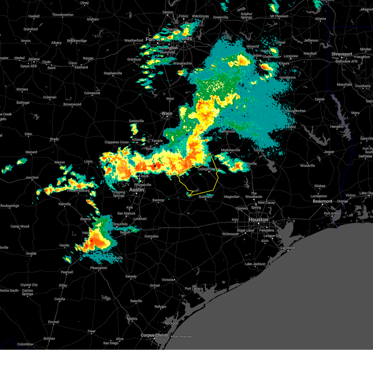 At 710 pm cdt, severe thunderstorms were located along a line extending from near wixon valley to 7 miles northwest of caldwell to near thorndale, moving south at 25 mph (radar indicated). Hazards include 60 mph wind gusts and quarter size hail. Hail damage to vehicles is expected. Expect wind damage to roofs, siding, and trees. At 710 pm cdt, severe thunderstorms were located along a line extending from near wixon valley to 7 miles northwest of caldwell to near thorndale, moving south at 25 mph (radar indicated). Hazards include 60 mph wind gusts and quarter size hail. Hail damage to vehicles is expected. Expect wind damage to roofs, siding, and trees.
|
| 4/20/2023 6:58 PM CDT |
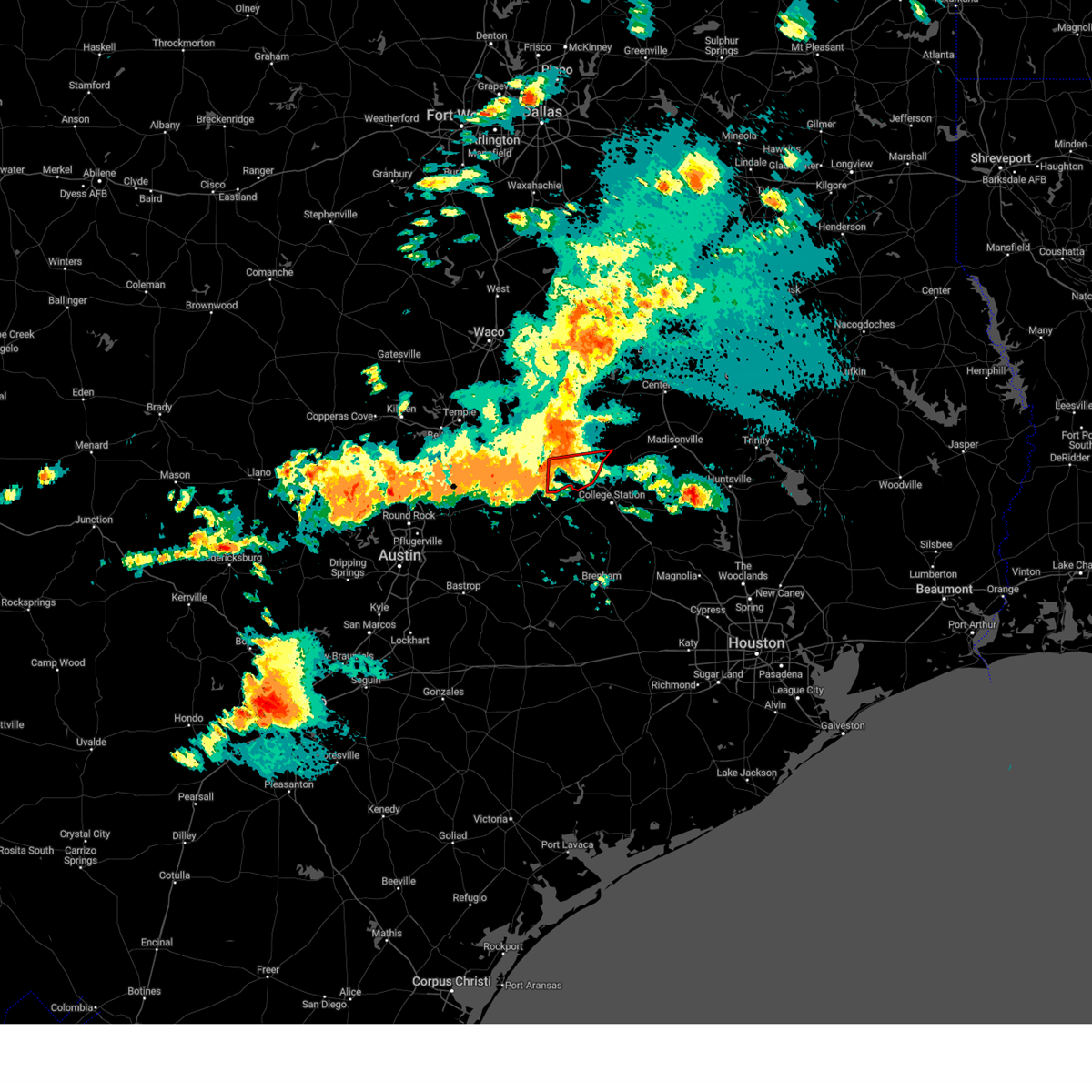 At 657 pm cdt, a severe thunderstorm capable of producing a tornado was located 7 miles southwest of hearne, moving east at 15 mph (radar indicated rotation). Hazards include tornado. Flying debris will be dangerous to those caught without shelter. mobile homes will be damaged or destroyed. damage to roofs, windows, and vehicles will occur. tree damage is likely. this dangerous storm will be near, hearne around 725 pm cdt. Other locations impacted by this tornadic thunderstorm include gause, benchley, wheelock and mumford. At 657 pm cdt, a severe thunderstorm capable of producing a tornado was located 7 miles southwest of hearne, moving east at 15 mph (radar indicated rotation). Hazards include tornado. Flying debris will be dangerous to those caught without shelter. mobile homes will be damaged or destroyed. damage to roofs, windows, and vehicles will occur. tree damage is likely. this dangerous storm will be near, hearne around 725 pm cdt. Other locations impacted by this tornadic thunderstorm include gause, benchley, wheelock and mumford.
|
| 4/20/2023 6:47 PM CDT |
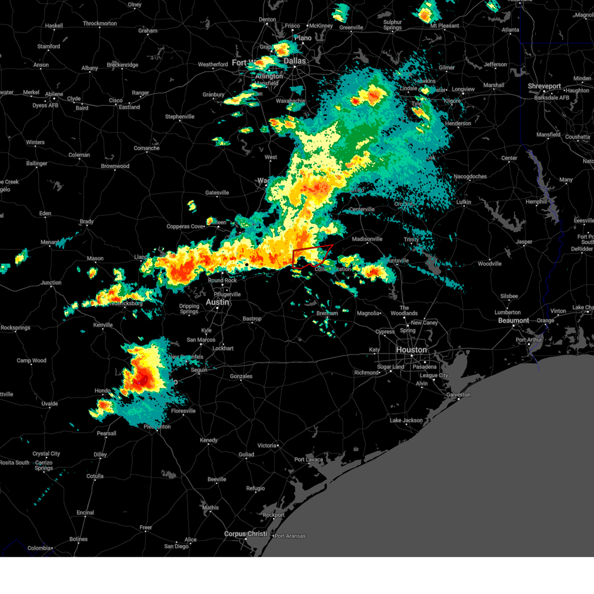 At 646 pm cdt, a severe thunderstorm capable of producing a tornado was located 3 miles west of gause, moving east at 25 mph toward gause (radar indicated rotation). Hazards include tornado. Flying debris will be dangerous to those caught without shelter. mobile homes will be damaged or destroyed. damage to roofs, windows, and vehicles will occur. tree damage is likely. this dangerous storm will be near, hearne around 715 pm cdt. Other locations impacted by this tornadic thunderstorm include gause, benchley, wheelock and mumford. At 646 pm cdt, a severe thunderstorm capable of producing a tornado was located 3 miles west of gause, moving east at 25 mph toward gause (radar indicated rotation). Hazards include tornado. Flying debris will be dangerous to those caught without shelter. mobile homes will be damaged or destroyed. damage to roofs, windows, and vehicles will occur. tree damage is likely. this dangerous storm will be near, hearne around 715 pm cdt. Other locations impacted by this tornadic thunderstorm include gause, benchley, wheelock and mumford.
|
| 4/20/2023 6:19 PM CDT |
 At 618 pm cdt, severe thunderstorms were located along a line extending from near jarrell to buckholts, moving southeast at 20 mph (radar indicated). Hazards include 60 mph wind gusts and half dollar size hail. Hail damage to vehicles is expected. Expect wind damage to roofs, siding, and trees. At 618 pm cdt, severe thunderstorms were located along a line extending from near jarrell to buckholts, moving southeast at 20 mph (radar indicated). Hazards include 60 mph wind gusts and half dollar size hail. Hail damage to vehicles is expected. Expect wind damage to roofs, siding, and trees.
|
| 3/16/2023 10:23 PM CDT |
 The severe thunderstorm warning for south central robertson and southeastern milam counties will expire at 1030 pm cdt, the storm which prompted the warning has moved out of the area. therefore the warning will be allowed to expire. a tornado watch remains in effect until 100 am cdt for central texas. The severe thunderstorm warning for south central robertson and southeastern milam counties will expire at 1030 pm cdt, the storm which prompted the warning has moved out of the area. therefore the warning will be allowed to expire. a tornado watch remains in effect until 100 am cdt for central texas.
|
| 3/16/2023 10:11 PM CDT |
 At 1011 pm cdt, a severe thunderstorm was located 9 miles east of rockdale, moving east at 25 mph (radar indicated). Hazards include 60 mph wind gusts and quarter size hail. Hail damage to vehicles is expected. expect wind damage to roofs, siding, and trees. locations impacted include, milano, elevation, benchley, mumford and gause. hail threat, radar indicated max hail size, 1. 00 in wind threat, radar indicated max wind gust, 60 mph. At 1011 pm cdt, a severe thunderstorm was located 9 miles east of rockdale, moving east at 25 mph (radar indicated). Hazards include 60 mph wind gusts and quarter size hail. Hail damage to vehicles is expected. expect wind damage to roofs, siding, and trees. locations impacted include, milano, elevation, benchley, mumford and gause. hail threat, radar indicated max hail size, 1. 00 in wind threat, radar indicated max wind gust, 60 mph.
|
| 3/16/2023 9:41 PM CDT |
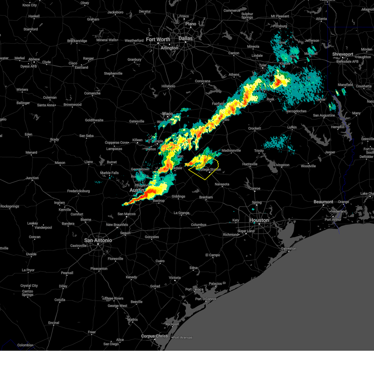 The severe thunderstorm warning for northeastern burleson and central brazos counties will expire at 945 pm cdt, the storm which prompted the warning has weakened below severe limits, and no longer poses an immediate threat to life or property. therefore, the warning will be allowed to expire. a tornado watch remains in effect until 100 am cdt for southeastern texas. The severe thunderstorm warning for northeastern burleson and central brazos counties will expire at 945 pm cdt, the storm which prompted the warning has weakened below severe limits, and no longer poses an immediate threat to life or property. therefore, the warning will be allowed to expire. a tornado watch remains in effect until 100 am cdt for southeastern texas.
|
| 3/16/2023 9:31 PM CDT |
 At 930 pm cdt, a severe thunderstorm was located 7 miles north of thorndale, or 11 miles northwest of rockdale, moving east at 40 mph (radar indicated). Hazards include 60 mph wind gusts and quarter size hail. Hail damage to vehicles is expected. Expect wind damage to roofs, siding, and trees. At 930 pm cdt, a severe thunderstorm was located 7 miles north of thorndale, or 11 miles northwest of rockdale, moving east at 40 mph (radar indicated). Hazards include 60 mph wind gusts and quarter size hail. Hail damage to vehicles is expected. Expect wind damage to roofs, siding, and trees.
|
| 3/16/2023 9:21 PM CDT |
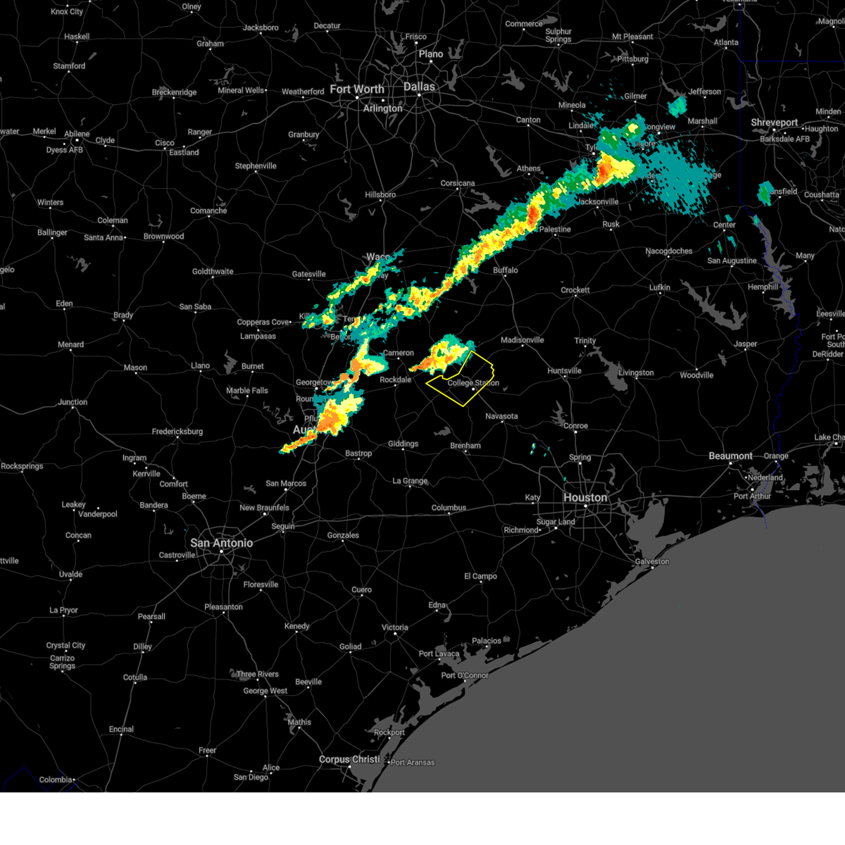 At 920 pm cdt, a severe thunderstorm was located 7 miles southwest of hearne, moving southeast at 25 mph (radar indicated). Hazards include 60 mph wind gusts and quarter size hail. Hail damage to vehicles is expected. Expect wind damage to roofs, siding, and trees. At 920 pm cdt, a severe thunderstorm was located 7 miles southwest of hearne, moving southeast at 25 mph (radar indicated). Hazards include 60 mph wind gusts and quarter size hail. Hail damage to vehicles is expected. Expect wind damage to roofs, siding, and trees.
|
| 3/2/2023 9:11 PM CST |
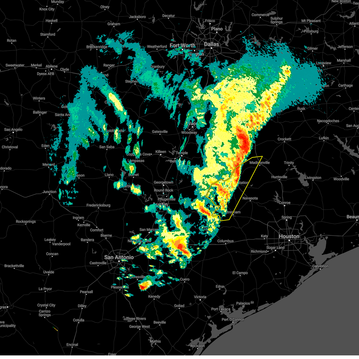 At 909 pm cst, severe thunderstorms were located along a line extending from near buffalo to near centerville to near lake somerville dam, moving east at 50 mph (radar indicated). Hazards include 60 mph wind gusts. Expect damage to roofs, siding, and trees. locations impacted include, college station, bryan, caldwell, somerville, snook, kurten, burton, wixon valley, lake somerville dam, lake somerville state park & trailway, kyle field, bryan utilities lake, normangee, iola, carmine, lyons, deanville, independence, chriesman and quarry. hail threat, radar indicated max hail size, <. 75 in wind threat, radar indicated max wind gust, 60 mph. At 909 pm cst, severe thunderstorms were located along a line extending from near buffalo to near centerville to near lake somerville dam, moving east at 50 mph (radar indicated). Hazards include 60 mph wind gusts. Expect damage to roofs, siding, and trees. locations impacted include, college station, bryan, caldwell, somerville, snook, kurten, burton, wixon valley, lake somerville dam, lake somerville state park & trailway, kyle field, bryan utilities lake, normangee, iola, carmine, lyons, deanville, independence, chriesman and quarry. hail threat, radar indicated max hail size, <. 75 in wind threat, radar indicated max wind gust, 60 mph.
|
| 3/2/2023 9:04 PM CST |
 At 903 pm cst, severe thunderstorms were located along a line extending from 12 miles southeast of fairfield lake state park to near snook, moving east at 80 mph (radar indicated). Hazards include 60 mph wind gusts and penny size hail. Expect damage to roofs, siding, and trees. locations impacted include, hearne, groesbeck, teague, buffalo, franklin, centerville, lake limestone, twin oak reservoir, fort boggy state park, camp creek lake, corinth, jewett, hilltop lakes, redland, normangee, oakwood, marquez, leona, fallon and flo. hail threat, radar indicated max hail size, 0. 75 in wind threat, radar indicated max wind gust, 60 mph. At 903 pm cst, severe thunderstorms were located along a line extending from 12 miles southeast of fairfield lake state park to near snook, moving east at 80 mph (radar indicated). Hazards include 60 mph wind gusts and penny size hail. Expect damage to roofs, siding, and trees. locations impacted include, hearne, groesbeck, teague, buffalo, franklin, centerville, lake limestone, twin oak reservoir, fort boggy state park, camp creek lake, corinth, jewett, hilltop lakes, redland, normangee, oakwood, marquez, leona, fallon and flo. hail threat, radar indicated max hail size, 0. 75 in wind threat, radar indicated max wind gust, 60 mph.
|
| 3/2/2023 8:54 PM CST |
 At 853 pm cst, severe thunderstorms were located along a line extending from 10 miles northeast of buffalo to snook, moving east at 55 mph (radar indicated). Hazards include 60 mph wind gusts and penny size hail. Expect damage to roofs, siding, and trees. locations impacted include, hearne, groesbeck, teague, buffalo, franklin, calvert, bremond, centerville, twin oak reservoir, fort boggy state park, camp creek lake, lake limestone, fort parker state park, corinth, jewett, hilltop lakes, redland, normangee, thornton and oakwood. hail threat, radar indicated max hail size, 0. 75 in wind threat, radar indicated max wind gust, 60 mph. At 853 pm cst, severe thunderstorms were located along a line extending from 10 miles northeast of buffalo to snook, moving east at 55 mph (radar indicated). Hazards include 60 mph wind gusts and penny size hail. Expect damage to roofs, siding, and trees. locations impacted include, hearne, groesbeck, teague, buffalo, franklin, calvert, bremond, centerville, twin oak reservoir, fort boggy state park, camp creek lake, lake limestone, fort parker state park, corinth, jewett, hilltop lakes, redland, normangee, thornton and oakwood. hail threat, radar indicated max hail size, 0. 75 in wind threat, radar indicated max wind gust, 60 mph.
|
| 3/2/2023 8:42 PM CST |
 At 842 pm cst, severe thunderstorms were located along a line extending from 11 miles southwest of lake limestone to near twin oak reservoir to 7 miles east of fedor, moving east at 50 mph (radar indicated). Hazards include 60 mph wind gusts. expect damage to roofs, siding, and trees At 842 pm cst, severe thunderstorms were located along a line extending from 11 miles southwest of lake limestone to near twin oak reservoir to 7 miles east of fedor, moving east at 50 mph (radar indicated). Hazards include 60 mph wind gusts. expect damage to roofs, siding, and trees
|
| 3/2/2023 8:35 PM CST |
 At 835 pm cst, severe thunderstorms were located along a line extending from near teague to near caldwell, moving east at 55 mph (radar indicated). Hazards include 60 mph wind gusts and penny size hail. expect damage to roofs, siding, and trees At 835 pm cst, severe thunderstorms were located along a line extending from near teague to near caldwell, moving east at 55 mph (radar indicated). Hazards include 60 mph wind gusts and penny size hail. expect damage to roofs, siding, and trees
|
| 3/2/2023 8:26 PM CST |
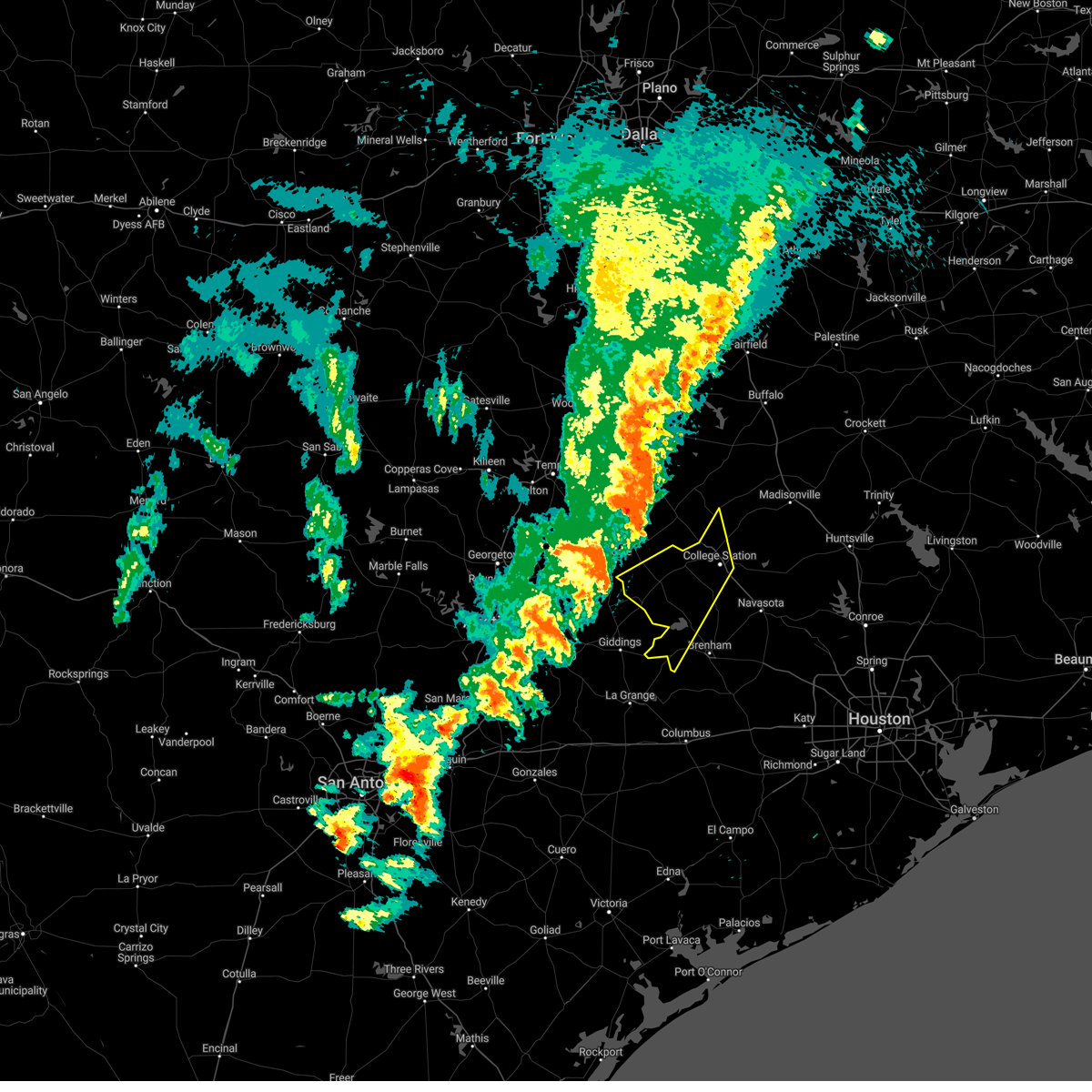 At 825 pm cst, severe thunderstorms were located along a line extending from 6 miles southwest of hearne to 8 miles northwest of caldwell to near lexington, moving east at 40 mph (radar indicated). Hazards include 60 mph wind gusts and penny size hail. Expect damage to roofs, siding, and trees. locations impacted include, college station, bryan, caldwell, somerville, snook, burton, wixon valley, lake somerville dam, lake somerville state park & trailway, kyle field, bryan utilities lake, carmine, lyons, deanville, chriesman, quarry and wellborn. hail threat, radar indicated max hail size, 0. 75 in wind threat, radar indicated max wind gust, 60 mph. At 825 pm cst, severe thunderstorms were located along a line extending from 6 miles southwest of hearne to 8 miles northwest of caldwell to near lexington, moving east at 40 mph (radar indicated). Hazards include 60 mph wind gusts and penny size hail. Expect damage to roofs, siding, and trees. locations impacted include, college station, bryan, caldwell, somerville, snook, burton, wixon valley, lake somerville dam, lake somerville state park & trailway, kyle field, bryan utilities lake, carmine, lyons, deanville, chriesman, quarry and wellborn. hail threat, radar indicated max hail size, 0. 75 in wind threat, radar indicated max wind gust, 60 mph.
|
| 3/2/2023 8:05 PM CST |
 At 803 pm cst, severe thunderstorms were located along a line extending from near buckholts to rockdale to 11 miles west of lexington, moving east at 45 mph (radar indicated). Hazards include 60 mph wind gusts and penny size hail. expect damage to roofs, siding, and trees At 803 pm cst, severe thunderstorms were located along a line extending from near buckholts to rockdale to 11 miles west of lexington, moving east at 45 mph (radar indicated). Hazards include 60 mph wind gusts and penny size hail. expect damage to roofs, siding, and trees
|
| 10/24/2022 10:44 PM CDT |
 At 1042 pm cdt, a severe thunderstorm was located near kurten, or 7 miles northeast of bryan, moving east at 45 mph (radar indicated. at 1035 pm cdt, 61 mph winds were reported at easterwood field in college station. power flashes were also reported at 1040 pm cdt near university drive in college station). Hazards include 60 mph wind gusts and quarter size hail. Hail damage to vehicles is expected. Expect wind damage to roofs, siding, and trees. At 1042 pm cdt, a severe thunderstorm was located near kurten, or 7 miles northeast of bryan, moving east at 45 mph (radar indicated. at 1035 pm cdt, 61 mph winds were reported at easterwood field in college station. power flashes were also reported at 1040 pm cdt near university drive in college station). Hazards include 60 mph wind gusts and quarter size hail. Hail damage to vehicles is expected. Expect wind damage to roofs, siding, and trees.
|
| 10/24/2022 10:35 PM CDT |
 At 1035 pm cdt, a severe thunderstorm was located near wixon valley, or near bryan, moving east at 40 to 50 mph (radar indicated). Hazards include 60 mph wind gusts and quarter size hail. Hail damage to vehicles is expected. expect wind damage to roofs, siding, and trees. Locations impacted include, college station, bryan, kurten, wixon valley, millican, kyle field and wellborn. At 1035 pm cdt, a severe thunderstorm was located near wixon valley, or near bryan, moving east at 40 to 50 mph (radar indicated). Hazards include 60 mph wind gusts and quarter size hail. Hail damage to vehicles is expected. expect wind damage to roofs, siding, and trees. Locations impacted include, college station, bryan, kurten, wixon valley, millican, kyle field and wellborn.
|
| 10/24/2022 10:09 PM CDT |
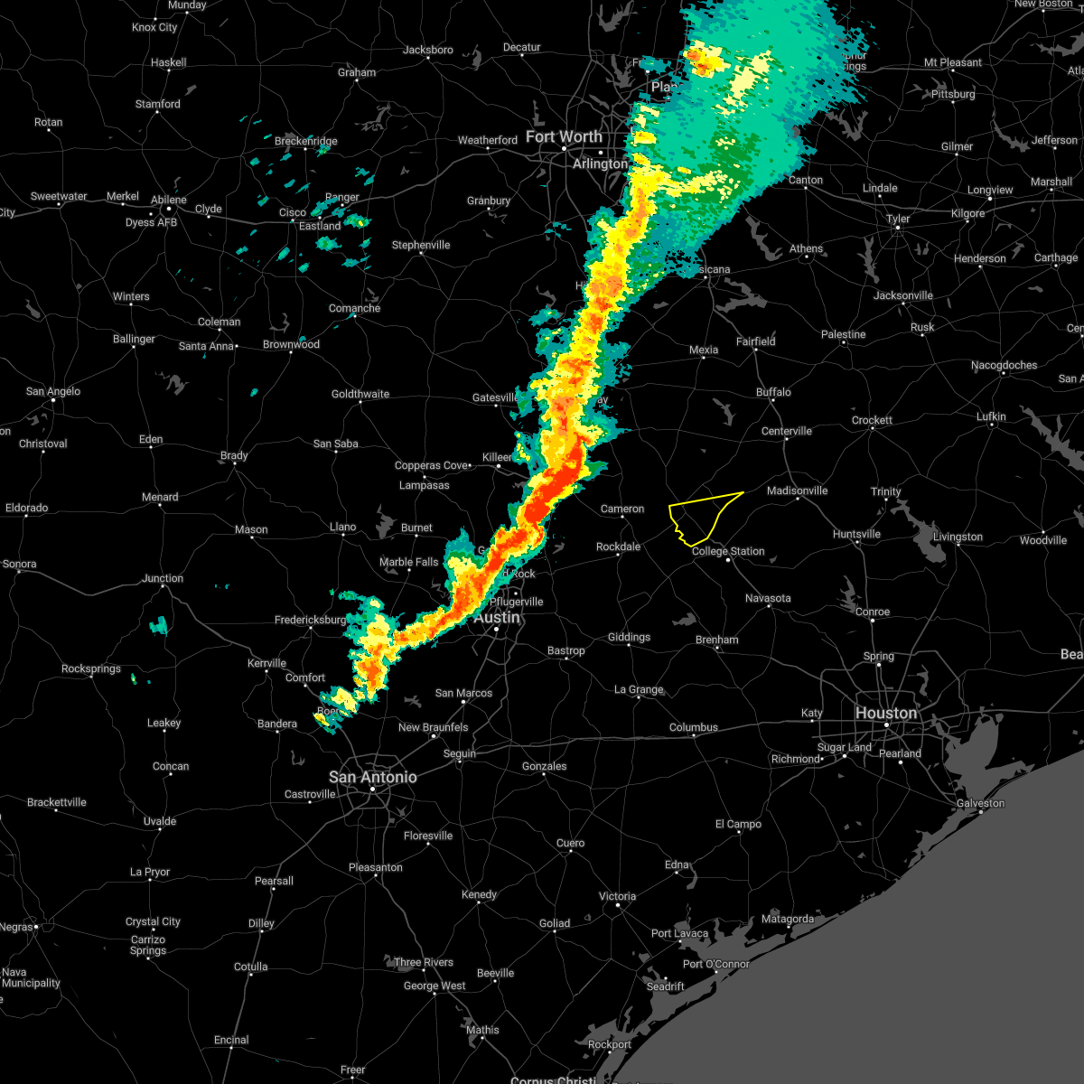 At 1008 pm cdt, a severe thunderstorm was located near hearne, moving east at 40 mph (radar indicated). Hazards include 60 mph wind gusts and quarter size hail. Hail damage to vehicles is expected. Expect wind damage to roofs, siding, and trees. At 1008 pm cdt, a severe thunderstorm was located near hearne, moving east at 40 mph (radar indicated). Hazards include 60 mph wind gusts and quarter size hail. Hail damage to vehicles is expected. Expect wind damage to roofs, siding, and trees.
|
| 10/24/2022 10:02 PM CDT |
 At 1001 pm cdt, a severe thunderstorm was located 9 miles southwest of hearne, moving east at 35 to 45 mph (radar indicated). Hazards include 60 mph wind gusts and quarter size hail. Hail damage to vehicles is expected. Expect wind damage to roofs, siding, and trees. At 1001 pm cdt, a severe thunderstorm was located 9 miles southwest of hearne, moving east at 35 to 45 mph (radar indicated). Hazards include 60 mph wind gusts and quarter size hail. Hail damage to vehicles is expected. Expect wind damage to roofs, siding, and trees.
|
| 10/24/2022 9:59 PM CDT |
 At 958 pm cdt, severe thunderstorms were located along a line extending from 7 miles west of lake limestone to near franklin to 9 miles southwest of hearne, moving east at 40 mph (radar indicated). Hazards include 60 mph wind gusts and quarter size hail. Hail damage to vehicles is expected. expect wind damage to roofs, siding, and trees. locations impacted include, rockdale, cameron, hearne, groesbeck, franklin, thorndale, calvert, bremond, alcoa lake, lake limestone, twin oak reservoir, camp creek lake, fort parker state park, thornton, kosse, milano, crossroads, silver city, hoyte and jones prairie. hail threat, radar indicated max hail size, 1. 00 in wind threat, radar indicated max wind gust, 60 mph. At 958 pm cdt, severe thunderstorms were located along a line extending from 7 miles west of lake limestone to near franklin to 9 miles southwest of hearne, moving east at 40 mph (radar indicated). Hazards include 60 mph wind gusts and quarter size hail. Hail damage to vehicles is expected. expect wind damage to roofs, siding, and trees. locations impacted include, rockdale, cameron, hearne, groesbeck, franklin, thorndale, calvert, bremond, alcoa lake, lake limestone, twin oak reservoir, camp creek lake, fort parker state park, thornton, kosse, milano, crossroads, silver city, hoyte and jones prairie. hail threat, radar indicated max hail size, 1. 00 in wind threat, radar indicated max wind gust, 60 mph.
|
| 10/24/2022 9:24 PM CDT |
 At 923 pm cdt, severe thunderstorms were located along a line extending from near marlin to rosebud to 9 miles south of buckholts, moving east at 45 mph (radar indicated). Hazards include ping pong ball size hail and 60 mph wind gusts. People and animals outdoors will be injured. expect hail damage to roofs, siding, windows, and vehicles. Expect wind damage to roofs, siding, and trees. At 923 pm cdt, severe thunderstorms were located along a line extending from near marlin to rosebud to 9 miles south of buckholts, moving east at 45 mph (radar indicated). Hazards include ping pong ball size hail and 60 mph wind gusts. People and animals outdoors will be injured. expect hail damage to roofs, siding, windows, and vehicles. Expect wind damage to roofs, siding, and trees.
|
| 5/25/2022 12:43 AM CDT |
 At 1242 am cdt, severe thunderstorms were located along a line extending from 7 miles southeast of hearne to 9 miles northeast of caldwell to 6 miles north of lake somerville state park & trailway to 6 miles northwest of round top to near cistern, moving east at 45 mph (radar indicated). Hazards include 70 mph wind gusts and penny size hail. Expect considerable tree damage. Damage is likely to mobile homes, roofs, and outbuildings. At 1242 am cdt, severe thunderstorms were located along a line extending from 7 miles southeast of hearne to 9 miles northeast of caldwell to 6 miles north of lake somerville state park & trailway to 6 miles northwest of round top to near cistern, moving east at 45 mph (radar indicated). Hazards include 70 mph wind gusts and penny size hail. Expect considerable tree damage. Damage is likely to mobile homes, roofs, and outbuildings.
|
| 5/25/2022 12:20 AM CDT |
 At 1219 am cdt, severe thunderstorms were located along a line extending from 8 miles southeast of cameron to near lexington to 7 miles southwest of giddings to near rosanky, moving east at 30 mph (radar indicated). Hazards include 70 mph wind gusts. Expect considerable tree damage. Damage is likely to mobile homes, roofs, and outbuildings. At 1219 am cdt, severe thunderstorms were located along a line extending from 8 miles southeast of cameron to near lexington to 7 miles southwest of giddings to near rosanky, moving east at 30 mph (radar indicated). Hazards include 70 mph wind gusts. Expect considerable tree damage. Damage is likely to mobile homes, roofs, and outbuildings.
|
| 3/21/2022 8:51 PM CDT |
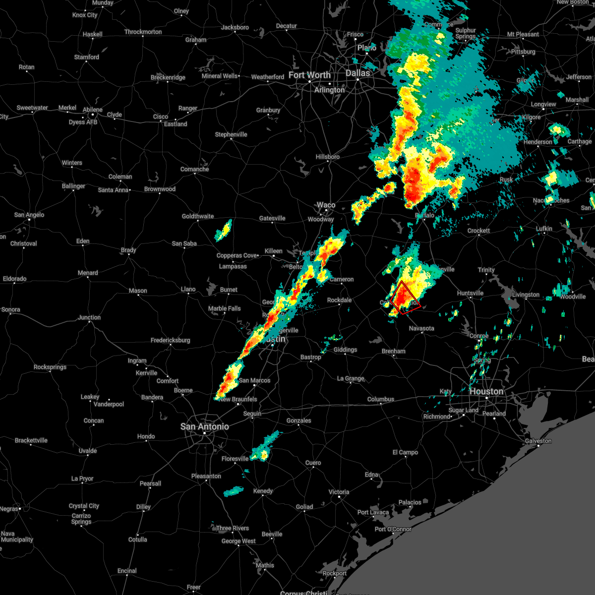 At 850 pm cdt, a severe thunderstorm capable of producing a tornado was located near wixon valley, or near bryan, moving northeast at 40 mph (radar indicated rotation. this tornadic thunderstorm has history of producing a tornado). Hazards include tornado and quarter size hail. Flying debris will be dangerous to those caught without shelter. mobile homes will be damaged or destroyed. damage to roofs, windows, and vehicles will occur. tree damage is likely. This dangerous storm will be near, kurten around 855 pm cdt. At 850 pm cdt, a severe thunderstorm capable of producing a tornado was located near wixon valley, or near bryan, moving northeast at 40 mph (radar indicated rotation. this tornadic thunderstorm has history of producing a tornado). Hazards include tornado and quarter size hail. Flying debris will be dangerous to those caught without shelter. mobile homes will be damaged or destroyed. damage to roofs, windows, and vehicles will occur. tree damage is likely. This dangerous storm will be near, kurten around 855 pm cdt.
|
| 3/21/2022 8:36 PM CDT |
 At 835 pm cdt, a confirmed tornado was located over southwestern bryan, moving northeast at 40 mph (emergency management confirmed tornado. tornado reported near snook near fm60 around 830 pm cdt). Hazards include damaging tornado and quarter size hail. Flying debris will be dangerous to those caught without shelter. mobile homes will be damaged or destroyed. damage to roofs, windows, and vehicles will occur. tree damage is likely. this tornado will be near, college station and bryan around 845 pm cdt. wixon valley around 850 pm cdt. kurten around 855 pm cdt. Other locations impacted by this tornadic thunderstorm include wellborn and carlos. At 835 pm cdt, a confirmed tornado was located over southwestern bryan, moving northeast at 40 mph (emergency management confirmed tornado. tornado reported near snook near fm60 around 830 pm cdt). Hazards include damaging tornado and quarter size hail. Flying debris will be dangerous to those caught without shelter. mobile homes will be damaged or destroyed. damage to roofs, windows, and vehicles will occur. tree damage is likely. this tornado will be near, college station and bryan around 845 pm cdt. wixon valley around 850 pm cdt. kurten around 855 pm cdt. Other locations impacted by this tornadic thunderstorm include wellborn and carlos.
|
| 3/21/2022 8:25 PM CDT |
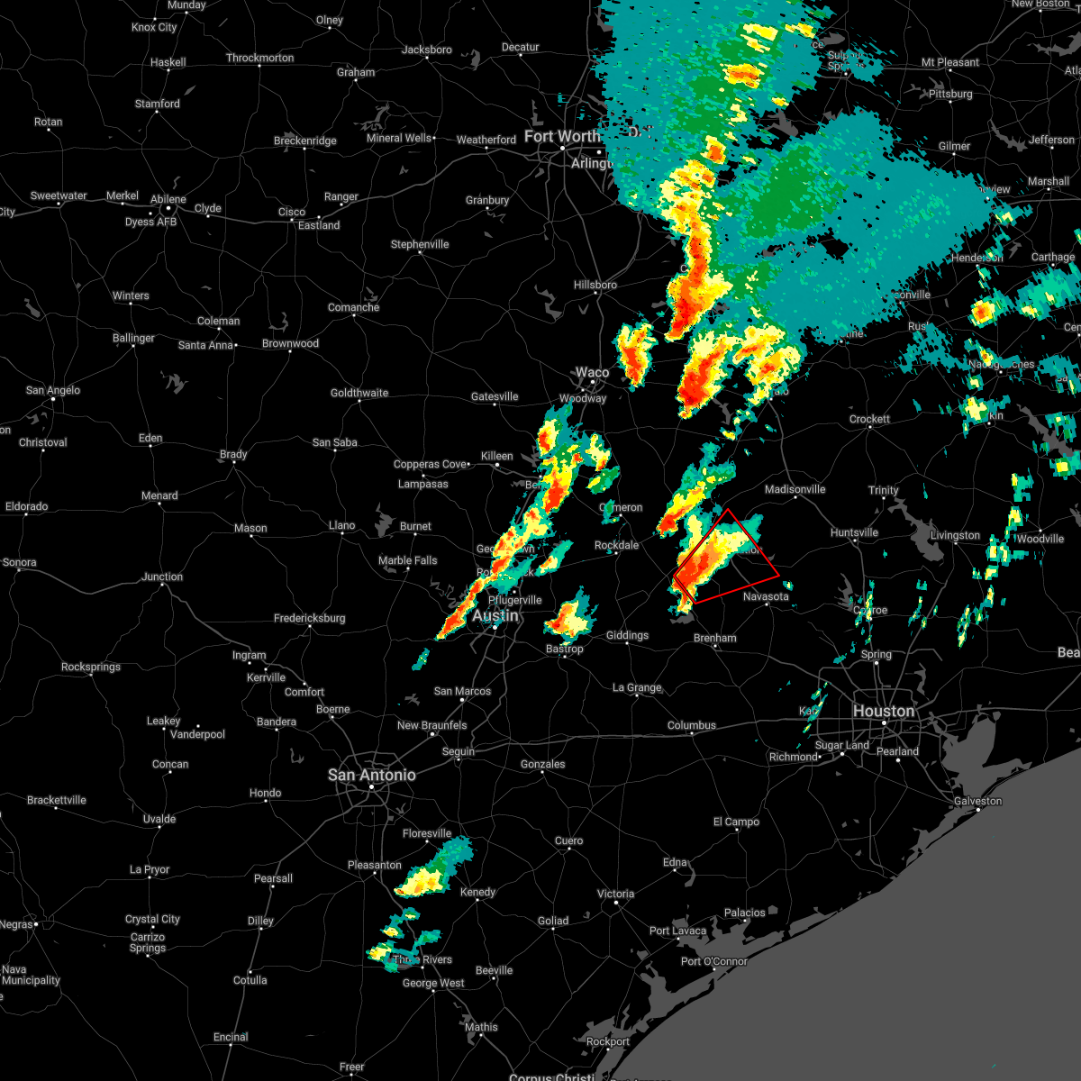 At 824 pm cdt, a severe thunderstorm capable of producing a tornado was located over snook, or 11 miles southwest of college station, moving northeast at 40 mph (radar indicated rotation). Hazards include tornado and quarter size hail. Flying debris will be dangerous to those caught without shelter. mobile homes will be damaged or destroyed. damage to roofs, windows, and vehicles will occur. tree damage is likely. this dangerous storm will be near, kyle field around 840 pm cdt. college station around 845 pm cdt. bryan and wixon valley around 850 pm cdt. kurten around 855 pm cdt. Other locations impacted by this tornadic thunderstorm include wellborn and carlos. At 824 pm cdt, a severe thunderstorm capable of producing a tornado was located over snook, or 11 miles southwest of college station, moving northeast at 40 mph (radar indicated rotation). Hazards include tornado and quarter size hail. Flying debris will be dangerous to those caught without shelter. mobile homes will be damaged or destroyed. damage to roofs, windows, and vehicles will occur. tree damage is likely. this dangerous storm will be near, kyle field around 840 pm cdt. college station around 845 pm cdt. bryan and wixon valley around 850 pm cdt. kurten around 855 pm cdt. Other locations impacted by this tornadic thunderstorm include wellborn and carlos.
|
| 3/21/2022 8:09 PM CDT |
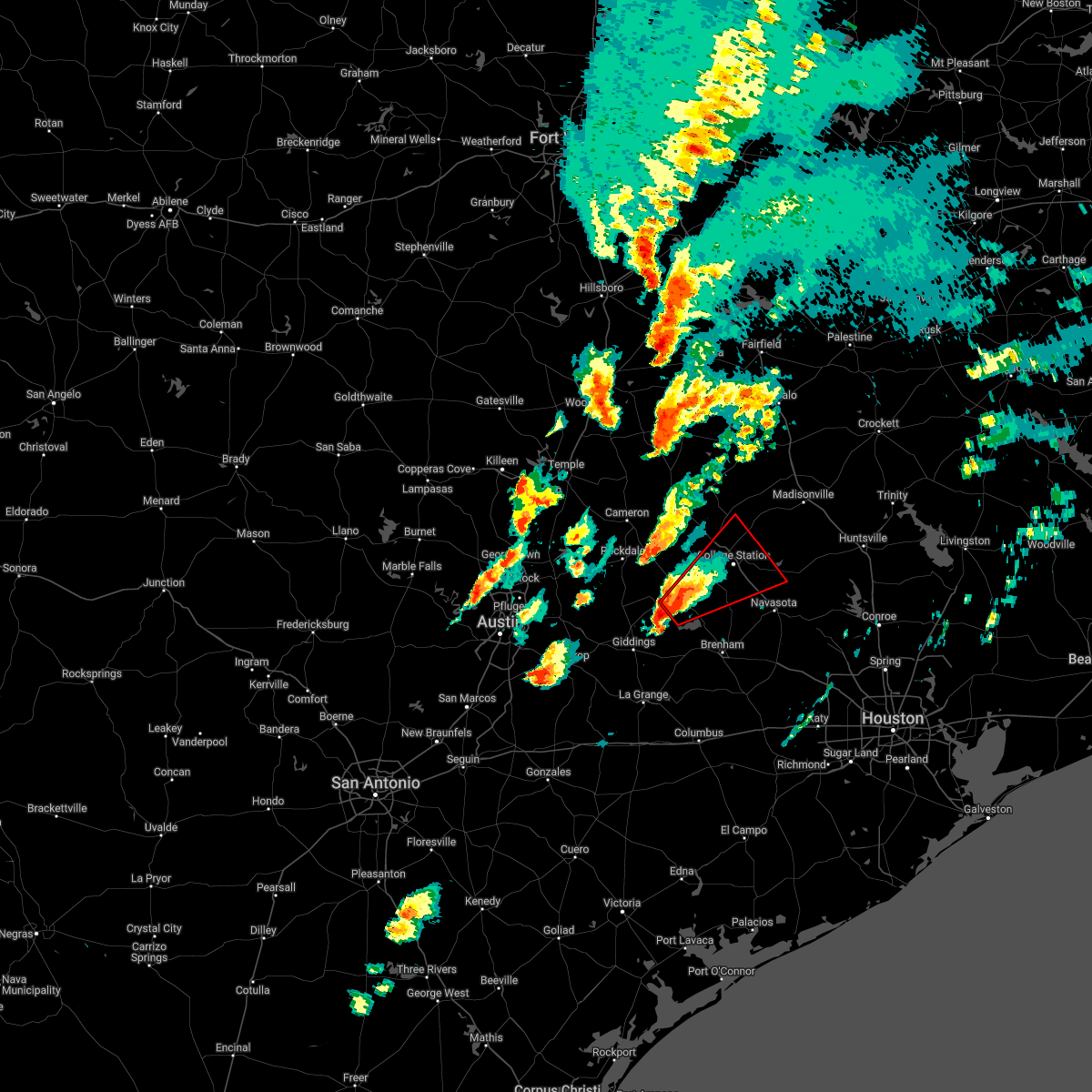 At 808 pm cdt, a severe thunderstorm capable of producing a tornado was located 7 miles northwest of somerville, or 9 miles southeast of caldwell, moving northeast at 40 mph (radar indicated rotation). Hazards include tornado and quarter size hail. Flying debris will be dangerous to those caught without shelter. mobile homes will be damaged or destroyed. damage to roofs, windows, and vehicles will occur. tree damage is likely. this dangerous storm will be near, snook around 825 pm cdt. kyle field around 840 pm cdt. college station, bryan and wixon valley around 850 pm cdt. kurten around 900 pm cdt. Other locations impacted by this tornadic thunderstorm include wellborn, lyons, deanville and carlos. At 808 pm cdt, a severe thunderstorm capable of producing a tornado was located 7 miles northwest of somerville, or 9 miles southeast of caldwell, moving northeast at 40 mph (radar indicated rotation). Hazards include tornado and quarter size hail. Flying debris will be dangerous to those caught without shelter. mobile homes will be damaged or destroyed. damage to roofs, windows, and vehicles will occur. tree damage is likely. this dangerous storm will be near, snook around 825 pm cdt. kyle field around 840 pm cdt. college station, bryan and wixon valley around 850 pm cdt. kurten around 900 pm cdt. Other locations impacted by this tornadic thunderstorm include wellborn, lyons, deanville and carlos.
|
| 3/14/2022 6:53 PM CDT |
 At 652 pm cdt, a severe thunderstorm was located near bryan, moving northeast at 30 to 35 mph (radar indicated). Hazards include 60 mph wind gusts and quarter size hail. Hail damage to vehicles is expected. Expect wind damage to roofs, siding, and trees. At 652 pm cdt, a severe thunderstorm was located near bryan, moving northeast at 30 to 35 mph (radar indicated). Hazards include 60 mph wind gusts and quarter size hail. Hail damage to vehicles is expected. Expect wind damage to roofs, siding, and trees.
|
| 3/14/2022 6:45 PM CDT |
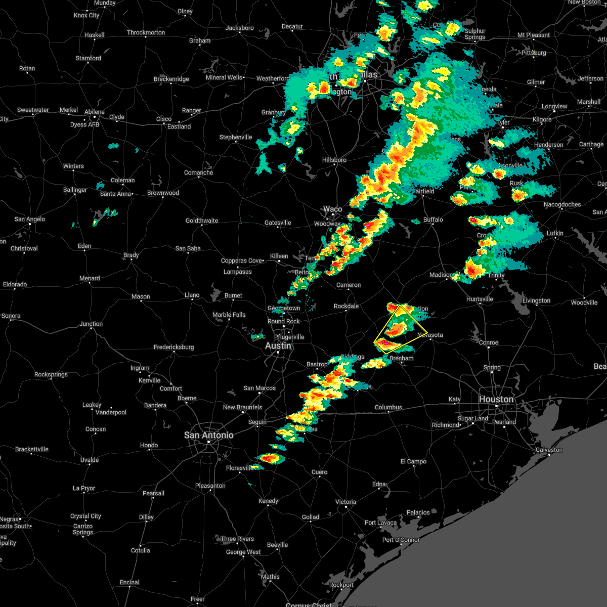 At 644 pm cdt, a severe thunderstorm was located over somerville, or 13 miles southeast of caldwell, moving northeast at 45 mph (radar indicated). Hazards include quarter size hail. damage to vehicles is expected At 644 pm cdt, a severe thunderstorm was located over somerville, or 13 miles southeast of caldwell, moving northeast at 45 mph (radar indicated). Hazards include quarter size hail. damage to vehicles is expected
|
| 5/11/2021 3:09 PM CDT |
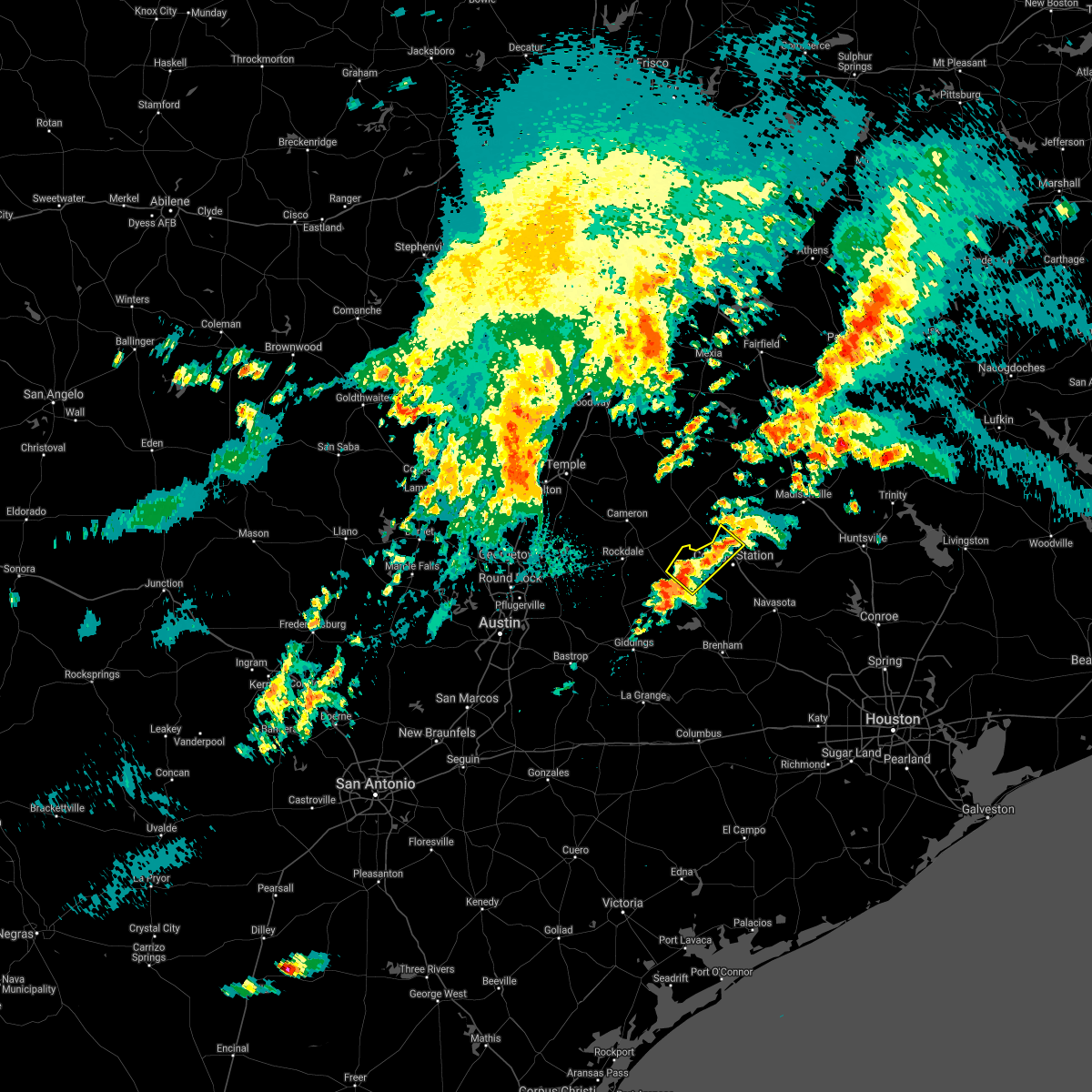 The national weather service in league city has issued a * severe thunderstorm warning for. north central burleson county in southeastern texas. west central brazos county in southeastern texas. until 415 pm cdt. At 309 pm cdt, a severe thunderstorm was located near caldwell,. The national weather service in league city has issued a * severe thunderstorm warning for. north central burleson county in southeastern texas. west central brazos county in southeastern texas. until 415 pm cdt. At 309 pm cdt, a severe thunderstorm was located near caldwell,.
|
| 5/4/2021 8:41 AM CDT |
 The severe thunderstorm warning for north central burleson and northwestern brazos counties will expire at 845 am cdt, the storm which prompted the warning has weakened below severe limits, and has exited the warned area. therefore, the warning will be allowed to expire. however, hail is still possible with this thunderstorm. a severe thunderstorm watch remains in effect until 100 pm cdt for southeastern texas. The severe thunderstorm warning for north central burleson and northwestern brazos counties will expire at 845 am cdt, the storm which prompted the warning has weakened below severe limits, and has exited the warned area. therefore, the warning will be allowed to expire. however, hail is still possible with this thunderstorm. a severe thunderstorm watch remains in effect until 100 pm cdt for southeastern texas.
|
| 5/4/2021 8:17 AM CDT |
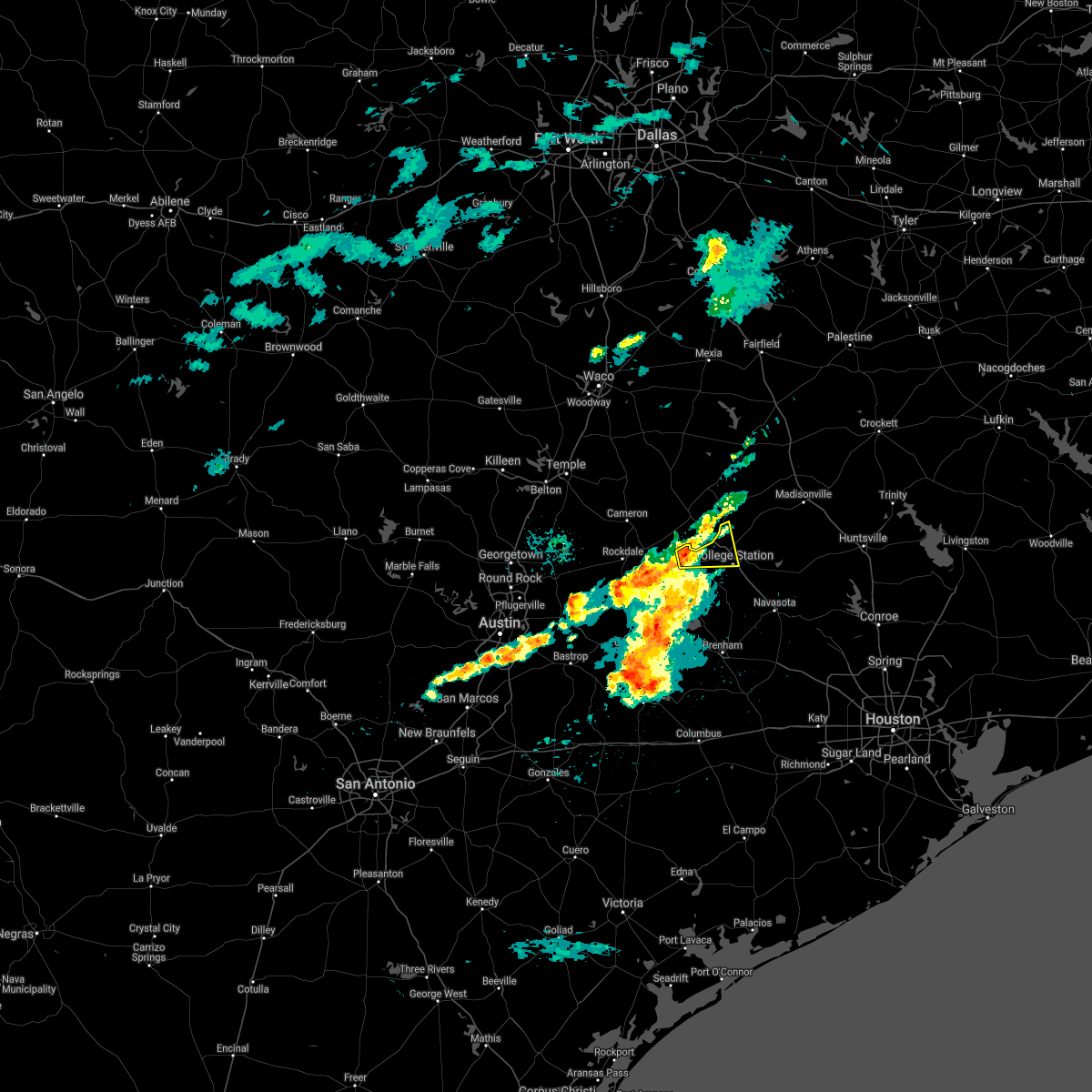 At 816 am cdt, a severe thunderstorm was located 12 miles west of bryan, moving east at 30 mph (radar indicated). Hazards include 60 mph wind gusts and quarter size hail. Hail damage to vehicles is expected. Expect wind damage to roofs, siding, and trees. At 816 am cdt, a severe thunderstorm was located 12 miles west of bryan, moving east at 30 mph (radar indicated). Hazards include 60 mph wind gusts and quarter size hail. Hail damage to vehicles is expected. Expect wind damage to roofs, siding, and trees.
|
| 4/8/2021 9:20 PM CDT |
 At 919 pm cdt, a severe thunderstorm capable of producing a tornado was located over northern college station, moving southeast at 30 mph (radar indicated rotation). Hazards include tornado and baseball size hail. Flying debris will be dangerous to those caught without shelter. mobile homes will be damaged or destroyed. damage to roofs, windows, and vehicles will occur. tree damage is likely. this dangerous storm will be near, millican around 945 pm cdt. Other locations impacted by this tornadic thunderstorm include wellborn and carlos. At 919 pm cdt, a severe thunderstorm capable of producing a tornado was located over northern college station, moving southeast at 30 mph (radar indicated rotation). Hazards include tornado and baseball size hail. Flying debris will be dangerous to those caught without shelter. mobile homes will be damaged or destroyed. damage to roofs, windows, and vehicles will occur. tree damage is likely. this dangerous storm will be near, millican around 945 pm cdt. Other locations impacted by this tornadic thunderstorm include wellborn and carlos.
|
| 4/8/2021 9:10 PM CDT |
 At 909 pm cdt, a severe thunderstorm capable of producing a tornado was located over northwestern bryan, moving southeast at 30 mph (radar indicated rotation). Hazards include tornado and golf ball size hail. Flying debris will be dangerous to those caught without shelter. mobile homes will be damaged or destroyed. damage to roofs, windows, and vehicles will occur. tree damage is likely. this dangerous storm will be near, college station and kyle field around 920 pm cdt. millican around 945 pm cdt. Other locations impacted by this tornadic thunderstorm include wellborn and carlos. At 909 pm cdt, a severe thunderstorm capable of producing a tornado was located over northwestern bryan, moving southeast at 30 mph (radar indicated rotation). Hazards include tornado and golf ball size hail. Flying debris will be dangerous to those caught without shelter. mobile homes will be damaged or destroyed. damage to roofs, windows, and vehicles will occur. tree damage is likely. this dangerous storm will be near, college station and kyle field around 920 pm cdt. millican around 945 pm cdt. Other locations impacted by this tornadic thunderstorm include wellborn and carlos.
|
| 4/8/2021 9:08 PM CDT |
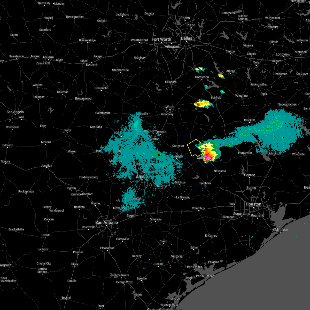 The severe thunderstorm warning for southwestern robertson and east central milam counties will expire at 915 pm cdt, the storm which prompted the warning has moved out of the area. therefore the warning will be allowed to expire. The severe thunderstorm warning for southwestern robertson and east central milam counties will expire at 915 pm cdt, the storm which prompted the warning has moved out of the area. therefore the warning will be allowed to expire.
|
| 4/8/2021 8:58 PM CDT |
 At 857 pm cdt, a severe thunderstorm was located over northwestern bryan, moving southeast at 35 mph (radar indicated). Hazards include ping pong ball size hail. half dollar size hail was just reported at osr and sandy point road. People and animals outdoors will be injured. expect damage to roofs, siding, windows, and vehicles. Locations impacted include, college station, bryan, snook, kurten, wixon valley, millican, kyle field, iola, wellborn and carlos. At 857 pm cdt, a severe thunderstorm was located over northwestern bryan, moving southeast at 35 mph (radar indicated). Hazards include ping pong ball size hail. half dollar size hail was just reported at osr and sandy point road. People and animals outdoors will be injured. expect damage to roofs, siding, windows, and vehicles. Locations impacted include, college station, bryan, snook, kurten, wixon valley, millican, kyle field, iola, wellborn and carlos.
|
| 4/8/2021 8:55 PM CDT |
 At 852 pm cdt, a severe thunderstorm was located over hearne, moving southeast at 35 mph. at 850 pm cdt, half dollar size hail was reported in hearne (trained weather spotters). Hazards include 65 mph wind gusts and half dollar size hail. Hail damage to vehicles is expected. expect wind damage to roofs, siding, and trees. Locations impacted include, hearne and calvert. At 852 pm cdt, a severe thunderstorm was located over hearne, moving southeast at 35 mph. at 850 pm cdt, half dollar size hail was reported in hearne (trained weather spotters). Hazards include 65 mph wind gusts and half dollar size hail. Hail damage to vehicles is expected. expect wind damage to roofs, siding, and trees. Locations impacted include, hearne and calvert.
|
| 4/8/2021 8:39 PM CDT |
 At 838 pm cdt, a severe thunderstorm was located near hearne, moving southeast at 45 mph (radar indicated. this storm has a history of producing large hail). Hazards include ping pong ball size hail. People and animals outdoors will be injured. Expect damage to roofs, siding, windows, and vehicles. At 838 pm cdt, a severe thunderstorm was located near hearne, moving southeast at 45 mph (radar indicated. this storm has a history of producing large hail). Hazards include ping pong ball size hail. People and animals outdoors will be injured. Expect damage to roofs, siding, windows, and vehicles.
|
| 4/8/2021 8:36 PM CDT |
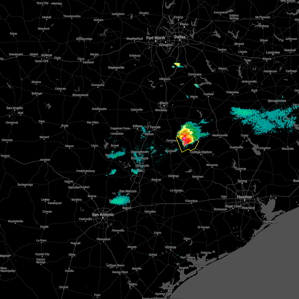 At 835 pm cdt, a severe thunderstorm was located near calvert approaching hearne, moving southeast at 25 mph. this storm has a history of producing large hail (trained weather spotters). Hazards include 65 mph wind gusts and half dollar size hail. Hail damage to vehicles is expected. expect wind damage to roofs, siding, and trees. Locations impacted include, hearne and calvert. At 835 pm cdt, a severe thunderstorm was located near calvert approaching hearne, moving southeast at 25 mph. this storm has a history of producing large hail (trained weather spotters). Hazards include 65 mph wind gusts and half dollar size hail. Hail damage to vehicles is expected. expect wind damage to roofs, siding, and trees. Locations impacted include, hearne and calvert.
|
| 4/8/2021 8:24 PM CDT |
 At 823 pm cdt, a severe thunderstorm was located near calvert, or 10 miles west of hearne, moving southeast at 40 mph. this storm has a history of producing large hail (trained weather spotters). Hazards include 65 mph wind gusts and half dollar size hail. Hail damage to vehicles is expected. expect wind damage to roofs, siding, and trees. Locations impacted include, cameron, hearne, calvert and milano. At 823 pm cdt, a severe thunderstorm was located near calvert, or 10 miles west of hearne, moving southeast at 40 mph. this storm has a history of producing large hail (trained weather spotters). Hazards include 65 mph wind gusts and half dollar size hail. Hail damage to vehicles is expected. expect wind damage to roofs, siding, and trees. Locations impacted include, cameron, hearne, calvert and milano.
|
| 4/8/2021 8:10 PM CDT |
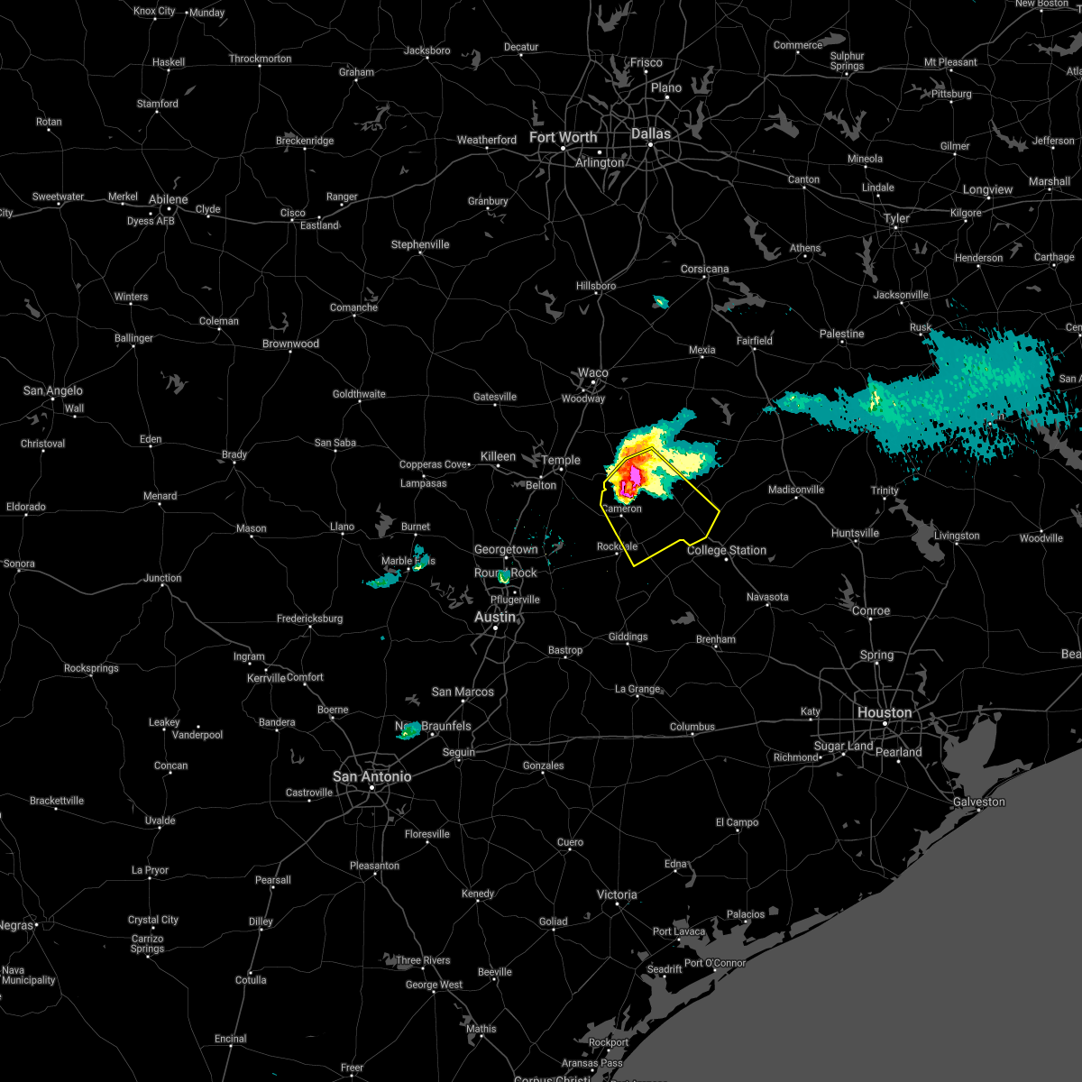 At 810 pm cdt, a severe thunderstorm was located near rosebud, or 13 miles north of cameron, moving southeast at 35 mph. this storm is producing large hail that is covering the ground and has a history of producing wind damage (trained weather spotters). Hazards include two inch hail and 65 mph wind gusts. People and animals outdoors will be injured. expect hail damage to roofs, siding, windows, and vehicles. expect wind damage to roofs, siding, and trees. Locations impacted include, cameron, hearne, rosebud, calvert and milano. At 810 pm cdt, a severe thunderstorm was located near rosebud, or 13 miles north of cameron, moving southeast at 35 mph. this storm is producing large hail that is covering the ground and has a history of producing wind damage (trained weather spotters). Hazards include two inch hail and 65 mph wind gusts. People and animals outdoors will be injured. expect hail damage to roofs, siding, windows, and vehicles. expect wind damage to roofs, siding, and trees. Locations impacted include, cameron, hearne, rosebud, calvert and milano.
|
| 4/8/2021 7:57 PM CDT |
 At 757 pm cdt, a severe thunderstorm was located near rosebud, or 12 miles south of marlin, moving southeast at 35 mph (trained weather spotters). Hazards include golf ball size hail and 65 mph wind gusts. People and animals outdoors will be injured. expect hail damage to roofs, siding, windows, and vehicles. Expect wind damage to roofs, siding, and trees. At 757 pm cdt, a severe thunderstorm was located near rosebud, or 12 miles south of marlin, moving southeast at 35 mph (trained weather spotters). Hazards include golf ball size hail and 65 mph wind gusts. People and animals outdoors will be injured. expect hail damage to roofs, siding, windows, and vehicles. Expect wind damage to roofs, siding, and trees.
|
| 3/23/2021 12:51 AM CDT |
 The severe thunderstorm warning for southern robertson and southeastern milam counties will expire at 100 am cdt, the storm which prompted the warning has moved out of the area. therefore the warning will be allowed to expire. however gusty winds are still possible with this thunderstorm. The severe thunderstorm warning for southern robertson and southeastern milam counties will expire at 100 am cdt, the storm which prompted the warning has moved out of the area. therefore the warning will be allowed to expire. however gusty winds are still possible with this thunderstorm.
|
| 3/23/2021 12:43 AM CDT |
 At 1243 am cdt, a severe thunderstorm was located over wixon valley, or 8 miles northeast of bryan, moving east at 40 mph (radar indicated). Hazards include 60 mph wind gusts and penny size hail. expect damage to roofs, siding, and trees At 1243 am cdt, a severe thunderstorm was located over wixon valley, or 8 miles northeast of bryan, moving east at 40 mph (radar indicated). Hazards include 60 mph wind gusts and penny size hail. expect damage to roofs, siding, and trees
|
| 3/23/2021 12:35 AM CDT |
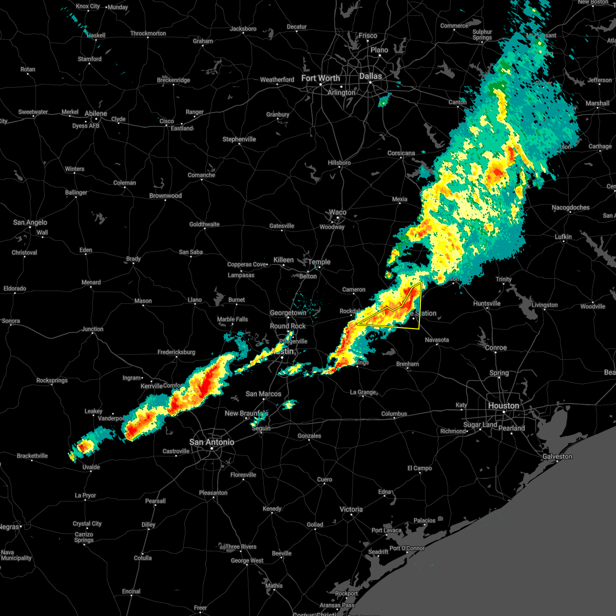 At 1235 am cdt, a severe thunderstorm was located near bryan, moving east at 40 mph (radar indicated). Hazards include 60 mph wind gusts and quarter size hail. Hail damage to vehicles is expected. expect wind damage to roofs, siding, and trees. Locations impacted include, college station, bryan, kurten, wixon valley, kyle field, wellborn and chriesman. At 1235 am cdt, a severe thunderstorm was located near bryan, moving east at 40 mph (radar indicated). Hazards include 60 mph wind gusts and quarter size hail. Hail damage to vehicles is expected. expect wind damage to roofs, siding, and trees. Locations impacted include, college station, bryan, kurten, wixon valley, kyle field, wellborn and chriesman.
|
| 3/23/2021 12:30 AM CDT |
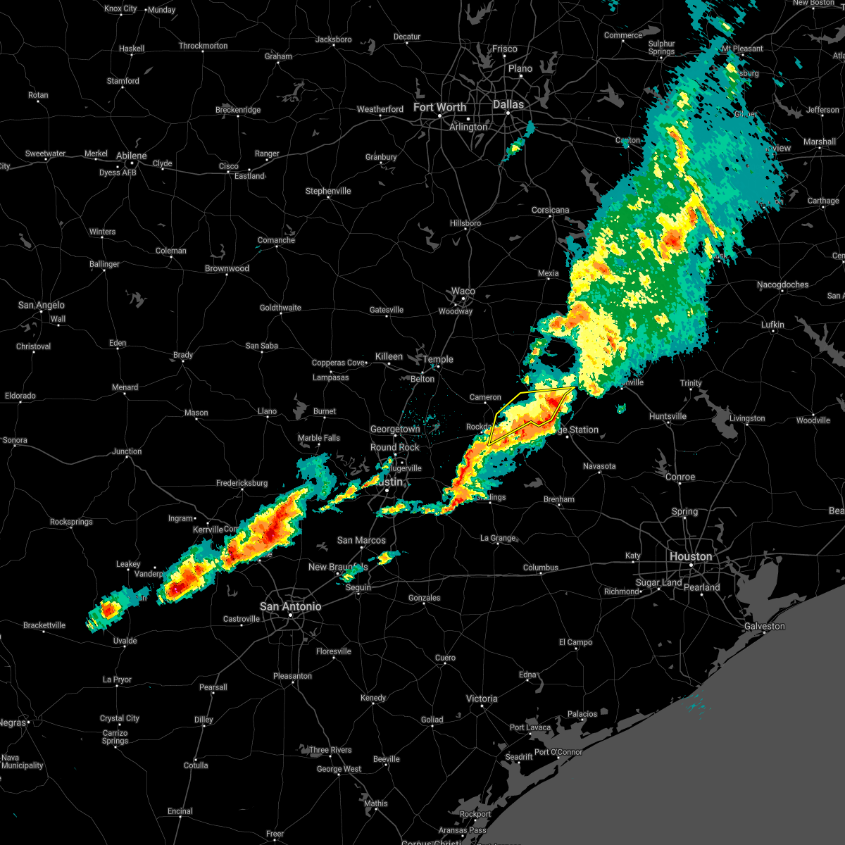 At 1229 am cdt, a severe thunderstorm was located over southeast milam and southwest robertson counties, moving east at 35 mph (radar indicated). Hazards include 60 mph wind gusts and quarter size hail. Hail damage to vehicles is expected. expect wind damage to roofs, siding, and trees. Locations impacted include, mumford, benchley, hearne and milano. At 1229 am cdt, a severe thunderstorm was located over southeast milam and southwest robertson counties, moving east at 35 mph (radar indicated). Hazards include 60 mph wind gusts and quarter size hail. Hail damage to vehicles is expected. expect wind damage to roofs, siding, and trees. Locations impacted include, mumford, benchley, hearne and milano.
|
| 3/23/2021 12:27 AM CDT |
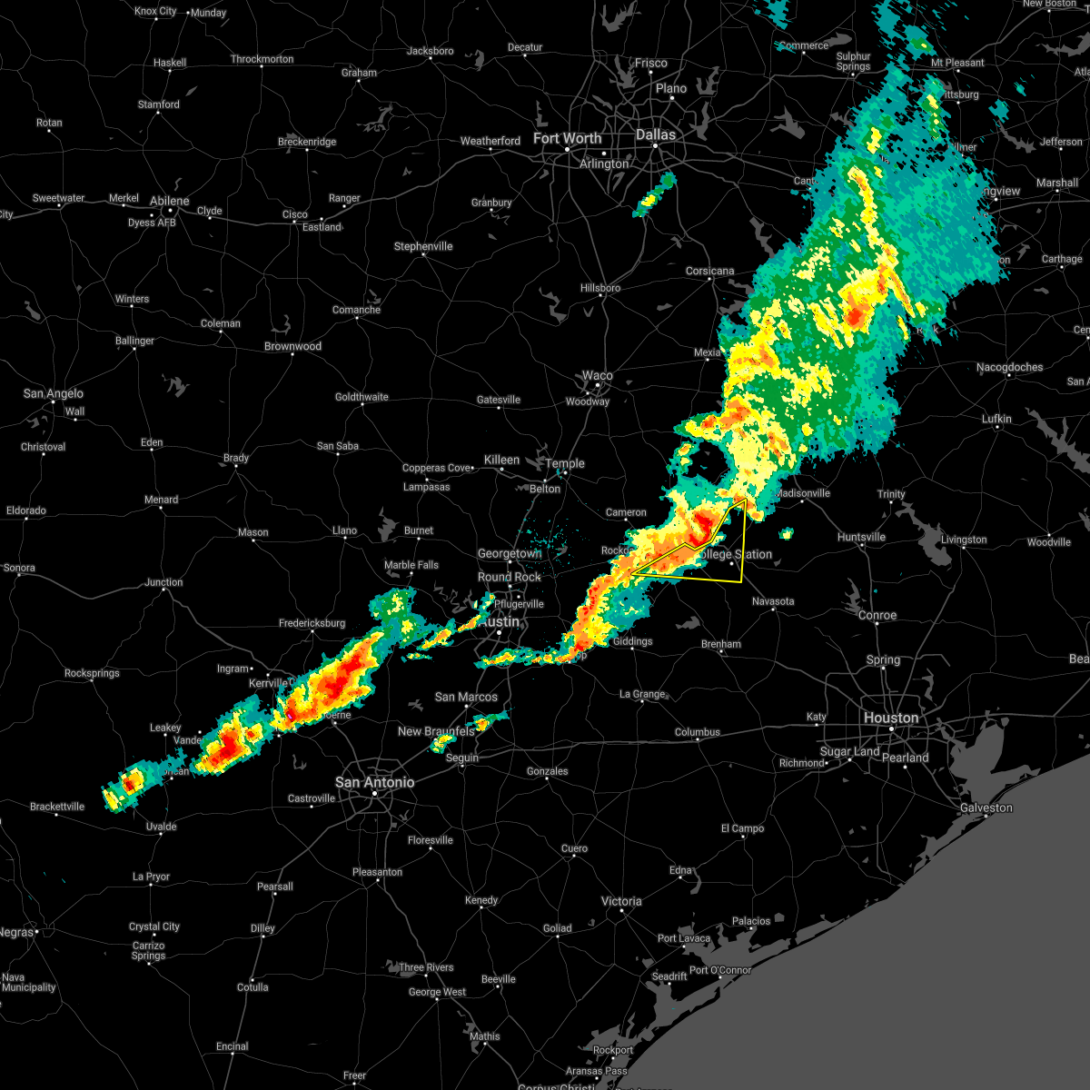 At 1227 am cdt, a severe thunderstorm was located 10 miles northwest of bryan, moving east at 40 mph (radar indicated). Hazards include 60 mph wind gusts and quarter size hail. Hail damage to vehicles is expected. expect wind damage to roofs, siding, and trees. Locations impacted include, college station, bryan, kurten, wixon valley, kyle field, wellborn and chriesman. At 1227 am cdt, a severe thunderstorm was located 10 miles northwest of bryan, moving east at 40 mph (radar indicated). Hazards include 60 mph wind gusts and quarter size hail. Hail damage to vehicles is expected. expect wind damage to roofs, siding, and trees. Locations impacted include, college station, bryan, kurten, wixon valley, kyle field, wellborn and chriesman.
|
| 3/23/2021 12:12 AM CDT |
 At 1210 am cdt, a severe thunderstorm was located over southern milam and southwestern robertson county, moving east at 40 mph (radar indicated). Hazards include 60 mph wind gusts and quarter size hail. Hail damage to vehicles is expected. expect wind damage to roofs, siding, and trees. Locations impacted include, hearne, gause, mumford, wheelock, benchley, rockdale, and milano. At 1210 am cdt, a severe thunderstorm was located over southern milam and southwestern robertson county, moving east at 40 mph (radar indicated). Hazards include 60 mph wind gusts and quarter size hail. Hail damage to vehicles is expected. expect wind damage to roofs, siding, and trees. Locations impacted include, hearne, gause, mumford, wheelock, benchley, rockdale, and milano.
|
| 3/22/2021 11:57 PM CDT |
 The national weather service in league city has issued a * severe thunderstorm warning for. northern burleson county in southeastern texas. central brazos county in southeastern texas. until 1245 am cdt. At 1157 pm cdt, a severe thunderstorm was located 10 miles. The national weather service in league city has issued a * severe thunderstorm warning for. northern burleson county in southeastern texas. central brazos county in southeastern texas. until 1245 am cdt. At 1157 pm cdt, a severe thunderstorm was located 10 miles.
|
| 3/22/2021 11:53 PM CDT |
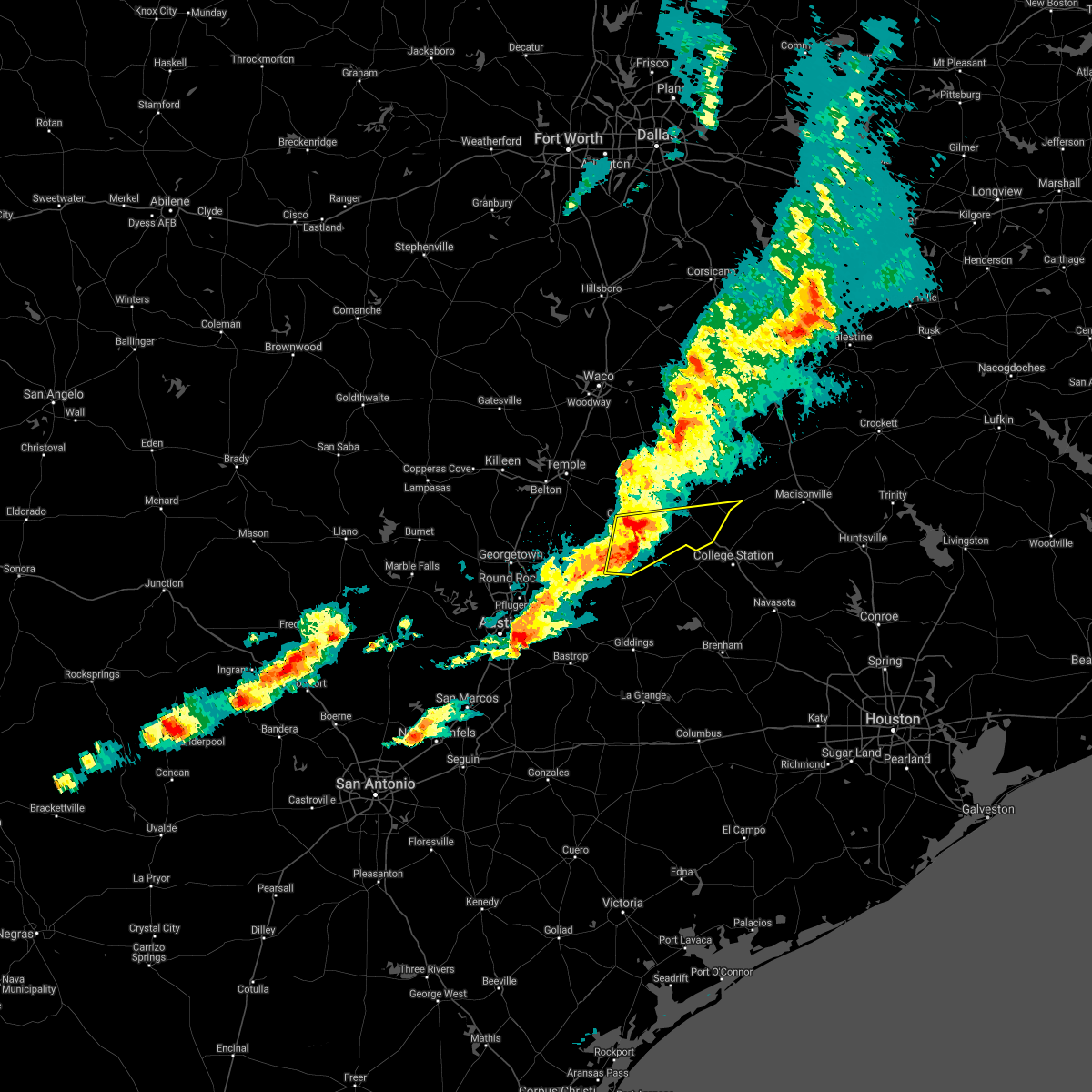 The national weather service in fort worth has issued a * severe thunderstorm warning for. southern robertson county in central texas. central milam county in central texas. until 100 am cdt. At 1151 pm cdt, a severe thunderstorm was located near rockdale,. The national weather service in fort worth has issued a * severe thunderstorm warning for. southern robertson county in central texas. central milam county in central texas. until 100 am cdt. At 1151 pm cdt, a severe thunderstorm was located near rockdale,.
|
| 7/28/2020 3:38 PM CDT |
 The national weather service in league city has issued a * severe thunderstorm warning for. northeastern burleson county in southeastern texas. west central brazos county in southeastern texas. until 430 pm cdt. At 337 pm cdt, a severe thunderstorm was located near kyle field,. The national weather service in league city has issued a * severe thunderstorm warning for. northeastern burleson county in southeastern texas. west central brazos county in southeastern texas. until 430 pm cdt. At 337 pm cdt, a severe thunderstorm was located near kyle field,.
|
| 5/27/2020 2:28 PM CDT |
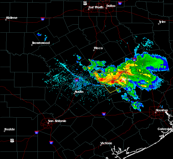 At 227 pm cdt, a cluster of severe thunderstorms were located along a line extending from 7 miles east of rockdale to 12 miles northeast of caldwell, moving south at 25 mph (radar indicated). Hazards include 65 mph wind gusts and half dollar size hail. Hail damage to vehicles is expected. Expect wind damage to roofs, siding, and trees. At 227 pm cdt, a cluster of severe thunderstorms were located along a line extending from 7 miles east of rockdale to 12 miles northeast of caldwell, moving south at 25 mph (radar indicated). Hazards include 65 mph wind gusts and half dollar size hail. Hail damage to vehicles is expected. Expect wind damage to roofs, siding, and trees.
|
| 5/27/2020 2:14 PM CDT |
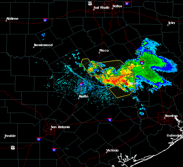 At 214 pm cdt, severe thunderstorms were located along a line extending from near franklin to 9 miles southeast of cameron, moving southeast at 45 mph (radar indicated). Hazards include 60 mph wind gusts and half dollar size hail. Hail damage to vehicles is expected. expect wind damage to roofs, siding, and trees. Locations impacted include, college station, bryan, caldwell, snook, kurten, wixon valley, kyle field, wellborn, deanville and chriesman. At 214 pm cdt, severe thunderstorms were located along a line extending from near franklin to 9 miles southeast of cameron, moving southeast at 45 mph (radar indicated). Hazards include 60 mph wind gusts and half dollar size hail. Hail damage to vehicles is expected. expect wind damage to roofs, siding, and trees. Locations impacted include, college station, bryan, caldwell, snook, kurten, wixon valley, kyle field, wellborn, deanville and chriesman.
|
| 5/27/2020 2:06 PM CDT |
 At 205 pm cdt, a severe thunderstorm was located 12 miles southwest of hearne, moving southeast at 40 mph (off duty nws employee reported 70 mph winds near bremond). Hazards include golf ball size hail and 70 mph wind gusts. People and animals outdoors will be injured. expect hail damage to roofs, siding, windows, and vehicles. expect considerable tree damage. wind damage is also likely to mobile homes, roofs, and outbuildings. Locations impacted include, mumford, rockdale, cameron, hearne, buckholts and milano. At 205 pm cdt, a severe thunderstorm was located 12 miles southwest of hearne, moving southeast at 40 mph (off duty nws employee reported 70 mph winds near bremond). Hazards include golf ball size hail and 70 mph wind gusts. People and animals outdoors will be injured. expect hail damage to roofs, siding, windows, and vehicles. expect considerable tree damage. wind damage is also likely to mobile homes, roofs, and outbuildings. Locations impacted include, mumford, rockdale, cameron, hearne, buckholts and milano.
|
| 5/27/2020 1:45 PM CDT |
 At 145 pm cdt, severe thunderstorms were located along a line extending from 7 miles northwest of franklin to cameron, moving southeast at 50 mph (radar indicated). Hazards include golf ball size hail and 60 mph wind gusts. People and animals outdoors will be injured. expect hail damage to roofs, siding, windows, and vehicles. Expect wind damage to roofs, siding, and trees. At 145 pm cdt, severe thunderstorms were located along a line extending from 7 miles northwest of franklin to cameron, moving southeast at 50 mph (radar indicated). Hazards include golf ball size hail and 60 mph wind gusts. People and animals outdoors will be injured. expect hail damage to roofs, siding, windows, and vehicles. Expect wind damage to roofs, siding, and trees.
|
| 5/27/2020 1:43 PM CDT |
 At 142 pm cdt, a severe thunderstorm was located near ben arnold, moving southeast at 40 mph (public reported golf ball size hail near rosebud). Hazards include golf ball size hail and 65 mph wind gusts. People and animals outdoors will be injured. expect hail damage to roofs, siding, windows, and vehicles. expect wind damage to roofs, siding, and trees. Locations impacted include, ben arnold, burlington, rockdale, cameron, hearne, buckholts and milano. At 142 pm cdt, a severe thunderstorm was located near ben arnold, moving southeast at 40 mph (public reported golf ball size hail near rosebud). Hazards include golf ball size hail and 65 mph wind gusts. People and animals outdoors will be injured. expect hail damage to roofs, siding, windows, and vehicles. expect wind damage to roofs, siding, and trees. Locations impacted include, ben arnold, burlington, rockdale, cameron, hearne, buckholts and milano.
|
| 5/27/2020 1:32 PM CDT |
 At 132 pm cdt, a severe thunderstorm was located near rosebud, or 10 miles north of cameron, moving southeast at 40 mph (radar indicated). Hazards include 60 mph wind gusts and quarter size hail. Hail damage to vehicles is expected. Expect wind damage to roofs, siding, and trees. At 132 pm cdt, a severe thunderstorm was located near rosebud, or 10 miles north of cameron, moving southeast at 40 mph (radar indicated). Hazards include 60 mph wind gusts and quarter size hail. Hail damage to vehicles is expected. Expect wind damage to roofs, siding, and trees.
|
| 4/29/2020 4:40 AM CDT |
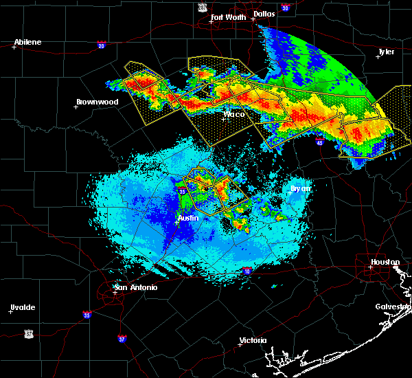 At 440 am cdt, severe thunderstorms were located along a line extending from calvert to near hearne moving southeast at 35 mph (radar indicated). Hazards include 60 mph wind gusts and quarter size hail. Hail damage to vehicles is expected. expect wind damage to roofs, siding, and trees. Locations impacted include, hearne and calvert. At 440 am cdt, severe thunderstorms were located along a line extending from calvert to near hearne moving southeast at 35 mph (radar indicated). Hazards include 60 mph wind gusts and quarter size hail. Hail damage to vehicles is expected. expect wind damage to roofs, siding, and trees. Locations impacted include, hearne and calvert.
|
| 4/29/2020 4:34 AM CDT |
 At 433 am cdt, severe thunderstorms were located along a line extending from calvert to hearne moving southeast at 40 mph (radar indicated). Hazards include 60 mph wind gusts and quarter size hail. Hail damage to vehicles is expected. Expect wind damage to roofs, siding, and trees. At 433 am cdt, severe thunderstorms were located along a line extending from calvert to hearne moving southeast at 40 mph (radar indicated). Hazards include 60 mph wind gusts and quarter size hail. Hail damage to vehicles is expected. Expect wind damage to roofs, siding, and trees.
|
| 4/29/2020 4:31 AM CDT |
 At 431 am cdt, a severe thunderstorm was located 12 miles north of caldwell, moving southeast at 35 mph (radar indicated). Hazards include 60 mph wind gusts and quarter size hail. Hail damage to vehicles is expected. Expect wind damage to roofs, siding, and trees. At 431 am cdt, a severe thunderstorm was located 12 miles north of caldwell, moving southeast at 35 mph (radar indicated). Hazards include 60 mph wind gusts and quarter size hail. Hail damage to vehicles is expected. Expect wind damage to roofs, siding, and trees.
|
| 4/29/2020 3:35 AM CDT |
 At 335 am cdt, severe thunderstorms were located along a line extending from near livingston to 9 miles east of new waverly to 9 miles north of anderson to 9 miles northwest of bryan to 7 miles south of calvert, moving south at 35 mph (radar indicated). Hazards include 60 mph wind gusts and quarter size hail. Hail damage to vehicles is expected. Expect wind damage to roofs, siding, and trees. At 335 am cdt, severe thunderstorms were located along a line extending from near livingston to 9 miles east of new waverly to 9 miles north of anderson to 9 miles northwest of bryan to 7 miles south of calvert, moving south at 35 mph (radar indicated). Hazards include 60 mph wind gusts and quarter size hail. Hail damage to vehicles is expected. Expect wind damage to roofs, siding, and trees.
|
| 4/29/2020 2:50 AM CDT |
 At 249 am cdt, severe thunderstorms were located along a line extending from near lufkin to near trinity to 13 miles northwest of riverside to 9 miles northwest of madisonville to 9 miles north of franklin, moving south at 45 mph (radar indicated). Hazards include 60 mph wind gusts and quarter size hail. Hail damage to vehicles is expected. Expect wind damage to roofs, siding, and trees. At 249 am cdt, severe thunderstorms were located along a line extending from near lufkin to near trinity to 13 miles northwest of riverside to 9 miles northwest of madisonville to 9 miles north of franklin, moving south at 45 mph (radar indicated). Hazards include 60 mph wind gusts and quarter size hail. Hail damage to vehicles is expected. Expect wind damage to roofs, siding, and trees.
|
| 4/22/2020 3:58 PM CDT |
 At 357 pm cdt, a severe thunderstorm was located near kurten, or 15 miles northeast of bryan, moving northeast at 50 mph (radar indicated). Hazards include 60 mph wind gusts and quarter size hail. Hail damage to vehicles is expected. Expect wind damage to roofs, siding, and trees. At 357 pm cdt, a severe thunderstorm was located near kurten, or 15 miles northeast of bryan, moving northeast at 50 mph (radar indicated). Hazards include 60 mph wind gusts and quarter size hail. Hail damage to vehicles is expected. Expect wind damage to roofs, siding, and trees.
|
| 4/22/2020 3:18 PM CDT |
 At 317 pm cdt, a severe thunderstorm was located west of bryan college station, moving northeast at 50 mph (radar indicated). Hazards include 60 mph wind gusts and quarter size hail. Hail damage to vehicles is expected. Expect wind damage to roofs, siding, and trees. At 317 pm cdt, a severe thunderstorm was located west of bryan college station, moving northeast at 50 mph (radar indicated). Hazards include 60 mph wind gusts and quarter size hail. Hail damage to vehicles is expected. Expect wind damage to roofs, siding, and trees.
|
| 4/9/2020 4:15 PM CDT |
 At 413 pm cdt, a severe thunderstorm was located over somerville, or 14 miles southeast of caldwell, moving east at 45 mph (radar indicated). Hazards include 70 mph wind gusts and quarter size hail. Hail damage to vehicles is expected. expect considerable tree damage. Wind damage is also likely to mobile homes, roofs, and outbuildings. At 413 pm cdt, a severe thunderstorm was located over somerville, or 14 miles southeast of caldwell, moving east at 45 mph (radar indicated). Hazards include 70 mph wind gusts and quarter size hail. Hail damage to vehicles is expected. expect considerable tree damage. Wind damage is also likely to mobile homes, roofs, and outbuildings.
|
| 3/4/2020 9:06 AM CST |
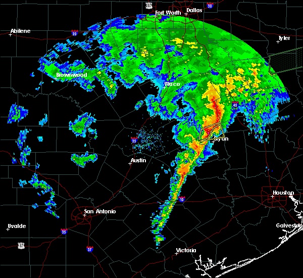 At 905 am cst, a severe thunderstorm was located near kurten, or 12 miles north of bryan, moving east at 50 mph (radar indicated). Hazards include two inch hail and 60 mph wind gusts. People and animals outdoors will be injured. expect hail damage to roofs, siding, windows, and vehicles. expect wind damage to roofs, siding, and trees. Locations impacted include, kurten and wixon valley. At 905 am cst, a severe thunderstorm was located near kurten, or 12 miles north of bryan, moving east at 50 mph (radar indicated). Hazards include two inch hail and 60 mph wind gusts. People and animals outdoors will be injured. expect hail damage to roofs, siding, windows, and vehicles. expect wind damage to roofs, siding, and trees. Locations impacted include, kurten and wixon valley.
|
| 3/4/2020 9:03 AM CST |
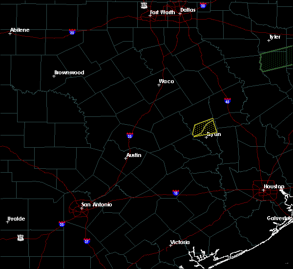 At 901 am cst, a severe thunderstorm was located 8 miles southeast of hearne, moving east at 30 mph (radar indicated). Hazards include 60 mph wind gusts and half dollar size hail. Hail damage to vehicles is expected. expect wind damage to roofs, siding, and trees. This severe thunderstorm will impact the communities of benchley, mumford, and wheelock. At 901 am cst, a severe thunderstorm was located 8 miles southeast of hearne, moving east at 30 mph (radar indicated). Hazards include 60 mph wind gusts and half dollar size hail. Hail damage to vehicles is expected. expect wind damage to roofs, siding, and trees. This severe thunderstorm will impact the communities of benchley, mumford, and wheelock.
|
| 3/4/2020 8:53 AM CST |
 At 851 am cst, a severe thunderstorm was located 8 miles southeast of hearne, moving east at 50 mph (radar indicated). Hazards include 60 mph wind gusts and quarter size hail. Hail damage to vehicles is expected. Expect wind damage to roofs, siding, and trees. At 851 am cst, a severe thunderstorm was located 8 miles southeast of hearne, moving east at 50 mph (radar indicated). Hazards include 60 mph wind gusts and quarter size hail. Hail damage to vehicles is expected. Expect wind damage to roofs, siding, and trees.
|
| 3/4/2020 8:41 AM CST |
 At 840 am cst, a severe thunderstorm was located 8 miles south of hearne, moving east at 35 mph (radar indicated). Hazards include 60 mph wind gusts and nickel size hail. expect damage to roofs, siding, and trees At 840 am cst, a severe thunderstorm was located 8 miles south of hearne, moving east at 35 mph (radar indicated). Hazards include 60 mph wind gusts and nickel size hail. expect damage to roofs, siding, and trees
|
| 1/10/2020 9:40 PM CST |
 At 940 pm cst, severe thunderstorms were located along a line extending from 7 miles southwest of hearne to 6 miles west of fayetteville, moving northeast at 60 mph. the most severe part of the line of storms is near caldwell (radar indicated). Hazards include 70 mph wind gusts. Expect considerable tree damage. damage is likely to mobile homes, roofs, and outbuildings. Locations impacted include, college station, bryan, brenham, navasota, caldwell, washington, shelby, somerville, snook, kurten, burton, wixon valley, millican, lake somerville dam, kyle field, lake somerville state park & trailway, iola, carmine, lyons and north zulch. At 940 pm cst, severe thunderstorms were located along a line extending from 7 miles southwest of hearne to 6 miles west of fayetteville, moving northeast at 60 mph. the most severe part of the line of storms is near caldwell (radar indicated). Hazards include 70 mph wind gusts. Expect considerable tree damage. damage is likely to mobile homes, roofs, and outbuildings. Locations impacted include, college station, bryan, brenham, navasota, caldwell, washington, shelby, somerville, snook, kurten, burton, wixon valley, millican, lake somerville dam, kyle field, lake somerville state park & trailway, iola, carmine, lyons and north zulch.
|
| 1/10/2020 9:25 PM CST |
 At 924 pm cst, severe thunderstorms were located along a line extending from 8 miles east of rockdale to near muldoon, moving northeast at 55 mph (radar indicated). Hazards include 60 mph wind gusts. expect damage to roofs, siding, and trees At 924 pm cst, severe thunderstorms were located along a line extending from 8 miles east of rockdale to near muldoon, moving northeast at 55 mph (radar indicated). Hazards include 60 mph wind gusts. expect damage to roofs, siding, and trees
|
| 9/10/2019 4:38 PM CDT |
 A severe thunderstorm warning remains in effect until 445 pm cdt for northeastern burleson and brazos counties. at 437 pm cdt, a severe thunderstorm was located near wixon valley, or 7 miles northwest of bryan, moving northwest at 25 mph. hazard. 60 mph wind gusts and quarter size hail. source. Radar indicated. A severe thunderstorm warning remains in effect until 445 pm cdt for northeastern burleson and brazos counties. at 437 pm cdt, a severe thunderstorm was located near wixon valley, or 7 miles northwest of bryan, moving northwest at 25 mph. hazard. 60 mph wind gusts and quarter size hail. source. Radar indicated.
|
| 9/10/2019 4:22 PM CDT |
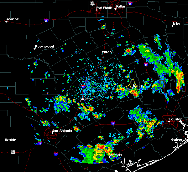 The national weather service in league city has issued a * severe thunderstorm warning for. northeastern burleson county in southeastern texas. west central grimes county in southeastern texas. brazos county in southeastern texas. Until 445 pm cdt. The national weather service in league city has issued a * severe thunderstorm warning for. northeastern burleson county in southeastern texas. west central grimes county in southeastern texas. brazos county in southeastern texas. Until 445 pm cdt.
|
| 9/10/2019 4:17 PM CDT |
 The national weather service in league city has issued a * severe thunderstorm warning for. northeastern burleson county in southeastern texas. central brazos county in southeastern texas. until 445 pm cdt. At 417 pm cdt, a severe thunderstorm was located over southeastern. The national weather service in league city has issued a * severe thunderstorm warning for. northeastern burleson county in southeastern texas. central brazos county in southeastern texas. until 445 pm cdt. At 417 pm cdt, a severe thunderstorm was located over southeastern.
|
| 6/20/2019 4:40 AM CDT |
 At 440 am cdt, a severe thunderstorm was located near bremond, moving southeast at 25 mph (radar indicated). Hazards include half dollar size hail. damage to vehicles is possible At 440 am cdt, a severe thunderstorm was located near bremond, moving southeast at 25 mph (radar indicated). Hazards include half dollar size hail. damage to vehicles is possible
|
| 6/16/2019 9:06 PM CDT |
 At 905 pm cdt, a severe thunderstorm was located 9 miles southeast of hearne, moving east at 25 mph (radar indicated). Hazards include 60 mph wind gusts and penny size hail. minor damage to roofs, siding, and trees possible At 905 pm cdt, a severe thunderstorm was located 9 miles southeast of hearne, moving east at 25 mph (radar indicated). Hazards include 60 mph wind gusts and penny size hail. minor damage to roofs, siding, and trees possible
|
| 6/16/2019 4:58 PM CDT |
 At 457 pm cdt, a severe thunderstorm was located 11 miles northeast of caldwell, with a second storm south of wellborn, moving north at 25 mph (radar indicated). Hazards include 60 mph wind gusts and quarter size hail. Hail damage to vehicles is expected. expect wind damage to roofs, siding, and trees. Locations impacted include, college station, bryan, caldwell, snook, kyle field and wellborn. At 457 pm cdt, a severe thunderstorm was located 11 miles northeast of caldwell, with a second storm south of wellborn, moving north at 25 mph (radar indicated). Hazards include 60 mph wind gusts and quarter size hail. Hail damage to vehicles is expected. expect wind damage to roofs, siding, and trees. Locations impacted include, college station, bryan, caldwell, snook, kyle field and wellborn.
|
| 6/16/2019 4:43 PM CDT |
 At 442 pm cdt, a severe thunderstorm was located near caldwell, with a second rapidly developing thunderstorm east of snook, moving north at 25 mph (radar indicated). Hazards include 60 mph wind gusts and quarter size hail. Hail damage to vehicles is expected. Expect wind damage to roofs, siding, and trees. At 442 pm cdt, a severe thunderstorm was located near caldwell, with a second rapidly developing thunderstorm east of snook, moving north at 25 mph (radar indicated). Hazards include 60 mph wind gusts and quarter size hail. Hail damage to vehicles is expected. Expect wind damage to roofs, siding, and trees.
|
| 5/8/2019 2:08 PM CDT |
 At 207 pm cdt, a line of severe thunderstorms was centered 11 miles northeast of kurten, or 12 miles southwest of madisonville, moving east at 55 mph (radar indicated). Hazards include 60 mph wind gusts. Expect damage to roofs, siding, and trees. the line has a history of downing trees. Locations impacted include, college station, bryan, madisonville, kurten, wixon valley, kyle field, iola and north zulch. At 207 pm cdt, a line of severe thunderstorms was centered 11 miles northeast of kurten, or 12 miles southwest of madisonville, moving east at 55 mph (radar indicated). Hazards include 60 mph wind gusts. Expect damage to roofs, siding, and trees. the line has a history of downing trees. Locations impacted include, college station, bryan, madisonville, kurten, wixon valley, kyle field, iola and north zulch.
|
| 5/8/2019 1:41 PM CDT |
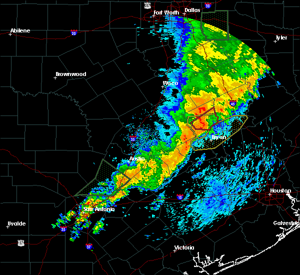 At 140 pm cdt, a line of severe thunderstorms was located near franklin, or 10 miles northeast of hearne, moving east at 45 mph (radar indicated). Hazards include 60 mph wind gusts. expect damage to roofs, siding, and trees At 140 pm cdt, a line of severe thunderstorms was located near franklin, or 10 miles northeast of hearne, moving east at 45 mph (radar indicated). Hazards include 60 mph wind gusts. expect damage to roofs, siding, and trees
|
| 5/8/2019 1:31 PM CDT |
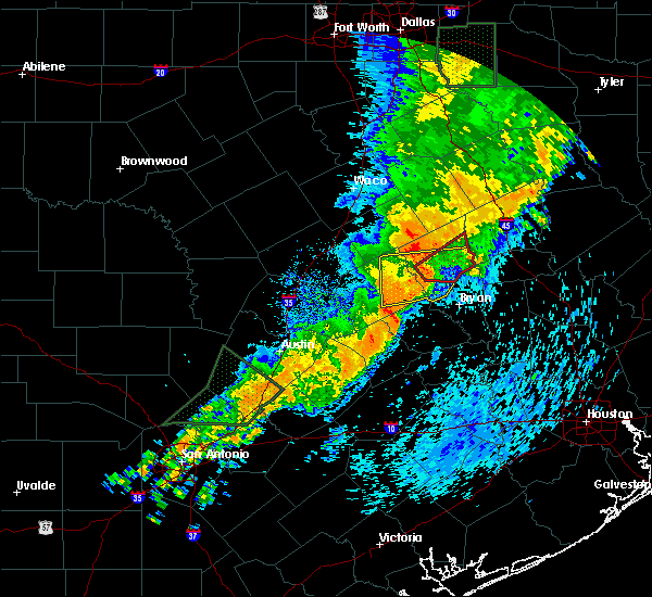 At 130 pm cdt, a severe thunderstorm was located over calvert, or 7 miles north of hearne, moving east at 40 mph (radar indicated). Hazards include 60 mph wind gusts. Expect damage to roofs, siding, and trees. Locations impacted include, hearne, franklin and calvert. At 130 pm cdt, a severe thunderstorm was located over calvert, or 7 miles north of hearne, moving east at 40 mph (radar indicated). Hazards include 60 mph wind gusts. Expect damage to roofs, siding, and trees. Locations impacted include, hearne, franklin and calvert.
|
| 5/8/2019 1:07 PM CDT |
 At 107 pm cdt, a severe thunderstorm was located 9 miles southeast of rosebud, or 9 miles northeast of cameron, moving east at 40 mph (radar indicated). Hazards include 60 mph wind gusts. expect damage to roofs, siding, and trees At 107 pm cdt, a severe thunderstorm was located 9 miles southeast of rosebud, or 9 miles northeast of cameron, moving east at 40 mph (radar indicated). Hazards include 60 mph wind gusts. expect damage to roofs, siding, and trees
|
| 4/24/2019 5:41 PM CDT |
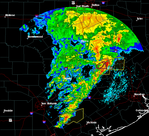 The severe thunderstorm warning for northeastern burleson and brazos counties will expire at 545 pm cdt, the storm which prompted the warning has moved out of the area. this storm is still showing that it is severe and is being replaced by a new warning, severe thunderstorm warning 63. a severe thunderstorm watch remains in effect until 1000 pm cdt for southeastern texas. The severe thunderstorm warning for northeastern burleson and brazos counties will expire at 545 pm cdt, the storm which prompted the warning has moved out of the area. this storm is still showing that it is severe and is being replaced by a new warning, severe thunderstorm warning 63. a severe thunderstorm watch remains in effect until 1000 pm cdt for southeastern texas.
|
| 4/24/2019 5:35 PM CDT | Golf Ball sized hail reported 2.2 miles S of Lake Bryan, TX, public report of hail estimated to golf ball size just se of hwy 6 and osr. |
| 4/24/2019 5:28 PM CDT |
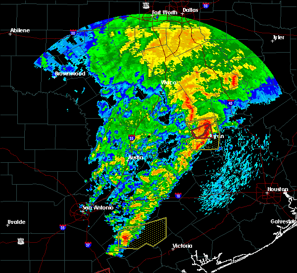 At 527 pm cdt, a severe squall line capable of producing both tornadoes and straight line wind damage was located 8 miles south of hearne, moving east at 20 mph (radar indicated rotation). Hazards include tornado. Flying debris will be dangerous to those caught without shelter. mobile homes will be damaged or destroyed. damage to roofs, windows, and vehicles will occur. tree damage is likely. These dangerous storms will be near, northwestern bryan and wixon valley around 545 pm cdt. At 527 pm cdt, a severe squall line capable of producing both tornadoes and straight line wind damage was located 8 miles south of hearne, moving east at 20 mph (radar indicated rotation). Hazards include tornado. Flying debris will be dangerous to those caught without shelter. mobile homes will be damaged or destroyed. damage to roofs, windows, and vehicles will occur. tree damage is likely. These dangerous storms will be near, northwestern bryan and wixon valley around 545 pm cdt.
|
| 4/24/2019 5:20 PM CDT |
 At 519 pm cdt, a severe thunderstorm was located 7 miles northwest of bryan, moving east at 35 mph (radar indicated). Hazards include 60 mph wind gusts and penny size hail. the strongest part of this storm is capable of producing a tornado - see tornado warning 16. Expect damage to roofs, siding, and trees. Locations impacted include, college station, bryan, snook, kurten, wixon valley, kyle field and wellborn. At 519 pm cdt, a severe thunderstorm was located 7 miles northwest of bryan, moving east at 35 mph (radar indicated). Hazards include 60 mph wind gusts and penny size hail. the strongest part of this storm is capable of producing a tornado - see tornado warning 16. Expect damage to roofs, siding, and trees. Locations impacted include, college station, bryan, snook, kurten, wixon valley, kyle field and wellborn.
|
| 4/24/2019 5:13 PM CDT |
 At 512 pm cdt, a severe thunderstorm capable of producing a tornado was located 9 miles south of hearne, moving east at 20 mph (radar indicated rotation). Hazards include tornado. Flying debris will be dangerous to those caught without shelter. mobile homes will be damaged or destroyed. damage to roofs, windows, and vehicles will occur. tree damage is likely. This dangerous storm will be near, wixon valley around 545 pm cdt. At 512 pm cdt, a severe thunderstorm capable of producing a tornado was located 9 miles south of hearne, moving east at 20 mph (radar indicated rotation). Hazards include tornado. Flying debris will be dangerous to those caught without shelter. mobile homes will be damaged or destroyed. damage to roofs, windows, and vehicles will occur. tree damage is likely. This dangerous storm will be near, wixon valley around 545 pm cdt.
|
| 4/24/2019 4:50 PM CDT |
 At 450 pm cdt, a severe thunderstorm was located 11 miles north of caldwell, moving east at 35 mph (radar indicated). Hazards include 60 mph wind gusts and penny size hail. expect damage to roofs, siding, and trees At 450 pm cdt, a severe thunderstorm was located 11 miles north of caldwell, moving east at 35 mph (radar indicated). Hazards include 60 mph wind gusts and penny size hail. expect damage to roofs, siding, and trees
|
| 4/18/2019 1:52 AM CDT |
 At 151 am cdt, severe thunderstorms were located along a line extending from 12 miles west of madisonville to near college station, moving east at 45 mph. a storm spotter reported a wind gust of 60 miles per hour 3 miles southwest of college station at 147 am (radar indicated). Hazards include 60 mph wind gusts and penny size hail. Expect damage to roofs, siding, and trees. Locations impacted include, college station, bryan, madisonville, bedias, kurten, wixon valley, kyle field, iola and north zulch. At 151 am cdt, severe thunderstorms were located along a line extending from 12 miles west of madisonville to near college station, moving east at 45 mph. a storm spotter reported a wind gust of 60 miles per hour 3 miles southwest of college station at 147 am (radar indicated). Hazards include 60 mph wind gusts and penny size hail. Expect damage to roofs, siding, and trees. Locations impacted include, college station, bryan, madisonville, bedias, kurten, wixon valley, kyle field, iola and north zulch.
|
| 4/18/2019 1:32 AM CDT |
 At 132 am cdt, severe thunderstorms were located along a line extending from 9 miles east of franklin to 8 miles west of bryan, moving east at 45 mph (radar indicated). Hazards include 60 mph wind gusts and penny size hail. expect damage to roofs, siding, and trees At 132 am cdt, severe thunderstorms were located along a line extending from 9 miles east of franklin to 8 miles west of bryan, moving east at 45 mph (radar indicated). Hazards include 60 mph wind gusts and penny size hail. expect damage to roofs, siding, and trees
|
| 4/18/2019 1:16 AM CDT |
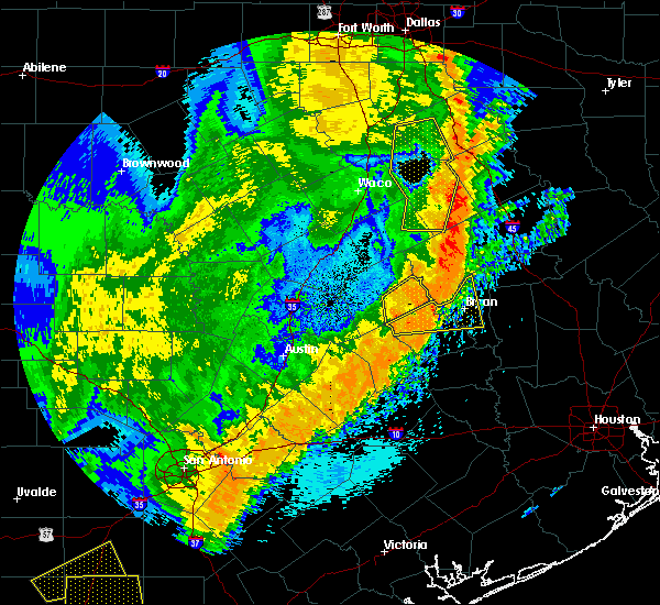 At 114 am cdt, severe thunderstorms were located along a line extending from near hearne to near caldwell, moving east at 50 mph. broadcast media reported a measured wind gust of 61 miles per hour on the north side of caldwell at 111 am (radar indicated). Hazards include 60 mph wind gusts. Expect damage to roofs, siding, and trees. Locations impacted include, college station, bryan, caldwell, wixon valley, kyle field, wellborn and chriesman. At 114 am cdt, severe thunderstorms were located along a line extending from near hearne to near caldwell, moving east at 50 mph. broadcast media reported a measured wind gust of 61 miles per hour on the north side of caldwell at 111 am (radar indicated). Hazards include 60 mph wind gusts. Expect damage to roofs, siding, and trees. Locations impacted include, college station, bryan, caldwell, wixon valley, kyle field, wellborn and chriesman.
|
| 4/18/2019 1:11 AM CDT |
 At 110 am cdt, severe thunderstorms were located along a line extending from near hearne to 7 miles west of caldwell, moving east at 50 mph (radar indicated). Hazards include 60 mph wind gusts. Expect damage to roofs, siding, and trees. Locations impacted include, college station, bryan, caldwell, wixon valley, kyle field, wellborn and chriesman. At 110 am cdt, severe thunderstorms were located along a line extending from near hearne to 7 miles west of caldwell, moving east at 50 mph (radar indicated). Hazards include 60 mph wind gusts. Expect damage to roofs, siding, and trees. Locations impacted include, college station, bryan, caldwell, wixon valley, kyle field, wellborn and chriesman.
|
| 4/18/2019 12:56 AM CDT |
 At 1256 am cdt, severe thunderstorms were located along a line extending from 9 miles east of cameron to near tanglewood, moving east at 50 mph (radar indicated). Hazards include 60 mph wind gusts. expect damage to roofs, siding, and trees At 1256 am cdt, severe thunderstorms were located along a line extending from 9 miles east of cameron to near tanglewood, moving east at 50 mph (radar indicated). Hazards include 60 mph wind gusts. expect damage to roofs, siding, and trees
|
| 4/13/2019 12:27 PM CDT |
 At 1227 pm cdt, a severe thunderstorm was located near dime box, or 8 miles east of lexington, moving northeast at 40 mph (radar indicated). Hazards include 60 mph wind gusts and quarter size hail. Hail damage to vehicles is expected. Expect wind damage to roofs, siding, and trees. At 1227 pm cdt, a severe thunderstorm was located near dime box, or 8 miles east of lexington, moving northeast at 40 mph (radar indicated). Hazards include 60 mph wind gusts and quarter size hail. Hail damage to vehicles is expected. Expect wind damage to roofs, siding, and trees.
|
| 4/13/2019 10:45 AM CDT |
 At 1045 am cdt, a severe thunderstorm was located 8 miles southwest of calvert, or 9 miles west of hearne, moving northeast at 35 mph (radar indicated). Hazards include quarter size hail. damage to vehicles is possible At 1045 am cdt, a severe thunderstorm was located 8 miles southwest of calvert, or 9 miles west of hearne, moving northeast at 35 mph (radar indicated). Hazards include quarter size hail. damage to vehicles is possible
|
| 4/7/2019 12:20 PM CDT |
 At 1220 pm cdt, a severe thunderstorm was located near college station, moving northeast at 35 mph (radar indicated). Hazards include 60 mph wind gusts. expect damage to roofs, siding, and trees At 1220 pm cdt, a severe thunderstorm was located near college station, moving northeast at 35 mph (radar indicated). Hazards include 60 mph wind gusts. expect damage to roofs, siding, and trees
|
| 4/6/2019 8:55 PM CDT |
 The severe thunderstorm warning for southern robertson and southwestern leon counties will expire at 900 pm cdt, the storm which prompted the warning has weakened below severe limits. therefore the warning will be allowed to expire. however small hail and gusty winds are still possible with this thunderstorm. The severe thunderstorm warning for southern robertson and southwestern leon counties will expire at 900 pm cdt, the storm which prompted the warning has weakened below severe limits. therefore the warning will be allowed to expire. however small hail and gusty winds are still possible with this thunderstorm.
|
| 4/6/2019 8:16 PM CDT |
 At 815 pm cdt, a severe thunderstorm was located near hearne, moving northeast at 55 mph. this storm has a history of producing large hail (radar indicated). Hazards include golf ball size hail and 60 mph wind gusts. People and animals outdoors will be injured. expect hail damage to roofs, siding, windows, and vehicles. Expect wind damage to roofs, siding, and trees. At 815 pm cdt, a severe thunderstorm was located near hearne, moving northeast at 55 mph. this storm has a history of producing large hail (radar indicated). Hazards include golf ball size hail and 60 mph wind gusts. People and animals outdoors will be injured. expect hail damage to roofs, siding, windows, and vehicles. Expect wind damage to roofs, siding, and trees.
|
| 4/6/2019 7:53 PM CDT |
 At 752 pm cdt, a severe thunderstorm was located 13 miles north of caldwell, moving northeast at 30 mph. at 740 pm cdt, trained spotters reported two inch hail 2 miles southeast of rockdale (trained weather spotters). Hazards include two inch hail and 60 mph wind gusts. People and animals outdoors will be injured. expect hail damage to roofs, siding, windows, and vehicles. expect wind damage to roofs, siding, and trees. Locations impacted include, hearne and milano. At 752 pm cdt, a severe thunderstorm was located 13 miles north of caldwell, moving northeast at 30 mph. at 740 pm cdt, trained spotters reported two inch hail 2 miles southeast of rockdale (trained weather spotters). Hazards include two inch hail and 60 mph wind gusts. People and animals outdoors will be injured. expect hail damage to roofs, siding, windows, and vehicles. expect wind damage to roofs, siding, and trees. Locations impacted include, hearne and milano.
|
| 4/6/2019 7:33 PM CDT |
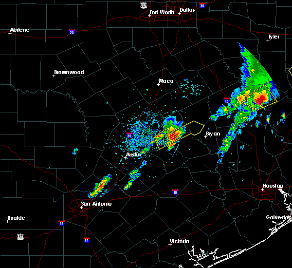 At 732 pm cdt, a severe thunderstorm was located 7 miles east of rockdale, moving northeast at 50 mph. this is a very dangerous storm (radar indicated). Hazards include baseball size hail and 60 mph wind gusts. People and animals outdoors will be severely injured. Expect shattered windows, extensive damage to roofs, siding, and vehicles. At 732 pm cdt, a severe thunderstorm was located 7 miles east of rockdale, moving northeast at 50 mph. this is a very dangerous storm (radar indicated). Hazards include baseball size hail and 60 mph wind gusts. People and animals outdoors will be severely injured. Expect shattered windows, extensive damage to roofs, siding, and vehicles.
|
| 4/6/2019 5:29 PM CDT |
 At 527 pm cdt, a severe thunderstorm was located 9 miles east of hearne, moving northeast at 35 mph (radar indicated). Hazards include golf ball size hail and 60 mph wind gusts. People and animals outdoors will be injured. expect hail damage to roofs, siding, windows, and vehicles. expect wind damage to roofs, siding, and trees. the hail core will primarily impact areas along osr southeast of franklin. A tornado watch remains in effect until 600 pm cdt for central texas. At 527 pm cdt, a severe thunderstorm was located 9 miles east of hearne, moving northeast at 35 mph (radar indicated). Hazards include golf ball size hail and 60 mph wind gusts. People and animals outdoors will be injured. expect hail damage to roofs, siding, windows, and vehicles. expect wind damage to roofs, siding, and trees. the hail core will primarily impact areas along osr southeast of franklin. A tornado watch remains in effect until 600 pm cdt for central texas.
|
| 4/6/2019 5:06 PM CDT |
 At 502 pm cdt, nws meteorologists were monitoring a pair of severe thunderstorms. one was located near rockdale. the other was 6 miles south of hearne, near the intersection of highway 6 and osr. both storms are moving northeast at 30 mph (radar indicated). Hazards include 60 mph wind gusts and half dollar size hail. Hail damage to vehicles is expected. expect wind damage to roofs, siding, and trees. these severe storms will be near, highway 6 south of hearne around 510 pm cdt. spotters reported a rotating wall cloud with the storm in southern robertson county. A tornado watch remains in effect until 600 pm cdt for central texas. At 502 pm cdt, nws meteorologists were monitoring a pair of severe thunderstorms. one was located near rockdale. the other was 6 miles south of hearne, near the intersection of highway 6 and osr. both storms are moving northeast at 30 mph (radar indicated). Hazards include 60 mph wind gusts and half dollar size hail. Hail damage to vehicles is expected. expect wind damage to roofs, siding, and trees. these severe storms will be near, highway 6 south of hearne around 510 pm cdt. spotters reported a rotating wall cloud with the storm in southern robertson county. A tornado watch remains in effect until 600 pm cdt for central texas.
|
| 4/6/2019 4:44 PM CDT |
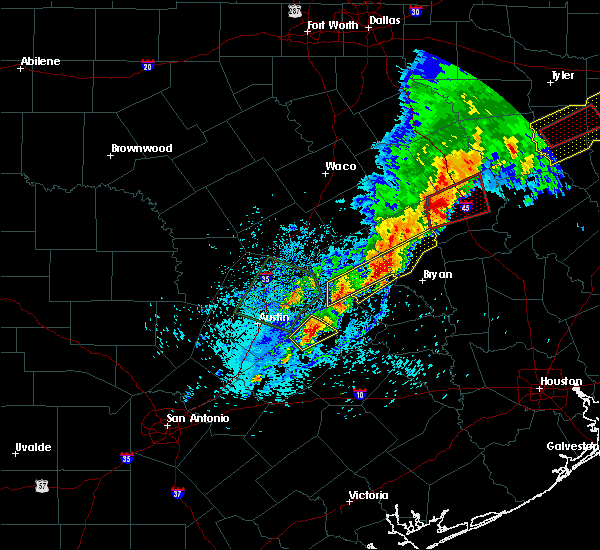 At 443 pm cdt, a severe thunderstorm was located 12 miles north of caldwell, moving northeast at 30 mph. another severe storm was located over far southern milam county (radar indicated). Hazards include 60 mph wind gusts and quarter size hail. Hail damage to vehicles is expected. Expect wind damage to roofs, siding, and trees. At 443 pm cdt, a severe thunderstorm was located 12 miles north of caldwell, moving northeast at 30 mph. another severe storm was located over far southern milam county (radar indicated). Hazards include 60 mph wind gusts and quarter size hail. Hail damage to vehicles is expected. Expect wind damage to roofs, siding, and trees.
|
| 4/6/2019 10:18 AM CDT |
 At 1018 am cdt, a severe thunderstorm was located over snook, or 12 miles east of caldwell, moving northeast at 25 mph (radar indicated). Hazards include quarter size hail. Damage to vehicles is expected. Locations impacted include, college station, bryan, somerville, snook, kyle field, wellborn and lyons. At 1018 am cdt, a severe thunderstorm was located over snook, or 12 miles east of caldwell, moving northeast at 25 mph (radar indicated). Hazards include quarter size hail. Damage to vehicles is expected. Locations impacted include, college station, bryan, somerville, snook, kyle field, wellborn and lyons.
|
| 4/6/2019 9:56 AM CDT |
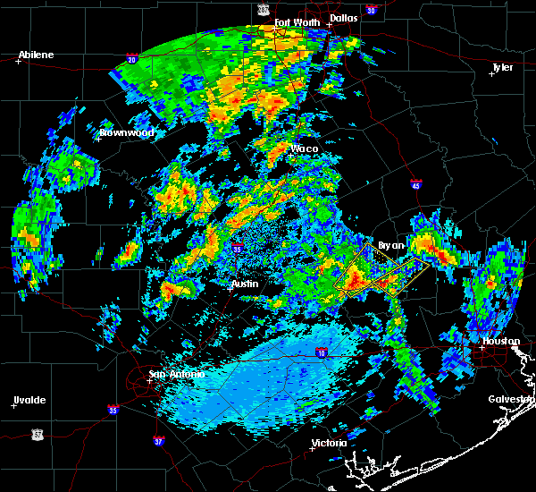 At 956 am cdt, a severe thunderstorm was located near somerville, or 11 miles southeast of caldwell, moving northeast at 25 mph (radar indicated). Hazards include quarter size hail. damage to vehicles is expected At 956 am cdt, a severe thunderstorm was located near somerville, or 11 miles southeast of caldwell, moving northeast at 25 mph (radar indicated). Hazards include quarter size hail. damage to vehicles is expected
|
| 6/3/2018 11:07 PM CDT |
 At 1106 pm cdt, severe thunderstorms were located along a line extending from tanglewood to 7 miles southeast of snook, moving southwest at 20 mph (radar indicated). Hazards include 60 mph wind gusts and penny size hail. Expect damage to roofs, siding, and trees. Locations impacted include, western college station, western bryan, caldwell, snook, lake somerville state park & trailway, lyons, deanville and chriesman. At 1106 pm cdt, severe thunderstorms were located along a line extending from tanglewood to 7 miles southeast of snook, moving southwest at 20 mph (radar indicated). Hazards include 60 mph wind gusts and penny size hail. Expect damage to roofs, siding, and trees. Locations impacted include, western college station, western bryan, caldwell, snook, lake somerville state park & trailway, lyons, deanville and chriesman.
|
| 6/3/2018 10:42 PM CDT |
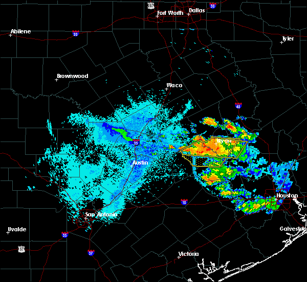 At 1042 pm cdt, severe thunderstorms were located along a line extending from 7 miles northeast of tanglewood to near millican, moving southwest at 15 mph (radar indicated). Hazards include 60 mph wind gusts and penny size hail. expect damage to roofs, siding, and trees At 1042 pm cdt, severe thunderstorms were located along a line extending from 7 miles northeast of tanglewood to near millican, moving southwest at 15 mph (radar indicated). Hazards include 60 mph wind gusts and penny size hail. expect damage to roofs, siding, and trees
|
| 6/3/2018 10:00 PM CDT |
 The national weather service in league city has issued a * severe thunderstorm warning for. central burleson county in southeastern texas. northern grimes county in southeastern texas. brazos county in southeastern texas. Until 1045 pm cdt. The national weather service in league city has issued a * severe thunderstorm warning for. central burleson county in southeastern texas. northern grimes county in southeastern texas. brazos county in southeastern texas. Until 1045 pm cdt.
|
| 4/7/2018 12:11 AM CDT |
 At 1211 am cdt, a severe thunderstorm was located 7 miles south of kurten, or 8 miles northeast of college station, moving east at 45 mph (radar indicated). Hazards include 70 mph wind gusts and penny size hail. Expect considerable tree damage. Damage is likely to mobile homes, roofs, and outbuildings. At 1211 am cdt, a severe thunderstorm was located 7 miles south of kurten, or 8 miles northeast of college station, moving east at 45 mph (radar indicated). Hazards include 70 mph wind gusts and penny size hail. Expect considerable tree damage. Damage is likely to mobile homes, roofs, and outbuildings.
|
| 4/6/2018 11:46 PM CDT |
 At 1146 pm cdt, a severe thunderstorm was located near hearne, moving east at 55 mph (radar indicated). Hazards include 60 mph wind gusts and penny size hail. expect damage to roofs, siding, and trees At 1146 pm cdt, a severe thunderstorm was located near hearne, moving east at 55 mph (radar indicated). Hazards include 60 mph wind gusts and penny size hail. expect damage to roofs, siding, and trees
|
| 3/18/2018 6:40 PM CDT |
 The severe thunderstorm warning for southern robertson and east central milam counties will expire at 645 pm cdt, the storm which prompted the warning has weakened below severe limits. therefore the warning will be allowed to expire. a severe thunderstorm watch remains in effect until 1100 pm cdt for central texas. The severe thunderstorm warning for southern robertson and east central milam counties will expire at 645 pm cdt, the storm which prompted the warning has weakened below severe limits. therefore the warning will be allowed to expire. a severe thunderstorm watch remains in effect until 1100 pm cdt for central texas.
|
| 3/18/2018 6:33 PM CDT |
 At 632 pm cdt, a severe thunderstorm was located over snook, or 11 miles southwest of college station, moving east at 45 mph. these storms have had a history of producing up to softball size hail (radar indicated). Hazards include ping pong ball to golf ball size hail and 60 mph wind gusts. People and animals outdoors will be injured. expect hail damage to roofs, siding, windows, and vehicles. Expect wind damage to roofs, siding, and trees. At 632 pm cdt, a severe thunderstorm was located over snook, or 11 miles southwest of college station, moving east at 45 mph. these storms have had a history of producing up to softball size hail (radar indicated). Hazards include ping pong ball to golf ball size hail and 60 mph wind gusts. People and animals outdoors will be injured. expect hail damage to roofs, siding, windows, and vehicles. Expect wind damage to roofs, siding, and trees.
|
| 3/18/2018 6:22 PM CDT |
 At 622 pm cdt, a severe thunderstorm was located near hearne, moving northeast at 45 mph (radar indicated). Hazards include 60 mph wind gusts and quarter size hail. Hail damage to vehicles is expected. expect wind damage to roofs, siding, and trees. Locations impacted include, hearne and franklin. At 622 pm cdt, a severe thunderstorm was located near hearne, moving northeast at 45 mph (radar indicated). Hazards include 60 mph wind gusts and quarter size hail. Hail damage to vehicles is expected. expect wind damage to roofs, siding, and trees. Locations impacted include, hearne and franklin.
|
| 3/18/2018 6:01 PM CDT |
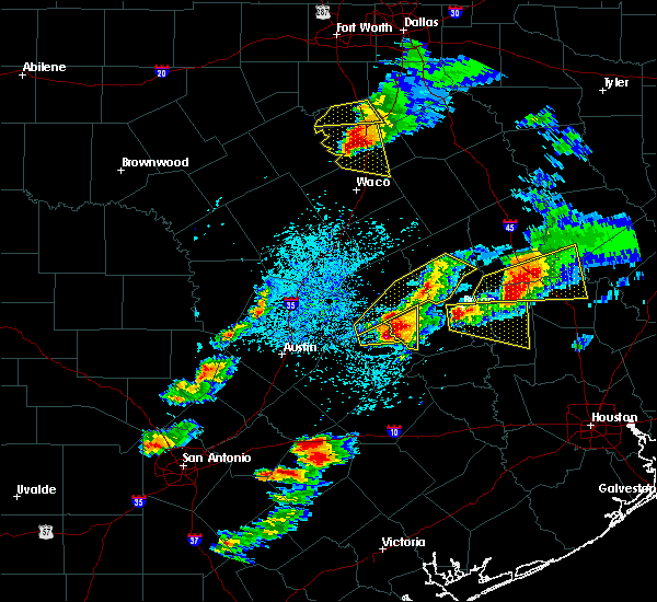 At 600 pm cdt, a severe thunderstorm was located over southwestern bryan, moving east at 40 mph. these storms have a history of producing up to softball size hail (radar indicated). Hazards include golf ball to tennis ball size hail. People and animals outdoors will be injured. Expect damage to roofs, siding, windows, and vehicles. At 600 pm cdt, a severe thunderstorm was located over southwestern bryan, moving east at 40 mph. these storms have a history of producing up to softball size hail (radar indicated). Hazards include golf ball to tennis ball size hail. People and animals outdoors will be injured. Expect damage to roofs, siding, windows, and vehicles.
|
| 3/18/2018 5:57 PM CDT |
 At 538 pm cdt, a severe thunderstorm was located near tanglewood, or near lexington, moving east at 35 mph. a second storm was located near cameron moving east at 35 mph (radar indicated). Hazards include 60 mph wind gusts and half dollar size hail. Hail damage to vehicles is expected. Expect wind damage to roofs, siding, and trees. At 538 pm cdt, a severe thunderstorm was located near tanglewood, or near lexington, moving east at 35 mph. a second storm was located near cameron moving east at 35 mph (radar indicated). Hazards include 60 mph wind gusts and half dollar size hail. Hail damage to vehicles is expected. Expect wind damage to roofs, siding, and trees.
|
| 3/18/2018 5:39 PM CDT |
 At 538 pm cdt, a severe thunderstorm was located near tanglewood, or near lexington, moving east at 35 mph. a second storm was located near cameron moving east at 35 mph (radar indicated). Hazards include 60 mph wind gusts and half dollar size hail. Hail damage to vehicles is expected. Expect wind damage to roofs, siding, and trees. At 538 pm cdt, a severe thunderstorm was located near tanglewood, or near lexington, moving east at 35 mph. a second storm was located near cameron moving east at 35 mph (radar indicated). Hazards include 60 mph wind gusts and half dollar size hail. Hail damage to vehicles is expected. Expect wind damage to roofs, siding, and trees.
|
| 3/18/2018 5:29 PM CDT |
 At 528 pm cdt, a severe thunderstorm was located near snook, or 9 miles east of caldwell, moving east at 30 mph. baseball size hail was occurring at the local sheriffs office in caldwell at 528 pm. this is a very dangerous storm (radar indicated). Hazards include baseball size hail and 60 mph wind gusts. People and animals outdoors will be severely injured. Expect shattered windows, extensive damage to roofs, siding, and vehicles. At 528 pm cdt, a severe thunderstorm was located near snook, or 9 miles east of caldwell, moving east at 30 mph. baseball size hail was occurring at the local sheriffs office in caldwell at 528 pm. this is a very dangerous storm (radar indicated). Hazards include baseball size hail and 60 mph wind gusts. People and animals outdoors will be severely injured. Expect shattered windows, extensive damage to roofs, siding, and vehicles.
|
| 3/18/2018 5:03 PM CDT |
 At 502 pm cdt, a severe thunderstorm was located 7 miles northwest of wixon valley, or 10 miles north of bryan, moving east at 40 mph (radar indicated). Hazards include ping pong ball size hail and 60 mph wind gusts. People and animals outdoors will be injured. expect hail damage to roofs, siding, windows, and vehicles. Expect wind damage to roofs, siding, and trees. At 502 pm cdt, a severe thunderstorm was located 7 miles northwest of wixon valley, or 10 miles north of bryan, moving east at 40 mph (radar indicated). Hazards include ping pong ball size hail and 60 mph wind gusts. People and animals outdoors will be injured. expect hail damage to roofs, siding, windows, and vehicles. Expect wind damage to roofs, siding, and trees.
|
| 3/18/2018 4:54 PM CDT |
 At 454 pm cdt, a severe thunderstorm was located near hearne, moving east at 40 mph (radar indicated). Hazards include 60 mph wind gusts and quarter size hail. Hail damage to vehicles is expected. Expect wind damage to roofs, siding, and trees. At 454 pm cdt, a severe thunderstorm was located near hearne, moving east at 40 mph (radar indicated). Hazards include 60 mph wind gusts and quarter size hail. Hail damage to vehicles is expected. Expect wind damage to roofs, siding, and trees.
|
| 5/28/2017 7:28 PM CDT |
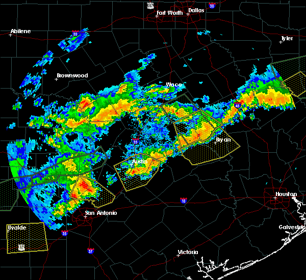 At 727 pm cdt, a severe thunderstorm was located 9 miles north of caldwell, moving southeast at 20 mph. dime size hail has been reported south of goldthwaite (radar indicated). Hazards include 60 mph wind gusts and quarter size hail. Hail damage to vehicles is expected. Expect wind damage to roofs, siding, and trees. At 727 pm cdt, a severe thunderstorm was located 9 miles north of caldwell, moving southeast at 20 mph. dime size hail has been reported south of goldthwaite (radar indicated). Hazards include 60 mph wind gusts and quarter size hail. Hail damage to vehicles is expected. Expect wind damage to roofs, siding, and trees.
|
| 5/28/2017 7:17 PM CDT |
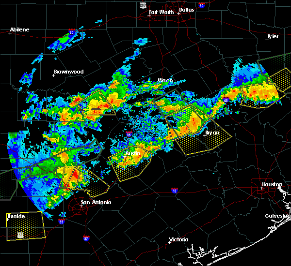 At 716 pm cdt, a severe thunderstorm was located 12 miles northeast of caldwell, moving southeast at 30 mph (radar indicated). Hazards include 60 mph wind gusts and quarter size hail. Hail damage to vehicles is expected. expect wind damage to roofs, siding, and trees. Locations impacted include, college station, bryan, caldwell, snook, kurten, wixon valley, millican, kyle field, iola, lyons, chriesman, wellborn and carlos. At 716 pm cdt, a severe thunderstorm was located 12 miles northeast of caldwell, moving southeast at 30 mph (radar indicated). Hazards include 60 mph wind gusts and quarter size hail. Hail damage to vehicles is expected. expect wind damage to roofs, siding, and trees. Locations impacted include, college station, bryan, caldwell, snook, kurten, wixon valley, millican, kyle field, iola, lyons, chriesman, wellborn and carlos.
|
| 5/28/2017 7:08 PM CDT |
 At 707 pm cdt, a severe thunderstorm was located over hearne, moving southeast at 15 mph (radar indicated). Hazards include 65 mph wind gusts and half dollar size hail. Hail damage to vehicles is expected. expect wind damage to roofs, siding, and trees. Locations impacted include, cameron, hearne, franklin, calvert, bremond and milano. At 707 pm cdt, a severe thunderstorm was located over hearne, moving southeast at 15 mph (radar indicated). Hazards include 65 mph wind gusts and half dollar size hail. Hail damage to vehicles is expected. expect wind damage to roofs, siding, and trees. Locations impacted include, cameron, hearne, franklin, calvert, bremond and milano.
|
| 5/28/2017 7:02 PM CDT |
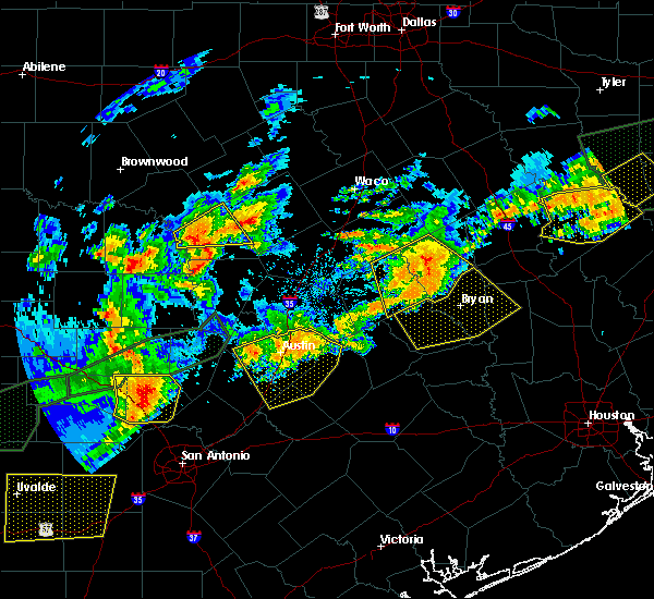 At 657 pm cdt, a severe thunderstorm was located over calvert, or 7 miles northwest of hearne, moving southeast at 50 mph (radar indicated). Hazards include 60 mph wind gusts and quarter size hail. Hail damage to vehicles is expected. Expect wind damage to roofs, siding, and trees. At 657 pm cdt, a severe thunderstorm was located over calvert, or 7 miles northwest of hearne, moving southeast at 50 mph (radar indicated). Hazards include 60 mph wind gusts and quarter size hail. Hail damage to vehicles is expected. Expect wind damage to roofs, siding, and trees.
|
| 5/28/2017 6:57 PM CDT |
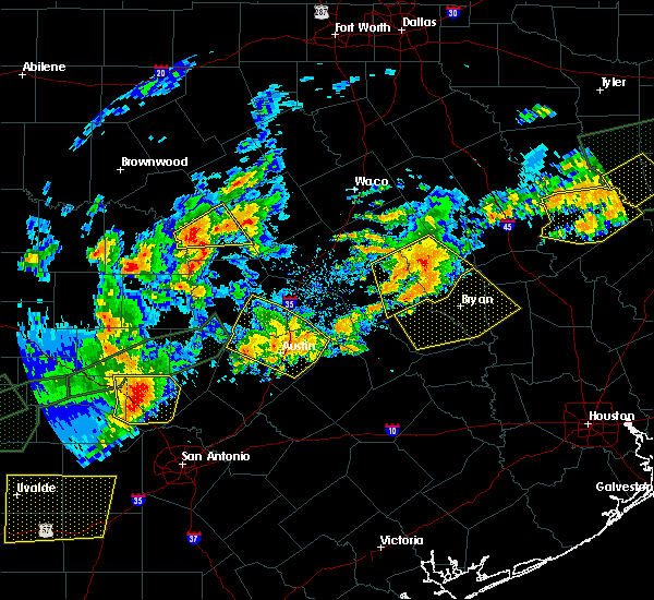 The national weather service in league city has issued a * severe thunderstorm warning for. burleson county in southeastern texas. northwestern grimes county in southeastern texas. brazos county in southeastern texas. Southwestern madison county in southeastern texas. The national weather service in league city has issued a * severe thunderstorm warning for. burleson county in southeastern texas. northwestern grimes county in southeastern texas. brazos county in southeastern texas. Southwestern madison county in southeastern texas.
|
| 5/28/2017 6:23 PM CDT |
 The national weather service in fort worth has issued a * severe thunderstorm warning for. robertson county in central texas. eastern milam county in central texas. until 745 pm cdt. At 622 pm cdt, a severe thunderstorm was located near calvert, or. The national weather service in fort worth has issued a * severe thunderstorm warning for. robertson county in central texas. eastern milam county in central texas. until 745 pm cdt. At 622 pm cdt, a severe thunderstorm was located near calvert, or.
|
| 5/21/2017 12:27 AM CDT |
 At 1226 am cdt, a severe thunderstorm was located near caldwell, moving east at 25 mph (radar indicated). Hazards include 60 mph wind gusts and quarter size hail. Hail damage to vehicles is expected. Expect wind damage to roofs, siding, and trees. At 1226 am cdt, a severe thunderstorm was located near caldwell, moving east at 25 mph (radar indicated). Hazards include 60 mph wind gusts and quarter size hail. Hail damage to vehicles is expected. Expect wind damage to roofs, siding, and trees.
|
| 5/21/2017 12:11 AM CDT |
 At 1211 am cdt, a severe thunderstorm was located near caldwell, moving east at 30 mph (radar indicated). Hazards include 60 mph wind gusts and penny size hail. Expect damage to roofs, siding, and trees. Locations impacted include, western bryan, caldwell and snook. At 1211 am cdt, a severe thunderstorm was located near caldwell, moving east at 30 mph (radar indicated). Hazards include 60 mph wind gusts and penny size hail. Expect damage to roofs, siding, and trees. Locations impacted include, western bryan, caldwell and snook.
|
| 5/20/2017 11:53 PM CDT |
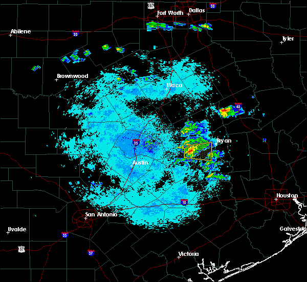 At 1153 pm cdt, a severe thunderstorm was located near caldwell, moving east at 30 mph (radar indicated). Hazards include 60 mph wind gusts and quarter size hail. Hail damage to vehicles is expected. Expect wind damage to roofs, siding, and trees. At 1153 pm cdt, a severe thunderstorm was located near caldwell, moving east at 30 mph (radar indicated). Hazards include 60 mph wind gusts and quarter size hail. Hail damage to vehicles is expected. Expect wind damage to roofs, siding, and trees.
|
| 5/3/2017 6:06 PM CDT |
 At 602 pm cdt, a severe thunderstorm was centered 10 miles west of college station, moving east at 40 mph (radar indicated). Hazards include quarter size hail. Hail damage to vehicles is expected. expect wind damage to roofs, siding, and trees. Locations impacted include, college station, bryan, caldwell, snook, millican, kyle field, wellborn and carlos. At 602 pm cdt, a severe thunderstorm was centered 10 miles west of college station, moving east at 40 mph (radar indicated). Hazards include quarter size hail. Hail damage to vehicles is expected. expect wind damage to roofs, siding, and trees. Locations impacted include, college station, bryan, caldwell, snook, millican, kyle field, wellborn and carlos.
|
| 5/3/2017 5:42 PM CDT |
 At 540 pm cdt, a cluster of severe thunderstorms was centered 10 miles northwest of bryan, moving southeast at 40 mph (radar indicated). Hazards include 60 mph wind gusts and quarter size hail. Hail damage to vehicles is expected. Expect wind damage to roofs, siding, and trees. At 540 pm cdt, a cluster of severe thunderstorms was centered 10 miles northwest of bryan, moving southeast at 40 mph (radar indicated). Hazards include 60 mph wind gusts and quarter size hail. Hail damage to vehicles is expected. Expect wind damage to roofs, siding, and trees.
|
| 5/3/2017 5:28 PM CDT |
 At 528 pm cdt, a severe thunderstorm was located over hearne, moving east at 35 mph (radar indicated). Hazards include 60 mph wind gusts and quarter size hail. Hail damage to vehicles is expected. Expect wind damage to roofs, siding, and trees. At 528 pm cdt, a severe thunderstorm was located over hearne, moving east at 35 mph (radar indicated). Hazards include 60 mph wind gusts and quarter size hail. Hail damage to vehicles is expected. Expect wind damage to roofs, siding, and trees.
|
| 4/2/2017 10:41 AM CDT | At 1040 am cdt, severe thunderstorms were located along a line extending from near troy to near cameron to 6 miles northeast of tanglewood, moving northeast at 55 mph (radar indicated). Hazards include 60 mph wind gusts and nickel size hail. expect damage to roofs, siding, and trees |
| 3/29/2017 3:33 AM CDT |
 At 333 am cdt, a severe thunderstorm was located over franklin, or 11 miles northeast of hearne, moving northeast at 55 mph (radar indicated). Hazards include 65 mph wind gusts. Expect damage to roofs, siding, and trees. This severe thunderstorm will remain over mainly rural areas of robertson, northeastern milam, southwestern leon, southeastern limestone and southeastern falls counties, including the following locations: kosse and marquez. At 333 am cdt, a severe thunderstorm was located over franklin, or 11 miles northeast of hearne, moving northeast at 55 mph (radar indicated). Hazards include 65 mph wind gusts. Expect damage to roofs, siding, and trees. This severe thunderstorm will remain over mainly rural areas of robertson, northeastern milam, southwestern leon, southeastern limestone and southeastern falls counties, including the following locations: kosse and marquez.
|
| 3/27/2017 2:52 AM CDT |
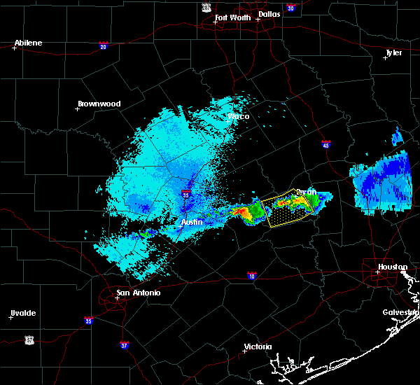 At 250 am cdt, a severe thunderstorm was located near kyle field, or near college station, moving southeast at 20 mph. there have been numerous reports of pea to marble size hail in the bryan and college station area between 240 am and 250 am. radar is showing a weakening trend in the storms (radar indicated). Hazards include quarter size hail. Damage to vehicles is expected. Locations impacted include, college station, bryan, caldwell, somerville, snook, millican, kyle field, wellborn and lyons. At 250 am cdt, a severe thunderstorm was located near kyle field, or near college station, moving southeast at 20 mph. there have been numerous reports of pea to marble size hail in the bryan and college station area between 240 am and 250 am. radar is showing a weakening trend in the storms (radar indicated). Hazards include quarter size hail. Damage to vehicles is expected. Locations impacted include, college station, bryan, caldwell, somerville, snook, millican, kyle field, wellborn and lyons.
|
| 3/27/2017 2:40 AM CDT |
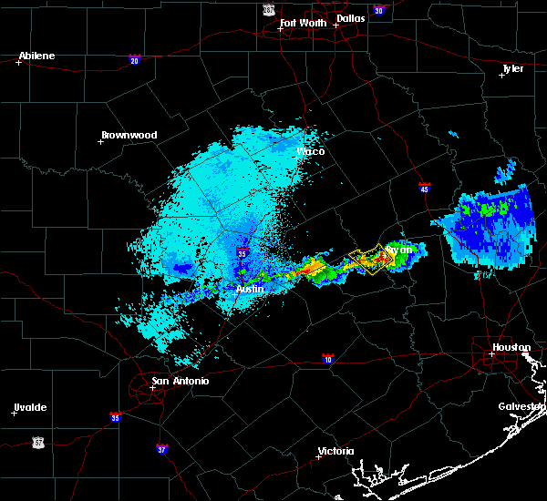 At 239 am cdt, a severe thunderstorm was located near kyle field, or near bryan, moving southeast at 20 mph (radar indicated). Hazards include quarter size hail. damage to vehicles is expected At 239 am cdt, a severe thunderstorm was located near kyle field, or near bryan, moving southeast at 20 mph (radar indicated). Hazards include quarter size hail. damage to vehicles is expected
|
| 3/27/2017 2:24 AM CDT |
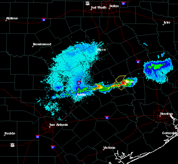 The severe thunderstorm warning for southeastern robertson county will expire at 230 am cdt, the storm which prompted the warning has moved out of the area. therefore the warning will be allowed to expire. The severe thunderstorm warning for southeastern robertson county will expire at 230 am cdt, the storm which prompted the warning has moved out of the area. therefore the warning will be allowed to expire.
|
| 3/27/2017 2:23 AM CDT |
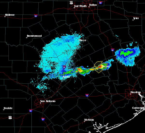 At 222 am cdt, a severe thunderstorm was located near bryan, moving southeast at 15 mph. a storms spotter in the extreme northwest part of brazos county reported half inch diameter hail at 221 am (radar indicated). Hazards include quarter size hail. Damage to vehicles is expected. Locations impacted include, northwestern college station, bryan and kyle field. At 222 am cdt, a severe thunderstorm was located near bryan, moving southeast at 15 mph. a storms spotter in the extreme northwest part of brazos county reported half inch diameter hail at 221 am (radar indicated). Hazards include quarter size hail. Damage to vehicles is expected. Locations impacted include, northwestern college station, bryan and kyle field.
|
| 3/27/2017 2:00 AM CDT |
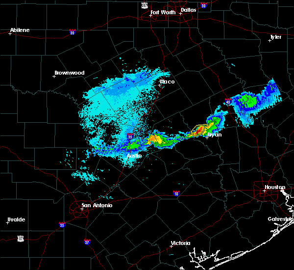 At 200 am cdt, a severe thunderstorm was located 8 miles south of hearne, moving southeast at 20 mph (radar indicated). Hazards include quarter size hail. damage to vehicles is expected At 200 am cdt, a severe thunderstorm was located 8 miles south of hearne, moving southeast at 20 mph (radar indicated). Hazards include quarter size hail. damage to vehicles is expected
|
| 3/27/2017 1:58 AM CDT |
 At 157 am cdt, a severe thunderstorm was located southeast of hearne, moving east at 20 mph (radar indicated). Hazards include quarter size hail. Damage to vehicles is possible. This severe thunderstorm will remain over mainly rural areas of southeastern robertson county. At 157 am cdt, a severe thunderstorm was located southeast of hearne, moving east at 20 mph (radar indicated). Hazards include quarter size hail. Damage to vehicles is possible. This severe thunderstorm will remain over mainly rural areas of southeastern robertson county.
|
| 2/20/2017 1:28 AM CST |
 At 127 am cst, severe thunderstorms were located along a line extending from near hearne to near bryan to near snook, moving east at 45 mph (radar indicated). Hazards include 70 mph wind gusts. Expect considerable tree damage. Damage is likely to mobile homes, roofs, and outbuildings. At 127 am cst, severe thunderstorms were located along a line extending from near hearne to near bryan to near snook, moving east at 45 mph (radar indicated). Hazards include 70 mph wind gusts. Expect considerable tree damage. Damage is likely to mobile homes, roofs, and outbuildings.
|
| 2/20/2017 1:16 AM CST |
 At 116 am cst, severe thunderstorms were located along a line extending from near calvert to 11 miles south of hearne to near caldwell, moving northeast at 60 mph (radar indicated). Hazards include 70 mph wind gusts. Expect considerable tree damage. damage is likely to mobile homes, roofs, and outbuildings. Locations impacted include, northwestern college station, bryan, caldwell, kurten, wixon valley, kyle field, deanville and chriesman. At 116 am cst, severe thunderstorms were located along a line extending from near calvert to 11 miles south of hearne to near caldwell, moving northeast at 60 mph (radar indicated). Hazards include 70 mph wind gusts. Expect considerable tree damage. damage is likely to mobile homes, roofs, and outbuildings. Locations impacted include, northwestern college station, bryan, caldwell, kurten, wixon valley, kyle field, deanville and chriesman.
|
| 2/20/2017 1:10 AM CST |
 At 109 am cst, a severe thunderstorm was located 7 miles west of hearne, moving northeast at 40 mph. this is a very dangerous storm (radar indicated). Hazards include 80 mph wind gusts. Flying debris will be dangerous to those caught without shelter. mobile homes will be heavily damaged. expect considerable damage to roofs, windows, and vehicles. extensive tree damage and power outages are likely. this severe thunderstorm will be near, hearne and calvert around 120 am cst. Franklin around 140 am cst. At 109 am cst, a severe thunderstorm was located 7 miles west of hearne, moving northeast at 40 mph. this is a very dangerous storm (radar indicated). Hazards include 80 mph wind gusts. Flying debris will be dangerous to those caught without shelter. mobile homes will be heavily damaged. expect considerable damage to roofs, windows, and vehicles. extensive tree damage and power outages are likely. this severe thunderstorm will be near, hearne and calvert around 120 am cst. Franklin around 140 am cst.
|
| 2/20/2017 12:49 AM CST |
 At 1248 am cst, severe thunderstorms were located along a line extending from near rockdale to tanglewood to near fedor, moving northeast at 60 mph (radar indicated). Hazards include 60 mph wind gusts. expect damage to roofs, siding, and trees At 1248 am cst, severe thunderstorms were located along a line extending from near rockdale to tanglewood to near fedor, moving northeast at 60 mph (radar indicated). Hazards include 60 mph wind gusts. expect damage to roofs, siding, and trees
|
| 1/2/2017 6:06 AM CST |
 At 606 am cst, severe thunderstorms were located along a line extending from 6 miles northeast of tanglewood to near caldwell to 7 miles east of dime box to 7 miles west of burton to near round top, moving northeast at 40 mph (radar indicated). Hazards include 60 mph wind gusts. expect damage to roofs, siding, and trees At 606 am cst, severe thunderstorms were located along a line extending from 6 miles northeast of tanglewood to near caldwell to 7 miles east of dime box to 7 miles west of burton to near round top, moving northeast at 40 mph (radar indicated). Hazards include 60 mph wind gusts. expect damage to roofs, siding, and trees
|
| 4/30/2016 7:00 AM CDT |
 At 657 am cdt, severe thunderstorms were located along a line extending from 11 miles northwest of bedias to 6 miles southwest of pine island, moving east at 30 mph (college station asos reported a 56 mph wind gust at 653 am). Hazards include 60 mph wind gusts. Expect damage to roofs. siding. and trees. trees are more susceptible of toppling due to recently more saturated ground. Locations impacted include, college station, bryan, brenham, navasota, sealy, hempstead, prairie view, brookshire, bellville, columbus, washington, waller, weimar, pine island, san felipe, snook, pattison, bedias, kurten and industry. At 657 am cdt, severe thunderstorms were located along a line extending from 11 miles northwest of bedias to 6 miles southwest of pine island, moving east at 30 mph (college station asos reported a 56 mph wind gust at 653 am). Hazards include 60 mph wind gusts. Expect damage to roofs. siding. and trees. trees are more susceptible of toppling due to recently more saturated ground. Locations impacted include, college station, bryan, brenham, navasota, sealy, hempstead, prairie view, brookshire, bellville, columbus, washington, waller, weimar, pine island, san felipe, snook, pattison, bedias, kurten and industry.
|
| 4/30/2016 6:33 AM CDT |
 At 632 am cdt, severe thunderstorms were located along a line extending from near kurten to near bellville, moving east at 35 mph (radar indicated). Hazards include 60 mph wind gusts. Expect damage to roofs. siding. and trees. Toppled trees. At 632 am cdt, severe thunderstorms were located along a line extending from near kurten to near bellville, moving east at 35 mph (radar indicated). Hazards include 60 mph wind gusts. Expect damage to roofs. siding. and trees. Toppled trees.
|
| 4/30/2016 6:23 AM CDT |
 At 622 am cdt, severe thunderstorms were located along a line extending from snook to industry to 7 miles northeast of sublime, moving east at 40 mph (radar indicated). Hazards include 60 mph wind gusts and quarter size hail. Downed trees. trees can topple at winds speeds under 60 mph due to saturated grounds. possible home damage from both hail and wind. Locations impacted include, college station, bryan, brenham, navasota, sealy, hempstead, prairie view, caldwell, bellville, columbus, eagle lake, washington, weimar, somerville, wallis, pine island, san felipe, snook, pattison and kurten. At 622 am cdt, severe thunderstorms were located along a line extending from snook to industry to 7 miles northeast of sublime, moving east at 40 mph (radar indicated). Hazards include 60 mph wind gusts and quarter size hail. Downed trees. trees can topple at winds speeds under 60 mph due to saturated grounds. possible home damage from both hail and wind. Locations impacted include, college station, bryan, brenham, navasota, sealy, hempstead, prairie view, caldwell, bellville, columbus, eagle lake, washington, weimar, somerville, wallis, pine island, san felipe, snook, pattison and kurten.
|
| 4/30/2016 5:51 AM CDT |
 At 548 am cdt, severe thunderstorms were located along a line extending from 7 miles east of tanglewood to near la grange to near moulton, moving east at 45 mph (radar indicated). Hazards include 60 mph wind gusts and quarter size hail. Expect possible wind damage to homes and downed trees. trees will topple more easily due to the saturated grounds. Hail damage to vehicles may occur. At 548 am cdt, severe thunderstorms were located along a line extending from 7 miles east of tanglewood to near la grange to near moulton, moving east at 45 mph (radar indicated). Hazards include 60 mph wind gusts and quarter size hail. Expect possible wind damage to homes and downed trees. trees will topple more easily due to the saturated grounds. Hail damage to vehicles may occur.
|
| 3/9/2016 3:32 AM CST |
 At 332 am cst, a severe thunderstorm was located near hearne, moving east at 50 mph (radar indicated). Hazards include 60 mph wind gusts. Expect damage to roofs. siding. And trees. At 332 am cst, a severe thunderstorm was located near hearne, moving east at 50 mph (radar indicated). Hazards include 60 mph wind gusts. Expect damage to roofs. siding. And trees.
|
| 12/13/2015 4:21 AM CST |
 The severe thunderstorm warning for north central burleson and northwestern brazos counties will expire at 430 am cst, the storm which prompted the warning has weakened below severe limits and exited the warned area. therefore the warning will be allowed to expire. however gusty winds and heavy rain are still possible with this thunderstorm. The severe thunderstorm warning for north central burleson and northwestern brazos counties will expire at 430 am cst, the storm which prompted the warning has weakened below severe limits and exited the warned area. therefore the warning will be allowed to expire. however gusty winds and heavy rain are still possible with this thunderstorm.
|
| 12/13/2015 3:57 AM CST |
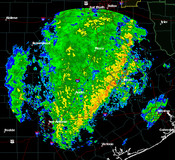 At 356 am cst, a severe thunderstorm was located 8 miles northeast of caldwell, moving northeast at 70 mph (radar indicated). Hazards include 70 mph wind gusts. Expect damage to roofs. Siding and trees. At 356 am cst, a severe thunderstorm was located 8 miles northeast of caldwell, moving northeast at 70 mph (radar indicated). Hazards include 70 mph wind gusts. Expect damage to roofs. Siding and trees.
|
| 12/13/2015 3:47 AM CST |
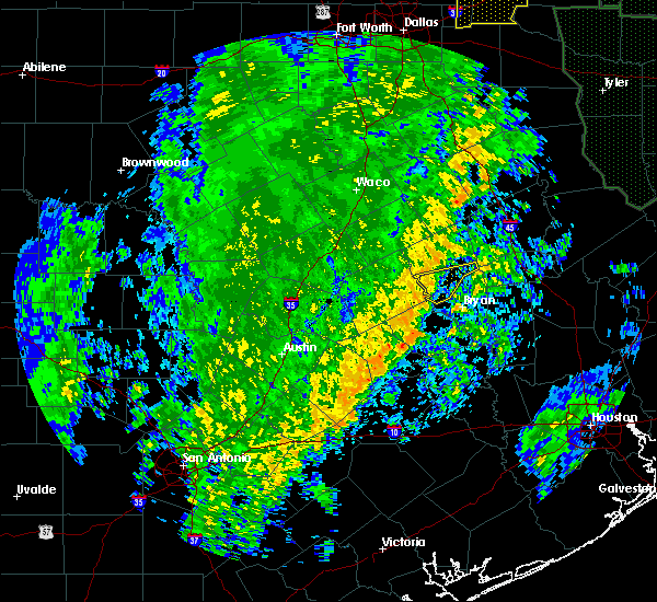 At 347 am cst, a severe thunderstorm was located near hearne, moving east at 35 mph (radar indicated). Hazards include 60 mph wind gusts. Expect damage to roofs. siding and trees. Locations impacted include, hearne. At 347 am cst, a severe thunderstorm was located near hearne, moving east at 35 mph (radar indicated). Hazards include 60 mph wind gusts. Expect damage to roofs. siding and trees. Locations impacted include, hearne.
|
| 12/13/2015 3:11 AM CST |
 At 311 am cst, a severe thunderstorm was located near rockdale, moving east at 45 mph (radar indicated). Hazards include 60 mph wind gusts. Expect damage to roofs. Siding and trees. At 311 am cst, a severe thunderstorm was located near rockdale, moving east at 45 mph (radar indicated). Hazards include 60 mph wind gusts. Expect damage to roofs. Siding and trees.
|
| 10/30/2015 1:36 PM CDT |
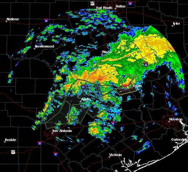 The tornado warning for west central brazos and north central burleson counties will expire at 145 pm cdt, the tornadic thunderstorm which prompted the warning has weakened and moved out of the warned area. therefore the tornado warning has been cancelled. a tornado watch remains in effect until 700 pm cdt for southeastern texas. The tornado warning for west central brazos and north central burleson counties will expire at 145 pm cdt, the tornadic thunderstorm which prompted the warning has weakened and moved out of the warned area. therefore the tornado warning has been cancelled. a tornado watch remains in effect until 700 pm cdt for southeastern texas.
|
| 10/30/2015 1:27 PM CDT |
 At 126 pm cdt, a severe thunderstorm was located 12 miles south of hearne, moving northeast at 25 mph (radar indicated). Hazards include 60 mph wind gusts. Expect damage to roofs. Siding and trees. At 126 pm cdt, a severe thunderstorm was located 12 miles south of hearne, moving northeast at 25 mph (radar indicated). Hazards include 60 mph wind gusts. Expect damage to roofs. Siding and trees.
|
| 10/30/2015 1:26 PM CDT |
 At 126 pm cdt, a severe thunderstorm capable of producing a tornado was located 11 miles northeast of caldwell, moving northeast at 35 mph (radar indicated rotation). Hazards include tornado and quarter size hail. Flying debris will be dangerous to those caught without shelter. mobile homes will be damaged or destroyed. damage to roofs, windows and vehicles will occur. tree damage is likely. Locations impacted include, northwestern bryan. At 126 pm cdt, a severe thunderstorm capable of producing a tornado was located 11 miles northeast of caldwell, moving northeast at 35 mph (radar indicated rotation). Hazards include tornado and quarter size hail. Flying debris will be dangerous to those caught without shelter. mobile homes will be damaged or destroyed. damage to roofs, windows and vehicles will occur. tree damage is likely. Locations impacted include, northwestern bryan.
|
| 10/30/2015 1:08 PM CDT |
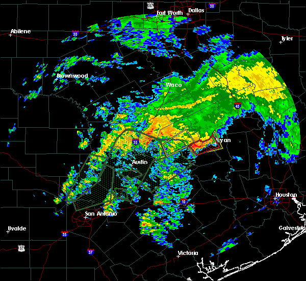 At 107 pm cdt, a confirmed tornado was located near caldwell, moving northeast at 30 mph (law enforcement confirmed tornado). Hazards include damaging tornado and quarter size hail. Flying debris will be dangerous to those caught without shelter. mobile homes will be damaged or destroyed. damage to roofs, windows and vehicles will occur. Tree damage is likely. At 107 pm cdt, a confirmed tornado was located near caldwell, moving northeast at 30 mph (law enforcement confirmed tornado). Hazards include damaging tornado and quarter size hail. Flying debris will be dangerous to those caught without shelter. mobile homes will be damaged or destroyed. damage to roofs, windows and vehicles will occur. Tree damage is likely.
|
| 10/30/2015 1:03 PM CDT |
 At 102 pm cdt, a severe thunderstorm was located near caldwell, moving northeast at 30 mph (radar indicated). Hazards include 60 mph wind gusts and quarter size hail. Hail damage to vehicles is expected. Expect wind damage to roofs, siding and trees. At 102 pm cdt, a severe thunderstorm was located near caldwell, moving northeast at 30 mph (radar indicated). Hazards include 60 mph wind gusts and quarter size hail. Hail damage to vehicles is expected. Expect wind damage to roofs, siding and trees.
|
| 5/27/2015 5:21 AM CDT | At 520 am cdt, doppler radar indicated a line of severe thunderstorms capable of producing damaging winds in excess of 60 mph. these storms were located along a line extending from sour lake to near waller, and moving south at 25 mph. frequent lightning and torrential rainfall is also occurring with this line. |
| 5/25/2015 6:18 PM CDT | At 617 pm cdt, doppler radar indicated a severe thunderstorm capable of producing damaging winds in excess of 60 mph. this storm was located near snook, or 9 miles east of caldwell, and moving east at 50 mph. |
| 5/25/2015 5:57 PM CDT | At 555 pm cdt, doppler radar indicated a severe thunderstorm capable of producing damaging winds in excess of 60 mph. this storm was located 8 miles west of bedias, or 16 miles southwest of madisonville, and moving east at 50 mph. |
| 5/25/2015 5:37 PM CDT | At 537 pm cdt, doppler radar indicated a severe thunderstorm capable of producing damaging winds in excess of 60 mph. this storm was located near wixon valley, or near bryan, moving east at 50 mph. locations impacted include, college station, bryan, caldwell, somerville, snook, kurten, wixon valley, millican, kyle field, iola, wellborn, deanville, chriesman, north zulch, carlos and lyons. a tornado watch remains in effect until 1000 pm cdt for southeastern texas. |
| 5/25/2015 5:37 PM CDT | At 537 pm cdt, doppler radar indicated a severe thunderstorm capable of producing damaging winds in excess of 60 mph. this storm was located near wixon valley, or near bryan, moving east at 50 mph. locations impacted include, college station, bryan, caldwell, somerville, snook, kurten, wixon valley, millican, kyle field, iola, wellborn, deanville, chriesman, north zulch, carlos and lyons. a tornado watch remains in effect until 1000 pm cdt for southeastern texas. |
| 5/25/2015 5:21 PM CDT | At 520 pm cdt, doppler radar indicated a severe thunderstorm capable of producing damaging winds in excess of 60 mph. this storm was located over northwestern bryan, and moving east at 50 mph. |
| 5/25/2015 5:21 PM CDT | At 520 pm cdt, doppler radar indicated a severe thunderstorm capable of producing damaging winds in excess of 60 mph. this storm was located over northwestern bryan, and moving east at 50 mph. |
| 5/25/2015 5:11 PM CDT | The severe thunderstorm warning for robertson and southeastern milam counties will expire at 515 pm cdt, the strongest portions of the storms which prompted the warning have moved out of the area. therefore the warning will be allowed to expire. however gusty winds and heavy rain are still possible with these thunderstorms. a flash flood warning remains in effect for potions of the warned area. a tornado watch remains in effect until 600 pm cdt for central texas. |
| 5/25/2015 4:51 PM CDT | At 450 pm cdt, severe thunderstorms were located along a line extending from 10 miles east of bremond to franklin to near hearne, moving northeast at 45 mph (radar indicated). Hazards include 60 mph wind gusts. Expect damage to roofs. siding and trees. locations impacted include, rockdale, hearne, franklin, calvert, bremond and milano. A tornado watch remains in effect until 600 pm cdt for central texas. |
| 5/25/2015 4:09 PM CDT | At 408 pm cdt, severe thunderstorms were located along a line extending from 9 miles southwest of rosebud to near cameron to rockdale, moving east at 50 mph (radar indicated). Hazards include 70 mph wind gusts. Expect considerable tree damage. Damage is likely to mobile homes, roofs and outbuildings. |
| 5/23/2015 11:45 PM CDT | At 1144 pm cdt, a severe thunderstorm was located near franklin, or 20 miles northeast of hearne, moving northeast at 45 mph (radar indicated). Hazards include 60 mph wind gusts. Expect damage to roofs. siding and trees. locations impacted include, franklin and bremond. A tornado watch remains in effect until 400 am cdt for central texas. |
| 5/23/2015 11:37 PM CDT | At 1136 pm cdt, doppler radar indicated a line of severe thunderstorms capable of producing damaging winds in excess of 60 mph. these storms were located along a line extending from 7 miles east of hearne to near snook, moving northeast at 45 mph. locations impacted include, college station, bryan, snook, wixon valley, kyle field and wellborn. a tornado watch remains in effect until 400 am cdt for southeastern texas. |
| 5/23/2015 11:34 PM CDT | At 1134 pm cdt, a severe thunderstorm was located over franklin, or 11 miles northeast of hearne, moving northeast at 45 mph (radar indicated). Hazards include 60 mph wind gusts. Expect damage to roofs. siding and trees. locations impacted include, franklin, calvert and bremond. A tornado watch remains in effect until 400 am cdt for central texas. |
| 5/23/2015 11:30 PM CDT | Tree down near intersection of sh osr and sandy point roa in brazos county TX, 2.6 miles ENE of Lake Bryan, TX |
| 5/23/2015 11:28 PM CDT | At 1127 pm cdt, doppler radar indicated a line of severe thunderstorms capable of producing damaging winds in excess of 60 mph. these storms were located along a line extending from 8 miles south of hearne to near somerville, moving northeast at 35 mph. locations impacted include, college station, bryan, caldwell, somerville, snook, wixon valley, kyle field, deanville, wellborn, chriesman and lyons. a tornado watch remains in effect until 400 am cdt for southeastern texas. |
| 5/23/2015 11:12 PM CDT | At 1111 pm cdt, a severe thunderstorm was located near hearne, moving northeast at 50 mph (radar indicated). Hazards include 60 mph wind gusts. Expect damage to roofs. Siding and trees. |
| 5/23/2015 11:01 PM CDT | At 1101 pm cdt, doppler radar indicated a line of severe thunderstorms capable of producing damaging winds in excess of 60 mph. these storms were located along a line extending from 11 miles north of caldwell to 7 miles east of dime box, and moving northeast at 40 mph. |
| 4/27/2015 3:38 AM CDT | At 336 am cdt, doppler radar indicated a line of severe thunderstorms capable of producing damaging winds in excess of 60 mph. these storms were located along a line extending from 13 miles northwest of snook to 6 miles southeast of caldwell to near burton to near industry to 6 miles west of columbus, moving east at 45 mph. storm spotters measured a 48 mph gust at lake somervile at 331 am. locations impacted include, college station, bryan, brenham, navasota, sealy, hempstead, bellville, columbus, eagle lake, washington, weimar, somerville, snook, kurten, industry, burton, wixon valley, millican, kyle field and lake somerville dam. a tornado watch remains in effect until 900 am cdt for southeastern texas. |
| 4/27/2015 3:21 AM CDT | At 319 am cdt, doppler radar indicated a line of severe thunderstorms capable of producing damaging winds in excess of 60 mph. these storms were located along a line extending from 15 miles east of rockdale to 6 miles south of caldwell to near burton to near fayetteville to weimar, and moving east at 45 mph. these storms have a history of downing trees as they moved through areas just west of the region. |
Hail Maps for Lake Bryan, TX
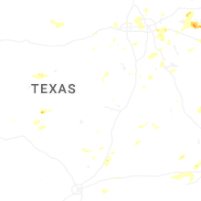
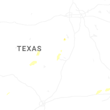


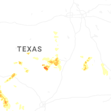
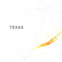
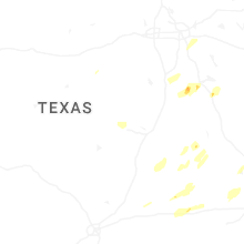
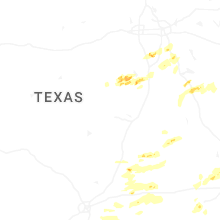


Connect with Interactive Hail Maps