

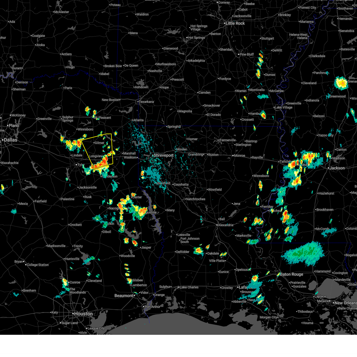
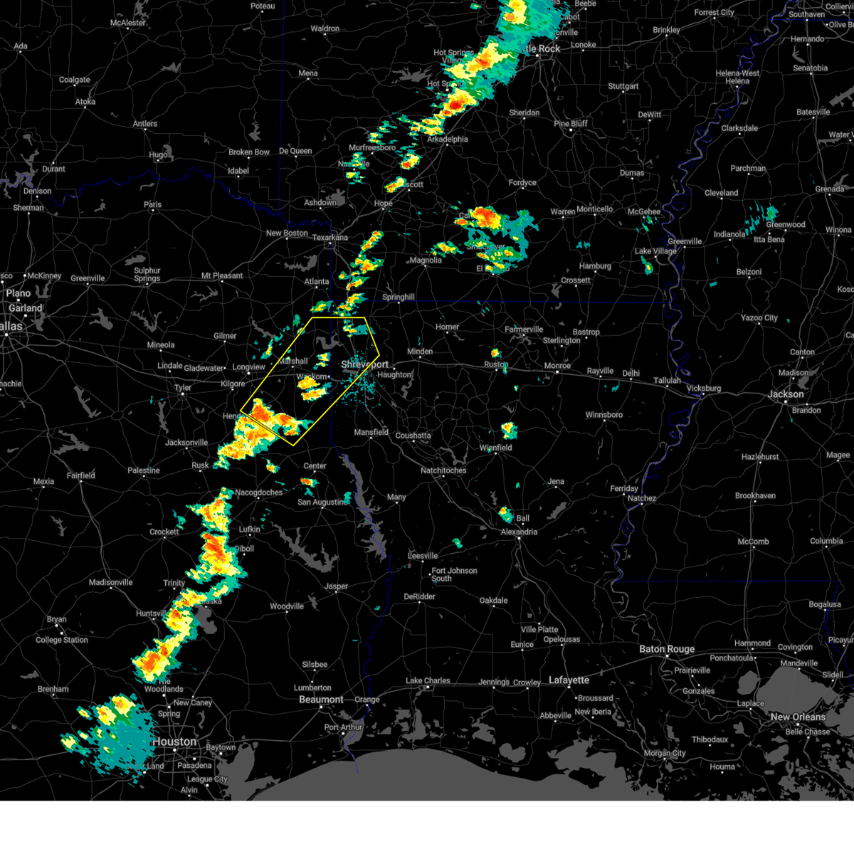
Hail Map for Lake Cherokee, TX
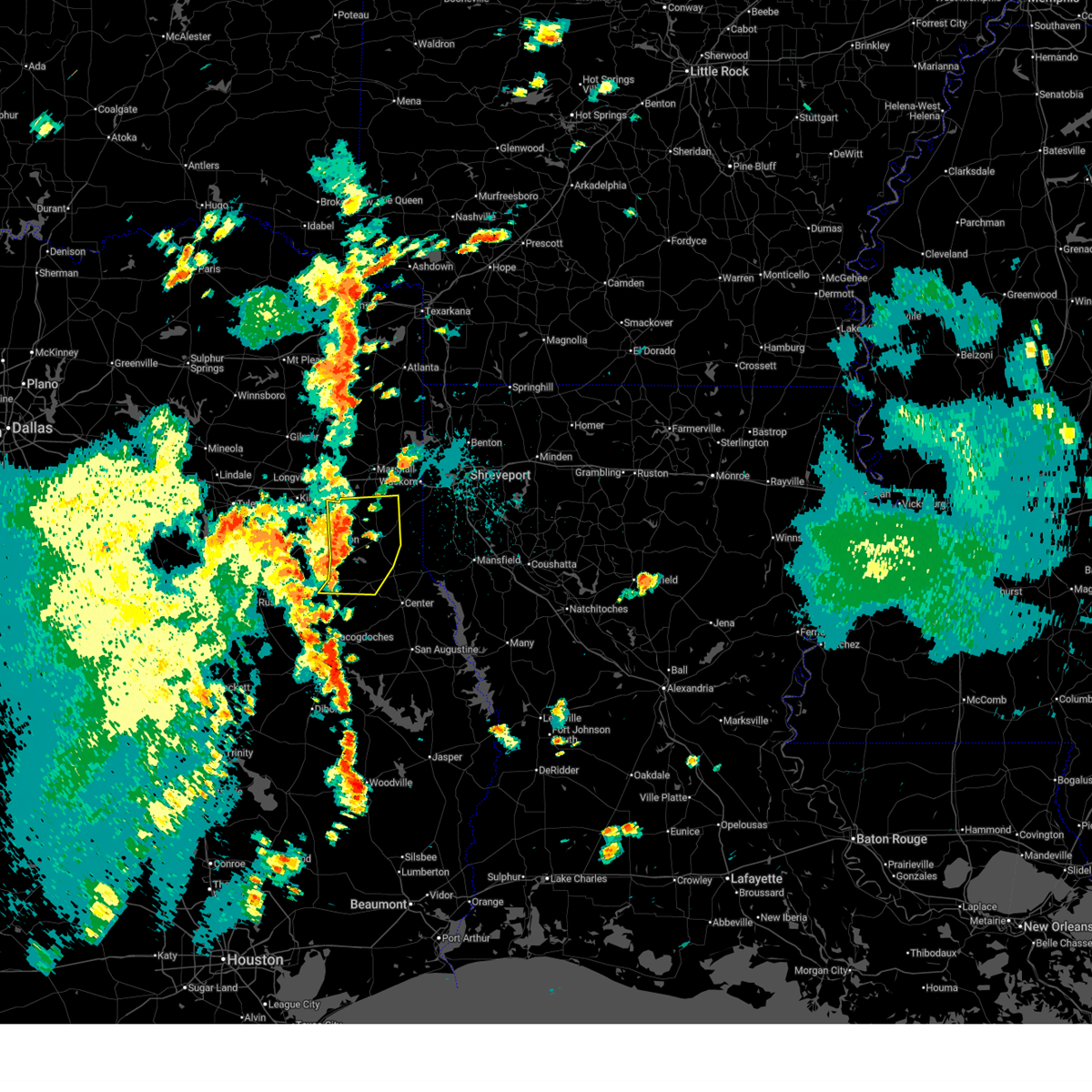
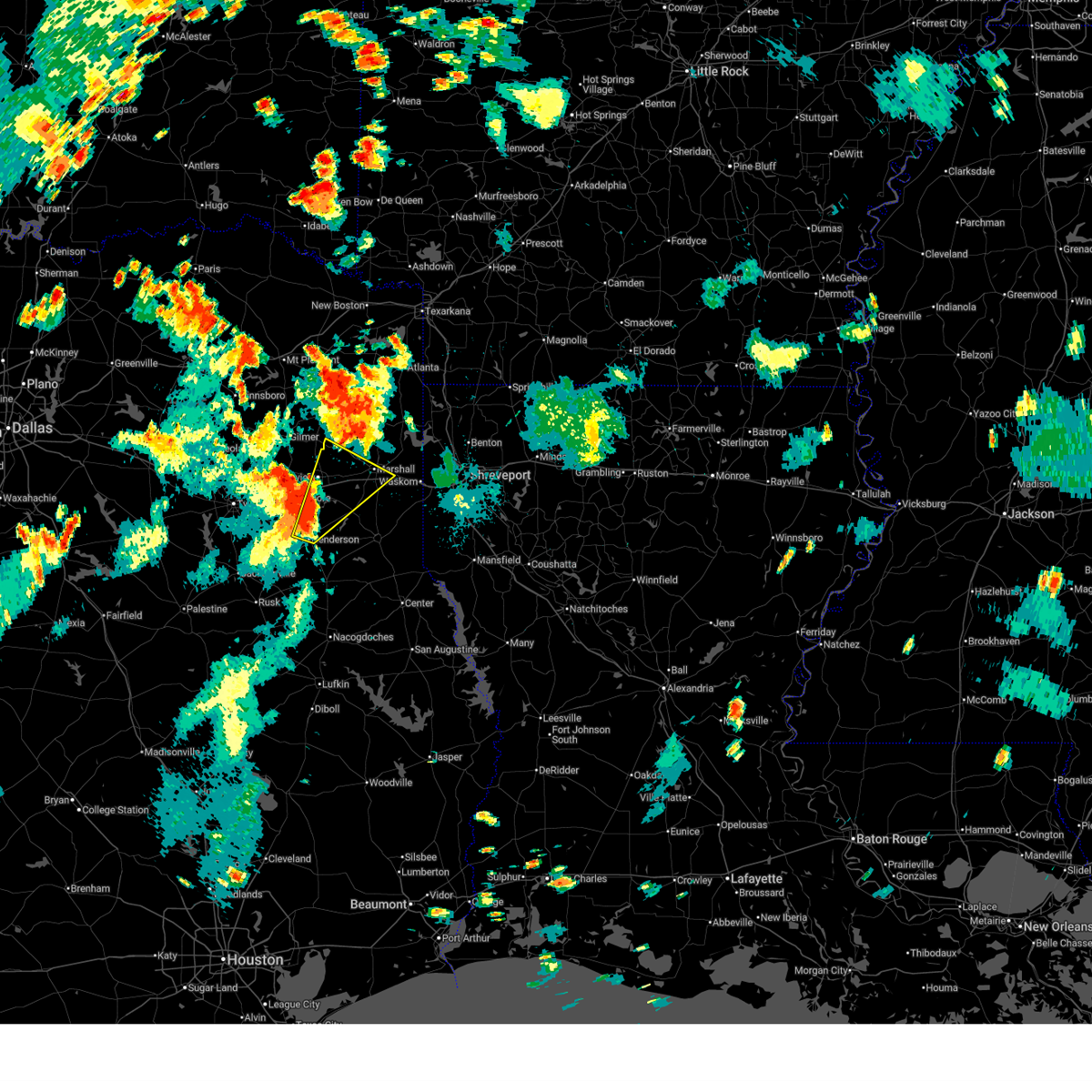
The Lake Cherokee, TX area has had 0 reports of on-the-ground hail by trained spotters, and has been under severe weather warnings 41 times during the past 12 months. Doppler radar has detected hail at or near Lake Cherokee, TX on 63 occasions, including 7 occasions during the past year.
| Name: | Lake Cherokee, TX |
| Where Located: | 54.3 miles WSW of Shreveport, LA |
| Map: | Google Map for Lake Cherokee, TX |
| Population: | 3071 |
| Housing Units: | 1782 |
| More Info: | Search Google for Lake Cherokee, TX |
2
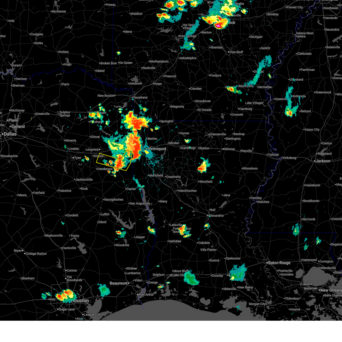
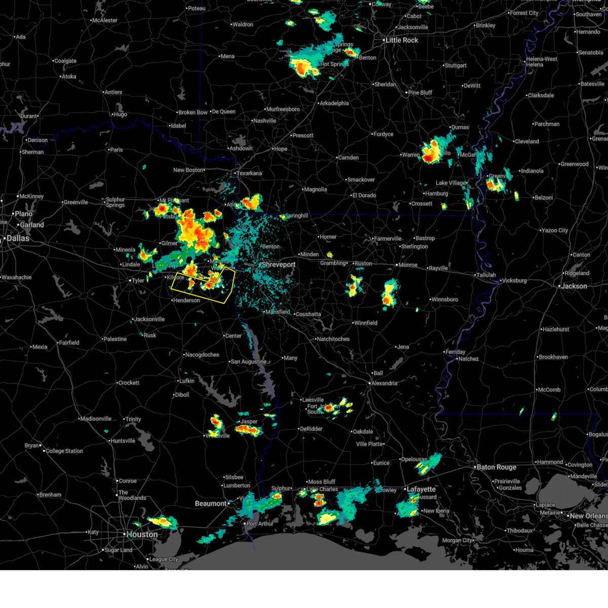
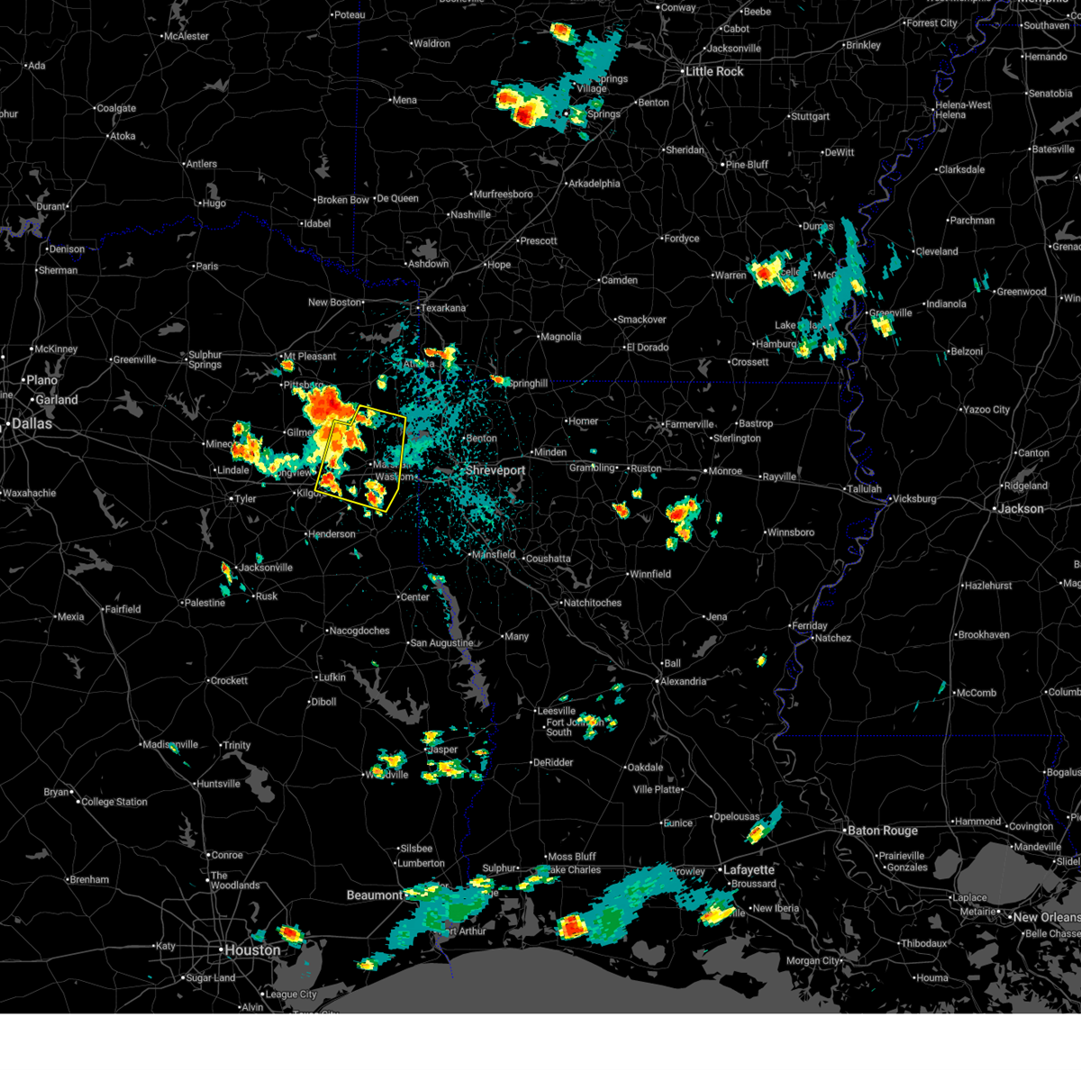
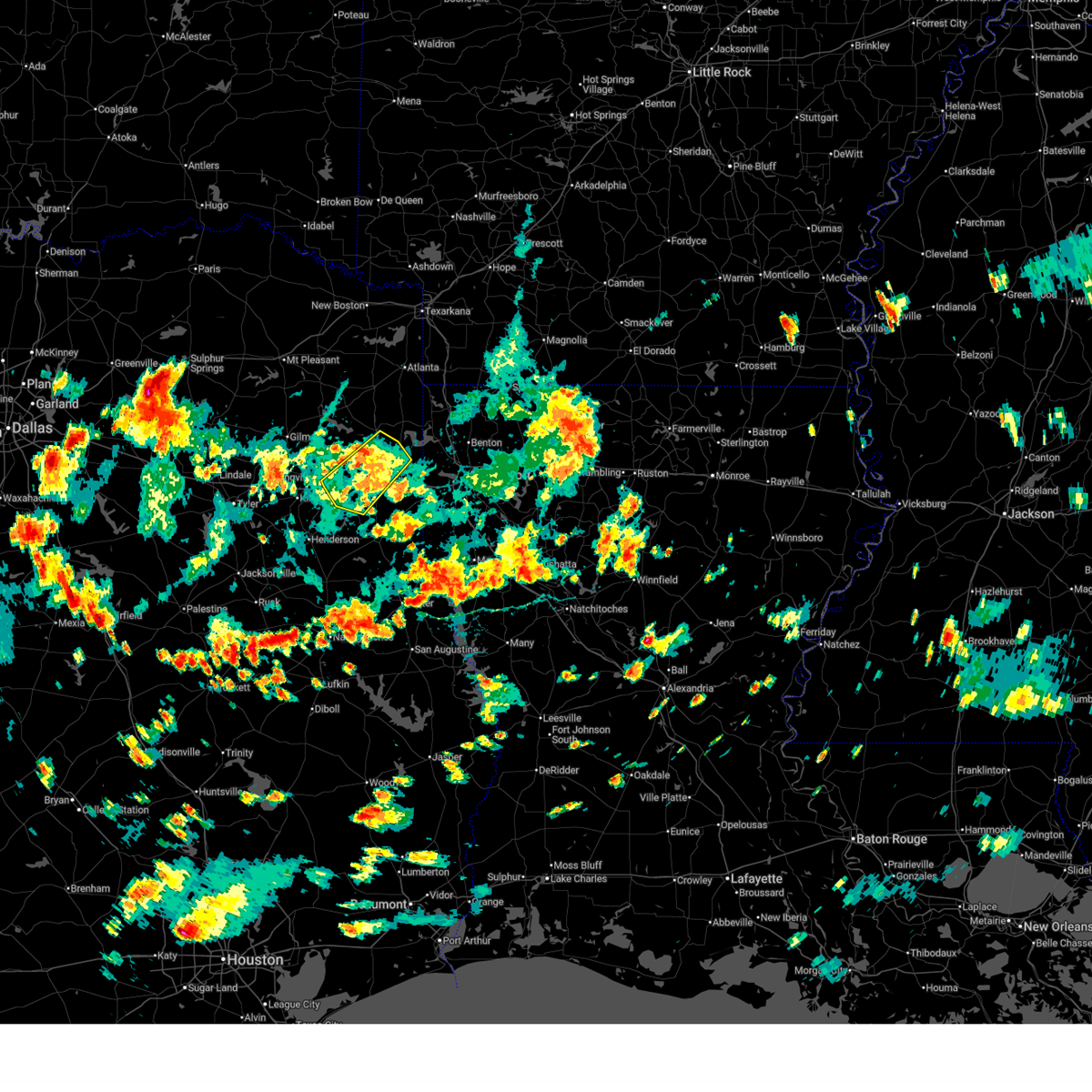
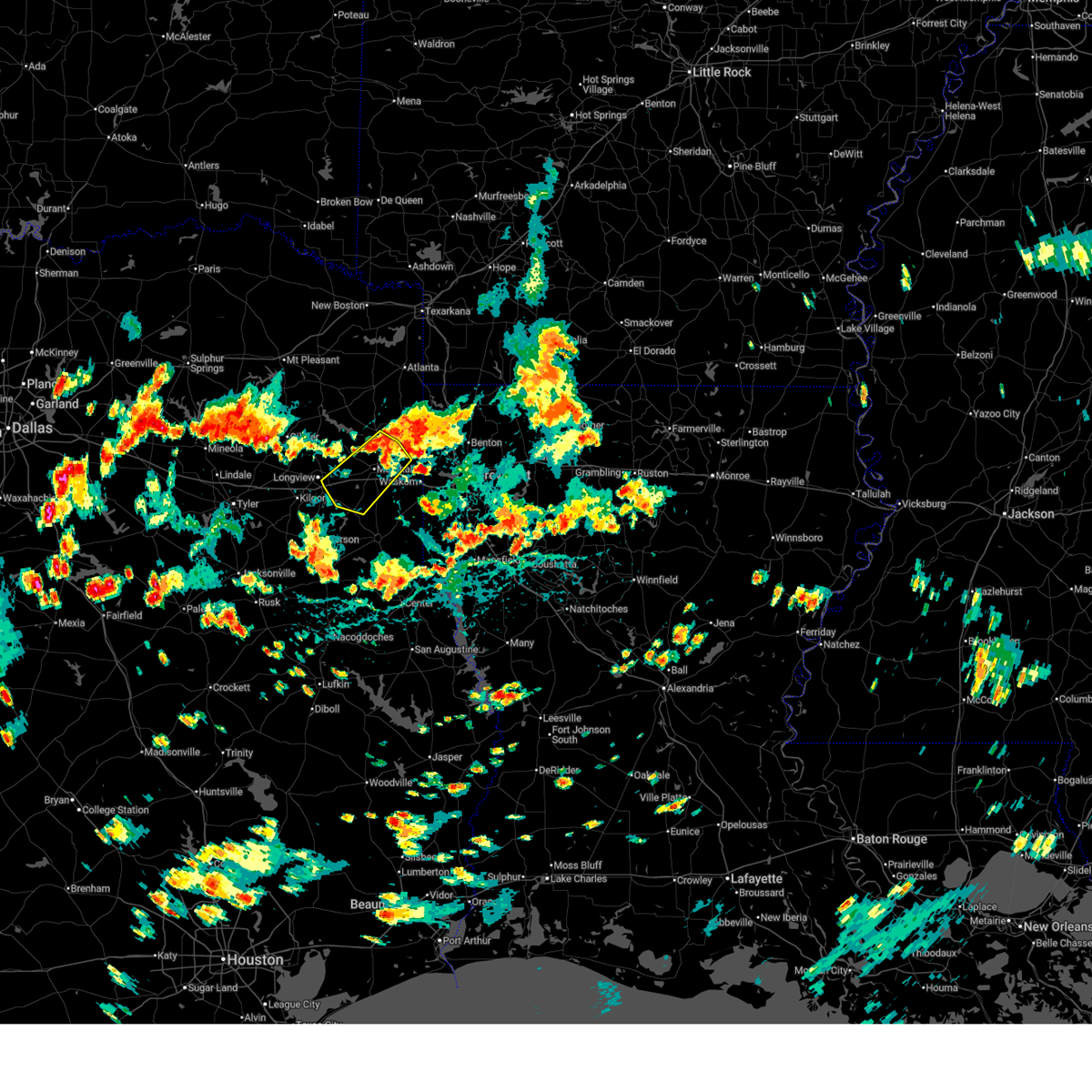
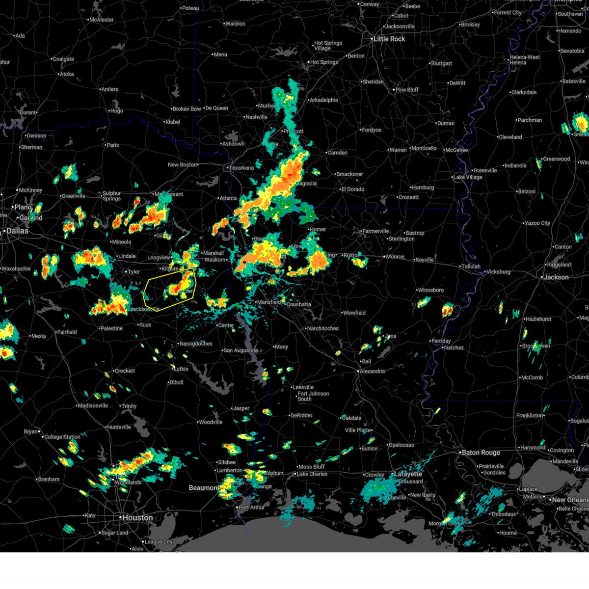
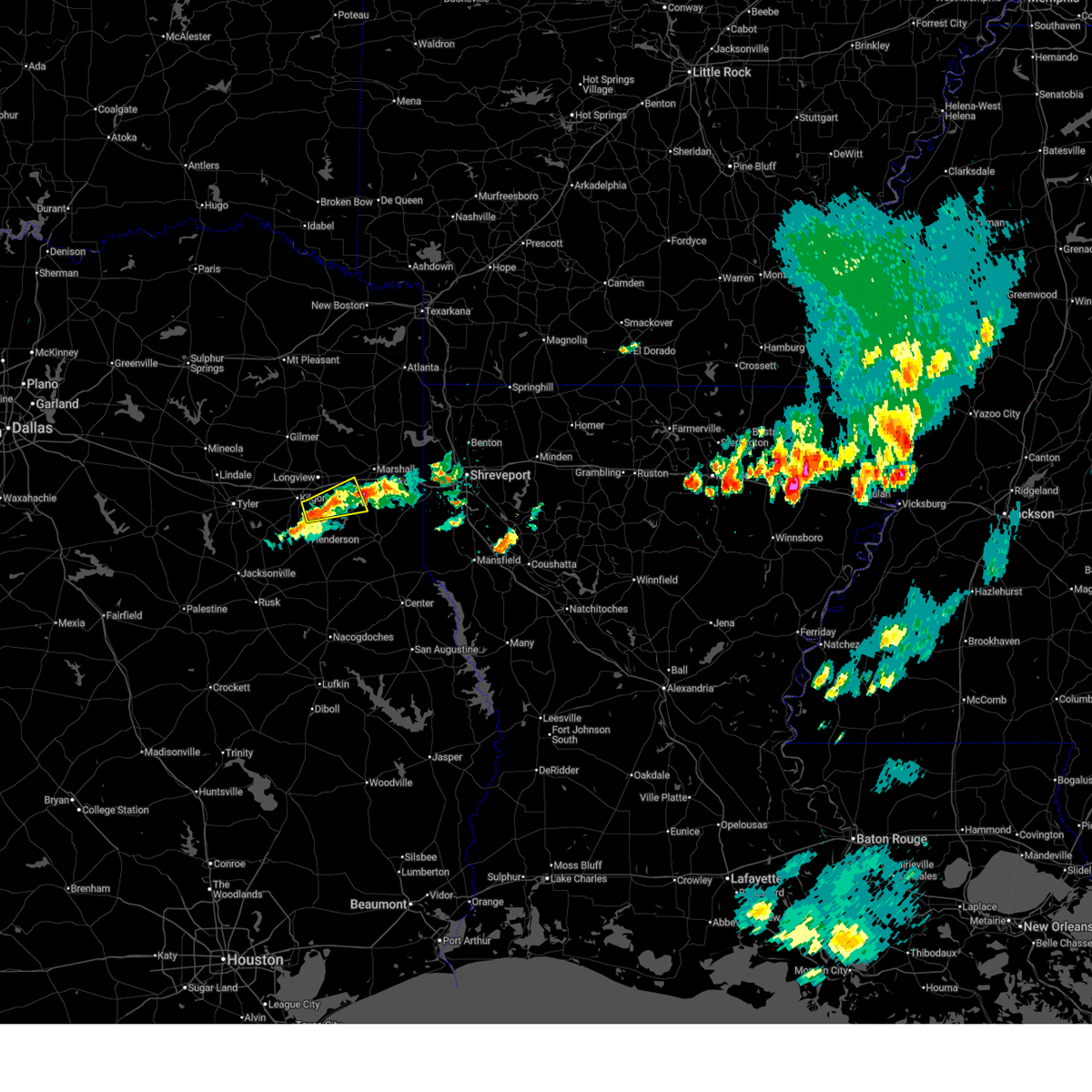
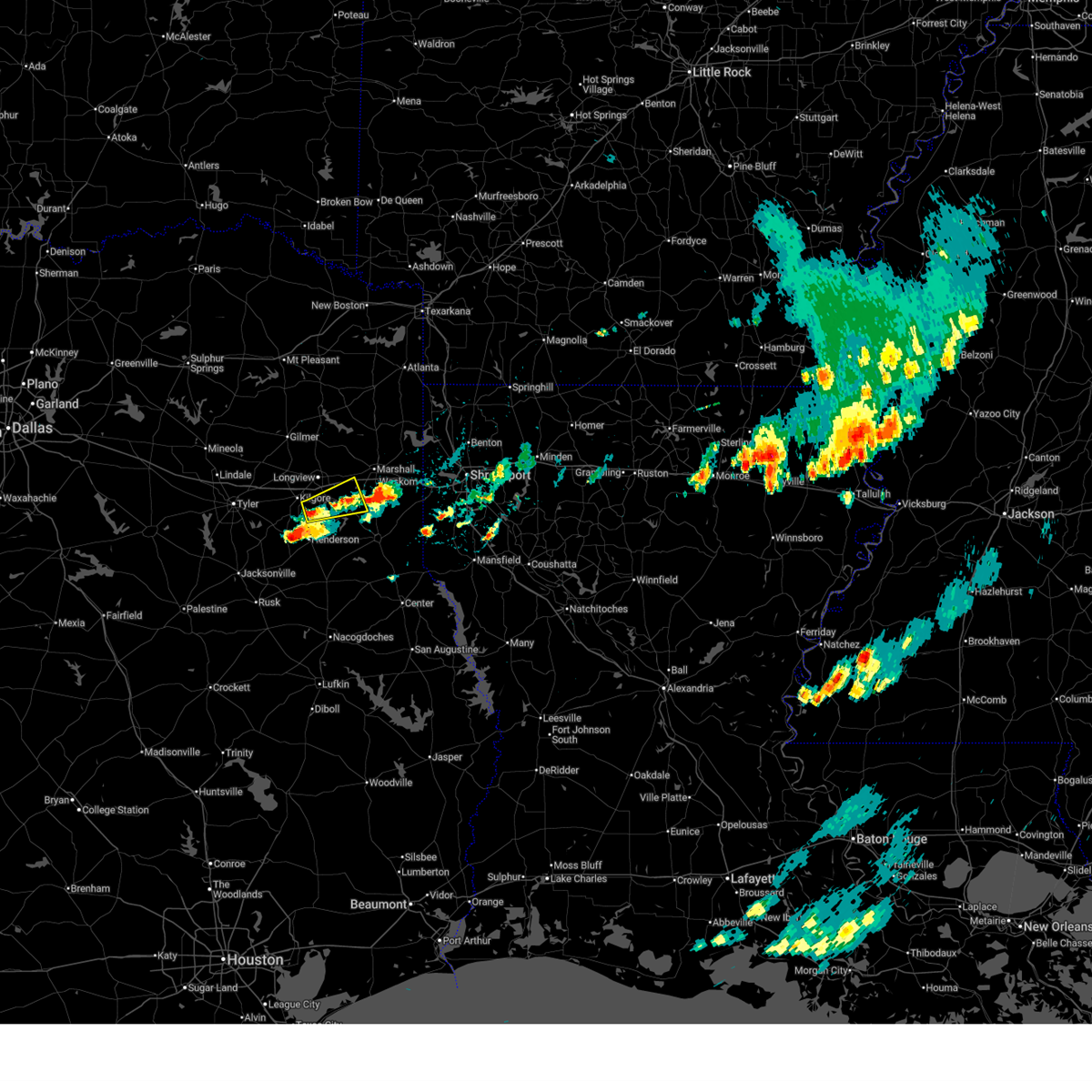
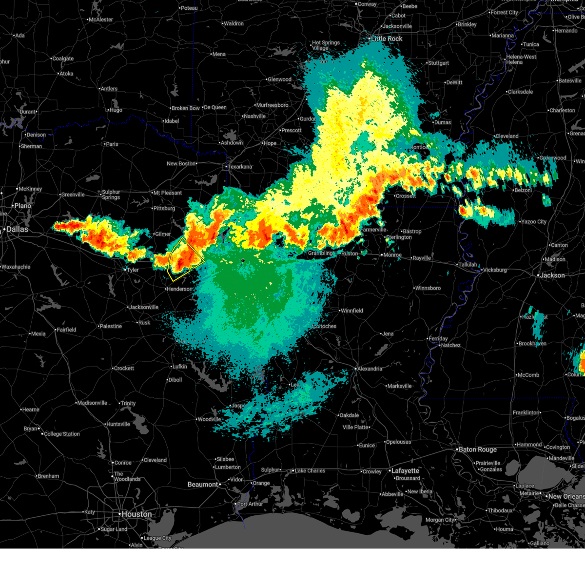
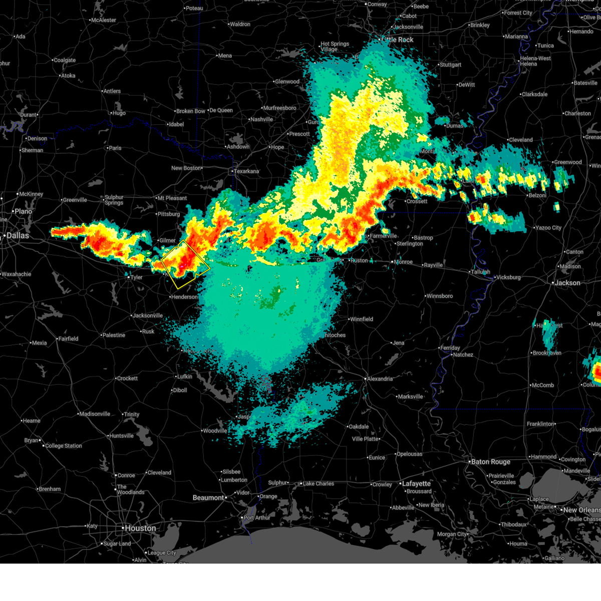
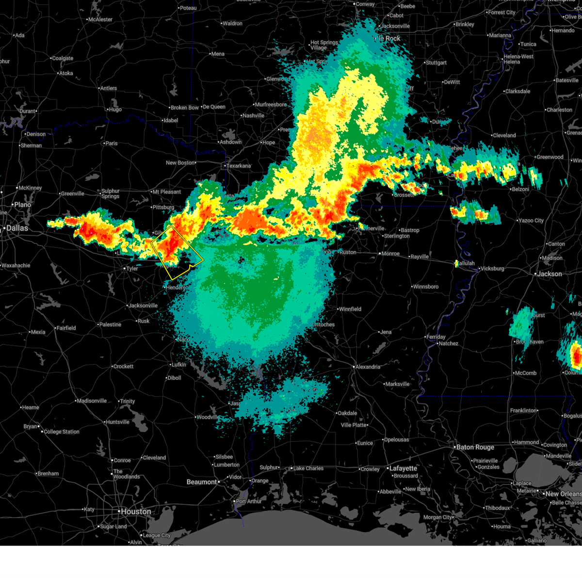
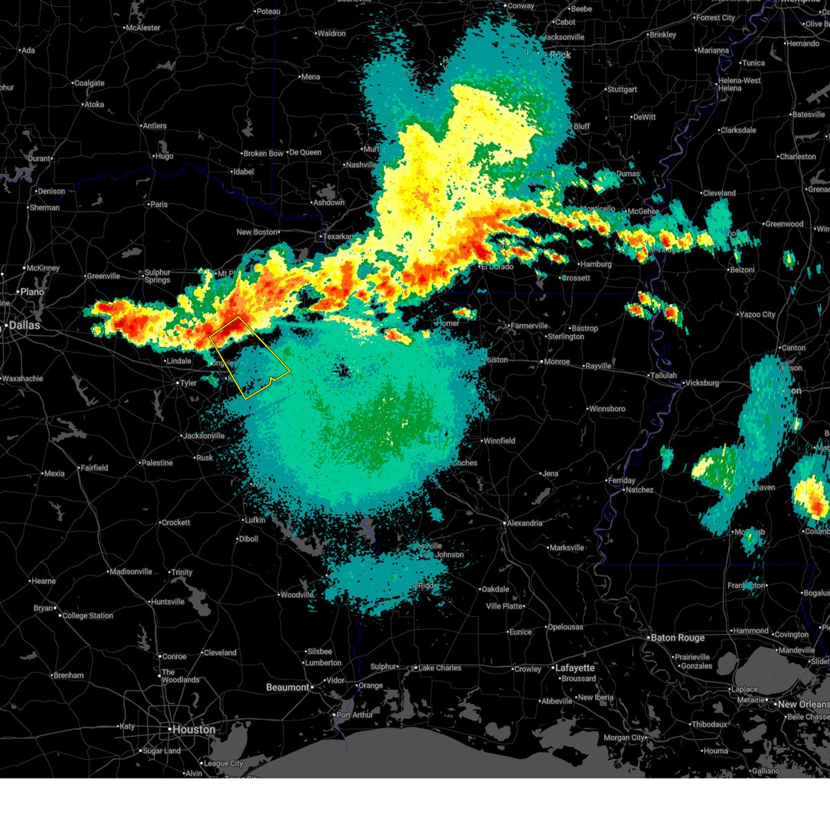
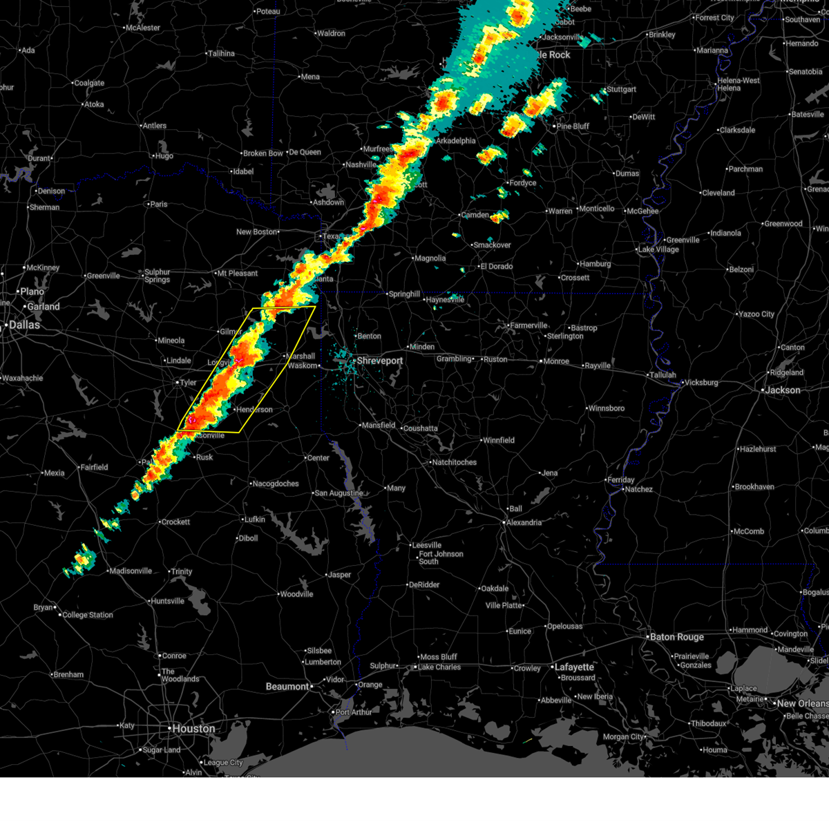
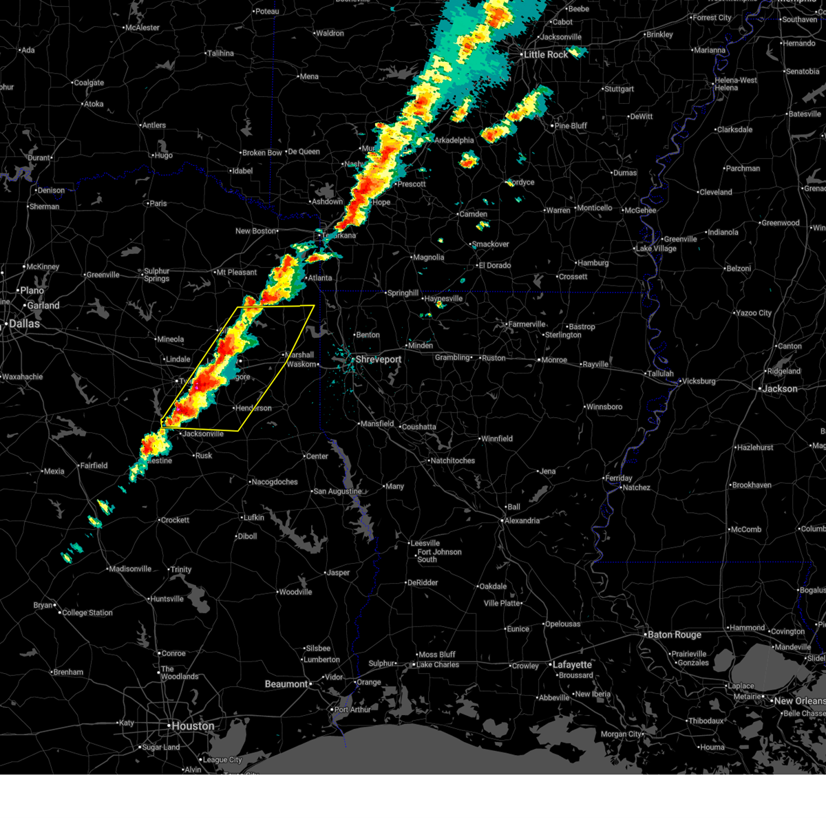
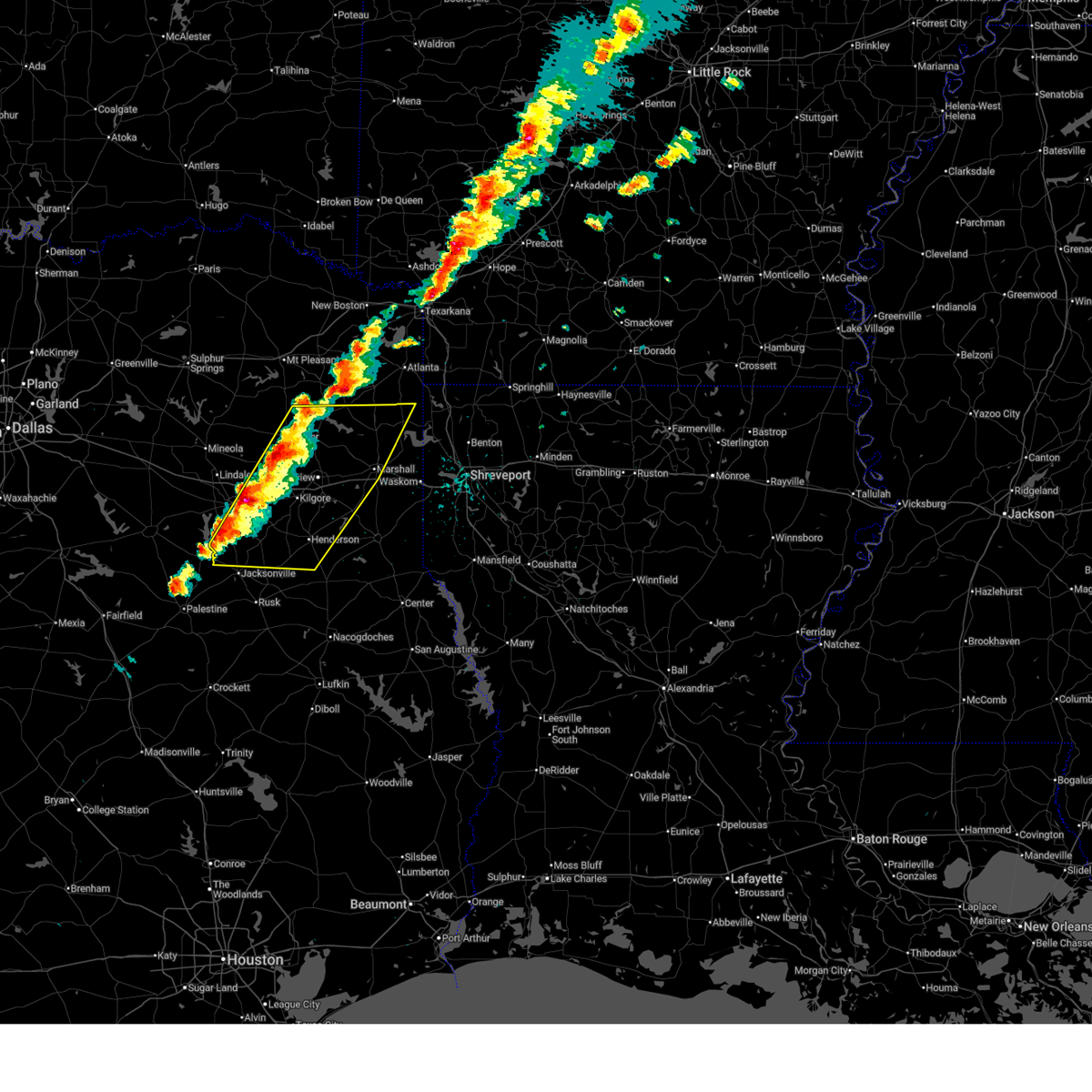
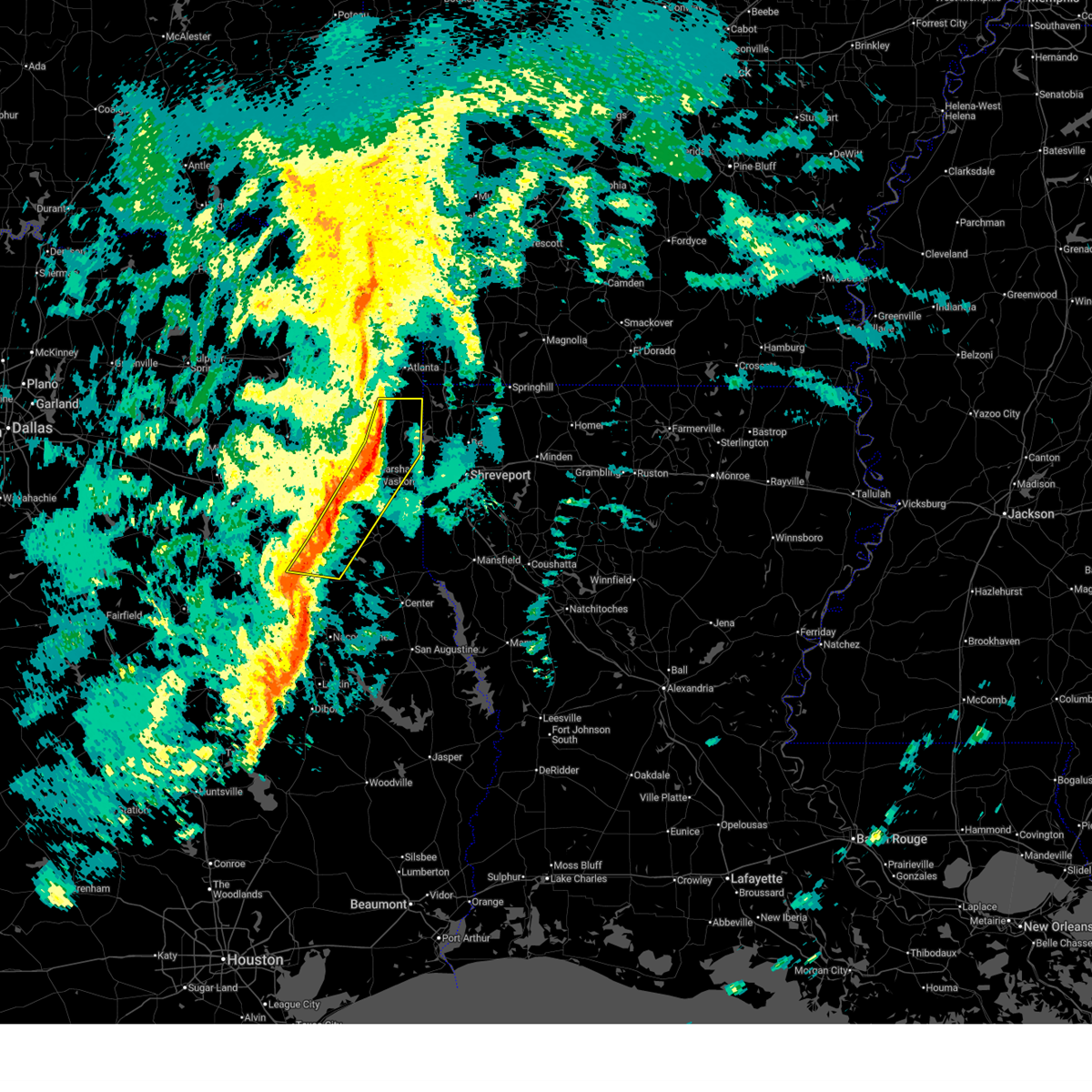
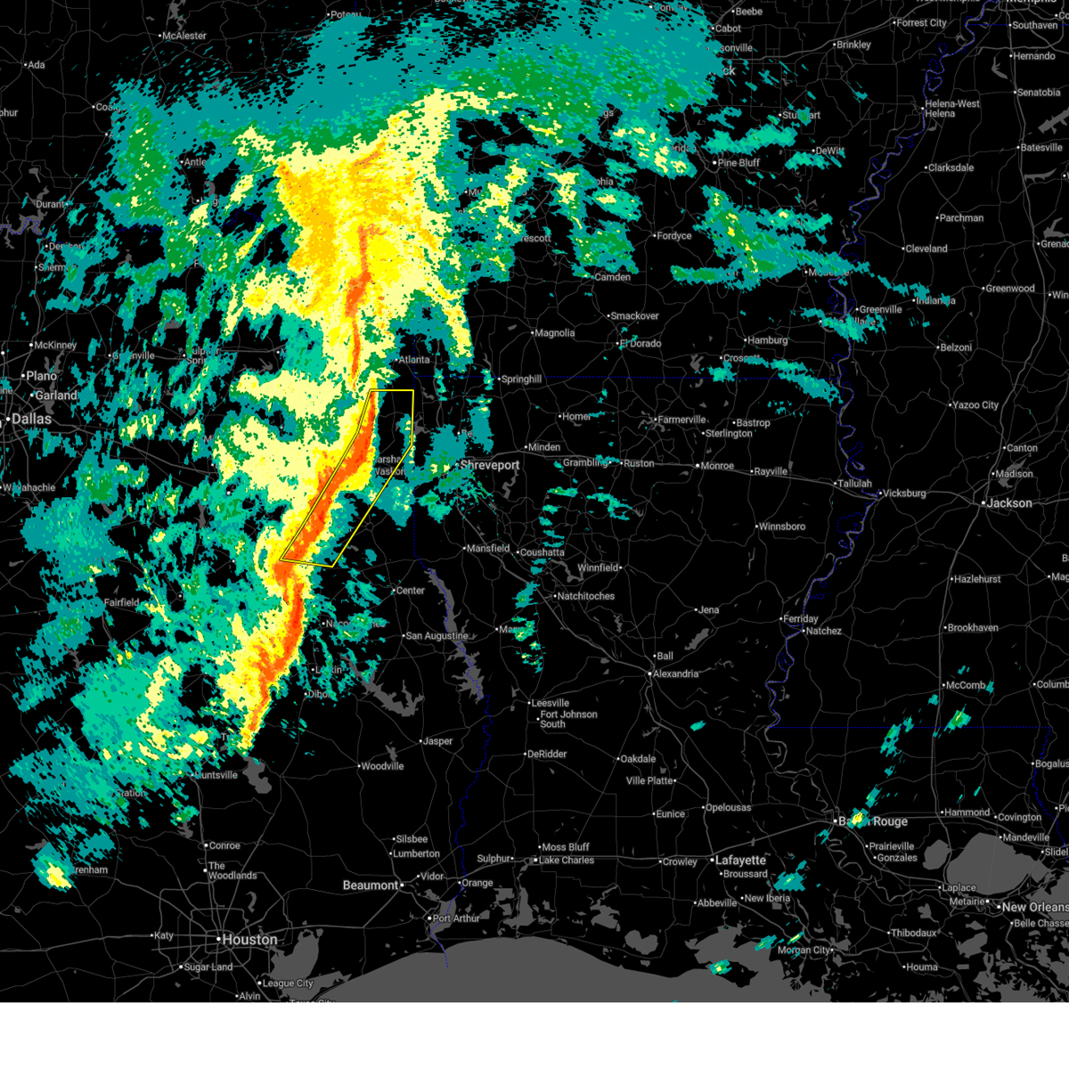
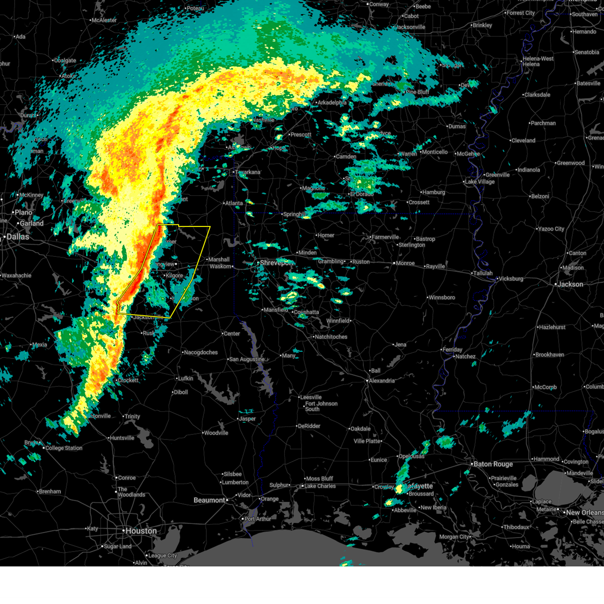
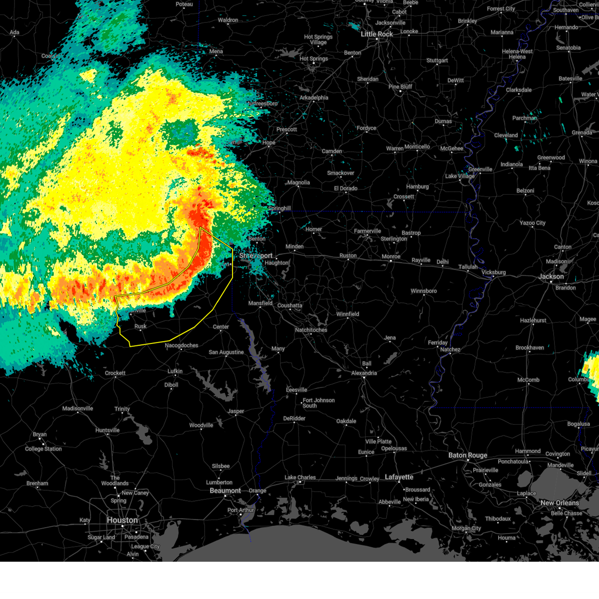
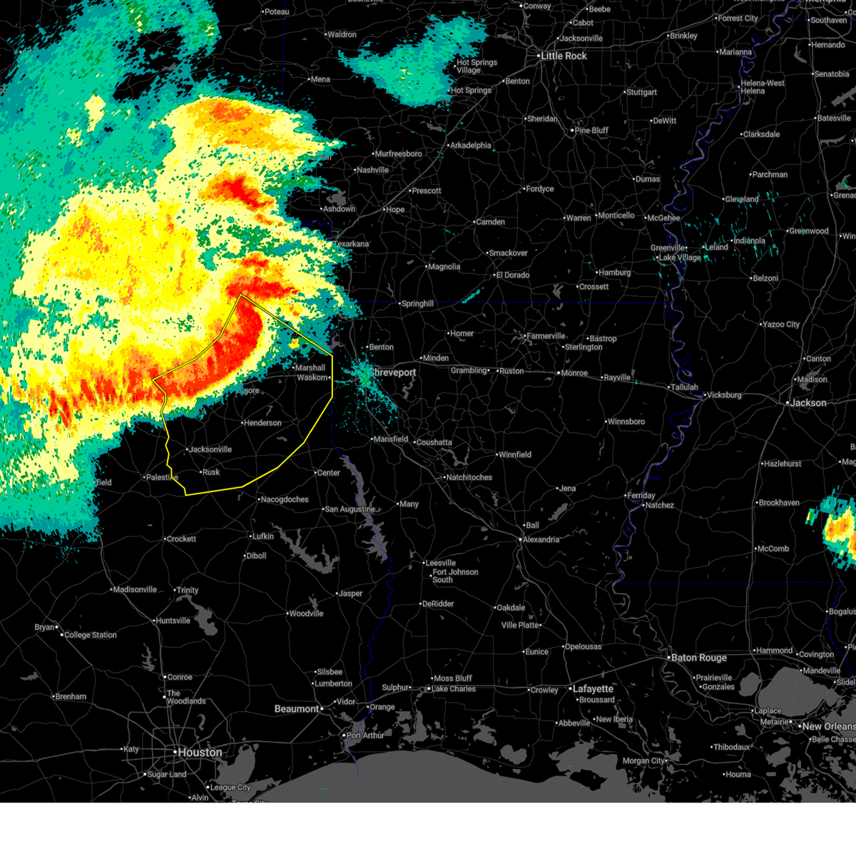
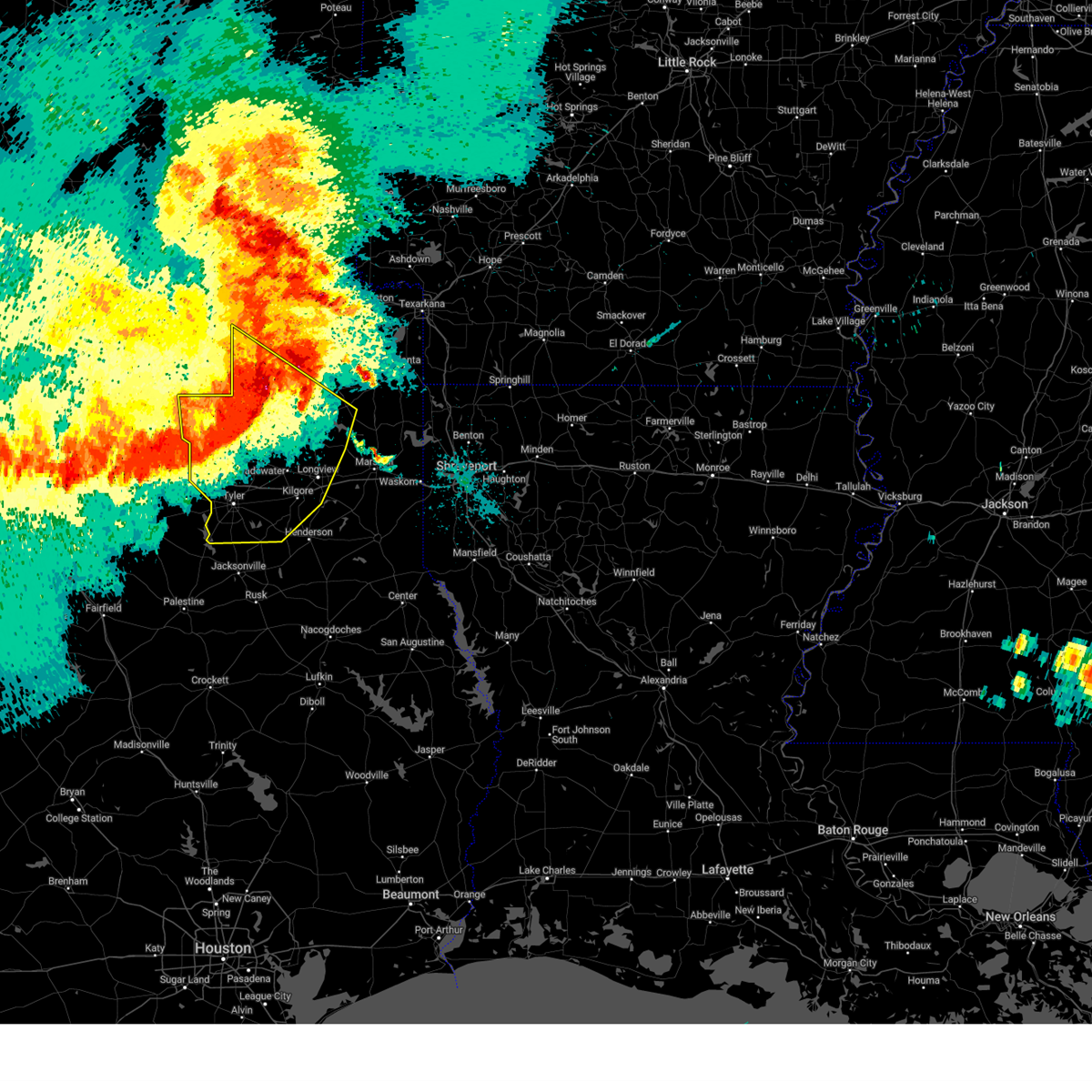
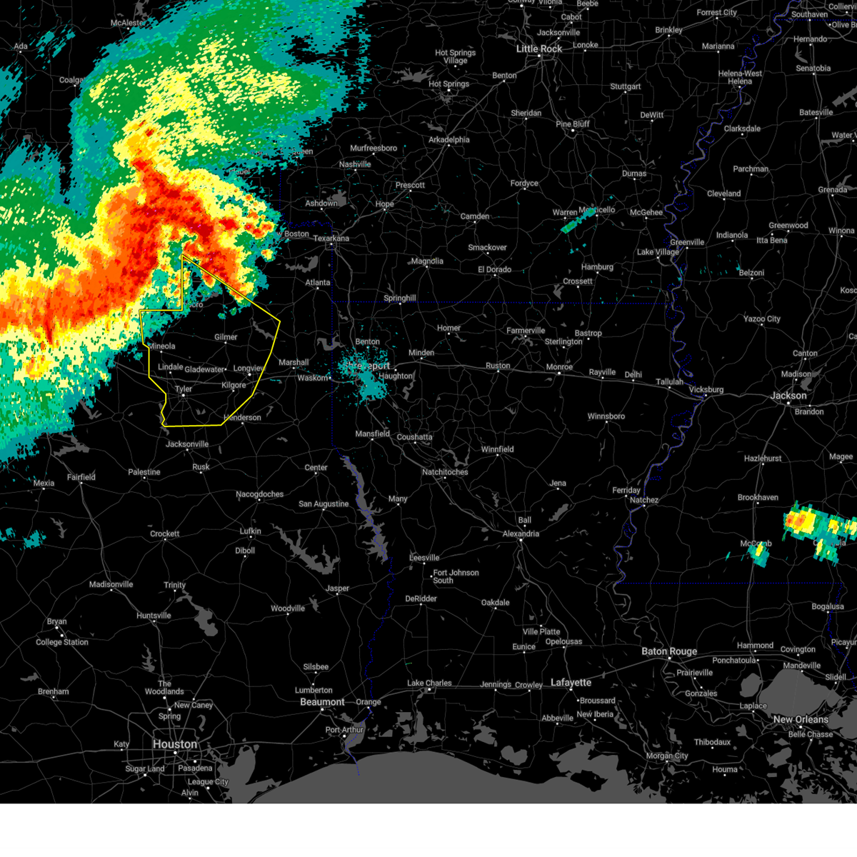
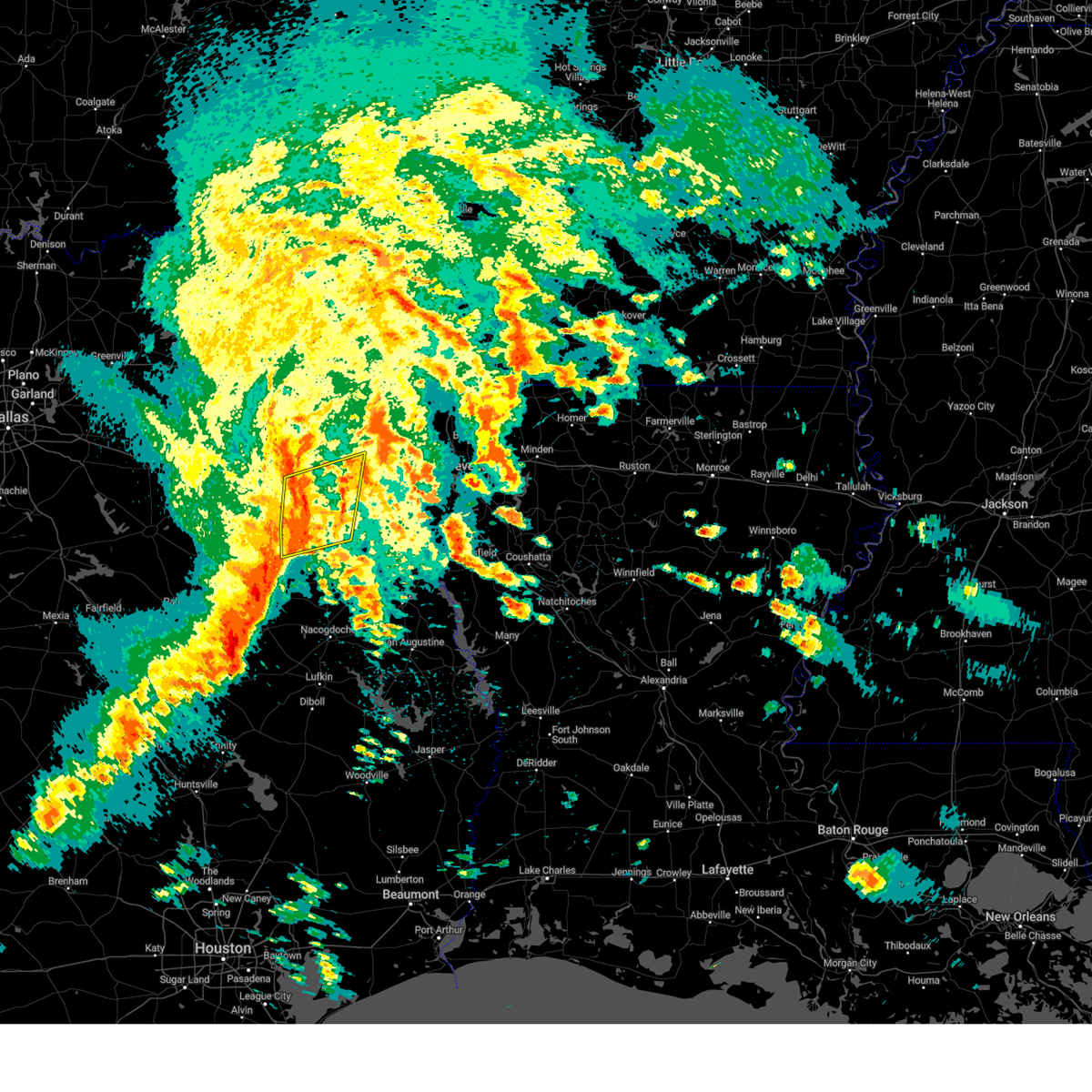
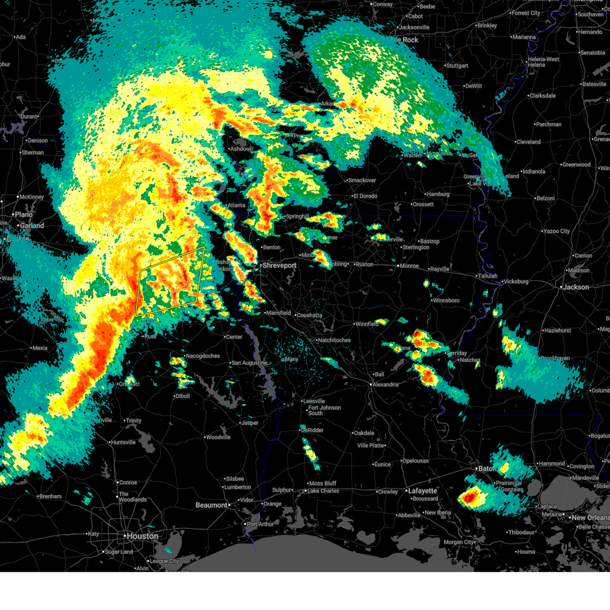
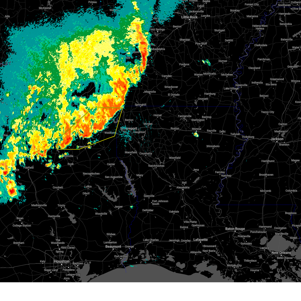
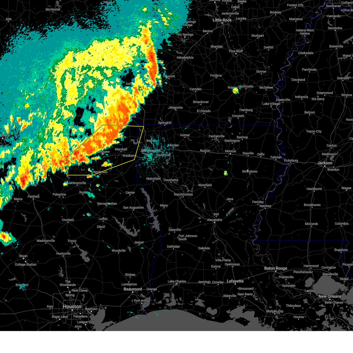
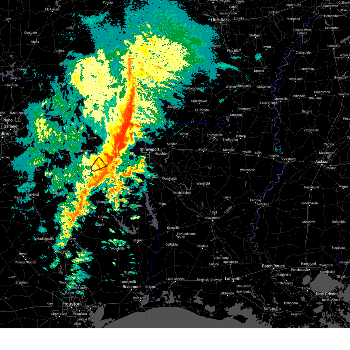
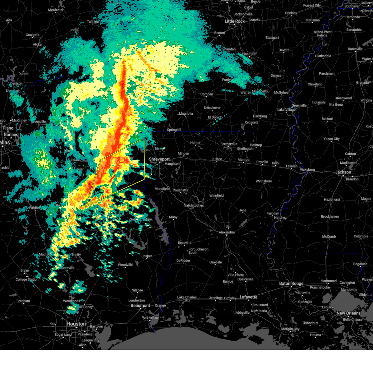
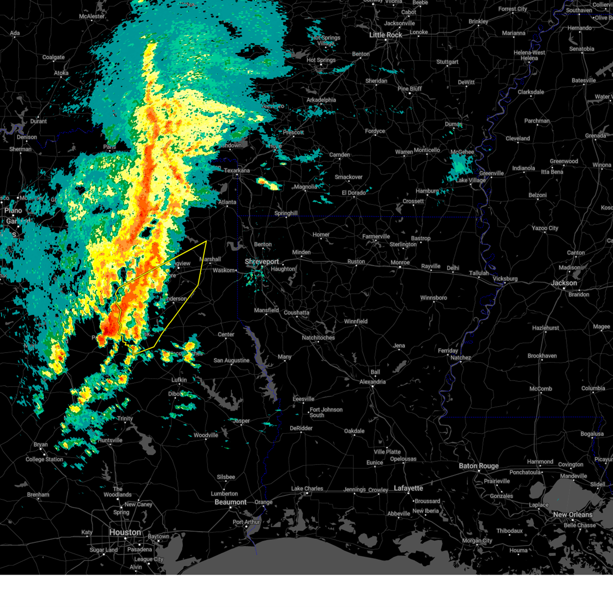
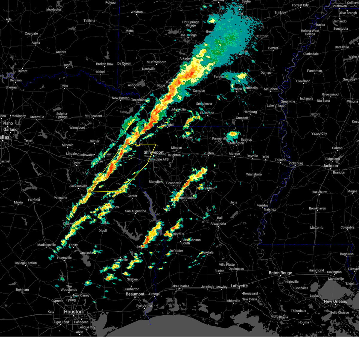
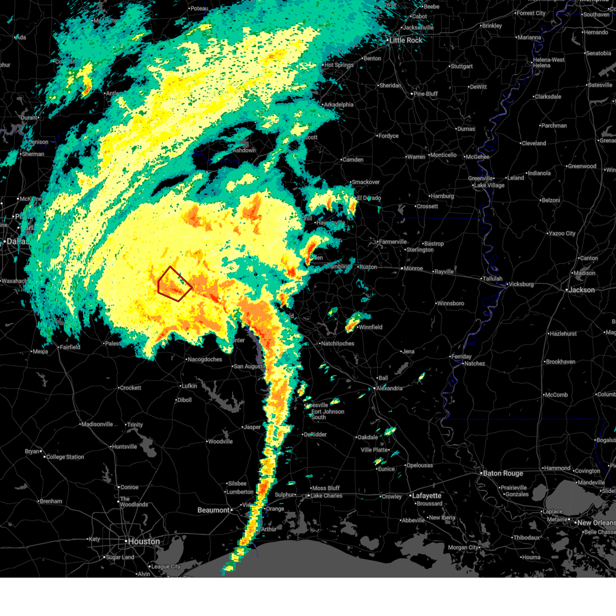
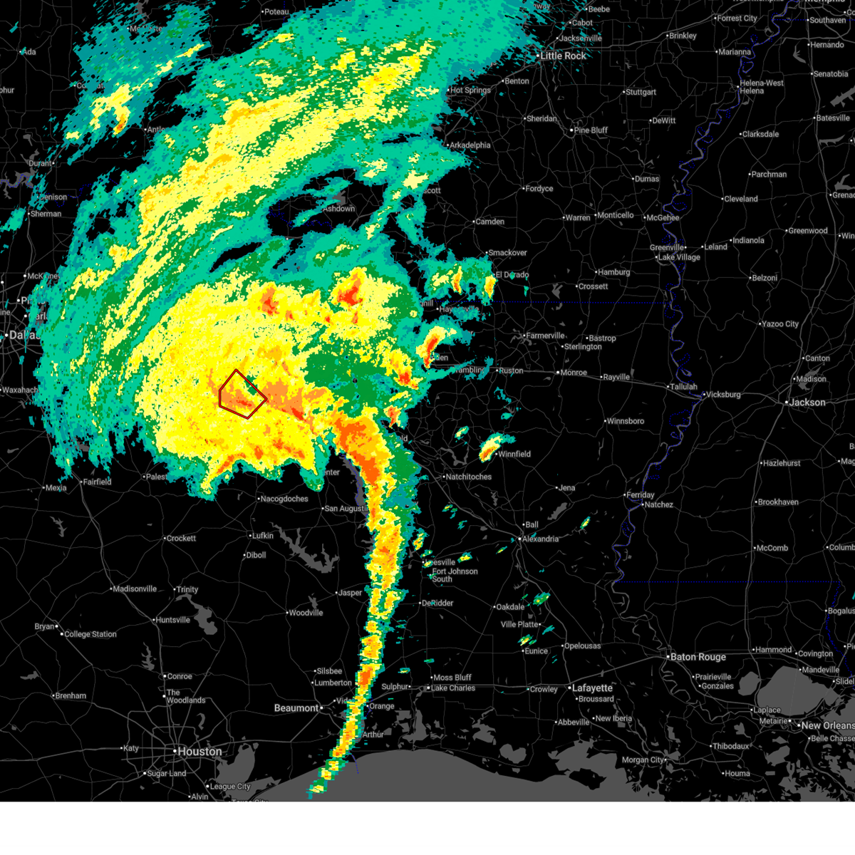
The Top Recent Hail Date for Lake Cherokee, TX is Sunday, March 15, 2026 (8th out of 63)

Hail and Wind Damage Spotted near Lake Cherokee, TX
| Date / Time | Report Details |
|---|---|
| 7/6/2026 4:56 PM CDT |
 The severe thunderstorm warning that was previously in effect has been reissued for harrison and panola counties and is in effect until 530 pm cdt. please refer to that bulletin for the latest severe weather information. The severe thunderstorm warning that was previously in effect has been reissued for harrison and panola counties and is in effect until 530 pm cdt. please refer to that bulletin for the latest severe weather information.
|
| 7/6/2026 3:58 PM CDT |
 Svrshv the national weather service in shreveport has issued a * severe thunderstorm warning for, southeastern gregg county in northeastern texas, southern harrison county in northeastern texas, northern panola county in northeastern texas, northeastern rusk county in northeastern texas, * until 500 pm cdt. * at 358 pm cdt, a severe thunderstorm was located over tatum, or 17 miles northwest of carthage, moving northeast at 10 mph (radar indicated). Hazards include 60 mph wind gusts and small hail. expect damage to roofs, siding, and trees Svrshv the national weather service in shreveport has issued a * severe thunderstorm warning for, southeastern gregg county in northeastern texas, southern harrison county in northeastern texas, northern panola county in northeastern texas, northeastern rusk county in northeastern texas, * until 500 pm cdt. * at 358 pm cdt, a severe thunderstorm was located over tatum, or 17 miles northwest of carthage, moving northeast at 10 mph (radar indicated). Hazards include 60 mph wind gusts and small hail. expect damage to roofs, siding, and trees
|
| 7/6/2026 3:36 PM CDT |
 Svrshv the national weather service in shreveport has issued a * severe thunderstorm warning for, southeastern gregg county in northeastern texas, harrison county in northeastern texas, central marion county in northeastern texas, north central panola county in northeastern texas, northeastern rusk county in northeastern texas, * until 430 pm cdt. * at 336 pm cdt, a severe thunderstorm was located over harleton, or 14 miles northeast of longview, moving east at 15 mph (radar indicated). Hazards include 60 mph wind gusts and small hail. expect damage to roofs, siding, and trees Svrshv the national weather service in shreveport has issued a * severe thunderstorm warning for, southeastern gregg county in northeastern texas, harrison county in northeastern texas, central marion county in northeastern texas, north central panola county in northeastern texas, northeastern rusk county in northeastern texas, * until 430 pm cdt. * at 336 pm cdt, a severe thunderstorm was located over harleton, or 14 miles northeast of longview, moving east at 15 mph (radar indicated). Hazards include 60 mph wind gusts and small hail. expect damage to roofs, siding, and trees
|
| 6/2/2026 4:14 PM CDT |
 The storm which prompted the warning has weakened below severe limits, and no longer poses an immediate threat to life or property. therefore, the warning will be allowed to expire. however, small hail, gusty winds, and heavy rain are still possible with this thunderstorm. to report severe weather, contact your nearest law enforcement agency. they will send your report to the national weather service office. The storm which prompted the warning has weakened below severe limits, and no longer poses an immediate threat to life or property. therefore, the warning will be allowed to expire. however, small hail, gusty winds, and heavy rain are still possible with this thunderstorm. to report severe weather, contact your nearest law enforcement agency. they will send your report to the national weather service office.
|
| 6/2/2026 3:32 PM CDT |
 Svrshv the national weather service in shreveport has issued a * severe thunderstorm warning for, southeastern gregg county in northeastern texas, central harrison county in northeastern texas, south central marion county in northeastern texas, northwestern panola county in northeastern texas, northeastern rusk county in northeastern texas, * until 415 pm cdt. * at 332 pm cdt, a severe thunderstorm was located near marshall, moving southwest at 30 mph (radar indicated). Hazards include 60 mph wind gusts and quarter size hail. Hail damage to vehicles is expected. Expect wind damage to roofs, siding, and trees. Svrshv the national weather service in shreveport has issued a * severe thunderstorm warning for, southeastern gregg county in northeastern texas, central harrison county in northeastern texas, south central marion county in northeastern texas, northwestern panola county in northeastern texas, northeastern rusk county in northeastern texas, * until 415 pm cdt. * at 332 pm cdt, a severe thunderstorm was located near marshall, moving southwest at 30 mph (radar indicated). Hazards include 60 mph wind gusts and quarter size hail. Hail damage to vehicles is expected. Expect wind damage to roofs, siding, and trees.
|
| 6/2/2026 2:59 PM CDT |
 Svrshv the national weather service in shreveport has issued a * severe thunderstorm warning for, northeastern cherokee county in northeastern texas, northwestern panola county in northeastern texas, rusk county in northeastern texas, southeastern smith county in northeastern texas, * until 345 pm cdt. * at 259 pm cdt, a severe thunderstorm was located 6 miles east of henderson, moving west at 25 mph (radar indicated). Hazards include 60 mph wind gusts and quarter size hail. Hail damage to vehicles is expected. Expect wind damage to roofs, siding, and trees. Svrshv the national weather service in shreveport has issued a * severe thunderstorm warning for, northeastern cherokee county in northeastern texas, northwestern panola county in northeastern texas, rusk county in northeastern texas, southeastern smith county in northeastern texas, * until 345 pm cdt. * at 259 pm cdt, a severe thunderstorm was located 6 miles east of henderson, moving west at 25 mph (radar indicated). Hazards include 60 mph wind gusts and quarter size hail. Hail damage to vehicles is expected. Expect wind damage to roofs, siding, and trees.
|
| 6/2/2026 2:06 PM CDT |
 Svrshv the national weather service in shreveport has issued a * severe thunderstorm warning for, southeastern gregg county in northeastern texas, southwestern harrison county in northeastern texas, northeastern rusk county in northeastern texas, * until 245 pm cdt. * at 206 pm cdt, a severe thunderstorm was located over hallsville, or 12 miles west of marshall, moving southwest at 10 mph (radar indicated). Hazards include 60 mph wind gusts and quarter size hail. Hail damage to vehicles is expected. Expect wind damage to roofs, siding, and trees. Svrshv the national weather service in shreveport has issued a * severe thunderstorm warning for, southeastern gregg county in northeastern texas, southwestern harrison county in northeastern texas, northeastern rusk county in northeastern texas, * until 245 pm cdt. * at 206 pm cdt, a severe thunderstorm was located over hallsville, or 12 miles west of marshall, moving southwest at 10 mph (radar indicated). Hazards include 60 mph wind gusts and quarter size hail. Hail damage to vehicles is expected. Expect wind damage to roofs, siding, and trees.
|
| 5/23/2026 5:44 AM CDT |
 Svrshv the national weather service in shreveport has issued a * severe thunderstorm warning for, southern camp county in northeastern texas, gregg county in northeastern texas, western harrison county in northeastern texas, rusk county in northeastern texas, upshur county in northeastern texas, * until 645 am cdt. * at 544 am cdt, severe thunderstorms were located along a line from over leesburg to near ponta, or along a line from over leesburg to 12 miles northeast of rusk, moving east at 20 mph (radar indicated). Hazards include 60 mph wind gusts and quarter size hail. Hail damage to vehicles is expected. Expect wind damage to roofs, siding, and trees. Svrshv the national weather service in shreveport has issued a * severe thunderstorm warning for, southern camp county in northeastern texas, gregg county in northeastern texas, western harrison county in northeastern texas, rusk county in northeastern texas, upshur county in northeastern texas, * until 645 am cdt. * at 544 am cdt, severe thunderstorms were located along a line from over leesburg to near ponta, or along a line from over leesburg to 12 miles northeast of rusk, moving east at 20 mph (radar indicated). Hazards include 60 mph wind gusts and quarter size hail. Hail damage to vehicles is expected. Expect wind damage to roofs, siding, and trees.
|
| 5/22/2026 8:23 PM CDT |
 The storm which prompted the warning has weakened below severe limits, and no longer poses an immediate threat to life or property. therefore, the warning will be allowed to expire. The storm which prompted the warning has weakened below severe limits, and no longer poses an immediate threat to life or property. therefore, the warning will be allowed to expire.
|
| 5/22/2026 7:52 PM CDT |
 Svrshv the national weather service in shreveport has issued a * severe thunderstorm warning for, southeastern gregg county in northeastern texas, southwestern harrison county in northeastern texas, northwestern panola county in northeastern texas, northeastern rusk county in northeastern texas, * until 830 pm cdt. * at 752 pm cdt, a severe thunderstorm was located 8 miles southeast of kilgore, moving east at 15 mph (radar indicated). Hazards include 60 mph wind gusts and quarter size hail. Hail damage to vehicles is expected. Expect wind damage to roofs, siding, and trees. Svrshv the national weather service in shreveport has issued a * severe thunderstorm warning for, southeastern gregg county in northeastern texas, southwestern harrison county in northeastern texas, northwestern panola county in northeastern texas, northeastern rusk county in northeastern texas, * until 830 pm cdt. * at 752 pm cdt, a severe thunderstorm was located 8 miles southeast of kilgore, moving east at 15 mph (radar indicated). Hazards include 60 mph wind gusts and quarter size hail. Hail damage to vehicles is expected. Expect wind damage to roofs, siding, and trees.
|
| 5/9/2026 12:44 AM CDT |
 Svrshv the national weather service in shreveport has issued a * severe thunderstorm warning for, gregg county in northeastern texas, harrison county in northeastern texas, southwestern marion county in northeastern texas, southern upshur county in northeastern texas, * until 145 am cdt. * at 1244 am cdt, severe thunderstorms were located along a line from over berea to near west mountain, or along a line from 16 miles north of marshall to 5 miles north of gladewater, moving southeast at 25 mph (radar indicated). Hazards include 60 mph wind gusts and quarter size hail. Hail damage to vehicles is expected. Expect wind damage to roofs, siding, and trees. Svrshv the national weather service in shreveport has issued a * severe thunderstorm warning for, gregg county in northeastern texas, harrison county in northeastern texas, southwestern marion county in northeastern texas, southern upshur county in northeastern texas, * until 145 am cdt. * at 1244 am cdt, severe thunderstorms were located along a line from over berea to near west mountain, or along a line from 16 miles north of marshall to 5 miles north of gladewater, moving southeast at 25 mph (radar indicated). Hazards include 60 mph wind gusts and quarter size hail. Hail damage to vehicles is expected. Expect wind damage to roofs, siding, and trees.
|
| 4/24/2026 11:42 PM CDT |
 Svrshv the national weather service in shreveport has issued a * severe thunderstorm warning for, southeastern gregg county in northeastern texas, southwestern harrison county in northeastern texas, northwestern panola county in northeastern texas, northeastern rusk county in northeastern texas, * until 1230 am cdt. * at 1142 pm cdt, a severe thunderstorm was located 6 miles northwest of tatum, or 14 miles southeast of longview, moving southeast at 35 mph (radar indicated). Hazards include 60 mph wind gusts and quarter size hail. Hail damage to vehicles is expected. Expect wind damage to roofs, siding, and trees. Svrshv the national weather service in shreveport has issued a * severe thunderstorm warning for, southeastern gregg county in northeastern texas, southwestern harrison county in northeastern texas, northwestern panola county in northeastern texas, northeastern rusk county in northeastern texas, * until 1230 am cdt. * at 1142 pm cdt, a severe thunderstorm was located 6 miles northwest of tatum, or 14 miles southeast of longview, moving southeast at 35 mph (radar indicated). Hazards include 60 mph wind gusts and quarter size hail. Hail damage to vehicles is expected. Expect wind damage to roofs, siding, and trees.
|
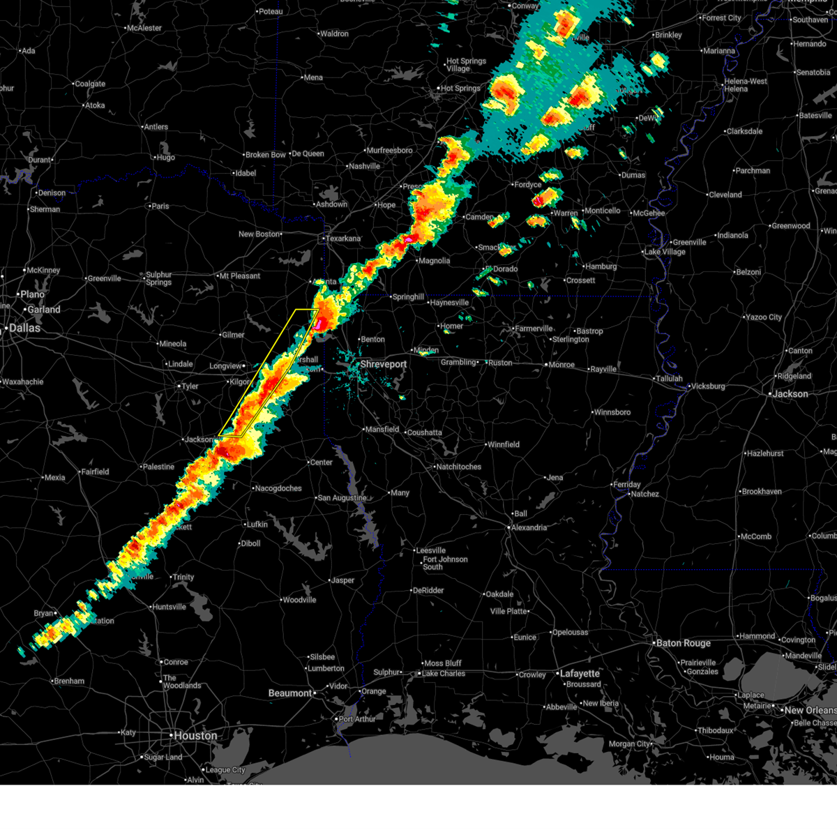
| 4/24/2026 11:31 PM CDT |
 At 1131 pm cdt, a severe thunderstorm was located near hallsville, or 9 miles southeast of longview, moving southeast at 35 mph (radar indicated). Hazards include ping pong ball size hail and 60 mph wind gusts. People and animals outdoors will be injured. expect hail damage to roofs, siding, windows, and vehicles. expect wind damage to roofs, siding, and trees. Locations impacted include, longview, hallsville, tatum, harleton, lakeport, easton, chalk hill, darco, stewart, monroe and oak hill. At 1131 pm cdt, a severe thunderstorm was located near hallsville, or 9 miles southeast of longview, moving southeast at 35 mph (radar indicated). Hazards include ping pong ball size hail and 60 mph wind gusts. People and animals outdoors will be injured. expect hail damage to roofs, siding, windows, and vehicles. expect wind damage to roofs, siding, and trees. Locations impacted include, longview, hallsville, tatum, harleton, lakeport, easton, chalk hill, darco, stewart, monroe and oak hill.
|
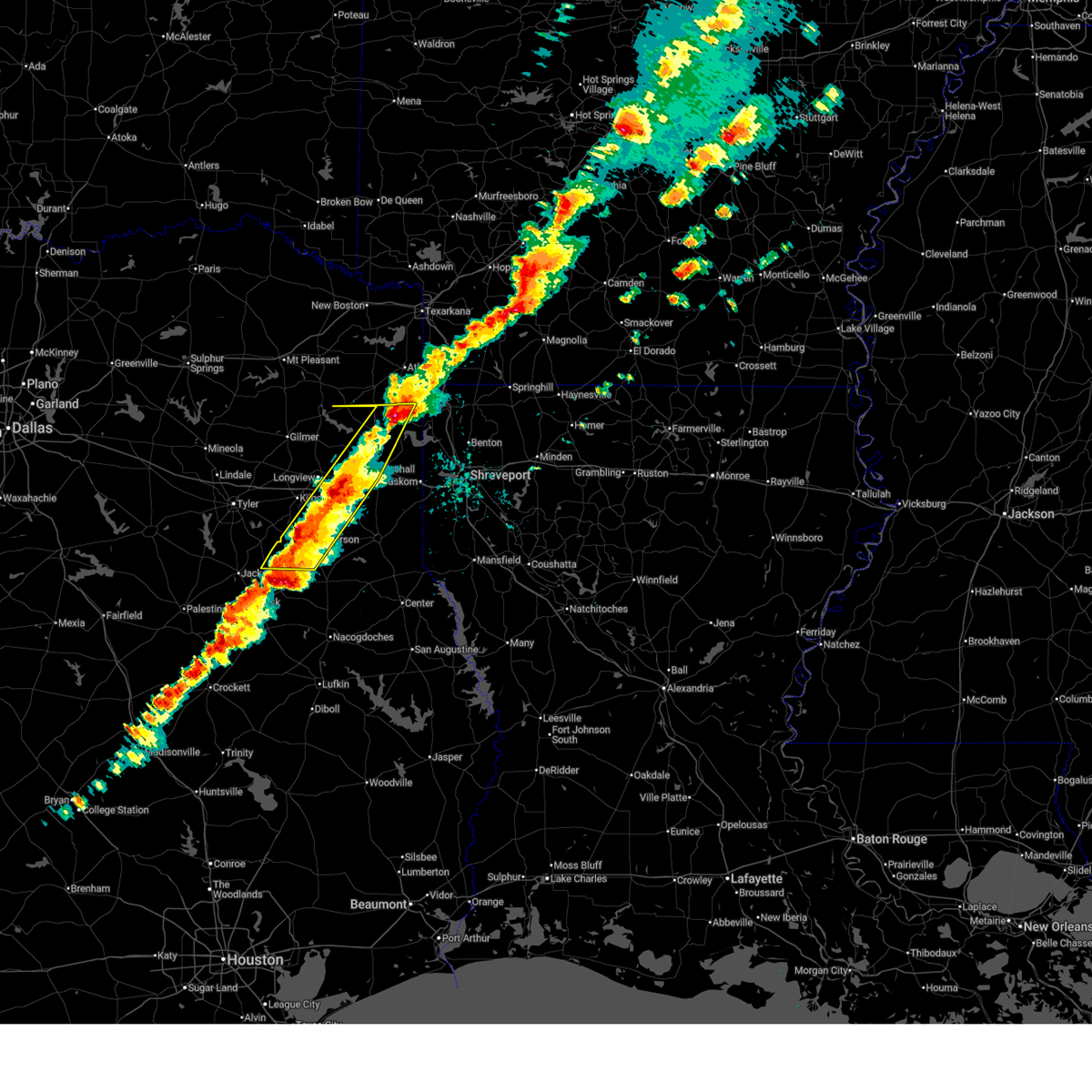
| 4/24/2026 11:26 PM CDT |
 At 1126 pm cdt, a severe thunderstorm was located near hallsville, or 7 miles east of longview, moving southeast at 35 mph (radar indicated). Hazards include ping pong ball size hail and 60 mph wind gusts. People and animals outdoors will be injured. expect hail damage to roofs, siding, windows, and vehicles. expect wind damage to roofs, siding, and trees. Locations impacted include, longview, white oak, hallsville, tatum, clarksville city, lakeport, easton, chalk hill, judson, monroe, stewart, rolling meadows, darco and oak hill. At 1126 pm cdt, a severe thunderstorm was located near hallsville, or 7 miles east of longview, moving southeast at 35 mph (radar indicated). Hazards include ping pong ball size hail and 60 mph wind gusts. People and animals outdoors will be injured. expect hail damage to roofs, siding, windows, and vehicles. expect wind damage to roofs, siding, and trees. Locations impacted include, longview, white oak, hallsville, tatum, clarksville city, lakeport, easton, chalk hill, judson, monroe, stewart, rolling meadows, darco and oak hill.
|
| 4/24/2026 11:14 PM CDT |
 At 1114 pm cdt, a severe thunderstorm was located near longview, moving southeast at 35 mph (radar indicated). Hazards include ping pong ball size hail and 60 mph wind gusts. People and animals outdoors will be injured. expect hail damage to roofs, siding, windows, and vehicles. expect wind damage to roofs, siding, and trees. Locations impacted include, longview, white oak, hallsville, tatum, ore city, clarksville city, east mountain, diana, west mountain, lakeport, easton, union grove, warren city, judson, chalk hill, rolling meadows and monroe. At 1114 pm cdt, a severe thunderstorm was located near longview, moving southeast at 35 mph (radar indicated). Hazards include ping pong ball size hail and 60 mph wind gusts. People and animals outdoors will be injured. expect hail damage to roofs, siding, windows, and vehicles. expect wind damage to roofs, siding, and trees. Locations impacted include, longview, white oak, hallsville, tatum, ore city, clarksville city, east mountain, diana, west mountain, lakeport, easton, union grove, warren city, judson, chalk hill, rolling meadows and monroe.
|
| 4/24/2026 10:55 PM CDT |
 Svrshv the national weather service in shreveport has issued a * severe thunderstorm warning for, gregg county in northeastern texas, southwestern harrison county in northeastern texas, northeastern rusk county in northeastern texas, central upshur county in northeastern texas, * until 1145 pm cdt. * at 1055 pm cdt, a severe thunderstorm was located near diana, or 10 miles southeast of gilmer, moving southeast at 40 mph (radar indicated). Hazards include golf ball size hail and 70 mph wind gusts. People and animals outdoors will be injured. expect hail damage to roofs, siding, windows, and vehicles. expect considerable tree damage. Wind damage is also likely to mobile homes, roofs, and outbuildings. Svrshv the national weather service in shreveport has issued a * severe thunderstorm warning for, gregg county in northeastern texas, southwestern harrison county in northeastern texas, northeastern rusk county in northeastern texas, central upshur county in northeastern texas, * until 1145 pm cdt. * at 1055 pm cdt, a severe thunderstorm was located near diana, or 10 miles southeast of gilmer, moving southeast at 40 mph (radar indicated). Hazards include golf ball size hail and 70 mph wind gusts. People and animals outdoors will be injured. expect hail damage to roofs, siding, windows, and vehicles. expect considerable tree damage. Wind damage is also likely to mobile homes, roofs, and outbuildings.
|
| 4/18/2026 11:08 AM CDT |
 Svrshv the national weather service in shreveport has issued a * severe thunderstorm warning for, harrison county in northeastern texas, southeastern marion county in northeastern texas, northern panola county in northeastern texas, northeastern rusk county in northeastern texas, * until noon cdt. * at 1108 am cdt, severe thunderstorms were located along a line from 6 miles southwest of harleton to 8 miles southwest of tatum, or along a line from 10 miles northeast of longview to 12 miles northeast of henderson, moving east at 50 mph (radar indicated). Hazards include 60 mph wind gusts and quarter size hail. Hail damage to vehicles is expected. Expect wind damage to roofs, siding, and trees. Svrshv the national weather service in shreveport has issued a * severe thunderstorm warning for, harrison county in northeastern texas, southeastern marion county in northeastern texas, northern panola county in northeastern texas, northeastern rusk county in northeastern texas, * until noon cdt. * at 1108 am cdt, severe thunderstorms were located along a line from 6 miles southwest of harleton to 8 miles southwest of tatum, or along a line from 10 miles northeast of longview to 12 miles northeast of henderson, moving east at 50 mph (radar indicated). Hazards include 60 mph wind gusts and quarter size hail. Hail damage to vehicles is expected. Expect wind damage to roofs, siding, and trees.
|
| 4/18/2026 10:35 AM CDT |
 Svrshv the national weather service in shreveport has issued a * severe thunderstorm warning for, gregg county in northeastern texas, southwestern harrison county in northeastern texas, northern rusk county in northeastern texas, southeastern smith county in northeastern texas, southern upshur county in northeastern texas, * until 1115 am cdt. * at 1035 am cdt, severe thunderstorms were located along a line from near hawkins to near troup, or along a line from 14 miles west of gladewater to 5 miles east of whitehouse, moving east at 55 mph (radar indicated). Hazards include 60 mph wind gusts and quarter size hail. Hail damage to vehicles is expected. Expect wind damage to roofs, siding, and trees. Svrshv the national weather service in shreveport has issued a * severe thunderstorm warning for, gregg county in northeastern texas, southwestern harrison county in northeastern texas, northern rusk county in northeastern texas, southeastern smith county in northeastern texas, southern upshur county in northeastern texas, * until 1115 am cdt. * at 1035 am cdt, severe thunderstorms were located along a line from near hawkins to near troup, or along a line from 14 miles west of gladewater to 5 miles east of whitehouse, moving east at 55 mph (radar indicated). Hazards include 60 mph wind gusts and quarter size hail. Hail damage to vehicles is expected. Expect wind damage to roofs, siding, and trees.
|
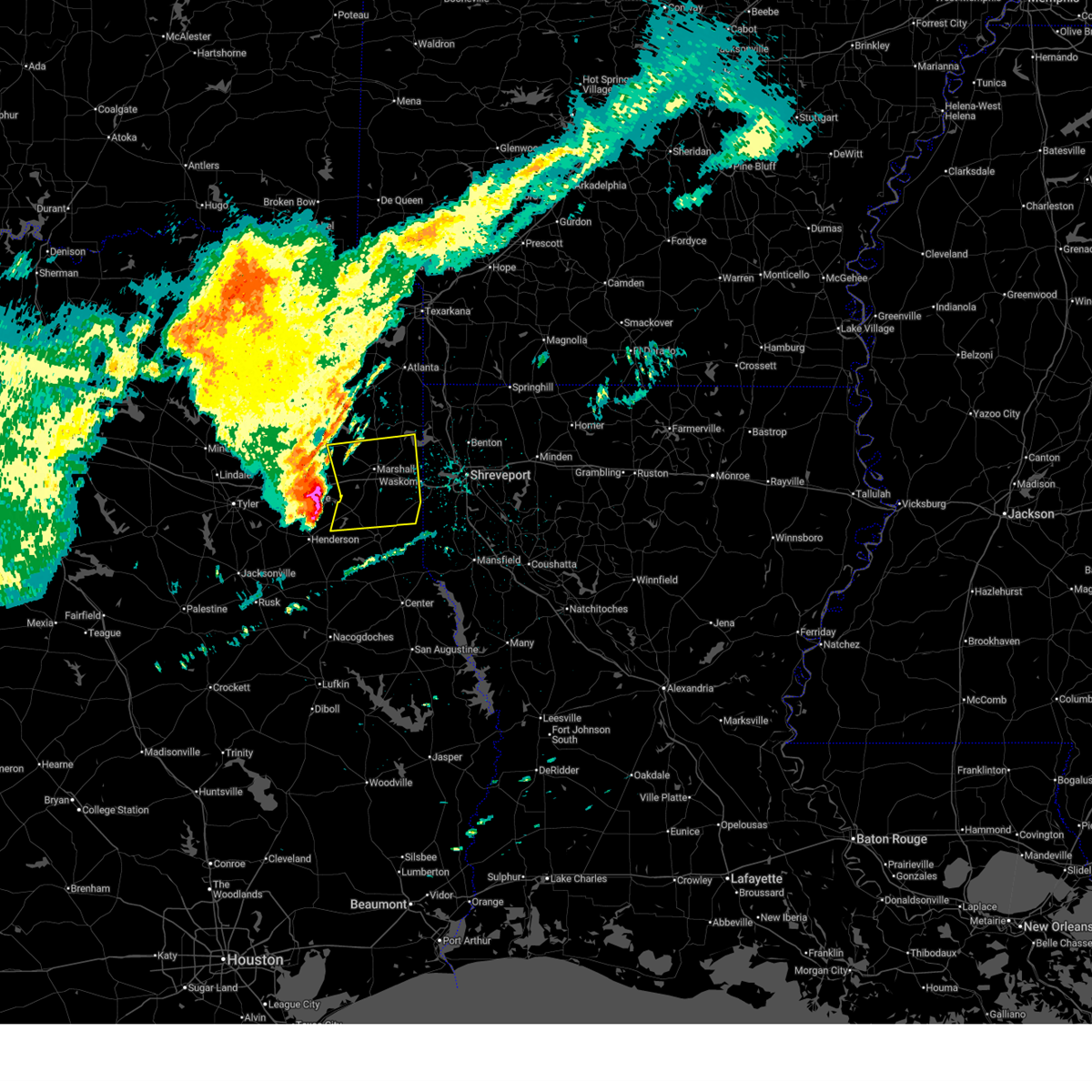
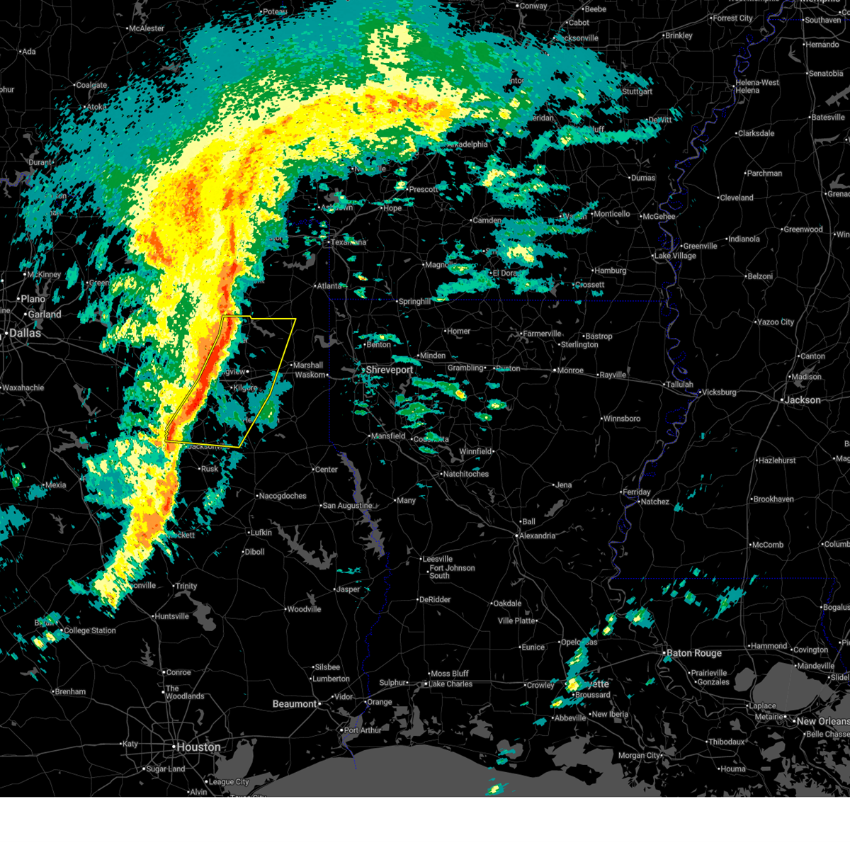
| 3/15/2026 5:38 PM CDT |
 At 538 pm cdt, severe thunderstorms were located along a line from near hosston to over minden, or along a line from 19 miles southeast of atlanta to 12 miles southeast of henderson, moving east at 45 mph (radar indicated). Hazards include 60 mph wind gusts and quarter size hail. Hail damage to vehicles is expected. expect wind damage to roofs, siding, and trees. Locations impacted include, marshall, henderson, hallsville, jefferson, tatum, woodlawn, lodi, smithland, easton, darco, nesbitt, chalk hill, stewart, oak hill, church hill, chapman and brachfield. At 538 pm cdt, severe thunderstorms were located along a line from near hosston to over minden, or along a line from 19 miles southeast of atlanta to 12 miles southeast of henderson, moving east at 45 mph (radar indicated). Hazards include 60 mph wind gusts and quarter size hail. Hail damage to vehicles is expected. expect wind damage to roofs, siding, and trees. Locations impacted include, marshall, henderson, hallsville, jefferson, tatum, woodlawn, lodi, smithland, easton, darco, nesbitt, chalk hill, stewart, oak hill, church hill, chapman and brachfield.
|
| 3/15/2026 5:38 PM CDT |
 the severe thunderstorm warning has been cancelled and is no longer in effect the severe thunderstorm warning has been cancelled and is no longer in effect
|
| 3/15/2026 5:25 PM CDT |
 the severe thunderstorm warning has been cancelled and is no longer in effect the severe thunderstorm warning has been cancelled and is no longer in effect
|
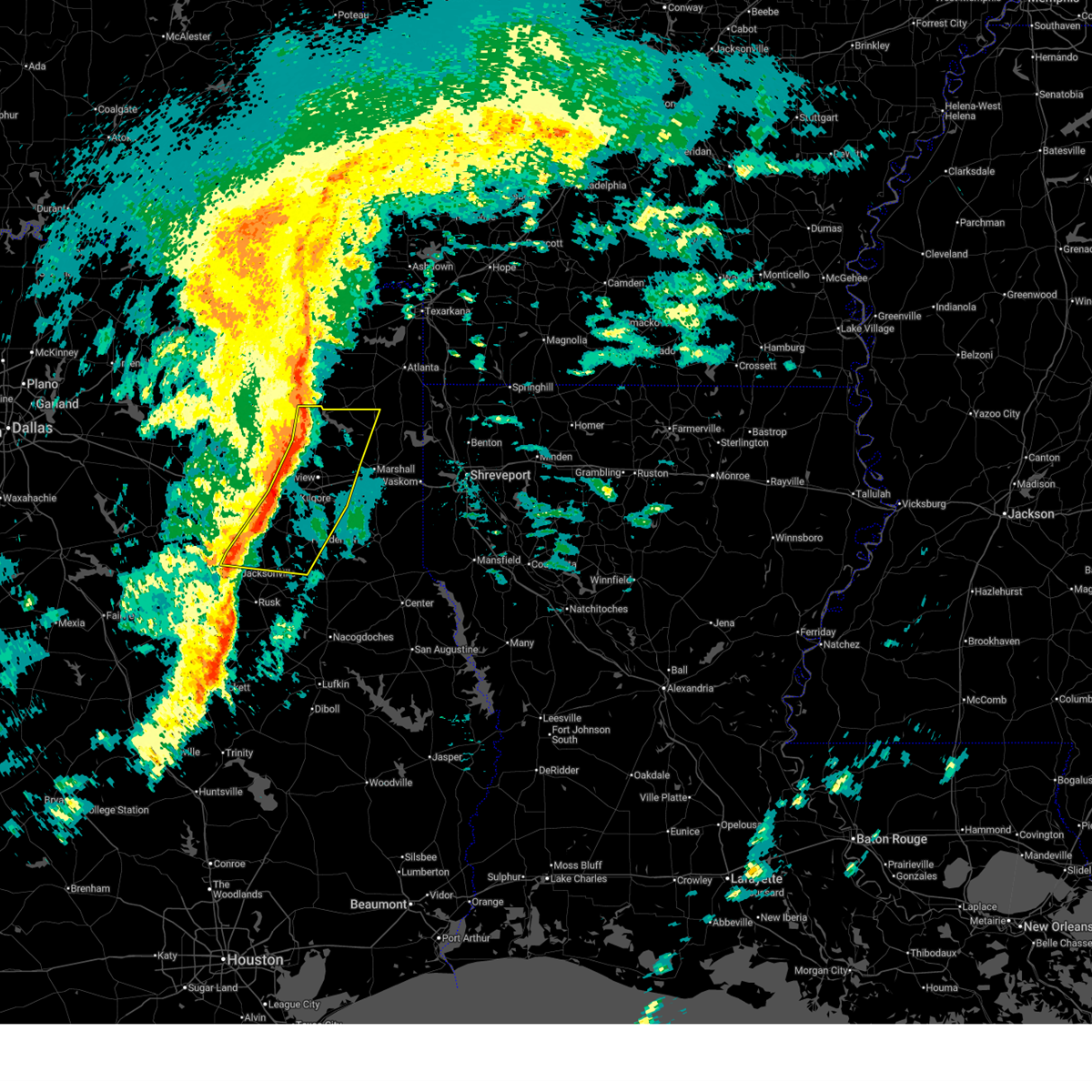
| 3/15/2026 5:25 PM CDT |
 At 525 pm cdt, severe thunderstorms were located along a line from near mcleod to 8 miles west of minden, or along a line from 15 miles south of atlanta to 11 miles south of henderson, moving east at 45 mph (radar indicated). Hazards include golf ball size hail and 60 mph wind gusts. People and animals outdoors will be injured. expect hail damage to roofs, siding, windows, and vehicles. expect wind damage to roofs, siding, and trees. Locations impacted include, longview, marshall, henderson, hallsville, jefferson, tatum, woodlawn, joinerville, berea, turnertown, lodi, smithland, lakeport, easton, avinger, chalk hill, stewart, darco and monroe. At 525 pm cdt, severe thunderstorms were located along a line from near mcleod to 8 miles west of minden, or along a line from 15 miles south of atlanta to 11 miles south of henderson, moving east at 45 mph (radar indicated). Hazards include golf ball size hail and 60 mph wind gusts. People and animals outdoors will be injured. expect hail damage to roofs, siding, windows, and vehicles. expect wind damage to roofs, siding, and trees. Locations impacted include, longview, marshall, henderson, hallsville, jefferson, tatum, woodlawn, joinerville, berea, turnertown, lodi, smithland, lakeport, easton, avinger, chalk hill, stewart, darco and monroe.
|
| 3/15/2026 5:06 PM CDT |
 the severe thunderstorm warning has been cancelled and is no longer in effect the severe thunderstorm warning has been cancelled and is no longer in effect
|
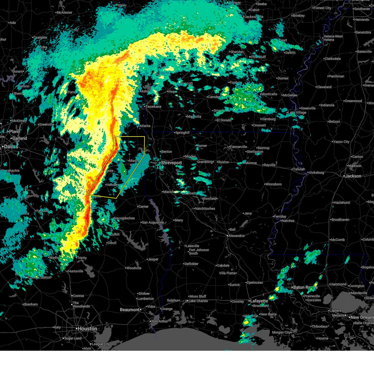
| 3/15/2026 5:06 PM CDT |
 At 506 pm cdt, severe thunderstorms were located along a line from 5 miles northwest of lodi to 7 miles north of ponta, or along a line from 19 miles southwest of atlanta to 10 miles east of jacksonville, moving east at 45 mph (radar indicated). Hazards include golf ball size hail and 60 mph wind gusts. People and animals outdoors will be injured. expect hail damage to roofs, siding, windows, and vehicles. expect wind damage to roofs, siding, and trees. Locations impacted include, longview, marshall, henderson, kilgore, white oak, hallsville, overton, jefferson, troup, tatum, ore city, new london, arp, clarksville city, east mountain, harleton, liberty city and diana. At 506 pm cdt, severe thunderstorms were located along a line from 5 miles northwest of lodi to 7 miles north of ponta, or along a line from 19 miles southwest of atlanta to 10 miles east of jacksonville, moving east at 45 mph (radar indicated). Hazards include golf ball size hail and 60 mph wind gusts. People and animals outdoors will be injured. expect hail damage to roofs, siding, windows, and vehicles. expect wind damage to roofs, siding, and trees. Locations impacted include, longview, marshall, henderson, kilgore, white oak, hallsville, overton, jefferson, troup, tatum, ore city, new london, arp, clarksville city, east mountain, harleton, liberty city and diana.
|
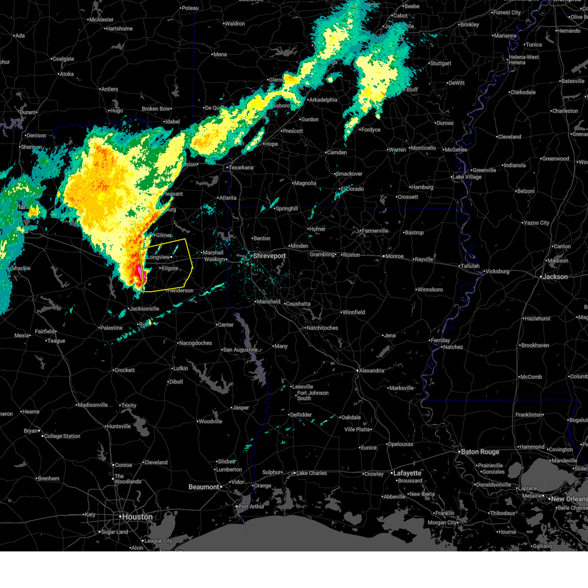
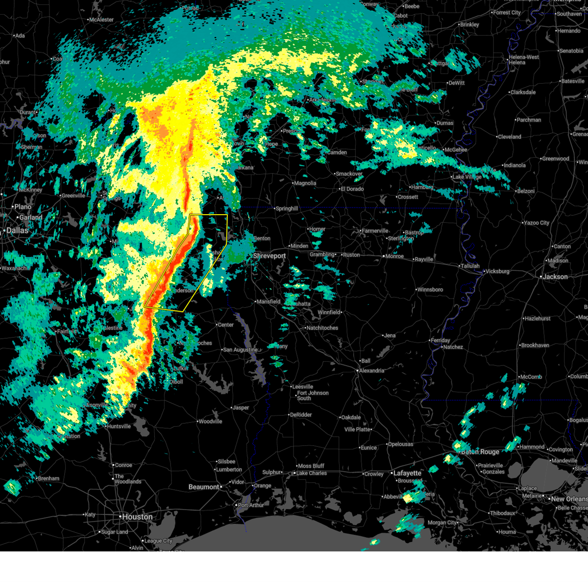
| 3/15/2026 4:56 PM CDT |
 At 456 pm cdt, severe thunderstorms were located along a line from 9 miles northwest of berea to near jacksonville, or along a line from 24 miles southwest of atlanta to near jacksonville, moving east at 45 mph (radar indicated). Hazards include golf ball size hail and 60 mph wind gusts. People and animals outdoors will be injured. expect hail damage to roofs, siding, windows, and vehicles. expect wind damage to roofs, siding, and trees. Locations impacted include, longview, marshall, henderson, kilgore, whitehouse, white oak, gladewater, hallsville, overton, bullard, jefferson, troup, tatum, ore city, new london, arp, clarksville city and east mountain. At 456 pm cdt, severe thunderstorms were located along a line from 9 miles northwest of berea to near jacksonville, or along a line from 24 miles southwest of atlanta to near jacksonville, moving east at 45 mph (radar indicated). Hazards include golf ball size hail and 60 mph wind gusts. People and animals outdoors will be injured. expect hail damage to roofs, siding, windows, and vehicles. expect wind damage to roofs, siding, and trees. Locations impacted include, longview, marshall, henderson, kilgore, whitehouse, white oak, gladewater, hallsville, overton, bullard, jefferson, troup, tatum, ore city, new london, arp, clarksville city and east mountain.
|
| 3/15/2026 4:40 PM CDT |
 Svrshv the national weather service in shreveport has issued a * severe thunderstorm warning for, southwestern cass county in northeastern texas, northern cherokee county in northeastern texas, gregg county in northeastern texas, western harrison county in northeastern texas, marion county in northeastern texas, southeastern morris county in northeastern texas, northwestern panola county in northeastern texas, rusk county in northeastern texas, eastern smith county in northeastern texas, upshur county in northeastern texas, * until 545 pm cdt. * at 440 pm cdt, severe thunderstorms were located along a line from over lone star to over reese, or along a line from 16 miles southeast of pittsburg to 8 miles northwest of jacksonville, moving east at 45 mph (radar indicated). Hazards include golf ball size hail and 60 mph wind gusts. People and animals outdoors will be injured. expect hail damage to roofs, siding, windows, and vehicles. Expect wind damage to roofs, siding, and trees. Svrshv the national weather service in shreveport has issued a * severe thunderstorm warning for, southwestern cass county in northeastern texas, northern cherokee county in northeastern texas, gregg county in northeastern texas, western harrison county in northeastern texas, marion county in northeastern texas, southeastern morris county in northeastern texas, northwestern panola county in northeastern texas, rusk county in northeastern texas, eastern smith county in northeastern texas, upshur county in northeastern texas, * until 545 pm cdt. * at 440 pm cdt, severe thunderstorms were located along a line from over lone star to over reese, or along a line from 16 miles southeast of pittsburg to 8 miles northwest of jacksonville, moving east at 45 mph (radar indicated). Hazards include golf ball size hail and 60 mph wind gusts. People and animals outdoors will be injured. expect hail damage to roofs, siding, windows, and vehicles. Expect wind damage to roofs, siding, and trees.
|
| 2/14/2026 4:45 PM CST |
 At 445 pm cst, severe thunderstorms were located along a line from over kildare to over minden, or along a line from 15 miles south of atlanta to 13 miles south of henderson, moving east at 35 mph (radar indicated). Hazards include 60 mph wind gusts. Expect damage to roofs, siding, and trees. Locations impacted include, marshall, henderson, hallsville, jefferson, tatum, beckville, woodlawn, karnack, pinehill, lodi, smithland, minden, kildare, gray, easton, scottsville, uncertain, darco, nesbitt and chalk hill. At 445 pm cst, severe thunderstorms were located along a line from over kildare to over minden, or along a line from 15 miles south of atlanta to 13 miles south of henderson, moving east at 35 mph (radar indicated). Hazards include 60 mph wind gusts. Expect damage to roofs, siding, and trees. Locations impacted include, marshall, henderson, hallsville, jefferson, tatum, beckville, woodlawn, karnack, pinehill, lodi, smithland, minden, kildare, gray, easton, scottsville, uncertain, darco, nesbitt and chalk hill.
|
| 2/14/2026 4:45 PM CST |
 the severe thunderstorm warning has been cancelled and is no longer in effect the severe thunderstorm warning has been cancelled and is no longer in effect
|
| 2/14/2026 4:28 PM CST |
 the severe thunderstorm warning has been cancelled and is no longer in effect the severe thunderstorm warning has been cancelled and is no longer in effect
|
| 2/14/2026 4:28 PM CST |
 At 428 pm cst, severe thunderstorms were located along a line from 7 miles south of linden to 7 miles northeast of new salem, or along a line from 19 miles southwest of atlanta to 13 miles south of henderson, moving east at 35 mph (radar indicated). Hazards include 60 mph wind gusts. Expect damage to roofs, siding, and trees. Locations impacted include, longview, marshall, henderson, hallsville, jefferson, tatum, beckville, harleton, woodlawn, pinehill, berea, karnack, minden, joinerville, lodi, smithland, kildare, gray, lakeport and easton. At 428 pm cst, severe thunderstorms were located along a line from 7 miles south of linden to 7 miles northeast of new salem, or along a line from 19 miles southwest of atlanta to 13 miles south of henderson, moving east at 35 mph (radar indicated). Hazards include 60 mph wind gusts. Expect damage to roofs, siding, and trees. Locations impacted include, longview, marshall, henderson, hallsville, jefferson, tatum, beckville, harleton, woodlawn, pinehill, berea, karnack, minden, joinerville, lodi, smithland, kildare, gray, lakeport and easton.
|
| 2/14/2026 4:12 PM CST |
 Svrshv the national weather service in shreveport has issued a * severe thunderstorm warning for, southern cass county in northeastern texas, northeastern cherokee county in northeastern texas, eastern gregg county in northeastern texas, harrison county in northeastern texas, marion county in northeastern texas, western panola county in northeastern texas, rusk county in northeastern texas, eastern smith county in northeastern texas, * until 500 pm cst. * at 412 pm cst, severe thunderstorms were located along a line from 7 miles southeast of hughes springs to 6 miles north of ponta, or along a line from 25 miles east of pittsburg to 13 miles east of jacksonville, moving east at 35 mph (radar indicated). Hazards include 60 mph wind gusts. expect damage to roofs, siding, and trees Svrshv the national weather service in shreveport has issued a * severe thunderstorm warning for, southern cass county in northeastern texas, northeastern cherokee county in northeastern texas, eastern gregg county in northeastern texas, harrison county in northeastern texas, marion county in northeastern texas, western panola county in northeastern texas, rusk county in northeastern texas, eastern smith county in northeastern texas, * until 500 pm cst. * at 412 pm cst, severe thunderstorms were located along a line from 7 miles southeast of hughes springs to 6 miles north of ponta, or along a line from 25 miles east of pittsburg to 13 miles east of jacksonville, moving east at 35 mph (radar indicated). Hazards include 60 mph wind gusts. expect damage to roofs, siding, and trees
|
| 2/14/2026 3:52 PM CST |
 At 352 pm cst, severe thunderstorms were located along a line from over cedar springs to near jacksonville, or along a line from 17 miles southeast of pittsburg to near jacksonville, moving east at 40 mph (radar indicated). Hazards include 60 mph wind gusts. Expect damage to roofs, siding, and trees. Locations impacted include, longview, jacksonville, henderson, kilgore, whitehouse, white oak, gladewater, hallsville, overton, bullard, jefferson, troup, ore city, new london, arp, clarksville city, east mountain, liberty city, west mountain and joinerville. At 352 pm cst, severe thunderstorms were located along a line from over cedar springs to near jacksonville, or along a line from 17 miles southeast of pittsburg to near jacksonville, moving east at 40 mph (radar indicated). Hazards include 60 mph wind gusts. Expect damage to roofs, siding, and trees. Locations impacted include, longview, jacksonville, henderson, kilgore, whitehouse, white oak, gladewater, hallsville, overton, bullard, jefferson, troup, ore city, new london, arp, clarksville city, east mountain, liberty city, west mountain and joinerville.
|
| 2/14/2026 3:42 PM CST |
 At 342 pm cst, severe thunderstorms were located along a line from 6 miles northwest of cedar springs to over reese, or along a line from 11 miles southeast of pittsburg to 5 miles northwest of jacksonville, moving east at 40 mph (radar indicated). Hazards include 60 mph wind gusts. Expect damage to roofs, siding, and trees. locations impacted include, tyler, longview, jacksonville, henderson, kilgore, whitehouse, white oak, gladewater, gilmer, hallsville, overton, bullard, jefferson, troup, ore city, new london, arp, clarksville city, east mountain and liberty city. Winds to near 60 mph were measured earlier at tyler pounds field airport in tyler. At 342 pm cst, severe thunderstorms were located along a line from 6 miles northwest of cedar springs to over reese, or along a line from 11 miles southeast of pittsburg to 5 miles northwest of jacksonville, moving east at 40 mph (radar indicated). Hazards include 60 mph wind gusts. Expect damage to roofs, siding, and trees. locations impacted include, tyler, longview, jacksonville, henderson, kilgore, whitehouse, white oak, gladewater, gilmer, hallsville, overton, bullard, jefferson, troup, ore city, new london, arp, clarksville city, east mountain and liberty city. Winds to near 60 mph were measured earlier at tyler pounds field airport in tyler.
|
| 2/14/2026 3:36 PM CST |
 Svrshv the national weather service in shreveport has issued a * severe thunderstorm warning for, northern cherokee county in northeastern texas, gregg county in northeastern texas, western harrison county in northeastern texas, western marion county in northeastern texas, western rusk county in northeastern texas, southeastern smith county in northeastern texas, upshur county in northeastern texas, * until 415 pm cst. * at 336 pm cst, severe thunderstorms were located along a line from 6 miles west of cedar springs to near mount selman, or along a line from 11 miles northeast of gilmer to 9 miles northwest of jacksonville, moving east at 40 mph (radar indicated). Hazards include 60 mph wind gusts. expect damage to roofs, siding, and trees Svrshv the national weather service in shreveport has issued a * severe thunderstorm warning for, northern cherokee county in northeastern texas, gregg county in northeastern texas, western harrison county in northeastern texas, western marion county in northeastern texas, western rusk county in northeastern texas, southeastern smith county in northeastern texas, upshur county in northeastern texas, * until 415 pm cst. * at 336 pm cst, severe thunderstorms were located along a line from 6 miles west of cedar springs to near mount selman, or along a line from 11 miles northeast of gilmer to 9 miles northwest of jacksonville, moving east at 40 mph (radar indicated). Hazards include 60 mph wind gusts. expect damage to roofs, siding, and trees
|
| 10/28/2025 3:41 PM CDT | the tornado warning has been cancelled and is no longer in effect |
| 10/28/2025 3:37 PM CDT | At 337 pm cdt, a severe thunderstorm capable of producing a tornado was located 6 miles southeast of kilgore, moving east at 30 mph (radar indicated rotation). Hazards include tornado. Flying debris will be dangerous to those caught without shelter. mobile homes will be damaged or destroyed. damage to roofs, windows and vehicles will occur. tree damage is likely. Locations impacted include, kilgore, lakeport and monroe. |
| 10/28/2025 3:33 PM CDT | At 333 pm cdt, a tornado producing storm was located near kilgore, moving east at 30 mph (radar confirmed tornado). Hazards include damaging tornado. Flying debris will be dangerous to those caught without shelter. mobile homes will be damaged or destroyed. damage to roofs, windows and vehicles will occur. tree damage is likely. Locations impacted include, kilgore, lakeport and monroe. |
| 10/28/2025 3:28 PM CDT | At 328 pm cdt, a tornado producing storm was located over kilgore, moving east at 25 mph (radar confirmed tornado). Hazards include damaging tornado. Flying debris will be dangerous to those caught without shelter. mobile homes will be damaged or destroyed. damage to roofs, windows and vehicles will occur. tree damage is likely. Locations impacted include, kilgore, lakeport, monroe and laird hill. |
| 10/28/2025 3:25 PM CDT | Torshv the national weather service in shreveport has issued a * tornado warning for, south central gregg county in northeastern texas, northwestern rusk county in northeastern texas, * until 400 pm cdt. * at 325 pm cdt, a severe thunderstorm capable of producing a tornado was located over kilgore, moving east at 25 mph (radar indicated rotation). Hazards include tornado. Flying debris will be dangerous to those caught without shelter. mobile homes will be damaged or destroyed. damage to roofs, windows and vehicles will occur. Tree damage is likely. |
| 7/13/2025 5:09 PM CDT |
 Svrshv the national weather service in shreveport has issued a * severe thunderstorm warning for, south central harrison county in northeastern texas, panola county in northeastern texas, eastern rusk county in northeastern texas, northwestern shelby county in eastern texas, * until 600 pm cdt. * at 509 pm cdt, severe thunderstorms were located along a line extending from tatum to 6 miles east of pinehill to 8 miles northwest of timpson to 7 miles northwest of garrison, moving east at 20 mph (radar indicated). Hazards include 60 mph wind gusts and penny size hail. expect damage to roofs, siding, and trees Svrshv the national weather service in shreveport has issued a * severe thunderstorm warning for, south central harrison county in northeastern texas, panola county in northeastern texas, eastern rusk county in northeastern texas, northwestern shelby county in eastern texas, * until 600 pm cdt. * at 509 pm cdt, severe thunderstorms were located along a line extending from tatum to 6 miles east of pinehill to 8 miles northwest of timpson to 7 miles northwest of garrison, moving east at 20 mph (radar indicated). Hazards include 60 mph wind gusts and penny size hail. expect damage to roofs, siding, and trees
|
| 7/12/2025 6:32 PM CDT |
 Svrshv the national weather service in shreveport has issued a * severe thunderstorm warning for, southwestern harrison county in northeastern texas, northwestern panola county in northeastern texas, northern rusk county in northeastern texas, eastern gregg county in northeastern texas, * until 730 pm cdt. * at 632 pm cdt, a severe thunderstorm was located 7 miles southeast of kilgore, moving northeast at 40 mph (radar indicated). Hazards include 60 mph wind gusts and quarter size hail. Hail damage to vehicles is expected. Expect wind damage to roofs, siding, and trees. Svrshv the national weather service in shreveport has issued a * severe thunderstorm warning for, southwestern harrison county in northeastern texas, northwestern panola county in northeastern texas, northern rusk county in northeastern texas, eastern gregg county in northeastern texas, * until 730 pm cdt. * at 632 pm cdt, a severe thunderstorm was located 7 miles southeast of kilgore, moving northeast at 40 mph (radar indicated). Hazards include 60 mph wind gusts and quarter size hail. Hail damage to vehicles is expected. Expect wind damage to roofs, siding, and trees.
|
| 6/22/2025 5:51 PM CDT |
 Svrshv the national weather service in shreveport has issued a * severe thunderstorm warning for, east central smith county in northeastern texas, northwestern marion county in northeastern texas, western harrison county in northeastern texas, northwestern rusk county in northeastern texas, eastern wood county in northeastern texas, upshur county in northeastern texas, gregg county in northeastern texas, * until 615 pm cdt. * at 551 pm cdt, a severe thunderstorm was located near longview, moving north at 35 mph (radar indicated). Hazards include 60 mph wind gusts and nickel size hail. expect damage to roofs, siding, and trees Svrshv the national weather service in shreveport has issued a * severe thunderstorm warning for, east central smith county in northeastern texas, northwestern marion county in northeastern texas, western harrison county in northeastern texas, northwestern rusk county in northeastern texas, eastern wood county in northeastern texas, upshur county in northeastern texas, gregg county in northeastern texas, * until 615 pm cdt. * at 551 pm cdt, a severe thunderstorm was located near longview, moving north at 35 mph (radar indicated). Hazards include 60 mph wind gusts and nickel size hail. expect damage to roofs, siding, and trees
|
| 6/9/2025 12:44 AM CDT |
 At 1243 am cdt, severe thunderstorms were located along a line extending from near woodlawn to 7 miles south of hallsville to near henderson to near troup to reese, moving southeast at 40 mph (radar indicated). Hazards include 70 mph wind gusts and quarter size hail. Hail damage to vehicles is expected. expect considerable tree damage. wind damage is also likely to mobile homes, roofs, and outbuildings. Locations impacted include, marshall, jacksonville, henderson, carthage, rusk, bullard, waskom, jefferson, troup, tatum, alto, timpson, new london, garrison, beckville, deberry, elysian fields, pinehill, berea, and trawick. At 1243 am cdt, severe thunderstorms were located along a line extending from near woodlawn to 7 miles south of hallsville to near henderson to near troup to reese, moving southeast at 40 mph (radar indicated). Hazards include 70 mph wind gusts and quarter size hail. Hail damage to vehicles is expected. expect considerable tree damage. wind damage is also likely to mobile homes, roofs, and outbuildings. Locations impacted include, marshall, jacksonville, henderson, carthage, rusk, bullard, waskom, jefferson, troup, tatum, alto, timpson, new london, garrison, beckville, deberry, elysian fields, pinehill, berea, and trawick.
|
| 6/9/2025 12:44 AM CDT |
 the severe thunderstorm warning has been cancelled and is no longer in effect the severe thunderstorm warning has been cancelled and is no longer in effect
|
| 6/9/2025 12:41 AM CDT |
 At 1240 am cdt, severe thunderstorms were located along a line extending from near woodlawn to 7 miles northwest of tatum to near henderson to near troup to reese, moving southeast at 40 mph (radar indicated). Hazards include 70 mph wind gusts and quarter size hail. Hail damage to vehicles is expected. expect considerable tree damage. wind damage is also likely to mobile homes, roofs, and outbuildings. Locations impacted include, tyler, longview, marshall, jacksonville, henderson, kilgore, whitehouse, carthage, white oak, gladewater, rusk, gilmer, lindale, hallsville, daingerfield, overton, bullard, waskom, jefferson, and troup. At 1240 am cdt, severe thunderstorms were located along a line extending from near woodlawn to 7 miles northwest of tatum to near henderson to near troup to reese, moving southeast at 40 mph (radar indicated). Hazards include 70 mph wind gusts and quarter size hail. Hail damage to vehicles is expected. expect considerable tree damage. wind damage is also likely to mobile homes, roofs, and outbuildings. Locations impacted include, tyler, longview, marshall, jacksonville, henderson, kilgore, whitehouse, carthage, white oak, gladewater, rusk, gilmer, lindale, hallsville, daingerfield, overton, bullard, waskom, jefferson, and troup.
|
| 6/9/2025 12:06 AM CDT |
 Svrshv the national weather service in shreveport has issued a * severe thunderstorm warning for, western marion county in northeastern texas, rusk county in northeastern texas, northwestern shelby county in eastern texas, upshur county in northeastern texas, southeastern titus county in northeastern texas, smith county in northeastern texas, southwestern cass county in northeastern texas, harrison county in northeastern texas, panola county in northeastern texas, northwestern nacogdoches county in eastern texas, southeastern wood county in northeastern texas, southern morris county in northeastern texas, southeastern camp county in northeastern texas, gregg county in northeastern texas, cherokee county in northeastern texas, * until 115 am cdt. * at 1203 am cdt, severe thunderstorms were located along a line extending from near jenkins to near east mountain to 7 miles west of liberty city to near tyler to brownsboro, moving southeast at 40 mph. these are destructive storms for the city of longview, tx and surrounding areas (emergency management). Hazards include 80 mph wind gusts and quarter size hail. Flying debris will be dangerous to those caught without shelter. mobile homes will be heavily damaged. expect considerable damage to roofs, windows, and vehicles. Extensive tree damage and power outages are likely. Svrshv the national weather service in shreveport has issued a * severe thunderstorm warning for, western marion county in northeastern texas, rusk county in northeastern texas, northwestern shelby county in eastern texas, upshur county in northeastern texas, southeastern titus county in northeastern texas, smith county in northeastern texas, southwestern cass county in northeastern texas, harrison county in northeastern texas, panola county in northeastern texas, northwestern nacogdoches county in eastern texas, southeastern wood county in northeastern texas, southern morris county in northeastern texas, southeastern camp county in northeastern texas, gregg county in northeastern texas, cherokee county in northeastern texas, * until 115 am cdt. * at 1203 am cdt, severe thunderstorms were located along a line extending from near jenkins to near east mountain to 7 miles west of liberty city to near tyler to brownsboro, moving southeast at 40 mph. these are destructive storms for the city of longview, tx and surrounding areas (emergency management). Hazards include 80 mph wind gusts and quarter size hail. Flying debris will be dangerous to those caught without shelter. mobile homes will be heavily damaged. expect considerable damage to roofs, windows, and vehicles. Extensive tree damage and power outages are likely.
|
| 6/8/2025 11:38 PM CDT |
 At 1135 pm cdt, severe thunderstorms were located along a line extending from near mount pleasant to 6 miles south of scroggins to near grand saline to near kaufman, moving east at 50 mph. these are destructive storms including the cities of and areas around gilmer, tx and pittsburg, tx (radar indicated). Hazards include 80 mph wind gusts and half dollar size hail. Flying debris will be dangerous to those caught without shelter. mobile homes will be heavily damaged. expect considerable damage to roofs, windows, and vehicles. extensive tree damage and power outages are likely. Locations impacted include, tyler, longview, mount pleasant, kilgore, whitehouse, white oak, gladewater, gilmer, mineola, pittsburg, winnsboro, leesburg, lindale, mount vernon, daingerfield, overton, bullard, troup, quitman, and lone star. At 1135 pm cdt, severe thunderstorms were located along a line extending from near mount pleasant to 6 miles south of scroggins to near grand saline to near kaufman, moving east at 50 mph. these are destructive storms including the cities of and areas around gilmer, tx and pittsburg, tx (radar indicated). Hazards include 80 mph wind gusts and half dollar size hail. Flying debris will be dangerous to those caught without shelter. mobile homes will be heavily damaged. expect considerable damage to roofs, windows, and vehicles. extensive tree damage and power outages are likely. Locations impacted include, tyler, longview, mount pleasant, kilgore, whitehouse, white oak, gladewater, gilmer, mineola, pittsburg, winnsboro, leesburg, lindale, mount vernon, daingerfield, overton, bullard, troup, quitman, and lone star.
|
| 6/8/2025 10:59 PM CDT |
 Svrshv the national weather service in shreveport has issued a * severe thunderstorm warning for, smith county in northeastern texas, western marion county in northeastern texas, southwestern cass county in northeastern texas, northwestern harrison county in northeastern texas, franklin county in northeastern texas, northwestern rusk county in northeastern texas, wood county in northeastern texas, upshur county in northeastern texas, southern morris county in northeastern texas, southern titus county in northeastern texas, camp county in northeastern texas, gregg county in northeastern texas, * until 1215 am cdt. * at 1058 pm cdt, severe thunderstorms were located along a line extending from 9 miles northeast of cooper lake state park to near sulphur springs to near hawk cove to near dallas, moving southeast at 50 mph (radar indicated). Hazards include 70 mph wind gusts and half dollar size hail. Hail damage to vehicles is expected. expect considerable tree damage. Wind damage is also likely to mobile homes, roofs, and outbuildings. Svrshv the national weather service in shreveport has issued a * severe thunderstorm warning for, smith county in northeastern texas, western marion county in northeastern texas, southwestern cass county in northeastern texas, northwestern harrison county in northeastern texas, franklin county in northeastern texas, northwestern rusk county in northeastern texas, wood county in northeastern texas, upshur county in northeastern texas, southern morris county in northeastern texas, southern titus county in northeastern texas, camp county in northeastern texas, gregg county in northeastern texas, * until 1215 am cdt. * at 1058 pm cdt, severe thunderstorms were located along a line extending from 9 miles northeast of cooper lake state park to near sulphur springs to near hawk cove to near dallas, moving southeast at 50 mph (radar indicated). Hazards include 70 mph wind gusts and half dollar size hail. Hail damage to vehicles is expected. expect considerable tree damage. Wind damage is also likely to mobile homes, roofs, and outbuildings.
|
| 5/26/2025 6:28 AM CDT |
 Svrshv the national weather service in shreveport has issued a * severe thunderstorm warning for, northwestern de soto parish in northwestern louisiana, southwestern caddo parish in northwestern louisiana, southeastern smith county in northeastern texas, harrison county in northeastern texas, panola county in northeastern texas, rusk county in northeastern texas, northwestern nacogdoches county in eastern texas, northwestern shelby county in eastern texas, cherokee county in northeastern texas, * until 730 am cdt. * at 627 am cdt, severe thunderstorms were located along a line extending from near marshall to near tatum to henderson to 8 miles north of ponta to near reese, moving east at 55 mph (radar indicated). Hazards include 60 mph wind gusts and quarter size hail. Hail damage to vehicles is expected. Expect wind damage to roofs, siding, and trees. Svrshv the national weather service in shreveport has issued a * severe thunderstorm warning for, northwestern de soto parish in northwestern louisiana, southwestern caddo parish in northwestern louisiana, southeastern smith county in northeastern texas, harrison county in northeastern texas, panola county in northeastern texas, rusk county in northeastern texas, northwestern nacogdoches county in eastern texas, northwestern shelby county in eastern texas, cherokee county in northeastern texas, * until 730 am cdt. * at 627 am cdt, severe thunderstorms were located along a line extending from near marshall to near tatum to henderson to 8 miles north of ponta to near reese, moving east at 55 mph (radar indicated). Hazards include 60 mph wind gusts and quarter size hail. Hail damage to vehicles is expected. Expect wind damage to roofs, siding, and trees.
|
| 5/26/2025 5:55 AM CDT |
 At 555 am cdt, severe thunderstorms were located along a line extending from harleton to near longview to near new london to bullard, moving southeast at 35 mph (radar indicated). Hazards include 60 mph wind gusts and nickel size hail. Expect damage to roofs, siding, and trees. Locations impacted include, lakeport, warren city, nesbitt, rolling meadows, teaselville, noonday, longview, new chapel hill, new london, kilgore, tyler, darco, stewart, whitehouse, chalk hill, tatum, white oak, harleton, union grove, and oak hill. At 555 am cdt, severe thunderstorms were located along a line extending from harleton to near longview to near new london to bullard, moving southeast at 35 mph (radar indicated). Hazards include 60 mph wind gusts and nickel size hail. Expect damage to roofs, siding, and trees. Locations impacted include, lakeport, warren city, nesbitt, rolling meadows, teaselville, noonday, longview, new chapel hill, new london, kilgore, tyler, darco, stewart, whitehouse, chalk hill, tatum, white oak, harleton, union grove, and oak hill.
|
| 5/26/2025 5:28 AM CDT |
 Svrshv the national weather service in shreveport has issued a * severe thunderstorm warning for, smith county in northeastern texas, southwestern harrison county in northeastern texas, northwestern panola county in northeastern texas, northern rusk county in northeastern texas, central upshur county in northeastern texas, gregg county in northeastern texas, northern cherokee county in northeastern texas, * until 630 am cdt. * at 527 am cdt, severe thunderstorms were located along a line extending from near gilmer to gladewater to 9 miles northwest of overton to lake palestine, moving southeast at 35 mph (radar indicated). Hazards include 60 mph wind gusts and nickel size hail. expect damage to roofs, siding, and trees Svrshv the national weather service in shreveport has issued a * severe thunderstorm warning for, smith county in northeastern texas, southwestern harrison county in northeastern texas, northwestern panola county in northeastern texas, northern rusk county in northeastern texas, central upshur county in northeastern texas, gregg county in northeastern texas, northern cherokee county in northeastern texas, * until 630 am cdt. * at 527 am cdt, severe thunderstorms were located along a line extending from near gilmer to gladewater to 9 miles northwest of overton to lake palestine, moving southeast at 35 mph (radar indicated). Hazards include 60 mph wind gusts and nickel size hail. expect damage to roofs, siding, and trees
|
| 5/6/2025 2:47 PM CDT |
 Svrshv the national weather service in shreveport has issued a * severe thunderstorm warning for, harrison county in northeastern texas, northern panola county in northeastern texas, northeastern rusk county in northeastern texas, southeastern gregg county in northeastern texas, * until 345 pm cdt. * at 247 pm cdt, severe thunderstorms were located along a line extending from near hallsville to pinehill, moving east at 35 mph (radar indicated). Hazards include 60 mph wind gusts and penny size hail. expect damage to roofs, siding, and trees Svrshv the national weather service in shreveport has issued a * severe thunderstorm warning for, harrison county in northeastern texas, northern panola county in northeastern texas, northeastern rusk county in northeastern texas, southeastern gregg county in northeastern texas, * until 345 pm cdt. * at 247 pm cdt, severe thunderstorms were located along a line extending from near hallsville to pinehill, moving east at 35 mph (radar indicated). Hazards include 60 mph wind gusts and penny size hail. expect damage to roofs, siding, and trees
|
| 5/6/2025 2:28 PM CDT |
 At 228 pm cdt, severe thunderstorms were located along a line extending from longview to near henderson, moving east at 50 mph (radar indicated). Hazards include 60 mph wind gusts and nickel size hail. Expect damage to roofs, siding, and trees. Locations impacted include, lakeport, nesbitt, rolling meadows, chapman, longview, monroe, liberty city, new london, kilgore, fairplay, stewart, joinerville, chalk hill, tatum, overton, turnertown, easton, church hill, hallsville, and laird hill. At 228 pm cdt, severe thunderstorms were located along a line extending from longview to near henderson, moving east at 50 mph (radar indicated). Hazards include 60 mph wind gusts and nickel size hail. Expect damage to roofs, siding, and trees. Locations impacted include, lakeport, nesbitt, rolling meadows, chapman, longview, monroe, liberty city, new london, kilgore, fairplay, stewart, joinerville, chalk hill, tatum, overton, turnertown, easton, church hill, hallsville, and laird hill.
|
| 5/6/2025 2:28 PM CDT |
 the severe thunderstorm warning has been cancelled and is no longer in effect the severe thunderstorm warning has been cancelled and is no longer in effect
|
| 5/6/2025 2:03 PM CDT |
 Svrshv the national weather service in shreveport has issued a * severe thunderstorm warning for, southeastern smith county in northeastern texas, western harrison county in northeastern texas, northwestern panola county in northeastern texas, northern rusk county in northeastern texas, gregg county in northeastern texas, north central cherokee county in northeastern texas, * until 300 pm cdt. * at 202 pm cdt, severe thunderstorms were located along a line extending from 9 miles west of liberty city to 6 miles east of jacksonville, moving east at 50 mph (radar indicated). Hazards include 70 mph wind gusts and quarter size hail. Hail damage to vehicles is expected. expect considerable tree damage. Wind damage is also likely to mobile homes, roofs, and outbuildings. Svrshv the national weather service in shreveport has issued a * severe thunderstorm warning for, southeastern smith county in northeastern texas, western harrison county in northeastern texas, northwestern panola county in northeastern texas, northern rusk county in northeastern texas, gregg county in northeastern texas, north central cherokee county in northeastern texas, * until 300 pm cdt. * at 202 pm cdt, severe thunderstorms were located along a line extending from 9 miles west of liberty city to 6 miles east of jacksonville, moving east at 50 mph (radar indicated). Hazards include 70 mph wind gusts and quarter size hail. Hail damage to vehicles is expected. expect considerable tree damage. Wind damage is also likely to mobile homes, roofs, and outbuildings.
|
| 4/30/2025 4:13 PM CDT |
 Svrshv the national weather service in shreveport has issued a * severe thunderstorm warning for, southwestern bossier parish in northwestern louisiana, southwestern caddo parish in northwestern louisiana, northern cherokee county in northeastern texas, southern gregg county in northeastern texas, harrison county in northeastern texas, panola county in northeastern texas, rusk county in northeastern texas, southeastern smith county in northeastern texas, * until 515 pm cdt. * at 413 pm cdt, severe thunderstorms were located along a line from near oil city to 5 miles northeast of joinerville, or along a line from 24 miles northeast of marshall to 6 miles north of henderson, moving southeast at 15 mph (radar indicated). Hazards include 60 mph wind gusts and small hail. expect damage to roofs, siding, and trees Svrshv the national weather service in shreveport has issued a * severe thunderstorm warning for, southwestern bossier parish in northwestern louisiana, southwestern caddo parish in northwestern louisiana, northern cherokee county in northeastern texas, southern gregg county in northeastern texas, harrison county in northeastern texas, panola county in northeastern texas, rusk county in northeastern texas, southeastern smith county in northeastern texas, * until 515 pm cdt. * at 413 pm cdt, severe thunderstorms were located along a line from near oil city to 5 miles northeast of joinerville, or along a line from 24 miles northeast of marshall to 6 miles north of henderson, moving southeast at 15 mph (radar indicated). Hazards include 60 mph wind gusts and small hail. expect damage to roofs, siding, and trees
|
| 4/30/2025 3:46 PM CDT |
 At 346 pm cdt, severe thunderstorms were located along a line from near kildare to near liberty city, or along a line from 11 miles south of atlanta to 5 miles west of kilgore, moving east at 35 mph (radar indicated). Hazards include 60 mph wind gusts and quarter size hail. Hail damage to vehicles is expected. expect wind damage to roofs, siding, and trees. Locations impacted include, tyler, longview, marshall, henderson, kilgore, whitehouse, white oak, gladewater, gilmer, vivian, hallsville, overton, bullard, waskom, jefferson, troup, lone star, tatum, big sandy and ore city. At 346 pm cdt, severe thunderstorms were located along a line from near kildare to near liberty city, or along a line from 11 miles south of atlanta to 5 miles west of kilgore, moving east at 35 mph (radar indicated). Hazards include 60 mph wind gusts and quarter size hail. Hail damage to vehicles is expected. expect wind damage to roofs, siding, and trees. Locations impacted include, tyler, longview, marshall, henderson, kilgore, whitehouse, white oak, gladewater, gilmer, vivian, hallsville, overton, bullard, waskom, jefferson, troup, lone star, tatum, big sandy and ore city.
|
| 4/30/2025 3:46 PM CDT |
 the severe thunderstorm warning has been cancelled and is no longer in effect the severe thunderstorm warning has been cancelled and is no longer in effect
|
| 4/30/2025 3:14 PM CDT |
 Svrshv the national weather service in shreveport has issued a * severe thunderstorm warning for, northwestern caddo parish in northwestern louisiana, southeastern camp county in northeastern texas, southern cass county in northeastern texas, gregg county in northeastern texas, harrison county in northeastern texas, marion county in northeastern texas, southern morris county in northeastern texas, northwestern panola county in northeastern texas, northern rusk county in northeastern texas, smith county in northeastern texas, upshur county in northeastern texas, southeastern wood county in northeastern texas, * until 415 pm cdt. * at 314 pm cdt, severe thunderstorms were located along a line from near hughes springs to 8 miles southeast of lindale, or along a line from 23 miles east of pittsburg to 9 miles north of tyler, moving east at 35 mph (radar indicated). Hazards include 60 mph wind gusts and small hail. expect damage to roofs, siding, and trees Svrshv the national weather service in shreveport has issued a * severe thunderstorm warning for, northwestern caddo parish in northwestern louisiana, southeastern camp county in northeastern texas, southern cass county in northeastern texas, gregg county in northeastern texas, harrison county in northeastern texas, marion county in northeastern texas, southern morris county in northeastern texas, northwestern panola county in northeastern texas, northern rusk county in northeastern texas, smith county in northeastern texas, upshur county in northeastern texas, southeastern wood county in northeastern texas, * until 415 pm cdt. * at 314 pm cdt, severe thunderstorms were located along a line from near hughes springs to 8 miles southeast of lindale, or along a line from 23 miles east of pittsburg to 9 miles north of tyler, moving east at 35 mph (radar indicated). Hazards include 60 mph wind gusts and small hail. expect damage to roofs, siding, and trees
|
| 4/20/2025 6:07 PM CDT |
 Svrshv the national weather service in shreveport has issued a * severe thunderstorm warning for, northwestern caddo parish in northwestern louisiana, northwestern bossier parish in northwestern louisiana, eastern marion county in northeastern texas, southeastern cass county in northeastern texas, harrison county in northeastern texas, panola county in northeastern texas, northeastern rusk county in northeastern texas, southeastern gregg county in northeastern texas, * until 700 pm cdt. * at 607 pm cdt, a severe thunderstorm was located 8 miles east of beckville, or 8 miles north of carthage, moving northeast at 45 mph (radar indicated). Hazards include 60 mph wind gusts and half dollar size hail. Hail damage to vehicles is expected. Expect wind damage to roofs, siding, and trees. Svrshv the national weather service in shreveport has issued a * severe thunderstorm warning for, northwestern caddo parish in northwestern louisiana, northwestern bossier parish in northwestern louisiana, eastern marion county in northeastern texas, southeastern cass county in northeastern texas, harrison county in northeastern texas, panola county in northeastern texas, northeastern rusk county in northeastern texas, southeastern gregg county in northeastern texas, * until 700 pm cdt. * at 607 pm cdt, a severe thunderstorm was located 8 miles east of beckville, or 8 miles north of carthage, moving northeast at 45 mph (radar indicated). Hazards include 60 mph wind gusts and half dollar size hail. Hail damage to vehicles is expected. Expect wind damage to roofs, siding, and trees.
|
| 3/4/2025 8:35 AM CST |
 the tornado warning has been cancelled and is no longer in effect the tornado warning has been cancelled and is no longer in effect
|
| 3/4/2025 8:28 AM CST |
 At 828 am cst, a severe thunderstorm capable of producing a tornado was located over new london, or 8 miles northwest of henderson, moving northeast at 40 mph (radar indicated rotation). Hazards include tornado. Flying debris will be dangerous to those caught without shelter. mobile homes will be damaged or destroyed. damage to roofs, windows and vehicles will occur. tree damage is likely. Locations impacted include, kilgore, new london, joinerville, monroe, oak hill and rolling meadows. At 828 am cst, a severe thunderstorm capable of producing a tornado was located over new london, or 8 miles northwest of henderson, moving northeast at 40 mph (radar indicated rotation). Hazards include tornado. Flying debris will be dangerous to those caught without shelter. mobile homes will be damaged or destroyed. damage to roofs, windows and vehicles will occur. tree damage is likely. Locations impacted include, kilgore, new london, joinerville, monroe, oak hill and rolling meadows.
|
| 3/4/2025 8:20 AM CST |
 Torshv the national weather service in shreveport has issued a * tornado warning for, south central gregg county in northeastern texas, northwestern rusk county in northeastern texas, * until 845 am cst. * at 820 am cst, a severe thunderstorm capable of producing a tornado was located over turnertown, or 10 miles west of henderson, moving northeast at 40 mph (radar indicated rotation). Hazards include tornado. Flying debris will be dangerous to those caught without shelter. mobile homes will be damaged or destroyed. damage to roofs, windows and vehicles will occur. Tree damage is likely. Torshv the national weather service in shreveport has issued a * tornado warning for, south central gregg county in northeastern texas, northwestern rusk county in northeastern texas, * until 845 am cst. * at 820 am cst, a severe thunderstorm capable of producing a tornado was located over turnertown, or 10 miles west of henderson, moving northeast at 40 mph (radar indicated rotation). Hazards include tornado. Flying debris will be dangerous to those caught without shelter. mobile homes will be damaged or destroyed. damage to roofs, windows and vehicles will occur. Tree damage is likely.
|
| 3/4/2025 8:18 AM CST |
 Svrshv the national weather service in shreveport has issued a * severe thunderstorm warning for, northeastern cherokee county in northeastern texas, gregg county in northeastern texas, harrison county in northeastern texas, eastern marion county in northeastern texas, central panola county in northeastern texas, rusk county in northeastern texas, southeastern smith county in northeastern texas, * until 900 am cst. * at 818 am cst, severe thunderstorms were located along a line from 5 miles northeast of harleton to over ponta, or along a line from 16 miles northwest of marshall to 9 miles northeast of rusk, moving northeast at 80 mph (radar indicated). Hazards include 60 mph wind gusts and small hail. expect damage to roofs, siding, and trees Svrshv the national weather service in shreveport has issued a * severe thunderstorm warning for, northeastern cherokee county in northeastern texas, gregg county in northeastern texas, harrison county in northeastern texas, eastern marion county in northeastern texas, central panola county in northeastern texas, rusk county in northeastern texas, southeastern smith county in northeastern texas, * until 900 am cst. * at 818 am cst, severe thunderstorms were located along a line from 5 miles northeast of harleton to over ponta, or along a line from 16 miles northwest of marshall to 9 miles northeast of rusk, moving northeast at 80 mph (radar indicated). Hazards include 60 mph wind gusts and small hail. expect damage to roofs, siding, and trees
|
| 3/4/2025 7:29 AM CST |
 Svrshv the national weather service in shreveport has issued a * severe thunderstorm warning for, cherokee county in northeastern texas, gregg county in northeastern texas, western harrison county in northeastern texas, south central marion county in northeastern texas, rusk county in northeastern texas, southern smith county in northeastern texas, * until 815 am cst. * at 729 am cst, severe thunderstorms were located along a line from 6 miles northeast of tyler to 24 miles southwest of maydelle, or along a line from 6 miles northeast of tyler to 31 miles southwest of rusk, moving northeast at 70 mph (radar indicated). Hazards include 60 mph wind gusts and half dollar size hail. Hail damage to vehicles is expected. Expect wind damage to roofs, siding, and trees. Svrshv the national weather service in shreveport has issued a * severe thunderstorm warning for, cherokee county in northeastern texas, gregg county in northeastern texas, western harrison county in northeastern texas, south central marion county in northeastern texas, rusk county in northeastern texas, southern smith county in northeastern texas, * until 815 am cst. * at 729 am cst, severe thunderstorms were located along a line from 6 miles northeast of tyler to 24 miles southwest of maydelle, or along a line from 6 miles northeast of tyler to 31 miles southwest of rusk, moving northeast at 70 mph (radar indicated). Hazards include 60 mph wind gusts and half dollar size hail. Hail damage to vehicles is expected. Expect wind damage to roofs, siding, and trees.
|
| 1/5/2025 11:19 AM CST |
 Svrshv the national weather service in shreveport has issued a * severe thunderstorm warning for, west central bossier parish in northwestern louisiana, southwestern caddo parish in northwestern louisiana, northwestern shelby county in eastern texas, northeastern cherokee county in northeastern texas, southeastern gregg county in northeastern texas, harrison county in northeastern texas, panola county in northeastern texas, central rusk county in northeastern texas, * until 1215 pm cst. * at 1119 am cst, severe thunderstorms were located along a line from near smithland to near new salem, or along a line from 18 miles northeast of marshall to 15 miles southwest of henderson, moving east at 35 mph (radar indicated). Hazards include 60 mph wind gusts. expect damage to roofs, siding, and trees Svrshv the national weather service in shreveport has issued a * severe thunderstorm warning for, west central bossier parish in northwestern louisiana, southwestern caddo parish in northwestern louisiana, northwestern shelby county in eastern texas, northeastern cherokee county in northeastern texas, southeastern gregg county in northeastern texas, harrison county in northeastern texas, panola county in northeastern texas, central rusk county in northeastern texas, * until 1215 pm cst. * at 1119 am cst, severe thunderstorms were located along a line from near smithland to near new salem, or along a line from 18 miles northeast of marshall to 15 miles southwest of henderson, moving east at 35 mph (radar indicated). Hazards include 60 mph wind gusts. expect damage to roofs, siding, and trees
|
| 7/8/2024 4:36 PM CDT |
 the tornado warning has been cancelled and is no longer in effect the tornado warning has been cancelled and is no longer in effect
|
| 7/8/2024 4:11 PM CDT |
 Torshv the national weather service in shreveport has issued a * tornado warning for, northeastern smith county in northeastern texas, northwestern rusk county in northeastern texas, southeastern wood county in northeastern texas, southwestern upshur county in northeastern texas, southwestern gregg county in northeastern texas, * until 500 pm cdt. * at 410 pm cdt, a severe thunderstorm capable of producing a tornado was located near kilgore, moving northwest at 50 mph (radar indicated rotation). Hazards include tornado. Flying debris will be dangerous to those caught without shelter. mobile homes will be damaged or destroyed. damage to roofs, windows, and vehicles will occur. tree damage is likely. this dangerous storm will be near, kilgore around 415 pm cdt. liberty city around 420 pm cdt. hawkins around 445 pm cdt. Other locations impacted by this tornadic thunderstorm include red springs, monroe, rolling meadows, laird hill, and winona. Torshv the national weather service in shreveport has issued a * tornado warning for, northeastern smith county in northeastern texas, northwestern rusk county in northeastern texas, southeastern wood county in northeastern texas, southwestern upshur county in northeastern texas, southwestern gregg county in northeastern texas, * until 500 pm cdt. * at 410 pm cdt, a severe thunderstorm capable of producing a tornado was located near kilgore, moving northwest at 50 mph (radar indicated rotation). Hazards include tornado. Flying debris will be dangerous to those caught without shelter. mobile homes will be damaged or destroyed. damage to roofs, windows, and vehicles will occur. tree damage is likely. this dangerous storm will be near, kilgore around 415 pm cdt. liberty city around 420 pm cdt. hawkins around 445 pm cdt. Other locations impacted by this tornadic thunderstorm include red springs, monroe, rolling meadows, laird hill, and winona.
|
| 7/8/2024 4:09 PM CDT |
 the tornado warning has been cancelled and is no longer in effect the tornado warning has been cancelled and is no longer in effect
|
| 7/8/2024 4:09 PM CDT |
 At 409 pm cdt, a severe thunderstorm capable of producing a tornado was located 8 miles southeast of kilgore, moving northwest at 40 mph (radar indicated rotation). Hazards include tornado. Flying debris will be dangerous to those caught without shelter. mobile homes will be damaged or destroyed. damage to roofs, windows, and vehicles will occur. tree damage is likely. this dangerous storm will be near, kilgore around 415 pm cdt. liberty city around 425 pm cdt. Other locations impacted by this tornadic thunderstorm include lakeport, rolling meadows, chalk hill, monroe, laird hill, oak hill, and stewart. At 409 pm cdt, a severe thunderstorm capable of producing a tornado was located 8 miles southeast of kilgore, moving northwest at 40 mph (radar indicated rotation). Hazards include tornado. Flying debris will be dangerous to those caught without shelter. mobile homes will be damaged or destroyed. damage to roofs, windows, and vehicles will occur. tree damage is likely. this dangerous storm will be near, kilgore around 415 pm cdt. liberty city around 425 pm cdt. Other locations impacted by this tornadic thunderstorm include lakeport, rolling meadows, chalk hill, monroe, laird hill, oak hill, and stewart.
|
| 7/8/2024 3:28 PM CDT |
 Torshv the national weather service in shreveport has issued a * tornado warning for, west central panola county in northeastern texas, northern rusk county in northeastern texas, southwestern gregg county in northeastern texas, * until 415 pm cdt. * at 327 pm cdt, a severe thunderstorm capable of producing a tornado was located near beckville, or 11 miles west of carthage, moving northwest at 50 mph (radar indicated rotation). Hazards include tornado. Flying debris will be dangerous to those caught without shelter. mobile homes will be damaged or destroyed. damage to roofs, windows, and vehicles will occur. tree damage is likely. this dangerous storm will be near, kilgore around 350 pm cdt. liberty city around 400 pm cdt. Other locations impacted by this tornadic thunderstorm include lakeport, rolling meadows, chapman, chalk hill, monroe, church hill, laird hill, oak hill, fairplay, and stewart. Torshv the national weather service in shreveport has issued a * tornado warning for, west central panola county in northeastern texas, northern rusk county in northeastern texas, southwestern gregg county in northeastern texas, * until 415 pm cdt. * at 327 pm cdt, a severe thunderstorm capable of producing a tornado was located near beckville, or 11 miles west of carthage, moving northwest at 50 mph (radar indicated rotation). Hazards include tornado. Flying debris will be dangerous to those caught without shelter. mobile homes will be damaged or destroyed. damage to roofs, windows, and vehicles will occur. tree damage is likely. this dangerous storm will be near, kilgore around 350 pm cdt. liberty city around 400 pm cdt. Other locations impacted by this tornadic thunderstorm include lakeport, rolling meadows, chapman, chalk hill, monroe, church hill, laird hill, oak hill, fairplay, and stewart.
|
| 7/8/2024 2:04 PM CDT |
 Torshv the national weather service in shreveport has issued a * tornado warning for, northeastern smith county in northeastern texas, southwestern harrison county in northeastern texas, north central rusk county in northeastern texas, southwestern upshur county in northeastern texas, gregg county in northeastern texas, * until 245 pm cdt. * at 204 pm cdt, a severe thunderstorm capable of producing a tornado was located 10 miles west of tatum, or 11 miles east of kilgore, moving northwest at 50 mph (radar indicated rotation). Hazards include tornado. Flying debris will be dangerous to those caught without shelter. mobile homes will be damaged or destroyed. damage to roofs, windows, and vehicles will occur. tree damage is likely. this dangerous storm will be near, longview and kilgore around 210 pm cdt. white oak, gladewater, clarksville city, and liberty city around 220 pm cdt. east mountain around 225 pm cdt. west mountain around 230 pm cdt. Other locations impacted by this tornadic thunderstorm include lakeport, warren city, rolling meadows, chalk hill, easton, monroe, union grove, oak hill, pritchett, and stewart. Torshv the national weather service in shreveport has issued a * tornado warning for, northeastern smith county in northeastern texas, southwestern harrison county in northeastern texas, north central rusk county in northeastern texas, southwestern upshur county in northeastern texas, gregg county in northeastern texas, * until 245 pm cdt. * at 204 pm cdt, a severe thunderstorm capable of producing a tornado was located 10 miles west of tatum, or 11 miles east of kilgore, moving northwest at 50 mph (radar indicated rotation). Hazards include tornado. Flying debris will be dangerous to those caught without shelter. mobile homes will be damaged or destroyed. damage to roofs, windows, and vehicles will occur. tree damage is likely. this dangerous storm will be near, longview and kilgore around 210 pm cdt. white oak, gladewater, clarksville city, and liberty city around 220 pm cdt. east mountain around 225 pm cdt. west mountain around 230 pm cdt. Other locations impacted by this tornadic thunderstorm include lakeport, warren city, rolling meadows, chalk hill, easton, monroe, union grove, oak hill, pritchett, and stewart.
|
| 6/26/2024 1:11 PM CDT |
 At 111 pm cdt, severe thunderstorms were located along a line extending from near benton to near tatum to near lindale, moving southeast at 45 mph (radar indicated). Hazards include 60 mph wind gusts. Expect damage to roofs, siding, and trees. Locations impacted include, shreveport, tyler, longview, bossier city, marshall, henderson, kilgore, whitehouse, carthage, white oak, gladewater, mineola, lindale, hallsville, haughton, greenwood, blanchard, overton, waskom, and benton. At 111 pm cdt, severe thunderstorms were located along a line extending from near benton to near tatum to near lindale, moving southeast at 45 mph (radar indicated). Hazards include 60 mph wind gusts. Expect damage to roofs, siding, and trees. Locations impacted include, shreveport, tyler, longview, bossier city, marshall, henderson, kilgore, whitehouse, carthage, white oak, gladewater, mineola, lindale, hallsville, haughton, greenwood, blanchard, overton, waskom, and benton.
|
| 6/26/2024 12:42 PM CDT |
 Svrshv the national weather service in shreveport has issued a * severe thunderstorm warning for, southwestern webster parish in northwestern louisiana, northwestern de soto parish in northwestern louisiana, caddo parish in northwestern louisiana, central bossier parish in northwestern louisiana, smith county in northeastern texas, southern harrison county in northeastern texas, panola county in northeastern texas, northern rusk county in northeastern texas, southeastern wood county in northeastern texas, southwestern upshur county in northeastern texas, gregg county in northeastern texas, * until 145 pm cdt. * at 1241 pm cdt, severe thunderstorms were located along a line extending from near hosston to harleton to near quitman, moving south at 45 mph (radar indicated). Hazards include 70 mph wind gusts and penny size hail. Expect considerable tree damage. Damage is likely to mobile homes, roofs, and outbuildings. Svrshv the national weather service in shreveport has issued a * severe thunderstorm warning for, southwestern webster parish in northwestern louisiana, northwestern de soto parish in northwestern louisiana, caddo parish in northwestern louisiana, central bossier parish in northwestern louisiana, smith county in northeastern texas, southern harrison county in northeastern texas, panola county in northeastern texas, northern rusk county in northeastern texas, southeastern wood county in northeastern texas, southwestern upshur county in northeastern texas, gregg county in northeastern texas, * until 145 pm cdt. * at 1241 pm cdt, severe thunderstorms were located along a line extending from near hosston to harleton to near quitman, moving south at 45 mph (radar indicated). Hazards include 70 mph wind gusts and penny size hail. Expect considerable tree damage. Damage is likely to mobile homes, roofs, and outbuildings.
|
| 6/4/2024 11:54 AM CDT |
 At 1154 am cdt, severe thunderstorms were located along a line extending from 7 miles east of marshall to minden, moving east at 55 mph (radar indicated). Hazards include 60 mph wind gusts. Expect damage to roofs, siding, and trees. Locations impacted include, longview, henderson, kilgore, hallsville, overton, troup, tatum, new london, pinehill, new salem, joinerville, turnertown, minden, new summerfield, lakeport, easton, reklaw, darco, stewart, and chalk hill. At 1154 am cdt, severe thunderstorms were located along a line extending from 7 miles east of marshall to minden, moving east at 55 mph (radar indicated). Hazards include 60 mph wind gusts. Expect damage to roofs, siding, and trees. Locations impacted include, longview, henderson, kilgore, hallsville, overton, troup, tatum, new london, pinehill, new salem, joinerville, turnertown, minden, new summerfield, lakeport, easton, reklaw, darco, stewart, and chalk hill.
|
| 6/4/2024 11:25 AM CDT |
 Svrshv the national weather service in shreveport has issued a * severe thunderstorm warning for, southeastern smith county in northeastern texas, southwestern harrison county in northeastern texas, northwestern panola county in northeastern texas, rusk county in northeastern texas, gregg county in northeastern texas, northern cherokee county in northeastern texas, * until 1215 pm cdt. * at 1124 am cdt, severe thunderstorms were located along a line extending from near longview to near mixon, moving east at 55 mph (radar indicated). Hazards include 60 mph wind gusts. expect damage to roofs, siding, and trees Svrshv the national weather service in shreveport has issued a * severe thunderstorm warning for, southeastern smith county in northeastern texas, southwestern harrison county in northeastern texas, northwestern panola county in northeastern texas, rusk county in northeastern texas, gregg county in northeastern texas, northern cherokee county in northeastern texas, * until 1215 pm cdt. * at 1124 am cdt, severe thunderstorms were located along a line extending from near longview to near mixon, moving east at 55 mph (radar indicated). Hazards include 60 mph wind gusts. expect damage to roofs, siding, and trees
|
| 6/3/2024 9:02 PM CDT |
 Svrshv the national weather service in shreveport has issued a * severe thunderstorm warning for, west central caddo parish in northwestern louisiana, harrison county in northeastern texas, panola county in northeastern texas, rusk county in northeastern texas, northern nacogdoches county in eastern texas, northwestern shelby county in eastern texas, southeastern gregg county in northeastern texas, northeastern cherokee county in northeastern texas, * until 1000 pm cdt. * at 902 pm cdt, severe thunderstorms were located along a line extending from 6 miles southeast of harleton to near pinehill to near new salem, moving east at 35 mph (radar indicated. winds speeds in excess of 70 mph have downed numerous trees across henderson in rusk county). Hazards include 70 mph wind gusts. Expect considerable tree damage. Damage is likely to mobile homes, roofs, and outbuildings. Svrshv the national weather service in shreveport has issued a * severe thunderstorm warning for, west central caddo parish in northwestern louisiana, harrison county in northeastern texas, panola county in northeastern texas, rusk county in northeastern texas, northern nacogdoches county in eastern texas, northwestern shelby county in eastern texas, southeastern gregg county in northeastern texas, northeastern cherokee county in northeastern texas, * until 1000 pm cdt. * at 902 pm cdt, severe thunderstorms were located along a line extending from 6 miles southeast of harleton to near pinehill to near new salem, moving east at 35 mph (radar indicated. winds speeds in excess of 70 mph have downed numerous trees across henderson in rusk county). Hazards include 70 mph wind gusts. Expect considerable tree damage. Damage is likely to mobile homes, roofs, and outbuildings.
|
| 6/3/2024 8:24 PM CDT |
 Svrshv the national weather service in shreveport has issued a * severe thunderstorm warning for, smith county in northeastern texas, western harrison county in northeastern texas, northwestern panola county in northeastern texas, rusk county in northeastern texas, southern upshur county in northeastern texas, gregg county in northeastern texas, northern cherokee county in northeastern texas, * until 930 pm cdt. * at 824 pm cdt, severe thunderstorms were located along a line extending from near east mountain to near liberty city to near bullard, moving southeast at 25 mph (radar indicated. tyler pounds field measured a 70 mph wind gust from these storms at 814 pm). Hazards include 70 mph wind gusts. Expect considerable tree damage. Damage is likely to mobile homes, roofs, and outbuildings. Svrshv the national weather service in shreveport has issued a * severe thunderstorm warning for, smith county in northeastern texas, western harrison county in northeastern texas, northwestern panola county in northeastern texas, rusk county in northeastern texas, southern upshur county in northeastern texas, gregg county in northeastern texas, northern cherokee county in northeastern texas, * until 930 pm cdt. * at 824 pm cdt, severe thunderstorms were located along a line extending from near east mountain to near liberty city to near bullard, moving southeast at 25 mph (radar indicated. tyler pounds field measured a 70 mph wind gust from these storms at 814 pm). Hazards include 70 mph wind gusts. Expect considerable tree damage. Damage is likely to mobile homes, roofs, and outbuildings.
|
| 6/2/2024 8:43 PM CDT |
 At 843 pm cdt, severe thunderstorms were located along a line extending from near tatum to near pinehill to near new salem, moving east at 60 mph (radar indicated. multipe trees and power lines have been downed with these storms). Hazards include 60 mph wind gusts and penny size hail. Expect damage to roofs, siding, and trees. Locations impacted include, henderson, tatum, beckville, joinerville, pinehill, turnertown, new salem, minden, new summerfield, lakeport, easton, reklaw, chapman, concord, monroe, glenfawn, fairplay, stewart, brachfield, and chalk hill. At 843 pm cdt, severe thunderstorms were located along a line extending from near tatum to near pinehill to near new salem, moving east at 60 mph (radar indicated. multipe trees and power lines have been downed with these storms). Hazards include 60 mph wind gusts and penny size hail. Expect damage to roofs, siding, and trees. Locations impacted include, henderson, tatum, beckville, joinerville, pinehill, turnertown, new salem, minden, new summerfield, lakeport, easton, reklaw, chapman, concord, monroe, glenfawn, fairplay, stewart, brachfield, and chalk hill.
|
| 6/2/2024 8:43 PM CDT |
 the severe thunderstorm warning has been cancelled and is no longer in effect the severe thunderstorm warning has been cancelled and is no longer in effect
|
| 6/2/2024 7:58 PM CDT |
 Svrshv the national weather service in shreveport has issued a * severe thunderstorm warning for, smith county in northeastern texas, southwestern harrison county in northeastern texas, northwestern panola county in northeastern texas, rusk county in northeastern texas, southeastern wood county in northeastern texas, southwestern upshur county in northeastern texas, gregg county in northeastern texas, northern cherokee county in northeastern texas, * until 900 pm cdt. * at 758 pm cdt, severe thunderstorms were located along a line extending from near gladewater to near tyler to lake palestine, moving southeast at 40 mph (radar indicated. numerous trees and power lines have been downed with these storms. pea to quarter size hail has also been reported as well). Hazards include 60 mph wind gusts and quarter size hail. Hail damage to vehicles is expected. Expect wind damage to roofs, siding, and trees. Svrshv the national weather service in shreveport has issued a * severe thunderstorm warning for, smith county in northeastern texas, southwestern harrison county in northeastern texas, northwestern panola county in northeastern texas, rusk county in northeastern texas, southeastern wood county in northeastern texas, southwestern upshur county in northeastern texas, gregg county in northeastern texas, northern cherokee county in northeastern texas, * until 900 pm cdt. * at 758 pm cdt, severe thunderstorms were located along a line extending from near gladewater to near tyler to lake palestine, moving southeast at 40 mph (radar indicated. numerous trees and power lines have been downed with these storms. pea to quarter size hail has also been reported as well). Hazards include 60 mph wind gusts and quarter size hail. Hail damage to vehicles is expected. Expect wind damage to roofs, siding, and trees.
|
| 6/1/2024 5:10 PM CDT |
 At 510 pm cdt, severe thunderstorms were located along a line extending from 7 miles northeast of longview to near hallsville to near tatum to near pinehill to near minden, moving east at 40 mph (radar indicated). Hazards include 60 mph wind gusts and quarter size hail. Hail damage to vehicles is expected. expect wind damage to roofs, siding, and trees. Locations impacted include, longview, henderson, hallsville, tatum, beckville, joinerville, pinehill, turnertown, lakeport, easton, chapman, monroe, fairplay, stewart, chalk hill, church hill, oak hill, and judson. At 510 pm cdt, severe thunderstorms were located along a line extending from 7 miles northeast of longview to near hallsville to near tatum to near pinehill to near minden, moving east at 40 mph (radar indicated). Hazards include 60 mph wind gusts and quarter size hail. Hail damage to vehicles is expected. expect wind damage to roofs, siding, and trees. Locations impacted include, longview, henderson, hallsville, tatum, beckville, joinerville, pinehill, turnertown, lakeport, easton, chapman, monroe, fairplay, stewart, chalk hill, church hill, oak hill, and judson.
|
| 6/1/2024 5:10 PM CDT |
 the severe thunderstorm warning has been cancelled and is no longer in effect the severe thunderstorm warning has been cancelled and is no longer in effect
|
| 6/1/2024 4:55 PM CDT |
 At 455 pm cdt, severe thunderstorms were located along a line extending from east mountain to near longview to 7 miles southeast of kilgore to near joinerville to near turnertown, moving east at 35 mph (radar indicated). Hazards include 60 mph wind gusts and quarter size hail. Hail damage to vehicles is expected. expect wind damage to roofs, siding, and trees. Locations impacted include, longview, henderson, kilgore, white oak, gladewater, hallsville, overton, troup, tatum, new london, arp, clarksville city, beckville, east mountain, pinehill, liberty city, joinerville, turnertown, west mountain, and lakeport. At 455 pm cdt, severe thunderstorms were located along a line extending from east mountain to near longview to 7 miles southeast of kilgore to near joinerville to near turnertown, moving east at 35 mph (radar indicated). Hazards include 60 mph wind gusts and quarter size hail. Hail damage to vehicles is expected. expect wind damage to roofs, siding, and trees. Locations impacted include, longview, henderson, kilgore, white oak, gladewater, hallsville, overton, troup, tatum, new london, arp, clarksville city, beckville, east mountain, pinehill, liberty city, joinerville, turnertown, west mountain, and lakeport.
|
| 6/1/2024 4:39 PM CDT |
 Svrshv the national weather service in shreveport has issued a * severe thunderstorm warning for, southeastern smith county in northeastern texas, southwestern harrison county in northeastern texas, northwestern panola county in northeastern texas, northern rusk county in northeastern texas, southwestern upshur county in northeastern texas, gregg county in northeastern texas, * until 530 pm cdt. * at 439 pm cdt, severe thunderstorms were located along a line extending from near west mountain to near clarksville city to near kilgore to near turnertown to near troup, moving east at 35 mph (radar indicated). Hazards include 60 mph wind gusts and quarter size hail. Hail damage to vehicles is expected. Expect wind damage to roofs, siding, and trees. Svrshv the national weather service in shreveport has issued a * severe thunderstorm warning for, southeastern smith county in northeastern texas, southwestern harrison county in northeastern texas, northwestern panola county in northeastern texas, northern rusk county in northeastern texas, southwestern upshur county in northeastern texas, gregg county in northeastern texas, * until 530 pm cdt. * at 439 pm cdt, severe thunderstorms were located along a line extending from near west mountain to near clarksville city to near kilgore to near turnertown to near troup, moving east at 35 mph (radar indicated). Hazards include 60 mph wind gusts and quarter size hail. Hail damage to vehicles is expected. Expect wind damage to roofs, siding, and trees.
|
| 5/30/2024 5:55 PM CDT |
 Svrshv the national weather service in shreveport has issued a * severe thunderstorm warning for, southern harrison county in northeastern texas, western panola county in northeastern texas, central rusk county in northeastern texas, southeastern gregg county in northeastern texas, * until 645 pm cdt. * at 555 pm cdt, severe thunderstorms were located along a line extending from 7 miles northwest of marshall to near tatum to near henderson, moving east at 25 mph (radar indicated). Hazards include 60 mph wind gusts and penny size hail. expect damage to roofs, siding, and trees Svrshv the national weather service in shreveport has issued a * severe thunderstorm warning for, southern harrison county in northeastern texas, western panola county in northeastern texas, central rusk county in northeastern texas, southeastern gregg county in northeastern texas, * until 645 pm cdt. * at 555 pm cdt, severe thunderstorms were located along a line extending from 7 miles northwest of marshall to near tatum to near henderson, moving east at 25 mph (radar indicated). Hazards include 60 mph wind gusts and penny size hail. expect damage to roofs, siding, and trees
|
| 5/30/2024 5:22 PM CDT |
 Svrshv the national weather service in shreveport has issued a * severe thunderstorm warning for, southwestern harrison county in northeastern texas, northwestern panola county in northeastern texas, northeastern rusk county in northeastern texas, eastern gregg county in northeastern texas, * until 600 pm cdt. * at 522 pm cdt, severe thunderstorms were located along a line extending from near hallsville to 9 miles southeast of kilgore to near turnertown, moving south at 20 mph (radar indicated). Hazards include 60 mph wind gusts and quarter size hail. Hail damage to vehicles is expected. Expect wind damage to roofs, siding, and trees. Svrshv the national weather service in shreveport has issued a * severe thunderstorm warning for, southwestern harrison county in northeastern texas, northwestern panola county in northeastern texas, northeastern rusk county in northeastern texas, eastern gregg county in northeastern texas, * until 600 pm cdt. * at 522 pm cdt, severe thunderstorms were located along a line extending from near hallsville to 9 miles southeast of kilgore to near turnertown, moving south at 20 mph (radar indicated). Hazards include 60 mph wind gusts and quarter size hail. Hail damage to vehicles is expected. Expect wind damage to roofs, siding, and trees.
|
| 5/28/2024 10:01 AM CDT |
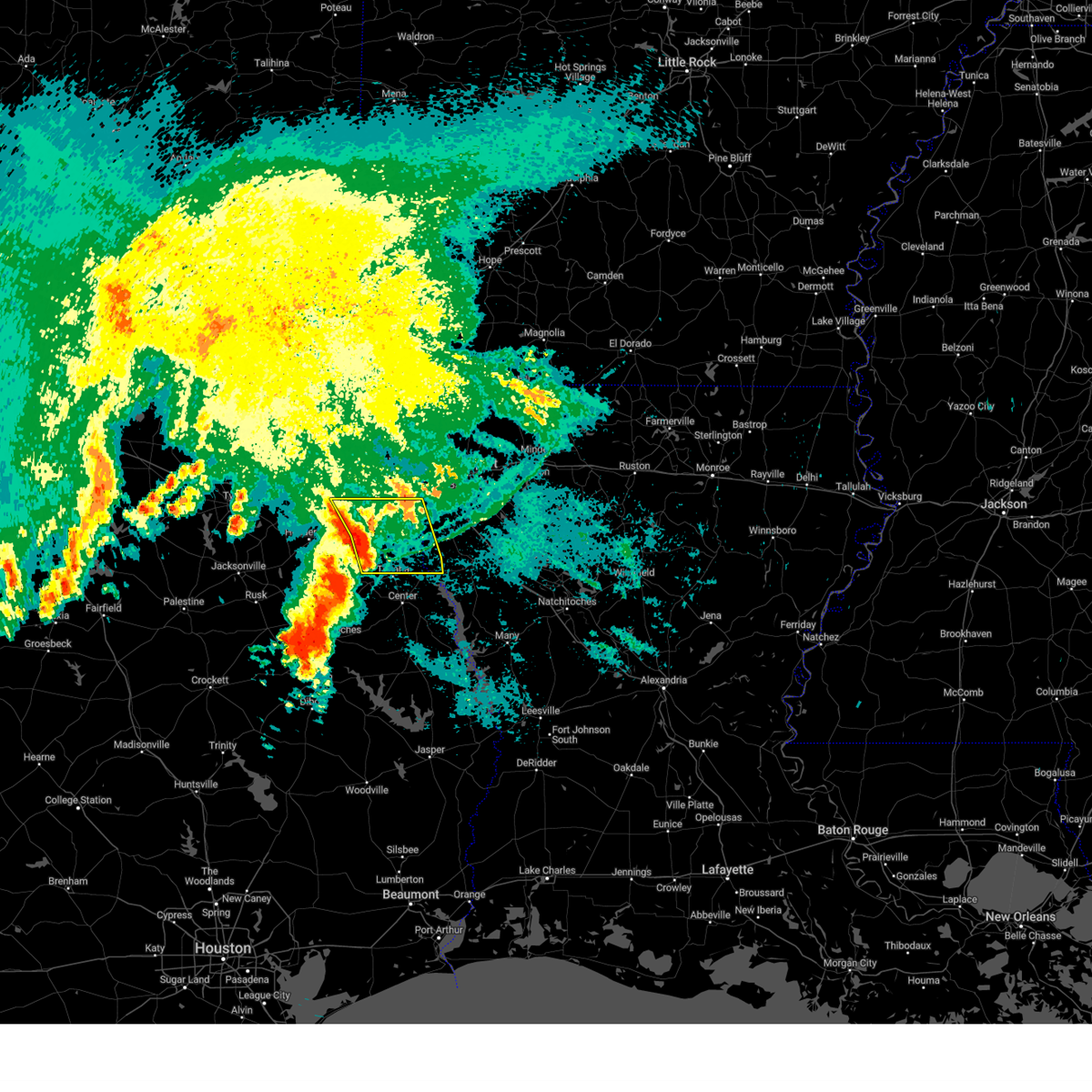 Svrshv the national weather service in shreveport has issued a * severe thunderstorm warning for, west central de soto parish in northwestern louisiana, southwestern caddo parish in northwestern louisiana, southeastern harrison county in northeastern texas, panola county in northeastern texas, northeastern rusk county in northeastern texas, north central shelby county in eastern texas, southeastern gregg county in northeastern texas, * until 1045 am cdt. * at 1001 am cdt, severe thunderstorms were located along a line extending from tatum to near carthage to near timpson, moving east at 35 mph (radar indicated). Hazards include 60 mph wind gusts and quarter size hail. Hail damage to vehicles is expected. Expect wind damage to roofs, siding, and trees. Svrshv the national weather service in shreveport has issued a * severe thunderstorm warning for, west central de soto parish in northwestern louisiana, southwestern caddo parish in northwestern louisiana, southeastern harrison county in northeastern texas, panola county in northeastern texas, northeastern rusk county in northeastern texas, north central shelby county in eastern texas, southeastern gregg county in northeastern texas, * until 1045 am cdt. * at 1001 am cdt, severe thunderstorms were located along a line extending from tatum to near carthage to near timpson, moving east at 35 mph (radar indicated). Hazards include 60 mph wind gusts and quarter size hail. Hail damage to vehicles is expected. Expect wind damage to roofs, siding, and trees.
|
| 5/28/2024 9:48 AM CDT |
 the severe thunderstorm warning has been cancelled and is no longer in effect the severe thunderstorm warning has been cancelled and is no longer in effect
|
| 5/28/2024 9:48 AM CDT |
 At 947 am cdt, severe thunderstorms were located along a line extending from near longview to near pinehill to near nacogdoches, moving east at 40 mph (radar indicated). Hazards include 70 mph wind gusts and quarter size hail. Hail damage to vehicles is expected. expect considerable tree damage. wind damage is also likely to mobile homes, roofs, and outbuildings. Locations impacted include, henderson, kilgore, carthage, tatum, timpson, new london, garrison, beckville, pinehill, joinerville, sacul, minden, lakeport, cushing, easton, mount enterprise, gary city, rolling meadows, darco, and fairplay. At 947 am cdt, severe thunderstorms were located along a line extending from near longview to near pinehill to near nacogdoches, moving east at 40 mph (radar indicated). Hazards include 70 mph wind gusts and quarter size hail. Hail damage to vehicles is expected. expect considerable tree damage. wind damage is also likely to mobile homes, roofs, and outbuildings. Locations impacted include, henderson, kilgore, carthage, tatum, timpson, new london, garrison, beckville, pinehill, joinerville, sacul, minden, lakeport, cushing, easton, mount enterprise, gary city, rolling meadows, darco, and fairplay.
|
| 5/28/2024 9:27 AM CDT |
 Svrshv the national weather service in shreveport has issued a * severe thunderstorm warning for, southwestern harrison county in northeastern texas, western panola county in northeastern texas, rusk county in northeastern texas, northwestern nacogdoches county in eastern texas, northwestern shelby county in eastern texas, south central upshur county in northeastern texas, gregg county in northeastern texas, * until 1000 am cdt. * at 927 am cdt, severe thunderstorms were located along a line extending from clarksville city to near henderson to near douglass, moving east at 40 mph (radar indicated). Hazards include 70 mph wind gusts and quarter size hail. Hail damage to vehicles is expected. expect considerable tree damage. Wind damage is also likely to mobile homes, roofs, and outbuildings. Svrshv the national weather service in shreveport has issued a * severe thunderstorm warning for, southwestern harrison county in northeastern texas, western panola county in northeastern texas, rusk county in northeastern texas, northwestern nacogdoches county in eastern texas, northwestern shelby county in eastern texas, south central upshur county in northeastern texas, gregg county in northeastern texas, * until 1000 am cdt. * at 927 am cdt, severe thunderstorms were located along a line extending from clarksville city to near henderson to near douglass, moving east at 40 mph (radar indicated). Hazards include 70 mph wind gusts and quarter size hail. Hail damage to vehicles is expected. expect considerable tree damage. Wind damage is also likely to mobile homes, roofs, and outbuildings.
|
| 5/28/2024 9:17 AM CDT |
 the tornado warning has been cancelled and is no longer in effect the tornado warning has been cancelled and is no longer in effect
|
| 5/28/2024 9:13 AM CDT |
 the severe thunderstorm warning has been cancelled and is no longer in effect the severe thunderstorm warning has been cancelled and is no longer in effect
|
| 5/28/2024 9:13 AM CDT |
 At 912 am cdt, severe thunderstorms were located along a line extending from near gilmer to 6 miles south of kilgore to near sacul, moving east at 40 mph (radar indicated). Hazards include 70 mph wind gusts and half dollar size hail. Hail damage to vehicles is expected. expect considerable tree damage. wind damage is also likely to mobile homes, roofs, and outbuildings. Locations impacted include, longview, jacksonville, henderson, kilgore, whitehouse, white oak, gladewater, rusk, overton, troup, new london, arp, clarksville city, ponta, new salem, liberty city, joinerville, sacul, mixon, and turnertown. At 912 am cdt, severe thunderstorms were located along a line extending from near gilmer to 6 miles south of kilgore to near sacul, moving east at 40 mph (radar indicated). Hazards include 70 mph wind gusts and half dollar size hail. Hail damage to vehicles is expected. expect considerable tree damage. wind damage is also likely to mobile homes, roofs, and outbuildings. Locations impacted include, longview, jacksonville, henderson, kilgore, whitehouse, white oak, gladewater, rusk, overton, troup, new london, arp, clarksville city, ponta, new salem, liberty city, joinerville, sacul, mixon, and turnertown.
|
| 5/28/2024 9:09 AM CDT |
 the tornado warning has been cancelled and is no longer in effect the tornado warning has been cancelled and is no longer in effect
|
| 5/28/2024 9:09 AM CDT |
 At 909 am cdt, a severe thunderstorm capable of producing a tornado was located near kilgore, moving east at 40 mph (radar indicated rotation). Hazards include tornado. Flying debris will be dangerous to those caught without shelter. mobile homes will be damaged or destroyed. damage to roofs, windows, and vehicles will occur. tree damage is likely. this dangerous storm will be near, kilgore around 915 am cdt. Other locations impacted by this tornadic thunderstorm include monroe, rolling meadows, laird hill, and lakeport. At 909 am cdt, a severe thunderstorm capable of producing a tornado was located near kilgore, moving east at 40 mph (radar indicated rotation). Hazards include tornado. Flying debris will be dangerous to those caught without shelter. mobile homes will be damaged or destroyed. damage to roofs, windows, and vehicles will occur. tree damage is likely. this dangerous storm will be near, kilgore around 915 am cdt. Other locations impacted by this tornadic thunderstorm include monroe, rolling meadows, laird hill, and lakeport.
|
| 5/28/2024 9:00 AM CDT |
 Torshv the national weather service in shreveport has issued a * tornado warning for, east central smith county in northeastern texas, northwestern rusk county in northeastern texas, southwestern gregg county in northeastern texas, * until 930 am cdt. * at 859 am cdt, a severe thunderstorm capable of producing a tornado was located near overton, or 8 miles west of kilgore, moving east at 40 mph (radar indicated rotation). Hazards include tornado. Flying debris will be dangerous to those caught without shelter. mobile homes will be damaged or destroyed. damage to roofs, windows, and vehicles will occur. tree damage is likely. this dangerous storm will be near, kilgore, overton, and new london around 905 am cdt. Other locations impacted by this tornadic thunderstorm include monroe, rolling meadows, laird hill, and lakeport. Torshv the national weather service in shreveport has issued a * tornado warning for, east central smith county in northeastern texas, northwestern rusk county in northeastern texas, southwestern gregg county in northeastern texas, * until 930 am cdt. * at 859 am cdt, a severe thunderstorm capable of producing a tornado was located near overton, or 8 miles west of kilgore, moving east at 40 mph (radar indicated rotation). Hazards include tornado. Flying debris will be dangerous to those caught without shelter. mobile homes will be damaged or destroyed. damage to roofs, windows, and vehicles will occur. tree damage is likely. this dangerous storm will be near, kilgore, overton, and new london around 905 am cdt. Other locations impacted by this tornadic thunderstorm include monroe, rolling meadows, laird hill, and lakeport.
|
| 5/28/2024 8:58 AM CDT |
 At 858 am cdt, severe thunderstorms were located along a line extending from rosewood to near overton to near ponta, moving east at 40 mph (radar indicated). Hazards include 70 mph wind gusts and half dollar size hail. Hail damage to vehicles is expected. expect considerable tree damage. wind damage is also likely to mobile homes, roofs, and outbuildings. Locations impacted include, tyler, longview, jacksonville, henderson, kilgore, whitehouse, white oak, gladewater, rusk, mineola, lindale, overton, bullard, troup, big sandy, hawkins, new london, arp, clarksville city, and east mountain. At 858 am cdt, severe thunderstorms were located along a line extending from rosewood to near overton to near ponta, moving east at 40 mph (radar indicated). Hazards include 70 mph wind gusts and half dollar size hail. Hail damage to vehicles is expected. expect considerable tree damage. wind damage is also likely to mobile homes, roofs, and outbuildings. Locations impacted include, tyler, longview, jacksonville, henderson, kilgore, whitehouse, white oak, gladewater, rusk, mineola, lindale, overton, bullard, troup, big sandy, hawkins, new london, arp, clarksville city, and east mountain.
|
| 5/28/2024 8:48 AM CDT |
 At 848 am cdt, severe thunderstorms were located along a line extending from near rosewood to 8 miles north of arp to near ponta, moving east at 40 mph (radar indicated). Hazards include 70 mph wind gusts and half dollar size hail. Hail damage to vehicles is expected. expect considerable tree damage. wind damage is also likely to mobile homes, roofs, and outbuildings. Locations impacted include, tyler, longview, jacksonville, henderson, kilgore, whitehouse, white oak, gladewater, rusk, gilmer, mineola, lindale, overton, bullard, troup, big sandy, hawkins, new london, arp, and clarksville city. At 848 am cdt, severe thunderstorms were located along a line extending from near rosewood to 8 miles north of arp to near ponta, moving east at 40 mph (radar indicated). Hazards include 70 mph wind gusts and half dollar size hail. Hail damage to vehicles is expected. expect considerable tree damage. wind damage is also likely to mobile homes, roofs, and outbuildings. Locations impacted include, tyler, longview, jacksonville, henderson, kilgore, whitehouse, white oak, gladewater, rusk, gilmer, mineola, lindale, overton, bullard, troup, big sandy, hawkins, new london, arp, and clarksville city.
|
| 5/28/2024 8:27 AM CDT |
 Svrshv the national weather service in shreveport has issued a * severe thunderstorm warning for, smith county in northeastern texas, rusk county in northeastern texas, northwestern nacogdoches county in eastern texas, wood county in northeastern texas, upshur county in northeastern texas, gregg county in northeastern texas, northern cherokee county in northeastern texas, * until 930 am cdt. * at 826 am cdt, severe thunderstorms were located along a line extending from near quitman to near tyler to near reese, moving east at 40 mph (radar indicated). Hazards include 70 mph wind gusts and half dollar size hail. Hail damage to vehicles is expected. expect considerable tree damage. Wind damage is also likely to mobile homes, roofs, and outbuildings. Svrshv the national weather service in shreveport has issued a * severe thunderstorm warning for, smith county in northeastern texas, rusk county in northeastern texas, northwestern nacogdoches county in eastern texas, wood county in northeastern texas, upshur county in northeastern texas, gregg county in northeastern texas, northern cherokee county in northeastern texas, * until 930 am cdt. * at 826 am cdt, severe thunderstorms were located along a line extending from near quitman to near tyler to near reese, moving east at 40 mph (radar indicated). Hazards include 70 mph wind gusts and half dollar size hail. Hail damage to vehicles is expected. expect considerable tree damage. Wind damage is also likely to mobile homes, roofs, and outbuildings.
|
| 4/28/2024 6:03 PM CDT |
 Svrshv the national weather service in shreveport has issued a * severe thunderstorm warning for, northwestern de soto parish in northwestern louisiana, southwestern caddo parish in northwestern louisiana, southern harrison county in northeastern texas, panola county in northeastern texas, northeastern rusk county in northeastern texas, northwestern shelby county in eastern texas, southeastern gregg county in northeastern texas, * until 645 pm cdt. * at 602 pm cdt, a severe thunderstorm was located 9 miles southwest of henderson, moving northeast at 45 mph (radar indicated). Hazards include 70 mph wind gusts and quarter size hail. Hail damage to vehicles is expected. expect considerable tree damage. Wind damage is also likely to mobile homes, roofs, and outbuildings. Svrshv the national weather service in shreveport has issued a * severe thunderstorm warning for, northwestern de soto parish in northwestern louisiana, southwestern caddo parish in northwestern louisiana, southern harrison county in northeastern texas, panola county in northeastern texas, northeastern rusk county in northeastern texas, northwestern shelby county in eastern texas, southeastern gregg county in northeastern texas, * until 645 pm cdt. * at 602 pm cdt, a severe thunderstorm was located 9 miles southwest of henderson, moving northeast at 45 mph (radar indicated). Hazards include 70 mph wind gusts and quarter size hail. Hail damage to vehicles is expected. expect considerable tree damage. Wind damage is also likely to mobile homes, roofs, and outbuildings.
|
| 2/11/2024 7:58 AM CST |
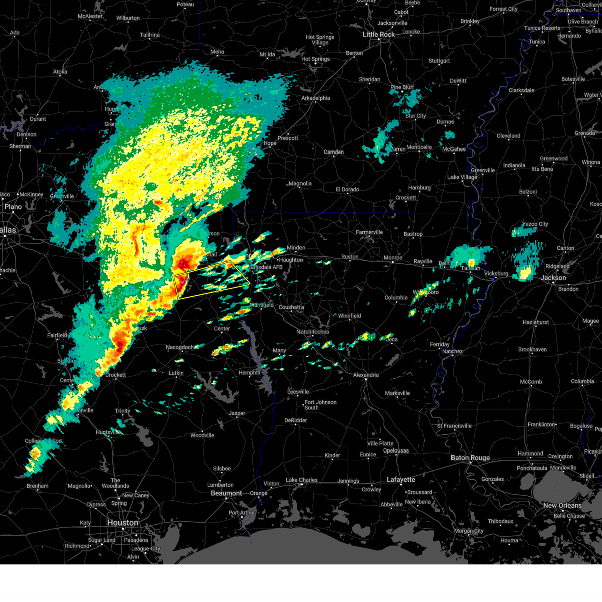 At 757 am cst, a severe thunderstorm was located near tatum, or 15 miles northeast of henderson, moving east at 50 mph (radar indicated). Hazards include two inch hail. People and animals outdoors will be injured. Expect damage to roofs, siding, windows, and vehicles. At 757 am cst, a severe thunderstorm was located near tatum, or 15 miles northeast of henderson, moving east at 50 mph (radar indicated). Hazards include two inch hail. People and animals outdoors will be injured. Expect damage to roofs, siding, windows, and vehicles.
|
| 2/11/2024 7:46 AM CST |
 At 746 am cst, a severe thunderstorm was located near longview, moving east at 45 mph (radar indicated). Hazards include two inch hail. People and animals outdoors will be injured. Expect damage to roofs, siding, windows, and vehicles. At 746 am cst, a severe thunderstorm was located near longview, moving east at 45 mph (radar indicated). Hazards include two inch hail. People and animals outdoors will be injured. Expect damage to roofs, siding, windows, and vehicles.
|
| 2/11/2024 7:38 AM CST |
 At 737 am cst, a severe thunderstorm was located near kilgore, moving east at 35 mph (radar indicated). Hazards include two inch hail. People and animals outdoors will be injured. expect damage to roofs, siding, windows, and vehicles. locations impacted include, longview, henderson, kilgore, white oak, gladewater, overton, new london, arp, clarksville city, east mountain, liberty city, joinerville, turnertown, west mountain, lakeport, union grove, warren city, rolling meadows, chapman, and monroe. thunderstorm damage threat, considerable hail threat, observed max hail size, 2. 00 in wind threat, radar indicated max wind gust, <50 mph. At 737 am cst, a severe thunderstorm was located near kilgore, moving east at 35 mph (radar indicated). Hazards include two inch hail. People and animals outdoors will be injured. expect damage to roofs, siding, windows, and vehicles. locations impacted include, longview, henderson, kilgore, white oak, gladewater, overton, new london, arp, clarksville city, east mountain, liberty city, joinerville, turnertown, west mountain, lakeport, union grove, warren city, rolling meadows, chapman, and monroe. thunderstorm damage threat, considerable hail threat, observed max hail size, 2. 00 in wind threat, radar indicated max wind gust, <50 mph.
|
| 2/11/2024 7:20 AM CST |
 At 720 am cst, a severe thunderstorm was located 7 miles northwest of overton, or 11 miles northeast of whitehouse, moving east at 35 mph (radar indicated). Hazards include two inch hail. People and animals outdoors will be injured. expect damage to roofs, siding, windows, and vehicles. locations impacted include, longview, henderson, kilgore, whitehouse, white oak, gladewater, overton, troup, big sandy, new london, arp, clarksville city, east mountain, liberty city, joinerville, mixon, turnertown, west mountain, lakeport, and new chapel hill. thunderstorm damage threat, considerable hail threat, observed max hail size, 2. 00 in wind threat, radar indicated max wind gust, <50 mph. At 720 am cst, a severe thunderstorm was located 7 miles northwest of overton, or 11 miles northeast of whitehouse, moving east at 35 mph (radar indicated). Hazards include two inch hail. People and animals outdoors will be injured. expect damage to roofs, siding, windows, and vehicles. locations impacted include, longview, henderson, kilgore, whitehouse, white oak, gladewater, overton, troup, big sandy, new london, arp, clarksville city, east mountain, liberty city, joinerville, mixon, turnertown, west mountain, lakeport, and new chapel hill. thunderstorm damage threat, considerable hail threat, observed max hail size, 2. 00 in wind threat, radar indicated max wind gust, <50 mph.
|
| 2/11/2024 7:00 AM CST |
 At 659 am cst, a severe thunderstorm was located over tyler, moving east at 35 mph (radar indicated. at 655 am cst, two inch hail was reported by local broadcast media near tyler). Hazards include two inch hail. People and animals outdoors will be injured. Expect damage to roofs, siding, windows, and vehicles. At 659 am cst, a severe thunderstorm was located over tyler, moving east at 35 mph (radar indicated. at 655 am cst, two inch hail was reported by local broadcast media near tyler). Hazards include two inch hail. People and animals outdoors will be injured. Expect damage to roofs, siding, windows, and vehicles.
|
| 9/24/2023 10:12 PM CDT |
 At 1011 pm cdt, a severe thunderstorm was located near lindale, or 9 miles north of tyler, moving east at 25 mph (radar indicated). Hazards include 60 mph wind gusts and quarter size hail. Hail damage to vehicles is expected. Expect wind damage to roofs, siding, and trees. At 1011 pm cdt, a severe thunderstorm was located near lindale, or 9 miles north of tyler, moving east at 25 mph (radar indicated). Hazards include 60 mph wind gusts and quarter size hail. Hail damage to vehicles is expected. Expect wind damage to roofs, siding, and trees.
|
| 9/8/2023 9:05 PM CDT |
 At 905 pm cdt, a severe thunderstorm was located near harleton, or 8 miles northeast of longview, moving south at 35 mph (radar indicated). Hazards include 60 mph wind gusts and quarter size hail. Hail damage to vehicles is expected. Expect wind damage to roofs, siding, and trees. At 905 pm cdt, a severe thunderstorm was located near harleton, or 8 miles northeast of longview, moving south at 35 mph (radar indicated). Hazards include 60 mph wind gusts and quarter size hail. Hail damage to vehicles is expected. Expect wind damage to roofs, siding, and trees.
|
| 7/16/2023 1:12 PM CDT |
 At 111 pm cdt, severe thunderstorms were located along a line extending from 11 miles southeast of idabel to rocky branch to gladewater, moving east at 30 mph (radar indicated). Hazards include 60 mph wind gusts and quarter size hail. Hail damage to vehicles is expected. expect wind damage to roofs, siding, and trees. locations impacted include, longview, mount pleasant, kilgore, white oak, gladewater, gilmer, new boston, pittsburg, clarksville, foreman, leesburg, boxelder, idabel, hallsville, daingerfield, hughes springs, de kalb, lone star, naples and big sandy. hail threat, radar indicated max hail size, 1. 00 in wind threat, radar indicated max wind gust, 60 mph. At 111 pm cdt, severe thunderstorms were located along a line extending from 11 miles southeast of idabel to rocky branch to gladewater, moving east at 30 mph (radar indicated). Hazards include 60 mph wind gusts and quarter size hail. Hail damage to vehicles is expected. expect wind damage to roofs, siding, and trees. locations impacted include, longview, mount pleasant, kilgore, white oak, gladewater, gilmer, new boston, pittsburg, clarksville, foreman, leesburg, boxelder, idabel, hallsville, daingerfield, hughes springs, de kalb, lone star, naples and big sandy. hail threat, radar indicated max hail size, 1. 00 in wind threat, radar indicated max wind gust, 60 mph.
|
| 7/16/2023 12:34 PM CDT |
 At 1233 pm cdt, severe thunderstorms were located along a line extending from near manchester to near mount pleasant to near hawkins, moving east at 30 mph (radar indicated). Hazards include 60 mph wind gusts and quarter size hail. Hail damage to vehicles is expected. Expect wind damage to roofs, siding, and trees. At 1233 pm cdt, severe thunderstorms were located along a line extending from near manchester to near mount pleasant to near hawkins, moving east at 30 mph (radar indicated). Hazards include 60 mph wind gusts and quarter size hail. Hail damage to vehicles is expected. Expect wind damage to roofs, siding, and trees.
|
| 6/16/2023 3:04 AM CDT |
 At 304 am cdt, a severe thunderstorm was located near big sandy, or 9 miles west of gladewater, moving southeast at 35 mph (radar indicated). Hazards include golf ball size hail and 60 mph wind gusts. People and animals outdoors will be injured. expect hail damage to roofs, siding, windows, and vehicles. expect wind damage to roofs, siding, and trees. locations impacted include, longview, kilgore, white oak, gladewater, hallsville, big sandy, clarksville city, east mountain, liberty city, west mountain, lakeport, winona, easton, union grove, warren city, rolling meadows, monroe, stewart, chalk hill and laird hill. thunderstorm damage threat, considerable hail threat, radar indicated max hail size, 1. 75 in wind threat, radar indicated max wind gust, 60 mph. At 304 am cdt, a severe thunderstorm was located near big sandy, or 9 miles west of gladewater, moving southeast at 35 mph (radar indicated). Hazards include golf ball size hail and 60 mph wind gusts. People and animals outdoors will be injured. expect hail damage to roofs, siding, windows, and vehicles. expect wind damage to roofs, siding, and trees. locations impacted include, longview, kilgore, white oak, gladewater, hallsville, big sandy, clarksville city, east mountain, liberty city, west mountain, lakeport, winona, easton, union grove, warren city, rolling meadows, monroe, stewart, chalk hill and laird hill. thunderstorm damage threat, considerable hail threat, radar indicated max hail size, 1. 75 in wind threat, radar indicated max wind gust, 60 mph.
|
| 6/16/2023 2:44 AM CDT |
 At 244 am cdt, a severe thunderstorm was located near hawkins, or 14 miles east of mineola, moving east at 45 mph (radar indicated. large hail was reported in and near mineola with this storm). Hazards include 60 mph wind gusts and half dollar size hail. Hail damage to vehicles is expected. Expect wind damage to roofs, siding, and trees. At 244 am cdt, a severe thunderstorm was located near hawkins, or 14 miles east of mineola, moving east at 45 mph (radar indicated. large hail was reported in and near mineola with this storm). Hazards include 60 mph wind gusts and half dollar size hail. Hail damage to vehicles is expected. Expect wind damage to roofs, siding, and trees.
|
| 6/16/2023 12:24 AM CDT |
 At 1224 am cdt, severe thunderstorms were located along a line extending from near diana to 8 miles south of big sandy, moving southeast at 45 mph (radar indicated). Hazards include 70 mph wind gusts and quarter size hail. Hail damage to vehicles is expected. expect considerable tree damage. Wind damage is also likely to mobile homes, roofs, and outbuildings. At 1224 am cdt, severe thunderstorms were located along a line extending from near diana to 8 miles south of big sandy, moving southeast at 45 mph (radar indicated). Hazards include 70 mph wind gusts and quarter size hail. Hail damage to vehicles is expected. expect considerable tree damage. Wind damage is also likely to mobile homes, roofs, and outbuildings.
|
| 6/13/2023 5:37 PM CDT |
 The severe thunderstorm warning for central smith, northwestern rusk and gregg counties will expire at 545 pm cdt, the storm which prompted the warning has weakened below severe limits, and has exited the warned area. therefore, the warning will be allowed to expire. a severe thunderstorm watch remains in effect until midnight cdt for northeastern texas. The severe thunderstorm warning for central smith, northwestern rusk and gregg counties will expire at 545 pm cdt, the storm which prompted the warning has weakened below severe limits, and has exited the warned area. therefore, the warning will be allowed to expire. a severe thunderstorm watch remains in effect until midnight cdt for northeastern texas.
|
| 6/13/2023 5:26 PM CDT |
 At 526 pm cdt, a severe thunderstorm was located near arp, or 9 miles northeast of whitehouse, moving east at 45 mph (radar indicated. quarter size hail has been reported in south tyler with this storm). Hazards include 60 mph wind gusts and quarter size hail. Hail damage to vehicles is expected. expect wind damage to roofs, siding, and trees. locations impacted include, henderson, kilgore, overton, new london, joinerville, turnertown, chapman, monroe, stewart, chalk hill, church hill, laird hill and oak hill. hail threat, radar indicated max hail size, 1. 00 in wind threat, radar indicated max wind gust, 60 mph. At 526 pm cdt, a severe thunderstorm was located near arp, or 9 miles northeast of whitehouse, moving east at 45 mph (radar indicated. quarter size hail has been reported in south tyler with this storm). Hazards include 60 mph wind gusts and quarter size hail. Hail damage to vehicles is expected. expect wind damage to roofs, siding, and trees. locations impacted include, henderson, kilgore, overton, new london, joinerville, turnertown, chapman, monroe, stewart, chalk hill, church hill, laird hill and oak hill. hail threat, radar indicated max hail size, 1. 00 in wind threat, radar indicated max wind gust, 60 mph.
|
| 6/13/2023 4:58 PM CDT |
 At 458 pm cdt, a severe thunderstorm was located 7 miles east of tyler, moving east at 45 mph. another developing severe thunderstorm was indicated 10 miles west of tyler, also moving east at 45 mph (radar indicated. quarter to ping pong ball size hail has fallen with these storms). Hazards include ping pong ball size hail. People and animals outdoors will be injured. Expect damage to roofs, siding, windows, and vehicles. At 458 pm cdt, a severe thunderstorm was located 7 miles east of tyler, moving east at 45 mph. another developing severe thunderstorm was indicated 10 miles west of tyler, also moving east at 45 mph (radar indicated. quarter to ping pong ball size hail has fallen with these storms). Hazards include ping pong ball size hail. People and animals outdoors will be injured. Expect damage to roofs, siding, windows, and vehicles.
|
| 6/13/2023 4:43 PM CDT |
 At 443 pm cdt, a severe thunderstorm was located near new london, or just south of kilgore, moving east at 40 mph (radar indicated. golfball size hail has been reported with this storm throughout central smith county with this storm). Hazards include golf ball size hail and 60 mph wind gusts. People and animals outdoors will be injured. expect hail damage to roofs, siding, windows, and vehicles. Expect wind damage to roofs, siding, and trees. At 443 pm cdt, a severe thunderstorm was located near new london, or just south of kilgore, moving east at 40 mph (radar indicated. golfball size hail has been reported with this storm throughout central smith county with this storm). Hazards include golf ball size hail and 60 mph wind gusts. People and animals outdoors will be injured. expect hail damage to roofs, siding, windows, and vehicles. Expect wind damage to roofs, siding, and trees.
|
| 6/13/2023 8:22 AM CDT |
 At 821 am cdt, a severe thunderstorm was located near harleton, or 13 miles northwest of marshall, moving southeast at 30 mph (radar indicated). Hazards include 60 mph wind gusts and quarter size hail. Hail damage to vehicles is expected. expect wind damage to roofs, siding, and trees. locations impacted include, longview, white oak, hallsville, jefferson, berea, harleton, woodlawn, lakeport, lassater, nesbitt, judson and chalk hill. hail threat, radar indicated max hail size, 1. 00 in wind threat, radar indicated max wind gust, 60 mph. At 821 am cdt, a severe thunderstorm was located near harleton, or 13 miles northwest of marshall, moving southeast at 30 mph (radar indicated). Hazards include 60 mph wind gusts and quarter size hail. Hail damage to vehicles is expected. expect wind damage to roofs, siding, and trees. locations impacted include, longview, white oak, hallsville, jefferson, berea, harleton, woodlawn, lakeport, lassater, nesbitt, judson and chalk hill. hail threat, radar indicated max hail size, 1. 00 in wind threat, radar indicated max wind gust, 60 mph.
|
| 6/13/2023 8:07 AM CDT |
 At 806 am cdt, a severe thunderstorm was located near harleton, or 17 miles northeast of longview, moving southeast at 30 mph (radar indicated). Hazards include 60 mph wind gusts and quarter size hail. Hail damage to vehicles is expected. expect wind damage to roofs, siding, and trees. locations impacted include, longview, white oak, gladewater, hallsville, jefferson, lone star, ore city, clarksville city, east mountain, diana, west mountain, berea, harleton, cedar springs, woodlawn, lakeport, avinger, union grove, warren city and lassater. hail threat, radar indicated max hail size, 1. 00 in wind threat, radar indicated max wind gust, 60 mph. At 806 am cdt, a severe thunderstorm was located near harleton, or 17 miles northeast of longview, moving southeast at 30 mph (radar indicated). Hazards include 60 mph wind gusts and quarter size hail. Hail damage to vehicles is expected. expect wind damage to roofs, siding, and trees. locations impacted include, longview, white oak, gladewater, hallsville, jefferson, lone star, ore city, clarksville city, east mountain, diana, west mountain, berea, harleton, cedar springs, woodlawn, lakeport, avinger, union grove, warren city and lassater. hail threat, radar indicated max hail size, 1. 00 in wind threat, radar indicated max wind gust, 60 mph.
|
| 6/13/2023 7:44 AM CDT |
 At 744 am cdt, a severe thunderstorm was located over cedar springs, or 12 miles northeast of gilmer, moving southeast at 30 mph (radar indicated). Hazards include 60 mph wind gusts and quarter size hail. Hail damage to vehicles is expected. Expect wind damage to roofs, siding, and trees. At 744 am cdt, a severe thunderstorm was located over cedar springs, or 12 miles northeast of gilmer, moving southeast at 30 mph (radar indicated). Hazards include 60 mph wind gusts and quarter size hail. Hail damage to vehicles is expected. Expect wind damage to roofs, siding, and trees.
|
| 6/10/2023 1:28 PM CDT |
 At 127 pm cdt, severe thunderstorms were located along a line extending from tatum to 7 miles west of elysian fields to 7 miles north of waskom, moving southeast at 30 mph (radar indicated). Hazards include 60 mph wind gusts and quarter size hail. Hail damage to vehicles is expected. Expect wind damage to roofs, siding, and trees. At 127 pm cdt, severe thunderstorms were located along a line extending from tatum to 7 miles west of elysian fields to 7 miles north of waskom, moving southeast at 30 mph (radar indicated). Hazards include 60 mph wind gusts and quarter size hail. Hail damage to vehicles is expected. Expect wind damage to roofs, siding, and trees.
|
| 6/3/2023 3:58 PM CDT |
 At 358 pm cdt, a severe thunderstorm was located 9 miles southeast of kilgore, moving northeast at 30 mph (radar indicated). Hazards include 60 mph wind gusts. expect damage to roofs, siding, and trees At 358 pm cdt, a severe thunderstorm was located 9 miles southeast of kilgore, moving northeast at 30 mph (radar indicated). Hazards include 60 mph wind gusts. expect damage to roofs, siding, and trees
|
| 5/13/2023 5:44 PM CDT |
 At 543 pm cdt, a severe thunderstorm was located near minden, or 8 miles southeast of henderson, moving northwest at 35 mph (radar indicated). Hazards include 60 mph wind gusts and penny size hail. expect damage to roofs, siding, and trees At 543 pm cdt, a severe thunderstorm was located near minden, or 8 miles southeast of henderson, moving northwest at 35 mph (radar indicated). Hazards include 60 mph wind gusts and penny size hail. expect damage to roofs, siding, and trees
|
| 4/2/2023 6:58 PM CDT |
 At 657 pm cdt, a severe thunderstorm was located 7 miles southeast of longview, moving east at 45 mph. golf ball size hail has fallen in south longview with these storms (radar indicated). Hazards include golf ball size hail and 60 mph wind gusts. People and animals outdoors will be injured. expect hail damage to roofs, siding, windows, and vehicles. Expect wind damage to roofs, siding, and trees. At 657 pm cdt, a severe thunderstorm was located 7 miles southeast of longview, moving east at 45 mph. golf ball size hail has fallen in south longview with these storms (radar indicated). Hazards include golf ball size hail and 60 mph wind gusts. People and animals outdoors will be injured. expect hail damage to roofs, siding, windows, and vehicles. Expect wind damage to roofs, siding, and trees.
|
| 4/2/2023 6:37 PM CDT |
 At 637 pm cdt, a severe thunderstorm was located over gladewater, moving east at 40 mph (radar indicated). Hazards include golf ball size hail and 60 mph wind gusts. People and animals outdoors will be injured. expect hail damage to roofs, siding, windows, and vehicles. expect wind damage to roofs, siding, and trees. Locations impacted include, longview, kilgore, white oak, gladewater, clarksville city, east mountain, liberty city, west mountain, lakeport, union grove, warren city, rolling meadows and judson. At 637 pm cdt, a severe thunderstorm was located over gladewater, moving east at 40 mph (radar indicated). Hazards include golf ball size hail and 60 mph wind gusts. People and animals outdoors will be injured. expect hail damage to roofs, siding, windows, and vehicles. expect wind damage to roofs, siding, and trees. Locations impacted include, longview, kilgore, white oak, gladewater, clarksville city, east mountain, liberty city, west mountain, lakeport, union grove, warren city, rolling meadows and judson.
|
| 4/2/2023 6:19 PM CDT |
 At 619 pm cdt, a severe thunderstorm was located near big sandy, or 12 miles west of gladewater, moving east at 40 mph (radar indicated). Hazards include ping pong ball size hail and 60 mph wind gusts. People and animals outdoors will be injured. expect hail damage to roofs, siding, windows, and vehicles. Expect wind damage to roofs, siding, and trees. At 619 pm cdt, a severe thunderstorm was located near big sandy, or 12 miles west of gladewater, moving east at 40 mph (radar indicated). Hazards include ping pong ball size hail and 60 mph wind gusts. People and animals outdoors will be injured. expect hail damage to roofs, siding, windows, and vehicles. Expect wind damage to roofs, siding, and trees.
|
| 3/16/2023 9:22 PM CDT |
 At 922 pm cdt, severe thunderstorms were located along a line extending from 8 miles west of liberty city to near troup to reese, moving east at 40 mph (radar indicated). Hazards include 60 mph wind gusts and quarter size hail. Hail damage to vehicles is expected. Expect wind damage to roofs, siding, and trees. At 922 pm cdt, severe thunderstorms were located along a line extending from 8 miles west of liberty city to near troup to reese, moving east at 40 mph (radar indicated). Hazards include 60 mph wind gusts and quarter size hail. Hail damage to vehicles is expected. Expect wind damage to roofs, siding, and trees.
|
| 3/2/2023 9:50 PM CST |
 At 950 pm cst, severe thunderstorms were located along a line extending from near naples to liberty city, moving east at 50 mph (radar indicated). Hazards include 60 mph wind gusts. expect damage to roofs, siding, and trees At 950 pm cst, severe thunderstorms were located along a line extending from near naples to liberty city, moving east at 50 mph (radar indicated). Hazards include 60 mph wind gusts. expect damage to roofs, siding, and trees
|
| 3/2/2023 9:33 PM CST |
 At 933 pm cst, severe thunderstorms were located along a line extending from near canfield to near elysian fields, moving east at 50 mph (radar indicated). Hazards include 60 mph wind gusts and penny size hail. Expect damage to roofs, siding, and trees. locations impacted include, tyler, longview, mount pleasant, kilgore, whitehouse, white oak, gladewater, gilmer, pittsburg, lindale, chandler, daingerfield, overton, bullard, troup, lone star, naples, big sandy, hawkins and ore city. hail threat, radar indicated max hail size, 0. 75 in wind threat, radar indicated max wind gust, 60 mph. At 933 pm cst, severe thunderstorms were located along a line extending from near canfield to near elysian fields, moving east at 50 mph (radar indicated). Hazards include 60 mph wind gusts and penny size hail. Expect damage to roofs, siding, and trees. locations impacted include, tyler, longview, mount pleasant, kilgore, whitehouse, white oak, gladewater, gilmer, pittsburg, lindale, chandler, daingerfield, overton, bullard, troup, lone star, naples, big sandy, hawkins and ore city. hail threat, radar indicated max hail size, 0. 75 in wind threat, radar indicated max wind gust, 60 mph.
|
| 3/2/2023 9:30 PM CST |
 At 930 pm cst, severe thunderstorms were located along a line extending from us 259 and i 30 intersection to near tyler, moving east at 45 mph (radar indicated). Hazards include 60 mph wind gusts. expect damage to roofs, siding, and trees At 930 pm cst, severe thunderstorms were located along a line extending from us 259 and i 30 intersection to near tyler, moving east at 45 mph (radar indicated). Hazards include 60 mph wind gusts. expect damage to roofs, siding, and trees
|
| 3/2/2023 8:41 PM CST |
 At 840 pm cst, severe thunderstorms were located along a line extending from omaha to near tyler, moving east at 50 mph (radar indicated). Hazards include 60 mph wind gusts and penny size hail. expect damage to roofs, siding, and trees At 840 pm cst, severe thunderstorms were located along a line extending from omaha to near tyler, moving east at 50 mph (radar indicated). Hazards include 60 mph wind gusts and penny size hail. expect damage to roofs, siding, and trees
|
| 3/2/2023 7:45 PM CST |
 At 744 pm cst, severe thunderstorms were located along a line extending from near cumby to near cottonwood, moving east at 75 mph (radar indicated). Hazards include 60 mph wind gusts and penny size hail. expect damage to roofs, siding, and trees At 744 pm cst, severe thunderstorms were located along a line extending from near cumby to near cottonwood, moving east at 75 mph (radar indicated). Hazards include 60 mph wind gusts and penny size hail. expect damage to roofs, siding, and trees
|
| 12/13/2022 1:54 PM CST |
 At 153 pm cst, a severe thunderstorm capable of producing a tornado was located near kilgore, moving northeast at 50 mph (radar indicated rotation). Hazards include tornado. Flying debris will be dangerous to those caught without shelter. mobile homes will be damaged or destroyed. damage to roofs, windows, and vehicles will occur. Tree damage is likely. At 153 pm cst, a severe thunderstorm capable of producing a tornado was located near kilgore, moving northeast at 50 mph (radar indicated rotation). Hazards include tornado. Flying debris will be dangerous to those caught without shelter. mobile homes will be damaged or destroyed. damage to roofs, windows, and vehicles will occur. Tree damage is likely.
|
| 10/25/2022 12:23 AM CDT |
 At 1223 am cdt, severe thunderstorms were located along a line extending from 7 miles northwest of tatum to near pinehill to 9 miles northeast of trawick, moving east at 55 mph (radar indicated). Hazards include 60 mph wind gusts and penny size hail. expect damage to roofs, siding, and trees At 1223 am cdt, severe thunderstorms were located along a line extending from 7 miles northwest of tatum to near pinehill to 9 miles northeast of trawick, moving east at 55 mph (radar indicated). Hazards include 60 mph wind gusts and penny size hail. expect damage to roofs, siding, and trees
|
| 10/25/2022 12:15 AM CDT |
 At 1215 am cdt, severe thunderstorms were located along a line extending from longview to 6 miles northwest of pinehill to near douglass, moving east at 60 mph (radar indicated). Hazards include 60 mph wind gusts and penny size hail. Expect damage to roofs, siding, and trees. locations impacted include, nacogdoches, henderson, wells, sacul, forest, douglass, minden, trawick, cushing, mount enterprise, chapman, monroe, glenfawn, stewart, brachfield, lilbert, linwood, chalk hill, looneyville and church hill. hail threat, radar indicated max hail size, 0. 75 in wind threat, radar indicated max wind gust, 60 mph. At 1215 am cdt, severe thunderstorms were located along a line extending from longview to 6 miles northwest of pinehill to near douglass, moving east at 60 mph (radar indicated). Hazards include 60 mph wind gusts and penny size hail. Expect damage to roofs, siding, and trees. locations impacted include, nacogdoches, henderson, wells, sacul, forest, douglass, minden, trawick, cushing, mount enterprise, chapman, monroe, glenfawn, stewart, brachfield, lilbert, linwood, chalk hill, looneyville and church hill. hail threat, radar indicated max hail size, 0. 75 in wind threat, radar indicated max wind gust, 60 mph.
|
| 10/24/2022 11:51 PM CDT |
 At 1150 pm cdt, severe thunderstorms were located along a line extending from 8 miles north of arp to near new salem to 8 miles northwest of kennard, moving northeast at 60 mph (radar indicated). Hazards include 60 mph wind gusts and penny size hail. expect damage to roofs, siding, and trees At 1150 pm cdt, severe thunderstorms were located along a line extending from 8 miles north of arp to near new salem to 8 miles northwest of kennard, moving northeast at 60 mph (radar indicated). Hazards include 60 mph wind gusts and penny size hail. expect damage to roofs, siding, and trees
|
| 5/21/2022 11:21 PM CDT |
 At 1121 pm cdt, severe thunderstorms were located along a line extending from near west mountain to 7 miles southwest of marshall to near tenaha to near martinsville, moving east at 45 mph (radar indicated. multiple trees and power lines have been downed across east texas with these storms). Hazards include 60 mph wind gusts. Expect damage to roofs, siding, and trees. locations impacted include, longview, nacogdoches, marshall, kilgore, carthage, white oak, gladewater, center, hallsville, tatum, big sandy, hawkins, tenaha, timpson, garrison, clarksville city, beckville, east mountain, deberry and elysian fields. hail threat, radar indicated max hail size, <. 75 in wind threat, radar indicated max wind gust, 60 mph. At 1121 pm cdt, severe thunderstorms were located along a line extending from near west mountain to 7 miles southwest of marshall to near tenaha to near martinsville, moving east at 45 mph (radar indicated. multiple trees and power lines have been downed across east texas with these storms). Hazards include 60 mph wind gusts. Expect damage to roofs, siding, and trees. locations impacted include, longview, nacogdoches, marshall, kilgore, carthage, white oak, gladewater, center, hallsville, tatum, big sandy, hawkins, tenaha, timpson, garrison, clarksville city, beckville, east mountain, deberry and elysian fields. hail threat, radar indicated max hail size, <. 75 in wind threat, radar indicated max wind gust, 60 mph.
|
| 5/21/2022 10:38 PM CDT |
 At 1037 pm cdt, severe thunderstorms were located along a line extending from 6 miles southeast of lindale to near kilgore to 9 miles southwest of minden to forest, moving east at 45 mph (radar indicated. trees have been downed across southern smith and cherokee counties from these storms). Hazards include 60 mph wind gusts. expect damage to roofs, siding, and trees At 1037 pm cdt, severe thunderstorms were located along a line extending from 6 miles southeast of lindale to near kilgore to 9 miles southwest of minden to forest, moving east at 45 mph (radar indicated. trees have been downed across southern smith and cherokee counties from these storms). Hazards include 60 mph wind gusts. expect damage to roofs, siding, and trees
|
| 5/5/2022 1:36 PM CDT |
 At 136 pm cdt, severe thunderstorms were located along a line extending from near hallsville to 8 miles southwest of minden, moving east at 20 mph (radar indicated). Hazards include 60 mph wind gusts and quarter size hail. Hail damage to vehicles is expected. expect wind damage to roofs, siding, and trees. locations impacted include, longview, marshall, henderson, carthage, hallsville, tatum, timpson, beckville, elysian fields, pinehill, joinerville, turnertown, minden, new summerfield, lakeport, easton, mount enterprise, scottsville, gary city and darco. hail threat, radar indicated max hail size, 1. 00 in wind threat, radar indicated max wind gust, 60 mph. At 136 pm cdt, severe thunderstorms were located along a line extending from near hallsville to 8 miles southwest of minden, moving east at 20 mph (radar indicated). Hazards include 60 mph wind gusts and quarter size hail. Hail damage to vehicles is expected. expect wind damage to roofs, siding, and trees. locations impacted include, longview, marshall, henderson, carthage, hallsville, tatum, timpson, beckville, elysian fields, pinehill, joinerville, turnertown, minden, new summerfield, lakeport, easton, mount enterprise, scottsville, gary city and darco. hail threat, radar indicated max hail size, 1. 00 in wind threat, radar indicated max wind gust, 60 mph.
|
| 5/5/2022 1:10 PM CDT |
 At 109 pm cdt, severe thunderstorms were located along a line extending from near hallsville to near new salem, moving east at 45 mph (radar indicated). Hazards include 60 mph wind gusts and quarter size hail. Hail damage to vehicles is expected. Expect wind damage to roofs, siding, and trees. At 109 pm cdt, severe thunderstorms were located along a line extending from near hallsville to near new salem, moving east at 45 mph (radar indicated). Hazards include 60 mph wind gusts and quarter size hail. Hail damage to vehicles is expected. Expect wind damage to roofs, siding, and trees.
|
| 4/12/2022 9:12 PM CDT |
 At 912 pm cdt, severe thunderstorms were located along a line extending from near cookville to near harleton, moving northeast at 60 mph (radar indicated). Hazards include 70 mph wind gusts and penny size hail. Expect considerable tree damage. damage is likely to mobile homes, roofs, and outbuildings. locations impacted include, longview, marshall, hallsville, daingerfield, waskom, jefferson, linden, hughes springs, lone star, naples, ore city, omaha, lodi, cookville, rocky branch, berea, harleton, karnack, woodlawn and jenkins. thunderstorm damage threat, considerable hail threat, radar indicated max hail size, 0. 75 in wind threat, radar indicated max wind gust, 70 mph. At 912 pm cdt, severe thunderstorms were located along a line extending from near cookville to near harleton, moving northeast at 60 mph (radar indicated). Hazards include 70 mph wind gusts and penny size hail. Expect considerable tree damage. damage is likely to mobile homes, roofs, and outbuildings. locations impacted include, longview, marshall, hallsville, daingerfield, waskom, jefferson, linden, hughes springs, lone star, naples, ore city, omaha, lodi, cookville, rocky branch, berea, harleton, karnack, woodlawn and jenkins. thunderstorm damage threat, considerable hail threat, radar indicated max hail size, 0. 75 in wind threat, radar indicated max wind gust, 70 mph.
|
| 4/12/2022 8:59 PM CDT |
 At 858 pm cdt, a severe thunderstorm was located 7 miles southeast of hughes springs, or 25 miles southwest of atlanta, moving northeast at 80 mph (radar indicated). Hazards include 70 mph wind gusts and penny size hail. Expect considerable tree damage. damage is likely to mobile homes, roofs, and outbuildings. locations impacted include, longview, henderson, kilgore, white oak, hallsville, tatum, ore city, new london, beckville, east mountain, harleton, diana, joinerville, turnertown, cedar springs, lakeport, easton, rolling meadows, stewart and chalk hill. thunderstorm damage threat, considerable hail threat, radar indicated max hail size, 0. 75 in wind threat, radar indicated max wind gust, 70 mph. At 858 pm cdt, a severe thunderstorm was located 7 miles southeast of hughes springs, or 25 miles southwest of atlanta, moving northeast at 80 mph (radar indicated). Hazards include 70 mph wind gusts and penny size hail. Expect considerable tree damage. damage is likely to mobile homes, roofs, and outbuildings. locations impacted include, longview, henderson, kilgore, white oak, hallsville, tatum, ore city, new london, beckville, east mountain, harleton, diana, joinerville, turnertown, cedar springs, lakeport, easton, rolling meadows, stewart and chalk hill. thunderstorm damage threat, considerable hail threat, radar indicated max hail size, 0. 75 in wind threat, radar indicated max wind gust, 70 mph.
|
| 4/12/2022 8:48 PM CDT |
 At 848 pm cdt, severe thunderstorms were located along a line extending from 8 miles east of kilgore to 11 miles northwest of kennard, moving east at 50 mph (radar indicated). Hazards include 70 mph wind gusts and penny size hail. Expect considerable tree damage. Damage is likely to mobile homes, roofs, and outbuildings. At 848 pm cdt, severe thunderstorms were located along a line extending from 8 miles east of kilgore to 11 miles northwest of kennard, moving east at 50 mph (radar indicated). Hazards include 70 mph wind gusts and penny size hail. Expect considerable tree damage. Damage is likely to mobile homes, roofs, and outbuildings.
|
| 4/12/2022 8:46 PM CDT |
 At 846 pm cdt, severe thunderstorms were located along a line extending from near leesburg to near kilgore, moving northeast at 55 mph (radar indicated). Hazards include 70 mph wind gusts and penny size hail. Expect considerable tree damage. Damage is likely to mobile homes, roofs, and outbuildings. At 846 pm cdt, severe thunderstorms were located along a line extending from near leesburg to near kilgore, moving northeast at 55 mph (radar indicated). Hazards include 70 mph wind gusts and penny size hail. Expect considerable tree damage. Damage is likely to mobile homes, roofs, and outbuildings.
|
| 4/12/2022 8:32 PM CDT |
 At 831 pm cdt, a severe thunderstorm was located over gladewater, moving northeast at 80 mph (radar indicated). Hazards include 60 mph wind gusts and penny size hail. expect damage to roofs, siding, and trees At 831 pm cdt, a severe thunderstorm was located over gladewater, moving northeast at 80 mph (radar indicated). Hazards include 60 mph wind gusts and penny size hail. expect damage to roofs, siding, and trees
|
| 4/5/2022 2:21 AM CDT |
 At 221 am cdt, severe thunderstorms were located along a line extending from 8 miles southwest of marshall to near pinehill, moving east at 60 mph (emergency management). Hazards include 60 mph wind gusts and quarter size hail. Hail damage to vehicles is expected. expect wind damage to roofs, siding, and trees. Locations impacted include, longview, henderson, carthage, tatum, beckville, elysian fields, joinerville, pinehill, minden, lakeport, easton, gary city, chapman, monroe, darco, fairplay, stewart, brachfield, chalk hill and dotson. At 221 am cdt, severe thunderstorms were located along a line extending from 8 miles southwest of marshall to near pinehill, moving east at 60 mph (emergency management). Hazards include 60 mph wind gusts and quarter size hail. Hail damage to vehicles is expected. expect wind damage to roofs, siding, and trees. Locations impacted include, longview, henderson, carthage, tatum, beckville, elysian fields, joinerville, pinehill, minden, lakeport, easton, gary city, chapman, monroe, darco, fairplay, stewart, brachfield, chalk hill and dotson.
|
| 4/5/2022 1:55 AM CDT |
 At 154 am cdt, severe thunderstorms were located along a line extending from near west mountain to near mixon, moving east at 45 mph (emergency management. at at 142 am cdt, trees were reported down on homes in whitehouse). Hazards include 80 mph wind gusts and quarter size hail. Flying debris will be dangerous to those caught without shelter. mobile homes will be heavily damaged. expect considerable damage to roofs, windows, and vehicles. Extensive tree damage and power outages are likely. At 154 am cdt, severe thunderstorms were located along a line extending from near west mountain to near mixon, moving east at 45 mph (emergency management. at at 142 am cdt, trees were reported down on homes in whitehouse). Hazards include 80 mph wind gusts and quarter size hail. Flying debris will be dangerous to those caught without shelter. mobile homes will be heavily damaged. expect considerable damage to roofs, windows, and vehicles. Extensive tree damage and power outages are likely.
|
| 3/14/2022 9:12 PM CDT |
 At 910 pm cdt, severe thunderstorms were located along a line extending from near diana to henderson, moving east at 45 mph (radar indicated). Hazards include 60 mph wind gusts and quarter size hail. Hail damage to vehicles is expected. Expect wind damage to roofs, siding, and trees. At 910 pm cdt, severe thunderstorms were located along a line extending from near diana to henderson, moving east at 45 mph (radar indicated). Hazards include 60 mph wind gusts and quarter size hail. Hail damage to vehicles is expected. Expect wind damage to roofs, siding, and trees.
|
| 3/14/2022 8:31 PM CDT |
 At 831 pm cdt, severe thunderstorms were located along a line extending from near hawkins to mixon, moving east at 40 mph (radar indicated). Hazards include 60 mph wind gusts and quarter size hail. Hail damage to vehicles is expected. Expect wind damage to roofs, siding, and trees. At 831 pm cdt, severe thunderstorms were located along a line extending from near hawkins to mixon, moving east at 40 mph (radar indicated). Hazards include 60 mph wind gusts and quarter size hail. Hail damage to vehicles is expected. Expect wind damage to roofs, siding, and trees.
|
| 1/19/2022 4:08 PM CST |
 At 407 pm cst, a severe thunderstorm was located over white oak, moving east at 35 mph (radar indicated). Hazards include 60 mph wind gusts and quarter size hail. Hail damage to vehicles is expected. Expect wind damage to roofs, siding, and trees. At 407 pm cst, a severe thunderstorm was located over white oak, moving east at 35 mph (radar indicated). Hazards include 60 mph wind gusts and quarter size hail. Hail damage to vehicles is expected. Expect wind damage to roofs, siding, and trees.
|
| 10/27/2021 9:53 AM CDT |
 At 953 am cdt, severe thunderstorms were located along a line extending from near ore city to harleton to near hallsville to 13 miles southwest of marshall to near tatum, moving east at 35 mph (radar indicated). Hazards include 60 mph wind gusts. expect damage to roofs, siding, and trees At 953 am cdt, severe thunderstorms were located along a line extending from near ore city to harleton to near hallsville to 13 miles southwest of marshall to near tatum, moving east at 35 mph (radar indicated). Hazards include 60 mph wind gusts. expect damage to roofs, siding, and trees
|
| 10/11/2021 12:33 AM CDT |
 At 1232 am cdt, severe thunderstorms were located along a line extending from mount vernon to near hainesville to near chandler, moving east at 50 mph (radar indicated). Hazards include 60 mph wind gusts and quarter size hail. Hail damage to vehicles is expected. Expect wind damage to roofs, siding, and trees. At 1232 am cdt, severe thunderstorms were located along a line extending from mount vernon to near hainesville to near chandler, moving east at 50 mph (radar indicated). Hazards include 60 mph wind gusts and quarter size hail. Hail damage to vehicles is expected. Expect wind damage to roofs, siding, and trees.
|
| 6/8/2021 11:39 AM CDT |
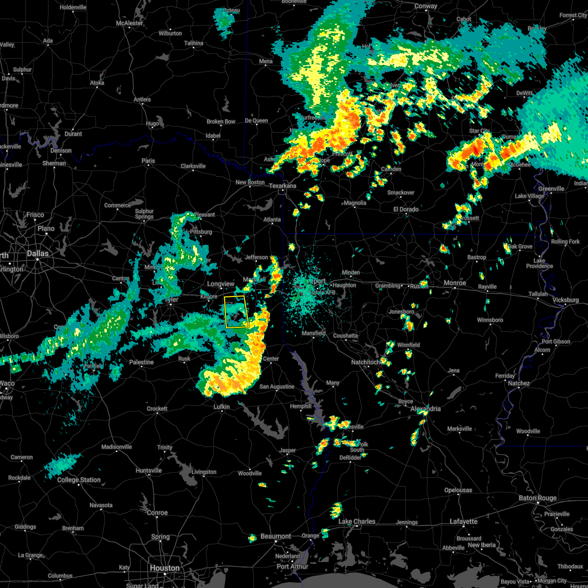 The severe thunderstorm warning for southwestern harrison, northwestern panola, northeastern rusk and southeastern gregg counties will expire at 1145 am cdt, the storms which prompted the warning have weakened below severe limits, and have exited the warned area. therefore, the warning will be allowed to expire. The severe thunderstorm warning for southwestern harrison, northwestern panola, northeastern rusk and southeastern gregg counties will expire at 1145 am cdt, the storms which prompted the warning have weakened below severe limits, and have exited the warned area. therefore, the warning will be allowed to expire.
|
| 6/8/2021 11:20 AM CDT |
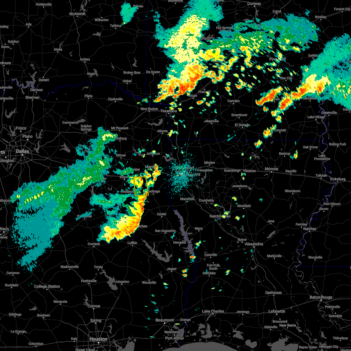 At 1120 am cdt, severe thunderstorms were located along a line extending from near hallsville to near pinehill, moving east at 35 mph (radar indicated). Hazards include 60 mph wind gusts. Expect damage to roofs, siding, and trees. Locations impacted include, tatum, beckville, lakeport, easton, chapman, chalk hill, church hill, fairplay and stewart. At 1120 am cdt, severe thunderstorms were located along a line extending from near hallsville to near pinehill, moving east at 35 mph (radar indicated). Hazards include 60 mph wind gusts. Expect damage to roofs, siding, and trees. Locations impacted include, tatum, beckville, lakeport, easton, chapman, chalk hill, church hill, fairplay and stewart.
|
| 6/8/2021 10:51 AM CDT |
 At 1051 am cdt, severe thunderstorms were located along a line extending from near clarksville city to near henderson, moving east at 35 mph (radar indicated). Hazards include 60 mph wind gusts. expect damage to roofs, siding, and trees At 1051 am cdt, severe thunderstorms were located along a line extending from near clarksville city to near henderson, moving east at 35 mph (radar indicated). Hazards include 60 mph wind gusts. expect damage to roofs, siding, and trees
|
| 5/11/2021 4:23 PM CDT |
 At 423 pm cdt, severe thunderstorms were located along a line extending from 6 miles southwest of karnack to 10 miles south of marshall to near beckville to minden to sacul, moving east at 40 mph (radar indicated). Hazards include 60 mph wind gusts and quarter size hail. Hail damage to vehicles is expected. expect wind damage to roofs, siding, and trees. Locations impacted include, marshall, carthage, hallsville, waskom, tatum, tenaha, timpson, beckville, deberry, elysian fields, pinehill, minden, easton, mount enterprise, reklaw, scottsville, gary city, nesbitt, darco and fairplay. At 423 pm cdt, severe thunderstorms were located along a line extending from 6 miles southwest of karnack to 10 miles south of marshall to near beckville to minden to sacul, moving east at 40 mph (radar indicated). Hazards include 60 mph wind gusts and quarter size hail. Hail damage to vehicles is expected. expect wind damage to roofs, siding, and trees. Locations impacted include, marshall, carthage, hallsville, waskom, tatum, tenaha, timpson, beckville, deberry, elysian fields, pinehill, minden, easton, mount enterprise, reklaw, scottsville, gary city, nesbitt, darco and fairplay.
|
| 5/11/2021 3:59 PM CDT |
 At 359 pm cdt, severe thunderstorms were located along a line extending from near hallsville to near tatum to near henderson to new salem to near rusk, moving east at 40 mph (radar indicated). Hazards include 60 mph wind gusts and quarter size hail. Hail damage to vehicles is expected. Expect wind damage to roofs, siding, and trees. At 359 pm cdt, severe thunderstorms were located along a line extending from near hallsville to near tatum to near henderson to new salem to near rusk, moving east at 40 mph (radar indicated). Hazards include 60 mph wind gusts and quarter size hail. Hail damage to vehicles is expected. Expect wind damage to roofs, siding, and trees.
|
| 5/11/2021 2:56 PM CDT |
 At 255 pm cdt, a severe thunderstorm was located near tatum, or 16 miles southeast of longview, moving northeast at 25 mph (radar indicated). Hazards include 60 mph wind gusts and quarter size hail. Hail damage to vehicles is expected. Expect wind damage to roofs, siding, and trees. At 255 pm cdt, a severe thunderstorm was located near tatum, or 16 miles southeast of longview, moving northeast at 25 mph (radar indicated). Hazards include 60 mph wind gusts and quarter size hail. Hail damage to vehicles is expected. Expect wind damage to roofs, siding, and trees.
|
| 5/11/2021 2:42 PM CDT |
 At 242 pm cdt, a severe thunderstorm was located near hallsville, or near longview, moving northeast at 40 mph (radar indicated). Hazards include 60 mph wind gusts and quarter size hail. Hail damage to vehicles is expected. expect wind damage to roofs, siding, and trees. Locations impacted include, longview, marshall, hallsville, lakeport, easton, nesbitt, chalk hill, monroe, oak hill and stewart. At 242 pm cdt, a severe thunderstorm was located near hallsville, or near longview, moving northeast at 40 mph (radar indicated). Hazards include 60 mph wind gusts and quarter size hail. Hail damage to vehicles is expected. expect wind damage to roofs, siding, and trees. Locations impacted include, longview, marshall, hallsville, lakeport, easton, nesbitt, chalk hill, monroe, oak hill and stewart.
|
| 5/11/2021 2:21 PM CDT |
 The national weather service in shreveport has issued a * severe thunderstorm warning for. east central smith county in northeastern texas. western harrison county in northeastern texas. northwestern rusk county in northeastern texas. Southeastern upshur county in northeastern texas. The national weather service in shreveport has issued a * severe thunderstorm warning for. east central smith county in northeastern texas. western harrison county in northeastern texas. northwestern rusk county in northeastern texas. Southeastern upshur county in northeastern texas.
|
| 4/9/2021 7:11 PM CDT |
 At 711 pm cdt, a severe thunderstorm was located near kilgore, moving northeast at 30 mph (radar indicated). Hazards include 60 mph wind gusts and half dollar size hail. Hail damage to vehicles is expected. Expect wind damage to roofs, siding, and trees. At 711 pm cdt, a severe thunderstorm was located near kilgore, moving northeast at 30 mph (radar indicated). Hazards include 60 mph wind gusts and half dollar size hail. Hail damage to vehicles is expected. Expect wind damage to roofs, siding, and trees.
|
| 3/23/2021 1:00 AM CDT |
 At 1259 am cdt, severe thunderstorms were located along a line extending from near arp to near troup to 6 miles north of maydelle, moving east at 40 mph (radar indicated). Hazards include 60 mph wind gusts and penny size hail. expect damage to roofs, siding, and trees At 1259 am cdt, severe thunderstorms were located along a line extending from near arp to near troup to 6 miles north of maydelle, moving east at 40 mph (radar indicated). Hazards include 60 mph wind gusts and penny size hail. expect damage to roofs, siding, and trees
|
| 3/23/2021 12:58 AM CDT |
 At 1258 am cdt, severe thunderstorms were located along a line extending from 8 miles northeast of hainesville to near hawkins to 9 miles southwest of big sandy, moving northeast at 50 mph (radar indicated). Hazards include 60 mph wind gusts and penny size hail. expect damage to roofs, siding, and trees At 1258 am cdt, severe thunderstorms were located along a line extending from 8 miles northeast of hainesville to near hawkins to 9 miles southwest of big sandy, moving northeast at 50 mph (radar indicated). Hazards include 60 mph wind gusts and penny size hail. expect damage to roofs, siding, and trees
|
| 3/17/2021 8:34 AM CDT |
 At 834 am cdt, severe thunderstorms were located along a line extending from near kildare to near tatum, moving northeast at 65 mph (radar indicated). Hazards include 60 mph wind gusts and quarter size hail. Hail damage to vehicles is expected. Expect wind damage to roofs, siding, and trees. At 834 am cdt, severe thunderstorms were located along a line extending from near kildare to near tatum, moving northeast at 65 mph (radar indicated). Hazards include 60 mph wind gusts and quarter size hail. Hail damage to vehicles is expected. Expect wind damage to roofs, siding, and trees.
|
| 3/17/2021 8:19 AM CDT |
 At 819 am cdt, severe thunderstorms were located along a line extending from near harleton to 6 miles northeast of hallsville to 6 miles northwest of tatum to near henderson, moving east at 40 mph (radar indicated). Hazards include 70 mph wind gusts and quarter size hail. Hail damage to vehicles is expected. expect considerable tree damage. wind damage is also likely to mobile homes, roofs, and outbuildings. Locations impacted include, longview, marshall, henderson, kilgore, hallsville, jefferson, tatum, new london, beckville, berea, harleton, karnack, woodlawn, joinerville, lakeport, easton, scottsville, nesbitt, rolling meadows and darco. At 819 am cdt, severe thunderstorms were located along a line extending from near harleton to 6 miles northeast of hallsville to 6 miles northwest of tatum to near henderson, moving east at 40 mph (radar indicated). Hazards include 70 mph wind gusts and quarter size hail. Hail damage to vehicles is expected. expect considerable tree damage. wind damage is also likely to mobile homes, roofs, and outbuildings. Locations impacted include, longview, marshall, henderson, kilgore, hallsville, jefferson, tatum, new london, beckville, berea, harleton, karnack, woodlawn, joinerville, lakeport, easton, scottsville, nesbitt, rolling meadows and darco.
|
| 3/17/2021 8:00 AM CDT |
 At 800 am cdt, severe thunderstorms were located along a line extending from near diana to near longview to 7 miles southeast of kilgore to near turnertown, moving east at 40 mph (radar indicated). Hazards include 70 mph wind gusts and quarter size hail. Hail damage to vehicles is expected. expect considerable tree damage. wind damage is also likely to mobile homes, roofs, and outbuildings. Locations impacted include, longview, marshall, henderson, kilgore, whitehouse, white oak, gladewater, hallsville, overton, jefferson, troup, tatum, new london, arp, clarksville city, beckville, east mountain, berea, harleton and diana. At 800 am cdt, severe thunderstorms were located along a line extending from near diana to near longview to 7 miles southeast of kilgore to near turnertown, moving east at 40 mph (radar indicated). Hazards include 70 mph wind gusts and quarter size hail. Hail damage to vehicles is expected. expect considerable tree damage. wind damage is also likely to mobile homes, roofs, and outbuildings. Locations impacted include, longview, marshall, henderson, kilgore, whitehouse, white oak, gladewater, hallsville, overton, jefferson, troup, tatum, new london, arp, clarksville city, beckville, east mountain, berea, harleton and diana.
|
| 3/17/2021 7:32 AM CDT |
 At 731 am cdt, severe thunderstorms were located along a line extending from near gladewater to near liberty city to arp to near mixon, moving east at 40 mph (radar indicated). Hazards include 70 mph wind gusts and quarter size hail. Hail damage to vehicles is expected. expect considerable tree damage. Wind damage is also likely to mobile homes, roofs, and outbuildings. At 731 am cdt, severe thunderstorms were located along a line extending from near gladewater to near liberty city to arp to near mixon, moving east at 40 mph (radar indicated). Hazards include 70 mph wind gusts and quarter size hail. Hail damage to vehicles is expected. expect considerable tree damage. Wind damage is also likely to mobile homes, roofs, and outbuildings.
|
| 5/24/2020 3:20 PM CDT |
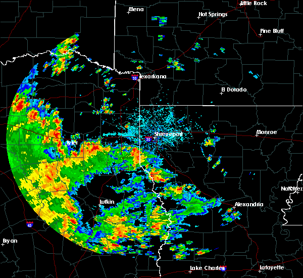 At 320 pm cdt, a severe thunderstorm was located just south of kilgore, moving north at 30 mph (radar indicated). Hazards include 60 mph wind gusts and nickel size hail. expect damage to roofs, siding, and trees At 320 pm cdt, a severe thunderstorm was located just south of kilgore, moving north at 30 mph (radar indicated). Hazards include 60 mph wind gusts and nickel size hail. expect damage to roofs, siding, and trees
|
| 4/29/2020 1:28 AM CDT |
 At 128 am cdt, severe thunderstorms were located along a line extending from near pinehill to near carthage to 8 miles southeast of deberry, moving south at 40 mph (radar indicated). Hazards include 60 mph wind gusts and quarter size hail. Hail damage to vehicles is expected. Expect wind damage to roofs, siding, and trees. At 128 am cdt, severe thunderstorms were located along a line extending from near pinehill to near carthage to 8 miles southeast of deberry, moving south at 40 mph (radar indicated). Hazards include 60 mph wind gusts and quarter size hail. Hail damage to vehicles is expected. Expect wind damage to roofs, siding, and trees.
|
| 4/29/2020 1:17 AM CDT |
 At 117 am cdt, severe thunderstorms were located along a line extending from coffee city to 6 miles northwest of arp to 8 miles east of kilgore, moving south at 40 mph (radar indicated. at 103 am, a 59 mph wind gust was measured at tyler pounds field airport. in addition, quarter to half dollar size hail fell in lindale with these storms). Hazards include 60 mph wind gusts and quarter size hail. Hail damage to vehicles is expected. expect wind damage to roofs, siding, and trees. Locations impacted include, tyler, longview, jacksonville, henderson, kilgore, whitehouse, white oak, gladewater, overton, bullard, troup, new london, arp, clarksville city, ponta, new salem, mount selman, liberty city, joinerville and mixon. At 117 am cdt, severe thunderstorms were located along a line extending from coffee city to 6 miles northwest of arp to 8 miles east of kilgore, moving south at 40 mph (radar indicated. at 103 am, a 59 mph wind gust was measured at tyler pounds field airport. in addition, quarter to half dollar size hail fell in lindale with these storms). Hazards include 60 mph wind gusts and quarter size hail. Hail damage to vehicles is expected. expect wind damage to roofs, siding, and trees. Locations impacted include, tyler, longview, jacksonville, henderson, kilgore, whitehouse, white oak, gladewater, overton, bullard, troup, new london, arp, clarksville city, ponta, new salem, mount selman, liberty city, joinerville and mixon.
|
| 4/29/2020 12:52 AM CDT |
 At 1252 am cdt, severe thunderstorms were located along a line extending from near longview to near marshall to near mooringsport, moving south at 50 mph (radar indicated). Hazards include 60 mph wind gusts and quarter size hail. Hail damage to vehicles is expected. Expect wind damage to roofs, siding, and trees. At 1252 am cdt, severe thunderstorms were located along a line extending from near longview to near marshall to near mooringsport, moving south at 50 mph (radar indicated). Hazards include 60 mph wind gusts and quarter size hail. Hail damage to vehicles is expected. Expect wind damage to roofs, siding, and trees.
|
| 4/29/2020 12:45 AM CDT |
 At 1245 am cdt, severe thunderstorms were located along a line extending from near hallsville to 6 miles northwest of marshall to near oil city, moving south at 55 mph (radar indicated). Hazards include 60 mph wind gusts and quarter size hail. Hail damage to vehicles is expected. expect wind damage to roofs, siding, and trees. Locations impacted include, longview, marshall, hallsville, jefferson, karnack, woodlawn, smithland, berea, harleton, gray, lakeport, scottsville, uncertain, nesbitt and leigh. At 1245 am cdt, severe thunderstorms were located along a line extending from near hallsville to 6 miles northwest of marshall to near oil city, moving south at 55 mph (radar indicated). Hazards include 60 mph wind gusts and quarter size hail. Hail damage to vehicles is expected. expect wind damage to roofs, siding, and trees. Locations impacted include, longview, marshall, hallsville, jefferson, karnack, woodlawn, smithland, berea, harleton, gray, lakeport, scottsville, uncertain, nesbitt and leigh.
|
| 4/29/2020 12:42 AM CDT |
 At 1241 am cdt, severe thunderstorms were located along a line extending from near edom to near hawkins to near diana, moving southeast at 55 mph (radar indicated. a 52 mph wind gust was just measured at the wood county airport in mineola). Hazards include 60 mph wind gusts and quarter size hail. Hail damage to vehicles is expected. Expect wind damage to roofs, siding, and trees. At 1241 am cdt, severe thunderstorms were located along a line extending from near edom to near hawkins to near diana, moving southeast at 55 mph (radar indicated. a 52 mph wind gust was just measured at the wood county airport in mineola). Hazards include 60 mph wind gusts and quarter size hail. Hail damage to vehicles is expected. Expect wind damage to roofs, siding, and trees.
|
| 4/29/2020 12:11 AM CDT |
 At 1211 am cdt, severe thunderstorms were located along a line extending from hughes springs to 7 miles northwest of linden to near brightstar, moving southeast at 45 mph (radar indicated). Hazards include 70 mph wind gusts and quarter size hail. Hail damage to vehicles is expected. expect considerable tree damage. Wind damage is also likely to mobile homes, roofs, and outbuildings. At 1211 am cdt, severe thunderstorms were located along a line extending from hughes springs to 7 miles northwest of linden to near brightstar, moving southeast at 45 mph (radar indicated). Hazards include 70 mph wind gusts and quarter size hail. Hail damage to vehicles is expected. expect considerable tree damage. Wind damage is also likely to mobile homes, roofs, and outbuildings.
|
| 4/28/2020 9:10 AM CDT |
 At 910 am cdt, severe thunderstorms were located along a line extending from 7 miles northwest of tatum to near beckville to 6 miles southeast of pinehill, moving east at 40 mph (radar indicated). Hazards include 70 mph wind gusts and penny size hail. Expect considerable tree damage. damage is likely to mobile homes, roofs, and outbuildings. Locations impacted include, carthage, tatum, beckville, deberry, pinehill, gary city, chapman, front, monroe, fairplay, stewart, midyett, chalk hill, deadwood, dotson, woods and oak hill. At 910 am cdt, severe thunderstorms were located along a line extending from 7 miles northwest of tatum to near beckville to 6 miles southeast of pinehill, moving east at 40 mph (radar indicated). Hazards include 70 mph wind gusts and penny size hail. Expect considerable tree damage. damage is likely to mobile homes, roofs, and outbuildings. Locations impacted include, carthage, tatum, beckville, deberry, pinehill, gary city, chapman, front, monroe, fairplay, stewart, midyett, chalk hill, deadwood, dotson, woods and oak hill.
|
| 4/28/2020 8:46 AM CDT |
 At 846 am cdt, severe thunderstorms were located along a line extending from kilgore to near henderson to near minden, moving east at 40 mph (radar indicated). Hazards include 60 mph wind gusts and penny size hail. expect damage to roofs, siding, and trees At 846 am cdt, severe thunderstorms were located along a line extending from kilgore to near henderson to near minden, moving east at 40 mph (radar indicated). Hazards include 60 mph wind gusts and penny size hail. expect damage to roofs, siding, and trees
|
| 4/24/2020 8:30 PM CDT |
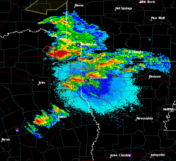 At 830 pm cdt, a severe thunderstorm was located over tatum, or 16 miles southwest of marshall, moving east at 35 mph (radar indicated). Hazards include 60 mph wind gusts and quarter size hail. Hail damage to vehicles is expected. expect wind damage to roofs, siding, and trees. Locations impacted include, tatum, beckville, easton and darco. At 830 pm cdt, a severe thunderstorm was located over tatum, or 16 miles southwest of marshall, moving east at 35 mph (radar indicated). Hazards include 60 mph wind gusts and quarter size hail. Hail damage to vehicles is expected. expect wind damage to roofs, siding, and trees. Locations impacted include, tatum, beckville, easton and darco.
|
| 4/24/2020 8:07 PM CDT |
 At 807 pm cdt, a severe thunderstorm was located 7 miles southeast of kilgore, moving east at 35 mph (radar indicated). Hazards include 60 mph wind gusts and quarter size hail. Hail damage to vehicles is expected. Expect wind damage to roofs, siding, and trees. At 807 pm cdt, a severe thunderstorm was located 7 miles southeast of kilgore, moving east at 35 mph (radar indicated). Hazards include 60 mph wind gusts and quarter size hail. Hail damage to vehicles is expected. Expect wind damage to roofs, siding, and trees.
|
| 4/22/2020 2:48 PM CDT |
 At 248 pm cdt, a severe thunderstorm capable of producing a tornado was located near henderson, moving northeast at 45 mph (radar indicated rotation). Hazards include tornado and quarter size hail. Flying debris will be dangerous to those caught without shelter. mobile homes will be damaged or destroyed. damage to roofs, windows, and vehicles will occur. tree damage is likely. This tornadic thunderstorm will remain over mainly rural areas of west central panola and central rusk counties, including the following locations, chapman, chalk hill, monroe, church hill, oak hill, fairplay, stewart and brachfield. At 248 pm cdt, a severe thunderstorm capable of producing a tornado was located near henderson, moving northeast at 45 mph (radar indicated rotation). Hazards include tornado and quarter size hail. Flying debris will be dangerous to those caught without shelter. mobile homes will be damaged or destroyed. damage to roofs, windows, and vehicles will occur. tree damage is likely. This tornadic thunderstorm will remain over mainly rural areas of west central panola and central rusk counties, including the following locations, chapman, chalk hill, monroe, church hill, oak hill, fairplay, stewart and brachfield.
|
| 4/22/2020 2:30 PM CDT |
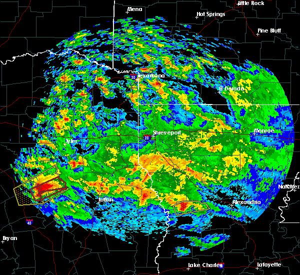 At 230 pm cdt, a severe thunderstorm capable of producing a tornado was located near new salem, or 12 miles east of jacksonville, moving northeast at 45 mph (radar indicated rotation). Hazards include tornado and quarter size hail. Flying debris will be dangerous to those caught without shelter. mobile homes will be damaged or destroyed. damage to roofs, windows, and vehicles will occur. tree damage is likely. this dangerous storm will be near, joinerville around 250 pm cdt. henderson around 255 pm cdt. Other locations impacted by this tornadic thunderstorm include chapman, chalk hill, new summerfield, concord, monroe, church hill, oak hill, fairplay, stewart and brachfield. At 230 pm cdt, a severe thunderstorm capable of producing a tornado was located near new salem, or 12 miles east of jacksonville, moving northeast at 45 mph (radar indicated rotation). Hazards include tornado and quarter size hail. Flying debris will be dangerous to those caught without shelter. mobile homes will be damaged or destroyed. damage to roofs, windows, and vehicles will occur. tree damage is likely. this dangerous storm will be near, joinerville around 250 pm cdt. henderson around 255 pm cdt. Other locations impacted by this tornadic thunderstorm include chapman, chalk hill, new summerfield, concord, monroe, church hill, oak hill, fairplay, stewart and brachfield.
|
| 4/12/2020 7:36 PM CDT |
 The severe thunderstorm warning for central smith, western marion, western harrison, northern rusk, southeastern wood, upshur and gregg counties will expire at 745 pm cdt, the storms which prompted the warning have moved out of the area. therefore, the warning will be allowed to expire. a severe thunderstorm watch remains in effect until 800 pm cdt for northeastern texas. The severe thunderstorm warning for central smith, western marion, western harrison, northern rusk, southeastern wood, upshur and gregg counties will expire at 745 pm cdt, the storms which prompted the warning have moved out of the area. therefore, the warning will be allowed to expire. a severe thunderstorm watch remains in effect until 800 pm cdt for northeastern texas.
|
| 4/12/2020 7:29 PM CDT |
 At 728 pm cdt, a severe gust front was located along a line extending from 7 miles north of berea to woodlawn to 8 miles southwest of marshall to 7 miles southwest of tatum to near turnertown, moving east at 60 mph. these severe winds are arriving well ahead of the thunderstorms (radar indicated). Hazards include 60 mph wind gusts. expect damage to roofs, siding, and trees At 728 pm cdt, a severe gust front was located along a line extending from 7 miles north of berea to woodlawn to 8 miles southwest of marshall to 7 miles southwest of tatum to near turnertown, moving east at 60 mph. these severe winds are arriving well ahead of the thunderstorms (radar indicated). Hazards include 60 mph wind gusts. expect damage to roofs, siding, and trees
|
| 4/12/2020 6:48 PM CDT |
 At 647 pm cdt, severe thunderstorms were located along a line extending from near quitman to near hawkins to lindale to near edom, moving east at 45 mph. the strongest winds may occur along a gust front well ahead of the thunderstorms (radar indicated). Hazards include 60 mph wind gusts and penny size hail. expect damage to roofs, siding, and trees At 647 pm cdt, severe thunderstorms were located along a line extending from near quitman to near hawkins to lindale to near edom, moving east at 45 mph. the strongest winds may occur along a gust front well ahead of the thunderstorms (radar indicated). Hazards include 60 mph wind gusts and penny size hail. expect damage to roofs, siding, and trees
|
| 4/12/2020 8:49 AM CDT |
 At 848 am cdt, severe thunderstorms were located along a line extending from near tatum to near beckville to pinehill to near minden to 7 miles north of trawick, moving east at 40 mph. these are very dangerous storms (radar indicated). Hazards include 80 mph wind gusts and quarter size hail. Flying debris will be dangerous to those caught without shelter. mobile homes will be heavily damaged. expect considerable damage to roofs, windows, and vehicles. extensive tree damage and power outages are likely. Locations impacted include, carthage, tatum, tenaha, timpson, beckville, joaquin, deberry, elysian fields, pinehill, minden, easton, mount enterprise, gary city, front, fairplay, stewart, midyett, chalk hill, deadwood and dotson. At 848 am cdt, severe thunderstorms were located along a line extending from near tatum to near beckville to pinehill to near minden to 7 miles north of trawick, moving east at 40 mph. these are very dangerous storms (radar indicated). Hazards include 80 mph wind gusts and quarter size hail. Flying debris will be dangerous to those caught without shelter. mobile homes will be heavily damaged. expect considerable damage to roofs, windows, and vehicles. extensive tree damage and power outages are likely. Locations impacted include, carthage, tatum, tenaha, timpson, beckville, joaquin, deberry, elysian fields, pinehill, minden, easton, mount enterprise, gary city, front, fairplay, stewart, midyett, chalk hill, deadwood and dotson.
|
| 4/12/2020 8:21 AM CDT |
 At 820 am cdt, severe thunderstorms were located along a line extending from 9 miles east of kilgore to near joinerville to near henderson to 8 miles west of minden to 9 miles northeast of ponta to new salem, moving east at 50 mph. these are very dangerous storms (radar indicated). Hazards include 80 mph wind gusts and quarter size hail. Flying debris will be dangerous to those caught without shelter. mobile homes will be heavily damaged. expect considerable damage to roofs, windows, and vehicles. Extensive tree damage and power outages are likely. At 820 am cdt, severe thunderstorms were located along a line extending from 9 miles east of kilgore to near joinerville to near henderson to 8 miles west of minden to 9 miles northeast of ponta to new salem, moving east at 50 mph. these are very dangerous storms (radar indicated). Hazards include 80 mph wind gusts and quarter size hail. Flying debris will be dangerous to those caught without shelter. mobile homes will be heavily damaged. expect considerable damage to roofs, windows, and vehicles. Extensive tree damage and power outages are likely.
|
| 4/12/2020 8:15 AM CDT |
 At 814 am cdt, a severe thunderstorm capable of producing a tornado was located near longview, moving northeast at 40 mph (radar indicated rotation). Hazards include tornado and quarter size hail. Flying debris will be dangerous to those caught without shelter. mobile homes will be damaged or destroyed. damage to roofs, windows, and vehicles will occur. tree damage is likely. this dangerous storm will be near, hallsville around 830 am cdt. harleton around 840 am cdt. marshall around 855 am cdt. Other locations impacted by this tornadic thunderstorm include lakeport, warren city, nesbitt, rolling meadows, chalk hill, easton, monroe, darco, oak hill and stewart. At 814 am cdt, a severe thunderstorm capable of producing a tornado was located near longview, moving northeast at 40 mph (radar indicated rotation). Hazards include tornado and quarter size hail. Flying debris will be dangerous to those caught without shelter. mobile homes will be damaged or destroyed. damage to roofs, windows, and vehicles will occur. tree damage is likely. this dangerous storm will be near, hallsville around 830 am cdt. harleton around 840 am cdt. marshall around 855 am cdt. Other locations impacted by this tornadic thunderstorm include lakeport, warren city, nesbitt, rolling meadows, chalk hill, easton, monroe, darco, oak hill and stewart.
|
| 4/12/2020 7:51 AM CDT |
 At 751 am cdt, a severe thunderstorm capable of producing a tornado was located near overton, or 7 miles southwest of kilgore, moving northeast at 40 mph (radar indicated rotation). Hazards include tornado and quarter size hail. Flying debris will be dangerous to those caught without shelter. mobile homes will be damaged or destroyed. damage to roofs, windows, and vehicles will occur. tree damage is likely. this dangerous storm will be near, kilgore and liberty city around 805 am cdt. longview around 820 am cdt. hallsville around 830 am cdt. Other locations impacted by this tornadic thunderstorm include lakeport, warren city, nesbitt, rolling meadows, monroe, darco, stewart, chalk hill, easton and laird hill. At 751 am cdt, a severe thunderstorm capable of producing a tornado was located near overton, or 7 miles southwest of kilgore, moving northeast at 40 mph (radar indicated rotation). Hazards include tornado and quarter size hail. Flying debris will be dangerous to those caught without shelter. mobile homes will be damaged or destroyed. damage to roofs, windows, and vehicles will occur. tree damage is likely. this dangerous storm will be near, kilgore and liberty city around 805 am cdt. longview around 820 am cdt. hallsville around 830 am cdt. Other locations impacted by this tornadic thunderstorm include lakeport, warren city, nesbitt, rolling meadows, monroe, darco, stewart, chalk hill, easton and laird hill.
|
| 3/4/2020 7:47 AM CST |
 At 746 am cst, a severe thunderstorm was located near pinehill, or 9 miles west of carthage, moving east at 45 mph (radar indicated). Hazards include 70 mph wind gusts and quarter size hail. Hail damage to vehicles is expected. expect considerable tree damage. wind damage is also likely to mobile homes, roofs, and outbuildings. Locations impacted include, carthage, tatum, beckville, pinehill, easton, gary city, chapman, monroe, darco, fairplay, stewart, chalk hill, dotson, church hill and oak hill. At 746 am cst, a severe thunderstorm was located near pinehill, or 9 miles west of carthage, moving east at 45 mph (radar indicated). Hazards include 70 mph wind gusts and quarter size hail. Hail damage to vehicles is expected. expect considerable tree damage. wind damage is also likely to mobile homes, roofs, and outbuildings. Locations impacted include, carthage, tatum, beckville, pinehill, easton, gary city, chapman, monroe, darco, fairplay, stewart, chalk hill, dotson, church hill and oak hill.
|
| 3/4/2020 7:21 AM CST |
 At 720 am cst, a severe thunderstorm was located near henderson, moving northeast at 45 mph (radar indicated). Hazards include 70 mph wind gusts and half dollar size hail. Hail damage to vehicles is expected. expect considerable tree damage. Wind damage is also likely to mobile homes, roofs, and outbuildings. At 720 am cst, a severe thunderstorm was located near henderson, moving northeast at 45 mph (radar indicated). Hazards include 70 mph wind gusts and half dollar size hail. Hail damage to vehicles is expected. expect considerable tree damage. Wind damage is also likely to mobile homes, roofs, and outbuildings.
|
| 3/4/2020 7:01 AM CST |
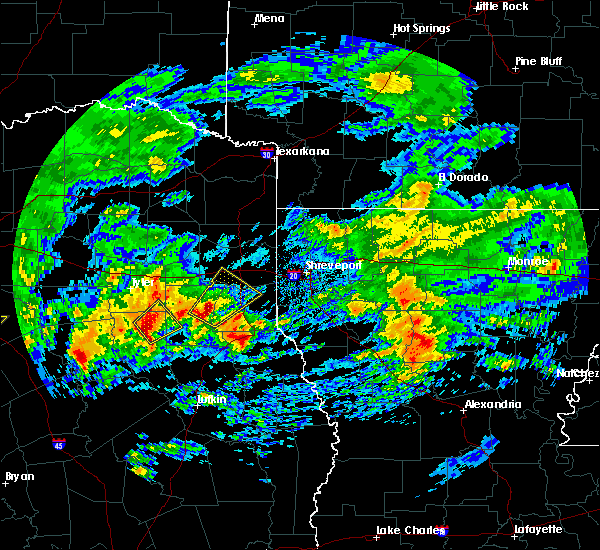 At 648 am cst, a severe thunderstorm was located near minden, or 8 miles southeast of henderson, moving northeast at 55 mph (radar indicated). Hazards include 60 mph wind gusts and quarter size hail. Hail damage to vehicles is expected. Expect wind damage to roofs, siding, and trees. At 648 am cst, a severe thunderstorm was located near minden, or 8 miles southeast of henderson, moving northeast at 55 mph (radar indicated). Hazards include 60 mph wind gusts and quarter size hail. Hail damage to vehicles is expected. Expect wind damage to roofs, siding, and trees.
|
| 3/4/2020 6:48 AM CST |
 At 648 am cst, a severe thunderstorm was located near minden, or 8 miles southeast of henderson, moving northeast at 55 mph (radar indicated). Hazards include 60 mph wind gusts and quarter size hail. Hail damage to vehicles is expected. Expect wind damage to roofs, siding, and trees. At 648 am cst, a severe thunderstorm was located near minden, or 8 miles southeast of henderson, moving northeast at 55 mph (radar indicated). Hazards include 60 mph wind gusts and quarter size hail. Hail damage to vehicles is expected. Expect wind damage to roofs, siding, and trees.
|
| 1/10/2020 11:57 PM CST |
 At 1156 pm cst, severe thunderstorms were located along a line extending from near jenkins to 6 miles north of tatum to 6 miles northeast of nacogdoches, moving northeast at 45 mph (radar indicated). Hazards include 60 mph wind gusts. expect damage to roofs, siding, and trees At 1156 pm cst, severe thunderstorms were located along a line extending from near jenkins to 6 miles north of tatum to 6 miles northeast of nacogdoches, moving northeast at 45 mph (radar indicated). Hazards include 60 mph wind gusts. expect damage to roofs, siding, and trees
|
| 1/10/2020 11:28 PM CST |
 At 1126 pm cst, severe thunderstorms were located along a line extending from 6 miles west of hawkins to near grapeland, moving northeast at 45 mph (radar indicated). Hazards include 60 mph wind gusts. expect damage to roofs, siding, and trees At 1126 pm cst, severe thunderstorms were located along a line extending from 6 miles west of hawkins to near grapeland, moving northeast at 45 mph (radar indicated). Hazards include 60 mph wind gusts. expect damage to roofs, siding, and trees
|
| 10/20/2019 6:48 PM CDT |
 At 648 pm cdt, a severe thunderstorm was located 5 miles southwest of henderson, moving northeast at 30 mph (radar indicated). Hazards include 60 mph wind gusts and half dollar size hail. Hail damage to vehicles is expected. Expect wind damage to roofs, siding, and trees. At 648 pm cdt, a severe thunderstorm was located 5 miles southwest of henderson, moving northeast at 30 mph (radar indicated). Hazards include 60 mph wind gusts and half dollar size hail. Hail damage to vehicles is expected. Expect wind damage to roofs, siding, and trees.
|
| 6/20/2019 1:04 AM CDT |
 At 104 am cdt, a severe thunderstorm was located near carthage, moving east at 45 mph (radar indicated). Hazards include 60 mph wind gusts. Expect damage to roofs, siding, and trees. Locations impacted include, carthage, tatum, tenaha, timpson, beckville, joaquin, deberry, elysian fields, pinehill, minden, mount enterprise, gary city, front, fairplay, stewart, midyett, chalk hill, deadwood, dotson and oak hill. At 104 am cdt, a severe thunderstorm was located near carthage, moving east at 45 mph (radar indicated). Hazards include 60 mph wind gusts. Expect damage to roofs, siding, and trees. Locations impacted include, carthage, tatum, tenaha, timpson, beckville, joaquin, deberry, elysian fields, pinehill, minden, mount enterprise, gary city, front, fairplay, stewart, midyett, chalk hill, deadwood, dotson and oak hill.
|
| 6/20/2019 12:28 AM CDT |
 At 1227 am cdt, a severe thunderstorm was located near henderson, moving east at 45 mph (radar indicated). Hazards include 60 mph wind gusts. expect damage to roofs, siding, and trees At 1227 am cdt, a severe thunderstorm was located near henderson, moving east at 45 mph (radar indicated). Hazards include 60 mph wind gusts. expect damage to roofs, siding, and trees
|
| 5/18/2019 6:58 PM CDT |
 At 658 pm cdt, air traffic controllers at the east texas regional airport reported a funnel cloud located 8 miles east of kilgore, or just south of lakeport, moving northeast at 30 mph (weather spotters confirmed funnel cloud). Hazards include damaging tornado. Flying debris will be dangerous to those caught without shelter. mobile homes will be damaged or destroyed. damage to roofs, windows, and vehicles will occur. tree damage is likely. the tornado will be near, tatum around 715 pm cdt. hallsville around 720 pm cdt. marshall around 745 pm cdt. Other locations impacted by this tornadic thunderstorm include lakeport, chalk hill, easton, monroe, darco, oak hill and stewart. At 658 pm cdt, air traffic controllers at the east texas regional airport reported a funnel cloud located 8 miles east of kilgore, or just south of lakeport, moving northeast at 30 mph (weather spotters confirmed funnel cloud). Hazards include damaging tornado. Flying debris will be dangerous to those caught without shelter. mobile homes will be damaged or destroyed. damage to roofs, windows, and vehicles will occur. tree damage is likely. the tornado will be near, tatum around 715 pm cdt. hallsville around 720 pm cdt. marshall around 745 pm cdt. Other locations impacted by this tornadic thunderstorm include lakeport, chalk hill, easton, monroe, darco, oak hill and stewart.
|
| 5/18/2019 6:43 PM CDT |
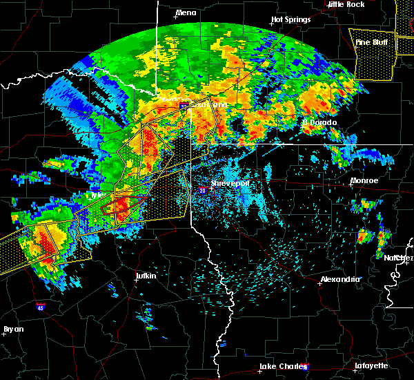 At 643 pm cdt, a severe thunderstorm capable of producing a tornado was located 6 miles south of kilgore, moving east at 40 mph (radar indicated rotation). Hazards include tornado and quarter size hail. Flying debris will be dangerous to those caught without shelter. mobile homes will be damaged or destroyed. damage to roofs, windows, and vehicles will occur. tree damage is likely. This tornadic thunderstorm will remain over mainly rural areas of northwestern rusk county, including the following locations, monroe and chalk hill. At 643 pm cdt, a severe thunderstorm capable of producing a tornado was located 6 miles south of kilgore, moving east at 40 mph (radar indicated rotation). Hazards include tornado and quarter size hail. Flying debris will be dangerous to those caught without shelter. mobile homes will be damaged or destroyed. damage to roofs, windows, and vehicles will occur. tree damage is likely. This tornadic thunderstorm will remain over mainly rural areas of northwestern rusk county, including the following locations, monroe and chalk hill.
|
| 5/18/2019 6:41 PM CDT |
 The national weather service in shreveport has issued a * severe thunderstorm warning for. harrison county in northeastern texas. central panola county in northeastern texas. northern rusk county in northeastern texas. Southern gregg county in northeastern texas. The national weather service in shreveport has issued a * severe thunderstorm warning for. harrison county in northeastern texas. central panola county in northeastern texas. northern rusk county in northeastern texas. Southern gregg county in northeastern texas.
|
| 5/18/2019 6:24 PM CDT |
 At 624 pm cdt, severe thunderstorms were located along a line extending from near cason to near ore city to white oak, moving northeast at 60 mph (radar indicated). Hazards include 70 mph wind gusts and quarter size hail. Hail damage to vehicles is expected. expect considerable tree damage. wind damage is also likely to mobile homes, roofs, and outbuildings. Locations impacted include, longview, kilgore, white oak, gladewater, hallsville, daingerfield, jefferson, linden, hughes springs, lone star, ore city, clarksville city, east mountain, lodi, rocky branch, harleton, berea, diana, liberty city and jenkins. At 624 pm cdt, severe thunderstorms were located along a line extending from near cason to near ore city to white oak, moving northeast at 60 mph (radar indicated). Hazards include 70 mph wind gusts and quarter size hail. Hail damage to vehicles is expected. expect considerable tree damage. wind damage is also likely to mobile homes, roofs, and outbuildings. Locations impacted include, longview, kilgore, white oak, gladewater, hallsville, daingerfield, jefferson, linden, hughes springs, lone star, ore city, clarksville city, east mountain, lodi, rocky branch, harleton, berea, diana, liberty city and jenkins.
|
| 5/18/2019 6:17 PM CDT |
 At 617 pm cdt, a severe thunderstorm capable of producing a tornado was located just southwest of arp, or 8 miles east of whitehouse, moving northeast at 30 mph (radar indicated rotation). Hazards include tornado and quarter size hail. Flying debris will be dangerous to those caught without shelter. mobile homes will be damaged or destroyed. damage to roofs, windows, and vehicles will occur. tree damage is likely. this dangerous storm will be near, turnertown around 630 pm cdt. overton and joinerville around 635 pm cdt. new london around 640 pm cdt. Other locations impacted by this tornadic thunderstorm include laird hill, monroe and chalk hill. At 617 pm cdt, a severe thunderstorm capable of producing a tornado was located just southwest of arp, or 8 miles east of whitehouse, moving northeast at 30 mph (radar indicated rotation). Hazards include tornado and quarter size hail. Flying debris will be dangerous to those caught without shelter. mobile homes will be damaged or destroyed. damage to roofs, windows, and vehicles will occur. tree damage is likely. this dangerous storm will be near, turnertown around 630 pm cdt. overton and joinerville around 635 pm cdt. new london around 640 pm cdt. Other locations impacted by this tornadic thunderstorm include laird hill, monroe and chalk hill.
|
| 5/18/2019 6:01 PM CDT |
 At 601 pm cdt, severe thunderstorms were located along a line extending from rosewood to clarksville city to liberty city, moving northeast at 65 mph (radar indicated). Hazards include 60 mph wind gusts. expect damage to roofs, siding, and trees At 601 pm cdt, severe thunderstorms were located along a line extending from rosewood to clarksville city to liberty city, moving northeast at 65 mph (radar indicated). Hazards include 60 mph wind gusts. expect damage to roofs, siding, and trees
|
| 5/18/2019 5:56 PM CDT |
 At 556 pm cdt, a severe thunderstorm was located near bullard, moving northeast at 40 mph (radar indicated). Hazards include 60 mph wind gusts and penny size hail. expect damage to roofs, siding, and trees At 556 pm cdt, a severe thunderstorm was located near bullard, moving northeast at 40 mph (radar indicated). Hazards include 60 mph wind gusts and penny size hail. expect damage to roofs, siding, and trees
|
| 5/8/2019 2:22 PM CDT |
 At 222 pm cdt, severe thunderstorms were located along a line extending from hughes springs to 6 miles north of harleton to hallsville to 6 miles west of tatum to near pinehill, moving east at 35 mph (radar indicated). Hazards include 60 mph wind gusts and penny size hail. Expect damage to roofs, siding, and trees. Locations impacted include, marshall, carthage, hallsville, jefferson, tatum, beckville, woodlawn, pinehill, harleton, berea, easton, scottsville, lassater, nesbitt, chapman, darco, fairplay, stewart, chalk hill and church hill. At 222 pm cdt, severe thunderstorms were located along a line extending from hughes springs to 6 miles north of harleton to hallsville to 6 miles west of tatum to near pinehill, moving east at 35 mph (radar indicated). Hazards include 60 mph wind gusts and penny size hail. Expect damage to roofs, siding, and trees. Locations impacted include, marshall, carthage, hallsville, jefferson, tatum, beckville, woodlawn, pinehill, harleton, berea, easton, scottsville, lassater, nesbitt, chapman, darco, fairplay, stewart, chalk hill and church hill.
|
| 5/8/2019 2:02 PM CDT |
 At 202 pm cdt, severe thunderstorms were located along a line extending from 6 miles west of lone star to diana to near longview to 6 miles northeast of joinerville to 7 miles southwest of henderson, moving east at 35 mph (radar indicated). Hazards include 60 mph wind gusts and penny size hail. expect damage to roofs, siding, and trees At 202 pm cdt, severe thunderstorms were located along a line extending from 6 miles west of lone star to diana to near longview to 6 miles northeast of joinerville to 7 miles southwest of henderson, moving east at 35 mph (radar indicated). Hazards include 60 mph wind gusts and penny size hail. expect damage to roofs, siding, and trees
|
| 5/2/2019 3:37 AM CDT |
 The severe thunderstorm warning for southwestern harrison, western panola, central rusk and southern gregg counties will expire at 345 am cdt, the storms which prompted the warning have weakened below severe limits, and no longer pose an immediate threat to life or property. therefore, the warning will be allowed to expire. however heavy rain is still possible with these thunderstorms. a severe thunderstorm watch remains in effect until 500 am cdt for northeastern texas. The severe thunderstorm warning for southwestern harrison, western panola, central rusk and southern gregg counties will expire at 345 am cdt, the storms which prompted the warning have weakened below severe limits, and no longer pose an immediate threat to life or property. therefore, the warning will be allowed to expire. however heavy rain is still possible with these thunderstorms. a severe thunderstorm watch remains in effect until 500 am cdt for northeastern texas.
|
| 5/2/2019 3:31 AM CDT |
 At 331 am cdt, severe thunderstorms were located along a line extending from near kilgore to 6 miles northeast of henderson to near pinehill to near minden, moving northeast at 30 mph (radar indicated). Hazards include 60 mph wind gusts and penny size hail. Expect damage to roofs, siding, and trees. Locations impacted include, longview, henderson, kilgore, hallsville, tatum, beckville, pinehill, minden, lakeport, easton, rolling meadows, chapman, monroe, fairplay, stewart, brachfield, chalk hill, dotson, church hill and laneville. At 331 am cdt, severe thunderstorms were located along a line extending from near kilgore to 6 miles northeast of henderson to near pinehill to near minden, moving northeast at 30 mph (radar indicated). Hazards include 60 mph wind gusts and penny size hail. Expect damage to roofs, siding, and trees. Locations impacted include, longview, henderson, kilgore, hallsville, tatum, beckville, pinehill, minden, lakeport, easton, rolling meadows, chapman, monroe, fairplay, stewart, brachfield, chalk hill, dotson, church hill and laneville.
|
| 5/2/2019 3:00 AM CDT |
 At 300 am cdt, severe thunderstorms were located along a line extending from near overton to turnertown to 9 miles southwest of henderson to near new salem, moving east at 30 mph (radar indicated). Hazards include 60 mph wind gusts and penny size hail. expect damage to roofs, siding, and trees At 300 am cdt, severe thunderstorms were located along a line extending from near overton to turnertown to 9 miles southwest of henderson to near new salem, moving east at 30 mph (radar indicated). Hazards include 60 mph wind gusts and penny size hail. expect damage to roofs, siding, and trees
|
| 4/18/2019 3:59 AM CDT |
 At 359 am cdt, severe thunderstorms were located along a line extending from 6 miles west of tatum to near pinehill to nacogdoches, moving east at 40 mph (radar indicated. trees have been downed near new london in northern rusk county from these storms). Hazards include 60 mph wind gusts. Expect damage to roofs, siding, and trees. Locations impacted include, nacogdoches, henderson, carthage, tatum, timpson, garrison, beckville, pinehill, minden, trawick, easton, appleby, mount enterprise, gary city, chapman, stockman, lawsonville, darco, fairplay and stewart. At 359 am cdt, severe thunderstorms were located along a line extending from 6 miles west of tatum to near pinehill to nacogdoches, moving east at 40 mph (radar indicated. trees have been downed near new london in northern rusk county from these storms). Hazards include 60 mph wind gusts. Expect damage to roofs, siding, and trees. Locations impacted include, nacogdoches, henderson, carthage, tatum, timpson, garrison, beckville, pinehill, minden, trawick, easton, appleby, mount enterprise, gary city, chapman, stockman, lawsonville, darco, fairplay and stewart.
|
| 4/18/2019 3:30 AM CDT |
 At 329 am cdt, severe thunderstorms were located along a line extending from turnertown to 7 miles east of new salem to near wells, moving northeast at 45 mph (radar indicated). Hazards include 70 mph wind gusts and penny size hail. Expect considerable tree damage. Damage is likely to mobile homes, roofs, and outbuildings. At 329 am cdt, severe thunderstorms were located along a line extending from turnertown to 7 miles east of new salem to near wells, moving northeast at 45 mph (radar indicated). Hazards include 70 mph wind gusts and penny size hail. Expect considerable tree damage. Damage is likely to mobile homes, roofs, and outbuildings.
|
| 4/13/2019 3:26 PM CDT |
 The severe thunderstorm warning for southern harrison, panola, northeastern rusk, northwestern shelby and southeastern gregg counties will expire at 330 pm cdt, the storms which prompted the warning have moved out of the area. therefore, the warning will be allowed to expire. a tornado watch remains in effect until 700 pm cdt for northwestern louisiana, and eastern and northeastern texas. The severe thunderstorm warning for southern harrison, panola, northeastern rusk, northwestern shelby and southeastern gregg counties will expire at 330 pm cdt, the storms which prompted the warning have moved out of the area. therefore, the warning will be allowed to expire. a tornado watch remains in effect until 700 pm cdt for northwestern louisiana, and eastern and northeastern texas.
|
| 4/13/2019 2:51 PM CDT |
 The severe thunderstorm warning for west central harrison, southwestern panola, central rusk, northwestern shelby, southeastern upshur and gregg counties will expire at 300 pm cdt, the storms which prompted the warning have moved out of the area. therefore, the warning will be allowed to expire. however gusty winds are still possible with these thunderstorms. a tornado watch remains in effect until 700 pm cdt for eastern and northeastern texas. a severe thunderstorm watch remains in effect until 300 pm cdt for northeastern texas. The severe thunderstorm warning for west central harrison, southwestern panola, central rusk, northwestern shelby, southeastern upshur and gregg counties will expire at 300 pm cdt, the storms which prompted the warning have moved out of the area. therefore, the warning will be allowed to expire. however gusty winds are still possible with these thunderstorms. a tornado watch remains in effect until 700 pm cdt for eastern and northeastern texas. a severe thunderstorm watch remains in effect until 300 pm cdt for northeastern texas.
|
| 4/13/2019 2:46 PM CDT |
 At 246 pm cdt, severe thunderstorms were located along a line extending from near longview to near timpson, moving east at 35 mph (radar indicated). Hazards include 70 mph wind gusts and nickel size hail. Expect considerable tree damage. Damage is likely to mobile homes, roofs, and outbuildings. At 246 pm cdt, severe thunderstorms were located along a line extending from near longview to near timpson, moving east at 35 mph (radar indicated). Hazards include 70 mph wind gusts and nickel size hail. Expect considerable tree damage. Damage is likely to mobile homes, roofs, and outbuildings.
|
| 4/13/2019 2:36 PM CDT |
 At 236 pm cdt, severe thunderstorms were located along a line extending from near west mountain to 8 miles southeast of minden, moving east at 40 mph (radar indicated). Hazards include 70 mph wind gusts and nickel size hail. Expect considerable tree damage. damage is likely to mobile homes, roofs, and outbuildings. Locations impacted include, longview, henderson, kilgore, white oak, gladewater, timpson, clarksville city, east mountain, pinehill, west mountain, minden, liberty city, lakeport, easton, mount enterprise, union grove, warren city, rolling meadows, fairplay and stewart. At 236 pm cdt, severe thunderstorms were located along a line extending from near west mountain to 8 miles southeast of minden, moving east at 40 mph (radar indicated). Hazards include 70 mph wind gusts and nickel size hail. Expect considerable tree damage. damage is likely to mobile homes, roofs, and outbuildings. Locations impacted include, longview, henderson, kilgore, white oak, gladewater, timpson, clarksville city, east mountain, pinehill, west mountain, minden, liberty city, lakeport, easton, mount enterprise, union grove, warren city, rolling meadows, fairplay and stewart.
|
| 4/13/2019 2:28 PM CDT |
 At 228 pm cdt, severe thunderstorms were located along a line extending from near big sandy to 8 miles north of trawick, moving east at 40 mph (radar indicated). Hazards include 60 mph wind gusts and nickel size hail. Expect damage to roofs, siding, and trees. Locations impacted include, longview, henderson, kilgore, white oak, gladewater, overton, big sandy, timpson, new london, clarksville city, east mountain, pinehill, liberty city, joinerville, turnertown, west mountain, minden, lakeport, easton and mount enterprise. At 228 pm cdt, severe thunderstorms were located along a line extending from near big sandy to 8 miles north of trawick, moving east at 40 mph (radar indicated). Hazards include 60 mph wind gusts and nickel size hail. Expect damage to roofs, siding, and trees. Locations impacted include, longview, henderson, kilgore, white oak, gladewater, overton, big sandy, timpson, new london, clarksville city, east mountain, pinehill, liberty city, joinerville, turnertown, west mountain, minden, lakeport, easton and mount enterprise.
|
| 4/13/2019 2:19 PM CDT |
 At 219 pm cdt, severe thunderstorms were located along a line extending from near hawkins to near sacul, moving east at 40 mph (radar indicated). Hazards include 60 mph wind gusts and quarter size hail. Hail damage to vehicles is expected. Expect wind damage to roofs, siding, and trees. At 219 pm cdt, severe thunderstorms were located along a line extending from near hawkins to near sacul, moving east at 40 mph (radar indicated). Hazards include 60 mph wind gusts and quarter size hail. Hail damage to vehicles is expected. Expect wind damage to roofs, siding, and trees.
|
| 4/7/2019 5:02 PM CDT |
 At 502 pm cdt, severe thunderstorms were located along a line extending from near tatum to near elysian fields, moving north at 25 mph (radar indicated). Hazards include 60 mph wind gusts and penny size hail. Expect damage to roofs, siding, and trees. Locations impacted include, longview, marshall, hallsville, waskom, tatum, beckville, deberry, elysian fields, lakeport, easton, scottsville, darco, stewart, leigh, jonesville and chalk hill. At 502 pm cdt, severe thunderstorms were located along a line extending from near tatum to near elysian fields, moving north at 25 mph (radar indicated). Hazards include 60 mph wind gusts and penny size hail. Expect damage to roofs, siding, and trees. Locations impacted include, longview, marshall, hallsville, waskom, tatum, beckville, deberry, elysian fields, lakeport, easton, scottsville, darco, stewart, leigh, jonesville and chalk hill.
|
| 4/7/2019 4:32 PM CDT |
 At 431 pm cdt, severe thunderstorms were located along a line extending from turnertown to 9 miles north of joaquin, moving north at 30 mph (radar indicated). Hazards include 60 mph wind gusts and penny size hail. expect damage to roofs, siding, and trees At 431 pm cdt, severe thunderstorms were located along a line extending from turnertown to 9 miles north of joaquin, moving north at 30 mph (radar indicated). Hazards include 60 mph wind gusts and penny size hail. expect damage to roofs, siding, and trees
|
| 3/25/2019 3:35 AM CDT |
 At 334 am cdt, severe thunderstorms were located along a line extending from near tatum to 9 miles west of beckville to near new london to overton to near troup, moving east at 45 mph (radar indicated). Hazards include 60 mph wind gusts and nickel size hail. Expect damage to roofs, siding, and trees. Locations impacted include, henderson, kilgore, overton, troup, tatum, new london, arp, joinerville, turnertown, lakeport, easton, monroe, stewart, chalk hill, church hill, laird hill and oak hill. At 334 am cdt, severe thunderstorms were located along a line extending from near tatum to 9 miles west of beckville to near new london to overton to near troup, moving east at 45 mph (radar indicated). Hazards include 60 mph wind gusts and nickel size hail. Expect damage to roofs, siding, and trees. Locations impacted include, henderson, kilgore, overton, troup, tatum, new london, arp, joinerville, turnertown, lakeport, easton, monroe, stewart, chalk hill, church hill, laird hill and oak hill.
|
| 3/25/2019 3:18 AM CDT |
 At 318 am cdt, severe thunderstorms were located along a line extending from near kilgore to near liberty city to 10 miles east of tyler to whitehouse, moving east at 40 mph (radar indicated). Hazards include 60 mph wind gusts and nickel size hail. Expect damage to roofs, siding, and trees. Locations impacted include, longview, henderson, kilgore, whitehouse, white oak, overton, troup, tatum, new london, arp, clarksville city, liberty city, joinerville, turnertown, lakeport, new chapel hill, easton, rolling meadows, monroe and stewart. At 318 am cdt, severe thunderstorms were located along a line extending from near kilgore to near liberty city to 10 miles east of tyler to whitehouse, moving east at 40 mph (radar indicated). Hazards include 60 mph wind gusts and nickel size hail. Expect damage to roofs, siding, and trees. Locations impacted include, longview, henderson, kilgore, whitehouse, white oak, overton, troup, tatum, new london, arp, clarksville city, liberty city, joinerville, turnertown, lakeport, new chapel hill, easton, rolling meadows, monroe and stewart.
|
| 3/25/2019 3:15 AM CDT |
 At 314 am cdt, severe thunderstorms were located along a line extending from near hallsville to near kilgore to near liberty city to 9 miles east of tyler, moving southeast at 20 mph (radar indicated). Hazards include 60 mph wind gusts and quarter size hail. Hail damage to vehicles is expected. expect wind damage to roofs, siding, and trees. Locations impacted include, longview, kilgore, white oak, hallsville, clarksville city, liberty city, lakeport, easton, rolling meadows and darco. At 314 am cdt, severe thunderstorms were located along a line extending from near hallsville to near kilgore to near liberty city to 9 miles east of tyler, moving southeast at 20 mph (radar indicated). Hazards include 60 mph wind gusts and quarter size hail. Hail damage to vehicles is expected. expect wind damage to roofs, siding, and trees. Locations impacted include, longview, kilgore, white oak, hallsville, clarksville city, liberty city, lakeport, easton, rolling meadows and darco.
|
| 3/25/2019 3:04 AM CDT |
 At 304 am cdt, severe thunderstorms were located along a line extending from gladewater to 6 miles northwest of liberty city to 11 miles south of big sandy to 11 miles southeast of lindale to near tyler to near coffee city, moving east at 40 mph (radar indicated). Hazards include 60 mph wind gusts and nickel size hail. Expect damage to roofs, siding, and trees. Locations impacted include, tyler, longview, henderson, kilgore, whitehouse, white oak, gladewater, overton, bullard, troup, tatum, new london, arp, clarksville city, mount selman, liberty city, joinerville, mixon, turnertown and new summerfield. At 304 am cdt, severe thunderstorms were located along a line extending from gladewater to 6 miles northwest of liberty city to 11 miles south of big sandy to 11 miles southeast of lindale to near tyler to near coffee city, moving east at 40 mph (radar indicated). Hazards include 60 mph wind gusts and nickel size hail. Expect damage to roofs, siding, and trees. Locations impacted include, tyler, longview, henderson, kilgore, whitehouse, white oak, gladewater, overton, bullard, troup, tatum, new london, arp, clarksville city, mount selman, liberty city, joinerville, mixon, turnertown and new summerfield.
|
| 3/25/2019 3:02 AM CDT |
 At 301 am cdt, severe thunderstorms were located along a line extending from near hallsville to near white oak to near gladewater to 7 miles south of big sandy, moving southeast at 15 mph (radar indicated). Hazards include 60 mph wind gusts and quarter size hail. Hail damage to vehicles is expected. expect wind damage to roofs, siding, and trees. Locations impacted include, longview, kilgore, white oak, gladewater, hallsville, clarksville city, east mountain, liberty city, west mountain, lakeport, winona, easton, union grove, warren city, rolling meadows, darco, pritchett and judson. At 301 am cdt, severe thunderstorms were located along a line extending from near hallsville to near white oak to near gladewater to 7 miles south of big sandy, moving southeast at 15 mph (radar indicated). Hazards include 60 mph wind gusts and quarter size hail. Hail damage to vehicles is expected. expect wind damage to roofs, siding, and trees. Locations impacted include, longview, kilgore, white oak, gladewater, hallsville, clarksville city, east mountain, liberty city, west mountain, lakeport, winona, easton, union grove, warren city, rolling meadows, darco, pritchett and judson.
|
| 3/25/2019 2:45 AM CDT |
 At 244 am cdt, severe thunderstorms were located along a line extending from big sandy to near hawkins to near lindale to brownsboro, moving east at 40 mph (radar indicated). Hazards include 60 mph wind gusts and nickel size hail. expect damage to roofs, siding, and trees At 244 am cdt, severe thunderstorms were located along a line extending from big sandy to near hawkins to near lindale to brownsboro, moving east at 40 mph (radar indicated). Hazards include 60 mph wind gusts and nickel size hail. expect damage to roofs, siding, and trees
|
| 3/25/2019 2:27 AM CDT |
 At 226 am cdt, severe thunderstorms were located along a line extending from 6 miles southwest of harleton to near gladewater to near big sandy to near hawkins, moving southeast at 20 mph (radar indicated). Hazards include 60 mph wind gusts and quarter size hail. Hail damage to vehicles is expected. Expect wind damage to roofs, siding, and trees. At 226 am cdt, severe thunderstorms were located along a line extending from 6 miles southwest of harleton to near gladewater to near big sandy to near hawkins, moving southeast at 20 mph (radar indicated). Hazards include 60 mph wind gusts and quarter size hail. Hail damage to vehicles is expected. Expect wind damage to roofs, siding, and trees.
|
| 3/14/2019 3:43 AM CDT |
 At 343 am cdt, severe thunderstorms were located along a line extending from 6 miles northeast of tatum to near alto, moving east at 35 mph (radar indicated). Hazards include 60 mph wind gusts and penny size hail. Expect damage to roofs, siding, and trees. Locations impacted include, henderson, carthage, rusk, tatum, alto, beckville, morrill, elysian fields, ponta, pinehill, new salem, trawick, sacul, douglass, minden, cushing, easton, mount enterprise, gallatin and reklaw. At 343 am cdt, severe thunderstorms were located along a line extending from 6 miles northeast of tatum to near alto, moving east at 35 mph (radar indicated). Hazards include 60 mph wind gusts and penny size hail. Expect damage to roofs, siding, and trees. Locations impacted include, henderson, carthage, rusk, tatum, alto, beckville, morrill, elysian fields, ponta, pinehill, new salem, trawick, sacul, douglass, minden, cushing, easton, mount enterprise, gallatin and reklaw.
|
| 3/14/2019 3:18 AM CDT |
 At 318 am cdt, severe thunderstorms were located along a line extending from near bivins to 7 miles northwest of tatum, moving east at 50 mph (radar indicated). Hazards include 60 mph wind gusts and penny size hail. Expect damage to roofs, siding, and trees. Locations impacted include, longview, marshall, kilgore, hallsville, jefferson, linden, bivins, karnack, lodi, woodlawn, smithland, mcleod, harleton, berea, kildare, fairview, lakeport, easton, scottsville and lassater. At 318 am cdt, severe thunderstorms were located along a line extending from near bivins to 7 miles northwest of tatum, moving east at 50 mph (radar indicated). Hazards include 60 mph wind gusts and penny size hail. Expect damage to roofs, siding, and trees. Locations impacted include, longview, marshall, kilgore, hallsville, jefferson, linden, bivins, karnack, lodi, woodlawn, smithland, mcleod, harleton, berea, kildare, fairview, lakeport, easton, scottsville and lassater.
|
| 3/14/2019 3:16 AM CDT |
 At 315 am cdt, severe thunderstorms were located along a line extending from 9 miles east of kilgore to 7 miles east of elkhart, moving east at 35 mph (radar indicated). Hazards include 60 mph wind gusts and penny size hail. expect damage to roofs, siding, and trees At 315 am cdt, severe thunderstorms were located along a line extending from 9 miles east of kilgore to 7 miles east of elkhart, moving east at 35 mph (radar indicated). Hazards include 60 mph wind gusts and penny size hail. expect damage to roofs, siding, and trees
|
| 3/14/2019 2:59 AM CDT |
 At 259 am cdt, severe thunderstorms were located along a line extending from 7 miles east of hughes springs to kilgore, moving east at 45 mph (radar indicated). Hazards include 60 mph wind gusts and penny size hail. Expect damage to roofs, siding, and trees. Locations impacted include, longview, marshall, kilgore, white oak, gladewater, hallsville, jefferson, linden, hughes springs, ore city, clarksville city, east mountain, bivins, lodi, smithland, mcleod, harleton, berea, kildare and diana. At 259 am cdt, severe thunderstorms were located along a line extending from 7 miles east of hughes springs to kilgore, moving east at 45 mph (radar indicated). Hazards include 60 mph wind gusts and penny size hail. Expect damage to roofs, siding, and trees. Locations impacted include, longview, marshall, kilgore, white oak, gladewater, hallsville, jefferson, linden, hughes springs, ore city, clarksville city, east mountain, bivins, lodi, smithland, mcleod, harleton, berea, kildare and diana.
|
| 3/14/2019 2:35 AM CDT |
 At 235 am cdt, severe thunderstorms were located along a line extending from near lone star to 7 miles east of tyler, moving east at 50 mph (radar indicated). Hazards include 60 mph wind gusts and penny size hail. expect damage to roofs, siding, and trees At 235 am cdt, severe thunderstorms were located along a line extending from near lone star to 7 miles east of tyler, moving east at 50 mph (radar indicated). Hazards include 60 mph wind gusts and penny size hail. expect damage to roofs, siding, and trees
|
| 3/9/2019 11:17 AM CST |
 At 1116 am cst, severe thunderstorms were located along a line extending from 6 miles southwest of mooringsport to near minden, moving southeast at 40 mph (radar indicated). Hazards include 60 mph wind gusts. expect damage to roofs, siding, and trees At 1116 am cst, severe thunderstorms were located along a line extending from 6 miles southwest of mooringsport to near minden, moving southeast at 40 mph (radar indicated). Hazards include 60 mph wind gusts. expect damage to roofs, siding, and trees
|
| 3/9/2019 10:59 AM CST |
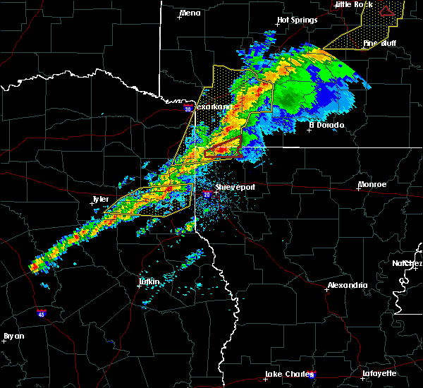 At 1059 am cst, severe thunderstorms were located along a line extending from marshall to 8 miles northeast of tatum to 12 miles south of hallsville to near henderson, moving east at 50 mph (radar indicated). Hazards include 60 mph wind gusts and quarter size hail. Hail damage to vehicles is expected. expect wind damage to roofs, siding, and trees. Locations impacted include, marshall, tatum, beckville, deberry, elysian fields, easton, scottsville, monroe, darco, stewart, jonesville, chalk hill and oak hill. At 1059 am cst, severe thunderstorms were located along a line extending from marshall to 8 miles northeast of tatum to 12 miles south of hallsville to near henderson, moving east at 50 mph (radar indicated). Hazards include 60 mph wind gusts and quarter size hail. Hail damage to vehicles is expected. expect wind damage to roofs, siding, and trees. Locations impacted include, marshall, tatum, beckville, deberry, elysian fields, easton, scottsville, monroe, darco, stewart, jonesville, chalk hill and oak hill.
|
| 3/9/2019 10:33 AM CST |
 At 1032 am cst, severe thunderstorms were located along a line extending from near hallsville to near kilgore to overton, moving east at 45 mph (radar indicated). Hazards include 60 mph wind gusts and quarter size hail. Hail damage to vehicles is expected. Expect wind damage to roofs, siding, and trees. At 1032 am cst, severe thunderstorms were located along a line extending from near hallsville to near kilgore to overton, moving east at 45 mph (radar indicated). Hazards include 60 mph wind gusts and quarter size hail. Hail damage to vehicles is expected. Expect wind damage to roofs, siding, and trees.
|
| 3/9/2019 9:50 AM CST |
 At 950 am cst, severe thunderstorms were located along a line extending from near hawkins to 7 miles northeast of tyler to near chandler to 6 miles northwest of coffee city, moving east at 60 mph (radar indicated). Hazards include 60 mph wind gusts and quarter size hail. Hail damage to vehicles is expected. expect wind damage to roofs, siding, and trees. Locations impacted include, tyler, longview, henderson, kilgore, whitehouse, white oak, gladewater, gilmer, overton, bullard, troup, big sandy, hawkins, ore city, new london, arp, clarksville city, east mountain, diana and rosewood. At 950 am cst, severe thunderstorms were located along a line extending from near hawkins to 7 miles northeast of tyler to near chandler to 6 miles northwest of coffee city, moving east at 60 mph (radar indicated). Hazards include 60 mph wind gusts and quarter size hail. Hail damage to vehicles is expected. expect wind damage to roofs, siding, and trees. Locations impacted include, tyler, longview, henderson, kilgore, whitehouse, white oak, gladewater, gilmer, overton, bullard, troup, big sandy, hawkins, ore city, new london, arp, clarksville city, east mountain, diana and rosewood.
|
| 3/9/2019 9:24 AM CST |
 At 923 am cst, severe thunderstorms were located along a line extending from van to edom to 10 miles west of brownsboro to near athens, moving east at 60 mph (radar indicated). Hazards include 60 mph wind gusts and quarter size hail. Hail damage to vehicles is expected. Expect wind damage to roofs, siding, and trees. At 923 am cst, severe thunderstorms were located along a line extending from van to edom to 10 miles west of brownsboro to near athens, moving east at 60 mph (radar indicated). Hazards include 60 mph wind gusts and quarter size hail. Hail damage to vehicles is expected. Expect wind damage to roofs, siding, and trees.
|
| 10/31/2018 7:02 PM CDT |
 At 702 pm cdt, severe thunderstorms were located along a line extending from near longview to 6 miles northwest of minden, moving east at 35 mph (radar indicated). Hazards include 60 mph wind gusts. expect damage to roofs, siding, and trees At 702 pm cdt, severe thunderstorms were located along a line extending from near longview to 6 miles northwest of minden, moving east at 35 mph (radar indicated). Hazards include 60 mph wind gusts. expect damage to roofs, siding, and trees
|
| 4/13/2018 11:19 PM CDT |
 At 1119 pm cdt, severe thunderstorms were located along a line extending from 8 miles north of new boston to near naples to near hughes springs to near jefferson to 6 miles northeast of tatum, moving northeast at 85 mph (radar indicated). Hazards include golf ball size hail and 60 mph wind gusts. People and animals outdoors will be injured. expect hail damage to roofs, siding, windows, and vehicles. expect wind damage to roofs, siding, and trees. locations impacted include, longview, marshall, mount pleasant, henderson, carthage, atlanta, new boston, hallsville, hooks, daingerfield, waskom, jefferson, linden, hughes springs, lone star, queen city, tatum, naples, ore city and redwater. A tornado watch remains in effect until 600 am cdt for northeastern texas. At 1119 pm cdt, severe thunderstorms were located along a line extending from 8 miles north of new boston to near naples to near hughes springs to near jefferson to 6 miles northeast of tatum, moving northeast at 85 mph (radar indicated). Hazards include golf ball size hail and 60 mph wind gusts. People and animals outdoors will be injured. expect hail damage to roofs, siding, windows, and vehicles. expect wind damage to roofs, siding, and trees. locations impacted include, longview, marshall, mount pleasant, henderson, carthage, atlanta, new boston, hallsville, hooks, daingerfield, waskom, jefferson, linden, hughes springs, lone star, queen city, tatum, naples, ore city and redwater. A tornado watch remains in effect until 600 am cdt for northeastern texas.
|
| 4/13/2018 10:57 PM CDT |
 At 1057 pm cdt, severe thunderstorms were located along a line extending from near wilkerson to near pittsburg to 7 miles north of gilmer to near white oak to near joinerville, moving northeast at 85 mph (radar indicated). Hazards include golf ball size hail and 60 mph wind gusts. People and animals outdoors will be injured. expect hail damage to roofs, siding, windows, and vehicles. Expect wind damage to roofs, siding, and trees. At 1057 pm cdt, severe thunderstorms were located along a line extending from near wilkerson to near pittsburg to 7 miles north of gilmer to near white oak to near joinerville, moving northeast at 85 mph (radar indicated). Hazards include golf ball size hail and 60 mph wind gusts. People and animals outdoors will be injured. expect hail damage to roofs, siding, windows, and vehicles. Expect wind damage to roofs, siding, and trees.
|
| 4/13/2018 10:40 PM CDT |
 At 1039 pm cdt, severe thunderstorms were located along a line extending from scroggins to 6 miles southwest of liberty city to near turnertown to near maydelle, moving northeast at 45 mph (trained weather spotters). Hazards include golf ball size hail and 60 mph wind gusts. People and animals outdoors will be injured. expect hail damage to roofs, siding, windows, and vehicles. expect wind damage to roofs, siding, and trees. locations impacted include, tyler, longview, nacogdoches, jacksonville, henderson, kilgore, whitehouse, white oak, gladewater, rusk, gilmer, mineola, winnsboro, lindale, chandler, overton, bullard, troup, quitman and big sandy. A tornado watch remains in effect until 600 am cdt for eastern and northeastern texas. At 1039 pm cdt, severe thunderstorms were located along a line extending from scroggins to 6 miles southwest of liberty city to near turnertown to near maydelle, moving northeast at 45 mph (trained weather spotters). Hazards include golf ball size hail and 60 mph wind gusts. People and animals outdoors will be injured. expect hail damage to roofs, siding, windows, and vehicles. expect wind damage to roofs, siding, and trees. locations impacted include, tyler, longview, nacogdoches, jacksonville, henderson, kilgore, whitehouse, white oak, gladewater, rusk, gilmer, mineola, winnsboro, lindale, chandler, overton, bullard, troup, quitman and big sandy. A tornado watch remains in effect until 600 am cdt for eastern and northeastern texas.
|
| 4/13/2018 10:24 PM CDT |
 At 1023 pm cdt, severe thunderstorms were located along a line extending from near quitman to near tyler to near elkhart, moving east at 50 mph (trained weather spotters). Hazards include 60 mph wind gusts and quarter size hail. Hail damage to vehicles is expected. expect wind damage to roofs, siding, and trees. locations impacted include, tyler, longview, nacogdoches, jacksonville, henderson, kilgore, whitehouse, white oak, gladewater, rusk, gilmer, mineola, winnsboro, lindale, chandler, overton, bullard, troup, quitman and big sandy. A tornado watch remains in effect until 600 am cdt for eastern and northeastern texas. At 1023 pm cdt, severe thunderstorms were located along a line extending from near quitman to near tyler to near elkhart, moving east at 50 mph (trained weather spotters). Hazards include 60 mph wind gusts and quarter size hail. Hail damage to vehicles is expected. expect wind damage to roofs, siding, and trees. locations impacted include, tyler, longview, nacogdoches, jacksonville, henderson, kilgore, whitehouse, white oak, gladewater, rusk, gilmer, mineola, winnsboro, lindale, chandler, overton, bullard, troup, quitman and big sandy. A tornado watch remains in effect until 600 am cdt for eastern and northeastern texas.
|
| 4/13/2018 10:00 PM CDT |
 At 959 pm cdt, severe thunderstorms were located along a line extending from near grand saline to near chandler to 13 miles northeast of buffalo, moving east at 65 mph (radar indicated). Hazards include 60 mph wind gusts and quarter size hail. Hail damage to vehicles is expected. Expect wind damage to roofs, siding, and trees. At 959 pm cdt, severe thunderstorms were located along a line extending from near grand saline to near chandler to 13 miles northeast of buffalo, moving east at 65 mph (radar indicated). Hazards include 60 mph wind gusts and quarter size hail. Hail damage to vehicles is expected. Expect wind damage to roofs, siding, and trees.
|
| 4/6/2018 6:37 PM CDT |
 At 637 pm cdt, a severe thunderstorm was located near harleton, or 11 miles northeast of longview, moving east at 30 mph (radar indicated). Hazards include 60 mph wind gusts and quarter size hail. Hail damage to vehicles is expected. Expect wind damage to roofs, siding, and trees. At 637 pm cdt, a severe thunderstorm was located near harleton, or 11 miles northeast of longview, moving east at 30 mph (radar indicated). Hazards include 60 mph wind gusts and quarter size hail. Hail damage to vehicles is expected. Expect wind damage to roofs, siding, and trees.
|
| 4/3/2018 3:21 PM CDT |
 At 320 pm cdt, a severe thunderstorm was located over deberry, or 14 miles northeast of carthage, moving northeast at 55 mph (radar indicated). Hazards include 60 mph wind gusts and quarter size hail. Hail damage to vehicles is expected. Expect wind damage to roofs, siding, and trees. At 320 pm cdt, a severe thunderstorm was located over deberry, or 14 miles northeast of carthage, moving northeast at 55 mph (radar indicated). Hazards include 60 mph wind gusts and quarter size hail. Hail damage to vehicles is expected. Expect wind damage to roofs, siding, and trees.
|
| 4/3/2018 3:21 PM CDT |
 The national weather service in shreveport has issued a * severe thunderstorm warning for. northwestern de soto parish in northwestern louisiana. southwestern caddo parish in northwestern louisiana. harrison county in northeastern texas. Panola county in northeastern texas. The national weather service in shreveport has issued a * severe thunderstorm warning for. northwestern de soto parish in northwestern louisiana. southwestern caddo parish in northwestern louisiana. harrison county in northeastern texas. Panola county in northeastern texas.
|
| 3/11/2018 4:32 AM CDT |
 At 432 am cdt, a severe thunderstorm was located near tatum, or 16 miles southeast of longview, moving southeast at 35 mph. hail to near one inch was reported with this storm earlier in longview (radar indicated). Hazards include 70 mph wind gusts and half dollar size hail. Hail damage to vehicles is expected. expect considerable tree damage. wind damage is also likely to mobile homes, roofs, and outbuildings. Locations impacted include, hallsville, tatum, beckville, easton, chalk hill, darco and stewart. At 432 am cdt, a severe thunderstorm was located near tatum, or 16 miles southeast of longview, moving southeast at 35 mph. hail to near one inch was reported with this storm earlier in longview (radar indicated). Hazards include 70 mph wind gusts and half dollar size hail. Hail damage to vehicles is expected. expect considerable tree damage. wind damage is also likely to mobile homes, roofs, and outbuildings. Locations impacted include, hallsville, tatum, beckville, easton, chalk hill, darco and stewart.
|
| 3/11/2018 4:04 AM CDT |
 At 404 am cdt, a severe thunderstorm was located over longview, moving southeast at 35 mph (radar indicated). Hazards include 70 mph wind gusts and half dollar size hail. Hail damage to vehicles is expected. expect considerable tree damage. Wind damage is also likely to mobile homes, roofs, and outbuildings. At 404 am cdt, a severe thunderstorm was located over longview, moving southeast at 35 mph (radar indicated). Hazards include 70 mph wind gusts and half dollar size hail. Hail damage to vehicles is expected. expect considerable tree damage. Wind damage is also likely to mobile homes, roofs, and outbuildings.
|
| 3/1/2018 2:49 AM CST |
 At 249 am cst, severe thunderstorms were located along a line extending from near mooringsport to 9 miles south of marshall to near henderson, moving east at 55 mph (radar indicated). Hazards include 60 mph wind gusts. Expect damage to roofs, siding, and trees. Locations impacted include, shreveport, longview, marshall, henderson, kilgore, carthage, hallsville, greenwood, blanchard, waskom, tatum, new london, beckville, mooringsport, deberry, elysian fields, pinehill, karnack, woodlawn and joinerville. At 249 am cst, severe thunderstorms were located along a line extending from near mooringsport to 9 miles south of marshall to near henderson, moving east at 55 mph (radar indicated). Hazards include 60 mph wind gusts. Expect damage to roofs, siding, and trees. Locations impacted include, shreveport, longview, marshall, henderson, kilgore, carthage, hallsville, greenwood, blanchard, waskom, tatum, new london, beckville, mooringsport, deberry, elysian fields, pinehill, karnack, woodlawn and joinerville.
|
| 3/1/2018 2:28 AM CST |
 The national weather service in shreveport has issued a * severe thunderstorm warning for. southwestern caddo parish in northwestern louisiana. southeastern smith county in northeastern texas. harrison county in northeastern texas. Northern panola county in northeastern texas. The national weather service in shreveport has issued a * severe thunderstorm warning for. southwestern caddo parish in northwestern louisiana. southeastern smith county in northeastern texas. harrison county in northeastern texas. Northern panola county in northeastern texas.
|
| 3/1/2018 2:28 AM CST |
 At 228 am cst, severe thunderstorms were located along a line extending from near woodlawn to 6 miles southwest of hallsville to near arp, moving east at 55 mph (radar indicated). Hazards include 60 mph wind gusts. expect damage to roofs, siding, and trees At 228 am cst, severe thunderstorms were located along a line extending from near woodlawn to 6 miles southwest of hallsville to near arp, moving east at 55 mph (radar indicated). Hazards include 60 mph wind gusts. expect damage to roofs, siding, and trees
|
| 2/24/2018 3:51 PM CST |
 At 350 pm cst, a severe thunderstorm was located jut west of hallsville, or 8 miles east of longview, moving east at 45 mph (radar indicated). Hazards include 60 mph wind gusts. expect damage to roofs, siding, and trees At 350 pm cst, a severe thunderstorm was located jut west of hallsville, or 8 miles east of longview, moving east at 45 mph (radar indicated). Hazards include 60 mph wind gusts. expect damage to roofs, siding, and trees
|
| 1/21/2018 11:53 PM CST |
 At 1153 pm cst, a severe thunderstorm capable of producing a tornado was located over tatum, or 17 miles northwest of carthage, moving northeast at 45 mph (radar indicated rotation). Hazards include tornado. Flying debris will be dangerous to those caught without shelter. mobile homes will be damaged or destroyed. damage to roofs, windows, and vehicles will occur. tree damage is likely. Locations impacted include, tatum, easton and darco. At 1153 pm cst, a severe thunderstorm capable of producing a tornado was located over tatum, or 17 miles northwest of carthage, moving northeast at 45 mph (radar indicated rotation). Hazards include tornado. Flying debris will be dangerous to those caught without shelter. mobile homes will be damaged or destroyed. damage to roofs, windows, and vehicles will occur. tree damage is likely. Locations impacted include, tatum, easton and darco.
|
| 1/21/2018 11:44 PM CST |
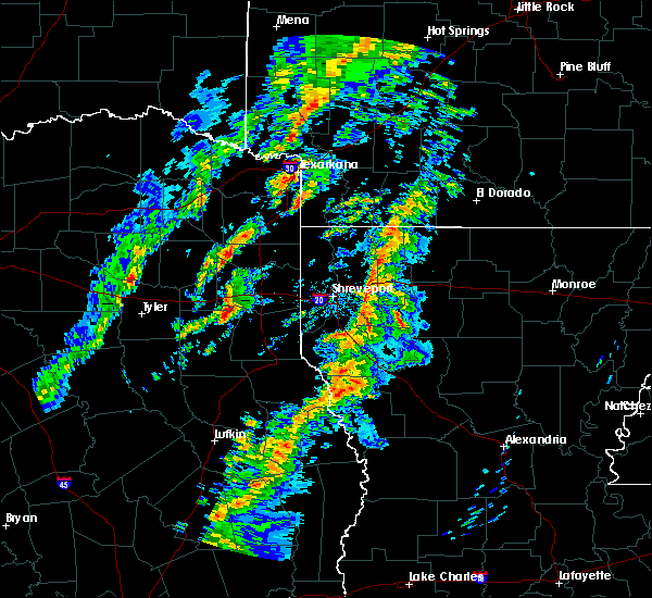 At 1143 pm cst, a severe thunderstorm capable of producing a tornado was located 8 miles west of tatum, or 11 miles northeast of henderson, moving northeast at 45 mph (radar indicated rotation). Hazards include tornado. Flying debris will be dangerous to those caught without shelter. mobile homes will be damaged or destroyed. damage to roofs, windows, and vehicles will occur. Tree damage is likely. At 1143 pm cst, a severe thunderstorm capable of producing a tornado was located 8 miles west of tatum, or 11 miles northeast of henderson, moving northeast at 45 mph (radar indicated rotation). Hazards include tornado. Flying debris will be dangerous to those caught without shelter. mobile homes will be damaged or destroyed. damage to roofs, windows, and vehicles will occur. Tree damage is likely.
|
| 1/21/2018 11:38 PM CST |
 At 1136 pm cst, a severe thunderstorm capable of producing a tornado was located near henderson, moving northeast at 45 mph (radar indicated rotation). Hazards include tornado. Flying debris will be dangerous to those caught without shelter. mobile homes will be damaged or destroyed. damage to roofs, windows, and vehicles will occur. tree damage is likely. Locations impacted include, henderson, joinerville, monroe, chalk hill, oak hill and stewart. At 1136 pm cst, a severe thunderstorm capable of producing a tornado was located near henderson, moving northeast at 45 mph (radar indicated rotation). Hazards include tornado. Flying debris will be dangerous to those caught without shelter. mobile homes will be damaged or destroyed. damage to roofs, windows, and vehicles will occur. tree damage is likely. Locations impacted include, henderson, joinerville, monroe, chalk hill, oak hill and stewart.
|
| 1/21/2018 11:27 PM CST |
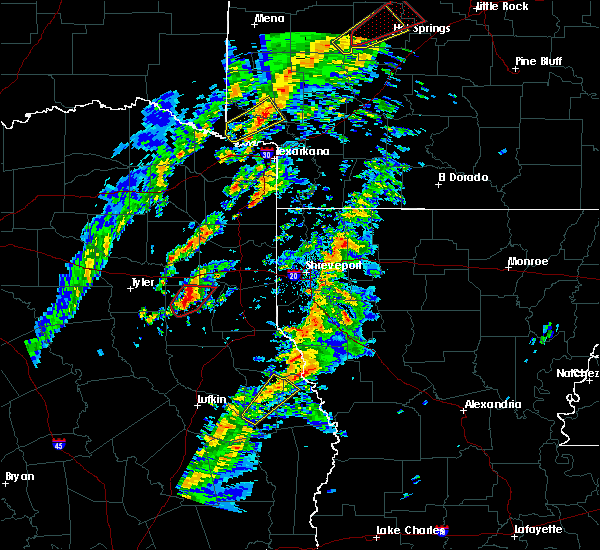 At 1126 pm cst, a severe thunderstorm capable of producing a tornado was located over joinerville, or near henderson, moving northeast at 40 mph (radar indicated rotation). Hazards include tornado. Flying debris will be dangerous to those caught without shelter. mobile homes will be damaged or destroyed. damage to roofs, windows, and vehicles will occur. tree damage is likely. Locations impacted include, henderson, joinerville, monroe, chalk hill, oak hill and stewart. At 1126 pm cst, a severe thunderstorm capable of producing a tornado was located over joinerville, or near henderson, moving northeast at 40 mph (radar indicated rotation). Hazards include tornado. Flying debris will be dangerous to those caught without shelter. mobile homes will be damaged or destroyed. damage to roofs, windows, and vehicles will occur. tree damage is likely. Locations impacted include, henderson, joinerville, monroe, chalk hill, oak hill and stewart.
|
| 1/21/2018 11:09 PM CST |
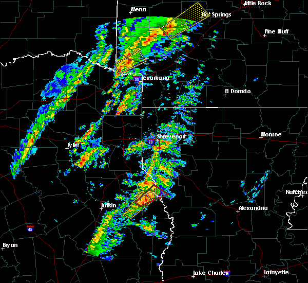 At 1108 pm cst, a severe thunderstorm capable of producing a tornado was located near troup, or 14 miles northeast of jacksonville, moving northeast at 40 mph (radar indicated rotation). Hazards include tornado. Flying debris will be dangerous to those caught without shelter. mobile homes will be damaged or destroyed. damage to roofs, windows, and vehicles will occur. Tree damage is likely. At 1108 pm cst, a severe thunderstorm capable of producing a tornado was located near troup, or 14 miles northeast of jacksonville, moving northeast at 40 mph (radar indicated rotation). Hazards include tornado. Flying debris will be dangerous to those caught without shelter. mobile homes will be damaged or destroyed. damage to roofs, windows, and vehicles will occur. Tree damage is likely.
|
| 12/19/2017 7:56 PM CST |
 At 755 pm cst, a severe thunderstorm was located over minden, or 9 miles southeast of henderson, and another thunderstorm near rusk moving northeast at 50 mph (radar indicated). Hazards include 60 mph wind gusts. expect damage to roofs, siding, and trees At 755 pm cst, a severe thunderstorm was located over minden, or 9 miles southeast of henderson, and another thunderstorm near rusk moving northeast at 50 mph (radar indicated). Hazards include 60 mph wind gusts. expect damage to roofs, siding, and trees
|
| 12/19/2017 6:57 PM CST |
 At 656 pm cst, a severe thunderstorm was located over rusk, moving northeast at 55 mph (radar indicated). Hazards include 60 mph wind gusts. expect damage to roofs, siding, and trees At 656 pm cst, a severe thunderstorm was located over rusk, moving northeast at 55 mph (radar indicated). Hazards include 60 mph wind gusts. expect damage to roofs, siding, and trees
|
| 11/3/2017 7:17 PM CDT |
 At 717 pm cdt, a severe thunderstorm was located near tatum, or 15 miles northwest of carthage, moving east at 15 mph (radar indicated). Hazards include quarter size hail. Damage to vehicles is expected. Locations impacted include, carthage, tatum, beckville, easton, fairplay and stewart. At 717 pm cdt, a severe thunderstorm was located near tatum, or 15 miles northwest of carthage, moving east at 15 mph (radar indicated). Hazards include quarter size hail. Damage to vehicles is expected. Locations impacted include, carthage, tatum, beckville, easton, fairplay and stewart.
|
| 11/3/2017 7:02 PM CDT |
 At 701 pm cdt, a severe thunderstorm was located near tatum, or 15 miles southeast of longview, moving southeast at 10 mph (radar indicated). Hazards include quarter size hail. damage to vehicles is expected At 701 pm cdt, a severe thunderstorm was located near tatum, or 15 miles southeast of longview, moving southeast at 10 mph (radar indicated). Hazards include quarter size hail. damage to vehicles is expected
|
| 7/8/2017 5:23 PM CDT |
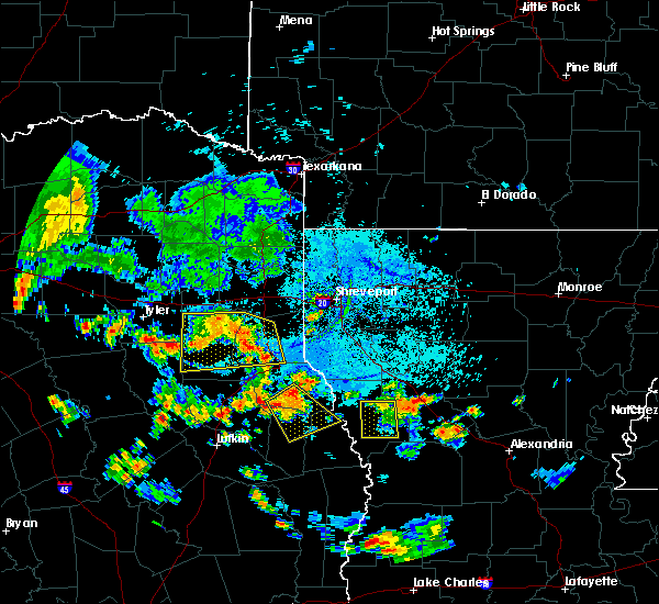 At 522 pm cdt, a severe thunderstorm was located over beckville, or 9 miles northwest of carthage, moving southeast at 20 mph (radar indicated). Hazards include 60 mph wind gusts and nickel size hail. expect damage to roofs, siding, and trees At 522 pm cdt, a severe thunderstorm was located over beckville, or 9 miles northwest of carthage, moving southeast at 20 mph (radar indicated). Hazards include 60 mph wind gusts and nickel size hail. expect damage to roofs, siding, and trees
|
| 7/8/2017 4:34 PM CDT |
 At 434 pm cdt, a severe thunderstorm was located near kilgore, moving south at 15 mph (radar indicated). Hazards include 60 mph wind gusts and penny size hail. expect damage to roofs, siding, and trees At 434 pm cdt, a severe thunderstorm was located near kilgore, moving south at 15 mph (radar indicated). Hazards include 60 mph wind gusts and penny size hail. expect damage to roofs, siding, and trees
|
| 7/1/2017 1:56 PM CDT |
 At 156 pm cdt, a severe thunderstorm was located 9 miles southwest of hallsville, or 9 miles southeast of longview, moving northeast at 25 mph (trained weather spotters). Hazards include 60 mph wind gusts and quarter size hail. Hail damage to vehicles is expected. Expect wind damage to roofs, siding, and trees. At 156 pm cdt, a severe thunderstorm was located 9 miles southwest of hallsville, or 9 miles southeast of longview, moving northeast at 25 mph (trained weather spotters). Hazards include 60 mph wind gusts and quarter size hail. Hail damage to vehicles is expected. Expect wind damage to roofs, siding, and trees.
|
| 5/28/2017 5:15 PM CDT |
 At 514 pm cdt, a severe thunderstorm was located near tatum, or 13 miles northeast of henderson, moving southeast at 30 mph (radar indicated). Hazards include 60 mph wind gusts and quarter size hail. Hail damage to vehicles is expected. Expect wind damage to roofs, siding, and trees. At 514 pm cdt, a severe thunderstorm was located near tatum, or 13 miles northeast of henderson, moving southeast at 30 mph (radar indicated). Hazards include 60 mph wind gusts and quarter size hail. Hail damage to vehicles is expected. Expect wind damage to roofs, siding, and trees.
|
| 5/28/2017 5:15 PM CDT |
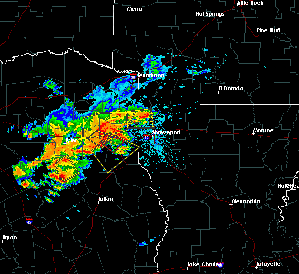 At 514 pm cdt, a severe thunderstorm was located near tatum, or 13 miles northeast of henderson, moving southeast at 30 mph (radar indicated). Hazards include 60 mph wind gusts and quarter size hail. Hail damage to vehicles is expected. Expect wind damage to roofs, siding, and trees. At 514 pm cdt, a severe thunderstorm was located near tatum, or 13 miles northeast of henderson, moving southeast at 30 mph (radar indicated). Hazards include 60 mph wind gusts and quarter size hail. Hail damage to vehicles is expected. Expect wind damage to roofs, siding, and trees.
|
| 5/28/2017 5:11 PM CDT |
 At 511 pm cdt, a severe thunderstorm capable of producing a tornado was located near tatum, or 14 miles southeast of longview, moving southeast at 55 mph (radar indicated rotation). Hazards include tornado and quarter size hail. Flying debris will be dangerous to those caught without shelter. mobile homes will be damaged or destroyed. damage to roofs, windows, and vehicles will occur. tree damage is likely. this dangerous storm will be near, tatum around 515 pm cdt. beckville around 525 pm cdt. Other locations impacted by this tornadic thunderstorm include darco, chalk hill and easton. At 511 pm cdt, a severe thunderstorm capable of producing a tornado was located near tatum, or 14 miles southeast of longview, moving southeast at 55 mph (radar indicated rotation). Hazards include tornado and quarter size hail. Flying debris will be dangerous to those caught without shelter. mobile homes will be damaged or destroyed. damage to roofs, windows, and vehicles will occur. tree damage is likely. this dangerous storm will be near, tatum around 515 pm cdt. beckville around 525 pm cdt. Other locations impacted by this tornadic thunderstorm include darco, chalk hill and easton.
|
| 5/28/2017 4:58 PM CDT |
 At 458 pm cdt, a severe thunderstorm was located near longview, moving southeast at 40 mph (radar indicated). Hazards include 60 mph wind gusts. expect damage to roofs, siding, and trees At 458 pm cdt, a severe thunderstorm was located near longview, moving southeast at 40 mph (radar indicated). Hazards include 60 mph wind gusts. expect damage to roofs, siding, and trees
|
| 5/21/2017 8:37 AM CDT |
 At 836 am cdt, severe thunderstorms were located along a line extending from 9 miles east of kilgore to near tatum to 7 miles north of carthage, moving northeast at 30 mph (radar indicated). Hazards include 60 mph wind gusts and quarter size hail. Hail damage to vehicles is expected. expect wind damage to roofs, siding, and trees. Locations impacted include, carthage, tatum, beckville, chalk hill and monroe. At 836 am cdt, severe thunderstorms were located along a line extending from 9 miles east of kilgore to near tatum to 7 miles north of carthage, moving northeast at 30 mph (radar indicated). Hazards include 60 mph wind gusts and quarter size hail. Hail damage to vehicles is expected. expect wind damage to roofs, siding, and trees. Locations impacted include, carthage, tatum, beckville, chalk hill and monroe.
|
| 5/21/2017 8:31 AM CDT |
 At 830 am cdt, severe thunderstorms were located along a line extending from 7 miles south of longview to 6 miles south of hallsville to 6 miles east of tatum to near carthage, moving northeast at 45 mph (radar indicated). Hazards include 60 mph wind gusts and quarter size hail. Hail damage to vehicles is expected. Expect wind damage to roofs, siding, and trees. At 830 am cdt, severe thunderstorms were located along a line extending from 7 miles south of longview to 6 miles south of hallsville to 6 miles east of tatum to near carthage, moving northeast at 45 mph (radar indicated). Hazards include 60 mph wind gusts and quarter size hail. Hail damage to vehicles is expected. Expect wind damage to roofs, siding, and trees.
|
| 5/21/2017 7:44 AM CDT |
 At 744 am cdt, severe thunderstorms were located along a line extending from near turnertown to minden, moving northeast at 25 mph (radar indicated). Hazards include 60 mph wind gusts and quarter size hail. Hail damage to vehicles is expected. Expect wind damage to roofs, siding, and trees. At 744 am cdt, severe thunderstorms were located along a line extending from near turnertown to minden, moving northeast at 25 mph (radar indicated). Hazards include 60 mph wind gusts and quarter size hail. Hail damage to vehicles is expected. Expect wind damage to roofs, siding, and trees.
|
| 5/3/2017 4:15 PM CDT |
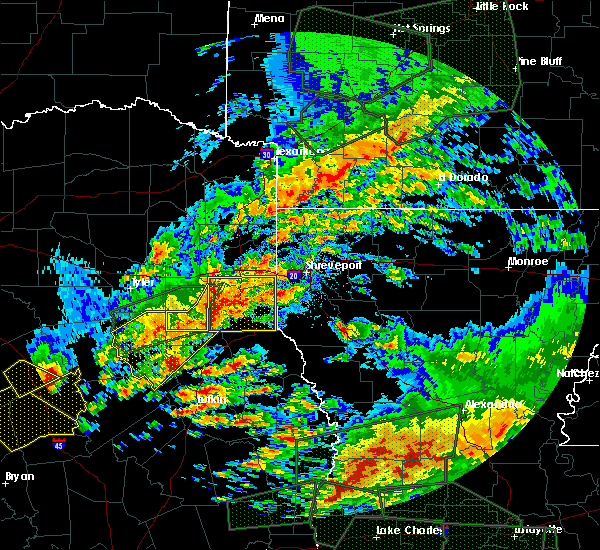 At 415 pm cdt, a severe thunderstorm was located near henderson, moving east at 25 mph (radar indicated). Hazards include 60 mph wind gusts and half dollar size hail. Hail damage to vehicles is expected. expect wind damage to roofs, siding, and trees. Locations impacted include, henderson, minden, church hill, chapman, stewart and brachfield. At 415 pm cdt, a severe thunderstorm was located near henderson, moving east at 25 mph (radar indicated). Hazards include 60 mph wind gusts and half dollar size hail. Hail damage to vehicles is expected. expect wind damage to roofs, siding, and trees. Locations impacted include, henderson, minden, church hill, chapman, stewart and brachfield.
|
| 5/3/2017 4:12 PM CDT |
 At 412 pm cdt, severe thunderstorms were located along a line extending from 7 miles southwest of hallsville to near pinehill to near minden, moving east at 50 mph (radar indicated). Hazards include 60 mph wind gusts and half dollar size hail. Hail damage to vehicles is expected. Expect wind damage to roofs, siding, and trees. At 412 pm cdt, severe thunderstorms were located along a line extending from 7 miles southwest of hallsville to near pinehill to near minden, moving east at 50 mph (radar indicated). Hazards include 60 mph wind gusts and half dollar size hail. Hail damage to vehicles is expected. Expect wind damage to roofs, siding, and trees.
|
| 5/3/2017 3:40 PM CDT |
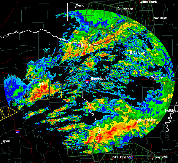 At 339 pm cdt, a severe thunderstorm was located near turnertown, or 10 miles west of henderson, moving east at 25 mph. this storm has a history of producing hail to half dollar size in the troup area (radar indicated). Hazards include half dollar size hail and 60 mph wind gusts. People and animals outdoors will be injured. expect hail damage to roofs, siding, windows, and vehicles. Expect wind damage to roofs, siding, and trees. At 339 pm cdt, a severe thunderstorm was located near turnertown, or 10 miles west of henderson, moving east at 25 mph. this storm has a history of producing hail to half dollar size in the troup area (radar indicated). Hazards include half dollar size hail and 60 mph wind gusts. People and animals outdoors will be injured. expect hail damage to roofs, siding, windows, and vehicles. Expect wind damage to roofs, siding, and trees.
|
| 4/26/2017 3:19 PM CDT |
 At 319 pm cdt, a severe thunderstorm was located near henderson, moving northeast at 70 mph (radar indicated). Hazards include 60 mph wind gusts and quarter size hail. Hail damage to vehicles is expected. Expect wind damage to roofs, siding, and trees. At 319 pm cdt, a severe thunderstorm was located near henderson, moving northeast at 70 mph (radar indicated). Hazards include 60 mph wind gusts and quarter size hail. Hail damage to vehicles is expected. Expect wind damage to roofs, siding, and trees.
|
| 4/10/2017 9:20 PM CDT |
 At 920 pm cdt, a severe thunderstorm was located near tatum, or 14 miles southwest of marshall, moving east at 25 mph (radar indicated). Hazards include 60 mph wind gusts and quarter size hail. Hail damage to vehicles is expected. Expect wind damage to roofs, siding, and trees. At 920 pm cdt, a severe thunderstorm was located near tatum, or 14 miles southwest of marshall, moving east at 25 mph (radar indicated). Hazards include 60 mph wind gusts and quarter size hail. Hail damage to vehicles is expected. Expect wind damage to roofs, siding, and trees.
|
| 4/10/2017 8:16 PM CDT |
 At 815 pm cdt, a severe thunderstorm capable of producing a tornado was located near kilgore, moving east at 20 mph (weather spotters reported funnel cloud). Hazards include tornado and quarter size hail. Flying debris will be dangerous to those caught without shelter. mobile homes will be damaged or destroyed. damage to roofs, windows, and vehicles will occur. Tree damage is likely. At 815 pm cdt, a severe thunderstorm capable of producing a tornado was located near kilgore, moving east at 20 mph (weather spotters reported funnel cloud). Hazards include tornado and quarter size hail. Flying debris will be dangerous to those caught without shelter. mobile homes will be damaged or destroyed. damage to roofs, windows, and vehicles will occur. Tree damage is likely.
|
| 4/10/2017 8:11 PM CDT |
 At 810 pm cdt, a severe thunderstorm was located near kilgore, moving east at 25 mph (radar indicated). Hazards include 60 mph wind gusts and quarter size hail. Hail damage to vehicles is expected. Expect wind damage to roofs, siding, and trees. At 810 pm cdt, a severe thunderstorm was located near kilgore, moving east at 25 mph (radar indicated). Hazards include 60 mph wind gusts and quarter size hail. Hail damage to vehicles is expected. Expect wind damage to roofs, siding, and trees.
|
| 4/10/2017 7:47 PM CDT |
 At 746 pm cdt, a severe thunderstorm was located over kilgore, moving northeast at 30 mph (radar indicated). Hazards include 60 mph wind gusts and half dollar size hail. Hail damage to vehicles is expected. expect wind damage to roofs, siding, and trees. Locations impacted include, longview, kilgore, white oak, overton, new london, clarksville city, liberty city, lakeport, rolling meadows, monroe, stewart, laird hill and oak hill. At 746 pm cdt, a severe thunderstorm was located over kilgore, moving northeast at 30 mph (radar indicated). Hazards include 60 mph wind gusts and half dollar size hail. Hail damage to vehicles is expected. expect wind damage to roofs, siding, and trees. Locations impacted include, longview, kilgore, white oak, overton, new london, clarksville city, liberty city, lakeport, rolling meadows, monroe, stewart, laird hill and oak hill.
|
| 4/10/2017 7:13 PM CDT |
 At 713 pm cdt, a severe thunderstorm was located over arp, or 8 miles east of whitehouse, moving northeast at 30 mph (radar indicated). Hazards include 60 mph wind gusts and half dollar size hail. Hail damage to vehicles is expected. Expect wind damage to roofs, siding, and trees. At 713 pm cdt, a severe thunderstorm was located over arp, or 8 miles east of whitehouse, moving northeast at 30 mph (radar indicated). Hazards include 60 mph wind gusts and half dollar size hail. Hail damage to vehicles is expected. Expect wind damage to roofs, siding, and trees.
|
| 4/2/2017 12:42 PM CDT |
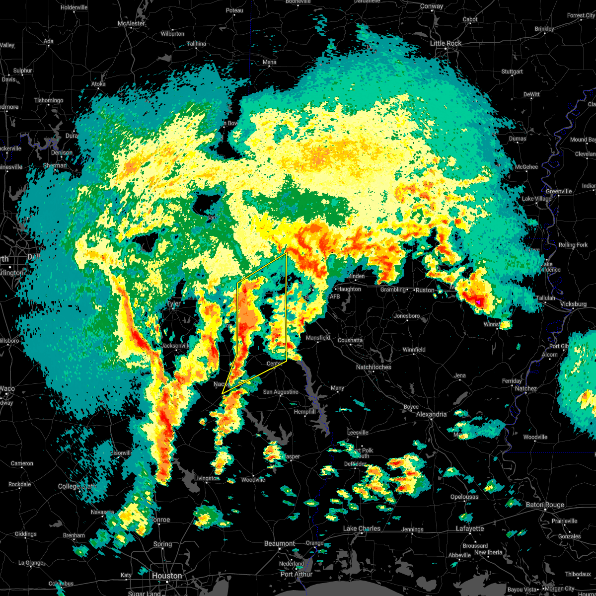 At 1242 pm cdt, severe thunderstorms were located along a line extending from 6 miles northeast of hallsville to 8 miles southeast of pinehill to near nacogdoches, moving northeast at 35 mph (radar indicated). Hazards include 60 mph wind gusts and quarter size hail. Hail damage to vehicles is expected. Expect wind damage to roofs, siding, and trees. At 1242 pm cdt, severe thunderstorms were located along a line extending from 6 miles northeast of hallsville to 8 miles southeast of pinehill to near nacogdoches, moving northeast at 35 mph (radar indicated). Hazards include 60 mph wind gusts and quarter size hail. Hail damage to vehicles is expected. Expect wind damage to roofs, siding, and trees.
|
| 3/24/2017 8:16 PM CDT |
 At 815 pm cdt, severe thunderstorms were located along a line extending from hallsville to near tatum to 9 miles northeast of henderson to near pinehill, moving northeast at 45 mph (radar indicated). Hazards include 60 mph wind gusts and penny size hail. expect damage to roofs, siding, and trees At 815 pm cdt, severe thunderstorms were located along a line extending from hallsville to near tatum to 9 miles northeast of henderson to near pinehill, moving northeast at 45 mph (radar indicated). Hazards include 60 mph wind gusts and penny size hail. expect damage to roofs, siding, and trees
|
| 2/20/2017 4:04 AM CST |
 At 403 am cst, a line of severe thunderstorms extended from near east mountain south to near alto, moving northeast at 50 mph (radar indicated). Hazards include 60 mph wind gusts and penny size hail. expect damage to roofs, siding, and trees At 403 am cst, a line of severe thunderstorms extended from near east mountain south to near alto, moving northeast at 50 mph (radar indicated). Hazards include 60 mph wind gusts and penny size hail. expect damage to roofs, siding, and trees
|
| 1/2/2017 8:22 AM CST |
 At 822 am cst, severe thunderstorms were located along a line extending from near naples to near berea to near hallsville, moving northeast at 45 mph (radar indicated). Hazards include 60 mph wind gusts and quarter size hail. Hail damage to vehicles is expected. expect wind damage to roofs, siding, and trees. locations impacted include, marshall, hallsville, daingerfield, jefferson, linden, hughes springs, lone star, naples, lodi, rocky branch, berea, harleton, kildare, woodlawn, jenkins, fairview, easton, avinger, douglassville and marietta. A tornado watch remains in effect until 200 pm cst for northeastern texas. At 822 am cst, severe thunderstorms were located along a line extending from near naples to near berea to near hallsville, moving northeast at 45 mph (radar indicated). Hazards include 60 mph wind gusts and quarter size hail. Hail damage to vehicles is expected. expect wind damage to roofs, siding, and trees. locations impacted include, marshall, hallsville, daingerfield, jefferson, linden, hughes springs, lone star, naples, lodi, rocky branch, berea, harleton, kildare, woodlawn, jenkins, fairview, easton, avinger, douglassville and marietta. A tornado watch remains in effect until 200 pm cst for northeastern texas.
|
| 1/2/2017 8:11 AM CST |
 At 811 am cst, severe thunderstorms were located along a line extending from rocky branch to 6 miles north of harleton to near hallsville, moving northeast at 45 mph (radar indicated). Hazards include 60 mph wind gusts and quarter size hail. Hail damage to vehicles is expected. expect wind damage to roofs, siding, and trees. locations impacted include, longview, marshall, hallsville, daingerfield, jefferson, linden, hughes springs, lone star, naples, omaha, lodi, rocky branch, berea, harleton, kildare, woodlawn, jenkins, fairview, lakeport and easton. A tornado watch remains in effect until 200 pm cst for northeastern texas. At 811 am cst, severe thunderstorms were located along a line extending from rocky branch to 6 miles north of harleton to near hallsville, moving northeast at 45 mph (radar indicated). Hazards include 60 mph wind gusts and quarter size hail. Hail damage to vehicles is expected. expect wind damage to roofs, siding, and trees. locations impacted include, longview, marshall, hallsville, daingerfield, jefferson, linden, hughes springs, lone star, naples, omaha, lodi, rocky branch, berea, harleton, kildare, woodlawn, jenkins, fairview, lakeport and easton. A tornado watch remains in effect until 200 pm cst for northeastern texas.
|
| 1/2/2017 8:09 AM CST |
 At 808 am cst, a severe thunderstorm was located near minden, or near henderson, moving northeast at 35 mph (radar indicated). Hazards include 60 mph wind gusts and quarter size hail. Hail damage to vehicles is expected. Expect wind damage to roofs, siding, and trees. At 808 am cst, a severe thunderstorm was located near minden, or near henderson, moving northeast at 35 mph (radar indicated). Hazards include 60 mph wind gusts and quarter size hail. Hail damage to vehicles is expected. Expect wind damage to roofs, siding, and trees.
|
| 1/2/2017 8:03 AM CST |
 At 803 am cst, severe thunderstorms were located along a line extending from near rocky branch to 6 miles southeast of ore city to 8 miles southeast of longview, moving northeast at 50 mph (radar indicated). Hazards include 60 mph wind gusts and quarter size hail. Hail damage to vehicles is expected. expect wind damage to roofs, siding, and trees. locations impacted include, longview, marshall, kilgore, white oak, hallsville, daingerfield, jefferson, linden, hughes springs, lone star, naples, ore city, omaha, east mountain, cason, lodi, rocky branch, berea, harleton and kildare. A tornado watch remains in effect until 200 pm cst for northeastern texas. At 803 am cst, severe thunderstorms were located along a line extending from near rocky branch to 6 miles southeast of ore city to 8 miles southeast of longview, moving northeast at 50 mph (radar indicated). Hazards include 60 mph wind gusts and quarter size hail. Hail damage to vehicles is expected. expect wind damage to roofs, siding, and trees. locations impacted include, longview, marshall, kilgore, white oak, hallsville, daingerfield, jefferson, linden, hughes springs, lone star, naples, ore city, omaha, east mountain, cason, lodi, rocky branch, berea, harleton and kildare. A tornado watch remains in effect until 200 pm cst for northeastern texas.
|
| 1/2/2017 7:28 AM CST |
 At 728 am cst, severe thunderstorms were located along a line extending from near newsome to near big sandy to near arp, moving northeast at 45 mph (radar indicated). Hazards include 60 mph wind gusts and quarter size hail. Hail damage to vehicles is expected. Expect wind damage to roofs, siding, and trees. At 728 am cst, severe thunderstorms were located along a line extending from near newsome to near big sandy to near arp, moving northeast at 45 mph (radar indicated). Hazards include 60 mph wind gusts and quarter size hail. Hail damage to vehicles is expected. Expect wind damage to roofs, siding, and trees.
|
| 1/2/2017 6:31 AM CST |
 At 631 am cst, severe thunderstorms were located along a line extending from near campbell to near fruitvale to 7 miles west of edom to 11 miles west of frankston to 10 miles west of elkhart, moving east at 60 mph (radar indicated). Hazards include 60 mph wind gusts and quarter size hail. Hail damage to vehicles is expected. Expect wind damage to roofs, siding, and trees. At 631 am cst, severe thunderstorms were located along a line extending from near campbell to near fruitvale to 7 miles west of edom to 11 miles west of frankston to 10 miles west of elkhart, moving east at 60 mph (radar indicated). Hazards include 60 mph wind gusts and quarter size hail. Hail damage to vehicles is expected. Expect wind damage to roofs, siding, and trees.
|
| 4/30/2016 12:13 AM CDT |
 At 1212 am cdt, severe thunderstorms were located along a line extending from 6 miles southeast of hughes springs to 8 miles southeast of longview to 8 miles southeast of kilgore to turnertown, moving east at 30 mph (radar indicated). Hazards include 60 mph wind gusts and penny size hail. Expect damage to roofs. siding. And trees. At 1212 am cdt, severe thunderstorms were located along a line extending from 6 miles southeast of hughes springs to 8 miles southeast of longview to 8 miles southeast of kilgore to turnertown, moving east at 30 mph (radar indicated). Hazards include 60 mph wind gusts and penny size hail. Expect damage to roofs. siding. And trees.
|
| 4/29/2016 7:38 PM CDT |
 At 737 pm cdt, a severe thunderstorm was located over bullard, or 9 miles southwest of whitehouse, moving northeast at 60 mph (radar indicated). Hazards include 60 mph wind gusts. Expect damage to roofs. siding. And trees. At 737 pm cdt, a severe thunderstorm was located over bullard, or 9 miles southwest of whitehouse, moving northeast at 60 mph (radar indicated). Hazards include 60 mph wind gusts. Expect damage to roofs. siding. And trees.
|
| 4/11/2016 9:06 PM CDT |
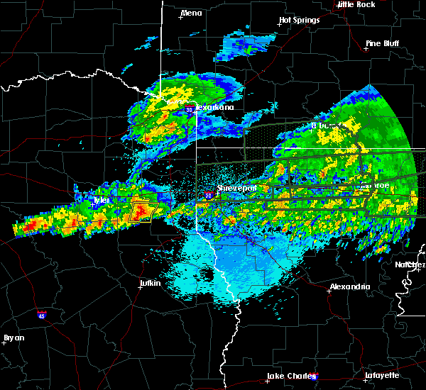 At 905 pm cdt, a severe thunderstorm was located near henderson, moving east at 35 mph (radar indicated). Hazards include 60 mph wind gusts and nickel size hail. Expect damage to roofs. siding. and trees. Locations impacted include, henderson, tatum, church hill, oak hill, stewart, chapman, monroe and chalk hill. At 905 pm cdt, a severe thunderstorm was located near henderson, moving east at 35 mph (radar indicated). Hazards include 60 mph wind gusts and nickel size hail. Expect damage to roofs. siding. and trees. Locations impacted include, henderson, tatum, church hill, oak hill, stewart, chapman, monroe and chalk hill.
|
| 4/11/2016 8:28 PM CDT |
 At 827 pm cdt, a severe thunderstorm was located near liberty city, or 8 miles west of kilgore, moving east at 45 mph (radar indicated). Hazards include 60 mph wind gusts and quarter size hail. Hail damage to vehicles is expected. Expect wind damage to roofs, siding, and trees. At 827 pm cdt, a severe thunderstorm was located near liberty city, or 8 miles west of kilgore, moving east at 45 mph (radar indicated). Hazards include 60 mph wind gusts and quarter size hail. Hail damage to vehicles is expected. Expect wind damage to roofs, siding, and trees.
|
| 5/30/2015 9:24 AM CDT | At 923 am cdt, a severe thunderstorm was located 9 miles northeast of henderson, moving east at 45 mph (radar indicated). Hazards include 60 mph wind gusts and nickel size hail. Expect damage to roofs. Siding and trees. |
| 5/30/2015 9:24 AM CDT | At 923 am cdt, a severe thunderstorm was located 9 miles northeast of henderson, moving east at 45 mph (radar indicated). Hazards include 60 mph wind gusts and nickel size hail. Expect damage to roofs. Siding and trees. |
| 5/25/2015 7:52 PM CDT | The tornado warning for northeastern rusk, south central harrison, central panola and southeastern gregg counties will expire at 800 pm cdt, the storm which prompted the warning earlier has moved out of this warned area. a tornado warning continued for the storm near the texas and louisiana state line. a tornado watch remains in effect until 1000 pm cdt for northeastern texas. |
| 5/25/2015 7:27 PM CDT | At 726 pm cdt, severe thunderstorms were located along a line extending from berea to near woodlawn to 8 miles northeast of beckville to near garrison to diboll, moving east at 65 mph (radar indicated). Hazards include 70 mph wind gusts and quarter size hail. Hail damage to vehicles is expected. expect considerable tree damage. Wind damage is also likely to mobile homes, roofs and outbuildings. |
| 5/25/2015 7:27 PM CDT | At 726 pm cdt, severe thunderstorms were located along a line extending from berea to near woodlawn to 8 miles northeast of beckville to near garrison to diboll, moving east at 65 mph (radar indicated). Hazards include 70 mph wind gusts and quarter size hail. Hail damage to vehicles is expected. expect considerable tree damage. Wind damage is also likely to mobile homes, roofs and outbuildings. |
| 5/25/2015 7:11 PM CDT | At 711 pm cdt, severe thunderstorms were located along a line extending from near harleton to 6 miles northeast of pinehill to 8 miles east of trawick to near hudson, moving east at 45 mph (radar indicated). Hazards include 70 mph wind gusts and quarter size hail. Hail damage to vehicles is expected. expect considerable tree damage. wind damage is also likely to mobile homes, roofs and outbuildings. locations impacted include, longview, nacogdoches, marshall, henderson, kilgore, carthage, white oak, gladewater, center, hudson, hallsville, tatum, tenaha, timpson, garrison, clarksville city, beckville, joaquin, east mountain and wells. a tornado watch remains in effect until 1000 pm cdt for northeastern texas. A tornado watch also remains in effect until 200 am cdt for northwestern louisiana. |
| 5/25/2015 7:04 PM CDT | At 704 pm cdt, a severe thunderstorm capable of producing a tornado was located near henderson, moving northeast at 40 mph (radar indicated rotation). Hazards include tornado. Flying debris will be dangerous to those caught without shelter. mobile homes will be damaged or destroyed. damage to roofs, windows and vehicles will occur. tree damage is likely. this dangerous storm will be near, tatum around 720 pm cdt. beckville around 725 pm cdt. Other locations impacted by this tornadic thunderstorm include church hill, oak hill, fairplay, darco, chapman, stewart, monroe, chalk hill and easton. |
| 5/25/2015 6:51 PM CDT | At 650 pm cdt, a severe thunderstorm capable of producing a tornado was located over arp, or 12 miles east of whitehouse, moving northeast at 50 mph (radar indicated rotation). Hazards include tornado. Flying debris will be dangerous to those caught without shelter. mobile homes will be damaged or destroyed. damage to roofs, windows and vehicles will occur. tree damage is likely. this dangerous storm will be near, joinerville around 655 pm cdt. overton and new london around 700 pm cdt. kilgore around 710 pm cdt. Other locations impacted by this tornadic thunderstorm include lakeport, laird hill, oak hill, easton, rolling meadows, stewart, monroe and chalk hill. |
| 5/25/2015 6:36 PM CDT | At 636 pm cdt, severe thunderstorms were located along a line extending from near lindale to near troup to near sacul to near kennard, moving east at 60 mph (radar indicated). Hazards include 70 mph wind gusts and quarter size hail. Hail damage to vehicles is expected. expect considerable tree damage. Wind damage is also likely to mobile homes, roofs and outbuildings. |
| 5/11/2015 2:58 AM CDT | At 257 am cdt, a severe thunderstorm was located over henderson, moving northeast at 40 mph (radar indicated). Hazards include 60 mph wind gusts and quarter size hail. Hail damage to vehicles is expected. expect wind damage to roofs, siding and trees. this severe thunderstorm will be near, tatum around 330 am cdt. other locations impacted by this severe thunderstorm include oak hill, easton, fairplay, new summerfield, chapman, stewart, chalk hill, lakeport, concord and church hill. a tornado watch remains in effect until 500 am cdt for northeastern texas. 1. 00in. |
| 5/11/2015 2:38 AM CDT | At 238 am cdt, a severe thunderstorm was located 7 miles southwest of hallsville, or near lakeport, moving northeast at 40 mph. another severe thunderstorm was located near new summerfield, also moving northeast ay 40 mph. damaging winds in excess of 60 mph and quarter size hail is possible with this storm (radar indicated). Hazards include 60 mph wind gusts. Expect damage to roofs. siding and trees. locations impacted include, henderson, tatum, new london, turnertown, joinerville, lakeport, easton, oak hill, stewart, monroe and chalk hill. a tornado watch remains in effect until 500 am cdt for northeastern texas. Possible. |
| 5/11/2015 1:59 AM CDT | At 159 am cdt, a severe thunderstorm was located near turnertown, or 7 miles west of henderson, moving northeast at 30 mph (radar indicated). Hazards include 60 mph wind gusts and quarter size hail. Hail damage to vehicles is expected. expect wind damage to roofs, siding and trees. this severe thunderstorm will be near, joinerville around 205 am cdt. henderson and new london around 215 am cdt. other locations impacted by this severe thunderstorm include lakeport, stewart, oak hill, easton, monroe and chalk hill. a tornado watch remains in effect until 500 am cdt for northeastern texas. Possible. |
| 5/11/2015 1:27 AM CDT | At 126 am cdt, severe thunderstorms were located along a line extending from near linden to near berea to 6 miles west of woodlawn to near hallsville to 9 miles southeast of longview to near kilgore, moving east at 35 mph (radar indicated). Hazards include 60 mph wind gusts. Expect damage to roofs. siding and trees. locations impacted include, longview, marshall, kilgore, white oak, hallsville, jefferson, linden, tatum, elysian fields, diana, smithland, kildare, bivins, woodlawn, lodi, harleton, berea, karnack, fairview and lakeport. a tornado watch remains in effect until 500 am cdt for northeastern texas. 75in. |
| 5/11/2015 12:59 AM CDT | At 1258 am cdt, severe thunderstorms were located along a line extending from near hughes springs to near ore city to near kilgore, moving east at 30 mph (radar indicated). Hazards include 60 mph wind gusts. Expect damage to roofs. Siding and trees. |
| 4/24/2015 10:34 PM CDT | At 1034 pm cdt, severe thunderstorms were located along a line extending from near overton to near turnertown to 7 miles south of troup to near jacksonville to near rusk to near maydelle, moving east at 50 mph (radar indicated). Hazards include 70 mph wind gusts and nickel size hail. Expect considerable tree damage. damage is likely to mobile homes, roofs and outbuildings. severe thunderstorms will be near, overton, new london, arp and turnertown around 1040 pm cdt. joinerville around 1045 pm cdt. henderson, alto and new salem around 1050 pm cdt. sacul around 1100 pm cdt. minden around 1105 pm cdt. tatum, pinehill and trawick around 1110 pm cdt. beckville around 1115 pm cdt. other locations impacted by these severe thunderstorms include oak hill, fairplay, new summerfield, chapman, stewart, gallatin, lawsonville, concord, church hill and cushing. a tornado watch remains in effect until 400 am cdt for northeastern texas. Possible. |
| 4/24/2015 9:51 PM CDT | At 948 pm cdt, a severe thunderstorm was located near marshall , or 3 miles west of scottsville, moving east at 60 mph (radar indicated). Hazards include 60 mph wind gusts and quarter size hail. Hail damage to vehicles is expected. expect wind damage to roofs, siding and trees. locations impacted include, tyler, longview, marshall, jacksonville, henderson, kilgore, whitehouse, carthage, white oak, rusk, hallsville, overton, bullard, waskom, troup, tatum, new london, arp, beckville and elysian fields. a tornado watch remains in effect until 1000 pm cdt for northeastern texas. 1. 00in. |
| 4/24/2015 9:14 PM CDT | At 913 pm cdt, a severe thunderstorm was located over liberty city, or near kilgore, moving east at 60 mph (radar indicated). Hazards include 60 mph wind gusts and quarter size hail. Hail damage to vehicles is expected. Expect wind damage to roofs, siding and trees. |
| 4/19/2015 5:02 PM CDT | The national weather service in shreveport has issued a * severe thunderstorm warning for. northeastern rusk county in northeastern texas. southwestern harrison county in northeastern texas. northwestern panola county in northeastern texas. Southeastern gregg county in northeastern texas. |
| 4/18/2015 11:30 PM CDT | At 1129 pm cdt, a severe thunderstorm was located near joinerville, or near henderson, moving east at 10 mph (radar indicated). Hazards include 60 mph wind gusts and half dollar size hail. Hail damage to vehicles is expected. expect wind damage to roofs, siding and trees. locations impacted include, henderson, oak hill and monroe. 1. 25in. |
| 4/18/2015 11:09 PM CDT | At 1109 pm cdt, a severe thunderstorm was located over turnertown, or 9 miles northwest of henderson, moving east at 10 mph (radar indicated). Hazards include 60 mph wind gusts and half dollar size hail. Hail damage to vehicles is expected. Expect wind damage to roofs, siding and trees. |
| 4/9/2015 7:40 PM CDT | The tornado warning for northwestern rusk county will expire at 745 pm cdt. the storm which prompted the warning has weakened below severe limits. and no longer appears capable of producing a tornado. therefore the warning will be allowed to expire. However heavy rain is still possible with these thunderstorms. |
| 4/9/2015 7:05 PM CDT | The national weather service in shreveport has issued a * tornado warning for. northwestern rusk county in northeastern texas. until 745 pm cdt * at 705 pm cdt. a severe thunderstorm capable of producing a tornado was located just south of arp. Or 11 miles east of whitehouse. |
| 10/2/2014 7:55 PM CDT | Numerous trees donw on hwy 43 between henderson and tatum in rusk county TX, 6.8 miles N of Lake Cherokee, TX |
| 1/29/2013 7:40 PM CST | Trees down near fm 1716 near chalk hil in rusk county TX, 0.5 miles WSW of Lake Cherokee, TX |
Hail Maps for Lake Cherokee, TX
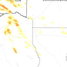
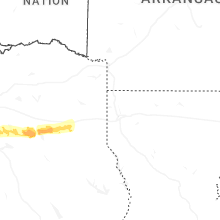

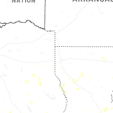
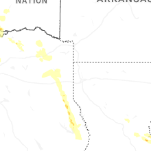
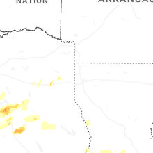
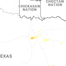


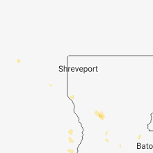


Connect with Interactive Hail Maps