

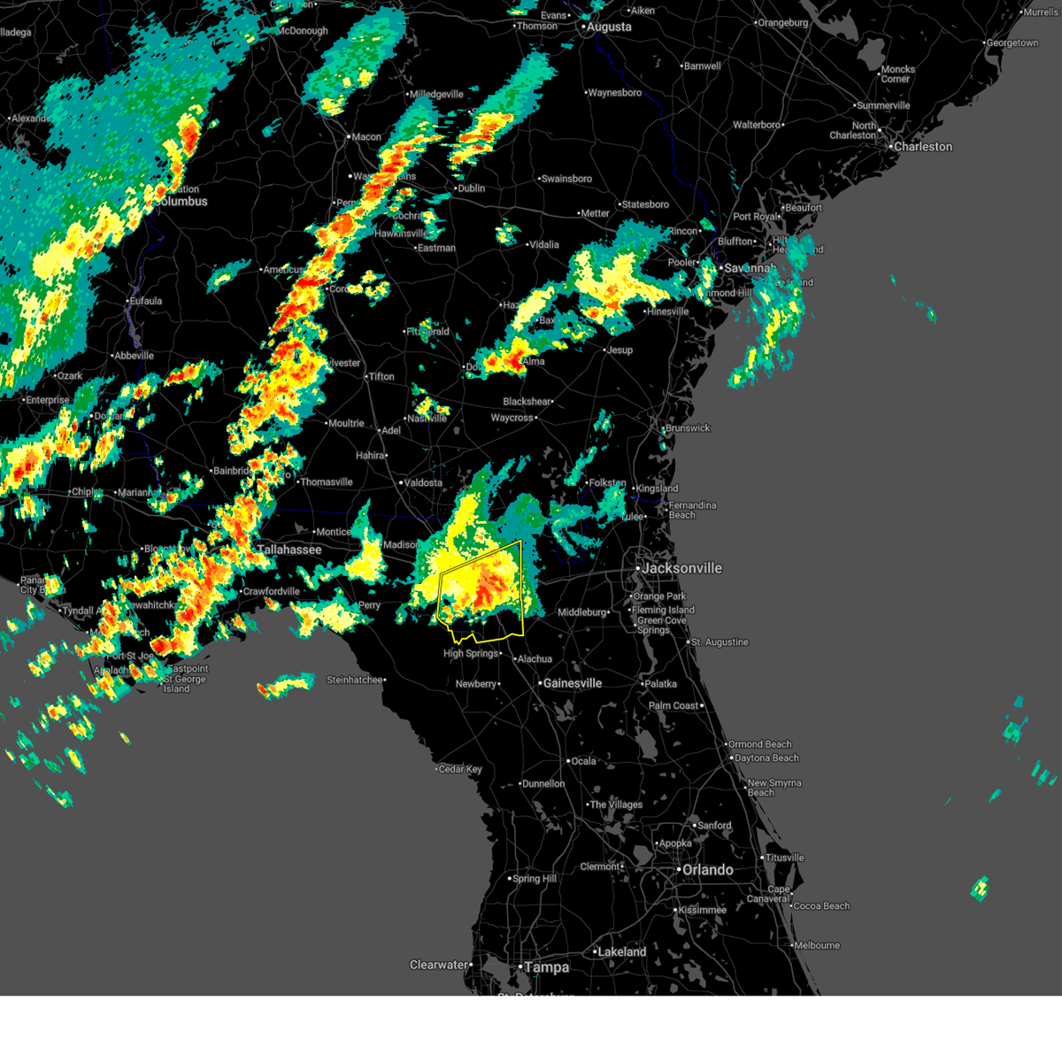
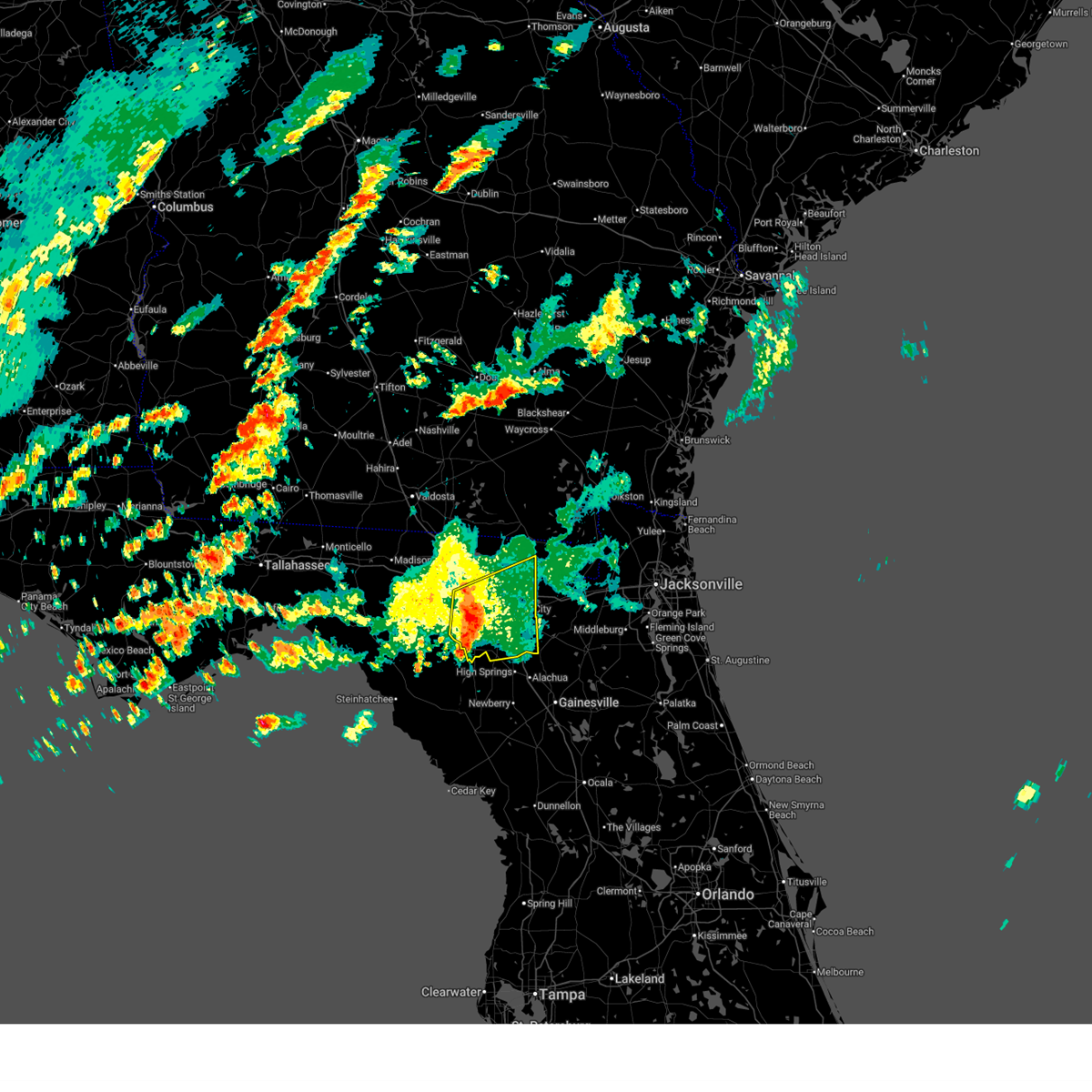
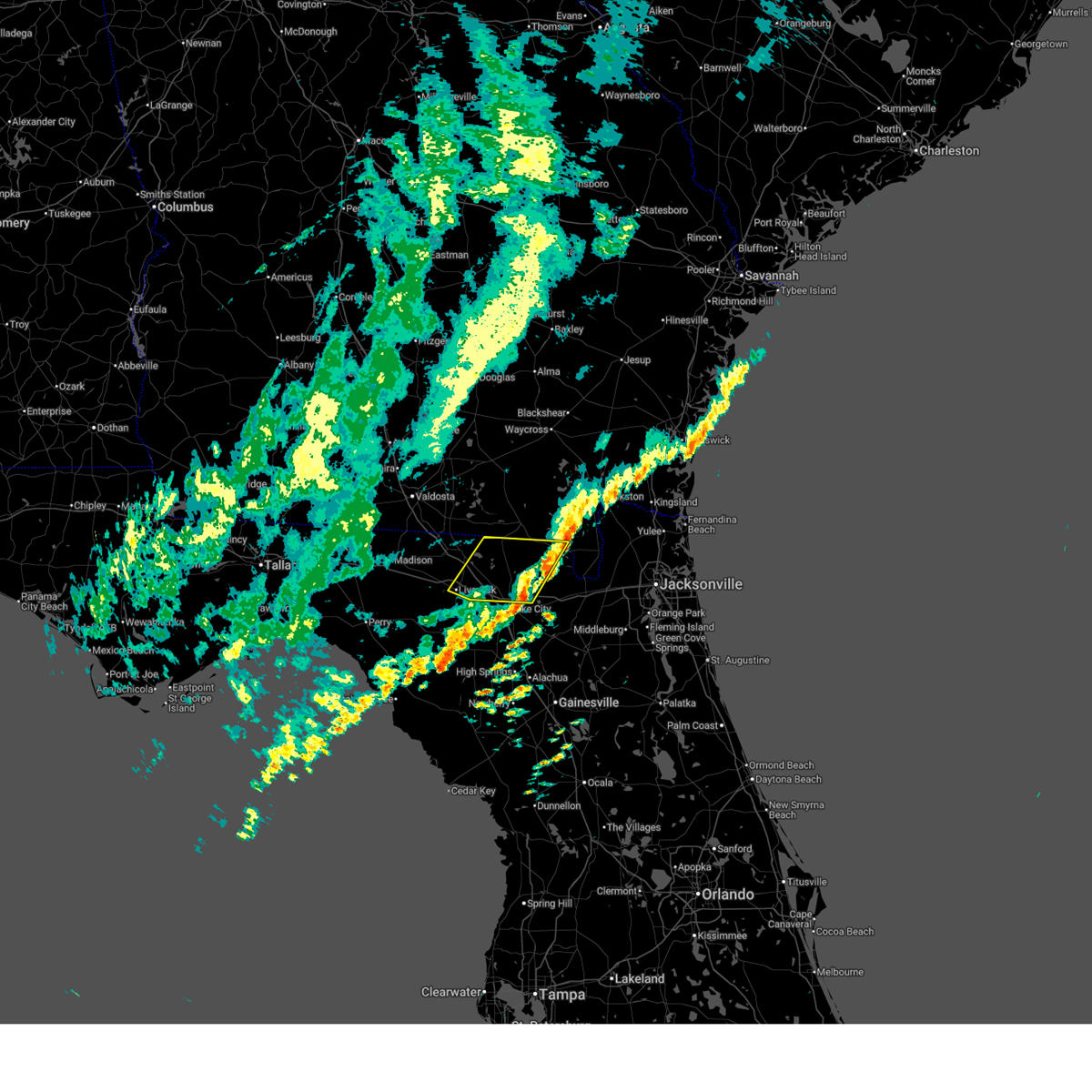
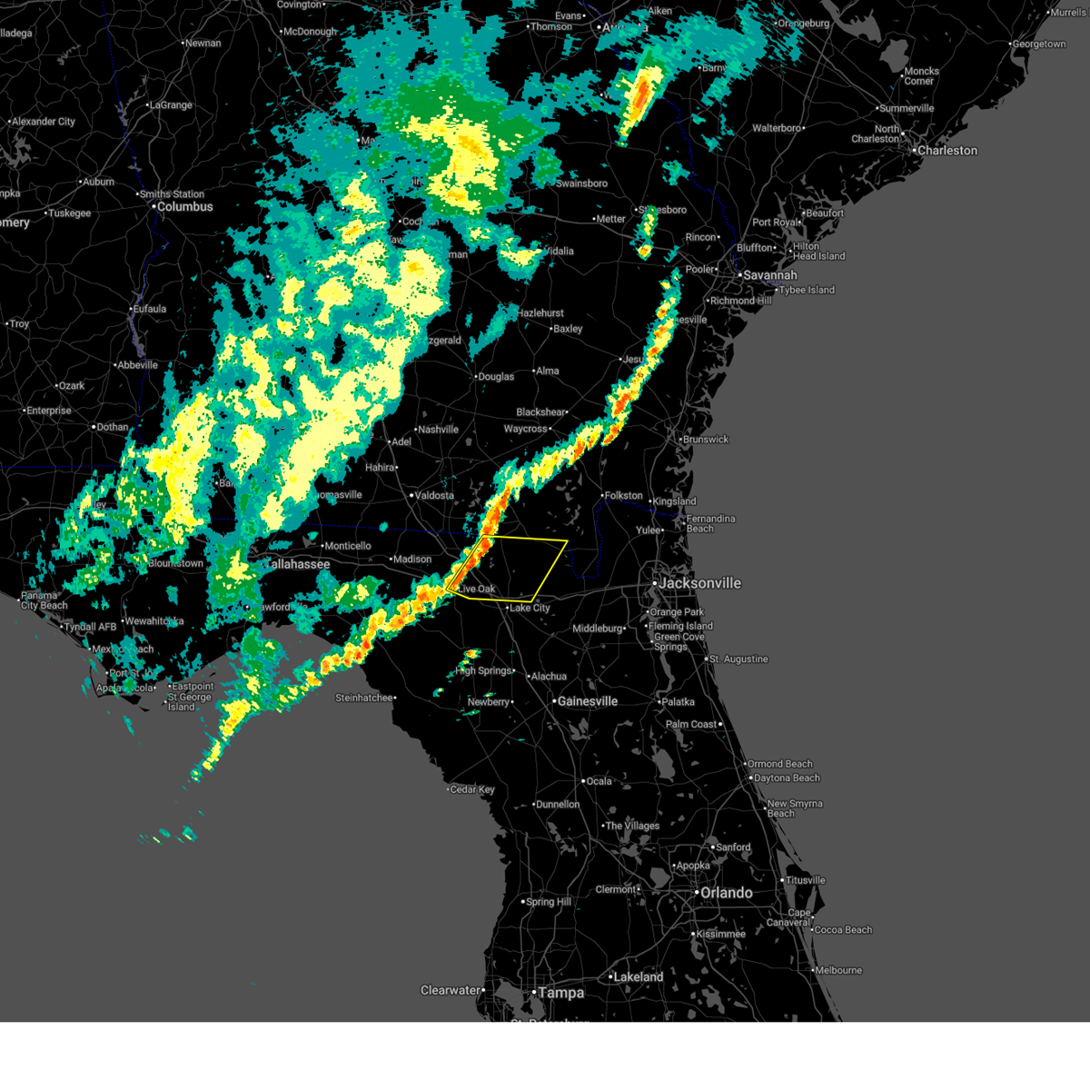
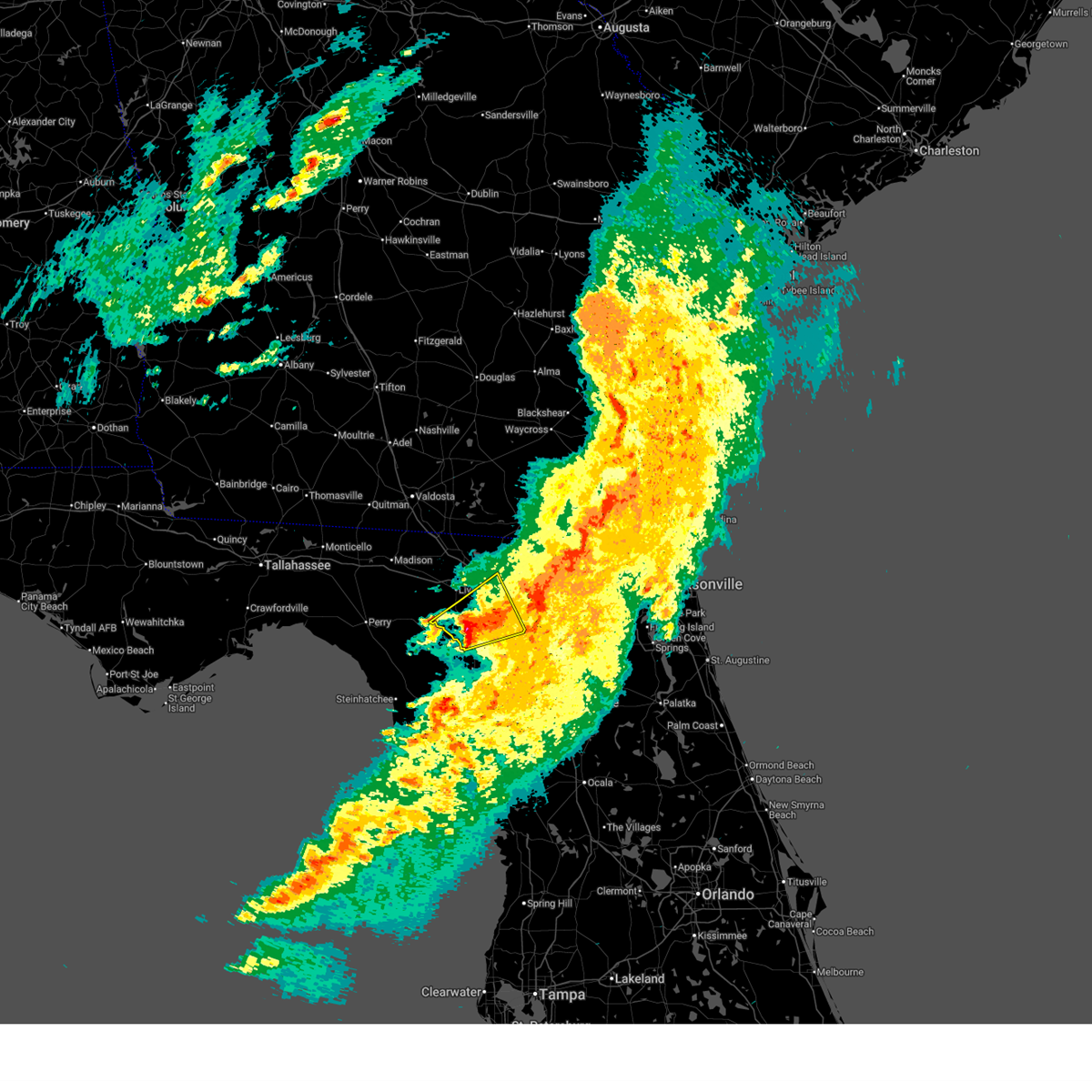
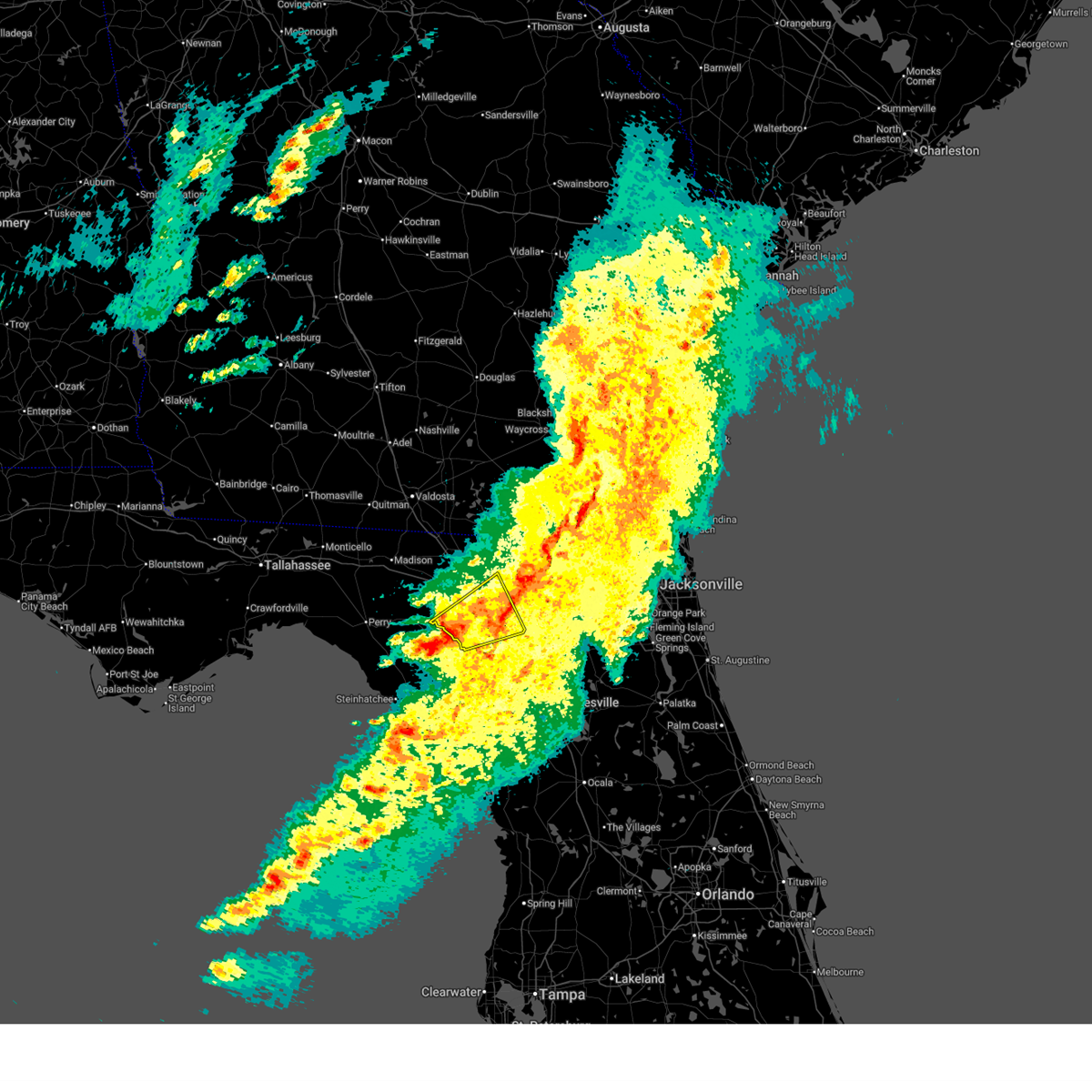
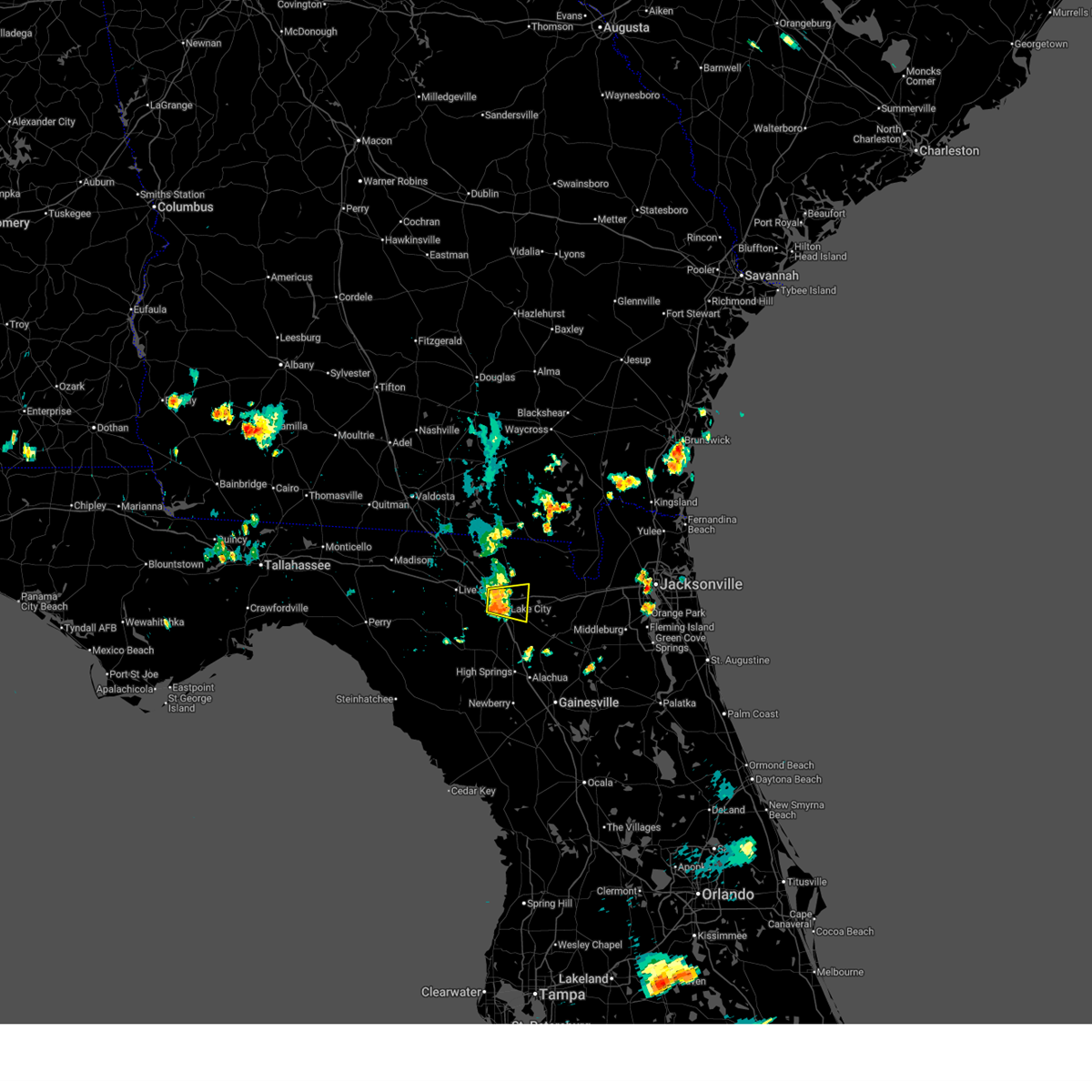
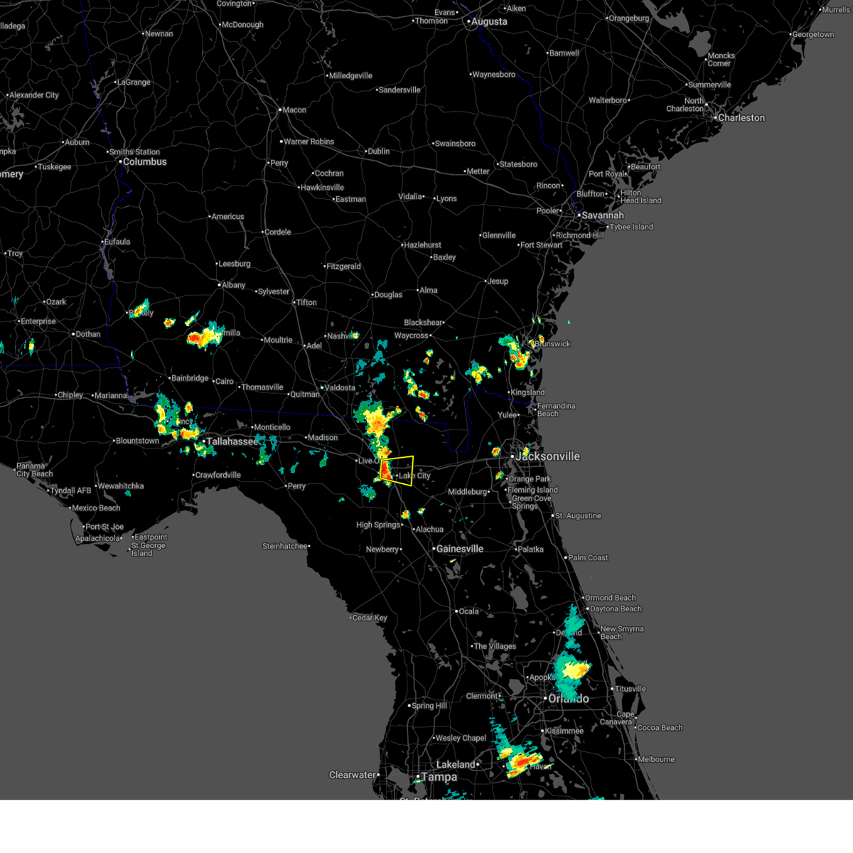
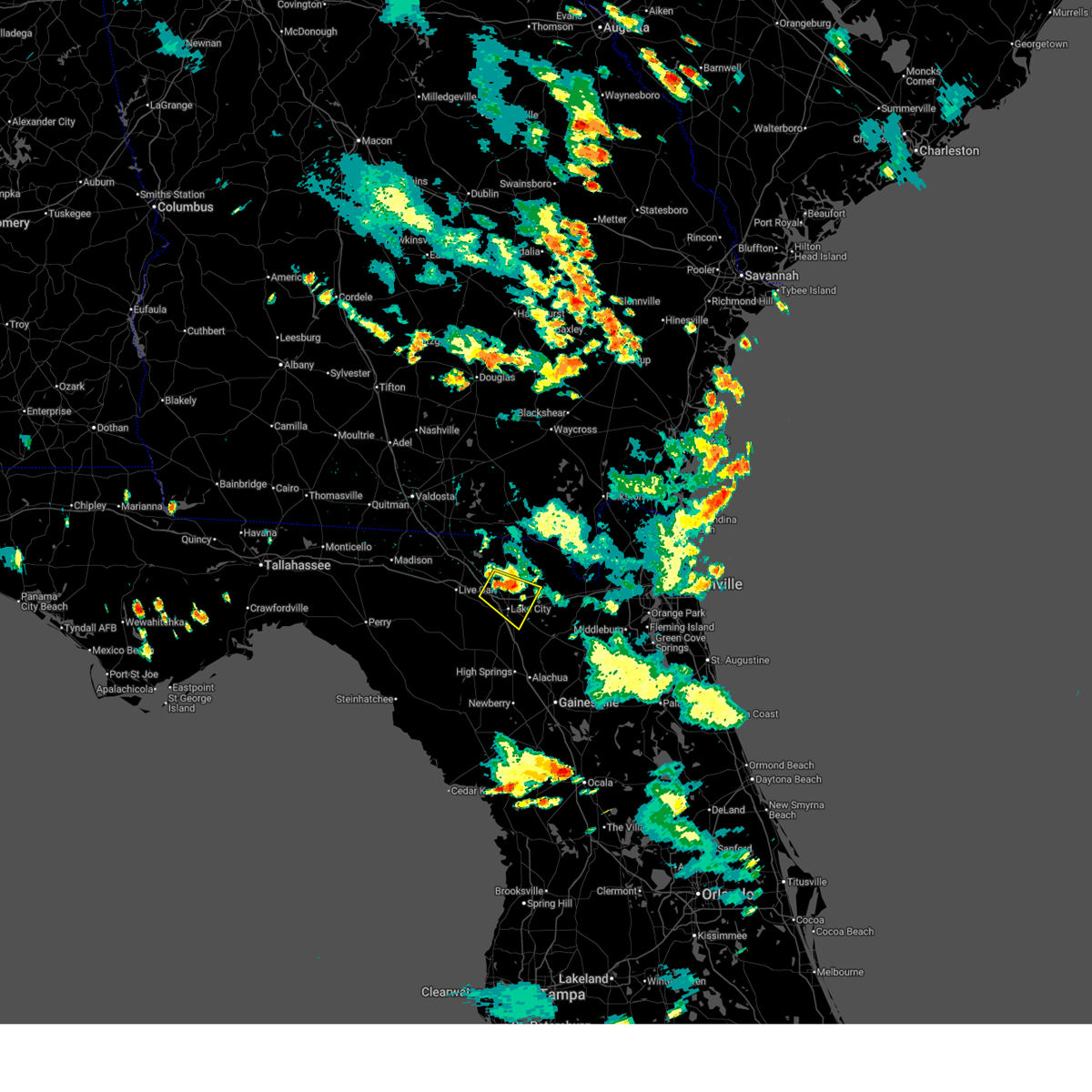
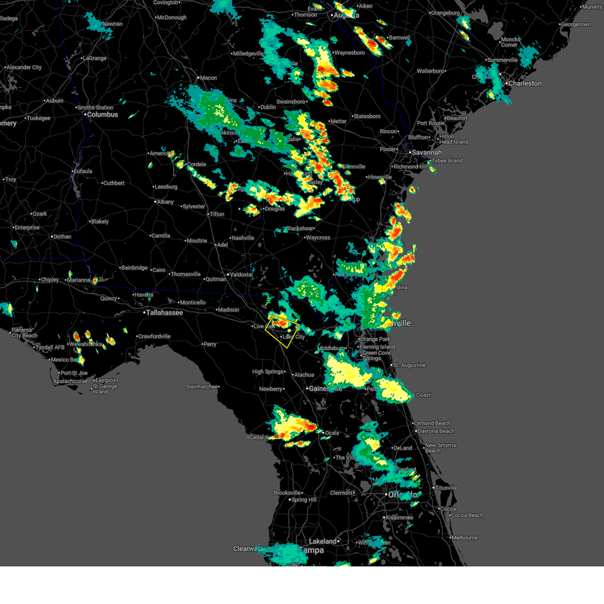
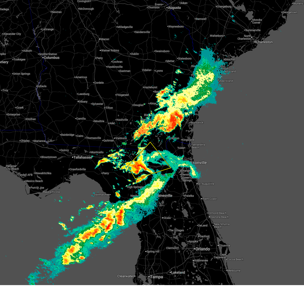
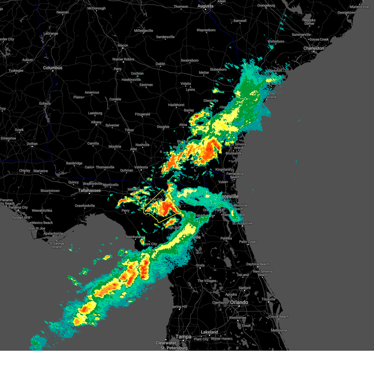
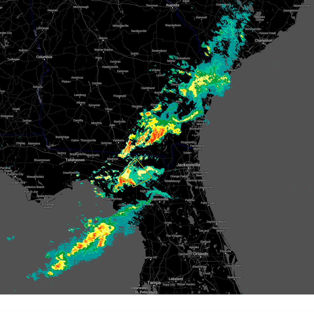
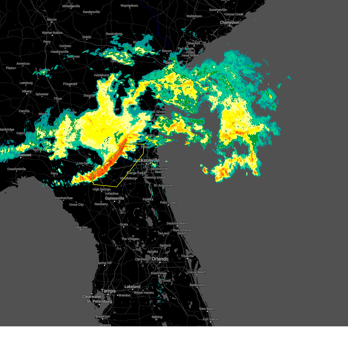
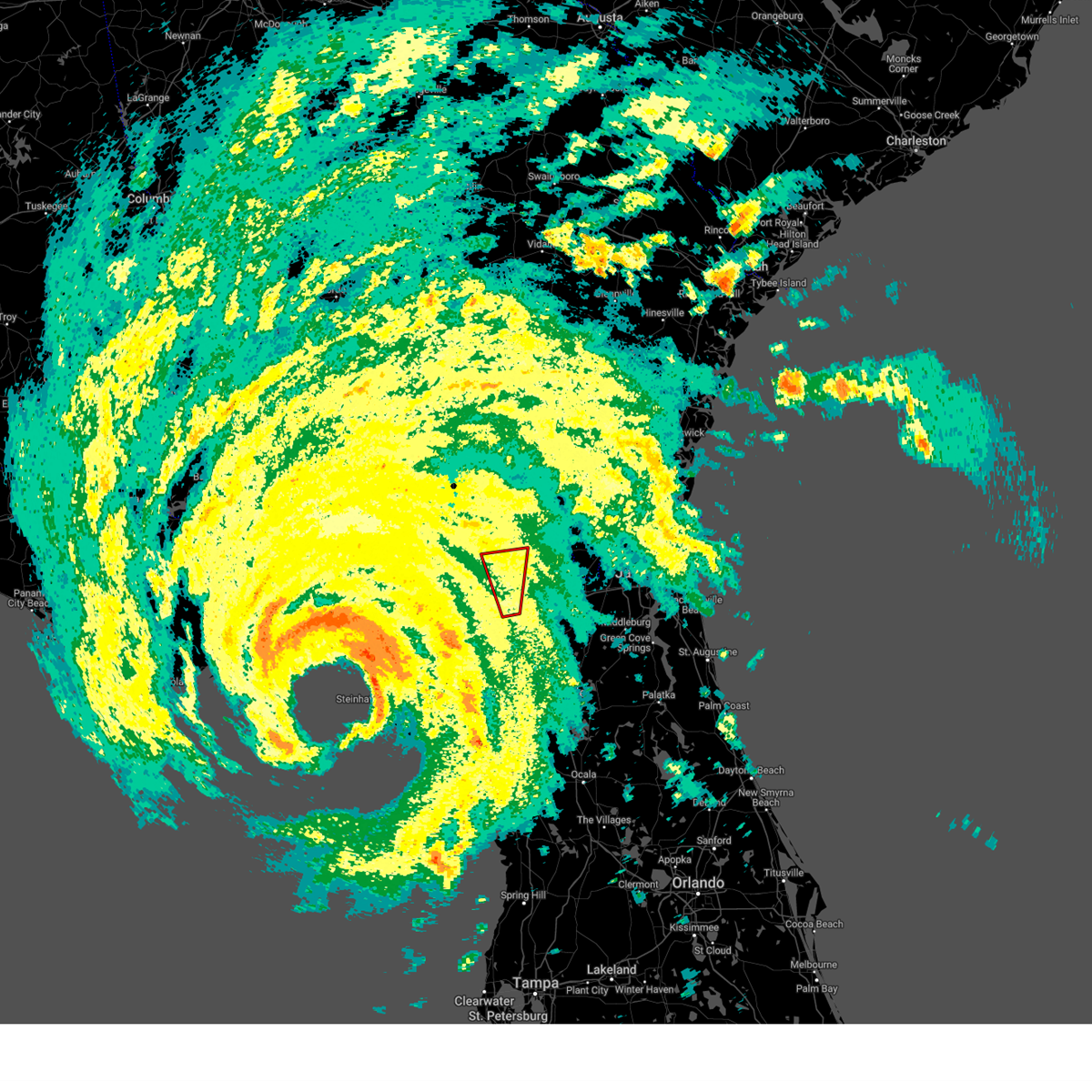
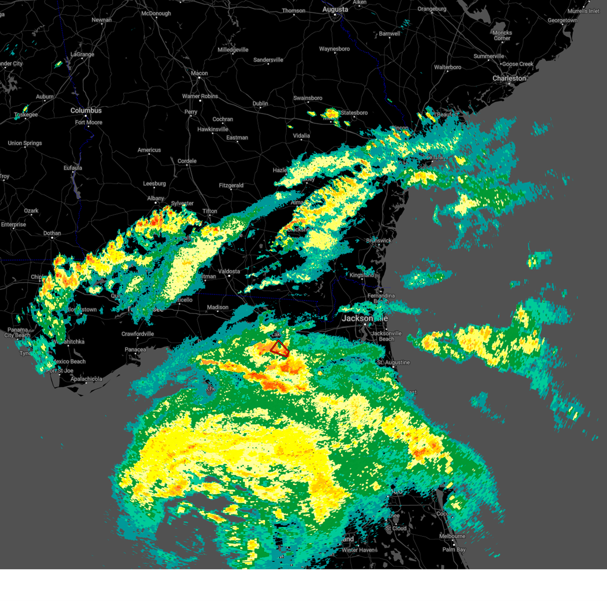
Hail Map for Lake City, FL
The Lake City, FL area has had 6 reports of on-the-ground hail by trained spotters, and has been under severe weather warnings 10 times during the past 12 months. Doppler radar has detected hail at or near Lake City, FL on 74 occasions, including 6 occasions during the past year.
| Name: | Lake City, FL |
| Where Located: | 60.7 miles W of Jacksonville, FL |
| Map: | Google Map for Lake City, FL |
| Population: | 12046 |
| Housing Units: | 5539 |
| More Info: | Search Google for Lake City, FL |
1
The Top Recent Hail Date for Lake City, FL is Wednesday, July 9, 2025 (16th out of 74)

Hail and Wind Damage Spotted near Lake City, FL
| Date / Time | Report Details |
|---|---|
| 3/16/2026 6:42 AM EDT |
 The storms which prompted the warning have weakened below severe limits, and no longer pose an immediate threat to life or property. therefore, the warning will be allowed to expire. however, small hail, gusty winds and heavy rain are still possible with these thunderstorms. The storms which prompted the warning have weakened below severe limits, and no longer pose an immediate threat to life or property. therefore, the warning will be allowed to expire. however, small hail, gusty winds and heavy rain are still possible with these thunderstorms.
|
| 3/16/2026 6:17 AM EDT |
 Svrjax the national weather service in jacksonville has issued a * severe thunderstorm warning for, western union county in northern florida, columbia county in northern florida, eastern suwannee county in northern florida, southeastern hamilton county in northern florida, * until 645 am edt. * at 617 am edt, severe thunderstorms were located along a line extending from near live oak to near obrien, moving northeast at 35 mph (radar indicated). Hazards include 60 mph wind gusts and penny size hail. expect damage to roofs, siding, and trees Svrjax the national weather service in jacksonville has issued a * severe thunderstorm warning for, western union county in northern florida, columbia county in northern florida, eastern suwannee county in northern florida, southeastern hamilton county in northern florida, * until 645 am edt. * at 617 am edt, severe thunderstorms were located along a line extending from near live oak to near obrien, moving northeast at 35 mph (radar indicated). Hazards include 60 mph wind gusts and penny size hail. expect damage to roofs, siding, and trees
|
| 3/12/2026 10:16 AM EDT |
 The storms which prompted the warning have weakened below severe limits, and no longer pose an immediate threat to life or property. therefore, the warning has been allowed to expire. however, gusty winds are still possible with these showers and thunderstorms. The storms which prompted the warning have weakened below severe limits, and no longer pose an immediate threat to life or property. therefore, the warning has been allowed to expire. however, gusty winds are still possible with these showers and thunderstorms.
|
| 3/12/2026 9:30 AM EDT |
 Svrjax the national weather service in jacksonville has issued a * severe thunderstorm warning for, northwestern baker county in northeastern florida, northern columbia county in northern florida, northeastern suwannee county in northern florida, eastern hamilton county in northern florida, * until 1015 am edt. * at 930 am edt, severe thunderstorms were located along a line extending from 6 miles north of belmont to near suwannee springs, moving east at 35 mph (radar indicated). Hazards include 60 mph wind gusts. expect damage to roofs, siding, and trees Svrjax the national weather service in jacksonville has issued a * severe thunderstorm warning for, northwestern baker county in northeastern florida, northern columbia county in northern florida, northeastern suwannee county in northern florida, eastern hamilton county in northern florida, * until 1015 am edt. * at 930 am edt, severe thunderstorms were located along a line extending from 6 miles north of belmont to near suwannee springs, moving east at 35 mph (radar indicated). Hazards include 60 mph wind gusts. expect damage to roofs, siding, and trees
|
| 2/15/2026 4:10 PM EST |
 The storm which prompted the warning has weakened below severe limits, and no longer poses an immediate threat to life or property. therefore, the warning will be allowed to expire. however, gusty winds are still possible with this thunderstorm. a tornado watch remains in effect until 800 pm est for northern florida. The storm which prompted the warning has weakened below severe limits, and no longer poses an immediate threat to life or property. therefore, the warning will be allowed to expire. however, gusty winds are still possible with this thunderstorm. a tornado watch remains in effect until 800 pm est for northern florida.
|
| 2/15/2026 3:47 PM EST |
 Svrjax the national weather service in jacksonville has issued a * severe thunderstorm warning for, central columbia county in northern florida, southern suwannee county in northern florida, southeastern hamilton county in northern florida, * until 415 pm est. * at 347 pm est, a severe thunderstorm was located near obrien, or 8 miles east of mayo, moving northeast at 50 mph (radar indicated). Hazards include 60 mph wind gusts. expect damage to roofs, siding, and trees Svrjax the national weather service in jacksonville has issued a * severe thunderstorm warning for, central columbia county in northern florida, southern suwannee county in northern florida, southeastern hamilton county in northern florida, * until 415 pm est. * at 347 pm est, a severe thunderstorm was located near obrien, or 8 miles east of mayo, moving northeast at 50 mph (radar indicated). Hazards include 60 mph wind gusts. expect damage to roofs, siding, and trees
|
| 8/14/2025 7:14 PM EDT |
 the severe thunderstorm warning has been cancelled and is no longer in effect the severe thunderstorm warning has been cancelled and is no longer in effect
|
| 8/14/2025 6:53 PM EDT |
 Svrjax the national weather service in jacksonville has issued a * severe thunderstorm warning for, central columbia county in northern florida, * until 730 pm edt. * at 653 pm edt, a severe thunderstorm was located near winfield, or near white springs, moving east at 15 mph (radar indicated). Hazards include 60 mph wind gusts and penny size hail. expect damage to roofs, siding, and trees Svrjax the national weather service in jacksonville has issued a * severe thunderstorm warning for, central columbia county in northern florida, * until 730 pm edt. * at 653 pm edt, a severe thunderstorm was located near winfield, or near white springs, moving east at 15 mph (radar indicated). Hazards include 60 mph wind gusts and penny size hail. expect damage to roofs, siding, and trees
|
| 7/21/2025 5:50 PM EDT |
 The storm which prompted the warning has weakened below severe limits, and no longer poses an immediate threat to life or property. therefore, the warning will be allowed to expire. however, gusty winds and heavy rain are still possible with this thunderstorm. The storm which prompted the warning has weakened below severe limits, and no longer poses an immediate threat to life or property. therefore, the warning will be allowed to expire. however, gusty winds and heavy rain are still possible with this thunderstorm.
|
| 7/21/2025 5:22 PM EDT |
 Svrjax the national weather service in jacksonville has issued a * severe thunderstorm warning for, west central baker county in northeastern florida, central columbia county in northern florida, east central suwannee county in northern florida, southeastern hamilton county in northern florida, * until 600 pm edt. * at 522 pm edt, a severe thunderstorm was located over suwannee valley, or near white springs, moving southeast at 15 mph (radar indicated). Hazards include 60 mph wind gusts. expect damage to roofs, siding, and trees Svrjax the national weather service in jacksonville has issued a * severe thunderstorm warning for, west central baker county in northeastern florida, central columbia county in northern florida, east central suwannee county in northern florida, southeastern hamilton county in northern florida, * until 600 pm edt. * at 522 pm edt, a severe thunderstorm was located over suwannee valley, or near white springs, moving southeast at 15 mph (radar indicated). Hazards include 60 mph wind gusts. expect damage to roofs, siding, and trees
|
| 3/16/2025 11:13 AM EDT |
 Svrjax the national weather service in jacksonville has issued a * severe thunderstorm warning for, southwestern nassau county in northeastern florida, baker county in northeastern florida, northwestern union county in northern florida, columbia county in northern florida, northeastern suwannee county in northern florida, west central duval county in northeastern florida, southeastern hamilton county in northern florida, south central ware county in southeastern georgia, southeastern clinch county in southeastern georgia, south central charlton county in southeastern georgia, * until 1145 am edt. * at 1113 am edt, a severe thunderstorm was located over five points, or over lake city, moving northeast at 60 mph (radar indicated). Hazards include 60 mph wind gusts and penny size hail. expect damage to roofs, siding, and trees Svrjax the national weather service in jacksonville has issued a * severe thunderstorm warning for, southwestern nassau county in northeastern florida, baker county in northeastern florida, northwestern union county in northern florida, columbia county in northern florida, northeastern suwannee county in northern florida, west central duval county in northeastern florida, southeastern hamilton county in northern florida, south central ware county in southeastern georgia, southeastern clinch county in southeastern georgia, south central charlton county in southeastern georgia, * until 1145 am edt. * at 1113 am edt, a severe thunderstorm was located over five points, or over lake city, moving northeast at 60 mph (radar indicated). Hazards include 60 mph wind gusts and penny size hail. expect damage to roofs, siding, and trees
|
| 3/16/2025 11:12 AM EDT |
 The storm which prompted the warning has moved out of the area. therefore, the warning will be allowed to expire. a tornado watch remains in effect until 300 pm edt for northern florida. The storm which prompted the warning has moved out of the area. therefore, the warning will be allowed to expire. a tornado watch remains in effect until 300 pm edt for northern florida.
|
| 3/16/2025 10:38 AM EDT |
 Svrjax the national weather service in jacksonville has issued a * severe thunderstorm warning for, central columbia county in northern florida, suwannee county in northern florida, southeastern hamilton county in northern florida, * until 1115 am edt. * at 1037 am edt, a severe thunderstorm was located over mayo, moving east at 40 mph (radar indicated). Hazards include 60 mph wind gusts and quarter size hail. Hail damage to vehicles is expected. Expect wind damage to roofs, siding, and trees. Svrjax the national weather service in jacksonville has issued a * severe thunderstorm warning for, central columbia county in northern florida, suwannee county in northern florida, southeastern hamilton county in northern florida, * until 1115 am edt. * at 1037 am edt, a severe thunderstorm was located over mayo, moving east at 40 mph (radar indicated). Hazards include 60 mph wind gusts and quarter size hail. Hail damage to vehicles is expected. Expect wind damage to roofs, siding, and trees.
|
| 3/9/2025 9:44 AM EDT |
 Svrjax the national weather service in jacksonville has issued a * severe thunderstorm warning for, southwestern nassau county in northeastern florida, northwestern bradford county in northern florida, baker county in northeastern florida, union county in northern florida, central columbia county in northern florida, northwestern duval county in northeastern florida, southeastern charlton county in southeastern georgia, * until 1015 am edt. * at 944 am edt, severe thunderstorms were located along a line extending from 8 miles northeast of taylor to near lake city, moving east at 60 mph (radar indicated). Hazards include 60 mph wind gusts and quarter size hail. Hail damage to vehicles is expected. Expect wind damage to roofs, siding, and trees. Svrjax the national weather service in jacksonville has issued a * severe thunderstorm warning for, southwestern nassau county in northeastern florida, northwestern bradford county in northern florida, baker county in northeastern florida, union county in northern florida, central columbia county in northern florida, northwestern duval county in northeastern florida, southeastern charlton county in southeastern georgia, * until 1015 am edt. * at 944 am edt, severe thunderstorms were located along a line extending from 8 miles northeast of taylor to near lake city, moving east at 60 mph (radar indicated). Hazards include 60 mph wind gusts and quarter size hail. Hail damage to vehicles is expected. Expect wind damage to roofs, siding, and trees.
|
| 9/26/2024 11:23 PM EDT |
 The storm which prompted the warning has weakened below severe limits, and has exited the warned area. therefore, the warning will be allowed to expire. a tornado watch remains in effect until 600 am edt for northern florida. The storm which prompted the warning has weakened below severe limits, and has exited the warned area. therefore, the warning will be allowed to expire. a tornado watch remains in effect until 600 am edt for northern florida.
|
| 9/26/2024 11:04 PM EDT |
 Torjax the national weather service in jacksonville has issued a * tornado warning for, northern columbia county in northern florida, southeastern hamilton county in northern florida, * until 1130 pm edt. * at 1104 pm edt, a confirmed tornado was located near belmont, or 7 miles northeast of white springs, moving north at 30 mph (emergency management confirmed tornado). Hazards include damaging tornado. Flying debris will be dangerous to those caught without shelter. mobile homes will be damaged or destroyed. damage to roofs, windows, and vehicles will occur. tree damage is likely. The tornado will be near, belmont around 1110 pm edt. Torjax the national weather service in jacksonville has issued a * tornado warning for, northern columbia county in northern florida, southeastern hamilton county in northern florida, * until 1130 pm edt. * at 1104 pm edt, a confirmed tornado was located near belmont, or 7 miles northeast of white springs, moving north at 30 mph (emergency management confirmed tornado). Hazards include damaging tornado. Flying debris will be dangerous to those caught without shelter. mobile homes will be damaged or destroyed. damage to roofs, windows, and vehicles will occur. tree damage is likely. The tornado will be near, belmont around 1110 pm edt.
|
| 8/4/2024 8:06 PM EDT |
 The storm which prompted the warning has weakened below severe limits, and no longer appears capable of producing a tornado. therefore, the warning will be allowed to expire. however, heavy rain is still possible with this thunderstorm. a tornado watch remains in effect until 600 am edt for northern florida. to report severe weather, contact your nearest law enforcement agency. they will relay your report to the national weather service jacksonville. The storm which prompted the warning has weakened below severe limits, and no longer appears capable of producing a tornado. therefore, the warning will be allowed to expire. however, heavy rain is still possible with this thunderstorm. a tornado watch remains in effect until 600 am edt for northern florida. to report severe weather, contact your nearest law enforcement agency. they will relay your report to the national weather service jacksonville.
|
| 8/4/2024 7:59 PM EDT |
 Torjax the national weather service in jacksonville has issued a * tornado warning for, west central columbia county in northern florida, * until 815 pm edt. * at 759 pm edt, a severe thunderstorm capable of producing a tornado was located near columbia, or 9 miles south of lake city, moving northwest at 30 mph (radar indicated rotation). Hazards include tornado. Flying debris will be dangerous to those caught without shelter. mobile homes will be damaged or destroyed. damage to roofs, windows, and vehicles will occur. tree damage is likely. This dangerous storm will be near, columbia around 805 pm edt. Torjax the national weather service in jacksonville has issued a * tornado warning for, west central columbia county in northern florida, * until 815 pm edt. * at 759 pm edt, a severe thunderstorm capable of producing a tornado was located near columbia, or 9 miles south of lake city, moving northwest at 30 mph (radar indicated rotation). Hazards include tornado. Flying debris will be dangerous to those caught without shelter. mobile homes will be damaged or destroyed. damage to roofs, windows, and vehicles will occur. tree damage is likely. This dangerous storm will be near, columbia around 805 pm edt.
|
| 5/10/2024 10:25 AM EDT | As of 10:25am... ~200f customers without power in columbia county...f in columbia county FL, 3.8 miles SSW of Lake City, FL |
| 5/10/2024 8:35 AM EDT | Awos station klcq lake cit in columbia county FL, 4.7 miles W of Lake City, FL |
| 5/10/2024 8:25 AM EDT | Old oak trees snapped... twisted trees... lawn furniture blown around... power outage. images provided through social medi in columbia county FL, 4.4 miles E of Lake City, FL |
| 5/10/2024 8:18 AM EDT |
 Svrjax the national weather service in jacksonville has issued a * severe thunderstorm warning for, gilchrist county in northern florida, western alachua county in northern florida, baker county in northeastern florida, union county in northern florida, southeastern suwannee county in northern florida, columbia county in northern florida, eastern hamilton county in northern florida, southeastern echols county in southeastern georgia, southern ware county in southeastern georgia, southeastern clinch county in southeastern georgia, central charlton county in southeastern georgia, * until 900 am edt. * at 818 am edt, severe thunderstorms were located along a line extending from 6 miles south of homerville to near white springs to near cross city, moving east at 60 mph (radar indicated). Hazards include 70 mph wind gusts and quarter size hail. Hail damage to vehicles is expected. expect considerable tree damage. Wind damage is also likely to mobile homes, roofs, and outbuildings. Svrjax the national weather service in jacksonville has issued a * severe thunderstorm warning for, gilchrist county in northern florida, western alachua county in northern florida, baker county in northeastern florida, union county in northern florida, southeastern suwannee county in northern florida, columbia county in northern florida, eastern hamilton county in northern florida, southeastern echols county in southeastern georgia, southern ware county in southeastern georgia, southeastern clinch county in southeastern georgia, central charlton county in southeastern georgia, * until 900 am edt. * at 818 am edt, severe thunderstorms were located along a line extending from 6 miles south of homerville to near white springs to near cross city, moving east at 60 mph (radar indicated). Hazards include 70 mph wind gusts and quarter size hail. Hail damage to vehicles is expected. expect considerable tree damage. Wind damage is also likely to mobile homes, roofs, and outbuildings.
|
| 5/10/2024 8:00 AM EDT |
 At 800 am edt, severe thunderstorms were located along a line extending from moody air force base to 7 miles southwest of dowling park to near steinhatchee, moving east at 45 mph (radar indicated). Hazards include 70 mph wind gusts and quarter size hail. possible tornadoes. Hail damage to vehicles is expected. expect considerable tree damage. wind damage is also likely to mobile homes, roofs, and outbuildings. Locations impacted include, lake city, live oak, jasper, homerville, trenton, jennings, white springs, bell, fargo, and statenville. At 800 am edt, severe thunderstorms were located along a line extending from moody air force base to 7 miles southwest of dowling park to near steinhatchee, moving east at 45 mph (radar indicated). Hazards include 70 mph wind gusts and quarter size hail. possible tornadoes. Hail damage to vehicles is expected. expect considerable tree damage. wind damage is also likely to mobile homes, roofs, and outbuildings. Locations impacted include, lake city, live oak, jasper, homerville, trenton, jennings, white springs, bell, fargo, and statenville.
|
| 5/10/2024 7:50 AM EDT |
 Svrjax the national weather service in jacksonville has issued a * severe thunderstorm warning for, gilchrist county in northern florida, suwannee county in northern florida, western columbia county in northern florida, hamilton county in northern florida, echols county in southeastern georgia, west central ware county in southeastern georgia, clinch county in southeastern georgia, * until 830 am edt. * at 750 am edt, severe thunderstorms were located along a line extending from near hahira to 7 miles west of dowling park to 18 miles northwest of steinhatchee, moving east at 55 mph (radar indicated). Hazards include 70 mph wind gusts and quarter size hail. Hail damage to vehicles is expected. expect considerable tree damage. Wind damage is also likely to mobile homes, roofs, and outbuildings. Svrjax the national weather service in jacksonville has issued a * severe thunderstorm warning for, gilchrist county in northern florida, suwannee county in northern florida, western columbia county in northern florida, hamilton county in northern florida, echols county in southeastern georgia, west central ware county in southeastern georgia, clinch county in southeastern georgia, * until 830 am edt. * at 750 am edt, severe thunderstorms were located along a line extending from near hahira to 7 miles west of dowling park to 18 miles northwest of steinhatchee, moving east at 55 mph (radar indicated). Hazards include 70 mph wind gusts and quarter size hail. Hail damage to vehicles is expected. expect considerable tree damage. Wind damage is also likely to mobile homes, roofs, and outbuildings.
|
| 5/9/2024 6:29 PM EDT |
 At 629 pm edt, a severe thunderstorm was located over olustee, or 10 miles east of lake city, moving east at 35 mph (radar indicated). Hazards include 60 mph wind gusts and quarter size hail. Hail damage to vehicles is expected. expect wind damage to roofs, siding, and trees. Locations impacted include, watertown, sanderson, and olustee. At 629 pm edt, a severe thunderstorm was located over olustee, or 10 miles east of lake city, moving east at 35 mph (radar indicated). Hazards include 60 mph wind gusts and quarter size hail. Hail damage to vehicles is expected. expect wind damage to roofs, siding, and trees. Locations impacted include, watertown, sanderson, and olustee.
|
| 5/9/2024 6:15 PM EDT |
 Svrjax the national weather service in jacksonville has issued a * severe thunderstorm warning for, southwestern baker county in northeastern florida, north central union county in northern florida, central columbia county in northern florida, * until 645 pm edt. * at 615 pm edt, a severe thunderstorm was located near suwannee valley, or 7 miles east of white springs, moving east at 40 mph (radar indicated). Hazards include 60 mph wind gusts and quarter size hail. Hail damage to vehicles is expected. Expect wind damage to roofs, siding, and trees. Svrjax the national weather service in jacksonville has issued a * severe thunderstorm warning for, southwestern baker county in northeastern florida, north central union county in northern florida, central columbia county in northern florida, * until 645 pm edt. * at 615 pm edt, a severe thunderstorm was located near suwannee valley, or 7 miles east of white springs, moving east at 40 mph (radar indicated). Hazards include 60 mph wind gusts and quarter size hail. Hail damage to vehicles is expected. Expect wind damage to roofs, siding, and trees.
|
| 4/11/2024 8:28 AM EDT |
 The storms which prompted the warning have weakened below severe limits, and no longer pose an immediate threat to life or property. therefore, the warning will be allowed to expire. however, gusty winds and heavy rain are still possible with these thunderstorms. a tornado watch remains in effect until 300 pm edt for northern and northeastern florida. The storms which prompted the warning have weakened below severe limits, and no longer pose an immediate threat to life or property. therefore, the warning will be allowed to expire. however, gusty winds and heavy rain are still possible with these thunderstorms. a tornado watch remains in effect until 300 pm edt for northern and northeastern florida.
|
| 4/11/2024 8:24 AM EDT |
 At 824 am edt, severe thunderstorms were located along a line extending from 7 miles south of fargo to 6 miles east of luraville, moving east at 35 mph (radar indicated). Hazards include 60 mph wind gusts. Expect damage to roofs, siding, and trees. Locations impacted include, lake city, white springs, ichetucknee spring, columbia, fort white, winfield, suwannee valley, mcalpin, wellborn, and five points. At 824 am edt, severe thunderstorms were located along a line extending from 7 miles south of fargo to 6 miles east of luraville, moving east at 35 mph (radar indicated). Hazards include 60 mph wind gusts. Expect damage to roofs, siding, and trees. Locations impacted include, lake city, white springs, ichetucknee spring, columbia, fort white, winfield, suwannee valley, mcalpin, wellborn, and five points.
|
| 4/11/2024 8:22 AM EDT |
 At 822 am edt, severe thunderstorms were located along a line extending from 7 miles south of fargo to near mcalpin, moving east at 35 mph (radar indicated). Hazards include 60 mph wind gusts. Expect damage to roofs, siding, and trees. Locations impacted include, lake city, white springs, ichetucknee spring, columbia, fort white, winfield, suwannee valley, mcalpin, wellborn, and five points. At 822 am edt, severe thunderstorms were located along a line extending from 7 miles south of fargo to near mcalpin, moving east at 35 mph (radar indicated). Hazards include 60 mph wind gusts. Expect damage to roofs, siding, and trees. Locations impacted include, lake city, white springs, ichetucknee spring, columbia, fort white, winfield, suwannee valley, mcalpin, wellborn, and five points.
|
| 4/11/2024 8:18 AM EDT |
 At 817 am edt, severe thunderstorms were located along a line extending from 7 miles south of fargo to 6 miles southwest of mcalpin, moving east at 25 mph (radar indicated). Hazards include 60 mph wind gusts. Expect damage to roofs, siding, and trees. Locations impacted include, lake city, white springs, ichetucknee spring, columbia, fort white, winfield, suwannee valley, belmont, mcalpin, and wellborn. At 817 am edt, severe thunderstorms were located along a line extending from 7 miles south of fargo to 6 miles southwest of mcalpin, moving east at 25 mph (radar indicated). Hazards include 60 mph wind gusts. Expect damage to roofs, siding, and trees. Locations impacted include, lake city, white springs, ichetucknee spring, columbia, fort white, winfield, suwannee valley, belmont, mcalpin, and wellborn.
|
| 4/11/2024 8:12 AM EDT |
 At 812 am edt, severe thunderstorms were located along a line extending from 7 miles south of fargo to near obrien, moving east at 40 mph (radar indicated). Hazards include 60 mph wind gusts. Expect damage to roofs, siding, and trees. Locations impacted include, lake city, live oak, white springs, ichetucknee spring, columbia, fort white, winfield, suwannee valley, belmont, and mcalpin. At 812 am edt, severe thunderstorms were located along a line extending from 7 miles south of fargo to near obrien, moving east at 40 mph (radar indicated). Hazards include 60 mph wind gusts. Expect damage to roofs, siding, and trees. Locations impacted include, lake city, live oak, white springs, ichetucknee spring, columbia, fort white, winfield, suwannee valley, belmont, and mcalpin.
|
| 4/11/2024 7:58 AM EDT |
 Svrjax the national weather service in jacksonville has issued a * severe thunderstorm warning for, eastern suwannee county in northern florida, columbia county in northern florida, eastern hamilton county in northern florida, * until 830 am edt. * at 758 am edt, severe thunderstorms were located along a line extending from 9 miles northwest of belmont to near ichetucknee spring, moving east at 35 mph (radar indicated). Hazards include 60 mph wind gusts. expect damage to roofs, siding, and trees Svrjax the national weather service in jacksonville has issued a * severe thunderstorm warning for, eastern suwannee county in northern florida, columbia county in northern florida, eastern hamilton county in northern florida, * until 830 am edt. * at 758 am edt, severe thunderstorms were located along a line extending from 9 miles northwest of belmont to near ichetucknee spring, moving east at 35 mph (radar indicated). Hazards include 60 mph wind gusts. expect damage to roofs, siding, and trees
|
| 4/3/2024 10:31 AM EDT |
 the severe thunderstorm warning has been cancelled and is no longer in effect the severe thunderstorm warning has been cancelled and is no longer in effect
|
| 4/3/2024 10:31 AM EDT |
 At 1030 am edt, severe thunderstorms were located along a line extending from near watertown to near bell, moving east at 40 mph (radar indicated). Hazards include 60 mph wind gusts and penny size hail. Expect damage to roofs, siding, and trees. Locations impacted include, lake city, lake butler, bell, raiford, worthington spring, columbia, alachua, macclenny, high springs, and fort white. At 1030 am edt, severe thunderstorms were located along a line extending from near watertown to near bell, moving east at 40 mph (radar indicated). Hazards include 60 mph wind gusts and penny size hail. Expect damage to roofs, siding, and trees. Locations impacted include, lake city, lake butler, bell, raiford, worthington spring, columbia, alachua, macclenny, high springs, and fort white.
|
| 4/3/2024 10:30 AM EDT | Branch fell on roof and root ball landed on a fence at 177 sw ferndal in columbia county FL, 4.2 miles N of Lake City, FL |
| 4/3/2024 10:18 AM EDT | *** 1 inj *** tree fell on a single wide mobile home with one minor injury. report from the state watch office and time is based on rada in columbia county FL, 4.9 miles ENE of Lake City, FL |
| 4/3/2024 10:12 AM EDT |
 Svrjax the national weather service in jacksonville has issued a * severe thunderstorm warning for, central gilchrist county in northern florida, central bradford county in northern florida, northwestern alachua county in northern florida, southern baker county in northeastern florida, union county in northern florida, southeastern suwannee county in northern florida, southern columbia county in northern florida, * until 1115 am edt. * at 1012 am edt, severe thunderstorms were located along a line extending from near wellborn to 6 miles north of bell, moving east at 35 mph (radar indicated). Hazards include 60 mph wind gusts and penny size hail. expect damage to roofs, siding, and trees Svrjax the national weather service in jacksonville has issued a * severe thunderstorm warning for, central gilchrist county in northern florida, central bradford county in northern florida, northwestern alachua county in northern florida, southern baker county in northeastern florida, union county in northern florida, southeastern suwannee county in northern florida, southern columbia county in northern florida, * until 1115 am edt. * at 1012 am edt, severe thunderstorms were located along a line extending from near wellborn to 6 miles north of bell, moving east at 35 mph (radar indicated). Hazards include 60 mph wind gusts and penny size hail. expect damage to roofs, siding, and trees
|
| 3/3/2024 2:03 PM EST |
 Svrjax the national weather service in jacksonville has issued a * severe thunderstorm warning for, southwestern baker county in northeastern florida, northwestern union county in northern florida, east central columbia county in northern florida, * until 245 pm est. * at 203 pm est, a severe thunderstorm was located near watertown, or 7 miles east of lake city, moving southeast at 10 mph (radar indicated). Hazards include quarter size hail. damage to vehicles is expected Svrjax the national weather service in jacksonville has issued a * severe thunderstorm warning for, southwestern baker county in northeastern florida, northwestern union county in northern florida, east central columbia county in northern florida, * until 245 pm est. * at 203 pm est, a severe thunderstorm was located near watertown, or 7 miles east of lake city, moving southeast at 10 mph (radar indicated). Hazards include quarter size hail. damage to vehicles is expected
|
| 2/4/2024 2:24 PM EST |
 At 223 pm est, a severe thunderstorm was located over providence, or 7 miles northwest of worthington spring, moving north at 30 mph (radar indicated). Hazards include 60 mph wind gusts and penny size hail. Expect damage to roofs, siding, and trees. Locations impacted include, lake city, palestine community, groves, providence, five points, watertown, lulu, olustee, and dukes. At 223 pm est, a severe thunderstorm was located over providence, or 7 miles northwest of worthington spring, moving north at 30 mph (radar indicated). Hazards include 60 mph wind gusts and penny size hail. Expect damage to roofs, siding, and trees. Locations impacted include, lake city, palestine community, groves, providence, five points, watertown, lulu, olustee, and dukes.
|
| 2/4/2024 2:15 PM EST |
 At 214 pm est, a severe thunderstorm was located near upland pines, or 9 miles west of worthington spring, moving north at 30 mph (radar indicated). Hazards include 60 mph wind gusts and penny size hail. expect damage to roofs, siding, and trees At 214 pm est, a severe thunderstorm was located near upland pines, or 9 miles west of worthington spring, moving north at 30 mph (radar indicated). Hazards include 60 mph wind gusts and penny size hail. expect damage to roofs, siding, and trees
|
| 1/9/2024 2:25 PM EST |
 The severe thunderstorm warning for northeastern gilchrist, northwestern alachua, western baker, western union, columbia, south central ware and southeastern clinch counties will expire at 230 pm est, the storms which prompted the warning have moved out of the warned area. therefore, the warning will be allowed to expire. a tornado watch remains in effect until 300 pm est for northern florida, and southeastern georgia. a tornado watch also remains in effect until 600 pm est for northern and northeastern florida. The severe thunderstorm warning for northeastern gilchrist, northwestern alachua, western baker, western union, columbia, south central ware and southeastern clinch counties will expire at 230 pm est, the storms which prompted the warning have moved out of the warned area. therefore, the warning will be allowed to expire. a tornado watch remains in effect until 300 pm est for northern florida, and southeastern georgia. a tornado watch also remains in effect until 600 pm est for northern and northeastern florida.
|
| 1/9/2024 2:14 PM EST |
 At 213 pm est, severe thunderstorms were located along a line extending from 11 miles south of stephen foster state park to near lulu, moving east at 40 mph (radar indicated). Hazards include 60 mph wind gusts. Expect damage to roofs, siding, and trees. Locations impacted include, lake city, ichetucknee spring, columbia, taylor, high springs, fort white, palestine community, providence, olustee, and upland pines. At 213 pm est, severe thunderstorms were located along a line extending from 11 miles south of stephen foster state park to near lulu, moving east at 40 mph (radar indicated). Hazards include 60 mph wind gusts. Expect damage to roofs, siding, and trees. Locations impacted include, lake city, ichetucknee spring, columbia, taylor, high springs, fort white, palestine community, providence, olustee, and upland pines.
|
| 1/9/2024 1:27 PM EST |
 At 126 pm est, severe thunderstorms were located along a line extending from 9 miles northwest of belmont to near obrien, moving east at 40 mph (radar indicated). Hazards include 60 mph wind gusts. expect damage to roofs, siding, and trees At 126 pm est, severe thunderstorms were located along a line extending from 9 miles northwest of belmont to near obrien, moving east at 40 mph (radar indicated). Hazards include 60 mph wind gusts. expect damage to roofs, siding, and trees
|
| 12/2/2023 3:28 PM EST |
 The tornado warning for central columbia county will expire at 330 pm est, the storm which prompted the warning has moved out of the area. therefore, the warning will be allowed to expire. The tornado warning for central columbia county will expire at 330 pm est, the storm which prompted the warning has moved out of the area. therefore, the warning will be allowed to expire.
|
| 12/2/2023 3:27 PM EST |
 The severe thunderstorm warning for central columbia county will expire at 330 pm est, the storm which prompted the warning has weakened below severe limits, and has exited the warned area. therefore, the warning will be allowed to expire. The severe thunderstorm warning for central columbia county will expire at 330 pm est, the storm which prompted the warning has weakened below severe limits, and has exited the warned area. therefore, the warning will be allowed to expire.
|
| 12/2/2023 2:54 PM EST |
 At 254 pm est, a severe thunderstorm was located over winfield, or near lake city, moving east at 25 mph (radar indicated). Hazards include 60 mph wind gusts. expect damage to roofs, siding, and trees At 254 pm est, a severe thunderstorm was located over winfield, or near lake city, moving east at 25 mph (radar indicated). Hazards include 60 mph wind gusts. expect damage to roofs, siding, and trees
|
| 12/2/2023 2:50 PM EST |
 At 249 pm est, a severe thunderstorm was located over winfield, or near lake city, moving east at 25 mph (radar indicated). Hazards include 60 mph wind gusts and penny size hail. Expect damage to roofs, siding, and trees. Locations impacted include, lake city, columbia, five points, and watertown. At 249 pm est, a severe thunderstorm was located over winfield, or near lake city, moving east at 25 mph (radar indicated). Hazards include 60 mph wind gusts and penny size hail. Expect damage to roofs, siding, and trees. Locations impacted include, lake city, columbia, five points, and watertown.
|
| 12/2/2023 2:44 PM EST |
 At 244 pm est, a severe thunderstorm capable of producing a tornado was located near wellborn, or 7 miles west of lake city, moving northeast at 30 mph (radar indicated rotation). Hazards include tornado. Flying debris will be dangerous to those caught without shelter. mobile homes will be damaged or destroyed. damage to roofs, windows, and vehicles will occur. tree damage is likely. This dangerous storm will be near, lake city, winfield, and five points around 250 pm est. At 244 pm est, a severe thunderstorm capable of producing a tornado was located near wellborn, or 7 miles west of lake city, moving northeast at 30 mph (radar indicated rotation). Hazards include tornado. Flying debris will be dangerous to those caught without shelter. mobile homes will be damaged or destroyed. damage to roofs, windows, and vehicles will occur. tree damage is likely. This dangerous storm will be near, lake city, winfield, and five points around 250 pm est.
|
| 12/2/2023 2:29 PM EST |
 At 229 pm est, a severe thunderstorm was located near wellborn, or 11 miles west of lake city, moving east at 35 mph (radar indicated). Hazards include 60 mph wind gusts and penny size hail. expect damage to roofs, siding, and trees At 229 pm est, a severe thunderstorm was located near wellborn, or 11 miles west of lake city, moving east at 35 mph (radar indicated). Hazards include 60 mph wind gusts and penny size hail. expect damage to roofs, siding, and trees
|
| 6/27/2023 6:31 PM EDT |
 At 631 pm edt, a severe thunderstorm was located over watertown, or over lake city, moving east at 25 mph (radar indicated). Hazards include 60 mph wind gusts and quarter size hail. Hail damage to vehicles is expected. expect wind damage to roofs, siding, and trees. locations impacted include, lake city, five points, watertown, winfield, lulu and suwannee valley. hail threat, radar indicated max hail size, 1. 00 in wind threat, radar indicated max wind gust, 60 mph. At 631 pm edt, a severe thunderstorm was located over watertown, or over lake city, moving east at 25 mph (radar indicated). Hazards include 60 mph wind gusts and quarter size hail. Hail damage to vehicles is expected. expect wind damage to roofs, siding, and trees. locations impacted include, lake city, five points, watertown, winfield, lulu and suwannee valley. hail threat, radar indicated max hail size, 1. 00 in wind threat, radar indicated max wind gust, 60 mph.
|
| 6/27/2023 6:26 PM EDT | Tree and power line down caused by tstm wind in columbia county FL, 3.5 miles WNW of Lake City, FL |
| 6/27/2023 6:14 PM EDT |
 At 614 pm edt, a severe thunderstorm was located over winfield, or near white springs, moving east at 15 mph (radar indicated). Hazards include 60 mph wind gusts and quarter size hail. Hail damage to vehicles is expected. Expect wind damage to roofs, siding, and trees. At 614 pm edt, a severe thunderstorm was located over winfield, or near white springs, moving east at 15 mph (radar indicated). Hazards include 60 mph wind gusts and quarter size hail. Hail damage to vehicles is expected. Expect wind damage to roofs, siding, and trees.
|
| 6/27/2023 6:01 PM EDT | Power line and tree down caused by thunderstorm wind in columbia county FL, 7.4 miles E of Lake City, FL |
| 6/21/2023 12:42 PM EDT |
 The severe thunderstorm warning for west central union, columbia and southeastern hamilton counties will expire at 1245 pm edt, the storm which prompted the warning has weakened below severe limits, and no longer poses an immediate threat to life or property. therefore, the warning will be allowed to expire. however gusty winds are still possible with this thunderstorm. The severe thunderstorm warning for west central union, columbia and southeastern hamilton counties will expire at 1245 pm edt, the storm which prompted the warning has weakened below severe limits, and no longer poses an immediate threat to life or property. therefore, the warning will be allowed to expire. however gusty winds are still possible with this thunderstorm.
|
| 6/21/2023 12:10 PM EDT |
 At 1210 pm edt, a severe thunderstorm was located near wellborn, or 7 miles south of white springs, moving northeast at 30 mph (radar indicated). Hazards include 60 mph wind gusts and penny size hail. expect damage to roofs, siding, and trees At 1210 pm edt, a severe thunderstorm was located near wellborn, or 7 miles south of white springs, moving northeast at 30 mph (radar indicated). Hazards include 60 mph wind gusts and penny size hail. expect damage to roofs, siding, and trees
|
| 6/16/2023 2:51 PM EDT |
 The severe thunderstorm warning for southwestern baker, north central union and east central columbia counties will expire at 300 pm edt, the storm which prompted the warning has weakened below severe limits, and no longer poses an immediate threat to life or property. therefore, the warning will be allowed to expire. however gusty winds are still possible with this thunderstorm. The severe thunderstorm warning for southwestern baker, north central union and east central columbia counties will expire at 300 pm edt, the storm which prompted the warning has weakened below severe limits, and no longer poses an immediate threat to life or property. therefore, the warning will be allowed to expire. however gusty winds are still possible with this thunderstorm.
|
| 6/16/2023 2:36 PM EDT |
 At 236 pm edt, a severe thunderstorm was located near five points, or near lake city, moving east at 40 mph (radar indicated). Hazards include 60 mph wind gusts and quarter size hail. Hail damage to vehicles is expected. Expect wind damage to roofs, siding, and trees. At 236 pm edt, a severe thunderstorm was located near five points, or near lake city, moving east at 40 mph (radar indicated). Hazards include 60 mph wind gusts and quarter size hail. Hail damage to vehicles is expected. Expect wind damage to roofs, siding, and trees.
|
| 6/16/2023 2:30 PM EDT | Corrects previous tstm wnd dmg report from 4 ssw winfield. large tree uprooted and fell on a house along nw irene lane. damage unknown. photo was relayed via columbia c in columbia county FL, 3.4 miles ESE of Lake City, FL |
| 6/16/2023 2:25 PM EDT | A large tree snapped and fell across sw prairie st. photo was relayed via columbia county fire. time was estimated by rada in columbia county FL, 3.8 miles NE of Lake City, FL |
| 6/14/2023 10:41 PM EDT |
 At 1041 pm edt, severe thunderstorms were located along a line extending from near belmont to 6 miles southeast of wellborn to 6 miles south of obrien, moving southeast at 45 mph (radar indicated). Hazards include 60 mph wind gusts. Expect damage to roofs, siding, and trees. locations impacted include, lake city, white springs, bell, ichetucknee spring, columbia, fort white, winfield, suwannee valley, belmont and mcalpin. hail threat, radar indicated max hail size, <. 75 in wind threat, radar indicated max wind gust, 60 mph. At 1041 pm edt, severe thunderstorms were located along a line extending from near belmont to 6 miles southeast of wellborn to 6 miles south of obrien, moving southeast at 45 mph (radar indicated). Hazards include 60 mph wind gusts. Expect damage to roofs, siding, and trees. locations impacted include, lake city, white springs, bell, ichetucknee spring, columbia, fort white, winfield, suwannee valley, belmont and mcalpin. hail threat, radar indicated max hail size, <. 75 in wind threat, radar indicated max wind gust, 60 mph.
|
| 6/14/2023 10:26 PM EDT |
 At 1026 pm edt, severe thunderstorms were located along a line extending from near belmont to near mcalpin to near mayo, moving southeast at 40 mph (radar indicated). Hazards include 60 mph wind gusts. expect damage to roofs, siding, and trees At 1026 pm edt, severe thunderstorms were located along a line extending from near belmont to near mcalpin to near mayo, moving southeast at 40 mph (radar indicated). Hazards include 60 mph wind gusts. expect damage to roofs, siding, and trees
|
| 4/8/2023 6:01 PM EDT |
 At 601 pm edt, a severe thunderstorm capable of producing a tornado was located over lake city, moving east at 10 mph (radar indicated rotation). Hazards include tornado. Flying debris will be dangerous to those caught without shelter. mobile homes will be damaged or destroyed. damage to roofs, windows, and vehicles will occur. tree damage is likely. This dangerous storm will be near, watertown around 615 pm edt. At 601 pm edt, a severe thunderstorm capable of producing a tornado was located over lake city, moving east at 10 mph (radar indicated rotation). Hazards include tornado. Flying debris will be dangerous to those caught without shelter. mobile homes will be damaged or destroyed. damage to roofs, windows, and vehicles will occur. tree damage is likely. This dangerous storm will be near, watertown around 615 pm edt.
|
| 4/8/2023 5:48 PM EDT |
 At 548 pm edt, a severe thunderstorm capable of producing a tornado was located near lake city, moving east at 10 mph (radar indicated rotation). Hazards include tornado. Flying debris will be dangerous to those caught without shelter. mobile homes will be damaged or destroyed. damage to roofs, windows, and vehicles will occur. tree damage is likely. this dangerous storm will be near, five points around 610 pm edt. Lake city and watertown around 615 pm edt. At 548 pm edt, a severe thunderstorm capable of producing a tornado was located near lake city, moving east at 10 mph (radar indicated rotation). Hazards include tornado. Flying debris will be dangerous to those caught without shelter. mobile homes will be damaged or destroyed. damage to roofs, windows, and vehicles will occur. tree damage is likely. this dangerous storm will be near, five points around 610 pm edt. Lake city and watertown around 615 pm edt.
|
| 3/10/2023 5:30 PM EST |
 At 530 pm est, a severe thunderstorm was located near mcalpin, or 7 miles southeast of live oak, moving east at 30 mph (radar indicated). Hazards include 60 mph wind gusts and quarter size hail. Hail damage to vehicles is expected. expect wind damage to roofs, siding, and trees. Locations impacted include, live oak, wellborn, mcalpin, suwannee valley and houston. At 530 pm est, a severe thunderstorm was located near mcalpin, or 7 miles southeast of live oak, moving east at 30 mph (radar indicated). Hazards include 60 mph wind gusts and quarter size hail. Hail damage to vehicles is expected. expect wind damage to roofs, siding, and trees. Locations impacted include, live oak, wellborn, mcalpin, suwannee valley and houston.
|
| 3/10/2023 5:16 PM EST |
 At 516 pm est, a severe thunderstorm was located near live oak, moving southeast at 30 mph (radar indicated). Hazards include 60 mph wind gusts and half dollar size hail. Hail damage to vehicles is expected. expect wind damage to roofs, siding, and trees. Locations impacted include, live oak, wellborn, mcalpin, suwannee valley and houston. At 516 pm est, a severe thunderstorm was located near live oak, moving southeast at 30 mph (radar indicated). Hazards include 60 mph wind gusts and half dollar size hail. Hail damage to vehicles is expected. expect wind damage to roofs, siding, and trees. Locations impacted include, live oak, wellborn, mcalpin, suwannee valley and houston.
|
| 3/10/2023 5:07 PM EST |
 At 506 pm est, a severe thunderstorm was located near live oak, moving east at 30 mph (radar indicated). Hazards include 60 mph wind gusts and half dollar size hail. Hail damage to vehicles is expected. Expect wind damage to roofs, siding, and trees. At 506 pm est, a severe thunderstorm was located near live oak, moving east at 30 mph (radar indicated). Hazards include 60 mph wind gusts and half dollar size hail. Hail damage to vehicles is expected. Expect wind damage to roofs, siding, and trees.
|
| 1/4/2023 2:17 PM EST |
 At 217 pm est, severe thunderstorms were located along a line extending from 11 miles northwest of taylor to 6 miles west of ichetucknee spring, moving east at 25 mph (radar indicated). Hazards include 60 mph wind gusts and penny size hail. expect damage to roofs, siding, and trees At 217 pm est, severe thunderstorms were located along a line extending from 11 miles northwest of taylor to 6 miles west of ichetucknee spring, moving east at 25 mph (radar indicated). Hazards include 60 mph wind gusts and penny size hail. expect damage to roofs, siding, and trees
|
| 1/4/2023 1:32 PM EST |
 At 131 pm est, severe thunderstorms were located along a line extending from 8 miles south of fargo to white springs, moving east at 40 mph (radar indicated). Hazards include 60 mph wind gusts and penny size hail. expect damage to roofs, siding, and trees At 131 pm est, severe thunderstorms were located along a line extending from 8 miles south of fargo to white springs, moving east at 40 mph (radar indicated). Hazards include 60 mph wind gusts and penny size hail. expect damage to roofs, siding, and trees
|
| 11/30/2022 12:09 PM EST |
 The severe thunderstorm warning for west central columbia and northern suwannee counties will expire at 1215 pm est, the storm which prompted the warning has weakened below severe limits, and no longer poses an immediate threat to life or property. therefore, the warning will be allowed to expire. however strong gusty winds and heavy rain are still expected with this thunderstorm. The severe thunderstorm warning for west central columbia and northern suwannee counties will expire at 1215 pm est, the storm which prompted the warning has weakened below severe limits, and no longer poses an immediate threat to life or property. therefore, the warning will be allowed to expire. however strong gusty winds and heavy rain are still expected with this thunderstorm.
|
| 11/30/2022 11:54 AM EST |
 At 1154 am est, a severe thunderstorm was located near mcalpin, or 9 miles southeast of live oak, moving southeast at 40 mph (radar indicated). Hazards include 60 mph wind gusts. Expect damage to roofs, siding, and trees. Locations impacted include, lake city, live oak, white springs, wellborn, five points, winfield, suwannee valley, mcalpin and houston. At 1154 am est, a severe thunderstorm was located near mcalpin, or 9 miles southeast of live oak, moving southeast at 40 mph (radar indicated). Hazards include 60 mph wind gusts. Expect damage to roofs, siding, and trees. Locations impacted include, lake city, live oak, white springs, wellborn, five points, winfield, suwannee valley, mcalpin and houston.
|
| 11/30/2022 11:36 AM EST |
 At 1136 am est, strong to severe thunderstorms were located near live oak, moving southeast at 35 mph (radar indicated). Hazards include 60 mph wind gusts. expect damage to roofs, siding, and trees At 1136 am est, strong to severe thunderstorms were located near live oak, moving southeast at 35 mph (radar indicated). Hazards include 60 mph wind gusts. expect damage to roofs, siding, and trees
|
| 9/4/2022 4:41 PM EDT |
 At 440 pm edt, a severe thunderstorm was located over five points, or over lake city, moving northeast at 15 mph (radar indicated). Hazards include 60 mph wind gusts. Expect damage to roofs, siding, and trees. locations impacted include, lake city, watertown and five points. hail threat, radar indicated max hail size, <. 75 in wind threat, radar indicated max wind gust, 60 mph. At 440 pm edt, a severe thunderstorm was located over five points, or over lake city, moving northeast at 15 mph (radar indicated). Hazards include 60 mph wind gusts. Expect damage to roofs, siding, and trees. locations impacted include, lake city, watertown and five points. hail threat, radar indicated max hail size, <. 75 in wind threat, radar indicated max wind gust, 60 mph.
|
| 9/4/2022 4:25 PM EDT |
 At 424 pm edt, a severe thunderstorm was located over lake city, moving northeast at 15 mph (radar indicated). Hazards include 60 mph wind gusts and penny size hail. expect damage to roofs, siding, and trees At 424 pm edt, a severe thunderstorm was located over lake city, moving northeast at 15 mph (radar indicated). Hazards include 60 mph wind gusts and penny size hail. expect damage to roofs, siding, and trees
|
| 6/24/2022 5:27 PM EDT |
 The severe thunderstorm warning for western baker, union and central columbia counties will expire at 530 pm edt, the storm which prompted the warning has weakened below severe limits, and no longer poses an immediate threat to life or property. therefore, the warning will be allowed to expire. however gusty winds and heavy rain are still possible with this thunderstorm. The severe thunderstorm warning for western baker, union and central columbia counties will expire at 530 pm edt, the storm which prompted the warning has weakened below severe limits, and no longer poses an immediate threat to life or property. therefore, the warning will be allowed to expire. however gusty winds and heavy rain are still possible with this thunderstorm.
|
| 6/24/2022 5:23 PM EDT |
 At 523 pm edt, a severe thunderstorm was located over olustee, or 11 miles northwest of lake butler, moving east at 20 mph (radar indicated). Hazards include 60 mph wind gusts and quarter size hail. Hail damage to vehicles is expected. expect wind damage to roofs, siding, and trees. locations impacted include, lake city, lake butler, worthington spring, worthington springs, palestine community, groves, providence, winfield, olustee and suwannee valley. hail threat, radar indicated max hail size, 1. 00 in wind threat, radar indicated max wind gust, 60 mph. At 523 pm edt, a severe thunderstorm was located over olustee, or 11 miles northwest of lake butler, moving east at 20 mph (radar indicated). Hazards include 60 mph wind gusts and quarter size hail. Hail damage to vehicles is expected. expect wind damage to roofs, siding, and trees. locations impacted include, lake city, lake butler, worthington spring, worthington springs, palestine community, groves, providence, winfield, olustee and suwannee valley. hail threat, radar indicated max hail size, 1. 00 in wind threat, radar indicated max wind gust, 60 mph.
|
| 6/24/2022 5:02 PM EDT |
 At 502 pm edt, a severe thunderstorm was located near watertown, or near lake city, moving east at 20 mph (radar indicated). Hazards include 60 mph wind gusts and quarter size hail. Hail damage to vehicles is expected. Expect wind damage to roofs, siding, and trees. At 502 pm edt, a severe thunderstorm was located near watertown, or near lake city, moving east at 20 mph (radar indicated). Hazards include 60 mph wind gusts and quarter size hail. Hail damage to vehicles is expected. Expect wind damage to roofs, siding, and trees.
|
| 6/24/2022 4:18 PM EDT |
 At 418 pm edt, severe thunderstorms were located along a line extending from near lakeland to near white springs to 7 miles south of obrien, moving east at 10 mph (radar indicated). Hazards include 60 mph wind gusts and quarter size hail. Hail damage to vehicles is expected. expect wind damage to roofs, siding, and trees. locations impacted include, lake city, live oak, jasper, homerville, white springs, ichetucknee spring, statenville, suwannee springs, columbia and du pont. hail threat, radar indicated max hail size, 1. 00 in wind threat, radar indicated max wind gust, 60 mph. At 418 pm edt, severe thunderstorms were located along a line extending from near lakeland to near white springs to 7 miles south of obrien, moving east at 10 mph (radar indicated). Hazards include 60 mph wind gusts and quarter size hail. Hail damage to vehicles is expected. expect wind damage to roofs, siding, and trees. locations impacted include, lake city, live oak, jasper, homerville, white springs, ichetucknee spring, statenville, suwannee springs, columbia and du pont. hail threat, radar indicated max hail size, 1. 00 in wind threat, radar indicated max wind gust, 60 mph.
|
| 6/24/2022 4:06 PM EDT |
 At 406 pm edt, severe thunderstorms were located along a line extending from 6 miles northeast of mayday to near obrien, moving east at 10 mph (radar indicated). Hazards include 60 mph wind gusts and quarter size hail. Hail damage to vehicles is expected. Expect wind damage to roofs, siding, and trees. At 406 pm edt, severe thunderstorms were located along a line extending from 6 miles northeast of mayday to near obrien, moving east at 10 mph (radar indicated). Hazards include 60 mph wind gusts and quarter size hail. Hail damage to vehicles is expected. Expect wind damage to roofs, siding, and trees.
|
| 5/30/2022 6:50 PM EDT |
 At 649 pm edt, a severe thunderstorm was located near columbia, or near lake city, moving southeast at 20 mph (radar indicated). Hazards include 60 mph wind gusts and quarter size hail. Hail damage to vehicles is expected. Expect wind damage to roofs, siding, and trees. At 649 pm edt, a severe thunderstorm was located near columbia, or near lake city, moving southeast at 20 mph (radar indicated). Hazards include 60 mph wind gusts and quarter size hail. Hail damage to vehicles is expected. Expect wind damage to roofs, siding, and trees.
|
| 5/30/2022 6:46 PM EDT | Florida highway patrol reports tree in southbound lane on cr 137 near sr 24 in suwannee county FL, 13.8 miles NE of Lake City, FL |
| 5/15/2022 6:28 PM EDT |
 The severe thunderstorm warning for central columbia county will expire at 630 pm edt, the storms which prompted the warning have weakened below severe limits, and no longer pose an immediate threat to life or property. therefore, the warning will be allowed to expire. however gusty winds and heavy rain are still possible with these thunderstorms. The severe thunderstorm warning for central columbia county will expire at 630 pm edt, the storms which prompted the warning have weakened below severe limits, and no longer pose an immediate threat to life or property. therefore, the warning will be allowed to expire. however gusty winds and heavy rain are still possible with these thunderstorms.
|
| 5/15/2022 6:13 PM EDT |
 At 613 pm edt, severe thunderstorms were located along a line extending from near five points to near providence, moving northeast at 20 mph (radar indicated). Hazards include 60 mph wind gusts and quarter size hail. Hail damage to vehicles is expected. expect wind damage to roofs, siding, and trees. locations impacted include, lake city, watertown and five points. hail threat, radar indicated max hail size, 1. 00 in wind threat, radar indicated max wind gust, 60 mph. At 613 pm edt, severe thunderstorms were located along a line extending from near five points to near providence, moving northeast at 20 mph (radar indicated). Hazards include 60 mph wind gusts and quarter size hail. Hail damage to vehicles is expected. expect wind damage to roofs, siding, and trees. locations impacted include, lake city, watertown and five points. hail threat, radar indicated max hail size, 1. 00 in wind threat, radar indicated max wind gust, 60 mph.
|
| 5/15/2022 5:57 PM EDT |
 At 557 pm edt, severe thunderstorms were located along a line extending from near columbia to near high springs, moving north at 35 mph (radar indicated). Hazards include 60 mph wind gusts and quarter size hail. Hail damage to vehicles is expected. Expect wind damage to roofs, siding, and trees. At 557 pm edt, severe thunderstorms were located along a line extending from near columbia to near high springs, moving north at 35 mph (radar indicated). Hazards include 60 mph wind gusts and quarter size hail. Hail damage to vehicles is expected. Expect wind damage to roofs, siding, and trees.
|
| 5/15/2022 5:46 PM EDT |
 At 546 pm edt, severe thunderstorms were located along a line extending from near suwannee springs to near upland pines, moving northeast at 15 mph (radar indicated). Hazards include 60 mph wind gusts and quarter size hail. Hail damage to vehicles is expected. expect wind damage to roofs, siding, and trees. locations impacted include, lake city, white springs, suwannee springs, columbia, fort white, wellborn, upland pines, providence, five points and watertown. hail threat, radar indicated max hail size, 1. 00 in wind threat, radar indicated max wind gust, 60 mph. At 546 pm edt, severe thunderstorms were located along a line extending from near suwannee springs to near upland pines, moving northeast at 15 mph (radar indicated). Hazards include 60 mph wind gusts and quarter size hail. Hail damage to vehicles is expected. expect wind damage to roofs, siding, and trees. locations impacted include, lake city, white springs, suwannee springs, columbia, fort white, wellborn, upland pines, providence, five points and watertown. hail threat, radar indicated max hail size, 1. 00 in wind threat, radar indicated max wind gust, 60 mph.
|
| 5/15/2022 5:26 PM EDT |
 At 525 pm edt, severe thunderstorms were located along a line extending from near suwannee springs to near columbia, moving north at 20 mph (radar indicated). Hazards include 60 mph wind gusts and quarter size hail. Hail damage to vehicles is expected. Expect wind damage to roofs, siding, and trees. At 525 pm edt, severe thunderstorms were located along a line extending from near suwannee springs to near columbia, moving north at 20 mph (radar indicated). Hazards include 60 mph wind gusts and quarter size hail. Hail damage to vehicles is expected. Expect wind damage to roofs, siding, and trees.
|
| 12/8/2021 4:19 PM EST |
 At 419 pm est, a severe thunderstorm was located near watertown, or near lake city, moving east at 35 mph (radar indicated). Hazards include 60 mph wind gusts. Expect damage to roofs, siding, and trees. Locations impacted include, lake city, five points, watertown and winfield. At 419 pm est, a severe thunderstorm was located near watertown, or near lake city, moving east at 35 mph (radar indicated). Hazards include 60 mph wind gusts. Expect damage to roofs, siding, and trees. Locations impacted include, lake city, five points, watertown and winfield.
|
| 12/8/2021 4:09 PM EST |
 At 409 pm est, a severe thunderstorm was located over winfield, or near lake city, moving east at 30 mph (radar indicated). Hazards include 60 mph wind gusts. Expect damage to roofs, siding, and trees. Locations impacted include, lake city, five points, watertown, lulu and winfield. At 409 pm est, a severe thunderstorm was located over winfield, or near lake city, moving east at 30 mph (radar indicated). Hazards include 60 mph wind gusts. Expect damage to roofs, siding, and trees. Locations impacted include, lake city, five points, watertown, lulu and winfield.
|
| 12/8/2021 3:57 PM EST |
 At 357 pm est, a severe thunderstorm was located over wellborn, or near white springs, moving east at 30 mph (radar indicated). Hazards include 60 mph wind gusts. expect damage to roofs, siding, and trees At 357 pm est, a severe thunderstorm was located over wellborn, or near white springs, moving east at 30 mph (radar indicated). Hazards include 60 mph wind gusts. expect damage to roofs, siding, and trees
|
| 8/13/2021 4:45 PM EDT | Tree fell on house and power lines on sw salem road off county road 24 in columbia county FL, 7.4 miles NE of Lake City, FL |
| 7/19/2021 12:45 PM EDT | Multiple trees down along 12th ave. hail of unknown size was also reporte in suwannee county FL, 10.1 miles ESE of Lake City, FL |
| 6/15/2021 6:50 PM EDT |
 The severe thunderstorm warning for southwestern baker, western union, central columbia and southeastern hamilton counties will expire at 700 pm edt, the storm which prompted the warning has weakened below severe limits, and no longer poses an immediate threat to life or property. therefore, the warning will be allowed to expire. however gusty winds and heavy rain are still possible with this thunderstorm. The severe thunderstorm warning for southwestern baker, western union, central columbia and southeastern hamilton counties will expire at 700 pm edt, the storm which prompted the warning has weakened below severe limits, and no longer poses an immediate threat to life or property. therefore, the warning will be allowed to expire. however gusty winds and heavy rain are still possible with this thunderstorm.
|
| 6/15/2021 6:17 PM EDT |
 At 617 pm edt, a severe thunderstorm was located near suwannee valley, or near white springs, moving southeast at 20 mph (radar indicated). Hazards include 60 mph wind gusts and quarter size hail. Hail damage to vehicles is expected. Expect wind damage to roofs, siding, and trees. At 617 pm edt, a severe thunderstorm was located near suwannee valley, or near white springs, moving southeast at 20 mph (radar indicated). Hazards include 60 mph wind gusts and quarter size hail. Hail damage to vehicles is expected. Expect wind damage to roofs, siding, and trees.
|
| 6/15/2021 5:30 PM EDT |
 At 529 pm edt, severe thunderstorms were located along a line extending from 8 miles northeast of suwannee valley to near madison, moving southeast at 45 mph (radar indicated). Hazards include 60 mph wind gusts and quarter size hail. Hail damage to vehicles is expected. Expect wind damage to roofs, siding, and trees. At 529 pm edt, severe thunderstorms were located along a line extending from 8 miles northeast of suwannee valley to near madison, moving southeast at 45 mph (radar indicated). Hazards include 60 mph wind gusts and quarter size hail. Hail damage to vehicles is expected. Expect wind damage to roofs, siding, and trees.
|
| 6/15/2021 3:20 PM EDT | 911 call center reported a tree down near the intersection of sr 247 & cr 137. time estimate based on rada in suwannee county FL, 13.8 miles NE of Lake City, FL |
| 6/12/2021 4:23 PM EDT |
 At 423 pm edt, severe thunderstorms were located along a line extending from 6 miles north of stephen foster state park to near white springs, moving east at 25 mph (radar indicated). Hazards include 60 mph wind gusts. Expect damage to roofs, siding, and trees. locations impacted include, hilliard, white springs, raiford, taylor, macclenny, glen st. mary, winfield, olustee, suwannee valley and st. George. At 423 pm edt, severe thunderstorms were located along a line extending from 6 miles north of stephen foster state park to near white springs, moving east at 25 mph (radar indicated). Hazards include 60 mph wind gusts. Expect damage to roofs, siding, and trees. locations impacted include, hilliard, white springs, raiford, taylor, macclenny, glen st. mary, winfield, olustee, suwannee valley and st. George.
|
| 6/12/2021 4:10 PM EDT |
 At 410 pm edt, severe thunderstorms were located along a line extending from 8 miles northwest of stephen foster state park to near white springs, moving east at 25 mph (radar indicated). Hazards include 60 mph wind gusts. expect damage to roofs, siding, and trees At 410 pm edt, severe thunderstorms were located along a line extending from 8 miles northwest of stephen foster state park to near white springs, moving east at 25 mph (radar indicated). Hazards include 60 mph wind gusts. expect damage to roofs, siding, and trees
|
| 4/25/2021 2:24 AM EDT |
 At 224 am edt, a severe thunderstorm was located near watertown, or 7 miles east of lake city, moving east at 50 mph (radar indicated). Hazards include 60 mph wind gusts and quarter size hail. Hail damage to vehicles is expected. expect wind damage to roofs, siding, and trees. Locations impacted include, lake city, five points, watertown, winfield, olustee, suwannee valley and sanderson. At 224 am edt, a severe thunderstorm was located near watertown, or 7 miles east of lake city, moving east at 50 mph (radar indicated). Hazards include 60 mph wind gusts and quarter size hail. Hail damage to vehicles is expected. expect wind damage to roofs, siding, and trees. Locations impacted include, lake city, five points, watertown, winfield, olustee, suwannee valley and sanderson.
|
| 4/25/2021 2:06 AM EDT |
 At 206 am edt, a severe thunderstorm was located near wellborn, or 8 miles west of lake city, moving east at 50 mph (radar indicated). Hazards include 60 mph wind gusts and quarter size hail. Hail damage to vehicles is expected. Expect wind damage to roofs, siding, and trees. At 206 am edt, a severe thunderstorm was located near wellborn, or 8 miles west of lake city, moving east at 50 mph (radar indicated). Hazards include 60 mph wind gusts and quarter size hail. Hail damage to vehicles is expected. Expect wind damage to roofs, siding, and trees.
|
| 4/10/2021 2:55 PM EDT | 911 call center reported tree down near the intersection of county road 137 and 216th street. time estimated by radar imager in suwannee county FL, 13.3 miles NE of Lake City, FL |
| 2/15/2021 4:31 PM EST |
 At 431 pm est, a severe thunderstorm capable of producing a tornado was located near winfield, or 8 miles north of lake city, moving northeast at 45 mph (radar indicated rotation). Hazards include tornado and quarter size hail. Flying debris will be dangerous to those caught without shelter. mobile homes will be damaged or destroyed. damage to roofs, windows, and vehicles will occur. tree damage is likely. Locations impacted include, winfield and five points. At 431 pm est, a severe thunderstorm capable of producing a tornado was located near winfield, or 8 miles north of lake city, moving northeast at 45 mph (radar indicated rotation). Hazards include tornado and quarter size hail. Flying debris will be dangerous to those caught without shelter. mobile homes will be damaged or destroyed. damage to roofs, windows, and vehicles will occur. tree damage is likely. Locations impacted include, winfield and five points.
|
| 2/15/2021 4:21 PM EST |
 At 420 pm est, a severe thunderstorm capable of producing a tornado was located over five points, or over lake city, moving northeast at 35 mph (radar indicated rotation). Hazards include tornado and half dollar size hail. Flying debris will be dangerous to those caught without shelter. mobile homes will be damaged or destroyed. damage to roofs, windows, and vehicles will occur. tree damage is likely. This tornadic thunderstorm will be over central columbia and southeastern hamilton counties. At 420 pm est, a severe thunderstorm capable of producing a tornado was located over five points, or over lake city, moving northeast at 35 mph (radar indicated rotation). Hazards include tornado and half dollar size hail. Flying debris will be dangerous to those caught without shelter. mobile homes will be damaged or destroyed. damage to roofs, windows, and vehicles will occur. tree damage is likely. This tornadic thunderstorm will be over central columbia and southeastern hamilton counties.
|
| 2/15/2021 4:15 PM EST | Quarter sized hail reported 1.2 miles WSW of Lake City, FL, public sent photo via social media of golf ball sized hail in lake city... fl. estimated timing based on radar ata. |
| 2/15/2021 4:15 PM EST | Golf Ball sized hail reported 1.2 miles WSW of Lake City, FL, public sent photo via social media of golf ball sized hail in lake city... fl. estimated timing based on radar ata. lsr corrected for mag of hail size. |
| 2/15/2021 4:12 PM EST | Possible tornado damage. roof damage to a couple structures and fencing blown through the window of a house. timing estimated from rada in columbia county FL, 6.2 miles ESE of Lake City, FL |
| 2/15/2021 4:12 PM EST | Possible tornado damage. barn leveled on pinemount rd. timing estimated based on rada in columbia county FL, 3.3 miles ENE of Lake City, FL |
| 2/15/2021 4:10 PM EST | Public sent drone video of possible tornado damage via social media. damage include fencing panel moved approximately 750 ft from original location and minor structural in columbia county FL, 5.1 miles ESE of Lake City, FL |
| 2/15/2021 4:09 PM EST |
 The national weather service in jacksonville has issued a * tornado warning for. central columbia county in northern florida. east central suwannee county in northern florida. southeastern hamilton county in northern florida. Until 445 pm est. The national weather service in jacksonville has issued a * tornado warning for. central columbia county in northern florida. east central suwannee county in northern florida. southeastern hamilton county in northern florida. Until 445 pm est.
|
| 2/15/2021 4:04 PM EST |
 At 404 pm est, a severe thunderstorm capable of producing a tornado was located near columbia, or 9 miles north of ichetucknee spring, moving northeast at 40 mph (radar indicated rotation). Hazards include tornado and golf ball size hail. Flying debris will be dangerous to those caught without shelter. mobile homes will be damaged or destroyed. damage to roofs, windows, and vehicles will occur. tree damage is likely. this dangerous storm will be near, wellborn around 415 pm est. Lake city around 425 pm est. At 404 pm est, a severe thunderstorm capable of producing a tornado was located near columbia, or 9 miles north of ichetucknee spring, moving northeast at 40 mph (radar indicated rotation). Hazards include tornado and golf ball size hail. Flying debris will be dangerous to those caught without shelter. mobile homes will be damaged or destroyed. damage to roofs, windows, and vehicles will occur. tree damage is likely. this dangerous storm will be near, wellborn around 415 pm est. Lake city around 425 pm est.
|
| 2/15/2021 3:51 PM EST |
 At 351 pm est, a severe thunderstorm capable of producing a tornado was located near obrien, or near ichetucknee spring, moving northeast at 30 mph (radar indicated rotation). Hazards include tornado and golf ball size hail. Flying debris will be dangerous to those caught without shelter. mobile homes will be damaged or destroyed. damage to roofs, windows, and vehicles will occur. tree damage is likely. this dangerous storm will be near, columbia around 410 pm est. lake city around 430 pm est. Other locations impacted by this tornadic thunderstorm include branford and hildreth. At 351 pm est, a severe thunderstorm capable of producing a tornado was located near obrien, or near ichetucknee spring, moving northeast at 30 mph (radar indicated rotation). Hazards include tornado and golf ball size hail. Flying debris will be dangerous to those caught without shelter. mobile homes will be damaged or destroyed. damage to roofs, windows, and vehicles will occur. tree damage is likely. this dangerous storm will be near, columbia around 410 pm est. lake city around 430 pm est. Other locations impacted by this tornadic thunderstorm include branford and hildreth.
|
| 2/15/2021 3:47 PM EST |
 At 347 pm est, a severe thunderstorm capable of producing a tornado was located near obrien, or 7 miles northwest of ichetucknee spring, moving northeast at 35 mph (radar indicated rotation). Hazards include tornado and golf ball size hail. Flying debris will be dangerous to those caught without shelter. mobile homes will be damaged or destroyed. damage to roofs, windows, and vehicles will occur. tree damage is likely. this dangerous storm will be near, columbia around 410 pm est. lake city around 425 pm est. Other locations impacted by this tornadic thunderstorm include branford and hildreth. At 347 pm est, a severe thunderstorm capable of producing a tornado was located near obrien, or 7 miles northwest of ichetucknee spring, moving northeast at 35 mph (radar indicated rotation). Hazards include tornado and golf ball size hail. Flying debris will be dangerous to those caught without shelter. mobile homes will be damaged or destroyed. damage to roofs, windows, and vehicles will occur. tree damage is likely. this dangerous storm will be near, columbia around 410 pm est. lake city around 425 pm est. Other locations impacted by this tornadic thunderstorm include branford and hildreth.
|
| 2/15/2021 3:36 PM EST |
 At 336 pm est, a severe thunderstorm capable of producing a tornado was located 9 miles south of obrien, or 13 miles northwest of bell, moving northeast at 30 mph (radar indicated rotation). Hazards include tornado and quarter size hail. Flying debris will be dangerous to those caught without shelter. mobile homes will be damaged or destroyed. damage to roofs, windows, and vehicles will occur. tree damage is likely. this dangerous storm will be near, obrien around 355 pm est. ichetucknee spring around 405 pm est. columbia around 415 pm est. Other locations impacted by this tornadic thunderstorm include branford and hildreth. At 336 pm est, a severe thunderstorm capable of producing a tornado was located 9 miles south of obrien, or 13 miles northwest of bell, moving northeast at 30 mph (radar indicated rotation). Hazards include tornado and quarter size hail. Flying debris will be dangerous to those caught without shelter. mobile homes will be damaged or destroyed. damage to roofs, windows, and vehicles will occur. tree damage is likely. this dangerous storm will be near, obrien around 355 pm est. ichetucknee spring around 405 pm est. columbia around 415 pm est. Other locations impacted by this tornadic thunderstorm include branford and hildreth.
|
| 1/27/2021 2:08 PM EST |
 At 208 pm est, a severe thunderstorm was located near white springs, moving east at 35 mph (radar indicated). Hazards include 60 mph wind gusts. Expect damage to roofs, siding, and trees. Locations impacted include, white springs, belmont, winfield and suwannee valley. At 208 pm est, a severe thunderstorm was located near white springs, moving east at 35 mph (radar indicated). Hazards include 60 mph wind gusts. Expect damage to roofs, siding, and trees. Locations impacted include, white springs, belmont, winfield and suwannee valley.
|
| 1/27/2021 2:04 PM EST |
 At 203 pm est, a severe thunderstorm capable of producing a tornado was located near white springs, moving east at 35 mph (radar indicated rotation). Hazards include tornado. Flying debris will be dangerous to those caught without shelter. mobile homes will be damaged or destroyed. damage to roofs, windows, and vehicles will occur. tree damage is likely. this dangerous storm will be near, white springs around 210 pm est. Suwannee valley and winfield around 220 pm est. At 203 pm est, a severe thunderstorm capable of producing a tornado was located near white springs, moving east at 35 mph (radar indicated rotation). Hazards include tornado. Flying debris will be dangerous to those caught without shelter. mobile homes will be damaged or destroyed. damage to roofs, windows, and vehicles will occur. tree damage is likely. this dangerous storm will be near, white springs around 210 pm est. Suwannee valley and winfield around 220 pm est.
|
| 1/27/2021 1:42 PM EST |
 At 141 pm est, a severe thunderstorm was located near live oak, moving east at 35 mph (radar indicated). Hazards include 60 mph wind gusts. expect damage to roofs, siding, and trees At 141 pm est, a severe thunderstorm was located near live oak, moving east at 35 mph (radar indicated). Hazards include 60 mph wind gusts. expect damage to roofs, siding, and trees
|
| 12/24/2020 5:42 PM EST |
 At 542 pm est, severe thunderstorms were located along a line extending from 6 miles southeast of fargo to near watertown to 6 miles northeast of trenton, moving east at 55 mph (radar indicated). Hazards include 60 mph wind gusts. expect damage to roofs, siding, and trees At 542 pm est, severe thunderstorms were located along a line extending from 6 miles southeast of fargo to near watertown to 6 miles northeast of trenton, moving east at 55 mph (radar indicated). Hazards include 60 mph wind gusts. expect damage to roofs, siding, and trees
|
| 12/24/2020 5:40 PM EST | Multiple trees down in lake city... f in columbia county FL, 1 miles W of Lake City, FL |
| 12/24/2020 5:26 PM EST |
 At 526 pm est, severe thunderstorms were located along a line extending from near waycross to 7 miles west of stephen foster state park to near mcalpin, moving east at 45 mph (radar indicated). Hazards include 60 mph wind gusts. Expect damage to roofs, siding, and trees. Locations impacted include, waycross, lake city, live oak, white springs, fargo, ichetucknee spring, suwannee springs, stephen foster state park, columbia and boggy bay. At 526 pm est, severe thunderstorms were located along a line extending from near waycross to 7 miles west of stephen foster state park to near mcalpin, moving east at 45 mph (radar indicated). Hazards include 60 mph wind gusts. Expect damage to roofs, siding, and trees. Locations impacted include, waycross, lake city, live oak, white springs, fargo, ichetucknee spring, suwannee springs, stephen foster state park, columbia and boggy bay.
|
| 12/24/2020 5:21 PM EST | Trees down between branford... fl and lake city... fl reported by the public via social medi in columbia county FL, 12 miles NE of Lake City, FL |
| 12/24/2020 5:01 PM EST |
 At 501 pm est, severe thunderstorms were located along a line extending from 7 miles northeast of manor to 6 miles north of needmore to near mayo, moving east at 45 mph (radar indicated). Hazards include 60 mph wind gusts. Expect damage to roofs, siding, and trees. Locations impacted include, waycross, lake city, live oak, jasper, homerville, white springs, fargo, argyle, stephen foster state park and ichetucknee spring. At 501 pm est, severe thunderstorms were located along a line extending from 7 miles northeast of manor to 6 miles north of needmore to near mayo, moving east at 45 mph (radar indicated). Hazards include 60 mph wind gusts. Expect damage to roofs, siding, and trees. Locations impacted include, waycross, lake city, live oak, jasper, homerville, white springs, fargo, argyle, stephen foster state park and ichetucknee spring.
|
| 12/24/2020 4:39 PM EST |
 At 439 pm est, severe thunderstorms were located along a line extending from near homerville to 7 miles east of statenville to 13 miles southeast of perry, moving east at 45 mph (radar indicated). Hazards include 60 mph wind gusts. expect damage to roofs, siding, and trees At 439 pm est, severe thunderstorms were located along a line extending from near homerville to 7 miles east of statenville to 13 miles southeast of perry, moving east at 45 mph (radar indicated). Hazards include 60 mph wind gusts. expect damage to roofs, siding, and trees
|
| 6/30/2020 7:50 PM EDT |
 The severe thunderstorm warning for southwestern columbia, suwannee and southwestern hamilton counties will expire at 800 pm edt, the storms which prompted the warning have weakened below severe limits, and no longer pose an immediate threat to life or property. therefore, the warning will be allowed to expire. however gusty winds and heavy rain are still possible with these thunderstorms. The severe thunderstorm warning for southwestern columbia, suwannee and southwestern hamilton counties will expire at 800 pm edt, the storms which prompted the warning have weakened below severe limits, and no longer pose an immediate threat to life or property. therefore, the warning will be allowed to expire. however gusty winds and heavy rain are still possible with these thunderstorms.
|
| 6/30/2020 7:31 PM EDT |
 At 731 pm edt, severe thunderstorms were located along a line extending from near suwannee river state park to near suwannee springs, moving south at 25 mph (radar indicated). Hazards include 60 mph wind gusts and quarter size hail. Hail damage to vehicles is expected. expect wind damage to roofs, siding, and trees. Locations impacted include, live oak, ichetucknee spring, suwannee river state park, suwannee springs, columbia, mcalpin, luraville, wellborn, dowling park and obrien. At 731 pm edt, severe thunderstorms were located along a line extending from near suwannee river state park to near suwannee springs, moving south at 25 mph (radar indicated). Hazards include 60 mph wind gusts and quarter size hail. Hail damage to vehicles is expected. expect wind damage to roofs, siding, and trees. Locations impacted include, live oak, ichetucknee spring, suwannee river state park, suwannee springs, columbia, mcalpin, luraville, wellborn, dowling park and obrien.
|
| 6/30/2020 7:12 PM EDT |
 At 712 pm edt, severe thunderstorms were located along a line extending from blue springs to near jasper, moving south at 25 mph (radar indicated). Hazards include 60 mph wind gusts and quarter size hail. Hail damage to vehicles is expected. Expect wind damage to roofs, siding, and trees. At 712 pm edt, severe thunderstorms were located along a line extending from blue springs to near jasper, moving south at 25 mph (radar indicated). Hazards include 60 mph wind gusts and quarter size hail. Hail damage to vehicles is expected. Expect wind damage to roofs, siding, and trees.
|
| 6/27/2020 3:45 PM EDT | Large tree uprooted and fell on a structure on county road 240... west of state road 4 in columbia county FL, 10.3 miles NNE of Lake City, FL |
| 6/7/2020 4:23 PM EDT |
 The tornado warning for east central columbia county will expire at 430 pm edt, the storm which prompted the warning has weakened, and no longer appears capable of producing a tornado. therefore, the warning will be allowed to expire. however gusty winds are still possible with this thunderstorm. The tornado warning for east central columbia county will expire at 430 pm edt, the storm which prompted the warning has weakened, and no longer appears capable of producing a tornado. therefore, the warning will be allowed to expire. however gusty winds are still possible with this thunderstorm.
|
| 6/7/2020 4:11 PM EDT |
 At 410 pm edt, a severe thunderstorm capable of producing a tornado was located near watertown, or near lake city, moving north at 15 mph (radar indicated rotation). Hazards include tornado. Flying debris will be dangerous to those caught without shelter. mobile homes will be damaged or destroyed. damage to roofs, windows, and vehicles will occur. tree damage is likely. This tornadic thunderstorm will remain over mainly rural areas of east central columbia county. At 410 pm edt, a severe thunderstorm capable of producing a tornado was located near watertown, or near lake city, moving north at 15 mph (radar indicated rotation). Hazards include tornado. Flying debris will be dangerous to those caught without shelter. mobile homes will be damaged or destroyed. damage to roofs, windows, and vehicles will occur. tree damage is likely. This tornadic thunderstorm will remain over mainly rural areas of east central columbia county.
|
| 6/7/2020 3:55 PM EDT |
 At 355 pm edt, a severe thunderstorm capable of producing a tornado was located over watertown, or over lake city, moving north at 15 mph (radar indicated rotation). Hazards include tornado. Flying debris will be dangerous to those caught without shelter. mobile homes will be damaged or destroyed. damage to roofs, windows, and vehicles will occur. tree damage is likely. This dangerous storm will be near, five points around 405 pm edt. At 355 pm edt, a severe thunderstorm capable of producing a tornado was located over watertown, or over lake city, moving north at 15 mph (radar indicated rotation). Hazards include tornado. Flying debris will be dangerous to those caught without shelter. mobile homes will be damaged or destroyed. damage to roofs, windows, and vehicles will occur. tree damage is likely. This dangerous storm will be near, five points around 405 pm edt.
|
| 6/7/2020 3:43 PM EDT |
 At 343 pm edt, a severe thunderstorm capable of producing a tornado was located near lake city, moving northeast at 15 mph (radar indicated rotation). Hazards include tornado. Flying debris will be dangerous to those caught without shelter. mobile homes will be damaged or destroyed. damage to roofs, windows, and vehicles will occur. tree damage is likely. this dangerous storm will be near, watertown around 400 pm edt. five points around 405 pm edt. Lake city around 410 pm edt. At 343 pm edt, a severe thunderstorm capable of producing a tornado was located near lake city, moving northeast at 15 mph (radar indicated rotation). Hazards include tornado. Flying debris will be dangerous to those caught without shelter. mobile homes will be damaged or destroyed. damage to roofs, windows, and vehicles will occur. tree damage is likely. this dangerous storm will be near, watertown around 400 pm edt. five points around 405 pm edt. Lake city around 410 pm edt.
|
| 6/7/2020 3:34 PM EDT | Damage to the roof and siding on a home. possible tornado damage. radar estimated tim in columbia county FL, 6.3 miles N of Lake City, FL |
| 6/7/2020 3:34 PM EDT | Multiple large trees snapped with some smaller trees uprooted. possible tornado damage. radar estimated tim in columbia county FL, 6.3 miles N of Lake City, FL |
| 6/7/2020 3:27 PM EDT |
 At 326 pm edt, a severe thunderstorm capable of producing a tornado was located over columbia, or 8 miles northeast of ichetucknee spring, moving northeast at 20 mph (radar indicated rotation). Hazards include tornado. Flying debris will be dangerous to those caught without shelter. mobile homes will be damaged or destroyed. damage to roofs, windows, and vehicles will occur. tree damage is likely. this dangerous storm will be near, watertown and five points around 400 pm edt. Lake city around 405 pm edt. At 326 pm edt, a severe thunderstorm capable of producing a tornado was located over columbia, or 8 miles northeast of ichetucknee spring, moving northeast at 20 mph (radar indicated rotation). Hazards include tornado. Flying debris will be dangerous to those caught without shelter. mobile homes will be damaged or destroyed. damage to roofs, windows, and vehicles will occur. tree damage is likely. this dangerous storm will be near, watertown and five points around 400 pm edt. Lake city around 405 pm edt.
|
| 6/7/2020 3:15 PM EDT |
 At 315 pm edt, a severe thunderstorm capable of producing a tornado was located near ichetucknee spring, moving northeast at 20 mph (radar indicated rotation). Hazards include tornado. Flying debris will be dangerous to those caught without shelter. mobile homes will be damaged or destroyed. damage to roofs, windows, and vehicles will occur. tree damage is likely. this dangerous storm will be near, columbia around 330 pm edt. Lake city, five points and watertown around 400 pm edt. At 315 pm edt, a severe thunderstorm capable of producing a tornado was located near ichetucknee spring, moving northeast at 20 mph (radar indicated rotation). Hazards include tornado. Flying debris will be dangerous to those caught without shelter. mobile homes will be damaged or destroyed. damage to roofs, windows, and vehicles will occur. tree damage is likely. this dangerous storm will be near, columbia around 330 pm edt. Lake city, five points and watertown around 400 pm edt.
|
| 4/23/2020 9:19 PM EDT |
 At 918 pm edt, severe thunderstorms were located along a line extending from near homeland to 9 miles north of taylor to near columbia, moving east at 45 mph (radar indicated). Hazards include 60 mph wind gusts and penny size hail. Expect damage to roofs, siding, and trees. Locations impacted include, lake city, folkston, columbia, taylor, homeland, winfield, suwannee valley, mcalpin, wellborn and five points. At 918 pm edt, severe thunderstorms were located along a line extending from near homeland to 9 miles north of taylor to near columbia, moving east at 45 mph (radar indicated). Hazards include 60 mph wind gusts and penny size hail. Expect damage to roofs, siding, and trees. Locations impacted include, lake city, folkston, columbia, taylor, homeland, winfield, suwannee valley, mcalpin, wellborn and five points.
|
| 4/23/2020 9:09 PM EDT |
 At 909 pm edt, a severe thunderstorm capable of producing a tornado was located near obrien, or 9 miles northwest of ichetucknee spring, moving east at 35 mph (radar indicated rotation). Hazards include tornado. Flying debris will be dangerous to those caught without shelter. mobile homes will be damaged or destroyed. damage to roofs, windows, and vehicles will occur. tree damage is likely. This dangerous storm will be near, columbia around 930 pm edt. At 909 pm edt, a severe thunderstorm capable of producing a tornado was located near obrien, or 9 miles northwest of ichetucknee spring, moving east at 35 mph (radar indicated rotation). Hazards include tornado. Flying debris will be dangerous to those caught without shelter. mobile homes will be damaged or destroyed. damage to roofs, windows, and vehicles will occur. tree damage is likely. This dangerous storm will be near, columbia around 930 pm edt.
|
| 4/23/2020 8:56 PM EDT |
 At 856 pm edt, a severe thunderstorm capable of producing a tornado was located near obrien, or 10 miles east of mayo, moving east at 35 mph (radar indicated rotation). Hazards include tornado. Flying debris will be dangerous to those caught without shelter. mobile homes will be damaged or destroyed. damage to roofs, windows, and vehicles will occur. tree damage is likely. this dangerous storm will be near, obrien around 900 pm edt. mcalpin around 905 pm edt. Columbia around 930 pm edt. At 856 pm edt, a severe thunderstorm capable of producing a tornado was located near obrien, or 10 miles east of mayo, moving east at 35 mph (radar indicated rotation). Hazards include tornado. Flying debris will be dangerous to those caught without shelter. mobile homes will be damaged or destroyed. damage to roofs, windows, and vehicles will occur. tree damage is likely. this dangerous storm will be near, obrien around 900 pm edt. mcalpin around 905 pm edt. Columbia around 930 pm edt.
|
| 4/23/2020 8:54 PM EDT |
 At 854 pm edt, severe thunderstorms were located along a line extending from 8 miles north of stephen foster state park to near fargo to near luraville, moving east at 35 mph (radar indicated). Hazards include 60 mph wind gusts and penny size hail. Expect damage to roofs, siding, and trees. Locations impacted include, lake city, live oak, folkston, white springs, fargo, suwannee springs, stephen foster state park, columbia, taylor and homeland. At 854 pm edt, severe thunderstorms were located along a line extending from 8 miles north of stephen foster state park to near fargo to near luraville, moving east at 35 mph (radar indicated). Hazards include 60 mph wind gusts and penny size hail. Expect damage to roofs, siding, and trees. Locations impacted include, lake city, live oak, folkston, white springs, fargo, suwannee springs, stephen foster state park, columbia, taylor and homeland.
|
| 4/23/2020 8:26 PM EDT |
 At 826 pm edt, severe thunderstorms were located along a line extending from 10 miles southeast of homerville to 6 miles north of belmont to 6 miles west of luraville, moving east at 35 mph (radar indicated). Hazards include 60 mph wind gusts and penny size hail. expect damage to roofs, siding, and trees At 826 pm edt, severe thunderstorms were located along a line extending from 10 miles southeast of homerville to 6 miles north of belmont to 6 miles west of luraville, moving east at 35 mph (radar indicated). Hazards include 60 mph wind gusts and penny size hail. expect damage to roofs, siding, and trees
|
| 4/20/2020 6:54 AM EDT |
 At 653 am edt, a severe thunderstorm was located near obrien, or 8 miles northwest of ichetucknee spring, moving east at 60 mph (radar indicated). Hazards include 60 mph wind gusts and penny size hail. expect damage to roofs, siding, and trees At 653 am edt, a severe thunderstorm was located near obrien, or 8 miles northwest of ichetucknee spring, moving east at 60 mph (radar indicated). Hazards include 60 mph wind gusts and penny size hail. expect damage to roofs, siding, and trees
|
| 4/20/2020 6:34 AM EDT |
 At 633 am edt, a severe thunderstorm was located 7 miles southeast of mayo, moving east at 65 mph (radar indicated). Hazards include 60 mph wind gusts and penny size hail. expect damage to roofs, siding, and trees At 633 am edt, a severe thunderstorm was located 7 miles southeast of mayo, moving east at 65 mph (radar indicated). Hazards include 60 mph wind gusts and penny size hail. expect damage to roofs, siding, and trees
|
| 4/15/2020 3:22 AM EDT |
 The severe thunderstorm warning for northwestern union and central columbia counties will expire at 330 am edt, the storm which prompted the warning has weakened below severe limits, and has exited the warned area. therefore, the warning will be allowed to expire. The severe thunderstorm warning for northwestern union and central columbia counties will expire at 330 am edt, the storm which prompted the warning has weakened below severe limits, and has exited the warned area. therefore, the warning will be allowed to expire.
|
| 4/15/2020 3:02 AM EDT |
 At 301 am edt, a severe thunderstorm was located near watertown, or near lake city, moving east at 35 mph (radar indicated). Hazards include 60 mph wind gusts and penny size hail. Expect damage to roofs, siding, and trees. Locations impacted include, lake city, columbia, five points, watertown and lulu. At 301 am edt, a severe thunderstorm was located near watertown, or near lake city, moving east at 35 mph (radar indicated). Hazards include 60 mph wind gusts and penny size hail. Expect damage to roofs, siding, and trees. Locations impacted include, lake city, columbia, five points, watertown and lulu.
|
| 4/15/2020 2:44 AM EDT |
 At 244 am edt, a severe thunderstorm was located near columbia, or 9 miles north of ichetucknee spring, moving east at 35 mph (radar indicated). Hazards include 60 mph wind gusts and penny size hail. expect damage to roofs, siding, and trees At 244 am edt, a severe thunderstorm was located near columbia, or 9 miles north of ichetucknee spring, moving east at 35 mph (radar indicated). Hazards include 60 mph wind gusts and penny size hail. expect damage to roofs, siding, and trees
|
| 4/13/2020 11:12 AM EDT |
 The severe thunderstorm warning for western baker, central columbia and southeastern hamilton counties will expire at 1115 am edt, the storms which prompted the warning have weakened below severe limits, and no longer pose an immediate threat to life or property. therefore, the warning will be allowed to expire. however gusty winds are still possible with these thunderstorms. The severe thunderstorm warning for western baker, central columbia and southeastern hamilton counties will expire at 1115 am edt, the storms which prompted the warning have weakened below severe limits, and no longer pose an immediate threat to life or property. therefore, the warning will be allowed to expire. however gusty winds are still possible with these thunderstorms.
|
| 4/13/2020 10:56 AM EDT |
 At 1056 am edt, severe thunderstorms were located along a line extending from near taylor to 8 miles north of olustee to near wellborn, moving east at 55 mph (radar indicated). Hazards include 60 mph wind gusts and penny size hail. Expect damage to roofs, siding, and trees. Locations impacted include, lake city, white springs, taylor, five points, watertown, winfield, suwannee valley, olustee and sanderson. At 1056 am edt, severe thunderstorms were located along a line extending from near taylor to 8 miles north of olustee to near wellborn, moving east at 55 mph (radar indicated). Hazards include 60 mph wind gusts and penny size hail. Expect damage to roofs, siding, and trees. Locations impacted include, lake city, white springs, taylor, five points, watertown, winfield, suwannee valley, olustee and sanderson.
|
| 4/13/2020 10:48 AM EDT |
 At 1048 am edt, severe thunderstorms were located along a line extending from 10 miles west of taylor to 8 miles northeast of five points to mcalpin, moving east at 55 mph (radar indicated). Hazards include 60 mph wind gusts and quarter size hail. Hail damage to vehicles is expected. expect wind damage to roofs, siding, and trees. Locations impacted include, lake city, white springs, taylor, winfield, suwannee valley, olustee, luraville, mcalpin, wellborn and five points. At 1048 am edt, severe thunderstorms were located along a line extending from 10 miles west of taylor to 8 miles northeast of five points to mcalpin, moving east at 55 mph (radar indicated). Hazards include 60 mph wind gusts and quarter size hail. Hail damage to vehicles is expected. expect wind damage to roofs, siding, and trees. Locations impacted include, lake city, white springs, taylor, winfield, suwannee valley, olustee, luraville, mcalpin, wellborn and five points.
|
| 4/13/2020 10:35 AM EDT |
 At 1035 am edt, severe thunderstorms were located along a line extending from 6 miles southeast of belmont to winfield to near luraville, moving east at 55 mph (radar indicated). Hazards include 60 mph wind gusts and quarter size hail. Hail damage to vehicles is expected. expect wind damage to roofs, siding, and trees. Locations impacted include, lake city, live oak, white springs, taylor, winfield, suwannee valley, olustee, luraville, mcalpin and wellborn. At 1035 am edt, severe thunderstorms were located along a line extending from 6 miles southeast of belmont to winfield to near luraville, moving east at 55 mph (radar indicated). Hazards include 60 mph wind gusts and quarter size hail. Hail damage to vehicles is expected. expect wind damage to roofs, siding, and trees. Locations impacted include, lake city, live oak, white springs, taylor, winfield, suwannee valley, olustee, luraville, mcalpin and wellborn.
|
| 4/13/2020 10:12 AM EDT |
 At 1012 am edt, severe thunderstorms were located along a line extending from near live oak to 6 miles northwest of mcalpin to 10 miles southeast of perry, moving east at 55 mph (radar indicated). Hazards include 60 mph wind gusts and quarter size hail. Hail damage to vehicles is expected. Expect wind damage to roofs, siding, and trees. At 1012 am edt, severe thunderstorms were located along a line extending from near live oak to 6 miles northwest of mcalpin to 10 miles southeast of perry, moving east at 55 mph (radar indicated). Hazards include 60 mph wind gusts and quarter size hail. Hail damage to vehicles is expected. Expect wind damage to roofs, siding, and trees.
|
| 4/13/2020 9:57 AM EDT |
 At 957 am edt, a severe thunderstorm was located near dowling park, or 9 miles south of suwannee river state park, moving northeast at 45 mph (radar indicated). Hazards include 60 mph wind gusts and quarter size hail. Hail damage to vehicles is expected. expect wind damage to roofs, siding, and trees. Locations impacted include, lake city, live oak, white springs, suwannee springs, taylor, winfield, suwannee valley, belmont, luraville and mcalpin. At 957 am edt, a severe thunderstorm was located near dowling park, or 9 miles south of suwannee river state park, moving northeast at 45 mph (radar indicated). Hazards include 60 mph wind gusts and quarter size hail. Hail damage to vehicles is expected. expect wind damage to roofs, siding, and trees. Locations impacted include, lake city, live oak, white springs, suwannee springs, taylor, winfield, suwannee valley, belmont, luraville and mcalpin.
|
| 4/13/2020 9:46 AM EDT |
 At 945 am edt, severe thunderstorms were located along a line extending from near suwannee springs to 12 miles north of taylor, moving east at 65 mph (radar indicated). Hazards include 60 mph wind gusts. Expect damage to roofs, siding, and trees. Locations impacted include, lake city, live oak, white springs, suwannee river state park, suwannee springs, taylor, winfield, suwannee valley, belmont and luraville. At 945 am edt, severe thunderstorms were located along a line extending from near suwannee springs to 12 miles north of taylor, moving east at 65 mph (radar indicated). Hazards include 60 mph wind gusts. Expect damage to roofs, siding, and trees. Locations impacted include, lake city, live oak, white springs, suwannee river state park, suwannee springs, taylor, winfield, suwannee valley, belmont and luraville.
|
| 4/13/2020 9:15 AM EDT |
 At 915 am edt, severe thunderstorms were located along a line extending from 6 miles west of dowling park to near belmont, moving east at 65 mph (radar indicated). Hazards include 60 mph wind gusts. expect damage to roofs, siding, and trees At 915 am edt, severe thunderstorms were located along a line extending from 6 miles west of dowling park to near belmont, moving east at 65 mph (radar indicated). Hazards include 60 mph wind gusts. expect damage to roofs, siding, and trees
|
| 4/13/2020 8:35 AM EDT |
 At 835 am edt, severe thunderstorms were located along a line extending from near needmore to near jasper to 12 miles west of dowling park, moving northeast at 65 mph (radar indicated). Hazards include 60 mph wind gusts. expect damage to roofs, siding, and trees At 835 am edt, severe thunderstorms were located along a line extending from near needmore to near jasper to 12 miles west of dowling park, moving northeast at 65 mph (radar indicated). Hazards include 60 mph wind gusts. expect damage to roofs, siding, and trees
|
| 3/31/2020 6:00 PM EDT | Large tree down about 1.5 miles north of the intersection of highways 247 and 24 in columbia county FL, 3.8 miles NE of Lake City, FL |
| 2/6/2020 9:07 PM EST |
 A severe thunderstorm warning remains in effect until 930 pm est for northern gilchrist. northwestern alachua. western baker. western union. columbia and southeastern suwannee counties. At 906 pm est, severe thunderstorms were located along a line extending from 6 miles south of fargo to near bell, moving east at 40 mph. A severe thunderstorm warning remains in effect until 930 pm est for northern gilchrist. northwestern alachua. western baker. western union. columbia and southeastern suwannee counties. At 906 pm est, severe thunderstorms were located along a line extending from 6 miles south of fargo to near bell, moving east at 40 mph.
|
| 2/6/2020 8:41 PM EST |
 At 841 pm est, severe thunderstorms were located along a line extending from 8 miles southwest of needmore to 10 miles south of obrien, moving east at 40 mph (radar indicated). Hazards include 60 mph wind gusts. expect damage to roofs, siding, and trees At 841 pm est, severe thunderstorms were located along a line extending from 8 miles southwest of needmore to 10 miles south of obrien, moving east at 40 mph (radar indicated). Hazards include 60 mph wind gusts. expect damage to roofs, siding, and trees
|
| 10/22/2019 1:51 PM EDT |
 The severe thunderstorm warning for northern columbia and southeastern hamilton counties will expire at 200 pm edt, the storm which prompted the warning has weakened below severe limits, and no longer poses an immediate threat to life or property. therefore, the warning will be allowed to expire. however gusty winds are still possible with this thunderstorm. The severe thunderstorm warning for northern columbia and southeastern hamilton counties will expire at 200 pm edt, the storm which prompted the warning has weakened below severe limits, and no longer poses an immediate threat to life or property. therefore, the warning will be allowed to expire. however gusty winds are still possible with this thunderstorm.
|
| 10/22/2019 1:45 PM EDT | Law enforcement received reports of a tree down on a powerline. the time given was based on rada in columbia county FL, 5.1 miles NE of Lake City, FL |
| 10/22/2019 1:43 PM EDT |
 At 143 pm edt, a severe thunderstorm was located over white springs, moving northeast at 30 mph (radar indicated). Hazards include 60 mph wind gusts. Expect damage to roofs, siding, and trees. Locations impacted include, lake city, white springs, belmont, five points, winfield and suwannee valley. At 143 pm edt, a severe thunderstorm was located over white springs, moving northeast at 30 mph (radar indicated). Hazards include 60 mph wind gusts. Expect damage to roofs, siding, and trees. Locations impacted include, lake city, white springs, belmont, five points, winfield and suwannee valley.
|
| 10/22/2019 1:25 PM EDT |
 At 125 pm edt, a severe thunderstorm capable of producing a tornado was located near wellborn, or near live oak, moving east at 30 mph (radar indicated rotation). Hazards include tornado. Flying debris will be dangerous to those caught without shelter. mobile homes will be damaged or destroyed. damage to roofs, windows, and vehicles will occur. tree damage is likely. this dangerous storm will be near, wellborn around 130 pm edt. white springs around 140 pm edt. suwannee valley, winfield and five points around 150 pm edt. lake city and watertown around 155 pm edt. Other locations impacted by this tornadic thunderstorm include houston. At 125 pm edt, a severe thunderstorm capable of producing a tornado was located near wellborn, or near live oak, moving east at 30 mph (radar indicated rotation). Hazards include tornado. Flying debris will be dangerous to those caught without shelter. mobile homes will be damaged or destroyed. damage to roofs, windows, and vehicles will occur. tree damage is likely. this dangerous storm will be near, wellborn around 130 pm edt. white springs around 140 pm edt. suwannee valley, winfield and five points around 150 pm edt. lake city and watertown around 155 pm edt. Other locations impacted by this tornadic thunderstorm include houston.
|
| 10/22/2019 1:20 PM EDT |
 At 120 pm edt, a severe thunderstorm was located near live oak, moving northeast at 30 mph (radar indicated). Hazards include 60 mph wind gusts. expect damage to roofs, siding, and trees At 120 pm edt, a severe thunderstorm was located near live oak, moving northeast at 30 mph (radar indicated). Hazards include 60 mph wind gusts. expect damage to roofs, siding, and trees
|
| 4/19/2019 11:00 AM EDT |
 At 1100 am edt, severe thunderstorms were located along a line extending from 8 miles west of stephen foster state park to 7 miles north of bronson, moving northeast at 55 mph (radar indicated). Hazards include 70 mph wind gusts. Expect considerable tree damage. Damage is likely to mobile homes, roofs, and outbuildings. At 1100 am edt, severe thunderstorms were located along a line extending from 8 miles west of stephen foster state park to 7 miles north of bronson, moving northeast at 55 mph (radar indicated). Hazards include 70 mph wind gusts. Expect considerable tree damage. Damage is likely to mobile homes, roofs, and outbuildings.
|
| 4/19/2019 10:56 AM EDT |
 At 1056 am edt, a severe thunderstorm capable of producing a tornado was located over five points, or over lake city, moving northeast at 55 mph (radar indicated rotation). Hazards include tornado. Flying debris will be dangerous to those caught without shelter. mobile homes will be damaged or destroyed. damage to roofs, windows, and vehicles will occur. tree damage is likely. This tornadic thunderstorm will remain over mainly rural areas of northwestern baker and northeastern columbia counties. At 1056 am edt, a severe thunderstorm capable of producing a tornado was located over five points, or over lake city, moving northeast at 55 mph (radar indicated rotation). Hazards include tornado. Flying debris will be dangerous to those caught without shelter. mobile homes will be damaged or destroyed. damage to roofs, windows, and vehicles will occur. tree damage is likely. This tornadic thunderstorm will remain over mainly rural areas of northwestern baker and northeastern columbia counties.
|
| 4/19/2019 10:54 AM EDT | Columbia county em director reports trees and power line down across the eastern portion of the count in columbia county FL, 4 miles NW of Lake City, FL |
| 4/19/2019 10:54 AM EDT |
 At 1053 am edt, severe thunderstorms were located along a line extending from near needmore to near high springs, moving northeast at 55 mph (radar indicated). Hazards include 70 mph wind gusts. Expect considerable tree damage. damage is likely to mobile homes, roofs, and outbuildings. Locations impacted include, lake city, trenton, white springs, bell, ichetucknee spring, columbia, fort white, five points, watertown and lulu. At 1053 am edt, severe thunderstorms were located along a line extending from near needmore to near high springs, moving northeast at 55 mph (radar indicated). Hazards include 70 mph wind gusts. Expect considerable tree damage. damage is likely to mobile homes, roofs, and outbuildings. Locations impacted include, lake city, trenton, white springs, bell, ichetucknee spring, columbia, fort white, five points, watertown and lulu.
|
| 4/19/2019 10:50 AM EDT | Media reported damage to zaxbys restaurant roof and sign. time estimated by rada in columbia county FL, 1.6 miles ENE of Lake City, FL |
| 4/19/2019 10:48 AM EDT |
 At 1048 am edt, severe thunderstorms were located along a line extending from near belmont to 8 miles east of trenton, moving northeast at 55 mph (radar indicated). Hazards include 70 mph wind gusts. Expect considerable tree damage. damage is likely to mobile homes, roofs, and outbuildings. Locations impacted include, lake city, trenton, white springs, bell, ichetucknee spring, columbia, fort white, winfield, suwannee valley and wellborn. At 1048 am edt, severe thunderstorms were located along a line extending from near belmont to 8 miles east of trenton, moving northeast at 55 mph (radar indicated). Hazards include 70 mph wind gusts. Expect considerable tree damage. damage is likely to mobile homes, roofs, and outbuildings. Locations impacted include, lake city, trenton, white springs, bell, ichetucknee spring, columbia, fort white, winfield, suwannee valley and wellborn.
|
| 4/19/2019 10:19 AM EDT |
 At 1019 am edt, severe thunderstorms were located along a line extending from near live oak to 6 miles east of fowlers bluff, moving northeast at 55 mph (radar indicated). Hazards include 60 mph wind gusts. expect damage to roofs, siding, and trees At 1019 am edt, severe thunderstorms were located along a line extending from near live oak to 6 miles east of fowlers bluff, moving northeast at 55 mph (radar indicated). Hazards include 60 mph wind gusts. expect damage to roofs, siding, and trees
|
| 3/1/2019 1:38 PM EST |
 At 137 pm est, a severe thunderstorm capable of producing a tornado was located over winfield, or near white springs, moving northeast at 30 mph (radar indicated rotation). Hazards include tornado and quarter size hail. Flying debris will be dangerous to those caught without shelter. mobile homes will be damaged or destroyed. damage to roofs, windows, and vehicles will occur. Tree damage is likely. At 137 pm est, a severe thunderstorm capable of producing a tornado was located over winfield, or near white springs, moving northeast at 30 mph (radar indicated rotation). Hazards include tornado and quarter size hail. Flying debris will be dangerous to those caught without shelter. mobile homes will be damaged or destroyed. damage to roofs, windows, and vehicles will occur. Tree damage is likely.
|
| 3/1/2019 1:23 PM EST |
 At 122 pm est, a severe thunderstorm was located over wellborn, or 8 miles southwest of white springs, moving northeast at 25 mph (radar indicated). Hazards include 60 mph wind gusts. expect damage to roofs, siding, and trees At 122 pm est, a severe thunderstorm was located over wellborn, or 8 miles southwest of white springs, moving northeast at 25 mph (radar indicated). Hazards include 60 mph wind gusts. expect damage to roofs, siding, and trees
|
| 12/3/2018 8:10 AM EST |
 The severe thunderstorm warning for northeastern gilchrist, columbia and suwannee counties will expire at 815 am est, the storm which prompted the warning has weakened below severe limits, and no longer poses an immediate threat to life or property. therefore, the warning will be allowed to expire. however gusty winds are still possible with this thunderstorm. The severe thunderstorm warning for northeastern gilchrist, columbia and suwannee counties will expire at 815 am est, the storm which prompted the warning has weakened below severe limits, and no longer poses an immediate threat to life or property. therefore, the warning will be allowed to expire. however gusty winds are still possible with this thunderstorm.
|
| 12/3/2018 7:28 AM EST |
 At 728 am est, severe thunderstorms were located along a line extending from near luraville to near ichetucknee spring to 6 miles southwest of high springs, moving northeast at 55 mph (radar indicated). Hazards include 60 mph wind gusts. Expect damage to roofs, siding, and trees. Locations impacted include, lake city, live oak, ichetucknee spring, columbia, fort white, winfield, suwannee valley, luraville, mcalpin and wellborn. At 728 am est, severe thunderstorms were located along a line extending from near luraville to near ichetucknee spring to 6 miles southwest of high springs, moving northeast at 55 mph (radar indicated). Hazards include 60 mph wind gusts. Expect damage to roofs, siding, and trees. Locations impacted include, lake city, live oak, ichetucknee spring, columbia, fort white, winfield, suwannee valley, luraville, mcalpin and wellborn.
|
| 12/3/2018 7:24 AM EST |
 At 724 am est, severe thunderstorms were located along a line extending from near luraville to 6 miles southeast of obrien to 8 miles east of bell, moving northeast at 50 mph (radar indicated). Hazards include 60 mph wind gusts. expect damage to roofs, siding, and trees At 724 am est, severe thunderstorms were located along a line extending from near luraville to 6 miles southeast of obrien to 8 miles east of bell, moving northeast at 50 mph (radar indicated). Hazards include 60 mph wind gusts. expect damage to roofs, siding, and trees
|
| 12/3/2018 7:07 AM EST |
 At 706 am est, a severe thunderstorm capable of producing a tornado was located near mcalpin, or 12 miles northwest of ichetucknee spring, moving northeast at 30 mph (radar indicated rotation). Hazards include tornado. Flying debris will be dangerous to those caught without shelter. mobile homes will be damaged or destroyed. damage to roofs, windows, and vehicles will occur. tree damage is likely. This dangerous storm will be near, lake city around 730 am est. At 706 am est, a severe thunderstorm capable of producing a tornado was located near mcalpin, or 12 miles northwest of ichetucknee spring, moving northeast at 30 mph (radar indicated rotation). Hazards include tornado. Flying debris will be dangerous to those caught without shelter. mobile homes will be damaged or destroyed. damage to roofs, windows, and vehicles will occur. tree damage is likely. This dangerous storm will be near, lake city around 730 am est.
|
| 12/3/2018 6:40 AM EST |
 The severe thunderstorm warning for central columbia county will expire at 645 am est, the storm which prompted the warning has weakened below severe limits, and no longer poses an immediate threat to life or property. therefore, the warning will be allowed to expire. however gusty winds are still possible with this thunderstorm. The severe thunderstorm warning for central columbia county will expire at 645 am est, the storm which prompted the warning has weakened below severe limits, and no longer poses an immediate threat to life or property. therefore, the warning will be allowed to expire. however gusty winds are still possible with this thunderstorm.
|
| 12/3/2018 6:23 AM EST |
 At 623 am est, a severe thunderstorm was located near columbia, or 7 miles southwest of lake city, moving northeast at 30 mph (radar indicated). Hazards include 60 mph wind gusts. Expect damage to roofs, siding, and trees. Locations impacted include, lake city, columbia, watertown and lulu. At 623 am est, a severe thunderstorm was located near columbia, or 7 miles southwest of lake city, moving northeast at 30 mph (radar indicated). Hazards include 60 mph wind gusts. Expect damage to roofs, siding, and trees. Locations impacted include, lake city, columbia, watertown and lulu.
|
| 12/3/2018 6:12 AM EST |
 At 612 am est, a severe thunderstorm was located near columbia, or 7 miles north of ichetucknee spring, moving northeast at 30 mph (radar indicated). Hazards include 60 mph wind gusts. expect damage to roofs, siding, and trees At 612 am est, a severe thunderstorm was located near columbia, or 7 miles north of ichetucknee spring, moving northeast at 30 mph (radar indicated). Hazards include 60 mph wind gusts. expect damage to roofs, siding, and trees
|
| 12/3/2018 6:06 AM EST |
 At 606 am est, a severe thunderstorm capable of producing a tornado was located near obrien, or near ichetucknee spring, moving east at 25 mph (radar indicated rotation). Hazards include tornado. Flying debris will be dangerous to those caught without shelter. mobile homes will be damaged or destroyed. damage to roofs, windows, and vehicles will occur. tree damage is likely. This dangerous storm will be near, columbia around 615 am est. At 606 am est, a severe thunderstorm capable of producing a tornado was located near obrien, or near ichetucknee spring, moving east at 25 mph (radar indicated rotation). Hazards include tornado. Flying debris will be dangerous to those caught without shelter. mobile homes will be damaged or destroyed. damage to roofs, windows, and vehicles will occur. tree damage is likely. This dangerous storm will be near, columbia around 615 am est.
|
| 12/3/2018 5:46 AM EST |
 At 546 am est, a severe thunderstorm capable of producing a tornado was located near obrien, or 10 miles southeast of mayo, moving northeast at 30 mph (radar indicated rotation). Hazards include tornado. Flying debris will be dangerous to those caught without shelter. mobile homes will be damaged or destroyed. damage to roofs, windows, and vehicles will occur. tree damage is likely. this dangerous storm will be near, obrien around 600 am est. columbia around 615 am est. Other locations impacted by this tornadic thunderstorm include branford. At 546 am est, a severe thunderstorm capable of producing a tornado was located near obrien, or 10 miles southeast of mayo, moving northeast at 30 mph (radar indicated rotation). Hazards include tornado. Flying debris will be dangerous to those caught without shelter. mobile homes will be damaged or destroyed. damage to roofs, windows, and vehicles will occur. tree damage is likely. this dangerous storm will be near, obrien around 600 am est. columbia around 615 am est. Other locations impacted by this tornadic thunderstorm include branford.
|
| 9/8/2018 5:57 PM EDT |
 At 556 pm edt, a severe thunderstorm was located near olustee, or 13 miles northeast of lake city, moving southwest at 10 mph (radar indicated). Hazards include 60 mph wind gusts. Expect damage to roofs, siding, and trees. Locations impacted include, lake city, watertown and five points. At 556 pm edt, a severe thunderstorm was located near olustee, or 13 miles northeast of lake city, moving southwest at 10 mph (radar indicated). Hazards include 60 mph wind gusts. Expect damage to roofs, siding, and trees. Locations impacted include, lake city, watertown and five points.
|
| 9/8/2018 5:46 PM EDT |
 At 546 pm edt, a severe thunderstorm was located 7 miles north of olustee, or 15 miles northeast of lake city, moving west at 15 mph (radar indicated). Hazards include 60 mph wind gusts and nickel size hail. expect damage to roofs, siding, and trees At 546 pm edt, a severe thunderstorm was located 7 miles north of olustee, or 15 miles northeast of lake city, moving west at 15 mph (radar indicated). Hazards include 60 mph wind gusts and nickel size hail. expect damage to roofs, siding, and trees
|
| 8/17/2018 4:53 PM EDT | Reports of several trees down in columbia county. time estimated from rada in columbia county FL, 12.3 miles NNW of Lake City, FL |
| 8/8/2018 3:46 PM EDT |
 At 332 pm edt, a severe thunderstorm was located 7 miles east of mcalpin, or 11 miles north of ichetucknee spring, moving north at 20 mph (radar indicated). Hazards include 60 mph wind gusts. Expect damage to roofs, siding, and trees. Locations impacted include, white springs, wellborn, winfield, suwannee valley and five points. At 332 pm edt, a severe thunderstorm was located 7 miles east of mcalpin, or 11 miles north of ichetucknee spring, moving north at 20 mph (radar indicated). Hazards include 60 mph wind gusts. Expect damage to roofs, siding, and trees. Locations impacted include, white springs, wellborn, winfield, suwannee valley and five points.
|
| 8/8/2018 3:32 PM EDT |
 At 332 pm edt, a severe thunderstorm was located 7 miles east of mcalpin, or 11 miles north of ichetucknee spring, moving north at 20 mph (radar indicated). Hazards include 60 mph wind gusts. Expect damage to roofs, siding, and trees. Locations impacted include, white springs, wellborn, winfield, suwannee valley and five points. At 332 pm edt, a severe thunderstorm was located 7 miles east of mcalpin, or 11 miles north of ichetucknee spring, moving north at 20 mph (radar indicated). Hazards include 60 mph wind gusts. Expect damage to roofs, siding, and trees. Locations impacted include, white springs, wellborn, winfield, suwannee valley and five points.
|
| 8/8/2018 3:19 PM EDT |
 At 318 pm edt, a severe thunderstorm was located near obrien, or near ichetucknee spring, moving northeast at 20 mph (radar indicated). Hazards include 60 mph wind gusts. expect damage to roofs, siding, and trees At 318 pm edt, a severe thunderstorm was located near obrien, or near ichetucknee spring, moving northeast at 20 mph (radar indicated). Hazards include 60 mph wind gusts. expect damage to roofs, siding, and trees
|
| 7/22/2018 7:06 PM EDT |
 At 705 pm edt, a severe thunderstorm was located near suwannee river state park, moving southeast at 35 mph (radar indicated). Hazards include ping pong ball size hail and 60 mph wind gusts. People and animals outdoors will be injured. expect hail damage to roofs, siding, windows, and vehicles. expect wind damage to roofs, siding, and trees. Locations impacted include, live oak, jasper, white springs, suwannee river state park, suwannee springs, suwannee valley, belmont, crossroads, wellborn and dowling park. At 705 pm edt, a severe thunderstorm was located near suwannee river state park, moving southeast at 35 mph (radar indicated). Hazards include ping pong ball size hail and 60 mph wind gusts. People and animals outdoors will be injured. expect hail damage to roofs, siding, windows, and vehicles. expect wind damage to roofs, siding, and trees. Locations impacted include, live oak, jasper, white springs, suwannee river state park, suwannee springs, suwannee valley, belmont, crossroads, wellborn and dowling park.
|
| 7/22/2018 6:58 PM EDT |
 At 658 pm edt, severe thunderstorms were located along a line extending from near blue springs to near suwannee river state park, moving southeast at 20 mph (radar indicated). Hazards include 60 mph wind gusts and quarter size hail. Hail damage to vehicles is expected. Expect wind damage to roofs, siding, and trees. At 658 pm edt, severe thunderstorms were located along a line extending from near blue springs to near suwannee river state park, moving southeast at 20 mph (radar indicated). Hazards include 60 mph wind gusts and quarter size hail. Hail damage to vehicles is expected. Expect wind damage to roofs, siding, and trees.
|
| 7/22/2018 12:03 PM EDT |
 At 1203 pm edt, a severe thunderstorm was located near columbia, or 8 miles south of lake city, moving east at 25 mph (radar indicated). Hazards include 70 mph wind gusts. Expect considerable tree damage. damage is likely to mobile homes, roofs, and outbuildings. Locations impacted include, lake city, columbia, five points, watertown and lulu. At 1203 pm edt, a severe thunderstorm was located near columbia, or 8 miles south of lake city, moving east at 25 mph (radar indicated). Hazards include 70 mph wind gusts. Expect considerable tree damage. damage is likely to mobile homes, roofs, and outbuildings. Locations impacted include, lake city, columbia, five points, watertown and lulu.
|
| 7/22/2018 11:36 AM EDT |
 At 1135 am edt, a severe thunderstorm was located near live oak, moving east at 20 mph (radar indicated). Hazards include 70 mph wind gusts. Expect considerable tree damage. Damage is likely to mobile homes, roofs, and outbuildings. At 1135 am edt, a severe thunderstorm was located near live oak, moving east at 20 mph (radar indicated). Hazards include 70 mph wind gusts. Expect considerable tree damage. Damage is likely to mobile homes, roofs, and outbuildings.
|
| 7/21/2018 2:14 PM EDT |
 At 213 pm edt, a severe thunderstorm was located near suwannee springs, moving southeast at 35 mph (radar indicated). Hazards include 60 mph wind gusts. Expect damage to roofs, siding, and trees. Locations impacted include, lake city, live oak, jasper, white springs, suwannee river state park, suwannee springs, winfield, suwannee valley, crossroads and luraville. At 213 pm edt, a severe thunderstorm was located near suwannee springs, moving southeast at 35 mph (radar indicated). Hazards include 60 mph wind gusts. Expect damage to roofs, siding, and trees. Locations impacted include, lake city, live oak, jasper, white springs, suwannee river state park, suwannee springs, winfield, suwannee valley, crossroads and luraville.
|
| 7/21/2018 2:00 PM EDT |
 At 200 pm edt, a severe thunderstorm was located near crossroads, or near suwannee river state park, moving southeast at 35 mph (radar indicated). Hazards include 60 mph wind gusts. expect damage to roofs, siding, and trees At 200 pm edt, a severe thunderstorm was located near crossroads, or near suwannee river state park, moving southeast at 35 mph (radar indicated). Hazards include 60 mph wind gusts. expect damage to roofs, siding, and trees
|
| 6/29/2018 6:23 PM EDT |
 The severe thunderstorm warning for west central columbia and east central suwannee counties will expire at 630 pm edt, the storm which prompted the warning has weakened below severe limits, and no longer poses an immediate threat to life or property. therefore, the warning will be allowed to expire. however gusty winds and heavy rain are still possible with this thunderstorm. The severe thunderstorm warning for west central columbia and east central suwannee counties will expire at 630 pm edt, the storm which prompted the warning has weakened below severe limits, and no longer poses an immediate threat to life or property. therefore, the warning will be allowed to expire. however gusty winds and heavy rain are still possible with this thunderstorm.
|
| 6/29/2018 6:04 PM EDT |
 At 551 pm edt, a severe thunderstorm was located near columbia, or near lake city, moving west at 15 mph (radar indicated). Hazards include 60 mph wind gusts and penny size hail. expect damage to roofs, siding, and trees At 551 pm edt, a severe thunderstorm was located near columbia, or near lake city, moving west at 15 mph (radar indicated). Hazards include 60 mph wind gusts and penny size hail. expect damage to roofs, siding, and trees
|
| 6/29/2018 5:51 PM EDT |
 At 551 pm edt, a severe thunderstorm was located near columbia, or near lake city, moving west at 15 mph (radar indicated). Hazards include 60 mph wind gusts and penny size hail. expect damage to roofs, siding, and trees At 551 pm edt, a severe thunderstorm was located near columbia, or near lake city, moving west at 15 mph (radar indicated). Hazards include 60 mph wind gusts and penny size hail. expect damage to roofs, siding, and trees
|
| 6/8/2018 4:21 PM EDT |
 At 412 pm edt, a severe thunderstorm was located near white springs, moving south at 10 mph (radar indicated). Hazards include 60 mph wind gusts and quarter size hail. Hail damage to vehicles is expected. expect wind damage to roofs, siding, and trees. Locations impacted include, white springs, wellborn, winfield, suwannee valley and five points. At 412 pm edt, a severe thunderstorm was located near white springs, moving south at 10 mph (radar indicated). Hazards include 60 mph wind gusts and quarter size hail. Hail damage to vehicles is expected. expect wind damage to roofs, siding, and trees. Locations impacted include, white springs, wellborn, winfield, suwannee valley and five points.
|
| 6/8/2018 4:13 PM EDT |
 At 412 pm edt, a severe thunderstorm was located near white springs, moving south at 10 mph (radar indicated). Hazards include 60 mph wind gusts and quarter size hail. Hail damage to vehicles is expected. expect wind damage to roofs, siding, and trees. Locations impacted include, white springs, wellborn, winfield, suwannee valley and five points. At 412 pm edt, a severe thunderstorm was located near white springs, moving south at 10 mph (radar indicated). Hazards include 60 mph wind gusts and quarter size hail. Hail damage to vehicles is expected. expect wind damage to roofs, siding, and trees. Locations impacted include, white springs, wellborn, winfield, suwannee valley and five points.
|
| 6/8/2018 3:46 PM EDT |
 At 346 pm edt, a severe thunderstorm was located near winfield, or near lake city, moving north at 15 mph (radar indicated). Hazards include golf ball size hail and 60 mph wind gusts. People and animals outdoors will be injured. expect hail damage to roofs, siding, windows, and vehicles. expect wind damage to roofs, siding, and trees. Locations impacted include, lake city, white springs, wellborn, five points, watertown, winfield and suwannee valley. At 346 pm edt, a severe thunderstorm was located near winfield, or near lake city, moving north at 15 mph (radar indicated). Hazards include golf ball size hail and 60 mph wind gusts. People and animals outdoors will be injured. expect hail damage to roofs, siding, windows, and vehicles. expect wind damage to roofs, siding, and trees. Locations impacted include, lake city, white springs, wellborn, five points, watertown, winfield and suwannee valley.
|
| 6/8/2018 3:45 PM EDT | A tree fell on power lines at mile marker 432 on i-7 in columbia county FL, 4.6 miles SE of Lake City, FL |
| 6/8/2018 3:41 PM EDT |
 At 341 pm edt, a severe thunderstorm was located near lake city, moving north at 15 mph (radar indicated). Hazards include 60 mph wind gusts and quarter size hail. Hail damage to vehicles is expected. Expect wind damage to roofs, siding, and trees. At 341 pm edt, a severe thunderstorm was located near lake city, moving north at 15 mph (radar indicated). Hazards include 60 mph wind gusts and quarter size hail. Hail damage to vehicles is expected. Expect wind damage to roofs, siding, and trees.
|
| 6/2/2018 5:32 PM EDT |
 At 532 pm edt, a severe thunderstorm was located 9 miles north of olustee, or 14 miles northeast of lake city, moving southeast at 25 mph (radar indicated). Hazards include 60 mph wind gusts. Expect damage to roofs, siding, and trees. locations impacted include, lake city, taylor, macclenny, glen st. Mary, five points, watertown, winfield, suwannee valley, olustee and sanderson. At 532 pm edt, a severe thunderstorm was located 9 miles north of olustee, or 14 miles northeast of lake city, moving southeast at 25 mph (radar indicated). Hazards include 60 mph wind gusts. Expect damage to roofs, siding, and trees. locations impacted include, lake city, taylor, macclenny, glen st. Mary, five points, watertown, winfield, suwannee valley, olustee and sanderson.
|
| 6/2/2018 5:02 PM EDT |
 The national weather service in jacksonville has issued a * severe thunderstorm warning for. baker county in northeastern florida. northern columbia county in northern florida. south central charlton county in southeastern georgia. Until 545 pm edt. The national weather service in jacksonville has issued a * severe thunderstorm warning for. baker county in northeastern florida. northern columbia county in northern florida. south central charlton county in southeastern georgia. Until 545 pm edt.
|
| 6/2/2018 5:02 PM EDT |
 At 502 pm edt, a severe thunderstorm was located 8 miles east of belmont, or 11 miles south of fargo, moving east at 30 mph (radar indicated). Hazards include 60 mph wind gusts. expect damage to roofs, siding, and trees At 502 pm edt, a severe thunderstorm was located 8 miles east of belmont, or 11 miles south of fargo, moving east at 30 mph (radar indicated). Hazards include 60 mph wind gusts. expect damage to roofs, siding, and trees
|
| 4/15/2018 12:39 PM EDT |
 The severe thunderstorm warning for western baker, columbia, eastern suwannee, southeastern hamilton, western brantley, ware, southeastern clinch and northwestern charlton counties will expire at 1245 pm edt, the storms which prompted the warning have weakened below severe limits, and no longer pose an immediate threat to life or property. therefore, the warning will be allowed to expire. however gusty winds and heavy rain are still possible with these thunderstorms. a tornado watch remains in effect until 600 pm edt for northern and northeastern florida, and southeastern georgia. The severe thunderstorm warning for western baker, columbia, eastern suwannee, southeastern hamilton, western brantley, ware, southeastern clinch and northwestern charlton counties will expire at 1245 pm edt, the storms which prompted the warning have weakened below severe limits, and no longer pose an immediate threat to life or property. therefore, the warning will be allowed to expire. however gusty winds and heavy rain are still possible with these thunderstorms. a tornado watch remains in effect until 600 pm edt for northern and northeastern florida, and southeastern georgia.
|
| 4/15/2018 12:01 PM EDT |
 At 1201 pm edt, severe thunderstorms were located along a line extending from near waycross to near fargo to 12 miles south of mayo, moving northeast at 45 mph (radar indicated). Hazards include 60 mph wind gusts. expect damage to roofs, siding, and trees At 1201 pm edt, severe thunderstorms were located along a line extending from near waycross to near fargo to 12 miles south of mayo, moving northeast at 45 mph (radar indicated). Hazards include 60 mph wind gusts. expect damage to roofs, siding, and trees
|
| 4/15/2018 11:43 AM EDT |
 At 1142 am edt, severe thunderstorms were located along a line extending from near manor to 13 miles south of argyle to near belmont to near obrien, moving northeast at 55 mph (radar indicated). Hazards include 60 mph wind gusts. Expect damage to roofs, siding, and trees. locations impacted include, white springs, fargo, argyle, ichetucknee spring, pebble hill, winfield, suwannee valley, belmont, mcalpin and wellborn. A tornado watch remains in effect until 600 pm edt for northern florida, and southeastern georgia. At 1142 am edt, severe thunderstorms were located along a line extending from near manor to 13 miles south of argyle to near belmont to near obrien, moving northeast at 55 mph (radar indicated). Hazards include 60 mph wind gusts. Expect damage to roofs, siding, and trees. locations impacted include, white springs, fargo, argyle, ichetucknee spring, pebble hill, winfield, suwannee valley, belmont, mcalpin and wellborn. A tornado watch remains in effect until 600 pm edt for northern florida, and southeastern georgia.
|
| 4/15/2018 11:13 AM EDT |
 At 1112 am edt, severe thunderstorms were located along a line extending from near homerville to near jasper to 13 miles south of mayo, moving northeast at 40 mph (radar indicated). Hazards include 60 mph wind gusts. expect damage to roofs, siding, and trees At 1112 am edt, severe thunderstorms were located along a line extending from near homerville to near jasper to 13 miles south of mayo, moving northeast at 40 mph (radar indicated). Hazards include 60 mph wind gusts. expect damage to roofs, siding, and trees
|
| 4/7/2018 3:44 PM EDT |
 At 346 pm edt, a severe thunderstorm was located over watertown, or near lake city, moving northeast at 30 mph (radar indicated). Hazards include 60 mph wind gusts and penny size hail. Expect damage to roofs, siding, and trees. Locations impacted include, watertown. At 346 pm edt, a severe thunderstorm was located over watertown, or near lake city, moving northeast at 30 mph (radar indicated). Hazards include 60 mph wind gusts and penny size hail. Expect damage to roofs, siding, and trees. Locations impacted include, watertown.
|
| 4/7/2018 3:38 PM EDT |
 At 337 pm edt, a severe thunderstorm was located near watertown, or near lake city, moving northeast at 30 mph (radar indicated). Hazards include 60 mph wind gusts and quarter size hail. Hail damage to vehicles is expected. expect wind damage to roofs, siding, and trees. Locations impacted include, watertown and lulu. At 337 pm edt, a severe thunderstorm was located near watertown, or near lake city, moving northeast at 30 mph (radar indicated). Hazards include 60 mph wind gusts and quarter size hail. Hail damage to vehicles is expected. expect wind damage to roofs, siding, and trees. Locations impacted include, watertown and lulu.
|
| 4/7/2018 3:31 PM EDT |
 At 331 pm edt, a severe thunderstorm was located near columbia, or near lake city, moving northeast at 30 mph (radar indicated). Hazards include 60 mph wind gusts and quarter size hail. Hail damage to vehicles is expected. Expect wind damage to roofs, siding, and trees. At 331 pm edt, a severe thunderstorm was located near columbia, or near lake city, moving northeast at 30 mph (radar indicated). Hazards include 60 mph wind gusts and quarter size hail. Hail damage to vehicles is expected. Expect wind damage to roofs, siding, and trees.
|
| 4/7/2018 3:22 PM EDT |
 The severe thunderstorm warning for central columbia and east central suwannee counties will expire at 330 pm edt, the storm which prompted the warning has weakened below severe limits, and has exited the warned area. therefore, the warning will be allowed to expire. The severe thunderstorm warning for central columbia and east central suwannee counties will expire at 330 pm edt, the storm which prompted the warning has weakened below severe limits, and has exited the warned area. therefore, the warning will be allowed to expire.
|
| 4/7/2018 3:07 PM EDT |
 At 307 pm edt, a severe thunderstorm was located over five points, or near lake city, moving northeast at 35 mph (radar indicated). Hazards include 60 mph wind gusts. Expect damage to roofs, siding, and trees. Locations impacted include, lake city, five points, watertown and winfield. At 307 pm edt, a severe thunderstorm was located over five points, or near lake city, moving northeast at 35 mph (radar indicated). Hazards include 60 mph wind gusts. Expect damage to roofs, siding, and trees. Locations impacted include, lake city, five points, watertown and winfield.
|
| 4/7/2018 2:58 PM EDT |
 The national weather service in jacksonville has issued a * severe thunderstorm warning for. central columbia county in northern florida. east central suwannee county in northern florida. until 330 pm edt. At 258 pm edt, a severe thunderstorm was located near lake city,. The national weather service in jacksonville has issued a * severe thunderstorm warning for. central columbia county in northern florida. east central suwannee county in northern florida. until 330 pm edt. At 258 pm edt, a severe thunderstorm was located near lake city,.
|
| 7/21/2017 5:57 PM EDT | Multiple trees down on 45th driv in suwannee county FL, 14.2 miles NE of Lake City, FL |
| 7/13/2017 3:32 PM EDT | Public works reported trees and power lines down on walter av in columbia county FL, 7.8 miles N of Lake City, FL |
| 7/13/2017 3:18 PM EDT | Public works reported trees and power lines down near hanover place and country club roa in columbia county FL, 4.5 miles NW of Lake City, FL |
| 7/13/2017 3:15 PM EDT | Public works reported a tree down across the road near county road 252 and us-9 in columbia county FL, 2.7 miles ENE of Lake City, FL |
| 7/13/2017 3:10 PM EDT | 911 call center has received several calls of trees down across columbia county in columbia county FL, 2.2 miles NNW of Lake City, FL |
| 7/13/2017 3:08 PM EDT |
 At 308 pm edt, a severe thunderstorm was located near columbia, or 8 miles southwest of lake city, moving west at 25 mph (radar indicated). Hazards include 60 mph wind gusts. Expect damage to roofs, siding, and trees. Locations impacted include, lake city, columbia, wellborn, five points, winfield and houston. At 308 pm edt, a severe thunderstorm was located near columbia, or 8 miles southwest of lake city, moving west at 25 mph (radar indicated). Hazards include 60 mph wind gusts. Expect damage to roofs, siding, and trees. Locations impacted include, lake city, columbia, wellborn, five points, winfield and houston.
|
| 7/13/2017 3:05 PM EDT | Public works reported trees and power lines down on walter ave.time corrected based on radar dat in columbia county FL, 7.8 miles N of Lake City, FL |
| 7/13/2017 2:58 PM EDT | Public works reported tree across the road near tustenuggee ave and county road 24 in columbia county FL, 8.4 miles N of Lake City, FL |
| 7/13/2017 2:56 PM EDT |
 At 255 pm edt, a severe thunderstorm was located over columbia, or near lake city, moving west at 25 mph (radar indicated). Hazards include 60 mph wind gusts. Expect damage to roofs, siding, and trees. Locations impacted include, lake city, columbia, wellborn, five points, watertown, winfield and houston. At 255 pm edt, a severe thunderstorm was located over columbia, or near lake city, moving west at 25 mph (radar indicated). Hazards include 60 mph wind gusts. Expect damage to roofs, siding, and trees. Locations impacted include, lake city, columbia, wellborn, five points, watertown, winfield and houston.
|
| 7/13/2017 2:40 PM EDT |
 At 240 pm edt, a severe thunderstorm was located near watertown, or near lake city, moving west at 25 mph (radar indicated). Hazards include 60 mph wind gusts. expect damage to roofs, siding, and trees At 240 pm edt, a severe thunderstorm was located near watertown, or near lake city, moving west at 25 mph (radar indicated). Hazards include 60 mph wind gusts. expect damage to roofs, siding, and trees
|
| 5/24/2017 10:47 AM EDT |
 At 1047 am edt, severe thunderstorms were located along a line extending from near dowling park to near ichetucknee spring, moving northeast at 35 mph (radar indicated). Hazards include 60 mph wind gusts. expect damage to roofs, siding, and trees At 1047 am edt, severe thunderstorms were located along a line extending from near dowling park to near ichetucknee spring, moving northeast at 35 mph (radar indicated). Hazards include 60 mph wind gusts. expect damage to roofs, siding, and trees
|
| 4/4/2017 6:52 AM EDT |
 At 652 am edt, severe thunderstorms were located along a line extending from 6 miles south of mayo to luraville, moving east at 35 mph (radar indicated). Hazards include 60 mph wind gusts. expect damage to roofs, siding, and trees At 652 am edt, severe thunderstorms were located along a line extending from 6 miles south of mayo to luraville, moving east at 35 mph (radar indicated). Hazards include 60 mph wind gusts. expect damage to roofs, siding, and trees
|
| 4/4/2017 2:07 AM EDT |
 The severe thunderstorm warning for west central bradford, union and southern columbia counties will expire at 215 am edt, the storm which prompted the warning has weakened below severe limits, and no longer poses an immediate threat to life or property. therefore the warning will be allowed to expire. however small hail is still possible with this thunderstorm. to report severe weather, contact your nearest law enforcement agency. they will relay your report to the national weather service jacksonville. The severe thunderstorm warning for west central bradford, union and southern columbia counties will expire at 215 am edt, the storm which prompted the warning has weakened below severe limits, and no longer poses an immediate threat to life or property. therefore the warning will be allowed to expire. however small hail is still possible with this thunderstorm. to report severe weather, contact your nearest law enforcement agency. they will relay your report to the national weather service jacksonville.
|
| 4/4/2017 1:34 AM EDT |
 At 134 am edt, a severe thunderstorm was located near columbia, or 8 miles south of lake city, moving east at 25 mph (radar indicated). Hazards include 60 mph wind gusts and quarter size hail. Hail damage to vehicles is expected. Expect wind damage to roofs, siding, and trees. At 134 am edt, a severe thunderstorm was located near columbia, or 8 miles south of lake city, moving east at 25 mph (radar indicated). Hazards include 60 mph wind gusts and quarter size hail. Hail damage to vehicles is expected. Expect wind damage to roofs, siding, and trees.
|
| 4/4/2017 12:59 AM EDT |
 At 1259 am edt, a severe thunderstorm was located near obrien, or 10 miles east of mayo, moving east at 45 mph (radar indicated). Hazards include 60 mph wind gusts and quarter size hail. Hail damage to vehicles is expected. Expect wind damage to roofs, siding, and trees. At 1259 am edt, a severe thunderstorm was located near obrien, or 10 miles east of mayo, moving east at 45 mph (radar indicated). Hazards include 60 mph wind gusts and quarter size hail. Hail damage to vehicles is expected. Expect wind damage to roofs, siding, and trees.
|
| 2/7/2017 9:20 PM EST | Pea size hail. small tree limbs down. time est. from rada in columbia county FL, 1.8 miles WNW of Lake City, FL |
| 2/7/2017 9:19 PM EST |
 At 918 pm est, a severe thunderstorm was located near columbia, or near lake city, moving east at 45 mph (radar indicated). Hazards include 60 mph wind gusts and quarter size hail. Hail damage to vehicles is expected. Expect wind damage to roofs, siding, and trees. At 918 pm est, a severe thunderstorm was located near columbia, or near lake city, moving east at 45 mph (radar indicated). Hazards include 60 mph wind gusts and quarter size hail. Hail damage to vehicles is expected. Expect wind damage to roofs, siding, and trees.
|
| 2/7/2017 9:18 PM EST | 2 homes with trees on them and several power lines down. time est. from radar in columbia county FL, 2.5 miles NNE of Lake City, FL |
| 1/22/2017 6:06 PM EST |
 At 605 pm est, severe thunderstorms were located along a line extending from near sanderson to near williston highlands, moving northeast at 70 mph (radar indicated). Hazards include 60 mph wind gusts and quarter size hail. Hail damage to vehicles is expected. Expect wind damage to roofs, siding, and trees. At 605 pm est, severe thunderstorms were located along a line extending from near sanderson to near williston highlands, moving northeast at 70 mph (radar indicated). Hazards include 60 mph wind gusts and quarter size hail. Hail damage to vehicles is expected. Expect wind damage to roofs, siding, and trees.
|
| 1/22/2017 6:01 PM EST |
 At 601 pm est, severe thunderstorms were located along a line extending from 8 miles northwest of taylor to lulu, moving east at 90 mph (radar indicated). Hazards include 60 mph wind gusts and quarter size hail. Hail damage to vehicles is expected. expect wind damage to roofs, siding, and trees. locations impacted include, lake city, trenton, worthington spring, ichetucknee spring, columbia, alachua, high springs, fort white, worthington springs and groves. A tornado watch remains in effect until 800 pm est for northeastern and northern florida. At 601 pm est, severe thunderstorms were located along a line extending from 8 miles northwest of taylor to lulu, moving east at 90 mph (radar indicated). Hazards include 60 mph wind gusts and quarter size hail. Hail damage to vehicles is expected. expect wind damage to roofs, siding, and trees. locations impacted include, lake city, trenton, worthington spring, ichetucknee spring, columbia, alachua, high springs, fort white, worthington springs and groves. A tornado watch remains in effect until 800 pm est for northeastern and northern florida.
|
| 1/22/2017 5:55 PM EST | *** 1 inj *** emergency manager reported a large tree split a home in half in the lake city area near interstate 10 and u.s. highway 41. there was 1 injured. reports of in columbia county FL, 6.6 miles SE of Lake City, FL |
| 1/22/2017 5:50 PM EST |
 At 550 pm est, severe thunderstorms were located along a line extending from 8 miles west of race pond to 6 miles northwest of olustee, moving northeast at 85 mph (radar indicated). Hazards include 60 mph wind gusts and quarter size hail. Hail damage to vehicles is expected. Expect wind damage to roofs, siding, and trees. At 550 pm est, severe thunderstorms were located along a line extending from 8 miles west of race pond to 6 miles northwest of olustee, moving northeast at 85 mph (radar indicated). Hazards include 60 mph wind gusts and quarter size hail. Hail damage to vehicles is expected. Expect wind damage to roofs, siding, and trees.
|
| 1/22/2017 5:45 PM EST |
 At 545 pm est, severe thunderstorms were located along a line extending from near manor to 8 miles southeast of fargo to near live oak, moving northeast at 55 mph (radar indicated). Hazards include 60 mph wind gusts and quarter size hail. Hail damage to vehicles is expected. expect wind damage to roofs, siding, and trees. locations impacted include, white springs, fargo, wellborn, five points, belmont, winfield, suwannee valley and houston. A tornado watch remains in effect until 800 pm est for northern and northeastern florida, and southeastern georgia. At 545 pm est, severe thunderstorms were located along a line extending from near manor to 8 miles southeast of fargo to near live oak, moving northeast at 55 mph (radar indicated). Hazards include 60 mph wind gusts and quarter size hail. Hail damage to vehicles is expected. expect wind damage to roofs, siding, and trees. locations impacted include, white springs, fargo, wellborn, five points, belmont, winfield, suwannee valley and houston. A tornado watch remains in effect until 800 pm est for northern and northeastern florida, and southeastern georgia.
|
| 1/22/2017 5:39 PM EST |
 At 539 pm est, severe thunderstorms were located along a line extending from 6 miles southeast of argyle to 8 miles south of fargo to near live oak, moving northeast at 55 mph (radar indicated). Hazards include 60 mph wind gusts and quarter size hail. Hail damage to vehicles is expected. expect wind damage to roofs, siding, and trees. locations impacted include, lake city, live oak, white springs, fargo, wellborn, obrien, belmont, winfield, suwannee valley and five points. A tornado watch remains in effect until 800 pm est for northern and northeastern florida, and southeastern georgia. At 539 pm est, severe thunderstorms were located along a line extending from 6 miles southeast of argyle to 8 miles south of fargo to near live oak, moving northeast at 55 mph (radar indicated). Hazards include 60 mph wind gusts and quarter size hail. Hail damage to vehicles is expected. expect wind damage to roofs, siding, and trees. locations impacted include, lake city, live oak, white springs, fargo, wellborn, obrien, belmont, winfield, suwannee valley and five points. A tornado watch remains in effect until 800 pm est for northern and northeastern florida, and southeastern georgia.
|
| 1/22/2017 5:31 PM EST |
 At 530 pm est, severe thunderstorms were located along a line extending from 7 miles southeast of homerville to 6 miles east of belmont to near live oak, moving northeast at 55 mph (radar indicated). Hazards include 60 mph wind gusts and quarter size hail. Hail damage to vehicles is expected. expect wind damage to roofs, siding, and trees. locations impacted include, lake city, live oak, white springs, fargo, suwannee springs, wellborn, obrien, belmont, winfield and suwannee valley. A tornado watch remains in effect until 800 pm est for northern and northeastern florida, and southeastern georgia. At 530 pm est, severe thunderstorms were located along a line extending from 7 miles southeast of homerville to 6 miles east of belmont to near live oak, moving northeast at 55 mph (radar indicated). Hazards include 60 mph wind gusts and quarter size hail. Hail damage to vehicles is expected. expect wind damage to roofs, siding, and trees. locations impacted include, lake city, live oak, white springs, fargo, suwannee springs, wellborn, obrien, belmont, winfield and suwannee valley. A tornado watch remains in effect until 800 pm est for northern and northeastern florida, and southeastern georgia.
|
| 1/22/2017 5:28 PM EST |
 At 528 pm est, severe thunderstorms were located along a line extending from near obrien to near manattee road, moving northeast at 90 mph (radar indicated). Hazards include 60 mph wind gusts and quarter size hail. Hail damage to vehicles is expected. Expect wind damage to roofs, siding, and trees. At 528 pm est, severe thunderstorms were located along a line extending from near obrien to near manattee road, moving northeast at 90 mph (radar indicated). Hazards include 60 mph wind gusts and quarter size hail. Hail damage to vehicles is expected. Expect wind damage to roofs, siding, and trees.
|
| 1/22/2017 5:19 PM EST |
 At 519 pm est, severe thunderstorms were located along a line extending from 9 miles south of du pont to near belmont to luraville, moving northeast at 55 mph (radar indicated). Hazards include 60 mph wind gusts and quarter size hail. Hail damage to vehicles is expected. expect wind damage to roofs, siding, and trees. locations impacted include, lake city, live oak, jasper, white springs, fargo, suwannee springs, columbia, wellborn, obrien and belmont. A tornado watch remains in effect until 800 pm est for northern and northeastern florida, and southeastern georgia. At 519 pm est, severe thunderstorms were located along a line extending from 9 miles south of du pont to near belmont to luraville, moving northeast at 55 mph (radar indicated). Hazards include 60 mph wind gusts and quarter size hail. Hail damage to vehicles is expected. expect wind damage to roofs, siding, and trees. locations impacted include, lake city, live oak, jasper, white springs, fargo, suwannee springs, columbia, wellborn, obrien and belmont. A tornado watch remains in effect until 800 pm est for northern and northeastern florida, and southeastern georgia.
|
| 1/22/2017 5:09 PM EST |
 At 509 pm est, severe thunderstorms were located along a line extending from near mayday to near suwannee springs to 6 miles west of mayo, moving northeast at 55 mph (radar indicated). Hazards include 60 mph wind gusts and quarter size hail. Hail damage to vehicles is expected. Expect wind damage to roofs, siding, and trees. At 509 pm est, severe thunderstorms were located along a line extending from near mayday to near suwannee springs to 6 miles west of mayo, moving northeast at 55 mph (radar indicated). Hazards include 60 mph wind gusts and quarter size hail. Hail damage to vehicles is expected. Expect wind damage to roofs, siding, and trees.
|
| 1/6/2017 9:00 PM EST | Emergency manager reported downed trees and powerlines along the interstate 10 corridor from mile marker 298 to mile marker 301. this is just east of the i-75/i-10 inte in columbia county FL, 5.2 miles SE of Lake City, FL |
| 1/6/2017 9:00 PM EST | Emergency manager reported tree down on a home on northwest moore road. no injuries were reported. time is estimated based on rada in columbia county FL, 4.2 miles SE of Lake City, FL |
| 8/14/2016 5:20 PM EDT | Numerous trees down and several landed on homes in area in columbia county FL, 4.9 miles NW of Lake City, FL |
| 7/23/2016 10:35 PM EDT |
 At 1035 pm edt, a severe thunderstorm was located near columbia, or 8 miles north of ichetucknee spring, moving north at 10 mph (radar indicated). Hazards include 60 mph wind gusts and quarter size hail. Hail damage to vehicles is expected. Expect wind damage to roofs, siding, and trees. At 1035 pm edt, a severe thunderstorm was located near columbia, or 8 miles north of ichetucknee spring, moving north at 10 mph (radar indicated). Hazards include 60 mph wind gusts and quarter size hail. Hail damage to vehicles is expected. Expect wind damage to roofs, siding, and trees.
|
| 7/16/2016 4:16 PM EDT |
 The national weather service in jacksonville has issued a * severe thunderstorm warning for. east central columbia county in northern florida. northwestern union county in northern florida. southwestern baker county in northeastern florida. Until 500 pm edt. The national weather service in jacksonville has issued a * severe thunderstorm warning for. east central columbia county in northern florida. northwestern union county in northern florida. southwestern baker county in northeastern florida. Until 500 pm edt.
|
| 7/12/2016 6:05 PM EDT |
 The severe thunderstorm warning for west central columbia county will expire at 615 pm edt, the storm which prompted the warning has weakened below severe limits, and no longer pose an immediate threat to life or property. therefore, the warning will be allowed to expire. however heavy rain is still possible with this thunderstorm. The severe thunderstorm warning for west central columbia county will expire at 615 pm edt, the storm which prompted the warning has weakened below severe limits, and no longer pose an immediate threat to life or property. therefore, the warning will be allowed to expire. however heavy rain is still possible with this thunderstorm.
|
| 7/12/2016 6:00 PM EDT | Emergency manager reported multiple powerlines and trees down west of lake city. multiple trees were down in the woodgate village subdivision...and a tree fell on a mob in columbia county FL, 3.2 miles ESE of Lake City, FL |
| 7/12/2016 5:57 PM EDT | Numerous trees down to the west of lake city. small hail also reporte in columbia county FL, 1.6 miles ENE of Lake City, FL |
| 7/12/2016 5:50 PM EDT |
 At 550 pm edt, a severe thunderstorm was located near winfield, or near lake city, moving north at 15 mph (radar indicated). Hazards include 60 mph wind gusts and quarter size hail. Hail damage to vehicles is expected. expect wind damage to roofs, siding, and trees. Locations impacted include, lake city, winfield, five points, suwannee valley and watertown. At 550 pm edt, a severe thunderstorm was located near winfield, or near lake city, moving north at 15 mph (radar indicated). Hazards include 60 mph wind gusts and quarter size hail. Hail damage to vehicles is expected. expect wind damage to roofs, siding, and trees. Locations impacted include, lake city, winfield, five points, suwannee valley and watertown.
|
| 7/12/2016 5:29 PM EDT |
 At 529 pm edt, a severe thunderstorm was located over lake city, moving north at 10 mph (radar indicated). Hazards include 60 mph wind gusts and quarter size hail. Hail damage to vehicles is expected. Expect wind damage to roofs, siding, and trees. At 529 pm edt, a severe thunderstorm was located over lake city, moving north at 10 mph (radar indicated). Hazards include 60 mph wind gusts and quarter size hail. Hail damage to vehicles is expected. Expect wind damage to roofs, siding, and trees.
|
| 5/20/2016 11:25 AM EDT | Large tree down near washington street and bascom norris driv in columbia county FL, 2.8 miles W of Lake City, FL |
| 5/20/2016 11:23 AM EDT | Emergency manager relays report of a large tree down near business point drive and sisters welcome drive. time estimate in columbia county FL, 2.9 miles NNE of Lake City, FL |
| 4/2/2016 4:44 AM EDT |
 At 444 am edt, severe thunderstorms were located along a line extending from 8 miles south of fargo to near white springs, moving northeast at 35 mph (radar indicated). Hazards include 60 mph wind gusts. Expect damage to roofs. siding. and trees. locations impacted include, lake city, live oak, white springs, wellborn, five points, watertown, mcalpin, luraville, winfield, suwannee valley and houston. A tornado watch remains in effect until 600 am edt for northern florida. At 444 am edt, severe thunderstorms were located along a line extending from 8 miles south of fargo to near white springs, moving northeast at 35 mph (radar indicated). Hazards include 60 mph wind gusts. Expect damage to roofs. siding. and trees. locations impacted include, lake city, live oak, white springs, wellborn, five points, watertown, mcalpin, luraville, winfield, suwannee valley and houston. A tornado watch remains in effect until 600 am edt for northern florida.
|
| 4/2/2016 3:57 AM EDT |
 At 356 am edt, severe thunderstorms were located along a line extending from suwannee springs to near luraville, moving northeast at 35 mph (radar indicated). Hazards include 60 mph wind gusts. Expect damage to roofs. siding. And trees. At 356 am edt, severe thunderstorms were located along a line extending from suwannee springs to near luraville, moving northeast at 35 mph (radar indicated). Hazards include 60 mph wind gusts. Expect damage to roofs. siding. And trees.
|
| 3/4/2016 12:48 AM EST |
 At 1247 am est, a severe thunderstorm was located near columbia, or 7 miles north of ichetucknee spring, moving southeast at 40 mph (radar indicated). Hazards include 60 mph wind gusts and quarter size hail. Hail damage to vehicles is expected. expect wind damage to roofs, siding and trees. Locations impacted include, lake city, columbia, wellborn, obrien, five points, watertown, mcalpin, lulu, winfield and houston. At 1247 am est, a severe thunderstorm was located near columbia, or 7 miles north of ichetucknee spring, moving southeast at 40 mph (radar indicated). Hazards include 60 mph wind gusts and quarter size hail. Hail damage to vehicles is expected. expect wind damage to roofs, siding and trees. Locations impacted include, lake city, columbia, wellborn, obrien, five points, watertown, mcalpin, lulu, winfield and houston.
|
| 3/4/2016 12:35 AM EST |
 At 1235 am est, a severe thunderstorm was located over mcalpin, or 10 miles south of live oak, moving east at 60 mph (radar indicated). Hazards include 60 mph wind gusts and quarter size hail. Hail damage to vehicles is expected. Expect wind damage to roofs, siding and trees. At 1235 am est, a severe thunderstorm was located over mcalpin, or 10 miles south of live oak, moving east at 60 mph (radar indicated). Hazards include 60 mph wind gusts and quarter size hail. Hail damage to vehicles is expected. Expect wind damage to roofs, siding and trees.
|
| 3/4/2016 12:17 AM EST |
 At 1217 am est, a severe thunderstorm was located 9 miles northeast of belmont, or 10 miles south of fargo, moving east at 70 mph (radar indicated). Hazards include 60 mph wind gusts and quarter size hail. Hail damage to vehicles is expected. expect wind damage to roofs, siding and trees. Locations impacted include, white springs, winfield, suwannee valley and belmont. At 1217 am est, a severe thunderstorm was located 9 miles northeast of belmont, or 10 miles south of fargo, moving east at 70 mph (radar indicated). Hazards include 60 mph wind gusts and quarter size hail. Hail damage to vehicles is expected. expect wind damage to roofs, siding and trees. Locations impacted include, white springs, winfield, suwannee valley and belmont.
|
| 3/4/2016 12:02 AM EST |
 At 1202 am est, a severe thunderstorm was located near jasper, moving east at 45 mph (radar indicated). Hazards include 60 mph wind gusts and quarter size hail. Hail damage to vehicles is expected. expect wind damage to roofs, siding and trees. Locations impacted include, live oak, jasper, white springs, suwannee springs, belmont, winfield and suwannee valley. At 1202 am est, a severe thunderstorm was located near jasper, moving east at 45 mph (radar indicated). Hazards include 60 mph wind gusts and quarter size hail. Hail damage to vehicles is expected. expect wind damage to roofs, siding and trees. Locations impacted include, live oak, jasper, white springs, suwannee springs, belmont, winfield and suwannee valley.
|
| 3/3/2016 11:40 PM EST |
 At 1140 pm est, a severe thunderstorm was located over blue springs, or near suwannee river state park, moving east at 60 mph (radar indicated). Hazards include 60 mph wind gusts and quarter size hail. Hail damage to vehicles is expected. Expect wind damage to roofs, siding and trees. At 1140 pm est, a severe thunderstorm was located over blue springs, or near suwannee river state park, moving east at 60 mph (radar indicated). Hazards include 60 mph wind gusts and quarter size hail. Hail damage to vehicles is expected. Expect wind damage to roofs, siding and trees.
|
| 8/27/2015 6:00 PM EDT | Quarter sized hail reported 10.1 miles ESE of Lake City, FL, broadcast media relayed public report of nickel to quarter size hail that lasted 15 to 20 minutes in wellborn |
| 8/23/2015 12:05 AM EDT |
 At 1205 am edt, doppler radar indicated a line of severe thunderstorms capable of producing damaging winds in excess of 60 mph. these storms were located along a line extending from near luraville to near columbia, moving south at 15 mph. locations impacted include, lake city, bell, ichetucknee spring, columbia, fort white, obrien, mcalpin, branford and hildreth. At 1205 am edt, doppler radar indicated a line of severe thunderstorms capable of producing damaging winds in excess of 60 mph. these storms were located along a line extending from near luraville to near columbia, moving south at 15 mph. locations impacted include, lake city, bell, ichetucknee spring, columbia, fort white, obrien, mcalpin, branford and hildreth.
|
| 8/22/2015 11:53 PM EDT |
 At 1153 pm edt, doppler radar indicated a line of severe thunderstorms capable of producing damaging winds in excess of 60 mph. these storms were located along a line extending from 6 miles east of dowling park to winfield. these storms were nearly stationary. locations impacted include, lake city, bell, ichetucknee spring, columbia, fort white, wellborn, obrien, luraville, dowling park, five points, watertown, mcalpin, branford and hildreth. At 1153 pm edt, doppler radar indicated a line of severe thunderstorms capable of producing damaging winds in excess of 60 mph. these storms were located along a line extending from 6 miles east of dowling park to winfield. these storms were nearly stationary. locations impacted include, lake city, bell, ichetucknee spring, columbia, fort white, wellborn, obrien, luraville, dowling park, five points, watertown, mcalpin, branford and hildreth.
|
| 8/22/2015 11:27 PM EDT |
 At 1127 pm edt, doppler radar indicated a line of severe thunderstorms capable of producing damaging winds in excess of 60 mph. these storms were located along a line extending from 7 miles east of dowling park to winfield, and moving south at 10 mph. At 1127 pm edt, doppler radar indicated a line of severe thunderstorms capable of producing damaging winds in excess of 60 mph. these storms were located along a line extending from 7 miles east of dowling park to winfield, and moving south at 10 mph.
|
| 8/22/2015 10:53 PM EDT |
 At 1053 pm edt, doppler radar indicated a line of severe thunderstorms capable of producing destructive winds in excess of 70 mph. these storms were located along a line extending from 6 miles northwest of belmont to near white springs, and moving southeast at 5 mph. At 1053 pm edt, doppler radar indicated a line of severe thunderstorms capable of producing destructive winds in excess of 70 mph. these storms were located along a line extending from 6 miles northwest of belmont to near white springs, and moving southeast at 5 mph.
|
| 8/17/2015 4:17 PM EDT |
 At 417 pm edt, doppler radar indicated a severe thunderstorm capable of producing damaging winds in excess of 60 mph. this storm was located over palestine community, or 7 miles northwest of lake butler, and moving north at 10 mph. At 417 pm edt, doppler radar indicated a severe thunderstorm capable of producing damaging winds in excess of 60 mph. this storm was located over palestine community, or 7 miles northwest of lake butler, and moving north at 10 mph.
|
| 8/15/2015 8:36 PM EDT | Dispatch reported multiple trees downed and debris in the roadway near the intersection of cr 246 and us 44 in columbia county FL, 9 miles S of Lake City, FL |
| 8/15/2015 8:31 PM EDT |
 At 831 pm edt, doppler radar indicated a severe thunderstorm capable of producing damaging winds in excess of 60 mph. this storm was located near winfield, or 8 miles north of lake city, and moving west at 10 mph. At 831 pm edt, doppler radar indicated a severe thunderstorm capable of producing damaging winds in excess of 60 mph. this storm was located near winfield, or 8 miles north of lake city, and moving west at 10 mph.
|
| 8/7/2015 8:09 PM EDT |
 The severe thunderstorm warning for union, southeastern hamilton, northeastern suwannee and central columbia counties will expire at 815 pm edt, the storm which prompted the warning has weakened below severe limits, and no longer poses an immediate threat to life or property. therefore the warning will be allowed to expire. however gusty winds are still possible with this thunderstorm. The severe thunderstorm warning for union, southeastern hamilton, northeastern suwannee and central columbia counties will expire at 815 pm edt, the storm which prompted the warning has weakened below severe limits, and no longer poses an immediate threat to life or property. therefore the warning will be allowed to expire. however gusty winds are still possible with this thunderstorm.
|
| 8/7/2015 7:47 PM EDT |
 At 747 pm edt, doppler radar indicated a severe thunderstorm capable of producing damaging winds in excess of 60 mph. this storm was located near live oak, and moving southeast at 40 mph. At 747 pm edt, doppler radar indicated a severe thunderstorm capable of producing damaging winds in excess of 60 mph. this storm was located near live oak, and moving southeast at 40 mph.
|
| 8/7/2015 5:34 PM EDT |
 At 533 pm edt, doppler radar indicated a line of severe thunderstorms capable of producing damaging winds in excess of 60 mph. these storms were located along a line extending from 9 miles northwest of st. george to 6 miles north of macclenny to near sanderson, moving east at 35 mph. locations impacted include, lake city, lake butler, raiford, columbia, taylor, macclenny, glen st. mary, sanderson, groves, beasley, palestine community, st. george, watertown, lulu, olustee, johnstown, ellerbee and dukes. At 533 pm edt, doppler radar indicated a line of severe thunderstorms capable of producing damaging winds in excess of 60 mph. these storms were located along a line extending from 9 miles northwest of st. george to 6 miles north of macclenny to near sanderson, moving east at 35 mph. locations impacted include, lake city, lake butler, raiford, columbia, taylor, macclenny, glen st. mary, sanderson, groves, beasley, palestine community, st. george, watertown, lulu, olustee, johnstown, ellerbee and dukes.
|
| 8/7/2015 5:27 PM EDT | The severe thunderstorm warning for central hamilton, northern suwannee and columbia counties will expire at 530 pm edt, the storms which prompted the warning have moved out of the area. therefore the warning will be allowed to expire. however gusty winds are still possible with these thunderstorms. remember, a severe thunderstorm warning still remains in effect for east and southern portions of the county. |
| 8/7/2015 5:22 PM EDT | Trees were blown down along country club hammock road near county road 25 in columbia county FL, 5.4 miles NW of Lake City, FL |
| 8/7/2015 5:15 PM EDT | Large limbs blown down at savannah circle and colquitt way. the time of damage was based on rada in columbia county FL, 3.2 miles E of Lake City, FL |
| 8/7/2015 5:04 PM EDT |
 At 504 pm edt, doppler radar indicated a line of severe thunderstorms capable of producing damaging winds in excess of 60 mph. these storms were located along a line extending from 8 miles southeast of fargo to 8 miles west of taylor to near winfield, and moving east at 35 mph. At 504 pm edt, doppler radar indicated a line of severe thunderstorms capable of producing damaging winds in excess of 60 mph. these storms were located along a line extending from 8 miles southeast of fargo to 8 miles west of taylor to near winfield, and moving east at 35 mph.
|
| 8/7/2015 4:51 PM EDT |
 At 450 pm edt, doppler radar indicated a line of severe thunderstorms capable of producing damaging winds in excess of 60 mph. these storms were located along a line extending from 6 miles northeast of belmont to near white springs to suwannee river state park, moving southeast at 25 mph. locations impacted include, lake city, live oak, jasper, white springs, suwannee springs, suwannee river state park, wellborn, crossroads, belmont, blue springs, winfield, suwannee valley, five points, watertown, lulu and houston. At 450 pm edt, doppler radar indicated a line of severe thunderstorms capable of producing damaging winds in excess of 60 mph. these storms were located along a line extending from 6 miles northeast of belmont to near white springs to suwannee river state park, moving southeast at 25 mph. locations impacted include, lake city, live oak, jasper, white springs, suwannee springs, suwannee river state park, wellborn, crossroads, belmont, blue springs, winfield, suwannee valley, five points, watertown, lulu and houston.
|
| 8/7/2015 4:33 PM EDT |
 At 433 pm edt, doppler radar indicated a line of severe thunderstorms capable of producing damaging winds in excess of 60 mph. these storms were located along a line extending from near needmore to 6 miles west of belmont to near blue springs, and moving southeast at 35 mph. At 433 pm edt, doppler radar indicated a line of severe thunderstorms capable of producing damaging winds in excess of 60 mph. these storms were located along a line extending from near needmore to 6 miles west of belmont to near blue springs, and moving southeast at 35 mph.
|
| 7/21/2015 3:46 PM EDT |
 At 346 pm edt, doppler radar indicated a severe thunderstorm capable of producing damaging winds in excess of 60 mph. this storm was located 7 miles southwest of live oak, and moving east at 35 mph. At 346 pm edt, doppler radar indicated a severe thunderstorm capable of producing damaging winds in excess of 60 mph. this storm was located 7 miles southwest of live oak, and moving east at 35 mph.
|
| 7/9/2015 8:24 PM EDT |
 At 824 pm edt, doppler radar indicated a severe thunderstorm capable of producing damaging winds in excess of 60 mph. this storm was located 7 miles northeast of five points, or 8 miles northeast of lake city, moving southwest at 15 mph. nickel size hail may also accompany the damaging winds. locations impacted include, lake city, watertown, winfield, five points and suwannee valley. At 824 pm edt, doppler radar indicated a severe thunderstorm capable of producing damaging winds in excess of 60 mph. this storm was located 7 miles northeast of five points, or 8 miles northeast of lake city, moving southwest at 15 mph. nickel size hail may also accompany the damaging winds. locations impacted include, lake city, watertown, winfield, five points and suwannee valley.
|
| 7/9/2015 8:20 PM EDT |
 At 820 pm edt, doppler radar indicated a severe thunderstorm capable of producing damaging winds in excess of 60 mph. this storm was located 8 miles northeast of five points, or 9 miles northeast of lake city, moving southwest at 10 mph. nickel size hail may also accompany the damaging winds. locations impacted include, lake city, watertown, winfield, five points and suwannee valley. At 820 pm edt, doppler radar indicated a severe thunderstorm capable of producing damaging winds in excess of 60 mph. this storm was located 8 miles northeast of five points, or 9 miles northeast of lake city, moving southwest at 10 mph. nickel size hail may also accompany the damaging winds. locations impacted include, lake city, watertown, winfield, five points and suwannee valley.
|
| 7/9/2015 8:15 PM EDT |
 At 815 pm edt, doppler radar indicated a severe thunderstorm capable of producing damaging winds in excess of 60 mph. this storm was located near olustee, or 8 miles northeast of lake city, moving southwest at 15 mph. nickel size hail may also accompany the damaging winds. locations impacted include, lake city, watertown, winfield, five points, olustee and suwannee valley. At 815 pm edt, doppler radar indicated a severe thunderstorm capable of producing damaging winds in excess of 60 mph. this storm was located near olustee, or 8 miles northeast of lake city, moving southwest at 15 mph. nickel size hail may also accompany the damaging winds. locations impacted include, lake city, watertown, winfield, five points, olustee and suwannee valley.
|
| 7/9/2015 8:09 PM EDT |
 At 807 pm edt, doppler radar indicated a severe thunderstorm capable of producing damaging winds in excess of 60 mph. this storm was located near olustee, or 9 miles northeast of lake city, near east olino road and county road 233. the storm was moving southwest at 15 mph. nickel size hail may also accompany the damaging winds. At 807 pm edt, doppler radar indicated a severe thunderstorm capable of producing damaging winds in excess of 60 mph. this storm was located near olustee, or 9 miles northeast of lake city, near east olino road and county road 233. the storm was moving southwest at 15 mph. nickel size hail may also accompany the damaging winds.
|
| 6/30/2015 2:56 PM EDT |
 At 254 pm edt, doppler radar indicated a line of severe thunderstorms capable of producing damaging winds in excess of 60 mph. these storms were located along a line extending from 10 miles north of taylor to 8 miles north of olustee to near mcalpin, moving east at 35 mph. locations impacted include, lake city, white springs, columbia, taylor, fort white, wellborn, winfield, suwannee valley, five points, watertown, mcalpin, lulu, olustee and sanderson. At 254 pm edt, doppler radar indicated a line of severe thunderstorms capable of producing damaging winds in excess of 60 mph. these storms were located along a line extending from 10 miles north of taylor to 8 miles north of olustee to near mcalpin, moving east at 35 mph. locations impacted include, lake city, white springs, columbia, taylor, fort white, wellborn, winfield, suwannee valley, five points, watertown, mcalpin, lulu, olustee and sanderson.
|
| 6/30/2015 2:29 PM EDT |
 At 228 pm edt, doppler radar indicated a line of severe thunderstorms capable of producing damaging winds in excess of 60 mph. these storms were located along a line extending from fargo to near white springs to near luraville, and moving east at 35 mph. At 228 pm edt, doppler radar indicated a line of severe thunderstorms capable of producing damaging winds in excess of 60 mph. these storms were located along a line extending from fargo to near white springs to near luraville, and moving east at 35 mph.
|
| 6/30/2015 1:20 PM EDT | Large tree down on house near se cr 252 and se cr 245 in columbia county FL, 6.2 miles NW of Lake City, FL |
| 6/24/2015 5:20 PM EDT |
 At 520 pm edt, doppler radar indicated a severe thunderstorm capable of producing quarter size hail and damaging winds in excess of 60 mph. this storm was located near watertown, or near lake city, moving northeast at 15 mph. locations impacted include, lake city and watertown. At 520 pm edt, doppler radar indicated a severe thunderstorm capable of producing quarter size hail and damaging winds in excess of 60 mph. this storm was located near watertown, or near lake city, moving northeast at 15 mph. locations impacted include, lake city and watertown.
|
| 6/24/2015 5:10 PM EDT | Trees and powerlines down on country club rd. time estimated by rada in columbia county FL, 3.5 miles NW of Lake City, FL |
| 6/24/2015 5:10 PM EDT | Two houses damaged by falling tree in columbia county FL, 1 miles W of Lake City, FL |
| 6/24/2015 5:10 PM EDT |
 At 510 pm edt, doppler radar indicated a severe thunderstorm capable of producing quarter size hail and damaging winds in excess of 60 mph. this storm was located near watertown, or near lake city, moving northeast at 20 mph. locations impacted include, lake city, watertown, south country club road and five points. At 510 pm edt, doppler radar indicated a severe thunderstorm capable of producing quarter size hail and damaging winds in excess of 60 mph. this storm was located near watertown, or near lake city, moving northeast at 20 mph. locations impacted include, lake city, watertown, south country club road and five points.
|
| 6/24/2015 5:02 PM EDT |
 At 502 pm edt, doppler radar indicated a severe thunderstorm capable of producing quarter size hail and damaging winds in excess of 60 mph. this storm was located over watertown, or near lake city, and moving northeast at 20 mph. At 502 pm edt, doppler radar indicated a severe thunderstorm capable of producing quarter size hail and damaging winds in excess of 60 mph. this storm was located over watertown, or near lake city, and moving northeast at 20 mph.
|
| 6/23/2015 2:45 PM EDT | Roof damage reported at the 100 block of southwest waterfall glen in columbia county FL, 6.9 miles NNW of Lake City, FL |
| 6/22/2015 5:15 PM EDT | A tree was blown down along county road 252 near 51st stree in suwannee county FL, 11.7 miles E of Lake City, FL |
| 6/17/2015 8:22 PM EDT |
 The severe thunderstorm warning for northeastern columbia county will expire at 830 pm edt, the storm which prompted the warning has weakened below severe limits, and no longer poses an immediate threat to life or property. therefore the warning will be allowed to expire. to report severe weather, contact your nearest law enforcement agency. they will relay your report to the national weather service jacksonville. The severe thunderstorm warning for northeastern columbia county will expire at 830 pm edt, the storm which prompted the warning has weakened below severe limits, and no longer poses an immediate threat to life or property. therefore the warning will be allowed to expire. to report severe weather, contact your nearest law enforcement agency. they will relay your report to the national weather service jacksonville.
|
| 6/17/2015 7:57 PM EDT |
 At 757 pm edt, doppler radar indicated a severe thunderstorm capable of producing quarter size hail and damaging winds in excess of 60 mph. this storm was located near olustee, or 8 miles east of lake city, moving northwest at 10 mph. locations impacted include, lake city and watertown. At 757 pm edt, doppler radar indicated a severe thunderstorm capable of producing quarter size hail and damaging winds in excess of 60 mph. this storm was located near olustee, or 8 miles east of lake city, moving northwest at 10 mph. locations impacted include, lake city and watertown.
|
| 6/17/2015 7:32 PM EDT |
 At 732 pm edt, doppler radar indicated a severe thunderstorm capable of producing quarter size hail and damaging winds in excess of 60 mph. this storm was located over olustee, or 12 miles east of lake city, and moving northwest at 20 mph. At 732 pm edt, doppler radar indicated a severe thunderstorm capable of producing quarter size hail and damaging winds in excess of 60 mph. this storm was located over olustee, or 12 miles east of lake city, and moving northwest at 20 mph.
|
| 6/13/2015 5:00 PM EDT | Columbia county emergency manager received reports of trees down in the backyards of a few residents off of pine mount roa in columbia county FL, 7.1 miles ENE of Lake City, FL |
| 5/20/2015 7:43 PM EDT | The severe thunderstorm warning for northwestern columbia, southern hamilton and northern suwannee counties will expire at 745 pm edt, the storm which prompted the warning has weakened below severe limits, and no longer poses an immediate threat to life or property. therefore the warning will be allowed to expire. however small hail and gusty winds are still possible with this thunderstorm. |
| 5/20/2015 7:27 PM EDT | At 727 pm edt, doppler radar indicated a severe thunderstorm capable of producing quarter size hail and damaging winds in excess of 60 mph. this storm was located near suwannee springs, moving east at 25 mph. locations impacted include, lake city, live oak, jasper, white springs, suwannee river state park, suwannee springs, wellborn, five points, winfield, suwannee valley, newburn and houston. |
| 5/20/2015 7:02 PM EDT | At 702 pm edt, doppler radar indicated a severe thunderstorm capable of producing quarter size hail and damaging winds in excess of 60 mph. this storm was located near suwannee river state park, and moving east at 25 mph. |
| 5/19/2015 7:57 PM EDT | The severe thunderstorm warning for central columbia, southeastern hamilton and northern suwannee counties will expire at 800 pm edt, the storms which prompted the warning have weakened below severe limits, and no longer poses an immediate threat to life or property. therefore the warning will be allowed to expire. however small. |
| 5/19/2015 7:49 PM EDT | At 749 pm edt, doppler radar indicated a line of severe thunderstorms capable of producing damaging winds in excess of 60 mph. these storms were located along a line extending from near suwannee springs to near watertown, moving south at 10 mph. nickel size hail may also accompany the damaging winds. locations impacted include, lake city, live oak, jasper, white springs, suwannee springs, columbia, wellborn, winfield, suwannee valley, five points, watertown, lulu, houston and newburn. |
| 5/19/2015 7:30 PM EDT | At 730 pm edt, doppler radar indicated a line of severe thunderstorms capable of producing damaging winds in excess of 60 mph. these storms were located along a line extending from near jasper to near watertown, and moving south at 10 mph. nickel size hail may also accompany the damaging winds. |
| 4/25/2015 1:29 PM EDT | At 129 pm edt, doppler radar indicated a severe thunderstorm capable of producing a tornado. this dangerous storm was located near suwannee valley, or near white springs, and moving east at 45 mph. |
| 4/19/2015 4:10 PM EDT | A couple of trees were blown down across lake cit in columbia county FL, 1 miles W of Lake City, FL |
| 4/19/2015 4:00 PM EDT | At 359 pm edt, doppler radar indicated a line of severe thunderstorms capable of producing damaging winds in excess of 60 mph. these storms were located along a line extending from 9 miles northeast of jasper to near white springs to near columbia, and moving northeast at 55 mph. |
| 4/19/2015 4:00 PM EDT | At 359 pm edt, doppler radar indicated a line of severe thunderstorms capable of producing damaging winds in excess of 60 mph. these storms were located along a line extending from 9 miles northeast of jasper to near white springs to near columbia, and moving northeast at 55 mph. |
| 4/19/2015 3:16 PM EDT | At 316 pm edt, doppler radar indicated a line of severe thunderstorms capable of producing destructive winds in excess of 70 mph. these storms were located along a line extending from 9 miles southwest of dowling park to near mayo to 15 miles south of luraville, and moving northeast at 65 mph. |
| 3/26/2015 4:18 PM EDT | A severe thunderstorm warning remains in effect until 430 pm edt for east central columbia county. at 417 pm edt. doppler radar indicated a severe thunderstorm capable of producing quarter size hail and damaging winds in excess of 60 mph. this storm was located near watertown. or near lake city. Moving northeast at 30 mph. |
| 3/26/2015 3:15 PM EST | Quarter sized hail reported 4.3 miles N of Lake City, FL, a storm spotter reported quarter sized hail. |
| 3/26/2015 4:02 PM EDT | A severe thunderstorm warning remains in effect until 430 pm edt for central columbia county. at 402 pm edt. doppler radar indicated a severe thunderstorm capable of producing half dollar size hail and damaging winds in excess of 60 mph. this storm was located near lake city. moving east at 30 mph. Locations impacted include. |
| 3/26/2015 3:46 PM EDT | The national weather service in jacksonville has issued a * severe thunderstorm warning for. central columbia county in northern florida. until 430 pm edt * at 346 pm edt. Doppler radar indicated a severe thunderstorm capable of producing quarter size hail and damaging winds in excess. |
| 11/17/2014 12:30 PM EST | Several trees were reported down across interstate 7 in columbia county FL, 4.3 miles NNW of Lake City, FL |
| 11/17/2014 12:24 PM EST | Several trees down along cr 240 in columbia county FL, 8.4 miles N of Lake City, FL |
| 11/17/2014 12:24 PM EST | Several trees down along i-75 between mile markers 418 and 42 in columbia county FL, 3.6 miles NNE of Lake City, FL |
| 5/15/2014 9:24 AM EDT | Emergency manager reported significant damage to a barn with minor damage to the home on the same propert in columbia county FL, 8.2 miles ENE of Lake City, FL |
| 9/11/2013 2:45 PM EDT | Columbia county dispatch reports a tree downed by thunderstorm wind gusts in lake city along u.s. 90 near northwest commons loop. time of damage based on radar dat in columbia county FL, 0.8 miles NNE of Lake City, FL |
| 9/11/2013 2:40 PM EDT | Columbia county dispatch reports a powerline downed by thunderstorm wind gusts along northeast washington street near the intersection of northeast webster avenue. time in columbia county FL, 2.2 miles W of Lake City, FL |
| 3/24/2013 9:47 AM EDT | A spotter reported strcutral damage to his home due to thunderstorm winds. trees and power lines were blown down. wind gusts were estimated between 55 and 60 mp in columbia county FL, 4.9 miles N of Lake City, FL |
| 3/23/2013 1:11 PM EDT | Golf Ball sized hail reported 1 miles W of Lake City, FL, wruftv reported golf ball sized hail in lake city. |
| 3/23/2013 1:08 PM EDT | Broadcast media relayed reports of trees down along se margaret drive in lake city. time is estimated from rada in columbia county FL, 2.3 miles WNW of Lake City, FL |
| 3/23/2013 12:50 PM EDT | Golf Ball sized hail reported 10.1 miles ESE of Lake City, FL, the emergency manager received reports of golf ball sized hail at wellborn. |
| 12/26/2012 8:40 AM EST | Trees and powerlines were blown down at the intersection of dairy road and mangham way southwest of lake cit in columbia county FL, 9.7 miles NNE of Lake City, FL |
| 12/26/2012 8:40 AM EST | 50 trees and powerlines were blown down at the intersection of dairy road and mangham way southwest of lake city. one limb was blown down and caused minor damage to a h in columbia county FL, 9.7 miles NNE of Lake City, FL |
| 1/1/0001 12:00 AM | Tree down in columbia county FL, 1 miles W of Lake City, FL |
| 1/1/0001 12:00 AM | Trees and powerlines down and trampoline blown out of yard near intersection of brown road and highway 9 in columbia county FL, 3.8 miles E of Lake City, FL |
| 1/1/0001 12:00 AM | Columbia county emergency management reported a tree down on nash roa in columbia county FL, 3.3 miles SE of Lake City, FL |
Hail Maps for Lake City, FL
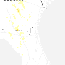
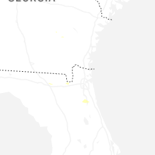
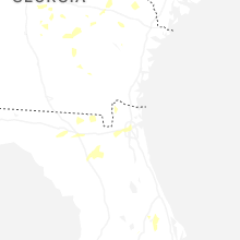
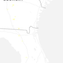
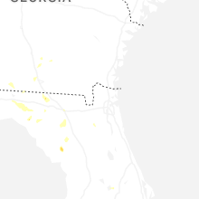


Connect with Interactive Hail Maps