

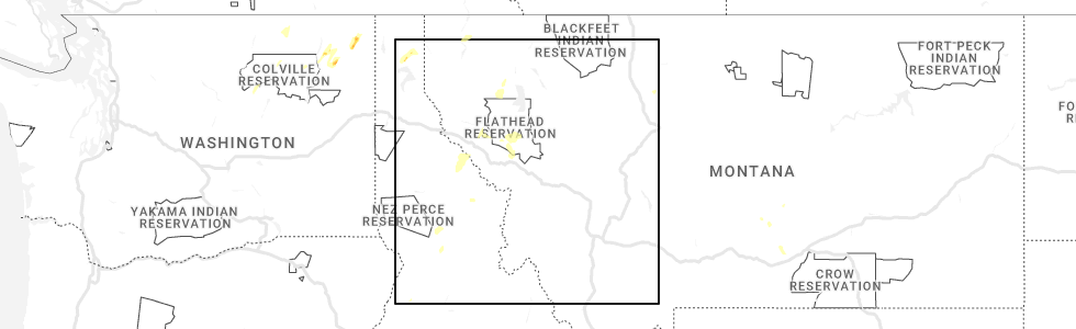
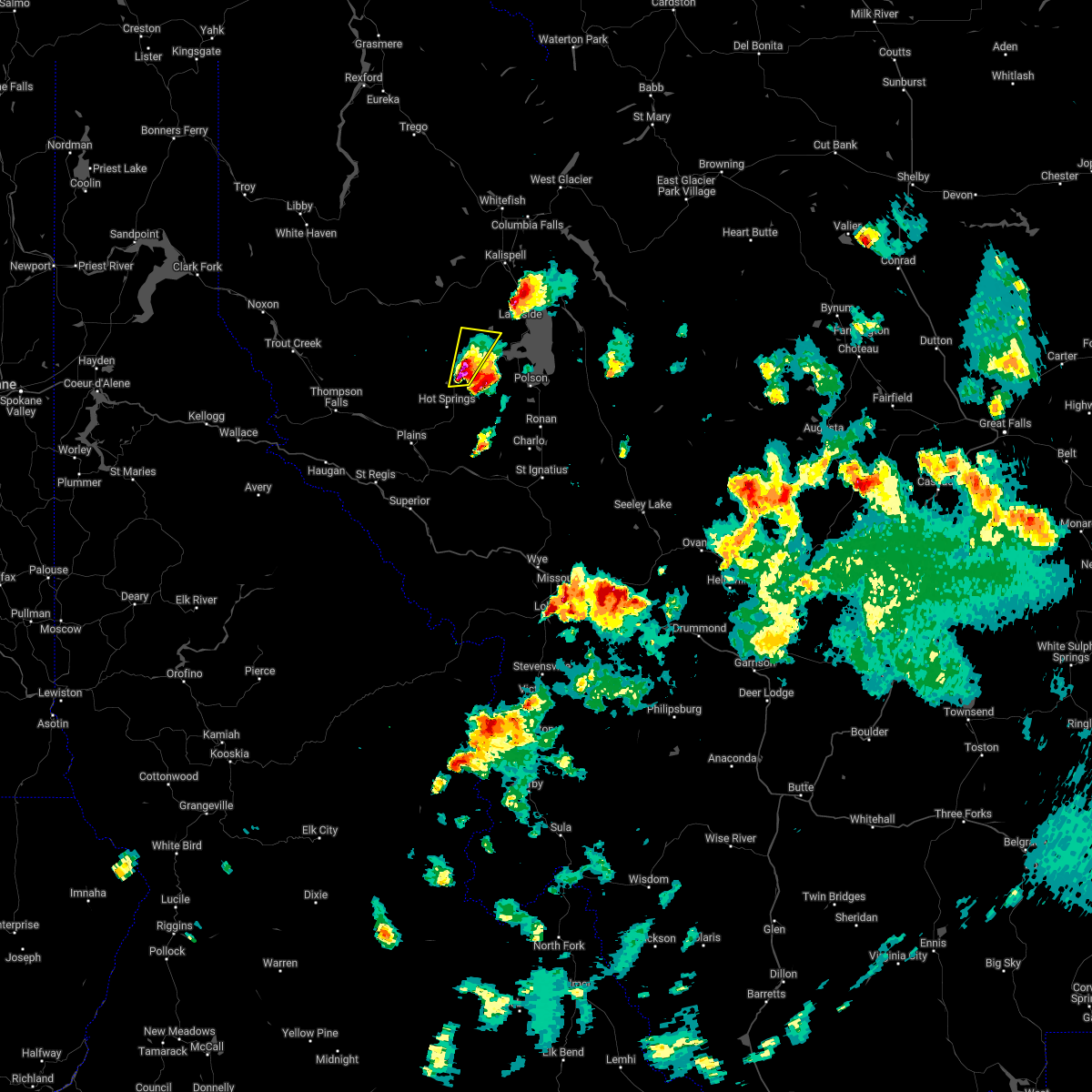
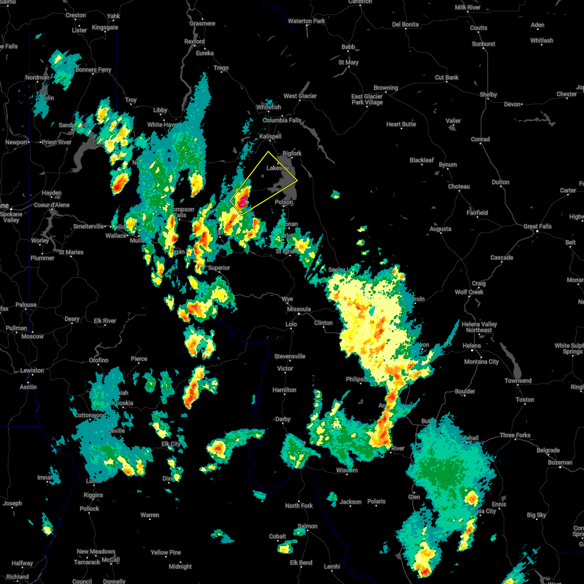
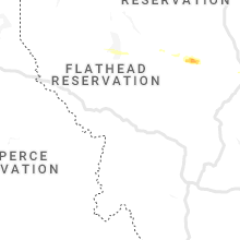
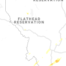
Hail Map for Lake Mary Ronan, MT
The Lake Mary Ronan, MT area has had 0 reports of on-the-ground hail by trained spotters, and has been under severe weather warnings 0 times during the past 12 months. Doppler radar has detected hail at or near Lake Mary Ronan, MT on 5 occasions, including 1 occasion during the past year.
| Name: | Lake Mary Ronan, MT |
| Where Located: | 33.3 miles S of Whitefish, MT |
| Map: | Google Map for Lake Mary Ronan, MT |
| Population: | 65 |
| Housing Units: | 168 |
| More Info: | Search Google for Lake Mary Ronan, MT |
0
The Top Recent Hail Date for Lake Mary Ronan, MT is Sunday, May 21, 2023 (3rd out of 5)
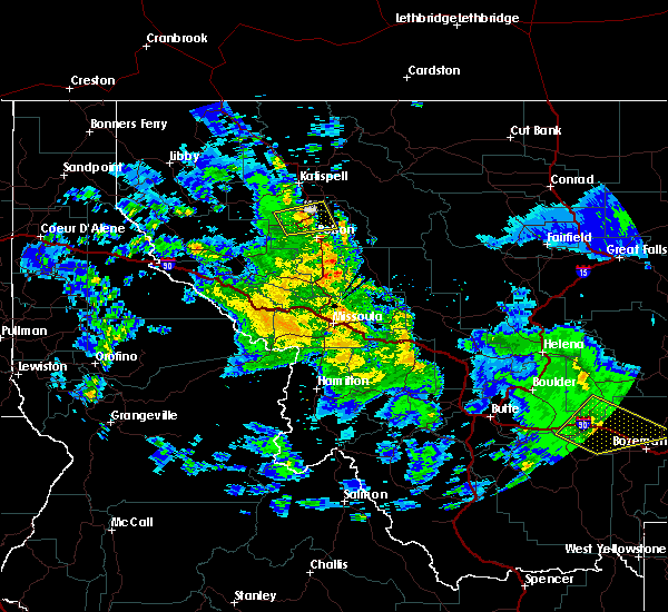
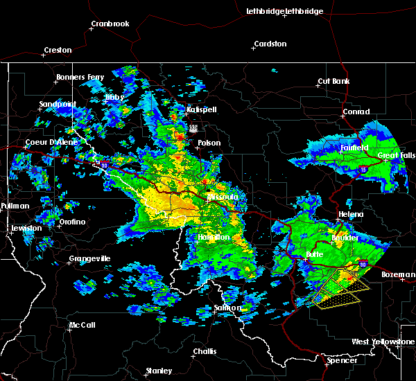
Hail and Wind Damage Spotted near Lake Mary Ronan, MT
| Date / Time | Report Details |
|---|---|
| 7/7/2022 9:39 PM MDT |
 At 939 pm mdt, a severe thunderstorm was located near big arm, or 13 miles northwest of polson, moving northeast at 25 mph (radar indicated). Hazards include golf ball size hail and 60 mph wind gusts. People and animals outdoors will be injured. expect hail damage to roofs, siding, windows, and vehicles. expect wind damage to roofs, siding, and trees. locations impacted include, elmo, rollins, proctor, dayton and lakeside. thunderstorm damage threat, considerable hail threat, radar indicated max hail size, 1. 75 in wind threat, radar indicated max wind gust, 60 mph. At 939 pm mdt, a severe thunderstorm was located near big arm, or 13 miles northwest of polson, moving northeast at 25 mph (radar indicated). Hazards include golf ball size hail and 60 mph wind gusts. People and animals outdoors will be injured. expect hail damage to roofs, siding, windows, and vehicles. expect wind damage to roofs, siding, and trees. locations impacted include, elmo, rollins, proctor, dayton and lakeside. thunderstorm damage threat, considerable hail threat, radar indicated max hail size, 1. 75 in wind threat, radar indicated max wind gust, 60 mph.
|
| 7/7/2022 9:29 PM MDT |
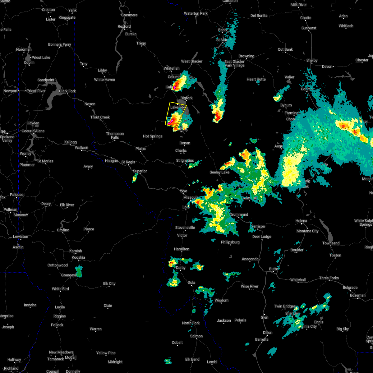 At 929 pm mdt, a severe thunderstorm was located near big arm, or 12 miles northwest of polson, moving northeast at 25 mph (radar indicated). Hazards include two inch hail and 60 mph wind gusts. People and animals outdoors will be injured. expect hail damage to roofs, siding, windows, and vehicles. expect wind damage to roofs, siding, and trees. locations impacted include, big arm, proctor, lakeside, lake mary ronan, elmo, rollins and dayton. thunderstorm damage threat, considerable hail threat, radar indicated max hail size, 2. 00 in wind threat, radar indicated max wind gust, 60 mph. At 929 pm mdt, a severe thunderstorm was located near big arm, or 12 miles northwest of polson, moving northeast at 25 mph (radar indicated). Hazards include two inch hail and 60 mph wind gusts. People and animals outdoors will be injured. expect hail damage to roofs, siding, windows, and vehicles. expect wind damage to roofs, siding, and trees. locations impacted include, big arm, proctor, lakeside, lake mary ronan, elmo, rollins and dayton. thunderstorm damage threat, considerable hail threat, radar indicated max hail size, 2. 00 in wind threat, radar indicated max wind gust, 60 mph.
|
| 7/7/2022 9:25 PM MDT |
 At 925 pm mdt, a severe thunderstorm was located near big arm, or 11 miles northwest of polson, moving northeast at 25 mph (radar indicated). Hazards include golf ball size hail and 60 mph wind gusts. People and animals outdoors will be injured. expect hail damage to roofs, siding, windows, and vehicles. Expect wind damage to roofs, siding, and trees. At 925 pm mdt, a severe thunderstorm was located near big arm, or 11 miles northwest of polson, moving northeast at 25 mph (radar indicated). Hazards include golf ball size hail and 60 mph wind gusts. People and animals outdoors will be injured. expect hail damage to roofs, siding, windows, and vehicles. Expect wind damage to roofs, siding, and trees.
|
| 7/7/2022 8:42 PM MDT |
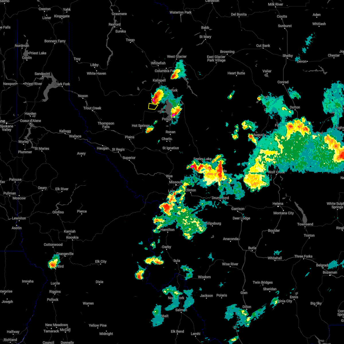 The severe thunderstorm warning for northwestern lake and south central flathead counties will expire at 845 pm mdt, the storm which prompted the warning has moved out of the area. therefore, the warning will be allowed to expire. The severe thunderstorm warning for northwestern lake and south central flathead counties will expire at 845 pm mdt, the storm which prompted the warning has moved out of the area. therefore, the warning will be allowed to expire.
|
| 7/7/2022 8:33 PM MDT |
 At 833 pm mdt, a severe thunderstorm was located 11 miles northwest of big arm, or 19 miles northwest of polson, moving northeast at 20 mph (radar indicated). Hazards include ping pong ball size hail and 60 mph wind gusts. People and animals outdoors will be injured. expect hail damage to roofs, siding, windows, and vehicles. expect wind damage to roofs, siding, and trees. locations impacted include, niarada. hail threat, radar indicated max hail size, 1. 50 in wind threat, radar indicated max wind gust, 60 mph. At 833 pm mdt, a severe thunderstorm was located 11 miles northwest of big arm, or 19 miles northwest of polson, moving northeast at 20 mph (radar indicated). Hazards include ping pong ball size hail and 60 mph wind gusts. People and animals outdoors will be injured. expect hail damage to roofs, siding, windows, and vehicles. expect wind damage to roofs, siding, and trees. locations impacted include, niarada. hail threat, radar indicated max hail size, 1. 50 in wind threat, radar indicated max wind gust, 60 mph.
|
| 7/7/2022 8:18 PM MDT |
 At 818 pm mdt, a severe thunderstorm was located 10 miles west of big arm, or 18 miles northwest of polson, moving northeast at 20 mph (radar indicated). Hazards include 60 mph wind gusts and half dollar size hail. Hail damage to vehicles is expected. expect wind damage to roofs, siding, and trees. locations impacted include, niarada. hail threat, radar indicated max hail size, 1. 25 in wind threat, radar indicated max wind gust, 60 mph. At 818 pm mdt, a severe thunderstorm was located 10 miles west of big arm, or 18 miles northwest of polson, moving northeast at 20 mph (radar indicated). Hazards include 60 mph wind gusts and half dollar size hail. Hail damage to vehicles is expected. expect wind damage to roofs, siding, and trees. locations impacted include, niarada. hail threat, radar indicated max hail size, 1. 25 in wind threat, radar indicated max wind gust, 60 mph.
|
| 7/7/2022 8:13 PM MDT |
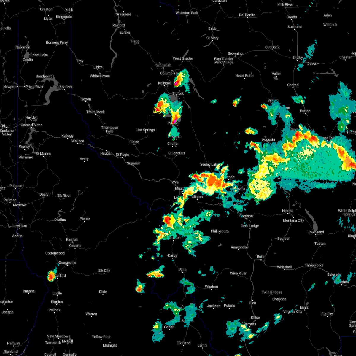
 At 813 pm mdt, a severe thunderstorm was located 11 miles west of big arm, or 18 miles northwest of polson, moving northeast at 20 mph (radar indicated). Hazards include ping pong ball size hail and 60 mph wind gusts. People and animals outdoors will be injured. expect hail damage to roofs, siding, windows, and vehicles. expect wind damage to roofs, siding, and trees. locations impacted include, niarada. hail threat, radar indicated max hail size, 1. 50 in wind threat, radar indicated max wind gust, 60 mph. At 813 pm mdt, a severe thunderstorm was located 11 miles west of big arm, or 18 miles northwest of polson, moving northeast at 20 mph (radar indicated). Hazards include ping pong ball size hail and 60 mph wind gusts. People and animals outdoors will be injured. expect hail damage to roofs, siding, windows, and vehicles. expect wind damage to roofs, siding, and trees. locations impacted include, niarada. hail threat, radar indicated max hail size, 1. 50 in wind threat, radar indicated max wind gust, 60 mph.
|
| 7/7/2022 7:58 PM MDT |
 At 758 pm mdt, a severe thunderstorm was located 13 miles west of big arm, or 19 miles west of polson, moving northeast at 20 mph (radar indicated). Hazards include two inch hail and 70 mph wind gusts. People and animals outdoors will be injured. expect hail damage to roofs, siding, windows, and vehicles. expect considerable tree damage. wind damage is also likely to mobile homes, roofs, and outbuildings. locations impacted include, niarada and lonepine. thunderstorm damage threat, considerable hail threat, radar indicated max hail size, 2. 00 in wind threat, radar indicated max wind gust, 70 mph. At 758 pm mdt, a severe thunderstorm was located 13 miles west of big arm, or 19 miles west of polson, moving northeast at 20 mph (radar indicated). Hazards include two inch hail and 70 mph wind gusts. People and animals outdoors will be injured. expect hail damage to roofs, siding, windows, and vehicles. expect considerable tree damage. wind damage is also likely to mobile homes, roofs, and outbuildings. locations impacted include, niarada and lonepine. thunderstorm damage threat, considerable hail threat, radar indicated max hail size, 2. 00 in wind threat, radar indicated max wind gust, 70 mph.
|
| 7/7/2022 7:56 PM MDT |
 At 756 pm mdt, a severe thunderstorm was located 14 miles west of big arm, or 19 miles west of polson, moving northeast at 20 mph (radar indicated). Hazards include golf ball size hail and 60 mph wind gusts. People and animals outdoors will be injured. expect hail damage to roofs, siding, windows, and vehicles. Expect wind damage to roofs, siding, and trees. At 756 pm mdt, a severe thunderstorm was located 14 miles west of big arm, or 19 miles west of polson, moving northeast at 20 mph (radar indicated). Hazards include golf ball size hail and 60 mph wind gusts. People and animals outdoors will be injured. expect hail damage to roofs, siding, windows, and vehicles. Expect wind damage to roofs, siding, and trees.
|
| 7/3/2022 5:11 PM MDT |
 At 509 pm mdt, a severe thunderstorm was located 12 miles west of big arm, or 18 miles west of polson, moving northeast at 20 mph (radar indicated). Hazards include 60 mph wind gusts and quarter size hail. Hail damage to vehicles is expected. Expect wind damage to roofs, siding, and trees. At 509 pm mdt, a severe thunderstorm was located 12 miles west of big arm, or 18 miles west of polson, moving northeast at 20 mph (radar indicated). Hazards include 60 mph wind gusts and quarter size hail. Hail damage to vehicles is expected. Expect wind damage to roofs, siding, and trees.
|
| 8/11/2019 3:39 PM MDT |
 The severe thunderstorm warning for northwestern lake and southwestern flathead counties will expire at 345 pm mdt, the storm which prompted the warning has weakened below severe limits. therefore, the warning will be allowed to expire. however gusty winds and lightning are still possible with this thunderstorm. The severe thunderstorm warning for northwestern lake and southwestern flathead counties will expire at 345 pm mdt, the storm which prompted the warning has weakened below severe limits. therefore, the warning will be allowed to expire. however gusty winds and lightning are still possible with this thunderstorm.
|
| 8/11/2019 3:09 PM MDT |
 At 309 pm mdt, a severe thunderstorm was located near big arm, or 14 miles northwest of polson, moving east at 20 mph (radar indicated). Hazards include 60 mph wind gusts and quarter size hail. Hail damage to vehicles is expected. Expect wind damage to roofs, siding, and trees. At 309 pm mdt, a severe thunderstorm was located near big arm, or 14 miles northwest of polson, moving east at 20 mph (radar indicated). Hazards include 60 mph wind gusts and quarter size hail. Hail damage to vehicles is expected. Expect wind damage to roofs, siding, and trees.
|
Hail Maps for Lake Mary Ronan, MT


Connect with Interactive Hail Maps