

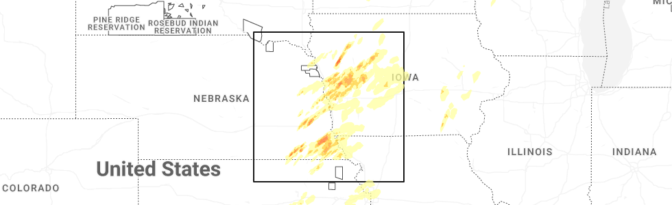
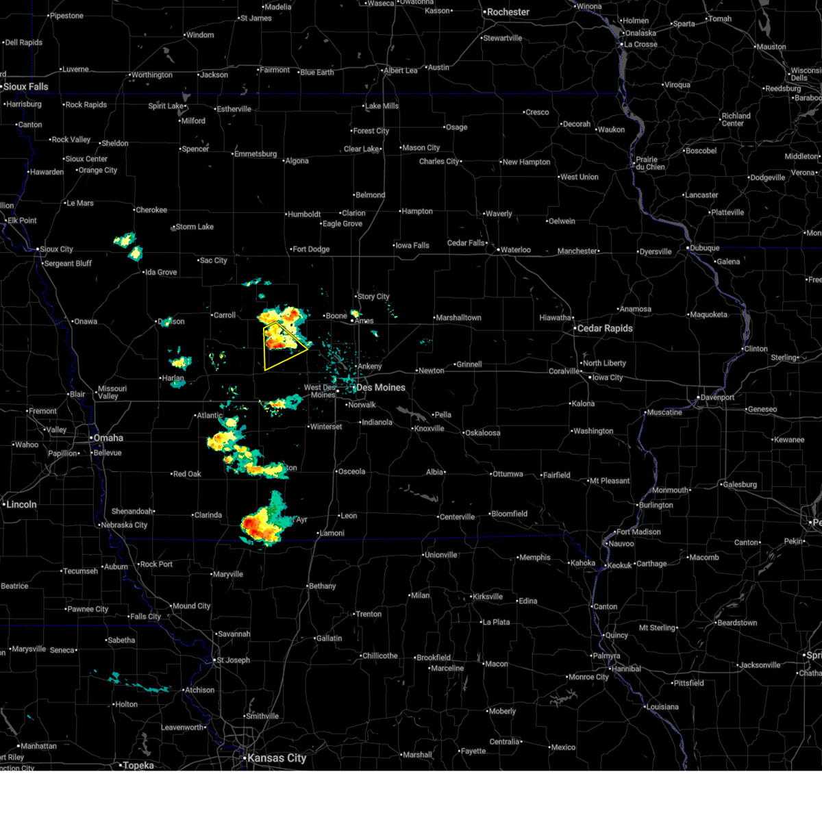
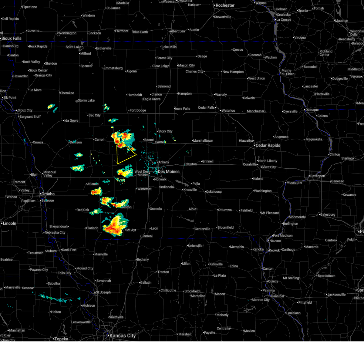
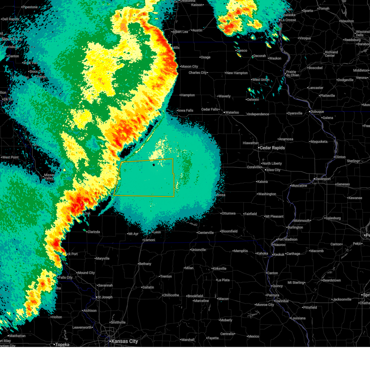
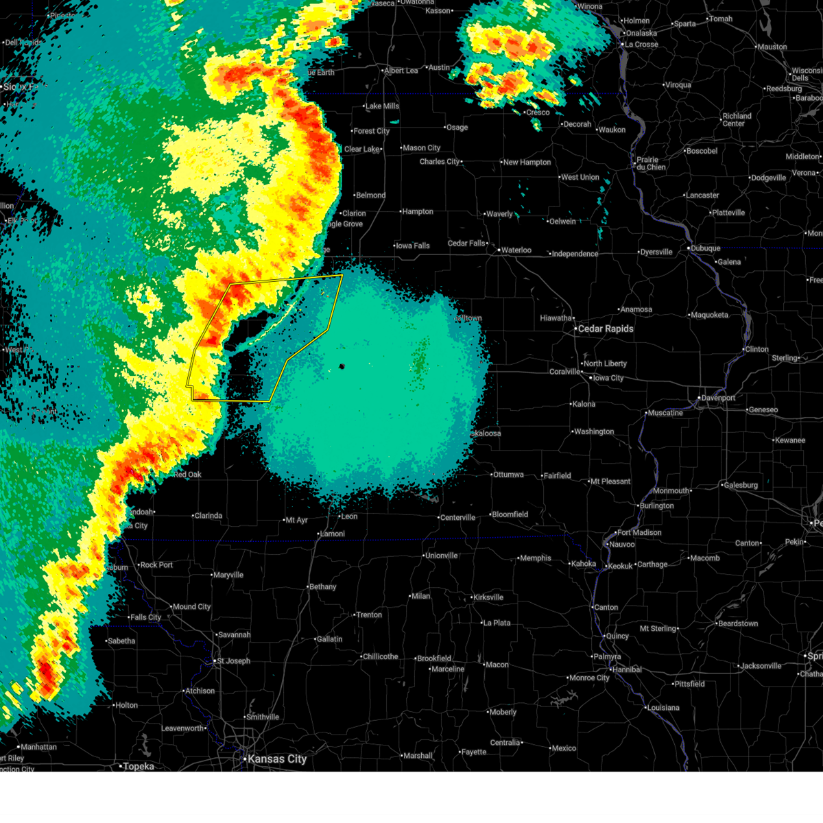
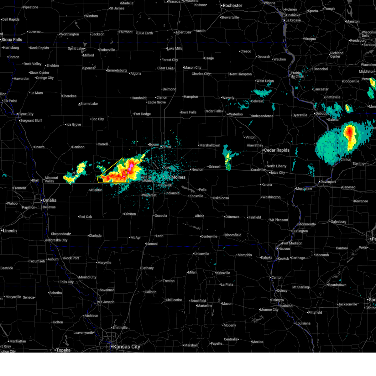
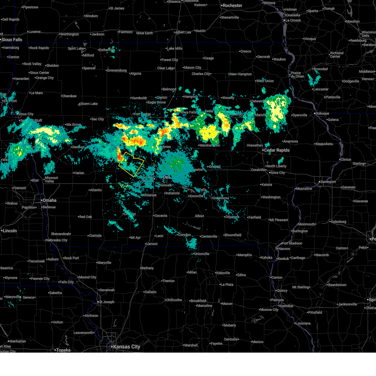
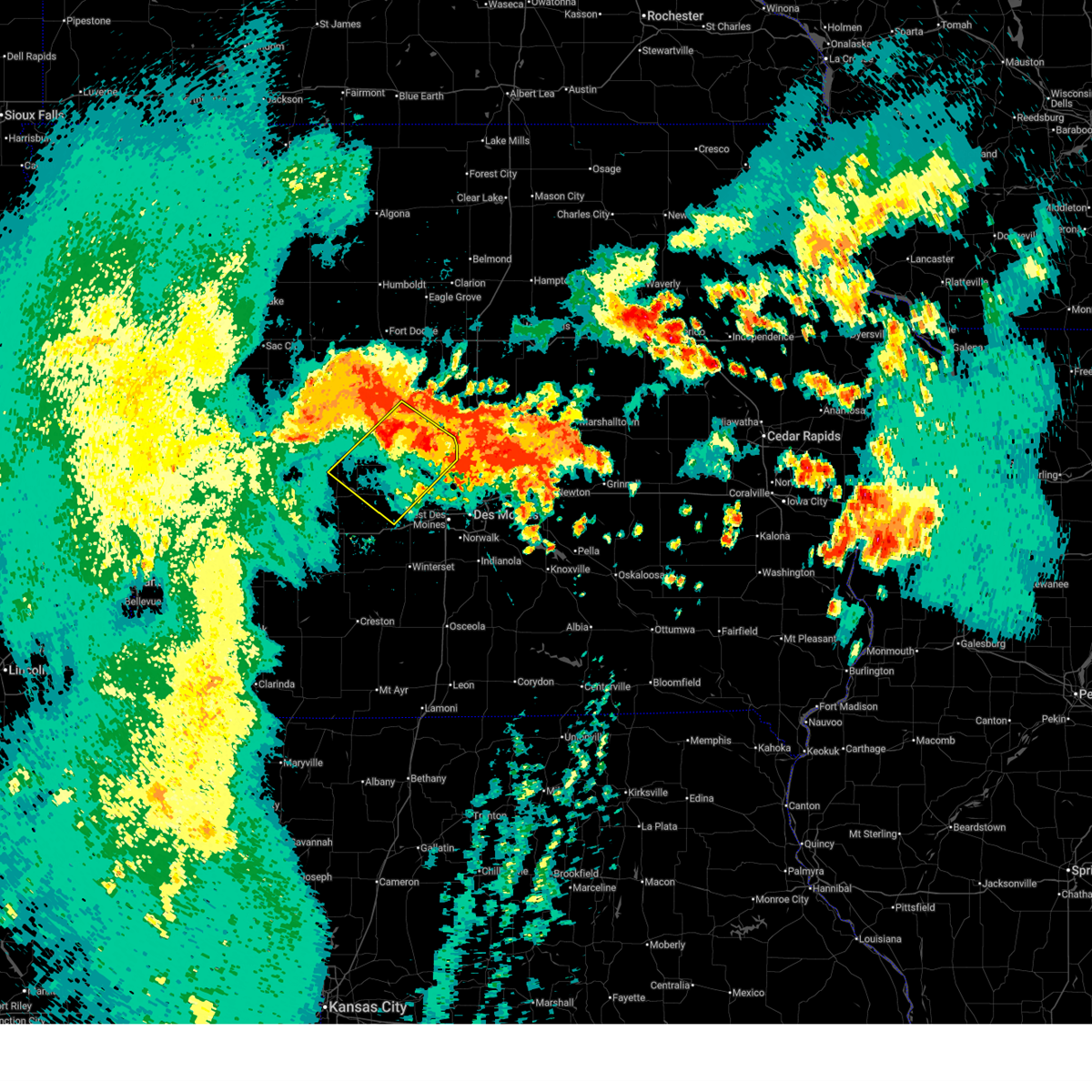
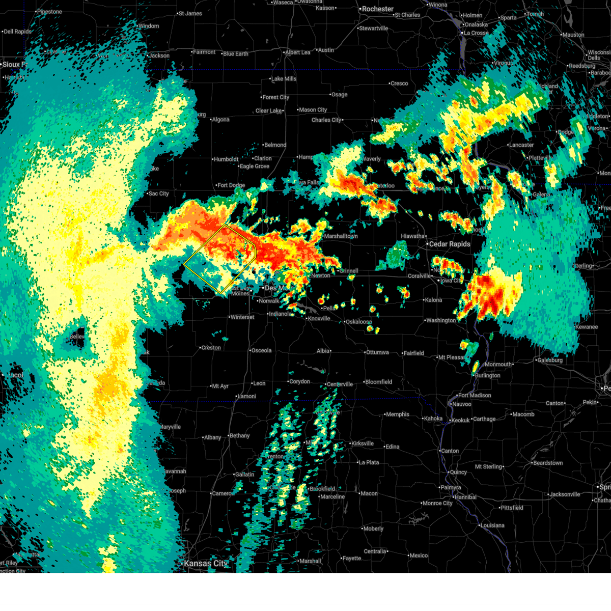
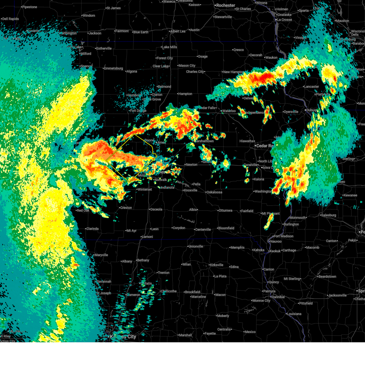
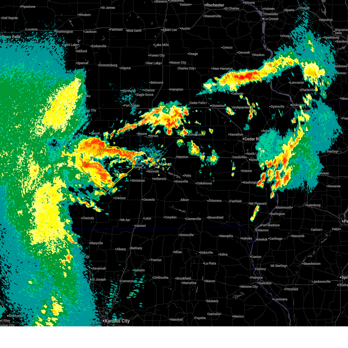
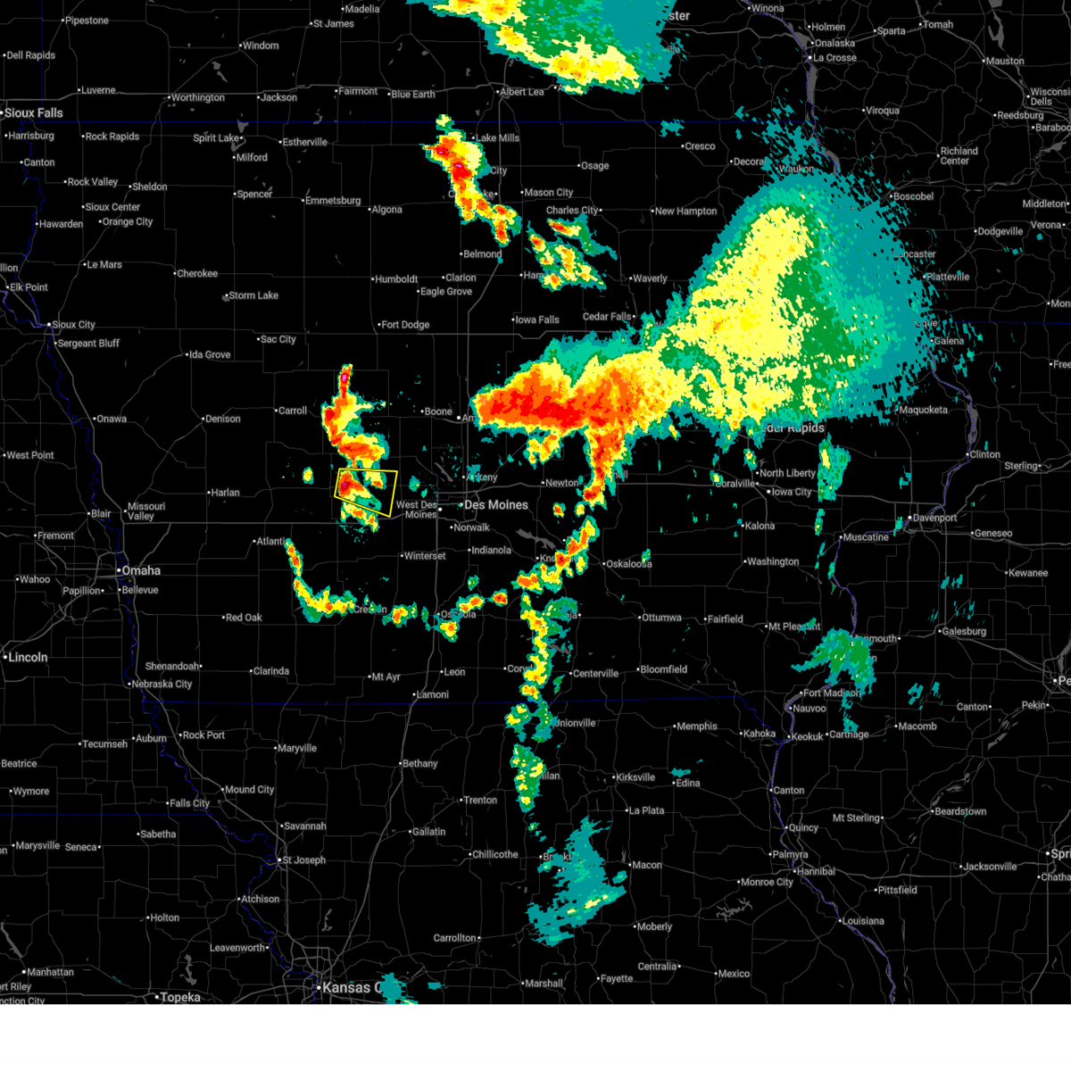
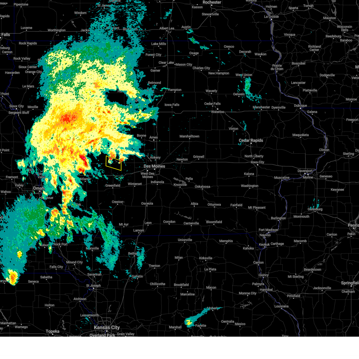
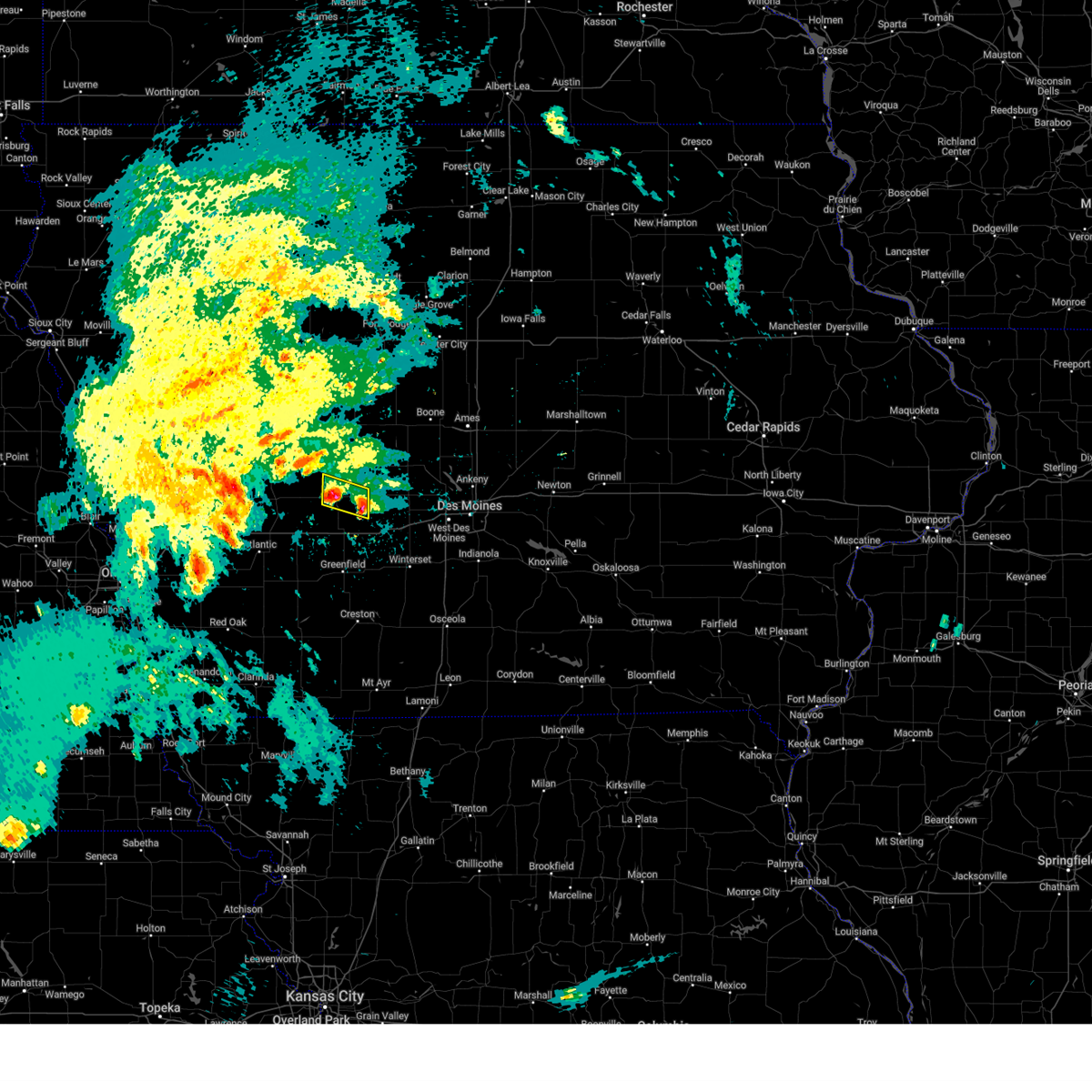
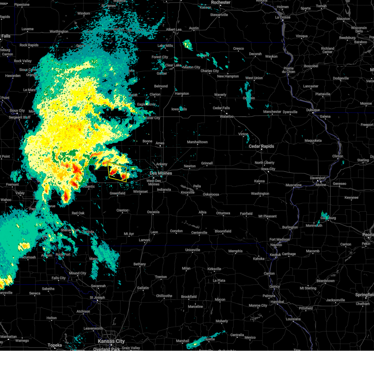
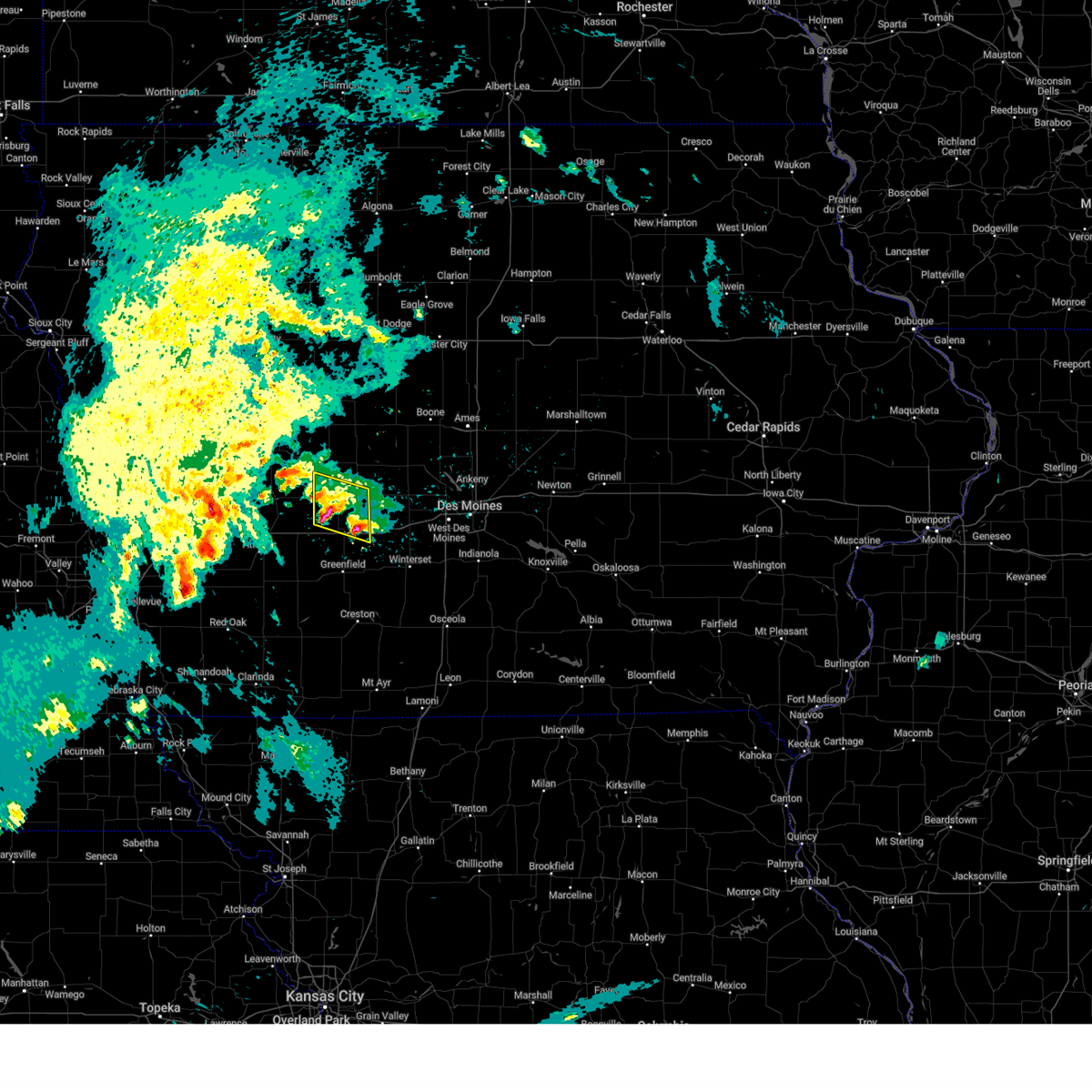
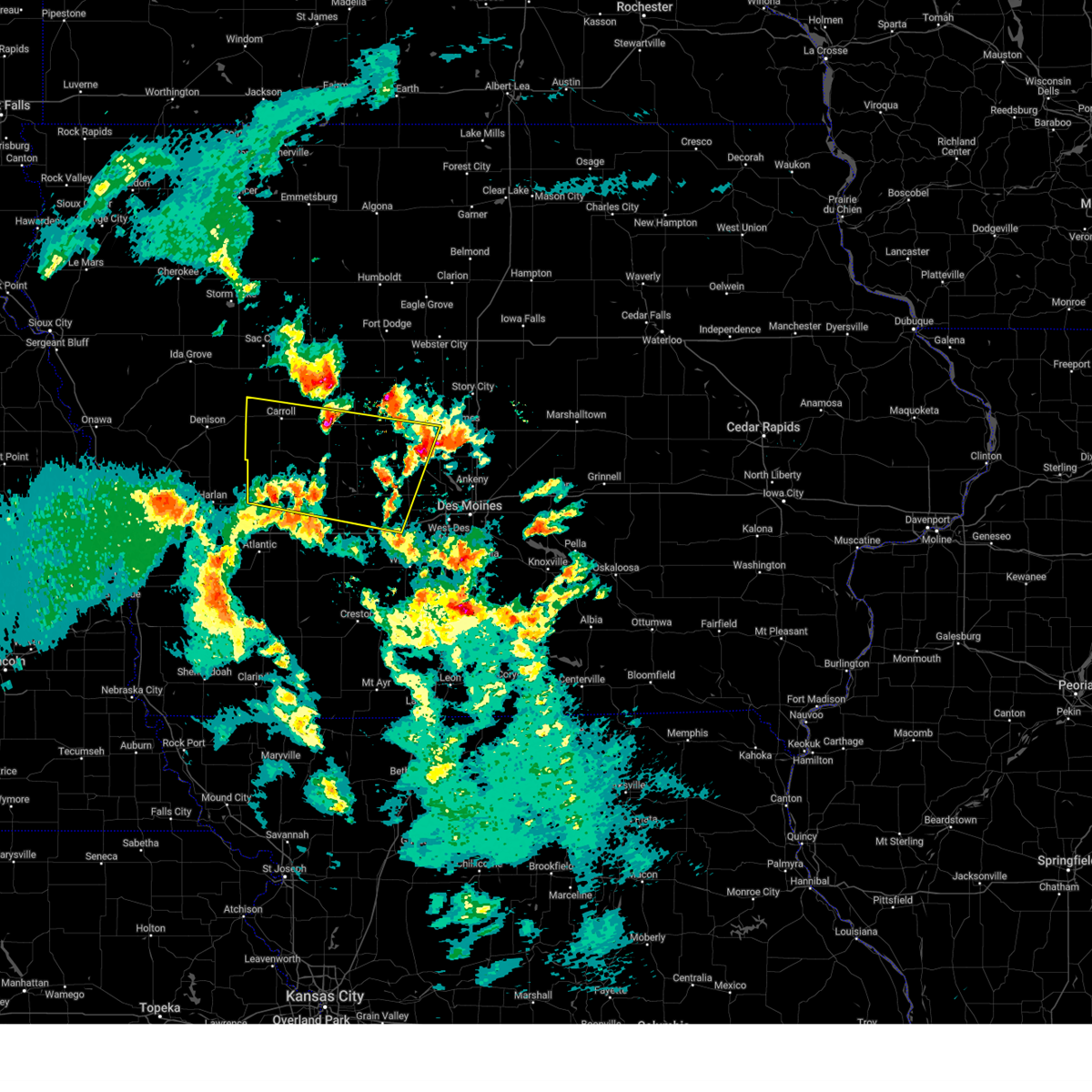
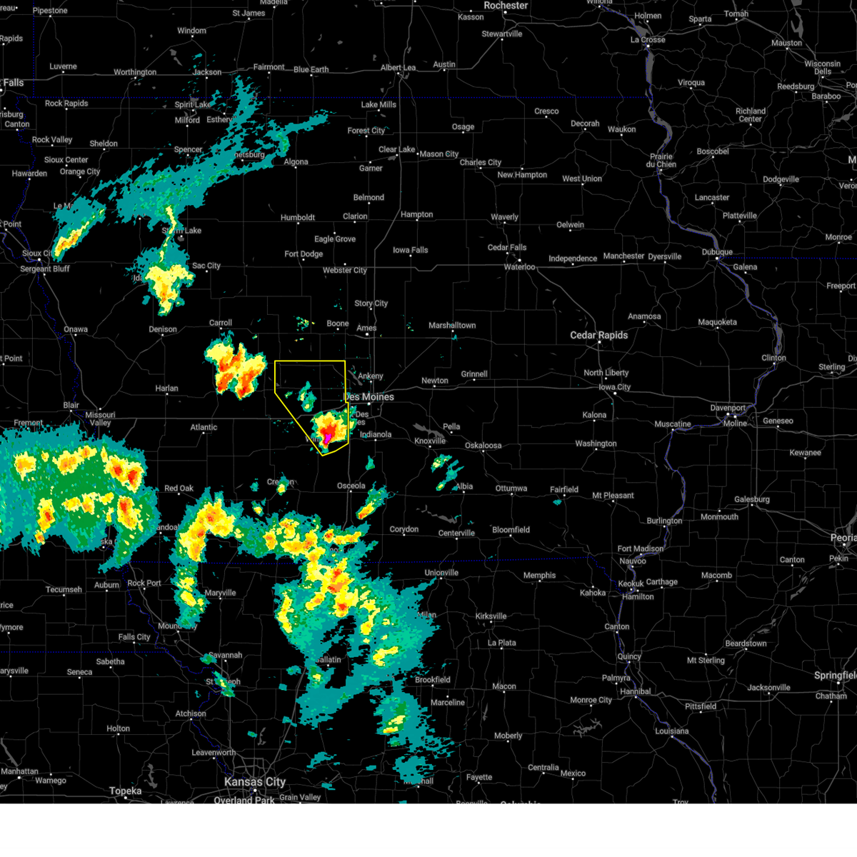
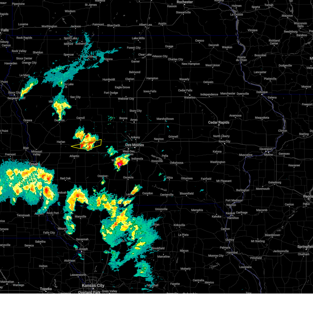
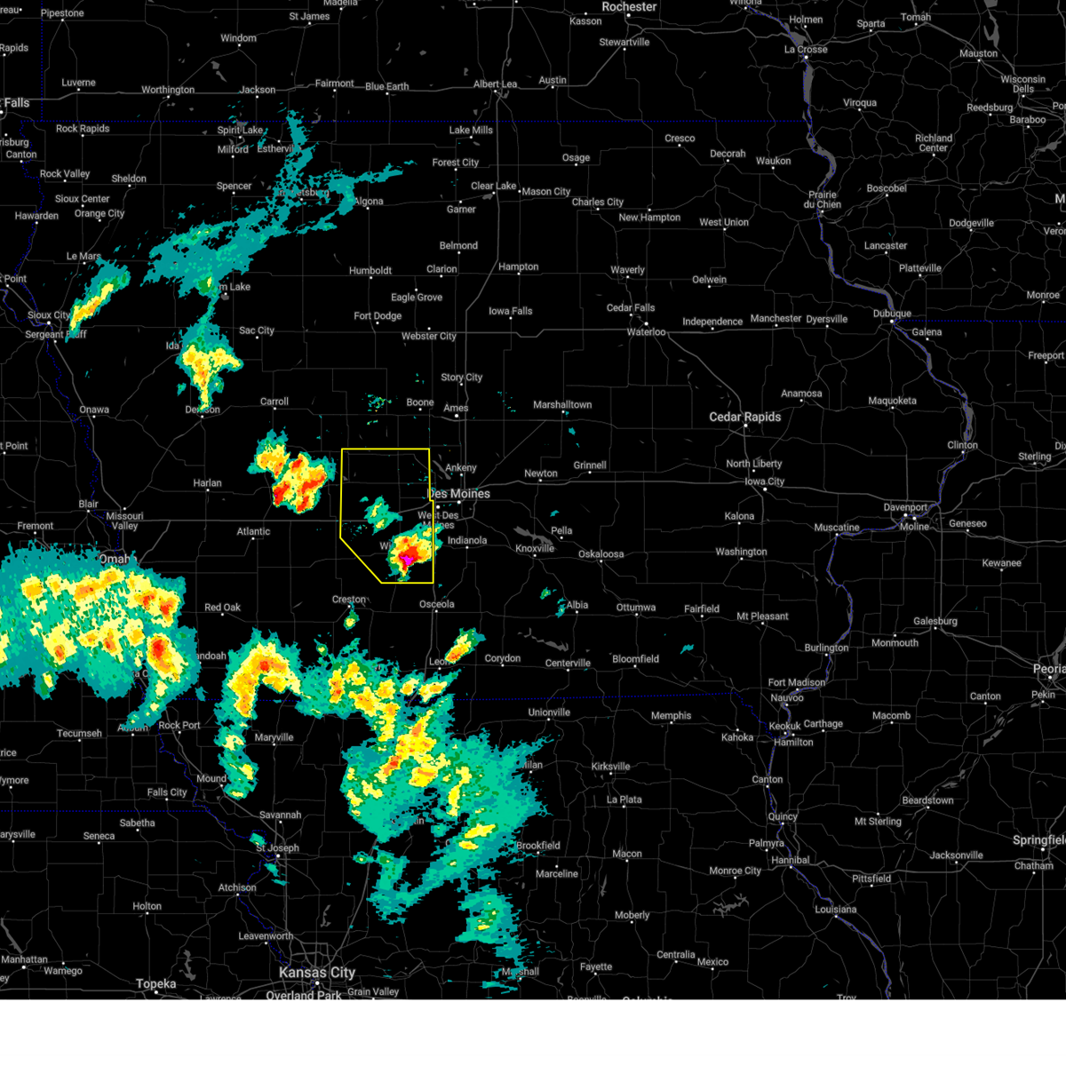
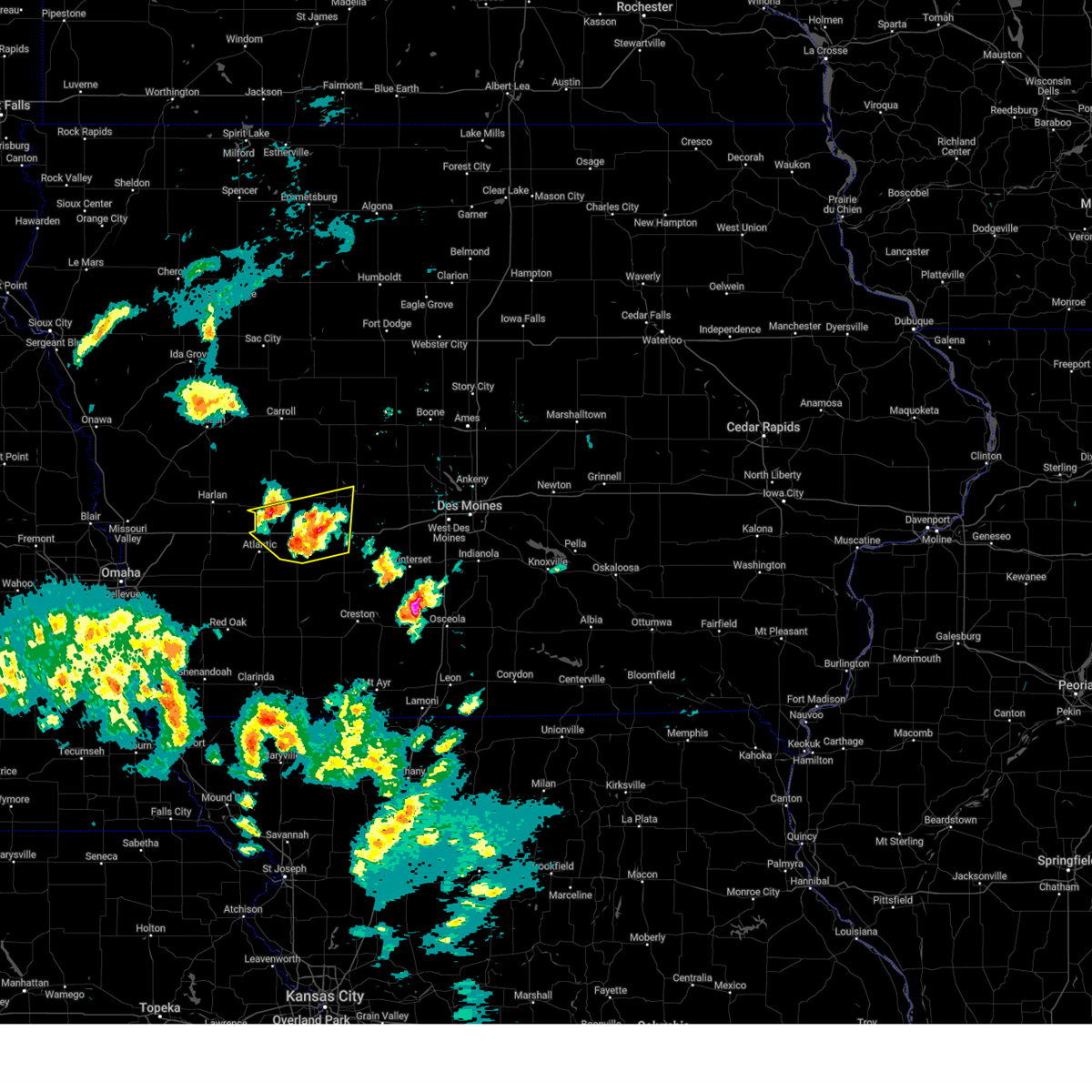
Hail Map for Lake Panorama, IA
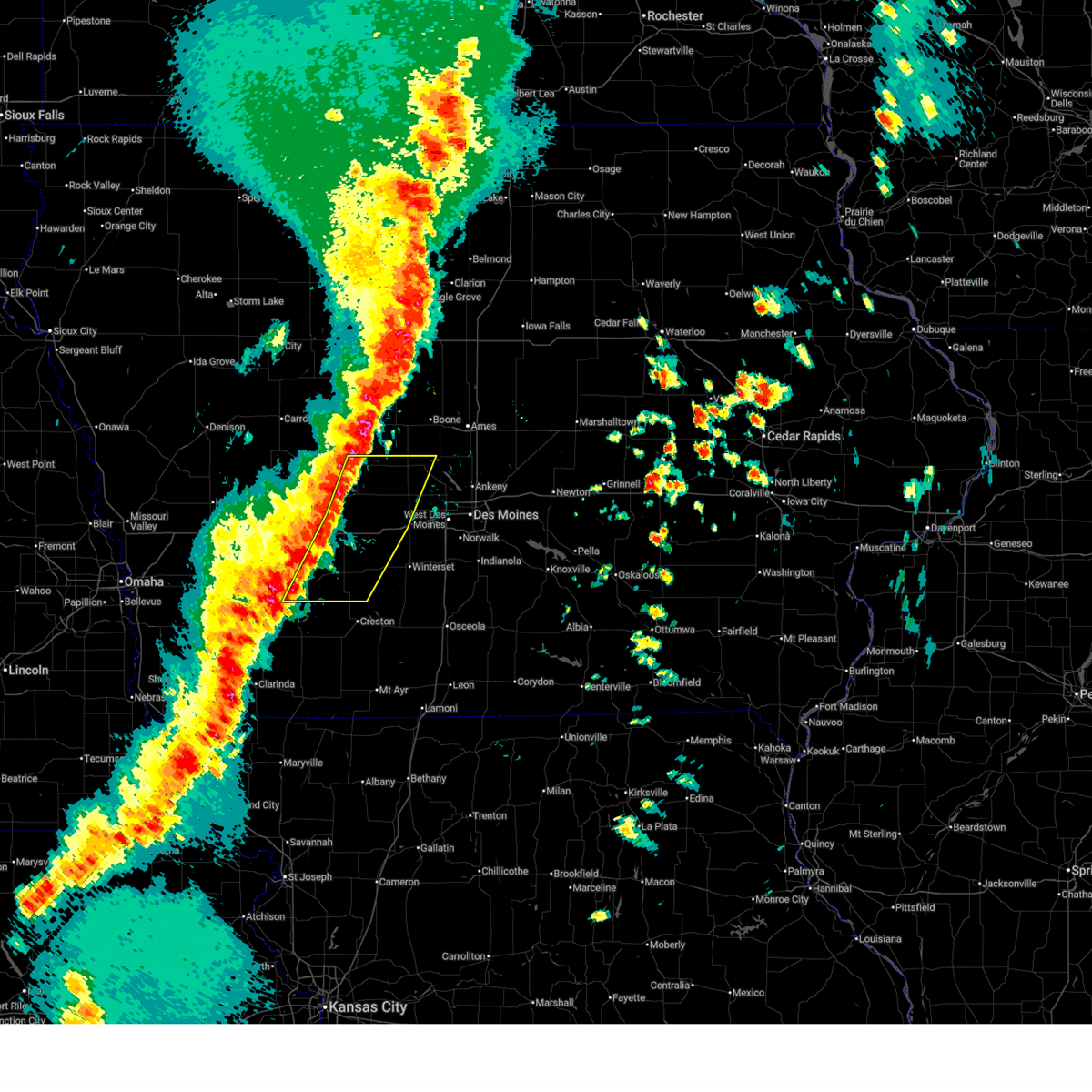
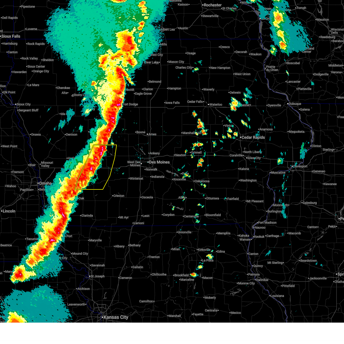
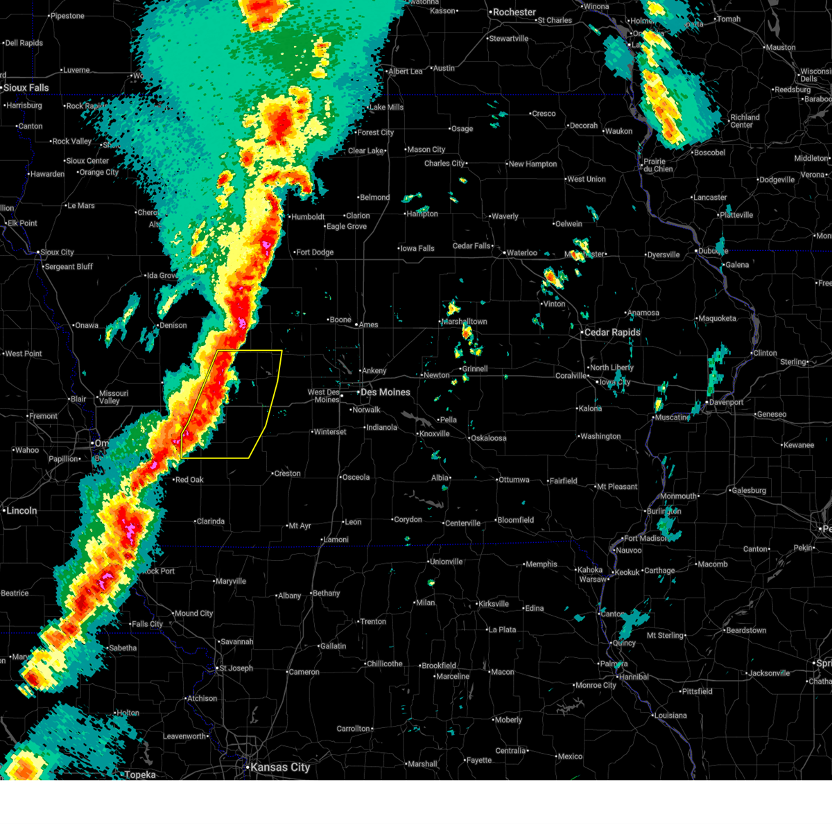
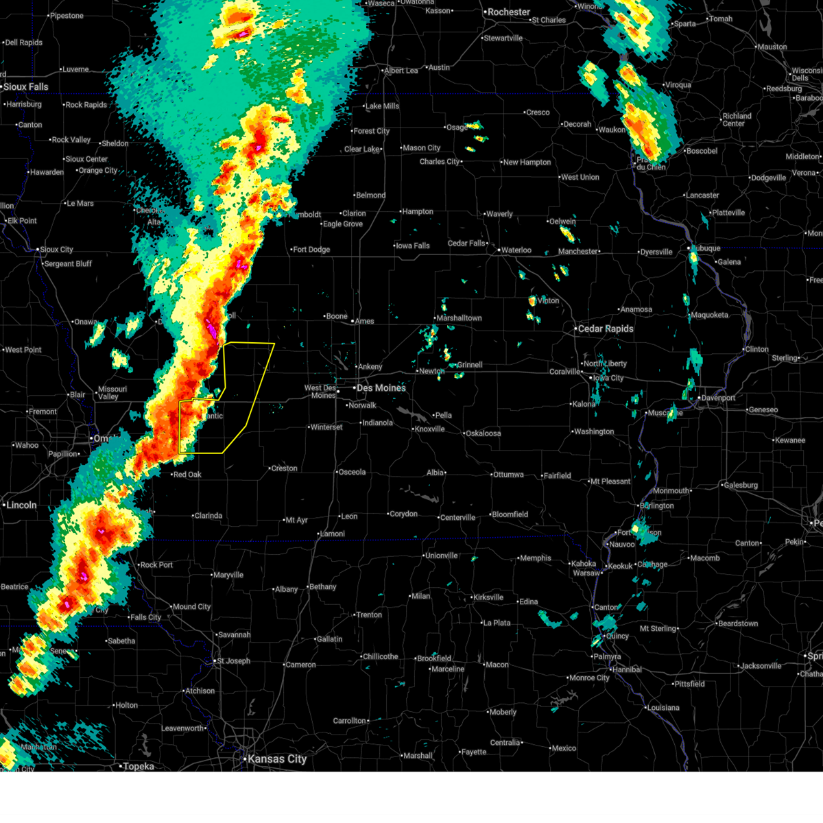
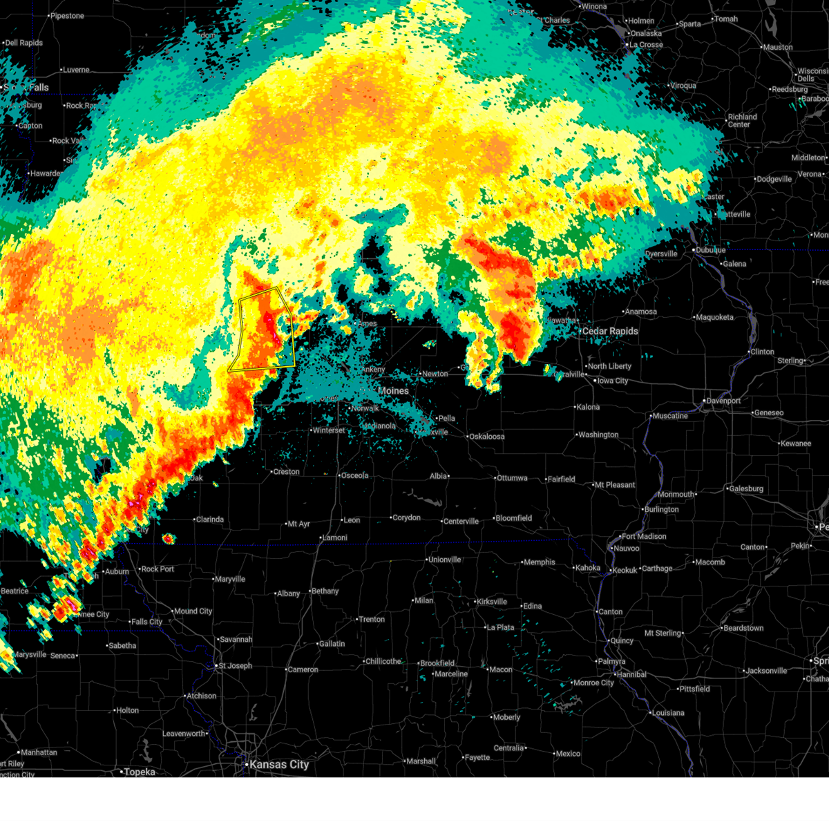
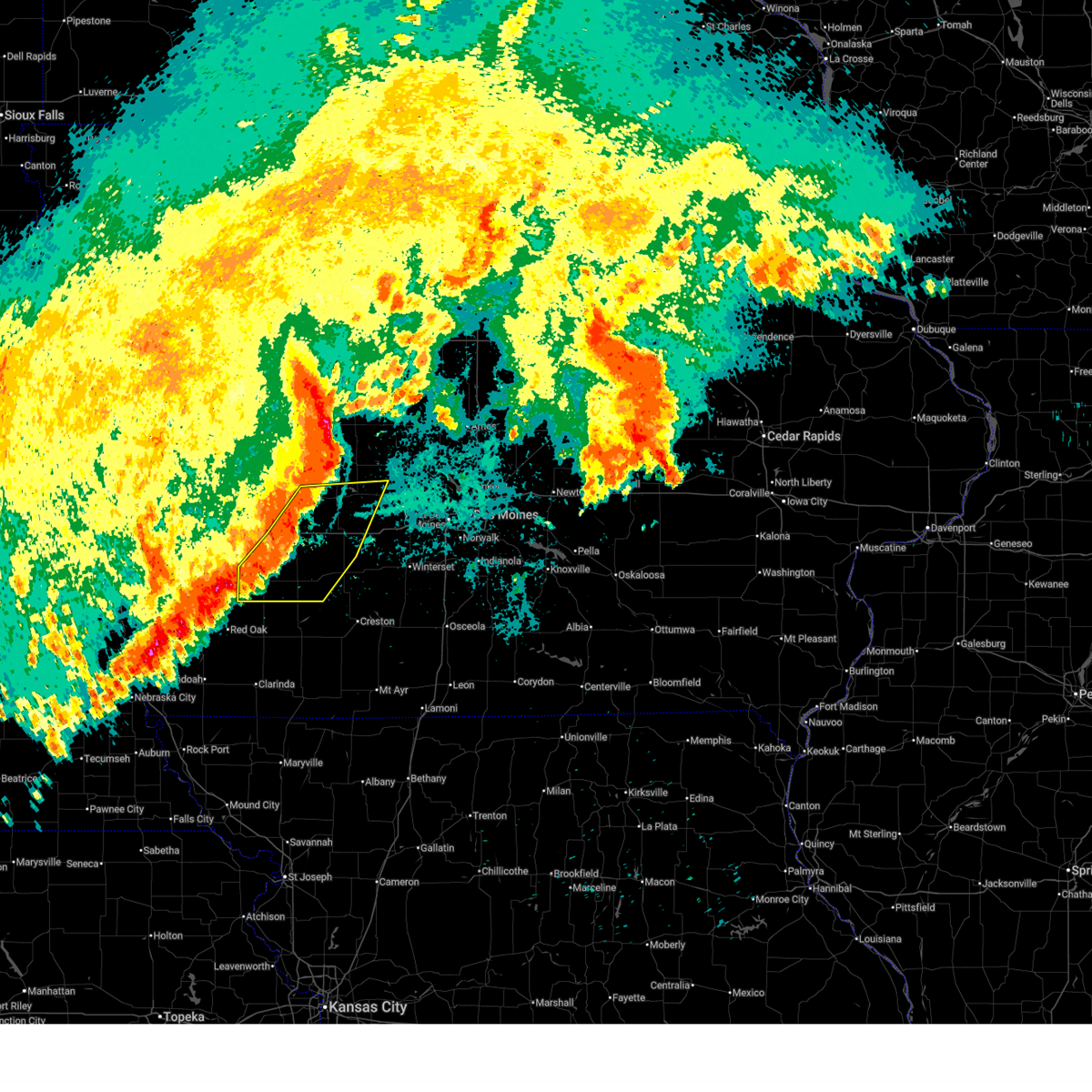
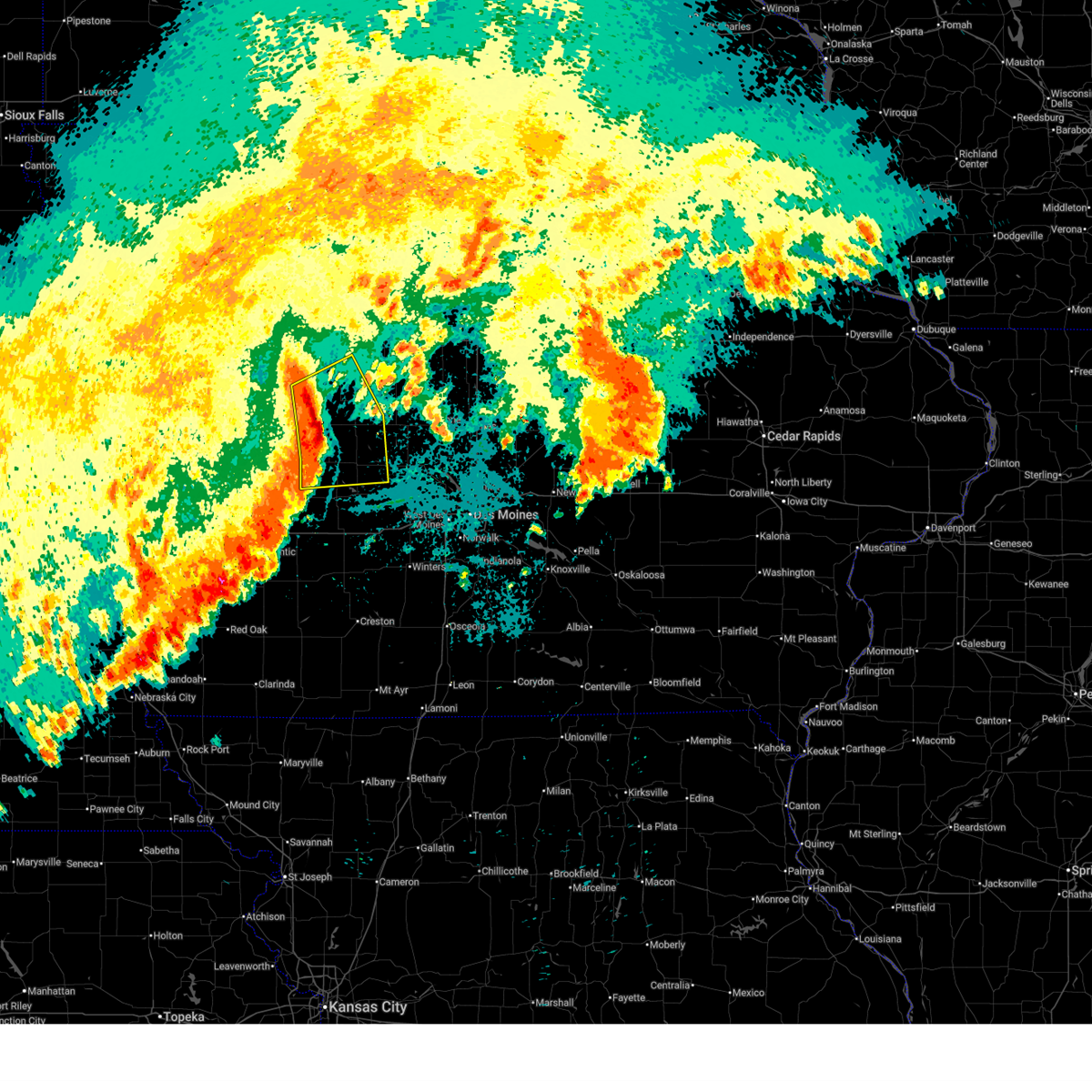
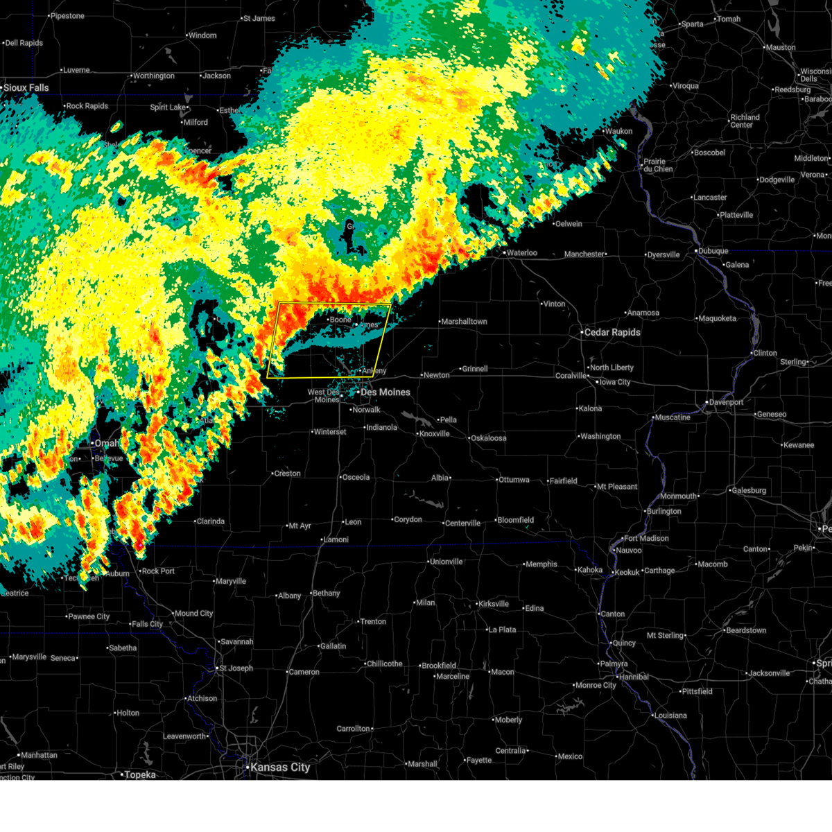
The Lake Panorama, IA area has had 0 reports of on-the-ground hail by trained spotters, and has been under severe weather warnings 48 times during the past 12 months. Doppler radar has detected hail at or near Lake Panorama, IA on 93 occasions, including 10 occasions during the past year.
| Name: | Lake Panorama, IA |
| Where Located: | 41.9 miles WNW of Des Moines, IA |
| Map: | Google Map for Lake Panorama, IA |
| Population: | 1309 |
| Housing Units: | 1109 |
| More Info: | Search Google for Lake Panorama, IA |
1
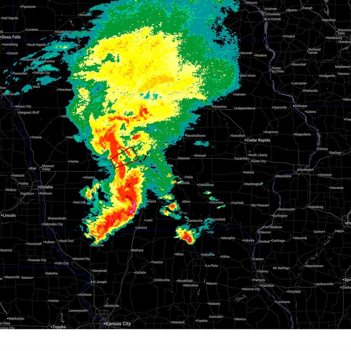
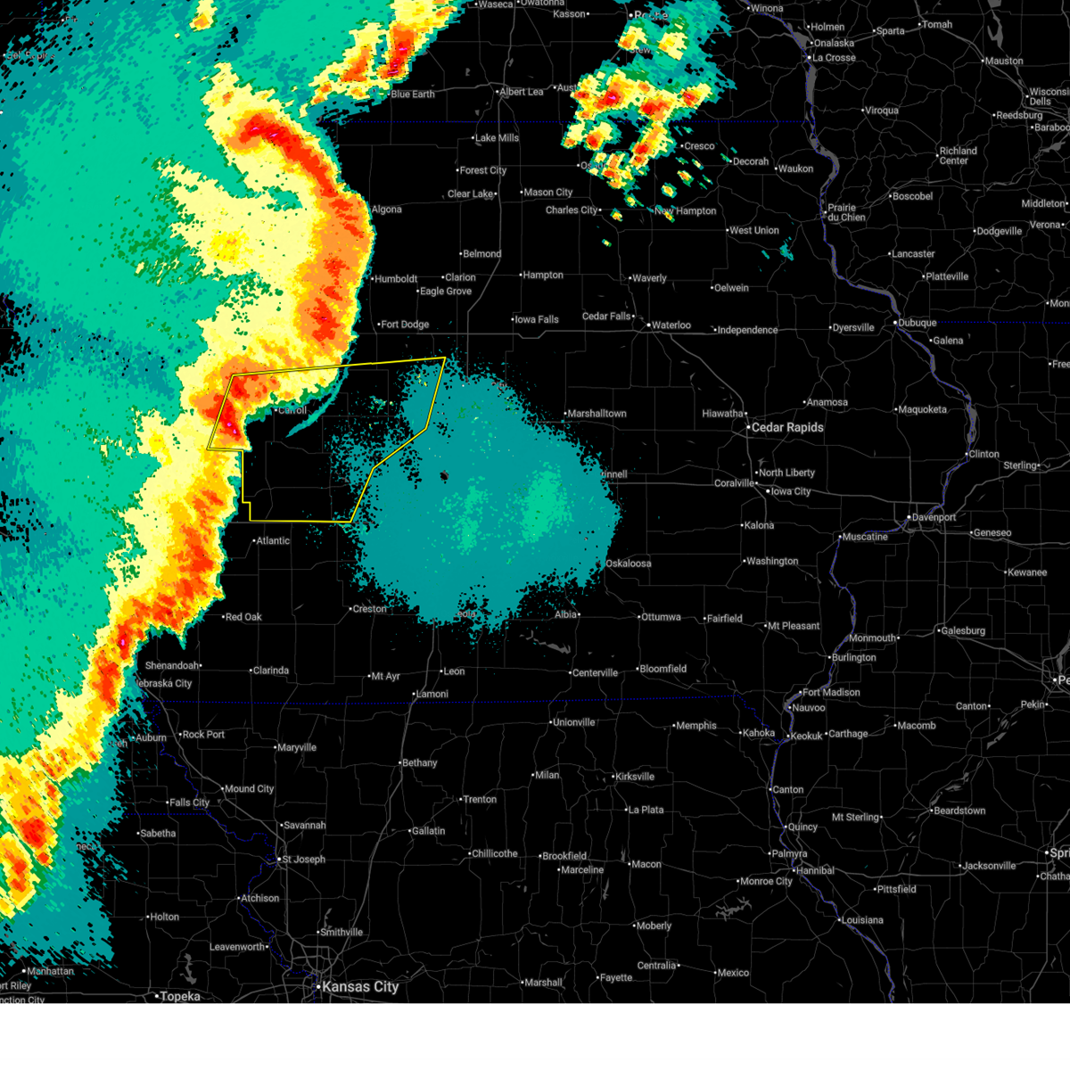
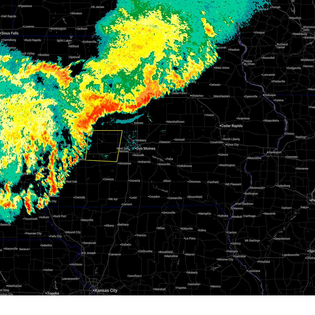
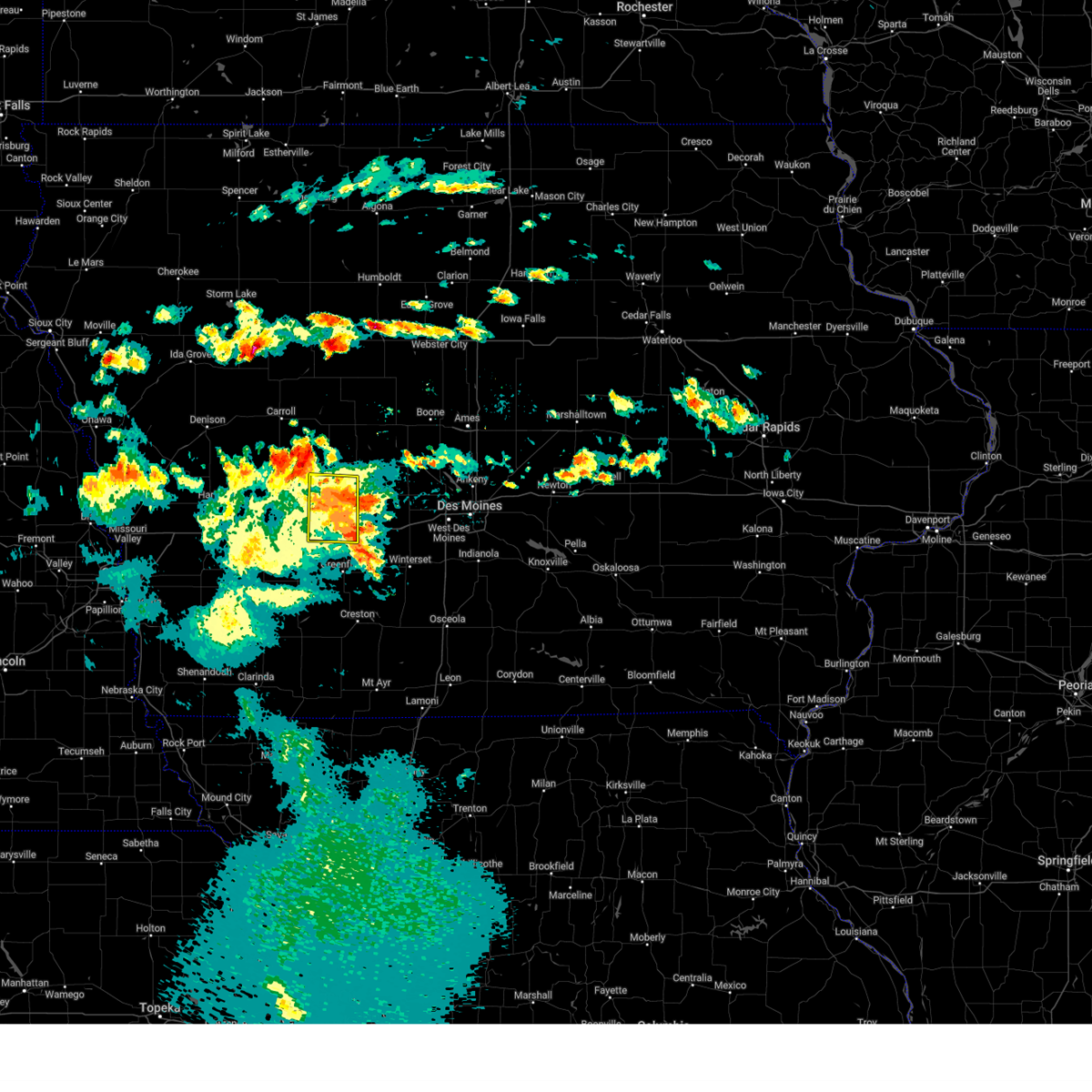
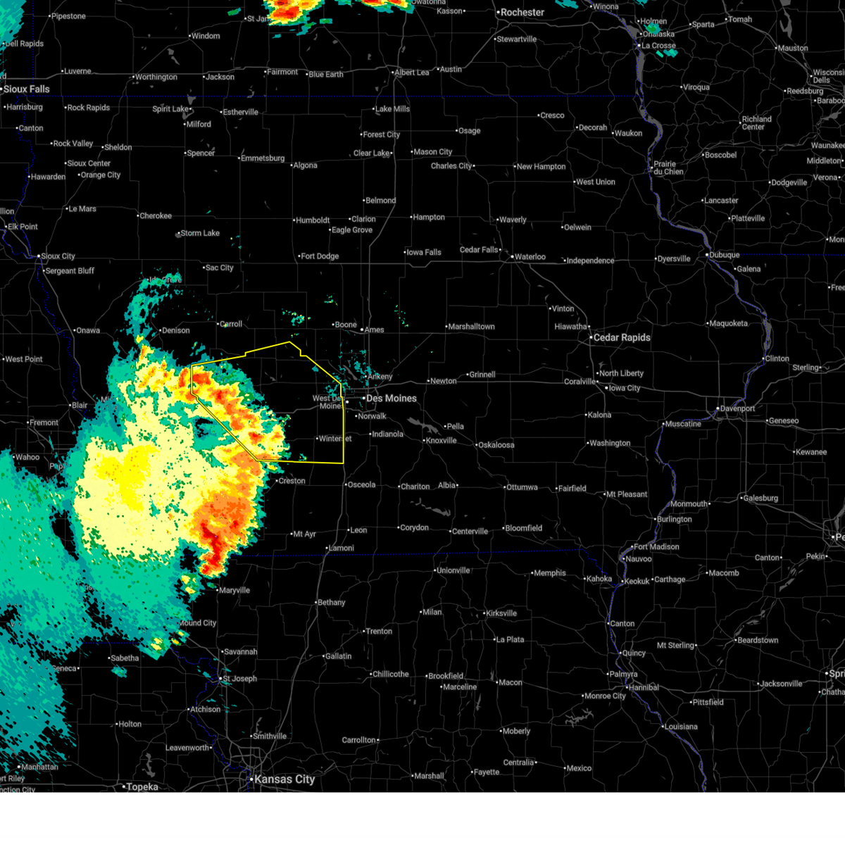
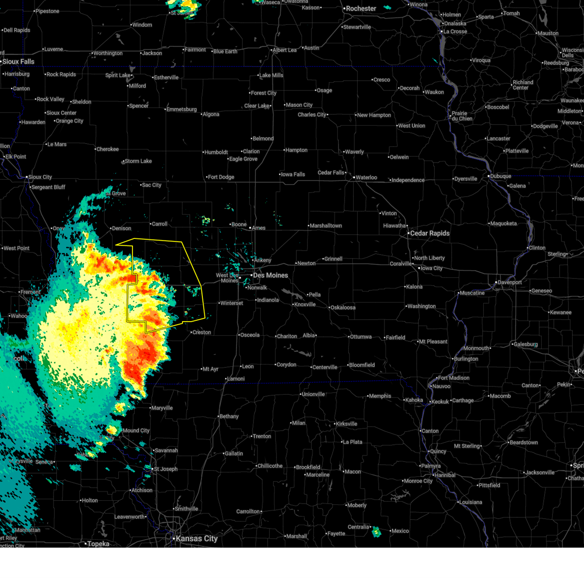
The Top Recent Hail Date for Lake Panorama, IA is Thursday, April 23, 2026 (13th out of 93)
Hail and Wind Damage Spotted near Lake Panorama, IA
| Date / Time | Report Details |
|---|---|
| 6/11/2026 7:03 AM CDT |
 Tordmx the national weather service in des moines has issued a * tornado warning for, southeastern guthrie county in west central iowa, northern dallas county in central iowa, * until 730 am cdt. * at 702 am cdt, a severe thunderstorm capable of producing a tornado was located over linden, or 9 miles east of guthrie center, moving northeast at 50 mph (radar indicated rotation). Hazards include tornado. Flying debris will be dangerous to those caught without shelter. mobile homes will be damaged or destroyed. damage to roofs, windows, and vehicles will occur. tree damage is likely. this dangerous storm will be near, perry and minburn around 720 am cdt. Other locations impacted by this tornadic thunderstorm include minburn, bouton, linden, and redfield. Tordmx the national weather service in des moines has issued a * tornado warning for, southeastern guthrie county in west central iowa, northern dallas county in central iowa, * until 730 am cdt. * at 702 am cdt, a severe thunderstorm capable of producing a tornado was located over linden, or 9 miles east of guthrie center, moving northeast at 50 mph (radar indicated rotation). Hazards include tornado. Flying debris will be dangerous to those caught without shelter. mobile homes will be damaged or destroyed. damage to roofs, windows, and vehicles will occur. tree damage is likely. this dangerous storm will be near, perry and minburn around 720 am cdt. Other locations impacted by this tornadic thunderstorm include minburn, bouton, linden, and redfield.
|
| 6/11/2026 6:50 AM CDT |
 At 650 am cdt, a severe thunderstorm was located near guthrie center, moving east at 50 mph (radar indicated). Hazards include 60 mph wind gusts and nickel size hail. Expect damage to roofs, siding, and trees. locations impacted include, audubon, guthrie center, stuart, panora, lake panorama, exira, redfield, adair, dexter, casey, diamondhead lake, menlo, yale, jamaica, linden, dawson, lakin slough game management area, audubon county airport, and springbrook state park. This includes interstate 80 between mile markers 70 and 90, and between mile markers 100 and 101. At 650 am cdt, a severe thunderstorm was located near guthrie center, moving east at 50 mph (radar indicated). Hazards include 60 mph wind gusts and nickel size hail. Expect damage to roofs, siding, and trees. locations impacted include, audubon, guthrie center, stuart, panora, lake panorama, exira, redfield, adair, dexter, casey, diamondhead lake, menlo, yale, jamaica, linden, dawson, lakin slough game management area, audubon county airport, and springbrook state park. This includes interstate 80 between mile markers 70 and 90, and between mile markers 100 and 101.
|
| 6/11/2026 6:34 AM CDT |
 Svrdmx the national weather service in des moines has issued a * severe thunderstorm warning for, northern cass county in southwestern iowa, guthrie county in west central iowa, audubon county in west central iowa, northern adair county in southwestern iowa, western dallas county in central iowa, * until 715 am cdt. * at 634 am cdt, a severe thunderstorm was located over exira, or 7 miles southeast of audubon, moving east at 55 mph (radar indicated). Hazards include 60 mph wind gusts and nickel size hail. expect damage to roofs, siding, and trees Svrdmx the national weather service in des moines has issued a * severe thunderstorm warning for, northern cass county in southwestern iowa, guthrie county in west central iowa, audubon county in west central iowa, northern adair county in southwestern iowa, western dallas county in central iowa, * until 715 am cdt. * at 634 am cdt, a severe thunderstorm was located over exira, or 7 miles southeast of audubon, moving east at 55 mph (radar indicated). Hazards include 60 mph wind gusts and nickel size hail. expect damage to roofs, siding, and trees
|
| 6/1/2026 5:51 PM CDT |
 the severe thunderstorm warning has been cancelled and is no longer in effect the severe thunderstorm warning has been cancelled and is no longer in effect
|
| 6/1/2026 5:31 PM CDT |
 Svrdmx the national weather service in des moines has issued a * severe thunderstorm warning for, southeastern greene county in west central iowa, northeastern guthrie county in west central iowa, southwestern boone county in central iowa, northwestern dallas county in central iowa, * until 615 pm cdt. * at 530 pm cdt, a severe thunderstorm was located near jefferson municipal airport, or 5 miles south of jefferson, moving southeast at 20 mph (radar indicated). Hazards include 60 mph wind gusts and quarter size hail. Hail damage to vehicles is expected. Expect wind damage to roofs, siding, and trees. Svrdmx the national weather service in des moines has issued a * severe thunderstorm warning for, southeastern greene county in west central iowa, northeastern guthrie county in west central iowa, southwestern boone county in central iowa, northwestern dallas county in central iowa, * until 615 pm cdt. * at 530 pm cdt, a severe thunderstorm was located near jefferson municipal airport, or 5 miles south of jefferson, moving southeast at 20 mph (radar indicated). Hazards include 60 mph wind gusts and quarter size hail. Hail damage to vehicles is expected. Expect wind damage to roofs, siding, and trees.
|
| 5/17/2026 10:23 PM CDT |
 Svrdmx the national weather service in des moines has issued a * severe thunderstorm warning for, polk county in central iowa, madison county in south central iowa, southeastern guthrie county in west central iowa, northeastern adair county in southwestern iowa, dallas county in central iowa, warren county in south central iowa, * until 1145 pm cdt. * at 1022 pm cdt, severe thunderstorms were located along a line extending from near lakin slough game management area to stuart to near greenfield, moving east at 45 mph (radar indicated). Hazards include 60 mph wind gusts. expect damage to roofs, siding, and trees Svrdmx the national weather service in des moines has issued a * severe thunderstorm warning for, polk county in central iowa, madison county in south central iowa, southeastern guthrie county in west central iowa, northeastern adair county in southwestern iowa, dallas county in central iowa, warren county in south central iowa, * until 1145 pm cdt. * at 1022 pm cdt, severe thunderstorms were located along a line extending from near lakin slough game management area to stuart to near greenfield, moving east at 45 mph (radar indicated). Hazards include 60 mph wind gusts. expect damage to roofs, siding, and trees
|
| 5/17/2026 9:59 PM CDT |
 At 959 pm cdt, severe thunderstorms were located along a line extending from boxholm to near jamaica to 7 miles northeast of exira to 4 miles northwest of anita, moving southeast at 30 mph (radar indicated). Hazards include 60 mph wind gusts. Expect damage to roofs, siding, and trees. Locations impacted include, boone, carroll, perry, jefferson, audubon, guthrie center, ogden, lake city, coon rapids, glidden, panora, gowrie, lake panorama, boone speedway, exira, dayton, grand junction, adair, stratford, and elk horn. At 959 pm cdt, severe thunderstorms were located along a line extending from boxholm to near jamaica to 7 miles northeast of exira to 4 miles northwest of anita, moving southeast at 30 mph (radar indicated). Hazards include 60 mph wind gusts. Expect damage to roofs, siding, and trees. Locations impacted include, boone, carroll, perry, jefferson, audubon, guthrie center, ogden, lake city, coon rapids, glidden, panora, gowrie, lake panorama, boone speedway, exira, dayton, grand junction, adair, stratford, and elk horn.
|
| 5/17/2026 9:26 PM CDT |
 Svrdmx the national weather service in des moines has issued a * severe thunderstorm warning for, greene county in west central iowa, southern webster county in central iowa, guthrie county in west central iowa, audubon county in west central iowa, southeastern sac county in west central iowa, southern calhoun county in west central iowa, eastern crawford county in west central iowa, southwestern hamilton county in central iowa, boone county in central iowa, carroll county in west central iowa, northwestern dallas county in central iowa, * until 1045 pm cdt. * at 926 pm cdt, severe thunderstorms were located along a line extending from churdan to 4 miles south of ralston to 7 miles east of irwin to near marne, moving southeast at 35 mph (radar indicated). Hazards include 60 mph wind gusts and penny size hail. expect damage to roofs, siding, and trees Svrdmx the national weather service in des moines has issued a * severe thunderstorm warning for, greene county in west central iowa, southern webster county in central iowa, guthrie county in west central iowa, audubon county in west central iowa, southeastern sac county in west central iowa, southern calhoun county in west central iowa, eastern crawford county in west central iowa, southwestern hamilton county in central iowa, boone county in central iowa, carroll county in west central iowa, northwestern dallas county in central iowa, * until 1045 pm cdt. * at 926 pm cdt, severe thunderstorms were located along a line extending from churdan to 4 miles south of ralston to 7 miles east of irwin to near marne, moving southeast at 35 mph (radar indicated). Hazards include 60 mph wind gusts and penny size hail. expect damage to roofs, siding, and trees
|
| 4/23/2026 6:25 PM CDT |
 Svrdmx the national weather service in des moines has issued a * severe thunderstorm warning for, southeastern greene county in west central iowa, northwestern madison county in south central iowa, southeastern cass county in southwestern iowa, eastern guthrie county in west central iowa, southwestern boone county in central iowa, adair county in southwestern iowa, dallas county in central iowa, * until 715 pm cdt. * at 624 pm cdt, severe thunderstorms were located along a line extending from jamaica to 5 miles north of menlo to near lake icaria, moving east at 20 mph (radar indicated). Hazards include 60 mph wind gusts and quarter size hail. Hail damage to vehicles is expected. Expect wind damage to roofs, siding, and trees. Svrdmx the national weather service in des moines has issued a * severe thunderstorm warning for, southeastern greene county in west central iowa, northwestern madison county in south central iowa, southeastern cass county in southwestern iowa, eastern guthrie county in west central iowa, southwestern boone county in central iowa, adair county in southwestern iowa, dallas county in central iowa, * until 715 pm cdt. * at 624 pm cdt, severe thunderstorms were located along a line extending from jamaica to 5 miles north of menlo to near lake icaria, moving east at 20 mph (radar indicated). Hazards include 60 mph wind gusts and quarter size hail. Hail damage to vehicles is expected. Expect wind damage to roofs, siding, and trees.
|
| 4/23/2026 6:02 PM CDT |
 At 602 pm cdt, severe thunderstorms were located along a line extending from 4 miles north of bagley to 5 miles southwest of guthrie center to 4 miles south of lake anita state park to near grant, moving east at 20 mph (radar indicated). Hazards include 60 mph wind gusts and quarter size hail. Hail damage to vehicles is expected. expect wind damage to roofs, siding, and trees. locations impacted include, atlantic, greenfield, guthrie center, panora, lake panorama, anita, exira, adair, fontanelle, bayard, lewis, casey, massena, menlo, bagley, cumberland, yale, jamaica, bridgewater, and brayton. This includes interstate 80 between mile markers 59 and 90. At 602 pm cdt, severe thunderstorms were located along a line extending from 4 miles north of bagley to 5 miles southwest of guthrie center to 4 miles south of lake anita state park to near grant, moving east at 20 mph (radar indicated). Hazards include 60 mph wind gusts and quarter size hail. Hail damage to vehicles is expected. expect wind damage to roofs, siding, and trees. locations impacted include, atlantic, greenfield, guthrie center, panora, lake panorama, anita, exira, adair, fontanelle, bayard, lewis, casey, massena, menlo, bagley, cumberland, yale, jamaica, bridgewater, and brayton. This includes interstate 80 between mile markers 59 and 90.
|
| 4/23/2026 5:39 PM CDT |
 Svrdmx the national weather service in des moines has issued a * severe thunderstorm warning for, cass county in southwestern iowa, guthrie county in west central iowa, central audubon county in west central iowa, western adair county in southwestern iowa, * until 645 pm cdt. * at 538 pm cdt, severe thunderstorms were located along a line extending from 4 miles northwest of bayard to 8 miles north of adair to near wiota to 4 miles east of elliott, moving east at 40 mph (radar indicated). Hazards include 60 mph wind gusts and quarter size hail. Hail damage to vehicles is expected. Expect wind damage to roofs, siding, and trees. Svrdmx the national weather service in des moines has issued a * severe thunderstorm warning for, cass county in southwestern iowa, guthrie county in west central iowa, central audubon county in west central iowa, western adair county in southwestern iowa, * until 645 pm cdt. * at 538 pm cdt, severe thunderstorms were located along a line extending from 4 miles northwest of bayard to 8 miles north of adair to near wiota to 4 miles east of elliott, moving east at 40 mph (radar indicated). Hazards include 60 mph wind gusts and quarter size hail. Hail damage to vehicles is expected. Expect wind damage to roofs, siding, and trees.
|
| 4/23/2026 5:15 PM CDT |
 Svrdmx the national weather service in des moines has issued a * severe thunderstorm warning for, southwestern greene county in west central iowa, cass county in southwestern iowa, guthrie county in west central iowa, eastern audubon county in west central iowa, southeastern carroll county in west central iowa, northwestern adair county in southwestern iowa, * until 545 pm cdt. * at 513 pm cdt, severe thunderstorms were located along a line extending from dedham to 7 miles east of gray to elliott, moving northeast at 45 mph (radar indicated). Hazards include 60 mph wind gusts and quarter size hail. Hail damage to vehicles is expected. Expect wind damage to roofs, siding, and trees. Svrdmx the national weather service in des moines has issued a * severe thunderstorm warning for, southwestern greene county in west central iowa, cass county in southwestern iowa, guthrie county in west central iowa, eastern audubon county in west central iowa, southeastern carroll county in west central iowa, northwestern adair county in southwestern iowa, * until 545 pm cdt. * at 513 pm cdt, severe thunderstorms were located along a line extending from dedham to 7 miles east of gray to elliott, moving northeast at 45 mph (radar indicated). Hazards include 60 mph wind gusts and quarter size hail. Hail damage to vehicles is expected. Expect wind damage to roofs, siding, and trees.
|
| 4/15/2026 7:10 PM CDT |
 Svrdmx the national weather service in des moines has issued a * severe thunderstorm warning for, south central greene county in west central iowa, northeastern guthrie county in west central iowa, northwestern dallas county in central iowa, * until 745 pm cdt. * at 710 pm cdt, a severe thunderstorm was located over springbrook state park, or 7 miles north of guthrie center, moving east at 25 mph (radar indicated). Hazards include quarter size hail. damage to vehicles is expected Svrdmx the national weather service in des moines has issued a * severe thunderstorm warning for, south central greene county in west central iowa, northeastern guthrie county in west central iowa, northwestern dallas county in central iowa, * until 745 pm cdt. * at 710 pm cdt, a severe thunderstorm was located over springbrook state park, or 7 miles north of guthrie center, moving east at 25 mph (radar indicated). Hazards include quarter size hail. damage to vehicles is expected
|
| 3/30/2026 10:55 PM CDT |
 Svrdmx the national weather service in des moines has issued a * severe thunderstorm warning for, east central guthrie county in west central iowa, northwestern dallas county in central iowa, * until 1145 pm cdt. * at 1054 pm cdt, a severe thunderstorm was located near lakin slough game management area, or 11 miles east of guthrie center, moving east at 15 mph (radar indicated). Hazards include 60 mph wind gusts and quarter size hail. Hail damage to vehicles is expected. Expect wind damage to roofs, siding, and trees. Svrdmx the national weather service in des moines has issued a * severe thunderstorm warning for, east central guthrie county in west central iowa, northwestern dallas county in central iowa, * until 1145 pm cdt. * at 1054 pm cdt, a severe thunderstorm was located near lakin slough game management area, or 11 miles east of guthrie center, moving east at 15 mph (radar indicated). Hazards include 60 mph wind gusts and quarter size hail. Hail damage to vehicles is expected. Expect wind damage to roofs, siding, and trees.
|
| 3/30/2026 9:38 PM CDT |
 At 938 pm cdt, a severe thunderstorm was located near minburn, or 9 miles north of adel, moving east at 40 mph (radar indicated). Hazards include 60 mph wind gusts and quarter size hail. Hail damage to vehicles is expected. expect wind damage to roofs, siding, and trees. locations impacted include, west des moines, urbandale, johnston, clive, waukee, grimes, perry, adel, windsor heights, madrid, stuart, dallas center, granger, panora, woodward, saylorville lake, redfield, dexter, diamondhead lake, and minburn. This includes interstate 80 between mile markers 125 and 130. At 938 pm cdt, a severe thunderstorm was located near minburn, or 9 miles north of adel, moving east at 40 mph (radar indicated). Hazards include 60 mph wind gusts and quarter size hail. Hail damage to vehicles is expected. expect wind damage to roofs, siding, and trees. locations impacted include, west des moines, urbandale, johnston, clive, waukee, grimes, perry, adel, windsor heights, madrid, stuart, dallas center, granger, panora, woodward, saylorville lake, redfield, dexter, diamondhead lake, and minburn. This includes interstate 80 between mile markers 125 and 130.
|
| 3/30/2026 9:38 PM CDT |
 the severe thunderstorm warning has been cancelled and is no longer in effect the severe thunderstorm warning has been cancelled and is no longer in effect
|
| 3/30/2026 9:30 PM CDT |
 The storm which prompted the warning has weakened below severe limits, and no longer poses an immediate threat to life or property. therefore, the warning has been allowed to expire. however, small hail is still possible with this thunderstorm. a severe thunderstorm watch remains in effect until 300 am cdt for central and west central iowa. The storm which prompted the warning has weakened below severe limits, and no longer poses an immediate threat to life or property. therefore, the warning has been allowed to expire. however, small hail is still possible with this thunderstorm. a severe thunderstorm watch remains in effect until 300 am cdt for central and west central iowa.
|
| 3/30/2026 9:20 PM CDT |
 the severe thunderstorm warning has been cancelled and is no longer in effect the severe thunderstorm warning has been cancelled and is no longer in effect
|
| 3/30/2026 9:20 PM CDT |
 At 919 pm cdt, a severe thunderstorm was located over panora, or 7 miles east of guthrie center, moving east at 30 mph (radar indicated). Hazards include 60 mph wind gusts and quarter size hail. Hail damage to vehicles is expected. expect wind damage to roofs, siding, and trees. Locations impacted include, guthrie center, stuart, panora, lake panorama, adair, casey, diamondhead lake, menlo, yale, and springbrook state park. At 919 pm cdt, a severe thunderstorm was located over panora, or 7 miles east of guthrie center, moving east at 30 mph (radar indicated). Hazards include 60 mph wind gusts and quarter size hail. Hail damage to vehicles is expected. expect wind damage to roofs, siding, and trees. Locations impacted include, guthrie center, stuart, panora, lake panorama, adair, casey, diamondhead lake, menlo, yale, and springbrook state park.
|
| 3/30/2026 9:12 PM CDT |
 At 912 pm cdt, a severe thunderstorm was located near guthrie center, moving east at 30 mph (trained weather spotters). Hazards include 60 mph wind gusts and quarter size hail. Hail damage to vehicles is expected. expect wind damage to roofs, siding, and trees. locations impacted include, guthrie center, stuart, panora, lake panorama, exira, adair, casey, diamondhead lake, menlo, yale, brayton, and springbrook state park. This includes interstate 80 between mile markers 58 and 96. At 912 pm cdt, a severe thunderstorm was located near guthrie center, moving east at 30 mph (trained weather spotters). Hazards include 60 mph wind gusts and quarter size hail. Hail damage to vehicles is expected. expect wind damage to roofs, siding, and trees. locations impacted include, guthrie center, stuart, panora, lake panorama, exira, adair, casey, diamondhead lake, menlo, yale, brayton, and springbrook state park. This includes interstate 80 between mile markers 58 and 96.
|
| 3/30/2026 9:11 PM CDT |
 Svrdmx the national weather service in des moines has issued a * severe thunderstorm warning for, western polk county in central iowa, southeastern greene county in west central iowa, eastern guthrie county in west central iowa, southwestern boone county in central iowa, dallas county in central iowa, * until 1000 pm cdt. * at 911 pm cdt, a severe thunderstorm was located over linden, or 11 miles east of guthrie center, moving east at 40 mph (radar indicated). Hazards include 60 mph wind gusts and quarter size hail. Hail damage to vehicles is expected. Expect wind damage to roofs, siding, and trees. Svrdmx the national weather service in des moines has issued a * severe thunderstorm warning for, western polk county in central iowa, southeastern greene county in west central iowa, eastern guthrie county in west central iowa, southwestern boone county in central iowa, dallas county in central iowa, * until 1000 pm cdt. * at 911 pm cdt, a severe thunderstorm was located over linden, or 11 miles east of guthrie center, moving east at 40 mph (radar indicated). Hazards include 60 mph wind gusts and quarter size hail. Hail damage to vehicles is expected. Expect wind damage to roofs, siding, and trees.
|
| 3/30/2026 8:44 PM CDT |
 Svrdmx the national weather service in des moines has issued a * severe thunderstorm warning for, northeastern cass county in southwestern iowa, guthrie county in west central iowa, southeastern audubon county in west central iowa, northern adair county in southwestern iowa, * until 930 pm cdt. * at 844 pm cdt, a severe thunderstorm was located 6 miles northwest of adair, or 11 miles southwest of guthrie center, moving east at 30 mph (trained weather spotters). Hazards include 60 mph wind gusts and quarter size hail. Hail damage to vehicles is expected. Expect wind damage to roofs, siding, and trees. Svrdmx the national weather service in des moines has issued a * severe thunderstorm warning for, northeastern cass county in southwestern iowa, guthrie county in west central iowa, southeastern audubon county in west central iowa, northern adair county in southwestern iowa, * until 930 pm cdt. * at 844 pm cdt, a severe thunderstorm was located 6 miles northwest of adair, or 11 miles southwest of guthrie center, moving east at 30 mph (trained weather spotters). Hazards include 60 mph wind gusts and quarter size hail. Hail damage to vehicles is expected. Expect wind damage to roofs, siding, and trees.
|
| 9/3/2025 6:54 AM CDT |
 At 652 am cdt, a severe thunderstorm was located over jamaica, or 10 miles west of perry, moving southeast at 30 mph (radar indicated). Hazards include 60 mph wind gusts and quarter size hail. Hail damage to vehicles is expected. expect wind damage to roofs, siding, and trees. Locations impacted include, perry, lake panorama, minburn, yale, jamaica, dawson, perry municipal airport, and lakin slough game management area. At 652 am cdt, a severe thunderstorm was located over jamaica, or 10 miles west of perry, moving southeast at 30 mph (radar indicated). Hazards include 60 mph wind gusts and quarter size hail. Hail damage to vehicles is expected. expect wind damage to roofs, siding, and trees. Locations impacted include, perry, lake panorama, minburn, yale, jamaica, dawson, perry municipal airport, and lakin slough game management area.
|
| 9/3/2025 6:43 AM CDT |
 Svrdmx the national weather service in des moines has issued a * severe thunderstorm warning for, southeastern greene county in west central iowa, northeastern guthrie county in west central iowa, northwestern dallas county in central iowa, * until 730 am cdt. * at 642 am cdt, a severe thunderstorm was located over bagley, or 10 miles south of jefferson, moving southeast at 30 mph (radar indicated). Hazards include 60 mph wind gusts and quarter size hail. Hail damage to vehicles is expected. Expect wind damage to roofs, siding, and trees. Svrdmx the national weather service in des moines has issued a * severe thunderstorm warning for, southeastern greene county in west central iowa, northeastern guthrie county in west central iowa, northwestern dallas county in central iowa, * until 730 am cdt. * at 642 am cdt, a severe thunderstorm was located over bagley, or 10 miles south of jefferson, moving southeast at 30 mph (radar indicated). Hazards include 60 mph wind gusts and quarter size hail. Hail damage to vehicles is expected. Expect wind damage to roofs, siding, and trees.
|
| 8/10/2025 5:33 AM CDT |
 the severe thunderstorm warning has been cancelled and is no longer in effect the severe thunderstorm warning has been cancelled and is no longer in effect
|
| 8/10/2025 5:25 AM CDT |
 the severe thunderstorm warning has been cancelled and is no longer in effect the severe thunderstorm warning has been cancelled and is no longer in effect
|
| 8/10/2025 5:25 AM CDT |
 At 524 am cdt, severe thunderstorms were located along a line extending from near jefferson municipal airport to 4 miles east of minburn to waukee, moving northeast at 40 mph (radar indicated). Hazards include 60 mph wind gusts. Expect damage to roofs, siding, and trees. Locations impacted include, boone, perry, adel, madrid, ogden, dallas center, granger, panora, woodward, lake panorama, boone speedway, big creek lake, saylorville lake, redfield, grand junction, minburn, sheldahl, bagley, rippey, and yale. At 524 am cdt, severe thunderstorms were located along a line extending from near jefferson municipal airport to 4 miles east of minburn to waukee, moving northeast at 40 mph (radar indicated). Hazards include 60 mph wind gusts. Expect damage to roofs, siding, and trees. Locations impacted include, boone, perry, adel, madrid, ogden, dallas center, granger, panora, woodward, lake panorama, boone speedway, big creek lake, saylorville lake, redfield, grand junction, minburn, sheldahl, bagley, rippey, and yale.
|
| 8/10/2025 4:57 AM CDT |
 Svrdmx the national weather service in des moines has issued a * severe thunderstorm warning for, northwestern polk county in central iowa, southeastern greene county in west central iowa, northwestern madison county in south central iowa, eastern guthrie county in west central iowa, southwestern boone county in central iowa, dallas county in central iowa, * until 545 am cdt. * at 457 am cdt, severe thunderstorms were located along a line extending from near bayard to redfield to near earlham, moving northeast at 60 mph (radar indicated). Hazards include 60 mph wind gusts. expect damage to roofs, siding, and trees Svrdmx the national weather service in des moines has issued a * severe thunderstorm warning for, northwestern polk county in central iowa, southeastern greene county in west central iowa, northwestern madison county in south central iowa, eastern guthrie county in west central iowa, southwestern boone county in central iowa, dallas county in central iowa, * until 545 am cdt. * at 457 am cdt, severe thunderstorms were located along a line extending from near bayard to redfield to near earlham, moving northeast at 60 mph (radar indicated). Hazards include 60 mph wind gusts. expect damage to roofs, siding, and trees
|
| 8/10/2025 4:39 AM CDT |
 At 438 am cdt, severe thunderstorms were located along a line extending from 5 miles northeast of exira to casey to near greenfield municipal airport, moving northeast at 60 mph (radar indicated). Hazards include 70 mph wind gusts. Expect considerable tree damage. damage is likely to mobile homes, roofs, and outbuildings. locations impacted include, adel, greenfield, guthrie center, stuart, dallas center, earlham, panora, de soto, lake panorama, anita, exira, redfield, adair, fontanelle, dexter, casey, diamondhead lake, menlo, bagley, and yale. This includes interstate 80 between mile markers 58 and 111. At 438 am cdt, severe thunderstorms were located along a line extending from 5 miles northeast of exira to casey to near greenfield municipal airport, moving northeast at 60 mph (radar indicated). Hazards include 70 mph wind gusts. Expect considerable tree damage. damage is likely to mobile homes, roofs, and outbuildings. locations impacted include, adel, greenfield, guthrie center, stuart, dallas center, earlham, panora, de soto, lake panorama, anita, exira, redfield, adair, fontanelle, dexter, casey, diamondhead lake, menlo, bagley, and yale. This includes interstate 80 between mile markers 58 and 111.
|
| 8/10/2025 4:39 AM CDT |
 the severe thunderstorm warning has been cancelled and is no longer in effect the severe thunderstorm warning has been cancelled and is no longer in effect
|
| 8/10/2025 4:17 AM CDT |
 Svrdmx the national weather service in des moines has issued a * severe thunderstorm warning for, northwestern madison county in south central iowa, northeastern cass county in southwestern iowa, guthrie county in west central iowa, southeastern audubon county in west central iowa, northeastern adams county in southwestern iowa, adair county in southwestern iowa, western dallas county in central iowa, * until 500 am cdt. * at 417 am cdt, severe thunderstorms were located along a line extending from near brayton to 6 miles southeast of lake anita state park to near lake icaria, moving northeast at 60 mph (radar indicated). Hazards include 70 mph wind gusts. Expect considerable tree damage. Damage is likely to mobile homes, roofs, and outbuildings. Svrdmx the national weather service in des moines has issued a * severe thunderstorm warning for, northwestern madison county in south central iowa, northeastern cass county in southwestern iowa, guthrie county in west central iowa, southeastern audubon county in west central iowa, northeastern adams county in southwestern iowa, adair county in southwestern iowa, western dallas county in central iowa, * until 500 am cdt. * at 417 am cdt, severe thunderstorms were located along a line extending from near brayton to 6 miles southeast of lake anita state park to near lake icaria, moving northeast at 60 mph (radar indicated). Hazards include 70 mph wind gusts. Expect considerable tree damage. Damage is likely to mobile homes, roofs, and outbuildings.
|
| 8/9/2025 7:37 AM CDT |
 Svrdmx the national weather service in des moines has issued a * severe thunderstorm warning for, greene county in west central iowa, northern guthrie county in west central iowa, audubon county in west central iowa, southeastern carroll county in west central iowa, northwestern boone county in central iowa, * until 815 am cdt. * at 736 am cdt, a severe thunderstorm was located 5 miles southwest of coon rapids, or 11 miles northeast of audubon, moving northeast at 40 mph (radar indicated). Hazards include 60 mph wind gusts. expect damage to roofs, siding, and trees Svrdmx the national weather service in des moines has issued a * severe thunderstorm warning for, greene county in west central iowa, northern guthrie county in west central iowa, audubon county in west central iowa, southeastern carroll county in west central iowa, northwestern boone county in central iowa, * until 815 am cdt. * at 736 am cdt, a severe thunderstorm was located 5 miles southwest of coon rapids, or 11 miles northeast of audubon, moving northeast at 40 mph (radar indicated). Hazards include 60 mph wind gusts. expect damage to roofs, siding, and trees
|
| 7/30/2025 2:11 AM CDT |
 the severe thunderstorm warning has been cancelled and is no longer in effect the severe thunderstorm warning has been cancelled and is no longer in effect
|
| 7/30/2025 1:47 AM CDT |
 At 147 am cdt, severe thunderstorms were located along a line extending from near farnhamville to grand junction to 4 miles east of lakin slough game management area, moving east at 30 mph (a personal weather station recorded a wind gust of 58 mph near bayard). Hazards include 60 mph wind gusts. Expect damage to roofs, siding, and trees. Locations impacted include, jefferson, lake panorama, grand junction, scranton, bayard, churdan, bagley, rippey, yale, paton, jamaica, dawson, ralston, dana, jefferson municipal airport, lakin slough game management area, and springbrook state park. At 147 am cdt, severe thunderstorms were located along a line extending from near farnhamville to grand junction to 4 miles east of lakin slough game management area, moving east at 30 mph (a personal weather station recorded a wind gust of 58 mph near bayard). Hazards include 60 mph wind gusts. Expect damage to roofs, siding, and trees. Locations impacted include, jefferson, lake panorama, grand junction, scranton, bayard, churdan, bagley, rippey, yale, paton, jamaica, dawson, ralston, dana, jefferson municipal airport, lakin slough game management area, and springbrook state park.
|
| 7/30/2025 1:25 AM CDT |
 Svrdmx the national weather service in des moines has issued a * severe thunderstorm warning for, cass county in southwestern iowa, guthrie county in west central iowa, southeastern audubon county in west central iowa, northwestern adair county in southwestern iowa, west central dallas county in central iowa, * until 230 am cdt. * at 125 am cdt, severe thunderstorms were located along a line extending from 5 miles west of guthrie center to anita to near elliott, moving east at 25 mph (radar indicated). Hazards include 60 mph wind gusts. expect damage to roofs, siding, and trees Svrdmx the national weather service in des moines has issued a * severe thunderstorm warning for, cass county in southwestern iowa, guthrie county in west central iowa, southeastern audubon county in west central iowa, northwestern adair county in southwestern iowa, west central dallas county in central iowa, * until 230 am cdt. * at 125 am cdt, severe thunderstorms were located along a line extending from 5 miles west of guthrie center to anita to near elliott, moving east at 25 mph (radar indicated). Hazards include 60 mph wind gusts. expect damage to roofs, siding, and trees
|
| 7/30/2025 1:16 AM CDT |
 Svrdmx the national weather service in des moines has issued a * severe thunderstorm warning for, greene county in west central iowa, southwestern webster county in central iowa, northern guthrie county in west central iowa, southeastern calhoun county in west central iowa, eastern carroll county in west central iowa, northwestern dallas county in central iowa, * until 200 am cdt. * at 115 am cdt, severe thunderstorms were located along a line extending from near lanesboro to scranton to near bayard, moving east at 30 mph (radar indicated). Hazards include 60 mph wind gusts. expect damage to roofs, siding, and trees Svrdmx the national weather service in des moines has issued a * severe thunderstorm warning for, greene county in west central iowa, southwestern webster county in central iowa, northern guthrie county in west central iowa, southeastern calhoun county in west central iowa, eastern carroll county in west central iowa, northwestern dallas county in central iowa, * until 200 am cdt. * at 115 am cdt, severe thunderstorms were located along a line extending from near lanesboro to scranton to near bayard, moving east at 30 mph (radar indicated). Hazards include 60 mph wind gusts. expect damage to roofs, siding, and trees
|
| 7/24/2025 12:52 AM CDT |
 At 1252 am cdt, severe thunderstorms were located along a line extending from near perry municipal airport to 5 miles southeast of stuart, moving east at 45 mph (emergency management). Hazards include 60 mph wind gusts. Expect damage to roofs, siding, and trees. locations impacted include, perry, adel, stuart, dallas center, earlham, panora, de soto, woodward, lake panorama, redfield, dexter, diamondhead lake, minburn, menlo, yale, jamaica, linden, dawson, bouton, and perry municipal airport. This includes interstate 80 between mile markers 87 and 110. At 1252 am cdt, severe thunderstorms were located along a line extending from near perry municipal airport to 5 miles southeast of stuart, moving east at 45 mph (emergency management). Hazards include 60 mph wind gusts. Expect damage to roofs, siding, and trees. locations impacted include, perry, adel, stuart, dallas center, earlham, panora, de soto, woodward, lake panorama, redfield, dexter, diamondhead lake, minburn, menlo, yale, jamaica, linden, dawson, bouton, and perry municipal airport. This includes interstate 80 between mile markers 87 and 110.
|
| 7/24/2025 12:52 AM CDT |
 the severe thunderstorm warning has been cancelled and is no longer in effect the severe thunderstorm warning has been cancelled and is no longer in effect
|
| 7/24/2025 12:45 AM CDT |
 Svrdmx the national weather service in des moines has issued a * severe thunderstorm warning for, northwestern polk county in central iowa, western story county in central iowa, eastern greene county in west central iowa, northeastern guthrie county in west central iowa, boone county in central iowa, northern dallas county in central iowa, * until 130 am cdt. * at 1244 am cdt, severe thunderstorms were located along a line extending from near fraser to 4 miles north of linden, moving east at 40 mph (radar indicated). Hazards include 60 mph wind gusts. expect damage to roofs, siding, and trees Svrdmx the national weather service in des moines has issued a * severe thunderstorm warning for, northwestern polk county in central iowa, western story county in central iowa, eastern greene county in west central iowa, northeastern guthrie county in west central iowa, boone county in central iowa, northern dallas county in central iowa, * until 130 am cdt. * at 1244 am cdt, severe thunderstorms were located along a line extending from near fraser to 4 miles north of linden, moving east at 40 mph (radar indicated). Hazards include 60 mph wind gusts. expect damage to roofs, siding, and trees
|
| 7/24/2025 12:23 AM CDT |
 Svrdmx the national weather service in des moines has issued a * severe thunderstorm warning for, southern greene county in west central iowa, northwestern madison county in south central iowa, northeastern cass county in southwestern iowa, guthrie county in west central iowa, southeastern audubon county in west central iowa, southwestern boone county in central iowa, northern adair county in southwestern iowa, dallas county in central iowa, * until 115 am cdt. * at 1222 am cdt, severe thunderstorms were located along a line extending from bayard to 5 miles south of adair, moving east at 45 mph (public). Hazards include 60 mph wind gusts. expect damage to roofs, siding, and trees Svrdmx the national weather service in des moines has issued a * severe thunderstorm warning for, southern greene county in west central iowa, northwestern madison county in south central iowa, northeastern cass county in southwestern iowa, guthrie county in west central iowa, southeastern audubon county in west central iowa, southwestern boone county in central iowa, northern adair county in southwestern iowa, dallas county in central iowa, * until 115 am cdt. * at 1222 am cdt, severe thunderstorms were located along a line extending from bayard to 5 miles south of adair, moving east at 45 mph (public). Hazards include 60 mph wind gusts. expect damage to roofs, siding, and trees
|
| 7/11/2025 12:09 AM CDT |
 The tornado threat has diminished and the tornado warning has been cancelled. however, damaging winds remain likely and a severe thunderstorm warning remains in effect for the area. a severe thunderstorm watch remains in effect until 400 am cdt for west central iowa. to report severe weather, contact your nearest law enforcement agency. they will relay your report to the national weather service des moines. The tornado threat has diminished and the tornado warning has been cancelled. however, damaging winds remain likely and a severe thunderstorm warning remains in effect for the area. a severe thunderstorm watch remains in effect until 400 am cdt for west central iowa. to report severe weather, contact your nearest law enforcement agency. they will relay your report to the national weather service des moines.
|
| 7/11/2025 12:07 AM CDT |
 the severe thunderstorm warning has been cancelled and is no longer in effect the severe thunderstorm warning has been cancelled and is no longer in effect
|
| 7/11/2025 12:07 AM CDT |
 At 1206 am cdt, severe thunderstorms were located along a line extending from near perry municipal airport to dexter to 10 miles west of winterset-madison county airport to near orient, moving east at 45 mph (radar indicated). Hazards include 60 mph wind gusts. Expect damage to roofs, siding, and trees. locations impacted include, greenfield, guthrie center, stuart, panora, lake panorama, redfield, fontanelle, dexter, casey, diamondhead lake, menlo, yale, linden, bridgewater, macksburg, greenfield municipal airport, nodaway park, lakin slough game management area, and springbrook state park. This includes interstate 80 between mile markers 78 and 103. At 1206 am cdt, severe thunderstorms were located along a line extending from near perry municipal airport to dexter to 10 miles west of winterset-madison county airport to near orient, moving east at 45 mph (radar indicated). Hazards include 60 mph wind gusts. Expect damage to roofs, siding, and trees. locations impacted include, greenfield, guthrie center, stuart, panora, lake panorama, redfield, fontanelle, dexter, casey, diamondhead lake, menlo, yale, linden, bridgewater, macksburg, greenfield municipal airport, nodaway park, lakin slough game management area, and springbrook state park. This includes interstate 80 between mile markers 78 and 103.
|
| 7/11/2025 12:04 AM CDT |
 Svrdmx the national weather service in des moines has issued a * severe thunderstorm warning for, polk county in central iowa, madison county in south central iowa, eastern guthrie county in west central iowa, eastern adair county in southwestern iowa, dallas county in central iowa, warren county in south central iowa, * until 115 am cdt. * at 1204 am cdt, severe thunderstorms were located along a line extending from near dawson to diamondhead lake to 4 miles northwest of macksburg, moving east at 40 mph (radar indicated). Hazards include 60 mph wind gusts. expect damage to roofs, siding, and trees Svrdmx the national weather service in des moines has issued a * severe thunderstorm warning for, polk county in central iowa, madison county in south central iowa, eastern guthrie county in west central iowa, eastern adair county in southwestern iowa, dallas county in central iowa, warren county in south central iowa, * until 115 am cdt. * at 1204 am cdt, severe thunderstorms were located along a line extending from near dawson to diamondhead lake to 4 miles northwest of macksburg, moving east at 40 mph (radar indicated). Hazards include 60 mph wind gusts. expect damage to roofs, siding, and trees
|
| 7/10/2025 11:58 PM CDT |
 At 1158 pm cdt, severe thunderstorms were located along a line extending from lakin slough game management area to stuart to 6 miles east of greenfield municipal airport to 7 miles northeast of prescott, moving east at 40 mph (radar indicated). Hazards include 60 mph wind gusts. Expect damage to roofs, siding, and trees. locations impacted include, greenfield, guthrie center, stuart, panora, lake panorama, green valley lake, redfield, adair, fontanelle, dexter, casey, orient, diamondhead lake, massena, menlo, yale, linden, bridgewater, macksburg, and greenfield municipal airport. This includes interstate 80 between mile markers 74 and 103. At 1158 pm cdt, severe thunderstorms were located along a line extending from lakin slough game management area to stuart to 6 miles east of greenfield municipal airport to 7 miles northeast of prescott, moving east at 40 mph (radar indicated). Hazards include 60 mph wind gusts. Expect damage to roofs, siding, and trees. locations impacted include, greenfield, guthrie center, stuart, panora, lake panorama, green valley lake, redfield, adair, fontanelle, dexter, casey, orient, diamondhead lake, massena, menlo, yale, linden, bridgewater, macksburg, and greenfield municipal airport. This includes interstate 80 between mile markers 74 and 103.
|
| 7/10/2025 11:58 PM CDT |
 the severe thunderstorm warning has been cancelled and is no longer in effect the severe thunderstorm warning has been cancelled and is no longer in effect
|
| 7/10/2025 11:54 PM CDT |
 At 1154 pm cdt, a severe thunderstorm capable of producing a tornado was located near panora, or 5 miles southeast of guthrie center, moving east at 40 mph (radar indicated rotation). Hazards include tornado. Flying debris will be dangerous to those caught without shelter. mobile homes will be damaged or destroyed. damage to roofs, windows, and vehicles will occur. tree damage is likely. this dangerous storm will be near, panora around 1200 am cdt. Other locations impacted by this tornadic thunderstorm include menlo. At 1154 pm cdt, a severe thunderstorm capable of producing a tornado was located near panora, or 5 miles southeast of guthrie center, moving east at 40 mph (radar indicated rotation). Hazards include tornado. Flying debris will be dangerous to those caught without shelter. mobile homes will be damaged or destroyed. damage to roofs, windows, and vehicles will occur. tree damage is likely. this dangerous storm will be near, panora around 1200 am cdt. Other locations impacted by this tornadic thunderstorm include menlo.
|
| 7/10/2025 11:20 PM CDT |
 Svrdmx the national weather service in des moines has issued a * severe thunderstorm warning for, western madison county in south central iowa, cass county in southwestern iowa, northwestern union county in south central iowa, guthrie county in west central iowa, eastern audubon county in west central iowa, northern adams county in southwestern iowa, adair county in southwestern iowa, western dallas county in central iowa, * until 1215 am cdt. * at 1119 pm cdt, severe thunderstorms were located along a line extending from 9 miles east of audubon county airport to near exira to near lake anita state park to near grant, moving east at 40 mph (radar indicated). Hazards include 60 mph wind gusts and penny size hail. expect damage to roofs, siding, and trees Svrdmx the national weather service in des moines has issued a * severe thunderstorm warning for, western madison county in south central iowa, cass county in southwestern iowa, northwestern union county in south central iowa, guthrie county in west central iowa, eastern audubon county in west central iowa, northern adams county in southwestern iowa, adair county in southwestern iowa, western dallas county in central iowa, * until 1215 am cdt. * at 1119 pm cdt, severe thunderstorms were located along a line extending from 9 miles east of audubon county airport to near exira to near lake anita state park to near grant, moving east at 40 mph (radar indicated). Hazards include 60 mph wind gusts and penny size hail. expect damage to roofs, siding, and trees
|
| 6/20/2025 5:59 AM CDT |
 Svrdmx the national weather service in des moines has issued a * severe thunderstorm warning for, east central guthrie county in west central iowa, southwestern dallas county in central iowa, * until 630 am cdt. * at 558 am cdt, a severe thunderstorm was located over panora, or 7 miles east of guthrie center, moving east at 35 mph (radar indicated). Hazards include 60 mph wind gusts and quarter size hail. Hail damage to vehicles is expected. Expect wind damage to roofs, siding, and trees. Svrdmx the national weather service in des moines has issued a * severe thunderstorm warning for, east central guthrie county in west central iowa, southwestern dallas county in central iowa, * until 630 am cdt. * at 558 am cdt, a severe thunderstorm was located over panora, or 7 miles east of guthrie center, moving east at 35 mph (radar indicated). Hazards include 60 mph wind gusts and quarter size hail. Hail damage to vehicles is expected. Expect wind damage to roofs, siding, and trees.
|
| 4/24/2025 7:59 PM CDT |
 The storms which prompted the warning have weakened below severe limits, and no longer pose an immediate threat to life or property. therefore, the warning will be allowed to expire. The storms which prompted the warning have weakened below severe limits, and no longer pose an immediate threat to life or property. therefore, the warning will be allowed to expire.
|
| 4/24/2025 7:37 PM CDT |
 At 737 pm cdt, severe thunderstorms were located along a line extending from guthrie center to near linden, moving north at 20 mph (radar indicated). Hazards include quarter size hail. Damage to vehicles is expected. Locations impacted include, guthrie center, lake panorama, and panora. At 737 pm cdt, severe thunderstorms were located along a line extending from guthrie center to near linden, moving north at 20 mph (radar indicated). Hazards include quarter size hail. Damage to vehicles is expected. Locations impacted include, guthrie center, lake panorama, and panora.
|
| 4/24/2025 7:22 PM CDT |
 the severe thunderstorm warning has been cancelled and is no longer in effect the severe thunderstorm warning has been cancelled and is no longer in effect
|
| 4/24/2025 7:22 PM CDT |
 At 721 pm cdt, severe thunderstorms were located along a line extending from 6 miles southwest of guthrie center to near menlo, moving north at 15 mph (radar indicated). Hazards include quarter size hail. Damage to vehicles is expected. Locations impacted include, guthrie center, lake panorama, and panora. At 721 pm cdt, severe thunderstorms were located along a line extending from 6 miles southwest of guthrie center to near menlo, moving north at 15 mph (radar indicated). Hazards include quarter size hail. Damage to vehicles is expected. Locations impacted include, guthrie center, lake panorama, and panora.
|
| 4/24/2025 7:12 PM CDT |
 Svrdmx the national weather service in des moines has issued a * severe thunderstorm warning for, guthrie county in west central iowa, northeastern adair county in southwestern iowa, * until 800 pm cdt. * at 712 pm cdt, severe thunderstorms were located along a line extending from 6 miles northwest of casey to menlo, moving north at 15 mph (radar indicated). Hazards include quarter size hail. damage to vehicles is expected Svrdmx the national weather service in des moines has issued a * severe thunderstorm warning for, guthrie county in west central iowa, northeastern adair county in southwestern iowa, * until 800 pm cdt. * at 712 pm cdt, severe thunderstorms were located along a line extending from 6 miles northwest of casey to menlo, moving north at 15 mph (radar indicated). Hazards include quarter size hail. damage to vehicles is expected
|
| 4/23/2025 7:29 PM CDT |
 The storms which prompted the warning have moved out of the warned area and weakened below severe limits, and no longer pose an immediate threat to life or property. therefore, the warning will be allowed to expire. however gusty winds are still possible with these thunderstorms. The storms which prompted the warning have moved out of the warned area and weakened below severe limits, and no longer pose an immediate threat to life or property. therefore, the warning will be allowed to expire. however gusty winds are still possible with these thunderstorms.
|
| 4/23/2025 7:09 PM CDT |
 the severe thunderstorm warning has been cancelled and is no longer in effect the severe thunderstorm warning has been cancelled and is no longer in effect
|
| 4/23/2025 7:09 PM CDT |
 At 708 pm cdt, severe thunderstorms were located along a line extending from near lake panorama to menlo, moving east at 20 mph (law enforcement). Hazards include ping pong ball size hail and 60 mph wind gusts. People and animals outdoors will be injured. expect hail damage to roofs, siding, windows, and vehicles. expect wind damage to roofs, siding, and trees. Locations impacted include, lake panorama and panora. At 708 pm cdt, severe thunderstorms were located along a line extending from near lake panorama to menlo, moving east at 20 mph (law enforcement). Hazards include ping pong ball size hail and 60 mph wind gusts. People and animals outdoors will be injured. expect hail damage to roofs, siding, windows, and vehicles. expect wind damage to roofs, siding, and trees. Locations impacted include, lake panorama and panora.
|
| 4/23/2025 6:43 PM CDT |
 Svrdmx the national weather service in des moines has issued a * severe thunderstorm warning for, northeastern cass county in southwestern iowa, guthrie county in west central iowa, audubon county in west central iowa, northwestern adair county in southwestern iowa, * until 730 pm cdt. * at 643 pm cdt, severe thunderstorms were located along a line extending from near guthrie center to near exira, moving north and east at 20 mph (law enforcement). Hazards include ping pong ball size hail and 60 mph wind gusts. People and animals outdoors will be injured. expect hail damage to roofs, siding, windows, and vehicles. expect wind damage to roofs, siding, and trees. severe thunderstorms will be near, guthrie center around 650 pm cdt. Lake panorama and panora around 655 pm cdt. Svrdmx the national weather service in des moines has issued a * severe thunderstorm warning for, northeastern cass county in southwestern iowa, guthrie county in west central iowa, audubon county in west central iowa, northwestern adair county in southwestern iowa, * until 730 pm cdt. * at 643 pm cdt, severe thunderstorms were located along a line extending from near guthrie center to near exira, moving north and east at 20 mph (law enforcement). Hazards include ping pong ball size hail and 60 mph wind gusts. People and animals outdoors will be injured. expect hail damage to roofs, siding, windows, and vehicles. expect wind damage to roofs, siding, and trees. severe thunderstorms will be near, guthrie center around 650 pm cdt. Lake panorama and panora around 655 pm cdt.
|
| 3/14/2025 5:35 PM CDT |
 Svrdmx the national weather service in des moines has issued a * severe thunderstorm warning for, greene county in west central iowa, guthrie county in west central iowa, audubon county in west central iowa, southeastern crawford county in west central iowa, carroll county in west central iowa, southwestern boone county in central iowa, dallas county in central iowa, * until 615 pm cdt. * at 535 pm cdt, severe thunderstorms were located along a line extending from 4 miles north of kimballton to near earlham, moving north at 45 mph (radar indicated). Hazards include 70 mph wind gusts and quarter size hail. Hail damage to vehicles is expected. expect considerable tree damage. Wind damage is also likely to mobile homes, roofs, and outbuildings. Svrdmx the national weather service in des moines has issued a * severe thunderstorm warning for, greene county in west central iowa, guthrie county in west central iowa, audubon county in west central iowa, southeastern crawford county in west central iowa, carroll county in west central iowa, southwestern boone county in central iowa, dallas county in central iowa, * until 615 pm cdt. * at 535 pm cdt, severe thunderstorms were located along a line extending from 4 miles north of kimballton to near earlham, moving north at 45 mph (radar indicated). Hazards include 70 mph wind gusts and quarter size hail. Hail damage to vehicles is expected. expect considerable tree damage. Wind damage is also likely to mobile homes, roofs, and outbuildings.
|
| 3/14/2025 4:42 PM CDT |
 At 442 pm cdt, a severe thunderstorm was located near winterset-madison county airport, or near winterset, moving north at 50 mph (radar indicated). Hazards include 60 mph wind gusts and half dollar size hail. Hail damage to vehicles is expected. expect wind damage to roofs, siding, and trees. locations impacted include, dawson, redfield, perry municipal airport, diamondhead lake, yale, van meter, lakin slough game management area, panora, jordan creek town center, lake panorama, perry, earlham, linden, bouton, dexter, winterset-madison county airport, winterset, bevington, waukee, and minburn. This includes interstate 80 between mile markers 97 and 122. At 442 pm cdt, a severe thunderstorm was located near winterset-madison county airport, or near winterset, moving north at 50 mph (radar indicated). Hazards include 60 mph wind gusts and half dollar size hail. Hail damage to vehicles is expected. expect wind damage to roofs, siding, and trees. locations impacted include, dawson, redfield, perry municipal airport, diamondhead lake, yale, van meter, lakin slough game management area, panora, jordan creek town center, lake panorama, perry, earlham, linden, bouton, dexter, winterset-madison county airport, winterset, bevington, waukee, and minburn. This includes interstate 80 between mile markers 97 and 122.
|
| 3/14/2025 4:42 PM CDT |
 the severe thunderstorm warning has been cancelled and is no longer in effect the severe thunderstorm warning has been cancelled and is no longer in effect
|
| 3/14/2025 4:37 PM CDT |
 At 437 pm cdt, a severe thunderstorm was located near audubon county airport, or 5 miles southeast of audubon, moving northwest at 60 mph (radar indicated). Hazards include 70 mph wind gusts and quarter size hail. Hail damage to vehicles is expected. expect considerable tree damage. wind damage is also likely to mobile homes, roofs, and outbuildings. Locations impacted include, guthrie center, exira, and lake panorama. At 437 pm cdt, a severe thunderstorm was located near audubon county airport, or 5 miles southeast of audubon, moving northwest at 60 mph (radar indicated). Hazards include 70 mph wind gusts and quarter size hail. Hail damage to vehicles is expected. expect considerable tree damage. wind damage is also likely to mobile homes, roofs, and outbuildings. Locations impacted include, guthrie center, exira, and lake panorama.
|
| 3/14/2025 4:37 PM CDT |
 the severe thunderstorm warning has been cancelled and is no longer in effect the severe thunderstorm warning has been cancelled and is no longer in effect
|
| 3/14/2025 4:34 PM CDT |
 the severe thunderstorm warning has been cancelled and is no longer in effect the severe thunderstorm warning has been cancelled and is no longer in effect
|
| 3/14/2025 4:34 PM CDT |
 At 433 pm cdt, severe thunderstorms were located along a line extending from near stuart to 4 miles southwest of earlham to east peru, moving north at 55 mph (radar indicated). Hazards include 70 mph wind gusts and quarter size hail. Hail damage to vehicles is expected. expect considerable tree damage. wind damage is also likely to mobile homes, roofs, and outbuildings. locations impacted include, dawson, redfield, truro, perry municipal airport, diamondhead lake, yale, van meter, lakin slough game management area, panora, jordan creek town center, lake panorama, perry, earlham, menlo, linden, bouton, dexter, winterset-madison county airport, winterset, and bevington. This includes interstate 80 between mile markers 88 and 122. At 433 pm cdt, severe thunderstorms were located along a line extending from near stuart to 4 miles southwest of earlham to east peru, moving north at 55 mph (radar indicated). Hazards include 70 mph wind gusts and quarter size hail. Hail damage to vehicles is expected. expect considerable tree damage. wind damage is also likely to mobile homes, roofs, and outbuildings. locations impacted include, dawson, redfield, truro, perry municipal airport, diamondhead lake, yale, van meter, lakin slough game management area, panora, jordan creek town center, lake panorama, perry, earlham, menlo, linden, bouton, dexter, winterset-madison county airport, winterset, and bevington. This includes interstate 80 between mile markers 88 and 122.
|
| 3/14/2025 4:26 PM CDT |
 Svrdmx the national weather service in des moines has issued a * severe thunderstorm warning for, southwestern greene county in west central iowa, northwestern guthrie county in west central iowa, audubon county in west central iowa, southeastern crawford county in west central iowa, carroll county in west central iowa, * until 530 pm cdt. * at 425 pm cdt, a severe thunderstorm was located near adair, or 15 miles southwest of guthrie center, moving north at 45 mph (radar indicated). Hazards include 70 mph wind gusts and quarter size hail. Hail damage to vehicles is expected. expect considerable tree damage. Wind damage is also likely to mobile homes, roofs, and outbuildings. Svrdmx the national weather service in des moines has issued a * severe thunderstorm warning for, southwestern greene county in west central iowa, northwestern guthrie county in west central iowa, audubon county in west central iowa, southeastern crawford county in west central iowa, carroll county in west central iowa, * until 530 pm cdt. * at 425 pm cdt, a severe thunderstorm was located near adair, or 15 miles southwest of guthrie center, moving north at 45 mph (radar indicated). Hazards include 70 mph wind gusts and quarter size hail. Hail damage to vehicles is expected. expect considerable tree damage. Wind damage is also likely to mobile homes, roofs, and outbuildings.
|
| 3/14/2025 4:21 PM CDT |
 At 421 pm cdt, a severe thunderstorm was located over anita, or 14 miles east of atlantic, moving north at 50 mph (radar indicated). Hazards include 70 mph wind gusts and quarter size hail. Hail damage to vehicles is expected. expect considerable tree damage. wind damage is also likely to mobile homes, roofs, and outbuildings. locations impacted include, guthrie center, exira, wiota, lake panorama, lake anita state park, casey, adair, brayton, anita, anita municipal airport, and menlo. This includes interstate 80 between mile markers 55 and 87. At 421 pm cdt, a severe thunderstorm was located over anita, or 14 miles east of atlantic, moving north at 50 mph (radar indicated). Hazards include 70 mph wind gusts and quarter size hail. Hail damage to vehicles is expected. expect considerable tree damage. wind damage is also likely to mobile homes, roofs, and outbuildings. locations impacted include, guthrie center, exira, wiota, lake panorama, lake anita state park, casey, adair, brayton, anita, anita municipal airport, and menlo. This includes interstate 80 between mile markers 55 and 87.
|
| 3/14/2025 4:19 PM CDT |
 Svrdmx the national weather service in des moines has issued a * severe thunderstorm warning for, madison county in south central iowa, northeastern union county in south central iowa, eastern guthrie county in west central iowa, northwestern clarke county in south central iowa, eastern adair county in southwestern iowa, dallas county in central iowa, * until 500 pm cdt. * at 419 pm cdt, severe thunderstorms were located along a line extending from 6 miles north of greenfield municipal airport to near macksburg to near murray, moving north at 65 mph (trained weather spotters. quarter sized hail was reported near murray). Hazards include 70 mph wind gusts and quarter size hail. Hail damage to vehicles is expected. expect considerable tree damage. Wind damage is also likely to mobile homes, roofs, and outbuildings. Svrdmx the national weather service in des moines has issued a * severe thunderstorm warning for, madison county in south central iowa, northeastern union county in south central iowa, eastern guthrie county in west central iowa, northwestern clarke county in south central iowa, eastern adair county in southwestern iowa, dallas county in central iowa, * until 500 pm cdt. * at 419 pm cdt, severe thunderstorms were located along a line extending from 6 miles north of greenfield municipal airport to near macksburg to near murray, moving north at 65 mph (trained weather spotters. quarter sized hail was reported near murray). Hazards include 70 mph wind gusts and quarter size hail. Hail damage to vehicles is expected. expect considerable tree damage. Wind damage is also likely to mobile homes, roofs, and outbuildings.
|
| 3/14/2025 4:11 PM CDT |
 At 411 pm cdt, a severe thunderstorm was located 5 miles northeast of massena, or 13 miles west of greenfield, moving north at 55 mph (radar indicated). Hazards include 70 mph wind gusts and quarter size hail. Hail damage to vehicles is expected. expect considerable tree damage. wind damage is also likely to mobile homes, roofs, and outbuildings. locations impacted include, guthrie center, exira, lake anita state park, fontanelle, adair, greenfield municipal airport, cumberland, anita, wiota, lake panorama, casey, massena, brayton, anita municipal airport, menlo, bridgewater, and atlantic. This includes interstate 80 between mile markers 54 and 87. At 411 pm cdt, a severe thunderstorm was located 5 miles northeast of massena, or 13 miles west of greenfield, moving north at 55 mph (radar indicated). Hazards include 70 mph wind gusts and quarter size hail. Hail damage to vehicles is expected. expect considerable tree damage. wind damage is also likely to mobile homes, roofs, and outbuildings. locations impacted include, guthrie center, exira, lake anita state park, fontanelle, adair, greenfield municipal airport, cumberland, anita, wiota, lake panorama, casey, massena, brayton, anita municipal airport, menlo, bridgewater, and atlantic. This includes interstate 80 between mile markers 54 and 87.
|
| 3/14/2025 4:04 PM CDT |
 Svrdmx the national weather service in des moines has issued a * severe thunderstorm warning for, eastern cass county in southwestern iowa, southwestern guthrie county in west central iowa, southern audubon county in west central iowa, western adair county in southwestern iowa, * until 445 pm cdt. * at 403 pm cdt, a severe thunderstorm was located over bridgewater, or 13 miles west of greenfield, moving north at 50 mph (radar indicated). Hazards include 70 mph wind gusts and quarter size hail. Hail damage to vehicles is expected. expect considerable tree damage. Wind damage is also likely to mobile homes, roofs, and outbuildings. Svrdmx the national weather service in des moines has issued a * severe thunderstorm warning for, eastern cass county in southwestern iowa, southwestern guthrie county in west central iowa, southern audubon county in west central iowa, western adair county in southwestern iowa, * until 445 pm cdt. * at 403 pm cdt, a severe thunderstorm was located over bridgewater, or 13 miles west of greenfield, moving north at 50 mph (radar indicated). Hazards include 70 mph wind gusts and quarter size hail. Hail damage to vehicles is expected. expect considerable tree damage. Wind damage is also likely to mobile homes, roofs, and outbuildings.
|
| 7/31/2024 7:30 PM CDT |
 Svrdmx the national weather service in des moines has issued a * severe thunderstorm warning for, southern greene county in west central iowa, madison county in south central iowa, northeastern cass county in southwestern iowa, guthrie county in west central iowa, audubon county in west central iowa, adair county in southwestern iowa, dallas county in central iowa, * until 815 pm cdt. * at 730 pm cdt, severe thunderstorms were located along a line extending from 6 miles southwest of gray to 7 miles southwest of guthrie center to 5 miles northwest of macksburg, moving east at 50 mph (radar indicated). Hazards include 60 mph wind gusts and nickel size hail. expect damage to roofs, siding, and trees Svrdmx the national weather service in des moines has issued a * severe thunderstorm warning for, southern greene county in west central iowa, madison county in south central iowa, northeastern cass county in southwestern iowa, guthrie county in west central iowa, audubon county in west central iowa, adair county in southwestern iowa, dallas county in central iowa, * until 815 pm cdt. * at 730 pm cdt, severe thunderstorms were located along a line extending from 6 miles southwest of gray to 7 miles southwest of guthrie center to 5 miles northwest of macksburg, moving east at 50 mph (radar indicated). Hazards include 60 mph wind gusts and nickel size hail. expect damage to roofs, siding, and trees
|
| 7/31/2024 7:13 PM CDT |
 At 711 pm cdt, severe thunderstorms were located along a line extending from near defiance to near audubon to 5 miles southeast of lake anita state park to near bridgewater, moving east at 40 mph (radar indicated). Hazards include 60 mph wind gusts and nickel size hail. at 705 pm cdt, a 59 mph wind gust was recorded at atlantic municipal airport. winds of this magnitude have lasted at least 10 minutes. Expect damage to roofs, siding, and trees. locations impacted include, atlantic, audubon, greenfield, guthrie center, stuart, manning, coon rapids, panora, griswold, lake panorama, anita, exira, adair, manilla, fontanelle, elk horn, bayard, lewis, casey, and orient. This includes interstate 80 between mile markers 50 and 96. At 711 pm cdt, severe thunderstorms were located along a line extending from near defiance to near audubon to 5 miles southeast of lake anita state park to near bridgewater, moving east at 40 mph (radar indicated). Hazards include 60 mph wind gusts and nickel size hail. at 705 pm cdt, a 59 mph wind gust was recorded at atlantic municipal airport. winds of this magnitude have lasted at least 10 minutes. Expect damage to roofs, siding, and trees. locations impacted include, atlantic, audubon, greenfield, guthrie center, stuart, manning, coon rapids, panora, griswold, lake panorama, anita, exira, adair, manilla, fontanelle, elk horn, bayard, lewis, casey, and orient. This includes interstate 80 between mile markers 50 and 96.
|
| 7/31/2024 6:26 PM CDT |
 Svrdmx the national weather service in des moines has issued a * severe thunderstorm warning for, southwestern greene county in west central iowa, southwestern madison county in south central iowa, cass county in southwestern iowa, guthrie county in west central iowa, audubon county in west central iowa, northern adams county in southwestern iowa, southeastern crawford county in west central iowa, southern carroll county in west central iowa, adair county in southwestern iowa, * until 730 pm cdt. * at 623 pm cdt, severe thunderstorms were located along a line extending from near modale to persia to farm creek public wildlife area to 5 miles northwest of red oak, moving east at 50 mph. these are destructive storms for adair, cass, audubon, guthrie, adams, crawford, and carroll counties (a public wearher station recorded a 76 mph wind gust in northern mills county). Hazards include 80 mph wind gusts and nickel size hail. Flying debris will be dangerous to those caught without shelter. mobile homes will be heavily damaged. expect considerable damage to roofs, windows, and vehicles. Extensive tree damage and power outages are likely. Svrdmx the national weather service in des moines has issued a * severe thunderstorm warning for, southwestern greene county in west central iowa, southwestern madison county in south central iowa, cass county in southwestern iowa, guthrie county in west central iowa, audubon county in west central iowa, northern adams county in southwestern iowa, southeastern crawford county in west central iowa, southern carroll county in west central iowa, adair county in southwestern iowa, * until 730 pm cdt. * at 623 pm cdt, severe thunderstorms were located along a line extending from near modale to persia to farm creek public wildlife area to 5 miles northwest of red oak, moving east at 50 mph. these are destructive storms for adair, cass, audubon, guthrie, adams, crawford, and carroll counties (a public wearher station recorded a 76 mph wind gust in northern mills county). Hazards include 80 mph wind gusts and nickel size hail. Flying debris will be dangerous to those caught without shelter. mobile homes will be heavily damaged. expect considerable damage to roofs, windows, and vehicles. Extensive tree damage and power outages are likely.
|
| 7/31/2024 1:56 AM CDT |
 Svrdmx the national weather service in des moines has issued a * severe thunderstorm warning for, southeastern greene county in west central iowa, northeastern guthrie county in west central iowa, southwestern boone county in central iowa, northern dallas county in central iowa, * until 245 am cdt. * at 156 am cdt, a severe thunderstorm was located miles southwest of perry, moving east at 40 mph (radar indicated). Hazards include 60 mph wind gusts and half dollar size hail. Hail damage to vehicles is expected. Expect wind damage to roofs, siding, and trees. Svrdmx the national weather service in des moines has issued a * severe thunderstorm warning for, southeastern greene county in west central iowa, northeastern guthrie county in west central iowa, southwestern boone county in central iowa, northern dallas county in central iowa, * until 245 am cdt. * at 156 am cdt, a severe thunderstorm was located miles southwest of perry, moving east at 40 mph (radar indicated). Hazards include 60 mph wind gusts and half dollar size hail. Hail damage to vehicles is expected. Expect wind damage to roofs, siding, and trees.
|
| 7/31/2024 1:45 AM CDT |
 At 145 am cdt, a severe thunderstorm was located near lakin slough game management area, or 8 miles west of perry, moving east at 40 mph (radar indicated). Hazards include golf ball size hail and 60 mph wind gusts. People and animals outdoors will be injured. expect hail damage to roofs, siding, windows, and vehicles. expect wind damage to roofs, siding, and trees. Locations impacted include, perry, dallas center, panora, lake panorama, bayard, minburn, bagley, rippey, yale, jamaica, linden, dawson, bouton, berkley, perry municipal airport, lakin slough game management area, and springbrook state park. At 145 am cdt, a severe thunderstorm was located near lakin slough game management area, or 8 miles west of perry, moving east at 40 mph (radar indicated). Hazards include golf ball size hail and 60 mph wind gusts. People and animals outdoors will be injured. expect hail damage to roofs, siding, windows, and vehicles. expect wind damage to roofs, siding, and trees. Locations impacted include, perry, dallas center, panora, lake panorama, bayard, minburn, bagley, rippey, yale, jamaica, linden, dawson, bouton, berkley, perry municipal airport, lakin slough game management area, and springbrook state park.
|
| 7/31/2024 1:33 AM CDT |
 At 133 am cdt, a severe thunderstorm was located near minburn, or 7 miles south of perry, moving east at 35 mph (radar indicated). Hazards include 60 mph wind gusts and half dollar size hail. Hail damage to vehicles is expected. expect wind damage to roofs, siding, and trees. Locations impacted include, perry, dallas center, panora, lake panorama, bayard, minburn, bagley, rippey, yale, jamaica, linden, dawson, bouton, berkley, perry municipal airport, lakin slough game management area, and springbrook state park. At 133 am cdt, a severe thunderstorm was located near minburn, or 7 miles south of perry, moving east at 35 mph (radar indicated). Hazards include 60 mph wind gusts and half dollar size hail. Hail damage to vehicles is expected. expect wind damage to roofs, siding, and trees. Locations impacted include, perry, dallas center, panora, lake panorama, bayard, minburn, bagley, rippey, yale, jamaica, linden, dawson, bouton, berkley, perry municipal airport, lakin slough game management area, and springbrook state park.
|
| 7/31/2024 1:15 AM CDT |
 Svrdmx the national weather service in des moines has issued a * severe thunderstorm warning for, southern greene county in west central iowa, northeastern guthrie county in west central iowa, southwestern boone county in central iowa, northwestern dallas county in central iowa, * until 200 am cdt. * at 114 am cdt, a severe thunderstorm was located near panora, or 10 miles east of guthrie center, moving east at 40 mph (radar indicated). Hazards include 60 mph wind gusts and half dollar size hail. Hail damage to vehicles is expected. Expect wind damage to roofs, siding, and trees. Svrdmx the national weather service in des moines has issued a * severe thunderstorm warning for, southern greene county in west central iowa, northeastern guthrie county in west central iowa, southwestern boone county in central iowa, northwestern dallas county in central iowa, * until 200 am cdt. * at 114 am cdt, a severe thunderstorm was located near panora, or 10 miles east of guthrie center, moving east at 40 mph (radar indicated). Hazards include 60 mph wind gusts and half dollar size hail. Hail damage to vehicles is expected. Expect wind damage to roofs, siding, and trees.
|
| 7/30/2024 9:23 AM CDT |
 At 922 am cdt, severe thunderstorms were located along a line extending from near kelley to polk city to near de soto, moving southeast at 40 mph (radar indicated. several weather stations have reported winds of 50 to 55 mph with these storms). Hazards include 60 mph wind gusts and nickel size hail. Expect damage to roofs, siding, and trees. locations impacted include, des moines, ames, west des moines, ankeny, urbandale, johnston, clive, altoona, waukee, boone, norwalk, pleasant hill, grimes, perry, nevada, adel, windsor heights, carlisle, bondurant, and polk city. this includes the following highways, interstate 35 between mile markers 61 and 72, and between mile markers 87 and 123. interstate 80 between mile markers 109 and 148. Interstate 235 between mile markers 1 and 14. At 922 am cdt, severe thunderstorms were located along a line extending from near kelley to polk city to near de soto, moving southeast at 40 mph (radar indicated. several weather stations have reported winds of 50 to 55 mph with these storms). Hazards include 60 mph wind gusts and nickel size hail. Expect damage to roofs, siding, and trees. locations impacted include, des moines, ames, west des moines, ankeny, urbandale, johnston, clive, altoona, waukee, boone, norwalk, pleasant hill, grimes, perry, nevada, adel, windsor heights, carlisle, bondurant, and polk city. this includes the following highways, interstate 35 between mile markers 61 and 72, and between mile markers 87 and 123. interstate 80 between mile markers 109 and 148. Interstate 235 between mile markers 1 and 14.
|
| 7/30/2024 9:23 AM CDT |
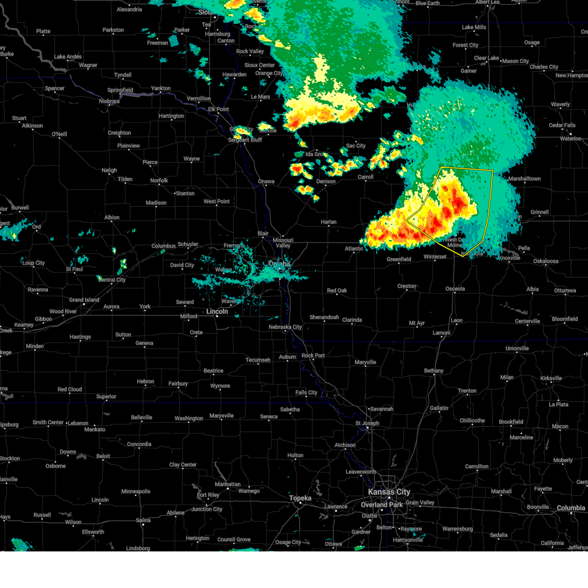 the severe thunderstorm warning has been cancelled and is no longer in effect the severe thunderstorm warning has been cancelled and is no longer in effect
|
| 7/30/2024 9:08 AM CDT |
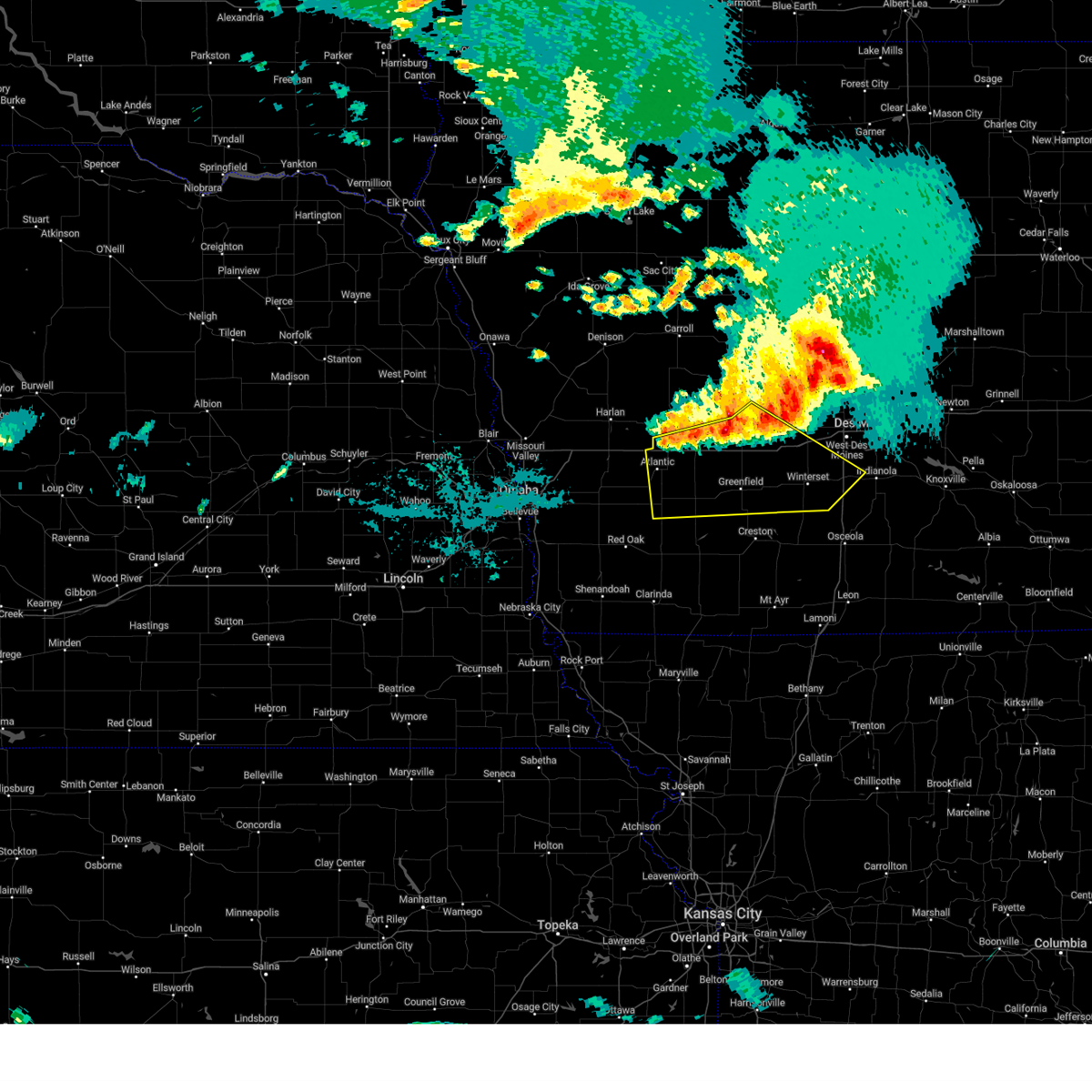 Svrdmx the national weather service in des moines has issued a * severe thunderstorm warning for, madison county in south central iowa, cass county in southwestern iowa, southern guthrie county in west central iowa, southern audubon county in west central iowa, adair county in southwestern iowa, southwestern dallas county in central iowa, west central warren county in south central iowa, * until 1015 am cdt. * at 908 am cdt, severe thunderstorms were located along a line extending from near linden to near menlo to 5 miles southeast of brayton, moving southeast at 40 mph (radar indicated). Hazards include 60 mph wind gusts. expect damage to roofs, siding, and trees Svrdmx the national weather service in des moines has issued a * severe thunderstorm warning for, madison county in south central iowa, cass county in southwestern iowa, southern guthrie county in west central iowa, southern audubon county in west central iowa, adair county in southwestern iowa, southwestern dallas county in central iowa, west central warren county in south central iowa, * until 1015 am cdt. * at 908 am cdt, severe thunderstorms were located along a line extending from near linden to near menlo to 5 miles southeast of brayton, moving southeast at 40 mph (radar indicated). Hazards include 60 mph wind gusts. expect damage to roofs, siding, and trees
|
| 7/30/2024 8:57 AM CDT |
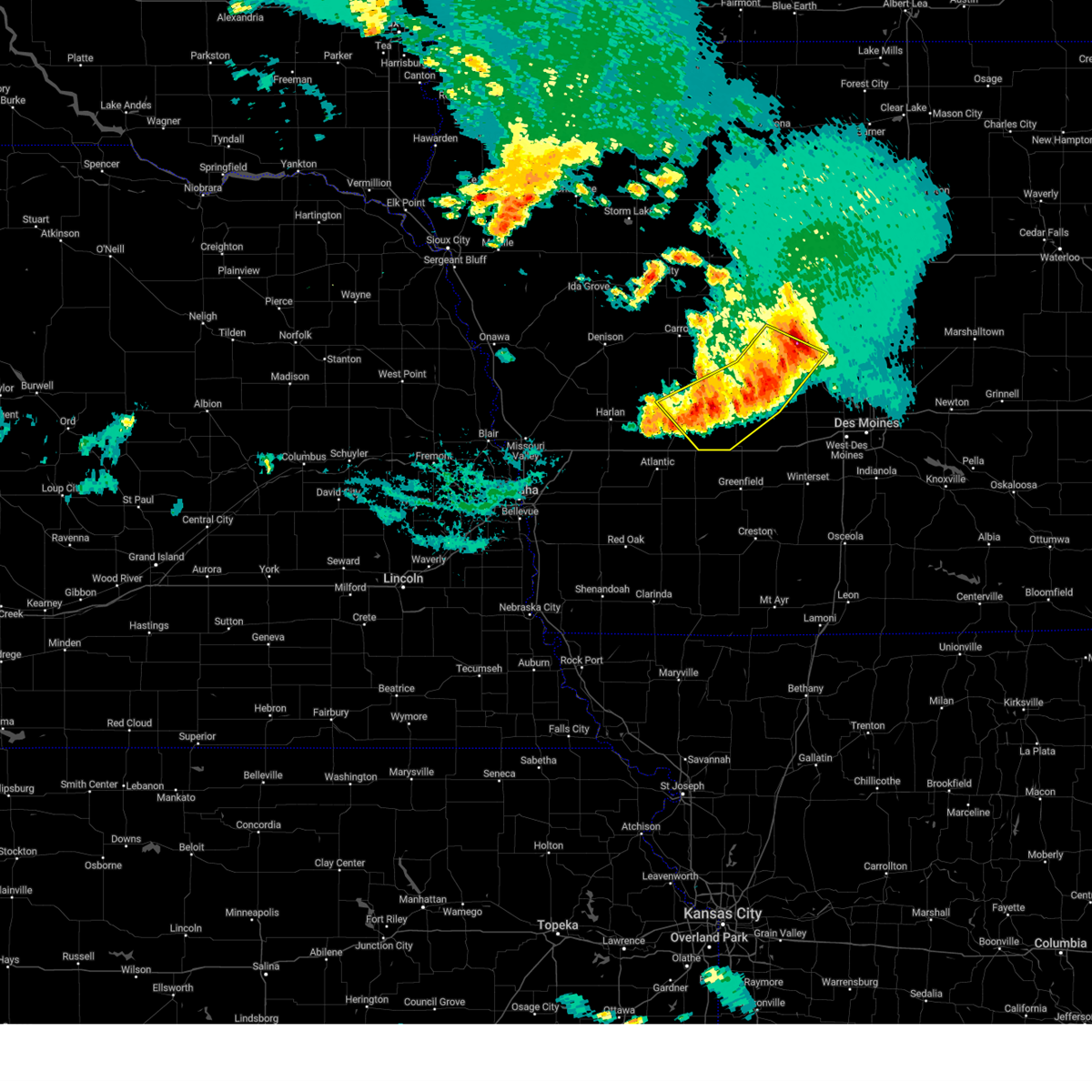 At 856 am cdt, severe thunderstorms were located along a line extending from near panora to guthrie center to near exira, moving south at 35 mph (radar indicated). Hazards include 60 mph wind gusts and penny size hail. Expect damage to roofs, siding, and trees. Locations impacted include, perry, jefferson, audubon, guthrie center, ogden, coon rapids, panora, lake panorama, grand junction, adair, bayard, casey, bagley, rippey, yale, jamaica, linden, dawson, beaver, and berkley. At 856 am cdt, severe thunderstorms were located along a line extending from near panora to guthrie center to near exira, moving south at 35 mph (radar indicated). Hazards include 60 mph wind gusts and penny size hail. Expect damage to roofs, siding, and trees. Locations impacted include, perry, jefferson, audubon, guthrie center, ogden, coon rapids, panora, lake panorama, grand junction, adair, bayard, casey, bagley, rippey, yale, jamaica, linden, dawson, beaver, and berkley.
|
| 7/30/2024 8:53 AM CDT |
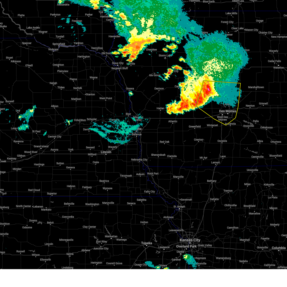 Svrdmx the national weather service in des moines has issued a * severe thunderstorm warning for, polk county in central iowa, story county in central iowa, eastern greene county in west central iowa, northeastern madison county in south central iowa, northeastern guthrie county in west central iowa, boone county in central iowa, dallas county in central iowa, northwestern warren county in south central iowa, * until 1000 am cdt. * at 853 am cdt, severe thunderstorms were located along a line extending from fraser to 4 miles north of bouton to near panora, moving southeast at 45 mph (radar indicated). Hazards include 60 mph wind gusts and nickel size hail. expect damage to roofs, siding, and trees Svrdmx the national weather service in des moines has issued a * severe thunderstorm warning for, polk county in central iowa, story county in central iowa, eastern greene county in west central iowa, northeastern madison county in south central iowa, northeastern guthrie county in west central iowa, boone county in central iowa, dallas county in central iowa, northwestern warren county in south central iowa, * until 1000 am cdt. * at 853 am cdt, severe thunderstorms were located along a line extending from fraser to 4 miles north of bouton to near panora, moving southeast at 45 mph (radar indicated). Hazards include 60 mph wind gusts and nickel size hail. expect damage to roofs, siding, and trees
|
| 7/30/2024 8:44 AM CDT |
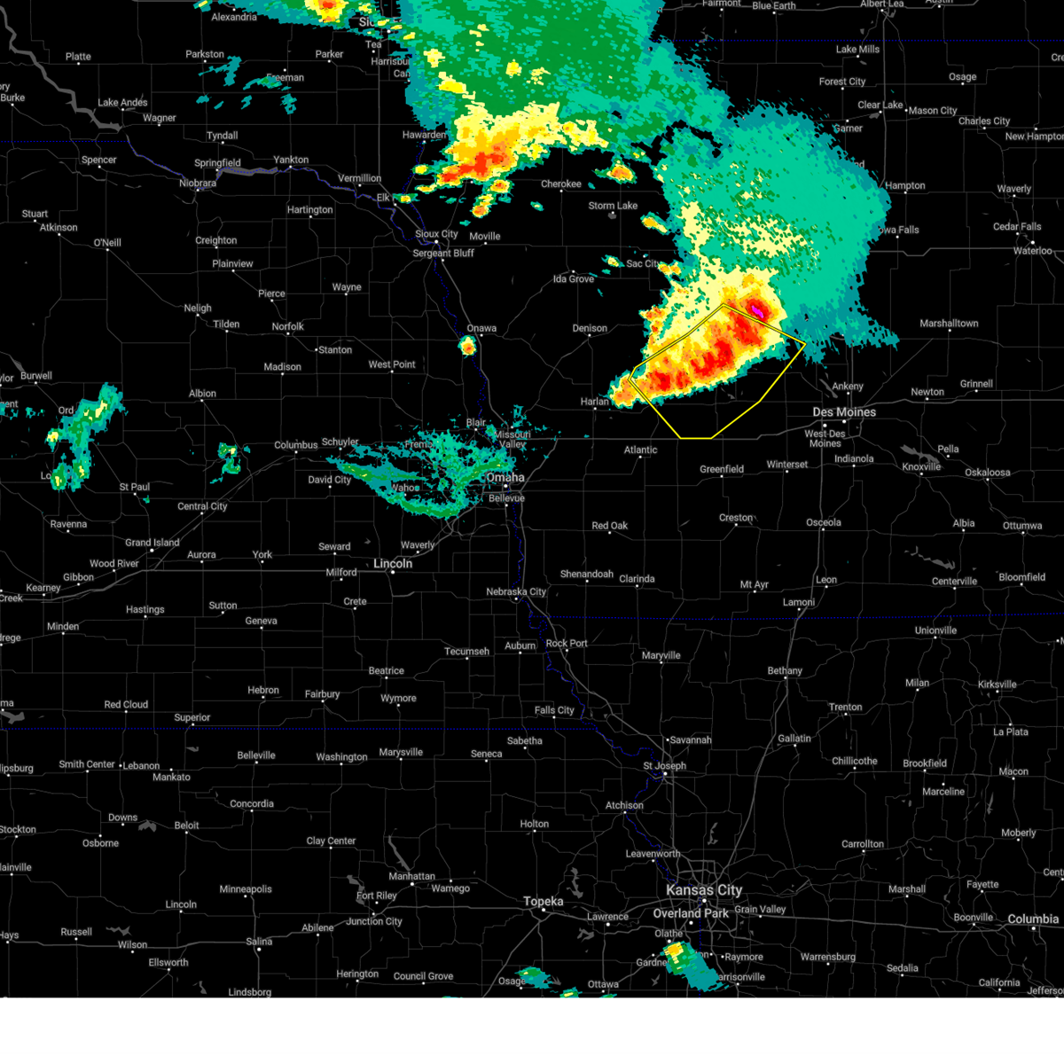 At 842 am cdt, severe thunderstorms were located along a line extending from near beaver to near bagley to near audubon county airport, moving southeast at 45 mph (radar indicated. the carroll aiport recorded a peak wind gust of 55 mph around 815am). Hazards include 60 mph wind gusts and quarter size hail. Hail damage to vehicles is expected. expect wind damage to roofs, siding, and trees. Locations impacted include, perry, jefferson, audubon, guthrie center, ogden, coon rapids, panora, lake panorama, grand junction, adair, scranton, bayard, casey, churdan, bagley, rippey, dedham, yale, jamaica, and linden. At 842 am cdt, severe thunderstorms were located along a line extending from near beaver to near bagley to near audubon county airport, moving southeast at 45 mph (radar indicated. the carroll aiport recorded a peak wind gust of 55 mph around 815am). Hazards include 60 mph wind gusts and quarter size hail. Hail damage to vehicles is expected. expect wind damage to roofs, siding, and trees. Locations impacted include, perry, jefferson, audubon, guthrie center, ogden, coon rapids, panora, lake panorama, grand junction, adair, scranton, bayard, casey, churdan, bagley, rippey, dedham, yale, jamaica, and linden.
|
| 7/30/2024 8:25 AM CDT |
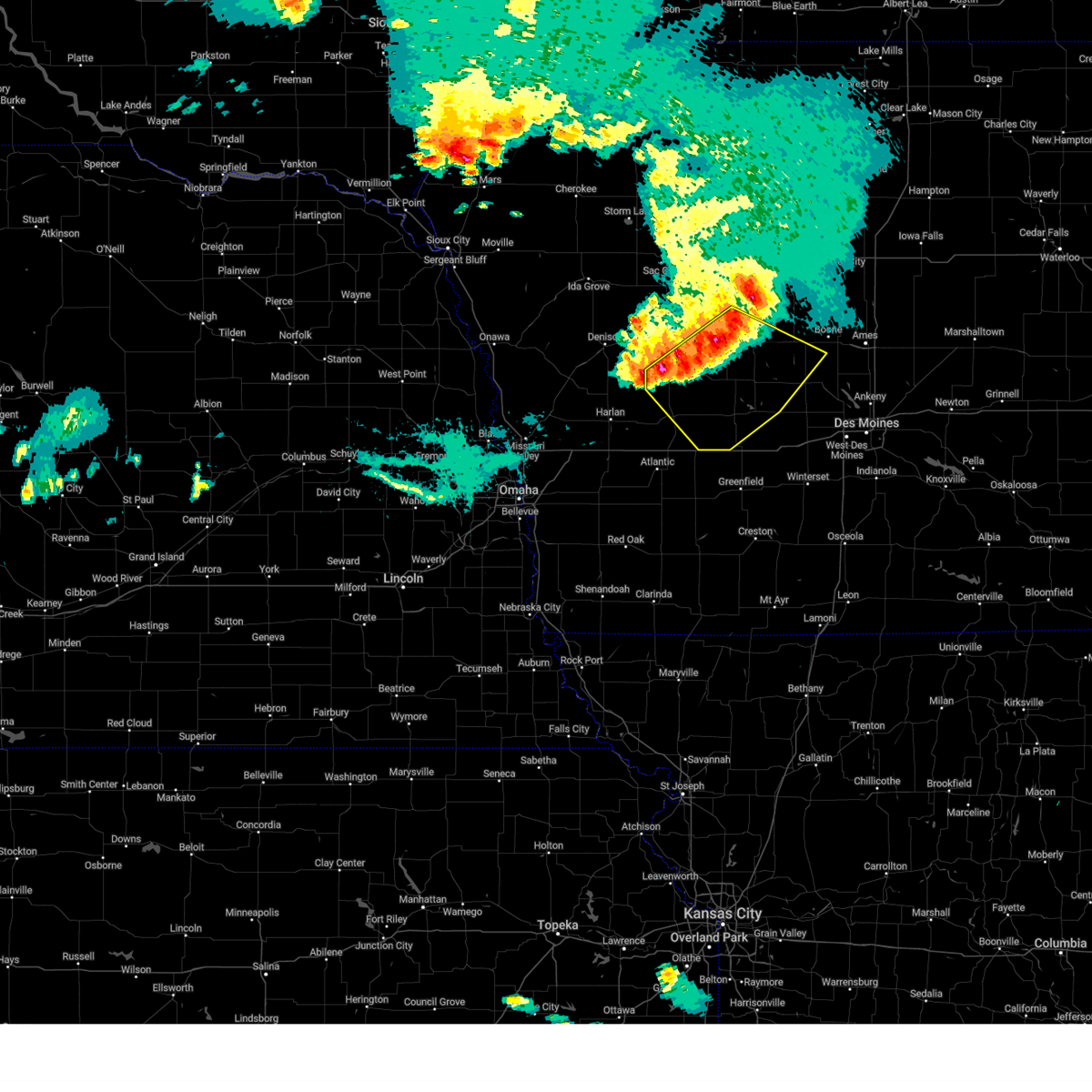 Svrdmx the national weather service in des moines has issued a * severe thunderstorm warning for, greene county in west central iowa, guthrie county in west central iowa, audubon county in west central iowa, southern carroll county in west central iowa, southwestern boone county in central iowa, northwestern dallas county in central iowa, * until 915 am cdt. * at 825 am cdt, severe thunderstorms were located along a line extending from 4 miles southeast of churdan to 4 miles northeast of coon rapids to near gray, moving southeast at 35 mph (radar indicated). Hazards include 60 mph wind gusts and quarter size hail. Hail damage to vehicles is expected. Expect wind damage to roofs, siding, and trees. Svrdmx the national weather service in des moines has issued a * severe thunderstorm warning for, greene county in west central iowa, guthrie county in west central iowa, audubon county in west central iowa, southern carroll county in west central iowa, southwestern boone county in central iowa, northwestern dallas county in central iowa, * until 915 am cdt. * at 825 am cdt, severe thunderstorms were located along a line extending from 4 miles southeast of churdan to 4 miles northeast of coon rapids to near gray, moving southeast at 35 mph (radar indicated). Hazards include 60 mph wind gusts and quarter size hail. Hail damage to vehicles is expected. Expect wind damage to roofs, siding, and trees.
|
| 7/30/2024 2:05 AM CDT |
 At 205 am cdt, severe thunderstorms were located along a line extending from lizard creek state recreation area to near dayton to near ogden to perry to near linden, moving east at 50 mph (radar indicated). Hazards include 60 mph wind gusts. Expect damage to roofs, siding, and trees. these severe storms will be near, boone, adel, ogden, dallas center, woodward, boone speedway, dayton and redfield around 210 am cdt. waukee, madrid, granger, de soto and luther around 215 am cdt. Other locations in the path of these severe thunderstorms include west des moines, urbandale, johnston, clive, grimes, polk city, van meter, saylorville lake and jordan creek town center. At 205 am cdt, severe thunderstorms were located along a line extending from lizard creek state recreation area to near dayton to near ogden to perry to near linden, moving east at 50 mph (radar indicated). Hazards include 60 mph wind gusts. Expect damage to roofs, siding, and trees. these severe storms will be near, boone, adel, ogden, dallas center, woodward, boone speedway, dayton and redfield around 210 am cdt. waukee, madrid, granger, de soto and luther around 215 am cdt. Other locations in the path of these severe thunderstorms include west des moines, urbandale, johnston, clive, grimes, polk city, van meter, saylorville lake and jordan creek town center.
|
| 7/30/2024 2:05 AM CDT |
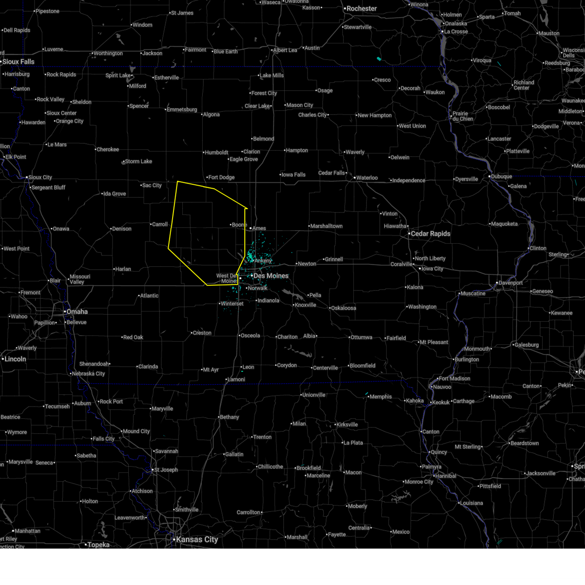 the severe thunderstorm warning has been cancelled and is no longer in effect the severe thunderstorm warning has been cancelled and is no longer in effect
|
| 7/30/2024 2:02 AM CDT |
 At 201 am cdt, severe thunderstorms were located along a line extending from perry municipal airport to 6 miles north of bridgewater, moving east at 50 mph (emergency management. at 150 am, emergency management reported wind gusts estimated between 55 to 60 mph in hamlin). Hazards include 60 mph wind gusts. Expect damage to roofs, siding, and trees. these severe storms will be near, stuart, diamondhead lake, menlo, linden and perry municipal airport around 205 am cdt. Other locations in the path of these severe thunderstorms include dexter. At 201 am cdt, severe thunderstorms were located along a line extending from perry municipal airport to 6 miles north of bridgewater, moving east at 50 mph (emergency management. at 150 am, emergency management reported wind gusts estimated between 55 to 60 mph in hamlin). Hazards include 60 mph wind gusts. Expect damage to roofs, siding, and trees. these severe storms will be near, stuart, diamondhead lake, menlo, linden and perry municipal airport around 205 am cdt. Other locations in the path of these severe thunderstorms include dexter.
|
| 7/30/2024 2:02 AM CDT |
 the severe thunderstorm warning has been cancelled and is no longer in effect the severe thunderstorm warning has been cancelled and is no longer in effect
|
| 7/30/2024 1:56 AM CDT |
 At 156 am cdt, severe thunderstorms were located along a line extending from barnum to near harcourt to beaver to dawson to near panora, moving east at 50 mph (radar indicated). Hazards include 60 mph wind gusts. Expect damage to roofs, siding, and trees. these severe storms will be near, fort dodge, perry, ogden, dayton, redfield, coalville, otho and lehigh around 200 am cdt. Other locations in the path of these severe thunderstorms include boone, dallas center, woodward, minburn, fraser, ledges state park, brushy creek st recreation area, adel, de soto, boone speedway, stratford, duncombe, luther, boone municipal airport, urbandale, clive, waukee, grimes, madrid, granger, van meter, saylorville lake, west des moines, johnston, polk city, big creek lake, stanhope, sheldahl, webster city municipal airport, webster city and jordan creek town center. At 156 am cdt, severe thunderstorms were located along a line extending from barnum to near harcourt to beaver to dawson to near panora, moving east at 50 mph (radar indicated). Hazards include 60 mph wind gusts. Expect damage to roofs, siding, and trees. these severe storms will be near, fort dodge, perry, ogden, dayton, redfield, coalville, otho and lehigh around 200 am cdt. Other locations in the path of these severe thunderstorms include boone, dallas center, woodward, minburn, fraser, ledges state park, brushy creek st recreation area, adel, de soto, boone speedway, stratford, duncombe, luther, boone municipal airport, urbandale, clive, waukee, grimes, madrid, granger, van meter, saylorville lake, west des moines, johnston, polk city, big creek lake, stanhope, sheldahl, webster city municipal airport, webster city and jordan creek town center.
|
| 7/30/2024 1:48 AM CDT |
 At 148 am cdt, severe thunderstorms were located along a line extending from near bagley to near wiota, moving east at 50 mph (radar indicated). Hazards include 60 mph wind gusts. Expect damage to roofs, siding, and trees. Locations impacted include, guthrie center, panora, lake panorama, adair, casey, yale, jamaica, dawson, menlo, linden, stuart, diamondhead lake and dexter. At 148 am cdt, severe thunderstorms were located along a line extending from near bagley to near wiota, moving east at 50 mph (radar indicated). Hazards include 60 mph wind gusts. Expect damage to roofs, siding, and trees. Locations impacted include, guthrie center, panora, lake panorama, adair, casey, yale, jamaica, dawson, menlo, linden, stuart, diamondhead lake and dexter.
|
| 7/30/2024 1:43 AM CDT |
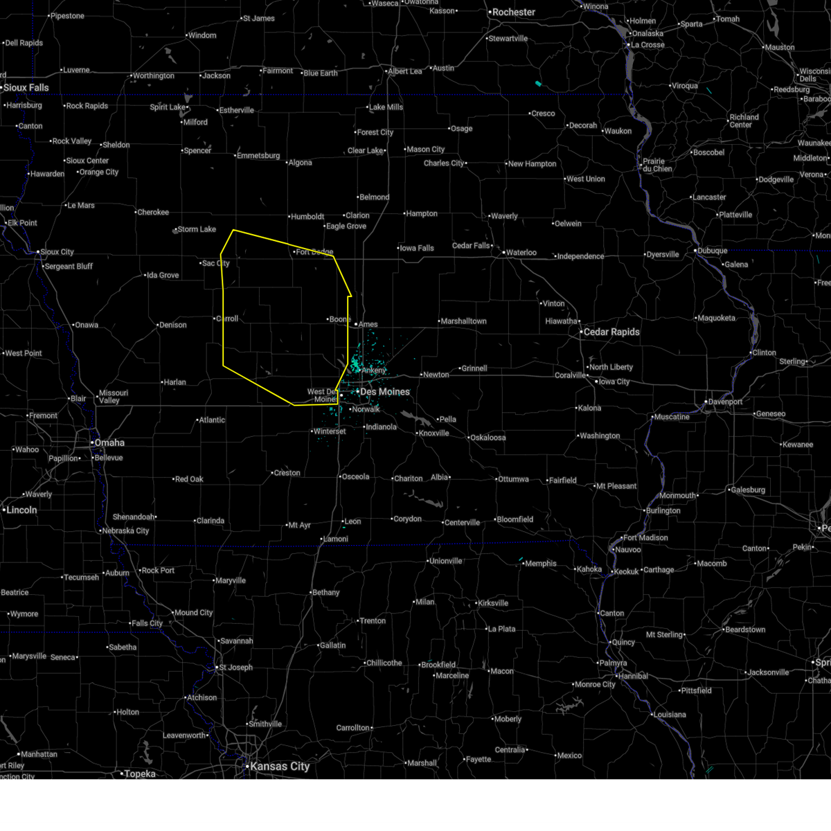 Svrdmx the national weather service in des moines has issued a * severe thunderstorm warning for, northwestern polk county in central iowa, greene county in west central iowa, webster county in central iowa, guthrie county in west central iowa, southeastern pocahontas county in northwestern iowa, northeastern audubon county in west central iowa, calhoun county in west central iowa, southwestern hamilton county in central iowa, eastern carroll county in west central iowa, boone county in central iowa, dallas county in central iowa, * until 230 am cdt. * at 142 am cdt, severe thunderstorms were located along a line extending from near manson to somers to 5 miles west of dana to 4 miles northeast of bagley to near guthrie center, moving east at 50 mph (radar indicated). Hazards include 60 mph wind gusts. Expect damage to roofs, siding, and trees. severe thunderstorms will be near, panora, gowrie, lake panorama, grand junction, callender, harcourt, rippey and yale around 150 am cdt. fort dodge, perry, ogden, dayton, otho, boxholm and berkley around 155 am cdt. fort dodge regional airport, redfield, coalville, lehigh, diamondhead lake, minburn, pilot mound and bouton around 200 am cdt. Other locations in the path of these severe thunderstorms include boone, adel, dallas center, woodward, stratford, ledges state park, brushy creek st recreation area, madrid, de soto, boone speedway, duncombe, luther, boone municipal airport, urbandale, clive, waukee, grimes, granger, van meter, saylorville lake, big creek lake and stanhope. Svrdmx the national weather service in des moines has issued a * severe thunderstorm warning for, northwestern polk county in central iowa, greene county in west central iowa, webster county in central iowa, guthrie county in west central iowa, southeastern pocahontas county in northwestern iowa, northeastern audubon county in west central iowa, calhoun county in west central iowa, southwestern hamilton county in central iowa, eastern carroll county in west central iowa, boone county in central iowa, dallas county in central iowa, * until 230 am cdt. * at 142 am cdt, severe thunderstorms were located along a line extending from near manson to somers to 5 miles west of dana to 4 miles northeast of bagley to near guthrie center, moving east at 50 mph (radar indicated). Hazards include 60 mph wind gusts. Expect damage to roofs, siding, and trees. severe thunderstorms will be near, panora, gowrie, lake panorama, grand junction, callender, harcourt, rippey and yale around 150 am cdt. fort dodge, perry, ogden, dayton, otho, boxholm and berkley around 155 am cdt. fort dodge regional airport, redfield, coalville, lehigh, diamondhead lake, minburn, pilot mound and bouton around 200 am cdt. Other locations in the path of these severe thunderstorms include boone, adel, dallas center, woodward, stratford, ledges state park, brushy creek st recreation area, madrid, de soto, boone speedway, duncombe, luther, boone municipal airport, urbandale, clive, waukee, grimes, granger, van meter, saylorville lake, big creek lake and stanhope.
|
| 7/30/2024 1:29 AM CDT |
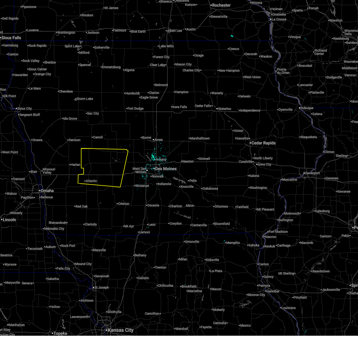 Svrdmx the national weather service in des moines has issued a * severe thunderstorm warning for, southern greene county in west central iowa, northern cass county in southwestern iowa, guthrie county in west central iowa, audubon county in west central iowa, southern carroll county in west central iowa, northern adair county in southwestern iowa, western dallas county in central iowa, * until 215 am cdt. * at 126 am cdt, severe thunderstorms were located along a line extending from coon rapids to 5 miles southwest of marne, moving east at 50 mph (radar indicated). Hazards include 60 mph wind gusts. Expect damage to roofs, siding, and trees. severe thunderstorms will be near, atlantic, coon rapids, exira, bayard, brayton, marne and atlantic municipal airport around 130 am cdt. bagley, wiota and springbrook state park around 135 am cdt. guthrie center, lake panorama, anita, lake anita state park and anita municipal airport around 140 am cdt. panora, adair, yale, jamaica and lakin slough game management area around 145 am cdt. Other locations in the path of these severe thunderstorms include casey, dawson, menlo, linden, perry municipal airport, stuart, diamondhead lake, dexter and greenfield municipal airport. Svrdmx the national weather service in des moines has issued a * severe thunderstorm warning for, southern greene county in west central iowa, northern cass county in southwestern iowa, guthrie county in west central iowa, audubon county in west central iowa, southern carroll county in west central iowa, northern adair county in southwestern iowa, western dallas county in central iowa, * until 215 am cdt. * at 126 am cdt, severe thunderstorms were located along a line extending from coon rapids to 5 miles southwest of marne, moving east at 50 mph (radar indicated). Hazards include 60 mph wind gusts. Expect damage to roofs, siding, and trees. severe thunderstorms will be near, atlantic, coon rapids, exira, bayard, brayton, marne and atlantic municipal airport around 130 am cdt. bagley, wiota and springbrook state park around 135 am cdt. guthrie center, lake panorama, anita, lake anita state park and anita municipal airport around 140 am cdt. panora, adair, yale, jamaica and lakin slough game management area around 145 am cdt. Other locations in the path of these severe thunderstorms include casey, dawson, menlo, linden, perry municipal airport, stuart, diamondhead lake, dexter and greenfield municipal airport.
|
| 7/15/2024 5:04 PM CDT |
 the severe thunderstorm warning has been cancelled and is no longer in effect the severe thunderstorm warning has been cancelled and is no longer in effect
|
| 7/15/2024 5:04 PM CDT |
 At 504 pm cdt, a severe thunderstorm was located over panora, or 8 miles northeast of guthrie center, moving southeast at 35 mph (radar indicated). Hazards include 60 mph wind gusts and quarter size hail. Hail damage to vehicles is expected. expect wind damage to roofs, siding, and trees. Locations impacted include, guthrie center, panora, lake panorama, casey, bagley, yale, jamaica, linden, dawson, perry municipal airport, springbrook state park, and lakin slough game management area. At 504 pm cdt, a severe thunderstorm was located over panora, or 8 miles northeast of guthrie center, moving southeast at 35 mph (radar indicated). Hazards include 60 mph wind gusts and quarter size hail. Hail damage to vehicles is expected. expect wind damage to roofs, siding, and trees. Locations impacted include, guthrie center, panora, lake panorama, casey, bagley, yale, jamaica, linden, dawson, perry municipal airport, springbrook state park, and lakin slough game management area.
|
| 7/15/2024 4:55 PM CDT |
 At 455 pm cdt, a severe thunderstorm was located over springbrook state park, or 6 miles northeast of guthrie center, moving southeast at 35 mph (radar indicated). Hazards include 60 mph wind gusts and quarter size hail. Hail damage to vehicles is expected. expect wind damage to roofs, siding, and trees. Locations impacted include, guthrie center, coon rapids, panora, lake panorama, adair, bayard, casey, bagley, yale, jamaica, linden, dawson, perry municipal airport, lakin slough game management area, and springbrook state park. At 455 pm cdt, a severe thunderstorm was located over springbrook state park, or 6 miles northeast of guthrie center, moving southeast at 35 mph (radar indicated). Hazards include 60 mph wind gusts and quarter size hail. Hail damage to vehicles is expected. expect wind damage to roofs, siding, and trees. Locations impacted include, guthrie center, coon rapids, panora, lake panorama, adair, bayard, casey, bagley, yale, jamaica, linden, dawson, perry municipal airport, lakin slough game management area, and springbrook state park.
|
| 7/15/2024 4:37 PM CDT |
 At 436 pm cdt, a severe thunderstorm was located near bayard, or 11 miles northwest of guthrie center, moving southeast at 35 mph (radar indicated). Hazards include 70 mph wind gusts and ping pong ball size hail. People and animals outdoors will be injured. expect hail damage to roofs, siding, windows, and vehicles. expect considerable tree damage. wind damage is also likely to mobile homes, roofs, and outbuildings. Locations impacted include, audubon, guthrie center, coon rapids, panora, lake panorama, exira, adair, bayard, casey, bagley, dedham, yale, jamaica, linden, dawson, perry municipal airport, lakin slough game management area, audubon county airport, and springbrook state park. At 436 pm cdt, a severe thunderstorm was located near bayard, or 11 miles northwest of guthrie center, moving southeast at 35 mph (radar indicated). Hazards include 70 mph wind gusts and ping pong ball size hail. People and animals outdoors will be injured. expect hail damage to roofs, siding, windows, and vehicles. expect considerable tree damage. wind damage is also likely to mobile homes, roofs, and outbuildings. Locations impacted include, audubon, guthrie center, coon rapids, panora, lake panorama, exira, adair, bayard, casey, bagley, dedham, yale, jamaica, linden, dawson, perry municipal airport, lakin slough game management area, audubon county airport, and springbrook state park.
|
| 7/15/2024 4:23 PM CDT |
 Svrdmx the national weather service in des moines has issued a * severe thunderstorm warning for, southern greene county in west central iowa, guthrie county in west central iowa, audubon county in west central iowa, southeastern carroll county in west central iowa, northwestern dallas county in central iowa, * until 515 pm cdt. * at 423 pm cdt, a severe thunderstorm was located near dedham, or 12 miles northeast of audubon, moving southeast at 35 mph (radar indicated). Hazards include 70 mph wind gusts and ping pong ball size hail. People and animals outdoors will be injured. expect hail damage to roofs, siding, windows, and vehicles. expect considerable tree damage. Wind damage is also likely to mobile homes, roofs, and outbuildings. Svrdmx the national weather service in des moines has issued a * severe thunderstorm warning for, southern greene county in west central iowa, guthrie county in west central iowa, audubon county in west central iowa, southeastern carroll county in west central iowa, northwestern dallas county in central iowa, * until 515 pm cdt. * at 423 pm cdt, a severe thunderstorm was located near dedham, or 12 miles northeast of audubon, moving southeast at 35 mph (radar indicated). Hazards include 70 mph wind gusts and ping pong ball size hail. People and animals outdoors will be injured. expect hail damage to roofs, siding, windows, and vehicles. expect considerable tree damage. Wind damage is also likely to mobile homes, roofs, and outbuildings.
|
| 7/7/2024 8:59 PM CDT |
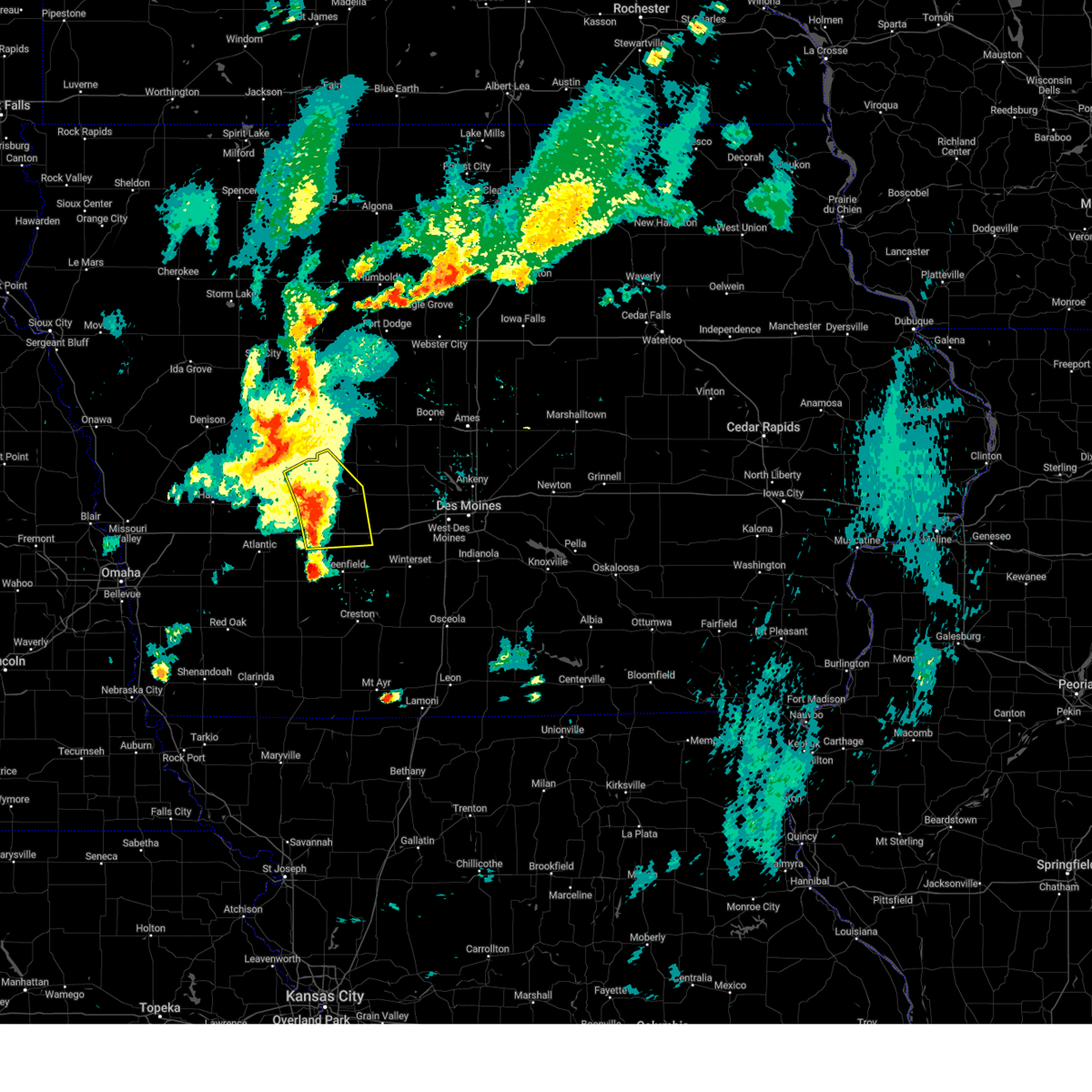 At 858 pm cdt, severe thunderstorms were located along a line extending from 7 miles south of coon rapids to near guthrie center to near casey, moving east at 40 mph (radar indicated). Hazards include 60 mph wind gusts and penny size hail. Expect damage to roofs, siding, and trees. locations impacted include, guthrie center, stuart, panora, lake panorama, adair, bayard, casey, menlo, and springbrook state park. This includes interstate 80 between mile markers 72 and 95. At 858 pm cdt, severe thunderstorms were located along a line extending from 7 miles south of coon rapids to near guthrie center to near casey, moving east at 40 mph (radar indicated). Hazards include 60 mph wind gusts and penny size hail. Expect damage to roofs, siding, and trees. locations impacted include, guthrie center, stuart, panora, lake panorama, adair, bayard, casey, menlo, and springbrook state park. This includes interstate 80 between mile markers 72 and 95.
|
| 7/7/2024 8:35 PM CDT |
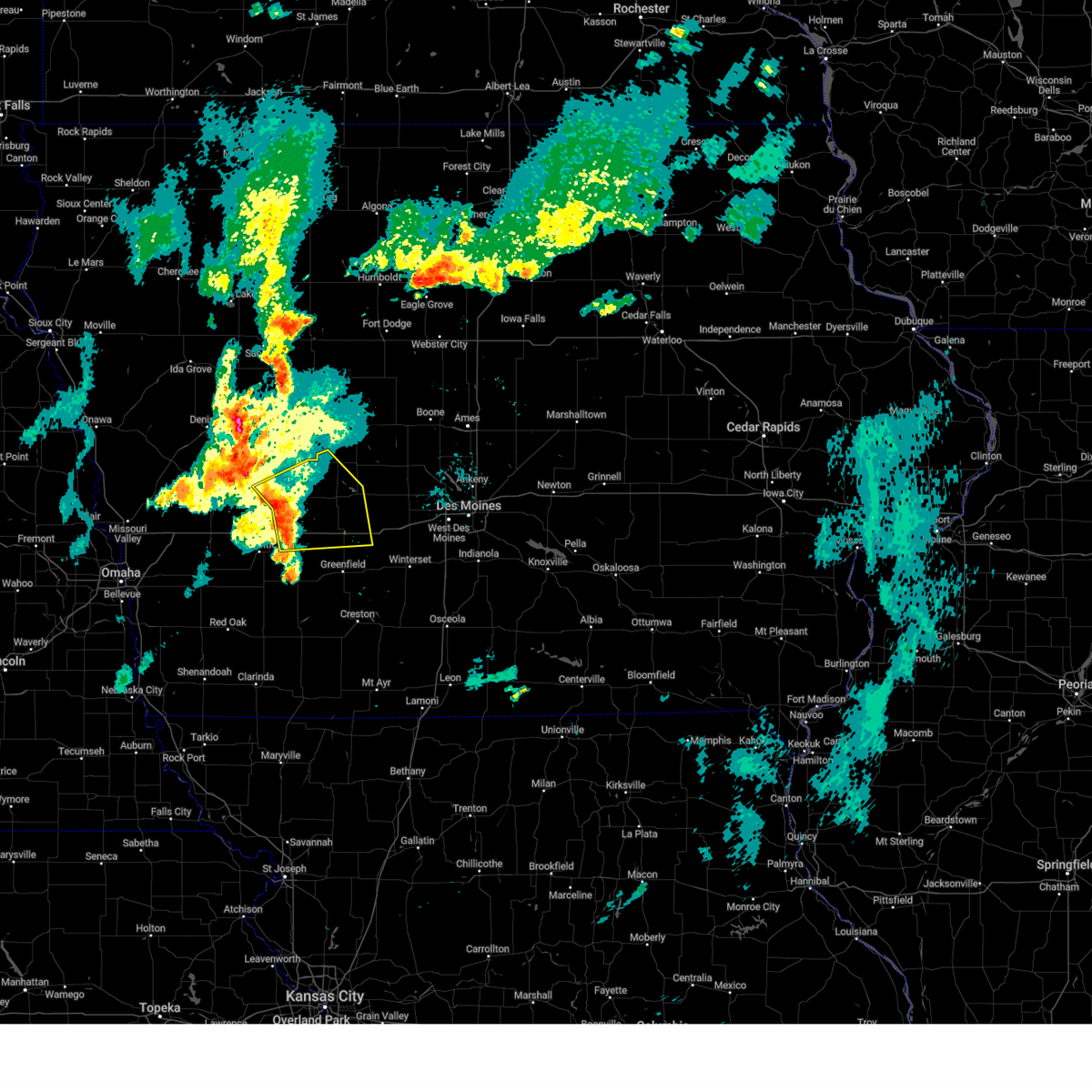 Svrdmx the national weather service in des moines has issued a * severe thunderstorm warning for, southwestern greene county in west central iowa, northeastern cass county in southwestern iowa, guthrie county in west central iowa, central audubon county in west central iowa, northern adair county in southwestern iowa, * until 915 pm cdt. * at 835 pm cdt, severe thunderstorms were located along a line extending from audubon to 4 miles northeast of exira to anita, moving east at 35 mph (radar indicated). Hazards include 60 mph wind gusts and penny size hail. expect damage to roofs, siding, and trees Svrdmx the national weather service in des moines has issued a * severe thunderstorm warning for, southwestern greene county in west central iowa, northeastern cass county in southwestern iowa, guthrie county in west central iowa, central audubon county in west central iowa, northern adair county in southwestern iowa, * until 915 pm cdt. * at 835 pm cdt, severe thunderstorms were located along a line extending from audubon to 4 miles northeast of exira to anita, moving east at 35 mph (radar indicated). Hazards include 60 mph wind gusts and penny size hail. expect damage to roofs, siding, and trees
|
| 6/25/2024 9:54 PM CDT |
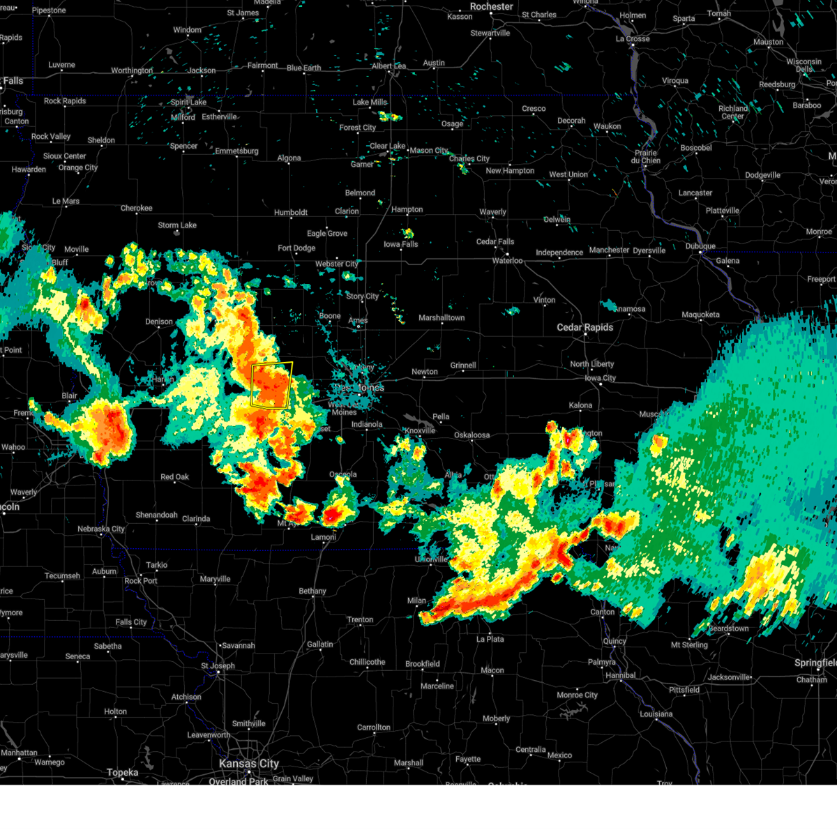 the severe thunderstorm warning has been cancelled and is no longer in effect the severe thunderstorm warning has been cancelled and is no longer in effect
|
| 6/25/2024 9:54 PM CDT |
 At 954 pm cdt, a severe thunderstorm was located over panora, or 7 miles east of guthrie center, moving east at 30 mph (radar indicated). Hazards include 60 mph wind gusts and nickel size hail. Expect damage to roofs, siding, and trees. Locations impacted include, guthrie center, stuart, panora, lake panorama, casey, diamondhead lake, menlo, yale, linden, springbrook state park, and lakin slough game management area. At 954 pm cdt, a severe thunderstorm was located over panora, or 7 miles east of guthrie center, moving east at 30 mph (radar indicated). Hazards include 60 mph wind gusts and nickel size hail. Expect damage to roofs, siding, and trees. Locations impacted include, guthrie center, stuart, panora, lake panorama, casey, diamondhead lake, menlo, yale, linden, springbrook state park, and lakin slough game management area.
|
| 6/25/2024 9:47 PM CDT |
 Svrdmx the national weather service in des moines has issued a * severe thunderstorm warning for, northwestern polk county in central iowa, eastern guthrie county in west central iowa, dallas county in central iowa, * until 1030 pm cdt. * at 947 pm cdt, severe thunderstorms were located along a line extending from lakin slough game management area to near linden to menlo, moving east at 35 mph (radar indicated). Hazards include 60 mph wind gusts and nickel size hail. expect damage to roofs, siding, and trees Svrdmx the national weather service in des moines has issued a * severe thunderstorm warning for, northwestern polk county in central iowa, eastern guthrie county in west central iowa, dallas county in central iowa, * until 1030 pm cdt. * at 947 pm cdt, severe thunderstorms were located along a line extending from lakin slough game management area to near linden to menlo, moving east at 35 mph (radar indicated). Hazards include 60 mph wind gusts and nickel size hail. expect damage to roofs, siding, and trees
|
| 6/25/2024 9:25 PM CDT |
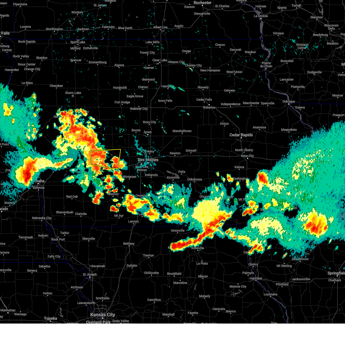 Svrdmx the national weather service in des moines has issued a * severe thunderstorm warning for, guthrie county in west central iowa, southeastern audubon county in west central iowa, west central dallas county in central iowa, * until 1015 pm cdt. * at 925 pm cdt, a severe thunderstorm was located 8 miles west of guthrie center, moving east at 30 mph (radar indicated). Hazards include 60 mph wind gusts and quarter size hail. Hail damage to vehicles is expected. Expect wind damage to roofs, siding, and trees. Svrdmx the national weather service in des moines has issued a * severe thunderstorm warning for, guthrie county in west central iowa, southeastern audubon county in west central iowa, west central dallas county in central iowa, * until 1015 pm cdt. * at 925 pm cdt, a severe thunderstorm was located 8 miles west of guthrie center, moving east at 30 mph (radar indicated). Hazards include 60 mph wind gusts and quarter size hail. Hail damage to vehicles is expected. Expect wind damage to roofs, siding, and trees.
|
| 6/25/2024 9:13 PM CDT |
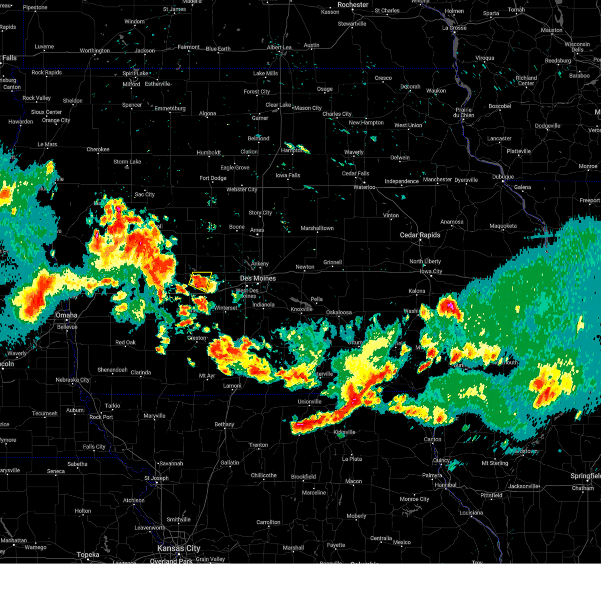 At 913 pm cdt, a severe thunderstorm was located 5 miles southwest of linden, or 9 miles southeast of guthrie center, moving southeast at 15 mph (radar indicated). Hazards include ping pong ball size hail and 60 mph wind gusts. People and animals outdoors will be injured. expect hail damage to roofs, siding, windows, and vehicles. expect wind damage to roofs, siding, and trees. Locations impacted include, panora, diamondhead lake, and linden. At 913 pm cdt, a severe thunderstorm was located 5 miles southwest of linden, or 9 miles southeast of guthrie center, moving southeast at 15 mph (radar indicated). Hazards include ping pong ball size hail and 60 mph wind gusts. People and animals outdoors will be injured. expect hail damage to roofs, siding, windows, and vehicles. expect wind damage to roofs, siding, and trees. Locations impacted include, panora, diamondhead lake, and linden.
|
| 6/25/2024 9:11 PM CDT |
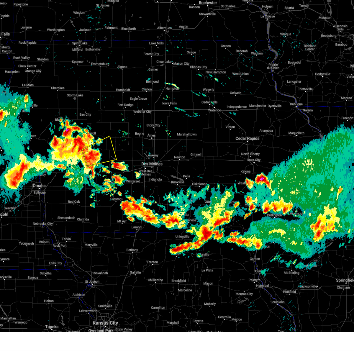 At 911 pm cdt, a severe thunderstorm was located over coon rapids, or 13 miles northwest of guthrie center, moving east at 35 mph (radar indicated). Hazards include ping pong ball size hail and 60 mph wind gusts. People and animals outdoors will be injured. expect hail damage to roofs, siding, windows, and vehicles. expect wind damage to roofs, siding, and trees. Locations impacted include, audubon, guthrie center, coon rapids, panora, lake panorama, scranton, bayard, bagley, dedham, gray, audubon county airport, and springbrook state park. At 911 pm cdt, a severe thunderstorm was located over coon rapids, or 13 miles northwest of guthrie center, moving east at 35 mph (radar indicated). Hazards include ping pong ball size hail and 60 mph wind gusts. People and animals outdoors will be injured. expect hail damage to roofs, siding, windows, and vehicles. expect wind damage to roofs, siding, and trees. Locations impacted include, audubon, guthrie center, coon rapids, panora, lake panorama, scranton, bayard, bagley, dedham, gray, audubon county airport, and springbrook state park.
|
| 6/25/2024 8:52 PM CDT |
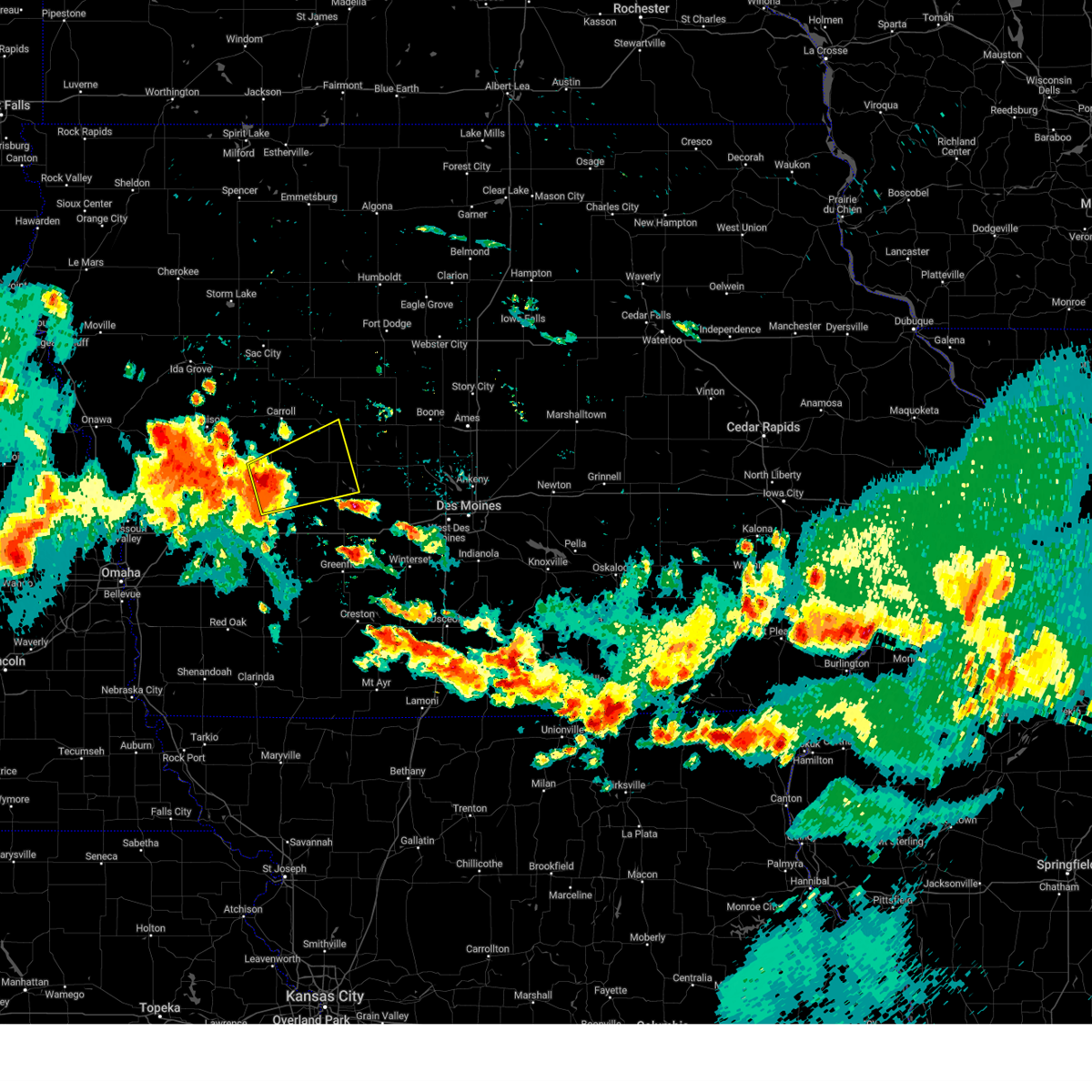 Svrdmx the national weather service in des moines has issued a * severe thunderstorm warning for, southwestern greene county in west central iowa, northern guthrie county in west central iowa, audubon county in west central iowa, southeastern carroll county in west central iowa, * until 930 pm cdt. * at 851 pm cdt, a severe thunderstorm was located 5 miles northeast of audubon, moving east at 35 mph (radar indicated). Hazards include two inch hail and 60 mph wind gusts. People and animals outdoors will be injured. expect hail damage to roofs, siding, windows, and vehicles. Expect wind damage to roofs, siding, and trees. Svrdmx the national weather service in des moines has issued a * severe thunderstorm warning for, southwestern greene county in west central iowa, northern guthrie county in west central iowa, audubon county in west central iowa, southeastern carroll county in west central iowa, * until 930 pm cdt. * at 851 pm cdt, a severe thunderstorm was located 5 miles northeast of audubon, moving east at 35 mph (radar indicated). Hazards include two inch hail and 60 mph wind gusts. People and animals outdoors will be injured. expect hail damage to roofs, siding, windows, and vehicles. Expect wind damage to roofs, siding, and trees.
|
| 6/25/2024 8:48 PM CDT |
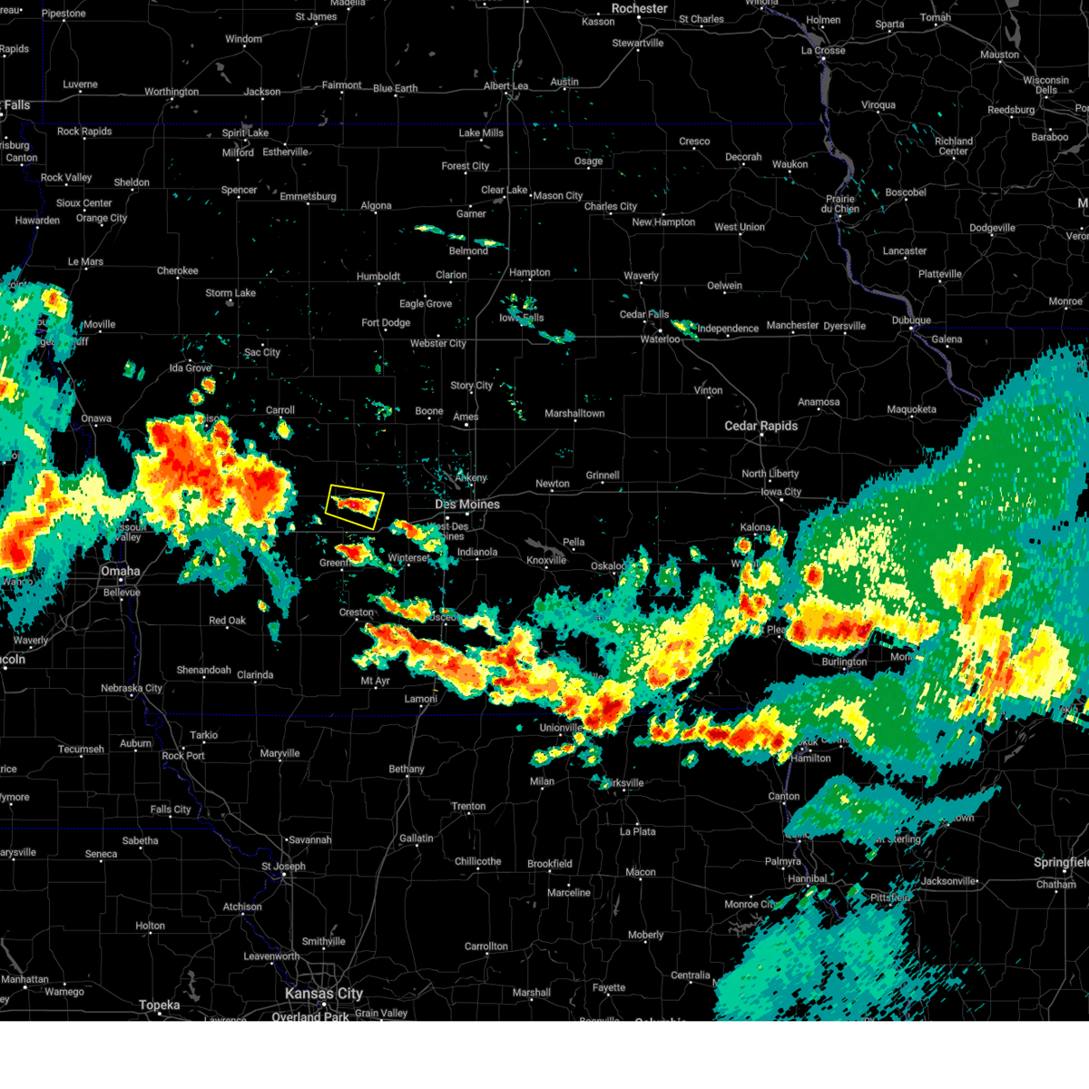 Svrdmx the national weather service in des moines has issued a * severe thunderstorm warning for, southeastern guthrie county in west central iowa, west central dallas county in central iowa, * until 930 pm cdt. * at 847 pm cdt, a severe thunderstorm was located near guthrie center, moving southeast at 15 mph (radar indicated). Hazards include ping pong ball size hail and 60 mph wind gusts. People and animals outdoors will be injured. expect hail damage to roofs, siding, windows, and vehicles. Expect wind damage to roofs, siding, and trees. Svrdmx the national weather service in des moines has issued a * severe thunderstorm warning for, southeastern guthrie county in west central iowa, west central dallas county in central iowa, * until 930 pm cdt. * at 847 pm cdt, a severe thunderstorm was located near guthrie center, moving southeast at 15 mph (radar indicated). Hazards include ping pong ball size hail and 60 mph wind gusts. People and animals outdoors will be injured. expect hail damage to roofs, siding, windows, and vehicles. Expect wind damage to roofs, siding, and trees.
|
| 5/24/2024 4:34 AM CDT |
 the severe thunderstorm warning has been cancelled and is no longer in effect the severe thunderstorm warning has been cancelled and is no longer in effect
|
| 5/24/2024 4:34 AM CDT |
 At 433 am cdt, severe thunderstorms were located along a line extending from near barnum to near boxholm to 5 miles southwest of minburn to near winterset, moving east at 55 mph (emergency management). Hazards include 60 mph wind gusts and penny size hail. Expect damage to roofs, siding, and trees. locations impacted include, west des moines, fort dodge, waukee, boone, creston, perry, winterset, jefferson, adel, rockwell city, dakota city, humboldt, ogden, manson, stuart, dallas center, earlham, panora, de soto, and gowrie. This includes interstate 80 between mile markers 89 and 117. At 433 am cdt, severe thunderstorms were located along a line extending from near barnum to near boxholm to 5 miles southwest of minburn to near winterset, moving east at 55 mph (emergency management). Hazards include 60 mph wind gusts and penny size hail. Expect damage to roofs, siding, and trees. locations impacted include, west des moines, fort dodge, waukee, boone, creston, perry, winterset, jefferson, adel, rockwell city, dakota city, humboldt, ogden, manson, stuart, dallas center, earlham, panora, de soto, and gowrie. This includes interstate 80 between mile markers 89 and 117.
|
| 5/24/2024 4:24 AM CDT |
 At 423 am cdt, severe thunderstorms were located along a line extending from near manson to dana to near linden to 4 miles north of macksburg, moving east at 55 mph (radar indicated). Hazards include 60 mph wind gusts and penny size hail. Expect damage to roofs, siding, and trees. locations impacted include, west des moines, fort dodge, waukee, boone, creston, perry, winterset, jefferson, adel, greenfield, rockwell city, guthrie center, dakota city, humboldt, ogden, lake city, manson, stuart, dallas center, and earlham. This includes interstate 80 between mile markers 80 and 117. At 423 am cdt, severe thunderstorms were located along a line extending from near manson to dana to near linden to 4 miles north of macksburg, moving east at 55 mph (radar indicated). Hazards include 60 mph wind gusts and penny size hail. Expect damage to roofs, siding, and trees. locations impacted include, west des moines, fort dodge, waukee, boone, creston, perry, winterset, jefferson, adel, greenfield, rockwell city, guthrie center, dakota city, humboldt, ogden, lake city, manson, stuart, dallas center, and earlham. This includes interstate 80 between mile markers 80 and 117.
|
| 5/24/2024 4:24 AM CDT |
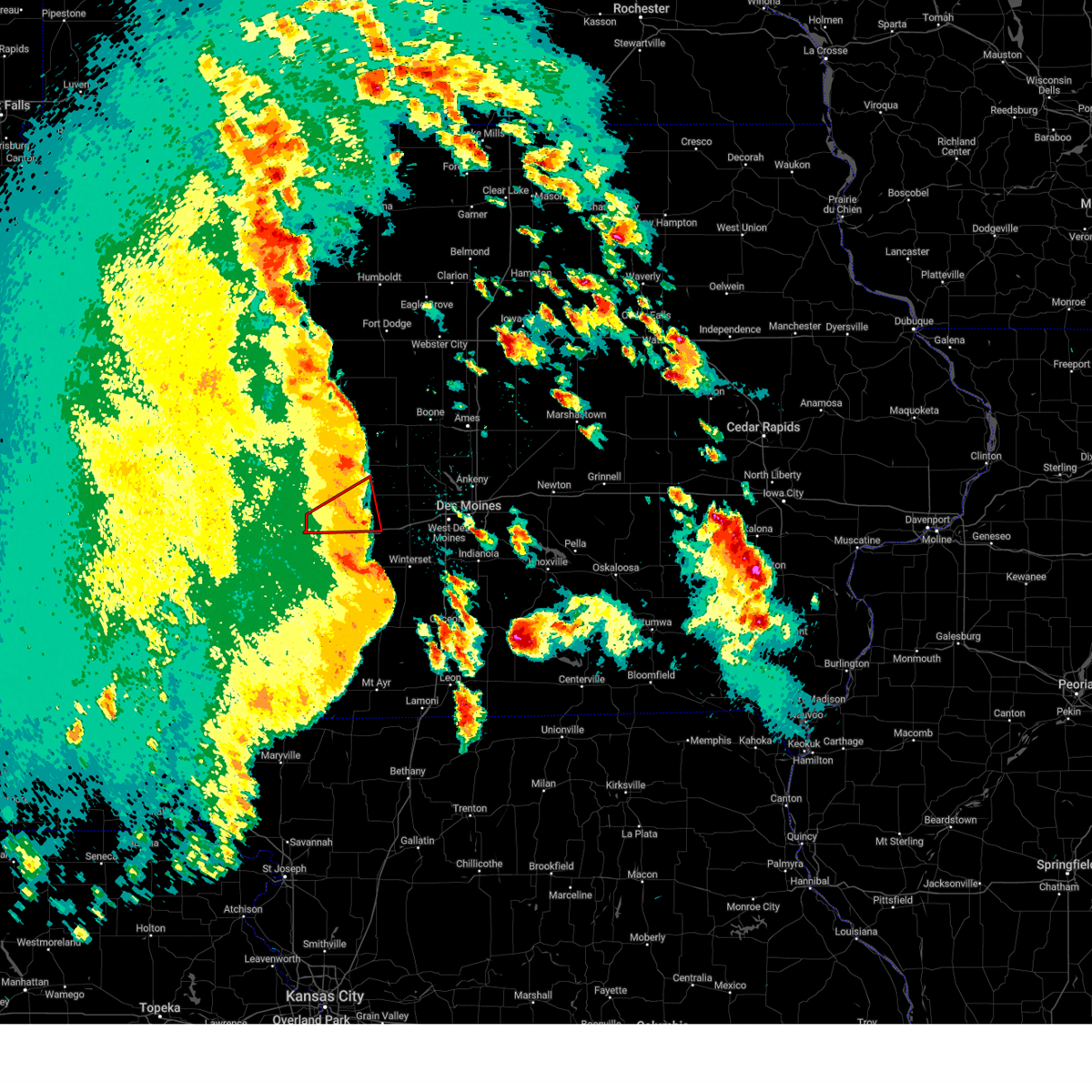 The storm which prompted the warning has weakened below severe limits, and no longer appears capable of producing a tornado. therefore, the warning will be allowed to expire. a severe thunderstorm watch remains in effect until 1000 am cdt for central, southwestern and west central iowa. to report severe weather, contact your nearest law enforcement agency. they will relay your report to the national weather service des moines . remember, a severe thunderstorm warning still remains in effect. The storm which prompted the warning has weakened below severe limits, and no longer appears capable of producing a tornado. therefore, the warning will be allowed to expire. a severe thunderstorm watch remains in effect until 1000 am cdt for central, southwestern and west central iowa. to report severe weather, contact your nearest law enforcement agency. they will relay your report to the national weather service des moines . remember, a severe thunderstorm warning still remains in effect.
|
| 5/24/2024 4:24 AM CDT |
 the severe thunderstorm warning has been cancelled and is no longer in effect the severe thunderstorm warning has been cancelled and is no longer in effect
|
| 5/24/2024 4:14 AM CDT |
 Tordmx the national weather service in des moines has issued a * tornado warning for, southeastern greene county in west central iowa, northeastern guthrie county in west central iowa, southwestern boone county in central iowa, northwestern dallas county in central iowa, * until 445 am cdt. * at 414 am cdt, a severe thunderstorm capable of producing a tornado was located over lake panorama, or near guthrie center, moving east at 35 mph (radar indicated rotation). Hazards include tornado and quarter size hail. Flying debris will be dangerous to those caught without shelter. mobile homes will be damaged or destroyed. damage to roofs, windows, and vehicles will occur. tree damage is likely. this dangerous storm will be near, panora, lake panorama, yale, and lakin slough game management area around 420 am cdt. perry municipal airport around 435 am cdt. Other locations impacted by this tornadic thunderstorm include dawson, perry municipal airport, yale, jamaica, springbrook state park, lakin slough game management area, and bagley. Tordmx the national weather service in des moines has issued a * tornado warning for, southeastern greene county in west central iowa, northeastern guthrie county in west central iowa, southwestern boone county in central iowa, northwestern dallas county in central iowa, * until 445 am cdt. * at 414 am cdt, a severe thunderstorm capable of producing a tornado was located over lake panorama, or near guthrie center, moving east at 35 mph (radar indicated rotation). Hazards include tornado and quarter size hail. Flying debris will be dangerous to those caught without shelter. mobile homes will be damaged or destroyed. damage to roofs, windows, and vehicles will occur. tree damage is likely. this dangerous storm will be near, panora, lake panorama, yale, and lakin slough game management area around 420 am cdt. perry municipal airport around 435 am cdt. Other locations impacted by this tornadic thunderstorm include dawson, perry municipal airport, yale, jamaica, springbrook state park, lakin slough game management area, and bagley.
|
| 5/24/2024 4:00 AM CDT |
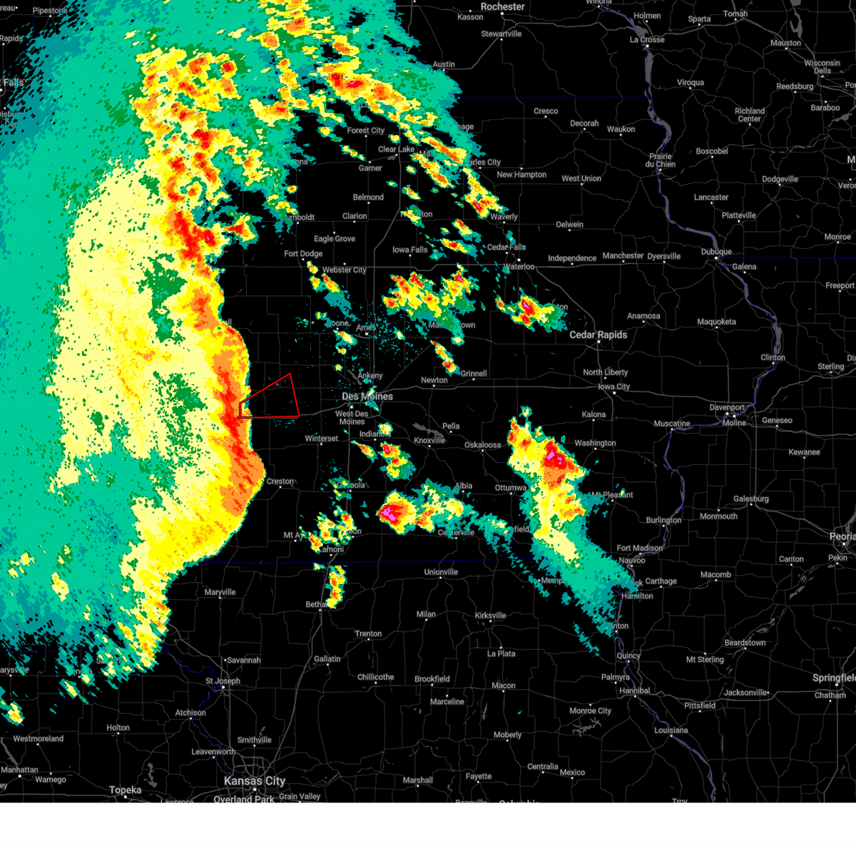 Tordmx the national weather service in des moines has issued a * tornado warning for, northeastern cass county in southwestern iowa, southern guthrie county in west central iowa, southwestern dallas county in central iowa, * until 430 am cdt. * at 400 am cdt, a severe thunderstorm capable of producing a tornado was located near adair, or 10 miles southwest of guthrie center, moving east at 45 mph (radar indicated rotation). Hazards include tornado and quarter size hail. Flying debris will be dangerous to those caught without shelter. mobile homes will be damaged or destroyed. damage to roofs, windows, and vehicles will occur. tree damage is likely. this dangerous storm will be near, casey around 405 am cdt. linden around 420 am cdt. Other locations impacted by this tornadic thunderstorm include dexter, diamondhead lake, casey, menlo, adair, and linden. Tordmx the national weather service in des moines has issued a * tornado warning for, northeastern cass county in southwestern iowa, southern guthrie county in west central iowa, southwestern dallas county in central iowa, * until 430 am cdt. * at 400 am cdt, a severe thunderstorm capable of producing a tornado was located near adair, or 10 miles southwest of guthrie center, moving east at 45 mph (radar indicated rotation). Hazards include tornado and quarter size hail. Flying debris will be dangerous to those caught without shelter. mobile homes will be damaged or destroyed. damage to roofs, windows, and vehicles will occur. tree damage is likely. this dangerous storm will be near, casey around 405 am cdt. linden around 420 am cdt. Other locations impacted by this tornadic thunderstorm include dexter, diamondhead lake, casey, menlo, adair, and linden.
|
| 5/24/2024 3:56 AM CDT |
 Svrdmx the national weather service in des moines has issued a * severe thunderstorm warning for, madison county in south central iowa, webster county in central iowa, southeastern pocahontas county in northwestern iowa, eastern audubon county in west central iowa, southeastern sac county in west central iowa, western boone county in central iowa, adair county in southwestern iowa, greene county in west central iowa, eastern cass county in southwestern iowa, union county in south central iowa, guthrie county in west central iowa, adams county in southwestern iowa, calhoun county in west central iowa, south central humboldt county in north central iowa, northeastern taylor county in southwestern iowa, eastern carroll county in west central iowa, western clarke county in south central iowa, dallas county in central iowa, * until 445 am cdt. * at 355 am cdt, severe thunderstorms were located along a line extending from near sac city municipal airport to 4 miles southwest of ralston to 4 miles north of adair to 6 miles southeast of bridgewater, moving east at 55 mph (personal weather station near audubon reported 62 mph wind gust at 339 am). Hazards include 60 mph wind gusts and quarter size hail. Hail damage to vehicles is expected. Expect wind damage to roofs, siding, and trees. Svrdmx the national weather service in des moines has issued a * severe thunderstorm warning for, madison county in south central iowa, webster county in central iowa, southeastern pocahontas county in northwestern iowa, eastern audubon county in west central iowa, southeastern sac county in west central iowa, western boone county in central iowa, adair county in southwestern iowa, greene county in west central iowa, eastern cass county in southwestern iowa, union county in south central iowa, guthrie county in west central iowa, adams county in southwestern iowa, calhoun county in west central iowa, south central humboldt county in north central iowa, northeastern taylor county in southwestern iowa, eastern carroll county in west central iowa, western clarke county in south central iowa, dallas county in central iowa, * until 445 am cdt. * at 355 am cdt, severe thunderstorms were located along a line extending from near sac city municipal airport to 4 miles southwest of ralston to 4 miles north of adair to 6 miles southeast of bridgewater, moving east at 55 mph (personal weather station near audubon reported 62 mph wind gust at 339 am). Hazards include 60 mph wind gusts and quarter size hail. Hail damage to vehicles is expected. Expect wind damage to roofs, siding, and trees.
|
| 5/21/2024 3:17 PM CDT |
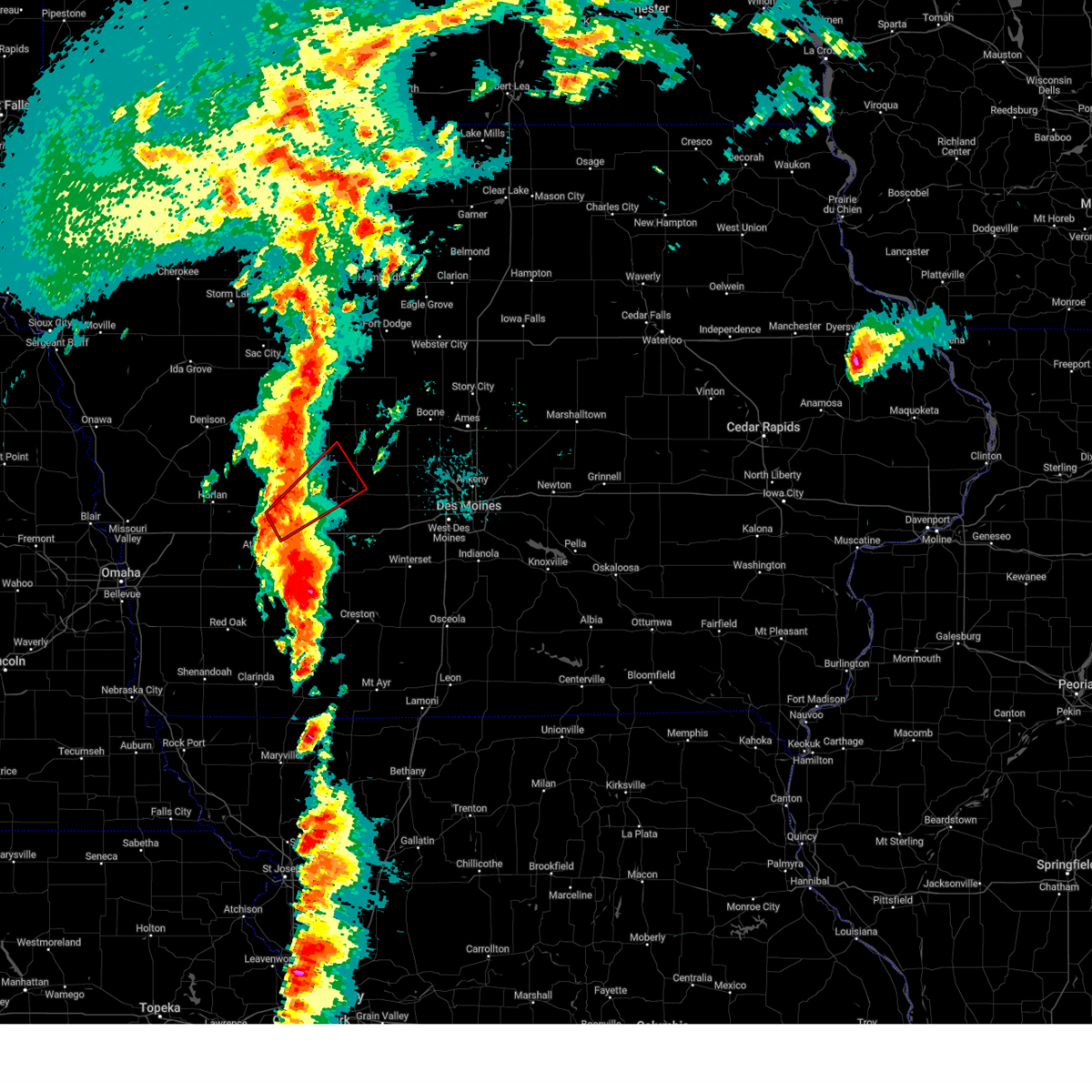 At 316 pm cdt, a confirmed tornado was located over exira, or 11 miles south of audubon, moving northeast at 25 mph (radar confirmed tornado). Hazards include damaging tornado and quarter size hail. Flying debris will be dangerous to those caught without shelter. mobile homes will be damaged or destroyed. damage to roofs, windows, and vehicles will occur. tree damage is likely. this tornado will be near, exira around 320 pm cdt. guthrie center around 355 pm cdt. other locations impacted by this tornadic thunderstorm include yale, brayton, exira, springbrook state park, bayard, and bagley. This includes interstate 80 between mile markers 63 and 67. At 316 pm cdt, a confirmed tornado was located over exira, or 11 miles south of audubon, moving northeast at 25 mph (radar confirmed tornado). Hazards include damaging tornado and quarter size hail. Flying debris will be dangerous to those caught without shelter. mobile homes will be damaged or destroyed. damage to roofs, windows, and vehicles will occur. tree damage is likely. this tornado will be near, exira around 320 pm cdt. guthrie center around 355 pm cdt. other locations impacted by this tornadic thunderstorm include yale, brayton, exira, springbrook state park, bayard, and bagley. This includes interstate 80 between mile markers 63 and 67.
|
| 5/21/2024 3:13 PM CDT |
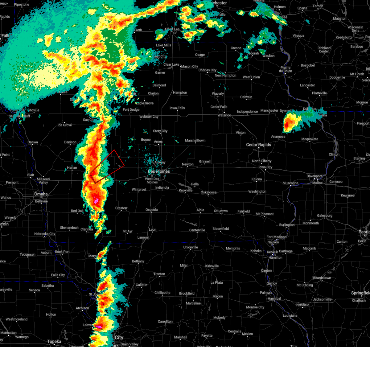 Tordmx the national weather service in des moines has issued a * tornado warning for, south central greene county in west central iowa, north central cass county in southwestern iowa, northwestern guthrie county in west central iowa, southeastern audubon county in west central iowa, * until 400 pm cdt. * at 313 pm cdt, a severe thunderstorm capable of producing a tornado was located over exira, or 11 miles south of audubon, moving northeast at 50 mph (radar indicated rotation). Hazards include tornado and quarter size hail. Flying debris will be dangerous to those caught without shelter. mobile homes will be damaged or destroyed. damage to roofs, windows, and vehicles will occur. tree damage is likely. this dangerous storm will be near, bayard and springbrook state park around 340 pm cdt. bagley around 345 pm cdt. other locations impacted by this tornadic thunderstorm include yale, brayton, exira, springbrook state park, bayard, and bagley. This includes interstate 80 between mile markers 63 and 67. Tordmx the national weather service in des moines has issued a * tornado warning for, south central greene county in west central iowa, north central cass county in southwestern iowa, northwestern guthrie county in west central iowa, southeastern audubon county in west central iowa, * until 400 pm cdt. * at 313 pm cdt, a severe thunderstorm capable of producing a tornado was located over exira, or 11 miles south of audubon, moving northeast at 50 mph (radar indicated rotation). Hazards include tornado and quarter size hail. Flying debris will be dangerous to those caught without shelter. mobile homes will be damaged or destroyed. damage to roofs, windows, and vehicles will occur. tree damage is likely. this dangerous storm will be near, bayard and springbrook state park around 340 pm cdt. bagley around 345 pm cdt. other locations impacted by this tornadic thunderstorm include yale, brayton, exira, springbrook state park, bayard, and bagley. This includes interstate 80 between mile markers 63 and 67.
|
| 5/21/2024 12:34 AM CDT |
 the severe thunderstorm warning has been cancelled and is no longer in effect the severe thunderstorm warning has been cancelled and is no longer in effect
|
| 5/21/2024 12:14 AM CDT |
 the severe thunderstorm warning has been cancelled and is no longer in effect the severe thunderstorm warning has been cancelled and is no longer in effect
|
| 5/21/2024 12:14 AM CDT |
 At 1213 am cdt, severe thunderstorms were located along a line extending from 4 miles south of breda to near minburn, moving northeast at 20 mph (radar indicated). Hazards include 60 mph wind gusts and quarter size hail. Hail damage to vehicles is expected. expect wind damage to roofs, siding, and trees. Locations impacted include, boone, carroll, perry, jefferson, adel, madrid, ogden, lake city, dallas center, glidden, woodward, boone speedway, grand junction, scranton, bayard, churdan, farnhamville, lohrville, minburn, and bagley. At 1213 am cdt, severe thunderstorms were located along a line extending from 4 miles south of breda to near minburn, moving northeast at 20 mph (radar indicated). Hazards include 60 mph wind gusts and quarter size hail. Hail damage to vehicles is expected. expect wind damage to roofs, siding, and trees. Locations impacted include, boone, carroll, perry, jefferson, adel, madrid, ogden, lake city, dallas center, glidden, woodward, boone speedway, grand junction, scranton, bayard, churdan, farnhamville, lohrville, minburn, and bagley.
|
| 5/20/2024 11:58 PM CDT |
 Svrdmx the national weather service in des moines has issued a * severe thunderstorm warning for, greene county in west central iowa, southwestern webster county in central iowa, northeastern guthrie county in west central iowa, southeastern sac county in west central iowa, southern calhoun county in west central iowa, boone county in central iowa, carroll county in west central iowa, northwestern dallas county in central iowa, * until 1245 am cdt. * at 1158 pm cdt, severe thunderstorms were located along a line extending from arcadia to 6 miles northwest of adel, moving northeast at 20 mph (radar indicated). Hazards include 60 mph wind gusts and quarter size hail. Hail damage to vehicles is expected. Expect wind damage to roofs, siding, and trees. Svrdmx the national weather service in des moines has issued a * severe thunderstorm warning for, greene county in west central iowa, southwestern webster county in central iowa, northeastern guthrie county in west central iowa, southeastern sac county in west central iowa, southern calhoun county in west central iowa, boone county in central iowa, carroll county in west central iowa, northwestern dallas county in central iowa, * until 1245 am cdt. * at 1158 pm cdt, severe thunderstorms were located along a line extending from arcadia to 6 miles northwest of adel, moving northeast at 20 mph (radar indicated). Hazards include 60 mph wind gusts and quarter size hail. Hail damage to vehicles is expected. Expect wind damage to roofs, siding, and trees.
|
| 5/19/2024 8:42 PM CDT |
 Svrdmx the national weather service in des moines has issued a * severe thunderstorm warning for, madison county in south central iowa, southeastern guthrie county in west central iowa, dallas county in central iowa, eastern adair county in southwestern iowa, * until 930 pm cdt. * at 841 pm cdt, severe thunderstorms were located along a line extending from near panora to stuart to near macksburg, moving northeast at 40 mph (radar indicated). Hazards include 60 mph wind gusts and penny size hail. expect damage to roofs, siding, and trees Svrdmx the national weather service in des moines has issued a * severe thunderstorm warning for, madison county in south central iowa, southeastern guthrie county in west central iowa, dallas county in central iowa, eastern adair county in southwestern iowa, * until 930 pm cdt. * at 841 pm cdt, severe thunderstorms were located along a line extending from near panora to stuart to near macksburg, moving northeast at 40 mph (radar indicated). Hazards include 60 mph wind gusts and penny size hail. expect damage to roofs, siding, and trees
|
| 5/6/2024 10:54 PM CDT |
 The storms which prompted the warning have weakened below severe limits, and no longer pose an immediate threat to life or property. therefore, the warning will be allowed to expire. however, gusty winds are still possible with these thunderstorms. a tornado watch remains in effect until 300 am cdt for central, south central, southwestern and west central iowa. The storms which prompted the warning have weakened below severe limits, and no longer pose an immediate threat to life or property. therefore, the warning will be allowed to expire. however, gusty winds are still possible with these thunderstorms. a tornado watch remains in effect until 300 am cdt for central, south central, southwestern and west central iowa.
|
| 5/6/2024 10:09 PM CDT |
 Svrdmx the national weather service in des moines has issued a * severe thunderstorm warning for, western madison county in south central iowa, eastern cass county in southwestern iowa, western union county in south central iowa, guthrie county in west central iowa, eastern audubon county in west central iowa, adams county in southwestern iowa, western dallas county in central iowa, adair county in southwestern iowa, * until 1100 pm cdt. * at 1009 pm cdt, severe thunderstorms were located along a line extending from 4 miles southwest of dedham to anita to 5 miles south of corning, moving northeast at 40 mph (radar indicated). Hazards include 70 mph wind gusts and penny size hail. Expect considerable tree damage. Damage is likely to mobile homes, roofs, and outbuildings. Svrdmx the national weather service in des moines has issued a * severe thunderstorm warning for, western madison county in south central iowa, eastern cass county in southwestern iowa, western union county in south central iowa, guthrie county in west central iowa, eastern audubon county in west central iowa, adams county in southwestern iowa, western dallas county in central iowa, adair county in southwestern iowa, * until 1100 pm cdt. * at 1009 pm cdt, severe thunderstorms were located along a line extending from 4 miles southwest of dedham to anita to 5 miles south of corning, moving northeast at 40 mph (radar indicated). Hazards include 70 mph wind gusts and penny size hail. Expect considerable tree damage. Damage is likely to mobile homes, roofs, and outbuildings.
|
| 4/30/2024 5:17 PM CDT |
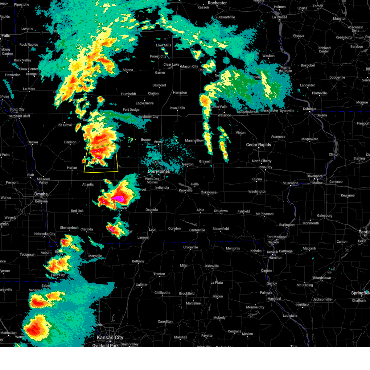 At 517 pm cdt, a severe thunderstorm was located over dedham, or 11 miles south of carroll, moving east at 55 mph (radar indicated). Hazards include 60 mph wind gusts and quarter size hail. Hail damage to vehicles is expected. expect wind damage to roofs, siding, and trees. Locations impacted include, audubon, guthrie center, coon rapids, lake panorama, scranton, bayard, templeton, kimballton, dedham, willey, gray, audubon county airport, and springbrook state park. At 517 pm cdt, a severe thunderstorm was located over dedham, or 11 miles south of carroll, moving east at 55 mph (radar indicated). Hazards include 60 mph wind gusts and quarter size hail. Hail damage to vehicles is expected. expect wind damage to roofs, siding, and trees. Locations impacted include, audubon, guthrie center, coon rapids, lake panorama, scranton, bayard, templeton, kimballton, dedham, willey, gray, audubon county airport, and springbrook state park.
|
| 4/30/2024 5:17 PM CDT |
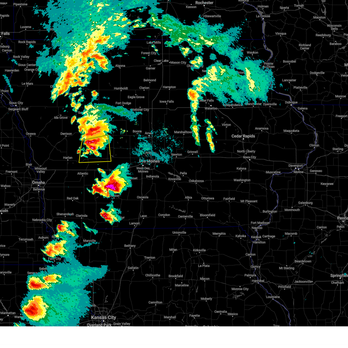 the severe thunderstorm warning has been cancelled and is no longer in effect the severe thunderstorm warning has been cancelled and is no longer in effect
|
| 4/30/2024 4:55 PM CDT |
 Svrdmx the national weather service in des moines has issued a * severe thunderstorm warning for, southwestern greene county in west central iowa, northwestern guthrie county in west central iowa, audubon county in west central iowa, southeastern crawford county in west central iowa, southern carroll county in west central iowa, * until 545 pm cdt. * at 454 pm cdt, a severe thunderstorm was located 5 miles southeast of irwin, or 10 miles west of audubon, moving east at 50 mph (radar indicated). Hazards include 60 mph wind gusts and quarter size hail. Hail damage to vehicles is expected. Expect wind damage to roofs, siding, and trees. Svrdmx the national weather service in des moines has issued a * severe thunderstorm warning for, southwestern greene county in west central iowa, northwestern guthrie county in west central iowa, audubon county in west central iowa, southeastern crawford county in west central iowa, southern carroll county in west central iowa, * until 545 pm cdt. * at 454 pm cdt, a severe thunderstorm was located 5 miles southeast of irwin, or 10 miles west of audubon, moving east at 50 mph (radar indicated). Hazards include 60 mph wind gusts and quarter size hail. Hail damage to vehicles is expected. Expect wind damage to roofs, siding, and trees.
|
| 9/19/2023 3:39 PM CDT |
 At 338 pm cdt, a severe thunderstorm was located 5 miles west of springbrook state park, or 7 miles northwest of guthrie center, moving northeast at 35 mph (radar indicated). Hazards include 60 mph wind gusts and quarter size hail. Hail damage to vehicles is expected. expect wind damage to roofs, siding, and trees. locations impacted include, guthrie center, panora, lake panorama, bagley, yale, jamaica, springbrook state park, and lakin slough game management area. hail threat, radar indicated max hail size, 1. 00 in wind threat, radar indicated max wind gust, 60 mph. At 338 pm cdt, a severe thunderstorm was located 5 miles west of springbrook state park, or 7 miles northwest of guthrie center, moving northeast at 35 mph (radar indicated). Hazards include 60 mph wind gusts and quarter size hail. Hail damage to vehicles is expected. expect wind damage to roofs, siding, and trees. locations impacted include, guthrie center, panora, lake panorama, bagley, yale, jamaica, springbrook state park, and lakin slough game management area. hail threat, radar indicated max hail size, 1. 00 in wind threat, radar indicated max wind gust, 60 mph.
|
| 9/19/2023 3:26 PM CDT |
 At 326 pm cdt, a severe thunderstorm was located 9 miles west of guthrie center, moving northeast at 35 mph (radar indicated). Hazards include 60 mph wind gusts and quarter size hail. Hail damage to vehicles is expected. Expect wind damage to roofs, siding, and trees. At 326 pm cdt, a severe thunderstorm was located 9 miles west of guthrie center, moving northeast at 35 mph (radar indicated). Hazards include 60 mph wind gusts and quarter size hail. Hail damage to vehicles is expected. Expect wind damage to roofs, siding, and trees.
|
| 8/5/2023 10:14 PM CDT |
 At 1014 pm cdt, severe thunderstorms were located along a line extending from 4 miles southeast of churdan to 5 miles north of bagley to near bayard, moving southeast at 40 mph (radar indicated). Hazards include 60 mph wind gusts. expect damage to roofs, siding, and trees At 1014 pm cdt, severe thunderstorms were located along a line extending from 4 miles southeast of churdan to 5 miles north of bagley to near bayard, moving southeast at 40 mph (radar indicated). Hazards include 60 mph wind gusts. expect damage to roofs, siding, and trees
|
| 8/5/2023 10:00 PM CDT |
 At 959 pm cdt, severe thunderstorms were located along a line extending from near churdan to near scranton to 4 miles south of dedham, moving east at 40 mph (radar indicated). Hazards include 60 mph wind gusts. Expect damage to roofs, siding, and trees. locations impacted include, carroll, perry, jefferson, audubon, guthrie center, lake city, manning, coon rapids, glidden, panora, lake panorama, exira, grand junction, adair, scranton, bayard, casey, churdan, templeton and auburn. hail threat, radar indicated max hail size, <. 75 in wind threat, radar indicated max wind gust, 60 mph. At 959 pm cdt, severe thunderstorms were located along a line extending from near churdan to near scranton to 4 miles south of dedham, moving east at 40 mph (radar indicated). Hazards include 60 mph wind gusts. Expect damage to roofs, siding, and trees. locations impacted include, carroll, perry, jefferson, audubon, guthrie center, lake city, manning, coon rapids, glidden, panora, lake panorama, exira, grand junction, adair, scranton, bayard, casey, churdan, templeton and auburn. hail threat, radar indicated max hail size, <. 75 in wind threat, radar indicated max wind gust, 60 mph.
|
| 8/5/2023 9:34 PM CDT |
 At 933 pm cdt, severe thunderstorms were located along a line extending from auburn to swan lake state park to manilla, moving southeast at 45 mph (radar indicated). Hazards include 60 mph wind gusts. Expect damage to roofs, siding, and trees. locations impacted include, carroll, denison, perry, jefferson, audubon, guthrie center, lake city, manning, coon rapids, glidden, lake view, panora, black hawk lake, lake panorama, exira, grand junction, wall lake, adair, manilla and scranton. hail threat, radar indicated max hail size, <. 75 in wind threat, radar indicated max wind gust, 60 mph. At 933 pm cdt, severe thunderstorms were located along a line extending from auburn to swan lake state park to manilla, moving southeast at 45 mph (radar indicated). Hazards include 60 mph wind gusts. Expect damage to roofs, siding, and trees. locations impacted include, carroll, denison, perry, jefferson, audubon, guthrie center, lake city, manning, coon rapids, glidden, lake view, panora, black hawk lake, lake panorama, exira, grand junction, wall lake, adair, manilla and scranton. hail threat, radar indicated max hail size, <. 75 in wind threat, radar indicated max wind gust, 60 mph.
|
| 8/5/2023 9:28 PM CDT |
 At 928 pm cdt, severe thunderstorms were located along a line extending from near lidderdale to halbur to near irwin, moving southeast at 60 mph (radar indicated). Hazards include 60 mph wind gusts. expect damage to roofs, siding, and trees At 928 pm cdt, severe thunderstorms were located along a line extending from near lidderdale to halbur to near irwin, moving southeast at 60 mph (radar indicated). Hazards include 60 mph wind gusts. expect damage to roofs, siding, and trees
|
| 6/17/2023 7:11 PM CDT |
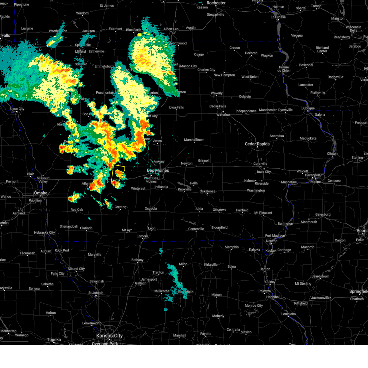 At 711 pm cdt, a severe thunderstorm was located near casey, or 10 miles north of greenfield, moving north at 25 mph (radar indicated). Hazards include 60 mph wind gusts and half dollar size hail. Hail damage to vehicles is expected. Expect wind damage to roofs, siding, and trees. At 711 pm cdt, a severe thunderstorm was located near casey, or 10 miles north of greenfield, moving north at 25 mph (radar indicated). Hazards include 60 mph wind gusts and half dollar size hail. Hail damage to vehicles is expected. Expect wind damage to roofs, siding, and trees.
|
| 4/19/2023 9:26 PM CDT |
 The severe thunderstorm warning for northwestern madison, southeastern guthrie, central adair and southern dallas counties will expire at 930 pm cdt, the storm which prompted the warning has moved out of the area. therefore, the warning will be allowed to expire. however small hail is still possible with this thunderstorm. remember, a severe thunderstorm warning still remains in effect for portions of dallas county until 945 pm. a tornado watch remains in effect until 1100 pm cdt for central, south central, southwestern and west central iowa. The severe thunderstorm warning for northwestern madison, southeastern guthrie, central adair and southern dallas counties will expire at 930 pm cdt, the storm which prompted the warning has moved out of the area. therefore, the warning will be allowed to expire. however small hail is still possible with this thunderstorm. remember, a severe thunderstorm warning still remains in effect for portions of dallas county until 945 pm. a tornado watch remains in effect until 1100 pm cdt for central, south central, southwestern and west central iowa.
|
| 4/19/2023 8:42 PM CDT |
 At 841 pm cdt, a severe thunderstorm was located 6 miles south of stuart, or 11 miles northeast of greenfield, moving northeast at 40 mph (radar indicated). Hazards include quarter size hail. Damage to vehicles is expected. this severe thunderstorm will be near, stuart around 850 pm cdt. earlham, dexter and diamondhead lake around 855 pm cdt. redfield around 900 pm cdt. other locations in the path of this severe thunderstorm include de soto, adel and dallas center. this includes interstate 80 between mile markers 81 and 111. hail threat, radar indicated max hail size, 1. 00 in wind threat, radar indicated max wind gust, <50 mph. At 841 pm cdt, a severe thunderstorm was located 6 miles south of stuart, or 11 miles northeast of greenfield, moving northeast at 40 mph (radar indicated). Hazards include quarter size hail. Damage to vehicles is expected. this severe thunderstorm will be near, stuart around 850 pm cdt. earlham, dexter and diamondhead lake around 855 pm cdt. redfield around 900 pm cdt. other locations in the path of this severe thunderstorm include de soto, adel and dallas center. this includes interstate 80 between mile markers 81 and 111. hail threat, radar indicated max hail size, 1. 00 in wind threat, radar indicated max wind gust, <50 mph.
|
| 4/4/2023 5:26 PM CDT |
 At 526 pm cdt, a severe thunderstorm was located near greenfield, moving northeast at 65 mph (radar indicated). Hazards include ping pong ball size hail and 60 mph wind gusts. People and animals outdoors will be injured. expect hail damage to roofs, siding, windows, and vehicles. expect wind damage to roofs, siding, and trees. this severe thunderstorm will be near, stuart around 540 pm cdt. earlham, dexter and diamondhead lake around 545 pm cdt. other locations in the path of this severe thunderstorm include de soto, redfield, adel, waukee, dallas center, minburn, bouton, granger and woodward. this includes interstate 80 between mile markers 86 and 113. hail threat, radar indicated max hail size, 1. 50 in wind threat, radar indicated max wind gust, 60 mph. At 526 pm cdt, a severe thunderstorm was located near greenfield, moving northeast at 65 mph (radar indicated). Hazards include ping pong ball size hail and 60 mph wind gusts. People and animals outdoors will be injured. expect hail damage to roofs, siding, windows, and vehicles. expect wind damage to roofs, siding, and trees. this severe thunderstorm will be near, stuart around 540 pm cdt. earlham, dexter and diamondhead lake around 545 pm cdt. other locations in the path of this severe thunderstorm include de soto, redfield, adel, waukee, dallas center, minburn, bouton, granger and woodward. this includes interstate 80 between mile markers 86 and 113. hail threat, radar indicated max hail size, 1. 50 in wind threat, radar indicated max wind gust, 60 mph.
|
| 7/23/2022 9:31 PM CDT |
 At 930 pm cdt, a severe thunderstorm was located 7 miles west of perry, moving east at 40 mph (radar indicated). Hazards include 60 mph wind gusts and penny size hail. Expect damage to roofs, siding, and trees. this severe storm will be near, perry municipal airport around 935 pm cdt. other locations in the path of this severe thunderstorm include perry. hail threat, radar indicated max hail size, 0. 75 in wind threat, radar indicated max wind gust, 60 mph. At 930 pm cdt, a severe thunderstorm was located 7 miles west of perry, moving east at 40 mph (radar indicated). Hazards include 60 mph wind gusts and penny size hail. Expect damage to roofs, siding, and trees. this severe storm will be near, perry municipal airport around 935 pm cdt. other locations in the path of this severe thunderstorm include perry. hail threat, radar indicated max hail size, 0. 75 in wind threat, radar indicated max wind gust, 60 mph.
|
| 7/23/2022 9:15 PM CDT |
 At 915 pm cdt, a severe thunderstorm was located over coon rapids, or 13 miles northwest of guthrie center, moving east at 70 mph (radar indicated). Hazards include 60 mph wind gusts and penny size hail. Expect damage to roofs, siding, and trees. this severe thunderstorm will be near, bayard around 920 pm cdt. lake panorama, bagley and springbrook state park around 925 pm cdt. yale, jamaica and lakin slough game management area around 930 pm cdt. rippey, dawson and perry municipal airport around 935 pm cdt. other locations in the path of this severe thunderstorm include perry. this includes interstate 80 between mile markers 107 and 112. hail threat, radar indicated max hail size, 0. 75 in wind threat, radar indicated max wind gust, 60 mph. At 915 pm cdt, a severe thunderstorm was located over coon rapids, or 13 miles northwest of guthrie center, moving east at 70 mph (radar indicated). Hazards include 60 mph wind gusts and penny size hail. Expect damage to roofs, siding, and trees. this severe thunderstorm will be near, bayard around 920 pm cdt. lake panorama, bagley and springbrook state park around 925 pm cdt. yale, jamaica and lakin slough game management area around 930 pm cdt. rippey, dawson and perry municipal airport around 935 pm cdt. other locations in the path of this severe thunderstorm include perry. this includes interstate 80 between mile markers 107 and 112. hail threat, radar indicated max hail size, 0. 75 in wind threat, radar indicated max wind gust, 60 mph.
|
| 6/15/2022 2:25 AM CDT |
 The severe thunderstorm warning for southeastern greene, eastern guthrie, boone and dallas counties will expire at 230 am cdt, the storms which prompted the warning have weakened below severe limits, and have exited some of the warned area. therefore, the warning will be allowed to expire. however heavy rain is still possible with these thunderstorms. a severe thunderstorm watch remains in effect until 400 am cdt for central, south central, southwestern and west central iowa. The severe thunderstorm warning for southeastern greene, eastern guthrie, boone and dallas counties will expire at 230 am cdt, the storms which prompted the warning have weakened below severe limits, and have exited some of the warned area. therefore, the warning will be allowed to expire. however heavy rain is still possible with these thunderstorms. a severe thunderstorm watch remains in effect until 400 am cdt for central, south central, southwestern and west central iowa.
|
| 6/15/2022 1:41 AM CDT |
 At 139 am cdt, severe thunderstorms were located along a line extending from near jefferson to near stuart, moving northeast at 55 mph (radar indicated. at 134 am, guthrie county emergency management reported 65 mph wind near the intersection of 310th street and highway 25). Hazards include 60 mph wind gusts and penny size hail. expect damage to roofs, siding, and trees At 139 am cdt, severe thunderstorms were located along a line extending from near jefferson to near stuart, moving northeast at 55 mph (radar indicated. at 134 am, guthrie county emergency management reported 65 mph wind near the intersection of 310th street and highway 25). Hazards include 60 mph wind gusts and penny size hail. expect damage to roofs, siding, and trees
|
| 6/15/2022 1:03 AM CDT |
 At 103 am cdt, severe thunderstorms were located along a line extending from 9 miles east of manning to audubon to 8 miles north of atlantic, moving northeast at 45 mph (radar indicated). Hazards include 60 mph wind gusts and nickel size hail. expect damage to roofs, siding, and trees At 103 am cdt, severe thunderstorms were located along a line extending from 9 miles east of manning to audubon to 8 miles north of atlantic, moving northeast at 45 mph (radar indicated). Hazards include 60 mph wind gusts and nickel size hail. expect damage to roofs, siding, and trees
|
| 6/15/2022 12:54 AM CDT |
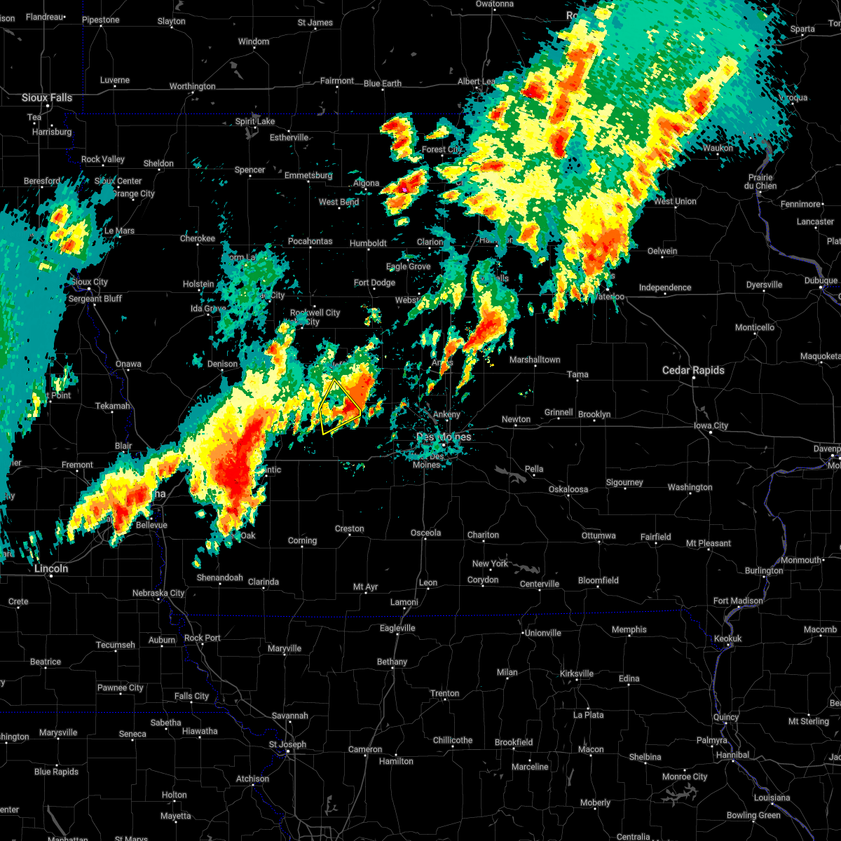 The severe thunderstorm warning for south central greene and northeastern guthrie counties will expire at 100 am cdt, the storm which prompted the warning has weakened below severe limits, and no longer poses an immediate threat to life or property. therefore, the warning will be allowed to expire. another very strong storm is now just southwest of the area. additional warnings are likely in the next 1 to 2 hours. a severe thunderstorm watch remains in effect until 400 am cdt for central and west central iowa. The severe thunderstorm warning for south central greene and northeastern guthrie counties will expire at 100 am cdt, the storm which prompted the warning has weakened below severe limits, and no longer poses an immediate threat to life or property. therefore, the warning will be allowed to expire. another very strong storm is now just southwest of the area. additional warnings are likely in the next 1 to 2 hours. a severe thunderstorm watch remains in effect until 400 am cdt for central and west central iowa.
|
| 6/15/2022 12:41 AM CDT |
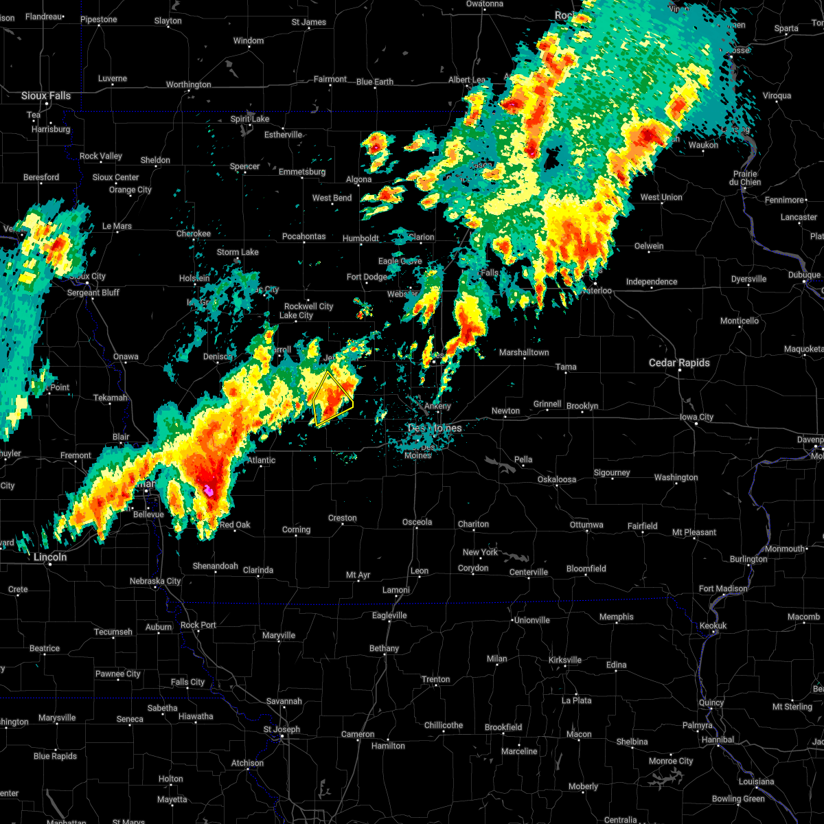 At 1241 am cdt, a severe thunderstorm was located over lake panorama, or 7 miles northeast of guthrie center, moving northeast at 55 mph (radar indicated). Hazards include 60 mph wind gusts and quarter size hail. Hail damage to vehicles is expected. expect wind damage to roofs, siding, and trees. this severe storm will be near, bagley, yale and lakin slough game management area around 1245 am cdt. hail threat, radar indicated max hail size, 1. 00 in wind threat, radar indicated max wind gust, 60 mph. At 1241 am cdt, a severe thunderstorm was located over lake panorama, or 7 miles northeast of guthrie center, moving northeast at 55 mph (radar indicated). Hazards include 60 mph wind gusts and quarter size hail. Hail damage to vehicles is expected. expect wind damage to roofs, siding, and trees. this severe storm will be near, bagley, yale and lakin slough game management area around 1245 am cdt. hail threat, radar indicated max hail size, 1. 00 in wind threat, radar indicated max wind gust, 60 mph.
|
| 6/15/2022 12:26 AM CDT |
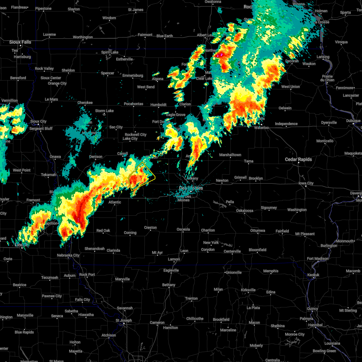 At 1226 am cdt, a severe thunderstorm was located near guthrie center, moving northeast at 30 mph (radar indicated). Hazards include 60 mph wind gusts and quarter size hail. Hail damage to vehicles is expected. expect wind damage to roofs, siding, and trees. this severe storm will be near, guthrie center around 1230 am cdt. other locations in the path of this severe thunderstorm include bayard, lake panorama, springbrook state park, bagley, yale and lakin slough game management area. hail threat, radar indicated max hail size, 1. 00 in wind threat, radar indicated max wind gust, 60 mph. At 1226 am cdt, a severe thunderstorm was located near guthrie center, moving northeast at 30 mph (radar indicated). Hazards include 60 mph wind gusts and quarter size hail. Hail damage to vehicles is expected. expect wind damage to roofs, siding, and trees. this severe storm will be near, guthrie center around 1230 am cdt. other locations in the path of this severe thunderstorm include bayard, lake panorama, springbrook state park, bagley, yale and lakin slough game management area. hail threat, radar indicated max hail size, 1. 00 in wind threat, radar indicated max wind gust, 60 mph.
|
| 6/15/2022 12:12 AM CDT |
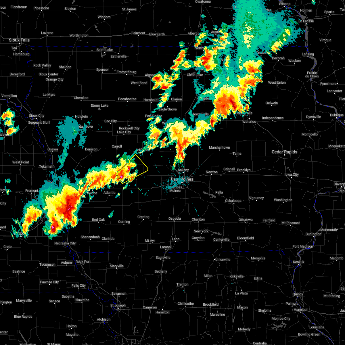 At 1211 am cdt, a severe thunderstorm was located 10 miles east of audubon, moving northeast at 35 mph (radar indicated). Hazards include 60 mph wind gusts and quarter size hail. Hail damage to vehicles is expected. expect wind damage to roofs, siding, and trees. this severe thunderstorm will be near, guthrie center around 1230 am cdt. other locations in the path of this severe thunderstorm include lake panorama, bayard, springbrook state park, bagley, yale and lakin slough game management area. hail threat, radar indicated max hail size, 1. 00 in wind threat, radar indicated max wind gust, 60 mph. At 1211 am cdt, a severe thunderstorm was located 10 miles east of audubon, moving northeast at 35 mph (radar indicated). Hazards include 60 mph wind gusts and quarter size hail. Hail damage to vehicles is expected. expect wind damage to roofs, siding, and trees. this severe thunderstorm will be near, guthrie center around 1230 am cdt. other locations in the path of this severe thunderstorm include lake panorama, bayard, springbrook state park, bagley, yale and lakin slough game management area. hail threat, radar indicated max hail size, 1. 00 in wind threat, radar indicated max wind gust, 60 mph.
|
| 6/14/2022 11:07 PM CDT |
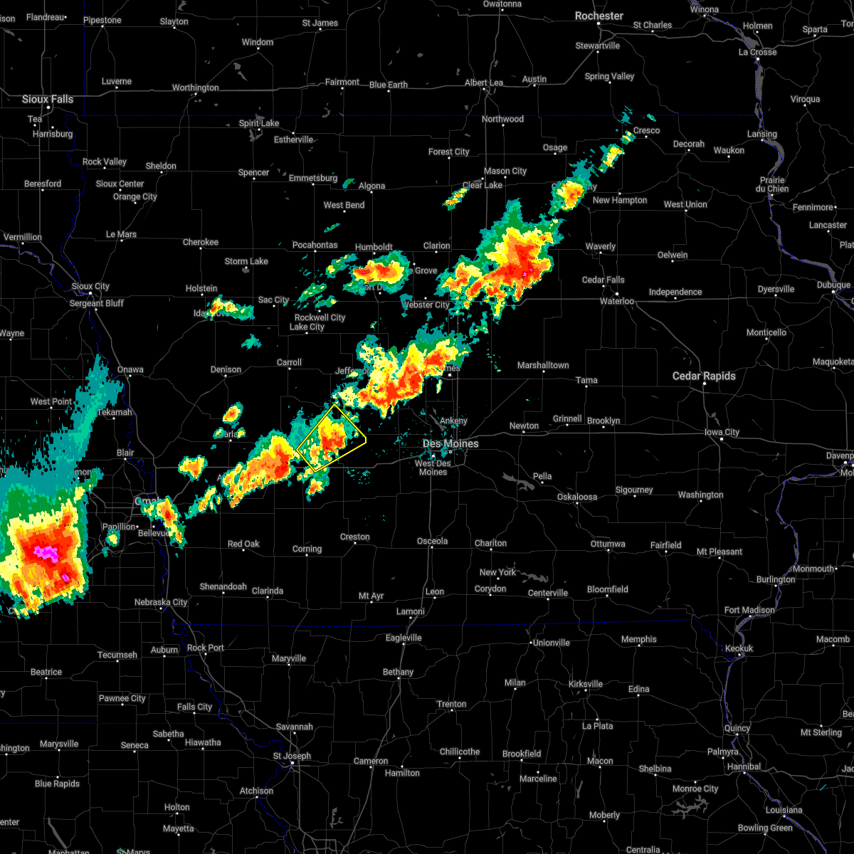 The severe thunderstorm warning for northeastern cass, central guthrie, southeastern audubon and northwestern adair counties will expire at 1115 pm cdt, the storm which prompted the warning has weakened below severe limits, and no longer poses an immediate threat to life or property. therefore, the warning will be allowed to expire. however gusty winds are still possible with this thunderstorm. a severe thunderstorm watch remains in effect until 400 am cdt for central, southwestern and west central iowa. The severe thunderstorm warning for northeastern cass, central guthrie, southeastern audubon and northwestern adair counties will expire at 1115 pm cdt, the storm which prompted the warning has weakened below severe limits, and no longer poses an immediate threat to life or property. therefore, the warning will be allowed to expire. however gusty winds are still possible with this thunderstorm. a severe thunderstorm watch remains in effect until 400 am cdt for central, southwestern and west central iowa.
|
| 6/14/2022 10:46 PM CDT |
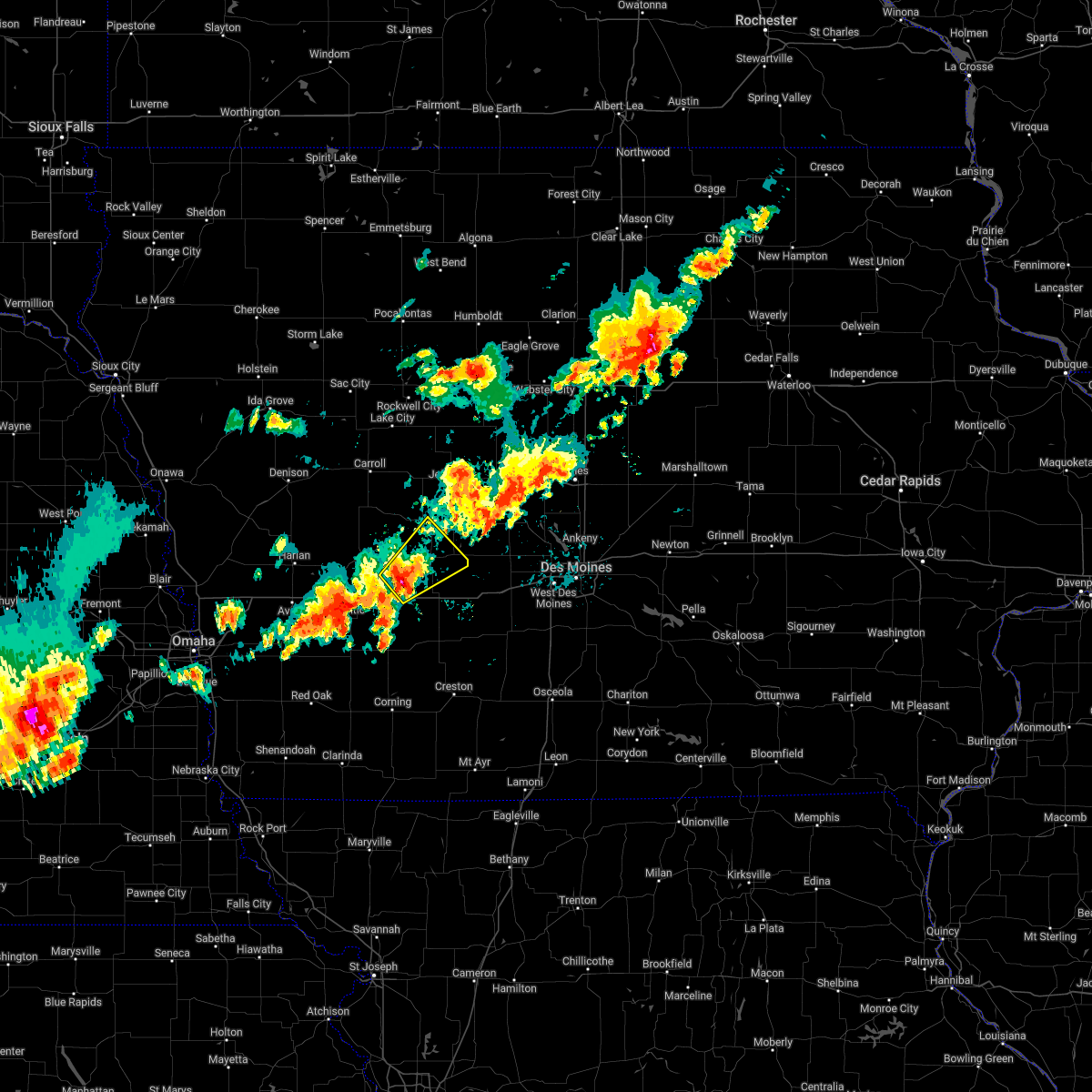 At 1046 pm cdt, a severe thunderstorm was located 8 miles southwest of guthrie center, moving northeast at 35 mph (radar indicated). Hazards include 60 mph wind gusts and quarter size hail. Hail damage to vehicles is expected. expect wind damage to roofs, siding, and trees. locations impacted include, guthrie center, panora, lake panorama and springbrook state park. hail threat, radar indicated max hail size, 1. 00 in wind threat, radar indicated max wind gust, 60 mph. At 1046 pm cdt, a severe thunderstorm was located 8 miles southwest of guthrie center, moving northeast at 35 mph (radar indicated). Hazards include 60 mph wind gusts and quarter size hail. Hail damage to vehicles is expected. expect wind damage to roofs, siding, and trees. locations impacted include, guthrie center, panora, lake panorama and springbrook state park. hail threat, radar indicated max hail size, 1. 00 in wind threat, radar indicated max wind gust, 60 mph.
|
| 6/14/2022 10:29 PM CDT |
 At 1029 pm cdt, a severe thunderstorm was located 14 miles northeast of atlantic, moving northeast at 35 mph (radar indicated). Hazards include 60 mph wind gusts and quarter size hail. Hail damage to vehicles is expected. expect wind damage to roofs, siding, and trees. this severe thunderstorm will be near, adair around 1040 pm cdt. other locations in the path of this severe thunderstorm include guthrie center, panora, lake panorama and springbrook state park. this includes interstate 80 between mile markers 62 and 79. hail threat, radar indicated max hail size, 1. 00 in wind threat, radar indicated max wind gust, 60 mph. At 1029 pm cdt, a severe thunderstorm was located 14 miles northeast of atlantic, moving northeast at 35 mph (radar indicated). Hazards include 60 mph wind gusts and quarter size hail. Hail damage to vehicles is expected. expect wind damage to roofs, siding, and trees. this severe thunderstorm will be near, adair around 1040 pm cdt. other locations in the path of this severe thunderstorm include guthrie center, panora, lake panorama and springbrook state park. this includes interstate 80 between mile markers 62 and 79. hail threat, radar indicated max hail size, 1. 00 in wind threat, radar indicated max wind gust, 60 mph.
|
| 4/23/2022 5:56 PM CDT |
 At 556 pm cdt, severe thunderstorms were located along a line extending from near dakota city to lake panorama, moving northeast at 35 mph (radar indicated). Hazards include 60 mph wind gusts. expect damage to roofs, siding, and trees At 556 pm cdt, severe thunderstorms were located along a line extending from near dakota city to lake panorama, moving northeast at 35 mph (radar indicated). Hazards include 60 mph wind gusts. expect damage to roofs, siding, and trees
|
| 4/23/2022 5:48 PM CDT |
 At 548 pm cdt, severe thunderstorms were located along a line extending from near fort dodge to near guthrie center, moving northeast at 70 mph (radar indicated). Hazards include 60 mph wind gusts. Expect damage to roofs, siding, and trees. Locations impacted include, fort dodge, jefferson, guthrie center, coon rapids, gowrie, fort dodge regional airport, lake panorama, badger, scranton, bayard, churdan, callender, farnhamville, lohrville, bagley, barnum, moorland, somers, ralston and knierim. At 548 pm cdt, severe thunderstorms were located along a line extending from near fort dodge to near guthrie center, moving northeast at 70 mph (radar indicated). Hazards include 60 mph wind gusts. Expect damage to roofs, siding, and trees. Locations impacted include, fort dodge, jefferson, guthrie center, coon rapids, gowrie, fort dodge regional airport, lake panorama, badger, scranton, bayard, churdan, callender, farnhamville, lohrville, bagley, barnum, moorland, somers, ralston and knierim.
|
| 4/23/2022 5:31 PM CDT |
 At 530 pm cdt, severe thunderstorms were located along a line extending from 8 miles northeast of glidden to 6 miles east of atlantic, moving northeast at 30 mph (radar indicated). Hazards include 60 mph wind gusts. Expect damage to roofs, siding, and trees. Locations impacted include, fort dodge, jefferson, audubon, guthrie center, coon rapids, glidden, gowrie, fort dodge regional airport, lake panorama, exira, adair, badger, scranton, bayard, casey, churdan, callender, farnhamville, lohrville and bagley. At 530 pm cdt, severe thunderstorms were located along a line extending from 8 miles northeast of glidden to 6 miles east of atlantic, moving northeast at 30 mph (radar indicated). Hazards include 60 mph wind gusts. Expect damage to roofs, siding, and trees. Locations impacted include, fort dodge, jefferson, audubon, guthrie center, coon rapids, glidden, gowrie, fort dodge regional airport, lake panorama, exira, adair, badger, scranton, bayard, casey, churdan, callender, farnhamville, lohrville and bagley.
|
| 4/23/2022 5:17 PM CDT |
 At 517 pm cdt, severe thunderstorms were located along a line extending from near glidden to 6 miles south of atlantic, moving northeast at 30 mph (radar indicated). Hazards include 60 mph wind gusts. expect damage to roofs, siding, and trees At 517 pm cdt, severe thunderstorms were located along a line extending from near glidden to 6 miles south of atlantic, moving northeast at 30 mph (radar indicated). Hazards include 60 mph wind gusts. expect damage to roofs, siding, and trees
|
| 4/23/2022 7:08 AM CDT |
 At 708 am cdt, a severe thunderstorm was located 8 miles northeast of panora, or 8 miles southwest of perry, moving northeast at 55 mph (radar indicated). Hazards include 60 mph wind gusts and quarter size hail. Hail damage to vehicles is expected. expect wind damage to roofs, siding, and trees. locations impacted include, perry municipal airport and perry. hail threat, radar indicated max hail size, 1. 00 in wind threat, radar indicated max wind gust, 60 mph. At 708 am cdt, a severe thunderstorm was located 8 miles northeast of panora, or 8 miles southwest of perry, moving northeast at 55 mph (radar indicated). Hazards include 60 mph wind gusts and quarter size hail. Hail damage to vehicles is expected. expect wind damage to roofs, siding, and trees. locations impacted include, perry municipal airport and perry. hail threat, radar indicated max hail size, 1. 00 in wind threat, radar indicated max wind gust, 60 mph.
|
| 4/23/2022 6:54 AM CDT |
 At 653 am cdt, a severe thunderstorm was located near stuart, or 11 miles southeast of guthrie center, moving northeast at 55 mph (radar indicated). Hazards include 60 mph wind gusts and quarter size hail. Hail damage to vehicles is expected. expect wind damage to roofs, siding, and trees. this severe thunderstorm will be near, yale around 705 am cdt. lakin slough game management area around 710 am cdt. other locations in the path of this severe thunderstorm include dawson, perry municipal airport and perry. hail threat, radar indicated max hail size, 1. 00 in wind threat, radar indicated max wind gust, 60 mph. At 653 am cdt, a severe thunderstorm was located near stuart, or 11 miles southeast of guthrie center, moving northeast at 55 mph (radar indicated). Hazards include 60 mph wind gusts and quarter size hail. Hail damage to vehicles is expected. expect wind damage to roofs, siding, and trees. this severe thunderstorm will be near, yale around 705 am cdt. lakin slough game management area around 710 am cdt. other locations in the path of this severe thunderstorm include dawson, perry municipal airport and perry. hail threat, radar indicated max hail size, 1. 00 in wind threat, radar indicated max wind gust, 60 mph.
|
| 12/15/2021 5:55 PM CST |
 At 554 pm cst, severe thunderstorms were located along a line extending from near boone to grimes to near winterset, moving east at 80 mph. dallas county emergency management confirmed 80 mph winds moving through the county. these are destructive storms for central iowa (emergency management). Hazards include 80 mph wind gusts. Flying debris will be dangerous to those caught without shelter. mobile homes will be heavily damaged. expect considerable damage to roofs, windows, and vehicles. extensive tree damage and power outages are likely. Locations impacted include, des moines, west des moines, ankeny, urbandale, johnston, clive, indianola, altoona, waukee, norwalk, pleasant hill, grimes, perry, winterset, adel, greenfield, windsor heights, carlisle, bondurant and polk city. At 554 pm cst, severe thunderstorms were located along a line extending from near boone to grimes to near winterset, moving east at 80 mph. dallas county emergency management confirmed 80 mph winds moving through the county. these are destructive storms for central iowa (emergency management). Hazards include 80 mph wind gusts. Flying debris will be dangerous to those caught without shelter. mobile homes will be heavily damaged. expect considerable damage to roofs, windows, and vehicles. extensive tree damage and power outages are likely. Locations impacted include, des moines, west des moines, ankeny, urbandale, johnston, clive, indianola, altoona, waukee, norwalk, pleasant hill, grimes, perry, winterset, adel, greenfield, windsor heights, carlisle, bondurant and polk city.
|
| 12/15/2021 5:40 PM CST |
 At 539 pm cst, severe thunderstorms were located along a line extending from 6 miles northwest of perry to 10 miles southwest of winterset, moving east at 65 mph. these are destructive storms for central iowa (radar indicated). Hazards include 80 mph wind gusts. Flying debris will be dangerous to those caught without shelter. mobile homes will be heavily damaged. expect considerable damage to roofs, windows, and vehicles. extensive tree damage and power outages are likely. Locations impacted include, des moines, west des moines, ankeny, urbandale, johnston, clive, indianola, altoona, waukee, norwalk, pleasant hill, grimes, perry, winterset, adel, greenfield, guthrie center, windsor heights, carlisle and bondurant. At 539 pm cst, severe thunderstorms were located along a line extending from 6 miles northwest of perry to 10 miles southwest of winterset, moving east at 65 mph. these are destructive storms for central iowa (radar indicated). Hazards include 80 mph wind gusts. Flying debris will be dangerous to those caught without shelter. mobile homes will be heavily damaged. expect considerable damage to roofs, windows, and vehicles. extensive tree damage and power outages are likely. Locations impacted include, des moines, west des moines, ankeny, urbandale, johnston, clive, indianola, altoona, waukee, norwalk, pleasant hill, grimes, perry, winterset, adel, greenfield, guthrie center, windsor heights, carlisle and bondurant.
|
| 12/15/2021 5:10 PM CST |
 At 509 pm cst, severe thunderstorms were located along a line extending from near coon rapids to 8 miles north of lake icaria, moving east at 80 mph. these are destructive storms for central iowa (radar indicated). Hazards include 80 mph wind gusts. Flying debris will be dangerous to those caught without shelter. mobile homes will be heavily damaged. expect considerable damage to roofs, windows, and vehicles. Extensive tree damage and power outages are likely. At 509 pm cst, severe thunderstorms were located along a line extending from near coon rapids to 8 miles north of lake icaria, moving east at 80 mph. these are destructive storms for central iowa (radar indicated). Hazards include 80 mph wind gusts. Flying debris will be dangerous to those caught without shelter. mobile homes will be heavily damaged. expect considerable damage to roofs, windows, and vehicles. Extensive tree damage and power outages are likely.
|
| 6/22/2021 7:10 PM CDT |
 At 709 pm cdt, a severe thunderstorm was located near lake panorama, or 10 miles northeast of guthrie center, moving southeast at 25 mph (radar indicated). Hazards include 60 mph wind gusts and half dollar size hail. Hail damage to vehicles is expected. expect wind damage to roofs, siding, and trees. Locations impacted include, adel, panora, lake panorama, redfield, bagley, yale, jamaica, linden, dawson, perry municipal airport, lakin slough game management area and springbrook state park. At 709 pm cdt, a severe thunderstorm was located near lake panorama, or 10 miles northeast of guthrie center, moving southeast at 25 mph (radar indicated). Hazards include 60 mph wind gusts and half dollar size hail. Hail damage to vehicles is expected. expect wind damage to roofs, siding, and trees. Locations impacted include, adel, panora, lake panorama, redfield, bagley, yale, jamaica, linden, dawson, perry municipal airport, lakin slough game management area and springbrook state park.
|
| 6/22/2021 6:57 PM CDT |
 At 657 pm cdt, a severe thunderstorm was located 7 miles north of lake panorama, or 12 miles northeast of guthrie center, moving southeast at 45 mph (trained spotter reported golf ball sized hail). Hazards include golf ball size hail and 60 mph wind gusts. People and animals outdoors will be injured. expect hail damage to roofs, siding, windows, and vehicles. expect wind damage to roofs, siding, and trees. Locations impacted include, panora. At 657 pm cdt, a severe thunderstorm was located 7 miles north of lake panorama, or 12 miles northeast of guthrie center, moving southeast at 45 mph (trained spotter reported golf ball sized hail). Hazards include golf ball size hail and 60 mph wind gusts. People and animals outdoors will be injured. expect hail damage to roofs, siding, windows, and vehicles. expect wind damage to roofs, siding, and trees. Locations impacted include, panora.
|
| 6/22/2021 6:49 PM CDT |
 At 649 pm cdt, a severe thunderstorm was located 9 miles southwest of jefferson, moving southeast at 40 mph (radar indicated). Hazards include golf ball size hail and 60 mph wind gusts. People and animals outdoors will be injured. expect hail damage to roofs, siding, windows, and vehicles. expect wind damage to roofs, siding, and trees. this severe thunderstorm will be near, lake panorama around 705 pm cdt. Other locations in the path of this severe thunderstorm include panora. At 649 pm cdt, a severe thunderstorm was located 9 miles southwest of jefferson, moving southeast at 40 mph (radar indicated). Hazards include golf ball size hail and 60 mph wind gusts. People and animals outdoors will be injured. expect hail damage to roofs, siding, windows, and vehicles. expect wind damage to roofs, siding, and trees. this severe thunderstorm will be near, lake panorama around 705 pm cdt. Other locations in the path of this severe thunderstorm include panora.
|
| 6/16/2021 11:01 PM CDT |
 At 1043 pm cdt, a severe thunderstorm was located 9 miles southwest of guthrie center, moving southeast at 40 mph (radar indicated). Hazards include 60 mph wind gusts and quarter size hail. Hail damage to vehicles is expected. expect wind damage to roofs, siding, and trees. Locations impacted include, audubon, guthrie center, stuart, panora, lake panorama, exira, adair, elk horn, bayard, casey, diamondhead lake, menlo, kimballton, bagley, yale, brayton, gray, audubon county airport and springbrook state park. At 1043 pm cdt, a severe thunderstorm was located 9 miles southwest of guthrie center, moving southeast at 40 mph (radar indicated). Hazards include 60 mph wind gusts and quarter size hail. Hail damage to vehicles is expected. expect wind damage to roofs, siding, and trees. Locations impacted include, audubon, guthrie center, stuart, panora, lake panorama, exira, adair, elk horn, bayard, casey, diamondhead lake, menlo, kimballton, bagley, yale, brayton, gray, audubon county airport and springbrook state park.
|
| 6/16/2021 10:44 PM CDT |
 At 1043 pm cdt, a severe thunderstorm was located 9 miles southwest of guthrie center, moving southeast at 40 mph (radar indicated). Hazards include 60 mph wind gusts and quarter size hail. Hail damage to vehicles is expected. expect wind damage to roofs, siding, and trees. Locations impacted include, audubon, guthrie center, stuart, panora, lake panorama, exira, adair, elk horn, bayard, casey, diamondhead lake, menlo, kimballton, bagley, yale, brayton, gray, audubon county airport and springbrook state park. At 1043 pm cdt, a severe thunderstorm was located 9 miles southwest of guthrie center, moving southeast at 40 mph (radar indicated). Hazards include 60 mph wind gusts and quarter size hail. Hail damage to vehicles is expected. expect wind damage to roofs, siding, and trees. Locations impacted include, audubon, guthrie center, stuart, panora, lake panorama, exira, adair, elk horn, bayard, casey, diamondhead lake, menlo, kimballton, bagley, yale, brayton, gray, audubon county airport and springbrook state park.
|
| 6/16/2021 10:23 PM CDT |
 At 1023 pm cdt, a severe thunderstorm was located near coon rapids, or 10 miles northeast of audubon, moving southeast at 40 mph (radar indicated). Hazards include 60 mph wind gusts and quarter size hail. Hail damage to vehicles is expected. expect wind damage to roofs, siding, and trees. This severe thunderstorm will remain over mainly rural areas of southwestern greene, guthrie, audubon and southeastern carroll counties, including the following locations, exira, gray, kimballton, yale, elk horn, casey, menlo, bayard, dedham and brayton. At 1023 pm cdt, a severe thunderstorm was located near coon rapids, or 10 miles northeast of audubon, moving southeast at 40 mph (radar indicated). Hazards include 60 mph wind gusts and quarter size hail. Hail damage to vehicles is expected. expect wind damage to roofs, siding, and trees. This severe thunderstorm will remain over mainly rural areas of southwestern greene, guthrie, audubon and southeastern carroll counties, including the following locations, exira, gray, kimballton, yale, elk horn, casey, menlo, bayard, dedham and brayton.
|
| 8/10/2020 10:25 AM CDT |
 At 1024 am cdt, severe thunderstorms were located along a line extending from near gowrie to 9 miles northwest of perry to near stuart, moving east at 55 mph (trained weather spotters and numerous other reports with 70 mph plus winds reported with these storms). Hazards include 70 mph wind gusts and quarter size hail. Hail damage to vehicles is expected. expect considerable tree damage. wind damage is also likely to mobile homes, roofs, and outbuildings. locations impacted include, west des moines, urbandale, johnston, clive, waukee, boone, grimes, perry, jefferson, adel, guthrie center, polk city, madrid, ogden, stuart, dallas center, earlham, granger, panora and de soto. this includes the following highways, interstate 35 between mile markers 67 and 72. interstate 80 between mile markers 100 and 129. Interstate 235 near mile marker 1. At 1024 am cdt, severe thunderstorms were located along a line extending from near gowrie to 9 miles northwest of perry to near stuart, moving east at 55 mph (trained weather spotters and numerous other reports with 70 mph plus winds reported with these storms). Hazards include 70 mph wind gusts and quarter size hail. Hail damage to vehicles is expected. expect considerable tree damage. wind damage is also likely to mobile homes, roofs, and outbuildings. locations impacted include, west des moines, urbandale, johnston, clive, waukee, boone, grimes, perry, jefferson, adel, guthrie center, polk city, madrid, ogden, stuart, dallas center, earlham, granger, panora and de soto. this includes the following highways, interstate 35 between mile markers 67 and 72. interstate 80 between mile markers 100 and 129. Interstate 235 near mile marker 1.
|
| 8/10/2020 10:11 AM CDT |
 At 1011 am cdt, severe thunderstorms were located along a line extending from 11 miles east of lake city to near jefferson to 8 miles west of stuart, moving east at 55 mph (radar indicated). Hazards include 70 mph wind gusts and quarter size hail. Hail damage to vehicles is expected. expect considerable tree damage. Wind damage is also likely to mobile homes, roofs, and outbuildings. At 1011 am cdt, severe thunderstorms were located along a line extending from 11 miles east of lake city to near jefferson to 8 miles west of stuart, moving east at 55 mph (radar indicated). Hazards include 70 mph wind gusts and quarter size hail. Hail damage to vehicles is expected. expect considerable tree damage. Wind damage is also likely to mobile homes, roofs, and outbuildings.
|
| 8/10/2020 9:57 AM CDT |
 At 957 am cdt, severe thunderstorms were located along a line extending from 6 miles south of lake city to coon rapids to 12 miles southeast of audubon, moving east at 60 mph (radar indicated). Hazards include 70 mph wind gusts and quarter size hail. Hail damage to vehicles is expected. expect considerable tree damage. wind damage is also likely to mobile homes, roofs, and outbuildings. Locations impacted include, carroll, jefferson, audubon, guthrie center, manning, coon rapids, glidden, panora, lake panorama, exira, elk horn, scranton, arcadia, breda, bayard, casey, churdan, templeton, menlo and kimballton. At 957 am cdt, severe thunderstorms were located along a line extending from 6 miles south of lake city to coon rapids to 12 miles southeast of audubon, moving east at 60 mph (radar indicated). Hazards include 70 mph wind gusts and quarter size hail. Hail damage to vehicles is expected. expect considerable tree damage. wind damage is also likely to mobile homes, roofs, and outbuildings. Locations impacted include, carroll, jefferson, audubon, guthrie center, manning, coon rapids, glidden, panora, lake panorama, exira, elk horn, scranton, arcadia, breda, bayard, casey, churdan, templeton, menlo and kimballton.
|
| 8/10/2020 9:29 AM CDT |
 At 929 am cdt, a severe thunderstorm was located 7 miles northwest of manning, or 9 miles east of denison, moving east at 55 mph (radar indicated). Hazards include 70 mph wind gusts and quarter size hail. Hail damage to vehicles is expected. expect considerable tree damage. Wind damage is also likely to mobile homes, roofs, and outbuildings. At 929 am cdt, a severe thunderstorm was located 7 miles northwest of manning, or 9 miles east of denison, moving east at 55 mph (radar indicated). Hazards include 70 mph wind gusts and quarter size hail. Hail damage to vehicles is expected. expect considerable tree damage. Wind damage is also likely to mobile homes, roofs, and outbuildings.
|
| 8/6/2020 11:29 AM CDT |
 At 1128 am cdt, a severe thunderstorm was located 8 miles northwest of lake panorama, or 12 miles north of guthrie center, moving east at 30 mph (radar indicated). Hazards include quarter size hail. Damage to vehicles is expected. Locations impacted include, lake panorama, bayard, bagley, yale, jamaica, springbrook state park and lakin slough game management area. At 1128 am cdt, a severe thunderstorm was located 8 miles northwest of lake panorama, or 12 miles north of guthrie center, moving east at 30 mph (radar indicated). Hazards include quarter size hail. Damage to vehicles is expected. Locations impacted include, lake panorama, bayard, bagley, yale, jamaica, springbrook state park and lakin slough game management area.
|
| 8/6/2020 11:11 AM CDT |
 At 1111 am cdt, a severe thunderstorm was located over coon rapids, or 14 miles northwest of guthrie center, moving east at 30 mph (radar indicated). Hazards include quarter size hail. damage to vehicles is expected At 1111 am cdt, a severe thunderstorm was located over coon rapids, or 14 miles northwest of guthrie center, moving east at 30 mph (radar indicated). Hazards include quarter size hail. damage to vehicles is expected
|
| 6/5/2020 4:37 AM CDT |
 At 437 am cdt, severe thunderstorms were located along a line extending from near saylorville lake to near earlham, moving southeast at 45 mph (radar indicated). Hazards include 70 mph wind gusts and quarter size hail. Hail damage to vehicles is expected. expect considerable tree damage. wind damage is also likely to mobile homes, roofs, and outbuildings. locations impacted include, des moines, west des moines, ankeny, urbandale, johnston, clive, altoona, waukee, grimes, perry, adel, windsor heights, bondurant, polk city, huxley, saylorville, madrid, stuart, dallas center and slater. this includes the following highways, interstate 35 between mile markers 67 and 72, and between mile markers 87 and 102. interstate 80 between mile markers 97 and 146. Interstate 235 between mile markers 1 and 14. At 437 am cdt, severe thunderstorms were located along a line extending from near saylorville lake to near earlham, moving southeast at 45 mph (radar indicated). Hazards include 70 mph wind gusts and quarter size hail. Hail damage to vehicles is expected. expect considerable tree damage. wind damage is also likely to mobile homes, roofs, and outbuildings. locations impacted include, des moines, west des moines, ankeny, urbandale, johnston, clive, altoona, waukee, grimes, perry, adel, windsor heights, bondurant, polk city, huxley, saylorville, madrid, stuart, dallas center and slater. this includes the following highways, interstate 35 between mile markers 67 and 72, and between mile markers 87 and 102. interstate 80 between mile markers 97 and 146. Interstate 235 between mile markers 1 and 14.
|
| 6/5/2020 4:28 AM CDT |
 The severe thunderstorm warning for southern greene, eastern guthrie, southwestern boone and northwestern dallas counties will expire at 430 am cdt, the storms which prompted the warning have moved out of the area. therefore, the warning will be allowed to expire. a severe thunderstorm watch remains in effect until 700 am cdt for central and west central iowa. remember, a severe thunderstorm warning still remains in effect for portions of boone, dallas and guthrie counties. The severe thunderstorm warning for southern greene, eastern guthrie, southwestern boone and northwestern dallas counties will expire at 430 am cdt, the storms which prompted the warning have moved out of the area. therefore, the warning will be allowed to expire. a severe thunderstorm watch remains in effect until 700 am cdt for central and west central iowa. remember, a severe thunderstorm warning still remains in effect for portions of boone, dallas and guthrie counties.
|
| 6/5/2020 4:12 AM CDT |
 At 411 am cdt, severe thunderstorms were located along a line extending from near boone speedway to 6 miles north of panora, moving southeast at 35 mph (radar indicated). Hazards include 70 mph wind gusts and quarter size hail. Hail damage to vehicles is expected. expect considerable tree damage. Wind damage is also likely to mobile homes, roofs, and outbuildings. At 411 am cdt, severe thunderstorms were located along a line extending from near boone speedway to 6 miles north of panora, moving southeast at 35 mph (radar indicated). Hazards include 70 mph wind gusts and quarter size hail. Hail damage to vehicles is expected. expect considerable tree damage. Wind damage is also likely to mobile homes, roofs, and outbuildings.
|
| 6/5/2020 4:05 AM CDT |
 At 404 am cdt, severe thunderstorms were located along a line extending from near ogden to near lake panorama, moving southeast at 35 mph (trained weather spotters reported trees and powerlines down in jefferson with this storm). Hazards include 70 mph wind gusts. Expect considerable tree damage. damage is likely to mobile homes, roofs, and outbuildings. Locations impacted include, boone, perry, jefferson, madrid, ogden, panora, woodward, lake panorama, boone speedway, grand junction, bayard, minburn, bagley, rippey, yale, jamaica, linden, boxholm, dawson and bouton. At 404 am cdt, severe thunderstorms were located along a line extending from near ogden to near lake panorama, moving southeast at 35 mph (trained weather spotters reported trees and powerlines down in jefferson with this storm). Hazards include 70 mph wind gusts. Expect considerable tree damage. damage is likely to mobile homes, roofs, and outbuildings. Locations impacted include, boone, perry, jefferson, madrid, ogden, panora, woodward, lake panorama, boone speedway, grand junction, bayard, minburn, bagley, rippey, yale, jamaica, linden, boxholm, dawson and bouton.
|
| 6/5/2020 3:45 AM CDT |
 At 345 am cdt, severe thunderstorms were located along a line extending from 8 miles northwest of ogden to 6 miles northeast of coon rapids, moving southeast at 30 mph (radar indicated). Hazards include 70 mph wind gusts. Expect considerable tree damage. Damage is likely to mobile homes, roofs, and outbuildings. At 345 am cdt, severe thunderstorms were located along a line extending from 8 miles northwest of ogden to 6 miles northeast of coon rapids, moving southeast at 30 mph (radar indicated). Hazards include 70 mph wind gusts. Expect considerable tree damage. Damage is likely to mobile homes, roofs, and outbuildings.
|
| 9/9/2019 5:54 PM CDT |
 At 553 pm cdt, a severe thunderstorm was located 9 miles west of adel, moving northeast at 50 mph (radar indicated). Hazards include 60 mph wind gusts. expect damage to roofs, siding, and trees At 553 pm cdt, a severe thunderstorm was located 9 miles west of adel, moving northeast at 50 mph (radar indicated). Hazards include 60 mph wind gusts. expect damage to roofs, siding, and trees
|
| 9/9/2019 4:06 PM CDT |
 At 406 pm cdt, a severe thunderstorm was located over stuart, or 13 miles northeast of greenfield, moving northeast at 50 mph (radar indicated). Hazards include 60 mph wind gusts and nickel size hail. expect damage to roofs, siding, and trees At 406 pm cdt, a severe thunderstorm was located over stuart, or 13 miles northeast of greenfield, moving northeast at 50 mph (radar indicated). Hazards include 60 mph wind gusts and nickel size hail. expect damage to roofs, siding, and trees
|
| 8/20/2019 5:06 AM CDT |
 At 505 am cdt, the center of a cluster of spirally strong to severe thunderstorms was located 7 miles northwest of adel, moving east at 30 mph (radar indicated). Hazards include 60 mph wind gusts and quarter size hail. Hail damage to vehicles is expected. expect wind damage to roofs, siding, and trees. locations impacted include, west des moines, urbandale, clive, waukee, grimes, perry, winterset, adel, guthrie center, stuart, dallas center, earlham, granger, panora, de soto, woodward, van meter, jordan creek town center, lake panorama and avenue of the saints event center. This includes interstate 80 between mile markers 80 and 121. At 505 am cdt, the center of a cluster of spirally strong to severe thunderstorms was located 7 miles northwest of adel, moving east at 30 mph (radar indicated). Hazards include 60 mph wind gusts and quarter size hail. Hail damage to vehicles is expected. expect wind damage to roofs, siding, and trees. locations impacted include, west des moines, urbandale, clive, waukee, grimes, perry, winterset, adel, guthrie center, stuart, dallas center, earlham, granger, panora, de soto, woodward, van meter, jordan creek town center, lake panorama and avenue of the saints event center. This includes interstate 80 between mile markers 80 and 121.
|
| 8/20/2019 4:35 AM CDT |
 At 435 am cdt, a severe thunderstorm was located near perry, moving east at 40 mph (radar indicated). Hazards include 60 mph wind gusts and quarter size hail. Hail damage to vehicles is expected. Expect wind damage to roofs, siding, and trees. At 435 am cdt, a severe thunderstorm was located near perry, moving east at 40 mph (radar indicated). Hazards include 60 mph wind gusts and quarter size hail. Hail damage to vehicles is expected. Expect wind damage to roofs, siding, and trees.
|
| 7/20/2019 6:41 PM CDT |
 At 641 pm cdt, a severe thunderstorm was located near adel, moving southeast at 35 mph (radar indicated). Hazards include 60 mph wind gusts and quarter size hail. Hail damage to vehicles is expected. Expect wind damage to roofs, siding, and trees. At 641 pm cdt, a severe thunderstorm was located near adel, moving southeast at 35 mph (radar indicated). Hazards include 60 mph wind gusts and quarter size hail. Hail damage to vehicles is expected. Expect wind damage to roofs, siding, and trees.
|
| 7/17/2019 11:26 AM CDT |
 The severe thunderstorm warning for eastern guthrie and western dallas counties will expire at 1130 am cdt, the storm which prompted the warning has weakened below severe limits, and no longer poses an immediate threat to life or property. therefore, the warning will be allowed to expire. however gusty winds are still possible with this thunderstorm. a severe thunderstorm watch remains in effect until 700 pm cdt for central, south central and west central iowa. The severe thunderstorm warning for eastern guthrie and western dallas counties will expire at 1130 am cdt, the storm which prompted the warning has weakened below severe limits, and no longer poses an immediate threat to life or property. therefore, the warning will be allowed to expire. however gusty winds are still possible with this thunderstorm. a severe thunderstorm watch remains in effect until 700 pm cdt for central, south central and west central iowa.
|
| 7/17/2019 11:24 AM CDT |
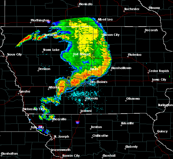 The severe thunderstorm warning for east central cass, southern guthrie and northwestern adair counties will expire at 1130 am cdt, the storms which prompted the warning have weakened below severe limits, and no longer pose an immediate threat to life or property. therefore, the warning will be allowed to expire. however gusty winds are still possible with these thunderstorms. a severe thunderstorm watch remains in effect until 700 pm cdt for southwestern and west central iowa. The severe thunderstorm warning for east central cass, southern guthrie and northwestern adair counties will expire at 1130 am cdt, the storms which prompted the warning have weakened below severe limits, and no longer pose an immediate threat to life or property. therefore, the warning will be allowed to expire. however gusty winds are still possible with these thunderstorms. a severe thunderstorm watch remains in effect until 700 pm cdt for southwestern and west central iowa.
|
| 7/17/2019 11:19 AM CDT |
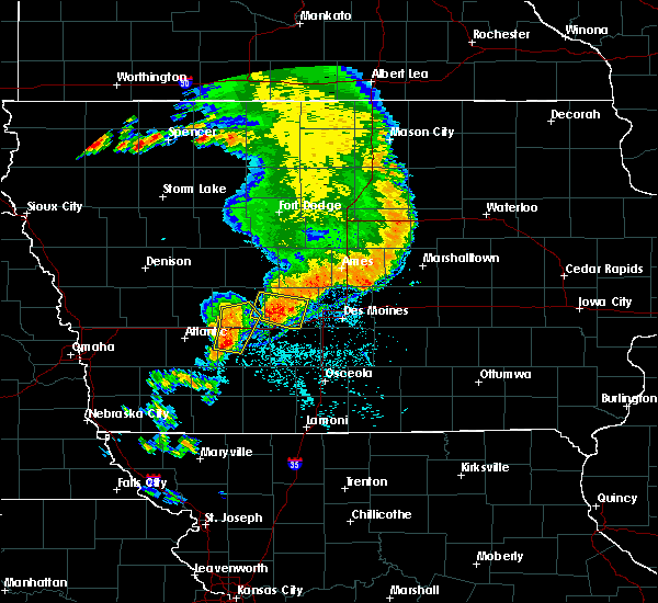 At 1118 am cdt, severe thunderstorms were located along a line extending from near lake panorama to near panora to 7 miles northwest of greenfield, moving east at 40 mph (public. storms have a history of producing damaging winds back into shelby and western audubon counties). Hazards include 60 mph wind gusts and quarter size hail. Hail damage to vehicles is expected. expect wind damage to roofs, siding, and trees. locations impacted include, guthrie center, adair, fontanelle, casey, menlo and nodaway park. This includes interstate 80 between mile markers 74 and 88. At 1118 am cdt, severe thunderstorms were located along a line extending from near lake panorama to near panora to 7 miles northwest of greenfield, moving east at 40 mph (public. storms have a history of producing damaging winds back into shelby and western audubon counties). Hazards include 60 mph wind gusts and quarter size hail. Hail damage to vehicles is expected. expect wind damage to roofs, siding, and trees. locations impacted include, guthrie center, adair, fontanelle, casey, menlo and nodaway park. This includes interstate 80 between mile markers 74 and 88.
|
| 7/17/2019 11:04 AM CDT |
 At 1103 am cdt, a severe thunderstorm was located near panora, or 11 miles east of guthrie center, moving east at 35 mph (radar indicated). Hazards include 60 mph wind gusts and quarter size hail. Hail damage to vehicles is expected. expect wind damage to roofs, siding, and trees. locations impacted include, adel, dallas center, panora, de soto, lake panorama, redfield, diamondhead lake, minburn, yale, linden and lakin slough game management area. This includes interstate 80 between mile markers 105 and 112. At 1103 am cdt, a severe thunderstorm was located near panora, or 11 miles east of guthrie center, moving east at 35 mph (radar indicated). Hazards include 60 mph wind gusts and quarter size hail. Hail damage to vehicles is expected. expect wind damage to roofs, siding, and trees. locations impacted include, adel, dallas center, panora, de soto, lake panorama, redfield, diamondhead lake, minburn, yale, linden and lakin slough game management area. This includes interstate 80 between mile markers 105 and 112.
|
| 7/17/2019 10:55 AM CDT |
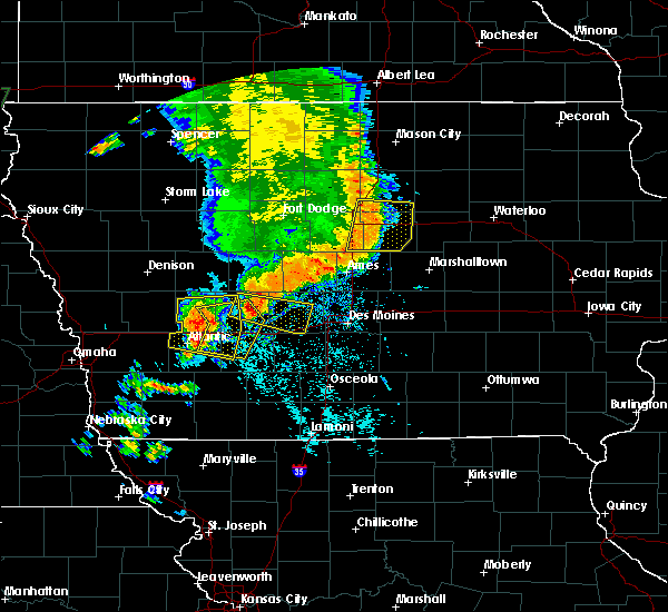 At 1053 am cdt, severe thunderstorms were located along a line extending from 6 miles east of audubon to 11 miles southwest of guthrie center to 10 miles east of atlantic, moving east at 40 mph (public. storm has a history of damaging winds, including reported trees down back in portsmouth in shelby county). Hazards include 60 mph wind gusts and quarter size hail. Hail damage to vehicles is expected. Expect wind damage to roofs, siding, and trees. At 1053 am cdt, severe thunderstorms were located along a line extending from 6 miles east of audubon to 11 miles southwest of guthrie center to 10 miles east of atlantic, moving east at 40 mph (public. storm has a history of damaging winds, including reported trees down back in portsmouth in shelby county). Hazards include 60 mph wind gusts and quarter size hail. Hail damage to vehicles is expected. Expect wind damage to roofs, siding, and trees.
|
| 7/17/2019 10:44 AM CDT |
 At 1044 am cdt, a severe thunderstorm was located over guthrie center, moving east at 35 mph (radar indicated). Hazards include 60 mph wind gusts and quarter size hail. Hail damage to vehicles is expected. Expect wind damage to roofs, siding, and trees. At 1044 am cdt, a severe thunderstorm was located over guthrie center, moving east at 35 mph (radar indicated). Hazards include 60 mph wind gusts and quarter size hail. Hail damage to vehicles is expected. Expect wind damage to roofs, siding, and trees.
|
| 5/27/2019 6:25 AM CDT |
 The severe thunderstorm warning for northwestern madison, north central union, southeastern guthrie, eastern adair and western dallas counties will expire at 630 am cdt, the storms which prompted the warning have weakened below severe limits, and no longer pose an immediate threat to life or property. therefore, the warning will be allowed to expire. to report severe weather, contact your nearest law enforcement agency. they will relay your report to the national weather service des moines. The severe thunderstorm warning for northwestern madison, north central union, southeastern guthrie, eastern adair and western dallas counties will expire at 630 am cdt, the storms which prompted the warning have weakened below severe limits, and no longer pose an immediate threat to life or property. therefore, the warning will be allowed to expire. to report severe weather, contact your nearest law enforcement agency. they will relay your report to the national weather service des moines.
|
| 5/27/2019 6:00 AM CDT |
 The national weather service in des moines has issued a * severe thunderstorm warning for. northwestern madison county in south central iowa. north central union county in south central iowa. southeastern guthrie county in west central iowa. Eastern adair county in southwestern iowa. The national weather service in des moines has issued a * severe thunderstorm warning for. northwestern madison county in south central iowa. north central union county in south central iowa. southeastern guthrie county in west central iowa. Eastern adair county in southwestern iowa.
|
| 5/16/2019 8:54 PM CDT |
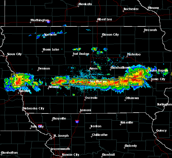 At 854 pm cdt, a severe thunderstorm was located 7 miles southwest of guthrie center, moving southeast at 20 mph (radar indicated). Hazards include 60 mph wind gusts and quarter size hail. Hail damage to vehicles is expected. expect wind damage to roofs, siding, and trees. Locations impacted include, guthrie center, stuart, panora, lake panorama, casey and menlo. At 854 pm cdt, a severe thunderstorm was located 7 miles southwest of guthrie center, moving southeast at 20 mph (radar indicated). Hazards include 60 mph wind gusts and quarter size hail. Hail damage to vehicles is expected. expect wind damage to roofs, siding, and trees. Locations impacted include, guthrie center, stuart, panora, lake panorama, casey and menlo.
|
| 5/16/2019 8:36 PM CDT |
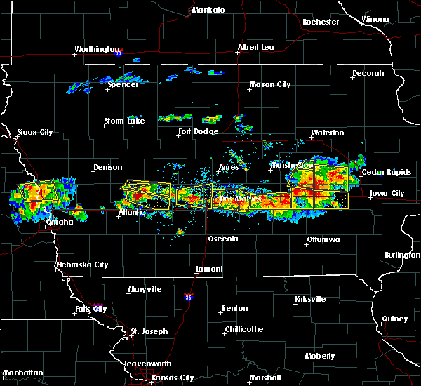 At 835 pm cdt, a severe thunderstorm was located 8 miles south of coon rapids, or 9 miles northwest of guthrie center, moving southeast at 20 mph (radar indicated). Hazards include 60 mph wind gusts and quarter size hail. Hail damage to vehicles is expected. expect wind damage to roofs, siding, and trees. Locations impacted include, panora, lake panorama, bayard, yale, springbrook state park and lakin slough game management area. At 835 pm cdt, a severe thunderstorm was located 8 miles south of coon rapids, or 9 miles northwest of guthrie center, moving southeast at 20 mph (radar indicated). Hazards include 60 mph wind gusts and quarter size hail. Hail damage to vehicles is expected. expect wind damage to roofs, siding, and trees. Locations impacted include, panora, lake panorama, bayard, yale, springbrook state park and lakin slough game management area.
|
| 5/16/2019 8:31 PM CDT |
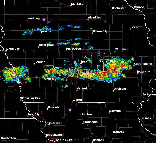 At 831 pm cdt, a severe thunderstorm was located 11 miles west of guthrie center, moving east at 25 mph (radar indicated). Hazards include 60 mph wind gusts and quarter size hail. Hail damage to vehicles is expected. Expect wind damage to roofs, siding, and trees. At 831 pm cdt, a severe thunderstorm was located 11 miles west of guthrie center, moving east at 25 mph (radar indicated). Hazards include 60 mph wind gusts and quarter size hail. Hail damage to vehicles is expected. Expect wind damage to roofs, siding, and trees.
|
| 5/16/2019 8:09 PM CDT |
 The national weather service in des moines has issued a * severe thunderstorm warning for. southwestern greene county in west central iowa. northern guthrie county in west central iowa. northeastern audubon county in west central iowa. Southeastern carroll county in west central iowa. The national weather service in des moines has issued a * severe thunderstorm warning for. southwestern greene county in west central iowa. northern guthrie county in west central iowa. northeastern audubon county in west central iowa. Southeastern carroll county in west central iowa.
|
| 4/17/2019 3:04 PM CDT |
 At 304 pm cdt, a severe thunderstorm was located near panora, or 10 miles southwest of perry, moving east at 40 mph (radar indicated). Hazards include 60 mph wind gusts and quarter size hail. Hail damage to vehicles is expected. Expect wind damage to roofs, siding, and trees. At 304 pm cdt, a severe thunderstorm was located near panora, or 10 miles southwest of perry, moving east at 40 mph (radar indicated). Hazards include 60 mph wind gusts and quarter size hail. Hail damage to vehicles is expected. Expect wind damage to roofs, siding, and trees.
|
| 4/11/2019 12:19 AM CDT |
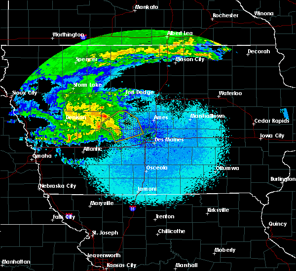 At 1219 am cdt, severe thunderstorms were located along a line extending from 7 miles northeast of coon rapids to near lake panorama to near panora, moving northeast at 60 mph (radar indicated). Hazards include 60 mph wind gusts and quarter size hail. Hail damage to vehicles is expected. expect wind damage to roofs, siding, and trees. Locations impacted include, perry, jefferson, ogden, dallas center, granger, panora, woodward, lake panorama, grand junction, scranton, bayard, minburn, bagley, rippey, yale, paton, jamaica, linden, boxholm and dawson. At 1219 am cdt, severe thunderstorms were located along a line extending from 7 miles northeast of coon rapids to near lake panorama to near panora, moving northeast at 60 mph (radar indicated). Hazards include 60 mph wind gusts and quarter size hail. Hail damage to vehicles is expected. expect wind damage to roofs, siding, and trees. Locations impacted include, perry, jefferson, ogden, dallas center, granger, panora, woodward, lake panorama, grand junction, scranton, bayard, minburn, bagley, rippey, yale, paton, jamaica, linden, boxholm and dawson.
|
| 4/11/2019 12:04 AM CDT |
 At 1203 am cdt, severe thunderstorms were located along a line extending from 7 miles southwest of coon rapids to near guthrie center to 10 miles west of stuart, moving northeast at 60 mph (radar indicated). Hazards include 60 mph wind gusts and quarter size hail. Hail damage to vehicles is expected. Expect wind damage to roofs, siding, and trees. At 1203 am cdt, severe thunderstorms were located along a line extending from 7 miles southwest of coon rapids to near guthrie center to 10 miles west of stuart, moving northeast at 60 mph (radar indicated). Hazards include 60 mph wind gusts and quarter size hail. Hail damage to vehicles is expected. Expect wind damage to roofs, siding, and trees.
|
| 10/9/2018 6:52 PM CDT |
 The tornado warning for northeastern guthrie and northwestern dallas counties will expire at 700 pm cdt, the storm which prompted the warning has weakened below severe limits, and no longer appears capable of producing a tornado. therefore, the warning will be allowed to expire. a tornado watch remains in effect until 900 pm cdt for central iowa. The tornado warning for northeastern guthrie and northwestern dallas counties will expire at 700 pm cdt, the storm which prompted the warning has weakened below severe limits, and no longer appears capable of producing a tornado. therefore, the warning will be allowed to expire. a tornado watch remains in effect until 900 pm cdt for central iowa.
|
| 10/9/2018 6:45 PM CDT |
 At 644 pm cdt, a severe thunderstorm capable of producing a tornado was located near lake panorama, or 11 miles northeast of guthrie center, moving north at 40 mph (radar indicated rotation). Hazards include tornado. Flying debris will be dangerous to those caught without shelter. mobile homes will be damaged or destroyed. damage to roofs, windows, and vehicles will occur. tree damage is likely. This tornadic thunderstorm will remain over mainly rural areas of northeastern guthrie and northwestern dallas counties, including the following locations, yale, jamaica, springbrook state park, lakin slough game management area and bagley. At 644 pm cdt, a severe thunderstorm capable of producing a tornado was located near lake panorama, or 11 miles northeast of guthrie center, moving north at 40 mph (radar indicated rotation). Hazards include tornado. Flying debris will be dangerous to those caught without shelter. mobile homes will be damaged or destroyed. damage to roofs, windows, and vehicles will occur. tree damage is likely. This tornadic thunderstorm will remain over mainly rural areas of northeastern guthrie and northwestern dallas counties, including the following locations, yale, jamaica, springbrook state park, lakin slough game management area and bagley.
|
| 10/9/2018 6:33 PM CDT |
 At 631 pm cdt, a confirmed tornado was located over panora, or 7 miles east of guthrie center, moving north at 45 mph (law enforcement confirmed tornado). Hazards include damaging tornado. Flying debris will be dangerous to those caught without shelter. mobile homes will be damaged or destroyed. damage to roofs, windows, and vehicles will occur. tree damage is likely. this tornado will be near, lake panorama around 640 pm cdt. Other locations impacted by this tornadic thunderstorm include yale, jamaica, springbrook state park, lakin slough game management area, bagley and linden. At 631 pm cdt, a confirmed tornado was located over panora, or 7 miles east of guthrie center, moving north at 45 mph (law enforcement confirmed tornado). Hazards include damaging tornado. Flying debris will be dangerous to those caught without shelter. mobile homes will be damaged or destroyed. damage to roofs, windows, and vehicles will occur. tree damage is likely. this tornado will be near, lake panorama around 640 pm cdt. Other locations impacted by this tornadic thunderstorm include yale, jamaica, springbrook state park, lakin slough game management area, bagley and linden.
|
| 10/9/2018 6:11 PM CDT |
 At 610 pm cdt, a confirmed tornado was located over stuart, or 14 miles northeast of greenfield, moving north at 40 mph (law enforcement confirmed tornado). Hazards include damaging tornado. Flying debris will be dangerous to those caught without shelter. mobile homes will be damaged or destroyed. damage to roofs, windows, and vehicles will occur. tree damage is likely. the tornado will be near, guthrie center and panora around 630 pm cdt. lake panorama around 635 pm cdt. other locations impacted by this tornadic thunderstorm include diamondhead lake, menlo, linden, yale, jamaica, springbrook state park, lakin slough game management area and bagley. This includes interstate 80 between mile markers 85 and 96. At 610 pm cdt, a confirmed tornado was located over stuart, or 14 miles northeast of greenfield, moving north at 40 mph (law enforcement confirmed tornado). Hazards include damaging tornado. Flying debris will be dangerous to those caught without shelter. mobile homes will be damaged or destroyed. damage to roofs, windows, and vehicles will occur. tree damage is likely. the tornado will be near, guthrie center and panora around 630 pm cdt. lake panorama around 635 pm cdt. other locations impacted by this tornadic thunderstorm include diamondhead lake, menlo, linden, yale, jamaica, springbrook state park, lakin slough game management area and bagley. This includes interstate 80 between mile markers 85 and 96.
|
| 10/8/2018 6:24 PM CDT |
 At 624 pm cdt, a severe thunderstorm was located near jefferson, moving northeast at 55 mph (radar indicated). Hazards include 60 mph wind gusts and penny size hail. Expect damage to roofs, siding, and trees. Locations impacted include, jefferson, guthrie center, coon rapids, panora, lake panorama, grand junction, bayard, bagley, rippey, yale, paton, jamaica, dawson, dana, jefferson municipal airport, lakin slough game management area and springbrook state park. At 624 pm cdt, a severe thunderstorm was located near jefferson, moving northeast at 55 mph (radar indicated). Hazards include 60 mph wind gusts and penny size hail. Expect damage to roofs, siding, and trees. Locations impacted include, jefferson, guthrie center, coon rapids, panora, lake panorama, grand junction, bayard, bagley, rippey, yale, paton, jamaica, dawson, dana, jefferson municipal airport, lakin slough game management area and springbrook state park.
|
| 10/8/2018 6:12 PM CDT |
 At 611 pm cdt, a severe thunderstorm was located 7 miles north of lake panorama, or 10 miles north of guthrie center, moving northeast at 40 mph (radar indicated). Hazards include 60 mph wind gusts and penny size hail. expect damage to roofs, siding, and trees At 611 pm cdt, a severe thunderstorm was located 7 miles north of lake panorama, or 10 miles north of guthrie center, moving northeast at 40 mph (radar indicated). Hazards include 60 mph wind gusts and penny size hail. expect damage to roofs, siding, and trees
|
| 8/31/2018 4:55 AM CDT |
 At 455 am cdt, severe thunderstorms were located along a line extending from near panora to 7 miles east of greenfield, moving northeast at 20 mph (radar indicated). Hazards include 60 mph wind gusts and quarter size hail. Hail damage to vehicles is expected. Expect wind damage to roofs, siding, and trees. At 455 am cdt, severe thunderstorms were located along a line extending from near panora to 7 miles east of greenfield, moving northeast at 20 mph (radar indicated). Hazards include 60 mph wind gusts and quarter size hail. Hail damage to vehicles is expected. Expect wind damage to roofs, siding, and trees.
|
| 8/1/2018 8:24 PM CDT |
 At 759 pm cdt, a severe thunderstorm was located 8 miles northeast of panora, or 9 miles west of perry, moving east at 30 mph (radar indicated). Hazards include 60 mph wind gusts and quarter size hail. Hail damage to vehicles is expected. expect wind damage to roofs, siding, and trees. Locations impacted include, perry, panora, lake panorama, yale, jamaica, linden, dawson, perry municipal airport and lakin slough game management area. At 759 pm cdt, a severe thunderstorm was located 8 miles northeast of panora, or 9 miles west of perry, moving east at 30 mph (radar indicated). Hazards include 60 mph wind gusts and quarter size hail. Hail damage to vehicles is expected. expect wind damage to roofs, siding, and trees. Locations impacted include, perry, panora, lake panorama, yale, jamaica, linden, dawson, perry municipal airport and lakin slough game management area.
|
| 8/1/2018 7:59 PM CDT |
 At 759 pm cdt, a severe thunderstorm was located 8 miles northeast of panora, or 9 miles west of perry, moving east at 30 mph (radar indicated). Hazards include 60 mph wind gusts and quarter size hail. Hail damage to vehicles is expected. expect wind damage to roofs, siding, and trees. Locations impacted include, perry, panora, lake panorama, yale, jamaica, linden, dawson, perry municipal airport and lakin slough game management area. At 759 pm cdt, a severe thunderstorm was located 8 miles northeast of panora, or 9 miles west of perry, moving east at 30 mph (radar indicated). Hazards include 60 mph wind gusts and quarter size hail. Hail damage to vehicles is expected. expect wind damage to roofs, siding, and trees. Locations impacted include, perry, panora, lake panorama, yale, jamaica, linden, dawson, perry municipal airport and lakin slough game management area.
|
| 8/1/2018 7:40 PM CDT |
 At 740 pm cdt, a severe thunderstorm was located 8 miles north of lake panorama, or 11 miles south of jefferson, moving east at 25 mph (radar indicated). Hazards include 60 mph wind gusts and quarter size hail. Hail damage to vehicles is expected. Expect wind damage to roofs, siding, and trees. At 740 pm cdt, a severe thunderstorm was located 8 miles north of lake panorama, or 11 miles south of jefferson, moving east at 25 mph (radar indicated). Hazards include 60 mph wind gusts and quarter size hail. Hail damage to vehicles is expected. Expect wind damage to roofs, siding, and trees.
|
| 6/30/2018 9:20 PM CDT |
 At 919 pm cdt, severe thunderstorms were located along a line extending from 6 miles west of perry to 9 miles west of dallas center to near earlham, moving northeast at 30 mph (radar indicated). Hazards include 60 mph wind gusts. Expect damage to roofs, siding, and trees. locations impacted include, west des moines, urbandale, clive, waukee, grimes, perry, adel, dallas center, granger, panora, de soto, woodward, van meter, jordan creek town center, lake panorama, redfield, dexter, diamondhead lake, minburn and rippey. This includes interstate 80 between mile markers 100 and 121. At 919 pm cdt, severe thunderstorms were located along a line extending from 6 miles west of perry to 9 miles west of dallas center to near earlham, moving northeast at 30 mph (radar indicated). Hazards include 60 mph wind gusts. Expect damage to roofs, siding, and trees. locations impacted include, west des moines, urbandale, clive, waukee, grimes, perry, adel, dallas center, granger, panora, de soto, woodward, van meter, jordan creek town center, lake panorama, redfield, dexter, diamondhead lake, minburn and rippey. This includes interstate 80 between mile markers 100 and 121.
|
| 6/30/2018 9:08 PM CDT |
 At 907 pm cdt, severe thunderstorms were located along a line extending from near panora to 10 miles northeast of stuart to near earlham, moving northeast at 30 mph (radar indicated). Hazards include 60 mph wind gusts. expect damage to roofs, siding, and trees At 907 pm cdt, severe thunderstorms were located along a line extending from near panora to 10 miles northeast of stuart to near earlham, moving northeast at 30 mph (radar indicated). Hazards include 60 mph wind gusts. expect damage to roofs, siding, and trees
|
| 6/30/2018 8:28 PM CDT |
 At 828 pm cdt, a severe thunderstorm was located over de soto, or near adel, moving north at 45 mph (radar indicated). Hazards include 60 mph wind gusts. Expect damage to roofs, siding, and trees. locations impacted include, west des moines, urbandale, clive, waukee, grimes, perry, adel, stuart, dallas center, earlham, granger, panora, de soto, woodward, van meter, jordan creek town center, lake panorama, redfield, dexter and diamondhead lake. This includes interstate 80 between mile markers 93 and 121. At 828 pm cdt, a severe thunderstorm was located over de soto, or near adel, moving north at 45 mph (radar indicated). Hazards include 60 mph wind gusts. Expect damage to roofs, siding, and trees. locations impacted include, west des moines, urbandale, clive, waukee, grimes, perry, adel, stuart, dallas center, earlham, granger, panora, de soto, woodward, van meter, jordan creek town center, lake panorama, redfield, dexter and diamondhead lake. This includes interstate 80 between mile markers 93 and 121.
|
| 6/30/2018 8:14 PM CDT |
 At 814 pm cdt, a severe thunderstorm was located near winterset, moving north at 45 mph (radar indicated). Hazards include 60 mph wind gusts. expect damage to roofs, siding, and trees At 814 pm cdt, a severe thunderstorm was located near winterset, moving north at 45 mph (radar indicated). Hazards include 60 mph wind gusts. expect damage to roofs, siding, and trees
|
| 6/28/2018 11:32 AM CDT |
 At 1131 am cdt, severe thunderstorms were located along a line extending from near guthrie center to near greenfield to 8 miles east of lake icaria, moving east at 45 mph (trained weather spotters). Hazards include 70 mph wind gusts and quarter size hail. Hail damage to vehicles is expected. expect considerable tree damage. wind damage is also likely to mobile homes, roofs, and outbuildings. locations impacted include, greenfield, guthrie center, stuart, panora, lake panorama, adair, fontanelle, dexter, casey, orient, diamondhead lake, massena, menlo, bridgewater, greenfield municipal airport and nodaway park. This includes interstate 80 between mile markers 74 and 97. At 1131 am cdt, severe thunderstorms were located along a line extending from near guthrie center to near greenfield to 8 miles east of lake icaria, moving east at 45 mph (trained weather spotters). Hazards include 70 mph wind gusts and quarter size hail. Hail damage to vehicles is expected. expect considerable tree damage. wind damage is also likely to mobile homes, roofs, and outbuildings. locations impacted include, greenfield, guthrie center, stuart, panora, lake panorama, adair, fontanelle, dexter, casey, orient, diamondhead lake, massena, menlo, bridgewater, greenfield municipal airport and nodaway park. This includes interstate 80 between mile markers 74 and 97.
|
| 6/28/2018 11:17 AM CDT |
 At 1115 am cdt, severe thunderstorms were located along a line extending from 8 miles south of coon rapids to 14 miles south of guthrie center to 8 miles north of lake icaria, moving east at 45 mph (trained weather spotters. an area of more intense wind damage may be occurring across portions of northern and central adiar county). Hazards include 70 mph wind gusts and quarter size hail. Hail damage to vehicles is expected. expect considerable tree damage. wind damage is also likely to mobile homes, roofs, and outbuildings. locations impacted include, atlantic, audubon, greenfield, guthrie center, stuart, panora, griswold, lake panorama, anita, exira, adair, fontanelle, dexter, lewis, casey, orient, diamondhead lake, massena, menlo and cumberland. This includes interstate 80 between mile markers 56 and 97. At 1115 am cdt, severe thunderstorms were located along a line extending from 8 miles south of coon rapids to 14 miles south of guthrie center to 8 miles north of lake icaria, moving east at 45 mph (trained weather spotters. an area of more intense wind damage may be occurring across portions of northern and central adiar county). Hazards include 70 mph wind gusts and quarter size hail. Hail damage to vehicles is expected. expect considerable tree damage. wind damage is also likely to mobile homes, roofs, and outbuildings. locations impacted include, atlantic, audubon, greenfield, guthrie center, stuart, panora, griswold, lake panorama, anita, exira, adair, fontanelle, dexter, lewis, casey, orient, diamondhead lake, massena, menlo and cumberland. This includes interstate 80 between mile markers 56 and 97.
|
| 6/28/2018 11:01 AM CDT |
 At 1100 am cdt, severe thunderstorms were located along a line extending from 7 miles north of audubon to 14 miles northeast of atlantic to 9 miles east of griswold, moving east at 45 mph (trained weather spotters. these storms have a history of producing wind damage across southwest iowa). Hazards include 70 mph wind gusts and quarter size hail. Hail damage to vehicles is expected. expect considerable tree damage. Wind damage is also likely to mobile homes, roofs, and outbuildings. At 1100 am cdt, severe thunderstorms were located along a line extending from 7 miles north of audubon to 14 miles northeast of atlantic to 9 miles east of griswold, moving east at 45 mph (trained weather spotters. these storms have a history of producing wind damage across southwest iowa). Hazards include 70 mph wind gusts and quarter size hail. Hail damage to vehicles is expected. expect considerable tree damage. Wind damage is also likely to mobile homes, roofs, and outbuildings.
|
| 6/24/2018 3:14 PM CDT |
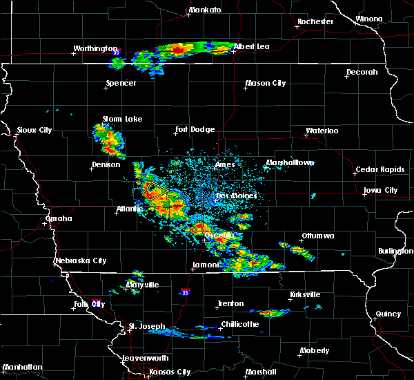 At 314 pm cdt, a severe thunderstorm was located near guthrie center, moving northeast at 15 mph (radar indicated). Hazards include 60 mph wind gusts and quarter size hail. Hail damage to vehicles is expected. expect wind damage to roofs, siding, and trees. Locations impacted include, guthrie center, panora, lake panorama and springbrook state park. At 314 pm cdt, a severe thunderstorm was located near guthrie center, moving northeast at 15 mph (radar indicated). Hazards include 60 mph wind gusts and quarter size hail. Hail damage to vehicles is expected. expect wind damage to roofs, siding, and trees. Locations impacted include, guthrie center, panora, lake panorama and springbrook state park.
|
| 6/24/2018 3:04 PM CDT |
 At 303 pm cdt, a severe thunderstorm was located over panora, or near guthrie center, moving northeast at 30 mph (radar indicated). Hazards include 60 mph wind gusts and quarter size hail. Hail damage to vehicles is expected. expect wind damage to roofs, siding, and trees. locations impacted include, adel, guthrie center, stuart, earlham, panora, de soto, lake panorama, redfield, dexter, diamondhead lake, menlo, linden and springbrook state park. This includes interstate 80 between mile markers 88 and 109. At 303 pm cdt, a severe thunderstorm was located over panora, or near guthrie center, moving northeast at 30 mph (radar indicated). Hazards include 60 mph wind gusts and quarter size hail. Hail damage to vehicles is expected. expect wind damage to roofs, siding, and trees. locations impacted include, adel, guthrie center, stuart, earlham, panora, de soto, lake panorama, redfield, dexter, diamondhead lake, menlo, linden and springbrook state park. This includes interstate 80 between mile markers 88 and 109.
|
| 6/24/2018 2:52 PM CDT |
 At 252 pm cdt, a severe thunderstorm was located near guthrie center, moving northeast at 25 mph (radar indicated). Hazards include 60 mph wind gusts and quarter size hail. Hail damage to vehicles is expected. Expect wind damage to roofs, siding, and trees. At 252 pm cdt, a severe thunderstorm was located near guthrie center, moving northeast at 25 mph (radar indicated). Hazards include 60 mph wind gusts and quarter size hail. Hail damage to vehicles is expected. Expect wind damage to roofs, siding, and trees.
|
| 6/11/2018 1:37 AM CDT |
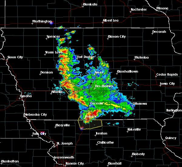 At 137 am cdt, a severe thunderstorm was located over guthrie center, moving southeast at 40 mph (radar indicated). Hazards include 60 mph wind gusts and penny size hail. expect damage to roofs, siding, and trees At 137 am cdt, a severe thunderstorm was located over guthrie center, moving southeast at 40 mph (radar indicated). Hazards include 60 mph wind gusts and penny size hail. expect damage to roofs, siding, and trees
|
| 6/6/2018 6:32 PM CDT |
 At 631 pm cdt, severe thunderstorms were located along a line extending from clive to adel to 8 miles west of perry, moving south at 30 mph (radar indicated). Hazards include 70 mph wind gusts and ping pong ball size hail. People and animals outdoors will be injured. expect hail damage to roofs, siding, windows, and vehicles. expect considerable tree damage. wind damage is also likely to mobile homes, roofs, and outbuildings. locations impacted include, west des moines, urbandale, clive, waukee, grimes, perry, adel, stuart, dallas center, earlham, granger, panora, de soto, woodward, van meter, jordan creek town center, lake panorama, redfield, dexter and casey. This includes interstate 80 between mile markers 100 and 121. At 631 pm cdt, severe thunderstorms were located along a line extending from clive to adel to 8 miles west of perry, moving south at 30 mph (radar indicated). Hazards include 70 mph wind gusts and ping pong ball size hail. People and animals outdoors will be injured. expect hail damage to roofs, siding, windows, and vehicles. expect considerable tree damage. wind damage is also likely to mobile homes, roofs, and outbuildings. locations impacted include, west des moines, urbandale, clive, waukee, grimes, perry, adel, stuart, dallas center, earlham, granger, panora, de soto, woodward, van meter, jordan creek town center, lake panorama, redfield, dexter and casey. This includes interstate 80 between mile markers 100 and 121.
|
| 6/6/2018 6:14 PM CDT |
 At 614 pm cdt, severe thunderstorms were located along a line extending from near granger to near dallas center to 8 miles north of lake panorama, moving south at 20 mph (radar indicated). Hazards include tennis ball size hail and 70 mph wind gusts. People and animals outdoors will be injured. expect hail damage to roofs, siding, windows, and vehicles. expect considerable tree damage. wind damage is also likely to mobile homes, roofs, and outbuildings. locations impacted include, west des moines, urbandale, clive, waukee, grimes, perry, adel, guthrie center, madrid, stuart, dallas center, earlham, granger, panora, de soto, woodward, van meter, jordan creek town center, lake panorama and redfield. This includes interstate 80 between mile markers 100 and 121. At 614 pm cdt, severe thunderstorms were located along a line extending from near granger to near dallas center to 8 miles north of lake panorama, moving south at 20 mph (radar indicated). Hazards include tennis ball size hail and 70 mph wind gusts. People and animals outdoors will be injured. expect hail damage to roofs, siding, windows, and vehicles. expect considerable tree damage. wind damage is also likely to mobile homes, roofs, and outbuildings. locations impacted include, west des moines, urbandale, clive, waukee, grimes, perry, adel, guthrie center, madrid, stuart, dallas center, earlham, granger, panora, de soto, woodward, van meter, jordan creek town center, lake panorama and redfield. This includes interstate 80 between mile markers 100 and 121.
|
| 6/6/2018 6:00 PM CDT |
 At 600 pm cdt, severe thunderstorms were located along a line extending from big creek lake to near woodward to 8 miles north of lake panorama, moving south at 30 mph (radar indicated). Hazards include golf ball size hail and 70 mph wind gusts. People and animals outdoors will be injured. expect hail damage to roofs, siding, windows, and vehicles. expect considerable tree damage. wind damage is also likely to mobile homes, roofs, and outbuildings. locations impacted include, west des moines, urbandale, clive, waukee, grimes, perry, jefferson, adel, guthrie center, madrid, stuart, dallas center, earlham, granger, panora, de soto, woodward, van meter, jordan creek town center and lake panorama. This includes interstate 80 between mile markers 100 and 121. At 600 pm cdt, severe thunderstorms were located along a line extending from big creek lake to near woodward to 8 miles north of lake panorama, moving south at 30 mph (radar indicated). Hazards include golf ball size hail and 70 mph wind gusts. People and animals outdoors will be injured. expect hail damage to roofs, siding, windows, and vehicles. expect considerable tree damage. wind damage is also likely to mobile homes, roofs, and outbuildings. locations impacted include, west des moines, urbandale, clive, waukee, grimes, perry, jefferson, adel, guthrie center, madrid, stuart, dallas center, earlham, granger, panora, de soto, woodward, van meter, jordan creek town center and lake panorama. This includes interstate 80 between mile markers 100 and 121.
|
| 6/6/2018 5:57 PM CDT |
 At 556 pm cdt, severe thunderstorms were located along a line extending from near big creek lake to 7 miles west of perry, moving south at 35 mph (radar indicated). Hazards include 70 mph wind gusts and quarter size hail. Hail damage to vehicles is expected. expect considerable tree damage. Wind damage is also likely to mobile homes, roofs, and outbuildings. At 556 pm cdt, severe thunderstorms were located along a line extending from near big creek lake to 7 miles west of perry, moving south at 35 mph (radar indicated). Hazards include 70 mph wind gusts and quarter size hail. Hail damage to vehicles is expected. expect considerable tree damage. Wind damage is also likely to mobile homes, roofs, and outbuildings.
|
| 6/6/2018 5:39 PM CDT |
 At 539 pm cdt, a severe thunderstorm was located near jefferson, moving south at 30 mph (radar indicated). Hazards include 60 mph wind gusts and quarter size hail. Hail damage to vehicles is expected. Expect wind damage to roofs, siding, and trees. At 539 pm cdt, a severe thunderstorm was located near jefferson, moving south at 30 mph (radar indicated). Hazards include 60 mph wind gusts and quarter size hail. Hail damage to vehicles is expected. Expect wind damage to roofs, siding, and trees.
|
| 5/3/2018 6:08 PM CDT |
 The tornado warning for northeastern guthrie and northwestern dallas counties will expire at 615 pm cdt, the storm which prompted the warning has weakened below severe limits, and no longer appears capable of producing a tornado. therefore the warning will be allowed to expire. however gusty winds are still possible with this thunderstorm. a severe thunderstorm watch remains in effect until 800 pm cdt for central and west central iowa. The tornado warning for northeastern guthrie and northwestern dallas counties will expire at 615 pm cdt, the storm which prompted the warning has weakened below severe limits, and no longer appears capable of producing a tornado. therefore the warning will be allowed to expire. however gusty winds are still possible with this thunderstorm. a severe thunderstorm watch remains in effect until 800 pm cdt for central and west central iowa.
|
| 5/3/2018 6:00 PM CDT |
 At 600 pm cdt, a severe thunderstorm capable of producing a tornado was located over lake panorama, or near guthrie center, moving northeast at 35 mph (radar indicated rotation). Hazards include tornado. Flying debris will be dangerous to those caught without shelter. mobile homes will be damaged or destroyed. damage to roofs, windows, and vehicles will occur. tree damage is likely. This tornadic thunderstorm will remain over mainly rural areas of northeastern guthrie and northwestern dallas counties, including the following locations: yale, dawson, jamaica and lakin slough game management area. At 600 pm cdt, a severe thunderstorm capable of producing a tornado was located over lake panorama, or near guthrie center, moving northeast at 35 mph (radar indicated rotation). Hazards include tornado. Flying debris will be dangerous to those caught without shelter. mobile homes will be damaged or destroyed. damage to roofs, windows, and vehicles will occur. tree damage is likely. This tornadic thunderstorm will remain over mainly rural areas of northeastern guthrie and northwestern dallas counties, including the following locations: yale, dawson, jamaica and lakin slough game management area.
|
| 5/3/2018 5:45 PM CDT |
 At 545 pm cdt, a severe thunderstorm capable of producing a tornado was located over guthrie center, moving northeast at 30 mph (radar indicated rotation). Hazards include tornado. Flying debris will be dangerous to those caught without shelter. mobile homes will be damaged or destroyed. damage to roofs, windows, and vehicles will occur. tree damage is likely. this dangerous storm will be near, guthrie center around 550 pm cdt. panora and lake panorama around 600 pm cdt. Other locations impacted by this tornadic thunderstorm include yale, dawson, jamaica, springbrook state park, lakin slough game management area and bagley. At 545 pm cdt, a severe thunderstorm capable of producing a tornado was located over guthrie center, moving northeast at 30 mph (radar indicated rotation). Hazards include tornado. Flying debris will be dangerous to those caught without shelter. mobile homes will be damaged or destroyed. damage to roofs, windows, and vehicles will occur. tree damage is likely. this dangerous storm will be near, guthrie center around 550 pm cdt. panora and lake panorama around 600 pm cdt. Other locations impacted by this tornadic thunderstorm include yale, dawson, jamaica, springbrook state park, lakin slough game management area and bagley.
|
| 5/3/2018 5:28 PM CDT |
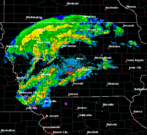 At 527 pm cdt, a severe thunderstorm capable of producing a tornado was located near guthrie center, moving northeast at 30 mph (radar indicated rotation). Hazards include tornado. Flying debris will be dangerous to those caught without shelter. mobile homes will be damaged or destroyed. damage to roofs, windows, and vehicles will occur. Tree damage is likely. At 527 pm cdt, a severe thunderstorm capable of producing a tornado was located near guthrie center, moving northeast at 30 mph (radar indicated rotation). Hazards include tornado. Flying debris will be dangerous to those caught without shelter. mobile homes will be damaged or destroyed. damage to roofs, windows, and vehicles will occur. Tree damage is likely.
|
| 5/3/2018 5:12 PM CDT |
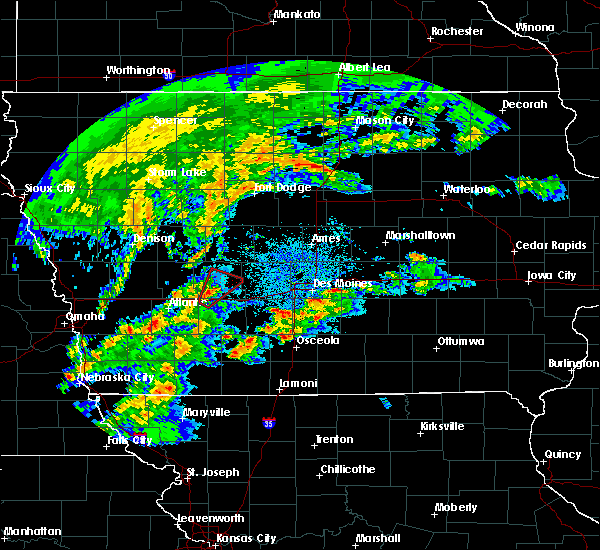 At 512 pm cdt, a severe thunderstorm capable of producing a tornado was located 12 miles southwest of guthrie center, moving northeast at 30 mph (radar indicated rotation). Hazards include tornado. Flying debris will be dangerous to those caught without shelter. mobile homes will be damaged or destroyed. damage to roofs, windows, and vehicles will occur. tree damage is likely. this dangerous storm will be near, guthrie center around 535 pm cdt. panora and lake panorama around 545 pm cdt. other locations impacted by this tornadic thunderstorm include casey and adair. This includes interstate 80 between mile markers 73 and 82. At 512 pm cdt, a severe thunderstorm capable of producing a tornado was located 12 miles southwest of guthrie center, moving northeast at 30 mph (radar indicated rotation). Hazards include tornado. Flying debris will be dangerous to those caught without shelter. mobile homes will be damaged or destroyed. damage to roofs, windows, and vehicles will occur. tree damage is likely. this dangerous storm will be near, guthrie center around 535 pm cdt. panora and lake panorama around 545 pm cdt. other locations impacted by this tornadic thunderstorm include casey and adair. This includes interstate 80 between mile markers 73 and 82.
|
| 5/1/2018 8:35 PM CDT |
 At 834 pm cdt, a severe thunderstorm was located 7 miles northeast of lake panorama, or 12 miles northeast of guthrie center, moving northeast at 50 mph (radar indicated). Hazards include 60 mph wind gusts and nickel size hail. Expect damage to roofs, siding, and trees. Locations impacted include, perry, ogden, woodward, lake panorama, grand junction, bagley, rippey, yale, jamaica, dawson, bouton, beaver, berkley, perry municipal airport, lakin slough game management area and springbrook state park. At 834 pm cdt, a severe thunderstorm was located 7 miles northeast of lake panorama, or 12 miles northeast of guthrie center, moving northeast at 50 mph (radar indicated). Hazards include 60 mph wind gusts and nickel size hail. Expect damage to roofs, siding, and trees. Locations impacted include, perry, ogden, woodward, lake panorama, grand junction, bagley, rippey, yale, jamaica, dawson, bouton, beaver, berkley, perry municipal airport, lakin slough game management area and springbrook state park.
|
| 5/1/2018 8:17 PM CDT |
 At 816 pm cdt, a severe thunderstorm was located near guthrie center, moving northeast at 60 mph (radar indicated). Hazards include 60 mph wind gusts and nickel size hail. expect damage to roofs, siding, and trees At 816 pm cdt, a severe thunderstorm was located near guthrie center, moving northeast at 60 mph (radar indicated). Hazards include 60 mph wind gusts and nickel size hail. expect damage to roofs, siding, and trees
|
| 7/20/2017 9:06 PM CDT |
 At 905 pm cdt, a severe thunderstorm was located over perry, moving east at 40 mph (trained weather spotters. at 901 pm a trained weather spotter reported a 59 mph wind gust 2 south of dawson). Hazards include 60 mph wind gusts. Expect damage to roofs, siding, and trees. Locations impacted include, urbandale, waukee, grimes, perry, madrid, dallas center, granger, woodward, lake panorama, minburn, yale, jamaica, dawson, bouton, perry municipal airport and lakin slough game management area. At 905 pm cdt, a severe thunderstorm was located over perry, moving east at 40 mph (trained weather spotters. at 901 pm a trained weather spotter reported a 59 mph wind gust 2 south of dawson). Hazards include 60 mph wind gusts. Expect damage to roofs, siding, and trees. Locations impacted include, urbandale, waukee, grimes, perry, madrid, dallas center, granger, woodward, lake panorama, minburn, yale, jamaica, dawson, bouton, perry municipal airport and lakin slough game management area.
|
| 7/20/2017 8:57 PM CDT |
 At 856 pm cdt, a severe thunderstorm was located 9 miles northeast of panora, or 9 miles west of perry, moving east at 35 mph (radar indicated). Hazards include 60 mph wind gusts. expect damage to roofs, siding, and trees At 856 pm cdt, a severe thunderstorm was located 9 miles northeast of panora, or 9 miles west of perry, moving east at 35 mph (radar indicated). Hazards include 60 mph wind gusts. expect damage to roofs, siding, and trees
|
| 7/20/2017 7:55 PM CDT |
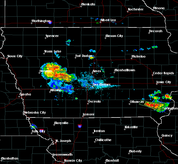 The severe thunderstorm warning for southwestern greene and northeastern guthrie counties will expire at 800 pm cdt, the storms which prompted the warning have weakened below severe limits, and no longer pose an immediate threat to life or property. therefore the warning will be allowed to expire. however dime size hail is still possible with these thunderstorms. The severe thunderstorm warning for southwestern greene and northeastern guthrie counties will expire at 800 pm cdt, the storms which prompted the warning have weakened below severe limits, and no longer pose an immediate threat to life or property. therefore the warning will be allowed to expire. however dime size hail is still possible with these thunderstorms.
|
| 7/20/2017 7:36 PM CDT |
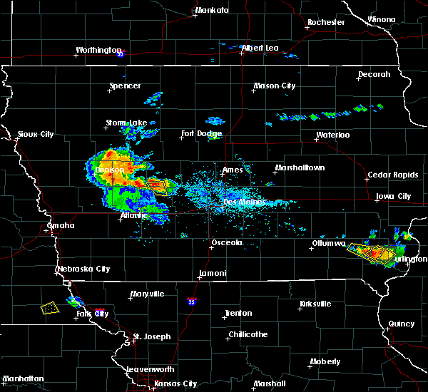 At 735 pm cdt, severe thunderstorms were located along a line extending from 7 miles east of coon rapids to near lake panorama, moving east at 10 mph (bayard fire department). Hazards include quarter size hail. Damage to vehicles is expected. Locations impacted include, lake panorama, bayard, bagley, yale and springbrook state park. At 735 pm cdt, severe thunderstorms were located along a line extending from 7 miles east of coon rapids to near lake panorama, moving east at 10 mph (bayard fire department). Hazards include quarter size hail. Damage to vehicles is expected. Locations impacted include, lake panorama, bayard, bagley, yale and springbrook state park.
|
| 7/20/2017 7:19 PM CDT |
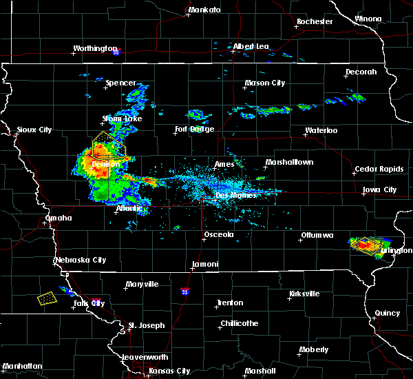 At 719 pm cdt, severe thunderstorms were located along a line extending from 6 miles east of coon rapids to near lake panorama, moving east at 10 mph (radar indicated). Hazards include 60 mph wind gusts and quarter size hail. Hail damage to vehicles is expected. Expect wind damage to roofs, siding, and trees. At 719 pm cdt, severe thunderstorms were located along a line extending from 6 miles east of coon rapids to near lake panorama, moving east at 10 mph (radar indicated). Hazards include 60 mph wind gusts and quarter size hail. Hail damage to vehicles is expected. Expect wind damage to roofs, siding, and trees.
|
| 7/12/2017 3:40 PM CDT |
 The national weather service in des moines has issued a * severe thunderstorm warning for. northeastern guthrie county in west central iowa. northwestern dallas county in central iowa. until 430 pm cdt. At 340 pm cdt, a severe thunderstorm was located near panora, or 11. The national weather service in des moines has issued a * severe thunderstorm warning for. northeastern guthrie county in west central iowa. northwestern dallas county in central iowa. until 430 pm cdt. At 340 pm cdt, a severe thunderstorm was located near panora, or 11.
|
| 6/14/2017 7:26 AM CDT |
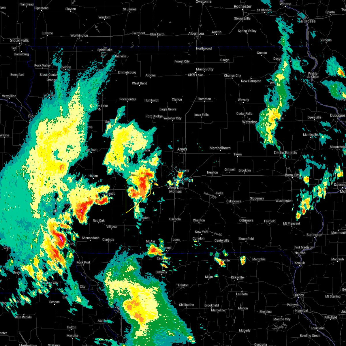 The severe thunderstorm warning for southern guthrie and adair counties will expire at 730 am cdt, the storm which prompted the warning has weakened below severe limits, and no longer poses an immediate threat to life or property. therefore the warning will be allowed to expire. however dime size hail and gusty winds to 50 mph are still possible with this thunderstorm. The severe thunderstorm warning for southern guthrie and adair counties will expire at 730 am cdt, the storm which prompted the warning has weakened below severe limits, and no longer poses an immediate threat to life or property. therefore the warning will be allowed to expire. however dime size hail and gusty winds to 50 mph are still possible with this thunderstorm.
|
| 6/14/2017 7:12 AM CDT |
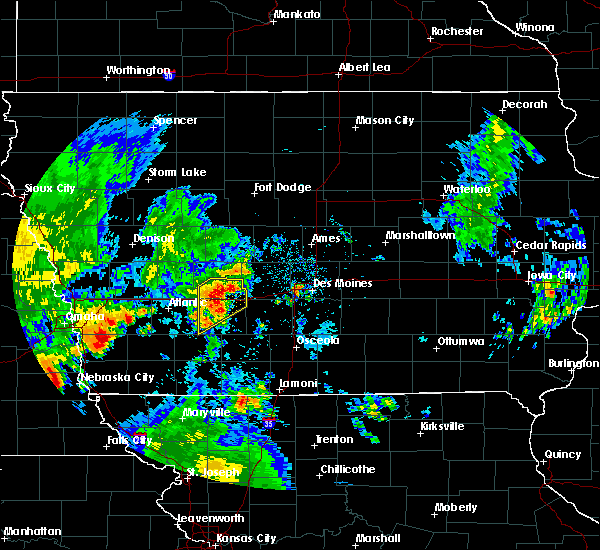 At 712 am cdt, a severe thunderstorm was located 8 miles west of stuart, or 12 miles south of guthrie center, moving northeast at 55 mph (radar indicated). Hazards include 60 mph wind gusts and quarter size hail. Hail damage to vehicles is expected. expect wind damage to roofs, siding, and trees. locations impacted include, greenfield, guthrie center, stuart, panora, adair, fontanelle, dexter, casey, diamondhead lake, menlo, bridgewater, greenfield municipal airport and nodaway park. This includes interstate 80 between mile markers 73 and 97. At 712 am cdt, a severe thunderstorm was located 8 miles west of stuart, or 12 miles south of guthrie center, moving northeast at 55 mph (radar indicated). Hazards include 60 mph wind gusts and quarter size hail. Hail damage to vehicles is expected. expect wind damage to roofs, siding, and trees. locations impacted include, greenfield, guthrie center, stuart, panora, adair, fontanelle, dexter, casey, diamondhead lake, menlo, bridgewater, greenfield municipal airport and nodaway park. This includes interstate 80 between mile markers 73 and 97.
|
| 6/14/2017 6:39 AM CDT |
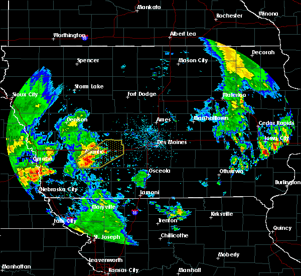 At 638 am cdt, a severe thunderstorm was located 8 miles southeast of atlantic, moving northeast at 50 mph (radar indicated). Hazards include 60 mph wind gusts and quarter size hail. Hail damage to vehicles is expected. Expect wind damage to roofs, siding, and trees. At 638 am cdt, a severe thunderstorm was located 8 miles southeast of atlantic, moving northeast at 50 mph (radar indicated). Hazards include 60 mph wind gusts and quarter size hail. Hail damage to vehicles is expected. Expect wind damage to roofs, siding, and trees.
|
| 5/17/2017 4:03 PM CDT |
 At 402 pm cdt, severe thunderstorms were located along a line extending from 9 miles west of coon rapids to 9 miles east of panora to 6 miles southwest of indianola, moving north at 65 mph (radar indicated). Hazards include 60 mph wind gusts and penny size hail. Expect damage to roofs, siding, and trees. locations impacted include, des moines, west des moines, urbandale, johnston, clive, indianola, waukee, norwalk, pleasant hill, grimes, perry, winterset, adel, audubon, guthrie center, windsor heights, carlisle, saylorville, dallas center and manning. this includes the following highways, interstate 35 between mile markers 47 and 72. interstate 80 between mile markers 98 and 136. interstate 235 between mile markers 1 and 12. A tornado watch remains in effect until 700 pm cdt for central, south central, southwestern and west central iowa. At 402 pm cdt, severe thunderstorms were located along a line extending from 9 miles west of coon rapids to 9 miles east of panora to 6 miles southwest of indianola, moving north at 65 mph (radar indicated). Hazards include 60 mph wind gusts and penny size hail. Expect damage to roofs, siding, and trees. locations impacted include, des moines, west des moines, urbandale, johnston, clive, indianola, waukee, norwalk, pleasant hill, grimes, perry, winterset, adel, audubon, guthrie center, windsor heights, carlisle, saylorville, dallas center and manning. this includes the following highways, interstate 35 between mile markers 47 and 72. interstate 80 between mile markers 98 and 136. interstate 235 between mile markers 1 and 12. A tornado watch remains in effect until 700 pm cdt for central, south central, southwestern and west central iowa.
|
| 5/17/2017 3:46 PM CDT |
 At 345 pm cdt, severe thunderstorms were located along a line extending from 11 miles north of atlantic to 6 miles southeast of stuart to near lakeside casino, moving north at 50 mph (radar indicated). Hazards include 60 mph wind gusts and penny size hail. expect damage to roofs, siding, and trees At 345 pm cdt, severe thunderstorms were located along a line extending from 11 miles north of atlantic to 6 miles southeast of stuart to near lakeside casino, moving north at 50 mph (radar indicated). Hazards include 60 mph wind gusts and penny size hail. expect damage to roofs, siding, and trees
|
| 5/16/2017 8:58 PM CDT |
 The severe thunderstorm warning for greene, northeastern cass, guthrie, eastern audubon, southeastern carroll, northern adair and western dallas counties will expire at 900 pm cdt, new severe thunderstorm warnings have been issued for portions of the area where a threat remains. a severe thunderstorm watch remains in effect until midnight cdt for southwestern and west central iowa. a severe thunderstorm watch also remains in effect until 300 am cdt for central and south central iowa. remember, a severe thunderstorm warning still remains in effect for 930 pm cdt. The severe thunderstorm warning for greene, northeastern cass, guthrie, eastern audubon, southeastern carroll, northern adair and western dallas counties will expire at 900 pm cdt, new severe thunderstorm warnings have been issued for portions of the area where a threat remains. a severe thunderstorm watch remains in effect until midnight cdt for southwestern and west central iowa. a severe thunderstorm watch also remains in effect until 300 am cdt for central and south central iowa. remember, a severe thunderstorm warning still remains in effect for 930 pm cdt.
|
| 5/16/2017 8:57 PM CDT |
 At 857 pm cdt, a severe thunderstorm was located near panora, or 10 miles northeast of guthrie center, moving northeast at 60 mph (radar indicated). Hazards include 60 mph wind gusts and quarter size hail. Hail damage to vehicles is expected. Expect wind damage to roofs, siding, and trees. At 857 pm cdt, a severe thunderstorm was located near panora, or 10 miles northeast of guthrie center, moving northeast at 60 mph (radar indicated). Hazards include 60 mph wind gusts and quarter size hail. Hail damage to vehicles is expected. Expect wind damage to roofs, siding, and trees.
|
| 5/16/2017 8:36 PM CDT |
 At 836 pm cdt, severe thunderstorms were located along a line extending from 9 miles southeast of glidden to near guthrie center to 15 miles northwest of greenfield, moving northeast at 45 mph (radar indicated). Hazards include 60 mph wind gusts and quarter size hail. Hail damage to vehicles is expected. expect wind damage to roofs, siding, and trees. locations impacted include, jefferson, guthrie center, stuart, coon rapids, panora, lake panorama, anita, exira, redfield, grand junction, adair, dexter, scranton, bayard, casey, diamondhead lake, menlo, bagley, rippey and yale. This includes interstate 80 between mile markers 64 and 97. At 836 pm cdt, severe thunderstorms were located along a line extending from 9 miles southeast of glidden to near guthrie center to 15 miles northwest of greenfield, moving northeast at 45 mph (radar indicated). Hazards include 60 mph wind gusts and quarter size hail. Hail damage to vehicles is expected. expect wind damage to roofs, siding, and trees. locations impacted include, jefferson, guthrie center, stuart, coon rapids, panora, lake panorama, anita, exira, redfield, grand junction, adair, dexter, scranton, bayard, casey, diamondhead lake, menlo, bagley, rippey and yale. This includes interstate 80 between mile markers 64 and 97.
|
| 5/16/2017 8:22 PM CDT |
 At 822 pm cdt, severe thunderstorms were located along a line extending from near coon rapids to 9 miles west of guthrie center to 7 miles southeast of atlantic, moving northeast at 50 mph (radar indicated). Hazards include 60 mph wind gusts and quarter size hail. Hail damage to vehicles is expected. Expect wind damage to roofs, siding, and trees. At 822 pm cdt, severe thunderstorms were located along a line extending from near coon rapids to 9 miles west of guthrie center to 7 miles southeast of atlantic, moving northeast at 50 mph (radar indicated). Hazards include 60 mph wind gusts and quarter size hail. Hail damage to vehicles is expected. Expect wind damage to roofs, siding, and trees.
|
| 4/19/2017 8:38 PM CDT |
 At 837 pm cdt, a severe thunderstorm was located near coon rapids, or 11 miles southwest of jefferson, moving northeast at 45 mph (radar indicated). Hazards include 60 mph wind gusts and quarter size hail. Hail damage to vehicles is expected. expect wind damage to roofs, siding, and trees. locations impacted include, jefferson, guthrie center, coon rapids, panora, lake panorama, scranton, bayard, bagley, dedham, yale, jamaica, gray, jefferson municipal airport, lakin slough game management area and springbrook state park. A tornado watch remains in effect until 1000 pm cdt for west central iowa. At 837 pm cdt, a severe thunderstorm was located near coon rapids, or 11 miles southwest of jefferson, moving northeast at 45 mph (radar indicated). Hazards include 60 mph wind gusts and quarter size hail. Hail damage to vehicles is expected. expect wind damage to roofs, siding, and trees. locations impacted include, jefferson, guthrie center, coon rapids, panora, lake panorama, scranton, bayard, bagley, dedham, yale, jamaica, gray, jefferson municipal airport, lakin slough game management area and springbrook state park. A tornado watch remains in effect until 1000 pm cdt for west central iowa.
|
| 4/19/2017 8:14 PM CDT |
 At 814 pm cdt, a severe thunderstorm was located 7 miles north of audubon, moving east at 45 mph (radar indicated). Hazards include 60 mph wind gusts and quarter size hail. Hail damage to vehicles is expected. Expect wind damage to roofs, siding, and trees. At 814 pm cdt, a severe thunderstorm was located 7 miles north of audubon, moving east at 45 mph (radar indicated). Hazards include 60 mph wind gusts and quarter size hail. Hail damage to vehicles is expected. Expect wind damage to roofs, siding, and trees.
|
| 3/6/2017 6:03 PM CST |
 At 603 pm cst, severe thunderstorms were located along a line extending from 8 miles southeast of gowrie to 8 miles northeast of lake icaria, moving east at 40 mph (radar indicated). Hazards include 60 mph wind gusts and quarter size hail. Hail damage to vehicles is expected. Expect wind damage to roofs, siding, and trees. At 603 pm cst, severe thunderstorms were located along a line extending from 8 miles southeast of gowrie to 8 miles northeast of lake icaria, moving east at 40 mph (radar indicated). Hazards include 60 mph wind gusts and quarter size hail. Hail damage to vehicles is expected. Expect wind damage to roofs, siding, and trees.
|
| 3/6/2017 5:48 PM CST |
 At 548 pm cst, severe thunderstorms were located along a line extending from 9 miles east of coon rapids to 7 miles southwest of guthrie center to 9 miles northwest of lake icaria, moving east at 45 mph (radar indicated). Hazards include 60 mph wind gusts and quarter size hail. Hail damage to vehicles is expected. expect wind damage to roofs, siding, and trees. locations impacted include, atlantic, guthrie center, lake panorama, anita, exira, adair, bayard, lewis, casey, massena, bagley, cumberland, yale, jamaica, bridgewater, wiota, lake anita state park, springbrook state park, anita municipal airport and cold springs state park. this includes interstate 80 between mile markers 61 and 83. A tornado watch remains in effect until 1000 pm cst for southwestern and west central iowa. At 548 pm cst, severe thunderstorms were located along a line extending from 9 miles east of coon rapids to 7 miles southwest of guthrie center to 9 miles northwest of lake icaria, moving east at 45 mph (radar indicated). Hazards include 60 mph wind gusts and quarter size hail. Hail damage to vehicles is expected. expect wind damage to roofs, siding, and trees. locations impacted include, atlantic, guthrie center, lake panorama, anita, exira, adair, bayard, lewis, casey, massena, bagley, cumberland, yale, jamaica, bridgewater, wiota, lake anita state park, springbrook state park, anita municipal airport and cold springs state park. this includes interstate 80 between mile markers 61 and 83. A tornado watch remains in effect until 1000 pm cst for southwestern and west central iowa.
|
| 3/6/2017 5:07 PM CST |
 At 507 pm cst, severe thunderstorms were located along a line extending from 8 miles north of audubon to near macedonia, moving northeast at 35 mph (radar indicated). Hazards include 60 mph wind gusts and quarter size hail. Hail damage to vehicles is expected. Expect wind damage to roofs, siding, and trees. At 507 pm cst, severe thunderstorms were located along a line extending from 8 miles north of audubon to near macedonia, moving northeast at 35 mph (radar indicated). Hazards include 60 mph wind gusts and quarter size hail. Hail damage to vehicles is expected. Expect wind damage to roofs, siding, and trees.
|
| 9/9/2016 2:59 PM CDT |
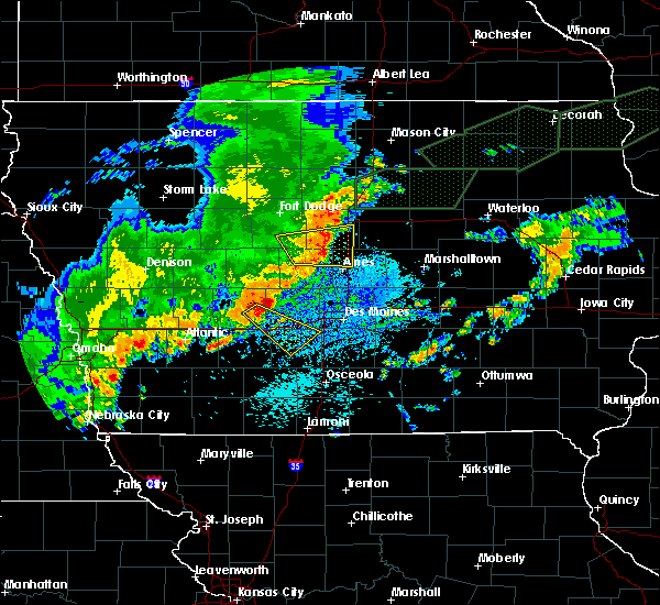 At 259 pm cdt, a severe thunderstorm was located near panora, or 10 miles southeast of guthrie center, moving southeast at 45 mph (radar indicated). Hazards include 60 mph wind gusts. Expect damage to roofs. siding. And trees. At 259 pm cdt, a severe thunderstorm was located near panora, or 10 miles southeast of guthrie center, moving southeast at 45 mph (radar indicated). Hazards include 60 mph wind gusts. Expect damage to roofs. siding. And trees.
|
| 8/11/2016 8:48 PM CDT |
 At 848 pm cdt, severe thunderstorms were located along a line extending from near madrid to near dallas center to near adel, moving east at 50 mph (radar indicated). Hazards include 60 mph wind gusts and penny size hail. Expect damage to roofs. siding. and trees. Locations impacted include, perry, guthrie center, stuart, panora, lake panorama, redfield, adair, casey, diamondhead lake, minburn, menlo, rippey, yale, jamaica, linden, dawson, bouton, perry municipal airport and lakin slough game management area. At 848 pm cdt, severe thunderstorms were located along a line extending from near madrid to near dallas center to near adel, moving east at 50 mph (radar indicated). Hazards include 60 mph wind gusts and penny size hail. Expect damage to roofs. siding. and trees. Locations impacted include, perry, guthrie center, stuart, panora, lake panorama, redfield, adair, casey, diamondhead lake, minburn, menlo, rippey, yale, jamaica, linden, dawson, bouton, perry municipal airport and lakin slough game management area.
|
| 8/11/2016 8:14 PM CDT |
 At 814 pm cdt, severe thunderstorms were located along a line extending from near jefferson to near lake panorama to 7 miles west of guthrie center, moving east at 50 mph (radar indicated). Hazards include 60 mph wind gusts and penny size hail. Expect damage to roofs. siding. And trees. At 814 pm cdt, severe thunderstorms were located along a line extending from near jefferson to near lake panorama to 7 miles west of guthrie center, moving east at 50 mph (radar indicated). Hazards include 60 mph wind gusts and penny size hail. Expect damage to roofs. siding. And trees.
|
| 7/17/2016 9:14 AM CDT |
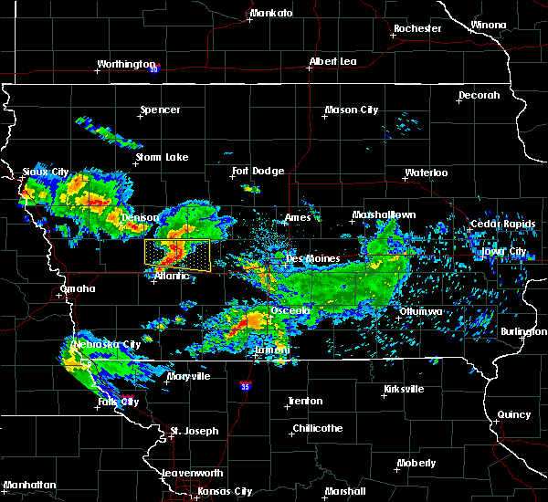 At 914 am cdt, a severe thunderstorm was located near guthrie center, moving east at 50 mph (radar indicated). Hazards include 60 mph wind gusts. Expect damage to roofs. siding. and trees. Locations impacted include, guthrie center, lake panorama, bayard, menlo, bagley and springbrook state park. At 914 am cdt, a severe thunderstorm was located near guthrie center, moving east at 50 mph (radar indicated). Hazards include 60 mph wind gusts. Expect damage to roofs. siding. and trees. Locations impacted include, guthrie center, lake panorama, bayard, menlo, bagley and springbrook state park.
|
| 7/17/2016 8:49 AM CDT |
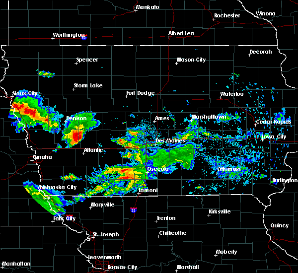 At 849 am cdt, a severe thunderstorm was located over audubon, moving east at 50 mph (radar indicated). Hazards include 60 mph wind gusts and penny size hail. Expect damage to roofs. siding. And trees. At 849 am cdt, a severe thunderstorm was located over audubon, moving east at 50 mph (radar indicated). Hazards include 60 mph wind gusts and penny size hail. Expect damage to roofs. siding. And trees.
|
| 7/13/2016 5:51 PM CDT |
 At 551 pm cdt, a severe thunderstorm was located over panora, or 8 miles east of guthrie center, moving southeast at 35 mph (radar indicated). Hazards include quarter size hail. damage to vehicles is expected At 551 pm cdt, a severe thunderstorm was located over panora, or 8 miles east of guthrie center, moving southeast at 35 mph (radar indicated). Hazards include quarter size hail. damage to vehicles is expected
|
| 5/26/2016 2:54 AM CDT |
 At 254 am cdt, severe thunderstorms were located along a line extending from 4 miles north of lake city to 7 miles south of panora, moving east at 60 mph (radar indicated). Hazards include 60 mph wind gusts and penny size hail. Expect damage to roofs. siding. And trees. At 254 am cdt, severe thunderstorms were located along a line extending from 4 miles north of lake city to 7 miles south of panora, moving east at 60 mph (radar indicated). Hazards include 60 mph wind gusts and penny size hail. Expect damage to roofs. siding. And trees.
|
| 3/30/2016 6:58 PM CDT |
 At 657 pm cdt, a severe thunderstorm was located near lake panorama, or 7 miles northeast of guthrie center, moving east at 35 mph (radar indicated). Hazards include quarter size hail. Damage to vehicles is expected. this severe thunderstorm will be near, perry around 725 pm cdt. Other locations impacted by this severe thunderstorm include bouton, springbrook state park, lakin slough game management area, yale, dawson, jamaica, perry municipal airport and minburn. At 657 pm cdt, a severe thunderstorm was located near lake panorama, or 7 miles northeast of guthrie center, moving east at 35 mph (radar indicated). Hazards include quarter size hail. Damage to vehicles is expected. this severe thunderstorm will be near, perry around 725 pm cdt. Other locations impacted by this severe thunderstorm include bouton, springbrook state park, lakin slough game management area, yale, dawson, jamaica, perry municipal airport and minburn.
|
| 11/11/2015 3:20 PM CST | Damage to outbuildings... and equipment. numerous trees dow in guthrie county IA, 2.3 miles SSE of Lake Panorama, IA |
| 11/11/2015 3:20 PM CST | Numerous trees down on the 4200 block of panorama roa in guthrie county IA, 1.2 miles E of Lake Panorama, IA |
| 11/11/2015 3:00 PM CST |
 At 300 pm cst, a severe thunderstorm capable of producing a tornado was located near lake panorama, or 8 miles northeast of guthrie center, moving northeast at 50 mph (radar indicated rotation). Hazards include tornado. Flying debris will be dangerous to those caught without shelter. mobile homes will be damaged or destroyed. damage to roofs, windows and vehicles will occur. tree damage is likely. This tornadic thunderstorm will remain over mainly rural areas of northeastern guthrie and southeastern greene counties, including the following locations, springbrook state park, lakin slough game management area, jamaica, bagley, yale and rippey. At 300 pm cst, a severe thunderstorm capable of producing a tornado was located near lake panorama, or 8 miles northeast of guthrie center, moving northeast at 50 mph (radar indicated rotation). Hazards include tornado. Flying debris will be dangerous to those caught without shelter. mobile homes will be damaged or destroyed. damage to roofs, windows and vehicles will occur. tree damage is likely. This tornadic thunderstorm will remain over mainly rural areas of northeastern guthrie and southeastern greene counties, including the following locations, springbrook state park, lakin slough game management area, jamaica, bagley, yale and rippey.
|
| 11/11/2015 2:51 PM CST |
 At 251 pm cst, a severe thunderstorm was located 6 miles north of lake panorama, or 11 miles north of guthrie center, moving northeast at 50 mph (radar indicated). Hazards include 60 mph wind gusts and quarter size hail. Hail damage to vehicles is expected. expect wind damage to roofs, siding and trees. locations impacted include, greenfield, guthrie center, stuart, panora, lake panorama, dexter, bayard, casey, diamondhead lake, menlo, bagley, yale, jamaica, greenfield municipal airport, springbrook state park and lakin slough game management area. this includes interstate 80 between mile markers 81 and 97. A tornado watch remains in effect until 600 pm cst for southwestern iowa. At 251 pm cst, a severe thunderstorm was located 6 miles north of lake panorama, or 11 miles north of guthrie center, moving northeast at 50 mph (radar indicated). Hazards include 60 mph wind gusts and quarter size hail. Hail damage to vehicles is expected. expect wind damage to roofs, siding and trees. locations impacted include, greenfield, guthrie center, stuart, panora, lake panorama, dexter, bayard, casey, diamondhead lake, menlo, bagley, yale, jamaica, greenfield municipal airport, springbrook state park and lakin slough game management area. this includes interstate 80 between mile markers 81 and 97. A tornado watch remains in effect until 600 pm cst for southwestern iowa.
|
| 11/11/2015 2:46 PM CST |
 At 246 pm cst, severe thunderstorms were located along a line extending from 8 miles northwest of carroll to 7 miles southeast of coon rapids to 7 miles west of winterset, moving northeast at 50 mph (radar indicated). Hazards include 60 mph wind gusts and quarter size hail. Hail damage to vehicles is expected. Expect wind damage to roofs, siding and trees. At 246 pm cst, severe thunderstorms were located along a line extending from 8 miles northwest of carroll to 7 miles southeast of coon rapids to 7 miles west of winterset, moving northeast at 50 mph (radar indicated). Hazards include 60 mph wind gusts and quarter size hail. Hail damage to vehicles is expected. Expect wind damage to roofs, siding and trees.
|
| 11/11/2015 2:12 PM CST |
 At 212 pm cst, a severe thunderstorm was located 10 miles northeast of atlantic, moving northeast at 50 mph (radar indicated). Hazards include 60 mph wind gusts and quarter size hail. Hail damage to vehicles is expected. Expect wind damage to roofs, siding and trees. At 212 pm cst, a severe thunderstorm was located 10 miles northeast of atlantic, moving northeast at 50 mph (radar indicated). Hazards include 60 mph wind gusts and quarter size hail. Hail damage to vehicles is expected. Expect wind damage to roofs, siding and trees.
|
| 8/10/2015 12:14 AM CDT |
 At 1214 am cdt, a severe thunderstorm was located 8 miles south of guthrie center, moving southeast at 45 mph (radar indicated). Hazards include 60 mph wind gusts and quarter size hail. Hail damage to vehicles is expected. expect wind damage to roofs, siding and trees. this severe thunderstorm will be near, stuart around 1225 am cdt. earlham around 1235 am cdt. winterset around 1250 am cdt. other locations impacted by this severe thunderstorm include badger creek state park, casey, dexter, diamondhead lake, menlo, patterson, winterset-madison county airport, macksburg, linden and redfield. This includes interstate 80 between mile markers 79 and 116. At 1214 am cdt, a severe thunderstorm was located 8 miles south of guthrie center, moving southeast at 45 mph (radar indicated). Hazards include 60 mph wind gusts and quarter size hail. Hail damage to vehicles is expected. expect wind damage to roofs, siding and trees. this severe thunderstorm will be near, stuart around 1225 am cdt. earlham around 1235 am cdt. winterset around 1250 am cdt. other locations impacted by this severe thunderstorm include badger creek state park, casey, dexter, diamondhead lake, menlo, patterson, winterset-madison county airport, macksburg, linden and redfield. This includes interstate 80 between mile markers 79 and 116.
|
| 8/9/2015 11:55 PM CDT |
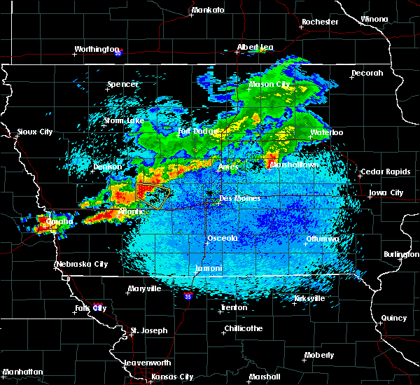 At 1155 pm cdt, a severe thunderstorm was located 8 miles northwest of guthrie center, moving southeast at 45 mph (radar indicated). Hazards include golf ball size hail and 60 mph wind gusts. People and animals outdoors will be injured. expect hail damage to roofs, siding, windows and vehicles. expect wind damage to roofs, siding and trees. this severe storm will be near, guthrie center around 1205 am cdt. lake panorama and panora around 1215 am cdt. Other locations impacted by this severe thunderstorm include springbrook state park, yale, menlo and lakin slough game management area. At 1155 pm cdt, a severe thunderstorm was located 8 miles northwest of guthrie center, moving southeast at 45 mph (radar indicated). Hazards include golf ball size hail and 60 mph wind gusts. People and animals outdoors will be injured. expect hail damage to roofs, siding, windows and vehicles. expect wind damage to roofs, siding and trees. this severe storm will be near, guthrie center around 1205 am cdt. lake panorama and panora around 1215 am cdt. Other locations impacted by this severe thunderstorm include springbrook state park, yale, menlo and lakin slough game management area.
|
| 8/9/2015 11:48 PM CDT |
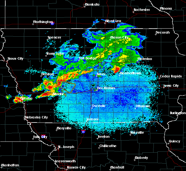 At 1148 pm cdt, a severe thunderstorm was located 5 miles south of coon rapids, or 13 miles northwest of guthrie center, moving southeast at 45 mph (radar indicated). Hazards include golf ball size hail and 60 mph wind gusts. People and animals outdoors will be injured. expect hail damage to roofs, siding, windows and vehicles. expect wind damage to roofs, siding and trees. this severe storm will be near, guthrie center around 1205 am cdt. lake panorama and panora around 1215 am cdt. Other locations impacted by this severe thunderstorm include springbrook state park, yale, menlo and lakin slough game management area. At 1148 pm cdt, a severe thunderstorm was located 5 miles south of coon rapids, or 13 miles northwest of guthrie center, moving southeast at 45 mph (radar indicated). Hazards include golf ball size hail and 60 mph wind gusts. People and animals outdoors will be injured. expect hail damage to roofs, siding, windows and vehicles. expect wind damage to roofs, siding and trees. this severe storm will be near, guthrie center around 1205 am cdt. lake panorama and panora around 1215 am cdt. Other locations impacted by this severe thunderstorm include springbrook state park, yale, menlo and lakin slough game management area.
|
| 8/9/2015 11:35 PM CDT |
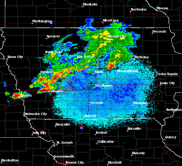 At 1135 pm cdt, a severe thunderstorm was located 7 miles west of coon rapids, or 10 miles northeast of audubon, moving southeast at 45 mph (radar indicated). Hazards include 60 mph wind gusts and quarter size hail. Hail damage to vehicles is expected. expect wind damage to roofs, siding and trees. this severe thunderstorm will be near, coon rapids around 1145 pm cdt. guthrie center around 1205 am cdt. lake panorama and panora around 1210 am cdt. Other locations impacted by this severe thunderstorm include springbrook state park, bayard, yale, dedham, lakin slough game management area and menlo. At 1135 pm cdt, a severe thunderstorm was located 7 miles west of coon rapids, or 10 miles northeast of audubon, moving southeast at 45 mph (radar indicated). Hazards include 60 mph wind gusts and quarter size hail. Hail damage to vehicles is expected. expect wind damage to roofs, siding and trees. this severe thunderstorm will be near, coon rapids around 1145 pm cdt. guthrie center around 1205 am cdt. lake panorama and panora around 1210 am cdt. Other locations impacted by this severe thunderstorm include springbrook state park, bayard, yale, dedham, lakin slough game management area and menlo.
|
| 7/27/2015 11:18 AM CDT |
 At 1117 am cdt, a severe thunderstorm was located over lake panorama, or 4 miles northeast of guthrie center, moving east at 20 mph (radar indicated). Hazards include 60 mph wind gusts and quarter size hail. Hail damage to vehicles is expected. expect wind damage to roofs, siding and trees. locations impacted include, guthrie center, stuart, panora, lake panorama, redfield, dexter, bayard, diamondhead lake, menlo, bagley, yale, jamaica, linden, lakin slough game management area and springbrook state park. This includes interstate 80 between mile markers 99 and 100. At 1117 am cdt, a severe thunderstorm was located over lake panorama, or 4 miles northeast of guthrie center, moving east at 20 mph (radar indicated). Hazards include 60 mph wind gusts and quarter size hail. Hail damage to vehicles is expected. expect wind damage to roofs, siding and trees. locations impacted include, guthrie center, stuart, panora, lake panorama, redfield, dexter, bayard, diamondhead lake, menlo, bagley, yale, jamaica, linden, lakin slough game management area and springbrook state park. This includes interstate 80 between mile markers 99 and 100.
|
| 7/27/2015 10:58 AM CDT |
 At 1057 am cdt, a severe thunderstorm was located 8 miles west of guthrie center, moving east at 20 mph (radar indicated). Hazards include 60 mph wind gusts and quarter size hail. Hail damage to vehicles is expected. Expect wind damage to roofs, siding and trees. At 1057 am cdt, a severe thunderstorm was located 8 miles west of guthrie center, moving east at 20 mph (radar indicated). Hazards include 60 mph wind gusts and quarter size hail. Hail damage to vehicles is expected. Expect wind damage to roofs, siding and trees.
|
| 6/25/2015 1:07 AM CDT |
 A severe thunderstorm warning remains in effect until 130 am cdt for central guthrie county. at 107 am cdt. a severe thunderstorm was located near lake panorama. or near guthrie center. moving east at 35 mph. hazard. quarter size hail. source. Radar indicated. A severe thunderstorm warning remains in effect until 130 am cdt for central guthrie county. at 107 am cdt. a severe thunderstorm was located near lake panorama. or near guthrie center. moving east at 35 mph. hazard. quarter size hail. source. Radar indicated.
|
| 6/25/2015 12:38 AM CDT |
 At 1238 am cdt, a severe thunderstorm was located 6 miles southwest of coon rapids, or 10 miles northeast of audubon, moving southeast at 30 mph (radar indicated). Hazards include half dollar size hail. damage to vehicles is expected At 1238 am cdt, a severe thunderstorm was located 6 miles southwest of coon rapids, or 10 miles northeast of audubon, moving southeast at 30 mph (radar indicated). Hazards include half dollar size hail. damage to vehicles is expected
|
| 6/24/2015 10:06 PM CDT |
 At 1005 pm cdt, a severe thunderstorm was located 8 miles southwest of perry, moving southeast at 45 mph (radar indicated). Hazards include quarter size hail. Damage to vehicles is expected. quarter hail was reported in herndon at 1001 pm cdt. locations impacted include, perry, adel, dallas center, panora, de soto, lake panorama, redfield, minburn, yale, jamaica, linden, dawson, lakin slough game management area, perry municipal airport and springbrook state park. this includes interstate 80 between mile markers 109 and 111. A tornado watch remains in effect until 200 am cdt for southwestern iowa. At 1005 pm cdt, a severe thunderstorm was located 8 miles southwest of perry, moving southeast at 45 mph (radar indicated). Hazards include quarter size hail. Damage to vehicles is expected. quarter hail was reported in herndon at 1001 pm cdt. locations impacted include, perry, adel, dallas center, panora, de soto, lake panorama, redfield, minburn, yale, jamaica, linden, dawson, lakin slough game management area, perry municipal airport and springbrook state park. this includes interstate 80 between mile markers 109 and 111. A tornado watch remains in effect until 200 am cdt for southwestern iowa.
|
| 6/24/2015 9:52 PM CDT |
 At 951 pm cdt, a severe thunderstorm was located 5 miles northeast of lake panorama, or 10 miles northeast of guthrie center, moving southeast at 40 mph (radar indicated). Hazards include quarter size hail. damage to vehicles is expected At 951 pm cdt, a severe thunderstorm was located 5 miles northeast of lake panorama, or 10 miles northeast of guthrie center, moving southeast at 40 mph (radar indicated). Hazards include quarter size hail. damage to vehicles is expected
|
| 6/24/2015 7:34 PM CDT |
 At 734 pm cdt, a severe thunderstorm was located 7 miles southeast of panora, or 12 miles west of adel, moving southeast at 25 mph (trained weather spotters). Hazards include golf ball size hail and 60 mph wind gusts. People and animals outdoors will be injured. expect hail damage to roofs, siding, windows and vehicles. expect wind damage to roofs, siding and trees. locations impacted include, west des moines, waukee, winterset, adel, guthrie center, stuart, dallas center, earlham, panora, de soto, van meter, lake panorama, redfield, dexter, diamondhead lake, minburn, menlo, linden, badger creek state park and winterset-madison county airport. this includes interstate 80 between mile markers 84 and 117. A tornado watch remains in effect until 200 am cdt for southwestern iowa. At 734 pm cdt, a severe thunderstorm was located 7 miles southeast of panora, or 12 miles west of adel, moving southeast at 25 mph (trained weather spotters). Hazards include golf ball size hail and 60 mph wind gusts. People and animals outdoors will be injured. expect hail damage to roofs, siding, windows and vehicles. expect wind damage to roofs, siding and trees. locations impacted include, west des moines, waukee, winterset, adel, guthrie center, stuart, dallas center, earlham, panora, de soto, van meter, lake panorama, redfield, dexter, diamondhead lake, minburn, menlo, linden, badger creek state park and winterset-madison county airport. this includes interstate 80 between mile markers 84 and 117. A tornado watch remains in effect until 200 am cdt for southwestern iowa.
|
| 6/24/2015 7:15 PM CDT |
 At 714 pm cdt, a severe thunderstorm was located over panora, or 6 miles east of guthrie center, moving southeast at 25 mph (trained weather spotters). Hazards include golf ball size hail and 60 mph wind gusts. People and animals outdoors will be injured. expect hail damage to roofs, siding, windows and vehicles. Expect wind damage to roofs, siding and trees. At 714 pm cdt, a severe thunderstorm was located over panora, or 6 miles east of guthrie center, moving southeast at 25 mph (trained weather spotters). Hazards include golf ball size hail and 60 mph wind gusts. People and animals outdoors will be injured. expect hail damage to roofs, siding, windows and vehicles. Expect wind damage to roofs, siding and trees.
|
| 6/24/2015 7:09 PM CDT |
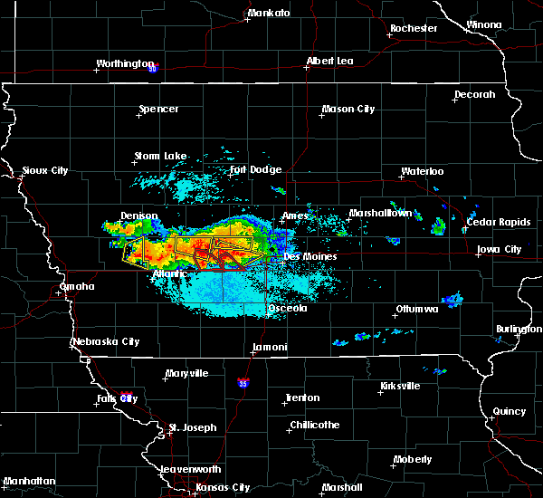 At 709 pm cdt, a severe thunderstorm capable of producing a tornado was located 6 miles southwest of panora, or 6 miles southeast of guthrie center, moving southeast at 25 mph (radar indicated rotation). Hazards include tornado and golf ball size hail. Flying debris will be dangerous to those caught without shelter. mobile homes will be damaged or destroyed. damage to roofs, windows and vehicles will occur. tree damage is likely. this dangerous storm will be near, stuart around 730 pm cdt. Other locations impacted by this tornadic thunderstorm include menlo and diamondhead lake. At 709 pm cdt, a severe thunderstorm capable of producing a tornado was located 6 miles southwest of panora, or 6 miles southeast of guthrie center, moving southeast at 25 mph (radar indicated rotation). Hazards include tornado and golf ball size hail. Flying debris will be dangerous to those caught without shelter. mobile homes will be damaged or destroyed. damage to roofs, windows and vehicles will occur. tree damage is likely. this dangerous storm will be near, stuart around 730 pm cdt. Other locations impacted by this tornadic thunderstorm include menlo and diamondhead lake.
|
| 6/24/2015 6:57 PM CDT |
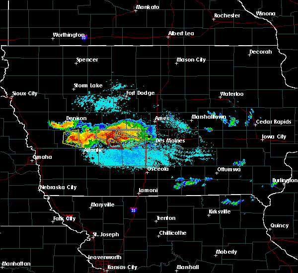 At 657 pm cdt, a severe thunderstorm capable of producing a tornado was located near guthrie center, moving southeast at 25 mph (radar indicated rotation). Hazards include tornado. Flying debris will be dangerous to those caught without shelter. mobile homes will be damaged or destroyed. damage to roofs, windows and vehicles will occur. tree damage is likely. this dangerous storm will be near, stuart around 730 pm cdt. Other locations impacted by this tornadic thunderstorm include menlo and diamondhead lake. At 657 pm cdt, a severe thunderstorm capable of producing a tornado was located near guthrie center, moving southeast at 25 mph (radar indicated rotation). Hazards include tornado. Flying debris will be dangerous to those caught without shelter. mobile homes will be damaged or destroyed. damage to roofs, windows and vehicles will occur. tree damage is likely. this dangerous storm will be near, stuart around 730 pm cdt. Other locations impacted by this tornadic thunderstorm include menlo and diamondhead lake.
|
| 6/24/2015 6:45 PM CDT |
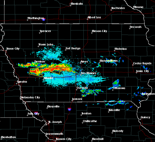 At 645 pm cdt, a severe thunderstorm was located 6 miles northwest of guthrie center, moving east at 30 mph (radar indicated). Hazards include quarter size hail. Damage to vehicles is expected. locations impacted include, guthrie center, lake panorama, bayard, bagley and springbrook state park. A tornado watch remains in effect until 200 am cdt for west central iowa. At 645 pm cdt, a severe thunderstorm was located 6 miles northwest of guthrie center, moving east at 30 mph (radar indicated). Hazards include quarter size hail. Damage to vehicles is expected. locations impacted include, guthrie center, lake panorama, bayard, bagley and springbrook state park. A tornado watch remains in effect until 200 am cdt for west central iowa.
|
| 6/24/2015 6:31 PM CDT |
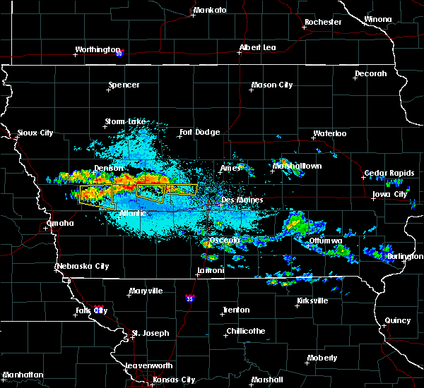 At 631 pm cdt, a severe thunderstorm was located 7 miles south of coon rapids, or 10 miles northwest of guthrie center, moving east at 35 mph (radar indicated). Hazards include quarter size hail. damage to vehicles is expected At 631 pm cdt, a severe thunderstorm was located 7 miles south of coon rapids, or 10 miles northwest of guthrie center, moving east at 35 mph (radar indicated). Hazards include quarter size hail. damage to vehicles is expected
|
| 6/7/2015 12:48 AM CDT | At 1247 am cdt, severe thunderstorms were located along a line extending from 4 miles west of coon rapids to 6 miles southwest of audubon, moving east at 50 mph (radar indicated). Hazards include 60 mph wind gusts. Expect damage to roofs. Siding and trees. |
| 5/11/2014 11:05 PM CDT | Outbuilding destroyed... roof thrown 40 yard in guthrie county IA, 0.9 miles W of Lake Panorama, IA |
| 5/11/2014 10:02 PM CDT | 2 or 3 large telephone poles snapped in half along with a large tree down about foot and a half in diameter. time estimated by rada in guthrie county IA, 2.5 miles WSW of Lake Panorama, IA |
| 5/11/2014 9:55 PM CDT | 2 1/2 ft. diameter trees down and uprooted. dock destroyed. numerous trees dow in guthrie county IA, 1.5 miles NNW of Lake Panorama, IA |
| 9/10/2013 6:35 PM CDT | West facing sections of the port restaurant damaged. pieces of roofing and plywood thrown into ditch next to road. several exposed roof trusses visibl in guthrie county IA, 2.4 miles W of Lake Panorama, IA |
Hail Maps for Lake Panorama, IA


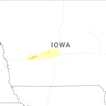
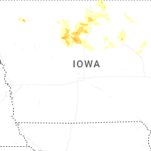
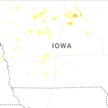
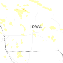

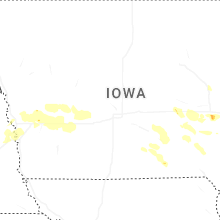
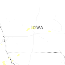

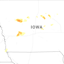


Connect with Interactive Hail Maps