

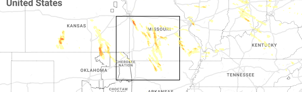
Hail Map for Lakeview, AR
The Lakeview, AR area has had 1 report of on-the-ground hail by trained spotters, and has been under severe weather warnings 18 times during the past 12 months. Doppler radar has detected hail at or near Lakeview, AR on 58 occasions, including 4 occasions during the past year.
| Name: | Lakeview, AR |
| Where Located: | 71.1 miles SE of Springfield, MO |
| Map: | Google Map for Lakeview, AR |
| Population: | 741 |
| Housing Units: | 434 |
| More Info: | Search Google for Lakeview, AR |
3
The Top Recent Hail Date for Lakeview, AR is Monday, July 17, 2023 (2nd out of 58)
Hail and Wind Damage Spotted near Lakeview, AR
| Date / Time | Report Details |
|---|---|
| 3/14/2024 5:04 PM CDT |
 At 504 pm cdt, severe thunderstorms were located along a line extending from lakeview in baxter county to near rush to near eula, moving east at 40 mph (radar indicated). Hazards include 60 mph wind gusts and quarter size hail. Hail damage to vehicles is expected. expect wind damage to roofs, siding, and trees. Locations impacted include, mountain home, bull shoals, marshall, yellville, gassville, flippin, lakeview in baxter county, norfork, salesville, briarcliff, arkawana, marsena, duff, bull shoals state park, point peter, herron, colfax, maumee, advance, bohannon,. At 504 pm cdt, severe thunderstorms were located along a line extending from lakeview in baxter county to near rush to near eula, moving east at 40 mph (radar indicated). Hazards include 60 mph wind gusts and quarter size hail. Hail damage to vehicles is expected. expect wind damage to roofs, siding, and trees. Locations impacted include, mountain home, bull shoals, marshall, yellville, gassville, flippin, lakeview in baxter county, norfork, salesville, briarcliff, arkawana, marsena, duff, bull shoals state park, point peter, herron, colfax, maumee, advance, bohannon,.
|
| 3/14/2024 4:48 PM CDT |
 Svrlzk the national weather service in little rock has issued a * severe thunderstorm warning for, searcy county in north central arkansas, southeastern newton county in north central arkansas, marion county in north central arkansas, baxter county in north central arkansas, * until 545 pm cdt. * at 447 pm cdt, severe thunderstorms were located along a line extending from near lakeway to 6 miles east of dugger to 7 miles northwest of moore, moving east at 40 mph (radar indicated). Hazards include 60 mph wind gusts and quarter size hail. Hail damage to vehicles is expected. Expect wind damage to roofs, siding, and trees. Svrlzk the national weather service in little rock has issued a * severe thunderstorm warning for, searcy county in north central arkansas, southeastern newton county in north central arkansas, marion county in north central arkansas, baxter county in north central arkansas, * until 545 pm cdt. * at 447 pm cdt, severe thunderstorms were located along a line extending from near lakeway to 6 miles east of dugger to 7 miles northwest of moore, moving east at 40 mph (radar indicated). Hazards include 60 mph wind gusts and quarter size hail. Hail damage to vehicles is expected. Expect wind damage to roofs, siding, and trees.
|
| 8/9/2023 7:40 PM CDT |
 At 738 pm cdt, a severe thunderstorm was located in southern missouri near the arkansas border. strong and damaging winds were surging southward well in advance of the storm into portions of northeast marion and northern baxter county (radar indicated). Hazards include 70 mph wind gusts and quarter size hail. Wind damage is likely to trees, mobile homes, roofs, and outbuildings. locations impacted include, mountain home, bull shoals, gassville, lakeview in baxter county, norfork, salesville, briarcliff, arkawana, norfork dam, diamond bay, ozark regional airport, gamaliel landing, ozark isle, fawn park, bull shoals state park, shipp, herron, colfax, price place, cotter, thunderstorm damage threat, considerable hail threat, radar indicated max hail size, 1. 00 in wind threat, radar indicated max wind gust, 70 mph. At 738 pm cdt, a severe thunderstorm was located in southern missouri near the arkansas border. strong and damaging winds were surging southward well in advance of the storm into portions of northeast marion and northern baxter county (radar indicated). Hazards include 70 mph wind gusts and quarter size hail. Wind damage is likely to trees, mobile homes, roofs, and outbuildings. locations impacted include, mountain home, bull shoals, gassville, lakeview in baxter county, norfork, salesville, briarcliff, arkawana, norfork dam, diamond bay, ozark regional airport, gamaliel landing, ozark isle, fawn park, bull shoals state park, shipp, herron, colfax, price place, cotter, thunderstorm damage threat, considerable hail threat, radar indicated max hail size, 1. 00 in wind threat, radar indicated max wind gust, 70 mph.
|
| 8/9/2023 7:26 PM CDT |
 At 725 pm cdt, a severe thunderstorm was located near price place, or 13 miles north of bull shoals, moving southeast at 35 mph (radar indicated). Hazards include 70 mph wind gusts and quarter size hail. Hail damage to vehicles is expected. expect considerable tree damage. Wind damage is also likely to mobile homes, roofs, and outbuildings. At 725 pm cdt, a severe thunderstorm was located near price place, or 13 miles north of bull shoals, moving southeast at 35 mph (radar indicated). Hazards include 70 mph wind gusts and quarter size hail. Hail damage to vehicles is expected. expect considerable tree damage. Wind damage is also likely to mobile homes, roofs, and outbuildings.
|
| 7/31/2023 12:26 AM CDT |
 At 1226 am cdt, severe thunderstorms were located along a line extending from near pyatt to 7 miles east of upper buffalo wilderness area, moving southeast at 55 mph (radar indicated). Hazards include 70 mph wind gusts. Expect considerable tree damage. damage is likely to mobile homes, roofs, and outbuildings. locations impacted include, harrison, mountain home, bull shoals, marshall, yellville, jasper, gassville, flippin, lakeview in baxter county, diamond city, norfork, salesville, bergman, western grove, lead hill, briarcliff, pyatt, valley springs, arkawana, dugger, thunderstorm damage threat, considerable hail threat, radar indicated max hail size, <. 75 in wind threat, radar indicated max wind gust, 70 mph. At 1226 am cdt, severe thunderstorms were located along a line extending from near pyatt to 7 miles east of upper buffalo wilderness area, moving southeast at 55 mph (radar indicated). Hazards include 70 mph wind gusts. Expect considerable tree damage. damage is likely to mobile homes, roofs, and outbuildings. locations impacted include, harrison, mountain home, bull shoals, marshall, yellville, jasper, gassville, flippin, lakeview in baxter county, diamond city, norfork, salesville, bergman, western grove, lead hill, briarcliff, pyatt, valley springs, arkawana, dugger, thunderstorm damage threat, considerable hail threat, radar indicated max hail size, <. 75 in wind threat, radar indicated max wind gust, 70 mph.
|
| 7/31/2023 12:08 AM CDT |
 At 1206 am cdt, severe thunderstorms were located along a line extending from near diamond city to near kingston, moving southeast at 55 mph. these are destructive storms for harrison in boone county and jasper in newton county (radar indicated). Hazards include 80 mph wind gusts. Flying debris will be dangerous to those caught without shelter. mobile homes will be heavily damaged. expect considerable damage to roofs, windows, and vehicles. Extensive tree damage and power outages are likely. At 1206 am cdt, severe thunderstorms were located along a line extending from near diamond city to near kingston, moving southeast at 55 mph. these are destructive storms for harrison in boone county and jasper in newton county (radar indicated). Hazards include 80 mph wind gusts. Flying debris will be dangerous to those caught without shelter. mobile homes will be heavily damaged. expect considerable damage to roofs, windows, and vehicles. Extensive tree damage and power outages are likely.
|
| 7/17/2023 8:48 PM CDT |
 At 848 pm cdt, a severe thunderstorm was located over flippin, or near bull shoals, moving southeast at 45 mph (radar indicated). Hazards include 60 mph wind gusts and half dollar size hail. Hail damage to vehicles is expected. expect wind damage to roofs, siding, and trees. locations impacted include, mountain home, bull shoals, yellville, gassville, flippin, lakeview in baxter county, norfork, salesville, briarcliff, ozark regional airport, bull shoals state park, shipp, herron, colfax, rush, lion hill, advance, cartney, cotter, summit, hail threat, radar indicated max hail size, 1. 25 in wind threat, radar indicated max wind gust, 60 mph. At 848 pm cdt, a severe thunderstorm was located over flippin, or near bull shoals, moving southeast at 45 mph (radar indicated). Hazards include 60 mph wind gusts and half dollar size hail. Hail damage to vehicles is expected. expect wind damage to roofs, siding, and trees. locations impacted include, mountain home, bull shoals, yellville, gassville, flippin, lakeview in baxter county, norfork, salesville, briarcliff, ozark regional airport, bull shoals state park, shipp, herron, colfax, rush, lion hill, advance, cartney, cotter, summit, hail threat, radar indicated max hail size, 1. 25 in wind threat, radar indicated max wind gust, 60 mph.
|
| 7/17/2023 8:41 PM CDT |
 At 841 pm cdt, a severe thunderstorm was located near flippin, or near bull shoals, moving southeast at 50 mph (radar indicated). Hazards include 60 mph wind gusts and quarter size hail. Hail damage to vehicles is expected. expect wind damage to roofs, siding, and trees. locations impacted include, mountain home, bull shoals, yellville, gassville, flippin, lakeview in baxter county, norfork, salesville, briarcliff, pyatt, ozark regional airport, lakeway, bull shoals state park, shipp, clark hill, herron, colfax, rush, lion hill, advance, hail threat, radar indicated max hail size, 1. 00 in wind threat, radar indicated max wind gust, 60 mph. At 841 pm cdt, a severe thunderstorm was located near flippin, or near bull shoals, moving southeast at 50 mph (radar indicated). Hazards include 60 mph wind gusts and quarter size hail. Hail damage to vehicles is expected. expect wind damage to roofs, siding, and trees. locations impacted include, mountain home, bull shoals, yellville, gassville, flippin, lakeview in baxter county, norfork, salesville, briarcliff, pyatt, ozark regional airport, lakeway, bull shoals state park, shipp, clark hill, herron, colfax, rush, lion hill, advance, hail threat, radar indicated max hail size, 1. 00 in wind threat, radar indicated max wind gust, 60 mph.
|
| 7/17/2023 8:29 PM CDT |
 At 829 pm cdt, a severe thunderstorm was located near lakeway, or 10 miles west of bull shoals, moving southeast at 50 mph (radar indicated). Hazards include 60 mph wind gusts and quarter size hail. Hail damage to vehicles is expected. Expect wind damage to roofs, siding, and trees. At 829 pm cdt, a severe thunderstorm was located near lakeway, or 10 miles west of bull shoals, moving southeast at 50 mph (radar indicated). Hazards include 60 mph wind gusts and quarter size hail. Hail damage to vehicles is expected. Expect wind damage to roofs, siding, and trees.
|
| 7/17/2023 5:55 PM CDT |
 At 555 pm cdt, severe thunderstorms were located along a line extending from yellville to cartney to near fawn park, moving southeast at 45 mph (radar indicated). Hazards include 70 mph wind gusts and half dollar size hail. Hail damage to vehicles is expected. expect considerable tree damage. Wind damage is also likely to mobile homes, roofs, and outbuildings. At 555 pm cdt, severe thunderstorms were located along a line extending from yellville to cartney to near fawn park, moving southeast at 45 mph (radar indicated). Hazards include 70 mph wind gusts and half dollar size hail. Hail damage to vehicles is expected. expect considerable tree damage. Wind damage is also likely to mobile homes, roofs, and outbuildings.
|
| 7/17/2023 5:27 PM CDT |
 At 527 pm cdt, severe thunderstorms were located along a line extending from 6 miles west of ozark isle to 7 miles northwest of gamaliel landing, moving southeast at 40 mph (radar indicated). Hazards include 70 mph wind gusts and quarter size hail. Hail damage to vehicles is expected. expect considerable tree damage. wind damage is also likely to mobile homes, roofs, and outbuildings. locations impacted include, mountain home, bull shoals, yellville, gassville, flippin, lakeview in baxter county, norfork, pyatt, arkawana, ozark regional airport, ozark isle, fawn park, lakeway, bull shoals state park, shipp, herron, colfax, rush, lion hill, advance, thunderstorm damage threat, considerable hail threat, radar indicated max hail size, 1. 00 in wind threat, radar indicated max wind gust, 70 mph. At 527 pm cdt, severe thunderstorms were located along a line extending from 6 miles west of ozark isle to 7 miles northwest of gamaliel landing, moving southeast at 40 mph (radar indicated). Hazards include 70 mph wind gusts and quarter size hail. Hail damage to vehicles is expected. expect considerable tree damage. wind damage is also likely to mobile homes, roofs, and outbuildings. locations impacted include, mountain home, bull shoals, yellville, gassville, flippin, lakeview in baxter county, norfork, pyatt, arkawana, ozark regional airport, ozark isle, fawn park, lakeway, bull shoals state park, shipp, herron, colfax, rush, lion hill, advance, thunderstorm damage threat, considerable hail threat, radar indicated max hail size, 1. 00 in wind threat, radar indicated max wind gust, 70 mph.
|
| 7/17/2023 5:12 PM CDT |
 At 511 pm cdt, severe thunderstorms were located along a line extending from 8 miles southeast of taneyville to near gainesville, moving south at 25 mph (radar indicated). Hazards include 70 mph wind gusts and quarter size hail. Hail damage to vehicles is expected. expect considerable tree damage. wind damage is also likely to mobile homes, roofs, and outbuildings. locations impacted include, mountain home, bull shoals, yellville, gassville, flippin, lakeview in baxter county, diamond city, norfork, bergman, lead hill, pyatt, arkawana, lakeway, bull shoals state park, winington, clark hill, herron, colfax, advance, cartney, thunderstorm damage threat, considerable hail threat, radar indicated max hail size, 1. 00 in wind threat, radar indicated max wind gust, 70 mph. At 511 pm cdt, severe thunderstorms were located along a line extending from 8 miles southeast of taneyville to near gainesville, moving south at 25 mph (radar indicated). Hazards include 70 mph wind gusts and quarter size hail. Hail damage to vehicles is expected. expect considerable tree damage. wind damage is also likely to mobile homes, roofs, and outbuildings. locations impacted include, mountain home, bull shoals, yellville, gassville, flippin, lakeview in baxter county, diamond city, norfork, bergman, lead hill, pyatt, arkawana, lakeway, bull shoals state park, winington, clark hill, herron, colfax, advance, cartney, thunderstorm damage threat, considerable hail threat, radar indicated max hail size, 1. 00 in wind threat, radar indicated max wind gust, 70 mph.
|
| 7/17/2023 4:58 PM CDT |
 At 458 pm cdt, severe thunderstorms were located along a line extending from near taneyville to near gainesville, moving south at 25 mph (radar indicated). Hazards include 60 mph wind gusts and quarter size hail. Hail damage to vehicles is expected. Expect wind damage to roofs, siding, and trees. At 458 pm cdt, severe thunderstorms were located along a line extending from near taneyville to near gainesville, moving south at 25 mph (radar indicated). Hazards include 60 mph wind gusts and quarter size hail. Hail damage to vehicles is expected. Expect wind damage to roofs, siding, and trees.
|
| 7/14/2023 9:38 PM CDT |
 At 938 pm cdt, severe thunderstorms were located along a line extending from 6 miles west of gainesville to near mountain home to maumee, moving east at 45 mph (radar indicated). Hazards include 60 mph wind gusts and penny size hail. Expect damage to roofs, siding, and trees. locations impacted include, mountain home, bull shoals, gassville, lakeview in baxter county, arkawana, advance, cartney, price place, ozark regional airport, fawn park, shipp, colfax, rush, lion hill, cotter, midway in baxter county, buffalo city, oakland, buford, lone rock, hail threat, radar indicated max hail size, 0. 75 in wind threat, radar indicated max wind gust, 60 mph. At 938 pm cdt, severe thunderstorms were located along a line extending from 6 miles west of gainesville to near mountain home to maumee, moving east at 45 mph (radar indicated). Hazards include 60 mph wind gusts and penny size hail. Expect damage to roofs, siding, and trees. locations impacted include, mountain home, bull shoals, gassville, lakeview in baxter county, arkawana, advance, cartney, price place, ozark regional airport, fawn park, shipp, colfax, rush, lion hill, cotter, midway in baxter county, buffalo city, oakland, buford, lone rock, hail threat, radar indicated max hail size, 0. 75 in wind threat, radar indicated max wind gust, 60 mph.
|
| 7/14/2023 9:35 PM CDT |
 At 935 pm cdt, severe thunderstorms were located along a line extending from 11 miles north of price place to mountain home to near rush, moving east at 40 mph (radar indicated). Hazards include 60 mph wind gusts and penny size hail. expect damage to roofs, siding, and trees At 935 pm cdt, severe thunderstorms were located along a line extending from 11 miles north of price place to mountain home to near rush, moving east at 40 mph (radar indicated). Hazards include 60 mph wind gusts and penny size hail. expect damage to roofs, siding, and trees
|
| 7/14/2023 9:15 PM CDT |
 At 915 pm cdt, severe thunderstorms were located along a line extending from 13 miles north of price place to near rush to near carver, moving southeast at 50 mph (radar indicated). Hazards include 60 mph wind gusts and penny size hail. Expect damage to roofs, siding, and trees. locations impacted include, mountain home, bull shoals, yellville, gassville, flippin, lakeview in baxter county, arkawana, ozark regional airport, ozark isle, fawn park, lakeway, bull shoals state park, shipp, colfax, rush, lion hill, advance, cartney, dodd city, price place, hail threat, radar indicated max hail size, 0. 75 in wind threat, radar indicated max wind gust, 60 mph. At 915 pm cdt, severe thunderstorms were located along a line extending from 13 miles north of price place to near rush to near carver, moving southeast at 50 mph (radar indicated). Hazards include 60 mph wind gusts and penny size hail. Expect damage to roofs, siding, and trees. locations impacted include, mountain home, bull shoals, yellville, gassville, flippin, lakeview in baxter county, arkawana, ozark regional airport, ozark isle, fawn park, lakeway, bull shoals state park, shipp, colfax, rush, lion hill, advance, cartney, dodd city, price place, hail threat, radar indicated max hail size, 0. 75 in wind threat, radar indicated max wind gust, 60 mph.
|
| 7/14/2023 8:54 PM CDT |
 At 853 pm cdt, severe thunderstorms were located along a line extending from near taneyville to near pyatt to erbie, moving southeast at 50 mph (radar indicated). Hazards include 60 mph wind gusts and penny size hail. expect damage to roofs, siding, and trees At 853 pm cdt, severe thunderstorms were located along a line extending from near taneyville to near pyatt to erbie, moving southeast at 50 mph (radar indicated). Hazards include 60 mph wind gusts and penny size hail. expect damage to roofs, siding, and trees
|
| 7/1/2023 2:50 PM CDT |
 At 249 pm cdt, a severe thunderstorm was located over ozark isle, or over bull shoals, moving northeast at 25 mph (radar indicated). Hazards include 60 mph wind gusts and quarter size hail. Hail damage to vehicles is expected. Expect wind damage to roofs, siding, and trees. At 249 pm cdt, a severe thunderstorm was located over ozark isle, or over bull shoals, moving northeast at 25 mph (radar indicated). Hazards include 60 mph wind gusts and quarter size hail. Hail damage to vehicles is expected. Expect wind damage to roofs, siding, and trees.
|
| 4/5/2023 8:59 AM CDT |
 At 858 am cdt, a severe thunderstorm was located near maumee, or 8 miles south of yellville, moving east at 40 mph (radar indicated). Hazards include 60 mph wind gusts and quarter size hail. Hail damage to vehicles is expected. Expect wind damage to roofs, siding, and trees. At 858 am cdt, a severe thunderstorm was located near maumee, or 8 miles south of yellville, moving east at 40 mph (radar indicated). Hazards include 60 mph wind gusts and quarter size hail. Hail damage to vehicles is expected. Expect wind damage to roofs, siding, and trees.
|
| 4/5/2023 8:23 AM CDT |
 At 823 am cdt, severe thunderstorms were located along a line extending from near lakeway to 8 miles northeast of walnut, moving east at 50 mph (radar indicated). Hazards include 60 mph wind gusts and quarter size hail. Hail damage to vehicles is expected. Expect wind damage to roofs, siding, and trees. At 823 am cdt, severe thunderstorms were located along a line extending from near lakeway to 8 miles northeast of walnut, moving east at 50 mph (radar indicated). Hazards include 60 mph wind gusts and quarter size hail. Hail damage to vehicles is expected. Expect wind damage to roofs, siding, and trees.
|
| 11/4/2022 9:44 PM CDT |
 At 943 pm cdt, severe thunderstorms were located along a line extending from mountain home to near norfork dam to 7 miles northeast of thola, moving northeast at 60 mph (radar indicated). Hazards include 60 mph wind gusts. Expect damage to roofs, siding, and trees. locations impacted include, mountain home, gassville, lakeview in baxter county, norfork, salesville, briarcliff, arkawana, norfork dam, diamond bay, ozark regional airport, fawn park, shipp, herron, colfax, rodney, advance, cartney, culp, bull shoals state park, cotter, hail threat, radar indicated max hail size, <. 75 in wind threat, radar indicated max wind gust, 60 mph. At 943 pm cdt, severe thunderstorms were located along a line extending from mountain home to near norfork dam to 7 miles northeast of thola, moving northeast at 60 mph (radar indicated). Hazards include 60 mph wind gusts. Expect damage to roofs, siding, and trees. locations impacted include, mountain home, gassville, lakeview in baxter county, norfork, salesville, briarcliff, arkawana, norfork dam, diamond bay, ozark regional airport, fawn park, shipp, herron, colfax, rodney, advance, cartney, culp, bull shoals state park, cotter, hail threat, radar indicated max hail size, <. 75 in wind threat, radar indicated max wind gust, 60 mph.
|
| 11/4/2022 9:28 PM CDT |
 At 927 pm cdt, severe thunderstorms were located along a line extending from near rush to 8 miles southwest of advance to near watts, moving northeast at 55 mph (radar indicated). Hazards include 60 mph wind gusts. Expect damage to roofs, siding, and trees. locations impacted include, mountain home, marshall, yellville, gassville, flippin, lakeview in baxter county, norfork, salesville, briarcliff, arkawana, rocky hill, herron, colfax, maumee, rodney, advance, cartney, imo, culp, elberta, hail threat, radar indicated max hail size, <. 75 in wind threat, radar indicated max wind gust, 60 mph. At 927 pm cdt, severe thunderstorms were located along a line extending from near rush to 8 miles southwest of advance to near watts, moving northeast at 55 mph (radar indicated). Hazards include 60 mph wind gusts. Expect damage to roofs, siding, and trees. locations impacted include, mountain home, marshall, yellville, gassville, flippin, lakeview in baxter county, norfork, salesville, briarcliff, arkawana, rocky hill, herron, colfax, maumee, rodney, advance, cartney, imo, culp, elberta, hail threat, radar indicated max hail size, <. 75 in wind threat, radar indicated max wind gust, 60 mph.
|
| 11/4/2022 9:08 PM CDT |
 At 907 pm cdt, severe thunderstorms were located along a line extending from 9 miles southwest of piercetown to moore to near broomfield, moving northeast at 60 mph (radar indicated). Hazards include 60 mph wind gusts. expect damage to roofs, siding, and trees At 907 pm cdt, severe thunderstorms were located along a line extending from 9 miles southwest of piercetown to moore to near broomfield, moving northeast at 60 mph (radar indicated). Hazards include 60 mph wind gusts. expect damage to roofs, siding, and trees
|
| 10/15/2022 10:09 PM CDT |
 At 1008 pm cdt, a severe thunderstorm was located over arkawana, or near mountain home, moving east at 30 mph (radar indicated). Hazards include quarter size hail. damage to vehicles is expected At 1008 pm cdt, a severe thunderstorm was located over arkawana, or near mountain home, moving east at 30 mph (radar indicated). Hazards include quarter size hail. damage to vehicles is expected
|
| 5/3/2022 12:36 AM CDT |
 At 1236 am cdt, severe thunderstorms were located along a line extending from near gamaliel landing to near rodney to near blanchard springs campground, moving east at 50 mph (radar indicated). Hazards include 60 mph wind gusts. Expect damage to roofs, siding, and trees. locations impacted include, mountain home, bull shoals, melbourne, horseshoe bend, gassville, calico rock, lakeview in baxter county, oxford, norfork, salesville, viola, pineville, briarcliff, franklin, arkawana, bexar, flint springs, ott, bull shoals state park, lone star, hail threat, radar indicated max hail size, <. 75 in wind threat, radar indicated max wind gust, 60 mph. At 1236 am cdt, severe thunderstorms were located along a line extending from near gamaliel landing to near rodney to near blanchard springs campground, moving east at 50 mph (radar indicated). Hazards include 60 mph wind gusts. Expect damage to roofs, siding, and trees. locations impacted include, mountain home, bull shoals, melbourne, horseshoe bend, gassville, calico rock, lakeview in baxter county, oxford, norfork, salesville, viola, pineville, briarcliff, franklin, arkawana, bexar, flint springs, ott, bull shoals state park, lone star, hail threat, radar indicated max hail size, <. 75 in wind threat, radar indicated max wind gust, 60 mph.
|
| 5/3/2022 12:15 AM CDT |
 At 1215 am cdt, severe thunderstorms were located along a line extending from near lakeway to near rush to near marshall, moving east at 50 mph (radar indicated). Hazards include 60 mph wind gusts. expect damage to roofs, siding, and trees At 1215 am cdt, severe thunderstorms were located along a line extending from near lakeway to near rush to near marshall, moving east at 50 mph (radar indicated). Hazards include 60 mph wind gusts. expect damage to roofs, siding, and trees
|
| 4/15/2022 6:37 PM CDT |
 At 636 pm cdt, a severe thunderstorm was located near fawn park, or 8 miles north of mountain home, moving east at 50 mph (radar indicated). Hazards include 60 mph wind gusts and half dollar size hail. Hail damage to vehicles is expected. expect wind damage to roofs, siding, and trees. locations impacted include, mountain home, cherokee village, bull shoals, salem in fulton county, ash flat, horseshoe bend, mammoth spring, lakeview in baxter county, oxford, viola, franklin, ballard, arkawana, bexar, flint springs, ott, sturkie, byron, diamond bay, ozark regional airport, hail threat, radar indicated max hail size, 1. 25 in wind threat, radar indicated max wind gust, 60 mph. At 636 pm cdt, a severe thunderstorm was located near fawn park, or 8 miles north of mountain home, moving east at 50 mph (radar indicated). Hazards include 60 mph wind gusts and half dollar size hail. Hail damage to vehicles is expected. expect wind damage to roofs, siding, and trees. locations impacted include, mountain home, cherokee village, bull shoals, salem in fulton county, ash flat, horseshoe bend, mammoth spring, lakeview in baxter county, oxford, viola, franklin, ballard, arkawana, bexar, flint springs, ott, sturkie, byron, diamond bay, ozark regional airport, hail threat, radar indicated max hail size, 1. 25 in wind threat, radar indicated max wind gust, 60 mph.
|
| 4/15/2022 6:25 PM CDT |
 At 624 pm cdt, a severe thunderstorm was located near arkawana, or 9 miles north of mountain home, moving east at 60 mph (radar indicated). Hazards include 60 mph wind gusts and quarter size hail. Hail damage to vehicles is expected. Expect wind damage to roofs, siding, and trees. At 624 pm cdt, a severe thunderstorm was located near arkawana, or 9 miles north of mountain home, moving east at 60 mph (radar indicated). Hazards include 60 mph wind gusts and quarter size hail. Hail damage to vehicles is expected. Expect wind damage to roofs, siding, and trees.
|
| 3/30/2022 9:55 AM CDT |
 The severe thunderstorm warning for central marion, northern baxter and northwestern fulton counties will expire at 1000 am cdt, the storm which prompted the warning has moved out of the area. therefore, the warning will be allowed to expire. a tornado watch remains in effect until 100 pm cdt for north central arkansas. The severe thunderstorm warning for central marion, northern baxter and northwestern fulton counties will expire at 1000 am cdt, the storm which prompted the warning has moved out of the area. therefore, the warning will be allowed to expire. a tornado watch remains in effect until 100 pm cdt for north central arkansas.
|
| 3/30/2022 9:41 AM CDT |
 At 941 am cdt, a severe thunderstorm was located near arkawana, or 10 miles northeast of bull shoals, moving northeast at 65 mph (radar indicated). Hazards include 60 mph wind gusts. Expect damage to roofs, siding, and trees. locations impacted include, mountain home, bull shoals, yellville, gassville, flippin, lakeview in baxter county, briarcliff, arkawana, ott, ozark regional airport, gamaliel landing, ozark isle, lakeway, fawn park, bull shoals state park, colfax, dodd city, price place, diamond bay, cotter, hail threat, radar indicated max hail size, <. 75 in wind threat, radar indicated max wind gust, 60 mph. At 941 am cdt, a severe thunderstorm was located near arkawana, or 10 miles northeast of bull shoals, moving northeast at 65 mph (radar indicated). Hazards include 60 mph wind gusts. Expect damage to roofs, siding, and trees. locations impacted include, mountain home, bull shoals, yellville, gassville, flippin, lakeview in baxter county, briarcliff, arkawana, ott, ozark regional airport, gamaliel landing, ozark isle, lakeway, fawn park, bull shoals state park, colfax, dodd city, price place, diamond bay, cotter, hail threat, radar indicated max hail size, <. 75 in wind threat, radar indicated max wind gust, 60 mph.
|
| 3/30/2022 9:11 AM CDT |
 At 911 am cdt, a severe thunderstorm was located over dugger, or 12 miles southwest of yellville, moving northeast at 65 mph (radar indicated). Hazards include 60 mph wind gusts. expect damage to roofs, siding, and trees At 911 am cdt, a severe thunderstorm was located over dugger, or 12 miles southwest of yellville, moving northeast at 65 mph (radar indicated). Hazards include 60 mph wind gusts. expect damage to roofs, siding, and trees
|
| 3/30/2022 8:31 AM CDT |
 At 831 am cdt, severe thunderstorms were located along a line extending from near pruitt to near piercetown to 6 miles south of carver, moving northeast at 55 mph (radar indicated). Hazards include 60 mph wind gusts and penny size hail. expect damage to roofs, siding, and trees At 831 am cdt, severe thunderstorms were located along a line extending from near pruitt to near piercetown to 6 miles south of carver, moving northeast at 55 mph (radar indicated). Hazards include 60 mph wind gusts and penny size hail. expect damage to roofs, siding, and trees
|
| 3/6/2022 9:51 PM CST |
 At 950 pm cst, a severe thunderstorm capable of producing a tornado was located over bull shoals, moving northeast at 60 mph (radar indicated rotation). Hazards include tornado. Flying debris will be dangerous to those caught without shelter. mobile homes will be damaged or destroyed. damage to roofs, windows, and vehicles will occur. Tree damage is likely. At 950 pm cst, a severe thunderstorm capable of producing a tornado was located over bull shoals, moving northeast at 60 mph (radar indicated rotation). Hazards include tornado. Flying debris will be dangerous to those caught without shelter. mobile homes will be damaged or destroyed. damage to roofs, windows, and vehicles will occur. Tree damage is likely.
|
| 10/24/2021 8:52 PM CDT |
 At 852 pm cdt, a severe thunderstorm was located near diamond city, or 14 miles northwest of bull shoals, moving east at 45 mph (radar indicated). Hazards include 60 mph wind gusts and quarter size hail. Hail damage to vehicles is expected. Expect wind damage to roofs, siding, and trees. At 852 pm cdt, a severe thunderstorm was located near diamond city, or 14 miles northwest of bull shoals, moving east at 45 mph (radar indicated). Hazards include 60 mph wind gusts and quarter size hail. Hail damage to vehicles is expected. Expect wind damage to roofs, siding, and trees.
|
| 10/23/2021 3:11 PM CDT |
 At 310 pm cdt, severe thunderstorms were located along a line extending from near gainesville to near arkawana to near ozark isle, moving east at 40 mph (radar indicated). Hazards include 60 mph wind gusts and quarter size hail. Hail damage to vehicles is expected. expect wind damage to roofs, siding, and trees. locations impacted include, mountain home, bull shoals, gassville, flippin, lakeview in baxter county, norfork, salesville, briarcliff, arkawana, norfork dam, diamond bay, ozark regional airport, gamaliel landing, ozark isle, fawn park, bull shoals state park, shipp, colfax, advance, cartney, hail threat, radar indicated max hail size, 1. 00 in wind threat, radar indicated max wind gust, 60 mph. At 310 pm cdt, severe thunderstorms were located along a line extending from near gainesville to near arkawana to near ozark isle, moving east at 40 mph (radar indicated). Hazards include 60 mph wind gusts and quarter size hail. Hail damage to vehicles is expected. expect wind damage to roofs, siding, and trees. locations impacted include, mountain home, bull shoals, gassville, flippin, lakeview in baxter county, norfork, salesville, briarcliff, arkawana, norfork dam, diamond bay, ozark regional airport, gamaliel landing, ozark isle, fawn park, bull shoals state park, shipp, colfax, advance, cartney, hail threat, radar indicated max hail size, 1. 00 in wind threat, radar indicated max wind gust, 60 mph.
|
| 10/23/2021 2:44 PM CDT |
 At 243 pm cdt, severe thunderstorms were located along a line extending from 12 miles north of ozark isle to 7 miles northwest of price place to near diamond city, moving southeast at 40 mph (radar indicated). Hazards include 60 mph wind gusts and quarter size hail. Hail damage to vehicles is expected. Expect wind damage to roofs, siding, and trees. At 243 pm cdt, severe thunderstorms were located along a line extending from 12 miles north of ozark isle to 7 miles northwest of price place to near diamond city, moving southeast at 40 mph (radar indicated). Hazards include 60 mph wind gusts and quarter size hail. Hail damage to vehicles is expected. Expect wind damage to roofs, siding, and trees.
|
| 8/13/2021 7:27 PM CDT |
 At 726 pm cdt, severe thunderstorms were located along a line extending from near ozark isle to near maumee to marsena, moving southeast at 15 mph (radar indicated). Hazards include 60 mph wind gusts and quarter size hail. Hail damage to vehicles is expected. expect wind damage to roofs, siding, and trees. locations impacted include, mountain home, bull shoals, marshall, yellville, gassville, flippin, lakeview in baxter county, pyatt, arkawana, marsena, duff, lakeway, bull shoals state park, clark hill, point peter, maumee, colfax, advance, cartney, bohannon, hail threat, radar indicated max hail size, 1. 00 in wind threat, radar indicated max wind gust, 60 mph. At 726 pm cdt, severe thunderstorms were located along a line extending from near ozark isle to near maumee to marsena, moving southeast at 15 mph (radar indicated). Hazards include 60 mph wind gusts and quarter size hail. Hail damage to vehicles is expected. expect wind damage to roofs, siding, and trees. locations impacted include, mountain home, bull shoals, marshall, yellville, gassville, flippin, lakeview in baxter county, pyatt, arkawana, marsena, duff, lakeway, bull shoals state park, clark hill, point peter, maumee, colfax, advance, cartney, bohannon, hail threat, radar indicated max hail size, 1. 00 in wind threat, radar indicated max wind gust, 60 mph.
|
| 8/13/2021 7:05 PM CDT |
 At 704 pm cdt, severe thunderstorms were located along a line extending from near lakeway to near maumee to 6 miles west of duff, moving east at 10 mph (radar indicated). Hazards include 60 mph wind gusts and quarter size hail. Hail damage to vehicles is expected. Expect wind damage to roofs, siding, and trees. At 704 pm cdt, severe thunderstorms were located along a line extending from near lakeway to near maumee to 6 miles west of duff, moving east at 10 mph (radar indicated). Hazards include 60 mph wind gusts and quarter size hail. Hail damage to vehicles is expected. Expect wind damage to roofs, siding, and trees.
|
| 6/11/2021 9:23 PM CDT |
 At 923 pm cdt, severe thunderstorms were located along a line extending from ozark isle to near arkawana to near gamaliel landing, moving southeast at 30 mph (radar indicated). Hazards include 60 mph wind gusts and penny size hail. Expect damage to roofs, siding, and trees. Locations impacted include, mountain home, bull shoals, gassville, flippin, lakeview in baxter county, salesville, briarcliff, arkawana, diamond bay, ozark regional airport, gamaliel landing, ozark isle, fawn park, bull shoals state park, shipp, colfax, cartney, price place, cotter, midway in baxter county,. At 923 pm cdt, severe thunderstorms were located along a line extending from ozark isle to near arkawana to near gamaliel landing, moving southeast at 30 mph (radar indicated). Hazards include 60 mph wind gusts and penny size hail. Expect damage to roofs, siding, and trees. Locations impacted include, mountain home, bull shoals, gassville, flippin, lakeview in baxter county, salesville, briarcliff, arkawana, diamond bay, ozark regional airport, gamaliel landing, ozark isle, fawn park, bull shoals state park, shipp, colfax, cartney, price place, cotter, midway in baxter county,.
|
| 6/11/2021 8:59 PM CDT |
 At 858 pm cdt, severe thunderstorms were located along a line extending from 14 miles northwest of ozark isle to 6 miles north of price place to gainesville, moving south at 30 mph (radar indicated). Hazards include 60 mph wind gusts and nickel size hail. expect damage to roofs, siding, and trees At 858 pm cdt, severe thunderstorms were located along a line extending from 14 miles northwest of ozark isle to 6 miles north of price place to gainesville, moving south at 30 mph (radar indicated). Hazards include 60 mph wind gusts and nickel size hail. expect damage to roofs, siding, and trees
|
| 5/4/2021 12:26 AM CDT |
 At 1226 am cdt, severe thunderstorms were located along a line extending from near gassville to near culp to near blanchard springs campground to mountain view, moving northeast at 40 mph (radar indicated). Hazards include 60 mph wind gusts and quarter size hail. Hail damage to vehicles is expected. expect wind damage to roofs, siding, and trees. Locations impacted include, mountain home, mountain view, bull shoals, melbourne, gassville, calico rock, flippin, lakeview in baxter county, oxford, norfork, salesville, pineville, briarcliff, arkawana, bull shoals state park, lone star, wideman, herron, colfax, gid,. At 1226 am cdt, severe thunderstorms were located along a line extending from near gassville to near culp to near blanchard springs campground to mountain view, moving northeast at 40 mph (radar indicated). Hazards include 60 mph wind gusts and quarter size hail. Hail damage to vehicles is expected. expect wind damage to roofs, siding, and trees. Locations impacted include, mountain home, mountain view, bull shoals, melbourne, gassville, calico rock, flippin, lakeview in baxter county, oxford, norfork, salesville, pineville, briarcliff, arkawana, bull shoals state park, lone star, wideman, herron, colfax, gid,.
|
| 5/4/2021 12:10 AM CDT |
 At 1210 am cdt, severe thunderstorms were located along a line extending from near rush to 9 miles southwest of culp to 7 miles southwest of blanchard springs campground to 8 miles east of elba, moving northeast at 45 mph (radar indicated). Hazards include 60 mph wind gusts and quarter size hail. Hail damage to vehicles is expected. Expect wind damage to roofs, siding, and trees. At 1210 am cdt, severe thunderstorms were located along a line extending from near rush to 9 miles southwest of culp to 7 miles southwest of blanchard springs campground to 8 miles east of elba, moving northeast at 45 mph (radar indicated). Hazards include 60 mph wind gusts and quarter size hail. Hail damage to vehicles is expected. Expect wind damage to roofs, siding, and trees.
|
| 5/3/2021 11:48 PM CDT |
 At 1123 pm cdt, severe thunderstorms were located along a line extending from near osage to near pruitt to piercetown to near moore to near smyrna, moving northeast at 50 mph (radar indicated). Hazards include 60 mph wind gusts and penny size hail. expect damage to roofs, siding, and trees At 1123 pm cdt, severe thunderstorms were located along a line extending from near osage to near pruitt to piercetown to near moore to near smyrna, moving northeast at 50 mph (radar indicated). Hazards include 60 mph wind gusts and penny size hail. expect damage to roofs, siding, and trees
|
| 5/3/2021 11:24 PM CDT |
 The national weather service in little rock has issued a * severe thunderstorm warning for. stone county in north central arkansas. searcy county in north central arkansas. eastern newton county in north central arkansas. Marion county in north central arkansas. The national weather service in little rock has issued a * severe thunderstorm warning for. stone county in north central arkansas. searcy county in north central arkansas. eastern newton county in north central arkansas. Marion county in north central arkansas.
|
| 4/9/2021 3:31 PM CDT |
 At 331 pm cdt, severe thunderstorms were located along a line extending from near arkawana to near bexar, moving northeast at 60 mph (radar indicated). Hazards include 60 mph wind gusts and half dollar size hail. Hail damage to vehicles is expected. expect wind damage to roofs, siding, and trees. Locations impacted include, mountain home, bull shoals, lakeview in baxter county, viola, arkawana, bexar, diamond bay, flint springs, ott, ozark regional airport, gamaliel landing, fawn park, sturkie, byron, ozark isle, midway in baxter county, moko, gamaliel, oakland, mitchell,. At 331 pm cdt, severe thunderstorms were located along a line extending from near arkawana to near bexar, moving northeast at 60 mph (radar indicated). Hazards include 60 mph wind gusts and half dollar size hail. Hail damage to vehicles is expected. expect wind damage to roofs, siding, and trees. Locations impacted include, mountain home, bull shoals, lakeview in baxter county, viola, arkawana, bexar, diamond bay, flint springs, ott, ozark regional airport, gamaliel landing, fawn park, sturkie, byron, ozark isle, midway in baxter county, moko, gamaliel, oakland, mitchell,.
|
| 4/9/2021 3:14 PM CDT |
 At 313 pm cdt, severe thunderstorms were located along a line extending from near bull shoals state park to near rodney, moving northeast at 65 mph (radar indicated). Hazards include 60 mph wind gusts and half dollar size hail. Hail damage to vehicles is expected. Expect wind damage to roofs, siding, and trees. At 313 pm cdt, severe thunderstorms were located along a line extending from near bull shoals state park to near rodney, moving northeast at 65 mph (radar indicated). Hazards include 60 mph wind gusts and half dollar size hail. Hail damage to vehicles is expected. Expect wind damage to roofs, siding, and trees.
|
| 7/1/2020 11:51 AM CDT |
 At 1150 am cdt, severe thunderstorms were located along a line extending from near diamond city to 6 miles northwest of bakersfield, moving southeast at 25 mph (radar indicated). Hazards include 60 mph wind gusts and quarter size hail. Hail damage to vehicles is expected. Expect wind damage to roofs, siding, and trees. At 1150 am cdt, severe thunderstorms were located along a line extending from near diamond city to 6 miles northwest of bakersfield, moving southeast at 25 mph (radar indicated). Hazards include 60 mph wind gusts and quarter size hail. Hail damage to vehicles is expected. Expect wind damage to roofs, siding, and trees.
|
| 6/4/2020 6:01 AM CDT |
 At 601 am cdt, severe thunderstorms were located along a line extending from 10 miles southeast of ava to near diamond city, moving southeast at 55 mph (radar indicated). Hazards include 60 mph wind gusts and penny size hail. expect damage to roofs, siding, and trees At 601 am cdt, severe thunderstorms were located along a line extending from 10 miles southeast of ava to near diamond city, moving southeast at 55 mph (radar indicated). Hazards include 60 mph wind gusts and penny size hail. expect damage to roofs, siding, and trees
|
| 5/25/2020 10:42 PM CDT |
 At 1042 pm cdt, severe thunderstorms were located along a line extending from near culp to advance to 7 miles northwest of maumee, moving northwest at 55 mph (radar indicated). Hazards include 60 mph wind gusts. expect damage to roofs, siding, and trees At 1042 pm cdt, severe thunderstorms were located along a line extending from near culp to advance to 7 miles northwest of maumee, moving northwest at 55 mph (radar indicated). Hazards include 60 mph wind gusts. expect damage to roofs, siding, and trees
|
| 5/3/2020 12:13 PM CDT |
 At 1212 pm cdt, a severe thunderstorm was located over diamond bay, or 10 miles east of mountain home, moving east at 40 mph. another line of severe thunderstorms was also located in eastern marion county and moving into baxter county at 45 mph (radar indicated). Hazards include 70 mph wind gusts and quarter size hail. Hail damage to vehicles is expected. expect considerable tree damage. wind damage is also likely to mobile homes, roofs, and outbuildings. Locations impacted include, mountain home, bull shoals, gassville, lakeview in baxter county, oxford, norfork, salesville, viola, pineville, briarcliff, arkawana, bexar, norfork dam, diamond bay, flint springs, ott, ozark regional airport, gamaliel landing, fawn park, bull shoals state park,. At 1212 pm cdt, a severe thunderstorm was located over diamond bay, or 10 miles east of mountain home, moving east at 40 mph. another line of severe thunderstorms was also located in eastern marion county and moving into baxter county at 45 mph (radar indicated). Hazards include 70 mph wind gusts and quarter size hail. Hail damage to vehicles is expected. expect considerable tree damage. wind damage is also likely to mobile homes, roofs, and outbuildings. Locations impacted include, mountain home, bull shoals, gassville, lakeview in baxter county, oxford, norfork, salesville, viola, pineville, briarcliff, arkawana, bexar, norfork dam, diamond bay, flint springs, ott, ozark regional airport, gamaliel landing, fawn park, bull shoals state park,.
|
| 5/3/2020 11:50 AM CDT | Hen Egg sized hail reported 0.4 miles SSE of Lakeview, AR, social media report of 2 inch hail. |
| 5/3/2020 11:44 AM CDT |
 At 1143 am cdt, a severe thunderstorm was located over lakeview in baxter county, or over bull shoals, moving east at 40 mph (radar indicated). Hazards include 60 mph wind gusts and quarter size hail. Hail damage to vehicles is expected. expect considerable tree damage. Wind damage is also likely to mobile homes, roofs, and outbuildings. At 1143 am cdt, a severe thunderstorm was located over lakeview in baxter county, or over bull shoals, moving east at 40 mph (radar indicated). Hazards include 60 mph wind gusts and quarter size hail. Hail damage to vehicles is expected. expect considerable tree damage. Wind damage is also likely to mobile homes, roofs, and outbuildings.
|
| 5/3/2020 11:28 AM CDT |
 At 1127 am cdt, a severe thunderstorm was located over ozark isle, or 7 miles northwest of bull shoals, moving east at 40 mph (radar indicated). Hazards include 60 mph wind gusts and quarter size hail. Hail damage to vehicles is expected. expect wind damage to roofs, siding, and trees. Locations impacted include, bull shoals, gassville, lakeview in baxter county, arkawana, price place, ozark regional airport, ozark isle, bull shoals state park, cotter, midway in baxter county, fairview in marion county, oakland, peel, three brothers, bull shoals lake,. At 1127 am cdt, a severe thunderstorm was located over ozark isle, or 7 miles northwest of bull shoals, moving east at 40 mph (radar indicated). Hazards include 60 mph wind gusts and quarter size hail. Hail damage to vehicles is expected. expect wind damage to roofs, siding, and trees. Locations impacted include, bull shoals, gassville, lakeview in baxter county, arkawana, price place, ozark regional airport, ozark isle, bull shoals state park, cotter, midway in baxter county, fairview in marion county, oakland, peel, three brothers, bull shoals lake,.
|
| 5/3/2020 11:03 AM CDT |
 At 1102 am cdt, a severe thunderstorm was located near diamond city, or 15 miles southeast of forsyth, moving east at 40 mph (radar indicated). Hazards include 60 mph wind gusts and quarter size hail. Hail damage to vehicles is expected. Expect wind damage to roofs, siding, and trees. At 1102 am cdt, a severe thunderstorm was located near diamond city, or 15 miles southeast of forsyth, moving east at 40 mph (radar indicated). Hazards include 60 mph wind gusts and quarter size hail. Hail damage to vehicles is expected. Expect wind damage to roofs, siding, and trees.
|
| 4/28/2020 9:27 PM CDT |
 The severe thunderstorm warning for northern searcy, northeastern newton, southeastern marion, baxter and western fulton counties will expire at 930 pm cdt, the storms which prompted the warning have moved out of the area. therefore, the warning will be allowed to expire. however gusty winds and heavy rain are still possible with these thunderstorms. a severe thunderstorm watch remains in effect until 300 am cdt for north central arkansas. The severe thunderstorm warning for northern searcy, northeastern newton, southeastern marion, baxter and western fulton counties will expire at 930 pm cdt, the storms which prompted the warning have moved out of the area. therefore, the warning will be allowed to expire. however gusty winds and heavy rain are still possible with these thunderstorms. a severe thunderstorm watch remains in effect until 300 am cdt for north central arkansas.
|
| 4/28/2020 9:10 PM CDT |
 At 909 pm cdt, severe thunderstorms were located along a line extending from shipp to near rush to duff, moving east at 55 mph (radar indicated). Hazards include 60 mph wind gusts and quarter size hail. Hail damage to vehicles is expected. expect wind damage to roofs, siding, and trees. Locations impacted include, mountain home, bull shoals, yellville, jasper, gassville, flippin, lakeview in baxter county, norfork, salesville, western grove, viola, briarcliff, valley springs, arkawana, dugger, ott, carver, duff, bull shoals state park, herron,. At 909 pm cdt, severe thunderstorms were located along a line extending from shipp to near rush to duff, moving east at 55 mph (radar indicated). Hazards include 60 mph wind gusts and quarter size hail. Hail damage to vehicles is expected. expect wind damage to roofs, siding, and trees. Locations impacted include, mountain home, bull shoals, yellville, jasper, gassville, flippin, lakeview in baxter county, norfork, salesville, western grove, viola, briarcliff, valley springs, arkawana, dugger, ott, carver, duff, bull shoals state park, herron,.
|
| 4/28/2020 8:42 PM CDT |
 At 841 pm cdt, severe thunderstorms were located along a line extending from near clark hill to crawford to jasper, moving east at 50 mph (radar indicated). Hazards include 60 mph wind gusts and quarter size hail. Hail damage to vehicles is expected. Expect wind damage to roofs, siding, and trees. At 841 pm cdt, severe thunderstorms were located along a line extending from near clark hill to crawford to jasper, moving east at 50 mph (radar indicated). Hazards include 60 mph wind gusts and quarter size hail. Hail damage to vehicles is expected. Expect wind damage to roofs, siding, and trees.
|
| 3/19/2020 7:34 PM CDT |
 At 733 pm cdt, a severe thunderstorm capable of producing a tornado was located over ozark regional airport, or near bull shoals, moving northeast at 35 mph (radar indicated rotation). Hazards include tornado and quarter size hail. Flying debris will be dangerous to those caught without shelter. mobile homes will be damaged or destroyed. damage to roofs, windows, and vehicles will occur. tree damage is likely. Locations impacted include, mountain home, bull shoals, gassville, lakeview in baxter county, arkawana, ozark regional airport, gamaliel landing, fawn park, bull shoals state park, colfax, cotter, midway in baxter county, fairview in marion county, clarkridge, gamaliel, oakland, three brothers, robinson point landing, henderson, norfork lake,. At 733 pm cdt, a severe thunderstorm capable of producing a tornado was located over ozark regional airport, or near bull shoals, moving northeast at 35 mph (radar indicated rotation). Hazards include tornado and quarter size hail. Flying debris will be dangerous to those caught without shelter. mobile homes will be damaged or destroyed. damage to roofs, windows, and vehicles will occur. tree damage is likely. Locations impacted include, mountain home, bull shoals, gassville, lakeview in baxter county, arkawana, ozark regional airport, gamaliel landing, fawn park, bull shoals state park, colfax, cotter, midway in baxter county, fairview in marion county, clarkridge, gamaliel, oakland, three brothers, robinson point landing, henderson, norfork lake,.
|
| 3/19/2020 7:23 PM CDT |
 At 723 pm cdt, a severe thunderstorm capable of producing a tornado was located near flippin, or near bull shoals, moving northeast at 45 mph (radar indicated rotation). Hazards include tornado and quarter size hail. Flying debris will be dangerous to those caught without shelter. mobile homes will be damaged or destroyed. damage to roofs, windows, and vehicles will occur. tree damage is likely. Locations impacted include, mountain home, bull shoals, gassville, flippin, lakeview in baxter county, arkawana, ozark regional airport, gamaliel landing, fawn park, bull shoals state park, colfax, cotter, summit, midway in baxter county, fairview in marion county, clarkridge, gamaliel, oakland, three brothers, robinson point landing,. At 723 pm cdt, a severe thunderstorm capable of producing a tornado was located near flippin, or near bull shoals, moving northeast at 45 mph (radar indicated rotation). Hazards include tornado and quarter size hail. Flying debris will be dangerous to those caught without shelter. mobile homes will be damaged or destroyed. damage to roofs, windows, and vehicles will occur. tree damage is likely. Locations impacted include, mountain home, bull shoals, gassville, flippin, lakeview in baxter county, arkawana, ozark regional airport, gamaliel landing, fawn park, bull shoals state park, colfax, cotter, summit, midway in baxter county, fairview in marion county, clarkridge, gamaliel, oakland, three brothers, robinson point landing,.
|
| 3/19/2020 7:10 PM CDT |
 At 710 pm cdt, a severe thunderstorm capable of producing a tornado was located near pyatt, or near yellville, moving northeast at 45 mph (radar indicated rotation). Hazards include tornado and quarter size hail. Flying debris will be dangerous to those caught without shelter. mobile homes will be damaged or destroyed. damage to roofs, windows, and vehicles will occur. Tree damage is likely. At 710 pm cdt, a severe thunderstorm capable of producing a tornado was located near pyatt, or near yellville, moving northeast at 45 mph (radar indicated rotation). Hazards include tornado and quarter size hail. Flying debris will be dangerous to those caught without shelter. mobile homes will be damaged or destroyed. damage to roofs, windows, and vehicles will occur. Tree damage is likely.
|
| 3/12/2020 3:59 PM CDT |
 At 348 pm cdt, a severe thunderstorm was located over price place, or near bull shoals, moving east at 50 mph (radar indicated). Hazards include 60 mph wind gusts and quarter size hail. Hail damage to vehicles is expected. Expect wind damage to roofs, siding, and trees. At 348 pm cdt, a severe thunderstorm was located over price place, or near bull shoals, moving east at 50 mph (radar indicated). Hazards include 60 mph wind gusts and quarter size hail. Hail damage to vehicles is expected. Expect wind damage to roofs, siding, and trees.
|
| 3/12/2020 3:48 PM CDT |
 At 348 pm cdt, a severe thunderstorm was located over price place, or near bull shoals, moving east at 50 mph (radar indicated). Hazards include 60 mph wind gusts and quarter size hail. Hail damage to vehicles is expected. Expect wind damage to roofs, siding, and trees. At 348 pm cdt, a severe thunderstorm was located over price place, or near bull shoals, moving east at 50 mph (radar indicated). Hazards include 60 mph wind gusts and quarter size hail. Hail damage to vehicles is expected. Expect wind damage to roofs, siding, and trees.
|
| 1/10/2020 9:44 PM CST |
 At 944 pm cst, severe thunderstorms were located along a line extending from near ozark regional airport to 8 miles northwest of thola to near elba to near cleveland, moving east at 45 mph (radar indicated). Hazards include 60 mph wind gusts. expect damage to roofs, siding, and trees At 944 pm cst, severe thunderstorms were located along a line extending from near ozark regional airport to 8 miles northwest of thola to near elba to near cleveland, moving east at 45 mph (radar indicated). Hazards include 60 mph wind gusts. expect damage to roofs, siding, and trees
|
| 1/10/2020 9:40 PM CST |
 At 938 pm cst, severe thunderstorms were located along a line extending from near flippin to near marshall to near watts to near cleveland, moving east at 35 mph (radar indicated). Hazards include 70 mph wind gusts and quarter size hail. Hail damage to vehicles is expected. expect considerable tree damage. wind damage is also likely to mobile homes, roofs, and outbuildings. Locations impacted include, mountain home, clinton, bull shoals, marshall, yellville, gassville, flippin, lakeview in baxter county, norfork, salesville, shirley, briarcliff, arkawana, rocky hill, bull shoals state park, maumee, colfax, advance, cartney, imo,. At 938 pm cst, severe thunderstorms were located along a line extending from near flippin to near marshall to near watts to near cleveland, moving east at 35 mph (radar indicated). Hazards include 70 mph wind gusts and quarter size hail. Hail damage to vehicles is expected. expect considerable tree damage. wind damage is also likely to mobile homes, roofs, and outbuildings. Locations impacted include, mountain home, clinton, bull shoals, marshall, yellville, gassville, flippin, lakeview in baxter county, norfork, salesville, shirley, briarcliff, arkawana, rocky hill, bull shoals state park, maumee, colfax, advance, cartney, imo,.
|
| 1/10/2020 8:46 PM CST |
 At 846 pm cst, severe thunderstorms were located along a line extending from near pruitt to near piercetown to near bertha to near broomfield to near dover, moving northeast at 45 mph (radar indicated). Hazards include 60 mph wind gusts and quarter size hail. Hail damage to vehicles is expected. Expect wind damage to roofs, siding, and trees. At 846 pm cst, severe thunderstorms were located along a line extending from near pruitt to near piercetown to near bertha to near broomfield to near dover, moving northeast at 45 mph (radar indicated). Hazards include 60 mph wind gusts and quarter size hail. Hail damage to vehicles is expected. Expect wind damage to roofs, siding, and trees.
|
| 10/21/2019 1:47 AM CDT |
 At 147 am cdt, severe thunderstorms were located along a line extending from 8 miles west of price place to near woodland, moving east at 55 mph (radar indicated). Hazards include 60 mph wind gusts and quarter size hail. Hail damage to vehicles is expected. Expect wind damage to roofs, siding, and trees. At 147 am cdt, severe thunderstorms were located along a line extending from 8 miles west of price place to near woodland, moving east at 55 mph (radar indicated). Hazards include 60 mph wind gusts and quarter size hail. Hail damage to vehicles is expected. Expect wind damage to roofs, siding, and trees.
|
| 8/21/2019 1:55 PM CDT |
 At 154 pm cdt, a severe thunderstorm was located over dodd city, or 11 miles northwest of yellville, moving northeast at 10 mph (radar indicated). Hazards include 60 mph wind gusts and quarter size hail. Hail damage to vehicles is expected. Expect wind damage to roofs, siding, and trees. At 154 pm cdt, a severe thunderstorm was located over dodd city, or 11 miles northwest of yellville, moving northeast at 10 mph (radar indicated). Hazards include 60 mph wind gusts and quarter size hail. Hail damage to vehicles is expected. Expect wind damage to roofs, siding, and trees.
|
| 7/10/2019 1:15 PM CDT |
 At 113 pm cdt, severe thunderstorms were located near oakland, to lakeway, to near yellville, moving southeast at 15 mph (radar indicated). Hazards include 60 mph wind gusts. Expect damage to roofs, siding, and trees. Locations impacted include, mountain home, bull shoals, yellville, gassville, flippin, lakeview in baxter county, pyatt, arkawana, ozark regional airport, ozark isle, lakeway, fawn park, bull shoals state park, clark hill, colfax, dodd city, cotter, summit, midway in baxter county, fairview in marion county,. At 113 pm cdt, severe thunderstorms were located near oakland, to lakeway, to near yellville, moving southeast at 15 mph (radar indicated). Hazards include 60 mph wind gusts. Expect damage to roofs, siding, and trees. Locations impacted include, mountain home, bull shoals, yellville, gassville, flippin, lakeview in baxter county, pyatt, arkawana, ozark regional airport, ozark isle, lakeway, fawn park, bull shoals state park, clark hill, colfax, dodd city, cotter, summit, midway in baxter county, fairview in marion county,.
|
| 7/10/2019 12:58 PM CDT |
 At 1257 pm cdt, a severe thunderstorm was located near lakeway, or 10 miles west of bull shoals, moving southeast at 15 mph (radar indicated). Hazards include 60 mph wind gusts and quarter size hail. Hail damage to vehicles is expected. Expect wind damage to roofs, siding, and trees. At 1257 pm cdt, a severe thunderstorm was located near lakeway, or 10 miles west of bull shoals, moving southeast at 15 mph (radar indicated). Hazards include 60 mph wind gusts and quarter size hail. Hail damage to vehicles is expected. Expect wind damage to roofs, siding, and trees.
|
| 5/21/2019 3:17 PM CDT |
 At 316 pm cdt, severe thunderstorms were located along a line extending from 8 miles northwest of price place to near gassville to near rush, moving northeast at 60 mph (radar indicated). Hazards include 60 mph wind gusts and quarter size hail. Hail damage to vehicles is expected. expect wind damage to roofs, siding, and trees. Locations impacted include, mountain home, bull shoals, marshall, yellville, gassville, flippin, lakeview in baxter county, norfork, salesville, briarcliff, arkawana, bull shoals state park, herron, maumee, colfax, advance, cartney, culp, elberta, watts, a tornado watch remains in effect until 700 pm cdt for north central arkansas. At 316 pm cdt, severe thunderstorms were located along a line extending from 8 miles northwest of price place to near gassville to near rush, moving northeast at 60 mph (radar indicated). Hazards include 60 mph wind gusts and quarter size hail. Hail damage to vehicles is expected. expect wind damage to roofs, siding, and trees. Locations impacted include, mountain home, bull shoals, marshall, yellville, gassville, flippin, lakeview in baxter county, norfork, salesville, briarcliff, arkawana, bull shoals state park, herron, maumee, colfax, advance, cartney, culp, elberta, watts, a tornado watch remains in effect until 700 pm cdt for north central arkansas.
|
| 5/21/2019 3:06 PM CDT |
 At 306 pm cdt, severe thunderstorms were located along a line extending from 7 miles east of diamond city to near yellville to near maumee, moving northeast at 55 mph (radar indicated). Hazards include 60 mph wind gusts and quarter size hail. Hail damage to vehicles is expected. expect wind damage to roofs, siding, and trees. Locations impacted include, mountain home, bull shoals, marshall, yellville, gassville, flippin, lakeview in baxter county, diamond city, norfork, salesville, lead hill, briarcliff, pyatt, arkawana, marsena, duff, lakeway, bull shoals state park, clark hill, herron, a tornado watch remains in effect until 700 pm cdt for north central arkansas. At 306 pm cdt, severe thunderstorms were located along a line extending from 7 miles east of diamond city to near yellville to near maumee, moving northeast at 55 mph (radar indicated). Hazards include 60 mph wind gusts and quarter size hail. Hail damage to vehicles is expected. expect wind damage to roofs, siding, and trees. Locations impacted include, mountain home, bull shoals, marshall, yellville, gassville, flippin, lakeview in baxter county, diamond city, norfork, salesville, lead hill, briarcliff, pyatt, arkawana, marsena, duff, lakeway, bull shoals state park, clark hill, herron, a tornado watch remains in effect until 700 pm cdt for north central arkansas.
|
| 5/21/2019 2:40 PM CDT |
 At 240 pm cdt, severe thunderstorms were located along a line extending from bergman to point peter to near smyrna, moving northeast at 60 mph (radar indicated). Hazards include 60 mph wind gusts and quarter size hail. Hail damage to vehicles is expected. Expect wind damage to roofs, siding, and trees. At 240 pm cdt, severe thunderstorms were located along a line extending from bergman to point peter to near smyrna, moving northeast at 60 mph (radar indicated). Hazards include 60 mph wind gusts and quarter size hail. Hail damage to vehicles is expected. Expect wind damage to roofs, siding, and trees.
|
| 2/7/2019 4:35 AM CST |
 At 434 am cst, a severe thunderstorm was located 3 miles southeast of yellville, moving northeast at 55 mph (radar indicated). Hazards include 60 mph wind gusts and quarter size hail. Hail damage to vehicles is expected. expect wind damage to roofs, siding, and trees. Locations impacted include, mountain home, bull shoals, yellville, gassville, flippin, lakeview in baxter county, norfork, salesville, briarcliff, arkawana, ozark regional airport, bull shoals state park, shipp, colfax, rush, lion hill, cartney, cotter, summit, midway in baxter county,. At 434 am cst, a severe thunderstorm was located 3 miles southeast of yellville, moving northeast at 55 mph (radar indicated). Hazards include 60 mph wind gusts and quarter size hail. Hail damage to vehicles is expected. expect wind damage to roofs, siding, and trees. Locations impacted include, mountain home, bull shoals, yellville, gassville, flippin, lakeview in baxter county, norfork, salesville, briarcliff, arkawana, ozark regional airport, bull shoals state park, shipp, colfax, rush, lion hill, cartney, cotter, summit, midway in baxter county,.
|
| 2/7/2019 4:23 AM CST |
 At 420 am cst, a severe thunderstorm was located 4 miles southwest of yellville, moving northeast at 60 mph (radar indicated). Hazards include 60 mph wind gusts and quarter size hail. Hail damage to vehicles is expected. expect wind damage to roofs, siding, and trees. Locations impacted include, mountain home, bull shoals, yellville, gassville, flippin, lakeview in baxter county, norfork, salesville, briarcliff, pyatt, valley springs, arkawana, dugger, olvey, ozark regional airport, ozark isle, lakeway, bull shoals state park, shipp, colfax,. At 420 am cst, a severe thunderstorm was located 4 miles southwest of yellville, moving northeast at 60 mph (radar indicated). Hazards include 60 mph wind gusts and quarter size hail. Hail damage to vehicles is expected. expect wind damage to roofs, siding, and trees. Locations impacted include, mountain home, bull shoals, yellville, gassville, flippin, lakeview in baxter county, norfork, salesville, briarcliff, pyatt, valley springs, arkawana, dugger, olvey, ozark regional airport, ozark isle, lakeway, bull shoals state park, shipp, colfax,.
|
| 2/7/2019 3:58 AM CST |
 At 357 am cst, a severe thunderstorm was located near pruitt, or 5 miles northeast of jasper, moving northeast at 55 mph (radar indicated). Hazards include 60 mph wind gusts and quarter size hail. Hail damage to vehicles is expected. Expect wind damage to roofs, siding, and trees. At 357 am cst, a severe thunderstorm was located near pruitt, or 5 miles northeast of jasper, moving northeast at 55 mph (radar indicated). Hazards include 60 mph wind gusts and quarter size hail. Hail damage to vehicles is expected. Expect wind damage to roofs, siding, and trees.
|
| 12/1/2018 1:13 AM CST |
 At 112 am cst, severe thunderstorms were located along a line extending from near arkawana to colfax to near herron, moving northeast at 60 mph (radar indicated). Hazards include 60 mph wind gusts. Expect damage to roofs, siding, and trees. Locations impacted include, mountain home, bull shoals, salem in fulton county, gassville, calico rock, lakeview in baxter county, oxford, norfork, salesville, viola, pineville, briarcliff, arkawana, bexar, flint springs, sturkie, bull shoals state park, wideman, herron, colfax, a tornado watch remains in effect until 200 am cst for north central arkansas. At 112 am cst, severe thunderstorms were located along a line extending from near arkawana to colfax to near herron, moving northeast at 60 mph (radar indicated). Hazards include 60 mph wind gusts. Expect damage to roofs, siding, and trees. Locations impacted include, mountain home, bull shoals, salem in fulton county, gassville, calico rock, lakeview in baxter county, oxford, norfork, salesville, viola, pineville, briarcliff, arkawana, bexar, flint springs, sturkie, bull shoals state park, wideman, herron, colfax, a tornado watch remains in effect until 200 am cst for north central arkansas.
|
| 12/1/2018 12:52 AM CST |
 At 1251 am cst, severe thunderstorms were located along a line extending from near lead hill to near yellville to maumee to near marshall, moving northeast at 70 mph (radar indicated). Hazards include 70 mph wind gusts. Expect considerable tree damage. Damage is likely to mobile homes, roofs, and outbuildings. At 1251 am cst, severe thunderstorms were located along a line extending from near lead hill to near yellville to maumee to near marshall, moving northeast at 70 mph (radar indicated). Hazards include 70 mph wind gusts. Expect considerable tree damage. Damage is likely to mobile homes, roofs, and outbuildings.
|
| 11/30/2018 7:40 PM CST |
 At 739 pm cst, a severe thunderstorm was located near yellville, moving north at 40 mph (radar indicated). Hazards include ping pong ball size hail and 60 mph wind gusts. People and animals outdoors will be injured. expect hail damage to roofs, siding, windows, and vehicles. expect wind damage to roofs, siding, and trees. Locations impacted include, bull shoals, yellville, flippin, lakeview in baxter county, pyatt, dodd city, price place, ozark isle, lakeway, bull shoals state park, clark hill, cotter, summit, fairview in marion county, monarch, oakland, peel, three brothers, bull shoals lake, a tornado watch remains in effect until 200 am cst for north central arkansas. At 739 pm cst, a severe thunderstorm was located near yellville, moving north at 40 mph (radar indicated). Hazards include ping pong ball size hail and 60 mph wind gusts. People and animals outdoors will be injured. expect hail damage to roofs, siding, windows, and vehicles. expect wind damage to roofs, siding, and trees. Locations impacted include, bull shoals, yellville, flippin, lakeview in baxter county, pyatt, dodd city, price place, ozark isle, lakeway, bull shoals state park, clark hill, cotter, summit, fairview in marion county, monarch, oakland, peel, three brothers, bull shoals lake, a tornado watch remains in effect until 200 am cst for north central arkansas.
|
| 11/30/2018 7:16 PM CST |
 At 715 pm cst, a severe thunderstorm was located near duff, or 9 miles northwest of marshall, moving north at 40 mph (radar indicated). Hazards include ping pong ball size hail and 60 mph wind gusts. People and animals outdoors will be injured. expect hail damage to roofs, siding, windows, and vehicles. Expect wind damage to roofs, siding, and trees. At 715 pm cst, a severe thunderstorm was located near duff, or 9 miles northwest of marshall, moving north at 40 mph (radar indicated). Hazards include ping pong ball size hail and 60 mph wind gusts. People and animals outdoors will be injured. expect hail damage to roofs, siding, windows, and vehicles. Expect wind damage to roofs, siding, and trees.
|
| 8/7/2018 1:19 PM CDT |
 At 119 pm cdt, severe thunderstorms were located along a line extending from mountain home to near yellville to near pindall, moving east at 25 mph (radar indicated). Hazards include 60 mph wind gusts and penny size hail. Expect damage to roofs, siding, and trees. locations impacted include, mountain home, yellville, gassville, flippin, salesville, briarcliff, ozark regional airport, fawn park, shipp, maumee, colfax, lion hill, rush, advance, cartney, bull shoals state park, cotter, summit, st. Joe, pindall,. At 119 pm cdt, severe thunderstorms were located along a line extending from mountain home to near yellville to near pindall, moving east at 25 mph (radar indicated). Hazards include 60 mph wind gusts and penny size hail. Expect damage to roofs, siding, and trees. locations impacted include, mountain home, yellville, gassville, flippin, salesville, briarcliff, ozark regional airport, fawn park, shipp, maumee, colfax, lion hill, rush, advance, cartney, bull shoals state park, cotter, summit, st. Joe, pindall,.
|
| 8/7/2018 1:02 PM CDT |
 At 102 pm cdt, severe thunderstorms were located along a line extending from near bull shoals state park to near dugger, moving east at 25 mph (radar indicated). Hazards include 60 mph wind gusts and penny size hail. expect damage to roofs, siding, and trees At 102 pm cdt, severe thunderstorms were located along a line extending from near bull shoals state park to near dugger, moving east at 25 mph (radar indicated). Hazards include 60 mph wind gusts and penny size hail. expect damage to roofs, siding, and trees
|
| 7/20/2018 7:49 AM CDT |
 The national weather service in little rock has issued a * severe thunderstorm warning for. northeastern izard county in north central arkansas. north central marion county in north central arkansas. northern baxter county in north central arkansas. Southern fulton county in north central arkansas. The national weather service in little rock has issued a * severe thunderstorm warning for. northeastern izard county in north central arkansas. north central marion county in north central arkansas. northern baxter county in north central arkansas. Southern fulton county in north central arkansas.
|
| 6/25/2018 10:45 PM CDT |
 The national weather service in little rock has issued a * severe thunderstorm warning for. north central marion county in north central arkansas. northern baxter county in north central arkansas. northwestern fulton county in north central arkansas. Until 1130 pm cdt. The national weather service in little rock has issued a * severe thunderstorm warning for. north central marion county in north central arkansas. northern baxter county in north central arkansas. northwestern fulton county in north central arkansas. Until 1130 pm cdt.
|
| 6/25/2018 10:35 PM CDT |
 At 1035 pm cdt, a severe thunderstorm was located over arkawana, or 7 miles northwest of mountain home, moving northeast at 15 mph (radar indicated). Hazards include 60 mph wind gusts and quarter size hail. Hail damage to vehicles is expected. expect wind damage to roofs, siding, and trees. Locations impacted include, bull shoals, lakeview in baxter county, arkawana, gamaliel landing, fawn park, bull shoals state park, ozark regional airport, midway in baxter county, clarkridge, gamaliel, oakland, three brothers, norfork lake,. At 1035 pm cdt, a severe thunderstorm was located over arkawana, or 7 miles northwest of mountain home, moving northeast at 15 mph (radar indicated). Hazards include 60 mph wind gusts and quarter size hail. Hail damage to vehicles is expected. expect wind damage to roofs, siding, and trees. Locations impacted include, bull shoals, lakeview in baxter county, arkawana, gamaliel landing, fawn park, bull shoals state park, ozark regional airport, midway in baxter county, clarkridge, gamaliel, oakland, three brothers, norfork lake,.
|
| 6/25/2018 10:05 PM CDT |
 At 1005 pm cdt, a severe thunderstorm was located near price place, or near bull shoals, moving east at 20 mph (radar indicated). Hazards include 60 mph wind gusts and quarter size hail. Hail damage to vehicles is expected. Expect wind damage to roofs, siding, and trees. At 1005 pm cdt, a severe thunderstorm was located near price place, or near bull shoals, moving east at 20 mph (radar indicated). Hazards include 60 mph wind gusts and quarter size hail. Hail damage to vehicles is expected. Expect wind damage to roofs, siding, and trees.
|
| 6/24/2018 8:50 AM CDT |
 At 850 am cdt, a line of severe thunderstorms were located over kay, or 7 miles southwest of marshall, moving northeast at 50 mph (radar indicated). Hazards include 60 mph wind gusts. expect damage to roofs, siding, and trees At 850 am cdt, a line of severe thunderstorms were located over kay, or 7 miles southwest of marshall, moving northeast at 50 mph (radar indicated). Hazards include 60 mph wind gusts. expect damage to roofs, siding, and trees
|
| 6/2/2018 7:51 PM CDT |
 At 751 pm cdt, a severe thunderstorm was located over colfax, or near mountain home, moving southeast at 30 mph (radar indicated). Hazards include 60 mph wind gusts and quarter size hail. Hail damage to vehicles is expected. expect wind damage to roofs, siding, and trees. Locations impacted include, mountain home, bull shoals, gassville, flippin, lakeview in baxter county, norfork, salesville, briarcliff, arkawana, norfork dam, diamond bay, ozark regional airport, fawn park, bull shoals state park, shipp, colfax, lion hill, advance, cartney, cotter,. At 751 pm cdt, a severe thunderstorm was located over colfax, or near mountain home, moving southeast at 30 mph (radar indicated). Hazards include 60 mph wind gusts and quarter size hail. Hail damage to vehicles is expected. expect wind damage to roofs, siding, and trees. Locations impacted include, mountain home, bull shoals, gassville, flippin, lakeview in baxter county, norfork, salesville, briarcliff, arkawana, norfork dam, diamond bay, ozark regional airport, fawn park, bull shoals state park, shipp, colfax, lion hill, advance, cartney, cotter,.
|
| 6/2/2018 7:33 PM CDT |
 At 732 pm cdt, a severe thunderstorm was located near arkawana, or 7 miles northeast of bull shoals, moving southeast at 25 mph (radar indicated). Hazards include 60 mph wind gusts and quarter size hail. Hail damage to vehicles is expected. Expect wind damage to roofs, siding, and trees. At 732 pm cdt, a severe thunderstorm was located near arkawana, or 7 miles northeast of bull shoals, moving southeast at 25 mph (radar indicated). Hazards include 60 mph wind gusts and quarter size hail. Hail damage to vehicles is expected. Expect wind damage to roofs, siding, and trees.
|
| 4/13/2018 8:37 PM CDT |
 At 837 pm cdt, severe thunderstorms were located along a line extending from fawn park to briarcliff to 7 miles north of thola to near kay to 6 miles southeast of dabney, moving northeast at 40 mph (radar indicated). Hazards include 60 mph wind gusts and nickel size hail. Expect damage to roofs, siding, and trees. Locations impacted include, russellville, mountain home, clinton, bull shoals, marshall, yellville, gassville, calico rock, dover, flippin, london, lakeview in baxter county, norfork, hector, salesville, viola, pineville, briarcliff, arkawana, witts spring, a tornado watch remains in effect until 1000 pm cdt for central, western and north central arkansas. At 837 pm cdt, severe thunderstorms were located along a line extending from fawn park to briarcliff to 7 miles north of thola to near kay to 6 miles southeast of dabney, moving northeast at 40 mph (radar indicated). Hazards include 60 mph wind gusts and nickel size hail. Expect damage to roofs, siding, and trees. Locations impacted include, russellville, mountain home, clinton, bull shoals, marshall, yellville, gassville, calico rock, dover, flippin, london, lakeview in baxter county, norfork, hector, salesville, viola, pineville, briarcliff, arkawana, witts spring, a tornado watch remains in effect until 1000 pm cdt for central, western and north central arkansas.
|
| 4/13/2018 8:05 PM CDT |
 At 805 pm cdt, severe thunderstorms were located along a line extending from yellville to near rush to bohannon to near solo to near dover, moving northeast at 40 mph (radar indicated). Hazards include 60 mph wind gusts and penny size hail. expect damage to roofs, siding, and trees At 805 pm cdt, severe thunderstorms were located along a line extending from yellville to near rush to bohannon to near solo to near dover, moving northeast at 40 mph (radar indicated). Hazards include 60 mph wind gusts and penny size hail. expect damage to roofs, siding, and trees
|
| 4/13/2018 7:50 PM CDT |
 At 750 pm cdt, severe thunderstorms were located along a line extending from near crawford to near duff to near eula to 7 miles northwest of broomfield, moving northeast at 40 mph (radar indicated). Hazards include 60 mph wind gusts and penny size hail. Expect damage to roofs, siding, and trees. Locations impacted include, mountain home, bull shoals, marshall, yellville, gassville, flippin, lakeview in baxter county, western grove, pyatt, valley springs, arkawana, dugger, marsena, olvey, witts spring, moore, duff, lakeway, dabney, bull shoals state park, a tornado watch remains in effect until 1000 pm cdt for western, central and north central arkansas. At 750 pm cdt, severe thunderstorms were located along a line extending from near crawford to near duff to near eula to 7 miles northwest of broomfield, moving northeast at 40 mph (radar indicated). Hazards include 60 mph wind gusts and penny size hail. Expect damage to roofs, siding, and trees. Locations impacted include, mountain home, bull shoals, marshall, yellville, gassville, flippin, lakeview in baxter county, western grove, pyatt, valley springs, arkawana, dugger, marsena, olvey, witts spring, moore, duff, lakeway, dabney, bull shoals state park, a tornado watch remains in effect until 1000 pm cdt for western, central and north central arkansas.
|
| 4/13/2018 7:26 PM CDT |
 At 726 pm cdt, severe thunderstorms were located along a line extending from near western grove to near carver to near moore to holman, moving northeast at 50 mph (radar indicated). Hazards include 60 mph wind gusts and nickel size hail. expect damage to roofs, siding, and trees At 726 pm cdt, severe thunderstorms were located along a line extending from near western grove to near carver to near moore to holman, moving northeast at 50 mph (radar indicated). Hazards include 60 mph wind gusts and nickel size hail. expect damage to roofs, siding, and trees
|
| 2/24/2018 2:37 PM CST |
 At 236 pm cst, severe thunderstorms were located along a line extending from ozark regional airport to near mountain home to advance, moving northeast at 80 mph (radar indicated). Hazards include 60 mph wind gusts. expect damage to roofs, siding, and trees At 236 pm cst, severe thunderstorms were located along a line extending from ozark regional airport to near mountain home to advance, moving northeast at 80 mph (radar indicated). Hazards include 60 mph wind gusts. expect damage to roofs, siding, and trees
|
| 6/23/2017 2:16 PM CDT |
 At 216 pm cdt, a severe thunderstorm was located over ozark regional airport, or near mountain home, moving southeast at 20 mph (radar indicated). Hazards include 60 mph wind gusts and quarter size hail. Hail damage to vehicles is expected. Expect wind damage to roofs, siding, and trees. At 216 pm cdt, a severe thunderstorm was located over ozark regional airport, or near mountain home, moving southeast at 20 mph (radar indicated). Hazards include 60 mph wind gusts and quarter size hail. Hail damage to vehicles is expected. Expect wind damage to roofs, siding, and trees.
|
| 6/23/2017 2:07 PM CDT |
 At 206 pm cdt, a severe thunderstorm was located over ozark isle, or near bull shoals, moving southeast at 25 mph (radar indicated). Hazards include 60 mph wind gusts and quarter size hail. Hail damage to vehicles is expected. expect wind damage to roofs, siding, and trees. Locations impacted include, mountain home, bull shoals, yellville, gassville, flippin, lakeview in baxter county, arkawana, dodd city, price place, ozark regional airport, ozark isle, fawn park, lakeway, bull shoals state park, clark hill, colfax, cotter, summit, midway in baxter county, fairview in marion county,. At 206 pm cdt, a severe thunderstorm was located over ozark isle, or near bull shoals, moving southeast at 25 mph (radar indicated). Hazards include 60 mph wind gusts and quarter size hail. Hail damage to vehicles is expected. expect wind damage to roofs, siding, and trees. Locations impacted include, mountain home, bull shoals, yellville, gassville, flippin, lakeview in baxter county, arkawana, dodd city, price place, ozark regional airport, ozark isle, fawn park, lakeway, bull shoals state park, clark hill, colfax, cotter, summit, midway in baxter county, fairview in marion county,.
|
| 6/23/2017 2:00 PM CDT |
 At 159 pm cdt, a severe thunderstorm continued to be located over ozark isle, or 7 miles northwest of bull shoals, moving southeast at 25 mph (radar indicated). Hazards include 60 mph wind gusts and quarter size hail. Hail damage to vehicles is expected. expect wind damage to roofs, siding, and trees. Locations impacted include, mountain home, bull shoals, yellville, gassville, flippin, lakeview in baxter county, diamond city, lead hill, arkawana, ozark regional airport, ozark isle, fawn park, lakeway, bull shoals state park, winington, clark hill, colfax, dodd city, price place, cotter,. At 159 pm cdt, a severe thunderstorm continued to be located over ozark isle, or 7 miles northwest of bull shoals, moving southeast at 25 mph (radar indicated). Hazards include 60 mph wind gusts and quarter size hail. Hail damage to vehicles is expected. expect wind damage to roofs, siding, and trees. Locations impacted include, mountain home, bull shoals, yellville, gassville, flippin, lakeview in baxter county, diamond city, lead hill, arkawana, ozark regional airport, ozark isle, fawn park, lakeway, bull shoals state park, winington, clark hill, colfax, dodd city, price place, cotter,.
|
| 6/23/2017 1:46 PM CDT |
 At 145 pm cdt, a severe thunderstorm was located near ozark isle, or 11 miles northwest of bull shoals, moving southeast at 25 mph (radar indicated). Hazards include 60 mph wind gusts and quarter size hail. Hail damage to vehicles is expected. Expect wind damage to roofs, siding, and trees. At 145 pm cdt, a severe thunderstorm was located near ozark isle, or 11 miles northwest of bull shoals, moving southeast at 25 mph (radar indicated). Hazards include 60 mph wind gusts and quarter size hail. Hail damage to vehicles is expected. Expect wind damage to roofs, siding, and trees.
|
| 5/27/2017 9:44 PM CDT |
 At 944 pm cdt, a severe thunderstorm was located near ozark isle, or 7 miles northwest of bull shoals, moving northeast at 35 mph (radar indicated). Hazards include 60 mph wind gusts and quarter size hail. Hail damage to vehicles is expected. expect wind damage to roofs, siding, and trees. Locations impacted include, bull shoals, lakeview in baxter county, arkawana, price place, ozark isle, clarkridge, peel, three brothers, oakland, a tornado watch remains in effect until 200 am cdt for north central arkansas. At 944 pm cdt, a severe thunderstorm was located near ozark isle, or 7 miles northwest of bull shoals, moving northeast at 35 mph (radar indicated). Hazards include 60 mph wind gusts and quarter size hail. Hail damage to vehicles is expected. expect wind damage to roofs, siding, and trees. Locations impacted include, bull shoals, lakeview in baxter county, arkawana, price place, ozark isle, clarkridge, peel, three brothers, oakland, a tornado watch remains in effect until 200 am cdt for north central arkansas.
|
| 5/27/2017 9:34 PM CDT |
 At 934 pm cdt, a severe thunderstorm was located near lakeway, or 12 miles west of bull shoals, moving northeast at 40 mph (radar indicated). Hazards include 60 mph wind gusts and half dollar size hail. Hail damage to vehicles is expected. Expect wind damage to roofs, siding, and trees. At 934 pm cdt, a severe thunderstorm was located near lakeway, or 12 miles west of bull shoals, moving northeast at 40 mph (radar indicated). Hazards include 60 mph wind gusts and half dollar size hail. Hail damage to vehicles is expected. Expect wind damage to roofs, siding, and trees.
|
| 5/27/2017 3:07 AM CDT |
 At 306 am cdt, severe thunderstorms were located along a line extending from near viola to near diamond bay to near flippin, moving east at 40 mph (radar indicated). Hazards include ping pong ball size hail and 60 mph wind gusts. People and animals outdoors will be injured. expect hail damage to roofs, siding, windows, and vehicles. Expect wind damage to roofs, siding, and trees. At 306 am cdt, severe thunderstorms were located along a line extending from near viola to near diamond bay to near flippin, moving east at 40 mph (radar indicated). Hazards include ping pong ball size hail and 60 mph wind gusts. People and animals outdoors will be injured. expect hail damage to roofs, siding, windows, and vehicles. Expect wind damage to roofs, siding, and trees.
|
| 5/27/2017 2:55 AM CDT |
 At 255 am cdt, severe thunderstorms were located along a line extending from near gamaliel landing to near diamond bay to near mountain home to near lakeway, moving east at 45 mph (radar indicated). Hazards include 60 mph wind gusts and half dollar size hail. Hail damage to vehicles is expected. expect wind damage to roofs, siding, and trees. Locations impacted include, mountain home, bull shoals, yellville, gassville, flippin, lakeview in baxter county, oxford, norfork, salesville, viola, briarcliff, arkawana, bexar, flint springs, ott, lakeway, sturkie, bull shoals state park, herron, colfax,. At 255 am cdt, severe thunderstorms were located along a line extending from near gamaliel landing to near diamond bay to near mountain home to near lakeway, moving east at 45 mph (radar indicated). Hazards include 60 mph wind gusts and half dollar size hail. Hail damage to vehicles is expected. expect wind damage to roofs, siding, and trees. Locations impacted include, mountain home, bull shoals, yellville, gassville, flippin, lakeview in baxter county, oxford, norfork, salesville, viola, briarcliff, arkawana, bexar, flint springs, ott, lakeway, sturkie, bull shoals state park, herron, colfax,.
|
| 5/27/2017 2:38 AM CDT |
 At 237 am cdt, severe thunderstorms were located along a line extending from 7 miles northeast of arkawana to near fawn park to near ozark regional airport to near bull shoals state park, moving east at 40 mph (radar indicated). Hazards include 60 mph wind gusts and quarter size hail. Hail damage to vehicles is expected. expect wind damage to roofs, siding, and trees. Locations impacted include, mountain home, bull shoals, yellville, gassville, flippin, lakeview in baxter county, oxford, norfork, salesville, viola, briarcliff, arkawana, bexar, flint springs, ott, lakeway, sturkie, bull shoals state park, herron, colfax,. At 237 am cdt, severe thunderstorms were located along a line extending from 7 miles northeast of arkawana to near fawn park to near ozark regional airport to near bull shoals state park, moving east at 40 mph (radar indicated). Hazards include 60 mph wind gusts and quarter size hail. Hail damage to vehicles is expected. expect wind damage to roofs, siding, and trees. Locations impacted include, mountain home, bull shoals, yellville, gassville, flippin, lakeview in baxter county, oxford, norfork, salesville, viola, briarcliff, arkawana, bexar, flint springs, ott, lakeway, sturkie, bull shoals state park, herron, colfax,.
|
| 5/27/2017 2:27 AM CDT |
 At 227 am cdt, a severe thunderstorm was located over clark hill, or 12 miles northwest of yellville, moving east at 30 mph (radar indicated). Hazards include 60 mph wind gusts and half dollar size hail. Hail damage to vehicles is expected. expect wind damage to roofs, siding, and trees. Locations impacted include, harrison, bull shoals, yellville, gassville, flippin, lakeview in baxter county, diamond city, bergman, lead hill, pyatt, myrtle, ozark isle, lakeway, bull shoals state park, winington, clark hill, rush, dodd city, price place, willis,. At 227 am cdt, a severe thunderstorm was located over clark hill, or 12 miles northwest of yellville, moving east at 30 mph (radar indicated). Hazards include 60 mph wind gusts and half dollar size hail. Hail damage to vehicles is expected. expect wind damage to roofs, siding, and trees. Locations impacted include, harrison, bull shoals, yellville, gassville, flippin, lakeview in baxter county, diamond city, bergman, lead hill, pyatt, myrtle, ozark isle, lakeway, bull shoals state park, winington, clark hill, rush, dodd city, price place, willis,.
|
| 5/27/2017 2:25 AM CDT |
 At 224 am cdt, severe thunderstorms were located along a line extending from near price place to near bull shoals to near bull shoals state park to near lakeway, moving east at 40 mph (radar indicated). Hazards include 60 mph wind gusts and quarter size hail. Hail damage to vehicles is expected. Expect wind damage to roofs, siding, and trees. At 224 am cdt, severe thunderstorms were located along a line extending from near price place to near bull shoals to near bull shoals state park to near lakeway, moving east at 40 mph (radar indicated). Hazards include 60 mph wind gusts and quarter size hail. Hail damage to vehicles is expected. Expect wind damage to roofs, siding, and trees.
|
| 5/27/2017 2:11 AM CDT |
 At 211 am cdt, a severe thunderstorm was located over willis, or 13 miles northeast of harrison, moving east at 30 mph (radar indicated). Hazards include ping pong ball size hail and 60 mph wind gusts. People and animals outdoors will be injured. expect hail damage to roofs, siding, windows, and vehicles. Expect wind damage to roofs, siding, and trees. At 211 am cdt, a severe thunderstorm was located over willis, or 13 miles northeast of harrison, moving east at 30 mph (radar indicated). Hazards include ping pong ball size hail and 60 mph wind gusts. People and animals outdoors will be injured. expect hail damage to roofs, siding, windows, and vehicles. Expect wind damage to roofs, siding, and trees.
|
| 5/19/2017 2:25 AM CDT |
 At 225 am cdt, severe thunderstorms were located along a line extending from 6 miles northeast of arkawana to near mountain home to near advance, moving east at 45 mph (radar indicated). Hazards include 60 mph wind gusts and penny size hail. Expect damage to roofs, siding, and trees. Locations impacted include, mountain home, bull shoals, gassville, calico rock, lakeview in baxter county, norfork, salesville, viola, pineville, briarcliff, arkawana, bexar, evening star, bull shoals state park, wideman, herron, colfax, rodney, advance, cartney, a tornado watch remains in effect until 600 am cdt for north central arkansas. At 225 am cdt, severe thunderstorms were located along a line extending from 6 miles northeast of arkawana to near mountain home to near advance, moving east at 45 mph (radar indicated). Hazards include 60 mph wind gusts and penny size hail. Expect damage to roofs, siding, and trees. Locations impacted include, mountain home, bull shoals, gassville, calico rock, lakeview in baxter county, norfork, salesville, viola, pineville, briarcliff, arkawana, bexar, evening star, bull shoals state park, wideman, herron, colfax, rodney, advance, cartney, a tornado watch remains in effect until 600 am cdt for north central arkansas.
|
| 5/19/2017 2:10 AM CDT |
 At 210 am cdt, severe thunderstorms were located along a line extending from near price place to near lion hill to near kay, moving east at 40 mph (radar indicated). Hazards include 60 mph wind gusts and penny size hail. expect damage to roofs, siding, and trees At 210 am cdt, severe thunderstorms were located along a line extending from near price place to near lion hill to near kay, moving east at 40 mph (radar indicated). Hazards include 60 mph wind gusts and penny size hail. expect damage to roofs, siding, and trees
|
| 5/11/2017 4:36 PM CDT |
 At 436 pm cdt, a severe thunderstorm was located over bull shoals, moving northeast at 25 mph (radar indicated). Hazards include golf ball size hail and 60 mph wind gusts. People and animals outdoors will be injured. expect hail damage to roofs, siding, windows, and vehicles. Expect wind damage to roofs, siding, and trees. At 436 pm cdt, a severe thunderstorm was located over bull shoals, moving northeast at 25 mph (radar indicated). Hazards include golf ball size hail and 60 mph wind gusts. People and animals outdoors will be injured. expect hail damage to roofs, siding, windows, and vehicles. Expect wind damage to roofs, siding, and trees.
|
| 5/11/2017 4:25 PM CDT |
 At 425 pm cdt, a severe thunderstorm capable of producing a tornado was located near bull shoals state park, or near bull shoals, moving east at 30 mph (radar indicated rotation). Hazards include tornado and golf ball size hail. Flying debris will be dangerous to those caught without shelter. mobile homes will be damaged or destroyed. damage to roofs, windows, and vehicles will occur. tree damage is likely. Locations impacted include, bull shoals, lakeview in baxter county, bull shoals state park, ozark regional airport, fairview in marion county,. At 425 pm cdt, a severe thunderstorm capable of producing a tornado was located near bull shoals state park, or near bull shoals, moving east at 30 mph (radar indicated rotation). Hazards include tornado and golf ball size hail. Flying debris will be dangerous to those caught without shelter. mobile homes will be damaged or destroyed. damage to roofs, windows, and vehicles will occur. tree damage is likely. Locations impacted include, bull shoals, lakeview in baxter county, bull shoals state park, ozark regional airport, fairview in marion county,.
|
| 5/11/2017 4:15 PM CDT |
 At 414 pm cdt, a severe thunderstorm capable of producing a tornado was located over lakeway, or 7 miles northwest of yellville, moving east at 30 mph (radar indicated rotation). Hazards include tornado and tennis ball size hail. Flying debris will be dangerous to those caught without shelter. mobile homes will be damaged or destroyed. damage to roofs, windows, and vehicles will occur. Tree damage is likely. At 414 pm cdt, a severe thunderstorm capable of producing a tornado was located over lakeway, or 7 miles northwest of yellville, moving east at 30 mph (radar indicated rotation). Hazards include tornado and tennis ball size hail. Flying debris will be dangerous to those caught without shelter. mobile homes will be damaged or destroyed. damage to roofs, windows, and vehicles will occur. Tree damage is likely.
|
| 4/29/2017 6:23 PM CDT |
 At 622 pm cdt, a severe thunderstorm was located over marshall, moving north at 40 mph (radar indicated). Hazards include 60 mph wind gusts and quarter size hail. Hail damage to vehicles is expected. Expect wind damage to roofs, siding, and trees. At 622 pm cdt, a severe thunderstorm was located over marshall, moving north at 40 mph (radar indicated). Hazards include 60 mph wind gusts and quarter size hail. Hail damage to vehicles is expected. Expect wind damage to roofs, siding, and trees.
|
| 4/29/2017 5:39 PM CDT |
 At 538 pm cdt, severe thunderstorms were located along a line extending from lakeview in baxter county to near lakeway to near crawford, moving northeast at 45 mph (radar indicated). Hazards include 60 mph wind gusts. Expect damage to roofs, siding, and trees. Locations impacted include, mountain home, bull shoals, yellville, gassville, flippin, lakeview in baxter county, western grove, pyatt, valley springs, arkawana, dugger, olvey, ozark regional airport, ozark isle, fawn park, lakeway, bull shoals state park, winington, clark hill, colfax,. At 538 pm cdt, severe thunderstorms were located along a line extending from lakeview in baxter county to near lakeway to near crawford, moving northeast at 45 mph (radar indicated). Hazards include 60 mph wind gusts. Expect damage to roofs, siding, and trees. Locations impacted include, mountain home, bull shoals, yellville, gassville, flippin, lakeview in baxter county, western grove, pyatt, valley springs, arkawana, dugger, olvey, ozark regional airport, ozark isle, fawn park, lakeway, bull shoals state park, winington, clark hill, colfax,.
|
| 4/29/2017 5:13 PM CDT |
 At 513 pm cdt, severe thunderstorms were located along a line extending from near ozark isle to dodd city to western grove, moving northeast at 40 mph (radar indicated). Hazards include 60 mph wind gusts and penny size hail. expect damage to roofs, siding, and trees At 513 pm cdt, severe thunderstorms were located along a line extending from near ozark isle to dodd city to western grove, moving northeast at 40 mph (radar indicated). Hazards include 60 mph wind gusts and penny size hail. expect damage to roofs, siding, and trees
|
| 4/29/2017 4:34 PM CDT |
 At 434 pm cdt, a severe thunderstorm was located near yellville, moving north at 60 mph (radar indicated). Hazards include 60 mph wind gusts and quarter size hail. Hail damage to vehicles is expected. expect wind damage to roofs, siding, and trees. Locations impacted include, bull shoals, yellville, lakeview in baxter county, pyatt, dodd city, ozark isle, lakeway, bull shoals state park, clark hill, summit, fairview in marion county, monarch, oakland, eros, bruno, peel, ralph,. At 434 pm cdt, a severe thunderstorm was located near yellville, moving north at 60 mph (radar indicated). Hazards include 60 mph wind gusts and quarter size hail. Hail damage to vehicles is expected. expect wind damage to roofs, siding, and trees. Locations impacted include, bull shoals, yellville, lakeview in baxter county, pyatt, dodd city, ozark isle, lakeway, bull shoals state park, clark hill, summit, fairview in marion county, monarch, oakland, eros, bruno, peel, ralph,.
|
| 4/29/2017 4:25 PM CDT |
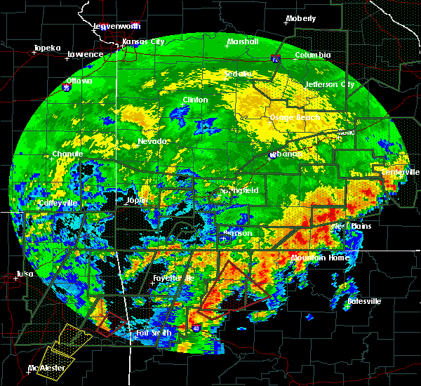 At 425 pm cdt, a severe thunderstorm was located near dugger, or 8 miles southwest of yellville, moving north at 60 mph (radar indicated). Hazards include quarter size hail. damage to vehicles is expected At 425 pm cdt, a severe thunderstorm was located near dugger, or 8 miles southwest of yellville, moving north at 60 mph (radar indicated). Hazards include quarter size hail. damage to vehicles is expected
|
| 4/26/2017 9:01 AM CDT |
 At 900 am cdt, a severe thunderstorm was located over bull shoals state park, or over bull shoals, moving northeast at 50 mph (radar indicated). Hazards include quarter size hail. damage to vehicles is expected At 900 am cdt, a severe thunderstorm was located over bull shoals state park, or over bull shoals, moving northeast at 50 mph (radar indicated). Hazards include quarter size hail. damage to vehicles is expected
|
| 4/26/2017 2:52 AM CDT |
 The severe thunderstorm warning for northern baxter county will expire at 300 am cdt, the storms which prompted the warning have weakened below severe limits, and no longer pose an immediate threat to life or property. therefore, the warning will be allowed to expire. however gusty winds and heavy rain are still possible with these thunderstorms. The severe thunderstorm warning for northern baxter county will expire at 300 am cdt, the storms which prompted the warning have weakened below severe limits, and no longer pose an immediate threat to life or property. therefore, the warning will be allowed to expire. however gusty winds and heavy rain are still possible with these thunderstorms.
|
| 4/26/2017 2:47 AM CDT |
 At 246 am cdt, severe thunderstorms were located along a line extending from near gainesville to near arkawana to near lakeview in baxter county, moving east at 60 mph (radar indicated). Hazards include 60 mph wind gusts. Expect damage to roofs, siding, and trees. Locations impacted include, mountain home, gassville, lakeview in baxter county, briarcliff, arkawana, diamond bay, ozark regional airport, gamaliel landing, fawn park, bull shoals state park, colfax, cotter, midway in baxter county, clarkridge, gamaliel, buford, three brothers, robinson point landing, henderson,. At 246 am cdt, severe thunderstorms were located along a line extending from near gainesville to near arkawana to near lakeview in baxter county, moving east at 60 mph (radar indicated). Hazards include 60 mph wind gusts. Expect damage to roofs, siding, and trees. Locations impacted include, mountain home, gassville, lakeview in baxter county, briarcliff, arkawana, diamond bay, ozark regional airport, gamaliel landing, fawn park, bull shoals state park, colfax, cotter, midway in baxter county, clarkridge, gamaliel, buford, three brothers, robinson point landing, henderson,.
|
| 4/26/2017 2:30 AM CDT |
 At 229 am cdt, severe thunderstorms were located along a line extending from near price place to near ozark isle to near pyatt, moving east at 60 mph (radar indicated). Hazards include 60 mph wind gusts. expect damage to roofs, siding, and trees At 229 am cdt, severe thunderstorms were located along a line extending from near price place to near ozark isle to near pyatt, moving east at 60 mph (radar indicated). Hazards include 60 mph wind gusts. expect damage to roofs, siding, and trees
|
| 4/4/2017 11:05 PM CDT |
 At 1105 pm cdt, severe thunderstorms were located along a line extending from near lakeview in baxter county to near gassville to near lion hill to near evening star, moving northeast at 45 mph (radar indicated). Hazards include 60 mph wind gusts and quarter size hail. Hail damage to vehicles is expected. expect wind damage to roofs, siding, and trees. Locations impacted include, mountain home, bull shoals, gassville, flippin, lakeview in baxter county, arkawana, advance, cartney, ozark regional airport, bull shoals state park, shipp, colfax, rush, lion hill, fawn park, cotter, midway in baxter county, fairview in marion county, buffalo city, cozahome,. At 1105 pm cdt, severe thunderstorms were located along a line extending from near lakeview in baxter county to near gassville to near lion hill to near evening star, moving northeast at 45 mph (radar indicated). Hazards include 60 mph wind gusts and quarter size hail. Hail damage to vehicles is expected. expect wind damage to roofs, siding, and trees. Locations impacted include, mountain home, bull shoals, gassville, flippin, lakeview in baxter county, arkawana, advance, cartney, ozark regional airport, bull shoals state park, shipp, colfax, rush, lion hill, fawn park, cotter, midway in baxter county, fairview in marion county, buffalo city, cozahome,.
|
| 4/4/2017 10:44 PM CDT |
 At 1044 pm cdt, severe thunderstorms were located along a line extending from near yellville to 6 miles west of rush to near maumee to near duff, moving northeast at 45 mph (radar indicated). Hazards include 60 mph wind gusts and quarter size hail. Hail damage to vehicles is expected. Expect wind damage to roofs, siding, and trees. At 1044 pm cdt, severe thunderstorms were located along a line extending from near yellville to 6 miles west of rush to near maumee to near duff, moving northeast at 45 mph (radar indicated). Hazards include 60 mph wind gusts and quarter size hail. Hail damage to vehicles is expected. Expect wind damage to roofs, siding, and trees.
|
| 3/29/2017 8:34 PM CDT |
 At 833 pm cdt, a severe thunderstorm was located near arkawana, or 3 miles north of lakeview, moving northeast at 45 mph (radar indicated). Hazards include 60 mph wind gusts and quarter size hail. Hail damage to vehicles is expected. expect wind damage to roofs, siding, and trees. Locations impacted include, bull shoals, lakeview in baxter county, arkawana, bull shoals state park, three brothers, oakland, clarkridge, a tornado watch remains in effect until midnight cdt for north central arkansas. At 833 pm cdt, a severe thunderstorm was located near arkawana, or 3 miles north of lakeview, moving northeast at 45 mph (radar indicated). Hazards include 60 mph wind gusts and quarter size hail. Hail damage to vehicles is expected. expect wind damage to roofs, siding, and trees. Locations impacted include, bull shoals, lakeview in baxter county, arkawana, bull shoals state park, three brothers, oakland, clarkridge, a tornado watch remains in effect until midnight cdt for north central arkansas.
|
| 3/29/2017 8:24 PM CDT |
 At 824 pm cdt, a severe thunderstorm was located over bull shoals, moving northeast at 45 mph (radar indicated). Hazards include 60 mph wind gusts and quarter size hail. Hail damage to vehicles is expected. Expect wind damage to roofs, siding, and trees. At 824 pm cdt, a severe thunderstorm was located over bull shoals, moving northeast at 45 mph (radar indicated). Hazards include 60 mph wind gusts and quarter size hail. Hail damage to vehicles is expected. Expect wind damage to roofs, siding, and trees.
|
| 3/9/2017 8:14 PM CST |
 At 814 pm cst, a severe thunderstorm capable of producing a tornado was located over bull shoals, moving southeast at 25 mph (radar indicated rotation). Hazards include tornado and quarter size hail. Flying debris will be dangerous to those caught without shelter. mobile homes will be damaged or destroyed. damage to roofs, windows, and vehicles will occur. tree damage is likely. Locations impacted include, mountain home, bull shoals, gassville, flippin, lakeview in baxter county, arkawana, ozark regional airport, ozark isle, fawn park, bull shoals state park, colfax, lion hill, lakeway, cotter, midway in baxter county, fairview in marion county, buffalo city, oakland, buford, rea valley,. At 814 pm cst, a severe thunderstorm capable of producing a tornado was located over bull shoals, moving southeast at 25 mph (radar indicated rotation). Hazards include tornado and quarter size hail. Flying debris will be dangerous to those caught without shelter. mobile homes will be damaged or destroyed. damage to roofs, windows, and vehicles will occur. tree damage is likely. Locations impacted include, mountain home, bull shoals, gassville, flippin, lakeview in baxter county, arkawana, ozark regional airport, ozark isle, fawn park, bull shoals state park, colfax, lion hill, lakeway, cotter, midway in baxter county, fairview in marion county, buffalo city, oakland, buford, rea valley,.
|
| 3/9/2017 8:02 PM CST |
 At 800 pm cst, a severe thunderstorm was located over ozark isle, or near bull shoals, moving southeast at 35 mph (public). Hazards include golf ball size hail and 60 mph wind gusts. this will be primarily for areas near omaha in boone county and near peel in baxter county. People and animals outdoors will be injured. expect hail damage to roofs, siding, windows, and vehicles. expect wind damage to roofs, siding, and trees. Locations impacted include, harrison, mountain home, bull shoals, gassville, flippin, lakeview in baxter county, diamond city, bergman, lead hill, briarcliff, pyatt, omaha, arkawana, myrtle, roberson hollow, self, ozark regional airport, ozark isle, fawn park, lakeway,. At 800 pm cst, a severe thunderstorm was located over ozark isle, or near bull shoals, moving southeast at 35 mph (public). Hazards include golf ball size hail and 60 mph wind gusts. this will be primarily for areas near omaha in boone county and near peel in baxter county. People and animals outdoors will be injured. expect hail damage to roofs, siding, windows, and vehicles. expect wind damage to roofs, siding, and trees. Locations impacted include, harrison, mountain home, bull shoals, gassville, flippin, lakeview in baxter county, diamond city, bergman, lead hill, briarcliff, pyatt, omaha, arkawana, myrtle, roberson hollow, self, ozark regional airport, ozark isle, fawn park, lakeway,.
|
| 3/9/2017 7:56 PM CST |
 At 755 pm cst, a severe thunderstorm capable of producing a tornado was located near ozark isle, or 8 miles northwest of bull shoals, moving southeast at 25 mph (radar indicated rotation). Hazards include tornado and ping pong ball size hail. Flying debris will be dangerous to those caught without shelter. mobile homes will be damaged or destroyed. damage to roofs, windows, and vehicles will occur. Tree damage is likely. At 755 pm cst, a severe thunderstorm capable of producing a tornado was located near ozark isle, or 8 miles northwest of bull shoals, moving southeast at 25 mph (radar indicated rotation). Hazards include tornado and ping pong ball size hail. Flying debris will be dangerous to those caught without shelter. mobile homes will be damaged or destroyed. damage to roofs, windows, and vehicles will occur. Tree damage is likely.
|
| 3/9/2017 7:18 PM CST |
 At 717 pm cst, a severe thunderstorm was located 7 miles southeast of forsyth, moving southeast at 35 mph (public). Hazards include golf ball size hail and 60 mph wind gusts. People and animals outdoors will be injured. expect hail damage to roofs, siding, windows, and vehicles. Expect wind damage to roofs, siding, and trees. At 717 pm cst, a severe thunderstorm was located 7 miles southeast of forsyth, moving southeast at 35 mph (public). Hazards include golf ball size hail and 60 mph wind gusts. People and animals outdoors will be injured. expect hail damage to roofs, siding, windows, and vehicles. Expect wind damage to roofs, siding, and trees.
|
| 3/7/2017 1:02 AM CST |
 At 101 am cst, severe thunderstorms were located along a line extending from 7 miles northwest of gamaliel landing to near maumee, moving east at 60 mph (radar indicated). Hazards include 60 mph wind gusts and penny size hail. Expect damage to roofs, siding, and trees. Locations impacted include, harrison, mountain home, bull shoals, salem in fulton county, yellville, gassville, flippin, lakeview in baxter county, norfork, salesville, bergman, western grove, viola, briarcliff, pyatt, valley springs, arkawana, bexar, dugger, olvey, a tornado watch remains in effect until 500 am cst for north central arkansas. At 101 am cst, severe thunderstorms were located along a line extending from 7 miles northwest of gamaliel landing to near maumee, moving east at 60 mph (radar indicated). Hazards include 60 mph wind gusts and penny size hail. Expect damage to roofs, siding, and trees. Locations impacted include, harrison, mountain home, bull shoals, salem in fulton county, yellville, gassville, flippin, lakeview in baxter county, norfork, salesville, bergman, western grove, viola, briarcliff, pyatt, valley springs, arkawana, bexar, dugger, olvey, a tornado watch remains in effect until 500 am cst for north central arkansas.
|
| 3/7/2017 12:36 AM CST |
 At 1236 am cst, severe thunderstorms were located along a line extending from 7 miles northwest of ozark isle to near pruitt, moving east at 60 mph (radar indicated). Hazards include 60 mph wind gusts and penny size hail. expect damage to roofs, siding, and trees At 1236 am cst, severe thunderstorms were located along a line extending from 7 miles northwest of ozark isle to near pruitt, moving east at 60 mph (radar indicated). Hazards include 60 mph wind gusts and penny size hail. expect damage to roofs, siding, and trees
|
| 3/7/2017 12:18 AM CST |
 At 1217 am cst, severe thunderstorms were located along a line extending from 9 miles north of diamond city to near omaha to near carrollton to near marble, moving east at 30 mph (radar indicated). Hazards include 60 mph wind gusts and nickel size hail. Expect damage to roofs, siding, and trees. Locations impacted include, harrison, bull shoals, yellville, jasper, flippin, lakeview in baxter county, diamond city, bergman, western grove, lead hill, pyatt, valley springs, omaha, arkawana, dugger, olvey, roberson hollow, carver, erbie, lakeway, a tornado watch remains in effect until 500 am cst for north central arkansas. At 1217 am cst, severe thunderstorms were located along a line extending from 9 miles north of diamond city to near omaha to near carrollton to near marble, moving east at 30 mph (radar indicated). Hazards include 60 mph wind gusts and nickel size hail. Expect damage to roofs, siding, and trees. Locations impacted include, harrison, bull shoals, yellville, jasper, flippin, lakeview in baxter county, diamond city, bergman, western grove, lead hill, pyatt, valley springs, omaha, arkawana, dugger, olvey, roberson hollow, carver, erbie, lakeway, a tornado watch remains in effect until 500 am cst for north central arkansas.
|
| 3/6/2017 11:55 PM CST |
 At 1154 pm cst, severe thunderstorms were located along a line extending from near forsyth to near urbanette to near berryville to hindsville, moving east at 55 mph (radar indicated). Hazards include 60 mph wind gusts and nickel size hail. expect damage to roofs, siding, and trees At 1154 pm cst, severe thunderstorms were located along a line extending from near forsyth to near urbanette to near berryville to hindsville, moving east at 55 mph (radar indicated). Hazards include 60 mph wind gusts and nickel size hail. expect damage to roofs, siding, and trees
|
| 3/1/2017 2:43 AM CST |
 At 243 am cst, severe thunderstorms were located along a line extending from near bakersfield to rodney, moving east at 65 mph (radar indicated). Hazards include 60 mph wind gusts. expect damage to roofs, siding, and trees At 243 am cst, severe thunderstorms were located along a line extending from near bakersfield to rodney, moving east at 65 mph (radar indicated). Hazards include 60 mph wind gusts. expect damage to roofs, siding, and trees
|
| 7/10/2016 7:23 PM CDT |
 At 723 pm cdt, a severe thunderstorm was located over flippin, or near yellville, moving northwest at 10 mph (radar indicated). Hazards include 60 mph wind gusts and quarter size hail. Hail damage to vehicles is expected. Expect wind damage to roofs, siding, and trees. At 723 pm cdt, a severe thunderstorm was located over flippin, or near yellville, moving northwest at 10 mph (radar indicated). Hazards include 60 mph wind gusts and quarter size hail. Hail damage to vehicles is expected. Expect wind damage to roofs, siding, and trees.
|
| 7/6/2016 10:20 AM CDT | Trained spotter reported strong wind gusts and multiple powerlines down near highway 178 in lakevie in baxter county AR, 0.4 miles SSE of Lakeview, AR |
| 6/17/2016 7:08 AM CDT | At 707 am cdt, a severe thunderstorm was located near lakeway, or 7 miles west of bull shoals, moving southeast at 10 mph (radar indicated). Hazards include 60 mph wind gusts and quarter size hail. Hail damage to vehicles is expected. expect wind damage to roofs, siding, and trees. Locations impacted include, bull shoals, yellville, gassville, flippin, lakeview in baxter county, bull shoals state park, dodd city, ozark isle, lakeway, cotter, summit, fairview in marion county, monarch, peel,. |
| 6/17/2016 6:43 AM CDT | At 643 am cdt, a severe thunderstorm was located 7 miles west of ozark isle, or 12 miles northwest of bull shoals, moving southeast at 20 mph (radar indicated). Hazards include 60 mph wind gusts and quarter size hail. Hail damage to vehicles is expected. Expect wind damage to roofs, siding, and trees. |
| 4/30/2016 9:02 PM CDT |
 At 902 pm cdt, a severe thunderstorm was located over mountain home, moving northeast at 30 mph (radar indicated). Hazards include 60 mph wind gusts and half dollar size hail. Hail damage to vehicles is expected. Expect wind damage to roofs, siding, and trees. At 902 pm cdt, a severe thunderstorm was located over mountain home, moving northeast at 30 mph (radar indicated). Hazards include 60 mph wind gusts and half dollar size hail. Hail damage to vehicles is expected. Expect wind damage to roofs, siding, and trees.
|
| 4/30/2016 6:26 PM CDT |
 The severe thunderstorm warning for north central marion and northwestern baxter counties will expire at 630 pm cdt, the storm which prompted the warning has moved out of the area. therefore the warning will be allowed to expire. a severe thunderstorm watch remains in effect until 900 pm cdt for north central arkansas. The severe thunderstorm warning for north central marion and northwestern baxter counties will expire at 630 pm cdt, the storm which prompted the warning has moved out of the area. therefore the warning will be allowed to expire. a severe thunderstorm watch remains in effect until 900 pm cdt for north central arkansas.
|
| 4/30/2016 6:01 PM CDT |
 At 601 pm cdt, a severe thunderstorm was located over bull shoals, moving northeast at 15 mph (radar indicated). Hazards include 60 mph wind gusts and quarter size hail. Hail damage to vehicles is expected. Expect wind damage to roofs, siding, and trees. At 601 pm cdt, a severe thunderstorm was located over bull shoals, moving northeast at 15 mph (radar indicated). Hazards include 60 mph wind gusts and quarter size hail. Hail damage to vehicles is expected. Expect wind damage to roofs, siding, and trees.
|
| 4/30/2016 5:05 PM CDT |
 At 505 pm cdt, a severe thunderstorm was located over yellville, moving northeast at 10 mph (radar indicated). Hazards include 60 mph wind gusts and quarter size hail. Hail damage to vehicles is expected. expect wind damage to roofs, siding, and trees. Locations impacted include, mountain home, bull shoals, yellville, gassville, flippin, lakeview in baxter c, norfork, salesville, briarcliff, pyatt, arkawana, shipp, ozark regional airpo, norfork dam, diamond bay, colfax, bull shoals state pa, lion hill, cartney, fawn park,. At 505 pm cdt, a severe thunderstorm was located over yellville, moving northeast at 10 mph (radar indicated). Hazards include 60 mph wind gusts and quarter size hail. Hail damage to vehicles is expected. expect wind damage to roofs, siding, and trees. Locations impacted include, mountain home, bull shoals, yellville, gassville, flippin, lakeview in baxter c, norfork, salesville, briarcliff, pyatt, arkawana, shipp, ozark regional airpo, norfork dam, diamond bay, colfax, bull shoals state pa, lion hill, cartney, fawn park,.
|
| 4/30/2016 4:45 PM CDT |
 At 444 pm cdt, a severe thunderstorm was located near flippin, or near yellville, moving northeast at 40 mph (radar indicated). Hazards include 60 mph wind gusts and quarter size hail. Hail damage to vehicles is expected. Expect wind damage to roofs, siding, and trees. At 444 pm cdt, a severe thunderstorm was located near flippin, or near yellville, moving northeast at 40 mph (radar indicated). Hazards include 60 mph wind gusts and quarter size hail. Hail damage to vehicles is expected. Expect wind damage to roofs, siding, and trees.
|
| 7/24/2015 9:28 PM CDT |
 At 927 pm cdt, severe thunderstorms were located along a line extending from near price place to mountain home to near diamond bay, moving south at 30 mph (radar indicated). Hazards include 60 mph wind gusts. Expect damage to roofs. siding and trees. Locations impacted include, mountain home, bull shoals, gassville, flippin, lakeview in baxter county, norfork, salesville, briarcliff, arkawana, shipp, gamaliel landing, ozark regional airport, norfork dam, diamond bay, colfax, bull shoals state park, cartney, fawn park, cotter and midway in baxter county. At 927 pm cdt, severe thunderstorms were located along a line extending from near price place to mountain home to near diamond bay, moving south at 30 mph (radar indicated). Hazards include 60 mph wind gusts. Expect damage to roofs. siding and trees. Locations impacted include, mountain home, bull shoals, gassville, flippin, lakeview in baxter county, norfork, salesville, briarcliff, arkawana, shipp, gamaliel landing, ozark regional airport, norfork dam, diamond bay, colfax, bull shoals state park, cartney, fawn park, cotter and midway in baxter county.
|
| 7/24/2015 9:00 PM CDT |
 At 859 pm cdt, severe thunderstorms were located along a line extending from near gainesville to 7 miles north of fawn park to near gamaliel landing, moving south at 30 mph (radar indicated). Hazards include 60 mph wind gusts. Expect damage to roofs. Siding and trees. At 859 pm cdt, severe thunderstorms were located along a line extending from near gainesville to 7 miles north of fawn park to near gamaliel landing, moving south at 30 mph (radar indicated). Hazards include 60 mph wind gusts. Expect damage to roofs. Siding and trees.
|
| 7/15/2015 5:29 PM CDT |
 At 529 pm cdt, severe thunderstorms were located along a line extending from near lion hill to near rodney, moving south at 10 mph (radar indicated). Hazards include 60 mph wind gusts. Expect damage to roofs. siding and trees. Locations impacted include, mountain home, bull shoals, gassville, calico rock, flippin, lakeview in baxter county, norfork, salesville, pineville, briarcliff, arkawana, rodney, rush, shipp, gamaliel landing, ozark regional airport, norfork dam, diamond bay, advance and herron. At 529 pm cdt, severe thunderstorms were located along a line extending from near lion hill to near rodney, moving south at 10 mph (radar indicated). Hazards include 60 mph wind gusts. Expect damage to roofs. siding and trees. Locations impacted include, mountain home, bull shoals, gassville, calico rock, flippin, lakeview in baxter county, norfork, salesville, pineville, briarcliff, arkawana, rodney, rush, shipp, gamaliel landing, ozark regional airport, norfork dam, diamond bay, advance and herron.
|
| 7/15/2015 5:01 PM CDT |
 At 501 pm cdt, severe thunderstorms were located along a line extending from near arkawana to near gamaliel landing, moving south at 15 mph (radar indicated). Hazards include 60 mph wind gusts. Expect damage to roofs. Siding and trees. At 501 pm cdt, severe thunderstorms were located along a line extending from near arkawana to near gamaliel landing, moving south at 15 mph (radar indicated). Hazards include 60 mph wind gusts. Expect damage to roofs. Siding and trees.
|
| 5/25/2015 7:54 PM CDT | At 752 pm cdt, a severe thunderstorm was located near gassville, and moving north at 35 mph (radar indicated). Hazards include 60 mph wind gusts and quarter size hail. Hail damage to vehicles is expected. Expect wind damage to roofs, siding and trees. |
| 5/25/2015 7:36 PM CDT | At 733 pm cdt, a severe thunderstorm was located near rush, and moving north at 35 mph (radar indicated). Hazards include 60 mph wind gusts and quarter size hail. Hail damage to vehicles is expected. Expect wind damage to roofs, siding and trees. |
| 4/3/2015 5:12 AM CDT | The national weather service in little rock has issued a * severe thunderstorm warning for. northern baxter county in north central arkansas. north central marion county in north central arkansas. until 600 am cdt * at 510 am cdt. A severe thunderstorm was located near price. |
| 4/3/2015 1:09 AM CDT | The national weather service in little rock has issued a * severe thunderstorm warning for. baxter county in north central arkansas. east central boone county in north central arkansas. marion county in north central arkansas. Until 200 am cdt. |
| 3/25/2015 9:23 PM CDT | The national weather service in little rock has issued a * severe thunderstorm warning for. northern baxter county in north central arkansas. northern marion county in north central arkansas. until 1015 pm cdt * at 920 pm cdt. National weather service doppler radar indicated a. |
| 3/24/2015 7:38 PM CDT | The severe thunderstorm warning for northern marion and northern baxter counties will expire at 745 pm cdt. the storm which prompted the warning has weakened below severe limits. and no longer poses an immediate threat to life or property. additional strong thunderstorms are still possible. And a severe thunderstorm watch remains in effect until 10 pm. |
| 3/24/2015 7:14 PM CDT | The national weather service in little rock has issued a * severe thunderstorm warning for. northern baxter county in north central arkansas. northern marion county in north central arkansas. until 745 pm cdt * at 713 pm cdt. National weather service doppler radar indicated a. |
| 8/5/2013 8:28 PM CDT | Trees reported dow in baxter county AR, 0.4 miles SSE of Lakeview, AR |
Hail Maps for Lakeview, AR


Connect with Interactive Hail Maps