

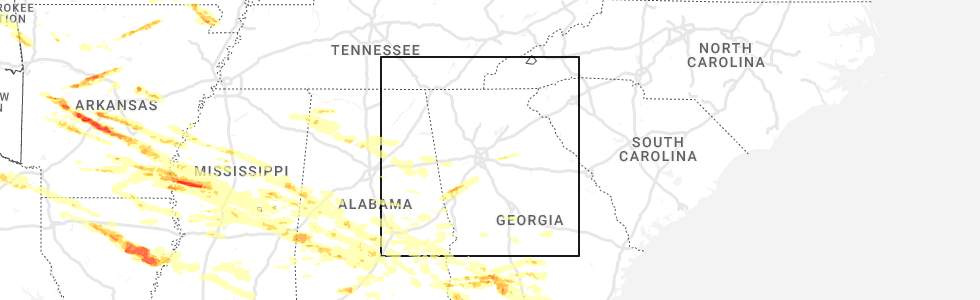
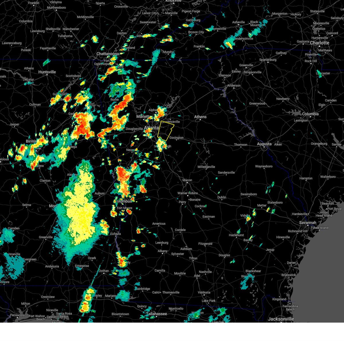
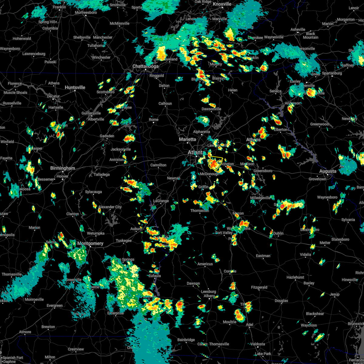
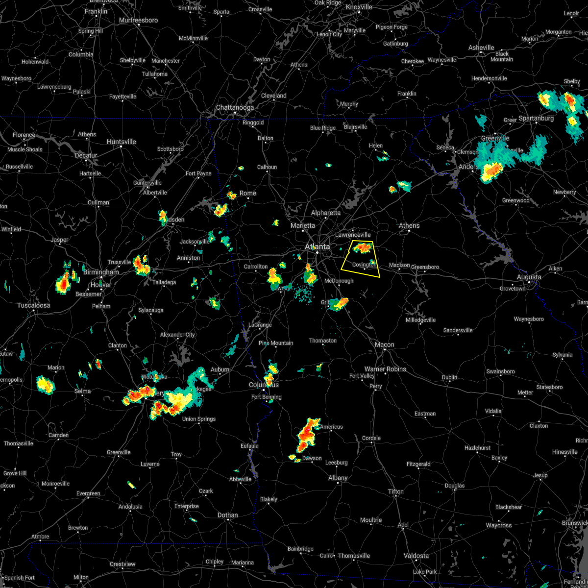
Hail Map for Lakeview Estates, GA
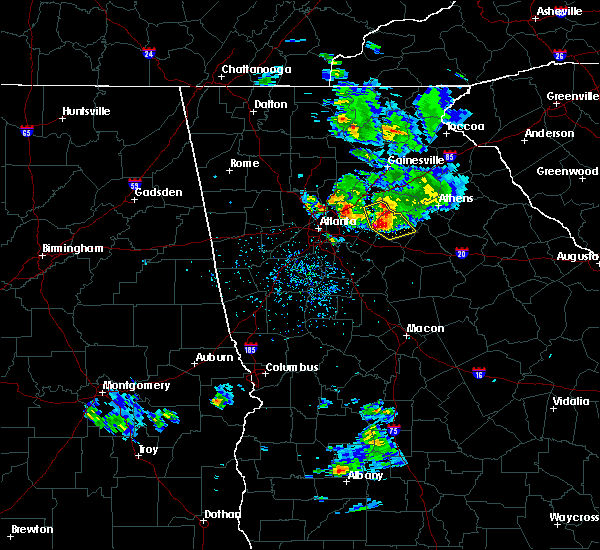
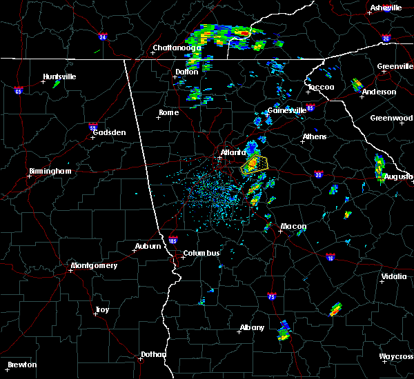
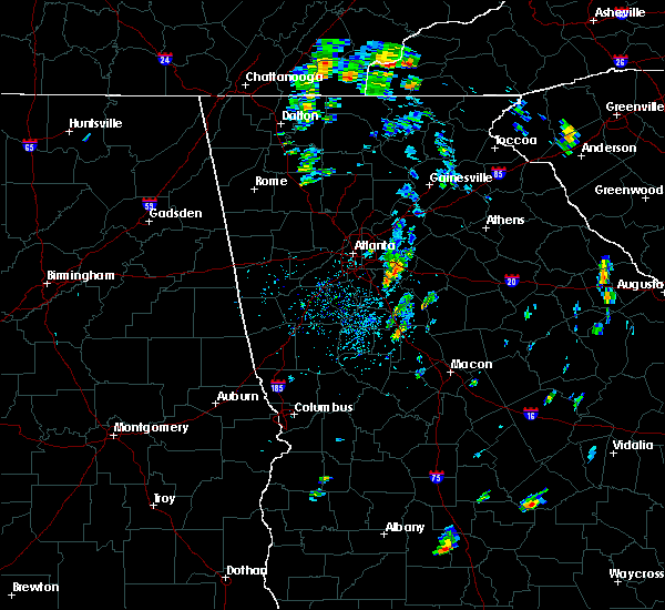
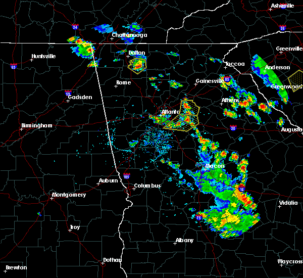
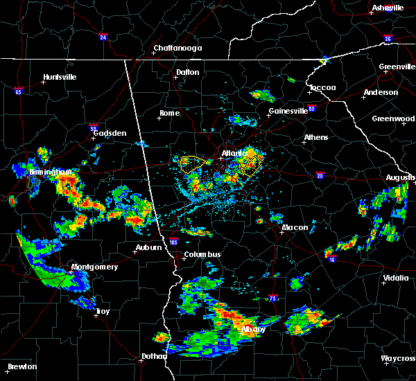
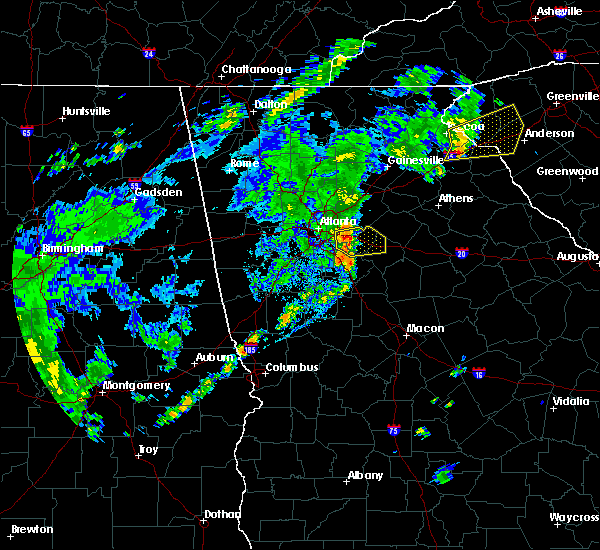
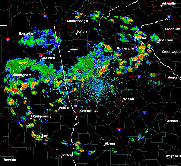
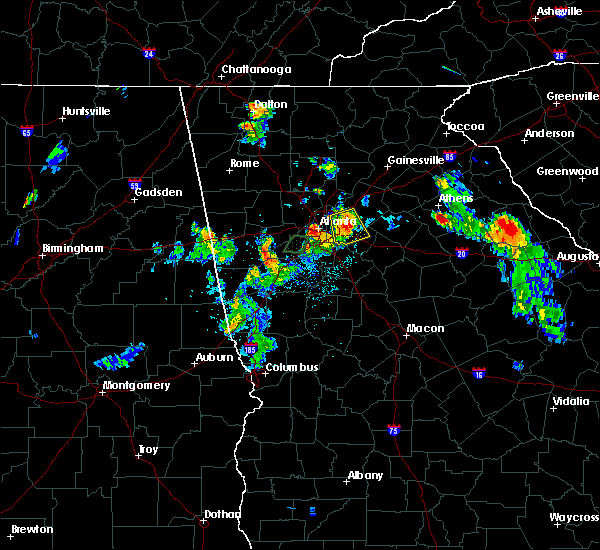
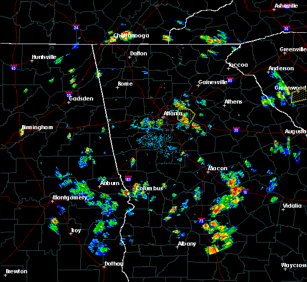
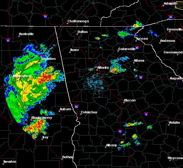
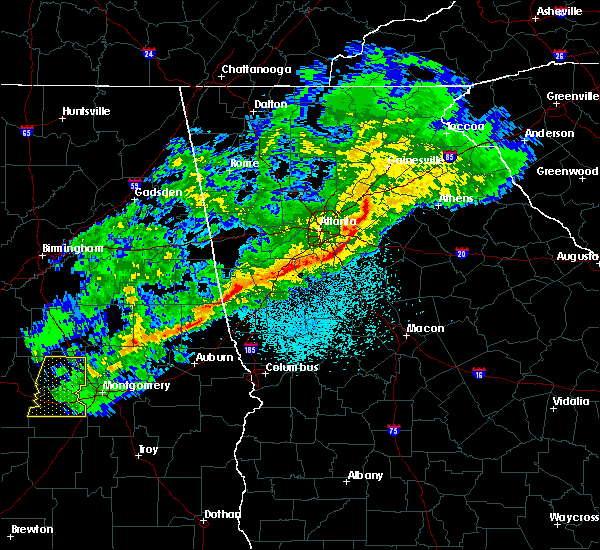
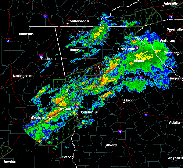
The Lakeview Estates, GA area has had 0 reports of on-the-ground hail by trained spotters, and has been under severe weather warnings 22 times during the past 12 months. Doppler radar has detected hail at or near Lakeview Estates, GA on 32 occasions, including 2 occasions during the past year.
| Name: | Lakeview Estates, GA |
| Where Located: | 20.6 miles E of Atlanta, GA |
| Map: | Google Map for Lakeview Estates, GA |
| Population: | 2695 |
| Housing Units: | 700 |
| More Info: | Search Google for Lakeview Estates, GA |
2
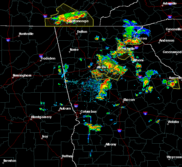
The Top Recent Hail Date for Lakeview Estates, GA is Wednesday, June 14, 2023 (3rd out of 32)
Hail and Wind Damage Spotted near Lakeview Estates, GA
| Date / Time | Report Details |
|---|---|
| 4/3/2024 12:12 AM EDT |
 the tornado warning has been cancelled and is no longer in effect the tornado warning has been cancelled and is no longer in effect
|
| 4/3/2024 12:02 AM EDT |
 At 1202 am edt, a confirmed tornado was located over milstead, or near conyers, moving northeast at 35 mph (radar confirmed tornado). Hazards include damaging tornado. Flying debris will be dangerous to those caught without shelter. mobile homes will be damaged or destroyed. damage to roofs, windows, and vehicles will occur. tree damage is likely. Locations impacted include, conyers, georgia international horse park, lakeview estates, and milstead. At 1202 am edt, a confirmed tornado was located over milstead, or near conyers, moving northeast at 35 mph (radar confirmed tornado). Hazards include damaging tornado. Flying debris will be dangerous to those caught without shelter. mobile homes will be damaged or destroyed. damage to roofs, windows, and vehicles will occur. tree damage is likely. Locations impacted include, conyers, georgia international horse park, lakeview estates, and milstead.
|
| 4/2/2024 11:55 PM EDT |
 At 1154 pm edt, a confirmed tornado was located over lakeview estates, or over conyers, moving northeast at 35 mph (radar confirmed tornado). Hazards include damaging tornado. Flying debris will be dangerous to those caught without shelter. mobile homes will be damaged or destroyed. damage to roofs, windows, and vehicles will occur. tree damage is likely. Locations impacted include, conyers, lakeview estates, georgia international horse park, and milstead. At 1154 pm edt, a confirmed tornado was located over lakeview estates, or over conyers, moving northeast at 35 mph (radar confirmed tornado). Hazards include damaging tornado. Flying debris will be dangerous to those caught without shelter. mobile homes will be damaged or destroyed. damage to roofs, windows, and vehicles will occur. tree damage is likely. Locations impacted include, conyers, lakeview estates, georgia international horse park, and milstead.
|
| 4/2/2024 11:52 PM EDT |
 Torffc the national weather service in peachtree city has issued a * tornado warning for, northeastern rockdale county in north central georgia, * until 1230 am edt. * at 1151 pm edt, a severe thunderstorm capable of producing a tornado was located near arabia mountain, or near conyers, moving northeast at 35 mph (radar indicated rotation). Hazards include tornado. Flying debris will be dangerous to those caught without shelter. mobile homes will be damaged or destroyed. damage to roofs, windows, and vehicles will occur. Tree damage is likely. Torffc the national weather service in peachtree city has issued a * tornado warning for, northeastern rockdale county in north central georgia, * until 1230 am edt. * at 1151 pm edt, a severe thunderstorm capable of producing a tornado was located near arabia mountain, or near conyers, moving northeast at 35 mph (radar indicated rotation). Hazards include tornado. Flying debris will be dangerous to those caught without shelter. mobile homes will be damaged or destroyed. damage to roofs, windows, and vehicles will occur. Tree damage is likely.
|
| 2/28/2024 3:59 PM EST |
 At 359 pm est, severe thunderstorms were located along a line extending from walnut grove to almon to near richardson park to irondale, moving southeast at 40 mph (radar indicated). Hazards include 60 mph wind gusts and penny size hail. Expect damage to roofs, siding, and trees. Locations impacted include, mcdonough, conyers, covington, jonesboro, stockbridge, forest park, riverdale, college park, hampton, morrow, lovejoy, hapeville, social circle, lake city, oxford, lithonia, porterdale, walnut grove, jersey, and hartsfield-jackson airport. At 359 pm est, severe thunderstorms were located along a line extending from walnut grove to almon to near richardson park to irondale, moving southeast at 40 mph (radar indicated). Hazards include 60 mph wind gusts and penny size hail. Expect damage to roofs, siding, and trees. Locations impacted include, mcdonough, conyers, covington, jonesboro, stockbridge, forest park, riverdale, college park, hampton, morrow, lovejoy, hapeville, social circle, lake city, oxford, lithonia, porterdale, walnut grove, jersey, and hartsfield-jackson airport.
|
| 2/28/2024 3:26 PM EST |
 Svrffc the national weather service in peachtree city has issued a * severe thunderstorm warning for, rockdale county in north central georgia, dekalb county in north central georgia, east central douglas county in north central georgia, southwestern gwinnett county in north central georgia, northern henry county in north central georgia, central walton county in north central georgia, clayton county in north central georgia, southwestern fulton county in north central georgia, central newton county in north central georgia, * until 415 pm est. * at 326 pm est, severe thunderstorms were located along a line extending from lilburn to clarkston to cascade heights to campbellton, moving southeast at 40 mph (radar indicated). Hazards include 60 mph wind gusts and penny size hail. expect damage to roofs, siding, and trees Svrffc the national weather service in peachtree city has issued a * severe thunderstorm warning for, rockdale county in north central georgia, dekalb county in north central georgia, east central douglas county in north central georgia, southwestern gwinnett county in north central georgia, northern henry county in north central georgia, central walton county in north central georgia, clayton county in north central georgia, southwestern fulton county in north central georgia, central newton county in north central georgia, * until 415 pm est. * at 326 pm est, severe thunderstorms were located along a line extending from lilburn to clarkston to cascade heights to campbellton, moving southeast at 40 mph (radar indicated). Hazards include 60 mph wind gusts and penny size hail. expect damage to roofs, siding, and trees
|
| 8/28/2023 7:41 PM EDT |
 The severe thunderstorm warning for central rockdale, southeastern dekalb and southwestern gwinnett counties will expire at 745 pm edt, the storm which prompted the warning has weakened below severe limits, and no longer poses an immediate threat to life or property. therefore, the warning will be allowed to expire. however, heavy rain is still possible with this thunderstorm. The severe thunderstorm warning for central rockdale, southeastern dekalb and southwestern gwinnett counties will expire at 745 pm edt, the storm which prompted the warning has weakened below severe limits, and no longer poses an immediate threat to life or property. therefore, the warning will be allowed to expire. however, heavy rain is still possible with this thunderstorm.
|
| 8/28/2023 7:06 PM EDT |
 At 705 pm edt, a severe thunderstorm was located over panola mountain state park, or 9 miles west of conyers, moving north at 15 mph (radar indicated). Hazards include 60 mph wind gusts and nickel size hail. expect damage to roofs, siding, and trees At 705 pm edt, a severe thunderstorm was located over panola mountain state park, or 9 miles west of conyers, moving north at 15 mph (radar indicated). Hazards include 60 mph wind gusts and nickel size hail. expect damage to roofs, siding, and trees
|
| 8/12/2023 5:49 PM EDT |
 At 549 pm edt, severe thunderstorms were located along a line extending from gum creek to near walker mill, moving southeast at 15 mph (radar indicated). Hazards include 60 mph wind gusts. Expect damage to roofs, siding, and trees. locations impacted include, mcdonough, conyers, monroe, covington, jackson, loganville, locust grove, social circle, oxford, porterdale, walnut grove, jenkinsburg, between, jersey, georgia international horse park, lakeview estates, stewart, ola, worthville, and walker mill. hail threat, radar indicated max hail size, <. 75 in wind threat, radar indicated max wind gust, 60 mph. At 549 pm edt, severe thunderstorms were located along a line extending from gum creek to near walker mill, moving southeast at 15 mph (radar indicated). Hazards include 60 mph wind gusts. Expect damage to roofs, siding, and trees. locations impacted include, mcdonough, conyers, monroe, covington, jackson, loganville, locust grove, social circle, oxford, porterdale, walnut grove, jenkinsburg, between, jersey, georgia international horse park, lakeview estates, stewart, ola, worthville, and walker mill. hail threat, radar indicated max hail size, <. 75 in wind threat, radar indicated max wind gust, 60 mph.
|
| 8/12/2023 5:21 PM EDT |
 At 520 pm edt, severe thunderstorms were located along a line extending from near hidden valley park to sunny side, moving east at 20 mph (radar indicated). Hazards include 60 mph wind gusts. Expect damage to roofs, siding, and trees. locations impacted include, griffin, mcdonough, decatur, jonesboro, stockbridge, forest park, hampton, morrow, lovejoy, locust grove, avondale estates, lake city, lithonia, orchard hill, woolsey, sunny side, east griffin, candler-mcafee, belvedere park, and lakeview estates. hail threat, radar indicated max hail size, <. 75 in wind threat, radar indicated max wind gust, 60 mph. At 520 pm edt, severe thunderstorms were located along a line extending from near hidden valley park to sunny side, moving east at 20 mph (radar indicated). Hazards include 60 mph wind gusts. Expect damage to roofs, siding, and trees. locations impacted include, griffin, mcdonough, decatur, jonesboro, stockbridge, forest park, hampton, morrow, lovejoy, locust grove, avondale estates, lake city, lithonia, orchard hill, woolsey, sunny side, east griffin, candler-mcafee, belvedere park, and lakeview estates. hail threat, radar indicated max hail size, <. 75 in wind threat, radar indicated max wind gust, 60 mph.
|
| 8/12/2023 5:16 PM EDT |
 At 515 pm edt, severe thunderstorms were located along a line extending from near rosebud to experiment, moving southeast at 15 mph (radar indicated). Hazards include 60 mph wind gusts. expect damage to roofs, siding, and trees At 515 pm edt, severe thunderstorms were located along a line extending from near rosebud to experiment, moving southeast at 15 mph (radar indicated). Hazards include 60 mph wind gusts. expect damage to roofs, siding, and trees
|
| 8/12/2023 4:52 PM EDT |
 At 451 pm edt, severe thunderstorms were located along a line extending from near gresham park to near woolsey, moving east at 20 mph (radar indicated). Hazards include 60 mph wind gusts. expect damage to roofs, siding, and trees At 451 pm edt, severe thunderstorms were located along a line extending from near gresham park to near woolsey, moving east at 20 mph (radar indicated). Hazards include 60 mph wind gusts. expect damage to roofs, siding, and trees
|
| 8/7/2023 6:35 PM EDT |
 The severe thunderstorm warning for northeastern rockdale, northwestern oconee, barrow, eastern gwinnett, walton and northeastern newton counties will expire at 645 pm edt, the storms which prompted the warning have moved out of the area. therefore, the warning will be allowed to expire. a severe thunderstorm watch remains in effect until 800 pm edt for north central and northeastern georgia. The severe thunderstorm warning for northeastern rockdale, northwestern oconee, barrow, eastern gwinnett, walton and northeastern newton counties will expire at 645 pm edt, the storms which prompted the warning have moved out of the area. therefore, the warning will be allowed to expire. a severe thunderstorm watch remains in effect until 800 pm edt for north central and northeastern georgia.
|
| 8/7/2023 6:27 PM EDT |
 The severe thunderstorm warning for rockdale, dekalb, northwestern henry and northeastern clayton counties will expire at 630 pm edt, the storm which prompted the warning has moved out of the area. therefore, the warning will be allowed to expire. a severe thunderstorm watch remains in effect until 800 pm edt for north central georgia. The severe thunderstorm warning for rockdale, dekalb, northwestern henry and northeastern clayton counties will expire at 630 pm edt, the storm which prompted the warning has moved out of the area. therefore, the warning will be allowed to expire. a severe thunderstorm watch remains in effect until 800 pm edt for north central georgia.
|
| 8/7/2023 6:07 PM EDT |
 At 607 pm edt, severe thunderstorms were located along a line extending from dacula to near loganville to lakeview estates, moving east at 45 mph (radar indicated). Hazards include 60 mph wind gusts and quarter size hail. Hail damage to vehicles is expected. Expect wind damage to roofs, siding, and trees. At 607 pm edt, severe thunderstorms were located along a line extending from dacula to near loganville to lakeview estates, moving east at 45 mph (radar indicated). Hazards include 60 mph wind gusts and quarter size hail. Hail damage to vehicles is expected. Expect wind damage to roofs, siding, and trees.
|
| 8/7/2023 5:55 PM EDT |
 At 555 pm edt, a severe thunderstorm was located over gresham park, or 7 miles south of decatur, moving southeast at 45 mph (radar indicated). Hazards include golf ball size hail and 70 mph wind gusts. People and animals outdoors will be injured. expect hail damage to roofs, siding, windows, and vehicles. expect considerable tree damage. Wind damage is also likely to mobile homes, roofs, and outbuildings. At 555 pm edt, a severe thunderstorm was located over gresham park, or 7 miles south of decatur, moving southeast at 45 mph (radar indicated). Hazards include golf ball size hail and 70 mph wind gusts. People and animals outdoors will be injured. expect hail damage to roofs, siding, windows, and vehicles. expect considerable tree damage. Wind damage is also likely to mobile homes, roofs, and outbuildings.
|
| 8/6/2023 3:02 PM EDT |
 At 301 pm edt, a severe thunderstorm was located over panola mountain state park, or 9 miles west of conyers, moving east at 35 mph (radar indicated). Hazards include 60 mph wind gusts. expect damage to roofs, siding, and trees At 301 pm edt, a severe thunderstorm was located over panola mountain state park, or 9 miles west of conyers, moving east at 35 mph (radar indicated). Hazards include 60 mph wind gusts. expect damage to roofs, siding, and trees
|
| 7/21/2023 5:55 PM EDT |
 At 554 pm edt, severe thunderstorms were located along a line extending from rosebud to gum creek to conyers to arabia mountain, moving east at 35 mph (radar indicated). Hazards include 60 mph wind gusts and penny size hail. expect damage to roofs, siding, and trees At 554 pm edt, severe thunderstorms were located along a line extending from rosebud to gum creek to conyers to arabia mountain, moving east at 35 mph (radar indicated). Hazards include 60 mph wind gusts and penny size hail. expect damage to roofs, siding, and trees
|
| 7/20/2023 6:13 PM EDT |
 At 612 pm edt, severe thunderstorms were located along a line extending from near clermont to suwanee, moving southeast at 50 mph (radar indicated). Hazards include 70 mph wind gusts and penny size hail. Expect considerable tree damage. Damage is likely to mobile homes, roofs, and outbuildings. At 612 pm edt, severe thunderstorms were located along a line extending from near clermont to suwanee, moving southeast at 50 mph (radar indicated). Hazards include 70 mph wind gusts and penny size hail. Expect considerable tree damage. Damage is likely to mobile homes, roofs, and outbuildings.
|
| 6/25/2023 6:56 PM EDT |
 At 655 pm edt, a severe thunderstorm was located over the area (radar indicated). Hazards include 60 mph wind gusts. expect damage to roofs, siding, and trees At 655 pm edt, a severe thunderstorm was located over the area (radar indicated). Hazards include 60 mph wind gusts. expect damage to roofs, siding, and trees
|
| 6/25/2023 6:24 PM EDT |
 At 623 pm edt, severe thunderstorms were located along a line extending from near lilburn to hiram to winston to near arnco-sargent, moving southeast at 45 mph (radar indicated). Hazards include 60 mph wind gusts and penny size hail. Expect damage to roofs, siding, and trees. locations impacted include, atlanta, marietta, douglasville, lawrenceville, decatur, fayetteville, conyers, covington, dallas, jonesboro, peachtree corners, city of south fulton, sandy springs, roswell, smyrna, dunwoody, east point, kennesaw, duluth and stockbridge. hail threat, radar indicated max hail size, 0. 75 in wind threat, radar indicated max wind gust, 60 mph. At 623 pm edt, severe thunderstorms were located along a line extending from near lilburn to hiram to winston to near arnco-sargent, moving southeast at 45 mph (radar indicated). Hazards include 60 mph wind gusts and penny size hail. Expect damage to roofs, siding, and trees. locations impacted include, atlanta, marietta, douglasville, lawrenceville, decatur, fayetteville, conyers, covington, dallas, jonesboro, peachtree corners, city of south fulton, sandy springs, roswell, smyrna, dunwoody, east point, kennesaw, duluth and stockbridge. hail threat, radar indicated max hail size, 0. 75 in wind threat, radar indicated max wind gust, 60 mph.
|
| 6/25/2023 6:00 PM EDT |
 At 600 pm edt, severe thunderstorms were located along a line extending from near alpharetta to near taylorsville to near yorkville to near clem, moving southeast at 45 mph (radar indicated). Hazards include 60 mph wind gusts and penny size hail. expect damage to roofs, siding, and trees At 600 pm edt, severe thunderstorms were located along a line extending from near alpharetta to near taylorsville to near yorkville to near clem, moving southeast at 45 mph (radar indicated). Hazards include 60 mph wind gusts and penny size hail. expect damage to roofs, siding, and trees
|
| 3/26/2023 11:50 PM EDT |
 At 1150 pm edt, severe thunderstorms were located along a line extending from lake spivey to near luella to near walker mill, moving northeast at 60 mph (radar indicated). Hazards include 60 mph wind gusts and nickel size hail. expect damage to roofs, siding, and trees At 1150 pm edt, severe thunderstorms were located along a line extending from lake spivey to near luella to near walker mill, moving northeast at 60 mph (radar indicated). Hazards include 60 mph wind gusts and nickel size hail. expect damage to roofs, siding, and trees
|
| 1/12/2023 4:07 PM EST |
 At 406 pm est, severe thunderstorms were located along a line extending from near duluth to stone mountain to near panthersville, moving east at 50 mph (radar indicated). Hazards include 60 mph wind gusts. expect damage to roofs, siding, and trees At 406 pm est, severe thunderstorms were located along a line extending from near duluth to stone mountain to near panthersville, moving east at 50 mph (radar indicated). Hazards include 60 mph wind gusts. expect damage to roofs, siding, and trees
|
| 7/3/2022 5:28 PM EDT |
 At 527 pm edt, a severe thunderstorm was located over arabia mountain, or near conyers, and is nearly stationary (radar indicated). Hazards include 60 mph wind gusts and quarter size hail. Hail damage to vehicles is expected. Expect wind damage to roofs, siding, and trees. At 527 pm edt, a severe thunderstorm was located over arabia mountain, or near conyers, and is nearly stationary (radar indicated). Hazards include 60 mph wind gusts and quarter size hail. Hail damage to vehicles is expected. Expect wind damage to roofs, siding, and trees.
|
| 7/3/2022 4:55 PM EDT |
 At 455 pm edt, a severe thunderstorm was located over conyers, and is nearly stationary (radar indicated). Hazards include 60 mph wind gusts and quarter size hail. Hail damage to vehicles is expected. Expect wind damage to roofs, siding, and trees. At 455 pm edt, a severe thunderstorm was located over conyers, and is nearly stationary (radar indicated). Hazards include 60 mph wind gusts and quarter size hail. Hail damage to vehicles is expected. Expect wind damage to roofs, siding, and trees.
|
| 6/17/2022 6:40 PM EDT |
 The severe thunderstorm warning for rockdale, southern barrow, southeastern dekalb, southeastern gwinnett, northwestern walton and northwestern newton counties will expire at 645 pm edt, the storm which prompted the warning has weakened below severe limits, and no longer poses an immediate threat to life or property. therefore, the warning will be allowed to expire. remember, a severe thunderstorm warning still remains in effect for portions of rockdale county. The severe thunderstorm warning for rockdale, southern barrow, southeastern dekalb, southeastern gwinnett, northwestern walton and northwestern newton counties will expire at 645 pm edt, the storm which prompted the warning has weakened below severe limits, and no longer poses an immediate threat to life or property. therefore, the warning will be allowed to expire. remember, a severe thunderstorm warning still remains in effect for portions of rockdale county.
|
| 6/17/2022 6:19 PM EDT |
 At 619 pm edt, a severe thunderstorm was located over snellville, or near lawrenceville, moving east at 20 mph (radar indicated). Hazards include 60 mph wind gusts and quarter size hail. Hail damage to vehicles is expected. expect wind damage to roofs, siding, and trees. locations impacted include, conyers, winder, snellville, loganville, dacula, grayson, lithonia, walnut grove, bethlehem, between, lakeview estates, georgia international horse park, fort yargo state park, windsor, harbin, nicholasville, arabia mountain, big haynes creek park, rosebud and bold springs. hail threat, radar indicated max hail size, 1. 00 in wind threat, radar indicated max wind gust, 60 mph. At 619 pm edt, a severe thunderstorm was located over snellville, or near lawrenceville, moving east at 20 mph (radar indicated). Hazards include 60 mph wind gusts and quarter size hail. Hail damage to vehicles is expected. expect wind damage to roofs, siding, and trees. locations impacted include, conyers, winder, snellville, loganville, dacula, grayson, lithonia, walnut grove, bethlehem, between, lakeview estates, georgia international horse park, fort yargo state park, windsor, harbin, nicholasville, arabia mountain, big haynes creek park, rosebud and bold springs. hail threat, radar indicated max hail size, 1. 00 in wind threat, radar indicated max wind gust, 60 mph.
|
| 6/17/2022 5:55 PM EDT |
 At 555 pm edt, a severe thunderstorm was located over lilburn, or 9 miles west of lawrenceville, moving east at 20 mph (radar indicated). Hazards include 60 mph wind gusts and quarter size hail. Hail damage to vehicles is expected. Expect wind damage to roofs, siding, and trees. At 555 pm edt, a severe thunderstorm was located over lilburn, or 9 miles west of lawrenceville, moving east at 20 mph (radar indicated). Hazards include 60 mph wind gusts and quarter size hail. Hail damage to vehicles is expected. Expect wind damage to roofs, siding, and trees.
|
| 7/9/2021 3:00 PM EDT |
 At 259 pm edt, severe thunderstorms were located along a line extending from near milstead to ellenwood, moving east at 30 mph (radar indicated). Hazards include 60 mph wind gusts and penny size hail. Expect damage to roofs, siding, and trees. Locations impacted include, decatur, conyers, monroe, covington, forest park, clarkston, morrow, stone mountain, avondale estates, lake city, oxford, lithonia, porterdale, walnut grove, pine lake, jersey, belvedere park, north decatur, lakeview estates and candler-mcafee. At 259 pm edt, severe thunderstorms were located along a line extending from near milstead to ellenwood, moving east at 30 mph (radar indicated). Hazards include 60 mph wind gusts and penny size hail. Expect damage to roofs, siding, and trees. Locations impacted include, decatur, conyers, monroe, covington, forest park, clarkston, morrow, stone mountain, avondale estates, lake city, oxford, lithonia, porterdale, walnut grove, pine lake, jersey, belvedere park, north decatur, lakeview estates and candler-mcafee.
|
| 7/9/2021 2:40 PM EDT |
 At 240 pm edt, severe thunderstorms were located along a line extending from redan to college park, moving east at 30 mph (radar indicated). Hazards include 60 mph wind gusts and penny size hail. expect damage to roofs, siding, and trees At 240 pm edt, severe thunderstorms were located along a line extending from redan to college park, moving east at 30 mph (radar indicated). Hazards include 60 mph wind gusts and penny size hail. expect damage to roofs, siding, and trees
|
| 6/14/2021 4:52 PM EDT |
 At 452 pm edt, a severe thunderstorm was located over youth, or 10 miles west of monroe, moving south at 15 mph (radar indicated). Hazards include 60 mph wind gusts and half dollar size hail. Hail damage to vehicles is expected. Expect wind damage to roofs, siding, and trees. At 452 pm edt, a severe thunderstorm was located over youth, or 10 miles west of monroe, moving south at 15 mph (radar indicated). Hazards include 60 mph wind gusts and half dollar size hail. Hail damage to vehicles is expected. Expect wind damage to roofs, siding, and trees.
|
| 5/3/2021 11:38 AM EDT |
 The national weather service in peachtree city has issued a * severe thunderstorm warning for. northeastern rockdale county in north central georgia. southeastern dekalb county in north central georgia. south central gwinnett county in north central georgia. Until 1215 pm edt. The national weather service in peachtree city has issued a * severe thunderstorm warning for. northeastern rockdale county in north central georgia. southeastern dekalb county in north central georgia. south central gwinnett county in north central georgia. Until 1215 pm edt.
|
| 4/24/2021 9:03 PM EDT |
 At 903 pm edt, severe thunderstorms were located along a line extending from near rosebud to near oak hill to near digbey, moving east at 65 mph (radar indicated). Hazards include 60 mph wind gusts and quarter size hail. Hail damage to vehicles is expected. Expect wind damage to roofs, siding, and trees. At 903 pm edt, severe thunderstorms were located along a line extending from near rosebud to near oak hill to near digbey, moving east at 65 mph (radar indicated). Hazards include 60 mph wind gusts and quarter size hail. Hail damage to vehicles is expected. Expect wind damage to roofs, siding, and trees.
|
| 4/24/2021 8:36 PM EDT |
 At 835 pm edt, severe thunderstorms were located along a line extending from mountain park to near thomas crossroads, moving east at 50 mph (radar indicated). Hazards include 70 mph wind gusts and quarter size hail. Hail damage to vehicles is expected. expect considerable tree damage. Wind damage is also likely to mobile homes, roofs, and outbuildings. At 835 pm edt, severe thunderstorms were located along a line extending from mountain park to near thomas crossroads, moving east at 50 mph (radar indicated). Hazards include 70 mph wind gusts and quarter size hail. Hail damage to vehicles is expected. expect considerable tree damage. Wind damage is also likely to mobile homes, roofs, and outbuildings.
|
| 4/24/2021 5:24 PM EDT |
 At 524 pm edt, a severe thunderstorm was located over redan, or 7 miles east of decatur, moving northeast at 55 mph (radar indicated). Hazards include 60 mph wind gusts and quarter size hail. Hail damage to vehicles is expected. expect wind damage to roofs, siding, and trees. Locations impacted include, lawrenceville, decatur, snellville, lilburn, loganville, clarkston, stone mountain, avondale estates, grayson, lithonia, pine lake, tucker, belvedere park, lakeview estates, candler-mcafee, north decatur, mountain park, windsor, belmont and big haynes creek park. At 524 pm edt, a severe thunderstorm was located over redan, or 7 miles east of decatur, moving northeast at 55 mph (radar indicated). Hazards include 60 mph wind gusts and quarter size hail. Hail damage to vehicles is expected. expect wind damage to roofs, siding, and trees. Locations impacted include, lawrenceville, decatur, snellville, lilburn, loganville, clarkston, stone mountain, avondale estates, grayson, lithonia, pine lake, tucker, belvedere park, lakeview estates, candler-mcafee, north decatur, mountain park, windsor, belmont and big haynes creek park.
|
| 4/24/2021 5:09 PM EDT |
 At 508 pm edt, a severe thunderstorm was located over hapeville, or near atlanta, moving northeast at 55 mph (radar indicated). Hazards include 60 mph wind gusts and quarter size hail. Hail damage to vehicles is expected. Expect wind damage to roofs, siding, and trees. At 508 pm edt, a severe thunderstorm was located over hapeville, or near atlanta, moving northeast at 55 mph (radar indicated). Hazards include 60 mph wind gusts and quarter size hail. Hail damage to vehicles is expected. Expect wind damage to roofs, siding, and trees.
|
| 8/10/2020 3:50 PM EDT |
 At 349 pm edt, a severe thunderstorm was located southeast of decatur, moving southeast at 20 mph (radar indicated). Hazards include 60 mph wind gusts and penny size hail. Expect damage to roofs, siding, and trees. Locations impacted include, conyers, stockbridge, lithonia, lakeview estates, belvedere park, candler-mcafee, milstead, belmont, richardson park, arabia mountain, redan, hidden valley park, panola mountain state park, panthersville, gresham park, kelleytown and snapfinger. At 349 pm edt, a severe thunderstorm was located southeast of decatur, moving southeast at 20 mph (radar indicated). Hazards include 60 mph wind gusts and penny size hail. Expect damage to roofs, siding, and trees. Locations impacted include, conyers, stockbridge, lithonia, lakeview estates, belvedere park, candler-mcafee, milstead, belmont, richardson park, arabia mountain, redan, hidden valley park, panola mountain state park, panthersville, gresham park, kelleytown and snapfinger.
|
| 8/10/2020 3:22 PM EDT |
 At 322 pm edt, a severe thunderstorm was located over gresham park, or near decatur, moving southeast at 20 mph (radar indicated). Hazards include 60 mph wind gusts and quarter size hail. Hail damage to vehicles is expected. Expect wind damage to roofs, siding, and trees. At 322 pm edt, a severe thunderstorm was located over gresham park, or near decatur, moving southeast at 20 mph (radar indicated). Hazards include 60 mph wind gusts and quarter size hail. Hail damage to vehicles is expected. Expect wind damage to roofs, siding, and trees.
|
| 8/3/2020 2:48 PM EDT |
 At 248 pm edt, a severe thunderstorm was located over big haynes creek park, or near conyers, moving east at 10 mph (radar indicated). Hazards include 60 mph wind gusts and half dollar size hail. Hail damage to vehicles is expected. Expect wind damage to roofs, siding, and trees. At 248 pm edt, a severe thunderstorm was located over big haynes creek park, or near conyers, moving east at 10 mph (radar indicated). Hazards include 60 mph wind gusts and half dollar size hail. Hail damage to vehicles is expected. Expect wind damage to roofs, siding, and trees.
|
| 7/9/2020 7:51 PM EDT |
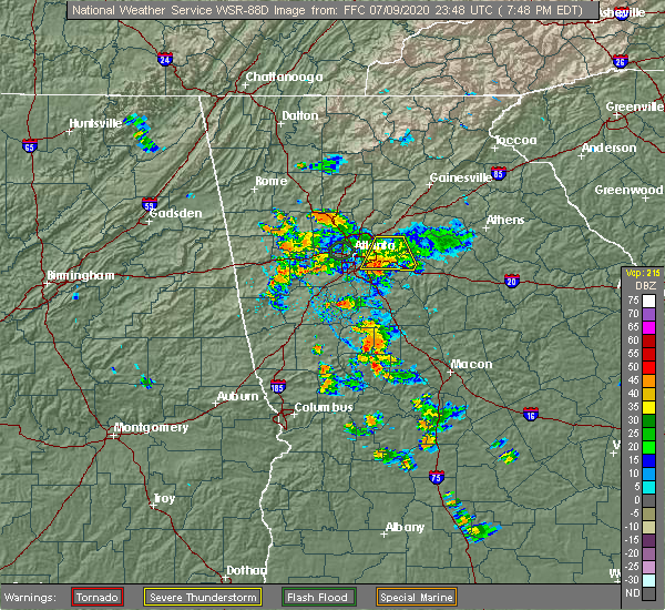 At 750 pm edt, a severe thunderstorm was located over snapfinger, or 7 miles southeast of decatur, moving south at 15 mph (radar indicated). Hazards include 60 mph wind gusts. Expect damage to roofs, siding, and trees. Locations impacted include, decatur, conyers, avondale estates, lithonia, pine lake, lakeview estates, belvedere park, candler-mcafee, milstead, belmont, arabia mountain, redan, scottdale, panthersville, gresham park and snapfinger. At 750 pm edt, a severe thunderstorm was located over snapfinger, or 7 miles southeast of decatur, moving south at 15 mph (radar indicated). Hazards include 60 mph wind gusts. Expect damage to roofs, siding, and trees. Locations impacted include, decatur, conyers, avondale estates, lithonia, pine lake, lakeview estates, belvedere park, candler-mcafee, milstead, belmont, arabia mountain, redan, scottdale, panthersville, gresham park and snapfinger.
|
| 7/9/2020 7:30 PM EDT |
 At 730 pm edt, a severe thunderstorm was located over mountain park, or 10 miles east of decatur, moving south at 25 mph (radar indicated). Hazards include 60 mph wind gusts. expect damage to roofs, siding, and trees At 730 pm edt, a severe thunderstorm was located over mountain park, or 10 miles east of decatur, moving south at 25 mph (radar indicated). Hazards include 60 mph wind gusts. expect damage to roofs, siding, and trees
|
| 6/15/2020 4:22 PM EDT |
 At 422 pm edt, a severe thunderstorm was located over big haynes creek park, or 8 miles northeast of conyers, moving south at 25 mph (radar indicated). Hazards include 60 mph wind gusts and quarter size hail. Hail damage to vehicles is expected. Expect wind damage to roofs, siding, and trees. At 422 pm edt, a severe thunderstorm was located over big haynes creek park, or 8 miles northeast of conyers, moving south at 25 mph (radar indicated). Hazards include 60 mph wind gusts and quarter size hail. Hail damage to vehicles is expected. Expect wind damage to roofs, siding, and trees.
|
| 5/28/2020 1:20 PM EDT |
 At 120 pm edt, a severe thunderstorm was located over conyers, moving northeast at 15 mph (radar indicated). Hazards include 60 mph wind gusts and nickel size hail. Expect damage to roofs, siding, and trees. Locations impacted include, conyers, covington, oxford, walnut grove, lakeview estates, georgia international horse park, gum creek, milstead and big haynes creek park. At 120 pm edt, a severe thunderstorm was located over conyers, moving northeast at 15 mph (radar indicated). Hazards include 60 mph wind gusts and nickel size hail. Expect damage to roofs, siding, and trees. Locations impacted include, conyers, covington, oxford, walnut grove, lakeview estates, georgia international horse park, gum creek, milstead and big haynes creek park.
|
| 5/28/2020 1:08 PM EDT |
 At 108 pm edt, a severe thunderstorm was located near richardson park, or near conyers, moving northeast at 15 mph (radar indicated). Hazards include 60 mph wind gusts and nickel size hail. expect damage to roofs, siding, and trees At 108 pm edt, a severe thunderstorm was located near richardson park, or near conyers, moving northeast at 15 mph (radar indicated). Hazards include 60 mph wind gusts and nickel size hail. expect damage to roofs, siding, and trees
|
| 4/13/2020 3:05 AM EDT |
 At 305 am edt, a severe thunderstorm was located over milstead, or over conyers, moving east at 60 mph (radar indicated). Hazards include 60 mph wind gusts. Expect damage to roofs, siding, and trees. Locations impacted include, conyers, monroe, covington, snellville, loganville, social circle, oxford, lithonia, porterdale, walnut grove, between, jersey, lakeview estates, georgia international horse park, windsor, arabia mountain, big haynes creek park, rosebud, bold springs and magnet. At 305 am edt, a severe thunderstorm was located over milstead, or over conyers, moving east at 60 mph (radar indicated). Hazards include 60 mph wind gusts. Expect damage to roofs, siding, and trees. Locations impacted include, conyers, monroe, covington, snellville, loganville, social circle, oxford, lithonia, porterdale, walnut grove, between, jersey, lakeview estates, georgia international horse park, windsor, arabia mountain, big haynes creek park, rosebud, bold springs and magnet.
|
| 4/13/2020 2:53 AM EDT |
 At 253 am edt, a severe thunderstorm was located over panola mountain state park, or 10 miles west of conyers, moving east at 60 mph (radar indicated). Hazards include 60 mph wind gusts. expect damage to roofs, siding, and trees At 253 am edt, a severe thunderstorm was located over panola mountain state park, or 10 miles west of conyers, moving east at 60 mph (radar indicated). Hazards include 60 mph wind gusts. expect damage to roofs, siding, and trees
|
| 3/31/2020 11:52 AM EDT |
 At 1152 am edt, severe thunderstorms were located along a line extending from near arabia mountain to luella, moving east at 60 mph (radar indicated). Hazards include 70 mph wind gusts. Expect considerable tree damage. Damage is likely to mobile homes, roofs, and outbuildings. At 1152 am edt, severe thunderstorms were located along a line extending from near arabia mountain to luella, moving east at 60 mph (radar indicated). Hazards include 70 mph wind gusts. Expect considerable tree damage. Damage is likely to mobile homes, roofs, and outbuildings.
|
| 1/11/2020 6:31 PM EST |
 At 631 pm est, severe thunderstorms were located along a line extending from big haynes creek park to near blount, moving east at 40 mph (radar indicated). Hazards include 60 mph wind gusts. Expect damage to roofs, siding, and trees. Locations impacted include, conyers, covington, jackson, stone mountain, social circle, oxford, lithonia, porterdale, newborn, flovilla, mansfield, jenkinsburg, lakeview estates, georgia international horse park, stewart, mountain park, turtle cove, worthville, belmont and arabia mountain. At 631 pm est, severe thunderstorms were located along a line extending from big haynes creek park to near blount, moving east at 40 mph (radar indicated). Hazards include 60 mph wind gusts. Expect damage to roofs, siding, and trees. Locations impacted include, conyers, covington, jackson, stone mountain, social circle, oxford, lithonia, porterdale, newborn, flovilla, mansfield, jenkinsburg, lakeview estates, georgia international horse park, stewart, mountain park, turtle cove, worthville, belmont and arabia mountain.
|
| 1/11/2020 6:12 PM EST |
 At 612 pm est, severe thunderstorms were located along a line extending from near stone mountain to orchard hill, moving east at 40 mph (radar indicated). Hazards include 60 mph wind gusts. expect damage to roofs, siding, and trees At 612 pm est, severe thunderstorms were located along a line extending from near stone mountain to orchard hill, moving east at 40 mph (radar indicated). Hazards include 60 mph wind gusts. expect damage to roofs, siding, and trees
|
| 10/31/2019 1:44 PM EDT |
 At 144 pm edt, a severe thunderstorm was located over lithonia, or near conyers, moving northeast at 60 mph (radar indicated). Hazards include 60 mph wind gusts. expect damage to roofs, siding, and trees At 144 pm edt, a severe thunderstorm was located over lithonia, or near conyers, moving northeast at 60 mph (radar indicated). Hazards include 60 mph wind gusts. expect damage to roofs, siding, and trees
|
| 6/24/2019 7:24 PM EDT |
 At 724 pm edt, severe thunderstorms were located along a line extending from redan to near inman, moving east at 35 mph (radar indicated). Hazards include 60 mph wind gusts. Expect damage to roofs, siding, and trees. Locations impacted include, atlanta, newnan, mcdonough, decatur, fayetteville, conyers, jonesboro, peachtree city, east point, stockbridge, union city, forest park, riverdale, college park, fairburn, hampton, tyrone, morrow, lovejoy and hapeville. At 724 pm edt, severe thunderstorms were located along a line extending from redan to near inman, moving east at 35 mph (radar indicated). Hazards include 60 mph wind gusts. Expect damage to roofs, siding, and trees. Locations impacted include, atlanta, newnan, mcdonough, decatur, fayetteville, conyers, jonesboro, peachtree city, east point, stockbridge, union city, forest park, riverdale, college park, fairburn, hampton, tyrone, morrow, lovejoy and hapeville.
|
| 6/24/2019 6:51 PM EDT |
 At 651 pm edt, severe thunderstorms were located along a line extending from bankhead to madras, moving east at 35 mph (radar indicated). Hazards include 60 mph wind gusts. expect damage to roofs, siding, and trees At 651 pm edt, severe thunderstorms were located along a line extending from bankhead to madras, moving east at 35 mph (radar indicated). Hazards include 60 mph wind gusts. expect damage to roofs, siding, and trees
|
| 6/23/2019 4:15 PM EDT |
 At 414 pm edt, severe thunderstorms were located along a line extending from gum creek to richardson park, moving east at 25 mph (radar indicated). Hazards include 60 mph wind gusts and quarter size hail. Hail damage to vehicles is expected. expect wind damage to roofs, siding, and trees. Locations impacted include, conyers, covington, oxford, porterdale, walnut grove, jersey, lakeview estates, georgia international horse park, magnet, almon, milstead, richardson park, big haynes creek park, gum creek and oak hill. At 414 pm edt, severe thunderstorms were located along a line extending from gum creek to richardson park, moving east at 25 mph (radar indicated). Hazards include 60 mph wind gusts and quarter size hail. Hail damage to vehicles is expected. expect wind damage to roofs, siding, and trees. Locations impacted include, conyers, covington, oxford, porterdale, walnut grove, jersey, lakeview estates, georgia international horse park, magnet, almon, milstead, richardson park, big haynes creek park, gum creek and oak hill.
|
| 6/23/2019 3:58 PM EDT |
 At 357 pm edt, severe thunderstorms were located along a line extending from lakeview estates to hidden valley park, moving east at 25 mph (radar indicated). Hazards include 60 mph wind gusts and quarter size hail. Hail damage to vehicles is expected. Expect wind damage to roofs, siding, and trees. At 357 pm edt, severe thunderstorms were located along a line extending from lakeview estates to hidden valley park, moving east at 25 mph (radar indicated). Hazards include 60 mph wind gusts and quarter size hail. Hail damage to vehicles is expected. Expect wind damage to roofs, siding, and trees.
|
| 6/18/2019 3:28 PM EDT |
 At 327 pm edt, a severe thunderstorm was located over conyers, moving northeast at 15 mph (radar indicated). Hazards include 60 mph wind gusts. expect damage to roofs, siding, and trees At 327 pm edt, a severe thunderstorm was located over conyers, moving northeast at 15 mph (radar indicated). Hazards include 60 mph wind gusts. expect damage to roofs, siding, and trees
|
| 4/19/2019 6:57 AM EDT |
 At 656 am edt, severe thunderstorms were located along a line extending from lakeview estates to milstead to magnet, moving northeast at 30 mph (radar indicated). Hazards include 60 mph wind gusts. expect damage to roofs, siding, and trees At 656 am edt, severe thunderstorms were located along a line extending from lakeview estates to milstead to magnet, moving northeast at 30 mph (radar indicated). Hazards include 60 mph wind gusts. expect damage to roofs, siding, and trees
|
| 9/27/2018 4:50 PM EDT |
 At 449 pm edt, severe thunderstorms were located along a line extending from conyers to starrsville to near calvin, moving northeast at 40 mph (radar indicated). Hazards include 70 mph wind gusts and quarter size hail. Hail damage to vehicles is expected. expect considerable tree damage. wind damage is also likely to mobile homes, roofs, and outbuildings. Locations impacted include, conyers, monroe, covington, monticello, snellville, loganville, social circle, oxford, lithonia, porterdale, walnut grove, rutledge, newborn, mansfield, between, jersey, lakeview estates, georgia international horse park, stewart and turtle cove. At 449 pm edt, severe thunderstorms were located along a line extending from conyers to starrsville to near calvin, moving northeast at 40 mph (radar indicated). Hazards include 70 mph wind gusts and quarter size hail. Hail damage to vehicles is expected. expect considerable tree damage. wind damage is also likely to mobile homes, roofs, and outbuildings. Locations impacted include, conyers, monroe, covington, monticello, snellville, loganville, social circle, oxford, lithonia, porterdale, walnut grove, rutledge, newborn, mansfield, between, jersey, lakeview estates, georgia international horse park, stewart and turtle cove.
|
| 9/27/2018 4:45 PM EDT |
 At 432 pm edt, severe thunderstorms were located along a line extending from lovejoy to locust grove to near high falls state park, moving northeast at 40 mph (radar indicated). Hazards include 60 mph wind gusts. expect damage to roofs, siding, and trees At 432 pm edt, severe thunderstorms were located along a line extending from lovejoy to locust grove to near high falls state park, moving northeast at 40 mph (radar indicated). Hazards include 60 mph wind gusts. expect damage to roofs, siding, and trees
|
| 9/27/2018 4:32 PM EDT |
 The national weather service in peachtree city has issued a * severe thunderstorm warning for. rockdale county in north central georgia. southeastern dekalb county in north central georgia. southwestern morgan county in north central georgia. South central gwinnett county in north central georgia. The national weather service in peachtree city has issued a * severe thunderstorm warning for. rockdale county in north central georgia. southeastern dekalb county in north central georgia. southwestern morgan county in north central georgia. South central gwinnett county in north central georgia.
|
| 7/21/2018 8:06 PM EDT |
 The severe thunderstorm warning for rockdale, west central walton and northwestern newton counties will expire at 815 pm edt, the storm which prompted the warning has moved out of the area. therefore, the warning will be allowed to expire. a severe thunderstorm watch remains in effect until 200 am edt for north central georgia. The severe thunderstorm warning for rockdale, west central walton and northwestern newton counties will expire at 815 pm edt, the storm which prompted the warning has moved out of the area. therefore, the warning will be allowed to expire. a severe thunderstorm watch remains in effect until 200 am edt for north central georgia.
|
| 7/21/2018 7:49 PM EDT |
 At 748 pm edt, a severe thunderstorm was located over gum creek, or near conyers, moving east at 40 mph (radar indicated). Hazards include 60 mph wind gusts and half dollar size hail. Hail damage to vehicles is expected. expect wind damage to roofs, siding, and trees. Locations impacted include, conyers, covington, loganville, oxford, porterdale, walnut grove, lakeview estates, georgia international horse park, almon, milstead, youth, big haynes creek park and gum creek. At 748 pm edt, a severe thunderstorm was located over gum creek, or near conyers, moving east at 40 mph (radar indicated). Hazards include 60 mph wind gusts and half dollar size hail. Hail damage to vehicles is expected. expect wind damage to roofs, siding, and trees. Locations impacted include, conyers, covington, loganville, oxford, porterdale, walnut grove, lakeview estates, georgia international horse park, almon, milstead, youth, big haynes creek park and gum creek.
|
| 7/21/2018 7:29 PM EDT |
 At 729 pm edt, a severe thunderstorm was located over lithonia, or near conyers, moving east at 40 mph (radar indicated). Hazards include 60 mph wind gusts and half dollar size hail. Hail damage to vehicles is expected. Expect wind damage to roofs, siding, and trees. At 729 pm edt, a severe thunderstorm was located over lithonia, or near conyers, moving east at 40 mph (radar indicated). Hazards include 60 mph wind gusts and half dollar size hail. Hail damage to vehicles is expected. Expect wind damage to roofs, siding, and trees.
|
| 6/8/2018 5:08 PM EDT |
 At 508 pm edt, a severe thunderstorm was located over conyers, moving northwest at 10 mph (radar indicated). Hazards include 60 mph wind gusts and quarter size hail. Hail damage to vehicles is expected. Expect wind damage to roofs, siding, and trees. At 508 pm edt, a severe thunderstorm was located over conyers, moving northwest at 10 mph (radar indicated). Hazards include 60 mph wind gusts and quarter size hail. Hail damage to vehicles is expected. Expect wind damage to roofs, siding, and trees.
|
| 3/19/2018 11:31 PM EDT |
 At 1130 pm edt, severe thunderstorms were located along a line extending from big haynes creek park to near alvaton, moving southeast at 50 mph (radar indicated). Hazards include ping pong ball size hail and 60 mph wind gusts. People and animals outdoors will be injured. expect hail damage to roofs, siding, windows, and vehicles. Expect wind damage to roofs, siding, and trees. At 1130 pm edt, severe thunderstorms were located along a line extending from big haynes creek park to near alvaton, moving southeast at 50 mph (radar indicated). Hazards include ping pong ball size hail and 60 mph wind gusts. People and animals outdoors will be injured. expect hail damage to roofs, siding, windows, and vehicles. Expect wind damage to roofs, siding, and trees.
|
| 7/11/2017 5:43 PM EDT |
 At 543 pm edt, a severe thunderstorm was located over lakeview estates, or over conyers, moving southeast at 5 mph (radar indicated). Hazards include 60 mph wind gusts and quarter size hail. Hail damage to vehicles is expected. Expect wind damage to roofs, siding, and trees. At 543 pm edt, a severe thunderstorm was located over lakeview estates, or over conyers, moving southeast at 5 mph (radar indicated). Hazards include 60 mph wind gusts and quarter size hail. Hail damage to vehicles is expected. Expect wind damage to roofs, siding, and trees.
|
| 7/11/2017 5:16 PM EDT |
 At 516 pm edt, a severe thunderstorm was located over snellville, or 9 miles south of lawrenceville, moving east at 15 mph (radar indicated). Hazards include 60 mph wind gusts and quarter size hail. Hail damage to vehicles is expected. Expect wind damage to roofs, siding, and trees. At 516 pm edt, a severe thunderstorm was located over snellville, or 9 miles south of lawrenceville, moving east at 15 mph (radar indicated). Hazards include 60 mph wind gusts and quarter size hail. Hail damage to vehicles is expected. Expect wind damage to roofs, siding, and trees.
|
| 6/23/2017 9:44 PM EDT |
 At 944 pm edt, severe thunderstorms were located along a line extending from near lakeview estates to milstead to magnet, moving east at 50 mph (radar indicated). Hazards include 60 mph wind gusts. Expect damage to roofs, siding, and trees. Locations impacted include, conyers, covington, oxford, porterdale, lakeview estates, georgia international horse park, magnet, gum creek, almon, milstead and big haynes creek park. At 944 pm edt, severe thunderstorms were located along a line extending from near lakeview estates to milstead to magnet, moving east at 50 mph (radar indicated). Hazards include 60 mph wind gusts. Expect damage to roofs, siding, and trees. Locations impacted include, conyers, covington, oxford, porterdale, lakeview estates, georgia international horse park, magnet, gum creek, almon, milstead and big haynes creek park.
|
| 6/23/2017 9:30 PM EDT |
 At 930 pm edt, severe thunderstorms were located along a line extending from snapfinger to richardson park, moving east at 40 mph (radar indicated). Hazards include 60 mph wind gusts. Expect damage to roofs, siding, and trees. Locations impacted include, conyers, covington, oxford, lithonia, porterdale, lakeview estates, georgia international horse park, candler-mcafee, belvedere park, magnet, almon, milstead, belmont, richardson park, arabia mountain, big haynes creek park, redan, hidden valley park, panola mountain state park and gum creek. At 930 pm edt, severe thunderstorms were located along a line extending from snapfinger to richardson park, moving east at 40 mph (radar indicated). Hazards include 60 mph wind gusts. Expect damage to roofs, siding, and trees. Locations impacted include, conyers, covington, oxford, lithonia, porterdale, lakeview estates, georgia international horse park, candler-mcafee, belvedere park, magnet, almon, milstead, belmont, richardson park, arabia mountain, big haynes creek park, redan, hidden valley park, panola mountain state park and gum creek.
|
| 6/23/2017 9:13 PM EDT |
 At 913 pm edt, severe thunderstorms were located along a line extending from near lakewood park to morrow, moving east at 35 mph (radar indicated). Hazards include 60 mph wind gusts. expect damage to roofs, siding, and trees At 913 pm edt, severe thunderstorms were located along a line extending from near lakewood park to morrow, moving east at 35 mph (radar indicated). Hazards include 60 mph wind gusts. expect damage to roofs, siding, and trees
|
| 8/2/2016 3:10 PM EDT |
 At 310 pm edt, a severe thunderstorm was located over lithonia, or near conyers, moving east at 25 mph (radar indicated). Hazards include 60 mph wind gusts and penny size hail. Expect damage to roofs. siding. and trees. Other locations in the warning include but are not limited to conyers, snellville, loganville, stone mountain, lithonia, georgia international horse park, lakeview estates, mountain park, snapfinger, arabia mountain, belmont, milstead, big haynes creek park, redan and rosebud. At 310 pm edt, a severe thunderstorm was located over lithonia, or near conyers, moving east at 25 mph (radar indicated). Hazards include 60 mph wind gusts and penny size hail. Expect damage to roofs. siding. and trees. Other locations in the warning include but are not limited to conyers, snellville, loganville, stone mountain, lithonia, georgia international horse park, lakeview estates, mountain park, snapfinger, arabia mountain, belmont, milstead, big haynes creek park, redan and rosebud.
|
| 7/19/2016 8:11 PM EDT |
 At 810 pm edt, a severe thunderstorm was located near lithonia, or 7 miles southwest of conyers, moving south at 20 mph (radar indicated). Hazards include 60 mph wind gusts and quarter size hail. Hail damage to vehicles is expected. expect wind damage to roofs, siding, and trees. Other locations in the warning include but are not limited to decatur, conyers, clarkston, stone mountain, avondale estates, lithonia, pine lake, candler-mcafee, belvedere park, lakeview estates, north decatur, mountain park, snapfinger, arabia mountain, belmont, panola mountain state park, redan, scottdale and panthersville. At 810 pm edt, a severe thunderstorm was located near lithonia, or 7 miles southwest of conyers, moving south at 20 mph (radar indicated). Hazards include 60 mph wind gusts and quarter size hail. Hail damage to vehicles is expected. expect wind damage to roofs, siding, and trees. Other locations in the warning include but are not limited to decatur, conyers, clarkston, stone mountain, avondale estates, lithonia, pine lake, candler-mcafee, belvedere park, lakeview estates, north decatur, mountain park, snapfinger, arabia mountain, belmont, panola mountain state park, redan, scottdale and panthersville.
|
| 7/19/2016 7:40 PM EDT |
 At 739 pm edt, a severe thunderstorm was located over stone mountain, or 8 miles east of decatur, moving south at 20 mph (radar indicated). Hazards include 60 mph wind gusts and quarter size hail. minor flash flooding is also possible. Hail damage to vehicles is expected. expect wind damage to roofs, siding, and trees. Other locations in the warning include but are not limited to decatur, conyers, lilburn, chamblee, doraville, clarkston, st one mountain, avondale estates, lithonia, pine lake, tucker, north decatur, candler-mcafee, belvedere park, lakeview estates, mountain park, snapfinger, arabia mountain, belmont and panola mountain state park. At 739 pm edt, a severe thunderstorm was located over stone mountain, or 8 miles east of decatur, moving south at 20 mph (radar indicated). Hazards include 60 mph wind gusts and quarter size hail. minor flash flooding is also possible. Hail damage to vehicles is expected. expect wind damage to roofs, siding, and trees. Other locations in the warning include but are not limited to decatur, conyers, lilburn, chamblee, doraville, clarkston, st one mountain, avondale estates, lithonia, pine lake, tucker, north decatur, candler-mcafee, belvedere park, lakeview estates, mountain park, snapfinger, arabia mountain, belmont and panola mountain state park.
|
| 7/17/2016 7:32 PM EDT |
 At 731 pm edt, a severe thunderstorm was located near lakeview estates, moving northeast at 10 mph (radar indicated). Hazards include 60 mph wind gusts and penny size hail. Expect damage to roofs. siding. and trees. Other locations in the warning include but are not limited to conyers, snellville, lilburn, loganville, grayson, lithonia, lakeview estates, mountain park, milstead, big haynes creek park, redan and rosebud. At 731 pm edt, a severe thunderstorm was located near lakeview estates, moving northeast at 10 mph (radar indicated). Hazards include 60 mph wind gusts and penny size hail. Expect damage to roofs. siding. and trees. Other locations in the warning include but are not limited to conyers, snellville, lilburn, loganville, grayson, lithonia, lakeview estates, mountain park, milstead, big haynes creek park, redan and rosebud.
|
| 7/11/2016 7:01 PM EDT |
 At 700 pm edt, severe thunderstorms were located along a line extending from tucker to near loganville to near covington, moving northeast at 45 mph (radar indicated). Hazards include 60 mph wind gusts. Expect damage to roofs. siding. and trees. Other locations in the warning include but are not limited to lawrenceville, conyers, winder, monroe, covington, duluth, sugar hill, snellville, suwanee, buford, lilburn, loganville, norcross, clarkston, braselton, auburn, stone mountain, dacula, social circle and grayson. At 700 pm edt, severe thunderstorms were located along a line extending from tucker to near loganville to near covington, moving northeast at 45 mph (radar indicated). Hazards include 60 mph wind gusts. Expect damage to roofs. siding. and trees. Other locations in the warning include but are not limited to lawrenceville, conyers, winder, monroe, covington, duluth, sugar hill, snellville, suwanee, buford, lilburn, loganville, norcross, clarkston, braselton, auburn, stone mountain, dacula, social circle and grayson.
|
| 7/11/2016 6:31 PM EDT |
 At 631 pm edt, severe thunderstorms were located along a line extending from lake city to near mcdonough to near locust grove, moving northeast at 45 mph (radar indicated). Hazards include 60 mph wind gusts. Expect damage to roofs. siding. and trees. Other locations in the warning include but are not limited to atlanta, decatur, conyers, monroe, covington, snellville, loganville, clarkston, stone mountain, social circle, avondale estates, oxford, lithonia, porterdale, walnut grove, pine lake, between, jersey, candler-mcafee and belvedere park. At 631 pm edt, severe thunderstorms were located along a line extending from lake city to near mcdonough to near locust grove, moving northeast at 45 mph (radar indicated). Hazards include 60 mph wind gusts. Expect damage to roofs. siding. and trees. Other locations in the warning include but are not limited to atlanta, decatur, conyers, monroe, covington, snellville, loganville, clarkston, stone mountain, social circle, avondale estates, oxford, lithonia, porterdale, walnut grove, pine lake, between, jersey, candler-mcafee and belvedere park.
|
| 6/17/2016 2:26 PM EDT |
 At 226 pm edt, a severe thunderstorm was located near conyers, moving southeast at 35 mph (radar indicated). Hazards include 60 mph wind gusts. Expect damage to roofs. siding. and trees. Other locations in the warning include but are not limited to conyers, covington, oxford, porterdale, newborn, mansfield, g eorgia international horse park, lakeview estates, oak hill, almon, rocky plains, magnet, starrsville, milstead and brick store. At 226 pm edt, a severe thunderstorm was located near conyers, moving southeast at 35 mph (radar indicated). Hazards include 60 mph wind gusts. Expect damage to roofs. siding. and trees. Other locations in the warning include but are not limited to conyers, covington, oxford, porterdale, newborn, mansfield, g eorgia international horse park, lakeview estates, oak hill, almon, rocky plains, magnet, starrsville, milstead and brick store.
|
| 5/29/2016 7:12 PM EDT |
 At 712 pm edt, a severe thunderstorm was located over lithonia, or near conyers, moving south at 20 mph (radar indicated). Hazards include 60 mph wind gusts. Expect damage to roofs. siding. and trees. Other locations in the warning include but are not limited to mcdonough, conyers, stockbridge, hampton, lovejoy, locust grove, lithonia, lakeview estates, snapfinger, oak hill, arabia mountain, belmont, magnet, eagles landing, hidden valley park, flippen, milstead, panola mountain state park, richardson park and redan. At 712 pm edt, a severe thunderstorm was located over lithonia, or near conyers, moving south at 20 mph (radar indicated). Hazards include 60 mph wind gusts. Expect damage to roofs. siding. and trees. Other locations in the warning include but are not limited to mcdonough, conyers, stockbridge, hampton, lovejoy, locust grove, lithonia, lakeview estates, snapfinger, oak hill, arabia mountain, belmont, magnet, eagles landing, hidden valley park, flippen, milstead, panola mountain state park, richardson park and redan.
|
| 5/1/2016 5:51 PM EDT |
 The severe thunderstorm warning for west central walton, northeastern rockdale and north central newton counties will expire at 600 pm edt, the storm which prompted the warning has weakened below severe limits, and no longer pose an immediate threat to life or property. therefore the warning will be allowed to expire. however small hail is still possible with this thunderstorm. The severe thunderstorm warning for west central walton, northeastern rockdale and north central newton counties will expire at 600 pm edt, the storm which prompted the warning has weakened below severe limits, and no longer pose an immediate threat to life or property. therefore the warning will be allowed to expire. however small hail is still possible with this thunderstorm.
|
| 5/1/2016 5:44 PM EDT |
 At 544 pm edt, a severe thunderstorm was located near lakeview estates, or near conyers, moving east at 25 mph (radar indicated). Hazards include quarter size hail. Damage to vehicles is expected. Other locations in the warning include but are not limited to conyers, loganville, walnut grove, lakeview estates, gum creek, big haynes creek park and youth. At 544 pm edt, a severe thunderstorm was located near lakeview estates, or near conyers, moving east at 25 mph (radar indicated). Hazards include quarter size hail. Damage to vehicles is expected. Other locations in the warning include but are not limited to conyers, loganville, walnut grove, lakeview estates, gum creek, big haynes creek park and youth.
|
| 5/1/2016 5:24 PM EDT |
 At 524 pm edt, a severe thunderstorm was located near lithonia, or 8 miles northwest of conyers, moving east at 30 mph (radar indicated). Hazards include quarter size hail. Damage to vehicles is expected. Other locations in the warning include but are not limited to conyers, snellville, loganville, stone mountain, lithonia, walnut grove, lakeview estates, mountain park, gum creek, belmont, milstead, big haynes creek park, redan, rosebud and youth. At 524 pm edt, a severe thunderstorm was located near lithonia, or 8 miles northwest of conyers, moving east at 30 mph (radar indicated). Hazards include quarter size hail. Damage to vehicles is expected. Other locations in the warning include but are not limited to conyers, snellville, loganville, stone mountain, lithonia, walnut grove, lakeview estates, mountain park, gum creek, belmont, milstead, big haynes creek park, redan, rosebud and youth.
|
| 4/7/2016 12:27 AM EDT |
 At 1226 am edt, severe thunderstorms were located along a line extending from buford to near lithonia to near sunny side, moving east at 50 mph (radar indicated. damaging winds have already been reported with this line). Hazards include 60 mph wind gusts and nickel size hail. Expect damage to roofs. siding. and trees. Other locations in the warning include but are not limited to lawrenceville, mcdonough, conyers, winder, monroe, covington, jefferson, watkinsville, snellville, buford, loganville, braselton, auburn, locust grove, dacula, social circle, grayson, statham, oxford and arcade. At 1226 am edt, severe thunderstorms were located along a line extending from buford to near lithonia to near sunny side, moving east at 50 mph (radar indicated. damaging winds have already been reported with this line). Hazards include 60 mph wind gusts and nickel size hail. Expect damage to roofs. siding. and trees. Other locations in the warning include but are not limited to lawrenceville, mcdonough, conyers, winder, monroe, covington, jefferson, watkinsville, snellville, buford, loganville, braselton, auburn, locust grove, dacula, social circle, grayson, statham, oxford and arcade.
|
| 4/7/2016 12:11 AM EDT |
 At 1211 am edt, severe thunderstorms were located along a line extending from doraville to near candler-mcafee to near peachtree city, moving east at 50 mph (radar indicated). Hazards include 60 mph wind gusts. Expect damage to roofs. siding. and trees. Other locations in the warning include but are not limited to atlanta, newnan, decatur, fayetteville, jonesboro, sandy springs, dunwoody, peachtree city, east point, stockbridge, union city, forest park, snellville, riverdale, college park, fairburn, lilburn, chamblee, norcross and doraville. At 1211 am edt, severe thunderstorms were located along a line extending from doraville to near candler-mcafee to near peachtree city, moving east at 50 mph (radar indicated). Hazards include 60 mph wind gusts. Expect damage to roofs. siding. and trees. Other locations in the warning include but are not limited to atlanta, newnan, decatur, fayetteville, jonesboro, sandy springs, dunwoody, peachtree city, east point, stockbridge, union city, forest park, snellville, riverdale, college park, fairburn, lilburn, chamblee, norcross and doraville.
|
| 4/6/2016 11:41 PM EDT |
 At 1141 pm edt, severe thunderstorms were located along a line extending from near marietta to near lithia springs to near newnan, moving east at 50 mph (radar indicated). Hazards include 60 mph wind gusts and quarter size hail. Hail damage to vehicles is expected. expect wind damage to roofs, siding, and trees. Other locations in the warning include but are not limited to atlanta, marietta, newnan, douglasville, decatur, fayetteville, jonesboro, sandy springs, smyrna, dunwoody, peachtree city, east point, stockbridge, union city, forest park, snellville, riverdale, college park, powder springs and fairburn. At 1141 pm edt, severe thunderstorms were located along a line extending from near marietta to near lithia springs to near newnan, moving east at 50 mph (radar indicated). Hazards include 60 mph wind gusts and quarter size hail. Hail damage to vehicles is expected. expect wind damage to roofs, siding, and trees. Other locations in the warning include but are not limited to atlanta, marietta, newnan, douglasville, decatur, fayetteville, jonesboro, sandy springs, smyrna, dunwoody, peachtree city, east point, stockbridge, union city, forest park, snellville, riverdale, college park, powder springs and fairburn.
|
| 3/1/2016 9:06 PM EST |
 The severe thunderstorm warning for rockdale, north central henry and southeastern dekalb counties will expire at 915 pm est, the storm which prompted the warning has moved out of the area. therefore the warning will be allowed to expire. a severe thunderstorm watch remains in effect until 200 am est for north central georgia. The severe thunderstorm warning for rockdale, north central henry and southeastern dekalb counties will expire at 915 pm est, the storm which prompted the warning has moved out of the area. therefore the warning will be allowed to expire. a severe thunderstorm watch remains in effect until 200 am est for north central georgia.
|
| 3/1/2016 8:51 PM EST |
 At 850 pm est, a severe thunderstorm was located near lithonia, or near conyers, moving east at 40 mph (radar indicated). Hazards include 60 mph wind gusts. Expect damage to roofs. siding. and trees. Other locations in the warning include but are not limited to conyers, lithonia, lakeview estates, georgia international horse park, milstead, richardson park, big haynes creek park, arabia mountain, redan, magnet and kelleytown. At 850 pm est, a severe thunderstorm was located near lithonia, or near conyers, moving east at 40 mph (radar indicated). Hazards include 60 mph wind gusts. Expect damage to roofs. siding. and trees. Other locations in the warning include but are not limited to conyers, lithonia, lakeview estates, georgia international horse park, milstead, richardson park, big haynes creek park, arabia mountain, redan, magnet and kelleytown.
|
| 12/24/2015 11:05 AM EST |
 At 1105 am est, a severe thunderstorm was located over lithonia, or near conyers, moving east at 25 mph (radar indicated). Hazards include 60 mph wind gusts. Expect damage to roofs. siding and trees. Other locations in the warning include but are not limited to conyers, lithonia, lakeview estates, georgia international horse park, milstead, big haynes creek park, arabia mountain, belmont and redan. At 1105 am est, a severe thunderstorm was located over lithonia, or near conyers, moving east at 25 mph (radar indicated). Hazards include 60 mph wind gusts. Expect damage to roofs. siding and trees. Other locations in the warning include but are not limited to conyers, lithonia, lakeview estates, georgia international horse park, milstead, big haynes creek park, arabia mountain, belmont and redan.
|
| 7/18/2015 5:51 PM EDT |
 The severe thunderstorm warning for western rockdale and southeastern dekalb counties will expire at 600 pm edt, the storm which prompted the warning has weakened below severe limits, and no longer pose an immediate threat to life or property. therefore the warning will be allowed to expire. The severe thunderstorm warning for western rockdale and southeastern dekalb counties will expire at 600 pm edt, the storm which prompted the warning has weakened below severe limits, and no longer pose an immediate threat to life or property. therefore the warning will be allowed to expire.
|
| 7/18/2015 5:33 PM EDT |
 At 533 pm edt, a severe thunderstorm was located near lithonia, or 7 miles west of conyers, moving east at 5 mph (radar indicated). Hazards include 60 mph wind gusts. Expect damage to roofs. siding and trees. Other locations in the warning include but are not limited to lithonia, lakeview estates, panola mountain state park, arabia mountain, belmont and redan. At 533 pm edt, a severe thunderstorm was located near lithonia, or 7 miles west of conyers, moving east at 5 mph (radar indicated). Hazards include 60 mph wind gusts. Expect damage to roofs. siding and trees. Other locations in the warning include but are not limited to lithonia, lakeview estates, panola mountain state park, arabia mountain, belmont and redan.
|
| 7/14/2015 9:22 PM EDT |
 At 921 pm edt, severe thunderstorms were located extending from near suwanee to lilburn to pine lake to near hapeville to near college park to near fairburn to near chattahoochee hills, moving southeast at 45 mph (radar indicated). Hazards include 60 mph wind gusts and nickel size hail. Expect damage to roofs. siding and trees. Other locations in the warning include but are not limited to atlanta, newnan, lawrenceville, mcdonough, decatur, fayetteville, conyers, winder, monroe, covington, jonesboro, peachtree city, east point, duluth, stockbridge, union city, sugar hill, forest park, snellville and suwanee. At 921 pm edt, severe thunderstorms were located extending from near suwanee to lilburn to pine lake to near hapeville to near college park to near fairburn to near chattahoochee hills, moving southeast at 45 mph (radar indicated). Hazards include 60 mph wind gusts and nickel size hail. Expect damage to roofs. siding and trees. Other locations in the warning include but are not limited to atlanta, newnan, lawrenceville, mcdonough, decatur, fayetteville, conyers, winder, monroe, covington, jonesboro, peachtree city, east point, duluth, stockbridge, union city, sugar hill, forest park, snellville and suwanee.
|
| 6/24/2015 4:20 PM EDT |
 At 419 pm edt, a severe thunderstorm was located over georgia international horse park, or near covington, moving west at 10 mph (radar indicated). Hazards include 60 mph wind gusts and quarter size hail. Hail damage to vehicles is expected. expect wind damage to roofs, siding and trees. Other locations in the warning include but are not limited to conyers, covington, oxford, porterdale, georgia international horse park, lakeview estates, gum creek, oak hill, almon, rocky plains, magnet, starrsville, milstead, richardson park, brick store and big haynes creek park. At 419 pm edt, a severe thunderstorm was located over georgia international horse park, or near covington, moving west at 10 mph (radar indicated). Hazards include 60 mph wind gusts and quarter size hail. Hail damage to vehicles is expected. expect wind damage to roofs, siding and trees. Other locations in the warning include but are not limited to conyers, covington, oxford, porterdale, georgia international horse park, lakeview estates, gum creek, oak hill, almon, rocky plains, magnet, starrsville, milstead, richardson park, brick store and big haynes creek park.
|
| 6/18/2015 5:54 PM EDT | At 553 pm edt, a severe thunderstorm was located near snellville, or 8 miles north of conyers, moving north at 55 mph (radar indicated). Hazards include 60 mph wind gusts and penny size hail. Expect downed trees and powerlines. with minor damage to roofs and siding. Other locations in the warning include but are not limited to conyers, covington, oxford, lithonia, porterdale, georgia international horse park, lakeview estates, gum creek, oak hill, arabia mountain, belmont, almon, magnet, milstead, panola mountain state park, richardson park, big haynes creek park and redan. |
| 6/18/2015 5:38 PM EDT | At 537 pm edt, a severe thunderstorm was located 7 miles south of conyers, moving north at 25 mph (radar indicated). Hazards include 60 mph wind gusts and penny size hail. Downed trees and powerlines. minor damage to roofs and siding. Other locations in the warning include but are not limited to mcdonough, conyers, covington, oxford, lithonia, porterdale, georgia international horse park, lakeview estates, snapfinger, gum creek, oak hill, arabia mountain, belmont, almon, magnet, milstead, panola mountain state park, richardson park, big haynes creek park and redan. |
| 6/9/2015 3:45 PM EDT |
 At 344 pm edt, a cluster of several severe thunderstorms were located over lithonia, or 7 miles west of conyers, moving east at 20 mph (radar indicated). Hazards include 60 mph wind gusts and quarter size hail. Hail damage to vehicles is expected. expect wind damage to roofs, siding and trees. Other locations in the warning include but are not limited to decatur, conyers, stockbridge, forest park, clarkston, morrow, stone mountain, avondale estates, lake city, lithonia, pine lake, candler-mcafee, belvedere park, georgia international horse park, lakeview estates, snapfinger, arabia mountain, belmont, panola mountain state park and richardson park. At 344 pm edt, a cluster of several severe thunderstorms were located over lithonia, or 7 miles west of conyers, moving east at 20 mph (radar indicated). Hazards include 60 mph wind gusts and quarter size hail. Hail damage to vehicles is expected. expect wind damage to roofs, siding and trees. Other locations in the warning include but are not limited to decatur, conyers, stockbridge, forest park, clarkston, morrow, stone mountain, avondale estates, lake city, lithonia, pine lake, candler-mcafee, belvedere park, georgia international horse park, lakeview estates, snapfinger, arabia mountain, belmont, panola mountain state park and richardson park.
|
| 6/9/2015 3:34 PM EDT |
 A severe thunderstorm warning remains in effect until 400 pm edt for south central gwinnett. rockdale. dekalb. northeastern clayton and northwestern henry counties. at 333 pm edt. a severe thunderstorm was located near candler-mcafee. or near decatur. moving east at 20 mph. hazard. 60 mph wind gusts and quarter size hail. A severe thunderstorm warning remains in effect until 400 pm edt for south central gwinnett. rockdale. dekalb. northeastern clayton and northwestern henry counties. at 333 pm edt. a severe thunderstorm was located near candler-mcafee. or near decatur. moving east at 20 mph. hazard. 60 mph wind gusts and quarter size hail.
|
| 6/9/2015 3:10 PM EDT |
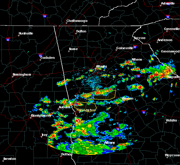 At 310 pm edt, a severe thunderstorm was located over grant park-zoo atlanta, or over atlanta, moving east at 20 mph (radar indicated). Hazards include 60 mph wind gusts and quarter size hail. Hail damage to vehicles is expected. expect wind damage to roofs, siding and trees. Other locations in the warning include but are not limited to atlanta, decatur, conyers, east point, stockbridge, forest park, college park, clarkston, morrow, hapeville, stone mountain, avondale estates, lake city, lithonia, pine lake, north decatur, candler-mcafee, georgia international horse park, north druid hills and midtown. At 310 pm edt, a severe thunderstorm was located over grant park-zoo atlanta, or over atlanta, moving east at 20 mph (radar indicated). Hazards include 60 mph wind gusts and quarter size hail. Hail damage to vehicles is expected. expect wind damage to roofs, siding and trees. Other locations in the warning include but are not limited to atlanta, decatur, conyers, east point, stockbridge, forest park, college park, clarkston, morrow, hapeville, stone mountain, avondale estates, lake city, lithonia, pine lake, north decatur, candler-mcafee, georgia international horse park, north druid hills and midtown.
|
| 5/26/2015 5:15 PM EDT | At 515 pm edt, severe thunderstorms were located along a line extending from near loganville to near jersey to near mansfield, moving northeast at 60 mph (radar indicated). Hazards include 60 mph wind gusts. Expect damage to roofs. siding and trees. Other locations in the warning include but are not limited to conyers, winder, monroe, madison, watkinsville, athens, loganville, social circle, statham, walnut grove, winterville, bogart, crawford, rutledge, newborn, north high shoals, bethlehem, bostwick, arnoldsville and between. |
| 5/26/2015 5:06 PM EDT | At 506 pm edt, severe thunderstorms were located along a line extending from doraville to near lakeview estates, moving northeast at 65 mph (radar indicated). Hazards include 60 mph wind gusts and quarter size hail. Hail damage to vehicles is expected. expect wind damage to roofs, siding and trees. Other locations in the warning include but are not limited to atlanta, decatur, conyers, snellville, lilburn, chamblee, doraville, clarkston, stone mountain, avondale estates, lithonia, pine lake, north decatur, candler-mcafee, belvedere park, georgia international horse park, lakeview estates, tucker, druid hills and north druid hills. |
| 5/26/2015 4:49 PM EDT | At 449 pm edt, severe thunderstorms were located along a line extending from near east point to near mcdonough, moving northeast at 45 mph (radar indicated). Hazards include 60 mph wind gusts and quarter size hail. Hail damage to vehicles is expected. expect wind damage to roofs, siding and trees. Other locations in the warning include but are not limited to atlanta, mcdonough, decatur, conyers, jonesboro, east point, stockbridge, union city, forest park, snellville, riverdale, college park, lilburn, chamblee, doraville, clarkston, hampton, morrow, lovejoy and hapeville. |
| 5/26/2015 4:25 PM EDT | At 424 pm edt, severe thunderstorms were located along a line extending from near tyrone to near woolsey, moving northeast at 65 mph (radar indicated). Hazards include 60 mph wind gusts and quarter size hail. Hail damage to vehicles is expected. expect wind damage to roofs, siding and trees. Other locations in the warning include but are not limited to atlanta, griffin, mcdonough, decatur, fayetteville, conyers, jonesboro, peachtree city, east point, stockbridge, union city, forest park, snellville, riverdale, college park, fairburn, lilburn, chamblee, doraville and clarkston. |
| 2/26/2013 6:20 AM EST | *** 1 fatal *** a large pine tree fell on a vehicle traveling on i-20 between sigman rd and the dekalb county line...killing the occupant. the winds at the time were ea in rockdale county GA, 2.5 miles NE of Lakeview Estates, GA |
Hail Maps for Lakeview Estates, GA


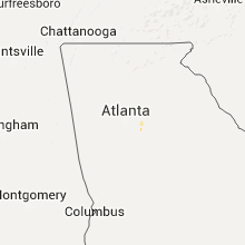


Connect with Interactive Hail Maps