

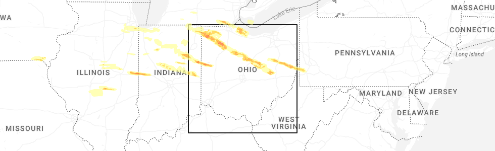
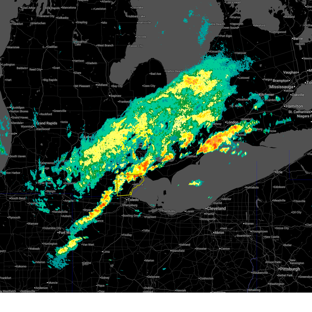
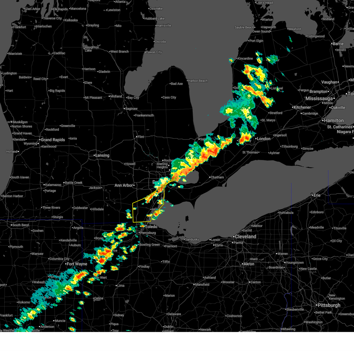
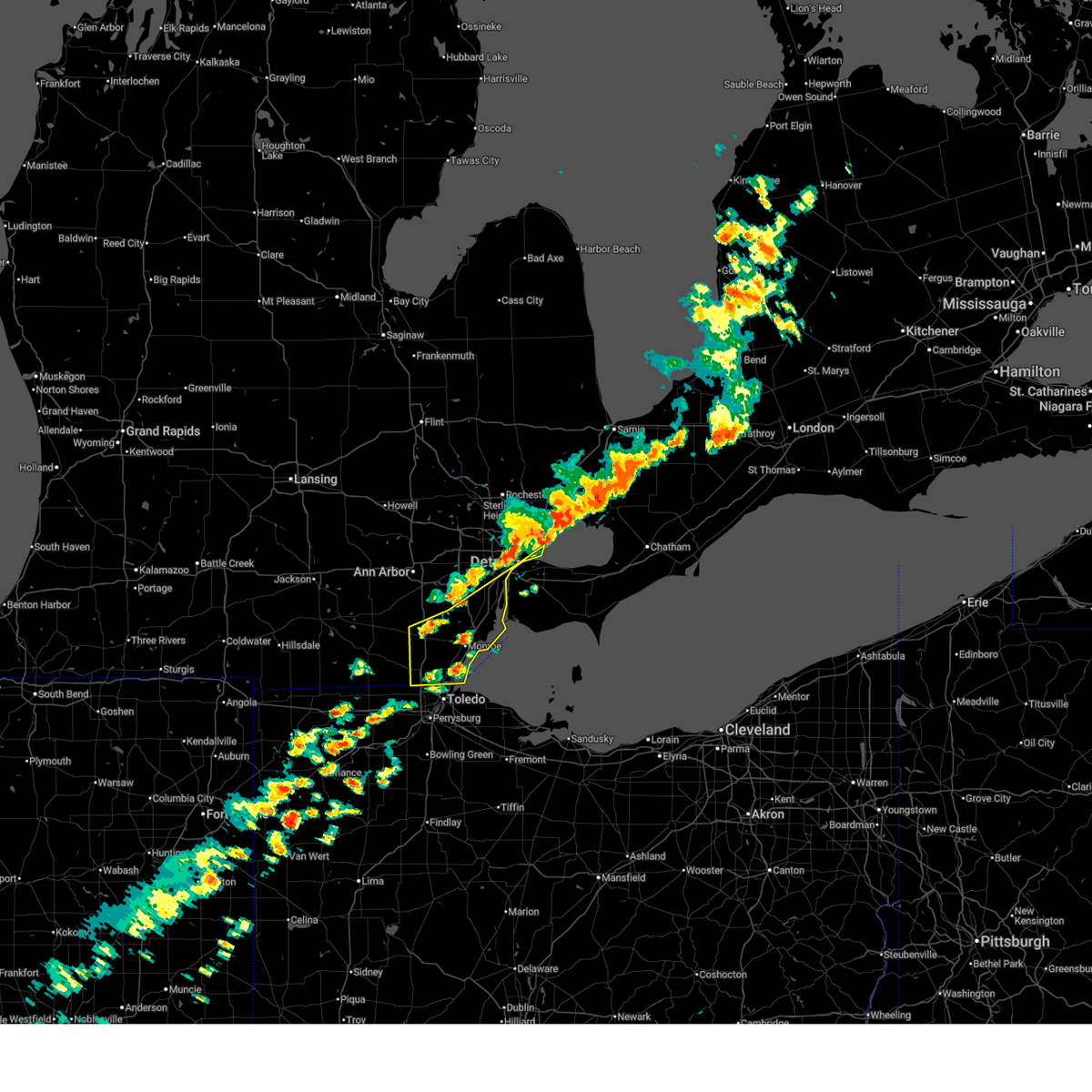
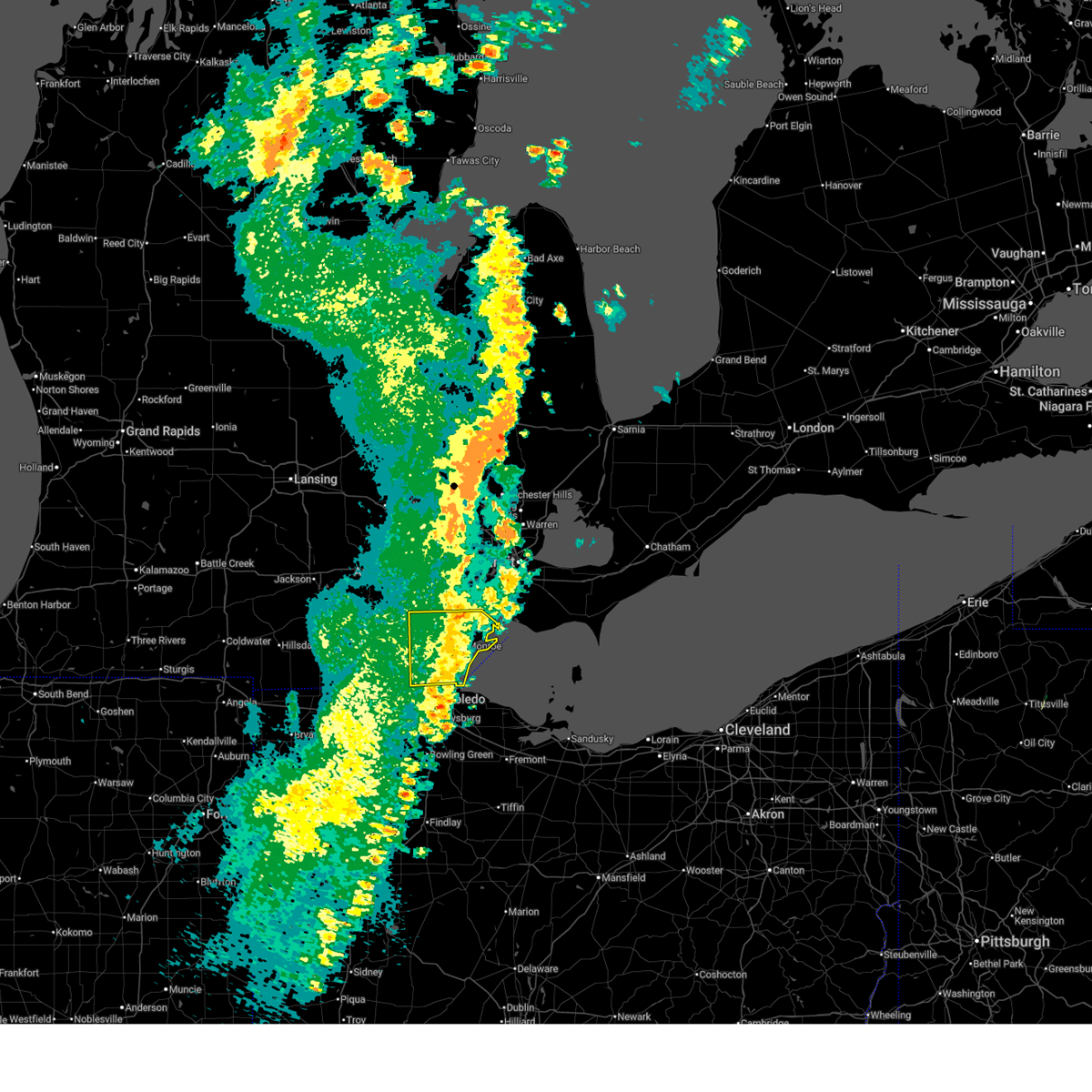
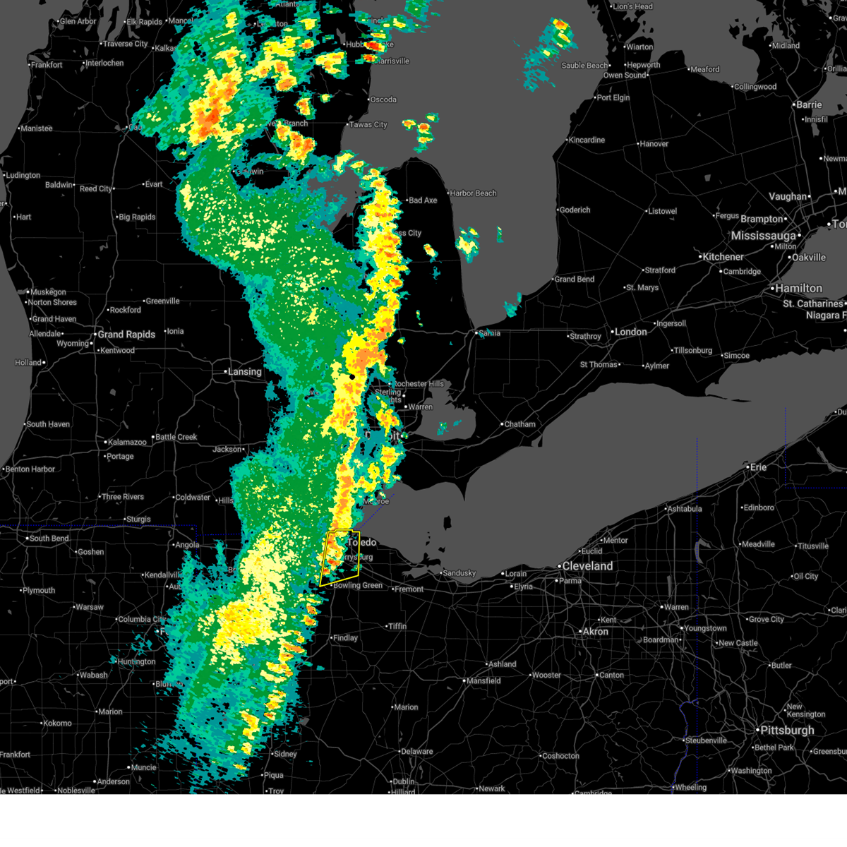
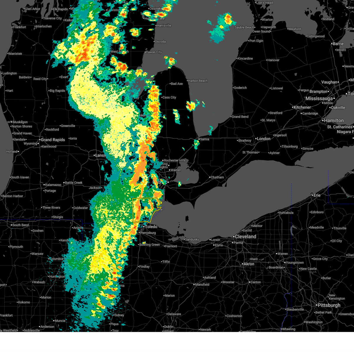
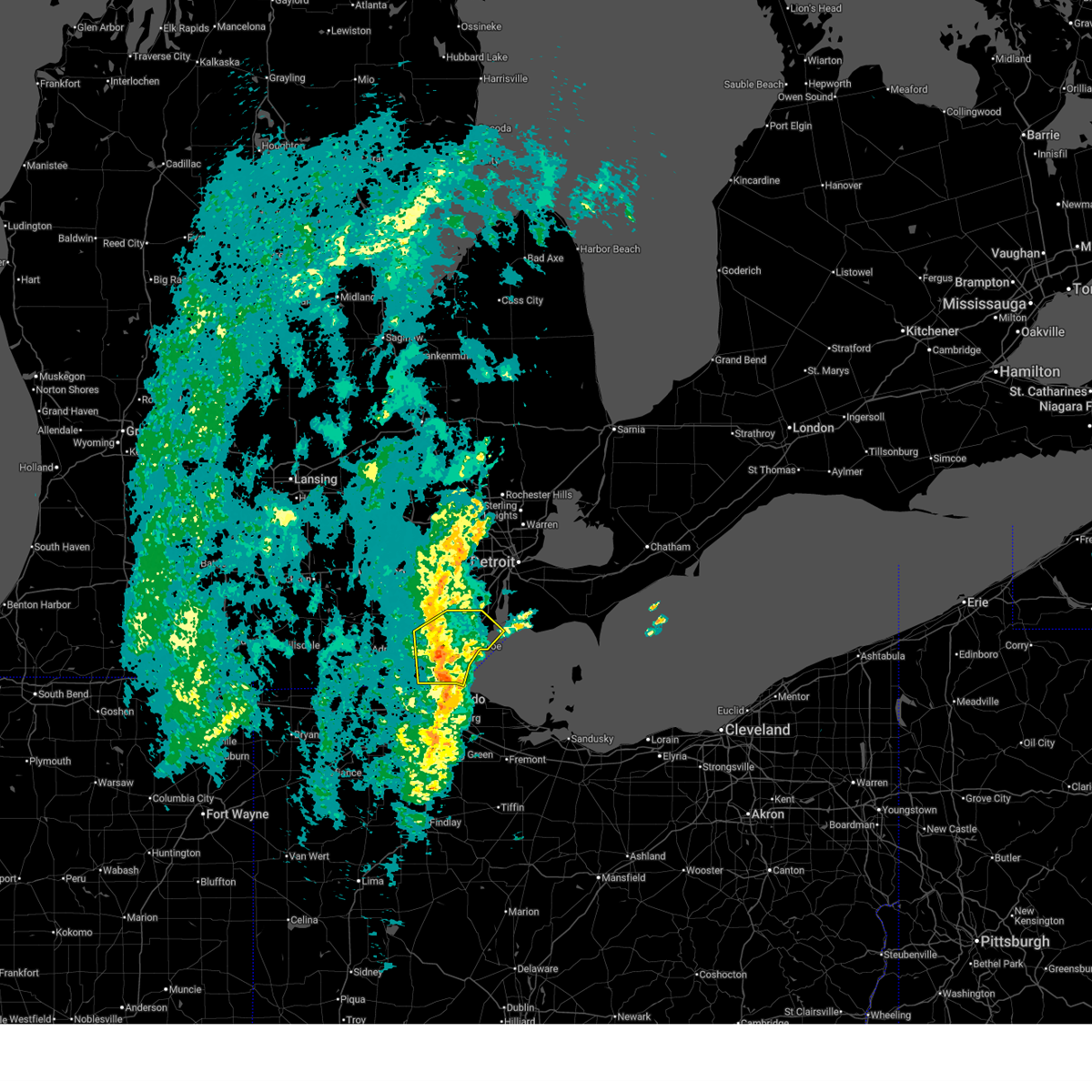
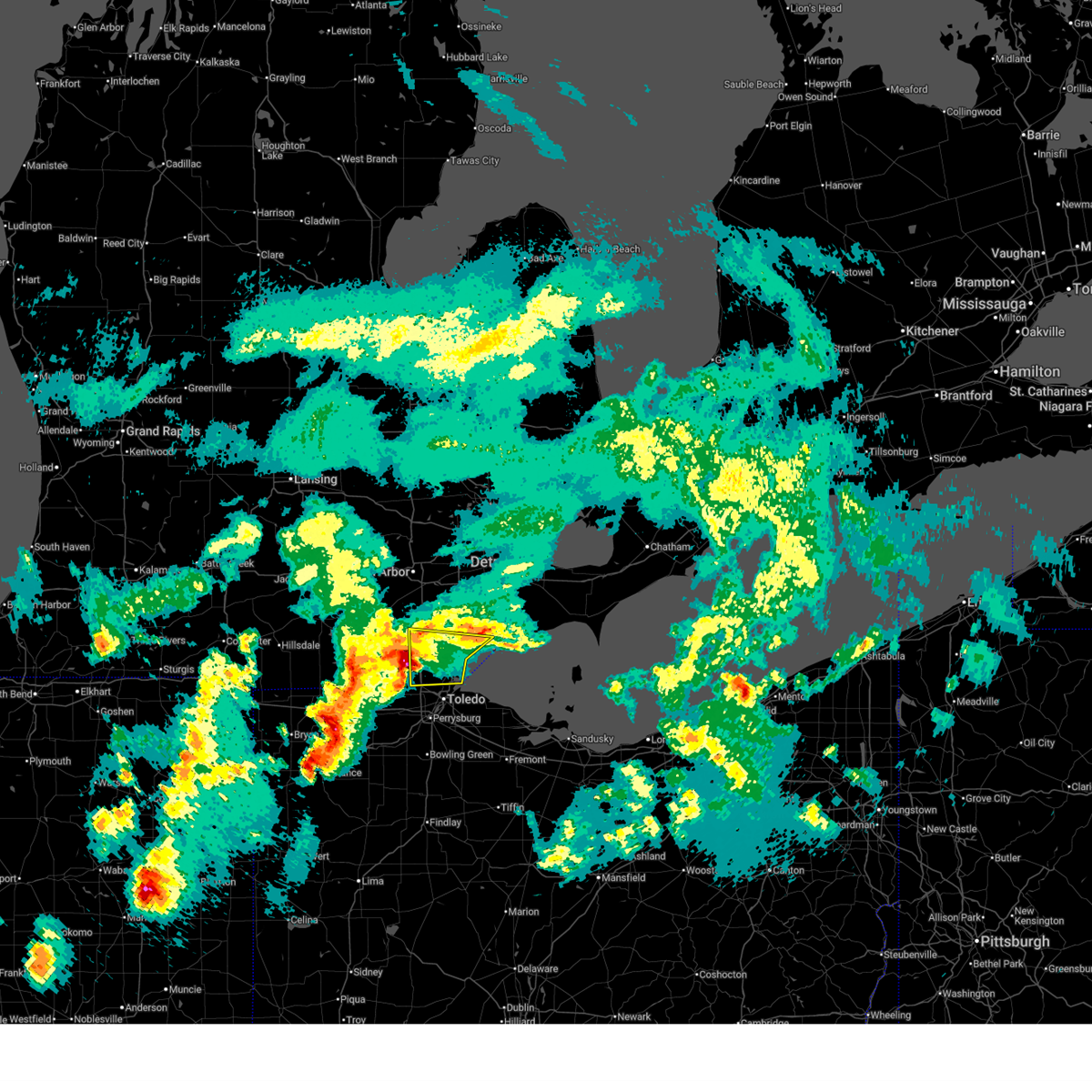
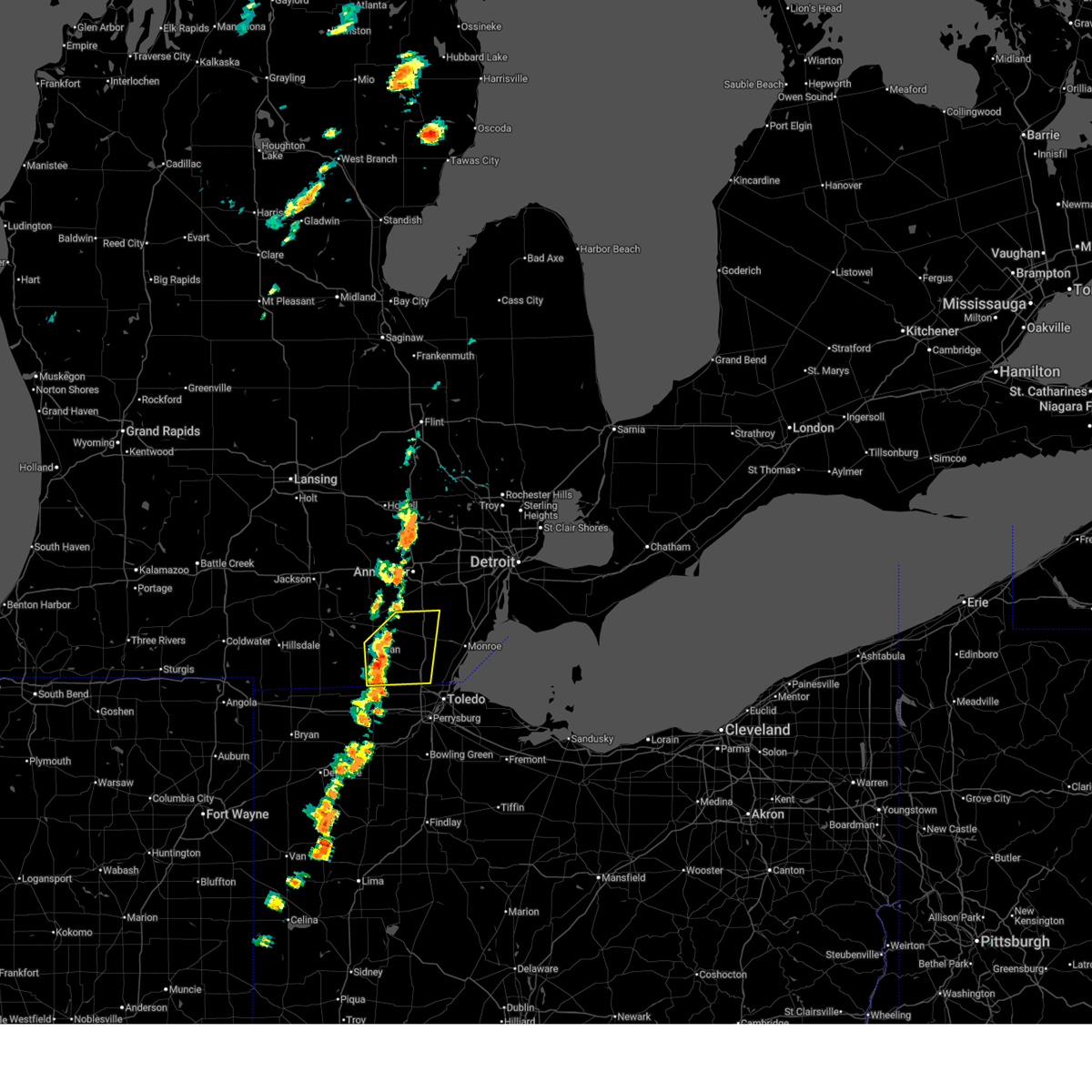
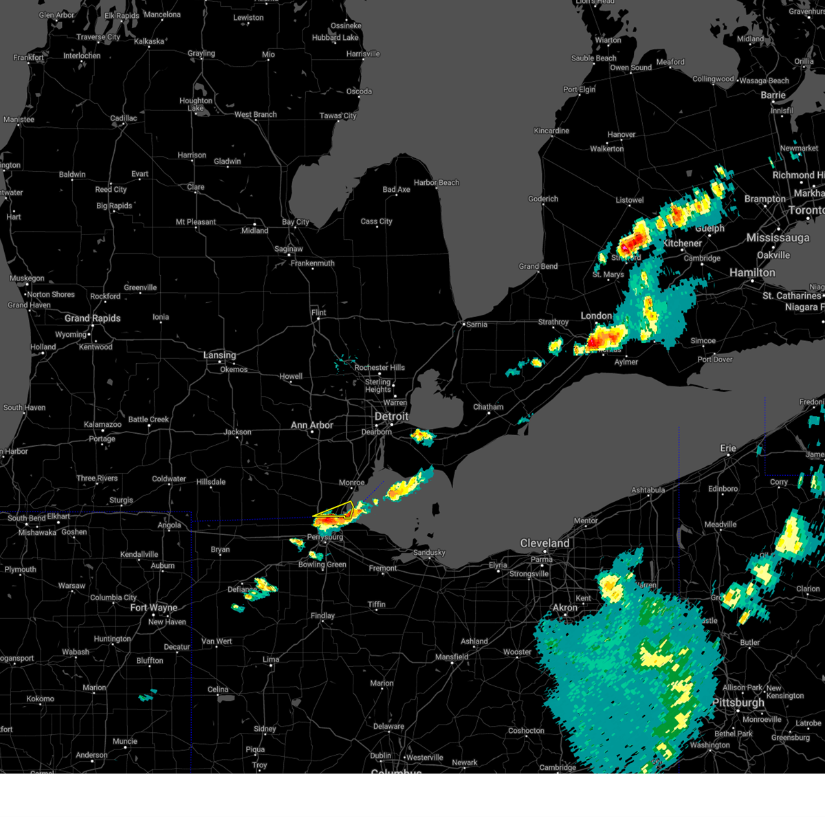
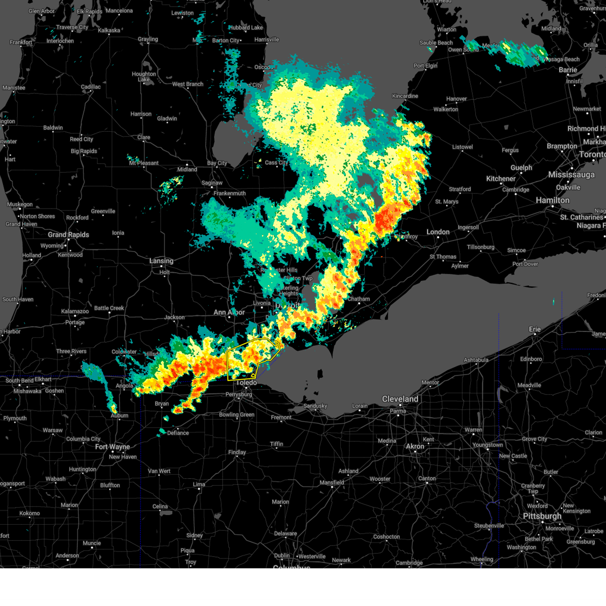
Hail Map for Lambertville, MI
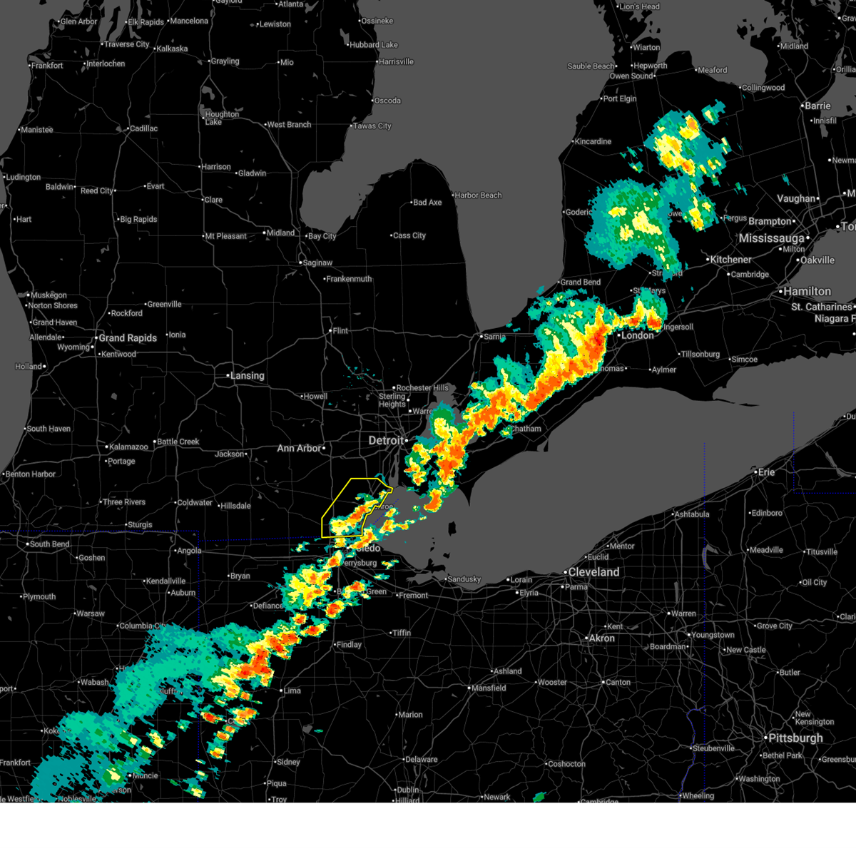
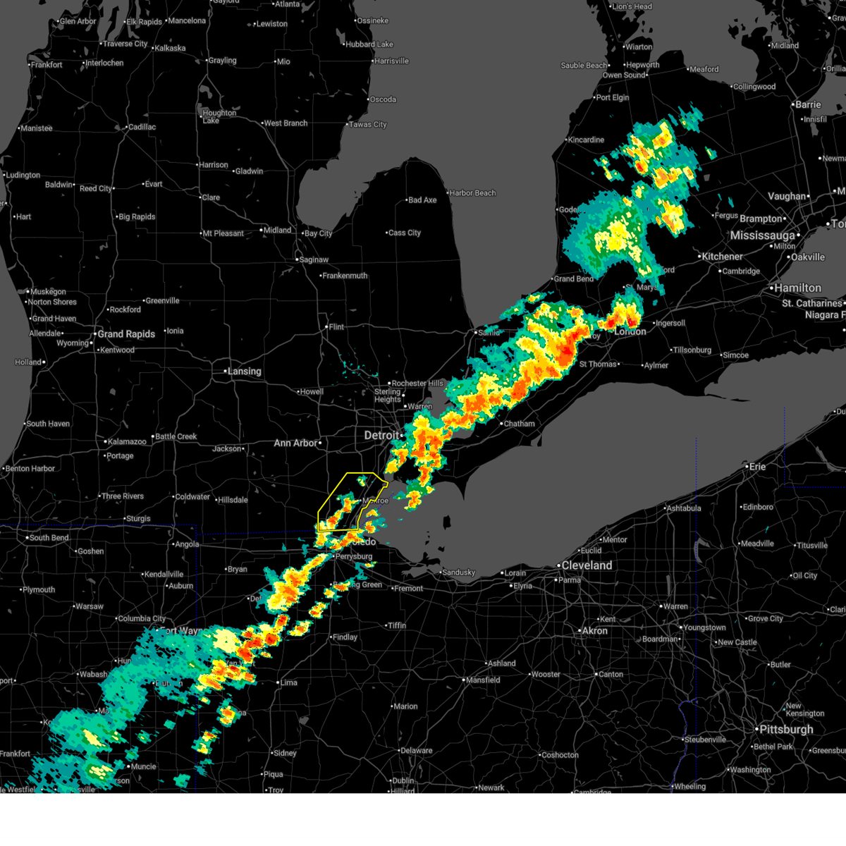
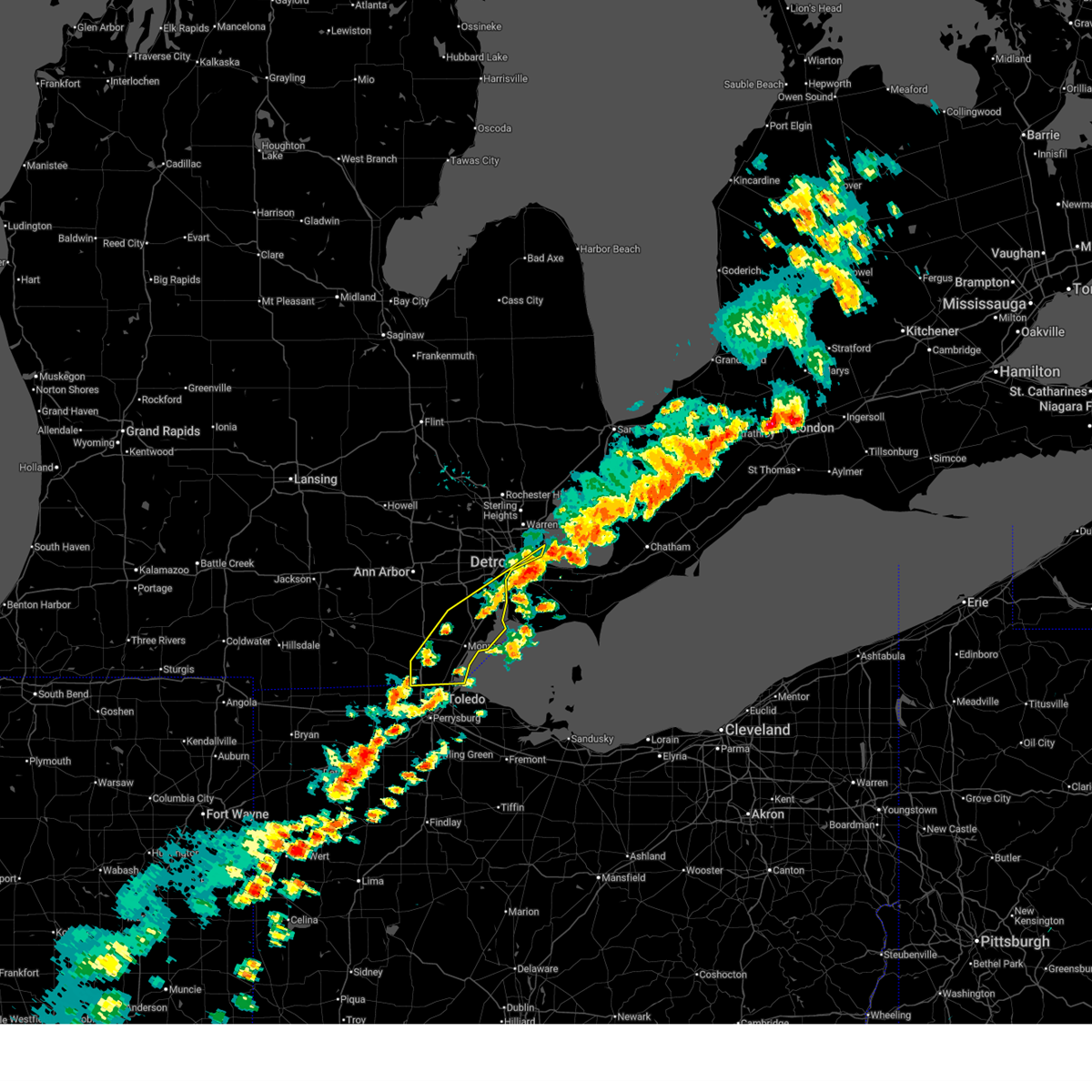
The Lambertville, MI area has had 2 reports of on-the-ground hail by trained spotters, and has been under severe weather warnings 30 times during the past 12 months. Doppler radar has detected hail at or near Lambertville, MI on 32 occasions, including 1 occasion during the past year.
| Name: | Lambertville, MI |
| Where Located: | 87.4 miles S of Flint, MI |
| Map: | Google Map for Lambertville, MI |
| Population: | 9953 |
| Housing Units: | 3880 |
| More Info: | Search Google for Lambertville, MI |
5
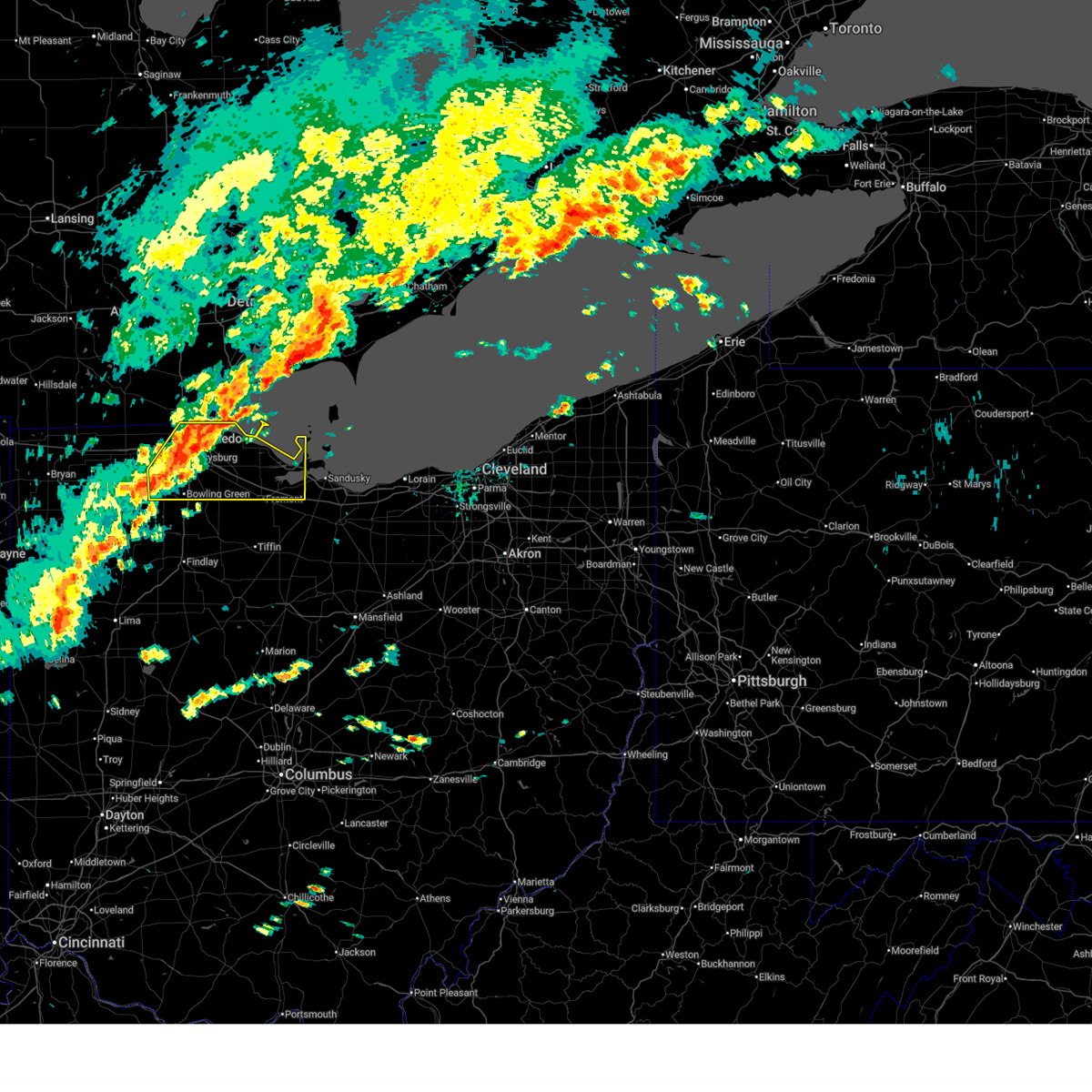
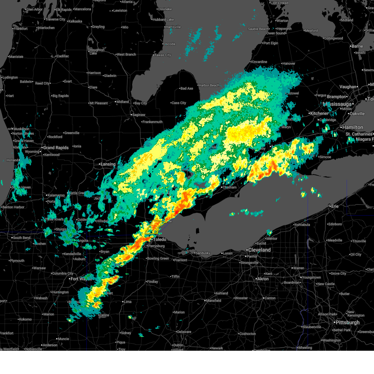
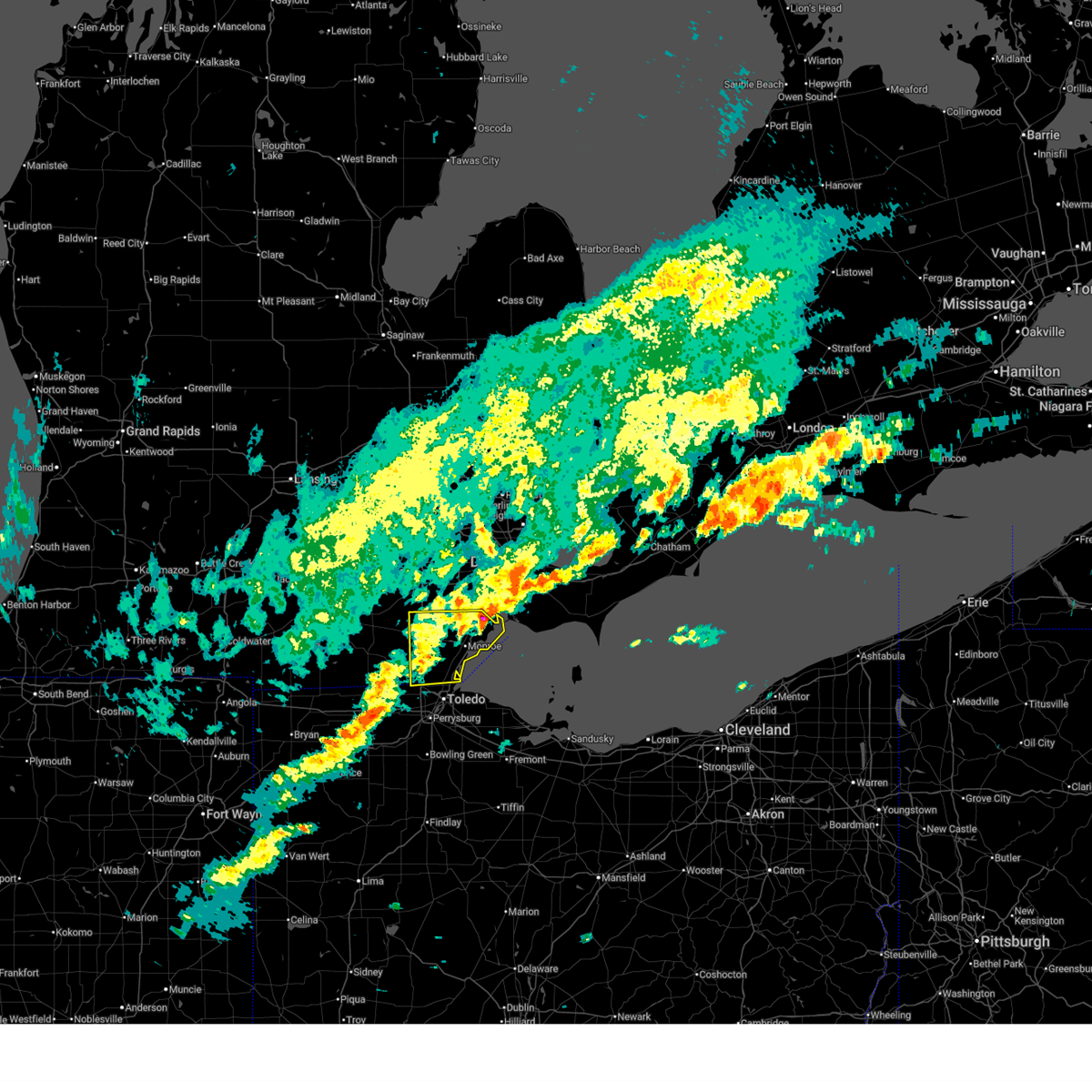
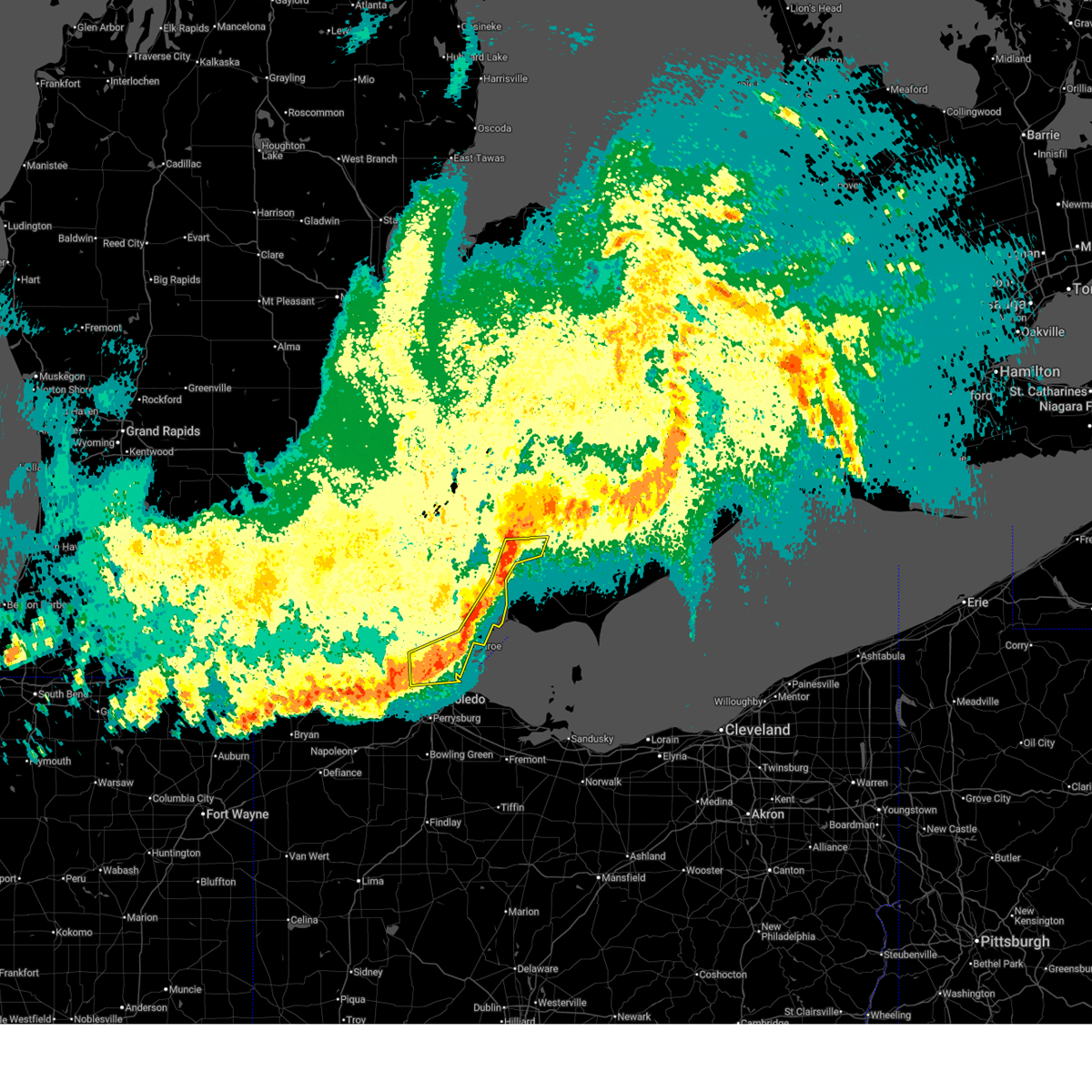
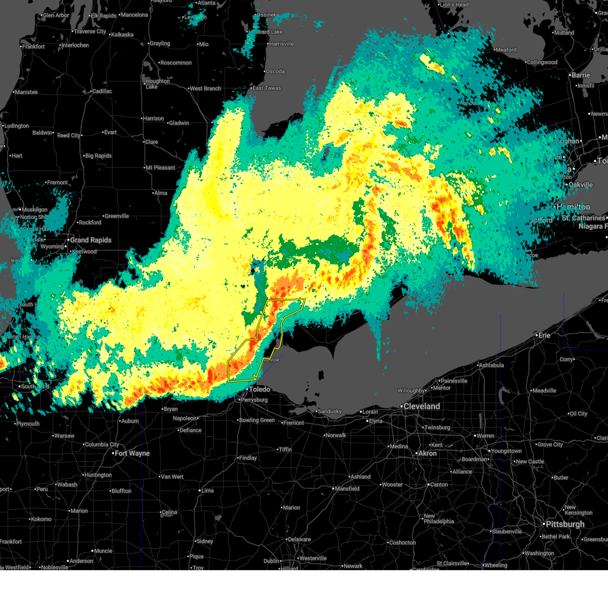
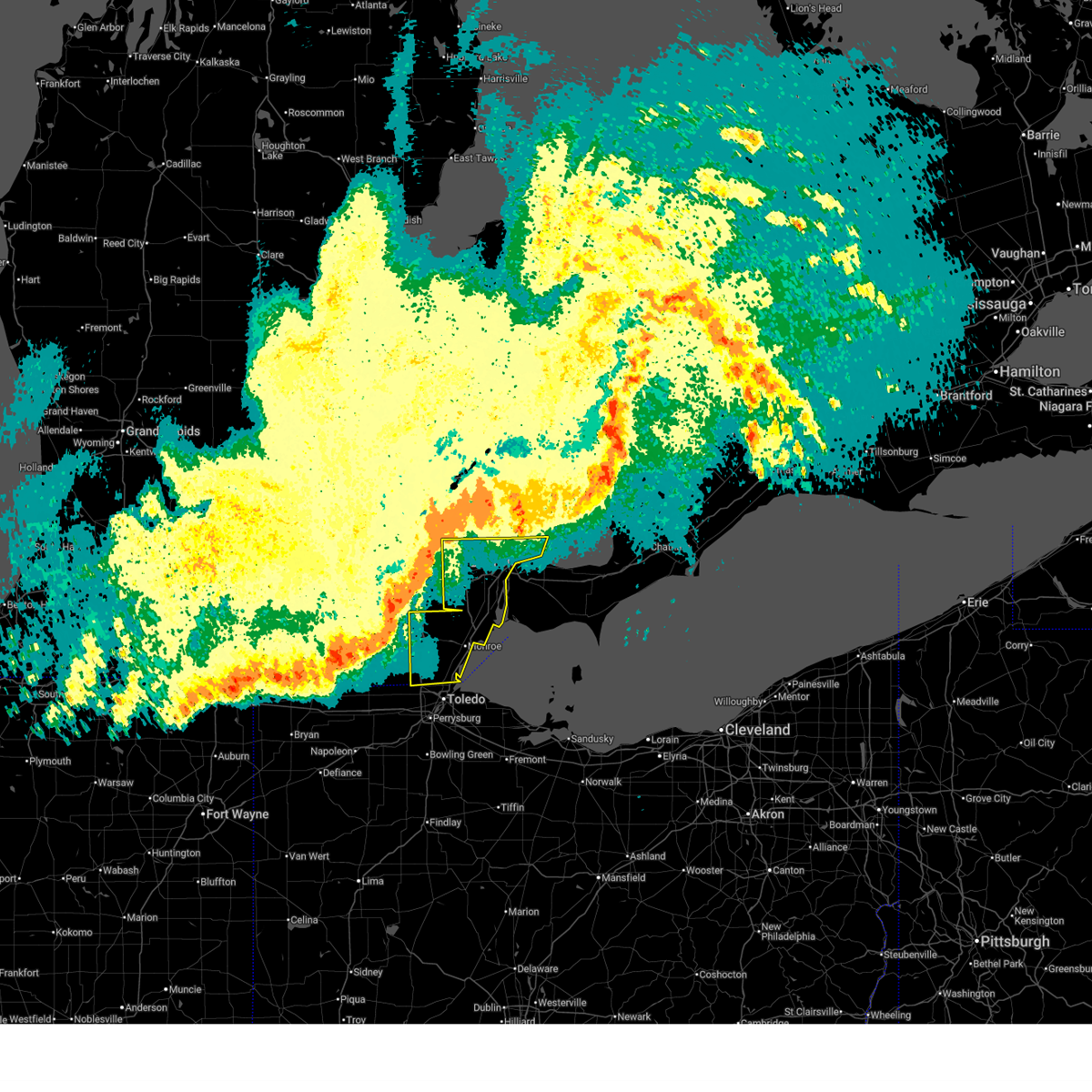
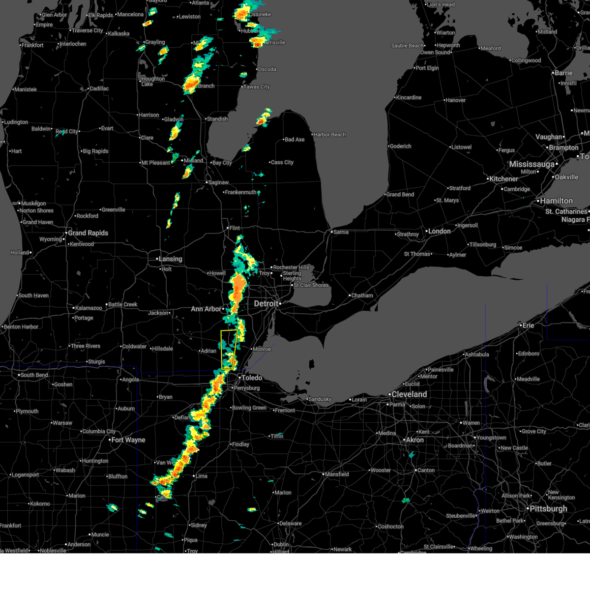
The Top Recent Hail Date for Lambertville, MI is Thursday, March 26, 2026 (1st out of 32)
Hail and Wind Damage Spotted near Lambertville, MI
| Date / Time | Report Details |
|---|---|
| 6/14/2026 1:15 PM EDT |
 Svrcle the national weather service in cleveland has issued a * severe thunderstorm warning for, ottawa county in northwestern ohio, central sandusky county in northwestern ohio, northern wood county in northwestern ohio, lucas county in northwestern ohio, * until 215 pm edt. * at 115 pm edt, a severe thunderstorm was located over rossford, or near toledo, moving east at 45 mph (radar indicated). Hazards include 60 mph wind gusts and penny size hail. expect damage to trees and power lines Svrcle the national weather service in cleveland has issued a * severe thunderstorm warning for, ottawa county in northwestern ohio, central sandusky county in northwestern ohio, northern wood county in northwestern ohio, lucas county in northwestern ohio, * until 215 pm edt. * at 115 pm edt, a severe thunderstorm was located over rossford, or near toledo, moving east at 45 mph (radar indicated). Hazards include 60 mph wind gusts and penny size hail. expect damage to trees and power lines
|
| 6/14/2026 1:07 PM EDT |
 At 107 pm edt, a severe thunderstorm was located over luna pier, or near monroe, moving east at 40 mph (radar indicated). Hazards include 60 mph wind gusts and quarter size hail. Hail damage to vehicles is expected. expect wind damage to roofs, siding, and trees. Locations impacted include, monroe, temperance, luna pier, lambertville, la salle, erie, samaria, toledo beach, and bolles harbor. At 107 pm edt, a severe thunderstorm was located over luna pier, or near monroe, moving east at 40 mph (radar indicated). Hazards include 60 mph wind gusts and quarter size hail. Hail damage to vehicles is expected. expect wind damage to roofs, siding, and trees. Locations impacted include, monroe, temperance, luna pier, lambertville, la salle, erie, samaria, toledo beach, and bolles harbor.
|
| 6/14/2026 12:49 PM EDT |
 At 1249 pm edt, a severe thunderstorm was located near flat rock, moving east at 40 mph (radar indicated). Hazards include 60 mph wind gusts and half dollar size hail. Hail damage to vehicles is expected. expect wind damage to roofs, siding, and trees. This severe thunderstorm will remain over mainly rural areas of monroe county, including the following locations, newport, cone, estral beach, toledo beach, erie, south rockwood, woodland beach, stony point, bolles harbor, and samaria. At 1249 pm edt, a severe thunderstorm was located near flat rock, moving east at 40 mph (radar indicated). Hazards include 60 mph wind gusts and half dollar size hail. Hail damage to vehicles is expected. expect wind damage to roofs, siding, and trees. This severe thunderstorm will remain over mainly rural areas of monroe county, including the following locations, newport, cone, estral beach, toledo beach, erie, south rockwood, woodland beach, stony point, bolles harbor, and samaria.
|
| 6/14/2026 12:40 PM EDT |
 Svrdtx the national weather service in detroit/pontiac has issued a * severe thunderstorm warning for, monroe county in southeastern michigan, * until 145 pm edt. * at 1240 pm edt, a severe thunderstorm was located over carleton, moving east at 35 mph (radar indicated). Hazards include 60 mph wind gusts and quarter size hail. Hail damage to vehicles is expected. expect wind damage to roofs, siding, and trees. this severe thunderstorm will be near, flat rock around 1245 pm edt. Other locations impacted by this severe thunderstorm include newport, cone, estral beach, toledo beach, erie, south rockwood, woodland beach, stony point, bolles harbor, and samaria. Svrdtx the national weather service in detroit/pontiac has issued a * severe thunderstorm warning for, monroe county in southeastern michigan, * until 145 pm edt. * at 1240 pm edt, a severe thunderstorm was located over carleton, moving east at 35 mph (radar indicated). Hazards include 60 mph wind gusts and quarter size hail. Hail damage to vehicles is expected. expect wind damage to roofs, siding, and trees. this severe thunderstorm will be near, flat rock around 1245 pm edt. Other locations impacted by this severe thunderstorm include newport, cone, estral beach, toledo beach, erie, south rockwood, woodland beach, stony point, bolles harbor, and samaria.
|
| 5/19/2026 5:44 PM EDT |
 The storm which prompted the warning has weakened below severe limits, and no longer poses an immediate threat to life or property. therefore, the warning will be allowed to expire. however, gusty winds are still possible with this thunderstorm. a severe thunderstorm watch remains in effect until 700 pm edt for southeastern michigan. The storm which prompted the warning has weakened below severe limits, and no longer poses an immediate threat to life or property. therefore, the warning will be allowed to expire. however, gusty winds are still possible with this thunderstorm. a severe thunderstorm watch remains in effect until 700 pm edt for southeastern michigan.
|
| 5/19/2026 5:32 PM EDT |
 At 532 pm edt, severe thunderstorms were located along a line extending from carleton to near ida to near temperance, moving northeast at 50 mph (radar indicated). Hazards include 60 mph wind gusts. Expect damage to roofs, siding, and trees. these severe storms will be near, monroe, flat rock, carleton, temperance, and ida around 535 pm edt. Other locations impacted by these severe thunderstorms include newport, estral beach, toledo beach, erie, south rockwood, woodland beach, stony point, bolles harbor, samaria, and scofield. At 532 pm edt, severe thunderstorms were located along a line extending from carleton to near ida to near temperance, moving northeast at 50 mph (radar indicated). Hazards include 60 mph wind gusts. Expect damage to roofs, siding, and trees. these severe storms will be near, monroe, flat rock, carleton, temperance, and ida around 535 pm edt. Other locations impacted by these severe thunderstorms include newport, estral beach, toledo beach, erie, south rockwood, woodland beach, stony point, bolles harbor, samaria, and scofield.
|
| 5/19/2026 5:24 PM EDT |
 At 524 pm edt, severe thunderstorms were located along a line extending from near maybee to near ida to ottawa lake, moving east at 40 mph (radar indicated). Hazards include 60 mph wind gusts. Expect damage to roofs, siding, and trees. these severe storms will be near, monroe, carleton, temperance, and lambertville around 530 pm edt. flat rock and luna pier around 535 pm edt. trenton around 545 pm edt. grosse ile around 550 pm edt. Other locations impacted by these severe thunderstorms include newport, gibraltar, erie, woodland beach, stony point, bolles harbor, rockwood, samaria, ecorse, and scofield. At 524 pm edt, severe thunderstorms were located along a line extending from near maybee to near ida to ottawa lake, moving east at 40 mph (radar indicated). Hazards include 60 mph wind gusts. Expect damage to roofs, siding, and trees. these severe storms will be near, monroe, carleton, temperance, and lambertville around 530 pm edt. flat rock and luna pier around 535 pm edt. trenton around 545 pm edt. grosse ile around 550 pm edt. Other locations impacted by these severe thunderstorms include newport, gibraltar, erie, woodland beach, stony point, bolles harbor, rockwood, samaria, ecorse, and scofield.
|
| 5/19/2026 5:08 PM EDT |
 At 508 pm edt, severe thunderstorms were located along a line extending from carleton to 6 miles southeast of flat rock to 7 miles southeast of monroe, moving northeast at 40 mph (radar indicated). Hazards include 60 mph wind gusts and penny size hail. Expect damage to roofs, siding, and trees. Locations impacted include, taylor, romulus, monroe, flat rock, grosse pointe, dundee, carleton, temperance, wyandotte, trenton, grosse ile, ida, luna pier, petersburg, maybee, belle isle, lambertville, ottawa lake, lincoln park, and southgate. At 508 pm edt, severe thunderstorms were located along a line extending from carleton to 6 miles southeast of flat rock to 7 miles southeast of monroe, moving northeast at 40 mph (radar indicated). Hazards include 60 mph wind gusts and penny size hail. Expect damage to roofs, siding, and trees. Locations impacted include, taylor, romulus, monroe, flat rock, grosse pointe, dundee, carleton, temperance, wyandotte, trenton, grosse ile, ida, luna pier, petersburg, maybee, belle isle, lambertville, ottawa lake, lincoln park, and southgate.
|
| 5/19/2026 4:52 PM EDT |
 Svrdtx the national weather service in detroit/pontiac has issued a * severe thunderstorm warning for, monroe county in southeastern michigan, southern wayne county in southeastern michigan, * until 545 pm edt. * at 452 pm edt, a cluster of severe thunderstorms was located along a line extending from near milan to near carleton to luna pier, moving northeast at 50 mph (radar indicated). Hazards include 60 mph wind gusts and penny size hail. Expect damage to roofs, siding, and trees. severe thunderstorms will be near, monroe, flat rock, carleton, and luna pier around 455 pm edt. trenton around 500 pm edt. taylor, romulus, and grosse ile around 505 pm edt. wyandotte around 510 pm edt. belle isle around 525 pm edt. grosse pointe around 530 pm edt. Other locations impacted by these severe thunderstorms include newport, gibraltar, erie, woodland beach, stony point, bolles harbor, rockwood, samaria, azalia, and ecorse. Svrdtx the national weather service in detroit/pontiac has issued a * severe thunderstorm warning for, monroe county in southeastern michigan, southern wayne county in southeastern michigan, * until 545 pm edt. * at 452 pm edt, a cluster of severe thunderstorms was located along a line extending from near milan to near carleton to luna pier, moving northeast at 50 mph (radar indicated). Hazards include 60 mph wind gusts and penny size hail. Expect damage to roofs, siding, and trees. severe thunderstorms will be near, monroe, flat rock, carleton, and luna pier around 455 pm edt. trenton around 500 pm edt. taylor, romulus, and grosse ile around 505 pm edt. wyandotte around 510 pm edt. belle isle around 525 pm edt. grosse pointe around 530 pm edt. Other locations impacted by these severe thunderstorms include newport, gibraltar, erie, woodland beach, stony point, bolles harbor, rockwood, samaria, azalia, and ecorse.
|
| 5/18/2026 5:11 PM EDT |
 The storms which prompted the warning have weakened below severe limits, and will exit the warned area shortly. therefore, the warning will be allowed to expire. however, gusty winds and heavy rain are still possible with these additional thunderstorms. a severe thunderstorm watch remains in effect until 800 pm edt for southeastern michigan. The storms which prompted the warning have weakened below severe limits, and will exit the warned area shortly. therefore, the warning will be allowed to expire. however, gusty winds and heavy rain are still possible with these additional thunderstorms. a severe thunderstorm watch remains in effect until 800 pm edt for southeastern michigan.
|
| 5/18/2026 5:07 PM EDT |
 At 507 pm edt, severe thunderstorms were located along a line extending from near lambertville to near waterville, moving northeast at 35 mph (radar indicated). Hazards include 60 mph wind gusts. Expect damage to trees and power lines. Locations impacted include, toledo, bowling green, perrysburg, oregon, rossford, waterville, northwood, holland, maumee, ottawa hills, walbridge, millbury, haskins, luckey, tontogany, harbor view, and stony ridge. At 507 pm edt, severe thunderstorms were located along a line extending from near lambertville to near waterville, moving northeast at 35 mph (radar indicated). Hazards include 60 mph wind gusts. Expect damage to trees and power lines. Locations impacted include, toledo, bowling green, perrysburg, oregon, rossford, waterville, northwood, holland, maumee, ottawa hills, walbridge, millbury, haskins, luckey, tontogany, harbor view, and stony ridge.
|
| 5/18/2026 4:56 PM EDT |
 At 456 pm edt, severe thunderstorms were located along a line extending from near milan to ida to toledo, moving east at 45 mph (radar indicated). Hazards include 60 mph wind gusts. Expect damage to roofs, siding, and trees. these severe storms will be near, monroe, temperance, ida, luna pier, and maybee around 500 pm edt. carleton around 505 pm edt. flat rock around 515 pm edt. Other locations impacted by these severe thunderstorms include newport, cone, estral beach, toledo beach, erie, south rockwood, woodland beach, stony point, bolles harbor, and samaria. At 456 pm edt, severe thunderstorms were located along a line extending from near milan to ida to toledo, moving east at 45 mph (radar indicated). Hazards include 60 mph wind gusts. Expect damage to roofs, siding, and trees. these severe storms will be near, monroe, temperance, ida, luna pier, and maybee around 500 pm edt. carleton around 505 pm edt. flat rock around 515 pm edt. Other locations impacted by these severe thunderstorms include newport, cone, estral beach, toledo beach, erie, south rockwood, woodland beach, stony point, bolles harbor, and samaria.
|
| 5/18/2026 4:32 PM EDT |
 At 432 pm edt, severe thunderstorms were located along a line extending from near belleville to near monroe to near sylvania, moving northeast at 50 mph (radar indicated). Hazards include 60 mph wind gusts. Expect damage to roofs, siding, and trees. these severe storms will be near, monroe, carleton, temperance, and ida around 435 pm edt. flat rock around 440 pm edt. Other locations impacted by these severe thunderstorms include newport, cone, estral beach, toledo beach, erie, south rockwood, woodland beach, stony point, bolles harbor, and samaria. At 432 pm edt, severe thunderstorms were located along a line extending from near belleville to near monroe to near sylvania, moving northeast at 50 mph (radar indicated). Hazards include 60 mph wind gusts. Expect damage to roofs, siding, and trees. these severe storms will be near, monroe, carleton, temperance, and ida around 435 pm edt. flat rock around 440 pm edt. Other locations impacted by these severe thunderstorms include newport, cone, estral beach, toledo beach, erie, south rockwood, woodland beach, stony point, bolles harbor, and samaria.
|
| 5/18/2026 4:15 PM EDT |
 At 415 pm edt, a severe thunderstorm was located over ida, or near dundee, moving northeast at 40 mph (radar indicated). Hazards include 60 mph wind gusts. Expect damage to roofs, siding, and trees. this severe storm will be near, monroe, dundee, ida, and maybee around 420 pm edt. carleton around 425 pm edt. flat rock around 435 pm edt. Other locations impacted by this severe thunderstorm include newport, cone, estral beach, toledo beach, erie, south rockwood, woodland beach, stony point, bolles harbor, and samaria. At 415 pm edt, a severe thunderstorm was located over ida, or near dundee, moving northeast at 40 mph (radar indicated). Hazards include 60 mph wind gusts. Expect damage to roofs, siding, and trees. this severe storm will be near, monroe, dundee, ida, and maybee around 420 pm edt. carleton around 425 pm edt. flat rock around 435 pm edt. Other locations impacted by this severe thunderstorm include newport, cone, estral beach, toledo beach, erie, south rockwood, woodland beach, stony point, bolles harbor, and samaria.
|
| 5/18/2026 4:00 PM EDT |
 Svrdtx the national weather service in detroit/pontiac has issued a * severe thunderstorm warning for, monroe county in southeastern michigan, * until 515 pm edt. * at 400 pm edt, a severe thunderstorm was located near blissfield, moving northeast at 40 mph (radar indicated). Hazards include 60 mph wind gusts. Expect damage to roofs, siding, and trees. this severe thunderstorm will be near, petersburg and ottawa lake around 405 pm edt. temperance around 410 pm edt. dundee, ida, and lambertville around 415 pm edt. monroe and maybee around 425 pm edt. carleton around 435 pm edt. flat rock around 445 pm edt. Other locations impacted by this severe thunderstorm include newport, cone, estral beach, toledo beach, erie, south rockwood, woodland beach, stony point, bolles harbor, and samaria. Svrdtx the national weather service in detroit/pontiac has issued a * severe thunderstorm warning for, monroe county in southeastern michigan, * until 515 pm edt. * at 400 pm edt, a severe thunderstorm was located near blissfield, moving northeast at 40 mph (radar indicated). Hazards include 60 mph wind gusts. Expect damage to roofs, siding, and trees. this severe thunderstorm will be near, petersburg and ottawa lake around 405 pm edt. temperance around 410 pm edt. dundee, ida, and lambertville around 415 pm edt. monroe and maybee around 425 pm edt. carleton around 435 pm edt. flat rock around 445 pm edt. Other locations impacted by this severe thunderstorm include newport, cone, estral beach, toledo beach, erie, south rockwood, woodland beach, stony point, bolles harbor, and samaria.
|
| 4/15/2026 2:24 AM EDT |
 At 223 am edt, severe thunderstorms were located along a line extending from near grosse pointe to near grosse ile to near temperance, moving east at 65 mph (radar indicated). Hazards include 60 mph wind gusts. Expect damage to roofs, siding, and trees. These severe thunderstorms will remain over eastern portions of monroe and central wayne counties, including the following locations, newport, melvindale, gibraltar, erie, woodland beach, stony point, bolles harbor, rockwood, samaria, and harper woods. At 223 am edt, severe thunderstorms were located along a line extending from near grosse pointe to near grosse ile to near temperance, moving east at 65 mph (radar indicated). Hazards include 60 mph wind gusts. Expect damage to roofs, siding, and trees. These severe thunderstorms will remain over eastern portions of monroe and central wayne counties, including the following locations, newport, melvindale, gibraltar, erie, woodland beach, stony point, bolles harbor, rockwood, samaria, and harper woods.
|
| 4/15/2026 2:13 AM EDT |
 At 213 am edt, severe thunderstorms were located along a line extending from near detroit to near carleton to near ottawa lake, moving east at 55 mph (radar indicated). Hazards include 60 mph wind gusts. Expect damage to roofs, siding, and trees. these severe storms will be near, taylor, monroe, flat rock, grosse pointe, carleton, downtown detroit, temperance, detroit, dearborn, and wyandotte around 220 am edt. Other locations impacted by these severe thunderstorms include newport, melvindale, gibraltar, new boston, erie, woodland beach, stony point, bolles harbor, rockwood, and samaria. At 213 am edt, severe thunderstorms were located along a line extending from near detroit to near carleton to near ottawa lake, moving east at 55 mph (radar indicated). Hazards include 60 mph wind gusts. Expect damage to roofs, siding, and trees. these severe storms will be near, taylor, monroe, flat rock, grosse pointe, carleton, downtown detroit, temperance, detroit, dearborn, and wyandotte around 220 am edt. Other locations impacted by these severe thunderstorms include newport, melvindale, gibraltar, new boston, erie, woodland beach, stony point, bolles harbor, rockwood, and samaria.
|
| 4/15/2026 1:51 AM EDT |
 Svrdtx the national weather service in detroit/pontiac has issued a * severe thunderstorm warning for, monroe county in southeastern michigan, wayne county in southeastern michigan, * until 245 am edt. * at 150 am edt, severe thunderstorms were located along a line extending from near salem to saline to adrian, moving east at 65 mph (radar indicated). Hazards include 60 mph wind gusts. Expect damage to roofs, siding, and trees. severe thunderstorms will be near, livonia, milan, canton, and belleville around 155 am edt. romulus, dundee, and petersburg around 200 am edt. taylor, carleton, dearborn, ida, maybee, and greenfield village around 205 am edt. monroe, flat rock, temperance, wyandotte, and trenton around 210 am edt. downtown detroit, grosse ile, and luna pier around 215 am edt. belle isle around 220 am edt. Other locations impacted by these severe thunderstorms include melvindale, gibraltar, erie, stony point, samaria, harper woods, azalia, westland, grosse pointe shores, and scofield. Svrdtx the national weather service in detroit/pontiac has issued a * severe thunderstorm warning for, monroe county in southeastern michigan, wayne county in southeastern michigan, * until 245 am edt. * at 150 am edt, severe thunderstorms were located along a line extending from near salem to saline to adrian, moving east at 65 mph (radar indicated). Hazards include 60 mph wind gusts. Expect damage to roofs, siding, and trees. severe thunderstorms will be near, livonia, milan, canton, and belleville around 155 am edt. romulus, dundee, and petersburg around 200 am edt. taylor, carleton, dearborn, ida, maybee, and greenfield village around 205 am edt. monroe, flat rock, temperance, wyandotte, and trenton around 210 am edt. downtown detroit, grosse ile, and luna pier around 215 am edt. belle isle around 220 am edt. Other locations impacted by these severe thunderstorms include melvindale, gibraltar, erie, stony point, samaria, harper woods, azalia, westland, grosse pointe shores, and scofield.
|
| 4/13/2026 8:29 PM EDT |
 Svrcle the national weather service in cleveland has issued a * severe thunderstorm warning for, northeastern lucas county in northwestern ohio, * until 915 pm edt. * at 829 pm edt, a severe thunderstorm was located over oregon, or near toledo, moving east at 45 mph (radar indicated). Hazards include 60 mph wind gusts and quarter size hail. Minor damage to vehicles is possible. Expect damage to trees and power lines. Svrcle the national weather service in cleveland has issued a * severe thunderstorm warning for, northeastern lucas county in northwestern ohio, * until 915 pm edt. * at 829 pm edt, a severe thunderstorm was located over oregon, or near toledo, moving east at 45 mph (radar indicated). Hazards include 60 mph wind gusts and quarter size hail. Minor damage to vehicles is possible. Expect damage to trees and power lines.
|
| 4/4/2026 3:29 PM EDT |
 the severe thunderstorm warning has been cancelled and is no longer in effect the severe thunderstorm warning has been cancelled and is no longer in effect
|
| 4/4/2026 3:29 PM EDT |
 At 328 pm edt, a severe thunderstorm was located near ida, or near temperance, moving northeast at 50 mph (radar indicated). Hazards include 60 mph wind gusts. Expect damage to roofs, siding, and trees. this severe storm will be near, monroe and maybee around 335 pm edt. carleton around 340 pm edt. flat rock around 345 pm edt. Other locations impacted by this severe thunderstorm include newport, estral beach, toledo beach, erie, south rockwood, woodland beach, stony point, bolles harbor, samaria, and azalia. At 328 pm edt, a severe thunderstorm was located near ida, or near temperance, moving northeast at 50 mph (radar indicated). Hazards include 60 mph wind gusts. Expect damage to roofs, siding, and trees. this severe storm will be near, monroe and maybee around 335 pm edt. carleton around 340 pm edt. flat rock around 345 pm edt. Other locations impacted by this severe thunderstorm include newport, estral beach, toledo beach, erie, south rockwood, woodland beach, stony point, bolles harbor, samaria, and azalia.
|
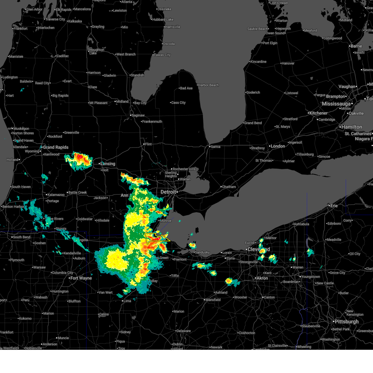
| 4/4/2026 3:20 PM EDT | Numerous trees downed in the vicinity of piehl rd... summerfield rd... erie rd... and st. anthony rd. damage to two homes reported on piehl r in monroe county MI, 3.8 miles SE of Lambertville, MI |
| 4/4/2026 3:13 PM EDT |
 Svrdtx the national weather service in detroit/pontiac has issued a * severe thunderstorm warning for, monroe county in southeastern michigan, southeastern lenawee county in southeastern michigan, * until 415 pm edt. * at 313 pm edt, a severe thunderstorm was located over sylvania, or 8 miles northwest of toledo, moving northeast at 40 mph (radar indicated). Hazards include 60 mph wind gusts. Expect damage to roofs, siding, and trees. this severe thunderstorm will be near, temperance and lambertville around 320 pm edt. ida and luna pier around 325 pm edt. monroe around 335 pm edt. flat rock around 355 pm edt. Other locations impacted by this severe thunderstorm include newport, estral beach, toledo beach, erie, south rockwood, woodland beach, stony point, bolles harbor, samaria, and azalia. Svrdtx the national weather service in detroit/pontiac has issued a * severe thunderstorm warning for, monroe county in southeastern michigan, southeastern lenawee county in southeastern michigan, * until 415 pm edt. * at 313 pm edt, a severe thunderstorm was located over sylvania, or 8 miles northwest of toledo, moving northeast at 40 mph (radar indicated). Hazards include 60 mph wind gusts. Expect damage to roofs, siding, and trees. this severe thunderstorm will be near, temperance and lambertville around 320 pm edt. ida and luna pier around 325 pm edt. monroe around 335 pm edt. flat rock around 355 pm edt. Other locations impacted by this severe thunderstorm include newport, estral beach, toledo beach, erie, south rockwood, woodland beach, stony point, bolles harbor, samaria, and azalia.
|
| 3/31/2026 3:46 PM EDT |
 Svrcle the national weather service in cleveland has issued a * severe thunderstorm warning for, ottawa county in northwestern ohio, northwestern sandusky county in northwestern ohio, northeastern wood county in northwestern ohio, lucas county in northwestern ohio, * until 445 pm edt. * at 346 pm edt, severe thunderstorms were located along a line extending from near temperance to perrysburg to near bowling green, moving northeast at 55 mph (radar indicated). Hazards include 70 mph wind gusts and penny size hail. Expect considerable tree damage. Damage is likely to mobile homes, roofs, and outbuildings. Svrcle the national weather service in cleveland has issued a * severe thunderstorm warning for, ottawa county in northwestern ohio, northwestern sandusky county in northwestern ohio, northeastern wood county in northwestern ohio, lucas county in northwestern ohio, * until 445 pm edt. * at 346 pm edt, severe thunderstorms were located along a line extending from near temperance to perrysburg to near bowling green, moving northeast at 55 mph (radar indicated). Hazards include 70 mph wind gusts and penny size hail. Expect considerable tree damage. Damage is likely to mobile homes, roofs, and outbuildings.
|
| 3/26/2026 7:28 PM EDT |
 At 728 pm edt, a severe thunderstorm was located near luna pier, or 8 miles east of temperance, moving east at 60 mph (radar indicated). Hazards include 60 mph wind gusts and quarter size hail. Hail damage to vehicles is expected. expect wind damage to roofs, siding, and trees. This severe thunderstorm will remain over mainly rural areas of monroe county, including the following locations, samaria, toledo beach, erie, woodland beach, stony point, la salle, bolles harbor, and detroit beach. At 728 pm edt, a severe thunderstorm was located near luna pier, or 8 miles east of temperance, moving east at 60 mph (radar indicated). Hazards include 60 mph wind gusts and quarter size hail. Hail damage to vehicles is expected. expect wind damage to roofs, siding, and trees. This severe thunderstorm will remain over mainly rural areas of monroe county, including the following locations, samaria, toledo beach, erie, woodland beach, stony point, la salle, bolles harbor, and detroit beach.
|
| 3/26/2026 7:22 PM EDT | Quarter sized hail reported 2.7 miles SSE of Lambertville, MI, spotter called reporting 1 inch diameter hail for approximately 5 minutes. |
| 3/26/2026 7:17 PM EDT | Quarter sized hail reported 7.3 miles SE of Lambertville, MI, report relayed via social media with image of measured hailstone. |
| 3/26/2026 7:11 PM EDT |
 Svrdtx the national weather service in detroit/pontiac has issued a * severe thunderstorm warning for, monroe county in southeastern michigan, * until 815 pm edt. * at 711 pm edt, a severe thunderstorm was located near deerfield, or near blissfield, moving east at 65 mph (radar indicated). Hazards include 60 mph wind gusts and quarter size hail. Hail damage to vehicles is expected. expect wind damage to roofs, siding, and trees. this severe thunderstorm will be near, temperance, ida, petersburg, lambertville, and ottawa lake around 715 pm edt. luna pier around 720 pm edt. Other locations impacted by this severe thunderstorm include samaria, toledo beach, erie, woodland beach, stony point, la salle, bolles harbor, and detroit beach. Svrdtx the national weather service in detroit/pontiac has issued a * severe thunderstorm warning for, monroe county in southeastern michigan, * until 815 pm edt. * at 711 pm edt, a severe thunderstorm was located near deerfield, or near blissfield, moving east at 65 mph (radar indicated). Hazards include 60 mph wind gusts and quarter size hail. Hail damage to vehicles is expected. expect wind damage to roofs, siding, and trees. this severe thunderstorm will be near, temperance, ida, petersburg, lambertville, and ottawa lake around 715 pm edt. luna pier around 720 pm edt. Other locations impacted by this severe thunderstorm include samaria, toledo beach, erie, woodland beach, stony point, la salle, bolles harbor, and detroit beach.
|
| 7/12/2025 12:50 PM EDT |
 The storms which prompted the warning have weakened below severe limits, and have exited the warned area. therefore, the warning will be allowed to expire. however, heavy rain is still possible with these thunderstorms. The storms which prompted the warning have weakened below severe limits, and have exited the warned area. therefore, the warning will be allowed to expire. however, heavy rain is still possible with these thunderstorms.
|
| 7/12/2025 12:40 PM EDT |
 At 1240 pm edt, severe thunderstorms were located along a line extending from near milan to near dundee to sylvania, moving northeast at 25 mph (radar indicated). Hazards include 60 mph wind gusts. Expect damage to roofs, siding, and trees. these severe storms will be near, dundee around 1245 pm edt. Other locations impacted by these severe thunderstorms include oakville, azalia, and cone. At 1240 pm edt, severe thunderstorms were located along a line extending from near milan to near dundee to sylvania, moving northeast at 25 mph (radar indicated). Hazards include 60 mph wind gusts. Expect damage to roofs, siding, and trees. these severe storms will be near, dundee around 1245 pm edt. Other locations impacted by these severe thunderstorms include oakville, azalia, and cone.
|
| 7/12/2025 12:40 PM EDT |
 the severe thunderstorm warning has been cancelled and is no longer in effect the severe thunderstorm warning has been cancelled and is no longer in effect
|
| 7/12/2025 12:23 PM EDT |
 At 1222 pm edt, severe thunderstorms were located along a line extending from near milan to near britton to 8 miles south of blissfield, moving northeast at 40 mph (radar indicated). Hazards include 60 mph wind gusts. Expect damage to roofs, siding, and trees. these severe storms will be near, milan, dundee, blissfield, petersburg, deerfield, and ottawa lake around 1230 pm edt. other locations impacted by these severe thunderstorms include azalia, cone, ogden center, riga, oakville, ridgeway, palmyra, holloway, and macon. People attending ellis park and bachmayer park should seek safe shelter immediately!. At 1222 pm edt, severe thunderstorms were located along a line extending from near milan to near britton to 8 miles south of blissfield, moving northeast at 40 mph (radar indicated). Hazards include 60 mph wind gusts. Expect damage to roofs, siding, and trees. these severe storms will be near, milan, dundee, blissfield, petersburg, deerfield, and ottawa lake around 1230 pm edt. other locations impacted by these severe thunderstorms include azalia, cone, ogden center, riga, oakville, ridgeway, palmyra, holloway, and macon. People attending ellis park and bachmayer park should seek safe shelter immediately!.
|
| 7/12/2025 12:06 PM EDT |
 Svrdtx the national weather service in detroit/pontiac has issued a * severe thunderstorm warning for, western monroe county in southeastern michigan, eastern lenawee county in southeastern michigan, * until 100 pm edt. * at 1206 pm edt, severe thunderstorms were located along a line extending from near adrian to near blissfield to near delta, moving northeast at 25 mph (radar indicated). Hazards include 60 mph wind gusts. Expect damage to roofs, siding, and trees. severe thunderstorms will be near, tecumseh and blissfield around 1210 pm edt. deerfield and britton around 1215 pm edt. petersburg and ottawa lake around 1225 pm edt. dundee around 1230 pm edt. milan around 1235 pm edt. other locations impacted by these severe thunderstorms include jasper, azalia, cone, macon, ogden center, riga, oakville, ridgeway, palmyra, and fairfield. People attending ellis park and bachmayer park should seek safe shelter immediately!. Svrdtx the national weather service in detroit/pontiac has issued a * severe thunderstorm warning for, western monroe county in southeastern michigan, eastern lenawee county in southeastern michigan, * until 100 pm edt. * at 1206 pm edt, severe thunderstorms were located along a line extending from near adrian to near blissfield to near delta, moving northeast at 25 mph (radar indicated). Hazards include 60 mph wind gusts. Expect damage to roofs, siding, and trees. severe thunderstorms will be near, tecumseh and blissfield around 1210 pm edt. deerfield and britton around 1215 pm edt. petersburg and ottawa lake around 1225 pm edt. dundee around 1230 pm edt. milan around 1235 pm edt. other locations impacted by these severe thunderstorms include jasper, azalia, cone, macon, ogden center, riga, oakville, ridgeway, palmyra, and fairfield. People attending ellis park and bachmayer park should seek safe shelter immediately!.
|
| 6/18/2025 7:42 PM EDT |
 At 742 pm edt, severe thunderstorms were located along a line extending from near ann arbor to near dundee to near lambertville, moving northeast at 50 mph (radar indicated). Hazards include 60 mph wind gusts. Expect damage to roofs, siding, and trees. these severe storms will be near, monroe, temperance, ida, luna pier, and maybee around 750 pm edt. carleton around 755 pm edt. Other locations impacted by these severe thunderstorms include newport, cone, estral beach, toledo beach, erie, south rockwood, woodland beach, stony point, bolles harbor, and samaria. At 742 pm edt, severe thunderstorms were located along a line extending from near ann arbor to near dundee to near lambertville, moving northeast at 50 mph (radar indicated). Hazards include 60 mph wind gusts. Expect damage to roofs, siding, and trees. these severe storms will be near, monroe, temperance, ida, luna pier, and maybee around 750 pm edt. carleton around 755 pm edt. Other locations impacted by these severe thunderstorms include newport, cone, estral beach, toledo beach, erie, south rockwood, woodland beach, stony point, bolles harbor, and samaria.
|
| 6/18/2025 7:29 PM EDT |
 At 729 pm edt, severe thunderstorms were located along a line extending from 6 miles east of manchester to deerfield to near holland, moving northeast at 45 mph (radar indicated). Hazards include 60 mph wind gusts. Expect damage to roofs, siding, and trees. these severe storms will be near, milan, dundee, temperance, petersburg, and lambertville around 735 pm edt. ida around 740 pm edt. maybee around 745 pm edt. monroe and luna pier around 750 pm edt. carleton around 755 pm edt. Other locations impacted by these severe thunderstorms include newport, cone, estral beach, toledo beach, erie, south rockwood, woodland beach, stony point, bolles harbor, and samaria. At 729 pm edt, severe thunderstorms were located along a line extending from 6 miles east of manchester to deerfield to near holland, moving northeast at 45 mph (radar indicated). Hazards include 60 mph wind gusts. Expect damage to roofs, siding, and trees. these severe storms will be near, milan, dundee, temperance, petersburg, and lambertville around 735 pm edt. ida around 740 pm edt. maybee around 745 pm edt. monroe and luna pier around 750 pm edt. carleton around 755 pm edt. Other locations impacted by these severe thunderstorms include newport, cone, estral beach, toledo beach, erie, south rockwood, woodland beach, stony point, bolles harbor, and samaria.
|
| 6/18/2025 7:16 PM EDT |
 Svrdtx the national weather service in detroit/pontiac has issued a * severe thunderstorm warning for, monroe county in southeastern michigan, * until 830 pm edt. * at 716 pm edt, severe thunderstorms were located along a line extending from near manchester to near blissfield to near swanton, moving northeast at 45 mph (radar indicated). Hazards include 60 mph wind gusts. Expect damage to roofs, siding, and trees. severe thunderstorms will be near, petersburg and ottawa lake around 725 pm edt. dundee and lambertville around 730 pm edt. milan, temperance, and ida around 735 pm edt. maybee around 740 pm edt. luna pier around 745 pm edt. monroe and carleton around 750 pm edt. Other locations impacted by these severe thunderstorms include newport, cone, estral beach, toledo beach, erie, south rockwood, woodland beach, stony point, bolles harbor, and samaria. Svrdtx the national weather service in detroit/pontiac has issued a * severe thunderstorm warning for, monroe county in southeastern michigan, * until 830 pm edt. * at 716 pm edt, severe thunderstorms were located along a line extending from near manchester to near blissfield to near swanton, moving northeast at 45 mph (radar indicated). Hazards include 60 mph wind gusts. Expect damage to roofs, siding, and trees. severe thunderstorms will be near, petersburg and ottawa lake around 725 pm edt. dundee and lambertville around 730 pm edt. milan, temperance, and ida around 735 pm edt. maybee around 740 pm edt. luna pier around 745 pm edt. monroe and carleton around 750 pm edt. Other locations impacted by these severe thunderstorms include newport, cone, estral beach, toledo beach, erie, south rockwood, woodland beach, stony point, bolles harbor, and samaria.
|
| 4/29/2025 4:53 PM EDT |
 Svrdtx the national weather service in detroit/pontiac has issued a * severe thunderstorm warning for, south central monroe county in southeastern michigan, * until 600 pm edt. * at 453 pm edt, a severe thunderstorm was located over lambertville, or near temperance, moving east at 60 mph (radar indicated). Hazards include 60 mph wind gusts and quarter size hail. Hail damage to vehicles is expected. expect wind damage to roofs, siding, and trees. this severe thunderstorm will be near, luna pier around 500 pm edt. Other locations impacted by this severe thunderstorm include erie and toledo beach. Svrdtx the national weather service in detroit/pontiac has issued a * severe thunderstorm warning for, south central monroe county in southeastern michigan, * until 600 pm edt. * at 453 pm edt, a severe thunderstorm was located over lambertville, or near temperance, moving east at 60 mph (radar indicated). Hazards include 60 mph wind gusts and quarter size hail. Hail damage to vehicles is expected. expect wind damage to roofs, siding, and trees. this severe thunderstorm will be near, luna pier around 500 pm edt. Other locations impacted by this severe thunderstorm include erie and toledo beach.
|
| 3/30/2025 7:06 PM EDT |
 At 706 pm edt, severe thunderstorms were located along a line extending from novi to belleville to near ida, moving northeast at 65 mph (radar indicated). Hazards include 70 mph wind gusts and penny size hail. Expect considerable tree damage. damage is likely to mobile homes, roofs, and outbuildings. these severe storms will be near, canton, belleville, livonia, romulus, maybee, monroe, northville, and carleton around 710 pm edt. flat rock, dearborn, taylor, and greenfield village around 715 pm edt. wyandotte and trenton around 720 pm edt. detroit and grosse ile around 725 pm edt. downtown detroit and belle isle around 730 pm edt. grosse pointe around 735 pm edt. other locations impacted by these severe thunderstorms include newport, melvindale, gibraltar, erie, new boston, woodland beach, stony point, bolles harbor, rockwood, and samaria. this includes the following highways, i-75 between mile markers 1 and 58. i-275 between mile markers 1 and 29. i-94 between mile markers 188 and 225. i-96 between mile markers 169 and 192. m-10 between mile markers 1 and 12. M-14 between mile markers 16 and 21. At 706 pm edt, severe thunderstorms were located along a line extending from novi to belleville to near ida, moving northeast at 65 mph (radar indicated). Hazards include 70 mph wind gusts and penny size hail. Expect considerable tree damage. damage is likely to mobile homes, roofs, and outbuildings. these severe storms will be near, canton, belleville, livonia, romulus, maybee, monroe, northville, and carleton around 710 pm edt. flat rock, dearborn, taylor, and greenfield village around 715 pm edt. wyandotte and trenton around 720 pm edt. detroit and grosse ile around 725 pm edt. downtown detroit and belle isle around 730 pm edt. grosse pointe around 735 pm edt. other locations impacted by these severe thunderstorms include newport, melvindale, gibraltar, erie, new boston, woodland beach, stony point, bolles harbor, rockwood, and samaria. this includes the following highways, i-75 between mile markers 1 and 58. i-275 between mile markers 1 and 29. i-94 between mile markers 188 and 225. i-96 between mile markers 169 and 192. m-10 between mile markers 1 and 12. M-14 between mile markers 16 and 21.
|
| 3/30/2025 6:47 PM EDT |
 Svrdtx the national weather service in detroit/pontiac has issued a * severe thunderstorm warning for, monroe county in southeastern michigan, wayne county in southeastern michigan, * until 745 pm edt. * at 646 pm edt, severe thunderstorms were located along a line extending from near dexter to britton to near ottawa lake, moving northeast at 65 mph (radar indicated). Hazards include 70 mph wind gusts and penny size hail. Expect considerable tree damage. damage is likely to mobile homes, roofs, and outbuildings. severe thunderstorms will be near, dundee, petersburg, milan, and ottawa lake around 650 pm edt. ida, canton, belleville, and maybee around 700 pm edt. livonia, romulus, monroe, and northville around 705 pm edt. taylor and carleton around 710 pm edt. flat rock, dearborn, and greenfield village around 715 pm edt. wyandotte and trenton around 720 pm edt. detroit and grosse ile around 725 pm edt. downtown detroit and belle isle around 730 pm edt. other locations impacted by these severe thunderstorms include newport, melvindale, gibraltar, erie, new boston, woodland beach, stony point, bolles harbor, rockwood, and samaria. this includes the following highways, i-75 between mile markers 1 and 58. i-275 between mile markers 1 and 29. i-94 between mile markers 188 and 225. i-96 between mile markers 169 and 192. m-10 between mile markers 1 and 12. m-14 between mile markers 16 and 21. Us-23 between mile markers 1 and 25. Svrdtx the national weather service in detroit/pontiac has issued a * severe thunderstorm warning for, monroe county in southeastern michigan, wayne county in southeastern michigan, * until 745 pm edt. * at 646 pm edt, severe thunderstorms were located along a line extending from near dexter to britton to near ottawa lake, moving northeast at 65 mph (radar indicated). Hazards include 70 mph wind gusts and penny size hail. Expect considerable tree damage. damage is likely to mobile homes, roofs, and outbuildings. severe thunderstorms will be near, dundee, petersburg, milan, and ottawa lake around 650 pm edt. ida, canton, belleville, and maybee around 700 pm edt. livonia, romulus, monroe, and northville around 705 pm edt. taylor and carleton around 710 pm edt. flat rock, dearborn, and greenfield village around 715 pm edt. wyandotte and trenton around 720 pm edt. detroit and grosse ile around 725 pm edt. downtown detroit and belle isle around 730 pm edt. other locations impacted by these severe thunderstorms include newport, melvindale, gibraltar, erie, new boston, woodland beach, stony point, bolles harbor, rockwood, and samaria. this includes the following highways, i-75 between mile markers 1 and 58. i-275 between mile markers 1 and 29. i-94 between mile markers 188 and 225. i-96 between mile markers 169 and 192. m-10 between mile markers 1 and 12. m-14 between mile markers 16 and 21. Us-23 between mile markers 1 and 25.
|
| 8/27/2024 7:00 PM EDT |
 The storms which prompted the warning have weakened below severe limits, and no longer pose an immediate threat to life or property. therefore, the warning has been allowed to expire. however, heavy rain is still possible with these thunderstorms. a severe thunderstorm watch remains in effect until 900 pm edt for southeastern michigan. The storms which prompted the warning have weakened below severe limits, and no longer pose an immediate threat to life or property. therefore, the warning has been allowed to expire. however, heavy rain is still possible with these thunderstorms. a severe thunderstorm watch remains in effect until 900 pm edt for southeastern michigan.
|
| 8/27/2024 6:44 PM EDT |
 At 644 pm edt, severe thunderstorms were located along a line extending from monroe to near ottawa lake to 9 miles north of delta, moving east at 30 mph (radar indicated). Hazards include 60 mph wind gusts. Expect damage to roofs, siding, and trees. these severe storms will be near, monroe, temperance, luna pier, and ottawa lake around 650 pm edt. lambertville around 655 pm edt. other locations impacted by these severe thunderstorms include newport, samaria, estral beach, toledo beach, erie, scofield, south rockwood, woodland beach, stony point, and la salle. this includes the following highways, i-75 between mile markers 1 and 26. i-275 between mile markers 1 and 7. Us-23 between mile markers 1 and 20. At 644 pm edt, severe thunderstorms were located along a line extending from monroe to near ottawa lake to 9 miles north of delta, moving east at 30 mph (radar indicated). Hazards include 60 mph wind gusts. Expect damage to roofs, siding, and trees. these severe storms will be near, monroe, temperance, luna pier, and ottawa lake around 650 pm edt. lambertville around 655 pm edt. other locations impacted by these severe thunderstorms include newport, samaria, estral beach, toledo beach, erie, scofield, south rockwood, woodland beach, stony point, and la salle. this includes the following highways, i-75 between mile markers 1 and 26. i-275 between mile markers 1 and 7. Us-23 between mile markers 1 and 20.
|
| 8/27/2024 6:22 PM EDT |
 At 622 pm edt, severe thunderstorms were located along a line extending from grosse ile to near monroe to 6 miles south of adrian, moving southeast at 40 mph (radar indicated). Hazards include 60 mph wind gusts. Expect damage to roofs, siding, and trees. these severe storms will be near, monroe and ida around 625 pm edt. temperance, luna pier, and ottawa lake around 630 pm edt. lambertville around 635 pm edt. other locations impacted by these severe thunderstorms include newport, cone, estral beach, toledo beach, erie, south rockwood, woodland beach, stony point, samaria, and azalia. this includes the following highways, i-75 between mile markers 1 and 26. i-275 between mile markers 1 and 7. Us-23 between mile markers 1 and 25. At 622 pm edt, severe thunderstorms were located along a line extending from grosse ile to near monroe to 6 miles south of adrian, moving southeast at 40 mph (radar indicated). Hazards include 60 mph wind gusts. Expect damage to roofs, siding, and trees. these severe storms will be near, monroe and ida around 625 pm edt. temperance, luna pier, and ottawa lake around 630 pm edt. lambertville around 635 pm edt. other locations impacted by these severe thunderstorms include newport, cone, estral beach, toledo beach, erie, south rockwood, woodland beach, stony point, samaria, and azalia. this includes the following highways, i-75 between mile markers 1 and 26. i-275 between mile markers 1 and 7. Us-23 between mile markers 1 and 25.
|
| 8/27/2024 6:03 PM EDT |
 At 602 pm edt, severe thunderstorms were located along a line extending from near greenfield village to near maybee to near clayton, moving southeast at 45 mph (radar indicated). Hazards include 60 mph wind gusts. Expect damage to roofs, siding, and trees. these severe storms will be near, monroe, flat rock, dundee, carleton, ida, petersburg, and maybee around 610 pm edt. temperance, luna pier, and ottawa lake around 625 pm edt. lambertville around 630 pm edt. other locations impacted by these severe thunderstorms include newport, cone, estral beach, toledo beach, erie, south rockwood, woodland beach, stony point, samaria, and azalia. this includes the following highways, i-75 between mile markers 1 and 26. i-275 between mile markers 1 and 7. Us-23 between mile markers 1 and 25. At 602 pm edt, severe thunderstorms were located along a line extending from near greenfield village to near maybee to near clayton, moving southeast at 45 mph (radar indicated). Hazards include 60 mph wind gusts. Expect damage to roofs, siding, and trees. these severe storms will be near, monroe, flat rock, dundee, carleton, ida, petersburg, and maybee around 610 pm edt. temperance, luna pier, and ottawa lake around 625 pm edt. lambertville around 630 pm edt. other locations impacted by these severe thunderstorms include newport, cone, estral beach, toledo beach, erie, south rockwood, woodland beach, stony point, samaria, and azalia. this includes the following highways, i-75 between mile markers 1 and 26. i-275 between mile markers 1 and 7. Us-23 between mile markers 1 and 25.
|
| 8/27/2024 5:45 PM EDT |
 Svrdtx the national weather service in detroit/pontiac has issued a * severe thunderstorm warning for, monroe county in southeastern michigan, * until 700 pm edt. * at 545 pm edt, severe thunderstorms were located along a line extending from near livonia to near saline to 6 miles west of addison, moving southeast at 45 mph (radar indicated). Hazards include 60 mph wind gusts. Expect damage to roofs, siding, and trees. severe thunderstorms will be near, milan around 550 pm edt. dundee and maybee around 600 pm edt. carleton around 605 pm edt. monroe, flat rock, ida, and petersburg around 610 pm edt. temperance, luna pier, and ottawa lake around 625 pm edt. lambertville around 630 pm edt. other locations impacted by these severe thunderstorms include newport, cone, estral beach, toledo beach, erie, south rockwood, woodland beach, stony point, samaria, and azalia. this includes the following highways, i-75 between mile markers 1 and 26. i-275 between mile markers 1 and 7. Us-23 between mile markers 1 and 25. Svrdtx the national weather service in detroit/pontiac has issued a * severe thunderstorm warning for, monroe county in southeastern michigan, * until 700 pm edt. * at 545 pm edt, severe thunderstorms were located along a line extending from near livonia to near saline to 6 miles west of addison, moving southeast at 45 mph (radar indicated). Hazards include 60 mph wind gusts. Expect damage to roofs, siding, and trees. severe thunderstorms will be near, milan around 550 pm edt. dundee and maybee around 600 pm edt. carleton around 605 pm edt. monroe, flat rock, ida, and petersburg around 610 pm edt. temperance, luna pier, and ottawa lake around 625 pm edt. lambertville around 630 pm edt. other locations impacted by these severe thunderstorms include newport, cone, estral beach, toledo beach, erie, south rockwood, woodland beach, stony point, samaria, and azalia. this includes the following highways, i-75 between mile markers 1 and 26. i-275 between mile markers 1 and 7. Us-23 between mile markers 1 and 25.
|
| 6/26/2024 12:03 PM EDT |
 Svrcle the national weather service in cleveland has issued a * severe thunderstorm warning for, ottawa county in northwestern ohio, northeastern wood county in northwestern ohio, lucas county in northwestern ohio, * until 1245 pm edt. * at 1203 pm edt, severe thunderstorms were located along a line extending from near sylvania to holland to whitehouse, moving east at 25 mph (radar indicated). Hazards include 60 mph wind gusts and quarter size hail. Minor damage to vehicles is possible. Expect damage to trees and power lines. Svrcle the national weather service in cleveland has issued a * severe thunderstorm warning for, ottawa county in northwestern ohio, northeastern wood county in northwestern ohio, lucas county in northwestern ohio, * until 1245 pm edt. * at 1203 pm edt, severe thunderstorms were located along a line extending from near sylvania to holland to whitehouse, moving east at 25 mph (radar indicated). Hazards include 60 mph wind gusts and quarter size hail. Minor damage to vehicles is possible. Expect damage to trees and power lines.
|
| 6/19/2024 2:27 PM EDT |
 the severe thunderstorm warning has been cancelled and is no longer in effect the severe thunderstorm warning has been cancelled and is no longer in effect
|
| 6/19/2024 2:13 PM EDT |
 Svrcle the national weather service in cleveland has issued a * severe thunderstorm warning for, north central lucas county in northwestern ohio, * until 245 pm edt. * at 213 pm edt, a severe thunderstorm was located over toledo, moving northeast at 15 mph (radar indicated). Hazards include 60 mph wind gusts and quarter size hail. Minor damage to vehicles is possible. Expect damage to trees and power lines. Svrcle the national weather service in cleveland has issued a * severe thunderstorm warning for, north central lucas county in northwestern ohio, * until 245 pm edt. * at 213 pm edt, a severe thunderstorm was located over toledo, moving northeast at 15 mph (radar indicated). Hazards include 60 mph wind gusts and quarter size hail. Minor damage to vehicles is possible. Expect damage to trees and power lines.
|
| 4/17/2024 3:07 PM EDT |
 Svrdtx the national weather service in detroit/pontiac has issued a * severe thunderstorm warning for, monroe county in southeastern michigan, * until 400 pm edt. * at 306 pm edt, severe thunderstorms were located along a line extending from near britton to near lambertville, moving northeast at 40 mph (radar indicated). Hazards include 60 mph wind gusts and quarter size hail. Hail damage to vehicles is expected. expect wind damage to roofs, siding, and trees. severe thunderstorms will be near, dundee, temperance, petersburg, and lambertville around 310 pm edt. ida around 315 pm edt. luna pier and maybee around 320 pm edt. monroe around 325 pm edt. carleton around 330 pm edt. Other locations impacted by these severe thunderstorms include newport, cone, estral beach, toledo beach, erie, south rockwood, woodland beach, stony point, bolles harbor, and samaria. Svrdtx the national weather service in detroit/pontiac has issued a * severe thunderstorm warning for, monroe county in southeastern michigan, * until 400 pm edt. * at 306 pm edt, severe thunderstorms were located along a line extending from near britton to near lambertville, moving northeast at 40 mph (radar indicated). Hazards include 60 mph wind gusts and quarter size hail. Hail damage to vehicles is expected. expect wind damage to roofs, siding, and trees. severe thunderstorms will be near, dundee, temperance, petersburg, and lambertville around 310 pm edt. ida around 315 pm edt. luna pier and maybee around 320 pm edt. monroe around 325 pm edt. carleton around 330 pm edt. Other locations impacted by these severe thunderstorms include newport, cone, estral beach, toledo beach, erie, south rockwood, woodland beach, stony point, bolles harbor, and samaria.
|
| 8/24/2023 11:10 PM EDT |
 The severe thunderstorm warning for monroe county will expire at 1115 pm edt, the storms which prompted the warning have moved out of the area. therefore, the warning will be allowed to expire. however gusty winds are still possible with these thunderstorms. a severe thunderstorm watch remains in effect until 100 am edt for southeastern michigan. The severe thunderstorm warning for monroe county will expire at 1115 pm edt, the storms which prompted the warning have moved out of the area. therefore, the warning will be allowed to expire. however gusty winds are still possible with these thunderstorms. a severe thunderstorm watch remains in effect until 100 am edt for southeastern michigan.
|
| 8/24/2023 11:04 PM EDT |
 At 1104 pm edt, severe thunderstorms were located along a line extending from 17 miles southeast of belle isle to 17 miles southeast of grosse ile to 8 miles northeast of oregon, moving southeast at 55 mph (radar indicated). Hazards include 60 mph wind gusts. Expect damage to roofs, siding, and trees. locations impacted include, monroe, flat rock, carleton, temperance, ida, luna pier, maybee, lambertville, ottawa lake, la salle, erie, rockwood, south rockwood, estral beach, newport, toledo beach, woodland beach, stony point, bolles harbor and samaria. hail threat, radar indicated max hail size, <. 75 in wind threat, radar indicated max wind gust, 60 mph. At 1104 pm edt, severe thunderstorms were located along a line extending from 17 miles southeast of belle isle to 17 miles southeast of grosse ile to 8 miles northeast of oregon, moving southeast at 55 mph (radar indicated). Hazards include 60 mph wind gusts. Expect damage to roofs, siding, and trees. locations impacted include, monroe, flat rock, carleton, temperance, ida, luna pier, maybee, lambertville, ottawa lake, la salle, erie, rockwood, south rockwood, estral beach, newport, toledo beach, woodland beach, stony point, bolles harbor and samaria. hail threat, radar indicated max hail size, <. 75 in wind threat, radar indicated max wind gust, 60 mph.
|
| 8/24/2023 10:54 PM EDT |
 At 1054 pm edt, severe thunderstorms were located along a line extending from 9 miles southeast of belle isle to 10 miles south of grosse ile to luna pier, moving southeast at 55 mph (radar indicated). Hazards include 70 mph wind gusts. Expect considerable tree damage. damage is likely to mobile homes, roofs, and outbuildings. these severe thunderstorms will remain over mainly rural areas of monroe and wayne counties, including the following locations, newport, melvindale, gibraltar, erie, new boston, woodland beach, stony point, bolles harbor, rockwood and samaria. thunderstorm damage threat, considerable hail threat, radar indicated max hail size, <. 75 in wind threat, radar indicated max wind gust, 70 mph. At 1054 pm edt, severe thunderstorms were located along a line extending from 9 miles southeast of belle isle to 10 miles south of grosse ile to luna pier, moving southeast at 55 mph (radar indicated). Hazards include 70 mph wind gusts. Expect considerable tree damage. damage is likely to mobile homes, roofs, and outbuildings. these severe thunderstorms will remain over mainly rural areas of monroe and wayne counties, including the following locations, newport, melvindale, gibraltar, erie, new boston, woodland beach, stony point, bolles harbor, rockwood and samaria. thunderstorm damage threat, considerable hail threat, radar indicated max hail size, <. 75 in wind threat, radar indicated max wind gust, 70 mph.
|
| 8/24/2023 10:44 PM EDT |
 At 1042 pm edt, severe thunderstorms were located along a line extending from near downtown detroit to near flat rock to near dundee, moving southeast at 55 mph (radar indicated). Hazards include 70 mph wind gusts. Expect considerable tree damage. damage is likely to mobile homes, roofs, and outbuildings. these severe storms will be near, flat rock, downtown detroit, wyandotte, grosse ile and belle isle around 1045 pm edt. maybee around 1050 pm edt. temperance around 1055 pm edt. monroe and luna pier around 1100 pm edt. Other locations impacted by these severe thunderstorms include newport, melvindale, gibraltar, erie, new boston, woodland beach, stony point, bolles harbor, rockwood and samaria. At 1042 pm edt, severe thunderstorms were located along a line extending from near downtown detroit to near flat rock to near dundee, moving southeast at 55 mph (radar indicated). Hazards include 70 mph wind gusts. Expect considerable tree damage. damage is likely to mobile homes, roofs, and outbuildings. these severe storms will be near, flat rock, downtown detroit, wyandotte, grosse ile and belle isle around 1045 pm edt. maybee around 1050 pm edt. temperance around 1055 pm edt. monroe and luna pier around 1100 pm edt. Other locations impacted by these severe thunderstorms include newport, melvindale, gibraltar, erie, new boston, woodland beach, stony point, bolles harbor, rockwood and samaria.
|
| 8/24/2023 10:14 PM EDT |
 At 1014 pm edt, severe thunderstorms were located along a line extending from novi to near ypsilanti to near manchester, moving southeast at 55 mph (radar indicated). Hazards include 70 mph wind gusts. Expect considerable tree damage. damage is likely to mobile homes, roofs, and outbuildings. these severe storms will be near, livonia, milan, canton and northville around 1020 pm edt. belleville around 1025 pm edt. taylor and greenfield village around 1030 pm edt. carleton, detroit and dearborn around 1035 pm edt. flat rock, dundee, downtown detroit, wyandotte, petersburg and belle isle around 1040 pm edt. maybee around 1045 pm edt. ida around 1050 pm edt. monroe and temperance around 1055 pm edt. Other locations impacted by these severe thunderstorms include newport, melvindale, gibraltar, erie, new boston, woodland beach, stony point, bolles harbor, rockwood and samaria. At 1014 pm edt, severe thunderstorms were located along a line extending from novi to near ypsilanti to near manchester, moving southeast at 55 mph (radar indicated). Hazards include 70 mph wind gusts. Expect considerable tree damage. damage is likely to mobile homes, roofs, and outbuildings. these severe storms will be near, livonia, milan, canton and northville around 1020 pm edt. belleville around 1025 pm edt. taylor and greenfield village around 1030 pm edt. carleton, detroit and dearborn around 1035 pm edt. flat rock, dundee, downtown detroit, wyandotte, petersburg and belle isle around 1040 pm edt. maybee around 1045 pm edt. ida around 1050 pm edt. monroe and temperance around 1055 pm edt. Other locations impacted by these severe thunderstorms include newport, melvindale, gibraltar, erie, new boston, woodland beach, stony point, bolles harbor, rockwood and samaria.
|
| 8/24/2023 10:03 PM EDT |
 At 1003 pm edt, severe thunderstorms were located along a line extending from near milford to near dexter to near grass lake, moving southeast at 55 mph (radar indicated). Hazards include 70 mph wind gusts. Expect considerable tree damage. damage is likely to mobile homes, roofs, and outbuildings. severe thunderstorms will be near, northville around 1015 pm edt. livonia and canton around 1020 pm edt. belleville around 1025 pm edt. taylor, dearborn and greenfield village around 1030 pm edt. flat rock, carleton and detroit around 1035 pm edt. dundee, downtown detroit, wyandotte, petersburg and belle isle around 1040 pm edt. maybee around 1045 pm edt. temperance and ida around 1050 pm edt. other locations impacted by these severe thunderstorms include newport, melvindale, gibraltar, erie, new boston, woodland beach, stony point, bolles harbor, rockwood and samaria. thunderstorm damage threat, considerable hail threat, radar indicated max hail size, <. 75 in wind threat, radar indicated max wind gust, 70 mph. At 1003 pm edt, severe thunderstorms were located along a line extending from near milford to near dexter to near grass lake, moving southeast at 55 mph (radar indicated). Hazards include 70 mph wind gusts. Expect considerable tree damage. damage is likely to mobile homes, roofs, and outbuildings. severe thunderstorms will be near, northville around 1015 pm edt. livonia and canton around 1020 pm edt. belleville around 1025 pm edt. taylor, dearborn and greenfield village around 1030 pm edt. flat rock, carleton and detroit around 1035 pm edt. dundee, downtown detroit, wyandotte, petersburg and belle isle around 1040 pm edt. maybee around 1045 pm edt. temperance and ida around 1050 pm edt. other locations impacted by these severe thunderstorms include newport, melvindale, gibraltar, erie, new boston, woodland beach, stony point, bolles harbor, rockwood and samaria. thunderstorm damage threat, considerable hail threat, radar indicated max hail size, <. 75 in wind threat, radar indicated max wind gust, 70 mph.
|
| 8/24/2023 3:52 AM EDT |
 At 351 am edt, a severe thunderstorm was located over monroe, moving southeast at 25 mph (radar indicated). Hazards include 60 mph wind gusts. Expect damage to roofs, siding, and trees. this severe storm will be near, monroe around 355 am edt. luna pier around 405 am edt. other locations impacted by this severe thunderstorm include newport, cone, estral beach, toledo beach, erie, south rockwood, woodland beach, stony point, bolles harbor and samaria. hail threat, radar indicated max hail size, <. 75 in wind threat, radar indicated max wind gust, 60 mph. At 351 am edt, a severe thunderstorm was located over monroe, moving southeast at 25 mph (radar indicated). Hazards include 60 mph wind gusts. Expect damage to roofs, siding, and trees. this severe storm will be near, monroe around 355 am edt. luna pier around 405 am edt. other locations impacted by this severe thunderstorm include newport, cone, estral beach, toledo beach, erie, south rockwood, woodland beach, stony point, bolles harbor and samaria. hail threat, radar indicated max hail size, <. 75 in wind threat, radar indicated max wind gust, 60 mph.
|
| 8/24/2023 3:26 AM EDT |
 At 326 am edt, a severe thunderstorm was located near maybee, or near carleton, moving southeast at 25 mph (radar indicated). Hazards include 60 mph wind gusts. Expect damage to roofs, siding, and trees. this severe thunderstorm will be near, maybee around 335 am edt. carleton around 340 am edt. monroe around 355 am edt. luna pier around 405 am edt. other locations impacted by this severe thunderstorm include newport, cone, estral beach, toledo beach, erie, south rockwood, woodland beach, stony point, bolles harbor and samaria. hail threat, radar indicated max hail size, <. 75 in wind threat, radar indicated max wind gust, 60 mph. At 326 am edt, a severe thunderstorm was located near maybee, or near carleton, moving southeast at 25 mph (radar indicated). Hazards include 60 mph wind gusts. Expect damage to roofs, siding, and trees. this severe thunderstorm will be near, maybee around 335 am edt. carleton around 340 am edt. monroe around 355 am edt. luna pier around 405 am edt. other locations impacted by this severe thunderstorm include newport, cone, estral beach, toledo beach, erie, south rockwood, woodland beach, stony point, bolles harbor and samaria. hail threat, radar indicated max hail size, <. 75 in wind threat, radar indicated max wind gust, 60 mph.
|
| 8/12/2023 1:26 PM EDT |
 At 126 pm edt, a severe thunderstorm was located near temperance, moving east at 40 mph (radar indicated). Hazards include 60 mph wind gusts and penny size hail. expect damage to trees and power lines At 126 pm edt, a severe thunderstorm was located near temperance, moving east at 40 mph (radar indicated). Hazards include 60 mph wind gusts and penny size hail. expect damage to trees and power lines
|
| 7/29/2023 2:03 AM EDT |
 At 202 am edt, severe thunderstorms were located along a line extending from near temperance to near perrysburg, moving east at 35 mph (radar indicated). Hazards include 60 mph wind gusts and quarter size hail. Minor damage to vehicles is possible. expect damage to trees and power lines. locations impacted include, toledo, perrysburg, oregon, rossford, northwood, genoa, maumee, ottawa hills, walbridge, millbury, haskins, clay center, harbor view, reno beach, williston, bono and stony ridge. hail threat, radar indicated max hail size, 1. 00 in wind threat, radar indicated max wind gust, 60 mph. At 202 am edt, severe thunderstorms were located along a line extending from near temperance to near perrysburg, moving east at 35 mph (radar indicated). Hazards include 60 mph wind gusts and quarter size hail. Minor damage to vehicles is possible. expect damage to trees and power lines. locations impacted include, toledo, perrysburg, oregon, rossford, northwood, genoa, maumee, ottawa hills, walbridge, millbury, haskins, clay center, harbor view, reno beach, williston, bono and stony ridge. hail threat, radar indicated max hail size, 1. 00 in wind threat, radar indicated max wind gust, 60 mph.
|
| 7/29/2023 1:46 AM EDT |
 At 145 am edt, severe thunderstorms were located along a line extending from near britton to near lambertville to near holland, moving east at 35 mph (radar indicated). Hazards include 60 mph wind gusts and penny size hail. Expect damage to roofs, siding, and trees. these severe storms will be near, temperance and lambertville around 150 am edt. ida and luna pier around 205 am edt. maybee around 210 am edt. monroe around 220 am edt. carleton around 225 am edt. other locations impacted by these severe thunderstorms include newport, cone, estral beach, erie, south rockwood, woodland beach, stony point, bolles harbor, samaria and azalia. hail threat, radar indicated max hail size, 0. 75 in wind threat, radar indicated max wind gust, 60 mph. At 145 am edt, severe thunderstorms were located along a line extending from near britton to near lambertville to near holland, moving east at 35 mph (radar indicated). Hazards include 60 mph wind gusts and penny size hail. Expect damage to roofs, siding, and trees. these severe storms will be near, temperance and lambertville around 150 am edt. ida and luna pier around 205 am edt. maybee around 210 am edt. monroe around 220 am edt. carleton around 225 am edt. other locations impacted by these severe thunderstorms include newport, cone, estral beach, erie, south rockwood, woodland beach, stony point, bolles harbor, samaria and azalia. hail threat, radar indicated max hail size, 0. 75 in wind threat, radar indicated max wind gust, 60 mph.
|
| 7/29/2023 1:25 AM EDT |
 At 125 am edt, severe thunderstorms were located along a line extending from near cement city to blissfield to near whitehouse, moving east at 40 mph (radar indicated). Hazards include 60 mph wind gusts and quarter size hail. Hail damage to vehicles is expected. expect wind damage to roofs, siding, and trees. severe thunderstorms will be near, petersburg and ottawa lake around 135 am edt. temperance and lambertville around 145 am edt. ida around 150 am edt. monroe and luna pier around 200 am edt. milan and dundee around 215 am edt. maybee around 225 am edt. carleton around 230 am edt. other locations impacted by these severe thunderstorms include newport, cone, estral beach, erie, south rockwood, woodland beach, stony point, bolles harbor, samaria and azalia. hail threat, radar indicated max hail size, 1. 00 in wind threat, radar indicated max wind gust, 60 mph. At 125 am edt, severe thunderstorms were located along a line extending from near cement city to blissfield to near whitehouse, moving east at 40 mph (radar indicated). Hazards include 60 mph wind gusts and quarter size hail. Hail damage to vehicles is expected. expect wind damage to roofs, siding, and trees. severe thunderstorms will be near, petersburg and ottawa lake around 135 am edt. temperance and lambertville around 145 am edt. ida around 150 am edt. monroe and luna pier around 200 am edt. milan and dundee around 215 am edt. maybee around 225 am edt. carleton around 230 am edt. other locations impacted by these severe thunderstorms include newport, cone, estral beach, erie, south rockwood, woodland beach, stony point, bolles harbor, samaria and azalia. hail threat, radar indicated max hail size, 1. 00 in wind threat, radar indicated max wind gust, 60 mph.
|
| 7/26/2023 3:50 PM EDT |
 The severe thunderstorm warning for monroe county will expire at 400 pm edt, the storms which prompted the warning have moved out of the area. therefore, the warning will be allowed to expire. a severe thunderstorm watch remains in effect until 700 pm edt for southeastern michigan. The severe thunderstorm warning for monroe county will expire at 400 pm edt, the storms which prompted the warning have moved out of the area. therefore, the warning will be allowed to expire. a severe thunderstorm watch remains in effect until 700 pm edt for southeastern michigan.
|
| 7/26/2023 3:33 PM EDT |
 At 332 pm edt, severe thunderstorms were located along a line extending from near carleton to monroe to near luna pier, moving east at 50 mph (radar indicated). Hazards include 60 mph wind gusts. Expect damage to roofs, siding, and trees. these severe thunderstorms will remain over mainly rural areas of monroe county, including the following locations, newport, samaria, estral beach, scofield, erie, south rockwood, woodland beach, oakville, stony point and la salle. hail threat, radar indicated max hail size, <. 75 in wind threat, radar indicated max wind gust, 60 mph. At 332 pm edt, severe thunderstorms were located along a line extending from near carleton to monroe to near luna pier, moving east at 50 mph (radar indicated). Hazards include 60 mph wind gusts. Expect damage to roofs, siding, and trees. these severe thunderstorms will remain over mainly rural areas of monroe county, including the following locations, newport, samaria, estral beach, scofield, erie, south rockwood, woodland beach, oakville, stony point and la salle. hail threat, radar indicated max hail size, <. 75 in wind threat, radar indicated max wind gust, 60 mph.
|
| 7/26/2023 3:12 PM EDT |
 At 312 pm edt, severe thunderstorms were located along a line extending from near milan to petersburg to ottawa lake, moving east at 45 mph (radar indicated). Hazards include 60 mph wind gusts. Expect damage to roofs, siding, and trees. these severe storms will be near, temperance, ida, maybee and lambertville around 320 pm edt. monroe, carleton and luna pier around 330 pm edt. other locations impacted by these severe thunderstorms include newport, cone, estral beach, erie, south rockwood, woodland beach, stony point, samaria, azalia and scofield. hail threat, radar indicated max hail size, <. 75 in wind threat, radar indicated max wind gust, 60 mph. At 312 pm edt, severe thunderstorms were located along a line extending from near milan to petersburg to ottawa lake, moving east at 45 mph (radar indicated). Hazards include 60 mph wind gusts. Expect damage to roofs, siding, and trees. these severe storms will be near, temperance, ida, maybee and lambertville around 320 pm edt. monroe, carleton and luna pier around 330 pm edt. other locations impacted by these severe thunderstorms include newport, cone, estral beach, erie, south rockwood, woodland beach, stony point, samaria, azalia and scofield. hail threat, radar indicated max hail size, <. 75 in wind threat, radar indicated max wind gust, 60 mph.
|
| 7/26/2023 2:58 PM EDT |
 At 258 pm edt, a severe thunderstorm was located near britton, or near milan, moving east at 55 mph (radar indicated). Hazards include 60 mph wind gusts. Expect damage to roofs, siding, and trees. this severe thunderstorm will be near, dundee around 305 pm edt. maybee around 310 pm edt. carleton around 320 pm edt. flat rock around 330 pm edt. trenton around 335 pm edt. other locations impacted by this severe thunderstorm include newport, cone, estral beach, erie, south rockwood, woodland beach, stony point, samaria, azalia and scofield. hail threat, radar indicated max hail size, <. 75 in wind threat, radar indicated max wind gust, 60 mph. At 258 pm edt, a severe thunderstorm was located near britton, or near milan, moving east at 55 mph (radar indicated). Hazards include 60 mph wind gusts. Expect damage to roofs, siding, and trees. this severe thunderstorm will be near, dundee around 305 pm edt. maybee around 310 pm edt. carleton around 320 pm edt. flat rock around 330 pm edt. trenton around 335 pm edt. other locations impacted by this severe thunderstorm include newport, cone, estral beach, erie, south rockwood, woodland beach, stony point, samaria, azalia and scofield. hail threat, radar indicated max hail size, <. 75 in wind threat, radar indicated max wind gust, 60 mph.
|
| 7/11/2023 6:25 PM EDT |
 The severe thunderstorm warning for monroe and northeastern lenawee counties will expire at 630 pm edt, the storms which prompted the warning have weakened below severe limits, and no longer pose an immediate threat to life or property. therefore, the warning will be allowed to expire. The severe thunderstorm warning for monroe and northeastern lenawee counties will expire at 630 pm edt, the storms which prompted the warning have weakened below severe limits, and no longer pose an immediate threat to life or property. therefore, the warning will be allowed to expire.
|
| 7/11/2023 6:12 PM EDT |
 At 611 pm edt, severe thunderstorms were located along a line extending from near maybee to ida to petersburg to near blissfield, moving east at 30 mph (radar indicated). Hazards include 60 mph wind gusts and quarter size hail. Hail damage to vehicles is expected. expect wind damage to roofs, siding, and trees. these severe storms will be near, maybee around 615 pm edt. ida around 625 pm edt. monroe and temperance around 640 pm edt. luna pier around 700 pm edt. other locations impacted by these severe thunderstorms include newport, cone, macon, estral beach, toledo beach, erie, woodland beach, stony point, ridgeway and bolles harbor. hail threat, observed max hail size, 1. 00 in wind threat, radar indicated max wind gust, 60 mph. At 611 pm edt, severe thunderstorms were located along a line extending from near maybee to ida to petersburg to near blissfield, moving east at 30 mph (radar indicated). Hazards include 60 mph wind gusts and quarter size hail. Hail damage to vehicles is expected. expect wind damage to roofs, siding, and trees. these severe storms will be near, maybee around 615 pm edt. ida around 625 pm edt. monroe and temperance around 640 pm edt. luna pier around 700 pm edt. other locations impacted by these severe thunderstorms include newport, cone, macon, estral beach, toledo beach, erie, woodland beach, stony point, ridgeway and bolles harbor. hail threat, observed max hail size, 1. 00 in wind threat, radar indicated max wind gust, 60 mph.
|
| 7/11/2023 5:44 PM EDT |
 At 541 pm edt, severe thunderstorms were located along a line extending from dundee to near britton, moving southeast at 25 mph (radar indicated. at 525 pm edt, quarter size hail was reported east of britton). Hazards include 60 mph wind gusts and quarter size hail. Hail damage to vehicles is expected. expect wind damage to roofs, siding, and trees. these severe storms will be near, dundee around 545 pm edt. ida and maybee around 550 pm edt. petersburg around 600 pm edt. monroe around 605 pm edt. temperance around 620 pm edt. luna pier around 635 pm edt. other locations impacted by these severe thunderstorms include newport, cone, macon, estral beach, toledo beach, erie, woodland beach, stony point, ridgeway and bolles harbor. hail threat, observed max hail size, 1. 00 in wind threat, radar indicated max wind gust, 60 mph. At 541 pm edt, severe thunderstorms were located along a line extending from dundee to near britton, moving southeast at 25 mph (radar indicated. at 525 pm edt, quarter size hail was reported east of britton). Hazards include 60 mph wind gusts and quarter size hail. Hail damage to vehicles is expected. expect wind damage to roofs, siding, and trees. these severe storms will be near, dundee around 545 pm edt. ida and maybee around 550 pm edt. petersburg around 600 pm edt. monroe around 605 pm edt. temperance around 620 pm edt. luna pier around 635 pm edt. other locations impacted by these severe thunderstorms include newport, cone, macon, estral beach, toledo beach, erie, woodland beach, stony point, ridgeway and bolles harbor. hail threat, observed max hail size, 1. 00 in wind threat, radar indicated max wind gust, 60 mph.
|
| 7/11/2023 5:18 PM EDT |
 At 518 pm edt, a severe thunderstorm was located near britton, or near tecumseh, moving southeast at 25 mph (radar indicated). Hazards include 60 mph wind gusts and quarter size hail. Hail damage to vehicles is expected. expect wind damage to roofs, siding, and trees. this severe thunderstorm will be near, milan around 530 pm edt. dundee and petersburg around 540 pm edt. maybee around 550 pm edt. ida around 555 pm edt. monroe around 610 pm edt. luna pier around 615 pm edt. other locations impacted by this severe thunderstorm include newport, cone, macon, estral beach, toledo beach, erie, woodland beach, stony point, ridgeway and bolles harbor. hail threat, radar indicated max hail size, 1. 00 in wind threat, radar indicated max wind gust, 60 mph. At 518 pm edt, a severe thunderstorm was located near britton, or near tecumseh, moving southeast at 25 mph (radar indicated). Hazards include 60 mph wind gusts and quarter size hail. Hail damage to vehicles is expected. expect wind damage to roofs, siding, and trees. this severe thunderstorm will be near, milan around 530 pm edt. dundee and petersburg around 540 pm edt. maybee around 550 pm edt. ida around 555 pm edt. monroe around 610 pm edt. luna pier around 615 pm edt. other locations impacted by this severe thunderstorm include newport, cone, macon, estral beach, toledo beach, erie, woodland beach, stony point, ridgeway and bolles harbor. hail threat, radar indicated max hail size, 1. 00 in wind threat, radar indicated max wind gust, 60 mph.
|
| 6/25/2023 6:16 PM EDT |
 At 615 pm edt, a severe thunderstorm was located near ida, or near monroe, moving east at 50 mph (radar indicated). Hazards include 60 mph wind gusts. Expect damage to roofs, siding, and trees. this severe storm will be near, monroe around 620 pm edt. other locations impacted by this severe thunderstorm include newport, samaria, estral beach, toledo beach, scofield, erie, south rockwood, la salle, bolles harbor and woodland beach. hail threat, radar indicated max hail size, <. 75 in wind threat, radar indicated max wind gust, 60 mph. At 615 pm edt, a severe thunderstorm was located near ida, or near monroe, moving east at 50 mph (radar indicated). Hazards include 60 mph wind gusts. Expect damage to roofs, siding, and trees. this severe storm will be near, monroe around 620 pm edt. other locations impacted by this severe thunderstorm include newport, samaria, estral beach, toledo beach, scofield, erie, south rockwood, la salle, bolles harbor and woodland beach. hail threat, radar indicated max hail size, <. 75 in wind threat, radar indicated max wind gust, 60 mph.
|
| 6/25/2023 6:09 PM EDT |
 At 608 pm edt, a severe thunderstorm was located near ida, or near temperance, moving northeast at 35 mph (radar indicated). Hazards include 60 mph wind gusts. Expect damage to roofs, siding, and trees. this severe storm will be near, luna pier around 620 pm edt. monroe around 625 pm edt. other locations impacted by this severe thunderstorm include newport, estral beach, toledo beach, erie, south rockwood, bolles harbor, samaria, azalia, scofield and oakville. hail threat, radar indicated max hail size, <. 75 in wind threat, radar indicated max wind gust, 60 mph. At 608 pm edt, a severe thunderstorm was located near ida, or near temperance, moving northeast at 35 mph (radar indicated). Hazards include 60 mph wind gusts. Expect damage to roofs, siding, and trees. this severe storm will be near, luna pier around 620 pm edt. monroe around 625 pm edt. other locations impacted by this severe thunderstorm include newport, estral beach, toledo beach, erie, south rockwood, bolles harbor, samaria, azalia, scofield and oakville. hail threat, radar indicated max hail size, <. 75 in wind threat, radar indicated max wind gust, 60 mph.
|
| 6/25/2023 6:04 PM EDT | Trees down at intersection of douglas rd and smith r in monroe county MI, 0.5 miles NW of Lambertville, MI |
| 6/25/2023 5:55 PM EDT |
 At 554 pm edt, a severe thunderstorm was located near milan, moving east at 50 mph (radar indicated). Hazards include 60 mph wind gusts. Expect damage to roofs, siding, and trees. this severe storm will be near, maybee around 605 pm edt. carleton around 615 pm edt. other locations impacted by this severe thunderstorm include newport, cone, estral beach, toledo beach, erie, south rockwood, bolles harbor, samaria, azalia and scofield. hail threat, radar indicated max hail size, <. 75 in wind threat, radar indicated max wind gust, 60 mph. At 554 pm edt, a severe thunderstorm was located near milan, moving east at 50 mph (radar indicated). Hazards include 60 mph wind gusts. Expect damage to roofs, siding, and trees. this severe storm will be near, maybee around 605 pm edt. carleton around 615 pm edt. other locations impacted by this severe thunderstorm include newport, cone, estral beach, toledo beach, erie, south rockwood, bolles harbor, samaria, azalia and scofield. hail threat, radar indicated max hail size, <. 75 in wind threat, radar indicated max wind gust, 60 mph.
|
| 6/25/2023 5:40 PM EDT |
 At 539 pm edt, a severe thunderstorm was located over tecumseh, moving east at 50 mph (radar indicated). Hazards include 60 mph wind gusts. Expect damage to roofs, siding, and trees. this severe thunderstorm will be near, dundee around 555 pm edt. milan around 600 pm edt. maybee around 605 pm edt. carleton around 615 pm edt. other locations impacted by this severe thunderstorm include newport, cone, estral beach, toledo beach, erie, south rockwood, bolles harbor, samaria, azalia and scofield. hail threat, radar indicated max hail size, <. 75 in wind threat, radar indicated max wind gust, 60 mph. At 539 pm edt, a severe thunderstorm was located over tecumseh, moving east at 50 mph (radar indicated). Hazards include 60 mph wind gusts. Expect damage to roofs, siding, and trees. this severe thunderstorm will be near, dundee around 555 pm edt. milan around 600 pm edt. maybee around 605 pm edt. carleton around 615 pm edt. other locations impacted by this severe thunderstorm include newport, cone, estral beach, toledo beach, erie, south rockwood, bolles harbor, samaria, azalia and scofield. hail threat, radar indicated max hail size, <. 75 in wind threat, radar indicated max wind gust, 60 mph.
|
| 6/15/2023 6:08 PM EDT |
 At 608 pm edt, a severe thunderstorm was located near oregon, or 9 miles east of toledo, moving east at 30 mph (radar indicated). Hazards include ping pong ball size hail and 60 mph wind gusts. People and animals outdoors will be injured. expect hail damage to roofs, siding, windows, and vehicles. Expect damage to trees and power lines. At 608 pm edt, a severe thunderstorm was located near oregon, or 9 miles east of toledo, moving east at 30 mph (radar indicated). Hazards include ping pong ball size hail and 60 mph wind gusts. People and animals outdoors will be injured. expect hail damage to roofs, siding, windows, and vehicles. Expect damage to trees and power lines.
|
| 6/15/2023 6:03 PM EDT |
 At 603 pm edt, a severe thunderstorm was located near monroe, moving east at 30 mph (radar indicated). Hazards include 60 mph wind gusts and quarter size hail. Hail damage to vehicles is expected. expect wind damage to roofs, siding, and trees. this severe thunderstorm will remain over mainly rural areas of monroe county, including the following locations, newport, samaria, estral beach, toledo beach, scofield, erie, south rockwood, woodland beach, stony point and la salle. hail threat, radar indicated max hail size, 1. 00 in wind threat, radar indicated max wind gust, 60 mph. At 603 pm edt, a severe thunderstorm was located near monroe, moving east at 30 mph (radar indicated). Hazards include 60 mph wind gusts and quarter size hail. Hail damage to vehicles is expected. expect wind damage to roofs, siding, and trees. this severe thunderstorm will remain over mainly rural areas of monroe county, including the following locations, newport, samaria, estral beach, toledo beach, scofield, erie, south rockwood, woodland beach, stony point and la salle. hail threat, radar indicated max hail size, 1. 00 in wind threat, radar indicated max wind gust, 60 mph.
|
| 6/15/2023 5:49 PM EDT |
 At 549 pm edt, a severe thunderstorm was located near ida, or 7 miles north of temperance, moving east at 30 mph (radar indicated). Hazards include 60 mph wind gusts and quarter size hail. Hail damage to vehicles is expected. expect wind damage to roofs, siding, and trees. this severe storm will be near, luna pier around 600 pm edt. monroe around 605 pm edt. other locations impacted by this severe thunderstorm include newport, estral beach, toledo beach, erie, south rockwood, woodland beach, stony point, bolles harbor, samaria and scofield. hail threat, radar indicated max hail size, 1. 00 in wind threat, radar indicated max wind gust, 60 mph. At 549 pm edt, a severe thunderstorm was located near ida, or 7 miles north of temperance, moving east at 30 mph (radar indicated). Hazards include 60 mph wind gusts and quarter size hail. Hail damage to vehicles is expected. expect wind damage to roofs, siding, and trees. this severe storm will be near, luna pier around 600 pm edt. monroe around 605 pm edt. other locations impacted by this severe thunderstorm include newport, estral beach, toledo beach, erie, south rockwood, woodland beach, stony point, bolles harbor, samaria and scofield. hail threat, radar indicated max hail size, 1. 00 in wind threat, radar indicated max wind gust, 60 mph.
|
| 6/15/2023 5:37 PM EDT |
 At 537 pm edt, a severe thunderstorm was located over petersburg, or near dundee, moving east at 30 mph (radar indicated). Hazards include 60 mph wind gusts and quarter size hail. Hail damage to vehicles is expected. expect wind damage to roofs, siding, and trees. this severe thunderstorm will be near, temperance and ida around 545 pm edt. luna pier around 600 pm edt. monroe around 605 pm edt. other locations impacted by this severe thunderstorm include newport, cone, estral beach, toledo beach, erie, south rockwood, woodland beach, stony point, bolles harbor and samaria. hail threat, radar indicated max hail size, 1. 00 in wind threat, radar indicated max wind gust, 60 mph. At 537 pm edt, a severe thunderstorm was located over petersburg, or near dundee, moving east at 30 mph (radar indicated). Hazards include 60 mph wind gusts and quarter size hail. Hail damage to vehicles is expected. expect wind damage to roofs, siding, and trees. this severe thunderstorm will be near, temperance and ida around 545 pm edt. luna pier around 600 pm edt. monroe around 605 pm edt. other locations impacted by this severe thunderstorm include newport, cone, estral beach, toledo beach, erie, south rockwood, woodland beach, stony point, bolles harbor and samaria. hail threat, radar indicated max hail size, 1. 00 in wind threat, radar indicated max wind gust, 60 mph.
|
| 4/1/2023 11:42 AM EDT |
 The severe thunderstorm warning for ottawa, seneca, wyandot, sandusky, crawford, wood, eastern hancock and lucas counties will expire at 1145 am edt, the storms which prompted the warning have moved out of the area. therefore, the warning will be allowed to expire. even behind the thunderstorms, gusty winds in excess of 50 mph remain possible early this afternoon. The severe thunderstorm warning for ottawa, seneca, wyandot, sandusky, crawford, wood, eastern hancock and lucas counties will expire at 1145 am edt, the storms which prompted the warning have moved out of the area. therefore, the warning will be allowed to expire. even behind the thunderstorms, gusty winds in excess of 50 mph remain possible early this afternoon.
|
| 4/1/2023 11:25 AM EDT |
 At 1124 am edt, severe thunderstorms were located along a line extending from 7 miles north of oak harbor to near bloomville to near morral, moving east at 70 mph. wind gusts in excess of 50 mph are continuing even after the thunderstorms exit (radar indicated). Hazards include 60 mph wind gusts and penny size hail. Expect damage to trees and power lines. locations impacted include, toledo, findlay, bowling green, tiffin, fremont, fostoria, bucyrus, upper sandusky, port clinton, kelleys island, put-in-bay, perrysburg, oregon, sylvania, galion, bellevue, clyde, rossford, waterville and northwood. hail threat, radar indicated max hail size, 0. 75 in wind threat, radar indicated max wind gust, 60 mph. At 1124 am edt, severe thunderstorms were located along a line extending from 7 miles north of oak harbor to near bloomville to near morral, moving east at 70 mph. wind gusts in excess of 50 mph are continuing even after the thunderstorms exit (radar indicated). Hazards include 60 mph wind gusts and penny size hail. Expect damage to trees and power lines. locations impacted include, toledo, findlay, bowling green, tiffin, fremont, fostoria, bucyrus, upper sandusky, port clinton, kelleys island, put-in-bay, perrysburg, oregon, sylvania, galion, bellevue, clyde, rossford, waterville and northwood. hail threat, radar indicated max hail size, 0. 75 in wind threat, radar indicated max wind gust, 60 mph.
|
| 4/1/2023 11:00 AM EDT |
 At 1059 am edt, severe thunderstorms were located along a line extending from lambertville to 6 miles northeast of forest, moving east at 65 mph. toledo express airport and allen county airport gusted to 56 mph with these storms (radar indicated). Hazards include 60 mph wind gusts. expect damage to trees and power lines At 1059 am edt, severe thunderstorms were located along a line extending from lambertville to 6 miles northeast of forest, moving east at 65 mph. toledo express airport and allen county airport gusted to 56 mph with these storms (radar indicated). Hazards include 60 mph wind gusts. expect damage to trees and power lines
|
| 8/29/2022 6:41 PM EDT |
 The severe thunderstorm warning for monroe county will expire at 645 pm edt, the storms which prompted the warning have moved out of the area. therefore, the warning will be allowed to expire. The severe thunderstorm warning for monroe county will expire at 645 pm edt, the storms which prompted the warning have moved out of the area. therefore, the warning will be allowed to expire.
|
| 8/29/2022 6:14 PM EDT |
 At 613 pm edt, severe thunderstorms were located along a line extending from flat rock to monroe to near lambertville, moving east at 55 mph (radar indicated). Hazards include 60 mph wind gusts. Expect damage to roofs, siding, and trees. these severe storms will be near, flat rock around 620 pm edt. other locations impacted by these severe thunderstorms include newport, cone, estral beach, toledo beach, erie, south rockwood, woodland beach, stony point, bolles harbor and samaria. hail threat, radar indicated max hail size, <. 75 in wind threat, radar indicated max wind gust, 60 mph. At 613 pm edt, severe thunderstorms were located along a line extending from flat rock to monroe to near lambertville, moving east at 55 mph (radar indicated). Hazards include 60 mph wind gusts. Expect damage to roofs, siding, and trees. these severe storms will be near, flat rock around 620 pm edt. other locations impacted by these severe thunderstorms include newport, cone, estral beach, toledo beach, erie, south rockwood, woodland beach, stony point, bolles harbor and samaria. hail threat, radar indicated max hail size, <. 75 in wind threat, radar indicated max wind gust, 60 mph.
|
| 8/29/2022 5:56 PM EDT |
 At 556 pm edt, severe thunderstorms were located along a line extending from near milan to near deerfield to 9 miles southwest of blissfield, moving east at 50 mph (radar indicated). Hazards include 60 mph wind gusts. Expect damage to roofs, siding, and trees. these severe storms will be near, milan, petersburg and deerfield around 600 pm edt. dundee around 605 pm edt. ida and ottawa lake around 610 pm edt. maybee around 615 pm edt. monroe, carleton, temperance and lambertville around 620 pm edt. flat rock around 625 pm edt. luna pier around 630 pm edt. other locations impacted by these severe thunderstorms include newport, ogden center, erie, woodland beach, stony point, ridgeway, palmyra, bolles harbor, sand creek and samaria. hail threat, radar indicated max hail size, <. 75 in wind threat, radar indicated max wind gust, 60 mph. At 556 pm edt, severe thunderstorms were located along a line extending from near milan to near deerfield to 9 miles southwest of blissfield, moving east at 50 mph (radar indicated). Hazards include 60 mph wind gusts. Expect damage to roofs, siding, and trees. these severe storms will be near, milan, petersburg and deerfield around 600 pm edt. dundee around 605 pm edt. ida and ottawa lake around 610 pm edt. maybee around 615 pm edt. monroe, carleton, temperance and lambertville around 620 pm edt. flat rock around 625 pm edt. luna pier around 630 pm edt. other locations impacted by these severe thunderstorms include newport, ogden center, erie, woodland beach, stony point, ridgeway, palmyra, bolles harbor, sand creek and samaria. hail threat, radar indicated max hail size, <. 75 in wind threat, radar indicated max wind gust, 60 mph.
|
| 8/29/2022 5:41 PM EDT |
 At 541 pm edt, severe thunderstorms were located along a line extending from near tecumseh to near adrian to near morenci, moving east at 45 mph (radar indicated). Hazards include 60 mph wind gusts. Expect damage to roofs, siding, and trees. these severe storms will be near, tecumseh around 545 pm edt. blissfield around 555 pm edt. milan, deerfield and britton around 600 pm edt. petersburg and ottawa lake around 605 pm edt. dundee around 610 pm edt. temperance, ida and lambertville around 615 pm edt. carleton and maybee around 620 pm edt. monroe and flat rock around 625 pm edt. other locations impacted by these severe thunderstorms include newport, manitou beach-devils lake, ogden center, canandaigua, erie, woodland beach, stony point, ridgeway, palmyra and bolles harbor. hail threat, radar indicated max hail size, <. 75 in wind threat, radar indicated max wind gust, 60 mph. At 541 pm edt, severe thunderstorms were located along a line extending from near tecumseh to near adrian to near morenci, moving east at 45 mph (radar indicated). Hazards include 60 mph wind gusts. Expect damage to roofs, siding, and trees. these severe storms will be near, tecumseh around 545 pm edt. blissfield around 555 pm edt. milan, deerfield and britton around 600 pm edt. petersburg and ottawa lake around 605 pm edt. dundee around 610 pm edt. temperance, ida and lambertville around 615 pm edt. carleton and maybee around 620 pm edt. monroe and flat rock around 625 pm edt. other locations impacted by these severe thunderstorms include newport, manitou beach-devils lake, ogden center, canandaigua, erie, woodland beach, stony point, ridgeway, palmyra and bolles harbor. hail threat, radar indicated max hail size, <. 75 in wind threat, radar indicated max wind gust, 60 mph.
|
| 8/29/2022 5:21 PM EDT |
 At 521 pm edt, severe thunderstorms were located along a line extending from near brooklyn to near hudson to near holiday city, moving east at 45 mph (radar indicated). Hazards include 60 mph wind gusts. Expect damage to roofs, siding, and trees. severe thunderstorms will be near, onsted and cement city around 525 pm edt. clayton around 530 pm edt. morenci around 540 pm edt. adrian around 545 pm edt. tecumseh around 550 pm edt. deerfield and britton around 600 pm edt. blissfield and petersburg around 605 pm edt. milan, dundee and ottawa lake around 610 pm edt. other locations impacted by these severe thunderstorms include newport, manitou beach-devils lake, ogden center, canandaigua, erie, woodland beach, stony point, ridgeway, palmyra and bolles harbor. hail threat, radar indicated max hail size, <. 75 in wind threat, radar indicated max wind gust, 60 mph. At 521 pm edt, severe thunderstorms were located along a line extending from near brooklyn to near hudson to near holiday city, moving east at 45 mph (radar indicated). Hazards include 60 mph wind gusts. Expect damage to roofs, siding, and trees. severe thunderstorms will be near, onsted and cement city around 525 pm edt. clayton around 530 pm edt. morenci around 540 pm edt. adrian around 545 pm edt. tecumseh around 550 pm edt. deerfield and britton around 600 pm edt. blissfield and petersburg around 605 pm edt. milan, dundee and ottawa lake around 610 pm edt. other locations impacted by these severe thunderstorms include newport, manitou beach-devils lake, ogden center, canandaigua, erie, woodland beach, stony point, ridgeway, palmyra and bolles harbor. hail threat, radar indicated max hail size, <. 75 in wind threat, radar indicated max wind gust, 60 mph.
|
| 7/20/2022 3:33 PM EDT |
 At 332 pm edt, severe thunderstorms were located along a line extending from near grosse ile to 7 miles south of trenton to near temperance, moving east at 40 mph (radar indicated). Hazards include 60 mph wind gusts and quarter size hail. Hail damage to vehicles is expected. expect wind damage to roofs, siding, and trees. these severe storms will be near, monroe around 350 pm edt. other locations impacted by these severe thunderstorms include newport, estral beach, toledo beach, erie, south rockwood, woodland beach, stony point, bolles harbor, samaria and la salle. hail threat, radar indicated max hail size, 1. 00 in wind threat, radar indicated max wind gust, 60 mph. At 332 pm edt, severe thunderstorms were located along a line extending from near grosse ile to 7 miles south of trenton to near temperance, moving east at 40 mph (radar indicated). Hazards include 60 mph wind gusts and quarter size hail. Hail damage to vehicles is expected. expect wind damage to roofs, siding, and trees. these severe storms will be near, monroe around 350 pm edt. other locations impacted by these severe thunderstorms include newport, estral beach, toledo beach, erie, south rockwood, woodland beach, stony point, bolles harbor, samaria and la salle. hail threat, radar indicated max hail size, 1. 00 in wind threat, radar indicated max wind gust, 60 mph.
|
| 7/20/2022 3:07 PM EDT |
 At 307 pm edt, severe thunderstorms were located along a line extending from wyandotte to near monroe to near sylvania, moving east at 35 mph (radar indicated). Hazards include 60 mph wind gusts and quarter size hail. Hail damage to vehicles is expected. expect wind damage to roofs, siding, and trees. these severe storms will be near, taylor, monroe and trenton around 310 pm edt. carleton and wyandotte around 315 pm edt. flat rock around 325 pm edt. luna pier around 330 pm edt. grosse ile around 335 pm edt. other locations impacted by these severe thunderstorms include newport, brownstown township, gibraltar, estral beach, toledo beach, erie, new boston, south rockwood, woodland beach and stony point. hail threat, radar indicated max hail size, 1. 00 in wind threat, radar indicated max wind gust, 60 mph. At 307 pm edt, severe thunderstorms were located along a line extending from wyandotte to near monroe to near sylvania, moving east at 35 mph (radar indicated). Hazards include 60 mph wind gusts and quarter size hail. Hail damage to vehicles is expected. expect wind damage to roofs, siding, and trees. these severe storms will be near, taylor, monroe and trenton around 310 pm edt. carleton and wyandotte around 315 pm edt. flat rock around 325 pm edt. luna pier around 330 pm edt. grosse ile around 335 pm edt. other locations impacted by these severe thunderstorms include newport, brownstown township, gibraltar, estral beach, toledo beach, erie, new boston, south rockwood, woodland beach and stony point. hail threat, radar indicated max hail size, 1. 00 in wind threat, radar indicated max wind gust, 60 mph.
|
| 7/20/2022 2:54 PM EDT |
 At 254 pm edt, severe thunderstorms were located along a line extending from near taylor to near ida to near ottawa lake, moving northeast at 35 mph (radar indicated). Hazards include 60 mph wind gusts and quarter size hail. Hail damage to vehicles is expected. expect wind damage to roofs, siding, and trees. severe thunderstorms will be near, romulus and flat rock around 300 pm edt. taylor, monroe and trenton around 305 pm edt. carleton and wyandotte around 310 pm edt. temperance around 315 pm edt. luna pier around 330 pm edt. grosse ile around 335 pm edt. other locations impacted by these severe thunderstorms include newport, gibraltar, erie, new boston, woodland beach, stony point, bolles harbor, rockwood, samaria and ecorse. hail threat, radar indicated max hail size, 1. 00 in wind threat, radar indicated max wind gust, 60 mph. At 254 pm edt, severe thunderstorms were located along a line extending from near taylor to near ida to near ottawa lake, moving northeast at 35 mph (radar indicated). Hazards include 60 mph wind gusts and quarter size hail. Hail damage to vehicles is expected. expect wind damage to roofs, siding, and trees. severe thunderstorms will be near, romulus and flat rock around 300 pm edt. taylor, monroe and trenton around 305 pm edt. carleton and wyandotte around 310 pm edt. temperance around 315 pm edt. luna pier around 330 pm edt. grosse ile around 335 pm edt. other locations impacted by these severe thunderstorms include newport, gibraltar, erie, new boston, woodland beach, stony point, bolles harbor, rockwood, samaria and ecorse. hail threat, radar indicated max hail size, 1. 00 in wind threat, radar indicated max wind gust, 60 mph.
|
| 9/14/2021 9:01 PM EDT | Dispatch reports numerous trees and powerlines down in the whiteford and bedford area in monroe county MI, 0.4 miles SSE of Lambertville, MI |
| 8/13/2021 5:11 PM EDT |
 The severe thunderstorm warning for monroe county will expire at 515 pm edt, the storms which prompted the warning have weakened below severe limits, and no longer pose an immediate threat to life or property. therefore, the warning will be allowed to expire. however heavy rain is still possible with these thunderstorms. The severe thunderstorm warning for monroe county will expire at 515 pm edt, the storms which prompted the warning have weakened below severe limits, and no longer pose an immediate threat to life or property. therefore, the warning will be allowed to expire. however heavy rain is still possible with these thunderstorms.
|
| 8/13/2021 4:51 PM EDT | Dispatch reports downed trees and power lines in southern monroe county near lambertvill in monroe county MI, 0.4 miles SSE of Lambertville, MI |
| 8/13/2021 4:51 PM EDT |
 At 451 pm edt, severe thunderstorms were located along a line extending from 6 miles east of monroe to near luna pier to ottawa lake, moving east at 20 mph (radar indicated). Hazards include 60 mph wind gusts and penny size hail. Expect damage to roofs, siding, and trees. these severe storms will be near, monroe and luna pier around 455 pm edt. other locations impacted by these severe thunderstorms include newport, samaria, estral beach, toledo beach, erie, woodland beach, stony point, la salle, bolles harbor and detroit beach. hail threat, radar indicated max hail size, 0. 75 in wind threat, radar indicated max wind gust, 60 mph. At 451 pm edt, severe thunderstorms were located along a line extending from 6 miles east of monroe to near luna pier to ottawa lake, moving east at 20 mph (radar indicated). Hazards include 60 mph wind gusts and penny size hail. Expect damage to roofs, siding, and trees. these severe storms will be near, monroe and luna pier around 455 pm edt. other locations impacted by these severe thunderstorms include newport, samaria, estral beach, toledo beach, erie, woodland beach, stony point, la salle, bolles harbor and detroit beach. hail threat, radar indicated max hail size, 0. 75 in wind threat, radar indicated max wind gust, 60 mph.
|
| 8/13/2021 4:27 PM EDT |
 At 406 pm edt, severe thunderstorms were located along a line extending from near grosse ile to petersburg to near fayette, moving east at 20 mph (radar indicated). Hazards include 60 mph wind gusts. Expect damage to roofs, siding, and trees. severe thunderstorms will be near, flat rock, dundee and petersburg around 410 pm edt. ida around 425 pm edt. lambertville around 430 pm edt. temperance around 435 pm edt. monroe around 450 pm edt. luna pier around 455 pm edt. other locations impacted by these severe thunderstorms include newport, seneca, lime creek, estral beach, munson, ogden center, canandaigua, toledo beach, erie and south rockwood. hail threat, radar indicated max hail size, <. 75 in wind threat, radar indicated max wind gust, 60 mph. At 406 pm edt, severe thunderstorms were located along a line extending from near grosse ile to petersburg to near fayette, moving east at 20 mph (radar indicated). Hazards include 60 mph wind gusts. Expect damage to roofs, siding, and trees. severe thunderstorms will be near, flat rock, dundee and petersburg around 410 pm edt. ida around 425 pm edt. lambertville around 430 pm edt. temperance around 435 pm edt. monroe around 450 pm edt. luna pier around 455 pm edt. other locations impacted by these severe thunderstorms include newport, seneca, lime creek, estral beach, munson, ogden center, canandaigua, toledo beach, erie and south rockwood. hail threat, radar indicated max hail size, <. 75 in wind threat, radar indicated max wind gust, 60 mph.
|
| 8/13/2021 4:07 PM EDT |
 At 406 pm edt, severe thunderstorms were located along a line extending from near grosse ile to petersburg to near fayette, moving east at 20 mph (radar indicated). Hazards include 60 mph wind gusts. Expect damage to roofs, siding, and trees. severe thunderstorms will be near, flat rock, dundee and petersburg around 410 pm edt. ida around 425 pm edt. lambertville around 430 pm edt. temperance around 435 pm edt. monroe around 450 pm edt. luna pier around 455 pm edt. other locations impacted by these severe thunderstorms include newport, seneca, lime creek, estral beach, munson, ogden center, canandaigua, toledo beach, erie and south rockwood. hail threat, radar indicated max hail size, <. 75 in wind threat, radar indicated max wind gust, 60 mph. At 406 pm edt, severe thunderstorms were located along a line extending from near grosse ile to petersburg to near fayette, moving east at 20 mph (radar indicated). Hazards include 60 mph wind gusts. Expect damage to roofs, siding, and trees. severe thunderstorms will be near, flat rock, dundee and petersburg around 410 pm edt. ida around 425 pm edt. lambertville around 430 pm edt. temperance around 435 pm edt. monroe around 450 pm edt. luna pier around 455 pm edt. other locations impacted by these severe thunderstorms include newport, seneca, lime creek, estral beach, munson, ogden center, canandaigua, toledo beach, erie and south rockwood. hail threat, radar indicated max hail size, <. 75 in wind threat, radar indicated max wind gust, 60 mph.
|
| 8/11/2021 3:37 PM EDT |
 At 337 pm edt, a severe thunderstorm was located near genoa, or 11 miles northeast of bowling green, moving east at 45 mph (radar indicated). Hazards include 60 mph wind gusts. expect damage to trees and power lines At 337 pm edt, a severe thunderstorm was located near genoa, or 11 miles northeast of bowling green, moving east at 45 mph (radar indicated). Hazards include 60 mph wind gusts. expect damage to trees and power lines
|
| 8/11/2021 3:33 PM EDT |
 At 331 pm edt, severe thunderstorms were located along a line extending from near southfield to near flat rock to near luna pier, moving east at 50 mph (radar indicated with 60 mph gust observed at ypsilanti airport). Hazards include 60 mph wind gusts. Expect damage to roofs, siding, and trees. these severe storms will be near, livonia and flat rock around 335 pm edt. taylor, trenton and grosse ile around 340 pm edt. wyandotte around 345 pm edt. downtown detroit around 350 pm edt. belle isle around 355 pm edt. other locations impacted by these severe thunderstorms include newport, melvindale, gibraltar, erie, new boston, woodland beach, stony point, bolles harbor, rockwood and samaria. people attending the aretha franklin amphitheater should seek safe shelter immediately! hail threat, radar indicated max hail size, <. 75 in wind threat, observed max wind gust, 60 mph. At 331 pm edt, severe thunderstorms were located along a line extending from near southfield to near flat rock to near luna pier, moving east at 50 mph (radar indicated with 60 mph gust observed at ypsilanti airport). Hazards include 60 mph wind gusts. Expect damage to roofs, siding, and trees. these severe storms will be near, livonia and flat rock around 335 pm edt. taylor, trenton and grosse ile around 340 pm edt. wyandotte around 345 pm edt. downtown detroit around 350 pm edt. belle isle around 355 pm edt. other locations impacted by these severe thunderstorms include newport, melvindale, gibraltar, erie, new boston, woodland beach, stony point, bolles harbor, rockwood and samaria. people attending the aretha franklin amphitheater should seek safe shelter immediately! hail threat, radar indicated max hail size, <. 75 in wind threat, observed max wind gust, 60 mph.
|
| 8/11/2021 3:15 PM EDT |
 At 313 pm edt, severe thunderstorms were located along a line extending from near south lyon to near ottawa lake, moving east at 50 mph (radar indicated). Hazards include 60 mph wind gusts. Expect damage to roofs, siding, and trees. these severe storms will be near, canton and northville around 325 pm edt. livonia around 335 pm edt. luna pier around 340 pm edt. other locations impacted by these severe thunderstorms include newport, melvindale, gibraltar, erie, new boston, woodland beach, stony point, bolles harbor, rockwood and samaria. people attending the aretha franklin amphitheater should seek safe shelter immediately! hail threat, radar indicated max hail size, <. 75 in wind threat, radar indicated max wind gust, 60 mph. At 313 pm edt, severe thunderstorms were located along a line extending from near south lyon to near ottawa lake, moving east at 50 mph (radar indicated). Hazards include 60 mph wind gusts. Expect damage to roofs, siding, and trees. these severe storms will be near, canton and northville around 325 pm edt. livonia around 335 pm edt. luna pier around 340 pm edt. other locations impacted by these severe thunderstorms include newport, melvindale, gibraltar, erie, new boston, woodland beach, stony point, bolles harbor, rockwood and samaria. people attending the aretha franklin amphitheater should seek safe shelter immediately! hail threat, radar indicated max hail size, <. 75 in wind threat, radar indicated max wind gust, 60 mph.
|
| 8/11/2021 2:59 PM EDT |
 At 258 pm edt, severe thunderstorms were located along a line extending from near dexter to near morenci, moving east at 45 mph (radar indicated). Hazards include 60 mph wind gusts. Expect damage to roofs, siding, and trees. severe thunderstorms will be near, canton, northville, petersburg and ottawa lake around 325 pm edt. lambertville around 330 pm edt. livonia, temperance and ida around 335 pm edt. monroe and luna pier around 345 pm edt. other locations impacted by these severe thunderstorms include newport, melvindale, gibraltar, erie, new boston, woodland beach, stony point, bolles harbor, rockwood and samaria. people attending the aretha franklin amphitheater should seek safe shelter immediately! hail threat, radar indicated max hail size, <. 75 in wind threat, radar indicated max wind gust, 60 mph. At 258 pm edt, severe thunderstorms were located along a line extending from near dexter to near morenci, moving east at 45 mph (radar indicated). Hazards include 60 mph wind gusts. Expect damage to roofs, siding, and trees. severe thunderstorms will be near, canton, northville, petersburg and ottawa lake around 325 pm edt. lambertville around 330 pm edt. livonia, temperance and ida around 335 pm edt. monroe and luna pier around 345 pm edt. other locations impacted by these severe thunderstorms include newport, melvindale, gibraltar, erie, new boston, woodland beach, stony point, bolles harbor, rockwood and samaria. people attending the aretha franklin amphitheater should seek safe shelter immediately! hail threat, radar indicated max hail size, <. 75 in wind threat, radar indicated max wind gust, 60 mph.
|
| 7/24/2021 10:11 PM EDT |
 The severe thunderstorm warning for southern monroe county will expire at 1015 pm edt, the storms which prompted the warning have weakened below severe limits, and no longer pose an immediate threat to life or property. therefore, the warning will be allowed to expire. to report severe weather, contact your nearest law enforcement agency. they will relay your report to the national weather service detroit/pontiac. The severe thunderstorm warning for southern monroe county will expire at 1015 pm edt, the storms which prompted the warning have weakened below severe limits, and no longer pose an immediate threat to life or property. therefore, the warning will be allowed to expire. to report severe weather, contact your nearest law enforcement agency. they will relay your report to the national weather service detroit/pontiac.
|
| 7/24/2021 10:05 PM EDT |
 At 1004 pm edt, severe thunderstorms were located along a line extending from 10 miles southeast of monroe to near maybee to near ottawa lake, moving southeast at 30 mph (radar indicated). Hazards include 60 mph wind gusts. Expect damage to roofs, siding, and trees. Locations impacted include, monroe, dundee, temperance, ida, luna pier, petersburg, lambertville, ottawa lake, la salle, erie, estral beach, toledo beach, woodland beach, stony point, bolles harbor, samaria and detroit beach. At 1004 pm edt, severe thunderstorms were located along a line extending from 10 miles southeast of monroe to near maybee to near ottawa lake, moving southeast at 30 mph (radar indicated). Hazards include 60 mph wind gusts. Expect damage to roofs, siding, and trees. Locations impacted include, monroe, dundee, temperance, ida, luna pier, petersburg, lambertville, ottawa lake, la salle, erie, estral beach, toledo beach, woodland beach, stony point, bolles harbor, samaria and detroit beach.
|
| 7/24/2021 9:49 PM EDT |
 At 949 pm edt, a severe thunderstorm was located over monroe, moving southeast at 30 mph (radar indicated). Hazards include 60 mph wind gusts. Expect damage to roofs, siding, and trees. This severe thunderstorm will remain over mainly rural areas of monroe county, including the following locations, newport, estral beach, toledo beach, erie, woodland beach, stony point, bolles harbor, samaria, azalia and scofield. At 949 pm edt, a severe thunderstorm was located over monroe, moving southeast at 30 mph (radar indicated). Hazards include 60 mph wind gusts. Expect damage to roofs, siding, and trees. This severe thunderstorm will remain over mainly rural areas of monroe county, including the following locations, newport, estral beach, toledo beach, erie, woodland beach, stony point, bolles harbor, samaria, azalia and scofield.
|
| 7/24/2021 9:28 PM EDT |
 At 928 pm edt, severe thunderstorms were located along a line extending from near flat rock to near maybee to near milan, moving southeast at 30 mph (radar indicated). Hazards include 60 mph wind gusts. Expect damage to roofs, siding, and trees. these severe storms will be near, monroe around 945 pm edt. luna pier around 950 pm edt. carleton around 1000 pm edt. Other locations impacted by these severe thunderstorms include newport, cone, estral beach, toledo beach, erie, south rockwood, woodland beach, stony point, bolles harbor and samaria. At 928 pm edt, severe thunderstorms were located along a line extending from near flat rock to near maybee to near milan, moving southeast at 30 mph (radar indicated). Hazards include 60 mph wind gusts. Expect damage to roofs, siding, and trees. these severe storms will be near, monroe around 945 pm edt. luna pier around 950 pm edt. carleton around 1000 pm edt. Other locations impacted by these severe thunderstorms include newport, cone, estral beach, toledo beach, erie, south rockwood, woodland beach, stony point, bolles harbor and samaria.
|
| 7/24/2021 9:13 PM EDT |
 At 913 pm edt, severe thunderstorms were located along a line extending from romulus to near maybee to near milan, moving east at 45 mph (radar indicated). Hazards include 60 mph wind gusts. Expect damage to roofs, siding, and trees. these severe storms will be near, flat rock around 920 pm edt. carleton around 925 pm edt. ida around 930 pm edt. monroe around 940 pm edt. Other locations impacted by these severe thunderstorms include newport, cone, estral beach, toledo beach, erie, south rockwood, woodland beach, stony point, bolles harbor and samaria. At 913 pm edt, severe thunderstorms were located along a line extending from romulus to near maybee to near milan, moving east at 45 mph (radar indicated). Hazards include 60 mph wind gusts. Expect damage to roofs, siding, and trees. these severe storms will be near, flat rock around 920 pm edt. carleton around 925 pm edt. ida around 930 pm edt. monroe around 940 pm edt. Other locations impacted by these severe thunderstorms include newport, cone, estral beach, toledo beach, erie, south rockwood, woodland beach, stony point, bolles harbor and samaria.
|
| 7/24/2021 8:58 PM EDT |
 At 858 pm edt, severe thunderstorms were located along a line extending from near belleville to near manchester, moving east at 40 mph (radar indicated). Hazards include 60 mph wind gusts. Expect damage to roofs, siding, and trees. severe thunderstorms will be near, flat rock around 915 pm edt. Other locations in the path of these severe thunderstorms include milan, dundee, ida, maybee, monroe and luna pier. At 858 pm edt, severe thunderstorms were located along a line extending from near belleville to near manchester, moving east at 40 mph (radar indicated). Hazards include 60 mph wind gusts. Expect damage to roofs, siding, and trees. severe thunderstorms will be near, flat rock around 915 pm edt. Other locations in the path of these severe thunderstorms include milan, dundee, ida, maybee, monroe and luna pier.
|
| 7/7/2021 2:39 PM EDT |
 At 239 pm edt, a severe thunderstorm was located near ida, or near temperance, moving northeast at 20 mph (radar indicated). Hazards include 60 mph wind gusts and penny size hail. Expect damage to roofs, siding, and trees. this severe thunderstorm will be near, ida around 250 pm edt. luna pier and maybee around 300 pm edt. monroe around 310 pm edt. Other locations impacted by this severe thunderstorm include newport, samaria, estral beach, toledo beach, erie, south rockwood, woodland beach, stony point, la salle and bolles harbor. At 239 pm edt, a severe thunderstorm was located near ida, or near temperance, moving northeast at 20 mph (radar indicated). Hazards include 60 mph wind gusts and penny size hail. Expect damage to roofs, siding, and trees. this severe thunderstorm will be near, ida around 250 pm edt. luna pier and maybee around 300 pm edt. monroe around 310 pm edt. Other locations impacted by this severe thunderstorm include newport, samaria, estral beach, toledo beach, erie, south rockwood, woodland beach, stony point, la salle and bolles harbor.
|
| 6/21/2021 4:18 AM EDT |
 At 418 am edt, severe thunderstorms were located along a line extending from near willis to near monroe to near luna pier, moving east at 55 mph (radar indicated). Hazards include 60 mph wind gusts. Expect damage to roofs, siding, and trees. these severe storms will be near, flat rock around 435 am edt. Other locations impacted by these severe thunderstorms include newport, estral beach, toledo beach, erie, south rockwood, woodland beach, stony point, bolles harbor, samaria and azalia. At 418 am edt, severe thunderstorms were located along a line extending from near willis to near monroe to near luna pier, moving east at 55 mph (radar indicated). Hazards include 60 mph wind gusts. Expect damage to roofs, siding, and trees. these severe storms will be near, flat rock around 435 am edt. Other locations impacted by these severe thunderstorms include newport, estral beach, toledo beach, erie, south rockwood, woodland beach, stony point, bolles harbor, samaria and azalia.
|
| 6/21/2021 4:06 AM EDT |
 At 406 am edt, severe thunderstorms were located along a line extending from near milan to petersburg to sylvania, moving east at 55 mph (radar indicated). Hazards include 60 mph wind gusts. Expect damage to roofs, siding, and trees. these severe storms will be near, dundee and lambertville around 410 am edt. milan, temperance, ida and maybee around 415 am edt. monroe around 420 am edt. luna pier around 425 am edt. carleton around 430 am edt. Other locations impacted by these severe thunderstorms include newport, cone, estral beach, toledo beach, erie, south rockwood, woodland beach, stony point, bolles harbor and samaria. At 406 am edt, severe thunderstorms were located along a line extending from near milan to petersburg to sylvania, moving east at 55 mph (radar indicated). Hazards include 60 mph wind gusts. Expect damage to roofs, siding, and trees. these severe storms will be near, dundee and lambertville around 410 am edt. milan, temperance, ida and maybee around 415 am edt. monroe around 420 am edt. luna pier around 425 am edt. carleton around 430 am edt. Other locations impacted by these severe thunderstorms include newport, cone, estral beach, toledo beach, erie, south rockwood, woodland beach, stony point, bolles harbor and samaria.
|
| 6/21/2021 3:54 AM EDT |
 At 354 am edt, severe thunderstorms were located along a line extending from clinton to near blissfield to 8 miles north of swanton, moving east at 55 mph (radar indicated). Hazards include 60 mph wind gusts. Expect damage to roofs, siding, and trees. severe thunderstorms will be near, dundee, petersburg and ottawa lake around 405 am edt. milan, ida and lambertville around 410 am edt. temperance and maybee around 415 am edt. monroe and luna pier around 420 am edt. carleton around 430 am edt. Other locations impacted by these severe thunderstorms include newport, cone, estral beach, toledo beach, erie, south rockwood, woodland beach, stony point, bolles harbor and samaria. At 354 am edt, severe thunderstorms were located along a line extending from clinton to near blissfield to 8 miles north of swanton, moving east at 55 mph (radar indicated). Hazards include 60 mph wind gusts. Expect damage to roofs, siding, and trees. severe thunderstorms will be near, dundee, petersburg and ottawa lake around 405 am edt. milan, ida and lambertville around 410 am edt. temperance and maybee around 415 am edt. monroe and luna pier around 420 am edt. carleton around 430 am edt. Other locations impacted by these severe thunderstorms include newport, cone, estral beach, toledo beach, erie, south rockwood, woodland beach, stony point, bolles harbor and samaria.
|
| 6/20/2021 9:44 PM EDT |
 At 943 pm edt, severe thunderstorms were located along a line extending from near milan to near maybee to near monroe, moving northeast at 35 mph (radar indicated). Hazards include 60 mph wind gusts and penny size hail. Expect damage to roofs, siding, and trees. these severe storms will be near, carleton around 950 pm edt. Other locations impacted by these severe thunderstorms include newport, estral beach, toledo beach, erie, south rockwood, woodland beach, stony point, bolles harbor, samaria and azalia. At 943 pm edt, severe thunderstorms were located along a line extending from near milan to near maybee to near monroe, moving northeast at 35 mph (radar indicated). Hazards include 60 mph wind gusts and penny size hail. Expect damage to roofs, siding, and trees. these severe storms will be near, carleton around 950 pm edt. Other locations impacted by these severe thunderstorms include newport, estral beach, toledo beach, erie, south rockwood, woodland beach, stony point, bolles harbor, samaria and azalia.
|
| 6/20/2021 9:31 PM EDT |
 At 930 pm edt, a severe thunderstorm was located near ida, or near monroe, moving northeast at 35 mph (radar indicated). Hazards include 60 mph wind gusts and penny size hail. Expect damage to roofs, siding, and trees. this severe storm will be near, monroe and maybee around 935 pm edt. carleton around 950 pm edt. Other locations impacted by this severe thunderstorm include newport, estral beach, toledo beach, erie, south rockwood, woodland beach, stony point, bolles harbor, samaria and azalia. At 930 pm edt, a severe thunderstorm was located near ida, or near monroe, moving northeast at 35 mph (radar indicated). Hazards include 60 mph wind gusts and penny size hail. Expect damage to roofs, siding, and trees. this severe storm will be near, monroe and maybee around 935 pm edt. carleton around 950 pm edt. Other locations impacted by this severe thunderstorm include newport, estral beach, toledo beach, erie, south rockwood, woodland beach, stony point, bolles harbor, samaria and azalia.
|
| 6/20/2021 9:16 PM EDT |
 At 916 pm edt, a severe thunderstorm was located near temperance, moving northeast at 30 mph (radar indicated). Hazards include 60 mph wind gusts and penny size hail. Expect damage to roofs, siding, and trees. this severe storm will be near, ida and luna pier around 925 pm edt. monroe and maybee around 940 pm edt. carleton around 955 pm edt. Other locations impacted by this severe thunderstorm include newport, estral beach, toledo beach, erie, south rockwood, woodland beach, stony point, bolles harbor, samaria and azalia. At 916 pm edt, a severe thunderstorm was located near temperance, moving northeast at 30 mph (radar indicated). Hazards include 60 mph wind gusts and penny size hail. Expect damage to roofs, siding, and trees. this severe storm will be near, ida and luna pier around 925 pm edt. monroe and maybee around 940 pm edt. carleton around 955 pm edt. Other locations impacted by this severe thunderstorm include newport, estral beach, toledo beach, erie, south rockwood, woodland beach, stony point, bolles harbor, samaria and azalia.
|
| 6/20/2021 9:02 PM EDT |
 At 902 pm edt, a severe thunderstorm was located over lambertville, or near temperance, moving northeast at 30 mph (radar indicated). Hazards include 60 mph wind gusts and penny size hail. Expect damage to roofs, siding, and trees. this severe thunderstorm will be near, temperance around 915 pm edt. Other locations in the path of this severe thunderstorm include ida, luna pier, monroe, maybee and carleton. At 902 pm edt, a severe thunderstorm was located over lambertville, or near temperance, moving northeast at 30 mph (radar indicated). Hazards include 60 mph wind gusts and penny size hail. Expect damage to roofs, siding, and trees. this severe thunderstorm will be near, temperance around 915 pm edt. Other locations in the path of this severe thunderstorm include ida, luna pier, monroe, maybee and carleton.
|
| 10/23/2020 5:05 PM EDT |
 At 505 pm edt, a severe thunderstorm was located over rossford, or near toledo, moving east at 35 mph (radar indicated). Hazards include 60 mph wind gusts and penny size hail. expect damage to trees and power lines At 505 pm edt, a severe thunderstorm was located over rossford, or near toledo, moving east at 35 mph (radar indicated). Hazards include 60 mph wind gusts and penny size hail. expect damage to trees and power lines
|
| 10/23/2020 4:47 PM EDT |
 At 447 pm edt, severe thunderstorms were located along a line extending from near belle isle to near monroe, moving east at 45 mph (radar indicated). Hazards include 60 mph wind gusts and penny size hail. Expect damage to roofs, siding, and trees. these severe storms will be near, grosse pointe and belle isle around 450 pm edt. Other locations impacted by these severe thunderstorms include newport, gibraltar, erie, woodland beach, stony point, bolles harbor, rockwood, samaria, harper woods and grosse pointe shores. At 447 pm edt, severe thunderstorms were located along a line extending from near belle isle to near monroe, moving east at 45 mph (radar indicated). Hazards include 60 mph wind gusts and penny size hail. Expect damage to roofs, siding, and trees. these severe storms will be near, grosse pointe and belle isle around 450 pm edt. Other locations impacted by these severe thunderstorms include newport, gibraltar, erie, woodland beach, stony point, bolles harbor, rockwood, samaria, harper woods and grosse pointe shores.
|
| 10/23/2020 4:24 PM EDT |
 At 423 pm edt, severe thunderstorms were located along a line extending from dearborn to near ida, moving east at 50 mph (radar indicated). Hazards include 60 mph wind gusts and penny size hail. Expect damage to roofs, siding, and trees. these severe storms will be near, downtown detroit, detroit, dearborn, wyandotte and greenfield village around 430 pm edt. belle isle around 435 pm edt. grosse pointe and carleton around 440 pm edt. grosse ile around 455 pm edt. Other locations impacted by these severe thunderstorms include newport, melvindale, gibraltar, erie, new boston, woodland beach, stony point, bolles harbor, rockwood and samaria. At 423 pm edt, severe thunderstorms were located along a line extending from dearborn to near ida, moving east at 50 mph (radar indicated). Hazards include 60 mph wind gusts and penny size hail. Expect damage to roofs, siding, and trees. these severe storms will be near, downtown detroit, detroit, dearborn, wyandotte and greenfield village around 430 pm edt. belle isle around 435 pm edt. grosse pointe and carleton around 440 pm edt. grosse ile around 455 pm edt. Other locations impacted by these severe thunderstorms include newport, melvindale, gibraltar, erie, new boston, woodland beach, stony point, bolles harbor, rockwood and samaria.
|
| 10/23/2020 4:00 PM EDT |
 At 359 pm edt, severe thunderstorms were located along a line extending from near willis to near blissfield, moving northeast at 40 mph (radar indicated). Hazards include 60 mph wind gusts and penny size hail. Expect damage to roofs, siding, and trees. severe thunderstorms will be near, ypsilanti and willis around 405 pm edt. belleville around 410 pm edt. dundee and ida around 420 pm edt. romulus, milan and canton around 425 pm edt. taylor and maybee around 430 pm edt. greenfield village around 435 pm edt. carleton and dearborn around 440 pm edt. detroit around 445 pm edt. Other locations impacted by these severe thunderstorms include melvindale, gibraltar, erie, stony point, samaria, azalia, harper woods, westland, grosse pointe shores and scofield. At 359 pm edt, severe thunderstorms were located along a line extending from near willis to near blissfield, moving northeast at 40 mph (radar indicated). Hazards include 60 mph wind gusts and penny size hail. Expect damage to roofs, siding, and trees. severe thunderstorms will be near, ypsilanti and willis around 405 pm edt. belleville around 410 pm edt. dundee and ida around 420 pm edt. romulus, milan and canton around 425 pm edt. taylor and maybee around 430 pm edt. greenfield village around 435 pm edt. carleton and dearborn around 440 pm edt. detroit around 445 pm edt. Other locations impacted by these severe thunderstorms include melvindale, gibraltar, erie, stony point, samaria, azalia, harper woods, westland, grosse pointe shores and scofield.
|
| 6/27/2020 12:15 AM EDT |
 At 1213 am edt, a severe thunderstorm was located over holland, or near toledo, moving east at 65 mph. the location of the strongest winds will move east across northern lucas county (radar indicated). Hazards include 70 mph wind gusts and quarter size hail. Minor damage to vehicles is possible. expect considerable tree damage. wind damage is also likely to mobile homes, roofs, and outbuildings. Locations impacted include, toledo, sandusky, port clinton, swanton, kelleys island, put-in-bay, perrysburg, oregon, sylvania, rossford, waterville, northwood, whitehouse, oak harbor, genoa, woodville, holland, elmore, maumee and ottawa hills. At 1213 am edt, a severe thunderstorm was located over holland, or near toledo, moving east at 65 mph. the location of the strongest winds will move east across northern lucas county (radar indicated). Hazards include 70 mph wind gusts and quarter size hail. Minor damage to vehicles is possible. expect considerable tree damage. wind damage is also likely to mobile homes, roofs, and outbuildings. Locations impacted include, toledo, sandusky, port clinton, swanton, kelleys island, put-in-bay, perrysburg, oregon, sylvania, rossford, waterville, northwood, whitehouse, oak harbor, genoa, woodville, holland, elmore, maumee and ottawa hills.
|
| 6/26/2020 11:54 PM EDT |
 At 1153 pm edt, a severe thunderstorm was located near wauseon, moving east at 65 mph (radar indicated). Hazards include 70 mph wind gusts and quarter size hail. Minor damage to vehicles is possible. expect considerable tree damage. Wind damage is also likely to mobile homes, roofs, and outbuildings. At 1153 pm edt, a severe thunderstorm was located near wauseon, moving east at 65 mph (radar indicated). Hazards include 70 mph wind gusts and quarter size hail. Minor damage to vehicles is possible. expect considerable tree damage. Wind damage is also likely to mobile homes, roofs, and outbuildings.
|
| 6/26/2020 11:43 PM EDT |
 At 1143 pm edt, severe thunderstorms were located along a line extending from near milan to near britton to near morenci, moving east at 60 mph (radar indicated). Hazards include 60 mph wind gusts. Expect damage to roofs, siding, and trees. these severe storms will be near, milan, dundee and petersburg around 1150 pm edt. ida and maybee around 1155 pm edt. blissfield and carleton around 1200 am edt. monroe and ottawa lake around 1205 am edt. flat rock and lambertville around 1210 am edt. temperance, trenton and grosse ile around 1215 am edt. Other locations impacted by these severe thunderstorms include newport, gibraltar, ogden center, canandaigua, erie, woodland beach, ridgeway, stony point, palmyra and bolles harbor. At 1143 pm edt, severe thunderstorms were located along a line extending from near milan to near britton to near morenci, moving east at 60 mph (radar indicated). Hazards include 60 mph wind gusts. Expect damage to roofs, siding, and trees. these severe storms will be near, milan, dundee and petersburg around 1150 pm edt. ida and maybee around 1155 pm edt. blissfield and carleton around 1200 am edt. monroe and ottawa lake around 1205 am edt. flat rock and lambertville around 1210 am edt. temperance, trenton and grosse ile around 1215 am edt. Other locations impacted by these severe thunderstorms include newport, gibraltar, ogden center, canandaigua, erie, woodland beach, ridgeway, stony point, palmyra and bolles harbor.
|
| 6/26/2020 11:27 PM EDT |
 At 1126 pm edt, severe thunderstorms were located along a line extending from near clinton to near adrian to near pioneer, moving east at 55 mph (radar indicated). Hazards include 60 mph wind gusts and nickel size hail. Expect damage to roofs, siding, and trees. these severe storms will be near, tecumseh and manchester around 1130 pm edt. adrian around 1135 pm edt. morenci around 1140 pm edt. milan, deerfield and britton around 1145 pm edt. petersburg around 1150 pm edt. dundee around 1155 pm edt. blissfield, carleton, ida and maybee around 1200 am edt. monroe, luna pier and ottawa lake around 1205 am edt. Other locations impacted by these severe thunderstorms include newport, manitou beach-devils lake, whittaker, gibraltar, ogden center, canandaigua, erie, woodland beach, ridgeway and stony point. At 1126 pm edt, severe thunderstorms were located along a line extending from near clinton to near adrian to near pioneer, moving east at 55 mph (radar indicated). Hazards include 60 mph wind gusts and nickel size hail. Expect damage to roofs, siding, and trees. these severe storms will be near, tecumseh and manchester around 1130 pm edt. adrian around 1135 pm edt. morenci around 1140 pm edt. milan, deerfield and britton around 1145 pm edt. petersburg around 1150 pm edt. dundee around 1155 pm edt. blissfield, carleton, ida and maybee around 1200 am edt. monroe, luna pier and ottawa lake around 1205 am edt. Other locations impacted by these severe thunderstorms include newport, manitou beach-devils lake, whittaker, gibraltar, ogden center, canandaigua, erie, woodland beach, ridgeway and stony point.
|
| 6/26/2020 11:09 PM EDT |
 The national weather service in detroit/pontiac has issued a * severe thunderstorm warning for. monroe county in southeastern michigan. southwestern wayne county in southeastern michigan. lenawee county in southeastern michigan. Southern washtenaw county in southeastern michigan. The national weather service in detroit/pontiac has issued a * severe thunderstorm warning for. monroe county in southeastern michigan. southwestern wayne county in southeastern michigan. lenawee county in southeastern michigan. Southern washtenaw county in southeastern michigan.
|
| 6/10/2020 6:23 PM EDT |
 The severe thunderstorm warning for ottawa, western sandusky, northeastern wood and northeastern lucas counties will expire at 630 pm edt, the storm which prompted the warning has moved out of the area. therefore, the warning will be allowed to expire. a severe thunderstorm watch remains in effect until 1000 pm edt for northwestern ohio. The severe thunderstorm warning for ottawa, western sandusky, northeastern wood and northeastern lucas counties will expire at 630 pm edt, the storm which prompted the warning has moved out of the area. therefore, the warning will be allowed to expire. a severe thunderstorm watch remains in effect until 1000 pm edt for northwestern ohio.
|
| 6/10/2020 6:05 PM EDT |
 At 605 pm edt, a severe thunderstorm was located over woodville, or 13 miles east of bowling green, moving northeast at 60 mph (radar indicated). Hazards include 70 mph wind gusts and quarter size hail. Minor damage to vehicles is possible. expect considerable tree damage. wind damage is also likely to mobile homes, roofs, and outbuildings. Locations impacted include, toledo, perrysburg, oregon, rossford, northwood, gibsonburg, genoa, woodville, elmore, maumee, ottawa hills, walbridge, pemberville, millbury, haskins, luckey, bradner, wayne, risingsun and clay center. At 605 pm edt, a severe thunderstorm was located over woodville, or 13 miles east of bowling green, moving northeast at 60 mph (radar indicated). Hazards include 70 mph wind gusts and quarter size hail. Minor damage to vehicles is possible. expect considerable tree damage. wind damage is also likely to mobile homes, roofs, and outbuildings. Locations impacted include, toledo, perrysburg, oregon, rossford, northwood, gibsonburg, genoa, woodville, elmore, maumee, ottawa hills, walbridge, pemberville, millbury, haskins, luckey, bradner, wayne, risingsun and clay center.
|
| 6/10/2020 5:55 PM EDT |
 At 555 pm edt, a severe thunderstorm was located near woodville, or 9 miles east of bowling green, moving northeast at 70 mph (radar indicated). Hazards include 70 mph wind gusts and quarter size hail. Minor damage to vehicles is possible. expect considerable tree damage. wind damage is also likely to mobile homes, roofs, and outbuildings. Locations impacted include, toledo, bowling green, fostoria, perrysburg, oregon, sylvania, rossford, waterville, northwood, whitehouse, north baltimore, gibsonburg, genoa, woodville, holland, weston, elmore, maumee, ottawa hills and walbridge. At 555 pm edt, a severe thunderstorm was located near woodville, or 9 miles east of bowling green, moving northeast at 70 mph (radar indicated). Hazards include 70 mph wind gusts and quarter size hail. Minor damage to vehicles is possible. expect considerable tree damage. wind damage is also likely to mobile homes, roofs, and outbuildings. Locations impacted include, toledo, bowling green, fostoria, perrysburg, oregon, sylvania, rossford, waterville, northwood, whitehouse, north baltimore, gibsonburg, genoa, woodville, holland, weston, elmore, maumee, ottawa hills and walbridge.
|
| 6/10/2020 5:26 PM EDT |
 At 525 pm edt, a severe thunderstorm was located near north baltimore, or 11 miles southwest of bowling green, moving northeast at 60 mph (radar indicated). Hazards include 70 mph wind gusts and quarter size hail. Minor damage to vehicles is possible. expect considerable tree damage. Wind damage is also likely to mobile homes, roofs, and outbuildings. At 525 pm edt, a severe thunderstorm was located near north baltimore, or 11 miles southwest of bowling green, moving northeast at 60 mph (radar indicated). Hazards include 70 mph wind gusts and quarter size hail. Minor damage to vehicles is possible. expect considerable tree damage. Wind damage is also likely to mobile homes, roofs, and outbuildings.
|
| 6/5/2020 4:42 PM EDT |
 At 440 pm edt, a severe thunderstorm was located over dundee, moving east at 20 mph (radar indicated). Hazards include 60 mph wind gusts. Expect damage to roofs, siding, and trees. this severe storm will be near, ida and maybee around 500 pm edt. monroe and luna pier around 520 pm edt. Other locations impacted by this severe thunderstorm include newport, cone, estral beach, toledo beach, erie, south rockwood, woodland beach, stony point, bolles harbor and samaria. At 440 pm edt, a severe thunderstorm was located over dundee, moving east at 20 mph (radar indicated). Hazards include 60 mph wind gusts. Expect damage to roofs, siding, and trees. this severe storm will be near, ida and maybee around 500 pm edt. monroe and luna pier around 520 pm edt. Other locations impacted by this severe thunderstorm include newport, cone, estral beach, toledo beach, erie, south rockwood, woodland beach, stony point, bolles harbor and samaria.
|
| 6/5/2020 4:25 PM EDT |
 At 423 pm edt, a severe thunderstorm was located near britton, or near tecumseh, moving east at 20 mph (radar indicated). Hazards include 60 mph wind gusts. Expect damage to roofs, siding, and trees. this severe thunderstorm will be near, milan and dundee around 450 pm edt. ida around 510 pm edt. maybee around 515 pm edt. monroe and carleton around 530 pm edt. Other locations impacted by this severe thunderstorm include newport, ogden center, erie, woodland beach, ridgeway, stony point, palmyra, bolles harbor, samaria and azalia. At 423 pm edt, a severe thunderstorm was located near britton, or near tecumseh, moving east at 20 mph (radar indicated). Hazards include 60 mph wind gusts. Expect damage to roofs, siding, and trees. this severe thunderstorm will be near, milan and dundee around 450 pm edt. ida around 510 pm edt. maybee around 515 pm edt. monroe and carleton around 530 pm edt. Other locations impacted by this severe thunderstorm include newport, ogden center, erie, woodland beach, ridgeway, stony point, palmyra, bolles harbor, samaria and azalia.
|
| 4/7/2020 10:09 PM EDT |
 At 1008 pm edt, a severe thunderstorm was located over monroe, moving east at 60 mph (radar indicated). Hazards include 60 mph wind gusts and quarter size hail. Hail damage to vehicles is expected. expect wind damage to roofs, siding, and trees. This severe thunderstorm will remain over northern and eastern areas of monroe county, including the following locations, newport, estral beach, toledo beach, erie, south rockwood, woodland beach, stony point, bolles harbor, samaria and scofield. At 1008 pm edt, a severe thunderstorm was located over monroe, moving east at 60 mph (radar indicated). Hazards include 60 mph wind gusts and quarter size hail. Hail damage to vehicles is expected. expect wind damage to roofs, siding, and trees. This severe thunderstorm will remain over northern and eastern areas of monroe county, including the following locations, newport, estral beach, toledo beach, erie, south rockwood, woodland beach, stony point, bolles harbor, samaria and scofield.
|
| 4/7/2020 9:56 PM EDT |
 At 955 pm edt, a severe thunderstorm was located near dundee, moving southeast at 40 mph (radar indicated). Hazards include 60 mph wind gusts and quarter size hail. Hail damage to vehicles is expected. expect wind damage to roofs, siding, and trees. this severe storm will be near, maybee around 1000 pm edt. ida around 1005 pm edt. monroe around 1015 pm edt. luna pier around 1020 pm edt. Other locations impacted by this severe thunderstorm include newport, cone, estral beach, toledo beach, erie, south rockwood, woodland beach, stony point, bolles harbor and samaria. At 955 pm edt, a severe thunderstorm was located near dundee, moving southeast at 40 mph (radar indicated). Hazards include 60 mph wind gusts and quarter size hail. Hail damage to vehicles is expected. expect wind damage to roofs, siding, and trees. this severe storm will be near, maybee around 1000 pm edt. ida around 1005 pm edt. monroe around 1015 pm edt. luna pier around 1020 pm edt. Other locations impacted by this severe thunderstorm include newport, cone, estral beach, toledo beach, erie, south rockwood, woodland beach, stony point, bolles harbor and samaria.
|
| 4/7/2020 9:41 PM EDT |
 At 941 pm edt, a severe thunderstorm was located over milan, moving southeast at 45 mph (radar indicated). Hazards include ping pong ball size hail and 60 mph wind gusts. People and animals outdoors will be injured. expect hail damage to roofs, siding, windows, and vehicles. expect wind damage to roofs, siding, and trees. this severe thunderstorm will be near, dundee around 950 pm edt. maybee around 955 pm edt. ida around 1000 pm edt. monroe and carleton around 1005 pm edt. Other locations impacted by this severe thunderstorm include newport, cone, estral beach, toledo beach, erie, south rockwood, woodland beach, stony point, bolles harbor and samaria. At 941 pm edt, a severe thunderstorm was located over milan, moving southeast at 45 mph (radar indicated). Hazards include ping pong ball size hail and 60 mph wind gusts. People and animals outdoors will be injured. expect hail damage to roofs, siding, windows, and vehicles. expect wind damage to roofs, siding, and trees. this severe thunderstorm will be near, dundee around 950 pm edt. maybee around 955 pm edt. ida around 1000 pm edt. monroe and carleton around 1005 pm edt. Other locations impacted by this severe thunderstorm include newport, cone, estral beach, toledo beach, erie, south rockwood, woodland beach, stony point, bolles harbor and samaria.
|
| 9/13/2019 4:44 PM EDT |
 A severe thunderstorm warning remains in effect until 530 pm edt for northern wood and lucas counties. at 443 pm edt, a severe thunderstorm was located near toledo, moving northeast at 40 mph. hazard. 60 mph wind gusts and quarter size hail. source. Radar indicated. A severe thunderstorm warning remains in effect until 530 pm edt for northern wood and lucas counties. at 443 pm edt, a severe thunderstorm was located near toledo, moving northeast at 40 mph. hazard. 60 mph wind gusts and quarter size hail. source. Radar indicated.
|
| 9/13/2019 4:23 PM EDT |
 At 423 pm edt, a severe thunderstorm was located over holland, or near swanton, moving northeast at 35 mph (radar indicated). Hazards include 60 mph wind gusts and penny size hail. expect damage to trees and power lines At 423 pm edt, a severe thunderstorm was located over holland, or near swanton, moving northeast at 35 mph (radar indicated). Hazards include 60 mph wind gusts and penny size hail. expect damage to trees and power lines
|
| 9/13/2019 4:00 PM EDT |
 At 351 pm edt, severe thunderstorms were located along a line extending from near greenfield village to near taylor to near petersburg, moving northeast at 45 mph (radar indicated). Hazards include 60 mph wind gusts and penny size hail. Expect damage to roofs, siding, and trees. severe thunderstorms will be near, livonia, romulus, flat rock and greenfield village around 355 pm edt. taylor, detroit, dearborn, trenton and grosse ile around 400 pm edt. wyandotte, luna pier and maybee around 405 pm edt. monroe and downtown detroit around 410 pm edt. carleton and belle isle around 415 pm edt. grosse pointe around 420 pm edt. other locations impacted by these severe thunderstorms include newport, melvindale, gibraltar, erie, new boston, woodland beach, stony point, bolles harbor, rockwood and samaria. People attending flat rock riverfest should seek safe shelter immediately!. At 351 pm edt, severe thunderstorms were located along a line extending from near greenfield village to near taylor to near petersburg, moving northeast at 45 mph (radar indicated). Hazards include 60 mph wind gusts and penny size hail. Expect damage to roofs, siding, and trees. severe thunderstorms will be near, livonia, romulus, flat rock and greenfield village around 355 pm edt. taylor, detroit, dearborn, trenton and grosse ile around 400 pm edt. wyandotte, luna pier and maybee around 405 pm edt. monroe and downtown detroit around 410 pm edt. carleton and belle isle around 415 pm edt. grosse pointe around 420 pm edt. other locations impacted by these severe thunderstorms include newport, melvindale, gibraltar, erie, new boston, woodland beach, stony point, bolles harbor, rockwood and samaria. People attending flat rock riverfest should seek safe shelter immediately!.
|
| 9/13/2019 3:51 PM EDT |
 At 351 pm edt, severe thunderstorms were located along a line extending from near greenfield village to near taylor to near petersburg, moving northeast at 45 mph (radar indicated). Hazards include 60 mph wind gusts and penny size hail. Expect damage to roofs, siding, and trees. severe thunderstorms will be near, livonia, romulus, flat rock and greenfield village around 355 pm edt. taylor, detroit, dearborn, trenton and grosse ile around 400 pm edt. wyandotte, luna pier and maybee around 405 pm edt. monroe and downtown detroit around 410 pm edt. carleton and belle isle around 415 pm edt. grosse pointe around 420 pm edt. other locations impacted by these severe thunderstorms include newport, melvindale, gibraltar, erie, new boston, woodland beach, stony point, bolles harbor, rockwood and samaria. People attending flat rock riverfest should seek safe shelter immediately!. At 351 pm edt, severe thunderstorms were located along a line extending from near greenfield village to near taylor to near petersburg, moving northeast at 45 mph (radar indicated). Hazards include 60 mph wind gusts and penny size hail. Expect damage to roofs, siding, and trees. severe thunderstorms will be near, livonia, romulus, flat rock and greenfield village around 355 pm edt. taylor, detroit, dearborn, trenton and grosse ile around 400 pm edt. wyandotte, luna pier and maybee around 405 pm edt. monroe and downtown detroit around 410 pm edt. carleton and belle isle around 415 pm edt. grosse pointe around 420 pm edt. other locations impacted by these severe thunderstorms include newport, melvindale, gibraltar, erie, new boston, woodland beach, stony point, bolles harbor, rockwood and samaria. People attending flat rock riverfest should seek safe shelter immediately!.
|
| 8/20/2019 6:20 PM EDT | Large tree down blocking roadway near secor and sterns rd in monroe county MI, 0.7 miles ESE of Lambertville, MI |
| 8/18/2019 8:54 PM EDT | Tree down on roadway in monroe county MI, 2.7 miles SSE of Lambertville, MI |
| 8/18/2019 8:40 PM EDT |
 At 837 pm edt, a severe thunderstorm was located over petersburg, or near dundee, moving northeast at 35 mph (radar indicated). Hazards include 60 mph wind gusts and penny size hail. Expect damage to roofs, siding, and trees. this severe storm will be near, dundee and temperance around 840 pm edt. ida around 845 pm edt. monroe and maybee around 850 pm edt. carleton around 900 pm edt. Other locations impacted by this severe thunderstorm include cone, macon, ogden center, ridgeway, palmyra, samaria, jasper, azalia, riga and scofield. At 837 pm edt, a severe thunderstorm was located over petersburg, or near dundee, moving northeast at 35 mph (radar indicated). Hazards include 60 mph wind gusts and penny size hail. Expect damage to roofs, siding, and trees. this severe storm will be near, dundee and temperance around 840 pm edt. ida around 845 pm edt. monroe and maybee around 850 pm edt. carleton around 900 pm edt. Other locations impacted by this severe thunderstorm include cone, macon, ogden center, ridgeway, palmyra, samaria, jasper, azalia, riga and scofield.
|
| 8/18/2019 8:32 PM EDT |
 A severe thunderstorm warning remains in effect until 915 pm edt for monroe and eastern lenawee counties. at 831 pm edt, a severe thunderstorm was located near blissfield, moving northeast at 30 mph. hazard. 60 mph wind gusts. source. Radar indicated. A severe thunderstorm warning remains in effect until 915 pm edt for monroe and eastern lenawee counties. at 831 pm edt, a severe thunderstorm was located near blissfield, moving northeast at 30 mph. hazard. 60 mph wind gusts. source. Radar indicated.
|
| 8/18/2019 8:20 PM EDT |
 At 819 pm edt, a severe thunderstorm was located over blissfield, moving northeast at 45 mph (radar indicated). Hazards include 60 mph wind gusts and penny size hail. Expect damage to roofs, siding, and trees. this severe thunderstorm will be near, petersburg and deerfield around 830 pm edt. dundee and temperance around 835 pm edt. ida around 840 pm edt. monroe and maybee around 845 pm edt. carleton around 850 pm edt. Other locations impacted by this severe thunderstorm include seneca, cone, macon, ogden center, toledo beach, erie, ridgeway, palmyra, tipton and bolles harbor. At 819 pm edt, a severe thunderstorm was located over blissfield, moving northeast at 45 mph (radar indicated). Hazards include 60 mph wind gusts and penny size hail. Expect damage to roofs, siding, and trees. this severe thunderstorm will be near, petersburg and deerfield around 830 pm edt. dundee and temperance around 835 pm edt. ida around 840 pm edt. monroe and maybee around 845 pm edt. carleton around 850 pm edt. Other locations impacted by this severe thunderstorm include seneca, cone, macon, ogden center, toledo beach, erie, ridgeway, palmyra, tipton and bolles harbor.
|
| 6/1/2019 3:12 PM EDT |
 The severe thunderstorm warning for monroe county will expire at 315 pm edt, the storm which prompted the warning has moved out of the area. therefore, the warning will be allowed to expire. however heavy rain is still possible with this thunderstorm. a severe thunderstorm watch remains in effect until 600 pm edt for southeastern michigan. The severe thunderstorm warning for monroe county will expire at 315 pm edt, the storm which prompted the warning has moved out of the area. therefore, the warning will be allowed to expire. however heavy rain is still possible with this thunderstorm. a severe thunderstorm watch remains in effect until 600 pm edt for southeastern michigan.
|
| 6/1/2019 3:00 PM EDT |
 At 259 pm edt, a severe thunderstorm was located over ida, or 7 miles north of temperance, moving east at 35 mph (radar indicated). Hazards include 60 mph wind gusts and quarter size hail. Hail damage to vehicles is expected. expect wind damage to roofs, siding, and trees. this severe storm will be near, luna pier and maybee around 305 pm edt. monroe around 310 pm edt. Other locations impacted by this severe thunderstorm include newport, samaria, toledo beach, erie, woodland beach, stony point, la salle, bolles harbor, detroit beach and south rockwood. At 259 pm edt, a severe thunderstorm was located over ida, or 7 miles north of temperance, moving east at 35 mph (radar indicated). Hazards include 60 mph wind gusts and quarter size hail. Hail damage to vehicles is expected. expect wind damage to roofs, siding, and trees. this severe storm will be near, luna pier and maybee around 305 pm edt. monroe around 310 pm edt. Other locations impacted by this severe thunderstorm include newport, samaria, toledo beach, erie, woodland beach, stony point, la salle, bolles harbor, detroit beach and south rockwood.
|
| 6/1/2019 2:35 PM EDT |
 At 234 pm edt, a severe thunderstorm was located near blissfield, moving east at 35 mph (radar indicated). Hazards include 60 mph wind gusts and quarter size hail. Hail damage to vehicles is expected. expect wind damage to roofs, siding, and trees. this severe thunderstorm will be near, petersburg around 245 pm edt. lambertville around 250 pm edt. temperance around 255 pm edt. ida around 300 pm edt. luna pier around 305 pm edt. monroe around 310 pm edt. Other locations impacted by this severe thunderstorm include newport, samaria, riga, toledo beach, erie, woodland beach, stony point, la salle, bolles harbor and detroit beach. At 234 pm edt, a severe thunderstorm was located near blissfield, moving east at 35 mph (radar indicated). Hazards include 60 mph wind gusts and quarter size hail. Hail damage to vehicles is expected. expect wind damage to roofs, siding, and trees. this severe thunderstorm will be near, petersburg around 245 pm edt. lambertville around 250 pm edt. temperance around 255 pm edt. ida around 300 pm edt. luna pier around 305 pm edt. monroe around 310 pm edt. Other locations impacted by this severe thunderstorm include newport, samaria, riga, toledo beach, erie, woodland beach, stony point, la salle, bolles harbor and detroit beach.
|
| 7/26/2018 3:14 PM EDT |
 At 314 pm edt, a severe thunderstorm was located over sylvania, or 8 miles west of temperance, moving east at 35 mph (radar indicated). Hazards include 60 mph wind gusts and penny size hail. Expect damage to roofs, siding, and trees. Locations impacted include, monroe, temperance, luna pier, lambertville, la salle, erie, samaria, bolles harbor and stony point. At 314 pm edt, a severe thunderstorm was located over sylvania, or 8 miles west of temperance, moving east at 35 mph (radar indicated). Hazards include 60 mph wind gusts and penny size hail. Expect damage to roofs, siding, and trees. Locations impacted include, monroe, temperance, luna pier, lambertville, la salle, erie, samaria, bolles harbor and stony point.
|
| 7/26/2018 3:01 PM EDT |
 At 301 pm edt, severe thunderstorms were located along a line extending from near flat rock to near temperance, moving east at 30 mph (radar indicated). Hazards include 60 mph wind gusts and quarter size hail. Hail damage to vehicles is expected. expect wind damage to roofs, siding, and trees. These severe thunderstorms will remain over mainly rural areas of central monroe county, including the following locations, newport, samaria, estral beach, erie, south rockwood, woodland beach, stony point, la salle, bolles harbor and detroit beach. At 301 pm edt, severe thunderstorms were located along a line extending from near flat rock to near temperance, moving east at 30 mph (radar indicated). Hazards include 60 mph wind gusts and quarter size hail. Hail damage to vehicles is expected. expect wind damage to roofs, siding, and trees. These severe thunderstorms will remain over mainly rural areas of central monroe county, including the following locations, newport, samaria, estral beach, erie, south rockwood, woodland beach, stony point, la salle, bolles harbor and detroit beach.
|
| 7/26/2018 2:47 PM EDT |
 At 247 pm edt, severe thunderstorms were located along a line extending from near carleton to near lambertville, moving east at 40 mph (radar indicated). Hazards include 60 mph wind gusts and quarter size hail. Hail damage to vehicles is expected. expect wind damage to roofs, siding, and trees. severe thunderstorms will be near, carleton around 250 pm edt. monroe and luna pier around 305 pm edt. Other locations impacted by these severe thunderstorms include newport, samaria, estral beach, erie, scofield, south rockwood, woodland beach, stony point, la salle and bolles harbor. At 247 pm edt, severe thunderstorms were located along a line extending from near carleton to near lambertville, moving east at 40 mph (radar indicated). Hazards include 60 mph wind gusts and quarter size hail. Hail damage to vehicles is expected. expect wind damage to roofs, siding, and trees. severe thunderstorms will be near, carleton around 250 pm edt. monroe and luna pier around 305 pm edt. Other locations impacted by these severe thunderstorms include newport, samaria, estral beach, erie, scofield, south rockwood, woodland beach, stony point, la salle and bolles harbor.
|
| 5/30/2018 6:43 PM EDT |
 At 643 pm edt, severe thunderstorms were located along a line extending from near ottawa lake to near oregon, moving north at 40 mph (radar indicated). Hazards include 60 mph wind gusts. Expect damage to roofs, siding, and trees. these severe storms will be near, petersburg around 655 pm edt. dundee around 700 pm edt. luna pier around 705 pm edt. monroe and milan around 715 pm edt. carleton and maybee around 725 pm edt. Other locations impacted by these severe thunderstorms include newport, cone, estral beach, erie, south rockwood, woodland beach, stony point, bolles harbor, samaria and azalia. At 643 pm edt, severe thunderstorms were located along a line extending from near ottawa lake to near oregon, moving north at 40 mph (radar indicated). Hazards include 60 mph wind gusts. Expect damage to roofs, siding, and trees. these severe storms will be near, petersburg around 655 pm edt. dundee around 700 pm edt. luna pier around 705 pm edt. monroe and milan around 715 pm edt. carleton and maybee around 725 pm edt. Other locations impacted by these severe thunderstorms include newport, cone, estral beach, erie, south rockwood, woodland beach, stony point, bolles harbor, samaria and azalia.
|
| 5/30/2018 6:31 PM EDT |
 At 631 pm edt, severe thunderstorms were located along a line extending from sylvania to genoa, moving north at 40 mph (radar indicated). Hazards include 60 mph wind gusts. Expect damage to roofs, siding, and trees. severe thunderstorms will be near, ottawa lake and lambertville around 635 pm edt. temperance around 640 pm edt. petersburg around 650 pm edt. dundee and luna pier around 700 pm edt. monroe and milan around 710 pm edt. maybee around 720 pm edt. carleton around 725 pm edt. Other locations impacted by these severe thunderstorms include newport, cone, estral beach, erie, south rockwood, woodland beach, stony point, bolles harbor, samaria and azalia. At 631 pm edt, severe thunderstorms were located along a line extending from sylvania to genoa, moving north at 40 mph (radar indicated). Hazards include 60 mph wind gusts. Expect damage to roofs, siding, and trees. severe thunderstorms will be near, ottawa lake and lambertville around 635 pm edt. temperance around 640 pm edt. petersburg around 650 pm edt. dundee and luna pier around 700 pm edt. monroe and milan around 710 pm edt. maybee around 720 pm edt. carleton around 725 pm edt. Other locations impacted by these severe thunderstorms include newport, cone, estral beach, erie, south rockwood, woodland beach, stony point, bolles harbor, samaria and azalia.
|
| 5/6/2018 3:07 PM EDT |
 At 246 pm edt, a severe thunderstorm was located near ottawa lake, or near temperance, moving east at 20 mph (radar indicated). Hazards include quarter size hail. Damage to vehicles is expected. this severe thunderstorm will be near, lambertville around 255 pm edt. temperance around 300 pm edt. luna pier around 325 pm edt. Other locations impacted by this severe thunderstorm include carleton, monroe, dundee, temperance, ida, petersburg, luna pier, maybee, lambertville and ottawa lake. At 246 pm edt, a severe thunderstorm was located near ottawa lake, or near temperance, moving east at 20 mph (radar indicated). Hazards include quarter size hail. Damage to vehicles is expected. this severe thunderstorm will be near, lambertville around 255 pm edt. temperance around 300 pm edt. luna pier around 325 pm edt. Other locations impacted by this severe thunderstorm include carleton, monroe, dundee, temperance, ida, petersburg, luna pier, maybee, lambertville and ottawa lake.
|
| 5/6/2018 2:46 PM EDT |
 At 246 pm edt, a severe thunderstorm was located near ottawa lake, or near temperance, moving east at 20 mph (radar indicated). Hazards include quarter size hail. Damage to vehicles is expected. this severe thunderstorm will be near, lambertville around 255 pm edt. temperance around 300 pm edt. luna pier around 325 pm edt. Other locations impacted by this severe thunderstorm include carleton, monroe, dundee, temperance, ida, petersburg, luna pier, maybee, lambertville and ottawa lake. At 246 pm edt, a severe thunderstorm was located near ottawa lake, or near temperance, moving east at 20 mph (radar indicated). Hazards include quarter size hail. Damage to vehicles is expected. this severe thunderstorm will be near, lambertville around 255 pm edt. temperance around 300 pm edt. luna pier around 325 pm edt. Other locations impacted by this severe thunderstorm include carleton, monroe, dundee, temperance, ida, petersburg, luna pier, maybee, lambertville and ottawa lake.
|
| 5/4/2018 1:31 PM EDT |
 A severe thunderstorm warning remains in effect until 215 pm edt for central monroe county. at 130 pm edt, severe thunderstorms were located along a line extending from near flat rock to near temperance, moving east at 60 mph. hazard. 70 mph wind gusts. A severe thunderstorm warning remains in effect until 215 pm edt for central monroe county. at 130 pm edt, severe thunderstorms were located along a line extending from near flat rock to near temperance, moving east at 60 mph. hazard. 70 mph wind gusts.
|
| 5/4/2018 1:20 PM EDT |
 At 107 pm edt, severe thunderstorms were located along a line extending from dundee to 9 miles southwest of blissfield, moving east at 60 mph (radar indicated). Hazards include 70 mph wind gusts. Expect considerable tree damage. damage is likely to mobile homes, roofs, and outbuildings. severe thunderstorms will be near, maybee around 115 pm edt. carleton and lambertville around 125 pm edt. flat rock and temperance around 130 pm edt. monroe and luna pier around 140 pm edt. Other locations impacted by these severe thunderstorms include carleton, blissfield, monroe, dundee, temperance, ida, petersburg, luna pier, deerfield and maybee. At 107 pm edt, severe thunderstorms were located along a line extending from dundee to 9 miles southwest of blissfield, moving east at 60 mph (radar indicated). Hazards include 70 mph wind gusts. Expect considerable tree damage. damage is likely to mobile homes, roofs, and outbuildings. severe thunderstorms will be near, maybee around 115 pm edt. carleton and lambertville around 125 pm edt. flat rock and temperance around 130 pm edt. monroe and luna pier around 140 pm edt. Other locations impacted by these severe thunderstorms include carleton, blissfield, monroe, dundee, temperance, ida, petersburg, luna pier, deerfield and maybee.
|
| 5/4/2018 1:15 PM EDT |
 At 114 pm edt, a severe thunderstorm was located near delta, or 7 miles southwest of swanton, moving east at 65 mph (radar indicated). Hazards include 70 mph wind gusts and nickel size hail. Expect considerable tree damage. Damage is likely to mobile homes, roofs, and outbuildings. At 114 pm edt, a severe thunderstorm was located near delta, or 7 miles southwest of swanton, moving east at 65 mph (radar indicated). Hazards include 70 mph wind gusts and nickel size hail. Expect considerable tree damage. Damage is likely to mobile homes, roofs, and outbuildings.
|
| 5/4/2018 1:08 PM EDT |
 At 107 pm edt, severe thunderstorms were located along a line extending from dundee to 9 miles southwest of blissfield, moving east at 60 mph (radar indicated). Hazards include 70 mph wind gusts. Expect considerable tree damage. damage is likely to mobile homes, roofs, and outbuildings. severe thunderstorms will be near, maybee around 115 pm edt. carleton and lambertville around 125 pm edt. flat rock and temperance around 130 pm edt. monroe and luna pier around 140 pm edt. Other locations impacted by these severe thunderstorms include carleton, blissfield, monroe, dundee, temperance, ida, petersburg, luna pier, deerfield and maybee. At 107 pm edt, severe thunderstorms were located along a line extending from dundee to 9 miles southwest of blissfield, moving east at 60 mph (radar indicated). Hazards include 70 mph wind gusts. Expect considerable tree damage. damage is likely to mobile homes, roofs, and outbuildings. severe thunderstorms will be near, maybee around 115 pm edt. carleton and lambertville around 125 pm edt. flat rock and temperance around 130 pm edt. monroe and luna pier around 140 pm edt. Other locations impacted by these severe thunderstorms include carleton, blissfield, monroe, dundee, temperance, ida, petersburg, luna pier, deerfield and maybee.
|
| 10/7/2017 10:40 PM EDT |
 At 1039 pm edt, a severe thunderstorm was located near dundee, moving northeast at 60 mph (radar indicated). Hazards include 60 mph wind gusts. Expect damage to roofs, siding, and trees. this severe storm will be near, carleton around 1050 pm edt. flat rock around 1100 pm edt. Other locations impacted by this severe thunderstorm include carleton, monroe, dundee, temperance, ida, petersburg, luna pier, maybee, lambertville and ottawa lake. At 1039 pm edt, a severe thunderstorm was located near dundee, moving northeast at 60 mph (radar indicated). Hazards include 60 mph wind gusts. Expect damage to roofs, siding, and trees. this severe storm will be near, carleton around 1050 pm edt. flat rock around 1100 pm edt. Other locations impacted by this severe thunderstorm include carleton, monroe, dundee, temperance, ida, petersburg, luna pier, maybee, lambertville and ottawa lake.
|
| 10/7/2017 10:27 PM EDT |
 At 1027 pm edt, a severe thunderstorm was located over deerfield, or near blissfield, moving northeast at 50 mph (radar indicated). Hazards include 60 mph wind gusts. Expect damage to roofs, siding, and trees. this severe thunderstorm will be near, petersburg and britton around 1030 pm edt. dundee around 1040 pm edt. maybee around 1045 pm edt. carleton around 1100 pm edt. Other locations impacted by this severe thunderstorm include carleton, monroe, dundee, temperance, ida, petersburg, luna pier, deerfield, maybee and lambertville. At 1027 pm edt, a severe thunderstorm was located over deerfield, or near blissfield, moving northeast at 50 mph (radar indicated). Hazards include 60 mph wind gusts. Expect damage to roofs, siding, and trees. this severe thunderstorm will be near, petersburg and britton around 1030 pm edt. dundee around 1040 pm edt. maybee around 1045 pm edt. carleton around 1100 pm edt. Other locations impacted by this severe thunderstorm include carleton, monroe, dundee, temperance, ida, petersburg, luna pier, deerfield, maybee and lambertville.
|
| 9/4/2017 7:22 PM EDT |
 The severe thunderstorm warning for southwestern monroe county will expire at 730 pm edt, the storm which prompted the warning has moved out of the area. therefore the warning will be allowed to expire. a severe thunderstorm watch remains in effect until 1100 pm edt for southeastern michigan. The severe thunderstorm warning for southwestern monroe county will expire at 730 pm edt, the storm which prompted the warning has moved out of the area. therefore the warning will be allowed to expire. a severe thunderstorm watch remains in effect until 1100 pm edt for southeastern michigan.
|
| 9/4/2017 7:08 PM EDT |
 At 708 pm edt, a severe thunderstorm was located over lambertville, or over temperance, moving east at 50 mph (radar indicated). Hazards include 60 mph wind gusts and half dollar size hail. Hail damage to vehicles is expected. expect wind damage to roofs, siding, and trees. this severe storm will be near, luna pier around 720 pm edt. Other locations impacted by this severe thunderstorm include temperance, ottawa lake, luna pier, lambertville, samaria, toledo beach, erie, la salle, bolles harbor and monroe. At 708 pm edt, a severe thunderstorm was located over lambertville, or over temperance, moving east at 50 mph (radar indicated). Hazards include 60 mph wind gusts and half dollar size hail. Hail damage to vehicles is expected. expect wind damage to roofs, siding, and trees. this severe storm will be near, luna pier around 720 pm edt. Other locations impacted by this severe thunderstorm include temperance, ottawa lake, luna pier, lambertville, samaria, toledo beach, erie, la salle, bolles harbor and monroe.
|
| 9/4/2017 7:08 PM EDT |
 At 708 pm edt, severe thunderstorms were located along a line extending from near oregon to toledo to holland to near swanton, moving east at 30 mph (radar indicated). Hazards include 60 mph wind gusts and half dollar size hail. People and animals outdoors will be injured. expect hail damage to roofs, siding, windows, and vehicles. expect damage to trees and power lines. Locations impacted include, toledo, bowling green, swanton, perrysburg, oregon, sylvania, rossford, waterville, northwood, whitehouse, holland, maumee, ottawa hills, walbridge, pemberville, millbury, haskins, luckey, grand rapids and tontogany. At 708 pm edt, severe thunderstorms were located along a line extending from near oregon to toledo to holland to near swanton, moving east at 30 mph (radar indicated). Hazards include 60 mph wind gusts and half dollar size hail. People and animals outdoors will be injured. expect hail damage to roofs, siding, windows, and vehicles. expect damage to trees and power lines. Locations impacted include, toledo, bowling green, swanton, perrysburg, oregon, sylvania, rossford, waterville, northwood, whitehouse, holland, maumee, ottawa hills, walbridge, pemberville, millbury, haskins, luckey, grand rapids and tontogany.
|
| 9/4/2017 6:58 PM EDT |
 At 658 pm edt, a severe thunderstorm was located over ottawa lake, or 8 miles southeast of blissfield, moving east at 55 mph (radar indicated). Hazards include 60 mph wind gusts and half dollar size hail. Hail damage to vehicles is expected. expect wind damage to roofs, siding, and trees. this severe storm will be near, temperance and lambertville around 705 pm edt. Other locations impacted by this severe thunderstorm include temperance, blissfield, lambertville, ottawa lake, luna pier, deerfield, ogden center, toledo beach, erie and bolles harbor. At 658 pm edt, a severe thunderstorm was located over ottawa lake, or 8 miles southeast of blissfield, moving east at 55 mph (radar indicated). Hazards include 60 mph wind gusts and half dollar size hail. Hail damage to vehicles is expected. expect wind damage to roofs, siding, and trees. this severe storm will be near, temperance and lambertville around 705 pm edt. Other locations impacted by this severe thunderstorm include temperance, blissfield, lambertville, ottawa lake, luna pier, deerfield, ogden center, toledo beach, erie and bolles harbor.
|
| 9/4/2017 6:47 PM EDT |
 At 647 pm edt, a severe thunderstorm was located over ottawa lake, or 7 miles southeast of blissfield, moving east at 50 mph (radar indicated). Hazards include 60 mph wind gusts and half dollar size hail. Hail damage to vehicles is expected. expect wind damage to roofs, siding, and trees. this severe thunderstorm will be near, temperance and lambertville around 700 pm edt. Other locations impacted by this severe thunderstorm include temperance, blissfield, lambertville, ottawa lake, luna pier, deerfield, ogden center, toledo beach, erie and palmyra. At 647 pm edt, a severe thunderstorm was located over ottawa lake, or 7 miles southeast of blissfield, moving east at 50 mph (radar indicated). Hazards include 60 mph wind gusts and half dollar size hail. Hail damage to vehicles is expected. expect wind damage to roofs, siding, and trees. this severe thunderstorm will be near, temperance and lambertville around 700 pm edt. Other locations impacted by this severe thunderstorm include temperance, blissfield, lambertville, ottawa lake, luna pier, deerfield, ogden center, toledo beach, erie and palmyra.
|
| 9/4/2017 6:45 PM EDT |
 At 644 pm edt, a severe thunderstorm was located 7 miles north of delta, or 8 miles northwest of swanton, moving east at 45 mph (radar indicated). Hazards include 60 mph wind gusts and half dollar size hail. People and animals outdoors will be injured. expect hail damage to roofs, siding, windows, and vehicles. Expect damage to trees and power lines. At 644 pm edt, a severe thunderstorm was located 7 miles north of delta, or 8 miles northwest of swanton, moving east at 45 mph (radar indicated). Hazards include 60 mph wind gusts and half dollar size hail. People and animals outdoors will be injured. expect hail damage to roofs, siding, windows, and vehicles. Expect damage to trees and power lines.
|
| 8/2/2017 7:11 PM EDT |
 The severe thunderstorm warning for monroe county will expire at 715 pm edt, the storm which prompted the warning has weakened below severe limits, and no longer poses an immediate threat to life or property. therefore the warning will be allowed to expire. however small hail, gusty winds and heavy rain are still possible with this thunderstorm. The severe thunderstorm warning for monroe county will expire at 715 pm edt, the storm which prompted the warning has weakened below severe limits, and no longer poses an immediate threat to life or property. therefore the warning will be allowed to expire. however small hail, gusty winds and heavy rain are still possible with this thunderstorm.
|
| 8/2/2017 6:33 PM EDT |
 At 632 pm edt, a severe thunderstorm was located near monroe, moving southeast at 15 mph (radar indicated). Hazards include 60 mph wind gusts and quarter size hail. Hail damage to vehicles is expected. expect wind damage to roofs, siding, and trees. this severe storm will be near, la salle around 655 pm edt. other locations impacted by this severe thunderstorm include carleton, monroe, dundee, temperance, ida, petersburg, luna pier, maybee, lambertville and ottawa lake. People attending monroe county fair should seek safe shelter immediately!. At 632 pm edt, a severe thunderstorm was located near monroe, moving southeast at 15 mph (radar indicated). Hazards include 60 mph wind gusts and quarter size hail. Hail damage to vehicles is expected. expect wind damage to roofs, siding, and trees. this severe storm will be near, la salle around 655 pm edt. other locations impacted by this severe thunderstorm include carleton, monroe, dundee, temperance, ida, petersburg, luna pier, maybee, lambertville and ottawa lake. People attending monroe county fair should seek safe shelter immediately!.
|
| 8/2/2017 6:02 PM EDT |
 At 601 pm edt, severe thunderstorms were located along a line extending from near grosse ile to maybee, moving southeast at 15 mph (radar indicated). Hazards include 60 mph wind gusts and quarter size hail. Hail damage to vehicles is expected. expect wind damage to roofs, siding, and trees. severe thunderstorms will be near, carleton around 630 pm edt. monroe around 635 pm edt. other locations impacted by these severe thunderstorms include carleton, monroe, dundee, temperance, ida, petersburg, luna pier, maybee, lambertville and ottawa lake. People attending monroe county fair should seek safe shelter immediately!. At 601 pm edt, severe thunderstorms were located along a line extending from near grosse ile to maybee, moving southeast at 15 mph (radar indicated). Hazards include 60 mph wind gusts and quarter size hail. Hail damage to vehicles is expected. expect wind damage to roofs, siding, and trees. severe thunderstorms will be near, carleton around 630 pm edt. monroe around 635 pm edt. other locations impacted by these severe thunderstorms include carleton, monroe, dundee, temperance, ida, petersburg, luna pier, maybee, lambertville and ottawa lake. People attending monroe county fair should seek safe shelter immediately!.
|
| 7/23/2017 4:08 PM EDT |
 At 407 pm edt, a severe thunderstorm was located over luna pier, or near monroe, moving southeast at 25 mph (radar indicated). Hazards include 60 mph wind gusts and quarter size hail. Hail damage to vehicles is expected. expect wind damage to roofs, siding, and trees. This severe thunderstorm will affect areas of southern monroe county, including the following locations: temperance, monroe, luna pier, lambertville, samaria, toledo beach, erie, woodland beach, stony point and la salle. At 407 pm edt, a severe thunderstorm was located over luna pier, or near monroe, moving southeast at 25 mph (radar indicated). Hazards include 60 mph wind gusts and quarter size hail. Hail damage to vehicles is expected. expect wind damage to roofs, siding, and trees. This severe thunderstorm will affect areas of southern monroe county, including the following locations: temperance, monroe, luna pier, lambertville, samaria, toledo beach, erie, woodland beach, stony point and la salle.
|
| 7/23/2017 3:49 PM EDT |
 At 349 pm edt, a severe thunderstorm was located over ida, or near dundee, moving southeast at 20 mph (radar indicated). Hazards include 60 mph wind gusts and half dollar size hail. Hail damage to vehicles is expected. expect wind damage to roofs, siding, and trees. this severe storm will be near, monroe around 405 pm edt. luna pier around 410 pm edt. Other locations impacted by this severe thunderstorm include monroe, dundee, temperance, ida, lambertville, petersburg, luna pier, toledo beach, erie and woodland beach. At 349 pm edt, a severe thunderstorm was located over ida, or near dundee, moving southeast at 20 mph (radar indicated). Hazards include 60 mph wind gusts and half dollar size hail. Hail damage to vehicles is expected. expect wind damage to roofs, siding, and trees. this severe storm will be near, monroe around 405 pm edt. luna pier around 410 pm edt. Other locations impacted by this severe thunderstorm include monroe, dundee, temperance, ida, lambertville, petersburg, luna pier, toledo beach, erie and woodland beach.
|
| 7/23/2017 3:34 PM EDT |
 At 333 pm edt, a severe thunderstorm was located over dundee, moving southeast at 20 mph (radar indicated). Hazards include 60 mph wind gusts and quarter size hail. Hail damage to vehicles is expected. expect wind damage to roofs, siding, and trees. this severe thunderstorm will be near, ida around 345 pm edt. monroe around 405 pm edt. luna pier around 410 pm edt. Other locations impacted by this severe thunderstorm include monroe, dundee, temperance, ida, maybee, lambertville, petersburg, luna pier, toledo beach and erie. At 333 pm edt, a severe thunderstorm was located over dundee, moving southeast at 20 mph (radar indicated). Hazards include 60 mph wind gusts and quarter size hail. Hail damage to vehicles is expected. expect wind damage to roofs, siding, and trees. this severe thunderstorm will be near, ida around 345 pm edt. monroe around 405 pm edt. luna pier around 410 pm edt. Other locations impacted by this severe thunderstorm include monroe, dundee, temperance, ida, maybee, lambertville, petersburg, luna pier, toledo beach and erie.
|
| 6/22/2017 6:52 PM EDT |
 At 651 pm edt, a severe thunderstorm was located near maybee, or near monroe, moving north at 30 mph (radar indicated). Hazards include 60 mph wind gusts and penny size hail. Expect damage to roofs, siding, and trees. this severe storm will be near, carleton around 705 pm edt. Other locations impacted by this severe thunderstorm include carleton, monroe, dundee, temperance, ida, petersburg, luna pier, maybee, lambertville and ottawa lake. At 651 pm edt, a severe thunderstorm was located near maybee, or near monroe, moving north at 30 mph (radar indicated). Hazards include 60 mph wind gusts and penny size hail. Expect damage to roofs, siding, and trees. this severe storm will be near, carleton around 705 pm edt. Other locations impacted by this severe thunderstorm include carleton, monroe, dundee, temperance, ida, petersburg, luna pier, maybee, lambertville and ottawa lake.
|
| 6/22/2017 6:46 PM EDT |
 At 646 pm edt, severe thunderstorms were located along a line extending from dundee to near monroe, moving northeast at 25 mph (radar indicated). Hazards include 60 mph wind gusts and penny size hail. Expect damage to roofs, siding, and trees. these severe storms will be near, monroe around 650 pm edt. carleton around 705 pm edt. milan around 710 pm edt. flat rock around 725 pm edt. Other locations impacted by these severe thunderstorms include carleton, monroe, dundee, temperance, ida, petersburg, luna pier, maybee, lambertville and ottawa lake. At 646 pm edt, severe thunderstorms were located along a line extending from dundee to near monroe, moving northeast at 25 mph (radar indicated). Hazards include 60 mph wind gusts and penny size hail. Expect damage to roofs, siding, and trees. these severe storms will be near, monroe around 650 pm edt. carleton around 705 pm edt. milan around 710 pm edt. flat rock around 725 pm edt. Other locations impacted by these severe thunderstorms include carleton, monroe, dundee, temperance, ida, petersburg, luna pier, maybee, lambertville and ottawa lake.
|
| 6/22/2017 6:32 PM EDT |
 At 631 pm edt, a severe thunderstorm was located near luna pier, or near temperance, moving northeast at 25 mph (radar indicated). Hazards include 60 mph wind gusts and penny size hail. Expect damage to roofs, siding, and trees. this severe thunderstorm will be near, monroe around 650 pm edt. carleton around 710 pm edt. flat rock around 730 pm edt. Other locations impacted by this severe thunderstorm include carleton, monroe, dundee, temperance, ida, petersburg, luna pier, maybee, lambertville and ottawa lake. At 631 pm edt, a severe thunderstorm was located near luna pier, or near temperance, moving northeast at 25 mph (radar indicated). Hazards include 60 mph wind gusts and penny size hail. Expect damage to roofs, siding, and trees. this severe thunderstorm will be near, monroe around 650 pm edt. carleton around 710 pm edt. flat rock around 730 pm edt. Other locations impacted by this severe thunderstorm include carleton, monroe, dundee, temperance, ida, petersburg, luna pier, maybee, lambertville and ottawa lake.
|
| 3/1/2017 12:31 AM EST |
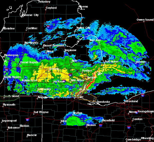 At 1231 am est, severe thunderstorms were located along a line extending from grosse ile to near temperance, moving east at 50 mph (radar indicated). Hazards include 60 mph wind gusts and penny size hail. Expect damage to roofs, siding, and trees. these severe storms will be near, trenton and grosse ile around 1235 am est. Other locations impacted by these severe thunderstorms include flat rock, monroe, temperance, ida, luna pier, grosse ile, lambertville, trenton, newport and gibraltar. At 1231 am est, severe thunderstorms were located along a line extending from grosse ile to near temperance, moving east at 50 mph (radar indicated). Hazards include 60 mph wind gusts and penny size hail. Expect damage to roofs, siding, and trees. these severe storms will be near, trenton and grosse ile around 1235 am est. Other locations impacted by these severe thunderstorms include flat rock, monroe, temperance, ida, luna pier, grosse ile, lambertville, trenton, newport and gibraltar.
|
| 3/1/2017 12:18 AM EST |
 At 1218 am est, severe thunderstorms were located along a line extending from near detroit to near lambertville, moving east at 50 mph (radar indicated). Hazards include 60 mph wind gusts and penny size hail. Expect damage to roofs, siding, and trees. these severe storms will be near, grosse pointe around 1225 am est. st. clair shores and monroe around 1235 am est. Other locations impacted by these severe thunderstorms include taylor, dundee, carleton, flat rock, monroe, temperance, grosse pointe, downtown detroit, romulus and detroit. At 1218 am est, severe thunderstorms were located along a line extending from near detroit to near lambertville, moving east at 50 mph (radar indicated). Hazards include 60 mph wind gusts and penny size hail. Expect damage to roofs, siding, and trees. these severe storms will be near, grosse pointe around 1225 am est. st. clair shores and monroe around 1235 am est. Other locations impacted by these severe thunderstorms include taylor, dundee, carleton, flat rock, monroe, temperance, grosse pointe, downtown detroit, romulus and detroit.
|
| 3/1/2017 12:05 AM EST |
 At 1205 am est, severe thunderstorms were located along a line extending from near southfield to near blissfield, moving east at 55 mph (radar indicated). Hazards include 60 mph wind gusts and penny size hail. Expect damage to roofs, siding, and trees. these severe storms will be near, detroit and dearborn around 1210 am est. grosse pointe, temperance and lambertville around 1220 am est. st. clair shores around 1225 am est. monroe and luna pier around 1230 am est. Other locations impacted by these severe thunderstorms include livonia, taylor, dundee, carleton, flat rock, monroe, temperance, grosse pointe, downtown detroit and romulus. At 1205 am est, severe thunderstorms were located along a line extending from near southfield to near blissfield, moving east at 55 mph (radar indicated). Hazards include 60 mph wind gusts and penny size hail. Expect damage to roofs, siding, and trees. these severe storms will be near, detroit and dearborn around 1210 am est. grosse pointe, temperance and lambertville around 1220 am est. st. clair shores around 1225 am est. monroe and luna pier around 1230 am est. Other locations impacted by these severe thunderstorms include livonia, taylor, dundee, carleton, flat rock, monroe, temperance, grosse pointe, downtown detroit and romulus.
|
| 2/28/2017 11:56 PM EST |
 At 1156 pm est, severe thunderstorms were located along a line extending from livonia to 8 miles southwest of blissfield, moving east at 50 mph (radar indicated). Hazards include 60 mph wind gusts and penny size hail. Expect damage to roofs, siding, and trees. severe thunderstorms will be near, livonia around 1200 am est. dearborn around 1205 am est. detroit and ottawa lake around 1210 am est. grosse pointe, temperance and lambertville around 1220 am est. luna pier around 1230 am est. Other locations impacted by these severe thunderstorms include livonia, taylor, dundee, carleton, flat rock, monroe, temperance, grosse pointe, downtown detroit and romulus. At 1156 pm est, severe thunderstorms were located along a line extending from livonia to 8 miles southwest of blissfield, moving east at 50 mph (radar indicated). Hazards include 60 mph wind gusts and penny size hail. Expect damage to roofs, siding, and trees. severe thunderstorms will be near, livonia around 1200 am est. dearborn around 1205 am est. detroit and ottawa lake around 1210 am est. grosse pointe, temperance and lambertville around 1220 am est. luna pier around 1230 am est. Other locations impacted by these severe thunderstorms include livonia, taylor, dundee, carleton, flat rock, monroe, temperance, grosse pointe, downtown detroit and romulus.
|
| 8/28/2016 1:53 PM EDT |
 At 151 pm edt, a line of storms producing brief weak tornadoes is extending from near monroe to 7 miles east of morenci, moving east at 15 mph (law enforcement confirmed tornado). Hazards include damaging tornado. Flying debris will be dangerous to those caught without shelter. mobile homes will be damaged or destroyed. damage to roofs, windows, and vehicles will occur. tree damage is likely. these tornadic storms will be near, monroe around 155 pm edt. Other locations impacted by these tornadic storms include temperance, monroe, ida, luna pier, lambertville, woodland beach, samaria, la salle, toledo beach and erie. At 151 pm edt, a line of storms producing brief weak tornadoes is extending from near monroe to 7 miles east of morenci, moving east at 15 mph (law enforcement confirmed tornado). Hazards include damaging tornado. Flying debris will be dangerous to those caught without shelter. mobile homes will be damaged or destroyed. damage to roofs, windows, and vehicles will occur. tree damage is likely. these tornadic storms will be near, monroe around 155 pm edt. Other locations impacted by these tornadic storms include temperance, monroe, ida, luna pier, lambertville, woodland beach, samaria, la salle, toledo beach and erie.
|
| 8/28/2016 1:44 PM EDT |
 At 128 pm edt, a line of thunderstorms producing brief weak tornadoes is extending from near maybee to morenci, moving east at 25 mph (law enforcement confirmed tornado). Hazards include damaging tornado. Flying debris will be dangerous to those caught without shelter. mobile homes will be damaged or destroyed. damage to roofs, windows, and vehicles will occur. tree damage is likely. these tornadic storms will be near, monroe around 140 pm edt. Other locations impacted by these tornadic storms include blissfield, morenci, monroe, dundee, temperance, ida, petersburg, luna pier, ottawa lake and deerfield. At 128 pm edt, a line of thunderstorms producing brief weak tornadoes is extending from near maybee to morenci, moving east at 25 mph (law enforcement confirmed tornado). Hazards include damaging tornado. Flying debris will be dangerous to those caught without shelter. mobile homes will be damaged or destroyed. damage to roofs, windows, and vehicles will occur. tree damage is likely. these tornadic storms will be near, monroe around 140 pm edt. Other locations impacted by these tornadic storms include blissfield, morenci, monroe, dundee, temperance, ida, petersburg, luna pier, ottawa lake and deerfield.
|
| 8/28/2016 1:29 PM EDT |
 At 128 pm edt, a line of thunderstorms producing brief weak tornadoes is extending from near maybee to morenci, moving east at 25 mph (law enforcement confirmed tornado). Hazards include damaging tornado. Flying debris will be dangerous to those caught without shelter. mobile homes will be damaged or destroyed. damage to roofs, windows, and vehicles will occur. tree damage is likely. these tornadic storms will be near, monroe around 140 pm edt. Other locations impacted by these tornadic storms include blissfield, morenci, monroe, dundee, temperance, ida, petersburg, luna pier, ottawa lake and deerfield. At 128 pm edt, a line of thunderstorms producing brief weak tornadoes is extending from near maybee to morenci, moving east at 25 mph (law enforcement confirmed tornado). Hazards include damaging tornado. Flying debris will be dangerous to those caught without shelter. mobile homes will be damaged or destroyed. damage to roofs, windows, and vehicles will occur. tree damage is likely. these tornadic storms will be near, monroe around 140 pm edt. Other locations impacted by these tornadic storms include blissfield, morenci, monroe, dundee, temperance, ida, petersburg, luna pier, ottawa lake and deerfield.
|
| 8/28/2016 1:12 PM EDT |
 At 111 pm edt, a line of thunderstorms producing brief weak tornadoes is extending from near maybee to near fayette, moving east at 15 mph (law enforcement confirmed tornado). Hazards include damaging tornado. Flying debris will be dangerous to those caught without shelter. mobile homes will be damaged or destroyed. damage to roofs, windows, and vehicles will occur. tree damage is likely. these tornadic storms will be near, ida around 115 pm edt. monroe around 135 pm edt. Other locations impacted by these tornadic storms include blissfield, morenci, monroe, dundee, temperance, ida, petersburg, luna pier, ottawa lake and deerfield. At 111 pm edt, a line of thunderstorms producing brief weak tornadoes is extending from near maybee to near fayette, moving east at 15 mph (law enforcement confirmed tornado). Hazards include damaging tornado. Flying debris will be dangerous to those caught without shelter. mobile homes will be damaged or destroyed. damage to roofs, windows, and vehicles will occur. tree damage is likely. these tornadic storms will be near, ida around 115 pm edt. monroe around 135 pm edt. Other locations impacted by these tornadic storms include blissfield, morenci, monroe, dundee, temperance, ida, petersburg, luna pier, ottawa lake and deerfield.
|
| 8/27/2016 2:33 PM EDT |
 At 233 pm edt, severe thunderstorms were located along a line extending from near lambertville to near bowling green, moving northeast at 95 mph (radar indicated). Hazards include 60 mph wind gusts and quarter size hail. Hail damage to vehicles is expected. Expect wind damage to roofs, siding and trees. At 233 pm edt, severe thunderstorms were located along a line extending from near lambertville to near bowling green, moving northeast at 95 mph (radar indicated). Hazards include 60 mph wind gusts and quarter size hail. Hail damage to vehicles is expected. Expect wind damage to roofs, siding and trees.
|
| 8/24/2016 7:51 PM EDT |
 At 750 pm edt, a confirmed tornado was located near whitehouse, or near swanton, moving northeast at 25 mph (weather spotters confirmed tornado). Hazards include damaging tornado and quarter size hail. Flying debris will be dangerous to those caught without shelter. mobile homes will be damaged or destroyed. damage to roofs, windows and vehicles will occur. tree damage is likely. this tornado will be near, holland around 800 pm edt. perrysburg around 810 pm edt. toledo and rossford around 815 pm edt. northwood around 825 pm edt. oregon around 830 pm edt. Other locations impacted by this tornadic thunderstorm include ottawa hills, harbor view, stony ridge, millbury, walbridge and maumee. At 750 pm edt, a confirmed tornado was located near whitehouse, or near swanton, moving northeast at 25 mph (weather spotters confirmed tornado). Hazards include damaging tornado and quarter size hail. Flying debris will be dangerous to those caught without shelter. mobile homes will be damaged or destroyed. damage to roofs, windows and vehicles will occur. tree damage is likely. this tornado will be near, holland around 800 pm edt. perrysburg around 810 pm edt. toledo and rossford around 815 pm edt. northwood around 825 pm edt. oregon around 830 pm edt. Other locations impacted by this tornadic thunderstorm include ottawa hills, harbor view, stony ridge, millbury, walbridge and maumee.
|
| 8/24/2016 7:43 PM EDT |
 At 742 pm edt, a severe thunderstorm capable of producing a tornado was located near whitehouse, or near swanton, moving northeast at 25 mph (radar indicated rotation). Hazards include tornado and quarter size hail. Flying debris will be dangerous to those caught without shelter. mobile homes will be damaged or destroyed. damage to roofs, windows and vehicles will occur. tree damage is likely. this dangerous storm will be near, waterville around 745 pm edt. holland around 800 pm edt. perrysburg and sylvania around 805 pm edt. toledo and rossford around 815 pm edt. northwood around 825 pm edt. oregon around 830 pm edt. Other locations impacted by this tornadic thunderstorm include ottawa hills, millbury, walbridge, neapolis, harbor view, stony ridge and maumee. At 742 pm edt, a severe thunderstorm capable of producing a tornado was located near whitehouse, or near swanton, moving northeast at 25 mph (radar indicated rotation). Hazards include tornado and quarter size hail. Flying debris will be dangerous to those caught without shelter. mobile homes will be damaged or destroyed. damage to roofs, windows and vehicles will occur. tree damage is likely. this dangerous storm will be near, waterville around 745 pm edt. holland around 800 pm edt. perrysburg and sylvania around 805 pm edt. toledo and rossford around 815 pm edt. northwood around 825 pm edt. oregon around 830 pm edt. Other locations impacted by this tornadic thunderstorm include ottawa hills, millbury, walbridge, neapolis, harbor view, stony ridge and maumee.
|
| 8/3/2015 12:20 AM EDT |
 At 1220 am edt, severe thunderstorms were located along a line extending from near flat rock to hudson, moving south at 30 mph (radar indicated). Hazards include 60 mph wind gusts and nickel size hail. Expect damage to roofs. siding and trees. Locations impacted include, adrian, monroe, tecumseh, dundee, blissfield, hudson, morenci, temperance, ida, hudson, luna pier, petersburg, deerfield, britton, maybee, clayton, ottawa lake, lambertville, la salle and erie. At 1220 am edt, severe thunderstorms were located along a line extending from near flat rock to hudson, moving south at 30 mph (radar indicated). Hazards include 60 mph wind gusts and nickel size hail. Expect damage to roofs. siding and trees. Locations impacted include, adrian, monroe, tecumseh, dundee, blissfield, hudson, morenci, temperance, ida, hudson, luna pier, petersburg, deerfield, britton, maybee, clayton, ottawa lake, lambertville, la salle and erie.
|
| 8/3/2015 12:03 AM EDT |
 At 1203 am edt, severe thunderstorms were located along a line extending from 10 miles east of grosse ile to near hudson, moving south at 40 mph (radar indicated). Hazards include 60 mph wind gusts and nickel size hail. Expect damage to roofs. siding and trees. These severe thunderstorms will remain over mainly rural areas of monroe and lenawee counties, including the following locations, manitou beach-devils lake, ridgeway, samaria, springville, azalia, tipton, munson, palmyra, riga and estral beach. At 1203 am edt, severe thunderstorms were located along a line extending from 10 miles east of grosse ile to near hudson, moving south at 40 mph (radar indicated). Hazards include 60 mph wind gusts and nickel size hail. Expect damage to roofs. siding and trees. These severe thunderstorms will remain over mainly rural areas of monroe and lenawee counties, including the following locations, manitou beach-devils lake, ridgeway, samaria, springville, azalia, tipton, munson, palmyra, riga and estral beach.
|
| 8/2/2015 11:45 PM EDT |
 At 1145 pm edt, severe thunderstorms were located along a line extending from 8 miles southeast of downtown detroit to 8 miles west of addison, moving southeast at 35 mph (radar indicated). Hazards include 60 mph wind gusts and nickel size hail. Expect damage to roofs. siding and trees. these severe storms will be near, addison around 1200 am edt. hudson and hudson around 1205 am edt. clayton around 1215 am edt. blissfield around 1245 am edt. Other locations impacted by these severe thunderstorms include manitou beach-devils lake, ridgeway, samaria, springville, azalia, tipton, munson, palmyra, riga and estral beach. At 1145 pm edt, severe thunderstorms were located along a line extending from 8 miles southeast of downtown detroit to 8 miles west of addison, moving southeast at 35 mph (radar indicated). Hazards include 60 mph wind gusts and nickel size hail. Expect damage to roofs. siding and trees. these severe storms will be near, addison around 1200 am edt. hudson and hudson around 1205 am edt. clayton around 1215 am edt. blissfield around 1245 am edt. Other locations impacted by these severe thunderstorms include manitou beach-devils lake, ridgeway, samaria, springville, azalia, tipton, munson, palmyra, riga and estral beach.
|
| 8/2/2015 11:29 PM EDT |
 At 1128 pm edt, severe thunderstorms were located along a line extending from near grosse pointe to 8 miles west of cement city, moving south at 40 mph (radar indicated). Hazards include 60 mph wind gusts. Expect damage to roofs. siding and trees. severe thunderstorms will be near, hudson around 1155 pm edt. Other locations impacted by these severe thunderstorms include manitou beach-devils lake, ridgeway, samaria, springville, azalia, tipton, munson, palmyra, riga and estral beach. At 1128 pm edt, severe thunderstorms were located along a line extending from near grosse pointe to 8 miles west of cement city, moving south at 40 mph (radar indicated). Hazards include 60 mph wind gusts. Expect damage to roofs. siding and trees. severe thunderstorms will be near, hudson around 1155 pm edt. Other locations impacted by these severe thunderstorms include manitou beach-devils lake, ridgeway, samaria, springville, azalia, tipton, munson, palmyra, riga and estral beach.
|
| 6/23/2015 3:12 AM EDT | The severe thunderstorm warning for monroe county will expire at 315 am edt, the storms which prompted the warning have weakened below severe limits, and exited the warned area. therefore the warning will be allowed to expire. to report severe weather, contact your nearest law enforcement agency. they will relay your report to the national weather service detroit/pontiac. |
| 6/23/2015 3:00 AM EDT |
 At 259 am edt, severe thunderstorms were located along a line extending from near luna pier to temperance to ottawa lake, moving southeast at 35 mph (radar indicated). Hazards include 60 mph wind gusts. Expect damage to roofs. siding and trees. these severe storms will be near, luna pier around 310 am edt. Other locations impacted by these severe thunderstorms include woodland beach, samaria, la salle, azalia, estral beach, south rockwood, oakville, scofield, newport and cone. At 259 am edt, severe thunderstorms were located along a line extending from near luna pier to temperance to ottawa lake, moving southeast at 35 mph (radar indicated). Hazards include 60 mph wind gusts. Expect damage to roofs. siding and trees. these severe storms will be near, luna pier around 310 am edt. Other locations impacted by these severe thunderstorms include woodland beach, samaria, la salle, azalia, estral beach, south rockwood, oakville, scofield, newport and cone.
|
| 6/23/2015 2:51 AM EDT |
 At 251 am edt, severe thunderstorms were located along a line extending from 7 miles southeast of monroe to near temperance to 6 miles southwest of adrian, moving southeast at 50 mph (radar indicated). Hazards include 60 mph wind gusts. Expect damage to roofs. siding and trees. these severe storms will be near, temperance and lambertville around 255 am edt. luna pier around 300 am edt. blissfield around 305 am edt. ottawa lake around 315 am edt. other locations impacted by these severe thunderstorms include manitou beach-devils lake, ridgeway, samaria, springville, azalia, tipton, munson, palmyra, riga and estral beach. A tornado watch remains in effect until 300 am edt for southeastern michigan. At 251 am edt, severe thunderstorms were located along a line extending from 7 miles southeast of monroe to near temperance to 6 miles southwest of adrian, moving southeast at 50 mph (radar indicated). Hazards include 60 mph wind gusts. Expect damage to roofs. siding and trees. these severe storms will be near, temperance and lambertville around 255 am edt. luna pier around 300 am edt. blissfield around 305 am edt. ottawa lake around 315 am edt. other locations impacted by these severe thunderstorms include manitou beach-devils lake, ridgeway, samaria, springville, azalia, tipton, munson, palmyra, riga and estral beach. A tornado watch remains in effect until 300 am edt for southeastern michigan.
|
| 6/23/2015 2:34 AM EDT |
 At 234 am edt, severe thunderstorms were located along a line extending from near monroe to near adrian, moving southeast at 30 mph (radar indicated). Hazards include 60 mph wind gusts. Expect damage to roofs. siding and trees. these severe storms will be near, monroe around 240 am edt. blissfield around 300 am edt. ottawa lake around 310 am edt. other locations impacted by these severe thunderstorms include manitou beach-devils lake, ridgeway, samaria, springville, azalia, tipton, munson, palmyra, riga and estral beach. A tornado watch remains in effect until 300 am edt for southeastern michigan. At 234 am edt, severe thunderstorms were located along a line extending from near monroe to near adrian, moving southeast at 30 mph (radar indicated). Hazards include 60 mph wind gusts. Expect damage to roofs. siding and trees. these severe storms will be near, monroe around 240 am edt. blissfield around 300 am edt. ottawa lake around 310 am edt. other locations impacted by these severe thunderstorms include manitou beach-devils lake, ridgeway, samaria, springville, azalia, tipton, munson, palmyra, riga and estral beach. A tornado watch remains in effect until 300 am edt for southeastern michigan.
|
| 6/23/2015 2:19 AM EDT |
 At 218 am edt, severe thunderstorms were located along a line extending from 7 miles south of flat rock to near clayton, moving southeast at 30 mph (radar indicated). Hazards include 60 mph wind gusts. Expect damage to roofs. siding and trees. these severe storms will be near, blissfield around 300 am edt. deerfield around 305 am edt. ottawa lake and lambertville around 315 am edt. other locations impacted by these severe thunderstorms include manitou beach-devils lake, ridgeway, samaria, springville, azalia, tipton, munson, palmyra, riga and estral beach. A tornado watch remains in effect until 300 am edt for southeastern michigan. At 218 am edt, severe thunderstorms were located along a line extending from 7 miles south of flat rock to near clayton, moving southeast at 30 mph (radar indicated). Hazards include 60 mph wind gusts. Expect damage to roofs. siding and trees. these severe storms will be near, blissfield around 300 am edt. deerfield around 305 am edt. ottawa lake and lambertville around 315 am edt. other locations impacted by these severe thunderstorms include manitou beach-devils lake, ridgeway, samaria, springville, azalia, tipton, munson, palmyra, riga and estral beach. A tornado watch remains in effect until 300 am edt for southeastern michigan.
|
| 6/23/2015 2:02 AM EDT |
 At 202 am edt, severe thunderstorms were located along a line extending from near wyandotte to near hudson, moving east at 35 mph (radar indicated). Hazards include 60 mph wind gusts. Expect damage to roofs. siding and trees. severe thunderstorms will be near, morenci around 220 am edt. adrian around 230 am edt. blissfield around 250 am edt. ottawa lake around 300 am edt. lambertville around 310 am edt. temperance around 315 am edt. other locations impacted by these severe thunderstorms include manitou beach-devils lake, ridgeway, samaria, springville, azalia, tipton, munson, palmyra, riga and estral beach. A tornado watch remains in effect until 300 am edt for southeastern michigan. At 202 am edt, severe thunderstorms were located along a line extending from near wyandotte to near hudson, moving east at 35 mph (radar indicated). Hazards include 60 mph wind gusts. Expect damage to roofs. siding and trees. severe thunderstorms will be near, morenci around 220 am edt. adrian around 230 am edt. blissfield around 250 am edt. ottawa lake around 300 am edt. lambertville around 310 am edt. temperance around 315 am edt. other locations impacted by these severe thunderstorms include manitou beach-devils lake, ridgeway, samaria, springville, azalia, tipton, munson, palmyra, riga and estral beach. A tornado watch remains in effect until 300 am edt for southeastern michigan.
|
| 5/27/2015 2:10 PM EDT | The severe thunderstorm warning for central monroe county will expire at 215 pm edt, the storms which prompted the warning have moved out of the area. therefore the warning will be allowed to expire. a severe thunderstorm watch remains in effect until 700 pm edt for southeastern michigan. |
| 5/27/2015 1:52 PM EDT | At 151 pm edt, severe thunderstorms were located along a line extending from 8 miles south of flat rock to near monroe to toledo, moving east at 40 mph (radar indicated). Hazards include 60 mph wind gusts and penny size hail. Expect damage to roofs. siding and trees. These severe thunderstorms will remain over eastern monroe county, including the following locations, estral beach, woodland beach, south rockwood, newport, toledo beach, samaria, erie, la salle, bolles harbor and stony point. |
| 5/27/2015 1:34 PM EDT | At 133 pm edt, severe thunderstorms were located along a line extending from near flat rock to near monroe to near holland, moving northeast at 35 mph (radar indicated). Hazards include 60 mph wind gusts and penny size hail. Expect damage to roofs. siding and trees. these severe storms will be near, flat rock around 140 pm edt. temperance around 155 pm edt. luna pier around 210 pm edt. Other locations impacted by these severe thunderstorms include estral beach, woodland beach, south rockwood, scofield, newport, toledo beach, samaria, erie, la salle and bolles harbor. |
| 5/27/2015 1:16 PM EDT | At 115 pm edt, severe thunderstorms were located along a line extending from near carleton to near monroe to near lambertville, moving northeast at 40 mph (radar indicated). Hazards include 60 mph wind gusts and penny size hail. Expect damage to roofs. siding and trees. these severe storms will be near, carleton and maybee around 120 pm edt. flat rock and luna pier around 135 pm edt. monroe around 140 pm edt. Other locations impacted by these severe thunderstorms include woodland beach, samaria, la salle, azalia, estral beach, south rockwood, oakville, scofield, newport and toledo beach. |
| 5/27/2015 1:00 PM EDT | At 1259 pm edt, a severe thunderstorm was located near dundee, moving northeast at 40 mph (radar indicated). Hazards include 60 mph wind gusts and quarter size hail. Hail damage to vehicles is expected. expect wind damage to roofs, siding and trees. this severe thunderstorm will be near, ida around 110 pm edt. maybee around 115 pm edt. carleton around 130 pm edt. flat rock around 140 pm edt. Other locations impacted by this severe thunderstorm include woodland beach, samaria, la salle, azalia, estral beach, south rockwood, oakville, scofield, newport and toledo beach. |
| 5/26/2015 6:21 PM EDT | At 621 pm edt, severe thunderstorms were located along a line extending from near deerfield to near sylvania, moving north at 55 mph (radar indicated). Hazards include 60 mph wind gusts. Expect damage to roofs. siding and trees. severe thunderstorms will be near, petersburg and deerfield around 625 pm edt. dundee and temperance around 630 pm edt. milan and ida around 640 pm edt. maybee around 645 pm edt. Other locations impacted by these severe thunderstorms include woodland beach, samaria, la salle, azalia, estral beach, south rockwood, oakville, scofield, newport and cone. |
| 5/11/2015 3:53 PM EDT | At 350 pm edt, a severe thunderstorm was located near sylvania, and moving northeast at 35 mph (radar indicated). Hazards include 60 mph wind gusts. Expect damage to roofs. siding and trees. locations impacted include, oregon and harbor view. 75in. |
| 5/11/2015 3:34 PM EDT | At 333 pm edt, a severe thunderstorm was located near swanton, and moving northeast at 35 mph (radar indicated). Hazards include 60 mph wind gusts. Expect damage to roofs. Siding and trees. |
| 4/9/2015 8:38 PM EDT | The severe thunderstorm warning for lucas and northern wood counties will expire at 845 pm edt. The storm which prompted the warning has moved out of the warned area. |
| 4/9/2015 7:51 PM EDT | The national weather service in cleveland has issued a * severe thunderstorm warning for. lucas county in northwest ohio. northern wood county in northwest ohio. until 845 pm edt * at 750 pm edt. A severe thunderstorm was located 8 miles southwest. |
Hail Maps for Lambertville, MI
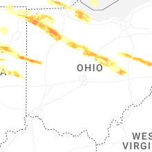


Connect with Interactive Hail Maps