

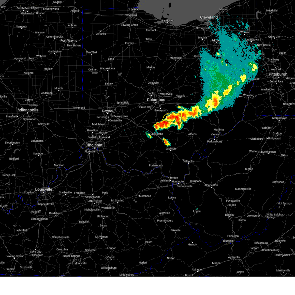
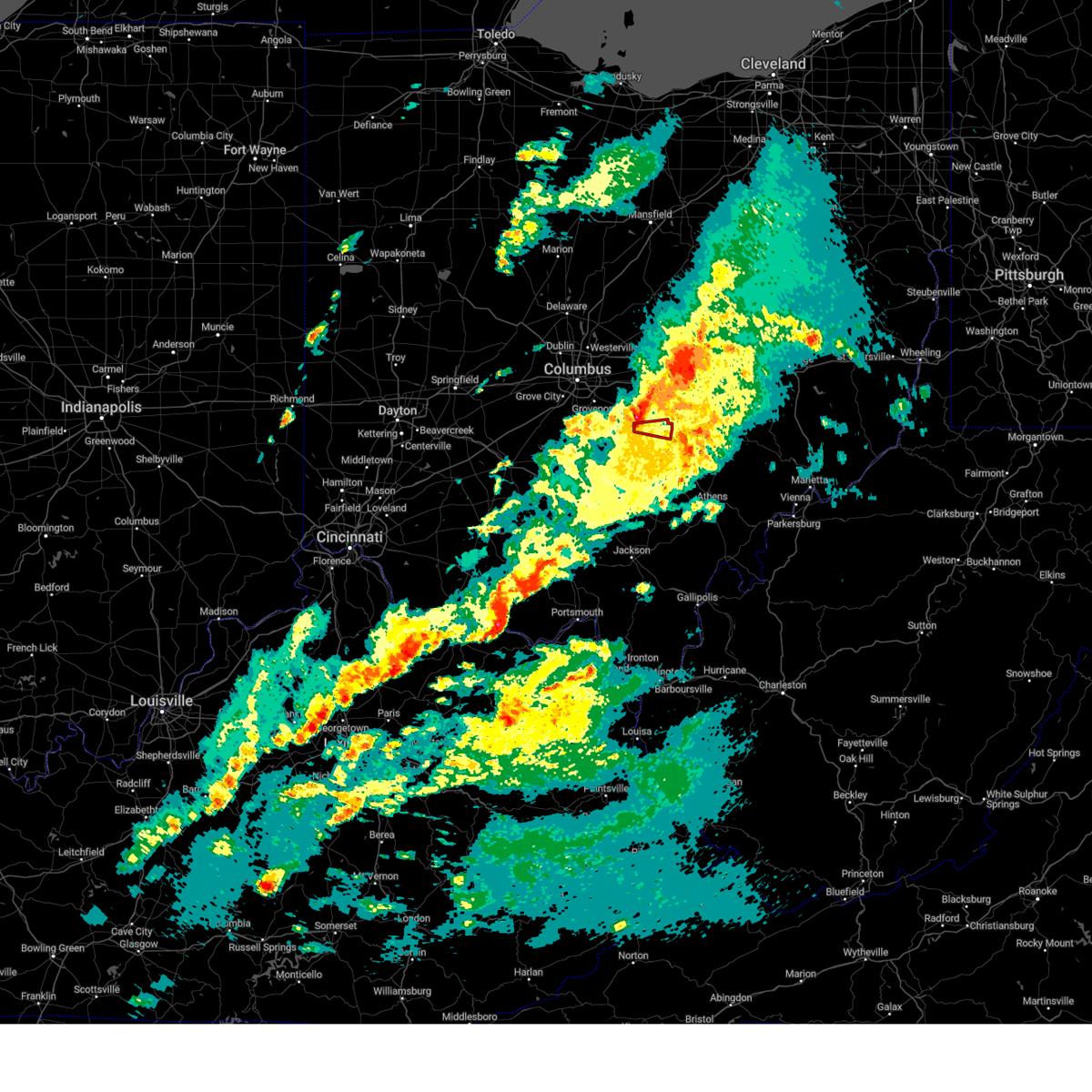
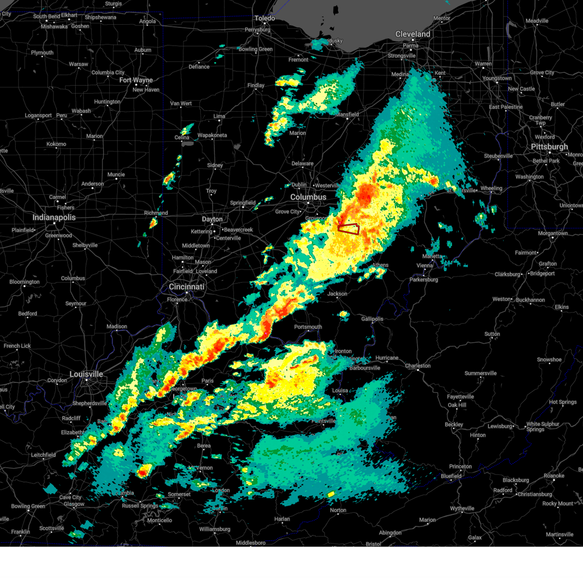
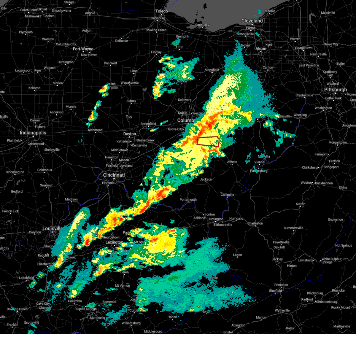
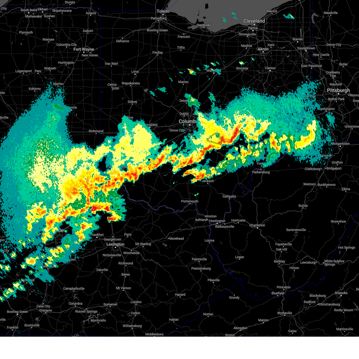
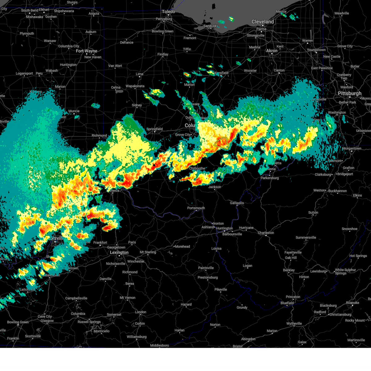
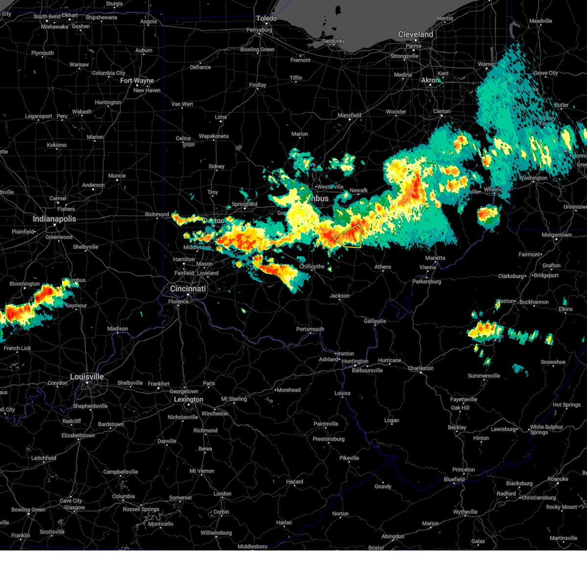
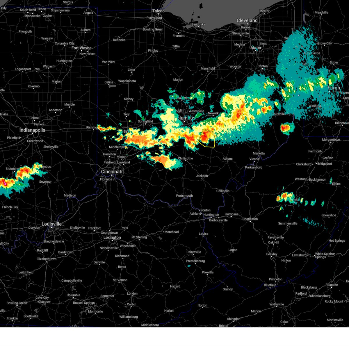
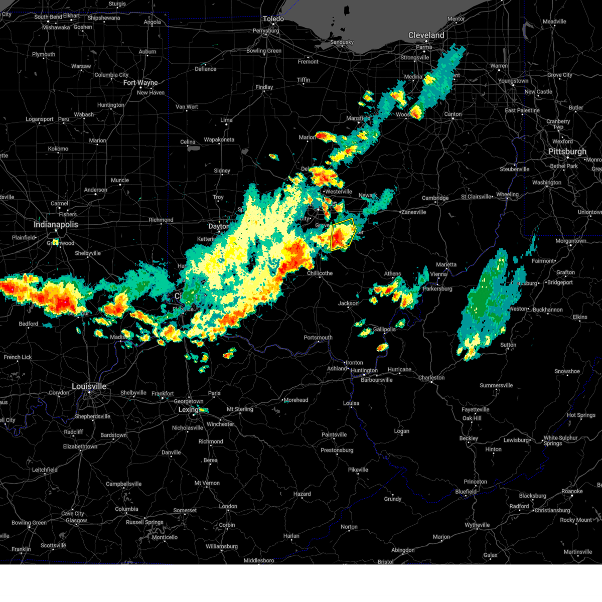
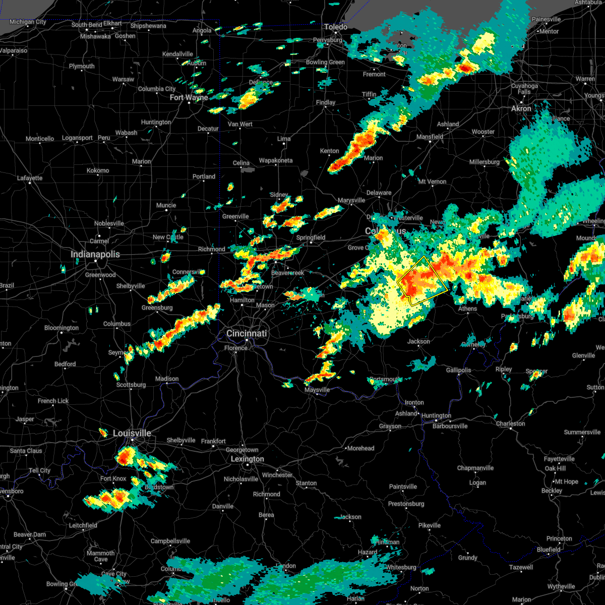
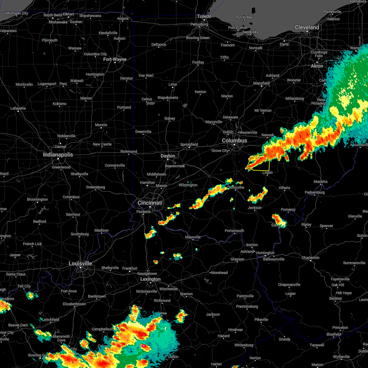
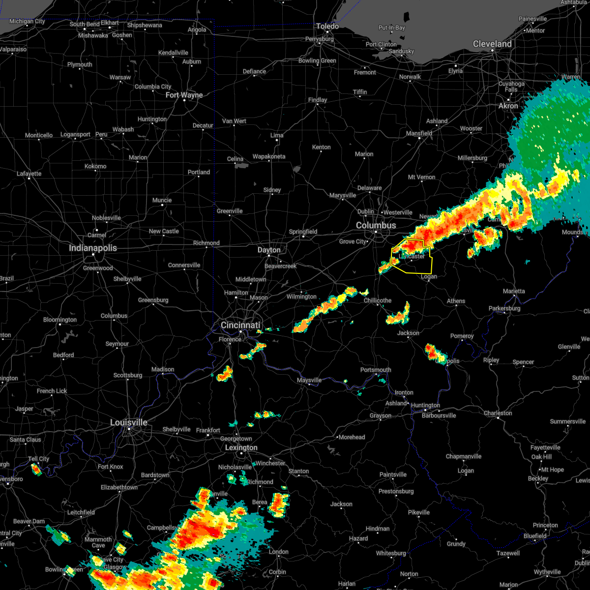
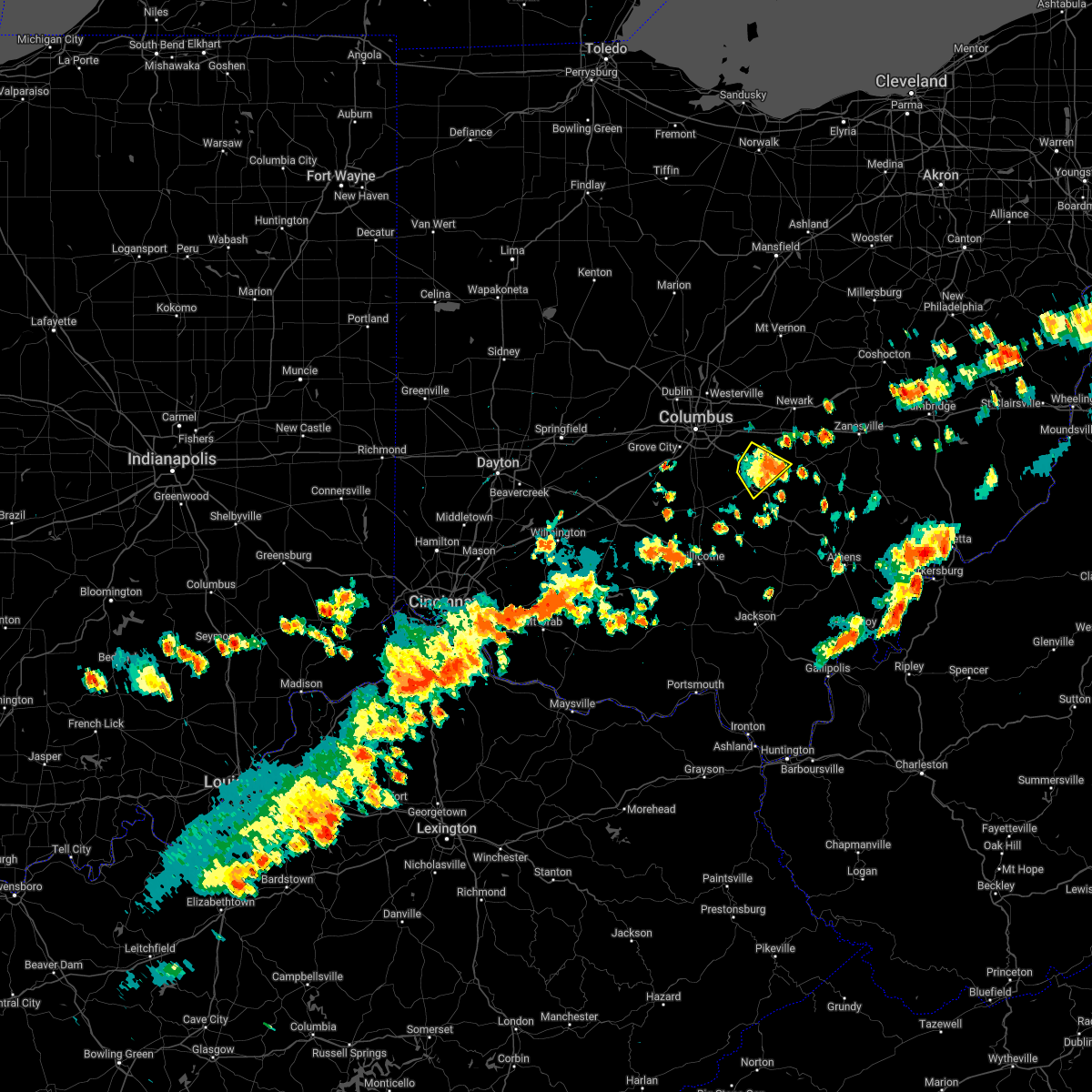
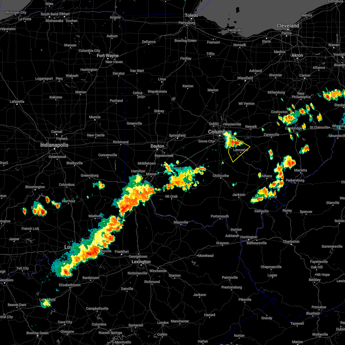
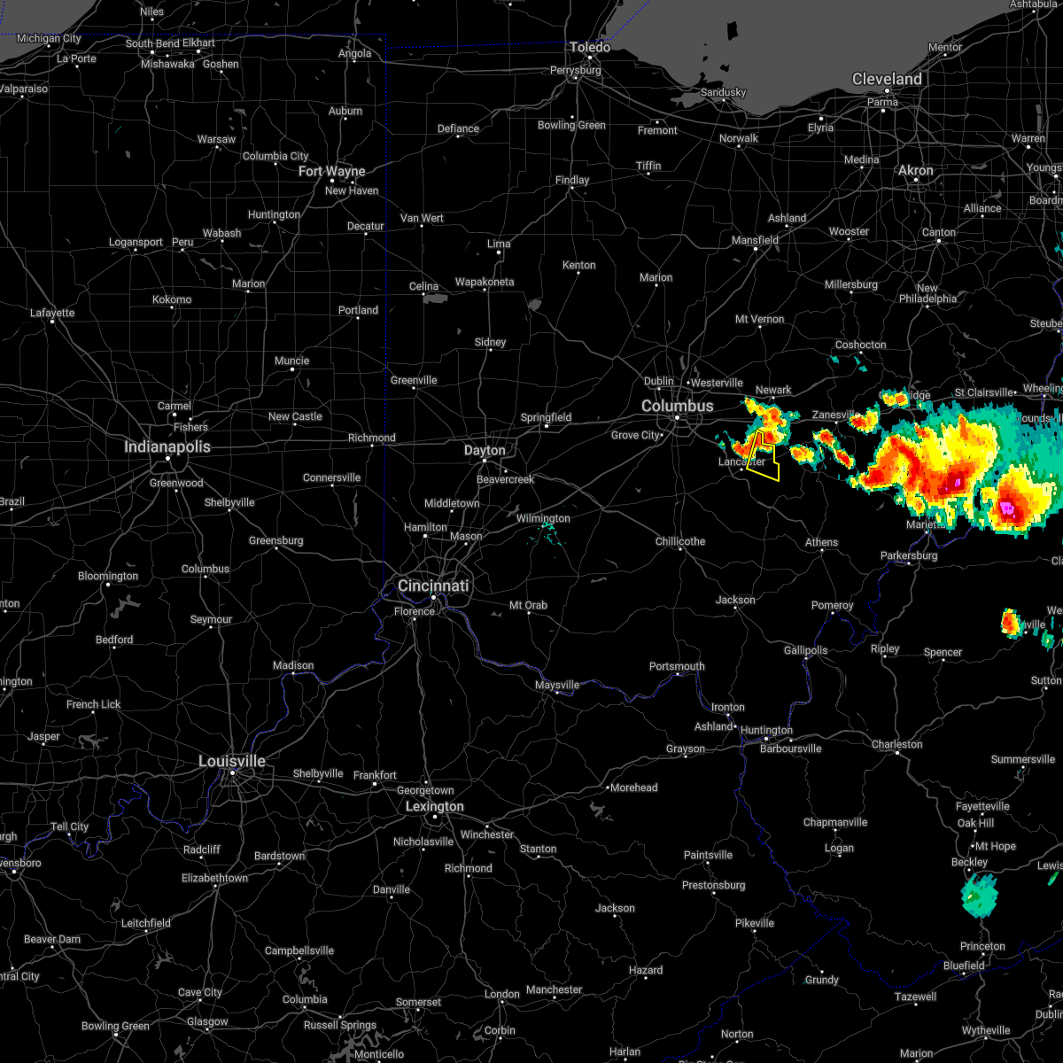
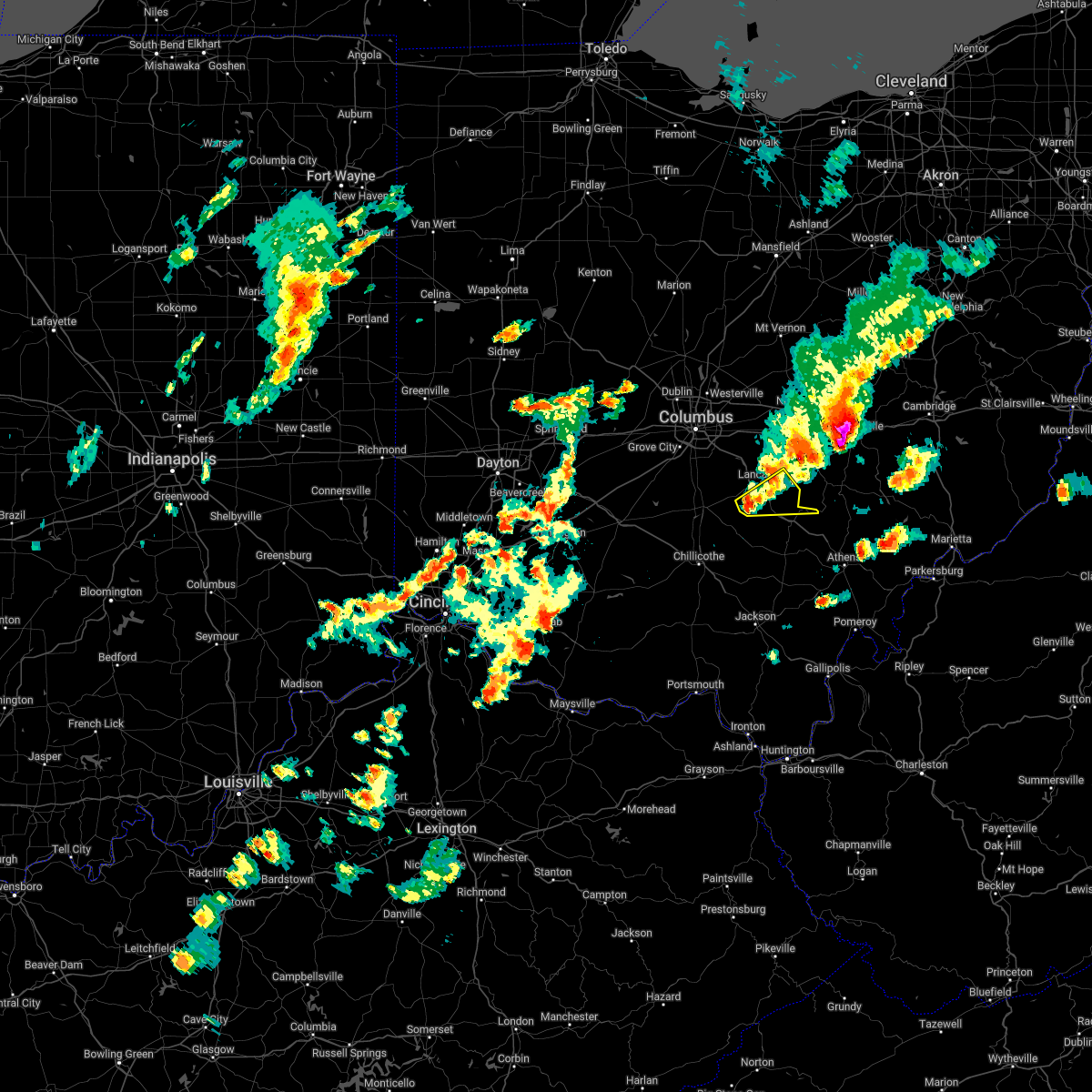
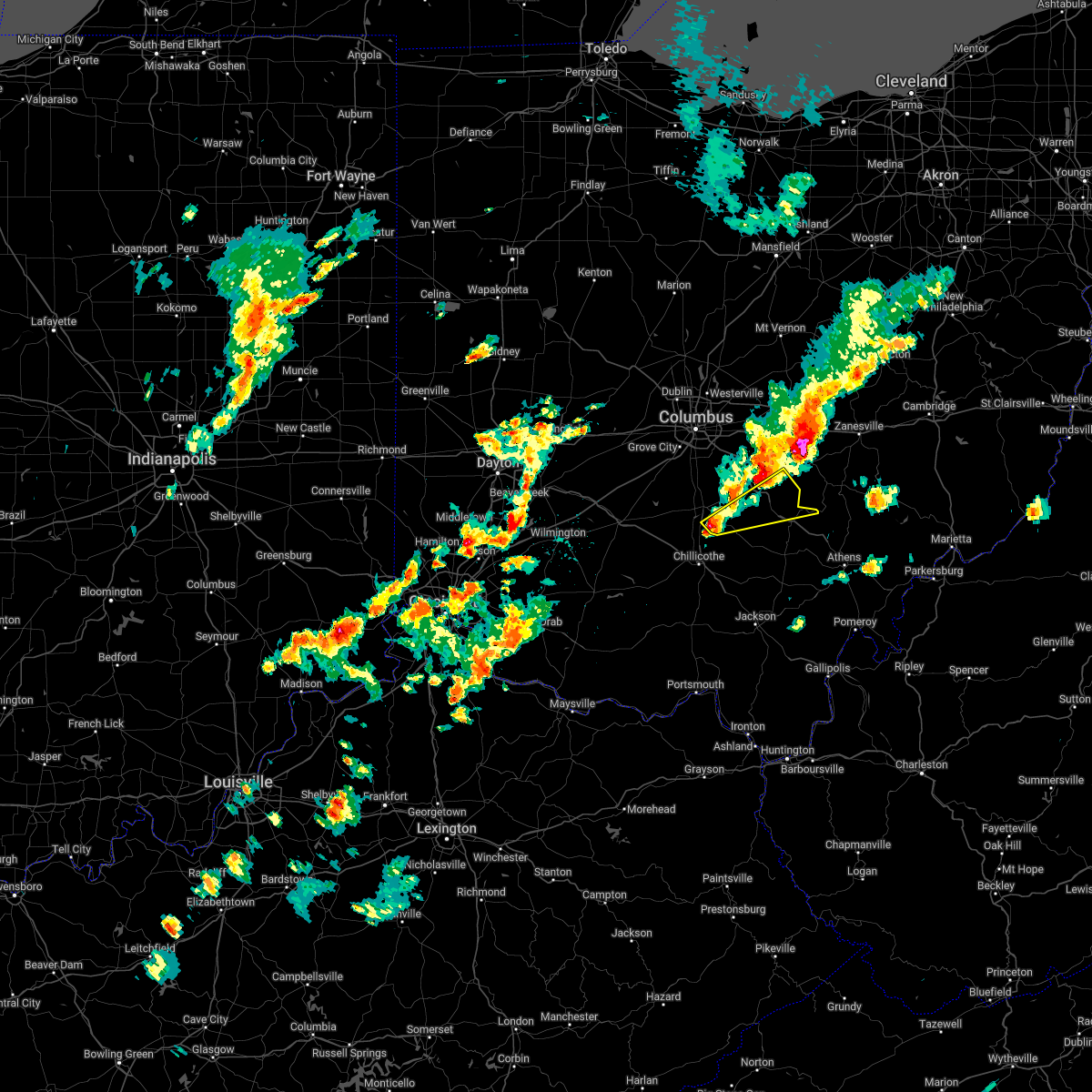
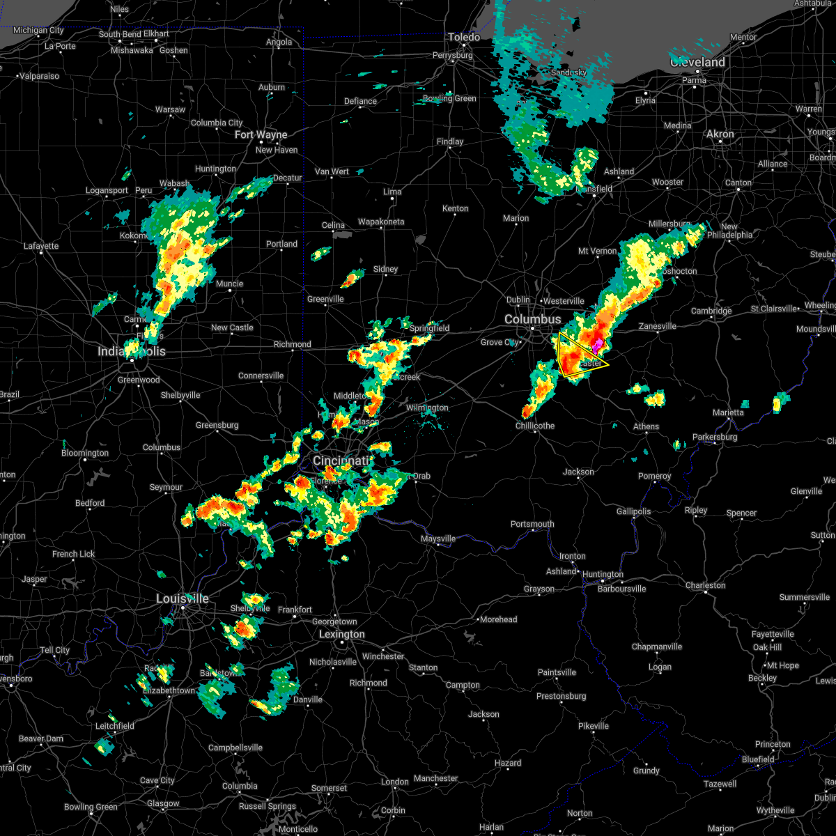
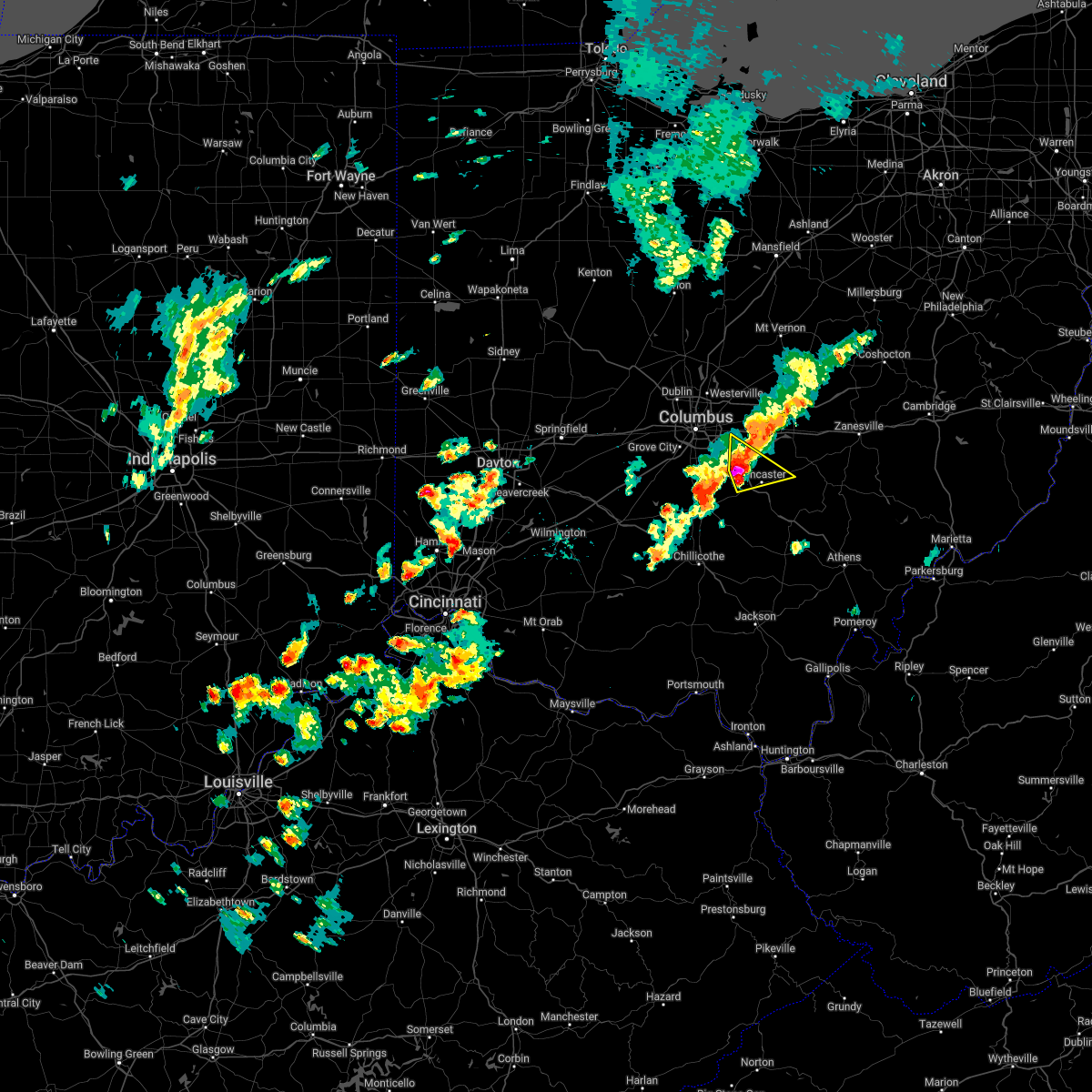
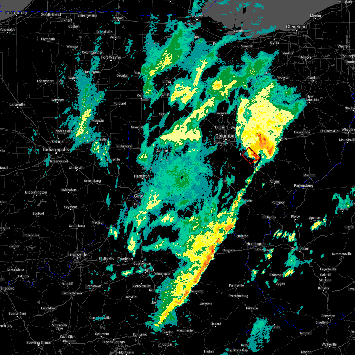
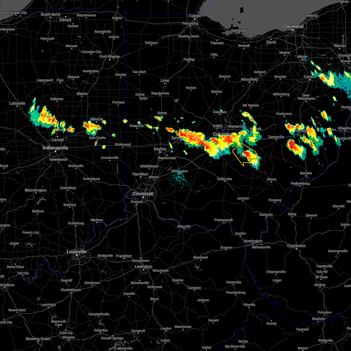
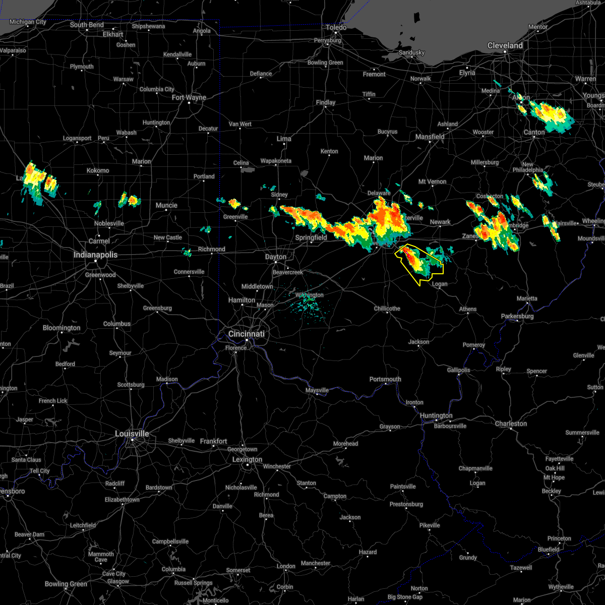
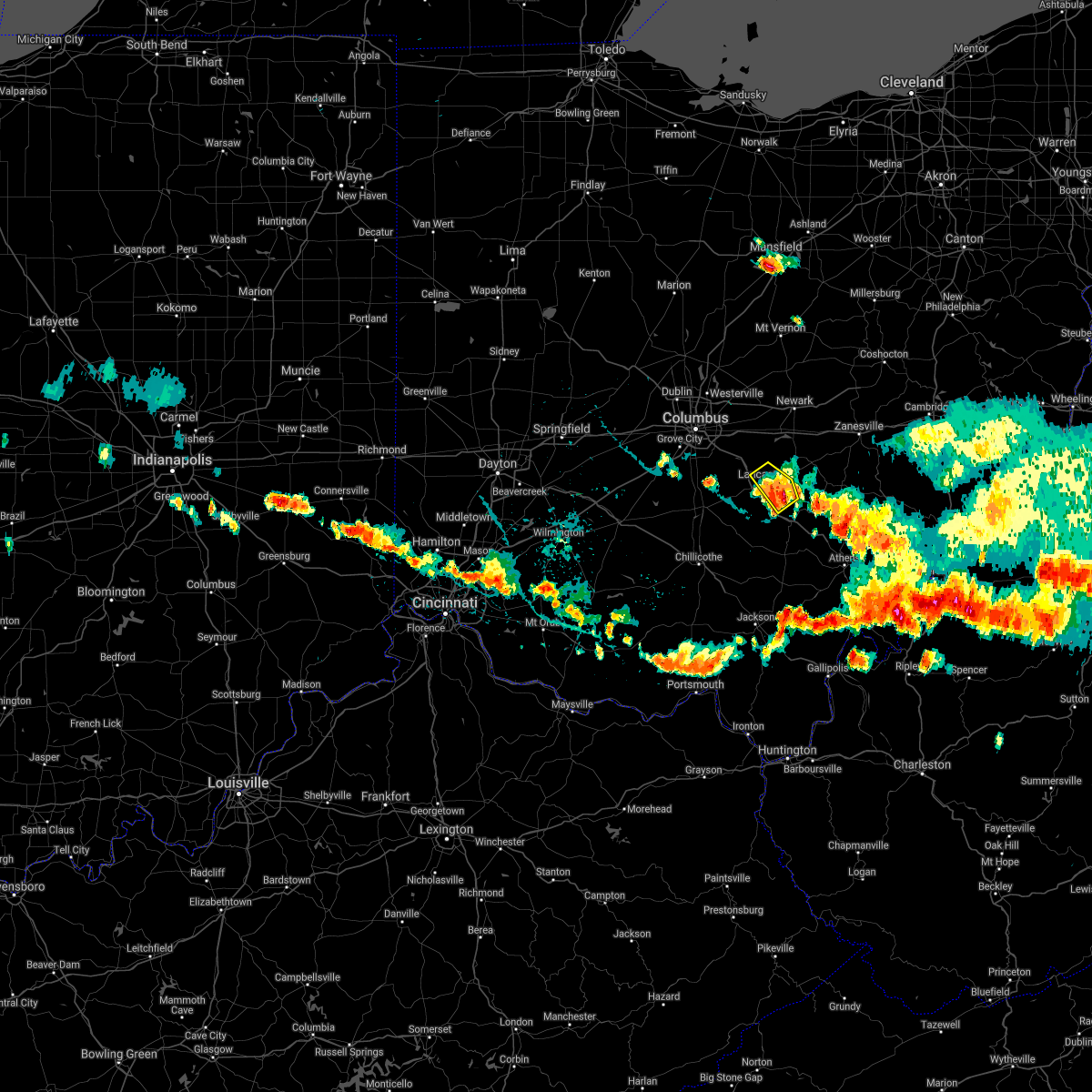
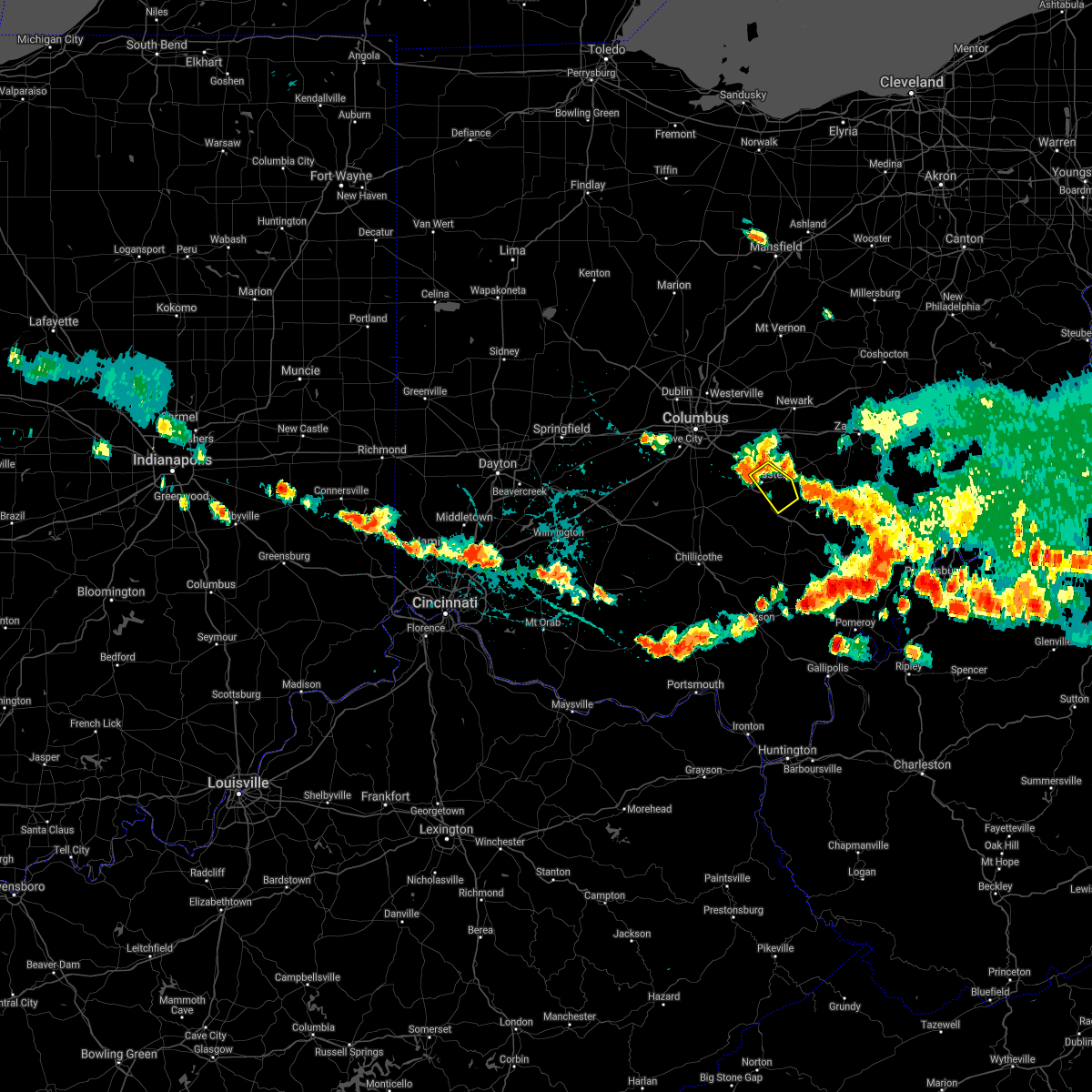
Hail Map for Lancaster, OH
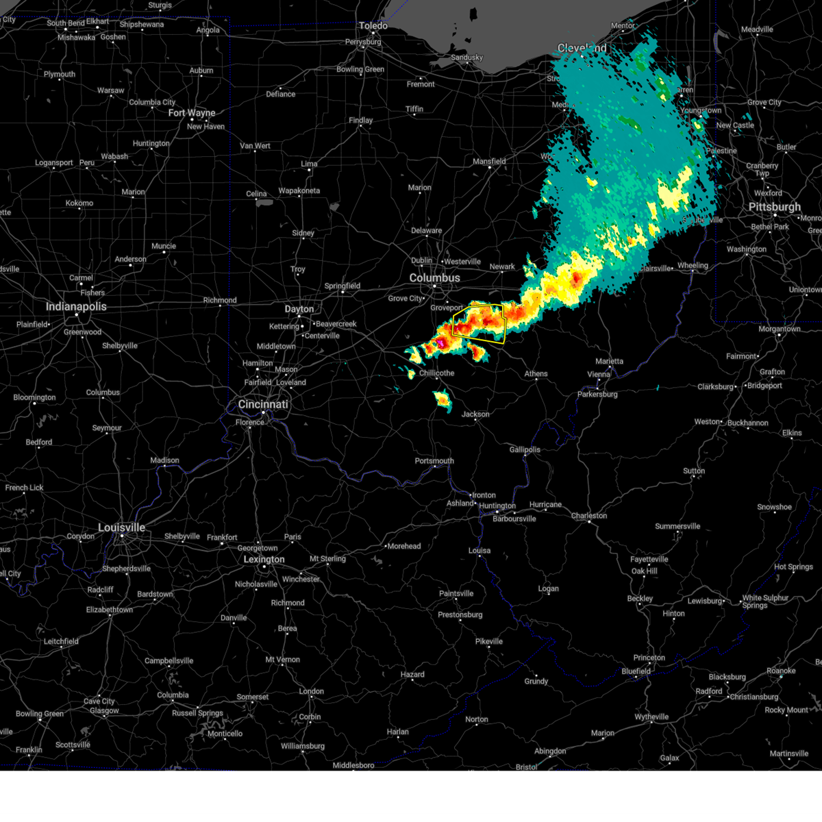
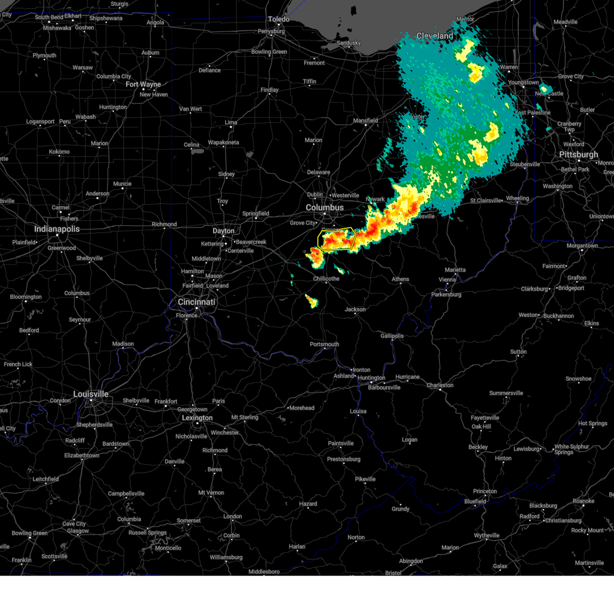
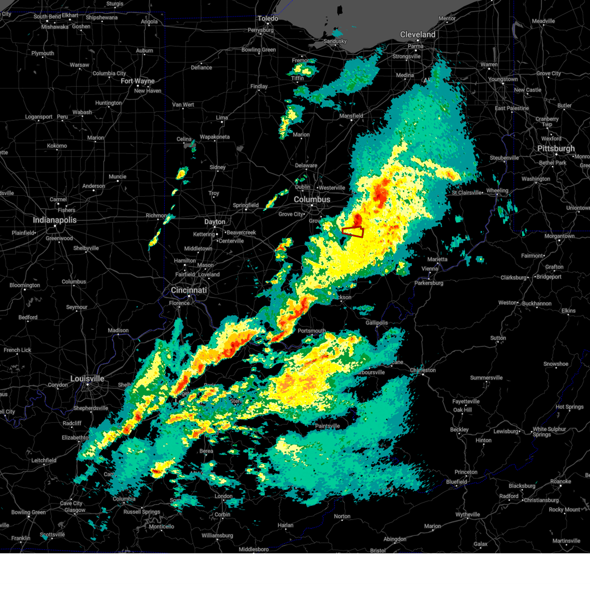
The Lancaster, OH area has had 15 reports of on-the-ground hail by trained spotters, and has been under severe weather warnings 33 times during the past 12 months. Doppler radar has detected hail at or near Lancaster, OH on 50 occasions, including 4 occasions during the past year.
| Name: | Lancaster, OH |
| Where Located: | 26.9 miles SE of Columbus, OH |
| Map: | Google Map for Lancaster, OH |
| Population: | 38780 |
| Housing Units: | 17685 |
| More Info: | Search Google for Lancaster, OH |
3
The Top Recent Hail Date for Lancaster, OH is Monday, July 24, 2023 (3rd out of 50)

Hail and Wind Damage Spotted near Lancaster, OH
| Date / Time | Report Details |
|---|---|
| 4/17/2024 7:06 PM EDT |
 At 706 pm edt, a severe thunderstorm was located over hide-a-way hills, moving east at 35 mph (radar indicated). Hazards include 60 mph wind gusts and quarter size hail. Minor hail damage to vehicles is possible. expect wind damage to trees and power lines. Locations impacted include, lancaster, bremen, hide-a-way hills, royalton, amanda, sugar grove, fairfield county airport, clearport, north berne, hideaway hills, and rockbridge. At 706 pm edt, a severe thunderstorm was located over hide-a-way hills, moving east at 35 mph (radar indicated). Hazards include 60 mph wind gusts and quarter size hail. Minor hail damage to vehicles is possible. expect wind damage to trees and power lines. Locations impacted include, lancaster, bremen, hide-a-way hills, royalton, amanda, sugar grove, fairfield county airport, clearport, north berne, hideaway hills, and rockbridge.
|
| 4/17/2024 6:52 PM EDT | Quarter sized hail reported 1.6 miles NW of Lancaster, OH |
| 4/17/2024 6:48 PM EDT |
 At 647 pm edt, a severe thunderstorm was located over lancaster, moving east at 35 mph (radar indicated). Hazards include 60 mph wind gusts and quarter size hail. Minor hail damage to vehicles is possible. expect wind damage to trees and power lines. Locations impacted include, lancaster, bremen, pleasantville, hide-a-way hills, royalton, amanda, carroll, sugar grove, rushville, west rushville, hideaway hills, clearport, north berne, dumontville and rockbridge. At 647 pm edt, a severe thunderstorm was located over lancaster, moving east at 35 mph (radar indicated). Hazards include 60 mph wind gusts and quarter size hail. Minor hail damage to vehicles is possible. expect wind damage to trees and power lines. Locations impacted include, lancaster, bremen, pleasantville, hide-a-way hills, royalton, amanda, carroll, sugar grove, rushville, west rushville, hideaway hills, clearport, north berne, dumontville and rockbridge.
|
| 4/17/2024 6:40 PM EDT | Quarter sized hail reported 1.2 miles N of Lancaster, OH |
| 4/17/2024 6:31 PM EDT |
 At 631 pm edt, a severe thunderstorm was located over ashville, moving east at 40 mph (radar indicated). Hazards include 60 mph wind gusts and quarter size hail. Minor hail damage to vehicles is possible. expect wind damage to trees and power lines. Locations impacted include, lancaster, circleville, ashville, south bloomfield, commercial point, royalton, lithopolis, fox, amanda, carroll, lockbourne, fairfield county airport and east ringgold. At 631 pm edt, a severe thunderstorm was located over ashville, moving east at 40 mph (radar indicated). Hazards include 60 mph wind gusts and quarter size hail. Minor hail damage to vehicles is possible. expect wind damage to trees and power lines. Locations impacted include, lancaster, circleville, ashville, south bloomfield, commercial point, royalton, lithopolis, fox, amanda, carroll, lockbourne, fairfield county airport and east ringgold.
|
| 4/17/2024 6:24 PM EDT |
 Svriln the national weather service in wilmington has issued a * severe thunderstorm warning for, fairfield county in central ohio, northwestern hocking county in central ohio, * until 730 pm edt. * at 623 pm edt, severe thunderstorms were located along a line extending from millersport to 7 miles east of ashville, moving east at 40 mph (radar indicated). Hazards include 60 mph wind gusts and quarter size hail. Minor hail damage to vehicles is possible. Expect wind damage to trees and power lines. Svriln the national weather service in wilmington has issued a * severe thunderstorm warning for, fairfield county in central ohio, northwestern hocking county in central ohio, * until 730 pm edt. * at 623 pm edt, severe thunderstorms were located along a line extending from millersport to 7 miles east of ashville, moving east at 40 mph (radar indicated). Hazards include 60 mph wind gusts and quarter size hail. Minor hail damage to vehicles is possible. Expect wind damage to trees and power lines.
|
| 4/17/2024 6:12 PM EDT |
 the severe thunderstorm warning has been cancelled and is no longer in effect the severe thunderstorm warning has been cancelled and is no longer in effect
|
| 4/17/2024 6:12 PM EDT |
 At 611 pm edt, a severe thunderstorm was located over ashville, moving east at 35 mph (radar indicated). Hazards include 60 mph wind gusts and quarter size hail. Minor hail damage to vehicles is possible. expect wind damage to trees and power lines. Locations impacted include, lancaster, circleville, ashville, south bloomfield, commercial point, royalton, lithopolis, fox, amanda, carroll, lockbourne, darbyville, fairfield county airport, east ringgold, duvall, slate run metro park, and derby. At 611 pm edt, a severe thunderstorm was located over ashville, moving east at 35 mph (radar indicated). Hazards include 60 mph wind gusts and quarter size hail. Minor hail damage to vehicles is possible. expect wind damage to trees and power lines. Locations impacted include, lancaster, circleville, ashville, south bloomfield, commercial point, royalton, lithopolis, fox, amanda, carroll, lockbourne, darbyville, fairfield county airport, east ringgold, duvall, slate run metro park, and derby.
|
| 4/17/2024 5:53 PM EDT |
 Svriln the national weather service in wilmington has issued a * severe thunderstorm warning for, southeastern franklin county in central ohio, western fairfield county in central ohio, northern pickaway county in central ohio, * until 645 pm edt. * at 552 pm edt, a severe thunderstorm was located near mount sterling, moving east at 45 mph (radar indicated). Hazards include 60 mph wind gusts and half dollar size hail. Minor hail damage to vehicles is possible. Expect wind damage to trees and power lines. Svriln the national weather service in wilmington has issued a * severe thunderstorm warning for, southeastern franklin county in central ohio, western fairfield county in central ohio, northern pickaway county in central ohio, * until 645 pm edt. * at 552 pm edt, a severe thunderstorm was located near mount sterling, moving east at 45 mph (radar indicated). Hazards include 60 mph wind gusts and half dollar size hail. Minor hail damage to vehicles is possible. Expect wind damage to trees and power lines.
|
| 4/2/2024 8:27 PM EDT |
 The storm which prompted the warning has moved out of the area. therefore, the warning will be allowed to expire. a tornado watch remains in effect until 1000 pm edt for central ohio. please report previous wind damage or hail to the national weather service by going to our website at weather.gov/iln and submitting your report via social media. The storm which prompted the warning has moved out of the area. therefore, the warning will be allowed to expire. a tornado watch remains in effect until 1000 pm edt for central ohio. please report previous wind damage or hail to the national weather service by going to our website at weather.gov/iln and submitting your report via social media.
|
| 4/2/2024 8:26 PM EDT |
 The storm which prompted the warning has weakened below severe limits and has exited the warned area. therefore, the warning will be allowed to expire. a tornado watch remains in effect until 1000 pm edt for central ohio. please report previous tornadoes, wind damage or hail to the national weather service by going to our website at weather.gov/iln and submitting your report via social media. The storm which prompted the warning has weakened below severe limits and has exited the warned area. therefore, the warning will be allowed to expire. a tornado watch remains in effect until 1000 pm edt for central ohio. please report previous tornadoes, wind damage or hail to the national weather service by going to our website at weather.gov/iln and submitting your report via social media.
|
| 4/2/2024 8:17 PM EDT |
 At 816 pm edt, a severe thunderstorm capable of producing a tornado was located over lancaster, moving east at 30 mph (radar indicated rotation). Hazards include tornado and quarter size hail. Flying debris will be dangerous to those caught without shelter. mobile homes will be damaged or destroyed. damage to roofs, windows, and vehicles will occur. tree damage is likely. Locations impacted include, lancaster, bremen, and north berne. At 816 pm edt, a severe thunderstorm capable of producing a tornado was located over lancaster, moving east at 30 mph (radar indicated rotation). Hazards include tornado and quarter size hail. Flying debris will be dangerous to those caught without shelter. mobile homes will be damaged or destroyed. damage to roofs, windows, and vehicles will occur. tree damage is likely. Locations impacted include, lancaster, bremen, and north berne.
|
| 4/2/2024 8:17 PM EDT |
 the tornado warning has been cancelled and is no longer in effect the tornado warning has been cancelled and is no longer in effect
|
| 4/2/2024 8:10 PM EDT |
 At 810 pm edt, a severe thunderstorm capable of producing a tornado was located over lancaster, moving east at 30 mph (radar indicated rotation). Hazards include tornado and quarter size hail. Flying debris will be dangerous to those caught without shelter. mobile homes will be damaged or destroyed. damage to roofs, windows, and vehicles will occur. tree damage is likely. Locations impacted include, lancaster, bremen, hide-a-way hills, hideaway hills, us route 22 at state route 159, and north berne. At 810 pm edt, a severe thunderstorm capable of producing a tornado was located over lancaster, moving east at 30 mph (radar indicated rotation). Hazards include tornado and quarter size hail. Flying debris will be dangerous to those caught without shelter. mobile homes will be damaged or destroyed. damage to roofs, windows, and vehicles will occur. tree damage is likely. Locations impacted include, lancaster, bremen, hide-a-way hills, hideaway hills, us route 22 at state route 159, and north berne.
|
| 4/2/2024 7:59 PM EDT |
 Toriln the national weather service in wilmington has issued a * tornado warning for, southern fairfield county in central ohio, north central hocking county in central ohio, * until 830 pm edt. * at 759 pm edt, a severe thunderstorm capable of producing a tornado was located 7 miles west of lancaster, moving east at 30 mph (radar indicated rotation). Hazards include tornado and quarter size hail. Flying debris will be dangerous to those caught without shelter. mobile homes will be damaged or destroyed. damage to roofs, windows, and vehicles will occur. Tree damage is likely. Toriln the national weather service in wilmington has issued a * tornado warning for, southern fairfield county in central ohio, north central hocking county in central ohio, * until 830 pm edt. * at 759 pm edt, a severe thunderstorm capable of producing a tornado was located 7 miles west of lancaster, moving east at 30 mph (radar indicated rotation). Hazards include tornado and quarter size hail. Flying debris will be dangerous to those caught without shelter. mobile homes will be damaged or destroyed. damage to roofs, windows, and vehicles will occur. Tree damage is likely.
|
| 4/2/2024 7:54 PM EDT |
 Svriln the national weather service in wilmington has issued a * severe thunderstorm warning for, fairfield county in central ohio, north central hocking county in central ohio, * until 830 pm edt. * at 753 pm edt, a severe thunderstorm was located 7 miles southeast of canal winchester, moving east at 45 mph (radar indicated). Hazards include 60 mph wind gusts and quarter size hail. Minor hail damage to vehicles is possible. Expect wind damage to trees and power lines. Svriln the national weather service in wilmington has issued a * severe thunderstorm warning for, fairfield county in central ohio, north central hocking county in central ohio, * until 830 pm edt. * at 753 pm edt, a severe thunderstorm was located 7 miles southeast of canal winchester, moving east at 45 mph (radar indicated). Hazards include 60 mph wind gusts and quarter size hail. Minor hail damage to vehicles is possible. Expect wind damage to trees and power lines.
|
| 4/2/2024 7:27 PM EDT |
 Svriln the national weather service in wilmington has issued a * severe thunderstorm warning for, southern franklin county in central ohio, northern fairfield county in central ohio, northern pickaway county in central ohio, southwestern licking county in central ohio, * until 815 pm edt. * at 727 pm edt, a severe thunderstorm was located near south bloomfield, moving east at 40 mph (radar indicated). Hazards include 60 mph wind gusts and quarter size hail. Minor hail damage to vehicles is possible. Expect wind damage to trees and power lines. Svriln the national weather service in wilmington has issued a * severe thunderstorm warning for, southern franklin county in central ohio, northern fairfield county in central ohio, northern pickaway county in central ohio, southwestern licking county in central ohio, * until 815 pm edt. * at 727 pm edt, a severe thunderstorm was located near south bloomfield, moving east at 40 mph (radar indicated). Hazards include 60 mph wind gusts and quarter size hail. Minor hail damage to vehicles is possible. Expect wind damage to trees and power lines.
|
| 3/14/2024 11:26 PM EDT |
 The storms which prompted the warning have moved out of the area. therefore, the warning will be allowed to expire. a tornado watch remains in effect until midnight edt for central ohio. please report previous wind damage or hail to the national weather service by going to our website at weather.gov/iln and submitting your report via social media. The storms which prompted the warning have moved out of the area. therefore, the warning will be allowed to expire. a tornado watch remains in effect until midnight edt for central ohio. please report previous wind damage or hail to the national weather service by going to our website at weather.gov/iln and submitting your report via social media.
|
| 3/14/2024 11:13 PM EDT |
 the severe thunderstorm warning has been cancelled and is no longer in effect the severe thunderstorm warning has been cancelled and is no longer in effect
|
| 3/14/2024 11:13 PM EDT |
 At 1112 pm edt, severe thunderstorms were located along a line extending from 7 miles east of thornport to near somerset to near pleasantville, moving east at 60 mph (radar indicated). Hazards include 60 mph wind gusts and penny size hail. Expect damage to trees and power lines. Locations impacted include, lancaster, bremen, pleasantville, rushville, west rushville, and north berne. At 1112 pm edt, severe thunderstorms were located along a line extending from 7 miles east of thornport to near somerset to near pleasantville, moving east at 60 mph (radar indicated). Hazards include 60 mph wind gusts and penny size hail. Expect damage to trees and power lines. Locations impacted include, lancaster, bremen, pleasantville, rushville, west rushville, and north berne.
|
| 3/14/2024 10:59 PM EDT |
 At 1058 pm edt, severe thunderstorms were located along a line extending from hebron to baltimore to near canal winchester, moving east at 55 mph (radar indicated). Hazards include 60 mph wind gusts and quarter size hail. Minor hail damage to vehicles is possible. expect wind damage to trees and power lines. locations impacted include, newark, lancaster, pickerington, heath, granville, pataskala, canal winchester, baltimore, buckeye lake, hebron, bremen, millersport, pleasantville, harbor hills, granville south, fairfield beach, thornport, etna, lithopolis, and thurston. This includes i-70 in ohio between mile markers 117 and 142, and near mile marker 144. At 1058 pm edt, severe thunderstorms were located along a line extending from hebron to baltimore to near canal winchester, moving east at 55 mph (radar indicated). Hazards include 60 mph wind gusts and quarter size hail. Minor hail damage to vehicles is possible. expect wind damage to trees and power lines. locations impacted include, newark, lancaster, pickerington, heath, granville, pataskala, canal winchester, baltimore, buckeye lake, hebron, bremen, millersport, pleasantville, harbor hills, granville south, fairfield beach, thornport, etna, lithopolis, and thurston. This includes i-70 in ohio between mile markers 117 and 142, and near mile marker 144.
|
| 3/14/2024 10:59 PM EDT |
 the severe thunderstorm warning has been cancelled and is no longer in effect the severe thunderstorm warning has been cancelled and is no longer in effect
|
| 3/14/2024 10:41 PM EDT |
 Svriln the national weather service in wilmington has issued a * severe thunderstorm warning for, southeastern franklin county in central ohio, fairfield county in central ohio, north central pickaway county in central ohio, southern licking county in central ohio, * until 1130 pm edt. * at 1040 pm edt, severe thunderstorms were located along a line extending from gahanna to near groveport to grove city, moving east at 50 mph (radar indicated). Hazards include 60 mph wind gusts and quarter size hail. Minor hail damage to vehicles is possible. Expect wind damage to trees and power lines. Svriln the national weather service in wilmington has issued a * severe thunderstorm warning for, southeastern franklin county in central ohio, fairfield county in central ohio, north central pickaway county in central ohio, southern licking county in central ohio, * until 1130 pm edt. * at 1040 pm edt, severe thunderstorms were located along a line extending from gahanna to near groveport to grove city, moving east at 50 mph (radar indicated). Hazards include 60 mph wind gusts and quarter size hail. Minor hail damage to vehicles is possible. Expect wind damage to trees and power lines.
|
| 8/24/2023 3:52 AM EDT |
 The severe thunderstorm warning for southeastern franklin, fairfield, northeastern pickaway and southwestern licking counties will expire at 400 am edt, the storm which prompted the warning has weakened below severe limits, and no longer poses an immediate threat to life or property. therefore, the warning will be allowed to expire. gusty winds and heavy rain are still possible with this thunderstorm. please report previous wind damage or hail to the national weather service by going to our website at weather.gov/iln and submitting your report via social media. The severe thunderstorm warning for southeastern franklin, fairfield, northeastern pickaway and southwestern licking counties will expire at 400 am edt, the storm which prompted the warning has weakened below severe limits, and no longer poses an immediate threat to life or property. therefore, the warning will be allowed to expire. gusty winds and heavy rain are still possible with this thunderstorm. please report previous wind damage or hail to the national weather service by going to our website at weather.gov/iln and submitting your report via social media.
|
| 8/24/2023 3:35 AM EDT |
 At 335 am edt, a severe thunderstorm was located near canal winchester, moving southeast at 25 mph (radar indicated). Hazards include 60 mph wind gusts. Expect damage to trees and power lines. locations impacted include, columbus, lancaster, reynoldsburg, grove city, pickerington, bexley, pataskala, canal winchester, groveport, ashville, baltimore, south bloomfield, millersport, pleasantville, beechwood trails, whitehall, etna, grandview heights, obetz, and commercial point. this includes the following interstates, i-70 in ohio between mile markers 95 and 127. i-71 in ohio between mile markers 98 and 108. hail threat, radar indicated max hail size, <. 75 in wind threat, radar indicated max wind gust, 60 mph. At 335 am edt, a severe thunderstorm was located near canal winchester, moving southeast at 25 mph (radar indicated). Hazards include 60 mph wind gusts. Expect damage to trees and power lines. locations impacted include, columbus, lancaster, reynoldsburg, grove city, pickerington, bexley, pataskala, canal winchester, groveport, ashville, baltimore, south bloomfield, millersport, pleasantville, beechwood trails, whitehall, etna, grandview heights, obetz, and commercial point. this includes the following interstates, i-70 in ohio between mile markers 95 and 127. i-71 in ohio between mile markers 98 and 108. hail threat, radar indicated max hail size, <. 75 in wind threat, radar indicated max wind gust, 60 mph.
|
| 8/24/2023 3:24 AM EDT |
 At 324 am edt, a severe thunderstorm was located over canal winchester, moving south at 30 mph (radar indicated). Hazards include 60 mph wind gusts. Expect damage to trees and power lines. locations impacted include, columbus, lancaster, reynoldsburg, grove city, gahanna, pickerington, bexley, pataskala, canal winchester, groveport, ashville, baltimore, south bloomfield, millersport, pleasantville, beechwood trails, ohio state university, summit station, whitehall, and etna. this includes the following interstates, i-70 in ohio between mile markers 95 and 127. i-71 in ohio between mile markers 98 and 111. hail threat, radar indicated max hail size, <. 75 in wind threat, radar indicated max wind gust, 60 mph. At 324 am edt, a severe thunderstorm was located over canal winchester, moving south at 30 mph (radar indicated). Hazards include 60 mph wind gusts. Expect damage to trees and power lines. locations impacted include, columbus, lancaster, reynoldsburg, grove city, gahanna, pickerington, bexley, pataskala, canal winchester, groveport, ashville, baltimore, south bloomfield, millersport, pleasantville, beechwood trails, ohio state university, summit station, whitehall, and etna. this includes the following interstates, i-70 in ohio between mile markers 95 and 127. i-71 in ohio between mile markers 98 and 111. hail threat, radar indicated max hail size, <. 75 in wind threat, radar indicated max wind gust, 60 mph.
|
| 8/24/2023 3:09 AM EDT |
 At 309 am edt, a severe thunderstorm was located over reynoldsburg, moving south at 30 mph (radar indicated). Hazards include 60 mph wind gusts. expect damage to trees and power lines At 309 am edt, a severe thunderstorm was located over reynoldsburg, moving south at 30 mph (radar indicated). Hazards include 60 mph wind gusts. expect damage to trees and power lines
|
| 7/24/2023 9:49 PM EDT |
 At 949 pm edt, a severe thunderstorm was located over hide-a-way hills, moving southeast at 20 mph (radar indicated). Hazards include 60 mph wind gusts and penny size hail. Expect damage to trees and power lines. locations impacted include, lancaster, bremen, hide-a-way hills, sugar grove, rushville, west rushville, north berne, hideaway hills and rockbridge. hail threat, radar indicated max hail size, 0. 75 in wind threat, radar indicated max wind gust, 60 mph. At 949 pm edt, a severe thunderstorm was located over hide-a-way hills, moving southeast at 20 mph (radar indicated). Hazards include 60 mph wind gusts and penny size hail. Expect damage to trees and power lines. locations impacted include, lancaster, bremen, hide-a-way hills, sugar grove, rushville, west rushville, north berne, hideaway hills and rockbridge. hail threat, radar indicated max hail size, 0. 75 in wind threat, radar indicated max wind gust, 60 mph.
|
| 7/24/2023 9:14 PM EDT |
 At 914 pm edt, a severe thunderstorm was located over lancaster, moving southeast at 20 mph (radar indicated). Hazards include 70 mph wind gusts and quarter size hail. Minor hail damage to vehicles is possible. expect considerable tree damage. Wind damage is also likely to mobile homes, roofs, and outbuildings. At 914 pm edt, a severe thunderstorm was located over lancaster, moving southeast at 20 mph (radar indicated). Hazards include 70 mph wind gusts and quarter size hail. Minor hail damage to vehicles is possible. expect considerable tree damage. Wind damage is also likely to mobile homes, roofs, and outbuildings.
|
| 7/24/2023 9:13 PM EDT | Numerous trees downed in the lancaster are in fairfield county OH, 1.2 miles N of Lancaster, OH |
| 7/24/2023 9:01 PM EDT | Tree downed on top of a home... causing roof damage to the home. time of event estimated from rada in fairfield county OH, 2.9 miles ESE of Lancaster, OH |
| 7/24/2023 8:37 PM EDT |
 At 837 pm edt, a severe thunderstorm was located over baltimore, moving east at 15 mph (radar indicated). Hazards include quarter size hail. minor damage to vehicles is possible At 837 pm edt, a severe thunderstorm was located over baltimore, moving east at 15 mph (radar indicated). Hazards include quarter size hail. minor damage to vehicles is possible
|
| 7/20/2023 10:36 PM EDT |
 The severe thunderstorm warning for southeastern fairfield and northwestern hocking counties will expire at 1045 pm edt, the storm which prompted the warning has weakened below severe limits, and has exited the warned area. therefore, the warning will be allowed to expire. a severe thunderstorm watch remains in effect until 1100 pm edt for central ohio. please report previous wind damage or hail to the national weather service by going to our website at weather.gov/iln and submitting your report via social media. The severe thunderstorm warning for southeastern fairfield and northwestern hocking counties will expire at 1045 pm edt, the storm which prompted the warning has weakened below severe limits, and has exited the warned area. therefore, the warning will be allowed to expire. a severe thunderstorm watch remains in effect until 1100 pm edt for central ohio. please report previous wind damage or hail to the national weather service by going to our website at weather.gov/iln and submitting your report via social media.
|
| 7/20/2023 10:18 PM EDT | 2 trees down. time estimated from rada in fairfield county OH, 5.4 miles N of Lancaster, OH |
| 7/20/2023 10:16 PM EDT |
 At 1016 pm edt, a severe thunderstorm was located over bremen, moving east at 35 mph (radar indicated). Hazards include 60 mph wind gusts. Expect damage to trees and power lines. locations impacted include, logan, bremen, hide-a-way hills, sugar grove, clearport, north berne, enterprise, rockbridge and hideaway hills. hail threat, radar indicated max hail size, <. 75 in wind threat, radar indicated max wind gust, 60 mph. At 1016 pm edt, a severe thunderstorm was located over bremen, moving east at 35 mph (radar indicated). Hazards include 60 mph wind gusts. Expect damage to trees and power lines. locations impacted include, logan, bremen, hide-a-way hills, sugar grove, clearport, north berne, enterprise, rockbridge and hideaway hills. hail threat, radar indicated max hail size, <. 75 in wind threat, radar indicated max wind gust, 60 mph.
|
| 7/20/2023 10:05 PM EDT |
 At 1004 pm edt, a severe thunderstorm was located over lancaster, moving east at 40 mph (radar indicated). Hazards include 60 mph wind gusts and penny size hail. expect damage to trees and power lines At 1004 pm edt, a severe thunderstorm was located over lancaster, moving east at 40 mph (radar indicated). Hazards include 60 mph wind gusts and penny size hail. expect damage to trees and power lines
|
| 7/17/2023 9:59 PM EDT |
 At 959 pm edt, a severe thunderstorm was located 8 miles west of lancaster, moving east at 15 mph (radar indicated). Hazards include 60 mph wind gusts and penny size hail. Expect damage to trees and power lines. locations impacted include, lancaster, baltimore, royalton, lithopolis, amanda, stoutsville, carroll, fairfield county airport, clearport, dumontville and state route 674 at state route 188. hail threat, radar indicated max hail size, 0. 75 in wind threat, radar indicated max wind gust, 60 mph. At 959 pm edt, a severe thunderstorm was located 8 miles west of lancaster, moving east at 15 mph (radar indicated). Hazards include 60 mph wind gusts and penny size hail. Expect damage to trees and power lines. locations impacted include, lancaster, baltimore, royalton, lithopolis, amanda, stoutsville, carroll, fairfield county airport, clearport, dumontville and state route 674 at state route 188. hail threat, radar indicated max hail size, 0. 75 in wind threat, radar indicated max wind gust, 60 mph.
|
| 7/17/2023 9:40 PM EDT |
 At 939 pm edt, a severe thunderstorm was located near ashville, moving northeast at 20 mph (radar indicated). Hazards include 60 mph wind gusts and quarter size hail. Minor hail damage to vehicles is possible. Expect wind damage to trees and power lines. At 939 pm edt, a severe thunderstorm was located near ashville, moving northeast at 20 mph (radar indicated). Hazards include 60 mph wind gusts and quarter size hail. Minor hail damage to vehicles is possible. Expect wind damage to trees and power lines.
|
| 8/21/2022 5:26 PM EDT |
 The severe thunderstorm warning for southern fairfield, western hocking and southeastern pickaway counties will expire at 530 pm edt, the storm which prompted the warning has weakened below severe limits, and no longer poses an immediate threat to life or property. therefore, the warning will be allowed to expire. however gusty winds and heavy rain are still possible with this thunderstorm. please report previous wind damage or hail to the national weather service by going to our website at weather.gov/iln and submitting your report via social media. The severe thunderstorm warning for southern fairfield, western hocking and southeastern pickaway counties will expire at 530 pm edt, the storm which prompted the warning has weakened below severe limits, and no longer poses an immediate threat to life or property. therefore, the warning will be allowed to expire. however gusty winds and heavy rain are still possible with this thunderstorm. please report previous wind damage or hail to the national weather service by going to our website at weather.gov/iln and submitting your report via social media.
|
| 8/21/2022 5:21 PM EDT |
 At 520 pm edt, a severe thunderstorm was located 9 miles south of lancaster, moving northeast at 20 mph (radar indicated). Hazards include 60 mph wind gusts and quarter size hail. Minor hail damage to vehicles is possible. expect wind damage to trees and power lines. locations impacted include, lancaster, logan, hide-a-way hills, amanda, stoutsville, laurelville, sugar grove, tarlton, us route 22 at state route 159, buena vista in hocking county, gibisonville, hideaway hills, lake logan state park, clearport, north berne, enterprise, rockbridge and dumontville. hail threat, radar indicated max hail size, 1. 00 in wind threat, radar indicated max wind gust, 60 mph. At 520 pm edt, a severe thunderstorm was located 9 miles south of lancaster, moving northeast at 20 mph (radar indicated). Hazards include 60 mph wind gusts and quarter size hail. Minor hail damage to vehicles is possible. expect wind damage to trees and power lines. locations impacted include, lancaster, logan, hide-a-way hills, amanda, stoutsville, laurelville, sugar grove, tarlton, us route 22 at state route 159, buena vista in hocking county, gibisonville, hideaway hills, lake logan state park, clearport, north berne, enterprise, rockbridge and dumontville. hail threat, radar indicated max hail size, 1. 00 in wind threat, radar indicated max wind gust, 60 mph.
|
| 8/21/2022 5:04 PM EDT |
 At 503 pm edt, a severe thunderstorm was located 8 miles east of kingston, moving northeast at 20 mph (radar indicated). Hazards include 60 mph wind gusts and quarter size hail. Minor hail damage to vehicles is possible. Expect wind damage to trees and power lines. At 503 pm edt, a severe thunderstorm was located 8 miles east of kingston, moving northeast at 20 mph (radar indicated). Hazards include 60 mph wind gusts and quarter size hail. Minor hail damage to vehicles is possible. Expect wind damage to trees and power lines.
|
| 7/20/2022 11:55 PM EDT |
 The severe thunderstorm warning for central fairfield and north central hocking counties will expire at midnight edt, the storm which prompted the warning has weakened below severe limits, and no longer poses an immediate threat to life or property. therefore, the warning will be allowed to expire. gusty winds are still possible with this thunderstorm. please report previous wind damage or hail to the national weather service by going to our website at weather.gov/iln and submitting your report via social media. The severe thunderstorm warning for central fairfield and north central hocking counties will expire at midnight edt, the storm which prompted the warning has weakened below severe limits, and no longer poses an immediate threat to life or property. therefore, the warning will be allowed to expire. gusty winds are still possible with this thunderstorm. please report previous wind damage or hail to the national weather service by going to our website at weather.gov/iln and submitting your report via social media.
|
| 7/20/2022 11:42 PM EDT |
 At 1141 pm edt, a severe thunderstorm was located near lancaster, moving east at 25 mph (radar indicated). Hazards include 60 mph wind gusts. Expect damage to trees and power lines. locations impacted include, lancaster, bremen, pleasantville, hide-a-way hills, amanda, sugar grove, rushville, west rushville, fairfield county airport, hideaway hills, clearport, north berne and dumontville. hail threat, radar indicated max hail size, <. 75 in wind threat, radar indicated max wind gust, 60 mph. At 1141 pm edt, a severe thunderstorm was located near lancaster, moving east at 25 mph (radar indicated). Hazards include 60 mph wind gusts. Expect damage to trees and power lines. locations impacted include, lancaster, bremen, pleasantville, hide-a-way hills, amanda, sugar grove, rushville, west rushville, fairfield county airport, hideaway hills, clearport, north berne and dumontville. hail threat, radar indicated max hail size, <. 75 in wind threat, radar indicated max wind gust, 60 mph.
|
| 7/20/2022 11:33 PM EDT | Reports of multiple trees down. time est from rada in fairfield county OH, 2.1 miles NNW of Lancaster, OH |
| 7/20/2022 11:31 PM EDT |
 At 1130 pm edt, a severe thunderstorm was located near pleasantville, moving east at 35 mph (radar indicated). Hazards include 60 mph wind gusts. Expect damage to trees and power lines. locations impacted include, rushville, lancaster, baltimore, bremen, millersport, pleasantville, hide-a-way hills, royalton, amanda, thurston, carroll, sugar grove, fairfield county airport, hideaway hills, clearport, north berne and dumontville. hail threat, radar indicated max hail size, <. 75 in wind threat, radar indicated max wind gust, 60 mph. At 1130 pm edt, a severe thunderstorm was located near pleasantville, moving east at 35 mph (radar indicated). Hazards include 60 mph wind gusts. Expect damage to trees and power lines. locations impacted include, rushville, lancaster, baltimore, bremen, millersport, pleasantville, hide-a-way hills, royalton, amanda, thurston, carroll, sugar grove, fairfield county airport, hideaway hills, clearport, north berne and dumontville. hail threat, radar indicated max hail size, <. 75 in wind threat, radar indicated max wind gust, 60 mph.
|
| 7/20/2022 11:21 PM EDT |
 At 1121 pm edt, a severe thunderstorm was located over baltimore, moving east at 30 mph (radar indicated). Hazards include 60 mph wind gusts. expect damage to trees and power lines At 1121 pm edt, a severe thunderstorm was located over baltimore, moving east at 30 mph (radar indicated). Hazards include 60 mph wind gusts. expect damage to trees and power lines
|
| 7/6/2022 3:59 AM EDT |
 At 359 am edt, a severe thunderstorm was located over groveport, moving east at 35 mph (radar indicated). Hazards include 60 mph wind gusts. expect damage to trees and power lines At 359 am edt, a severe thunderstorm was located over groveport, moving east at 35 mph (radar indicated). Hazards include 60 mph wind gusts. expect damage to trees and power lines
|
| 6/22/2022 5:20 PM EDT |
 The severe thunderstorm warning for central fairfield county will expire at 530 pm edt, the storm which prompted the warning has moved out of the area. therefore, the warning will be allowed to expire. however gusty winds and heavy rain are still possible with this thunderstorm. please report previous wind damage or hail to the national weather service by going to our website at weather.gov/iln and submitting your report via social media. The severe thunderstorm warning for central fairfield county will expire at 530 pm edt, the storm which prompted the warning has moved out of the area. therefore, the warning will be allowed to expire. however gusty winds and heavy rain are still possible with this thunderstorm. please report previous wind damage or hail to the national weather service by going to our website at weather.gov/iln and submitting your report via social media.
|
| 6/22/2022 5:11 PM EDT |
 At 511 pm edt, a severe thunderstorm was located near lancaster, moving southeast at 25 mph (radar indicated). Hazards include 60 mph wind gusts and quarter size hail. Minor hail damage to vehicles is possible. expect wind damage to trees and power lines. locations impacted include, lancaster, baltimore, pleasantville, thurston, carroll, fairfield county airport, us route 22 at state route 159 and dumontville. hail threat, radar indicated max hail size, 1. 00 in wind threat, radar indicated max wind gust, 60 mph. At 511 pm edt, a severe thunderstorm was located near lancaster, moving southeast at 25 mph (radar indicated). Hazards include 60 mph wind gusts and quarter size hail. Minor hail damage to vehicles is possible. expect wind damage to trees and power lines. locations impacted include, lancaster, baltimore, pleasantville, thurston, carroll, fairfield county airport, us route 22 at state route 159 and dumontville. hail threat, radar indicated max hail size, 1. 00 in wind threat, radar indicated max wind gust, 60 mph.
|
| 6/22/2022 5:10 PM EDT | A few trees down across northern fairfield county. time estimated by rada in fairfield county OH, 4.3 miles S of Lancaster, OH |
| 6/22/2022 5:00 PM EDT |
 At 500 pm edt, a severe thunderstorm was located near baltimore, moving southeast at 25 mph (radar indicated). Hazards include 60 mph wind gusts and quarter size hail. Minor hail damage to vehicles is possible. expect wind damage to trees and power lines. locations impacted include, lancaster, pickerington, canal winchester, baltimore, pleasantville, royalton, lithopolis, amanda, thurston, carroll, fairfield county airport, us route 22 at state route 159, clearport and dumontville. hail threat, radar indicated max hail size, 1. 00 in wind threat, radar indicated max wind gust, 60 mph. At 500 pm edt, a severe thunderstorm was located near baltimore, moving southeast at 25 mph (radar indicated). Hazards include 60 mph wind gusts and quarter size hail. Minor hail damage to vehicles is possible. expect wind damage to trees and power lines. locations impacted include, lancaster, pickerington, canal winchester, baltimore, pleasantville, royalton, lithopolis, amanda, thurston, carroll, fairfield county airport, us route 22 at state route 159, clearport and dumontville. hail threat, radar indicated max hail size, 1. 00 in wind threat, radar indicated max wind gust, 60 mph.
|
| 6/22/2022 4:46 PM EDT |
 At 446 pm edt, a severe thunderstorm was located over pickerington, moving southeast at 20 mph (radar indicated). Hazards include 60 mph wind gusts and quarter size hail. Minor hail damage to vehicles is possible. Expect wind damage to trees and power lines. At 446 pm edt, a severe thunderstorm was located over pickerington, moving southeast at 20 mph (radar indicated). Hazards include 60 mph wind gusts and quarter size hail. Minor hail damage to vehicles is possible. Expect wind damage to trees and power lines.
|
| 6/16/2022 8:01 PM EDT |
 At 801 pm edt, a severe thunderstorm was located near pleasantville, moving east at 45 mph (radar indicated). Hazards include 60 mph wind gusts and penny size hail. expect damage to trees and power lines At 801 pm edt, a severe thunderstorm was located near pleasantville, moving east at 45 mph (radar indicated). Hazards include 60 mph wind gusts and penny size hail. expect damage to trees and power lines
|
| 6/14/2022 1:06 AM EDT |
 At 106 am edt, a severe thunderstorm was located near lancaster, moving southeast at 65 mph (radar indicated). Hazards include 60 mph wind gusts. Expect damage to trees and power lines. locations impacted include, newark, lancaster, reynoldsburg, pickerington, heath, granville, pataskala, canal winchester, johnstown, baltimore, buckeye lake, hebron, utica, bremen, millersport, pleasantville, hanover, marne, fairfield beach and beechwood trails. this includes i-70 in ohio between mile markers 112 and 143. hail threat, radar indicated max hail size, <. 75 in wind threat, radar indicated max wind gust, 60 mph. At 106 am edt, a severe thunderstorm was located near lancaster, moving southeast at 65 mph (radar indicated). Hazards include 60 mph wind gusts. Expect damage to trees and power lines. locations impacted include, newark, lancaster, reynoldsburg, pickerington, heath, granville, pataskala, canal winchester, johnstown, baltimore, buckeye lake, hebron, utica, bremen, millersport, pleasantville, hanover, marne, fairfield beach and beechwood trails. this includes i-70 in ohio between mile markers 112 and 143. hail threat, radar indicated max hail size, <. 75 in wind threat, radar indicated max wind gust, 60 mph.
|
| 6/14/2022 1:03 AM EDT |
 At 103 am edt, a severe thunderstorm was located over lancaster, moving southeast at 60 mph (radar indicated). Hazards include 60 mph wind gusts and penny size hail. Expect damage to trees and power lines. locations impacted include, newark, lancaster, reynoldsburg, pickerington, heath, granville, pataskala, canal winchester, johnstown, ashville, baltimore, buckeye lake, hebron, utica, south bloomfield, bremen, millersport, pleasantville, hanover and marne. this includes the following interstates, i-70 in ohio between mile markers 112 and 142. i-71 in ohio near mile marker 90. hail threat, radar indicated max hail size, 0. 75 in wind threat, radar indicated max wind gust, 60 mph. At 103 am edt, a severe thunderstorm was located over lancaster, moving southeast at 60 mph (radar indicated). Hazards include 60 mph wind gusts and penny size hail. Expect damage to trees and power lines. locations impacted include, newark, lancaster, reynoldsburg, pickerington, heath, granville, pataskala, canal winchester, johnstown, ashville, baltimore, buckeye lake, hebron, utica, south bloomfield, bremen, millersport, pleasantville, hanover and marne. this includes the following interstates, i-70 in ohio between mile markers 112 and 142. i-71 in ohio near mile marker 90. hail threat, radar indicated max hail size, 0. 75 in wind threat, radar indicated max wind gust, 60 mph.
|
| 6/14/2022 12:45 AM EDT |
 At 1245 am edt, a severe thunderstorm was located over groveport, moving southeast at 65 mph (radar indicated). Hazards include 60 mph wind gusts and penny size hail. Expect damage to trees and power lines. locations impacted include, columbus, newark, lancaster, reynoldsburg, grove city, gahanna, pickerington, bexley, heath, granville, pataskala, canal winchester, groveport, johnstown, ashville, baltimore, buckeye lake, hebron, utica and south bloomfield. this includes the following interstates, i-70 in ohio between mile markers 96 and 142. i-71 in ohio between mile markers 90 and 109. hail threat, radar indicated max hail size, 0. 75 in wind threat, radar indicated max wind gust, 60 mph. At 1245 am edt, a severe thunderstorm was located over groveport, moving southeast at 65 mph (radar indicated). Hazards include 60 mph wind gusts and penny size hail. Expect damage to trees and power lines. locations impacted include, columbus, newark, lancaster, reynoldsburg, grove city, gahanna, pickerington, bexley, heath, granville, pataskala, canal winchester, groveport, johnstown, ashville, baltimore, buckeye lake, hebron, utica and south bloomfield. this includes the following interstates, i-70 in ohio between mile markers 96 and 142. i-71 in ohio between mile markers 90 and 109. hail threat, radar indicated max hail size, 0. 75 in wind threat, radar indicated max wind gust, 60 mph.
|
| 6/14/2022 12:38 AM EDT |
 At 1237 am edt, a severe thunderstorm was located over columbus, moving southeast at 65 mph (radar indicated). Hazards include 70 mph wind gusts and penny size hail. Expect considerable tree damage. Damage is likely to mobile homes, roofs, and outbuildings. At 1237 am edt, a severe thunderstorm was located over columbus, moving southeast at 65 mph (radar indicated). Hazards include 70 mph wind gusts and penny size hail. Expect considerable tree damage. Damage is likely to mobile homes, roofs, and outbuildings.
|
| 6/8/2022 7:00 PM EDT |
 At 700 pm edt, a severe thunderstorm was located near pleasantville, moving east at 30 mph (radar indicated). Hazards include 60 mph wind gusts and quarter size hail. Minor hail damage to vehicles is possible. Expect wind damage to trees and power lines. At 700 pm edt, a severe thunderstorm was located near pleasantville, moving east at 30 mph (radar indicated). Hazards include 60 mph wind gusts and quarter size hail. Minor hail damage to vehicles is possible. Expect wind damage to trees and power lines.
|
| 6/8/2022 6:51 PM EDT |
 At 651 pm edt, a severe thunderstorm was located over millersport, moving east at 40 mph (radar indicated). Hazards include 60 mph wind gusts and quarter size hail. Minor hail damage to vehicles is possible. expect wind damage to trees and power lines. locations impacted include, newark, lancaster, heath, baltimore, buckeye lake, hebron, millersport, pleasantville, fairfield beach, harbor hills, thornport, thurston, kirkersville, state route 158 at state route 204, interstate 70 at state route 37, interstate 70 at state route 13 and dumontville. this includes i-70 in ohio between mile markers 122 and 139. hail threat, radar indicated max hail size, 1. 00 in wind threat, radar indicated max wind gust, 60 mph. At 651 pm edt, a severe thunderstorm was located over millersport, moving east at 40 mph (radar indicated). Hazards include 60 mph wind gusts and quarter size hail. Minor hail damage to vehicles is possible. expect wind damage to trees and power lines. locations impacted include, newark, lancaster, heath, baltimore, buckeye lake, hebron, millersport, pleasantville, fairfield beach, harbor hills, thornport, thurston, kirkersville, state route 158 at state route 204, interstate 70 at state route 37, interstate 70 at state route 13 and dumontville. this includes i-70 in ohio between mile markers 122 and 139. hail threat, radar indicated max hail size, 1. 00 in wind threat, radar indicated max wind gust, 60 mph.
|
| 6/8/2022 6:45 PM EDT | Tree uprooted. time estimated by rada in fairfield county OH, 0.9 miles S of Lancaster, OH |
| 6/8/2022 6:43 PM EDT |
 At 642 pm edt, a severe thunderstorm was located near baltimore, moving northeast at 35 mph (radar indicated). Hazards include 60 mph wind gusts and penny size hail. expect damage to trees and power lines At 642 pm edt, a severe thunderstorm was located near baltimore, moving northeast at 35 mph (radar indicated). Hazards include 60 mph wind gusts and penny size hail. expect damage to trees and power lines
|
| 6/8/2022 6:42 PM EDT | Numerous trees down in fairfield county OH, 4.6 miles SSE of Lancaster, OH |
| 5/26/2022 8:39 PM EDT |
 The severe thunderstorm warning for central fairfield county will expire at 845 pm edt, the storm which prompted the warning has weakened below severe limits, and no longer poses an immediate threat to life or property. therefore, the warning will be allowed to expire. however gusty winds are still possible with this thunderstorm. please report previous wind damage or hail to the national weather service by going to our website at weather.gov/iln and submitting your report via social media. The severe thunderstorm warning for central fairfield county will expire at 845 pm edt, the storm which prompted the warning has weakened below severe limits, and no longer poses an immediate threat to life or property. therefore, the warning will be allowed to expire. however gusty winds are still possible with this thunderstorm. please report previous wind damage or hail to the national weather service by going to our website at weather.gov/iln and submitting your report via social media.
|
| 5/26/2022 8:19 PM EDT |
 At 819 pm edt, a severe thunderstorm was located over lancaster, moving northeast at 45 mph (radar indicated). Hazards include 60 mph wind gusts. Expect damage to trees and power lines. locations impacted include, lancaster, baltimore, buckeye lake, bremen, millersport, pleasantville, fairfield beach, thurston, sugar grove, rushville, west rushville, fairfield county airport, us route 22 at state route 159, north berne and dumontville. hail threat, radar indicated max hail size, <. 75 in wind threat, radar indicated max wind gust, 60 mph. At 819 pm edt, a severe thunderstorm was located over lancaster, moving northeast at 45 mph (radar indicated). Hazards include 60 mph wind gusts. Expect damage to trees and power lines. locations impacted include, lancaster, baltimore, buckeye lake, bremen, millersport, pleasantville, fairfield beach, thurston, sugar grove, rushville, west rushville, fairfield county airport, us route 22 at state route 159, north berne and dumontville. hail threat, radar indicated max hail size, <. 75 in wind threat, radar indicated max wind gust, 60 mph.
|
| 5/26/2022 8:14 PM EDT |
 At 813 pm edt, a severe thunderstorm was located 7 miles south of lancaster, moving northeast at 45 mph (radar indicated). Hazards include 60 mph wind gusts. Expect damage to trees and power lines. locations impacted include, lancaster, baltimore, buckeye lake, bremen, millersport, pleasantville, fairfield beach, hide-a-way hills, amanda, thurston, sugar grove, rushville, west rushville, fairfield county airport, us route 22 at state route 159, buena vista in hocking county, hideaway hills, clearport, north berne and rockbridge. hail threat, radar indicated max hail size, <. 75 in wind threat, radar indicated max wind gust, 60 mph. At 813 pm edt, a severe thunderstorm was located 7 miles south of lancaster, moving northeast at 45 mph (radar indicated). Hazards include 60 mph wind gusts. Expect damage to trees and power lines. locations impacted include, lancaster, baltimore, buckeye lake, bremen, millersport, pleasantville, fairfield beach, hide-a-way hills, amanda, thurston, sugar grove, rushville, west rushville, fairfield county airport, us route 22 at state route 159, buena vista in hocking county, hideaway hills, clearport, north berne and rockbridge. hail threat, radar indicated max hail size, <. 75 in wind threat, radar indicated max wind gust, 60 mph.
|
| 5/26/2022 7:59 PM EDT |
 At 759 pm edt, a severe thunderstorm was located 8 miles east of kingston, moving northeast at 45 mph (radar indicated). Hazards include 60 mph wind gusts. expect damage to trees and power lines At 759 pm edt, a severe thunderstorm was located 8 miles east of kingston, moving northeast at 45 mph (radar indicated). Hazards include 60 mph wind gusts. expect damage to trees and power lines
|
| 5/3/2022 5:32 PM EDT |
 At 532 pm edt, a severe thunderstorm was located near hide-a-way hills, moving northeast at 45 mph (radar indicated). Hazards include 60 mph wind gusts. Expect damage to trees and power lines. locations impacted include, lancaster, logan, nelsonville, bremen, pleasantville, hocking hills state park, hide-a-way hills, starr, murray city, sugar grove, rushville, west rushville, fairfield county airport, ilesboro, haydenville, north berne, union furnace, oreville and carbon hill. hail threat, radar indicated max hail size, <. 75 in wind threat, radar indicated max wind gust, 60 mph. At 532 pm edt, a severe thunderstorm was located near hide-a-way hills, moving northeast at 45 mph (radar indicated). Hazards include 60 mph wind gusts. Expect damage to trees and power lines. locations impacted include, lancaster, logan, nelsonville, bremen, pleasantville, hocking hills state park, hide-a-way hills, starr, murray city, sugar grove, rushville, west rushville, fairfield county airport, ilesboro, haydenville, north berne, union furnace, oreville and carbon hill. hail threat, radar indicated max hail size, <. 75 in wind threat, radar indicated max wind gust, 60 mph.
|
| 5/3/2022 5:31 PM EDT | Tree fell on house on lithopolis road. time estimated from rada in fairfield county OH, 4.6 miles ESE of Lancaster, OH |
| 5/3/2022 5:24 PM EDT |
 At 523 pm edt, a severe thunderstorm was located near hocking hills state park, moving east at 40 mph (radar indicated). Hazards include 60 mph wind gusts and penny size hail. expect damage to trees and power lines At 523 pm edt, a severe thunderstorm was located near hocking hills state park, moving east at 40 mph (radar indicated). Hazards include 60 mph wind gusts and penny size hail. expect damage to trees and power lines
|
| 5/3/2022 3:54 PM EDT |
 At 353 pm edt, a severe thunderstorm was located 8 miles southwest of lancaster, moving northeast at 45 mph (radar indicated). Hazards include 60 mph wind gusts and quarter size hail. Minor hail damage to vehicles is possible. expect wind damage to trees and power lines. locations impacted include, lancaster, bremen, hide-a-way hills, sugar grove, clearport, north berne, rockbridge, hideaway hills, oreville and enterprise. hail threat, radar indicated max hail size, 1. 00 in wind threat, radar indicated max wind gust, 60 mph. At 353 pm edt, a severe thunderstorm was located 8 miles southwest of lancaster, moving northeast at 45 mph (radar indicated). Hazards include 60 mph wind gusts and quarter size hail. Minor hail damage to vehicles is possible. expect wind damage to trees and power lines. locations impacted include, lancaster, bremen, hide-a-way hills, sugar grove, clearport, north berne, rockbridge, hideaway hills, oreville and enterprise. hail threat, radar indicated max hail size, 1. 00 in wind threat, radar indicated max wind gust, 60 mph.
|
| 5/3/2022 3:52 PM EDT |
 The severe thunderstorm warning for northeastern fairfield and southeastern licking counties will expire at 400 pm edt, the storm which prompted the warning has moved out of the area. therefore, the warning will be allowed to expire. a tornado watch remains in effect until 900 pm edt for central ohio. please report previous wind damage or hail to the national weather service by going to our website at weather.gov/iln and submitting your report via social media. remember, a severe thunderstorm warning still remains in effect for southern fairfield and northern hocking counties. The severe thunderstorm warning for northeastern fairfield and southeastern licking counties will expire at 400 pm edt, the storm which prompted the warning has moved out of the area. therefore, the warning will be allowed to expire. a tornado watch remains in effect until 900 pm edt for central ohio. please report previous wind damage or hail to the national weather service by going to our website at weather.gov/iln and submitting your report via social media. remember, a severe thunderstorm warning still remains in effect for southern fairfield and northern hocking counties.
|
| 5/3/2022 3:41 PM EDT |
 At 340 pm edt, a severe thunderstorm was located over fairfield beach, moving northeast at 45 mph (trained weather spotters reported ping pong to golf ball size hail in the city of baltimore). Hazards include golf ball size hail and 60 mph wind gusts. People and animals outdoors will be injured. expect hail damage to roofs, siding, windows, and vehicles. expect wind damage to trees and power lines. locations impacted include, lancaster, heath, baltimore, buckeye lake, hebron, millersport, pleasantville, hanover, fairfield beach, harbor hills, marne, thornport, thurston, rushville, gratiot, west rushville, toboso, brownsville, state route 158 at state route 204 and interstate 70 at state route 37. this includes i-70 in ohio between mile markers 126 and 142, and near mile marker 144. thunderstorm damage threat, considerable hail threat, radar indicated max hail size, 1. 75 in wind threat, radar indicated max wind gust, 60 mph. At 340 pm edt, a severe thunderstorm was located over fairfield beach, moving northeast at 45 mph (trained weather spotters reported ping pong to golf ball size hail in the city of baltimore). Hazards include golf ball size hail and 60 mph wind gusts. People and animals outdoors will be injured. expect hail damage to roofs, siding, windows, and vehicles. expect wind damage to trees and power lines. locations impacted include, lancaster, heath, baltimore, buckeye lake, hebron, millersport, pleasantville, hanover, fairfield beach, harbor hills, marne, thornport, thurston, rushville, gratiot, west rushville, toboso, brownsville, state route 158 at state route 204 and interstate 70 at state route 37. this includes i-70 in ohio between mile markers 126 and 142, and near mile marker 144. thunderstorm damage threat, considerable hail threat, radar indicated max hail size, 1. 75 in wind threat, radar indicated max wind gust, 60 mph.
|
| 5/3/2022 3:38 PM EDT |
 At 337 pm edt, a severe thunderstorm was located near kingston, moving northeast at 45 mph (radar indicated). Hazards include 60 mph wind gusts and half dollar size hail. Minor hail damage to vehicles is possible. Expect wind damage to trees and power lines. At 337 pm edt, a severe thunderstorm was located near kingston, moving northeast at 45 mph (radar indicated). Hazards include 60 mph wind gusts and half dollar size hail. Minor hail damage to vehicles is possible. Expect wind damage to trees and power lines.
|
| 5/3/2022 3:25 PM EDT |
 The severe thunderstorm warning for central fairfield county will expire at 330 pm edt, the storm which prompted the warning has moved out of the area. therefore, the warning will be allowed to expire. a tornado watch remains in effect until 900 pm edt for central ohio. please report previous wind damage or hail to the national weather service by going to our website at weather.gov/iln and submitting your report via social media. remember, a severe thunderstorm warning still remains in effect for central and northeastern fairfield county, as well as southeastern licking county. The severe thunderstorm warning for central fairfield county will expire at 330 pm edt, the storm which prompted the warning has moved out of the area. therefore, the warning will be allowed to expire. a tornado watch remains in effect until 900 pm edt for central ohio. please report previous wind damage or hail to the national weather service by going to our website at weather.gov/iln and submitting your report via social media. remember, a severe thunderstorm warning still remains in effect for central and northeastern fairfield county, as well as southeastern licking county.
|
| 5/3/2022 3:21 PM EDT |
 At 319 pm edt, a severe thunderstorm was located near baltimore, moving northeast at 45 mph (trained weather spotters reported ping pong to golf ball size hail in the city of baltimore). Hazards include golf ball size hail and 60 mph wind gusts. People and animals outdoors will be injured. expect hail damage to roofs, siding, windows, and vehicles. expect wind damage to trees and power lines. locations impacted include, newark, lancaster, heath, canal winchester, baltimore, buckeye lake, hebron, millersport, pleasantville, hanover, harbor hills, marne, fairfield beach, thornport, thurston, kirkersville, carroll, rushville, gratiot and west rushville. this includes i-70 in ohio between mile markers 124 and 142, and near mile marker 144. thunderstorm damage threat, considerable hail threat, radar indicated max hail size, 1. 75 in wind threat, radar indicated max wind gust, 60 mph. At 319 pm edt, a severe thunderstorm was located near baltimore, moving northeast at 45 mph (trained weather spotters reported ping pong to golf ball size hail in the city of baltimore). Hazards include golf ball size hail and 60 mph wind gusts. People and animals outdoors will be injured. expect hail damage to roofs, siding, windows, and vehicles. expect wind damage to trees and power lines. locations impacted include, newark, lancaster, heath, canal winchester, baltimore, buckeye lake, hebron, millersport, pleasantville, hanover, harbor hills, marne, fairfield beach, thornport, thurston, kirkersville, carroll, rushville, gratiot and west rushville. this includes i-70 in ohio between mile markers 124 and 142, and near mile marker 144. thunderstorm damage threat, considerable hail threat, radar indicated max hail size, 1. 75 in wind threat, radar indicated max wind gust, 60 mph.
|
| 5/3/2022 3:15 PM EDT | Ping Pong Ball sized hail reported 3.6 miles S of Lancaster, OH |
| 5/3/2022 3:12 PM EDT | Tennis Ball sized hail reported 0.5 miles N of Lancaster, OH, between 2.25 inch to 2.5 inch hail |
| 5/3/2022 3:12 PM EDT | Tennis Ball sized hail reported 2.3 miles SE of Lancaster, OH, between 2.25 inch to 2.5 inch hail |
| 5/3/2022 3:12 PM EDT |
 At 312 pm edt, a severe thunderstorm was located near canal winchester, moving northeast at 40 mph (radar indicated). Hazards include ping pong ball size hail and 60 mph wind gusts. People and animals outdoors will be injured. expect hail damage to roofs, siding, windows, and vehicles. Expect wind damage to trees and power lines. At 312 pm edt, a severe thunderstorm was located near canal winchester, moving northeast at 40 mph (radar indicated). Hazards include ping pong ball size hail and 60 mph wind gusts. People and animals outdoors will be injured. expect hail damage to roofs, siding, windows, and vehicles. Expect wind damage to trees and power lines.
|
| 5/3/2022 3:09 PM EDT |
 At 308 pm edt, a severe thunderstorm was located near canal winchester, moving northeast at 40 mph (radar indicated). Hazards include ping pong ball size hail and 60 mph wind gusts. People and animals outdoors will be injured. expect hail damage to roofs, siding, windows, and vehicles. expect wind damage to trees and power lines. locations impacted include, lancaster, pickerington, canal winchester, baltimore, royalton, lithopolis, carroll, west rushville, fairfield county airport, dumontville and us route 22 at state route 159. hail threat, radar indicated max hail size, 1. 50 in wind threat, radar indicated max wind gust, 60 mph. At 308 pm edt, a severe thunderstorm was located near canal winchester, moving northeast at 40 mph (radar indicated). Hazards include ping pong ball size hail and 60 mph wind gusts. People and animals outdoors will be injured. expect hail damage to roofs, siding, windows, and vehicles. expect wind damage to trees and power lines. locations impacted include, lancaster, pickerington, canal winchester, baltimore, royalton, lithopolis, carroll, west rushville, fairfield county airport, dumontville and us route 22 at state route 159. hail threat, radar indicated max hail size, 1. 50 in wind threat, radar indicated max wind gust, 60 mph.
|
| 5/3/2022 3:06 PM EDT | Golf Ball sized hail reported 1.7 miles E of Lancaster, OH, 1.75 inch hail- time estimated from radar |
| 5/3/2022 2:55 PM EDT |
 At 254 pm edt, a severe thunderstorm was located over ashville, moving northeast at 40 mph (radar indicated). Hazards include ping pong ball size hail and 60 mph wind gusts. People and animals outdoors will be injured. expect hail damage to roofs, siding, windows, and vehicles. expect wind damage to trees and power lines. locations impacted include, lancaster, reynoldsburg, pickerington, circleville, canal winchester, groveport, ashville, baltimore, south bloomfield, royalton, lithopolis, carroll, west rushville, fairfield county airport, east ringgold, us route 22 at state route 159, slate run metro park, dumontville, state route 674 at state route 188 and aw marion state park. this includes i-70 in ohio near mile marker 112. hail threat, radar indicated max hail size, 1. 50 in wind threat, radar indicated max wind gust, 60 mph. At 254 pm edt, a severe thunderstorm was located over ashville, moving northeast at 40 mph (radar indicated). Hazards include ping pong ball size hail and 60 mph wind gusts. People and animals outdoors will be injured. expect hail damage to roofs, siding, windows, and vehicles. expect wind damage to trees and power lines. locations impacted include, lancaster, reynoldsburg, pickerington, circleville, canal winchester, groveport, ashville, baltimore, south bloomfield, royalton, lithopolis, carroll, west rushville, fairfield county airport, east ringgold, us route 22 at state route 159, slate run metro park, dumontville, state route 674 at state route 188 and aw marion state park. this includes i-70 in ohio near mile marker 112. hail threat, radar indicated max hail size, 1. 50 in wind threat, radar indicated max wind gust, 60 mph.
|
| 5/3/2022 2:49 PM EDT |
 At 249 pm edt, a severe thunderstorm was located near south bloomfield, moving northeast at 40 mph (radar indicated). Hazards include 60 mph wind gusts and quarter size hail. Minor hail damage to vehicles is possible. Expect wind damage to trees and power lines. At 249 pm edt, a severe thunderstorm was located near south bloomfield, moving northeast at 40 mph (radar indicated). Hazards include 60 mph wind gusts and quarter size hail. Minor hail damage to vehicles is possible. Expect wind damage to trees and power lines.
|
| 10/16/2021 2:43 AM EDT |
 The tornado warning for central fairfield county will expire at 245 am edt, the storm which prompted the warning has weakened below severe limits, and no longer appears capable of producing a tornado. therefore, the warning will be allowed to expire. please report previous tornadoes, wind damage or hail to the national weather service by going to our website at weather.gov/iln and submitting your report via social media. The tornado warning for central fairfield county will expire at 245 am edt, the storm which prompted the warning has weakened below severe limits, and no longer appears capable of producing a tornado. therefore, the warning will be allowed to expire. please report previous tornadoes, wind damage or hail to the national weather service by going to our website at weather.gov/iln and submitting your report via social media.
|
| 10/16/2021 2:38 AM EDT |
 At 238 am edt, a severe thunderstorm capable of producing a tornado was located near lancaster, moving northeast at 45 mph (radar indicated rotation). Hazards include tornado. Flying debris will be dangerous to those caught without shelter. mobile homes will be damaged or destroyed. damage to roofs, windows, and vehicles will occur. tree damage is likely. Locations impacted include, lancaster, baltimore, bremen, pleasantville, hide-a-way hills, sugar grove, fairfield county airport, north berne and dumontville. At 238 am edt, a severe thunderstorm capable of producing a tornado was located near lancaster, moving northeast at 45 mph (radar indicated rotation). Hazards include tornado. Flying debris will be dangerous to those caught without shelter. mobile homes will be damaged or destroyed. damage to roofs, windows, and vehicles will occur. tree damage is likely. Locations impacted include, lancaster, baltimore, bremen, pleasantville, hide-a-way hills, sugar grove, fairfield county airport, north berne and dumontville.
|
| 10/16/2021 2:31 AM EDT | 2 trees down. time estimated from rada in fairfield county OH, 4.2 miles NE of Lancaster, OH |
| 10/16/2021 2:27 AM EDT |
 At 227 am edt, a severe thunderstorm capable of producing a tornado was located near lancaster, moving northeast at 40 mph (radar indicated rotation). Hazards include tornado. Flying debris will be dangerous to those caught without shelter. mobile homes will be damaged or destroyed. damage to roofs, windows, and vehicles will occur. tree damage is likely. Locations impacted include, lancaster, baltimore, bremen, pleasantville, hide-a-way hills, amanda, sugar grove, fairfield county airport, clearport, us route 22 at state route 159, north berne and dumontville. At 227 am edt, a severe thunderstorm capable of producing a tornado was located near lancaster, moving northeast at 40 mph (radar indicated rotation). Hazards include tornado. Flying debris will be dangerous to those caught without shelter. mobile homes will be damaged or destroyed. damage to roofs, windows, and vehicles will occur. tree damage is likely. Locations impacted include, lancaster, baltimore, bremen, pleasantville, hide-a-way hills, amanda, sugar grove, fairfield county airport, clearport, us route 22 at state route 159, north berne and dumontville.
|
| 10/16/2021 2:17 AM EDT |
 At 217 am edt, a severe thunderstorm capable of producing a tornado was located 9 miles east of circleville, moving northeast at 45 mph (radar indicated rotation). Hazards include tornado. Flying debris will be dangerous to those caught without shelter. mobile homes will be damaged or destroyed. damage to roofs, windows, and vehicles will occur. Tree damage is likely. At 217 am edt, a severe thunderstorm capable of producing a tornado was located 9 miles east of circleville, moving northeast at 45 mph (radar indicated rotation). Hazards include tornado. Flying debris will be dangerous to those caught without shelter. mobile homes will be damaged or destroyed. damage to roofs, windows, and vehicles will occur. Tree damage is likely.
|
| 7/29/2021 4:25 PM EDT |
 The severe thunderstorm warning for central fairfield county will expire at 430 pm edt, the storm which prompted the warning has moved out of the area. therefore, the warning will be allowed to expire. a severe thunderstorm watch remains in effect until 1000 pm edt for central ohio. please report previous wind damage or hail to the national weather service by going to our website at weather.gov/iln and submitting your report via social media. remember, a severe thunderstorm warning still remains in effect for southeastern fairfield county until 515 pm. The severe thunderstorm warning for central fairfield county will expire at 430 pm edt, the storm which prompted the warning has moved out of the area. therefore, the warning will be allowed to expire. a severe thunderstorm watch remains in effect until 1000 pm edt for central ohio. please report previous wind damage or hail to the national weather service by going to our website at weather.gov/iln and submitting your report via social media. remember, a severe thunderstorm warning still remains in effect for southeastern fairfield county until 515 pm.
|
| 7/29/2021 4:24 PM EDT |
 At 424 pm edt, a severe thunderstorm was located over lancaster, moving southeast at 25 mph (radar indicated). Hazards include 60 mph wind gusts and quarter size hail. Minor hail damage to vehicles is possible. Expect wind damage to trees and power lines. At 424 pm edt, a severe thunderstorm was located over lancaster, moving southeast at 25 mph (radar indicated). Hazards include 60 mph wind gusts and quarter size hail. Minor hail damage to vehicles is possible. Expect wind damage to trees and power lines.
|
| 7/29/2021 4:08 PM EDT |
 At 408 pm edt, a severe thunderstorm was located near baltimore, moving southeast at 25 mph (radar indicated). Hazards include 60 mph wind gusts and quarter size hail. Minor hail damage to vehicles is possible. expect wind damage to trees and power lines. Locations impacted include, lancaster, baltimore, bremen, pleasantville, hide-a-way hills, royalton, carroll, sugar grove, rushville, west rushville, fairfield county airport, us route 22 at state route 159, clearport, north berne and dumontville. At 408 pm edt, a severe thunderstorm was located near baltimore, moving southeast at 25 mph (radar indicated). Hazards include 60 mph wind gusts and quarter size hail. Minor hail damage to vehicles is possible. expect wind damage to trees and power lines. Locations impacted include, lancaster, baltimore, bremen, pleasantville, hide-a-way hills, royalton, carroll, sugar grove, rushville, west rushville, fairfield county airport, us route 22 at state route 159, clearport, north berne and dumontville.
|
| 7/29/2021 3:50 PM EDT |
 At 350 pm edt, a severe thunderstorm was located over canal winchester, moving southeast at 20 mph (radar indicated). Hazards include ping pong ball size hail and 60 mph wind gusts. People and animals outdoors will be injured. expect hail damage to roofs, siding, windows, and vehicles. Expect wind damage to trees and power lines. At 350 pm edt, a severe thunderstorm was located over canal winchester, moving southeast at 20 mph (radar indicated). Hazards include ping pong ball size hail and 60 mph wind gusts. People and animals outdoors will be injured. expect hail damage to roofs, siding, windows, and vehicles. Expect wind damage to trees and power lines.
|
| 11/15/2020 12:53 PM EST |
 The severe thunderstorm warning for northeastern fairfield and eastern licking counties will expire at 100 pm est, the storms which prompted the warning have moved out of the area. therefore, the warning will be allowed to expire. however gusty winds are still possible with these thunderstorms. a severe thunderstorm watch remains in effect until 400 pm est for central ohio. please report previous wind damage or hail to the national weather service by going to our website at weather.gov/iln and submitting your report via social media. The severe thunderstorm warning for northeastern fairfield and eastern licking counties will expire at 100 pm est, the storms which prompted the warning have moved out of the area. therefore, the warning will be allowed to expire. however gusty winds are still possible with these thunderstorms. a severe thunderstorm watch remains in effect until 400 pm est for central ohio. please report previous wind damage or hail to the national weather service by going to our website at weather.gov/iln and submitting your report via social media.
|
| 11/15/2020 12:48 PM EST |
 At 1248 pm est, severe thunderstorms were located along a line extending from 9 miles west of coshocton to near perry state forest, moving east at 70 mph (radar indicated). Hazards include 60 mph wind gusts. Expect damage to trees and power lines. locations impacted include, newark, lancaster, heath, granville, buckeye lake, hebron, utica, bremen, pleasantville, hanover, harbor hills, marne, fairfield beach, thornport, hide-a-way hills, granville south, st. louisville, rushville, gratiot and west rushville. This includes i-70 in ohio between mile markers 127 and 142, and near mile marker 144. At 1248 pm est, severe thunderstorms were located along a line extending from 9 miles west of coshocton to near perry state forest, moving east at 70 mph (radar indicated). Hazards include 60 mph wind gusts. Expect damage to trees and power lines. locations impacted include, newark, lancaster, heath, granville, buckeye lake, hebron, utica, bremen, pleasantville, hanover, harbor hills, marne, fairfield beach, thornport, hide-a-way hills, granville south, st. louisville, rushville, gratiot and west rushville. This includes i-70 in ohio between mile markers 127 and 142, and near mile marker 144.
|
| 11/15/2020 12:21 PM EST |
 At 1220 pm est, severe thunderstorms were located along a line extending from near centerburg to 7 miles northwest of lancaster, moving east at 70 mph (radar indicated). Hazards include 60 mph wind gusts. expect damage to trees and power lines At 1220 pm est, severe thunderstorms were located along a line extending from near centerburg to 7 miles northwest of lancaster, moving east at 70 mph (radar indicated). Hazards include 60 mph wind gusts. expect damage to trees and power lines
|
| 8/25/2020 5:12 PM EDT |
 The severe thunderstorm warning for southeastern fairfield and north central hocking counties will expire at 515 pm edt, the storm which prompted the warning has weakened below severe limits, and no longer poses an immediate threat to life or property. therefore, the warning will be allowed to expire. however gusty winds are still possible with this thunderstorm. a severe thunderstorm watch remains in effect until 1100 pm edt for central ohio. please report previous wind damage or hail to the national weather service by going to our website at weather.gov/iln and submitting your report via social media. The severe thunderstorm warning for southeastern fairfield and north central hocking counties will expire at 515 pm edt, the storm which prompted the warning has weakened below severe limits, and no longer poses an immediate threat to life or property. therefore, the warning will be allowed to expire. however gusty winds are still possible with this thunderstorm. a severe thunderstorm watch remains in effect until 1100 pm edt for central ohio. please report previous wind damage or hail to the national weather service by going to our website at weather.gov/iln and submitting your report via social media.
|
| 8/25/2020 5:00 PM EDT |
 At 459 pm edt, a severe thunderstorm was located over lancaster, moving southeast at 35 mph (radar indicated). Hazards include 60 mph wind gusts. Expect damage to trees and power lines. Locations impacted include, lancaster, bremen, hide-a-way hills, sugar grove, north berne, hideaway hills, dumontville and fairfield county airport. At 459 pm edt, a severe thunderstorm was located over lancaster, moving southeast at 35 mph (radar indicated). Hazards include 60 mph wind gusts. Expect damage to trees and power lines. Locations impacted include, lancaster, bremen, hide-a-way hills, sugar grove, north berne, hideaway hills, dumontville and fairfield county airport.
|
| 8/25/2020 4:44 PM EDT |
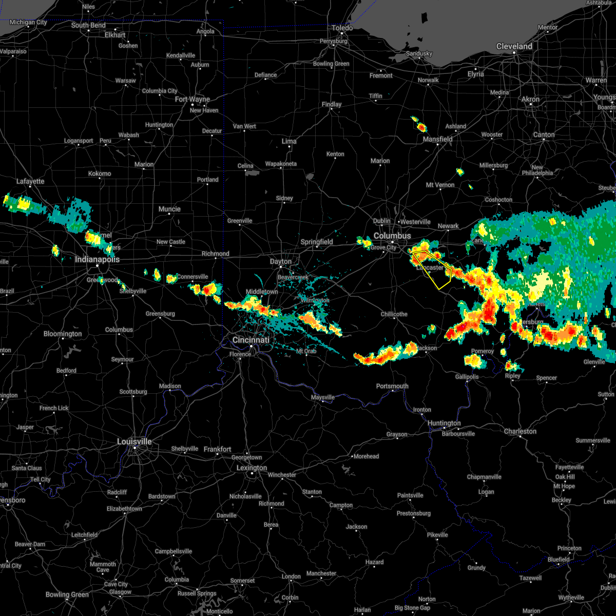 At 443 pm edt, a severe thunderstorm was located near baltimore, moving southeast at 40 mph (radar indicated). Hazards include 60 mph wind gusts. Expect damage to trees and power lines. Locations impacted include, lancaster, pickerington, canal winchester, baltimore, bremen, pleasantville, hide-a-way hills, carroll, sugar grove, rushville, west rushville, fairfield county airport, hideaway hills, north berne and dumontville. At 443 pm edt, a severe thunderstorm was located near baltimore, moving southeast at 40 mph (radar indicated). Hazards include 60 mph wind gusts. Expect damage to trees and power lines. Locations impacted include, lancaster, pickerington, canal winchester, baltimore, bremen, pleasantville, hide-a-way hills, carroll, sugar grove, rushville, west rushville, fairfield county airport, hideaway hills, north berne and dumontville.
|
| 8/25/2020 4:34 PM EDT |
 At 434 pm edt, a severe thunderstorm was located near pickerington, moving southeast at 35 mph (radar indicated). Hazards include 60 mph wind gusts and quarter size hail. Minor hail damage to vehicles is possible. Expect wind damage to trees and power lines. At 434 pm edt, a severe thunderstorm was located near pickerington, moving southeast at 35 mph (radar indicated). Hazards include 60 mph wind gusts and quarter size hail. Minor hail damage to vehicles is possible. Expect wind damage to trees and power lines.
|
| 7/10/2020 3:52 PM EDT |
 At 352 pm edt, severe thunderstorms were located along a line extending from near reynoldsburg to 6 miles southeast of canal winchester, moving northeast at 30 mph (radar indicated). Hazards include 60 mph wind gusts and quarter size hail. Minor damage to vehicles is possible. expect damage to trees and power lines. Locations impacted include, columbus, lancaster, reynoldsburg, gahanna, pickerington, canal winchester, groveport, baltimore, buckeye lake, millersport, pleasantville, fairfield beach, whitehall, lithopolis, thurston, carroll, rushville, west rushville, brice and fairfield county airport. At 352 pm edt, severe thunderstorms were located along a line extending from near reynoldsburg to 6 miles southeast of canal winchester, moving northeast at 30 mph (radar indicated). Hazards include 60 mph wind gusts and quarter size hail. Minor damage to vehicles is possible. expect damage to trees and power lines. Locations impacted include, columbus, lancaster, reynoldsburg, gahanna, pickerington, canal winchester, groveport, baltimore, buckeye lake, millersport, pleasantville, fairfield beach, whitehall, lithopolis, thurston, carroll, rushville, west rushville, brice and fairfield county airport.
|
| 7/10/2020 3:26 PM EDT |
 At 326 pm edt, severe thunderstorms were located along a line extending from near easton to near ashville, moving northeast at 45 mph (radar indicated). Hazards include 60 mph wind gusts and quarter size hail. Minor damage to vehicles is possible. Expect damage to trees and power lines. At 326 pm edt, severe thunderstorms were located along a line extending from near easton to near ashville, moving northeast at 45 mph (radar indicated). Hazards include 60 mph wind gusts and quarter size hail. Minor damage to vehicles is possible. Expect damage to trees and power lines.
|
| 7/10/2020 2:27 PM EDT |
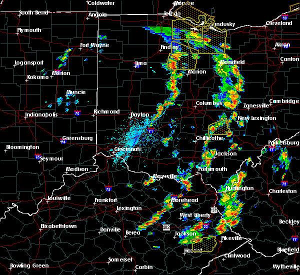 At 227 pm edt, a severe thunderstorm was located 9 miles south of lancaster, moving northeast at 15 mph (radar indicated). Hazards include 60 mph wind gusts. Expect damage to trees and power lines. Locations impacted include, lancaster, logan, bremen, hide-a-way hills, sugar grove, rushville, west rushville, buena vista in hocking county, gibisonville, hideaway hills, lake logan state park, clearport, north berne, enterprise and rockbridge. At 227 pm edt, a severe thunderstorm was located 9 miles south of lancaster, moving northeast at 15 mph (radar indicated). Hazards include 60 mph wind gusts. Expect damage to trees and power lines. Locations impacted include, lancaster, logan, bremen, hide-a-way hills, sugar grove, rushville, west rushville, buena vista in hocking county, gibisonville, hideaway hills, lake logan state park, clearport, north berne, enterprise and rockbridge.
|
| 7/10/2020 2:12 PM EDT |
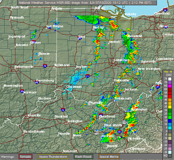 At 211 pm edt, a severe thunderstorm was located 11 miles northwest of hocking hills state park, moving east at 25 mph (radar indicated). Hazards include 60 mph wind gusts and penny size hail. expect damage to trees and power lines At 211 pm edt, a severe thunderstorm was located 11 miles northwest of hocking hills state park, moving east at 25 mph (radar indicated). Hazards include 60 mph wind gusts and penny size hail. expect damage to trees and power lines
|
| 6/10/2020 7:07 PM EDT |
 At 707 pm edt, a severe thunderstorm was located over fairfield beach, moving east at 55 mph (radar indicated). Hazards include 70 mph wind gusts. Expect considerable tree damage. damage is likely to mobile homes, roofs, and outbuildings. locations impacted include, lancaster, reynoldsburg, pickerington, canal winchester, baltimore, buckeye lake, bremen, millersport, pleasantville, fairfield beach, thurston, carroll, rushville, west rushville, fairfield county airport, state route 158 at state route 204, north berne and dumontville. This includes i-70 in ohio between mile markers 112 and 113. At 707 pm edt, a severe thunderstorm was located over fairfield beach, moving east at 55 mph (radar indicated). Hazards include 70 mph wind gusts. Expect considerable tree damage. damage is likely to mobile homes, roofs, and outbuildings. locations impacted include, lancaster, reynoldsburg, pickerington, canal winchester, baltimore, buckeye lake, bremen, millersport, pleasantville, fairfield beach, thurston, carroll, rushville, west rushville, fairfield county airport, state route 158 at state route 204, north berne and dumontville. This includes i-70 in ohio between mile markers 112 and 113.
|
| 6/10/2020 6:50 PM EDT |
 At 650 pm edt, a severe thunderstorm was located near canal winchester, moving east at 55 mph (radar indicated). Hazards include 70 mph wind gusts. Expect considerable tree damage. damage is likely to mobile homes, roofs, and outbuildings. locations impacted include, columbus, lancaster, reynoldsburg, grove city, pickerington, canal winchester, groveport, ashville, baltimore, buckeye lake, south bloomfield, bremen, millersport, pleasantville, fairfield beach, obetz, royalton, lithopolis, urbancrest and thurston. this includes the following interstates, i-70 in ohio between mile markers 108 and 113. I-71 in ohio between mile markers 99 and 103. At 650 pm edt, a severe thunderstorm was located near canal winchester, moving east at 55 mph (radar indicated). Hazards include 70 mph wind gusts. Expect considerable tree damage. damage is likely to mobile homes, roofs, and outbuildings. locations impacted include, columbus, lancaster, reynoldsburg, grove city, pickerington, canal winchester, groveport, ashville, baltimore, buckeye lake, south bloomfield, bremen, millersport, pleasantville, fairfield beach, obetz, royalton, lithopolis, urbancrest and thurston. this includes the following interstates, i-70 in ohio between mile markers 108 and 113. I-71 in ohio between mile markers 99 and 103.
|
| 6/10/2020 6:34 PM EDT |
 At 634 pm edt, a severe thunderstorm was located near south bloomfield, moving east at 55 mph (radar indicated). Hazards include 70 mph wind gusts. Expect considerable tree damage. damage is likely to mobile homes, roofs, and outbuildings. locations impacted include, columbus, lancaster, reynoldsburg, grove city, pickerington, canal winchester, groveport, ashville, baltimore, buckeye lake, south bloomfield, bremen, millersport, pleasantville, fairfield beach, obetz, commercial point, royalton, lithopolis and urbancrest. this includes the following interstates, i-70 in ohio near mile marker 106, and between mile markers 108 and 113. I-71 in ohio between mile markers 89 and 103. At 634 pm edt, a severe thunderstorm was located near south bloomfield, moving east at 55 mph (radar indicated). Hazards include 70 mph wind gusts. Expect considerable tree damage. damage is likely to mobile homes, roofs, and outbuildings. locations impacted include, columbus, lancaster, reynoldsburg, grove city, pickerington, canal winchester, groveport, ashville, baltimore, buckeye lake, south bloomfield, bremen, millersport, pleasantville, fairfield beach, obetz, commercial point, royalton, lithopolis and urbancrest. this includes the following interstates, i-70 in ohio near mile marker 106, and between mile markers 108 and 113. I-71 in ohio between mile markers 89 and 103.
|
| 6/10/2020 6:28 PM EDT |
 At 628 pm edt, a severe thunderstorm was located near mount sterling, moving east at 55 mph (radar indicated). Hazards include 60 mph wind gusts. expect damage to trees and power lines At 628 pm edt, a severe thunderstorm was located near mount sterling, moving east at 55 mph (radar indicated). Hazards include 60 mph wind gusts. expect damage to trees and power lines
|
| 6/4/2020 2:45 PM EDT | Ping Pong Ball sized hail reported 8 miles ENE of Lancaster, OH, photo posted on social media. time estimated from person who shared. |
| 6/4/2020 2:10 PM EDT | 2-5 inch tree limbs down. photos posted to social media. time estimated from rada in fairfield county OH, 3.8 miles ENE of Lancaster, OH |
| 6/4/2020 2:06 PM EDT |
 At 206 pm edt, a severe thunderstorm was located near lancaster, moving northeast at 20 mph (radar indicated). Hazards include ping pong ball size hail and 60 mph wind gusts. People and animals outdoors will be injured. expect hail damage to roofs, siding, windows, and vehicles. expect wind damage to trees and power lines. Locations impacted include, lancaster, baltimore, buckeye lake, millersport, pleasantville, fairfield beach, thurston, carroll, rushville, west rushville, fairfield county airport, us route 22 at state route 159, state route 158 at state route 204 and dumontville. At 206 pm edt, a severe thunderstorm was located near lancaster, moving northeast at 20 mph (radar indicated). Hazards include ping pong ball size hail and 60 mph wind gusts. People and animals outdoors will be injured. expect hail damage to roofs, siding, windows, and vehicles. expect wind damage to trees and power lines. Locations impacted include, lancaster, baltimore, buckeye lake, millersport, pleasantville, fairfield beach, thurston, carroll, rushville, west rushville, fairfield county airport, us route 22 at state route 159, state route 158 at state route 204 and dumontville.
|
| 6/4/2020 1:54 PM EDT |
 At 154 pm edt, a severe thunderstorm was located 8 miles west of lancaster, moving northeast at 20 mph (radar indicated). Hazards include 60 mph wind gusts and quarter size hail. Minor hail damage to vehicles is possible. Expect wind damage to trees and power lines. At 154 pm edt, a severe thunderstorm was located 8 miles west of lancaster, moving northeast at 20 mph (radar indicated). Hazards include 60 mph wind gusts and quarter size hail. Minor hail damage to vehicles is possible. Expect wind damage to trees and power lines.
|
| 5/10/2020 5:31 PM EDT |
 At 531 pm edt, severe thunderstorms were located along a line extending from newark to pleasantville, moving east at 40 mph (radar indicated). Hazards include 60 mph wind gusts. Expect damage to trees and power lines. locations impacted include, newark, lancaster, heath, granville, baltimore, buckeye lake, hebron, millersport, pleasantville, harbor hills, granville south, fairfield beach, thornport, thurston, kirkersville, carroll, st. louisville, rushville, west rushville and fairfield county airport. This includes i-70 in ohio between mile markers 124 and 136. At 531 pm edt, severe thunderstorms were located along a line extending from newark to pleasantville, moving east at 40 mph (radar indicated). Hazards include 60 mph wind gusts. Expect damage to trees and power lines. locations impacted include, newark, lancaster, heath, granville, baltimore, buckeye lake, hebron, millersport, pleasantville, harbor hills, granville south, fairfield beach, thornport, thurston, kirkersville, carroll, st. louisville, rushville, west rushville and fairfield county airport. This includes i-70 in ohio between mile markers 124 and 136.
|
| 5/10/2020 5:20 PM EDT |
 At 520 pm edt, severe thunderstorms were located along a line extending from granville to baltimore, moving east at 40 mph (radar indicated). Hazards include 70 mph wind gusts. Expect considerable tree damage. damage is likely to mobile homes, roofs, and outbuildings. locations impacted include, newark, lancaster, heath, granville, pataskala, johnstown, baltimore, buckeye lake, hebron, millersport, pleasantville, harbor hills, granville south, fairfield beach, beechwood trails, thornport, etna, thurston, kirkersville and carroll. This includes i-70 in ohio between mile markers 118 and 136. At 520 pm edt, severe thunderstorms were located along a line extending from granville to baltimore, moving east at 40 mph (radar indicated). Hazards include 70 mph wind gusts. Expect considerable tree damage. damage is likely to mobile homes, roofs, and outbuildings. locations impacted include, newark, lancaster, heath, granville, pataskala, johnstown, baltimore, buckeye lake, hebron, millersport, pleasantville, harbor hills, granville south, fairfield beach, beechwood trails, thornport, etna, thurston, kirkersville and carroll. This includes i-70 in ohio between mile markers 118 and 136.
|
| 5/10/2020 5:06 PM EDT |
 At 504 pm edt, severe thunderstorms were located along a line extending from near johnstown to near canal winchester, moving east at 55 mph (radar indicated). Hazards include 70 mph wind gusts. Expect considerable tree damage. damage is likely to mobile homes, roofs, and outbuildings. locations impacted include, newark, lancaster, reynoldsburg, pickerington, heath, granville, pataskala, canal winchester, johnstown, baltimore, buckeye lake, hebron, millersport, pleasantville, harbor hills, granville south, fairfield beach, beechwood trails, summit station and thornport. This includes i-70 in ohio between mile markers 112 and 136. At 504 pm edt, severe thunderstorms were located along a line extending from near johnstown to near canal winchester, moving east at 55 mph (radar indicated). Hazards include 70 mph wind gusts. Expect considerable tree damage. damage is likely to mobile homes, roofs, and outbuildings. locations impacted include, newark, lancaster, reynoldsburg, pickerington, heath, granville, pataskala, canal winchester, johnstown, baltimore, buckeye lake, hebron, millersport, pleasantville, harbor hills, granville south, fairfield beach, beechwood trails, summit station and thornport. This includes i-70 in ohio between mile markers 112 and 136.
|
| 5/10/2020 4:56 PM EDT |
 At 455 pm edt, severe thunderstorms were located along a line extending from near sunbury to 6 miles north of south bloomfield, moving northeast at 50 mph (radar indicated). Hazards include 60 mph wind gusts. expect damage to trees and power lines At 455 pm edt, severe thunderstorms were located along a line extending from near sunbury to 6 miles north of south bloomfield, moving northeast at 50 mph (radar indicated). Hazards include 60 mph wind gusts. expect damage to trees and power lines
|
| 3/28/2020 3:00 PM EDT |
 At 300 pm edt, a severe thunderstorm was located near groveport, moving east at 45 mph (radar indicated). Hazards include 60 mph wind gusts and quarter size hail. Minor hail damage to vehicles is possible. expect wind damage to trees and power lines. locations impacted include, columbus, lancaster, reynoldsburg, grove city, upper arlington, gahanna, pickerington, bexley, pataskala, canal winchester, groveport, baltimore, buckeye lake, hebron, millersport, granville south, ohio state university, beechwood trails, easton and summit station. this includes the following interstates, i-70 in ohio between mile markers 98 and 128. I-71 in ohio between mile markers 103 and 115. At 300 pm edt, a severe thunderstorm was located near groveport, moving east at 45 mph (radar indicated). Hazards include 60 mph wind gusts and quarter size hail. Minor hail damage to vehicles is possible. expect wind damage to trees and power lines. locations impacted include, columbus, lancaster, reynoldsburg, grove city, upper arlington, gahanna, pickerington, bexley, pataskala, canal winchester, groveport, baltimore, buckeye lake, hebron, millersport, granville south, ohio state university, beechwood trails, easton and summit station. this includes the following interstates, i-70 in ohio between mile markers 98 and 128. I-71 in ohio between mile markers 103 and 115.
|
| 3/28/2020 2:39 PM EDT |
 At 238 pm edt, a severe thunderstorm was located near grove city, moving east at 40 mph (radar indicated). Hazards include 60 mph wind gusts and quarter size hail. Minor hail damage to vehicles is possible. Expect wind damage to trees and power lines. At 238 pm edt, a severe thunderstorm was located near grove city, moving east at 40 mph (radar indicated). Hazards include 60 mph wind gusts and quarter size hail. Minor hail damage to vehicles is possible. Expect wind damage to trees and power lines.
|
| 9/29/2019 7:22 PM EDT |
 The severe thunderstorm warning for southwestern fairfield, northwestern hocking and southeastern pickaway counties will expire at 730 pm edt, the storm which prompted the warning has weakened below severe limits, and no longer poses an immediate threat to life or property. therefore, the warning will be allowed to expire. however gusty winds are still possible with this thunderstorm. please report previous wind damage or hail to the national weather service by going to our website at weather.gov/iln and submitting your report via social media. The severe thunderstorm warning for southwestern fairfield, northwestern hocking and southeastern pickaway counties will expire at 730 pm edt, the storm which prompted the warning has weakened below severe limits, and no longer poses an immediate threat to life or property. therefore, the warning will be allowed to expire. however gusty winds are still possible with this thunderstorm. please report previous wind damage or hail to the national weather service by going to our website at weather.gov/iln and submitting your report via social media.
|
| 9/29/2019 7:06 PM EDT |
 At 705 pm edt, a severe thunderstorm was located near circleville, moving east at 25 mph (radar indicated). Hazards include 60 mph wind gusts and quarter size hail. Minor hail damage to vehicles is possible. expect wind damage to trees and power lines. Locations impacted include, lancaster, circleville, logan elm village, amanda, stoutsville, sugar grove, tarlton, aw marion state park, east ringgold, us route 22 at state route 159, buena vista in hocking county, gibisonville, clearport, state route 674 at state route 188 and rockbridge. At 705 pm edt, a severe thunderstorm was located near circleville, moving east at 25 mph (radar indicated). Hazards include 60 mph wind gusts and quarter size hail. Minor hail damage to vehicles is possible. expect wind damage to trees and power lines. Locations impacted include, lancaster, circleville, logan elm village, amanda, stoutsville, sugar grove, tarlton, aw marion state park, east ringgold, us route 22 at state route 159, buena vista in hocking county, gibisonville, clearport, state route 674 at state route 188 and rockbridge.
|
| 9/29/2019 6:46 PM EDT |
 At 645 pm edt, a severe thunderstorm was located over south bloomfield, moving east at 25 mph (radar indicated). Hazards include 60 mph wind gusts and quarter size hail. Minor hail damage to vehicles is possible. Expect wind damage to trees and power lines. At 645 pm edt, a severe thunderstorm was located over south bloomfield, moving east at 25 mph (radar indicated). Hazards include 60 mph wind gusts and quarter size hail. Minor hail damage to vehicles is possible. Expect wind damage to trees and power lines.
|
| 7/21/2019 3:12 PM EDT |
 The severe thunderstorm warning for southeastern franklin, southwestern fairfield and eastern pickaway counties will expire at 315 pm edt, the storm which prompted the warning has weakened below severe limits, and no longer poses an immediate threat to life or property. therefore, the warning will be allowed to expire. however heavy rain is still possible with this thunderstorm. please report previous wind damage or hail to the national weather service by going to our website at weather.gov/iln and submitting your report via social media. The severe thunderstorm warning for southeastern franklin, southwestern fairfield and eastern pickaway counties will expire at 315 pm edt, the storm which prompted the warning has weakened below severe limits, and no longer poses an immediate threat to life or property. therefore, the warning will be allowed to expire. however heavy rain is still possible with this thunderstorm. please report previous wind damage or hail to the national weather service by going to our website at weather.gov/iln and submitting your report via social media.
|
| 7/21/2019 3:04 PM EDT |
 At 304 pm edt, a severe thunderstorm was located near ashville, moving north at 40 mph (radar indicated). Hazards include 60 mph wind gusts. Expect damage to trees and power lines. Locations impacted include, circleville, canal winchester, ashville, logan elm village, royalton, lithopolis, amanda, stoutsville, carroll, aw marion state park, east ringgold, slate run metro park and state route 674 at state route 188. At 304 pm edt, a severe thunderstorm was located near ashville, moving north at 40 mph (radar indicated). Hazards include 60 mph wind gusts. Expect damage to trees and power lines. Locations impacted include, circleville, canal winchester, ashville, logan elm village, royalton, lithopolis, amanda, stoutsville, carroll, aw marion state park, east ringgold, slate run metro park and state route 674 at state route 188.
|
| 7/21/2019 2:48 PM EDT |
 At 248 pm edt, a severe thunderstorm was located over circleville, moving north at 40 mph (radar indicated). Hazards include 60 mph wind gusts. expect damage to trees and power lines At 248 pm edt, a severe thunderstorm was located over circleville, moving north at 40 mph (radar indicated). Hazards include 60 mph wind gusts. expect damage to trees and power lines
|
| 7/2/2019 7:32 PM EDT |
 At 732 pm edt, severe thunderstorms were located along a line extending from near frazeysburg to near bremen, moving east at 30 mph (radar indicated). Hazards include 60 mph wind gusts. Expect damage to trees and power lines. locations impacted include, newark, lancaster, heath, baltimore, buckeye lake, hebron, bremen, millersport, pleasantville, hanover, harbor hills, hide-a-way hills, marne, fairfield beach, thornport, thurston, rushville, gratiot, west rushville and fairfield county airport. This includes i-70 in ohio between mile markers 128 and 142, and near mile marker 144. At 732 pm edt, severe thunderstorms were located along a line extending from near frazeysburg to near bremen, moving east at 30 mph (radar indicated). Hazards include 60 mph wind gusts. Expect damage to trees and power lines. locations impacted include, newark, lancaster, heath, baltimore, buckeye lake, hebron, bremen, millersport, pleasantville, hanover, harbor hills, hide-a-way hills, marne, fairfield beach, thornport, thurston, rushville, gratiot, west rushville and fairfield county airport. This includes i-70 in ohio between mile markers 128 and 142, and near mile marker 144.
|
| 7/2/2019 7:21 PM EDT |
 At 721 pm edt, severe thunderstorms were located along a line extending from 6 miles north of hanover to near lancaster, moving southeast at 15 mph (radar indicated). Hazards include 60 mph wind gusts. Expect damage to trees and power lines. locations impacted include, newark, lancaster, heath, granville, baltimore, buckeye lake, hebron, bremen, millersport, pleasantville, hanover, harbor hills, hide-a-way hills, marne, fairfield beach, thornport, granville south, thurston, kirkersville and carroll. This includes i-70 in ohio between mile markers 123 and 142, and near mile marker 144. At 721 pm edt, severe thunderstorms were located along a line extending from 6 miles north of hanover to near lancaster, moving southeast at 15 mph (radar indicated). Hazards include 60 mph wind gusts. Expect damage to trees and power lines. locations impacted include, newark, lancaster, heath, granville, baltimore, buckeye lake, hebron, bremen, millersport, pleasantville, hanover, harbor hills, hide-a-way hills, marne, fairfield beach, thornport, granville south, thurston, kirkersville and carroll. This includes i-70 in ohio between mile markers 123 and 142, and near mile marker 144.
|
| 7/2/2019 7:08 PM EDT | Trees downe in fairfield county OH, 0.5 miles N of Lancaster, OH |
| 7/2/2019 7:04 PM EDT |
 At 704 pm edt, severe thunderstorms were located along a line extending from 7 miles east of utica to near lancaster, moving east at 25 mph (radar indicated). Hazards include 60 mph wind gusts. expect damage to trees and power lines At 704 pm edt, severe thunderstorms were located along a line extending from 7 miles east of utica to near lancaster, moving east at 25 mph (radar indicated). Hazards include 60 mph wind gusts. expect damage to trees and power lines
|
| 6/24/2019 4:11 PM EDT |
 At 352 pm edt, a severe thunderstorm was located over bremen, moving east at 35 mph (radar indicated). Hazards include 60 mph wind gusts. Expect damage to trees and power lines. Locations impacted include, lancaster, bremen, pleasantville, hide-a-way hills, thurston, sugar grove, rushville, west rushville, north berne, rockbridge, hideaway hills and dumontville. At 352 pm edt, a severe thunderstorm was located over bremen, moving east at 35 mph (radar indicated). Hazards include 60 mph wind gusts. Expect damage to trees and power lines. Locations impacted include, lancaster, bremen, pleasantville, hide-a-way hills, thurston, sugar grove, rushville, west rushville, north berne, rockbridge, hideaway hills and dumontville.
|
| 6/24/2019 3:52 PM EDT |
 At 352 pm edt, a severe thunderstorm was located over bremen, moving east at 35 mph (radar indicated). Hazards include 60 mph wind gusts. Expect damage to trees and power lines. Locations impacted include, lancaster, bremen, pleasantville, hide-a-way hills, thurston, sugar grove, rushville, west rushville, north berne, rockbridge, hideaway hills and dumontville. At 352 pm edt, a severe thunderstorm was located over bremen, moving east at 35 mph (radar indicated). Hazards include 60 mph wind gusts. Expect damage to trees and power lines. Locations impacted include, lancaster, bremen, pleasantville, hide-a-way hills, thurston, sugar grove, rushville, west rushville, north berne, rockbridge, hideaway hills and dumontville.
|
| 6/24/2019 3:43 PM EDT |
 At 343 pm edt, a severe thunderstorm was located near hide-a-way hills, moving northeast at 35 mph (radar indicated). Hazards include 60 mph wind gusts. expect damage to trees and power lines At 343 pm edt, a severe thunderstorm was located near hide-a-way hills, moving northeast at 35 mph (radar indicated). Hazards include 60 mph wind gusts. expect damage to trees and power lines
|
| 5/28/2019 12:41 AM EDT |
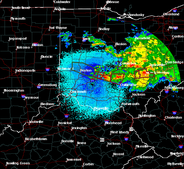 The tornado warning for southeastern fairfield and north central hocking counties will expire at 1245 am edt, the storm which prompted the warning has moved out of the area. therefore, the warning will be allowed to expire. a tornado watch remains in effect until 200 am edt for central ohio. please report previous tornadoes, wind damage or hail to the national weather service by going to our website at weather.gov/iln and submitting your report via social media. The tornado warning for southeastern fairfield and north central hocking counties will expire at 1245 am edt, the storm which prompted the warning has moved out of the area. therefore, the warning will be allowed to expire. a tornado watch remains in effect until 200 am edt for central ohio. please report previous tornadoes, wind damage or hail to the national weather service by going to our website at weather.gov/iln and submitting your report via social media.
|
| 5/28/2019 12:29 AM EDT |
 At 1228 am edt, a severe thunderstorm capable of producing a tornado was located over bremen, moving east at 35 mph (radar indicated rotation. spotters reported rotation). Hazards include tornado. Flying debris will be dangerous to those caught without shelter. mobile homes will be damaged or destroyed. damage to roofs, windows, and vehicles will occur. tree damage is likely. Locations impacted include, lancaster, bremen, pleasantville, hide-a-way hills, rushville, west rushville, north berne and hideaway hills. At 1228 am edt, a severe thunderstorm capable of producing a tornado was located over bremen, moving east at 35 mph (radar indicated rotation. spotters reported rotation). Hazards include tornado. Flying debris will be dangerous to those caught without shelter. mobile homes will be damaged or destroyed. damage to roofs, windows, and vehicles will occur. tree damage is likely. Locations impacted include, lancaster, bremen, pleasantville, hide-a-way hills, rushville, west rushville, north berne and hideaway hills.
|
| 5/28/2019 12:12 AM EDT |
 At 1211 am edt, a severe thunderstorm capable of producing a tornado was located over lancaster, moving east at 35 mph (radar indicated rotation). Hazards include tornado. Flying debris will be dangerous to those caught without shelter. mobile homes will be damaged or destroyed. damage to roofs, windows, and vehicles will occur. Tree damage is likely. At 1211 am edt, a severe thunderstorm capable of producing a tornado was located over lancaster, moving east at 35 mph (radar indicated rotation). Hazards include tornado. Flying debris will be dangerous to those caught without shelter. mobile homes will be damaged or destroyed. damage to roofs, windows, and vehicles will occur. Tree damage is likely.
|
| 5/28/2019 12:02 AM EDT |
 At 1202 am edt, a severe thunderstorm capable of producing a tornado was located 8 miles west of lancaster, moving east at 35 mph (radar indicated rotation). Hazards include tornado. Flying debris will be dangerous to those caught without shelter. mobile homes will be damaged or destroyed. damage to roofs, windows, and vehicles will occur. tree damage is likely. Locations impacted include, lancaster, pleasantville, hide-a-way hills, royalton, amanda, thurston, carroll, sugar grove, fairfield county airport, us route 22 at state route 159, clearport, north berne and dumontville. At 1202 am edt, a severe thunderstorm capable of producing a tornado was located 8 miles west of lancaster, moving east at 35 mph (radar indicated rotation). Hazards include tornado. Flying debris will be dangerous to those caught without shelter. mobile homes will be damaged or destroyed. damage to roofs, windows, and vehicles will occur. tree damage is likely. Locations impacted include, lancaster, pleasantville, hide-a-way hills, royalton, amanda, thurston, carroll, sugar grove, fairfield county airport, us route 22 at state route 159, clearport, north berne and dumontville.
|
| 5/27/2019 11:50 PM EDT |
 At 1149 pm edt, a severe thunderstorm capable of producing a tornado was located near circleville, moving east at 35 mph (radar indicated rotation). Hazards include tornado. Flying debris will be dangerous to those caught without shelter. mobile homes will be damaged or destroyed. damage to roofs, windows, and vehicles will occur. Tree damage is likely. At 1149 pm edt, a severe thunderstorm capable of producing a tornado was located near circleville, moving east at 35 mph (radar indicated rotation). Hazards include tornado. Flying debris will be dangerous to those caught without shelter. mobile homes will be damaged or destroyed. damage to roofs, windows, and vehicles will occur. Tree damage is likely.
|
| 4/14/2019 6:33 PM EDT |
 At 633 pm edt, severe thunderstorms were located along a line extending from near chesterville to near lancaster, moving east at 45 mph (radar indicated). Hazards include 60 mph wind gusts. expect damage to trees and power lines At 633 pm edt, severe thunderstorms were located along a line extending from near chesterville to near lancaster, moving east at 45 mph (radar indicated). Hazards include 60 mph wind gusts. expect damage to trees and power lines
|
| 4/14/2019 4:39 PM EDT |
 At 438 pm edt, a severe thunderstorm was located near hide-a-way hills, moving northeast at 50 mph (radar indicated). Hazards include 60 mph wind gusts and penny size hail. Expect damage to trees and power lines. locations impacted include, lancaster, logan, nelsonville, bremen, hide-a-way hills, murray city, sugar grove, rushville, west rushville, hideaway hills, haydenville, north berne, enterprise, union furnace, rockbridge, oreville and carbon hill. A tornado watch remains in effect until 900 pm edt for central ohio. At 438 pm edt, a severe thunderstorm was located near hide-a-way hills, moving northeast at 50 mph (radar indicated). Hazards include 60 mph wind gusts and penny size hail. Expect damage to trees and power lines. locations impacted include, lancaster, logan, nelsonville, bremen, hide-a-way hills, murray city, sugar grove, rushville, west rushville, hideaway hills, haydenville, north berne, enterprise, union furnace, rockbridge, oreville and carbon hill. A tornado watch remains in effect until 900 pm edt for central ohio.
|
| 4/14/2019 4:27 PM EDT |
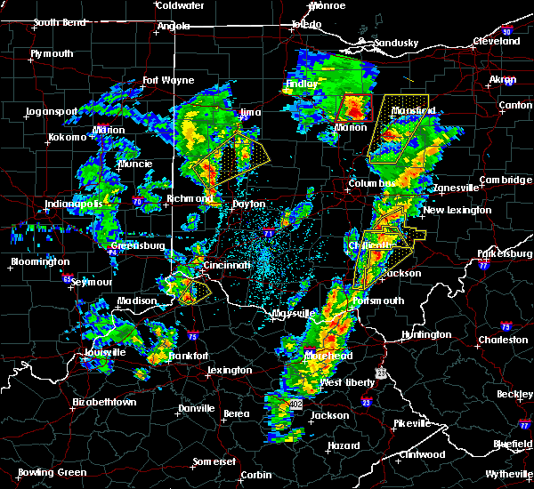 At 426 pm edt, a severe thunderstorm was located 8 miles northwest of hocking hills state park, moving northeast at 45 mph (radar indicated). Hazards include 60 mph wind gusts and penny size hail. expect damage to trees and power lines At 426 pm edt, a severe thunderstorm was located 8 miles northwest of hocking hills state park, moving northeast at 45 mph (radar indicated). Hazards include 60 mph wind gusts and penny size hail. expect damage to trees and power lines
|
| 3/14/2019 8:42 PM EDT |
 At 842 pm edt, severe thunderstorms were located along a line extending from near heath to 10 miles southwest of lancaster, moving east at 45 mph (radar indicated). Hazards include 60 mph wind gusts. Expect damage to trees and power lines. locations impacted include, lancaster, baltimore, buckeye lake, hebron, bremen, millersport, pleasantville, harbor hills, fairfield beach, hide-a-way hills, thornport, amanda, thurston, stoutsville, sugar grove, rushville, gratiot, west rushville, fairfield county airport and us route 22 at state route 159. This includes i-70 in ohio between mile markers 127 and 142, and near mile marker 144. At 842 pm edt, severe thunderstorms were located along a line extending from near heath to 10 miles southwest of lancaster, moving east at 45 mph (radar indicated). Hazards include 60 mph wind gusts. Expect damage to trees and power lines. locations impacted include, lancaster, baltimore, buckeye lake, hebron, bremen, millersport, pleasantville, harbor hills, fairfield beach, hide-a-way hills, thornport, amanda, thurston, stoutsville, sugar grove, rushville, gratiot, west rushville, fairfield county airport and us route 22 at state route 159. This includes i-70 in ohio between mile markers 127 and 142, and near mile marker 144.
|
| 3/14/2019 8:25 PM EDT | Power pole snapped. time estimated from rada in fairfield county OH, 0.5 miles N of Lancaster, OH |
| 3/14/2019 8:15 PM EDT |
 At 815 pm edt, severe thunderstorms were located along a line extending from near heath to logan elm village, moving northeast at 115 mph (radar indicated). Hazards include 60 mph wind gusts. expect damage to trees and power lines At 815 pm edt, severe thunderstorms were located along a line extending from near heath to logan elm village, moving northeast at 115 mph (radar indicated). Hazards include 60 mph wind gusts. expect damage to trees and power lines
|
| 2/7/2019 4:50 PM EST |
 The severe thunderstorm warning for central fairfield county will expire at 500 pm est, the storm which prompted the warning has weakened below severe limits, and no longer poses an immediate threat to life or property. therefore, the warning will be allowed to expire. however gusty winds and heavy rain are still possible with this thunderstorm. please report previous wind damage or hail to the national weather service by going to our website at weather.gov/iln and submitting your report via social media. The severe thunderstorm warning for central fairfield county will expire at 500 pm est, the storm which prompted the warning has weakened below severe limits, and no longer poses an immediate threat to life or property. therefore, the warning will be allowed to expire. however gusty winds and heavy rain are still possible with this thunderstorm. please report previous wind damage or hail to the national weather service by going to our website at weather.gov/iln and submitting your report via social media.
|
| 2/7/2019 4:36 PM EST |
 At 436 pm est, a severe thunderstorm was located 7 miles southeast of canal winchester, moving east at 45 mph (radar indicated). Hazards include 60 mph wind gusts. Expect damage to trees and power lines. Locations impacted include, lancaster, baltimore, bremen, pleasantville, hide-a-way hills, royalton, thurston, carroll, rushville, west rushville, fairfield county airport, us route 22 at state route 159, north berne and dumontville. At 436 pm est, a severe thunderstorm was located 7 miles southeast of canal winchester, moving east at 45 mph (radar indicated). Hazards include 60 mph wind gusts. Expect damage to trees and power lines. Locations impacted include, lancaster, baltimore, bremen, pleasantville, hide-a-way hills, royalton, thurston, carroll, rushville, west rushville, fairfield county airport, us route 22 at state route 159, north berne and dumontville.
|
| 2/7/2019 4:28 PM EST |
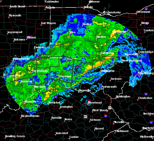 At 428 pm est, a severe thunderstorm was located near ashville, moving east at 45 mph (radar indicated). Hazards include 60 mph wind gusts. expect damage to trees and power lines At 428 pm est, a severe thunderstorm was located near ashville, moving east at 45 mph (radar indicated). Hazards include 60 mph wind gusts. expect damage to trees and power lines
|
| 8/10/2018 4:33 PM EDT | One tree downe in fairfield county OH, 8.7 miles E of Lancaster, OH |
| 8/10/2018 4:20 PM EDT |
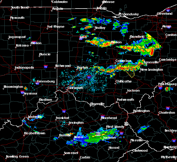 At 419 pm edt, a severe thunderstorm was located over pleasantville, moving southeast at 25 mph (radar indicated). Hazards include 60 mph wind gusts. Expect damage to trees and power lines. Locations impacted include, lancaster, logan, bremen, pleasantville, hide-a-way hills, carroll, sugar grove, rushville, west rushville, hideaway hills, lake logan state park, north berne, enterprise, dumontville and fairfield county airport. At 419 pm edt, a severe thunderstorm was located over pleasantville, moving southeast at 25 mph (radar indicated). Hazards include 60 mph wind gusts. Expect damage to trees and power lines. Locations impacted include, lancaster, logan, bremen, pleasantville, hide-a-way hills, carroll, sugar grove, rushville, west rushville, hideaway hills, lake logan state park, north berne, enterprise, dumontville and fairfield county airport.
|
| 8/10/2018 4:11 PM EDT |
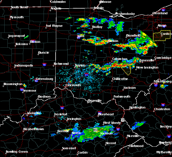 At 411 pm edt, a severe thunderstorm was located over baltimore, moving southeast at 25 mph (radar indicated). Hazards include 60 mph wind gusts. expect damage to trees and power lines At 411 pm edt, a severe thunderstorm was located over baltimore, moving southeast at 25 mph (radar indicated). Hazards include 60 mph wind gusts. expect damage to trees and power lines
|
| 6/16/2018 8:38 PM EDT |
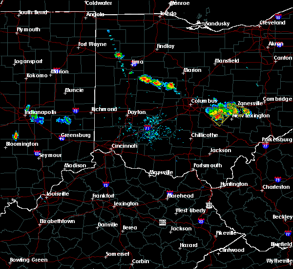 At 838 pm edt, a severe thunderstorm was located over bremen, moving southeast at 30 mph (radar indicated). Hazards include 70 mph wind gusts. Expect considerable tree damage. damage is likely to mobile homes, roofs, and outbuildings. Locations impacted include, lancaster, bremen, hide-a-way hills, rushville, west rushville, north berne and hideaway hills. At 838 pm edt, a severe thunderstorm was located over bremen, moving southeast at 30 mph (radar indicated). Hazards include 70 mph wind gusts. Expect considerable tree damage. damage is likely to mobile homes, roofs, and outbuildings. Locations impacted include, lancaster, bremen, hide-a-way hills, rushville, west rushville, north berne and hideaway hills.
|
| 6/16/2018 8:35 PM EDT |
 At 835 pm edt, a severe thunderstorm was located over bremen, moving southeast at 30 mph (radar indicated). Hazards include 70 mph wind gusts. Expect considerable tree damage. damage is likely to mobile homes, roofs, and outbuildings. Locations impacted include, lancaster, bremen, pleasantville, hide-a-way hills, rushville, west rushville, north berne and hideaway hills. At 835 pm edt, a severe thunderstorm was located over bremen, moving southeast at 30 mph (radar indicated). Hazards include 70 mph wind gusts. Expect considerable tree damage. damage is likely to mobile homes, roofs, and outbuildings. Locations impacted include, lancaster, bremen, pleasantville, hide-a-way hills, rushville, west rushville, north berne and hideaway hills.
|
| 6/16/2018 8:30 PM EDT | 4 inch branches down on pleasantville rd. time estimated from rada in fairfield county OH, 1.1 miles WNW of Lancaster, OH |
| 6/16/2018 8:30 PM EDT | Trees down on lake rd north of 22. time estimated from rada in fairfield county OH, 5.3 miles W of Lancaster, OH |
| 6/16/2018 8:29 PM EDT |
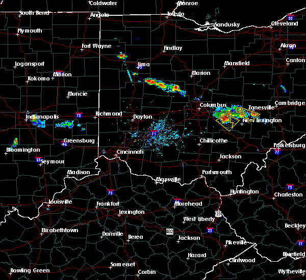 At 828 pm edt, a severe thunderstorm was located near pleasantville, moving southeast at 30 mph. this is a very dangerous storm (radar indicated). Hazards include 80 mph wind gusts. Flying debris will be dangerous to those caught without shelter. mobile homes will be heavily damaged. expect considerable damage to roofs, windows, and vehicles. extensive tree damage and power outages are likely. Locations impacted include, lancaster, bremen, pleasantville, hide-a-way hills, thurston, rushville, west rushville, north berne, hideaway hills and dumontville. At 828 pm edt, a severe thunderstorm was located near pleasantville, moving southeast at 30 mph. this is a very dangerous storm (radar indicated). Hazards include 80 mph wind gusts. Flying debris will be dangerous to those caught without shelter. mobile homes will be heavily damaged. expect considerable damage to roofs, windows, and vehicles. extensive tree damage and power outages are likely. Locations impacted include, lancaster, bremen, pleasantville, hide-a-way hills, thurston, rushville, west rushville, north berne, hideaway hills and dumontville.
|
| 6/16/2018 8:26 PM EDT |
 At 825 pm edt, a severe thunderstorm was located over pleasantville, moving southeast at 30 mph (radar indicated). Hazards include 70 mph wind gusts. Expect considerable tree damage. damage is likely to mobile homes, roofs, and outbuildings. Locations impacted include, lancaster, baltimore, bremen, millersport, pleasantville, hide-a-way hills, thurston, rushville, west rushville, north berne, hideaway hills and dumontville. At 825 pm edt, a severe thunderstorm was located over pleasantville, moving southeast at 30 mph (radar indicated). Hazards include 70 mph wind gusts. Expect considerable tree damage. damage is likely to mobile homes, roofs, and outbuildings. Locations impacted include, lancaster, baltimore, bremen, millersport, pleasantville, hide-a-way hills, thurston, rushville, west rushville, north berne, hideaway hills and dumontville.
|
| 6/16/2018 8:17 PM EDT |
 At 817 pm edt, a severe thunderstorm was located over pleasantville, moving southeast at 30 mph (radar indicated). Hazards include 70 mph wind gusts. Expect considerable tree damage. Damage is likely to mobile homes, roofs, and outbuildings. At 817 pm edt, a severe thunderstorm was located over pleasantville, moving southeast at 30 mph (radar indicated). Hazards include 70 mph wind gusts. Expect considerable tree damage. Damage is likely to mobile homes, roofs, and outbuildings.
|
| 6/16/2018 5:06 PM EDT |
 The severe thunderstorm warning for southeastern fairfield and north central hocking counties will expire at 515 pm edt, the storm which prompted the warning has weakened below severe limits, and no longer poses an immediate threat to life or property. therefore, the warning will be allowed to expire. please report previous wind damage or hail to the national weather service by going to our website at weather.gov/iln and submitting your report via social media. The severe thunderstorm warning for southeastern fairfield and north central hocking counties will expire at 515 pm edt, the storm which prompted the warning has weakened below severe limits, and no longer poses an immediate threat to life or property. therefore, the warning will be allowed to expire. please report previous wind damage or hail to the national weather service by going to our website at weather.gov/iln and submitting your report via social media.
|
| 6/16/2018 5:00 PM EDT |
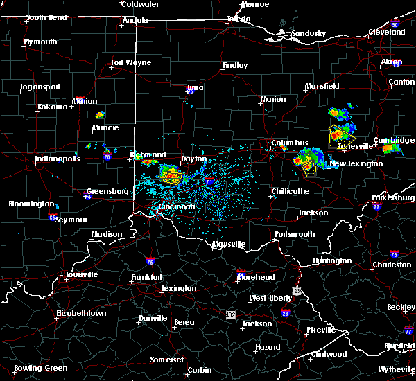 At 450 pm edt, a severe thunderstorm was located over pleasantville, moving southeast at 25 mph (radar indicated). Hazards include 60 mph wind gusts and penny size hail. Expect damage to trees and power lines. Locations impacted include, lancaster, bremen, pleasantville, hide-a-way hills, rushville, west rushville, north berne and hideaway hills. At 450 pm edt, a severe thunderstorm was located over pleasantville, moving southeast at 25 mph (radar indicated). Hazards include 60 mph wind gusts and penny size hail. Expect damage to trees and power lines. Locations impacted include, lancaster, bremen, pleasantville, hide-a-way hills, rushville, west rushville, north berne and hideaway hills.
|
| 6/16/2018 4:51 PM EDT |
 At 450 pm edt, a severe thunderstorm was located over pleasantville, moving southeast at 25 mph (radar indicated). Hazards include 60 mph wind gusts and penny size hail. Expect damage to trees and power lines. Locations impacted include, lancaster, bremen, pleasantville, hide-a-way hills, rushville, west rushville, north berne and hideaway hills. At 450 pm edt, a severe thunderstorm was located over pleasantville, moving southeast at 25 mph (radar indicated). Hazards include 60 mph wind gusts and penny size hail. Expect damage to trees and power lines. Locations impacted include, lancaster, bremen, pleasantville, hide-a-way hills, rushville, west rushville, north berne and hideaway hills.
|
| 6/16/2018 4:42 PM EDT |
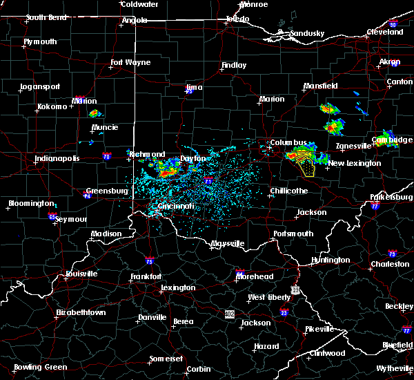 At 441 pm edt, a severe thunderstorm was located over baltimore, moving southeast at 25 mph (radar indicated). Hazards include 70 mph wind gusts and penny size hail. Expect considerable tree damage. damage is likely to mobile homes, roofs, and outbuildings. Locations impacted include, lancaster, baltimore, bremen, pleasantville, hide-a-way hills, thurston, rushville, west rushville, north berne and hideaway hills. At 441 pm edt, a severe thunderstorm was located over baltimore, moving southeast at 25 mph (radar indicated). Hazards include 70 mph wind gusts and penny size hail. Expect considerable tree damage. damage is likely to mobile homes, roofs, and outbuildings. Locations impacted include, lancaster, baltimore, bremen, pleasantville, hide-a-way hills, thurston, rushville, west rushville, north berne and hideaway hills.
|
| 6/16/2018 4:37 PM EDT |
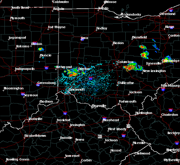 At 437 pm edt, a severe thunderstorm was located over baltimore, moving southeast at 25 mph (radar indicated). Hazards include 70 mph wind gusts and penny size hail. Expect considerable tree damage. Damage is likely to mobile homes, roofs, and outbuildings. At 437 pm edt, a severe thunderstorm was located over baltimore, moving southeast at 25 mph (radar indicated). Hazards include 70 mph wind gusts and penny size hail. Expect considerable tree damage. Damage is likely to mobile homes, roofs, and outbuildings.
|
| 5/14/2018 1:41 PM EDT |
 The severe thunderstorm warning for northeastern fairfield, north central hocking and south central licking counties will expire at 145 pm edt, the storms which prompted the warning have moved out of the area. therefore, the warning will be allowed to expire. severe thunderstorm warning 38 is still in effect for northern hocking county. please report previous wind damage or hail to the national weather service by going to our website at weather.gov/iln and submitting your report via social media. The severe thunderstorm warning for northeastern fairfield, north central hocking and south central licking counties will expire at 145 pm edt, the storms which prompted the warning have moved out of the area. therefore, the warning will be allowed to expire. severe thunderstorm warning 38 is still in effect for northern hocking county. please report previous wind damage or hail to the national weather service by going to our website at weather.gov/iln and submitting your report via social media.
|
| 5/14/2018 1:37 PM EDT |
 At 136 pm edt, severe thunderstorms were located along a line extending from granville south to near canal winchester, moving east at 40 mph (emergency management reported power outages in westerville, oh). Hazards include 60 mph wind gusts and penny size hail. Expect damage to trees and power lines. locations impacted include, lancaster, baltimore, buckeye lake, hebron, bremen, millersport, pleasantville, fairfield beach, harbor hills, hide-a-way hills, thornport, thurston, rushville, west rushville, fairfield county airport, hideaway hills, interstate 70 at state route 13, north berne and dumontville. This includes i-70 in ohio between mile markers 127 and 140. At 136 pm edt, severe thunderstorms were located along a line extending from granville south to near canal winchester, moving east at 40 mph (emergency management reported power outages in westerville, oh). Hazards include 60 mph wind gusts and penny size hail. Expect damage to trees and power lines. locations impacted include, lancaster, baltimore, buckeye lake, hebron, bremen, millersport, pleasantville, fairfield beach, harbor hills, hide-a-way hills, thornport, thurston, rushville, west rushville, fairfield county airport, hideaway hills, interstate 70 at state route 13, north berne and dumontville. This includes i-70 in ohio between mile markers 127 and 140.
|
| 5/14/2018 1:35 PM EDT |
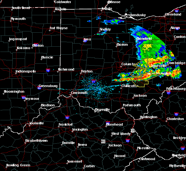 At 135 pm edt, severe thunderstorms were located along a line extending from 6 miles west of shawnee to near logan to 9 miles south of lancaster, moving southeast at 25 mph (radar indicated). Hazards include 60 mph wind gusts and quarter size hail. Minor hail damage to vehicles is possible. expect wind damage to trees and power lines. Locations impacted include, lancaster, logan, nelsonville, bremen, hocking hills state park, hide-a-way hills, starr, murray city, sugar grove, gibisonville, ilesboro, hideaway hills, haydenville, lake logan state park, clearport, north berne, enterprise, union furnace, rockbridge and oreville. At 135 pm edt, severe thunderstorms were located along a line extending from 6 miles west of shawnee to near logan to 9 miles south of lancaster, moving southeast at 25 mph (radar indicated). Hazards include 60 mph wind gusts and quarter size hail. Minor hail damage to vehicles is possible. expect wind damage to trees and power lines. Locations impacted include, lancaster, logan, nelsonville, bremen, hocking hills state park, hide-a-way hills, starr, murray city, sugar grove, gibisonville, ilesboro, hideaway hills, haydenville, lake logan state park, clearport, north berne, enterprise, union furnace, rockbridge and oreville.
|
| 5/14/2018 1:30 PM EDT |
 At 121 pm edt, severe thunderstorms were located along a line extending from near beechwood trails to near grove city, moving east at 40 mph (emergency management reported power outages in westerville, oh). Hazards include 60 mph wind gusts and penny size hail. Expect damage to trees and power lines. locations impacted include, lancaster, pickerington, pataskala, canal winchester, baltimore, buckeye lake, hebron, bremen, millersport, pleasantville, harbor hills, hide-a-way hills, fairfield beach, beechwood trails, thornport, etna, lithopolis, thurston, kirkersville and carroll. This includes i-70 in ohio between mile markers 116 and 140. At 121 pm edt, severe thunderstorms were located along a line extending from near beechwood trails to near grove city, moving east at 40 mph (emergency management reported power outages in westerville, oh). Hazards include 60 mph wind gusts and penny size hail. Expect damage to trees and power lines. locations impacted include, lancaster, pickerington, pataskala, canal winchester, baltimore, buckeye lake, hebron, bremen, millersport, pleasantville, harbor hills, hide-a-way hills, fairfield beach, beechwood trails, thornport, etna, lithopolis, thurston, kirkersville and carroll. This includes i-70 in ohio between mile markers 116 and 140.
|
| 5/14/2018 1:23 PM EDT |
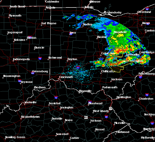 At 123 pm edt, severe thunderstorms were located along a line extending from near bremen to near hide-a-way hills to 9 miles southwest of lancaster, moving southeast at 25 mph (radar indicated). Hazards include 60 mph wind gusts and quarter size hail. Minor hail damage to vehicles is possible. Expect wind damage to trees and power lines. At 123 pm edt, severe thunderstorms were located along a line extending from near bremen to near hide-a-way hills to 9 miles southwest of lancaster, moving southeast at 25 mph (radar indicated). Hazards include 60 mph wind gusts and quarter size hail. Minor hail damage to vehicles is possible. Expect wind damage to trees and power lines.
|
| 5/14/2018 1:21 PM EDT |
 At 121 pm edt, severe thunderstorms were located along a line extending from near beechwood trails to near grove city, moving east at 40 mph (emergency management reported power outages in westerville, oh). Hazards include 60 mph wind gusts and penny size hail. Expect damage to trees and power lines. locations impacted include, lancaster, pickerington, pataskala, canal winchester, baltimore, buckeye lake, hebron, bremen, millersport, pleasantville, harbor hills, hide-a-way hills, fairfield beach, beechwood trails, thornport, etna, lithopolis, thurston, kirkersville and carroll. This includes i-70 in ohio between mile markers 116 and 140. At 121 pm edt, severe thunderstorms were located along a line extending from near beechwood trails to near grove city, moving east at 40 mph (emergency management reported power outages in westerville, oh). Hazards include 60 mph wind gusts and penny size hail. Expect damage to trees and power lines. locations impacted include, lancaster, pickerington, pataskala, canal winchester, baltimore, buckeye lake, hebron, bremen, millersport, pleasantville, harbor hills, hide-a-way hills, fairfield beach, beechwood trails, thornport, etna, lithopolis, thurston, kirkersville and carroll. This includes i-70 in ohio between mile markers 116 and 140.
|
| 5/14/2018 1:12 PM EDT |
 At 111 pm edt, severe thunderstorms were located along a line extending from near summit station to near grove city, moving east at 40 mph (radar indicated). Hazards include 60 mph wind gusts and penny size hail. Expect damage to trees and power lines. locations impacted include, columbus, lancaster, reynoldsburg, gahanna, pickerington, bexley, pataskala, canal winchester, groveport, baltimore, buckeye lake, hebron, bremen, millersport, pleasantville, harbor hills, hide-a-way hills, fairfield beach, beechwood trails and summit station. This includes i-70 in ohio between mile markers 103 and 141. At 111 pm edt, severe thunderstorms were located along a line extending from near summit station to near grove city, moving east at 40 mph (radar indicated). Hazards include 60 mph wind gusts and penny size hail. Expect damage to trees and power lines. locations impacted include, columbus, lancaster, reynoldsburg, gahanna, pickerington, bexley, pataskala, canal winchester, groveport, baltimore, buckeye lake, hebron, bremen, millersport, pleasantville, harbor hills, hide-a-way hills, fairfield beach, beechwood trails and summit station. This includes i-70 in ohio between mile markers 103 and 141.
|
| 5/14/2018 1:03 PM EDT |
 At 103 pm edt, severe thunderstorms were located along a line extending from near westerville to 6 miles south of lake darby, moving east at 40 mph (radar indicated). Hazards include 60 mph wind gusts and penny size hail. Expect damage to trees and power lines. locations impacted include, columbus, lancaster, westerville, reynoldsburg, grove city, upper arlington, gahanna, pickerington, worthington, bexley, heath, pataskala, canal winchester, groveport, baltimore, buckeye lake, hebron, bremen, minerva park and millersport. this includes the following interstates, i-70 in ohio between mile markers 92 and 141. I-71 in ohio between mile markers 100 and 120. At 103 pm edt, severe thunderstorms were located along a line extending from near westerville to 6 miles south of lake darby, moving east at 40 mph (radar indicated). Hazards include 60 mph wind gusts and penny size hail. Expect damage to trees and power lines. locations impacted include, columbus, lancaster, westerville, reynoldsburg, grove city, upper arlington, gahanna, pickerington, worthington, bexley, heath, pataskala, canal winchester, groveport, baltimore, buckeye lake, hebron, bremen, minerva park and millersport. this includes the following interstates, i-70 in ohio between mile markers 92 and 141. I-71 in ohio between mile markers 100 and 120.
|
| 5/14/2018 12:53 PM EDT |
 At 1253 pm edt, severe thunderstorms were located along a line extending from worthington to near jefferson, moving east at 40 mph (radar indicated). Hazards include 60 mph wind gusts and penny size hail. expect damage to trees and power lines At 1253 pm edt, severe thunderstorms were located along a line extending from worthington to near jefferson, moving east at 40 mph (radar indicated). Hazards include 60 mph wind gusts and penny size hail. expect damage to trees and power lines
|
| 4/3/2018 6:17 PM EDT |
 At 617 pm edt, a severe thunderstorm was located near circleville, moving east at 60 mph (radar indicated). Hazards include 60 mph wind gusts and penny size hail. Expect damage to trees and power lines. locations impacted include, lancaster, circleville, bremen, logan elm village, hide-a-way hills, royalton, amanda, stoutsville, sugar grove, rushville, tarlton, west rushville, fairfield county airport, aw marion state park, east ringgold, buena vista in hocking county, hideaway hills, clearport and pickaway county airport. A tornado watch remains in effect until 800 pm edt for central and south central ohio. At 617 pm edt, a severe thunderstorm was located near circleville, moving east at 60 mph (radar indicated). Hazards include 60 mph wind gusts and penny size hail. Expect damage to trees and power lines. locations impacted include, lancaster, circleville, bremen, logan elm village, hide-a-way hills, royalton, amanda, stoutsville, sugar grove, rushville, tarlton, west rushville, fairfield county airport, aw marion state park, east ringgold, buena vista in hocking county, hideaway hills, clearport and pickaway county airport. A tornado watch remains in effect until 800 pm edt for central and south central ohio.
|
| 4/3/2018 6:05 PM EDT | Trees down countywid in fairfield county OH, 0.5 miles N of Lancaster, OH |
| 4/3/2018 5:58 PM EDT |
 At 557 pm edt, a severe thunderstorm capable of producing a tornado was located over canal winchester, moving east at 45 mph (radar indicated rotation). Hazards include tornado and quarter size hail. Flying debris will be dangerous to those caught without shelter. mobile homes will be damaged or destroyed. damage to roofs, windows, and vehicles will occur. Tree damage is likely. At 557 pm edt, a severe thunderstorm capable of producing a tornado was located over canal winchester, moving east at 45 mph (radar indicated rotation). Hazards include tornado and quarter size hail. Flying debris will be dangerous to those caught without shelter. mobile homes will be damaged or destroyed. damage to roofs, windows, and vehicles will occur. Tree damage is likely.
|
| 4/3/2018 5:57 PM EDT |
 At 556 pm edt, severe thunderstorms were located along a line extending from near lancaster to near kingston, moving east at 45 mph (radar indicated). Hazards include 60 mph wind gusts and penny size hail. Expect damage to trees and power lines. locations impacted include, lancaster, circleville, ashville, south bloomfield, bremen, williamsport, hide-a-way hills, logan elm village, commercial point, royalton, fox, amanda, stoutsville, sugar grove, rushville, tarlton, darbyville, west rushville, fairfield county airport and east ringgold. A tornado watch remains in effect until 800 pm edt for central and south central ohio. At 556 pm edt, severe thunderstorms were located along a line extending from near lancaster to near kingston, moving east at 45 mph (radar indicated). Hazards include 60 mph wind gusts and penny size hail. Expect damage to trees and power lines. locations impacted include, lancaster, circleville, ashville, south bloomfield, bremen, williamsport, hide-a-way hills, logan elm village, commercial point, royalton, fox, amanda, stoutsville, sugar grove, rushville, tarlton, darbyville, west rushville, fairfield county airport and east ringgold. A tornado watch remains in effect until 800 pm edt for central and south central ohio.
|
| 4/3/2018 5:44 PM EDT |
 At 544 pm edt, a severe thunderstorm was located over ashville, moving east at 50 mph (radar indicated). Hazards include 60 mph wind gusts and quarter size hail. Minor hail damage to vehicles is possible. Expect wind damage to trees and power lines. At 544 pm edt, a severe thunderstorm was located over ashville, moving east at 50 mph (radar indicated). Hazards include 60 mph wind gusts and quarter size hail. Minor hail damage to vehicles is possible. Expect wind damage to trees and power lines.
|
| 11/5/2017 7:53 PM EST |
 The severe thunderstorm warning for northeastern fairfield and eastern licking counties will expire at 800 pm est, the severe thunderstorm which prompted the warning has moved out of the warned area. therefore, the warning will be allowed to expire. however heavy rain is still possible with this thunderstorm. a severe thunderstorm watch remains in effect until 100 am est for central ohio. please report previous wind damage or hail to the national weather service by going to our website at weather.gov/iln and submitting your report via social media. The severe thunderstorm warning for northeastern fairfield and eastern licking counties will expire at 800 pm est, the severe thunderstorm which prompted the warning has moved out of the warned area. therefore, the warning will be allowed to expire. however heavy rain is still possible with this thunderstorm. a severe thunderstorm watch remains in effect until 100 am est for central ohio. please report previous wind damage or hail to the national weather service by going to our website at weather.gov/iln and submitting your report via social media.
|
| 11/5/2017 7:43 PM EST |
 At 743 pm est, a severe thunderstorm was located 8 miles south of hanover, moving east at 45 mph (radar indicated). Hazards include 60 mph wind gusts. Expect damage to trees and power lines. locations impacted include, newark, lancaster, heath, buckeye lake, pleasantville, hanover, fairfield beach, harbor hills, marne, thornport, rushville, gratiot, west rushville, toboso, brownsville, purity, interstate 70 at state route 13 and fallsburg. This includes i-70 in ohio between mile markers 130 and 142, and near mile marker 144. At 743 pm est, a severe thunderstorm was located 8 miles south of hanover, moving east at 45 mph (radar indicated). Hazards include 60 mph wind gusts. Expect damage to trees and power lines. locations impacted include, newark, lancaster, heath, buckeye lake, pleasantville, hanover, fairfield beach, harbor hills, marne, thornport, rushville, gratiot, west rushville, toboso, brownsville, purity, interstate 70 at state route 13 and fallsburg. This includes i-70 in ohio between mile markers 130 and 142, and near mile marker 144.
|
| 11/5/2017 7:16 PM EST |
 At 716 pm est, a severe thunderstorm was located over pataskala, moving east at 45 mph (radar indicated). Hazards include 60 mph wind gusts. expect damage to trees and power lines At 716 pm est, a severe thunderstorm was located over pataskala, moving east at 45 mph (radar indicated). Hazards include 60 mph wind gusts. expect damage to trees and power lines
|
| 7/22/2017 4:43 PM EDT |
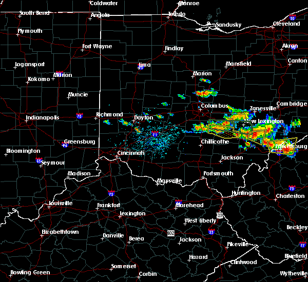 At 442 pm edt, a severe thunderstorm was located 9 miles southwest of lancaster, moving east at 35 mph (radar indicated). Hazards include 60 mph wind gusts and penny size hail. expect damage to trees and power lines At 442 pm edt, a severe thunderstorm was located 9 miles southwest of lancaster, moving east at 35 mph (radar indicated). Hazards include 60 mph wind gusts and penny size hail. expect damage to trees and power lines
|
| 7/22/2017 4:10 PM EDT |
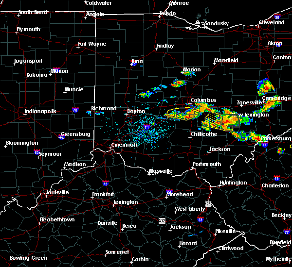 At 410 pm edt, a severe thunderstorm was located over hide-a-way hills, moving east at 40 mph (radar indicated). Hazards include 60 mph wind gusts and penny size hail. Expect damage to trees and power lines. Locations impacted include, lancaster, logan, nelsonville, bremen, hide-a-way hills, murray city, sugar grove, hideaway hills, lake logan state park, haydenville, north berne, enterprise, rockbridge, oreville, carbon hill and clearport. At 410 pm edt, a severe thunderstorm was located over hide-a-way hills, moving east at 40 mph (radar indicated). Hazards include 60 mph wind gusts and penny size hail. Expect damage to trees and power lines. Locations impacted include, lancaster, logan, nelsonville, bremen, hide-a-way hills, murray city, sugar grove, hideaway hills, lake logan state park, haydenville, north berne, enterprise, rockbridge, oreville, carbon hill and clearport.
|
| 7/22/2017 3:55 PM EDT |
 The severe thunderstorm warning for central fairfield and north central hocking counties will expire at 400 pm edt, this warning has been replaced with a new severe thunderstorm warning for portions of fairfield and hocking counties until 445 pm. a severe thunderstorm watch remains in effect until 1000 pm edt for central ohio. please report previous wind damage or hail to the national weather service by going to our website at weather.gov/iln and submitting your report via social media. The severe thunderstorm warning for central fairfield and north central hocking counties will expire at 400 pm edt, this warning has been replaced with a new severe thunderstorm warning for portions of fairfield and hocking counties until 445 pm. a severe thunderstorm watch remains in effect until 1000 pm edt for central ohio. please report previous wind damage or hail to the national weather service by going to our website at weather.gov/iln and submitting your report via social media.
|
| 7/22/2017 3:55 PM EDT |
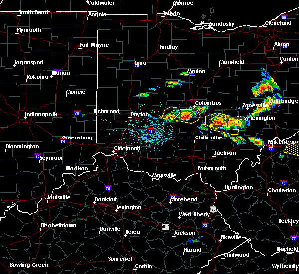 At 354 pm edt, a severe thunderstorm was located near hide-a-way hills, moving east at 35 mph (radar indicated). Hazards include 60 mph wind gusts and penny size hail. expect damage to trees and power lines At 354 pm edt, a severe thunderstorm was located near hide-a-way hills, moving east at 35 mph (radar indicated). Hazards include 60 mph wind gusts and penny size hail. expect damage to trees and power lines
|
| 7/22/2017 3:42 PM EDT |
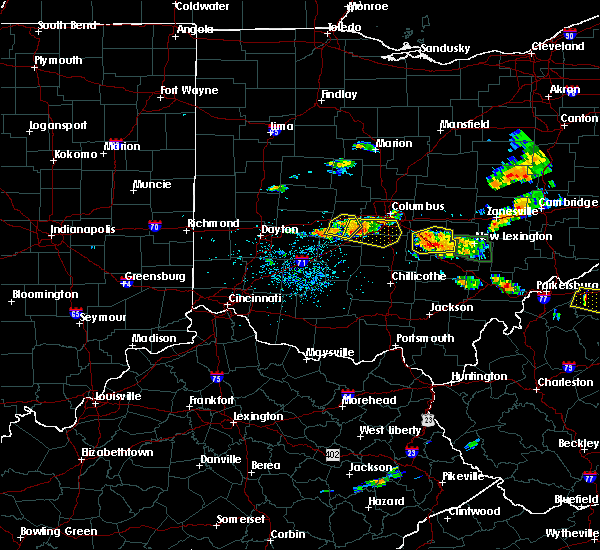 At 341 pm edt, a severe thunderstorm was located over lancaster, moving east at 35 mph (radar indicated). Hazards include 60 mph wind gusts and penny size hail. Expect damage to trees and power lines. Locations impacted include, lancaster, baltimore, bremen, pleasantville, hide-a-way hills, royalton, amanda, thurston, carroll, sugar grove, rushville, west rushville, fairfield county airport, hideaway hills, clearport, north berne and dumontville. At 341 pm edt, a severe thunderstorm was located over lancaster, moving east at 35 mph (radar indicated). Hazards include 60 mph wind gusts and penny size hail. Expect damage to trees and power lines. Locations impacted include, lancaster, baltimore, bremen, pleasantville, hide-a-way hills, royalton, amanda, thurston, carroll, sugar grove, rushville, west rushville, fairfield county airport, hideaway hills, clearport, north berne and dumontville.
|
| 7/22/2017 3:31 PM EDT |
 At 331 pm edt, a severe thunderstorm was located over lancaster, moving east at 35 mph (radar indicated). Hazards include 60 mph wind gusts and penny size hail. Expect damage to trees and power lines. Locations impacted include, lancaster, baltimore, bremen, pleasantville, hide-a-way hills, royalton, lithopolis, amanda, thurston, carroll, sugar grove, rushville, west rushville, fairfield county airport, hideaway hills, north berne and dumontville. At 331 pm edt, a severe thunderstorm was located over lancaster, moving east at 35 mph (radar indicated). Hazards include 60 mph wind gusts and penny size hail. Expect damage to trees and power lines. Locations impacted include, lancaster, baltimore, bremen, pleasantville, hide-a-way hills, royalton, lithopolis, amanda, thurston, carroll, sugar grove, rushville, west rushville, fairfield county airport, hideaway hills, north berne and dumontville.
|
| 7/22/2017 3:17 PM EDT |
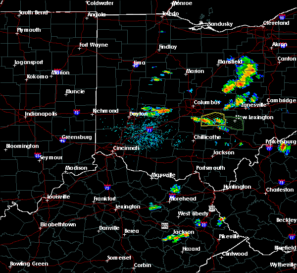 At 317 pm edt, a severe thunderstorm was located 8 miles south of canal winchester, moving east at 35 mph (radar indicated). Hazards include 60 mph wind gusts and penny size hail. expect damage to trees and power lines At 317 pm edt, a severe thunderstorm was located 8 miles south of canal winchester, moving east at 35 mph (radar indicated). Hazards include 60 mph wind gusts and penny size hail. expect damage to trees and power lines
|
| 7/10/2017 4:56 PM EDT |
 At 456 pm edt, severe thunderstorms were located along a line extending from near somerset to near williamsport, moving south at 30 mph (radar indicated). Hazards include 60 mph wind gusts and quarter size hail. Minor hail damage to vehicles is possible. expect wind damage to trees and power lines. locations impacted include, columbus, lancaster, reynoldsburg, grove city, pickerington, circleville, canal winchester, groveport, ashville, baltimore, south bloomfield, williamsport, pleasantville, new holland, obetz, commercial point, royalton, lithopolis, fox and thurston. this includes the following interstates, i-70 in ohio between mile markers 106 and 111. I-71 in ohio between mile markers 89 and 101. At 456 pm edt, severe thunderstorms were located along a line extending from near somerset to near williamsport, moving south at 30 mph (radar indicated). Hazards include 60 mph wind gusts and quarter size hail. Minor hail damage to vehicles is possible. expect wind damage to trees and power lines. locations impacted include, columbus, lancaster, reynoldsburg, grove city, pickerington, circleville, canal winchester, groveport, ashville, baltimore, south bloomfield, williamsport, pleasantville, new holland, obetz, commercial point, royalton, lithopolis, fox and thurston. this includes the following interstates, i-70 in ohio between mile markers 106 and 111. I-71 in ohio between mile markers 89 and 101.
|
| 7/10/2017 4:34 PM EDT |
 At 434 pm edt, a severe thunderstorm was located near bremen, moving east at 30 mph (trained weather spotters). Hazards include ping pong ball size hail and 60 mph wind gusts. People and animals outdoors will be injured. expect hail damage to roofs, siding, windows, and vehicles. expect wind damage to trees and power lines. Locations impacted include, lancaster, bremen, hide-a-way hills, rushville, west rushville, north berne and hideaway hills. At 434 pm edt, a severe thunderstorm was located near bremen, moving east at 30 mph (trained weather spotters). Hazards include ping pong ball size hail and 60 mph wind gusts. People and animals outdoors will be injured. expect hail damage to roofs, siding, windows, and vehicles. expect wind damage to trees and power lines. Locations impacted include, lancaster, bremen, hide-a-way hills, rushville, west rushville, north berne and hideaway hills.
|
| 7/10/2017 4:29 PM EDT | Ping Pong Ball sized hail reported 0.5 miles N of Lancaster, OH |
| 7/10/2017 4:29 PM EDT | Quarter sized hail reported 0.2 miles SSE of Lancaster, OH, photo verified. |
| 7/10/2017 4:29 PM EDT |
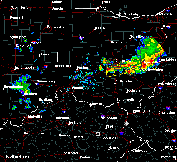 At 428 pm edt, a severe thunderstorm was located over lancaster, moving east at 30 mph (radar indicated). Hazards include 60 mph wind gusts and nickel size hail. expect damage to trees and power lines At 428 pm edt, a severe thunderstorm was located over lancaster, moving east at 30 mph (radar indicated). Hazards include 60 mph wind gusts and nickel size hail. expect damage to trees and power lines
|
| 7/10/2017 4:29 PM EDT |
 At 429 pm edt, severe thunderstorms were located along a line extending from newark to 7 miles west of grove city, moving east at 40 mph (radar indicated). Hazards include 60 mph wind gusts and quarter size hail. Minor hail damage to vehicles is possible. Expect wind damage to trees and power lines. At 429 pm edt, severe thunderstorms were located along a line extending from newark to 7 miles west of grove city, moving east at 40 mph (radar indicated). Hazards include 60 mph wind gusts and quarter size hail. Minor hail damage to vehicles is possible. Expect wind damage to trees and power lines.
|
| 7/10/2017 4:19 PM EDT |
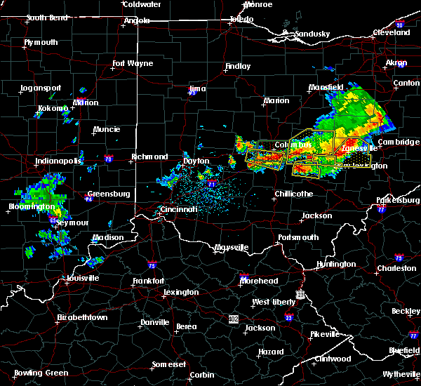 At 419 pm edt, a severe thunderstorm was located over lancaster, moving east at 30 mph (radar indicated). Hazards include 60 mph wind gusts and penny size hail. Expect damage to trees and power lines. Locations impacted include, lancaster, baltimore, bremen, pleasantville, hide-a-way hills, thurston, carroll, rushville, west rushville, fairfield county airport, north berne and dumontville. At 419 pm edt, a severe thunderstorm was located over lancaster, moving east at 30 mph (radar indicated). Hazards include 60 mph wind gusts and penny size hail. Expect damage to trees and power lines. Locations impacted include, lancaster, baltimore, bremen, pleasantville, hide-a-way hills, thurston, carroll, rushville, west rushville, fairfield county airport, north berne and dumontville.
|
| 7/10/2017 4:07 PM EDT |
 At 407 pm edt, a severe thunderstorm was located near lancaster, moving east at 40 mph (radar indicated). Hazards include 60 mph wind gusts and penny size hail. Expect damage to trees and power lines. Locations impacted include, lancaster, canal winchester, baltimore, bremen, pleasantville, hide-a-way hills, royalton, lithopolis, thurston, carroll, sugar grove, rushville, west rushville and fairfield county airport. At 407 pm edt, a severe thunderstorm was located near lancaster, moving east at 40 mph (radar indicated). Hazards include 60 mph wind gusts and penny size hail. Expect damage to trees and power lines. Locations impacted include, lancaster, canal winchester, baltimore, bremen, pleasantville, hide-a-way hills, royalton, lithopolis, thurston, carroll, sugar grove, rushville, west rushville and fairfield county airport.
|
| 7/10/2017 3:57 PM EDT |
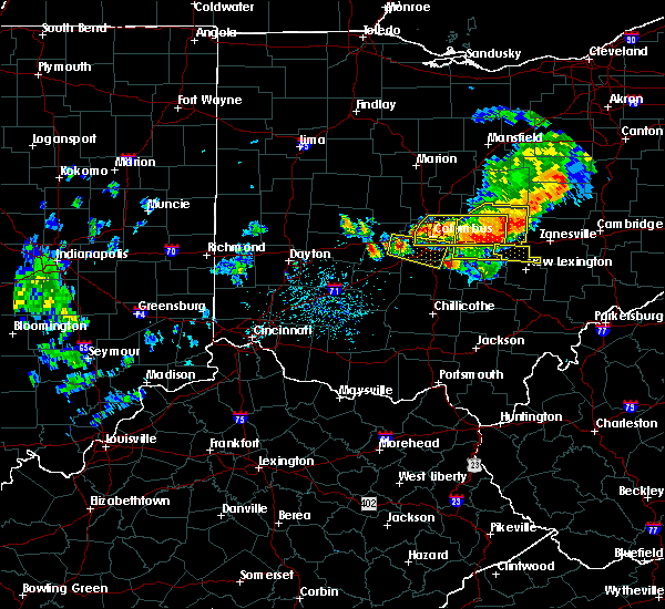 At 356 pm edt, a severe thunderstorm was located near canal winchester, moving east at 40 mph (radar indicated). Hazards include 60 mph wind gusts and penny size hail. expect damage to trees and power lines At 356 pm edt, a severe thunderstorm was located near canal winchester, moving east at 40 mph (radar indicated). Hazards include 60 mph wind gusts and penny size hail. expect damage to trees and power lines
|
| 7/7/2017 2:49 PM EDT |
 At 249 pm edt, a severe thunderstorm was located over lancaster, moving east at 40 mph (radar indicated). Hazards include 60 mph wind gusts and penny size hail. Expect damage to trees and power lines. Locations impacted include, lancaster, bremen, hide-a-way hills, royalton, amanda, sugar grove, rushville, west rushville, fairfield county airport, us route 22 at state route 159, hideaway hills, clearport, north berne, rockbridge, dumontville and state route 674 at state route 188. At 249 pm edt, a severe thunderstorm was located over lancaster, moving east at 40 mph (radar indicated). Hazards include 60 mph wind gusts and penny size hail. Expect damage to trees and power lines. Locations impacted include, lancaster, bremen, hide-a-way hills, royalton, amanda, sugar grove, rushville, west rushville, fairfield county airport, us route 22 at state route 159, hideaway hills, clearport, north berne, rockbridge, dumontville and state route 674 at state route 188.
|
| 7/7/2017 2:37 PM EDT |
 At 236 pm edt, a severe thunderstorm was located near canal winchester, moving east at 40 mph (radar indicated). Hazards include 60 mph wind gusts and penny size hail. Expect damage to trees and power lines. Locations impacted include, lancaster, canal winchester, bremen, hide-a-way hills, royalton, lithopolis, amanda, carroll, sugar grove, rushville, west rushville, fairfield county airport, east ringgold, us route 22 at state route 159, hideaway hills, slate run metro park, clearport, north berne, rockbridge and dumontville. At 236 pm edt, a severe thunderstorm was located near canal winchester, moving east at 40 mph (radar indicated). Hazards include 60 mph wind gusts and penny size hail. Expect damage to trees and power lines. Locations impacted include, lancaster, canal winchester, bremen, hide-a-way hills, royalton, lithopolis, amanda, carroll, sugar grove, rushville, west rushville, fairfield county airport, east ringgold, us route 22 at state route 159, hideaway hills, slate run metro park, clearport, north berne, rockbridge and dumontville.
|
| 7/7/2017 2:25 PM EDT |
 At 225 pm edt, a severe thunderstorm was located near ashville, moving east at 40 mph (radar indicated). Hazards include 60 mph wind gusts and nickel size hail. expect damage to trees and power lines At 225 pm edt, a severe thunderstorm was located near ashville, moving east at 40 mph (radar indicated). Hazards include 60 mph wind gusts and nickel size hail. expect damage to trees and power lines
|
| 6/18/2017 4:00 PM EDT | Numerous trees twisted at the 5 foot level. trees are reported to be 12 inches thick. the neighbor across the street had one tree down... but no other damage seen in th in fairfield county OH, 5.5 miles WSW of Lancaster, OH |
| 4/5/2017 8:51 PM EDT |
 The severe thunderstorm warning for southwestern fairfield, northwestern hocking, southeastern pickaway and eastern ross counties will expire at 900 pm edt, the storm which prompted the warning has weakened below severe limits, and has exited the warned area. therefore, the warning will be allowed to expire. please report previous wind damage or hail to the national weather service by going to our website at weather.gov/iln and submitting your report via social media. The severe thunderstorm warning for southwestern fairfield, northwestern hocking, southeastern pickaway and eastern ross counties will expire at 900 pm edt, the storm which prompted the warning has weakened below severe limits, and has exited the warned area. therefore, the warning will be allowed to expire. please report previous wind damage or hail to the national weather service by going to our website at weather.gov/iln and submitting your report via social media.
|
| 4/5/2017 8:36 PM EDT |
 At 835 pm edt, a severe thunderstorm was located near kingston, moving northeast at 30 mph (radar indicated). Hazards include 60 mph wind gusts and quarter size hail. Hail damage to vehicles is expected. expect wind damage to roofs, siding, and trees. Locations impacted include, lancaster, amanda, stoutsville, laurelville, sugar grove, adelphi, tarlton, us route 22 at state route 159, buena vista in hocking county, gibisonville, whisler, clearport and rockbridge. At 835 pm edt, a severe thunderstorm was located near kingston, moving northeast at 30 mph (radar indicated). Hazards include 60 mph wind gusts and quarter size hail. Hail damage to vehicles is expected. expect wind damage to roofs, siding, and trees. Locations impacted include, lancaster, amanda, stoutsville, laurelville, sugar grove, adelphi, tarlton, us route 22 at state route 159, buena vista in hocking county, gibisonville, whisler, clearport and rockbridge.
|
| 4/5/2017 8:15 PM EDT |
 At 815 pm edt, a severe thunderstorm was located near north folk village, moving northeast at 30 mph (radar indicated). Hazards include 60 mph wind gusts and quarter size hail. Hail damage to vehicles is expected. Expect wind damage to roofs, siding, and trees. At 815 pm edt, a severe thunderstorm was located near north folk village, moving northeast at 30 mph (radar indicated). Hazards include 60 mph wind gusts and quarter size hail. Hail damage to vehicles is expected. Expect wind damage to roofs, siding, and trees.
|
| 3/1/2017 3:26 AM EST |
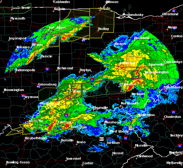 At 326 am est, a severe thunderstorm capable of producing a tornado was located five miles southeast of lancaster, moving east at 55 mph (radar indicated rotation). Hazards include tornado. Flying debris will be dangerous to those caught without shelter. mobile homes will be damaged or destroyed. damage to roofs, windows, and vehicles will occur. tree damage is likely. Locations impacted include, lancaster, bremen, pleasantville, hide-a-way hills, sugar grove, rushville, west rushville, north berne, rockbridge and hideaway hills. At 326 am est, a severe thunderstorm capable of producing a tornado was located five miles southeast of lancaster, moving east at 55 mph (radar indicated rotation). Hazards include tornado. Flying debris will be dangerous to those caught without shelter. mobile homes will be damaged or destroyed. damage to roofs, windows, and vehicles will occur. tree damage is likely. Locations impacted include, lancaster, bremen, pleasantville, hide-a-way hills, sugar grove, rushville, west rushville, north berne, rockbridge and hideaway hills.
|
| 3/1/2017 3:20 AM EST |
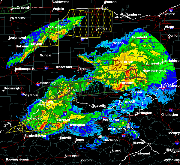 At 320 am est, severe thunderstorms were located along a line extending from near lancaster to 11 miles northwest of wellston, moving east at 55 mph (radar indicated). Hazards include 60 mph wind gusts. Expect damage to roofs, siding, and trees. locations impacted include, lancaster, logan, nelsonville, bremen, pleasantville, hocking hills state park, hide-a-way hills, starr, amanda, londonderry, thurston, laurelville, carroll, murray city, sugar grove, adelphi, rushville, tarlton, west rushville and fairfield county airport. A tornado watch remains in effect until 700 am est for central and southwestern ohio. At 320 am est, severe thunderstorms were located along a line extending from near lancaster to 11 miles northwest of wellston, moving east at 55 mph (radar indicated). Hazards include 60 mph wind gusts. Expect damage to roofs, siding, and trees. locations impacted include, lancaster, logan, nelsonville, bremen, pleasantville, hocking hills state park, hide-a-way hills, starr, amanda, londonderry, thurston, laurelville, carroll, murray city, sugar grove, adelphi, rushville, tarlton, west rushville and fairfield county airport. A tornado watch remains in effect until 700 am est for central and southwestern ohio.
|
| 3/1/2017 3:17 AM EST |
 At 316 am est, a severe thunderstorm capable of producing a tornado was located two miles northeast of amanda, moving east at 65 mph (radar indicated rotation). Hazards include tornado. Flying debris will be dangerous to those caught without shelter. mobile homes will be damaged or destroyed. damage to roofs, windows, and vehicles will occur. tree damage is likely. Locations impacted include, lancaster, bremen, pleasantville, hide-a-way hills, amanda, sugar grove, rushville, west rushville, fairfield county airport, us route 22 at state route 159, buena vista in hocking county, hideaway hills, clearport, north berne, rockbridge and dumontville. At 316 am est, a severe thunderstorm capable of producing a tornado was located two miles northeast of amanda, moving east at 65 mph (radar indicated rotation). Hazards include tornado. Flying debris will be dangerous to those caught without shelter. mobile homes will be damaged or destroyed. damage to roofs, windows, and vehicles will occur. tree damage is likely. Locations impacted include, lancaster, bremen, pleasantville, hide-a-way hills, amanda, sugar grove, rushville, west rushville, fairfield county airport, us route 22 at state route 159, buena vista in hocking county, hideaway hills, clearport, north berne, rockbridge and dumontville.
|
| 3/1/2017 3:09 AM EST |
 At 309 am est, a severe thunderstorm capable of producing a tornado was located 8 miles east of circleville, moving east at 55 mph (radar indicated rotation). Hazards include tornado. Flying debris will be dangerous to those caught without shelter. mobile homes will be damaged or destroyed. damage to roofs, windows, and vehicles will occur. Tree damage is likely. At 309 am est, a severe thunderstorm capable of producing a tornado was located 8 miles east of circleville, moving east at 55 mph (radar indicated rotation). Hazards include tornado. Flying debris will be dangerous to those caught without shelter. mobile homes will be damaged or destroyed. damage to roofs, windows, and vehicles will occur. Tree damage is likely.
|
| 3/1/2017 3:04 AM EST |
 At 304 am est, severe thunderstorms were located along a line extending from near ashville to 6 miles northeast of pike lake, moving east at 50 mph (radar indicated). Hazards include 60 mph wind gusts and penny size hail. expect damage to roofs, siding, and trees At 304 am est, severe thunderstorms were located along a line extending from near ashville to 6 miles northeast of pike lake, moving east at 50 mph (radar indicated). Hazards include 60 mph wind gusts and penny size hail. expect damage to roofs, siding, and trees
|
| 7/15/2016 4:52 PM EDT |
 The severe thunderstorm warning for northwestern hocking, southeastern pickaway and southwestern fairfield counties will expire at 500 pm edt, the storm which prompted the warning has weakened below severe limits, and no longer poses an immediate threat to life or property. therefore the warning will be allowed to expire. however gusty winds and heavy rain are still possible with this thunderstorm. please report previous wind damage or hail to the national weather service by going to our website at weather.gov/iln and submitting your report via social media. The severe thunderstorm warning for northwestern hocking, southeastern pickaway and southwestern fairfield counties will expire at 500 pm edt, the storm which prompted the warning has weakened below severe limits, and no longer poses an immediate threat to life or property. therefore the warning will be allowed to expire. however gusty winds and heavy rain are still possible with this thunderstorm. please report previous wind damage or hail to the national weather service by going to our website at weather.gov/iln and submitting your report via social media.
|
| 7/15/2016 4:40 PM EDT |
 At 439 pm edt, a severe thunderstorm was located near circleville, moving northeast at 20 mph (radar indicated). Hazards include 60 mph wind gusts and quarter size hail. Hail damage to vehicles is expected. expect wind damage to roofs, siding, and trees. Locations impacted include, lancaster, circleville, logan elm village, amanda, stoutsville, laurelville, tarlton, aw marion state park, clearport, us route 22 at state route 159, whisler and buena vista in hocking county. At 439 pm edt, a severe thunderstorm was located near circleville, moving northeast at 20 mph (radar indicated). Hazards include 60 mph wind gusts and quarter size hail. Hail damage to vehicles is expected. expect wind damage to roofs, siding, and trees. Locations impacted include, lancaster, circleville, logan elm village, amanda, stoutsville, laurelville, tarlton, aw marion state park, clearport, us route 22 at state route 159, whisler and buena vista in hocking county.
|
| 7/15/2016 4:29 PM EDT |
 At 429 pm edt, a severe thunderstorm was located over logan elm village, moving northeast at 20 mph (radar indicated). Hazards include 60 mph wind gusts and quarter size hail. Hail damage to vehicles is expected. Expect wind damage to roofs, siding, and trees. At 429 pm edt, a severe thunderstorm was located over logan elm village, moving northeast at 20 mph (radar indicated). Hazards include 60 mph wind gusts and quarter size hail. Hail damage to vehicles is expected. Expect wind damage to roofs, siding, and trees.
|
| 7/6/2016 3:22 PM EDT |
 The severe thunderstorm warning for northwestern hocking, southeastern pickaway and southwestern fairfield counties will expire at 330 pm edt, the storm which prompted the warning has weakened below severe limits, and no longer poses an immediate threat to life or property. therefore the warning will be allowed to expire. however gusty winds and heavy rain are still possible with this thunderstorm. please report previous wind damage or hail to the national weather service by going to our website at weather.gov/iln and submitting your report via social media. The severe thunderstorm warning for northwestern hocking, southeastern pickaway and southwestern fairfield counties will expire at 330 pm edt, the storm which prompted the warning has weakened below severe limits, and no longer poses an immediate threat to life or property. therefore the warning will be allowed to expire. however gusty winds and heavy rain are still possible with this thunderstorm. please report previous wind damage or hail to the national weather service by going to our website at weather.gov/iln and submitting your report via social media.
|
| 7/6/2016 3:06 PM EDT |
 At 306 pm edt, a severe thunderstorm was located near circleville, moving east at 45 mph (radar indicated). Hazards include 60 mph wind gusts. Expect damage to roofs. siding. and trees. Locations impacted include, lancaster, circleville, royalton, amanda, stoutsville, tarlton, state route 674 at state route 188, aw marion state park, east ringgold, clearport, us route 22 at state route 159, buena vista in hocking county and fairfield county airport. At 306 pm edt, a severe thunderstorm was located near circleville, moving east at 45 mph (radar indicated). Hazards include 60 mph wind gusts. Expect damage to roofs. siding. and trees. Locations impacted include, lancaster, circleville, royalton, amanda, stoutsville, tarlton, state route 674 at state route 188, aw marion state park, east ringgold, clearport, us route 22 at state route 159, buena vista in hocking county and fairfield county airport.
|
| 7/6/2016 2:54 PM EDT |
 At 253 pm edt, a severe thunderstorm was located over williamsport, moving east at 40 mph (radar indicated). Hazards include 60 mph wind gusts. Expect damage to roofs. siding. And trees. At 253 pm edt, a severe thunderstorm was located over williamsport, moving east at 40 mph (radar indicated). Hazards include 60 mph wind gusts. Expect damage to roofs. siding. And trees.
|
| 6/6/2016 8:24 PM EDT | Tree down on lookout rd. time estimated by rada in fairfield county OH, 10.9 miles NNE of Lancaster, OH |
| 6/6/2016 8:22 PM EDT | Trees down on clearport rd. time estimated by rada in fairfield county OH, 10.4 miles NNE of Lancaster, OH |
| 3/31/2016 7:42 PM EDT | The severe thunderstorm warning for northeastern fairfield and western licking counties will expire at 745 pm edt, the storm which prompted the warning has weakened below severe limits. therefore the warning will be allowed to expire. please report previous wind damage or hail to the national weather service by going to our website at weather.gov/iln and submit your report via social media. |
| 3/31/2016 7:35 PM EDT |
 At 734 pm edt, radar indicated a severe thunderstorm located over granville south, moving northeast at 60 mph. storm hazards include, winds to 60 mph, penny size hail, locations impacted include, newark, lancaster, heath, granville, pataskala, baltimore, buckeye lake, hebron, millersport, pleasantville, granville south, harbor hills, fairfield beach, beechwood trails, etna, thurston, kirkersville, alexandria, st. louisville and dumontville. this includes i-70 in ohio between mile markers 119 and 134. At 734 pm edt, radar indicated a severe thunderstorm located over granville south, moving northeast at 60 mph. storm hazards include, winds to 60 mph, penny size hail, locations impacted include, newark, lancaster, heath, granville, pataskala, baltimore, buckeye lake, hebron, millersport, pleasantville, granville south, harbor hills, fairfield beach, beechwood trails, etna, thurston, kirkersville, alexandria, st. louisville and dumontville. this includes i-70 in ohio between mile markers 119 and 134.
|
| 3/31/2016 7:28 PM EDT |
 At 728 pm edt, radar indicated a severe thunderstorm located over beechwood trails, moving northeast at 60 mph. storm hazards include, winds to 60 mph, penny size hail, locations impacted include, columbus, newark, lancaster, reynoldsburg, gahanna, pickerington, heath, granville, pataskala, canal winchester, baltimore, buckeye lake, hebron, millersport, pleasantville, granville south, summit station, harbor hills, fairfield beach and beechwood trails. this includes i-70 in ohio between mile markers 112 and 134. At 728 pm edt, radar indicated a severe thunderstorm located over beechwood trails, moving northeast at 60 mph. storm hazards include, winds to 60 mph, penny size hail, locations impacted include, columbus, newark, lancaster, reynoldsburg, gahanna, pickerington, heath, granville, pataskala, canal winchester, baltimore, buckeye lake, hebron, millersport, pleasantville, granville south, summit station, harbor hills, fairfield beach and beechwood trails. this includes i-70 in ohio between mile markers 112 and 134.
|
| 3/31/2016 7:10 PM EDT |
 At 709 pm edt, radar indicated a severe thunderstorm located over groveport, moving northeast at 60 mph. storm hazards include, winds to 60 mph, penny size hail,. At 709 pm edt, radar indicated a severe thunderstorm located over groveport, moving northeast at 60 mph. storm hazards include, winds to 60 mph, penny size hail,.
|
| 7/14/2015 3:13 PM EDT |
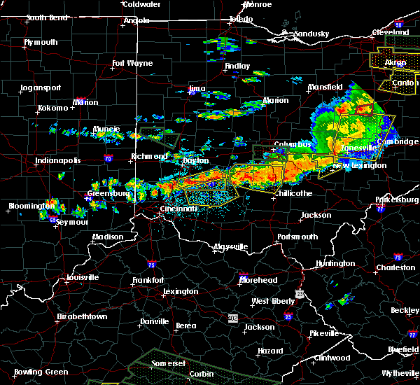 At 312 pm edt, radar indicated severe thunderstorms located along a line extending from bremen to near logan elm village, moving east at 55 mph. storm hazards include, winds to 60 mph, penny size hail,. At 312 pm edt, radar indicated severe thunderstorms located along a line extending from bremen to near logan elm village, moving east at 55 mph. storm hazards include, winds to 60 mph, penny size hail,.
|
| 5/11/2015 9:52 PM EDT | The severe thunderstorm warning for northwestern hocking and southern fairfield counties will expire at 1000 pm edt, the storm has weakened below severe limits, therefore the severe thunderstorm warning will be allowed to expire. as this storm moves through southeastern fairfield county, it will remain capable of producing small hail and gusty winds. please report previous wind damage or hail to the national weather service by going to our website at weather.gov/iln and submitting your report via social media. |
| 5/11/2015 9:39 PM EDT | At 938 pm edt, radar continued to indicate a severe thunderstorm located near clearport, moving northeast at 60 mph. storm hazards include, winds to 60 mph, quarter size hail, locations impacted include, lancaster. in addition, us route 22 at state route 159, rockbridge and sugar grove are near the path of this storm. , 1.00in. |
| 5/11/2015 9:30 PM EDT | At 929 pm edt, radar continued to indicate a severe thunderstorm located near whisler, moving northeast at 60 mph. storm hazards include, winds to 60 mph, quarter size hail, locations impacted include, lancaster. in addition, tarlton, stoutsville, east ringgold, state route 674 at state route 188, buena vista, amanda, clearport and royalton are near the path of this storm. , 1.00in. |
| 5/11/2015 9:22 PM EDT | At 921 pm edt, radar indicated a severe thunderstorm located near andersonville, moving northeast at 60 mph. storm hazards include, winds to 60 mph,. |
| 5/11/2015 6:24 PM EDT | The severe thunderstorm warning for hocking and eastern fairfield counties will expire at 630 pm edt, the storms were moving out of the warned area, therefore the severe thunderstorm warning will be allowed to expire. gusty winds and heavy rain are still possible just behind these storms. please report previous wind damage or hail to the national weather service by going to our website at weather.gov/iln and submitting your report via social media. |
| 5/11/2015 6:02 PM EDT | At 600 pm edt, radar continued to indicate severe thunderstorms located along a line extending from rushville to logan to hocking hills state park, moving east at 30 mph. storm hazards include, winds to 60 mph, quarter size hail, frequent cloud to ground lightning, locations impacted include, logan. in addition, ilesboro, union furnace, haydenville, starr and carbon hill are near the path of these storms. , 1.00in. |
| 5/11/2015 5:48 PM EDT | At 546 pm edt, radar continued to indicate severe thunderstorms located along a line extending from thurston to rockbridge to linn, moving east at 30 mph. storm hazards include, winds to 60 mph, quarter size hail, frequent cloud to ground lightning, locations impacted include, hocking hills state park, bremen and logan. in addition, fairfield beach, north berne, hideaway hills, enterprise, lake logan state park, west rushville, rushville and ilesboro are near the path of these storms. , 1.00in. |
| 5/11/2015 5:25 PM EDT | At 522 pm edt, radar indicated severe thunderstorms located along a line extending from pickerington to tarlton to omega, moving east at 25 mph. storm hazards include, winds to 60 mph, quarter size hail,. |
| 5/11/2015 5:12 PM EDT | At 510 pm edt, radar continued to indicate severe thunderstorms located along a line extending from royalton to tarlton to omega, moving east at 40 mph. storm hazards include, winds to 60 mph, quarter size hail, frequent cloud to ground lightning, locations impacted include, baltimore, lancaster and hocking hills state park. in addition, amanda, linn, laurelville, adelphi, carroll, us route 22 at state route 159, clearport and buena vista are near the path of these storms. , 1.00in. |
| 5/11/2015 5:01 PM EDT | At 458 pm edt, radar indicated that the severe thunderstorms had strengthened. these storms were located along a line extending from ashville to kingston to pike county airport, moving east at 40 mph. storm hazards include, winds to 60 mph, quarter size hail, frequent cloud to ground lightning, locations impacted include, baltimore, lancaster and hocking hills state park. in addition, scioto trail state park, aw marion state park, slate run metro park, omega, pike county airport, east ringgold, state route 674 at state route 188 and lithopolis are near the path of these storms. , 1.00in. |
| 5/11/2015 4:51 PM EDT | At 448 pm edt, radar indicated severe thunderstorms located along a line extending from darbyville to pickaway county airport to buchanan, moving east at 40 mph. storm hazards include, winds to 60 mph, penny size hail, frequent cloud to ground lightning,. |
| 12/24/2014 5:17 PM EST | 20 to 25 cars/storage building damaged near river valley mall in fairfield county OH, 0.5 miles N of Lancaster, OH |
| 7/10/2013 4:45 PM EDT | Scattered trees down all across fairfield county in fairfield county OH, 0.5 miles N of Lancaster, OH |
| 4/16/2013 6:53 PM EDT | Quarter sized hail reported 0.5 miles N of Lancaster, OH |
| 6/29/2012 5:34 PM EDT | Storm damage reported in fairfield county OH, 0.5 miles N of Lancaster, OH |
| 6/29/2012 5:31 PM EDT | Tree fell into a house in fairfield county OH, 0.5 miles N of Lancaster, OH |
| 6/29/2012 5:31 PM EDT | A large tree was downed on a pickup truck. siding damage reported at a hous in fairfield county OH, 0.5 miles N of Lancaster, OH |
| 6/29/2012 5:30 PM EDT | Multiple large tree limbs downed. siding damage to building in fairfield county OH, 1.1 miles WNW of Lancaster, OH |
| 6/29/2012 5:26 PM EDT | Several trees down along route 22 between amanda and lancaste in fairfield county OH, 2.5 miles NE of Lancaster, OH |
| 6/29/2012 5:25 PM EDT | Storm damage reported in fairfield county OH, 4 miles SE of Lancaster, OH |
| 6/29/2012 5:15 PM EDT | Trees down...shingles off the roof. no powe in fairfield county OH, 1.6 miles S of Lancaster, OH |
| 3/18/2012 8:30 PM EDT | Quarter sized hail reported 2.6 miles SW of Lancaster, OH |
| 3/18/2012 7:50 PM EDT | Golf Ball sized hail reported 8.3 miles NE of Lancaster, OH |
| 1/1/0001 12:00 AM | One tree down at wheeling rd/orchard view r in fairfield county OH, 2.6 miles W of Lancaster, OH |
| 1/1/0001 12:00 AM | A few trees down across central portions of fairfield count in fairfield county OH, 0.5 miles N of Lancaster, OH |
| 1/1/0001 12:00 AM | Trees down on eaton hollow road. time estimated from rada in fairfield county OH, 7.1 miles NNE of Lancaster, OH |
| 1/1/0001 12:00 AM | Numerous large branches down in dumontvill in fairfield county OH, 3.8 miles SSE of Lancaster, OH |
| 1/1/0001 12:00 AM | Quarter sized hail reported 0.5 miles N of Lancaster, OH |
| 1/1/0001 12:00 AM | Half Dollar sized hail reported 2.6 miles N of Lancaster, OH, fell briefly. |
| 1/1/0001 12:00 AM | Quarter sized hail reported 1.1 miles WNW of Lancaster, OH |
| 1/1/0001 12:00 AM | Storm damage reported in fairfield county OH, 0.5 miles WSW of Lancaster, OH |
| 1/1/0001 12:00 AM | 4-6 inch limbs down mainly north of memorial dr. corrected time of even in fairfield county OH, 0.5 miles N of Lancaster, OH |
| 1/1/0001 12:00 AM | 4-6 inch limbs down mainly north of memorial dr in fairfield county OH, 0.5 miles N of Lancaster, OH |
Hail Maps for Lancaster, OH


Connect with Interactive Hail Maps