

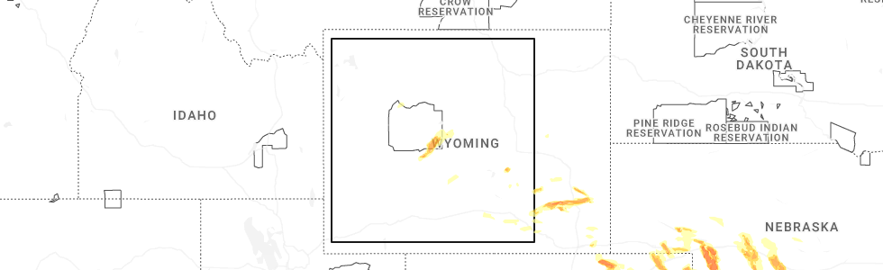
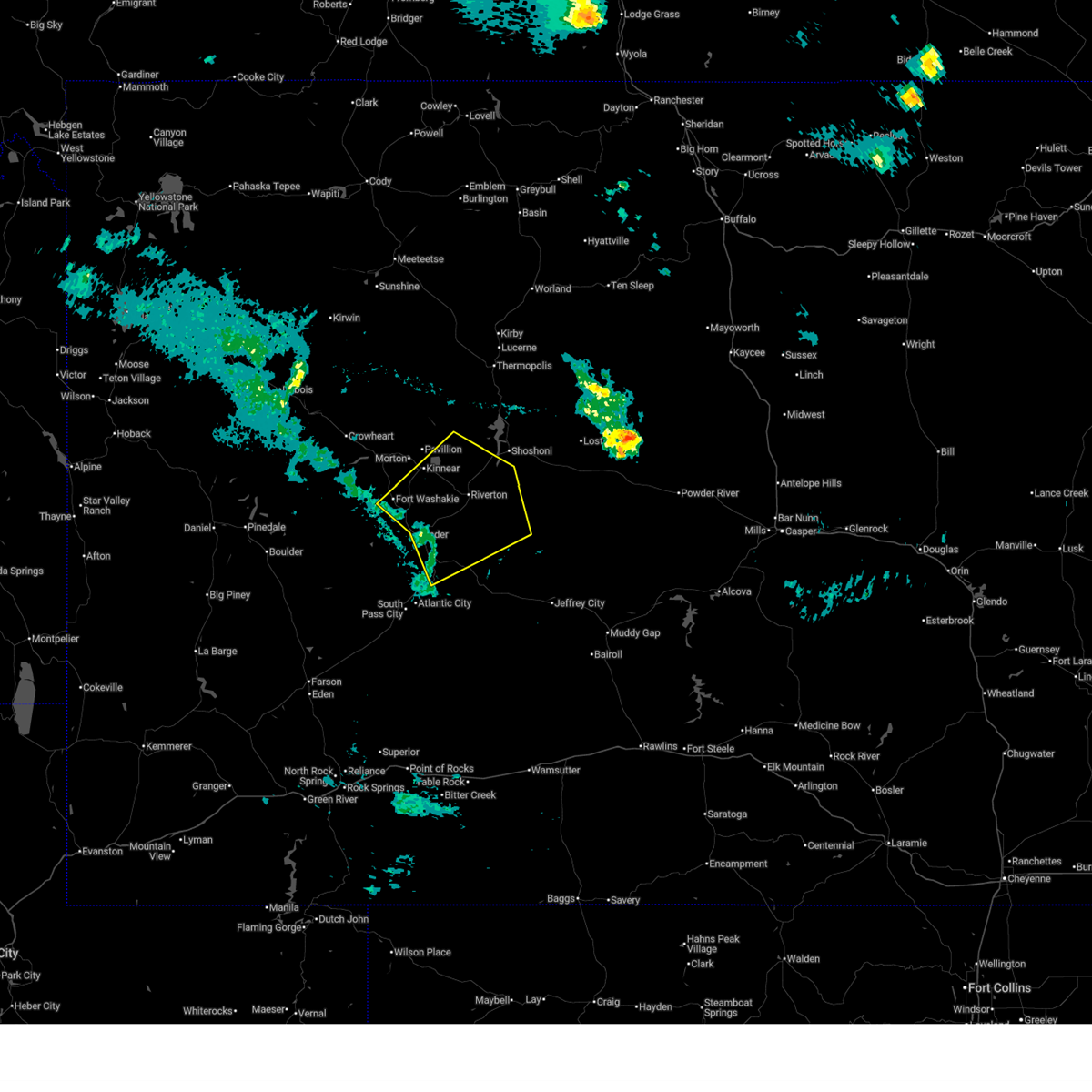
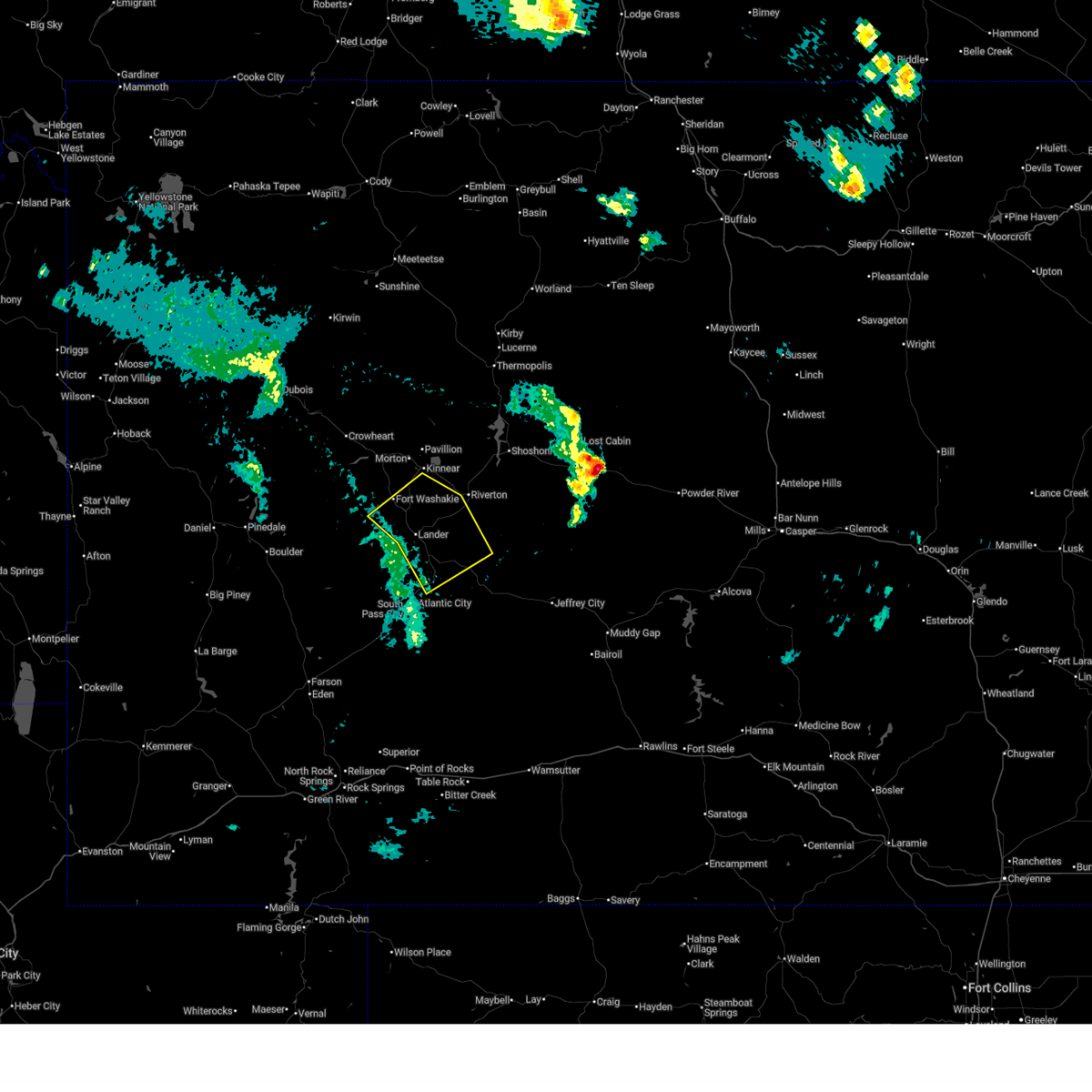
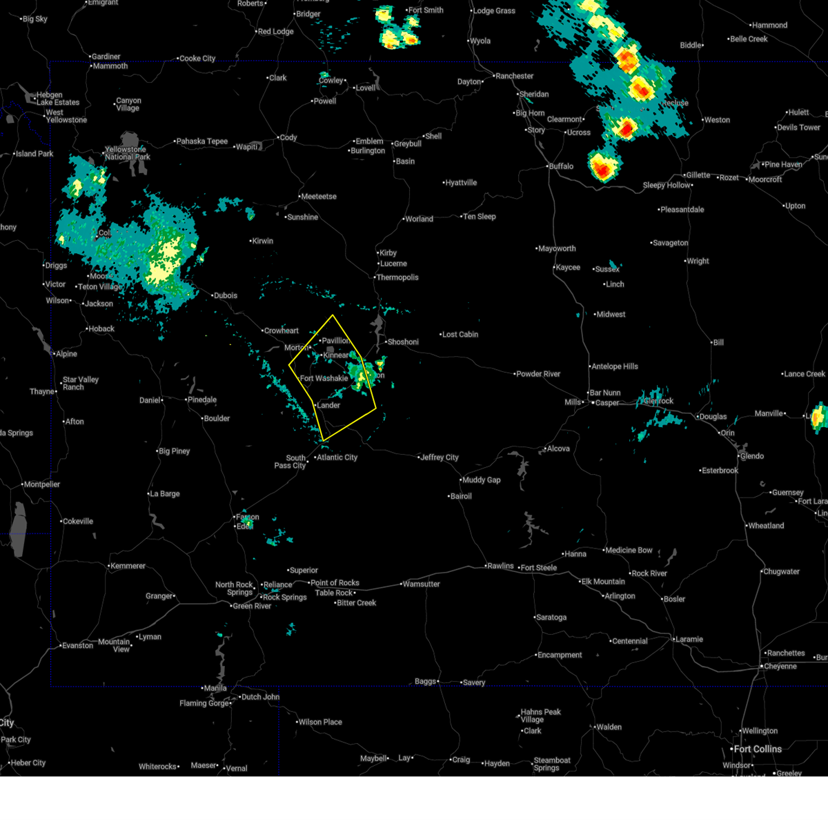
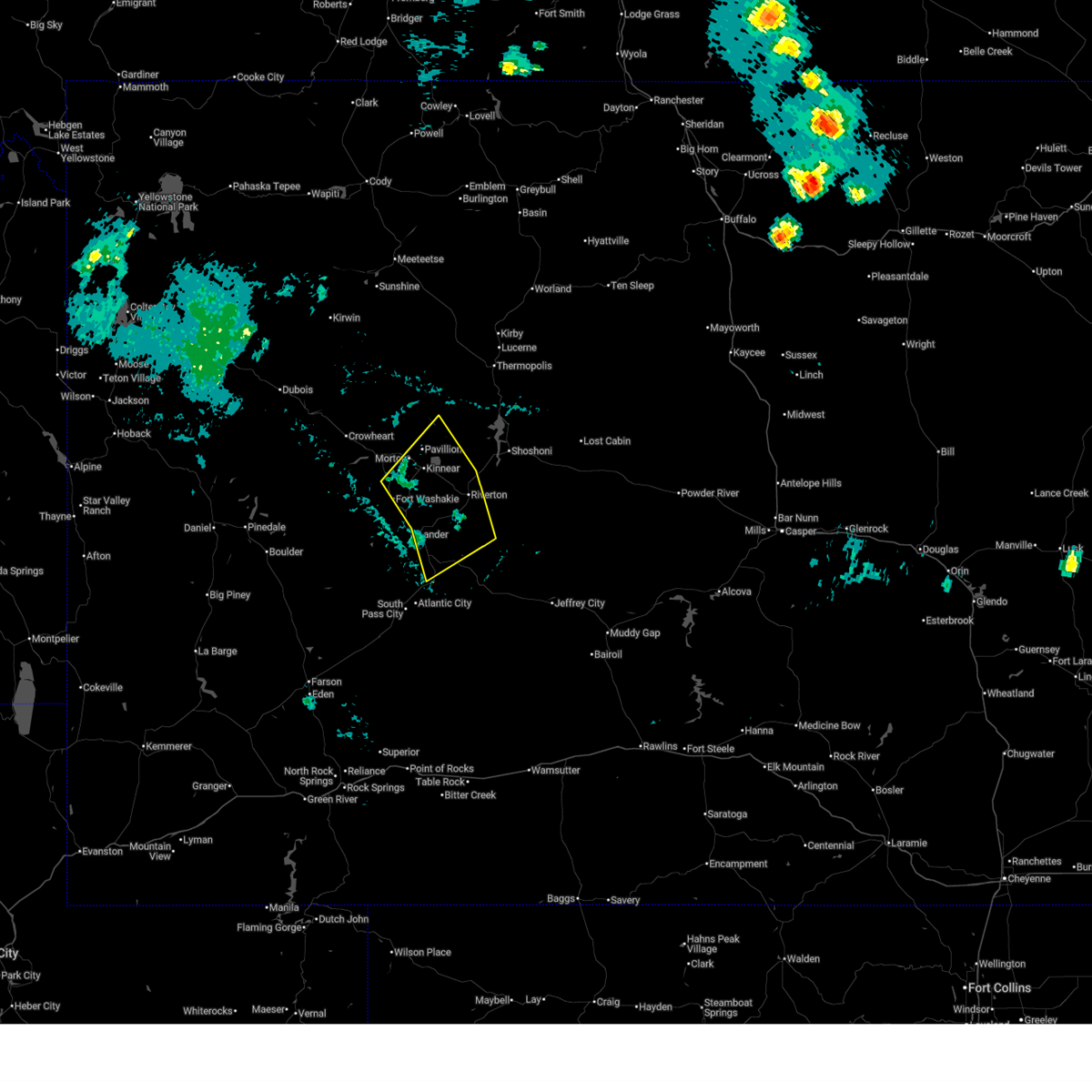
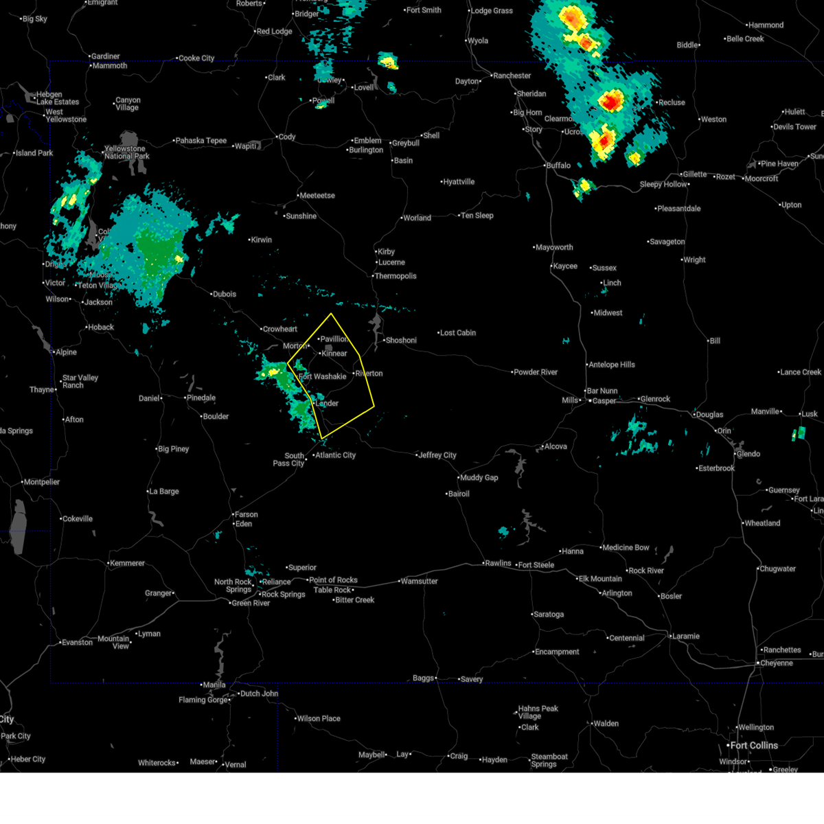
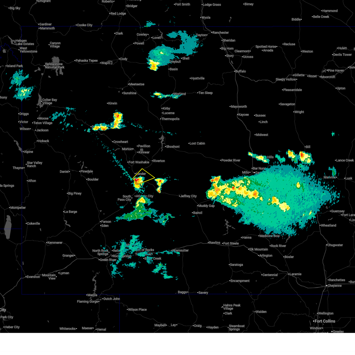
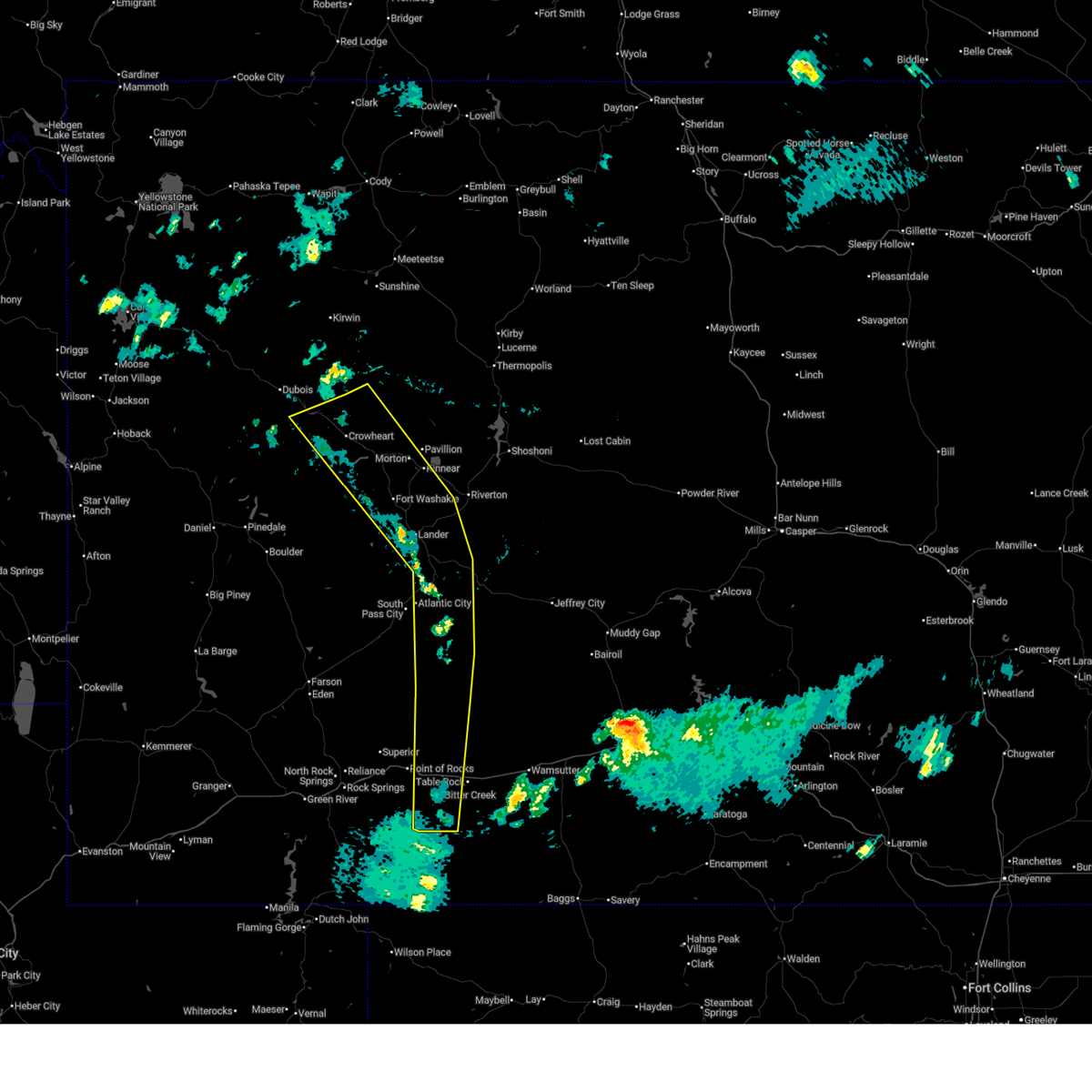
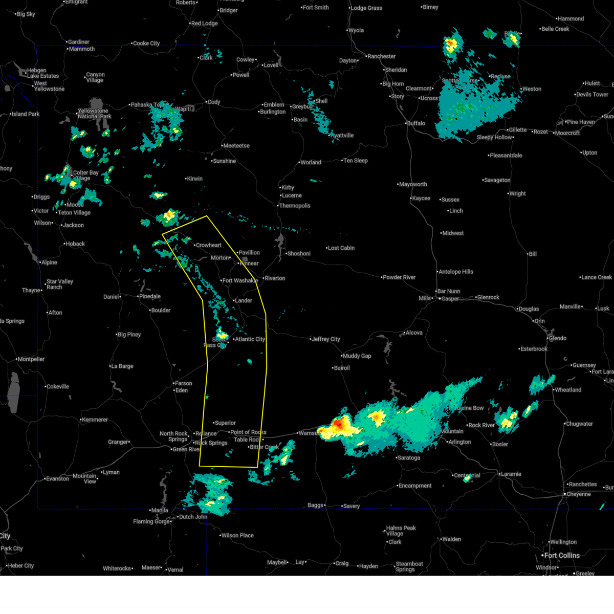
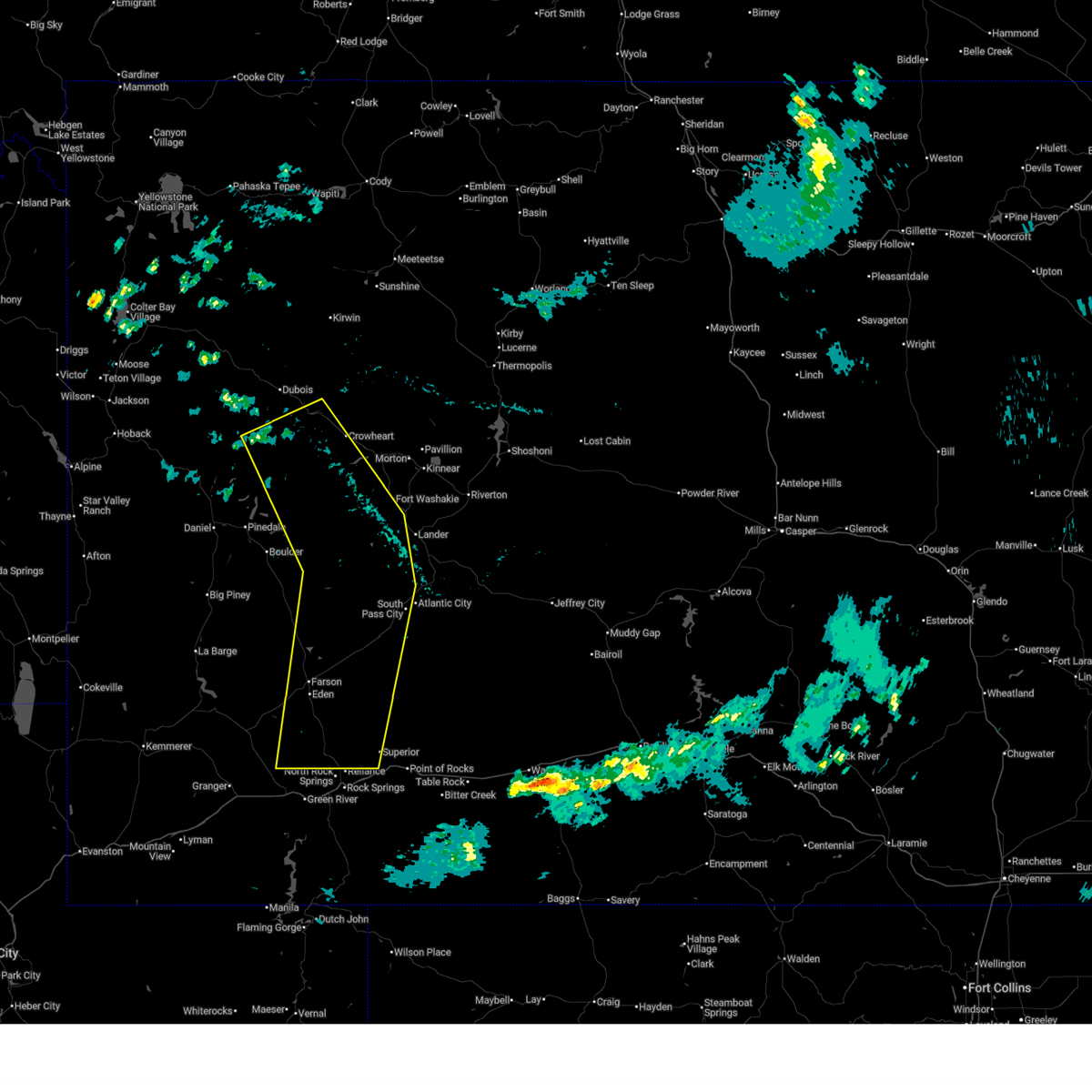
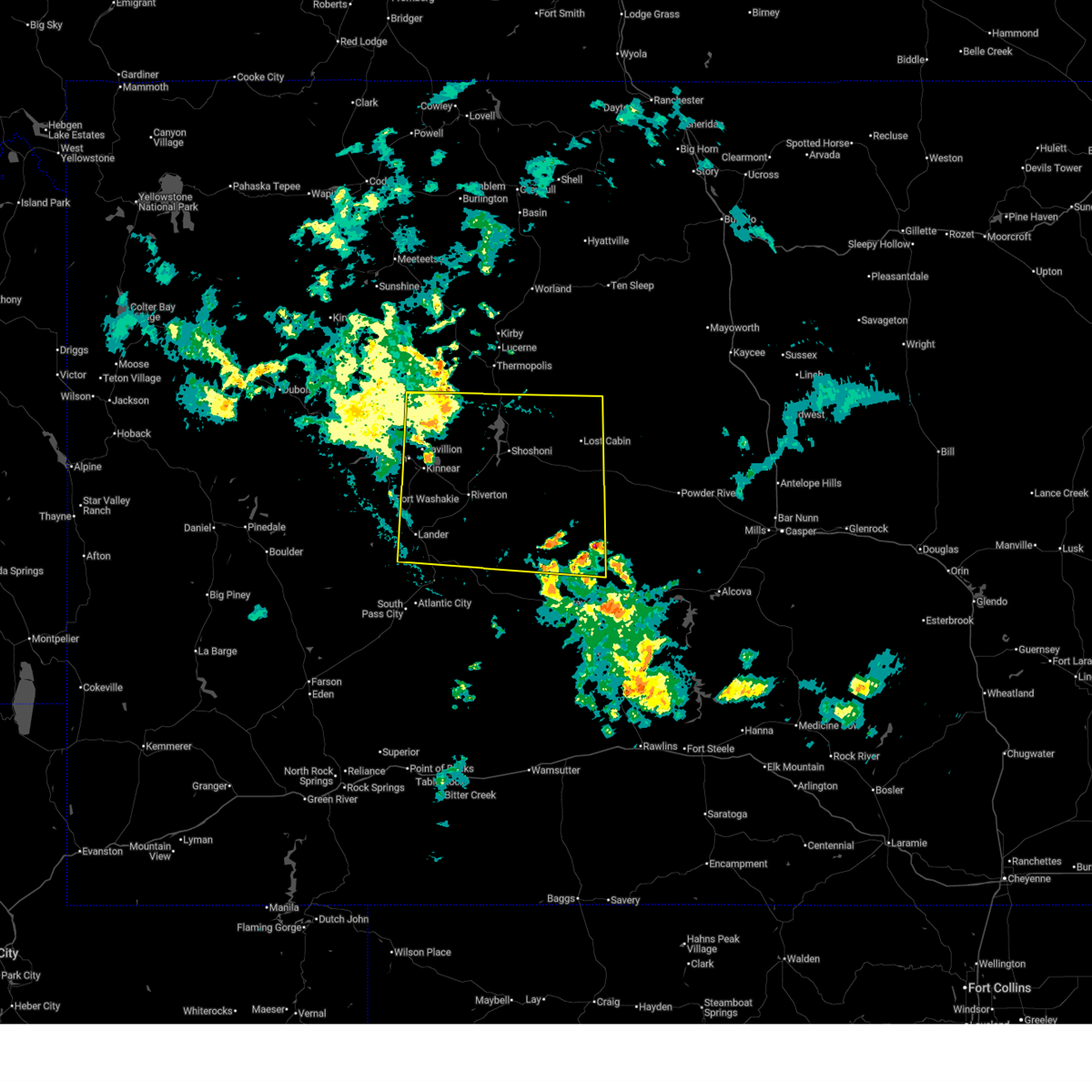
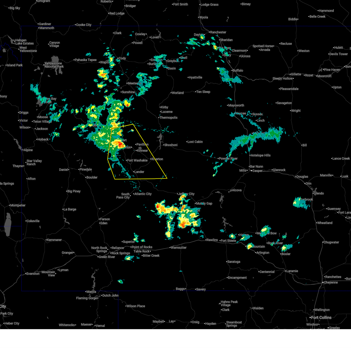
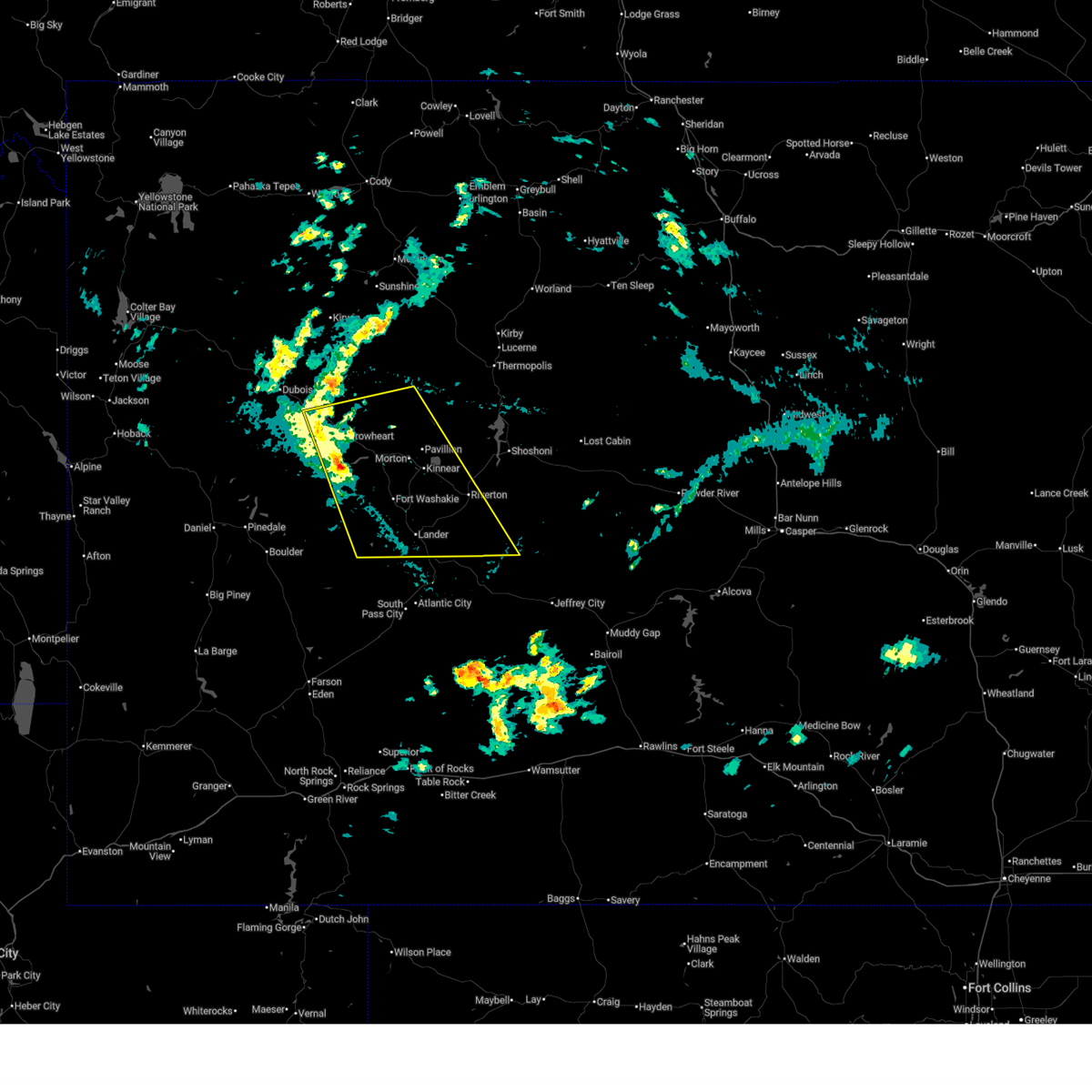
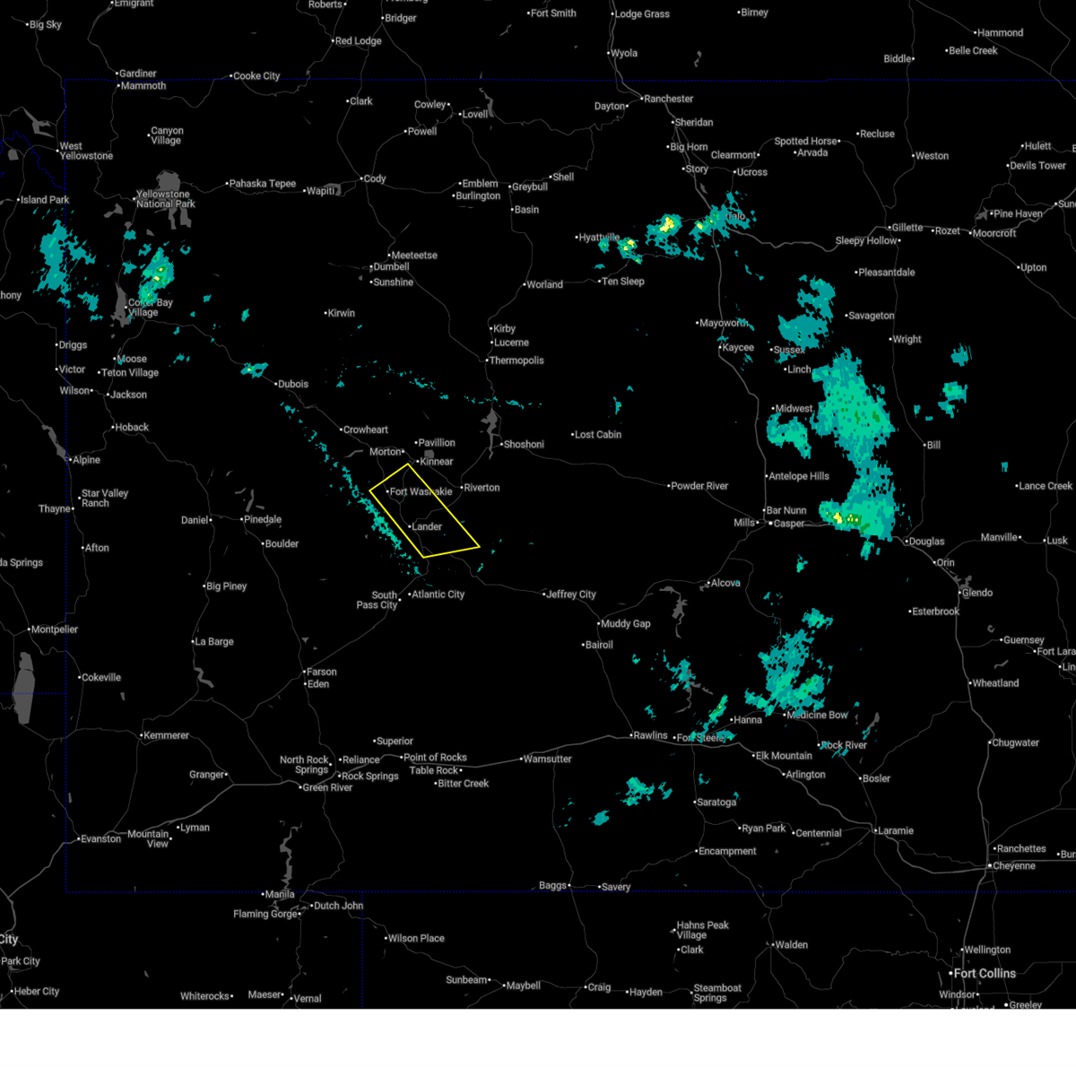
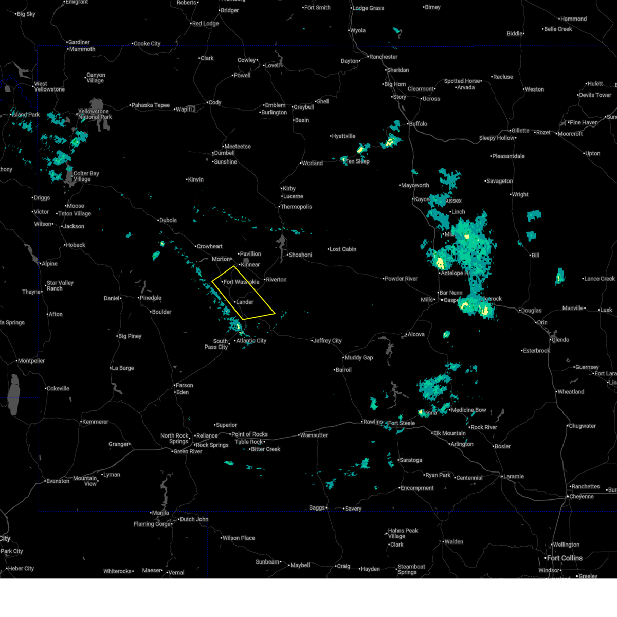
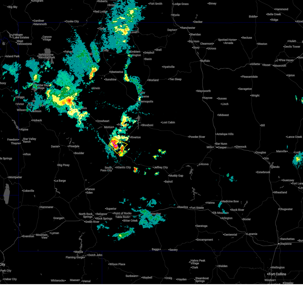
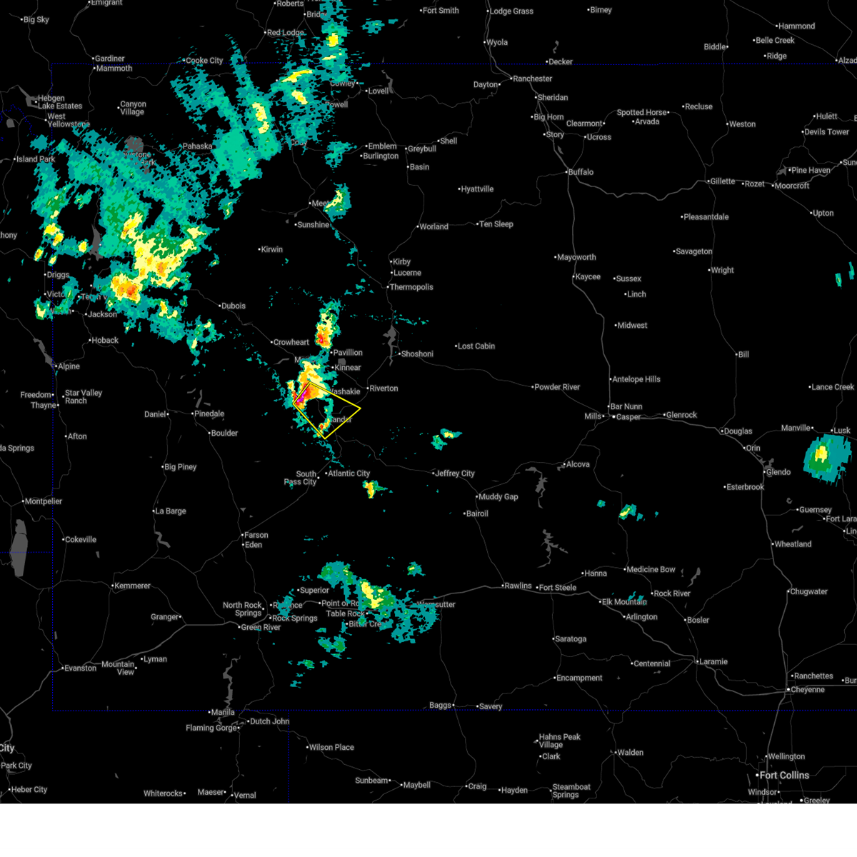
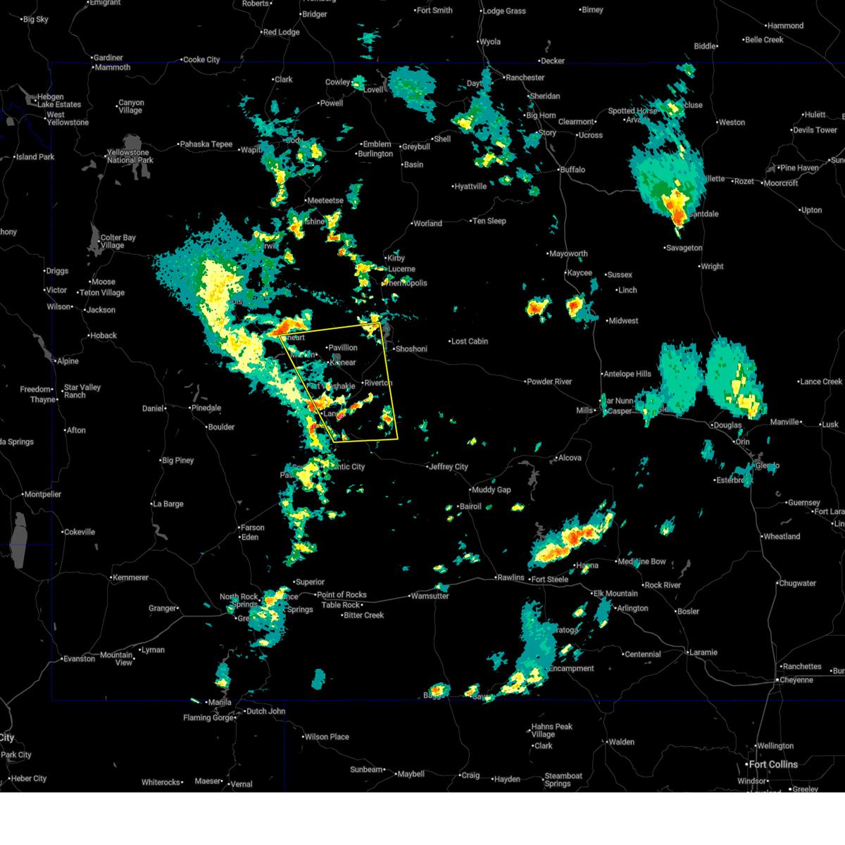
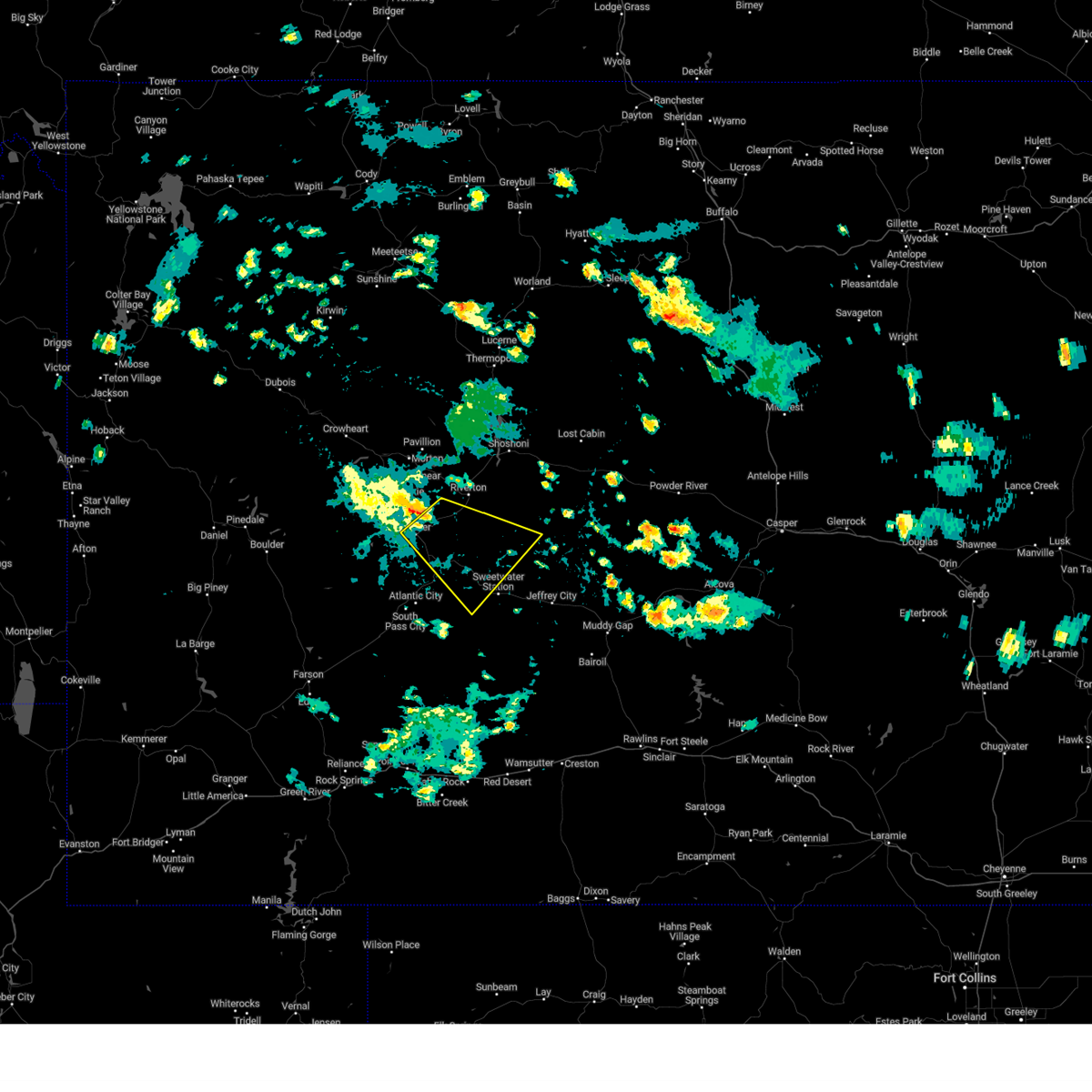
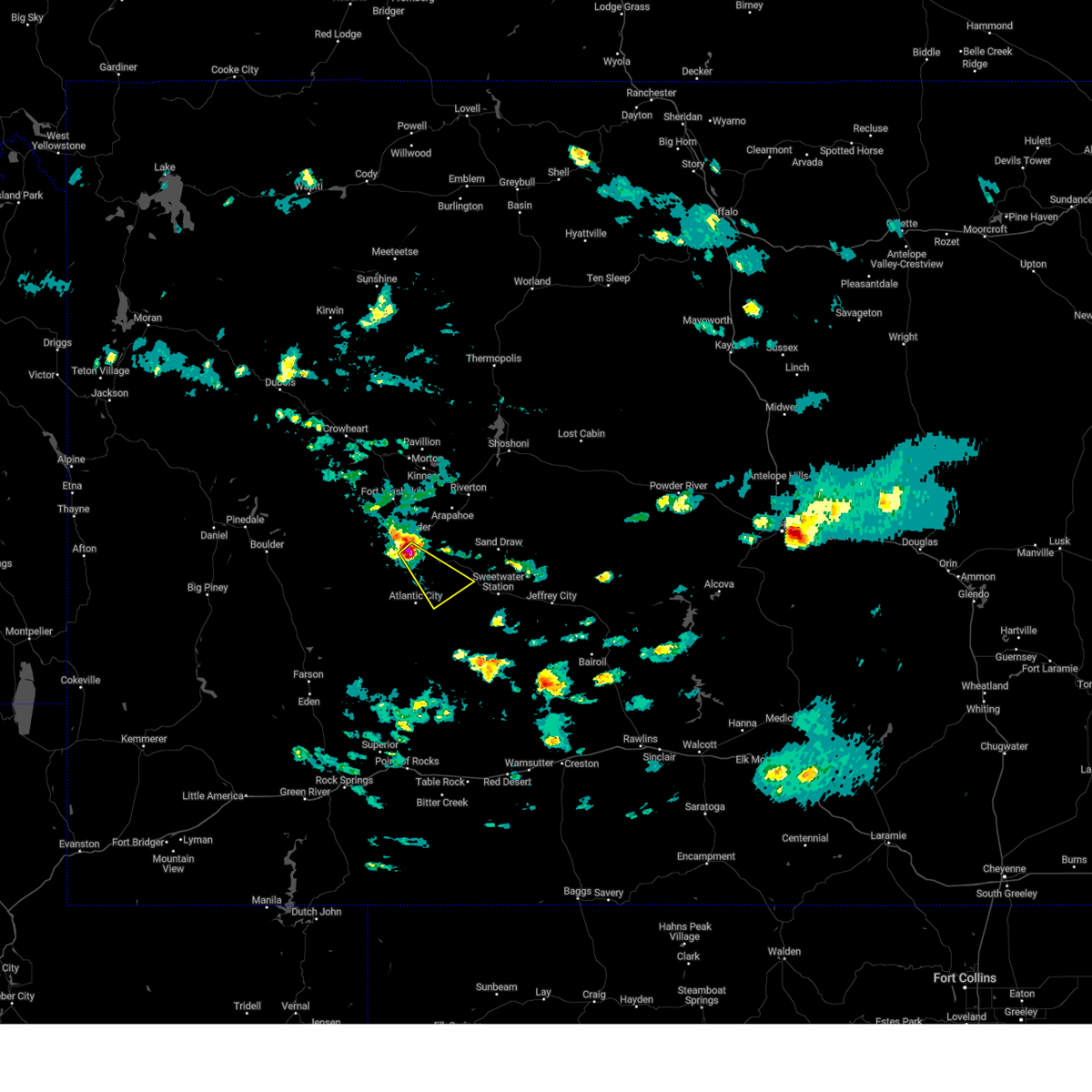
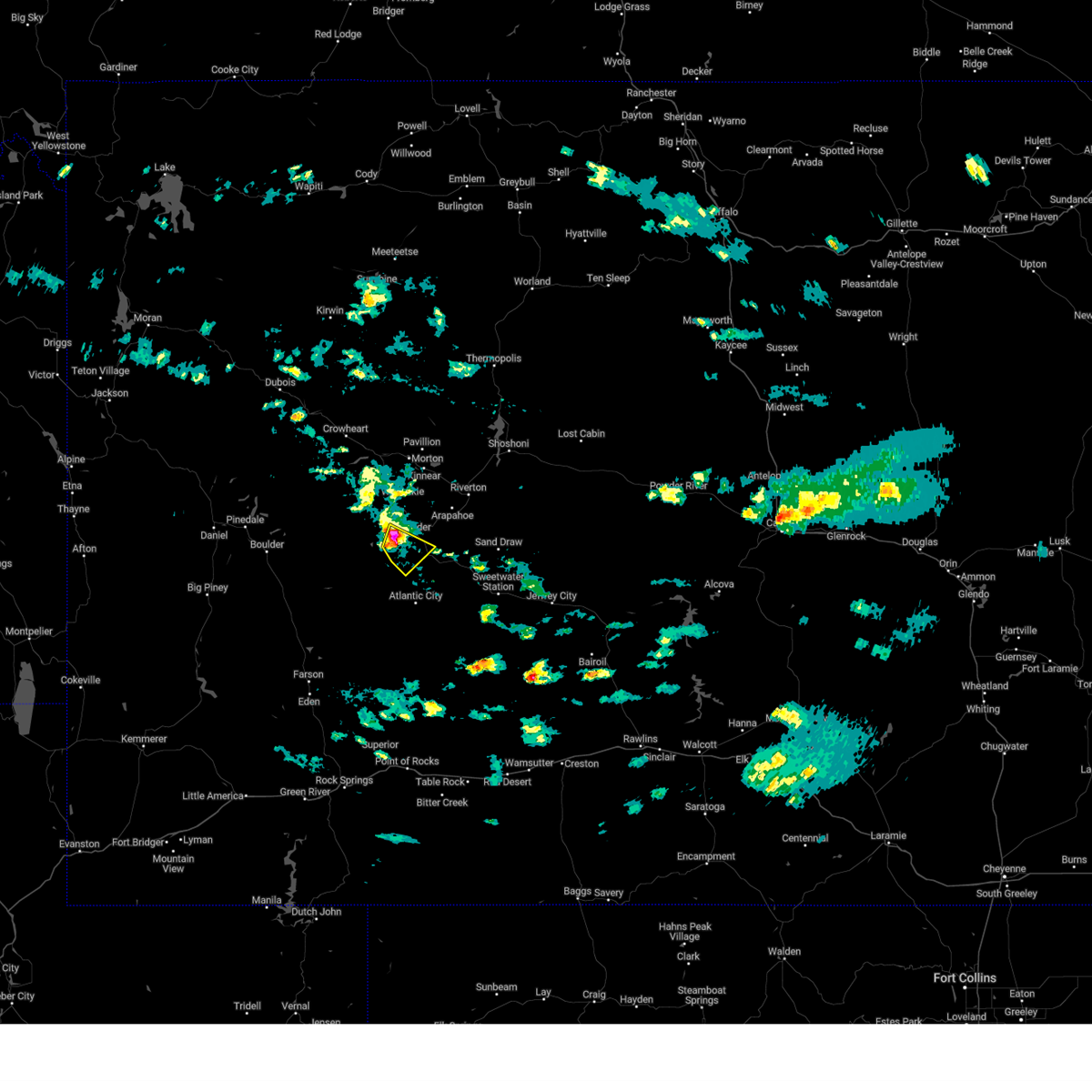
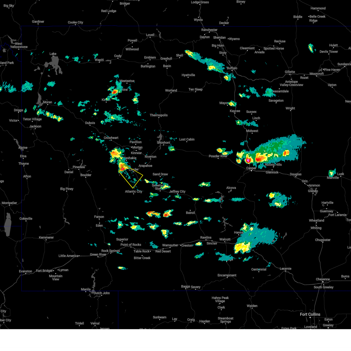
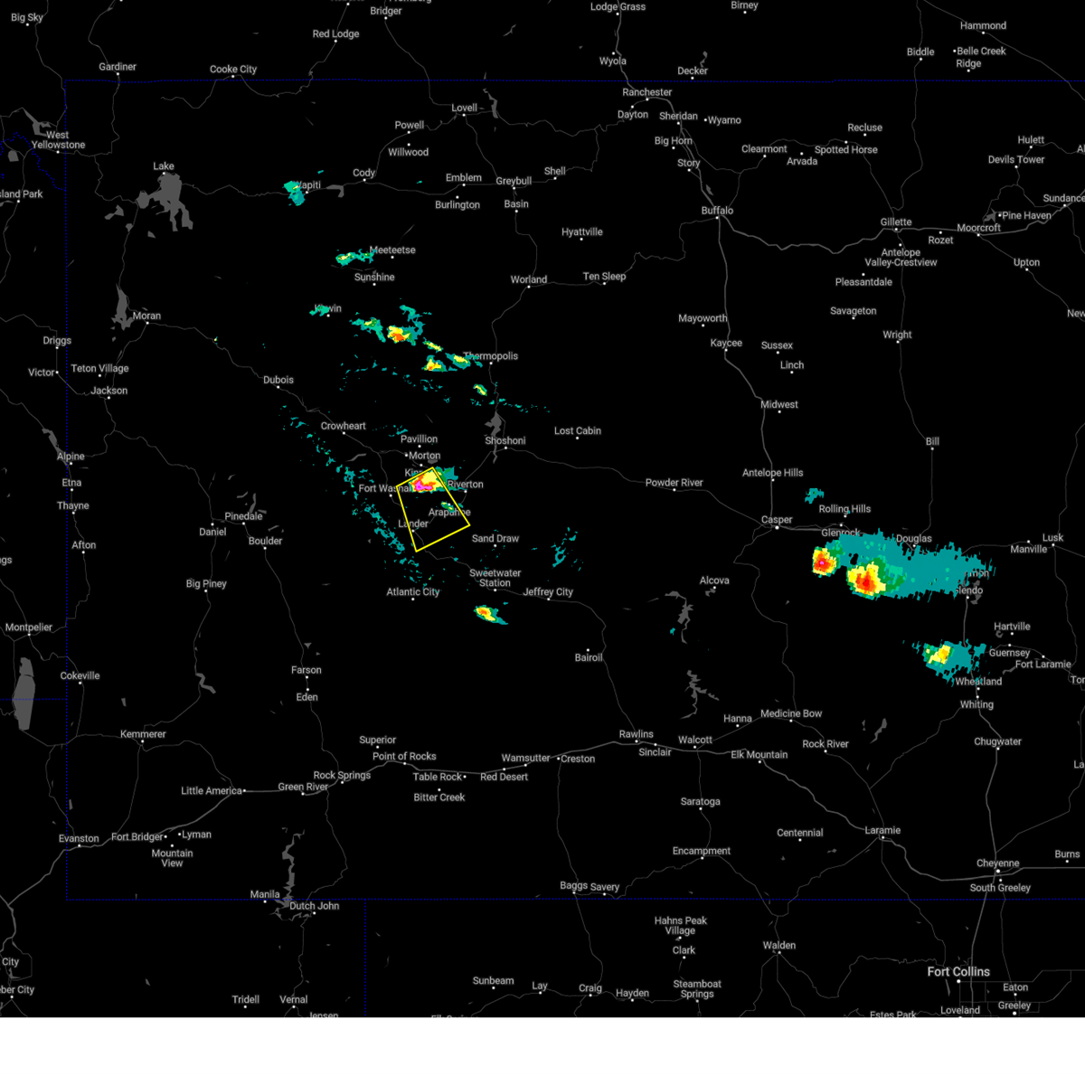
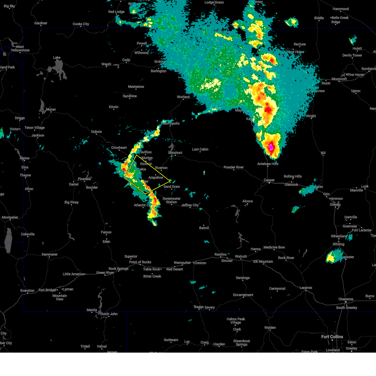
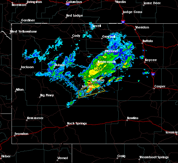
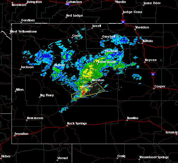
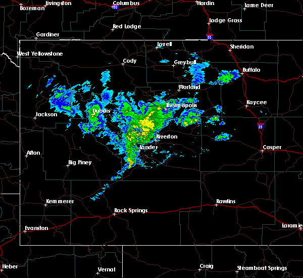
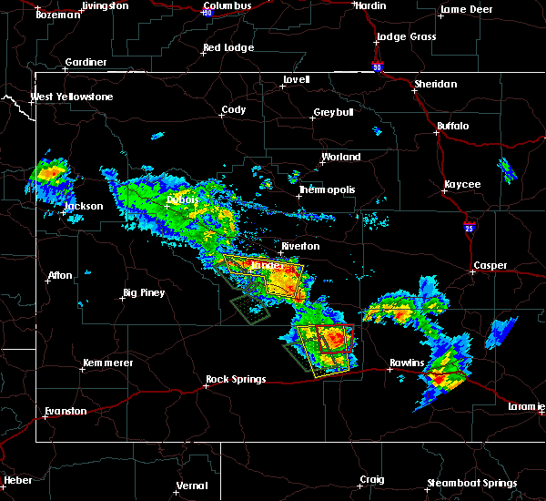
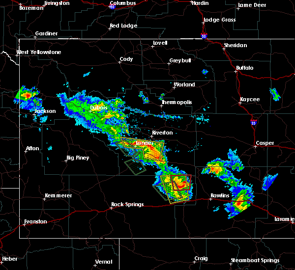
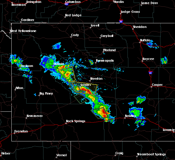
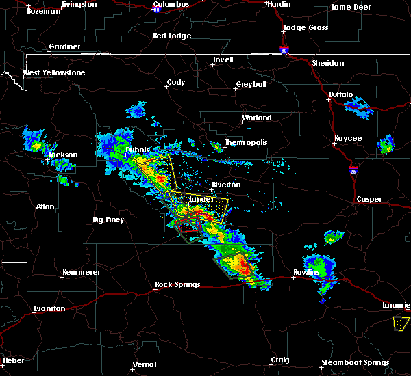
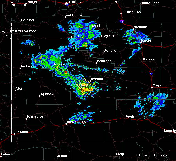
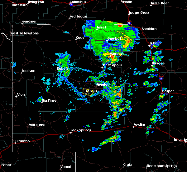
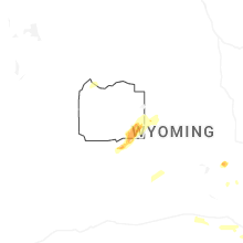
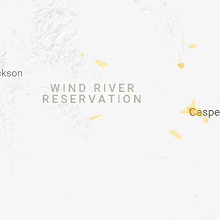
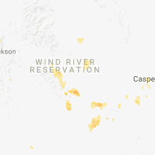
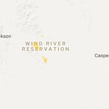
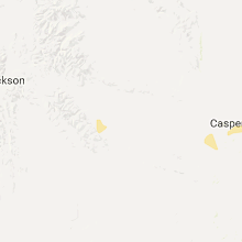
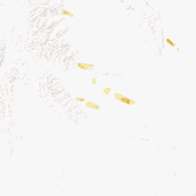
Hail Map for Lander, WY
The Lander, WY area has had 6 reports of on-the-ground hail by trained spotters, and has been under severe weather warnings 16 times during the past 12 months. Doppler radar has detected hail at or near Lander, WY on 18 occasions, including 1 occasion during the past year.
| Name: | Lander, WY |
| Where Located: | 22.8 miles SW of Riverton, WY |
| Map: | Google Map for Lander, WY |
| Population: | 7487 |
| Housing Units: | 3385 |
| More Info: | Search Google for Lander, WY |
0
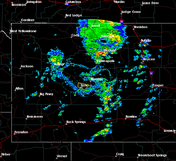
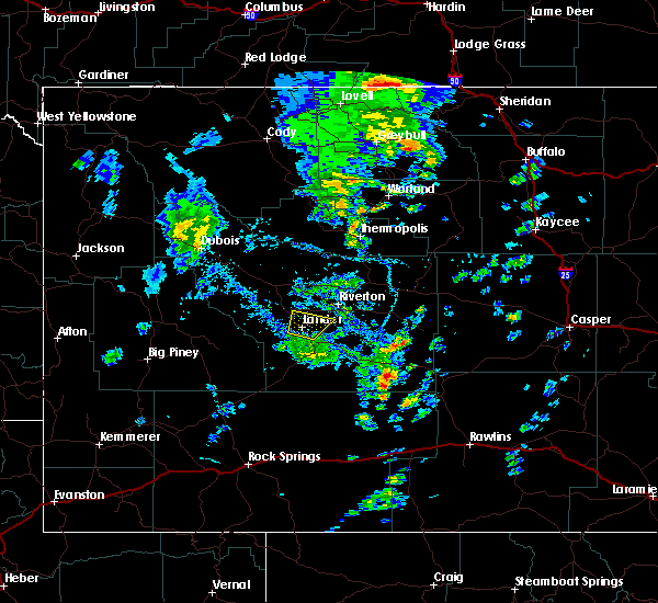
The Top Recent Hail Date for Lander, WY is Wednesday, June 24, 2026 (15th out of 18)
Hail and Wind Damage Spotted near Lander, WY
| Date / Time | Report Details |
|---|---|
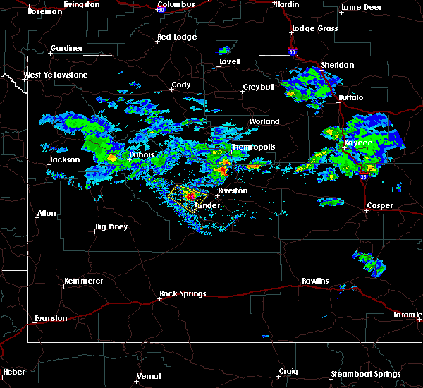
| 6/27/2026 3:56 PM MDT | Mesonet station shpw4 sharpnose. time estimate from rada in fremont county WY, 10.9 miles SW of Lander, WY |
| 6/27/2026 3:54 PM MDT |
 Svrriw the national weather service in riverton has issued a * severe thunderstorm warning for, central fremont county in central wyoming, * until 430 pm mdt. * at 354 pm mdt, severe thunderstorms were located along a line extending from near fort washakie to near hudson to near red canyon, moving northeast at 60 mph (radar indicated). Hazards include 60 mph wind gusts. Expect damage to roofs, siding, and trees. severe thunderstorms will be near, riverton, arapahoe, and kinnear around 400 pm mdt. ocean lake around 405 pm mdt. Other locations in the path of these severe thunderstorms include boysen state park and hidden valley. Svrriw the national weather service in riverton has issued a * severe thunderstorm warning for, central fremont county in central wyoming, * until 430 pm mdt. * at 354 pm mdt, severe thunderstorms were located along a line extending from near fort washakie to near hudson to near red canyon, moving northeast at 60 mph (radar indicated). Hazards include 60 mph wind gusts. Expect damage to roofs, siding, and trees. severe thunderstorms will be near, riverton, arapahoe, and kinnear around 400 pm mdt. ocean lake around 405 pm mdt. Other locations in the path of these severe thunderstorms include boysen state park and hidden valley.
|
| 6/27/2026 3:43 PM MDT | Mesonet station pc454 moss rock (pc). time estimate from rada in fremont county WY, 2.3 miles NE of Lander, WY |
| 6/27/2026 3:33 PM MDT |
 Svrriw the national weather service in riverton has issued a * severe thunderstorm warning for, south central fremont county in central wyoming, * until 400 pm mdt. * at 333 pm mdt, severe thunderstorms were located along a line extending from 6 miles west of milford to near lander to red canyon, moving northeast at 45 mph (radar indicated). Hazards include 60 mph wind gusts. Expect damage to roofs, siding, and trees. severe thunderstorms will be near, lander around 340 pm mdt. Ethete and hudson around 345 pm mdt. Svrriw the national weather service in riverton has issued a * severe thunderstorm warning for, south central fremont county in central wyoming, * until 400 pm mdt. * at 333 pm mdt, severe thunderstorms were located along a line extending from 6 miles west of milford to near lander to red canyon, moving northeast at 45 mph (radar indicated). Hazards include 60 mph wind gusts. Expect damage to roofs, siding, and trees. severe thunderstorms will be near, lander around 340 pm mdt. Ethete and hudson around 345 pm mdt.
|
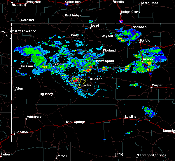
| 6/27/2026 2:57 PM MDT |
 The storms which prompted the warning have moved out of the area. therefore, the warning will be allowed to expire. however, gusty winds are still possible with these thunderstorms. The storms which prompted the warning have moved out of the area. therefore, the warning will be allowed to expire. however, gusty winds are still possible with these thunderstorms.
|
| 6/27/2026 2:53 PM MDT | Asos station klnd lander airport (asos in fremont county WY, 0.4 miles WNW of Lander, WY |
| 6/27/2026 2:46 PM MDT | Mesonet station shpw4 sharpnos in fremont county WY, 10.9 miles SW of Lander, WY |
| 6/27/2026 2:41 PM MDT |
 At 239 pm mdt, severe thunderstorms were located along a line extending from near kinnear to near hudson to 8 miles northeast of red canyon, moving northeast at 30 mph. a wind gust of 66 mph has been observed 1 mile northeast of lander (radar indicated). Hazards include 60 mph wind gusts. Expect damage to roofs, siding, and trees. these severe storms will be near, arapahoe, hudson, kinnear, pilot butte reservoir, and ocean lake around 245 pm mdt. Riverton and pavillion around 250 pm mdt. At 239 pm mdt, severe thunderstorms were located along a line extending from near kinnear to near hudson to 8 miles northeast of red canyon, moving northeast at 30 mph. a wind gust of 66 mph has been observed 1 mile northeast of lander (radar indicated). Hazards include 60 mph wind gusts. Expect damage to roofs, siding, and trees. these severe storms will be near, arapahoe, hudson, kinnear, pilot butte reservoir, and ocean lake around 245 pm mdt. Riverton and pavillion around 250 pm mdt.
|
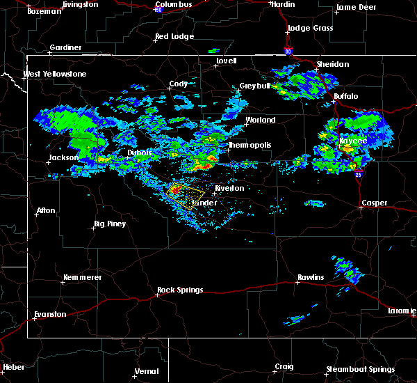
| 6/27/2026 2:30 PM MDT | Mesonet station pc259 wyopo (pc in fremont county WY, 3.4 miles WSW of Lander, WY |
| 6/27/2026 2:30 PM MDT |
 Svrriw the national weather service in riverton has issued a * severe thunderstorm warning for, central fremont county in central wyoming, * until 300 pm mdt. * at 228 pm mdt, severe thunderstorms were located along a line extending from near fort washakie to near milford to near red canyon, moving northeast at 30 mph (radar indicated). Hazards include 60 mph wind gusts. Expect damage to roofs, siding, and trees. severe thunderstorms will be near, hudson around 235 pm mdt. kinnear and pilot butte reservoir around 240 pm mdt. Arapahoe, morton, and ocean lake around 245 pm mdt. Svrriw the national weather service in riverton has issued a * severe thunderstorm warning for, central fremont county in central wyoming, * until 300 pm mdt. * at 228 pm mdt, severe thunderstorms were located along a line extending from near fort washakie to near milford to near red canyon, moving northeast at 30 mph (radar indicated). Hazards include 60 mph wind gusts. Expect damage to roofs, siding, and trees. severe thunderstorms will be near, hudson around 235 pm mdt. kinnear and pilot butte reservoir around 240 pm mdt. Arapahoe, morton, and ocean lake around 245 pm mdt.
|
| 6/24/2026 9:33 PM MDT |
 Svrriw the national weather service in riverton has issued a * severe thunderstorm warning for, southern fremont county in central wyoming, * until 1000 pm mdt. * at 933 pm mdt, a severe thunderstorm was located near lander, moving northeast at 20 mph (radar indicated). Hazards include 60 mph wind gusts and quarter size hail. Hail damage to vehicles is expected. expect wind damage to roofs, siding, and trees. This severe thunderstorm will remain over mainly rural areas of southern fremont county. Svrriw the national weather service in riverton has issued a * severe thunderstorm warning for, southern fremont county in central wyoming, * until 1000 pm mdt. * at 933 pm mdt, a severe thunderstorm was located near lander, moving northeast at 20 mph (radar indicated). Hazards include 60 mph wind gusts and quarter size hail. Hail damage to vehicles is expected. expect wind damage to roofs, siding, and trees. This severe thunderstorm will remain over mainly rural areas of southern fremont county.
|
| 6/20/2026 8:03 PM MDT |
 At 803 pm mdt, severe thunderstorms were located along a line extending from 7 miles north of diversion dam rest area to near red canyon to 20 miles southeast of oregon buttes to 11 miles south of bitter creek rest area, moving east at 55 mph (radar indicated). Hazards include 60 mph wind gusts. Expect damage to roofs, siding, and trees. locations impacted include, hudson, kinnear, morton, pilot butte reservoir and arapahoe. This includes interstate 80 between mile markers 133 and 150. At 803 pm mdt, severe thunderstorms were located along a line extending from 7 miles north of diversion dam rest area to near red canyon to 20 miles southeast of oregon buttes to 11 miles south of bitter creek rest area, moving east at 55 mph (radar indicated). Hazards include 60 mph wind gusts. Expect damage to roofs, siding, and trees. locations impacted include, hudson, kinnear, morton, pilot butte reservoir and arapahoe. This includes interstate 80 between mile markers 133 and 150.
|
| 6/20/2026 7:43 PM MDT |
 Svrriw the national weather service in riverton has issued a * severe thunderstorm warning for, southwestern fremont county in central wyoming, central sweetwater county in south central wyoming, * until 830 pm mdt. * at 741 pm mdt, a severe thunderstorm was located near worthen meadows reservoir, which is 12 miles west of lander, moving east at 35 mph (radar indicated). Hazards include 60 mph wind gusts. Expect damage to roofs, siding, and trees. this severe thunderstorm will be near, sinks canyon state park around 750 pm mdt. lander around 755 pm mdt. milford around 800 pm mdt. other locations in the path of this severe thunderstorm include hudson. This includes interstate 80 between mile markers 112 and 150. Svrriw the national weather service in riverton has issued a * severe thunderstorm warning for, southwestern fremont county in central wyoming, central sweetwater county in south central wyoming, * until 830 pm mdt. * at 741 pm mdt, a severe thunderstorm was located near worthen meadows reservoir, which is 12 miles west of lander, moving east at 35 mph (radar indicated). Hazards include 60 mph wind gusts. Expect damage to roofs, siding, and trees. this severe thunderstorm will be near, sinks canyon state park around 750 pm mdt. lander around 755 pm mdt. milford around 800 pm mdt. other locations in the path of this severe thunderstorm include hudson. This includes interstate 80 between mile markers 112 and 150.
|
| 6/20/2026 7:04 PM MDT |
 Svrriw the national weather service in riverton has issued a * severe thunderstorm warning for, eastern sublette county in west central wyoming, southwestern fremont county in central wyoming, northwestern sweetwater county in south central wyoming, * until 745 pm mdt. * at 704 pm mdt, a severe thunderstorm was located 8 miles southeast of boulder lake, which is 18 miles east of pinedale, moving east at 40 mph (radar indicated). Hazards include 60 mph wind gusts. Expect damage to roofs, siding, and trees. This severe thunderstorm will remain over mainly rural areas of eastern sublette, southwestern fremont and northwestern sweetwater counties, including the following locations, green river lake campground, sinks canyon campground, big sandy campground, and dickinson creek campground. Svrriw the national weather service in riverton has issued a * severe thunderstorm warning for, eastern sublette county in west central wyoming, southwestern fremont county in central wyoming, northwestern sweetwater county in south central wyoming, * until 745 pm mdt. * at 704 pm mdt, a severe thunderstorm was located 8 miles southeast of boulder lake, which is 18 miles east of pinedale, moving east at 40 mph (radar indicated). Hazards include 60 mph wind gusts. Expect damage to roofs, siding, and trees. This severe thunderstorm will remain over mainly rural areas of eastern sublette, southwestern fremont and northwestern sweetwater counties, including the following locations, green river lake campground, sinks canyon campground, big sandy campground, and dickinson creek campground.
|
| 6/20/2026 3:56 PM MDT | Mesonet station krec wy28 red canyon (dot in fremont county WY, 15.4 miles NNW of Lander, WY |
| 6/20/2026 3:21 PM MDT | Asos station klnd lander airport (asos in fremont county WY, 0.4 miles WNW of Lander, WY |
| 6/20/2026 2:15 PM MDT |
 Svrriw the national weather service in riverton has issued a * severe thunderstorm warning for, southeastern hot springs county in central wyoming, northwestern natrona county in central wyoming, east central fremont county in central wyoming, * until 300 pm mdt. * at 215 pm mdt, a severe thunderstorm was located near hidden valley, which is 8 miles northeast of riverton, moving east at 45 mph (radar indicated). Hazards include 70 mph wind gusts. Expect considerable tree damage. damage is likely to mobile homes, roofs, and outbuildings. This severe thunderstorm will be near, hidden valley and boysen state park around 220 pm mdt. Svrriw the national weather service in riverton has issued a * severe thunderstorm warning for, southeastern hot springs county in central wyoming, northwestern natrona county in central wyoming, east central fremont county in central wyoming, * until 300 pm mdt. * at 215 pm mdt, a severe thunderstorm was located near hidden valley, which is 8 miles northeast of riverton, moving east at 45 mph (radar indicated). Hazards include 70 mph wind gusts. Expect considerable tree damage. damage is likely to mobile homes, roofs, and outbuildings. This severe thunderstorm will be near, hidden valley and boysen state park around 220 pm mdt.
|
| 6/20/2026 1:36 PM MDT |
 At 136 pm mdt, a severe thunderstorm was located near morton, which is 8 miles north of fort washakie, moving east at 40 mph (radar indicated). Hazards include 60 mph wind gusts and penny size hail. Expect damage to roofs, siding, and trees. Locations impacted include, riverton, lander, fort washakie, pavillion, arapahoe, ethete, hudson, morton, kinnear, crowheart, milford, pilot butte reservoir, sinks canyon state park, sand draw, dickinson park, bull lake, ocean lake, diversion dam rest area, sinks canyon campground, and dickinson creek campground. At 136 pm mdt, a severe thunderstorm was located near morton, which is 8 miles north of fort washakie, moving east at 40 mph (radar indicated). Hazards include 60 mph wind gusts and penny size hail. Expect damage to roofs, siding, and trees. Locations impacted include, riverton, lander, fort washakie, pavillion, arapahoe, ethete, hudson, morton, kinnear, crowheart, milford, pilot butte reservoir, sinks canyon state park, sand draw, dickinson park, bull lake, ocean lake, diversion dam rest area, sinks canyon campground, and dickinson creek campground.
|
| 6/20/2026 1:18 PM MDT |
 Svrriw the national weather service in riverton has issued a * severe thunderstorm warning for, central fremont county in central wyoming, * until 200 pm mdt. * at 117 pm mdt, a severe thunderstorm was located near bull lake, which is 14 miles northwest of fort washakie, moving east at 40 mph (radar indicated). Hazards include 60 mph wind gusts and penny size hail. expect damage to roofs, siding, and trees Svrriw the national weather service in riverton has issued a * severe thunderstorm warning for, central fremont county in central wyoming, * until 200 pm mdt. * at 117 pm mdt, a severe thunderstorm was located near bull lake, which is 14 miles northwest of fort washakie, moving east at 40 mph (radar indicated). Hazards include 60 mph wind gusts and penny size hail. expect damage to roofs, siding, and trees
|
| 5/13/2026 5:37 PM MDT |
 The storm which prompted the warning has moved out of the area. therefore, the warning will be allowed to expire. however, gusty winds up to 55 mph are still possible at times. a severe thunderstorm watch remains in effect until 800 pm mdt for central wyoming. The storm which prompted the warning has moved out of the area. therefore, the warning will be allowed to expire. however, gusty winds up to 55 mph are still possible at times. a severe thunderstorm watch remains in effect until 800 pm mdt for central wyoming.
|
| 5/13/2026 5:16 PM MDT |
 Svrriw the national weather service in riverton has issued a * severe thunderstorm warning for, central fremont county in central wyoming, * until 545 pm mdt. * at 516 pm mdt, a severe thunderstorm was located over lander, moving northeast at 55 mph (radar indicated). Hazards include 60 mph wind gusts. Expect damage to roofs, siding, and trees. This severe thunderstorm will be near, hudson around 520 pm mdt. Svrriw the national weather service in riverton has issued a * severe thunderstorm warning for, central fremont county in central wyoming, * until 545 pm mdt. * at 516 pm mdt, a severe thunderstorm was located over lander, moving northeast at 55 mph (radar indicated). Hazards include 60 mph wind gusts. Expect damage to roofs, siding, and trees. This severe thunderstorm will be near, hudson around 520 pm mdt.
|
| 4/11/2026 4:22 PM MDT | Mesonet station krec wy28 red canyon (dot in fremont county WY, 15.4 miles NNW of Lander, WY |
| 9/11/2025 3:26 PM MDT | Asos station klnd lander airpor in fremont county WY, 0.4 miles WNW of Lander, WY |
| 9/11/2025 3:20 PM MDT | Mesonet station pc454 moss roc in fremont county WY, 2.3 miles NE of Lander, WY |
| 9/10/2025 10:22 PM MDT | At 1020 pm mdt, a severe thunderstorm was located over hudson, which is 9 miles northeast of lander, moving northeast at 40 mph (radar indicated). Hazards include 70 mph wind gusts. a gust of 78 mph was reported at moss rock rd, south of lander near hwy 131. Expect considerable tree damage. damage is likely to mobile homes, roofs, and outbuildings. this severe storm will be near, arapahoe around 1025 pm mdt. Southwestern riverton around 1030 pm mdt. |
| 9/10/2025 10:20 PM MDT | Mesonet station pc259 wyop in fremont county WY, 3.4 miles WSW of Lander, WY |
| 9/10/2025 10:14 PM MDT | Svrriw the national weather service in riverton has issued a * severe thunderstorm warning for, central fremont county in central wyoming, * until 1045 pm mdt. * at 1012 pm mdt, a severe thunderstorm was located near lander, moving northeast at 40 mph (radar indicated). Hazards include gusts up to 70 mph. Expect considerable tree damage. damage is likely to mobile homes, roofs, and outbuildings. this severe thunderstorm will be near, hudson around 1020 pm mdt. arapahoe around 1025 pm mdt. Southwestern riverton around 1030 pm mdt. |
| 9/10/2025 10:11 PM MDT | Asos station klnd lander airpor in fremont county WY, 0.4 miles WNW of Lander, WY |
| 9/10/2025 10:10 PM MDT | Mesonet station pc454 moss roc in fremont county WY, 2.3 miles NE of Lander, WY |
| 8/14/2025 4:46 PM MDT | Mesonet station krec red canyon - south pas in fremont county WY, 15.4 miles NNW of Lander, WY |
| 7/15/2025 5:44 PM MDT |
 At 544 pm mdt, a severe thunderstorm was located over milford, which is near lander, moving southeast at 20 mph (radar indicated). Hazards include golf ball size hail and 60 mph wind gusts. People and animals outdoors will be injured. expect hail damage to roofs, siding, windows, and vehicles. expect wind damage to roofs, siding, and trees. Locations impacted include, lander. At 544 pm mdt, a severe thunderstorm was located over milford, which is near lander, moving southeast at 20 mph (radar indicated). Hazards include golf ball size hail and 60 mph wind gusts. People and animals outdoors will be injured. expect hail damage to roofs, siding, windows, and vehicles. expect wind damage to roofs, siding, and trees. Locations impacted include, lander.
|
| 7/15/2025 5:24 PM MDT |
 Svrriw the national weather service in riverton has issued a * severe thunderstorm warning for, central fremont county in central wyoming, * until 615 pm mdt. * at 523 pm mdt, a severe thunderstorm was located near fort washakie, moving southeast at 20 mph (radar indicated). Hazards include golf ball size hail and 60 mph wind gusts. People and animals outdoors will be injured. expect hail damage to roofs, siding, windows, and vehicles. expect wind damage to roofs, siding, and trees. this severe thunderstorm will be near, milford around 530 pm mdt. Lander around 540 pm mdt. Svrriw the national weather service in riverton has issued a * severe thunderstorm warning for, central fremont county in central wyoming, * until 615 pm mdt. * at 523 pm mdt, a severe thunderstorm was located near fort washakie, moving southeast at 20 mph (radar indicated). Hazards include golf ball size hail and 60 mph wind gusts. People and animals outdoors will be injured. expect hail damage to roofs, siding, windows, and vehicles. expect wind damage to roofs, siding, and trees. this severe thunderstorm will be near, milford around 530 pm mdt. Lander around 540 pm mdt.
|
| 7/4/2025 3:29 PM MDT |
 Svrriw the national weather service in riverton has issued a * severe thunderstorm warning for, central fremont county in central wyoming, * until 400 pm mdt. * at 329 pm mdt, a severe thunderstorm was located 7 miles south of ocean lake, which is 8 miles west of riverton, moving east at 40 mph (radar indicated). Hazards include 60 mph wind gusts. Expect damage to roofs, siding, and trees. this severe thunderstorm will be near, riverton around 335 pm mdt. Other locations in the path of this severe thunderstorm include boysen state park. Svrriw the national weather service in riverton has issued a * severe thunderstorm warning for, central fremont county in central wyoming, * until 400 pm mdt. * at 329 pm mdt, a severe thunderstorm was located 7 miles south of ocean lake, which is 8 miles west of riverton, moving east at 40 mph (radar indicated). Hazards include 60 mph wind gusts. Expect damage to roofs, siding, and trees. this severe thunderstorm will be near, riverton around 335 pm mdt. Other locations in the path of this severe thunderstorm include boysen state park.
|
| 7/4/2025 3:27 PM MDT | Storm damage reported in fremont county WY, 0.4 miles WNW of Lander, WY |
| 5/11/2025 5:26 PM MDT | Mesonet station krec red canyon - south pas in fremont county WY, 15.4 miles NNW of Lander, WY |
| 9/17/2024 8:53 AM MDT | Asos station klnd lander airpor in fremont county WY, 0.4 miles WNW of Lander, WY |
| 9/15/2024 5:46 PM MDT | Mesonet station shpw4 hudson 3 nn in fremont county WY, 10.9 miles SW of Lander, WY |
| 9/15/2024 5:10 PM MDT | Mesonet station pc259 wyop in fremont county WY, 3.4 miles WSW of Lander, WY |
| 9/15/2024 5:00 PM MDT | Asos station klnd lander airpor in fremont county WY, 0.4 miles WNW of Lander, WY |
| 9/11/2024 11:53 PM MDT | Asos station klnd lander airpor in fremont county WY, 0.4 miles WNW of Lander, WY |
| 8/25/2024 4:50 PM MDT | Mesonet station andw4 south pass city 8 in fremont county WY, 28.6 miles NNE of Lander, WY |
| 8/17/2024 6:53 PM MDT | Asos station klnd lander airpor in fremont county WY, 0.4 miles WNW of Lander, WY |
| 8/17/2024 6:04 PM MDT | Asos station klnd lander airpor in fremont county WY, 0.4 miles WNW of Lander, WY |
| 8/17/2024 5:20 PM MDT | Mesonet station pc454 moss roc in fremont county WY, 2.3 miles NE of Lander, WY |
| 8/17/2024 5:12 PM MDT | Mesonet station krec red canyon - south pas in fremont county WY, 15.4 miles NNW of Lander, WY |
| 8/17/2024 5:12 PM MDT | Asos station klnd lander airpor in fremont county WY, 0.4 miles WNW of Lander, WY |
| 7/23/2024 5:46 PM MDT | Mesonet station shpw4 hudson 3 nn in fremont county WY, 10.9 miles SW of Lander, WY |
| 7/20/2024 3:26 PM MDT |
 Svrriw the national weather service in riverton has issued a * severe thunderstorm warning for, southeastern fremont county in central wyoming, * until 345 pm mdt. * at 325 pm mdt, a severe thunderstorm was located 8 miles west of sand draw, which is 20 miles east of lander, moving southeast at 30 mph (radar indicated). Hazards include 60 mph wind gusts. expect damage to roofs, siding, and trees Svrriw the national weather service in riverton has issued a * severe thunderstorm warning for, southeastern fremont county in central wyoming, * until 345 pm mdt. * at 325 pm mdt, a severe thunderstorm was located 8 miles west of sand draw, which is 20 miles east of lander, moving southeast at 30 mph (radar indicated). Hazards include 60 mph wind gusts. expect damage to roofs, siding, and trees
|
| 7/20/2024 3:23 PM MDT |
 Svrriw the national weather service in riverton has issued a * severe thunderstorm warning for, southeastern fremont county in central wyoming, * until 345 pm mdt. * at 322 pm mdt, a severe thunderstorm was located 11 miles west of sand draw, which is 16 miles east of lander, moving southeast at 90 mph (radar indicated. at 312 pm, lander asos gusted 60 mph). Hazards include 60 mph wind gusts. Expect damage to roofs, siding, and trees. This severe thunderstorm will remain over mainly rural areas of southeastern fremont county, including the following locations, arapahoe elementary school, riverton landfill, and lander hunt field. Svrriw the national weather service in riverton has issued a * severe thunderstorm warning for, southeastern fremont county in central wyoming, * until 345 pm mdt. * at 322 pm mdt, a severe thunderstorm was located 11 miles west of sand draw, which is 16 miles east of lander, moving southeast at 90 mph (radar indicated. at 312 pm, lander asos gusted 60 mph). Hazards include 60 mph wind gusts. Expect damage to roofs, siding, and trees. This severe thunderstorm will remain over mainly rural areas of southeastern fremont county, including the following locations, arapahoe elementary school, riverton landfill, and lander hunt field.
|
| 7/20/2024 3:11 PM MDT | Asos station klnd lander airpor in fremont county WY, 0.4 miles WNW of Lander, WY |
| 7/15/2024 2:43 PM MDT |
 Svrriw the national weather service in riverton has issued a * severe thunderstorm warning for, east central fremont county in central wyoming, * until 330 pm mdt. * at 242 pm mdt, a severe thunderstorm was located over arapahoe, which is near riverton, moving east at 25 mph (trained weather spotters). Hazards include 70 mph wind gusts and penny size hail. 60 to 70 mph wind gusts have been observed around fort washakie and lander, and is impacting hudson and riverton at this time. Expect considerable tree damage. damage is likely to mobile homes, roofs, and outbuildings. This severe thunderstorm will be near, riverton around 245 pm mdt. Svrriw the national weather service in riverton has issued a * severe thunderstorm warning for, east central fremont county in central wyoming, * until 330 pm mdt. * at 242 pm mdt, a severe thunderstorm was located over arapahoe, which is near riverton, moving east at 25 mph (trained weather spotters). Hazards include 70 mph wind gusts and penny size hail. 60 to 70 mph wind gusts have been observed around fort washakie and lander, and is impacting hudson and riverton at this time. Expect considerable tree damage. damage is likely to mobile homes, roofs, and outbuildings. This severe thunderstorm will be near, riverton around 245 pm mdt.
|
| 7/15/2024 2:40 PM MDT | Peak wind gusts of 59 to 66 mph between 230 and 240 pm mdt northeast of lander near wyoming highway 78 in fremont county WY, 3.4 miles WSW of Lander, WY |
| 7/15/2024 2:35 PM MDT |
 At 234 pm mdt, a severe thunderstorm was located near hudson, which is 8 miles north of lander, moving east at 20 mph (trained weather spotters). Hazards include 70 mph wind gusts and penny size hail. 60 to 70 mph wind gusts have been observer from fort washakie to lander in the last 15 minutes. Expect considerable tree damage. damage is likely to mobile homes, roofs, and outbuildings. Locations impacted include, southwestern riverton, lander, fort washakie, arapahoe, ethete, hudson, milford, arapahoe elementary school, riverton regional airport, and lander hunt field. At 234 pm mdt, a severe thunderstorm was located near hudson, which is 8 miles north of lander, moving east at 20 mph (trained weather spotters). Hazards include 70 mph wind gusts and penny size hail. 60 to 70 mph wind gusts have been observer from fort washakie to lander in the last 15 minutes. Expect considerable tree damage. damage is likely to mobile homes, roofs, and outbuildings. Locations impacted include, southwestern riverton, lander, fort washakie, arapahoe, ethete, hudson, milford, arapahoe elementary school, riverton regional airport, and lander hunt field.
|
| 7/15/2024 2:32 PM MDT | Peak wind gust at sharpnose raw in fremont county WY, 10.9 miles SW of Lander, WY |
| 7/15/2024 2:30 PM MDT | Peak wind gust in the area of baldwin cree in fremont county WY, 2.9 miles SE of Lander, WY |
| 7/15/2024 2:25 PM MDT | Peak wind gust at hunt fiel in fremont county WY, 0.9 miles NNW of Lander, WY |
| 7/15/2024 2:24 PM MDT |
 Svrriw the national weather service in riverton has issued a * severe thunderstorm warning for, central fremont county in central wyoming, * until 315 pm mdt. * at 222 pm mdt, a severe thunderstorm was located near milford, which is near fort washakie, moving east at 15 mph (radar indicated). Hazards include 60 mph wind gusts and penny size hail. 50 to 55 mph wind gusts have been observed in the lander foothills. expect damage to roofs, siding, and trees Svrriw the national weather service in riverton has issued a * severe thunderstorm warning for, central fremont county in central wyoming, * until 315 pm mdt. * at 222 pm mdt, a severe thunderstorm was located near milford, which is near fort washakie, moving east at 15 mph (radar indicated). Hazards include 60 mph wind gusts and penny size hail. 50 to 55 mph wind gusts have been observed in the lander foothills. expect damage to roofs, siding, and trees
|
| 7/15/2024 2:20 PM MDT | Peak wind gust along the north fork popo agie rive in fremont county WY, 7.8 miles SE of Lander, WY |
| 9/10/2023 5:02 PM MDT | Quarter sized hail reported 14.8 miles NNW of Lander, WY, 2 inch deep dime to nickel sized hail... with a few larger hailstones to quarter sized. |
| 9/10/2023 4:44 PM MDT |
 At 444 pm mdt, a severe thunderstorm was located near sinks canyon state park, which is also 7 miles south of lander, moving southeast at 25 mph (radar indicated). Hazards include ping pong ball size hail and 60 mph wind gusts. People and animals outdoors will be injured. expect hail damage to roofs, siding, windows, and vehicles. expect wind damage to roofs, siding, and trees. this severe thunderstorm will be near, red canyon around 500 pm mdt. hail threat, radar indicated max hail size, 1. 50 in wind threat, radar indicated max wind gust, 60 mph. At 444 pm mdt, a severe thunderstorm was located near sinks canyon state park, which is also 7 miles south of lander, moving southeast at 25 mph (radar indicated). Hazards include ping pong ball size hail and 60 mph wind gusts. People and animals outdoors will be injured. expect hail damage to roofs, siding, windows, and vehicles. expect wind damage to roofs, siding, and trees. this severe thunderstorm will be near, red canyon around 500 pm mdt. hail threat, radar indicated max hail size, 1. 50 in wind threat, radar indicated max wind gust, 60 mph.
|
| 9/10/2023 4:37 PM MDT | Half Dollar sized hail reported 5.1 miles NNE of Lander, WY, hail near entrance to sinks canyon state park. measured 1 1/3 inch hail... with hail about 2 inches deep. |
| 9/10/2023 4:25 PM MDT |
 At 425 pm mdt, a severe thunderstorm was located near sinks canyon state park, which is also near lander, moving southeast at 20 mph (radar indicated). Hazards include ping pong ball size hail and 60 mph wind gusts. People and animals outdoors will be injured. expect hail damage to roofs, siding, windows, and vehicles. expect wind damage to roofs, siding, and trees. locations impacted include, lander and sinks canyon state park. hail threat, radar indicated max hail size, 1. 50 in wind threat, radar indicated max wind gust, 60 mph. At 425 pm mdt, a severe thunderstorm was located near sinks canyon state park, which is also near lander, moving southeast at 20 mph (radar indicated). Hazards include ping pong ball size hail and 60 mph wind gusts. People and animals outdoors will be injured. expect hail damage to roofs, siding, windows, and vehicles. expect wind damage to roofs, siding, and trees. locations impacted include, lander and sinks canyon state park. hail threat, radar indicated max hail size, 1. 50 in wind threat, radar indicated max wind gust, 60 mph.
|
| 9/10/2023 4:07 PM MDT |
 At 407 pm mdt, a severe thunderstorm was located near dickinson park, which is also 10 miles west of lander, moving southeast at 20 mph (radar indicated). Hazards include ping pong ball size hail and 60 mph wind gusts. People and animals outdoors will be injured. expect hail damage to roofs, siding, windows, and vehicles. expect wind damage to roofs, siding, and trees. this severe thunderstorm will be near, milford around 420 pm mdt. other locations in the path of this severe thunderstorm include lander, frye lake and sinks canyon state park. hail threat, radar indicated max hail size, 1. 50 in wind threat, radar indicated max wind gust, 60 mph. At 407 pm mdt, a severe thunderstorm was located near dickinson park, which is also 10 miles west of lander, moving southeast at 20 mph (radar indicated). Hazards include ping pong ball size hail and 60 mph wind gusts. People and animals outdoors will be injured. expect hail damage to roofs, siding, windows, and vehicles. expect wind damage to roofs, siding, and trees. this severe thunderstorm will be near, milford around 420 pm mdt. other locations in the path of this severe thunderstorm include lander, frye lake and sinks canyon state park. hail threat, radar indicated max hail size, 1. 50 in wind threat, radar indicated max wind gust, 60 mph.
|
| 7/26/2023 2:35 PM MDT | Mesonet station shpw4 hudson 3 nn in fremont county WY, 10.9 miles SW of Lander, WY |
| 7/26/2023 2:30 PM MDT | Corrects previous non-tstm wnd gst report from 3 ne lander. mesonet station pc259 wyop in fremont county WY, 3.4 miles WSW of Lander, WY |
| 7/26/2023 2:26 PM MDT |
 At 224 pm mdt, severe thunderstorms were located along a line extending from near diversion dam rest area to near lander, moving east at 45 mph (radar indicated. at 220 pm, over 60 mph wind was reported on the north fork of the popo agie river). Hazards include 60 mph wind gusts. Expect damage to roofs, siding, and trees. severe thunderstorms will be near, hudson around 230 pm mdt. morton and pilot butte reservoir around 240 pm mdt. other locations in the path of these severe thunderstorms include fort washakie, ethete, kinnear, ocean lake, and the west parts of riverton. hail threat, radar indicated max hail size, <. 75 in wind threat, observed max wind gust, 60 mph. At 224 pm mdt, severe thunderstorms were located along a line extending from near diversion dam rest area to near lander, moving east at 45 mph (radar indicated. at 220 pm, over 60 mph wind was reported on the north fork of the popo agie river). Hazards include 60 mph wind gusts. Expect damage to roofs, siding, and trees. severe thunderstorms will be near, hudson around 230 pm mdt. morton and pilot butte reservoir around 240 pm mdt. other locations in the path of these severe thunderstorms include fort washakie, ethete, kinnear, ocean lake, and the west parts of riverton. hail threat, radar indicated max hail size, <. 75 in wind threat, observed max wind gust, 60 mph.
|
| 7/26/2023 2:25 PM MDT | Asos station klnd lander airpor in fremont county WY, 0.4 miles WNW of Lander, WY |
| 7/26/2023 2:20 PM MDT | Mesonet station ew0138 lander 7 n in fremont county WY, 7.8 miles SE of Lander, WY |
| 7/14/2023 5:12 PM MDT |
 At 512 pm mdt, a severe thunderstorm was located near ethete, which is also 10 miles east of fort washakie, moving southeast at 20 mph (radar indicated). Hazards include 60 mph wind gusts and quarter size hail. Hail damage to vehicles is expected. Expect wind damage to roofs, siding, and trees. At 512 pm mdt, a severe thunderstorm was located near ethete, which is also 10 miles east of fort washakie, moving southeast at 20 mph (radar indicated). Hazards include 60 mph wind gusts and quarter size hail. Hail damage to vehicles is expected. Expect wind damage to roofs, siding, and trees.
|
| 7/3/2023 10:32 PM MDT | Mesonet station kbvr beaver rim (wydot in fremont county WY, 28.2 miles NW of Lander, WY |
| 7/3/2023 10:26 PM MDT | Mesonet station krec red canyon - south pass. wind funnels through this gap. this is the second round of thunderstorms to move through toda in fremont county WY, 15.4 miles NNW of Lander, WY |
| 7/3/2023 5:06 PM MDT | Mesonet station kbvr beaver rim (wydot in fremont county WY, 28.2 miles NW of Lander, WY |
| 7/3/2023 4:57 PM MDT |
 At 455 pm mdt, severe thunderstorms were moving through the wind river basin, moving east at 45 mph (radar indicated). Hazards include 70 mph wind gusts and quarter size hail. Hail damage to vehicles is expected. expect considerable tree damage. wind damage is also likely to mobile homes, roofs, and outbuildings. these severe storms will be near, sand draw around 505 pm mdt. other locations in the path of these severe thunderstorms include boysen state park and hidden valley. thunderstorm damage threat, considerable hail threat, radar indicated max hail size, 1. 00 in wind threat, observed max wind gust, 70 mph. At 455 pm mdt, severe thunderstorms were moving through the wind river basin, moving east at 45 mph (radar indicated). Hazards include 70 mph wind gusts and quarter size hail. Hail damage to vehicles is expected. expect considerable tree damage. wind damage is also likely to mobile homes, roofs, and outbuildings. these severe storms will be near, sand draw around 505 pm mdt. other locations in the path of these severe thunderstorms include boysen state park and hidden valley. thunderstorm damage threat, considerable hail threat, radar indicated max hail size, 1. 00 in wind threat, observed max wind gust, 70 mph.
|
| 7/3/2023 4:53 PM MDT | Asos station klnd lander airpor in fremont county WY, 0.4 miles WNW of Lander, WY |
| 7/3/2023 4:50 PM MDT | Mesonet station andw4 south pass city 8 in fremont county WY, 28.6 miles NNE of Lander, WY |
| 7/3/2023 4:48 PM MDT |
 At 447 pm mdt, severe thunderstorms were located along a line extending from 11 miles north of pavillion to 6 miles northwest of riverton to 10 miles west of sand draw, moving east at 45 mph (radar indicated). Hazards include 70 mph wind gusts. Expect considerable tree damage. damage is likely to mobile homes, roofs, and outbuildings. severe thunderstorms will be near, riverton around 450 pm mdt. sand draw around 500 pm mdt. other locations in the path of these severe thunderstorms include boysen state park and hidden valley. thunderstorm damage threat, considerable hail threat, radar indicated max hail size, <. 75 in wind threat, observed max wind gust, 70 mph. At 447 pm mdt, severe thunderstorms were located along a line extending from 11 miles north of pavillion to 6 miles northwest of riverton to 10 miles west of sand draw, moving east at 45 mph (radar indicated). Hazards include 70 mph wind gusts. Expect considerable tree damage. damage is likely to mobile homes, roofs, and outbuildings. severe thunderstorms will be near, riverton around 450 pm mdt. sand draw around 500 pm mdt. other locations in the path of these severe thunderstorms include boysen state park and hidden valley. thunderstorm damage threat, considerable hail threat, radar indicated max hail size, <. 75 in wind threat, observed max wind gust, 70 mph.
|
| 7/3/2023 4:46 PM MDT | Corrects previous non-tstm wnd gst report from 10 ne atlantic city... as it was with a thunderstorm. local terrain funnels wind at this location. mesonet station krec r in fremont county WY, 15.4 miles NNW of Lander, WY |
| 7/3/2023 4:39 PM MDT | Asos station klnd lander airpor in fremont county WY, 0.4 miles WNW of Lander, WY |
| 6/23/2023 3:32 PM MDT |
 At 331 pm mdt, a severe thunderstorm was located over lander, moving northeast at 40 mph (radar indicated). Hazards include 60 mph wind gusts and penny size hail. Expect damage to roofs, siding, and trees. this severe thunderstorm will be near, hudson around 345 pm mdt. other locations in the path of this severe thunderstorm include arapahoe. hail threat, radar indicated max hail size, 0. 75 in wind threat, radar indicated max wind gust, 60 mph. At 331 pm mdt, a severe thunderstorm was located over lander, moving northeast at 40 mph (radar indicated). Hazards include 60 mph wind gusts and penny size hail. Expect damage to roofs, siding, and trees. this severe thunderstorm will be near, hudson around 345 pm mdt. other locations in the path of this severe thunderstorm include arapahoe. hail threat, radar indicated max hail size, 0. 75 in wind threat, radar indicated max wind gust, 60 mph.
|
| 6/23/2023 11:20 AM MDT | Half Dollar sized hail reported 4 miles S of Lander, WY, delayed report. slightly larger than quarter-sized hail. gusty winds damaged a gutter slightly. |
| 6/23/2023 11:19 AM MDT |
 At 1118 am mdt, a severe thunderstorm was located over milford, which is also near lander, moving northeast at 25 mph (radar indicated). Hazards include 60 mph wind gusts and quarter size hail. Hail damage to vehicles is expected. expect wind damage to roofs, siding, and trees. this severe thunderstorm will be near, ethete and hudson around 1130 am mdt. other locations in the path of this severe thunderstorm include arapahoe and southwestern riverton. hail threat, observed max hail size, 1. 00 in wind threat, radar indicated max wind gust, 60 mph. At 1118 am mdt, a severe thunderstorm was located over milford, which is also near lander, moving northeast at 25 mph (radar indicated). Hazards include 60 mph wind gusts and quarter size hail. Hail damage to vehicles is expected. expect wind damage to roofs, siding, and trees. this severe thunderstorm will be near, ethete and hudson around 1130 am mdt. other locations in the path of this severe thunderstorm include arapahoe and southwestern riverton. hail threat, observed max hail size, 1. 00 in wind threat, radar indicated max wind gust, 60 mph.
|
| 5/4/2023 6:24 PM MDT | Asos station klnd lander airpor in fremont county WY, 0.4 miles WNW of Lander, WY |
| 7/24/2022 6:45 PM MDT | Asos station klnd lander airpor in fremont county WY, 0.4 miles WNW of Lander, WY |
| 7/24/2022 4:20 PM MDT | Asos station klnd lander airpor in fremont county WY, 0.4 miles WNW of Lander, WY |
| 9/10/2021 5:19 PM MDT | Asos station klnd lander airpor in fremont county WY, 0.4 miles WNW of Lander, WY |
| 8/15/2021 11:57 AM MDT | Downsloping outflow wind from convectio in fremont county WY, 0.6 miles SSW of Lander, WY |
| 8/15/2021 11:37 AM MDT | Downsloping outflow wind from convectio in fremont county WY, 0.6 miles SSW of Lander, WY |
| 8/6/2021 4:10 PM MDT | Quarter sized hail reported 13.7 miles S of Lander, WY |
| 1/1/0001 12:00 AM | Lander airport. weak showers coming off the wind river mountains caused strong gus in fremont county WY, 0.4 miles WNW of Lander, WY |
| 8/25/2020 6:52 PM MDT | Mesonet station krec atlantic city 10 ne (wydot in fremont county WY, 15.4 miles NNW of Lander, WY |
| 8/12/2020 5:00 PM MDT | Asos station klnd lander airpor in fremont county WY, 0.4 miles WNW of Lander, WY |
| 6/28/2020 4:26 PM MDT | Mesonet station krec atlantic city 10 ne (wydot in fremont county WY, 15.4 miles NNW of Lander, WY |
| 6/7/2020 3:02 PM MDT |
 At 301 pm mdt, a severe thunderstorm was located over lander, moving northeast at 35 mph (radar indicated). Hazards include 60 mph wind gusts. Expect damage to roofs, siding, and trees. this severe storm will be near, hudson around 310 pm mdt. arapahoe around 320 pm mdt. wind gusts near 50 mph were reported at lander hunt field just before 3 pm. Gusts above 60 mph have been measured on highway 28 around red canyon. At 301 pm mdt, a severe thunderstorm was located over lander, moving northeast at 35 mph (radar indicated). Hazards include 60 mph wind gusts. Expect damage to roofs, siding, and trees. this severe storm will be near, hudson around 310 pm mdt. arapahoe around 320 pm mdt. wind gusts near 50 mph were reported at lander hunt field just before 3 pm. Gusts above 60 mph have been measured on highway 28 around red canyon.
|
| 6/7/2020 2:42 PM MDT |
 At 242 pm mdt, a severe thunderstorm was located over sinks canyon state park, which is 8 miles south of lander, moving northeast at 55 mph (radar indicated). Hazards include 60 mph wind gusts. Expect damage to roofs, siding, and trees. this severe thunderstorm will be near, lander and milford around 250 pm mdt. hudson around 300 pm mdt. arapahoe around 305 pm mdt. Other locations impacted by this severe thunderstorm include atlantic city, sinks canyon campground, and lander hunt field. At 242 pm mdt, a severe thunderstorm was located over sinks canyon state park, which is 8 miles south of lander, moving northeast at 55 mph (radar indicated). Hazards include 60 mph wind gusts. Expect damage to roofs, siding, and trees. this severe thunderstorm will be near, lander and milford around 250 pm mdt. hudson around 300 pm mdt. arapahoe around 305 pm mdt. Other locations impacted by this severe thunderstorm include atlantic city, sinks canyon campground, and lander hunt field.
|
| 6/6/2020 3:34 PM MDT |
 At 332 pm mdt, severe thunderstorms were located along a line extending from 6 miles southeast of hidden valley to near alcova, moving east at 65 mph (radar indicated). Hazards include 60 to 65 mph wind gusts. Expect damage to roofs, siding, and trees. severe thunderstorms will be near, hiland, waltman and waltman rest area around 350 pm mdt. powder river around 355 pm mdt. goldeneye reservoir around 400 pm mdt. casper, bar nunn, homa hills and antelope hills around 410 pm mdt. other locations impacted by these severe thunderstorms include atlantic city, casper mountain, and casper-natrona county international airport. this includes interstate 25 between mile markers 176 and 208. Time, mot, loc 2132z 273deg 134kt 4310 10813 4208 10660 4251 10665. At 332 pm mdt, severe thunderstorms were located along a line extending from 6 miles southeast of hidden valley to near alcova, moving east at 65 mph (radar indicated). Hazards include 60 to 65 mph wind gusts. Expect damage to roofs, siding, and trees. severe thunderstorms will be near, hiland, waltman and waltman rest area around 350 pm mdt. powder river around 355 pm mdt. goldeneye reservoir around 400 pm mdt. casper, bar nunn, homa hills and antelope hills around 410 pm mdt. other locations impacted by these severe thunderstorms include atlantic city, casper mountain, and casper-natrona county international airport. this includes interstate 25 between mile markers 176 and 208. Time, mot, loc 2132z 273deg 134kt 4310 10813 4208 10660 4251 10665.
|
| 6/6/2020 3:02 PM MDT | Red canyon wydot anemometer in fremont county WY, 15.6 miles NW of Lander, WY |
| 6/6/2020 2:59 PM MDT |
 At 257 pm mdt, severe thunderstorms were located along a line extending from near lander to 14 miles west of seminoe dam, moving north at 65 mph (radar indicated). Hazards include 60 to 65 mph wind gusts. Expect damage to roofs, siding, and trees. these severe storms will be near, devil`s gate around 310 pm mdt. independence rock around 315 pm mdt. Other locations impacted by these severe thunderstorms include atlantic city, sinks canyon campground, riverton landfill and lander hunt field. At 257 pm mdt, severe thunderstorms were located along a line extending from near lander to 14 miles west of seminoe dam, moving north at 65 mph (radar indicated). Hazards include 60 to 65 mph wind gusts. Expect damage to roofs, siding, and trees. these severe storms will be near, devil`s gate around 310 pm mdt. independence rock around 315 pm mdt. Other locations impacted by these severe thunderstorms include atlantic city, sinks canyon campground, riverton landfill and lander hunt field.
|
| 6/6/2020 2:32 PM MDT |
 At 230 pm mdt, severe thunderstorms were located along a line extending from near south pass to 6 miles northwest of bairoil, moving north northeast at 65 mph (radar indicated). Hazards include 60 to 65 mph wind gusts. Expect damage to roofs, siding, and trees. severe thunderstorms will be near, red canyon around 240 pm mdt. hudson around 245 pm mdt. devil`s gate around 310 pm mdt. independence rock around 315 pm mdt. Other locations impacted by these severe thunderstorms include atlantic city, sinks canyon campground, riverton landfill and lander hunt field. At 230 pm mdt, severe thunderstorms were located along a line extending from near south pass to 6 miles northwest of bairoil, moving north northeast at 65 mph (radar indicated). Hazards include 60 to 65 mph wind gusts. Expect damage to roofs, siding, and trees. severe thunderstorms will be near, red canyon around 240 pm mdt. hudson around 245 pm mdt. devil`s gate around 310 pm mdt. independence rock around 315 pm mdt. Other locations impacted by these severe thunderstorms include atlantic city, sinks canyon campground, riverton landfill and lander hunt field.
|
| 6/6/2020 1:00 AM MDT | Asos station klnd lander airpor in fremont county WY, 0.4 miles WNW of Lander, WY |
| 6/6/2020 12:56 AM MDT |
 At 1255 am mdt, a severe thunderstorm was located near hudson, which is 10 miles south of riverton, moving north at 40 mph (radar indicated). Hazards include 60 mph wind gusts. Expect damage to roofs, siding, and trees. this severe thunderstorm will be near, riverton around 105 am mdt. ocean lake around 120 am mdt. Other locations impacted by this severe thunderstorm include arapahoe elementary school, midvale, st stephens, bonneville, riverton landfill, fremont county fairgrounds, riverton regional airport and lander hunt field. At 1255 am mdt, a severe thunderstorm was located near hudson, which is 10 miles south of riverton, moving north at 40 mph (radar indicated). Hazards include 60 mph wind gusts. Expect damage to roofs, siding, and trees. this severe thunderstorm will be near, riverton around 105 am mdt. ocean lake around 120 am mdt. Other locations impacted by this severe thunderstorm include arapahoe elementary school, midvale, st stephens, bonneville, riverton landfill, fremont county fairgrounds, riverton regional airport and lander hunt field.
|
| 4/30/2020 3:53 PM MDT | Asos station klnd lander airpor in fremont county WY, 0.4 miles WNW of Lander, WY |
| 9/28/2019 1:52 PM MDT |
 The severe thunderstorm warning for southeastern fremont county will expire at 200 pm mdt, the storm which prompted the warning has weakened below severe limits, and no longer poses an immediate threat to life or property. therefore, the warning will be allowed to expire. however small hail, gusty winds and heavy rain are still possible with this thunderstorm. The severe thunderstorm warning for southeastern fremont county will expire at 200 pm mdt, the storm which prompted the warning has weakened below severe limits, and no longer poses an immediate threat to life or property. therefore, the warning will be allowed to expire. however small hail, gusty winds and heavy rain are still possible with this thunderstorm.
|
| 9/28/2019 1:30 PM MDT |
 At 130 pm mdt, a severe thunderstorm was located near red canyon, which is 10 miles southeast of lander, moving northeast at 45 mph (radar indicated). Hazards include 60 mph wind gusts and penny size hail. Expect damage to roofs, siding, and trees. This severe thunderstorm will remain over mainly rural areas of southeastern fremont county, including the following locations, riverton landfill and sinks canyon campground. At 130 pm mdt, a severe thunderstorm was located near red canyon, which is 10 miles southeast of lander, moving northeast at 45 mph (radar indicated). Hazards include 60 mph wind gusts and penny size hail. Expect damage to roofs, siding, and trees. This severe thunderstorm will remain over mainly rural areas of southeastern fremont county, including the following locations, riverton landfill and sinks canyon campground.
|
| 9/28/2019 1:11 PM MDT |
 At 110 pm mdt, a severe thunderstorm was located near fiddlers lake, which is 13 miles south of lander, moving northeast at 45 mph (radar indicated). Hazards include 70 mph wind gusts and quarter size hail. Hail damage to vehicles is expected. expect considerable tree damage. wind damage is also likely to mobile homes, roofs, and outbuildings. this severe thunderstorm will be near, sinks canyon state park around 115 pm mdt. red canyon around 120 pm mdt. Other locations impacted by this severe thunderstorm include riverton landfill and sinks canyon campground. At 110 pm mdt, a severe thunderstorm was located near fiddlers lake, which is 13 miles south of lander, moving northeast at 45 mph (radar indicated). Hazards include 70 mph wind gusts and quarter size hail. Hail damage to vehicles is expected. expect considerable tree damage. wind damage is also likely to mobile homes, roofs, and outbuildings. this severe thunderstorm will be near, sinks canyon state park around 115 pm mdt. red canyon around 120 pm mdt. Other locations impacted by this severe thunderstorm include riverton landfill and sinks canyon campground.
|
| 8/18/2018 2:35 PM MDT |
 At 234 pm mdt, severe thunderstorms were located along a line extending from 15 miles north of ocean lake to 10 miles north of pilot butte reservoir to near pavillion to near kinnear to ethete to 6 miles south of fort washakie, moving southeast at 30 mph (radar indicated). Hazards include 60 mph wind gusts and quarter size hail. Hail damage to vehicles is expected. expect wind damage to roofs, siding, and trees. these severe storms will be near, ethete and kinnear around 240 pm mdt. milford around 250 pm mdt. lander and ocean lake around 255 pm mdt. sinks canyon state park around 300 pm mdt. Other locations impacted by these severe thunderstorms include the west end of boysen reservoir, wyoming indian elementary school, midvale, sinks canyon campground, riverton regional airport, pavillion natural gas processing plant and lander hunt field. At 234 pm mdt, severe thunderstorms were located along a line extending from 15 miles north of ocean lake to 10 miles north of pilot butte reservoir to near pavillion to near kinnear to ethete to 6 miles south of fort washakie, moving southeast at 30 mph (radar indicated). Hazards include 60 mph wind gusts and quarter size hail. Hail damage to vehicles is expected. expect wind damage to roofs, siding, and trees. these severe storms will be near, ethete and kinnear around 240 pm mdt. milford around 250 pm mdt. lander and ocean lake around 255 pm mdt. sinks canyon state park around 300 pm mdt. Other locations impacted by these severe thunderstorms include the west end of boysen reservoir, wyoming indian elementary school, midvale, sinks canyon campground, riverton regional airport, pavillion natural gas processing plant and lander hunt field.
|
| 8/18/2018 2:10 PM MDT |
 At 209 pm mdt, severe thunderstorms were located along a line extending from 14 miles southeast of anchor dam to 8 miles northwest of fort washakie, moving southeast at 20 mph (radar indicated). Hazards include 60 mph wind gusts and quarter size hail. Hail damage to vehicles is expected. expect wind damage to roofs, siding, and trees. severe thunderstorms will be near, fort washakie around 240 pm mdt. lander and milford around 300 pm mdt. Other locations impacted by these severe thunderstorms include wyoming indian elementary school, midvale, sinks canyon campground, riverton regional airport, pavillion natural gas processing plant and lander hunt field. At 209 pm mdt, severe thunderstorms were located along a line extending from 14 miles southeast of anchor dam to 8 miles northwest of fort washakie, moving southeast at 20 mph (radar indicated). Hazards include 60 mph wind gusts and quarter size hail. Hail damage to vehicles is expected. expect wind damage to roofs, siding, and trees. severe thunderstorms will be near, fort washakie around 240 pm mdt. lander and milford around 300 pm mdt. Other locations impacted by these severe thunderstorms include wyoming indian elementary school, midvale, sinks canyon campground, riverton regional airport, pavillion natural gas processing plant and lander hunt field.
|
| 8/12/2018 3:05 PM MDT | Asos station lnd... lander airpor in fremont county WY, 0.9 miles NNW of Lander, WY |
| 5/27/2018 2:07 PM MDT |
 The severe thunderstorm warning for south central fremont county will expire at 215 pm mdt, the thunderstorms which prompted the warning have weakened below severe limits, and no longer pose an immediate threat to life or property. therefore the warning will be allowed to expire at 215 pm mdt. heavy rain and pea-sized hail are all likely with these thunderstorms as they move across central fremont county. this includes riverton, arapahoe, and the surrounding communities. a severe thunderstorm watch remains in effect until 800 pm mdt for central wyoming. The severe thunderstorm warning for south central fremont county will expire at 215 pm mdt, the thunderstorms which prompted the warning have weakened below severe limits, and no longer pose an immediate threat to life or property. therefore the warning will be allowed to expire at 215 pm mdt. heavy rain and pea-sized hail are all likely with these thunderstorms as they move across central fremont county. this includes riverton, arapahoe, and the surrounding communities. a severe thunderstorm watch remains in effect until 800 pm mdt for central wyoming.
|
| 5/27/2018 1:57 PM MDT |
 At 156 pm mdt, severe thunderstorms were located along a line extending from 6 miles west of milford to 8 miles northwest of sand draw, moving north at 20 mph (radar indicated). Hazards include quarter size hail. Damage to vehicles is expected. Locations impacted include, hudson, milford, and points north of lander. At 156 pm mdt, severe thunderstorms were located along a line extending from 6 miles west of milford to 8 miles northwest of sand draw, moving north at 20 mph (radar indicated). Hazards include quarter size hail. Damage to vehicles is expected. Locations impacted include, hudson, milford, and points north of lander.
|
| 5/27/2018 1:22 PM MDT |
 At 120 pm mdt, severe thunderstorms were located along a line extending from near sinks canyon state park to around sand draw, moving north at 20 mph (radar indicated). Hazards include ping pong ball size hail and 60 mph wind gusts. People and animals outdoors will be injured. expect hail damage to roofs, siding, windows, and vehicles. expect wind damage to roofs, siding, and trees. locations impacted include, lander, hudson, milford, and the surrounding areas. These storms produced one-half inch diameter hail which covered the ground near red canyon. At 120 pm mdt, severe thunderstorms were located along a line extending from near sinks canyon state park to around sand draw, moving north at 20 mph (radar indicated). Hazards include ping pong ball size hail and 60 mph wind gusts. People and animals outdoors will be injured. expect hail damage to roofs, siding, windows, and vehicles. expect wind damage to roofs, siding, and trees. locations impacted include, lander, hudson, milford, and the surrounding areas. These storms produced one-half inch diameter hail which covered the ground near red canyon.
|
| 5/27/2018 1:13 PM MDT |
 At 112 pm mdt, severe thunderstorms were located along a line extending from near sinks canyon state park to 10 miles northwest of sweetwater station, moving north at 10 mph (radar indicated). Hazards include ping pong ball size hail and 60 mph wind gusts. People and animals outdoors will be injured. expect hail damage to roofs, siding, windows, and vehicles. expect wind damage to roofs, siding, and trees. severe thunderstorms will be near, sinks canyon state park around 120 pm mdt. lander around 200 pm mdt. Milford around 215 pm mdt. At 112 pm mdt, severe thunderstorms were located along a line extending from near sinks canyon state park to 10 miles northwest of sweetwater station, moving north at 10 mph (radar indicated). Hazards include ping pong ball size hail and 60 mph wind gusts. People and animals outdoors will be injured. expect hail damage to roofs, siding, windows, and vehicles. expect wind damage to roofs, siding, and trees. severe thunderstorms will be near, sinks canyon state park around 120 pm mdt. lander around 200 pm mdt. Milford around 215 pm mdt.
|
| 5/17/2018 2:09 PM MDT |
 At 208 pm mdt, severe thunderstorms were located along a line extending from near milford to red canyon, moving north at 20 mph (radar indicated). Hazards include quarter size hail. Damage to vehicles is expected. severe thunderstorms will be near, lander around 215 pm mdt. hudson around 230 pm mdt. Other locations impacted by these severe thunderstorms include arapahoe elementary school and lander hunt field. At 208 pm mdt, severe thunderstorms were located along a line extending from near milford to red canyon, moving north at 20 mph (radar indicated). Hazards include quarter size hail. Damage to vehicles is expected. severe thunderstorms will be near, lander around 215 pm mdt. hudson around 230 pm mdt. Other locations impacted by these severe thunderstorms include arapahoe elementary school and lander hunt field.
|
| 5/17/2018 1:49 PM MDT |
 At 149 pm mdt, a severe thunderstorm was located near lander, moving northeast at 25 mph (trained weather spotters). Hazards include quarter size hail. Damage to vehicles is expected. this severe thunderstorm will be near, hudson around 200 pm mdt. arapahoe around 215 pm mdt. Other locations impacted by this severe thunderstorm include wyoming indian elementary school, riverton country club, arapahoe charter school, arapahoe elementary school, st stephens, lander hunt field and wyoming indian junior and senior high school. At 149 pm mdt, a severe thunderstorm was located near lander, moving northeast at 25 mph (trained weather spotters). Hazards include quarter size hail. Damage to vehicles is expected. this severe thunderstorm will be near, hudson around 200 pm mdt. arapahoe around 215 pm mdt. Other locations impacted by this severe thunderstorm include wyoming indian elementary school, riverton country club, arapahoe charter school, arapahoe elementary school, st stephens, lander hunt field and wyoming indian junior and senior high school.
|
| 6/29/2017 7:45 AM MDT |
 At 144 pm mdt, a severe thunderstorm was located over ethete, which is 8 miles east of fort washakie, moving southeast at 25 mph (radar indicated). Hazards include 60 mph wind gusts and quarter size or possibly slightly larger hail. Hail damage to vehicles is expected. Expect wind damage to roofs, siding, and trees. At 144 pm mdt, a severe thunderstorm was located over ethete, which is 8 miles east of fort washakie, moving southeast at 25 mph (radar indicated). Hazards include 60 mph wind gusts and quarter size or possibly slightly larger hail. Hail damage to vehicles is expected. Expect wind damage to roofs, siding, and trees.
|
| 6/29/2017 7:31 AM MDT |
 At 130 pm mdt, a severe thunderstorm was located near fort washakie, moving southeast at 20 mph (radar indicated. at 128 pm marble size hail was reported fort washakie). Hazards include 60 mph wind gusts and quarter size hail. Hail damage to vehicles is expected. expect wind damage to roofs, siding, and trees. This severe storm will be near, ethete around 145 pm mdt. At 130 pm mdt, a severe thunderstorm was located near fort washakie, moving southeast at 20 mph (radar indicated. at 128 pm marble size hail was reported fort washakie). Hazards include 60 mph wind gusts and quarter size hail. Hail damage to vehicles is expected. expect wind damage to roofs, siding, and trees. This severe storm will be near, ethete around 145 pm mdt.
|
| 6/29/2017 7:17 AM MDT |
 At 116 pm mdt, a severe thunderstorm was located near winkleman dome, which is near fort washakie, moving southeast at 20 mph (radar indicated). Hazards include 60 mph wind gusts and quarter size hail. Hail damage to vehicles is expected. expect wind damage to roofs, siding, and trees. this severe thunderstorm will be near, fort washakie around 125 pm mdt. Ethete around 150 pm mdt. At 116 pm mdt, a severe thunderstorm was located near winkleman dome, which is near fort washakie, moving southeast at 20 mph (radar indicated). Hazards include 60 mph wind gusts and quarter size hail. Hail damage to vehicles is expected. expect wind damage to roofs, siding, and trees. this severe thunderstorm will be near, fort washakie around 125 pm mdt. Ethete around 150 pm mdt.
|
| 6/27/2017 4:38 PM MDT | Lander airpor in fremont county WY, 0.9 miles NNW of Lander, WY |
| 6/20/2017 4:28 PM MDT |
 The severe thunderstorm warning for southeastern fremont county will expire at 430 pm mdt, the thunderstorm outflow wind which prompted the warning has decreased in intensity and below severe limits. the wind will remain gusty at 30 to 45 mph through about 5 pm mdt, but the wind no longer poses an immediate threat to life or property. therefore the warning will be allowed to expire. The severe thunderstorm warning for southeastern fremont county will expire at 430 pm mdt, the thunderstorm outflow wind which prompted the warning has decreased in intensity and below severe limits. the wind will remain gusty at 30 to 45 mph through about 5 pm mdt, but the wind no longer poses an immediate threat to life or property. therefore the warning will be allowed to expire.
|
| 6/20/2017 4:21 PM MDT |
 At 419 pm mdt, a severe thunderstorm was located 9 miles northeast of shoshoni, moving east at 40 mph (multiple locations have reported wind gusts of 50 to 57 mph, including the lander airport, riverton airport, and another location in the foothills west of milford). Hazards include 60 mph wind gusts. Expect damage to roofs, siding, and trees. This warning includes boysen state park. At 419 pm mdt, a severe thunderstorm was located 9 miles northeast of shoshoni, moving east at 40 mph (multiple locations have reported wind gusts of 50 to 57 mph, including the lander airport, riverton airport, and another location in the foothills west of milford). Hazards include 60 mph wind gusts. Expect damage to roofs, siding, and trees. This warning includes boysen state park.
|
| 6/20/2017 4:15 PM MDT | Measured at sharpnose raws site near hudso in fremont county WY, 10.9 miles SW of Lander, WY |
| 6/20/2017 4:08 PM MDT |
 At 406 pm mdt, a severe thunderstorm was located near boysen state park, north of shoshoni, moving east at 40 mph (radar indicated). Hazards include 60 mph wind gusts. Expect damage to roofs, siding, and trees. wind gusts around 60 mph are possible across other portions of central fremont county through 430 pm. another surge of wind is expected along us highway 26 from morton to riverton before 420 pm. Reports of frequent wind gusts of 50 to 55 mph have been received from across central fremont county. At 406 pm mdt, a severe thunderstorm was located near boysen state park, north of shoshoni, moving east at 40 mph (radar indicated). Hazards include 60 mph wind gusts. Expect damage to roofs, siding, and trees. wind gusts around 60 mph are possible across other portions of central fremont county through 430 pm. another surge of wind is expected along us highway 26 from morton to riverton before 420 pm. Reports of frequent wind gusts of 50 to 55 mph have been received from across central fremont county.
|
| 6/20/2017 3:52 PM MDT |
 At 350 pm mdt, a severe thunderstorm was located 12 miles southwest of boysen state park headquarters, which is 15 miles west of shoshoni, moving east at 40 mph (radar indicated). Hazards include 60 mph wind gusts. Expect damage to roofs, siding, and trees. this severe thunderstorm will be near, boysen state park headquarters around 405 pm mdt. shoshoni around 410 pm mdt. wind gusts around 60 mph are possible across other portions of central fremont county through 430 pm. outflow wind is expected to come off the wind river range while additional outflow will flow down the wind river valley from crowheart. Riverton, fort washakie, and lander could all experience wind gusts around 60 mph. At 350 pm mdt, a severe thunderstorm was located 12 miles southwest of boysen state park headquarters, which is 15 miles west of shoshoni, moving east at 40 mph (radar indicated). Hazards include 60 mph wind gusts. Expect damage to roofs, siding, and trees. this severe thunderstorm will be near, boysen state park headquarters around 405 pm mdt. shoshoni around 410 pm mdt. wind gusts around 60 mph are possible across other portions of central fremont county through 430 pm. outflow wind is expected to come off the wind river range while additional outflow will flow down the wind river valley from crowheart. Riverton, fort washakie, and lander could all experience wind gusts around 60 mph.
|
| 6/12/2017 6:42 PM MDT | Mesonet station recorded a wind gust to 68 mp in fremont county WY, 6.6 miles ESE of Lander, WY |
| 8/7/2016 4:41 PM MDT | The severe thunderstorm warning for central fremont county will expire at 445 pm mdt, the storm which produced the strong wind gusts that prompted the warning has weakened below severe limits, and no longer pose an immediate threat to life or property. therefore, the warning will be allowed to expire at 445 pm mdt. however gusty winds to 45 mph are still possible with this thunderstorm. |
| 8/7/2016 4:35 PM MDT |
 At 434 pm mdt, a severe thunderstorm was located over hudson, or 10 miles northeast of lander, moving northeast at 25 mph (radar indicated). Hazards include 60 to 70 mph wind gusts. Expect damage to roofs. siding. and trees. The lander airport reported a wind gust to 61 mph around 430 pm. At 434 pm mdt, a severe thunderstorm was located over hudson, or 10 miles northeast of lander, moving northeast at 25 mph (radar indicated). Hazards include 60 to 70 mph wind gusts. Expect damage to roofs. siding. and trees. The lander airport reported a wind gust to 61 mph around 430 pm.
|
| 8/7/2016 4:26 PM MDT | Storm damage reported in fremont county WY, 0.6 miles SSW of Lander, WY |
| 8/7/2016 4:24 PM MDT |
 At 422 pm mdt, a severe thunderstorm with strong outflow wind was located near lander and nearing hudson. the storm was moving northeast at 25 mph (radar indicated). Hazards include 60 to 70 mph wind gusts. Expect damage to roofs. siding. and trees. This severe storm will be near, hudson around 430 pm mdt. At 422 pm mdt, a severe thunderstorm with strong outflow wind was located near lander and nearing hudson. the storm was moving northeast at 25 mph (radar indicated). Hazards include 60 to 70 mph wind gusts. Expect damage to roofs. siding. and trees. This severe storm will be near, hudson around 430 pm mdt.
|
| 8/7/2016 4:15 PM MDT |
 At 415 pm mdt, a severe thunderstorm was located over lander, moving north at 25 mph (radar indicated). Hazards include 60 to 70 mph wind gusts. Expect damage to roofs. siding. and trees. this severe thunderstorm will be near, hudson around 430 pm mdt. Other locations impacted by this severe thunderstorm include south elementary school, lander hunt field, lander regional hospital, fremont county library, lander golf course, west elementary school, wyoming indian elementary school, ray lake cafe, wyoming indian middle school and gannett peak grade school. At 415 pm mdt, a severe thunderstorm was located over lander, moving north at 25 mph (radar indicated). Hazards include 60 to 70 mph wind gusts. Expect damage to roofs. siding. and trees. this severe thunderstorm will be near, hudson around 430 pm mdt. Other locations impacted by this severe thunderstorm include south elementary school, lander hunt field, lander regional hospital, fremont county library, lander golf course, west elementary school, wyoming indian elementary school, ray lake cafe, wyoming indian middle school and gannett peak grade school.
|
| 4/14/2016 2:06 PM MDT |
 At 205 pm mdt, a severe thunderstorm was located north of riverton moving east-northeast around 55 mph (an automated sensor at the nws riverton office registered a peak wind to 59 mph around 2 pm). Hazards include 60 mph wind gusts. Expect damage to roofs. siding and trees. this severe storm will be near, hidden valley around 210 pm mdt. Shoshoni around 215 pm mdt. At 205 pm mdt, a severe thunderstorm was located north of riverton moving east-northeast around 55 mph (an automated sensor at the nws riverton office registered a peak wind to 59 mph around 2 pm). Hazards include 60 mph wind gusts. Expect damage to roofs. siding and trees. this severe storm will be near, hidden valley around 210 pm mdt. Shoshoni around 215 pm mdt.
|
| 4/14/2016 1:52 PM MDT |
 At 152 pm mdt, doppler radar indicated a line of thunderstorms located across the central wind river basin. this line of storms is moving northeast around 50 mph (the automated sensor at lander hunt field gusted to 62 mph shortly after 130 pm). Hazards include 60 to 65 mph wind gusts. Expect damage to roofs. siding and trees. this severe storm will be near, arapahoe and riverton around 155 to 205 pm mdt. Shoshoni and hidden valley around 215 pm mdt. At 152 pm mdt, doppler radar indicated a line of thunderstorms located across the central wind river basin. this line of storms is moving northeast around 50 mph (the automated sensor at lander hunt field gusted to 62 mph shortly after 130 pm). Hazards include 60 to 65 mph wind gusts. Expect damage to roofs. siding and trees. this severe storm will be near, arapahoe and riverton around 155 to 205 pm mdt. Shoshoni and hidden valley around 215 pm mdt.
|
| 4/14/2016 1:35 PM MDT |
 At 134 pm mdt, a severe thunderstorm was located near lander, moving northeast at 45 mph (the automated sensor at hunt field in lander reported a 62 mph wind gust). Hazards include 60 to 65 mph wind gusts. Expect damage to roofs. siding and trees. this severe thunderstorm will be near, arapahoe around 145 pm mdt. riverton around 150 pm mdt. hidden valley around 205 pm mdt. Shoshoni around 215 pm mdt. At 134 pm mdt, a severe thunderstorm was located near lander, moving northeast at 45 mph (the automated sensor at hunt field in lander reported a 62 mph wind gust). Hazards include 60 to 65 mph wind gusts. Expect damage to roofs. siding and trees. this severe thunderstorm will be near, arapahoe around 145 pm mdt. riverton around 150 pm mdt. hidden valley around 205 pm mdt. Shoshoni around 215 pm mdt.
|
| 4/14/2016 1:33 PM MDT | Asos at lander hunt field registered a 62 mph wind gus in fremont county WY, 0.6 miles SSW of Lander, WY |
| 9/4/2015 4:34 PM MDT | Storm damage reported in fremont county WY, 1.8 miles NNW of Lander, WY |
| 7/15/2015 2:43 PM MDT |
 At 242 pm mdt, severe thunderstorms were located along a line extending from near maverik spring dome field to near milford, moving northeast at 35 mph (radar indicated). Hazards include 60 mph wind gusts. Expect damage to roofs. siding and trees. severe thunderstorms will be near, arapahoe and hudson around 300 pm mdt. Other locations impacted by these severe thunderstorms include riverton regional airport, owl creek kampgrounds, fremont county library, lander golf course, rendezvous elementary school, wyoming indian middle school, trinity lutheran school, wind river rv park, ashgrove elementary school and south elementary school. At 242 pm mdt, severe thunderstorms were located along a line extending from near maverik spring dome field to near milford, moving northeast at 35 mph (radar indicated). Hazards include 60 mph wind gusts. Expect damage to roofs. siding and trees. severe thunderstorms will be near, arapahoe and hudson around 300 pm mdt. Other locations impacted by these severe thunderstorms include riverton regional airport, owl creek kampgrounds, fremont county library, lander golf course, rendezvous elementary school, wyoming indian middle school, trinity lutheran school, wind river rv park, ashgrove elementary school and south elementary school.
|
| 6/14/2015 7:14 PM MDT |
 At 713 pm mdt, a severe thunderstorm was located near hudson, which is near lander, moving northeast at 10 mph (law enforcement. at 711 pm...quarter size hail was reported at the lander police station!). Hazards include 60 mph wind gusts and quarter size hail. Hail damage to vehicles is expected. expect wind damage to roofs, siding and trees. this severe thunderstorm will be near, hudson around 735 pm mdt. southwestern riverton and arapahoe around 800 pm mdt. Other locations impacted by this severe thunderstorm include arapahoe charter school, lander golf course, fremont county library, riverton country club, wyoming indian middle school, south elementary school, lander regional hospital, arapahoe elementary school, west elementary school and gannett peak grade school. At 713 pm mdt, a severe thunderstorm was located near hudson, which is near lander, moving northeast at 10 mph (law enforcement. at 711 pm...quarter size hail was reported at the lander police station!). Hazards include 60 mph wind gusts and quarter size hail. Hail damage to vehicles is expected. expect wind damage to roofs, siding and trees. this severe thunderstorm will be near, hudson around 735 pm mdt. southwestern riverton and arapahoe around 800 pm mdt. Other locations impacted by this severe thunderstorm include arapahoe charter school, lander golf course, fremont county library, riverton country club, wyoming indian middle school, south elementary school, lander regional hospital, arapahoe elementary school, west elementary school and gannett peak grade school.
|
| 6/14/2015 7:11 PM MDT | Quarter sized hail reported 0.6 miles SSW of Lander, WY, dime size hail with a few quarter size hail mixed in. |
| 6/5/2015 8:53 PM MDT | Half Dollar sized hail reported 13.7 miles S of Lander, WY, the public posted a picture of half dollar size hail at ethete. |
| 6/4/2014 2:20 PM MDT | Storm damage reported in fremont county WY, 0.6 miles SSW of Lander, WY |
| 5/28/2014 4:54 PM MDT | Storm damage reported in fremont county WY, 0.9 miles NNW of Lander, WY |
| 8/1/2013 9:21 PM MDT | Asos station lander airport /lnd/ in fremont county WY, 0.9 miles NNW of Lander, WY |
| 6/13/2013 12:54 PM MDT | Storm damage reported in fremont county WY, 0.6 miles SSW of Lander, WY |
| 1/1/0001 12:00 AM | Storm damage reported in fremont county WY, 0.6 miles SSW of Lander, WY |
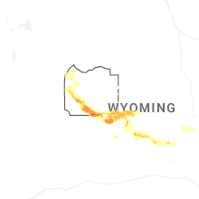
Hail Maps for Lander, WY


Connect with Interactive Hail Maps