

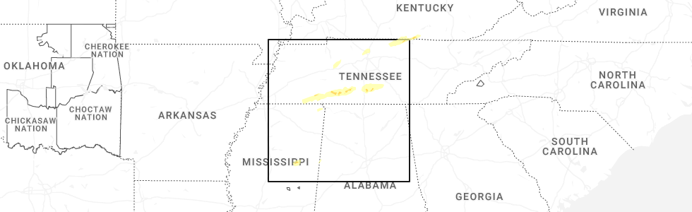
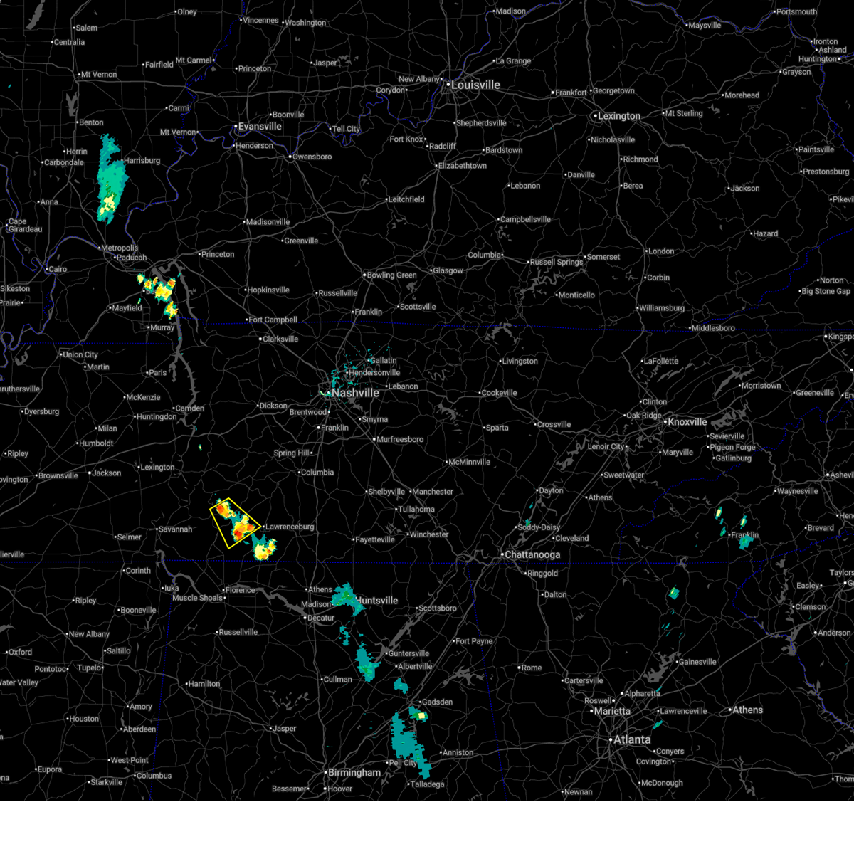
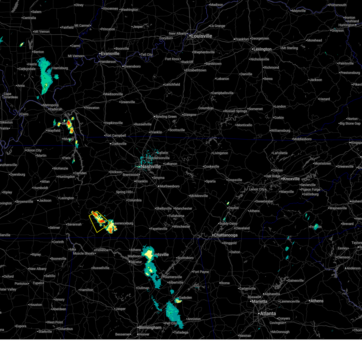
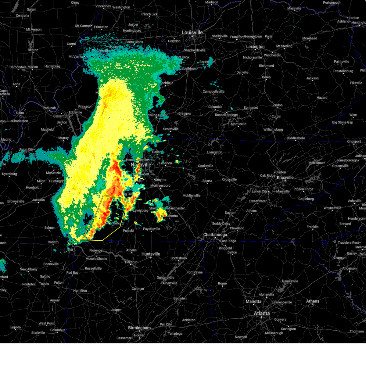
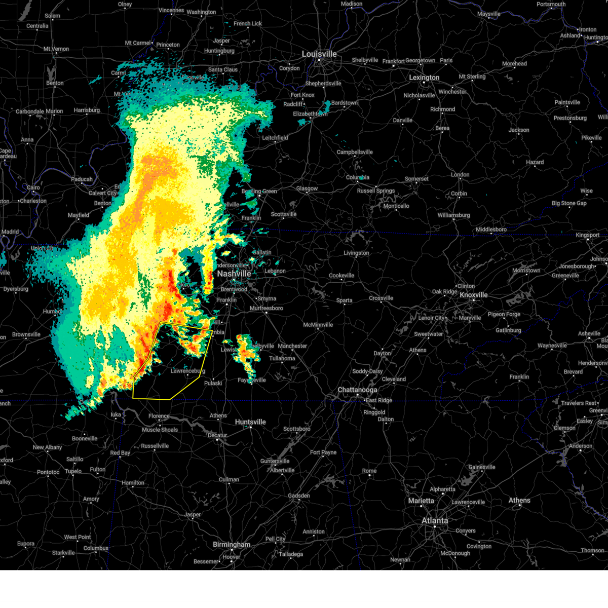
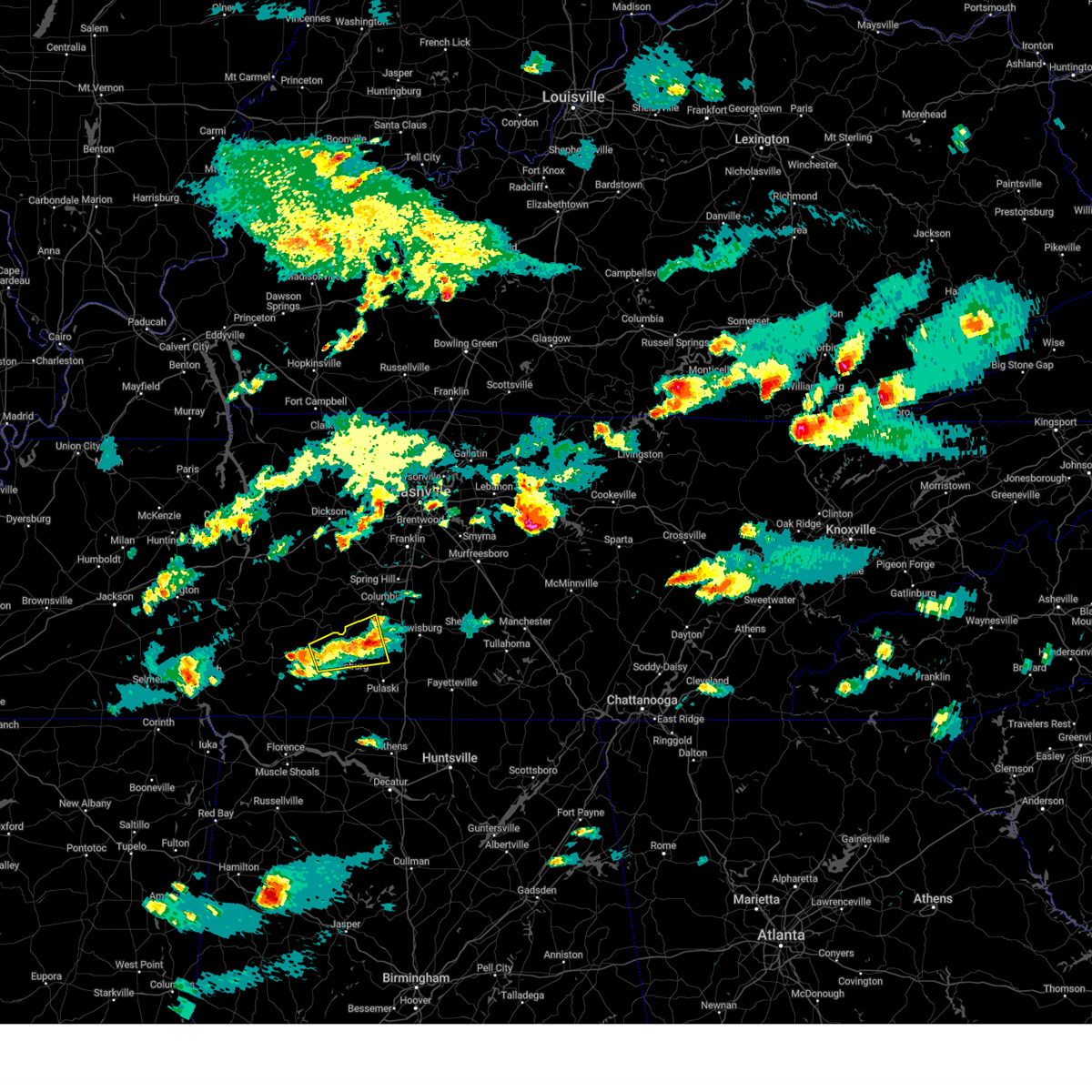
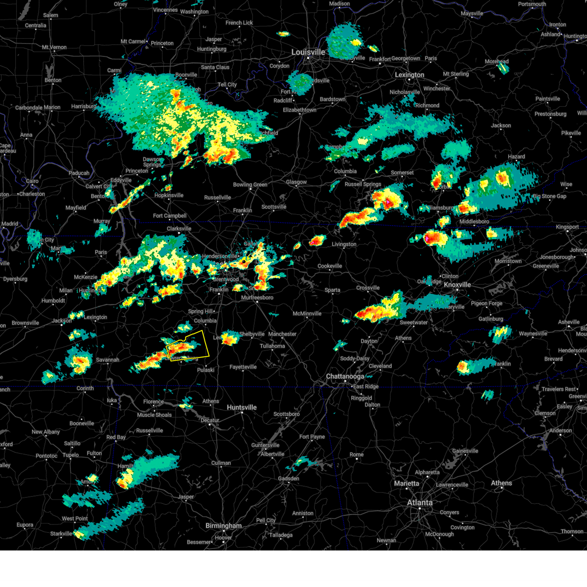
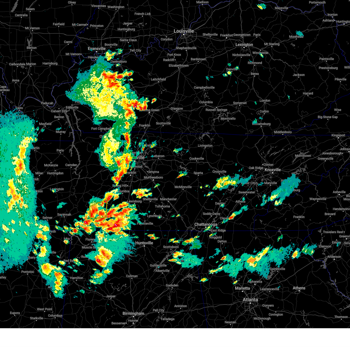
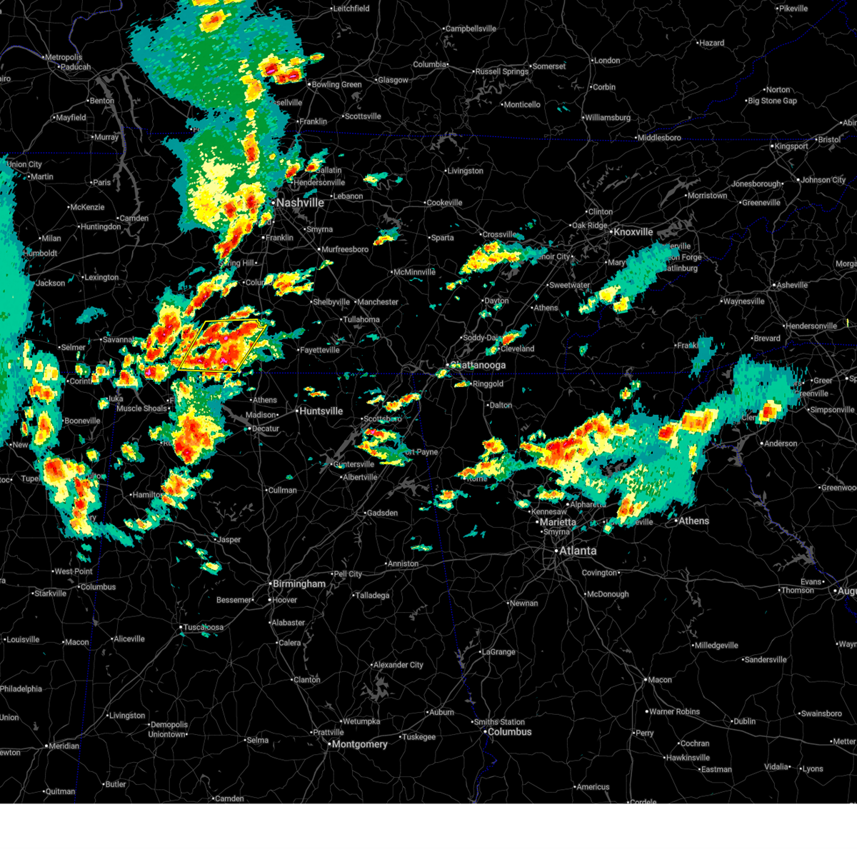
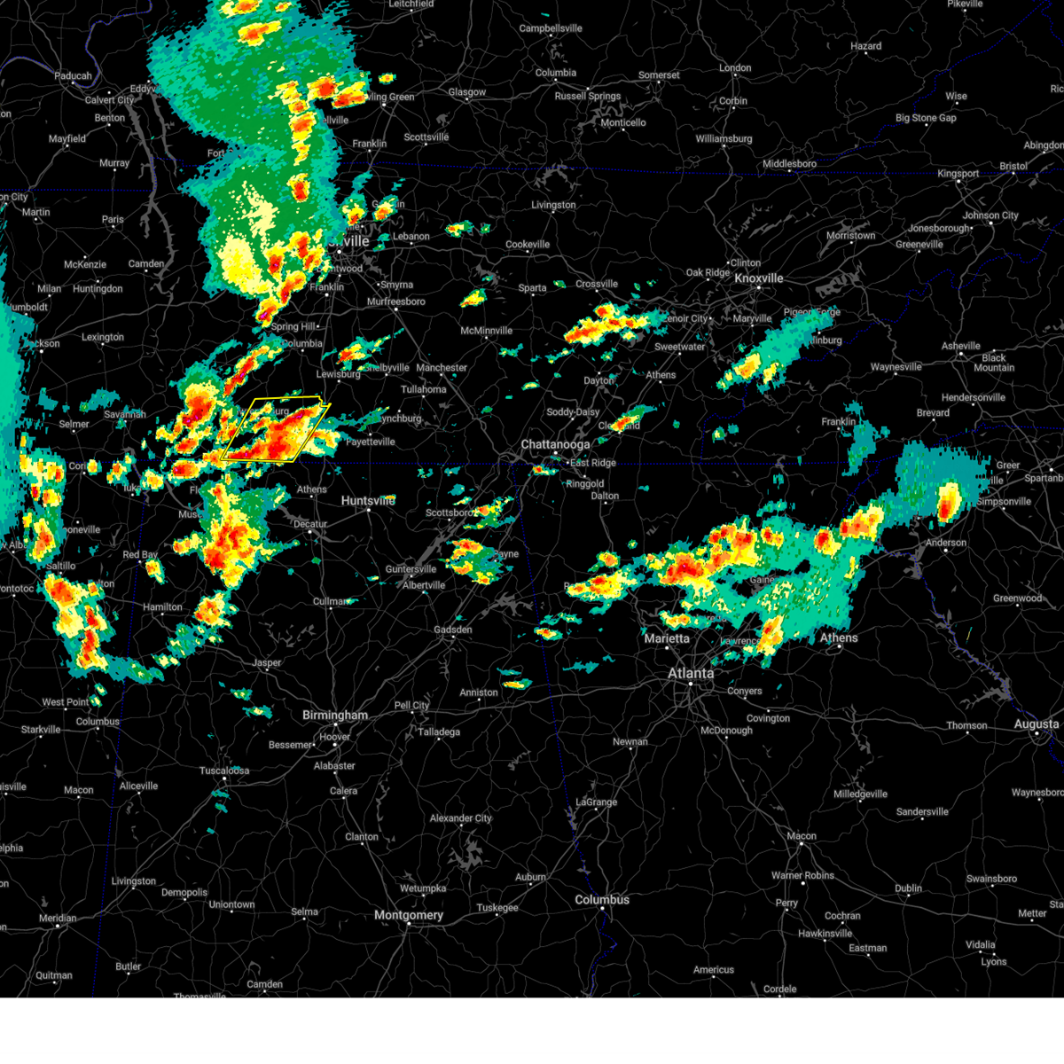
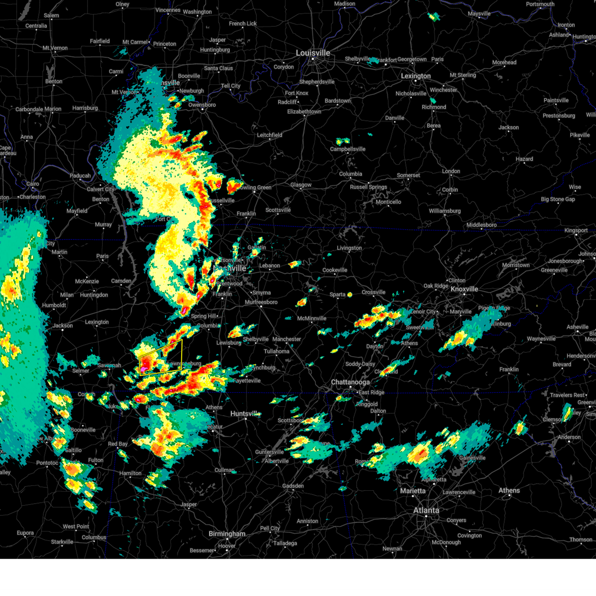
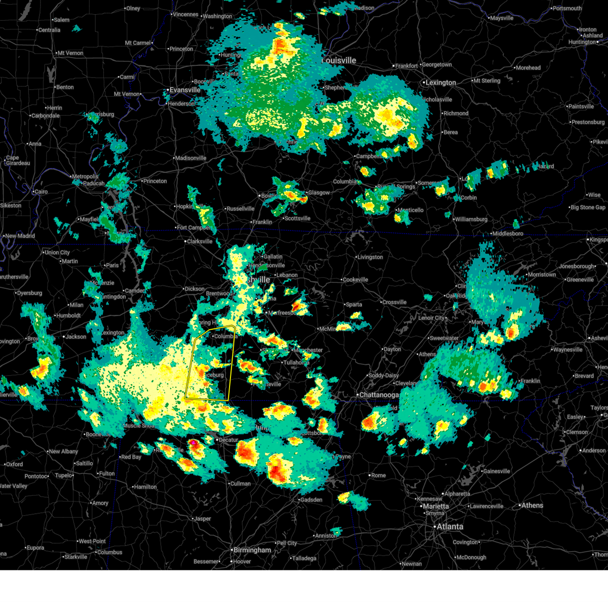
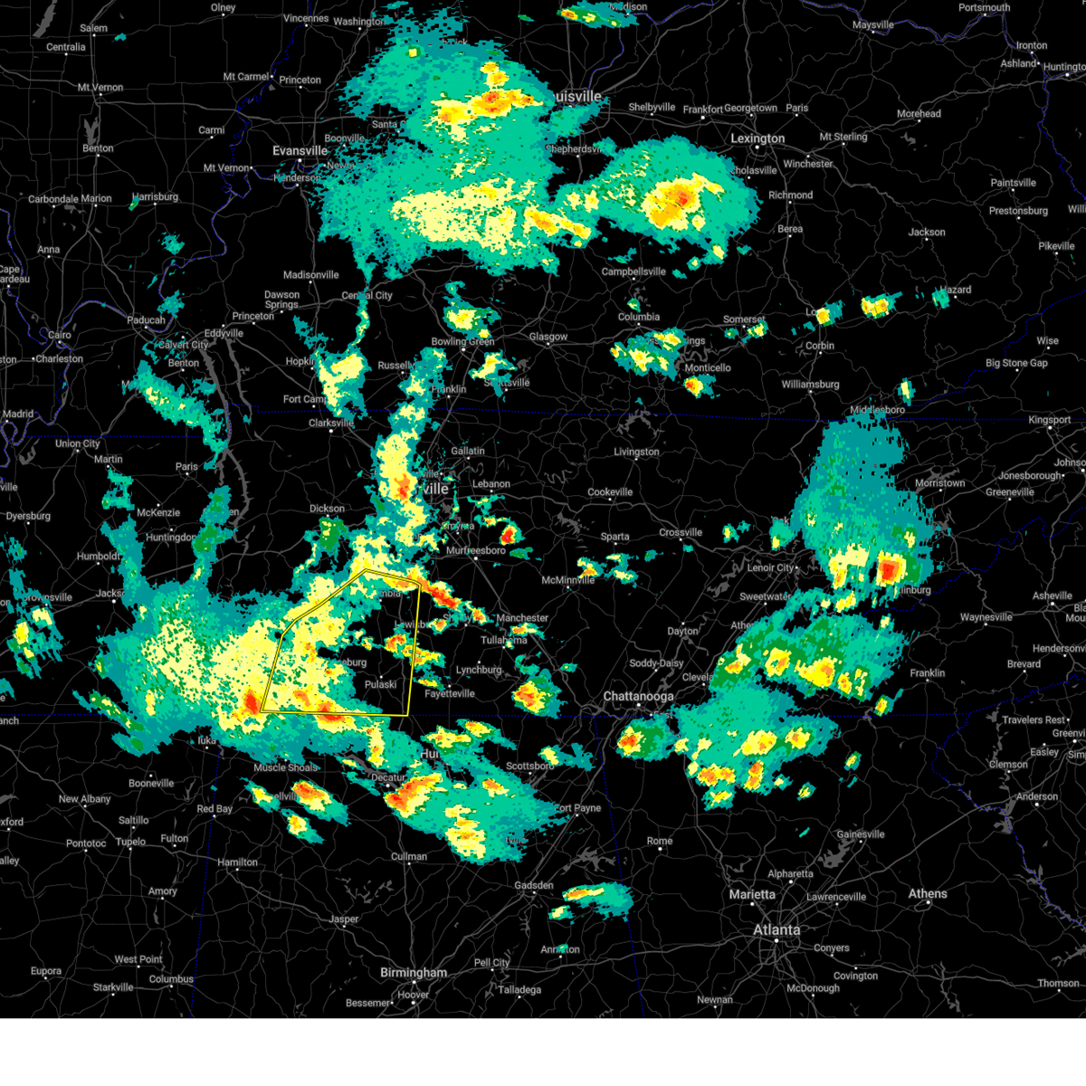
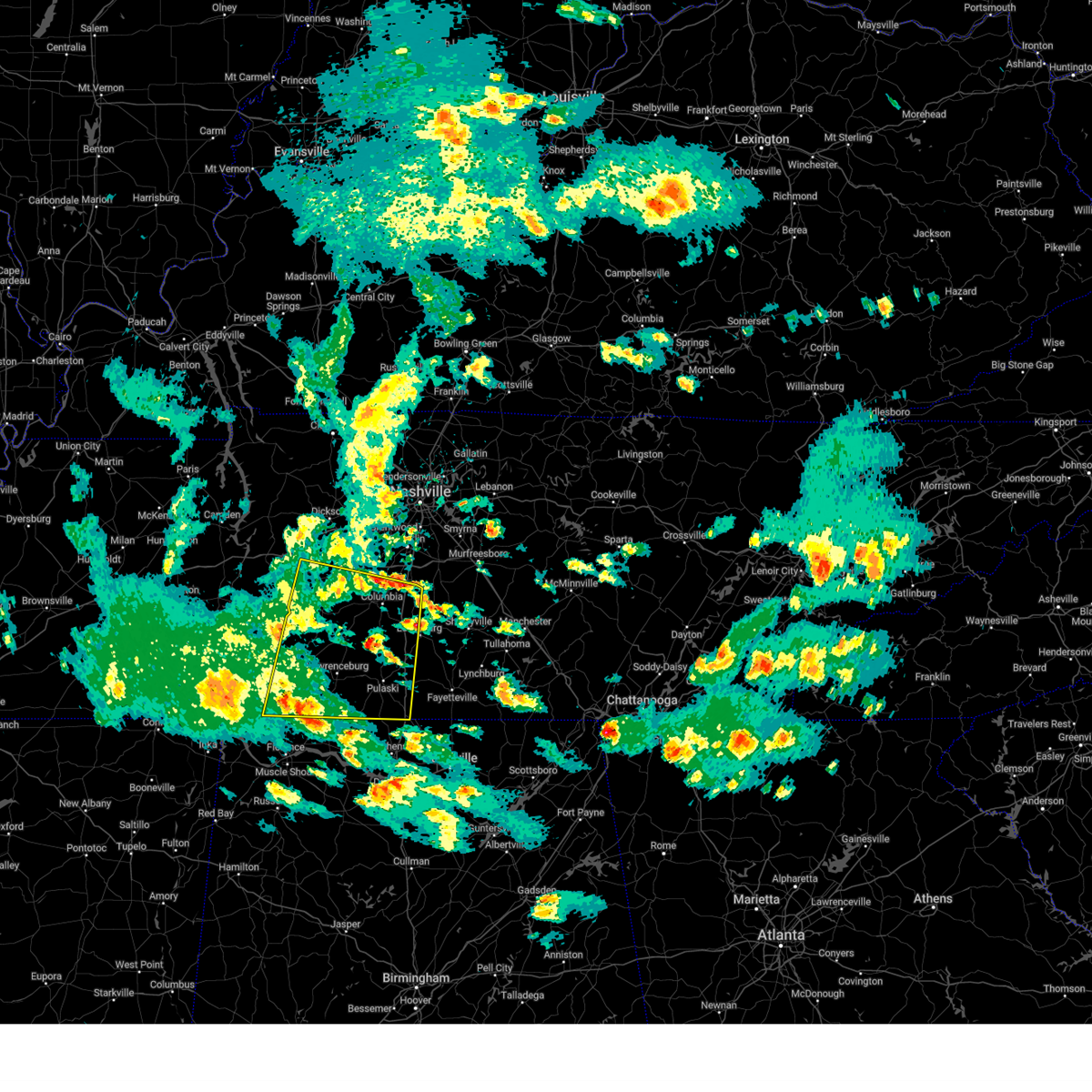
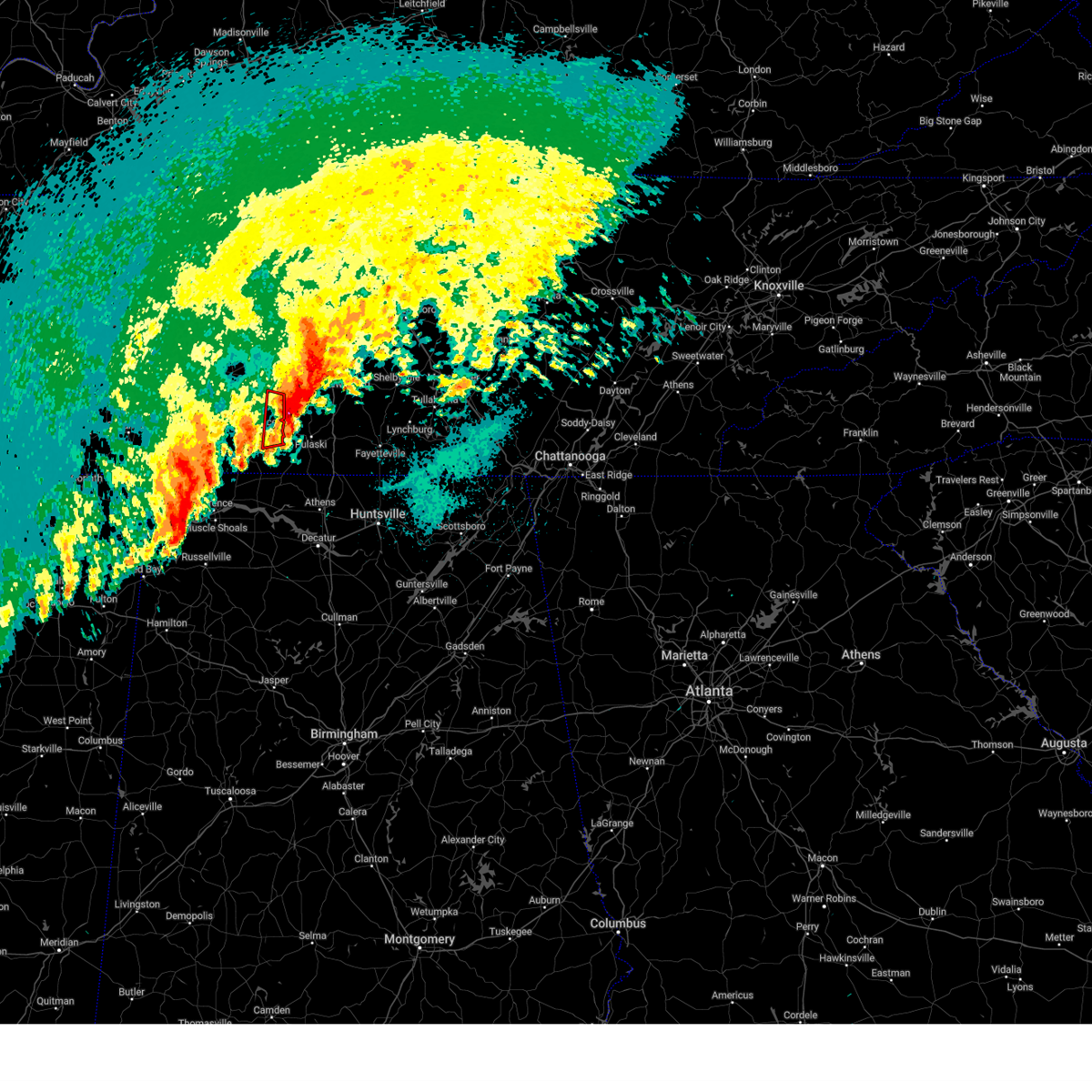
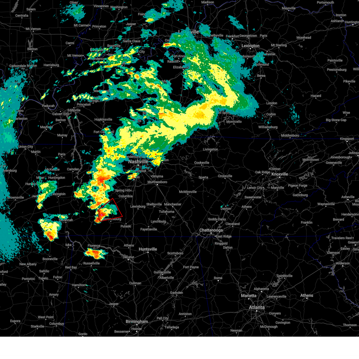
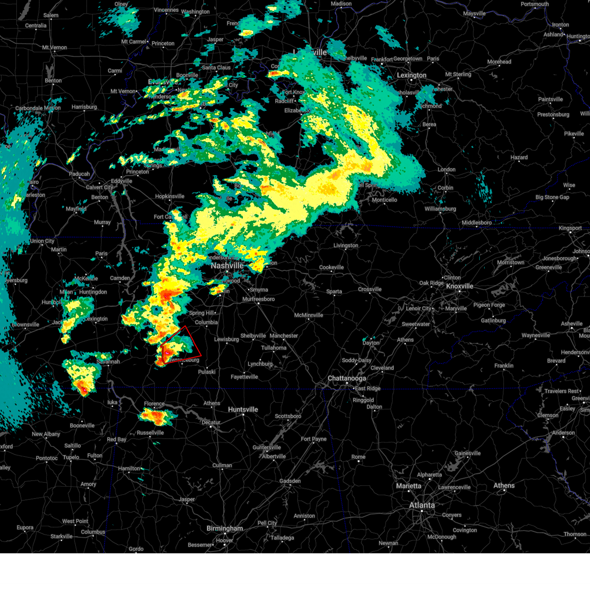
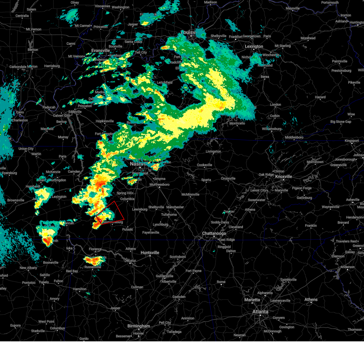
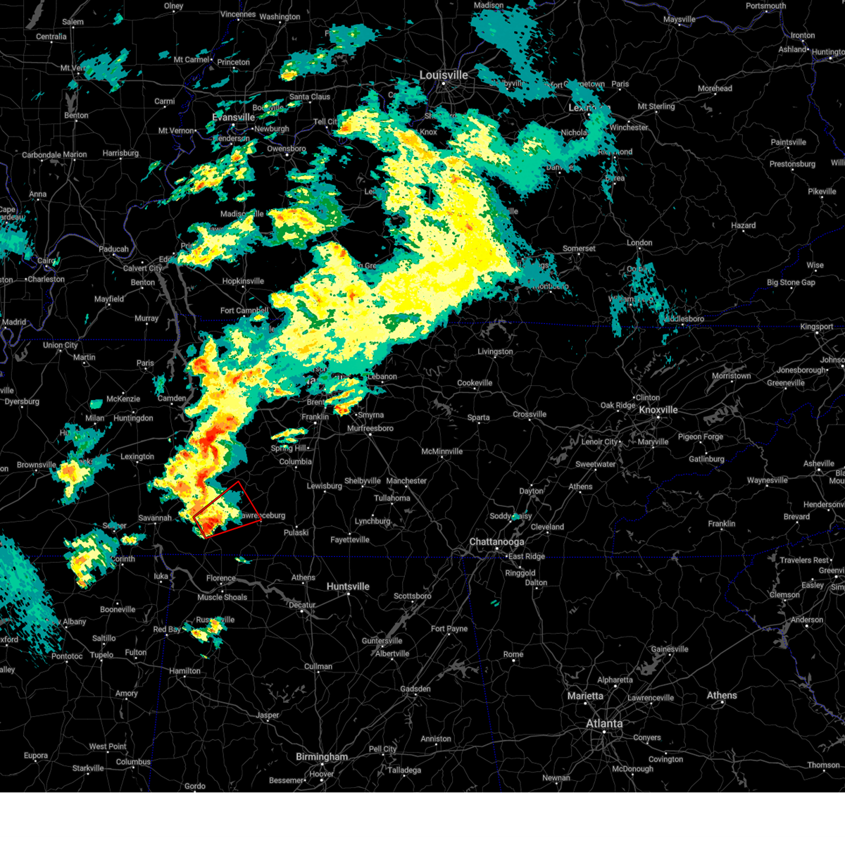
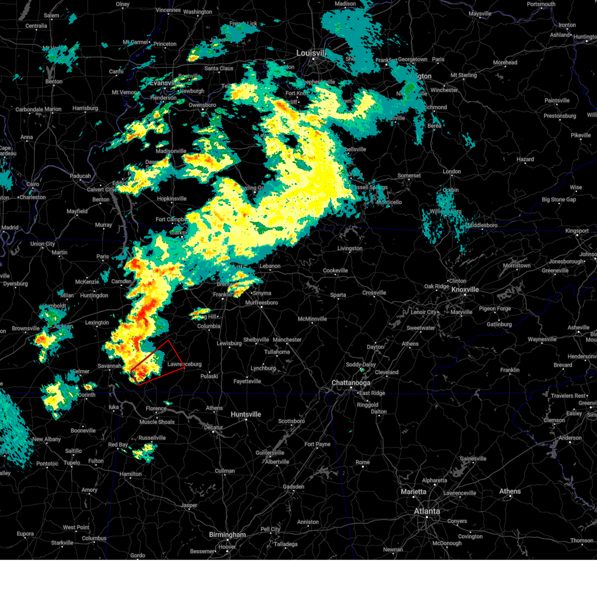
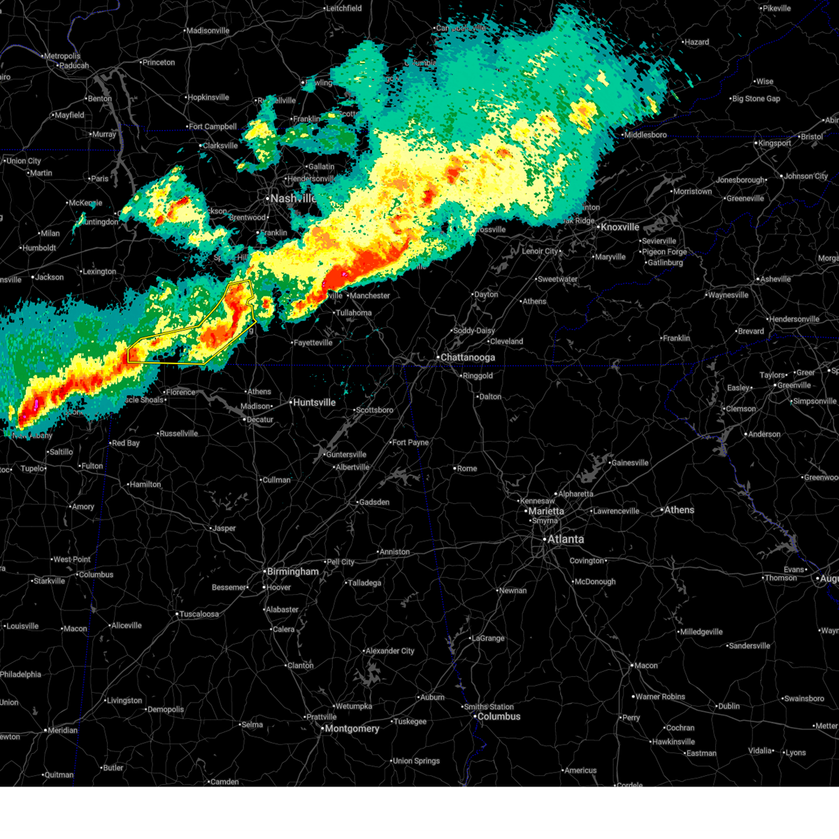
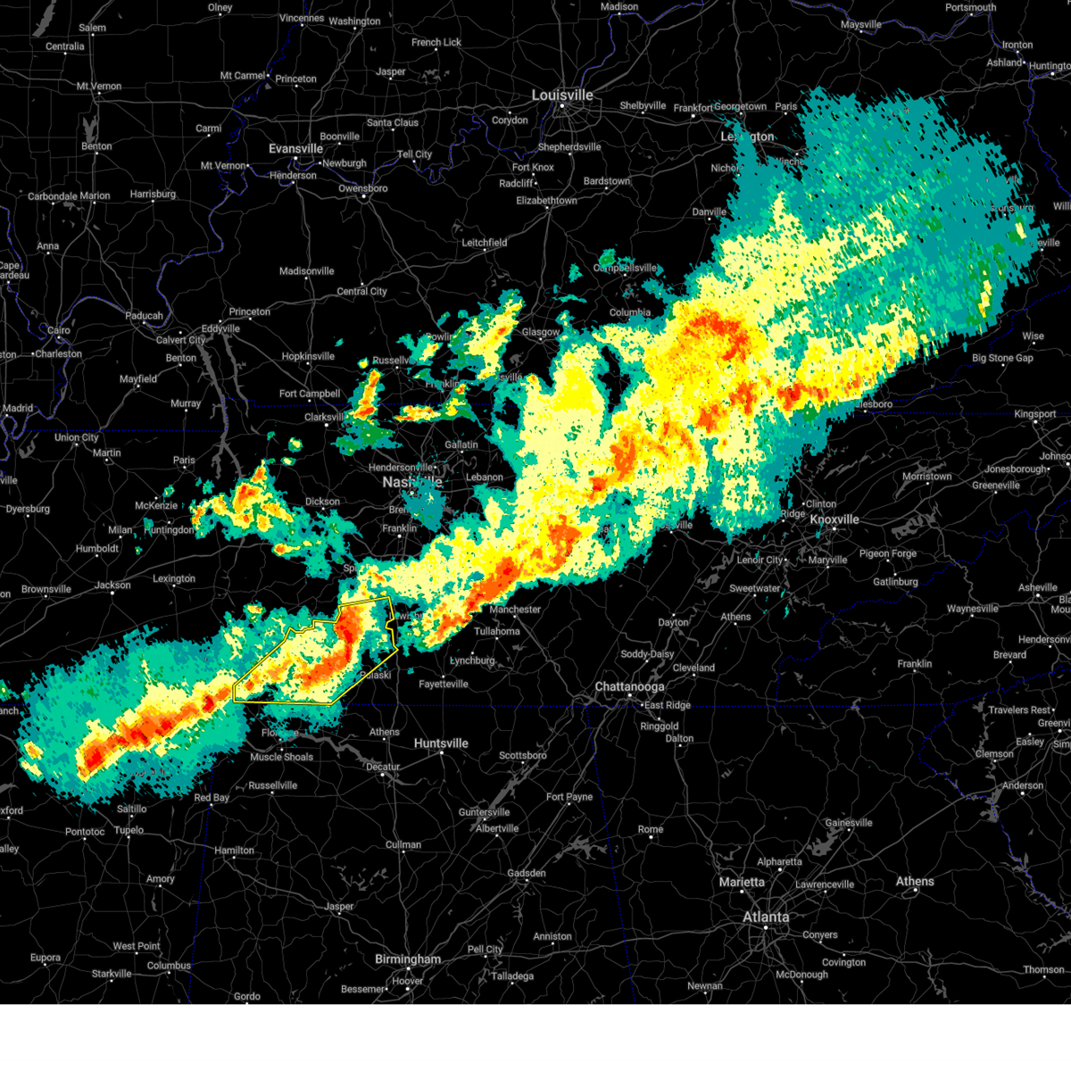
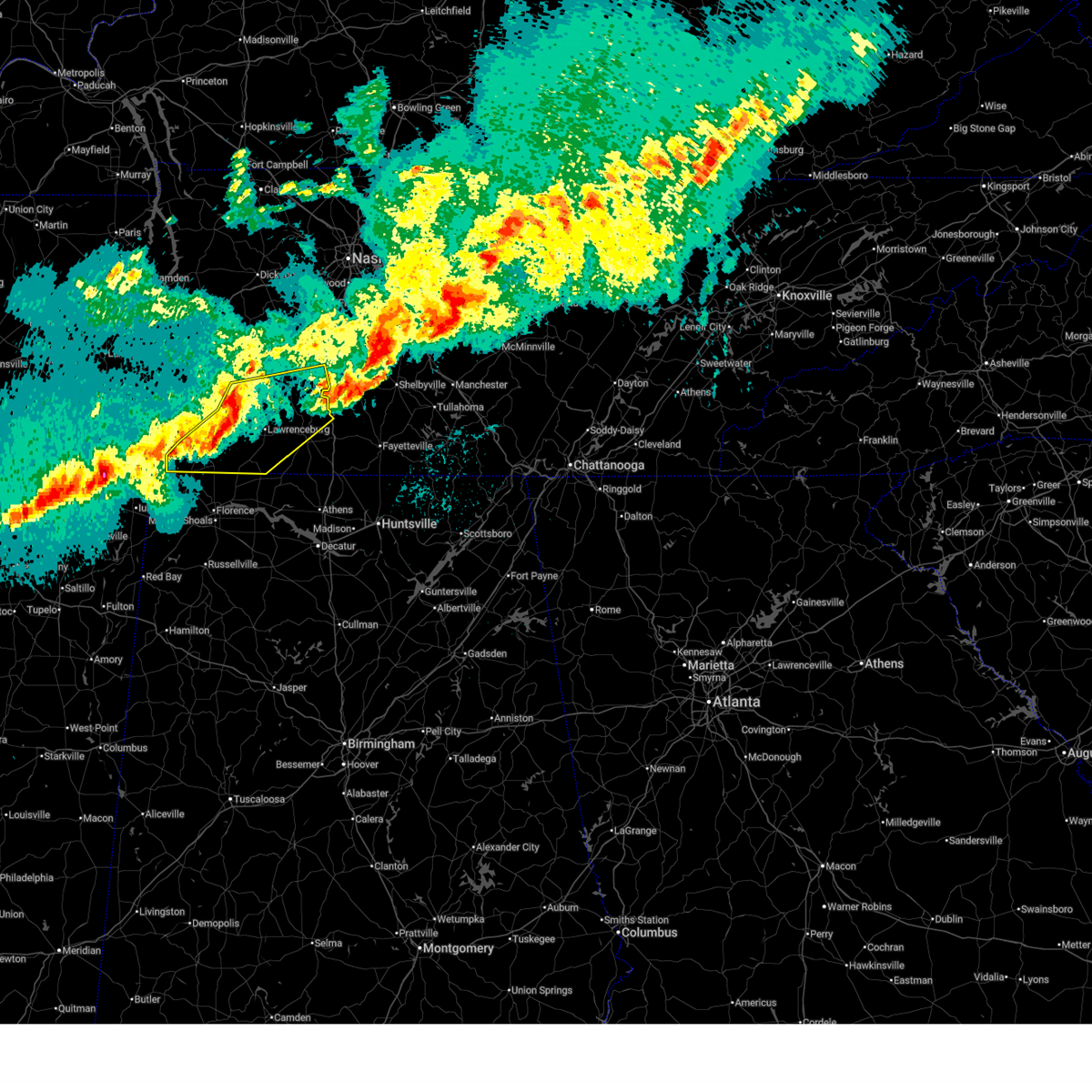
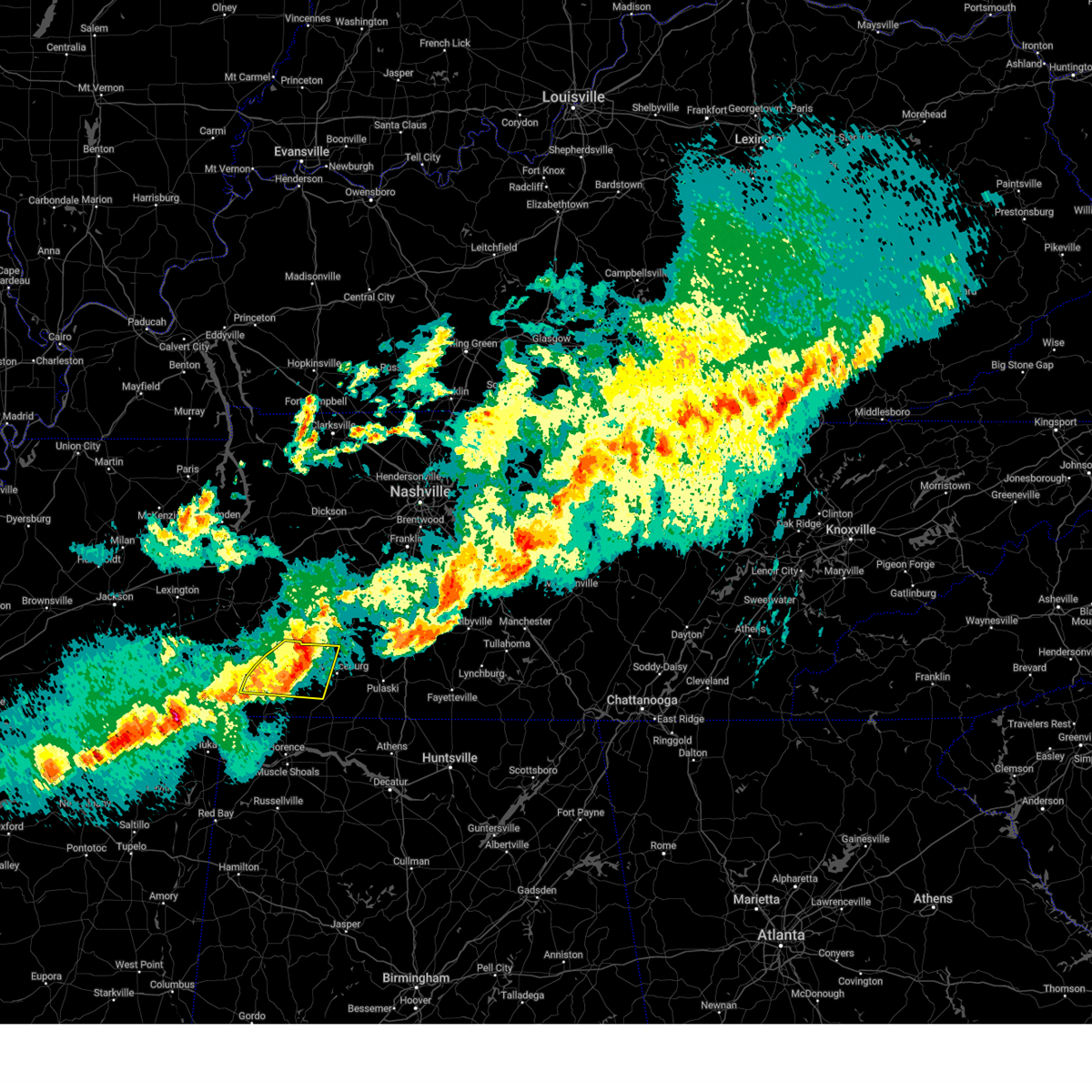
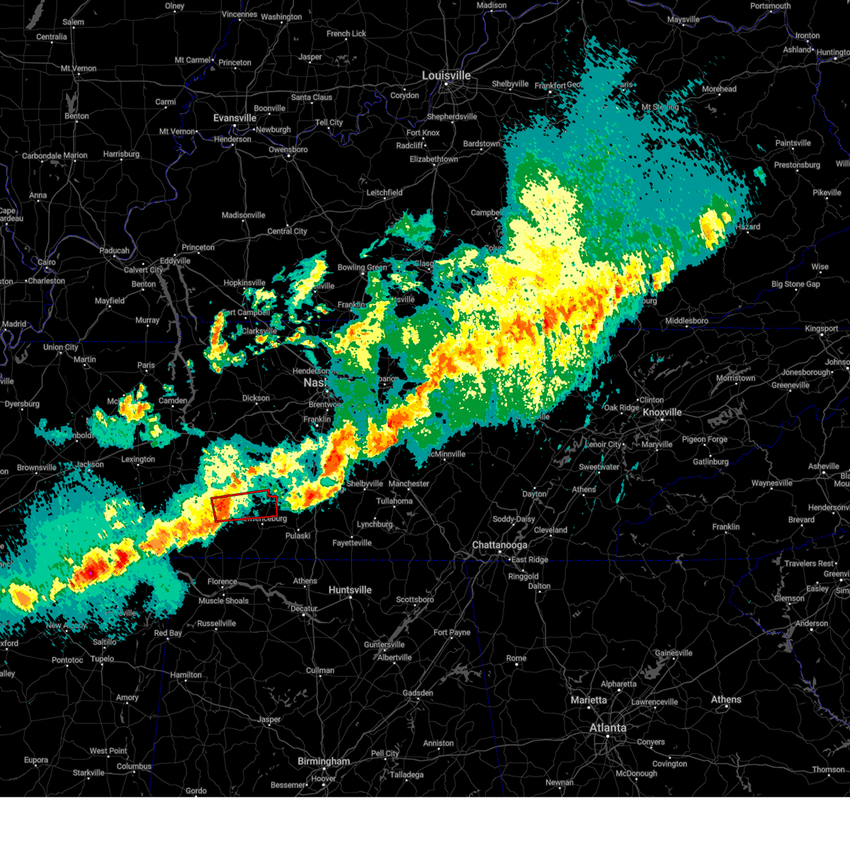
Hail Map for Lawrenceburg, TN
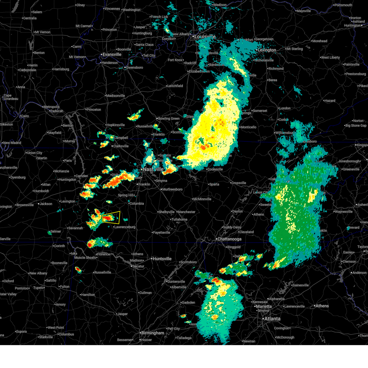
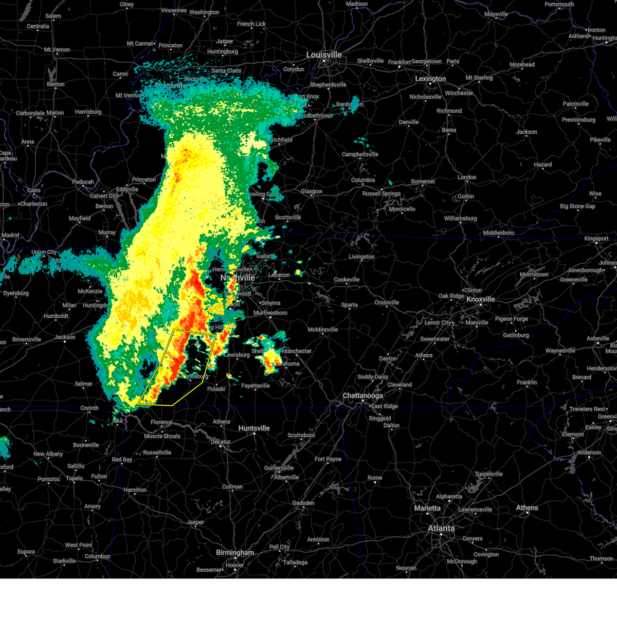
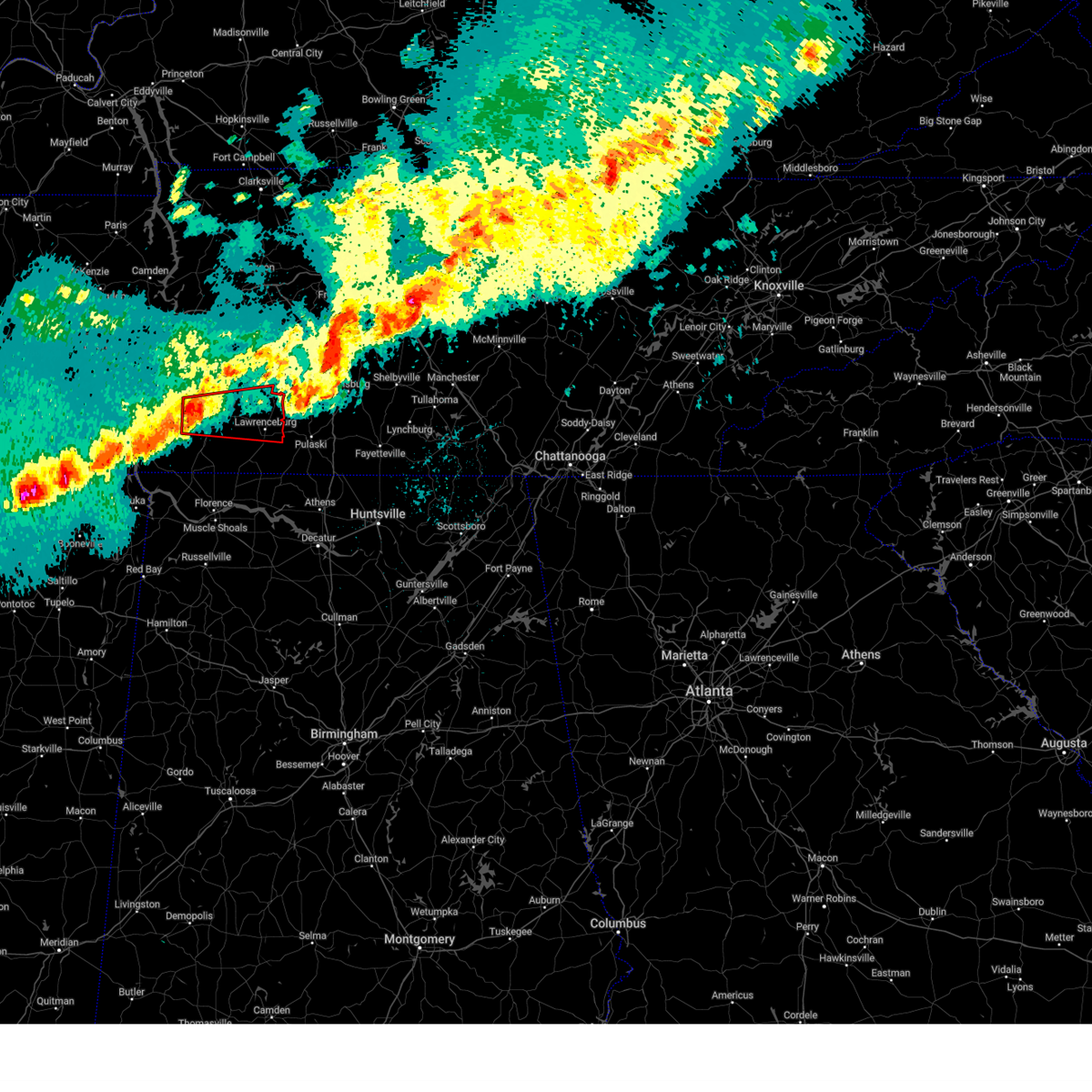
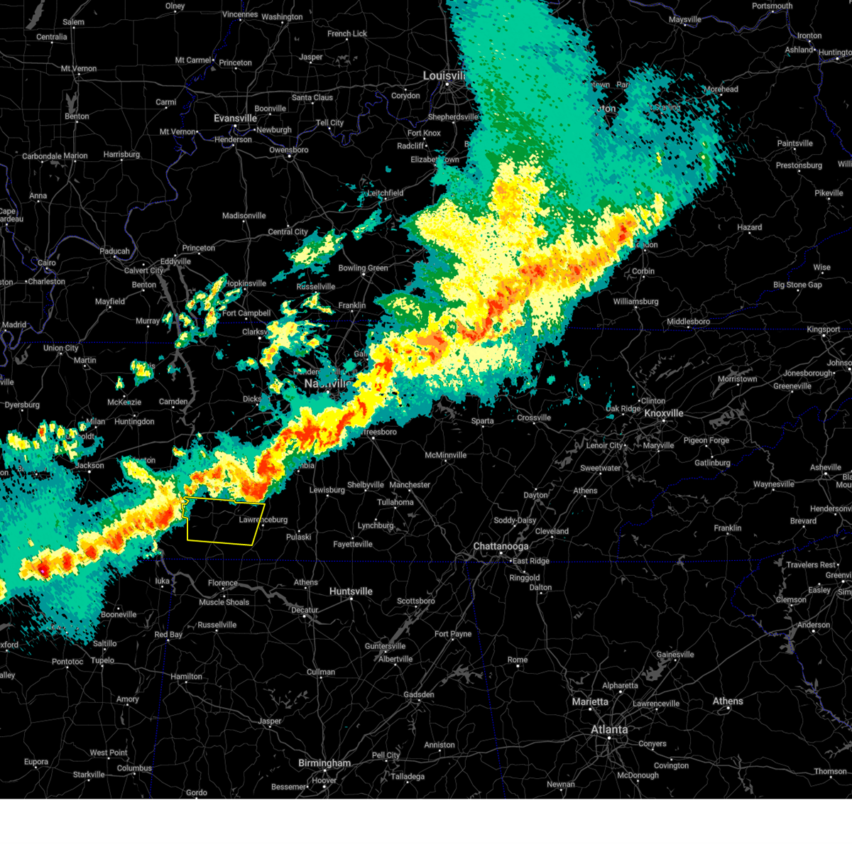
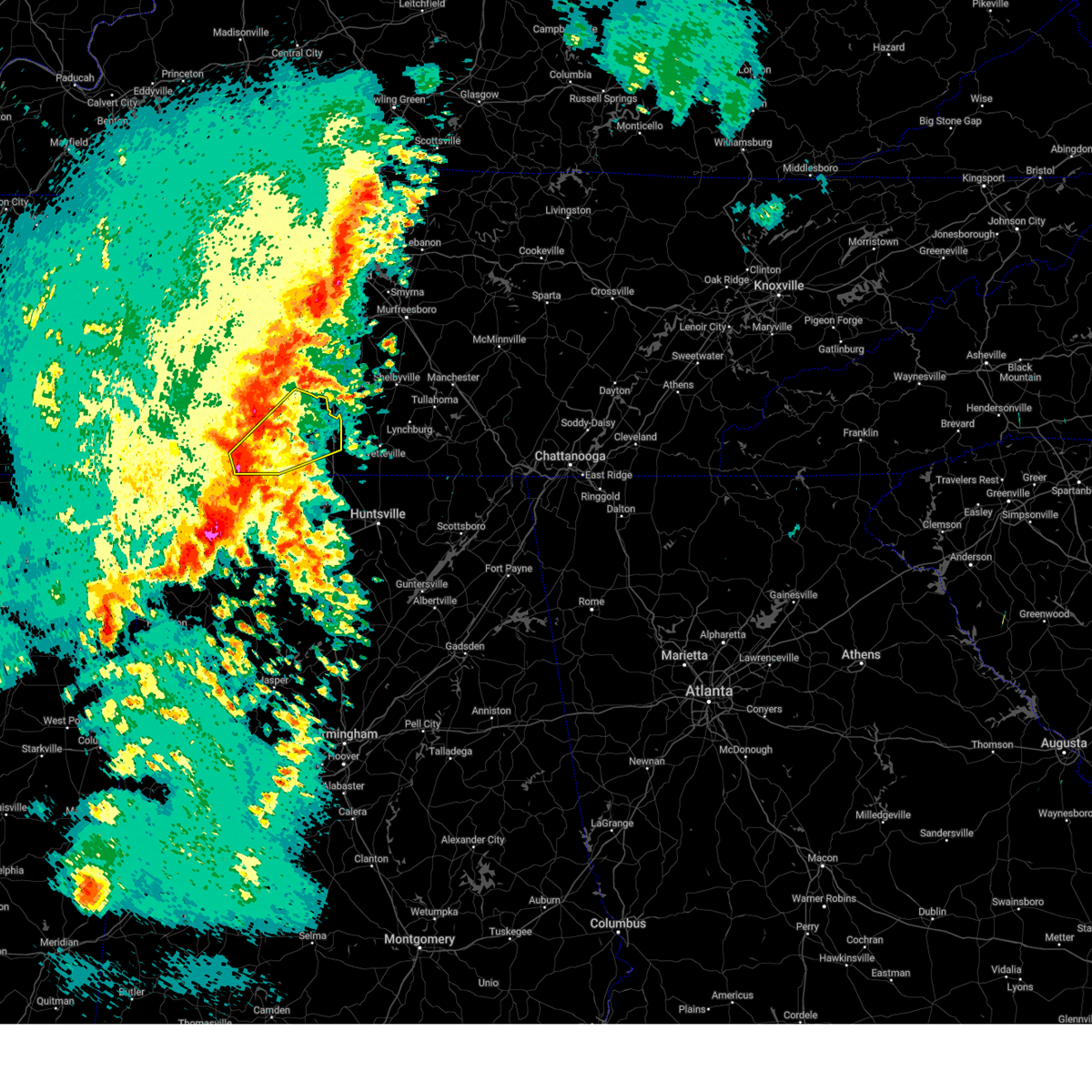
The Lawrenceburg, TN area has had 11 reports of on-the-ground hail by trained spotters, and has been under severe weather warnings 18 times during the past 12 months. Doppler radar has detected hail at or near Lawrenceburg, TN on 65 occasions, including 2 occasions during the past year.
| Name: | Lawrenceburg, TN |
| Where Located: | 36 miles NNE of Florence, AL |
| Map: | Google Map for Lawrenceburg, TN |
| Population: | 10428 |
| Housing Units: | 5073 |
| More Info: | Search Google for Lawrenceburg, TN |
2
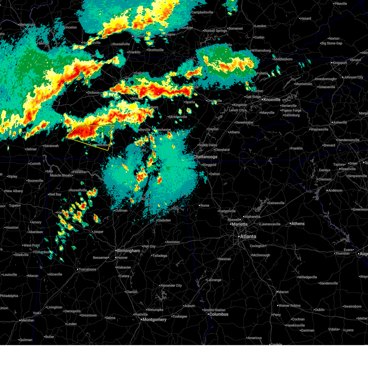
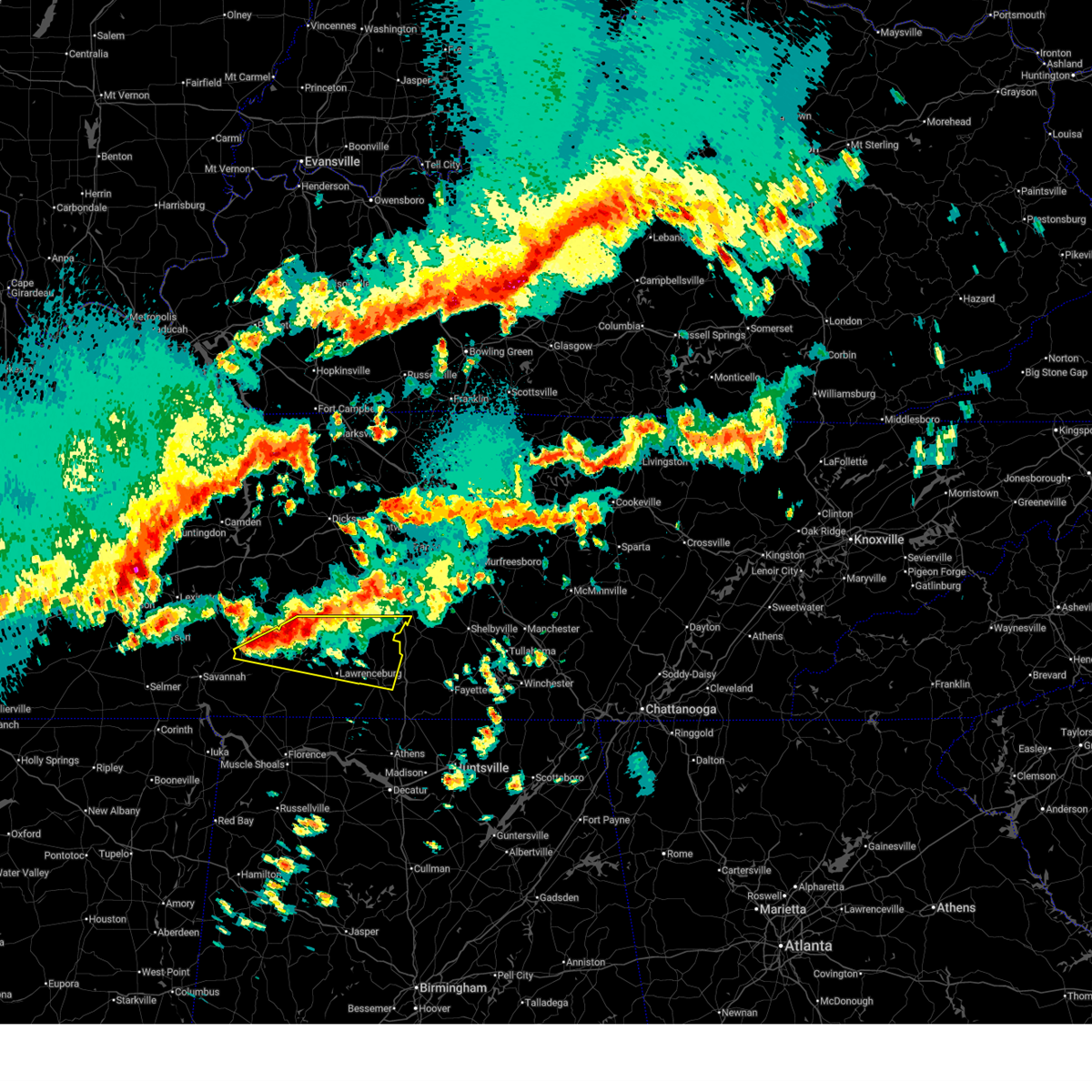
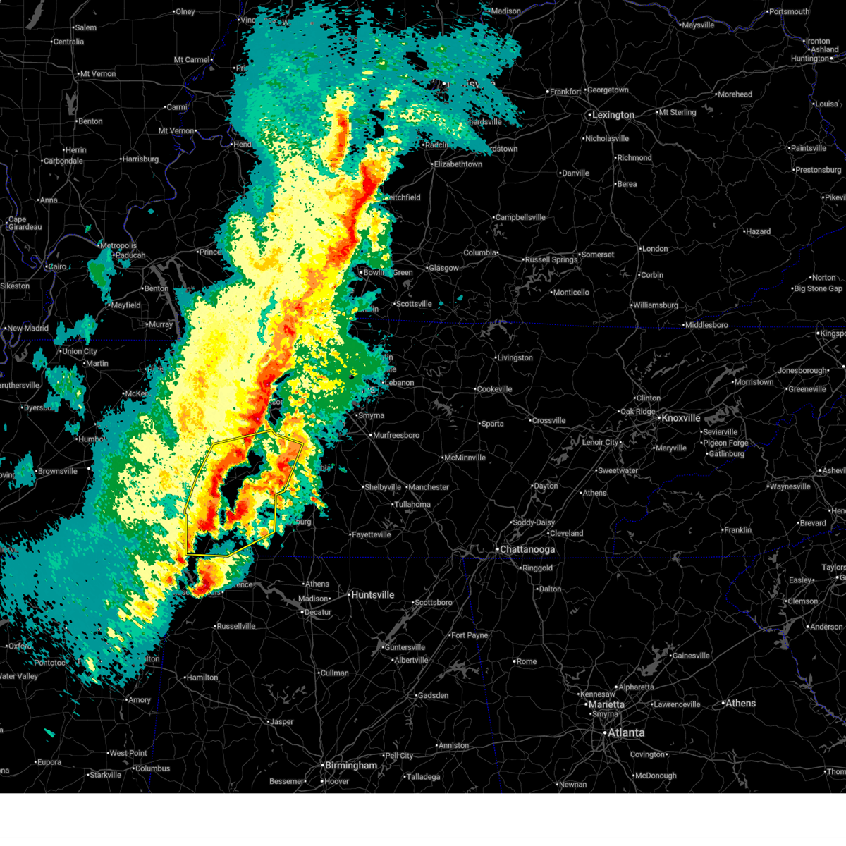
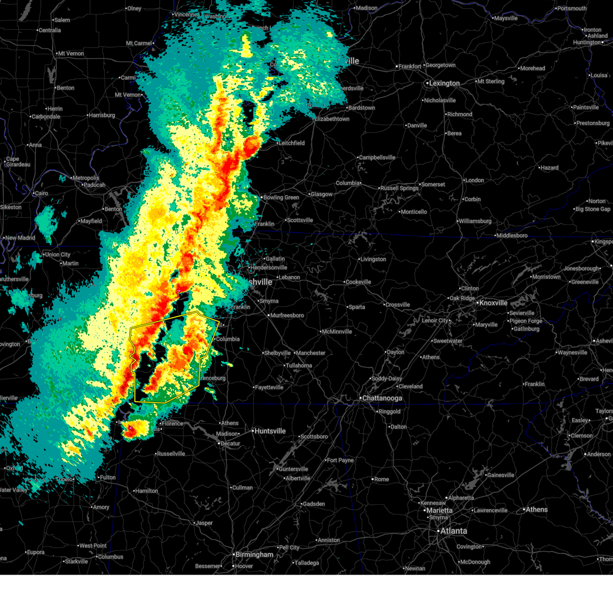
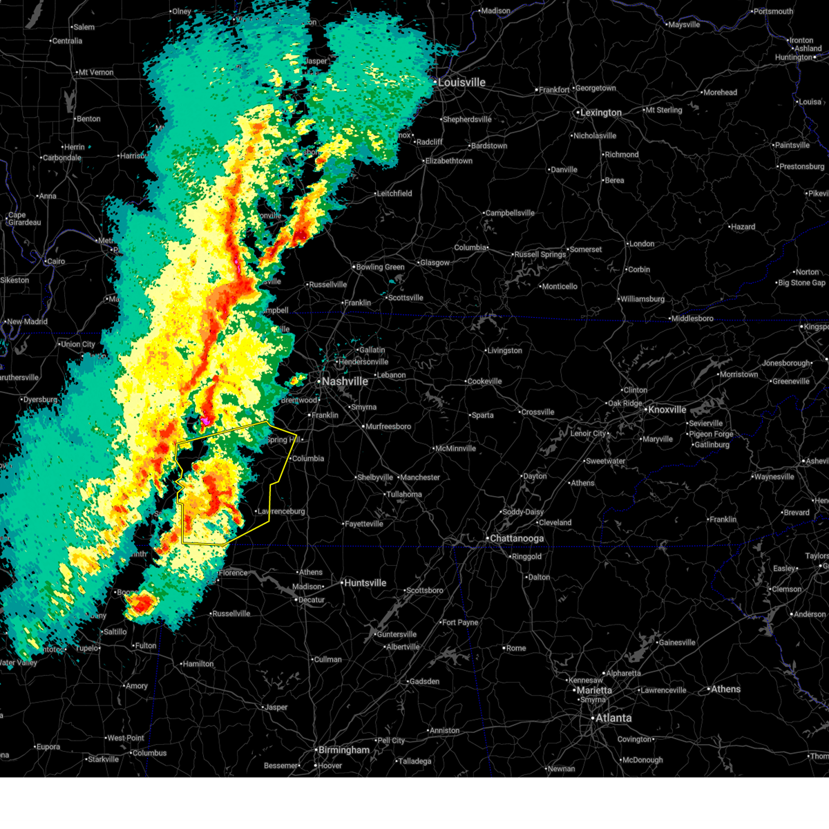
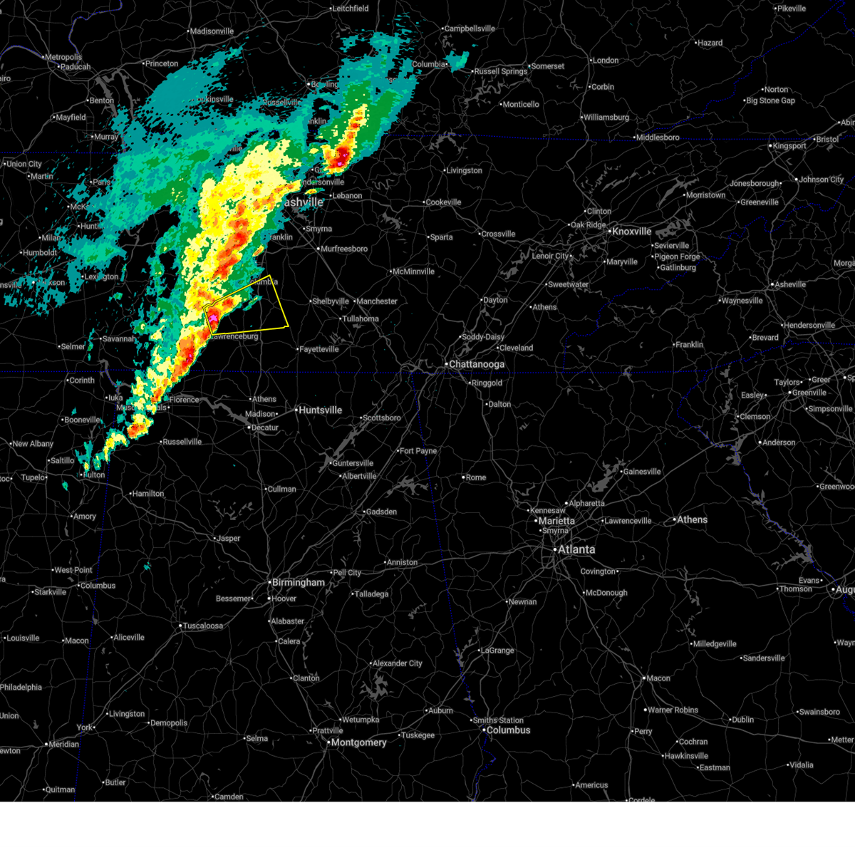
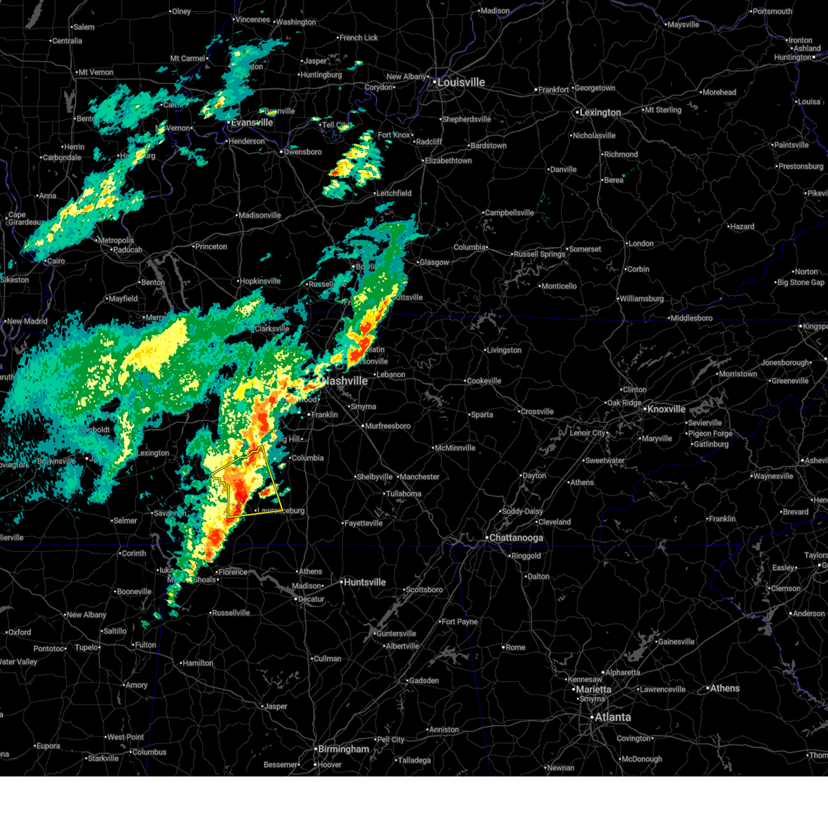
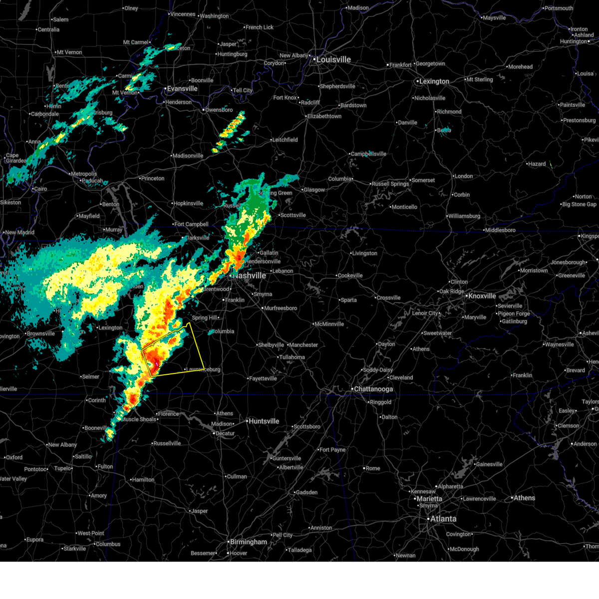
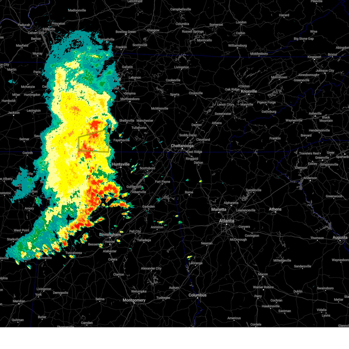
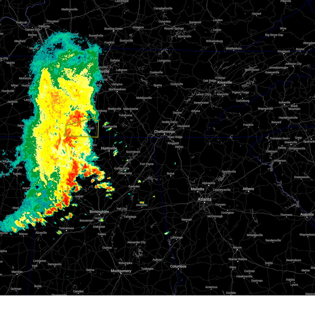
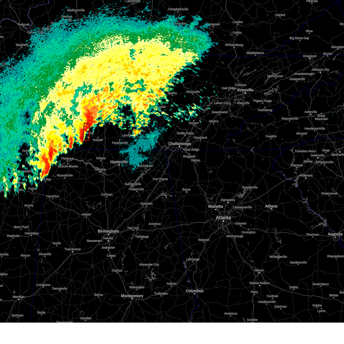
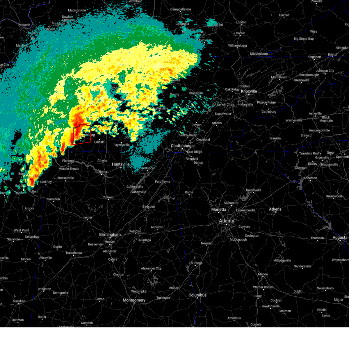
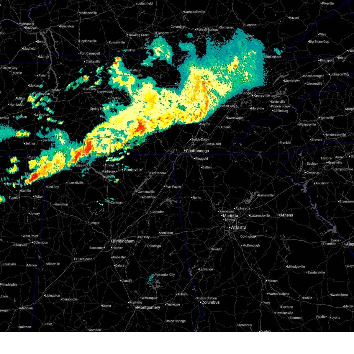
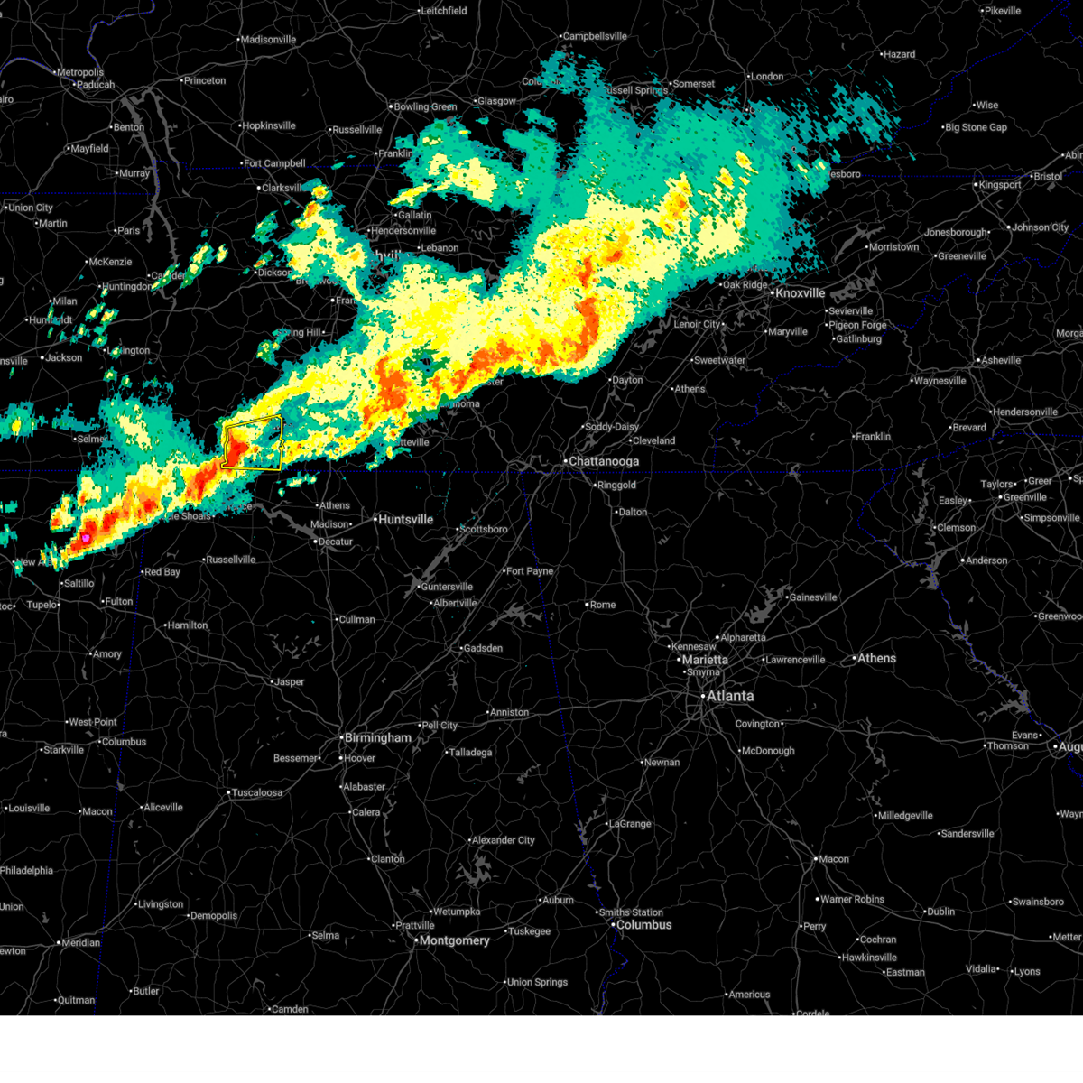
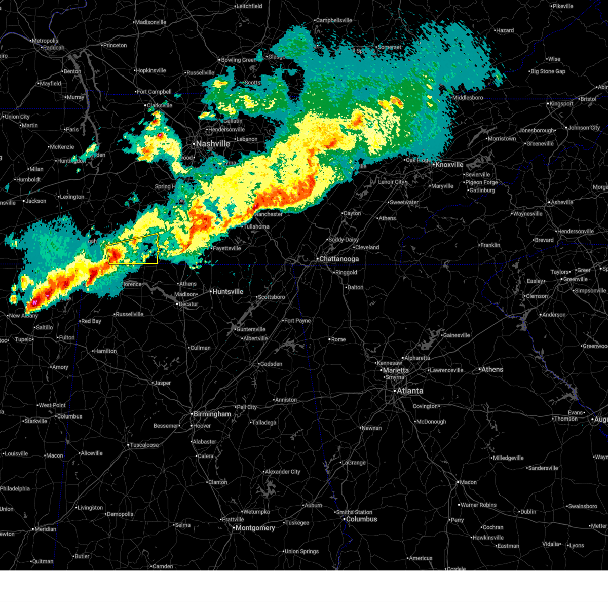
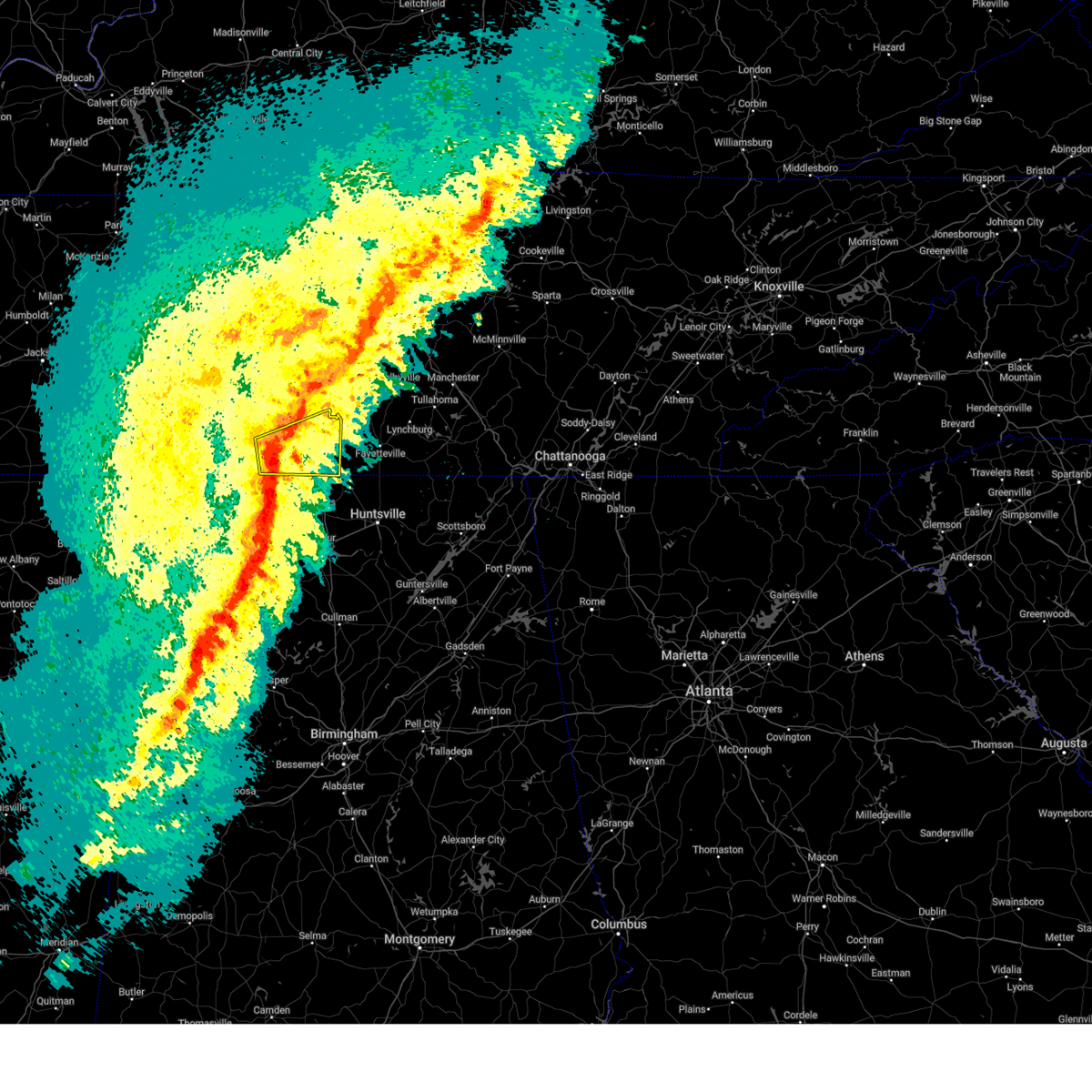
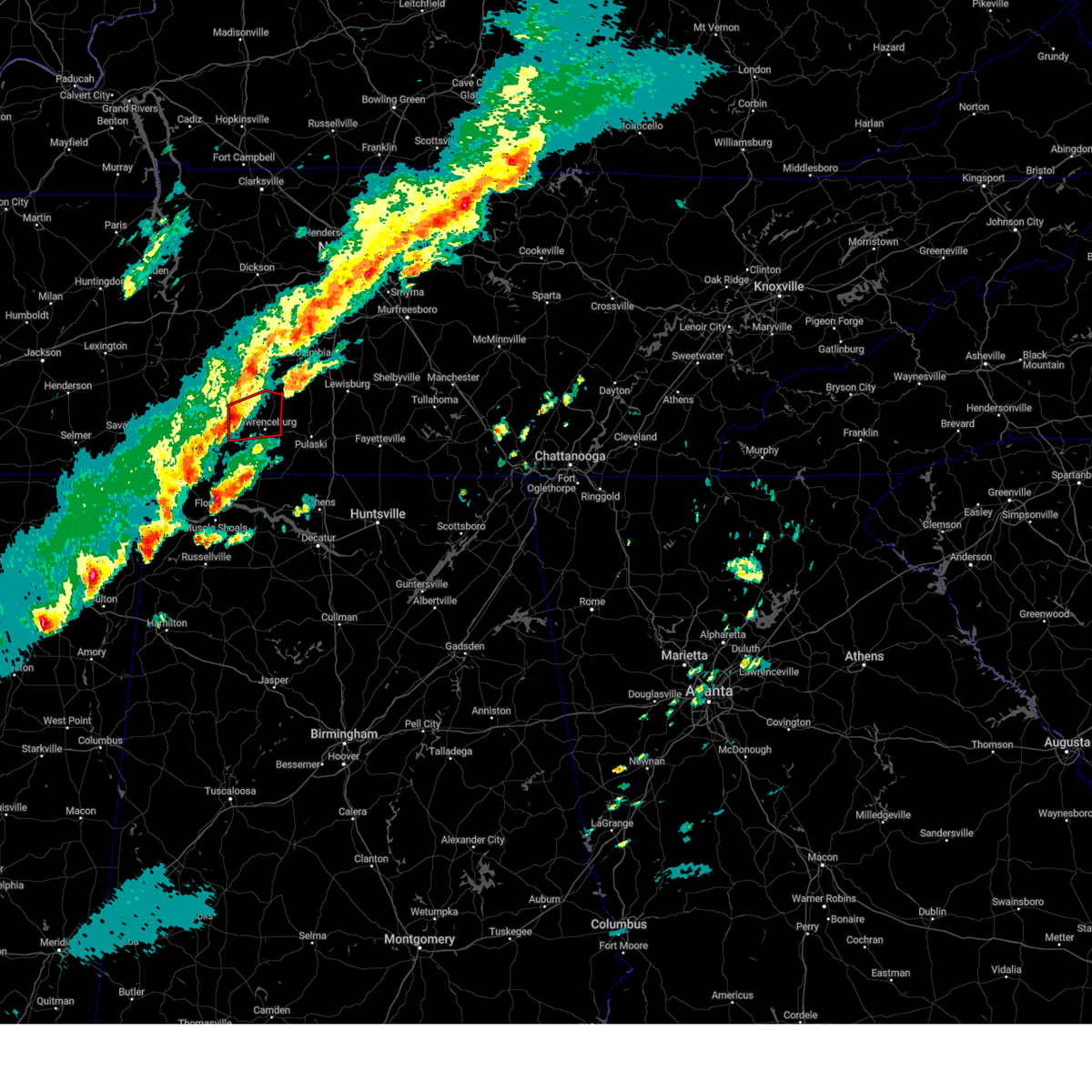
The Top Recent Hail Date for Lawrenceburg, TN is Wednesday, March 11, 2026 (16th out of 65)
Hail and Wind Damage Spotted near Lawrenceburg, TN
| Date / Time | Report Details |
|---|---|
| 6/14/2026 2:26 PM CDT | Em reports tree on residence on countrywood drive... with powerpole down in backyar in lawrence county TN, 3.9 miles WNW of Lawrenceburg, TN |
| 6/14/2026 2:16 PM CDT |
 Svrohx the national weather service in nashville has issued a * severe thunderstorm warning for, southern marshall county in middle tennessee, southeastern lawrence county in middle tennessee, giles county in middle tennessee, * until 300 pm cdt. * at 215 pm cdt, a severe thunderstorm was located near pulaski, moving east at 40 mph (radar indicated). Hazards include 60 mph wind gusts. expect damage to roofs, siding, and trees Svrohx the national weather service in nashville has issued a * severe thunderstorm warning for, southern marshall county in middle tennessee, southeastern lawrence county in middle tennessee, giles county in middle tennessee, * until 300 pm cdt. * at 215 pm cdt, a severe thunderstorm was located near pulaski, moving east at 40 mph (radar indicated). Hazards include 60 mph wind gusts. expect damage to roofs, siding, and trees
|
| 6/14/2026 2:14 PM CDT | Large tree blocking roadway reported by 911. delayed report... time estimate in lawrence county TN, 1.1 miles WSW of Lawrenceburg, TN |
| 6/14/2026 2:10 PM CDT | Tree blocking road reported by ema. time estimate in lawrence county TN, 4.1 miles SE of Lawrenceburg, TN |
| 6/1/2026 11:45 AM CDT | A large tree branch fell on a ca in lawrence county TN, 2.4 miles E of Lawrenceburg, TN |
| 4/28/2026 3:32 AM CDT | Tree struck back of house on good hope road in lawrenceburg. several other trees in the area are dow in lawrence county TN, 3.9 miles SSW of Lawrenceburg, TN |
| 4/28/2026 3:18 AM CDT | Trees down blocking crews roa in lawrence county TN, 6.8 miles SE of Lawrenceburg, TN |
| 4/28/2026 3:16 AM CDT |
 Svrohx the national weather service in nashville has issued a * severe thunderstorm warning for, eastern lewis county in middle tennessee, southeastern wayne county in middle tennessee, marshall county in middle tennessee, lawrence county in middle tennessee, southern maury county in middle tennessee, giles county in middle tennessee, southwestern bedford county in middle tennessee, * until 400 am cdt. * at 316 am cdt, a severe thunderstorm was located near lawrenceburg, moving east at 60 mph (radar indicated). Hazards include 60 mph wind gusts and penny size hail. expect damage to roofs, siding, and trees Svrohx the national weather service in nashville has issued a * severe thunderstorm warning for, eastern lewis county in middle tennessee, southeastern wayne county in middle tennessee, marshall county in middle tennessee, lawrence county in middle tennessee, southern maury county in middle tennessee, giles county in middle tennessee, southwestern bedford county in middle tennessee, * until 400 am cdt. * at 316 am cdt, a severe thunderstorm was located near lawrenceburg, moving east at 60 mph (radar indicated). Hazards include 60 mph wind gusts and penny size hail. expect damage to roofs, siding, and trees
|
| 4/28/2026 2:18 AM CDT |
 At 218 am cdt, a severe thunderstorm was located 8 miles southeast of summertown, or 12 miles northeast of lawrenceburg, moving east at 55 mph (radar indicated). Hazards include 60 mph wind gusts and penny size hail. Expect damage to roofs, siding, and trees. locations impacted include, lawrenceburg, pulaski, mount pleasant, summertown, ethridge, lynnville, henryville, and culleoka. This includes interstate 65 between mile markers 37 and 39. At 218 am cdt, a severe thunderstorm was located 8 miles southeast of summertown, or 12 miles northeast of lawrenceburg, moving east at 55 mph (radar indicated). Hazards include 60 mph wind gusts and penny size hail. Expect damage to roofs, siding, and trees. locations impacted include, lawrenceburg, pulaski, mount pleasant, summertown, ethridge, lynnville, henryville, and culleoka. This includes interstate 65 between mile markers 37 and 39.
|
| 4/28/2026 1:54 AM CDT |
 At 153 am cdt, a severe thunderstorm was located 10 miles northeast of waynesboro, moving east at 35 mph (radar indicated). Hazards include 60 mph wind gusts and quarter size hail. Hail damage to vehicles is expected. expect wind damage to roofs, siding, and trees. locations impacted include, lawrenceburg, pulaski, hohenwald, waynesboro, mount pleasant, summertown, ethridge, lynnville, henryville, and culleoka. This includes interstate 65 between mile markers 37 and 39. At 153 am cdt, a severe thunderstorm was located 10 miles northeast of waynesboro, moving east at 35 mph (radar indicated). Hazards include 60 mph wind gusts and quarter size hail. Hail damage to vehicles is expected. expect wind damage to roofs, siding, and trees. locations impacted include, lawrenceburg, pulaski, hohenwald, waynesboro, mount pleasant, summertown, ethridge, lynnville, henryville, and culleoka. This includes interstate 65 between mile markers 37 and 39.
|
| 4/28/2026 1:34 AM CDT |
 Svrohx the national weather service in nashville has issued a * severe thunderstorm warning for, lewis county in middle tennessee, northern wayne county in middle tennessee, northern lawrence county in middle tennessee, southern maury county in middle tennessee, northern giles county in middle tennessee, * until 230 am cdt. * at 133 am cdt, a severe thunderstorm was located 7 miles south of hohenwald, moving east at 55 mph (radar indicated). Hazards include 60 mph wind gusts and quarter size hail. Hail damage to vehicles is expected. Expect wind damage to roofs, siding, and trees. Svrohx the national weather service in nashville has issued a * severe thunderstorm warning for, lewis county in middle tennessee, northern wayne county in middle tennessee, northern lawrence county in middle tennessee, southern maury county in middle tennessee, northern giles county in middle tennessee, * until 230 am cdt. * at 133 am cdt, a severe thunderstorm was located 7 miles south of hohenwald, moving east at 55 mph (radar indicated). Hazards include 60 mph wind gusts and quarter size hail. Hail damage to vehicles is expected. Expect wind damage to roofs, siding, and trees.
|
| 3/15/2026 10:45 PM CDT |
 the severe thunderstorm warning has been cancelled and is no longer in effect the severe thunderstorm warning has been cancelled and is no longer in effect
|
| 3/15/2026 10:45 PM CDT |
 At 1044 pm cdt, severe thunderstorms were located along a line extending from near franklin to 6 miles northeast of st. florian, moving east at 55 mph (radar indicated). Hazards include 70 mph wind gusts. Expect considerable tree damage. damage is likely to mobile homes, roofs, and outbuildings. locations impacted include, franklin, columbia, lawrenceburg, pulaski, brentwood, spring hill, nolensville, mount pleasant, thompson's station, loretto, summertown, st. joseph, minor hill, ethridge, lynnville, culleoka, triune, goodspring, leoma, and williamsport. this includes the following highways, interstate 65 between mile markers 36 and 67. Interstate 840 between mile markers 11 and 44. At 1044 pm cdt, severe thunderstorms were located along a line extending from near franklin to 6 miles northeast of st. florian, moving east at 55 mph (radar indicated). Hazards include 70 mph wind gusts. Expect considerable tree damage. damage is likely to mobile homes, roofs, and outbuildings. locations impacted include, franklin, columbia, lawrenceburg, pulaski, brentwood, spring hill, nolensville, mount pleasant, thompson's station, loretto, summertown, st. joseph, minor hill, ethridge, lynnville, culleoka, triune, goodspring, leoma, and williamsport. this includes the following highways, interstate 65 between mile markers 36 and 67. Interstate 840 between mile markers 11 and 44.
|
| 3/15/2026 10:27 PM CDT | Utility pole leaning into tree which caused a fir in lawrence county TN, 11.6 miles SSE of Lawrenceburg, TN |
| 3/15/2026 10:25 PM CDT |
 Svrohx the national weather service in nashville has issued a * severe thunderstorm warning for, lewis county in middle tennessee, wayne county in middle tennessee, lawrence county in middle tennessee, maury county in middle tennessee, williamson county in middle tennessee, northwestern giles county in middle tennessee, southern hickman county in middle tennessee, * until 1115 pm cdt. * at 1024 pm cdt, severe thunderstorms were located along a line extending from near fairview to 11 miles west of underwood-petersville, moving east at 55 mph (radar indicated). Hazards include 70 mph wind gusts. Expect considerable tree damage. Damage is likely to mobile homes, roofs, and outbuildings. Svrohx the national weather service in nashville has issued a * severe thunderstorm warning for, lewis county in middle tennessee, wayne county in middle tennessee, lawrence county in middle tennessee, maury county in middle tennessee, williamson county in middle tennessee, northwestern giles county in middle tennessee, southern hickman county in middle tennessee, * until 1115 pm cdt. * at 1024 pm cdt, severe thunderstorms were located along a line extending from near fairview to 11 miles west of underwood-petersville, moving east at 55 mph (radar indicated). Hazards include 70 mph wind gusts. Expect considerable tree damage. Damage is likely to mobile homes, roofs, and outbuildings.
|
| 3/15/2026 10:13 PM CDT |
 At 1013 pm cdt, a severe thunderstorm was located over columbia, moving northeast at 50 mph (radar indicated). Hazards include 60 mph wind gusts and penny size hail. Expect damage to roofs, siding, and trees. locations impacted include, columbia, lawrenceburg, hohenwald, centerville, waynesboro, linden, mount pleasant, loretto, collinwood, summertown, st. Joseph, ethridge, gordonsburg, henryville, kimmins, primm springs, flatwoods, lutts, leoma, and hampshire. At 1013 pm cdt, a severe thunderstorm was located over columbia, moving northeast at 50 mph (radar indicated). Hazards include 60 mph wind gusts and penny size hail. Expect damage to roofs, siding, and trees. locations impacted include, columbia, lawrenceburg, hohenwald, centerville, waynesboro, linden, mount pleasant, loretto, collinwood, summertown, st. Joseph, ethridge, gordonsburg, henryville, kimmins, primm springs, flatwoods, lutts, leoma, and hampshire.
|
| 3/15/2026 10:01 PM CDT |
 At 1001 pm cdt, a severe thunderstorm was located over mount pleasant, or 12 miles southwest of columbia, moving northeast at 50 mph (radar indicated). Hazards include 60 mph wind gusts and penny size hail. Expect damage to roofs, siding, and trees. locations impacted include, columbia, lawrenceburg, hohenwald, centerville, waynesboro, linden, mount pleasant, loretto, collinwood, summertown, clifton, lobelville, st. Joseph, ethridge, gordonsburg, henryville, kimmins, primm springs, flatwoods, and lutts. At 1001 pm cdt, a severe thunderstorm was located over mount pleasant, or 12 miles southwest of columbia, moving northeast at 50 mph (radar indicated). Hazards include 60 mph wind gusts and penny size hail. Expect damage to roofs, siding, and trees. locations impacted include, columbia, lawrenceburg, hohenwald, centerville, waynesboro, linden, mount pleasant, loretto, collinwood, summertown, clifton, lobelville, st. Joseph, ethridge, gordonsburg, henryville, kimmins, primm springs, flatwoods, and lutts.
|
| 3/15/2026 9:23 PM CDT |
 Svrohx the national weather service in nashville has issued a * severe thunderstorm warning for, lewis county in middle tennessee, wayne county in middle tennessee, lawrence county in middle tennessee, western maury county in middle tennessee, perry county in middle tennessee, southern hickman county in middle tennessee, * until 1030 pm cdt. * at 923 pm cdt, a severe thunderstorm was located near waynesboro, moving northeast at 50 mph (radar indicated). Hazards include 60 mph wind gusts and penny size hail. expect damage to roofs, siding, and trees Svrohx the national weather service in nashville has issued a * severe thunderstorm warning for, lewis county in middle tennessee, wayne county in middle tennessee, lawrence county in middle tennessee, western maury county in middle tennessee, perry county in middle tennessee, southern hickman county in middle tennessee, * until 1030 pm cdt. * at 923 pm cdt, a severe thunderstorm was located near waynesboro, moving northeast at 50 mph (radar indicated). Hazards include 60 mph wind gusts and penny size hail. expect damage to roofs, siding, and trees
|
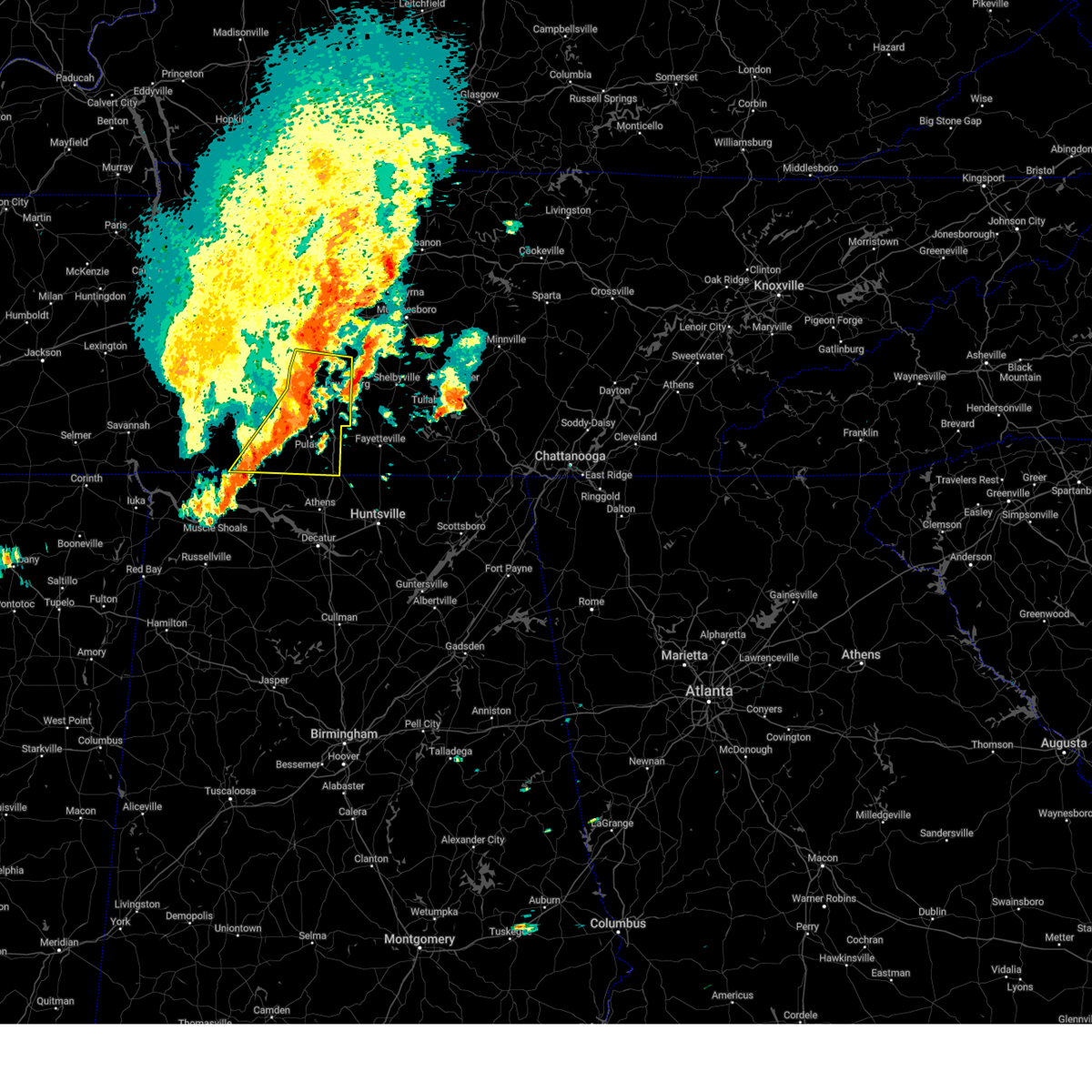
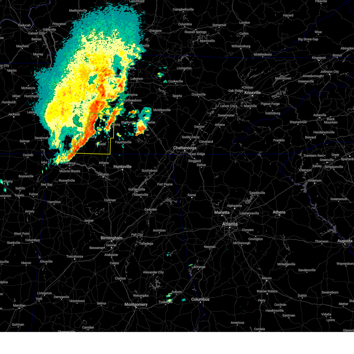
| 3/11/2026 2:44 PM CDT |
 Svrohx the national weather service in nashville has issued a * severe thunderstorm warning for, southwestern marshall county in middle tennessee, northeastern lawrence county in middle tennessee, southern maury county in middle tennessee, northern giles county in middle tennessee, * until 330 pm cdt. * at 243 pm cdt, a severe thunderstorm was located near summertown, or 10 miles northeast of lawrenceburg, moving east at 40 mph (radar indicated). Hazards include 60 mph wind gusts and quarter size hail. Hail damage to vehicles is expected. Expect wind damage to roofs, siding, and trees. Svrohx the national weather service in nashville has issued a * severe thunderstorm warning for, southwestern marshall county in middle tennessee, northeastern lawrence county in middle tennessee, southern maury county in middle tennessee, northern giles county in middle tennessee, * until 330 pm cdt. * at 243 pm cdt, a severe thunderstorm was located near summertown, or 10 miles northeast of lawrenceburg, moving east at 40 mph (radar indicated). Hazards include 60 mph wind gusts and quarter size hail. Hail damage to vehicles is expected. Expect wind damage to roofs, siding, and trees.
|
| 3/11/2026 2:35 PM CDT | A metal roof was peeled off a portion of a metal buildin in lawrence county TN, 5.9 miles SSE of Lawrenceburg, TN |
| 3/11/2026 2:25 PM CDT |
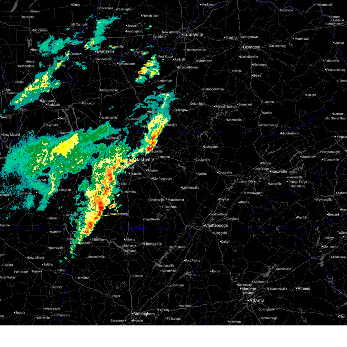 At 225 pm cdt, a severe thunderstorm was located 10 miles west of summertown, or 12 miles south of hohenwald, moving northeast at 45 mph (radar indicated). Hazards include 60 mph wind gusts and quarter size hail. Hail damage to vehicles is expected. expect wind damage to roofs, siding, and trees. Locations impacted include, lawrenceburg, hohenwald, mount pleasant, summertown, ethridge, gordonsburg, henryville, and hampshire. At 225 pm cdt, a severe thunderstorm was located 10 miles west of summertown, or 12 miles south of hohenwald, moving northeast at 45 mph (radar indicated). Hazards include 60 mph wind gusts and quarter size hail. Hail damage to vehicles is expected. expect wind damage to roofs, siding, and trees. Locations impacted include, lawrenceburg, hohenwald, mount pleasant, summertown, ethridge, gordonsburg, henryville, and hampshire.
|
| 3/11/2026 2:25 PM CDT |
 the severe thunderstorm warning has been cancelled and is no longer in effect the severe thunderstorm warning has been cancelled and is no longer in effect
|
| 3/11/2026 2:23 PM CDT | Local storm spotter reports winds near 60 mp in lawrence county TN, 12.4 miles ESE of Lawrenceburg, TN |
| 3/11/2026 2:15 PM CDT | Powerlines down in eastern wayne county... near natchez trac in wayne county TN, 14.8 miles ESE of Lawrenceburg, TN |
| 3/11/2026 2:08 PM CDT |
 Svrohx the national weather service in nashville has issued a * severe thunderstorm warning for, lewis county in middle tennessee, northeastern wayne county in middle tennessee, northern lawrence county in middle tennessee, southwestern maury county in middle tennessee, northwestern giles county in middle tennessee, * until 300 pm cdt. * at 208 pm cdt, a severe thunderstorm was located near waynesboro, moving east at 45 mph (radar indicated). Hazards include 60 mph wind gusts and quarter size hail. Hail damage to vehicles is expected. Expect wind damage to roofs, siding, and trees. Svrohx the national weather service in nashville has issued a * severe thunderstorm warning for, lewis county in middle tennessee, northeastern wayne county in middle tennessee, northern lawrence county in middle tennessee, southwestern maury county in middle tennessee, northwestern giles county in middle tennessee, * until 300 pm cdt. * at 208 pm cdt, a severe thunderstorm was located near waynesboro, moving east at 45 mph (radar indicated). Hazards include 60 mph wind gusts and quarter size hail. Hail damage to vehicles is expected. Expect wind damage to roofs, siding, and trees.
|
| 3/7/2026 2:07 PM CST | Portions of metal roof blown off chicken barn just off highway 64 near the wayne county lin in lawrence county TN, 14 miles ESE of Lawrenceburg, TN |
| 7/22/2025 7:48 PM CDT |
 the severe thunderstorm warning has been cancelled and is no longer in effect the severe thunderstorm warning has been cancelled and is no longer in effect
|
| 7/22/2025 7:36 PM CDT |
 At 735 pm cdt, a severe thunderstorm was located 7 miles east of waynesboro, moving southeast at 15 mph (radar indicated). Hazards include 60 mph wind gusts. Expect damage to roofs, siding, and trees. Locations impacted include, lawrenceburg and waynesboro. At 735 pm cdt, a severe thunderstorm was located 7 miles east of waynesboro, moving southeast at 15 mph (radar indicated). Hazards include 60 mph wind gusts. Expect damage to roofs, siding, and trees. Locations impacted include, lawrenceburg and waynesboro.
|
| 7/22/2025 7:19 PM CDT |
 Svrohx the national weather service in nashville has issued a * severe thunderstorm warning for, northeastern wayne county in middle tennessee, northwestern lawrence county in middle tennessee, * until 800 pm cdt. * at 719 pm cdt, a severe thunderstorm was located near waynesboro, moving southeast at 15 mph. a second severe storm was located just northwest of lawrenceburg (radar indicated). Hazards include 60 mph wind gusts. expect damage to roofs, siding, and trees Svrohx the national weather service in nashville has issued a * severe thunderstorm warning for, northeastern wayne county in middle tennessee, northwestern lawrence county in middle tennessee, * until 800 pm cdt. * at 719 pm cdt, a severe thunderstorm was located near waynesboro, moving southeast at 15 mph. a second severe storm was located just northwest of lawrenceburg (radar indicated). Hazards include 60 mph wind gusts. expect damage to roofs, siding, and trees
|
| 7/22/2025 7:00 PM CDT | Several trees were blown down in lawrenceburg including one that fell on a car on 4th s in lawrence county TN, 0.4 miles WNW of Lawrenceburg, TN |
| 6/7/2025 1:53 PM CDT |
 At 153 pm cdt, a severe thunderstorm was located 11 miles east of lexington, or 14 miles southwest of pulaski, moving east at 50 mph (radar indicated). Hazards include 60 mph wind gusts and penny size hail. Expect damage to roofs, siding, and trees. locations impacted include, lawrenceburg, pulaski, loretto, ardmore, elkton, minor hill, goodspring, leoma, frankewing, and prospect. This includes interstate 65 between mile markers 1 and 22. At 153 pm cdt, a severe thunderstorm was located 11 miles east of lexington, or 14 miles southwest of pulaski, moving east at 50 mph (radar indicated). Hazards include 60 mph wind gusts and penny size hail. Expect damage to roofs, siding, and trees. locations impacted include, lawrenceburg, pulaski, loretto, ardmore, elkton, minor hill, goodspring, leoma, frankewing, and prospect. This includes interstate 65 between mile markers 1 and 22.
|
| 6/7/2025 1:36 PM CDT |
 Svrohx the national weather service in nashville has issued a * severe thunderstorm warning for, southern lawrence county in middle tennessee, giles county in middle tennessee, * until 230 pm cdt. * at 136 pm cdt, a severe thunderstorm was located near lexington, or 15 miles northeast of florence, moving east at 45 mph (radar indicated). Hazards include 60 mph wind gusts and penny size hail. expect damage to roofs, siding, and trees Svrohx the national weather service in nashville has issued a * severe thunderstorm warning for, southern lawrence county in middle tennessee, giles county in middle tennessee, * until 230 pm cdt. * at 136 pm cdt, a severe thunderstorm was located near lexington, or 15 miles northeast of florence, moving east at 45 mph (radar indicated). Hazards include 60 mph wind gusts and penny size hail. expect damage to roofs, siding, and trees
|
| 6/6/2025 8:08 PM CDT |
 Svrohx the national weather service in nashville has issued a * severe thunderstorm warning for, northeastern lawrence county in middle tennessee, southwestern maury county in middle tennessee, northwestern giles county in middle tennessee, * until 845 pm cdt. * at 808 pm cdt, a severe thunderstorm was located near summertown, or 7 miles north of lawrenceburg, moving east at 20 mph (radar indicated). Hazards include 60 mph wind gusts and quarter size hail. Hail damage to vehicles is expected. Expect wind damage to roofs, siding, and trees. Svrohx the national weather service in nashville has issued a * severe thunderstorm warning for, northeastern lawrence county in middle tennessee, southwestern maury county in middle tennessee, northwestern giles county in middle tennessee, * until 845 pm cdt. * at 808 pm cdt, a severe thunderstorm was located near summertown, or 7 miles north of lawrenceburg, moving east at 20 mph (radar indicated). Hazards include 60 mph wind gusts and quarter size hail. Hail damage to vehicles is expected. Expect wind damage to roofs, siding, and trees.
|
| 6/6/2025 7:39 PM CDT |
 Svrohx the national weather service in nashville has issued a * severe thunderstorm warning for, southeastern lewis county in middle tennessee, northern lawrence county in middle tennessee, southwestern maury county in middle tennessee, * until 815 pm cdt. * at 739 pm cdt, a severe thunderstorm was located 8 miles southwest of summertown, or 11 miles northwest of lawrenceburg, moving east at 20 mph (radar indicated). Hazards include 60 mph wind gusts and quarter size hail. Hail damage to vehicles is expected. Expect wind damage to roofs, siding, and trees. Svrohx the national weather service in nashville has issued a * severe thunderstorm warning for, southeastern lewis county in middle tennessee, northern lawrence county in middle tennessee, southwestern maury county in middle tennessee, * until 815 pm cdt. * at 739 pm cdt, a severe thunderstorm was located 8 miles southwest of summertown, or 11 miles northwest of lawrenceburg, moving east at 20 mph (radar indicated). Hazards include 60 mph wind gusts and quarter size hail. Hail damage to vehicles is expected. Expect wind damage to roofs, siding, and trees.
|
| 5/25/2025 3:10 PM CDT |
 At 309 pm cdt, severe thunderstorms were located along a line extending from near columbia to 10 miles north of pulaski to near st. florian, moving east at 45 mph (radar indicated). Hazards include 60 mph wind gusts. Expect damage to roofs, siding, and trees. locations impacted include, columbia, lewisburg, lawrenceburg, pulaski, mount pleasant, loretto, ardmore, cornersville, st. joseph, elkton, minor hill, ethridge, lynnville, culleoka, i-65 east of columbia, goodspring, leoma, frankewing, and prospect. This includes interstate 65 between mile markers 1 and 46. At 309 pm cdt, severe thunderstorms were located along a line extending from near columbia to 10 miles north of pulaski to near st. florian, moving east at 45 mph (radar indicated). Hazards include 60 mph wind gusts. Expect damage to roofs, siding, and trees. locations impacted include, columbia, lewisburg, lawrenceburg, pulaski, mount pleasant, loretto, ardmore, cornersville, st. joseph, elkton, minor hill, ethridge, lynnville, culleoka, i-65 east of columbia, goodspring, leoma, frankewing, and prospect. This includes interstate 65 between mile markers 1 and 46.
|
| 5/25/2025 3:10 PM CDT |
 the severe thunderstorm warning has been cancelled and is no longer in effect the severe thunderstorm warning has been cancelled and is no longer in effect
|
| 5/25/2025 2:57 PM CDT |
 Svrohx the national weather service in nashville has issued a * severe thunderstorm warning for, southeastern wayne county in middle tennessee, western marshall county in middle tennessee, lawrence county in middle tennessee, southern maury county in middle tennessee, giles county in middle tennessee, * until 345 pm cdt. * at 256 pm cdt, severe thunderstorms were located along a line extending from 6 miles southeast of summertown to near underwood-petersville, moving east at 45 mph (radar indicated). Hazards include 60 mph wind gusts. expect damage to roofs, siding, and trees Svrohx the national weather service in nashville has issued a * severe thunderstorm warning for, southeastern wayne county in middle tennessee, western marshall county in middle tennessee, lawrence county in middle tennessee, southern maury county in middle tennessee, giles county in middle tennessee, * until 345 pm cdt. * at 256 pm cdt, severe thunderstorms were located along a line extending from 6 miles southeast of summertown to near underwood-petersville, moving east at 45 mph (radar indicated). Hazards include 60 mph wind gusts. expect damage to roofs, siding, and trees
|
| 5/25/2025 2:55 PM CDT | Large tree uprooted near high avenue and groh stree in lawrence county TN, 0.5 miles SSE of Lawrenceburg, TN |
| 5/25/2025 2:54 PM CDT | Photo from lawrence county ema of a tree on a house. time estimated from rada in lawrence county TN, 0.4 miles WNW of Lawrenceburg, TN |
| 5/25/2025 2:53 PM CDT | Lawrence county emergency manager reports a tree down on tn-242 near union hill road. time estimate in lawrence county TN, 0.5 miles SSE of Lawrenceburg, TN |
| 5/25/2025 2:53 PM CDT | Emergency manager reports tree down on van... with occupants trapped inside. time estimate in lawrence county TN, 1 miles W of Lawrenceburg, TN |
| 5/25/2025 2:43 PM CDT |
 the severe thunderstorm warning has been cancelled and is no longer in effect the severe thunderstorm warning has been cancelled and is no longer in effect
|
| 5/25/2025 2:43 PM CDT |
 At 242 pm cdt, severe thunderstorms were located along a line extending from 10 miles southeast of centerville to 8 miles west of lawrenceburg to 7 miles south of walnut grove, moving east at 55 mph (radar indicated). Hazards include 60 mph wind gusts. Expect damage to roofs, siding, and trees. locations impacted include, columbia, lawrenceburg, hohenwald, waynesboro, mount pleasant, loretto, collinwood, summertown, st. Joseph, ethridge, gordonsburg, henryville, kimmins, cypress inn, leoma, westpoint, iron city, hampshire, and williamsport. At 242 pm cdt, severe thunderstorms were located along a line extending from 10 miles southeast of centerville to 8 miles west of lawrenceburg to 7 miles south of walnut grove, moving east at 55 mph (radar indicated). Hazards include 60 mph wind gusts. Expect damage to roofs, siding, and trees. locations impacted include, columbia, lawrenceburg, hohenwald, waynesboro, mount pleasant, loretto, collinwood, summertown, st. Joseph, ethridge, gordonsburg, henryville, kimmins, cypress inn, leoma, westpoint, iron city, hampshire, and williamsport.
|
| 5/25/2025 2:21 PM CDT |
 Svrohx the national weather service in nashville has issued a * severe thunderstorm warning for, lewis county in middle tennessee, wayne county in middle tennessee, lawrence county in middle tennessee, southwestern maury county in middle tennessee, northwestern giles county in middle tennessee, southeastern perry county in middle tennessee, southern hickman county in middle tennessee, * until 300 pm cdt. * at 220 pm cdt, severe thunderstorms were located along a line extending from 11 miles west of centerville to near waynesboro to near pineflat, moving east at 55 mph (radar indicated). Hazards include 60 mph wind gusts. expect damage to roofs, siding, and trees Svrohx the national weather service in nashville has issued a * severe thunderstorm warning for, lewis county in middle tennessee, wayne county in middle tennessee, lawrence county in middle tennessee, southwestern maury county in middle tennessee, northwestern giles county in middle tennessee, southeastern perry county in middle tennessee, southern hickman county in middle tennessee, * until 300 pm cdt. * at 220 pm cdt, severe thunderstorms were located along a line extending from 11 miles west of centerville to near waynesboro to near pineflat, moving east at 55 mph (radar indicated). Hazards include 60 mph wind gusts. expect damage to roofs, siding, and trees
|
| 5/8/2025 4:56 PM CDT |
 the severe thunderstorm warning has been cancelled and is no longer in effect the severe thunderstorm warning has been cancelled and is no longer in effect
|
| 5/8/2025 4:28 PM CDT |
 Svrohx the national weather service in nashville has issued a * severe thunderstorm warning for, northeastern lawrence county in middle tennessee, southwestern maury county in middle tennessee, northwestern giles county in middle tennessee, * until 515 pm cdt. * at 428 pm cdt, a severe thunderstorm was located 8 miles northwest of lawrenceburg, moving east at 25 mph (radar indicated). Hazards include 60 mph wind gusts and quarter size hail. Hail damage to vehicles is expected. Expect wind damage to roofs, siding, and trees. Svrohx the national weather service in nashville has issued a * severe thunderstorm warning for, northeastern lawrence county in middle tennessee, southwestern maury county in middle tennessee, northwestern giles county in middle tennessee, * until 515 pm cdt. * at 428 pm cdt, a severe thunderstorm was located 8 miles northwest of lawrenceburg, moving east at 25 mph (radar indicated). Hazards include 60 mph wind gusts and quarter size hail. Hail damage to vehicles is expected. Expect wind damage to roofs, siding, and trees.
|
| 5/2/2025 12:59 PM CDT |
 At 1258 pm cdt, a severe thunderstorm was located 9 miles east of waynesboro, moving northeast at 35 mph (radar indicated). Hazards include 60 mph wind gusts and half dollar size hail. Hail damage to vehicles is expected. expect wind damage to roofs, siding, and trees. Locations impacted include, henryville and lawrenceburg. At 1258 pm cdt, a severe thunderstorm was located 9 miles east of waynesboro, moving northeast at 35 mph (radar indicated). Hazards include 60 mph wind gusts and half dollar size hail. Hail damage to vehicles is expected. expect wind damage to roofs, siding, and trees. Locations impacted include, henryville and lawrenceburg.
|
| 5/2/2025 12:57 PM CDT |
 At 1257 pm cdt, a severe thunderstorm was located near loretto, or 10 miles south of lawrenceburg, moving northeast at 20 mph (radar indicated). Hazards include 60 mph wind gusts and half dollar size hail. Hail damage to vehicles is expected. expect wind damage to roofs, siding, and trees. locations impacted include, lawrenceburg, loretto, ethridge, goodspring, leoma, minor hill, st. joseph, pulaski, and iron city. This includes interstate 65 between mile markers 20 and 22. At 1257 pm cdt, a severe thunderstorm was located near loretto, or 10 miles south of lawrenceburg, moving northeast at 20 mph (radar indicated). Hazards include 60 mph wind gusts and half dollar size hail. Hail damage to vehicles is expected. expect wind damage to roofs, siding, and trees. locations impacted include, lawrenceburg, loretto, ethridge, goodspring, leoma, minor hill, st. joseph, pulaski, and iron city. This includes interstate 65 between mile markers 20 and 22.
|
| 5/2/2025 12:54 PM CDT | Trees down at stephens st. and buffalo r in lawrence county TN, 0.5 miles SSE of Lawrenceburg, TN |
| 5/2/2025 12:44 PM CDT |
 Svrohx the national weather service in nashville has issued a * severe thunderstorm warning for, southern lawrence county in middle tennessee, giles county in middle tennessee, * until 130 pm cdt. * at 1244 pm cdt, a severe thunderstorm was located near loretto, or 14 miles south of lawrenceburg, moving northeast at 20 mph (radar indicated). Hazards include 60 mph wind gusts and quarter size hail. Hail damage to vehicles is expected. Expect wind damage to roofs, siding, and trees. Svrohx the national weather service in nashville has issued a * severe thunderstorm warning for, southern lawrence county in middle tennessee, giles county in middle tennessee, * until 130 pm cdt. * at 1244 pm cdt, a severe thunderstorm was located near loretto, or 14 miles south of lawrenceburg, moving northeast at 20 mph (radar indicated). Hazards include 60 mph wind gusts and quarter size hail. Hail damage to vehicles is expected. Expect wind damage to roofs, siding, and trees.
|
| 5/2/2025 12:39 PM CDT |
 Svrohx the national weather service in nashville has issued a * severe thunderstorm warning for, southeastern lewis county in middle tennessee, northeastern wayne county in middle tennessee, northwestern lawrence county in middle tennessee, * until 115 pm cdt. * at 1239 pm cdt, a severe thunderstorm was located near waynesboro, moving northeast at 35 mph (radar indicated). Hazards include golf ball size hail and 60 mph wind gusts. People and animals outdoors will be injured. expect hail damage to roofs, siding, windows, and vehicles. Expect wind damage to roofs, siding, and trees. Svrohx the national weather service in nashville has issued a * severe thunderstorm warning for, southeastern lewis county in middle tennessee, northeastern wayne county in middle tennessee, northwestern lawrence county in middle tennessee, * until 115 pm cdt. * at 1239 pm cdt, a severe thunderstorm was located near waynesboro, moving northeast at 35 mph (radar indicated). Hazards include golf ball size hail and 60 mph wind gusts. People and animals outdoors will be injured. expect hail damage to roofs, siding, windows, and vehicles. Expect wind damage to roofs, siding, and trees.
|
| 4/10/2025 5:47 PM CDT |
 At 547 pm cdt, severe thunderstorms were located along a line extending from near columbia to near rogersville, moving southeast at 35 mph (emergency management). Hazards include 60 mph wind gusts. Expect damage to roofs, siding, and trees. locations impacted include, ethridge, mount pleasant, culleoka, minor hill, i-65 east of columbia, elkton, pulaski, goodspring, columbia, lynnville, frankewing, ardmore, cornersville, prospect, lewisburg, lawrenceburg, and spring hill. This includes interstate 65 between mile markers 1 and 50. At 547 pm cdt, severe thunderstorms were located along a line extending from near columbia to near rogersville, moving southeast at 35 mph (emergency management). Hazards include 60 mph wind gusts. Expect damage to roofs, siding, and trees. locations impacted include, ethridge, mount pleasant, culleoka, minor hill, i-65 east of columbia, elkton, pulaski, goodspring, columbia, lynnville, frankewing, ardmore, cornersville, prospect, lewisburg, lawrenceburg, and spring hill. This includes interstate 65 between mile markers 1 and 50.
|
| 4/10/2025 5:47 PM CDT |
 the severe thunderstorm warning has been cancelled and is no longer in effect the severe thunderstorm warning has been cancelled and is no longer in effect
|
| 4/10/2025 5:30 PM CDT | Tree on hous in lawrence county TN, 0.4 miles WNW of Lawrenceburg, TN |
| 4/10/2025 5:26 PM CDT |
 At 525 pm cdt, severe thunderstorms were located along a line extending from 8 miles northwest of mount pleasant to near lexington, moving southeast at 35 mph (radar indicated). Hazards include 60 mph wind gusts. Expect damage to roofs, siding, and trees. locations impacted include, gordonsburg, henryville, culleoka, st. joseph, pulaski, goodspring, leoma, lynnville, frankewing, hampshire, williamsport, loretto, ethridge, mount pleasant, minor hill, cypress inn, collinwood, i-65 east of columbia, elkton, and lawrenceburg. This includes interstate 65 between mile markers 1 and 52. At 525 pm cdt, severe thunderstorms were located along a line extending from 8 miles northwest of mount pleasant to near lexington, moving southeast at 35 mph (radar indicated). Hazards include 60 mph wind gusts. Expect damage to roofs, siding, and trees. locations impacted include, gordonsburg, henryville, culleoka, st. joseph, pulaski, goodspring, leoma, lynnville, frankewing, hampshire, williamsport, loretto, ethridge, mount pleasant, minor hill, cypress inn, collinwood, i-65 east of columbia, elkton, and lawrenceburg. This includes interstate 65 between mile markers 1 and 52.
|
| 4/10/2025 5:26 PM CDT |
 the severe thunderstorm warning has been cancelled and is no longer in effect the severe thunderstorm warning has been cancelled and is no longer in effect
|
| 4/10/2025 5:11 PM CDT |
 Svrohx the national weather service in nashville has issued a * severe thunderstorm warning for, lewis county in middle tennessee, eastern wayne county in middle tennessee, western marshall county in middle tennessee, lawrence county in middle tennessee, maury county in middle tennessee, giles county in middle tennessee, southern hickman county in middle tennessee, * until 600 pm cdt. * at 511 pm cdt, severe thunderstorms were located along a line extending from 6 miles southeast of centerville to 8 miles southwest of loretto, moving southeast at 35 mph (radar indicated). Hazards include 60 mph wind gusts. expect damage to roofs, siding, and trees Svrohx the national weather service in nashville has issued a * severe thunderstorm warning for, lewis county in middle tennessee, eastern wayne county in middle tennessee, western marshall county in middle tennessee, lawrence county in middle tennessee, maury county in middle tennessee, giles county in middle tennessee, southern hickman county in middle tennessee, * until 600 pm cdt. * at 511 pm cdt, severe thunderstorms were located along a line extending from 6 miles southeast of centerville to 8 miles southwest of loretto, moving southeast at 35 mph (radar indicated). Hazards include 60 mph wind gusts. expect damage to roofs, siding, and trees
|
| 4/5/2025 11:07 PM CDT | Tree down across road at 2400 block of fall river road in southeast lawrence county. time approximated by rada in lawrence county TN, 8.6 miles NW of Lawrenceburg, TN |
| 4/5/2025 10:12 PM CDT |
 The storm which prompted the warning has exited the warned area. therefore, the warning will be allowed to expire. a tornado watch remains in effect until 300 am cdt for middle tennessee. The storm which prompted the warning has exited the warned area. therefore, the warning will be allowed to expire. a tornado watch remains in effect until 300 am cdt for middle tennessee.
|
| 4/5/2025 10:00 PM CDT |
 At 1000 pm cdt, a severe thunderstorm capable of producing a tornado was located near lawrenceburg, moving northeast at 35 mph (radar indicated rotation). Hazards include tornado. Flying debris will be dangerous to those caught without shelter. mobile homes will be damaged or destroyed. damage to roofs, windows, and vehicles will occur. tree damage is likely. This tornadic thunderstorm will remain over mainly rural areas of northeastern lawrence county, including the following locations, leoma and ethridge. At 1000 pm cdt, a severe thunderstorm capable of producing a tornado was located near lawrenceburg, moving northeast at 35 mph (radar indicated rotation). Hazards include tornado. Flying debris will be dangerous to those caught without shelter. mobile homes will be damaged or destroyed. damage to roofs, windows, and vehicles will occur. tree damage is likely. This tornadic thunderstorm will remain over mainly rural areas of northeastern lawrence county, including the following locations, leoma and ethridge.
|
| 4/5/2025 9:34 PM CDT |
 At 933 pm cdt, a severe thunderstorm capable of producing a tornado was located near lawrenceburg, moving east at 35 mph (radar indicated rotation). Hazards include tornado. Flying debris will be dangerous to those caught without shelter. mobile homes will be damaged or destroyed. damage to roofs, windows, and vehicles will occur. tree damage is likely. this dangerous storm will be near, lawrenceburg around 940 pm cdt. Other locations impacted by this tornadic thunderstorm include ethridge, henryville, leoma, and westpoint. At 933 pm cdt, a severe thunderstorm capable of producing a tornado was located near lawrenceburg, moving east at 35 mph (radar indicated rotation). Hazards include tornado. Flying debris will be dangerous to those caught without shelter. mobile homes will be damaged or destroyed. damage to roofs, windows, and vehicles will occur. tree damage is likely. this dangerous storm will be near, lawrenceburg around 940 pm cdt. Other locations impacted by this tornadic thunderstorm include ethridge, henryville, leoma, and westpoint.
|
| 4/5/2025 9:34 PM CDT |
 the tornado warning has been cancelled and is no longer in effect the tornado warning has been cancelled and is no longer in effect
|
| 4/5/2025 9:08 PM CDT |
 Torohx the national weather service in nashville has issued a * tornado warning for, southeastern wayne county in middle tennessee, lawrence county in middle tennessee, * until 1015 pm cdt. * at 907 pm cdt, a severe thunderstorm capable of producing a tornado was located near collinwood, or 9 miles southeast of waynesboro, moving east at 35 mph (radar indicated rotation). Hazards include tornado. Flying debris will be dangerous to those caught without shelter. mobile homes will be damaged or destroyed. damage to roofs, windows, and vehicles will occur. tree damage is likely. this dangerous storm will be near, lawrenceburg around 930 pm cdt. Other locations impacted by this tornadic thunderstorm include ethridge, henryville, leoma, and westpoint. Torohx the national weather service in nashville has issued a * tornado warning for, southeastern wayne county in middle tennessee, lawrence county in middle tennessee, * until 1015 pm cdt. * at 907 pm cdt, a severe thunderstorm capable of producing a tornado was located near collinwood, or 9 miles southeast of waynesboro, moving east at 35 mph (radar indicated rotation). Hazards include tornado. Flying debris will be dangerous to those caught without shelter. mobile homes will be damaged or destroyed. damage to roofs, windows, and vehicles will occur. tree damage is likely. this dangerous storm will be near, lawrenceburg around 930 pm cdt. Other locations impacted by this tornadic thunderstorm include ethridge, henryville, leoma, and westpoint.
|
| 4/3/2025 6:11 PM CDT |
 At 610 pm cdt, a confirmed tornado was located over summertown, or 11 miles north of lawrenceburg, moving northeast at 40 mph (radar confirmed tornado). Hazards include damaging tornado. Flying debris will be dangerous to those caught without shelter. mobile homes will be damaged or destroyed. damage to roofs, windows, and vehicles will occur. tree damage is likely. this tornado will be near, summertown around 615 pm cdt. mount pleasant around 620 pm cdt. Other locations impacted by this tornadic thunderstorm include ethridge, hampshire, and henryville. At 610 pm cdt, a confirmed tornado was located over summertown, or 11 miles north of lawrenceburg, moving northeast at 40 mph (radar confirmed tornado). Hazards include damaging tornado. Flying debris will be dangerous to those caught without shelter. mobile homes will be damaged or destroyed. damage to roofs, windows, and vehicles will occur. tree damage is likely. this tornado will be near, summertown around 615 pm cdt. mount pleasant around 620 pm cdt. Other locations impacted by this tornadic thunderstorm include ethridge, hampshire, and henryville.
|
| 4/3/2025 6:06 PM CDT | Possible tornado. em reports tree down across chief creek road. power flashes and power outages also reported. time estimated via rada in lawrence county TN, 11.7 miles SSE of Lawrenceburg, TN |
| 4/3/2025 6:05 PM CDT |
 At 605 pm cdt, a severe thunderstorm capable of producing a tornado was located near summertown, or 10 miles north of lawrenceburg, moving northeast at 40 mph (radar indicated rotation). Hazards include tornado. Flying debris will be dangerous to those caught without shelter. mobile homes will be damaged or destroyed. damage to roofs, windows, and vehicles will occur. tree damage is likely. this dangerous storm will be near, summertown around 610 pm cdt. mount pleasant around 620 pm cdt. Other locations impacted by this tornadic thunderstorm include ethridge, hampshire, and henryville. At 605 pm cdt, a severe thunderstorm capable of producing a tornado was located near summertown, or 10 miles north of lawrenceburg, moving northeast at 40 mph (radar indicated rotation). Hazards include tornado. Flying debris will be dangerous to those caught without shelter. mobile homes will be damaged or destroyed. damage to roofs, windows, and vehicles will occur. tree damage is likely. this dangerous storm will be near, summertown around 610 pm cdt. mount pleasant around 620 pm cdt. Other locations impacted by this tornadic thunderstorm include ethridge, hampshire, and henryville.
|
| 4/3/2025 6:05 PM CDT |
 the tornado warning has been cancelled and is no longer in effect the tornado warning has been cancelled and is no longer in effect
|
| 4/3/2025 5:56 PM CDT |
 Torohx the national weather service in nashville has issued a * tornado warning for, southeastern lewis county in middle tennessee, east central wayne county in middle tennessee, northern lawrence county in middle tennessee, southwestern maury county in middle tennessee, northwestern giles county in middle tennessee, * until 630 pm cdt. * at 555 pm cdt, a severe thunderstorm capable of producing a tornado was located 11 miles northwest of lawrenceburg, moving northeast at 40 mph (radar indicated rotation). Hazards include tornado. Flying debris will be dangerous to those caught without shelter. mobile homes will be damaged or destroyed. damage to roofs, windows, and vehicles will occur. tree damage is likely. this dangerous storm will be near, summertown around 610 pm cdt. mount pleasant around 620 pm cdt. Other locations impacted by this tornadic thunderstorm include ethridge, hampshire, and henryville. Torohx the national weather service in nashville has issued a * tornado warning for, southeastern lewis county in middle tennessee, east central wayne county in middle tennessee, northern lawrence county in middle tennessee, southwestern maury county in middle tennessee, northwestern giles county in middle tennessee, * until 630 pm cdt. * at 555 pm cdt, a severe thunderstorm capable of producing a tornado was located 11 miles northwest of lawrenceburg, moving northeast at 40 mph (radar indicated rotation). Hazards include tornado. Flying debris will be dangerous to those caught without shelter. mobile homes will be damaged or destroyed. damage to roofs, windows, and vehicles will occur. tree damage is likely. this dangerous storm will be near, summertown around 610 pm cdt. mount pleasant around 620 pm cdt. Other locations impacted by this tornadic thunderstorm include ethridge, hampshire, and henryville.
|
| 4/3/2025 5:36 PM CDT |
 At 536 pm cdt, a confirmed tornado was located near waynesboro, moving northeast at 55 mph (weather spotters confirmed tornado). Hazards include damaging tornado. Flying debris will be dangerous to those caught without shelter. mobile homes will be damaged or destroyed. damage to roofs, windows, and vehicles will occur. tree damage is likely. This tornadic thunderstorm will remain over mainly rural areas of southwestern lewis, northeastern wayne and northwestern lawrence counties. At 536 pm cdt, a confirmed tornado was located near waynesboro, moving northeast at 55 mph (weather spotters confirmed tornado). Hazards include damaging tornado. Flying debris will be dangerous to those caught without shelter. mobile homes will be damaged or destroyed. damage to roofs, windows, and vehicles will occur. tree damage is likely. This tornadic thunderstorm will remain over mainly rural areas of southwestern lewis, northeastern wayne and northwestern lawrence counties.
|
| 4/3/2025 5:26 PM CDT |
 Torohx the national weather service in nashville has issued a * tornado warning for, southwestern lewis county in middle tennessee, central wayne county in middle tennessee, northwestern lawrence county in middle tennessee, * until 600 pm cdt. * at 526 pm cdt, a severe thunderstorm capable of producing a tornado was located near collinwood, or 10 miles southwest of waynesboro, moving northeast at 55 mph (radar indicated rotation). Hazards include tornado. Flying debris will be dangerous to those caught without shelter. mobile homes will be damaged or destroyed. damage to roofs, windows, and vehicles will occur. tree damage is likely. this dangerous storm will be near, collinwood around 530 pm cdt. Other locations impacted by this tornadic thunderstorm include lutts. Torohx the national weather service in nashville has issued a * tornado warning for, southwestern lewis county in middle tennessee, central wayne county in middle tennessee, northwestern lawrence county in middle tennessee, * until 600 pm cdt. * at 526 pm cdt, a severe thunderstorm capable of producing a tornado was located near collinwood, or 10 miles southwest of waynesboro, moving northeast at 55 mph (radar indicated rotation). Hazards include tornado. Flying debris will be dangerous to those caught without shelter. mobile homes will be damaged or destroyed. damage to roofs, windows, and vehicles will occur. tree damage is likely. this dangerous storm will be near, collinwood around 530 pm cdt. Other locations impacted by this tornadic thunderstorm include lutts.
|
| 3/31/2025 2:26 AM CDT |
 Svrohx the national weather service in nashville has issued a * severe thunderstorm warning for, southeastern lawrence county in middle tennessee, giles county in middle tennessee, * until 315 am cdt. * at 225 am cdt, a severe thunderstorm was located 10 miles east of loretto, or 11 miles south of lawrenceburg, moving east at 40 mph (radar indicated). Hazards include 60 mph wind gusts. expect damage to roofs, siding, and trees Svrohx the national weather service in nashville has issued a * severe thunderstorm warning for, southeastern lawrence county in middle tennessee, giles county in middle tennessee, * until 315 am cdt. * at 225 am cdt, a severe thunderstorm was located 10 miles east of loretto, or 11 miles south of lawrenceburg, moving east at 40 mph (radar indicated). Hazards include 60 mph wind gusts. expect damage to roofs, siding, and trees
|
| 3/31/2025 2:13 AM CDT |
 the severe thunderstorm warning has been cancelled and is no longer in effect the severe thunderstorm warning has been cancelled and is no longer in effect
|
| 3/31/2025 2:13 AM CDT |
 At 212 am cdt, a severe thunderstorm was located near loretto, or 13 miles southwest of lawrenceburg, moving east at 35 mph (radar indicated). Hazards include 60 mph wind gusts and penny size hail. Expect damage to roofs, siding, and trees. locations impacted include, lawrenceburg, loretto, st. Joseph, leoma, westpoint, and iron city. At 212 am cdt, a severe thunderstorm was located near loretto, or 13 miles southwest of lawrenceburg, moving east at 35 mph (radar indicated). Hazards include 60 mph wind gusts and penny size hail. Expect damage to roofs, siding, and trees. locations impacted include, lawrenceburg, loretto, st. Joseph, leoma, westpoint, and iron city.
|
| 3/31/2025 1:52 AM CDT |
 Svrohx the national weather service in nashville has issued a * severe thunderstorm warning for, southeastern wayne county in middle tennessee, lawrence county in middle tennessee, * until 230 am cdt. * at 152 am cdt, a severe thunderstorm was located near collinwood, or 17 miles south of waynesboro, moving east at 35 mph (radar indicated). Hazards include 60 mph wind gusts and penny size hail. expect damage to roofs, siding, and trees Svrohx the national weather service in nashville has issued a * severe thunderstorm warning for, southeastern wayne county in middle tennessee, lawrence county in middle tennessee, * until 230 am cdt. * at 152 am cdt, a severe thunderstorm was located near collinwood, or 17 miles south of waynesboro, moving east at 35 mph (radar indicated). Hazards include 60 mph wind gusts and penny size hail. expect damage to roofs, siding, and trees
|
| 3/31/2025 1:31 AM CDT |
 At 129 am cdt, severe thunderstorms were located along a line extending from 11 miles southeast of mount pleasant to 8 miles north of pulaski to 10 miles southeast of lawrenceburg, moving east at 45 mph (radar indicated). Hazards include 60 mph wind gusts and penny size hail. Expect damage to roofs, siding, and trees. locations impacted include, lawrenceburg, loretto, ethridge, leoma, lynnville, westpoint, iron city, culleoka, cypress inn, collinwood, st. joseph, and pulaski. This includes interstate 65 near mile marker 22. At 129 am cdt, severe thunderstorms were located along a line extending from 11 miles southeast of mount pleasant to 8 miles north of pulaski to 10 miles southeast of lawrenceburg, moving east at 45 mph (radar indicated). Hazards include 60 mph wind gusts and penny size hail. Expect damage to roofs, siding, and trees. locations impacted include, lawrenceburg, loretto, ethridge, leoma, lynnville, westpoint, iron city, culleoka, cypress inn, collinwood, st. joseph, and pulaski. This includes interstate 65 near mile marker 22.
|
| 3/31/2025 1:17 AM CDT |
 the severe thunderstorm warning has been cancelled and is no longer in effect the severe thunderstorm warning has been cancelled and is no longer in effect
|
| 3/31/2025 1:17 AM CDT |
 At 117 am cdt, severe thunderstorms were located along a line extending from 6 miles east of summertown to 9 miles northeast of lawrenceburg to 6 miles northeast of loretto, moving east at 45 mph (radar indicated). Hazards include 60 mph wind gusts and penny size hail. Expect damage to roofs, siding, and trees. locations impacted include, loretto, ethridge, henryville, mount pleasant, culleoka, cypress inn, collinwood, st. joseph, lawrenceburg, leoma, lynnville, westpoint, summertown, iron city, pulaski, and columbia. This includes interstate 65 near mile marker 22. At 117 am cdt, severe thunderstorms were located along a line extending from 6 miles east of summertown to 9 miles northeast of lawrenceburg to 6 miles northeast of loretto, moving east at 45 mph (radar indicated). Hazards include 60 mph wind gusts and penny size hail. Expect damage to roofs, siding, and trees. locations impacted include, loretto, ethridge, henryville, mount pleasant, culleoka, cypress inn, collinwood, st. joseph, lawrenceburg, leoma, lynnville, westpoint, summertown, iron city, pulaski, and columbia. This includes interstate 65 near mile marker 22.
|
| 3/31/2025 12:56 AM CDT |
 Svrohx the national weather service in nashville has issued a * severe thunderstorm warning for, southeastern lewis county in middle tennessee, southern wayne county in middle tennessee, lawrence county in middle tennessee, southwestern maury county in middle tennessee, northern giles county in middle tennessee, * until 145 am cdt. * at 1255 am cdt, severe thunderstorms were located along a line extending from 9 miles west of summertown to 8 miles west of lawrenceburg to 6 miles southeast of collinwood, moving east at 45 mph (radar indicated). Hazards include 60 mph wind gusts and penny size hail. expect damage to roofs, siding, and trees Svrohx the national weather service in nashville has issued a * severe thunderstorm warning for, southeastern lewis county in middle tennessee, southern wayne county in middle tennessee, lawrence county in middle tennessee, southwestern maury county in middle tennessee, northern giles county in middle tennessee, * until 145 am cdt. * at 1255 am cdt, severe thunderstorms were located along a line extending from 9 miles west of summertown to 8 miles west of lawrenceburg to 6 miles southeast of collinwood, moving east at 45 mph (radar indicated). Hazards include 60 mph wind gusts and penny size hail. expect damage to roofs, siding, and trees
|
| 3/31/2025 12:49 AM CDT |
 At 1248 am cdt, a severe thunderstorm was located 9 miles west of lawrenceburg, moving east at 40 mph (radar indicated). Hazards include 60 mph wind gusts and penny size hail. Expect damage to roofs, siding, and trees. Locations impacted include, collinwood, henryville, westpoint, waynesboro, lutts, and lawrenceburg. At 1248 am cdt, a severe thunderstorm was located 9 miles west of lawrenceburg, moving east at 40 mph (radar indicated). Hazards include 60 mph wind gusts and penny size hail. Expect damage to roofs, siding, and trees. Locations impacted include, collinwood, henryville, westpoint, waynesboro, lutts, and lawrenceburg.
|
| 3/31/2025 12:38 AM CDT |
 At 1238 am cdt, a severe thunderstorm capable of producing a tornado was located near waynesboro, moving east at 40 mph (radar indicated rotation). Hazards include tornado and quarter size hail. Flying debris will be dangerous to those caught without shelter. mobile homes will be damaged or destroyed. damage to roofs, windows, and vehicles will occur. tree damage is likely. this dangerous storm will be near, summertown around 105 am cdt. Other locations impacted by this tornadic thunderstorm include ethridge and henryville. At 1238 am cdt, a severe thunderstorm capable of producing a tornado was located near waynesboro, moving east at 40 mph (radar indicated rotation). Hazards include tornado and quarter size hail. Flying debris will be dangerous to those caught without shelter. mobile homes will be damaged or destroyed. damage to roofs, windows, and vehicles will occur. tree damage is likely. this dangerous storm will be near, summertown around 105 am cdt. Other locations impacted by this tornadic thunderstorm include ethridge and henryville.
|
| 3/31/2025 12:27 AM CDT |
 Torohx the national weather service in nashville has issued a * tornado warning for, southeastern lewis county in middle tennessee, northeastern wayne county in middle tennessee, northern lawrence county in middle tennessee, * until 115 am cdt. * at 1227 am cdt, a severe thunderstorm capable of producing a tornado was located over waynesboro, moving east at 45 mph (radar indicated rotation). Hazards include tornado and quarter size hail. Flying debris will be dangerous to those caught without shelter. mobile homes will be damaged or destroyed. damage to roofs, windows, and vehicles will occur. tree damage is likely. this dangerous storm will be near, waynesboro around 1235 am cdt. Other locations impacted by this tornadic thunderstorm include ethridge and henryville. Torohx the national weather service in nashville has issued a * tornado warning for, southeastern lewis county in middle tennessee, northeastern wayne county in middle tennessee, northern lawrence county in middle tennessee, * until 115 am cdt. * at 1227 am cdt, a severe thunderstorm capable of producing a tornado was located over waynesboro, moving east at 45 mph (radar indicated rotation). Hazards include tornado and quarter size hail. Flying debris will be dangerous to those caught without shelter. mobile homes will be damaged or destroyed. damage to roofs, windows, and vehicles will occur. tree damage is likely. this dangerous storm will be near, waynesboro around 1235 am cdt. Other locations impacted by this tornadic thunderstorm include ethridge and henryville.
|
| 3/31/2025 12:02 AM CDT |
 Svrohx the national weather service in nashville has issued a * severe thunderstorm warning for, wayne county in middle tennessee, western lawrence county in middle tennessee, * until 100 am cdt. * at 1201 am cdt, a severe thunderstorm was located near olive hill, or 10 miles northeast of savannah, moving east at 40 mph (radar indicated). Hazards include 60 mph wind gusts and penny size hail. expect damage to roofs, siding, and trees Svrohx the national weather service in nashville has issued a * severe thunderstorm warning for, wayne county in middle tennessee, western lawrence county in middle tennessee, * until 100 am cdt. * at 1201 am cdt, a severe thunderstorm was located near olive hill, or 10 miles northeast of savannah, moving east at 40 mph (radar indicated). Hazards include 60 mph wind gusts and penny size hail. expect damage to roofs, siding, and trees
|
| 3/15/2025 2:26 PM CDT |
 Svrohx the national weather service in nashville has issued a * severe thunderstorm warning for, southern lawrence county in middle tennessee, giles county in middle tennessee, * until 315 pm cdt. * at 225 pm cdt, a severe thunderstorm was located over loretto, or 13 miles south of lawrenceburg, moving northeast at 55 mph (radar indicated). Hazards include 60 mph wind gusts and quarter size hail. Hail damage to vehicles is expected. Expect wind damage to roofs, siding, and trees. Svrohx the national weather service in nashville has issued a * severe thunderstorm warning for, southern lawrence county in middle tennessee, giles county in middle tennessee, * until 315 pm cdt. * at 225 pm cdt, a severe thunderstorm was located over loretto, or 13 miles south of lawrenceburg, moving northeast at 55 mph (radar indicated). Hazards include 60 mph wind gusts and quarter size hail. Hail damage to vehicles is expected. Expect wind damage to roofs, siding, and trees.
|
| 2/15/2025 11:43 PM CST |
 Svrohx the national weather service in nashville has issued a * severe thunderstorm warning for, southeastern lawrence county in middle tennessee, giles county in middle tennessee, * until 1215 am cst. * at 1142 pm cst, a severe thunderstorm was located 11 miles southeast of lawrenceburg, moving east at 50 mph (radar indicated). Hazards include 60 mph wind gusts. expect damage to roofs, siding, and trees Svrohx the national weather service in nashville has issued a * severe thunderstorm warning for, southeastern lawrence county in middle tennessee, giles county in middle tennessee, * until 1215 am cst. * at 1142 pm cst, a severe thunderstorm was located 11 miles southeast of lawrenceburg, moving east at 50 mph (radar indicated). Hazards include 60 mph wind gusts. expect damage to roofs, siding, and trees
|
| 9/24/2024 3:10 PM CDT | A tree was blown down on fall river roa in lawrence county TN, 1.8 miles WNW of Lawrenceburg, TN |
| 7/17/2024 2:05 PM CDT | Corrects previous tstm wnd dmg report from 7 e loretto. trees down in leoma near rabbit trail road at old florence pulaski road. time appx and based on rada in lawrence county TN, 6.4 miles N of Lawrenceburg, TN |
| 5/27/2024 2:26 AM CDT |
 the severe thunderstorm warning has been cancelled and is no longer in effect the severe thunderstorm warning has been cancelled and is no longer in effect
|
| 5/27/2024 2:26 AM CDT |
 At 226 am cdt, severe thunderstorms were located along a line extending from 7 miles east of waynesboro to 10 miles northwest of underwood-petersville, moving east at 50 mph (radar indicated). Hazards include 60 mph wind gusts. Expect damage to roofs, siding, and trees. locations impacted include, lawrenceburg, waynesboro, loretto, collinwood, clifton, st. Joseph, ethridge, leoma, westpoint, iron city, cypress inn, and lutts. At 226 am cdt, severe thunderstorms were located along a line extending from 7 miles east of waynesboro to 10 miles northwest of underwood-petersville, moving east at 50 mph (radar indicated). Hazards include 60 mph wind gusts. Expect damage to roofs, siding, and trees. locations impacted include, lawrenceburg, waynesboro, loretto, collinwood, clifton, st. Joseph, ethridge, leoma, westpoint, iron city, cypress inn, and lutts.
|
| 5/27/2024 2:11 AM CDT |
 At 210 am cdt, severe thunderstorms were located along a line extending from waynesboro to near j p coleman state park, moving east at 50 mph (radar indicated). Hazards include 60 mph wind gusts and penny size hail. Expect damage to roofs, siding, and trees. locations impacted include, lawrenceburg, waynesboro, loretto, collinwood, summertown, clifton, st. Joseph, ethridge, henryville, cypress inn, flatwoods, lutts, leoma, westpoint, and iron city. At 210 am cdt, severe thunderstorms were located along a line extending from waynesboro to near j p coleman state park, moving east at 50 mph (radar indicated). Hazards include 60 mph wind gusts and penny size hail. Expect damage to roofs, siding, and trees. locations impacted include, lawrenceburg, waynesboro, loretto, collinwood, summertown, clifton, st. Joseph, ethridge, henryville, cypress inn, flatwoods, lutts, leoma, westpoint, and iron city.
|
| 5/27/2024 1:59 AM CDT |
 At 159 am cdt, severe thunderstorms were located along a line extending from linden to pickwick dam, moving east at 50 mph (radar indicated). Hazards include 70 mph wind gusts and penny size hail. Expect considerable tree damage. damage is likely to mobile homes, roofs, and outbuildings. locations impacted include, lawrenceburg, waynesboro, loretto, collinwood, summertown, clifton, st. Joseph, ethridge, henryville, cypress inn, flatwoods, lutts, leoma, westpoint, and iron city. At 159 am cdt, severe thunderstorms were located along a line extending from linden to pickwick dam, moving east at 50 mph (radar indicated). Hazards include 70 mph wind gusts and penny size hail. Expect considerable tree damage. damage is likely to mobile homes, roofs, and outbuildings. locations impacted include, lawrenceburg, waynesboro, loretto, collinwood, summertown, clifton, st. Joseph, ethridge, henryville, cypress inn, flatwoods, lutts, leoma, westpoint, and iron city.
|
| 5/27/2024 1:59 AM CDT |
 the severe thunderstorm warning has been cancelled and is no longer in effect the severe thunderstorm warning has been cancelled and is no longer in effect
|
| 5/27/2024 1:36 AM CDT |
 Svrohx the national weather service in nashville has issued a * severe thunderstorm warning for, lewis county in middle tennessee, wayne county in middle tennessee, lawrence county in middle tennessee, southwestern maury county in middle tennessee, perry county in middle tennessee, southwestern hickman county in middle tennessee, * until 245 am cdt. * at 135 am cdt, severe thunderstorms were located along a line extending from near parsons to near corinth, moving east at 50 mph (radar indicated). Hazards include 70 mph wind gusts and penny size hail. Expect considerable tree damage. Damage is likely to mobile homes, roofs, and outbuildings. Svrohx the national weather service in nashville has issued a * severe thunderstorm warning for, lewis county in middle tennessee, wayne county in middle tennessee, lawrence county in middle tennessee, southwestern maury county in middle tennessee, perry county in middle tennessee, southwestern hickman county in middle tennessee, * until 245 am cdt. * at 135 am cdt, severe thunderstorms were located along a line extending from near parsons to near corinth, moving east at 50 mph (radar indicated). Hazards include 70 mph wind gusts and penny size hail. Expect considerable tree damage. Damage is likely to mobile homes, roofs, and outbuildings.
|
| 5/9/2024 3:02 AM CDT | Reports of tree and powerline damage in lawrence county including weakly creek road... bonee road near gimlet road and martin road. time estimated via rada in lawrence county TN, 6.6 miles W of Lawrenceburg, TN |
| 3/14/2024 8:48 PM CDT |
 At 848 pm cdt, a severe thunderstorm was located near summertown, or 12 miles north of lawrenceburg, moving northeast at 55 mph (radar indicated). Hazards include 60 mph wind gusts and nickel size hail. Expect damage to roofs, siding, and trees. Locations impacted include, lawrenceburg and ethridge. At 848 pm cdt, a severe thunderstorm was located near summertown, or 12 miles north of lawrenceburg, moving northeast at 55 mph (radar indicated). Hazards include 60 mph wind gusts and nickel size hail. Expect damage to roofs, siding, and trees. Locations impacted include, lawrenceburg and ethridge.
|
| 3/14/2024 8:48 PM CDT |
 the severe thunderstorm warning has been cancelled and is no longer in effect the severe thunderstorm warning has been cancelled and is no longer in effect
|
| 3/14/2024 8:45 PM CDT | Tree down blocking cemetary road north of henryvill in lawrence county TN, 11.4 miles SSE of Lawrenceburg, TN |
| 3/14/2024 8:42 PM CDT |
 Svrohx the national weather service in nashville has issued a * severe thunderstorm warning for, southeastern lewis county in middle tennessee, northern lawrence county in middle tennessee, southwestern maury county in middle tennessee, * until 915 pm cdt. * at 841 pm cdt, a severe thunderstorm was located near lawrenceburg, moving northeast at 40 mph (radar indicated). Hazards include 60 mph wind gusts and nickel size hail. expect damage to roofs, siding, and trees Svrohx the national weather service in nashville has issued a * severe thunderstorm warning for, southeastern lewis county in middle tennessee, northern lawrence county in middle tennessee, southwestern maury county in middle tennessee, * until 915 pm cdt. * at 841 pm cdt, a severe thunderstorm was located near lawrenceburg, moving northeast at 40 mph (radar indicated). Hazards include 60 mph wind gusts and nickel size hail. expect damage to roofs, siding, and trees
|
| 3/14/2024 8:40 PM CDT | Quarter sized hail reported 12.5 miles ESE of Lawrenceburg, TN, quarter size hail reported southwest of deerfield. |
| 3/14/2024 8:40 PM CDT | Ping Pong Ball sized hail reported 11.3 miles ESE of Lawrenceburg, TN, photos from tennessee valley weather show ping pong ball size hail fell in deerfield. |
| 3/14/2024 8:30 PM CDT |
 At 829 pm cdt, a severe thunderstorm was located 9 miles northwest of loretto, or 11 miles west of lawrenceburg, moving northeast at 45 mph (radar indicated). Hazards include 60 mph wind gusts and nickel size hail. Expect damage to roofs, siding, and trees. locations impacted include, lawrenceburg, loretto, st. Joseph, ethridge, leoma, and westpoint. At 829 pm cdt, a severe thunderstorm was located 9 miles northwest of loretto, or 11 miles west of lawrenceburg, moving northeast at 45 mph (radar indicated). Hazards include 60 mph wind gusts and nickel size hail. Expect damage to roofs, siding, and trees. locations impacted include, lawrenceburg, loretto, st. Joseph, ethridge, leoma, and westpoint.
|
| 3/14/2024 8:13 PM CDT |
 Svrohx the national weather service in nashville has issued a * severe thunderstorm warning for, southeastern wayne county in middle tennessee, lawrence county in middle tennessee, * until 900 pm cdt. * at 813 pm cdt, a severe thunderstorm was located 9 miles southeast of collinwood, or 15 miles north of florence, moving northeast at 55 mph (radar indicated). Hazards include 60 mph wind gusts and nickel size hail. expect damage to roofs, siding, and trees Svrohx the national weather service in nashville has issued a * severe thunderstorm warning for, southeastern wayne county in middle tennessee, lawrence county in middle tennessee, * until 900 pm cdt. * at 813 pm cdt, a severe thunderstorm was located 9 miles southeast of collinwood, or 15 miles north of florence, moving northeast at 55 mph (radar indicated). Hazards include 60 mph wind gusts and nickel size hail. expect damage to roofs, siding, and trees
|
| 12/9/2023 6:58 PM CST |
 The severe thunderstorm warning for eastern lawrence and northern giles counties will expire at 700 pm cst, the storm which prompted the warning has weakened below severe limits, and no longer poses an immediate threat to life or property. therefore, the warning will be allowed to expire. however, gusty winds are still possible with this thunderstorm. a tornado watch remains in effect until 900 pm cst for middle tennessee. a tornado watch also remains in effect until 1100 pm cst for middle tennessee. The severe thunderstorm warning for eastern lawrence and northern giles counties will expire at 700 pm cst, the storm which prompted the warning has weakened below severe limits, and no longer poses an immediate threat to life or property. therefore, the warning will be allowed to expire. however, gusty winds are still possible with this thunderstorm. a tornado watch remains in effect until 900 pm cst for middle tennessee. a tornado watch also remains in effect until 1100 pm cst for middle tennessee.
|
| 12/9/2023 6:51 PM CST |
 At 649 pm cst, a severe thunderstorm was located near lawrenceburg, moving northeast at 60 mph (radar indicated). Hazards include 60 mph wind gusts and penny size hail. Expect damage to roofs, siding, and trees. locations impacted include, lawrenceburg, pulaski, ethridge, and leoma. this includes interstate 65 near mile marker 19. hail threat, radar indicated max hail size, 0. 75 in wind threat, radar indicated max wind gust, 60 mph. At 649 pm cst, a severe thunderstorm was located near lawrenceburg, moving northeast at 60 mph (radar indicated). Hazards include 60 mph wind gusts and penny size hail. Expect damage to roofs, siding, and trees. locations impacted include, lawrenceburg, pulaski, ethridge, and leoma. this includes interstate 65 near mile marker 19. hail threat, radar indicated max hail size, 0. 75 in wind threat, radar indicated max wind gust, 60 mph.
|
| 12/9/2023 6:34 PM CST |
 At 634 pm cst, a severe thunderstorm was located 7 miles northwest of loretto, or 11 miles southwest of lawrenceburg, moving northeast at 60 mph (radar indicated). Hazards include 60 mph wind gusts and penny size hail. expect damage to roofs, siding, and trees At 634 pm cst, a severe thunderstorm was located 7 miles northwest of loretto, or 11 miles southwest of lawrenceburg, moving northeast at 60 mph (radar indicated). Hazards include 60 mph wind gusts and penny size hail. expect damage to roofs, siding, and trees
|
| 12/9/2023 6:26 PM CST |
 The tornado warning for northern lawrence county will expire at 630 pm cst, the storm which prompted the warning has weakened below severe limits, and no longer appears capable of producing a tornado. therefore, the warning will be allowed to expire. a tornado watch also remains in effect until 1100 pm cst for middle tennessee. The tornado warning for northern lawrence county will expire at 630 pm cst, the storm which prompted the warning has weakened below severe limits, and no longer appears capable of producing a tornado. therefore, the warning will be allowed to expire. a tornado watch also remains in effect until 1100 pm cst for middle tennessee.
|
| 12/9/2023 6:15 PM CST |
 At 615 pm cst, a severe thunderstorm capable of producing a tornado was located 10 miles west of lawrenceburg, moving east at 35 mph (radar indicated rotation). Hazards include tornado. Flying debris will be dangerous to those caught without shelter. mobile homes will be damaged or destroyed. damage to roofs, windows, and vehicles will occur. tree damage is likely. this dangerous storm will be near, lawrenceburg around 630 pm cst. Other locations impacted by this tornadic thunderstorm include ethridge and henryville. At 615 pm cst, a severe thunderstorm capable of producing a tornado was located 10 miles west of lawrenceburg, moving east at 35 mph (radar indicated rotation). Hazards include tornado. Flying debris will be dangerous to those caught without shelter. mobile homes will be damaged or destroyed. damage to roofs, windows, and vehicles will occur. tree damage is likely. this dangerous storm will be near, lawrenceburg around 630 pm cst. Other locations impacted by this tornadic thunderstorm include ethridge and henryville.
|
| 12/9/2023 5:57 PM CST |
 At 557 pm cst, a severe thunderstorm capable of producing a tornado was located near waynesboro, moving east at 45 mph (radar indicated rotation). Hazards include tornado. Flying debris will be dangerous to those caught without shelter. mobile homes will be damaged or destroyed. damage to roofs, windows, and vehicles will occur. tree damage is likely. this dangerous storm will be near, lawrenceburg around 620 pm cst. Other locations impacted by this tornadic thunderstorm include ethridge and henryville. At 557 pm cst, a severe thunderstorm capable of producing a tornado was located near waynesboro, moving east at 45 mph (radar indicated rotation). Hazards include tornado. Flying debris will be dangerous to those caught without shelter. mobile homes will be damaged or destroyed. damage to roofs, windows, and vehicles will occur. tree damage is likely. this dangerous storm will be near, lawrenceburg around 620 pm cst. Other locations impacted by this tornadic thunderstorm include ethridge and henryville.
|
| 8/26/2023 6:12 PM CDT |
 The severe thunderstorm warning for lewis, wayne, northern lawrence, southwestern maury and southern perry counties will expire at 615 pm cdt, the storms which prompted the warning have weakened below severe limits, and no longer pose an immediate threat to life or property. therefore, the warning will be allowed to expire. to report severe weather, contact your nearest law enforcement agency. they will relay your report to the national weather service nashville. The severe thunderstorm warning for lewis, wayne, northern lawrence, southwestern maury and southern perry counties will expire at 615 pm cdt, the storms which prompted the warning have weakened below severe limits, and no longer pose an immediate threat to life or property. therefore, the warning will be allowed to expire. to report severe weather, contact your nearest law enforcement agency. they will relay your report to the national weather service nashville.
|
| 8/26/2023 5:52 PM CDT |
 At 552 pm cdt, severe thunderstorms were located along a line extending from near summertown to 12 miles southwest of linden, moving south at 35 mph (radar indicated). Hazards include 60 mph wind gusts. Expect damage to roofs, siding, and trees. locations impacted include, lawrenceburg, hohenwald, waynesboro, linden, mount pleasant, collinwood, summertown, clifton, ethridge, henryville, flatwoods, and lutts. hail threat, radar indicated max hail size, <. 75 in wind threat, radar indicated max wind gust, 60 mph. At 552 pm cdt, severe thunderstorms were located along a line extending from near summertown to 12 miles southwest of linden, moving south at 35 mph (radar indicated). Hazards include 60 mph wind gusts. Expect damage to roofs, siding, and trees. locations impacted include, lawrenceburg, hohenwald, waynesboro, linden, mount pleasant, collinwood, summertown, clifton, ethridge, henryville, flatwoods, and lutts. hail threat, radar indicated max hail size, <. 75 in wind threat, radar indicated max wind gust, 60 mph.
|
| 8/26/2023 5:19 PM CDT |
 At 519 pm cdt, severe thunderstorms were located along a line extending from 9 miles southeast of centerville to linden, moving south at 30 mph (radar indicated). Hazards include 60 mph wind gusts. expect damage to roofs, siding, and trees At 519 pm cdt, severe thunderstorms were located along a line extending from 9 miles southeast of centerville to linden, moving south at 30 mph (radar indicated). Hazards include 60 mph wind gusts. expect damage to roofs, siding, and trees
|
| 8/26/2023 4:25 PM CDT | Corrects previous tstm wnd dmg report from lawrenceburg. numerous trees down in lawrenceburg... mostly north of the public square around liberty ave. one tree fell onto in lawrence county TN, 0.4 miles WNW of Lawrenceburg, TN |
| 8/10/2023 1:42 AM CDT |
 The severe thunderstorm warning for lewis, northeastern wayne and northern lawrence counties will expire at 145 am cdt, the storms which prompted the warning have weakened below severe limits, and no longer pose an immediate threat to life or property. therefore, the warning will be allowed to expire. however gusty winds and heavy rain are still possible with these thunderstorms. The severe thunderstorm warning for lewis, northeastern wayne and northern lawrence counties will expire at 145 am cdt, the storms which prompted the warning have weakened below severe limits, and no longer pose an immediate threat to life or property. therefore, the warning will be allowed to expire. however gusty winds and heavy rain are still possible with these thunderstorms.
|
| 8/10/2023 1:30 AM CDT |
 At 129 am cdt, severe thunderstorms were located along a line extending from near hohenwald to 6 miles southeast of waynesboro, moving east at 50 mph (radar indicated). Hazards include 60 mph wind gusts and penny size hail. Expect damage to roofs, siding, and trees. locations impacted include, lawrenceburg, hohenwald, waynesboro, collinwood, summertown, ethridge, gordonsburg, kimmins and henryville. hail threat, radar indicated max hail size, 0. 75 in wind threat, radar indicated max wind gust, 60 mph. At 129 am cdt, severe thunderstorms were located along a line extending from near hohenwald to 6 miles southeast of waynesboro, moving east at 50 mph (radar indicated). Hazards include 60 mph wind gusts and penny size hail. Expect damage to roofs, siding, and trees. locations impacted include, lawrenceburg, hohenwald, waynesboro, collinwood, summertown, ethridge, gordonsburg, kimmins and henryville. hail threat, radar indicated max hail size, 0. 75 in wind threat, radar indicated max wind gust, 60 mph.
|
| 8/10/2023 1:19 AM CDT |
 At 118 am cdt, severe thunderstorms were located along a line extending from 7 miles east of linden to 6 miles northwest of collinwood, moving east at 50 mph (radar indicated). Hazards include 60 mph wind gusts and penny size hail. Expect damage to roofs, siding, and trees. locations impacted include, lawrenceburg, hohenwald, waynesboro, collinwood, summertown, ethridge, gordonsburg, kimmins, henryville and flatwoods. hail threat, radar indicated max hail size, 0. 75 in wind threat, radar indicated max wind gust, 60 mph. At 118 am cdt, severe thunderstorms were located along a line extending from 7 miles east of linden to 6 miles northwest of collinwood, moving east at 50 mph (radar indicated). Hazards include 60 mph wind gusts and penny size hail. Expect damage to roofs, siding, and trees. locations impacted include, lawrenceburg, hohenwald, waynesboro, collinwood, summertown, ethridge, gordonsburg, kimmins, henryville and flatwoods. hail threat, radar indicated max hail size, 0. 75 in wind threat, radar indicated max wind gust, 60 mph.
|
| 8/10/2023 12:43 AM CDT |
 At 1243 am cdt, severe thunderstorms were located along a line extending from parsons to near savannah, moving east at 50 mph (radar indicated). Hazards include 60 mph wind gusts and penny size hail. expect damage to roofs, siding, and trees At 1243 am cdt, severe thunderstorms were located along a line extending from parsons to near savannah, moving east at 50 mph (radar indicated). Hazards include 60 mph wind gusts and penny size hail. expect damage to roofs, siding, and trees
|
| 8/9/2023 3:14 PM CDT |
 At 313 pm cdt, severe thunderstorms were located along a line extending from 7 miles southeast of summertown to 6 miles northeast of lexington, moving east at 60 mph (radar indicated). Hazards include 70 mph wind gusts. Expect considerable tree damage. damage is likely to mobile homes, roofs, and outbuildings. locations impacted include, lawrenceburg, pulaski, minor hill, ethridge, lynnville, goodspring and prospect. thunderstorm damage threat, considerable hail threat, radar indicated max hail size, <. 75 in wind threat, radar indicated max wind gust, 70 mph. At 313 pm cdt, severe thunderstorms were located along a line extending from 7 miles southeast of summertown to 6 miles northeast of lexington, moving east at 60 mph (radar indicated). Hazards include 70 mph wind gusts. Expect considerable tree damage. damage is likely to mobile homes, roofs, and outbuildings. locations impacted include, lawrenceburg, pulaski, minor hill, ethridge, lynnville, goodspring and prospect. thunderstorm damage threat, considerable hail threat, radar indicated max hail size, <. 75 in wind threat, radar indicated max wind gust, 70 mph.
|
| 8/9/2023 3:00 PM CDT |
 At 300 pm cdt, severe thunderstorms were located along a line extending from 10 miles northwest of lawrenceburg to 7 miles southwest of loretto, moving east at 50 mph (radar indicated). Hazards include 70 mph wind gusts. Expect considerable tree damage. damage is likely to mobile homes, roofs, and outbuildings. locations impacted include, lawrenceburg, pulaski, loretto, st. joseph, minor hill, ethridge, lynnville, henryville, goodspring, leoma, westpoint, prospect and iron city. thunderstorm damage threat, considerable hail threat, radar indicated max hail size, <. 75 in wind threat, radar indicated max wind gust, 70 mph. At 300 pm cdt, severe thunderstorms were located along a line extending from 10 miles northwest of lawrenceburg to 7 miles southwest of loretto, moving east at 50 mph (radar indicated). Hazards include 70 mph wind gusts. Expect considerable tree damage. damage is likely to mobile homes, roofs, and outbuildings. locations impacted include, lawrenceburg, pulaski, loretto, st. joseph, minor hill, ethridge, lynnville, henryville, goodspring, leoma, westpoint, prospect and iron city. thunderstorm damage threat, considerable hail threat, radar indicated max hail size, <. 75 in wind threat, radar indicated max wind gust, 70 mph.
|
| 8/9/2023 2:42 PM CDT |
 At 241 pm cdt, severe thunderstorms were located along a line extending from waynesboro to cypress inn, moving east at 50 mph (radar indicated). Hazards include 70 mph wind gusts. Expect considerable tree damage. Damage is likely to mobile homes, roofs, and outbuildings. At 241 pm cdt, severe thunderstorms were located along a line extending from waynesboro to cypress inn, moving east at 50 mph (radar indicated). Hazards include 70 mph wind gusts. Expect considerable tree damage. Damage is likely to mobile homes, roofs, and outbuildings.
|
| 8/7/2023 10:56 AM CDT |
 The severe thunderstorm warning for eastern lewis, eastern lawrence, maury, central williamson and giles counties will expire at 1100 am cdt, the storms which prompted the warning have weakened below severe limits, and no longer pose an immediate threat to life or property. therefore, the warning will be allowed to expire. however gusty winds and heavy rain are still possible with these thunderstorms. a tornado watch remains in effect until 600 pm cdt for middle tennessee. a severe thunderstorm watch remains in effect until 700 pm cdt for middle tennessee. The severe thunderstorm warning for eastern lewis, eastern lawrence, maury, central williamson and giles counties will expire at 1100 am cdt, the storms which prompted the warning have weakened below severe limits, and no longer pose an immediate threat to life or property. therefore, the warning will be allowed to expire. however gusty winds and heavy rain are still possible with these thunderstorms. a tornado watch remains in effect until 600 pm cdt for middle tennessee. a severe thunderstorm watch remains in effect until 700 pm cdt for middle tennessee.
|
| 8/7/2023 10:48 AM CDT |
 At 1048 am cdt, severe thunderstorms were located along a line extending from 7 miles south of fairview to lawrenceburg, moving east at 50 mph (radar indicated). Hazards include 60 mph wind gusts and penny size hail. Expect damage to roofs, siding, and trees. locations impacted include, franklin, columbia, lawrenceburg, pulaski, spring hill, mount pleasant, thompson`s station, loretto, summertown, ethridge, lynnville, gordonsburg, henryville, culleoka, i-65 east of columbia, santa fe, goodspring, leoma, frankewing and hampshire. this includes the following highways, interstate 65 between mile markers 7 and 22, and between mile markers 36 and 66. interstate 840 between mile markers 10 and 37. hail threat, radar indicated max hail size, 0. 75 in wind threat, radar indicated max wind gust, 60 mph. At 1048 am cdt, severe thunderstorms were located along a line extending from 7 miles south of fairview to lawrenceburg, moving east at 50 mph (radar indicated). Hazards include 60 mph wind gusts and penny size hail. Expect damage to roofs, siding, and trees. locations impacted include, franklin, columbia, lawrenceburg, pulaski, spring hill, mount pleasant, thompson`s station, loretto, summertown, ethridge, lynnville, gordonsburg, henryville, culleoka, i-65 east of columbia, santa fe, goodspring, leoma, frankewing and hampshire. this includes the following highways, interstate 65 between mile markers 7 and 22, and between mile markers 36 and 66. interstate 840 between mile markers 10 and 37. hail threat, radar indicated max hail size, 0. 75 in wind threat, radar indicated max wind gust, 60 mph.
|
| 8/7/2023 10:38 AM CDT |
 At 1037 am cdt, severe thunderstorms were located along a line extending from 8 miles east of centerville to 8 miles northwest of loretto, moving east at 50 mph (radar indicated). Hazards include 60 mph wind gusts and penny size hail. Expect damage to roofs, siding, and trees. locations impacted include, franklin, columbia, lawrenceburg, pulaski, hohenwald, centerville, spring hill, mount pleasant, thompson`s station, loretto, summertown, st. joseph, elkton, minor hill, ethridge, lynnville, gordonsburg, kimmins, henryville and culleoka. this includes the following highways, interstate 65 between mile markers 1 and 22, and between mile markers 36 and 66. interstate 840 between mile markers 10 and 37. hail threat, radar indicated max hail size, 0. 75 in wind threat, radar indicated max wind gust, 60 mph. At 1037 am cdt, severe thunderstorms were located along a line extending from 8 miles east of centerville to 8 miles northwest of loretto, moving east at 50 mph (radar indicated). Hazards include 60 mph wind gusts and penny size hail. Expect damage to roofs, siding, and trees. locations impacted include, franklin, columbia, lawrenceburg, pulaski, hohenwald, centerville, spring hill, mount pleasant, thompson`s station, loretto, summertown, st. joseph, elkton, minor hill, ethridge, lynnville, gordonsburg, kimmins, henryville and culleoka. this includes the following highways, interstate 65 between mile markers 1 and 22, and between mile markers 36 and 66. interstate 840 between mile markers 10 and 37. hail threat, radar indicated max hail size, 0. 75 in wind threat, radar indicated max wind gust, 60 mph.
|
| 8/7/2023 10:28 AM CDT |
 At 1027 am cdt, severe thunderstorms were located along a line extending from near centerville to 7 miles south of collinwood, moving east at 50 mph (radar indicated). Hazards include 60 mph wind gusts and penny size hail. expect damage to roofs, siding, and trees At 1027 am cdt, severe thunderstorms were located along a line extending from near centerville to 7 miles south of collinwood, moving east at 50 mph (radar indicated). Hazards include 60 mph wind gusts and penny size hail. expect damage to roofs, siding, and trees
|
| 8/7/2023 9:51 AM CDT |
 At 950 am cdt, severe thunderstorms were located along a line extending from near parsons to 6 miles southwest of shiloh, moving east at 50 mph (radar indicated). Hazards include 60 mph wind gusts and nickel size hail. expect damage to roofs, siding, and trees At 950 am cdt, severe thunderstorms were located along a line extending from near parsons to 6 miles southwest of shiloh, moving east at 50 mph (radar indicated). Hazards include 60 mph wind gusts and nickel size hail. expect damage to roofs, siding, and trees
|
| 7/21/2023 4:25 PM CDT | A tree fell on power lines on 3rd street in lawrencebur in lawrence county TN, 1.1 miles WSW of Lawrenceburg, TN |
| 7/18/2023 4:40 PM CDT |
 At 439 pm cdt, severe thunderstorms were located along a line extending from 8 miles northeast of pulaski to near loretto, moving southeast at 50 mph (radar indicated). Hazards include 60 mph wind gusts and penny size hail. Expect damage to roofs, siding, and trees. locations impacted include, lawrenceburg, pulaski, waynesboro, loretto, collinwood, clifton, ardmore, st. joseph, elkton, minor hill, ethridge, lynnville, cypress inn, lutts, goodspring, leoma, westpoint, frankewing, iron city and prospect. this includes interstate 65 between mile markers 1 and 22. hail threat, radar indicated max hail size, 0. 75 in wind threat, radar indicated max wind gust, 60 mph. At 439 pm cdt, severe thunderstorms were located along a line extending from 8 miles northeast of pulaski to near loretto, moving southeast at 50 mph (radar indicated). Hazards include 60 mph wind gusts and penny size hail. Expect damage to roofs, siding, and trees. locations impacted include, lawrenceburg, pulaski, waynesboro, loretto, collinwood, clifton, ardmore, st. joseph, elkton, minor hill, ethridge, lynnville, cypress inn, lutts, goodspring, leoma, westpoint, frankewing, iron city and prospect. this includes interstate 65 between mile markers 1 and 22. hail threat, radar indicated max hail size, 0. 75 in wind threat, radar indicated max wind gust, 60 mph.
|
| 7/18/2023 4:26 PM CDT |
 At 426 pm cdt, severe thunderstorms were located along a line extending from 11 miles southeast of mount pleasant to 7 miles east of collinwood, moving southeast at 60 mph (radar indicated). Hazards include 60 mph wind gusts and penny size hail. Expect damage to roofs, siding, and trees. locations impacted include, lawrenceburg, pulaski, waynesboro, mount pleasant, loretto, collinwood, summertown, clifton, ardmore, st. joseph, elkton, minor hill, ethridge, lynnville, henryville, cypress inn, lutts, goodspring, leoma and westpoint. this includes interstate 65 between mile markers 1 and 22. hail threat, radar indicated max hail size, 0. 75 in wind threat, radar indicated max wind gust, 60 mph. At 426 pm cdt, severe thunderstorms were located along a line extending from 11 miles southeast of mount pleasant to 7 miles east of collinwood, moving southeast at 60 mph (radar indicated). Hazards include 60 mph wind gusts and penny size hail. Expect damage to roofs, siding, and trees. locations impacted include, lawrenceburg, pulaski, waynesboro, mount pleasant, loretto, collinwood, summertown, clifton, ardmore, st. joseph, elkton, minor hill, ethridge, lynnville, henryville, cypress inn, lutts, goodspring, leoma and westpoint. this includes interstate 65 between mile markers 1 and 22. hail threat, radar indicated max hail size, 0. 75 in wind threat, radar indicated max wind gust, 60 mph.
|
| 7/18/2023 4:25 PM CDT | Tree down on vehicle at 225 caperton ave. driver was able to exit vehicl in lawrence county TN, 1 miles W of Lawrenceburg, TN |
| 7/18/2023 4:23 PM CDT | Numerous trees down across lawrenceburg including one on a house at 831 north mahr av in lawrence county TN, 0.5 miles SSE of Lawrenceburg, TN |
| 7/18/2023 4:20 PM CDT | Tree down at buffalo road and brink street and another tree down at first avenue at pulaski st in lawrenceburg. 500 customers without powe in lawrence county TN, 0.5 miles SSE of Lawrenceburg, TN |
| 7/18/2023 3:52 PM CDT |
 At 352 pm cdt, severe thunderstorms were located along a line extending from 6 miles east of centerville to 6 miles southwest of linden, moving southeast at 60 mph (radar indicated). Hazards include 60 mph wind gusts and penny size hail. expect damage to roofs, siding, and trees At 352 pm cdt, severe thunderstorms were located along a line extending from 6 miles east of centerville to 6 miles southwest of linden, moving southeast at 60 mph (radar indicated). Hazards include 60 mph wind gusts and penny size hail. expect damage to roofs, siding, and trees
|
| 7/1/2023 1:19 PM CDT | Structure fire caused by lightning. time estimated on rada in lawrence county TN, 9.7 miles SSE of Lawrenceburg, TN |
| 7/1/2023 1:15 PM CDT |
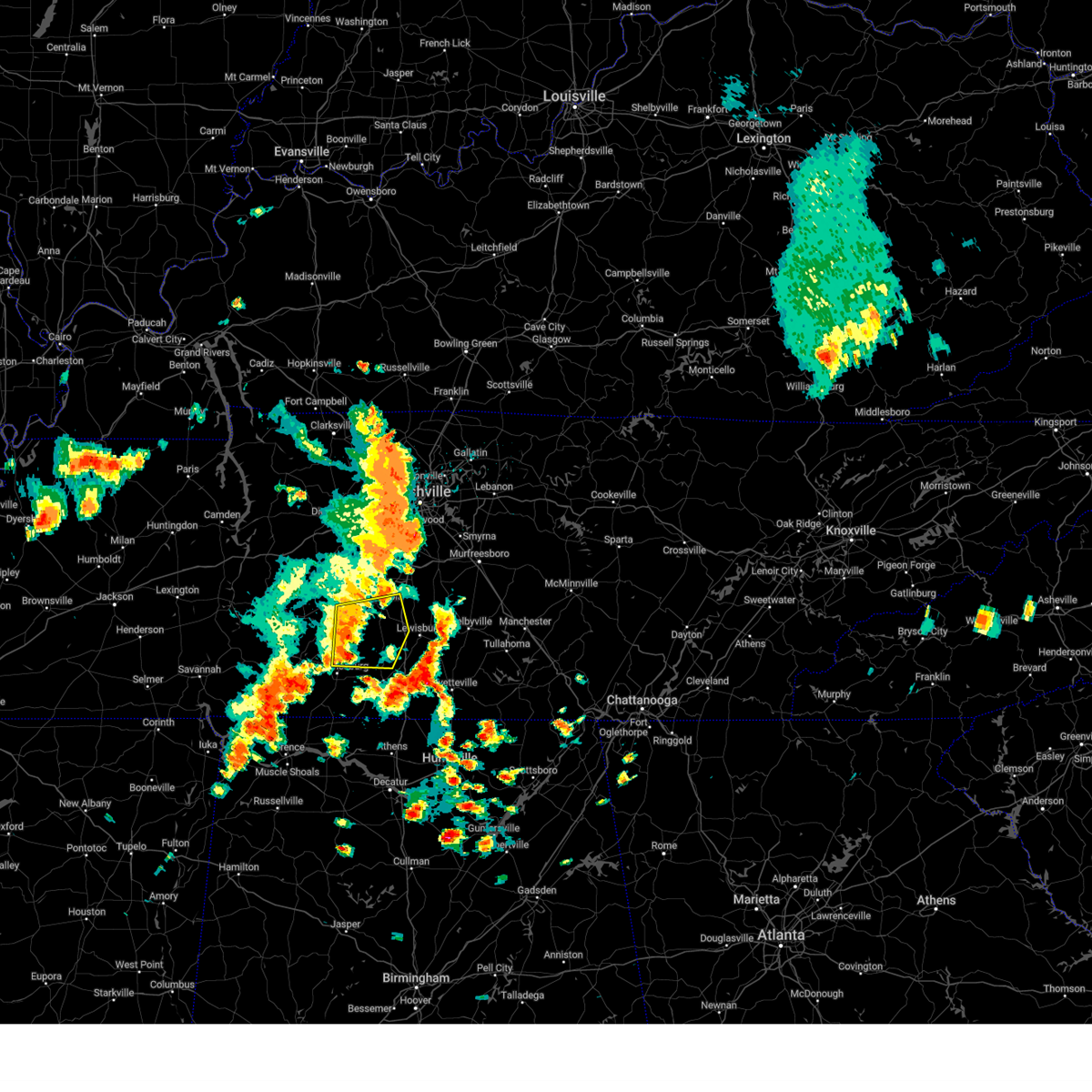 At 114 pm cdt, a severe thunderstorm was located 8 miles southeast of mount pleasant, or 12 miles south of columbia, moving east at 45 mph (radar indicated). Hazards include 60 mph wind gusts and penny size hail. Expect damage to roofs, siding, and trees. locations impacted include, columbia, lawrenceburg, mount pleasant, summertown, ethridge, lynnville, culleoka and hampshire. this includes interstate 65 between mile markers 32 and 43. hail threat, radar indicated max hail size, 0. 75 in wind threat, radar indicated max wind gust, 60 mph. At 114 pm cdt, a severe thunderstorm was located 8 miles southeast of mount pleasant, or 12 miles south of columbia, moving east at 45 mph (radar indicated). Hazards include 60 mph wind gusts and penny size hail. Expect damage to roofs, siding, and trees. locations impacted include, columbia, lawrenceburg, mount pleasant, summertown, ethridge, lynnville, culleoka and hampshire. this includes interstate 65 between mile markers 32 and 43. hail threat, radar indicated max hail size, 0. 75 in wind threat, radar indicated max wind gust, 60 mph.
|
| 7/1/2023 12:58 PM CDT |
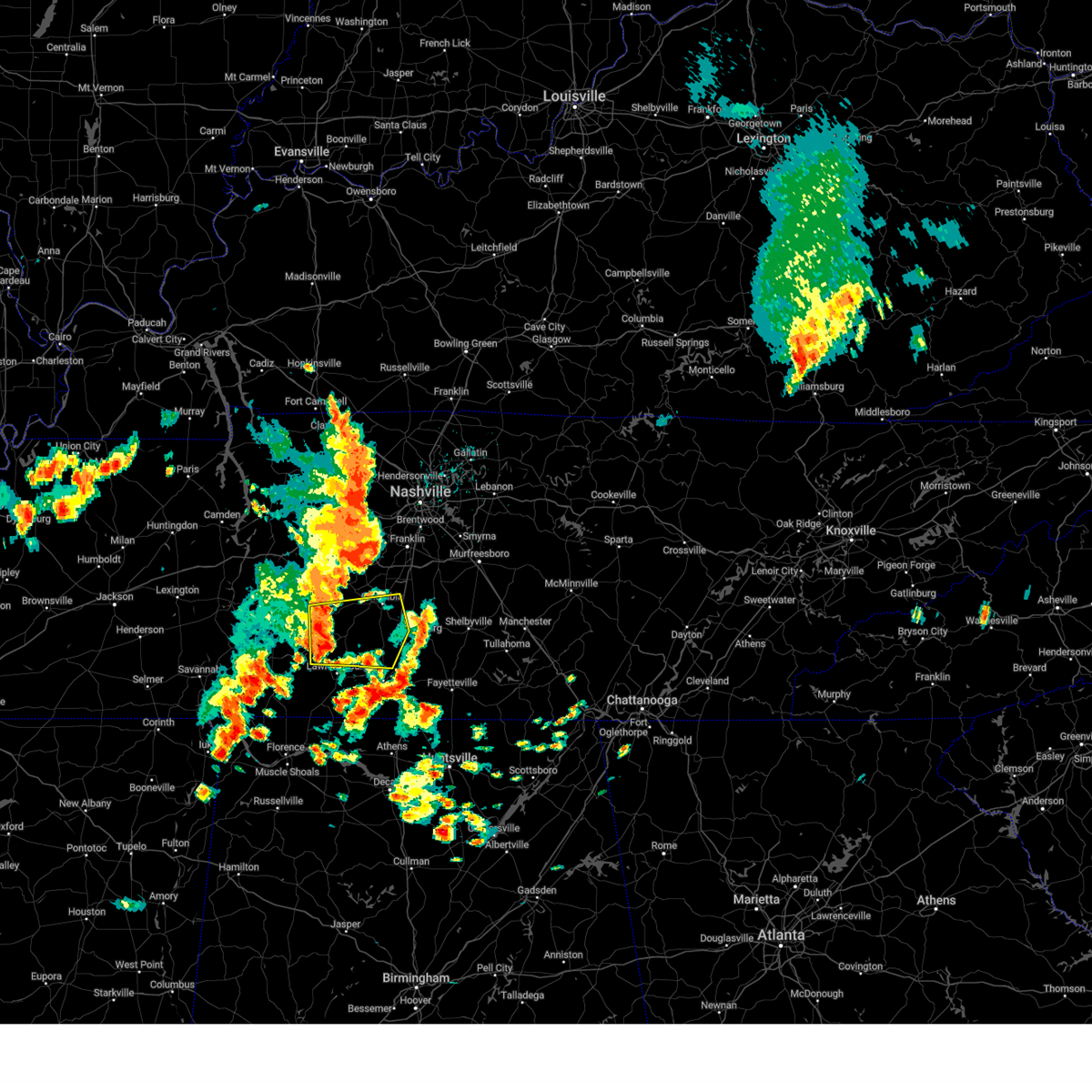 At 1258 pm cdt, a severe thunderstorm was located over summertown, or 13 miles north of lawrenceburg, moving east at 45 mph (radar indicated). Hazards include 60 mph wind gusts and nickel size hail. expect damage to roofs, siding, and trees At 1258 pm cdt, a severe thunderstorm was located over summertown, or 13 miles north of lawrenceburg, moving east at 45 mph (radar indicated). Hazards include 60 mph wind gusts and nickel size hail. expect damage to roofs, siding, and trees
|
| 6/29/2023 3:57 PM CDT |
 At 356 pm cdt, a severe thunderstorm was located 9 miles west of lawrenceburg, moving southeast at 30 mph (radar indicated). Hazards include 60 mph wind gusts and quarter size hail. Hail damage to vehicles is expected. Expect wind damage to roofs, siding, and trees. At 356 pm cdt, a severe thunderstorm was located 9 miles west of lawrenceburg, moving southeast at 30 mph (radar indicated). Hazards include 60 mph wind gusts and quarter size hail. Hail damage to vehicles is expected. Expect wind damage to roofs, siding, and trees.
|
| 6/29/2023 3:18 PM CDT | Tree on house and power lines down in lawrencebur in lawrence county TN, 0.4 miles WNW of Lawrenceburg, TN |
| 6/29/2023 3:15 PM CDT | Corrects previous tstm wnd dmg report from 2 wnw lawrenceburg. large tree down... blocking roa in lawrence county TN, 2.7 miles ESE of Lawrenceburg, TN |
| 6/29/2023 3:15 PM CDT |
 At 315 pm cdt, a severe thunderstorm was located over lawrenceburg, moving southeast at 30 mph (radar indicated). Hazards include 60 mph wind gusts and quarter size hail. Hail damage to vehicles is expected. Expect wind damage to roofs, siding, and trees. At 315 pm cdt, a severe thunderstorm was located over lawrenceburg, moving southeast at 30 mph (radar indicated). Hazards include 60 mph wind gusts and quarter size hail. Hail damage to vehicles is expected. Expect wind damage to roofs, siding, and trees.
|
| 6/29/2023 3:14 PM CDT | Large tree down... blocking roa in lawrence county TN, 2.7 miles ESE of Lawrenceburg, TN |
| 6/25/2023 12:47 PM CDT | Golf Ball sized hail reported 4.9 miles W of Lawrenceburg, TN |
| 6/15/2023 4:30 PM CDT | Em reports tree fallen onto a home in the 600 block of old florence pulaski roa in lawrence county TN, 6.3 miles NW of Lawrenceburg, TN |
| 6/15/2023 4:25 PM CDT | Em reports power line fallen onto vehicle at ada and palmer road just off buffalo road in lawrencebur in lawrence county TN, 0.5 miles SSE of Lawrenceburg, TN |
| 6/15/2023 4:24 PM CDT |
 At 424 pm cdt, a severe thunderstorm was located near lawrenceburg, moving southeast at 20 mph (radar indicated). Hazards include 60 mph wind gusts and quarter size hail. Hail damage to vehicles is expected. Expect wind damage to roofs, siding, and trees. At 424 pm cdt, a severe thunderstorm was located near lawrenceburg, moving southeast at 20 mph (radar indicated). Hazards include 60 mph wind gusts and quarter size hail. Hail damage to vehicles is expected. Expect wind damage to roofs, siding, and trees.
|
| 6/15/2023 4:00 PM CDT |
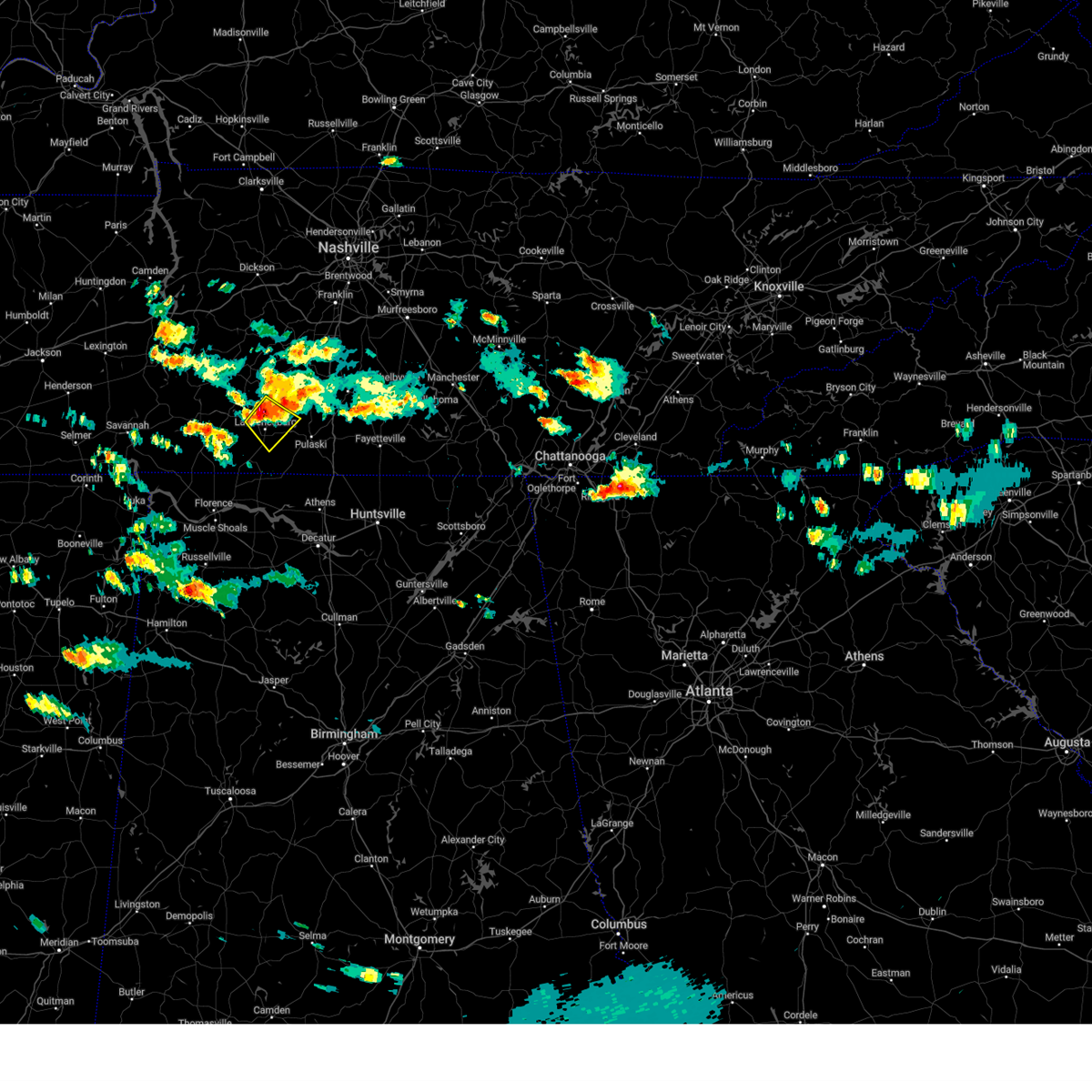 At 359 pm cdt, a severe thunderstorm was located near lawrenceburg, moving southeast at 20 mph (radar indicated). Hazards include 60 mph wind gusts and penny size hail. Expect damage to roofs, siding, and trees. locations impacted include, lawrenceburg, ethridge and leoma. hail threat, radar indicated max hail size, 0. 75 in wind threat, radar indicated max wind gust, 60 mph. At 359 pm cdt, a severe thunderstorm was located near lawrenceburg, moving southeast at 20 mph (radar indicated). Hazards include 60 mph wind gusts and penny size hail. Expect damage to roofs, siding, and trees. locations impacted include, lawrenceburg, ethridge and leoma. hail threat, radar indicated max hail size, 0. 75 in wind threat, radar indicated max wind gust, 60 mph.
|
| 6/15/2023 3:44 PM CDT |
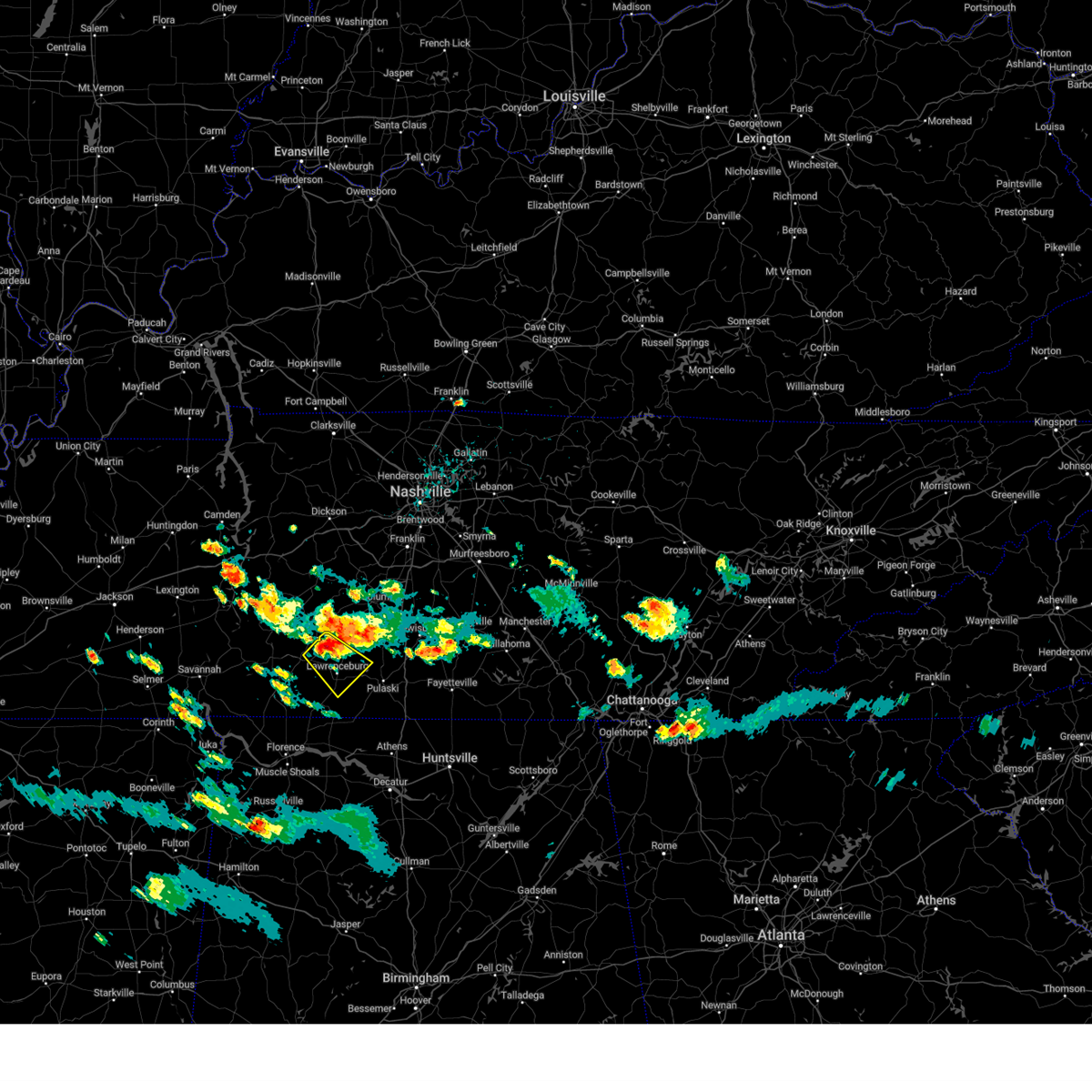 At 344 pm cdt, a severe thunderstorm was located 7 miles southwest of summertown, or 9 miles northwest of lawrenceburg, moving southeast at 15 mph (radar indicated). Hazards include 60 mph wind gusts and penny size hail. expect damage to roofs, siding, and trees At 344 pm cdt, a severe thunderstorm was located 7 miles southwest of summertown, or 9 miles northwest of lawrenceburg, moving southeast at 15 mph (radar indicated). Hazards include 60 mph wind gusts and penny size hail. expect damage to roofs, siding, and trees
|
| 6/15/2023 3:42 PM CDT |
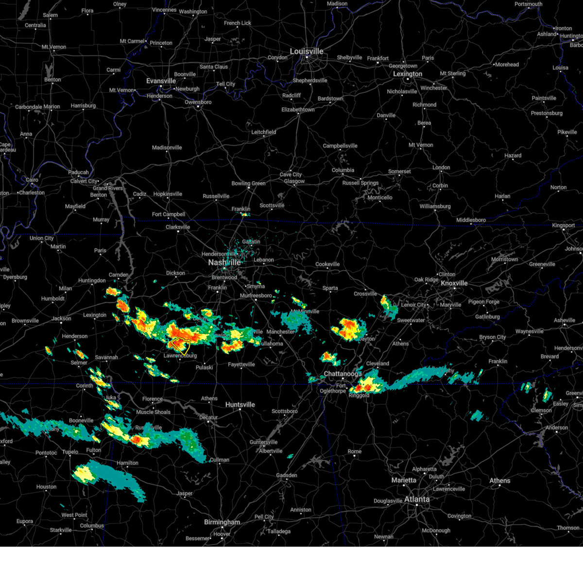 At 341 pm cdt, a severe thunderstorm was located over summertown, or 11 miles north of lawrenceburg, moving southeast at 15 mph (radar indicated). Hazards include 60 mph wind gusts and penny size hail. Expect damage to roofs, siding, and trees. locations impacted include, summertown, ethridge and henryville. hail threat, radar indicated max hail size, 0. 75 in wind threat, radar indicated max wind gust, 60 mph. At 341 pm cdt, a severe thunderstorm was located over summertown, or 11 miles north of lawrenceburg, moving southeast at 15 mph (radar indicated). Hazards include 60 mph wind gusts and penny size hail. Expect damage to roofs, siding, and trees. locations impacted include, summertown, ethridge and henryville. hail threat, radar indicated max hail size, 0. 75 in wind threat, radar indicated max wind gust, 60 mph.
|
| 6/15/2023 3:28 PM CDT |
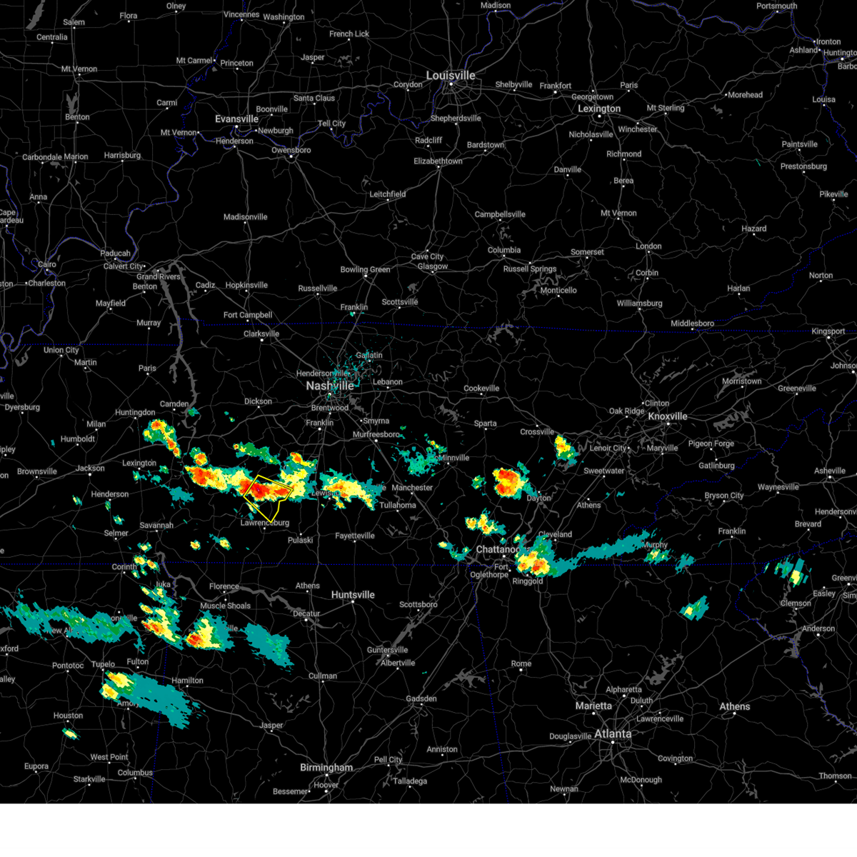 At 328 pm cdt, a severe thunderstorm was located near summertown, or 10 miles east of hohenwald, moving southeast at 10 mph (radar indicated). Hazards include 60 mph wind gusts and penny size hail. expect damage to roofs, siding, and trees At 328 pm cdt, a severe thunderstorm was located near summertown, or 10 miles east of hohenwald, moving southeast at 10 mph (radar indicated). Hazards include 60 mph wind gusts and penny size hail. expect damage to roofs, siding, and trees
|
| 6/11/2023 7:55 PM CDT |
 At 755 pm cdt, severe thunderstorms were located along a line extending from petersburg to 7 miles east of loretto, moving east at 40 mph (radar indicated). Hazards include 60 mph wind gusts and nickel size hail. expect damage to roofs, siding, and trees At 755 pm cdt, severe thunderstorms were located along a line extending from petersburg to 7 miles east of loretto, moving east at 40 mph (radar indicated). Hazards include 60 mph wind gusts and nickel size hail. expect damage to roofs, siding, and trees
|
| 6/11/2023 7:46 PM CDT |
 At 746 pm cdt, a severe thunderstorm was located near loretto, or 8 miles south of lawrenceburg, moving southeast at 50 mph (radar indicated). Hazards include 60 mph wind gusts and nickel size hail. Expect damage to roofs, siding, and trees. locations impacted include, lawrenceburg, loretto, ardmore, st. joseph, elkton, minor hill, goodspring, leoma, westpoint and prospect. This includes interstate 65 between mile markers 1 and 8. At 746 pm cdt, a severe thunderstorm was located near loretto, or 8 miles south of lawrenceburg, moving southeast at 50 mph (radar indicated). Hazards include 60 mph wind gusts and nickel size hail. Expect damage to roofs, siding, and trees. locations impacted include, lawrenceburg, loretto, ardmore, st. joseph, elkton, minor hill, goodspring, leoma, westpoint and prospect. This includes interstate 65 between mile markers 1 and 8.
|
| 6/11/2023 7:42 PM CDT | Photos received via facebook of a tree on top of a hous in lawrence county TN, 1.3 miles E of Lawrenceburg, TN |
| 6/11/2023 7:34 PM CDT |
 At 734 pm cdt, a severe thunderstorm was located near loretto, or 9 miles southwest of lawrenceburg, moving southeast at 50 mph (radar indicated). Hazards include 60 mph wind gusts and nickel size hail. expect damage to roofs, siding, and trees At 734 pm cdt, a severe thunderstorm was located near loretto, or 9 miles southwest of lawrenceburg, moving southeast at 50 mph (radar indicated). Hazards include 60 mph wind gusts and nickel size hail. expect damage to roofs, siding, and trees
|
| 4/5/2023 4:11 PM CDT | Four inch diameter cherry tree downed along tennessee route 24 in lawrence county TN, 10.6 miles SSE of Lawrenceburg, TN |
| 4/5/2023 4:03 PM CDT | Quarter sized hail reported 15 miles ESE of Lawrenceburg, TN, school bus driver reported estimated quarter size hail along brush creek road. |
| 2/16/2023 3:51 PM CST |
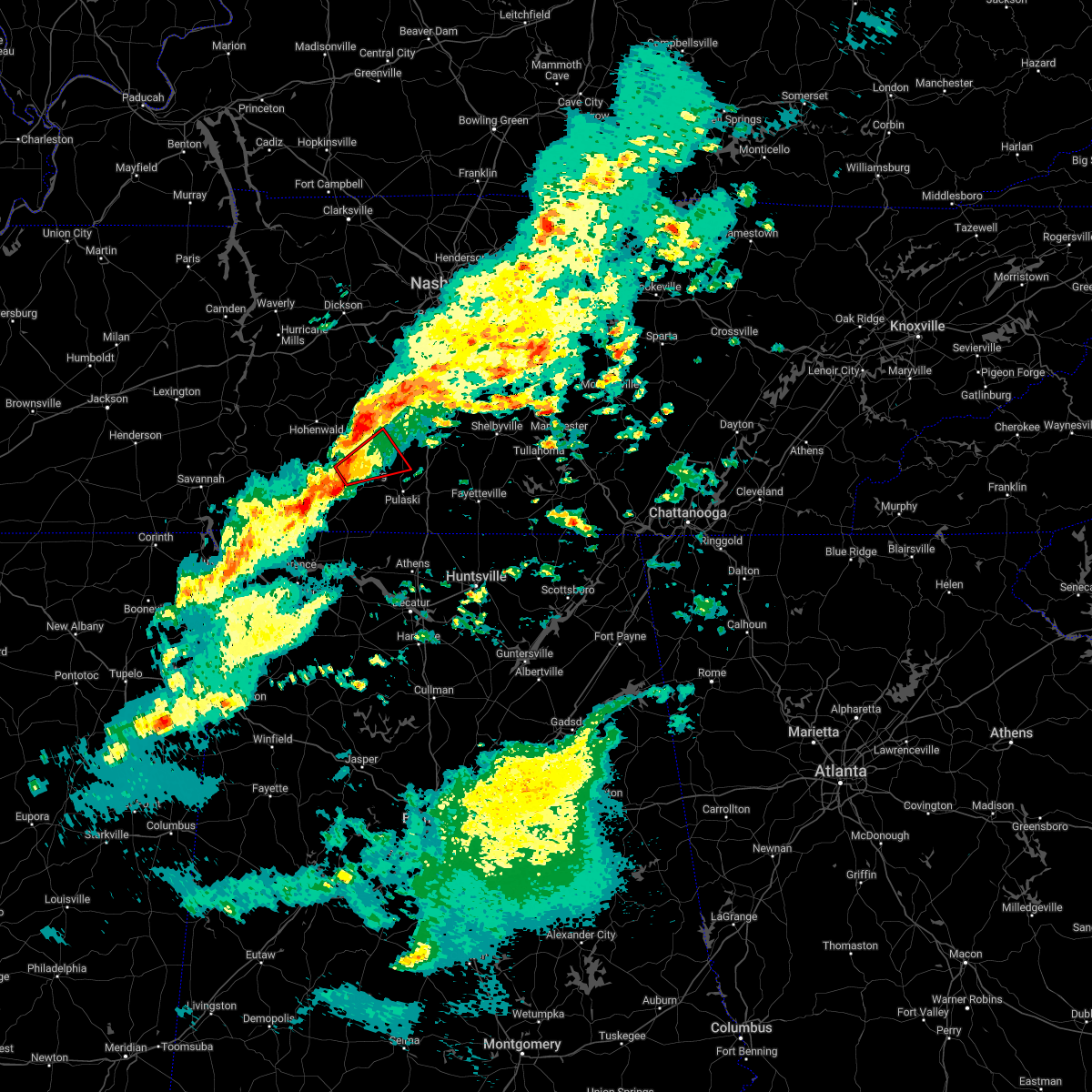 At 350 pm cst, a confirmed tornado was located 3 miles southwest of ethridge , moving northeast at 40 mph (emergency management confirmed tornado. at 348 pm reported houses damaged on north bradley road and mt leabon road with this storm). Hazards include damaging tornado. Flying debris will be dangerous to those caught without shelter. mobile homes will be damaged or destroyed. damage to roofs, windows, and vehicles will occur. tree damage is likely. Locations impacted include, north lawrenceburg and ethridge. At 350 pm cst, a confirmed tornado was located 3 miles southwest of ethridge , moving northeast at 40 mph (emergency management confirmed tornado. at 348 pm reported houses damaged on north bradley road and mt leabon road with this storm). Hazards include damaging tornado. Flying debris will be dangerous to those caught without shelter. mobile homes will be damaged or destroyed. damage to roofs, windows, and vehicles will occur. tree damage is likely. Locations impacted include, north lawrenceburg and ethridge.
|
| 2/16/2023 3:45 PM CST | Damage to homes and trees down near north bradley rd and mt lebanon rd. possible tornad in lawrence county TN, 7 miles E of Lawrenceburg, TN |
| 2/16/2023 3:42 PM CST |
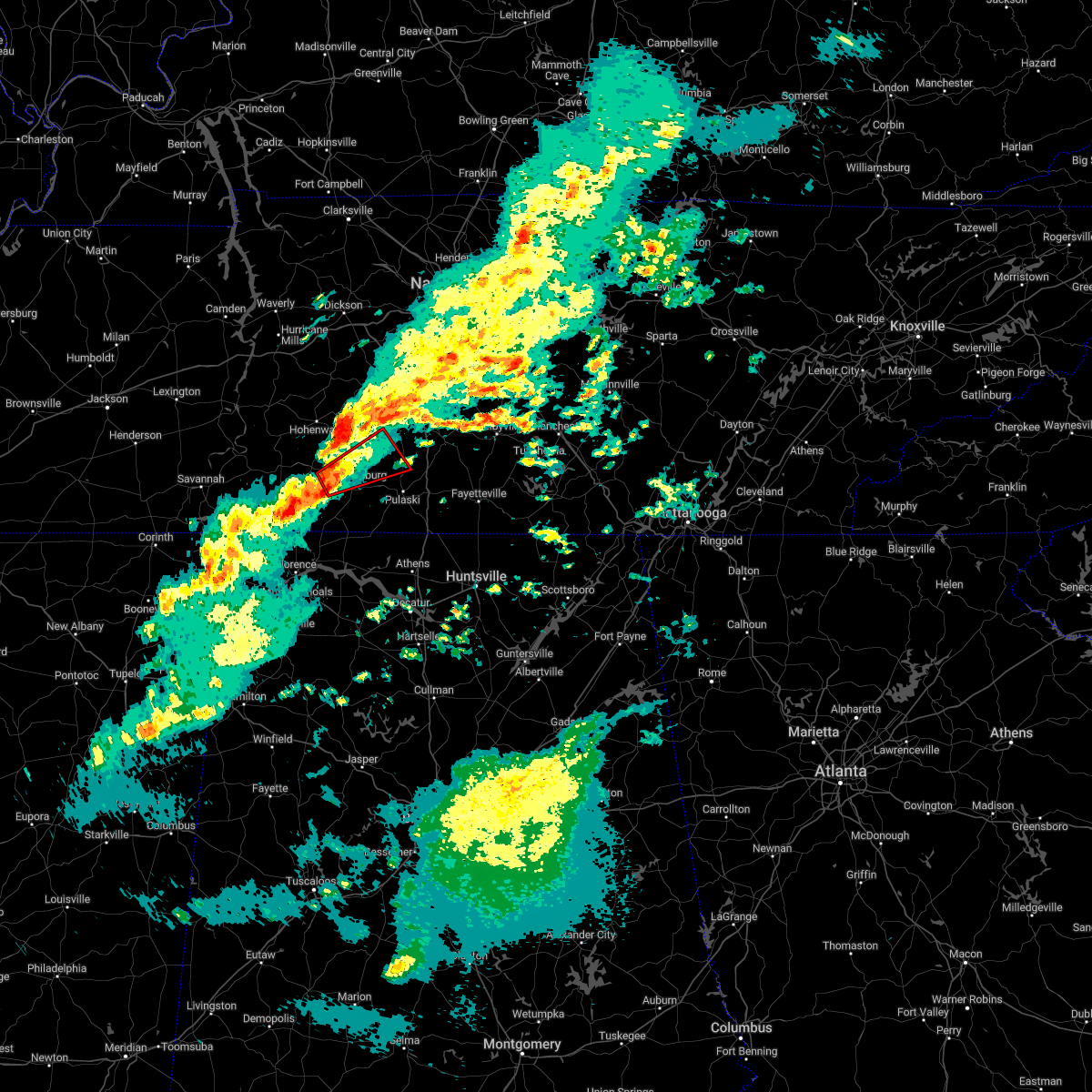 At 342 pm cst, a severe thunderstorm capable of producing a tornado was located 5 miles west of lawrenceburg, moving northeast at 40 mph (radar indicated rotation). Hazards include tornado. Flying debris will be dangerous to those caught without shelter. mobile homes will be damaged or destroyed. damage to roofs, windows, and vehicles will occur. tree damage is likely. This tornadic thunderstorm will remain over mainly rural areas of northern lawrence, south central maury and northwestern giles counties, including the following locations, ethridge. At 342 pm cst, a severe thunderstorm capable of producing a tornado was located 5 miles west of lawrenceburg, moving northeast at 40 mph (radar indicated rotation). Hazards include tornado. Flying debris will be dangerous to those caught without shelter. mobile homes will be damaged or destroyed. damage to roofs, windows, and vehicles will occur. tree damage is likely. This tornadic thunderstorm will remain over mainly rural areas of northern lawrence, south central maury and northwestern giles counties, including the following locations, ethridge.
|
| 10/12/2022 4:57 PM CDT | 24 inch diameter maple tree down on garage in dunn... south of lawrencebur in lawrence county TN, 3.6 miles N of Lawrenceburg, TN |
| 8/26/2022 2:03 PM CDT | Wood power pole snapped on buffalo road. time estimated based on rada in lawrence county TN, 2.6 miles S of Lawrenceburg, TN |
| 7/12/2022 11:05 PM CDT | Trees down near gimlet road and weakley creek roa in lawrence county TN, 5.1 miles WSW of Lawrenceburg, TN |
| 7/12/2022 10:58 PM CDT | Trees and power lines down on byrd road with road blocke in lawrence county TN, 5.1 miles WSW of Lawrenceburg, TN |
| 7/12/2022 10:54 PM CDT |
 At 1053 pm cdt, severe thunderstorms were located along a line extending from collinwood to lynnville, moving southeast at 10 mph (radar indicated). Hazards include 60 mph wind gusts and quarter size hail. Hail damage to vehicles is expected. Expect wind damage to roofs, siding, and trees. At 1053 pm cdt, severe thunderstorms were located along a line extending from collinwood to lynnville, moving southeast at 10 mph (radar indicated). Hazards include 60 mph wind gusts and quarter size hail. Hail damage to vehicles is expected. Expect wind damage to roofs, siding, and trees.
|
| 7/12/2022 10:47 PM CDT |
 At 1047 pm cdt, a severe thunderstorm was located 7 miles northeast of lawrenceburg, moving southeast at 15 mph (radar indicated). Hazards include 60 mph wind gusts and quarter size hail. Hail damage to vehicles is expected. expect wind damage to roofs, siding, and trees. locations impacted include, lawrenceburg, pulaski, ethridge and lynnville. this includes interstate 65 between mile markers 19 and 20. hail threat, radar indicated max hail size, 1. 00 in wind threat, radar indicated max wind gust, 60 mph. At 1047 pm cdt, a severe thunderstorm was located 7 miles northeast of lawrenceburg, moving southeast at 15 mph (radar indicated). Hazards include 60 mph wind gusts and quarter size hail. Hail damage to vehicles is expected. expect wind damage to roofs, siding, and trees. locations impacted include, lawrenceburg, pulaski, ethridge and lynnville. this includes interstate 65 between mile markers 19 and 20. hail threat, radar indicated max hail size, 1. 00 in wind threat, radar indicated max wind gust, 60 mph.
|
| 7/12/2022 10:35 PM CDT |
 At 1034 pm cdt, a severe thunderstorm was located 9 miles northeast of lawrenceburg, or just east of ethridge, moving southeast at 15 mph (radar indicated). Hazards include 60 mph wind gusts and quarter size hail. Hail damage to vehicles is expected. expect wind damage to roofs, siding, and trees. locations impacted include, campbellsville, lawrenceburg, pulaski, cornersville, ethridge and lynnville. this includes interstate 65 between mile markers 19 and 31. hail threat, radar indicated max hail size, 1. 00 in wind threat, radar indicated max wind gust, 60 mph. At 1034 pm cdt, a severe thunderstorm was located 9 miles northeast of lawrenceburg, or just east of ethridge, moving southeast at 15 mph (radar indicated). Hazards include 60 mph wind gusts and quarter size hail. Hail damage to vehicles is expected. expect wind damage to roofs, siding, and trees. locations impacted include, campbellsville, lawrenceburg, pulaski, cornersville, ethridge and lynnville. this includes interstate 65 between mile markers 19 and 31. hail threat, radar indicated max hail size, 1. 00 in wind threat, radar indicated max wind gust, 60 mph.
|
| 7/12/2022 10:10 PM CDT |
 At 1009 pm cdt, a severe thunderstorm was located near summertown, or 11 miles northeast of lawrenceburg, moving east at 20 mph (radar indicated). Hazards include 60 mph wind gusts and quarter size hail. Hail damage to vehicles is expected. Expect wind damage to roofs, siding, and trees. At 1009 pm cdt, a severe thunderstorm was located near summertown, or 11 miles northeast of lawrenceburg, moving east at 20 mph (radar indicated). Hazards include 60 mph wind gusts and quarter size hail. Hail damage to vehicles is expected. Expect wind damage to roofs, siding, and trees.
|
| 5/25/2022 5:11 PM CDT |
 At 511 pm cdt, severe thunderstorms were located along a line extending from near hohenwald to near lawrenceburg to 9 miles northeast of lexington, moving northeast at 50 mph (radar indicated). Hazards include 60 mph wind gusts. expect damage to roofs, siding, and trees At 511 pm cdt, severe thunderstorms were located along a line extending from near hohenwald to near lawrenceburg to 9 miles northeast of lexington, moving northeast at 50 mph (radar indicated). Hazards include 60 mph wind gusts. expect damage to roofs, siding, and trees
|
| 5/25/2022 5:05 PM CDT | Tree branches broken on parks street and lafayette avenue in lawrenceburg of around 5 to 7 inches in diameter. parks street tree damage resulted in power outage in lawrence county TN, 0.7 miles SW of Lawrenceburg, TN |
| 5/25/2022 5:05 PM CDT | Tennessee valley weather reported several trees... tree limbs... power lines and power poles blown down across lawrence county with scattered power outages... including in lawrence county TN, 0.5 miles SSE of Lawrenceburg, TN |
| 5/25/2022 5:03 PM CDT |
 At 502 pm cdt, severe thunderstorms were located along a line extending from 9 miles south of hohenwald to near loretto, moving northeast at 45 mph (radar indicated). Hazards include 60 mph wind gusts. Expect damage to roofs, siding, and trees. locations impacted include, lawrenceburg, hohenwald, loretto, st. joseph, minor hill, ethridge, henryville, goodspring, leoma and westpoint. hail threat, radar indicated max hail size, <. 75 in wind threat, radar indicated max wind gust, 60 mph. At 502 pm cdt, severe thunderstorms were located along a line extending from 9 miles south of hohenwald to near loretto, moving northeast at 45 mph (radar indicated). Hazards include 60 mph wind gusts. Expect damage to roofs, siding, and trees. locations impacted include, lawrenceburg, hohenwald, loretto, st. joseph, minor hill, ethridge, henryville, goodspring, leoma and westpoint. hail threat, radar indicated max hail size, <. 75 in wind threat, radar indicated max wind gust, 60 mph.
|
| 5/25/2022 4:48 PM CDT |
 At 448 pm cdt, severe thunderstorms were located along a line extending from near waynesboro to near loretto, moving northeast at 45 mph (radar indicated). Hazards include 60 mph wind gusts. expect damage to roofs, siding, and trees At 448 pm cdt, severe thunderstorms were located along a line extending from near waynesboro to near loretto, moving northeast at 45 mph (radar indicated). Hazards include 60 mph wind gusts. expect damage to roofs, siding, and trees
|
| 5/25/2022 4:23 PM CDT |
 At 422 pm cdt, severe thunderstorms were located along a line extending from near walnut grove to muscle shoals, moving northeast at 45 mph (radar indicated). Hazards include 60 mph wind gusts. expect damage to roofs, siding, and trees At 422 pm cdt, severe thunderstorms were located along a line extending from near walnut grove to muscle shoals, moving northeast at 45 mph (radar indicated). Hazards include 60 mph wind gusts. expect damage to roofs, siding, and trees
|
| 5/21/2022 8:56 PM CDT |
 The severe thunderstorm warning for eastern lawrence and western giles counties will expire at 900 pm cdt, the storm which prompted the warning has weakened below severe limits, and no longer poses an immediate threat to life or property. therefore, the warning will be allowed to expire. however gusty winds are still possible with this thunderstorm. The severe thunderstorm warning for eastern lawrence and western giles counties will expire at 900 pm cdt, the storm which prompted the warning has weakened below severe limits, and no longer poses an immediate threat to life or property. therefore, the warning will be allowed to expire. however gusty winds are still possible with this thunderstorm.
|
| 5/21/2022 8:23 PM CDT | Quarter sized hail reported 0.5 miles SSE of Lawrenceburg, TN |
| 5/21/2022 8:21 PM CDT |
 At 820 pm cdt, a severe thunderstorm was located over lawrenceburg, moving northeast at 20 mph. another severe thunderstorms was located about 5 miles east of lawrenceburg, (radar indicated). Hazards include 60 mph wind gusts and quarter size hail. Hail damage to vehicles is expected. Expect wind damage to roofs, siding, and trees. At 820 pm cdt, a severe thunderstorm was located over lawrenceburg, moving northeast at 20 mph. another severe thunderstorms was located about 5 miles east of lawrenceburg, (radar indicated). Hazards include 60 mph wind gusts and quarter size hail. Hail damage to vehicles is expected. Expect wind damage to roofs, siding, and trees.
|
| 4/13/2022 7:47 PM CDT |
 At 745 pm cdt, severe thunderstorms were located along a line extending from near spring hill to 8 miles southwest of pulaski, moving east at 65 mph (radar indicated). Hazards include 70 mph wind gusts. Expect considerable tree damage. damage is likely to mobile homes, roofs, and outbuildings. locations impacted include, columbia, lewisburg, lawrenceburg, pulaski, spring hill, mount pleasant, loretto, chapel hill, ardmore, cornersville, elkton, minor hill, ethridge, lynnville, culleoka, i-65 east of columbia, goodspring, leoma, frankewing and williamsport. this includes interstate 65 between mile markers 1 and 51. thunderstorm damage threat, considerable hail threat, radar indicated max hail size, <. 75 in wind threat, radar indicated max wind gust, 70 mph. At 745 pm cdt, severe thunderstorms were located along a line extending from near spring hill to 8 miles southwest of pulaski, moving east at 65 mph (radar indicated). Hazards include 70 mph wind gusts. Expect considerable tree damage. damage is likely to mobile homes, roofs, and outbuildings. locations impacted include, columbia, lewisburg, lawrenceburg, pulaski, spring hill, mount pleasant, loretto, chapel hill, ardmore, cornersville, elkton, minor hill, ethridge, lynnville, culleoka, i-65 east of columbia, goodspring, leoma, frankewing and williamsport. this includes interstate 65 between mile markers 1 and 51. thunderstorm damage threat, considerable hail threat, radar indicated max hail size, <. 75 in wind threat, radar indicated max wind gust, 70 mph.
|
| 4/13/2022 7:27 PM CDT | Measured at wlx studio in lawrence county TN, 0.5 miles SSE of Lawrenceburg, TN |
| 4/13/2022 7:19 PM CDT |
 At 718 pm cdt, severe thunderstorms were located along a line extending from 9 miles southeast of centerville to 9 miles west of loretto, moving east at 65 mph (radar indicated). Hazards include 70 mph wind gusts. Expect considerable tree damage. Damage is likely to mobile homes, roofs, and outbuildings. At 718 pm cdt, severe thunderstorms were located along a line extending from 9 miles southeast of centerville to 9 miles west of loretto, moving east at 65 mph (radar indicated). Hazards include 70 mph wind gusts. Expect considerable tree damage. Damage is likely to mobile homes, roofs, and outbuildings.
|
| 3/30/2022 8:44 PM CDT | Tree down blocking road at valley road and buffalo roa in lawrence county TN, 3.2 miles SE of Lawrenceburg, TN |
| 3/30/2022 8:31 PM CDT | Tree down at genson rd and tn-24 in lawrence county TN, 10.7 miles ESE of Lawrenceburg, TN |
| 3/30/2022 8:04 PM CDT |
 At 804 pm cdt, severe thunderstorms were located along a line extending from hohenwald to underwood-petersville, moving northeast at 65 mph (radar indicated). Hazards include 60 mph wind gusts. expect damage to roofs, siding, and trees At 804 pm cdt, severe thunderstorms were located along a line extending from hohenwald to underwood-petersville, moving northeast at 65 mph (radar indicated). Hazards include 60 mph wind gusts. expect damage to roofs, siding, and trees
|
| 3/22/2022 6:01 PM CDT |
 At 601 pm cdt, a severe thunderstorm was located near pulaski, moving north at 60 mph (radar indicated). Hazards include 60 mph wind gusts. Expect damage to roofs, siding, and trees. locations impacted include, lawrenceburg, pulaski, summertown, ardmore, elkton, ethridge, lynnville, goodspring, frankewing and prospect. this includes interstate 65 between mile markers 1 and 22. hail threat, radar indicated max hail size, <. 75 in wind threat, radar indicated max wind gust, 60 mph. At 601 pm cdt, a severe thunderstorm was located near pulaski, moving north at 60 mph (radar indicated). Hazards include 60 mph wind gusts. Expect damage to roofs, siding, and trees. locations impacted include, lawrenceburg, pulaski, summertown, ardmore, elkton, ethridge, lynnville, goodspring, frankewing and prospect. this includes interstate 65 between mile markers 1 and 22. hail threat, radar indicated max hail size, <. 75 in wind threat, radar indicated max wind gust, 60 mph.
|
| 3/22/2022 5:45 PM CDT |
 At 544 pm cdt, a severe thunderstorm was located 10 miles east of lexington, or 16 miles southwest of pulaski, moving north at 60 mph (radar indicated). Hazards include 60 mph wind gusts. expect damage to roofs, siding, and trees At 544 pm cdt, a severe thunderstorm was located 10 miles east of lexington, or 16 miles southwest of pulaski, moving north at 60 mph (radar indicated). Hazards include 60 mph wind gusts. expect damage to roofs, siding, and trees
|
| 2/22/2022 6:13 PM CST |
 The severe thunderstorm warning for southeastern lawrence and central giles counties will expire at 615 pm cst, the storm which prompted the warning has weakened below severe limits, and no longer poses an immediate threat to life or property. therefore, the warning will be allowed to expire. however gusty winds and heavy rain are still possible with this thunderstorm. The severe thunderstorm warning for southeastern lawrence and central giles counties will expire at 615 pm cst, the storm which prompted the warning has weakened below severe limits, and no longer poses an immediate threat to life or property. therefore, the warning will be allowed to expire. however gusty winds and heavy rain are still possible with this thunderstorm.
|
| 2/22/2022 5:57 PM CST |
 At 556 pm cst, a severe thunderstorm was located 8 miles south of lawrenceburg, moving east at 50 mph (radar indicated). Hazards include 60 mph wind gusts and quarter size hail. Hail damage to vehicles is expected. expect wind damage to roofs, siding, and trees. locations impacted include, lawrenceburg, pulaski, loretto, goodspring and leoma. hail threat, observed max hail size, 1. 00 in wind threat, radar indicated max wind gust, 60 mph. At 556 pm cst, a severe thunderstorm was located 8 miles south of lawrenceburg, moving east at 50 mph (radar indicated). Hazards include 60 mph wind gusts and quarter size hail. Hail damage to vehicles is expected. expect wind damage to roofs, siding, and trees. locations impacted include, lawrenceburg, pulaski, loretto, goodspring and leoma. hail threat, observed max hail size, 1. 00 in wind threat, radar indicated max wind gust, 60 mph.
|
| 2/22/2022 5:40 PM CST |
 At 540 pm cst, a severe thunderstorm was located near loretto, or 16 miles southwest of lawrenceburg, moving east at 55 mph (radar indicated). Hazards include 60 mph wind gusts and quarter size hail. Hail damage to vehicles is expected. Expect wind damage to roofs, siding, and trees. At 540 pm cst, a severe thunderstorm was located near loretto, or 16 miles southwest of lawrenceburg, moving east at 55 mph (radar indicated). Hazards include 60 mph wind gusts and quarter size hail. Hail damage to vehicles is expected. Expect wind damage to roofs, siding, and trees.
|
| 12/6/2021 7:09 AM CST |
 The tornado warning for east central lawrence and northwestern giles counties will expire at 715 am cst, the tornadic thunderstorm which prompted the warning has weakened. therefore, the warning will be allowed to expire. The tornado warning for east central lawrence and northwestern giles counties will expire at 715 am cst, the tornadic thunderstorm which prompted the warning has weakened. therefore, the warning will be allowed to expire.
|
| 12/6/2021 7:03 AM CST |
 At 702 am cst, severe thunderstorms were located along a line extending from 9 miles west of lewisburg to 7 miles northeast of lexington, moving east at 50 mph (radar indicated). Hazards include 60 mph wind gusts. Expect damage to roofs, siding, and trees. locations impacted include, pulaski, loretto, ardmore, st. joseph, elkton, minor hill, lynnville, goodspring, leoma, frankewing and prospect. This includes interstate 65 between mile markers 1 and 22. At 702 am cst, severe thunderstorms were located along a line extending from 9 miles west of lewisburg to 7 miles northeast of lexington, moving east at 50 mph (radar indicated). Hazards include 60 mph wind gusts. Expect damage to roofs, siding, and trees. locations impacted include, pulaski, loretto, ardmore, st. joseph, elkton, minor hill, lynnville, goodspring, leoma, frankewing and prospect. This includes interstate 65 between mile markers 1 and 22.
|
| 12/6/2021 6:55 AM CST |
 At 655 am cst, a severe thunderstorm capable of producing a tornado was located near lawrenceburg, moving east at 45 mph (radar indicated rotation). Hazards include tornado. Flying debris will be dangerous to those caught without shelter. mobile homes will be damaged or destroyed. damage to roofs, windows, and vehicles will occur. tree damage is likely. This dangerous storm will be near, pulaski around 710 am cst. At 655 am cst, a severe thunderstorm capable of producing a tornado was located near lawrenceburg, moving east at 45 mph (radar indicated rotation). Hazards include tornado. Flying debris will be dangerous to those caught without shelter. mobile homes will be damaged or destroyed. damage to roofs, windows, and vehicles will occur. tree damage is likely. This dangerous storm will be near, pulaski around 710 am cst.
|
| 12/6/2021 6:48 AM CST | Emergency manager reported 155 houses without power due to limbs down on power lines. locations around lawrenceburg. time estimated via rada in lawrence county TN, 0.5 miles SSE of Lawrenceburg, TN |
| 12/6/2021 6:40 AM CST |
 At 640 am cst, a severe thunderstorm capable of producing a tornado was located 7 miles west of lawrenceburg, moving east at 45 mph (radar indicated rotation). Hazards include tornado. Flying debris will be dangerous to those caught without shelter. mobile homes will be damaged or destroyed. damage to roofs, windows, and vehicles will occur. tree damage is likely. this dangerous storm will be near, lawrenceburg around 650 am cst. pulaski around 710 am cst. Other locations impacted by this tornadic thunderstorm include ethridge. At 640 am cst, a severe thunderstorm capable of producing a tornado was located 7 miles west of lawrenceburg, moving east at 45 mph (radar indicated rotation). Hazards include tornado. Flying debris will be dangerous to those caught without shelter. mobile homes will be damaged or destroyed. damage to roofs, windows, and vehicles will occur. tree damage is likely. this dangerous storm will be near, lawrenceburg around 650 am cst. pulaski around 710 am cst. Other locations impacted by this tornadic thunderstorm include ethridge.
|
| 12/6/2021 6:38 AM CST | Trees down on both side of key west road near pond field road. numerous other trees down in the westpoint are in lawrence county TN, 12 miles E of Lawrenceburg, TN |
| 12/6/2021 6:32 AM CST |
 At 632 am cst, severe thunderstorms were located along a line extending from near summertown to collinwood, moving east at 50 mph (radar indicated). Hazards include 60 mph wind gusts. expect damage to roofs, siding, and trees At 632 am cst, severe thunderstorms were located along a line extending from near summertown to collinwood, moving east at 50 mph (radar indicated). Hazards include 60 mph wind gusts. expect damage to roofs, siding, and trees
|
| 5/9/2021 7:07 PM CDT |
 At 707 pm cdt, a severe thunderstorm was located 7 miles northeast of lawrenceburg, moving east at 60 mph (radar indicated). Hazards include 60 mph wind gusts. expect damage to roofs, siding, and trees At 707 pm cdt, a severe thunderstorm was located 7 miles northeast of lawrenceburg, moving east at 60 mph (radar indicated). Hazards include 60 mph wind gusts. expect damage to roofs, siding, and trees
|
| 5/9/2021 7:00 PM CDT |
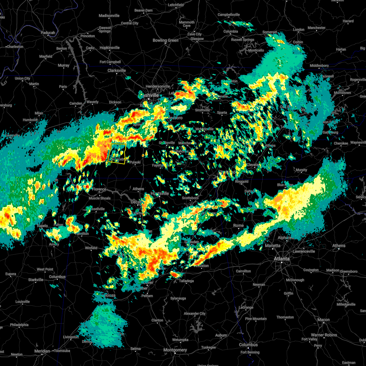 At 659 pm cdt, a severe thunderstorm was located near summertown, or 7 miles northwest of lawrenceburg, moving east at 60 mph (radar indicated). Hazards include 60 mph wind gusts. Expect damage to roofs, siding, and trees. Locations impacted include, lawrenceburg, summertown, ethridge and henryville. At 659 pm cdt, a severe thunderstorm was located near summertown, or 7 miles northwest of lawrenceburg, moving east at 60 mph (radar indicated). Hazards include 60 mph wind gusts. Expect damage to roofs, siding, and trees. Locations impacted include, lawrenceburg, summertown, ethridge and henryville.
|
| 5/9/2021 6:48 PM CDT |
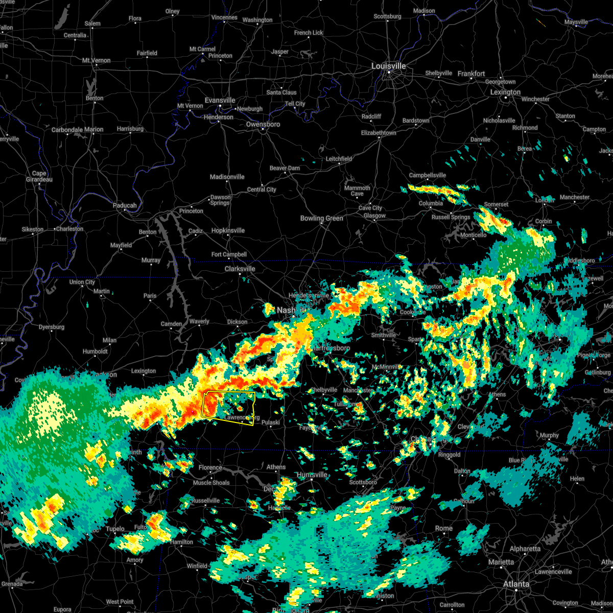 At 647 pm cdt, a severe thunderstorm was located 7 miles northeast of waynesboro, moving east at 60 mph (radar indicated). Hazards include 60 mph wind gusts and penny size hail. Expect damage to roofs, siding, and trees. Locations impacted include, lawrenceburg, waynesboro, summertown, ethridge and henryville. At 647 pm cdt, a severe thunderstorm was located 7 miles northeast of waynesboro, moving east at 60 mph (radar indicated). Hazards include 60 mph wind gusts and penny size hail. Expect damage to roofs, siding, and trees. Locations impacted include, lawrenceburg, waynesboro, summertown, ethridge and henryville.
|
| 5/9/2021 6:30 PM CDT |
 At 630 pm cdt, a severe thunderstorm was located 11 miles northeast of olive hill, or 12 miles northwest of waynesboro, moving east at 60 mph (radar indicated). Hazards include 60 mph wind gusts and penny size hail. expect damage to roofs, siding, and trees At 630 pm cdt, a severe thunderstorm was located 11 miles northeast of olive hill, or 12 miles northwest of waynesboro, moving east at 60 mph (radar indicated). Hazards include 60 mph wind gusts and penny size hail. expect damage to roofs, siding, and trees
|
| 5/6/2021 5:42 PM CDT | Em reported trees down along granddaddy rd near tn-242. power poles snapped at ethridg in lawrence county TN, 3 miles E of Lawrenceburg, TN |
| 5/6/2021 5:32 PM CDT |
 At 531 pm cdt, severe thunderstorms were located along a line extending from near thompson`s station to 6 miles east of mount pleasant to near loretto, moving east at 60 mph (radar indicated). Hazards include 60 mph wind gusts. Expect damage to roofs, siding, and trees. locations impacted include, columbia, lewisburg, lawrenceburg, pulaski, spring hill, mount pleasant, thompson`s station, loretto, summertown, chapel hill, cornersville, st. Joseph, minor hill, ethridge, lynnville, henryville, culleoka, goodspring, leoma and williamsport. At 531 pm cdt, severe thunderstorms were located along a line extending from near thompson`s station to 6 miles east of mount pleasant to near loretto, moving east at 60 mph (radar indicated). Hazards include 60 mph wind gusts. Expect damage to roofs, siding, and trees. locations impacted include, columbia, lewisburg, lawrenceburg, pulaski, spring hill, mount pleasant, thompson`s station, loretto, summertown, chapel hill, cornersville, st. Joseph, minor hill, ethridge, lynnville, henryville, culleoka, goodspring, leoma and williamsport.
|
| 5/6/2021 5:05 PM CDT |
 At 505 pm cdt, severe thunderstorms were located along a line extending from 10 miles northeast of centerville to near hohenwald to 8 miles southwest of collinwood, moving east at 60 mph (radar indicated). Hazards include 60 mph wind gusts. expect damage to roofs, siding, and trees At 505 pm cdt, severe thunderstorms were located along a line extending from 10 miles northeast of centerville to near hohenwald to 8 miles southwest of collinwood, moving east at 60 mph (radar indicated). Hazards include 60 mph wind gusts. expect damage to roofs, siding, and trees
|
| 3/28/2021 1:25 AM CDT |
 The national weather service in nashville has issued a * severe thunderstorm warning for. marshall county in middle tennessee. southern rutherford county in middle tennessee. east central lawrence county in middle tennessee. Southeastern maury county in middle tennessee. The national weather service in nashville has issued a * severe thunderstorm warning for. marshall county in middle tennessee. southern rutherford county in middle tennessee. east central lawrence county in middle tennessee. Southeastern maury county in middle tennessee.
|
| 3/28/2021 1:20 AM CDT |
 At 120 am cdt, severe thunderstorms were located along a line extending from near thompson`s station to 8 miles east of lawrenceburg, moving east at 60 mph (radar indicated). Hazards include 60 mph wind gusts. Expect damage to roofs, siding, and trees. locations impacted include, columbia, lawrenceburg, pulaski, spring hill, mount pleasant, thompson`s station, ethridge, lynnville, culleoka and i-65 east of columbia. this includes the following highways, interstate 65 between mile markers 27 and 60. Interstate 840 between mile markers 27 and 38. At 120 am cdt, severe thunderstorms were located along a line extending from near thompson`s station to 8 miles east of lawrenceburg, moving east at 60 mph (radar indicated). Hazards include 60 mph wind gusts. Expect damage to roofs, siding, and trees. locations impacted include, columbia, lawrenceburg, pulaski, spring hill, mount pleasant, thompson`s station, ethridge, lynnville, culleoka and i-65 east of columbia. this includes the following highways, interstate 65 between mile markers 27 and 60. Interstate 840 between mile markers 27 and 38.
|
| 3/28/2021 12:54 AM CDT |
 At 1253 am cdt, severe thunderstorms were located along a line extending from 11 miles east of centerville to 8 miles northeast of collinwood, moving east at 60 mph (radar indicated). Hazards include 60 mph wind gusts. expect damage to roofs, siding, and trees At 1253 am cdt, severe thunderstorms were located along a line extending from 11 miles east of centerville to 8 miles northeast of collinwood, moving east at 60 mph (radar indicated). Hazards include 60 mph wind gusts. expect damage to roofs, siding, and trees
|
| 3/25/2021 8:15 PM CDT |
 At 815 pm cdt, a severe thunderstorm was located near loretto, or 11 miles southwest of lawrenceburg, moving east at 50 mph (radar indicated). Hazards include 60 mph wind gusts and quarter size hail. Hail damage to vehicles is expected. expect wind damage to roofs, siding, and trees. locations impacted include, lawrenceburg, loretto, st. Joseph, ethridge, leoma, westpoint and iron city. At 815 pm cdt, a severe thunderstorm was located near loretto, or 11 miles southwest of lawrenceburg, moving east at 50 mph (radar indicated). Hazards include 60 mph wind gusts and quarter size hail. Hail damage to vehicles is expected. expect wind damage to roofs, siding, and trees. locations impacted include, lawrenceburg, loretto, st. Joseph, ethridge, leoma, westpoint and iron city.
|
| 3/25/2021 8:05 PM CDT |
 At 805 pm cdt, a severe thunderstorm was located near collinwood, or 15 miles southeast of waynesboro, moving east at 50 mph (radar indicated). Hazards include 60 mph wind gusts and quarter size hail. Hail damage to vehicles is expected. expect wind damage to roofs, siding, and trees. locations impacted include, lawrenceburg, loretto, st. Joseph, ethridge, leoma, westpoint and iron city. At 805 pm cdt, a severe thunderstorm was located near collinwood, or 15 miles southeast of waynesboro, moving east at 50 mph (radar indicated). Hazards include 60 mph wind gusts and quarter size hail. Hail damage to vehicles is expected. expect wind damage to roofs, siding, and trees. locations impacted include, lawrenceburg, loretto, st. Joseph, ethridge, leoma, westpoint and iron city.
|
| 3/25/2021 7:50 PM CDT |
 At 750 pm cdt, a severe thunderstorm was located 10 miles southwest of collinwood, or 18 miles northwest of florence, moving east at 50 mph (radar indicated). Hazards include 60 mph wind gusts and quarter size hail. Hail damage to vehicles is expected. Expect wind damage to roofs, siding, and trees. At 750 pm cdt, a severe thunderstorm was located 10 miles southwest of collinwood, or 18 miles northwest of florence, moving east at 50 mph (radar indicated). Hazards include 60 mph wind gusts and quarter size hail. Hail damage to vehicles is expected. Expect wind damage to roofs, siding, and trees.
|
| 3/16/2021 2:56 AM CDT |
 The severe thunderstorm warning for southern lawrence county will expire at 300 am cdt, the storm which prompted the warning has weakened below severe limits, and has exited the warned area. therefore, the warning will be allowed to expire. The severe thunderstorm warning for southern lawrence county will expire at 300 am cdt, the storm which prompted the warning has weakened below severe limits, and has exited the warned area. therefore, the warning will be allowed to expire.
|
| 3/16/2021 2:38 AM CDT |
 At 237 am cdt, a severe thunderstorm was located near loretto, or 16 miles northeast of florence, moving east at 45 mph (radar indicated). Hazards include 60 mph wind gusts and quarter size hail. Hail damage to vehicles is expected. expect wind damage to roofs, siding, and trees. locations impacted include, lawrenceburg, loretto, st. Joseph, leoma, westpoint and iron city. At 237 am cdt, a severe thunderstorm was located near loretto, or 16 miles northeast of florence, moving east at 45 mph (radar indicated). Hazards include 60 mph wind gusts and quarter size hail. Hail damage to vehicles is expected. expect wind damage to roofs, siding, and trees. locations impacted include, lawrenceburg, loretto, st. Joseph, leoma, westpoint and iron city.
|
| 3/16/2021 2:20 AM CDT |
 At 219 am cdt, a severe thunderstorm was located 8 miles north of underwood-petersville, or 12 miles north of florence, moving east at 40 mph (radar indicated). Hazards include 60 mph wind gusts and quarter size hail. Hail damage to vehicles is expected. Expect wind damage to roofs, siding, and trees. At 219 am cdt, a severe thunderstorm was located 8 miles north of underwood-petersville, or 12 miles north of florence, moving east at 40 mph (radar indicated). Hazards include 60 mph wind gusts and quarter size hail. Hail damage to vehicles is expected. Expect wind damage to roofs, siding, and trees.
|
| 8/27/2020 5:09 PM CDT |
 At 509 pm cdt, a severe thunderstorm was located 7 miles northwest of lawrenceburg, moving north at 40 mph (radar indicated). Hazards include 60 mph wind gusts. expect damage to roofs, siding, and trees At 509 pm cdt, a severe thunderstorm was located 7 miles northwest of lawrenceburg, moving north at 40 mph (radar indicated). Hazards include 60 mph wind gusts. expect damage to roofs, siding, and trees
|
| 8/27/2020 5:02 PM CDT |
 At 501 pm cdt, severe thunderstorms were located along a line extending from near collinwood to near lawrenceburg, moving north at 35 mph (emergency management). Hazards include 60 mph wind gusts. Expect damage to roofs, siding, and trees. Locations impacted include, lawrenceburg, waynesboro, collinwood, ethridge, leoma and westpoint. At 501 pm cdt, severe thunderstorms were located along a line extending from near collinwood to near lawrenceburg, moving north at 35 mph (emergency management). Hazards include 60 mph wind gusts. Expect damage to roofs, siding, and trees. Locations impacted include, lawrenceburg, waynesboro, collinwood, ethridge, leoma and westpoint.
|
| 8/27/2020 4:58 PM CDT | Trees on powerlines on spring creek rd. in the gandy community in lawrence county TN, 5.1 miles NE of Lawrenceburg, TN |
| 8/27/2020 4:40 PM CDT |
 At 439 pm cdt, severe thunderstorms were located along a line extending from 7 miles northwest of underwood-petersville to 9 miles northeast of lexington, moving north at 35 mph (radar indicated). Hazards include 60 mph wind gusts. expect damage to roofs, siding, and trees At 439 pm cdt, severe thunderstorms were located along a line extending from 7 miles northwest of underwood-petersville to 9 miles northeast of lexington, moving north at 35 mph (radar indicated). Hazards include 60 mph wind gusts. expect damage to roofs, siding, and trees
|
| 5/4/2020 9:00 PM CDT |
 At 900 pm cdt, severe thunderstorms were located along a line extending from 11 miles west of lewisburg to 9 miles southwest of pulaski, moving east at 60 mph (radar indicated). Hazards include 70 mph wind gusts and quarter size hail. Hail damage to vehicles is expected. expect considerable tree damage. wind damage is also likely to mobile homes, roofs, and outbuildings. locations impacted include, lewisburg, lawrenceburg, pulaski, ardmore, cornersville, elkton, ethridge, lynnville, culleoka, goodspring, leoma, frankewing and prospect. This includes interstate 65 between mile markers 1 and 32. At 900 pm cdt, severe thunderstorms were located along a line extending from 11 miles west of lewisburg to 9 miles southwest of pulaski, moving east at 60 mph (radar indicated). Hazards include 70 mph wind gusts and quarter size hail. Hail damage to vehicles is expected. expect considerable tree damage. wind damage is also likely to mobile homes, roofs, and outbuildings. locations impacted include, lewisburg, lawrenceburg, pulaski, ardmore, cornersville, elkton, ethridge, lynnville, culleoka, goodspring, leoma, frankewing and prospect. This includes interstate 65 between mile markers 1 and 32.
|
| 5/4/2020 8:43 PM CDT | Tree down on car with person trapped at 1290 crowder road in lawrence county TN, 1.6 miles N of Lawrenceburg, TN |
| 5/4/2020 8:43 PM CDT | Trees blocking road at weekly creek road and miller road east of lawrenceburg in lawrence county TN, 3.3 miles W of Lawrenceburg, TN |
| 5/4/2020 8:43 PM CDT | Tree down across springer road. pea size hail in west lawrencebur in lawrence county TN, 1.1 miles WSW of Lawrenceburg, TN |
| 5/4/2020 8:42 PM CDT | Power lines down at virginia drive and highway 43 in lawrence county TN, 0.9 miles N of Lawrenceburg, TN |
| 5/4/2020 8:41 PM CDT | 55 to 60 mph winds reported on mattoxtown road in north lawrenceburg in lawrence county TN, 2.4 miles SW of Lawrenceburg, TN |
| 5/4/2020 8:40 PM CDT |
 At 840 pm cdt, severe thunderstorms were located along a line extending from 6 miles east of hohenwald to 11 miles east of waynesboro, moving southeast at 35 mph (radar indicated). Hazards include 60 mph wind gusts and quarter size hail. Hail damage to vehicles is expected. expect wind damage to roofs, siding, and trees. Locations impacted include, lawrenceburg, mount pleasant, summertown, ethridge, gordonsburg and henryville. At 840 pm cdt, severe thunderstorms were located along a line extending from 6 miles east of hohenwald to 11 miles east of waynesboro, moving southeast at 35 mph (radar indicated). Hazards include 60 mph wind gusts and quarter size hail. Hail damage to vehicles is expected. expect wind damage to roofs, siding, and trees. Locations impacted include, lawrenceburg, mount pleasant, summertown, ethridge, gordonsburg and henryville.
|
| 5/4/2020 8:36 PM CDT |
 At 836 pm cdt, severe thunderstorms were located along a line extending from near summertown to 10 miles northwest of loretto, moving east at 60 mph (radar indicated). Hazards include 60 mph wind gusts and half dollar size hail. Hail damage to vehicles is expected. Expect wind damage to roofs, siding, and trees. At 836 pm cdt, severe thunderstorms were located along a line extending from near summertown to 10 miles northwest of loretto, moving east at 60 mph (radar indicated). Hazards include 60 mph wind gusts and half dollar size hail. Hail damage to vehicles is expected. Expect wind damage to roofs, siding, and trees.
|
| 5/4/2020 8:29 PM CDT | Tree down down on power line at prebble hill road near highway 64 in lawrence county TN, 14.7 miles ESE of Lawrenceburg, TN |
| 5/4/2020 8:14 PM CDT |
 At 814 pm cdt, severe thunderstorms were located along a line extending from 6 miles northwest of hohenwald to near waynesboro, moving southeast at 35 mph (radar indicated). Hazards include 60 mph wind gusts and quarter size hail. Hail damage to vehicles is expected. Expect wind damage to roofs, siding, and trees. At 814 pm cdt, severe thunderstorms were located along a line extending from 6 miles northwest of hohenwald to near waynesboro, moving southeast at 35 mph (radar indicated). Hazards include 60 mph wind gusts and quarter size hail. Hail damage to vehicles is expected. Expect wind damage to roofs, siding, and trees.
|
| 5/3/2020 5:00 PM CDT | Widespread wind damage....trees down and a barn damage in lawrence county TN, 0.5 miles SSE of Lawrenceburg, TN |
| 5/3/2020 5:00 PM CDT | Widespread wind damage....trees down and a barn damage in lawrence county TN, 0.5 miles SSE of Lawrenceburg, TN |
| 5/3/2020 5:00 PM CDT |
 At 500 pm cdt, severe thunderstorms were located along a line extending from 6 miles northwest of pulaski to 6 miles northeast of lexington to near underwood-petersville, moving southeast at 35 mph (radar indicated). Hazards include 60 mph wind gusts and penny size hail. Expect damage to roofs, siding, and trees. locations impacted include, lawrenceburg, pulaski, loretto, elkton, minor hill, goodspring, leoma, frankewing and prospect. pulaski covid-19 mobile testing site will also be impacted. This includes interstate 65 between mile markers 1 and 16. At 500 pm cdt, severe thunderstorms were located along a line extending from 6 miles northwest of pulaski to 6 miles northeast of lexington to near underwood-petersville, moving southeast at 35 mph (radar indicated). Hazards include 60 mph wind gusts and penny size hail. Expect damage to roofs, siding, and trees. locations impacted include, lawrenceburg, pulaski, loretto, elkton, minor hill, goodspring, leoma, frankewing and prospect. pulaski covid-19 mobile testing site will also be impacted. This includes interstate 65 between mile markers 1 and 16.
|
| 5/3/2020 4:45 PM CDT |
 At 445 pm cdt, severe thunderstorms were located along a line extending from near columbia to 8 miles southeast of mount pleasant to near lawrenceburg, moving east at 60 mph (radar indicated). Hazards include 70 mph wind gusts and penny size hail. Expect considerable tree damage. damage is likely to mobile homes, roofs, and outbuildings. locations impacted include, columbia, lawrenceburg, mount pleasant, summertown, ethridge, henryville and culleoka. This includes interstate 65 between mile markers 36 and 44. At 445 pm cdt, severe thunderstorms were located along a line extending from near columbia to 8 miles southeast of mount pleasant to near lawrenceburg, moving east at 60 mph (radar indicated). Hazards include 70 mph wind gusts and penny size hail. Expect considerable tree damage. damage is likely to mobile homes, roofs, and outbuildings. locations impacted include, columbia, lawrenceburg, mount pleasant, summertown, ethridge, henryville and culleoka. This includes interstate 65 between mile markers 36 and 44.
|
| 5/3/2020 4:42 PM CDT | Brick garage wall collapsed in gum springs... tn in lawrence county TN, 4.5 miles NW of Lawrenceburg, TN |
| 5/3/2020 4:35 PM CDT |
 At 435 pm cdt, severe thunderstorms were located along a line extending from near summertown to 8 miles west of lawrenceburg to 7 miles southwest of collinwood, moving southeast at 35 mph (radar indicated). Hazards include 60 mph wind gusts and penny size hail. expect damage to roofs, siding, and trees At 435 pm cdt, severe thunderstorms were located along a line extending from near summertown to 8 miles west of lawrenceburg to 7 miles southwest of collinwood, moving southeast at 35 mph (radar indicated). Hazards include 60 mph wind gusts and penny size hail. expect damage to roofs, siding, and trees
|
| 5/3/2020 4:12 PM CDT |
 At 412 pm cdt, severe thunderstorms were located along a line extending from 6 miles south of centerville to near hohenwald to 10 miles northeast of olive hill, moving east at 60 mph (radar indicated). Hazards include 70 mph wind gusts and penny size hail. Expect considerable tree damage. Damage is likely to mobile homes, roofs, and outbuildings. At 412 pm cdt, severe thunderstorms were located along a line extending from 6 miles south of centerville to near hohenwald to 10 miles northeast of olive hill, moving east at 60 mph (radar indicated). Hazards include 70 mph wind gusts and penny size hail. Expect considerable tree damage. Damage is likely to mobile homes, roofs, and outbuildings.
|
| 4/12/2020 4:31 PM CDT | Several trees down and damaged outbuilding in 780 block of ethridge red hill r in lawrence county TN, 4.8 miles SSE of Lawrenceburg, TN |
| 4/12/2020 4:30 PM CDT | Several trees down near old highway 64 and red hill road in lawrence county TN, 7 miles SE of Lawrenceburg, TN |
| 4/12/2020 4:26 PM CDT | Outbuilding destroyed on piney r in lawrence county TN, 11.4 miles ESE of Lawrenceburg, TN |
| 4/8/2020 5:27 PM CDT |
 At 526 pm cdt, a severe thunderstorm was located 9 miles east of loretto, or 10 miles south of lawrenceburg, moving east at 25 mph (radar indicated). Hazards include 60 mph wind gusts and half dollar size hail. Hail damage to vehicles is expected. Expect wind damage to roofs, siding, and trees. At 526 pm cdt, a severe thunderstorm was located 9 miles east of loretto, or 10 miles south of lawrenceburg, moving east at 25 mph (radar indicated). Hazards include 60 mph wind gusts and half dollar size hail. Hail damage to vehicles is expected. Expect wind damage to roofs, siding, and trees.
|
| 4/8/2020 5:14 PM CDT |
 At 514 pm cdt, a severe thunderstorm was located over lawrenceburg, moving east at 25 mph (radar indicated). Hazards include 60 mph wind gusts and quarter size hail. Hail damage to vehicles is expected. expect wind damage to roofs, siding, and trees. Locations impacted include, lawrenceburg, leoma and goodspring. At 514 pm cdt, a severe thunderstorm was located over lawrenceburg, moving east at 25 mph (radar indicated). Hazards include 60 mph wind gusts and quarter size hail. Hail damage to vehicles is expected. expect wind damage to roofs, siding, and trees. Locations impacted include, lawrenceburg, leoma and goodspring.
|
| 4/8/2020 5:06 PM CDT |
 At 505 pm cdt, a severe thunderstorm was located near lawrenceburg, moving east at 25 mph (radar indicated). Hazards include 60 mph wind gusts and quarter size hail. Hail damage to vehicles is expected. expect wind damage to roofs, siding, and trees. Locations impacted include, lawrenceburg, ethridge, goodspring and leoma. At 505 pm cdt, a severe thunderstorm was located near lawrenceburg, moving east at 25 mph (radar indicated). Hazards include 60 mph wind gusts and quarter size hail. Hail damage to vehicles is expected. expect wind damage to roofs, siding, and trees. Locations impacted include, lawrenceburg, ethridge, goodspring and leoma.
|
| 4/8/2020 5:01 PM CDT | Report of tree on power line that started a fire... knob creek road. time estimated via rada in lawrence county TN, 7.8 miles ENE of Lawrenceburg, TN |
| 4/8/2020 4:58 PM CDT | Golf Ball sized hail reported 10.9 miles E of Lawrenceburg, TN, received a report of golf ball size hail on pondfield road. |
| 4/8/2020 4:58 PM CDT |
 At 458 pm cdt, a severe thunderstorm was located 7 miles west of lawrenceburg, moving east at 25 mph (trained weather spotters). Hazards include golf ball size hail and 60 mph wind gusts. People and animals outdoors will be injured. expect hail damage to roofs, siding, windows, and vehicles. expect wind damage to roofs, siding, and trees. Locations impacted include, lawrenceburg, ethridge, goodspring and leoma. At 458 pm cdt, a severe thunderstorm was located 7 miles west of lawrenceburg, moving east at 25 mph (trained weather spotters). Hazards include golf ball size hail and 60 mph wind gusts. People and animals outdoors will be injured. expect hail damage to roofs, siding, windows, and vehicles. expect wind damage to roofs, siding, and trees. Locations impacted include, lawrenceburg, ethridge, goodspring and leoma.
|
| 4/8/2020 4:54 PM CDT |
 At 454 pm cdt, a severe thunderstorm was located 9 miles west of lawrenceburg, moving east at 25 mph (radar indicated). Hazards include 60 mph wind gusts and quarter size hail. Hail damage to vehicles is expected. Expect wind damage to roofs, siding, and trees. At 454 pm cdt, a severe thunderstorm was located 9 miles west of lawrenceburg, moving east at 25 mph (radar indicated). Hazards include 60 mph wind gusts and quarter size hail. Hail damage to vehicles is expected. Expect wind damage to roofs, siding, and trees.
|
| 3/29/2020 12:39 AM CDT |
 At 1238 am cdt, a severe thunderstorm was located near lawrenceburg, moving northeast at 75 mph (radar indicated). Hazards include 70 mph wind gusts and ping pong ball size hail. People and animals outdoors will be injured. expect hail damage to roofs, siding, windows, and vehicles. expect considerable tree damage. Wind damage is also likely to mobile homes, roofs, and outbuildings. At 1238 am cdt, a severe thunderstorm was located near lawrenceburg, moving northeast at 75 mph (radar indicated). Hazards include 70 mph wind gusts and ping pong ball size hail. People and animals outdoors will be injured. expect hail damage to roofs, siding, windows, and vehicles. expect considerable tree damage. Wind damage is also likely to mobile homes, roofs, and outbuildings.
|
| 3/29/2020 12:34 AM CDT |
 At 1234 am cdt, a severe thunderstorm was located near loretto, or 9 miles southwest of lawrenceburg, moving northeast at 70 mph (radar indicated). Hazards include 70 mph wind gusts and ping pong ball size hail. People and animals outdoors will be injured. expect hail damage to roofs, siding, windows, and vehicles. expect considerable tree damage. wind damage is also likely to mobile homes, roofs, and outbuildings. locations impacted include, lawrenceburg, loretto, st. Joseph, leoma and westpoint. At 1234 am cdt, a severe thunderstorm was located near loretto, or 9 miles southwest of lawrenceburg, moving northeast at 70 mph (radar indicated). Hazards include 70 mph wind gusts and ping pong ball size hail. People and animals outdoors will be injured. expect hail damage to roofs, siding, windows, and vehicles. expect considerable tree damage. wind damage is also likely to mobile homes, roofs, and outbuildings. locations impacted include, lawrenceburg, loretto, st. Joseph, leoma and westpoint.
|
| 3/29/2020 12:26 AM CDT |
 At 1226 am cdt, a severe thunderstorm was located 10 miles southeast of collinwood, or 18 miles north of florence, moving northeast at 65 mph (radar indicated). Hazards include 70 mph wind gusts and ping pong ball size hail. People and animals outdoors will be injured. expect hail damage to roofs, siding, windows, and vehicles. expect considerable tree damage. wind damage is also likely to mobile homes, roofs, and outbuildings. locations impacted include, lawrenceburg, loretto, st. Joseph, leoma, westpoint, iron city and cypress inn. At 1226 am cdt, a severe thunderstorm was located 10 miles southeast of collinwood, or 18 miles north of florence, moving northeast at 65 mph (radar indicated). Hazards include 70 mph wind gusts and ping pong ball size hail. People and animals outdoors will be injured. expect hail damage to roofs, siding, windows, and vehicles. expect considerable tree damage. wind damage is also likely to mobile homes, roofs, and outbuildings. locations impacted include, lawrenceburg, loretto, st. Joseph, leoma, westpoint, iron city and cypress inn.
|
| 3/29/2020 12:21 AM CDT |
 At 1220 am cdt, a severe thunderstorm was located 8 miles north of underwood-petersville, or 13 miles north of florence, moving northeast at 65 mph (radar indicated). Hazards include 60 mph wind gusts. expect damage to roofs, siding, and trees At 1220 am cdt, a severe thunderstorm was located 8 miles north of underwood-petersville, or 13 miles north of florence, moving northeast at 65 mph (radar indicated). Hazards include 60 mph wind gusts. expect damage to roofs, siding, and trees
|
| 3/24/2020 5:38 PM CDT |
 At 538 pm cdt, a severe thunderstorm capable of producing a tornado was located near lawrenceburg, moving east at 45 mph (radar indicated rotation). Hazards include tornado. Flying debris will be dangerous to those caught without shelter. mobile homes will be damaged or destroyed. damage to roofs, windows, and vehicles will occur. tree damage is likely. This tornadic thunderstorm will remain over mainly rural areas of northeastern lawrence and northwestern giles counties, including the following locations, ethridge. At 538 pm cdt, a severe thunderstorm capable of producing a tornado was located near lawrenceburg, moving east at 45 mph (radar indicated rotation). Hazards include tornado. Flying debris will be dangerous to those caught without shelter. mobile homes will be damaged or destroyed. damage to roofs, windows, and vehicles will occur. tree damage is likely. This tornadic thunderstorm will remain over mainly rural areas of northeastern lawrence and northwestern giles counties, including the following locations, ethridge.
|
| 3/24/2020 5:27 PM CDT |
 At 527 pm cdt, a severe thunderstorm capable of producing a tornado was located 8 miles northwest of lawrenceburg, moving east at 45 mph (radar indicated rotation). Hazards include tornado and quarter size hail. Flying debris will be dangerous to those caught without shelter. mobile homes will be damaged or destroyed. damage to roofs, windows, and vehicles will occur. tree damage is likely. this dangerous storm will be near, lawrenceburg around 540 pm cdt. Other locations impacted by this tornadic thunderstorm include ethridge. At 527 pm cdt, a severe thunderstorm capable of producing a tornado was located 8 miles northwest of lawrenceburg, moving east at 45 mph (radar indicated rotation). Hazards include tornado and quarter size hail. Flying debris will be dangerous to those caught without shelter. mobile homes will be damaged or destroyed. damage to roofs, windows, and vehicles will occur. tree damage is likely. this dangerous storm will be near, lawrenceburg around 540 pm cdt. Other locations impacted by this tornadic thunderstorm include ethridge.
|
| 3/24/2020 5:16 PM CDT |
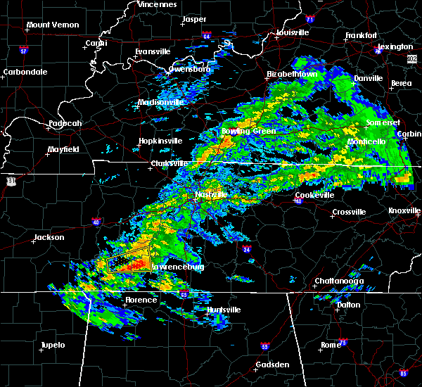 At 515 pm cdt, a severe thunderstorm was located 12 miles east of waynesboro, moving east at 55 mph (radar indicated). Hazards include 60 mph wind gusts and quarter size hail. Hail damage to vehicles is expected. expect wind damage to roofs, siding, and trees. Locations impacted include, henryville. At 515 pm cdt, a severe thunderstorm was located 12 miles east of waynesboro, moving east at 55 mph (radar indicated). Hazards include 60 mph wind gusts and quarter size hail. Hail damage to vehicles is expected. expect wind damage to roofs, siding, and trees. Locations impacted include, henryville.
|
| 3/24/2020 4:57 PM CDT |
 The national weather service in nashville has issued a * severe thunderstorm warning for. southern lewis county in middle tennessee. northeastern wayne county in middle tennessee. northwestern lawrence county in middle tennessee. Until 530 pm cdt. The national weather service in nashville has issued a * severe thunderstorm warning for. southern lewis county in middle tennessee. northeastern wayne county in middle tennessee. northwestern lawrence county in middle tennessee. Until 530 pm cdt.
|
| 2/5/2020 6:14 PM CST | Roof damage to the lawrenceburg public library on east gaines stree in lawrence county TN, 0.5 miles SSE of Lawrenceburg, TN |
| 2/5/2020 6:13 PM CST | Roof blown off a house at glen springs rd on the west side of lawrencebur in lawrence county TN, 0.5 miles SSE of Lawrenceburg, TN |
| 2/5/2020 6:12 PM CST | Injuries with a building damaged at old hwy 64 just east of lawrenceburg in lawrence county TN, 0.5 miles SSE of Lawrenceburg, TN |
| 2/5/2020 6:10 PM CST | Two trees on house at west point rd and waterloo r in lawrence county TN, 0.8 miles ENE of Lawrenceburg, TN |
| 2/5/2020 6:10 PM CST |
 At 609 pm cst, a severe thunderstorm was located 10 miles southwest of pulaski, moving east at 60 mph (radar indicated). Hazards include 60 mph wind gusts. Expect damage to roofs, siding, and trees. locations impacted include, lawrenceburg, pulaski, loretto, ardmore, st. joseph, elkton, minor hill, goodspring, leoma, frankewing and prospect. This includes interstate 65 between mile markers 1 and 22. At 609 pm cst, a severe thunderstorm was located 10 miles southwest of pulaski, moving east at 60 mph (radar indicated). Hazards include 60 mph wind gusts. Expect damage to roofs, siding, and trees. locations impacted include, lawrenceburg, pulaski, loretto, ardmore, st. joseph, elkton, minor hill, goodspring, leoma, frankewing and prospect. This includes interstate 65 between mile markers 1 and 22.
|
| 2/5/2020 6:01 PM CST | Reported at lawrence county eoc. sustained winds above 50 mph as wel in lawrence county TN, 0.5 miles SSE of Lawrenceburg, TN |
| 2/5/2020 6:00 PM CST | House damaged at 4345 gimlet r in lawrence county TN, 2.2 miles WSW of Lawrenceburg, TN |
| 2/5/2020 5:56 PM CST | Power lines down near waterloo road at hh lane in lawrence county TN, 7.1 miles ENE of Lawrenceburg, TN |
| 2/5/2020 5:50 PM CST |
 At 549 pm cst, a severe thunderstorm was located 7 miles west of loretto, or 18 miles southwest of lawrenceburg, moving east at 60 mph (radar indicated). Hazards include 60 mph wind gusts. expect damage to roofs, siding, and trees At 549 pm cst, a severe thunderstorm was located 7 miles west of loretto, or 18 miles southwest of lawrenceburg, moving east at 60 mph (radar indicated). Hazards include 60 mph wind gusts. expect damage to roofs, siding, and trees
|
| 1/11/2020 9:02 AM CST |
 At 901 am cst, severe thunderstorms were located along a line extending from near mount pleasant to near summertown to 8 miles northeast of lawrenceburg to near loretto, moving northeast at 60 mph (radar indicated). Hazards include 70 mph wind gusts. Expect considerable tree damage. damage is likely to mobile homes, roofs, and outbuildings. locations impacted include, columbia, lawrenceburg, pulaski, spring hill, mount pleasant, loretto, summertown, st. joseph, minor hill, ethridge, lynnville, henryville, culleoka, i-65 east of columbia, goodspring, leoma and hampshire. This includes interstate 65 between mile markers 38 and 47. At 901 am cst, severe thunderstorms were located along a line extending from near mount pleasant to near summertown to 8 miles northeast of lawrenceburg to near loretto, moving northeast at 60 mph (radar indicated). Hazards include 70 mph wind gusts. Expect considerable tree damage. damage is likely to mobile homes, roofs, and outbuildings. locations impacted include, columbia, lawrenceburg, pulaski, spring hill, mount pleasant, loretto, summertown, st. joseph, minor hill, ethridge, lynnville, henryville, culleoka, i-65 east of columbia, goodspring, leoma and hampshire. This includes interstate 65 between mile markers 38 and 47.
|
| 1/11/2020 8:51 AM CST |
 At 851 am cst, severe thunderstorms were located along a line extending from near summertown to 16 miles southwest of mount pleasant to lawrenceburg to near loretto, moving northeast at 70 mph (radar indicated). Hazards include 70 mph wind gusts. Expect considerable tree damage. damage is likely to mobile homes, roofs, and outbuildings. locations impacted include, columbia, lawrenceburg, pulaski, spring hill, mount pleasant, loretto, summertown, st. joseph, minor hill, ethridge, lynnville, henryville, culleoka, i-65 east of columbia, goodspring, leoma, westpoint, iron city and hampshire. This includes interstate 65 between mile markers 38 and 47. At 851 am cst, severe thunderstorms were located along a line extending from near summertown to 16 miles southwest of mount pleasant to lawrenceburg to near loretto, moving northeast at 70 mph (radar indicated). Hazards include 70 mph wind gusts. Expect considerable tree damage. damage is likely to mobile homes, roofs, and outbuildings. locations impacted include, columbia, lawrenceburg, pulaski, spring hill, mount pleasant, loretto, summertown, st. joseph, minor hill, ethridge, lynnville, henryville, culleoka, i-65 east of columbia, goodspring, leoma, westpoint, iron city and hampshire. This includes interstate 65 between mile markers 38 and 47.
|
| 1/11/2020 8:48 AM CST | Large tree blown down across turnpike(tn 240) in lawrence county TN, 0.5 miles SSE of Lawrenceburg, TN |
| 1/11/2020 8:42 AM CST |
 At 840 am cst, severe thunderstorms were located along a line extending from 10 miles northwest of mount pleasant to near summertown to 8 miles southwest of loretto, moving northeast at 60 mph (radar indicated). Hazards include 60 mph wind gusts. expect damage to roofs, siding, and trees At 840 am cst, severe thunderstorms were located along a line extending from 10 miles northwest of mount pleasant to near summertown to 8 miles southwest of loretto, moving northeast at 60 mph (radar indicated). Hazards include 60 mph wind gusts. expect damage to roofs, siding, and trees
|
| 1/11/2020 8:40 AM CST | Roof blown off barn in western part of county in lawrence county TN, 10.4 miles E of Lawrenceburg, TN |
| 1/11/2020 8:22 AM CST |
 At 822 am cst, severe thunderstorms were located along a line extending from 7 miles northwest of hohenwald to underwood-petersville, moving northeast at 35 mph (radar indicated). Hazards include 70 mph wind gusts. Expect considerable tree damage. damage is likely to mobile homes, roofs, and outbuildings. locations impacted include, lawrenceburg, hohenwald, loretto, collinwood, summertown, st. Joseph, ethridge, gordonsburg, kimmins, henryville, cypress inn, primm springs, leoma, westpoint, iron city and hampshire. At 822 am cst, severe thunderstorms were located along a line extending from 7 miles northwest of hohenwald to underwood-petersville, moving northeast at 35 mph (radar indicated). Hazards include 70 mph wind gusts. Expect considerable tree damage. damage is likely to mobile homes, roofs, and outbuildings. locations impacted include, lawrenceburg, hohenwald, loretto, collinwood, summertown, st. Joseph, ethridge, gordonsburg, kimmins, henryville, cypress inn, primm springs, leoma, westpoint, iron city and hampshire.
|
| 1/11/2020 8:06 AM CST |
 At 805 am cst, severe thunderstorms were located along a line extending from near linden to 7 miles northeast of cherokee, moving northeast at 35 mph (radar indicated). Hazards include 70 mph wind gusts. Expect considerable tree damage. Damage is likely to mobile homes, roofs, and outbuildings. At 805 am cst, severe thunderstorms were located along a line extending from near linden to 7 miles northeast of cherokee, moving northeast at 35 mph (radar indicated). Hazards include 70 mph wind gusts. Expect considerable tree damage. Damage is likely to mobile homes, roofs, and outbuildings.
|
| 12/16/2019 5:15 PM CST |
 At 514 pm cst, severe thunderstorms were located along a line extending from near summertown to 6 miles northeast of lawrenceburg to 11 miles northeast of loretto to near lexington, moving northeast at 40 mph (radar indicated). Hazards include 60 mph wind gusts and penny size hail. expect damage to roofs, siding, and trees At 514 pm cst, severe thunderstorms were located along a line extending from near summertown to 6 miles northeast of lawrenceburg to 11 miles northeast of loretto to near lexington, moving northeast at 40 mph (radar indicated). Hazards include 60 mph wind gusts and penny size hail. expect damage to roofs, siding, and trees
|
| 12/16/2019 5:10 PM CST | Numerous power lines down across lawrenceburg. power line partially blocking highway 43 in lawrence county TN, 0.5 miles SSE of Lawrenceburg, TN |
| 12/16/2019 4:58 PM CST |
 At 458 pm cst, a severe thunderstorm was located 8 miles west of lawrenceburg, moving northeast at 50 mph (radar indicated). Hazards include 60 mph wind gusts and penny size hail. Expect damage to roofs, siding, and trees. locations impacted include, lawrenceburg, loretto, st. Joseph, ethridge, leoma, westpoint and iron city. At 458 pm cst, a severe thunderstorm was located 8 miles west of lawrenceburg, moving northeast at 50 mph (radar indicated). Hazards include 60 mph wind gusts and penny size hail. Expect damage to roofs, siding, and trees. locations impacted include, lawrenceburg, loretto, st. Joseph, ethridge, leoma, westpoint and iron city.
|
| 12/16/2019 4:57 PM CST | Trees down across hood road and piney road in lawrence county TN, 10.5 miles E of Lawrenceburg, TN |
| 12/16/2019 4:34 PM CST |
 At 434 pm cst, a severe thunderstorm was located near collinwood, or 14 miles south of waynesboro, moving east at 45 mph (radar indicated). Hazards include 60 mph wind gusts and penny size hail. expect damage to roofs, siding, and trees At 434 pm cst, a severe thunderstorm was located near collinwood, or 14 miles south of waynesboro, moving east at 45 mph (radar indicated). Hazards include 60 mph wind gusts and penny size hail. expect damage to roofs, siding, and trees
|
| 8/7/2019 12:40 AM CDT |
 At 1239 am cdt, severe thunderstorms were located along a line extending from 9 miles northwest of underwood-petersville to near loretto to 6 miles northwest of lawrenceburg, moving southeast at 35 mph (radar indicated). Hazards include 60 mph wind gusts. expect damage to roofs, siding, and trees At 1239 am cdt, severe thunderstorms were located along a line extending from 9 miles northwest of underwood-petersville to near loretto to 6 miles northwest of lawrenceburg, moving southeast at 35 mph (radar indicated). Hazards include 60 mph wind gusts. expect damage to roofs, siding, and trees
|
| 8/7/2019 12:25 AM CDT |
 At 1225 am cdt, severe thunderstorms were located along a line extending from 8 miles northwest of lawrenceburg to 7 miles east of collinwood to 6 miles east of walnut grove, moving southeast at 30 mph (radar indicated). Hazards include 60 mph wind gusts. Expect damage to roofs, siding, and trees. locations impacted include, lawrenceburg, loretto, collinwood, st. Joseph, leoma, westpoint, iron city, cypress inn and lutts. At 1225 am cdt, severe thunderstorms were located along a line extending from 8 miles northwest of lawrenceburg to 7 miles east of collinwood to 6 miles east of walnut grove, moving southeast at 30 mph (radar indicated). Hazards include 60 mph wind gusts. Expect damage to roofs, siding, and trees. locations impacted include, lawrenceburg, loretto, collinwood, st. Joseph, leoma, westpoint, iron city, cypress inn and lutts.
|
| 8/7/2019 12:02 AM CDT |
 At 1201 am cdt, severe thunderstorms were located along a line extending from 13 miles south of hohenwald to near waynesboro to near savannah, moving southeast at 40 mph (radar indicated). Hazards include 60 mph wind gusts. expect damage to roofs, siding, and trees At 1201 am cdt, severe thunderstorms were located along a line extending from 13 miles south of hohenwald to near waynesboro to near savannah, moving southeast at 40 mph (radar indicated). Hazards include 60 mph wind gusts. expect damage to roofs, siding, and trees
|
| 6/22/2019 5:00 PM CDT | Numerous large trees down on gore road at highway 64 in lawrence county TN, 6.7 miles ESE of Lawrenceburg, TN |
| 6/21/2019 9:02 PM CDT |
 At 902 pm cdt, severe thunderstorms were located along a line extending from near petersburg to 7 miles northeast of cherokee, moving south at 40 mph (radar indicated). Hazards include 70 mph wind gusts. Expect considerable tree damage. damage is likely to mobile homes, roofs, and outbuildings. locations impacted include, lewisburg, lawrenceburg, pulaski, loretto, collinwood, ardmore, cornersville, st. joseph, elkton, minor hill, lynnville, cypress inn, belfast, goodspring, leoma, westpoint, frankewing, iron city, prospect and farmington. This includes interstate 65 between mile markers 1 and 32. At 902 pm cdt, severe thunderstorms were located along a line extending from near petersburg to 7 miles northeast of cherokee, moving south at 40 mph (radar indicated). Hazards include 70 mph wind gusts. Expect considerable tree damage. damage is likely to mobile homes, roofs, and outbuildings. locations impacted include, lewisburg, lawrenceburg, pulaski, loretto, collinwood, ardmore, cornersville, st. joseph, elkton, minor hill, lynnville, cypress inn, belfast, goodspring, leoma, westpoint, frankewing, iron city, prospect and farmington. This includes interstate 65 between mile markers 1 and 32.
|
| 6/21/2019 8:41 PM CDT | Trees down across lawrenceburg in lawrence county TN, 0.5 miles SSE of Lawrenceburg, TN |
| 6/21/2019 8:39 PM CDT |
 At 838 pm cdt, severe thunderstorms were located along a line extending from chapel hill to walnut grove, moving south at 40 mph (radar indicated). Hazards include 70 mph wind gusts. Expect considerable tree damage. Damage is likely to mobile homes, roofs, and outbuildings. At 838 pm cdt, severe thunderstorms were located along a line extending from chapel hill to walnut grove, moving south at 40 mph (radar indicated). Hazards include 70 mph wind gusts. Expect considerable tree damage. Damage is likely to mobile homes, roofs, and outbuildings.
|
| 6/21/2019 8:30 PM CDT |
 At 830 pm cdt, severe thunderstorms were located along a line extending from columbia to lawrenceburg to collinwood, moving southeast at 50 mph (radar indicated). Hazards include 70 mph wind gusts and nickel size hail. Expect considerable tree damage. damage is likely to mobile homes, roofs, and outbuildings. Locations impacted include, columbia, lawrenceburg, waynesboro, mount pleasant, collinwood, summertown, ethridge, lynnville, henryville, culleoka, lutts, westpoint and hampshire. At 830 pm cdt, severe thunderstorms were located along a line extending from columbia to lawrenceburg to collinwood, moving southeast at 50 mph (radar indicated). Hazards include 70 mph wind gusts and nickel size hail. Expect considerable tree damage. damage is likely to mobile homes, roofs, and outbuildings. Locations impacted include, columbia, lawrenceburg, waynesboro, mount pleasant, collinwood, summertown, ethridge, lynnville, henryville, culleoka, lutts, westpoint and hampshire.
|
| 6/21/2019 8:07 PM CDT |
 At 807 pm cdt, severe thunderstorms were located along a line extending from 7 miles northwest of columbia to near hohenwald to near olive hill, moving southeast at 30 mph (radar indicated). Hazards include 60 mph wind gusts and nickel size hail. expect damage to roofs, siding, and trees At 807 pm cdt, severe thunderstorms were located along a line extending from 7 miles northwest of columbia to near hohenwald to near olive hill, moving southeast at 30 mph (radar indicated). Hazards include 60 mph wind gusts and nickel size hail. expect damage to roofs, siding, and trees
|
| 6/21/2019 7:08 PM CDT | Trees down across lawrenceburg in lawrence county TN, 0.5 miles SSE of Lawrenceburg, TN |
| 6/17/2019 5:54 PM CDT |
 At 553 pm cdt, a severe thunderstorm was located near loretto, or 16 miles southwest of lawrenceburg, moving northeast at 25 mph (radar indicated). Hazards include 60 mph wind gusts and quarter size hail. Hail damage to vehicles is expected. Expect wind damage to roofs, siding, and trees. At 553 pm cdt, a severe thunderstorm was located near loretto, or 16 miles southwest of lawrenceburg, moving northeast at 25 mph (radar indicated). Hazards include 60 mph wind gusts and quarter size hail. Hail damage to vehicles is expected. Expect wind damage to roofs, siding, and trees.
|
| 4/13/2019 8:53 PM CDT |
 At 853 pm cdt, a severe thunderstorm was located just south of summertown, or 7 miles north of lawrenceburg, moving north at 45 mph (emergency management. at 845 pm...quarter size hail was reported west of lawrenceburg with this storm). Hazards include 60 mph wind gusts and quarter size hail. Hail damage to vehicles is expected. expect wind damage to roofs, siding, and trees. Locations impacted include, mount pleasant, summertown, ethridge, gordonsburg, henryville and hampshire. At 853 pm cdt, a severe thunderstorm was located just south of summertown, or 7 miles north of lawrenceburg, moving north at 45 mph (emergency management. at 845 pm...quarter size hail was reported west of lawrenceburg with this storm). Hazards include 60 mph wind gusts and quarter size hail. Hail damage to vehicles is expected. expect wind damage to roofs, siding, and trees. Locations impacted include, mount pleasant, summertown, ethridge, gordonsburg, henryville and hampshire.
|
| 4/13/2019 8:45 PM CDT | Quarter sized hail reported 5.3 miles E of Lawrenceburg, TN |
| 4/13/2019 8:41 PM CDT |
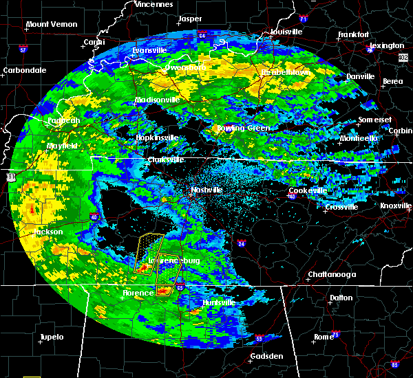 At 841 pm cdt, a severe thunderstorm was located just west of lawrenceburg, moving north at 45 mph (emergency management. at 838 pm...trees were reported down in loretto with this storm). Hazards include 60 mph wind gusts and penny size hail. expect damage to roofs, siding, and trees At 841 pm cdt, a severe thunderstorm was located just west of lawrenceburg, moving north at 45 mph (emergency management. at 838 pm...trees were reported down in loretto with this storm). Hazards include 60 mph wind gusts and penny size hail. expect damage to roofs, siding, and trees
|
| 3/14/2019 2:21 PM CDT |
 The severe thunderstorm warning for central lawrence county will expire at 230 pm cdt, the storm which prompted the warning has weakened below severe limits, and no longer poses an immediate threat to life or property. therefore, the warning will be allowed to expire. a tornado watch remains in effect until 700 pm cdt for middle tennessee. to report severe weather, contact your nearest law enforcement agency. they will relay your report to the national weather service nashville. The severe thunderstorm warning for central lawrence county will expire at 230 pm cdt, the storm which prompted the warning has weakened below severe limits, and no longer poses an immediate threat to life or property. therefore, the warning will be allowed to expire. a tornado watch remains in effect until 700 pm cdt for middle tennessee. to report severe weather, contact your nearest law enforcement agency. they will relay your report to the national weather service nashville.
|
| 3/14/2019 2:10 PM CDT |
 At 209 pm cdt, a severe thunderstorm was located 3 miles north of loretto, or 7 miles southwest of lawrenceburg, moving northeast at 40 mph (radar indicated). Hazards include 60 mph wind gusts. Expect damage to roofs, siding, and trees. Locations impacted include, lawrenceburg, ethridge and leoma. At 209 pm cdt, a severe thunderstorm was located 3 miles north of loretto, or 7 miles southwest of lawrenceburg, moving northeast at 40 mph (radar indicated). Hazards include 60 mph wind gusts. Expect damage to roofs, siding, and trees. Locations impacted include, lawrenceburg, ethridge and leoma.
|
| 3/14/2019 1:58 PM CDT |
 At 158 pm cdt, a severe thunderstorm was located near westpoint, or 16 miles southwest of lawrenceburg, moving northeast at 40 mph (radar indicated). Hazards include 60 mph wind gusts. Expect damage to roofs, siding, and trees. Locations impacted include, lawrenceburg, loretto, ethridge, leoma and westpoint. At 158 pm cdt, a severe thunderstorm was located near westpoint, or 16 miles southwest of lawrenceburg, moving northeast at 40 mph (radar indicated). Hazards include 60 mph wind gusts. Expect damage to roofs, siding, and trees. Locations impacted include, lawrenceburg, loretto, ethridge, leoma and westpoint.
|
| 3/14/2019 1:39 PM CDT |
 At 138 pm cdt, a severe thunderstorm was located near cypress inn, or 13 miles north of florence, moving northeast at 40 mph (radar indicated). Hazards include 60 mph wind gusts. expect damage to roofs, siding, and trees At 138 pm cdt, a severe thunderstorm was located near cypress inn, or 13 miles north of florence, moving northeast at 40 mph (radar indicated). Hazards include 60 mph wind gusts. expect damage to roofs, siding, and trees
|
| 12/31/2018 2:27 PM CST |
 At 226 pm cst, severe thunderstorms were located along a line extending from 6 miles south of fairview to 11 miles southeast of lawrenceburg, moving east at 45 mph (radar indicated). Hazards include 60 mph wind gusts. Expect damage to roofs, siding, and trees. Locations impacted include, franklin, columbia, lawrenceburg, pulaski, spring hill, mount pleasant, thompson`s station, loretto, minor hill, ethridge, lynnville, culleoka, i-65 east of columbia, santa fe, goodspring, leoma and leipers fork. At 226 pm cst, severe thunderstorms were located along a line extending from 6 miles south of fairview to 11 miles southeast of lawrenceburg, moving east at 45 mph (radar indicated). Hazards include 60 mph wind gusts. Expect damage to roofs, siding, and trees. Locations impacted include, franklin, columbia, lawrenceburg, pulaski, spring hill, mount pleasant, thompson`s station, loretto, minor hill, ethridge, lynnville, culleoka, i-65 east of columbia, santa fe, goodspring, leoma and leipers fork.
|
| 12/31/2018 2:06 PM CST |
 At 206 pm cst, severe thunderstorms were located along a line extending from 14 miles southwest of fairview to loretto, moving east at 45 mph (radar indicated). Hazards include 60 mph wind gusts. expect damage to roofs, siding, and trees At 206 pm cst, severe thunderstorms were located along a line extending from 14 miles southwest of fairview to loretto, moving east at 45 mph (radar indicated). Hazards include 60 mph wind gusts. expect damage to roofs, siding, and trees
|
| 11/5/2018 11:52 PM CST |
 At 1152 pm cst, a severe thunderstorm capable of producing a tornado was located near lawrenceburg, moving northeast at 45 mph (radar indicated rotation). Hazards include tornado. Flying debris will be dangerous to those caught without shelter. mobile homes will be damaged or destroyed. damage to roofs, windows, and vehicles will occur. tree damage is likely. this tornadic thunderstorm will remain over mainly rural areas of lawrence county, including the following locations, ethridge, st. Joseph, leoma, westpoint and iron city. At 1152 pm cst, a severe thunderstorm capable of producing a tornado was located near lawrenceburg, moving northeast at 45 mph (radar indicated rotation). Hazards include tornado. Flying debris will be dangerous to those caught without shelter. mobile homes will be damaged or destroyed. damage to roofs, windows, and vehicles will occur. tree damage is likely. this tornadic thunderstorm will remain over mainly rural areas of lawrence county, including the following locations, ethridge, st. Joseph, leoma, westpoint and iron city.
|
| 11/5/2018 11:38 PM CST |
 At 1138 pm cst, a severe thunderstorm capable of producing a tornado was located near loretto, or 17 miles southwest of lawrenceburg, moving northeast at 40 mph (radar indicated rotation). Hazards include tornado. Flying debris will be dangerous to those caught without shelter. mobile homes will be damaged or destroyed. damage to roofs, windows, and vehicles will occur. tree damage is likely. this dangerous storm will be near, loretto around 1150 pm cst. other locations impacted by this tornadic thunderstorm include ethridge, st. Joseph, leoma, westpoint and iron city. At 1138 pm cst, a severe thunderstorm capable of producing a tornado was located near loretto, or 17 miles southwest of lawrenceburg, moving northeast at 40 mph (radar indicated rotation). Hazards include tornado. Flying debris will be dangerous to those caught without shelter. mobile homes will be damaged or destroyed. damage to roofs, windows, and vehicles will occur. tree damage is likely. this dangerous storm will be near, loretto around 1150 pm cst. other locations impacted by this tornadic thunderstorm include ethridge, st. Joseph, leoma, westpoint and iron city.
|
| 11/5/2018 11:18 PM CST |
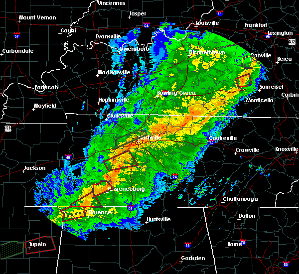 At 1118 pm cst, a severe thunderstorm capable of producing a tornado was located near lawrenceburg, moving east at 45 mph (radar indicated rotation). Hazards include tornado. Flying debris will be dangerous to those caught without shelter. mobile homes will be damaged or destroyed. damage to roofs, windows, and vehicles will occur. tree damage is likely. this dangerous storm will be near, summertown around 1125 pm cst. Other locations impacted by this tornadic thunderstorm include ethridge and henryville. At 1118 pm cst, a severe thunderstorm capable of producing a tornado was located near lawrenceburg, moving east at 45 mph (radar indicated rotation). Hazards include tornado. Flying debris will be dangerous to those caught without shelter. mobile homes will be damaged or destroyed. damage to roofs, windows, and vehicles will occur. tree damage is likely. this dangerous storm will be near, summertown around 1125 pm cst. Other locations impacted by this tornadic thunderstorm include ethridge and henryville.
|
| 11/5/2018 11:10 PM CST |
 At 1110 pm cst, a severe thunderstorm capable of producing a tornado was located 9 miles northwest of lawrenceburg, moving northeast at 35 mph (radar indicated rotation). Hazards include tornado. Flying debris will be dangerous to those caught without shelter. mobile homes will be damaged or destroyed. damage to roofs, windows, and vehicles will occur. tree damage is likely. this dangerous storm will be near, lawrenceburg around 1125 pm cst. summertown around 1130 pm cst. Other locations impacted by this tornadic thunderstorm include ethridge and henryville. At 1110 pm cst, a severe thunderstorm capable of producing a tornado was located 9 miles northwest of lawrenceburg, moving northeast at 35 mph (radar indicated rotation). Hazards include tornado. Flying debris will be dangerous to those caught without shelter. mobile homes will be damaged or destroyed. damage to roofs, windows, and vehicles will occur. tree damage is likely. this dangerous storm will be near, lawrenceburg around 1125 pm cst. summertown around 1130 pm cst. Other locations impacted by this tornadic thunderstorm include ethridge and henryville.
|
| 11/5/2018 10:55 PM CST |
 At 1055 pm cst, a severe thunderstorm capable of producing a tornado was located near waynesboro, moving northeast at 40 mph (radar indicated rotation). Hazards include tornado. Flying debris will be dangerous to those caught without shelter. mobile homes will be damaged or destroyed. damage to roofs, windows, and vehicles will occur. tree damage is likely. this dangerous storm will be near, summertown around 1130 pm cst. Other locations impacted by this tornadic thunderstorm include ethridge and henryville. At 1055 pm cst, a severe thunderstorm capable of producing a tornado was located near waynesboro, moving northeast at 40 mph (radar indicated rotation). Hazards include tornado. Flying debris will be dangerous to those caught without shelter. mobile homes will be damaged or destroyed. damage to roofs, windows, and vehicles will occur. tree damage is likely. this dangerous storm will be near, summertown around 1130 pm cst. Other locations impacted by this tornadic thunderstorm include ethridge and henryville.
|
| 9/22/2018 6:10 PM CDT |
 At 609 pm cdt, a severe thunderstorm was located 7 miles southwest of summertown, or 10 miles northwest of lawrenceburg, moving northeast at 35 mph (radar indicated). Hazards include 60 mph wind gusts and penny size hail. expect damage to roofs, siding, and trees At 609 pm cdt, a severe thunderstorm was located 7 miles southwest of summertown, or 10 miles northwest of lawrenceburg, moving northeast at 35 mph (radar indicated). Hazards include 60 mph wind gusts and penny size hail. expect damage to roofs, siding, and trees
|
| 9/13/2018 1:48 PM CDT | A few 7 inch pine trees are down on kelso road near granddaddy. time estimated via rada in lawrence county TN, 7.2 miles ESE of Lawrenceburg, TN |
| 7/5/2018 4:40 PM CDT |
 At 439 pm cdt, a severe thunderstorm was located near loretto, or 12 miles southwest of lawrenceburg, moving west at 35 mph (emergency management. at 431 pm cdt, trees were reportedly knocked down in lawrenceburg and the roof was blown off a shed in eastern lawrence county with this storm). Hazards include 60 mph wind gusts. Expect damage to roofs, siding, and trees. locations impacted include, lawrenceburg, loretto, collinwood, st. Joseph, leoma, westpoint, iron city and cypress inn. At 439 pm cdt, a severe thunderstorm was located near loretto, or 12 miles southwest of lawrenceburg, moving west at 35 mph (emergency management. at 431 pm cdt, trees were reportedly knocked down in lawrenceburg and the roof was blown off a shed in eastern lawrence county with this storm). Hazards include 60 mph wind gusts. Expect damage to roofs, siding, and trees. locations impacted include, lawrenceburg, loretto, collinwood, st. Joseph, leoma, westpoint, iron city and cypress inn.
|
| 7/5/2018 4:34 PM CDT | Report of tree down blocking skyline drive in lawrencebur in lawrence county TN, 0.8 miles ENE of Lawrenceburg, TN |
| 7/5/2018 4:34 PM CDT | Reports of trees blocking leoma road near leoma and skyline drive in lawrencebur in lawrence county TN, 0.5 miles SSE of Lawrenceburg, TN |
| 7/5/2018 4:34 PM CDT | Report of a tree blocking durham roa in lawrence county TN, 6.1 miles W of Lawrenceburg, TN |
| 7/5/2018 4:30 PM CDT | Report of tree down blocking the roadway at 116 dunn leoma road in lawrence county TN, 3.6 miles N of Lawrenceburg, TN |
| 7/5/2018 4:27 PM CDT |
 At 426 pm cdt, a severe thunderstorm was located near leoma, or 7 miles south of lawrenceburg, moving west at 35 mph (radar indicated. this storm has a history of blowing down trees in giles county). Hazards include 60 mph wind gusts. expect damage to roofs, siding, and trees At 426 pm cdt, a severe thunderstorm was located near leoma, or 7 miles south of lawrenceburg, moving west at 35 mph (radar indicated. this storm has a history of blowing down trees in giles county). Hazards include 60 mph wind gusts. expect damage to roofs, siding, and trees
|
| 7/5/2018 4:20 PM CDT | Report of a tree down blocking durham roa in lawrence county TN, 5.2 miles NW of Lawrenceburg, TN |
| 7/5/2018 4:20 PM CDT | Reports of roof blow off shead at westside road in extreme eastern lawrence count in lawrence county TN, 6.2 miles WNW of Lawrenceburg, TN |
| 7/5/2018 4:20 PM CDT |
 At 420 pm cdt, a severe thunderstorm was located 7 miles south of lawrenceburg, moving west at 35 mph (emergency management. at 417 pm cdt, trees were reportedly blown down in pulaski with this storm). Hazards include 60 mph wind gusts. Expect damage to roofs, siding, and trees. Locations impacted include, lawrenceburg, loretto, ethridge and leoma. At 420 pm cdt, a severe thunderstorm was located 7 miles south of lawrenceburg, moving west at 35 mph (emergency management. at 417 pm cdt, trees were reportedly blown down in pulaski with this storm). Hazards include 60 mph wind gusts. Expect damage to roofs, siding, and trees. Locations impacted include, lawrenceburg, loretto, ethridge and leoma.
|
| 7/5/2018 4:15 PM CDT | Reports of a roof blown off shed at westside road in extreme eastern lawrence count in lawrence county TN, 6.2 miles WNW of Lawrenceburg, TN |
| 7/5/2018 4:10 PM CDT |
 At 410 pm cdt, a severe thunderstorm was located 7 miles west of pulaski, moving west at 25 mph (radar indicated). Hazards include 60 mph wind gusts. Expect damage to roofs, siding, and trees. Locations impacted include, lawrenceburg, pulaski, loretto, ethridge, goodspring and leoma. At 410 pm cdt, a severe thunderstorm was located 7 miles west of pulaski, moving west at 25 mph (radar indicated). Hazards include 60 mph wind gusts. Expect damage to roofs, siding, and trees. Locations impacted include, lawrenceburg, pulaski, loretto, ethridge, goodspring and leoma.
|
| 7/5/2018 3:55 PM CDT |
 At 355 pm cdt, a severe thunderstorm was located over pulaski, moving west at 30 mph (radar indicated). Hazards include 60 mph wind gusts. expect damage to roofs, siding, and trees At 355 pm cdt, a severe thunderstorm was located over pulaski, moving west at 30 mph (radar indicated). Hazards include 60 mph wind gusts. expect damage to roofs, siding, and trees
|
| 6/28/2018 2:00 PM CDT |
 At 159 pm cdt, severe thunderstorms were located along a line extending from near madison, alabama to near lawrenceburg, moving southeast at 40 mph (radar indicated). Hazards include 60 mph wind gusts and nickel size hail. Expect damage to roofs, siding, and trees. locations impacted include, lawrenceburg, pulaski, loretto, ardmore, st. joseph, elkton, minor hill, ethridge, goodspring, leoma, westpoint, frankewing and prospect. This includes interstate 65 between mile markers 1 and 21. At 159 pm cdt, severe thunderstorms were located along a line extending from near madison, alabama to near lawrenceburg, moving southeast at 40 mph (radar indicated). Hazards include 60 mph wind gusts and nickel size hail. Expect damage to roofs, siding, and trees. locations impacted include, lawrenceburg, pulaski, loretto, ardmore, st. joseph, elkton, minor hill, ethridge, goodspring, leoma, westpoint, frankewing and prospect. This includes interstate 65 between mile markers 1 and 21.
|
| 6/28/2018 1:40 PM CDT |
 At 139 pm cdt, severe thunderstorms were located along a line extending from fayetteville to ardmore to loretto, moving southeast at 55 mph (emergency management. at 140 pm cdt, numerous reports of trees and power lines down have been received across lawrence and giles counties with these storms). Hazards include 70 mph wind gusts and penny size hail. Expect considerable tree damage. damage is likely to mobile homes, roofs, and outbuildings. locations impacted include, lewisburg, lawrenceburg, pulaski, loretto, ardmore, cornersville, st. joseph, elkton, minor hill, ethridge, lynnville, belfast, goodspring, leoma, westpoint, frankewing and prospect. This includes interstate 65 between mile markers 1 and 33. At 139 pm cdt, severe thunderstorms were located along a line extending from fayetteville to ardmore to loretto, moving southeast at 55 mph (emergency management. at 140 pm cdt, numerous reports of trees and power lines down have been received across lawrence and giles counties with these storms). Hazards include 70 mph wind gusts and penny size hail. Expect considerable tree damage. damage is likely to mobile homes, roofs, and outbuildings. locations impacted include, lewisburg, lawrenceburg, pulaski, loretto, ardmore, cornersville, st. joseph, elkton, minor hill, ethridge, lynnville, belfast, goodspring, leoma, westpoint, frankewing and prospect. This includes interstate 65 between mile markers 1 and 33.
|
| 6/28/2018 1:33 PM CDT |
 At 132 pm cdt, severe thunderstorms were located along a line extending from near petersburg to ardmore to near loretto, moving southeast at 55 mph (emergency management. at 125 pm cdt, numerous trees and pwoer lines were reporteldy blown down across lawrence county with these storms). Hazards include 70 mph wind gusts and penny size hail. Expect considerable tree damage. damage is likely to mobile homes, roofs, and outbuildings. locations impacted include, lewisburg, lawrenceburg, pulaski, loretto, ardmore, cornersville, st. joseph, elkton, minor hill, ethridge, lynnville, belfast, goodspring, leoma, westpoint, frankewing and prospect. This includes interstate 65 between mile markers 1 and 33. At 132 pm cdt, severe thunderstorms were located along a line extending from near petersburg to ardmore to near loretto, moving southeast at 55 mph (emergency management. at 125 pm cdt, numerous trees and pwoer lines were reporteldy blown down across lawrence county with these storms). Hazards include 70 mph wind gusts and penny size hail. Expect considerable tree damage. damage is likely to mobile homes, roofs, and outbuildings. locations impacted include, lewisburg, lawrenceburg, pulaski, loretto, ardmore, cornersville, st. joseph, elkton, minor hill, ethridge, lynnville, belfast, goodspring, leoma, westpoint, frankewing and prospect. This includes interstate 65 between mile markers 1 and 33.
|
| 6/28/2018 1:24 PM CDT |
 At 123 pm cdt, severe thunderstorms were located along a line extending from near lewisburg to pulaski to lawrenceburg, moving southeast at 55 mph (emergency management. at 120 pm, numerous trees and power lines were blown down across lawrence county with these storms). Hazards include 70 mph wind gusts. Expect considerable tree damage. damage is likely to mobile homes, roofs, and outbuildings. locations impacted include, columbia, lewisburg, lawrenceburg, pulaski, hohenwald, spring hill, mount pleasant, loretto, summertown, ardmore, cornersville, st. joseph, elkton, minor hill, ethridge, lynnville, gordonsburg, henryville, culleoka and belfast. This includes interstate 65 between mile markers 1 and 48. At 123 pm cdt, severe thunderstorms were located along a line extending from near lewisburg to pulaski to lawrenceburg, moving southeast at 55 mph (emergency management. at 120 pm, numerous trees and power lines were blown down across lawrence county with these storms). Hazards include 70 mph wind gusts. Expect considerable tree damage. damage is likely to mobile homes, roofs, and outbuildings. locations impacted include, columbia, lewisburg, lawrenceburg, pulaski, hohenwald, spring hill, mount pleasant, loretto, summertown, ardmore, cornersville, st. joseph, elkton, minor hill, ethridge, lynnville, gordonsburg, henryville, culleoka and belfast. This includes interstate 65 between mile markers 1 and 48.
|
| 6/28/2018 1:19 PM CDT | New prospect fire reported several trees down from lawrenceburg east to the county lin in lawrence county TN, 4.1 miles WNW of Lawrenceburg, TN |
| 6/28/2018 1:09 PM CDT |
 At 107 pm cdt, severe thunderstorms were located along a line extending from culleoka to near ethridge, moving southeast at 50 mph (emergency management. at 105 pm cdt, numerous trees were blown down with these storms across hickman and maury counties). Hazards include 70 mph wind gusts. Expect considerable tree damage. Damage is likely to mobile homes, roofs, and outbuildings. At 107 pm cdt, severe thunderstorms were located along a line extending from culleoka to near ethridge, moving southeast at 50 mph (emergency management. at 105 pm cdt, numerous trees were blown down with these storms across hickman and maury counties). Hazards include 70 mph wind gusts. Expect considerable tree damage. Damage is likely to mobile homes, roofs, and outbuildings.
|
| 6/23/2018 11:10 AM CDT |
 At 1110 am cdt, a severe thunderstorm was located near lawrenceburg, moving east at 50 mph (radar indicated). Hazards include 60 mph wind gusts and penny size hail. expect damage to roofs, siding, and trees At 1110 am cdt, a severe thunderstorm was located near lawrenceburg, moving east at 50 mph (radar indicated). Hazards include 60 mph wind gusts and penny size hail. expect damage to roofs, siding, and trees
|
| 6/23/2018 11:04 AM CDT |
 At 1104 am cdt, a severe thunderstorm was located over lawrenceburg, moving east at 50 mph (radar indicated). Hazards include 60 mph wind gusts and penny size hail. Expect damage to roofs, siding, and trees. locations impacted include, lawrenceburg, loretto, summertown, st. Joseph, ethridge, henryville, leoma, westpoint and iron city. At 1104 am cdt, a severe thunderstorm was located over lawrenceburg, moving east at 50 mph (radar indicated). Hazards include 60 mph wind gusts and penny size hail. Expect damage to roofs, siding, and trees. locations impacted include, lawrenceburg, loretto, summertown, st. Joseph, ethridge, henryville, leoma, westpoint and iron city.
|
| 6/23/2018 10:27 AM CDT |
 At 1027 am cdt, a severe thunderstorm was located 7 miles west of collinwood, or 13 miles southwest of waynesboro, moving east at 50 mph (radar indicated). Hazards include 60 mph wind gusts and penny size hail. expect damage to roofs, siding, and trees At 1027 am cdt, a severe thunderstorm was located 7 miles west of collinwood, or 13 miles southwest of waynesboro, moving east at 50 mph (radar indicated). Hazards include 60 mph wind gusts and penny size hail. expect damage to roofs, siding, and trees
|
| 6/22/2018 12:46 PM CDT | 40-50 trees down along shoal creek road west of the community of leoma. 4 homes damaged from these tree in lawrence county TN, 3.6 miles N of Lawrenceburg, TN |
| 5/30/2018 5:12 PM CDT | Received reports of several trees down on power lines in david crockett state park... and trees down in the city. time estimated from rada in lawrence county TN, 1.8 miles SE of Lawrenceburg, TN |
| 2/25/2018 12:10 AM CST |
 At 1209 am cst, a severe thunderstorm was located near loretto, or 13 miles south of lawrenceburg, moving east at 35 mph (radar indicated). Hazards include 60 mph wind gusts. Expect damage to roofs, siding, and trees. locations impacted include, loretto, st. Joseph and leoma. At 1209 am cst, a severe thunderstorm was located near loretto, or 13 miles south of lawrenceburg, moving east at 35 mph (radar indicated). Hazards include 60 mph wind gusts. Expect damage to roofs, siding, and trees. locations impacted include, loretto, st. Joseph and leoma.
|
| 2/24/2018 11:52 PM CST |
 At 1152 pm cst, a severe thunderstorm was located 7 miles southwest of loretto, or 17 miles northeast of florence, moving east at 35 mph (radar indicated). Hazards include 60 mph wind gusts. expect damage to roofs, siding, and trees At 1152 pm cst, a severe thunderstorm was located 7 miles southwest of loretto, or 17 miles northeast of florence, moving east at 35 mph (radar indicated). Hazards include 60 mph wind gusts. expect damage to roofs, siding, and trees
|
| 2/24/2018 11:42 PM CST |
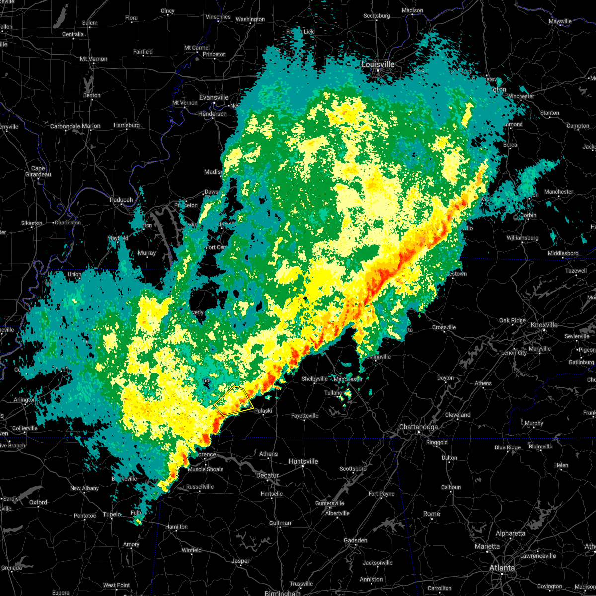 At 1129 pm cst, a severe thunderstorm was located 7 miles west of lawrenceburg, moving northeast at 40 mph (radar indicated). Hazards include 60 mph wind gusts. Expect damage to roofs, siding, and trees. locations impacted include, lawrenceburg, summertown, ethridge and henryville. A tornado watch remains in effect until 200 am cst for middle tennessee. At 1129 pm cst, a severe thunderstorm was located 7 miles west of lawrenceburg, moving northeast at 40 mph (radar indicated). Hazards include 60 mph wind gusts. Expect damage to roofs, siding, and trees. locations impacted include, lawrenceburg, summertown, ethridge and henryville. A tornado watch remains in effect until 200 am cst for middle tennessee.
|
| 2/24/2018 11:29 PM CST |
 At 1129 pm cst, a severe thunderstorm was located 7 miles west of lawrenceburg, moving northeast at 40 mph (radar indicated). Hazards include 60 mph wind gusts. Expect damage to roofs, siding, and trees. locations impacted include, lawrenceburg, summertown, ethridge and henryville. A tornado watch remains in effect until 200 am cst for middle tennessee. At 1129 pm cst, a severe thunderstorm was located 7 miles west of lawrenceburg, moving northeast at 40 mph (radar indicated). Hazards include 60 mph wind gusts. Expect damage to roofs, siding, and trees. locations impacted include, lawrenceburg, summertown, ethridge and henryville. A tornado watch remains in effect until 200 am cst for middle tennessee.
|
| 2/24/2018 11:21 PM CST |
 At 1120 pm cst, a severe thunderstorm was located 10 miles east of collinwood, or 12 miles west of lawrenceburg, moving northeast at 40 mph (radar indicated). Hazards include 60 mph wind gusts. expect damage to roofs, siding, and trees At 1120 pm cst, a severe thunderstorm was located 10 miles east of collinwood, or 12 miles west of lawrenceburg, moving northeast at 40 mph (radar indicated). Hazards include 60 mph wind gusts. expect damage to roofs, siding, and trees
|
| 8/31/2017 4:24 PM CDT |
 At 424 pm cdt, a severe thunderstorm capable of producing a tornado was located 8 miles west of lawrenceburg, moving northwest at 20 mph (radar indicated rotation). Hazards include tornado. Flying debris will be dangerous to those caught without shelter. mobile homes will be damaged or destroyed. damage to roofs, windows, and vehicles will occur. tree damage is likely. This tornadic thunderstorm will remain over mainly rural areas of east central wayne and northwestern lawrence counties. At 424 pm cdt, a severe thunderstorm capable of producing a tornado was located 8 miles west of lawrenceburg, moving northwest at 20 mph (radar indicated rotation). Hazards include tornado. Flying debris will be dangerous to those caught without shelter. mobile homes will be damaged or destroyed. damage to roofs, windows, and vehicles will occur. tree damage is likely. This tornadic thunderstorm will remain over mainly rural areas of east central wayne and northwestern lawrence counties.
|
| 7/3/2017 1:51 PM CDT |
 At 151 pm cdt, a severe thunderstorm was located 7 miles east of lawrenceburg, moving east at 15 mph (trained weather spotters). Hazards include 60 mph wind gusts. Expect damage to roofs, siding, and trees. Locations impacted include, pulaski, ethridge and goodspring. At 151 pm cdt, a severe thunderstorm was located 7 miles east of lawrenceburg, moving east at 15 mph (trained weather spotters). Hazards include 60 mph wind gusts. Expect damage to roofs, siding, and trees. Locations impacted include, pulaski, ethridge and goodspring.
|
| 7/3/2017 1:32 PM CDT |
 At 132 pm cdt, a severe thunderstorm was located near lawrenceburg, moving east at 30 mph (emergency management. this storm has already produced some structural damage in lawrenceburg). Hazards include 60 mph wind gusts. expect damage to roofs, siding, and trees At 132 pm cdt, a severe thunderstorm was located near lawrenceburg, moving east at 30 mph (emergency management. this storm has already produced some structural damage in lawrenceburg). Hazards include 60 mph wind gusts. expect damage to roofs, siding, and trees
|
| 7/3/2017 12:40 PM CDT | Roof blown off a building on may street. power pole snapped on massey avenu in lawrence county TN, 0.5 miles SSE of Lawrenceburg, TN |
| 5/27/2017 9:35 PM CDT | A tree fell on a powerline on 1st stree in lawrence county TN, 0.5 miles SSE of Lawrenceburg, TN |
| 5/27/2017 9:30 PM CDT | Power lines downed near rotary park. a power line was downed resulting in a fire starting in a tree at admiral circl in lawrence county TN, 0.5 miles SSE of Lawrenceburg, TN |
| 4/30/2017 1:51 PM CDT | 2 feet diameter oak tree snapped just south of hwy 43 and hwy 64 intersection in lawrence county TN, 2.9 miles N of Lawrenceburg, TN |
| 4/30/2017 1:47 PM CDT |
 At 145 pm cdt, a severe thunderstorm was located over lawrenceburg, moving northeast at 40 mph (radar indicated). Hazards include 60 mph wind gusts. Expect damage to roofs, siding, and trees. locations impacted include, lawrenceburg, loretto, st. Joseph, ethridge and leoma. At 145 pm cdt, a severe thunderstorm was located over lawrenceburg, moving northeast at 40 mph (radar indicated). Hazards include 60 mph wind gusts. Expect damage to roofs, siding, and trees. locations impacted include, lawrenceburg, loretto, st. Joseph, ethridge and leoma.
|
| 4/30/2017 1:29 PM CDT |
 At 129 pm cdt, a severe thunderstorm was located near underwood-petersville, or 11 miles north of florence, moving northeast at 40 mph (radar indicated). Hazards include 60 mph wind gusts. expect damage to roofs, siding, and trees At 129 pm cdt, a severe thunderstorm was located near underwood-petersville, or 11 miles north of florence, moving northeast at 40 mph (radar indicated). Hazards include 60 mph wind gusts. expect damage to roofs, siding, and trees
|
| 4/22/2017 3:52 PM CDT |
 At 352 pm cdt, a severe thunderstorm capable of producing a tornado was located 10 miles east of loretto, or 11 miles southeast of lawrenceburg, moving east at 40 mph (radar indicated rotation). Hazards include tornado and quarter size hail. Flying debris will be dangerous to those caught without shelter. mobile homes will be damaged or destroyed. damage to roofs, windows, and vehicles will occur. tree damage is likely. This tornadic thunderstorm will remain over mainly rural areas of southeastern lawrence and southern giles counties, including the following locations: goodspring, prospect, leoma, minor hill and elkton. At 352 pm cdt, a severe thunderstorm capable of producing a tornado was located 10 miles east of loretto, or 11 miles southeast of lawrenceburg, moving east at 40 mph (radar indicated rotation). Hazards include tornado and quarter size hail. Flying debris will be dangerous to those caught without shelter. mobile homes will be damaged or destroyed. damage to roofs, windows, and vehicles will occur. tree damage is likely. This tornadic thunderstorm will remain over mainly rural areas of southeastern lawrence and southern giles counties, including the following locations: goodspring, prospect, leoma, minor hill and elkton.
|
| 4/22/2017 3:45 PM CDT | 18-inch diameter trees down at revilo road and fall river road in lawrence county TN, 6.3 miles NW of Lawrenceburg, TN |
| 4/22/2017 3:40 PM CDT |
 At 339 pm cdt, a severe thunderstorm was located over lawrenceburg, moving east at 40 mph (radar indicated). Hazards include 60 mph wind gusts and quarter size hail. Hail damage to vehicles is expected. Expect wind damage to roofs, siding, and trees. At 339 pm cdt, a severe thunderstorm was located over lawrenceburg, moving east at 40 mph (radar indicated). Hazards include 60 mph wind gusts and quarter size hail. Hail damage to vehicles is expected. Expect wind damage to roofs, siding, and trees.
|
| 4/22/2017 3:21 PM CDT |
 At 321 pm cdt, a severe thunderstorm capable of producing a tornado was located 10 miles east of waynesboro, moving east at 40 mph (radar indicated rotation). Hazards include tornado and quarter size hail. Flying debris will be dangerous to those caught without shelter. mobile homes will be damaged or destroyed. damage to roofs, windows, and vehicles will occur. tree damage is likely. this dangerous storm will be near, lawrenceburg around 345 pm cdt. Other locations impacted by this tornadic thunderstorm include leoma, westpoint and henryville. At 321 pm cdt, a severe thunderstorm capable of producing a tornado was located 10 miles east of waynesboro, moving east at 40 mph (radar indicated rotation). Hazards include tornado and quarter size hail. Flying debris will be dangerous to those caught without shelter. mobile homes will be damaged or destroyed. damage to roofs, windows, and vehicles will occur. tree damage is likely. this dangerous storm will be near, lawrenceburg around 345 pm cdt. Other locations impacted by this tornadic thunderstorm include leoma, westpoint and henryville.
|
| 3/27/2017 8:31 PM CDT |
 At 831 pm cdt, a severe thunderstorm was located 8 miles southeast of pulaski, moving east at 45 mph (radar indicated). Hazards include 60 mph wind gusts and nickel size hail. Expect damage to roofs, siding, and trees. locations impacted include, lawrenceburg, pulaski, loretto, ardmore, st. Joseph, elkton, minor hill, goodspring, leoma, westpoint, frankewing, prospect and iron city. At 831 pm cdt, a severe thunderstorm was located 8 miles southeast of pulaski, moving east at 45 mph (radar indicated). Hazards include 60 mph wind gusts and nickel size hail. Expect damage to roofs, siding, and trees. locations impacted include, lawrenceburg, pulaski, loretto, ardmore, st. Joseph, elkton, minor hill, goodspring, leoma, westpoint, frankewing, prospect and iron city.
|
| 3/27/2017 7:58 PM CDT |
 At 756 pm cdt, a severe thunderstorm was located near loretto, or 7 miles south of lawrenceburg, moving east at 45 mph (radar indicated). Hazards include 60 mph wind gusts and quarter size hail. Hail damage to vehicles is expected. Expect wind damage to roofs, siding, and trees. At 756 pm cdt, a severe thunderstorm was located near loretto, or 7 miles south of lawrenceburg, moving east at 45 mph (radar indicated). Hazards include 60 mph wind gusts and quarter size hail. Hail damage to vehicles is expected. Expect wind damage to roofs, siding, and trees.
|
| 3/27/2017 7:47 PM CDT |
 At 747 pm cdt, a severe thunderstorm was located near lawrenceburg, moving east at 35 mph (radar indicated). Hazards include 60 mph wind gusts and nickel size hail. Expect damage to roofs, siding, and trees. locations impacted include, lawrenceburg, loretto, collinwood, st. Joseph, leoma, westpoint and lutts. At 747 pm cdt, a severe thunderstorm was located near lawrenceburg, moving east at 35 mph (radar indicated). Hazards include 60 mph wind gusts and nickel size hail. Expect damage to roofs, siding, and trees. locations impacted include, lawrenceburg, loretto, collinwood, st. Joseph, leoma, westpoint and lutts.
|
| 3/27/2017 7:22 PM CDT |
 At 722 pm cdt, a severe thunderstorm was located near collinwood, or near waynesboro, moving east at 35 mph (radar indicated). Hazards include 60 mph wind gusts and quarter size hail. Hail damage to vehicles is expected. Expect wind damage to roofs, siding, and trees. At 722 pm cdt, a severe thunderstorm was located near collinwood, or near waynesboro, moving east at 35 mph (radar indicated). Hazards include 60 mph wind gusts and quarter size hail. Hail damage to vehicles is expected. Expect wind damage to roofs, siding, and trees.
|
| 3/21/2017 4:24 PM CDT |
 The severe thunderstorm warning for southeastern maury, northeastern lawrence and northern giles counties will expire at 430 pm cdt, the storm which prompted the warning has moved out of the area. therefore the warning will be allowed to expire. a severe thunderstorm watch remains in effect until 1000 pm cdt for middle tennessee. The severe thunderstorm warning for southeastern maury, northeastern lawrence and northern giles counties will expire at 430 pm cdt, the storm which prompted the warning has moved out of the area. therefore the warning will be allowed to expire. a severe thunderstorm watch remains in effect until 1000 pm cdt for middle tennessee.
|
| 3/21/2017 4:18 PM CDT | Quarter sized hail reported 3 miles E of Lawrenceburg, TN, numerous reports of quarter-size hail from 3 miles west of lawrenceburg to north of ethridge |
| 3/21/2017 4:18 PM CDT |
 At 418 pm cdt, a severe thunderstorm was located 10 miles west of lewisburg, moving east at 55 mph (radar indicated). Hazards include 60 mph wind gusts and half dollar size hail. Hail damage to vehicles is expected. expect wind damage to roofs, siding, and trees. Locations impacted include, lawrenceburg, pulaski, summertown, ethridge, lynnville and culleoka. At 418 pm cdt, a severe thunderstorm was located 10 miles west of lewisburg, moving east at 55 mph (radar indicated). Hazards include 60 mph wind gusts and half dollar size hail. Hail damage to vehicles is expected. expect wind damage to roofs, siding, and trees. Locations impacted include, lawrenceburg, pulaski, summertown, ethridge, lynnville and culleoka.
|
| 3/21/2017 4:17 PM CDT |
 At 416 pm cdt, a severe thunderstorm was located near lawrenceburg, moving east at 55 mph (radar indicated). Hazards include 60 mph wind gusts and half dollar size hail. Hail damage to vehicles is expected. expect wind damage to roofs, siding, and trees. Locations impacted include, lawrenceburg, pulaski, loretto, minor hill, ethridge, goodspring and leoma. At 416 pm cdt, a severe thunderstorm was located near lawrenceburg, moving east at 55 mph (radar indicated). Hazards include 60 mph wind gusts and half dollar size hail. Hail damage to vehicles is expected. expect wind damage to roofs, siding, and trees. Locations impacted include, lawrenceburg, pulaski, loretto, minor hill, ethridge, goodspring and leoma.
|
| 3/21/2017 4:03 PM CDT | 18 diameter tree down on mt. ariat rd. on north side of lawrenceburg in lawrence county TN, 0.5 miles SSE of Lawrenceburg, TN |
| 3/21/2017 3:58 PM CDT |
 At 358 pm cdt, a severe thunderstorm was located over waynesboro, moving east at 45 mph (radar indicated). Hazards include 60 mph wind gusts and half dollar size hail. Hail damage to vehicles is expected. Expect wind damage to roofs, siding, and trees. At 358 pm cdt, a severe thunderstorm was located over waynesboro, moving east at 45 mph (radar indicated). Hazards include 60 mph wind gusts and half dollar size hail. Hail damage to vehicles is expected. Expect wind damage to roofs, siding, and trees.
|
| 3/21/2017 3:53 PM CDT |
 At 352 pm cdt, a severe thunderstorm was located near summertown, or 11 miles southeast of hohenwald, moving east at 55 mph (radar indicated). Hazards include 60 mph wind gusts and half dollar size hail. Hail damage to vehicles is expected. Expect wind damage to roofs, siding, and trees. At 352 pm cdt, a severe thunderstorm was located near summertown, or 11 miles southeast of hohenwald, moving east at 55 mph (radar indicated). Hazards include 60 mph wind gusts and half dollar size hail. Hail damage to vehicles is expected. Expect wind damage to roofs, siding, and trees.
|
| 3/21/2017 3:52 PM CDT | 12 to 16 inch diameter tree down blocking red hill center road 1 mile south of hwy 240 in lawrence county TN, 9.8 miles SE of Lawrenceburg, TN |
| 3/9/2017 11:36 PM CST | Em reported 60 mph wind gust in revilo .. multiple power outage in lawrence county TN, 4.8 miles NW of Lawrenceburg, TN |
| 3/9/2017 11:24 PM CST | Em reported a 70 mph wind gust at david crocket schoo in lawrence county TN, 2.7 miles ESE of Lawrenceburg, TN |
| 3/9/2017 11:23 PM CST |
 At 1123 pm cst, a severe thunderstorm was located near waynesboro, moving east at 55 mph (radar indicated). Hazards include 60 mph wind gusts. Expect damage to roofs, siding, and trees. Locations impacted include, lawrenceburg, waynesboro, collinwood, ethridge, leoma, lutts and westpoint. At 1123 pm cst, a severe thunderstorm was located near waynesboro, moving east at 55 mph (radar indicated). Hazards include 60 mph wind gusts. Expect damage to roofs, siding, and trees. Locations impacted include, lawrenceburg, waynesboro, collinwood, ethridge, leoma, lutts and westpoint.
|
| 3/9/2017 11:11 PM CST |
 At 1110 pm cst, a severe thunderstorm was located near olive hill, or 11 miles west of waynesboro, moving east at 55 mph (radar indicated). Hazards include 60 mph wind gusts. expect damage to roofs, siding, and trees At 1110 pm cst, a severe thunderstorm was located near olive hill, or 11 miles west of waynesboro, moving east at 55 mph (radar indicated). Hazards include 60 mph wind gusts. expect damage to roofs, siding, and trees
|
| 3/1/2017 11:48 AM CST |
 At 1148 am cst, severe thunderstorms were located along a line extending from near lewisburg to 9 miles northeast of pulaski to near loretto, moving northeast at 40 mph (radar indicated). Hazards include 60 mph wind gusts and quarter size hail. Hail damage to vehicles is expected. expect wind damage to roofs, siding, and trees. locations impacted include, lawrenceburg, pulaski, loretto, ardmore, cornersville, st. Joseph, elkton, minor hill, goodspring, leoma, frankewing and prospect. At 1148 am cst, severe thunderstorms were located along a line extending from near lewisburg to 9 miles northeast of pulaski to near loretto, moving northeast at 40 mph (radar indicated). Hazards include 60 mph wind gusts and quarter size hail. Hail damage to vehicles is expected. expect wind damage to roofs, siding, and trees. locations impacted include, lawrenceburg, pulaski, loretto, ardmore, cornersville, st. Joseph, elkton, minor hill, goodspring, leoma, frankewing and prospect.
|
| 3/1/2017 11:27 AM CST |
 At 1127 am cst, severe thunderstorms were located along a line extending from 13 miles west of lewisburg to 7 miles west of pulaski to 11 miles west of loretto, moving east at 65 mph (radar indicated). Hazards include 60 mph wind gusts and penny size hail. expect damage to roofs, siding, and trees At 1127 am cst, severe thunderstorms were located along a line extending from 13 miles west of lewisburg to 7 miles west of pulaski to 11 miles west of loretto, moving east at 65 mph (radar indicated). Hazards include 60 mph wind gusts and penny size hail. expect damage to roofs, siding, and trees
|
| 3/1/2017 10:57 AM CST |
 The severe thunderstorm warning for wayne and western lawrence counties will expire at 1100 am cst, the storm which prompted the warning has weakened below severe limits, and no longer poses an immediate threat to life or property. therefore the warning will be allowed to expire. however gusty winds are still possible with this thunderstorm. The severe thunderstorm warning for wayne and western lawrence counties will expire at 1100 am cst, the storm which prompted the warning has weakened below severe limits, and no longer poses an immediate threat to life or property. therefore the warning will be allowed to expire. however gusty winds are still possible with this thunderstorm.
|
| 3/1/2017 10:47 AM CST |
 At 1046 am cst, a severe thunderstorm was located 11 miles west of lawrenceburg, moving east at 50 mph (radar indicated). Hazards include 60 mph wind gusts. Expect damage to roofs, siding, and trees. locations impacted include, lawrenceburg, loretto, collinwood, st. Joseph, henryville, westpoint, iron city, cypress inn and lutts. At 1046 am cst, a severe thunderstorm was located 11 miles west of lawrenceburg, moving east at 50 mph (radar indicated). Hazards include 60 mph wind gusts. Expect damage to roofs, siding, and trees. locations impacted include, lawrenceburg, loretto, collinwood, st. Joseph, henryville, westpoint, iron city, cypress inn and lutts.
|
| 3/1/2017 10:34 AM CST |
 At 1033 am cst, a severe thunderstorm was located over collinwood, or 9 miles south of waynesboro, moving east at 65 mph (radar indicated). Hazards include 60 mph wind gusts. Expect damage to roofs, siding, and trees. locations impacted include, lawrenceburg, waynesboro, loretto, collinwood, st. Joseph, henryville, westpoint, iron city, cypress inn and lutts. At 1033 am cst, a severe thunderstorm was located over collinwood, or 9 miles south of waynesboro, moving east at 65 mph (radar indicated). Hazards include 60 mph wind gusts. Expect damage to roofs, siding, and trees. locations impacted include, lawrenceburg, waynesboro, loretto, collinwood, st. Joseph, henryville, westpoint, iron city, cypress inn and lutts.
|
| 3/1/2017 10:18 AM CST |
 At 1017 am cst, a severe thunderstorm was located near olive hill, or 9 miles east of savannah, moving east at 65 mph (radar indicated). Hazards include 60 mph wind gusts and penny size hail. expect damage to roofs, siding, and trees At 1017 am cst, a severe thunderstorm was located near olive hill, or 9 miles east of savannah, moving east at 65 mph (radar indicated). Hazards include 60 mph wind gusts and penny size hail. expect damage to roofs, siding, and trees
|
| 12/28/2016 5:57 PM CST |
 The severe thunderstorm warning for southern lawrence county will expire at 600 pm cst, the severe thunderstorm which prompted the warning has weakened, therefore the warning will be allowed to expire. The severe thunderstorm warning for southern lawrence county will expire at 600 pm cst, the severe thunderstorm which prompted the warning has weakened, therefore the warning will be allowed to expire.
|
| 12/28/2016 5:41 PM CST |
 At 541 pm cst, a severe thunderstorm was located near loretto, or 16 miles southwest of lawrenceburg, moving east at 55 mph (radar indicated). Hazards include 60 mph wind gusts and quarter size hail. Hail damage to vehicles is expected. expect wind damage to roofs, siding, and trees. locations impacted include, lawrenceburg, loretto, st. Joseph, leoma and iron city. At 541 pm cst, a severe thunderstorm was located near loretto, or 16 miles southwest of lawrenceburg, moving east at 55 mph (radar indicated). Hazards include 60 mph wind gusts and quarter size hail. Hail damage to vehicles is expected. expect wind damage to roofs, siding, and trees. locations impacted include, lawrenceburg, loretto, st. Joseph, leoma and iron city.
|
| 12/28/2016 5:30 PM CST |
 At 530 pm cst, a severe thunderstorm was located 9 miles west of loretto, or 17 miles north of florence, moving east at 55 mph (radar indicated). Hazards include 60 mph wind gusts and quarter size hail. Hail damage to vehicles is expected. Expect wind damage to roofs, siding, and trees. At 530 pm cst, a severe thunderstorm was located 9 miles west of loretto, or 17 miles north of florence, moving east at 55 mph (radar indicated). Hazards include 60 mph wind gusts and quarter size hail. Hail damage to vehicles is expected. Expect wind damage to roofs, siding, and trees.
|
| 12/18/2016 12:32 AM CST |
 At 1231 am cst, a severe thunderstorm was located 13 miles west of lewisburg, moving northeast at 60 mph (radar indicated). Hazards include 60 mph wind gusts. Expect damage to roofs, siding, and trees. locations impacted include, lawrenceburg, cornersville, ethridge, lynnville and culleoka. A tornado watch remains in effect until 300 am cst for middle tennessee. At 1231 am cst, a severe thunderstorm was located 13 miles west of lewisburg, moving northeast at 60 mph (radar indicated). Hazards include 60 mph wind gusts. Expect damage to roofs, siding, and trees. locations impacted include, lawrenceburg, cornersville, ethridge, lynnville and culleoka. A tornado watch remains in effect until 300 am cst for middle tennessee.
|
| 12/18/2016 12:20 AM CST |
 At 1219 am cst, a severe thunderstorm was located near loretto, or 9 miles south of lawrenceburg, moving east at 60 mph (radar indicated). Hazards include 60 mph wind gusts. Expect damage to roofs, siding, and trees. locations impacted include, loretto, st. joseph and leoma. A tornado watch remains in effect until 300 am cst for middle tennessee. At 1219 am cst, a severe thunderstorm was located near loretto, or 9 miles south of lawrenceburg, moving east at 60 mph (radar indicated). Hazards include 60 mph wind gusts. Expect damage to roofs, siding, and trees. locations impacted include, loretto, st. joseph and leoma. A tornado watch remains in effect until 300 am cst for middle tennessee.
|
| 12/18/2016 12:18 AM CST | Six inch diameter limbs down on long branch roa in lawrence county TN, 7.9 miles NE of Lawrenceburg, TN |
| 12/18/2016 12:16 AM CST |
 At 1216 am cst, a severe thunderstorm was located near lawrenceburg, moving northeast at 60 mph (radar indicated). Hazards include 60 mph wind gusts. expect damage to roofs, siding, and trees At 1216 am cst, a severe thunderstorm was located near lawrenceburg, moving northeast at 60 mph (radar indicated). Hazards include 60 mph wind gusts. expect damage to roofs, siding, and trees
|
| 12/18/2016 12:10 AM CST | Powerlines down on grandaddy roa in lawrence county TN, 4.8 miles ESE of Lawrenceburg, TN |
| 12/18/2016 12:03 AM CST |
 At 1202 am cst, a severe thunderstorm was located 8 miles north of underwood-petersville, or 13 miles north of florence, moving east at 55 mph (radar indicated). Hazards include 60 mph wind gusts. expect damage to roofs, siding, and trees At 1202 am cst, a severe thunderstorm was located 8 miles north of underwood-petersville, or 13 miles north of florence, moving east at 55 mph (radar indicated). Hazards include 60 mph wind gusts. expect damage to roofs, siding, and trees
|
| 6/15/2016 5:44 PM CDT |
 At 543 pm cdt, a severe thunderstorm was located near loretto, or 14 miles southwest of lawrenceburg, moving east at 25 mph (radar indicated). Hazards include 60 mph wind gusts. Expect damage to roofs. siding. and trees. locations impacted include, lawrenceburg, loretto, st. Joseph, westpoint and leoma. At 543 pm cdt, a severe thunderstorm was located near loretto, or 14 miles southwest of lawrenceburg, moving east at 25 mph (radar indicated). Hazards include 60 mph wind gusts. Expect damage to roofs. siding. and trees. locations impacted include, lawrenceburg, loretto, st. Joseph, westpoint and leoma.
|
| 6/15/2016 5:36 PM CDT |
 At 535 pm cdt, severe thunderstorms were located along a line extending from 10 miles west of petersburg to 10 miles southeast of lawrenceburg, moving south at 40 mph (radar indicated). Hazards include 60 mph wind gusts. Expect damage to roofs. siding. And trees. At 535 pm cdt, severe thunderstorms were located along a line extending from 10 miles west of petersburg to 10 miles southeast of lawrenceburg, moving south at 40 mph (radar indicated). Hazards include 60 mph wind gusts. Expect damage to roofs. siding. And trees.
|
| 6/15/2016 5:23 PM CDT |
 At 523 pm cdt, a severe thunderstorm was located near collinwood, or 13 miles south of waynesboro, moving east at 25 mph (radar indicated). Hazards include 60 mph wind gusts and penny size hail. Expect damage to roofs. siding. And trees. At 523 pm cdt, a severe thunderstorm was located near collinwood, or 13 miles south of waynesboro, moving east at 25 mph (radar indicated). Hazards include 60 mph wind gusts and penny size hail. Expect damage to roofs. siding. And trees.
|
| 3/31/2016 7:42 PM CDT | Trees down across sc/se portions of county in lawrence county TN, 5 miles N of Lawrenceburg, TN |
| 3/31/2016 5:54 PM CDT | Trees down across southeastern portions of county in lawrence county TN, 5 miles N of Lawrenceburg, TN |
| 3/31/2016 5:44 PM CDT |
 At 544 pm cdt, a severe thunderstorm capable of producing a tornado was located near loretto, or 16 miles southwest of lawrenceburg, moving east at 45 mph (radar indicated rotation). Hazards include tornado and quarter size hail. Flying debris will be dangerous to those caught without shelter. mobile homes will be damaged or destroyed. damage to roofs, windows, and vehicles will occur. tree damage is likely. this tornadic thunderstorm will remain over mainly rural areas of southern giles and southern lawrence counties, including the following locations: minor hill, leoma, goodspring, westpoint, prospect, st. Joseph and elkton. At 544 pm cdt, a severe thunderstorm capable of producing a tornado was located near loretto, or 16 miles southwest of lawrenceburg, moving east at 45 mph (radar indicated rotation). Hazards include tornado and quarter size hail. Flying debris will be dangerous to those caught without shelter. mobile homes will be damaged or destroyed. damage to roofs, windows, and vehicles will occur. tree damage is likely. this tornadic thunderstorm will remain over mainly rural areas of southern giles and southern lawrence counties, including the following locations: minor hill, leoma, goodspring, westpoint, prospect, st. Joseph and elkton.
|
| 3/31/2016 5:42 PM CDT |
 At 541 pm cdt, severe thunderstorms were located along a line extending from 6 miles northwest of lawrenceburg to 7 miles southwest of loretto, moving east at 50 mph (radar indicated). Hazards include 60 mph wind gusts and quarter size hail. Hail damage to vehicles is expected. expect wind damage to roofs, siding, and trees. locations impacted include, lawrenceburg, loretto, summertown, st. Joseph, ethridge, iron city, leoma, westpoint and henryville. At 541 pm cdt, severe thunderstorms were located along a line extending from 6 miles northwest of lawrenceburg to 7 miles southwest of loretto, moving east at 50 mph (radar indicated). Hazards include 60 mph wind gusts and quarter size hail. Hail damage to vehicles is expected. expect wind damage to roofs, siding, and trees. locations impacted include, lawrenceburg, loretto, summertown, st. Joseph, ethridge, iron city, leoma, westpoint and henryville.
|
| 3/31/2016 5:14 PM CDT |
 At 514 pm cdt, a severe thunderstorm was located near collinwood, or 8 miles southeast of waynesboro, moving northeast at 55 mph (radar indicated). Hazards include 60 mph wind gusts and quarter size hail. Hail damage to vehicles is expected. Expect wind damage to roofs, siding, and trees. At 514 pm cdt, a severe thunderstorm was located near collinwood, or 8 miles southeast of waynesboro, moving northeast at 55 mph (radar indicated). Hazards include 60 mph wind gusts and quarter size hail. Hail damage to vehicles is expected. Expect wind damage to roofs, siding, and trees.
|
| 12/23/2015 7:58 PM CST | At 757 pm cst, a severe thunderstorm capable of producing a tornado was located near summertown, or 9 miles north of lawrenceburg, moving northeast at 60 mph (radar indicated rotation). Hazards include tornado. Flying debris will be dangerous to those caught without shelter. mobile homes will be damaged or destroyed. damage to roofs, windows and vehicles will occur. tree damage is likely. this dangerous storm will be near, mount pleasant around 815 pm cst. columbia around 825 pm cst. other locations impacted by this tornadic thunderstorm include ethridge, henryville and culleoka. This storm has a history of producing a tornado so take cover!. |
| 12/23/2015 7:52 PM CST | Damage concentrated along a line from sr 241 towards a point 3 miles west of summertown. twenty plus structures damaged or destroye in lawrence county TN, 14 miles SSE of Lawrenceburg, TN |
| 12/23/2015 7:46 PM CST | Two houses destroyed near summertown. possible tor damage in lawrence county TN, 7.5 miles SE of Lawrenceburg, TN |
| 12/23/2015 7:44 PM CST | At 743 pm cst, a severe thunderstorm capable of producing a tornado was located 8 miles west of lawrenceburg, moving northeast at 55 mph (radar indicated rotation). Hazards include tornado and quarter size hail. Flying debris will be dangerous to those caught without shelter. mobile homes will be damaged or destroyed. damage to roofs, windows and vehicles will occur. tree damage is likely. this dangerous storm will be near, lawrenceburg around 755 pm cst. Other locations impacted by this tornadic thunderstorm include ethridge and henryville. |
| 12/23/2015 7:42 PM CST | Numerous trees down 2 feet in diameter on hwy 241 about 2 miles north of sr 240. possible tor damage in lawrence county TN, 10.2 miles SE of Lawrenceburg, TN |
| 12/23/2015 7:41 PM CST | Hwy 64 blocked at ovilla at lawrence wayne county line. guard rails pulled u in lawrence county TN, 14.2 miles ESE of Lawrenceburg, TN |
| 12/23/2015 7:33 PM CST | At 732 pm cst, a severe thunderstorm capable of producing a tornado was located near collinwood, or 11 miles southeast of waynesboro, moving northeast at 55 mph (radar indicated rotation). Hazards include tornado. Flying debris will be dangerous to those caught without shelter. mobile homes will be damaged or destroyed. damage to roofs, windows and vehicles will occur. tree damage is likely. this dangerous storm will be near, lawrenceburg around 755 pm cst. Other locations impacted by this tornadic thunderstorm include ethridge and henryville. |
| 12/23/2015 7:30 PM CST | Damage to home on napier rd. fire and rescue responding. possible tornad in lawrence county TN, 12.3 miles SE of Lawrenceburg, TN |
| 7/14/2015 5:33 PM CDT | Trees down on bealer road and dugout road. large tree limb down on winfall roa in lawrence county TN, 6.4 miles E of Lawrenceburg, TN |
| 4/3/2015 5:42 PM CST | Tree down on power line at us 43 and gale lane in lawrence county TN, 1.6 miles N of Lawrenceburg, TN |
| 10/13/2014 5:35 PM CDT | Trees down in lawrenceburg on guard drive and revelo roa in lawrence county TN, 0.5 miles SSE of Lawrenceburg, TN |
| 6/9/2014 9:08 PM CDT | Trees were downed just about three miles west of lawrenceburg near the intersection of u.s. highway 64 and state road 240 near the red hill community. just southeast of in lawrence county TN, 0.5 miles SSE of Lawrenceburg, TN |
| 6/7/2014 8:22 PM CDT | A tree was reported down in lawrencebur in lawrence county TN, 0.5 miles SSE of Lawrenceburg, TN |
| 6/5/2014 3:30 PM CDT | A tree was blown down in davy crockett park in lawrence county TN, 0.8 miles ENE of Lawrenceburg, TN |
| 6/5/2014 3:30 PM CDT | A tree was snapped in leoma in lawrence county TN, 5.7 miles N of Lawrenceburg, TN |
| 4/28/2014 5:07 PM CDT | Trees down on weakly creek road from straight line wind in lawrence county TN, 4.9 miles W of Lawrenceburg, TN |
| 12/21/2013 9:42 PM CST | Tree down on residence in downtown lawrenceburg along 5th stre in lawrence county TN, 0.5 miles SSE of Lawrenceburg, TN |
| 1/30/2013 3:49 AM CST | Structural damage to second floor of a brick building. relayed from nws huntsvill in lawrence county TN, 0.5 miles SSE of Lawrenceburg, TN |
| 1/30/2013 3:05 AM CST | Tree across hwy 43. building collapse in lawrenceburg in lawrence county TN, 0.5 miles SSE of Lawrenceburg, TN |
| 6/3/2012 9:56 PM CDT | Power lines down on rabbit trail road near leoma...possibly caused by falling tre in lawrence county TN, 5 miles N of Lawrenceburg, TN |
| 5/29/2012 7:35 PM CDT | A tree fell on a house on fair street in leoma in lawrence county TN, 3.6 miles N of Lawrenceburg, TN |
| 5/21/2012 8:30 PM CDT | Trees blown down along buffalo road and good hope road north of lawrenceburg in lawrence county TN, 4 miles S of Lawrenceburg, TN |
| 3/14/2012 4:30 PM CDT | Quarter sized hail reported 3.6 miles N of Lawrenceburg, TN, hail reported in leoma |
| 1/1/0001 12:00 AM | Trees blown down on hwy 64 just west of lawrenceburg. one tree down on automobile with driver trapped insid in lawrence county TN, 5.3 miles SE of Lawrenceburg, TN |
| 1/1/0001 12:00 AM | Downed trees and power lines are blocking u.s. hwy 64 west of lawrencebur in lawrence county TN, 1.4 miles ESE of Lawrenceburg, TN |
| 1/1/0001 12:00 AM | An eight inch tree top was broken off and fell onto a city street in lawrenceburg blocking that roadway. a 53 mph wind gust was measured at the 911 center in lawrencebu in lawrence county TN, 0.5 miles SSE of Lawrenceburg, TN |
| 1/1/0001 12:00 AM | Trees in lawrence county TN, 0.5 miles SSE of Lawrenceburg, TN |
| 1/1/0001 12:00 AM | Roof blown off of a home in lawrenceburg. trees down in and close to lawrencebur in lawrence county TN, 0.5 miles SSE of Lawrenceburg, TN |
| 1/1/0001 12:00 AM | Trees down and some roof damage across western portion of the count in lawrence county TN, 4.2 miles E of Lawrenceburg, TN |
| 1/1/0001 12:00 AM | State route 20 in northern part of county closed. large tree on power lin in lawrence county TN, 0.5 miles SSE of Lawrenceburg, TN |
| 1/1/0001 12:00 AM | Roof blown off home in gandy communit in lawrence county TN, 6 miles NE of Lawrenceburg, TN |
| 1/1/0001 12:00 AM | Trees down blocking hwy 64 west in lawrence county TN, 0.5 miles SSE of Lawrenceburg, TN |
| 1/1/0001 12:00 AM | Mobile home turned over. person trapped insid in lawrence county TN, 6 miles NE of Lawrenceburg, TN |
| 1/1/0001 12:00 AM | Quarter sized hail reported 0.5 miles SSE of Lawrenceburg, TN, quarter size hail reported near lawrenceburg. |
| 1/1/0001 12:00 AM | Power poles down just east of lawrencebur in lawrence county TN, 2.2 miles WSW of Lawrenceburg, TN |
| 1/1/0001 12:00 AM | A sixteen inch in diamter oak tree was downed and completely blocking bush creek road near the natchez trace parkwa in lawrence county TN, 10.2 miles SE of Lawrenceburg, TN |
| 1/1/0001 12:00 AM | Lawrence county 911 reported trees donwed on jacks branch road near the natchez trace parkwa in lawrence county TN, 10.2 miles SE of Lawrenceburg, TN |
| 1/1/0001 12:00 AM | Quarter sized hail reported 2.9 miles N of Lawrenceburg, TN, nickel to quarter size hail reported by emergency manager near the intersection of highways 64 and 43. |
Hail Maps for Lawrenceburg, TN
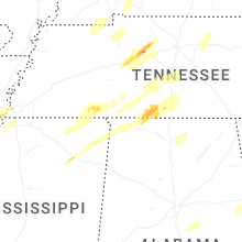
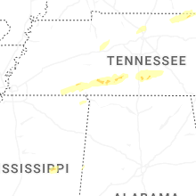


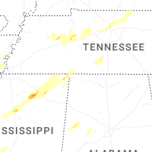


Connect with Interactive Hail Maps