

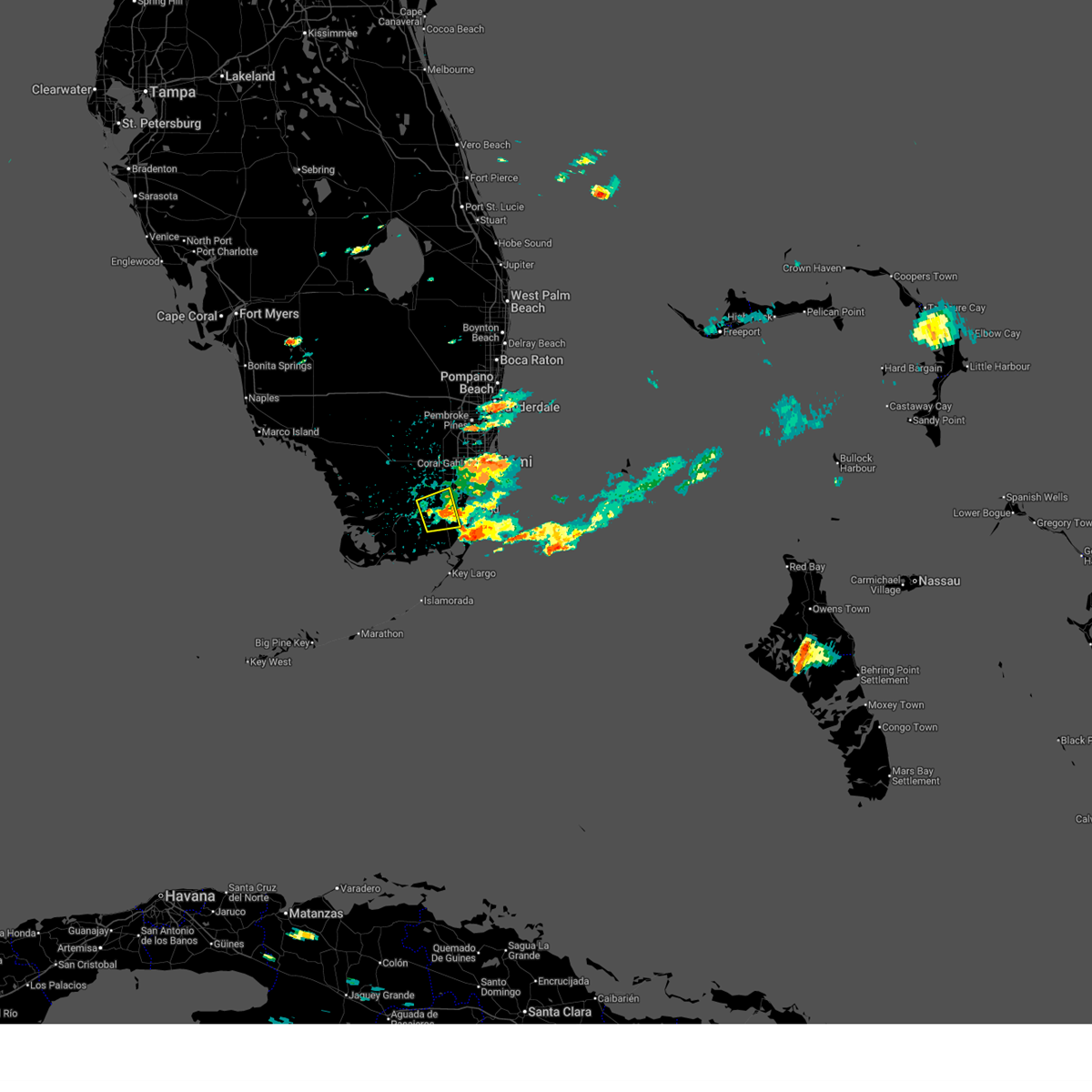
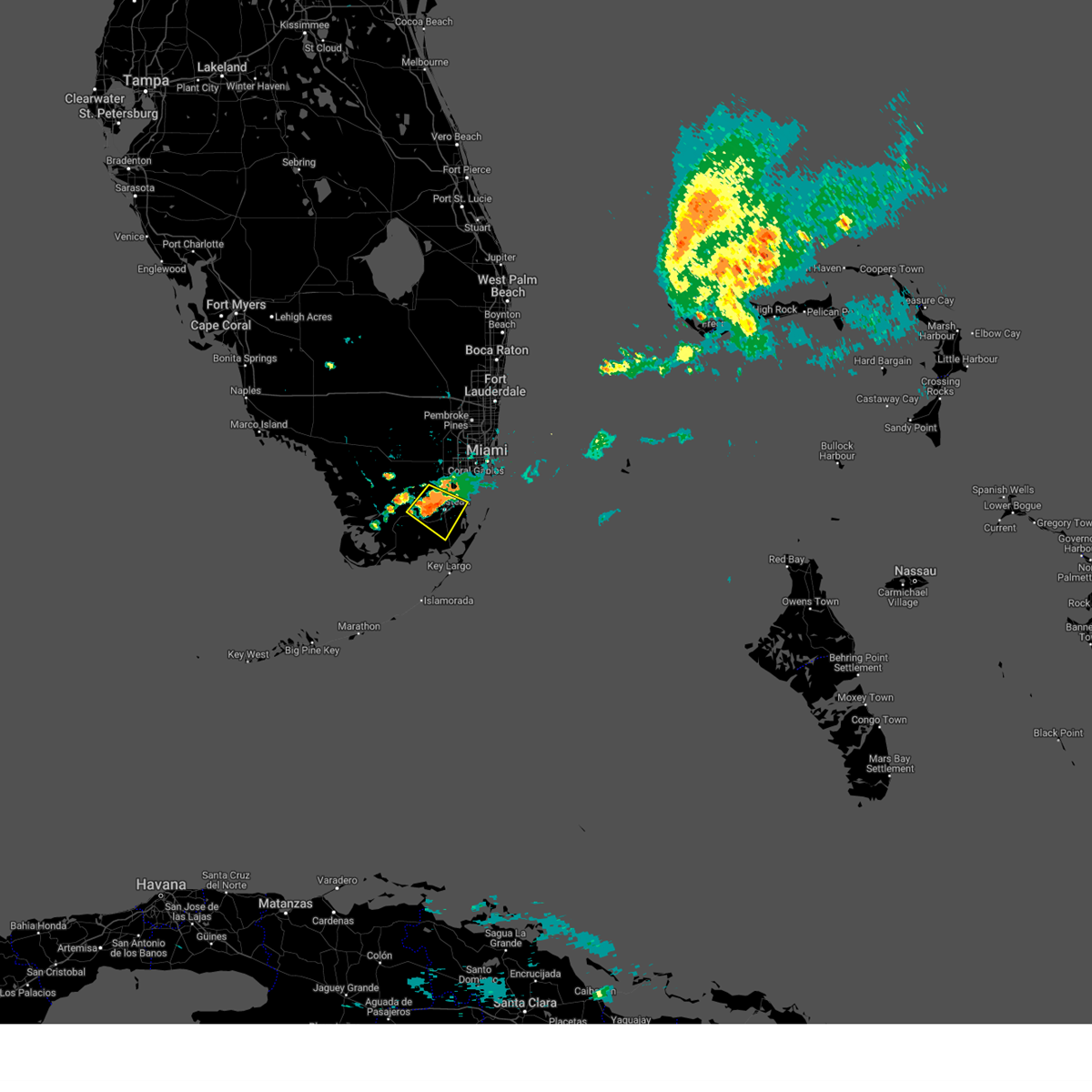
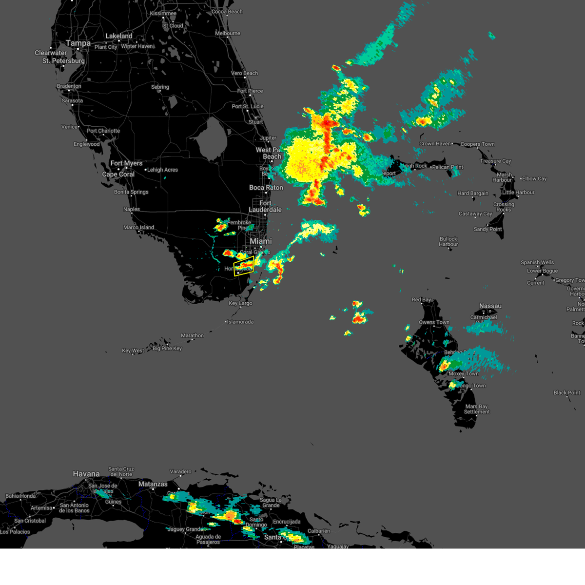
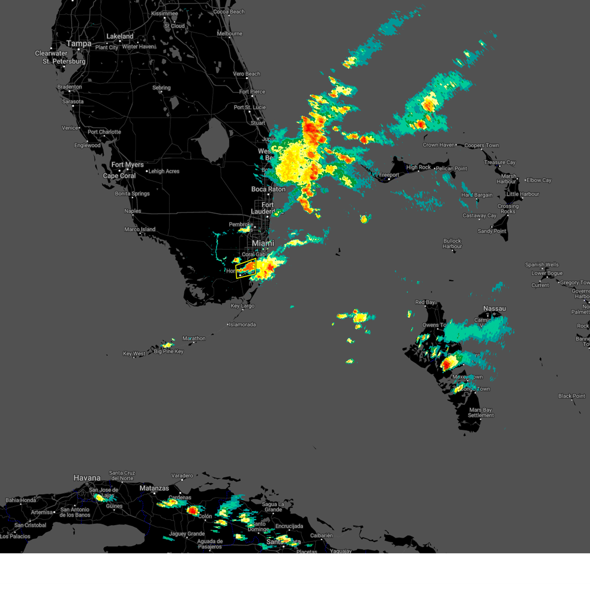
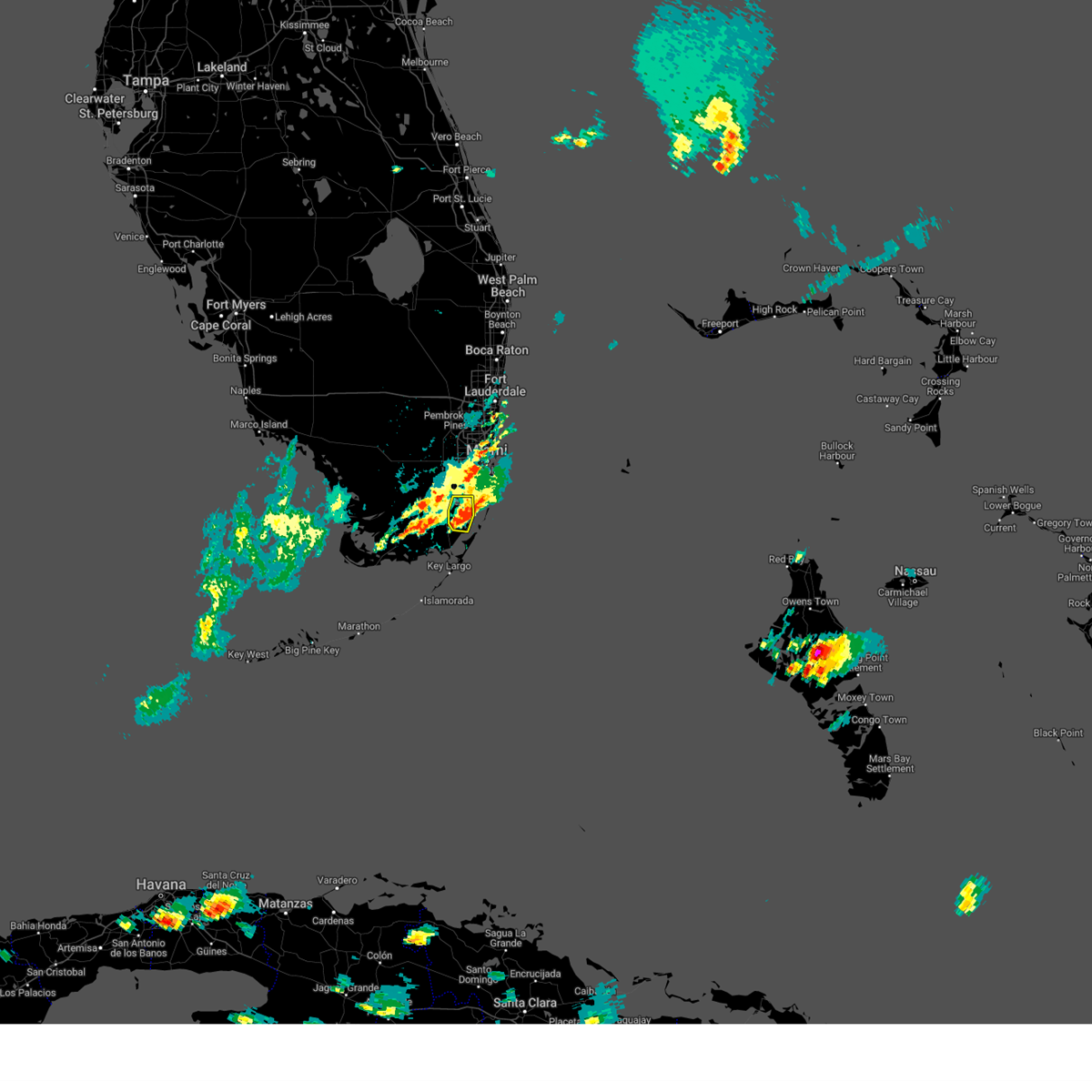
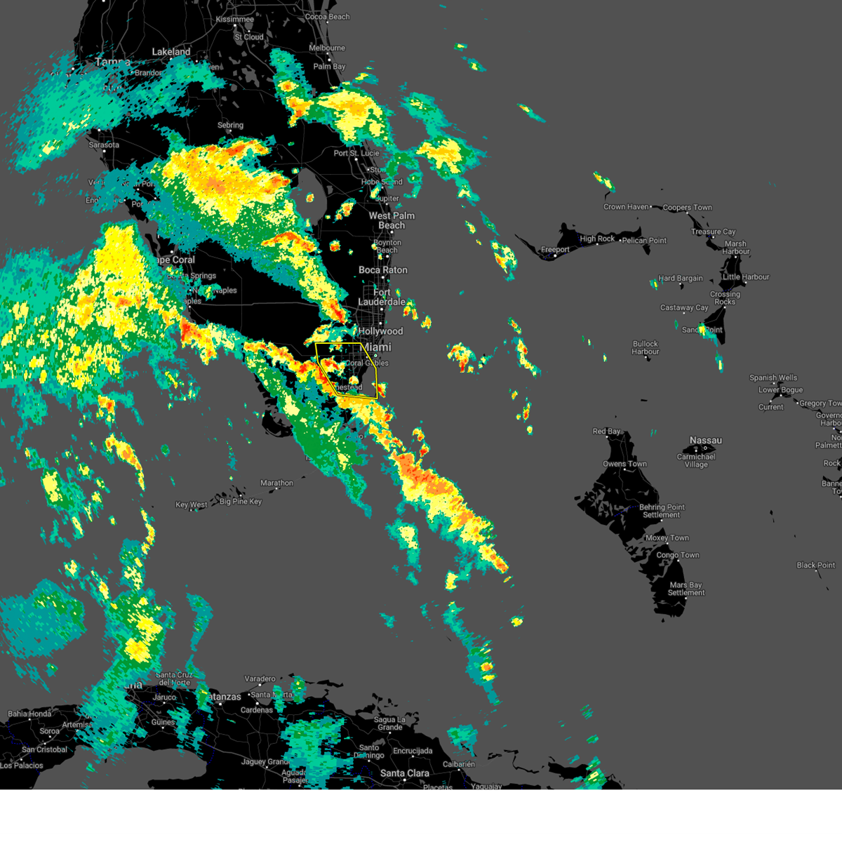
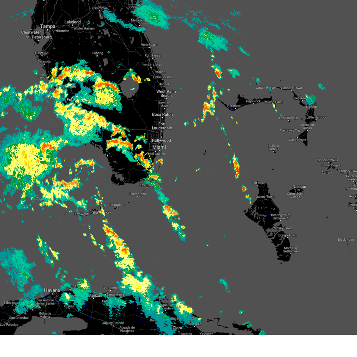
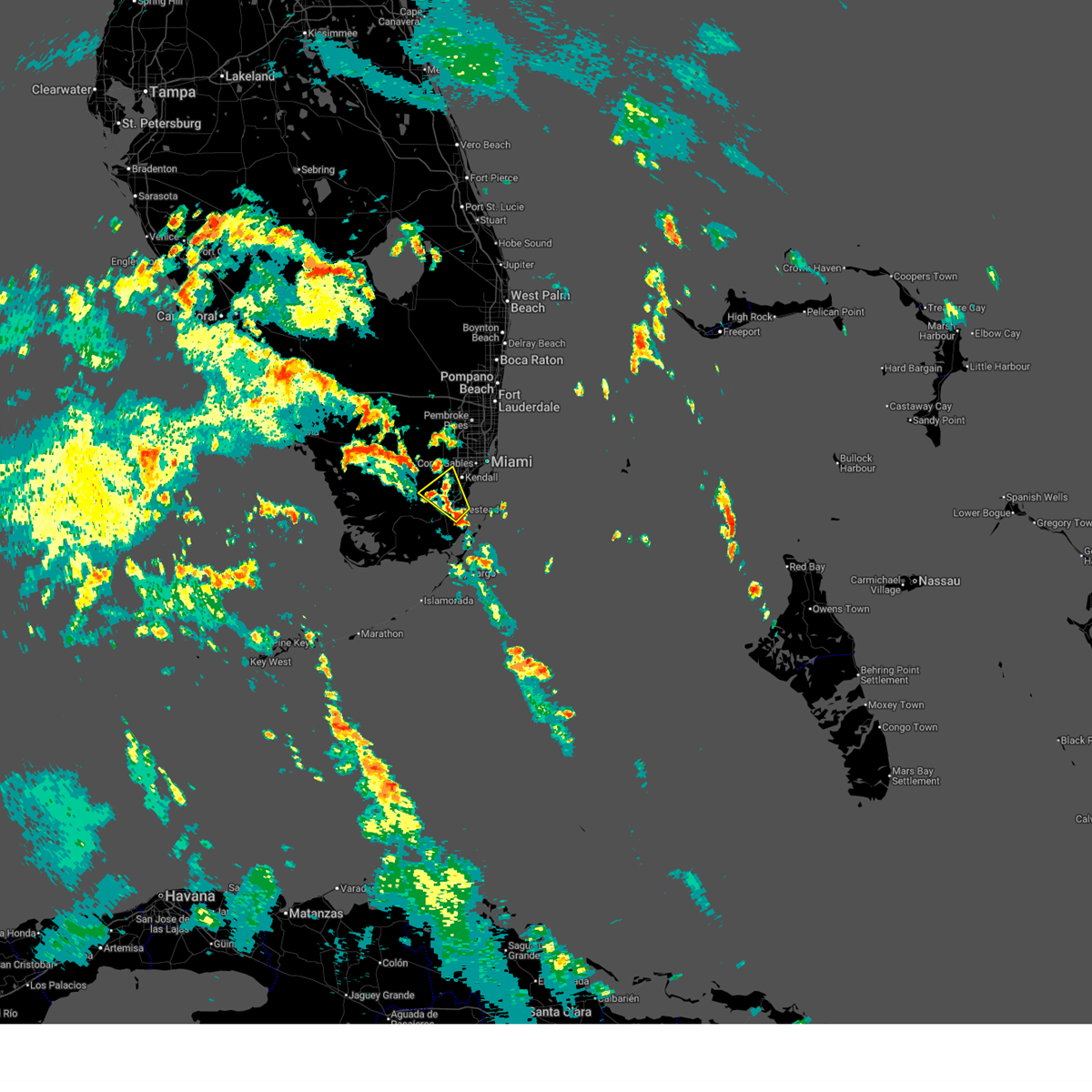
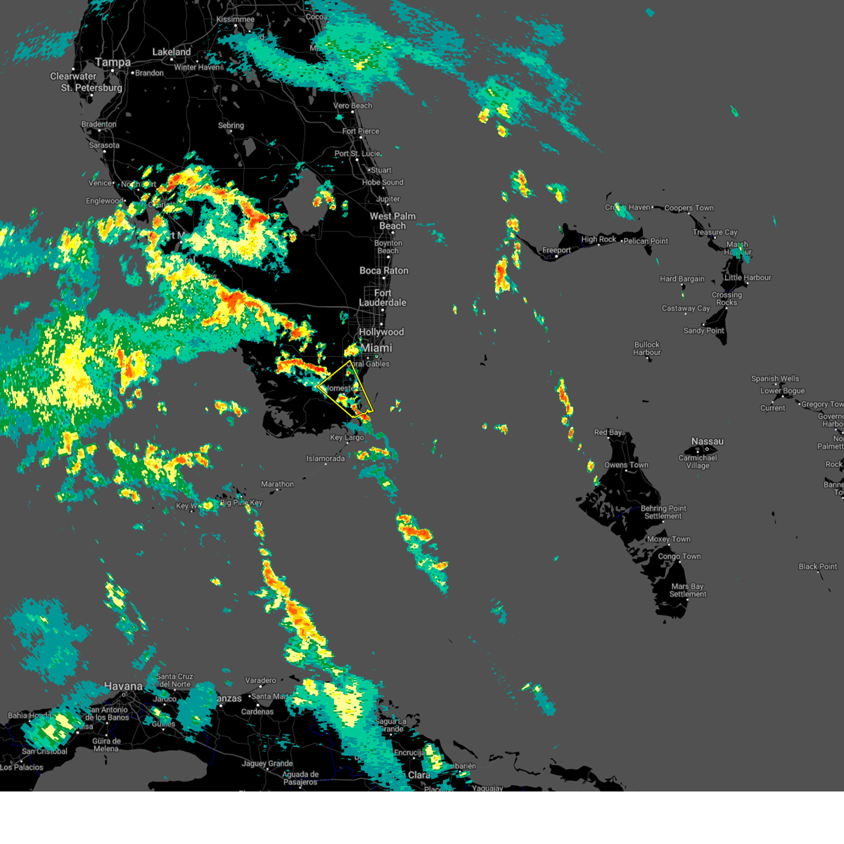
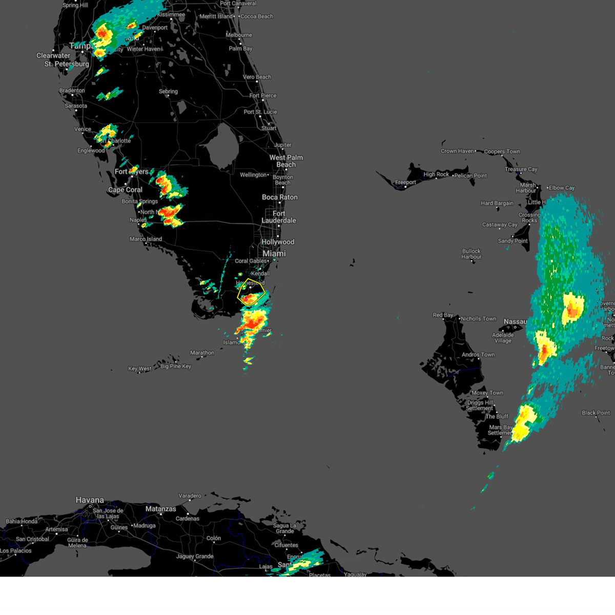
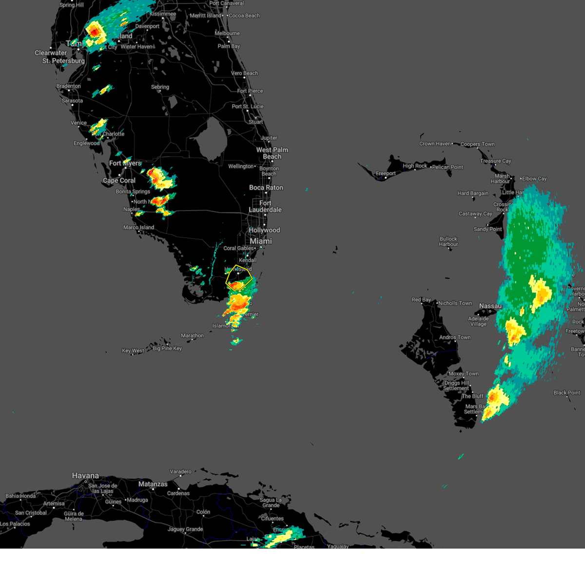
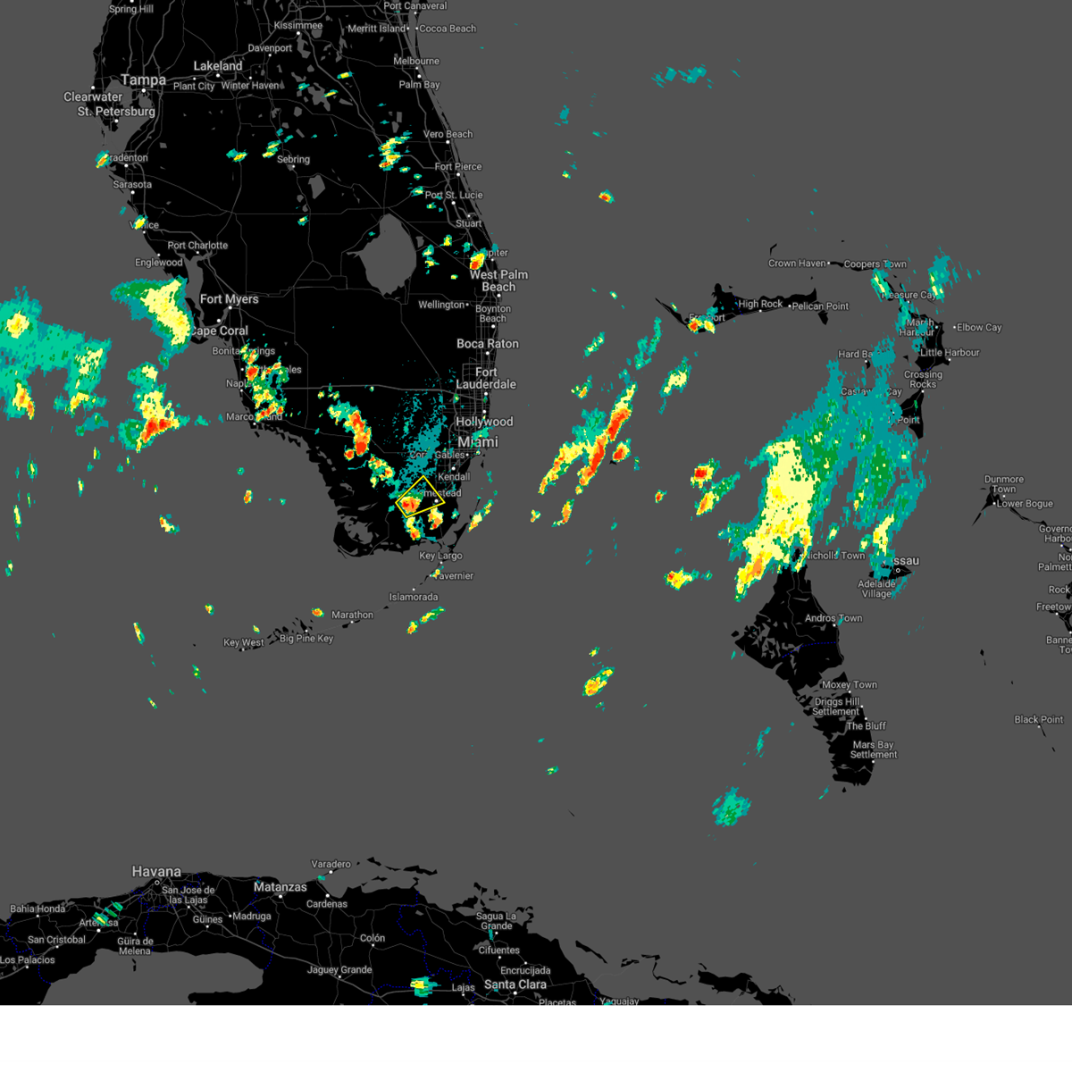
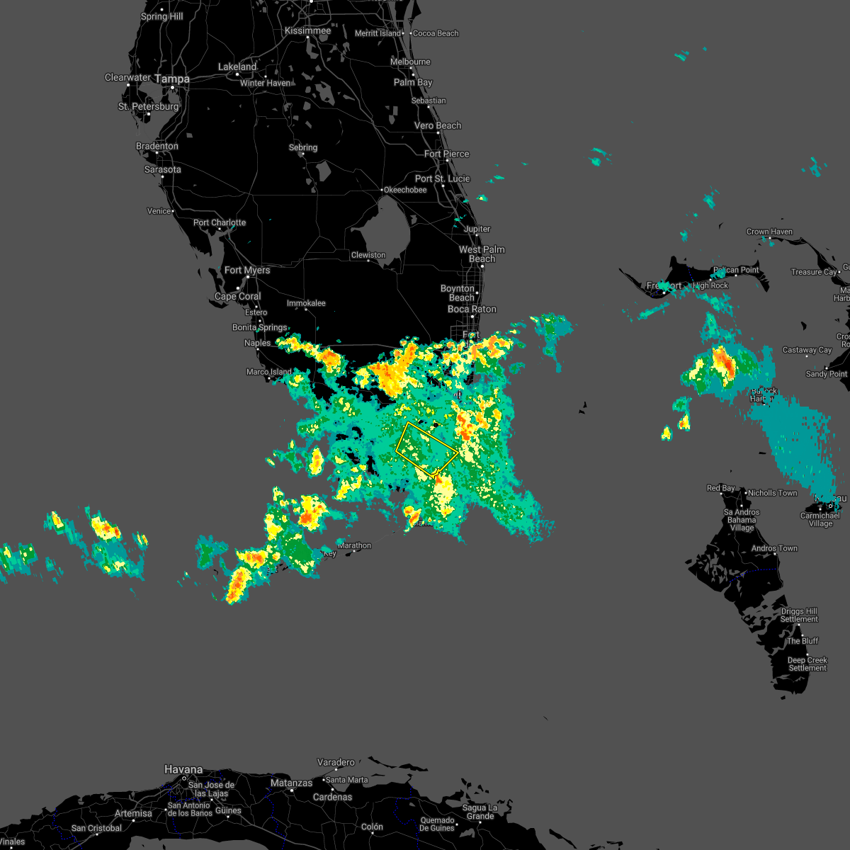
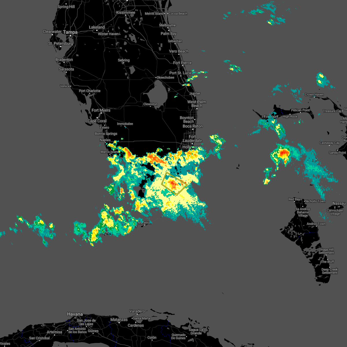
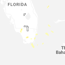
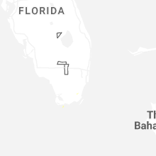
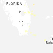
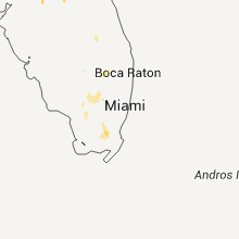
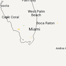
Hail Map for Leisure City, FL
The Leisure City, FL area has had 0 reports of on-the-ground hail by trained spotters, and has been under severe weather warnings 1 time during the past 12 months. Doppler radar has detected hail at or near Leisure City, FL on 23 occasions, including 2 occasions during the past year.
| Name: | Leisure City, FL |
| Where Located: | 20.2 miles SW of Miami, FL |
| Map: | Google Map for Leisure City, FL |
| Population: | 22655 |
| Housing Units: | 6958 |
| More Info: | Search Google for Leisure City, FL |
0
The Top Recent Hail Date for Leisure City, FL is Sunday, March 1, 2026 (23rd out of 23)

Hail and Wind Damage Spotted near Leisure City, FL
| Date / Time | Report Details |
|---|---|
| 3/1/2026 2:04 PM EST |
 Svrmfl the national weather service in miami has issued a * severe thunderstorm warning for, central miami-dade county in southeastern florida, * until 230 pm est. * at 204 pm est, a severe thunderstorm was located over homestead general airport, moving east at 5 mph (radar indicated). Hazards include 60 mph wind gusts and quarter size hail. Hail damage to vehicles is expected. Expect wind damage to roofs, siding, and trees. Svrmfl the national weather service in miami has issued a * severe thunderstorm warning for, central miami-dade county in southeastern florida, * until 230 pm est. * at 204 pm est, a severe thunderstorm was located over homestead general airport, moving east at 5 mph (radar indicated). Hazards include 60 mph wind gusts and quarter size hail. Hail damage to vehicles is expected. Expect wind damage to roofs, siding, and trees.
|
| 5/4/2025 6:28 PM EDT |
 Svrmfl the national weather service in miami has issued a * severe thunderstorm warning for, central miami-dade county in southeastern florida, * until 645 pm edt. * at 628 pm edt, a severe thunderstorm was located over homestead general airport, moving southeast at 15 mph (radar indicated). Hazards include 60 mph wind gusts. expect damage to roofs, siding, and trees Svrmfl the national weather service in miami has issued a * severe thunderstorm warning for, central miami-dade county in southeastern florida, * until 645 pm edt. * at 628 pm edt, a severe thunderstorm was located over homestead general airport, moving southeast at 15 mph (radar indicated). Hazards include 60 mph wind gusts. expect damage to roofs, siding, and trees
|
| 5/4/2025 4:38 PM EDT |
 The storm which prompted the warning has weakened below severe limits, and no longer poses an immediate threat to life or property. therefore, the warning will be allowed to expire. however, small hail, gusty winds and heavy rain are still possible with this thunderstorm. to report severe weather, contact your nearest law enforcement agency. they will relay your report to the national weather service miami. you can also share your report with nws miami on facebook and twitter. The storm which prompted the warning has weakened below severe limits, and no longer poses an immediate threat to life or property. therefore, the warning will be allowed to expire. however, small hail, gusty winds and heavy rain are still possible with this thunderstorm. to report severe weather, contact your nearest law enforcement agency. they will relay your report to the national weather service miami. you can also share your report with nws miami on facebook and twitter.
|
| 5/4/2025 4:18 PM EDT |
 Svrmfl the national weather service in miami has issued a * severe thunderstorm warning for, southeast miami-dade county in southeastern florida, * until 445 pm edt. * at 418 pm edt, a severe thunderstorm was located over goulds, or near black point, and is nearly stationary (radar indicated). Hazards include 60 mph wind gusts and penny size hail. expect damage to roofs, siding, and trees Svrmfl the national weather service in miami has issued a * severe thunderstorm warning for, southeast miami-dade county in southeastern florida, * until 445 pm edt. * at 418 pm edt, a severe thunderstorm was located over goulds, or near black point, and is nearly stationary (radar indicated). Hazards include 60 mph wind gusts and penny size hail. expect damage to roofs, siding, and trees
|
| 3/25/2025 2:08 PM EDT |
 The storm which prompted the warning has weakened below severe limits, and has exited the warned area. therefore, the warning will be allowed to expire. however, heavy rain is still possible with this thunderstorm. The storm which prompted the warning has weakened below severe limits, and has exited the warned area. therefore, the warning will be allowed to expire. however, heavy rain is still possible with this thunderstorm.
|
| 3/25/2025 1:55 PM EDT |
 Svrmfl the national weather service in miami has issued a * severe thunderstorm warning for, central miami-dade county in southeastern florida, * until 215 pm edt. * at 155 pm edt, a severe thunderstorm was located over homestead miami speedway, moving east at 10 mph (radar indicated). Hazards include 60 mph wind gusts and half dollar size hail. Hail damage to vehicles is expected. Expect wind damage to roofs, siding, and trees. Svrmfl the national weather service in miami has issued a * severe thunderstorm warning for, central miami-dade county in southeastern florida, * until 215 pm edt. * at 155 pm edt, a severe thunderstorm was located over homestead miami speedway, moving east at 10 mph (radar indicated). Hazards include 60 mph wind gusts and half dollar size hail. Hail damage to vehicles is expected. Expect wind damage to roofs, siding, and trees.
|
| 3/25/2025 1:49 PM EDT |
 At 149 pm edt, a severe thunderstorm was located over naranja, or near homestead, moving east at 15 mph (radar indicated). Hazards include 60 mph wind gusts and half dollar size hail. Hail damage to vehicles is expected. expect wind damage to roofs, siding, and trees. Locations impacted include, homestead base, naranja, princeton, homestead, goulds, homestead miami speedway, leisure city, florida city, cutler bay, and the redland. At 149 pm edt, a severe thunderstorm was located over naranja, or near homestead, moving east at 15 mph (radar indicated). Hazards include 60 mph wind gusts and half dollar size hail. Hail damage to vehicles is expected. expect wind damage to roofs, siding, and trees. Locations impacted include, homestead base, naranja, princeton, homestead, goulds, homestead miami speedway, leisure city, florida city, cutler bay, and the redland.
|
| 3/25/2025 1:33 PM EDT |
 Svrmfl the national weather service in miami has issued a * severe thunderstorm warning for, central miami-dade county in southeastern florida, * until 200 pm edt. * at 133 pm edt, a severe thunderstorm was located over the redland, moving east at 15 mph (radar indicated). Hazards include 60 mph wind gusts and half dollar size hail. Hail damage to vehicles is expected. Expect wind damage to roofs, siding, and trees. Svrmfl the national weather service in miami has issued a * severe thunderstorm warning for, central miami-dade county in southeastern florida, * until 200 pm edt. * at 133 pm edt, a severe thunderstorm was located over the redland, moving east at 15 mph (radar indicated). Hazards include 60 mph wind gusts and half dollar size hail. Hail damage to vehicles is expected. Expect wind damage to roofs, siding, and trees.
|
| 8/3/2024 7:55 PM EDT |
 Svrmfl the national weather service in miami has issued a * severe thunderstorm warning for, northern miami-dade county in southeastern florida, * until 830 pm edt. * at 755 pm edt, a severe thunderstorm was located over homestead bayfront park, or near black point, moving northwest at 45 mph (radar indicated). Hazards include 60 mph wind gusts. expect damage to roofs, siding, and trees Svrmfl the national weather service in miami has issued a * severe thunderstorm warning for, northern miami-dade county in southeastern florida, * until 830 pm edt. * at 755 pm edt, a severe thunderstorm was located over homestead bayfront park, or near black point, moving northwest at 45 mph (radar indicated). Hazards include 60 mph wind gusts. expect damage to roofs, siding, and trees
|
| 8/3/2024 5:45 PM EDT |
 the severe thunderstorm warning has been cancelled and is no longer in effect the severe thunderstorm warning has been cancelled and is no longer in effect
|
| 8/3/2024 5:39 PM EDT |
 At 539 pm edt, a severe thunderstorm was located over goulds, or near black point, moving north at 45 mph (radar indicated). Hazards include 60 mph wind gusts. Expect damage to roofs, siding, and trees. Locations impacted include, homestead, black point, the redland, kendall, pinecrest, florida city, homestead base, naranja, richmond west, richmond heights, country walk, kendale lakes, leisure city, palmetto bay, cutler bay, zoo miami, goulds, the hammocks, west perrine, and princeton. At 539 pm edt, a severe thunderstorm was located over goulds, or near black point, moving north at 45 mph (radar indicated). Hazards include 60 mph wind gusts. Expect damage to roofs, siding, and trees. Locations impacted include, homestead, black point, the redland, kendall, pinecrest, florida city, homestead base, naranja, richmond west, richmond heights, country walk, kendale lakes, leisure city, palmetto bay, cutler bay, zoo miami, goulds, the hammocks, west perrine, and princeton.
|
| 8/3/2024 5:27 PM EDT |
 Svrmfl the national weather service in miami has issued a * severe thunderstorm warning for, central miami-dade county in southeastern florida, * until 600 pm edt. * at 527 pm edt, a severe thunderstorm was located over homestead bayfront park, or near homestead miami speedway, moving north at 40 mph (radar indicated). Hazards include 60 mph wind gusts. expect damage to roofs, siding, and trees Svrmfl the national weather service in miami has issued a * severe thunderstorm warning for, central miami-dade county in southeastern florida, * until 600 pm edt. * at 527 pm edt, a severe thunderstorm was located over homestead bayfront park, or near homestead miami speedway, moving north at 40 mph (radar indicated). Hazards include 60 mph wind gusts. expect damage to roofs, siding, and trees
|
| 8/3/2024 4:25 PM EDT |
 The severe thunderstorm which prompted the warning has moved out of the warned area. therefore, the warning will be allowed to expire. however, gusty winds are still possible with this thunderstorm. The severe thunderstorm which prompted the warning has moved out of the warned area. therefore, the warning will be allowed to expire. however, gusty winds are still possible with this thunderstorm.
|
| 8/3/2024 4:11 PM EDT |
 At 411 pm edt, a severe thunderstorm was located over homestead base, or over homestead miami speedway, moving north at 25 mph (radar indicated). Hazards include 60 mph wind gusts. Expect damage to roofs, siding, and trees. Locations impacted include, homestead, homestead miami speedway, the redland, florida city, homestead base, naranja, princeton, richmond west, country walk, leisure city, west kendall, zoo miami, the crossings, goulds, the hammocks, west perrine, kendale lakes, richmond heights, cutler bay, and kendall west. At 411 pm edt, a severe thunderstorm was located over homestead base, or over homestead miami speedway, moving north at 25 mph (radar indicated). Hazards include 60 mph wind gusts. Expect damage to roofs, siding, and trees. Locations impacted include, homestead, homestead miami speedway, the redland, florida city, homestead base, naranja, princeton, richmond west, country walk, leisure city, west kendall, zoo miami, the crossings, goulds, the hammocks, west perrine, kendale lakes, richmond heights, cutler bay, and kendall west.
|
| 8/3/2024 3:57 PM EDT |
 Svrmfl the national weather service in miami has issued a * severe thunderstorm warning for, central miami-dade county in southeastern florida, * until 430 pm edt. * at 357 pm edt, a severe thunderstorm was located over turkey point, moving north at 25 mph (radar indicated). Hazards include 60 mph wind gusts. expect damage to roofs, siding, and trees Svrmfl the national weather service in miami has issued a * severe thunderstorm warning for, central miami-dade county in southeastern florida, * until 430 pm edt. * at 357 pm edt, a severe thunderstorm was located over turkey point, moving north at 25 mph (radar indicated). Hazards include 60 mph wind gusts. expect damage to roofs, siding, and trees
|
| 6/12/2024 5:42 PM EDT |
 Svrmfl the national weather service in miami has issued a * severe thunderstorm warning for, southern miami-dade county in southeastern florida, * until 630 pm edt. * at 542 pm edt, a severe thunderstorm was located near homestead general airport, moving east at 20 mph (radar indicated). Hazards include 60 mph wind gusts. expect damage to roofs, siding, and trees Svrmfl the national weather service in miami has issued a * severe thunderstorm warning for, southern miami-dade county in southeastern florida, * until 630 pm edt. * at 542 pm edt, a severe thunderstorm was located near homestead general airport, moving east at 20 mph (radar indicated). Hazards include 60 mph wind gusts. expect damage to roofs, siding, and trees
|
| 5/21/2024 3:45 PM EDT |
 At 344 pm edt, a severe thunderstorm was located over south miami, moving northeast at 15 mph (radar indicated). Hazards include 60 mph wind gusts and quarter size hail. Hail damage to vehicles is expected. expect wind damage to roofs, siding, and trees. Locations impacted include, miami, miami beach, homestead, coral gables, key biscayne, south miami, homestead miami speedway, black point, virginia key, kendall, the redland, pinecrest, west miami, westchester, naranja, glenvar heights, palmetto bay, university of miami, zoo miami, and goulds. At 344 pm edt, a severe thunderstorm was located over south miami, moving northeast at 15 mph (radar indicated). Hazards include 60 mph wind gusts and quarter size hail. Hail damage to vehicles is expected. expect wind damage to roofs, siding, and trees. Locations impacted include, miami, miami beach, homestead, coral gables, key biscayne, south miami, homestead miami speedway, black point, virginia key, kendall, the redland, pinecrest, west miami, westchester, naranja, glenvar heights, palmetto bay, university of miami, zoo miami, and goulds.
|
| 5/21/2024 3:38 PM EDT |
 At 338 pm edt, a severe thunderstorm was located over palmetto bay, or over kendall, moving east at 10 mph (radar indicated). Hazards include 60 mph wind gusts and quarter size hail. Hail damage to vehicles is expected. expect wind damage to roofs, siding, and trees. Locations impacted include, miami, miami beach, homestead, coral gables, key biscayne, south miami, homestead miami speedway, black point, virginia key, kendall, the redland, pinecrest, west miami, westchester, naranja, glenvar heights, palmetto bay, university of miami, zoo miami, and goulds. At 338 pm edt, a severe thunderstorm was located over palmetto bay, or over kendall, moving east at 10 mph (radar indicated). Hazards include 60 mph wind gusts and quarter size hail. Hail damage to vehicles is expected. expect wind damage to roofs, siding, and trees. Locations impacted include, miami, miami beach, homestead, coral gables, key biscayne, south miami, homestead miami speedway, black point, virginia key, kendall, the redland, pinecrest, west miami, westchester, naranja, glenvar heights, palmetto bay, university of miami, zoo miami, and goulds.
|
| 5/21/2024 3:32 PM EDT |
 Svrmfl the national weather service in miami has issued a * severe thunderstorm warning for, central miami-dade county in southeastern florida, * until 415 pm edt. * at 332 pm edt, a severe thunderstorm was located over palmetto bay, or near kendall, moving east at 10 mph (radar indicated). Hazards include 60 mph wind gusts and quarter size hail. Hail damage to vehicles is expected. Expect wind damage to roofs, siding, and trees. Svrmfl the national weather service in miami has issued a * severe thunderstorm warning for, central miami-dade county in southeastern florida, * until 415 pm edt. * at 332 pm edt, a severe thunderstorm was located over palmetto bay, or near kendall, moving east at 10 mph (radar indicated). Hazards include 60 mph wind gusts and quarter size hail. Hail damage to vehicles is expected. Expect wind damage to roofs, siding, and trees.
|
| 2/4/2024 10:50 AM EST |
 At 1049 am est, severe thunderstorms were located along a line extending from 10 miles northwest of miccosukee resort to near country walk to near royal palm ranger, moving east at 40 mph (radar indicated). Hazards include 60 mph wind gusts and penny size hail. expect damage to roofs, siding, and trees At 1049 am est, severe thunderstorms were located along a line extending from 10 miles northwest of miccosukee resort to near country walk to near royal palm ranger, moving east at 40 mph (radar indicated). Hazards include 60 mph wind gusts and penny size hail. expect damage to roofs, siding, and trees
|
| 2/4/2024 10:26 AM EST |
 At 1026 am est, a severe thunderstorm was located near shark valley obs tower, or 12 miles northwest of homestead general airport, moving east at 40 mph (radar indicated). Hazards include 60 mph wind gusts. expect damage to roofs, siding, and trees At 1026 am est, a severe thunderstorm was located near shark valley obs tower, or 12 miles northwest of homestead general airport, moving east at 40 mph (radar indicated). Hazards include 60 mph wind gusts. expect damage to roofs, siding, and trees
|
| 9/25/2023 12:12 AM EDT |
 The severe thunderstorm warning for central miami-dade county will expire at 1215 am edt, the storm which prompted the warning has moved out of the area. therefore, the warning will be allowed to expire. however, gusty winds are still possible with this thunderstorm. The severe thunderstorm warning for central miami-dade county will expire at 1215 am edt, the storm which prompted the warning has moved out of the area. therefore, the warning will be allowed to expire. however, gusty winds are still possible with this thunderstorm.
|
| 9/24/2023 11:56 PM EDT |
 At 1156 pm edt, a severe thunderstorm was located near the redland, moving northeast at 25 mph (radar indicated). Hazards include 60 mph wind gusts. Expect damage to roofs, siding, and trees. locations impacted include, homestead, homestead general airport, the redland, florida city, naranja, princeton, richmond west, country walk, goulds, leisure city, the hammocks, cutler bay, inlikita, and south miami heights. hail threat, radar indicated max hail size, <. 75 in wind threat, radar indicated max wind gust, 60 mph. At 1156 pm edt, a severe thunderstorm was located near the redland, moving northeast at 25 mph (radar indicated). Hazards include 60 mph wind gusts. Expect damage to roofs, siding, and trees. locations impacted include, homestead, homestead general airport, the redland, florida city, naranja, princeton, richmond west, country walk, goulds, leisure city, the hammocks, cutler bay, inlikita, and south miami heights. hail threat, radar indicated max hail size, <. 75 in wind threat, radar indicated max wind gust, 60 mph.
|
| 9/24/2023 11:40 PM EDT |
 At 1140 pm edt, a severe thunderstorm was located over homestead general airport, moving northeast at 25 mph (radar indicated). Hazards include 60 mph wind gusts. expect damage to roofs, siding, and trees At 1140 pm edt, a severe thunderstorm was located over homestead general airport, moving northeast at 25 mph (radar indicated). Hazards include 60 mph wind gusts. expect damage to roofs, siding, and trees
|
| 8/29/2023 4:55 PM EDT |
 At 454 pm edt, severe thunderstorms were located along a line extending from 10 miles west of miccosukee resort to homestead bayfront park, moving north at 40 mph (radar indicated). Hazards include 70 mph wind gusts. Expect considerable tree damage. damage is likely to mobile homes, roofs, and outbuildings. Locations impacted include, miami, hialeah, miramar, miami beach and homestead. At 454 pm edt, severe thunderstorms were located along a line extending from 10 miles west of miccosukee resort to homestead bayfront park, moving north at 40 mph (radar indicated). Hazards include 70 mph wind gusts. Expect considerable tree damage. damage is likely to mobile homes, roofs, and outbuildings. Locations impacted include, miami, hialeah, miramar, miami beach and homestead.
|
| 8/29/2023 4:42 PM EDT |
 At 442 pm edt, severe thunderstorms were located along a line extending from near shark valley obs tower to near ocean reef, moving north at 35 mph (radar indicated). Hazards include 70 mph wind gusts. Expect considerable tree damage. Damage is likely to mobile homes, roofs, and outbuildings. At 442 pm edt, severe thunderstorms were located along a line extending from near shark valley obs tower to near ocean reef, moving north at 35 mph (radar indicated). Hazards include 70 mph wind gusts. Expect considerable tree damage. Damage is likely to mobile homes, roofs, and outbuildings.
|
| 8/29/2023 4:36 PM EDT |
 At 436 pm edt, severe thunderstorms were located along a line extending from 8 miles northwest of homestead general airport to 6 miles southwest of turkey point, moving north at 35 to 40 mph (radar indicated). Hazards include 60 mph wind gusts. Expect damage to roofs, siding, and trees. Locations impacted include, homestead, homestead miami speedway, black point, homestead general airport and the redland. At 436 pm edt, severe thunderstorms were located along a line extending from 8 miles northwest of homestead general airport to 6 miles southwest of turkey point, moving north at 35 to 40 mph (radar indicated). Hazards include 60 mph wind gusts. Expect damage to roofs, siding, and trees. Locations impacted include, homestead, homestead miami speedway, black point, homestead general airport and the redland.
|
| 8/29/2023 4:22 PM EDT |
 At 421 pm edt, severe thunderstorms were located along a line extending from near royal palm ranger to near jewfish creek bridge, moving northeast at 25 mph (radar indicated). Hazards include 60 mph wind gusts. expect damage to roofs, siding, and trees At 421 pm edt, severe thunderstorms were located along a line extending from near royal palm ranger to near jewfish creek bridge, moving northeast at 25 mph (radar indicated). Hazards include 60 mph wind gusts. expect damage to roofs, siding, and trees
|
| 7/28/2023 12:12 PM EDT |
 The severe thunderstorm warning for central miami-dade county will expire at 1215 pm edt, the storm which prompted the warning has weakened below severe limits, and no longer poses an immediate threat to life or property. therefore, the warning will be allowed to expire. however gusty winds are still possible with this thunderstorm. The severe thunderstorm warning for central miami-dade county will expire at 1215 pm edt, the storm which prompted the warning has weakened below severe limits, and no longer poses an immediate threat to life or property. therefore, the warning will be allowed to expire. however gusty winds are still possible with this thunderstorm.
|
| 7/28/2023 11:58 AM EDT |
 At 1157 am edt, a severe thunderstorm was located near the redland, moving north at 25 mph (radar indicated). Hazards include 60 mph wind gusts. Expect damage to roofs, siding, and trees. locations impacted include, homestead, homestead general airport, kendall, the redland and florida city. hail threat, radar indicated max hail size, <. 75 in wind threat, radar indicated max wind gust, 60 mph. At 1157 am edt, a severe thunderstorm was located near the redland, moving north at 25 mph (radar indicated). Hazards include 60 mph wind gusts. Expect damage to roofs, siding, and trees. locations impacted include, homestead, homestead general airport, kendall, the redland and florida city. hail threat, radar indicated max hail size, <. 75 in wind threat, radar indicated max wind gust, 60 mph.
|
| 7/28/2023 11:44 AM EDT |
 At 1144 am edt, a severe thunderstorm was located over homestead general airport, moving north at 25 mph (radar indicated). Hazards include 60 mph wind gusts. expect damage to roofs, siding, and trees At 1144 am edt, a severe thunderstorm was located over homestead general airport, moving north at 25 mph (radar indicated). Hazards include 60 mph wind gusts. expect damage to roofs, siding, and trees
|
| 6/4/2023 6:16 PM EDT |
 At 616 pm edt, a severe thunderstorm was located near royal palm ranger, or 9 miles south of homestead general airport, moving northeast at 5 mph (radar indicated). Hazards include ping pong ball size hail and 60 mph wind gusts. People and animals outdoors will be injured. expect hail damage to roofs, siding, windows, and vehicles. expect wind damage to roofs, siding, and trees. Locations impacted include, homestead, homestead general airport, homestead miami speedway, the redland and florida city. At 616 pm edt, a severe thunderstorm was located near royal palm ranger, or 9 miles south of homestead general airport, moving northeast at 5 mph (radar indicated). Hazards include ping pong ball size hail and 60 mph wind gusts. People and animals outdoors will be injured. expect hail damage to roofs, siding, windows, and vehicles. expect wind damage to roofs, siding, and trees. Locations impacted include, homestead, homestead general airport, homestead miami speedway, the redland and florida city.
|
| 6/4/2023 6:11 PM EDT |
 At 611 pm edt, a severe thunderstorm was located near royal palm ranger, or 10 miles south of homestead general airport, moving northeast at 5 mph (radar indicated). Hazards include 60 mph wind gusts and half dollar size hail. Hail damage to vehicles is expected. Expect wind damage to roofs, siding, and trees. At 611 pm edt, a severe thunderstorm was located near royal palm ranger, or 10 miles south of homestead general airport, moving northeast at 5 mph (radar indicated). Hazards include 60 mph wind gusts and half dollar size hail. Hail damage to vehicles is expected. Expect wind damage to roofs, siding, and trees.
|
| 6/2/2023 12:54 PM EDT |
 At 1253 pm edt, a severe thunderstorm was located near royal palm ranger, or 8 miles southwest of homestead general airport, moving northeast at 15 mph (radar indicated). Hazards include 60 mph wind gusts and nickel size hail. expect damage to roofs, siding, and trees At 1253 pm edt, a severe thunderstorm was located near royal palm ranger, or 8 miles southwest of homestead general airport, moving northeast at 15 mph (radar indicated). Hazards include 60 mph wind gusts and nickel size hail. expect damage to roofs, siding, and trees
|
| 5/26/2023 2:07 PM EDT |
 At 207 pm edt, a severe thunderstorm was located over naranja, or near homestead, moving south at 10 mph (radar indicated). Hazards include 60 mph wind gusts and quarter size hail. Hail damage to vehicles is expected. expect wind damage to roofs, siding, and trees. Locations impacted include, homestead, turkey point, homestead miami speedway, black point and homestead general airport. At 207 pm edt, a severe thunderstorm was located over naranja, or near homestead, moving south at 10 mph (radar indicated). Hazards include 60 mph wind gusts and quarter size hail. Hail damage to vehicles is expected. expect wind damage to roofs, siding, and trees. Locations impacted include, homestead, turkey point, homestead miami speedway, black point and homestead general airport.
|
| 5/26/2023 1:55 PM EDT |
 At 155 pm edt, a severe thunderstorm was located over princeton, or near the redland, moving south at 10 mph (radar indicated). Hazards include 60 mph wind gusts and quarter size hail. Hail damage to vehicles is expected. Expect wind damage to roofs, siding, and trees. At 155 pm edt, a severe thunderstorm was located over princeton, or near the redland, moving south at 10 mph (radar indicated). Hazards include 60 mph wind gusts and quarter size hail. Hail damage to vehicles is expected. Expect wind damage to roofs, siding, and trees.
|
| 5/18/2023 3:23 PM EDT |
 The severe thunderstorm warning for south miami-dade county will expire at 330 pm edt, the storm which prompted the warning has weakened below severe limits, and no longer poses an immediate threat to life or property. therefore, the warning will be allowed to expire. however gusty winds and heavy rain are still possible with this thunderstorm. to report severe weather, contact your nearest law enforcement agency. they will relay your report to the national weather service miami. you can also share your report with nws miami on facebook and twitter. The severe thunderstorm warning for south miami-dade county will expire at 330 pm edt, the storm which prompted the warning has weakened below severe limits, and no longer poses an immediate threat to life or property. therefore, the warning will be allowed to expire. however gusty winds and heavy rain are still possible with this thunderstorm. to report severe weather, contact your nearest law enforcement agency. they will relay your report to the national weather service miami. you can also share your report with nws miami on facebook and twitter.
|
| 5/18/2023 3:08 PM EDT |
 At 308 pm edt, a severe thunderstorm was located over homestead air reserve base, or near black point, moving east at 5 mph (radar indicated). Hazards include 60 mph wind gusts and penny size hail. Expect damage to roofs, siding, and trees. Locations impacted include, homestead, coral gables, black point, the redland and kendall. At 308 pm edt, a severe thunderstorm was located over homestead air reserve base, or near black point, moving east at 5 mph (radar indicated). Hazards include 60 mph wind gusts and penny size hail. Expect damage to roofs, siding, and trees. Locations impacted include, homestead, coral gables, black point, the redland and kendall.
|
| 5/18/2023 3:03 PM EDT |
 At 302 pm edt, a severe thunderstorm was located over homestead base, or near black point, moving east at 10 mph (radar indicated). Hazards include 60 mph wind gusts and quarter size hail. Hail damage to vehicles is expected. expect wind damage to roofs, siding, and trees. Locations impacted include, homestead, coral gables, south miami, black point and the redland. At 302 pm edt, a severe thunderstorm was located over homestead base, or near black point, moving east at 10 mph (radar indicated). Hazards include 60 mph wind gusts and quarter size hail. Hail damage to vehicles is expected. expect wind damage to roofs, siding, and trees. Locations impacted include, homestead, coral gables, south miami, black point and the redland.
|
| 5/18/2023 2:45 PM EDT |
 At 244 pm edt, a severe thunderstorm was located over zoo miami, or near kendall, moving east at 5 mph (radar indicated). Hazards include 60 mph wind gusts and quarter size hail. Hail damage to vehicles is expected. expect wind damage to roofs, siding, and trees. Locations impacted include, homestead, coral gables, south miami, black point and the redland. At 244 pm edt, a severe thunderstorm was located over zoo miami, or near kendall, moving east at 5 mph (radar indicated). Hazards include 60 mph wind gusts and quarter size hail. Hail damage to vehicles is expected. expect wind damage to roofs, siding, and trees. Locations impacted include, homestead, coral gables, south miami, black point and the redland.
|
| 5/18/2023 2:38 PM EDT |
 At 238 pm edt, a severe thunderstorm was located over zoo miami, or near kendall, moving east at 5 mph (radar indicated). Hazards include 60 mph wind gusts and quarter size hail. Hail damage to vehicles is expected. Expect wind damage to roofs, siding, and trees. At 238 pm edt, a severe thunderstorm was located over zoo miami, or near kendall, moving east at 5 mph (radar indicated). Hazards include 60 mph wind gusts and quarter size hail. Hail damage to vehicles is expected. Expect wind damage to roofs, siding, and trees.
|
| 4/17/2023 3:25 AM EDT |
 The severe thunderstorm warning for central miami-dade county will expire at 330 am edt, the storms which prompted the warning have weakened below severe limits, and no longer pose an immediate threat to life or property. therefore, the warning will be allowed to expire. The severe thunderstorm warning for central miami-dade county will expire at 330 am edt, the storms which prompted the warning have weakened below severe limits, and no longer pose an immediate threat to life or property. therefore, the warning will be allowed to expire.
|
| 4/17/2023 2:54 AM EDT |
 At 253 am edt, severe thunderstorms were located along a line extending from near fortymile bend to near the redland to near turkey point, moving northeast at 35 mph (radar indicated). Hazards include 60 mph wind gusts. expect damage to roofs, siding, and trees At 253 am edt, severe thunderstorms were located along a line extending from near fortymile bend to near the redland to near turkey point, moving northeast at 35 mph (radar indicated). Hazards include 60 mph wind gusts. expect damage to roofs, siding, and trees
|
| 4/18/2022 6:56 PM EDT |
 At 655 pm edt, severe thunderstorms were located along a line extending from 7 miles northeast of pa-hay-okee overlook to near country walk, moving south southeast at 5 to 10 mph (radar indicated). Hazards include 60 mph wind gusts and quarter size hail. Hail damage to vehicles is expected. expect wind damage to roofs, siding, and trees. locations impacted include, homestead, homestead miami speedway, homestead general airport, the redland and florida city. hail threat, radar indicated max hail size, 1. 00 in wind threat, radar indicated max wind gust, 60 mph. At 655 pm edt, severe thunderstorms were located along a line extending from 7 miles northeast of pa-hay-okee overlook to near country walk, moving south southeast at 5 to 10 mph (radar indicated). Hazards include 60 mph wind gusts and quarter size hail. Hail damage to vehicles is expected. expect wind damage to roofs, siding, and trees. locations impacted include, homestead, homestead miami speedway, homestead general airport, the redland and florida city. hail threat, radar indicated max hail size, 1. 00 in wind threat, radar indicated max wind gust, 60 mph.
|
| 4/18/2022 6:41 PM EDT |
 At 641 pm edt, severe thunderstorms were located along a line extending from 6 miles southeast of shark valley obs tower to near country walk, moving south at 5 to 10 mph (radar indicated). Hazards include 60 mph wind gusts and quarter size hail. Hail damage to vehicles is expected. Expect wind damage to roofs, siding, and trees. At 641 pm edt, severe thunderstorms were located along a line extending from 6 miles southeast of shark valley obs tower to near country walk, moving south at 5 to 10 mph (radar indicated). Hazards include 60 mph wind gusts and quarter size hail. Hail damage to vehicles is expected. Expect wind damage to roofs, siding, and trees.
|
| 4/4/2022 2:58 PM EDT | At 257 pm edt, severe thunderstorms were located along a line extending from everglades national park to near royal palm ranger to 6 miles south of florida city, and are nearly stationary (radar indicated). Hazards include 60 mph wind gusts and half dollar size hail. Hail damage to vehicles is expected. Expect wind damage to roofs, siding, and trees. |
| 4/3/2022 6:20 PM EDT |
 At 619 pm edt, a severe thunderstorm was located over richmond west, or near kendall, moving northeast at 20 mph (radar indicated). Hazards include 60 mph wind gusts and quarter size hail. Hail damage to vehicles is expected. Expect wind damage to roofs, siding, and trees. At 619 pm edt, a severe thunderstorm was located over richmond west, or near kendall, moving northeast at 20 mph (radar indicated). Hazards include 60 mph wind gusts and quarter size hail. Hail damage to vehicles is expected. Expect wind damage to roofs, siding, and trees.
|
| 1/16/2022 12:26 PM EST |
 At 1226 pm est, severe thunderstorms were located along a line extending from 11 miles west of intersection krome and u.s. 27 to near leisure city to 7 miles northwest of plantation, moving east at 50 mph (radar indicated). Hazards include 60 mph wind gusts. expect damage to roofs, siding, and trees At 1226 pm est, severe thunderstorms were located along a line extending from 11 miles west of intersection krome and u.s. 27 to near leisure city to 7 miles northwest of plantation, moving east at 50 mph (radar indicated). Hazards include 60 mph wind gusts. expect damage to roofs, siding, and trees
|
| 1/16/2022 11:56 AM EST |
 At 1156 am est, severe thunderstorms were located along a line extending from near big cypress national preserve to near everglades national park to 6 miles northeast of east cape sable, moving east at 50 mph (radar indicated). Hazards include 60 mph wind gusts. expect damage to roofs, siding, and trees At 1156 am est, severe thunderstorms were located along a line extending from near big cypress national preserve to near everglades national park to 6 miles northeast of east cape sable, moving east at 50 mph (radar indicated). Hazards include 60 mph wind gusts. expect damage to roofs, siding, and trees
|
| 7/12/2021 8:35 PM EDT |
 At 835 pm edt, severe thunderstorms were located along a line extending from golden glades to near black point, moving west at 25 mph (radar indicated). Hazards include 60 mph wind gusts. expect damage to roofs, siding, and trees At 835 pm edt, severe thunderstorms were located along a line extending from golden glades to near black point, moving west at 25 mph (radar indicated). Hazards include 60 mph wind gusts. expect damage to roofs, siding, and trees
|
| 6/16/2021 7:59 PM EDT |
 At 758 pm edt, severe thunderstorms were located along a line extending from near royal palm ranger to near ocean reef to 11 miles east of route 1/card sound, moving northeast at 35 mph (radar indicated). Hazards include 60 mph wind gusts and nickel size hail. expect damage to roofs, siding, and trees At 758 pm edt, severe thunderstorms were located along a line extending from near royal palm ranger to near ocean reef to 11 miles east of route 1/card sound, moving northeast at 35 mph (radar indicated). Hazards include 60 mph wind gusts and nickel size hail. expect damage to roofs, siding, and trees
|
| 4/20/2021 3:20 AM EDT |
 The severe thunderstorm warning for southern miami-dade county will expire at 330 am edt, the storm which prompted the warning has moved out of the area. therefore, the warning will be allowed to expire. The severe thunderstorm warning for southern miami-dade county will expire at 330 am edt, the storm which prompted the warning has moved out of the area. therefore, the warning will be allowed to expire.
|
| 4/20/2021 2:57 AM EDT |
 At 256 am edt, a severe thunderstorm was located over florida city, or over homestead, moving northeast at 35 mph (radar indicated). Hazards include 60 mph wind gusts and quarter size hail. Hail damage to vehicles is expected. expect wind damage to roofs, siding, and trees. Locations impacted include, homestead, turkey point, homestead general airport, homestead miami speedway and the redland. At 256 am edt, a severe thunderstorm was located over florida city, or over homestead, moving northeast at 35 mph (radar indicated). Hazards include 60 mph wind gusts and quarter size hail. Hail damage to vehicles is expected. expect wind damage to roofs, siding, and trees. Locations impacted include, homestead, turkey point, homestead general airport, homestead miami speedway and the redland.
|
| 4/20/2021 2:51 AM EDT |
 At 251 am edt, a severe thunderstorm was located near florida city, or near homestead, moving northeast at 45 mph (radar indicated). Hazards include 60 mph wind gusts and quarter size hail. Hail damage to vehicles is expected. expect wind damage to roofs, siding, and trees. Locations impacted include, homestead, turkey point, homestead general airport, homestead miami speedway and the redland. At 251 am edt, a severe thunderstorm was located near florida city, or near homestead, moving northeast at 45 mph (radar indicated). Hazards include 60 mph wind gusts and quarter size hail. Hail damage to vehicles is expected. expect wind damage to roofs, siding, and trees. Locations impacted include, homestead, turkey point, homestead general airport, homestead miami speedway and the redland.
|
| 4/20/2021 2:32 AM EDT |
 At 231 am edt, a severe thunderstorm was located 12 miles south of royal palm ranger, or 16 miles northwest of key largo, moving northeast at 35 mph (radar indicated). Hazards include 60 mph wind gusts and quarter size hail. Hail damage to vehicles is expected. Expect wind damage to roofs, siding, and trees. At 231 am edt, a severe thunderstorm was located 12 miles south of royal palm ranger, or 16 miles northwest of key largo, moving northeast at 35 mph (radar indicated). Hazards include 60 mph wind gusts and quarter size hail. Hail damage to vehicles is expected. Expect wind damage to roofs, siding, and trees.
|
| 4/11/2021 6:09 PM EDT |
 At 608 pm edt, a severe thunderstorm was located over homestead base, or near black point, moving southeast at 25 mph (radar indicated). Hazards include 60 mph wind gusts and quarter size hail. Hail damage to vehicles is expected. Expect wind damage to roofs, siding, and trees. At 608 pm edt, a severe thunderstorm was located over homestead base, or near black point, moving southeast at 25 mph (radar indicated). Hazards include 60 mph wind gusts and quarter size hail. Hail damage to vehicles is expected. Expect wind damage to roofs, siding, and trees.
|
| 11/11/2020 5:25 PM EST |
 At 524 pm est, severe thunderstorms were located along a line extending from 8 miles northeast of shark valley obs tower to near homestead general airport to 7 miles southwest of royal palm ranger, moving north at 45 mph (radar indicated). Hazards include 60 mph wind gusts. expect damage to roofs, siding, and trees At 524 pm est, severe thunderstorms were located along a line extending from 8 miles northeast of shark valley obs tower to near homestead general airport to 7 miles southwest of royal palm ranger, moving north at 45 mph (radar indicated). Hazards include 60 mph wind gusts. expect damage to roofs, siding, and trees
|
| 9/12/2020 2:51 AM EDT |
 At 251 am edt, a severe thunderstorm was located over goulds, or near black point, moving west at 15 mph (radar indicated). Hazards include 60 mph wind gusts. Expect damage to roofs, siding, and trees. Locations impacted include, homestead, coral gables, homestead miami speedway, black point and the redland. At 251 am edt, a severe thunderstorm was located over goulds, or near black point, moving west at 15 mph (radar indicated). Hazards include 60 mph wind gusts. Expect damage to roofs, siding, and trees. Locations impacted include, homestead, coral gables, homestead miami speedway, black point and the redland.
|
| 9/12/2020 2:22 AM EDT |
 At 222 am edt, a severe thunderstorm was located near black point, moving west at 15 mph (radar indicated). Hazards include 60 mph wind gusts. expect damage to roofs, siding, and trees At 222 am edt, a severe thunderstorm was located near black point, moving west at 15 mph (radar indicated). Hazards include 60 mph wind gusts. expect damage to roofs, siding, and trees
|
| 8/24/2020 11:37 AM EDT |
 The severe thunderstorm warning for south miami-dade county will expire at 1145 am edt, the storm which prompted the warning has weakened below severe limits, and no longer poses an immediate threat to life or property. therefore, the warning will be allowed to expire. however gusty winds are still possible with this thunderstorm. to report severe weather, contact your nearest law enforcement agency. they will relay your report to the national weather service miami. you can also share your report with nws miami on facebook and twitter. The severe thunderstorm warning for south miami-dade county will expire at 1145 am edt, the storm which prompted the warning has weakened below severe limits, and no longer poses an immediate threat to life or property. therefore, the warning will be allowed to expire. however gusty winds are still possible with this thunderstorm. to report severe weather, contact your nearest law enforcement agency. they will relay your report to the national weather service miami. you can also share your report with nws miami on facebook and twitter.
|
| 8/24/2020 11:32 AM EDT |
 At 1131 am edt, a severe thunderstorm was located over homestead, moving northwest at 40 mph (radar indicated). Hazards include 60 mph wind gusts. Expect damage to roofs, siding, and trees. Locations impacted include, homestead, homestead general airport, the redland, florida city and homestead air reserve base. At 1131 am edt, a severe thunderstorm was located over homestead, moving northwest at 40 mph (radar indicated). Hazards include 60 mph wind gusts. Expect damage to roofs, siding, and trees. Locations impacted include, homestead, homestead general airport, the redland, florida city and homestead air reserve base.
|
| 8/24/2020 11:28 AM EDT |
 At 1128 am edt, a severe thunderstorm was located near homestead miami speedway, moving northwest at 40 mph (radar indicated). Hazards include 60 mph wind gusts. Expect damage to roofs, siding, and trees. Locations impacted include, homestead, homestead miami speedway, homestead general airport, the redland and florida city. At 1128 am edt, a severe thunderstorm was located near homestead miami speedway, moving northwest at 40 mph (radar indicated). Hazards include 60 mph wind gusts. Expect damage to roofs, siding, and trees. Locations impacted include, homestead, homestead miami speedway, homestead general airport, the redland and florida city.
|
| 8/24/2020 11:22 AM EDT |
 At 1121 am edt, a severe thunderstorm was located near homestead miami speedway, moving northwest at 45 mph (radar indicated). Hazards include 60 mph wind gusts. expect damage to roofs, siding, and trees At 1121 am edt, a severe thunderstorm was located near homestead miami speedway, moving northwest at 45 mph (radar indicated). Hazards include 60 mph wind gusts. expect damage to roofs, siding, and trees
|
| 8/24/2020 10:53 AM EDT |
 The severe thunderstorm warning for south miami-dade county will expire at 1100 am edt, the storm which prompted the warning has weakened below severe limits, and no longer poses an immediate threat to life or property. therefore, the warning will be allowed to expire. however gusty winds are still possible with this thunderstorm. The severe thunderstorm warning for south miami-dade county will expire at 1100 am edt, the storm which prompted the warning has weakened below severe limits, and no longer poses an immediate threat to life or property. therefore, the warning will be allowed to expire. however gusty winds are still possible with this thunderstorm.
|
| 8/24/2020 10:46 AM EDT |
 At 1045 am edt, a severe thunderstorm was located over homestead bayfront park, or near homestead miami speedway, moving northwest at 45 mph (radar indicated). Hazards include 60 mph wind gusts. Expect damage to roofs, siding, and trees. Locations impacted include, homestead, turkey point, homestead miami speedway, homestead general airport and the redland. At 1045 am edt, a severe thunderstorm was located over homestead bayfront park, or near homestead miami speedway, moving northwest at 45 mph (radar indicated). Hazards include 60 mph wind gusts. Expect damage to roofs, siding, and trees. Locations impacted include, homestead, turkey point, homestead miami speedway, homestead general airport and the redland.
|
| 8/24/2020 10:41 AM EDT |
 At 1040 am edt, a severe thunderstorm was located near turkey point, moving northwest at 45 mph (radar indicated). Hazards include 60 mph wind gusts. Expect damage to roofs, siding, and trees. Locations impacted include, homestead, turkey point, homestead miami speedway, homestead general airport and the redland. At 1040 am edt, a severe thunderstorm was located near turkey point, moving northwest at 45 mph (radar indicated). Hazards include 60 mph wind gusts. Expect damage to roofs, siding, and trees. Locations impacted include, homestead, turkey point, homestead miami speedway, homestead general airport and the redland.
|
| 8/24/2020 10:34 AM EDT |
 At 1033 am edt, a severe thunderstorm was located near ocean reef, or near turkey point, moving northwest at 50 mph (radar indicated). Hazards include 60 mph wind gusts. expect damage to roofs, siding, and trees At 1033 am edt, a severe thunderstorm was located near ocean reef, or near turkey point, moving northwest at 50 mph (radar indicated). Hazards include 60 mph wind gusts. expect damage to roofs, siding, and trees
|
| 5/25/2020 1:33 AM EDT |
 At 133 am edt, a confirmed tornado was located near richmond west, or near the redland, moving northwest at 15 mph (radar confirmed tornado). Hazards include damaging tornado. Flying debris will be dangerous to those caught without shelter. mobile homes will be damaged or destroyed. damage to roofs, windows, and vehicles will occur. tree damage is likely. Locations impacted include, the redland, naranja, richmond west, country walk and intersection krome and kendall drive. At 133 am edt, a confirmed tornado was located near richmond west, or near the redland, moving northwest at 15 mph (radar confirmed tornado). Hazards include damaging tornado. Flying debris will be dangerous to those caught without shelter. mobile homes will be damaged or destroyed. damage to roofs, windows, and vehicles will occur. tree damage is likely. Locations impacted include, the redland, naranja, richmond west, country walk and intersection krome and kendall drive.
|
| 5/25/2020 1:27 AM EDT |
 At 127 am edt, a severe thunderstorm capable of producing a tornado was located over richmond west, or near the redland, moving northwest at 15 mph (radar indicated rotation). Hazards include tornado. Expect damage to mobile homes, roofs, and vehicles. Tree damage is likely. At 127 am edt, a severe thunderstorm capable of producing a tornado was located over richmond west, or near the redland, moving northwest at 15 mph (radar indicated rotation). Hazards include tornado. Expect damage to mobile homes, roofs, and vehicles. Tree damage is likely.
|
| 4/11/2020 2:15 PM EDT |
 At 214 pm edt, a severe thunderstorm was located over turkey point, moving southeast at 10 mph. while this storm is weakening, additional storms are developing near florida city and could become severe (radar indicated). Hazards include 60 mph wind gusts and penny size hail. Expect damage to roofs, siding, and trees. Locations impacted include, homestead, turkey point, homestead miami speedway, the redland and florida city. At 214 pm edt, a severe thunderstorm was located over turkey point, moving southeast at 10 mph. while this storm is weakening, additional storms are developing near florida city and could become severe (radar indicated). Hazards include 60 mph wind gusts and penny size hail. Expect damage to roofs, siding, and trees. Locations impacted include, homestead, turkey point, homestead miami speedway, the redland and florida city.
|
| 4/11/2020 2:07 PM EDT |
 At 207 pm edt, a severe thunderstorm was located over turkey point, moving southeast at 5 mph (radar indicated). Hazards include 60 mph wind gusts and quarter size hail. Hail damage to vehicles is expected. expect wind damage to roofs, siding, and trees. Locations impacted include, homestead, turkey point, homestead miami speedway, the redland and florida city. At 207 pm edt, a severe thunderstorm was located over turkey point, moving southeast at 5 mph (radar indicated). Hazards include 60 mph wind gusts and quarter size hail. Hail damage to vehicles is expected. expect wind damage to roofs, siding, and trees. Locations impacted include, homestead, turkey point, homestead miami speedway, the redland and florida city.
|
| 4/11/2020 1:55 PM EDT |
 At 154 pm edt, a severe thunderstorm was located near homestead miami speedway, moving southeast at 15 mph (radar indicated). Hazards include 60 mph wind gusts and quarter size hail. Hail damage to vehicles is expected. expect wind damage to roofs, siding, and trees. Locations impacted include, homestead, turkey point, homestead miami speedway, the redland and florida city. At 154 pm edt, a severe thunderstorm was located near homestead miami speedway, moving southeast at 15 mph (radar indicated). Hazards include 60 mph wind gusts and quarter size hail. Hail damage to vehicles is expected. expect wind damage to roofs, siding, and trees. Locations impacted include, homestead, turkey point, homestead miami speedway, the redland and florida city.
|
| 4/11/2020 1:38 PM EDT |
 At 138 pm edt, a severe thunderstorm was located over homestead, moving southeast at 10 mph (radar indicated). Hazards include 60 mph wind gusts and quarter size hail. Hail damage to vehicles is expected. Expect wind damage to roofs, siding, and trees. At 138 pm edt, a severe thunderstorm was located over homestead, moving southeast at 10 mph (radar indicated). Hazards include 60 mph wind gusts and quarter size hail. Hail damage to vehicles is expected. Expect wind damage to roofs, siding, and trees.
|
| 1/31/2020 11:47 PM EST |
 At 1147 pm est, severe thunderstorms were located along a line extending from fountainbleau to 8 miles east of black point to 6 miles east of ocean reef to 12 miles southeast of route 1/card sound, moving east at 40 mph (radar indicated). Hazards include 70 mph wind gusts. Expect considerable tree damage. damage is likely to mobile homes, roofs, and outbuildings. Locations impacted include, miami, hialeah, miami beach, coral gables and key biscayne. At 1147 pm est, severe thunderstorms were located along a line extending from fountainbleau to 8 miles east of black point to 6 miles east of ocean reef to 12 miles southeast of route 1/card sound, moving east at 40 mph (radar indicated). Hazards include 70 mph wind gusts. Expect considerable tree damage. damage is likely to mobile homes, roofs, and outbuildings. Locations impacted include, miami, hialeah, miami beach, coral gables and key biscayne.
|
| 1/31/2020 11:25 PM EST |
 At 1123 pm est, severe thunderstorms were located along a line extending from 6 miles southeast of shark valley obs tower to homestead miami speedway to 7 miles west of ocean reef to 6 miles west of jewfish creek bridge, moving east at 50 mph (radar indicated). Hazards include 70 mph wind gusts. Expect considerable tree damage. damage is likely to mobile homes, roofs, and outbuildings. Locations impacted include, miami, hialeah, miami beach, homestead and coral gables. At 1123 pm est, severe thunderstorms were located along a line extending from 6 miles southeast of shark valley obs tower to homestead miami speedway to 7 miles west of ocean reef to 6 miles west of jewfish creek bridge, moving east at 50 mph (radar indicated). Hazards include 70 mph wind gusts. Expect considerable tree damage. damage is likely to mobile homes, roofs, and outbuildings. Locations impacted include, miami, hialeah, miami beach, homestead and coral gables.
|
| 1/31/2020 11:09 PM EST |
 The national weather service in miami has issued a * severe thunderstorm warning for. central miami-dade county in southeastern florida. until 1245 am est. At 1108 pm est, severe thunderstorms were located along a line extending from 8 miles southwest of shark valley obs tower to royal. The national weather service in miami has issued a * severe thunderstorm warning for. central miami-dade county in southeastern florida. until 1245 am est. At 1108 pm est, severe thunderstorms were located along a line extending from 8 miles southwest of shark valley obs tower to royal.
|
| 10/8/2019 10:03 AM EDT |
 At 1003 am edt, severe thunderstorms were located along a line extending from near everglades national park to palmetto bay, moving southeast at 10 mph (radar indicated). Hazards include 60 mph wind gusts. Expect damage to roofs, siding, and trees. Locations impacted include, homestead, coral gables, turkey point, homestead miami speedway and black point. At 1003 am edt, severe thunderstorms were located along a line extending from near everglades national park to palmetto bay, moving southeast at 10 mph (radar indicated). Hazards include 60 mph wind gusts. Expect damage to roofs, siding, and trees. Locations impacted include, homestead, coral gables, turkey point, homestead miami speedway and black point.
|
| 10/8/2019 9:19 AM EDT |
 At 919 am edt, a severe thunderstorm was located over everglades national park, or near homestead general airport, moving northeast at 20 mph (radar indicated). Hazards include 60 mph wind gusts. expect damage to roofs, siding, and trees At 919 am edt, a severe thunderstorm was located over everglades national park, or near homestead general airport, moving northeast at 20 mph (radar indicated). Hazards include 60 mph wind gusts. expect damage to roofs, siding, and trees
|
| 5/6/2019 4:05 PM EDT |
 The severe thunderstorm warning for central miami-dade county will expire at 415 pm edt, the storms which prompted the warning have weakened below severe limits, and no longer pose an immediate threat to life or property. therefore, the warning will be allowed to expire. however gusty winds and heavy rain are still possible with these thunderstorms. The severe thunderstorm warning for central miami-dade county will expire at 415 pm edt, the storms which prompted the warning have weakened below severe limits, and no longer pose an immediate threat to life or property. therefore, the warning will be allowed to expire. however gusty winds and heavy rain are still possible with these thunderstorms.
|
| 5/6/2019 3:45 PM EDT |
 At 345 pm edt, severe thunderstorms were located along a line extending from palmetto bay to near homestead general airport, moving east at 10 mph (radar indicated). Hazards include 60 mph wind gusts. Expect damage to roofs, siding, and trees. Locations impacted include, coral gables, key biscayne, south miami, black point and the redland. At 345 pm edt, severe thunderstorms were located along a line extending from palmetto bay to near homestead general airport, moving east at 10 mph (radar indicated). Hazards include 60 mph wind gusts. Expect damage to roofs, siding, and trees. Locations impacted include, coral gables, key biscayne, south miami, black point and the redland.
|
| 5/6/2019 3:31 PM EDT |
 At 320 pm edt, severe thunderstorms were located along a line extending from coral gables to near the redland, moving east at 25 mph (radar indicated). Hazards include 60 mph wind gusts. Expect damage to roofs, siding, and trees. Locations impacted include, miami, miami beach, coral gables, key biscayne and south miami. At 320 pm edt, severe thunderstorms were located along a line extending from coral gables to near the redland, moving east at 25 mph (radar indicated). Hazards include 60 mph wind gusts. Expect damage to roofs, siding, and trees. Locations impacted include, miami, miami beach, coral gables, key biscayne and south miami.
|
| 5/6/2019 3:20 PM EDT |
 At 320 pm edt, severe thunderstorms were located along a line extending from coral gables to near the redland, moving east at 25 mph (radar indicated). Hazards include 60 mph wind gusts. Expect damage to roofs, siding, and trees. Locations impacted include, miami, miami beach, coral gables, key biscayne and south miami. At 320 pm edt, severe thunderstorms were located along a line extending from coral gables to near the redland, moving east at 25 mph (radar indicated). Hazards include 60 mph wind gusts. Expect damage to roofs, siding, and trees. Locations impacted include, miami, miami beach, coral gables, key biscayne and south miami.
|
| 5/6/2019 3:10 PM EDT |
 At 310 pm edt, severe thunderstorms were located along a line extending from westchester to country walk, moving east at 30 mph (radar indicated). Hazards include 60 mph wind gusts. expect damage to roofs, siding, and trees At 310 pm edt, severe thunderstorms were located along a line extending from westchester to country walk, moving east at 30 mph (radar indicated). Hazards include 60 mph wind gusts. expect damage to roofs, siding, and trees
|
| 4/9/2019 12:42 PM EDT |
 At 1241 pm edt, a severe thunderstorm was located over homestead, moving east at 20 mph (radar indicated). Hazards include 60 mph wind gusts. Expect damage to roofs, siding, and trees. Locations impacted include, homestead, coral gables, south miami, homestead miami speedway and black point. At 1241 pm edt, a severe thunderstorm was located over homestead, moving east at 20 mph (radar indicated). Hazards include 60 mph wind gusts. Expect damage to roofs, siding, and trees. Locations impacted include, homestead, coral gables, south miami, homestead miami speedway and black point.
|
| 4/9/2019 12:21 PM EDT |
 At 1220 pm edt, a severe thunderstorm was located over homestead general airport, moving east at 25 mph (radar indicated). Hazards include 60 mph wind gusts. expect damage to roofs, siding, and trees At 1220 pm edt, a severe thunderstorm was located over homestead general airport, moving east at 25 mph (radar indicated). Hazards include 60 mph wind gusts. expect damage to roofs, siding, and trees
|
| 7/23/2018 4:13 PM EDT |
 At 412 pm edt, a severe thunderstorm was located over the redland, moving northeast at 35 mph (radar indicated). Hazards include 60 mph wind gusts. expect damage to roofs, siding, and trees At 412 pm edt, a severe thunderstorm was located over the redland, moving northeast at 35 mph (radar indicated). Hazards include 60 mph wind gusts. expect damage to roofs, siding, and trees
|
| 9/9/2017 7:29 PM EDT |
 At 729 pm edt, a severe thunderstorm capable of producing a tornado was located near the redland, moving west at 35 mph (radar indicated rotation). Hazards include tornado. Flying debris will be dangerous to those caught without shelter. mobile homes will be damaged or destroyed. damage to roofs, windows, and vehicles will occur. tree damage is likely. This tornadic thunderstorm will remain over mainly rural areas of central miami-dade county, including the following locations: south miami heights, howard, palmetto estates, inlikita and three lakes. At 729 pm edt, a severe thunderstorm capable of producing a tornado was located near the redland, moving west at 35 mph (radar indicated rotation). Hazards include tornado. Flying debris will be dangerous to those caught without shelter. mobile homes will be damaged or destroyed. damage to roofs, windows, and vehicles will occur. tree damage is likely. This tornadic thunderstorm will remain over mainly rural areas of central miami-dade county, including the following locations: south miami heights, howard, palmetto estates, inlikita and three lakes.
|
| 9/9/2017 7:02 PM EDT |
 At 702 pm edt, a severe thunderstorm capable of producing a tornado was located over homestead miami speedway, moving west at 60 mph (radar indicated rotation). Hazards include tornado. Flying debris will be dangerous to those caught without shelter. mobile homes will be damaged or destroyed. damage to roofs, windows, and vehicles will occur. tree damage is likely. This dangerous storm will be near, homestead general airport and royal palm ranger around 715 pm edt. At 702 pm edt, a severe thunderstorm capable of producing a tornado was located over homestead miami speedway, moving west at 60 mph (radar indicated rotation). Hazards include tornado. Flying debris will be dangerous to those caught without shelter. mobile homes will be damaged or destroyed. damage to roofs, windows, and vehicles will occur. tree damage is likely. This dangerous storm will be near, homestead general airport and royal palm ranger around 715 pm edt.
|
| 1/23/2017 3:35 AM EST |
 At 335 am est, severe thunderstorms were located along a line extending from west park to 8 miles northeast of pa-hay-okee overlook to near flamingo, moving east at 45 mph (radar indicated). Hazards include 60 mph wind gusts. expect damage to roofs, siding, and trees At 335 am est, severe thunderstorms were located along a line extending from west park to 8 miles northeast of pa-hay-okee overlook to near flamingo, moving east at 45 mph (radar indicated). Hazards include 60 mph wind gusts. expect damage to roofs, siding, and trees
|
Hail Maps for Leisure City, FL


Connect with Interactive Hail Maps