

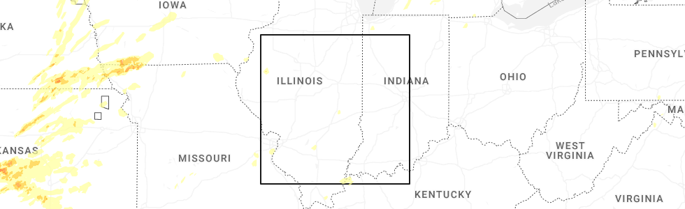
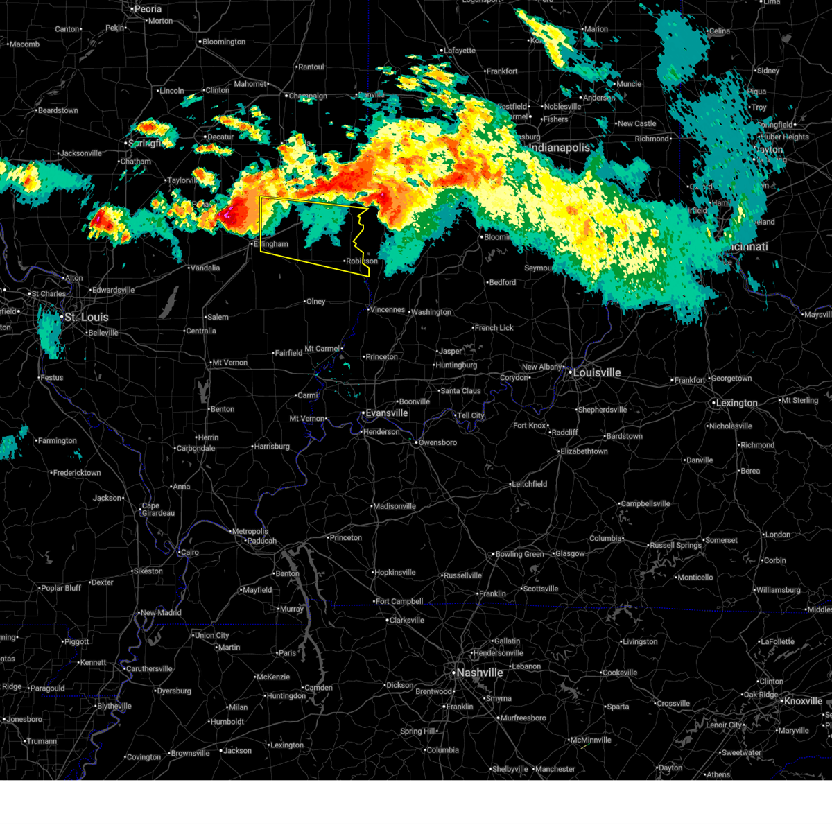
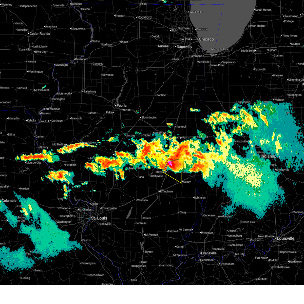
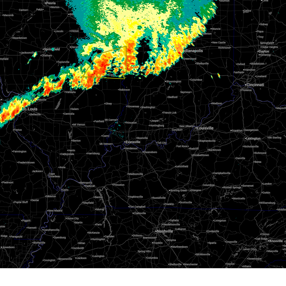
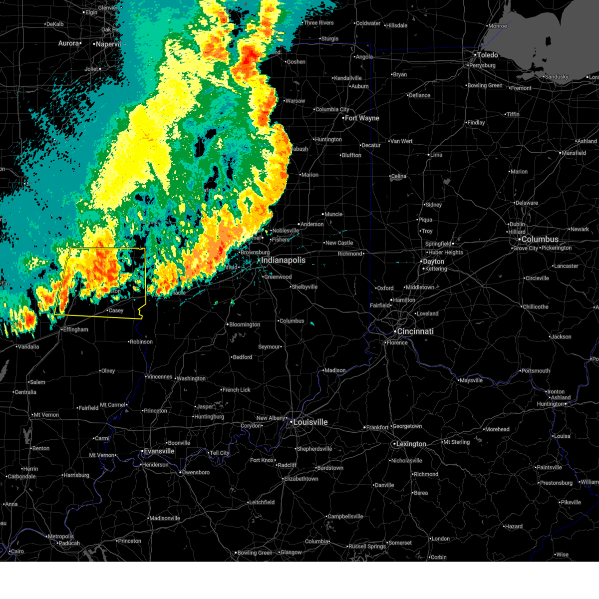
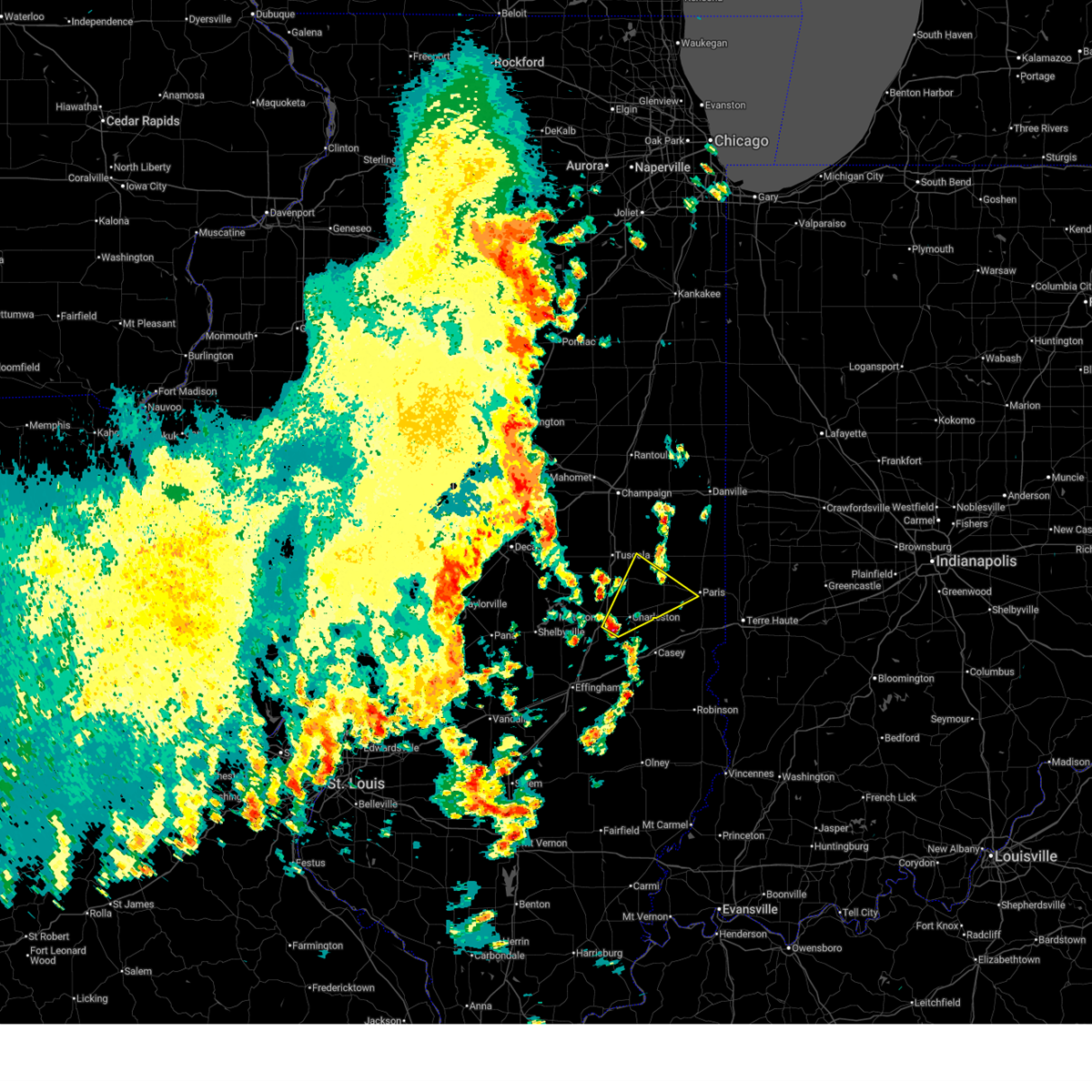
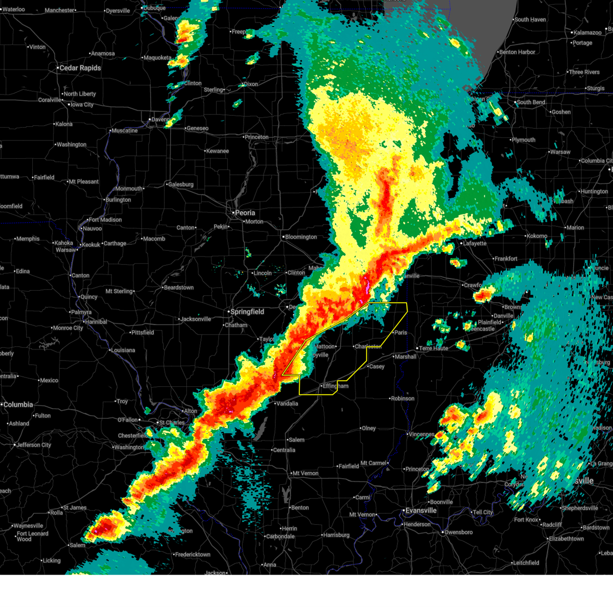
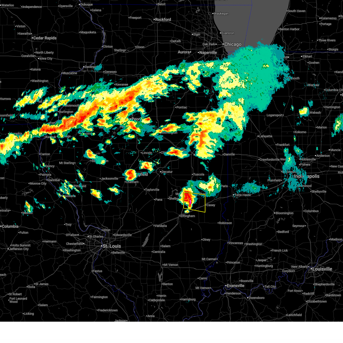
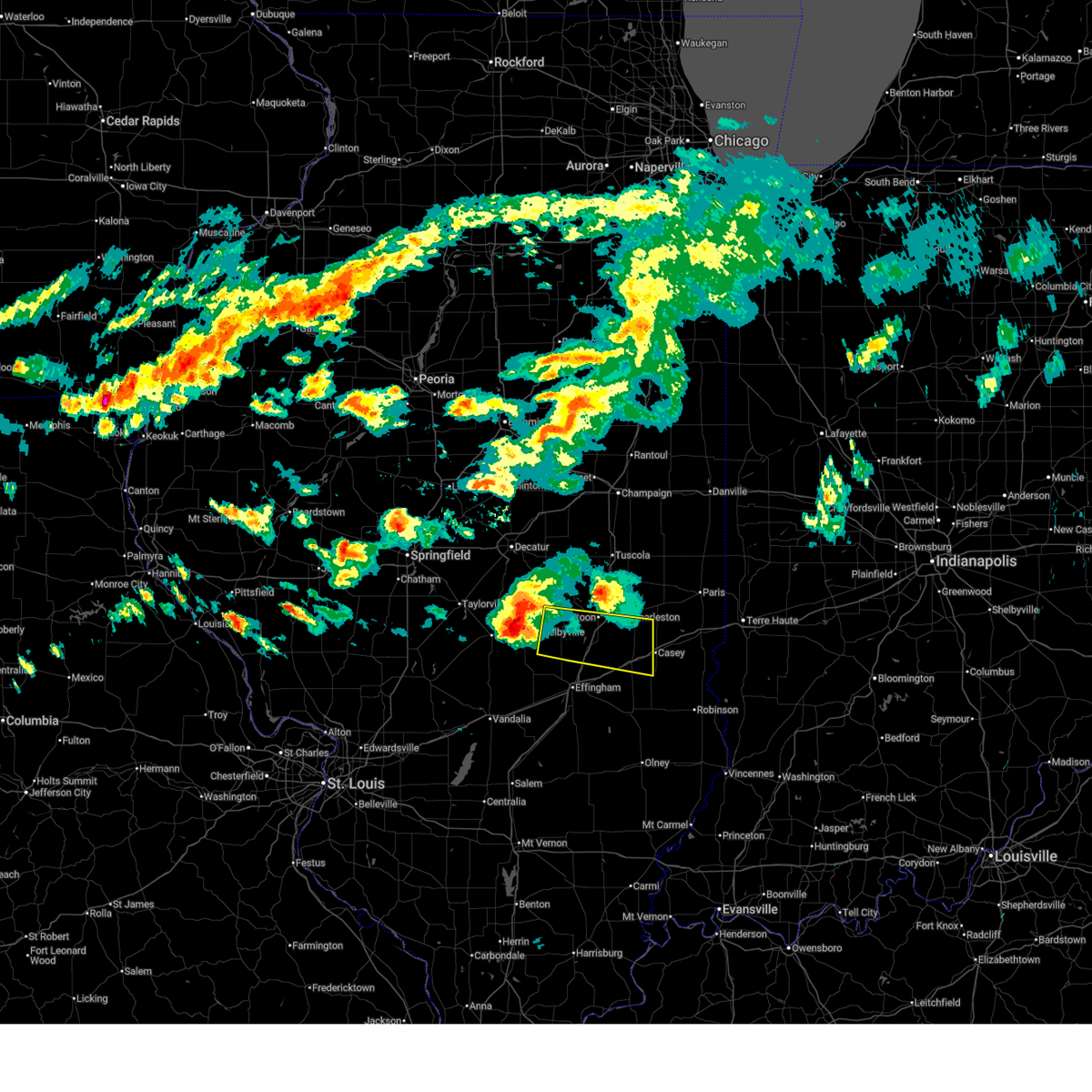
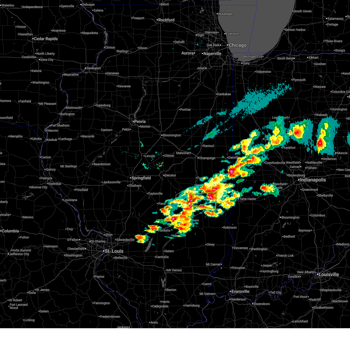
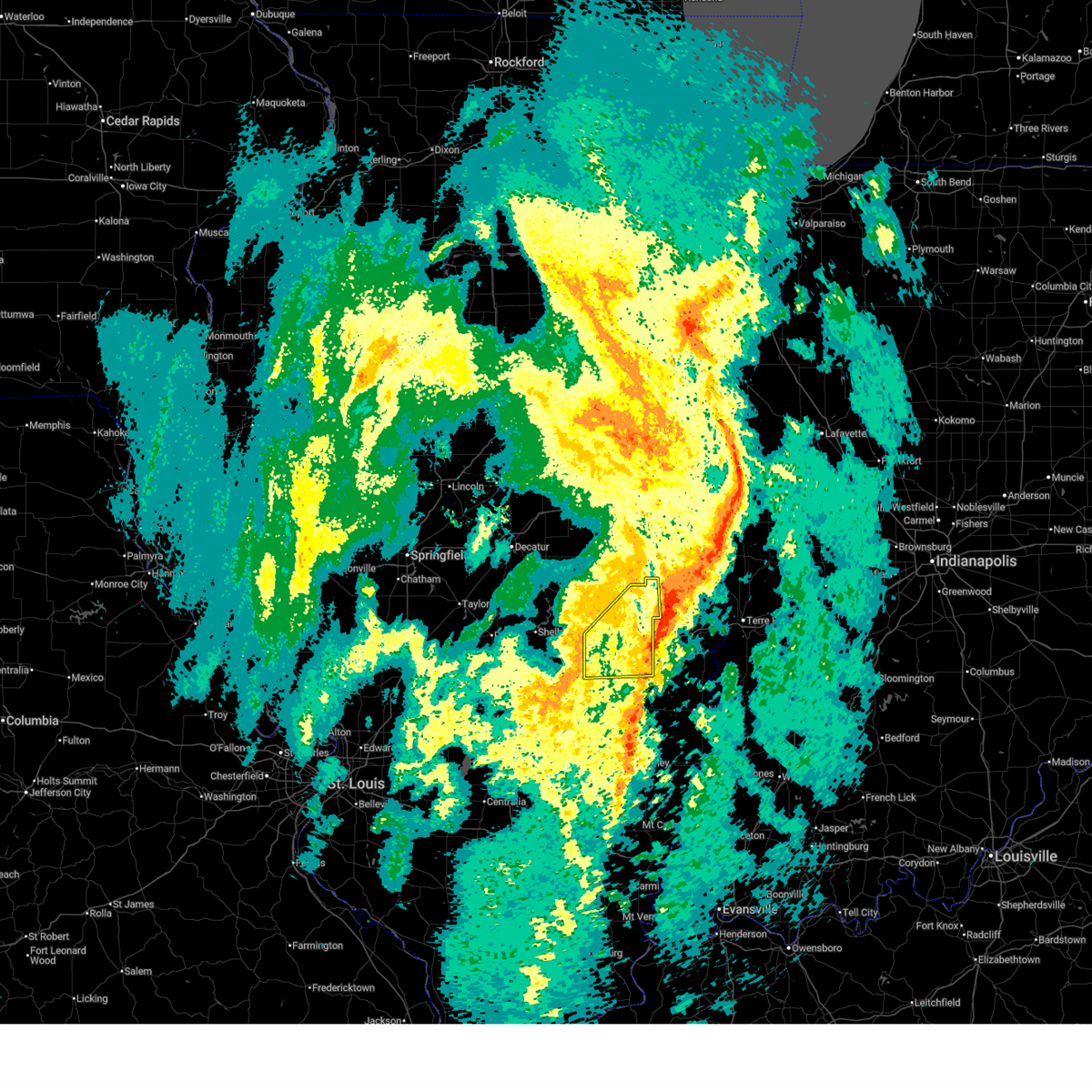
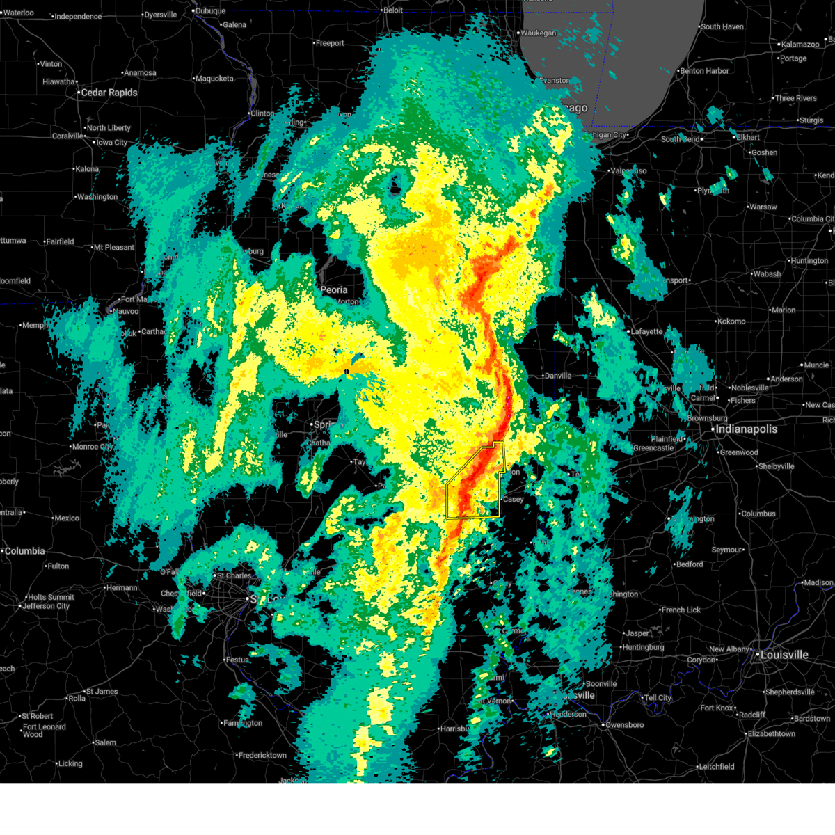
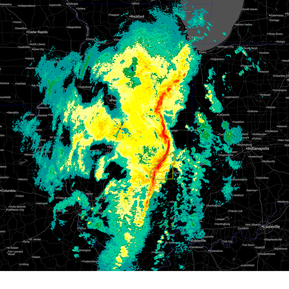
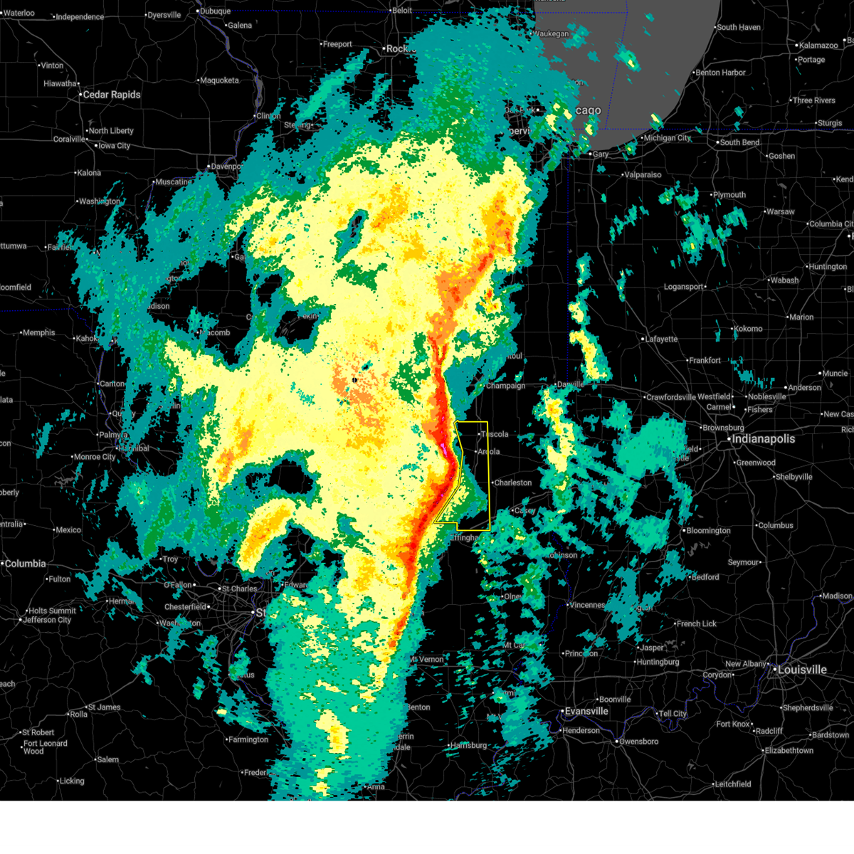
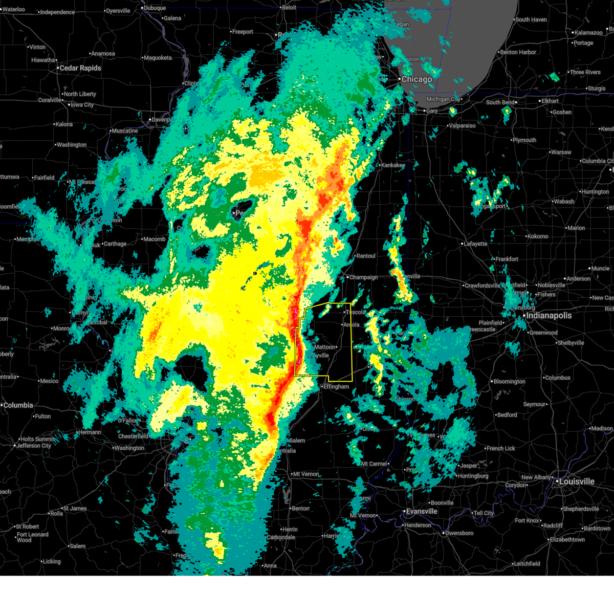
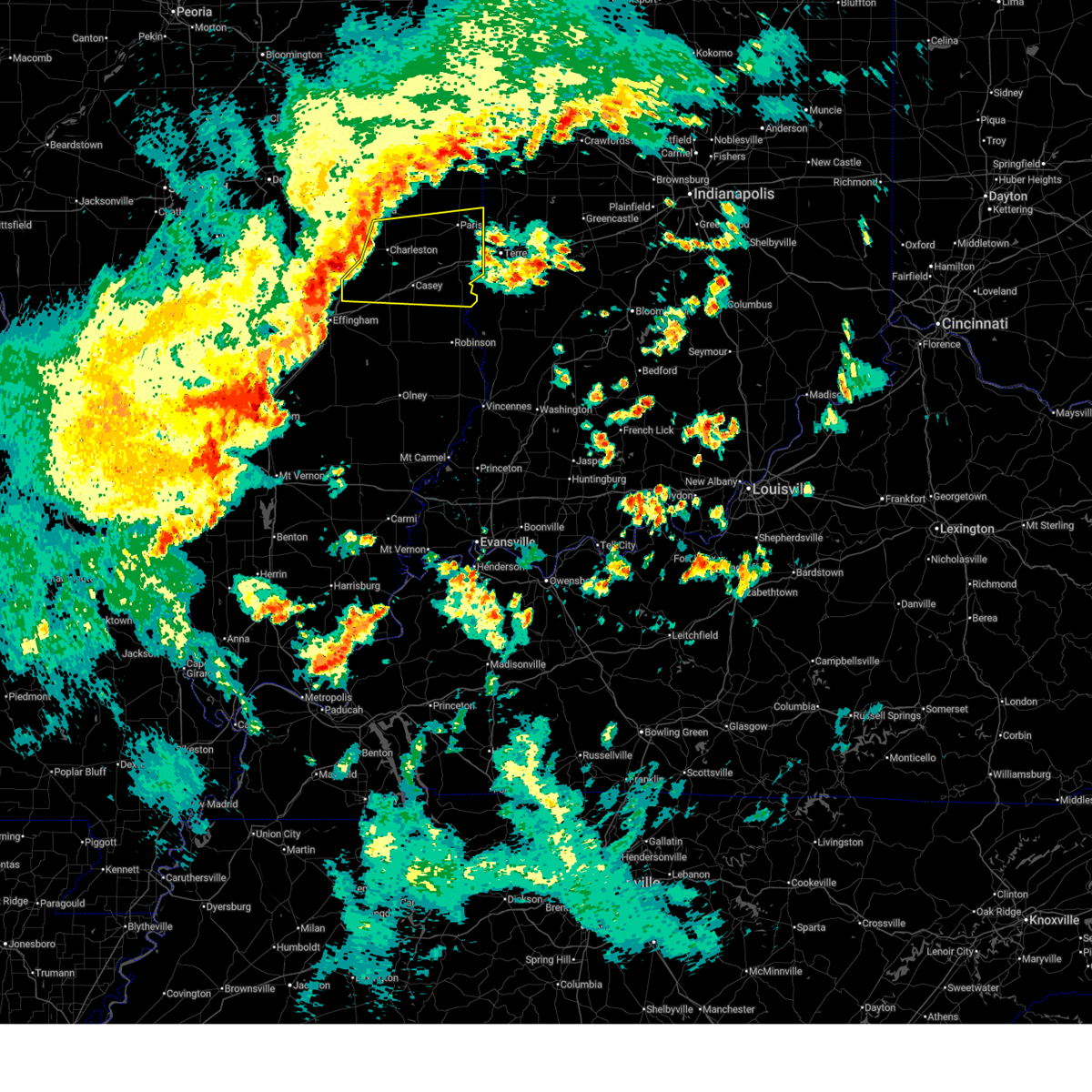
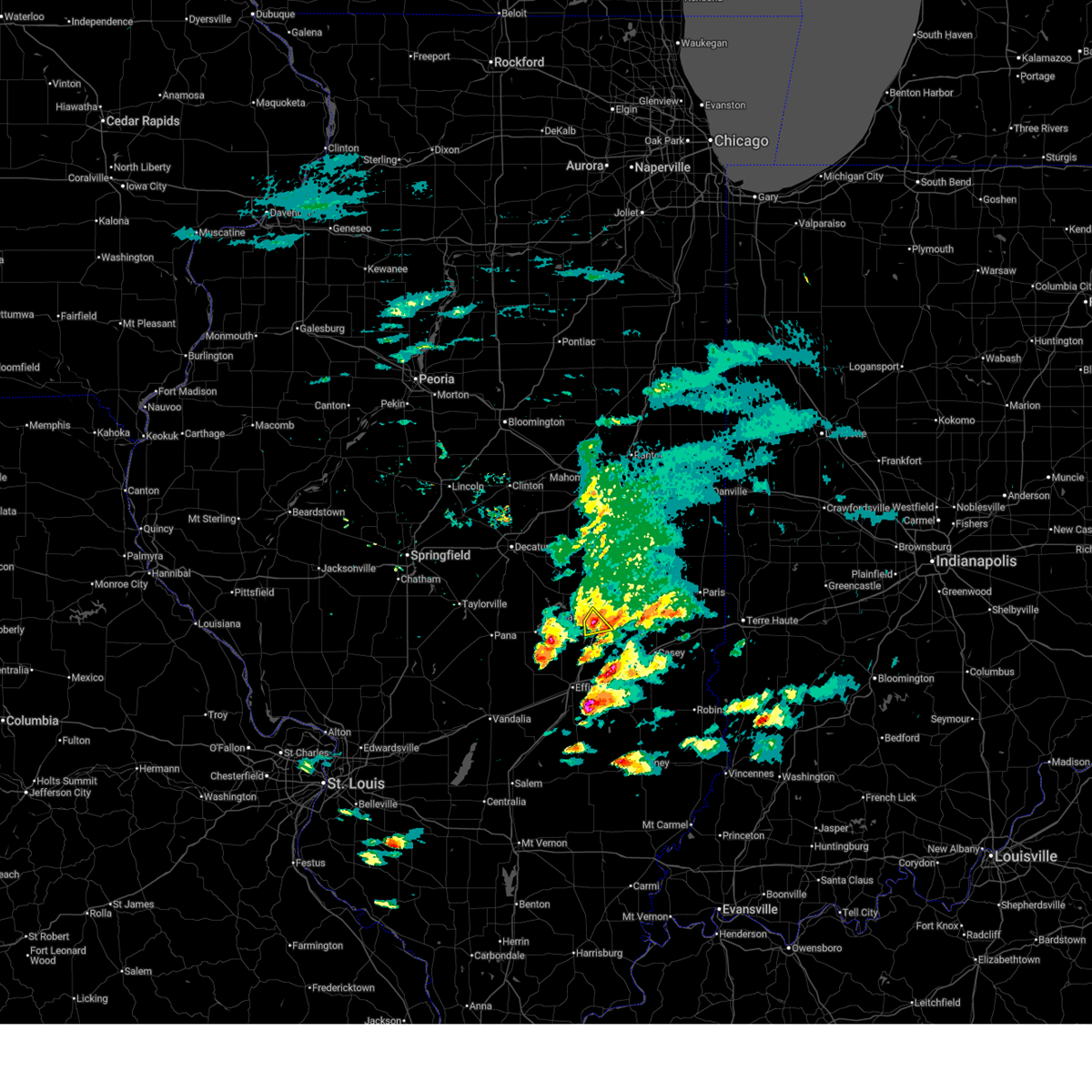
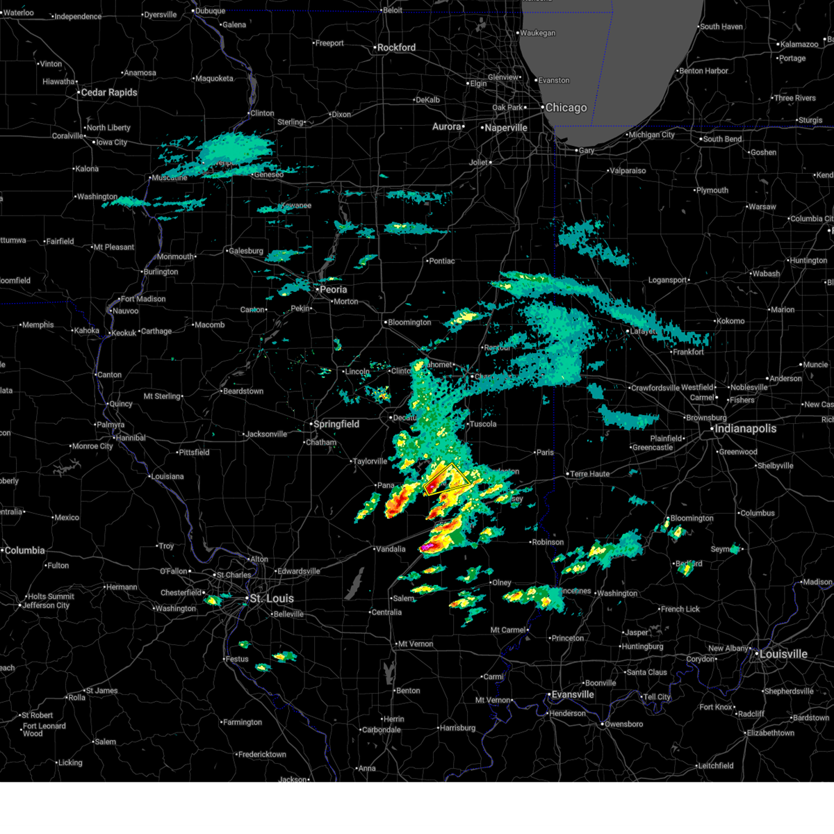
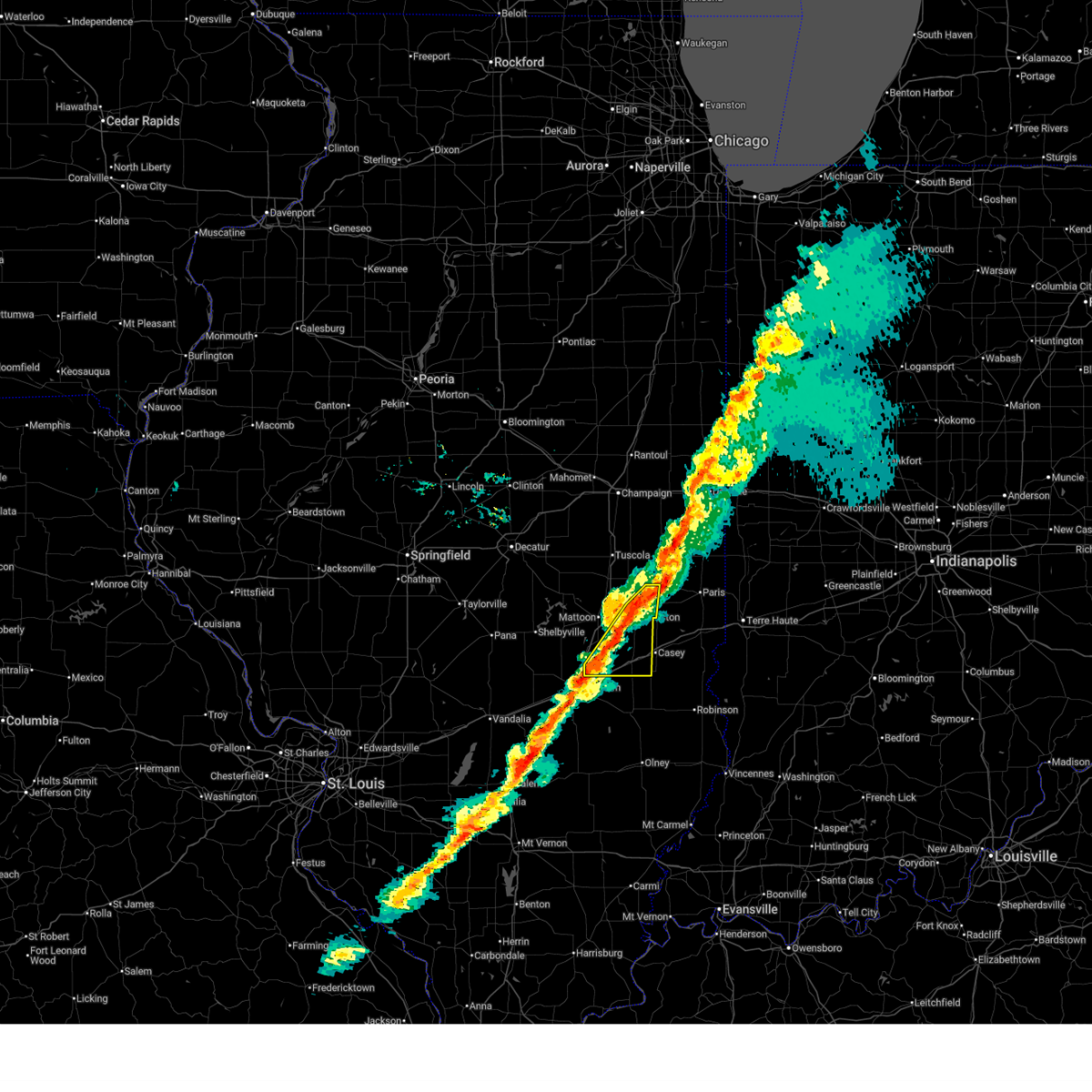
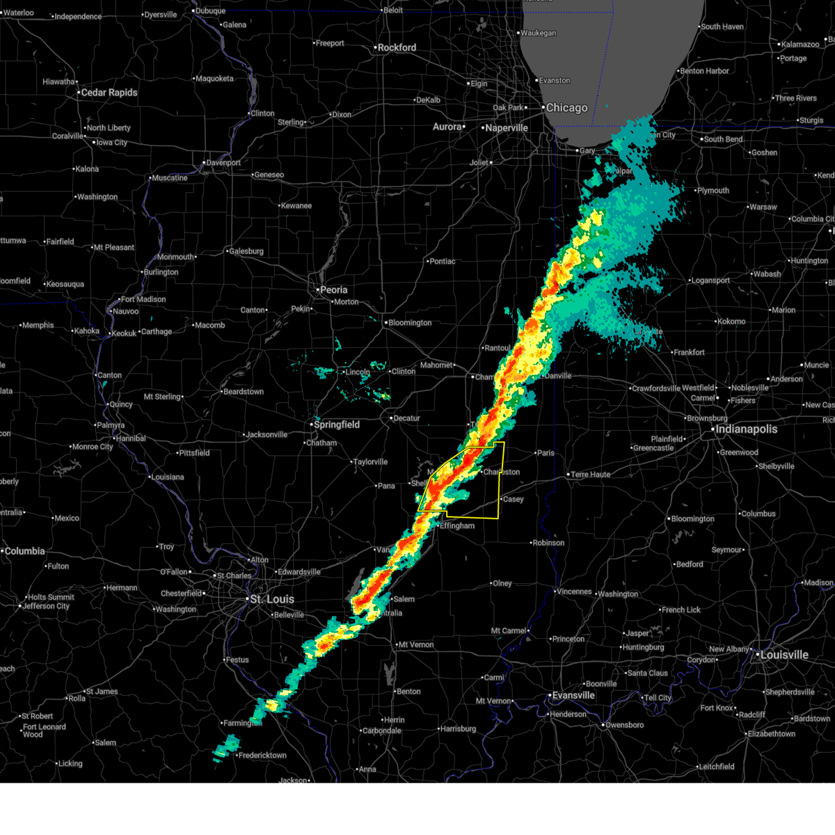
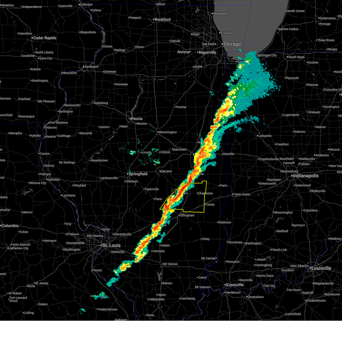
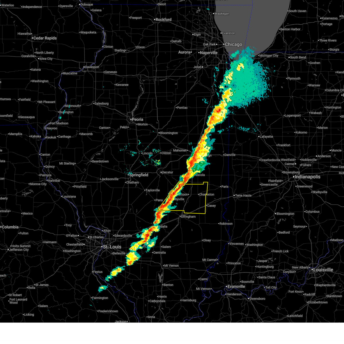
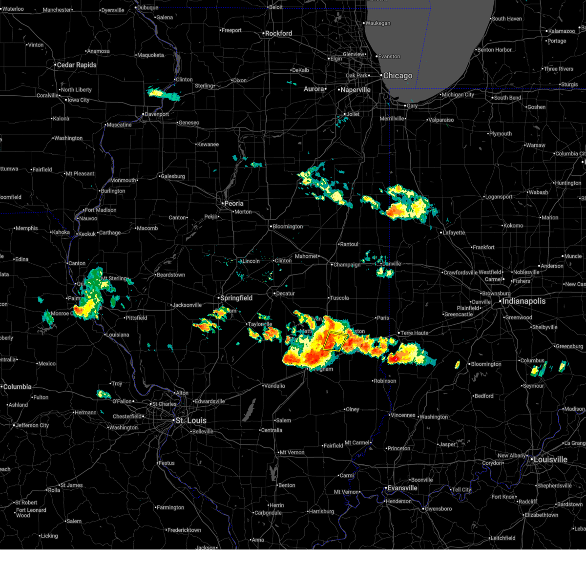
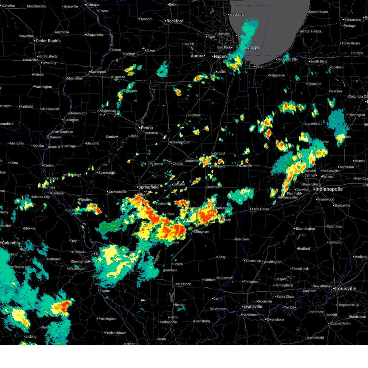
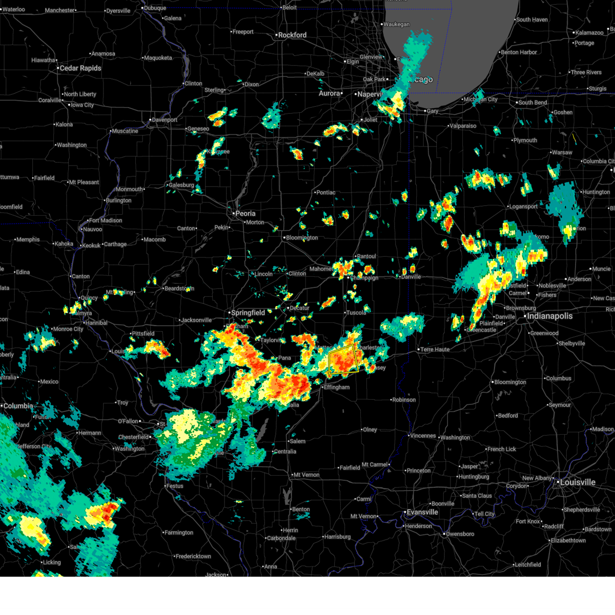
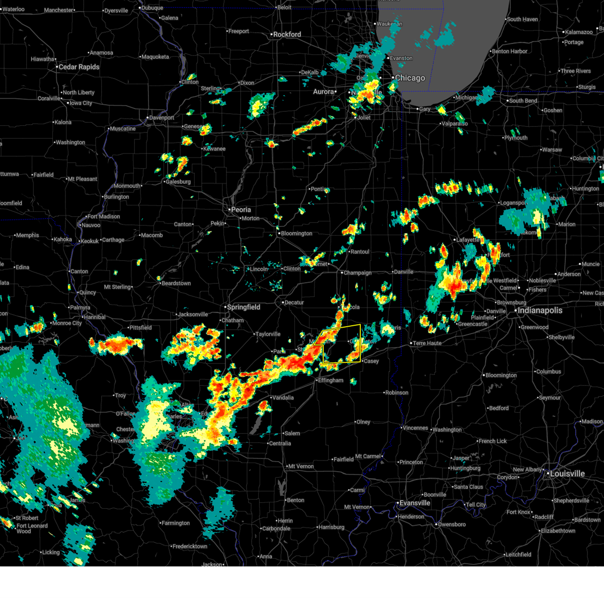
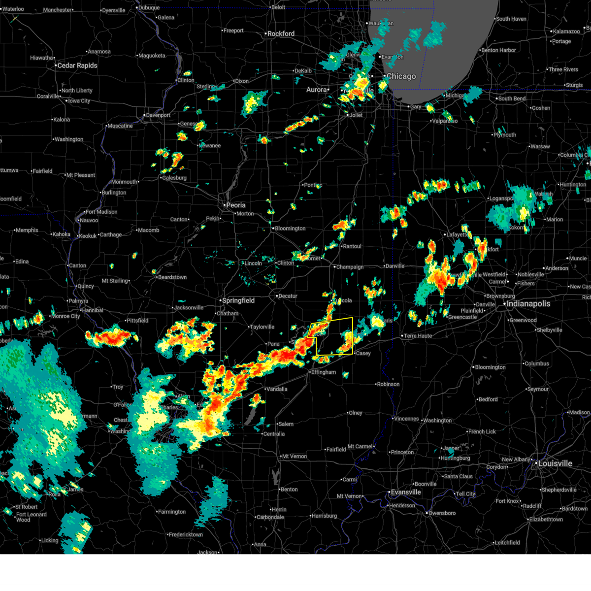
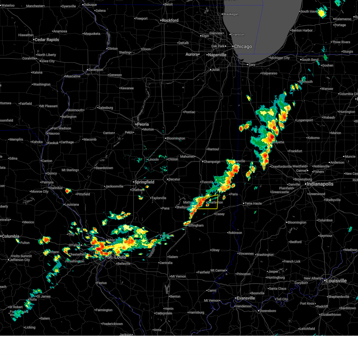
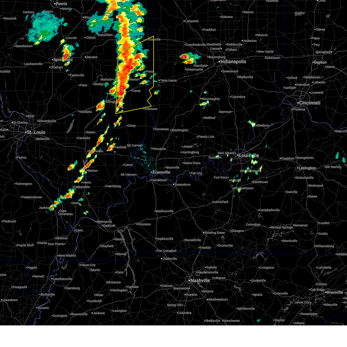
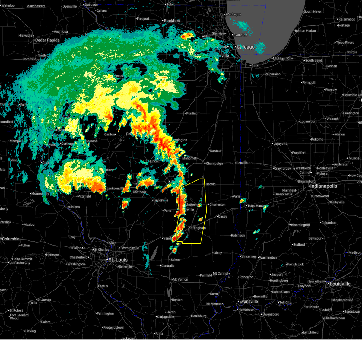
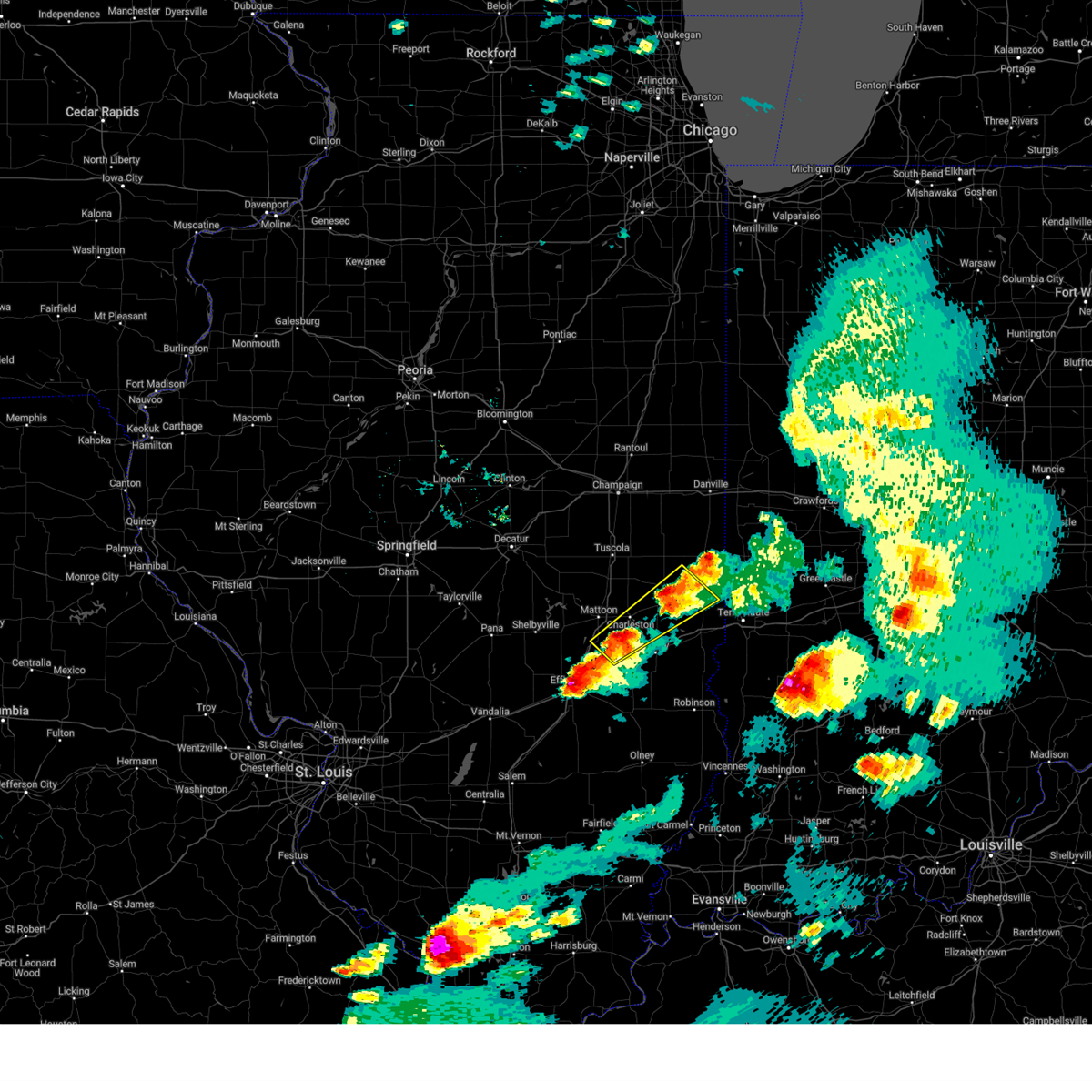
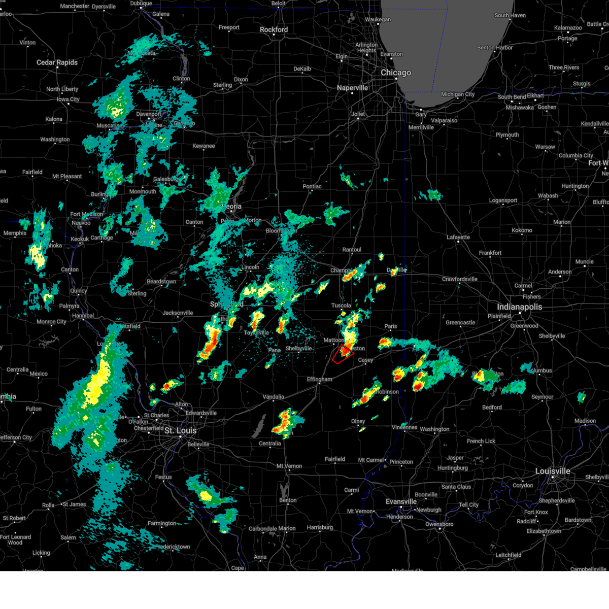
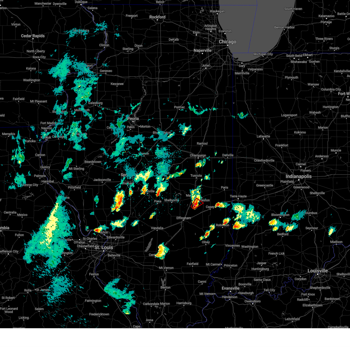
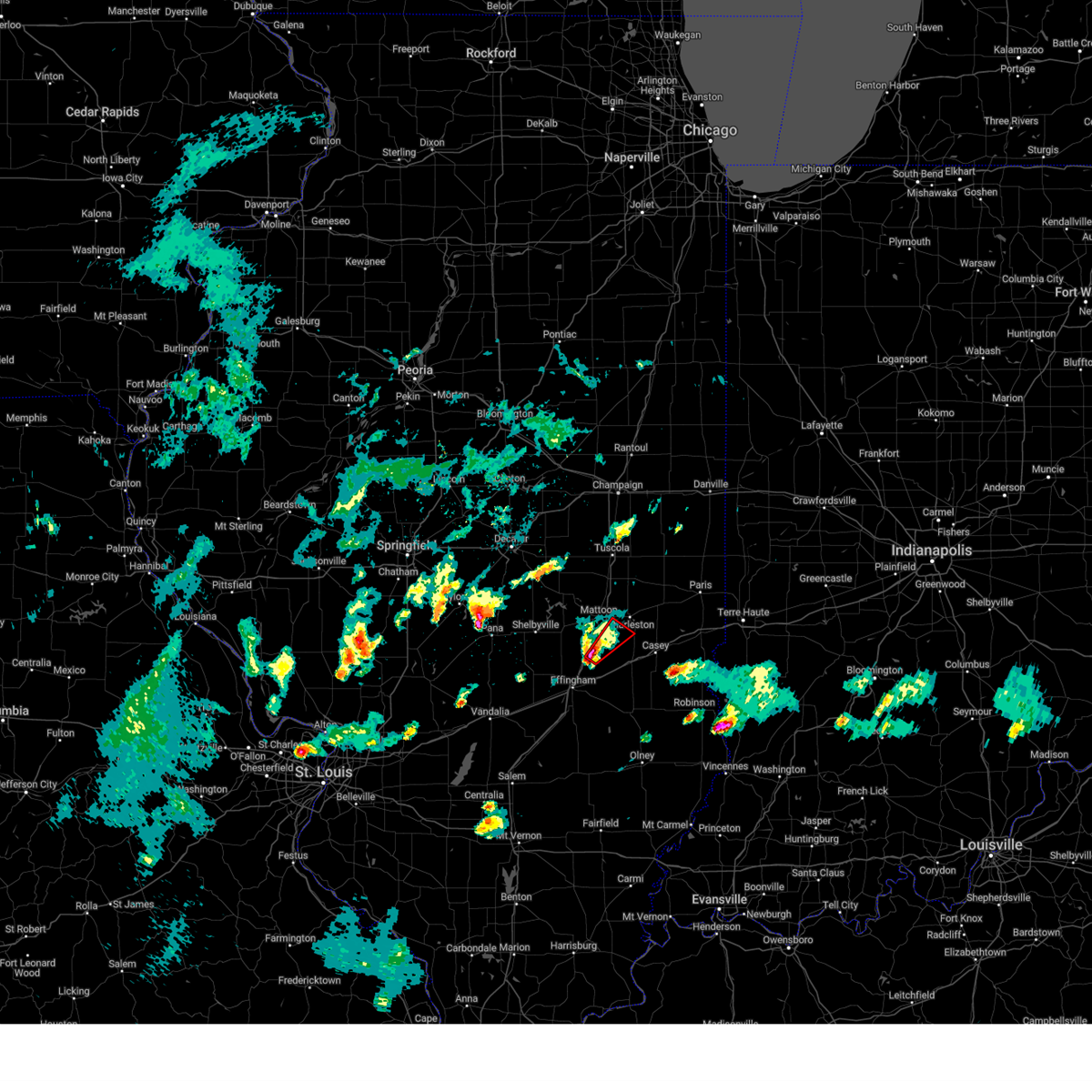
Hail Map for Lerna, IL
The Lerna, IL area has had 3 reports of on-the-ground hail by trained spotters, and has been under severe weather warnings 39 times during the past 12 months. Doppler radar has detected hail at or near Lerna, IL on 68 occasions, including 6 occasions during the past year.
| Name: | Lerna, IL |
| Where Located: | 6.4 miles SE of Mattoon, IL |
| Map: | Google Map for Lerna, IL |
| Population: | 286 |
| Housing Units: | 129 |
| More Info: | Search Google for Lerna, IL |
3
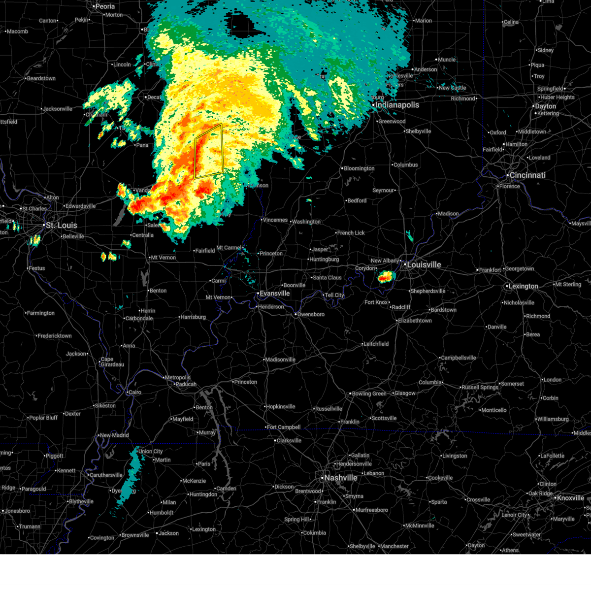
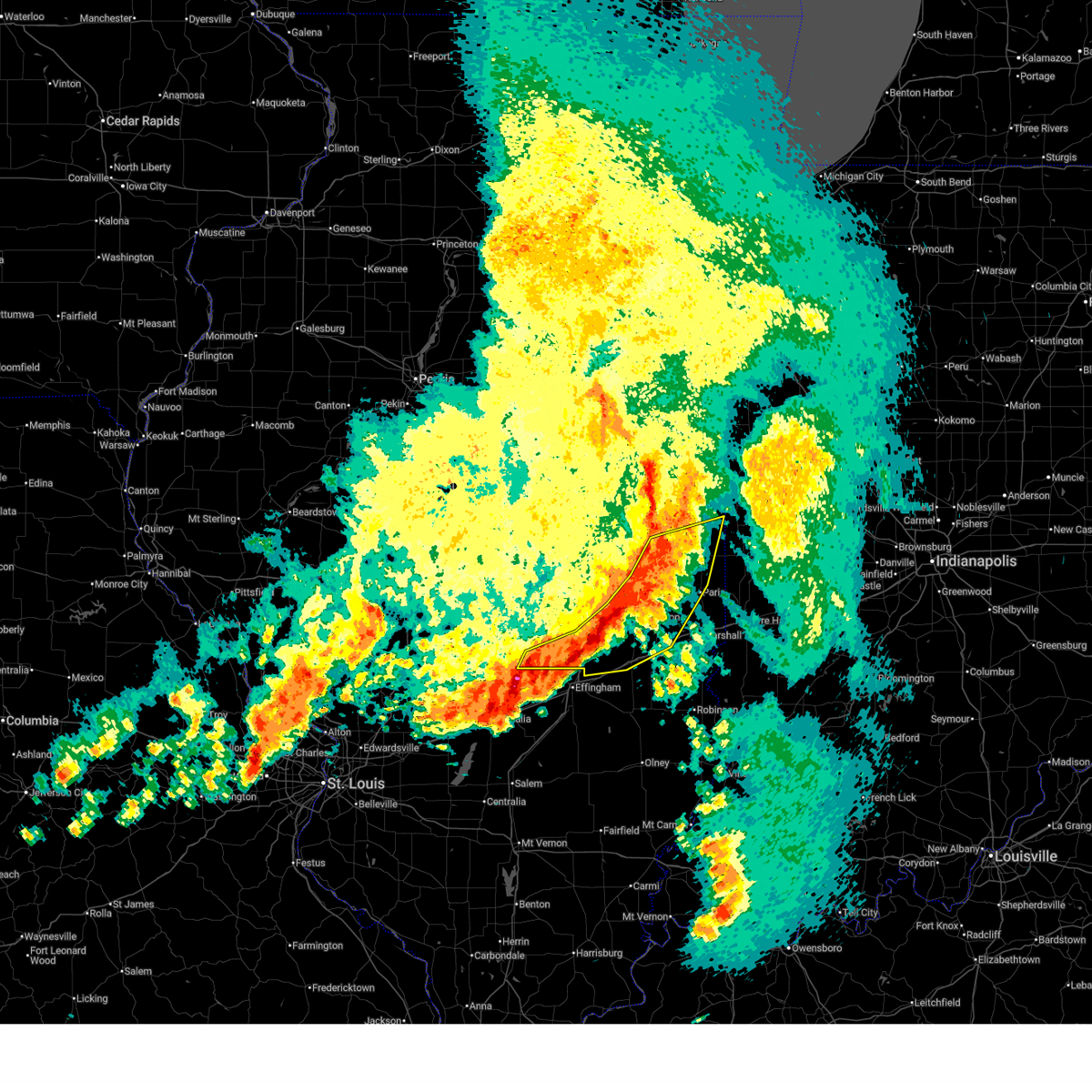
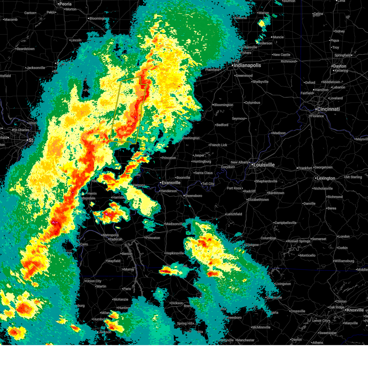
The Top Recent Hail Date for Lerna, IL is Monday, May 18, 2026 (11th out of 68)
Hail and Wind Damage Spotted near Lerna, IL
| Date / Time | Report Details |
|---|---|
| 6/21/2026 4:01 PM CDT |
 At 401 pm cdt, severe thunderstorms were located along a line extending from near charleston to near montrose, moving east at 40 mph (radar indicated). Hazards include 60 mph wind gusts. Expect damage to roofs, siding, and trees. these severe storms will be near, charleston, greenup, toledo, jewett, and janesville around 405 pm cdt. hidalgo around 410 pm cdt. ashmore around 415 pm cdt. casey around 420 pm cdt. other locations impacted by these severe thunderstorms include hazel dell, fox ridge state park, woodbury, rose hill, and coles county airport. this also includes fox ridge state park. This includes interstate 70 between mile markers 107 and 127. At 401 pm cdt, severe thunderstorms were located along a line extending from near charleston to near montrose, moving east at 40 mph (radar indicated). Hazards include 60 mph wind gusts. Expect damage to roofs, siding, and trees. these severe storms will be near, charleston, greenup, toledo, jewett, and janesville around 405 pm cdt. hidalgo around 410 pm cdt. ashmore around 415 pm cdt. casey around 420 pm cdt. other locations impacted by these severe thunderstorms include hazel dell, fox ridge state park, woodbury, rose hill, and coles county airport. this also includes fox ridge state park. This includes interstate 70 between mile markers 107 and 127.
|
| 6/21/2026 3:38 PM CDT |
 Svrilx the national weather service in lincoln has issued a * severe thunderstorm warning for, southern coles county in east central illinois, northern jasper county in southeastern illinois, southeastern shelby county in central illinois, cumberland county in east central illinois, northeastern effingham county in south central illinois, * until 445 pm cdt. * at 338 pm cdt, severe thunderstorms were located along a line extending from near neoga to teutopolis, moving northeast at 40 mph (radar indicated). Hazards include 60 mph wind gusts. Expect damage to roofs, siding, and trees. severe thunderstorms will be near, mattoon, neoga, lerna, and montrose around 345 pm cdt. toledo and janesville around 350 pm cdt. charleston and jewett around 355 pm cdt. other locations in the path of these severe thunderstorms include greenup, ashmore and casey. this includes the following highways, interstate 57 between mile markers 164 and 192. interstate 70 between mile markers 97 and 127. This also includes fox ridge state park. Svrilx the national weather service in lincoln has issued a * severe thunderstorm warning for, southern coles county in east central illinois, northern jasper county in southeastern illinois, southeastern shelby county in central illinois, cumberland county in east central illinois, northeastern effingham county in south central illinois, * until 445 pm cdt. * at 338 pm cdt, severe thunderstorms were located along a line extending from near neoga to teutopolis, moving northeast at 40 mph (radar indicated). Hazards include 60 mph wind gusts. Expect damage to roofs, siding, and trees. severe thunderstorms will be near, mattoon, neoga, lerna, and montrose around 345 pm cdt. toledo and janesville around 350 pm cdt. charleston and jewett around 355 pm cdt. other locations in the path of these severe thunderstorms include greenup, ashmore and casey. this includes the following highways, interstate 57 between mile markers 164 and 192. interstate 70 between mile markers 97 and 127. This also includes fox ridge state park.
|
| 6/17/2026 9:12 PM CDT |
 Svrilx the national weather service in lincoln has issued a * severe thunderstorm warning for, eastern coles county in east central illinois, edgar county in east central illinois, northern clark county in east central illinois, southeastern douglas county in east central illinois, * until 1000 pm cdt. * at 912 pm cdt, severe thunderstorms were located along a line extending from 6 miles east of edgar county airport to near paris to near charleston, moving east at 55 mph (radar indicated). Hazards include 60 mph wind gusts and quarter size hail. Hail damage to vehicles is expected. expect wind damage to roofs, siding, and trees. severe thunderstorms will be near, paris, kansas, ashmore, westfield, and vermilion around 915 pm cdt. this includes interstate 70 between mile markers 137 and 154. This also includes fox ridge state park and walnut point state park. Svrilx the national weather service in lincoln has issued a * severe thunderstorm warning for, eastern coles county in east central illinois, edgar county in east central illinois, northern clark county in east central illinois, southeastern douglas county in east central illinois, * until 1000 pm cdt. * at 912 pm cdt, severe thunderstorms were located along a line extending from 6 miles east of edgar county airport to near paris to near charleston, moving east at 55 mph (radar indicated). Hazards include 60 mph wind gusts and quarter size hail. Hail damage to vehicles is expected. expect wind damage to roofs, siding, and trees. severe thunderstorms will be near, paris, kansas, ashmore, westfield, and vermilion around 915 pm cdt. this includes interstate 70 between mile markers 137 and 154. This also includes fox ridge state park and walnut point state park.
|
| 6/17/2026 7:49 PM CDT |
 Svrilx the national weather service in lincoln has issued a * severe thunderstorm warning for, southwestern coles county in east central illinois, crawford county in east central illinois, northern jasper county in southeastern illinois, clark county in east central illinois, cumberland county in east central illinois, northeastern effingham county in south central illinois, * until 845 pm cdt. * at 749 pm cdt, a severe thunderstorm was located near neoga, moving east at 80 mph (radar indicated). Hazards include tennis ball size hail and 60 mph wind gusts. People and animals outdoors will be injured. expect hail damage to roofs, siding, windows, and vehicles. expect wind damage to roofs, siding, and trees. this severe thunderstorm will be near, neoga around 755 pm cdt. greenup and toledo around 800 pm cdt. other locations in the path of this severe thunderstorm include casey. this includes the following highways, interstate 57 between mile markers 173 and 184. interstate 70 between mile markers 100 and 138. This also includes crawford county fish and wildlife area, fox ridge state park, lincoln trail state park, and sam parr state fish and wildlife area. Svrilx the national weather service in lincoln has issued a * severe thunderstorm warning for, southwestern coles county in east central illinois, crawford county in east central illinois, northern jasper county in southeastern illinois, clark county in east central illinois, cumberland county in east central illinois, northeastern effingham county in south central illinois, * until 845 pm cdt. * at 749 pm cdt, a severe thunderstorm was located near neoga, moving east at 80 mph (radar indicated). Hazards include tennis ball size hail and 60 mph wind gusts. People and animals outdoors will be injured. expect hail damage to roofs, siding, windows, and vehicles. expect wind damage to roofs, siding, and trees. this severe thunderstorm will be near, neoga around 755 pm cdt. greenup and toledo around 800 pm cdt. other locations in the path of this severe thunderstorm include casey. this includes the following highways, interstate 57 between mile markers 173 and 184. interstate 70 between mile markers 100 and 138. This also includes crawford county fish and wildlife area, fox ridge state park, lincoln trail state park, and sam parr state fish and wildlife area.
|
| 6/17/2026 6:44 PM CDT |
 Svrilx the national weather service in lincoln has issued a * severe thunderstorm warning for, coles county in east central illinois, northeastern cumberland county in east central illinois, southeastern douglas county in east central illinois, * until 730 pm cdt. * at 643 pm cdt, a severe thunderstorm was located over cooks mill, or near mattoon, moving southeast at 45 mph. this is a destructive storm for humboldt, mattoon, and charleston (radar indicated). Hazards include 80 mph wind gusts and baseball size hail. Flying debris will be dangerous to those caught without shelter. mobile homes will be heavily damaged. expect considerable damage to roofs, windows, and vehicles. extensive tree damage and power outages are likely. this severe thunderstorm will be near, charleston around 650 pm cdt. this includes the following highways, interstate 57 between mile markers 185 and 204. interstate 70 between mile markers 125 and 126. This also includes fox ridge state park and walnut point state park. Svrilx the national weather service in lincoln has issued a * severe thunderstorm warning for, coles county in east central illinois, northeastern cumberland county in east central illinois, southeastern douglas county in east central illinois, * until 730 pm cdt. * at 643 pm cdt, a severe thunderstorm was located over cooks mill, or near mattoon, moving southeast at 45 mph. this is a destructive storm for humboldt, mattoon, and charleston (radar indicated). Hazards include 80 mph wind gusts and baseball size hail. Flying debris will be dangerous to those caught without shelter. mobile homes will be heavily damaged. expect considerable damage to roofs, windows, and vehicles. extensive tree damage and power outages are likely. this severe thunderstorm will be near, charleston around 650 pm cdt. this includes the following highways, interstate 57 between mile markers 185 and 204. interstate 70 between mile markers 125 and 126. This also includes fox ridge state park and walnut point state park.
|
| 6/11/2026 9:59 PM CDT |
 At 959 pm cdt, severe thunderstorms were located along a line extending from near ridge farm to near casey, moving east at 55 mph (radar indicated). Hazards include 60 mph wind gusts and nickel size hail. Expect damage to roofs, siding, and trees. these severe storms will be near, paris, marshall, chrisman, and edgar county airport around 1005 pm cdt. vermilion around 1010 pm cdt. other locations impacted by these severe thunderstorms include isabel, trowbridge, edgar, clarksville, etna, oliver, walnut point state park, fairgrange, loxa, and hindsboro. this includes the following highways, interstate 57 between mile markers 172 and 203. Interstate 70 between mile markers 116 and 119, and between mile markers 121 and 154. At 959 pm cdt, severe thunderstorms were located along a line extending from near ridge farm to near casey, moving east at 55 mph (radar indicated). Hazards include 60 mph wind gusts and nickel size hail. Expect damage to roofs, siding, and trees. these severe storms will be near, paris, marshall, chrisman, and edgar county airport around 1005 pm cdt. vermilion around 1010 pm cdt. other locations impacted by these severe thunderstorms include isabel, trowbridge, edgar, clarksville, etna, oliver, walnut point state park, fairgrange, loxa, and hindsboro. this includes the following highways, interstate 57 between mile markers 172 and 203. Interstate 70 between mile markers 116 and 119, and between mile markers 121 and 154.
|
| 6/11/2026 9:24 PM CDT |
 Svrilx the national weather service in lincoln has issued a * severe thunderstorm warning for, coles county in east central illinois, edgar county in east central illinois, southeastern moultrie county in central illinois, clark county in east central illinois, southeastern shelby county in central illinois, cumberland county in east central illinois, douglas county in east central illinois, * until 1030 pm cdt. * at 924 pm cdt, severe thunderstorms were located along a line extending from near sadorus to near stewardson, moving east at 55 mph (radar indicated). Hazards include 70 mph wind gusts and nickel size hail. Expect considerable tree damage. damage is likely to mobile homes, roofs, and outbuildings. severe thunderstorms will be near, mattoon, tuscola, arcola, neoga, villa grove, camargo, humboldt, and lerna around 930 pm cdt. charleston, toledo, and janesville around 935 pm cdt. greenup, oakland, newman, and rardin around 940 pm cdt. other locations in the path of these severe thunderstorms include ashmore, westfield, brocton, casey, kansas, hume, martinsville, paris, chrisman, edgar county airport and marshall. this includes the following highways, interstate 57 between mile markers 172 and 217. Interstate 70 between mile markers 116 and 119, and between mile markers 121 and 154. Svrilx the national weather service in lincoln has issued a * severe thunderstorm warning for, coles county in east central illinois, edgar county in east central illinois, southeastern moultrie county in central illinois, clark county in east central illinois, southeastern shelby county in central illinois, cumberland county in east central illinois, douglas county in east central illinois, * until 1030 pm cdt. * at 924 pm cdt, severe thunderstorms were located along a line extending from near sadorus to near stewardson, moving east at 55 mph (radar indicated). Hazards include 70 mph wind gusts and nickel size hail. Expect considerable tree damage. damage is likely to mobile homes, roofs, and outbuildings. severe thunderstorms will be near, mattoon, tuscola, arcola, neoga, villa grove, camargo, humboldt, and lerna around 930 pm cdt. charleston, toledo, and janesville around 935 pm cdt. greenup, oakland, newman, and rardin around 940 pm cdt. other locations in the path of these severe thunderstorms include ashmore, westfield, brocton, casey, kansas, hume, martinsville, paris, chrisman, edgar county airport and marshall. this includes the following highways, interstate 57 between mile markers 172 and 217. Interstate 70 between mile markers 116 and 119, and between mile markers 121 and 154.
|
| 5/18/2026 9:44 AM CDT |
 Svrilx the national weather service in lincoln has issued a * severe thunderstorm warning for, eastern coles county in east central illinois, southwestern edgar county in east central illinois, southeastern douglas county in east central illinois, * until 1030 am cdt. * at 944 am cdt, a severe thunderstorm was located near lerna, or near charleston, moving northeast at 45 mph (radar indicated). Hazards include 60 mph wind gusts. Expect damage to roofs, siding, and trees. this severe thunderstorm will be near, charleston around 950 am cdt. rardin around 955 am cdt. oakland around 1000 am cdt. This includes interstate 57 between mile markers 188 and 189. Svrilx the national weather service in lincoln has issued a * severe thunderstorm warning for, eastern coles county in east central illinois, southwestern edgar county in east central illinois, southeastern douglas county in east central illinois, * until 1030 am cdt. * at 944 am cdt, a severe thunderstorm was located near lerna, or near charleston, moving northeast at 45 mph (radar indicated). Hazards include 60 mph wind gusts. Expect damage to roofs, siding, and trees. this severe thunderstorm will be near, charleston around 950 am cdt. rardin around 955 am cdt. oakland around 1000 am cdt. This includes interstate 57 between mile markers 188 and 189.
|
| 5/18/2026 9:40 AM CDT | Quarter sized hail reported 0.1 miles SSE of Lerna, IL, delayed report. time estimated from radar. |
| 4/27/2026 8:24 PM CDT |
 At 824 pm cdt, severe thunderstorms were located along a line extending from newport to near ashmore to montrose, moving east at 50 mph (radar indicated). Hazards include 70 mph wind gusts. Expect considerable tree damage. damage is likely to mobile homes, roofs, and outbuildings. these severe storms will be near, paris, greenup, toledo, kansas, ashmore, jewett, and edgar county airport around 830 pm cdt. other locations impacted by these severe thunderstorms include redmon, isabel, edgar, woodbury, scottland, effingham county airport, trilla, fox ridge state park, and borton. this includes the following highways, interstate 57 between mile markers 154 and 159, and between mile markers 162 and 164. Interstate 70 between mile markers 84 and 93, and between mile markers 96 and 119. At 824 pm cdt, severe thunderstorms were located along a line extending from newport to near ashmore to montrose, moving east at 50 mph (radar indicated). Hazards include 70 mph wind gusts. Expect considerable tree damage. damage is likely to mobile homes, roofs, and outbuildings. these severe storms will be near, paris, greenup, toledo, kansas, ashmore, jewett, and edgar county airport around 830 pm cdt. other locations impacted by these severe thunderstorms include redmon, isabel, edgar, woodbury, scottland, effingham county airport, trilla, fox ridge state park, and borton. this includes the following highways, interstate 57 between mile markers 154 and 159, and between mile markers 162 and 164. Interstate 70 between mile markers 84 and 93, and between mile markers 96 and 119.
|
| 4/27/2026 8:13 PM CDT |
 At 812 pm cdt, severe thunderstorms were located along a line extending from near ridge farm to near charleston to near effingham, moving east at 50 mph (radar indicated). Hazards include 70 mph wind gusts. Expect considerable tree damage. damage is likely to mobile homes, roofs, and outbuildings. these severe storms will be near, charleston, toledo, chrisman, kansas, ashmore, montrose, janesville, and edgar county airport around 820 pm cdt. paris, greenup, and jewett around 825 pm cdt. other locations impacted by these severe thunderstorms include isabel, edgar, trowbridge, etna, fairgrange, walnut point state park, loxa, fox ridge state park, hindsboro, and bushton. this includes the following highways, interstate 57 between mile markers 154 and 195. Interstate 70 between mile markers 83 and 119. At 812 pm cdt, severe thunderstorms were located along a line extending from near ridge farm to near charleston to near effingham, moving east at 50 mph (radar indicated). Hazards include 70 mph wind gusts. Expect considerable tree damage. damage is likely to mobile homes, roofs, and outbuildings. these severe storms will be near, charleston, toledo, chrisman, kansas, ashmore, montrose, janesville, and edgar county airport around 820 pm cdt. paris, greenup, and jewett around 825 pm cdt. other locations impacted by these severe thunderstorms include isabel, edgar, trowbridge, etna, fairgrange, walnut point state park, loxa, fox ridge state park, hindsboro, and bushton. this includes the following highways, interstate 57 between mile markers 154 and 195. Interstate 70 between mile markers 83 and 119.
|
| 4/27/2026 8:00 PM CDT |
 At 800 pm cdt, severe thunderstorms were located along a line extending from near sidell to mattoon to near shumway, moving east at 50 mph (radar indicated). Hazards include 70 mph wind gusts. Expect considerable tree damage. damage is likely to mobile homes, roofs, and outbuildings. these severe storms will be near, charleston, mattoon, effingham, neoga, chrisman, oakland, hume, brocton, lerna, and shumway around 805 pm cdt. teutopolis, ashmore, and janesville around 810 pm cdt. kansas, montrose, and edgar county airport around 815 pm cdt. toledo around 820 pm cdt. paris, greenup, and jewett around 825 pm cdt. other locations impacted by these severe thunderstorms include isabel, edgar, trowbridge, etna, fairgrange, walnut point state park, loxa, fox ridge state park, hindsboro, and strasburg. this includes the following highways, interstate 57 between mile markers 154 and 202. Interstate 70 between mile markers 81 and 119. At 800 pm cdt, severe thunderstorms were located along a line extending from near sidell to mattoon to near shumway, moving east at 50 mph (radar indicated). Hazards include 70 mph wind gusts. Expect considerable tree damage. damage is likely to mobile homes, roofs, and outbuildings. these severe storms will be near, charleston, mattoon, effingham, neoga, chrisman, oakland, hume, brocton, lerna, and shumway around 805 pm cdt. teutopolis, ashmore, and janesville around 810 pm cdt. kansas, montrose, and edgar county airport around 815 pm cdt. toledo around 820 pm cdt. paris, greenup, and jewett around 825 pm cdt. other locations impacted by these severe thunderstorms include isabel, edgar, trowbridge, etna, fairgrange, walnut point state park, loxa, fox ridge state park, hindsboro, and strasburg. this includes the following highways, interstate 57 between mile markers 154 and 202. Interstate 70 between mile markers 81 and 119.
|
| 4/27/2026 7:38 PM CDT |
 Svrilx the national weather service in lincoln has issued a * severe thunderstorm warning for, coles county in east central illinois, edgar county in east central illinois, southeastern moultrie county in central illinois, southeastern shelby county in central illinois, cumberland county in east central illinois, eastern douglas county in east central illinois, northern effingham county in south central illinois, * until 845 pm cdt. * at 738 pm cdt, severe thunderstorms were located along a line extending from near villa grove to near findlay to near ramsey, moving east at 50 mph (radar indicated). Hazards include 70 mph wind gusts. Expect considerable tree damage. damage is likely to mobile homes, roofs, and outbuildings. severe thunderstorms will be near, arcola, newman, windsor, cowden, beecher city, humboldt, allenville, and cooks mill around 745 pm cdt. mattoon, stewardson, and hume around 750 pm cdt. oakland, brocton, shumway, and rardin around 755 pm cdt. other locations in the path of these severe thunderstorms include neoga, chrisman, charleston, effingham, lerna, teutopolis, ashmore, janesville, toledo, kansas, montrose, edgar county airport, paris and jewett. this includes the following highways, interstate 57 between mile markers 154 and 205. Interstate 70 between mile markers 81 and 119. Svrilx the national weather service in lincoln has issued a * severe thunderstorm warning for, coles county in east central illinois, edgar county in east central illinois, southeastern moultrie county in central illinois, southeastern shelby county in central illinois, cumberland county in east central illinois, eastern douglas county in east central illinois, northern effingham county in south central illinois, * until 845 pm cdt. * at 738 pm cdt, severe thunderstorms were located along a line extending from near villa grove to near findlay to near ramsey, moving east at 50 mph (radar indicated). Hazards include 70 mph wind gusts. Expect considerable tree damage. damage is likely to mobile homes, roofs, and outbuildings. severe thunderstorms will be near, arcola, newman, windsor, cowden, beecher city, humboldt, allenville, and cooks mill around 745 pm cdt. mattoon, stewardson, and hume around 750 pm cdt. oakland, brocton, shumway, and rardin around 755 pm cdt. other locations in the path of these severe thunderstorms include neoga, chrisman, charleston, effingham, lerna, teutopolis, ashmore, janesville, toledo, kansas, montrose, edgar county airport, paris and jewett. this includes the following highways, interstate 57 between mile markers 154 and 205. Interstate 70 between mile markers 81 and 119.
|
| 4/27/2026 12:18 PM CDT |
 At 1217 pm cdt, severe thunderstorms were located along a line extending from newman to oakland to near rardin to near janesville to teutopolis, moving east at 45 mph (radar indicated). Hazards include 60 mph wind gusts and quarter size hail. Hail damage to vehicles is expected. expect wind damage to roofs, siding, and trees. these severe storms will be near, greenup, toledo, kansas, ashmore, westfield, hume, brocton, and jewett around 1225 pm cdt. casey around 1230 pm cdt. paris, chrisman, and edgar county airport around 1235 pm cdt. martinsville around 1240 pm cdt. other locations impacted by these severe thunderstorms include murdock, isabel, edgar, trowbridge, clarksburg, etna, indianola, walnut point state park, fairgrange, and mode. this includes the following highways, interstate 57 between mile markers 169 and 194. Interstate 70 between mile markers 109 and 119, and between mile markers 121 and 135. At 1217 pm cdt, severe thunderstorms were located along a line extending from newman to oakland to near rardin to near janesville to teutopolis, moving east at 45 mph (radar indicated). Hazards include 60 mph wind gusts and quarter size hail. Hail damage to vehicles is expected. expect wind damage to roofs, siding, and trees. these severe storms will be near, greenup, toledo, kansas, ashmore, westfield, hume, brocton, and jewett around 1225 pm cdt. casey around 1230 pm cdt. paris, chrisman, and edgar county airport around 1235 pm cdt. martinsville around 1240 pm cdt. other locations impacted by these severe thunderstorms include murdock, isabel, edgar, trowbridge, clarksburg, etna, indianola, walnut point state park, fairgrange, and mode. this includes the following highways, interstate 57 between mile markers 169 and 194. Interstate 70 between mile markers 109 and 119, and between mile markers 121 and 135.
|
| 4/27/2026 12:18 PM CDT |
 the severe thunderstorm warning has been cancelled and is no longer in effect the severe thunderstorm warning has been cancelled and is no longer in effect
|
| 4/27/2026 11:43 AM CDT |
 Svrilx the national weather service in lincoln has issued a * severe thunderstorm warning for, coles county in east central illinois, edgar county in east central illinois, moultrie county in central illinois, northwestern clark county in east central illinois, eastern shelby county in central illinois, south central piatt county in central illinois, southern vermilion county in east central illinois, cumberland county in east central illinois, southeastern champaign county in east central illinois, douglas county in east central illinois, * until 1245 pm cdt. * at 1143 am cdt, severe thunderstorms were located along a line extending from near atwood to near arthur to allenville to 6 miles southeast of shelbyville to near wrights corner, moving east at 45 mph (radar indicated). Hazards include 60 mph wind gusts. Expect damage to roofs, siding, and trees. severe thunderstorms will be near, mattoon, tuscola, arcola, stewardson, humboldt, and cooks mill around 1150 am cdt. neoga and camargo around 1155 am cdt. lerna around 1200 pm cdt. other locations in the path of these severe thunderstorms include charleston, rardin, oakland, newman, janesville, toledo, ashmore, brocton, greenup, kansas, westfield, hume, jewett and casey. this includes the following highways, interstate 57 between mile markers 169 and 214. Interstate 70 between mile markers 109 and 119, and between mile markers 121 and 135. Svrilx the national weather service in lincoln has issued a * severe thunderstorm warning for, coles county in east central illinois, edgar county in east central illinois, moultrie county in central illinois, northwestern clark county in east central illinois, eastern shelby county in central illinois, south central piatt county in central illinois, southern vermilion county in east central illinois, cumberland county in east central illinois, southeastern champaign county in east central illinois, douglas county in east central illinois, * until 1245 pm cdt. * at 1143 am cdt, severe thunderstorms were located along a line extending from near atwood to near arthur to allenville to 6 miles southeast of shelbyville to near wrights corner, moving east at 45 mph (radar indicated). Hazards include 60 mph wind gusts. Expect damage to roofs, siding, and trees. severe thunderstorms will be near, mattoon, tuscola, arcola, stewardson, humboldt, and cooks mill around 1150 am cdt. neoga and camargo around 1155 am cdt. lerna around 1200 pm cdt. other locations in the path of these severe thunderstorms include charleston, rardin, oakland, newman, janesville, toledo, ashmore, brocton, greenup, kansas, westfield, hume, jewett and casey. this includes the following highways, interstate 57 between mile markers 169 and 214. Interstate 70 between mile markers 109 and 119, and between mile markers 121 and 135.
|
| 3/26/2026 9:45 PM CDT | Half Dollar sized hail reported 5.2 miles NNW of Lerna, IL |
| 3/26/2026 9:39 PM CDT |
 At 939 pm cdt, a severe thunderstorm was located over janesville, or near toledo, moving east at 60 mph (radar indicated). Hazards include 60 mph wind gusts and quarter size hail. Hail damage to vehicles is expected. expect wind damage to roofs, siding, and trees. this severe thunderstorm will remain over mainly rural areas of southern coles and cumberland counties, including the following locations, trilla, hazel dell, fox ridge state park, etna, coles county airport, and paradise. this includes the following highways, interstate 57 between mile markers 173 and 190. Interstate 70 between mile markers 113 and 126. At 939 pm cdt, a severe thunderstorm was located over janesville, or near toledo, moving east at 60 mph (radar indicated). Hazards include 60 mph wind gusts and quarter size hail. Hail damage to vehicles is expected. expect wind damage to roofs, siding, and trees. this severe thunderstorm will remain over mainly rural areas of southern coles and cumberland counties, including the following locations, trilla, hazel dell, fox ridge state park, etna, coles county airport, and paradise. this includes the following highways, interstate 57 between mile markers 173 and 190. Interstate 70 between mile markers 113 and 126.
|
| 3/26/2026 9:39 PM CDT |
 the severe thunderstorm warning has been cancelled and is no longer in effect the severe thunderstorm warning has been cancelled and is no longer in effect
|
| 3/26/2026 9:18 PM CDT |
 Svrilx the national weather service in lincoln has issued a * severe thunderstorm warning for, southern coles county in east central illinois, southeastern moultrie county in central illinois, southeastern shelby county in central illinois, cumberland county in east central illinois, * until 1015 pm cdt. * at 918 pm cdt, a severe thunderstorm was located near shelbyville, moving east at 55 mph (radar indicated). Hazards include 60 mph wind gusts and quarter size hail. Hail damage to vehicles is expected. expect wind damage to roofs, siding, and trees. this severe thunderstorm will be near, windsor around 925 pm cdt. neoga around 930 pm cdt. other locations in the path of this severe thunderstorm include janesville. this includes the following highways, interstate 57 between mile markers 171 and 190. Interstate 70 between mile markers 112 and 126. Svrilx the national weather service in lincoln has issued a * severe thunderstorm warning for, southern coles county in east central illinois, southeastern moultrie county in central illinois, southeastern shelby county in central illinois, cumberland county in east central illinois, * until 1015 pm cdt. * at 918 pm cdt, a severe thunderstorm was located near shelbyville, moving east at 55 mph (radar indicated). Hazards include 60 mph wind gusts and quarter size hail. Hail damage to vehicles is expected. expect wind damage to roofs, siding, and trees. this severe thunderstorm will be near, windsor around 925 pm cdt. neoga around 930 pm cdt. other locations in the path of this severe thunderstorm include janesville. this includes the following highways, interstate 57 between mile markers 171 and 190. Interstate 70 between mile markers 112 and 126.
|
| 3/22/2026 7:30 PM CDT |
 Svrilx the national weather service in lincoln has issued a * severe thunderstorm warning for, southern coles county in east central illinois, southwestern edgar county in east central illinois, northwestern clark county in east central illinois, northeastern cumberland county in east central illinois, * until 800 pm cdt. * at 730 pm cdt, a severe thunderstorm was located over lerna, or near mattoon, moving east at 50 mph (radar indicated). Hazards include 60 mph wind gusts and half dollar size hail. Hail damage to vehicles is expected. expect wind damage to roofs, siding, and trees. this severe thunderstorm will be near, charleston around 735 pm cdt. westfield around 745 pm cdt. this includes the following highways, interstate 57 between mile markers 185 and 193. Interstate 70 between mile markers 128 and 134. Svrilx the national weather service in lincoln has issued a * severe thunderstorm warning for, southern coles county in east central illinois, southwestern edgar county in east central illinois, northwestern clark county in east central illinois, northeastern cumberland county in east central illinois, * until 800 pm cdt. * at 730 pm cdt, a severe thunderstorm was located over lerna, or near mattoon, moving east at 50 mph (radar indicated). Hazards include 60 mph wind gusts and half dollar size hail. Hail damage to vehicles is expected. expect wind damage to roofs, siding, and trees. this severe thunderstorm will be near, charleston around 735 pm cdt. westfield around 745 pm cdt. this includes the following highways, interstate 57 between mile markers 185 and 193. Interstate 70 between mile markers 128 and 134.
|
| 3/15/2026 7:57 PM CDT |
 The storms which prompted the warning have moved out of the area. therefore, the warning will be allowed to expire. a tornado watch remains in effect until 1000 pm cdt for south central and east central illinois. The storms which prompted the warning have moved out of the area. therefore, the warning will be allowed to expire. a tornado watch remains in effect until 1000 pm cdt for south central and east central illinois.
|
| 3/15/2026 7:26 PM CDT |
 the severe thunderstorm warning has been cancelled and is no longer in effect the severe thunderstorm warning has been cancelled and is no longer in effect
|
| 3/15/2026 7:26 PM CDT |
 At 725 pm cdt, severe thunderstorms were located along a line extending from near lerna to near bible grove, moving northeast at 60 mph (radar indicated). Hazards include 60 mph wind gusts and penny size hail. Expect damage to roofs, siding, and trees. these severe storms will be near, charleston, mattoon, toledo, lerna, jewett, and janesville around 730 pm cdt. greenup and rardin around 740 pm cdt. oakland and ashmore around 745 pm cdt. other locations impacted by these severe thunderstorms include hazel dell, etna, woodbury, coles county airport, fairgrange, trilla, loxa, fox ridge state park, bushton, and paradise. this includes the following highways, interstate 57 between mile markers 173 and 192. Interstate 70 between mile markers 106 and 126. At 725 pm cdt, severe thunderstorms were located along a line extending from near lerna to near bible grove, moving northeast at 60 mph (radar indicated). Hazards include 60 mph wind gusts and penny size hail. Expect damage to roofs, siding, and trees. these severe storms will be near, charleston, mattoon, toledo, lerna, jewett, and janesville around 730 pm cdt. greenup and rardin around 740 pm cdt. oakland and ashmore around 745 pm cdt. other locations impacted by these severe thunderstorms include hazel dell, etna, woodbury, coles county airport, fairgrange, trilla, loxa, fox ridge state park, bushton, and paradise. this includes the following highways, interstate 57 between mile markers 173 and 192. Interstate 70 between mile markers 106 and 126.
|
| 3/15/2026 7:16 PM CDT |
 Svrilx the national weather service in lincoln has issued a * severe thunderstorm warning for, coles county in east central illinois, southeastern shelby county in central illinois, northwestern richland county in southeastern illinois, cumberland county in east central illinois, * until 800 pm cdt. * at 715 pm cdt, severe thunderstorms were located along a line extending from neoga to 6 miles northwest of louisville, moving northeast at 60 mph (radar indicated). Hazards include 60 mph wind gusts and penny size hail. Expect damage to roofs, siding, and trees. severe thunderstorms will be near, mattoon and neoga around 720 pm cdt. lerna and janesville around 725 pm cdt. charleston, toledo, and jewett around 730 pm cdt. greenup around 735 pm cdt. other locations in the path of these severe thunderstorms include ashmore, rardin and oakland. this includes the following highways, interstate 57 between mile markers 169 and 192. Interstate 70 between mile markers 106 and 126. Svrilx the national weather service in lincoln has issued a * severe thunderstorm warning for, coles county in east central illinois, southeastern shelby county in central illinois, northwestern richland county in southeastern illinois, cumberland county in east central illinois, * until 800 pm cdt. * at 715 pm cdt, severe thunderstorms were located along a line extending from neoga to 6 miles northwest of louisville, moving northeast at 60 mph (radar indicated). Hazards include 60 mph wind gusts and penny size hail. Expect damage to roofs, siding, and trees. severe thunderstorms will be near, mattoon and neoga around 720 pm cdt. lerna and janesville around 725 pm cdt. charleston, toledo, and jewett around 730 pm cdt. greenup around 735 pm cdt. other locations in the path of these severe thunderstorms include ashmore, rardin and oakland. this includes the following highways, interstate 57 between mile markers 169 and 192. Interstate 70 between mile markers 106 and 126.
|
| 3/15/2026 7:05 PM CDT |
 At 704 pm cdt, severe thunderstorms were located along a line extending from near sadorus to effingham, moving east at 30 mph (radar indicated). Hazards include 60 mph wind gusts and nickel size hail. Expect damage to roofs, siding, and trees. these severe storms will be near, mattoon, tuscola, arcola, neoga, humboldt, and cooks mill around 710 pm cdt. lerna around 715 pm cdt. charleston, toledo, jewett, and janesville around 725 pm cdt. other locations impacted by these severe thunderstorms include chesterville, trowbridge, etna, woodbury, coles county airport, garrett, trilla, loxa, sigel, and bourbon. this includes the following highways, interstate 57 between mile markers 169 and 217. Interstate 70 between mile markers 105 and 115. At 704 pm cdt, severe thunderstorms were located along a line extending from near sadorus to effingham, moving east at 30 mph (radar indicated). Hazards include 60 mph wind gusts and nickel size hail. Expect damage to roofs, siding, and trees. these severe storms will be near, mattoon, tuscola, arcola, neoga, humboldt, and cooks mill around 710 pm cdt. lerna around 715 pm cdt. charleston, toledo, jewett, and janesville around 725 pm cdt. other locations impacted by these severe thunderstorms include chesterville, trowbridge, etna, woodbury, coles county airport, garrett, trilla, loxa, sigel, and bourbon. this includes the following highways, interstate 57 between mile markers 169 and 217. Interstate 70 between mile markers 105 and 115.
|
| 3/15/2026 7:05 PM CDT |
 the severe thunderstorm warning has been cancelled and is no longer in effect the severe thunderstorm warning has been cancelled and is no longer in effect
|
| 3/15/2026 6:37 PM CDT |
 Svrilx the national weather service in lincoln has issued a * severe thunderstorm warning for, western coles county in east central illinois, moultrie county in central illinois, eastern shelby county in central illinois, southern piatt county in central illinois, cumberland county in east central illinois, western douglas county in east central illinois, * until 715 pm cdt. * at 637 pm cdt, severe thunderstorms were located along a line extending from cerro gordo to near st. elmo, moving east at 55 mph (radar indicated). Hazards include 60 mph wind gusts and nickel size hail. Expect damage to roofs, siding, and trees. severe thunderstorms will be near, shelbyville, sullivan, bethany, lovington, findlay, and hammond around 640 pm cdt. windsor, stewardson, and allenville around 645 pm cdt. arthur and atwood around 650 pm cdt. mattoon, neoga, and cooks mill around 655 pm cdt. other locations in the path of these severe thunderstorms include tuscola, arcola, humboldt, lerna, charleston, toledo, jewett and janesville. this includes the following highways, interstate 57 between mile markers 169 and 217. Interstate 70 between mile markers 105 and 115. Svrilx the national weather service in lincoln has issued a * severe thunderstorm warning for, western coles county in east central illinois, moultrie county in central illinois, eastern shelby county in central illinois, southern piatt county in central illinois, cumberland county in east central illinois, western douglas county in east central illinois, * until 715 pm cdt. * at 637 pm cdt, severe thunderstorms were located along a line extending from cerro gordo to near st. elmo, moving east at 55 mph (radar indicated). Hazards include 60 mph wind gusts and nickel size hail. Expect damage to roofs, siding, and trees. severe thunderstorms will be near, shelbyville, sullivan, bethany, lovington, findlay, and hammond around 640 pm cdt. windsor, stewardson, and allenville around 645 pm cdt. arthur and atwood around 650 pm cdt. mattoon, neoga, and cooks mill around 655 pm cdt. other locations in the path of these severe thunderstorms include tuscola, arcola, humboldt, lerna, charleston, toledo, jewett and janesville. this includes the following highways, interstate 57 between mile markers 169 and 217. Interstate 70 between mile markers 105 and 115.
|
| 3/11/2026 5:33 AM CDT |
 Svrilx the national weather service in lincoln has issued a * severe thunderstorm warning for, coles county in east central illinois, southern edgar county in east central illinois, clark county in east central illinois, cumberland county in east central illinois, * until 630 am cdt. * at 533 am cdt, severe thunderstorms were located along a line extending from 6 miles east of arcola to lerna to near neoga, moving east at 55 mph (radar indicated). Hazards include 60 mph wind gusts. Expect damage to roofs, siding, and trees. severe thunderstorms will be near, charleston, oakland, lerna, janesville, and rardin around 540 am cdt. toledo, kansas, ashmore, and westfield around 545 am cdt. greenup around 550 am cdt. other locations in the path of these severe thunderstorms include paris, casey, martinsville, marshall and vermilion. this includes the following highways, interstate 57 between mile markers 173 and 180, and near mile marker 188. Interstate 70 between mile markers 112 and 154. Svrilx the national weather service in lincoln has issued a * severe thunderstorm warning for, coles county in east central illinois, southern edgar county in east central illinois, clark county in east central illinois, cumberland county in east central illinois, * until 630 am cdt. * at 533 am cdt, severe thunderstorms were located along a line extending from 6 miles east of arcola to lerna to near neoga, moving east at 55 mph (radar indicated). Hazards include 60 mph wind gusts. Expect damage to roofs, siding, and trees. severe thunderstorms will be near, charleston, oakland, lerna, janesville, and rardin around 540 am cdt. toledo, kansas, ashmore, and westfield around 545 am cdt. greenup around 550 am cdt. other locations in the path of these severe thunderstorms include paris, casey, martinsville, marshall and vermilion. this includes the following highways, interstate 57 between mile markers 173 and 180, and near mile marker 188. Interstate 70 between mile markers 112 and 154.
|
| 2/19/2026 4:05 PM CST |
 The storm which prompted the warning has moved out of the area. therefore, the warning will be allowed to expire. a tornado watch remains in effect until 800 pm cst for east central illinois. remember, a severe thunderstorm warning still remains in effect for portions of eastern coles county!. The storm which prompted the warning has moved out of the area. therefore, the warning will be allowed to expire. a tornado watch remains in effect until 800 pm cst for east central illinois. remember, a severe thunderstorm warning still remains in effect for portions of eastern coles county!.
|
| 2/19/2026 3:45 PM CST |
 Svrilx the national weather service in lincoln has issued a * severe thunderstorm warning for, central coles county in east central illinois, * until 415 pm cst. * at 344 pm cst, a severe thunderstorm was located near lerna, or near charleston, moving northeast at 25 mph (radar indicated). Hazards include 60 mph wind gusts and quarter size hail. Hail damage to vehicles is expected. expect wind damage to roofs, siding, and trees. this severe thunderstorm will be near, charleston around 350 pm cst. Other locations in the path of this severe thunderstorm include ashmore. Svrilx the national weather service in lincoln has issued a * severe thunderstorm warning for, central coles county in east central illinois, * until 415 pm cst. * at 344 pm cst, a severe thunderstorm was located near lerna, or near charleston, moving northeast at 25 mph (radar indicated). Hazards include 60 mph wind gusts and quarter size hail. Hail damage to vehicles is expected. expect wind damage to roofs, siding, and trees. this severe thunderstorm will be near, charleston around 350 pm cst. Other locations in the path of this severe thunderstorm include ashmore.
|
| 2/19/2026 3:40 PM CST |
 The storm which prompted the warning has exited the warned area. therefore, the warning will be allowed to expire. a tornado watch remains in effect until 800 pm cst for east central illinois. The storm which prompted the warning has exited the warned area. therefore, the warning will be allowed to expire. a tornado watch remains in effect until 800 pm cst for east central illinois.
|
| 2/19/2026 3:29 PM CST |
 At 328 pm cst, a severe thunderstorm was located near mattoon, moving northeast at 35 mph (radar indicated). Hazards include 60 mph wind gusts and quarter size hail. Hail damage to vehicles is expected. expect wind damage to roofs, siding, and trees. this severe storm will be near, mattoon around 335 pm cst. other locations impacted by this severe thunderstorm include paradise. This includes interstate 57 between mile markers 182 and 187. At 328 pm cst, a severe thunderstorm was located near mattoon, moving northeast at 35 mph (radar indicated). Hazards include 60 mph wind gusts and quarter size hail. Hail damage to vehicles is expected. expect wind damage to roofs, siding, and trees. this severe storm will be near, mattoon around 335 pm cst. other locations impacted by this severe thunderstorm include paradise. This includes interstate 57 between mile markers 182 and 187.
|
| 2/19/2026 3:29 PM CST |
 the severe thunderstorm warning has been cancelled and is no longer in effect the severe thunderstorm warning has been cancelled and is no longer in effect
|
| 2/19/2026 3:11 PM CST |
 Svrilx the national weather service in lincoln has issued a * severe thunderstorm warning for, southwestern coles county in east central illinois, southeastern moultrie county in central illinois, east central shelby county in central illinois, northwestern cumberland county in east central illinois, * until 345 pm cst. * at 310 pm cst, a severe thunderstorm was located near windsor, or 7 miles northwest of neoga, moving northeast at 30 mph (radar indicated). Hazards include 60 mph wind gusts and quarter size hail. Hail damage to vehicles is expected. expect wind damage to roofs, siding, and trees. this severe thunderstorm will be near, mattoon around 325 pm cst. This includes interstate 57 between mile markers 180 and 187. Svrilx the national weather service in lincoln has issued a * severe thunderstorm warning for, southwestern coles county in east central illinois, southeastern moultrie county in central illinois, east central shelby county in central illinois, northwestern cumberland county in east central illinois, * until 345 pm cst. * at 310 pm cst, a severe thunderstorm was located near windsor, or 7 miles northwest of neoga, moving northeast at 30 mph (radar indicated). Hazards include 60 mph wind gusts and quarter size hail. Hail damage to vehicles is expected. expect wind damage to roofs, siding, and trees. this severe thunderstorm will be near, mattoon around 325 pm cst. This includes interstate 57 between mile markers 180 and 187.
|
| 12/28/2025 4:33 PM CST |
 At 433 pm cst, severe thunderstorms were located along a line extending from near oakland to near montrose, moving east at 45 mph (radar indicated). Hazards include 60 mph wind gusts. Expect damage to roofs, siding, and trees. these severe storms will be near, greenup, toledo, ashmore, and jewett around 440 pm cst. other locations impacted by these severe thunderstorms include hazel dell, fox ridge state park, woodbury, and trilla. This includes interstate 70 between mile markers 107 and 126. At 433 pm cst, severe thunderstorms were located along a line extending from near oakland to near montrose, moving east at 45 mph (radar indicated). Hazards include 60 mph wind gusts. Expect damage to roofs, siding, and trees. these severe storms will be near, greenup, toledo, ashmore, and jewett around 440 pm cst. other locations impacted by these severe thunderstorms include hazel dell, fox ridge state park, woodbury, and trilla. This includes interstate 70 between mile markers 107 and 126.
|
| 12/28/2025 4:33 PM CST |
 the severe thunderstorm warning has been cancelled and is no longer in effect the severe thunderstorm warning has been cancelled and is no longer in effect
|
| 12/28/2025 4:22 PM CST |
 At 422 pm cst, severe thunderstorms were located along a line extending from oakland to 6 miles northwest of teutopolis, moving east at 60 mph (radar indicated). Hazards include 60 mph wind gusts. Expect damage to roofs, siding, and trees. these severe storms will be near, charleston, toledo, ashmore, and janesville around 430 pm cst. greenup and jewett around 435 pm cst. other locations impacted by these severe thunderstorms include trowbridge, etna, fairgrange, loxa, fox ridge state park, strasburg, bushton, hazel dell, woodbury, and gays. this includes the following highways, interstate 57 between mile markers 169 and 200. Interstate 70 between mile markers 106 and 126. At 422 pm cst, severe thunderstorms were located along a line extending from oakland to 6 miles northwest of teutopolis, moving east at 60 mph (radar indicated). Hazards include 60 mph wind gusts. Expect damage to roofs, siding, and trees. these severe storms will be near, charleston, toledo, ashmore, and janesville around 430 pm cst. greenup and jewett around 435 pm cst. other locations impacted by these severe thunderstorms include trowbridge, etna, fairgrange, loxa, fox ridge state park, strasburg, bushton, hazel dell, woodbury, and gays. this includes the following highways, interstate 57 between mile markers 169 and 200. Interstate 70 between mile markers 106 and 126.
|
| 12/28/2025 4:09 PM CST |
 At 409 pm cst, severe thunderstorms were located along a line extending from near arcola to near beecher city, moving east at 55 mph (radar indicated). Hazards include 60 mph wind gusts. Expect damage to roofs, siding, and trees. these severe storms will be near, charleston, mattoon, neoga, oakland, stewardson, lerna, and rardin around 415 pm cst. janesville around 420 pm cst. ashmore around 425 pm cst. toledo and jewett around 430 pm cst. greenup around 435 pm cst. other locations impacted by these severe thunderstorms include trowbridge, etna, clarksburg, fairgrange, mode, loxa, fox ridge state park, strasburg, bushton, and hazel dell. this includes the following highways, interstate 57 between mile markers 169 and 201. Interstate 70 between mile markers 106 and 126. At 409 pm cst, severe thunderstorms were located along a line extending from near arcola to near beecher city, moving east at 55 mph (radar indicated). Hazards include 60 mph wind gusts. Expect damage to roofs, siding, and trees. these severe storms will be near, charleston, mattoon, neoga, oakland, stewardson, lerna, and rardin around 415 pm cst. janesville around 420 pm cst. ashmore around 425 pm cst. toledo and jewett around 430 pm cst. greenup around 435 pm cst. other locations impacted by these severe thunderstorms include trowbridge, etna, clarksburg, fairgrange, mode, loxa, fox ridge state park, strasburg, bushton, and hazel dell. this includes the following highways, interstate 57 between mile markers 169 and 201. Interstate 70 between mile markers 106 and 126.
|
| 12/28/2025 3:57 PM CST |
 Svrilx the national weather service in lincoln has issued a * severe thunderstorm warning for, coles county in east central illinois, southeastern moultrie county in central illinois, southeastern shelby county in central illinois, cumberland county in east central illinois, * until 445 pm cst. * at 357 pm cst, severe thunderstorms were located along a line extending from near arcola to near cowden, moving east at 60 mph (radar indicated). Hazards include 60 mph wind gusts. Expect damage to roofs, siding, and trees. severe thunderstorms will be near, mattoon, stewardson, humboldt, and cooks mill around 405 pm cst. neoga and rardin around 410 pm cst. charleston, oakland, and lerna around 415 pm cst. other locations in the path of these severe thunderstorms include ashmore, janesville, toledo, greenup and jewett. this includes the following highways, interstate 57 between mile markers 169 and 201. Interstate 70 between mile markers 106 and 126. Svrilx the national weather service in lincoln has issued a * severe thunderstorm warning for, coles county in east central illinois, southeastern moultrie county in central illinois, southeastern shelby county in central illinois, cumberland county in east central illinois, * until 445 pm cst. * at 357 pm cst, severe thunderstorms were located along a line extending from near arcola to near cowden, moving east at 60 mph (radar indicated). Hazards include 60 mph wind gusts. Expect damage to roofs, siding, and trees. severe thunderstorms will be near, mattoon, stewardson, humboldt, and cooks mill around 405 pm cst. neoga and rardin around 410 pm cst. charleston, oakland, and lerna around 415 pm cst. other locations in the path of these severe thunderstorms include ashmore, janesville, toledo, greenup and jewett. this includes the following highways, interstate 57 between mile markers 169 and 201. Interstate 70 between mile markers 106 and 126.
|
| 7/20/2025 5:52 PM CDT |
 Svrilx the national weather service in lincoln has issued a * severe thunderstorm warning for, southeastern coles county in east central illinois, north central cumberland county in east central illinois, * until 615 pm cdt. * at 552 pm cdt, a severe thunderstorm was located over janesville, or near toledo, moving east at 35 mph (radar indicated). Hazards include 60 mph wind gusts. Expect damage to roofs, siding, and trees. This severe thunderstorm will remain over mainly rural areas of southeastern coles and north central cumberland counties, including the following locations, fox ridge state park and coles county airport. Svrilx the national weather service in lincoln has issued a * severe thunderstorm warning for, southeastern coles county in east central illinois, north central cumberland county in east central illinois, * until 615 pm cdt. * at 552 pm cdt, a severe thunderstorm was located over janesville, or near toledo, moving east at 35 mph (radar indicated). Hazards include 60 mph wind gusts. Expect damage to roofs, siding, and trees. This severe thunderstorm will remain over mainly rural areas of southeastern coles and north central cumberland counties, including the following locations, fox ridge state park and coles county airport.
|
| 7/6/2025 5:38 PM CDT |
 the severe thunderstorm warning has been cancelled and is no longer in effect the severe thunderstorm warning has been cancelled and is no longer in effect
|
| 7/6/2025 5:38 PM CDT |
 At 538 pm cdt, a severe thunderstorm was located over neoga, moving east at 15 mph (radar indicated). Hazards include 60 mph wind gusts. Expect damage to roofs, siding, and trees. this severe storm will be near, neoga around 545 pm cdt. toledo around 610 pm cdt. other locations impacted by this severe thunderstorm include trilla, etna, coles county airport, and paradise. This includes interstate 57 between mile markers 173 and 188. At 538 pm cdt, a severe thunderstorm was located over neoga, moving east at 15 mph (radar indicated). Hazards include 60 mph wind gusts. Expect damage to roofs, siding, and trees. this severe storm will be near, neoga around 545 pm cdt. toledo around 610 pm cdt. other locations impacted by this severe thunderstorm include trilla, etna, coles county airport, and paradise. This includes interstate 57 between mile markers 173 and 188.
|
| 7/6/2025 5:28 PM CDT |
 At 527 pm cdt, a severe thunderstorm was located near neoga, moving east at 15 mph (radar indicated). Hazards include 60 mph wind gusts. Expect damage to roofs, siding, and trees. this severe storm will be near, neoga around 535 pm cdt. other locations impacted by this severe thunderstorm include trilla, trowbridge, etna, coles county airport, and paradise. This includes interstate 57 between mile markers 171 and 188. At 527 pm cdt, a severe thunderstorm was located near neoga, moving east at 15 mph (radar indicated). Hazards include 60 mph wind gusts. Expect damage to roofs, siding, and trees. this severe storm will be near, neoga around 535 pm cdt. other locations impacted by this severe thunderstorm include trilla, trowbridge, etna, coles county airport, and paradise. This includes interstate 57 between mile markers 171 and 188.
|
| 7/6/2025 5:20 PM CDT |
 the severe thunderstorm warning has been cancelled and is no longer in effect the severe thunderstorm warning has been cancelled and is no longer in effect
|
| 7/6/2025 5:20 PM CDT |
 At 519 pm cdt, a severe thunderstorm was located near charleston, moving east at 25 mph (radar indicated). Hazards include 60 mph wind gusts. Expect damage to roofs, siding, and trees. this severe storm will be near, ashmore and rardin around 525 pm cdt. other locations impacted by this severe thunderstorm include etna, coles county airport, fairgrange, trilla, loxa, fox ridge state park, bushton, and paradise. this includes the following highways, interstate 57 between mile markers 173 and 198. Interstate 70 between mile markers 125 and 126. At 519 pm cdt, a severe thunderstorm was located near charleston, moving east at 25 mph (radar indicated). Hazards include 60 mph wind gusts. Expect damage to roofs, siding, and trees. this severe storm will be near, ashmore and rardin around 525 pm cdt. other locations impacted by this severe thunderstorm include etna, coles county airport, fairgrange, trilla, loxa, fox ridge state park, bushton, and paradise. this includes the following highways, interstate 57 between mile markers 173 and 198. Interstate 70 between mile markers 125 and 126.
|
| 7/6/2025 5:14 PM CDT |
 Svrilx the national weather service in lincoln has issued a * severe thunderstorm warning for, southwestern coles county in east central illinois, southeastern shelby county in central illinois, northwestern cumberland county in east central illinois, * until 600 pm cdt. * at 514 pm cdt, a severe thunderstorm was located over stewardson, or 8 miles west of neoga, moving east at 15 mph (radar indicated). Hazards include 60 mph wind gusts. Expect damage to roofs, siding, and trees. this severe thunderstorm will be near, neoga around 530 pm cdt. This includes interstate 57 between mile markers 171 and 188. Svrilx the national weather service in lincoln has issued a * severe thunderstorm warning for, southwestern coles county in east central illinois, southeastern shelby county in central illinois, northwestern cumberland county in east central illinois, * until 600 pm cdt. * at 514 pm cdt, a severe thunderstorm was located over stewardson, or 8 miles west of neoga, moving east at 15 mph (radar indicated). Hazards include 60 mph wind gusts. Expect damage to roofs, siding, and trees. this severe thunderstorm will be near, neoga around 530 pm cdt. This includes interstate 57 between mile markers 171 and 188.
|
| 7/6/2025 5:06 PM CDT |
 At 506 pm cdt, a severe thunderstorm was located near charleston, moving east at 25 mph (radar indicated). Hazards include 60 mph wind gusts. Expect damage to roofs, siding, and trees. this severe storm will be near, charleston around 510 pm cdt. ashmore and rardin around 525 pm cdt. other locations impacted by this severe thunderstorm include etna, coles county airport, gays, fairgrange, trilla, loxa, fox ridge state park, bushton, and paradise. this includes the following highways, interstate 57 between mile markers 173 and 197. Interstate 70 between mile markers 125 and 126. At 506 pm cdt, a severe thunderstorm was located near charleston, moving east at 25 mph (radar indicated). Hazards include 60 mph wind gusts. Expect damage to roofs, siding, and trees. this severe storm will be near, charleston around 510 pm cdt. ashmore and rardin around 525 pm cdt. other locations impacted by this severe thunderstorm include etna, coles county airport, gays, fairgrange, trilla, loxa, fox ridge state park, bushton, and paradise. this includes the following highways, interstate 57 between mile markers 173 and 197. Interstate 70 between mile markers 125 and 126.
|
| 7/6/2025 4:51 PM CDT |
 Svrilx the national weather service in lincoln has issued a * severe thunderstorm warning for, coles county in east central illinois, southeastern moultrie county in central illinois, northern cumberland county in east central illinois, * until 530 pm cdt. * at 451 pm cdt, a severe thunderstorm was located near mattoon, moving east at 25 mph (radar indicated). Hazards include 60 mph wind gusts. Expect damage to roofs, siding, and trees. this severe thunderstorm will be near, mattoon around 455 pm cdt. charleston around 505 pm cdt. other locations in the path of this severe thunderstorm include rardin. this includes the following highways, interstate 57 between mile markers 173 and 198. Interstate 70 between mile markers 125 and 126. Svrilx the national weather service in lincoln has issued a * severe thunderstorm warning for, coles county in east central illinois, southeastern moultrie county in central illinois, northern cumberland county in east central illinois, * until 530 pm cdt. * at 451 pm cdt, a severe thunderstorm was located near mattoon, moving east at 25 mph (radar indicated). Hazards include 60 mph wind gusts. Expect damage to roofs, siding, and trees. this severe thunderstorm will be near, mattoon around 455 pm cdt. charleston around 505 pm cdt. other locations in the path of this severe thunderstorm include rardin. this includes the following highways, interstate 57 between mile markers 173 and 198. Interstate 70 between mile markers 125 and 126.
|
| 6/27/2025 1:15 PM CDT |
 Svrilx the national weather service in lincoln has issued a * severe thunderstorm warning for, southeastern coles county in east central illinois, southwestern edgar county in east central illinois, northwestern clark county in east central illinois, * until 200 pm cdt. * at 115 pm cdt, a severe thunderstorm was located over lerna, or near charleston, moving east at 15 mph (radar indicated). Hazards include 60 mph wind gusts. Expect damage to roofs, siding, and trees. This severe thunderstorm will be near, charleston around 120 pm cdt. Svrilx the national weather service in lincoln has issued a * severe thunderstorm warning for, southeastern coles county in east central illinois, southwestern edgar county in east central illinois, northwestern clark county in east central illinois, * until 200 pm cdt. * at 115 pm cdt, a severe thunderstorm was located over lerna, or near charleston, moving east at 15 mph (radar indicated). Hazards include 60 mph wind gusts. Expect damage to roofs, siding, and trees. This severe thunderstorm will be near, charleston around 120 pm cdt.
|
| 6/18/2025 12:55 PM CDT |
 Svrilx the national weather service in lincoln has issued a * severe thunderstorm warning for, coles county in east central illinois, northern crawford county in east central illinois, edgar county in east central illinois, northern jasper county in southeastern illinois, clark county in east central illinois, southern vermilion county in east central illinois, cumberland county in east central illinois, southeastern champaign county in east central illinois, douglas county in east central illinois, * until 145 pm cdt. * at 1254 pm cdt, severe thunderstorms were located along a line extending from homer to ashmore to near newton, moving northeast at 60 mph (radar indicated). Hazards include 60 mph wind gusts. Expect damage to roofs, siding, and trees. severe thunderstorms will be near, casey, kansas, fairmount, sidell, westfield, hume, brocton, and allerton around 100 pm cdt. martinsville around 105 pm cdt. paris and catlin around 110 pm cdt. other locations in the path of these severe thunderstorms include danville, georgetown, westville, tilton, chrisman, ridge farm, edgar county airport, marshall and vermilion. this includes the following highways, interstate 57 between mile markers 210 and 219. interstate 70 between mile markers 109 and 154. Interstate 74 between mile markers 211 and 220. Svrilx the national weather service in lincoln has issued a * severe thunderstorm warning for, coles county in east central illinois, northern crawford county in east central illinois, edgar county in east central illinois, northern jasper county in southeastern illinois, clark county in east central illinois, southern vermilion county in east central illinois, cumberland county in east central illinois, southeastern champaign county in east central illinois, douglas county in east central illinois, * until 145 pm cdt. * at 1254 pm cdt, severe thunderstorms were located along a line extending from homer to ashmore to near newton, moving northeast at 60 mph (radar indicated). Hazards include 60 mph wind gusts. Expect damage to roofs, siding, and trees. severe thunderstorms will be near, casey, kansas, fairmount, sidell, westfield, hume, brocton, and allerton around 100 pm cdt. martinsville around 105 pm cdt. paris and catlin around 110 pm cdt. other locations in the path of these severe thunderstorms include danville, georgetown, westville, tilton, chrisman, ridge farm, edgar county airport, marshall and vermilion. this includes the following highways, interstate 57 between mile markers 210 and 219. interstate 70 between mile markers 109 and 154. Interstate 74 between mile markers 211 and 220.
|
| 6/18/2025 12:30 PM CDT |
 Svrilx the national weather service in lincoln has issued a * severe thunderstorm warning for, coles county in east central illinois, west central edgar county in east central illinois, southeastern moultrie county in central illinois, northwestern jasper county in southeastern illinois, northwestern clark county in east central illinois, southeastern shelby county in central illinois, cumberland county in east central illinois, southeastern champaign county in east central illinois, douglas county in east central illinois, eastern effingham county in south central illinois, * until 100 pm cdt. * at 1230 pm cdt, severe thunderstorms were located along a line extending from near philo to charleston to near watson, moving northeast at 50 mph (radar indicated). Hazards include 60 mph wind gusts. Expect damage to roofs, siding, and trees. severe thunderstorms will be near, charleston, greenup, toledo, villa grove, oakland, ashmore, dieterich, camargo, jewett, and montrose around 1235 pm cdt. homer, newman, westfield, and broadlands around 1240 pm cdt. hidalgo around 1245 pm cdt. this includes the following highways, interstate 57 between mile markers 147 and 219. Interstate 70 between mile markers 89 and 126. Svrilx the national weather service in lincoln has issued a * severe thunderstorm warning for, coles county in east central illinois, west central edgar county in east central illinois, southeastern moultrie county in central illinois, northwestern jasper county in southeastern illinois, northwestern clark county in east central illinois, southeastern shelby county in central illinois, cumberland county in east central illinois, southeastern champaign county in east central illinois, douglas county in east central illinois, eastern effingham county in south central illinois, * until 100 pm cdt. * at 1230 pm cdt, severe thunderstorms were located along a line extending from near philo to charleston to near watson, moving northeast at 50 mph (radar indicated). Hazards include 60 mph wind gusts. Expect damage to roofs, siding, and trees. severe thunderstorms will be near, charleston, greenup, toledo, villa grove, oakland, ashmore, dieterich, camargo, jewett, and montrose around 1235 pm cdt. homer, newman, westfield, and broadlands around 1240 pm cdt. hidalgo around 1245 pm cdt. this includes the following highways, interstate 57 between mile markers 147 and 219. Interstate 70 between mile markers 89 and 126.
|
| 6/18/2025 12:05 PM CDT |
 Svrilx the national weather service in lincoln has issued a * severe thunderstorm warning for, western coles county in east central illinois, moultrie county in central illinois, northwestern jasper county in southeastern illinois, eastern shelby county in central illinois, southeastern piatt county in central illinois, western cumberland county in east central illinois, northwestern clay county in south central illinois, western douglas county in east central illinois, effingham county in south central illinois, * until 1230 pm cdt. * at 1204 pm cdt, severe thunderstorms were located along a line extending from near hammond to near neoga to near mason, moving northeast at 40 mph (radar indicated). Hazards include 60 mph wind gusts. Expect damage to roofs, siding, and trees. severe thunderstorms will be near, mattoon, effingham, neoga, arthur, teutopolis, atwood, watson, cooks mill, and heartville around 1210 pm cdt. humboldt and montrose around 1215 pm cdt. arcola, dieterich, and lerna around 1220 pm cdt. this includes the following highways, interstate 57 between mile markers 142 and 217. Interstate 70 between mile markers 79 and 112. Svrilx the national weather service in lincoln has issued a * severe thunderstorm warning for, western coles county in east central illinois, moultrie county in central illinois, northwestern jasper county in southeastern illinois, eastern shelby county in central illinois, southeastern piatt county in central illinois, western cumberland county in east central illinois, northwestern clay county in south central illinois, western douglas county in east central illinois, effingham county in south central illinois, * until 1230 pm cdt. * at 1204 pm cdt, severe thunderstorms were located along a line extending from near hammond to near neoga to near mason, moving northeast at 40 mph (radar indicated). Hazards include 60 mph wind gusts. Expect damage to roofs, siding, and trees. severe thunderstorms will be near, mattoon, effingham, neoga, arthur, teutopolis, atwood, watson, cooks mill, and heartville around 1210 pm cdt. humboldt and montrose around 1215 pm cdt. arcola, dieterich, and lerna around 1220 pm cdt. this includes the following highways, interstate 57 between mile markers 142 and 217. Interstate 70 between mile markers 79 and 112.
|
| 5/16/2025 5:53 PM CDT |
 Svrilx the national weather service in lincoln has issued a * severe thunderstorm warning for, southeastern coles county in east central illinois, southern edgar county in east central illinois, northwestern clark county in east central illinois, northern cumberland county in east central illinois, * until 630 pm cdt. * at 553 pm cdt, a severce thunderstorm was located over janesville, or near charleston, moving northeast at 60 mph (radar indicated). Hazards include 60 mph wind gusts and quarter size hail. Hail damage to vehicles is expected. expect wind damage to roofs, siding, and trees. this severe thunderstorm will be near, charleston around 600 pm cdt. kansas, ashmore, and westfield around 605 pm cdt. other locations in the path of this severe thunderstorm include paris. This includes interstate 57 near mile marker 179. Svrilx the national weather service in lincoln has issued a * severe thunderstorm warning for, southeastern coles county in east central illinois, southern edgar county in east central illinois, northwestern clark county in east central illinois, northern cumberland county in east central illinois, * until 630 pm cdt. * at 553 pm cdt, a severce thunderstorm was located over janesville, or near charleston, moving northeast at 60 mph (radar indicated). Hazards include 60 mph wind gusts and quarter size hail. Hail damage to vehicles is expected. expect wind damage to roofs, siding, and trees. this severe thunderstorm will be near, charleston around 600 pm cdt. kansas, ashmore, and westfield around 605 pm cdt. other locations in the path of this severe thunderstorm include paris. This includes interstate 57 near mile marker 179.
|
| 4/30/2025 9:11 PM CDT |
 The storm which prompted the warning has weakened below severe limits, and no longer appears capable of producing a tornado. therefore, the warning will be allowed to expire. a tornado watch remains in effect until 1000 pm cdt for east central illinois. to report severe weather, contact your nearest law enforcement agency. they will relay your report to the national weather service lincoln. The storm which prompted the warning has weakened below severe limits, and no longer appears capable of producing a tornado. therefore, the warning will be allowed to expire. a tornado watch remains in effect until 1000 pm cdt for east central illinois. to report severe weather, contact your nearest law enforcement agency. they will relay your report to the national weather service lincoln.
|
| 4/30/2025 8:56 PM CDT |
 At 856 pm cdt, a severe thunderstorm capable of producing a tornado was located over janesville, or near toledo, moving northeast at 25 mph (radar indicated rotation). Hazards include tornado and quarter size hail. Flying debris will be dangerous to those caught without shelter. mobile homes will be damaged or destroyed. damage to roofs, windows, and vehicles will occur. tree damage is likely. this dangerous storm will be near, lerna and janesville around 900 pm cdt. Other locations impacted by this tornadic thunderstorm include trilla, coles county airport, and fox ridge state park. At 856 pm cdt, a severe thunderstorm capable of producing a tornado was located over janesville, or near toledo, moving northeast at 25 mph (radar indicated rotation). Hazards include tornado and quarter size hail. Flying debris will be dangerous to those caught without shelter. mobile homes will be damaged or destroyed. damage to roofs, windows, and vehicles will occur. tree damage is likely. this dangerous storm will be near, lerna and janesville around 900 pm cdt. Other locations impacted by this tornadic thunderstorm include trilla, coles county airport, and fox ridge state park.
|
| 4/30/2025 8:38 PM CDT |
 Torilx the national weather service in lincoln has issued a * tornado warning for, south central coles county in east central illinois, northwestern cumberland county in east central illinois, * until 915 pm cdt. * at 838 pm cdt, a confirmed tornado was located near neoga, moving northeast at 30 mph (public confirmed tornado). Hazards include damaging tornado and quarter size hail. Flying debris will be dangerous to those caught without shelter. mobile homes will be damaged or destroyed. damage to roofs, windows, and vehicles will occur. tree damage is likely. The tornado will be near, lerna and janesville around 850 pm cdt. Torilx the national weather service in lincoln has issued a * tornado warning for, south central coles county in east central illinois, northwestern cumberland county in east central illinois, * until 915 pm cdt. * at 838 pm cdt, a confirmed tornado was located near neoga, moving northeast at 30 mph (public confirmed tornado). Hazards include damaging tornado and quarter size hail. Flying debris will be dangerous to those caught without shelter. mobile homes will be damaged or destroyed. damage to roofs, windows, and vehicles will occur. tree damage is likely. The tornado will be near, lerna and janesville around 850 pm cdt.
|
| 4/2/2025 6:57 PM CDT |
 At 657 pm cdt, severe thunderstorms were located along a line extending from near kansas to olney, moving northeast at 70 mph (radar indicated). Hazards include 70 mph wind gusts and quarter size hail. Hail damage to vehicles is expected. expect considerable tree damage. wind damage is also likely to mobile homes, roofs, and outbuildings. these severe storms will be near, ste. marie, olney, willow hill, and martinsville around 700 pm cdt. other locations impacted by these severe thunderstorms include wakefield, flora municipal airport, calhoun, yale, loxa, fox ridge state park, rose hill, hazel dell, wendelin, and hunt city. this includes the following highways, interstate 57 between mile markers 185 and 193. Interstate 70 between mile markers 101 and 134. At 657 pm cdt, severe thunderstorms were located along a line extending from near kansas to olney, moving northeast at 70 mph (radar indicated). Hazards include 70 mph wind gusts and quarter size hail. Hail damage to vehicles is expected. expect considerable tree damage. wind damage is also likely to mobile homes, roofs, and outbuildings. these severe storms will be near, ste. marie, olney, willow hill, and martinsville around 700 pm cdt. other locations impacted by these severe thunderstorms include wakefield, flora municipal airport, calhoun, yale, loxa, fox ridge state park, rose hill, hazel dell, wendelin, and hunt city. this includes the following highways, interstate 57 between mile markers 185 and 193. Interstate 70 between mile markers 101 and 134.
|
| 4/2/2025 6:27 PM CDT |
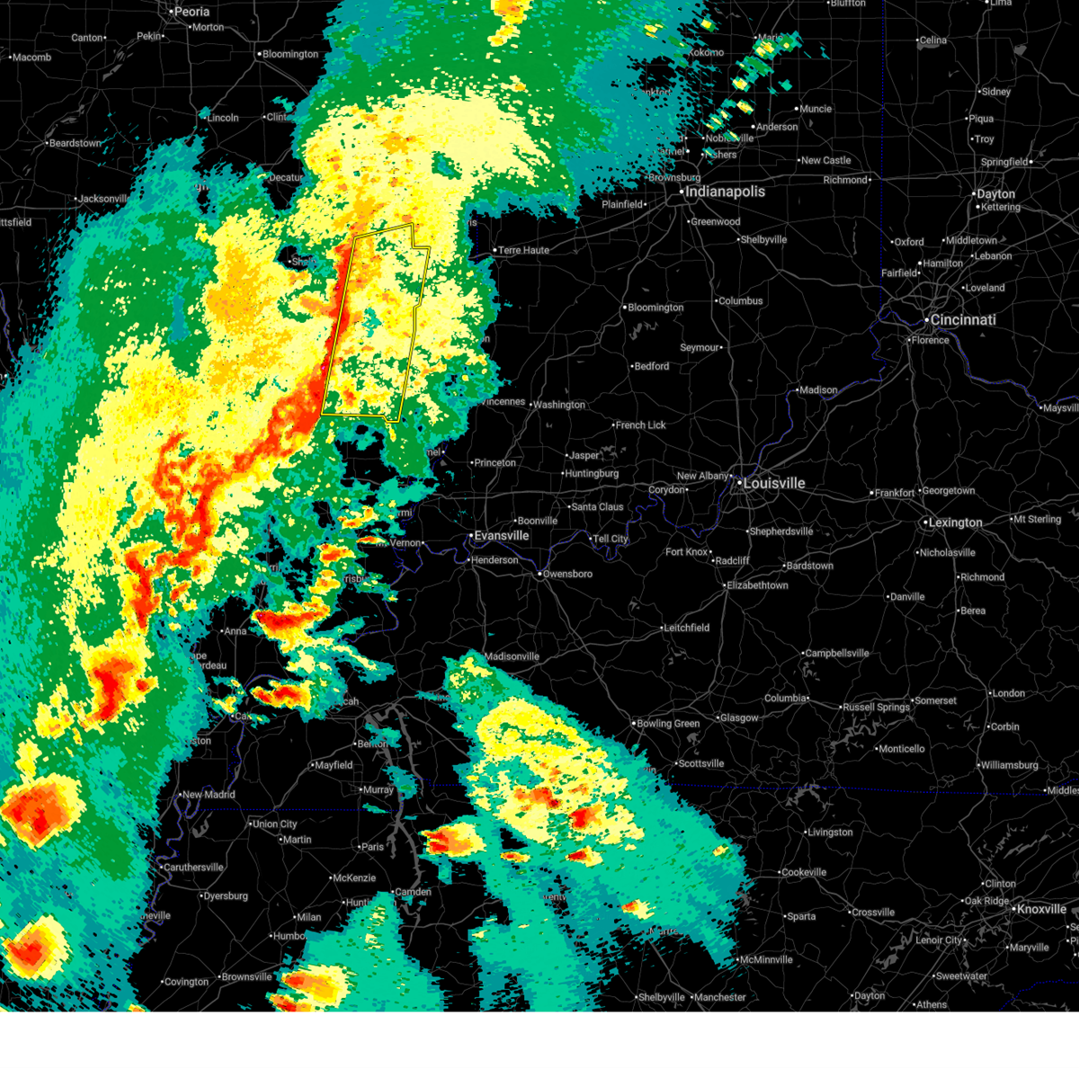 Svrilx the national weather service in lincoln has issued a * severe thunderstorm warning for, southern coles county in east central illinois, jasper county in southeastern illinois, western clark county in east central illinois, richland county in southeastern illinois, cumberland county in east central illinois, clay county in south central illinois, eastern effingham county in south central illinois, * until 715 pm cdt. * at 627 pm cdt, severe thunderstorms were located along a line extending from near mattoon to near xenia, moving east at 50 mph (radar indicated). Hazards include 70 mph wind gusts and quarter size hail. Hail damage to vehicles is expected. expect considerable tree damage. wind damage is also likely to mobile homes, roofs, and outbuildings. severe thunderstorms will be near, montrose, janesville, louisville, bible grove, flora, lerna, dieterich, and mattoon around 630 pm cdt. jewett, sailor springs, clay city, charleston, toledo, and wheeler around 635 pm cdt. bogota and greenup around 640 pm cdt. hidalgo, newton, noble, and ashmore around 645 pm cdt. other locations in the path of these severe thunderstorms include olney noble airport, westfield, casey, ste. marie, olney, willow hill and martinsville. this includes the following highways, interstate 57 between mile markers 185 and 193. Interstate 70 between mile markers 101 and 134. Svrilx the national weather service in lincoln has issued a * severe thunderstorm warning for, southern coles county in east central illinois, jasper county in southeastern illinois, western clark county in east central illinois, richland county in southeastern illinois, cumberland county in east central illinois, clay county in south central illinois, eastern effingham county in south central illinois, * until 715 pm cdt. * at 627 pm cdt, severe thunderstorms were located along a line extending from near mattoon to near xenia, moving east at 50 mph (radar indicated). Hazards include 70 mph wind gusts and quarter size hail. Hail damage to vehicles is expected. expect considerable tree damage. wind damage is also likely to mobile homes, roofs, and outbuildings. severe thunderstorms will be near, montrose, janesville, louisville, bible grove, flora, lerna, dieterich, and mattoon around 630 pm cdt. jewett, sailor springs, clay city, charleston, toledo, and wheeler around 635 pm cdt. bogota and greenup around 640 pm cdt. hidalgo, newton, noble, and ashmore around 645 pm cdt. other locations in the path of these severe thunderstorms include olney noble airport, westfield, casey, ste. marie, olney, willow hill and martinsville. this includes the following highways, interstate 57 between mile markers 185 and 193. Interstate 70 between mile markers 101 and 134.
|
| 3/30/2025 1:33 PM CDT |
 At 132 pm cdt, severe thunderstorms were located along a line extending from near willard airport to near greenup, moving east at 50 mph (radar indicated). Hazards include 70 mph wind gusts and quarter size hail. Hail damage to vehicles is expected. expect considerable tree damage. wind damage is also likely to mobile homes, roofs, and outbuildings. these severe storms will be near, oakland, broadlands, newman, rardin, philo, sidney, and ashmore around 140 pm cdt. other locations impacted by these severe thunderstorms include murdock, longview, fairgrange, walnut point state park, loxa, fox ridge state park, hindsboro, bushton, chesterville, and coles county airport. this includes the following highways, interstate 57 between mile markers 183 and 227. Interstate 70 between mile markers 116 and 119, and between mile markers 121 and 126. At 132 pm cdt, severe thunderstorms were located along a line extending from near willard airport to near greenup, moving east at 50 mph (radar indicated). Hazards include 70 mph wind gusts and quarter size hail. Hail damage to vehicles is expected. expect considerable tree damage. wind damage is also likely to mobile homes, roofs, and outbuildings. these severe storms will be near, oakland, broadlands, newman, rardin, philo, sidney, and ashmore around 140 pm cdt. other locations impacted by these severe thunderstorms include murdock, longview, fairgrange, walnut point state park, loxa, fox ridge state park, hindsboro, bushton, chesterville, and coles county airport. this includes the following highways, interstate 57 between mile markers 183 and 227. Interstate 70 between mile markers 116 and 119, and between mile markers 121 and 126.
|
| 3/30/2025 1:33 PM CDT |
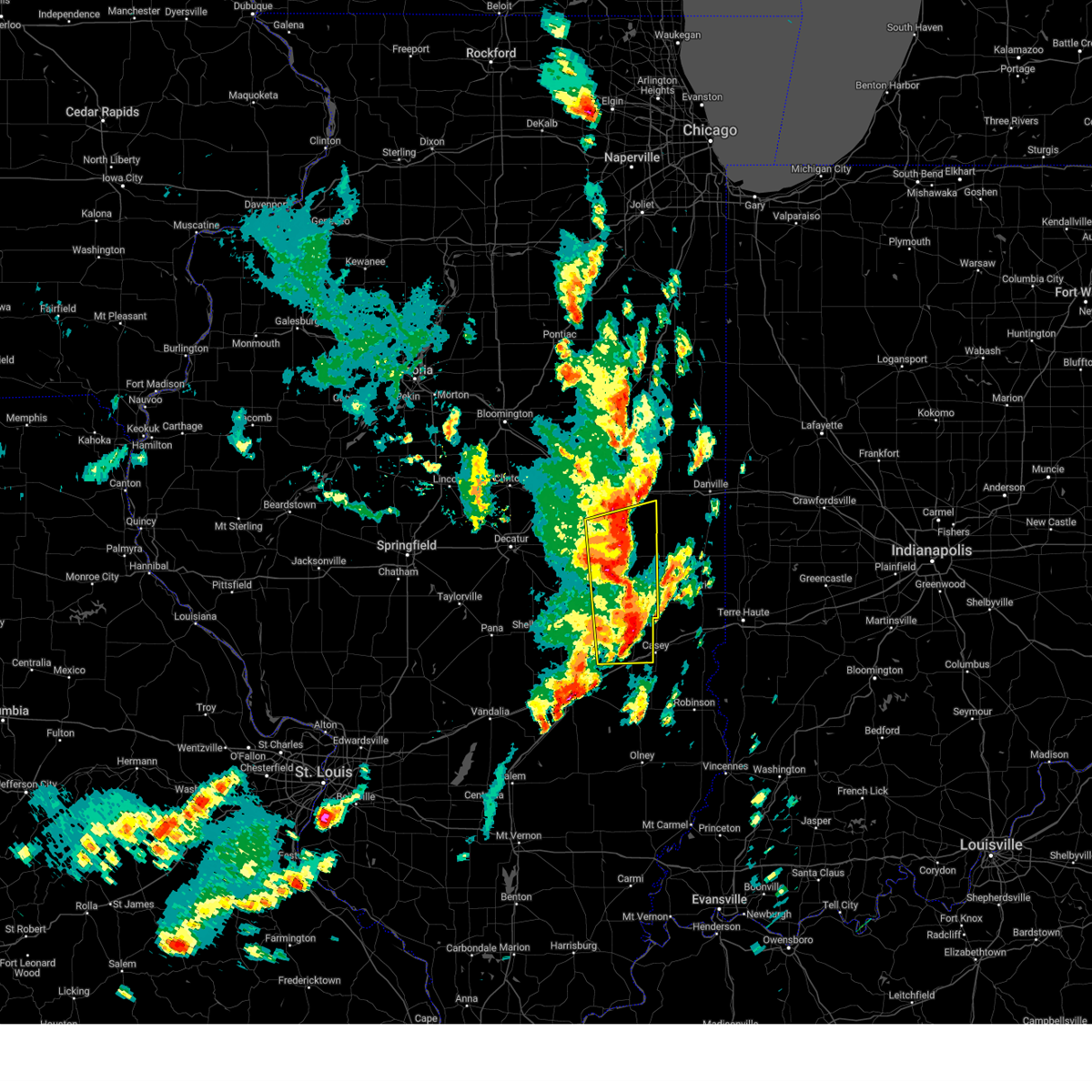 the severe thunderstorm warning has been cancelled and is no longer in effect the severe thunderstorm warning has been cancelled and is no longer in effect
|
| 3/30/2025 1:11 PM CDT |
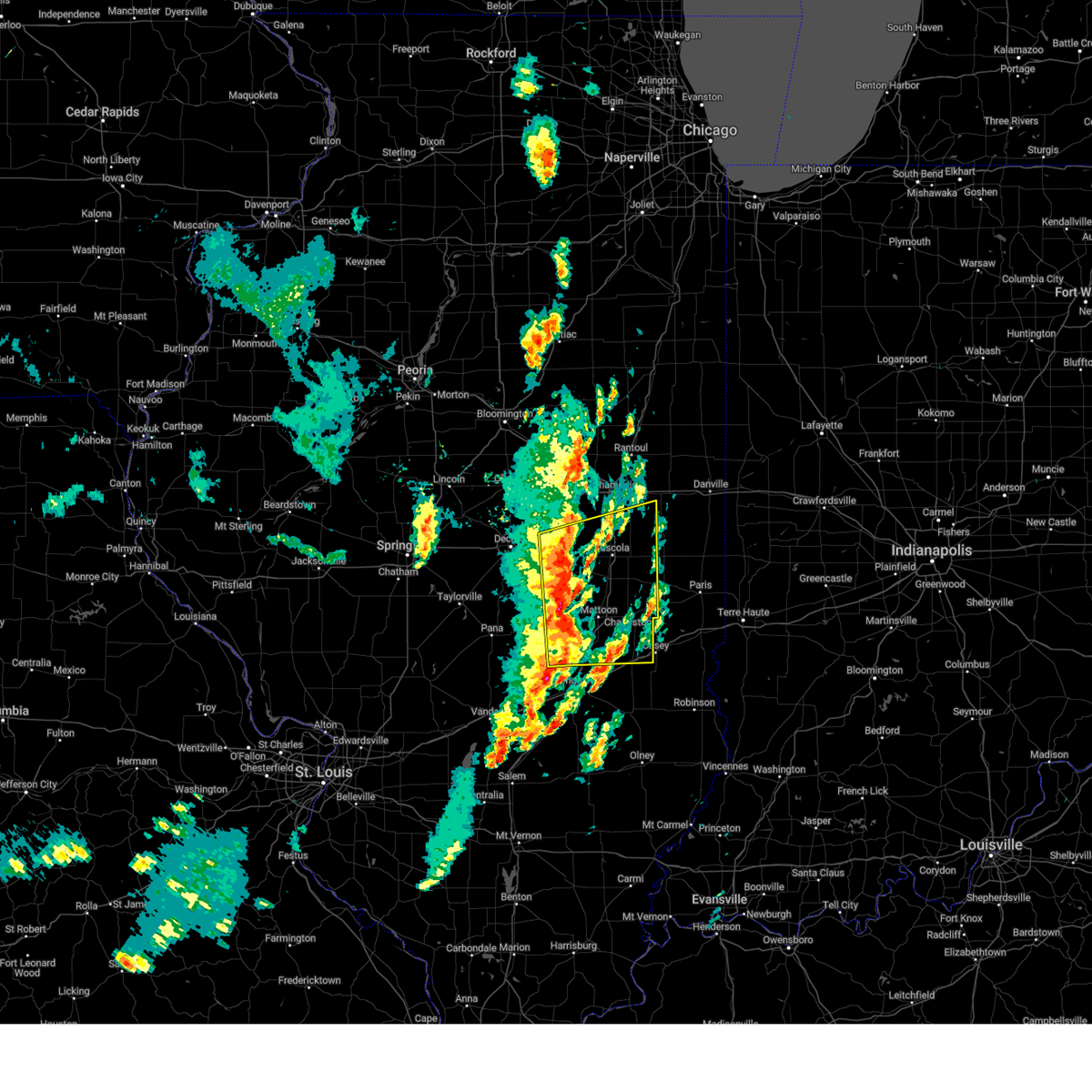 Svrilx the national weather service in lincoln has issued a * severe thunderstorm warning for, coles county in east central illinois, moultrie county in central illinois, eastern shelby county in central illinois, southern piatt county in central illinois, cumberland county in east central illinois, southern champaign county in east central illinois, douglas county in east central illinois, east central macon county in central illinois, * until 200 pm cdt. * at 111 pm cdt, severe thunderstorms were located along a line extending from near bement to near neoga, moving northeast at 55 mph (radar indicated). Hazards include 60 mph wind gusts and quarter size hail. Hail damage to vehicles is expected. expect wind damage to roofs, siding, and trees. severe thunderstorms will be near, cooks mill, ivesdale, arthur, mattoon, and atwood around 115 pm cdt. sadorus, arcola, and humboldt around 120 pm cdt. pesotum, tolono, and tuscola around 125 pm cdt. camargo around 130 pm cdt. other locations in the path of these severe thunderstorms include villa grove, philo, sidney, broadlands and newman. this includes the following highways, interstate 57 between mile markers 170 and 227. Interstate 70 between mile markers 116 and 119, and between mile markers 121 and 126. Svrilx the national weather service in lincoln has issued a * severe thunderstorm warning for, coles county in east central illinois, moultrie county in central illinois, eastern shelby county in central illinois, southern piatt county in central illinois, cumberland county in east central illinois, southern champaign county in east central illinois, douglas county in east central illinois, east central macon county in central illinois, * until 200 pm cdt. * at 111 pm cdt, severe thunderstorms were located along a line extending from near bement to near neoga, moving northeast at 55 mph (radar indicated). Hazards include 60 mph wind gusts and quarter size hail. Hail damage to vehicles is expected. expect wind damage to roofs, siding, and trees. severe thunderstorms will be near, cooks mill, ivesdale, arthur, mattoon, and atwood around 115 pm cdt. sadorus, arcola, and humboldt around 120 pm cdt. pesotum, tolono, and tuscola around 125 pm cdt. camargo around 130 pm cdt. other locations in the path of these severe thunderstorms include villa grove, philo, sidney, broadlands and newman. this includes the following highways, interstate 57 between mile markers 170 and 227. Interstate 70 between mile markers 116 and 119, and between mile markers 121 and 126.
|
| 3/19/2025 4:42 PM CDT |
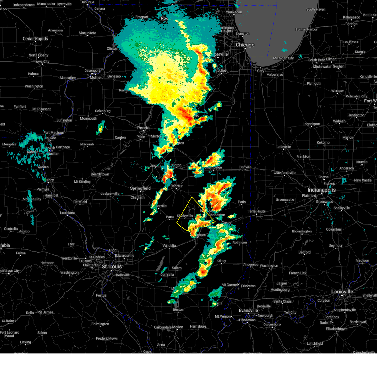 The storm which prompted the warning has weakened below severe limits, and has exited the warned area. therefore, the warning will be allowed to expire. a tornado watch remains in effect until 900 pm cdt for central and east central illinois. The storm which prompted the warning has weakened below severe limits, and has exited the warned area. therefore, the warning will be allowed to expire. a tornado watch remains in effect until 900 pm cdt for central and east central illinois.
|
| 3/19/2025 4:15 PM CDT |
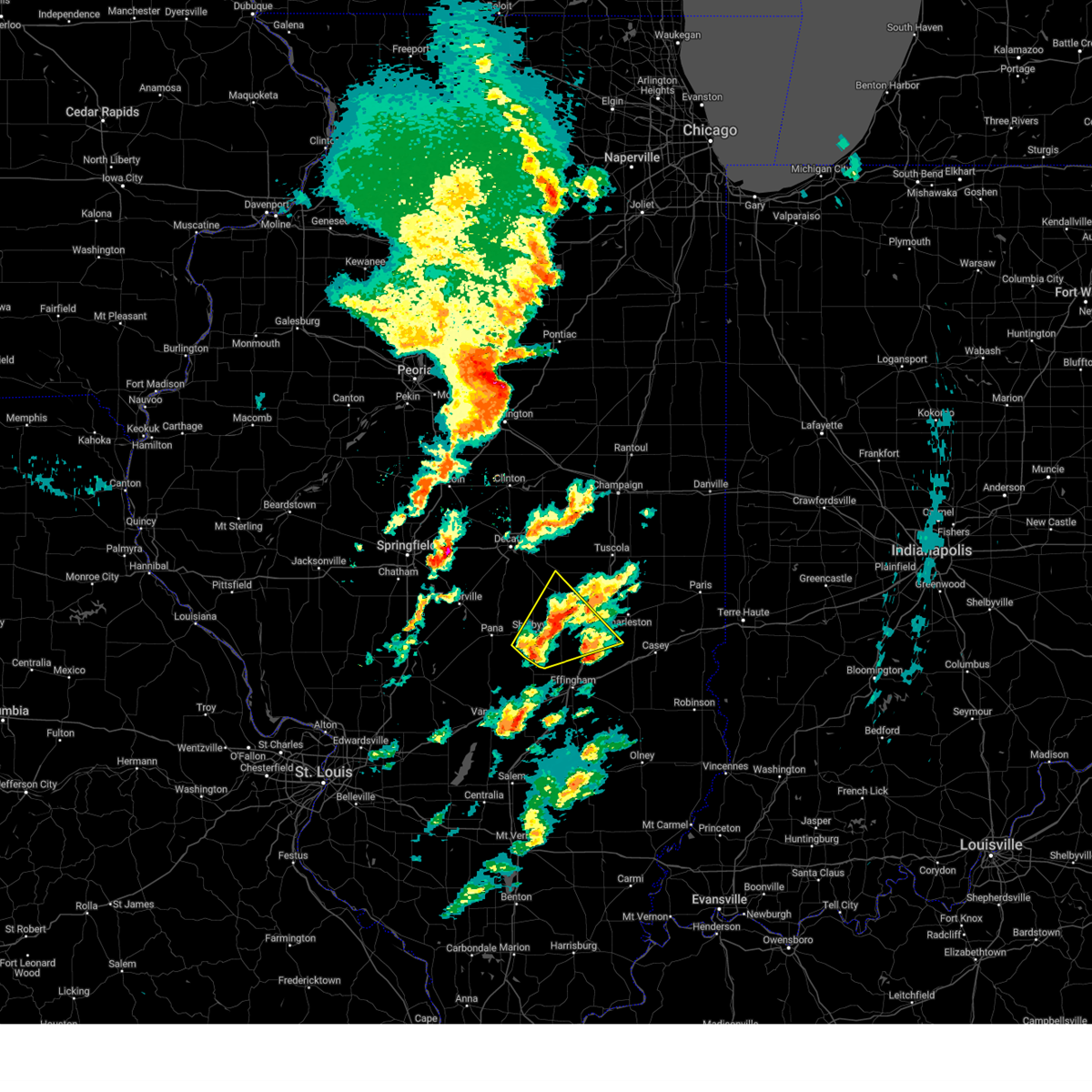 At 414 pm cdt, a severe thunderstorm was located near stewardson, or 7 miles south of shelbyville, moving northeast at 55 mph (radar indicated). Hazards include 70 mph wind gusts and quarter size hail. Hail damage to vehicles is expected. expect considerable tree damage. wind damage is also likely to mobile homes, roofs, and outbuildings. this severe storm will be near, windsor around 425 pm cdt. mattoon around 440 pm cdt. other locations impacted by this severe thunderstorm include trowbridge, etna, clarksburg, wolf creek state park, kirksville, gays, mode, trilla, strasburg, and paradise. This includes interstate 57 between mile markers 174 and 187. At 414 pm cdt, a severe thunderstorm was located near stewardson, or 7 miles south of shelbyville, moving northeast at 55 mph (radar indicated). Hazards include 70 mph wind gusts and quarter size hail. Hail damage to vehicles is expected. expect considerable tree damage. wind damage is also likely to mobile homes, roofs, and outbuildings. this severe storm will be near, windsor around 425 pm cdt. mattoon around 440 pm cdt. other locations impacted by this severe thunderstorm include trowbridge, etna, clarksburg, wolf creek state park, kirksville, gays, mode, trilla, strasburg, and paradise. This includes interstate 57 between mile markers 174 and 187.
|
| 3/19/2025 4:15 PM CDT |
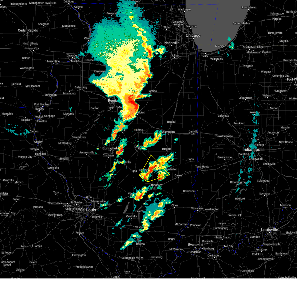 the severe thunderstorm warning has been cancelled and is no longer in effect the severe thunderstorm warning has been cancelled and is no longer in effect
|
| 3/19/2025 4:04 PM CDT |
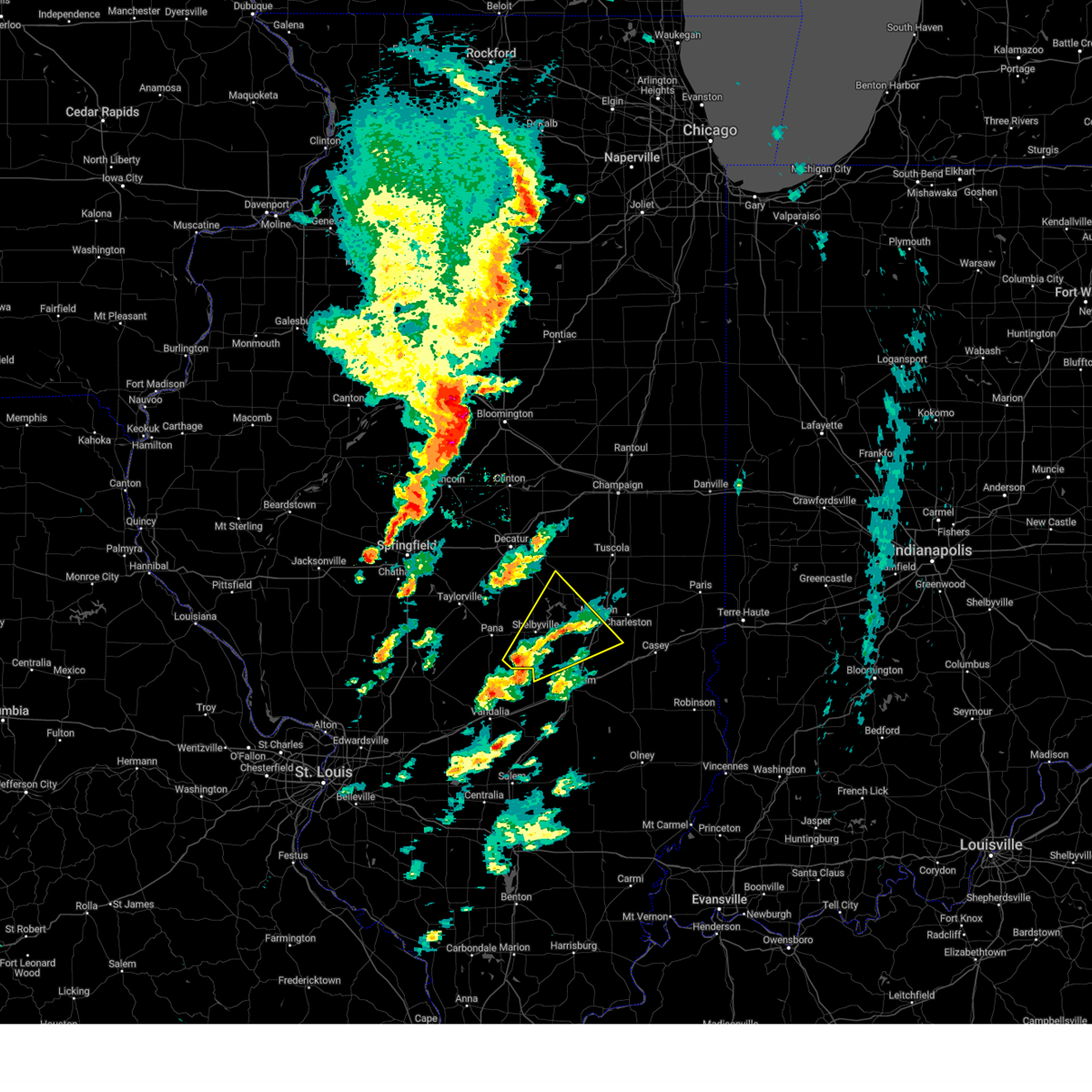 Svrilx the national weather service in lincoln has issued a * severe thunderstorm warning for, southwestern coles county in east central illinois, southern moultrie county in central illinois, shelby county in central illinois, northwestern cumberland county in east central illinois, northwestern effingham county in south central illinois, * until 445 pm cdt. * at 403 pm cdt, a severe thunderstorm was located near cowden, or 7 miles south of shelbyville, moving northeast at 55 mph (radar indicated). Hazards include 70 mph wind gusts and quarter size hail. Hail damage to vehicles is expected. expect considerable tree damage. wind damage is also likely to mobile homes, roofs, and outbuildings. this severe thunderstorm will be near, windsor around 415 pm cdt. other locations in the path of this severe thunderstorm include allenville and mattoon. This includes interstate 57 between mile markers 172 and 187. Svrilx the national weather service in lincoln has issued a * severe thunderstorm warning for, southwestern coles county in east central illinois, southern moultrie county in central illinois, shelby county in central illinois, northwestern cumberland county in east central illinois, northwestern effingham county in south central illinois, * until 445 pm cdt. * at 403 pm cdt, a severe thunderstorm was located near cowden, or 7 miles south of shelbyville, moving northeast at 55 mph (radar indicated). Hazards include 70 mph wind gusts and quarter size hail. Hail damage to vehicles is expected. expect considerable tree damage. wind damage is also likely to mobile homes, roofs, and outbuildings. this severe thunderstorm will be near, windsor around 415 pm cdt. other locations in the path of this severe thunderstorm include allenville and mattoon. This includes interstate 57 between mile markers 172 and 187.
|
| 3/15/2025 1:08 AM CDT |
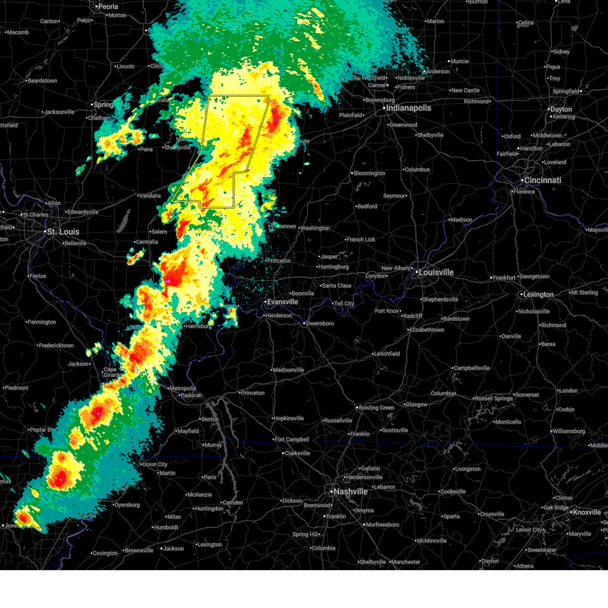 The storms which prompted the warning have weakened below severe limits, and have exited the warned area. therefore, the warning will be allowed to expire. however, gusty winds are still possible with these thunderstorms. a tornado watch remains in effect until 300 am cdt for south central, southeastern and east central illinois. The storms which prompted the warning have weakened below severe limits, and have exited the warned area. therefore, the warning will be allowed to expire. however, gusty winds are still possible with these thunderstorms. a tornado watch remains in effect until 300 am cdt for south central, southeastern and east central illinois.
|
| 3/15/2025 12:28 AM CDT |
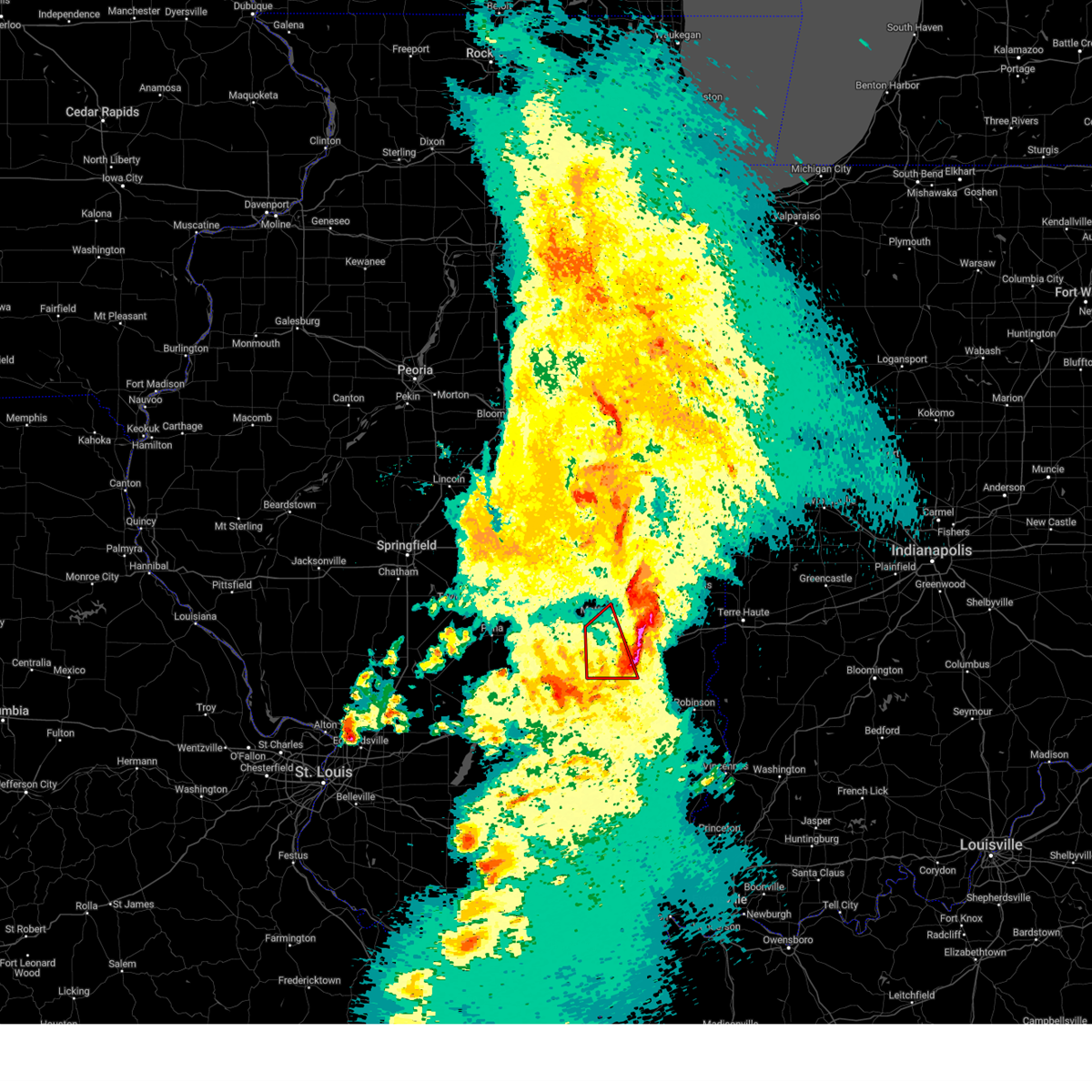 The storm which prompted the warning has moved out of the area. therefore, the warning will be allowed to expire. however, gusty winds are still possible with this thunderstorm. a tornado watch remains in effect until 300 am cdt for south central, southeastern and east central illinois. The storm which prompted the warning has moved out of the area. therefore, the warning will be allowed to expire. however, gusty winds are still possible with this thunderstorm. a tornado watch remains in effect until 300 am cdt for south central, southeastern and east central illinois.
|
| 3/15/2025 12:13 AM CDT |
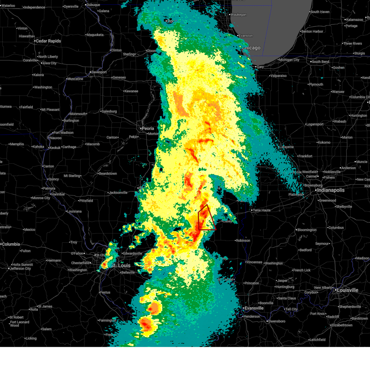 At 1212 am cdt, a confirmed tornado was located over lerna, or near mattoon, moving northeast at 55 mph (radar confirmed tornado). Hazards include damaging tornado and quarter size hail. Flying debris will be dangerous to those caught without shelter. mobile homes will be damaged or destroyed. damage to roofs, windows, and vehicles will occur. tree damage is likely. this tornadic thunderstorm will remain over mainly rural areas of southwestern coles, cumberland and northeastern effingham counties, including the following locations, trilla, loxa, etna, woodbury, coles county airport, and paradise. this includes the following highways, interstate 57 between mile markers 175 and 193. Interstate 70 between mile markers 105 and 118. At 1212 am cdt, a confirmed tornado was located over lerna, or near mattoon, moving northeast at 55 mph (radar confirmed tornado). Hazards include damaging tornado and quarter size hail. Flying debris will be dangerous to those caught without shelter. mobile homes will be damaged or destroyed. damage to roofs, windows, and vehicles will occur. tree damage is likely. this tornadic thunderstorm will remain over mainly rural areas of southwestern coles, cumberland and northeastern effingham counties, including the following locations, trilla, loxa, etna, woodbury, coles county airport, and paradise. this includes the following highways, interstate 57 between mile markers 175 and 193. Interstate 70 between mile markers 105 and 118.
|
| 3/15/2025 12:13 AM CDT |
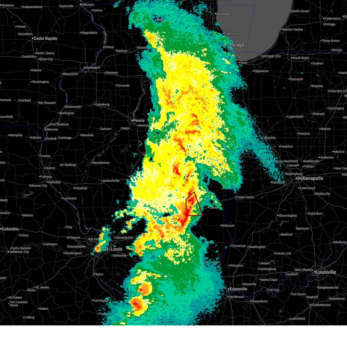 the tornado warning has been cancelled and is no longer in effect the tornado warning has been cancelled and is no longer in effect
|
| 3/15/2025 12:12 AM CDT |
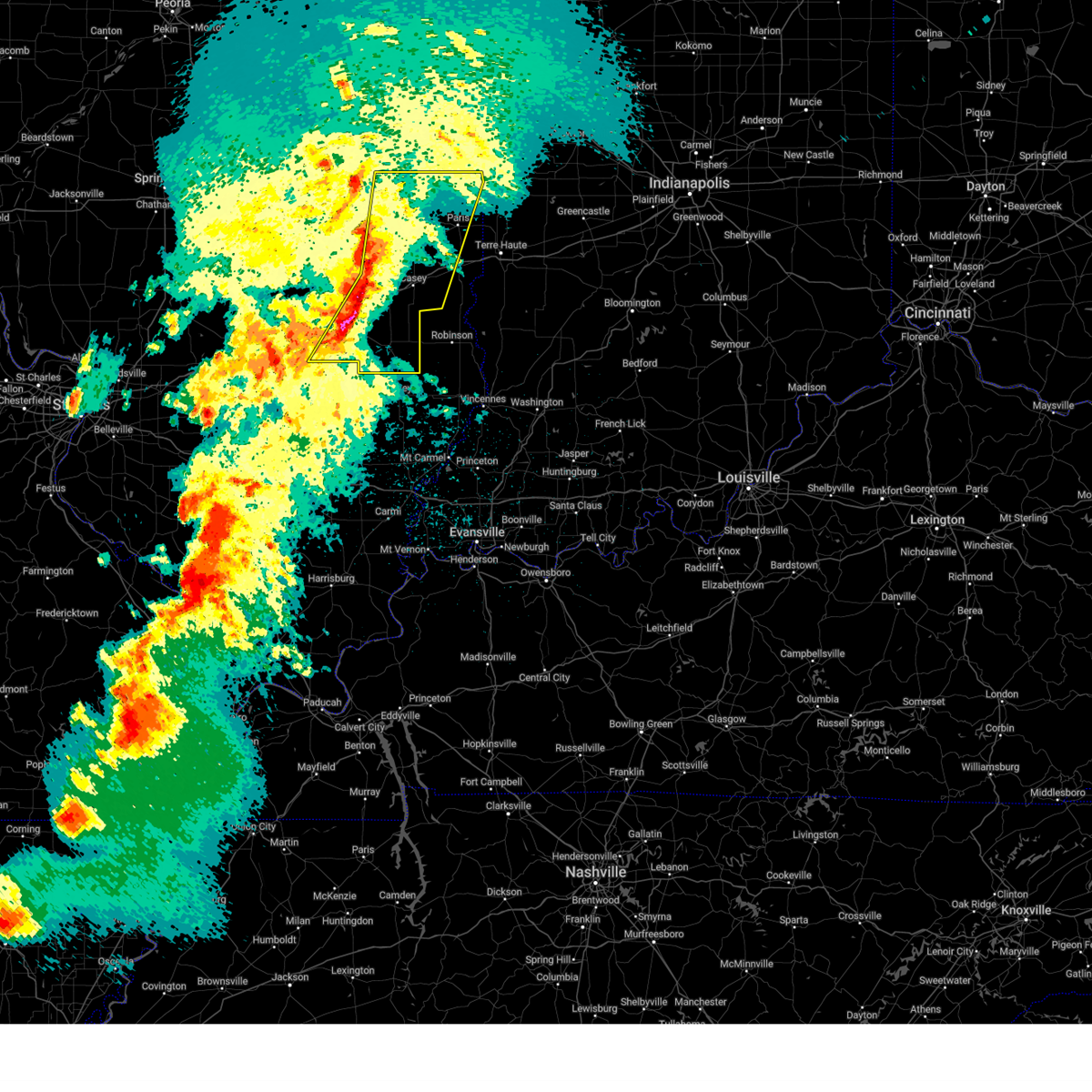 Svrilx the national weather service in lincoln has issued a * severe thunderstorm warning for, coles county in east central illinois, edgar county in east central illinois, jasper county in southeastern illinois, clark county in east central illinois, cumberland county in east central illinois, eastern effingham county in south central illinois, douglas county in east central illinois, * until 115 am cdt. * at 1211 am cdt, severe thunderstorms were located along a line extending from near philo to near charleston to near dieterich, moving northeast at 65 mph (radar indicated). Hazards include 70 mph wind gusts. Expect considerable tree damage. damage is likely to mobile homes, roofs, and outbuildings. severe thunderstorms will be near, montrose, janesville, westfield, jewett, oakland, newman, rardin, brocton, charleston, and toledo around 1215 am cdt. hume around 1220 am cdt. edgar county airport and chrisman around 1230 am cdt. other locations in the path of these severe thunderstorms include paris. this includes the following highways, interstate 57 between mile markers 144 and 153, between mile markers 199 and 200, and between mile markers 211 and 212. Interstate 70 between mile markers 98 and 145. Svrilx the national weather service in lincoln has issued a * severe thunderstorm warning for, coles county in east central illinois, edgar county in east central illinois, jasper county in southeastern illinois, clark county in east central illinois, cumberland county in east central illinois, eastern effingham county in south central illinois, douglas county in east central illinois, * until 115 am cdt. * at 1211 am cdt, severe thunderstorms were located along a line extending from near philo to near charleston to near dieterich, moving northeast at 65 mph (radar indicated). Hazards include 70 mph wind gusts. Expect considerable tree damage. damage is likely to mobile homes, roofs, and outbuildings. severe thunderstorms will be near, montrose, janesville, westfield, jewett, oakland, newman, rardin, brocton, charleston, and toledo around 1215 am cdt. hume around 1220 am cdt. edgar county airport and chrisman around 1230 am cdt. other locations in the path of these severe thunderstorms include paris. this includes the following highways, interstate 57 between mile markers 144 and 153, between mile markers 199 and 200, and between mile markers 211 and 212. Interstate 70 between mile markers 98 and 145.
|
| 3/14/2025 11:55 PM CDT |
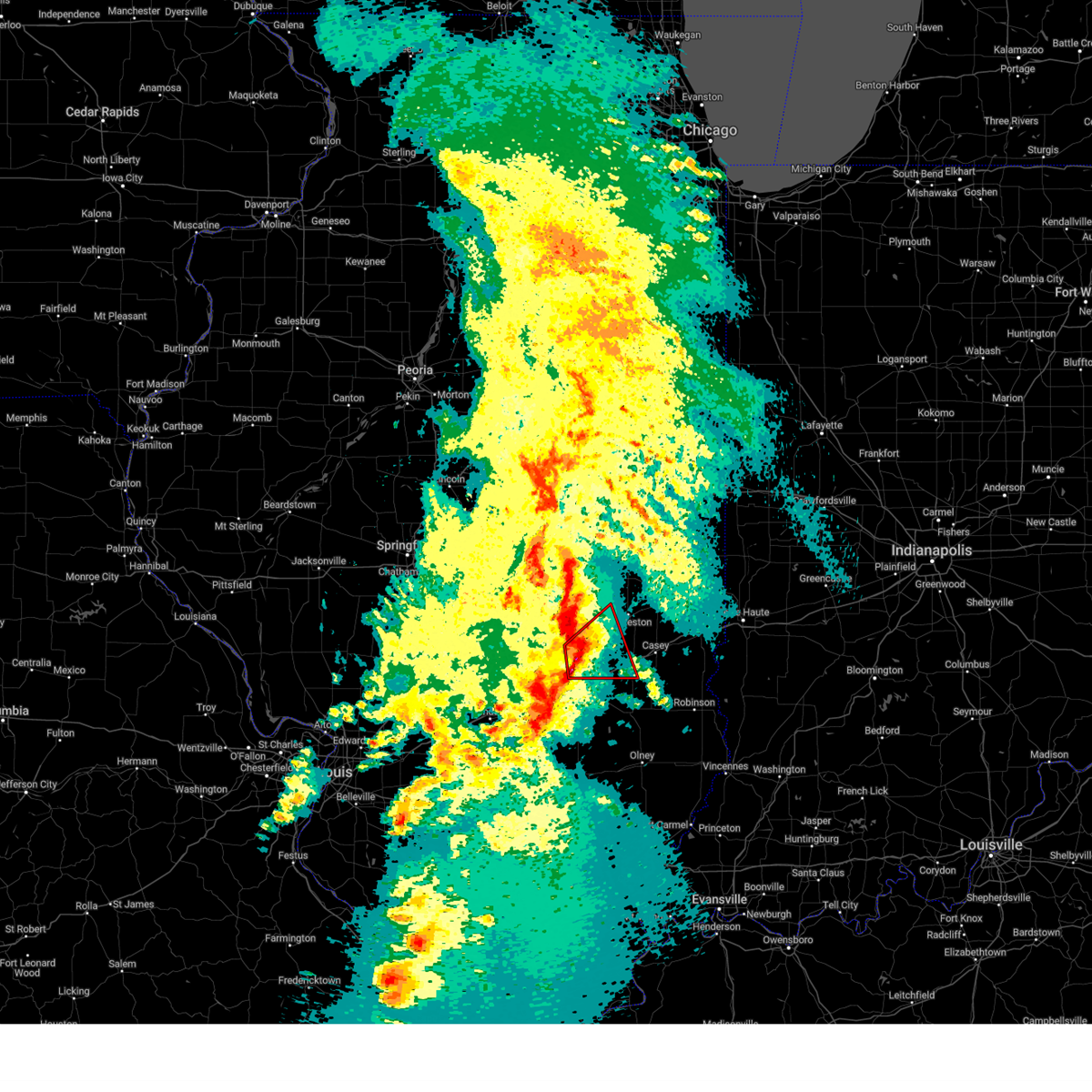 Torilx the national weather service in lincoln has issued a * tornado warning for, southwestern coles county in east central illinois, southeastern shelby county in central illinois, cumberland county in east central illinois, north central effingham county in south central illinois, * until 1230 am cdt. * at 1154 pm cdt, severe thunderstorms capable of producing both tornadoes and extensive straight line wind damage were located near stewardson, or 7 miles southwest of neoga, moving northeast at 50 mph (radar indicated rotation). Hazards include tornado and quarter size hail. Flying debris will be dangerous to those caught without shelter. mobile homes will be damaged or destroyed. damage to roofs, windows, and vehicles will occur. tree damage is likely. these dangerous storms will be near, neoga around 1200 am cdt. lerna around 1210 am cdt. other locations in the path of this tornadic thunderstorm include janesville. this includes the following highways, interstate 57 between mile markers 165 and 193. Interstate 70 between mile markers 105 and 118. Torilx the national weather service in lincoln has issued a * tornado warning for, southwestern coles county in east central illinois, southeastern shelby county in central illinois, cumberland county in east central illinois, north central effingham county in south central illinois, * until 1230 am cdt. * at 1154 pm cdt, severe thunderstorms capable of producing both tornadoes and extensive straight line wind damage were located near stewardson, or 7 miles southwest of neoga, moving northeast at 50 mph (radar indicated rotation). Hazards include tornado and quarter size hail. Flying debris will be dangerous to those caught without shelter. mobile homes will be damaged or destroyed. damage to roofs, windows, and vehicles will occur. tree damage is likely. these dangerous storms will be near, neoga around 1200 am cdt. lerna around 1210 am cdt. other locations in the path of this tornadic thunderstorm include janesville. this includes the following highways, interstate 57 between mile markers 165 and 193. Interstate 70 between mile markers 105 and 118.
|
| 3/14/2025 11:15 PM CDT |
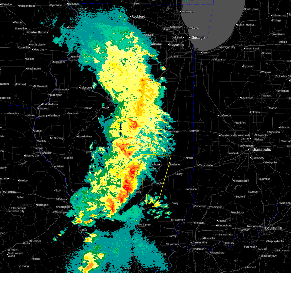 Svrilx the national weather service in lincoln has issued a * severe thunderstorm warning for, coles county in east central illinois, southern moultrie county in central illinois, northwestern jasper county in southeastern illinois, shelby county in central illinois, western cumberland county in east central illinois, northwestern clay county in south central illinois, effingham county in south central illinois, * until 1215 am cdt. * at 1114 pm cdt, severe thunderstorms were located along a line extending from findlay to near wrights corner to near carlyle, moving northeast at 60 mph (radar indicated). Hazards include 70 mph wind gusts and quarter size hail. Hail damage to vehicles is expected. expect considerable tree damage. wind damage is also likely to mobile homes, roofs, and outbuildings. severe thunderstorms will be near, cowden, sullivan, shelbyville, findlay, and beecher city around 1120 pm cdt. allenville, stewardson, and windsor around 1125 pm cdt. shumway around 1130 pm cdt. other locations in the path of these severe thunderstorms include cooks mill, altamont, mattoon, neoga, humboldt, effingham, lerna, charleston, rardin, janesville and teutopolis. this includes the following highways, interstate 57 between mile markers 142 and 201. Interstate 70 between mile markers 79 and 112. Svrilx the national weather service in lincoln has issued a * severe thunderstorm warning for, coles county in east central illinois, southern moultrie county in central illinois, northwestern jasper county in southeastern illinois, shelby county in central illinois, western cumberland county in east central illinois, northwestern clay county in south central illinois, effingham county in south central illinois, * until 1215 am cdt. * at 1114 pm cdt, severe thunderstorms were located along a line extending from findlay to near wrights corner to near carlyle, moving northeast at 60 mph (radar indicated). Hazards include 70 mph wind gusts and quarter size hail. Hail damage to vehicles is expected. expect considerable tree damage. wind damage is also likely to mobile homes, roofs, and outbuildings. severe thunderstorms will be near, cowden, sullivan, shelbyville, findlay, and beecher city around 1120 pm cdt. allenville, stewardson, and windsor around 1125 pm cdt. shumway around 1130 pm cdt. other locations in the path of these severe thunderstorms include cooks mill, altamont, mattoon, neoga, humboldt, effingham, lerna, charleston, rardin, janesville and teutopolis. this includes the following highways, interstate 57 between mile markers 142 and 201. Interstate 70 between mile markers 79 and 112.
|
| 7/31/2024 11:36 AM CDT |
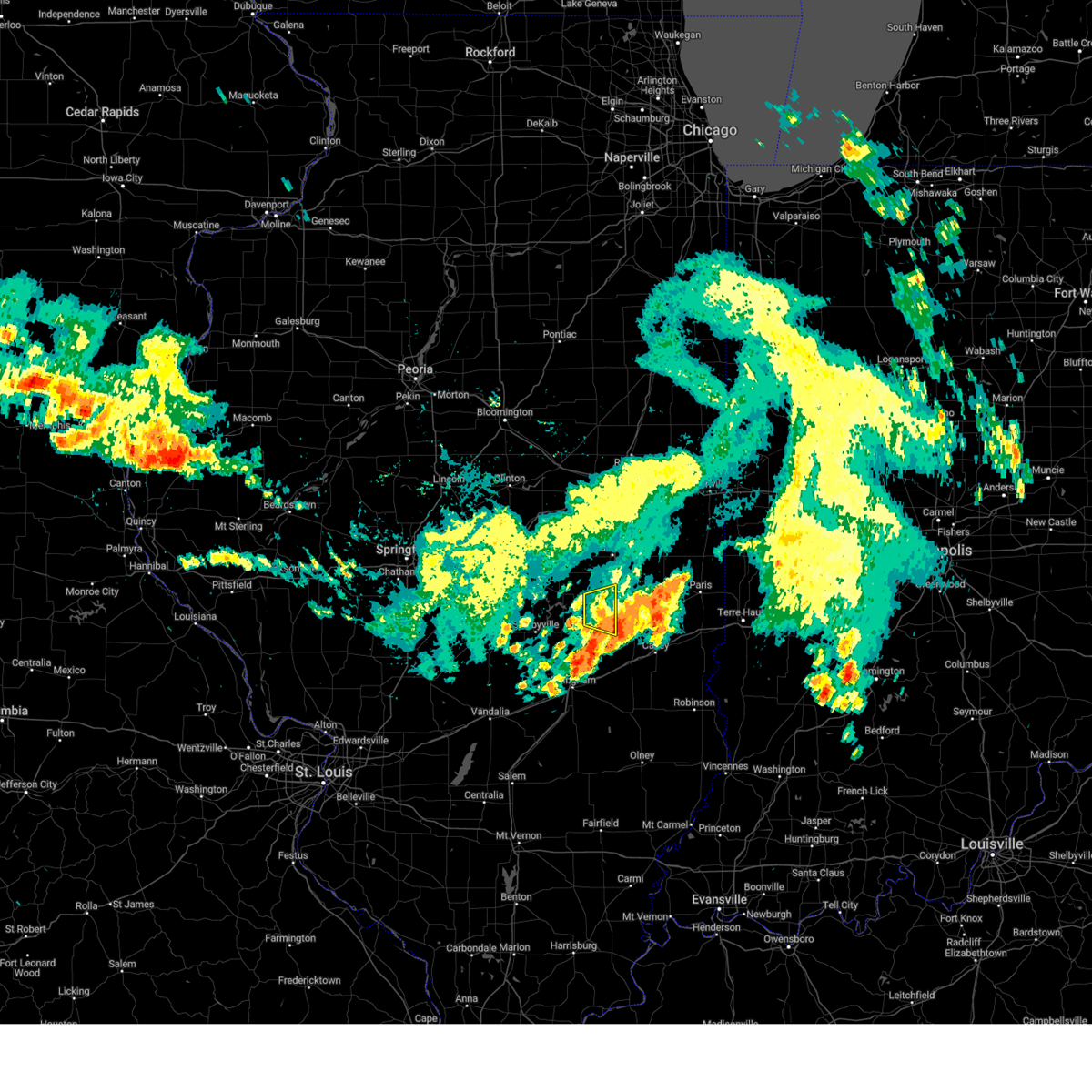 The storm which prompted the warning has weakened below severe limits, and has exited the warned area. therefore, the warning will be allowed to expire. a severe thunderstorm watch remains in effect until noon cdt for east central illinois. The storm which prompted the warning has weakened below severe limits, and has exited the warned area. therefore, the warning will be allowed to expire. a severe thunderstorm watch remains in effect until noon cdt for east central illinois.
|
| 7/31/2024 11:24 AM CDT |
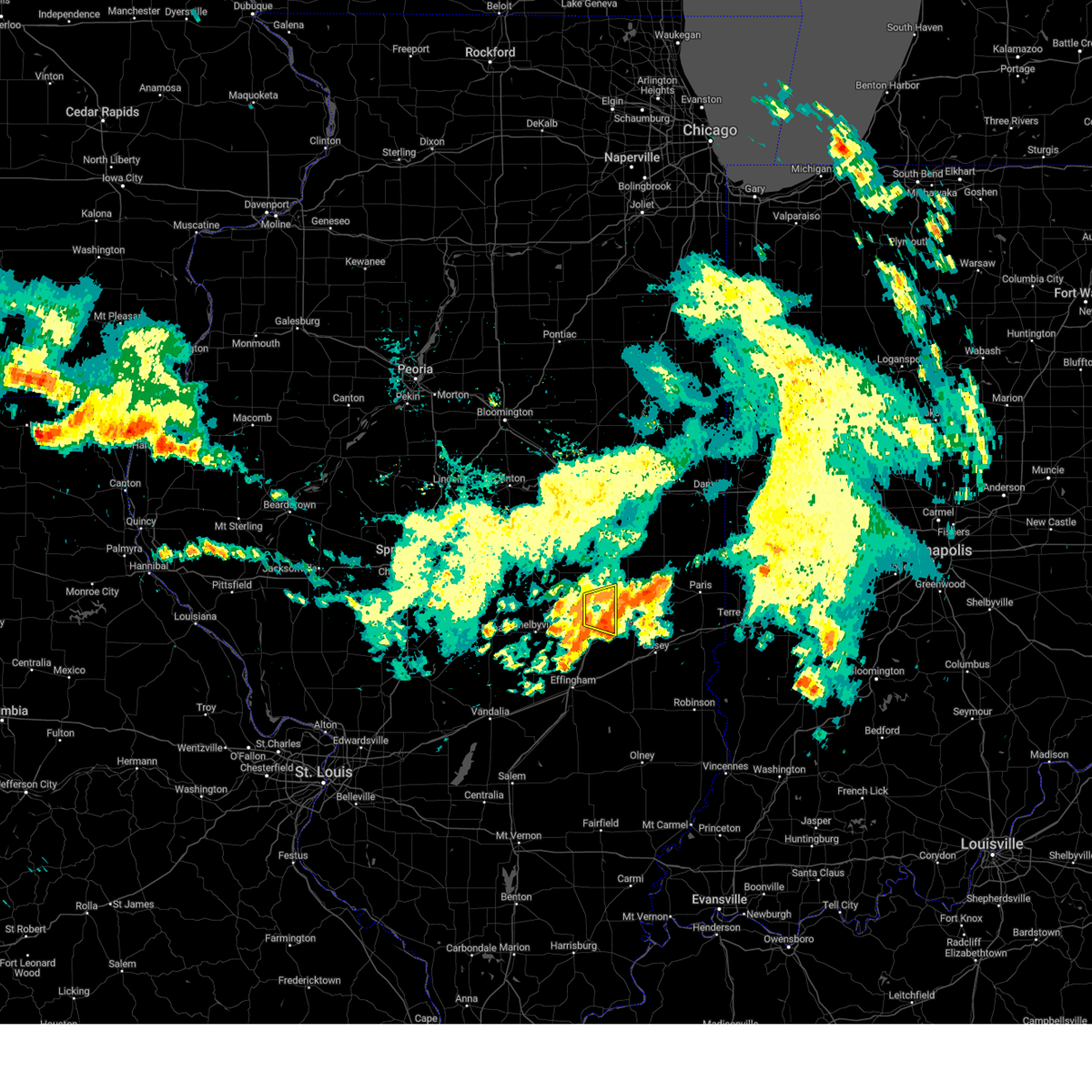 At 1124 am cdt, a severe thunderstorm was located over mattoon, moving east at 35 mph (radar indicated). Hazards include 60 mph wind gusts and quarter size hail. Hail damage to vehicles is expected. expect wind damage to roofs, siding, and trees. this severe storm will be near, mattoon around 1130 am cdt. other locations impacted by this severe thunderstorm include loxa and coles county airport. This includes interstate 57 between mile markers 184 and 200. At 1124 am cdt, a severe thunderstorm was located over mattoon, moving east at 35 mph (radar indicated). Hazards include 60 mph wind gusts and quarter size hail. Hail damage to vehicles is expected. expect wind damage to roofs, siding, and trees. this severe storm will be near, mattoon around 1130 am cdt. other locations impacted by this severe thunderstorm include loxa and coles county airport. This includes interstate 57 between mile markers 184 and 200.
|
| 7/31/2024 11:24 AM CDT |
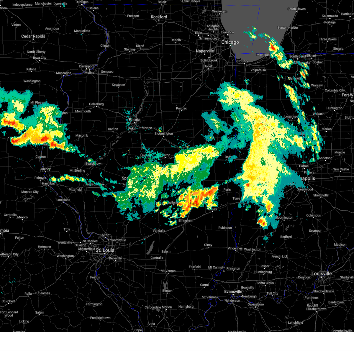 the severe thunderstorm warning has been cancelled and is no longer in effect the severe thunderstorm warning has been cancelled and is no longer in effect
|
| 7/31/2024 11:02 AM CDT |
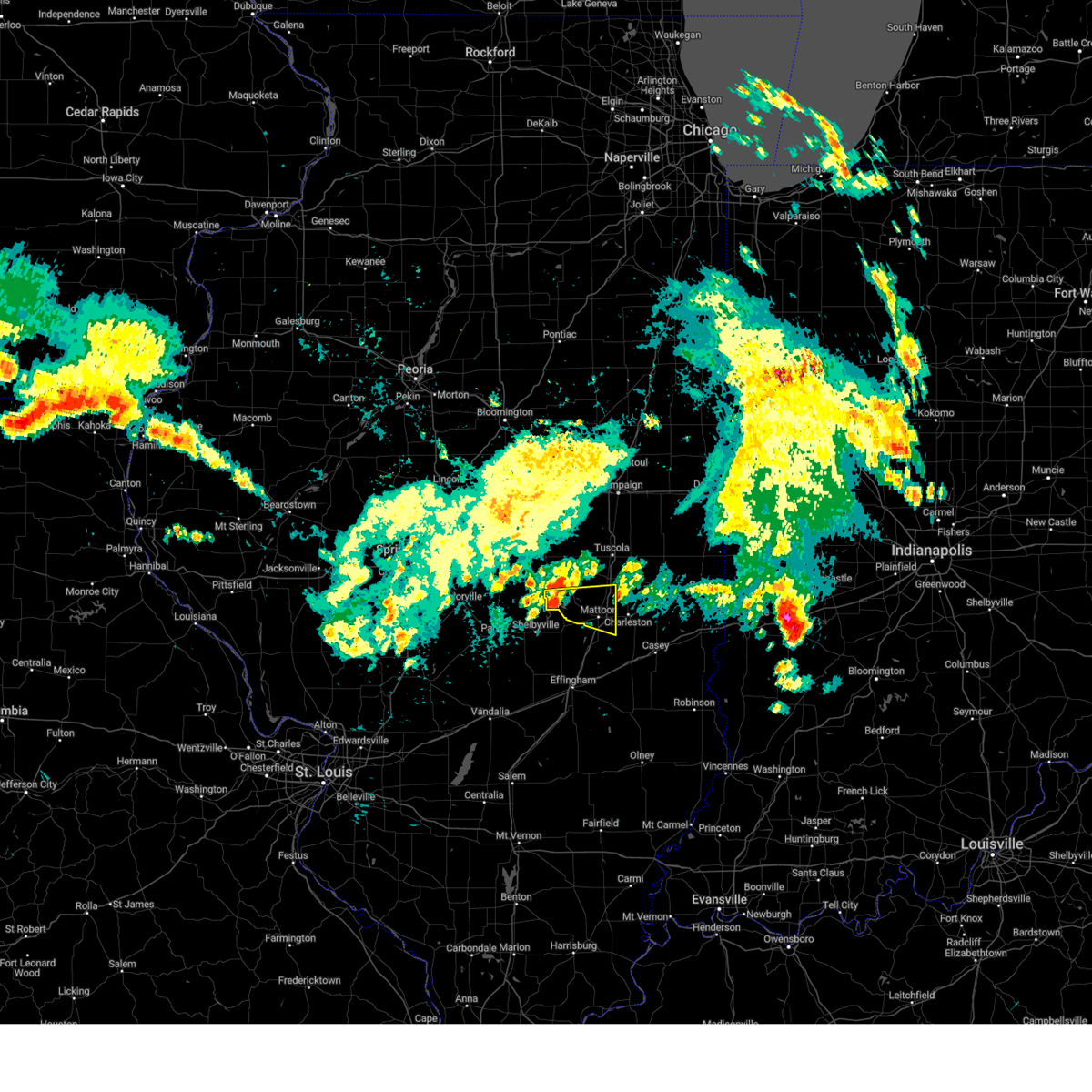 Svrilx the national weather service in lincoln has issued a * severe thunderstorm warning for, western coles county in east central illinois, southeastern moultrie county in central illinois, * until 1145 am cdt. * at 1102 am cdt, a severe thunderstorm was located over allenville, or near sullivan, moving east at 35 mph (radar indicated). Hazards include 60 mph wind gusts and quarter size hail. Hail damage to vehicles is expected. expect wind damage to roofs, siding, and trees. this severe thunderstorm will be near, cooks mill around 1110 am cdt. mattoon around 1115 am cdt. This includes interstate 57 between mile markers 184 and 201. Svrilx the national weather service in lincoln has issued a * severe thunderstorm warning for, western coles county in east central illinois, southeastern moultrie county in central illinois, * until 1145 am cdt. * at 1102 am cdt, a severe thunderstorm was located over allenville, or near sullivan, moving east at 35 mph (radar indicated). Hazards include 60 mph wind gusts and quarter size hail. Hail damage to vehicles is expected. expect wind damage to roofs, siding, and trees. this severe thunderstorm will be near, cooks mill around 1110 am cdt. mattoon around 1115 am cdt. This includes interstate 57 between mile markers 184 and 201.
|
| 7/30/2024 9:21 AM CDT |
 At 921 am cdt, severe thunderstorms were located along a line extending from lerna to near dieterich, moving southeast at 60 mph (radar indicated). Hazards include 60 mph wind gusts. Expect damage to roofs, siding, and trees. these severe storms will be near, charleston, greenup, toledo, jewett, wheeler, and janesville around 925 am cdt. newton and hidalgo around 930 am cdt. other locations impacted by these severe thunderstorms include hazel dell, etna, woodbury, coles county airport, sam parr state park, trilla, loxa, fox ridge state park, rose hill, and paradise. this includes the following highways, interstate 57 between mile markers 173 and 194. Interstate 70 between mile markers 100 and 125. At 921 am cdt, severe thunderstorms were located along a line extending from lerna to near dieterich, moving southeast at 60 mph (radar indicated). Hazards include 60 mph wind gusts. Expect damage to roofs, siding, and trees. these severe storms will be near, charleston, greenup, toledo, jewett, wheeler, and janesville around 925 am cdt. newton and hidalgo around 930 am cdt. other locations impacted by these severe thunderstorms include hazel dell, etna, woodbury, coles county airport, sam parr state park, trilla, loxa, fox ridge state park, rose hill, and paradise. this includes the following highways, interstate 57 between mile markers 173 and 194. Interstate 70 between mile markers 100 and 125.
|
| 7/30/2024 9:21 AM CDT |
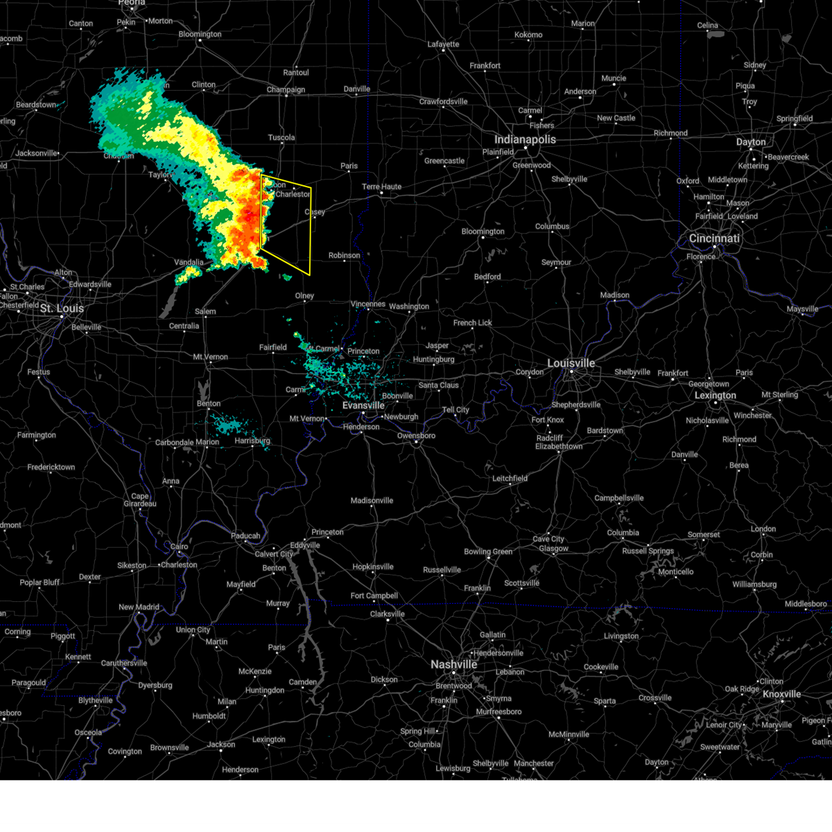 the severe thunderstorm warning has been cancelled and is no longer in effect the severe thunderstorm warning has been cancelled and is no longer in effect
|
| 7/30/2024 8:58 AM CDT |
 Svrilx the national weather service in lincoln has issued a * severe thunderstorm warning for, southern coles county in east central illinois, southern moultrie county in central illinois, jasper county in southeastern illinois, eastern shelby county in central illinois, cumberland county in east central illinois, northeastern effingham county in south central illinois, * until 945 am cdt. * at 857 am cdt, severe thunderstorms were located along a line extending from near sullivan to near stewardson, moving southeast at 60 mph (radar indicated). Hazards include 60 mph wind gusts. Expect damage to roofs, siding, and trees. severe thunderstorms will be near, effingham, neoga, windsor, stewardson, and allenville around 905 am cdt. mattoon, teutopolis, and montrose around 910 am cdt. lerna around 915 am cdt. other locations in the path of these severe thunderstorms include charleston, toledo, jewett, janesville, greenup, hidalgo and newton. this includes the following highways, interstate 57 between mile markers 161 and 194. Interstate 70 between mile markers 94 and 125. Svrilx the national weather service in lincoln has issued a * severe thunderstorm warning for, southern coles county in east central illinois, southern moultrie county in central illinois, jasper county in southeastern illinois, eastern shelby county in central illinois, cumberland county in east central illinois, northeastern effingham county in south central illinois, * until 945 am cdt. * at 857 am cdt, severe thunderstorms were located along a line extending from near sullivan to near stewardson, moving southeast at 60 mph (radar indicated). Hazards include 60 mph wind gusts. Expect damage to roofs, siding, and trees. severe thunderstorms will be near, effingham, neoga, windsor, stewardson, and allenville around 905 am cdt. mattoon, teutopolis, and montrose around 910 am cdt. lerna around 915 am cdt. other locations in the path of these severe thunderstorms include charleston, toledo, jewett, janesville, greenup, hidalgo and newton. this includes the following highways, interstate 57 between mile markers 161 and 194. Interstate 70 between mile markers 94 and 125.
|
| 6/25/2024 1:13 PM CDT | Tree down on a powerline in campbel in coles county IL, 3.7 miles WNW of Lerna, IL |
| 4/18/2024 8:18 PM CDT |
 At 817 pm cdt, severe thunderstorms were located along a line extending from near westfield to 6 miles south of ste. marie, moving east at 50 mph (radar indicated). Hazards include 60 mph wind gusts. Expect damage to roofs, siding, and trees. these severe storms will be near, oblong and martinsville around 825 pm cdt. robinson and marshall around 830 pm cdt. hutsonville and flat rock around 835 pm cdt. palestine around 840 pm cdt. other locations impacted by these severe thunderstorms include new hebron, clarksville, west york, annapolis, york, yale, lincoln trail state park, fox ridge state park, hardinville, and rose hill. this includes the following highways, interstate 57 between mile markers 185 and 187. Interstate 70 between mile markers 114 and 154. At 817 pm cdt, severe thunderstorms were located along a line extending from near westfield to 6 miles south of ste. marie, moving east at 50 mph (radar indicated). Hazards include 60 mph wind gusts. Expect damage to roofs, siding, and trees. these severe storms will be near, oblong and martinsville around 825 pm cdt. robinson and marshall around 830 pm cdt. hutsonville and flat rock around 835 pm cdt. palestine around 840 pm cdt. other locations impacted by these severe thunderstorms include new hebron, clarksville, west york, annapolis, york, yale, lincoln trail state park, fox ridge state park, hardinville, and rose hill. this includes the following highways, interstate 57 between mile markers 185 and 187. Interstate 70 between mile markers 114 and 154.
|
| 4/18/2024 7:55 PM CDT |
 Svrilx the national weather service in lincoln has issued a * severe thunderstorm warning for, southern coles county in east central illinois, crawford county in east central illinois, jasper county in southeastern illinois, clark county in east central illinois, cumberland county in east central illinois, * until 900 pm cdt. * at 754 pm cdt, severe thunderstorms were located along a line extending from near neoga to near sailor springs, moving east at 50 mph (radar indicated). Hazards include 60 mph wind gusts. Expect damage to roofs, siding, and trees. severe thunderstorms will be near, toledo, lerna, jewett, wheeler, janesville, and bogota around 800 pm cdt. newton, greenup, and hidalgo around 805 pm cdt. other locations in the path of these severe thunderstorms include casey, ste. marie, willow hill, oblong, martinsville, robinson, marshall, palestine, hutsonville and flat rock. this includes the following highways, interstate 57 between mile markers 173 and 187. Interstate 70 between mile markers 105 and 154. Svrilx the national weather service in lincoln has issued a * severe thunderstorm warning for, southern coles county in east central illinois, crawford county in east central illinois, jasper county in southeastern illinois, clark county in east central illinois, cumberland county in east central illinois, * until 900 pm cdt. * at 754 pm cdt, severe thunderstorms were located along a line extending from near neoga to near sailor springs, moving east at 50 mph (radar indicated). Hazards include 60 mph wind gusts. Expect damage to roofs, siding, and trees. severe thunderstorms will be near, toledo, lerna, jewett, wheeler, janesville, and bogota around 800 pm cdt. newton, greenup, and hidalgo around 805 pm cdt. other locations in the path of these severe thunderstorms include casey, ste. marie, willow hill, oblong, martinsville, robinson, marshall, palestine, hutsonville and flat rock. this includes the following highways, interstate 57 between mile markers 173 and 187. Interstate 70 between mile markers 105 and 154.
|
| 4/16/2024 7:12 PM CDT |
 the severe thunderstorm warning has been cancelled and is no longer in effect the severe thunderstorm warning has been cancelled and is no longer in effect
|
| 4/16/2024 6:45 PM CDT |
 Svrilx the national weather service in lincoln has issued a * severe thunderstorm warning for, southeastern coles county in east central illinois, northwestern clark county in east central illinois, * until 730 pm cdt. * at 645 pm cdt, a severe thunderstorm was located over lerna, or near mattoon, moving northeast at 60 mph (radar indicated). Hazards include 60 mph wind gusts and quarter size hail. Hail damage to vehicles is expected. expect wind damage to roofs, siding, and trees. this severe thunderstorm will be near, charleston, mattoon, lerna, and janesville around 650 pm cdt. ashmore around 700 pm cdt. This includes interstate 57 between mile markers 180 and 192. Svrilx the national weather service in lincoln has issued a * severe thunderstorm warning for, southeastern coles county in east central illinois, northwestern clark county in east central illinois, * until 730 pm cdt. * at 645 pm cdt, a severe thunderstorm was located over lerna, or near mattoon, moving northeast at 60 mph (radar indicated). Hazards include 60 mph wind gusts and quarter size hail. Hail damage to vehicles is expected. expect wind damage to roofs, siding, and trees. this severe thunderstorm will be near, charleston, mattoon, lerna, and janesville around 650 pm cdt. ashmore around 700 pm cdt. This includes interstate 57 between mile markers 180 and 192.
|
| 3/14/2024 6:53 PM CDT |
 the severe thunderstorm warning has been cancelled and is no longer in effect the severe thunderstorm warning has been cancelled and is no longer in effect
|
| 3/14/2024 6:46 PM CDT |
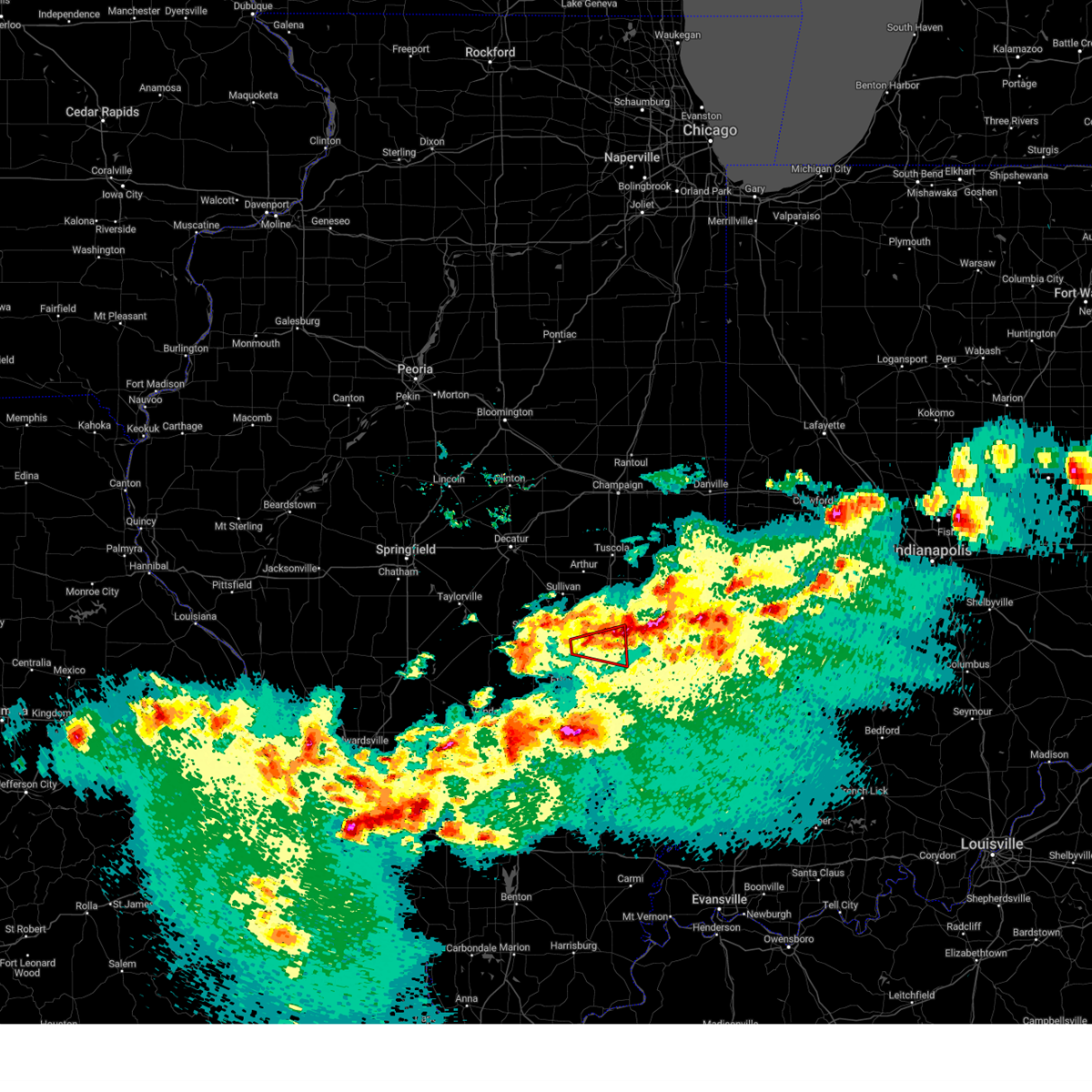 the tornado warning has been cancelled and is no longer in effect the tornado warning has been cancelled and is no longer in effect
|
| 3/14/2024 6:34 PM CDT |
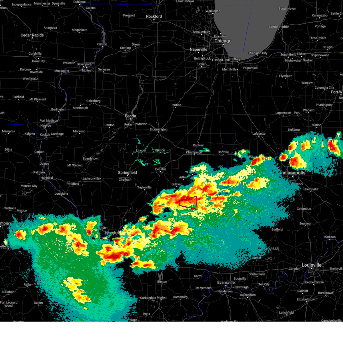 Torilx the national weather service in lincoln has issued a * tornado warning for, southwestern coles county in east central illinois, east central shelby county in central illinois, northwestern cumberland county in east central illinois, * until 700 pm cdt. * at 633 pm cdt, a severe thunderstorm capable of producing a tornado was located near neoga, moving east at 35 mph (radar indicated rotation). Hazards include tornado. Flying debris will be dangerous to those caught without shelter. mobile homes will be damaged or destroyed. damage to roofs, windows, and vehicles will occur. tree damage is likely. this dangerous storm will be near, neoga around 640 pm cdt. janesville around 650 pm cdt. other locations in the path of this tornadic thunderstorm include toledo. this includes the following highways, interstate 57 between mile markers 173 and 181. Interstate 70 between mile markers 115 and 116. Torilx the national weather service in lincoln has issued a * tornado warning for, southwestern coles county in east central illinois, east central shelby county in central illinois, northwestern cumberland county in east central illinois, * until 700 pm cdt. * at 633 pm cdt, a severe thunderstorm capable of producing a tornado was located near neoga, moving east at 35 mph (radar indicated rotation). Hazards include tornado. Flying debris will be dangerous to those caught without shelter. mobile homes will be damaged or destroyed. damage to roofs, windows, and vehicles will occur. tree damage is likely. this dangerous storm will be near, neoga around 640 pm cdt. janesville around 650 pm cdt. other locations in the path of this tornadic thunderstorm include toledo. this includes the following highways, interstate 57 between mile markers 173 and 181. Interstate 70 between mile markers 115 and 116.
|
| 3/14/2024 6:29 PM CDT |
 The storm which prompted the warning has moved out of the area. therefore, the warning will be allowed to expire. a tornado watch remains in effect until 900 pm cdt for central and east central illinois. remember, a severe thunderstorm warning still remains in effect for coles, cumberland, and shelby counties until 715 pm cdt. The storm which prompted the warning has moved out of the area. therefore, the warning will be allowed to expire. a tornado watch remains in effect until 900 pm cdt for central and east central illinois. remember, a severe thunderstorm warning still remains in effect for coles, cumberland, and shelby counties until 715 pm cdt.
|
| 3/14/2024 6:25 PM CDT |
 Svrilx the national weather service in lincoln has issued a * severe thunderstorm warning for, southern coles county in east central illinois, northern jasper county in southeastern illinois, southwestern clark county in east central illinois, southeastern shelby county in central illinois, cumberland county in east central illinois, northeastern effingham county in south central illinois, * until 715 pm cdt. * at 625 pm cdt, severe thunderstorms were located along a line extending from near lerna to near stewardson, moving southeast at 40 mph (radar indicated). Hazards include 60 mph wind gusts and half dollar size hail. Hail damage to vehicles is expected. expect wind damage to roofs, siding, and trees. severe thunderstorms will be near, neoga, lerna, and janesville around 630 pm cdt. toledo around 635 pm cdt. greenup, teutopolis, jewett, and montrose around 640 pm cdt. other locations in the path of these severe thunderstorms include casey and hidalgo. this includes the following highways, interstate 57 between mile markers 160 and 191. Interstate 70 between mile markers 94 and 134. Svrilx the national weather service in lincoln has issued a * severe thunderstorm warning for, southern coles county in east central illinois, northern jasper county in southeastern illinois, southwestern clark county in east central illinois, southeastern shelby county in central illinois, cumberland county in east central illinois, northeastern effingham county in south central illinois, * until 715 pm cdt. * at 625 pm cdt, severe thunderstorms were located along a line extending from near lerna to near stewardson, moving southeast at 40 mph (radar indicated). Hazards include 60 mph wind gusts and half dollar size hail. Hail damage to vehicles is expected. expect wind damage to roofs, siding, and trees. severe thunderstorms will be near, neoga, lerna, and janesville around 630 pm cdt. toledo around 635 pm cdt. greenup, teutopolis, jewett, and montrose around 640 pm cdt. other locations in the path of these severe thunderstorms include casey and hidalgo. this includes the following highways, interstate 57 between mile markers 160 and 191. Interstate 70 between mile markers 94 and 134.
|
| 3/14/2024 6:11 PM CDT |
 At 611 pm cdt, a severe thunderstorm was located over windsor, or 9 miles south of sullivan, moving east at 45 mph (radar indicated). Hazards include ping pong ball size hail and 60 mph wind gusts. People and animals outdoors will be injured. expect hail damage to roofs, siding, windows, and vehicles. expect wind damage to roofs, siding, and trees. this severe storm will be near, mattoon around 620 pm cdt. lerna around 625 pm cdt. other locations impacted by this severe thunderstorm include etna, wolf creek state park, coles county airport, gays, trilla, loxa, strasburg, and paradise. This includes interstate 57 between mile markers 176 and 199. At 611 pm cdt, a severe thunderstorm was located over windsor, or 9 miles south of sullivan, moving east at 45 mph (radar indicated). Hazards include ping pong ball size hail and 60 mph wind gusts. People and animals outdoors will be injured. expect hail damage to roofs, siding, windows, and vehicles. expect wind damage to roofs, siding, and trees. this severe storm will be near, mattoon around 620 pm cdt. lerna around 625 pm cdt. other locations impacted by this severe thunderstorm include etna, wolf creek state park, coles county airport, gays, trilla, loxa, strasburg, and paradise. This includes interstate 57 between mile markers 176 and 199.
|
| 3/14/2024 5:48 PM CDT |
 Svrilx the national weather service in lincoln has issued a * severe thunderstorm warning for, western coles county in east central illinois, southern moultrie county in central illinois, central shelby county in central illinois, northwestern cumberland county in east central illinois, * until 630 pm cdt. * at 547 pm cdt, a severe thunderstorm was located 7 miles northwest of shelbyville, moving east at 55 mph (radar indicated). Hazards include ping pong ball size hail and 60 mph wind gusts. People and animals outdoors will be injured. expect hail damage to roofs, siding, windows, and vehicles. expect wind damage to roofs, siding, and trees. this severe thunderstorm will be near, findlay around 555 pm cdt. windsor around 600 pm cdt. other locations in the path of this severe thunderstorm include mattoon and lerna. This includes interstate 57 between mile markers 174 and 199. Svrilx the national weather service in lincoln has issued a * severe thunderstorm warning for, western coles county in east central illinois, southern moultrie county in central illinois, central shelby county in central illinois, northwestern cumberland county in east central illinois, * until 630 pm cdt. * at 547 pm cdt, a severe thunderstorm was located 7 miles northwest of shelbyville, moving east at 55 mph (radar indicated). Hazards include ping pong ball size hail and 60 mph wind gusts. People and animals outdoors will be injured. expect hail damage to roofs, siding, windows, and vehicles. expect wind damage to roofs, siding, and trees. this severe thunderstorm will be near, findlay around 555 pm cdt. windsor around 600 pm cdt. other locations in the path of this severe thunderstorm include mattoon and lerna. This includes interstate 57 between mile markers 174 and 199.
|
| 3/13/2024 8:25 PM CDT |
 At 824 pm cdt, a severe thunderstorm was located over janesville, or near charleston, moving northeast at 20 mph (radar indicated). Hazards include 60 mph wind gusts and half dollar size hail. Hail damage to vehicles is expected. expect wind damage to roofs, siding, and trees. this severe storm will be near, charleston around 830 pm cdt. other locations impacted by this severe thunderstorm include fox ridge state park. This includes interstate 70 near mile marker 126. At 824 pm cdt, a severe thunderstorm was located over janesville, or near charleston, moving northeast at 20 mph (radar indicated). Hazards include 60 mph wind gusts and half dollar size hail. Hail damage to vehicles is expected. expect wind damage to roofs, siding, and trees. this severe storm will be near, charleston around 830 pm cdt. other locations impacted by this severe thunderstorm include fox ridge state park. This includes interstate 70 near mile marker 126.
|
| 3/13/2024 8:10 PM CDT |
 Svrilx the national weather service in lincoln has issued a * severe thunderstorm warning for, southern coles county in east central illinois, northern cumberland county in east central illinois, * until 845 pm cdt. * at 810 pm cdt, a severe thunderstorm was located near lerna, or 7 miles northwest of toledo, moving east at 25 mph (radar indicated). Hazards include 60 mph wind gusts and quarter size hail. Hail damage to vehicles is expected. expect wind damage to roofs, siding, and trees. this severe thunderstorm will be near, lerna and janesville around 815 pm cdt. this includes the following highways, interstate 57 between mile markers 182 and 185. Interstate 70 near mile marker 126. Svrilx the national weather service in lincoln has issued a * severe thunderstorm warning for, southern coles county in east central illinois, northern cumberland county in east central illinois, * until 845 pm cdt. * at 810 pm cdt, a severe thunderstorm was located near lerna, or 7 miles northwest of toledo, moving east at 25 mph (radar indicated). Hazards include 60 mph wind gusts and quarter size hail. Hail damage to vehicles is expected. expect wind damage to roofs, siding, and trees. this severe thunderstorm will be near, lerna and janesville around 815 pm cdt. this includes the following highways, interstate 57 between mile markers 182 and 185. Interstate 70 near mile marker 126.
|
| 8/6/2023 8:31 PM CDT |
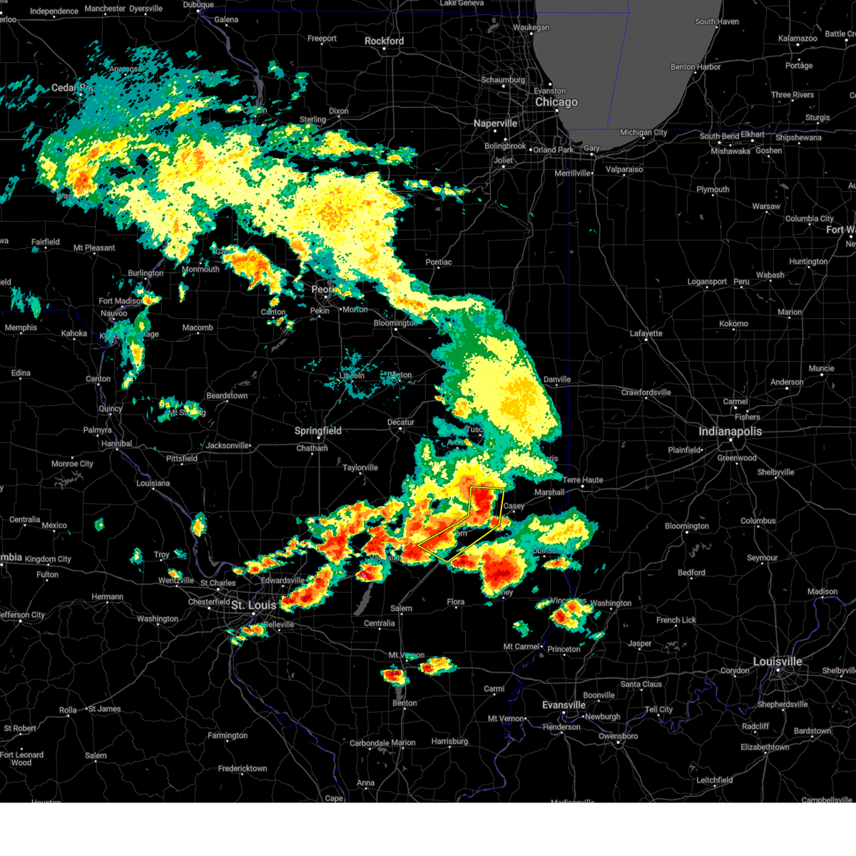 At 831 pm cdt, severe thunderstorms were located along a line extending from janesville to toledo to near effingham, moving east at 35 mph (radar indicated). Hazards include 60 mph wind gusts and nickel size hail. Expect damage to roofs, siding, and trees. locations impacted include, effingham, toledo, altamont, teutopolis, greenup, watson, dieterich, lerna, jewett, montrose, janesville, woodbury, fox ridge state park, heartville, lake sara, effingham county airport and trilla. this includes the following highways, interstate 57 between mile markers 150 and 168, and between mile markers 186 and 187. Interstate 70 between mile markers 83 and 120. At 831 pm cdt, severe thunderstorms were located along a line extending from janesville to toledo to near effingham, moving east at 35 mph (radar indicated). Hazards include 60 mph wind gusts and nickel size hail. Expect damage to roofs, siding, and trees. locations impacted include, effingham, toledo, altamont, teutopolis, greenup, watson, dieterich, lerna, jewett, montrose, janesville, woodbury, fox ridge state park, heartville, lake sara, effingham county airport and trilla. this includes the following highways, interstate 57 between mile markers 150 and 168, and between mile markers 186 and 187. Interstate 70 between mile markers 83 and 120.
|
| 8/6/2023 8:17 PM CDT |
 At 816 pm cdt, severe thunderstorms were located along a line extending from near lerna to near neoga to near altamont, moving east at 35 mph (radar indicated). Hazards include 60 mph wind gusts and nickel size hail. Expect damage to roofs, siding, and trees. locations impacted include, mattoon, effingham, toledo, altamont, neoga, teutopolis, greenup, watson, stewardson, dieterich, beecher city, lerna, jewett, shumway, montrose, janesville, paradise, woodbury, moccasin and sigel. this includes the following highways, interstate 57 between mile markers 150 and 187. Interstate 70 between mile markers 83 and 120. At 816 pm cdt, severe thunderstorms were located along a line extending from near lerna to near neoga to near altamont, moving east at 35 mph (radar indicated). Hazards include 60 mph wind gusts and nickel size hail. Expect damage to roofs, siding, and trees. locations impacted include, mattoon, effingham, toledo, altamont, neoga, teutopolis, greenup, watson, stewardson, dieterich, beecher city, lerna, jewett, shumway, montrose, janesville, paradise, woodbury, moccasin and sigel. this includes the following highways, interstate 57 between mile markers 150 and 187. Interstate 70 between mile markers 83 and 120.
|
| 8/6/2023 7:58 PM CDT |
 At 757 pm cdt, severe thunderstorms were located along a line extending from windsor to near stewardson to near wrights corner, moving east at 35 mph (radar indicated). Hazards include 60 mph wind gusts and nickel size hail. expect damage to roofs, siding, and trees At 757 pm cdt, severe thunderstorms were located along a line extending from windsor to near stewardson to near wrights corner, moving east at 35 mph (radar indicated). Hazards include 60 mph wind gusts and nickel size hail. expect damage to roofs, siding, and trees
|
| 7/20/2023 1:55 PM CDT |
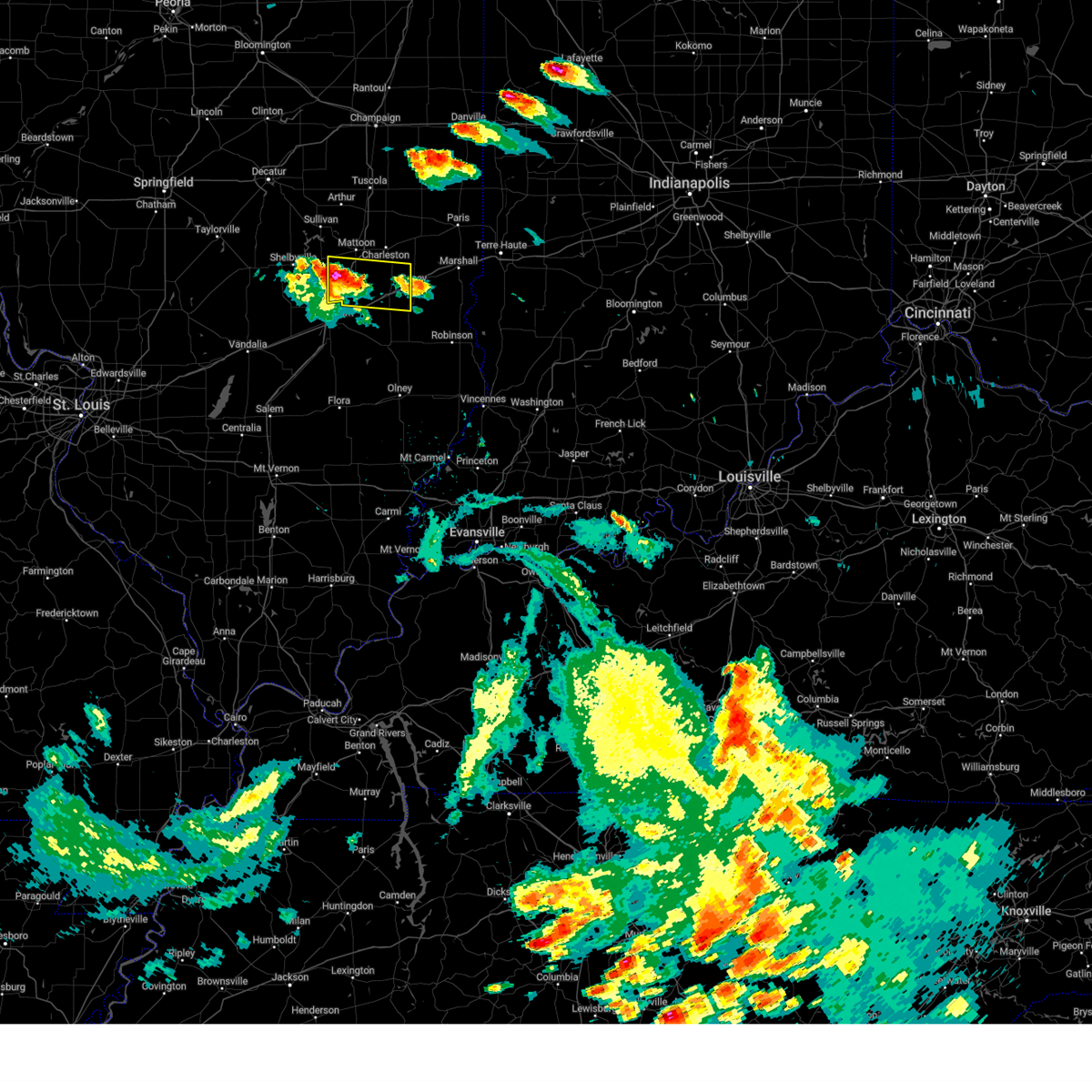 At 155 pm cdt, a severe thunderstorm was located over neoga, or 10 miles west of toledo, moving east at 30 mph (radar indicated). Hazards include 60 mph wind gusts and quarter size hail. Hail damage to vehicles is expected. expect wind damage to roofs, siding, and trees. this severe thunderstorm will be near, lerna around 205 pm cdt. janesville around 210 pm cdt. toledo and jewett around 215 pm cdt. other locations in the path of this severe thunderstorm include greenup, casey and hazel dell. this includes the following highways, interstate 57 between mile markers 169 and 185. interstate 70 between mile markers 108 and 126. hail threat, radar indicated max hail size, 1. 00 in wind threat, radar indicated max wind gust, 60 mph. At 155 pm cdt, a severe thunderstorm was located over neoga, or 10 miles west of toledo, moving east at 30 mph (radar indicated). Hazards include 60 mph wind gusts and quarter size hail. Hail damage to vehicles is expected. expect wind damage to roofs, siding, and trees. this severe thunderstorm will be near, lerna around 205 pm cdt. janesville around 210 pm cdt. toledo and jewett around 215 pm cdt. other locations in the path of this severe thunderstorm include greenup, casey and hazel dell. this includes the following highways, interstate 57 between mile markers 169 and 185. interstate 70 between mile markers 108 and 126. hail threat, radar indicated max hail size, 1. 00 in wind threat, radar indicated max wind gust, 60 mph.
|
| 6/29/2023 1:32 PM CDT | Spotter estimates 80 mph wind gusts with large tree down in front law in coles county IL, 1.6 miles NW of Lerna, IL |
| 6/29/2023 1:27 PM CDT |
 At 125 pm cdt, severe thunderstorms were located along a line extending from near rantoul to near camargo to neoga, moving east at 65 mph (trained weather spotters). Hazards include 80 mph wind gusts. Flying debris will be dangerous to those caught without shelter. mobile homes will be heavily damaged. expect considerable damage to roofs, windows, and vehicles. extensive tree damage and power outages are likely. severe thunderstorms will be near, rantoul, thomasboro, newman and broadlands around 130 pm cdt. gifford, hume, brocton, allerton, lerna, jewett and janesville around 135 pm cdt. greenup, sidell and rankin around 140 pm cdt. chrisman and potomac around 145 pm cdt. other locations in the path of these severe thunderstorms include casey, ridge farm, westfield, hoopeston, rossville, martinsville, clarksville and marshall. this includes the following highways, interstate 57 between mile markers 186 and 194, and between mile markers 238 and 257. interstate 70 between mile markers 109 and 154. Interstate 74 between mile markers 180 and 220. At 125 pm cdt, severe thunderstorms were located along a line extending from near rantoul to near camargo to neoga, moving east at 65 mph (trained weather spotters). Hazards include 80 mph wind gusts. Flying debris will be dangerous to those caught without shelter. mobile homes will be heavily damaged. expect considerable damage to roofs, windows, and vehicles. extensive tree damage and power outages are likely. severe thunderstorms will be near, rantoul, thomasboro, newman and broadlands around 130 pm cdt. gifford, hume, brocton, allerton, lerna, jewett and janesville around 135 pm cdt. greenup, sidell and rankin around 140 pm cdt. chrisman and potomac around 145 pm cdt. other locations in the path of these severe thunderstorms include casey, ridge farm, westfield, hoopeston, rossville, martinsville, clarksville and marshall. this includes the following highways, interstate 57 between mile markers 186 and 194, and between mile markers 238 and 257. interstate 70 between mile markers 109 and 154. Interstate 74 between mile markers 180 and 220.
|
| 6/29/2023 1:16 PM CDT |
 At 114 pm cdt, severe thunderstorms were located along a line extending from near lake of the woods to near tuscola to near windsor, moving east at 80 mph. these are destructive storms for champaign and tuscola (emergency management). Hazards include 80 mph wind gusts and half dollar size hail. Flying debris will be dangerous to those caught without shelter. mobile homes will be heavily damaged. expect considerable damage to roofs, windows, and vehicles. extensive tree damage and power outages are likely. locations impacted include, champaign, urbana, villa grove, thomasboro, camargo, toledo, st. joseph, gifford, janesville, newman, ogden, broadlands and allerton. this includes the following highways, interstate 57 between mile markers 168 and 249. interstate 70 between mile markers 108 and 124. interstate 72 between mile markers 153 and 182. Interstate 74 between mile markers 159 and 200. At 114 pm cdt, severe thunderstorms were located along a line extending from near lake of the woods to near tuscola to near windsor, moving east at 80 mph. these are destructive storms for champaign and tuscola (emergency management). Hazards include 80 mph wind gusts and half dollar size hail. Flying debris will be dangerous to those caught without shelter. mobile homes will be heavily damaged. expect considerable damage to roofs, windows, and vehicles. extensive tree damage and power outages are likely. locations impacted include, champaign, urbana, villa grove, thomasboro, camargo, toledo, st. joseph, gifford, janesville, newman, ogden, broadlands and allerton. this includes the following highways, interstate 57 between mile markers 168 and 249. interstate 70 between mile markers 108 and 124. interstate 72 between mile markers 153 and 182. Interstate 74 between mile markers 159 and 200.
|
| 6/29/2023 12:51 PM CDT |
 At 1250 pm cdt, severe thunderstorms were located along a line extending from near wapella to near pana, moving east at 65 mph. these are destructive storms for eastern de witt and northern piatt county (radar indicated). Hazards include 80 mph wind gusts and half dollar size hail. Flying debris will be dangerous to those caught without shelter. mobile homes will be heavily damaged. expect considerable damage to roofs, windows, and vehicles. extensive tree damage and power outages are likely. severe thunderstorms will be near, weldon around 1255 pm cdt. farmer city and de land around 100 pm cdt. shelbyville and cowden around 105 pm cdt. mansfield and seymour around 110 pm cdt. other locations in the path of these severe thunderstorms include mahomet, fisher, windsor, stewardson, bondville, lake of the woods, champaign, urbana, mattoon, rantoul, neoga, thomasboro, toledo, st. joseph, gifford, lerna and janesville. this includes the following highways, interstate 57 between mile markers 168 and 250. interstate 70 between mile markers 108 and 124. interstate 72 between mile markers 133 and 182. Interstate 74 between mile markers 155 and 200. At 1250 pm cdt, severe thunderstorms were located along a line extending from near wapella to near pana, moving east at 65 mph. these are destructive storms for eastern de witt and northern piatt county (radar indicated). Hazards include 80 mph wind gusts and half dollar size hail. Flying debris will be dangerous to those caught without shelter. mobile homes will be heavily damaged. expect considerable damage to roofs, windows, and vehicles. extensive tree damage and power outages are likely. severe thunderstorms will be near, weldon around 1255 pm cdt. farmer city and de land around 100 pm cdt. shelbyville and cowden around 105 pm cdt. mansfield and seymour around 110 pm cdt. other locations in the path of these severe thunderstorms include mahomet, fisher, windsor, stewardson, bondville, lake of the woods, champaign, urbana, mattoon, rantoul, neoga, thomasboro, toledo, st. joseph, gifford, lerna and janesville. this includes the following highways, interstate 57 between mile markers 168 and 250. interstate 70 between mile markers 108 and 124. interstate 72 between mile markers 133 and 182. Interstate 74 between mile markers 155 and 200.
|
| 5/7/2023 5:30 AM CDT |
 At 530 am cdt, severe thunderstorms were located along a line extending from near dennison to near morrisonville, moving south at 20 mph (radar indicated). Hazards include 60 mph wind gusts and penny size hail. Expect damage to roofs, siding, and trees. severe thunderstorms will be near, morrisonville around 535 am cdt. other locations in the path of these severe thunderstorms include west union. this includes the following highways, interstate 57 between mile markers 169 and 191. interstate 70 between mile markers 106 and 154. hail threat, radar indicated max hail size, 0. 75 in wind threat, radar indicated max wind gust, 60 mph. At 530 am cdt, severe thunderstorms were located along a line extending from near dennison to near morrisonville, moving south at 20 mph (radar indicated). Hazards include 60 mph wind gusts and penny size hail. Expect damage to roofs, siding, and trees. severe thunderstorms will be near, morrisonville around 535 am cdt. other locations in the path of these severe thunderstorms include west union. this includes the following highways, interstate 57 between mile markers 169 and 191. interstate 70 between mile markers 106 and 154. hail threat, radar indicated max hail size, 0. 75 in wind threat, radar indicated max wind gust, 60 mph.
|
| 4/5/2023 10:11 AM CDT |
 The severe thunderstorm warning for southern coles, southwestern edgar, western clark and cumberland counties will expire at 1015 am cdt, the storm which prompted the warning has moved out of the area. therefore, the warning will be allowed to expire. a severe thunderstorm watch remains in effect until 1100 am cdt for south central, southeastern and east central illinois. The severe thunderstorm warning for southern coles, southwestern edgar, western clark and cumberland counties will expire at 1015 am cdt, the storm which prompted the warning has moved out of the area. therefore, the warning will be allowed to expire. a severe thunderstorm watch remains in effect until 1100 am cdt for south central, southeastern and east central illinois.
|
| 4/5/2023 9:49 AM CDT |
 At 949 am cdt, a severe thunderstorm was located near janesville, or 8 miles northeast of toledo, moving east at 55 mph (radar indicated). Hazards include 60 mph wind gusts and quarter size hail. Hail damage to vehicles is expected. expect wind damage to roofs, siding, and trees. locations impacted include, casey, westfield, martinsville and clarksville. this includes the following highways, interstate 57 between mile markers 181 and 188. interstate 70 between mile markers 105 and 139. hail threat, radar indicated max hail size, 1. 00 in wind threat, radar indicated max wind gust, 60 mph. At 949 am cdt, a severe thunderstorm was located near janesville, or 8 miles northeast of toledo, moving east at 55 mph (radar indicated). Hazards include 60 mph wind gusts and quarter size hail. Hail damage to vehicles is expected. expect wind damage to roofs, siding, and trees. locations impacted include, casey, westfield, martinsville and clarksville. this includes the following highways, interstate 57 between mile markers 181 and 188. interstate 70 between mile markers 105 and 139. hail threat, radar indicated max hail size, 1. 00 in wind threat, radar indicated max wind gust, 60 mph.
|
| 4/5/2023 9:31 AM CDT |
 At 930 am cdt, a severe thunderstorm was located near neoga, or 9 miles north of effingham, moving east at 70 mph (radar indicated). Hazards include 60 mph wind gusts and quarter size hail. Hail damage to vehicles is expected. expect wind damage to roofs, siding, and trees. this severe thunderstorm will be near, toledo and jewett around 940 am cdt. greenup, lerna and janesville around 945 am cdt. other locations in the path of this severe thunderstorm include casey, westfield, martinsville and clarksville. this includes the following highways, interstate 57 between mile markers 169 and 188. interstate 70 between mile markers 105 and 139. hail threat, radar indicated max hail size, 1. 00 in wind threat, radar indicated max wind gust, 60 mph. At 930 am cdt, a severe thunderstorm was located near neoga, or 9 miles north of effingham, moving east at 70 mph (radar indicated). Hazards include 60 mph wind gusts and quarter size hail. Hail damage to vehicles is expected. expect wind damage to roofs, siding, and trees. this severe thunderstorm will be near, toledo and jewett around 940 am cdt. greenup, lerna and janesville around 945 am cdt. other locations in the path of this severe thunderstorm include casey, westfield, martinsville and clarksville. this includes the following highways, interstate 57 between mile markers 169 and 188. interstate 70 between mile markers 105 and 139. hail threat, radar indicated max hail size, 1. 00 in wind threat, radar indicated max wind gust, 60 mph.
|
| 3/6/2022 12:46 AM CST |
 At 1246 am cst, a severe thunderstorm was located near ashmore, or 11 miles east of charleston, moving east at 80 mph (radar indicated). Hazards include 70 mph wind gusts. Expect considerable tree damage. damage is likely to mobile homes, roofs, and outbuildings. locations impacted include, charleston, paris, marshall, martinsville, kansas, ashmore, westfield, lerna, vermilion, redmon, clarksville, oliver, dennison, hutton, fox ridge state park, edgar county airport, bell ridge, scottland and sandford. this includes interstate 70 between mile markers 136 and 154. thunderstorm damage threat, considerable hail threat, radar indicated max hail size, <. 75 in wind threat, radar indicated max wind gust, 70 mph. At 1246 am cst, a severe thunderstorm was located near ashmore, or 11 miles east of charleston, moving east at 80 mph (radar indicated). Hazards include 70 mph wind gusts. Expect considerable tree damage. damage is likely to mobile homes, roofs, and outbuildings. locations impacted include, charleston, paris, marshall, martinsville, kansas, ashmore, westfield, lerna, vermilion, redmon, clarksville, oliver, dennison, hutton, fox ridge state park, edgar county airport, bell ridge, scottland and sandford. this includes interstate 70 between mile markers 136 and 154. thunderstorm damage threat, considerable hail threat, radar indicated max hail size, <. 75 in wind threat, radar indicated max wind gust, 70 mph.
|
| 3/6/2022 12:30 AM CST |
 At 1230 am cst, a severe thunderstorm was located near hume, or 10 miles northwest of paris, moving east at 65 mph (radar indicated). Hazards include 70 mph wind gusts and penny size hail. Expect considerable tree damage. damage is likely to mobile homes, roofs, and outbuildings. locations impacted include, charleston, mattoon, paris, marshall, georgetown, westville, chrisman, martinsville, ridge farm, oakland, kansas, ashmore, sidell, westfield, hume, brocton, allerton, lerna, vermilion and redmon. this includes the following highways, interstate 57 between mile markers 181 and 194. interstate 70 between mile markers 136 and 154. thunderstorm damage threat, considerable hail threat, radar indicated max hail size, 0. 75 in wind threat, observed max wind gust, 70 mph. At 1230 am cst, a severe thunderstorm was located near hume, or 10 miles northwest of paris, moving east at 65 mph (radar indicated). Hazards include 70 mph wind gusts and penny size hail. Expect considerable tree damage. damage is likely to mobile homes, roofs, and outbuildings. locations impacted include, charleston, mattoon, paris, marshall, georgetown, westville, chrisman, martinsville, ridge farm, oakland, kansas, ashmore, sidell, westfield, hume, brocton, allerton, lerna, vermilion and redmon. this includes the following highways, interstate 57 between mile markers 181 and 194. interstate 70 between mile markers 136 and 154. thunderstorm damage threat, considerable hail threat, radar indicated max hail size, 0. 75 in wind threat, observed max wind gust, 70 mph.
|
| 3/6/2022 12:16 AM CST |
 At 1215 am cst, a severe thunderstorm was located over hindsboro, or 12 miles southeast of tuscola, moving east at 65 mph (broadcast media). Hazards include 70 mph wind gusts and quarter size hail. Hail damage to vehicles is expected. expect considerable tree damage. wind damage is also likely to mobile homes, roofs, and outbuildings. locations impacted include, oakland, newman, brocton, hume, redmon, paris and chrisman. this includes the following highways, interstate 57 between mile markers 181 and 216. interstate 70 between mile markers 136 and 154. thunderstorm damage threat, considerable hail threat, radar indicated max hail size, 1. 00 in wind threat, observed max wind gust, 70 mph. At 1215 am cst, a severe thunderstorm was located over hindsboro, or 12 miles southeast of tuscola, moving east at 65 mph (broadcast media). Hazards include 70 mph wind gusts and quarter size hail. Hail damage to vehicles is expected. expect considerable tree damage. wind damage is also likely to mobile homes, roofs, and outbuildings. locations impacted include, oakland, newman, brocton, hume, redmon, paris and chrisman. this includes the following highways, interstate 57 between mile markers 181 and 216. interstate 70 between mile markers 136 and 154. thunderstorm damage threat, considerable hail threat, radar indicated max hail size, 1. 00 in wind threat, observed max wind gust, 70 mph.
|
| 3/5/2022 11:56 PM CST |
 At 1156 pm cst, a severe thunderstorm was located near allenville, or near sullivan, moving east at 65 mph (radar indicated). Hazards include 70 mph wind gusts. Expect considerable tree damage. damage is likely to mobile homes, roofs, and outbuildings. this severe thunderstorm will be near, cooks mill around 1200 am cst. arcola and humboldt around 1205 am cst. hindsboro and rardin around 1215 am cst. other locations in the path of this severe thunderstorm include oakland, newman, brocton, hume, redmon, paris and chrisman. this includes the following highways, interstate 57 between mile markers 181 and 223. interstate 70 between mile markers 136 and 154. thunderstorm damage threat, considerable hail threat, radar indicated max hail size, <. 75 in wind threat, radar indicated max wind gust, 70 mph. At 1156 pm cst, a severe thunderstorm was located near allenville, or near sullivan, moving east at 65 mph (radar indicated). Hazards include 70 mph wind gusts. Expect considerable tree damage. damage is likely to mobile homes, roofs, and outbuildings. this severe thunderstorm will be near, cooks mill around 1200 am cst. arcola and humboldt around 1205 am cst. hindsboro and rardin around 1215 am cst. other locations in the path of this severe thunderstorm include oakland, newman, brocton, hume, redmon, paris and chrisman. this includes the following highways, interstate 57 between mile markers 181 and 223. interstate 70 between mile markers 136 and 154. thunderstorm damage threat, considerable hail threat, radar indicated max hail size, <. 75 in wind threat, radar indicated max wind gust, 70 mph.
|
| 8/12/2021 3:43 PM CDT |
 At 343 pm cdt, a severe thunderstorm was located over shelbyville, moving southeast at 50 mph (radar indicated). Hazards include 70 mph wind gusts and quarter size hail. Hail damage to vehicles is expected. expect considerable tree damage. wind damage is also likely to mobile homes, roofs, and outbuildings. this severe thunderstorm will be near, stewardson and shumway around 400 pm cdt. other locations in the path of this severe thunderstorm include effingham, neoga, teutopolis and montrose. this includes the following highways, interstate 57 between mile markers 146 and 190. interstate 70 between mile markers 79 and 107. thunderstorm damage threat, considerable hail threat, radar indicated max hail size, 1. 00 in wind threat, radar indicated max wind gust, 70 mph. At 343 pm cdt, a severe thunderstorm was located over shelbyville, moving southeast at 50 mph (radar indicated). Hazards include 70 mph wind gusts and quarter size hail. Hail damage to vehicles is expected. expect considerable tree damage. wind damage is also likely to mobile homes, roofs, and outbuildings. this severe thunderstorm will be near, stewardson and shumway around 400 pm cdt. other locations in the path of this severe thunderstorm include effingham, neoga, teutopolis and montrose. this includes the following highways, interstate 57 between mile markers 146 and 190. interstate 70 between mile markers 79 and 107. thunderstorm damage threat, considerable hail threat, radar indicated max hail size, 1. 00 in wind threat, radar indicated max wind gust, 70 mph.
|
| 7/15/2021 1:51 PM CDT |
 At 150 pm cdt, a severe thunderstorm capable of producing a tornado was located near lerna, moving east-northeast at 25 mph (radar indicated rotation). Hazards include tornado. Flying debris will be dangerous to those caught without shelter. mobile homes will be damaged or destroyed. damage to roofs, windows, and vehicles will occur. tree damage is likely. this dangerous storm will be near, lerna around 155 pm cdt. other locations in the path of this tornadic thunderstorm include charleston. This includes interstate 57 between mile markers 181 and 195. At 150 pm cdt, a severe thunderstorm capable of producing a tornado was located near lerna, moving east-northeast at 25 mph (radar indicated rotation). Hazards include tornado. Flying debris will be dangerous to those caught without shelter. mobile homes will be damaged or destroyed. damage to roofs, windows, and vehicles will occur. tree damage is likely. this dangerous storm will be near, lerna around 155 pm cdt. other locations in the path of this tornadic thunderstorm include charleston. This includes interstate 57 between mile markers 181 and 195.
|
| 7/15/2021 1:40 PM CDT |
 At 140 pm cdt, a severe thunderstorm capable of producing a tornado was located near paradise, moving northeast at 25 mph (radar indicated rotation). Hazards include tornado. Flying debris will be dangerous to those caught without shelter. mobile homes will be damaged or destroyed. damage to roofs, windows, and vehicles will occur. tree damage is likely. this dangerous storm will be near, mattoon around 145 pm cdt. lerna around 155 pm cdt. other locations in the path of this tornadic thunderstorm include charleston. This includes interstate 57 between mile markers 181 and 195. At 140 pm cdt, a severe thunderstorm capable of producing a tornado was located near paradise, moving northeast at 25 mph (radar indicated rotation). Hazards include tornado. Flying debris will be dangerous to those caught without shelter. mobile homes will be damaged or destroyed. damage to roofs, windows, and vehicles will occur. tree damage is likely. this dangerous storm will be near, mattoon around 145 pm cdt. lerna around 155 pm cdt. other locations in the path of this tornadic thunderstorm include charleston. This includes interstate 57 between mile markers 181 and 195.
|
| 6/12/2021 8:26 PM CDT |
 At 825 pm cdt, a severe thunderstorm was located over lerna, or near charleston, moving south at 35 mph (trained weather spotters). Hazards include 60 mph wind gusts and quarter size hail. Hail damage to vehicles is expected. expect wind damage to roofs, siding, and trees. this severe thunderstorm will be near, janesville around 830 pm cdt. toledo and greenup around 840 pm cdt. other locations in the path of this severe thunderstorm include jewett. this includes the following highways, interstate 57 between mile markers 184 and 190. Interstate 70 between mile markers 106 and 119. At 825 pm cdt, a severe thunderstorm was located over lerna, or near charleston, moving south at 35 mph (trained weather spotters). Hazards include 60 mph wind gusts and quarter size hail. Hail damage to vehicles is expected. expect wind damage to roofs, siding, and trees. this severe thunderstorm will be near, janesville around 830 pm cdt. toledo and greenup around 840 pm cdt. other locations in the path of this severe thunderstorm include jewett. this includes the following highways, interstate 57 between mile markers 184 and 190. Interstate 70 between mile markers 106 and 119.
|
| 5/3/2021 8:39 PM CDT |
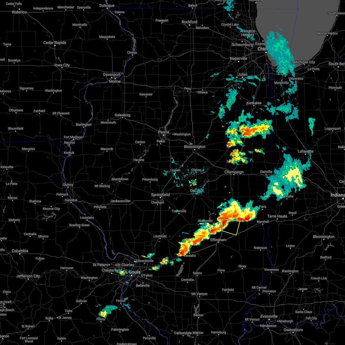 A severe thunderstorm warning remains in effect until 900 pm cdt for southwestern coles and northwestern cumberland counties. at 838 pm cdt, a severe thunderstorm was located near mattoon, moving east at 35 mph. hazard. 60 mph wind gusts and quarter size hail. source. Radar indicated. A severe thunderstorm warning remains in effect until 900 pm cdt for southwestern coles and northwestern cumberland counties. at 838 pm cdt, a severe thunderstorm was located near mattoon, moving east at 35 mph. hazard. 60 mph wind gusts and quarter size hail. source. Radar indicated.
|
| 5/3/2021 8:19 PM CDT |
 At 818 pm cdt, a severe thunderstorm was located over windsor, or 9 miles east of shelbyville, moving east at 35 mph (radar indicated). Hazards include 60 mph wind gusts and quarter size hail. Hail damage to vehicles is expected. Expect wind damage to roofs, siding, and trees. At 818 pm cdt, a severe thunderstorm was located over windsor, or 9 miles east of shelbyville, moving east at 35 mph (radar indicated). Hazards include 60 mph wind gusts and quarter size hail. Hail damage to vehicles is expected. Expect wind damage to roofs, siding, and trees.
|
| 3/27/2021 8:58 PM CDT |
 The severe thunderstorm warning for southern coles, southeastern shelby and cumberland counties will expire at 900 pm cdt, the storms which prompted the warning have moved out of the area. therefore, the warning will be allowed to expire. a severe thunderstorm watch remains in effect until 1000 pm cdt for south central, central and east central illinois. to report severe weather, contact your nearest law enforcement agency. they will relay your report to the national weather service lincoln. The severe thunderstorm warning for southern coles, southeastern shelby and cumberland counties will expire at 900 pm cdt, the storms which prompted the warning have moved out of the area. therefore, the warning will be allowed to expire. a severe thunderstorm watch remains in effect until 1000 pm cdt for south central, central and east central illinois. to report severe weather, contact your nearest law enforcement agency. they will relay your report to the national weather service lincoln.
|
| 3/27/2021 8:38 PM CDT |
 At 838 pm cdt, severe thunderstorms were located along a line extending from near toledo to near teutopolis, moving east at 25 mph (radar indicated). Hazards include 60 mph wind gusts and nickel size hail. Expect damage to roofs, siding, and trees. locations impacted include, charleston, mattoon, toledo, casey, neoga, greenup, ashmore, lerna, janesville, paradise, hutton, sigel, etna, fox ridge state park, union center, coles county airport, trilla and trowbridge. this includes the following highways, interstate 57 between mile markers 168 and 188. Interstate 70 between mile markers 112 and 126. At 838 pm cdt, severe thunderstorms were located along a line extending from near toledo to near teutopolis, moving east at 25 mph (radar indicated). Hazards include 60 mph wind gusts and nickel size hail. Expect damage to roofs, siding, and trees. locations impacted include, charleston, mattoon, toledo, casey, neoga, greenup, ashmore, lerna, janesville, paradise, hutton, sigel, etna, fox ridge state park, union center, coles county airport, trilla and trowbridge. this includes the following highways, interstate 57 between mile markers 168 and 188. Interstate 70 between mile markers 112 and 126.
|
| 3/27/2021 8:29 PM CDT |
 At 829 pm cdt, a severe thunderstorm capable of producing a tornado was located near toledo, moving east at 40 mph (radar indicated rotation). Hazards include tornado. Flying debris will be dangerous to those caught without shelter. mobile homes will be damaged or destroyed. damage to roofs, windows, and vehicles will occur. tree damage is likely. this dangerous storm will be near, janesville around 835 pm cdt. greenup around 840 pm cdt. casey around 855 pm cdt. other locations impacted by this tornadic thunderstorm include hutton, trilla, fox ridge state park and union center. this includes the following highways, interstate 57 between mile markers 181 and 182. Interstate 70 between mile markers 113 and 126. At 829 pm cdt, a severe thunderstorm capable of producing a tornado was located near toledo, moving east at 40 mph (radar indicated rotation). Hazards include tornado. Flying debris will be dangerous to those caught without shelter. mobile homes will be damaged or destroyed. damage to roofs, windows, and vehicles will occur. tree damage is likely. this dangerous storm will be near, janesville around 835 pm cdt. greenup around 840 pm cdt. casey around 855 pm cdt. other locations impacted by this tornadic thunderstorm include hutton, trilla, fox ridge state park and union center. this includes the following highways, interstate 57 between mile markers 181 and 182. Interstate 70 between mile markers 113 and 126.
|
| 3/27/2021 8:22 PM CDT |
 At 822 pm cdt, a severe thunderstorm capable of producing a tornado was located near neoga, or near toledo, moving east at 45 mph (radar indicated rotation). Hazards include tornado. Flying debris will be dangerous to those caught without shelter. mobile homes will be damaged or destroyed. damage to roofs, windows, and vehicles will occur. tree damage is likely. this dangerous storm will be near, toledo, jewett and janesville around 830 pm cdt. greenup around 835 pm cdt. casey around 850 pm cdt. other locations impacted by this tornadic thunderstorm include hutton, trilla, fox ridge state park, union center and etna. this includes the following highways, interstate 57 between mile markers 173 and 182. Interstate 70 between mile markers 112 and 126. At 822 pm cdt, a severe thunderstorm capable of producing a tornado was located near neoga, or near toledo, moving east at 45 mph (radar indicated rotation). Hazards include tornado. Flying debris will be dangerous to those caught without shelter. mobile homes will be damaged or destroyed. damage to roofs, windows, and vehicles will occur. tree damage is likely. this dangerous storm will be near, toledo, jewett and janesville around 830 pm cdt. greenup around 835 pm cdt. casey around 850 pm cdt. other locations impacted by this tornadic thunderstorm include hutton, trilla, fox ridge state park, union center and etna. this includes the following highways, interstate 57 between mile markers 173 and 182. Interstate 70 between mile markers 112 and 126.
|
| 3/27/2021 8:16 PM CDT |
 At 816 pm cdt, a severe thunderstorm capable of producing a tornado was located near neoga, or 10 miles west of toledo, moving east at 45 mph (radar indicated rotation). Hazards include tornado. Flying debris will be dangerous to those caught without shelter. mobile homes will be damaged or destroyed. damage to roofs, windows, and vehicles will occur. tree damage is likely. this dangerous storm will be near, toledo around 830 pm cdt. greenup and janesville around 835 pm cdt. casey around 850 pm cdt. other locations impacted by this tornadic thunderstorm include trowbridge, etna, hutton, trilla, fox ridge state park, sigel, union center and strasburg. this includes the following highways, interstate 57 between mile markers 168 and 182. Interstate 70 between mile markers 112 and 126. At 816 pm cdt, a severe thunderstorm capable of producing a tornado was located near neoga, or 10 miles west of toledo, moving east at 45 mph (radar indicated rotation). Hazards include tornado. Flying debris will be dangerous to those caught without shelter. mobile homes will be damaged or destroyed. damage to roofs, windows, and vehicles will occur. tree damage is likely. this dangerous storm will be near, toledo around 830 pm cdt. greenup and janesville around 835 pm cdt. casey around 850 pm cdt. other locations impacted by this tornadic thunderstorm include trowbridge, etna, hutton, trilla, fox ridge state park, sigel, union center and strasburg. this includes the following highways, interstate 57 between mile markers 168 and 182. Interstate 70 between mile markers 112 and 126.
|
| 3/27/2021 8:06 PM CDT |
 At 806 pm cdt, a severe thunderstorm was located over stewardson, or 9 miles north of effingham, moving east at 45 mph (radar indicated). Hazards include 60 mph wind gusts and nickel size hail. expect damage to roofs, siding, and trees At 806 pm cdt, a severe thunderstorm was located over stewardson, or 9 miles north of effingham, moving east at 45 mph (radar indicated). Hazards include 60 mph wind gusts and nickel size hail. expect damage to roofs, siding, and trees
|
| 8/10/2020 5:16 PM CDT |
 At 515 pm cdt, severe thunderstorms were located along a line extending from near charleston to near ramsey, moving southeast at 25 mph (radar indicated). Hazards include 60 mph wind gusts. expect damage to roofs, siding, and trees At 515 pm cdt, severe thunderstorms were located along a line extending from near charleston to near ramsey, moving southeast at 25 mph (radar indicated). Hazards include 60 mph wind gusts. expect damage to roofs, siding, and trees
|
| 8/10/2020 4:57 PM CDT |
 At 457 pm cdt, severe thunderstorms were located along a line extending from near redmon to 7 miles south of tower hill, moving east at 70 mph (radar indicated). Hazards include 70 mph wind gusts. Expect considerable tree damage. damage is likely to mobile homes, roofs, and outbuildings. locations impacted include, charleston, mattoon, shelbyville, sullivan, arcola, oakland, windsor, stewardson, findlay, cowden, tower hill, humboldt, hindsboro, lerna, allenville, cooks mill, rardin, westervelt, coles and paradise. This includes interstate 57 between mile markers 182 and 203. At 457 pm cdt, severe thunderstorms were located along a line extending from near redmon to 7 miles south of tower hill, moving east at 70 mph (radar indicated). Hazards include 70 mph wind gusts. Expect considerable tree damage. damage is likely to mobile homes, roofs, and outbuildings. locations impacted include, charleston, mattoon, shelbyville, sullivan, arcola, oakland, windsor, stewardson, findlay, cowden, tower hill, humboldt, hindsboro, lerna, allenville, cooks mill, rardin, westervelt, coles and paradise. This includes interstate 57 between mile markers 182 and 203.
|
| 8/10/2020 4:40 PM CDT |
 At 439 pm cdt, severe thunderstorms were located along a line extending from camargo to near nokomis, moving southeast at 40 mph (radar indicated). Hazards include 70 mph wind gusts. Expect considerable tree damage. damage is likely to mobile homes, roofs, and outbuildings. locations impacted include, charleston, mattoon, taylorville, shelbyville, tuscola, sullivan, pana, arcola, arthur, bethany, assumption, morrisonville, oakland, windsor, stewardson, findlay, cowden, tower hill, camargo and humboldt. This includes interstate 57 between mile markers 182 and 212. At 439 pm cdt, severe thunderstorms were located along a line extending from camargo to near nokomis, moving southeast at 40 mph (radar indicated). Hazards include 70 mph wind gusts. Expect considerable tree damage. damage is likely to mobile homes, roofs, and outbuildings. locations impacted include, charleston, mattoon, taylorville, shelbyville, tuscola, sullivan, pana, arcola, arthur, bethany, assumption, morrisonville, oakland, windsor, stewardson, findlay, cowden, tower hill, camargo and humboldt. This includes interstate 57 between mile markers 182 and 212.
|
| 8/10/2020 4:29 PM CDT |
 At 429 pm cdt, severe thunderstorms were located along a line extending from allerton to near assumption, moving east at 70 mph (radar indicated). Hazards include 70 mph wind gusts. Expect considerable tree damage. Damage is likely to mobile homes, roofs, and outbuildings. At 429 pm cdt, severe thunderstorms were located along a line extending from allerton to near assumption, moving east at 70 mph (radar indicated). Hazards include 70 mph wind gusts. Expect considerable tree damage. Damage is likely to mobile homes, roofs, and outbuildings.
|
| 7/15/2020 6:57 PM CDT |
 The severe thunderstorm warning for coles, northwestern cumberland and south central douglas counties will expire at 700 pm cdt, the storm which prompted the warning has weakened below severe limits, and no longer poses an immediate threat to life or property. therefore, the warning will be allowed to expire. however gusty winds are still possible with this thunderstorm. a tornado watch remains in effect until 1100 pm cdt for east central illinois. The severe thunderstorm warning for coles, northwestern cumberland and south central douglas counties will expire at 700 pm cdt, the storm which prompted the warning has weakened below severe limits, and no longer poses an immediate threat to life or property. therefore, the warning will be allowed to expire. however gusty winds are still possible with this thunderstorm. a tornado watch remains in effect until 1100 pm cdt for east central illinois.
|
| 7/15/2020 6:39 PM CDT |
 At 638 pm cdt, a severe thunderstorm was located near humboldt, or near mattoon, moving northeast at 45 mph (radar indicated). Hazards include 70 mph wind gusts. Expect considerable tree damage. damage is likely to mobile homes, roofs, and outbuildings. locations impacted include, charleston, mattoon, arcola, neoga, camargo, humboldt, hindsboro, lerna, janesville, cooks mill, rardin, coles, paradise, hutton, etna, fairgrange, fox ridge state park, bushton, coles county airport and trilla. This includes interstate 57 between mile markers 173 and 206. At 638 pm cdt, a severe thunderstorm was located near humboldt, or near mattoon, moving northeast at 45 mph (radar indicated). Hazards include 70 mph wind gusts. Expect considerable tree damage. damage is likely to mobile homes, roofs, and outbuildings. locations impacted include, charleston, mattoon, arcola, neoga, camargo, humboldt, hindsboro, lerna, janesville, cooks mill, rardin, coles, paradise, hutton, etna, fairgrange, fox ridge state park, bushton, coles county airport and trilla. This includes interstate 57 between mile markers 173 and 206.
|
| 7/15/2020 6:17 PM CDT |
 At 616 pm cdt, a severe thunderstorm was located over windsor, or 10 miles west of mattoon, moving northeast at 45 mph (radar indicated). Hazards include 70 mph wind gusts and penny size hail. Expect considerable tree damage. Damage is likely to mobile homes, roofs, and outbuildings. At 616 pm cdt, a severe thunderstorm was located over windsor, or 10 miles west of mattoon, moving northeast at 45 mph (radar indicated). Hazards include 70 mph wind gusts and penny size hail. Expect considerable tree damage. Damage is likely to mobile homes, roofs, and outbuildings.
|
| 6/4/2020 1:07 AM CDT |
 At 106 am cdt, severe thunderstorms were located along a line extending from near rardin to near janesville, moving east at 30 mph (radar indicated. at 105 am, a 63 mph wind gust was reported at the coles county airport west of charleston). Hazards include 60 mph wind gusts and penny size hail. expect damage to roofs, siding, and trees At 106 am cdt, severe thunderstorms were located along a line extending from near rardin to near janesville, moving east at 30 mph (radar indicated. at 105 am, a 63 mph wind gust was reported at the coles county airport west of charleston). Hazards include 60 mph wind gusts and penny size hail. expect damage to roofs, siding, and trees
|
| 4/8/2020 7:02 PM CDT |
 At 702 pm cdt, severe thunderstorms were located along a line extending from near westfield to near jewett to near beecher city, moving southeast at 65 mph (radar indicated). Hazards include 70 mph wind gusts and half dollar size hail. Hail damage to vehicles is expected. expect considerable tree damage. wind damage is also likely to mobile homes, roofs, and outbuildings. locations impacted include, charleston, effingham, paris, marshall, newton, toledo, casey, altamont, neoga, teutopolis, greenup, martinsville, kansas, ashmore, watson, stewardson, dieterich, westfield, hutsonville and beecher city. this includes the following highways, interstate 57 between mile markers 143 and 182. Interstate 70 between mile markers 79 and 154. At 702 pm cdt, severe thunderstorms were located along a line extending from near westfield to near jewett to near beecher city, moving southeast at 65 mph (radar indicated). Hazards include 70 mph wind gusts and half dollar size hail. Hail damage to vehicles is expected. expect considerable tree damage. wind damage is also likely to mobile homes, roofs, and outbuildings. locations impacted include, charleston, effingham, paris, marshall, newton, toledo, casey, altamont, neoga, teutopolis, greenup, martinsville, kansas, ashmore, watson, stewardson, dieterich, westfield, hutsonville and beecher city. this includes the following highways, interstate 57 between mile markers 143 and 182. Interstate 70 between mile markers 79 and 154.
|
| 4/8/2020 6:33 PM CDT |
 At 633 pm cdt, severe thunderstorms were located along a line extending from near arcola to near windsor to 7 miles north of ramsey, moving southeast at 60 mph (radar indicated). Hazards include 70 mph wind gusts and half dollar size hail. Hail damage to vehicles is expected. expect considerable tree damage. Wind damage is also likely to mobile homes, roofs, and outbuildings. At 633 pm cdt, severe thunderstorms were located along a line extending from near arcola to near windsor to 7 miles north of ramsey, moving southeast at 60 mph (radar indicated). Hazards include 70 mph wind gusts and half dollar size hail. Hail damage to vehicles is expected. expect considerable tree damage. Wind damage is also likely to mobile homes, roofs, and outbuildings.
|
| 8/17/2019 9:29 AM CDT |
 At 928 am cdt, severe thunderstorms were located along a line extending from camargo to newton, moving east at 55 mph (radar indicated). Hazards include 70 mph wind gusts and quarter size hail. Hail damage to vehicles is expected. expect considerable tree damage. Wind damage is also likely to mobile homes, roofs, and outbuildings. At 928 am cdt, severe thunderstorms were located along a line extending from camargo to newton, moving east at 55 mph (radar indicated). Hazards include 70 mph wind gusts and quarter size hail. Hail damage to vehicles is expected. expect considerable tree damage. Wind damage is also likely to mobile homes, roofs, and outbuildings.
|
| 8/12/2019 10:59 PM CDT |
 The national weather service in lincoln has issued a * severe thunderstorm warning for. southern coles county in east central illinois. southeastern shelby county in central illinois. western cumberland county in east central illinois. Northeastern effingham county in south central illinois. The national weather service in lincoln has issued a * severe thunderstorm warning for. southern coles county in east central illinois. southeastern shelby county in central illinois. western cumberland county in east central illinois. Northeastern effingham county in south central illinois.
|
| 8/12/2019 10:38 PM CDT |
 At 1038 pm cdt, severe thunderstorms were located along a line extending from near ashmore to near neoga, moving southeast at 25 mph (radar indicated). Hazards include 60 mph wind gusts and quarter size hail. Hail damage to vehicles is expected. expect wind damage to roofs, siding, and trees. locations impacted include, charleston, mattoon, ashmore, lerna, janesville, rardin, paradise, gays, etna, fairgrange, fox ridge state park, bushton, coles county airport and trilla. This includes interstate 57 between mile markers 181 and 194. At 1038 pm cdt, severe thunderstorms were located along a line extending from near ashmore to near neoga, moving southeast at 25 mph (radar indicated). Hazards include 60 mph wind gusts and quarter size hail. Hail damage to vehicles is expected. expect wind damage to roofs, siding, and trees. locations impacted include, charleston, mattoon, ashmore, lerna, janesville, rardin, paradise, gays, etna, fairgrange, fox ridge state park, bushton, coles county airport and trilla. This includes interstate 57 between mile markers 181 and 194.
|
| 8/12/2019 10:13 PM CDT |
 At 1013 pm cdt, severe thunderstorms were located along a line extending from rardin to near windsor, moving southeast at 35 mph (radar indicated). Hazards include 60 mph wind gusts and quarter size hail. Hail damage to vehicles is expected. Expect wind damage to roofs, siding, and trees. At 1013 pm cdt, severe thunderstorms were located along a line extending from rardin to near windsor, moving southeast at 35 mph (radar indicated). Hazards include 60 mph wind gusts and quarter size hail. Hail damage to vehicles is expected. Expect wind damage to roofs, siding, and trees.
|
| 6/30/2019 5:16 PM CDT |
 At 516 pm cdt, a severe thunderstorm was located near charleston, moving south at 15 mph (radar indicated). Hazards include 60 mph wind gusts and quarter size hail. Hail damage to vehicles is expected. Expect wind damage to roofs, siding, and trees. At 516 pm cdt, a severe thunderstorm was located near charleston, moving south at 15 mph (radar indicated). Hazards include 60 mph wind gusts and quarter size hail. Hail damage to vehicles is expected. Expect wind damage to roofs, siding, and trees.
|
| 5/23/2019 2:45 AM CDT |
 At 244 am cdt, a severe thunderstorm was located over kansas, or 11 miles southwest of paris, moving east at 55 mph (radar indicated). Hazards include 60 mph wind gusts and penny size hail. brief tornados are possible with these storms. Expect damage to roofs, siding, and trees. locations impacted include, charleston, mattoon, paris, marshall, toledo, casey, neoga, greenup, chrisman, martinsville, oakland, newman, kansas, ashmore, westfield, hume, brocton, hindsboro, lerna and vermilion. this includes the following highways, interstate 57 between mile markers 169 and 193. Interstate 70 between mile markers 111 and 154. At 244 am cdt, a severe thunderstorm was located over kansas, or 11 miles southwest of paris, moving east at 55 mph (radar indicated). Hazards include 60 mph wind gusts and penny size hail. brief tornados are possible with these storms. Expect damage to roofs, siding, and trees. locations impacted include, charleston, mattoon, paris, marshall, toledo, casey, neoga, greenup, chrisman, martinsville, oakland, newman, kansas, ashmore, westfield, hume, brocton, hindsboro, lerna and vermilion. this includes the following highways, interstate 57 between mile markers 169 and 193. Interstate 70 between mile markers 111 and 154.
|
| 5/23/2019 2:14 AM CDT |
 At 213 am cdt, a severe thunderstorm was located over cooks mill, or near mattoon, moving east at 55 mph (radar indicated). Hazards include 60 mph wind gusts and penny size hail. brief tornados are possible with this storm. expect damage to roofs, siding, and trees At 213 am cdt, a severe thunderstorm was located over cooks mill, or near mattoon, moving east at 55 mph (radar indicated). Hazards include 60 mph wind gusts and penny size hail. brief tornados are possible with this storm. expect damage to roofs, siding, and trees
|
| 6/10/2018 3:00 PM CDT |
 The national weather service in lincoln has issued a * severe thunderstorm warning for. coles county in east central illinois. southern edgar county in east central illinois. northwestern clark county in east central illinois. Northern cumberland county in east central illinois. The national weather service in lincoln has issued a * severe thunderstorm warning for. coles county in east central illinois. southern edgar county in east central illinois. northwestern clark county in east central illinois. Northern cumberland county in east central illinois.
|
| 6/1/2018 2:18 PM CDT |
 At 218 pm cdt, a severe thunderstorm was located just north of mattoon, moving south at 15 mph (radar indicated). Hazards include 60 mph wind gusts and penny size hail. Expect damage to roofs, siding, and trees. locations impacted include, mattoon, humboldt, lerna, cooks mill, trilla and coles county airport. This includes interstate 57 between mile markers 184 and 195. At 218 pm cdt, a severe thunderstorm was located just north of mattoon, moving south at 15 mph (radar indicated). Hazards include 60 mph wind gusts and penny size hail. Expect damage to roofs, siding, and trees. locations impacted include, mattoon, humboldt, lerna, cooks mill, trilla and coles county airport. This includes interstate 57 between mile markers 184 and 195.
|
| 6/1/2018 1:55 PM CDT |
 At 155 pm cdt, a severe thunderstorm was located 5 miles north of mattoon, moving south at 15 mph (radar indicated). Hazards include 60 mph wind gusts and penny size hail. expect damage to roofs, siding, and trees At 155 pm cdt, a severe thunderstorm was located 5 miles north of mattoon, moving south at 15 mph (radar indicated). Hazards include 60 mph wind gusts and penny size hail. expect damage to roofs, siding, and trees
|
| 5/15/2018 5:16 PM CDT |
 At 515 pm cdt, a severe thunderstorm was located near charleston, moving east at 20 mph (radar indicated. at 515 pm, a 71 mph wind gust was reported at the coles county airport). Hazards include 70 mph wind gusts and nickel size hail. Expect considerable tree damage. Damage is likely to mobile homes, roofs, and outbuildings. At 515 pm cdt, a severe thunderstorm was located near charleston, moving east at 20 mph (radar indicated. at 515 pm, a 71 mph wind gust was reported at the coles county airport). Hazards include 70 mph wind gusts and nickel size hail. Expect considerable tree damage. Damage is likely to mobile homes, roofs, and outbuildings.
|
| 5/9/2018 9:14 PM CDT |
 At 913 pm cdt, severe thunderstorms were located along a line extending from near ashmore to near stewardson, moving east at 30 mph (trained weather spotters. at 9 pm, quarter size hail was reported in mattoon, and a 52 mph wind gust was reported at the coles county airport). Hazards include 60 mph wind gusts and quarter size hail. Hail damage to vehicles is expected. expect wind damage to roofs, siding, and trees. locations impacted include, charleston, mattoon, toledo, neoga, ashmore, lerna, janesville, sigel, trowbridge, etna, fox ridge state park, coles county airport and trilla. This includes interstate 57 between mile markers 169 and 190. At 913 pm cdt, severe thunderstorms were located along a line extending from near ashmore to near stewardson, moving east at 30 mph (trained weather spotters. at 9 pm, quarter size hail was reported in mattoon, and a 52 mph wind gust was reported at the coles county airport). Hazards include 60 mph wind gusts and quarter size hail. Hail damage to vehicles is expected. expect wind damage to roofs, siding, and trees. locations impacted include, charleston, mattoon, toledo, neoga, ashmore, lerna, janesville, sigel, trowbridge, etna, fox ridge state park, coles county airport and trilla. This includes interstate 57 between mile markers 169 and 190.
|
| 5/9/2018 9:03 PM CDT |
 At 903 pm cdt, severe thunderstorms were located along a line extending from near mattoon to near stewardson, moving east at 30 mph (radar indicated). Hazards include 60 mph wind gusts and nickel size hail. Expect damage to roofs, siding, and trees. locations impacted include, charleston, mattoon, toledo, neoga, ashmore, stewardson, lerna, shumway, montrose, janesville, paradise, woodbury, sigel, trowbridge, etna, fox ridge state park, coles county airport and trilla. this includes the following highways, interstate 57 between mile markers 165 and 194. Interstate 70 between mile markers 105 and 108. At 903 pm cdt, severe thunderstorms were located along a line extending from near mattoon to near stewardson, moving east at 30 mph (radar indicated). Hazards include 60 mph wind gusts and nickel size hail. Expect damage to roofs, siding, and trees. locations impacted include, charleston, mattoon, toledo, neoga, ashmore, stewardson, lerna, shumway, montrose, janesville, paradise, woodbury, sigel, trowbridge, etna, fox ridge state park, coles county airport and trilla. this includes the following highways, interstate 57 between mile markers 165 and 194. Interstate 70 between mile markers 105 and 108.
|
| 5/9/2018 8:48 PM CDT |
 At 848 pm cdt, severe thunderstorms were located along a line extending from near windsor to near cowden, moving east at 30 mph (radar indicated). Hazards include 60 mph wind gusts and quarter size hail. Hail damage to vehicles is expected. Expect wind damage to roofs, siding, and trees. At 848 pm cdt, severe thunderstorms were located along a line extending from near windsor to near cowden, moving east at 30 mph (radar indicated). Hazards include 60 mph wind gusts and quarter size hail. Hail damage to vehicles is expected. Expect wind damage to roofs, siding, and trees.
|
| 8/21/2017 12:23 PM CDT |
 At 1223 pm cdt, a severe thunderstorm was located over lerna, or near mattoon, moving east at 25 mph (radar indicated. at 1217 pm, a 58 mph wind gust was reported at the coles county airport). Hazards include 60 mph wind gusts and nickel size hail. expect damage to roofs, siding, and trees At 1223 pm cdt, a severe thunderstorm was located over lerna, or near mattoon, moving east at 25 mph (radar indicated. at 1217 pm, a 58 mph wind gust was reported at the coles county airport). Hazards include 60 mph wind gusts and nickel size hail. expect damage to roofs, siding, and trees
|
| 4/29/2017 7:03 PM CDT |
 At 702 pm cdt, severe thunderstorms were located along a line extending from near charleston to near hidalgo to near flora, moving east at 35 mph (radar indicated). Hazards include 60 mph wind gusts and quarter size hail. Hail damage to vehicles is expected. Expect wind damage to roofs, siding, and trees. At 702 pm cdt, severe thunderstorms were located along a line extending from near charleston to near hidalgo to near flora, moving east at 35 mph (radar indicated). Hazards include 60 mph wind gusts and quarter size hail. Hail damage to vehicles is expected. Expect wind damage to roofs, siding, and trees.
|
| 4/29/2017 6:42 PM CDT |
 At 641 pm cdt, severe thunderstorms were located along a line extending from near mansfield to near tuscola to near bible grove, moving northeast at 45 mph (radar indicated). Hazards include 60 mph wind gusts and quarter size hail. Hail damage to vehicles is expected. expect wind damage to roofs, siding, and trees. locations impacted include, champaign, charleston, mattoon, rantoul, effingham, monticello, tuscola, sullivan, newton, toledo, urbana, savoy, mahomet, st. joseph, tolono, arcola, villa grove, altamont, arthur and fisher. this includes the following highways, interstate 57 between mile markers 142 and 249. interstate 70 between mile markers 78 and 123. interstate 72 between mile markers 157 and 182. Interstate 74 between mile markers 161 and 192. At 641 pm cdt, severe thunderstorms were located along a line extending from near mansfield to near tuscola to near bible grove, moving northeast at 45 mph (radar indicated). Hazards include 60 mph wind gusts and quarter size hail. Hail damage to vehicles is expected. expect wind damage to roofs, siding, and trees. locations impacted include, champaign, charleston, mattoon, rantoul, effingham, monticello, tuscola, sullivan, newton, toledo, urbana, savoy, mahomet, st. joseph, tolono, arcola, villa grove, altamont, arthur and fisher. this includes the following highways, interstate 57 between mile markers 142 and 249. interstate 70 between mile markers 78 and 123. interstate 72 between mile markers 157 and 182. Interstate 74 between mile markers 161 and 192.
|
| 4/29/2017 6:14 PM CDT |
 At 613 pm cdt, severe thunderstorms were located along a line extending from near maroa to near sullivan to near kinmundy, moving northeast at 40 mph (radar indicated). Hazards include 60 mph wind gusts and quarter size hail. Hail damage to vehicles is expected. Expect wind damage to roofs, siding, and trees. At 613 pm cdt, severe thunderstorms were located along a line extending from near maroa to near sullivan to near kinmundy, moving northeast at 40 mph (radar indicated). Hazards include 60 mph wind gusts and quarter size hail. Hail damage to vehicles is expected. Expect wind damage to roofs, siding, and trees.
|
| 3/7/2017 2:39 AM CST |
 The severe thunderstorm warning for coles, central cumberland and eastern douglas counties will expire at 245 am cst, the storms which prompted the warning have moved out of the area. therefore the warning will be allowed to expire. a severe thunderstorm watch remains in effect until 500 am cst for east central illinois. The severe thunderstorm warning for coles, central cumberland and eastern douglas counties will expire at 245 am cst, the storms which prompted the warning have moved out of the area. therefore the warning will be allowed to expire. a severe thunderstorm watch remains in effect until 500 am cst for east central illinois.
|
| 3/7/2017 2:19 AM CST |
 At 218 am cst, severe thunderstorms were located along a line extending from near homer to janesville, moving east at 65 mph (radar indicated). Hazards include 60 mph wind gusts. Expect damage to roofs, siding, and trees. locations impacted include, charleston, mattoon, toledo, greenup, oakland, newman, ashmore, camargo, hindsboro, lerna, janesville, rardin, hutton, murdock, fairgrange, fox ridge state park, union center, bushton and coles county airport. This includes interstate 70 between mile markers 115 and 119, and between mile markers 121 and 125. At 218 am cst, severe thunderstorms were located along a line extending from near homer to janesville, moving east at 65 mph (radar indicated). Hazards include 60 mph wind gusts. Expect damage to roofs, siding, and trees. locations impacted include, charleston, mattoon, toledo, greenup, oakland, newman, ashmore, camargo, hindsboro, lerna, janesville, rardin, hutton, murdock, fairgrange, fox ridge state park, union center, bushton and coles county airport. This includes interstate 70 between mile markers 115 and 119, and between mile markers 121 and 125.
|
| 3/7/2017 1:57 AM CST |
 At 156 am cst, severe thunderstorms were located along a line extending from near pesotum to near stewardson, moving east at 65 mph (radar indicated). Hazards include 60 mph wind gusts. expect damage to roofs, siding, and trees At 156 am cst, severe thunderstorms were located along a line extending from near pesotum to near stewardson, moving east at 65 mph (radar indicated). Hazards include 60 mph wind gusts. expect damage to roofs, siding, and trees
|
| 7/13/2016 5:21 PM CDT |
 At 521 pm cdt, severe thunderstorms were located along a line extending from near bement to near sullivan to near montrose, moving east at 45 mph (radar indicated). Hazards include 60 mph wind gusts. Expect damage to roofs. siding. And trees. At 521 pm cdt, severe thunderstorms were located along a line extending from near bement to near sullivan to near montrose, moving east at 45 mph (radar indicated). Hazards include 60 mph wind gusts. Expect damage to roofs. siding. And trees.
|
| 7/6/2016 7:23 AM CDT |
 At 722 am cdt, a severe thunderstorm was located near neoga, or 8 miles west of toledo, moving southeast at 40 mph. another severe thunderstorm was located near lerna in extreme southern coles county, moving southeast at 35 to 40 mph (radar indicated). Hazards include 60 mph wind gusts. Expect damage to roofs. siding. and trees. locations impacted include, charleston, mattoon, newton, toledo, casey, neoga, teutopolis, greenup, stewardson, dieterich, lerna, willow hill, jewett, montrose, wheeler, hidalgo, hazel dell, bogota, janesville and paradise. this includes the following highways, interstate 57 between mile markers 164 and 194. Interstate 70 between mile markers 97 and 126. At 722 am cdt, a severe thunderstorm was located near neoga, or 8 miles west of toledo, moving southeast at 40 mph. another severe thunderstorm was located near lerna in extreme southern coles county, moving southeast at 35 to 40 mph (radar indicated). Hazards include 60 mph wind gusts. Expect damage to roofs. siding. and trees. locations impacted include, charleston, mattoon, newton, toledo, casey, neoga, teutopolis, greenup, stewardson, dieterich, lerna, willow hill, jewett, montrose, wheeler, hidalgo, hazel dell, bogota, janesville and paradise. this includes the following highways, interstate 57 between mile markers 164 and 194. Interstate 70 between mile markers 97 and 126.
|
| 7/6/2016 7:11 AM CDT |
 At 710 am cdt, a severe thunderstorm was located over neoga, or 8 miles southwest of mattoon, moving southeast at 60 mph (radar indicated). Hazards include 60 mph wind gusts. Expect damage to roofs. siding. And trees. At 710 am cdt, a severe thunderstorm was located over neoga, or 8 miles southwest of mattoon, moving southeast at 60 mph (radar indicated). Hazards include 60 mph wind gusts. Expect damage to roofs. siding. And trees.
|
| 6/15/2016 3:30 PM CDT |
 At 330 pm cdt, severe thunderstorms were located along a line extending from near westfield to lerna to near stewardson, moving southeast at 45 mph (radar indicated). Hazards include 70 mph wind gusts and quarter size hail. Hail damage to vehicles is expected. expect considerable tree damage. Wind damage is also likely to mobile homes, roofs, and outbuildings. At 330 pm cdt, severe thunderstorms were located along a line extending from near westfield to lerna to near stewardson, moving southeast at 45 mph (radar indicated). Hazards include 70 mph wind gusts and quarter size hail. Hail damage to vehicles is expected. expect considerable tree damage. Wind damage is also likely to mobile homes, roofs, and outbuildings.
|
| 6/15/2016 3:00 PM CDT |
 At 300 pm cdt, a severe thunderstorm was located near mattoon, moving southeast at 35 mph (radar indicated). Hazards include 70 mph wind gusts and half dollar size hail. Hail damage to vehicles is expected. expect considerable tree damage. Wind damage is also likely to mobile homes, roofs, and outbuildings. At 300 pm cdt, a severe thunderstorm was located near mattoon, moving southeast at 35 mph (radar indicated). Hazards include 70 mph wind gusts and half dollar size hail. Hail damage to vehicles is expected. expect considerable tree damage. Wind damage is also likely to mobile homes, roofs, and outbuildings.
|
| 12/23/2015 10:13 AM CST | The severe thunderstorm warning for piatt, western coles, moultrie, southeastern macon, northern cumberland, eastern shelby and western douglas counties will expire at 1015 am cst, the storms which prompted the warning have weakened below severe limits, and no longer pose an immediate threat to life or property. therefore the warning will be allowed to expire. however gusty winds are still possible with these thunderstorms. a tornado watch remains in effect until 500 pm cst for east central illinois. |
| 12/23/2015 9:59 AM CST | A severe thunderstorm warning remains in effect until 1015 am cst for piatt. western coles. moultrie. southeastern macon. northern cumberland. eastern shelby and western douglas counties. at 959 am cst. severe thunderstorms were located along a line extending from near cerro gordo to 5 miles northwest of stewardson. Moving northeast at 55 mph. |
| 12/23/2015 9:48 AM CST | At 947 am cst, severe thunderstorms were located along a line extending from near mount zion to near cowden, moving northeast at 55 mph (radar indicated). Hazards include 60 mph wind gusts. Expect damage to roofs. Siding and trees. |
| 9/4/2015 9:49 PM CDT |
 At 949 pm cdt, a severe thunderstorm was located over humboldt, or 11 miles north of mattoon, moving south at 20 mph (radar indicated). Hazards include 60 mph wind gusts and quarter size hail. Hail damage to vehicles is expected. Expect wind damage to roofs, siding and trees. At 949 pm cdt, a severe thunderstorm was located over humboldt, or 11 miles north of mattoon, moving south at 20 mph (radar indicated). Hazards include 60 mph wind gusts and quarter size hail. Hail damage to vehicles is expected. Expect wind damage to roofs, siding and trees.
|
| 6/15/2015 8:36 PM CDT |
 The severe thunderstorm warning for coles and northeastern cumberland counties will expire at 845 pm cdt, the storm which prompted the warning has moved out of the area. therefore the warning will be allowed to expire. however heavy rain is still possible with this thunderstorm. to report severe weather, contact your nearest law enforcement agency. they will relay your report to the national weather service lincoln. The severe thunderstorm warning for coles and northeastern cumberland counties will expire at 845 pm cdt, the storm which prompted the warning has moved out of the area. therefore the warning will be allowed to expire. however heavy rain is still possible with this thunderstorm. to report severe weather, contact your nearest law enforcement agency. they will relay your report to the national weather service lincoln.
|
| 6/15/2015 8:21 PM CDT |
 At 821 pm cdt, a severe thunderstorm was located near charleston, moving east at 40 mph (radar indicated). Hazards include 60 mph wind gusts. Expect damage to roofs. siding and trees. locations impacted include, charleston, mattoon, ashmore, lerna, janesville, rardin, fairgrange, fox ridge state park, coles county airport and bushton. This includes interstate 57 between mile markers 187 and 194. At 821 pm cdt, a severe thunderstorm was located near charleston, moving east at 40 mph (radar indicated). Hazards include 60 mph wind gusts. Expect damage to roofs. siding and trees. locations impacted include, charleston, mattoon, ashmore, lerna, janesville, rardin, fairgrange, fox ridge state park, coles county airport and bushton. This includes interstate 57 between mile markers 187 and 194.
|
| 6/15/2015 7:54 PM CDT |
 At 753 pm cdt, a severe thunderstorm was located near neoga, or 7 miles southwest of mattoon, moving east at 40 mph (radar indicated). Hazards include 60 mph wind gusts. Expect damage to roofs. Siding and trees. At 753 pm cdt, a severe thunderstorm was located near neoga, or 7 miles southwest of mattoon, moving east at 40 mph (radar indicated). Hazards include 60 mph wind gusts. Expect damage to roofs. Siding and trees.
|
| 6/7/2015 10:02 PM CDT | At 1002 pm cdt, severe thunderstorms were located along a line extending from 4 miles north of kansas to near lerna to near stewardson, moving southeast at 35 mph (radar indicated). Hazards include 60 mph wind gusts. Expect damage to roofs. Siding and trees. |
| 5/30/2015 4:47 PM CDT | At 447 pm cdt, a severe thunderstorm was located near westfield, or 10 miles southeast of charleston, moving north at 40 mph. another severe thunderstorm was located near martinsville, moving north at 40 mph (radar indicated). Hazards include 60 mph wind gusts. Expect damage to roofs. siding and trees. locations impacted include, charleston, mattoon, paris, marshall, toledo, casey, greenup, martinsville, kansas, ashmore, westfield, humboldt, lerna, vermilion, clarksville, dennison, oliver, west union, rardin and janesville. this includes the following highways, interstate 57 between mile markers 186 and 198. Interstate 70 between mile markers 114 and 153. |
| 5/30/2015 4:29 PM CDT | At 428 pm cdt, a severe thunderstorm was located over montrose, or 8 miles southwest of toledo, moving northeast at 45 mph (radar indicated). Hazards include 60 mph wind gusts. Expect damage to roofs. Siding and trees. |
| 4/8/2015 7:57 AM CDT | The severe thunderstorm warning for coles county will expire at 800 am cdt. The storm which prompted the warning has moved out of the warned area. |
| 4/8/2015 7:32 AM CDT | The national weather service in lincoln has issued a * severe thunderstorm warning for. coles county in east central illinois. until 800 am cdt * at 728 am cdt. a severe thunderstorm was located near mattoon. And moving east at 35 mph. |
| 4/8/2015 6:24 AM CDT | The national weather service in lincoln has issued a * severe thunderstorm warning for. northern clark county in east central illinois. coles county in east central illinois. southern edgar county in east central illinois. Until 730 am cdt. |
| 1/1/0001 12:00 AM | Delayed report. tree limbs and power lines down. time estimate in coles county IL, 0.1 miles SSE of Lerna, IL |
| 1/1/0001 12:00 AM | Quarter sized hail reported 0.1 miles SSE of Lerna, IL |
Hail Maps for Lerna, IL


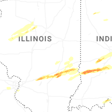
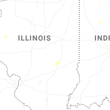
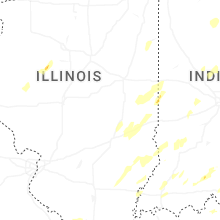


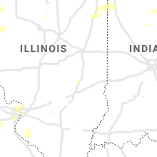


Connect with Interactive Hail Maps