

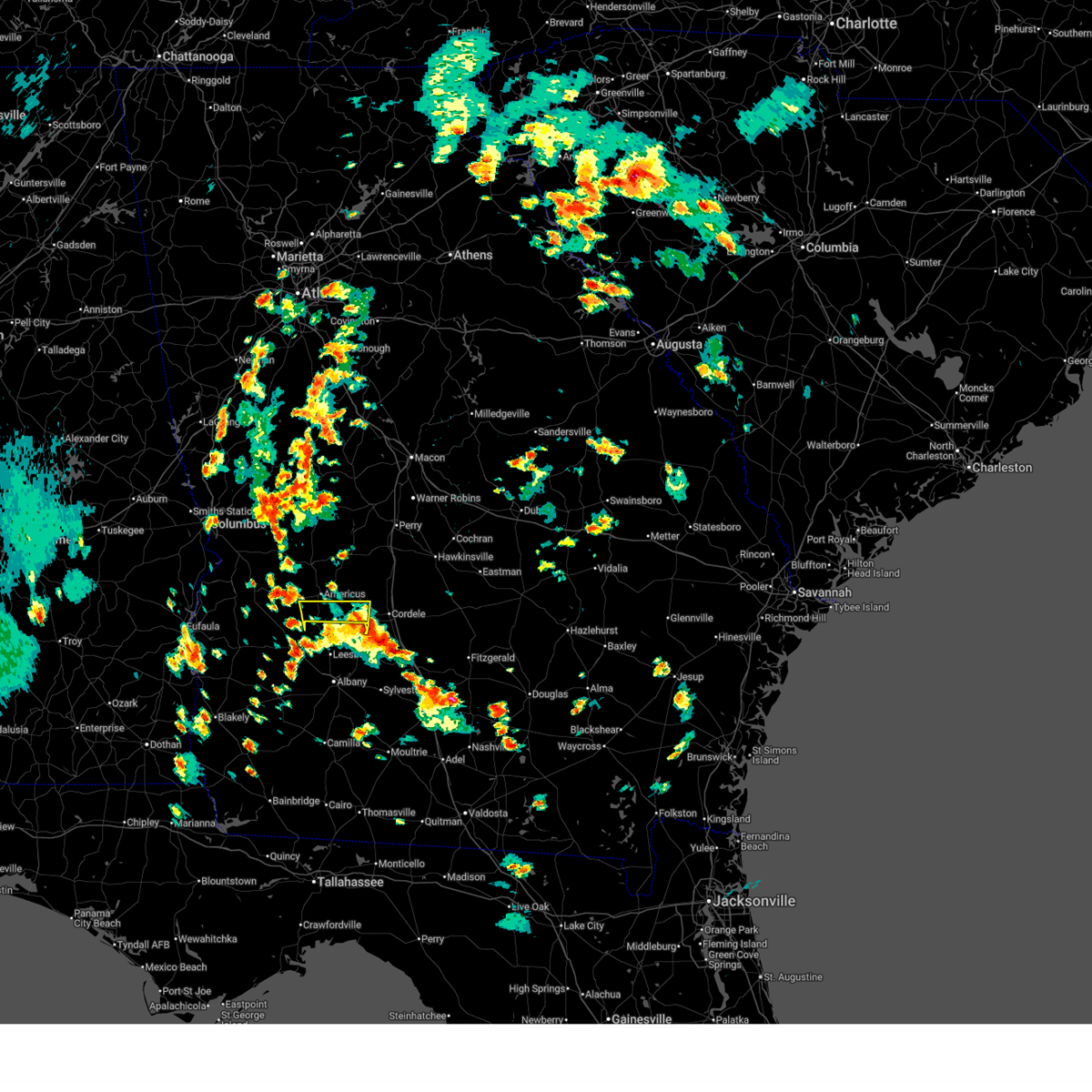
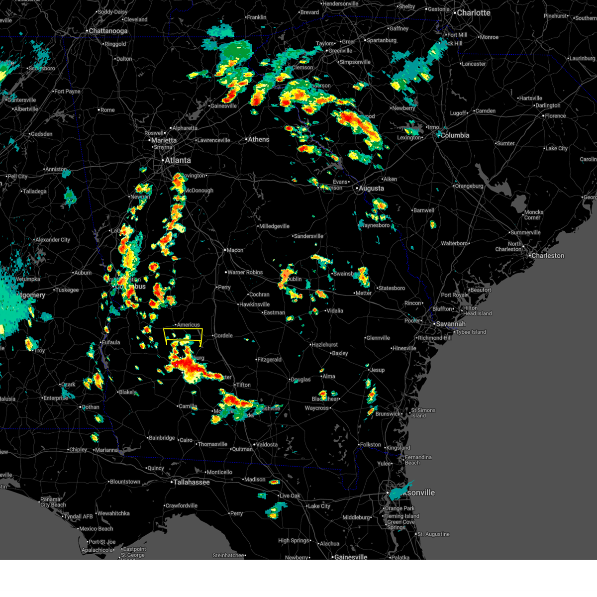
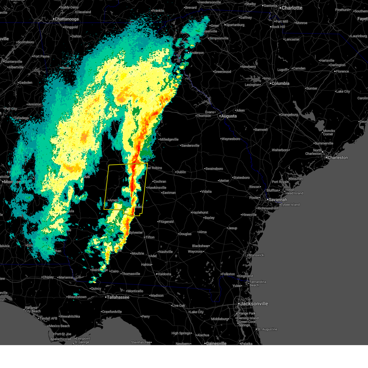
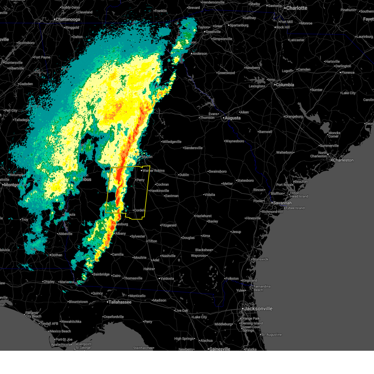
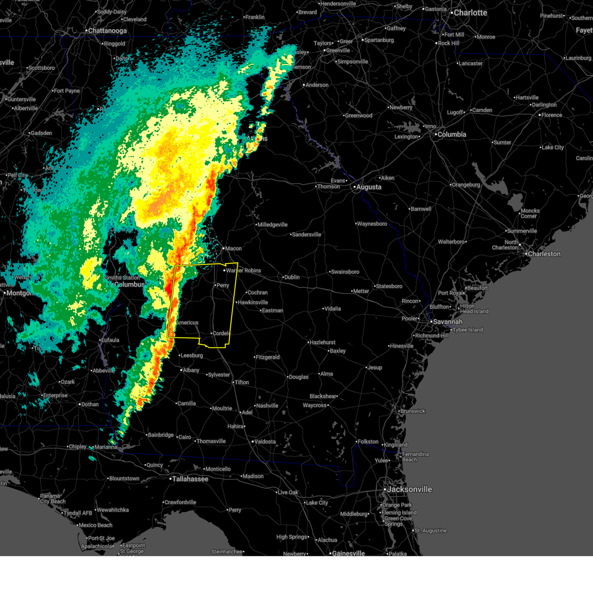
Hail Map for Leslie, GA
The Leslie, GA area has had 2 reports of on-the-ground hail by trained spotters, and has been under severe weather warnings 9 times during the past 12 months. Doppler radar has detected hail at or near Leslie, GA on 64 occasions, including 2 occasions during the past year.
| Name: | Leslie, GA |
| Where Located: | 79.1 miles WNW of Douglas, GA |
| Map: | Google Map for Leslie, GA |
| Population: | 409 |
| Housing Units: | 195 |
| More Info: | Search Google for Leslie, GA |
1
The Top Recent Hail Date for Leslie, GA is Wednesday, June 25, 2025 (11th out of 64)

Hail and Wind Damage Spotted near Leslie, GA
| Date / Time | Report Details |
|---|---|
| 5/22/2026 3:54 PM EDT |
 The severe thunderstorm which prompted the warning has weakened. therefore, the warning will be allowed to expire. however, gusty winds are still possible with this thunderstorm. remember, a severe thunderstorm warning still remains in effect for western crisp county. The severe thunderstorm which prompted the warning has weakened. therefore, the warning will be allowed to expire. however, gusty winds are still possible with this thunderstorm. remember, a severe thunderstorm warning still remains in effect for western crisp county.
|
| 5/22/2026 3:19 PM EDT |
 Svrffc the national weather service in peachtree city has issued a * severe thunderstorm warning for, southern sumter county in west central georgia, northwestern crisp county in central georgia, * until 400 pm edt. * at 317 pm edt, a severe thunderstorm was located over leesburg, moving north at 25 mph (radar indicated). Hazards include 60 mph wind gusts and quarter size hail. Hail damage to vehicles is expected. Expect wind damage to roofs, siding, and trees. Svrffc the national weather service in peachtree city has issued a * severe thunderstorm warning for, southern sumter county in west central georgia, northwestern crisp county in central georgia, * until 400 pm edt. * at 317 pm edt, a severe thunderstorm was located over leesburg, moving north at 25 mph (radar indicated). Hazards include 60 mph wind gusts and quarter size hail. Hail damage to vehicles is expected. Expect wind damage to roofs, siding, and trees.
|
| 3/12/2026 7:08 AM EDT |
 The storms which prompted the warning have moved out of the area. therefore, the warning has been allowed to expire. however, gusty winds are still possible with these thunderstorms. a tornado watch remains in effect until 900 am edt for central and west central georgia. remember, a severe thunderstorm warning still remains in effect for peach, houston, dooly, crisp, pulaski, marion, and wilcox counties. The storms which prompted the warning have moved out of the area. therefore, the warning has been allowed to expire. however, gusty winds are still possible with these thunderstorms. a tornado watch remains in effect until 900 am edt for central and west central georgia. remember, a severe thunderstorm warning still remains in effect for peach, houston, dooly, crisp, pulaski, marion, and wilcox counties.
|
| 3/12/2026 6:30 AM EDT |
 At 629 am edt, severe thunderstorms were located along a line extending from near lee pope to oglethorpe to near scrutchins, moving east at 45 mph (radar indicated). Hazards include 70 mph wind gusts. Expect considerable tree damage. damage is likely to mobile homes, roofs, and outbuildings. Locations impacted include, americus, perry, cordele, fort valley, hawkinsville, vienna, butler, oglethorpe, warner robins, centerville, byron, unadilla, montezuma, marshallville, reynolds, arabi, byromville, ideal, pinehurst, and leslie. At 629 am edt, severe thunderstorms were located along a line extending from near lee pope to oglethorpe to near scrutchins, moving east at 45 mph (radar indicated). Hazards include 70 mph wind gusts. Expect considerable tree damage. damage is likely to mobile homes, roofs, and outbuildings. Locations impacted include, americus, perry, cordele, fort valley, hawkinsville, vienna, butler, oglethorpe, warner robins, centerville, byron, unadilla, montezuma, marshallville, reynolds, arabi, byromville, ideal, pinehurst, and leslie.
|
| 3/12/2026 6:19 AM EDT |
 Svrffc the national weather service in peachtree city has issued a * severe thunderstorm warning for, macon county in west central georgia, western pulaski county in central georgia, southwestern twiggs county in central georgia, western wilcox county in central georgia, dooly county in central georgia, peach county in central georgia, houston county in central georgia, southern crawford county in central georgia, eastern schley county in west central georgia, sumter county in west central georgia, crisp county in central georgia, eastern taylor county in west central georgia, * until 700 am edt. * at 619 am edt, severe thunderstorms were located along a line extending from near reynolds to fountainville to neyami, moving east at 45 mph (radar indicated). Hazards include 60 mph wind gusts. expect damage to roofs, siding, and trees Svrffc the national weather service in peachtree city has issued a * severe thunderstorm warning for, macon county in west central georgia, western pulaski county in central georgia, southwestern twiggs county in central georgia, western wilcox county in central georgia, dooly county in central georgia, peach county in central georgia, houston county in central georgia, southern crawford county in central georgia, eastern schley county in west central georgia, sumter county in west central georgia, crisp county in central georgia, eastern taylor county in west central georgia, * until 700 am edt. * at 619 am edt, severe thunderstorms were located along a line extending from near reynolds to fountainville to neyami, moving east at 45 mph (radar indicated). Hazards include 60 mph wind gusts. expect damage to roofs, siding, and trees
|
| 6/25/2025 10:02 PM EDT |
 Svrffc the national weather service in peachtree city has issued a * severe thunderstorm warning for, southwestern dooly county in central georgia, southeastern sumter county in west central georgia, * until 1030 pm edt. * at 1002 pm edt, severe thunderstorms were located along a line extending from near drayton to near chokee, moving west at 10 mph (radar indicated). Hazards include 60 mph wind gusts and quarter size hail. Hail damage to vehicles is expected. Expect wind damage to roofs, siding, and trees. Svrffc the national weather service in peachtree city has issued a * severe thunderstorm warning for, southwestern dooly county in central georgia, southeastern sumter county in west central georgia, * until 1030 pm edt. * at 1002 pm edt, severe thunderstorms were located along a line extending from near drayton to near chokee, moving west at 10 mph (radar indicated). Hazards include 60 mph wind gusts and quarter size hail. Hail damage to vehicles is expected. Expect wind damage to roofs, siding, and trees.
|
| 6/25/2025 9:45 PM EDT |
 Svrffc the national weather service in peachtree city has issued a * severe thunderstorm warning for, southeastern sumter county in west central georgia, * until 1015 pm edt. * at 945 pm edt, a severe thunderstorm was located over cobb, or 14 miles west of cordele, moving west at 10 mph (radar indicated). Hazards include 60 mph wind gusts and quarter size hail. Hail damage to vehicles is expected. Expect wind damage to roofs, siding, and trees. Svrffc the national weather service in peachtree city has issued a * severe thunderstorm warning for, southeastern sumter county in west central georgia, * until 1015 pm edt. * at 945 pm edt, a severe thunderstorm was located over cobb, or 14 miles west of cordele, moving west at 10 mph (radar indicated). Hazards include 60 mph wind gusts and quarter size hail. Hail damage to vehicles is expected. Expect wind damage to roofs, siding, and trees.
|
| 6/18/2025 8:59 PM EDT |
 The storm which prompted the warning has weakened below severe limits, and no longer poses an immediate threat to life or property. therefore, the warning will be allowed to expire. The storm which prompted the warning has weakened below severe limits, and no longer poses an immediate threat to life or property. therefore, the warning will be allowed to expire.
|
| 6/18/2025 8:34 PM EDT |
 Svrffc the national weather service in peachtree city has issued a * severe thunderstorm warning for, southwestern dooly county in central georgia, southeastern sumter county in west central georgia, northwestern crisp county in central georgia, * until 900 pm edt. * at 833 pm edt, a severe thunderstorm was located over chokee, or 15 miles west of cordele, moving northeast at 20 mph (radar indicated). Hazards include 60 mph wind gusts and penny size hail. expect damage to roofs, siding, and trees Svrffc the national weather service in peachtree city has issued a * severe thunderstorm warning for, southwestern dooly county in central georgia, southeastern sumter county in west central georgia, northwestern crisp county in central georgia, * until 900 pm edt. * at 833 pm edt, a severe thunderstorm was located over chokee, or 15 miles west of cordele, moving northeast at 20 mph (radar indicated). Hazards include 60 mph wind gusts and penny size hail. expect damage to roofs, siding, and trees
|
| 5/10/2025 5:24 PM EDT |
 At 523 pm edt, a severe thunderstorm was located over flint river wma, or 11 miles west of vienna, moving northeast at 25 mph (radar indicated). Hazards include 60 mph wind gusts and quarter size hail. Hail damage to vehicles is expected. expect wind damage to roofs, siding, and trees. Locations impacted include, vienna, byromville, leslie, lilly, de soto, dooling, desoto, cobb, lamar, fort early, georgia veterans memorial st pk, flint river wma, pennington, drayton, and methvins. At 523 pm edt, a severe thunderstorm was located over flint river wma, or 11 miles west of vienna, moving northeast at 25 mph (radar indicated). Hazards include 60 mph wind gusts and quarter size hail. Hail damage to vehicles is expected. expect wind damage to roofs, siding, and trees. Locations impacted include, vienna, byromville, leslie, lilly, de soto, dooling, desoto, cobb, lamar, fort early, georgia veterans memorial st pk, flint river wma, pennington, drayton, and methvins.
|
| 5/10/2025 4:51 PM EDT |
 Svrffc the national weather service in peachtree city has issued a * severe thunderstorm warning for, south central macon county in west central georgia, dooly county in central georgia, eastern sumter county in west central georgia, crisp county in central georgia, * until 530 pm edt. * at 450 pm edt, a severe thunderstorm was located over leslie, or 11 miles southeast of americus, moving northeast at 25 mph (radar indicated). Hazards include 60 mph wind gusts and quarter size hail. Hail damage to vehicles is expected. Expect wind damage to roofs, siding, and trees. Svrffc the national weather service in peachtree city has issued a * severe thunderstorm warning for, south central macon county in west central georgia, dooly county in central georgia, eastern sumter county in west central georgia, crisp county in central georgia, * until 530 pm edt. * at 450 pm edt, a severe thunderstorm was located over leslie, or 11 miles southeast of americus, moving northeast at 25 mph (radar indicated). Hazards include 60 mph wind gusts and quarter size hail. Hail damage to vehicles is expected. Expect wind damage to roofs, siding, and trees.
|
| 2/16/2025 5:55 AM EST |
 Svrffc the national weather service in peachtree city has issued a * severe thunderstorm warning for, southwestern laurens county in central georgia, dodge county in central georgia, houston county in central georgia, sumter county in west central georgia, crisp county in central georgia, macon county in west central georgia, pulaski county in central georgia, southern twiggs county in central georgia, wilcox county in central georgia, dooly county in central georgia, bleckley county in central georgia, southeastern webster county in west central georgia, peach county in central georgia, southeastern crawford county in central georgia, southeastern schley county in west central georgia, * until 700 am est. * at 555 am est, severe thunderstorms were located along a line extending from near jack brown estates to near montezuma to near croxton crossroads, moving southeast at 50 mph (radar indicated). Hazards include 60 mph wind gusts. expect damage to roofs, siding, and trees Svrffc the national weather service in peachtree city has issued a * severe thunderstorm warning for, southwestern laurens county in central georgia, dodge county in central georgia, houston county in central georgia, sumter county in west central georgia, crisp county in central georgia, macon county in west central georgia, pulaski county in central georgia, southern twiggs county in central georgia, wilcox county in central georgia, dooly county in central georgia, bleckley county in central georgia, southeastern webster county in west central georgia, peach county in central georgia, southeastern crawford county in central georgia, southeastern schley county in west central georgia, * until 700 am est. * at 555 am est, severe thunderstorms were located along a line extending from near jack brown estates to near montezuma to near croxton crossroads, moving southeast at 50 mph (radar indicated). Hazards include 60 mph wind gusts. expect damage to roofs, siding, and trees
|
| 5/27/2024 4:31 PM EDT |
 Svrffc the national weather service in peachtree city has issued a * severe thunderstorm warning for, southeastern sumter county in west central georgia, western crisp county in central georgia, * until 515 pm edt. * at 431 pm edt, a severe thunderstorm was located near scrutchins, or 10 miles south of americus, moving east at 20 mph (radar indicated). Hazards include 60 mph wind gusts and quarter size hail. Hail damage to vehicles is expected. Expect wind damage to roofs, siding, and trees. Svrffc the national weather service in peachtree city has issued a * severe thunderstorm warning for, southeastern sumter county in west central georgia, western crisp county in central georgia, * until 515 pm edt. * at 431 pm edt, a severe thunderstorm was located near scrutchins, or 10 miles south of americus, moving east at 20 mph (radar indicated). Hazards include 60 mph wind gusts and quarter size hail. Hail damage to vehicles is expected. Expect wind damage to roofs, siding, and trees.
|
| 5/10/2024 1:27 AM EDT |
 The storm which prompted the warning has weakened below severe limits, and has exited the warned area. therefore, the warning will be allowed to expire. however, small hail and gusty winds are still possible with this thunderstorm. The storm which prompted the warning has weakened below severe limits, and has exited the warned area. therefore, the warning will be allowed to expire. however, small hail and gusty winds are still possible with this thunderstorm.
|
| 5/10/2024 1:19 AM EDT |
 the severe thunderstorm warning has been cancelled and is no longer in effect the severe thunderstorm warning has been cancelled and is no longer in effect
|
| 5/10/2024 1:19 AM EDT |
 At 119 am edt, a severe thunderstorm was located near rochelle, or 8 miles west of abbeville, moving east at 50 mph (radar indicated). Hazards include 60 mph wind gusts and penny size hail. Expect damage to roofs, siding, and trees. Locations impacted include, cordele, abbeville, rochelle, leslie, pitts, de soto, desoto, cobb, east crisp, georgia veterans memorial st pk, richwood, cedar creek, antioch church, pope city, seville, hatley, browning, pleasant view, raines, and tremont. At 119 am edt, a severe thunderstorm was located near rochelle, or 8 miles west of abbeville, moving east at 50 mph (radar indicated). Hazards include 60 mph wind gusts and penny size hail. Expect damage to roofs, siding, and trees. Locations impacted include, cordele, abbeville, rochelle, leslie, pitts, de soto, desoto, cobb, east crisp, georgia veterans memorial st pk, richwood, cedar creek, antioch church, pope city, seville, hatley, browning, pleasant view, raines, and tremont.
|
| 5/10/2024 12:47 AM EDT |
 Svrffc the national weather service in peachtree city has issued a * severe thunderstorm warning for, southwestern dodge county in central georgia, southern pulaski county in central georgia, wilcox county in central georgia, southern dooly county in central georgia, central sumter county in west central georgia, crisp county in central georgia, * until 130 am edt. * at 1245 am edt, a severe thunderstorm was located near drayton, or 10 miles southwest of vienna, moving east at 50 mph (radar indicated). Hazards include 60 mph wind gusts and penny size hail. expect damage to roofs, siding, and trees Svrffc the national weather service in peachtree city has issued a * severe thunderstorm warning for, southwestern dodge county in central georgia, southern pulaski county in central georgia, wilcox county in central georgia, southern dooly county in central georgia, central sumter county in west central georgia, crisp county in central georgia, * until 130 am edt. * at 1245 am edt, a severe thunderstorm was located near drayton, or 10 miles southwest of vienna, moving east at 50 mph (radar indicated). Hazards include 60 mph wind gusts and penny size hail. expect damage to roofs, siding, and trees
|
| 5/9/2024 3:06 PM EDT |
 The storms which prompted the warning have weakened below severe limits, and no longer pose an immediate threat to life or property. therefore, the warning will be allowed to expire. however, gusty winds are still possible with these thunderstorms. a tornado watch remains in effect until 500 pm edt for central and west central georgia. The storms which prompted the warning have weakened below severe limits, and no longer pose an immediate threat to life or property. therefore, the warning will be allowed to expire. however, gusty winds are still possible with these thunderstorms. a tornado watch remains in effect until 500 pm edt for central and west central georgia.
|
| 5/9/2024 2:28 PM EDT |
 Svrffc the national weather service in peachtree city has issued a * severe thunderstorm warning for, southern stewart county in west central georgia, webster county in west central georgia, southern sumter county in west central georgia, * until 315 pm edt. * at 227 pm edt, severe thunderstorms were located along a line extending from preston to near troutman to near sanford, moving east at 50 mph (radar indicated). Hazards include 60 mph wind gusts and quarter size hail. Hail damage to vehicles is expected. Expect wind damage to roofs, siding, and trees. Svrffc the national weather service in peachtree city has issued a * severe thunderstorm warning for, southern stewart county in west central georgia, webster county in west central georgia, southern sumter county in west central georgia, * until 315 pm edt. * at 227 pm edt, severe thunderstorms were located along a line extending from preston to near troutman to near sanford, moving east at 50 mph (radar indicated). Hazards include 60 mph wind gusts and quarter size hail. Hail damage to vehicles is expected. Expect wind damage to roofs, siding, and trees.
|
| 4/3/2024 4:44 AM EDT |
 Torffc the national weather service in peachtree city has issued a * tornado warning for, southeastern dooly county in central georgia, southeastern sumter county in west central georgia, crisp county in central georgia, * until 530 am edt. * at 444 am edt, a severe thunderstorm capable of producing a tornado was located near cobb, or 12 miles west of cordele, moving northeast at 55 mph (radar indicated rotation). Hazards include tornado. Flying debris will be dangerous to those caught without shelter. mobile homes will be damaged or destroyed. damage to roofs, windows, and vehicles will occur. Tree damage is likely. Torffc the national weather service in peachtree city has issued a * tornado warning for, southeastern dooly county in central georgia, southeastern sumter county in west central georgia, crisp county in central georgia, * until 530 am edt. * at 444 am edt, a severe thunderstorm capable of producing a tornado was located near cobb, or 12 miles west of cordele, moving northeast at 55 mph (radar indicated rotation). Hazards include tornado. Flying debris will be dangerous to those caught without shelter. mobile homes will be damaged or destroyed. damage to roofs, windows, and vehicles will occur. Tree damage is likely.
|
| 1/9/2024 10:30 AM EST |
 At 1030 am est, severe thunderstorms were located along a line extending from near centerville to perry to near dooling to near huntington, moving northeast at 45 mph (radar indicated). Hazards include 60 mph wind gusts. expect damage to roofs, siding, and trees At 1030 am est, severe thunderstorms were located along a line extending from near centerville to perry to near dooling to near huntington, moving northeast at 45 mph (radar indicated). Hazards include 60 mph wind gusts. expect damage to roofs, siding, and trees
|
| 1/9/2024 10:11 AM EST |
 At 1010 am est, severe thunderstorms were located along a line extending from saint louis to near dooling to croxton crossroads, moving east at 90 mph (radar indicated). Hazards include 60 mph wind gusts. Expect damage to roofs, siding, and trees. locations impacted include, americus, perry, fort valley, oglethorpe, warner robins, centerville, byron, unadilla, montezuma, marshallville, byromville, leslie, andersonville, lilly, de soto, dooling, desoto, cobb, sumter, and lamar. hail threat, radar indicated max hail size, <. 75 in wind threat, radar indicated max wind gust, 60 mph. At 1010 am est, severe thunderstorms were located along a line extending from saint louis to near dooling to croxton crossroads, moving east at 90 mph (radar indicated). Hazards include 60 mph wind gusts. Expect damage to roofs, siding, and trees. locations impacted include, americus, perry, fort valley, oglethorpe, warner robins, centerville, byron, unadilla, montezuma, marshallville, byromville, leslie, andersonville, lilly, de soto, dooling, desoto, cobb, sumter, and lamar. hail threat, radar indicated max hail size, <. 75 in wind threat, radar indicated max wind gust, 60 mph.
|
| 1/9/2024 9:38 AM EST |
 At 938 am est, severe thunderstorms were located along a line extending from near wesley church to near rupert to leveretts, moving east at 55 mph (radar indicated). Hazards include 60 mph wind gusts. expect damage to roofs, siding, and trees At 938 am est, severe thunderstorms were located along a line extending from near wesley church to near rupert to leveretts, moving east at 55 mph (radar indicated). Hazards include 60 mph wind gusts. expect damage to roofs, siding, and trees
|
| 8/8/2023 5:22 PM EDT |
 The severe thunderstorm warning for southeastern marion, webster, southern schley and sumter counties will expire at 530 pm edt, the storm which prompted the warning has weakened below severe limits, and has exited the warned area. therefore, the warning will be allowed to expire. a severe thunderstorm watch remains in effect until 900 pm edt for central and west central georgia. The severe thunderstorm warning for southeastern marion, webster, southern schley and sumter counties will expire at 530 pm edt, the storm which prompted the warning has weakened below severe limits, and has exited the warned area. therefore, the warning will be allowed to expire. a severe thunderstorm watch remains in effect until 900 pm edt for central and west central georgia.
|
| 8/8/2023 4:40 PM EDT |
 At 439 pm edt, a severe thunderstorm was located near friendship, or 9 miles southwest of ellaville. other severe storms were located over eastern stewart county. the storms were moving east at 25 mph (radar indicated). Hazards include 60 mph wind gusts and penny size hail. expect damage to roofs, siding, and trees At 439 pm edt, a severe thunderstorm was located near friendship, or 9 miles southwest of ellaville. other severe storms were located over eastern stewart county. the storms were moving east at 25 mph (radar indicated). Hazards include 60 mph wind gusts and penny size hail. expect damage to roofs, siding, and trees
|
| 7/30/2023 4:35 PM EDT |
 At 435 pm edt, a severe thunderstorm was located over lamar, or 10 miles east of americus, moving east at 20 mph (radar indicated). Hazards include 60 mph wind gusts and quarter size hail. Hail damage to vehicles is expected. Expect wind damage to roofs, siding, and trees. At 435 pm edt, a severe thunderstorm was located over lamar, or 10 miles east of americus, moving east at 20 mph (radar indicated). Hazards include 60 mph wind gusts and quarter size hail. Hail damage to vehicles is expected. Expect wind damage to roofs, siding, and trees.
|
| 7/30/2023 4:00 PM EDT |
 At 359 pm edt, a severe thunderstorm was located near friendship, or 7 miles northwest of americus, moving east at 25 mph (radar indicated). Hazards include 60 mph wind gusts and quarter size hail. Hail damage to vehicles is expected. Expect wind damage to roofs, siding, and trees. At 359 pm edt, a severe thunderstorm was located near friendship, or 7 miles northwest of americus, moving east at 25 mph (radar indicated). Hazards include 60 mph wind gusts and quarter size hail. Hail damage to vehicles is expected. Expect wind damage to roofs, siding, and trees.
|
| 6/25/2023 9:31 PM EDT |
 At 930 pm edt, severe thunderstorms were located along a line extending from near huntington to near richland to florence marina state park, moving south at 30 mph (radar indicated). Hazards include 60 mph wind gusts. Expect damage to roofs, siding, and trees. locations impacted include, americus, lumpkin, preston, richland, plains, leslie, de soto, weston, desoto, cobb, sumter, lamar, kimbrough, florence marina state park, westville, croxton crossroads, huntington, leveretts, troutman and sanford. hail threat, radar indicated max hail size, <. 75 in wind threat, radar indicated max wind gust, 60 mph. At 930 pm edt, severe thunderstorms were located along a line extending from near huntington to near richland to florence marina state park, moving south at 30 mph (radar indicated). Hazards include 60 mph wind gusts. Expect damage to roofs, siding, and trees. locations impacted include, americus, lumpkin, preston, richland, plains, leslie, de soto, weston, desoto, cobb, sumter, lamar, kimbrough, florence marina state park, westville, croxton crossroads, huntington, leveretts, troutman and sanford. hail threat, radar indicated max hail size, <. 75 in wind threat, radar indicated max wind gust, 60 mph.
|
| 6/25/2023 9:21 PM EDT |
 At 920 pm edt, severe thunderstorms were located along a line extending from new era to near richland to near omaha, moving south at 30 mph (radar indicated). Hazards include 60 mph wind gusts. Expect damage to roofs, siding, and trees. locations impacted include, americus, lumpkin, ellaville, cusseta, preston, richland, plains, leslie, andersonville, de soto, fort moore, desoto, weston, cobb, sumter, lamar, seminole, new era, la crosse and pennington. hail threat, radar indicated max hail size, <. 75 in wind threat, radar indicated max wind gust, 60 mph. At 920 pm edt, severe thunderstorms were located along a line extending from new era to near richland to near omaha, moving south at 30 mph (radar indicated). Hazards include 60 mph wind gusts. Expect damage to roofs, siding, and trees. locations impacted include, americus, lumpkin, ellaville, cusseta, preston, richland, plains, leslie, andersonville, de soto, fort moore, desoto, weston, cobb, sumter, lamar, seminole, new era, la crosse and pennington. hail threat, radar indicated max hail size, <. 75 in wind threat, radar indicated max wind gust, 60 mph.
|
| 6/25/2023 8:53 PM EDT |
 At 853 pm edt, severe thunderstorms were located along a line extending from fountainville to zellobee to fort mitchell, moving south at 30 mph (radar indicated). Hazards include 60 mph wind gusts. expect damage to roofs, siding, and trees At 853 pm edt, severe thunderstorms were located along a line extending from fountainville to zellobee to fort mitchell, moving south at 30 mph (radar indicated). Hazards include 60 mph wind gusts. expect damage to roofs, siding, and trees
|
| 6/15/2023 9:16 AM EDT |
 At 916 am edt, a severe thunderstorm was located over americus, moving east at 45 mph (radar indicated). Hazards include 60 mph wind gusts and quarter size hail. Hail damage to vehicles is expected. expect wind damage to roofs, siding, and trees. locations impacted include, americus, preston, plains, leslie, de soto, desoto, sumter, lamar, croxton crossroads, new era, huntington, maddox, dumas, methvins and centerpoint. hail threat, radar indicated max hail size, 1. 00 in wind threat, radar indicated max wind gust, 60 mph. At 916 am edt, a severe thunderstorm was located over americus, moving east at 45 mph (radar indicated). Hazards include 60 mph wind gusts and quarter size hail. Hail damage to vehicles is expected. expect wind damage to roofs, siding, and trees. locations impacted include, americus, preston, plains, leslie, de soto, desoto, sumter, lamar, croxton crossroads, new era, huntington, maddox, dumas, methvins and centerpoint. hail threat, radar indicated max hail size, 1. 00 in wind threat, radar indicated max wind gust, 60 mph.
|
| 6/15/2023 8:59 AM EDT |
 At 859 am edt, a severe thunderstorm was located near friendship, or near preston, moving east at 45 mph (radar indicated). Hazards include 60 mph wind gusts and quarter size hail. Hail damage to vehicles is expected. Expect wind damage to roofs, siding, and trees. At 859 am edt, a severe thunderstorm was located near friendship, or near preston, moving east at 45 mph (radar indicated). Hazards include 60 mph wind gusts and quarter size hail. Hail damage to vehicles is expected. Expect wind damage to roofs, siding, and trees.
|
| 4/1/2023 1:29 PM EDT |
 At 129 pm edt, a severe thunderstorm was located near scrutchins, or 11 miles south of americus, moving east at 45 mph (radar indicated). Hazards include 60 mph wind gusts and quarter size hail. Hail damage to vehicles is expected. expect wind damage to roofs, siding, and trees. Locations impacted include, leslie, de soto, desoto, cobb, lamar, fort early, georgia veterans memorial st pk, raines and huntington. At 129 pm edt, a severe thunderstorm was located near scrutchins, or 11 miles south of americus, moving east at 45 mph (radar indicated). Hazards include 60 mph wind gusts and quarter size hail. Hail damage to vehicles is expected. expect wind damage to roofs, siding, and trees. Locations impacted include, leslie, de soto, desoto, cobb, lamar, fort early, georgia veterans memorial st pk, raines and huntington.
|
| 4/1/2023 1:14 PM EDT |
 At 114 pm edt, a severe thunderstorm was located over croxton crossroads, or 12 miles southwest of americus, moving east at 45 mph (radar indicated). Hazards include 60 mph wind gusts. expect damage to roofs, siding, and trees At 114 pm edt, a severe thunderstorm was located over croxton crossroads, or 12 miles southwest of americus, moving east at 45 mph (radar indicated). Hazards include 60 mph wind gusts. expect damage to roofs, siding, and trees
|
| 3/25/2023 5:23 PM EDT |
 At 523 pm edt, a severe thunderstorm was located near weston, or 9 miles southwest of preston, moving east at 50 mph (radar indicated). Hazards include 60 mph wind gusts and half dollar size hail. Hail damage to vehicles is expected. Expect wind damage to roofs, siding, and trees. At 523 pm edt, a severe thunderstorm was located near weston, or 9 miles southwest of preston, moving east at 50 mph (radar indicated). Hazards include 60 mph wind gusts and half dollar size hail. Hail damage to vehicles is expected. Expect wind damage to roofs, siding, and trees.
|
| 3/12/2023 12:12 PM EDT |
 The severe thunderstorm warning for southwestern sumter county will expire at 1215 pm edt, the storm which prompted the warning has weakened below severe limits, and no longer poses an immediate threat to life or property. therefore, the warning will be allowed to expire. however gusty winds are still possible with this thunderstorm. The severe thunderstorm warning for southwestern sumter county will expire at 1215 pm edt, the storm which prompted the warning has weakened below severe limits, and no longer poses an immediate threat to life or property. therefore, the warning will be allowed to expire. however gusty winds are still possible with this thunderstorm.
|
| 3/12/2023 11:45 AM EDT |
 At 1145 am edt, a severe thunderstorm was located near chambliss, or 10 miles northwest of dawson, moving east at 35 mph (radar indicated). Hazards include 60 mph wind gusts and nickel size hail. expect damage to roofs, siding, and trees At 1145 am edt, a severe thunderstorm was located near chambliss, or 10 miles northwest of dawson, moving east at 35 mph (radar indicated). Hazards include 60 mph wind gusts and nickel size hail. expect damage to roofs, siding, and trees
|
| 1/12/2023 6:21 PM EST |
 At 620 pm est, a severe thunderstorm was located over georgia veterans memorial st pk, or 9 miles west of cordele, moving east at 55 mph (radar indicated). Hazards include 60 mph wind gusts and penny size hail. Expect damage to roofs, siding, and trees. Locations impacted include, cordele, leslie, de soto, desoto, cobb, lamar, fort early, drayton, georgia veterans memorial st pk, raines and huntington. At 620 pm est, a severe thunderstorm was located over georgia veterans memorial st pk, or 9 miles west of cordele, moving east at 55 mph (radar indicated). Hazards include 60 mph wind gusts and penny size hail. Expect damage to roofs, siding, and trees. Locations impacted include, cordele, leslie, de soto, desoto, cobb, lamar, fort early, drayton, georgia veterans memorial st pk, raines and huntington.
|
| 1/12/2023 5:48 PM EST |
 At 548 pm est, a severe thunderstorm was located near olivers mill, or 9 miles north of dawson, moving east at 45 mph (radar indicated). Hazards include 60 mph wind gusts and penny size hail. expect damage to roofs, siding, and trees At 548 pm est, a severe thunderstorm was located near olivers mill, or 9 miles north of dawson, moving east at 45 mph (radar indicated). Hazards include 60 mph wind gusts and penny size hail. expect damage to roofs, siding, and trees
|
| 7/4/2022 8:26 PM EDT |
 The severe thunderstorm warning for central sumter county will expire at 830 pm edt, the storm which prompted the warning has weakened below severe limits, and no longer poses an immediate threat to life or property. therefore, the warning will be allowed to expire. however gusty winds and heavy rain are still possible with this thunderstorm. The severe thunderstorm warning for central sumter county will expire at 830 pm edt, the storm which prompted the warning has weakened below severe limits, and no longer poses an immediate threat to life or property. therefore, the warning will be allowed to expire. however gusty winds and heavy rain are still possible with this thunderstorm.
|
| 7/4/2022 8:00 PM EDT |
 At 800 pm edt, a severe thunderstorm was located over huntington, or 7 miles southeast of americus, moving northwest at 15 mph (radar indicated). Hazards include 60 mph wind gusts and quarter size hail. Hail damage to vehicles is expected. Expect wind damage to roofs, siding, and trees. At 800 pm edt, a severe thunderstorm was located over huntington, or 7 miles southeast of americus, moving northwest at 15 mph (radar indicated). Hazards include 60 mph wind gusts and quarter size hail. Hail damage to vehicles is expected. Expect wind damage to roofs, siding, and trees.
|
| 5/24/2022 5:31 PM EDT |
 At 531 pm edt, severe thunderstorms were located along a line extending from lamar to near georgia veterans memorial st pk to cordele, moving north at 25 mph (radar indicated). Hazards include 60 mph wind gusts and quarter size hail. Hail damage to vehicles is expected. Expect wind damage to roofs, siding, and trees. At 531 pm edt, severe thunderstorms were located along a line extending from lamar to near georgia veterans memorial st pk to cordele, moving north at 25 mph (radar indicated). Hazards include 60 mph wind gusts and quarter size hail. Hail damage to vehicles is expected. Expect wind damage to roofs, siding, and trees.
|
| 5/24/2022 5:28 PM EDT | Tree down near intersection of vienna rd and pool gin house rd in sumter county GA, 8.2 miles SW of Leslie, GA |
| 4/6/2022 4:39 PM EDT |
 The severe thunderstorm warning for southeastern sumter county will expire at 445 pm edt, the storm which prompted the warning has moved out of the area. therefore, the warning will be allowed to expire. a tornado watch remains in effect until 1000 pm edt for west central georgia. The severe thunderstorm warning for southeastern sumter county will expire at 445 pm edt, the storm which prompted the warning has moved out of the area. therefore, the warning will be allowed to expire. a tornado watch remains in effect until 1000 pm edt for west central georgia.
|
| 4/6/2022 4:24 PM EDT | Trees down on chokee roa in lee county GA, 5 miles NNW of Leslie, GA |
| 4/6/2022 4:22 PM EDT |
 At 422 pm edt, a severe thunderstorm was located over leslie, or 12 miles southeast of americus, moving northeast at 25 mph (radar indicated). Hazards include 60 mph wind gusts and half dollar size hail. Hail damage to vehicles is expected. expect wind damage to roofs, siding, and trees. locations impacted include, leslie, de soto and desoto. hail threat, radar indicated max hail size, 1. 25 in wind threat, radar indicated max wind gust, 60 mph. At 422 pm edt, a severe thunderstorm was located over leslie, or 12 miles southeast of americus, moving northeast at 25 mph (radar indicated). Hazards include 60 mph wind gusts and half dollar size hail. Hail damage to vehicles is expected. expect wind damage to roofs, siding, and trees. locations impacted include, leslie, de soto and desoto. hail threat, radar indicated max hail size, 1. 25 in wind threat, radar indicated max wind gust, 60 mph.
|
| 4/6/2022 4:12 PM EDT |
 At 412 pm edt, a severe thunderstorm was located near leslie, or 10 miles southeast of americus, moving northeast at 25 mph (radar indicated). Hazards include 60 mph wind gusts and half dollar size hail. Hail damage to vehicles is expected. expect wind damage to roofs, siding, and trees. locations impacted include, leslie, de soto, desoto, lamar and huntington. hail threat, radar indicated max hail size, 1. 25 in wind threat, radar indicated max wind gust, 60 mph. At 412 pm edt, a severe thunderstorm was located near leslie, or 10 miles southeast of americus, moving northeast at 25 mph (radar indicated). Hazards include 60 mph wind gusts and half dollar size hail. Hail damage to vehicles is expected. expect wind damage to roofs, siding, and trees. locations impacted include, leslie, de soto, desoto, lamar and huntington. hail threat, radar indicated max hail size, 1. 25 in wind threat, radar indicated max wind gust, 60 mph.
|
| 4/6/2022 3:58 PM EDT |
 At 358 pm edt, a severe thunderstorm was located over smithville, or 11 miles north of leesburg, moving northeast at 25 mph (radar indicated). Hazards include 60 mph wind gusts and half dollar size hail. Hail damage to vehicles is expected. Expect wind damage to roofs, siding, and trees. At 358 pm edt, a severe thunderstorm was located over smithville, or 11 miles north of leesburg, moving northeast at 25 mph (radar indicated). Hazards include 60 mph wind gusts and half dollar size hail. Hail damage to vehicles is expected. Expect wind damage to roofs, siding, and trees.
|
| 4/6/2022 3:43 PM EDT |
 At 342 pm edt, a confirmed large and extremely dangerous tornado was located over georgia veterans memorial st pk, or near cordele, moving northeast at 35 mph. this is a particularly dangerous situation. take cover now! (radar confirmed tornado). Hazards include damaging tornado. You are in a life-threatening situation. flying debris may be deadly to those caught without shelter. mobile homes will be destroyed. considerable damage to homes, businesses, and vehicles is likely and complete destruction is possible. Locations impacted include, cordele, leslie, de soto, desoto, cobb, fort early, georgia veterans memorial st pk and raines. At 342 pm edt, a confirmed large and extremely dangerous tornado was located over georgia veterans memorial st pk, or near cordele, moving northeast at 35 mph. this is a particularly dangerous situation. take cover now! (radar confirmed tornado). Hazards include damaging tornado. You are in a life-threatening situation. flying debris may be deadly to those caught without shelter. mobile homes will be destroyed. considerable damage to homes, businesses, and vehicles is likely and complete destruction is possible. Locations impacted include, cordele, leslie, de soto, desoto, cobb, fort early, georgia veterans memorial st pk and raines.
|
| 4/6/2022 3:38 PM EDT |
 At 338 pm edt, a confirmed tornado was located over georgia veterans memorial st pk, or 8 miles west of cordele, moving northeast at 35 mph (radar confirmed tornado). Hazards include damaging tornado and quarter size hail. Flying debris will be dangerous to those caught without shelter. mobile homes will be damaged or destroyed. damage to roofs, windows, and vehicles will occur. tree damage is likely. Locations impacted include, cordele, leslie, de soto, desoto, cobb, fort early, georgia veterans memorial st pk and raines. At 338 pm edt, a confirmed tornado was located over georgia veterans memorial st pk, or 8 miles west of cordele, moving northeast at 35 mph (radar confirmed tornado). Hazards include damaging tornado and quarter size hail. Flying debris will be dangerous to those caught without shelter. mobile homes will be damaged or destroyed. damage to roofs, windows, and vehicles will occur. tree damage is likely. Locations impacted include, cordele, leslie, de soto, desoto, cobb, fort early, georgia veterans memorial st pk and raines.
|
| 4/6/2022 3:32 PM EDT |
 At 332 pm edt, a severe thunderstorm capable of producing a tornado was located over cobb, or 11 miles west of cordele, moving northeast at 35 mph (radar indicated rotation). Hazards include tornado and quarter size hail. Flying debris will be dangerous to those caught without shelter. mobile homes will be damaged or destroyed. damage to roofs, windows, and vehicles will occur. tree damage is likely. Locations impacted include, cordele, leslie, de soto, desoto, cobb, fort early, georgia veterans memorial st pk and raines. At 332 pm edt, a severe thunderstorm capable of producing a tornado was located over cobb, or 11 miles west of cordele, moving northeast at 35 mph (radar indicated rotation). Hazards include tornado and quarter size hail. Flying debris will be dangerous to those caught without shelter. mobile homes will be damaged or destroyed. damage to roofs, windows, and vehicles will occur. tree damage is likely. Locations impacted include, cordele, leslie, de soto, desoto, cobb, fort early, georgia veterans memorial st pk and raines.
|
| 4/6/2022 3:27 PM EDT |
 At 326 pm edt, a severe thunderstorm capable of producing a tornado was located over chokee, or 14 miles northeast of leesburg, moving northeast at 35 mph (radar indicated rotation). Hazards include tornado and quarter size hail. Flying debris will be dangerous to those caught without shelter. mobile homes will be damaged or destroyed. damage to roofs, windows, and vehicles will occur. Tree damage is likely. At 326 pm edt, a severe thunderstorm capable of producing a tornado was located over chokee, or 14 miles northeast of leesburg, moving northeast at 35 mph (radar indicated rotation). Hazards include tornado and quarter size hail. Flying debris will be dangerous to those caught without shelter. mobile homes will be damaged or destroyed. damage to roofs, windows, and vehicles will occur. Tree damage is likely.
|
| 4/6/2022 3:17 PM EDT |
 At 317 pm edt, a severe thunderstorm was located near leslie, or 12 miles north of leesburg, moving northeast at 25 mph (radar indicated). Hazards include ping pong ball size hail and 60 mph wind gusts. People and animals outdoors will be injured. expect hail damage to roofs, siding, windows, and vehicles. Expect wind damage to roofs, siding, and trees. At 317 pm edt, a severe thunderstorm was located near leslie, or 12 miles north of leesburg, moving northeast at 25 mph (radar indicated). Hazards include ping pong ball size hail and 60 mph wind gusts. People and animals outdoors will be injured. expect hail damage to roofs, siding, windows, and vehicles. Expect wind damage to roofs, siding, and trees.
|
| 4/5/2022 3:05 PM EDT |
 At 304 pm edt, severe thunderstorms were located along a line extending from near perry to near byromville to near georgia veterans memorial st pk, moving east at 65 mph (radar indicated). Hazards include 60 mph wind gusts and penny size hail. Expect damage to roofs, siding, and trees. locations impacted include, americus, ellaville, oglethorpe, montezuma, marshallville, plains, ideal, leslie, andersonville, de soto, desoto, smithville, cobb, sumter, lamar, murrays crossroads, whitewater state park, croxton crossroads, new era and la crosse. hail threat, radar indicated max hail size, 0. 75 in wind threat, radar indicated max wind gust, 60 mph. At 304 pm edt, severe thunderstorms were located along a line extending from near perry to near byromville to near georgia veterans memorial st pk, moving east at 65 mph (radar indicated). Hazards include 60 mph wind gusts and penny size hail. Expect damage to roofs, siding, and trees. locations impacted include, americus, ellaville, oglethorpe, montezuma, marshallville, plains, ideal, leslie, andersonville, de soto, desoto, smithville, cobb, sumter, lamar, murrays crossroads, whitewater state park, croxton crossroads, new era and la crosse. hail threat, radar indicated max hail size, 0. 75 in wind threat, radar indicated max wind gust, 60 mph.
|
| 4/5/2022 2:53 PM EDT |
 At 252 pm edt, severe thunderstorms were located along a line extending from near marshallville to near andersonville to leslie, moving east at 65 mph (radar indicated). Hazards include 60 mph wind gusts and penny size hail. Expect damage to roofs, siding, and trees. locations impacted include, americus, ellaville, oglethorpe, montezuma, marshallville, plains, ideal, leslie, andersonville, de soto, desoto, smithville, cobb, sumter, lamar, murrays crossroads, whitewater state park, croxton crossroads, new era and rupert. hail threat, radar indicated max hail size, 0. 75 in wind threat, radar indicated max wind gust, 60 mph. At 252 pm edt, severe thunderstorms were located along a line extending from near marshallville to near andersonville to leslie, moving east at 65 mph (radar indicated). Hazards include 60 mph wind gusts and penny size hail. Expect damage to roofs, siding, and trees. locations impacted include, americus, ellaville, oglethorpe, montezuma, marshallville, plains, ideal, leslie, andersonville, de soto, desoto, smithville, cobb, sumter, lamar, murrays crossroads, whitewater state park, croxton crossroads, new era and rupert. hail threat, radar indicated max hail size, 0. 75 in wind threat, radar indicated max wind gust, 60 mph.
|
| 4/5/2022 2:44 PM EDT |
 At 244 pm edt, severe thunderstorms were located along a line extending from near hicks to shiloh to near sumter, moving east at 65 mph (radar indicated). Hazards include 60 mph wind gusts and penny size hail. Expect damage to roofs, siding, and trees. locations impacted include, americus, ellaville, oglethorpe, preston, montezuma, marshallville, plains, ideal, leslie, andersonville, de soto, desoto, smithville, cobb, sumter, putnam, lamar, murrays crossroads, whitewater state park and croxton crossroads. hail threat, radar indicated max hail size, 0. 75 in wind threat, radar indicated max wind gust, 60 mph. At 244 pm edt, severe thunderstorms were located along a line extending from near hicks to shiloh to near sumter, moving east at 65 mph (radar indicated). Hazards include 60 mph wind gusts and penny size hail. Expect damage to roofs, siding, and trees. locations impacted include, americus, ellaville, oglethorpe, preston, montezuma, marshallville, plains, ideal, leslie, andersonville, de soto, desoto, smithville, cobb, sumter, putnam, lamar, murrays crossroads, whitewater state park and croxton crossroads. hail threat, radar indicated max hail size, 0. 75 in wind threat, radar indicated max wind gust, 60 mph.
|
| 4/5/2022 2:26 PM EDT |
 At 225 pm edt, severe thunderstorms were located along a line extending from near mauk to seminole to centerpoint, moving east at 65 mph (radar indicated). Hazards include 60 mph wind gusts and penny size hail. expect damage to roofs, siding, and trees At 225 pm edt, severe thunderstorms were located along a line extending from near mauk to seminole to centerpoint, moving east at 65 mph (radar indicated). Hazards include 60 mph wind gusts and penny size hail. expect damage to roofs, siding, and trees
|
| 8/14/2021 4:33 PM EDT |
 At 433 pm edt, a severe thunderstorm was located 4 miles south of huntington, or 8 miles southeast of americus, moving northwest at 10 mph (radar indicated). Hazards include 60 mph wind gusts. Expect damage to roofs, siding, and trees. locations impacted include, americus, leslie, smithville, sumter, maddox, croxton crossroads and huntington. hail threat, radar indicated max hail size, <. 75 in wind threat, radar indicated max wind gust, 60 mph. At 433 pm edt, a severe thunderstorm was located 4 miles south of huntington, or 8 miles southeast of americus, moving northwest at 10 mph (radar indicated). Hazards include 60 mph wind gusts. Expect damage to roofs, siding, and trees. locations impacted include, americus, leslie, smithville, sumter, maddox, croxton crossroads and huntington. hail threat, radar indicated max hail size, <. 75 in wind threat, radar indicated max wind gust, 60 mph.
|
| 8/14/2021 4:13 PM EDT |
 At 413 pm edt, a severe thunderstorm was located over leslie, or 11 miles southeast of americus, moving northwest at 5 mph (radar indicated). Hazards include 60 mph wind gusts. expect damage to roofs, siding, and trees At 413 pm edt, a severe thunderstorm was located over leslie, or 11 miles southeast of americus, moving northwest at 5 mph (radar indicated). Hazards include 60 mph wind gusts. expect damage to roofs, siding, and trees
|
| 6/8/2021 6:10 PM EDT |
 At 610 pm edt, a severe thunderstorm was located over maddox, or near americus, moving northeast at 30 mph (radar indicated). Hazards include 60 mph wind gusts and quarter size hail. Hail damage to vehicles is expected. Expect wind damage to roofs, siding, and trees. At 610 pm edt, a severe thunderstorm was located over maddox, or near americus, moving northeast at 30 mph (radar indicated). Hazards include 60 mph wind gusts and quarter size hail. Hail damage to vehicles is expected. Expect wind damage to roofs, siding, and trees.
|
| 5/4/2021 10:11 PM EDT |
 The severe thunderstorm warning for bibb, southeastern pike, monroe, eastern upson, houston, sumter, crisp, macon, western pulaski, dooly, peach, crawford and lamar counties will expire at 1015 pm edt, the storms which prompted the warning have weakened below severe limits, and no longer pose an immediate threat to life or property. therefore, the warning will be allowed to expire. however gusty winds and heavy rain are still possible with these thunderstorms. a severe thunderstorm watch remains in effect until 100 am edt for central and west central georgia. The severe thunderstorm warning for bibb, southeastern pike, monroe, eastern upson, houston, sumter, crisp, macon, western pulaski, dooly, peach, crawford and lamar counties will expire at 1015 pm edt, the storms which prompted the warning have weakened below severe limits, and no longer pose an immediate threat to life or property. therefore, the warning will be allowed to expire. however gusty winds and heavy rain are still possible with these thunderstorms. a severe thunderstorm watch remains in effect until 100 am edt for central and west central georgia.
|
| 5/4/2021 9:50 PM EDT |
 At 949 pm edt, severe thunderstorms were located along a line extending from meansville to near salem to montezuma to maddox, moving east at 45 mph (radar indicated). Hazards include 60 mph wind gusts and nickel size hail. expect damage to roofs, siding, and trees At 949 pm edt, severe thunderstorms were located along a line extending from meansville to near salem to montezuma to maddox, moving east at 45 mph (radar indicated). Hazards include 60 mph wind gusts and nickel size hail. expect damage to roofs, siding, and trees
|
| 5/4/2021 9:45 PM EDT |
 At 945 pm edt, severe thunderstorms were located along a line extending from the rock to near horns to clearview to sumter, moving east at 45 mph (radar indicated). Hazards include 60 mph wind gusts and penny size hail. Expect damage to roofs, siding, and trees. Locations impacted include, americus, fort valley, barnesville, forsyth, oglethorpe, roberta, byron, montezuma, marshallville, reynolds, leslie, yatesville, andersonville, de soto, culloden, desoto, the rock, sumter, lamar and new era. At 945 pm edt, severe thunderstorms were located along a line extending from the rock to near horns to clearview to sumter, moving east at 45 mph (radar indicated). Hazards include 60 mph wind gusts and penny size hail. Expect damage to roofs, siding, and trees. Locations impacted include, americus, fort valley, barnesville, forsyth, oglethorpe, roberta, byron, montezuma, marshallville, reynolds, leslie, yatesville, andersonville, de soto, culloden, desoto, the rock, sumter, lamar and new era.
|
| 5/4/2021 9:15 PM EDT |
 At 914 pm edt, severe thunderstorms were located along a line extending from near manchester to near junction city to buena vista to near lumpkin, moving east at 60 mph (radar indicated). Hazards include 60 mph wind gusts and quarter size hail. Hail damage to vehicles is expected. Expect wind damage to roofs, siding, and trees. At 914 pm edt, severe thunderstorms were located along a line extending from near manchester to near junction city to buena vista to near lumpkin, moving east at 60 mph (radar indicated). Hazards include 60 mph wind gusts and quarter size hail. Hail damage to vehicles is expected. Expect wind damage to roofs, siding, and trees.
|
| 5/22/2020 7:25 PM EDT |
 The severe thunderstorm warning for southwestern dooly, eastern sumter and western crisp counties will expire at 730 pm edt, the storms which prompted the warning have weakened below severe limits, and have exited the warned area. therefore, the warning will be allowed to expire. however, heavy rain and lightning are still possible through 8 pm. The severe thunderstorm warning for southwestern dooly, eastern sumter and western crisp counties will expire at 730 pm edt, the storms which prompted the warning have weakened below severe limits, and have exited the warned area. therefore, the warning will be allowed to expire. however, heavy rain and lightning are still possible through 8 pm.
|
| 5/22/2020 7:14 PM EDT |
 At 714 pm edt, severe thunderstorms were located along a line extending from bumphead to near methvins to drayton to near georgia veterans memorial st pk, moving northeast at 30 mph (radar indicated). Hazards include 60 mph wind gusts and penny size hail. Expect damage to roofs, siding, and trees. Locations impacted include, leslie, de soto, desoto, cobb, lamar, fort early, drayton, georgia veterans memorial st pk, methvins, new era and pennington. At 714 pm edt, severe thunderstorms were located along a line extending from bumphead to near methvins to drayton to near georgia veterans memorial st pk, moving northeast at 30 mph (radar indicated). Hazards include 60 mph wind gusts and penny size hail. Expect damage to roofs, siding, and trees. Locations impacted include, leslie, de soto, desoto, cobb, lamar, fort early, drayton, georgia veterans memorial st pk, methvins, new era and pennington.
|
| 5/22/2020 6:49 PM EDT | Tree down along leslie-lamar road in sumter county GA, 3.2 miles SSW of Leslie, GA |
| 5/22/2020 6:46 PM EDT |
 At 646 pm edt, severe thunderstorms were located along a line extending from near maddox to huntington to de soto to near warwick, moving northeast at 30 mph (radar indicated). Hazards include 60 mph wind gusts and nickel size hail. expect damage to roofs, siding, and trees At 646 pm edt, severe thunderstorms were located along a line extending from near maddox to huntington to de soto to near warwick, moving northeast at 30 mph (radar indicated). Hazards include 60 mph wind gusts and nickel size hail. expect damage to roofs, siding, and trees
|
| 4/13/2020 3:01 AM EDT |
 At 301 am edt, severe thunderstorms were located along a line extending from near powerville to near croxton crossroads, moving east at 55 mph (radar indicated). Hazards include 60 mph wind gusts. expect damage to roofs, siding, and trees At 301 am edt, severe thunderstorms were located along a line extending from near powerville to near croxton crossroads, moving east at 55 mph (radar indicated). Hazards include 60 mph wind gusts. expect damage to roofs, siding, and trees
|
| 3/31/2020 1:33 PM EDT |
 At 133 pm edt, a severe thunderstorm was located over huntington, or 9 miles southeast of americus, moving northeast at 60 mph (radar indicated). Hazards include 60 mph wind gusts and penny size hail. expect damage to roofs, siding, and trees At 133 pm edt, a severe thunderstorm was located over huntington, or 9 miles southeast of americus, moving northeast at 60 mph (radar indicated). Hazards include 60 mph wind gusts and penny size hail. expect damage to roofs, siding, and trees
|
| 1/11/2020 7:14 PM EST |
 At 714 pm est, severe thunderstorms were located along a line extending from nakomis to near montezuma to near croxton crossroads, moving northeast at 60 mph (radar indicated). Hazards include 60 mph wind gusts. expect damage to roofs, siding, and trees At 714 pm est, severe thunderstorms were located along a line extending from nakomis to near montezuma to near croxton crossroads, moving northeast at 60 mph (radar indicated). Hazards include 60 mph wind gusts. expect damage to roofs, siding, and trees
|
| 1/11/2020 6:41 PM EST |
 At 640 pm est, severe thunderstorms were located along a line extending from tazewell to friendship to centerpoint, moving northeast at 50 mph (radar indicated). Hazards include 60 mph wind gusts. expect damage to roofs, siding, and trees At 640 pm est, severe thunderstorms were located along a line extending from tazewell to friendship to centerpoint, moving northeast at 50 mph (radar indicated). Hazards include 60 mph wind gusts. expect damage to roofs, siding, and trees
|
| 6/20/2019 5:21 PM EDT |
 At 520 pm edt, a severe thunderstorm was located over cobb, or 11 miles west of cordele, moving east at 35 mph (radar indicated). Hazards include 60 mph wind gusts and quarter size hail. Hail damage to vehicles is expected. Expect wind damage to roofs, siding, and trees. At 520 pm edt, a severe thunderstorm was located over cobb, or 11 miles west of cordele, moving east at 35 mph (radar indicated). Hazards include 60 mph wind gusts and quarter size hail. Hail damage to vehicles is expected. Expect wind damage to roofs, siding, and trees.
|
| 5/11/2019 3:56 PM EDT |
 The severe thunderstorm warning for southwestern dooly, central sumter and northwestern crisp counties will expire at 400 pm edt, the storm which prompted the warning has moved out of the area. therefore, the warning will be allowed to expire. however heavy rain is still possible with this thunderstorm. a severe thunderstorm watch remains in effect until 800 pm edt for central georgia. The severe thunderstorm warning for southwestern dooly, central sumter and northwestern crisp counties will expire at 400 pm edt, the storm which prompted the warning has moved out of the area. therefore, the warning will be allowed to expire. however heavy rain is still possible with this thunderstorm. a severe thunderstorm watch remains in effect until 800 pm edt for central georgia.
|
| 5/11/2019 3:31 PM EDT |
 At 331 pm edt, a severe thunderstorm was located near leslie, or 9 miles southeast of americus, moving northeast at 60 mph (radar indicated). Hazards include 60 mph wind gusts and nickel size hail. expect damage to roofs, siding, and trees At 331 pm edt, a severe thunderstorm was located near leslie, or 9 miles southeast of americus, moving northeast at 60 mph (radar indicated). Hazards include 60 mph wind gusts and nickel size hail. expect damage to roofs, siding, and trees
|
| 3/3/2019 5:42 PM EST |
 At 541 pm est, a severe thunderstorm was located over dumas, or near preston, moving east at 55 mph (radar indicated). Hazards include 60 mph wind gusts. expect damage to roofs, siding, and trees At 541 pm est, a severe thunderstorm was located over dumas, or near preston, moving east at 55 mph (radar indicated). Hazards include 60 mph wind gusts. expect damage to roofs, siding, and trees
|
| 3/3/2019 2:41 PM EST |
 At 241 pm est, a severe thunderstorm capable of producing a tornado was located over olivers mill, or 10 miles northeast of dawson, moving northeast at 45 mph (radar indicated rotation). Hazards include tornado. Flying debris will be dangerous to those caught without shelter. mobile homes will be damaged or destroyed. damage to roofs, windows, and vehicles will occur. Tree damage is likely. At 241 pm est, a severe thunderstorm capable of producing a tornado was located over olivers mill, or 10 miles northeast of dawson, moving northeast at 45 mph (radar indicated rotation). Hazards include tornado. Flying debris will be dangerous to those caught without shelter. mobile homes will be damaged or destroyed. damage to roofs, windows, and vehicles will occur. Tree damage is likely.
|
| 3/3/2019 2:34 PM EST |
 At 233 pm est, severe thunderstorms were located along a line extending from near croxton crossroads to sumter, moving northeast at 40 mph (radar indicated). Hazards include 60 mph wind gusts and penny size hail. expect damage to roofs, siding, and trees At 233 pm est, severe thunderstorms were located along a line extending from near croxton crossroads to sumter, moving northeast at 40 mph (radar indicated). Hazards include 60 mph wind gusts and penny size hail. expect damage to roofs, siding, and trees
|
| 7/21/2018 10:41 AM EDT |
 At 1041 am edt, a severe thunderstorm was located over lamar, or 10 miles east of americus, moving southeast at 30 mph (radar indicated). Hazards include 60 mph wind gusts and nickel size hail. Expect damage to roofs, siding, and trees. Locations impacted include, americus, leslie, de soto, desoto, cobb, lamar, methvins, new era, huntington and pennington. At 1041 am edt, a severe thunderstorm was located over lamar, or 10 miles east of americus, moving southeast at 30 mph (radar indicated). Hazards include 60 mph wind gusts and nickel size hail. Expect damage to roofs, siding, and trees. Locations impacted include, americus, leslie, de soto, desoto, cobb, lamar, methvins, new era, huntington and pennington.
|
| 7/21/2018 10:15 AM EDT |
 At 1015 am edt, a severe thunderstorm was located over andersonville, or 7 miles southwest of oglethorpe, moving southeast at 30 mph (radar indicated). Hazards include 60 mph wind gusts and quarter size hail. Hail damage to vehicles is expected. Expect wind damage to roofs, siding, and trees. At 1015 am edt, a severe thunderstorm was located over andersonville, or 7 miles southwest of oglethorpe, moving southeast at 30 mph (radar indicated). Hazards include 60 mph wind gusts and quarter size hail. Hail damage to vehicles is expected. Expect wind damage to roofs, siding, and trees.
|
| 6/28/2018 3:26 PM EDT |
 At 326 pm edt, severe thunderstorms were located along a line extending from maddox to east crisp, moving south at 35 mph (radar indicated). Hazards include 60 mph wind gusts. Expect damage to roofs, siding, and trees. Locations impacted include, americus, cordele, vienna, arabi, byromville, pinehurst, leslie, andersonville, lilly, de soto, desoto, cobb, sumter, lamar, richwood, new era, huntington, pennington, drayton and methvins. At 326 pm edt, severe thunderstorms were located along a line extending from maddox to east crisp, moving south at 35 mph (radar indicated). Hazards include 60 mph wind gusts. Expect damage to roofs, siding, and trees. Locations impacted include, americus, cordele, vienna, arabi, byromville, pinehurst, leslie, andersonville, lilly, de soto, desoto, cobb, sumter, lamar, richwood, new era, huntington, pennington, drayton and methvins.
|
| 6/28/2018 3:12 PM EDT |
 At 311 pm edt, severe thunderstorms were located along a line extending from near new era to tippettville, moving south at 35 mph (radar indicated). Hazards include 60 mph wind gusts. expect damage to roofs, siding, and trees At 311 pm edt, severe thunderstorms were located along a line extending from near new era to tippettville, moving south at 35 mph (radar indicated). Hazards include 60 mph wind gusts. expect damage to roofs, siding, and trees
|
| 6/9/2018 3:27 PM EDT |
 At 326 pm edt, a severe thunderstorm was located over maddox, or near americus, moving south at 5 mph (radar indicated). Hazards include 60 mph wind gusts and quarter size hail. Hail damage to vehicles is expected. expect wind damage to roofs, siding, and trees. Locations impacted include, americus, leslie, huntington and maddox. At 326 pm edt, a severe thunderstorm was located over maddox, or near americus, moving south at 5 mph (radar indicated). Hazards include 60 mph wind gusts and quarter size hail. Hail damage to vehicles is expected. expect wind damage to roofs, siding, and trees. Locations impacted include, americus, leslie, huntington and maddox.
|
| 6/9/2018 2:59 PM EDT |
 The national weather service in peachtree city has issued a * severe thunderstorm warning for. southwestern sumter county in west central georgia. until 345 pm edt. At 259 pm edt, a severe thunderstorm was located over maddox, or over americus, moving south at 5 mph. The national weather service in peachtree city has issued a * severe thunderstorm warning for. southwestern sumter county in west central georgia. until 345 pm edt. At 259 pm edt, a severe thunderstorm was located over maddox, or over americus, moving south at 5 mph.
|
| 3/19/2018 5:20 PM EDT | Quarter sized hail reported 0.5 miles SW of Leslie, GA, at least 1 inch hail was reported in the town of leslie. |
| 3/19/2018 5:18 PM EDT | Quarter sized hail reported 0.4 miles SE of Leslie, GA, the emergency manager reported 1 inch hail in leslie. |
| 3/19/2018 5:14 PM EDT |
 At 514 pm edt, a severe thunderstorm was located over chokee, or 13 miles north of leesburg, moving northeast at 50 mph (radar indicated). Hazards include 60 mph wind gusts and half dollar size hail. Hail damage to vehicles is expected. Expect wind damage to roofs, siding, and trees. At 514 pm edt, a severe thunderstorm was located over chokee, or 13 miles north of leesburg, moving northeast at 50 mph (radar indicated). Hazards include 60 mph wind gusts and half dollar size hail. Hail damage to vehicles is expected. Expect wind damage to roofs, siding, and trees.
|
| 5/23/2017 1:09 PM EDT |
 At 109 pm edt, a tornado producing storm was located near leslie, or 11 miles southeast of americus, moving northeast at 40 mph (radar confirmed tornado). Hazards include damaging tornado. Flying debris will be dangerous to those caught without shelter. mobile homes will be damaged or destroyed. damage to roofs, windows, and vehicles will occur. Tree damage is likely. At 109 pm edt, a tornado producing storm was located near leslie, or 11 miles southeast of americus, moving northeast at 40 mph (radar confirmed tornado). Hazards include damaging tornado. Flying debris will be dangerous to those caught without shelter. mobile homes will be damaged or destroyed. damage to roofs, windows, and vehicles will occur. Tree damage is likely.
|
| 4/5/2017 1:31 PM EDT |
 Tornado emergency for southern dooly, southeast sumter , and northwest crisp counties, the national weather service in peachtree city has issued a * tornado warning for, southern dooly county in central georgia, southeastern sumter county in west central georgia, northwestern crisp county in central georgia, * until 215 pm edt * at 128 pm edt, a confirmed large and destructive tornado was observed over maddox, or near americus, moving east at 35 mph. tornado emergency for southern dooly, southeast sumter , and northwest crisp counties. this is a particularly dangerous situation. take cover now! (emergency management confirmed tornado that is now likely rain wrapped and difficult to see along with a history of producing widespread damage). Hazards include deadly tornado. You are in a life-threatening situation. flying debris may be deadly to those caught without shelter. mobile homes will be destroyed. Considerable damage to homes, businesses, and vehicles is likely and complete destruction is possible. Tornado emergency for southern dooly, southeast sumter , and northwest crisp counties, the national weather service in peachtree city has issued a * tornado warning for, southern dooly county in central georgia, southeastern sumter county in west central georgia, northwestern crisp county in central georgia, * until 215 pm edt * at 128 pm edt, a confirmed large and destructive tornado was observed over maddox, or near americus, moving east at 35 mph. tornado emergency for southern dooly, southeast sumter , and northwest crisp counties. this is a particularly dangerous situation. take cover now! (emergency management confirmed tornado that is now likely rain wrapped and difficult to see along with a history of producing widespread damage). Hazards include deadly tornado. You are in a life-threatening situation. flying debris may be deadly to those caught without shelter. mobile homes will be destroyed. Considerable damage to homes, businesses, and vehicles is likely and complete destruction is possible.
|
| 4/5/2017 1:05 PM EDT |
 At 105 pm edt, a severe thunderstorm was located near pleasant hill, or 10 miles north of dawson, moving east at 25 mph (radar indicated). Hazards include ping pong ball size hail and 60 mph wind gusts. People and animals outdoors will be injured. expect hail damage to roofs, siding, windows, and vehicles. Expect wind damage to roofs, siding, and trees. At 105 pm edt, a severe thunderstorm was located near pleasant hill, or 10 miles north of dawson, moving east at 25 mph (radar indicated). Hazards include ping pong ball size hail and 60 mph wind gusts. People and animals outdoors will be injured. expect hail damage to roofs, siding, windows, and vehicles. Expect wind damage to roofs, siding, and trees.
|
| 2/7/2017 5:44 PM EST |
 At 544 pm est, a severe thunderstorm was located over cobb, or 11 miles west of cordele, moving northeast at 30 mph (radar indicated). Hazards include 60 mph wind gusts and penny size hail. expect damage to roofs, siding, and trees At 544 pm est, a severe thunderstorm was located over cobb, or 11 miles west of cordele, moving northeast at 30 mph (radar indicated). Hazards include 60 mph wind gusts and penny size hail. expect damage to roofs, siding, and trees
|
| 1/22/2017 11:38 AM EST |
 The severe thunderstorm warning for southern dooly. eastern sumter and central crisp counties will expire at 1145 am est. the storm which prompted the warning has weakened below severe limits, and no longer pose an immediate threat to life or property. therefore the warning will be allowed to expire. A tornado watch remains in effect until 100 pm est for central and. The severe thunderstorm warning for southern dooly. eastern sumter and central crisp counties will expire at 1145 am est. the storm which prompted the warning has weakened below severe limits, and no longer pose an immediate threat to life or property. therefore the warning will be allowed to expire. A tornado watch remains in effect until 100 pm est for central and.
|
| 1/22/2017 11:01 AM EST |
 The national weather service in peachtree city has issued a * severe thunderstorm warning for. southern dooly county in central georgia. eastern sumter county in west central georgia. central crisp county in central georgia. Until 1145 am est. The national weather service in peachtree city has issued a * severe thunderstorm warning for. southern dooly county in central georgia. eastern sumter county in west central georgia. central crisp county in central georgia. Until 1145 am est.
|
| 1/22/2017 11:01 AM EST |
 At 1100 am est, a severe thunderstorm was located near chokee, or 10 miles northeast of leesburg, moving northeast at 55 mph (radar indicated). Hazards include 60 mph wind gusts and quarter size hail. Hail damage to vehicles is expected. Expect wind damage to roofs, siding, and trees. At 1100 am est, a severe thunderstorm was located near chokee, or 10 miles northeast of leesburg, moving northeast at 55 mph (radar indicated). Hazards include 60 mph wind gusts and quarter size hail. Hail damage to vehicles is expected. Expect wind damage to roofs, siding, and trees.
|
| 7/6/2016 4:13 PM EDT | Sumter emc reports power outages in northern lee county due mostly to trees and limbs on the lines in lee county GA, 5 miles NNW of Leslie, GA |
| 6/25/2016 3:53 PM EDT |
 The severe thunderstorm warning for eastern sumter county will expire at 400 pm edt, the storm which prompted the warning has weakened below severe limits, and no longer pose an immediate threat to life or property. therefore the warning will be allowed to expire. remember, a severe thunderstorm warning still remains in effect for western portions of sumter county. additionally, storms continue in the area. remain alert to warnings and advisories through the afternoon. The severe thunderstorm warning for eastern sumter county will expire at 400 pm edt, the storm which prompted the warning has weakened below severe limits, and no longer pose an immediate threat to life or property. therefore the warning will be allowed to expire. remember, a severe thunderstorm warning still remains in effect for western portions of sumter county. additionally, storms continue in the area. remain alert to warnings and advisories through the afternoon.
|
| 6/25/2016 3:15 PM EDT |
 At 315 pm edt, a severe thunderstorm was located near andersonville, or 7 miles northeast of americus, moving southeast at 5 mph (radar indicated). Hazards include 60 mph wind gusts and quarter size hail. Hail damage to vehicles is expected. expect wind damage to roofs, siding, and trees. Other locations in the warning include but are not limited to americus, leslie, andersonville, de soto, desoto, cobb, lamar, new era, methvins, huntington and pennington. At 315 pm edt, a severe thunderstorm was located near andersonville, or 7 miles northeast of americus, moving southeast at 5 mph (radar indicated). Hazards include 60 mph wind gusts and quarter size hail. Hail damage to vehicles is expected. expect wind damage to roofs, siding, and trees. Other locations in the warning include but are not limited to americus, leslie, andersonville, de soto, desoto, cobb, lamar, new era, methvins, huntington and pennington.
|
| 3/17/2016 6:40 PM EDT |
 At 639 pm edt, a severe thunderstorm was located near dawson, moving northeast at 25 mph (radar indicated). Hazards include 60 mph wind gusts and quarter size hail. Hail damage to vehicles is expected. expect wind damage to roofs, siding, and trees. Other locations in the warning include but are not limited to americus, plains, leslie, de soto, sumter, croxton crossroads, maddox, huntington and centerpoint. At 639 pm edt, a severe thunderstorm was located near dawson, moving northeast at 25 mph (radar indicated). Hazards include 60 mph wind gusts and quarter size hail. Hail damage to vehicles is expected. expect wind damage to roofs, siding, and trees. Other locations in the warning include but are not limited to americus, plains, leslie, de soto, sumter, croxton crossroads, maddox, huntington and centerpoint.
|
| 2/3/2016 12:22 PM EST |
 The severe thunderstorm warning for sumter county will expire at 1230 pm est, the storm which prompted the warning has weakened below severe limits and exited the warned area. therefore the warning will be allowed to expire. The severe thunderstorm warning for sumter county will expire at 1230 pm est, the storm which prompted the warning has weakened below severe limits and exited the warned area. therefore the warning will be allowed to expire.
|
| 2/3/2016 11:57 AM EST |
 At 1157 am est, a severe thunderstorm was located near smithville, or 7 miles southwest of americus, moving northeast at 40 mph (radar indicated). Hazards include 60 mph wind gusts. Expect damage to roofs. siding and trees. Other locations in the warning include but are not limited to americus, plains, leslie, andersonville, de soto, desoto, cobb, sumter, lamar, croxton crossroads, new era, huntington, methvins, maddox and pennington. At 1157 am est, a severe thunderstorm was located near smithville, or 7 miles southwest of americus, moving northeast at 40 mph (radar indicated). Hazards include 60 mph wind gusts. Expect damage to roofs. siding and trees. Other locations in the warning include but are not limited to americus, plains, leslie, andersonville, de soto, desoto, cobb, sumter, lamar, croxton crossroads, new era, huntington, methvins, maddox and pennington.
|
| 12/24/2015 4:24 PM EST |
 At 424 pm est, a severe thunderstorm was located near smithville, or 10 miles northeast of dawson, moving northeast at 25 mph (radar indicated). Hazards include 60 mph wind gusts and penny size hail. Expect damage to roofs. siding and trees. Other locations in the warning include but are not limited to americus, leslie, de soto, desoto, sumter, lamar, croxton crossroads, maddox and huntington. At 424 pm est, a severe thunderstorm was located near smithville, or 10 miles northeast of dawson, moving northeast at 25 mph (radar indicated). Hazards include 60 mph wind gusts and penny size hail. Expect damage to roofs. siding and trees. Other locations in the warning include but are not limited to americus, leslie, de soto, desoto, sumter, lamar, croxton crossroads, maddox and huntington.
|
| 7/19/2015 5:55 PM EDT |
 At 555 pm edt, a severe thunderstorm was located over smithville, or 11 miles south of americus, moving southeast at 35 mph (radar indicated). Hazards include 60 mph wind gusts and quarter size hail. Hail damage to vehicles is expected. expect wind damage to roofs, siding and trees. Other locations in the warning include but are not limited to sumter, croxton crossroads and maddox. At 555 pm edt, a severe thunderstorm was located over smithville, or 11 miles south of americus, moving southeast at 35 mph (radar indicated). Hazards include 60 mph wind gusts and quarter size hail. Hail damage to vehicles is expected. expect wind damage to roofs, siding and trees. Other locations in the warning include but are not limited to sumter, croxton crossroads and maddox.
|
| 4/25/2015 6:50 PM EDT | 911 reports trees down trhoughout the county with the greatest concentration just north of lesli in sumter county GA, 5.1 miles S of Leslie, GA |
| 4/25/2015 6:41 PM EDT | At 641 pm edt, a severe thunderstorm was located over desoto, or 13 miles southeast of americus, moving east at 45 mph (radar indicated). Hazards include 60 mph wind gusts and quarter size hail. Hail damage to vehicles is expected. expect wind damage to roofs, siding and trees. other locations in the warning include but are not limited to cordele, vienna, rochelle, arabi, pineview, leslie, pitts, de soto, desoto, cobb, lamar, richwood, pope city, drayton, tippettville, seville, raines, georgia veterans memorial st pk, tremont and double run. 1. 00in. |
| 4/19/2015 11:45 AM EDT | Barn blown into the roadway and several grain silos were knocked dow in sumter county GA, 5 miles ESE of Leslie, GA |
| 4/19/2015 11:45 AM EDT | At 1144 am edt, severe thunderstorms were located from 6 miles north of plains to near leslie, moving northeast at 40 mph (radar indicated). Hazards include 60 mph wind gusts. Expect damage to roofs. siding and trees. other locations in the warning include but are not limited to americus, vienna, ellaville, oglethorpe, unadilla, montezuma, byromville, ideal, pinehurst, leslie, andersonville, lilly, dooling, lamar, fountainville, new era, drayton, clearview, bartlett and friendship. a tornado watch remains in effect until 300 pm edt for west central georgia. Possible. |
| 7/28/2014 4:25 PM EDT | Reports of 2 trees knocked down near 280 eas in sumter county GA, 0.4 miles SE of Leslie, GA |
| 7/3/2012 6:13 PM EDT | Trees down along highway 19 in lee county GA, 5.2 miles N of Leslie, GA |
| 1/1/0001 12:00 AM | Several trees down along highway 280 in sumter county GA, 0.4 miles SE of Leslie, GA |
Hail Maps for Leslie, GA

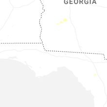
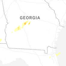
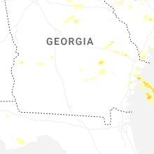
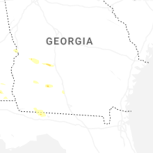


Connect with Interactive Hail Maps