

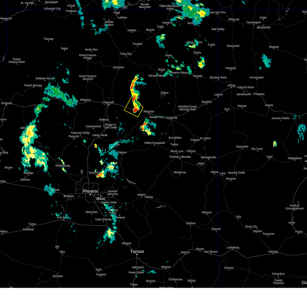
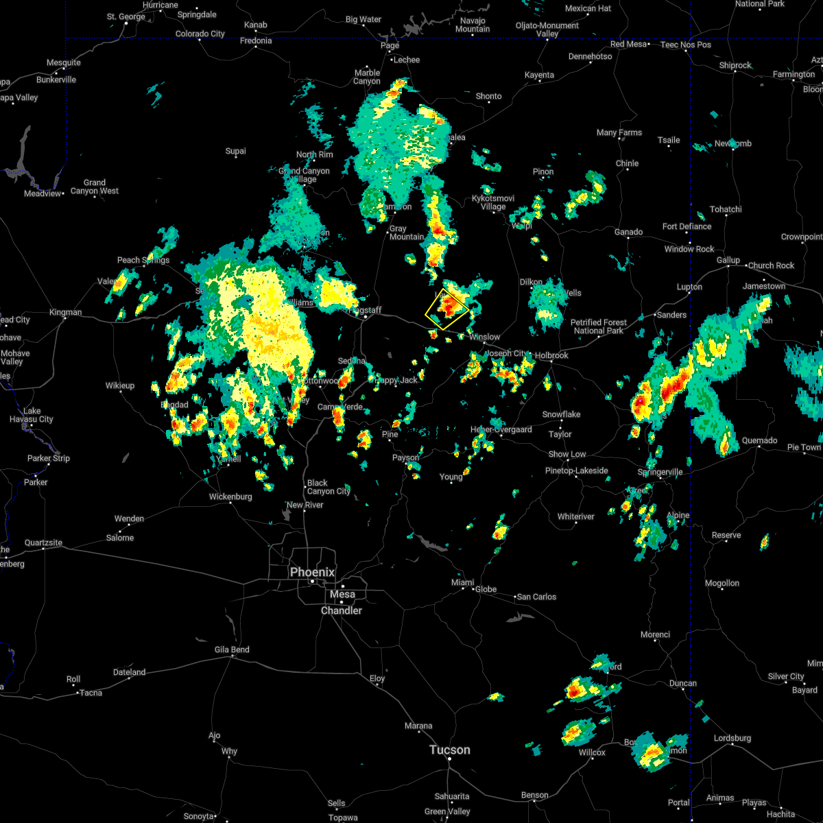
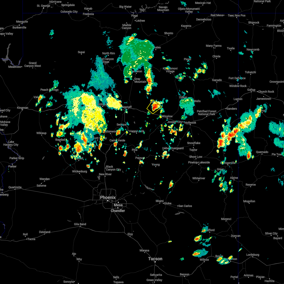
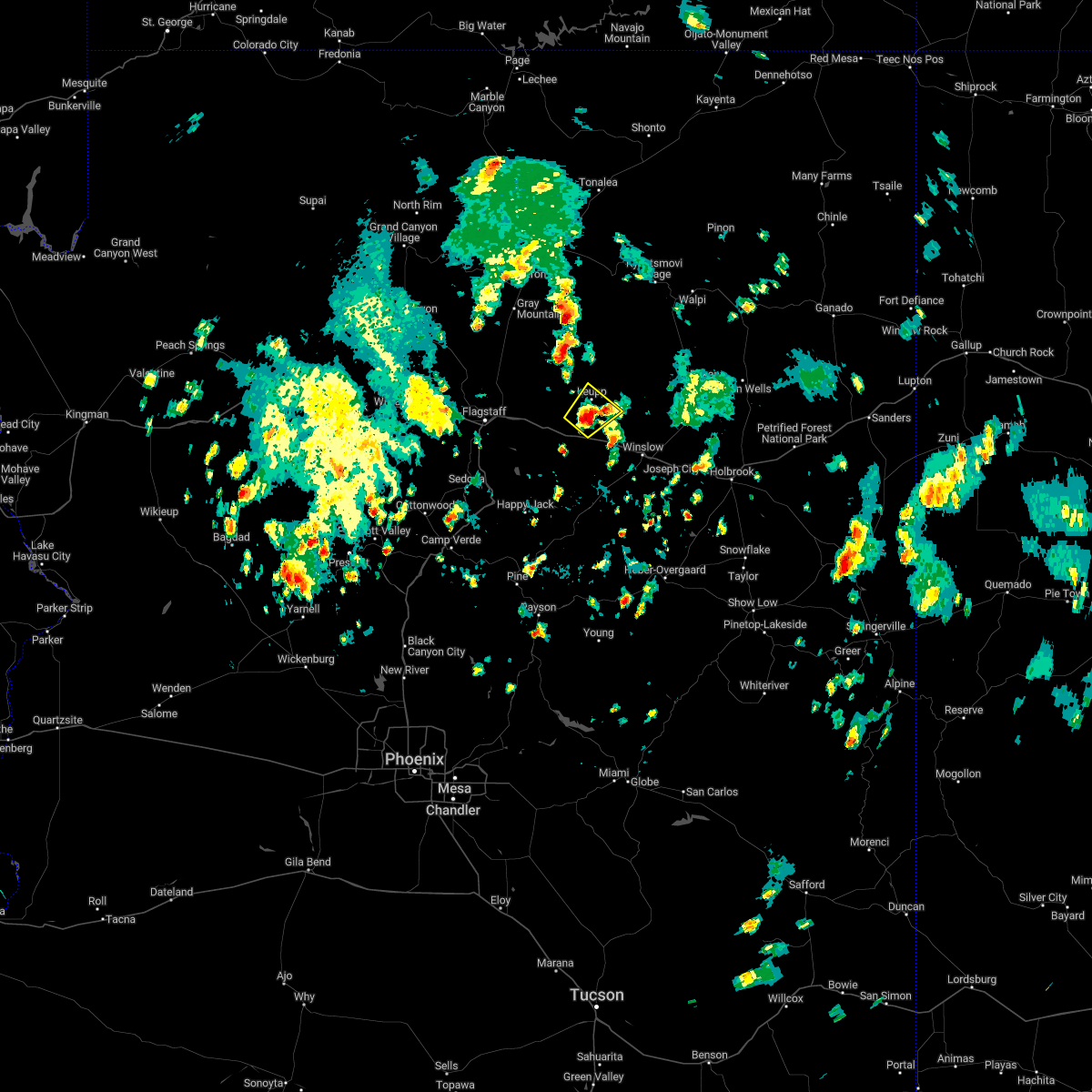
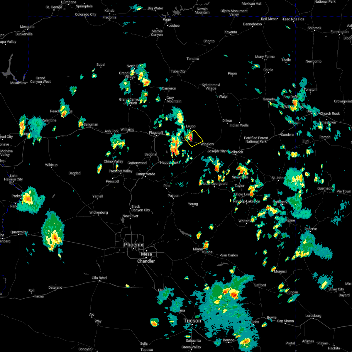
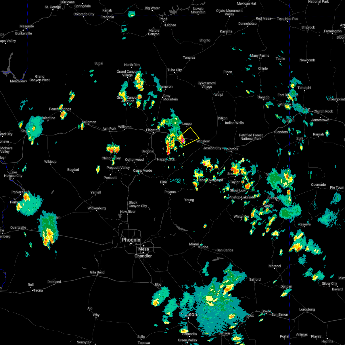
Hail Map for Leupp, AZ
The Leupp, AZ area has had 1 report of on-the-ground hail by trained spotters, and has been under severe weather warnings 0 times during the past 12 months. Doppler radar has detected hail at or near Leupp, AZ on 13 occasions.
| Name: | Leupp, AZ |
| Where Located: | 37.4 miles ENE of Flagstaff, AZ |
| Map: | Google Map for Leupp, AZ |
| Population: | 951 |
| Housing Units: | 255 |
| More Info: | Search Google for Leupp, AZ |
2
The Top Recent Hail Date for Leupp, AZ is Thursday, August 22, 2024 (5th out of 13)

Hail and Wind Damage Spotted near Leupp, AZ
| Date / Time | Report Details |
|---|---|
| 8/21/2023 6:56 PM MST |
 The severe thunderstorm warning for coconino county will expire at 700 pm mst, the storm which prompted the warning has weakened below severe limits, and no longer poses an immediate threat to life or property. therefore, the warning will be allowed to expire. however, small hail and gusty winds are still possible with this thunderstorm. The severe thunderstorm warning for coconino county will expire at 700 pm mst, the storm which prompted the warning has weakened below severe limits, and no longer poses an immediate threat to life or property. therefore, the warning will be allowed to expire. however, small hail and gusty winds are still possible with this thunderstorm.
|
| 8/21/2023 6:37 PM MST |
 At 635 pm mst, a severe thunderstorm was located over meteor crater rest area, or 16 miles west of winslow, moving northwest at 20 mph (radar indicated). Hazards include 60 mph wind gusts and quarter size hail. Hail damage to vehicles is expected. Expect wind damage to roofs, siding, and trees. At 635 pm mst, a severe thunderstorm was located over meteor crater rest area, or 16 miles west of winslow, moving northwest at 20 mph (radar indicated). Hazards include 60 mph wind gusts and quarter size hail. Hail damage to vehicles is expected. Expect wind damage to roofs, siding, and trees.
|
| 8/10/2023 4:50 PM MST |
 At 450 pm mst, a severe thunderstorm was located 7 miles southeast of leupp, or 15 miles northwest of winslow, moving southeast at 20 mph (radar indicated). Hazards include 60 mph wind gusts and half dollar size hail. Hail damage to vehicles is expected. Expect wind damage to roofs, siding, and trees. At 450 pm mst, a severe thunderstorm was located 7 miles southeast of leupp, or 15 miles northwest of winslow, moving southeast at 20 mph (radar indicated). Hazards include 60 mph wind gusts and half dollar size hail. Hail damage to vehicles is expected. Expect wind damage to roofs, siding, and trees.
|
| 7/31/2023 3:57 PM MDT |
 The severe thunderstorm warning for coconino county will expire at 300 pm mst, the storm which prompted the warning has weakened below severe limits, and no longer poses an immediate threat to life or property. therefore, the warning will be allowed to expire. however, small hail, gusty winds and heavy rain are still possible with this thunderstorm. The severe thunderstorm warning for coconino county will expire at 300 pm mst, the storm which prompted the warning has weakened below severe limits, and no longer poses an immediate threat to life or property. therefore, the warning will be allowed to expire. however, small hail, gusty winds and heavy rain are still possible with this thunderstorm.
|
| 7/31/2023 3:33 PM MDT |
 At 232 pm mst, a severe thunderstorm was located near rimmy jims, or 18 miles northwest of winslow, moving northwest at 25 mph (radar indicated). Hazards include 60 mph wind gusts and quarter size hail. Hail damage to vehicles is expected. Expect wind damage to roofs, siding, and trees. At 232 pm mst, a severe thunderstorm was located near rimmy jims, or 18 miles northwest of winslow, moving northwest at 25 mph (radar indicated). Hazards include 60 mph wind gusts and quarter size hail. Hail damage to vehicles is expected. Expect wind damage to roofs, siding, and trees.
|
| 9/13/2022 3:24 PM MDT |
 The severe thunderstorm warning for coconino county will expire at 230 pm mst, the storm which prompted the warning has weakened below severe limits, and no longer poses an immediate threat to life or property. therefore, the warning will be allowed to expire. however gusty winds and heavy rain are still possible with this thunderstorm. The severe thunderstorm warning for coconino county will expire at 230 pm mst, the storm which prompted the warning has weakened below severe limits, and no longer poses an immediate threat to life or property. therefore, the warning will be allowed to expire. however gusty winds and heavy rain are still possible with this thunderstorm.
|
| 9/13/2022 3:11 PM MDT |
 At 210 pm mst, a severe thunderstorm was located over leupp, or 23 miles northwest of winslow, moving northeast at 15 mph (radar indicated). Hazards include 60 mph wind gusts and penny size hail. Expect damage to roofs, siding, and trees. locations impacted include, rimmy jims, sunrise and leupp. this includes state route 99 between mile markers 63 and 71. hail threat, radar indicated max hail size, 0. 75 in wind threat, radar indicated max wind gust, 60 mph. At 210 pm mst, a severe thunderstorm was located over leupp, or 23 miles northwest of winslow, moving northeast at 15 mph (radar indicated). Hazards include 60 mph wind gusts and penny size hail. Expect damage to roofs, siding, and trees. locations impacted include, rimmy jims, sunrise and leupp. this includes state route 99 between mile markers 63 and 71. hail threat, radar indicated max hail size, 0. 75 in wind threat, radar indicated max wind gust, 60 mph.
|
| 9/13/2022 2:55 PM MDT |
 At 155 pm mst, a severe thunderstorm was located near leupp, or 22 miles northwest of winslow, moving northeast at 15 mph (radar indicated). Hazards include 60 mph wind gusts and quarter size hail. Hail damage to vehicles is expected. Expect wind damage to roofs, siding, and trees. At 155 pm mst, a severe thunderstorm was located near leupp, or 22 miles northwest of winslow, moving northeast at 15 mph (radar indicated). Hazards include 60 mph wind gusts and quarter size hail. Hail damage to vehicles is expected. Expect wind damage to roofs, siding, and trees.
|
| 9/12/2022 3:18 PM MST |
 At 317 pm mst, a severe thunderstorm was located near rimmy jims, or 17 miles northwest of winslow, moving northeast at 20 mph (radar indicated). Hazards include 60 mph wind gusts and penny size hail. Expect damage to roofs, siding, and trees. locations impacted include, rimmy jims. this includes the following highways, interstate 40 between mile markers 232 and 244. state route 99 between mile markers 55 and 69. hail threat, radar indicated max hail size, 0. 75 in wind threat, radar indicated max wind gust, 60 mph. At 317 pm mst, a severe thunderstorm was located near rimmy jims, or 17 miles northwest of winslow, moving northeast at 20 mph (radar indicated). Hazards include 60 mph wind gusts and penny size hail. Expect damage to roofs, siding, and trees. locations impacted include, rimmy jims. this includes the following highways, interstate 40 between mile markers 232 and 244. state route 99 between mile markers 55 and 69. hail threat, radar indicated max hail size, 0. 75 in wind threat, radar indicated max wind gust, 60 mph.
|
| 9/12/2022 2:59 PM MST |
 At 259 pm mst, a severe thunderstorm was located over rimmy jims, or 19 miles west of winslow, moving northeast at 20 mph (radar indicated). Hazards include 60 mph wind gusts and penny size hail. expect damage to roofs, siding, and trees At 259 pm mst, a severe thunderstorm was located over rimmy jims, or 19 miles west of winslow, moving northeast at 20 mph (radar indicated). Hazards include 60 mph wind gusts and penny size hail. expect damage to roofs, siding, and trees
|
| 8/26/2022 1:06 PM MDT | At 1205 pm mst, a severe thunderstorm was located 12 miles east of sunset crater volcano national monument, or 22 miles northeast of flagstaff, moving east at 15 mph (radar indicated). Hazards include 60 mph wind gusts and half dollar size hail. Hail damage to vehicles is expected. expect wind damage to roofs, siding, and trees. this severe thunderstorm will remain over mainly rural areas of coconino county near grand falls. hail threat, radar indicated max hail size, 1. 25 in wind threat, radar indicated max wind gust, 60 mph. |
| 9/1/2018 5:19 PM MDT | Tennis Ball sized hail reported 19.2 miles SSW of Leupp, AZ, time... location... and hail size estimated. |
| 10/20/2015 9:47 AM MST |
 At 946 am mst, doppler radar indicated a severe thunderstorm capable of producing quarter size hail and damaging winds in excess of 60 mph. dime size hail was reported at the rest stop along i-40 west of winslow. this storm was located 7 miles east of rimmy jims, or 11 miles northwest of winslow, moving north at 25 mph. this severe thunderstorm will remain over mainly rural areas of southeastern coconino and southwestern navajo counties. At 946 am mst, doppler radar indicated a severe thunderstorm capable of producing quarter size hail and damaging winds in excess of 60 mph. dime size hail was reported at the rest stop along i-40 west of winslow. this storm was located 7 miles east of rimmy jims, or 11 miles northwest of winslow, moving north at 25 mph. this severe thunderstorm will remain over mainly rural areas of southeastern coconino and southwestern navajo counties.
|
| 10/20/2015 9:37 AM MST |
 At 937 am mst, doppler radar indicated a severe thunderstorm capable of producing quarter size hail and damaging winds in excess of 60 mph. this storm was located 7 miles east of meteor crater, or 10 miles west of winslow, and moving north at 25 mph. * this severe thunderstorm will remain over mainly rural areas of southeastern coconino and southwestern navajo counties. this includes the following highways, interstate 40 between mile markers 236 and 249. state route 99 between mile markers 53 and 68. At 937 am mst, doppler radar indicated a severe thunderstorm capable of producing quarter size hail and damaging winds in excess of 60 mph. this storm was located 7 miles east of meteor crater, or 10 miles west of winslow, and moving north at 25 mph. * this severe thunderstorm will remain over mainly rural areas of southeastern coconino and southwestern navajo counties. this includes the following highways, interstate 40 between mile markers 236 and 249. state route 99 between mile markers 53 and 68.
|
| 8/31/2015 2:20 PM MDT |
 At 119 pm mst, doppler radar indicated a severe thunderstorm capable of producing quarter size hail and damaging winds in excess of 60 mph. this storm was located over sunrise, or 24 miles northwest of winslow, and moving southeast at 35 mph. At 119 pm mst, doppler radar indicated a severe thunderstorm capable of producing quarter size hail and damaging winds in excess of 60 mph. this storm was located over sunrise, or 24 miles northwest of winslow, and moving southeast at 35 mph.
|
| 8/31/2015 1:54 PM MDT |
 At 1253 pm mst, doppler radar indicated a severe thunderstorm capable of producing quarter size hail and damaging winds in excess of 60 mph. this storm was located 9 miles northwest of sunrise, or 30 miles northeast of flagstaff, moving southeast at 15 mph. this severe thunderstorm will remain over mainly rural areas of southeastern coconino county. At 1253 pm mst, doppler radar indicated a severe thunderstorm capable of producing quarter size hail and damaging winds in excess of 60 mph. this storm was located 9 miles northwest of sunrise, or 30 miles northeast of flagstaff, moving southeast at 15 mph. this severe thunderstorm will remain over mainly rural areas of southeastern coconino county.
|
| 8/31/2015 1:38 PM MDT |
 At 1237 pm mst, doppler radar indicated a severe thunderstorm capable of producing half dollar size hail and damaging winds in excess of 60 mph. this storm was located 12 miles southeast of wupatki national monument, or 28 miles northeast of flagstaff, and moving southeast at 20 mph. this replaces warning number 0098. * this severe thunderstorm will remain over mainly rural areas of southeastern coconino county. At 1237 pm mst, doppler radar indicated a severe thunderstorm capable of producing half dollar size hail and damaging winds in excess of 60 mph. this storm was located 12 miles southeast of wupatki national monument, or 28 miles northeast of flagstaff, and moving southeast at 20 mph. this replaces warning number 0098. * this severe thunderstorm will remain over mainly rural areas of southeastern coconino county.
|
| 6/5/2015 9:11 PM MST | At 907 pm mst, doppler radar indicated a severe thunderstorm capable of producing half dollar size hail and damaging winds in excess of 60 mph. this storm was located over meteor crater, or 19 miles west of winslow, and moving northeast at 40 mph. |
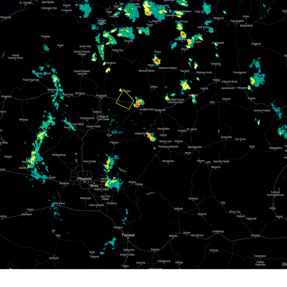
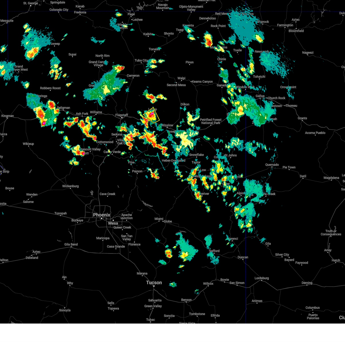
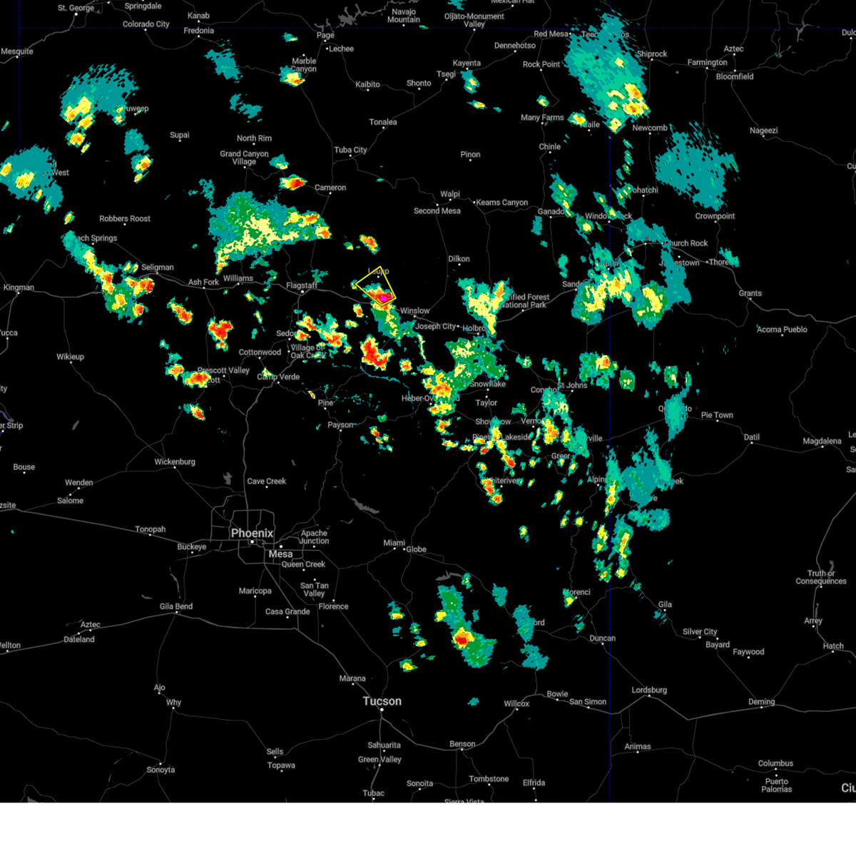
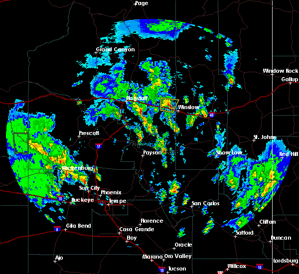
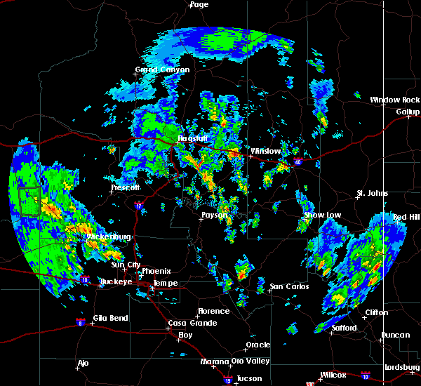
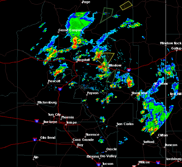
Hail Maps for Leupp, AZ


Connect with Interactive Hail Maps