

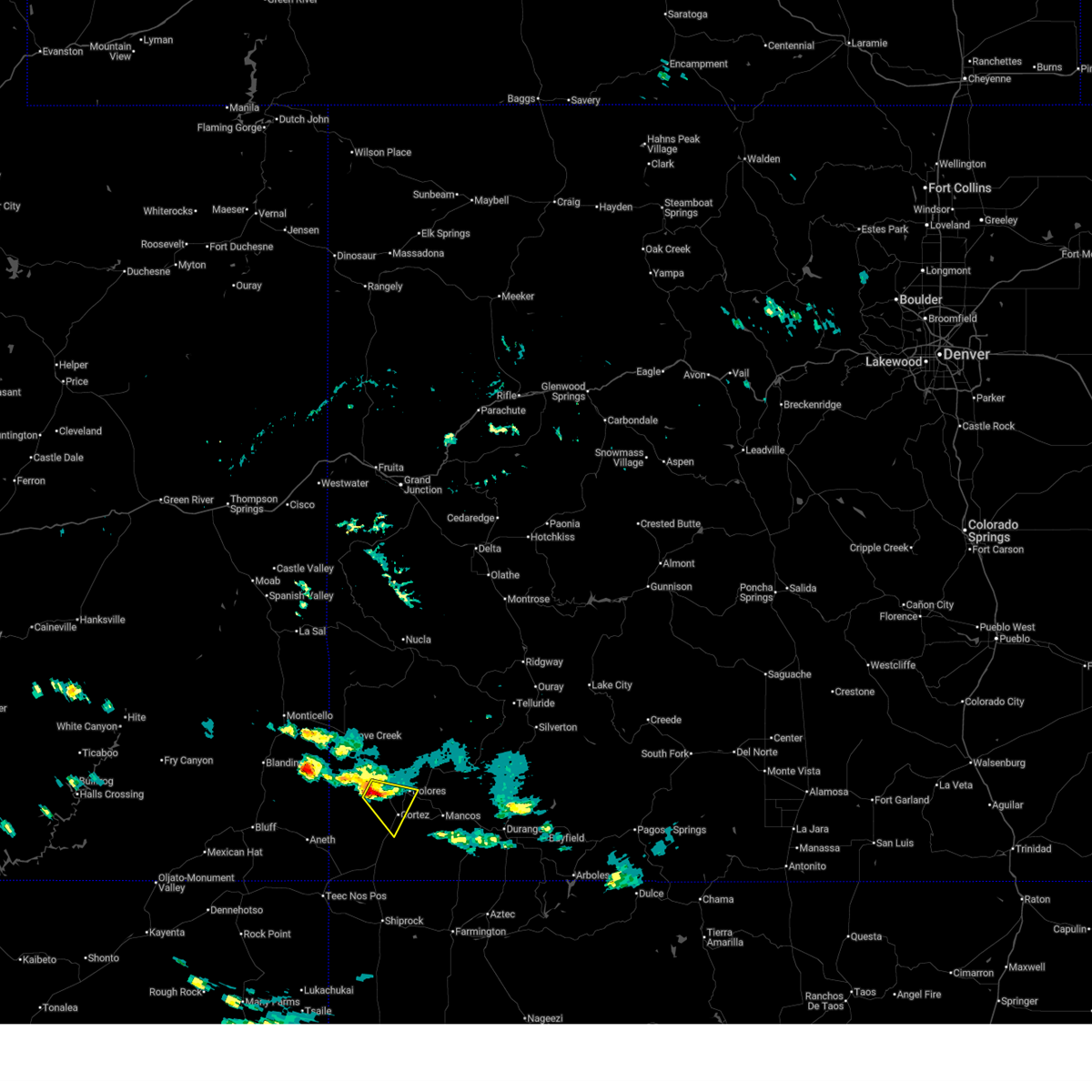
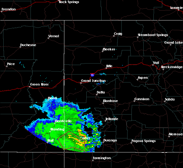
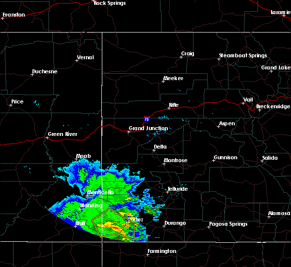
Hail Map for Lewis, CO
The Lewis, CO area has had 0 reports of on-the-ground hail by trained spotters, and has been under severe weather warnings 3 times during the past 12 months. Doppler radar has detected hail at or near Lewis, CO on 4 occasions.
| Name: | Lewis, CO |
| Where Located: | 59.4 miles NNW of Farmington, NM |
| Map: | Google Map for Lewis, CO |
| Population: | 302 |
| Housing Units: | 133 |
| More Info: | Search Google for Lewis, CO |
5
The Top Recent Hail Date for Lewis, CO is Friday, June 21, 2024 (2nd out of 4)

Hail and Wind Damage Spotted near Lewis, CO
| Date / Time | Report Details |
|---|---|
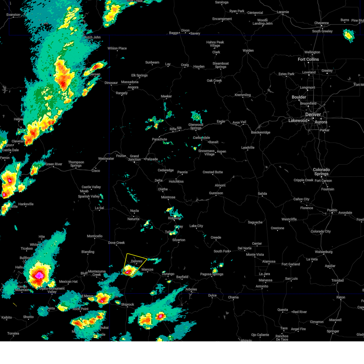
| 9/13/2025 3:17 PM MDT | the severe thunderstorm warning has been cancelled and is no longer in effect |
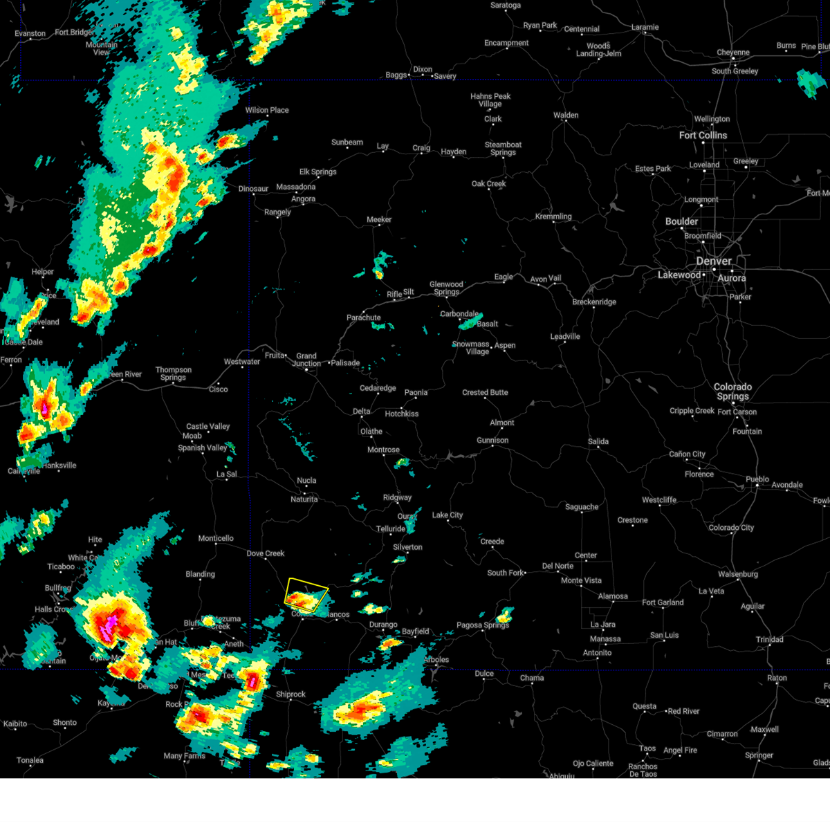
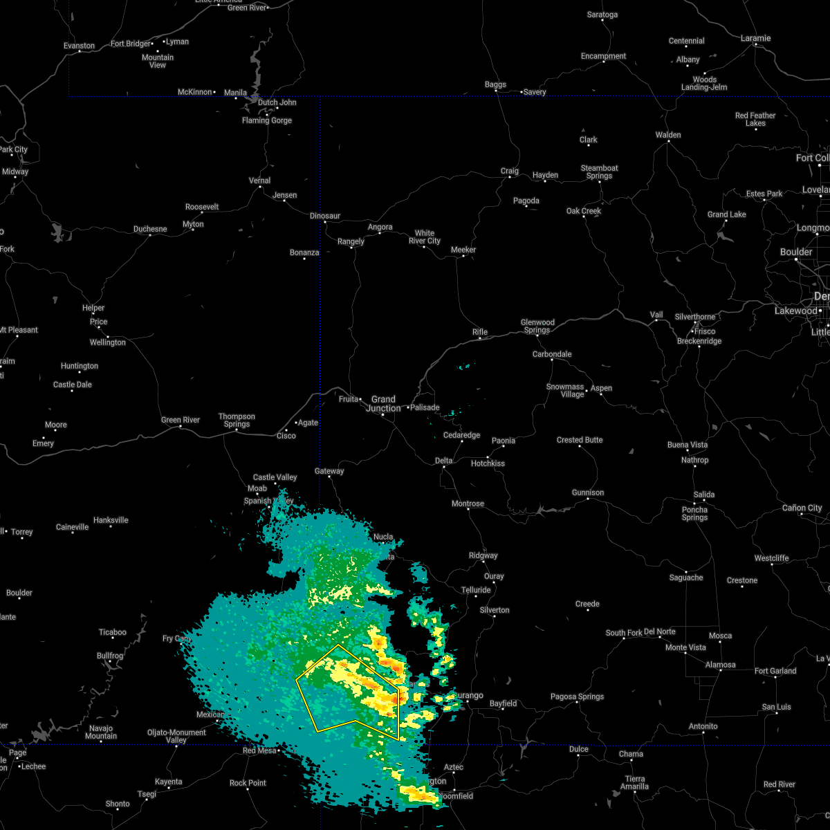
| 9/13/2025 2:59 PM MDT | At 259 pm mdt, a severe thunderstorm was located 12 miles west of cortez, or 40 miles north of shiprock, moving northeast at 20 mph (radar indicated). Hazards include 60 mph wind gusts and penny size hail. Expect damage to roofs, siding, and trees. Locations impacted include, cortez, dolores, lebanon, arriola, yellow jacket, and lewis. |
| 9/13/2025 2:38 PM MDT | Svrgjt the national weather service in grand junction has issued a * severe thunderstorm warning for, west central dolores county in southwestern colorado, northwestern montezuma county in southwestern colorado, * until 330 pm mdt. * at 238 pm mdt, a severe thunderstorm was located 16 miles south of dove creek, or 34 miles east of blanding, moving northeast at 20 mph (radar indicated). Hazards include 60 mph wind gusts and penny size hail. expect damage to roofs, siding, and trees |
| 6/3/2025 2:59 PM MDT |
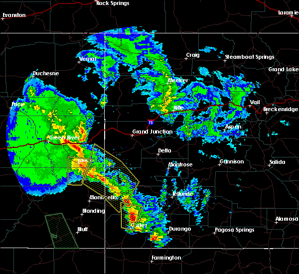
 Svrgjt the national weather service in grand junction has issued a * severe thunderstorm warning for, central montezuma county in southwestern colorado, * until 330 pm mdt. * at 258 pm mdt, a severe thunderstorm was located 11 miles northwest of cortez, or 42 miles east of blanding, moving southeast at 20 mph (radar indicated). Hazards include 60 mph wind gusts and quarter size hail. Hail damage to vehicles is expected. Expect wind damage to roofs, siding, and trees. Svrgjt the national weather service in grand junction has issued a * severe thunderstorm warning for, central montezuma county in southwestern colorado, * until 330 pm mdt. * at 258 pm mdt, a severe thunderstorm was located 11 miles northwest of cortez, or 42 miles east of blanding, moving southeast at 20 mph (radar indicated). Hazards include 60 mph wind gusts and quarter size hail. Hail damage to vehicles is expected. Expect wind damage to roofs, siding, and trees.
|
| 6/3/2025 2:49 PM MDT |
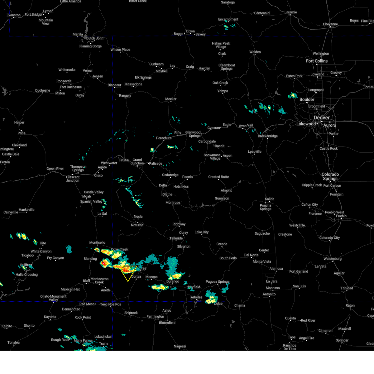 At 249 pm mdt, a severe thunderstorm was located 13 miles northwest of cortez, or 40 miles east of blanding, moving southeast at 20 mph (radar indicated). Hazards include 60 mph wind gusts and quarter size hail. Hail damage to vehicles is expected. expect wind damage to roofs, siding, and trees. Locations impacted include, yellow jacket and lewis. At 249 pm mdt, a severe thunderstorm was located 13 miles northwest of cortez, or 40 miles east of blanding, moving southeast at 20 mph (radar indicated). Hazards include 60 mph wind gusts and quarter size hail. Hail damage to vehicles is expected. expect wind damage to roofs, siding, and trees. Locations impacted include, yellow jacket and lewis.
|
| 6/3/2025 2:28 PM MDT |
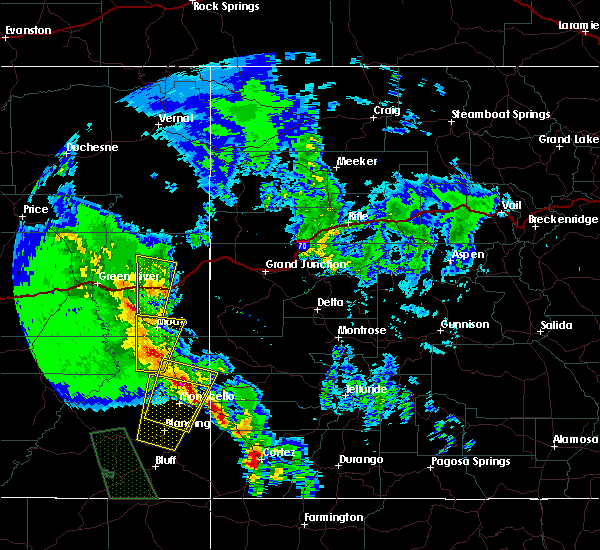
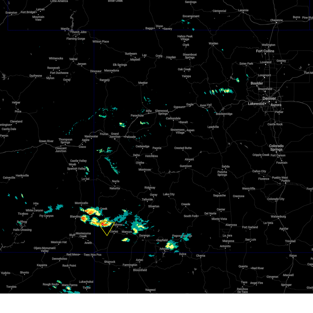 Svrgjt the national weather service in grand junction has issued a * severe thunderstorm warning for, northwestern montezuma county in southwestern colorado, * until 300 pm mdt. * at 228 pm mdt, a severe thunderstorm was located 17 miles south of dove creek, or 35 miles east of blanding, moving southeast at 20 mph (radar indicated). Hazards include 60 mph wind gusts and quarter size hail. Hail damage to vehicles is expected. Expect wind damage to roofs, siding, and trees. Svrgjt the national weather service in grand junction has issued a * severe thunderstorm warning for, northwestern montezuma county in southwestern colorado, * until 300 pm mdt. * at 228 pm mdt, a severe thunderstorm was located 17 miles south of dove creek, or 35 miles east of blanding, moving southeast at 20 mph (radar indicated). Hazards include 60 mph wind gusts and quarter size hail. Hail damage to vehicles is expected. Expect wind damage to roofs, siding, and trees.
|
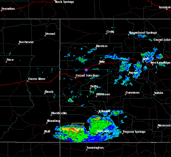
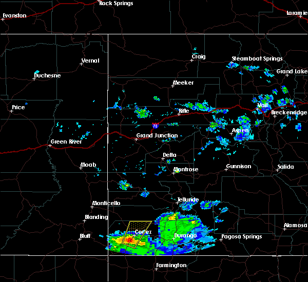
| 6/21/2024 4:11 PM MDT |
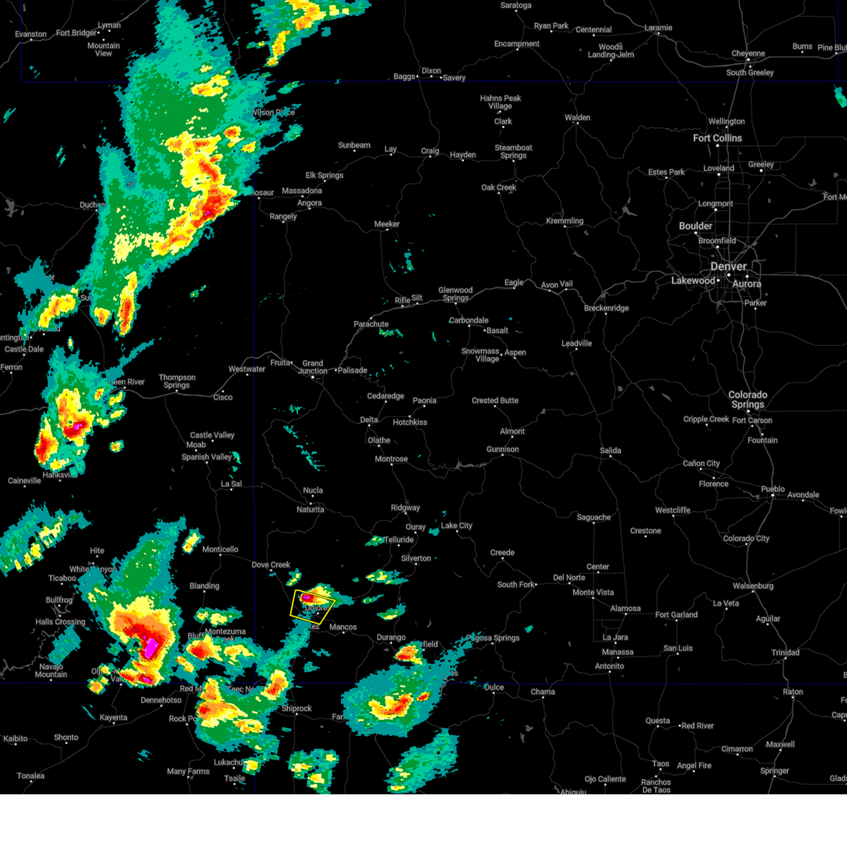 The storm which prompted the warning has moved out of the area. therefore, the warning will be allowed to expire. however, heavy rain is still possible with this thunderstorm. a severe thunderstorm watch remains in effect until 700 pm mdt for southwestern colorado. remember, a severe thunderstorm warning still remains in effect for north central montezuma county and central dolores county until 4:45 pm. The storm which prompted the warning has moved out of the area. therefore, the warning will be allowed to expire. however, heavy rain is still possible with this thunderstorm. a severe thunderstorm watch remains in effect until 700 pm mdt for southwestern colorado. remember, a severe thunderstorm warning still remains in effect for north central montezuma county and central dolores county until 4:45 pm.
|
| 6/21/2024 3:59 PM MDT |
 At 359 pm mdt, a severe thunderstorm was located near dolores, or 42 miles northwest of durango, moving northeast at 35 mph (radar indicated). Hazards include 60 mph wind gusts and quarter size hail. Hail damage to vehicles is expected. expect wind damage to roofs, siding, and trees. Locations impacted include, dolores, lebanon, yellow jacket, and lewis. At 359 pm mdt, a severe thunderstorm was located near dolores, or 42 miles northwest of durango, moving northeast at 35 mph (radar indicated). Hazards include 60 mph wind gusts and quarter size hail. Hail damage to vehicles is expected. expect wind damage to roofs, siding, and trees. Locations impacted include, dolores, lebanon, yellow jacket, and lewis.
|
| 6/21/2024 3:41 PM MDT |
 Svrgjt the national weather service in grand junction has issued a * severe thunderstorm warning for, north central montezuma county in southwestern colorado, * until 415 pm mdt. * at 340 pm mdt, a severe thunderstorm was located near cortez, or 40 miles north of shiprock, moving northeast at 35 mph (radar indicated). Hazards include 60 mph wind gusts and quarter size hail. Hail damage to vehicles is expected. Expect wind damage to roofs, siding, and trees. Svrgjt the national weather service in grand junction has issued a * severe thunderstorm warning for, north central montezuma county in southwestern colorado, * until 415 pm mdt. * at 340 pm mdt, a severe thunderstorm was located near cortez, or 40 miles north of shiprock, moving northeast at 35 mph (radar indicated). Hazards include 60 mph wind gusts and quarter size hail. Hail damage to vehicles is expected. Expect wind damage to roofs, siding, and trees.
|
| 6/6/2020 11:01 AM MDT |
 At 1100 am mdt, a severe thunderstorm was located 12 miles north of dolores, or 43 miles northwest of durango, moving north at 50 mph (radar indicated). Hazards include 60 mph wind gusts and quarter size hail. Hail damage to vehicles is expected. expect wind damage to roofs, siding, and trees. locations impacted include, dolores. This includes colorado 145 between mile markers 10 and 12. At 1100 am mdt, a severe thunderstorm was located 12 miles north of dolores, or 43 miles northwest of durango, moving north at 50 mph (radar indicated). Hazards include 60 mph wind gusts and quarter size hail. Hail damage to vehicles is expected. expect wind damage to roofs, siding, and trees. locations impacted include, dolores. This includes colorado 145 between mile markers 10 and 12.
|
| 6/6/2020 10:44 AM MDT |
 At 1043 am mdt, a severe thunderstorm was located 7 miles west of dolores, or 43 miles west of durango, moving north at 55 mph (radar indicated). Hazards include 60 mph wind gusts and quarter size hail. Hail damage to vehicles is expected. Expect wind damage to roofs, siding, and trees. At 1043 am mdt, a severe thunderstorm was located 7 miles west of dolores, or 43 miles west of durango, moving north at 55 mph (radar indicated). Hazards include 60 mph wind gusts and quarter size hail. Hail damage to vehicles is expected. Expect wind damage to roofs, siding, and trees.
|
| 6/5/2020 5:13 PM MDT |
 At 513 pm mdt, doppler radar indicated a severe thunderstorm capable of producing quarter size hail and damaging winds in excess of 60 mph. this storm was located near dolores, or 40 miles northwest of durango, moving north at 45 mph. locations impacted include, cortez, dolores, lebanon, towaoc, stoner, lewis and arriola. At 513 pm mdt, doppler radar indicated a severe thunderstorm capable of producing quarter size hail and damaging winds in excess of 60 mph. this storm was located near dolores, or 40 miles northwest of durango, moving north at 45 mph. locations impacted include, cortez, dolores, lebanon, towaoc, stoner, lewis and arriola.
|
| 6/5/2020 4:56 PM MDT |
 At 455 pm mdt, doppler radar indicated a severe thunderstorm capable of producing quarter size hail. this storm was located near cortez, or 35 miles north of shiprock, and moving north at 40 mph. wind gusts in excess of 60 mph are also possible with this storm. At 455 pm mdt, doppler radar indicated a severe thunderstorm capable of producing quarter size hail. this storm was located near cortez, or 35 miles north of shiprock, and moving north at 40 mph. wind gusts in excess of 60 mph are also possible with this storm.
|
| 5/9/2017 8:42 AM MDT |
 The severe thunderstorm warning for southwestern dolores. western montezuma and eastern san juan counties will expire at 845 am mdt. the storms which prompted the warning have weakened below severe limits, and no longer pose an immediate threat to life or property. therefore the warning will be allowed to expire. However small hail and gusty winds are still possible with these thunderstorms. The severe thunderstorm warning for southwestern dolores. western montezuma and eastern san juan counties will expire at 845 am mdt. the storms which prompted the warning have weakened below severe limits, and no longer pose an immediate threat to life or property. therefore the warning will be allowed to expire. However small hail and gusty winds are still possible with these thunderstorms.
|
| 5/9/2017 8:37 AM MDT |
 At 836 am mdt, doppler radar indicated severe thunderstorms capable of producing quarter size hail and damaging winds in excess of 60 mph. these storms were located along a line extending from 8 miles east of aneth to 10 miles south of cortez, moving north at 20 mph. locations impacted include, cortez, arriola, towaoc, hovenweep national monument, mesa verde natl park and lebanon. At 836 am mdt, doppler radar indicated severe thunderstorms capable of producing quarter size hail and damaging winds in excess of 60 mph. these storms were located along a line extending from 8 miles east of aneth to 10 miles south of cortez, moving north at 20 mph. locations impacted include, cortez, arriola, towaoc, hovenweep national monument, mesa verde natl park and lebanon.
|
| 5/9/2017 8:20 AM MDT |
 At 819 am mdt, doppler radar indicated a line of severe thunderstorms capable of producing quarter size hail and damaging winds in excess of 60 mph. these storms were located along a line extending from 10 miles east of aneth to 15 miles southwest of cortez to 20 miles southwest of mancos, and moving north at 20 mph. At 819 am mdt, doppler radar indicated a line of severe thunderstorms capable of producing quarter size hail and damaging winds in excess of 60 mph. these storms were located along a line extending from 10 miles east of aneth to 15 miles southwest of cortez to 20 miles southwest of mancos, and moving north at 20 mph.
|
Hail Maps for Lewis, CO


Connect with Interactive Hail Maps