

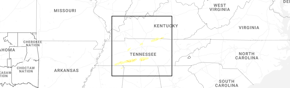
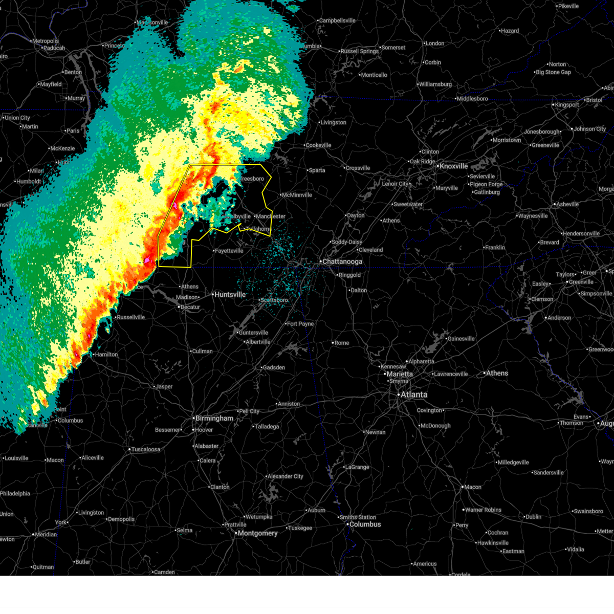
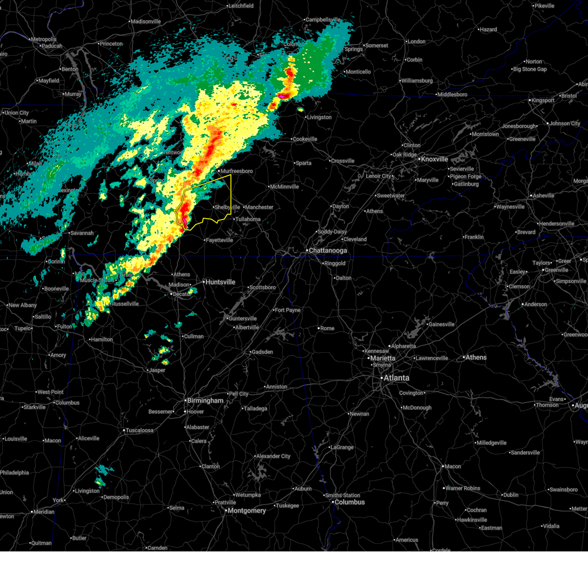
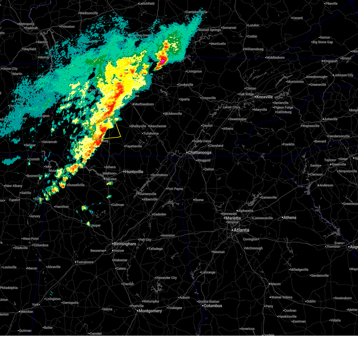
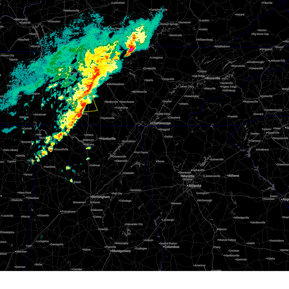
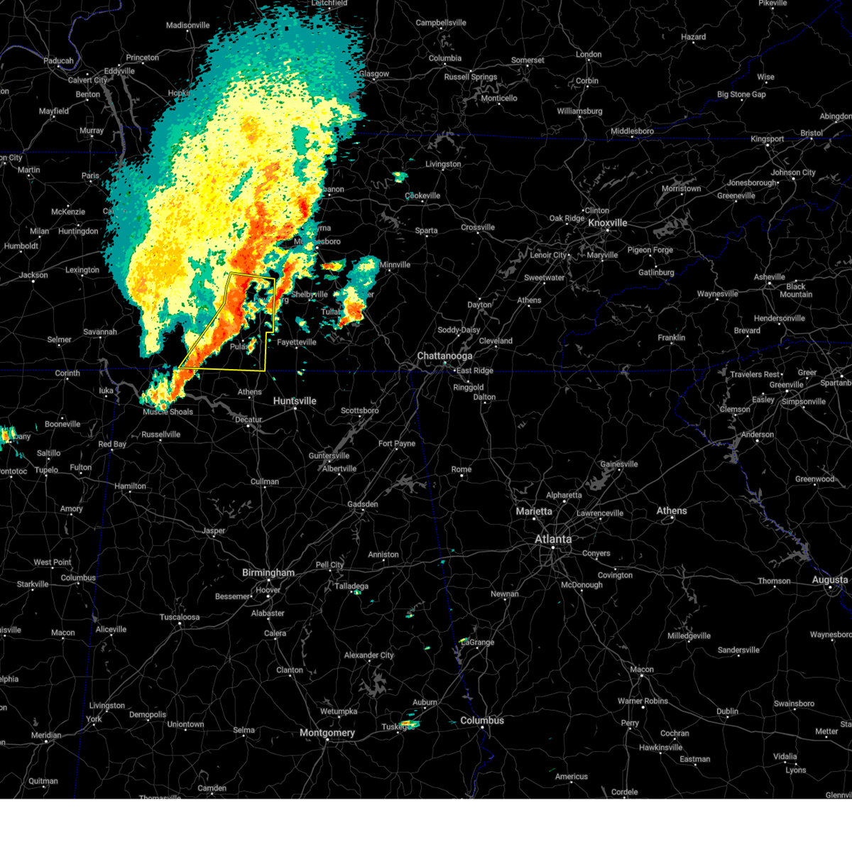
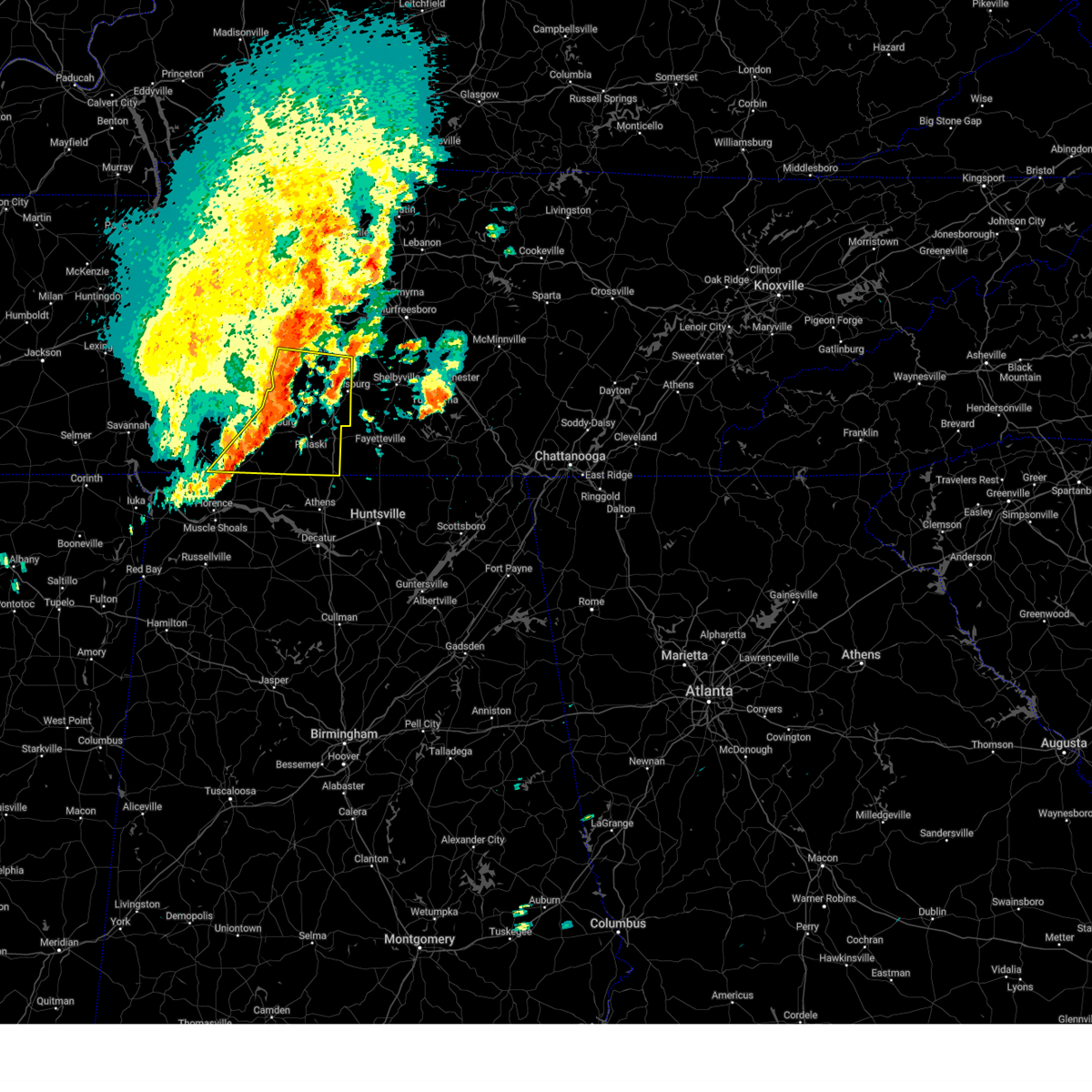
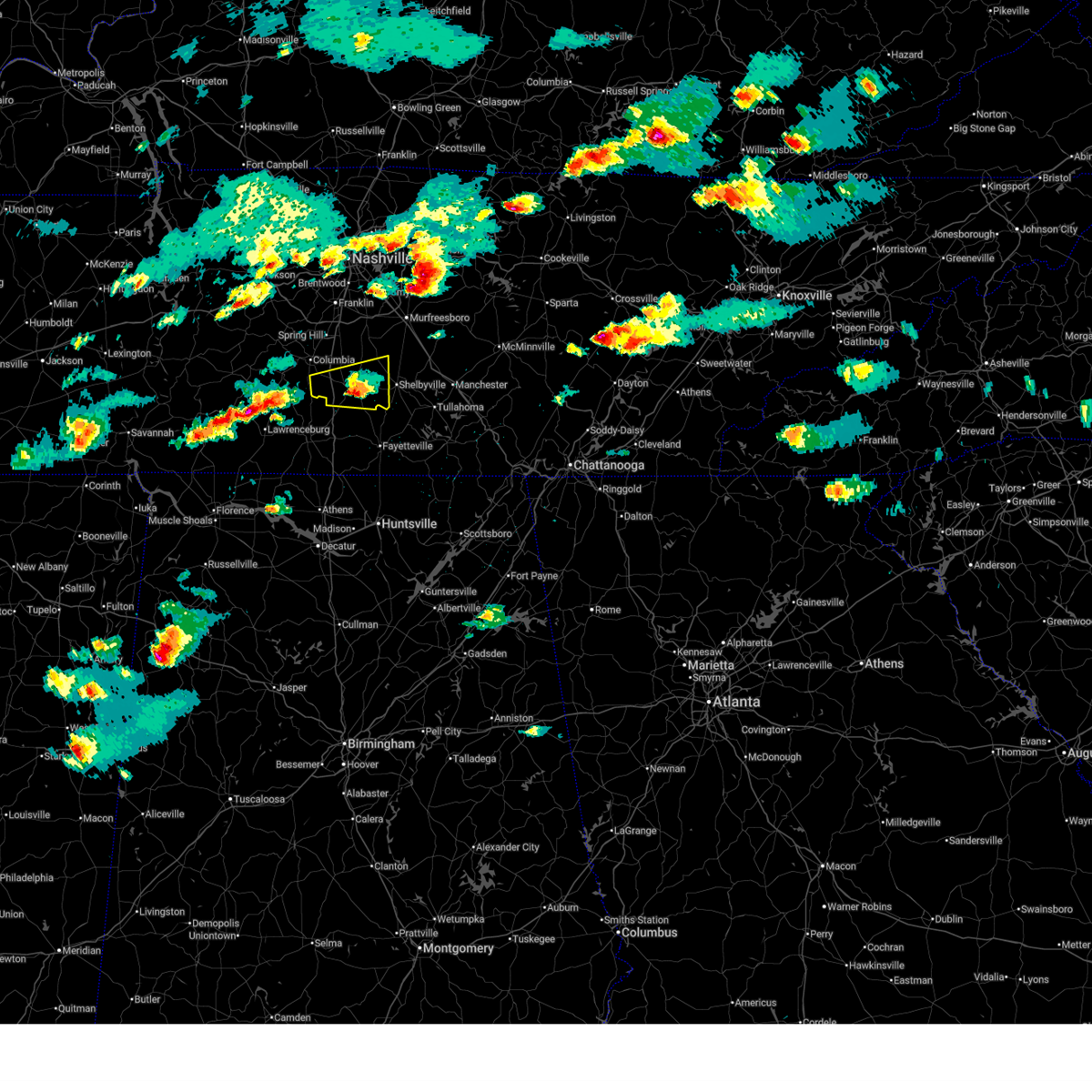
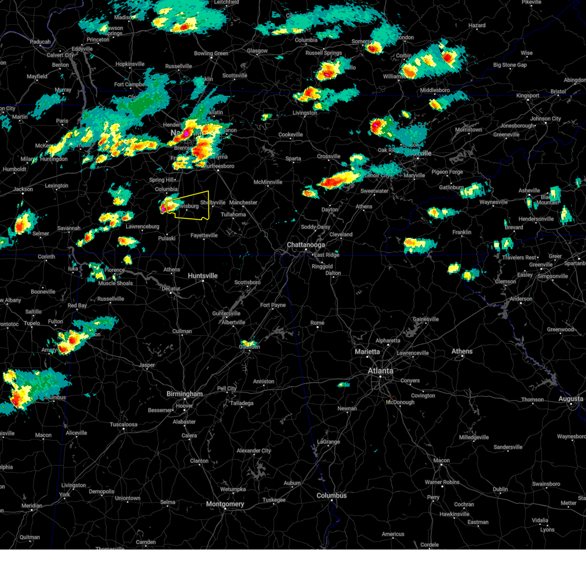
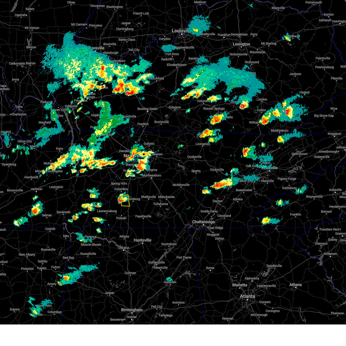
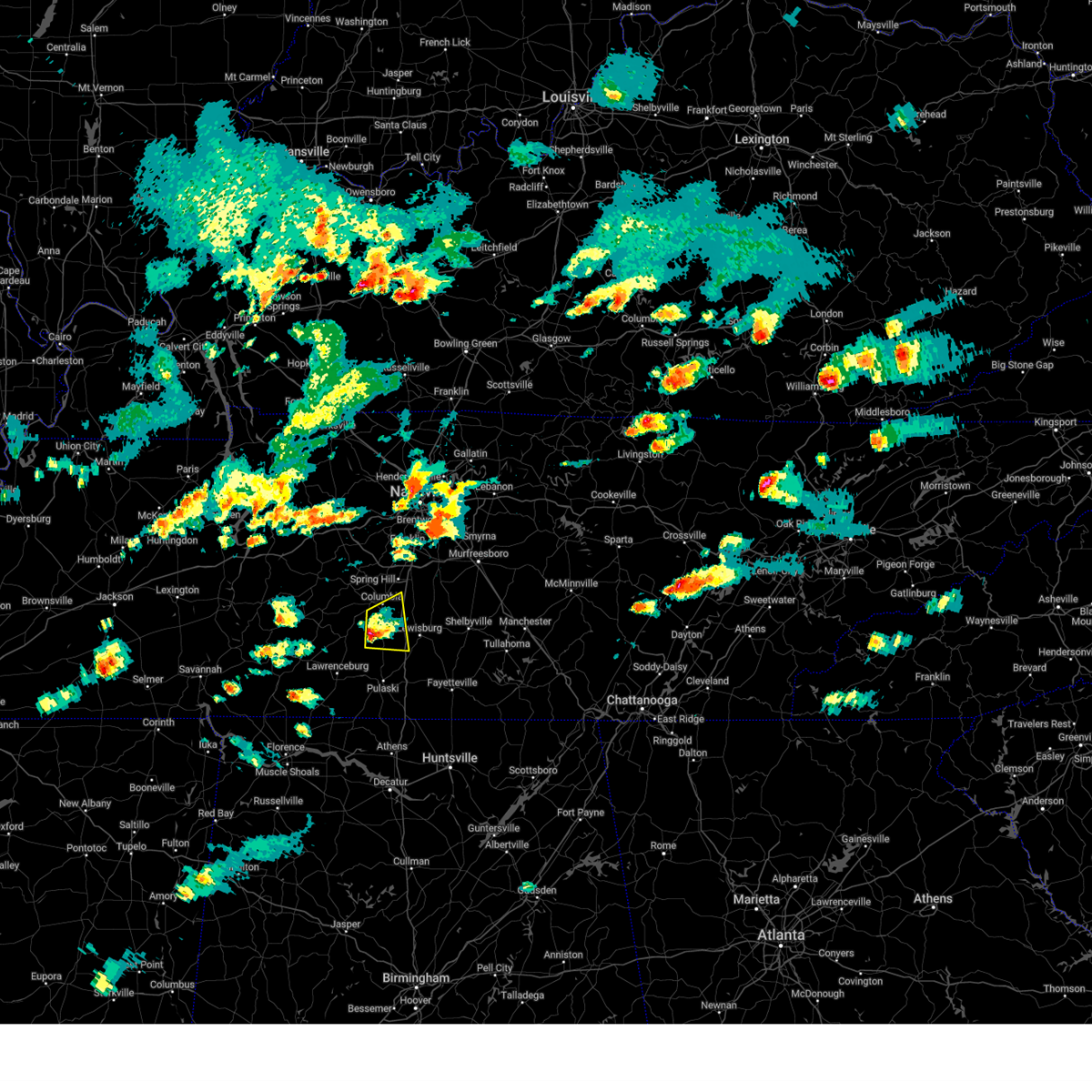
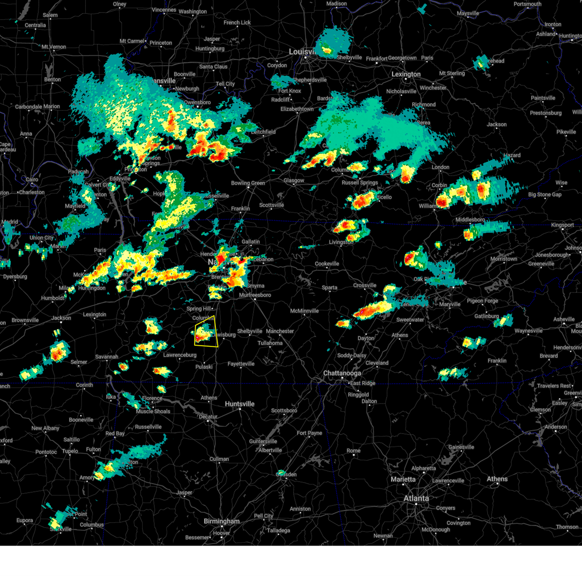
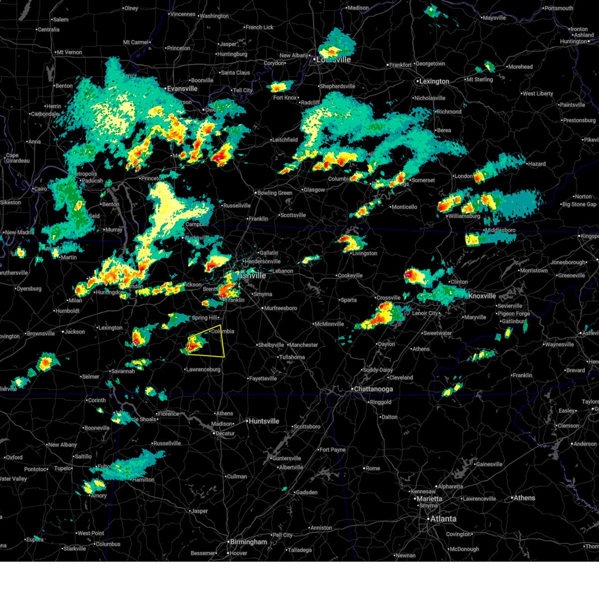
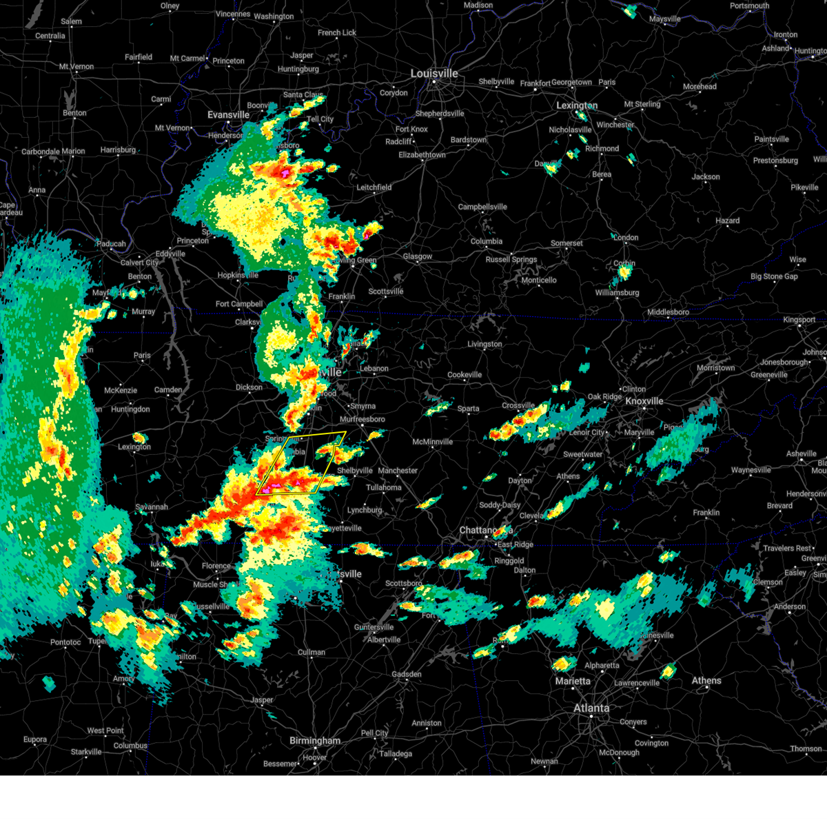
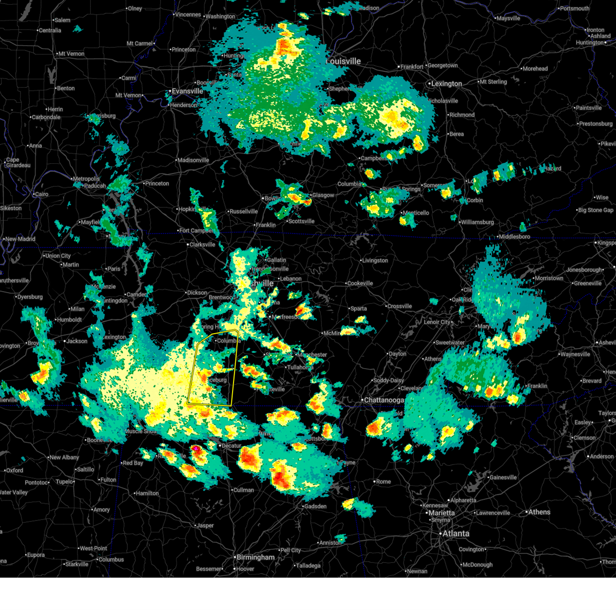
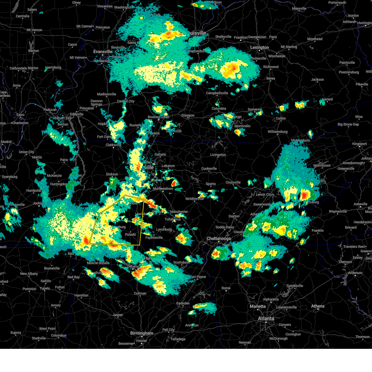
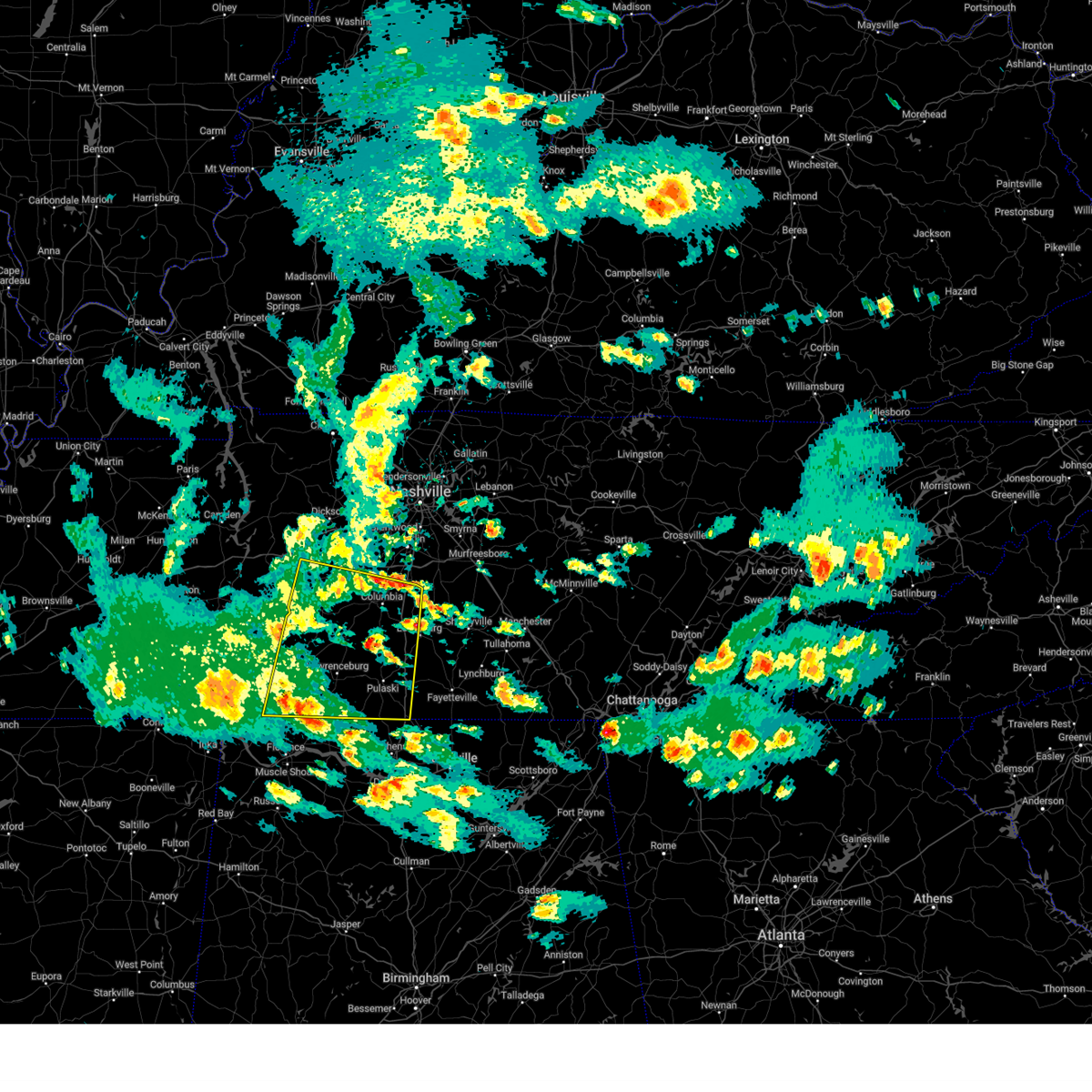
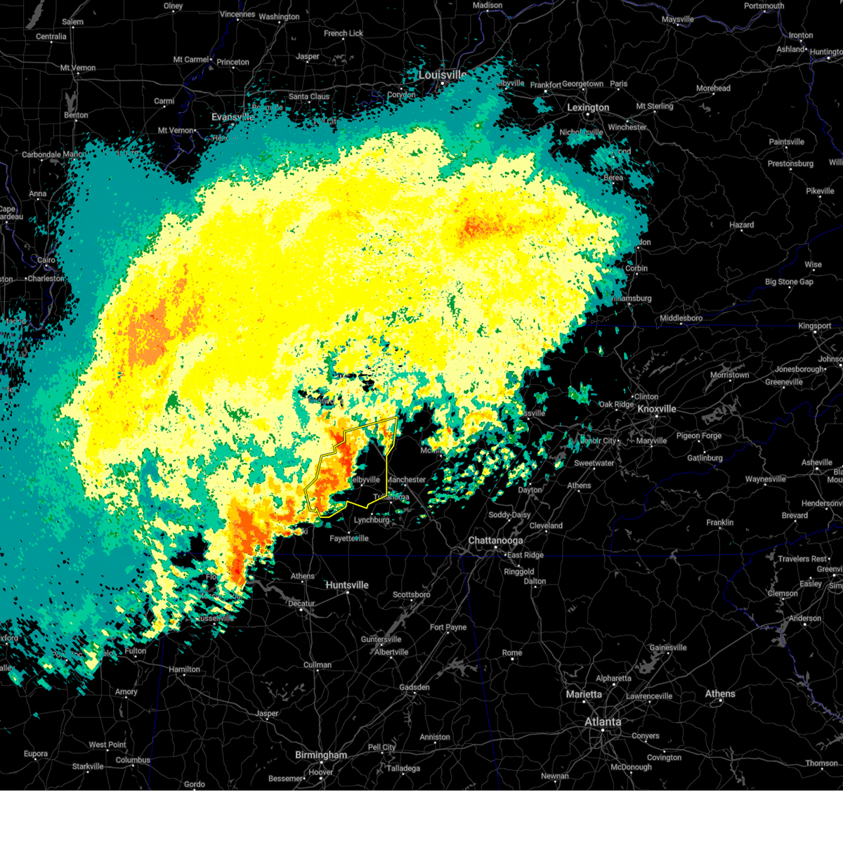
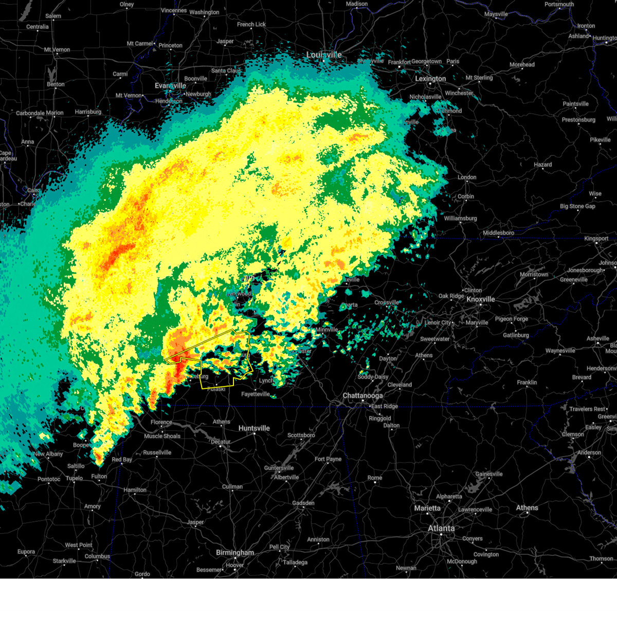
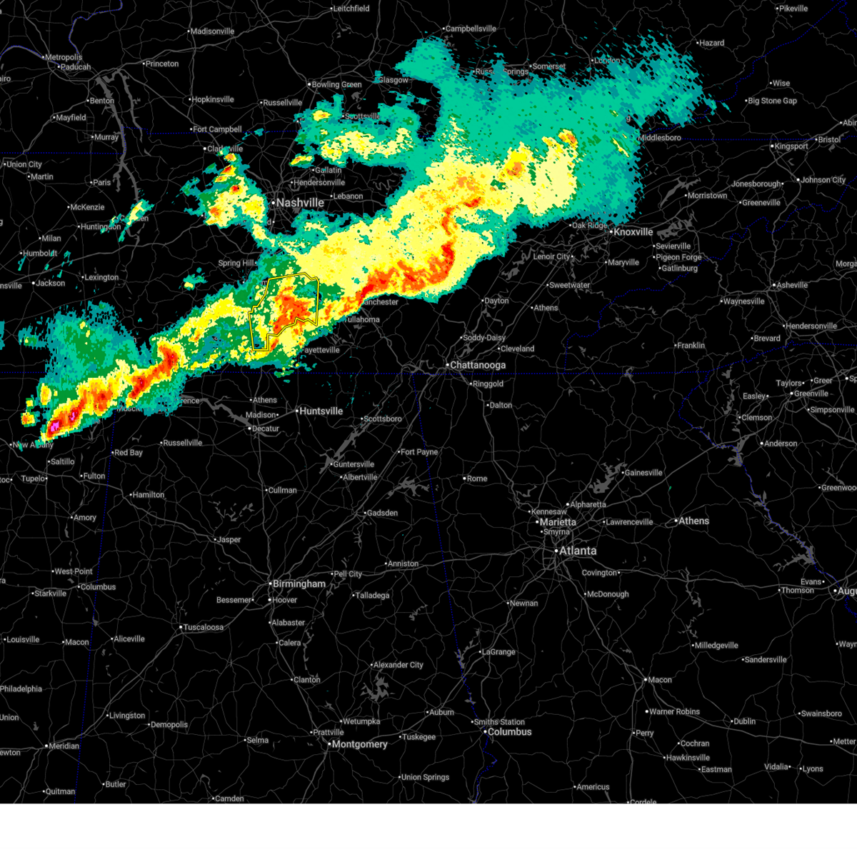
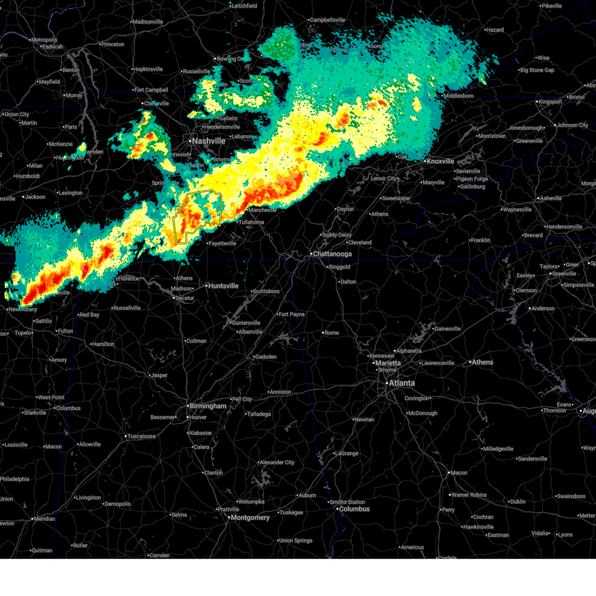
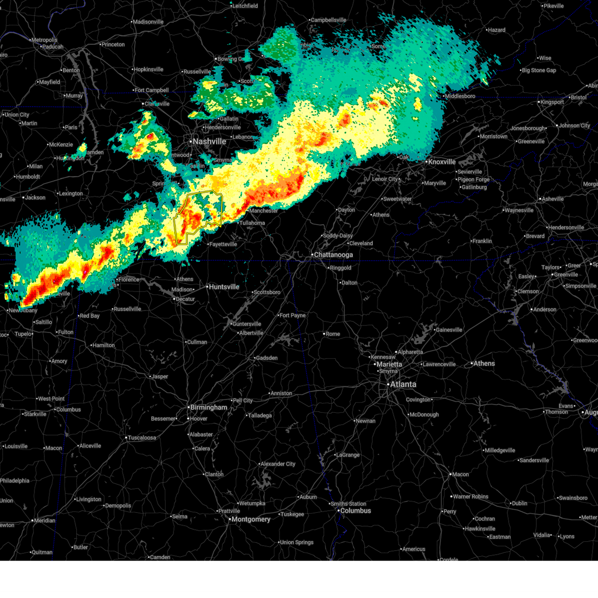
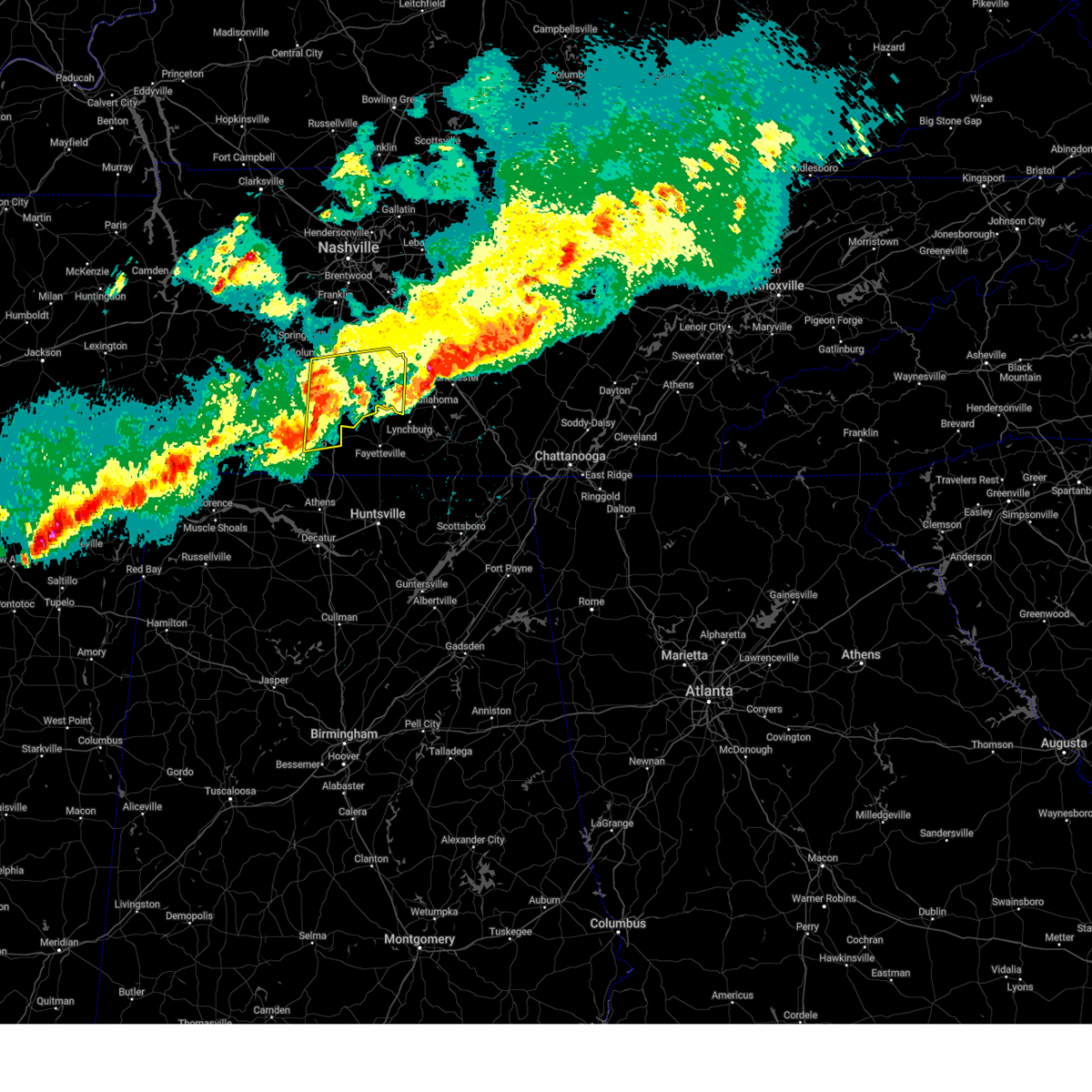
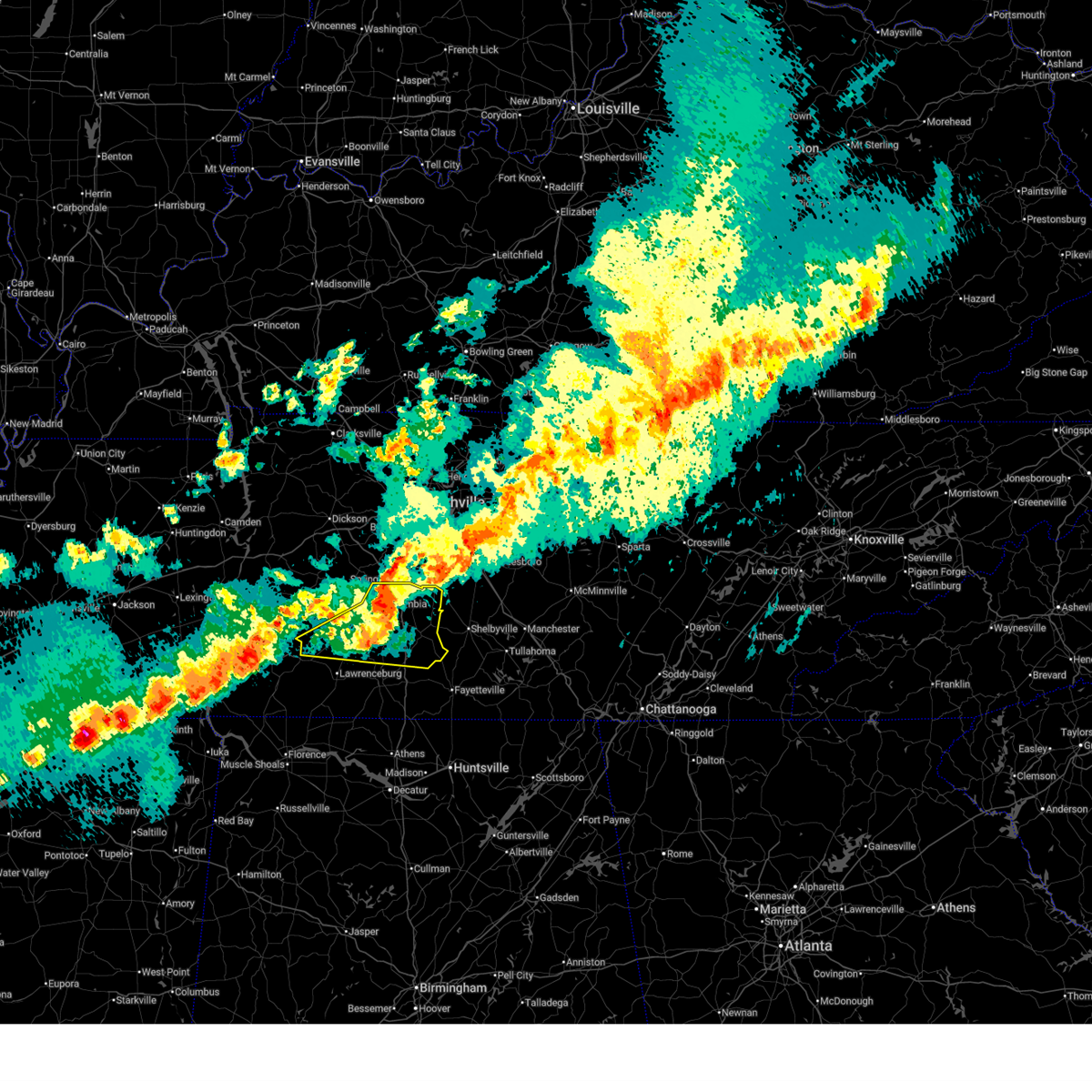
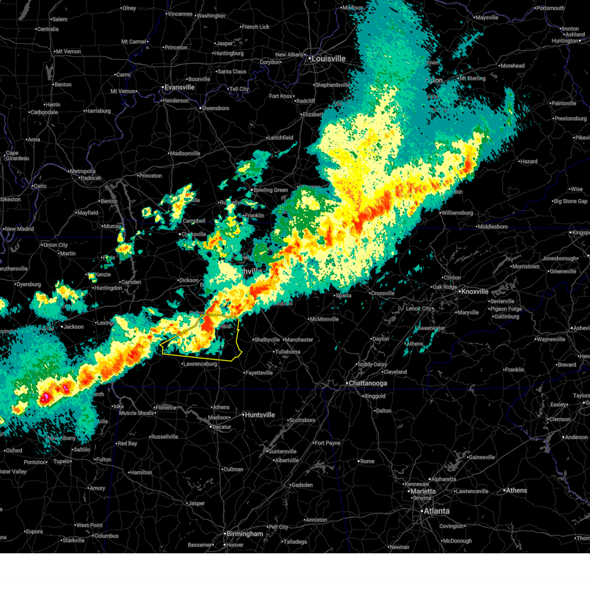
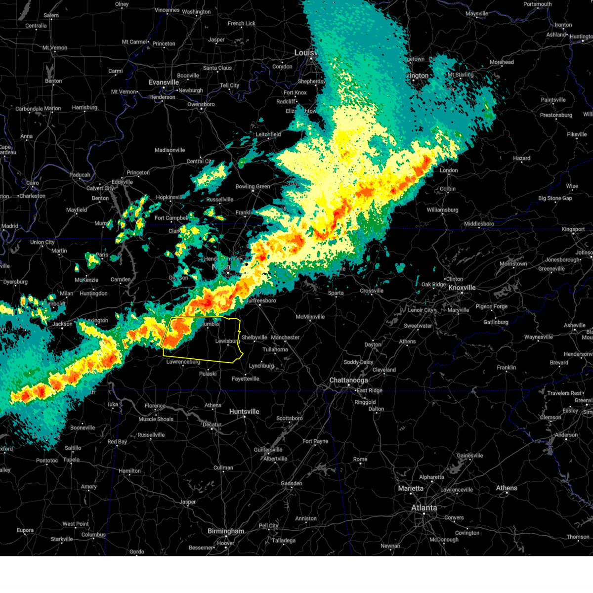
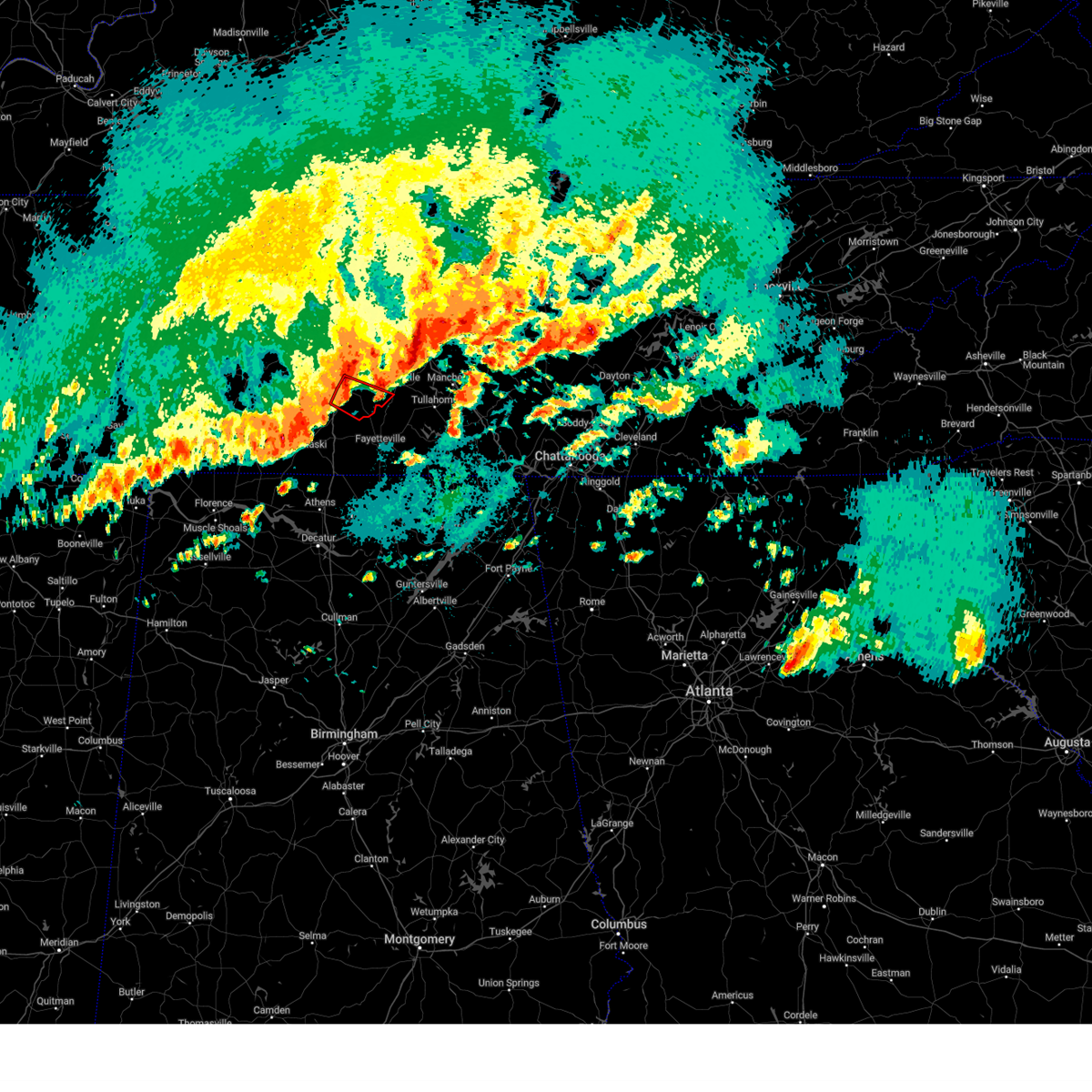
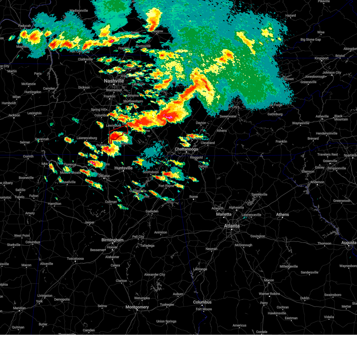
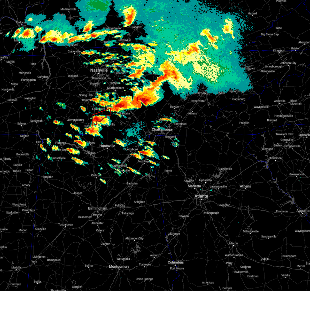
Hail Map for Lewisburg, TN
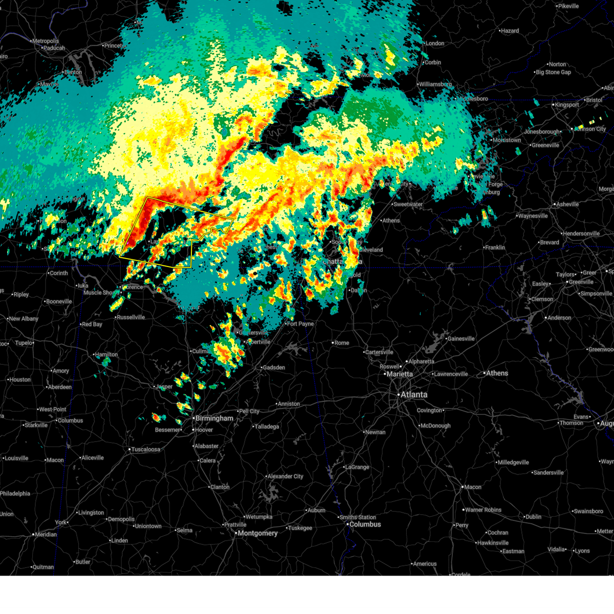
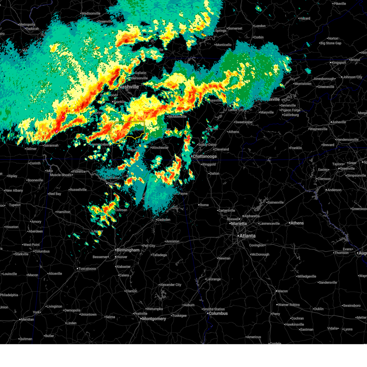
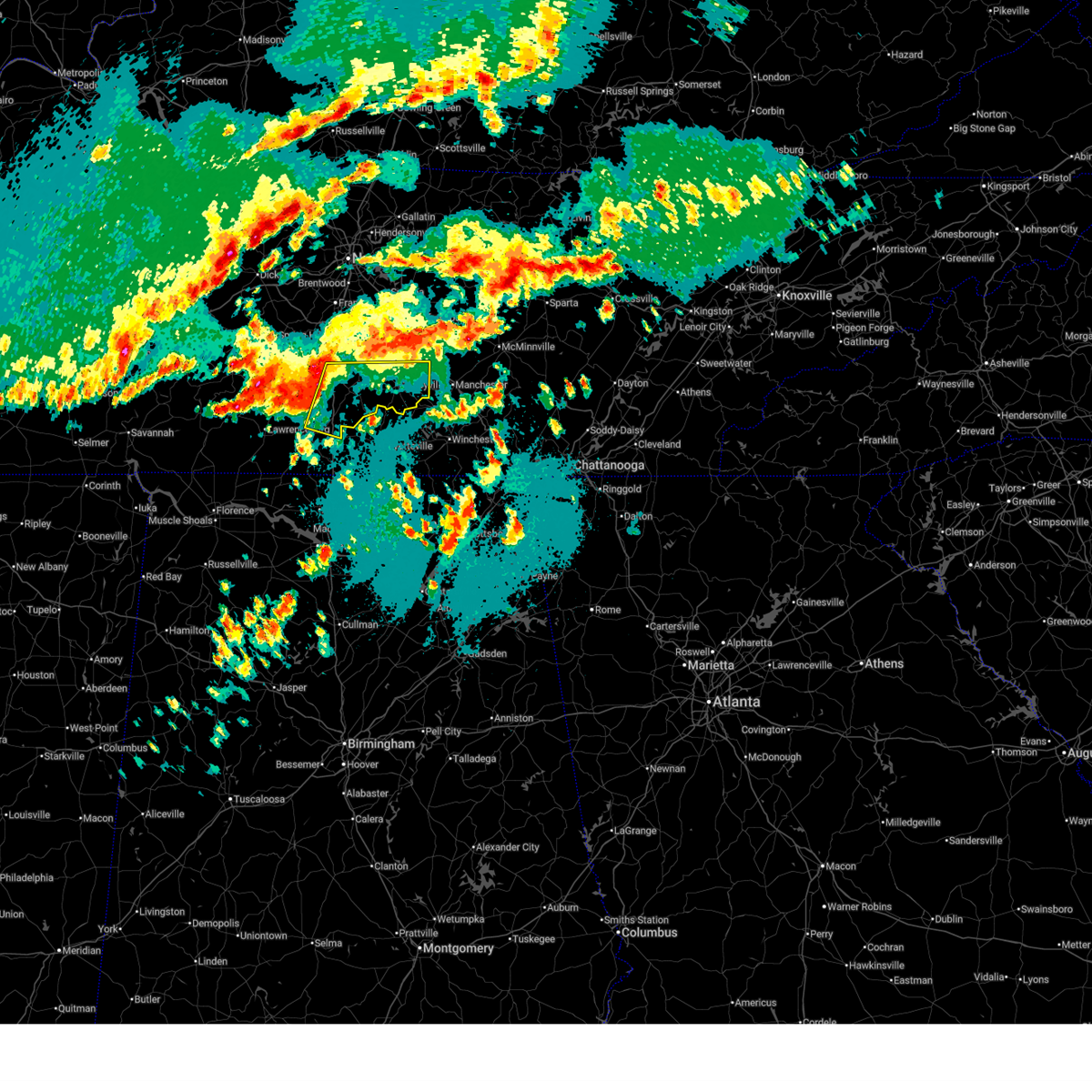
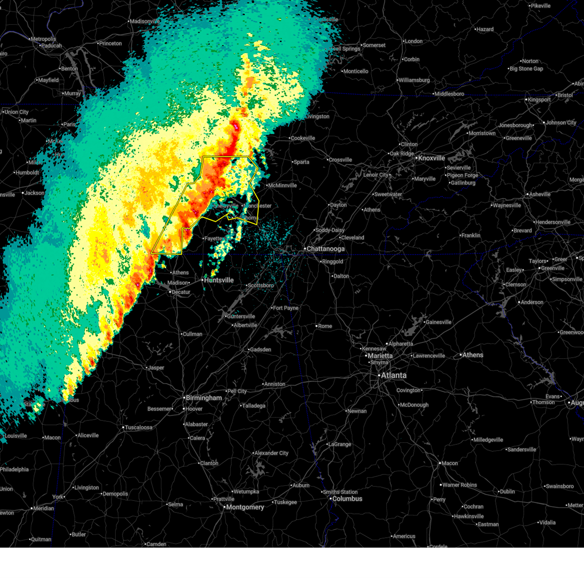
The Lewisburg, TN area has had 9 reports of on-the-ground hail by trained spotters, and has been under severe weather warnings 13 times during the past 12 months. Doppler radar has detected hail at or near Lewisburg, TN on 64 occasions, including 4 occasions during the past year.
| Name: | Lewisburg, TN |
| Where Located: | 49.5 miles S of Nashville, TN |
| Map: | Google Map for Lewisburg, TN |
| Population: | 11100 |
| Housing Units: | 5031 |
| More Info: | Search Google for Lewisburg, TN |
2
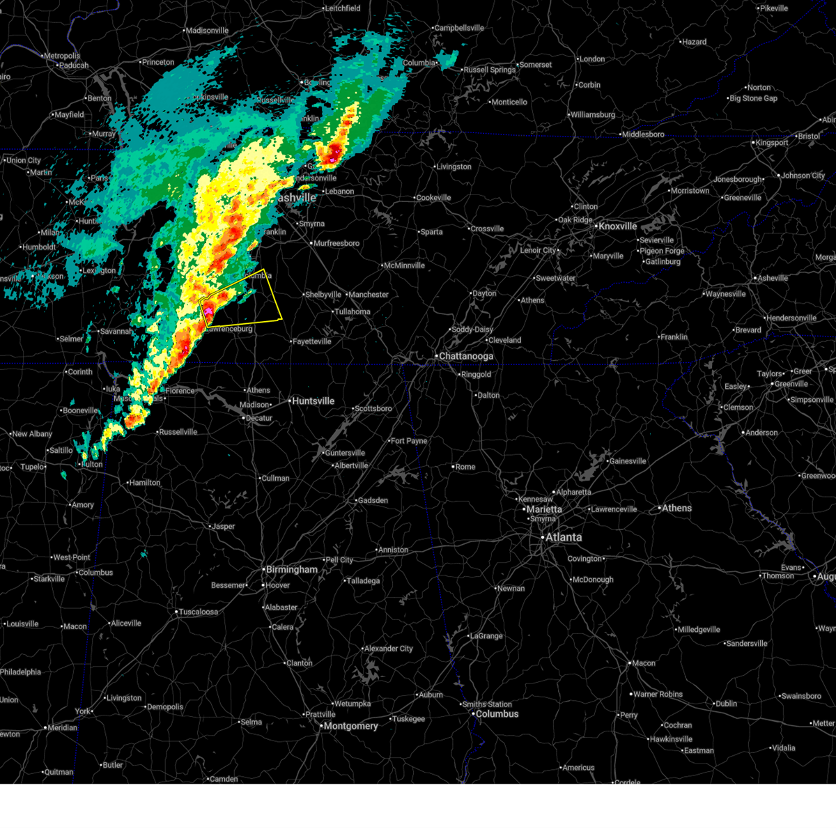
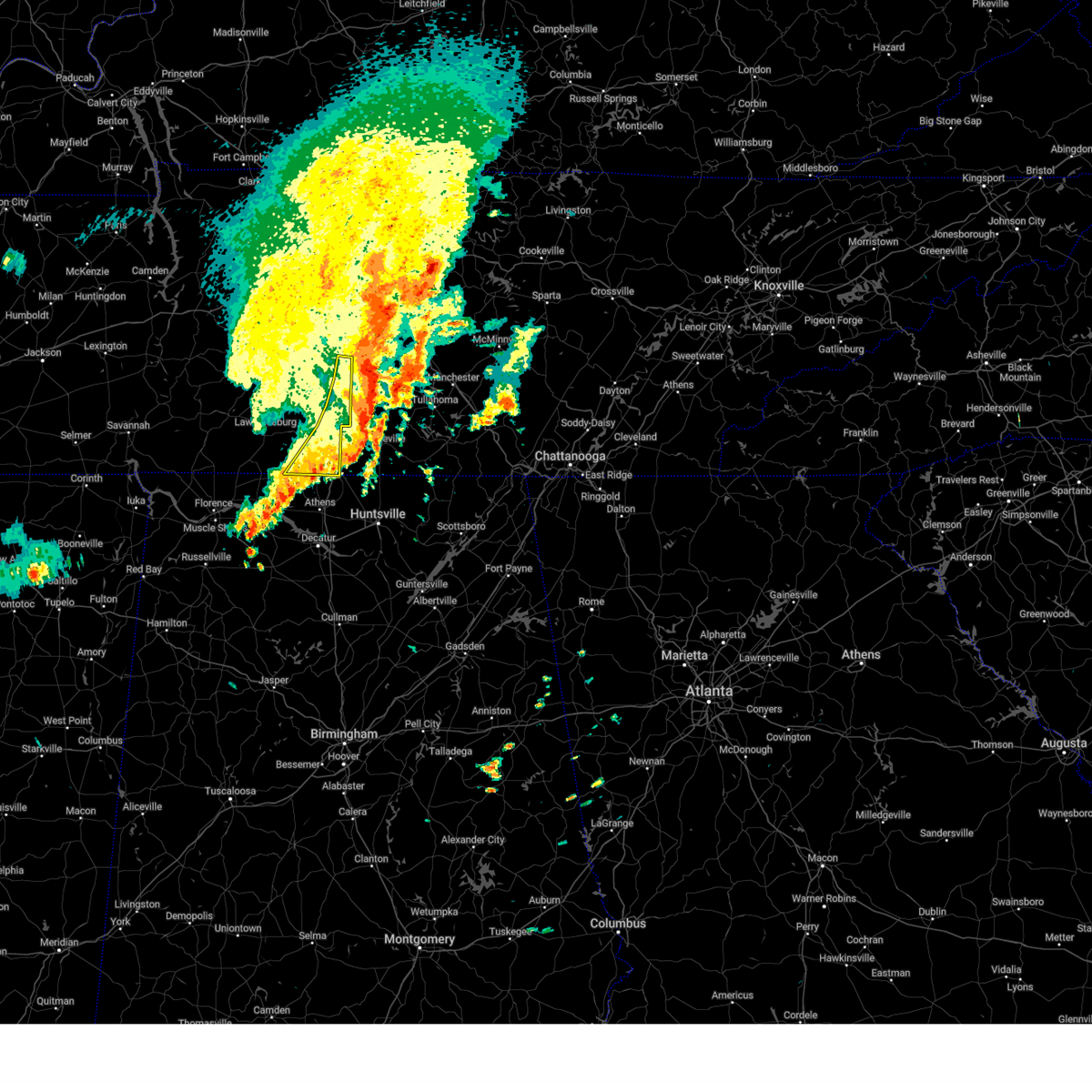
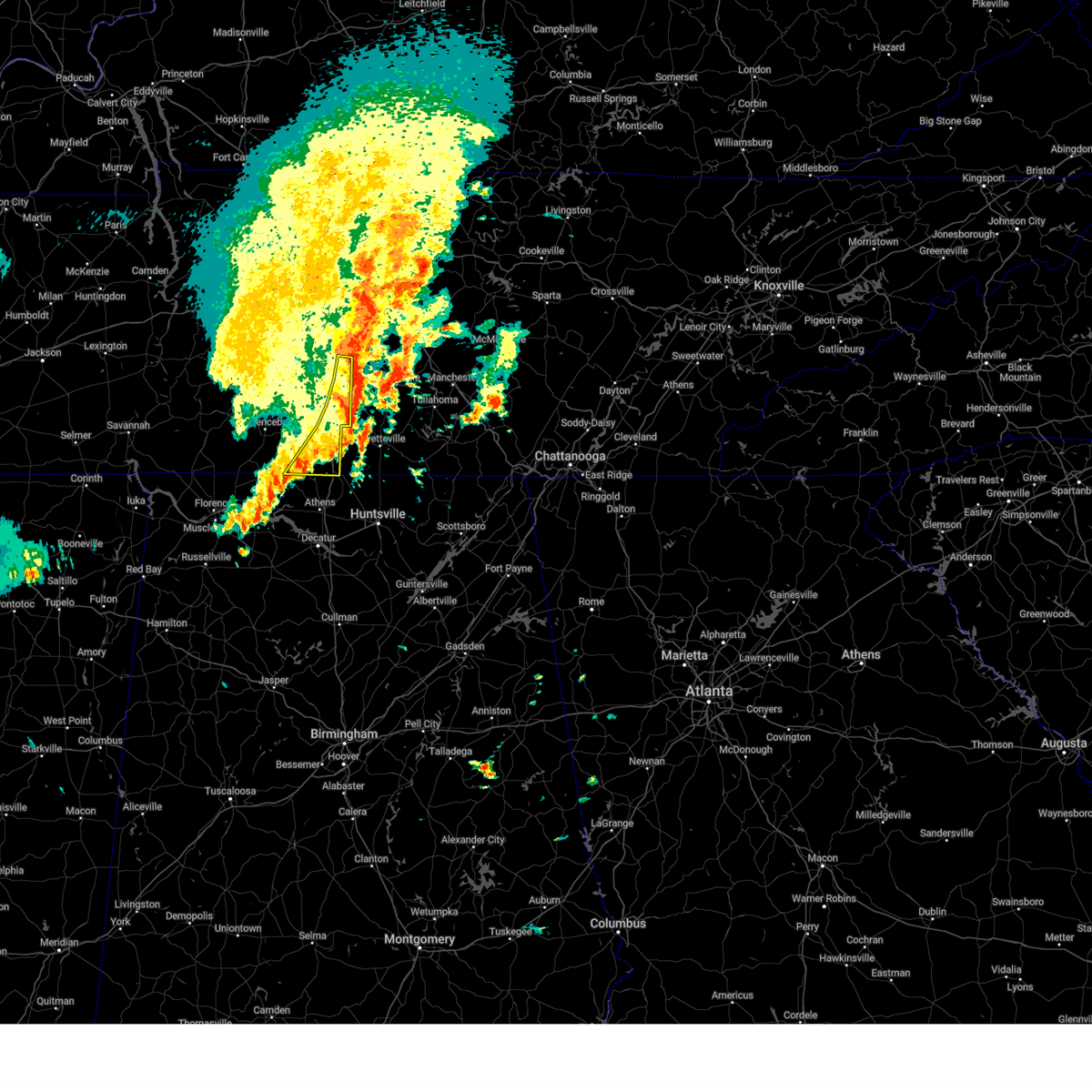
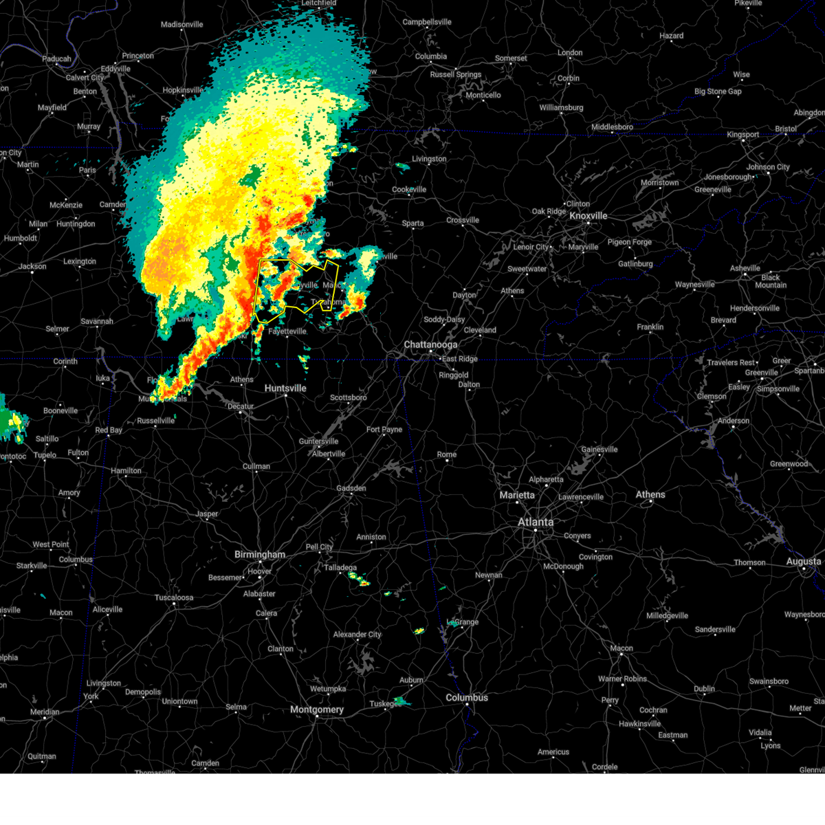
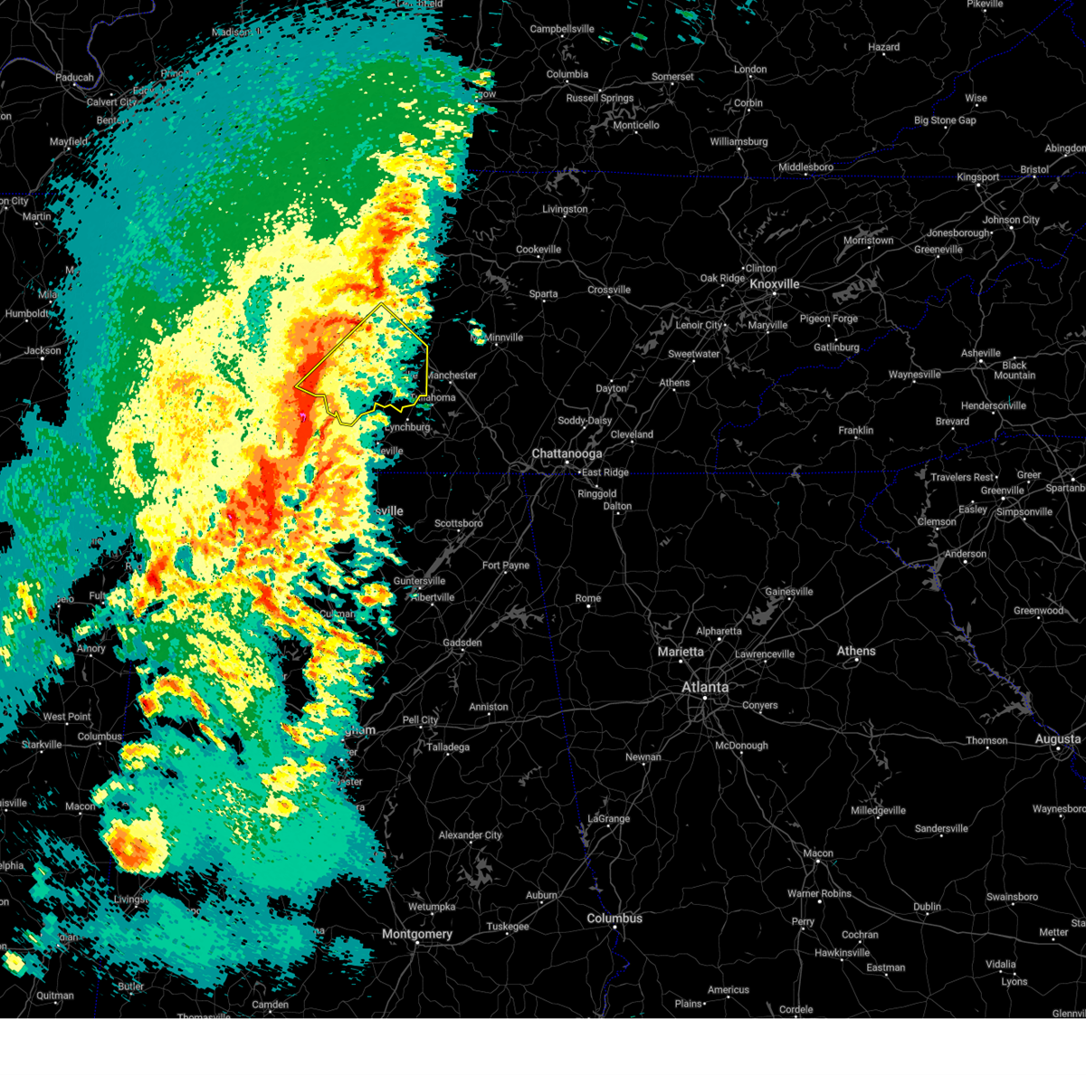
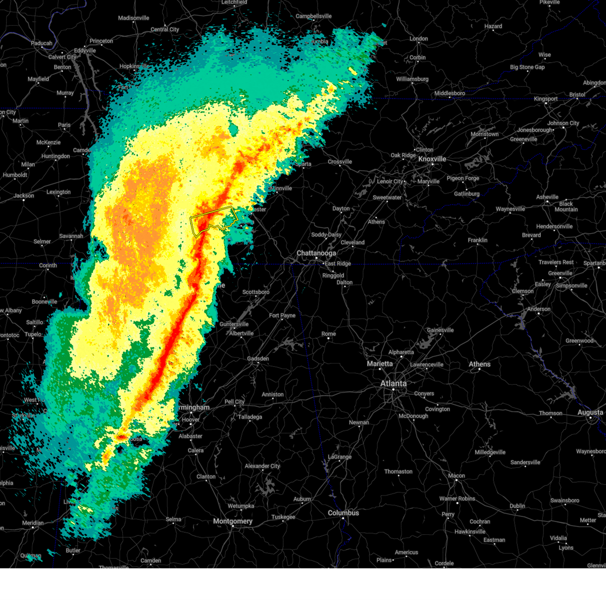
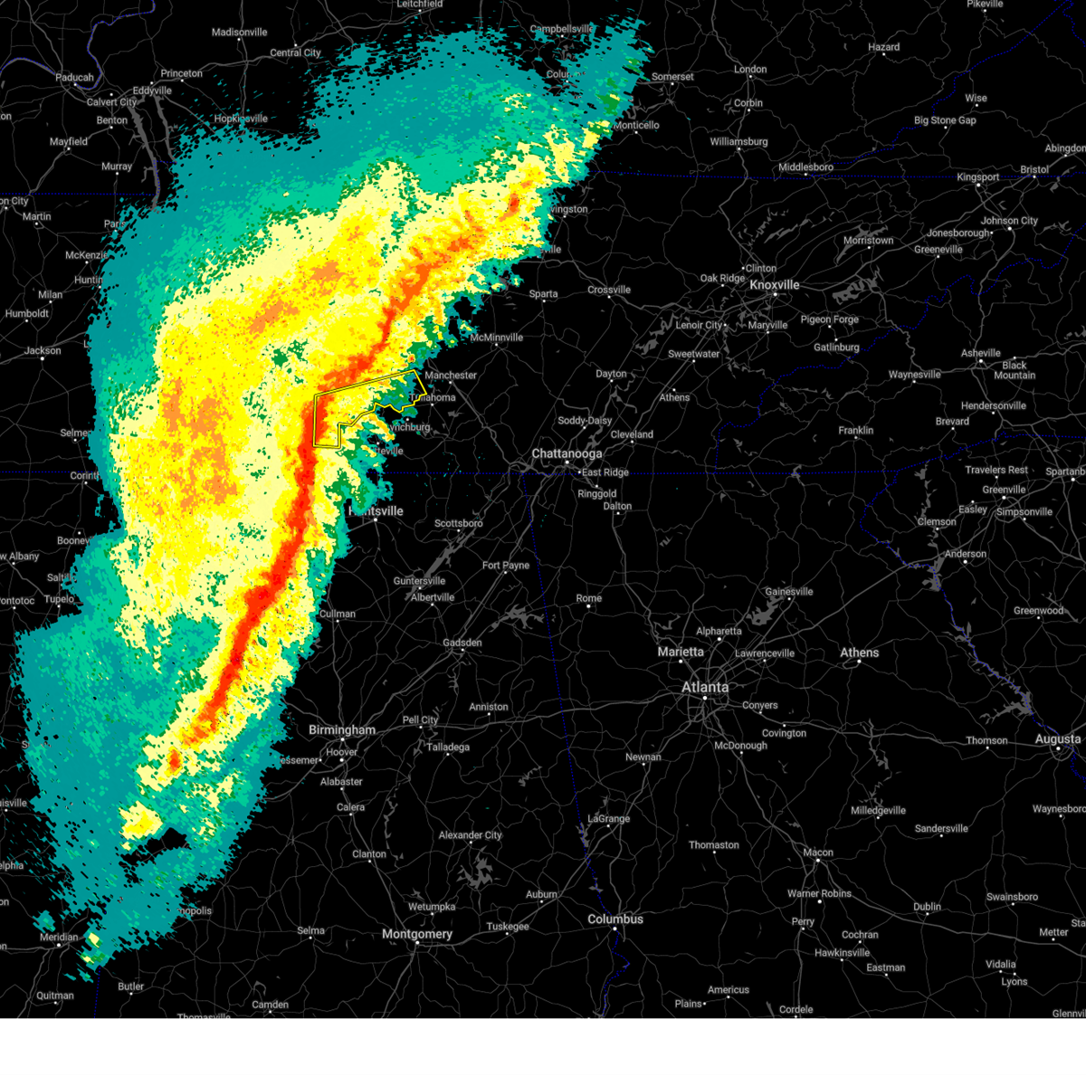
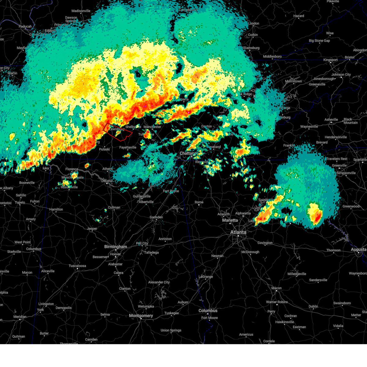
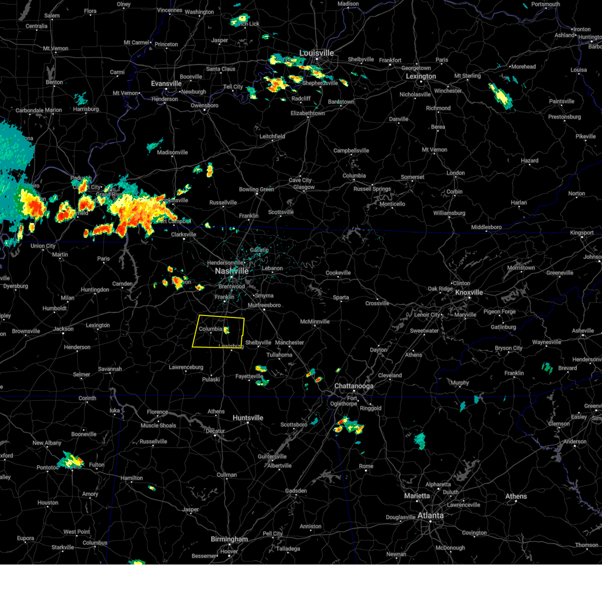
The Top Recent Hail Date for Lewisburg, TN is Wednesday, March 11, 2026 (7th out of 64)
Hail and Wind Damage Spotted near Lewisburg, TN
| Date / Time | Report Details |
|---|---|
| 6/1/2026 11:02 AM CDT |
 At 1102 am cdt, a severe thunderstorm was located over petersburg, or 11 miles north of fayetteville, moving southeast at 35 mph (radar indicated). Hazards include 60 mph wind gusts and half dollar size hail. Hail damage to vehicles is expected. expect wind damage to roofs, siding, and trees. locations impacted include, lewisburg, cornersville, and belfast. This includes interstate 65 between mile markers 19 and 24. At 1102 am cdt, a severe thunderstorm was located over petersburg, or 11 miles north of fayetteville, moving southeast at 35 mph (radar indicated). Hazards include 60 mph wind gusts and half dollar size hail. Hail damage to vehicles is expected. expect wind damage to roofs, siding, and trees. locations impacted include, lewisburg, cornersville, and belfast. This includes interstate 65 between mile markers 19 and 24.
|
| 6/1/2026 10:50 AM CDT |
 At 1050 am cdt, a severe thunderstorm was located near petersburg, or near lewisburg, moving southeast at 35 mph (radar indicated). Hazards include 60 mph wind gusts and quarter size hail. Hail damage to vehicles is expected. expect wind damage to roofs, siding, and trees. locations impacted include, lewisburg, cornersville, lynnville, and belfast. This includes interstate 65 between mile markers 19 and 35. At 1050 am cdt, a severe thunderstorm was located near petersburg, or near lewisburg, moving southeast at 35 mph (radar indicated). Hazards include 60 mph wind gusts and quarter size hail. Hail damage to vehicles is expected. expect wind damage to roofs, siding, and trees. locations impacted include, lewisburg, cornersville, lynnville, and belfast. This includes interstate 65 between mile markers 19 and 35.
|
| 4/28/2026 3:46 AM CDT |
 At 346 am cdt, a severe thunderstorm was located 8 miles southwest of petersburg, or 12 miles northwest of fayetteville, moving east at 60 mph (radar indicated). Hazards include 60 mph wind gusts and penny size hail. Expect damage to roofs, siding, and trees. locations impacted include, shelbyville, lewisburg, pulaski, ardmore, cornersville, elkton, minor hill, lynnville, belfast, goodspring, frankewing, prospect, and farmington. This includes interstate 65 between mile markers 1 and 35. At 346 am cdt, a severe thunderstorm was located 8 miles southwest of petersburg, or 12 miles northwest of fayetteville, moving east at 60 mph (radar indicated). Hazards include 60 mph wind gusts and penny size hail. Expect damage to roofs, siding, and trees. locations impacted include, shelbyville, lewisburg, pulaski, ardmore, cornersville, elkton, minor hill, lynnville, belfast, goodspring, frankewing, prospect, and farmington. This includes interstate 65 between mile markers 1 and 35.
|
| 4/28/2026 3:16 AM CDT |
 Svrohx the national weather service in nashville has issued a * severe thunderstorm warning for, eastern lewis county in middle tennessee, southeastern wayne county in middle tennessee, marshall county in middle tennessee, lawrence county in middle tennessee, southern maury county in middle tennessee, giles county in middle tennessee, southwestern bedford county in middle tennessee, * until 400 am cdt. * at 316 am cdt, a severe thunderstorm was located near lawrenceburg, moving east at 60 mph (radar indicated). Hazards include 60 mph wind gusts and penny size hail. expect damage to roofs, siding, and trees Svrohx the national weather service in nashville has issued a * severe thunderstorm warning for, eastern lewis county in middle tennessee, southeastern wayne county in middle tennessee, marshall county in middle tennessee, lawrence county in middle tennessee, southern maury county in middle tennessee, giles county in middle tennessee, southwestern bedford county in middle tennessee, * until 400 am cdt. * at 316 am cdt, a severe thunderstorm was located near lawrenceburg, moving east at 60 mph (radar indicated). Hazards include 60 mph wind gusts and penny size hail. expect damage to roofs, siding, and trees
|
| 4/28/2026 2:37 AM CDT |
 At 237 am cdt, a severe thunderstorm was located near shelbyville, moving east at 50 mph (radar indicated). Hazards include 60 mph wind gusts and penny size hail. Expect damage to roofs, siding, and trees. locations impacted include, shelbyville, lewisburg, cornersville, wartrace, bell buckle, normandy, belfast, deason, raus, and farmington. this includes the following highways, interstate 65 between mile markers 23 and 36. Interstate 24 near mile marker 98. At 237 am cdt, a severe thunderstorm was located near shelbyville, moving east at 50 mph (radar indicated). Hazards include 60 mph wind gusts and penny size hail. Expect damage to roofs, siding, and trees. locations impacted include, shelbyville, lewisburg, cornersville, wartrace, bell buckle, normandy, belfast, deason, raus, and farmington. this includes the following highways, interstate 65 between mile markers 23 and 36. Interstate 24 near mile marker 98.
|
| 4/28/2026 2:06 AM CDT |
 Svrohx the national weather service in nashville has issued a * severe thunderstorm warning for, marshall county in middle tennessee, southeastern maury county in middle tennessee, northeastern giles county in middle tennessee, bedford county in middle tennessee, * until 300 am cdt. * at 206 am cdt, a severe thunderstorm was located 7 miles west of lewisburg, moving east at 50 mph (radar indicated). Hazards include 70 mph wind gusts and penny size hail. Expect considerable tree damage. Damage is likely to mobile homes, roofs, and outbuildings. Svrohx the national weather service in nashville has issued a * severe thunderstorm warning for, marshall county in middle tennessee, southeastern maury county in middle tennessee, northeastern giles county in middle tennessee, bedford county in middle tennessee, * until 300 am cdt. * at 206 am cdt, a severe thunderstorm was located 7 miles west of lewisburg, moving east at 50 mph (radar indicated). Hazards include 70 mph wind gusts and penny size hail. Expect considerable tree damage. Damage is likely to mobile homes, roofs, and outbuildings.
|
| 3/15/2026 11:33 PM CDT |
 At 1133 pm cdt, severe thunderstorms were located along a line extending from 8 miles east of walterhill to ardmore, moving east at 50 mph (radar indicated). Hazards include 70 mph wind gusts. Expect considerable tree damage. damage is likely to mobile homes, roofs, and outbuildings. locations impacted include, murfreesboro, shelbyville, lewisburg, manchester, pulaski, woodbury, smyrna, tullahoma, walterhill, chapel hill, ardmore, cornersville, morrison, wartrace, eagleville, elkton, minor hill, bell buckle, auburntown, and normandy. this includes the following highways, interstate 65 between mile markers 1 and 36. interstate 24 between mile markers 67 and 127. Interstate 840 between mile markers 46 and 60. At 1133 pm cdt, severe thunderstorms were located along a line extending from 8 miles east of walterhill to ardmore, moving east at 50 mph (radar indicated). Hazards include 70 mph wind gusts. Expect considerable tree damage. damage is likely to mobile homes, roofs, and outbuildings. locations impacted include, murfreesboro, shelbyville, lewisburg, manchester, pulaski, woodbury, smyrna, tullahoma, walterhill, chapel hill, ardmore, cornersville, morrison, wartrace, eagleville, elkton, minor hill, bell buckle, auburntown, and normandy. this includes the following highways, interstate 65 between mile markers 1 and 36. interstate 24 between mile markers 67 and 127. Interstate 840 between mile markers 46 and 60.
|
| 3/15/2026 11:33 PM CDT |
 the severe thunderstorm warning has been cancelled and is no longer in effect the severe thunderstorm warning has been cancelled and is no longer in effect
|
| 3/15/2026 11:03 PM CDT |
 Svrohx the national weather service in nashville has issued a * severe thunderstorm warning for, marshall county in middle tennessee, rutherford county in middle tennessee, eastern maury county in middle tennessee, eastern williamson county in middle tennessee, coffee county in middle tennessee, giles county in middle tennessee, southeastern wilson county in middle tennessee, bedford county in middle tennessee, cannon county in middle tennessee, * until 1145 pm cdt. * at 1103 pm cdt, severe thunderstorms were located along a line extending from near nolensville to 8 miles northeast of rogersville, moving east at 75 mph (radar indicated). Hazards include 70 mph wind gusts. Expect considerable tree damage. Damage is likely to mobile homes, roofs, and outbuildings. Svrohx the national weather service in nashville has issued a * severe thunderstorm warning for, marshall county in middle tennessee, rutherford county in middle tennessee, eastern maury county in middle tennessee, eastern williamson county in middle tennessee, coffee county in middle tennessee, giles county in middle tennessee, southeastern wilson county in middle tennessee, bedford county in middle tennessee, cannon county in middle tennessee, * until 1145 pm cdt. * at 1103 pm cdt, severe thunderstorms were located along a line extending from near nolensville to 8 miles northeast of rogersville, moving east at 75 mph (radar indicated). Hazards include 70 mph wind gusts. Expect considerable tree damage. Damage is likely to mobile homes, roofs, and outbuildings.
|
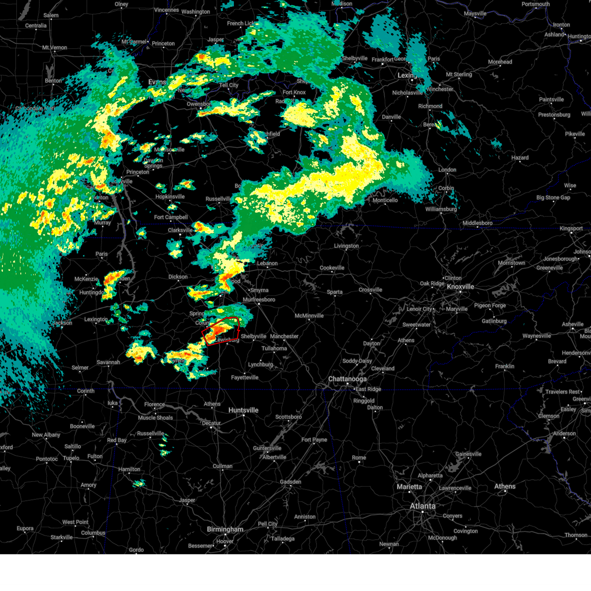
| 3/11/2026 3:30 PM CDT | Multiple trees snapped and blown over in yar in marshall county TN, 5.7 miles WNW of Lewisburg, TN |
| 3/11/2026 3:24 PM CDT |
 Svrohx the national weather service in nashville has issued a * severe thunderstorm warning for, marshall county in middle tennessee, southern rutherford county in middle tennessee, bedford county in middle tennessee, * until 430 pm cdt. * at 322 pm cdt, a severe thunderstorm was located near lewisburg, moving east at 35 mph (radar indicated). Hazards include 60 mph wind gusts and quarter size hail. Hail damage to vehicles is expected. Expect wind damage to roofs, siding, and trees. Svrohx the national weather service in nashville has issued a * severe thunderstorm warning for, marshall county in middle tennessee, southern rutherford county in middle tennessee, bedford county in middle tennessee, * until 430 pm cdt. * at 322 pm cdt, a severe thunderstorm was located near lewisburg, moving east at 35 mph (radar indicated). Hazards include 60 mph wind gusts and quarter size hail. Hail damage to vehicles is expected. Expect wind damage to roofs, siding, and trees.
|
| 3/11/2026 3:10 PM CDT |
 the severe thunderstorm warning has been cancelled and is no longer in effect the severe thunderstorm warning has been cancelled and is no longer in effect
|
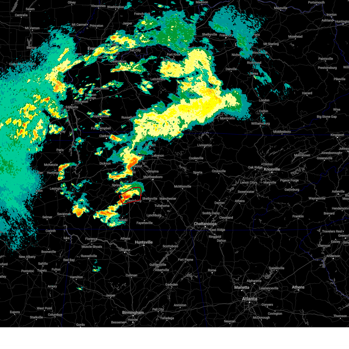
| 3/11/2026 3:10 PM CDT |
 At 309 pm cdt, a severe thunderstorm was located 9 miles west of lewisburg, moving northeast at 40 mph (radar indicated). Hazards include 60 mph wind gusts and quarter size hail. Hail damage to vehicles is expected. expect wind damage to roofs, siding, and trees. locations impacted include, lewisburg, cornersville, lynnville, belfast, and culleoka. This includes interstate 65 between mile markers 21 and 44. At 309 pm cdt, a severe thunderstorm was located 9 miles west of lewisburg, moving northeast at 40 mph (radar indicated). Hazards include 60 mph wind gusts and quarter size hail. Hail damage to vehicles is expected. expect wind damage to roofs, siding, and trees. locations impacted include, lewisburg, cornersville, lynnville, belfast, and culleoka. This includes interstate 65 between mile markers 21 and 44.
|
| 3/11/2026 2:44 PM CDT |
 Svrohx the national weather service in nashville has issued a * severe thunderstorm warning for, southwestern marshall county in middle tennessee, northeastern lawrence county in middle tennessee, southern maury county in middle tennessee, northern giles county in middle tennessee, * until 330 pm cdt. * at 243 pm cdt, a severe thunderstorm was located near summertown, or 10 miles northeast of lawrenceburg, moving east at 40 mph (radar indicated). Hazards include 60 mph wind gusts and quarter size hail. Hail damage to vehicles is expected. Expect wind damage to roofs, siding, and trees. Svrohx the national weather service in nashville has issued a * severe thunderstorm warning for, southwestern marshall county in middle tennessee, northeastern lawrence county in middle tennessee, southern maury county in middle tennessee, northern giles county in middle tennessee, * until 330 pm cdt. * at 243 pm cdt, a severe thunderstorm was located near summertown, or 10 miles northeast of lawrenceburg, moving east at 40 mph (radar indicated). Hazards include 60 mph wind gusts and quarter size hail. Hail damage to vehicles is expected. Expect wind damage to roofs, siding, and trees.
|
| 5/25/2025 3:40 PM CDT |
 The storms which prompted the warning have moved out of the area. therefore, the warning will be allowed to expire. The storms which prompted the warning have moved out of the area. therefore, the warning will be allowed to expire.
|
| 5/25/2025 3:30 PM CDT |
 the severe thunderstorm warning has been cancelled and is no longer in effect the severe thunderstorm warning has been cancelled and is no longer in effect
|
| 5/25/2025 3:30 PM CDT |
 At 329 pm cdt, severe thunderstorms were located along a line extending from 13 miles southeast of spring hill to 9 miles south of lewisburg to 7 miles southeast of pulaski, moving east at 45 mph (radar indicated). Hazards include 60 mph wind gusts. Expect damage to roofs, siding, and trees. locations impacted include, lewisburg, pulaski, ardmore, cornersville, elkton, minor hill, frankewing, and prospect. This includes interstate 65 between mile markers 1 and 34. At 329 pm cdt, severe thunderstorms were located along a line extending from 13 miles southeast of spring hill to 9 miles south of lewisburg to 7 miles southeast of pulaski, moving east at 45 mph (radar indicated). Hazards include 60 mph wind gusts. Expect damage to roofs, siding, and trees. locations impacted include, lewisburg, pulaski, ardmore, cornersville, elkton, minor hill, frankewing, and prospect. This includes interstate 65 between mile markers 1 and 34.
|
| 5/25/2025 3:24 PM CDT | A couple trees down and a few power outages reported mainly on the south and southwest outskirts of lewisbur in marshall county TN, 1.5 miles E of Lewisburg, TN |
| 5/25/2025 3:24 PM CDT |
 Svrohx the national weather service in nashville has issued a * severe thunderstorm warning for, marshall county in middle tennessee, western coffee county in middle tennessee, bedford county in middle tennessee, * until 415 pm cdt. * at 323 pm cdt, severe thunderstorms were located along a line extending from 9 miles east of spring hill to 11 miles southwest of petersburg, moving east at 45 mph (radar indicated). Hazards include 60 mph wind gusts. expect damage to roofs, siding, and trees Svrohx the national weather service in nashville has issued a * severe thunderstorm warning for, marshall county in middle tennessee, western coffee county in middle tennessee, bedford county in middle tennessee, * until 415 pm cdt. * at 323 pm cdt, severe thunderstorms were located along a line extending from 9 miles east of spring hill to 11 miles southwest of petersburg, moving east at 45 mph (radar indicated). Hazards include 60 mph wind gusts. expect damage to roofs, siding, and trees
|
| 5/25/2025 3:10 PM CDT |
 the severe thunderstorm warning has been cancelled and is no longer in effect the severe thunderstorm warning has been cancelled and is no longer in effect
|
| 5/25/2025 3:10 PM CDT |
 At 309 pm cdt, severe thunderstorms were located along a line extending from near columbia to 10 miles north of pulaski to near st. florian, moving east at 45 mph (radar indicated). Hazards include 60 mph wind gusts. Expect damage to roofs, siding, and trees. locations impacted include, columbia, lewisburg, lawrenceburg, pulaski, mount pleasant, loretto, ardmore, cornersville, st. joseph, elkton, minor hill, ethridge, lynnville, culleoka, i-65 east of columbia, goodspring, leoma, frankewing, and prospect. This includes interstate 65 between mile markers 1 and 46. At 309 pm cdt, severe thunderstorms were located along a line extending from near columbia to 10 miles north of pulaski to near st. florian, moving east at 45 mph (radar indicated). Hazards include 60 mph wind gusts. Expect damage to roofs, siding, and trees. locations impacted include, columbia, lewisburg, lawrenceburg, pulaski, mount pleasant, loretto, ardmore, cornersville, st. joseph, elkton, minor hill, ethridge, lynnville, culleoka, i-65 east of columbia, goodspring, leoma, frankewing, and prospect. This includes interstate 65 between mile markers 1 and 46.
|
| 5/25/2025 2:57 PM CDT |
 Svrohx the national weather service in nashville has issued a * severe thunderstorm warning for, southeastern wayne county in middle tennessee, western marshall county in middle tennessee, lawrence county in middle tennessee, southern maury county in middle tennessee, giles county in middle tennessee, * until 345 pm cdt. * at 256 pm cdt, severe thunderstorms were located along a line extending from 6 miles southeast of summertown to near underwood-petersville, moving east at 45 mph (radar indicated). Hazards include 60 mph wind gusts. expect damage to roofs, siding, and trees Svrohx the national weather service in nashville has issued a * severe thunderstorm warning for, southeastern wayne county in middle tennessee, western marshall county in middle tennessee, lawrence county in middle tennessee, southern maury county in middle tennessee, giles county in middle tennessee, * until 345 pm cdt. * at 256 pm cdt, severe thunderstorms were located along a line extending from 6 miles southeast of summertown to near underwood-petersville, moving east at 45 mph (radar indicated). Hazards include 60 mph wind gusts. expect damage to roofs, siding, and trees
|
| 5/20/2025 1:17 PM CDT | Delayed report. emergency manager reports of damage in chapel hill. possible tornado. time estimated from rada in marshall county TN, 4.9 miles S of Lewisburg, TN |
| 5/8/2025 4:29 PM CDT |
 the severe thunderstorm warning has been cancelled and is no longer in effect the severe thunderstorm warning has been cancelled and is no longer in effect
|
| 5/8/2025 4:02 PM CDT |
 Svrohx the national weather service in nashville has issued a * severe thunderstorm warning for, central marshall county in middle tennessee, southeastern maury county in middle tennessee, western bedford county in middle tennessee, * until 445 pm cdt. * at 401 pm cdt, a severe thunderstorm was located 9 miles west of lewisburg, moving east at 25 mph (radar indicated). Hazards include 60 mph wind gusts and quarter size hail. Hail damage to vehicles is expected. Expect wind damage to roofs, siding, and trees. Svrohx the national weather service in nashville has issued a * severe thunderstorm warning for, central marshall county in middle tennessee, southeastern maury county in middle tennessee, western bedford county in middle tennessee, * until 445 pm cdt. * at 401 pm cdt, a severe thunderstorm was located 9 miles west of lewisburg, moving east at 25 mph (radar indicated). Hazards include 60 mph wind gusts and quarter size hail. Hail damage to vehicles is expected. Expect wind damage to roofs, siding, and trees.
|
| 5/8/2025 4:02 PM CDT |
 At 402 pm cdt, a severe thunderstorm was located 10 miles west of lewisburg, moving east at 25 mph (radar indicated). Hazards include 60 mph wind gusts and quarter size hail. Hail damage to vehicles is expected. expect wind damage to roofs, siding, and trees. locations impacted include, lynnville and culleoka. This includes interstate 65 between mile markers 27 and 39. At 402 pm cdt, a severe thunderstorm was located 10 miles west of lewisburg, moving east at 25 mph (radar indicated). Hazards include 60 mph wind gusts and quarter size hail. Hail damage to vehicles is expected. expect wind damage to roofs, siding, and trees. locations impacted include, lynnville and culleoka. This includes interstate 65 between mile markers 27 and 39.
|
| 5/8/2025 3:52 PM CDT |
 the severe thunderstorm warning has been cancelled and is no longer in effect the severe thunderstorm warning has been cancelled and is no longer in effect
|
| 5/8/2025 3:52 PM CDT |
 At 351 pm cdt, a severe thunderstorm was located 9 miles southeast of mount pleasant, or 11 miles south of columbia, moving east at 25 mph (radar indicated). Hazards include 60 mph wind gusts and quarter size hail. Hail damage to vehicles is expected. expect wind damage to roofs, siding, and trees. locations impacted include, lynnville, culleoka, and columbia. This includes interstate 65 between mile markers 27 and 44. At 351 pm cdt, a severe thunderstorm was located 9 miles southeast of mount pleasant, or 11 miles south of columbia, moving east at 25 mph (radar indicated). Hazards include 60 mph wind gusts and quarter size hail. Hail damage to vehicles is expected. expect wind damage to roofs, siding, and trees. locations impacted include, lynnville, culleoka, and columbia. This includes interstate 65 between mile markers 27 and 44.
|
| 5/8/2025 3:26 PM CDT |
 Svrohx the national weather service in nashville has issued a * severe thunderstorm warning for, west central marshall county in middle tennessee, northeastern lawrence county in middle tennessee, southern maury county in middle tennessee, northwestern giles county in middle tennessee, * until 415 pm cdt. * at 326 pm cdt, a severe thunderstorm was located near summertown, or 15 miles north of lawrenceburg, moving east at 20 mph (radar indicated). Hazards include 60 mph wind gusts and quarter size hail. Hail damage to vehicles is expected. Expect wind damage to roofs, siding, and trees. Svrohx the national weather service in nashville has issued a * severe thunderstorm warning for, west central marshall county in middle tennessee, northeastern lawrence county in middle tennessee, southern maury county in middle tennessee, northwestern giles county in middle tennessee, * until 415 pm cdt. * at 326 pm cdt, a severe thunderstorm was located near summertown, or 15 miles north of lawrenceburg, moving east at 20 mph (radar indicated). Hazards include 60 mph wind gusts and quarter size hail. Hail damage to vehicles is expected. Expect wind damage to roofs, siding, and trees.
|
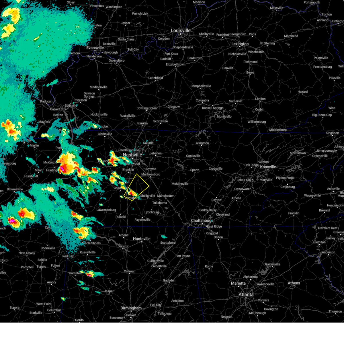
| 5/2/2025 1:18 PM CDT | Quarter sized hail reported 3.8 miles E of Lewisburg, TN, quarter size hail reported just west of lewisburg. |
| 5/2/2025 1:10 PM CDT |
 Svrohx the national weather service in nashville has issued a * severe thunderstorm warning for, central marshall county in middle tennessee, southwestern rutherford county in middle tennessee, northeastern lawrence county in middle tennessee, maury county in middle tennessee, southeastern williamson county in middle tennessee, northwestern giles county in middle tennessee, * until 145 pm cdt. * at 109 pm cdt, a severe thunderstorm was located 8 miles west of lewisburg, moving northeast at 35 mph (radar indicated). Hazards include 60 mph wind gusts and quarter size hail. Hail damage to vehicles is expected. Expect wind damage to roofs, siding, and trees. Svrohx the national weather service in nashville has issued a * severe thunderstorm warning for, central marshall county in middle tennessee, southwestern rutherford county in middle tennessee, northeastern lawrence county in middle tennessee, maury county in middle tennessee, southeastern williamson county in middle tennessee, northwestern giles county in middle tennessee, * until 145 pm cdt. * at 109 pm cdt, a severe thunderstorm was located 8 miles west of lewisburg, moving northeast at 35 mph (radar indicated). Hazards include 60 mph wind gusts and quarter size hail. Hail damage to vehicles is expected. Expect wind damage to roofs, siding, and trees.
|
| 4/10/2025 5:47 PM CDT |
 the severe thunderstorm warning has been cancelled and is no longer in effect the severe thunderstorm warning has been cancelled and is no longer in effect
|
| 4/10/2025 5:47 PM CDT |
 At 547 pm cdt, severe thunderstorms were located along a line extending from near columbia to near rogersville, moving southeast at 35 mph (emergency management). Hazards include 60 mph wind gusts. Expect damage to roofs, siding, and trees. locations impacted include, ethridge, mount pleasant, culleoka, minor hill, i-65 east of columbia, elkton, pulaski, goodspring, columbia, lynnville, frankewing, ardmore, cornersville, prospect, lewisburg, lawrenceburg, and spring hill. This includes interstate 65 between mile markers 1 and 50. At 547 pm cdt, severe thunderstorms were located along a line extending from near columbia to near rogersville, moving southeast at 35 mph (emergency management). Hazards include 60 mph wind gusts. Expect damage to roofs, siding, and trees. locations impacted include, ethridge, mount pleasant, culleoka, minor hill, i-65 east of columbia, elkton, pulaski, goodspring, columbia, lynnville, frankewing, ardmore, cornersville, prospect, lewisburg, lawrenceburg, and spring hill. This includes interstate 65 between mile markers 1 and 50.
|
| 4/10/2025 5:26 PM CDT |
 the severe thunderstorm warning has been cancelled and is no longer in effect the severe thunderstorm warning has been cancelled and is no longer in effect
|
| 4/10/2025 5:26 PM CDT |
 At 525 pm cdt, severe thunderstorms were located along a line extending from 8 miles northwest of mount pleasant to near lexington, moving southeast at 35 mph (radar indicated). Hazards include 60 mph wind gusts. Expect damage to roofs, siding, and trees. locations impacted include, gordonsburg, henryville, culleoka, st. joseph, pulaski, goodspring, leoma, lynnville, frankewing, hampshire, williamsport, loretto, ethridge, mount pleasant, minor hill, cypress inn, collinwood, i-65 east of columbia, elkton, and lawrenceburg. This includes interstate 65 between mile markers 1 and 52. At 525 pm cdt, severe thunderstorms were located along a line extending from 8 miles northwest of mount pleasant to near lexington, moving southeast at 35 mph (radar indicated). Hazards include 60 mph wind gusts. Expect damage to roofs, siding, and trees. locations impacted include, gordonsburg, henryville, culleoka, st. joseph, pulaski, goodspring, leoma, lynnville, frankewing, hampshire, williamsport, loretto, ethridge, mount pleasant, minor hill, cypress inn, collinwood, i-65 east of columbia, elkton, and lawrenceburg. This includes interstate 65 between mile markers 1 and 52.
|
| 4/10/2025 5:11 PM CDT |
 Svrohx the national weather service in nashville has issued a * severe thunderstorm warning for, lewis county in middle tennessee, eastern wayne county in middle tennessee, western marshall county in middle tennessee, lawrence county in middle tennessee, maury county in middle tennessee, giles county in middle tennessee, southern hickman county in middle tennessee, * until 600 pm cdt. * at 511 pm cdt, severe thunderstorms were located along a line extending from 6 miles southeast of centerville to 8 miles southwest of loretto, moving southeast at 35 mph (radar indicated). Hazards include 60 mph wind gusts. expect damage to roofs, siding, and trees Svrohx the national weather service in nashville has issued a * severe thunderstorm warning for, lewis county in middle tennessee, eastern wayne county in middle tennessee, western marshall county in middle tennessee, lawrence county in middle tennessee, maury county in middle tennessee, giles county in middle tennessee, southern hickman county in middle tennessee, * until 600 pm cdt. * at 511 pm cdt, severe thunderstorms were located along a line extending from 6 miles southeast of centerville to 8 miles southwest of loretto, moving southeast at 35 mph (radar indicated). Hazards include 60 mph wind gusts. expect damage to roofs, siding, and trees
|
| 4/5/2025 10:44 PM CDT |
 At 1044 pm cdt, severe thunderstorms were located along a line extending from 9 miles southwest of murfreesboro to 6 miles south of lewisburg, moving northeast at 55 mph (radar indicated). Hazards include 60 mph wind gusts and penny size hail. Expect damage to roofs, siding, and trees. locations impacted include, lascassas, christiana, murfreesboro, bell buckle, raus, lewisburg, fosterville, chapel hill, rover, belfast, eagleville, petersburg, deason, rockvale, shelbyville, cornersville, normandy, farmington, milton, and unionville. this includes the following highways, interstate 65 between mile markers 23 and 35. interstate 24 between mile markers 75 and 95. Interstate 840 between mile markers 45 and 53. At 1044 pm cdt, severe thunderstorms were located along a line extending from 9 miles southwest of murfreesboro to 6 miles south of lewisburg, moving northeast at 55 mph (radar indicated). Hazards include 60 mph wind gusts and penny size hail. Expect damage to roofs, siding, and trees. locations impacted include, lascassas, christiana, murfreesboro, bell buckle, raus, lewisburg, fosterville, chapel hill, rover, belfast, eagleville, petersburg, deason, rockvale, shelbyville, cornersville, normandy, farmington, milton, and unionville. this includes the following highways, interstate 65 between mile markers 23 and 35. interstate 24 between mile markers 75 and 95. Interstate 840 between mile markers 45 and 53.
|
| 4/5/2025 10:44 PM CDT |
 the severe thunderstorm warning has been cancelled and is no longer in effect the severe thunderstorm warning has been cancelled and is no longer in effect
|
| 4/5/2025 10:27 PM CDT |
 Svrohx the national weather service in nashville has issued a * severe thunderstorm warning for, marshall county in middle tennessee, rutherford county in middle tennessee, eastern maury county in middle tennessee, southeastern williamson county in middle tennessee, northeastern giles county in middle tennessee, bedford county in middle tennessee, * until 1115 pm cdt. * at 1027 pm cdt, severe thunderstorms were located along a line extending from 7 miles southeast of spring hill to 8 miles northeast of pulaski, moving northeast at 55 mph (radar indicated). Hazards include 60 mph wind gusts and quarter size hail. Hail damage to vehicles is expected. Expect wind damage to roofs, siding, and trees. Svrohx the national weather service in nashville has issued a * severe thunderstorm warning for, marshall county in middle tennessee, rutherford county in middle tennessee, eastern maury county in middle tennessee, southeastern williamson county in middle tennessee, northeastern giles county in middle tennessee, bedford county in middle tennessee, * until 1115 pm cdt. * at 1027 pm cdt, severe thunderstorms were located along a line extending from 7 miles southeast of spring hill to 8 miles northeast of pulaski, moving northeast at 55 mph (radar indicated). Hazards include 60 mph wind gusts and quarter size hail. Hail damage to vehicles is expected. Expect wind damage to roofs, siding, and trees.
|
| 4/5/2025 10:18 PM CDT |
 At 1018 pm cdt, a severe thunderstorm was located 12 miles north of pulaski, moving northeast at 50 mph (radar indicated). Hazards include 60 mph wind gusts and quarter size hail. Hail damage to vehicles is expected. expect wind damage to roofs, siding, and trees. locations impacted include, mount pleasant, culleoka, i-65 east of columbia, lewisburg, pulaski, chapel hill, belfast, columbia, lynnville, frankewing, cornersville, farmington, and spring hill. This includes interstate 65 between mile markers 14 and 51. At 1018 pm cdt, a severe thunderstorm was located 12 miles north of pulaski, moving northeast at 50 mph (radar indicated). Hazards include 60 mph wind gusts and quarter size hail. Hail damage to vehicles is expected. expect wind damage to roofs, siding, and trees. locations impacted include, mount pleasant, culleoka, i-65 east of columbia, lewisburg, pulaski, chapel hill, belfast, columbia, lynnville, frankewing, cornersville, farmington, and spring hill. This includes interstate 65 between mile markers 14 and 51.
|
| 4/5/2025 10:01 PM CDT |
 At 1001 pm cdt, a severe thunderstorm was located 8 miles south of columbia, moving east at 55 mph (radar indicated). Hazards include 60 mph wind gusts and penny size hail. Expect damage to roofs, siding, and trees. locations impacted include, mount pleasant, culleoka, i-65 east of columbia, lewisburg, pulaski, chapel hill, belfast, columbia, lynnville, frankewing, cornersville, farmington, and spring hill. This includes interstate 65 between mile markers 14 and 51. At 1001 pm cdt, a severe thunderstorm was located 8 miles south of columbia, moving east at 55 mph (radar indicated). Hazards include 60 mph wind gusts and penny size hail. Expect damage to roofs, siding, and trees. locations impacted include, mount pleasant, culleoka, i-65 east of columbia, lewisburg, pulaski, chapel hill, belfast, columbia, lynnville, frankewing, cornersville, farmington, and spring hill. This includes interstate 65 between mile markers 14 and 51.
|
| 4/5/2025 10:01 PM CDT |
 the severe thunderstorm warning has been cancelled and is no longer in effect the severe thunderstorm warning has been cancelled and is no longer in effect
|
| 4/5/2025 9:36 PM CDT |
 Svrohx the national weather service in nashville has issued a * severe thunderstorm warning for, southeastern lewis county in middle tennessee, marshall county in middle tennessee, southern maury county in middle tennessee, northern giles county in middle tennessee, * until 1030 pm cdt. * at 935 pm cdt, a severe thunderstorm was located over summertown, or 11 miles north of lawrenceburg, moving east at 55 mph (radar indicated). Hazards include 60 mph wind gusts and penny size hail. expect damage to roofs, siding, and trees Svrohx the national weather service in nashville has issued a * severe thunderstorm warning for, southeastern lewis county in middle tennessee, marshall county in middle tennessee, southern maury county in middle tennessee, northern giles county in middle tennessee, * until 1030 pm cdt. * at 935 pm cdt, a severe thunderstorm was located over summertown, or 11 miles north of lawrenceburg, moving east at 55 mph (radar indicated). Hazards include 60 mph wind gusts and penny size hail. expect damage to roofs, siding, and trees
|
| 4/3/2025 7:02 PM CDT |
 the tornado warning has been cancelled and is no longer in effect the tornado warning has been cancelled and is no longer in effect
|
| 4/3/2025 7:00 PM CDT |
 Svrohx the national weather service in nashville has issued a * severe thunderstorm warning for, northern marshall county in middle tennessee, western rutherford county in middle tennessee, southeastern maury county in middle tennessee, southeastern williamson county in middle tennessee, northwestern bedford county in middle tennessee, * until 730 pm cdt. * at 700 pm cdt, a severe thunderstorm was located 9 miles northwest of lewisburg, moving northeast at 35 mph (radar indicated). Hazards include 60 mph wind gusts and quarter size hail. Hail damage to vehicles is expected. Expect wind damage to roofs, siding, and trees. Svrohx the national weather service in nashville has issued a * severe thunderstorm warning for, northern marshall county in middle tennessee, western rutherford county in middle tennessee, southeastern maury county in middle tennessee, southeastern williamson county in middle tennessee, northwestern bedford county in middle tennessee, * until 730 pm cdt. * at 700 pm cdt, a severe thunderstorm was located 9 miles northwest of lewisburg, moving northeast at 35 mph (radar indicated). Hazards include 60 mph wind gusts and quarter size hail. Hail damage to vehicles is expected. Expect wind damage to roofs, siding, and trees.
|
| 4/3/2025 6:48 PM CDT |
 Torohx the national weather service in nashville has issued a * tornado warning for, northern marshall county in middle tennessee, southeastern maury county in middle tennessee, * until 715 pm cdt. * at 648 pm cdt, a severe thunderstorm capable of producing a tornado was located 8 miles southeast of columbia, moving northeast at 40 mph (radar indicated rotation). Hazards include tornado. Flying debris will be dangerous to those caught without shelter. mobile homes will be damaged or destroyed. damage to roofs, windows, and vehicles will occur. tree damage is likely. this tornadic thunderstorm will remain over mainly rural areas of northern marshall and southeastern maury counties, including the following locations, i-65 east of columbia, farmington, chapel hill, and culleoka. This includes interstate 65 between mile markers 33 and 47. Torohx the national weather service in nashville has issued a * tornado warning for, northern marshall county in middle tennessee, southeastern maury county in middle tennessee, * until 715 pm cdt. * at 648 pm cdt, a severe thunderstorm capable of producing a tornado was located 8 miles southeast of columbia, moving northeast at 40 mph (radar indicated rotation). Hazards include tornado. Flying debris will be dangerous to those caught without shelter. mobile homes will be damaged or destroyed. damage to roofs, windows, and vehicles will occur. tree damage is likely. this tornadic thunderstorm will remain over mainly rural areas of northern marshall and southeastern maury counties, including the following locations, i-65 east of columbia, farmington, chapel hill, and culleoka. This includes interstate 65 between mile markers 33 and 47.
|
| 4/2/2025 5:38 PM CDT |
 Svrohx the national weather service in nashville has issued a * severe thunderstorm warning for, northern marshall county in middle tennessee, southwestern rutherford county in middle tennessee, southeastern maury county in middle tennessee, southeastern williamson county in middle tennessee, northwestern bedford county in middle tennessee, * until 615 pm cdt. * at 538 pm cdt, a severe thunderstorm was located near lewisburg, moving northeast at 50 mph (radar indicated). Hazards include 60 mph wind gusts and quarter size hail. Hail damage to vehicles is expected. Expect wind damage to roofs, siding, and trees. Svrohx the national weather service in nashville has issued a * severe thunderstorm warning for, northern marshall county in middle tennessee, southwestern rutherford county in middle tennessee, southeastern maury county in middle tennessee, southeastern williamson county in middle tennessee, northwestern bedford county in middle tennessee, * until 615 pm cdt. * at 538 pm cdt, a severe thunderstorm was located near lewisburg, moving northeast at 50 mph (radar indicated). Hazards include 60 mph wind gusts and quarter size hail. Hail damage to vehicles is expected. Expect wind damage to roofs, siding, and trees.
|
| 3/31/2025 2:04 AM CDT |
 the severe thunderstorm warning has been cancelled and is no longer in effect the severe thunderstorm warning has been cancelled and is no longer in effect
|
| 3/31/2025 1:47 AM CDT |
 the severe thunderstorm warning has been cancelled and is no longer in effect the severe thunderstorm warning has been cancelled and is no longer in effect
|
| 3/31/2025 1:47 AM CDT |
 At 146 am cdt, severe thunderstorms were located along a line extending from 10 miles southeast of spring hill to 11 miles east of pulaski, moving east at 45 mph (radar indicated). Hazards include 60 mph wind gusts and penny size hail. Expect damage to roofs, siding, and trees. locations impacted include, belfast, deason, frankewing, shelbyville, cornersville, farmington, lewisburg, unionville, and chapel hill. This includes interstate 65 between mile markers 11 and 34. At 146 am cdt, severe thunderstorms were located along a line extending from 10 miles southeast of spring hill to 11 miles east of pulaski, moving east at 45 mph (radar indicated). Hazards include 60 mph wind gusts and penny size hail. Expect damage to roofs, siding, and trees. locations impacted include, belfast, deason, frankewing, shelbyville, cornersville, farmington, lewisburg, unionville, and chapel hill. This includes interstate 65 between mile markers 11 and 34.
|
| 3/31/2025 1:35 AM CDT |
 Svrohx the national weather service in nashville has issued a * severe thunderstorm warning for, marshall county in middle tennessee, southeastern maury county in middle tennessee, northeastern giles county in middle tennessee, bedford county in middle tennessee, * until 215 am cdt. * at 135 am cdt, severe thunderstorms were located along a line extending from 6 miles east of columbia to near pulaski, moving east at 45 mph (radar indicated). Hazards include 60 mph wind gusts and penny size hail. expect damage to roofs, siding, and trees Svrohx the national weather service in nashville has issued a * severe thunderstorm warning for, marshall county in middle tennessee, southeastern maury county in middle tennessee, northeastern giles county in middle tennessee, bedford county in middle tennessee, * until 215 am cdt. * at 135 am cdt, severe thunderstorms were located along a line extending from 6 miles east of columbia to near pulaski, moving east at 45 mph (radar indicated). Hazards include 60 mph wind gusts and penny size hail. expect damage to roofs, siding, and trees
|
| 3/31/2025 12:19 AM CDT |
 the severe thunderstorm warning has been cancelled and is no longer in effect the severe thunderstorm warning has been cancelled and is no longer in effect
|
| 3/31/2025 12:19 AM CDT |
 At 1218 am cdt, a severe thunderstorm was located 10 miles southeast of columbia, moving east at 45 mph (radar indicated). Hazards include 60 mph wind gusts and quarter size hail. Hail damage to vehicles is expected. expect wind damage to roofs, siding, and trees. locations impacted include, ethridge, henryville, mount pleasant, culleoka, i-65 east of columbia, lewisburg, chapel hill, belfast, columbia, lynnville, summertown, cornersville, farmington, and spring hill. This includes interstate 65 between mile markers 21 and 52. At 1218 am cdt, a severe thunderstorm was located 10 miles southeast of columbia, moving east at 45 mph (radar indicated). Hazards include 60 mph wind gusts and quarter size hail. Hail damage to vehicles is expected. expect wind damage to roofs, siding, and trees. locations impacted include, ethridge, henryville, mount pleasant, culleoka, i-65 east of columbia, lewisburg, chapel hill, belfast, columbia, lynnville, summertown, cornersville, farmington, and spring hill. This includes interstate 65 between mile markers 21 and 52.
|
| 3/30/2025 11:50 PM CDT |
 Svrohx the national weather service in nashville has issued a * severe thunderstorm warning for, lewis county in middle tennessee, marshall county in middle tennessee, northern lawrence county in middle tennessee, maury county in middle tennessee, northern giles county in middle tennessee, southeastern hickman county in middle tennessee, * until 1245 am cdt. * at 1150 pm cdt, a severe thunderstorm was located near summertown, or 11 miles east of hohenwald, moving east at 45 mph (radar indicated). Hazards include 60 mph wind gusts and quarter size hail. Hail damage to vehicles is expected. Expect wind damage to roofs, siding, and trees. Svrohx the national weather service in nashville has issued a * severe thunderstorm warning for, lewis county in middle tennessee, marshall county in middle tennessee, northern lawrence county in middle tennessee, maury county in middle tennessee, northern giles county in middle tennessee, southeastern hickman county in middle tennessee, * until 1245 am cdt. * at 1150 pm cdt, a severe thunderstorm was located near summertown, or 11 miles east of hohenwald, moving east at 45 mph (radar indicated). Hazards include 60 mph wind gusts and quarter size hail. Hail damage to vehicles is expected. Expect wind damage to roofs, siding, and trees.
|
| 3/15/2025 3:15 PM CDT |
 the severe thunderstorm warning has been cancelled and is no longer in effect the severe thunderstorm warning has been cancelled and is no longer in effect
|
| 3/15/2025 3:15 PM CDT |
 At 315 pm cdt, severe thunderstorms were located along a line extending from 13 miles south of nolensville to near petersburg, moving east at 55 mph (radar indicated). Hazards include 60 mph wind gusts and penny size hail. Expect damage to roofs, siding, and trees. locations impacted include, christiana, bell buckle, raus, fosterville, chapel hill, rover, belfast, eagleville, deason, rockvale, shelbyville, normandy, farmington, unionville, wartrace, lewisburg, and murfreesboro. this includes the following highways, interstate 24 between mile markers 85 and 97. Interstate 840 between mile markers 44 and 51. At 315 pm cdt, severe thunderstorms were located along a line extending from 13 miles south of nolensville to near petersburg, moving east at 55 mph (radar indicated). Hazards include 60 mph wind gusts and penny size hail. Expect damage to roofs, siding, and trees. locations impacted include, christiana, bell buckle, raus, fosterville, chapel hill, rover, belfast, eagleville, deason, rockvale, shelbyville, normandy, farmington, unionville, wartrace, lewisburg, and murfreesboro. this includes the following highways, interstate 24 between mile markers 85 and 97. Interstate 840 between mile markers 44 and 51.
|
| 3/15/2025 2:55 PM CDT |
 Svrohx the national weather service in nashville has issued a * severe thunderstorm warning for, marshall county in middle tennessee, southwestern rutherford county in middle tennessee, southeastern maury county in middle tennessee, southeastern williamson county in middle tennessee, bedford county in middle tennessee, * until 345 pm cdt. * at 255 pm cdt, severe thunderstorms were located along a line extending from 6 miles east of columbia to 8 miles northeast of pulaski, moving northeast at 70 mph (radar indicated). Hazards include 60 mph wind gusts and penny size hail. expect damage to roofs, siding, and trees Svrohx the national weather service in nashville has issued a * severe thunderstorm warning for, marshall county in middle tennessee, southwestern rutherford county in middle tennessee, southeastern maury county in middle tennessee, southeastern williamson county in middle tennessee, bedford county in middle tennessee, * until 345 pm cdt. * at 255 pm cdt, severe thunderstorms were located along a line extending from 6 miles east of columbia to 8 miles northeast of pulaski, moving northeast at 70 mph (radar indicated). Hazards include 60 mph wind gusts and penny size hail. expect damage to roofs, siding, and trees
|
| 2/16/2025 12:19 AM CST |
 At 1219 am cst, a severe thunderstorm was located over petersburg, or 11 miles southeast of lewisburg, moving east at 55 mph (radar indicated). Hazards include 60 mph wind gusts. Expect damage to roofs, siding, and trees. Locations impacted include, shelbyville, lewisburg, wartrace, belfast, and raus. At 1219 am cst, a severe thunderstorm was located over petersburg, or 11 miles southeast of lewisburg, moving east at 55 mph (radar indicated). Hazards include 60 mph wind gusts. Expect damage to roofs, siding, and trees. Locations impacted include, shelbyville, lewisburg, wartrace, belfast, and raus.
|
| 2/16/2025 12:19 AM CST |
 the severe thunderstorm warning has been cancelled and is no longer in effect the severe thunderstorm warning has been cancelled and is no longer in effect
|
| 2/16/2025 12:05 AM CST |
 Svrohx the national weather service in nashville has issued a * severe thunderstorm warning for, southern marshall county in middle tennessee, northeastern giles county in middle tennessee, southern bedford county in middle tennessee, * until 1245 am cst. * at 1205 am cst, a severe thunderstorm was located 11 miles northeast of pulaski, moving east at 55 mph (radar indicated). Hazards include 60 mph wind gusts. expect damage to roofs, siding, and trees Svrohx the national weather service in nashville has issued a * severe thunderstorm warning for, southern marshall county in middle tennessee, northeastern giles county in middle tennessee, southern bedford county in middle tennessee, * until 1245 am cst. * at 1205 am cst, a severe thunderstorm was located 11 miles northeast of pulaski, moving east at 55 mph (radar indicated). Hazards include 60 mph wind gusts. expect damage to roofs, siding, and trees
|
| 6/26/2024 4:55 PM CDT | Large tree down on sim springs road in whee in bedford county TN, 10.1 miles WSW of Lewisburg, TN |
| 5/22/2024 6:27 PM CDT |
 The storm which prompted the warning has weakened below severe limits, and no longer poses an immediate threat to life or property. therefore, the warning will be allowed to expire. however, gusty winds and heavy rain are still possible with this thunderstorm. a severe thunderstorm watch remains in effect until 1000 pm cdt for middle tennessee. The storm which prompted the warning has weakened below severe limits, and no longer poses an immediate threat to life or property. therefore, the warning will be allowed to expire. however, gusty winds and heavy rain are still possible with this thunderstorm. a severe thunderstorm watch remains in effect until 1000 pm cdt for middle tennessee.
|
| 5/22/2024 6:13 PM CDT |
 At 612 pm cdt, a severe thunderstorm was located 7 miles northeast of petersburg, or 9 miles southwest of shelbyville, moving east at 50 mph (radar indicated). Hazards include 60 mph wind gusts and penny size hail. Expect damage to roofs, siding, and trees. Locations impacted include, shelbyville, lewisburg, petersburg, wartrace, bell buckle, normandy, belfast, deason, farmington, and raus. At 612 pm cdt, a severe thunderstorm was located 7 miles northeast of petersburg, or 9 miles southwest of shelbyville, moving east at 50 mph (radar indicated). Hazards include 60 mph wind gusts and penny size hail. Expect damage to roofs, siding, and trees. Locations impacted include, shelbyville, lewisburg, petersburg, wartrace, bell buckle, normandy, belfast, deason, farmington, and raus.
|
| 5/22/2024 5:59 PM CDT |
 At 559 pm cdt, a severe thunderstorm was located near lewisburg, moving east at 50 mph (radar indicated). Hazards include 60 mph wind gusts and penny size hail. Expect damage to roofs, siding, and trees. locations impacted include, shelbyville, lewisburg, petersburg, cornersville, wartrace, bell buckle, normandy, belfast, deason, farmington, unionville, and raus. This includes interstate 65 between mile markers 23 and 36. At 559 pm cdt, a severe thunderstorm was located near lewisburg, moving east at 50 mph (radar indicated). Hazards include 60 mph wind gusts and penny size hail. Expect damage to roofs, siding, and trees. locations impacted include, shelbyville, lewisburg, petersburg, cornersville, wartrace, bell buckle, normandy, belfast, deason, farmington, unionville, and raus. This includes interstate 65 between mile markers 23 and 36.
|
| 5/22/2024 5:59 PM CDT |
 the severe thunderstorm warning has been cancelled and is no longer in effect the severe thunderstorm warning has been cancelled and is no longer in effect
|
| 5/22/2024 5:48 PM CDT |
 Svrohx the national weather service in nashville has issued a * severe thunderstorm warning for, marshall county in middle tennessee, southeastern maury county in middle tennessee, northeastern giles county in middle tennessee, bedford county in middle tennessee, * until 630 pm cdt. * at 548 pm cdt, a severe thunderstorm was located 10 miles southwest of lewisburg, moving east at 55 mph (radar indicated). Hazards include 60 mph wind gusts and penny size hail. expect damage to roofs, siding, and trees Svrohx the national weather service in nashville has issued a * severe thunderstorm warning for, marshall county in middle tennessee, southeastern maury county in middle tennessee, northeastern giles county in middle tennessee, bedford county in middle tennessee, * until 630 pm cdt. * at 548 pm cdt, a severe thunderstorm was located 10 miles southwest of lewisburg, moving east at 55 mph (radar indicated). Hazards include 60 mph wind gusts and penny size hail. expect damage to roofs, siding, and trees
|
| 5/14/2024 5:00 PM CDT | Tree down on snake creek roa in marshall county TN, 3.7 miles NW of Lewisburg, TN |
| 5/14/2024 5:00 PM CDT | Tree down on webb roa in marshall county TN, 3.7 miles E of Lewisburg, TN |
| 5/14/2024 4:56 PM CDT | Tree on hw in marshall county TN, 5.7 miles SSE of Lewisburg, TN |
| 5/14/2024 4:49 PM CDT |
 Svrohx the national weather service in nashville has issued a * severe thunderstorm warning for, marshall county in middle tennessee, southwestern rutherford county in middle tennessee, eastern maury county in middle tennessee, eastern williamson county in middle tennessee, bedford county in middle tennessee, * until 515 pm cdt. * at 449 pm cdt, severe thunderstorms were located along a line extending from near thompson's station to 8 miles west of petersburg, moving northeast at 45 mph (radar indicated). Hazards include 60 mph wind gusts and penny size hail. expect damage to roofs, siding, and trees Svrohx the national weather service in nashville has issued a * severe thunderstorm warning for, marshall county in middle tennessee, southwestern rutherford county in middle tennessee, eastern maury county in middle tennessee, eastern williamson county in middle tennessee, bedford county in middle tennessee, * until 515 pm cdt. * at 449 pm cdt, severe thunderstorms were located along a line extending from near thompson's station to 8 miles west of petersburg, moving northeast at 45 mph (radar indicated). Hazards include 60 mph wind gusts and penny size hail. expect damage to roofs, siding, and trees
|
| 5/14/2024 4:26 PM CDT |
 Svrohx the national weather service in nashville has issued a * severe thunderstorm warning for, east central lewis county in middle tennessee, southwestern marshall county in middle tennessee, eastern lawrence county in middle tennessee, southern maury county in middle tennessee, giles county in middle tennessee, * until 500 pm cdt. * at 426 pm cdt, severe thunderstorms were located along a line extending from near summertown to near pulaski to 10 miles east of lexington, moving east at 45 mph (radar indicated). Hazards include 60 mph wind gusts and penny size hail. expect damage to roofs, siding, and trees Svrohx the national weather service in nashville has issued a * severe thunderstorm warning for, east central lewis county in middle tennessee, southwestern marshall county in middle tennessee, eastern lawrence county in middle tennessee, southern maury county in middle tennessee, giles county in middle tennessee, * until 500 pm cdt. * at 426 pm cdt, severe thunderstorms were located along a line extending from near summertown to near pulaski to 10 miles east of lexington, moving east at 45 mph (radar indicated). Hazards include 60 mph wind gusts and penny size hail. expect damage to roofs, siding, and trees
|
| 5/9/2024 3:27 AM CDT |
 At 326 am cdt, a severe thunderstorm was located over lewisburg, moving east at 45 mph (radar indicated). Hazards include 60 mph wind gusts and penny size hail. Expect damage to roofs, siding, and trees. locations impacted include, lewisburg, cornersville, lynnville, and belfast. This includes interstate 65 between mile markers 21 and 38. At 326 am cdt, a severe thunderstorm was located over lewisburg, moving east at 45 mph (radar indicated). Hazards include 60 mph wind gusts and penny size hail. Expect damage to roofs, siding, and trees. locations impacted include, lewisburg, cornersville, lynnville, and belfast. This includes interstate 65 between mile markers 21 and 38.
|
| 5/9/2024 3:25 AM CDT |
 At 325 am cdt, a severe thunderstorm capable of producing a tornado was located over lewisburg, moving east at 45 mph (radar indicated rotation). Hazards include tornado. Flying debris will be dangerous to those caught without shelter. mobile homes will be damaged or destroyed. damage to roofs, windows, and vehicles will occur. tree damage is likely. this dangerous storm will be near, lewisburg around 330 am cdt. other locations impacted by this tornadic thunderstorm include cornersville and belfast. This includes interstate 65 between mile markers 28 and 30. At 325 am cdt, a severe thunderstorm capable of producing a tornado was located over lewisburg, moving east at 45 mph (radar indicated rotation). Hazards include tornado. Flying debris will be dangerous to those caught without shelter. mobile homes will be damaged or destroyed. damage to roofs, windows, and vehicles will occur. tree damage is likely. this dangerous storm will be near, lewisburg around 330 am cdt. other locations impacted by this tornadic thunderstorm include cornersville and belfast. This includes interstate 65 between mile markers 28 and 30.
|
| 5/9/2024 3:25 AM CDT |
 the tornado warning has been cancelled and is no longer in effect the tornado warning has been cancelled and is no longer in effect
|
| 5/9/2024 3:13 AM CDT |
 Torohx the national weather service in nashville has issued a * tornado warning for, southern marshall county in middle tennessee, southeastern maury county in middle tennessee, southwestern bedford county in middle tennessee, * until 345 am cdt. * at 312 am cdt, a severe thunderstorm capable of producing a tornado was located 10 miles west of lewisburg, moving east at 45 mph (radar indicated rotation). Hazards include tornado. Flying debris will be dangerous to those caught without shelter. mobile homes will be damaged or destroyed. damage to roofs, windows, and vehicles will occur. tree damage is likely. this dangerous storm will be near, lewisburg around 320 am cdt. other locations impacted by this tornadic thunderstorm include culleoka, belfast, and cornersville. This includes interstate 65 between mile markers 28 and 39. Torohx the national weather service in nashville has issued a * tornado warning for, southern marshall county in middle tennessee, southeastern maury county in middle tennessee, southwestern bedford county in middle tennessee, * until 345 am cdt. * at 312 am cdt, a severe thunderstorm capable of producing a tornado was located 10 miles west of lewisburg, moving east at 45 mph (radar indicated rotation). Hazards include tornado. Flying debris will be dangerous to those caught without shelter. mobile homes will be damaged or destroyed. damage to roofs, windows, and vehicles will occur. tree damage is likely. this dangerous storm will be near, lewisburg around 320 am cdt. other locations impacted by this tornadic thunderstorm include culleoka, belfast, and cornersville. This includes interstate 65 between mile markers 28 and 39.
|
| 5/9/2024 3:08 AM CDT |
 Svrohx the national weather service in nashville has issued a * severe thunderstorm warning for, marshall county in middle tennessee, southeastern maury county in middle tennessee, northeastern giles county in middle tennessee, southwestern bedford county in middle tennessee, * until 345 am cdt. * at 308 am cdt, a severe thunderstorm was located 9 miles south of columbia, moving east at 45 mph (radar indicated). Hazards include 60 mph wind gusts and penny size hail. expect damage to roofs, siding, and trees Svrohx the national weather service in nashville has issued a * severe thunderstorm warning for, marshall county in middle tennessee, southeastern maury county in middle tennessee, northeastern giles county in middle tennessee, southwestern bedford county in middle tennessee, * until 345 am cdt. * at 308 am cdt, a severe thunderstorm was located 9 miles south of columbia, moving east at 45 mph (radar indicated). Hazards include 60 mph wind gusts and penny size hail. expect damage to roofs, siding, and trees
|
| 5/8/2024 8:15 PM CDT |
 The storm which prompted the warning has moved out of the area. therefore, the warning will be allowed to expire. a tornado watch remains in effect until 300 am cdt for middle tennessee. The storm which prompted the warning has moved out of the area. therefore, the warning will be allowed to expire. a tornado watch remains in effect until 300 am cdt for middle tennessee.
|
| 5/8/2024 8:00 PM CDT |
 At 759 pm cdt, a severe thunderstorm capable of producing a tornado was located near petersburg, or 8 miles south of lewisburg, moving east at 30 mph (radar indicated rotation). Hazards include tornado and quarter size hail. Flying debris will be dangerous to those caught without shelter. mobile homes will be damaged or destroyed. damage to roofs, windows, and vehicles will occur. tree damage is likely. Locations impacted include, lewisburg, cornersville, belfast, and frankewing. At 759 pm cdt, a severe thunderstorm capable of producing a tornado was located near petersburg, or 8 miles south of lewisburg, moving east at 30 mph (radar indicated rotation). Hazards include tornado and quarter size hail. Flying debris will be dangerous to those caught without shelter. mobile homes will be damaged or destroyed. damage to roofs, windows, and vehicles will occur. tree damage is likely. Locations impacted include, lewisburg, cornersville, belfast, and frankewing.
|
| 5/8/2024 7:50 PM CDT |
 Torohx the national weather service in nashville has issued a * tornado warning for, southern marshall county in middle tennessee, northeastern giles county in middle tennessee, southwestern bedford county in middle tennessee, * until 815 pm cdt. * at 750 pm cdt, a severe thunderstorm capable of producing a tornado was located 9 miles south of lewisburg, moving east at 35 mph (radar indicated rotation). Hazards include tornado and quarter size hail. Flying debris will be dangerous to those caught without shelter. mobile homes will be damaged or destroyed. damage to roofs, windows, and vehicles will occur. tree damage is likely. this tornadic thunderstorm will remain over mainly rural areas of southern marshall, northeastern giles and southwestern bedford counties, including the following locations, frankewing, cornersville, and belfast. This includes interstate 65 between mile markers 14 and 28. Torohx the national weather service in nashville has issued a * tornado warning for, southern marshall county in middle tennessee, northeastern giles county in middle tennessee, southwestern bedford county in middle tennessee, * until 815 pm cdt. * at 750 pm cdt, a severe thunderstorm capable of producing a tornado was located 9 miles south of lewisburg, moving east at 35 mph (radar indicated rotation). Hazards include tornado and quarter size hail. Flying debris will be dangerous to those caught without shelter. mobile homes will be damaged or destroyed. damage to roofs, windows, and vehicles will occur. tree damage is likely. this tornadic thunderstorm will remain over mainly rural areas of southern marshall, northeastern giles and southwestern bedford counties, including the following locations, frankewing, cornersville, and belfast. This includes interstate 65 between mile markers 14 and 28.
|
| 5/8/2024 7:38 PM CDT |
 At 737 pm cdt, a severe thunderstorm was located 8 miles northeast of pulaski, moving east at 30 mph (radar indicated). Hazards include 60 mph wind gusts and half dollar size hail. Hail damage to vehicles is expected. expect wind damage to roofs, siding, and trees. locations impacted include, lewisburg, pulaski, cornersville, lynnville, belfast, and frankewing. This includes interstate 65 between mile markers 14 and 29. At 737 pm cdt, a severe thunderstorm was located 8 miles northeast of pulaski, moving east at 30 mph (radar indicated). Hazards include 60 mph wind gusts and half dollar size hail. Hail damage to vehicles is expected. expect wind damage to roofs, siding, and trees. locations impacted include, lewisburg, pulaski, cornersville, lynnville, belfast, and frankewing. This includes interstate 65 between mile markers 14 and 29.
|
| 5/8/2024 7:19 PM CDT |
 Svrohx the national weather service in nashville has issued a * severe thunderstorm warning for, southern marshall county in middle tennessee, central giles county in middle tennessee, * until 800 pm cdt. * at 719 pm cdt, a severe thunderstorm was located near pulaski, moving east at 30 mph (radar indicated). Hazards include 60 mph wind gusts and quarter size hail. Hail damage to vehicles is expected. Expect wind damage to roofs, siding, and trees. Svrohx the national weather service in nashville has issued a * severe thunderstorm warning for, southern marshall county in middle tennessee, central giles county in middle tennessee, * until 800 pm cdt. * at 719 pm cdt, a severe thunderstorm was located near pulaski, moving east at 30 mph (radar indicated). Hazards include 60 mph wind gusts and quarter size hail. Hail damage to vehicles is expected. Expect wind damage to roofs, siding, and trees.
|
| 5/8/2024 7:08 PM CDT |
 Torohx the national weather service in nashville has issued a * tornado warning for, central marshall county in middle tennessee, south central rutherford county in middle tennessee, northwestern bedford county in middle tennessee, * until 745 pm cdt. * at 708 pm cdt, a severe thunderstorm capable of producing a tornado was located near lewisburg, moving east at 30 mph (radar indicated rotation). Hazards include tornado and half dollar size hail. Flying debris will be dangerous to those caught without shelter. mobile homes will be damaged or destroyed. damage to roofs, windows, and vehicles will occur. tree damage is likely. this dangerous storm will be near, shelbyville around 735 pm cdt. Other locations impacted by this tornadic thunderstorm include deason, farmington, unionville, fosterville, chapel hill, and bell buckle. Torohx the national weather service in nashville has issued a * tornado warning for, central marshall county in middle tennessee, south central rutherford county in middle tennessee, northwestern bedford county in middle tennessee, * until 745 pm cdt. * at 708 pm cdt, a severe thunderstorm capable of producing a tornado was located near lewisburg, moving east at 30 mph (radar indicated rotation). Hazards include tornado and half dollar size hail. Flying debris will be dangerous to those caught without shelter. mobile homes will be damaged or destroyed. damage to roofs, windows, and vehicles will occur. tree damage is likely. this dangerous storm will be near, shelbyville around 735 pm cdt. Other locations impacted by this tornadic thunderstorm include deason, farmington, unionville, fosterville, chapel hill, and bell buckle.
|
| 5/8/2024 7:00 PM CDT |
 Svrohx the national weather service in nashville has issued a * severe thunderstorm warning for, central marshall county in middle tennessee, south central rutherford county in middle tennessee, southeastern maury county in middle tennessee, bedford county in middle tennessee, * until 745 pm cdt. * at 700 pm cdt, a severe thunderstorm was located near lewisburg, moving east at 30 mph (radar indicated). Hazards include 60 mph wind gusts and quarter size hail. Hail damage to vehicles is expected. Expect wind damage to roofs, siding, and trees. Svrohx the national weather service in nashville has issued a * severe thunderstorm warning for, central marshall county in middle tennessee, south central rutherford county in middle tennessee, southeastern maury county in middle tennessee, bedford county in middle tennessee, * until 745 pm cdt. * at 700 pm cdt, a severe thunderstorm was located near lewisburg, moving east at 30 mph (radar indicated). Hazards include 60 mph wind gusts and quarter size hail. Hail damage to vehicles is expected. Expect wind damage to roofs, siding, and trees.
|
| 8/26/2023 5:16 PM CDT |
 At 516 pm cdt, severe thunderstorms were located along a line extending from near mount pleasant to chapel hill, moving south at 15 mph (radar indicated). Hazards include 60 mph wind gusts. Expect damage to roofs, siding, and trees. locations impacted include, columbia, lewisburg, mount pleasant, chapel hill, culleoka, i-65 east of columbia, and farmington. this includes interstate 65 between mile markers 35 and 49. hail threat, radar indicated max hail size, <. 75 in wind threat, radar indicated max wind gust, 60 mph. At 516 pm cdt, severe thunderstorms were located along a line extending from near mount pleasant to chapel hill, moving south at 15 mph (radar indicated). Hazards include 60 mph wind gusts. Expect damage to roofs, siding, and trees. locations impacted include, columbia, lewisburg, mount pleasant, chapel hill, culleoka, i-65 east of columbia, and farmington. this includes interstate 65 between mile markers 35 and 49. hail threat, radar indicated max hail size, <. 75 in wind threat, radar indicated max wind gust, 60 mph.
|
| 8/26/2023 4:56 PM CDT |
 At 455 pm cdt, severe thunderstorms were located along a line extending from near columbia to eagleville, moving south at 10 mph (radar indicated). Hazards include 60 mph wind gusts. expect damage to roofs, siding, and trees At 455 pm cdt, severe thunderstorms were located along a line extending from near columbia to eagleville, moving south at 10 mph (radar indicated). Hazards include 60 mph wind gusts. expect damage to roofs, siding, and trees
|
| 8/12/2023 12:29 PM CDT |
 At 1228 pm cdt, severe thunderstorms were located along a line extending from murfreesboro to near lewisburg, moving east at 50 mph (radar indicated). Hazards include 60 mph wind gusts. expect damage to roofs, siding, and trees At 1228 pm cdt, severe thunderstorms were located along a line extending from murfreesboro to near lewisburg, moving east at 50 mph (radar indicated). Hazards include 60 mph wind gusts. expect damage to roofs, siding, and trees
|
| 8/12/2023 12:27 PM CDT | Tspotter report of roof damage to barn in whee in bedford county TN, 9.7 miles WSW of Lewisburg, TN |
| 8/12/2023 12:12 PM CDT |
 At 1211 pm cdt, severe thunderstorms were located along a line extending from 9 miles west of murfreesboro to 6 miles west of lewisburg, moving east at 45 mph (radar indicated). Hazards include 60 mph wind gusts. Expect damage to roofs, siding, and trees. locations impacted include, murfreesboro, columbia, shelbyville, lewisburg, spring hill, chapel hill, eagleville, christiana, culleoka, i-65 east of columbia, triune, fosterville, rover, belfast, deason, rockvale, farmington and unionville. this includes the following highways, interstate 65 between mile markers 29 and 51. interstate 24 between mile markers 81 and 90. interstate 840 between mile markers 35 and 44. hail threat, radar indicated max hail size, <. 75 in wind threat, radar indicated max wind gust, 60 mph. At 1211 pm cdt, severe thunderstorms were located along a line extending from 9 miles west of murfreesboro to 6 miles west of lewisburg, moving east at 45 mph (radar indicated). Hazards include 60 mph wind gusts. Expect damage to roofs, siding, and trees. locations impacted include, murfreesboro, columbia, shelbyville, lewisburg, spring hill, chapel hill, eagleville, christiana, culleoka, i-65 east of columbia, triune, fosterville, rover, belfast, deason, rockvale, farmington and unionville. this includes the following highways, interstate 65 between mile markers 29 and 51. interstate 24 between mile markers 81 and 90. interstate 840 between mile markers 35 and 44. hail threat, radar indicated max hail size, <. 75 in wind threat, radar indicated max wind gust, 60 mph.
|
| 8/12/2023 11:56 AM CDT |
 At 1155 am cdt, severe thunderstorms were located along a line extending from franklin to mount pleasant, moving east at 45 mph (radar indicated). Hazards include 60 mph wind gusts. expect damage to roofs, siding, and trees At 1155 am cdt, severe thunderstorms were located along a line extending from franklin to mount pleasant, moving east at 45 mph (radar indicated). Hazards include 60 mph wind gusts. expect damage to roofs, siding, and trees
|
| 7/20/2023 3:25 PM CDT |
 The severe thunderstorm warning for southern marshall, southeastern maury, northern giles and southwestern bedford counties will expire at 330 pm cdt, the storms which prompted the warning have weakened below severe limits, and no longer pose an immediate threat to life or property. therefore, the warning will be allowed to expire. however gusty winds and heavy rain are still possible with these thunderstorms. a severe thunderstorm watch remains in effect until 700 pm cdt for middle tennessee. The severe thunderstorm warning for southern marshall, southeastern maury, northern giles and southwestern bedford counties will expire at 330 pm cdt, the storms which prompted the warning have weakened below severe limits, and no longer pose an immediate threat to life or property. therefore, the warning will be allowed to expire. however gusty winds and heavy rain are still possible with these thunderstorms. a severe thunderstorm watch remains in effect until 700 pm cdt for middle tennessee.
|
| 7/20/2023 3:09 PM CDT |
 At 309 pm cdt, severe thunderstorms were located along a line extending from 11 miles north of pulaski to 8 miles east of petersburg, moving southeast at 35 mph (radar indicated). Hazards include 60 mph wind gusts and nickel size hail. Expect damage to roofs, siding, and trees. locations impacted include, lewisburg, pulaski, cornersville, lynnville and belfast. this includes interstate 65 between mile markers 15 and 34. hail threat, radar indicated max hail size, 0. 88 in wind threat, radar indicated max wind gust, 60 mph. At 309 pm cdt, severe thunderstorms were located along a line extending from 11 miles north of pulaski to 8 miles east of petersburg, moving southeast at 35 mph (radar indicated). Hazards include 60 mph wind gusts and nickel size hail. Expect damage to roofs, siding, and trees. locations impacted include, lewisburg, pulaski, cornersville, lynnville and belfast. this includes interstate 65 between mile markers 15 and 34. hail threat, radar indicated max hail size, 0. 88 in wind threat, radar indicated max wind gust, 60 mph.
|
| 7/20/2023 2:55 PM CDT |
 At 254 pm cdt, severe thunderstorms were located along a line extending from 10 miles east of summertown to 6 miles northeast of petersburg, moving southeast at 35 mph (radar indicated). Hazards include 60 mph wind gusts and nickel size hail. expect damage to roofs, siding, and trees At 254 pm cdt, severe thunderstorms were located along a line extending from 10 miles east of summertown to 6 miles northeast of petersburg, moving southeast at 35 mph (radar indicated). Hazards include 60 mph wind gusts and nickel size hail. expect damage to roofs, siding, and trees
|
| 7/18/2023 4:56 PM CDT |
 At 456 pm cdt, severe thunderstorms were located along a line extending from 7 miles south of murfreesboro to 13 miles west of ardmore, moving southeast at 50 mph (radar indicated). Hazards include 60 mph wind gusts and penny size hail. expect damage to roofs, siding, and trees At 456 pm cdt, severe thunderstorms were located along a line extending from 7 miles south of murfreesboro to 13 miles west of ardmore, moving southeast at 50 mph (radar indicated). Hazards include 60 mph wind gusts and penny size hail. expect damage to roofs, siding, and trees
|
| 7/18/2023 4:45 PM CDT | Tspotter report of tree down on henslee rd in whee in bedford county TN, 9.7 miles WSW of Lewisburg, TN |
| 7/18/2023 4:41 PM CDT |
 At 440 pm cdt, severe thunderstorms were located along a line extending from near murfreesboro to 14 miles southeast of spring hill to 11 miles north of pulaski, moving southeast at 50 mph (radar indicated). Hazards include 60 mph wind gusts and penny size hail. Expect damage to roofs, siding, and trees. locations impacted include, murfreesboro, franklin, columbia, shelbyville, lewisburg, smyrna, brentwood, la vergne, spring hill, nolensville, thompson`s station, petersburg, chapel hill, cornersville, wartrace, eagleville, bell buckle, culleoka, fosterville and triune. this includes the following highways, interstate 65 between mile markers 23 and 64. interstate 24 between mile markers 64 and 95. interstate 840 between mile markers 29 and 58. hail threat, radar indicated max hail size, 0. 75 in wind threat, radar indicated max wind gust, 60 mph. At 440 pm cdt, severe thunderstorms were located along a line extending from near murfreesboro to 14 miles southeast of spring hill to 11 miles north of pulaski, moving southeast at 50 mph (radar indicated). Hazards include 60 mph wind gusts and penny size hail. Expect damage to roofs, siding, and trees. locations impacted include, murfreesboro, franklin, columbia, shelbyville, lewisburg, smyrna, brentwood, la vergne, spring hill, nolensville, thompson`s station, petersburg, chapel hill, cornersville, wartrace, eagleville, bell buckle, culleoka, fosterville and triune. this includes the following highways, interstate 65 between mile markers 23 and 64. interstate 24 between mile markers 64 and 95. interstate 840 between mile markers 29 and 58. hail threat, radar indicated max hail size, 0. 75 in wind threat, radar indicated max wind gust, 60 mph.
|
| 7/18/2023 4:27 PM CDT |
 At 427 pm cdt, severe thunderstorms were located along a line extending from near la vergne to 7 miles east of spring hill to near mount pleasant, moving southeast at 45 mph (radar indicated). Hazards include 60 mph wind gusts and penny size hail. Expect damage to roofs, siding, and trees. locations impacted include, murfreesboro, franklin, columbia, shelbyville, lewisburg, nashville, smyrna, brentwood, la vergne, spring hill, nolensville, forest hills, mount pleasant, oak hill, belle meade, thompson`s station, petersburg, antioch, walterhill and chapel hill. this includes the following highways, interstate 40 between mile markers 206 and 217. interstate 65 between mile markers 23 and 88. interstate 24 between mile markers 44 and 95. interstate 840 between mile markers 22 and 61. hail threat, radar indicated max hail size, 0. 75 in wind threat, radar indicated max wind gust, 60 mph. At 427 pm cdt, severe thunderstorms were located along a line extending from near la vergne to 7 miles east of spring hill to near mount pleasant, moving southeast at 45 mph (radar indicated). Hazards include 60 mph wind gusts and penny size hail. Expect damage to roofs, siding, and trees. locations impacted include, murfreesboro, franklin, columbia, shelbyville, lewisburg, nashville, smyrna, brentwood, la vergne, spring hill, nolensville, forest hills, mount pleasant, oak hill, belle meade, thompson`s station, petersburg, antioch, walterhill and chapel hill. this includes the following highways, interstate 40 between mile markers 206 and 217. interstate 65 between mile markers 23 and 88. interstate 24 between mile markers 44 and 95. interstate 840 between mile markers 22 and 61. hail threat, radar indicated max hail size, 0. 75 in wind threat, radar indicated max wind gust, 60 mph.
|
| 7/18/2023 4:11 PM CDT |
 At 411 pm cdt, severe thunderstorms were located along a line extending from near nashville to near franklin to 6 miles northwest of mount pleasant, moving southeast at 45 mph (radar indicated). Hazards include 60 mph wind gusts and penny size hail. expect damage to roofs, siding, and trees At 411 pm cdt, severe thunderstorms were located along a line extending from near nashville to near franklin to 6 miles northwest of mount pleasant, moving southeast at 45 mph (radar indicated). Hazards include 60 mph wind gusts and penny size hail. expect damage to roofs, siding, and trees
|
| 7/1/2023 1:15 PM CDT |
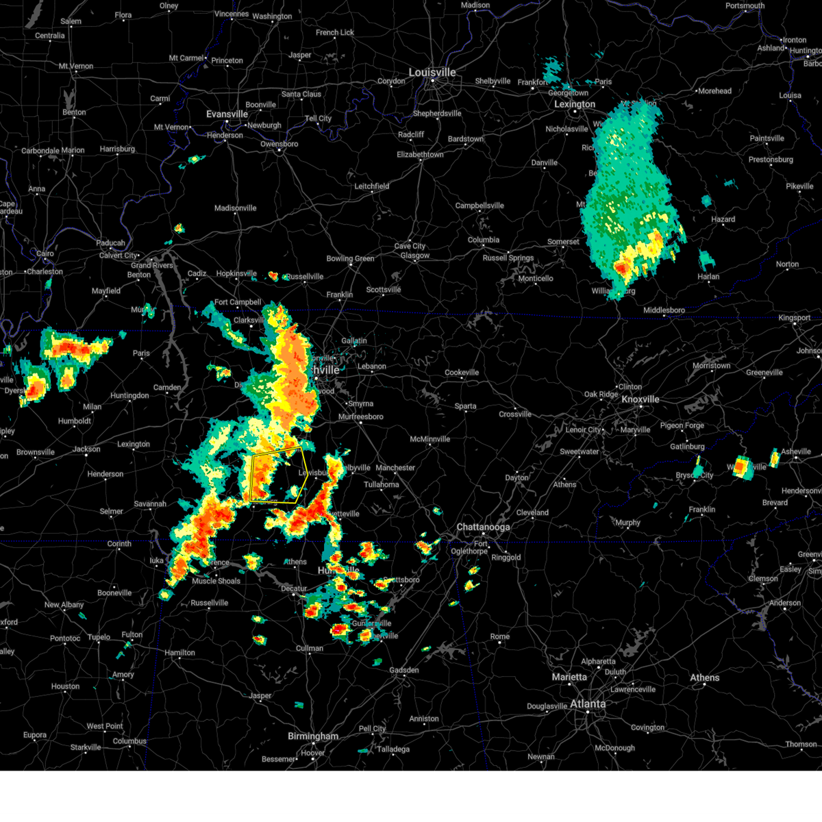 At 114 pm cdt, a severe thunderstorm was located 8 miles southeast of mount pleasant, or 12 miles south of columbia, moving east at 45 mph (radar indicated). Hazards include 60 mph wind gusts and penny size hail. Expect damage to roofs, siding, and trees. locations impacted include, columbia, lawrenceburg, mount pleasant, summertown, ethridge, lynnville, culleoka and hampshire. this includes interstate 65 between mile markers 32 and 43. hail threat, radar indicated max hail size, 0. 75 in wind threat, radar indicated max wind gust, 60 mph. At 114 pm cdt, a severe thunderstorm was located 8 miles southeast of mount pleasant, or 12 miles south of columbia, moving east at 45 mph (radar indicated). Hazards include 60 mph wind gusts and penny size hail. Expect damage to roofs, siding, and trees. locations impacted include, columbia, lawrenceburg, mount pleasant, summertown, ethridge, lynnville, culleoka and hampshire. this includes interstate 65 between mile markers 32 and 43. hail threat, radar indicated max hail size, 0. 75 in wind threat, radar indicated max wind gust, 60 mph.
|
| 7/1/2023 12:58 PM CDT |
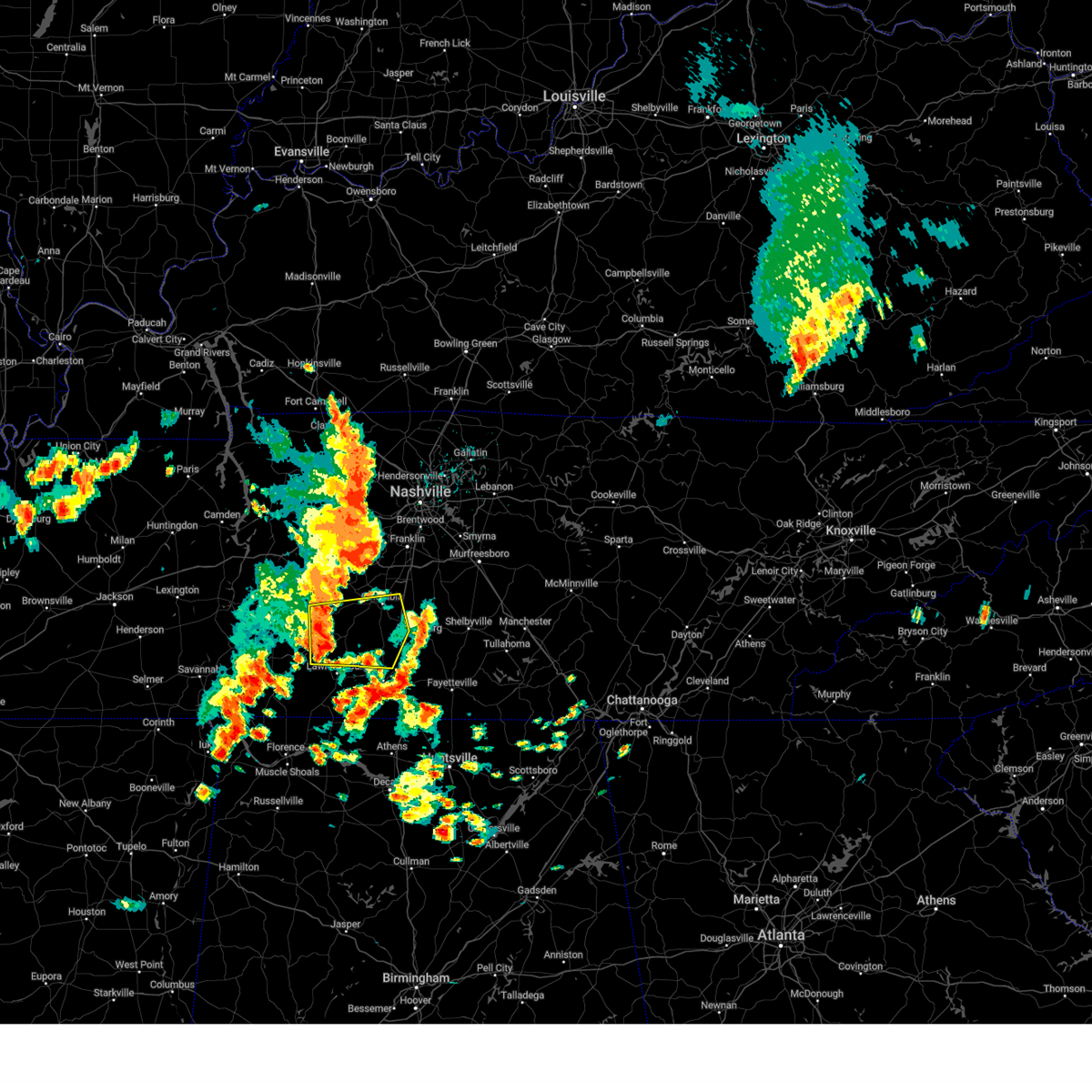 At 1258 pm cdt, a severe thunderstorm was located over summertown, or 13 miles north of lawrenceburg, moving east at 45 mph (radar indicated). Hazards include 60 mph wind gusts and nickel size hail. expect damage to roofs, siding, and trees At 1258 pm cdt, a severe thunderstorm was located over summertown, or 13 miles north of lawrenceburg, moving east at 45 mph (radar indicated). Hazards include 60 mph wind gusts and nickel size hail. expect damage to roofs, siding, and trees
|
| 6/29/2023 2:11 PM CDT |
 At 210 pm cdt, a severe thunderstorm was located 7 miles northwest of shelbyville, moving south at 45 mph (radar indicated). Hazards include 60 mph wind gusts. expect damage to roofs, siding, and trees At 210 pm cdt, a severe thunderstorm was located 7 miles northwest of shelbyville, moving south at 45 mph (radar indicated). Hazards include 60 mph wind gusts. expect damage to roofs, siding, and trees
|
| 6/11/2023 7:55 PM CDT |
 At 755 pm cdt, severe thunderstorms were located along a line extending from petersburg to 7 miles east of loretto, moving east at 40 mph (radar indicated). Hazards include 60 mph wind gusts and nickel size hail. expect damage to roofs, siding, and trees At 755 pm cdt, severe thunderstorms were located along a line extending from petersburg to 7 miles east of loretto, moving east at 40 mph (radar indicated). Hazards include 60 mph wind gusts and nickel size hail. expect damage to roofs, siding, and trees
|
| 4/28/2023 3:28 AM CDT |
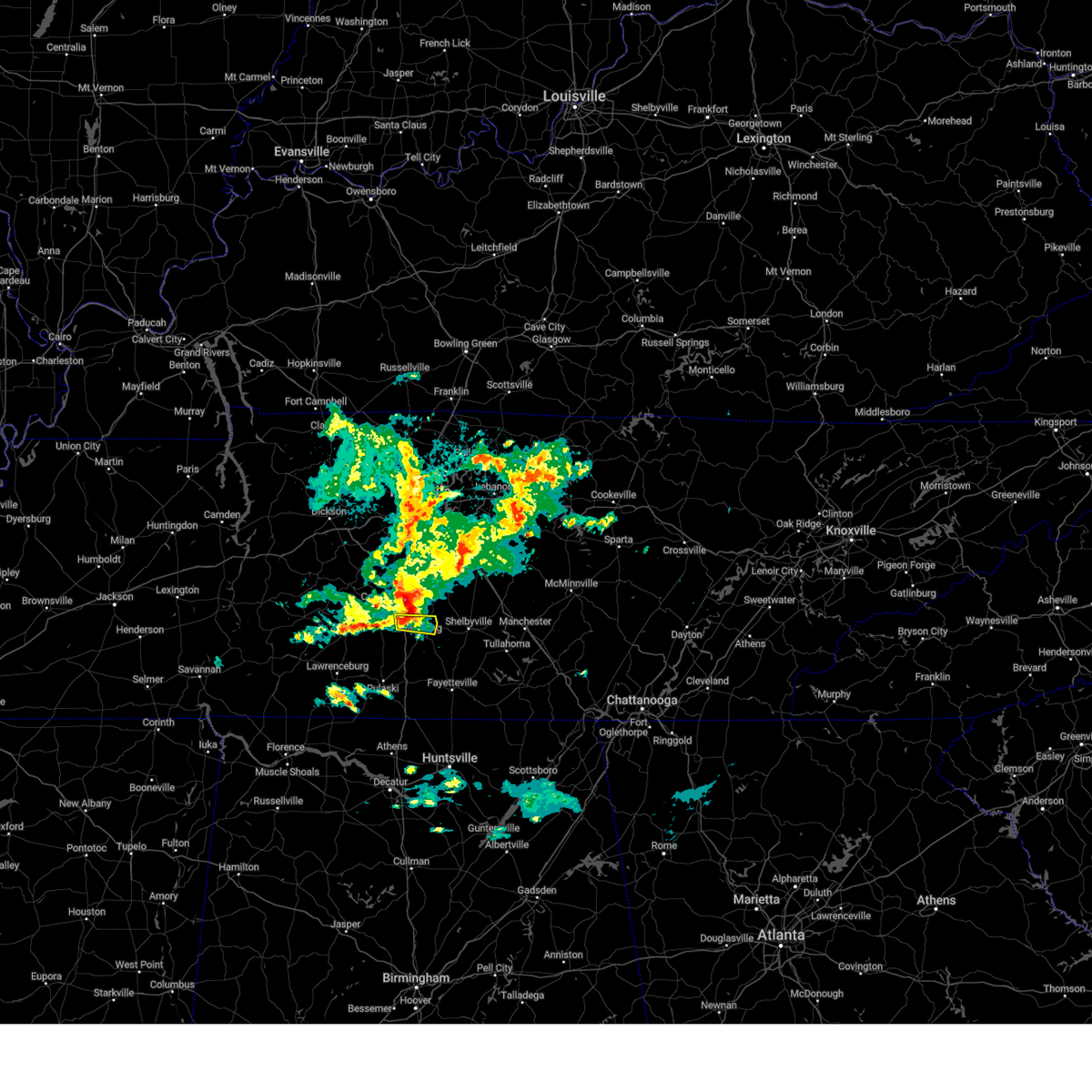 At 327 am cdt, a severe thunderstorm was located near lewisburg, moving east at 35 mph (radar indicated). Hazards include 60 mph wind gusts and quarter size hail. Hail damage to vehicles is expected. expect wind damage to roofs, siding, and trees. locations impacted include, lewisburg and farmington. this includes interstate 65 between mile markers 35 and 40. hail threat, observed max hail size, 1. 00 in wind threat, radar indicated max wind gust, 60 mph. At 327 am cdt, a severe thunderstorm was located near lewisburg, moving east at 35 mph (radar indicated). Hazards include 60 mph wind gusts and quarter size hail. Hail damage to vehicles is expected. expect wind damage to roofs, siding, and trees. locations impacted include, lewisburg and farmington. this includes interstate 65 between mile markers 35 and 40. hail threat, observed max hail size, 1. 00 in wind threat, radar indicated max wind gust, 60 mph.
|
| 4/28/2023 3:20 AM CDT |
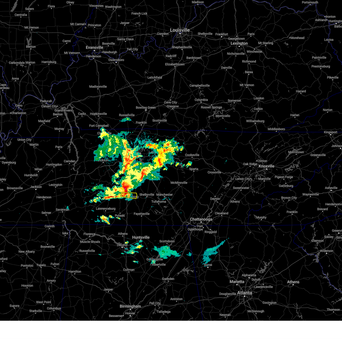 At 319 am cdt, a severe thunderstorm was located 8 miles northwest of lewisburg, moving east at 25 mph (radar indicated). Hazards include 60 mph wind gusts and quarter size hail. Hail damage to vehicles is expected. expect wind damage to roofs, siding, and trees. locations impacted include, lewisburg and farmington. this includes interstate 65 between mile markers 35 and 39. hail threat, radar indicated max hail size, 1. 00 in wind threat, radar indicated max wind gust, 60 mph. At 319 am cdt, a severe thunderstorm was located 8 miles northwest of lewisburg, moving east at 25 mph (radar indicated). Hazards include 60 mph wind gusts and quarter size hail. Hail damage to vehicles is expected. expect wind damage to roofs, siding, and trees. locations impacted include, lewisburg and farmington. this includes interstate 65 between mile markers 35 and 39. hail threat, radar indicated max hail size, 1. 00 in wind threat, radar indicated max wind gust, 60 mph.
|
| 4/28/2023 3:08 AM CDT |
 At 307 am cdt, a severe thunderstorm was located 8 miles southeast of columbia, moving east at 35 mph (radar indicated). Hazards include ping pong ball size hail and 60 mph wind gusts. People and animals outdoors will be injured. expect hail damage to roofs, siding, windows, and vehicles. Expect wind damage to roofs, siding, and trees. At 307 am cdt, a severe thunderstorm was located 8 miles southeast of columbia, moving east at 35 mph (radar indicated). Hazards include ping pong ball size hail and 60 mph wind gusts. People and animals outdoors will be injured. expect hail damage to roofs, siding, windows, and vehicles. Expect wind damage to roofs, siding, and trees.
|
| 3/24/2023 11:41 PM CDT |
 At 1141 pm cdt, a severe thunderstorm was located 12 miles north of ardmore, or 13 miles west of fayetteville, moving northeast at 65 mph (radar indicated). Hazards include 70 mph wind gusts. Expect considerable tree damage. damage is likely to mobile homes, roofs, and outbuildings. locations impacted include, lewisburg, pulaski, ardmore, cornersville, elkton, belfast, frankewing and prospect. this includes interstate 65 between mile markers 1 and 30. thunderstorm damage threat, considerable hail threat, radar indicated max hail size, <. 75 in wind threat, radar indicated max wind gust, 70 mph. At 1141 pm cdt, a severe thunderstorm was located 12 miles north of ardmore, or 13 miles west of fayetteville, moving northeast at 65 mph (radar indicated). Hazards include 70 mph wind gusts. Expect considerable tree damage. damage is likely to mobile homes, roofs, and outbuildings. locations impacted include, lewisburg, pulaski, ardmore, cornersville, elkton, belfast, frankewing and prospect. this includes interstate 65 between mile markers 1 and 30. thunderstorm damage threat, considerable hail threat, radar indicated max hail size, <. 75 in wind threat, radar indicated max wind gust, 70 mph.
|
| 3/24/2023 11:25 PM CDT |
 At 1124 pm cdt, a severe thunderstorm was located 11 miles south of pulaski, moving northeast at 65 mph (radar indicated). Hazards include 70 mph wind gusts. Expect considerable tree damage. Damage is likely to mobile homes, roofs, and outbuildings. At 1124 pm cdt, a severe thunderstorm was located 11 miles south of pulaski, moving northeast at 65 mph (radar indicated). Hazards include 70 mph wind gusts. Expect considerable tree damage. Damage is likely to mobile homes, roofs, and outbuildings.
|
| 3/3/2023 11:28 AM CST |
 At 1128 am cst, severe thunderstorms were located along a line extending from near franklin to 8 miles east of thompson`s station to 11 miles north of lewisburg, moving northeast at 65 mph (radar indicated). Hazards include 70 mph wind gusts. Expect considerable tree damage. Damage is likely to mobile homes, roofs, and outbuildings. At 1128 am cst, severe thunderstorms were located along a line extending from near franklin to 8 miles east of thompson`s station to 11 miles north of lewisburg, moving northeast at 65 mph (radar indicated). Hazards include 70 mph wind gusts. Expect considerable tree damage. Damage is likely to mobile homes, roofs, and outbuildings.
|
| 3/3/2023 11:26 AM CST |
 At 1125 am cst, severe thunderstorms were located along a line extending from 6 miles northeast of lewisburg to 6 miles southwest of petersburg, moving northeast at 75 mph (radar indicated). Hazards include 70 mph wind gusts. Expect considerable tree damage. Damage is likely to mobile homes, roofs, and outbuildings. At 1125 am cst, severe thunderstorms were located along a line extending from 6 miles northeast of lewisburg to 6 miles southwest of petersburg, moving northeast at 75 mph (radar indicated). Hazards include 70 mph wind gusts. Expect considerable tree damage. Damage is likely to mobile homes, roofs, and outbuildings.
|
| 3/3/2023 11:09 AM CST |
 At 1108 am cst, a severe thunderstorm was located 7 miles east of pulaski, moving northeast at 60 mph (radar indicated). Hazards include 70 mph wind gusts. Expect considerable tree damage. damage is likely to mobile homes, roofs, and outbuildings. locations impacted include, lewisburg, pulaski, ardmore, cornersville, elkton, lynnville, belfast, goodspring, frankewing, culleoka, prospect and farmington. this includes interstate 65 between mile markers 1 and 44. thunderstorm damage threat, considerable hail threat, radar indicated max hail size, <. 75 in wind threat, radar indicated max wind gust, 70 mph. At 1108 am cst, a severe thunderstorm was located 7 miles east of pulaski, moving northeast at 60 mph (radar indicated). Hazards include 70 mph wind gusts. Expect considerable tree damage. damage is likely to mobile homes, roofs, and outbuildings. locations impacted include, lewisburg, pulaski, ardmore, cornersville, elkton, lynnville, belfast, goodspring, frankewing, culleoka, prospect and farmington. this includes interstate 65 between mile markers 1 and 44. thunderstorm damage threat, considerable hail threat, radar indicated max hail size, <. 75 in wind threat, radar indicated max wind gust, 70 mph.
|
| 3/3/2023 10:55 AM CST |
 At 1055 am cst, a severe thunderstorm was located 10 miles southwest of pulaski, moving northeast at 60 mph (radar indicated). Hazards include 70 mph wind gusts. Expect considerable tree damage. Damage is likely to mobile homes, roofs, and outbuildings. At 1055 am cst, a severe thunderstorm was located 10 miles southwest of pulaski, moving northeast at 60 mph (radar indicated). Hazards include 70 mph wind gusts. Expect considerable tree damage. Damage is likely to mobile homes, roofs, and outbuildings.
|
| 2/16/2023 5:40 PM CST | Reports of trees down and structural damage on steagall road at wade brown road. possible tornad in marshall county TN, 5.7 miles SSW of Lewisburg, TN |
| 2/16/2023 4:56 PM CST |
 At 456 pm cst, severe thunderstorms were located along a line extending from 6 miles north of petersburg to near pulaski, moving east at 40 mph (radar indicated). Hazards include 60 mph wind gusts and half dollar size hail. Hail damage to vehicles is expected. Expect wind damage to roofs, siding, and trees. At 456 pm cst, severe thunderstorms were located along a line extending from 6 miles north of petersburg to near pulaski, moving east at 40 mph (radar indicated). Hazards include 60 mph wind gusts and half dollar size hail. Hail damage to vehicles is expected. Expect wind damage to roofs, siding, and trees.
|
| 2/16/2023 4:40 PM CST | Corrects previous tstm wnd dmg report from 6 nne lewisburg. reports of trees down and structural damage on steagall road at wade brown road. possible tornad in marshall county TN, 5.7 miles SSW of Lewisburg, TN |
| 2/16/2023 4:35 PM CST |
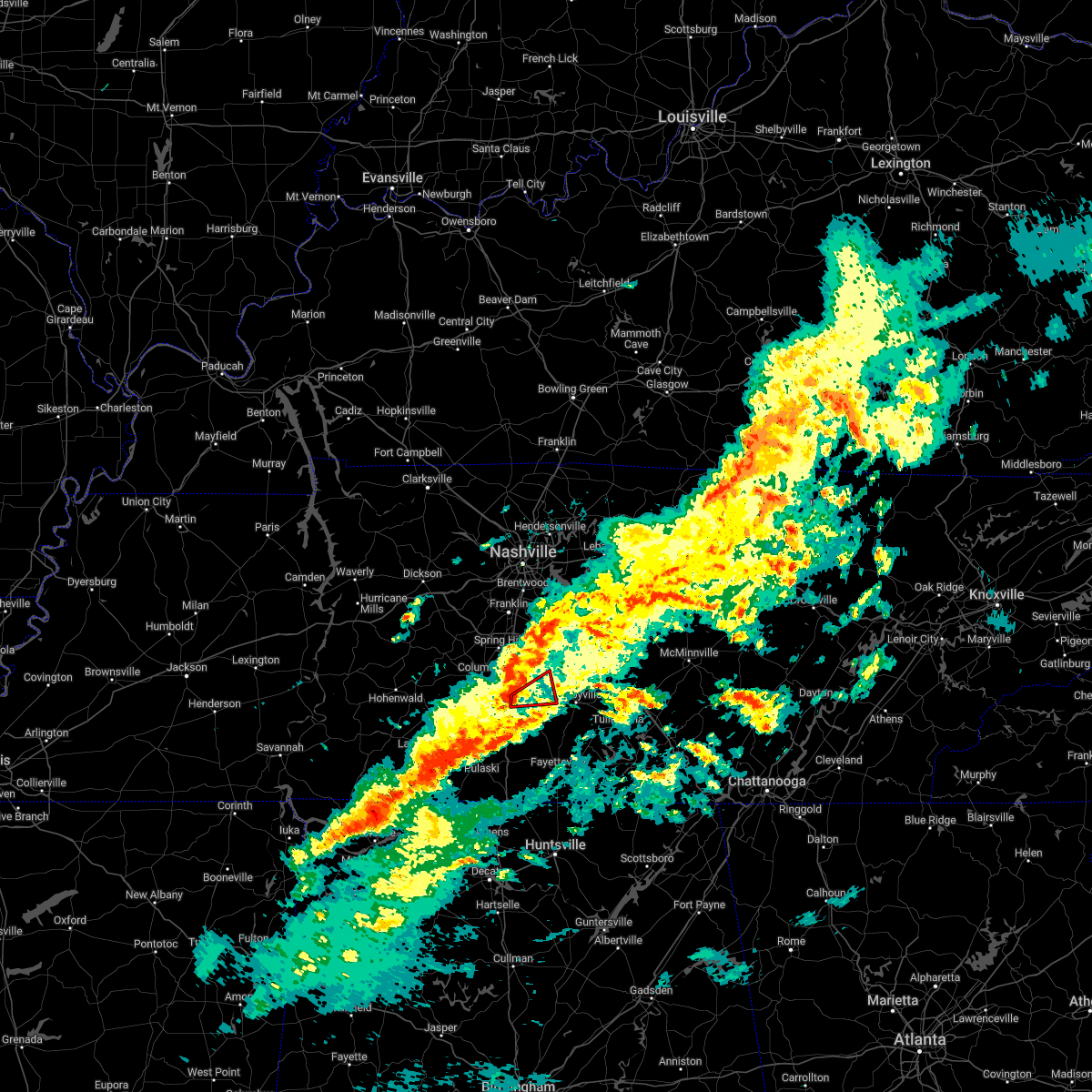 At 435 pm cst, a severe thunderstorm capable of producing a tornado was located near lewisburg, moving east at 40 mph (radar indicated rotation). Hazards include tornado. Flying debris will be dangerous to those caught without shelter. mobile homes will be damaged or destroyed. damage to roofs, windows, and vehicles will occur. tree damage is likely. This tornadic thunderstorm will remain over mainly rural areas of central marshall and west central bedford counties, including the following locations, farmington. At 435 pm cst, a severe thunderstorm capable of producing a tornado was located near lewisburg, moving east at 40 mph (radar indicated rotation). Hazards include tornado. Flying debris will be dangerous to those caught without shelter. mobile homes will be damaged or destroyed. damage to roofs, windows, and vehicles will occur. tree damage is likely. This tornadic thunderstorm will remain over mainly rural areas of central marshall and west central bedford counties, including the following locations, farmington.
|
| 7/12/2022 10:10 PM CDT |
 At 1009 pm cdt, a severe thunderstorm was located near summertown, or 11 miles northeast of lawrenceburg, moving east at 20 mph (radar indicated). Hazards include 60 mph wind gusts and quarter size hail. Hail damage to vehicles is expected. Expect wind damage to roofs, siding, and trees. At 1009 pm cdt, a severe thunderstorm was located near summertown, or 11 miles northeast of lawrenceburg, moving east at 20 mph (radar indicated). Hazards include 60 mph wind gusts and quarter size hail. Hail damage to vehicles is expected. Expect wind damage to roofs, siding, and trees.
|
| 7/12/2022 9:58 PM CDT |
 At 958 pm cdt, a severe thunderstorm was located 10 miles west of lewisburg, moving southeast at 15 mph (radar indicated). Hazards include 60 mph wind gusts and half dollar size hail. Hail damage to vehicles is expected. expect wind damage to roofs, siding, and trees. locations impacted include, lewisburg, lynnville and culleoka. this includes interstate 65 between mile markers 27 and 34. hail threat, radar indicated max hail size, 1. 25 in wind threat, radar indicated max wind gust, 60 mph. At 958 pm cdt, a severe thunderstorm was located 10 miles west of lewisburg, moving southeast at 15 mph (radar indicated). Hazards include 60 mph wind gusts and half dollar size hail. Hail damage to vehicles is expected. expect wind damage to roofs, siding, and trees. locations impacted include, lewisburg, lynnville and culleoka. this includes interstate 65 between mile markers 27 and 34. hail threat, radar indicated max hail size, 1. 25 in wind threat, radar indicated max wind gust, 60 mph.
|
| 7/12/2022 9:40 PM CDT |
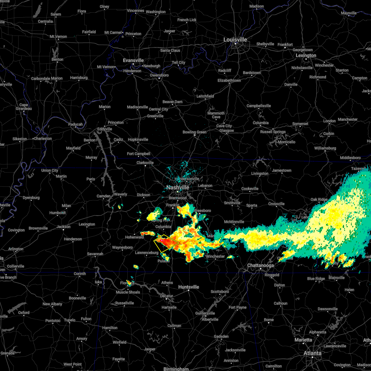 At 940 pm cdt, a severe thunderstorm was located 11 miles southeast of mount pleasant, or 12 miles south of columbia, moving southeast at 15 mph (radar indicated). Hazards include 60 mph wind gusts and half dollar size hail. Hail damage to vehicles is expected. Expect wind damage to roofs, siding, and trees. At 940 pm cdt, a severe thunderstorm was located 11 miles southeast of mount pleasant, or 12 miles south of columbia, moving southeast at 15 mph (radar indicated). Hazards include 60 mph wind gusts and half dollar size hail. Hail damage to vehicles is expected. Expect wind damage to roofs, siding, and trees.
|
| 7/12/2022 9:04 PM CDT |
 At 904 pm cdt, severe thunderstorms were located along a line extending from 6 miles west of shelbyville to 10 miles west of lewisburg, moving southeast at 10 mph (radar indicated). Hazards include 60 mph wind gusts and quarter size hail. Hail damage to vehicles is expected. expect wind damage to roofs, siding, and trees. locations impacted include, shelbyville, lewisburg, pulaski, chapel hill, cornersville, lynnville, belfast, frankewing, culleoka, raus, farmington and unionville. this includes interstate 65 between mile markers 14 and 42. hail threat, radar indicated max hail size, 1. 00 in wind threat, radar indicated max wind gust, 60 mph. At 904 pm cdt, severe thunderstorms were located along a line extending from 6 miles west of shelbyville to 10 miles west of lewisburg, moving southeast at 10 mph (radar indicated). Hazards include 60 mph wind gusts and quarter size hail. Hail damage to vehicles is expected. expect wind damage to roofs, siding, and trees. locations impacted include, shelbyville, lewisburg, pulaski, chapel hill, cornersville, lynnville, belfast, frankewing, culleoka, raus, farmington and unionville. this includes interstate 65 between mile markers 14 and 42. hail threat, radar indicated max hail size, 1. 00 in wind threat, radar indicated max wind gust, 60 mph.
|
| 7/12/2022 8:33 PM CDT |
 At 832 pm cdt, severe thunderstorms were located along a line extending from lynnville to shelbyville, moving southeast at 10 mph (radar indicated. at 820 pm cdt...teacup size hail was reported in marshall county with these storms). Hazards include 60 mph wind gusts and quarter size hail. Hail damage to vehicles is expected. Expect wind damage to roofs, siding, and trees. At 832 pm cdt, severe thunderstorms were located along a line extending from lynnville to shelbyville, moving southeast at 10 mph (radar indicated. at 820 pm cdt...teacup size hail was reported in marshall county with these storms). Hazards include 60 mph wind gusts and quarter size hail. Hail damage to vehicles is expected. Expect wind damage to roofs, siding, and trees.
|
| 5/25/2022 5:42 PM CDT |
 The severe thunderstorm warning for southwestern marshall, maury, giles and southeastern hickman counties will expire at 545 pm cdt, the storms which prompted the warning have weakened below severe limits, and no longer pose an immediate threat to life or property. therefore, the warning will be allowed to expire. however gusty winds are still possible with these thunderstorms. The severe thunderstorm warning for southwestern marshall, maury, giles and southeastern hickman counties will expire at 545 pm cdt, the storms which prompted the warning have weakened below severe limits, and no longer pose an immediate threat to life or property. therefore, the warning will be allowed to expire. however gusty winds are still possible with these thunderstorms.
|
| 5/25/2022 5:35 PM CDT |
 At 535 pm cdt, severe thunderstorms were located along a line extending from 8 miles north of mount pleasant to 12 miles west of lewisburg to near pulaski, moving northeast at 50 mph (radar indicated). Hazards include 60 mph wind gusts. Expect damage to roofs, siding, and trees. locations impacted include, columbia, lewisburg, pulaski, mount pleasant, cornersville, elkton, lynnville, culleoka, santa fe, goodspring, frankewing, hampshire, williamsport, prospect and i-65 east of columbia. this includes interstate 65 between mile markers 7 and 45. hail threat, radar indicated max hail size, <. 75 in wind threat, radar indicated max wind gust, 60 mph. At 535 pm cdt, severe thunderstorms were located along a line extending from 8 miles north of mount pleasant to 12 miles west of lewisburg to near pulaski, moving northeast at 50 mph (radar indicated). Hazards include 60 mph wind gusts. Expect damage to roofs, siding, and trees. locations impacted include, columbia, lewisburg, pulaski, mount pleasant, cornersville, elkton, lynnville, culleoka, santa fe, goodspring, frankewing, hampshire, williamsport, prospect and i-65 east of columbia. this includes interstate 65 between mile markers 7 and 45. hail threat, radar indicated max hail size, <. 75 in wind threat, radar indicated max wind gust, 60 mph.
|
| 5/25/2022 5:11 PM CDT |
 At 511 pm cdt, severe thunderstorms were located along a line extending from near hohenwald to near lawrenceburg to 9 miles northeast of lexington, moving northeast at 50 mph (radar indicated). Hazards include 60 mph wind gusts. expect damage to roofs, siding, and trees At 511 pm cdt, severe thunderstorms were located along a line extending from near hohenwald to near lawrenceburg to 9 miles northeast of lexington, moving northeast at 50 mph (radar indicated). Hazards include 60 mph wind gusts. expect damage to roofs, siding, and trees
|
| 5/21/2022 7:46 PM CDT |
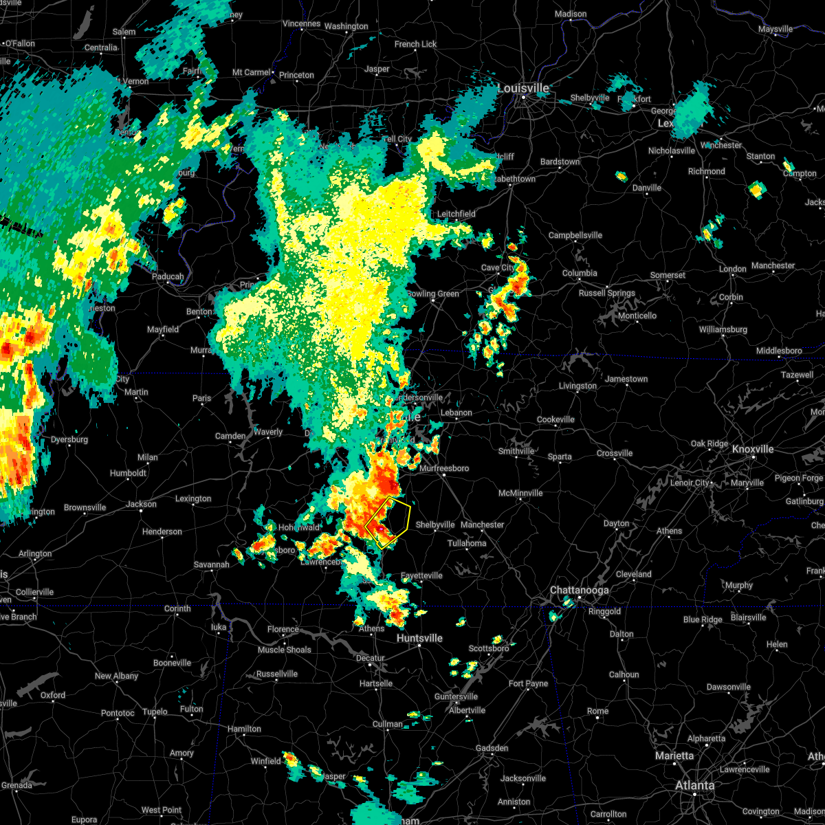 At 746 pm cdt, a severe thunderstorm was located near lewisburg, moving northeast at 25 mph (radar indicated). Hazards include 60 mph wind gusts and quarter size hail. Hail damage to vehicles is expected. Expect wind damage to roofs, siding, and trees. At 746 pm cdt, a severe thunderstorm was located near lewisburg, moving northeast at 25 mph (radar indicated). Hazards include 60 mph wind gusts and quarter size hail. Hail damage to vehicles is expected. Expect wind damage to roofs, siding, and trees.
|
| 4/13/2022 8:16 PM CDT |
 At 815 pm cdt, severe thunderstorms were located along a line extending from 9 miles south of murfreesboro to near ardmore, moving east at 60 mph (radar indicated). Hazards include 70 mph wind gusts. Expect considerable tree damage. damage is likely to mobile homes, roofs, and outbuildings. locations impacted include, shelbyville, lewisburg, manchester, pulaski, tullahoma, chapel hill, ardmore, cornersville, wartrace, eagleville, elkton, bell buckle, normandy, beechgrove, raus, fosterville, rover, belfast, frankewing and bradyville. this includes the following highways, interstate 65 between mile markers 1 and 25. interstate 24 between mile markers 87 and 111. thunderstorm damage threat, considerable hail threat, radar indicated max hail size, <. 75 in wind threat, radar indicated max wind gust, 70 mph. At 815 pm cdt, severe thunderstorms were located along a line extending from 9 miles south of murfreesboro to near ardmore, moving east at 60 mph (radar indicated). Hazards include 70 mph wind gusts. Expect considerable tree damage. damage is likely to mobile homes, roofs, and outbuildings. locations impacted include, shelbyville, lewisburg, manchester, pulaski, tullahoma, chapel hill, ardmore, cornersville, wartrace, eagleville, elkton, bell buckle, normandy, beechgrove, raus, fosterville, rover, belfast, frankewing and bradyville. this includes the following highways, interstate 65 between mile markers 1 and 25. interstate 24 between mile markers 87 and 111. thunderstorm damage threat, considerable hail threat, radar indicated max hail size, <. 75 in wind threat, radar indicated max wind gust, 70 mph.
|
| 4/13/2022 7:54 PM CDT |
 At 753 pm cdt, severe thunderstorms were located along a line extending from 7 miles east of spring hill to 13 miles east of lexington, moving east at 60 mph (radar indicated). Hazards include 70 mph wind gusts. Expect considerable tree damage. Damage is likely to mobile homes, roofs, and outbuildings. At 753 pm cdt, severe thunderstorms were located along a line extending from 7 miles east of spring hill to 13 miles east of lexington, moving east at 60 mph (radar indicated). Hazards include 70 mph wind gusts. Expect considerable tree damage. Damage is likely to mobile homes, roofs, and outbuildings.
|
| 4/13/2022 7:47 PM CDT |
 At 745 pm cdt, severe thunderstorms were located along a line extending from near spring hill to 8 miles southwest of pulaski, moving east at 65 mph (radar indicated). Hazards include 70 mph wind gusts. Expect considerable tree damage. damage is likely to mobile homes, roofs, and outbuildings. locations impacted include, columbia, lewisburg, lawrenceburg, pulaski, spring hill, mount pleasant, loretto, chapel hill, ardmore, cornersville, elkton, minor hill, ethridge, lynnville, culleoka, i-65 east of columbia, goodspring, leoma, frankewing and williamsport. this includes interstate 65 between mile markers 1 and 51. thunderstorm damage threat, considerable hail threat, radar indicated max hail size, <. 75 in wind threat, radar indicated max wind gust, 70 mph. At 745 pm cdt, severe thunderstorms were located along a line extending from near spring hill to 8 miles southwest of pulaski, moving east at 65 mph (radar indicated). Hazards include 70 mph wind gusts. Expect considerable tree damage. damage is likely to mobile homes, roofs, and outbuildings. locations impacted include, columbia, lewisburg, lawrenceburg, pulaski, spring hill, mount pleasant, loretto, chapel hill, ardmore, cornersville, elkton, minor hill, ethridge, lynnville, culleoka, i-65 east of columbia, goodspring, leoma, frankewing and williamsport. this includes interstate 65 between mile markers 1 and 51. thunderstorm damage threat, considerable hail threat, radar indicated max hail size, <. 75 in wind threat, radar indicated max wind gust, 70 mph.
|
| 4/13/2022 7:19 PM CDT |
 At 718 pm cdt, severe thunderstorms were located along a line extending from 9 miles southeast of centerville to 9 miles west of loretto, moving east at 65 mph (radar indicated). Hazards include 70 mph wind gusts. Expect considerable tree damage. Damage is likely to mobile homes, roofs, and outbuildings. At 718 pm cdt, severe thunderstorms were located along a line extending from 9 miles southeast of centerville to 9 miles west of loretto, moving east at 65 mph (radar indicated). Hazards include 70 mph wind gusts. Expect considerable tree damage. Damage is likely to mobile homes, roofs, and outbuildings.
|
| 3/30/2022 9:37 PM CDT |
 At 937 pm cdt, a severe thunderstorm was located 9 miles west of lewisburg, moving northeast at 65 mph (radar indicated). Hazards include 60 mph wind gusts. Expect damage to roofs, siding, and trees. locations impacted include, columbia, lewisburg, pulaski, spring hill, chapel hill, cornersville, lynnville, culleoka, i-65 east of columbia, rover, belfast, frankewing, farmington and unionville. This includes interstate 65 between mile markers 11 and 52. At 937 pm cdt, a severe thunderstorm was located 9 miles west of lewisburg, moving northeast at 65 mph (radar indicated). Hazards include 60 mph wind gusts. Expect damage to roofs, siding, and trees. locations impacted include, columbia, lewisburg, pulaski, spring hill, chapel hill, cornersville, lynnville, culleoka, i-65 east of columbia, rover, belfast, frankewing, farmington and unionville. This includes interstate 65 between mile markers 11 and 52.
|
| 3/30/2022 9:22 PM CDT |
 At 922 pm cdt, a severe thunderstorm was located 9 miles northwest of pulaski, moving northeast at 65 mph (radar indicated). Hazards include 60 mph wind gusts. expect damage to roofs, siding, and trees At 922 pm cdt, a severe thunderstorm was located 9 miles northwest of pulaski, moving northeast at 65 mph (radar indicated). Hazards include 60 mph wind gusts. expect damage to roofs, siding, and trees
|
| 12/6/2021 7:21 AM CST |
 At 721 am cst, a severe thunderstorm was located near lewisburg, moving east at 50 mph (radar indicated). Hazards include 60 mph wind gusts. expect damage to roofs, siding, and trees At 721 am cst, a severe thunderstorm was located near lewisburg, moving east at 50 mph (radar indicated). Hazards include 60 mph wind gusts. expect damage to roofs, siding, and trees
|
| 7/31/2021 11:26 PM CDT |
 At 1125 pm cdt, severe thunderstorms were located along a line extending from near murfreesboro to near shelbyville to cornersville, moving southeast at 45 mph (radar indicated). Hazards include 60 mph wind gusts. expect damage to roofs, siding, and trees At 1125 pm cdt, severe thunderstorms were located along a line extending from near murfreesboro to near shelbyville to cornersville, moving southeast at 45 mph (radar indicated). Hazards include 60 mph wind gusts. expect damage to roofs, siding, and trees
|
| 7/31/2021 11:17 PM CDT |
 At 1116 pm cdt, severe thunderstorms were located along a line extending from smyrna to near lewisburg, moving southeast at 50 mph (radar indicated). Hazards include 60 mph wind gusts. Expect damage to roofs, siding, and trees. locations impacted include, murfreesboro, shelbyville, lewisburg, smyrna, chapel hill, wartrace, eagleville, bell buckle, christiana, fosterville, rover, belfast, deason, rockvale, farmington and unionville. this includes the following highways, interstate 65 between mile markers 32 and 39. interstate 24 between mile markers 69 and 94. Interstate 840 between mile markers 46 and 55. At 1116 pm cdt, severe thunderstorms were located along a line extending from smyrna to near lewisburg, moving southeast at 50 mph (radar indicated). Hazards include 60 mph wind gusts. Expect damage to roofs, siding, and trees. locations impacted include, murfreesboro, shelbyville, lewisburg, smyrna, chapel hill, wartrace, eagleville, bell buckle, christiana, fosterville, rover, belfast, deason, rockvale, farmington and unionville. this includes the following highways, interstate 65 between mile markers 32 and 39. interstate 24 between mile markers 69 and 94. Interstate 840 between mile markers 46 and 55.
|
| 7/31/2021 10:52 PM CDT |
 At 1052 pm cdt, severe thunderstorms were located along a line extending from near brentwood to near columbia, moving southeast at 50 mph (radar indicated). Hazards include 60 mph wind gusts. expect damage to roofs, siding, and trees At 1052 pm cdt, severe thunderstorms were located along a line extending from near brentwood to near columbia, moving southeast at 50 mph (radar indicated). Hazards include 60 mph wind gusts. expect damage to roofs, siding, and trees
|
| 6/2/2021 4:05 PM CDT |
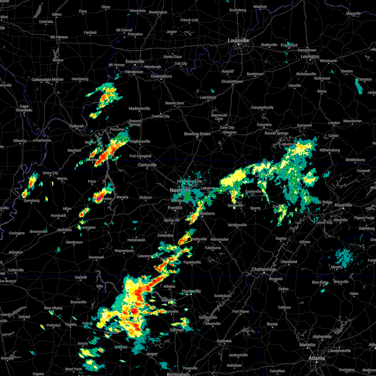 At 405 pm cdt, a severe thunderstorm was located over lewisburg, moving northeast at 20 mph (radar indicated). Hazards include 60 mph wind gusts. Expect damage to roofs, siding, and trees. Locations impacted include, lewisburg and farmington. At 405 pm cdt, a severe thunderstorm was located over lewisburg, moving northeast at 20 mph (radar indicated). Hazards include 60 mph wind gusts. Expect damage to roofs, siding, and trees. Locations impacted include, lewisburg and farmington.
|
| 6/2/2021 3:50 PM CDT |
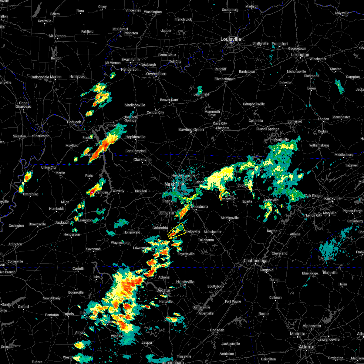 At 349 pm cdt, a severe thunderstorm was located near lewisburg, moving northeast at 25 mph (radar indicated). Hazards include 60 mph wind gusts and quarter size hail. Hail damage to vehicles is expected. Expect wind damage to roofs, siding, and trees. At 349 pm cdt, a severe thunderstorm was located near lewisburg, moving northeast at 25 mph (radar indicated). Hazards include 60 mph wind gusts and quarter size hail. Hail damage to vehicles is expected. Expect wind damage to roofs, siding, and trees.
|
| 5/9/2021 7:19 PM CDT |
 At 718 pm cdt, a severe thunderstorm was located 8 miles north of pulaski, moving east at 60 mph (radar indicated). Hazards include 60 mph wind gusts. Expect damage to roofs, siding, and trees. locations impacted include, lewisburg, pulaski, cornersville, lynnville, belfast, goodspring and frankewing. This includes interstate 65 between mile markers 9 and 33. At 718 pm cdt, a severe thunderstorm was located 8 miles north of pulaski, moving east at 60 mph (radar indicated). Hazards include 60 mph wind gusts. Expect damage to roofs, siding, and trees. locations impacted include, lewisburg, pulaski, cornersville, lynnville, belfast, goodspring and frankewing. This includes interstate 65 between mile markers 9 and 33.
|
| 5/9/2021 7:07 PM CDT |
 At 707 pm cdt, a severe thunderstorm was located 7 miles northeast of lawrenceburg, moving east at 60 mph (radar indicated). Hazards include 60 mph wind gusts. expect damage to roofs, siding, and trees At 707 pm cdt, a severe thunderstorm was located 7 miles northeast of lawrenceburg, moving east at 60 mph (radar indicated). Hazards include 60 mph wind gusts. expect damage to roofs, siding, and trees
|
| 5/6/2021 6:02 PM CDT |
 At 601 pm cdt, severe thunderstorms were located along a line extending from 14 miles south of nolensville to 13 miles northeast of rogersville, moving east at 50 mph (radar indicated). Hazards include 60 mph wind gusts. Expect damage to roofs, siding, and trees. locations impacted include, shelbyville, lewisburg, pulaski, chapel hill, ardmore, cornersville, eagleville, elkton, minor hill, bell buckle, lynnville, christiana, fosterville, rover, belfast, goodspring, deason, frankewing, rockvale and prospect. this includes the following highways, interstate 65 between mile markers 1 and 39. Interstate 24 between mile markers 86 and 91. At 601 pm cdt, severe thunderstorms were located along a line extending from 14 miles south of nolensville to 13 miles northeast of rogersville, moving east at 50 mph (radar indicated). Hazards include 60 mph wind gusts. Expect damage to roofs, siding, and trees. locations impacted include, shelbyville, lewisburg, pulaski, chapel hill, ardmore, cornersville, eagleville, elkton, minor hill, bell buckle, lynnville, christiana, fosterville, rover, belfast, goodspring, deason, frankewing, rockvale and prospect. this includes the following highways, interstate 65 between mile markers 1 and 39. Interstate 24 between mile markers 86 and 91.
|
| 5/6/2021 5:45 PM CDT |
 At 545 pm cdt, severe thunderstorms were located along a line extending from near thompson`s station to near lexington, moving east at 50 mph (radar indicated). Hazards include 60 mph wind gusts. expect damage to roofs, siding, and trees At 545 pm cdt, severe thunderstorms were located along a line extending from near thompson`s station to near lexington, moving east at 50 mph (radar indicated). Hazards include 60 mph wind gusts. expect damage to roofs, siding, and trees
|
| 5/6/2021 5:32 PM CDT |
 At 531 pm cdt, severe thunderstorms were located along a line extending from near thompson`s station to 6 miles east of mount pleasant to near loretto, moving east at 60 mph (radar indicated). Hazards include 60 mph wind gusts. Expect damage to roofs, siding, and trees. locations impacted include, columbia, lewisburg, lawrenceburg, pulaski, spring hill, mount pleasant, thompson`s station, loretto, summertown, chapel hill, cornersville, st. Joseph, minor hill, ethridge, lynnville, henryville, culleoka, goodspring, leoma and williamsport. At 531 pm cdt, severe thunderstorms were located along a line extending from near thompson`s station to 6 miles east of mount pleasant to near loretto, moving east at 60 mph (radar indicated). Hazards include 60 mph wind gusts. Expect damage to roofs, siding, and trees. locations impacted include, columbia, lewisburg, lawrenceburg, pulaski, spring hill, mount pleasant, thompson`s station, loretto, summertown, chapel hill, cornersville, st. Joseph, minor hill, ethridge, lynnville, henryville, culleoka, goodspring, leoma and williamsport.
|
| 5/6/2021 5:05 PM CDT |
 At 505 pm cdt, severe thunderstorms were located along a line extending from 10 miles northeast of centerville to near hohenwald to 8 miles southwest of collinwood, moving east at 60 mph (radar indicated). Hazards include 60 mph wind gusts. expect damage to roofs, siding, and trees At 505 pm cdt, severe thunderstorms were located along a line extending from 10 miles northeast of centerville to near hohenwald to 8 miles southwest of collinwood, moving east at 60 mph (radar indicated). Hazards include 60 mph wind gusts. expect damage to roofs, siding, and trees
|
| 3/28/2021 2:22 AM CDT |
 At 221 am cdt, severe thunderstorms were located along a line extending from 8 miles west of shelbyville to 8 miles west of ardmore, moving east at 35 mph (radar indicated). Hazards include 60 mph wind gusts. Expect damage to roofs, siding, and trees. locations impacted include, shelbyville, lewisburg, pulaski, ardmore, wartrace, elkton, minor hill, belfast, frankewing and prospect. This includes interstate 65 between mile markers 1 and 21. At 221 am cdt, severe thunderstorms were located along a line extending from 8 miles west of shelbyville to 8 miles west of ardmore, moving east at 35 mph (radar indicated). Hazards include 60 mph wind gusts. Expect damage to roofs, siding, and trees. locations impacted include, shelbyville, lewisburg, pulaski, ardmore, wartrace, elkton, minor hill, belfast, frankewing and prospect. This includes interstate 65 between mile markers 1 and 21.
|
| 3/28/2021 1:54 AM CDT |
 At 153 am cdt, severe thunderstorms were located along a line extending from near lewisburg to 6 miles northeast of lexington, moving east at 35 mph (radar indicated). Hazards include 60 mph wind gusts. expect damage to roofs, siding, and trees At 153 am cdt, severe thunderstorms were located along a line extending from near lewisburg to 6 miles northeast of lexington, moving east at 35 mph (radar indicated). Hazards include 60 mph wind gusts. expect damage to roofs, siding, and trees
|
| 3/28/2021 1:25 AM CDT |
 The national weather service in nashville has issued a * severe thunderstorm warning for. marshall county in middle tennessee. southern rutherford county in middle tennessee. east central lawrence county in middle tennessee. Southeastern maury county in middle tennessee. The national weather service in nashville has issued a * severe thunderstorm warning for. marshall county in middle tennessee. southern rutherford county in middle tennessee. east central lawrence county in middle tennessee. Southeastern maury county in middle tennessee.
|
| 3/28/2021 1:20 AM CDT |
 At 120 am cdt, severe thunderstorms were located along a line extending from near thompson`s station to 8 miles east of lawrenceburg, moving east at 60 mph (radar indicated). Hazards include 60 mph wind gusts. Expect damage to roofs, siding, and trees. locations impacted include, columbia, lawrenceburg, pulaski, spring hill, mount pleasant, thompson`s station, ethridge, lynnville, culleoka and i-65 east of columbia. this includes the following highways, interstate 65 between mile markers 27 and 60. Interstate 840 between mile markers 27 and 38. At 120 am cdt, severe thunderstorms were located along a line extending from near thompson`s station to 8 miles east of lawrenceburg, moving east at 60 mph (radar indicated). Hazards include 60 mph wind gusts. Expect damage to roofs, siding, and trees. locations impacted include, columbia, lawrenceburg, pulaski, spring hill, mount pleasant, thompson`s station, ethridge, lynnville, culleoka and i-65 east of columbia. this includes the following highways, interstate 65 between mile markers 27 and 60. Interstate 840 between mile markers 27 and 38.
|
| 3/28/2021 12:54 AM CDT |
 At 1253 am cdt, severe thunderstorms were located along a line extending from 11 miles east of centerville to 8 miles northeast of collinwood, moving east at 60 mph (radar indicated). Hazards include 60 mph wind gusts. expect damage to roofs, siding, and trees At 1253 am cdt, severe thunderstorms were located along a line extending from 11 miles east of centerville to 8 miles northeast of collinwood, moving east at 60 mph (radar indicated). Hazards include 60 mph wind gusts. expect damage to roofs, siding, and trees
|
| 3/25/2021 8:55 PM CDT |
 At 854 pm cdt, a severe thunderstorm was located 8 miles west of shelbyville, moving east at 45 mph (radar indicated). Hazards include 60 mph wind gusts. Expect damage to roofs, siding, and trees. locations impacted include, shelbyville, lewisburg, cornersville, wartrace, bell buckle, belfast, deason, farmington, unionville and fosterville. This includes interstate 65 between mile markers 26 and 30. At 854 pm cdt, a severe thunderstorm was located 8 miles west of shelbyville, moving east at 45 mph (radar indicated). Hazards include 60 mph wind gusts. Expect damage to roofs, siding, and trees. locations impacted include, shelbyville, lewisburg, cornersville, wartrace, bell buckle, belfast, deason, farmington, unionville and fosterville. This includes interstate 65 between mile markers 26 and 30.
|
| 3/25/2021 8:41 PM CDT |
 At 840 pm cdt, a severe thunderstorm was located over lewisburg, moving east at 45 mph (radar indicated). Hazards include 60 mph wind gusts and penny size hail. expect damage to roofs, siding, and trees At 840 pm cdt, a severe thunderstorm was located over lewisburg, moving east at 45 mph (radar indicated). Hazards include 60 mph wind gusts and penny size hail. expect damage to roofs, siding, and trees
|
| 3/25/2021 3:45 PM CDT | Box truck flipped 2.5 miles south of henry horton state park in marshall county TN, 11 miles SSW of Lewisburg, TN |
| 6/30/2020 4:39 PM CDT |
 At 439 pm cdt, a severe thunderstorm was located 9 miles north of pulaski, moving southeast at 35 mph (emergency management reported wind damage in summertown). Hazards include 60 mph wind gusts. Expect damage to roofs, siding, and trees. locations impacted include, lewisburg, pulaski, cornersville and lynnville. This includes interstate 65 between mile markers 19 and 32. At 439 pm cdt, a severe thunderstorm was located 9 miles north of pulaski, moving southeast at 35 mph (emergency management reported wind damage in summertown). Hazards include 60 mph wind gusts. Expect damage to roofs, siding, and trees. locations impacted include, lewisburg, pulaski, cornersville and lynnville. This includes interstate 65 between mile markers 19 and 32.
|
| 6/30/2020 4:07 PM CDT |
 The national weather service in nashville has issued a * severe thunderstorm warning for. southeastern lewis county in middle tennessee. southwestern marshall county in middle tennessee. northeastern lawrence county in middle tennessee. Southwestern maury county in middle tennessee. The national weather service in nashville has issued a * severe thunderstorm warning for. southeastern lewis county in middle tennessee. southwestern marshall county in middle tennessee. northeastern lawrence county in middle tennessee. Southwestern maury county in middle tennessee.
|
| 6/5/2020 12:36 AM CDT |
 The severe thunderstorm warning for southeastern marshall and southwestern bedford counties will expire at 1245 am cdt, the storm which prompted the warning has weakened below severe limits, and no longer poses an immediate threat to life or property. therefore, the warning will be allowed to expire. The severe thunderstorm warning for southeastern marshall and southwestern bedford counties will expire at 1245 am cdt, the storm which prompted the warning has weakened below severe limits, and no longer poses an immediate threat to life or property. therefore, the warning will be allowed to expire.
|
| 6/5/2020 12:29 AM CDT |
 At 1228 am cdt, a severe thunderstorm was located over lewisburg, moving east at 20 mph (radar indicated). Hazards include 60 mph wind gusts. Expect damage to roofs, siding, and trees. Locations impacted include, lewisburg and belfast. At 1228 am cdt, a severe thunderstorm was located over lewisburg, moving east at 20 mph (radar indicated). Hazards include 60 mph wind gusts. Expect damage to roofs, siding, and trees. Locations impacted include, lewisburg and belfast.
|
| 6/5/2020 12:22 AM CDT |
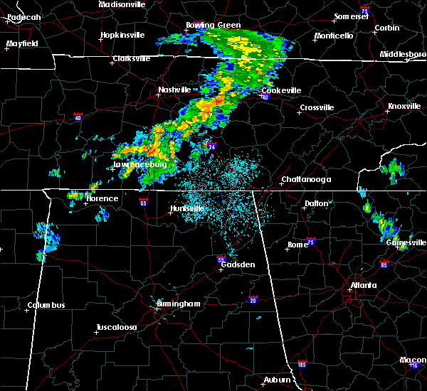 At 1221 am cdt, a severe thunderstorm was located over lewisburg, moving east at 20 mph (radar indicated). Hazards include 60 mph wind gusts. expect damage to roofs, siding, and trees At 1221 am cdt, a severe thunderstorm was located over lewisburg, moving east at 20 mph (radar indicated). Hazards include 60 mph wind gusts. expect damage to roofs, siding, and trees
|
| 5/4/2020 9:13 PM CDT |
 At 913 pm cdt, severe thunderstorms were located along a line extending from near petersburg to 7 miles northwest of ardmore, moving east at 50 mph (radar indicated). Hazards include 60 mph wind gusts and penny size hail. Expect damage to roofs, siding, and trees. locations impacted include, lewisburg, pulaski, ardmore, cornersville, elkton, lynnville, goodspring, frankewing and prospect. This includes interstate 65 between mile markers 1 and 33. At 913 pm cdt, severe thunderstorms were located along a line extending from near petersburg to 7 miles northwest of ardmore, moving east at 50 mph (radar indicated). Hazards include 60 mph wind gusts and penny size hail. Expect damage to roofs, siding, and trees. locations impacted include, lewisburg, pulaski, ardmore, cornersville, elkton, lynnville, goodspring, frankewing and prospect. This includes interstate 65 between mile markers 1 and 33.
|
| 5/4/2020 9:00 PM CDT |
 At 900 pm cdt, severe thunderstorms were located along a line extending from 11 miles west of lewisburg to 9 miles southwest of pulaski, moving east at 60 mph (radar indicated). Hazards include 70 mph wind gusts and quarter size hail. Hail damage to vehicles is expected. expect considerable tree damage. wind damage is also likely to mobile homes, roofs, and outbuildings. locations impacted include, lewisburg, lawrenceburg, pulaski, ardmore, cornersville, elkton, ethridge, lynnville, culleoka, goodspring, leoma, frankewing and prospect. This includes interstate 65 between mile markers 1 and 32. At 900 pm cdt, severe thunderstorms were located along a line extending from 11 miles west of lewisburg to 9 miles southwest of pulaski, moving east at 60 mph (radar indicated). Hazards include 70 mph wind gusts and quarter size hail. Hail damage to vehicles is expected. expect considerable tree damage. wind damage is also likely to mobile homes, roofs, and outbuildings. locations impacted include, lewisburg, lawrenceburg, pulaski, ardmore, cornersville, elkton, ethridge, lynnville, culleoka, goodspring, leoma, frankewing and prospect. This includes interstate 65 between mile markers 1 and 32.
|
| 5/4/2020 8:36 PM CDT |
 At 836 pm cdt, severe thunderstorms were located along a line extending from near summertown to 10 miles northwest of loretto, moving east at 60 mph (radar indicated). Hazards include 60 mph wind gusts and half dollar size hail. Hail damage to vehicles is expected. Expect wind damage to roofs, siding, and trees. At 836 pm cdt, severe thunderstorms were located along a line extending from near summertown to 10 miles northwest of loretto, moving east at 60 mph (radar indicated). Hazards include 60 mph wind gusts and half dollar size hail. Hail damage to vehicles is expected. Expect wind damage to roofs, siding, and trees.
|
| 5/3/2020 5:01 PM CDT |
 At 501 pm cdt, severe thunderstorms were located along a line extending from 10 miles south of murfreesboro to near petersburg to 10 miles north of ardmore, moving southeast at 60 mph (radar indicated). Hazards include 70 mph wind gusts and penny size hail. Expect considerable tree damage. damage is likely to mobile homes, roofs, and outbuildings. Locations impacted include, shelbyville, lewisburg, chapel hill, cornersville, wartrace, eagleville, bell buckle, lynnville, christiana, fosterville, rover, belfast, deason, rockvale, farmington and unionville. At 501 pm cdt, severe thunderstorms were located along a line extending from 10 miles south of murfreesboro to near petersburg to 10 miles north of ardmore, moving southeast at 60 mph (radar indicated). Hazards include 70 mph wind gusts and penny size hail. Expect considerable tree damage. damage is likely to mobile homes, roofs, and outbuildings. Locations impacted include, shelbyville, lewisburg, chapel hill, cornersville, wartrace, eagleville, bell buckle, lynnville, christiana, fosterville, rover, belfast, deason, rockvale, farmington and unionville.
|
| 5/3/2020 4:41 PM CDT |
 At 440 pm cdt, severe thunderstorms were located along a line extending from near nolensville to near columbia to 10 miles northwest of pulaski, moving southeast at 60 mph (radar indicated). Hazards include 60 mph wind gusts and penny size hail. expect damage to roofs, siding, and trees At 440 pm cdt, severe thunderstorms were located along a line extending from near nolensville to near columbia to 10 miles northwest of pulaski, moving southeast at 60 mph (radar indicated). Hazards include 60 mph wind gusts and penny size hail. expect damage to roofs, siding, and trees
|
| 3/29/2020 1:16 AM CDT | Trees on a power line as well as power line damage near cornersville r in marshall county TN, 0.7 miles NNW of Lewisburg, TN |
| 3/29/2020 1:14 AM CDT | Large trees blocking 900 block of galloway stree in marshall county TN, 0.8 miles NNE of Lewisburg, TN |
| 3/29/2020 1:13 AM CDT |
 The severe thunderstorm warning for central marshall, southeastern maury and northeastern giles counties will expire at 115 am cdt, the storm which prompted the warning has weakened below severe limits, and no longer poses an immediate threat to life or property. therefore, the warning will be allowed to expire. however gusty winds to 55 mph are still possible with this thunderstorm. a tornado watch remains in effect until 400 am cdt for middle tennessee. The severe thunderstorm warning for central marshall, southeastern maury and northeastern giles counties will expire at 115 am cdt, the storm which prompted the warning has weakened below severe limits, and no longer poses an immediate threat to life or property. therefore, the warning will be allowed to expire. however gusty winds to 55 mph are still possible with this thunderstorm. a tornado watch remains in effect until 400 am cdt for middle tennessee.
|
| 3/29/2020 1:08 AM CDT |
 At 108 am cdt, a severe thunderstorm was located 9 miles east of columbia, moving northeast at 75 mph (radar indicated). Hazards include 60 mph wind gusts and nickel size hail. Expect damage to roofs, siding, and trees. locations impacted include, columbia, lewisburg, mount pleasant, cornersville, lynnville, culleoka, farmington and i-65 east of columbia. This includes interstate 65 between mile markers 25 and 45. At 108 am cdt, a severe thunderstorm was located 9 miles east of columbia, moving northeast at 75 mph (radar indicated). Hazards include 60 mph wind gusts and nickel size hail. Expect damage to roofs, siding, and trees. locations impacted include, columbia, lewisburg, mount pleasant, cornersville, lynnville, culleoka, farmington and i-65 east of columbia. This includes interstate 65 between mile markers 25 and 45.
|
| 3/29/2020 12:57 AM CDT |
 At 1256 am cdt, a severe thunderstorm was located 8 miles southeast of mount pleasant, or 11 miles south of columbia, moving northeast at 75 mph (radar indicated). Hazards include 60 mph wind gusts and nickel size hail. Expect damage to roofs, siding, and trees. locations impacted include, columbia, lewisburg, mount pleasant, summertown, cornersville, lynnville, culleoka, i-65 east of columbia and farmington. This includes interstate 65 between mile markers 25 and 46. At 1256 am cdt, a severe thunderstorm was located 8 miles southeast of mount pleasant, or 11 miles south of columbia, moving northeast at 75 mph (radar indicated). Hazards include 60 mph wind gusts and nickel size hail. Expect damage to roofs, siding, and trees. locations impacted include, columbia, lewisburg, mount pleasant, summertown, cornersville, lynnville, culleoka, i-65 east of columbia and farmington. This includes interstate 65 between mile markers 25 and 46.
|
| 3/29/2020 12:39 AM CDT |
 At 1238 am cdt, a severe thunderstorm was located near lawrenceburg, moving northeast at 75 mph (radar indicated). Hazards include 70 mph wind gusts and ping pong ball size hail. People and animals outdoors will be injured. expect hail damage to roofs, siding, windows, and vehicles. expect considerable tree damage. Wind damage is also likely to mobile homes, roofs, and outbuildings. At 1238 am cdt, a severe thunderstorm was located near lawrenceburg, moving northeast at 75 mph (radar indicated). Hazards include 70 mph wind gusts and ping pong ball size hail. People and animals outdoors will be injured. expect hail damage to roofs, siding, windows, and vehicles. expect considerable tree damage. Wind damage is also likely to mobile homes, roofs, and outbuildings.
|
| 3/24/2020 6:16 PM CDT |
 At 615 pm cdt, a severe thunderstorm was located 7 miles north of pulaski, moving east at 45 mph (radar indicated). Hazards include 60 mph wind gusts and penny size hail. Expect damage to roofs, siding, and trees. locations impacted include, cornersville and belfast. This includes interstate 65 between mile markers 16 and 29. At 615 pm cdt, a severe thunderstorm was located 7 miles north of pulaski, moving east at 45 mph (radar indicated). Hazards include 60 mph wind gusts and penny size hail. Expect damage to roofs, siding, and trees. locations impacted include, cornersville and belfast. This includes interstate 65 between mile markers 16 and 29.
|
| 3/24/2020 6:00 PM CDT |
 At 559 pm cdt, a severe thunderstorm was located 8 miles northeast of lawrenceburg, moving east at 45 mph (radar indicated). Hazards include 60 mph wind gusts and penny size hail. expect damage to roofs, siding, and trees At 559 pm cdt, a severe thunderstorm was located 8 miles northeast of lawrenceburg, moving east at 45 mph (radar indicated). Hazards include 60 mph wind gusts and penny size hail. expect damage to roofs, siding, and trees
|
| 2/12/2020 6:00 PM CST | Reports of a few trees down across marshall count in marshall county TN, 9.7 miles S of Lewisburg, TN |
| 2/5/2020 6:34 PM CST |
 At 634 pm cst, a severe thunderstorm capable of producing a tornado was located near lewisburg, moving east at 55 mph (radar indicated rotation). Hazards include tornado. Flying debris will be dangerous to those caught without shelter. mobile homes will be damaged or destroyed. damage to roofs, windows, and vehicles will occur. tree damage is likely. this dangerous storm will be near, shelbyville around 655 pm cst. other locations impacted by this tornadic thunderstorm include cornersville, belfast and raus. This includes interstate 65 near mile marker 31. At 634 pm cst, a severe thunderstorm capable of producing a tornado was located near lewisburg, moving east at 55 mph (radar indicated rotation). Hazards include tornado. Flying debris will be dangerous to those caught without shelter. mobile homes will be damaged or destroyed. damage to roofs, windows, and vehicles will occur. tree damage is likely. this dangerous storm will be near, shelbyville around 655 pm cst. other locations impacted by this tornadic thunderstorm include cornersville, belfast and raus. This includes interstate 65 near mile marker 31.
|
| 2/5/2020 6:26 PM CST |
 At 625 pm cst, severe thunderstorms were located along a line extending from 8 miles west of lewisburg to 11 miles west of ardmore, moving east at 65 mph (radar indicated). Hazards include 60 mph wind gusts. expect damage to roofs, siding, and trees At 625 pm cst, severe thunderstorms were located along a line extending from 8 miles west of lewisburg to 11 miles west of ardmore, moving east at 65 mph (radar indicated). Hazards include 60 mph wind gusts. expect damage to roofs, siding, and trees
|
| 1/11/2020 10:06 AM CST |
 The severe thunderstorm warning for marshall, northwestern rutherford, southeastern maury, southeastern williamson and eastern giles counties will expire at 1015 am cst, the storms which prompted the warning have weakened below severe limits, and have exited the warned area. therefore, the warning will be allowed to expire. a tornado watch remains in effect until 100 pm cst for middle tennessee. The severe thunderstorm warning for marshall, northwestern rutherford, southeastern maury, southeastern williamson and eastern giles counties will expire at 1015 am cst, the storms which prompted the warning have weakened below severe limits, and have exited the warned area. therefore, the warning will be allowed to expire. a tornado watch remains in effect until 100 pm cst for middle tennessee.
|
| 1/11/2020 10:00 AM CST |
 At 1000 am cst, severe thunderstorms were located along a line extending from near la vergne to 7 miles northeast of pulaski, moving northeast at 30 mph (radar indicated). Hazards include 60 mph wind gusts. Expect damage to roofs, siding, and trees. locations impacted include, lewisburg, pulaski, smyrna, nolensville, chapel hill, cornersville, eagleville, frankewing, farmington and triune. this includes the following highways, interstate 65 between mile markers 8 and 37. interstate 24 between mile markers 66 and 71. Interstate 840 between mile markers 35 and 48. At 1000 am cst, severe thunderstorms were located along a line extending from near la vergne to 7 miles northeast of pulaski, moving northeast at 30 mph (radar indicated). Hazards include 60 mph wind gusts. Expect damage to roofs, siding, and trees. locations impacted include, lewisburg, pulaski, smyrna, nolensville, chapel hill, cornersville, eagleville, frankewing, farmington and triune. this includes the following highways, interstate 65 between mile markers 8 and 37. interstate 24 between mile markers 66 and 71. Interstate 840 between mile markers 35 and 48.
|
| 1/11/2020 9:43 AM CST |
 At 942 am cst, severe thunderstorms were located along a line extending from near nolensville to near pulaski, moving northeast at 30 mph (radar indicated). Hazards include 60 mph wind gusts. expect damage to roofs, siding, and trees At 942 am cst, severe thunderstorms were located along a line extending from near nolensville to near pulaski, moving northeast at 30 mph (radar indicated). Hazards include 60 mph wind gusts. expect damage to roofs, siding, and trees
|
| 1/11/2020 9:28 AM CST |
 At 928 am cst, severe thunderstorms were located along a line extending from near thompson`s station to 12 miles east of lexington, moving northeast at 35 mph (radar indicated). Hazards include 70 mph wind gusts. Expect considerable tree damage. damage is likely to mobile homes, roofs, and outbuildings. locations impacted include, columbia, lewisburg, pulaski, spring hill, thompson`s station, chapel hill, cornersville, minor hill, lynnville, culleoka, i-65 east of columbia, goodspring and prospect. this includes the following highways, interstate 65 between mile markers 15 and 61. Interstate 840 between mile markers 27 and 37. At 928 am cst, severe thunderstorms were located along a line extending from near thompson`s station to 12 miles east of lexington, moving northeast at 35 mph (radar indicated). Hazards include 70 mph wind gusts. Expect considerable tree damage. damage is likely to mobile homes, roofs, and outbuildings. locations impacted include, columbia, lewisburg, pulaski, spring hill, thompson`s station, chapel hill, cornersville, minor hill, lynnville, culleoka, i-65 east of columbia, goodspring and prospect. this includes the following highways, interstate 65 between mile markers 15 and 61. Interstate 840 between mile markers 27 and 37.
|
| 1/11/2020 9:11 AM CST |
 At 910 am cst, severe thunderstorms were located along a line extending from near columbia to near lexington, moving northeast at 60 mph (radar indicated). Hazards include 70 mph wind gusts. Expect considerable tree damage. Damage is likely to mobile homes, roofs, and outbuildings. At 910 am cst, severe thunderstorms were located along a line extending from near columbia to near lexington, moving northeast at 60 mph (radar indicated). Hazards include 70 mph wind gusts. Expect considerable tree damage. Damage is likely to mobile homes, roofs, and outbuildings.
|
| 12/16/2019 5:46 PM CST | Trees down and blocking roads on harwell avenue...mooresville highway...and cornersville highway in marshall county TN, 0.2 miles W of Lewisburg, TN |
| 12/16/2019 5:46 PM CST |
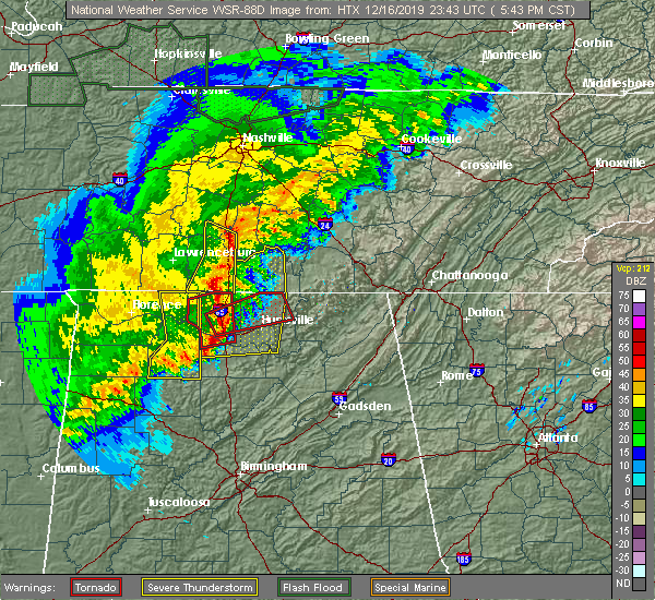 At 545 pm cst, a severe thunderstorm was located near lewisburg, moving east at 50 mph (radar indicated). Hazards include 60 mph wind gusts and penny size hail. expect damage to roofs, siding, and trees At 545 pm cst, a severe thunderstorm was located near lewisburg, moving east at 50 mph (radar indicated). Hazards include 60 mph wind gusts and penny size hail. expect damage to roofs, siding, and trees
|
| 12/16/2019 5:34 PM CST |
 At 532 pm cst, severe thunderstorms were located along a line extending from 12 miles southeast of mount pleasant to 15 miles northwest of ardmore, moving east at 55 mph (radar indicated. tree damage has been reported in lawrenceburg with this line of storms). Hazards include 60 mph wind gusts and penny size hail. Expect damage to roofs, siding, and trees. locations impacted include, pulaski, ardmore, cornersville, elkton, minor hill, lynnville, goodspring, frankewing, culleoka and prospect. This includes interstate 65 between mile markers 1 and 36. At 532 pm cst, severe thunderstorms were located along a line extending from 12 miles southeast of mount pleasant to 15 miles northwest of ardmore, moving east at 55 mph (radar indicated. tree damage has been reported in lawrenceburg with this line of storms). Hazards include 60 mph wind gusts and penny size hail. Expect damage to roofs, siding, and trees. locations impacted include, pulaski, ardmore, cornersville, elkton, minor hill, lynnville, goodspring, frankewing, culleoka and prospect. This includes interstate 65 between mile markers 1 and 36.
|
| 12/16/2019 5:15 PM CST |
 At 514 pm cst, severe thunderstorms were located along a line extending from near summertown to 6 miles northeast of lawrenceburg to 11 miles northeast of loretto to near lexington, moving northeast at 40 mph (radar indicated). Hazards include 60 mph wind gusts and penny size hail. expect damage to roofs, siding, and trees At 514 pm cst, severe thunderstorms were located along a line extending from near summertown to 6 miles northeast of lawrenceburg to 11 miles northeast of loretto to near lexington, moving northeast at 40 mph (radar indicated). Hazards include 60 mph wind gusts and penny size hail. expect damage to roofs, siding, and trees
|
| 8/13/2019 6:19 PM CDT |
 The national weather service in nashville has issued a * severe thunderstorm warning for. eastern marshall county in middle tennessee. bedford county in middle tennessee. until 700 pm cdt. At 618 pm cdt, a severe thunderstorm was located near lewisburg,. The national weather service in nashville has issued a * severe thunderstorm warning for. eastern marshall county in middle tennessee. bedford county in middle tennessee. until 700 pm cdt. At 618 pm cdt, a severe thunderstorm was located near lewisburg,.
|
| 8/6/2019 9:56 PM CDT |
 At 956 pm cdt, severe thunderstorms were located along a line extending from 6 miles northeast of manchester to petersburg, moving southeast at 35 mph (radar indicated). Hazards include 60 mph wind gusts. Expect damage to roofs, siding, and trees. locations impacted include, shelbyville, lewisburg, manchester, tullahoma, chapel hill, wartrace, bell buckle, normandy, beechgrove, raus, rover, belfast, deason, hillsboro, farmington and unionville. This includes interstate 24 between mile markers 97 and 127. At 956 pm cdt, severe thunderstorms were located along a line extending from 6 miles northeast of manchester to petersburg, moving southeast at 35 mph (radar indicated). Hazards include 60 mph wind gusts. Expect damage to roofs, siding, and trees. locations impacted include, shelbyville, lewisburg, manchester, tullahoma, chapel hill, wartrace, bell buckle, normandy, beechgrove, raus, rover, belfast, deason, hillsboro, farmington and unionville. This includes interstate 24 between mile markers 97 and 127.
|
| 8/6/2019 9:43 PM CDT |
 The national weather service in nashville has issued a * severe thunderstorm warning for. marshall county in middle tennessee. southern rutherford county in middle tennessee. coffee county in middle tennessee. Bedford county in middle tennessee. The national weather service in nashville has issued a * severe thunderstorm warning for. marshall county in middle tennessee. southern rutherford county in middle tennessee. coffee county in middle tennessee. Bedford county in middle tennessee.
|
| 8/6/2019 9:07 PM CDT |
 At 907 pm cdt, severe thunderstorms were located along a line extending from 8 miles northwest of woodbury to 6 miles east of spring hill, moving southeast at 40 mph (radar indicated). Hazards include 60 mph wind gusts. expect damage to roofs, siding, and trees At 907 pm cdt, severe thunderstorms were located along a line extending from 8 miles northwest of woodbury to 6 miles east of spring hill, moving southeast at 40 mph (radar indicated). Hazards include 60 mph wind gusts. expect damage to roofs, siding, and trees
|
| 6/21/2019 9:02 PM CDT |
 At 902 pm cdt, severe thunderstorms were located along a line extending from near petersburg to 7 miles northeast of cherokee, moving south at 40 mph (radar indicated). Hazards include 70 mph wind gusts. Expect considerable tree damage. damage is likely to mobile homes, roofs, and outbuildings. locations impacted include, lewisburg, lawrenceburg, pulaski, loretto, collinwood, ardmore, cornersville, st. joseph, elkton, minor hill, lynnville, cypress inn, belfast, goodspring, leoma, westpoint, frankewing, iron city, prospect and farmington. This includes interstate 65 between mile markers 1 and 32. At 902 pm cdt, severe thunderstorms were located along a line extending from near petersburg to 7 miles northeast of cherokee, moving south at 40 mph (radar indicated). Hazards include 70 mph wind gusts. Expect considerable tree damage. damage is likely to mobile homes, roofs, and outbuildings. locations impacted include, lewisburg, lawrenceburg, pulaski, loretto, collinwood, ardmore, cornersville, st. joseph, elkton, minor hill, lynnville, cypress inn, belfast, goodspring, leoma, westpoint, frankewing, iron city, prospect and farmington. This includes interstate 65 between mile markers 1 and 32.
|
| 6/21/2019 8:39 PM CDT |
 At 838 pm cdt, severe thunderstorms were located along a line extending from chapel hill to walnut grove, moving south at 40 mph (radar indicated). Hazards include 70 mph wind gusts. Expect considerable tree damage. Damage is likely to mobile homes, roofs, and outbuildings. At 838 pm cdt, severe thunderstorms were located along a line extending from chapel hill to walnut grove, moving south at 40 mph (radar indicated). Hazards include 70 mph wind gusts. Expect considerable tree damage. Damage is likely to mobile homes, roofs, and outbuildings.
|
| 6/21/2019 8:26 PM CDT |
 At 825 pm cdt, severe thunderstorms were located along a line extending from near watertown to murfreesboro to spring hill, moving southeast at 50 mph. these are very dangerous storms (radar indicated). Hazards include 80 mph wind gusts and penny size hail. Flying debris will be dangerous to those caught without shelter. mobile homes will be heavily damaged. expect considerable damage to roofs, windows, and vehicles. extensive tree damage and power outages are likely. locations impacted include, murfreesboro, columbia, lewisburg, smyrna, la vergne, spring hill, nolensville, thompson`s station, walterhill, chapel hill, eagleville, auburntown, fosterville, triune, cedars of lebanon state park, rover, rockvale, unionville, readyville and lascassas. this includes the following highways, interstate 65 between mile markers 29 and 60. interstate 24 between mile markers 66 and 93. Interstate 840 between mile markers 29 and 70. At 825 pm cdt, severe thunderstorms were located along a line extending from near watertown to murfreesboro to spring hill, moving southeast at 50 mph. these are very dangerous storms (radar indicated). Hazards include 80 mph wind gusts and penny size hail. Flying debris will be dangerous to those caught without shelter. mobile homes will be heavily damaged. expect considerable damage to roofs, windows, and vehicles. extensive tree damage and power outages are likely. locations impacted include, murfreesboro, columbia, lewisburg, smyrna, la vergne, spring hill, nolensville, thompson`s station, walterhill, chapel hill, eagleville, auburntown, fosterville, triune, cedars of lebanon state park, rover, rockvale, unionville, readyville and lascassas. this includes the following highways, interstate 65 between mile markers 29 and 60. interstate 24 between mile markers 66 and 93. Interstate 840 between mile markers 29 and 70.
|
| 6/21/2019 8:05 PM CDT |
 The national weather service in nashville has issued a * severe thunderstorm warning for. southeastern davidson county in middle tennessee. central marshall county in middle tennessee. rutherford county in middle tennessee. Central maury county in middle tennessee. The national weather service in nashville has issued a * severe thunderstorm warning for. southeastern davidson county in middle tennessee. central marshall county in middle tennessee. rutherford county in middle tennessee. Central maury county in middle tennessee.
|
| 12/31/2018 3:06 PM CST |
 The severe thunderstorm warning for marshall, southwestern rutherford, southeastern maury, southeastern williamson, eastern giles and western bedford counties will expire at 315 pm cst, the storms which prompted the warning have weakened below severe limits, and no longer pose an immediate threat to life or property. therefore, the warning will be allowed to expire. however heavy rain is still possible with these thunderstorms. a tornado watch remains in effect until 700 pm cst for middle tennessee. The severe thunderstorm warning for marshall, southwestern rutherford, southeastern maury, southeastern williamson, eastern giles and western bedford counties will expire at 315 pm cst, the storms which prompted the warning have weakened below severe limits, and no longer pose an immediate threat to life or property. therefore, the warning will be allowed to expire. however heavy rain is still possible with these thunderstorms. a tornado watch remains in effect until 700 pm cst for middle tennessee.
|
| 12/31/2018 2:52 PM CST |
 At 251 pm cst, severe thunderstorms were located along a line extending from 6 miles southeast of nolensville to 9 miles north of ardmore, moving east at 55 mph (radar indicated). Hazards include 60 mph wind gusts. Expect damage to roofs, siding, and trees. Locations impacted include, murfreesboro, lewisburg, pulaski, chapel hill, ardmore, cornersville, eagleville, elkton, i-65 east of columbia, triune, rover, belfast, frankewing, rockvale, prospect, farmington and unionville. At 251 pm cst, severe thunderstorms were located along a line extending from 6 miles southeast of nolensville to 9 miles north of ardmore, moving east at 55 mph (radar indicated). Hazards include 60 mph wind gusts. Expect damage to roofs, siding, and trees. Locations impacted include, murfreesboro, lewisburg, pulaski, chapel hill, ardmore, cornersville, eagleville, elkton, i-65 east of columbia, triune, rover, belfast, frankewing, rockvale, prospect, farmington and unionville.
|
| 12/31/2018 2:32 PM CST |
 At 231 pm cst, severe thunderstorms were located along a line extending from thompson`s station to 9 miles southwest of pulaski, moving east at 55 mph (radar indicated). Hazards include 60 mph wind gusts. expect damage to roofs, siding, and trees At 231 pm cst, severe thunderstorms were located along a line extending from thompson`s station to 9 miles southwest of pulaski, moving east at 55 mph (radar indicated). Hazards include 60 mph wind gusts. expect damage to roofs, siding, and trees
|
| 11/6/2018 12:17 AM CST |
 At 1217 am cst, a severe thunderstorm was located 9 miles northwest of shelbyville, moving northeast at 50 mph (radar indicated). Hazards include 60 mph wind gusts. Expect damage to roofs, siding, and trees. locations impacted include, shelbyville, lewisburg, wartrace, bell buckle, belfast, christiana, deason, farmington, unionville and fosterville. A tornado watch remains in effect until 300 am cst for middle tennessee. At 1217 am cst, a severe thunderstorm was located 9 miles northwest of shelbyville, moving northeast at 50 mph (radar indicated). Hazards include 60 mph wind gusts. Expect damage to roofs, siding, and trees. locations impacted include, shelbyville, lewisburg, wartrace, bell buckle, belfast, christiana, deason, farmington, unionville and fosterville. A tornado watch remains in effect until 300 am cst for middle tennessee.
|
| 11/5/2018 11:56 PM CST |
 At 1156 pm cst, a severe thunderstorm was located over lewisburg, moving northeast at 45 mph (radar indicated). Hazards include 60 mph wind gusts. expect damage to roofs, siding, and trees At 1156 pm cst, a severe thunderstorm was located over lewisburg, moving northeast at 45 mph (radar indicated). Hazards include 60 mph wind gusts. expect damage to roofs, siding, and trees
|
| 11/5/2018 11:31 PM CST |
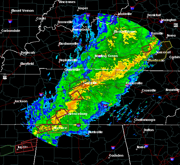 At 1131 pm cst, a severe thunderstorm capable of producing a tornado was located near mount pleasant, or 12 miles southwest of columbia, moving northeast at 35 mph (radar indicated rotation). Hazards include tornado. Flying debris will be dangerous to those caught without shelter. mobile homes will be damaged or destroyed. damage to roofs, windows, and vehicles will occur. tree damage is likely. this tornadic thunderstorm will remain over mainly rural areas of northwestern marshall and southeastern maury counties, including the following locations, i-65 east of columbia and culleoka. This includes interstate 65 between mile markers 34 and 52. At 1131 pm cst, a severe thunderstorm capable of producing a tornado was located near mount pleasant, or 12 miles southwest of columbia, moving northeast at 35 mph (radar indicated rotation). Hazards include tornado. Flying debris will be dangerous to those caught without shelter. mobile homes will be damaged or destroyed. damage to roofs, windows, and vehicles will occur. tree damage is likely. this tornadic thunderstorm will remain over mainly rural areas of northwestern marshall and southeastern maury counties, including the following locations, i-65 east of columbia and culleoka. This includes interstate 65 between mile markers 34 and 52.
|
| 6/28/2018 1:40 PM CDT |
 At 139 pm cdt, severe thunderstorms were located along a line extending from fayetteville to ardmore to loretto, moving southeast at 55 mph (emergency management. at 140 pm cdt, numerous reports of trees and power lines down have been received across lawrence and giles counties with these storms). Hazards include 70 mph wind gusts and penny size hail. Expect considerable tree damage. damage is likely to mobile homes, roofs, and outbuildings. locations impacted include, lewisburg, lawrenceburg, pulaski, loretto, ardmore, cornersville, st. joseph, elkton, minor hill, ethridge, lynnville, belfast, goodspring, leoma, westpoint, frankewing and prospect. This includes interstate 65 between mile markers 1 and 33. At 139 pm cdt, severe thunderstorms were located along a line extending from fayetteville to ardmore to loretto, moving southeast at 55 mph (emergency management. at 140 pm cdt, numerous reports of trees and power lines down have been received across lawrence and giles counties with these storms). Hazards include 70 mph wind gusts and penny size hail. Expect considerable tree damage. damage is likely to mobile homes, roofs, and outbuildings. locations impacted include, lewisburg, lawrenceburg, pulaski, loretto, ardmore, cornersville, st. joseph, elkton, minor hill, ethridge, lynnville, belfast, goodspring, leoma, westpoint, frankewing and prospect. This includes interstate 65 between mile markers 1 and 33.
|
| 6/28/2018 1:33 PM CDT |
 At 132 pm cdt, severe thunderstorms were located along a line extending from near petersburg to ardmore to near loretto, moving southeast at 55 mph (emergency management. at 125 pm cdt, numerous trees and pwoer lines were reporteldy blown down across lawrence county with these storms). Hazards include 70 mph wind gusts and penny size hail. Expect considerable tree damage. damage is likely to mobile homes, roofs, and outbuildings. locations impacted include, lewisburg, lawrenceburg, pulaski, loretto, ardmore, cornersville, st. joseph, elkton, minor hill, ethridge, lynnville, belfast, goodspring, leoma, westpoint, frankewing and prospect. This includes interstate 65 between mile markers 1 and 33. At 132 pm cdt, severe thunderstorms were located along a line extending from near petersburg to ardmore to near loretto, moving southeast at 55 mph (emergency management. at 125 pm cdt, numerous trees and pwoer lines were reporteldy blown down across lawrence county with these storms). Hazards include 70 mph wind gusts and penny size hail. Expect considerable tree damage. damage is likely to mobile homes, roofs, and outbuildings. locations impacted include, lewisburg, lawrenceburg, pulaski, loretto, ardmore, cornersville, st. joseph, elkton, minor hill, ethridge, lynnville, belfast, goodspring, leoma, westpoint, frankewing and prospect. This includes interstate 65 between mile markers 1 and 33.
|
| 6/28/2018 1:24 PM CDT |
 At 123 pm cdt, severe thunderstorms were located along a line extending from near lewisburg to pulaski to lawrenceburg, moving southeast at 55 mph (emergency management. at 120 pm, numerous trees and power lines were blown down across lawrence county with these storms). Hazards include 70 mph wind gusts. Expect considerable tree damage. damage is likely to mobile homes, roofs, and outbuildings. locations impacted include, columbia, lewisburg, lawrenceburg, pulaski, hohenwald, spring hill, mount pleasant, loretto, summertown, ardmore, cornersville, st. joseph, elkton, minor hill, ethridge, lynnville, gordonsburg, henryville, culleoka and belfast. This includes interstate 65 between mile markers 1 and 48. At 123 pm cdt, severe thunderstorms were located along a line extending from near lewisburg to pulaski to lawrenceburg, moving southeast at 55 mph (emergency management. at 120 pm, numerous trees and power lines were blown down across lawrence county with these storms). Hazards include 70 mph wind gusts. Expect considerable tree damage. damage is likely to mobile homes, roofs, and outbuildings. locations impacted include, columbia, lewisburg, lawrenceburg, pulaski, hohenwald, spring hill, mount pleasant, loretto, summertown, ardmore, cornersville, st. joseph, elkton, minor hill, ethridge, lynnville, gordonsburg, henryville, culleoka and belfast. This includes interstate 65 between mile markers 1 and 48.
|
| 6/28/2018 1:09 PM CDT |
 At 107 pm cdt, severe thunderstorms were located along a line extending from culleoka to near ethridge, moving southeast at 50 mph (emergency management. at 105 pm cdt, numerous trees were blown down with these storms across hickman and maury counties). Hazards include 70 mph wind gusts. Expect considerable tree damage. Damage is likely to mobile homes, roofs, and outbuildings. At 107 pm cdt, severe thunderstorms were located along a line extending from culleoka to near ethridge, moving southeast at 50 mph (emergency management. at 105 pm cdt, numerous trees were blown down with these storms across hickman and maury counties). Hazards include 70 mph wind gusts. Expect considerable tree damage. Damage is likely to mobile homes, roofs, and outbuildings.
|
| 6/28/2018 12:16 PM CDT |
 At 1215 pm cdt, a severe thunderstorm was located 7 miles northeast of pulaski, moving southeast at 40 mph (radar indicated). Hazards include 60 mph wind gusts and quarter size hail. Hail damage to vehicles is expected. expect wind damage to roofs, siding, and trees. locations impacted include, pulaski, cornersville, lynnville and frankewing. This includes interstate 65 between mile markers 13 and 34. At 1215 pm cdt, a severe thunderstorm was located 7 miles northeast of pulaski, moving southeast at 40 mph (radar indicated). Hazards include 60 mph wind gusts and quarter size hail. Hail damage to vehicles is expected. expect wind damage to roofs, siding, and trees. locations impacted include, pulaski, cornersville, lynnville and frankewing. This includes interstate 65 between mile markers 13 and 34.
|
| 6/28/2018 12:00 PM CDT |
 At 1200 pm cdt, a severe thunderstorm was located 13 miles north of pulaski, or near lynnville, moving southeast at 40 mph (emergency management). Hazards include 60 mph wind gusts and quarter size hail. Hail damage to vehicles is expected. expect wind damage to roofs, siding, and trees. locations impacted include, columbia, pulaski, mount pleasant, cornersville, lynnville, frankewing and culleoka. This includes interstate 65 between mile markers 13 and 37. At 1200 pm cdt, a severe thunderstorm was located 13 miles north of pulaski, or near lynnville, moving southeast at 40 mph (emergency management). Hazards include 60 mph wind gusts and quarter size hail. Hail damage to vehicles is expected. expect wind damage to roofs, siding, and trees. locations impacted include, columbia, pulaski, mount pleasant, cornersville, lynnville, frankewing and culleoka. This includes interstate 65 between mile markers 13 and 37.
|
| 6/28/2018 11:48 AM CDT |
 The national weather service in nashville has issued a * severe thunderstorm warning for. southwestern marshall county in middle tennessee. southeastern maury county in middle tennessee. northern giles county in middle tennessee. Until 1230 pm cdt. The national weather service in nashville has issued a * severe thunderstorm warning for. southwestern marshall county in middle tennessee. southeastern maury county in middle tennessee. northern giles county in middle tennessee. Until 1230 pm cdt.
|
| 6/28/2018 11:39 AM CDT |
 At 1139 am cdt, severe thunderstorms were located along a line extending from near fayetteville to near culleoka, moving south at 35 mph (radar indicated). Hazards include 60 mph wind gusts and nickel size hail. Expect damage to roofs, siding, and trees. locations impacted include, shelbyville, lewisburg, ardmore, cornersville, elkton, belfast, frankewing and farmington. This includes interstate 65 between mile markers 1 and 45. At 1139 am cdt, severe thunderstorms were located along a line extending from near fayetteville to near culleoka, moving south at 35 mph (radar indicated). Hazards include 60 mph wind gusts and nickel size hail. Expect damage to roofs, siding, and trees. locations impacted include, shelbyville, lewisburg, ardmore, cornersville, elkton, belfast, frankewing and farmington. This includes interstate 65 between mile markers 1 and 45.
|
| 6/28/2018 11:14 AM CDT |
 At 1113 am cdt, a severe thunderstorm was located near lewisburg, moving south at 40 mph (radar indicated). Hazards include 70 mph wind gusts and quarter size hail. Hail damage to vehicles is expected. expect considerable tree damage. wind damage is also likely to mobile homes, roofs, and outbuildings. locations impacted include, lewisburg, chapel hill, ardmore, cornersville, elkton, belfast, frankewing and farmington. This includes interstate 65 between mile markers 1 and 45. At 1113 am cdt, a severe thunderstorm was located near lewisburg, moving south at 40 mph (radar indicated). Hazards include 70 mph wind gusts and quarter size hail. Hail damage to vehicles is expected. expect considerable tree damage. wind damage is also likely to mobile homes, roofs, and outbuildings. locations impacted include, lewisburg, chapel hill, ardmore, cornersville, elkton, belfast, frankewing and farmington. This includes interstate 65 between mile markers 1 and 45.
|
| 6/28/2018 11:04 AM CDT | Several reports of trees down in lewisbur in marshall county TN, 0.2 miles W of Lewisburg, TN |
| 6/28/2018 11:01 AM CDT | The front of an auto parts store was ripped of in marshall county TN, 0.2 miles W of Lewisburg, TN |
| 6/28/2018 10:55 AM CDT |
 At 1054 am cdt, a severe thunderstorm was located near lewisburg, moving southeast at 40 mph (radar indicated). Hazards include 70 mph wind gusts and quarter size hail. Hail damage to vehicles is expected. expect considerable tree damage. Wind damage is also likely to mobile homes, roofs, and outbuildings. At 1054 am cdt, a severe thunderstorm was located near lewisburg, moving southeast at 40 mph (radar indicated). Hazards include 70 mph wind gusts and quarter size hail. Hail damage to vehicles is expected. expect considerable tree damage. Wind damage is also likely to mobile homes, roofs, and outbuildings.
|
| 6/28/2018 10:49 AM CDT |
 At 1048 am cdt, a severe thunderstorm was located 9 miles north of lewisburg, or near chapel hill, moving southeast at 40 mph (radar indicated). Hazards include 70 mph wind gusts and quarter size hail. Hail damage to vehicles is expected. expect considerable tree damage. wind damage is also likely to mobile homes, roofs, and outbuildings. locations impacted include, columbia, lewisburg, spring hill, thompson`s station, chapel hill, eagleville, rover, i-65 east of columbia, farmington and unionville. this includes the following highways, interstate 65 between mile markers 44 and 60. Interstate 840 between mile markers 30 and 34. At 1048 am cdt, a severe thunderstorm was located 9 miles north of lewisburg, or near chapel hill, moving southeast at 40 mph (radar indicated). Hazards include 70 mph wind gusts and quarter size hail. Hail damage to vehicles is expected. expect considerable tree damage. wind damage is also likely to mobile homes, roofs, and outbuildings. locations impacted include, columbia, lewisburg, spring hill, thompson`s station, chapel hill, eagleville, rover, i-65 east of columbia, farmington and unionville. this includes the following highways, interstate 65 between mile markers 44 and 60. Interstate 840 between mile markers 30 and 34.
|
| 6/28/2018 10:37 AM CDT |
 At 1036 am cdt, a severe thunderstorm was located near spring hill, or 14 miles south of franklin, moving southeast at 20 mph (radar indicated). Hazards include 60 mph wind gusts and quarter size hail. Hail damage to vehicles is expected. Expect wind damage to roofs, siding, and trees. At 1036 am cdt, a severe thunderstorm was located near spring hill, or 14 miles south of franklin, moving southeast at 20 mph (radar indicated). Hazards include 60 mph wind gusts and quarter size hail. Hail damage to vehicles is expected. Expect wind damage to roofs, siding, and trees.
|
| 6/23/2018 11:51 AM CDT |
 At 1151 am cdt, a severe thunderstorm was located near petersburg, or 8 miles northwest of fayetteville, moving east at 50 mph (radar indicated). Hazards include 60 mph wind gusts and penny size hail. Expect damage to roofs, siding, and trees. locations impacted include, lewisburg, cornersville and belfast. This includes interstate 65 between mile markers 23 and 32. At 1151 am cdt, a severe thunderstorm was located near petersburg, or 8 miles northwest of fayetteville, moving east at 50 mph (radar indicated). Hazards include 60 mph wind gusts and penny size hail. Expect damage to roofs, siding, and trees. locations impacted include, lewisburg, cornersville and belfast. This includes interstate 65 between mile markers 23 and 32.
|
| 6/23/2018 11:30 AM CDT |
 At 1130 am cdt, a severe thunderstorm was located near pulaski, moving east at 50 mph (radar indicated). Hazards include 60 mph wind gusts and penny size hail. Expect damage to roofs, siding, and trees. locations impacted include, lewisburg, pulaski, ardmore, cornersville, elkton, minor hill, lynnville, belfast, goodspring, frankewing and prospect. This includes interstate 65 between mile markers 1 and 32. At 1130 am cdt, a severe thunderstorm was located near pulaski, moving east at 50 mph (radar indicated). Hazards include 60 mph wind gusts and penny size hail. Expect damage to roofs, siding, and trees. locations impacted include, lewisburg, pulaski, ardmore, cornersville, elkton, minor hill, lynnville, belfast, goodspring, frankewing and prospect. This includes interstate 65 between mile markers 1 and 32.
|
| 6/23/2018 11:10 AM CDT |
 At 1110 am cdt, a severe thunderstorm was located near lawrenceburg, moving east at 50 mph (radar indicated). Hazards include 60 mph wind gusts and penny size hail. expect damage to roofs, siding, and trees At 1110 am cdt, a severe thunderstorm was located near lawrenceburg, moving east at 50 mph (radar indicated). Hazards include 60 mph wind gusts and penny size hail. expect damage to roofs, siding, and trees
|
| 6/22/2018 1:02 PM CDT |
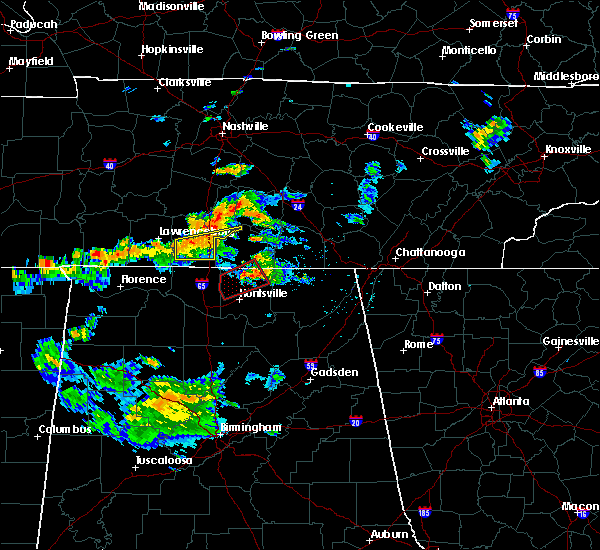 At 102 pm cdt, a severe thunderstorm was located 9 miles southwest of lewisburg, moving east at 30 mph (radar indicated). Hazards include 60 mph wind gusts. expect damage to roofs, siding, and trees At 102 pm cdt, a severe thunderstorm was located 9 miles southwest of lewisburg, moving east at 30 mph (radar indicated). Hazards include 60 mph wind gusts. expect damage to roofs, siding, and trees
|
| 9/19/2017 5:43 PM CDT |
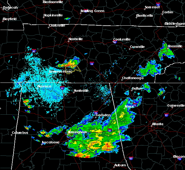 At 543 pm cdt, a severe thunderstorm was located near lewisburg, moving south at 15 mph (radar indicated). Hazards include 60 mph wind gusts. expect damage to roofs, siding, and trees At 543 pm cdt, a severe thunderstorm was located near lewisburg, moving south at 15 mph (radar indicated). Hazards include 60 mph wind gusts. expect damage to roofs, siding, and trees
|
| 9/19/2017 5:23 PM CDT |
 At 523 pm cdt, a severe thunderstorm was located near lewisburg, moving south at 15 mph (radar indicated). Hazards include 70 mph wind gusts and quarter size hail. Hail damage to vehicles is expected. expect considerable tree damage. wind damage is also likely to mobile homes, roofs, and outbuildings. Locations impacted include, shelbyville, lewisburg, chapel hill, cornersville, belfast, farmington and unionville. At 523 pm cdt, a severe thunderstorm was located near lewisburg, moving south at 15 mph (radar indicated). Hazards include 70 mph wind gusts and quarter size hail. Hail damage to vehicles is expected. expect considerable tree damage. wind damage is also likely to mobile homes, roofs, and outbuildings. Locations impacted include, shelbyville, lewisburg, chapel hill, cornersville, belfast, farmington and unionville.
|
| 9/19/2017 4:55 PM CDT |
 At 455 pm cdt, a severe thunderstorm was located 11 miles north of lewisburg, moving south at 15 mph (radar indicated). Hazards include 70 mph wind gusts and quarter size hail. Hail damage to vehicles is expected. expect considerable tree damage. Wind damage is also likely to mobile homes, roofs, and outbuildings. At 455 pm cdt, a severe thunderstorm was located 11 miles north of lewisburg, moving south at 15 mph (radar indicated). Hazards include 70 mph wind gusts and quarter size hail. Hail damage to vehicles is expected. expect considerable tree damage. Wind damage is also likely to mobile homes, roofs, and outbuildings.
|
| 8/31/2017 8:15 PM CDT |
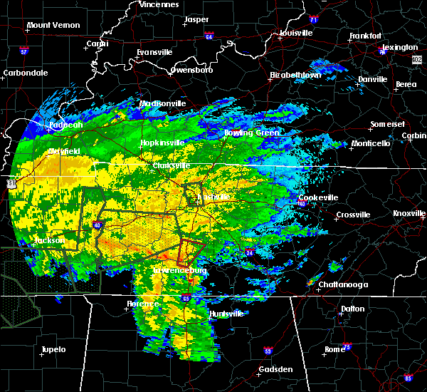 At 815 pm cdt, a severe thunderstorm capable of producing a tornado was located 7 miles west of lewisburg, moving north at 40 mph (radar indicated rotation). Hazards include tornado. Flying debris will be dangerous to those caught without shelter. mobile homes will be damaged or destroyed. damage to roofs, windows, and vehicles will occur. tree damage is likely. this dangerous storm will be near, lewisburg around 825 pm cdt. Other locations impacted by this tornadic thunderstorm include i-65 east of columbia, chapel hill and culleoka. At 815 pm cdt, a severe thunderstorm capable of producing a tornado was located 7 miles west of lewisburg, moving north at 40 mph (radar indicated rotation). Hazards include tornado. Flying debris will be dangerous to those caught without shelter. mobile homes will be damaged or destroyed. damage to roofs, windows, and vehicles will occur. tree damage is likely. this dangerous storm will be near, lewisburg around 825 pm cdt. Other locations impacted by this tornadic thunderstorm include i-65 east of columbia, chapel hill and culleoka.
|
| 5/27/2017 9:14 PM CDT |
 At 913 pm cdt, a severe thunderstorm was located near lewisburg, moving southeast at 60 mph (radar indicated). Hazards include 70 mph wind gusts and quarter size hail. Hail damage to vehicles is expected. expect considerable tree damage. Wind damage is also likely to mobile homes, roofs, and outbuildings. At 913 pm cdt, a severe thunderstorm was located near lewisburg, moving southeast at 60 mph (radar indicated). Hazards include 70 mph wind gusts and quarter size hail. Hail damage to vehicles is expected. expect considerable tree damage. Wind damage is also likely to mobile homes, roofs, and outbuildings.
|
| 5/27/2017 8:43 PM CDT |
 At 843 pm cdt, a severe thunderstorm was located near mount pleasant, or 9 miles west of columbia, moving southeast at 50 mph (radar indicated). Hazards include 70 mph wind gusts and quarter size hail. Hail damage to vehicles is expected. expect considerable tree damage. Wind damage is also likely to mobile homes, roofs, and outbuildings. At 843 pm cdt, a severe thunderstorm was located near mount pleasant, or 9 miles west of columbia, moving southeast at 50 mph (radar indicated). Hazards include 70 mph wind gusts and quarter size hail. Hail damage to vehicles is expected. expect considerable tree damage. Wind damage is also likely to mobile homes, roofs, and outbuildings.
|
| 4/30/2017 3:01 PM CDT |
 At 300 pm cdt, severe thunderstorms were located along a line extending from chapel hill to near petersburg to near hazel green, moving northeast at 50 mph (radar indicated). Hazards include 60 mph wind gusts. expect damage to roofs, siding, and trees At 300 pm cdt, severe thunderstorms were located along a line extending from chapel hill to near petersburg to near hazel green, moving northeast at 50 mph (radar indicated). Hazards include 60 mph wind gusts. expect damage to roofs, siding, and trees
|
| 4/30/2017 2:55 PM CDT |
 At 255 pm cdt, severe thunderstorms were located along a line extending from near spring hill to 10 miles northeast of pulaski to petersburg, moving northeast at 40 mph (radar indicated). Hazards include 60 mph wind gusts. Expect damage to roofs, siding, and trees. locations impacted include, columbia, lewisburg, spring hill, chapel hill, cornersville, belfast, frankewing, i-65 east of columbia and farmington. A tornado watch remains in effect until 700 pm cdt for middle tennessee. At 255 pm cdt, severe thunderstorms were located along a line extending from near spring hill to 10 miles northeast of pulaski to petersburg, moving northeast at 40 mph (radar indicated). Hazards include 60 mph wind gusts. Expect damage to roofs, siding, and trees. locations impacted include, columbia, lewisburg, spring hill, chapel hill, cornersville, belfast, frankewing, i-65 east of columbia and farmington. A tornado watch remains in effect until 700 pm cdt for middle tennessee.
|
| 4/30/2017 2:42 PM CDT |
 At 242 pm cdt, severe thunderstorms were located along a line extending from near thompson`s station to near pulaski to near ardmore, moving northeast at 40 mph (radar indicated). Hazards include 60 mph wind gusts. expect damage to roofs, siding, and trees At 242 pm cdt, severe thunderstorms were located along a line extending from near thompson`s station to near pulaski to near ardmore, moving northeast at 40 mph (radar indicated). Hazards include 60 mph wind gusts. expect damage to roofs, siding, and trees
|
| 3/27/2017 7:23 PM CDT |
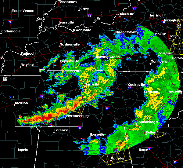 At 723 pm cdt, a severe thunderstorm was located 8 miles east of columbia, moving east at 35 mph (radar indicated). Hazards include 60 mph wind gusts and nickel size hail. Expect damage to roofs, siding, and trees. Locations impacted include, columbia, spring hill, i-65 east of columbia and culleoka. At 723 pm cdt, a severe thunderstorm was located 8 miles east of columbia, moving east at 35 mph (radar indicated). Hazards include 60 mph wind gusts and nickel size hail. Expect damage to roofs, siding, and trees. Locations impacted include, columbia, spring hill, i-65 east of columbia and culleoka.
|
| 3/27/2017 6:55 PM CDT |
 At 654 pm cdt, a severe thunderstorm was located near mount pleasant, or 8 miles west of columbia, moving east at 35 mph (radar indicated). Hazards include 60 mph wind gusts and nickel size hail. expect damage to roofs, siding, and trees At 654 pm cdt, a severe thunderstorm was located near mount pleasant, or 8 miles west of columbia, moving east at 35 mph (radar indicated). Hazards include 60 mph wind gusts and nickel size hail. expect damage to roofs, siding, and trees
|
| 3/21/2017 4:30 PM CDT | Several trees down across the county. small barn roof blown off and into roadwa in marshall county TN, 0.2 miles W of Lewisburg, TN |
| 3/21/2017 4:25 PM CDT | Hen Egg sized hail reported 0.2 miles W of Lewisburg, TN, corrected info. photos showed hail up to small orange sized hail fell in lewisburg with hail covering the ground. |
| 3/21/2017 4:20 PM CDT |
 At 419 pm cdt, severe thunderstorms were located along a line extending from 7 miles southeast of spring hill to 6 miles southwest of pulaski, moving southeast at 50 mph (radar indicated). Hazards include 60 mph wind gusts and quarter size hail. Hail damage to vehicles is expected. Expect wind damage to roofs, siding, and trees. At 419 pm cdt, severe thunderstorms were located along a line extending from 7 miles southeast of spring hill to 6 miles southwest of pulaski, moving southeast at 50 mph (radar indicated). Hazards include 60 mph wind gusts and quarter size hail. Hail damage to vehicles is expected. Expect wind damage to roofs, siding, and trees.
|
| 3/21/2017 4:12 PM CDT | Quarter sized hail reported 2.6 miles E of Lewisburg, TN |
| 3/21/2017 4:00 PM CDT |
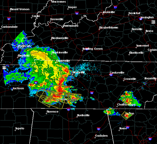 At 400 pm cdt, a severe thunderstorm was located 8 miles northwest of lewisburg, moving east at 20 mph (radar indicated). Hazards include 60 mph wind gusts and quarter size hail. Hail damage to vehicles is expected. Expect wind damage to roofs, siding, and trees. At 400 pm cdt, a severe thunderstorm was located 8 miles northwest of lewisburg, moving east at 20 mph (radar indicated). Hazards include 60 mph wind gusts and quarter size hail. Hail damage to vehicles is expected. Expect wind damage to roofs, siding, and trees.
|
| 3/21/2017 3:56 PM CDT | Quarter sized hail reported 0.2 miles W of Lewisburg, TN, spring place rd. |
| 3/21/2017 3:48 PM CDT | Hen Egg sized hail reported 4.2 miles N of Lewisburg, TN, photos showed hail up to small orange sized hail fell south of lewisburg with hail covering the ground |
| 3/21/2017 3:45 PM CDT |
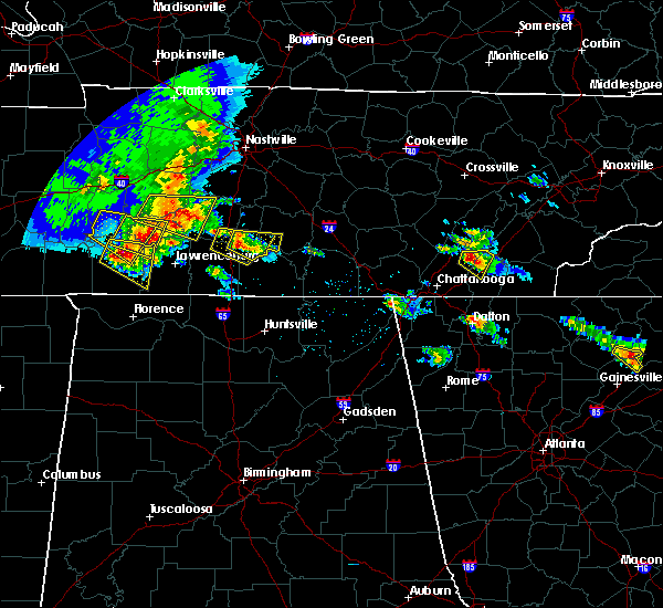 At 345 pm cdt, a severe thunderstorm was located near lewisburg, moving east at 30 mph (radar indicated). Hazards include 60 mph wind gusts and quarter size hail. Hail damage to vehicles is expected. expect wind damage to roofs, siding, and trees. Locations impacted include, shelbyville, lewisburg, cornersville, belfast and farmington. At 345 pm cdt, a severe thunderstorm was located near lewisburg, moving east at 30 mph (radar indicated). Hazards include 60 mph wind gusts and quarter size hail. Hail damage to vehicles is expected. expect wind damage to roofs, siding, and trees. Locations impacted include, shelbyville, lewisburg, cornersville, belfast and farmington.
|
| 3/21/2017 3:26 PM CDT |
 At 326 pm cdt, a severe thunderstorm was located near lewisburg, moving east at 30 mph (radar indicated). Hazards include 60 mph wind gusts and quarter size hail. Hail damage to vehicles is expected. Expect wind damage to roofs, siding, and trees. At 326 pm cdt, a severe thunderstorm was located near lewisburg, moving east at 30 mph (radar indicated). Hazards include 60 mph wind gusts and quarter size hail. Hail damage to vehicles is expected. Expect wind damage to roofs, siding, and trees.
|
| 3/21/2017 3:15 PM CDT |
 At 314 pm cdt, a severe thunderstorm was located 9 miles west of lewisburg, moving east at 25 mph (radar indicated). Hazards include 60 mph wind gusts and quarter size hail. Hail damage to vehicles is expected. Expect wind damage to roofs, siding, and trees. At 314 pm cdt, a severe thunderstorm was located 9 miles west of lewisburg, moving east at 25 mph (radar indicated). Hazards include 60 mph wind gusts and quarter size hail. Hail damage to vehicles is expected. Expect wind damage to roofs, siding, and trees.
|
| 3/9/2017 11:39 PM CST |
 At 1139 pm cst, a severe thunderstorm capable of producing a tornado was located near petersburg, or 10 miles southwest of shelbyville, moving east at 55 mph (radar indicated rotation). Hazards include tornado. Flying debris will be dangerous to those caught without shelter. mobile homes will be damaged or destroyed. damage to roofs, windows, and vehicles will occur. tree damage is likely. Locations impacted include, shelbyville and belfast. At 1139 pm cst, a severe thunderstorm capable of producing a tornado was located near petersburg, or 10 miles southwest of shelbyville, moving east at 55 mph (radar indicated rotation). Hazards include tornado. Flying debris will be dangerous to those caught without shelter. mobile homes will be damaged or destroyed. damage to roofs, windows, and vehicles will occur. tree damage is likely. Locations impacted include, shelbyville and belfast.
|
| 3/9/2017 11:31 PM CST |
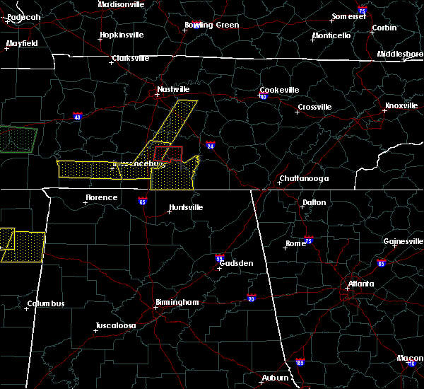 At 1131 pm cst, a severe thunderstorm capable of producing a tornado was located near lewisburg, moving east at 55 mph (radar indicated rotation). Hazards include tornado. Flying debris will be dangerous to those caught without shelter. mobile homes will be damaged or destroyed. damage to roofs, windows, and vehicles will occur. tree damage is likely. This tornadic thunderstorm will remain over mainly rural areas of southeastern marshall and southwestern bedford counties, including the following locations: farmington and belfast. At 1131 pm cst, a severe thunderstorm capable of producing a tornado was located near lewisburg, moving east at 55 mph (radar indicated rotation). Hazards include tornado. Flying debris will be dangerous to those caught without shelter. mobile homes will be damaged or destroyed. damage to roofs, windows, and vehicles will occur. tree damage is likely. This tornadic thunderstorm will remain over mainly rural areas of southeastern marshall and southwestern bedford counties, including the following locations: farmington and belfast.
|
| 3/9/2017 11:28 PM CST | Several large trees blown down in lewisburg including one on a house. reports of significant damage on fayetteville highway near belfast. possible tornad in marshall county TN, 0.2 miles W of Lewisburg, TN |
| 3/9/2017 11:27 PM CST | Several trees down in lewisburg on midway street in marshall county TN, 0.2 miles W of Lewisburg, TN |
| 3/9/2017 11:23 PM CST | Trees down in mooresville in marshall county TN, 7.7 miles E of Lewisburg, TN |
| 3/9/2017 11:16 PM CST |
 At 1116 pm cst, a severe thunderstorm was located 9 miles west of lewisburg, moving east at 50 mph (radar indicated). Hazards include 60 mph wind gusts. expect damage to roofs, siding, and trees At 1116 pm cst, a severe thunderstorm was located 9 miles west of lewisburg, moving east at 50 mph (radar indicated). Hazards include 60 mph wind gusts. expect damage to roofs, siding, and trees
|
| 12/18/2016 1:15 AM CST |
 At 115 am cst, a severe thunderstorm was located near shelbyville, moving northeast at 60 mph (radar indicated). Hazards include 60 mph wind gusts. Expect damage to roofs, siding, and trees. locations impacted include, shelbyville, lewisburg, manchester, wartrace, bell buckle, normandy, summitville, christiana, belfast, bradyville, farmington, raus, fosterville, deason and beechgrove. A tornado watch remains in effect until 300 am cst for middle tennessee. At 115 am cst, a severe thunderstorm was located near shelbyville, moving northeast at 60 mph (radar indicated). Hazards include 60 mph wind gusts. Expect damage to roofs, siding, and trees. locations impacted include, shelbyville, lewisburg, manchester, wartrace, bell buckle, normandy, summitville, christiana, belfast, bradyville, farmington, raus, fosterville, deason and beechgrove. A tornado watch remains in effect until 300 am cst for middle tennessee.
|
| 12/18/2016 12:59 AM CST |
 At 1258 am cst, a severe thunderstorm was located near lewisburg, moving northeast at 70 mph. another cell was located southwest of chapel hill (radar indicated). Hazards include 60 mph wind gusts. expect damage to roofs, siding, and trees At 1258 am cst, a severe thunderstorm was located near lewisburg, moving northeast at 70 mph. another cell was located southwest of chapel hill (radar indicated). Hazards include 60 mph wind gusts. expect damage to roofs, siding, and trees
|
| 12/18/2016 12:52 AM CST |
 At 1250 am cst, a severe thunderstorm was located near lewisburg, moving northeast at 70 mph (radar indicated). Hazards include 60 mph wind gusts. Expect damage to roofs, siding, and trees. locations impacted include, shelbyville, lewisburg, chapel hill, cornersville, wartrace, eagleville, bell buckle, lynnville, christiana, belfast, farmington, raus, unionville, fosterville, rockvale, deason and rover. A tornado watch remains in effect until 300 am cst for middle tennessee. At 1250 am cst, a severe thunderstorm was located near lewisburg, moving northeast at 70 mph (radar indicated). Hazards include 60 mph wind gusts. Expect damage to roofs, siding, and trees. locations impacted include, shelbyville, lewisburg, chapel hill, cornersville, wartrace, eagleville, bell buckle, lynnville, christiana, belfast, farmington, raus, unionville, fosterville, rockvale, deason and rover. A tornado watch remains in effect until 300 am cst for middle tennessee.
|
| 12/18/2016 12:38 AM CST |
 At 1237 am cst, a severe thunderstorm was located near pulaski, moving northeast at 70 mph. another cell was located near lynnville moving northeast at 70 mph (radar indicated). Hazards include 60 mph wind gusts. expect damage to roofs, siding, and trees At 1237 am cst, a severe thunderstorm was located near pulaski, moving northeast at 70 mph. another cell was located near lynnville moving northeast at 70 mph (radar indicated). Hazards include 60 mph wind gusts. expect damage to roofs, siding, and trees
|
| 12/18/2016 12:32 AM CST |
 At 1231 am cst, a severe thunderstorm was located 13 miles west of lewisburg, moving northeast at 60 mph (radar indicated). Hazards include 60 mph wind gusts. Expect damage to roofs, siding, and trees. locations impacted include, lawrenceburg, cornersville, ethridge, lynnville and culleoka. A tornado watch remains in effect until 300 am cst for middle tennessee. At 1231 am cst, a severe thunderstorm was located 13 miles west of lewisburg, moving northeast at 60 mph (radar indicated). Hazards include 60 mph wind gusts. Expect damage to roofs, siding, and trees. locations impacted include, lawrenceburg, cornersville, ethridge, lynnville and culleoka. A tornado watch remains in effect until 300 am cst for middle tennessee.
|
| 12/18/2016 12:16 AM CST |
 At 1216 am cst, a severe thunderstorm was located near lawrenceburg, moving northeast at 60 mph (radar indicated). Hazards include 60 mph wind gusts. expect damage to roofs, siding, and trees At 1216 am cst, a severe thunderstorm was located near lawrenceburg, moving northeast at 60 mph (radar indicated). Hazards include 60 mph wind gusts. expect damage to roofs, siding, and trees
|
| 7/8/2016 10:00 PM CDT |
 At 959 pm cdt, severe thunderstorms were located along a line extending from 14 miles northwest of manchester to near petersburg, moving east at 40 mph (radar indicated). Hazards include 60 mph wind gusts and penny size hail. Expect damage to roofs. siding. And trees. At 959 pm cdt, severe thunderstorms were located along a line extending from 14 miles northwest of manchester to near petersburg, moving east at 40 mph (radar indicated). Hazards include 60 mph wind gusts and penny size hail. Expect damage to roofs. siding. And trees.
|
| 7/8/2016 9:31 PM CDT |
 At 931 pm cdt, severe thunderstorms were located along a line extending from near murfreesboro to near petersburg, moving east at 45 mph (radar indicated). Hazards include 70 mph wind gusts and penny size hail. Expect considerable tree damage. Damage is likely to mobile homes, roofs, and outbuildings. At 931 pm cdt, severe thunderstorms were located along a line extending from near murfreesboro to near petersburg, moving east at 45 mph (radar indicated). Hazards include 70 mph wind gusts and penny size hail. Expect considerable tree damage. Damage is likely to mobile homes, roofs, and outbuildings.
|
| 7/8/2016 8:54 PM CDT |
 At 853 pm cdt, severe thunderstorms were located along a line extending from 10 miles south of columbia to 11 miles northeast of pulaski, moving east at 20 mph (radar indicated). Hazards include 60 mph wind gusts and quarter size hail. Hail damage to vehicles is expected. Expect wind damage to roofs, siding, and trees. At 853 pm cdt, severe thunderstorms were located along a line extending from 10 miles south of columbia to 11 miles northeast of pulaski, moving east at 20 mph (radar indicated). Hazards include 60 mph wind gusts and quarter size hail. Hail damage to vehicles is expected. Expect wind damage to roofs, siding, and trees.
|
| 7/6/2016 5:44 PM CDT |
 At 543 pm cdt, severe thunderstorms were located along a line extending from bell buckle to interstate 65, moving southeast at 30 mph (radar indicated). Hazards include 60 mph wind gusts and penny size hail. Expect damage to roofs. siding. and trees. Locations impacted include, shelbyville, spring hill, chapel hill, wartrace, eagleville, bell buckle, unionville, fosterville, rockvale, farmington, deason and rover. At 543 pm cdt, severe thunderstorms were located along a line extending from bell buckle to interstate 65, moving southeast at 30 mph (radar indicated). Hazards include 60 mph wind gusts and penny size hail. Expect damage to roofs. siding. and trees. Locations impacted include, shelbyville, spring hill, chapel hill, wartrace, eagleville, bell buckle, unionville, fosterville, rockvale, farmington, deason and rover.
|
| 7/6/2016 5:23 PM CDT |
 At 523 pm cdt, severe thunderstorms were located along a line extending from near eagleville to near columbia, moving southeast at 35 mph (radar indicated). Hazards include 60 mph wind gusts and penny size hail. Expect damage to roofs. siding. And trees. At 523 pm cdt, severe thunderstorms were located along a line extending from near eagleville to near columbia, moving southeast at 35 mph (radar indicated). Hazards include 60 mph wind gusts and penny size hail. Expect damage to roofs. siding. And trees.
|
| 6/28/2016 6:17 PM CDT |
 At 616 pm cdt, a severe thunderstorm was located 14 miles northeast of lewisburg, moving south at 40 mph (radar indicated). Hazards include 60 mph wind gusts. Expect damage to roofs. siding. and trees. Locations impacted include, shelbyville, lewisburg, chapel hill, unionville, farmington, deason and rover. At 616 pm cdt, a severe thunderstorm was located 14 miles northeast of lewisburg, moving south at 40 mph (radar indicated). Hazards include 60 mph wind gusts. Expect damage to roofs. siding. and trees. Locations impacted include, shelbyville, lewisburg, chapel hill, unionville, farmington, deason and rover.
|
| 6/28/2016 6:06 PM CDT |
 At 606 pm cdt, a severe thunderstorm was located 14 miles south of nolensville, or 16 miles southeast of franklin, moving south at 20 mph (radar indicated). Hazards include 60 mph wind gusts. Expect damage to roofs. siding. and trees. Locations impacted include, shelbyville, lewisburg, chapel hill, eagleville, unionville, rockvale, farmington, deason and rover. At 606 pm cdt, a severe thunderstorm was located 14 miles south of nolensville, or 16 miles southeast of franklin, moving south at 20 mph (radar indicated). Hazards include 60 mph wind gusts. Expect damage to roofs. siding. and trees. Locations impacted include, shelbyville, lewisburg, chapel hill, eagleville, unionville, rockvale, farmington, deason and rover.
|
| 6/28/2016 5:53 PM CDT |
 At 553 pm cdt, a severe thunderstorm was located 10 miles south of nolensville, or 12 miles southeast of franklin, moving south at 40 mph (radar indicated). Hazards include 60 mph wind gusts and penny size hail. Expect damage to roofs. siding. And trees. At 553 pm cdt, a severe thunderstorm was located 10 miles south of nolensville, or 12 miles southeast of franklin, moving south at 40 mph (radar indicated). Hazards include 60 mph wind gusts and penny size hail. Expect damage to roofs. siding. And trees.
|
| 6/25/2016 9:00 PM CDT | A few trees down across marshall county in marshall county TN, 0.2 miles W of Lewisburg, TN |
| 6/15/2016 5:39 PM CDT |
 At 539 pm cdt, severe thunderstorms were located along a line extending from 7 miles southeast of shelbyville to 9 miles south of lewisburg, moving southeast at 55 mph (radar indicated). Hazards include 60 mph wind gusts. Expect damage to roofs. siding. And trees. At 539 pm cdt, severe thunderstorms were located along a line extending from 7 miles southeast of shelbyville to 9 miles south of lewisburg, moving southeast at 55 mph (radar indicated). Hazards include 60 mph wind gusts. Expect damage to roofs. siding. And trees.
|
| 6/15/2016 5:23 PM CDT | A few trees down throughout the county in marshall county TN, 0.2 miles W of Lewisburg, TN |
| 6/15/2016 5:18 PM CDT |
 At 518 pm cdt, severe thunderstorms were located along a line extending from near shelbyville to near lewisburg, moving south at 45 mph (radar indicated). Hazards include 60 mph wind gusts. Expect damage to roofs. siding. And trees. At 518 pm cdt, severe thunderstorms were located along a line extending from near shelbyville to near lewisburg, moving south at 45 mph (radar indicated). Hazards include 60 mph wind gusts. Expect damage to roofs. siding. And trees.
|
| 3/31/2016 6:00 PM CDT |
 At 559 pm cdt, a severe thunderstorm capable of producing a tornado was located 12 miles northwest of shelbyville, moving east at 50 mph (radar indicated rotation). Hazards include tornado and ping pong ball size hail. Flying debris will be dangerous to those caught without shelter. mobile homes will be damaged or destroyed. damage to roofs, windows, and vehicles will occur. tree damage is likely. Locations impacted include, chapel hill and farmington. At 559 pm cdt, a severe thunderstorm capable of producing a tornado was located 12 miles northwest of shelbyville, moving east at 50 mph (radar indicated rotation). Hazards include tornado and ping pong ball size hail. Flying debris will be dangerous to those caught without shelter. mobile homes will be damaged or destroyed. damage to roofs, windows, and vehicles will occur. tree damage is likely. Locations impacted include, chapel hill and farmington.
|
| 3/31/2016 5:51 PM CDT |
 At 550 pm cdt, a severe thunderstorm capable of producing a tornado was located 11 miles north of lewisburg, moving east at 50 mph (radar indicated rotation). Hazards include tornado and ping pong ball size hail. Flying debris will be dangerous to those caught without shelter. mobile homes will be damaged or destroyed. damage to roofs, windows, and vehicles will occur. tree damage is likely. Locations impacted include, columbia, spring hill, chapel hill, i-65 east of columbia and farmington. At 550 pm cdt, a severe thunderstorm capable of producing a tornado was located 11 miles north of lewisburg, moving east at 50 mph (radar indicated rotation). Hazards include tornado and ping pong ball size hail. Flying debris will be dangerous to those caught without shelter. mobile homes will be damaged or destroyed. damage to roofs, windows, and vehicles will occur. tree damage is likely. Locations impacted include, columbia, spring hill, chapel hill, i-65 east of columbia and farmington.
|
| 3/31/2016 5:51 PM CDT |
 At 559 pm cdt, a severe thunderstorm capable of producing a tornado was located 12 miles northwest of shelbyville, moving east at 50 mph (radar indicated rotation). Hazards include tornado and ping pong ball size hail. Flying debris will be dangerous to those caught without shelter. mobile homes will be damaged or destroyed. damage to roofs, windows, and vehicles will occur. tree damage is likely. Locations impacted include, chapel hill and farmington. At 559 pm cdt, a severe thunderstorm capable of producing a tornado was located 12 miles northwest of shelbyville, moving east at 50 mph (radar indicated rotation). Hazards include tornado and ping pong ball size hail. Flying debris will be dangerous to those caught without shelter. mobile homes will be damaged or destroyed. damage to roofs, windows, and vehicles will occur. tree damage is likely. Locations impacted include, chapel hill and farmington.
|
| 3/31/2016 5:42 PM CDT |
 At 541 pm cdt, a severe thunderstorm capable of producing a tornado was located 8 miles east of columbia, moving east at 50 mph (radar indicated rotation). Hazards include tornado and ping pong ball size hail. Flying debris will be dangerous to those caught without shelter. mobile homes will be damaged or destroyed. damage to roofs, windows, and vehicles will occur. tree damage is likely. This tornadic thunderstorm will remain over mainly rural areas of southeastern maury and northern marshall counties, including the following locations: i-65 east of columbia, chapel hill and farmington. At 541 pm cdt, a severe thunderstorm capable of producing a tornado was located 8 miles east of columbia, moving east at 50 mph (radar indicated rotation). Hazards include tornado and ping pong ball size hail. Flying debris will be dangerous to those caught without shelter. mobile homes will be damaged or destroyed. damage to roofs, windows, and vehicles will occur. tree damage is likely. This tornadic thunderstorm will remain over mainly rural areas of southeastern maury and northern marshall counties, including the following locations: i-65 east of columbia, chapel hill and farmington.
|
| 8/22/2015 4:33 PM CDT |
 At 432 pm cdt, a severe thunderstorm was located near petersburg, or 9 miles southeast of lewisburg, moving east at 25 mph (radar indicated). Hazards include 60 mph wind gusts and quarter size hail. Hail damage to vehicles is expected. expect wind damage to roofs, siding and trees. Locations impacted include, shelbyville, lewisburg, petersburg, wartrace, belfast, farmington and raus. At 432 pm cdt, a severe thunderstorm was located near petersburg, or 9 miles southeast of lewisburg, moving east at 25 mph (radar indicated). Hazards include 60 mph wind gusts and quarter size hail. Hail damage to vehicles is expected. expect wind damage to roofs, siding and trees. Locations impacted include, shelbyville, lewisburg, petersburg, wartrace, belfast, farmington and raus.
|
| 8/22/2015 4:24 PM CDT |
 At 423 pm cdt, a severe thunderstorm was located near petersburg, or near lewisburg, moving east at 25 mph (radar indicated). Hazards include 60 mph wind gusts and quarter size hail. Hail damage to vehicles is expected. Expect wind damage to roofs, siding and trees. At 423 pm cdt, a severe thunderstorm was located near petersburg, or near lewisburg, moving east at 25 mph (radar indicated). Hazards include 60 mph wind gusts and quarter size hail. Hail damage to vehicles is expected. Expect wind damage to roofs, siding and trees.
|
| 7/14/2015 4:47 PM CDT |
 At 447 pm cdt, a severe thunderstorm was located near petersburg, or 8 miles southeast of lewisburg, moving southeast at 30 mph (radar indicated). Hazards include 60 mph wind gusts. Expect damage to roofs. siding and trees. Locations impacted include, shelbyville, lewisburg, cornersville, farmington and belfast. At 447 pm cdt, a severe thunderstorm was located near petersburg, or 8 miles southeast of lewisburg, moving southeast at 30 mph (radar indicated). Hazards include 60 mph wind gusts. Expect damage to roofs. siding and trees. Locations impacted include, shelbyville, lewisburg, cornersville, farmington and belfast.
|
| 7/14/2015 4:26 PM CDT |
 At 426 pm cdt, a severe thunderstorm was located over lewisburg, moving southeast at 30 mph (radar indicated). Hazards include 60 mph wind gusts. Expect damage to roofs. siding and trees. This severe thunderstorm will remain over mainly rural areas of marshall, southwestern bedford, southeastern maury and northeastern giles counties, including the following locations, cornersville, farmington, culleoka, belfast and chapel hill. At 426 pm cdt, a severe thunderstorm was located over lewisburg, moving southeast at 30 mph (radar indicated). Hazards include 60 mph wind gusts. Expect damage to roofs. siding and trees. This severe thunderstorm will remain over mainly rural areas of marshall, southwestern bedford, southeastern maury and northeastern giles counties, including the following locations, cornersville, farmington, culleoka, belfast and chapel hill.
|
| 6/1/2015 2:36 PM CDT | At 234 pm cdt, a severe thunderstorm was located 7 miles east of lewisburg, and moving northeast at 20 mph (radar indicated). Hazards include 60 mph wind gusts and nickel size hail. Expect damage to roofs. siding and trees. The severe thunderstorm will be near, shelbyville around 300 pm cdt. |
| 6/1/2015 2:26 PM CDT | At 222 pm cdt, a severe thunderstorm was located 7 miles southeast of lewisburg, and moving east at 20 mph (radar indicated). Hazards include 60 mph wind gusts and nickel size hail. Expect damage to roofs. siding and trees. The severe thunderstorm will affect mainly rural areas of southern marshall county, including the following locations, belfast. |
| 6/1/2015 2:12 PM CDT | At 208 pm cdt, a severe thunderstorm was located 8 miles south of lewisburg, and moving east at 20 mph (radar indicated). Hazards include 60 mph wind gusts and nickel size hail. Expect damage to roofs. siding and trees. the severe thunderstorm will be near, lewisburg around 220 pm cdt. Other locations in the warning include belfast. |
| 7/10/2013 8:15 PM CDT | 6 trees reported blown down across marshall county in marshall county TN, 0.2 miles W of Lewisburg, TN |
| 3/18/2013 12:31 PM CDT | Roof blown off of a barn at 2780 joe reeves rd just east of culleok in maury county TN, 7.9 miles ESE of Lewisburg, TN |
| 3/18/2013 11:20 AM CDT | Roof blown off of a barn at 2780 joe reeves rd just east of culleok in maury county TN, 7.9 miles ESE of Lewisburg, TN |
| 3/31/2012 5:01 PM CDT | Quarter sized hail reported 2.1 miles N of Lewisburg, TN |
| 3/31/2012 4:56 PM CDT | Golf Ball sized hail reported 1.4 miles N of Lewisburg, TN, hail reported near highway 31 just south of lewisburg |
| 3/31/2012 4:55 PM CDT | Half Dollar sized hail reported 0.2 miles W of Lewisburg, TN |
| 1/1/0001 12:00 AM | Quarter sized hail reported 1.5 miles E of Lewisburg, TN, amateur radio operator reports quarter size hail between lewisburg and interstate 65. |
| 1/1/0001 12:00 AM | Trees and powers lines down on hwy 31a between henry horton state park and lewisbur in marshall county TN, 4.8 miles SSW of Lewisburg, TN |
| 1/1/0001 12:00 AM | A few trees and power lines were downed across northern portions of the count in marshall county TN, 4.8 miles S of Lewisburg, TN |
| 1/1/0001 12:00 AM | Numerous large tree limbs and a few trees down along highway 431 about 2 to 3 miles south of the maury and marshall county lin in maury county TN, 7.4 miles SSE of Lewisburg, TN |
| 1/1/0001 12:00 AM | Several large trees were in marshall county TN, 5 miles SW of Lewisburg, TN |
| 1/1/0001 12:00 AM | A few trees were downed in and around lewisbur in marshall county TN, 0.2 miles W of Lewisburg, TN |
| 1/1/0001 12:00 AM | New lake road near jorgensen lane...70 mph winds...quarter-size hail...3 trees lifted out of the ground in marshall county TN, 3.8 miles NE of Lewisburg, TN |
Hail Maps for Lewisburg, TN
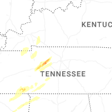
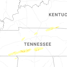
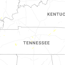


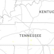


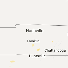


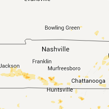


Connect with Interactive Hail Maps