

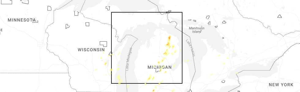
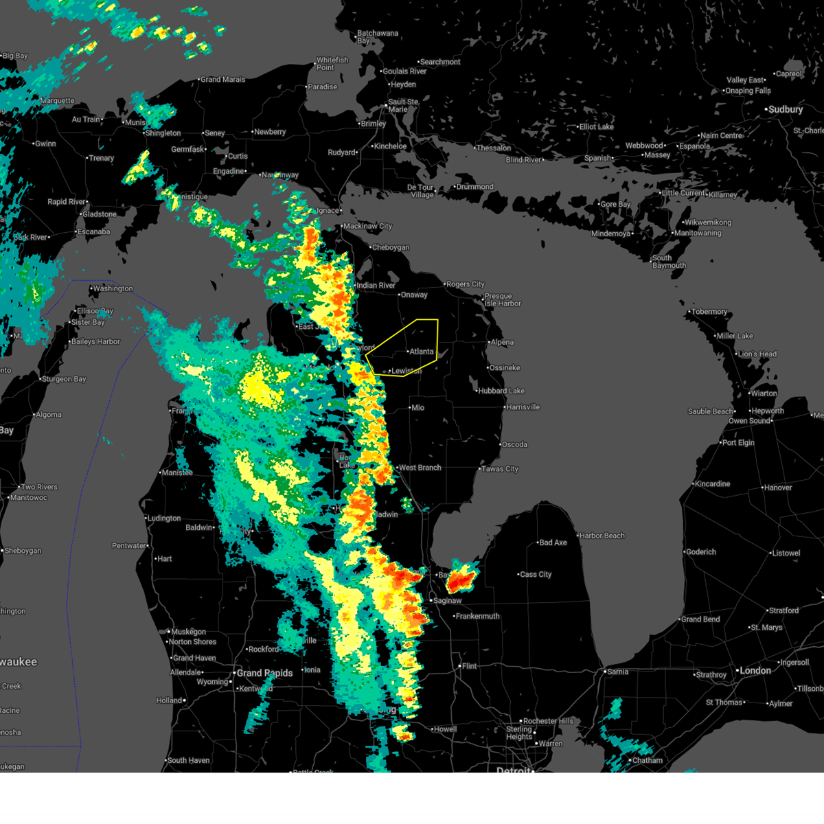
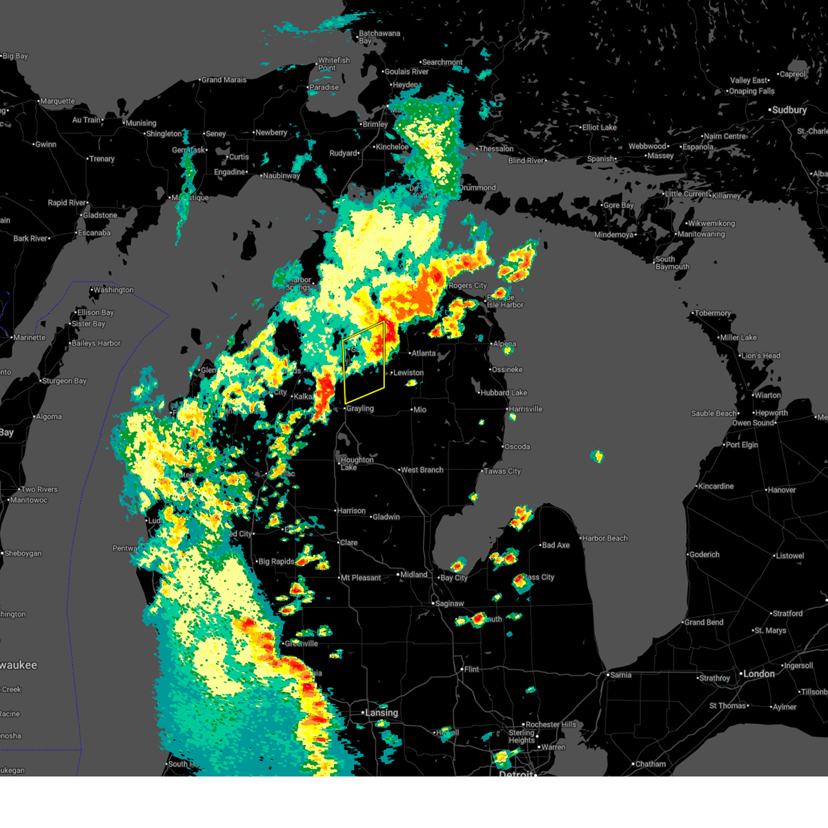
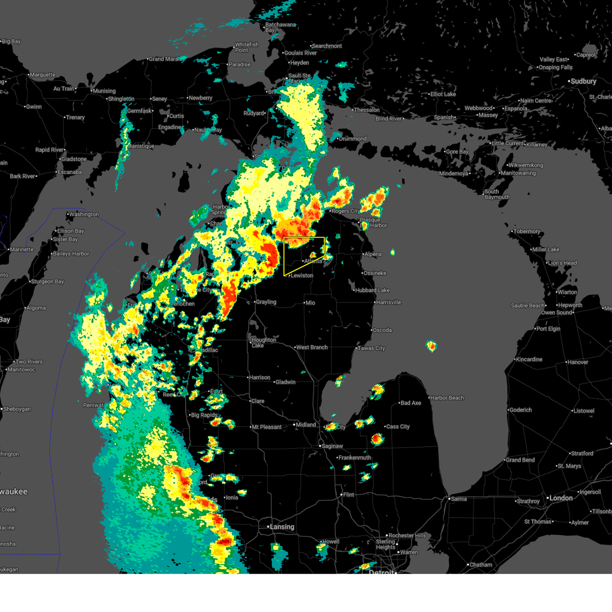
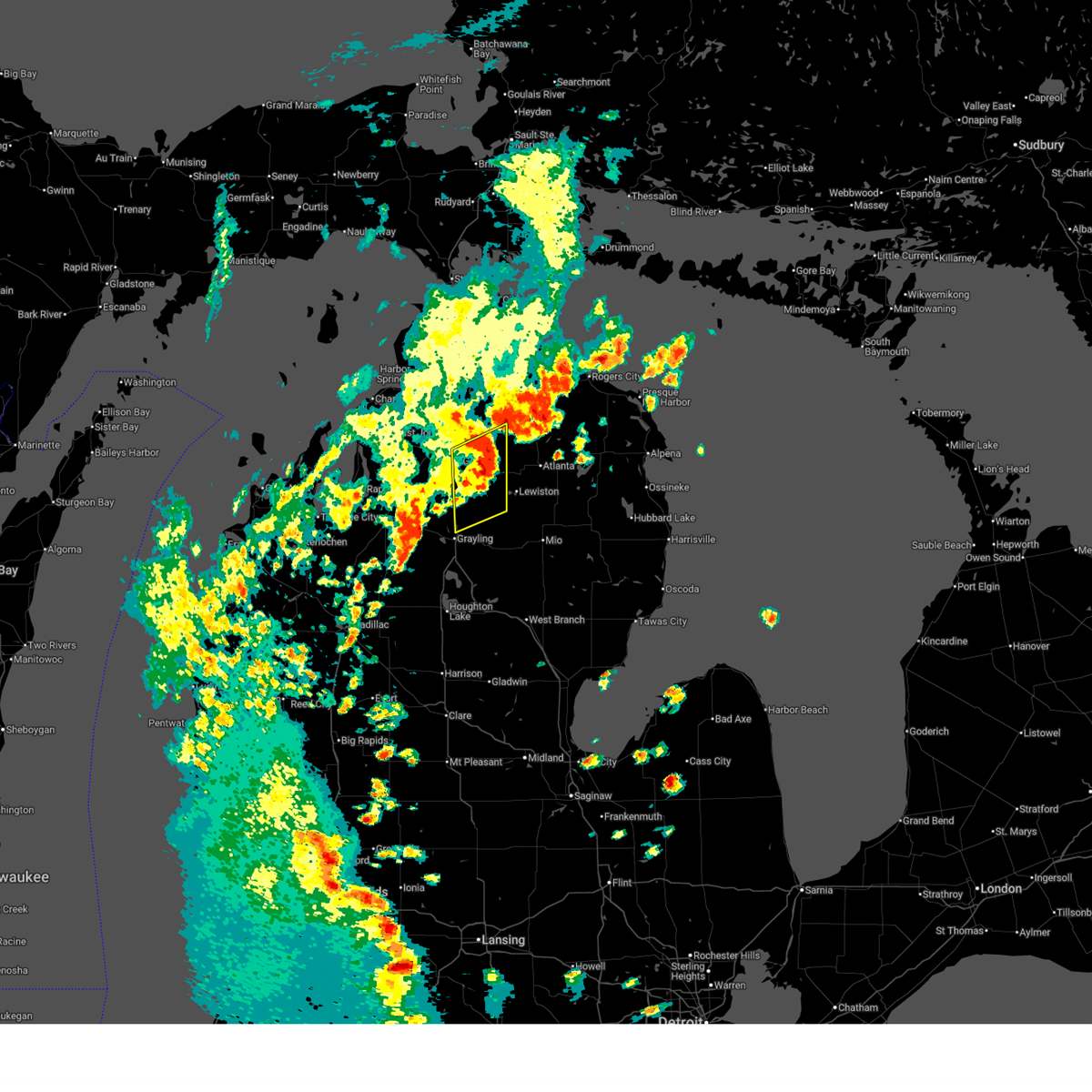
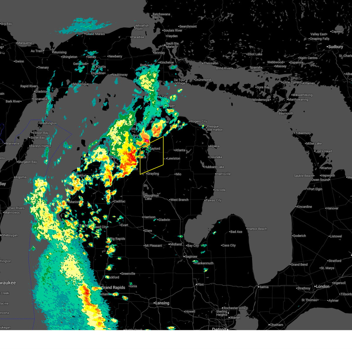
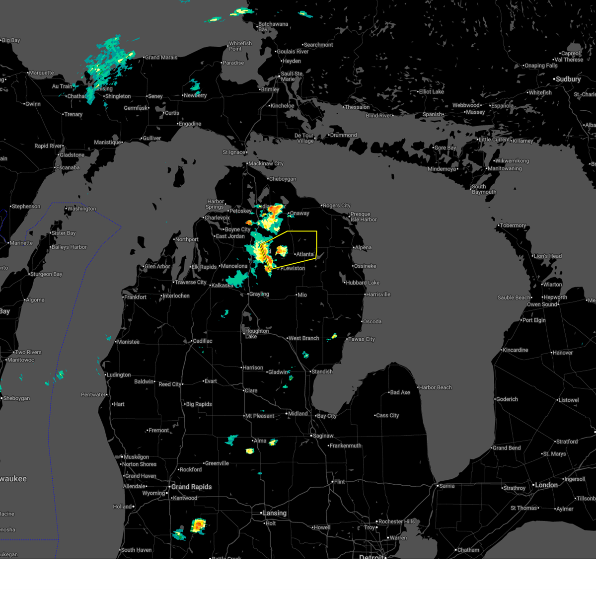
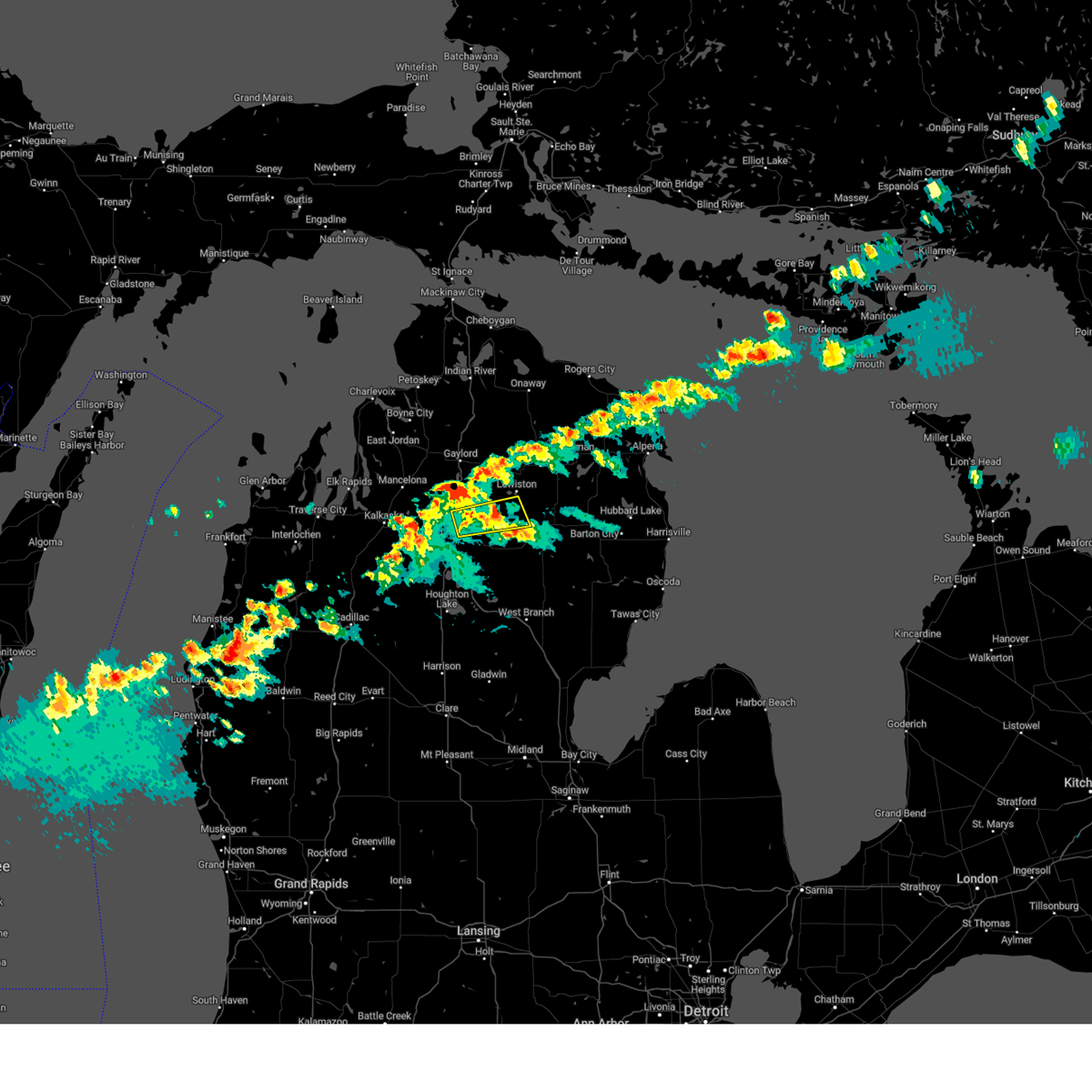
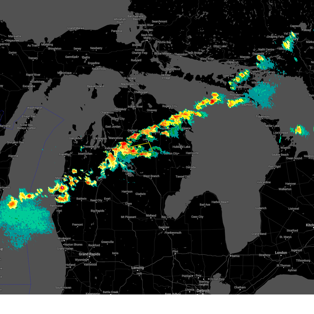
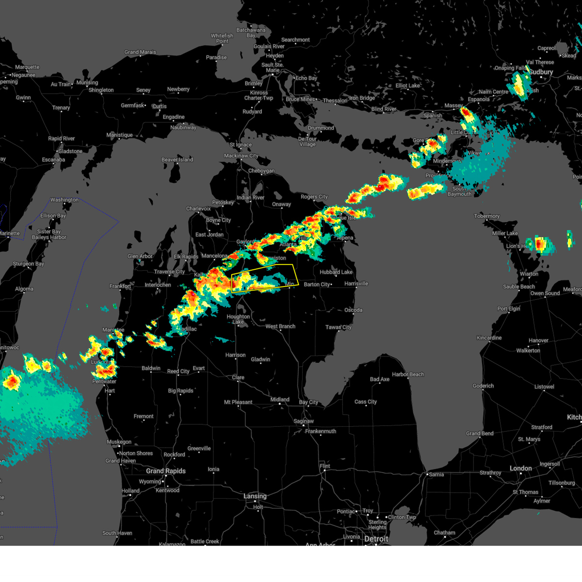
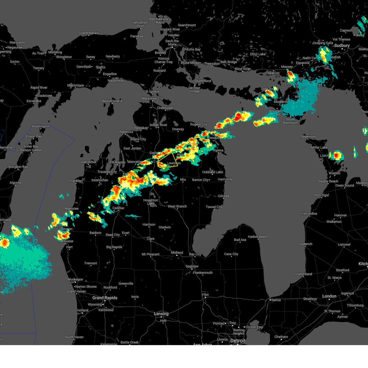
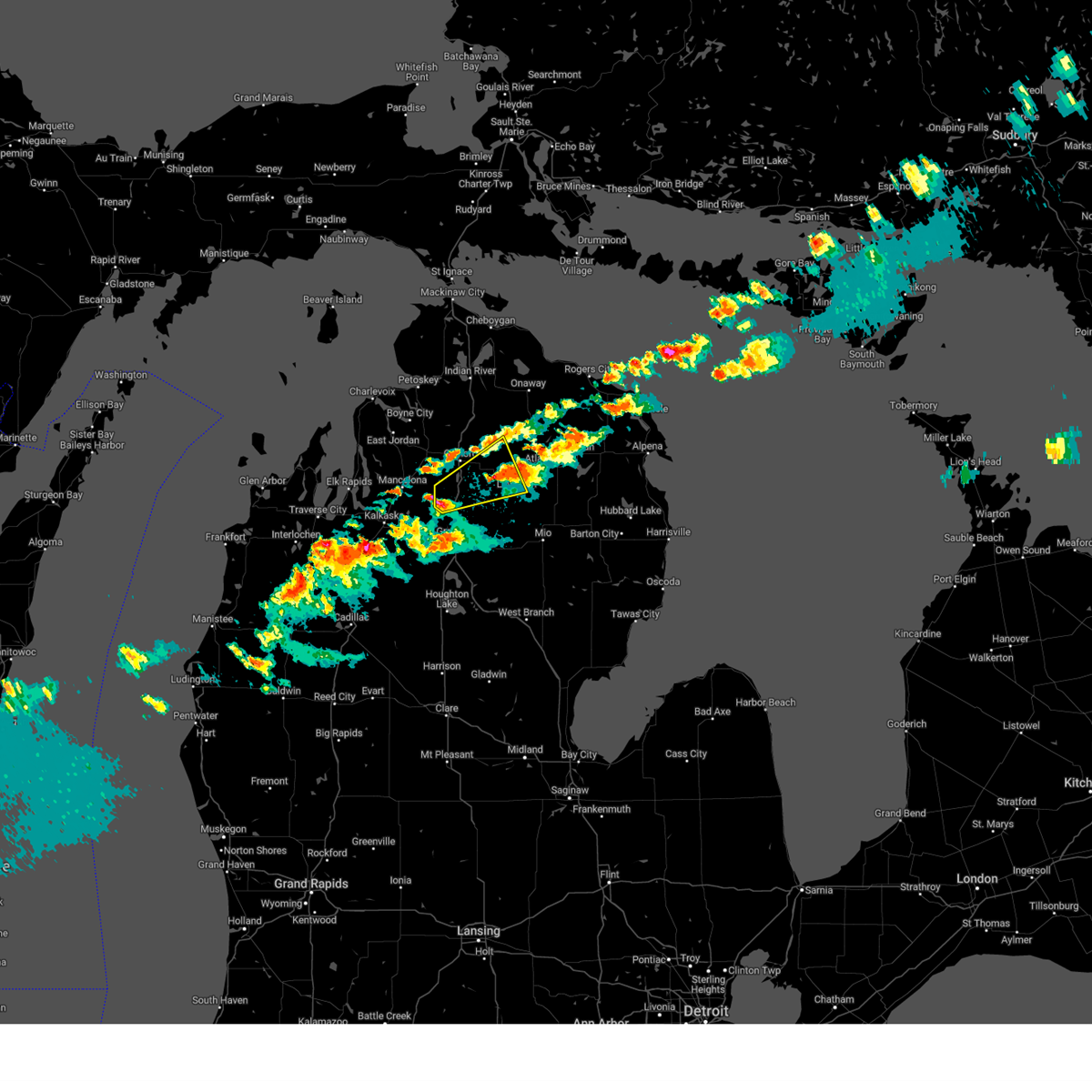
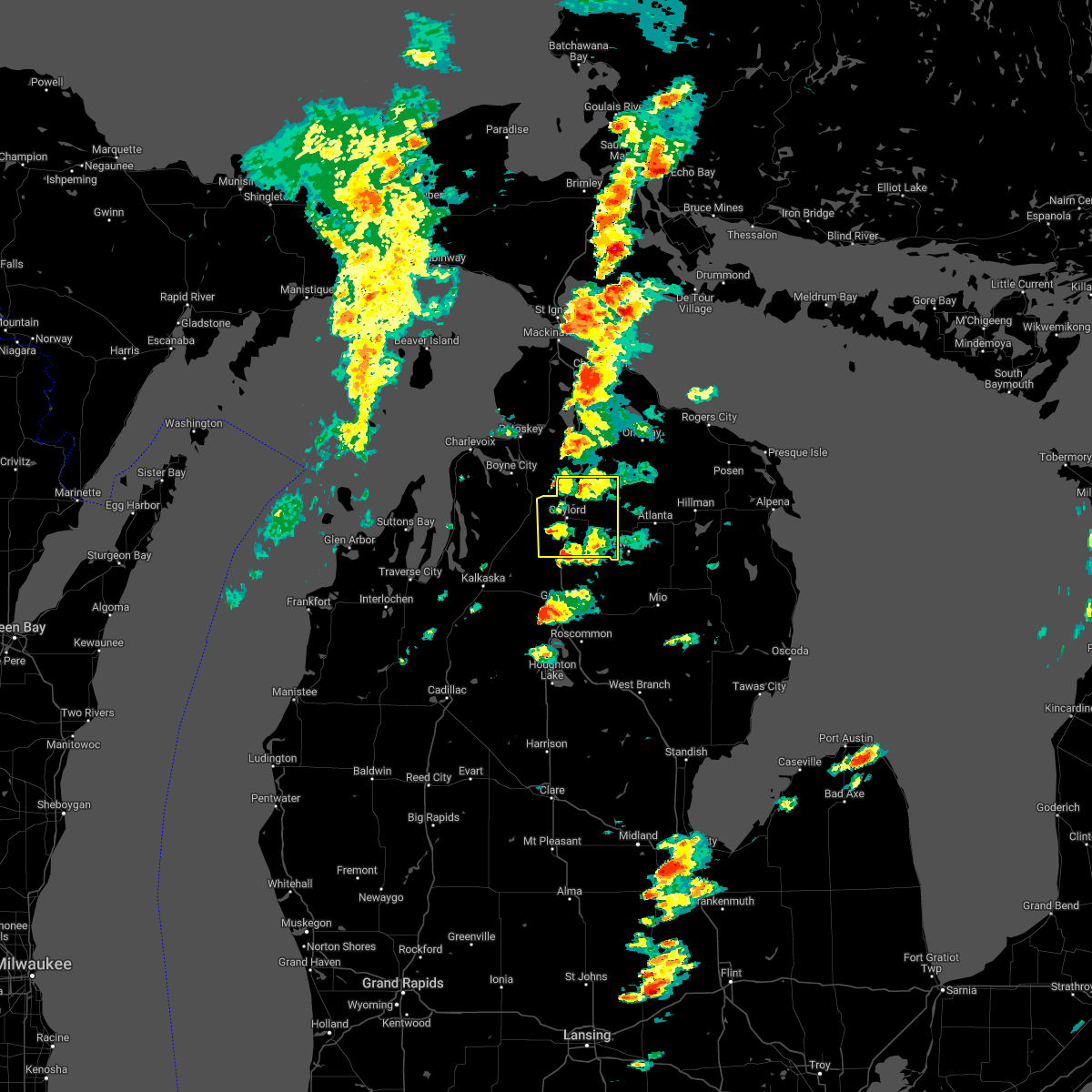
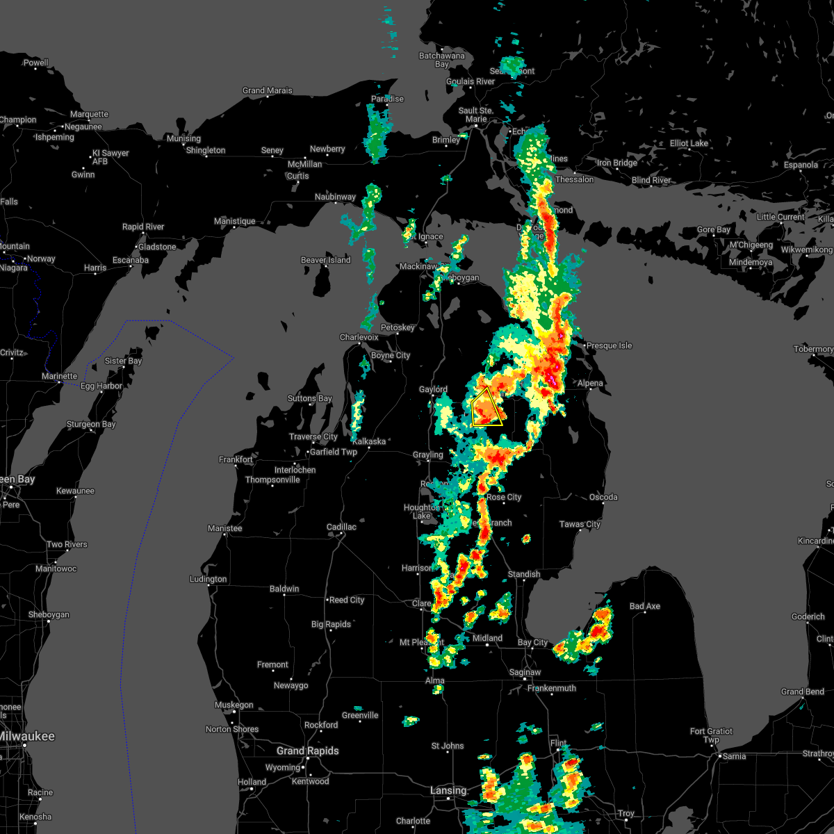
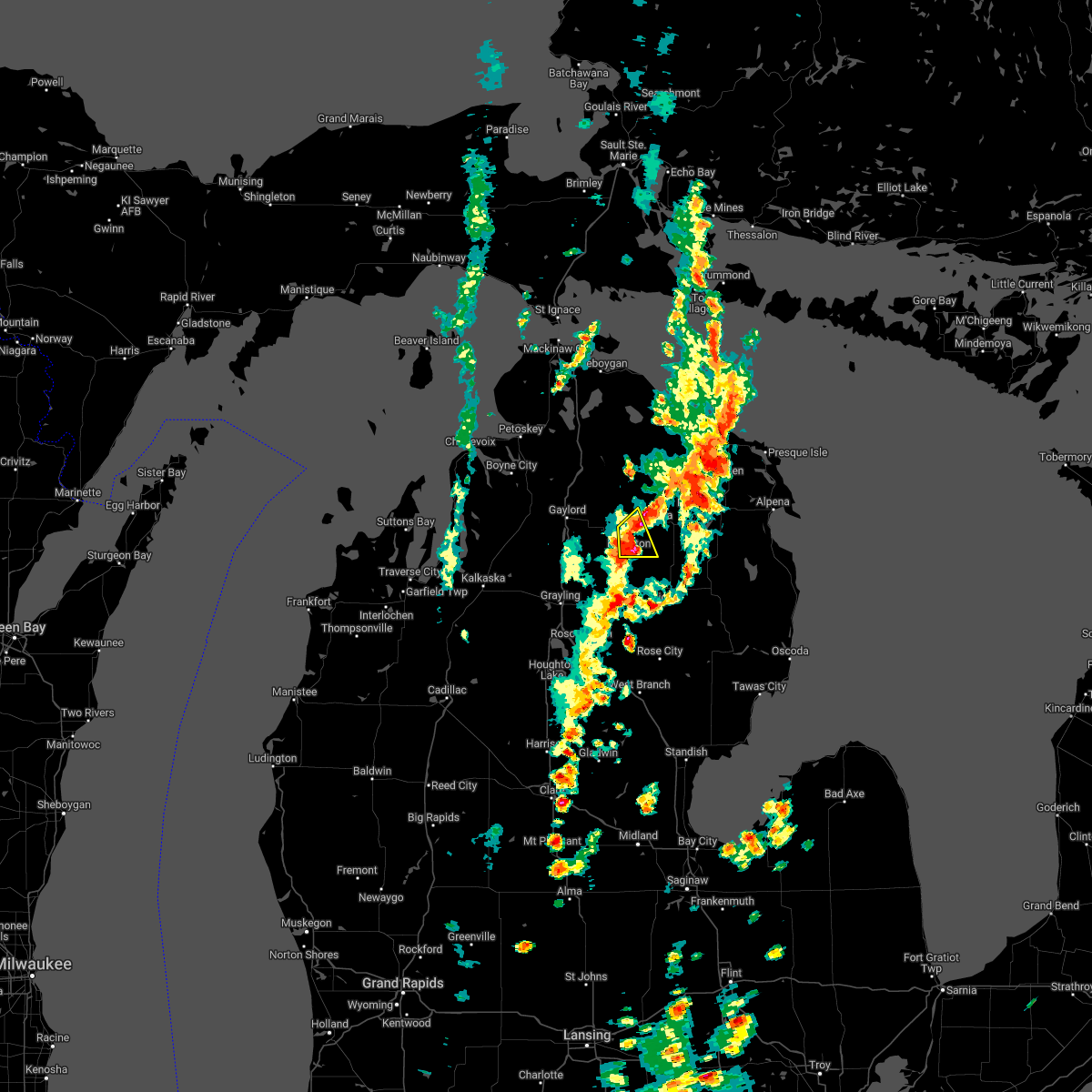
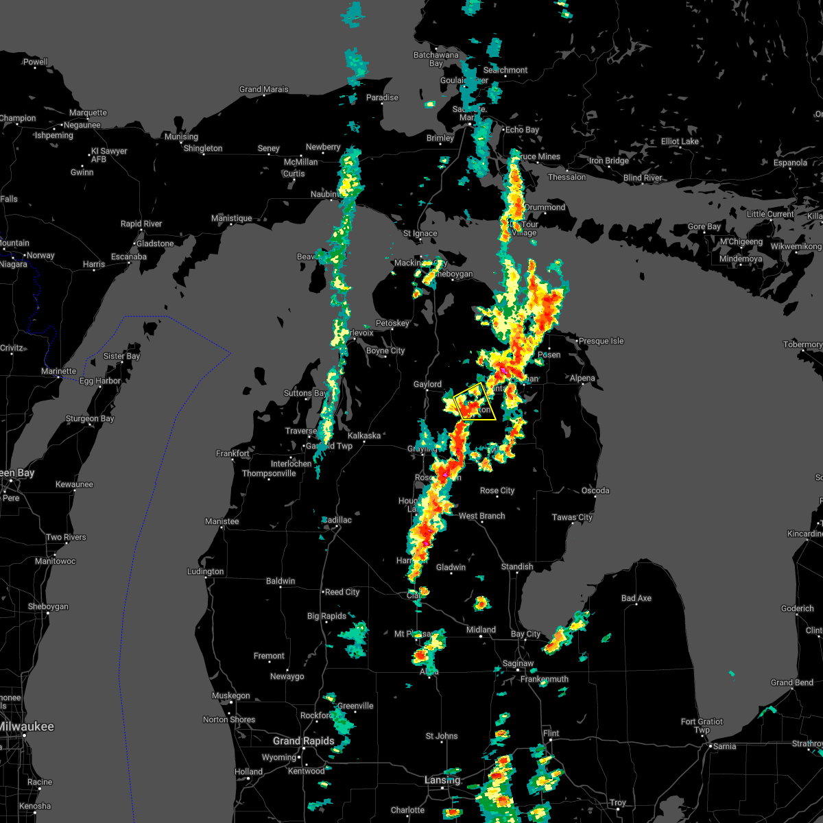
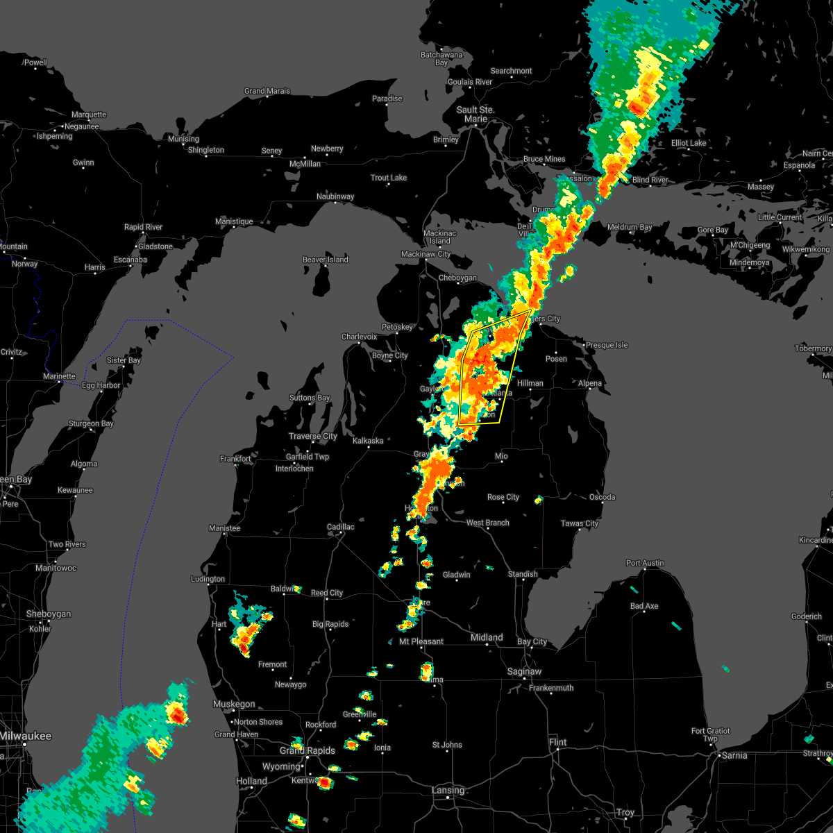
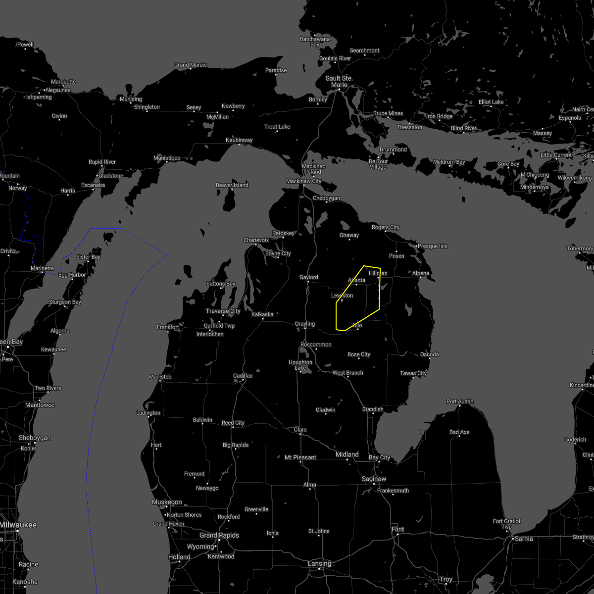
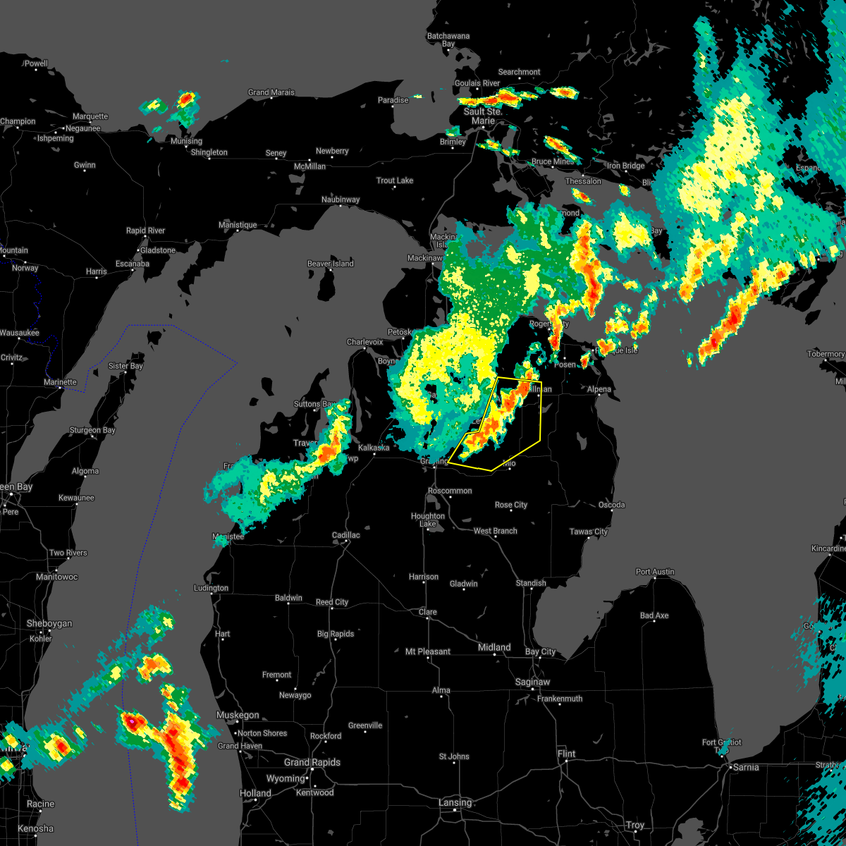
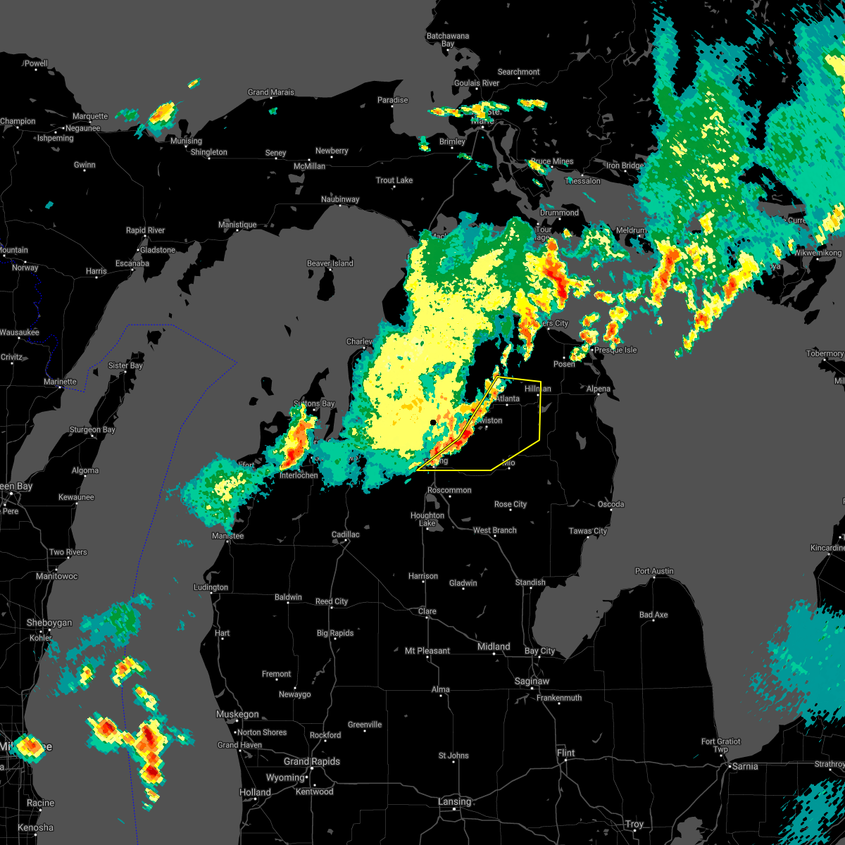
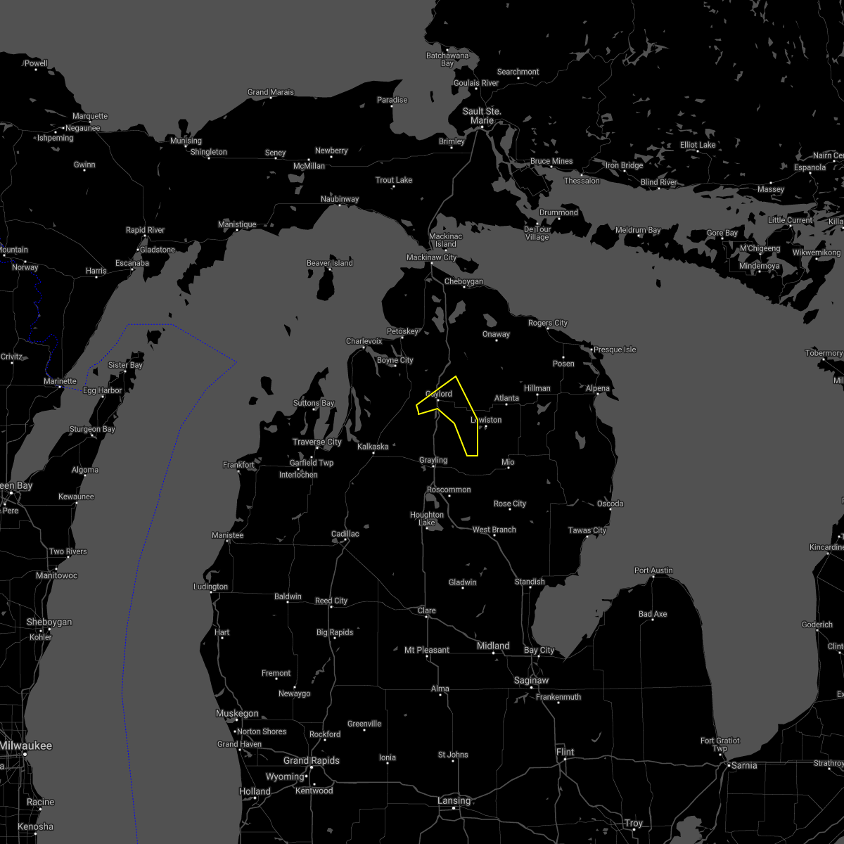
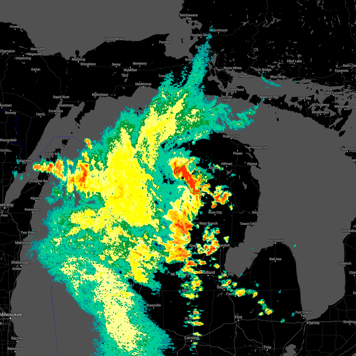
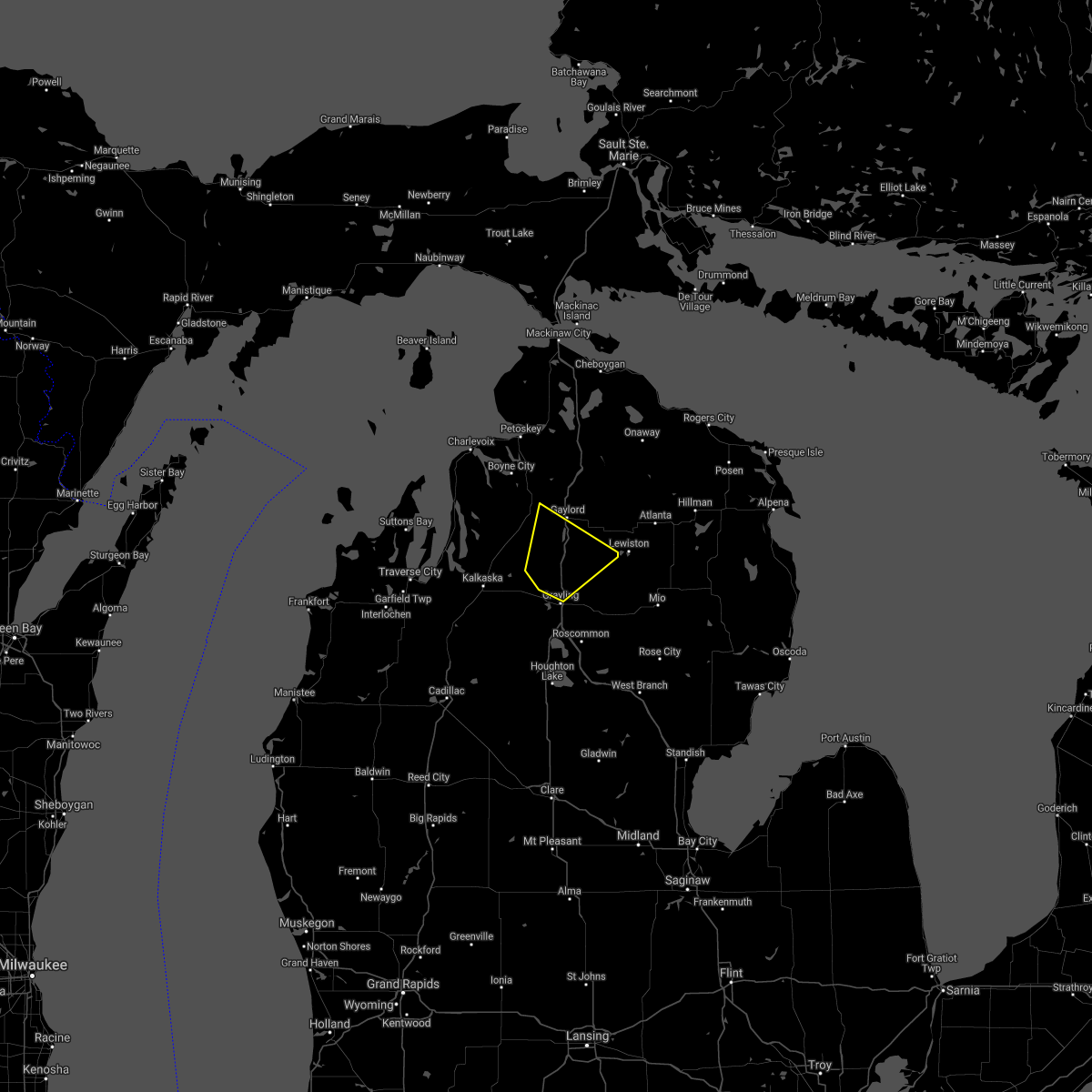
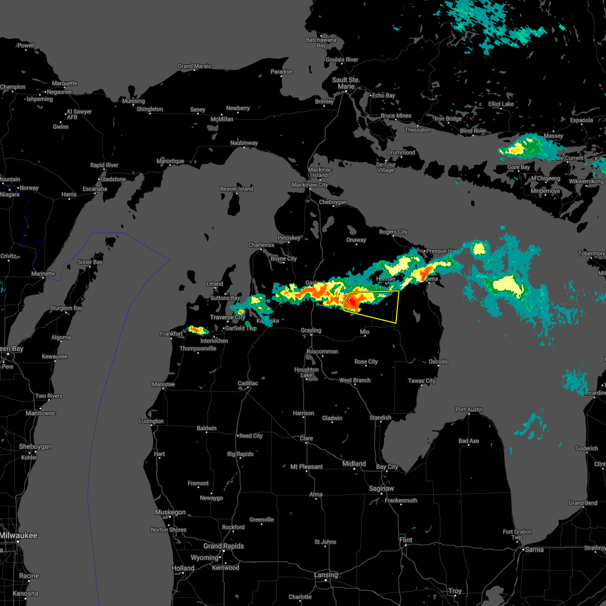
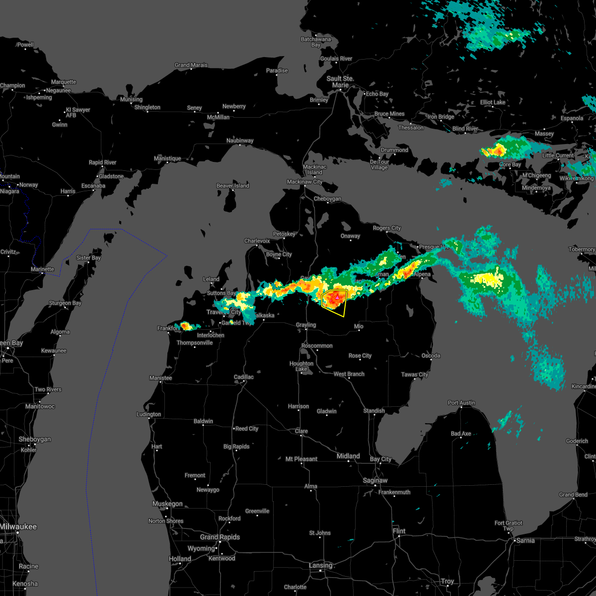
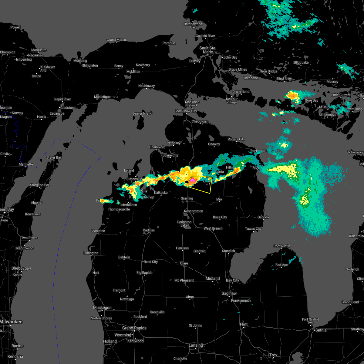
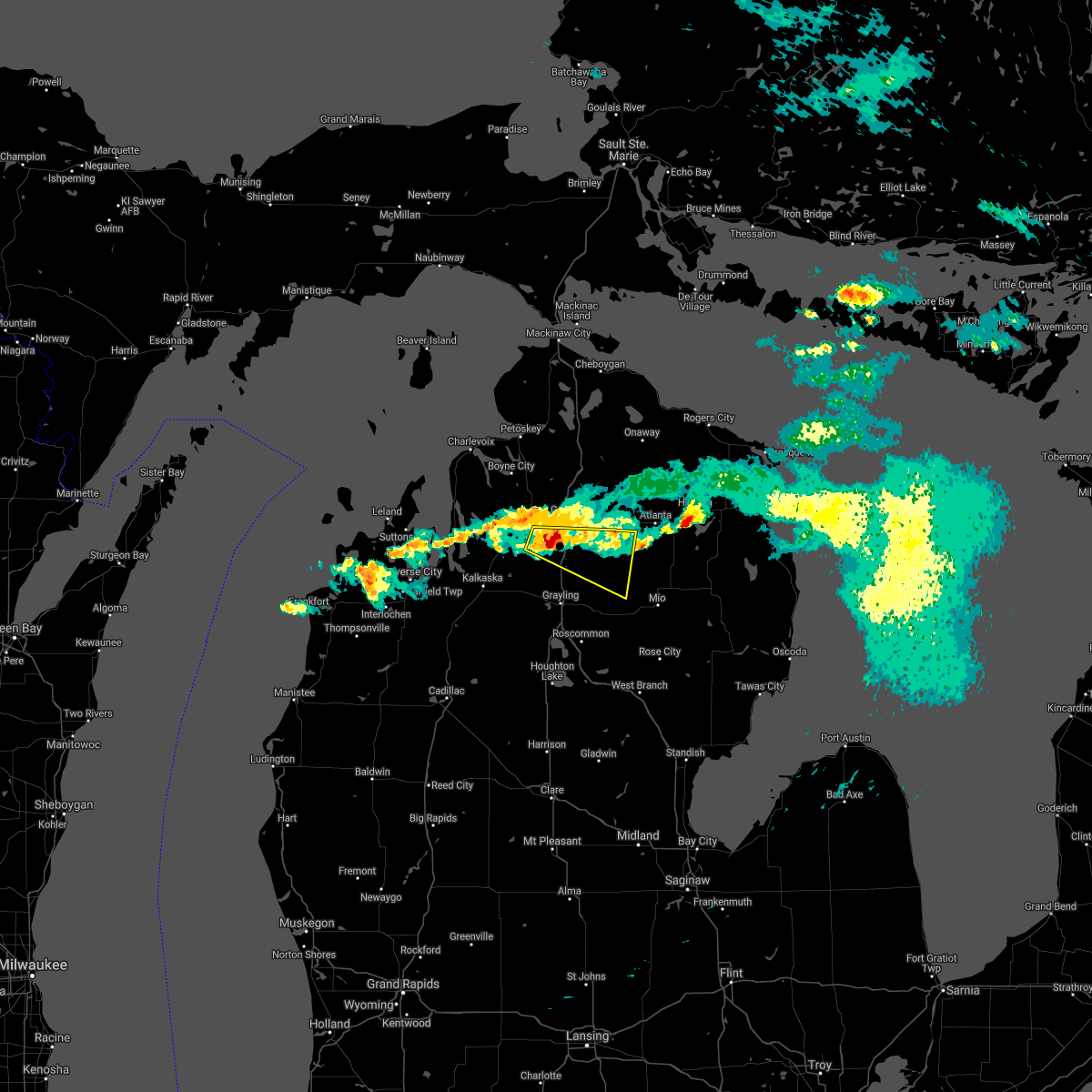
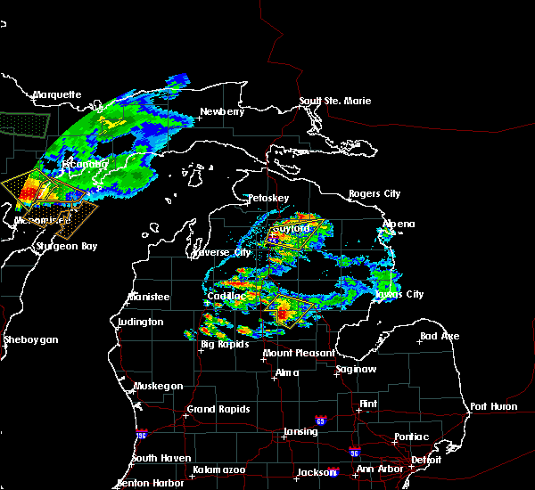
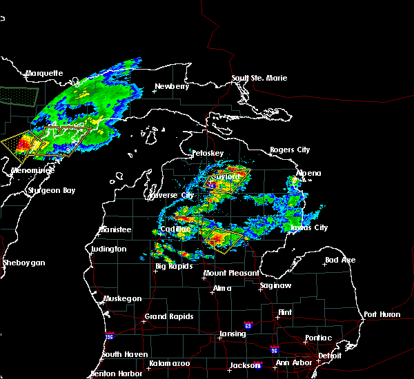
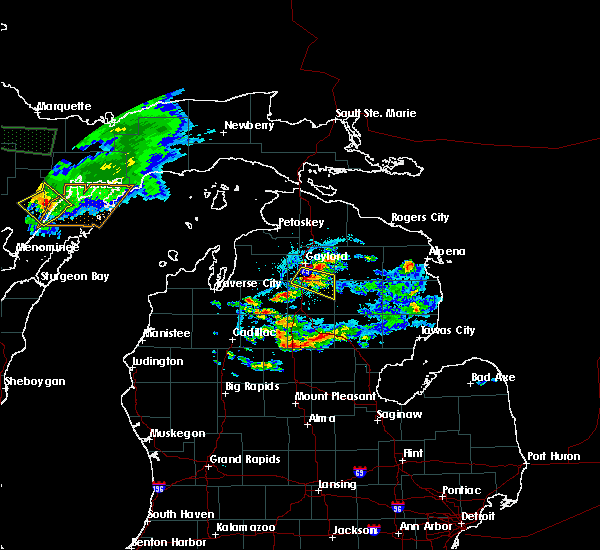
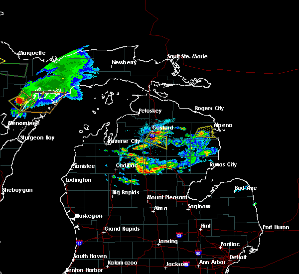
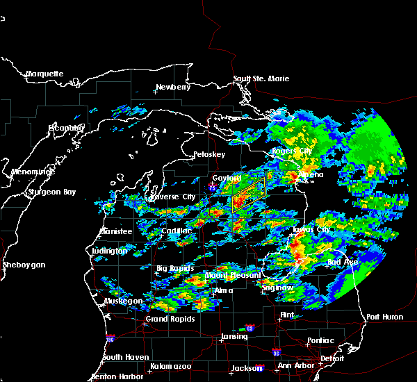
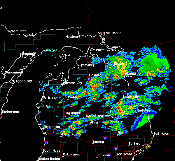
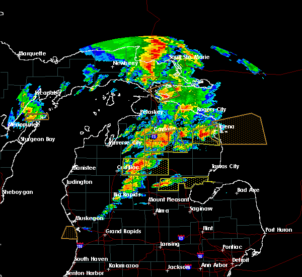
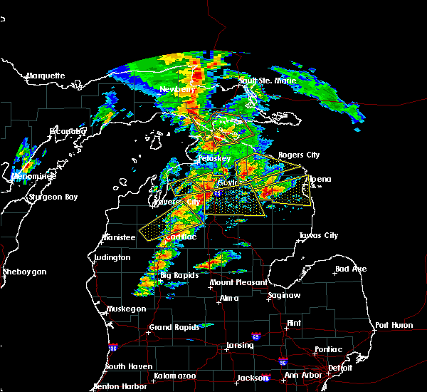
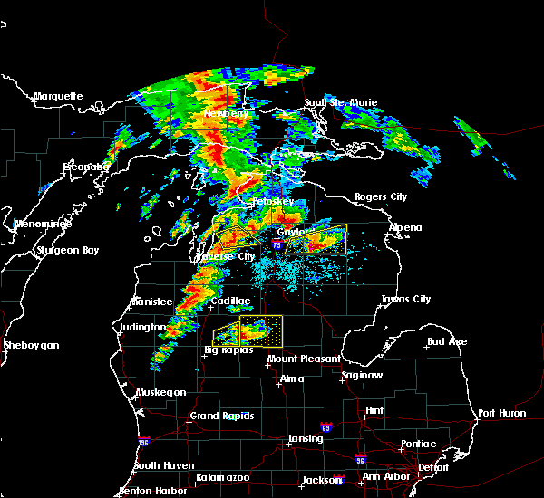
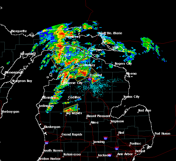
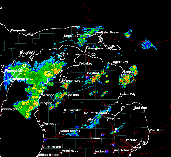
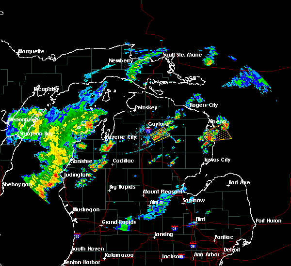
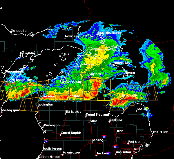
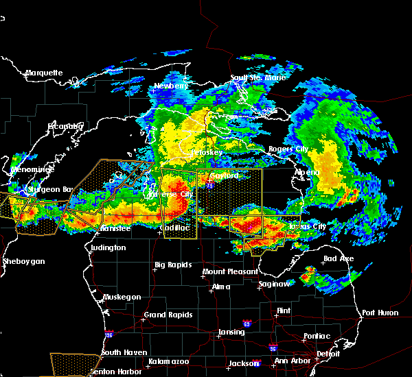
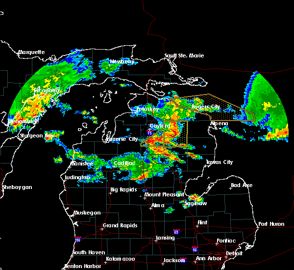
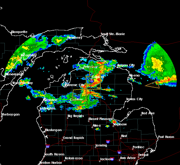
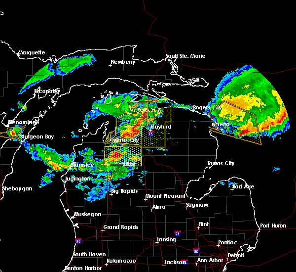
Hail Map for Lewiston, MI
The Lewiston, MI area has had 3 reports of on-the-ground hail by trained spotters, and has been under severe weather warnings 7 times during the past 12 months. Doppler radar has detected hail at or near Lewiston, MI on 19 occasions, including 1 occasion during the past year.
| Name: | Lewiston, MI |
| Where Located: | 45.3 miles WSW of Alpena, MI |
| Map: | Google Map for Lewiston, MI |
| Population: | 1392 |
| Housing Units: | 1570 |
| More Info: | Search Google for Lewiston, MI |
0
The Top Recent Hail Date for Lewiston, MI is Tuesday, June 16, 2026 (9th out of 19)
Hail and Wind Damage Spotted near Lewiston, MI
| Date / Time | Report Details |
|---|---|
| 6/10/2026 8:48 PM EDT |
 Svrapx the national weather service in gaylord has issued a * severe thunderstorm warning for, southeastern otsego county in northern michigan, montmorency county in northern michigan, * until 930 pm edt. * at 848 pm edt, a severe thunderstorm was located near hetherton, or near lewiston, moving northeast at 40 mph (radar indicated). Hazards include 60 mph wind gusts. Expect damage to roofs, siding, and trees. this severe thunderstorm will be near, lewiston, atlanta, hetherton, and briley township around 855 pm edt. loud township around 900 pm edt. canada creek ranch around 905 pm edt. hillman around 915 pm edt. Fletcher pond around 920 pm edt. Svrapx the national weather service in gaylord has issued a * severe thunderstorm warning for, southeastern otsego county in northern michigan, montmorency county in northern michigan, * until 930 pm edt. * at 848 pm edt, a severe thunderstorm was located near hetherton, or near lewiston, moving northeast at 40 mph (radar indicated). Hazards include 60 mph wind gusts. Expect damage to roofs, siding, and trees. this severe thunderstorm will be near, lewiston, atlanta, hetherton, and briley township around 855 pm edt. loud township around 900 pm edt. canada creek ranch around 905 pm edt. hillman around 915 pm edt. Fletcher pond around 920 pm edt.
|
| 5/18/2026 3:05 PM EDT |
 The storm which prompted the warning has moved out of the area. therefore, the warning will be allowed to expire. a severe thunderstorm watch remains in effect until 800 pm edt for northern michigan. to report severe weather, contact your nearest law enforcement agency. they will relay your report to the national weather service gaylord. The storm which prompted the warning has moved out of the area. therefore, the warning will be allowed to expire. a severe thunderstorm watch remains in effect until 800 pm edt for northern michigan. to report severe weather, contact your nearest law enforcement agency. they will relay your report to the national weather service gaylord.
|
| 5/18/2026 2:59 PM EDT |
 Svrapx the national weather service in gaylord has issued a * severe thunderstorm warning for, montmorency county in northern michigan, * until 345 pm edt. * at 259 pm edt, a severe thunderstorm was located near hetherton, or 10 miles northwest of atlanta, moving northeast at 50 mph (radar indicated). Hazards include 60 mph wind gusts. Expect damage to roofs, siding, and trees. this severe thunderstorm will be near, atlanta, canada creek ranch, and briley township around 305 pm edt. royston around 320 pm edt. Other locations impacted by this severe thunderstorm include clear lake state park. Svrapx the national weather service in gaylord has issued a * severe thunderstorm warning for, montmorency county in northern michigan, * until 345 pm edt. * at 259 pm edt, a severe thunderstorm was located near hetherton, or 10 miles northwest of atlanta, moving northeast at 50 mph (radar indicated). Hazards include 60 mph wind gusts. Expect damage to roofs, siding, and trees. this severe thunderstorm will be near, atlanta, canada creek ranch, and briley township around 305 pm edt. royston around 320 pm edt. Other locations impacted by this severe thunderstorm include clear lake state park.
|
| 5/18/2026 2:50 PM EDT |
 At 250 pm edt, a severe thunderstorm was located over johannesburg, or 9 miles east of gaylord, moving northeast at 50 mph (radar indicated). Hazards include 60 mph wind gusts. Expect damage to roofs, siding, and trees. This severe thunderstorm will remain over mainly rural areas of otsego and northeastern crawford counties. At 250 pm edt, a severe thunderstorm was located over johannesburg, or 9 miles east of gaylord, moving northeast at 50 mph (radar indicated). Hazards include 60 mph wind gusts. Expect damage to roofs, siding, and trees. This severe thunderstorm will remain over mainly rural areas of otsego and northeastern crawford counties.
|
| 5/18/2026 2:20 PM EDT |
 Svrapx the national weather service in gaylord has issued a * severe thunderstorm warning for, otsego county in northern michigan, northern crawford county in northern michigan, * until 315 pm edt. * at 219 pm edt, a severe thunderstorm was located near darragh, or 7 miles southeast of mancelona, moving northeast at 50 mph (radar indicated). Hazards include 60 mph wind gusts. Expect damage to roofs, siding, and trees. this severe thunderstorm will be near, frederic and waters around 225 pm edt. gaylord and otsego lake state park around 230 pm edt. Sparr, chester township, and johannesburg around 240 pm edt. Svrapx the national weather service in gaylord has issued a * severe thunderstorm warning for, otsego county in northern michigan, northern crawford county in northern michigan, * until 315 pm edt. * at 219 pm edt, a severe thunderstorm was located near darragh, or 7 miles southeast of mancelona, moving northeast at 50 mph (radar indicated). Hazards include 60 mph wind gusts. Expect damage to roofs, siding, and trees. this severe thunderstorm will be near, frederic and waters around 225 pm edt. gaylord and otsego lake state park around 230 pm edt. Sparr, chester township, and johannesburg around 240 pm edt.
|
| 8/10/2025 5:36 PM EDT |
 At 535 pm edt, a severe thunderstorm was located near hetherton, or nearing atlanta, moving east at 40 mph (radar indicated). Hazards include 60 mph wind gusts. Expect damage to roofs, siding, and trees. Locations impacted include, atlanta, lewiston, hillman, hetherton, fletcher pond, royston, briley township, canada creek ranch, and clear lake state park. At 535 pm edt, a severe thunderstorm was located near hetherton, or nearing atlanta, moving east at 40 mph (radar indicated). Hazards include 60 mph wind gusts. Expect damage to roofs, siding, and trees. Locations impacted include, atlanta, lewiston, hillman, hetherton, fletcher pond, royston, briley township, canada creek ranch, and clear lake state park.
|
| 8/10/2025 5:26 PM EDT |
 Svrapx the national weather service in gaylord has issued a * severe thunderstorm warning for, eeastern otsego county in northern michigan, montmorency county in northern michigan, * until 615 pm edt. * at 525 pm edt, a severe thunderstorm was located over johannesburg, or 8 miles northwest of lewiston, moving northeast at 35 mph (radar indicated). Hazards include 60 mph wind gusts. Expect damage to roofs, siding, and trees. this severe thunderstorm will be near, atlanta, hetherton, and briley township around 540 pm edt. hillman, royston around 600 pm edt. Other locations impacted by this severe thunderstorm include clear lake state park. Svrapx the national weather service in gaylord has issued a * severe thunderstorm warning for, eeastern otsego county in northern michigan, montmorency county in northern michigan, * until 615 pm edt. * at 525 pm edt, a severe thunderstorm was located over johannesburg, or 8 miles northwest of lewiston, moving northeast at 35 mph (radar indicated). Hazards include 60 mph wind gusts. Expect damage to roofs, siding, and trees. this severe thunderstorm will be near, atlanta, hetherton, and briley township around 540 pm edt. hillman, royston around 600 pm edt. Other locations impacted by this severe thunderstorm include clear lake state park.
|
| 4/27/2024 10:19 PM EDT |
 the severe thunderstorm warning has been cancelled and is no longer in effect the severe thunderstorm warning has been cancelled and is no longer in effect
|
| 4/27/2024 10:09 PM EDT |
 At 1009 pm edt, a severe thunderstorm was located near hartwick pines state park, or 7 miles northeast of grayling, moving east at 40 mph (radar indicated). Hazards include quarter size hail. Damage to vehicles is expected. this severe storm will be near, lovells around 1015 pm edt. Lewiston and garland around 1020 pm edt. At 1009 pm edt, a severe thunderstorm was located near hartwick pines state park, or 7 miles northeast of grayling, moving east at 40 mph (radar indicated). Hazards include quarter size hail. Damage to vehicles is expected. this severe storm will be near, lovells around 1015 pm edt. Lewiston and garland around 1020 pm edt.
|
| 4/27/2024 9:58 PM EDT |
 the severe thunderstorm warning has been cancelled and is no longer in effect the severe thunderstorm warning has been cancelled and is no longer in effect
|
| 4/27/2024 9:57 PM EDT |
 Svrapx the national weather service in gaylord has issued a * severe thunderstorm warning for, central crawford county in northern michigan, northwestern oscoda county in northern michigan, * until 1045 pm edt. * at 957 pm edt, a severe thunderstorm was located near grayling, moving east at 60 mph (radar indicated). Hazards include quarter size hail. Damage to vehicles is expected. this severe thunderstorm will be near, hartwick pines state park around 1005 pm edt. lovells around 1010 pm edt. garland and red oak around 1015 pm edt. lewiston and mio around 1020 pm edt. Fairview around 1030 pm edt. Svrapx the national weather service in gaylord has issued a * severe thunderstorm warning for, central crawford county in northern michigan, northwestern oscoda county in northern michigan, * until 1045 pm edt. * at 957 pm edt, a severe thunderstorm was located near grayling, moving east at 60 mph (radar indicated). Hazards include quarter size hail. Damage to vehicles is expected. this severe thunderstorm will be near, hartwick pines state park around 1005 pm edt. lovells around 1010 pm edt. garland and red oak around 1015 pm edt. lewiston and mio around 1020 pm edt. Fairview around 1030 pm edt.
|
| 4/27/2024 9:52 PM EDT |
 At 952 pm edt, a severe thunderstorm was located over chester township, or 10 miles southeast of gaylord, moving east at 55 mph (radar indicated). Hazards include quarter size hail. Damage to vehicles is expected. This severe storm will be near, lewiston, hetherton, chester township, and johannesburg around 955 pm edt. At 952 pm edt, a severe thunderstorm was located over chester township, or 10 miles southeast of gaylord, moving east at 55 mph (radar indicated). Hazards include quarter size hail. Damage to vehicles is expected. This severe storm will be near, lewiston, hetherton, chester township, and johannesburg around 955 pm edt.
|
| 4/27/2024 9:52 PM EDT |
 the severe thunderstorm warning has been cancelled and is no longer in effect the severe thunderstorm warning has been cancelled and is no longer in effect
|
| 4/27/2024 9:38 PM EDT |
 Svrapx the national weather service in gaylord has issued a * severe thunderstorm warning for, southern otsego county in northern michigan, northwestern crawford county in northern michigan, southwestern montmorency county in northern michigan, * until 1015 pm edt. * at 938 pm edt, a severe thunderstorm was located near waters, or 12 miles south of gaylord, moving northeast at 60 mph (radar indicated). Hazards include quarter size hail. Damage to vehicles is expected. this severe thunderstorm will be near, gaylord, otsego lake state park, chester township, and waters around 945 pm edt. johannesburg around 950 pm edt. Lewiston and hetherton around 955 pm edt. Svrapx the national weather service in gaylord has issued a * severe thunderstorm warning for, southern otsego county in northern michigan, northwestern crawford county in northern michigan, southwestern montmorency county in northern michigan, * until 1015 pm edt. * at 938 pm edt, a severe thunderstorm was located near waters, or 12 miles south of gaylord, moving northeast at 60 mph (radar indicated). Hazards include quarter size hail. Damage to vehicles is expected. this severe thunderstorm will be near, gaylord, otsego lake state park, chester township, and waters around 945 pm edt. johannesburg around 950 pm edt. Lewiston and hetherton around 955 pm edt.
|
| 7/23/2023 1:50 PM EDT | Public report of large tree down near townline rd and lakeview d in oscoda county MI, 5.3 miles NW of Lewiston, MI |
| 7/20/2022 1:27 PM EDT |
 At 126 pm edt, a severe thunderstorm was located near otsego lake state park, or near gaylord, moving northeast at 30 mph (radar indicated). Hazards include 60 mph wind gusts and half dollar size hail. Hail damage to vehicles is expected. expect wind damage to roofs, siding, and trees. this severe thunderstorm will be near, gaylord around 130 pm edt. vanderbilt and sparr around 145 pm edt. other locations in the path of this severe thunderstorm include eastern corwith township and pickerel lake. hail threat, radar indicated max hail size, 1. 25 in wind threat, radar indicated max wind gust, 60 mph. At 126 pm edt, a severe thunderstorm was located near otsego lake state park, or near gaylord, moving northeast at 30 mph (radar indicated). Hazards include 60 mph wind gusts and half dollar size hail. Hail damage to vehicles is expected. expect wind damage to roofs, siding, and trees. this severe thunderstorm will be near, gaylord around 130 pm edt. vanderbilt and sparr around 145 pm edt. other locations in the path of this severe thunderstorm include eastern corwith township and pickerel lake. hail threat, radar indicated max hail size, 1. 25 in wind threat, radar indicated max wind gust, 60 mph.
|
| 5/14/2022 3:08 PM EDT |
 The severe thunderstorm warning for southwestern montmorency county will expire at 315 pm edt, the storm which prompted the warning has weakened below severe limits, and no longer poses an immediate threat to life or property. therefore, the warning will be allowed to expire. however gusty winds and heavy rain are still possible with this thunderstorm. The severe thunderstorm warning for southwestern montmorency county will expire at 315 pm edt, the storm which prompted the warning has weakened below severe limits, and no longer poses an immediate threat to life or property. therefore, the warning will be allowed to expire. however gusty winds and heavy rain are still possible with this thunderstorm.
|
| 5/14/2022 2:45 PM EDT |
 At 244 pm edt, a severe thunderstorm was located near lewiston, moving east at 10 mph (radar indicated). Hazards include quarter size hail. Damage to vehicles is expected. locations impacted include, lewiston. hail threat, radar indicated max hail size, 1. 00 in wind threat, radar indicated max wind gust, <50 mph. At 244 pm edt, a severe thunderstorm was located near lewiston, moving east at 10 mph (radar indicated). Hazards include quarter size hail. Damage to vehicles is expected. locations impacted include, lewiston. hail threat, radar indicated max hail size, 1. 00 in wind threat, radar indicated max wind gust, <50 mph.
|
| 5/14/2022 2:30 PM EDT |
 At 230 pm edt, a severe thunderstorm was located over lewiston, moving northeast at 10 mph (radar indicated). Hazards include quarter size hail. Damage to vehicles is expected. this severe thunderstorm will remain over mainly rural areas of southeastern otsego and southwestern montmorency counties. hail threat, radar indicated max hail size, 1. 00 in wind threat, radar indicated max wind gust, <50 mph. At 230 pm edt, a severe thunderstorm was located over lewiston, moving northeast at 10 mph (radar indicated). Hazards include quarter size hail. Damage to vehicles is expected. this severe thunderstorm will remain over mainly rural areas of southeastern otsego and southwestern montmorency counties. hail threat, radar indicated max hail size, 1. 00 in wind threat, radar indicated max wind gust, <50 mph.
|
| 8/29/2021 3:15 PM EDT |
 At 315 pm edt, severe thunderstorms were located along a line extending from near grayling to near north higgins lake to near houghton lake, moving northeast at 50 mph (radar indicated). Hazards include 60 mph wind gusts. Expect damage to roofs, siding, and trees. locations impacted include, roscommon, lewiston, garland, red oak, south branch township and luzerne. hail threat, radar indicated max hail size, <. 75 in wind threat, radar indicated max wind gust, 60 mph. At 315 pm edt, severe thunderstorms were located along a line extending from near grayling to near north higgins lake to near houghton lake, moving northeast at 50 mph (radar indicated). Hazards include 60 mph wind gusts. Expect damage to roofs, siding, and trees. locations impacted include, roscommon, lewiston, garland, red oak, south branch township and luzerne. hail threat, radar indicated max hail size, <. 75 in wind threat, radar indicated max wind gust, 60 mph.
|
| 8/29/2021 3:14 PM EDT |
 At 314 pm edt, severe thunderstorms were located along a line extending from near onaway state park to 6 miles west of allis township to near lewiston, moving east at 55 mph (radar indicated). Hazards include 60 mph wind gusts. Expect damage to roofs, siding, and trees. locations impacted include, onaway, allis township, ocqueoc, millersburg, tomahawk creek flooding, canada creek ranch and forty mile point. hail threat, radar indicated max hail size, <. 75 in wind threat, radar indicated max wind gust, 60 mph. At 314 pm edt, severe thunderstorms were located along a line extending from near onaway state park to 6 miles west of allis township to near lewiston, moving east at 55 mph (radar indicated). Hazards include 60 mph wind gusts. Expect damage to roofs, siding, and trees. locations impacted include, onaway, allis township, ocqueoc, millersburg, tomahawk creek flooding, canada creek ranch and forty mile point. hail threat, radar indicated max hail size, <. 75 in wind threat, radar indicated max wind gust, 60 mph.
|
| 8/29/2021 3:01 PM EDT |
 At 301 pm edt, severe thunderstorms were located along a line extending from near grayling to near north higgins lake to 6 miles north of moddersville, moving northeast at 50 mph (radar indicated). Hazards include 60 mph wind gusts. Expect damage to roofs, siding, and trees. severe thunderstorms will be near, grayling and north higgins lake around 305 pm edt. higgins lake and roscommon county airport around 320 pm edt. other locations in the path of these severe thunderstorms include lovells, south higgins lake, roscommon, garland, lewiston, red oak, south branch township and luzerne. hail threat, radar indicated max hail size, <. 75 in wind threat, radar indicated max wind gust, 60 mph. At 301 pm edt, severe thunderstorms were located along a line extending from near grayling to near north higgins lake to 6 miles north of moddersville, moving northeast at 50 mph (radar indicated). Hazards include 60 mph wind gusts. Expect damage to roofs, siding, and trees. severe thunderstorms will be near, grayling and north higgins lake around 305 pm edt. higgins lake and roscommon county airport around 320 pm edt. other locations in the path of these severe thunderstorms include lovells, south higgins lake, roscommon, garland, lewiston, red oak, south branch township and luzerne. hail threat, radar indicated max hail size, <. 75 in wind threat, radar indicated max wind gust, 60 mph.
|
| 8/29/2021 2:55 PM EDT |
 At 254 pm edt, severe thunderstorms were located along a line extending from near wolverine to near vanderbilt to near waters, moving northeast at 55 mph (radar indicated). Hazards include 60 mph wind gusts. Expect damage to roofs, siding, and trees. severe thunderstorms will be near, wolverine and afton around 300 pm edt. pickerel lake and eastern corwith township around 305 pm edt. johannesburg and tower around 310 pm edt. other locations in the path of these severe thunderstorms include hetherton, ocqueoc, allis township, tomahawk creek flooding, onaway, briley township, atlanta, millersburg, canada creek ranch and forty mile point. hail threat, radar indicated max hail size, <. 75 in wind threat, radar indicated max wind gust, 60 mph. At 254 pm edt, severe thunderstorms were located along a line extending from near wolverine to near vanderbilt to near waters, moving northeast at 55 mph (radar indicated). Hazards include 60 mph wind gusts. Expect damage to roofs, siding, and trees. severe thunderstorms will be near, wolverine and afton around 300 pm edt. pickerel lake and eastern corwith township around 305 pm edt. johannesburg and tower around 310 pm edt. other locations in the path of these severe thunderstorms include hetherton, ocqueoc, allis township, tomahawk creek flooding, onaway, briley township, atlanta, millersburg, canada creek ranch and forty mile point. hail threat, radar indicated max hail size, <. 75 in wind threat, radar indicated max wind gust, 60 mph.
|
| 8/11/2021 6:50 PM EDT |
 At 649 pm edt, severe thunderstorms were located along a line extending from royston to near garland to 8 miles south of lovells, moving east at 50 mph (radar indicated). Hazards include 60 mph wind gusts. Expect damage to roofs, siding, and trees. locations impacted include, atlanta, lewiston, mio, comins, hillman, fletcher pond, red oak, lockwood lake, loud township and garland. hail threat, radar indicated max hail size, <. 75 in wind threat, radar indicated max wind gust, 60 mph. At 649 pm edt, severe thunderstorms were located along a line extending from royston to near garland to 8 miles south of lovells, moving east at 50 mph (radar indicated). Hazards include 60 mph wind gusts. Expect damage to roofs, siding, and trees. locations impacted include, atlanta, lewiston, mio, comins, hillman, fletcher pond, red oak, lockwood lake, loud township and garland. hail threat, radar indicated max hail size, <. 75 in wind threat, radar indicated max wind gust, 60 mph.
|
| 8/11/2021 6:45 PM EDT |
 At 645 pm edt, severe thunderstorms were located along a line extending from 6 miles west of royston to garland to 6 miles east of grayling, moving east at 35 mph (radar indicated). Hazards include 60 mph wind gusts. Expect damage to roofs, siding, and trees. locations impacted include, hillman, lovells, loud township, comins, red oak, lockwood lake and mio. hail threat, radar indicated max hail size, <. 75 in wind threat, radar indicated max wind gust, 60 mph. At 645 pm edt, severe thunderstorms were located along a line extending from 6 miles west of royston to garland to 6 miles east of grayling, moving east at 35 mph (radar indicated). Hazards include 60 mph wind gusts. Expect damage to roofs, siding, and trees. locations impacted include, hillman, lovells, loud township, comins, red oak, lockwood lake and mio. hail threat, radar indicated max hail size, <. 75 in wind threat, radar indicated max wind gust, 60 mph.
|
| 8/11/2021 6:37 PM EDT | Lots of tree damage across northwest oscoda count in oscoda county MI, 3.5 miles N of Lewiston, MI |
| 8/11/2021 6:31 PM EDT |
 At 631 pm edt, severe thunderstorms were located along a line extending from canada creek ranch to lovells to near grayling, moving east at 35 mph (radar indicated). Hazards include 60 mph wind gusts. Expect damage to roofs, siding, and trees. severe thunderstorms will be near, canada creek ranch and briley township around 635 pm edt. lewiston and garland around 645 pm edt. other locations in the path of these severe thunderstorms include hillman, loud township, comins, red oak, lockwood lake and mio. hail threat, radar indicated max hail size, <. 75 in wind threat, radar indicated max wind gust, 60 mph. At 631 pm edt, severe thunderstorms were located along a line extending from canada creek ranch to lovells to near grayling, moving east at 35 mph (radar indicated). Hazards include 60 mph wind gusts. Expect damage to roofs, siding, and trees. severe thunderstorms will be near, canada creek ranch and briley township around 635 pm edt. lewiston and garland around 645 pm edt. other locations in the path of these severe thunderstorms include hillman, loud township, comins, red oak, lockwood lake and mio. hail threat, radar indicated max hail size, <. 75 in wind threat, radar indicated max wind gust, 60 mph.
|
| 8/11/2021 12:06 AM EDT |
 At 1206 am edt, severe thunderstorms were located along a line extending from near sparr to near hetherton, moving northeast at 40 mph (radar indicated). Hazards include 60 mph wind gusts and penny size hail. Expect damage to roofs, siding, and trees. Locations impacted include, gaylord, lewiston, lovells, sparr, chester township and johannesburg. At 1206 am edt, severe thunderstorms were located along a line extending from near sparr to near hetherton, moving northeast at 40 mph (radar indicated). Hazards include 60 mph wind gusts and penny size hail. Expect damage to roofs, siding, and trees. Locations impacted include, gaylord, lewiston, lovells, sparr, chester township and johannesburg.
|
| 8/10/2021 11:57 PM EDT |
 At 1156 pm edt, severe thunderstorms were located along a line extending from near sparr to lovells, moving east at 40 mph (radar indicated). Hazards include 60 mph wind gusts and penny size hail. Expect damage to roofs, siding, and trees. Locations impacted include, lovells, johannesburg and lewiston. At 1156 pm edt, severe thunderstorms were located along a line extending from near sparr to lovells, moving east at 40 mph (radar indicated). Hazards include 60 mph wind gusts and penny size hail. Expect damage to roofs, siding, and trees. Locations impacted include, lovells, johannesburg and lewiston.
|
| 8/10/2021 11:37 PM EDT |
 At 1137 pm edt, severe thunderstorms were located along a line extending from near alba to near hartwick pines state park, moving northeast at 40 mph (radar indicated). Hazards include 70 mph wind gusts and nickel size hail. Expect considerable tree damage. damage is likely to mobile homes, roofs, and outbuildings. these severe storms will be near, frederic and hartwick pines state park around 1140 pm edt. Other locations in the path of these severe thunderstorms include waters, gaylord, otsego lake state park, lovells, sparr, chester township, johannesburg and lewiston. At 1137 pm edt, severe thunderstorms were located along a line extending from near alba to near hartwick pines state park, moving northeast at 40 mph (radar indicated). Hazards include 70 mph wind gusts and nickel size hail. Expect considerable tree damage. damage is likely to mobile homes, roofs, and outbuildings. these severe storms will be near, frederic and hartwick pines state park around 1140 pm edt. Other locations in the path of these severe thunderstorms include waters, gaylord, otsego lake state park, lovells, sparr, chester township, johannesburg and lewiston.
|
| 8/10/2021 11:24 PM EDT |
 At 1124 pm edt, severe thunderstorms were located along a line extending from near mancelona to near bear lake, moving northeast at 40 mph (radar indicated). Hazards include 60 mph wind gusts and nickel size hail. Expect damage to roofs, siding, and trees. severe thunderstorms will be near, frederic and hartwick pines state park around 1140 pm edt. Other locations in the path of these severe thunderstorms include otsego lake state park, waters, gaylord, lovells, sparr, chester township, johannesburg and lewiston. At 1124 pm edt, severe thunderstorms were located along a line extending from near mancelona to near bear lake, moving northeast at 40 mph (radar indicated). Hazards include 60 mph wind gusts and nickel size hail. Expect damage to roofs, siding, and trees. severe thunderstorms will be near, frederic and hartwick pines state park around 1140 pm edt. Other locations in the path of these severe thunderstorms include otsego lake state park, waters, gaylord, lovells, sparr, chester township, johannesburg and lewiston.
|
| 8/10/2021 11:13 PM EDT |
 At 1113 pm edt, a severe thunderstorm was located over waters, or 9 miles south of gaylord, moving northeast at 40 mph (radar indicated). Hazards include 60 mph wind gusts and quarter size hail. Hail damage to vehicles is expected. expect wind damage to roofs, siding, and trees. locations impacted include, chester township and gaylord. hail threat, radar indicated max hail size, 1. 00 in wind threat, radar indicated max wind gust, 60 mph. At 1113 pm edt, a severe thunderstorm was located over waters, or 9 miles south of gaylord, moving northeast at 40 mph (radar indicated). Hazards include 60 mph wind gusts and quarter size hail. Hail damage to vehicles is expected. expect wind damage to roofs, siding, and trees. locations impacted include, chester township and gaylord. hail threat, radar indicated max hail size, 1. 00 in wind threat, radar indicated max wind gust, 60 mph.
|
| 8/10/2021 10:58 PM EDT |
 At 1058 pm edt, a severe thunderstorm was located near frederic, or 8 miles northwest of grayling, moving northeast at 35 mph (radar indicated). Hazards include 60 mph wind gusts and quarter size hail. Hail damage to vehicles is expected. expect wind damage to roofs, siding, and trees. this severe thunderstorm will be near, waters around 1115 pm edt. other locations in the path of this severe thunderstorm include otsego lake state park, chester township and gaylord. hail threat, radar indicated max hail size, 1. 00 in wind threat, radar indicated max wind gust, 60 mph. At 1058 pm edt, a severe thunderstorm was located near frederic, or 8 miles northwest of grayling, moving northeast at 35 mph (radar indicated). Hazards include 60 mph wind gusts and quarter size hail. Hail damage to vehicles is expected. expect wind damage to roofs, siding, and trees. this severe thunderstorm will be near, waters around 1115 pm edt. other locations in the path of this severe thunderstorm include otsego lake state park, chester township and gaylord. hail threat, radar indicated max hail size, 1. 00 in wind threat, radar indicated max wind gust, 60 mph.
|
| 11/10/2020 9:39 PM EST |
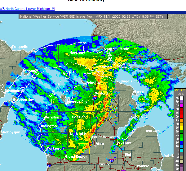 At 939 pm est, a severe thunderstorm was located over red oak, or 7 miles west of mio, moving northeast at 55 mph (radar indicated). Hazards include 60 mph wind gusts. Expect damage to roofs, siding, and trees. Locations impacted include, mio, lewiston, comins, fairview, luzerne, red oak, loud township and garland. At 939 pm est, a severe thunderstorm was located over red oak, or 7 miles west of mio, moving northeast at 55 mph (radar indicated). Hazards include 60 mph wind gusts. Expect damage to roofs, siding, and trees. Locations impacted include, mio, lewiston, comins, fairview, luzerne, red oak, loud township and garland.
|
| 11/10/2020 9:28 PM EST |
 At 928 pm est, a severe thunderstorm was located near south branch township, or 11 miles northeast of roscommon, moving northeast at 55 mph (radar indicated). Hazards include 60 mph wind gusts. expect damage to roofs, siding, and trees At 928 pm est, a severe thunderstorm was located near south branch township, or 11 miles northeast of roscommon, moving northeast at 55 mph (radar indicated). Hazards include 60 mph wind gusts. expect damage to roofs, siding, and trees
|
| 9/26/2020 12:16 PM EDT |
 At 1216 pm edt, a severe thunderstorm was located near loud township, or near lewiston, moving east at 40 mph (radar indicated). Hazards include 60 mph wind gusts and quarter size hail. Hail damage to vehicles is expected. Expect wind damage to roofs, siding, and trees. At 1216 pm edt, a severe thunderstorm was located near loud township, or near lewiston, moving east at 40 mph (radar indicated). Hazards include 60 mph wind gusts and quarter size hail. Hail damage to vehicles is expected. Expect wind damage to roofs, siding, and trees.
|
| 9/26/2020 12:06 PM EDT |
 At 1206 pm edt, a severe thunderstorm was located over lewiston, moving east at 35 mph (radar indicated). Hazards include 60 mph wind gusts and quarter size hail. Hail damage to vehicles is expected. expect wind damage to roofs, siding, and trees. Locations impacted include, lewiston, garland and chester township. At 1206 pm edt, a severe thunderstorm was located over lewiston, moving east at 35 mph (radar indicated). Hazards include 60 mph wind gusts and quarter size hail. Hail damage to vehicles is expected. expect wind damage to roofs, siding, and trees. Locations impacted include, lewiston, garland and chester township.
|
| 9/26/2020 11:51 AM EDT |
 At 1150 am edt, a severe thunderstorm was located over chester township, or 10 miles west of lewiston, moving east at 40 mph (radar indicated. at 1145 am edt, half inch hail was reported 6 miles south of gaylord). Hazards include 60 mph wind gusts and quarter size hail. Hail damage to vehicles is expected. expect wind damage to roofs, siding, and trees. Locations impacted include, lewiston, lovells, garland and chester township. At 1150 am edt, a severe thunderstorm was located over chester township, or 10 miles west of lewiston, moving east at 40 mph (radar indicated. at 1145 am edt, half inch hail was reported 6 miles south of gaylord). Hazards include 60 mph wind gusts and quarter size hail. Hail damage to vehicles is expected. expect wind damage to roofs, siding, and trees. Locations impacted include, lewiston, lovells, garland and chester township.
|
| 9/26/2020 11:37 AM EDT |
 At 1137 am edt, a severe thunderstorm was located over waters, or 9 miles south of gaylord, moving east at 35 mph (radar indicated). Hazards include 60 mph wind gusts and quarter size hail. Hail damage to vehicles is expected. Expect wind damage to roofs, siding, and trees. At 1137 am edt, a severe thunderstorm was located over waters, or 9 miles south of gaylord, moving east at 35 mph (radar indicated). Hazards include 60 mph wind gusts and quarter size hail. Hail damage to vehicles is expected. Expect wind damage to roofs, siding, and trees.
|
| 9/26/2020 10:34 AM EDT |
 At 1033 am edt, a severe thunderstorm was located over otsego lake state park, or 7 miles south of gaylord, moving east at 35 mph (radar indicated). Hazards include quarter size hail. Damage to vehicles is expected. Locations impacted include, otsego lake state park, chester township, waters and johannesburg. At 1033 am edt, a severe thunderstorm was located over otsego lake state park, or 7 miles south of gaylord, moving east at 35 mph (radar indicated). Hazards include quarter size hail. Damage to vehicles is expected. Locations impacted include, otsego lake state park, chester township, waters and johannesburg.
|
| 9/26/2020 10:14 AM EDT |
 At 1013 am edt, a severe thunderstorm was located near mancelona, moving east at 45 mph (radar indicated. at 1008 am edt, half dollar size hail was reported in mancelona). Hazards include ping pong ball size hail. People and animals outdoors will be injured. Expect damage to roofs, siding, windows, and vehicles. At 1013 am edt, a severe thunderstorm was located near mancelona, moving east at 45 mph (radar indicated. at 1008 am edt, half dollar size hail was reported in mancelona). Hazards include ping pong ball size hail. People and animals outdoors will be injured. Expect damage to roofs, siding, windows, and vehicles.
|
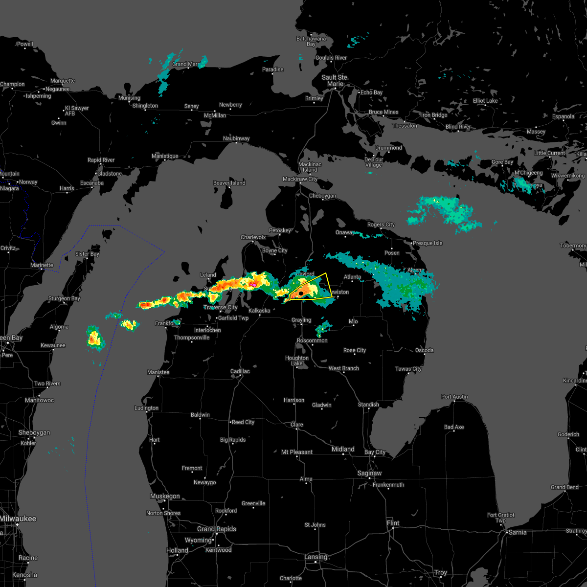
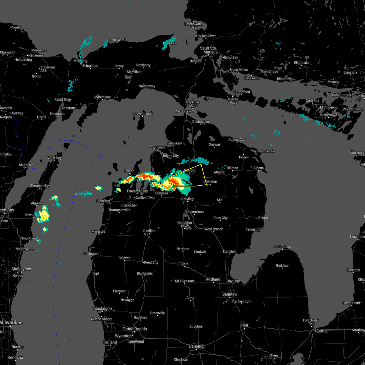
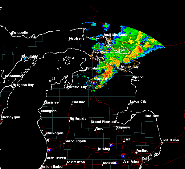
| 7/19/2020 6:48 AM EDT |
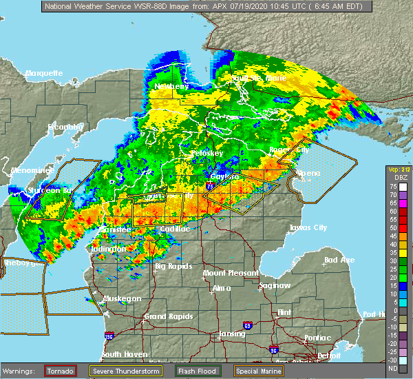 At 647 am edt, severe thunderstorms were located along a line extending from lockwood lake to red oak, moving southeast at 40 mph (radar indicated). Hazards include 60 mph wind gusts. Expect damage to roofs, siding, and trees. Locations impacted include, mio, atlanta, lewiston, comins, fairview, fletcher pond, luzerne, red oak, lockwood lake, loud township, garland and spratt. At 647 am edt, severe thunderstorms were located along a line extending from lockwood lake to red oak, moving southeast at 40 mph (radar indicated). Hazards include 60 mph wind gusts. Expect damage to roofs, siding, and trees. Locations impacted include, mio, atlanta, lewiston, comins, fairview, fletcher pond, luzerne, red oak, lockwood lake, loud township, garland and spratt.
|
| 7/19/2020 6:14 AM EDT |
 At 614 am edt, severe thunderstorms were located along a line extending from near hetherton to near waters, moving southeast at 20 mph (radar indicated). Hazards include 60 mph wind gusts. expect damage to roofs, siding, and trees At 614 am edt, severe thunderstorms were located along a line extending from near hetherton to near waters, moving southeast at 20 mph (radar indicated). Hazards include 60 mph wind gusts. expect damage to roofs, siding, and trees
|
| 7/9/2020 6:51 PM EDT | Quarter sized hail reported 1.1 miles W of Lewiston, MI |
| 7/9/2020 6:49 PM EDT | Tree down on cabin from winds off of lake. time estimated from rada in montmorency county MI, 0.6 miles W of Lewiston, MI |
| 7/9/2020 6:30 PM EDT | Numerous trees down from thunderstorm winds. power and cable companies... as well as road commission clearing trees. time of storm based on radar and 911 calls to montm in montmorency county MI, 1.6 miles W of Lewiston, MI |
| 7/10/2019 10:56 PM EDT |
 The severe thunderstorm warning for otsego and southwestern montmorency counties will expire at 1100 pm edt, the storm which prompted the warning has moved out of the area. therefore, the warning will be allowed to expire. The severe thunderstorm warning for otsego and southwestern montmorency counties will expire at 1100 pm edt, the storm which prompted the warning has moved out of the area. therefore, the warning will be allowed to expire.
|
| 7/10/2019 10:32 PM EDT |
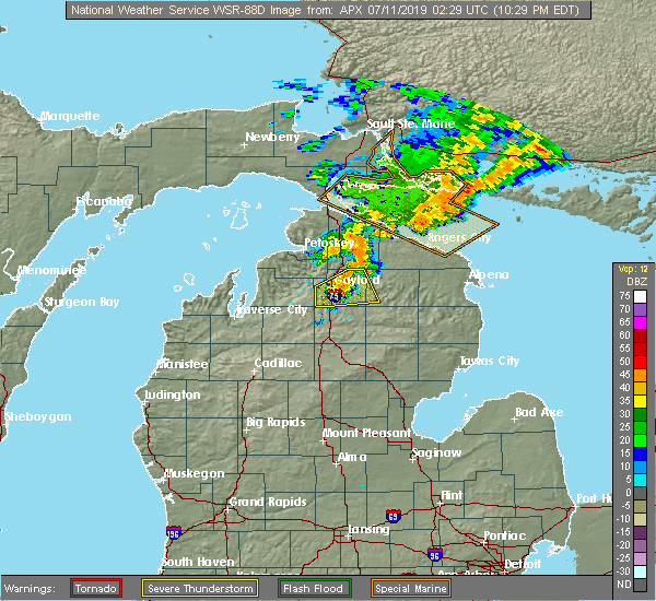 At 1032 pm edt, a severe thunderstorm was located over sparr, or near gaylord, moving northeast at 45 mph (radar indicated). Hazards include 60 mph wind gusts and quarter size hail. Hail damage to vehicles is expected. expect wind damage to roofs, siding, and trees. Locations impacted include, gaylord, lewiston, vanderbilt, hetherton, sparr, otsego lake state park, chester township, pickerel lake, johannesburg, eastern corwith township and waters. At 1032 pm edt, a severe thunderstorm was located over sparr, or near gaylord, moving northeast at 45 mph (radar indicated). Hazards include 60 mph wind gusts and quarter size hail. Hail damage to vehicles is expected. expect wind damage to roofs, siding, and trees. Locations impacted include, gaylord, lewiston, vanderbilt, hetherton, sparr, otsego lake state park, chester township, pickerel lake, johannesburg, eastern corwith township and waters.
|
| 7/10/2019 10:14 PM EDT |
 The national weather service in gaylord has issued a * severe thunderstorm warning for. otsego county in northern michigan. southeastern antrim county in northern michigan. southwestern montmorency county in northern michigan. Until 1100 pm edt. The national weather service in gaylord has issued a * severe thunderstorm warning for. otsego county in northern michigan. southeastern antrim county in northern michigan. southwestern montmorency county in northern michigan. Until 1100 pm edt.
|
| 8/28/2018 8:48 PM EDT |
 At 848 pm edt, a severe thunderstorm was located near briley township, or 10 miles northwest of atlanta, moving east at 40 mph (radar indicated). Hazards include 60 mph wind gusts. Expect damage to roofs, siding, and trees. Locations impacted include, atlanta, lewiston, hetherton, briley township, canada creek ranch and clear lake state park. At 848 pm edt, a severe thunderstorm was located near briley township, or 10 miles northwest of atlanta, moving east at 40 mph (radar indicated). Hazards include 60 mph wind gusts. Expect damage to roofs, siding, and trees. Locations impacted include, atlanta, lewiston, hetherton, briley township, canada creek ranch and clear lake state park.
|
| 8/28/2018 8:42 PM EDT |
 At 841 pm edt, a severe thunderstorm was located near eastern corwith township, or 13 miles east of gaylord, moving east at 45 mph (radar indicated). Hazards include 60 mph wind gusts. Expect damage to roofs, siding, and trees. Locations impacted include, atlanta, lewiston, hetherton, pickerel lake, johannesburg, briley township, eastern corwith township, canada creek ranch and clear lake state park. At 841 pm edt, a severe thunderstorm was located near eastern corwith township, or 13 miles east of gaylord, moving east at 45 mph (radar indicated). Hazards include 60 mph wind gusts. Expect damage to roofs, siding, and trees. Locations impacted include, atlanta, lewiston, hetherton, pickerel lake, johannesburg, briley township, eastern corwith township, canada creek ranch and clear lake state park.
|
| 8/28/2018 8:24 PM EDT |
 At 824 pm edt, a severe thunderstorm was located over gaylord, moving east at 45 mph (radar indicated). Hazards include 70 mph wind gusts. Expect considerable tree damage. damage is likely to mobile homes, roofs, and outbuildings. Locations impacted include, gaylord, atlanta, lewiston, vanderbilt, wolverine, sparr, otsego lake state park, pickerel lake, johannesburg, briley township, canada creek ranch, hetherton, chester township, eastern corwith township and clear lake state park. At 824 pm edt, a severe thunderstorm was located over gaylord, moving east at 45 mph (radar indicated). Hazards include 70 mph wind gusts. Expect considerable tree damage. damage is likely to mobile homes, roofs, and outbuildings. Locations impacted include, gaylord, atlanta, lewiston, vanderbilt, wolverine, sparr, otsego lake state park, pickerel lake, johannesburg, briley township, canada creek ranch, hetherton, chester township, eastern corwith township and clear lake state park.
|
| 8/28/2018 2:10 AM EDT |
 At 210 am edt, severe thunderstorms were located along a line extending from near wolverine to sparr to near sharon, moving east at 80 mph (radar indicated). Hazards include 70 mph wind gusts. Expect considerable tree damage. Damage is likely to mobile homes, roofs, and outbuildings. At 210 am edt, severe thunderstorms were located along a line extending from near wolverine to sparr to near sharon, moving east at 80 mph (radar indicated). Hazards include 70 mph wind gusts. Expect considerable tree damage. Damage is likely to mobile homes, roofs, and outbuildings.
|
| 7/1/2018 9:24 PM EDT |
 At 922 pm edt, severe thunderstorms were located along a line extending from elmira to near otsego lake state park to near lovells to near roscommon, moving northeast at 45 mph (radar indicated. at 916 pm a wind gust of 52 mph was reported at the national weather service office, 9 miles south-southwest of gaylord). Hazards include 60 mph wind gusts. Expect damage to roofs, siding, and trees. Locations impacted include, gaylord, grayling, mancelona, lewiston, elmira, frederic, lovells, vanderbilt, sparr, otsego lake state park, pickerel lake, johannesburg, chester township, alba, eastern corwith township, waters, hartwick pines state park and blue lake township. At 922 pm edt, severe thunderstorms were located along a line extending from elmira to near otsego lake state park to near lovells to near roscommon, moving northeast at 45 mph (radar indicated. at 916 pm a wind gust of 52 mph was reported at the national weather service office, 9 miles south-southwest of gaylord). Hazards include 60 mph wind gusts. Expect damage to roofs, siding, and trees. Locations impacted include, gaylord, grayling, mancelona, lewiston, elmira, frederic, lovells, vanderbilt, sparr, otsego lake state park, pickerel lake, johannesburg, chester township, alba, eastern corwith township, waters, hartwick pines state park and blue lake township.
|
| 7/1/2018 9:17 PM EDT |
 At 916 pm edt, severe thunderstorms were located along a line extending from alba to near waters to near north higgins lake, moving northeast at 55 mph (radar indicated). Hazards include 60 mph wind gusts. Expect damage to roofs, siding, and trees. Locations impacted include, gaylord, grayling, mancelona, lewiston, elmira, frederic, lovells, vanderbilt, sparr, otsego lake state park, pickerel lake, johannesburg, chester township, alba, eastern corwith township, waters, hartwick pines state park and blue lake township. At 916 pm edt, severe thunderstorms were located along a line extending from alba to near waters to near north higgins lake, moving northeast at 55 mph (radar indicated). Hazards include 60 mph wind gusts. Expect damage to roofs, siding, and trees. Locations impacted include, gaylord, grayling, mancelona, lewiston, elmira, frederic, lovells, vanderbilt, sparr, otsego lake state park, pickerel lake, johannesburg, chester township, alba, eastern corwith township, waters, hartwick pines state park and blue lake township.
|
| 7/1/2018 9:03 PM EDT |
 At 903 pm edt, severe thunderstorms were located along a line extending from near mancelona to 6 miles northwest of north higgins lake, moving northeast at 50 mph (radar indicated). Hazards include 60 mph wind gusts. expect damage to roofs, siding, and trees At 903 pm edt, severe thunderstorms were located along a line extending from near mancelona to 6 miles northwest of north higgins lake, moving northeast at 50 mph (radar indicated). Hazards include 60 mph wind gusts. expect damage to roofs, siding, and trees
|
| 5/26/2018 5:51 PM EDT |
 At 550 pm edt, a severe thunderstorm was located over sparr, or 6 miles east of gaylord, moving east at 20 mph (radar indicated). Hazards include quarter size hail. Damage to vehicles is expected. Locations impacted include, gaylord, lewiston, hetherton, sparr, otsego lake state park, chester township, johannesburg, briley township, canada creek ranch and clear lake state park. At 550 pm edt, a severe thunderstorm was located over sparr, or 6 miles east of gaylord, moving east at 20 mph (radar indicated). Hazards include quarter size hail. Damage to vehicles is expected. Locations impacted include, gaylord, lewiston, hetherton, sparr, otsego lake state park, chester township, johannesburg, briley township, canada creek ranch and clear lake state park.
|
| 5/26/2018 5:42 PM EDT |
 At 541 pm edt, a severe thunderstorm was located over gaylord, moving southeast at 20 mph (radar indicated. quarter sized hail was reported in gaylord at 541 pm). Hazards include ping pong ball size hail. People and animals outdoors will be injured. Expect damage to roofs, siding, windows, and vehicles. At 541 pm edt, a severe thunderstorm was located over gaylord, moving southeast at 20 mph (radar indicated. quarter sized hail was reported in gaylord at 541 pm). Hazards include ping pong ball size hail. People and animals outdoors will be injured. Expect damage to roofs, siding, windows, and vehicles.
|
| 5/26/2018 5:15 PM EDT |
 At 513 pm edt, a severe thunderstorm was located over waters, or 10 miles south of gaylord, moving east at 15 mph (trained weather spotters. half-dollar sized hail fell at the national weather service office from 505 pm to 510 pm). Hazards include half dollar size hail. Damage to vehicles is expected. Locations impacted include, lewiston, lovells, otsego lake state park, chester township and waters. At 513 pm edt, a severe thunderstorm was located over waters, or 10 miles south of gaylord, moving east at 15 mph (trained weather spotters. half-dollar sized hail fell at the national weather service office from 505 pm to 510 pm). Hazards include half dollar size hail. Damage to vehicles is expected. Locations impacted include, lewiston, lovells, otsego lake state park, chester township and waters.
|
| 5/26/2018 5:05 PM EDT |
 At 505 pm edt, a severe thunderstorm was located over waters, or 10 miles south of gaylord, moving southeast at 20 mph (radar indicated). Hazards include quarter size hail. damage to vehicles is expected At 505 pm edt, a severe thunderstorm was located over waters, or 10 miles south of gaylord, moving southeast at 20 mph (radar indicated). Hazards include quarter size hail. damage to vehicles is expected
|
| 5/26/2018 4:30 PM EDT | Large tree down on a home on townline road. time estimated from rada in oscoda county MI, 4.5 miles WNW of Lewiston, MI |
| 2/24/2017 4:46 PM EST |
 At 445 pm est, a severe thunderstorm was located near red oak, or 7 miles northwest of mio, moving northeast at 55 mph (radar indicated). Hazards include quarter size hail. Damage to vehicles is expected. Locations impacted include, lewiston, comins, hillman, red oak, lockwood lake, loud township and garland. At 445 pm est, a severe thunderstorm was located near red oak, or 7 miles northwest of mio, moving northeast at 55 mph (radar indicated). Hazards include quarter size hail. Damage to vehicles is expected. Locations impacted include, lewiston, comins, hillman, red oak, lockwood lake, loud township and garland.
|
| 2/24/2017 4:30 PM EST |
 At 429 pm est, a severe thunderstorm was located near south branch township, or 9 miles northeast of roscommon, moving northeast at 55 mph (radar indicated). Hazards include quarter size hail. damage to vehicles is expected At 429 pm est, a severe thunderstorm was located near south branch township, or 9 miles northeast of roscommon, moving northeast at 55 mph (radar indicated). Hazards include quarter size hail. damage to vehicles is expected
|
| 7/8/2016 2:09 PM EDT | Storm damage reported in montmorency county MI, 0.6 miles W of Lewiston, MI |
| 7/8/2016 2:06 PM EDT |
 At 205 pm edt, severe thunderstorms were located along a line extending from near hetherton to near lovells, moving east at 40 mph (radar indicated). Hazards include 60 mph wind gusts and quarter size hail. Hail damage to vehicles is expected. expect wind damage to roofs, siding, and trees. Locations impacted include, lewiston, mio, atlanta, lovells, briley township, hetherton, red oak, garland, chester township, fairview and johannesburg. At 205 pm edt, severe thunderstorms were located along a line extending from near hetherton to near lovells, moving east at 40 mph (radar indicated). Hazards include 60 mph wind gusts and quarter size hail. Hail damage to vehicles is expected. expect wind damage to roofs, siding, and trees. Locations impacted include, lewiston, mio, atlanta, lovells, briley township, hetherton, red oak, garland, chester township, fairview and johannesburg.
|
| 7/8/2016 1:31 PM EDT |
 At 131 pm edt, a severe thunderstorm was located over waters, or 9 miles south of gaylord, moving east at 50 mph (radar indicated). Hazards include 60 mph wind gusts and quarter size hail. Hail damage to vehicles is expected. Expect wind damage to roofs, siding, and trees. At 131 pm edt, a severe thunderstorm was located over waters, or 9 miles south of gaylord, moving east at 50 mph (radar indicated). Hazards include 60 mph wind gusts and quarter size hail. Hail damage to vehicles is expected. Expect wind damage to roofs, siding, and trees.
|
| 7/8/2016 1:01 PM EDT |
 At 100 pm edt, a severe thunderstorm was located near loud township, or near atlanta, moving east at 40 mph (radar indicated). Hazards include two inch hail and 60 mph wind gusts. People and animals outdoors will be injured. expect hail damage to roofs, siding, windows, and vehicles. expect wind damage to roofs, siding, and trees. Locations impacted include, lewiston, atlanta, grass lake, hillman, briley township, hetherton, lockwood lake and loud township. At 100 pm edt, a severe thunderstorm was located near loud township, or near atlanta, moving east at 40 mph (radar indicated). Hazards include two inch hail and 60 mph wind gusts. People and animals outdoors will be injured. expect hail damage to roofs, siding, windows, and vehicles. expect wind damage to roofs, siding, and trees. Locations impacted include, lewiston, atlanta, grass lake, hillman, briley township, hetherton, lockwood lake and loud township.
|
| 7/8/2016 1:00 PM EDT | Golf Ball sized hail reported 0.6 miles W of Lewiston, MI |
| 7/8/2016 12:49 PM EDT | Quarter sized hail reported 2.1 miles NNW of Lewiston, MI |
| 7/8/2016 12:34 PM EDT |
 At 1233 pm edt, a severe thunderstorm was located over chester township, or 7 miles northwest of lewiston, moving east at 40 mph (radar indicated). Hazards include two inch hail and 60 mph wind gusts. People and animals outdoors will be injured. expect hail damage to roofs, siding, windows, and vehicles. Expect wind damage to roofs, siding, and trees. At 1233 pm edt, a severe thunderstorm was located over chester township, or 7 miles northwest of lewiston, moving east at 40 mph (radar indicated). Hazards include two inch hail and 60 mph wind gusts. People and animals outdoors will be injured. expect hail damage to roofs, siding, windows, and vehicles. Expect wind damage to roofs, siding, and trees.
|
| 8/17/2015 7:35 PM EDT | Report of multiple 12 to 18 inch diameter trees down and blocking roadway in crawford county MI, 8.3 miles NE of Lewiston, MI |
| 8/17/2015 7:34 PM EDT |
 At 733 pm edt, a cluster of strong thunderstorms were located over southeast otsego county around johannesburg, and northeast crawford county near lovells, moving northeast at 20 mph (radar indicated). Hazards include 60 mph wind gusts. Expect damage to roofs. siding and trees. Locations impacted include, lewiston, lovells, hetherton and chester township. At 733 pm edt, a cluster of strong thunderstorms were located over southeast otsego county around johannesburg, and northeast crawford county near lovells, moving northeast at 20 mph (radar indicated). Hazards include 60 mph wind gusts. Expect damage to roofs. siding and trees. Locations impacted include, lewiston, lovells, hetherton and chester township.
|
| 8/17/2015 7:19 PM EDT |
 At 719 pm edt, a severe thunderstorm was located over lovells, or 8 miles southwest of lewiston, moving northeast at 20 mph (radar indicated). Hazards include 60 mph wind gusts and penny size hail. Expect damage to roofs. Siding and trees. At 719 pm edt, a severe thunderstorm was located over lovells, or 8 miles southwest of lewiston, moving northeast at 20 mph (radar indicated). Hazards include 60 mph wind gusts and penny size hail. Expect damage to roofs. Siding and trees.
|
| 8/2/2015 5:35 PM EDT |
 At 534 pm edt, severe thunderstorms were located along a line extending from near garland to near twin lakes area, moving east at 65 mph (radar indicated). Hazards include 70 mph wind gusts and quarter size hail. Hail damage to vehicles is expected. expect considerable tree damage. wind damage is also likely to mobile homes, roofs and outbuildings. Locations impacted include, grayling, lewiston, mio, comins, frederic, mckinley, lovells, lockwood lake, red oak, garland, waters, chester township, mack lake, luzerne, south branch township, loud township, hartwick pines state park and fairview. At 534 pm edt, severe thunderstorms were located along a line extending from near garland to near twin lakes area, moving east at 65 mph (radar indicated). Hazards include 70 mph wind gusts and quarter size hail. Hail damage to vehicles is expected. expect considerable tree damage. wind damage is also likely to mobile homes, roofs and outbuildings. Locations impacted include, grayling, lewiston, mio, comins, frederic, mckinley, lovells, lockwood lake, red oak, garland, waters, chester township, mack lake, luzerne, south branch township, loud township, hartwick pines state park and fairview.
|
| 8/2/2015 5:00 PM EDT |
 At 459 pm edt, severe thunderstorms were located along a line extending from near warner township to 6 miles north of moorestown, moving east at 60 mph (radar indicated. earlier in grand traverse and antrim counties 60 to 70 mph winds were reported). Hazards include 70 mph wind gusts and quarter size hail. Hail damage to vehicles is expected. expect considerable tree damage. Wind damage is also likely to mobile homes, roofs and outbuildings. At 459 pm edt, severe thunderstorms were located along a line extending from near warner township to 6 miles north of moorestown, moving east at 60 mph (radar indicated. earlier in grand traverse and antrim counties 60 to 70 mph winds were reported). Hazards include 70 mph wind gusts and quarter size hail. Hail damage to vehicles is expected. expect considerable tree damage. Wind damage is also likely to mobile homes, roofs and outbuildings.
|
| 8/2/2015 1:27 PM EDT | The severe thunderstorm warning for southeastern otsego and northern crawford counties will expire at 130 pm edt, the storm which prompted the warning has moved out of the area. therefore the warning will be allowed to expire. a severe thunderstorm watch remains in effect until 500 pm edt for northern michigan. |
| 8/2/2015 1:11 PM EDT |
 At 110 pm edt, a severe thunderstorm was located near lovells, or 10 miles northeast of grayling, moving east at 50 mph (radar indicated). Hazards include 70 mph wind gusts and quarter size hail. Hail damage to vehicles is expected. expect considerable tree damage. wind damage is also likely to mobile homes, roofs and outbuildings. Locations impacted include, lewiston, frederic, lovells, chester township, hartwick pines state park and johannesburg. At 110 pm edt, a severe thunderstorm was located near lovells, or 10 miles northeast of grayling, moving east at 50 mph (radar indicated). Hazards include 70 mph wind gusts and quarter size hail. Hail damage to vehicles is expected. expect considerable tree damage. wind damage is also likely to mobile homes, roofs and outbuildings. Locations impacted include, lewiston, frederic, lovells, chester township, hartwick pines state park and johannesburg.
|
| 8/2/2015 12:54 PM EDT |
 At 1253 pm edt, severe thunderstorms were located along a line extending from near nine mile point to 8 miles south of lovells, moving east at 50 mph (radar indicated). Hazards include 60 mph wind gusts and quarter size hail. Hail damage to vehicles is expected. Expect wind damage to roofs, siding and trees. At 1253 pm edt, severe thunderstorms were located along a line extending from near nine mile point to 8 miles south of lovells, moving east at 50 mph (radar indicated). Hazards include 60 mph wind gusts and quarter size hail. Hail damage to vehicles is expected. Expect wind damage to roofs, siding and trees.
|
| 8/2/2015 12:24 PM EDT |
 At 1224 pm edt, severe thunderstorms were located along a line extending from alanson to near kalkaska, moving east at 40 mph (radar indicated). Hazards include 70 mph wind gusts and quarter size hail. Hail damage to vehicles is expected. expect considerable tree damage. Wind damage is also likely to mobile homes, roofs and outbuildings. At 1224 pm edt, severe thunderstorms were located along a line extending from alanson to near kalkaska, moving east at 40 mph (radar indicated). Hazards include 70 mph wind gusts and quarter size hail. Hail damage to vehicles is expected. expect considerable tree damage. Wind damage is also likely to mobile homes, roofs and outbuildings.
|
| 9/1/2014 2:57 PM EDT | House damaged. trees and power lines down. relayed from law enforcement. possible tornad in otsego county MI, 9.3 miles SE of Lewiston, MI |
| 5/28/2012 10:58 PM EDT | Trees down in lewiston and power ou in montmorency county MI, 0.6 miles W of Lewiston, MI |
| 1/1/0001 12:00 AM | Tree dow in otsego county MI, 9.6 miles ESE of Lewiston, MI |
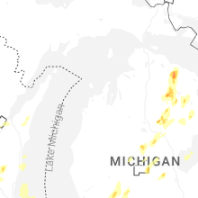
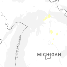
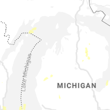
Hail Maps for Lewiston, MI


Connect with Interactive Hail Maps