

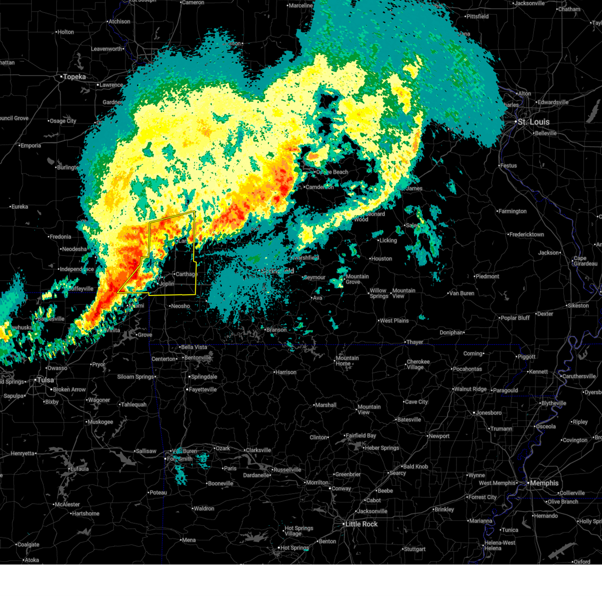
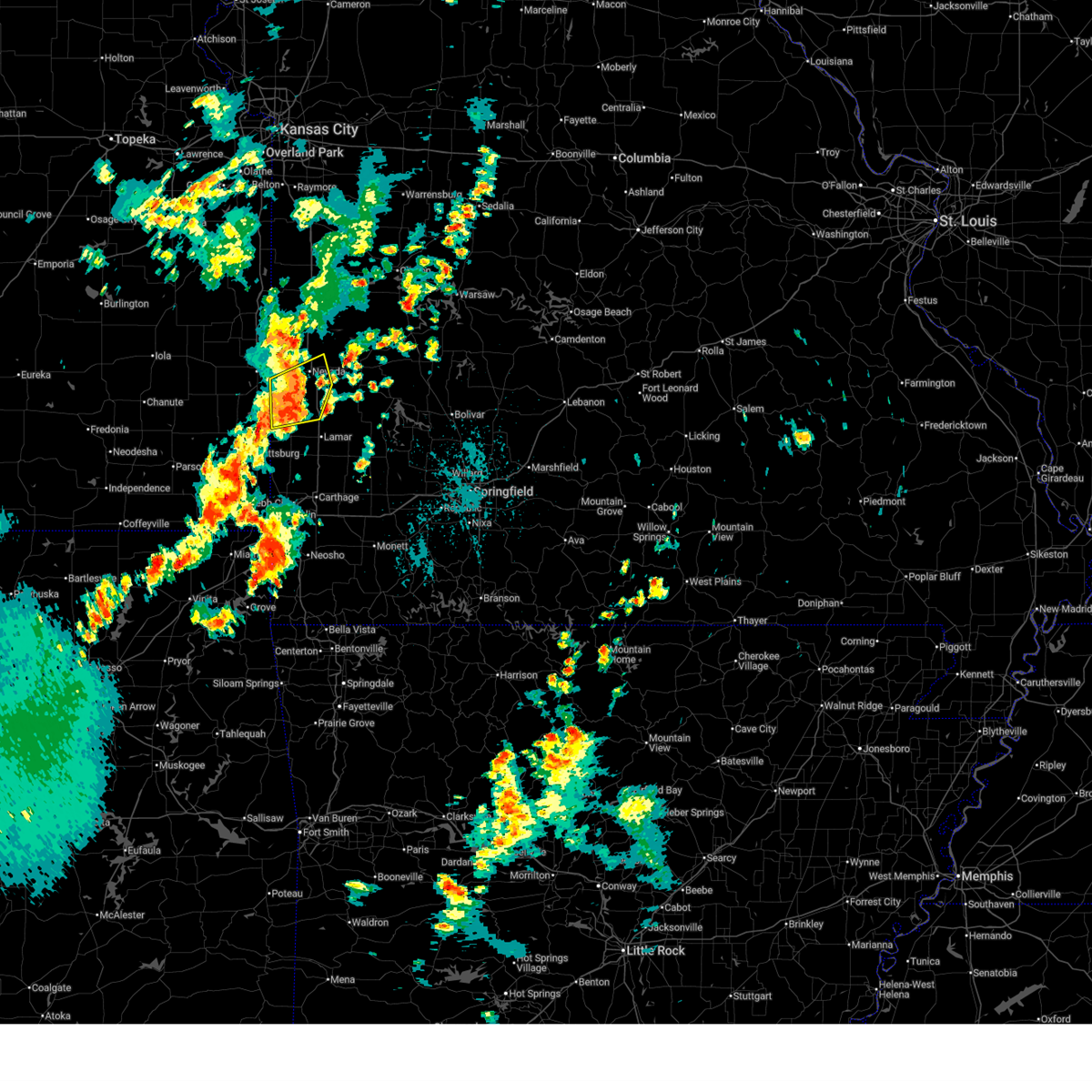
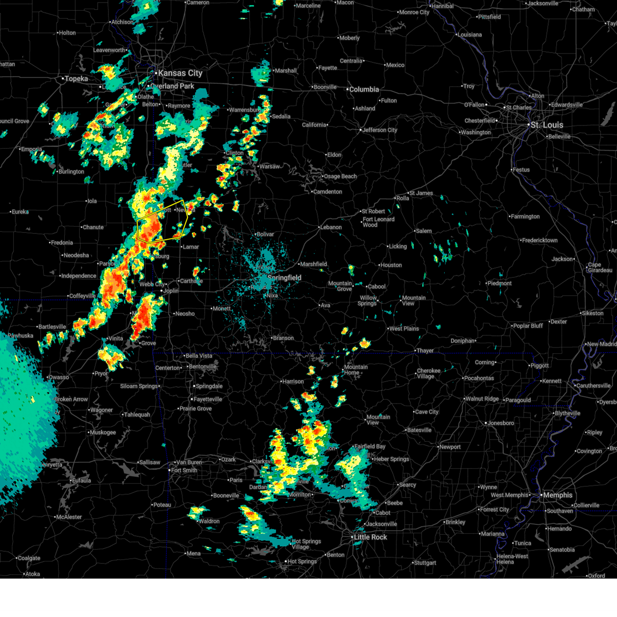
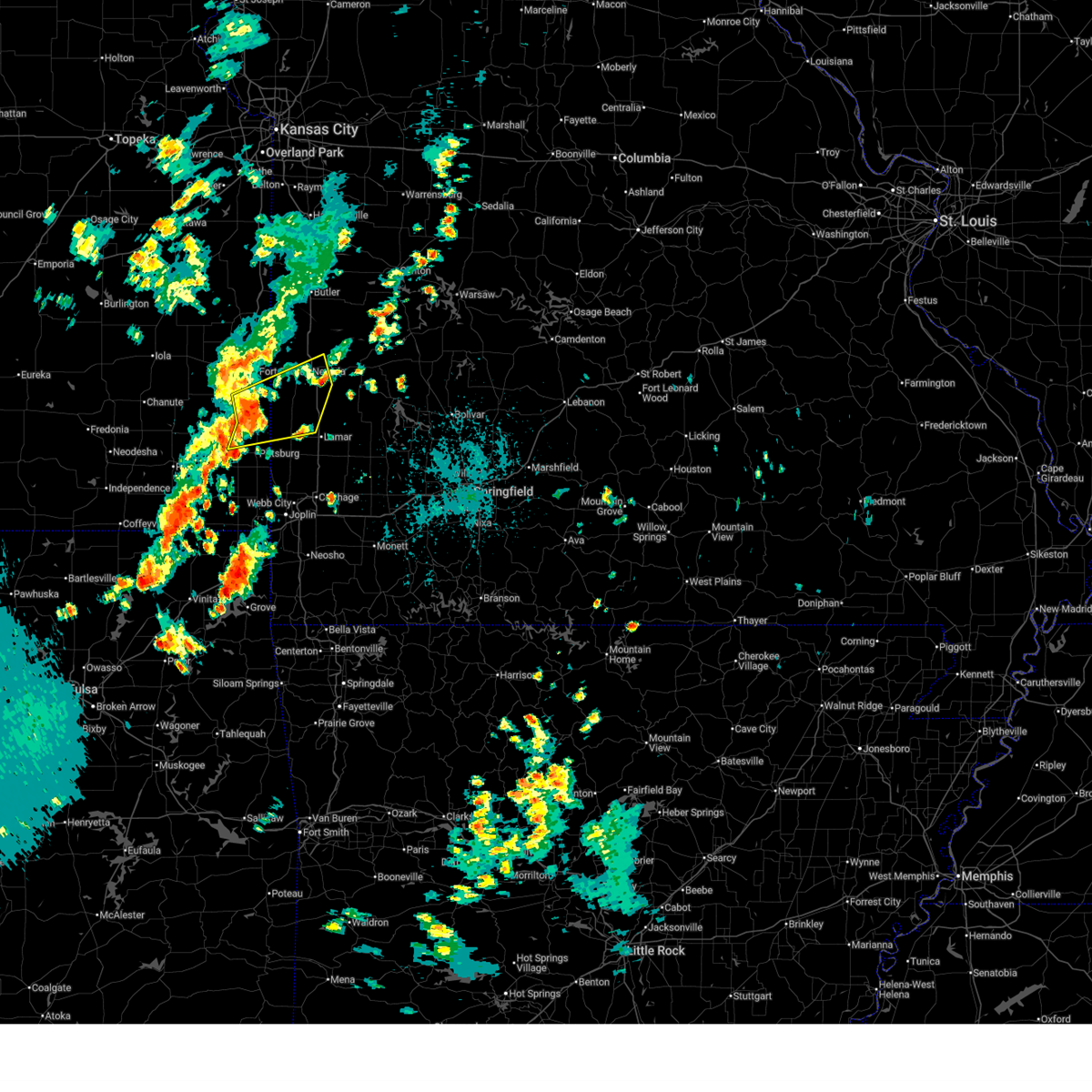
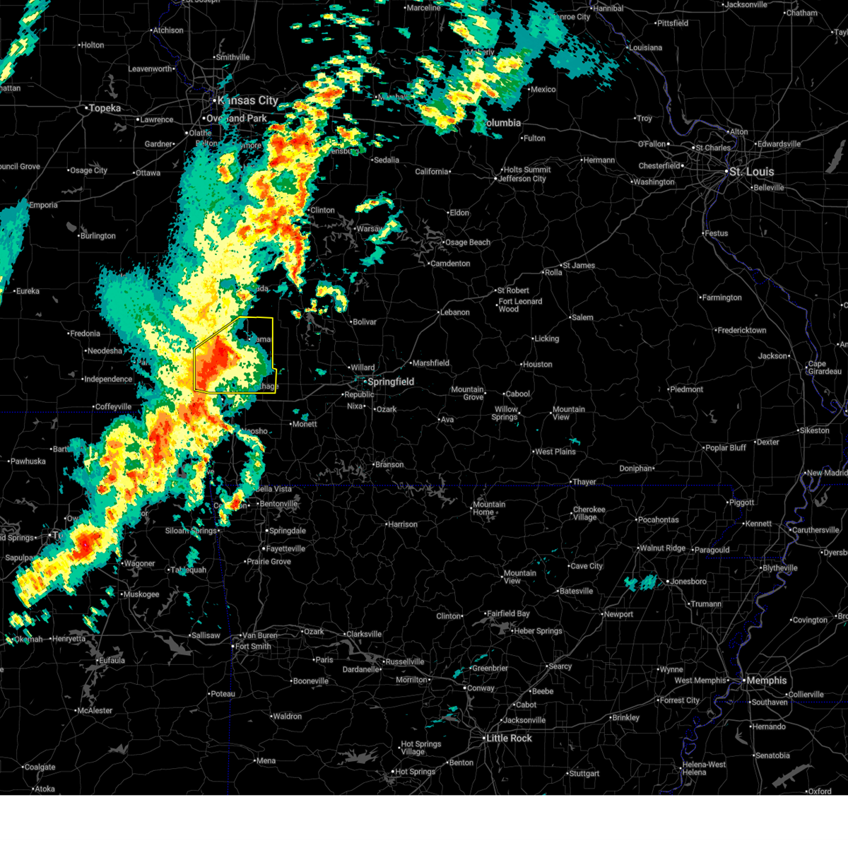
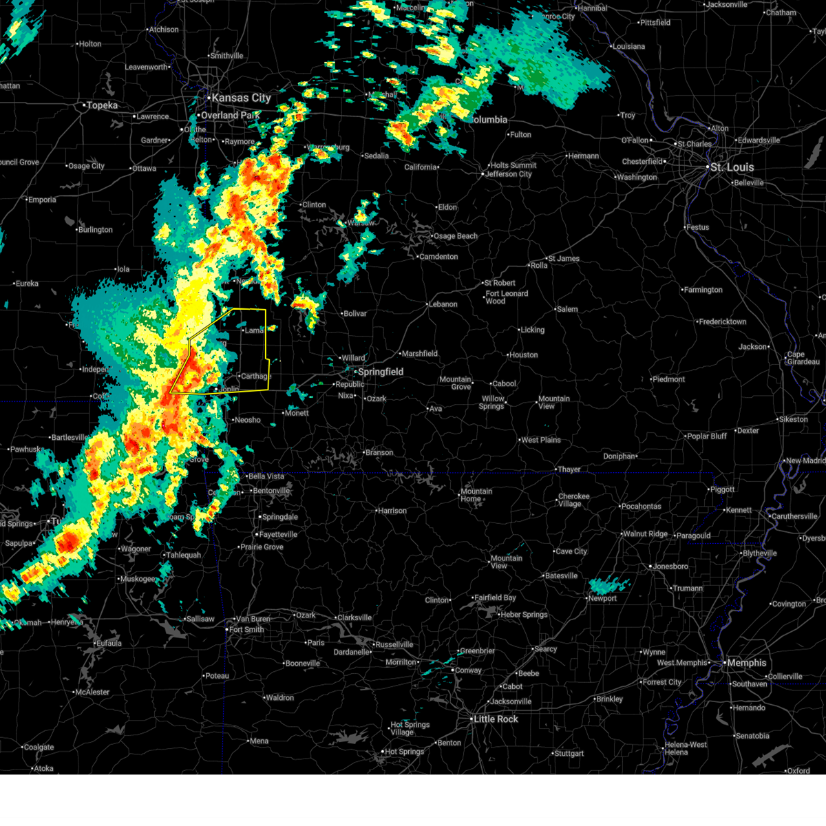
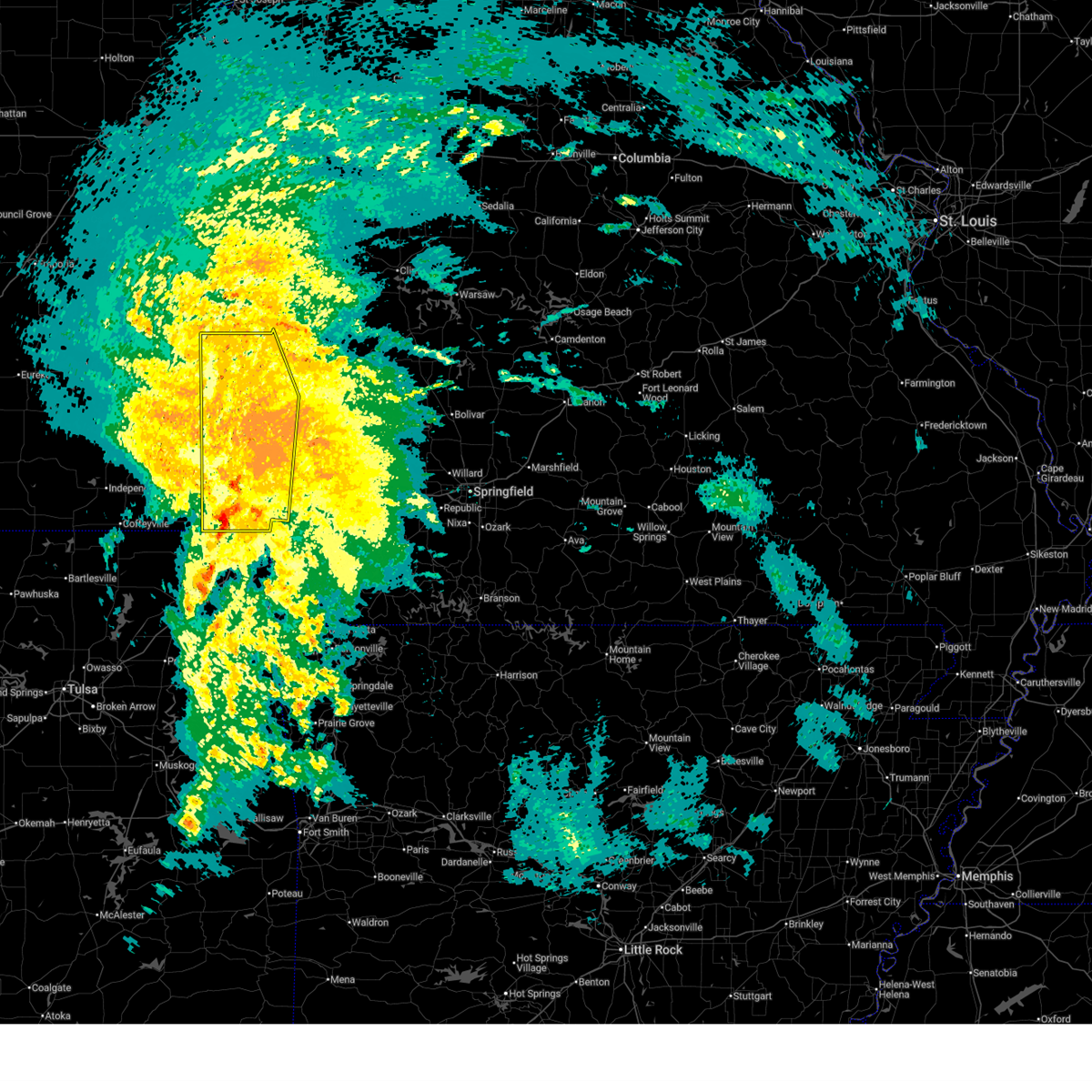
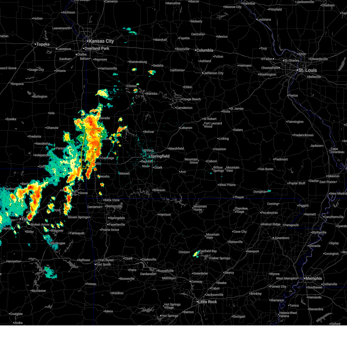
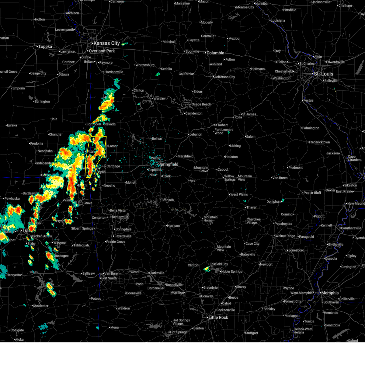
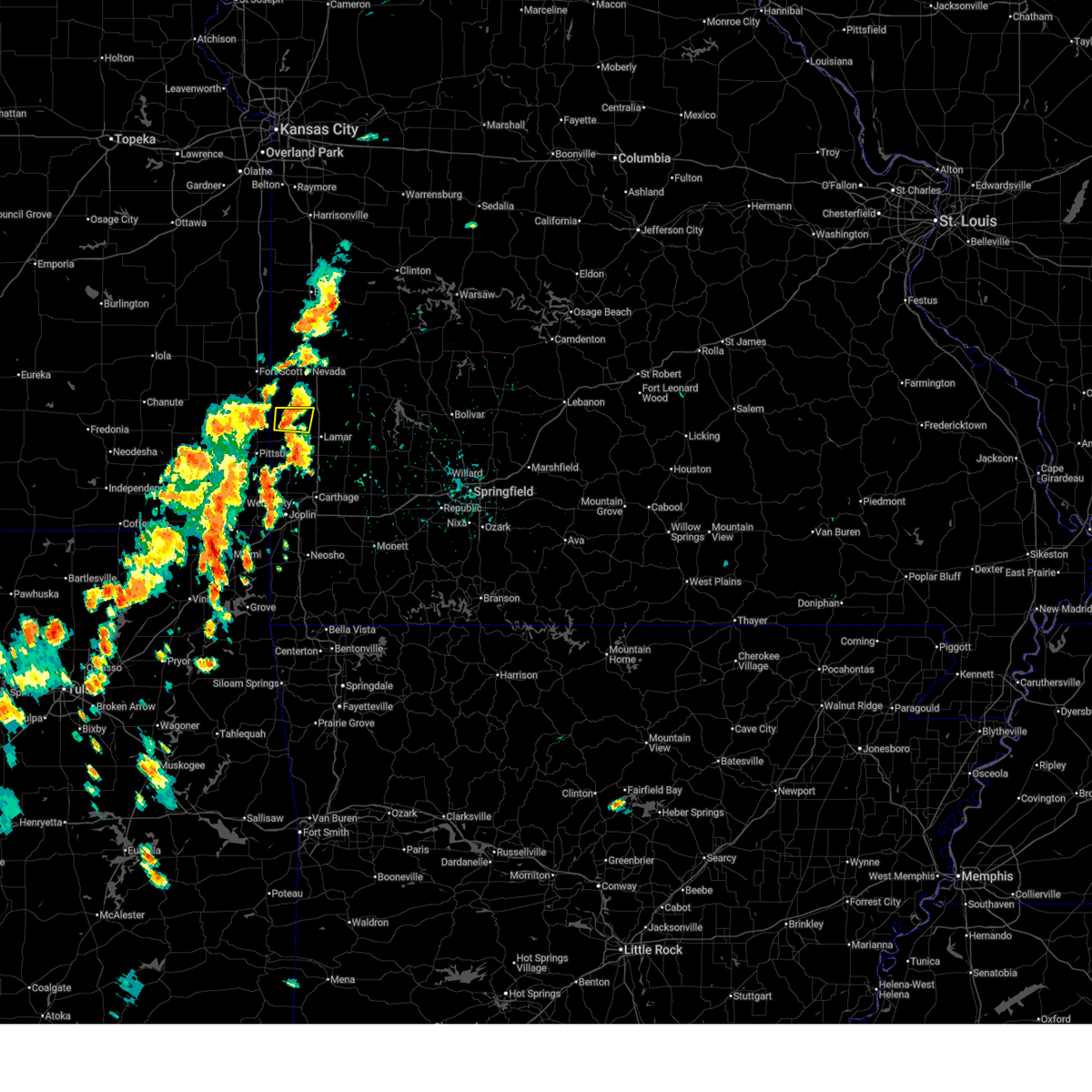
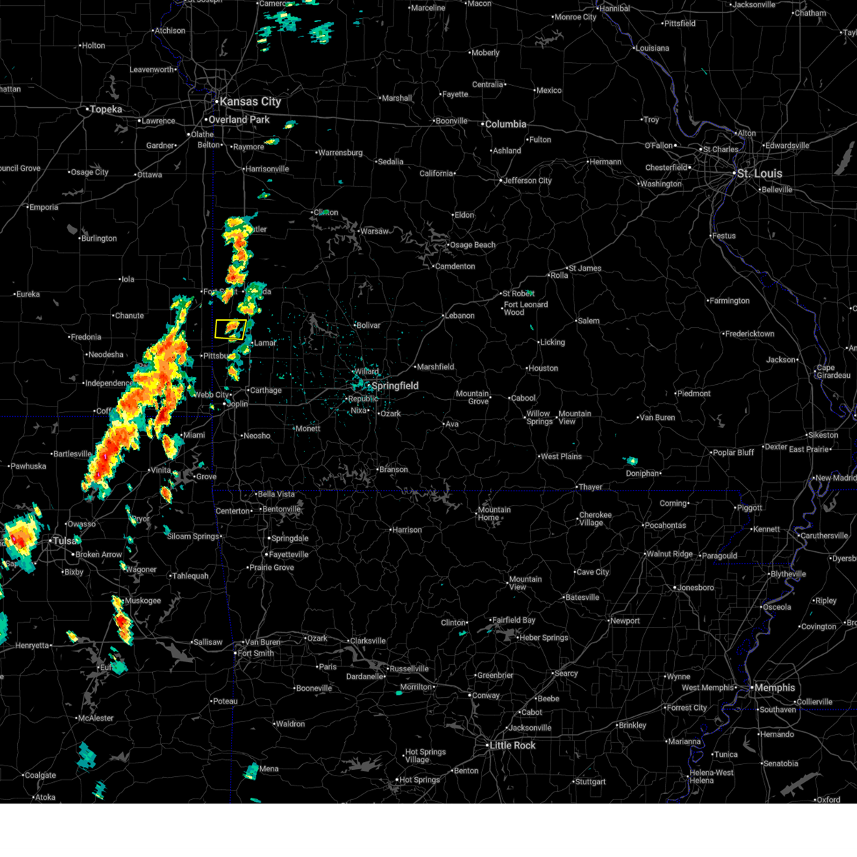
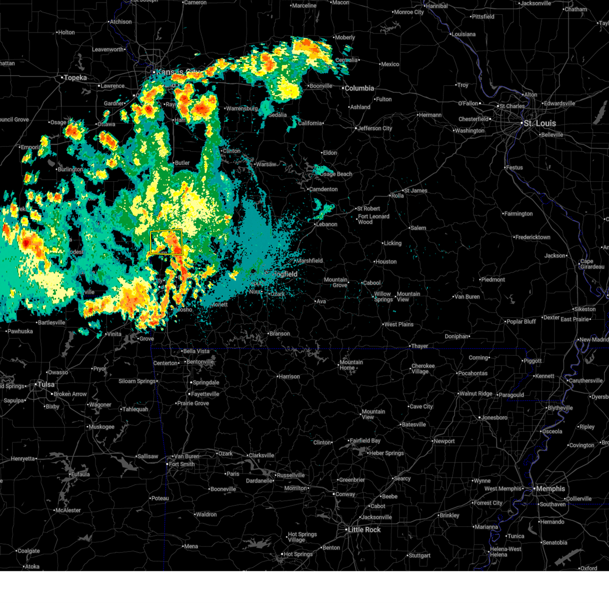
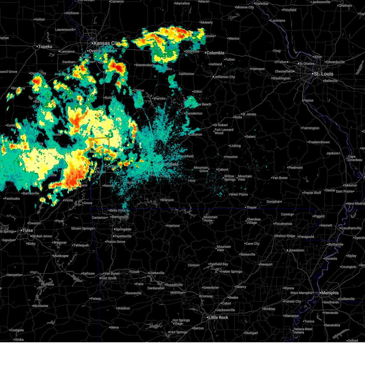
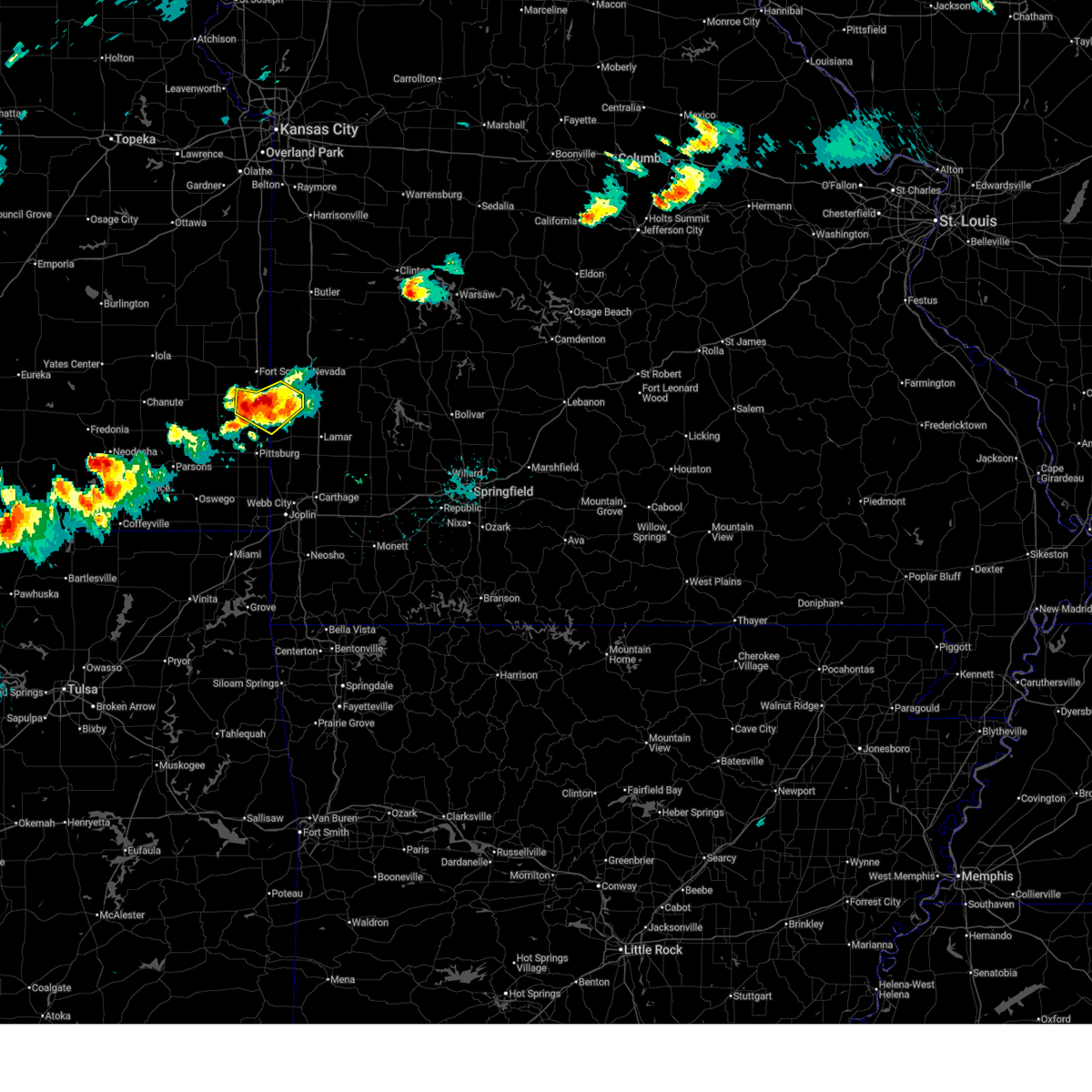
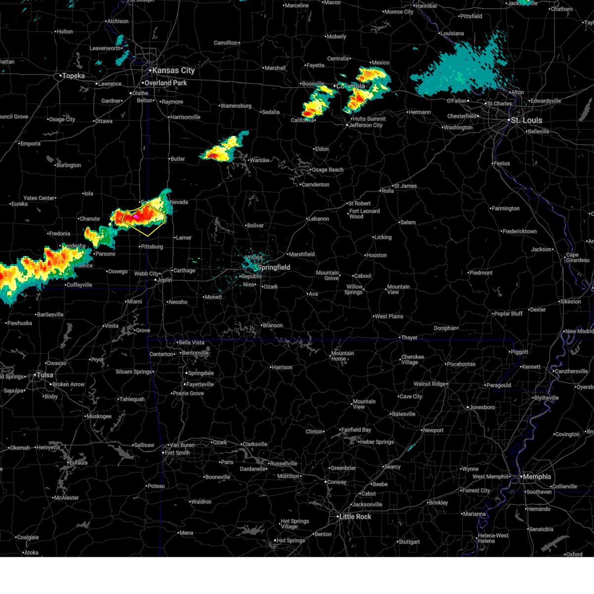
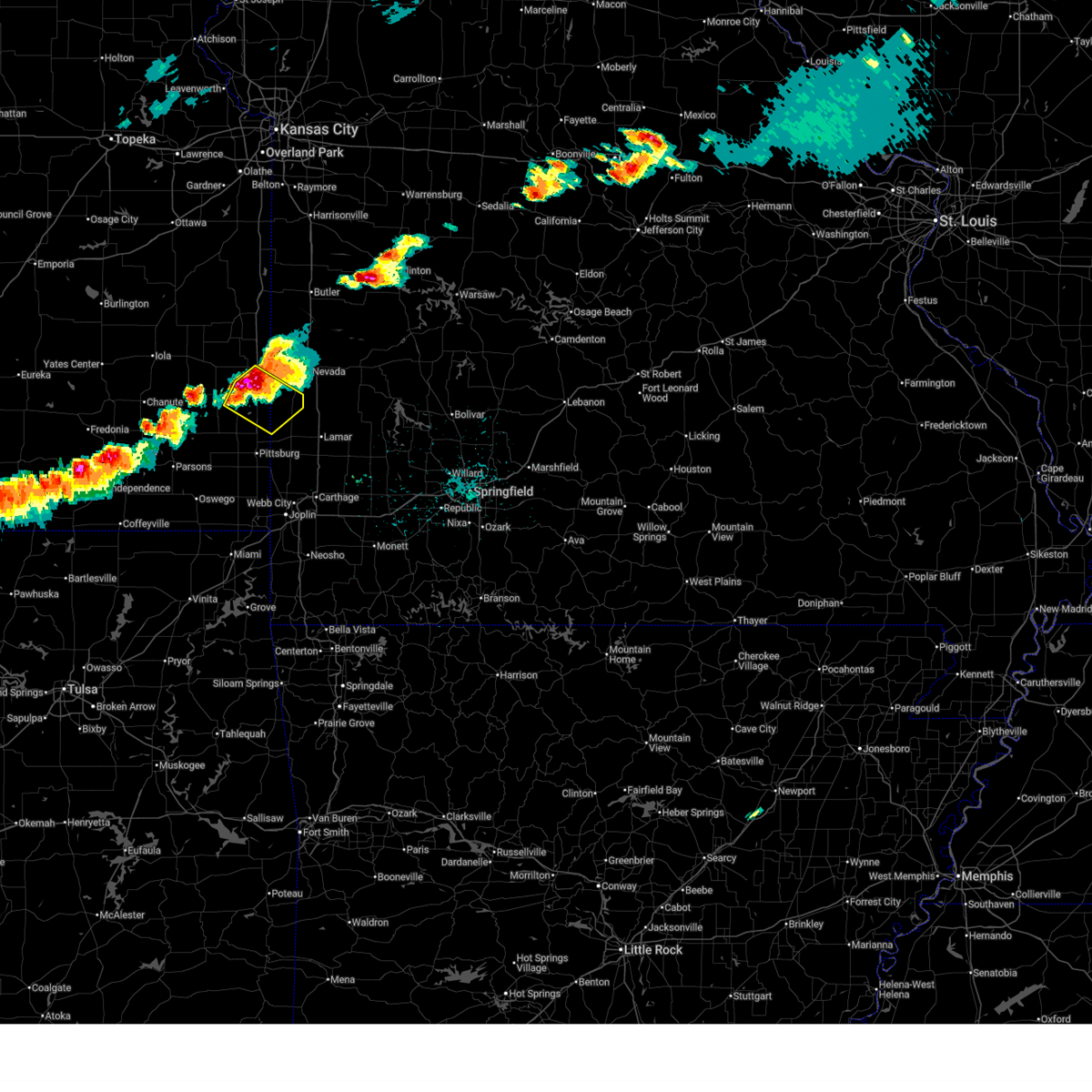
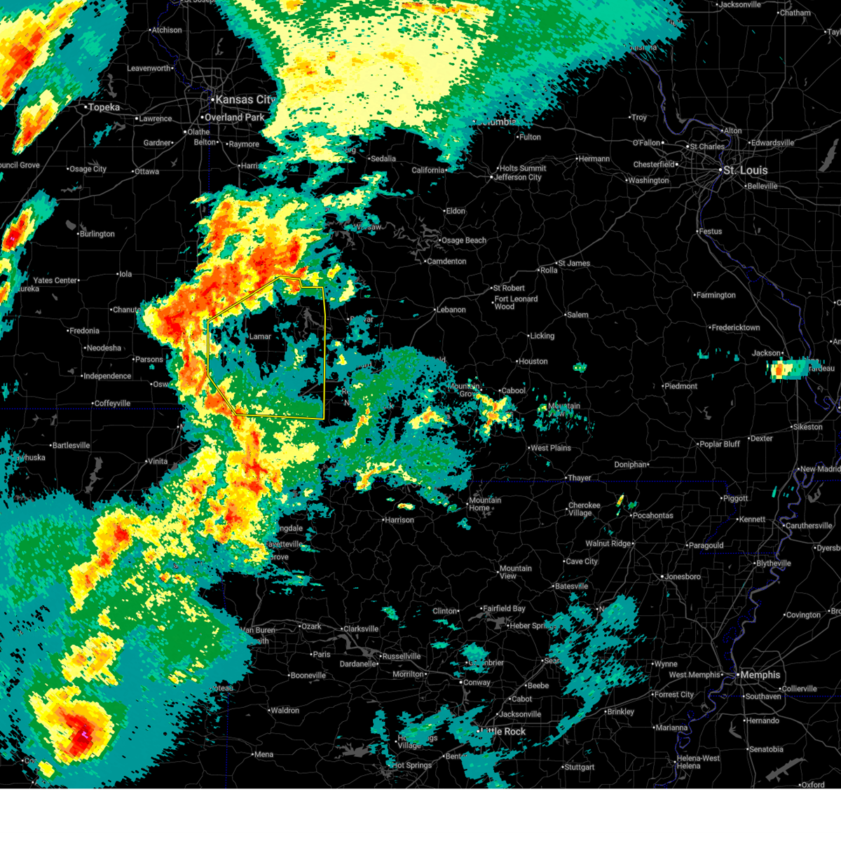
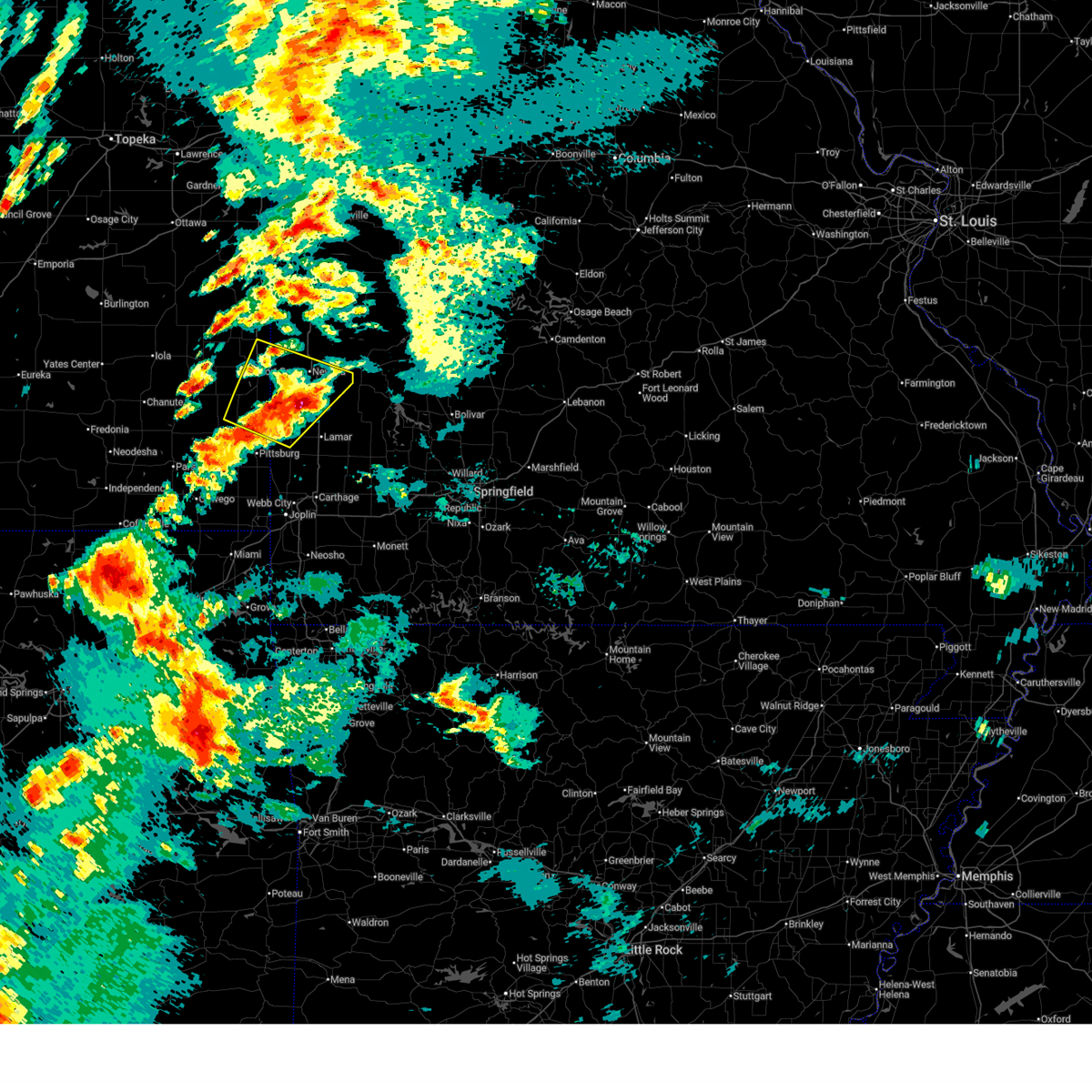
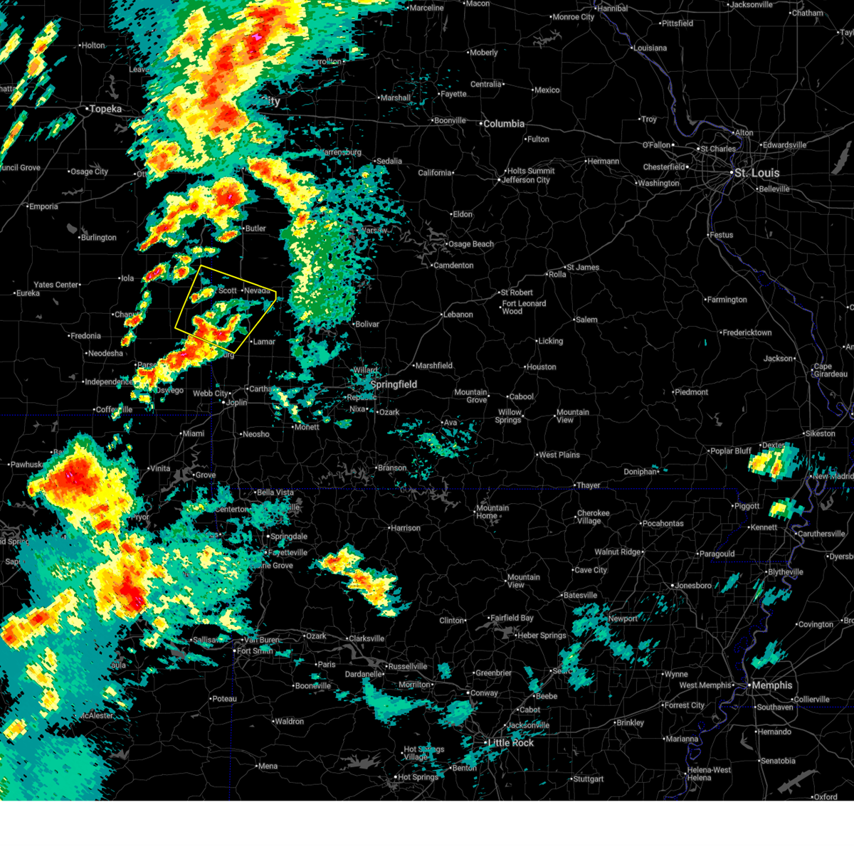
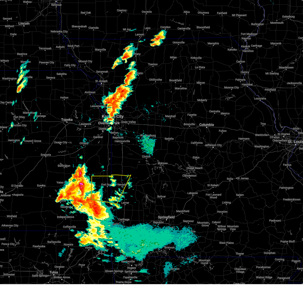
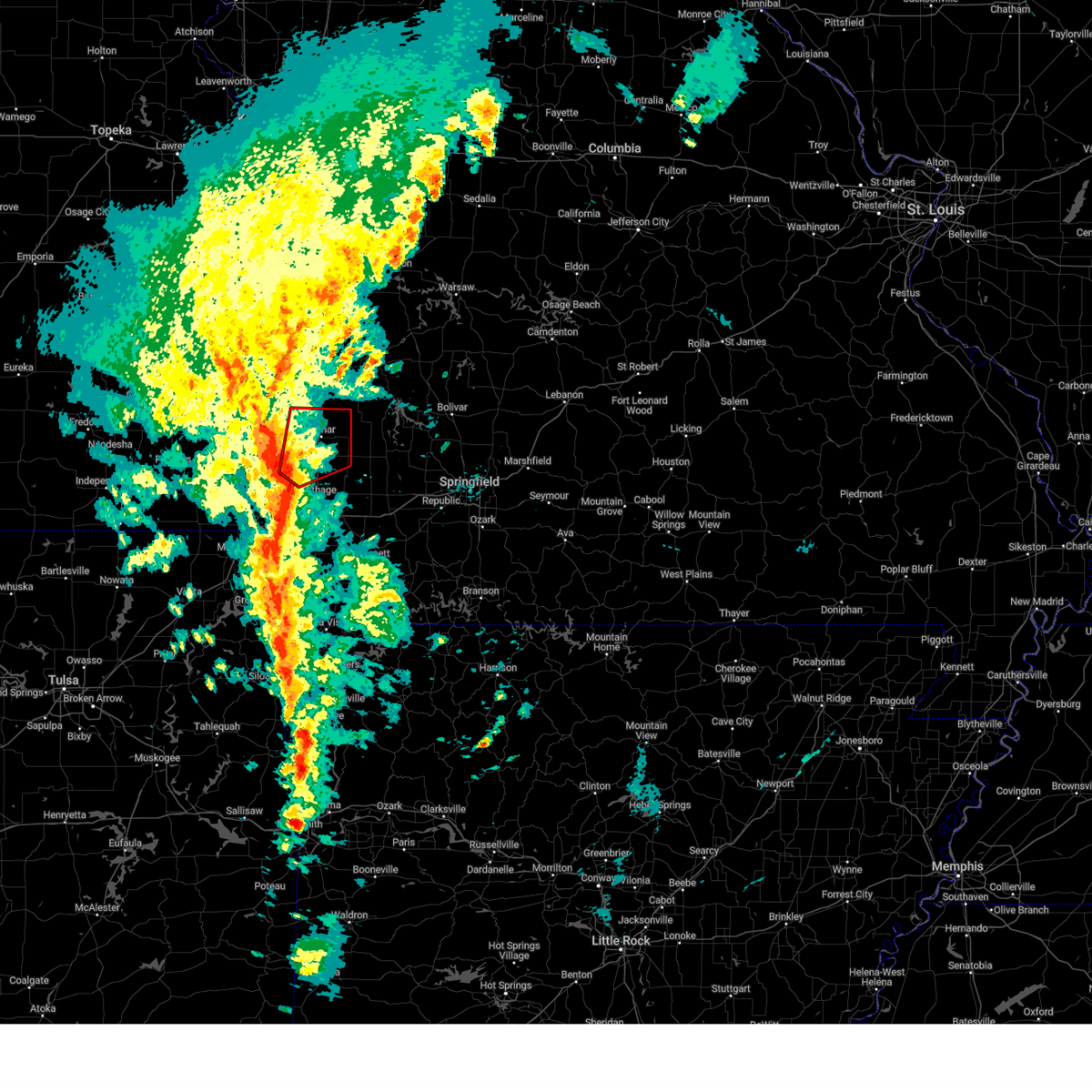
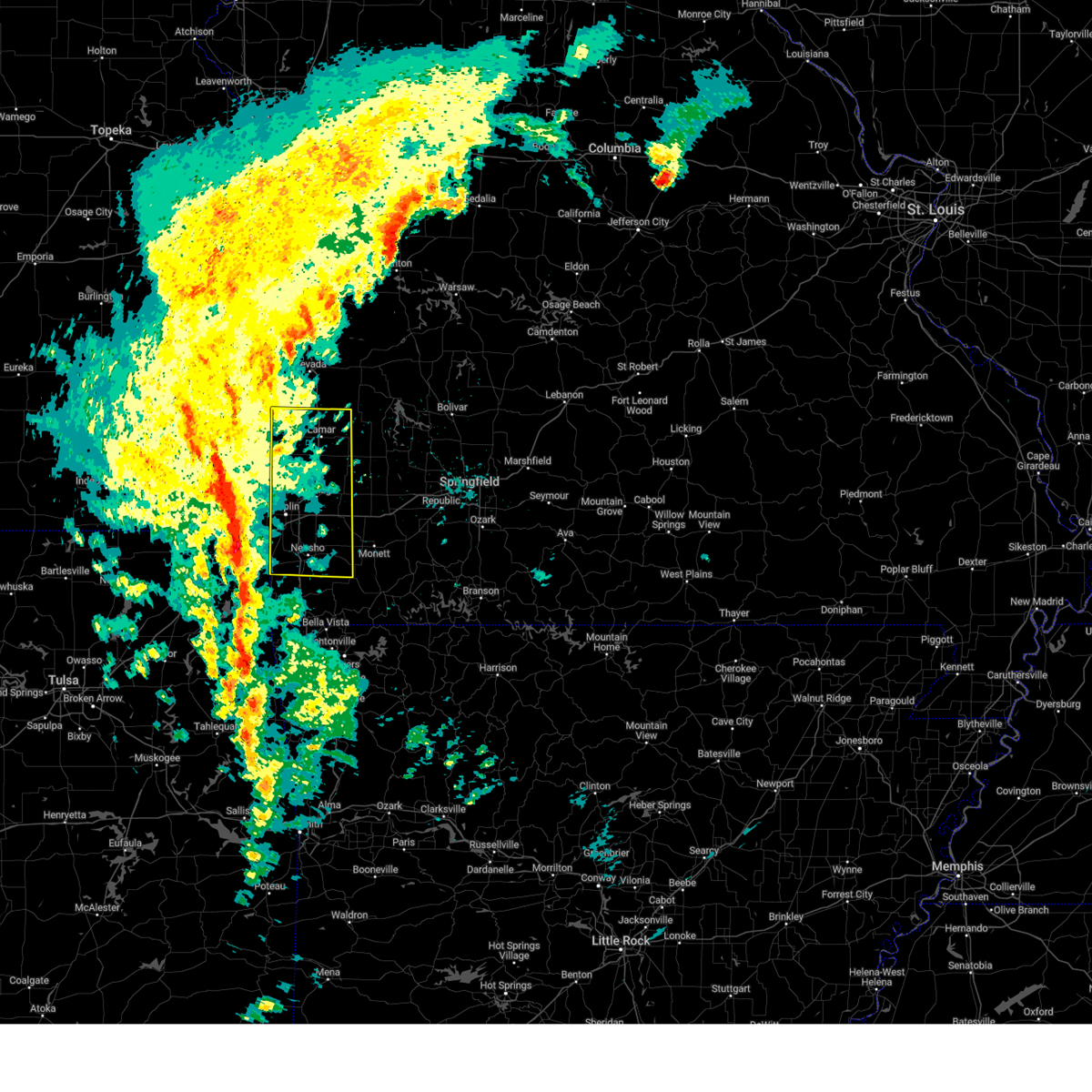
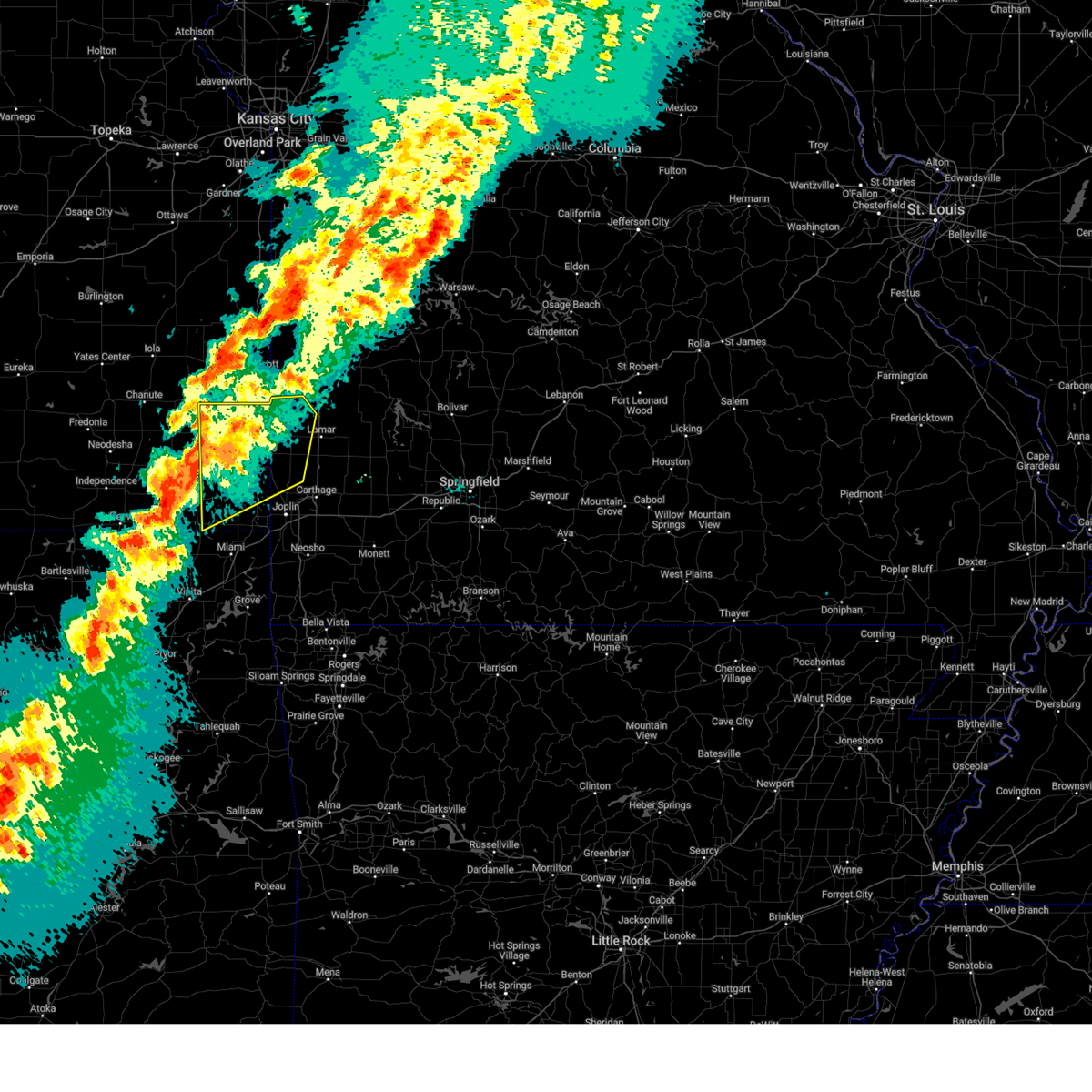
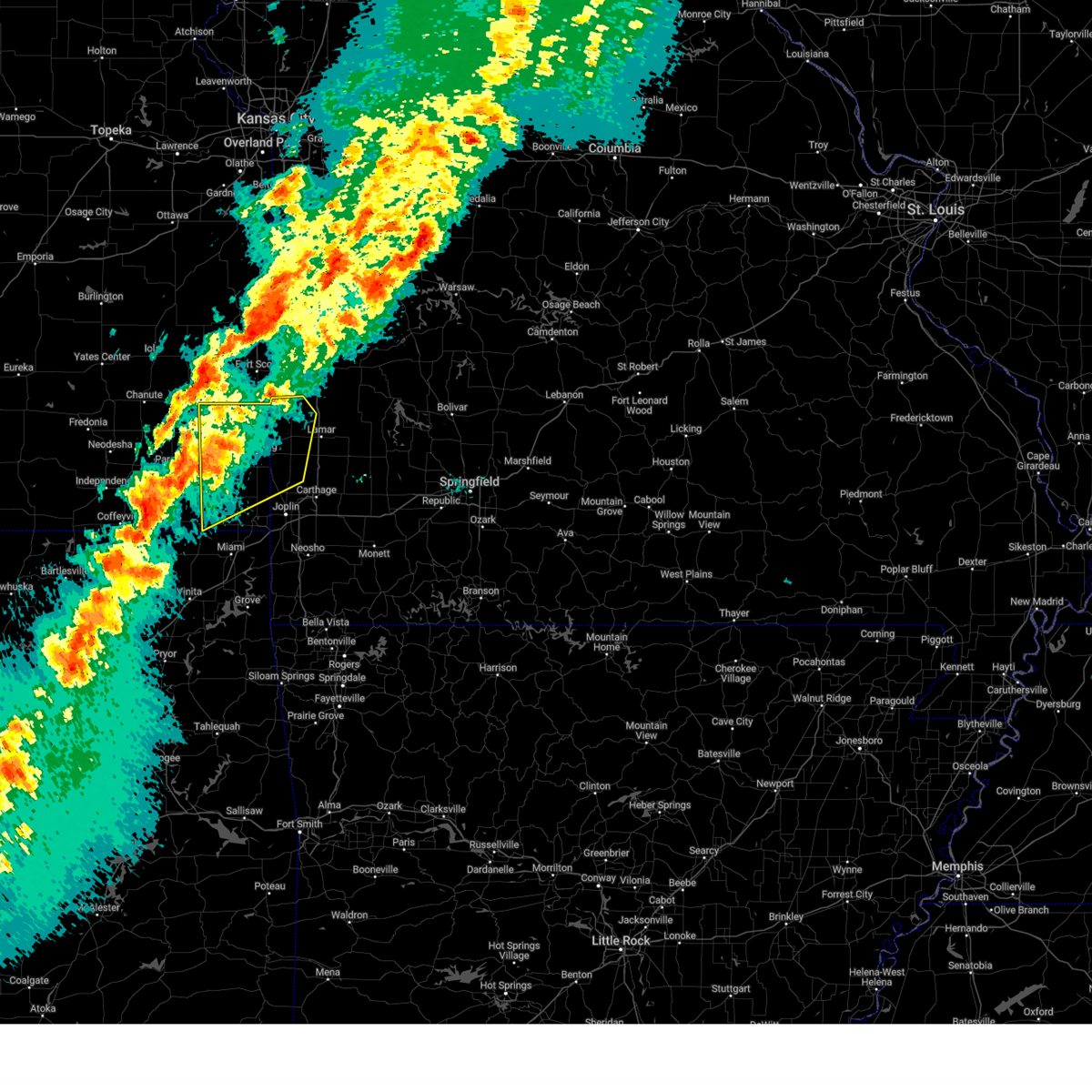
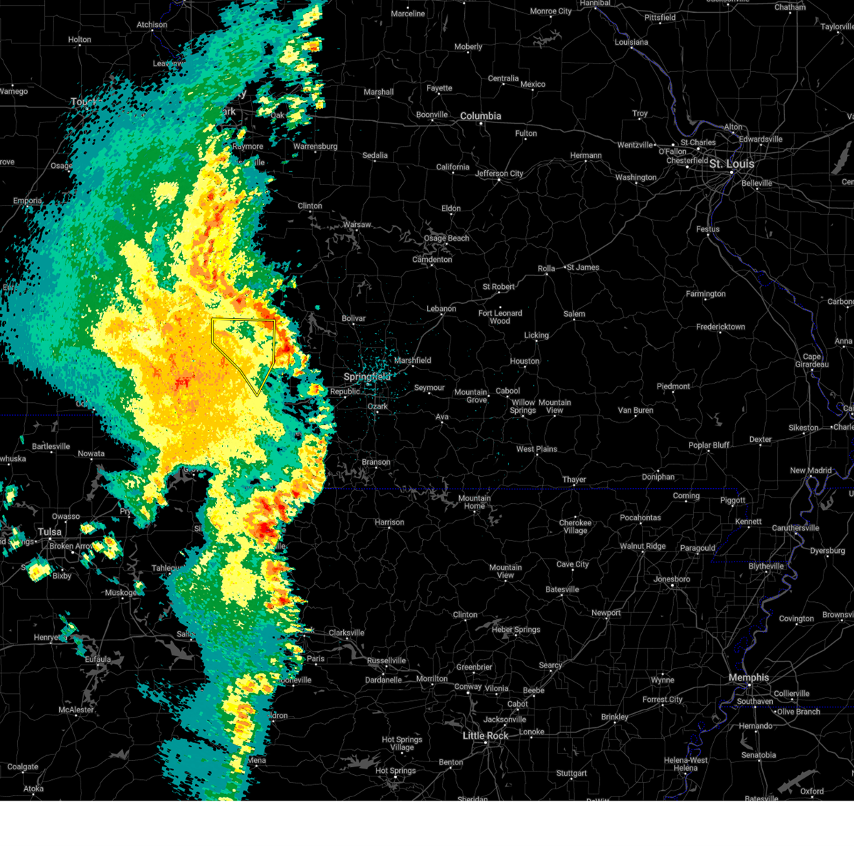
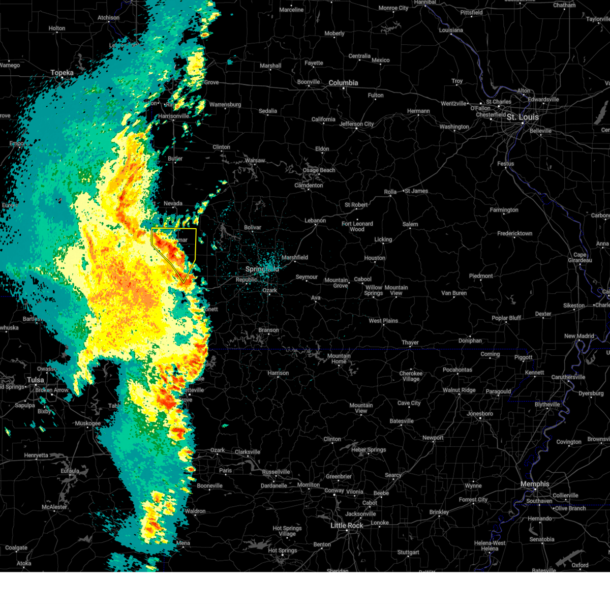
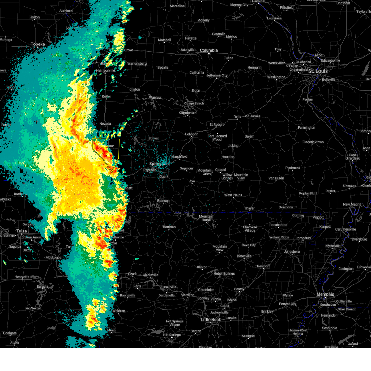
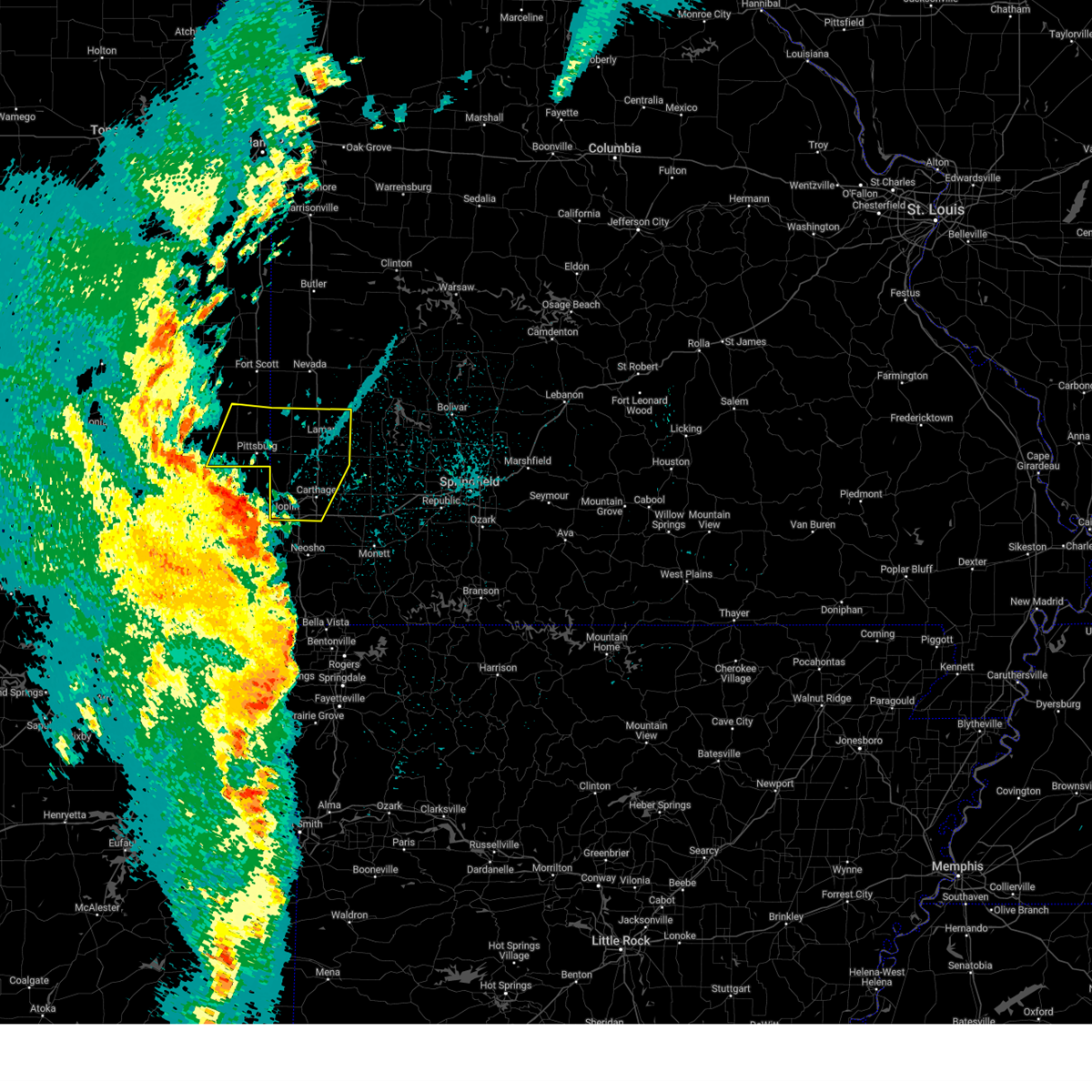
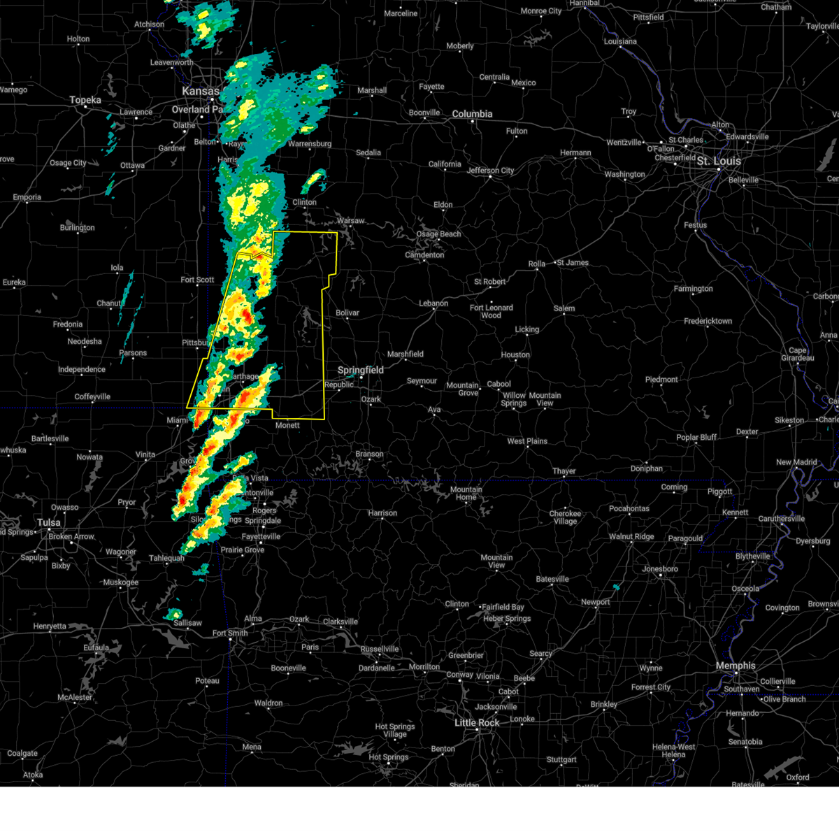
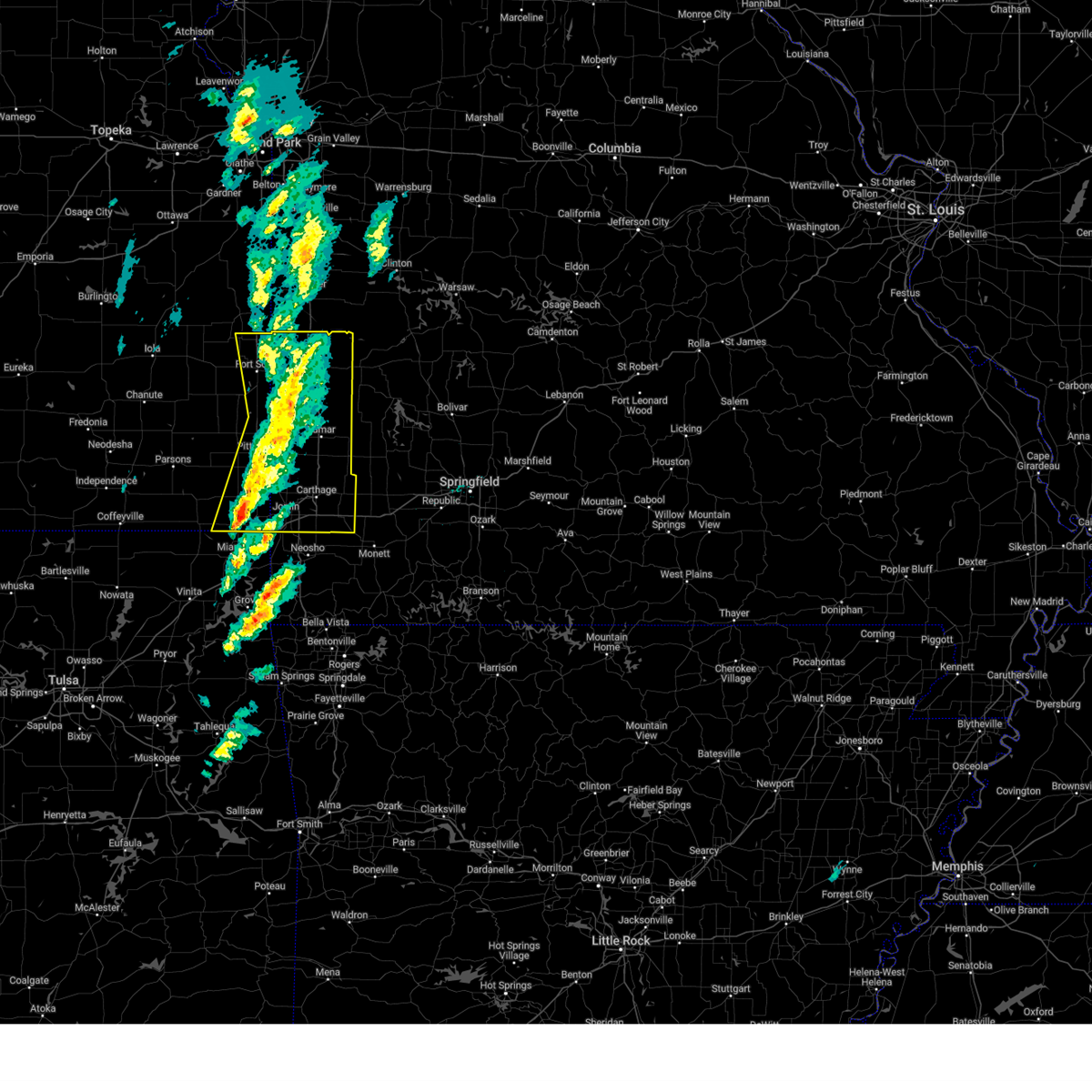
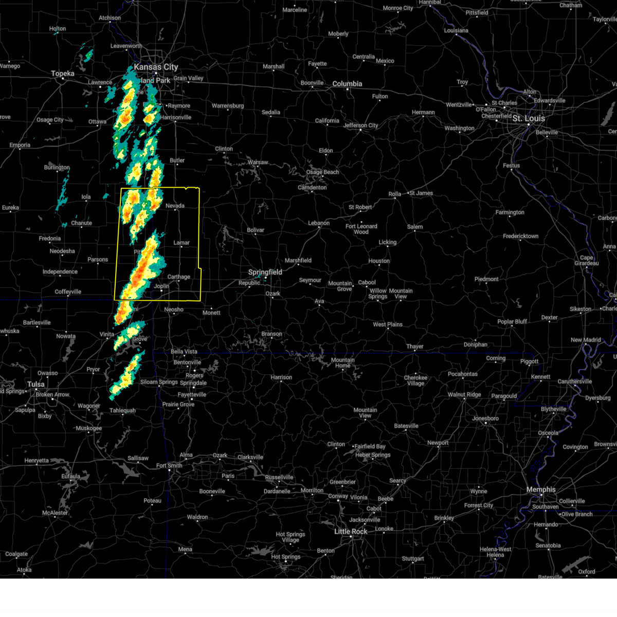
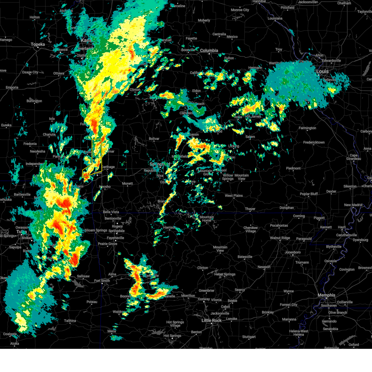
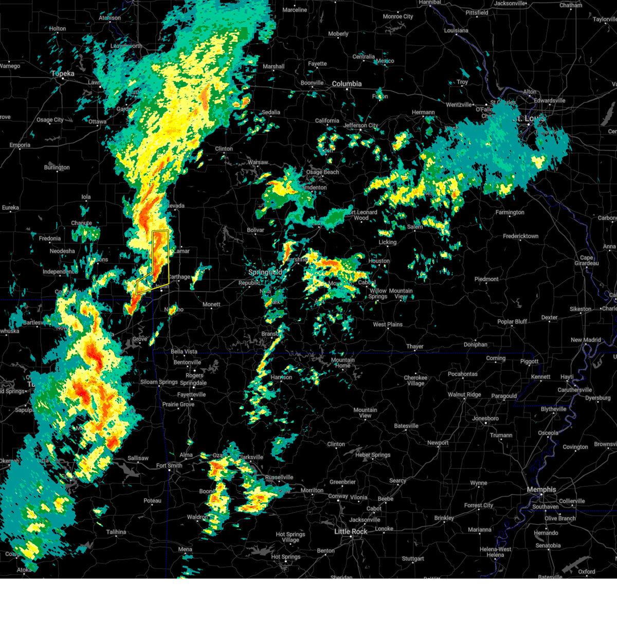
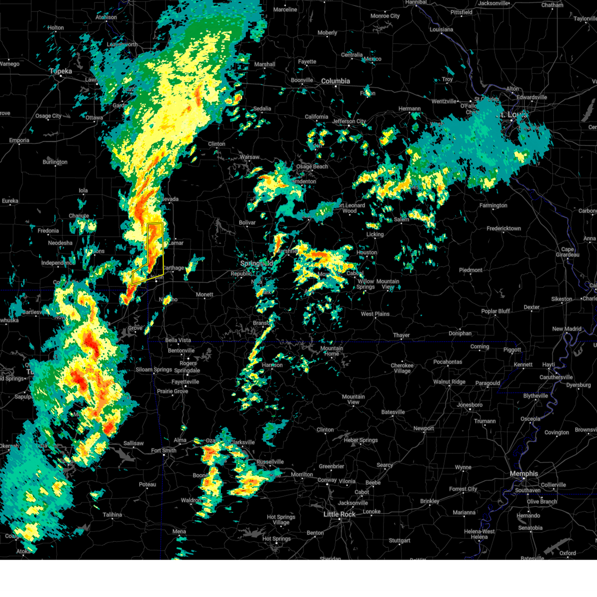
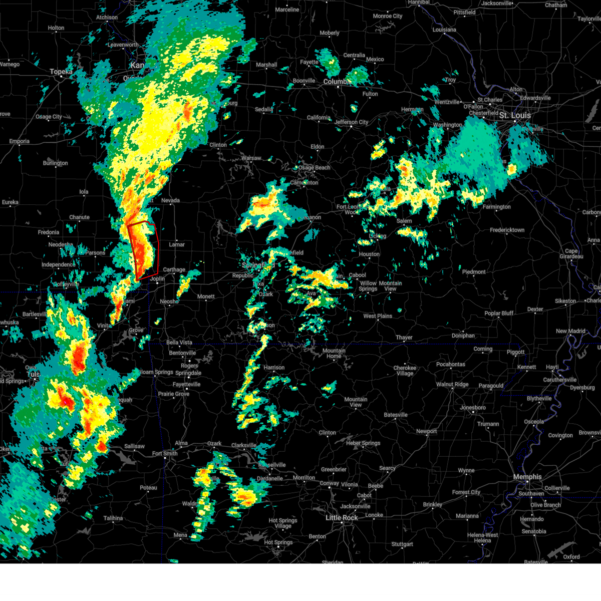
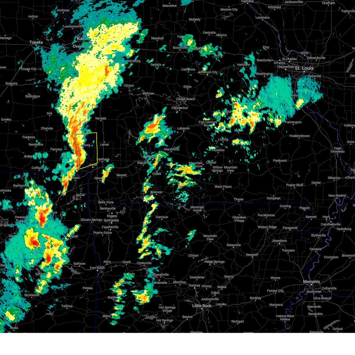
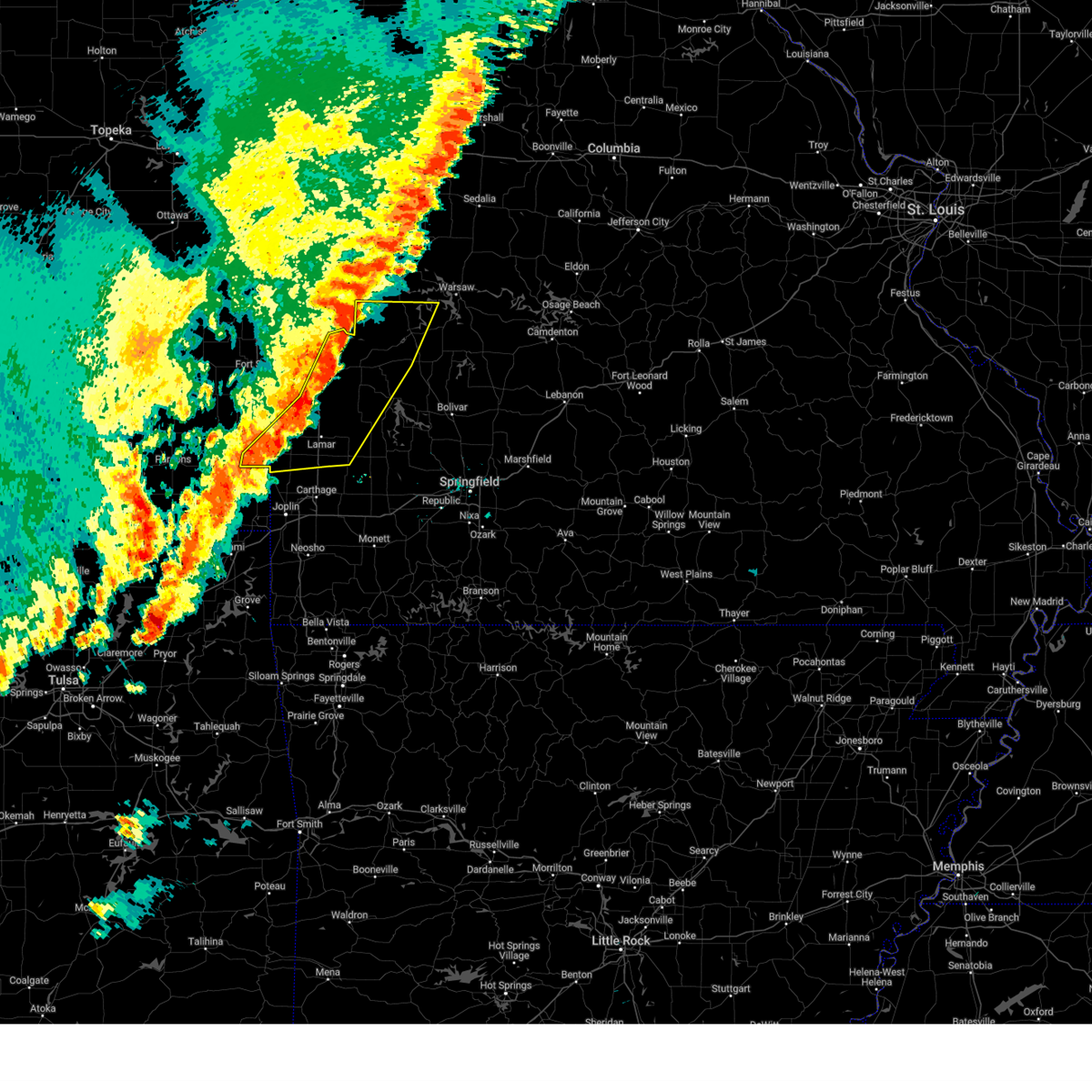
Hail Map for Liberal, MO
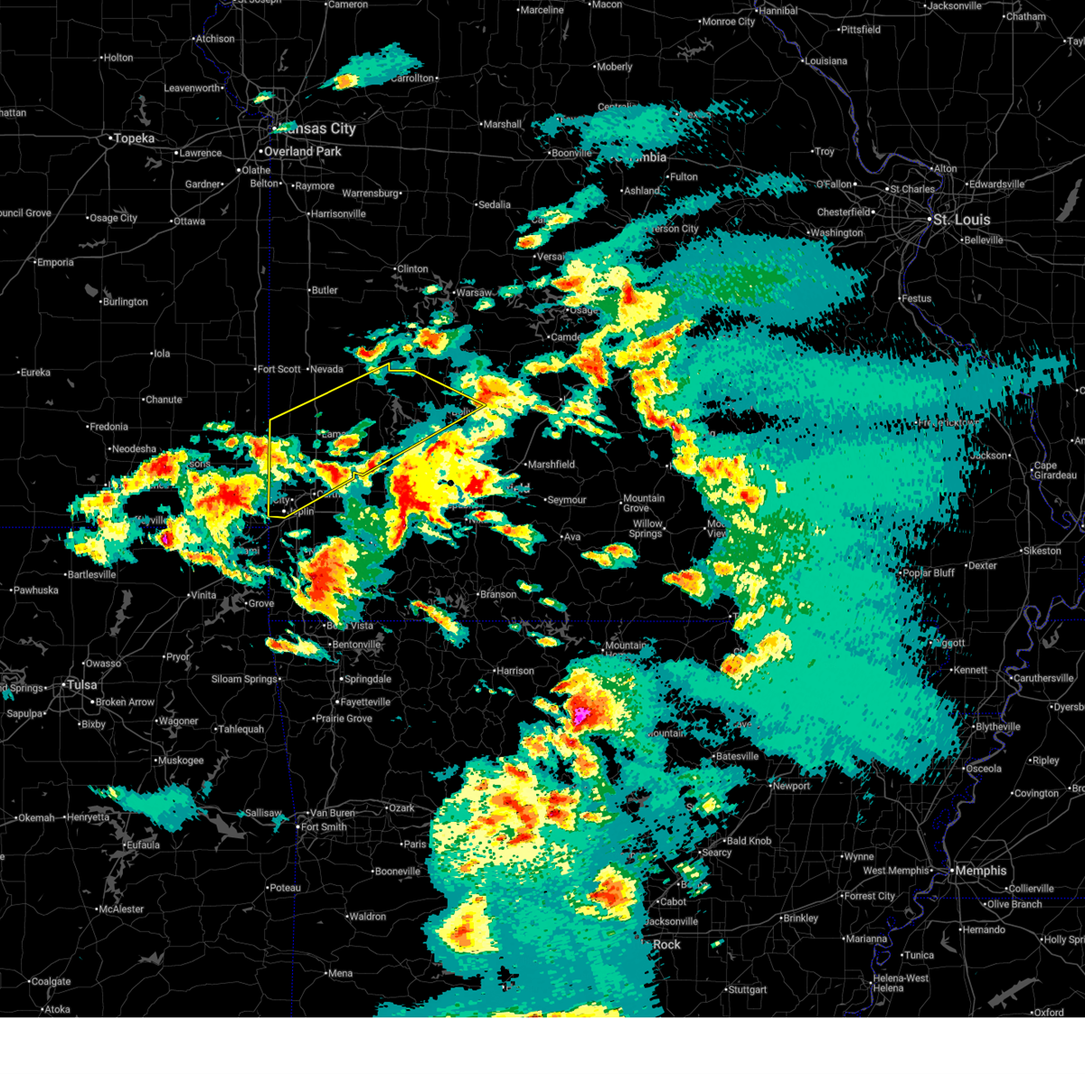
The Liberal, MO area has had 2 reports of on-the-ground hail by trained spotters, and has been under severe weather warnings 24 times during the past 12 months. Doppler radar has detected hail at or near Liberal, MO on 79 occasions, including 4 occasions during the past year.
| Name: | Liberal, MO |
| Where Located: | 51.9 miles E of Chanute, KS |
| Map: | Google Map for Liberal, MO |
| Population: | 759 |
| Housing Units: | 364 |
| More Info: | Search Google for Liberal, MO |
3
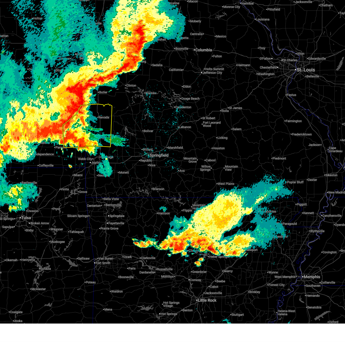
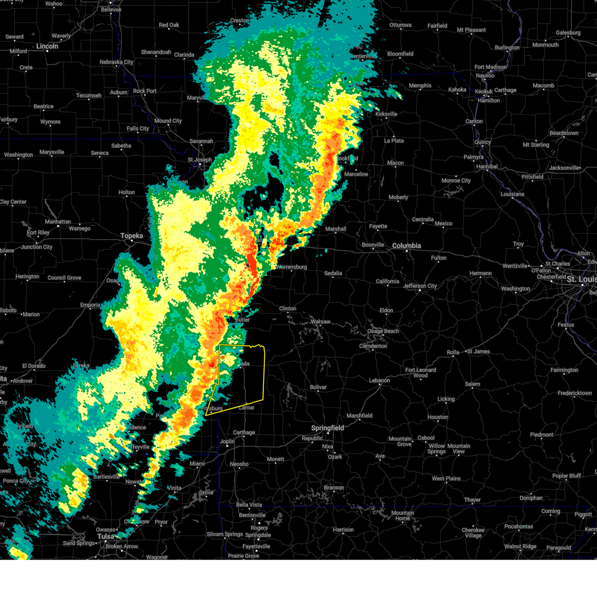
The Top Recent Hail Date for Liberal, MO is Monday, August 11, 2025 (17th out of 79)
Hail and Wind Damage Spotted near Liberal, MO
| Date / Time | Report Details |
|---|---|
| 6/25/2026 3:47 PM CDT |
 Svrsgf the national weather service in springfield has issued a * severe thunderstorm warning for, southeastern bourbon county in southeastern kansas, northeastern crawford county in southeastern kansas, northern barton county in southwestern missouri, western cedar county in southwestern missouri, vernon county in west central missouri, * until 430 pm cdt. * at 347 pm cdt, severe thunderstorms were located along a line extending from near fort scott to 6 miles west of sheldon to near lamar, moving northeast at 35 mph (radar indicated). Hazards include 60 mph wind gusts. expect damage to roofs, siding, and trees Svrsgf the national weather service in springfield has issued a * severe thunderstorm warning for, southeastern bourbon county in southeastern kansas, northeastern crawford county in southeastern kansas, northern barton county in southwestern missouri, western cedar county in southwestern missouri, vernon county in west central missouri, * until 430 pm cdt. * at 347 pm cdt, severe thunderstorms were located along a line extending from near fort scott to 6 miles west of sheldon to near lamar, moving northeast at 35 mph (radar indicated). Hazards include 60 mph wind gusts. expect damage to roofs, siding, and trees
|
| 6/21/2026 7:58 AM CDT |
 Svrsgf the national weather service in springfield has issued a * severe thunderstorm warning for, barton county in southwestern missouri, southeastern vernon county in west central missouri, * until 845 am cdt. * at 758 am cdt, severe thunderstorms were located along a line extending from 6 miles west of sheldon to 6 miles northwest of lamar to 7 miles northwest of jasper, moving east at 30 mph (radar indicated). Hazards include 60 mph wind gusts. expect damage to roofs, siding, and trees Svrsgf the national weather service in springfield has issued a * severe thunderstorm warning for, barton county in southwestern missouri, southeastern vernon county in west central missouri, * until 845 am cdt. * at 758 am cdt, severe thunderstorms were located along a line extending from 6 miles west of sheldon to 6 miles northwest of lamar to 7 miles northwest of jasper, moving east at 30 mph (radar indicated). Hazards include 60 mph wind gusts. expect damage to roofs, siding, and trees
|
| 6/13/2026 10:20 PM CDT |
 At 1019 pm cdt, severe thunderstorms were located along a line extending from 7 miles east of pleasanton to near fort scott to 6 miles northeast of parsons, moving southeast at 60 mph (radar indicated. multiple reports of 60 to 70 mph wind gusts have been received from this line of storms). Hazards include 70 mph wind gusts and quarter size hail. Hail damage to vehicles is expected. expect considerable tree damage. wind damage is also likely to mobile homes, roofs, and outbuildings. Locations impacted include, pittsburg, prairie state park, nevada, fort scott, lamar, frontenac, girard, arma, marmaton, golden city, liberal, cherokee, sheldon, mulberry, chicopee, mccune, nashville, mindenmines, franklin, and montevallo. At 1019 pm cdt, severe thunderstorms were located along a line extending from 7 miles east of pleasanton to near fort scott to 6 miles northeast of parsons, moving southeast at 60 mph (radar indicated. multiple reports of 60 to 70 mph wind gusts have been received from this line of storms). Hazards include 70 mph wind gusts and quarter size hail. Hail damage to vehicles is expected. expect considerable tree damage. wind damage is also likely to mobile homes, roofs, and outbuildings. Locations impacted include, pittsburg, prairie state park, nevada, fort scott, lamar, frontenac, girard, arma, marmaton, golden city, liberal, cherokee, sheldon, mulberry, chicopee, mccune, nashville, mindenmines, franklin, and montevallo.
|
| 6/13/2026 10:08 PM CDT |
 Svrsgf the national weather service in springfield has issued a * severe thunderstorm warning for, southeastern bourbon county in southeastern kansas, crawford county in southeastern kansas, barton county in southwestern missouri, vernon county in west central missouri, * until 1115 pm cdt. * at 1008 pm cdt, severe thunderstorms were located along a line extending from near la cygne to near fort scott to near galesburg, moving southeast at 60 mph (radar indicated). Hazards include 70 mph wind gusts and nickel size hail. Expect considerable tree damage. Damage is likely to mobile homes, roofs, and outbuildings. Svrsgf the national weather service in springfield has issued a * severe thunderstorm warning for, southeastern bourbon county in southeastern kansas, crawford county in southeastern kansas, barton county in southwestern missouri, vernon county in west central missouri, * until 1115 pm cdt. * at 1008 pm cdt, severe thunderstorms were located along a line extending from near la cygne to near fort scott to near galesburg, moving southeast at 60 mph (radar indicated). Hazards include 70 mph wind gusts and nickel size hail. Expect considerable tree damage. Damage is likely to mobile homes, roofs, and outbuildings.
|
| 4/28/2026 1:37 PM CDT | Golf Ball sized hail reported 0.1 miles ENE of Liberal, MO, off duty officer reports golf ball sized hail in liberal. |
| 4/28/2026 1:30 PM CDT |
 Svrsgf the national weather service in springfield has issued a * severe thunderstorm warning for, barton county in southwestern missouri, cedar county in southwestern missouri, polk county in southwestern missouri, southeastern vernon county in west central missouri, jasper county in southwestern missouri, dade county in southwestern missouri, * until 215 pm cdt. * at 129 pm cdt, a pair of severe thunderstorms were located near golden city mo and also columbus ks moving northeast at 65 mph (radar indicated). Hazards include golf ball size hail. People and animals outdoors will be injured. Expect damage to roofs, siding, windows, and vehicles. Svrsgf the national weather service in springfield has issued a * severe thunderstorm warning for, barton county in southwestern missouri, cedar county in southwestern missouri, polk county in southwestern missouri, southeastern vernon county in west central missouri, jasper county in southwestern missouri, dade county in southwestern missouri, * until 215 pm cdt. * at 129 pm cdt, a pair of severe thunderstorms were located near golden city mo and also columbus ks moving northeast at 65 mph (radar indicated). Hazards include golf ball size hail. People and animals outdoors will be injured. Expect damage to roofs, siding, windows, and vehicles.
|
| 4/28/2026 11:55 AM CDT |
 At 1155 am cdt, a severe thunderstorm was located near columbus, moving northeast at 75 mph (radar indicated). Hazards include two inch hail. People and animals outdoors will be injured. expect damage to roofs, siding, windows, and vehicles. Locations impacted include, pittsburg, prairie state park, carl junction, lamar, frontenac, columbus, galena, girard, arma, liberal, cherokee, weir, sherman, mulberry, scammon, chicopee, mccune, nashville, mindenmines, and franklin. At 1155 am cdt, a severe thunderstorm was located near columbus, moving northeast at 75 mph (radar indicated). Hazards include two inch hail. People and animals outdoors will be injured. expect damage to roofs, siding, windows, and vehicles. Locations impacted include, pittsburg, prairie state park, carl junction, lamar, frontenac, columbus, galena, girard, arma, liberal, cherokee, weir, sherman, mulberry, scammon, chicopee, mccune, nashville, mindenmines, and franklin.
|
| 4/28/2026 11:51 AM CDT |
 Svrsgf the national weather service in springfield has issued a * severe thunderstorm warning for, cherokee county in southeastern kansas, crawford county in southeastern kansas, barton county in southwestern missouri, northwestern jasper county in southwestern missouri, * until 1215 pm cdt. * at 1151 am cdt, a severe thunderstorm was located near columbus, moving northeast at 80 mph (radar indicated). Hazards include half dollar size hail. damage to vehicles is expected Svrsgf the national weather service in springfield has issued a * severe thunderstorm warning for, cherokee county in southeastern kansas, crawford county in southeastern kansas, barton county in southwestern missouri, northwestern jasper county in southwestern missouri, * until 1215 pm cdt. * at 1151 am cdt, a severe thunderstorm was located near columbus, moving northeast at 80 mph (radar indicated). Hazards include half dollar size hail. damage to vehicles is expected
|
| 4/17/2026 9:22 PM CDT |
 Svrsgf the national weather service in springfield has issued a * severe thunderstorm warning for, eastern cherokee county in southeastern kansas, barton county in southwestern missouri, northern newton county in southwestern missouri, southern vernon county in west central missouri, jasper county in southwestern missouri, * until 1000 pm cdt. * at 921 pm cdt, severe thunderstorms were located along a line extending from near arcadia to 7 miles north of carl junction to baxter springs, moving east at 65 mph (radar indicated). Hazards include 60 mph wind gusts. expect damage to roofs, siding, and trees Svrsgf the national weather service in springfield has issued a * severe thunderstorm warning for, eastern cherokee county in southeastern kansas, barton county in southwestern missouri, northern newton county in southwestern missouri, southern vernon county in west central missouri, jasper county in southwestern missouri, * until 1000 pm cdt. * at 921 pm cdt, severe thunderstorms were located along a line extending from near arcadia to 7 miles north of carl junction to baxter springs, moving east at 65 mph (radar indicated). Hazards include 60 mph wind gusts. expect damage to roofs, siding, and trees
|
| 4/3/2026 9:38 PM CDT |
 the severe thunderstorm warning has been cancelled and is no longer in effect the severe thunderstorm warning has been cancelled and is no longer in effect
|
| 4/3/2026 9:38 PM CDT |
 At 937 pm cdt, severe thunderstorms were located along a line extending from 10 miles east of fort scott to near nevada to near sheldon to near liberal, moving northeast at 40 mph (radar indicated). Hazards include 60 mph wind gusts. Expect damage to roofs, siding, and trees. Locations impacted include, nevada, liberal, sheldon, bronaugh, moundville, milo, deerfield, oskaloosa, verdella, and hannon. At 937 pm cdt, severe thunderstorms were located along a line extending from 10 miles east of fort scott to near nevada to near sheldon to near liberal, moving northeast at 40 mph (radar indicated). Hazards include 60 mph wind gusts. Expect damage to roofs, siding, and trees. Locations impacted include, nevada, liberal, sheldon, bronaugh, moundville, milo, deerfield, oskaloosa, verdella, and hannon.
|
| 4/3/2026 9:25 PM CDT |
 At 925 pm cdt, severe thunderstorms were located along a line extending from 6 miles east of fort scott to near arcadia to near pittsburg, moving east at 40 mph (radar indicated). Hazards include 60 mph wind gusts. Expect damage to roofs, siding, and trees. Locations impacted include, nevada, arma, liberal, sheldon, mulberry, arcadia, bronaugh, moundville, milo, deerfield, burgess, croweburg, oskaloosa, pawnee station, verdella, garland, englevale, and hannon. At 925 pm cdt, severe thunderstorms were located along a line extending from 6 miles east of fort scott to near arcadia to near pittsburg, moving east at 40 mph (radar indicated). Hazards include 60 mph wind gusts. Expect damage to roofs, siding, and trees. Locations impacted include, nevada, arma, liberal, sheldon, mulberry, arcadia, bronaugh, moundville, milo, deerfield, burgess, croweburg, oskaloosa, pawnee station, verdella, garland, englevale, and hannon.
|
| 4/3/2026 9:12 PM CDT |
 Svrsgf the national weather service in springfield has issued a * severe thunderstorm warning for, southeastern bourbon county in southeastern kansas, northeastern crawford county in southeastern kansas, northwestern barton county in southwestern missouri, southwestern vernon county in west central missouri, * until 1000 pm cdt. * at 912 pm cdt, severe thunderstorms were located along a line extending from near fort scott to near arma to near cherokee, moving northeast at 40 mph (radar indicated). Hazards include 60 mph wind gusts. expect damage to roofs, siding, and trees Svrsgf the national weather service in springfield has issued a * severe thunderstorm warning for, southeastern bourbon county in southeastern kansas, northeastern crawford county in southeastern kansas, northwestern barton county in southwestern missouri, southwestern vernon county in west central missouri, * until 1000 pm cdt. * at 912 pm cdt, severe thunderstorms were located along a line extending from near fort scott to near arma to near cherokee, moving northeast at 40 mph (radar indicated). Hazards include 60 mph wind gusts. expect damage to roofs, siding, and trees
|
| 3/6/2026 8:15 PM CST |
 At 815 pm cst, severe thunderstorms were located along a line extending from near liberal to 7 miles southwest of lamar to near carl junction, moving northeast at 55 mph (radar indicated). Hazards include 70 mph wind gusts and penny size hail. Expect considerable tree damage. damage is likely to mobile homes, roofs, and outbuildings. Locations impacted include, northern joplin, pittsburg, carthage, webb city, prairie state park, carl junction, lamar, frontenac, oronogo, carterville, jasper, golden city, liberal, airport drive, alba, purcell, chicopee, nashville, mindenmines, and carytown. At 815 pm cst, severe thunderstorms were located along a line extending from near liberal to 7 miles southwest of lamar to near carl junction, moving northeast at 55 mph (radar indicated). Hazards include 70 mph wind gusts and penny size hail. Expect considerable tree damage. damage is likely to mobile homes, roofs, and outbuildings. Locations impacted include, northern joplin, pittsburg, carthage, webb city, prairie state park, carl junction, lamar, frontenac, oronogo, carterville, jasper, golden city, liberal, airport drive, alba, purcell, chicopee, nashville, mindenmines, and carytown.
|
| 3/6/2026 8:03 PM CST |
 Svrsgf the national weather service in springfield has issued a * severe thunderstorm warning for, eastern cherokee county in southeastern kansas, southeastern crawford county in southeastern kansas, barton county in southwestern missouri, jasper county in southwestern missouri, * until 845 pm cst. * at 803 pm cst, severe thunderstorms were located along a line extending from near mindenmines to 8 miles northwest of purcell to near columbus, moving northeast at 55 mph (radar indicated). Hazards include 60 mph wind gusts and penny size hail. expect damage to roofs, siding, and trees Svrsgf the national weather service in springfield has issued a * severe thunderstorm warning for, eastern cherokee county in southeastern kansas, southeastern crawford county in southeastern kansas, barton county in southwestern missouri, jasper county in southwestern missouri, * until 845 pm cst. * at 803 pm cst, severe thunderstorms were located along a line extending from near mindenmines to 8 miles northwest of purcell to near columbus, moving northeast at 55 mph (radar indicated). Hazards include 60 mph wind gusts and penny size hail. expect damage to roofs, siding, and trees
|
| 1/8/2026 10:30 AM CST |
 Svrsgf the national weather service in springfield has issued a * severe thunderstorm warning for, bourbon county in southeastern kansas, cherokee county in southeastern kansas, crawford county in southeastern kansas, western barton county in southwestern missouri, western vernon county in west central missouri, western jasper county in southwestern missouri, * until 1115 am cst. * at 1030 am cst, severe thunderstorms were located along a line extending from 6 miles southeast of humboldt to near mccune to near treece, moving northeast at 60 mph (radar indicated). Hazards include 60 mph wind gusts and penny size hail. expect damage to roofs, siding, and trees Svrsgf the national weather service in springfield has issued a * severe thunderstorm warning for, bourbon county in southeastern kansas, cherokee county in southeastern kansas, crawford county in southeastern kansas, western barton county in southwestern missouri, western vernon county in west central missouri, western jasper county in southwestern missouri, * until 1115 am cst. * at 1030 am cst, severe thunderstorms were located along a line extending from 6 miles southeast of humboldt to near mccune to near treece, moving northeast at 60 mph (radar indicated). Hazards include 60 mph wind gusts and penny size hail. expect damage to roofs, siding, and trees
|
| 8/11/2025 5:14 PM CDT |
 the severe thunderstorm warning has been cancelled and is no longer in effect the severe thunderstorm warning has been cancelled and is no longer in effect
|
| 8/11/2025 4:40 PM CDT |
 Svrsgf the national weather service in springfield has issued a * severe thunderstorm warning for, eastern cherokee county in southeastern kansas, southeastern crawford county in southeastern kansas, western barton county in southwestern missouri, western jasper county in southwestern missouri, * until 530 pm cdt. * at 440 pm cdt, severe thunderstorms were located along a line extending from 8 miles northwest of jasper to 8 miles east of weir to near galena, moving north at 15 mph (radar indicated). Hazards include 60 mph wind gusts and quarter size hail. Hail damage to vehicles is expected. Expect wind damage to roofs, siding, and trees. Svrsgf the national weather service in springfield has issued a * severe thunderstorm warning for, eastern cherokee county in southeastern kansas, southeastern crawford county in southeastern kansas, western barton county in southwestern missouri, western jasper county in southwestern missouri, * until 530 pm cdt. * at 440 pm cdt, severe thunderstorms were located along a line extending from 8 miles northwest of jasper to 8 miles east of weir to near galena, moving north at 15 mph (radar indicated). Hazards include 60 mph wind gusts and quarter size hail. Hail damage to vehicles is expected. Expect wind damage to roofs, siding, and trees.
|
| 8/11/2025 4:31 PM CDT |
 The storm which prompted the warning has weakened below severe limits, and no longer poses an immediate threat to life or property. therefore, the warning has been allowed to expire. however, small hail and gusty winds are still possible with this thunderstorm. The storm which prompted the warning has weakened below severe limits, and no longer poses an immediate threat to life or property. therefore, the warning has been allowed to expire. however, small hail and gusty winds are still possible with this thunderstorm.
|
| 8/11/2025 4:06 PM CDT |
 Svrsgf the national weather service in springfield has issued a * severe thunderstorm warning for, northwestern barton county in southwestern missouri, * until 430 pm cdt. * at 406 pm cdt, a severe thunderstorm was located near liberal, or 12 miles northwest of lamar, and is nearly stationary (radar indicated). Hazards include 60 mph wind gusts and half dollar size hail. Hail damage to vehicles is expected. Expect wind damage to roofs, siding, and trees. Svrsgf the national weather service in springfield has issued a * severe thunderstorm warning for, northwestern barton county in southwestern missouri, * until 430 pm cdt. * at 406 pm cdt, a severe thunderstorm was located near liberal, or 12 miles northwest of lamar, and is nearly stationary (radar indicated). Hazards include 60 mph wind gusts and half dollar size hail. Hail damage to vehicles is expected. Expect wind damage to roofs, siding, and trees.
|
| 8/10/2025 11:11 PM CDT |
 the severe thunderstorm warning has been cancelled and is no longer in effect the severe thunderstorm warning has been cancelled and is no longer in effect
|
| 8/10/2025 10:43 PM CDT |
 Svrsgf the national weather service in springfield has issued a * severe thunderstorm warning for, western barton county in southwestern missouri, * until 1130 pm cdt. * at 1043 pm cdt, a severe thunderstorm was located over liberal, or 12 miles northeast of pittsburg, moving east at 15 mph (radar indicated). Hazards include 60 mph wind gusts and quarter size hail. Hail damage to vehicles is expected. Expect wind damage to roofs, siding, and trees. Svrsgf the national weather service in springfield has issued a * severe thunderstorm warning for, western barton county in southwestern missouri, * until 1130 pm cdt. * at 1043 pm cdt, a severe thunderstorm was located over liberal, or 12 miles northeast of pittsburg, moving east at 15 mph (radar indicated). Hazards include 60 mph wind gusts and quarter size hail. Hail damage to vehicles is expected. Expect wind damage to roofs, siding, and trees.
|
| 7/11/2025 10:35 PM CDT |
 the severe thunderstorm warning has been cancelled and is no longer in effect the severe thunderstorm warning has been cancelled and is no longer in effect
|
| 7/11/2025 10:35 PM CDT |
 At 1035 pm cdt, severe thunderstorms were located along a line extending from 6 miles south of el dorado springs to 11 miles east of sheldon to near liberal, moving east at 45 mph (radar indicated). Hazards include 60 mph wind gusts and penny size hail. Expect damage to roofs, siding, and trees. Locations impacted include, stockton lake, prairie state park, stockton state park, lamar, stockton, liberal, sheldon, montevallo, jerico springs, lamar heights, irwin, arcola, umber view heights, milford, bearcreek, cane hill, arnica, neola, sylvania, and masters. At 1035 pm cdt, severe thunderstorms were located along a line extending from 6 miles south of el dorado springs to 11 miles east of sheldon to near liberal, moving east at 45 mph (radar indicated). Hazards include 60 mph wind gusts and penny size hail. Expect damage to roofs, siding, and trees. Locations impacted include, stockton lake, prairie state park, stockton state park, lamar, stockton, liberal, sheldon, montevallo, jerico springs, lamar heights, irwin, arcola, umber view heights, milford, bearcreek, cane hill, arnica, neola, sylvania, and masters.
|
| 7/11/2025 10:14 PM CDT |
 Svrsgf the national weather service in springfield has issued a * severe thunderstorm warning for, east central crawford county in southeastern kansas, barton county in southwestern missouri, cedar county in southwestern missouri, southeastern vernon county in west central missouri, northern dade county in southwestern missouri, * until 1100 pm cdt. * at 1014 pm cdt, severe thunderstorms were located along a line extending from 6 miles southeast of nevada to near sheldon to near arma, moving east at 45 mph (radar indicated). Hazards include 60 mph wind gusts and penny size hail. expect damage to roofs, siding, and trees Svrsgf the national weather service in springfield has issued a * severe thunderstorm warning for, east central crawford county in southeastern kansas, barton county in southwestern missouri, cedar county in southwestern missouri, southeastern vernon county in west central missouri, northern dade county in southwestern missouri, * until 1100 pm cdt. * at 1014 pm cdt, severe thunderstorms were located along a line extending from 6 miles southeast of nevada to near sheldon to near arma, moving east at 45 mph (radar indicated). Hazards include 60 mph wind gusts and penny size hail. expect damage to roofs, siding, and trees
|
| 6/8/2025 4:30 PM CDT |
 The storm which prompted the warning has weakened below severe limits, and has exited the warned area. therefore, the warning has been allowed to expire. a severe thunderstorm watch remains in effect until 1000 pm cdt for southeastern kansas, and southwestern and west central missouri. to report severe weather, contact your nearest law enforcement agency. they will relay your report to the national weather service springfield. The storm which prompted the warning has weakened below severe limits, and has exited the warned area. therefore, the warning has been allowed to expire. a severe thunderstorm watch remains in effect until 1000 pm cdt for southeastern kansas, and southwestern and west central missouri. to report severe weather, contact your nearest law enforcement agency. they will relay your report to the national weather service springfield.
|
| 6/8/2025 4:10 PM CDT |
 At 410 pm cdt, a severe thunderstorm was located near arcadia, or 10 miles south of fort scott, moving southeast at 15 mph (radar indicated). Hazards include 60 mph wind gusts and quarter size hail. Hail damage to vehicles is expected. expect wind damage to roofs, siding, and trees. Locations impacted include, prairie state park, arma, mulberry, arcadia, bronaugh, burgess, croweburg, oskaloosa, pawnee station, farlington, garland, englevale, and hannon. At 410 pm cdt, a severe thunderstorm was located near arcadia, or 10 miles south of fort scott, moving southeast at 15 mph (radar indicated). Hazards include 60 mph wind gusts and quarter size hail. Hail damage to vehicles is expected. expect wind damage to roofs, siding, and trees. Locations impacted include, prairie state park, arma, mulberry, arcadia, bronaugh, burgess, croweburg, oskaloosa, pawnee station, farlington, garland, englevale, and hannon.
|
| 6/8/2025 3:58 PM CDT |
 At 358 pm cdt, a severe thunderstorm was located near arcadia, or 9 miles south of fort scott, moving southeast at 15 mph (radar indicated). Hazards include ping pong ball size hail and 60 mph wind gusts. People and animals outdoors will be injured. expect hail damage to roofs, siding, windows, and vehicles. expect wind damage to roofs, siding, and trees. Locations impacted include, prairie state park, mulberry, arcadia, bronaugh, burgess, croweburg, oskaloosa, pawnee station, hiattville, farlington, garland, englevale, and hannon. At 358 pm cdt, a severe thunderstorm was located near arcadia, or 9 miles south of fort scott, moving southeast at 15 mph (radar indicated). Hazards include ping pong ball size hail and 60 mph wind gusts. People and animals outdoors will be injured. expect hail damage to roofs, siding, windows, and vehicles. expect wind damage to roofs, siding, and trees. Locations impacted include, prairie state park, mulberry, arcadia, bronaugh, burgess, croweburg, oskaloosa, pawnee station, hiattville, farlington, garland, englevale, and hannon.
|
| 6/8/2025 3:40 PM CDT |
 Svrsgf the national weather service in springfield has issued a * severe thunderstorm warning for, southeastern bourbon county in southeastern kansas, northeastern crawford county in southeastern kansas, northwestern barton county in southwestern missouri, southwestern vernon county in west central missouri, * until 430 pm cdt. * at 339 pm cdt, a severe thunderstorm was located near fort scott, moving southeast at 15 mph (radar indicated). Hazards include two inch hail and 60 mph wind gusts. People and animals outdoors will be injured. expect hail damage to roofs, siding, windows, and vehicles. Expect wind damage to roofs, siding, and trees. Svrsgf the national weather service in springfield has issued a * severe thunderstorm warning for, southeastern bourbon county in southeastern kansas, northeastern crawford county in southeastern kansas, northwestern barton county in southwestern missouri, southwestern vernon county in west central missouri, * until 430 pm cdt. * at 339 pm cdt, a severe thunderstorm was located near fort scott, moving southeast at 15 mph (radar indicated). Hazards include two inch hail and 60 mph wind gusts. People and animals outdoors will be injured. expect hail damage to roofs, siding, windows, and vehicles. Expect wind damage to roofs, siding, and trees.
|
| 5/19/2025 6:11 PM CDT |
 Svrsgf the national weather service in springfield has issued a * severe thunderstorm warning for, barton county in southwestern missouri, northeastern newton county in southwestern missouri, cedar county in southwestern missouri, lawrence county in southwestern missouri, southeastern vernon county in west central missouri, jasper county in southwestern missouri, dade county in southwestern missouri, * until 715 pm cdt. * at 611 pm cdt, severe thunderstorms were located along a line extending from near arcadia to near jasper to near sarcoxie, moving east at 65 mph (radar indicated). Hazards include 70 mph wind gusts and quarter size hail. Hail damage to vehicles is expected. expect considerable tree damage. Wind damage is also likely to mobile homes, roofs, and outbuildings. Svrsgf the national weather service in springfield has issued a * severe thunderstorm warning for, barton county in southwestern missouri, northeastern newton county in southwestern missouri, cedar county in southwestern missouri, lawrence county in southwestern missouri, southeastern vernon county in west central missouri, jasper county in southwestern missouri, dade county in southwestern missouri, * until 715 pm cdt. * at 611 pm cdt, severe thunderstorms were located along a line extending from near arcadia to near jasper to near sarcoxie, moving east at 65 mph (radar indicated). Hazards include 70 mph wind gusts and quarter size hail. Hail damage to vehicles is expected. expect considerable tree damage. Wind damage is also likely to mobile homes, roofs, and outbuildings.
|
| 5/19/2025 5:02 PM CDT |
 At 502 pm cdt, a severe thunderstorm was located near sheldon, or 7 miles south of nevada, moving northeast at 35 mph (radar indicated). Hazards include 60 mph wind gusts and quarter size hail. Hail damage to vehicles is expected. expect wind damage to roofs, siding, and trees. locations impacted include, prairie state park, nevada, arma, liberal, sheldon, mulberry, mindenmines, franklin, arcadia, bronaugh, moundville, milo, deerfield, burgess, croweburg, oskaloosa, verdella, farlington, polk, and garland. This includes interstate 49 between mile markers 76 and 95. At 502 pm cdt, a severe thunderstorm was located near sheldon, or 7 miles south of nevada, moving northeast at 35 mph (radar indicated). Hazards include 60 mph wind gusts and quarter size hail. Hail damage to vehicles is expected. expect wind damage to roofs, siding, and trees. locations impacted include, prairie state park, nevada, arma, liberal, sheldon, mulberry, mindenmines, franklin, arcadia, bronaugh, moundville, milo, deerfield, burgess, croweburg, oskaloosa, verdella, farlington, polk, and garland. This includes interstate 49 between mile markers 76 and 95.
|
| 5/19/2025 4:49 PM CDT |
 At 449 pm cdt, a severe thunderstorm was located 7 miles west of sheldon, or 13 miles northwest of lamar, moving northeast at 35 mph (radar indicated). Hazards include golf ball size hail and 60 mph wind gusts. People and animals outdoors will be injured. expect hail damage to roofs, siding, windows, and vehicles. expect wind damage to roofs, siding, and trees. locations impacted include, prairie state park, nevada, fort scott, arma, liberal, sheldon, mulberry, mindenmines, franklin, arcadia, bronaugh, moundville, richards, milo, deerfield, burgess, croweburg, farlington, hannon, and iantha. This includes interstate 49 between mile markers 74 and 95. At 449 pm cdt, a severe thunderstorm was located 7 miles west of sheldon, or 13 miles northwest of lamar, moving northeast at 35 mph (radar indicated). Hazards include golf ball size hail and 60 mph wind gusts. People and animals outdoors will be injured. expect hail damage to roofs, siding, windows, and vehicles. expect wind damage to roofs, siding, and trees. locations impacted include, prairie state park, nevada, fort scott, arma, liberal, sheldon, mulberry, mindenmines, franklin, arcadia, bronaugh, moundville, richards, milo, deerfield, burgess, croweburg, farlington, hannon, and iantha. This includes interstate 49 between mile markers 74 and 95.
|
| 5/19/2025 4:30 PM CDT |
 Svrsgf the national weather service in springfield has issued a * severe thunderstorm warning for, eastern bourbon county in southeastern kansas, northeastern crawford county in southeastern kansas, northwestern barton county in southwestern missouri, southern vernon county in west central missouri, * until 515 pm cdt. * at 430 pm cdt, a severe thunderstorm was located near liberal, or 10 miles northeast of pittsburg, moving northeast at 35 mph (radar indicated). Hazards include golf ball size hail and 60 mph wind gusts. People and animals outdoors will be injured. expect hail damage to roofs, siding, windows, and vehicles. Expect wind damage to roofs, siding, and trees. Svrsgf the national weather service in springfield has issued a * severe thunderstorm warning for, eastern bourbon county in southeastern kansas, northeastern crawford county in southeastern kansas, northwestern barton county in southwestern missouri, southern vernon county in west central missouri, * until 515 pm cdt. * at 430 pm cdt, a severe thunderstorm was located near liberal, or 10 miles northeast of pittsburg, moving northeast at 35 mph (radar indicated). Hazards include golf ball size hail and 60 mph wind gusts. People and animals outdoors will be injured. expect hail damage to roofs, siding, windows, and vehicles. Expect wind damage to roofs, siding, and trees.
|
| 5/19/2025 3:00 PM CDT |
 Svrsgf the national weather service in springfield has issued a * severe thunderstorm warning for, bourbon county in southeastern kansas, northern crawford county in southeastern kansas, northwestern barton county in southwestern missouri, vernon county in west central missouri, * until 345 pm cdt. * at 300 pm cdt, a severe thunderstorm was located near hepler, or 9 miles northwest of girard, moving northeast at 55 mph (radar indicated). Hazards include 70 mph wind gusts and ping pong ball size hail. People and animals outdoors will be injured. expect hail damage to roofs, siding, windows, and vehicles. expect considerable tree damage. Wind damage is also likely to mobile homes, roofs, and outbuildings. Svrsgf the national weather service in springfield has issued a * severe thunderstorm warning for, bourbon county in southeastern kansas, northern crawford county in southeastern kansas, northwestern barton county in southwestern missouri, vernon county in west central missouri, * until 345 pm cdt. * at 300 pm cdt, a severe thunderstorm was located near hepler, or 9 miles northwest of girard, moving northeast at 55 mph (radar indicated). Hazards include 70 mph wind gusts and ping pong ball size hail. People and animals outdoors will be injured. expect hail damage to roofs, siding, windows, and vehicles. expect considerable tree damage. Wind damage is also likely to mobile homes, roofs, and outbuildings.
|
| 4/20/2025 2:21 PM CDT |
 Torsgf the national weather service in springfield has issued a * tornado warning for, barton county in southwestern missouri, northern jasper county in southwestern missouri, * until 245 pm cdt. * at 221 pm cdt, a severe thunderstorm capable of producing a tornado was located near purcell, or 14 miles northwest of carthage, moving northeast at 60 mph (radar indicated rotation). Hazards include tornado. Flying debris will be dangerous to those caught without shelter. mobile homes will be damaged or destroyed. damage to roofs, windows, and vehicles will occur. Tree damage is likely. Torsgf the national weather service in springfield has issued a * tornado warning for, barton county in southwestern missouri, northern jasper county in southwestern missouri, * until 245 pm cdt. * at 221 pm cdt, a severe thunderstorm capable of producing a tornado was located near purcell, or 14 miles northwest of carthage, moving northeast at 60 mph (radar indicated rotation). Hazards include tornado. Flying debris will be dangerous to those caught without shelter. mobile homes will be damaged or destroyed. damage to roofs, windows, and vehicles will occur. Tree damage is likely.
|
| 4/20/2025 1:54 PM CDT |
 Svrsgf the national weather service in springfield has issued a * severe thunderstorm warning for, barton county in southwestern missouri, newton county in southwestern missouri, jasper county in southwestern missouri, * until 300 pm cdt. * at 154 pm cdt, severe thunderstorms were located along a line extending from 6 miles southwest of girard to near baxter springs to near grove, moving northeast at 45 mph (radar indicated). Hazards include 60 mph wind gusts and penny size hail. Expect damage to roofs, siding, and trees. severe thunderstorms will be near, joplin, seneca, and carl junction around 200 pm cdt. leawood, webb city, and shoal creek drive around 205 pm cdt. carterville, oronogo, saginaw, silver creek, duquesne, and mindenmines around 210 pm cdt. alba, neosho, purcell, and duenweg around 215 pm cdt. liberal and carthage around 220 pm cdt. jasper and diamond around 225 pm cdt. granby around 230 pm cdt. lamar around 235 pm cdt. other locations impacted by these severe thunderstorms include asbury, fidelity, carytown, shoal creek estates, irwin, dennis acres, lamar heights, grand falls plaza, oakland park, and maple grove. this includes the following highways, interstate 44 between mile markers 1 and 31. Interstate 49 between mile markers 16 and 76. Svrsgf the national weather service in springfield has issued a * severe thunderstorm warning for, barton county in southwestern missouri, newton county in southwestern missouri, jasper county in southwestern missouri, * until 300 pm cdt. * at 154 pm cdt, severe thunderstorms were located along a line extending from 6 miles southwest of girard to near baxter springs to near grove, moving northeast at 45 mph (radar indicated). Hazards include 60 mph wind gusts and penny size hail. Expect damage to roofs, siding, and trees. severe thunderstorms will be near, joplin, seneca, and carl junction around 200 pm cdt. leawood, webb city, and shoal creek drive around 205 pm cdt. carterville, oronogo, saginaw, silver creek, duquesne, and mindenmines around 210 pm cdt. alba, neosho, purcell, and duenweg around 215 pm cdt. liberal and carthage around 220 pm cdt. jasper and diamond around 225 pm cdt. granby around 230 pm cdt. lamar around 235 pm cdt. other locations impacted by these severe thunderstorms include asbury, fidelity, carytown, shoal creek estates, irwin, dennis acres, lamar heights, grand falls plaza, oakland park, and maple grove. this includes the following highways, interstate 44 between mile markers 1 and 31. Interstate 49 between mile markers 16 and 76.
|
| 4/2/2025 6:47 AM CDT |
 At 647 am cdt, severe thunderstorms were located along a line extending from mccune to near oswego to near edna, moving northeast at 50 mph (radar indicated). Hazards include 60 mph wind gusts and quarter size hail. Hail damage to vehicles is expected. expect wind damage to roofs, siding, and trees. Locations impacted include, franklin, frontenac, beulah, girard, pittsburg, croweburg, yale, west mineral, farlington, prairie state park, brazilton, faulkner, mulberry, oakton, cherokee, roseland, nashville, ringo, oskaloosa, and verdella. At 647 am cdt, severe thunderstorms were located along a line extending from mccune to near oswego to near edna, moving northeast at 50 mph (radar indicated). Hazards include 60 mph wind gusts and quarter size hail. Hail damage to vehicles is expected. expect wind damage to roofs, siding, and trees. Locations impacted include, franklin, frontenac, beulah, girard, pittsburg, croweburg, yale, west mineral, farlington, prairie state park, brazilton, faulkner, mulberry, oakton, cherokee, roseland, nashville, ringo, oskaloosa, and verdella.
|
| 4/2/2025 6:40 AM CDT |
 Svrsgf the national weather service in springfield has issued a * severe thunderstorm warning for, cherokee county in southeastern kansas, crawford county in southeastern kansas, western barton county in southwestern missouri, southwestern vernon county in west central missouri, northwestern jasper county in southwestern missouri, * until 730 am cdt. * at 640 am cdt, severe thunderstorms were located along a line extending from near mccune to 6 miles north of oswego to near edna, moving northeast at 65 mph (radar indicated). Hazards include 60 mph wind gusts and quarter size hail. Hail damage to vehicles is expected. Expect wind damage to roofs, siding, and trees. Svrsgf the national weather service in springfield has issued a * severe thunderstorm warning for, cherokee county in southeastern kansas, crawford county in southeastern kansas, western barton county in southwestern missouri, southwestern vernon county in west central missouri, northwestern jasper county in southwestern missouri, * until 730 am cdt. * at 640 am cdt, severe thunderstorms were located along a line extending from near mccune to 6 miles north of oswego to near edna, moving northeast at 65 mph (radar indicated). Hazards include 60 mph wind gusts and quarter size hail. Hail damage to vehicles is expected. Expect wind damage to roofs, siding, and trees.
|
| 3/30/2025 3:11 AM CDT |
 The storms which prompted the warning have moved out of the area. therefore, the warning will be allowed to expire. however, gusty winds are still possible with these thunderstorms. a severe thunderstorm watch remains in effect until 700 am cdt for southwestern and west central missouri. to report severe weather, contact your nearest law enforcement agency. they will relay your report to the national weather service springfield. The storms which prompted the warning have moved out of the area. therefore, the warning will be allowed to expire. however, gusty winds are still possible with these thunderstorms. a severe thunderstorm watch remains in effect until 700 am cdt for southwestern and west central missouri. to report severe weather, contact your nearest law enforcement agency. they will relay your report to the national weather service springfield.
|
| 3/30/2025 2:48 AM CDT |
 At 248 am cdt, severe thunderstorms were located along a line extending from near arma to 8 miles east of mindenmines to near carthage, moving northeast at 45 mph (broadcast media. several estimated gusts of 60 to 65 mph with the joplin airport measuring 79 mph). Hazards include 70 mph wind gusts. Expect considerable tree damage. damage is likely to mobile homes, roofs, and outbuildings. locations impacted include, oakton, carytown, golden city, milford, liberal, irwin, iantha, oskaloosa, verdella, lamar heights, kenoma, jasper, prairie state park, lamar, hannon, boston, and mindenmines. This includes interstate 49 between mile markers 47 and 76. At 248 am cdt, severe thunderstorms were located along a line extending from near arma to 8 miles east of mindenmines to near carthage, moving northeast at 45 mph (broadcast media. several estimated gusts of 60 to 65 mph with the joplin airport measuring 79 mph). Hazards include 70 mph wind gusts. Expect considerable tree damage. damage is likely to mobile homes, roofs, and outbuildings. locations impacted include, oakton, carytown, golden city, milford, liberal, irwin, iantha, oskaloosa, verdella, lamar heights, kenoma, jasper, prairie state park, lamar, hannon, boston, and mindenmines. This includes interstate 49 between mile markers 47 and 76.
|
| 3/30/2025 2:48 AM CDT |
 the severe thunderstorm warning has been cancelled and is no longer in effect the severe thunderstorm warning has been cancelled and is no longer in effect
|
| 3/30/2025 2:19 AM CDT |
 Svrsgf the national weather service in springfield has issued a * severe thunderstorm warning for, crawford county in southeastern kansas, barton county in southwestern missouri, jasper county in southwestern missouri, * until 315 am cdt. * at 218 am cdt, severe thunderstorms were located along a line extending from west mineral to 8 miles east of columbus to 7 miles north of seneca, moving northeast at 45 mph (emergency management. tree and roof damage has been reported with these storms in baxter springs, kansas). Hazards include 70 mph wind gusts. Expect considerable tree damage. Damage is likely to mobile homes, roofs, and outbuildings. Svrsgf the national weather service in springfield has issued a * severe thunderstorm warning for, crawford county in southeastern kansas, barton county in southwestern missouri, jasper county in southwestern missouri, * until 315 am cdt. * at 218 am cdt, severe thunderstorms were located along a line extending from west mineral to 8 miles east of columbus to 7 miles north of seneca, moving northeast at 45 mph (emergency management. tree and roof damage has been reported with these storms in baxter springs, kansas). Hazards include 70 mph wind gusts. Expect considerable tree damage. Damage is likely to mobile homes, roofs, and outbuildings.
|
| 3/14/2025 3:42 PM CDT |
 Svrsgf the national weather service in springfield has issued a * severe thunderstorm warning for, eastern cherokee county in southeastern kansas, barton county in southwestern missouri, northern newton county in southwestern missouri, cedar county in southwestern missouri, lawrence county in southwestern missouri, st. clair county in west central missouri, vernon county in west central missouri, jasper county in southwestern missouri, dade county in southwestern missouri, * until 445 pm cdt. * at 341 pm cdt, a severe thunderstorm was located near lamar, moving northeast at 70 mph (radar indicated). Hazards include 70 mph wind gusts and penny size hail. these storms have been reported to down tree limbs with measured gusts up to 60 to 70 mph. Expect considerable tree damage. Damage is likely to mobile homes, roofs, and outbuildings. Svrsgf the national weather service in springfield has issued a * severe thunderstorm warning for, eastern cherokee county in southeastern kansas, barton county in southwestern missouri, northern newton county in southwestern missouri, cedar county in southwestern missouri, lawrence county in southwestern missouri, st. clair county in west central missouri, vernon county in west central missouri, jasper county in southwestern missouri, dade county in southwestern missouri, * until 445 pm cdt. * at 341 pm cdt, a severe thunderstorm was located near lamar, moving northeast at 70 mph (radar indicated). Hazards include 70 mph wind gusts and penny size hail. these storms have been reported to down tree limbs with measured gusts up to 60 to 70 mph. Expect considerable tree damage. Damage is likely to mobile homes, roofs, and outbuildings.
|
| 3/14/2025 3:09 PM CDT |
 At 305 pm cdt, a severe thunderstorm was located over liberal, or 12 miles northeast of pittsburg, moving northeast at 70 mph (radar indicated. at 245 pm, emergency management reported 4 inch tree limbs down in cherokee county. a 62 mph gust was measured in crestline, kansas). Hazards include 70 mph wind gusts and penny size hail. Expect considerable tree damage. damage is likely to mobile homes, roofs, and outbuildings. locations impacted include, franklin, fidelity, frontenac, sarcoxie, richards, metz, milo, iron gates, boston, mulberry, cherokee, roseland, nashville, brooklyn heights, kenoma, lone oak, arcadia, reeds, hammond, and avilla. this includes the following highways, interstate 44 between mile markers 0 and 32. Interstate 49 between mile markers 32 and 106. At 305 pm cdt, a severe thunderstorm was located over liberal, or 12 miles northeast of pittsburg, moving northeast at 70 mph (radar indicated. at 245 pm, emergency management reported 4 inch tree limbs down in cherokee county. a 62 mph gust was measured in crestline, kansas). Hazards include 70 mph wind gusts and penny size hail. Expect considerable tree damage. damage is likely to mobile homes, roofs, and outbuildings. locations impacted include, franklin, fidelity, frontenac, sarcoxie, richards, metz, milo, iron gates, boston, mulberry, cherokee, roseland, nashville, brooklyn heights, kenoma, lone oak, arcadia, reeds, hammond, and avilla. this includes the following highways, interstate 44 between mile markers 0 and 32. Interstate 49 between mile markers 32 and 106.
|
| 3/14/2025 2:47 PM CDT |
 Svrsgf the national weather service in springfield has issued a * severe thunderstorm warning for, bourbon county in southeastern kansas, cherokee county in southeastern kansas, crawford county in southeastern kansas, barton county in southwestern missouri, northern newton county in southwestern missouri, vernon county in west central missouri, jasper county in southwestern missouri, * until 345 pm cdt. * at 246 pm cdt, a severe thunderstorm was located near weir, or 7 miles northeast of columbus, moving northeast at 70 mph (radar indicated. emergency manager reported 4 inch tree limbs down in cherokee county). Hazards include 70 mph wind gusts and penny size hail. Expect considerable tree damage. Damage is likely to mobile homes, roofs, and outbuildings. Svrsgf the national weather service in springfield has issued a * severe thunderstorm warning for, bourbon county in southeastern kansas, cherokee county in southeastern kansas, crawford county in southeastern kansas, barton county in southwestern missouri, northern newton county in southwestern missouri, vernon county in west central missouri, jasper county in southwestern missouri, * until 345 pm cdt. * at 246 pm cdt, a severe thunderstorm was located near weir, or 7 miles northeast of columbus, moving northeast at 70 mph (radar indicated. emergency manager reported 4 inch tree limbs down in cherokee county). Hazards include 70 mph wind gusts and penny size hail. Expect considerable tree damage. Damage is likely to mobile homes, roofs, and outbuildings.
|
| 11/4/2024 3:09 PM CST |
 The storms which prompted the warning have weakened below severe limits, and no longer pose an immediate threat to life or property. therefore, the warning will be allowed to expire. however, gusty winds are still possible with these thunderstorms. a tornado watch remains in effect until 900 pm cst for southeastern kansas, and southwestern missouri. The storms which prompted the warning have weakened below severe limits, and no longer pose an immediate threat to life or property. therefore, the warning will be allowed to expire. however, gusty winds are still possible with these thunderstorms. a tornado watch remains in effect until 900 pm cst for southeastern kansas, and southwestern missouri.
|
| 11/4/2024 3:05 PM CST |
 the severe thunderstorm warning has been cancelled and is no longer in effect the severe thunderstorm warning has been cancelled and is no longer in effect
|
| 11/4/2024 3:05 PM CST |
 At 305 pm cst, severe thunderstorms were located along a line extending from near liberal to near mindenmines to near purcell to near galena, moving east at 20 mph (radar indicated). Hazards include 60 mph wind gusts and quarter size hail. Hail damage to vehicles is expected. expect wind damage to roofs, siding, and trees. Locations impacted include, northern joplin, webb city, prairie state park, carl junction, galena, oronogo, carterville, liberal, airport drive, mulberry, purcell, nashville, mindenmines, arcadia, asbury, neck city, waco, burgess, neutral, and crestline. At 305 pm cst, severe thunderstorms were located along a line extending from near liberal to near mindenmines to near purcell to near galena, moving east at 20 mph (radar indicated). Hazards include 60 mph wind gusts and quarter size hail. Hail damage to vehicles is expected. expect wind damage to roofs, siding, and trees. Locations impacted include, northern joplin, webb city, prairie state park, carl junction, galena, oronogo, carterville, liberal, airport drive, mulberry, purcell, nashville, mindenmines, arcadia, asbury, neck city, waco, burgess, neutral, and crestline.
|
| 11/4/2024 2:44 PM CST |
 Torsgf the national weather service in springfield has issued a * tornado warning for, northeastern cherokee county in southeastern kansas, eastern crawford county in southeastern kansas, western barton county in southwestern missouri, northwestern jasper county in southwestern missouri, * until 315 pm cst. * at 243 pm cst, severe thunderstorms capable of producing a tornado were located along a line extending from 7 miles north of girard to weir to 6 miles northwest of galena, moving northeast at 30 mph. the line indicated three seperate rotations near weir, crestline and farlington (radar indicated rotation). Hazards include tornado and quarter size hail. Flying debris will be dangerous to those caught without shelter. mobile homes will be damaged or destroyed. damage to roofs, windows, and vehicles will occur. Tree damage is likely. Torsgf the national weather service in springfield has issued a * tornado warning for, northeastern cherokee county in southeastern kansas, eastern crawford county in southeastern kansas, western barton county in southwestern missouri, northwestern jasper county in southwestern missouri, * until 315 pm cst. * at 243 pm cst, severe thunderstorms capable of producing a tornado were located along a line extending from 7 miles north of girard to weir to 6 miles northwest of galena, moving northeast at 30 mph. the line indicated three seperate rotations near weir, crestline and farlington (radar indicated rotation). Hazards include tornado and quarter size hail. Flying debris will be dangerous to those caught without shelter. mobile homes will be damaged or destroyed. damage to roofs, windows, and vehicles will occur. Tree damage is likely.
|
| 11/4/2024 2:38 PM CST |
 Svrsgf the national weather service in springfield has issued a * severe thunderstorm warning for, eastern cherokee county in southeastern kansas, eastern crawford county in southeastern kansas, western barton county in southwestern missouri, northwestern jasper county in southwestern missouri, * until 315 pm cst. * at 238 pm cst, severe thunderstorms were located along a line extending from near girard to near pittsburg to 7 miles southeast of weir to near baxter springs, moving northeast at 45 mph (radar indicated). Hazards include 60 mph wind gusts and quarter size hail. Hail damage to vehicles is expected. Expect wind damage to roofs, siding, and trees. Svrsgf the national weather service in springfield has issued a * severe thunderstorm warning for, eastern cherokee county in southeastern kansas, eastern crawford county in southeastern kansas, western barton county in southwestern missouri, northwestern jasper county in southwestern missouri, * until 315 pm cst. * at 238 pm cst, severe thunderstorms were located along a line extending from near girard to near pittsburg to 7 miles southeast of weir to near baxter springs, moving northeast at 45 mph (radar indicated). Hazards include 60 mph wind gusts and quarter size hail. Hail damage to vehicles is expected. Expect wind damage to roofs, siding, and trees.
|
| 10/30/2024 9:45 PM CDT |
 Svrsgf the national weather service in springfield has issued a * severe thunderstorm warning for, southeastern crawford county in southeastern kansas, barton county in southwestern missouri, cedar county in southwestern missouri, st. clair county in west central missouri, eastern vernon county in west central missouri, northwestern jasper county in southwestern missouri, northwestern dade county in southwestern missouri, * until 1015 pm cdt. * at 944 pm cdt, severe thunderstorms were located along a line extending from near montrose to 8 miles south of walker to 8 miles southeast of pittsburg, moving east at 50 mph (radar indicated). Hazards include 60 mph wind gusts and penny size hail. expect damage to roofs, siding, and trees Svrsgf the national weather service in springfield has issued a * severe thunderstorm warning for, southeastern crawford county in southeastern kansas, barton county in southwestern missouri, cedar county in southwestern missouri, st. clair county in west central missouri, eastern vernon county in west central missouri, northwestern jasper county in southwestern missouri, northwestern dade county in southwestern missouri, * until 1015 pm cdt. * at 944 pm cdt, severe thunderstorms were located along a line extending from near montrose to 8 miles south of walker to 8 miles southeast of pittsburg, moving east at 50 mph (radar indicated). Hazards include 60 mph wind gusts and penny size hail. expect damage to roofs, siding, and trees
|
| 10/30/2024 9:00 PM CDT |
 Svrsgf the national weather service in springfield has issued a * severe thunderstorm warning for, eastern crawford county in southeastern kansas, northern barton county in southwestern missouri, vernon county in west central missouri, * until 945 pm cdt. * at 859 pm cdt, severe thunderstorms were located along a line extending from near hume to 6 miles southeast of fort scott to near cherokee, moving east at 55 mph (radar indicated). Hazards include 60 mph wind gusts and penny size hail. expect damage to roofs, siding, and trees Svrsgf the national weather service in springfield has issued a * severe thunderstorm warning for, eastern crawford county in southeastern kansas, northern barton county in southwestern missouri, vernon county in west central missouri, * until 945 pm cdt. * at 859 pm cdt, severe thunderstorms were located along a line extending from near hume to 6 miles southeast of fort scott to near cherokee, moving east at 55 mph (radar indicated). Hazards include 60 mph wind gusts and penny size hail. expect damage to roofs, siding, and trees
|
| 6/29/2024 6:10 PM CDT |
 The storm which prompted the warning has weakened below severe limits, and no longer poses an immediate threat to life or property. therefore, the warning will be allowed to expire. however, gusty winds are still possible with this thunderstorm. a severe thunderstorm watch remains in effect until 1100 pm cdt for southwestern and west central missouri. to report severe weather, contact your nearest law enforcement agency. they will relay your report to the national weather service springfield. The storm which prompted the warning has weakened below severe limits, and no longer poses an immediate threat to life or property. therefore, the warning will be allowed to expire. however, gusty winds are still possible with this thunderstorm. a severe thunderstorm watch remains in effect until 1100 pm cdt for southwestern and west central missouri. to report severe weather, contact your nearest law enforcement agency. they will relay your report to the national weather service springfield.
|
| 6/29/2024 5:39 PM CDT |
 Svrsgf the national weather service in springfield has issued a * severe thunderstorm warning for, central barton county in southwestern missouri, south central vernon county in west central missouri, * until 615 pm cdt. * at 539 pm cdt, a severe thunderstorm was located near liberal, or 12 miles northeast of pittsburg, moving east at 15 mph (radar indicated). Hazards include 60 mph wind gusts and quarter size hail. Hail damage to vehicles is expected. Expect wind damage to roofs, siding, and trees. Svrsgf the national weather service in springfield has issued a * severe thunderstorm warning for, central barton county in southwestern missouri, south central vernon county in west central missouri, * until 615 pm cdt. * at 539 pm cdt, a severe thunderstorm was located near liberal, or 12 miles northeast of pittsburg, moving east at 15 mph (radar indicated). Hazards include 60 mph wind gusts and quarter size hail. Hail damage to vehicles is expected. Expect wind damage to roofs, siding, and trees.
|
| 6/26/2024 4:31 AM CDT |
 Svrsgf the national weather service in springfield has issued a * severe thunderstorm warning for, bourbon county in southeastern kansas, crawford county in southeastern kansas, southwestern hickory county in central missouri, barton county in southwestern missouri, southwestern dallas county in southwestern missouri, cedar county in southwestern missouri, polk county in southwestern missouri, southern st. clair county in west central missouri, vernon county in west central missouri, northern dade county in southwestern missouri, * until 515 am cdt. * at 431 am cdt, severe thunderstorms were located along a line extending from near weaubleau to near el dorado springs to near bronson, moving southeast at 40 mph (radar indicated). Hazards include 60 mph wind gusts and penny size hail. expect damage to roofs, siding, and trees Svrsgf the national weather service in springfield has issued a * severe thunderstorm warning for, bourbon county in southeastern kansas, crawford county in southeastern kansas, southwestern hickory county in central missouri, barton county in southwestern missouri, southwestern dallas county in southwestern missouri, cedar county in southwestern missouri, polk county in southwestern missouri, southern st. clair county in west central missouri, vernon county in west central missouri, northern dade county in southwestern missouri, * until 515 am cdt. * at 431 am cdt, severe thunderstorms were located along a line extending from near weaubleau to near el dorado springs to near bronson, moving southeast at 40 mph (radar indicated). Hazards include 60 mph wind gusts and penny size hail. expect damage to roofs, siding, and trees
|
| 6/8/2024 3:05 AM CDT |
 The storms which prompted the warning have moved out of the area. therefore, the warning will be allowed to expire. however, gusty winds and heavy rain are still possible with these thunderstorms. The storms which prompted the warning have moved out of the area. therefore, the warning will be allowed to expire. however, gusty winds and heavy rain are still possible with these thunderstorms.
|
| 6/8/2024 2:51 AM CDT |
 At 250 am cdt, severe thunderstorms were located along a line extending from stockton to lamar to near weir, moving southeast at 50 mph (radar indicated). Hazards include 60 mph wind gusts and penny size hail. Expect damage to roofs, siding, and trees. locations impacted include, pittsburg, prairie state park, lamar, el dorado springs, frontenac, stockton, arma, liberal, cherokee, weir, mulberry, chicopee, mindenmines, franklin, jerico springs, lamar heights, irwin, burgess, milford, and beulah. This includes interstate 49 between mile markers 64 and 76. At 250 am cdt, severe thunderstorms were located along a line extending from stockton to lamar to near weir, moving southeast at 50 mph (radar indicated). Hazards include 60 mph wind gusts and penny size hail. Expect damage to roofs, siding, and trees. locations impacted include, pittsburg, prairie state park, lamar, el dorado springs, frontenac, stockton, arma, liberal, cherokee, weir, mulberry, chicopee, mindenmines, franklin, jerico springs, lamar heights, irwin, burgess, milford, and beulah. This includes interstate 49 between mile markers 64 and 76.
|
| 6/8/2024 2:51 AM CDT |
 the severe thunderstorm warning has been cancelled and is no longer in effect the severe thunderstorm warning has been cancelled and is no longer in effect
|
| 6/8/2024 2:30 AM CDT |
 Svrsgf the national weather service in springfield has issued a * severe thunderstorm warning for, northeastern cherokee county in southeastern kansas, crawford county in southeastern kansas, barton county in southwestern missouri, cedar county in southwestern missouri, southern vernon county in west central missouri, * until 315 am cdt. * at 230 am cdt, severe thunderstorms were located along a line extending from near el dorado springs to near arcadia to 8 miles east of st. paul, moving east at 35 mph (radar indicated). Hazards include 60 mph wind gusts and penny size hail. expect damage to roofs, siding, and trees Svrsgf the national weather service in springfield has issued a * severe thunderstorm warning for, northeastern cherokee county in southeastern kansas, crawford county in southeastern kansas, barton county in southwestern missouri, cedar county in southwestern missouri, southern vernon county in west central missouri, * until 315 am cdt. * at 230 am cdt, severe thunderstorms were located along a line extending from near el dorado springs to near arcadia to 8 miles east of st. paul, moving east at 35 mph (radar indicated). Hazards include 60 mph wind gusts and penny size hail. expect damage to roofs, siding, and trees
|
| 5/21/2024 5:44 PM CDT |
 The storm which prompted the warning has weakened below severe limits, and no longer poses an immediate threat to life or property. therefore, the warning will be allowed to expire. a tornado watch remains in effect until 1000 pm cdt for southeastern kansas, and southwestern and west central missouri. remember, a tornado warning still remains in effect for barton and vernon counties until 10 pm. The storm which prompted the warning has weakened below severe limits, and no longer poses an immediate threat to life or property. therefore, the warning will be allowed to expire. a tornado watch remains in effect until 1000 pm cdt for southeastern kansas, and southwestern and west central missouri. remember, a tornado warning still remains in effect for barton and vernon counties until 10 pm.
|
| 5/21/2024 5:33 PM CDT |
 At 533 pm cdt, a severe thunderstorm was located over liberal, or 14 miles northwest of lamar, moving east at 35 mph (radar indicated). Hazards include golf ball size hail and 60 mph wind gusts. People and animals outdoors will be injured. expect hail damage to roofs, siding, windows, and vehicles. expect wind damage to roofs, siding, and trees. locations impacted include, prairie state park, liberal, mindenmines, bronaugh, lamar heights, oakton, iantha, oskaloosa, verdella, and hannon. This includes interstate 49 between mile markers 60 and 67, and between mile markers 77 and 81. At 533 pm cdt, a severe thunderstorm was located over liberal, or 14 miles northwest of lamar, moving east at 35 mph (radar indicated). Hazards include golf ball size hail and 60 mph wind gusts. People and animals outdoors will be injured. expect hail damage to roofs, siding, windows, and vehicles. expect wind damage to roofs, siding, and trees. locations impacted include, prairie state park, liberal, mindenmines, bronaugh, lamar heights, oakton, iantha, oskaloosa, verdella, and hannon. This includes interstate 49 between mile markers 60 and 67, and between mile markers 77 and 81.
|
| 5/21/2024 5:33 PM CDT |
 the severe thunderstorm warning has been cancelled and is no longer in effect the severe thunderstorm warning has been cancelled and is no longer in effect
|
| 5/21/2024 5:16 PM CDT |
 At 515 pm cdt, a severe thunderstorm was located over arma, or 7 miles north of pittsburg, moving east at 55 mph (radar indicated). Hazards include two inch hail and 60 mph wind gusts. People and animals outdoors will be injured. expect hail damage to roofs, siding, windows, and vehicles. expect wind damage to roofs, siding, and trees. locations impacted include, pittsburg, prairie state park, lamar, frontenac, arma, liberal, sheldon, mulberry, mindenmines, franklin, bronaugh, lamar heights, burgess, oakton, croweburg, yale, ringo, iantha, oskaloosa, and verdella. This includes interstate 49 between mile markers 58 and 70, and between mile markers 76 and 82. At 515 pm cdt, a severe thunderstorm was located over arma, or 7 miles north of pittsburg, moving east at 55 mph (radar indicated). Hazards include two inch hail and 60 mph wind gusts. People and animals outdoors will be injured. expect hail damage to roofs, siding, windows, and vehicles. expect wind damage to roofs, siding, and trees. locations impacted include, pittsburg, prairie state park, lamar, frontenac, arma, liberal, sheldon, mulberry, mindenmines, franklin, bronaugh, lamar heights, burgess, oakton, croweburg, yale, ringo, iantha, oskaloosa, and verdella. This includes interstate 49 between mile markers 58 and 70, and between mile markers 76 and 82.
|
| 5/21/2024 5:06 PM CDT |
 Svrsgf the national weather service in springfield has issued a * severe thunderstorm warning for, eastern crawford county in southeastern kansas, western barton county in southwestern missouri, south central vernon county in west central missouri, * until 545 pm cdt. * at 506 pm cdt, a severe thunderstorm was located over girard, moving east at 40 mph (radar indicated). Hazards include 60 mph wind gusts and half dollar size hail. Hail damage to vehicles is expected. Expect wind damage to roofs, siding, and trees. Svrsgf the national weather service in springfield has issued a * severe thunderstorm warning for, eastern crawford county in southeastern kansas, western barton county in southwestern missouri, south central vernon county in west central missouri, * until 545 pm cdt. * at 506 pm cdt, a severe thunderstorm was located over girard, moving east at 40 mph (radar indicated). Hazards include 60 mph wind gusts and half dollar size hail. Hail damage to vehicles is expected. Expect wind damage to roofs, siding, and trees.
|
| 5/6/2024 11:20 PM CDT |
 Svrsgf the national weather service in springfield has issued a * severe thunderstorm warning for, barton county in southwestern missouri, newton county in southwestern missouri, mcdonald county in southwestern missouri, southeastern vernon county in west central missouri, jasper county in southwestern missouri, * until midnight cdt. * at 1119 pm cdt, a severe thunderstorm was located near scammon, or near columbus, moving northeast at 60 mph (mesonet measured 65 mph gusts in vinita). Hazards include 60 mph wind gusts and penny size hail. expect damage to roofs, siding, and trees Svrsgf the national weather service in springfield has issued a * severe thunderstorm warning for, barton county in southwestern missouri, newton county in southwestern missouri, mcdonald county in southwestern missouri, southeastern vernon county in west central missouri, jasper county in southwestern missouri, * until midnight cdt. * at 1119 pm cdt, a severe thunderstorm was located near scammon, or near columbus, moving northeast at 60 mph (mesonet measured 65 mph gusts in vinita). Hazards include 60 mph wind gusts and penny size hail. expect damage to roofs, siding, and trees
|
| 5/2/2024 2:14 PM CDT |
 Torsgf the national weather service in springfield has issued a * tornado warning for, southwestern barton county in southwestern missouri, northwestern jasper county in southwestern missouri, * until 245 pm cdt. * at 214 pm cdt, a severe thunderstorm capable of producing a tornado was located near purcell, or 13 miles northwest of carthage, moving north at 20 mph (radar indicated rotation). Hazards include tornado. Flying debris will be dangerous to those caught without shelter. mobile homes will be damaged or destroyed. damage to roofs, windows, and vehicles will occur. Tree damage is likely. Torsgf the national weather service in springfield has issued a * tornado warning for, southwestern barton county in southwestern missouri, northwestern jasper county in southwestern missouri, * until 245 pm cdt. * at 214 pm cdt, a severe thunderstorm capable of producing a tornado was located near purcell, or 13 miles northwest of carthage, moving north at 20 mph (radar indicated rotation). Hazards include tornado. Flying debris will be dangerous to those caught without shelter. mobile homes will be damaged or destroyed. damage to roofs, windows, and vehicles will occur. Tree damage is likely.
|
| 4/27/2024 9:50 PM CDT |
 Svrsgf the national weather service in springfield has issued a * severe thunderstorm warning for, northwestern barton county in southwestern missouri, northern cedar county in southwestern missouri, st. clair county in west central missouri, vernon county in west central missouri, * until 1045 pm cdt. * at 949 pm cdt, a severe thunderstorm was located near el dorado springs, moving east at 30 mph (radar indicated). Hazards include 60 mph wind gusts and quarter size hail. Hail damage to vehicles is expected. Expect wind damage to roofs, siding, and trees. Svrsgf the national weather service in springfield has issued a * severe thunderstorm warning for, northwestern barton county in southwestern missouri, northern cedar county in southwestern missouri, st. clair county in west central missouri, vernon county in west central missouri, * until 1045 pm cdt. * at 949 pm cdt, a severe thunderstorm was located near el dorado springs, moving east at 30 mph (radar indicated). Hazards include 60 mph wind gusts and quarter size hail. Hail damage to vehicles is expected. Expect wind damage to roofs, siding, and trees.
|
| 4/1/2024 9:46 PM CDT |
 The storm which prompted the warning has weakened below severe limits, and no longer poses an immediate threat to life or property. therefore, the warning has been allowed to expire. however, small hail is still possible with this thunderstorm. a tornado watch remains in effect until 1100 pm cdt for southeastern kansas, and southwestern missouri. The storm which prompted the warning has weakened below severe limits, and no longer poses an immediate threat to life or property. therefore, the warning has been allowed to expire. however, small hail is still possible with this thunderstorm. a tornado watch remains in effect until 1100 pm cdt for southeastern kansas, and southwestern missouri.
|
| 4/1/2024 9:28 PM CDT |
 At 928 pm cdt, a severe thunderstorm was located over liberal, or 11 miles northeast of pittsburg, moving northeast at 65 mph (radar indicated). Hazards include 60 mph wind gusts and quarter size hail. Hail damage to vehicles is expected. expect wind damage to roofs, siding, and trees. Locations impacted include, prairie state park, liberal, mindenmines, iantha, oskaloosa, and hannon. At 928 pm cdt, a severe thunderstorm was located over liberal, or 11 miles northeast of pittsburg, moving northeast at 65 mph (radar indicated). Hazards include 60 mph wind gusts and quarter size hail. Hail damage to vehicles is expected. expect wind damage to roofs, siding, and trees. Locations impacted include, prairie state park, liberal, mindenmines, iantha, oskaloosa, and hannon.
|
| 4/1/2024 9:28 PM CDT |
 the severe thunderstorm warning has been cancelled and is no longer in effect the severe thunderstorm warning has been cancelled and is no longer in effect
|
| 4/1/2024 9:13 PM CDT |
 Svrsgf the national weather service in springfield has issued a * severe thunderstorm warning for, northeastern cherokee county in southeastern kansas, eastern crawford county in southeastern kansas, western barton county in southwestern missouri, * until 945 pm cdt. * at 912 pm cdt, a severe thunderstorm was located over weir, or 7 miles southwest of pittsburg, moving northeast at 60 mph (radar indicated). Hazards include 60 mph wind gusts and quarter size hail. Hail damage to vehicles is expected. Expect wind damage to roofs, siding, and trees. Svrsgf the national weather service in springfield has issued a * severe thunderstorm warning for, northeastern cherokee county in southeastern kansas, eastern crawford county in southeastern kansas, western barton county in southwestern missouri, * until 945 pm cdt. * at 912 pm cdt, a severe thunderstorm was located over weir, or 7 miles southwest of pittsburg, moving northeast at 60 mph (radar indicated). Hazards include 60 mph wind gusts and quarter size hail. Hail damage to vehicles is expected. Expect wind damage to roofs, siding, and trees.
|
| 4/1/2024 9:08 PM CDT |
 The storm which prompted the warning has weakened below severe limits, and no longer poses an immediate threat to life or property. therefore, the warning will be allowed to expire. however, heavy rain is still possible with this thunderstorm. a tornado watch remains in effect until 1100 pm cdt for southeastern kansas, and southwestern and west central missouri. The storm which prompted the warning has weakened below severe limits, and no longer poses an immediate threat to life or property. therefore, the warning will be allowed to expire. however, heavy rain is still possible with this thunderstorm. a tornado watch remains in effect until 1100 pm cdt for southeastern kansas, and southwestern and west central missouri.
|
| 4/1/2024 9:02 PM CDT |
 At 902 pm cdt, a severe thunderstorm was located near arcadia, or 11 miles northeast of girard, moving northeast at 50 mph (radar indicated). Hazards include 60 mph wind gusts and quarter size hail. Hail damage to vehicles is expected. expect wind damage to roofs, siding, and trees. Locations impacted include, pittsburg, prairie state park, frontenac, girard, arma, liberal, mulberry, mindenmines, franklin, arcadia, bronaugh, moundville, burgess, beulah, croweburg, yale, ringo, oskaloosa, verdella, and lone oak. At 902 pm cdt, a severe thunderstorm was located near arcadia, or 11 miles northeast of girard, moving northeast at 50 mph (radar indicated). Hazards include 60 mph wind gusts and quarter size hail. Hail damage to vehicles is expected. expect wind damage to roofs, siding, and trees. Locations impacted include, pittsburg, prairie state park, frontenac, girard, arma, liberal, mulberry, mindenmines, franklin, arcadia, bronaugh, moundville, burgess, beulah, croweburg, yale, ringo, oskaloosa, verdella, and lone oak.
|
| 4/1/2024 8:42 PM CDT |
 Svrsgf the national weather service in springfield has issued a * severe thunderstorm warning for, southeastern bourbon county in southeastern kansas, crawford county in southeastern kansas, northwestern barton county in southwestern missouri, southwestern vernon county in west central missouri, * until 915 pm cdt. * at 842 pm cdt, a severe thunderstorm was located near girard, moving northeast at 60 mph (radar indicated). Hazards include 60 mph wind gusts and quarter size hail. Hail damage to vehicles is expected. Expect wind damage to roofs, siding, and trees. Svrsgf the national weather service in springfield has issued a * severe thunderstorm warning for, southeastern bourbon county in southeastern kansas, crawford county in southeastern kansas, northwestern barton county in southwestern missouri, southwestern vernon county in west central missouri, * until 915 pm cdt. * at 842 pm cdt, a severe thunderstorm was located near girard, moving northeast at 60 mph (radar indicated). Hazards include 60 mph wind gusts and quarter size hail. Hail damage to vehicles is expected. Expect wind damage to roofs, siding, and trees.
|
| 3/7/2024 7:03 PM CST |
 the severe thunderstorm warning has been cancelled and is no longer in effect the severe thunderstorm warning has been cancelled and is no longer in effect
|
| 3/7/2024 7:03 PM CST |
 At 702 pm cst, a severe thunderstorm was located near liberal, or 15 miles northwest of lamar, moving east at 25 mph (radar indicated). Hazards include 60 mph wind gusts and quarter size hail. Hail damage to vehicles is expected. expect wind damage to roofs, siding, and trees. locations impacted include, prairie state park, nevada, liberal, mulberry, arcadia, bronaugh, moundville, milo, burgess, iantha, oskaloosa, verdella, and hannon. This includes interstate 49 between mile markers 81 and 87. At 702 pm cst, a severe thunderstorm was located near liberal, or 15 miles northwest of lamar, moving east at 25 mph (radar indicated). Hazards include 60 mph wind gusts and quarter size hail. Hail damage to vehicles is expected. expect wind damage to roofs, siding, and trees. locations impacted include, prairie state park, nevada, liberal, mulberry, arcadia, bronaugh, moundville, milo, burgess, iantha, oskaloosa, verdella, and hannon. This includes interstate 49 between mile markers 81 and 87.
|
| 3/7/2024 6:44 PM CST |
 At 643 pm cst, a severe thunderstorm was located over arcadia, or 11 miles southeast of fort scott, moving east at 30 mph (radar indicated). Hazards include 60 mph wind gusts and quarter size hail. Hail damage to vehicles is expected. expect wind damage to roofs, siding, and trees. this severe thunderstorm will remain over mainly rural areas of southeastern bourbon, northeastern crawford, northwestern barton and southwestern vernon counties, including the following locations, prairie state park, bronaugh, moundville, milo, burgess, croweburg, garland, iantha, oskaloosa, and englevale. This includes interstate 49 between mile markers 81 and 87. At 643 pm cst, a severe thunderstorm was located over arcadia, or 11 miles southeast of fort scott, moving east at 30 mph (radar indicated). Hazards include 60 mph wind gusts and quarter size hail. Hail damage to vehicles is expected. expect wind damage to roofs, siding, and trees. this severe thunderstorm will remain over mainly rural areas of southeastern bourbon, northeastern crawford, northwestern barton and southwestern vernon counties, including the following locations, prairie state park, bronaugh, moundville, milo, burgess, croweburg, garland, iantha, oskaloosa, and englevale. This includes interstate 49 between mile markers 81 and 87.
|
| 3/7/2024 6:26 PM CST |
 At 626 pm cst, a severe thunderstorm was located 7 miles northwest of arcadia, or 9 miles south of fort scott, moving east at 25 mph (radar indicated). Hazards include 60 mph wind gusts and quarter size hail. Hail damage to vehicles is expected. expect wind damage to roofs, siding, and trees. this severe storm will be near, arcadia around 635 pm cst. other locations impacted by this severe thunderstorm include prairie state park, marmaton, bronaugh, moundville, milo, burgess, croweburg, iantha, pawnee station, and oskaloosa. This includes interstate 49 between mile markers 81 and 87. At 626 pm cst, a severe thunderstorm was located 7 miles northwest of arcadia, or 9 miles south of fort scott, moving east at 25 mph (radar indicated). Hazards include 60 mph wind gusts and quarter size hail. Hail damage to vehicles is expected. expect wind damage to roofs, siding, and trees. this severe storm will be near, arcadia around 635 pm cst. other locations impacted by this severe thunderstorm include prairie state park, marmaton, bronaugh, moundville, milo, burgess, croweburg, iantha, pawnee station, and oskaloosa. This includes interstate 49 between mile markers 81 and 87.
|
| 3/7/2024 6:09 PM CST |
 Svrsgf the national weather service in springfield has issued a * severe thunderstorm warning for, southern bourbon county in southeastern kansas, northeastern crawford county in southeastern kansas, northwestern barton county in southwestern missouri, southwestern vernon county in west central missouri, * until 715 pm cst. * at 608 pm cst, a severe thunderstorm was located 7 miles northeast of hepler, or 10 miles southwest of fort scott, moving east at 30 mph (radar indicated). Hazards include 60 mph wind gusts and quarter size hail. Hail damage to vehicles is expected. expect wind damage to roofs, siding, and trees. this severe thunderstorm will be near, arcadia around 625 pm cst. other locations impacted by this severe thunderstorm include prairie state park, marmaton, bronaugh, moundville, milo, burgess, croweburg, iantha, pawnee station, and oskaloosa. This includes interstate 49 between mile markers 81 and 87. Svrsgf the national weather service in springfield has issued a * severe thunderstorm warning for, southern bourbon county in southeastern kansas, northeastern crawford county in southeastern kansas, northwestern barton county in southwestern missouri, southwestern vernon county in west central missouri, * until 715 pm cst. * at 608 pm cst, a severe thunderstorm was located 7 miles northeast of hepler, or 10 miles southwest of fort scott, moving east at 30 mph (radar indicated). Hazards include 60 mph wind gusts and quarter size hail. Hail damage to vehicles is expected. expect wind damage to roofs, siding, and trees. this severe thunderstorm will be near, arcadia around 625 pm cst. other locations impacted by this severe thunderstorm include prairie state park, marmaton, bronaugh, moundville, milo, burgess, croweburg, iantha, pawnee station, and oskaloosa. This includes interstate 49 between mile markers 81 and 87.
|
| 9/23/2023 11:05 PM CDT |
 The severe thunderstorm warning for crawford and western barton counties will expire at 1115 pm cdt, the storms which prompted the warning have weakened below severe limits, and no longer pose an immediate threat to life or property. therefore, the warning will be allowed to expire. however, heavy rain is still possible with these thunderstorms. a severe thunderstorm watch remains in effect until midnight cdt for southeastern kansas, and southwestern and west central missouri. The severe thunderstorm warning for crawford and western barton counties will expire at 1115 pm cdt, the storms which prompted the warning have weakened below severe limits, and no longer pose an immediate threat to life or property. therefore, the warning will be allowed to expire. however, heavy rain is still possible with these thunderstorms. a severe thunderstorm watch remains in effect until midnight cdt for southeastern kansas, and southwestern and west central missouri.
|
| 9/23/2023 10:47 PM CDT |
 At 1047 pm cdt, severe thunderstorms were located along a line extending from near sheldon to near girard, moving southeast at 25 mph (radar indicated). Hazards include 60 mph wind gusts and quarter size hail. Hail damage to vehicles is expected. expect wind damage to roofs, siding, and trees. locations impacted include, pittsburg, prairie state park, frontenac, girard, arma, liberal, mulberry, nashville, mindenmines, franklin, arcadia, burgess, beulah, croweburg, yale, farlington, brazilton, hannon, greenbush and iantha. hail threat, radar indicated max hail size, 1. 00 in wind threat, radar indicated max wind gust, 60 mph. At 1047 pm cdt, severe thunderstorms were located along a line extending from near sheldon to near girard, moving southeast at 25 mph (radar indicated). Hazards include 60 mph wind gusts and quarter size hail. Hail damage to vehicles is expected. expect wind damage to roofs, siding, and trees. locations impacted include, pittsburg, prairie state park, frontenac, girard, arma, liberal, mulberry, nashville, mindenmines, franklin, arcadia, burgess, beulah, croweburg, yale, farlington, brazilton, hannon, greenbush and iantha. hail threat, radar indicated max hail size, 1. 00 in wind threat, radar indicated max wind gust, 60 mph.
|
| 9/23/2023 10:18 PM CDT |
 At 1018 pm cdt, a severe thunderstorm was located 7 miles northwest of arma, or 8 miles north of girard, moving southeast at 25 mph (radar indicated). Hazards include 60 mph wind gusts and quarter size hail. Hail damage to vehicles is expected. Expect wind damage to roofs, siding, and trees. At 1018 pm cdt, a severe thunderstorm was located 7 miles northwest of arma, or 8 miles north of girard, moving southeast at 25 mph (radar indicated). Hazards include 60 mph wind gusts and quarter size hail. Hail damage to vehicles is expected. Expect wind damage to roofs, siding, and trees.
|
| 9/23/2023 8:27 PM CDT | Quarter sized hail reported 2.1 miles W of Liberal, MO, report from mping: quarter (1.00 in.). |
| 9/23/2023 8:27 PM CDT |
 At 827 pm cdt, a severe thunderstorm was located near liberal, or 9 miles northwest of lamar, moving east at 40 mph (radar indicated). Hazards include 60 mph wind gusts and quarter size hail. Hail damage to vehicles is expected. expect wind damage to roofs, siding, and trees. locations impacted include, stockton lake, prairie state park, lamar, liberal, mindenmines, lamar heights, irwin, arcola, milford, oakton, iantha, verdella, cedarville and sylvania. this includes interstate 49 between mile markers 63 and 76. hail threat, radar indicated max hail size, 1. 00 in wind threat, radar indicated max wind gust, 60 mph. At 827 pm cdt, a severe thunderstorm was located near liberal, or 9 miles northwest of lamar, moving east at 40 mph (radar indicated). Hazards include 60 mph wind gusts and quarter size hail. Hail damage to vehicles is expected. expect wind damage to roofs, siding, and trees. locations impacted include, stockton lake, prairie state park, lamar, liberal, mindenmines, lamar heights, irwin, arcola, milford, oakton, iantha, verdella, cedarville and sylvania. this includes interstate 49 between mile markers 63 and 76. hail threat, radar indicated max hail size, 1. 00 in wind threat, radar indicated max wind gust, 60 mph.
|
| 9/23/2023 8:07 PM CDT |
 At 806 pm cdt, severe thunderstorms were located along a line extending from near el dorado springs to near sheldon to near mindenmines, moving east at 35 mph (radar indicated). Hazards include 60 mph wind gusts and quarter size hail. Hail damage to vehicles is expected. Expect wind damage to roofs, siding, and trees. At 806 pm cdt, severe thunderstorms were located along a line extending from near el dorado springs to near sheldon to near mindenmines, moving east at 35 mph (radar indicated). Hazards include 60 mph wind gusts and quarter size hail. Hail damage to vehicles is expected. Expect wind damage to roofs, siding, and trees.
|
| 9/5/2023 7:41 PM CDT |
 The severe thunderstorm warning for northeastern crawford and northwestern barton counties will expire at 745 pm cdt, the storm which prompted the warning has weakened below severe limits, and no longer poses an immediate threat to life or property. therefore, the warning will be allowed to expire. a severe thunderstorm watch remains in effect until midnight cdt for southeastern kansas, and southwestern and west central missouri. to report severe weather, contact your nearest law enforcement agency. they will relay your report to the national weather service springfield. The severe thunderstorm warning for northeastern crawford and northwestern barton counties will expire at 745 pm cdt, the storm which prompted the warning has weakened below severe limits, and no longer poses an immediate threat to life or property. therefore, the warning will be allowed to expire. a severe thunderstorm watch remains in effect until midnight cdt for southeastern kansas, and southwestern and west central missouri. to report severe weather, contact your nearest law enforcement agency. they will relay your report to the national weather service springfield.
|
| 9/5/2023 7:32 PM CDT |
 At 731 pm cdt, a severe thunderstorm was located over mulberry, or 8 miles northeast of pittsburg, moving east at 25 mph (radar indicated). Hazards include 60 mph wind gusts and quarter size hail. Hail damage to vehicles is expected. expect wind damage to roofs, siding, and trees. locations impacted include, pittsburg, prairie state park, lamar, frontenac, arma, liberal, mulberry, mindenmines, franklin, arcadia, lamar heights, burgess, oakton, croweburg, yale, iantha, oskaloosa, verdella, englevale and hannon. this includes interstate 49 between mile markers 62 and 73. hail threat, radar indicated max hail size, 1. 00 in wind threat, radar indicated max wind gust, 60 mph. At 731 pm cdt, a severe thunderstorm was located over mulberry, or 8 miles northeast of pittsburg, moving east at 25 mph (radar indicated). Hazards include 60 mph wind gusts and quarter size hail. Hail damage to vehicles is expected. expect wind damage to roofs, siding, and trees. locations impacted include, pittsburg, prairie state park, lamar, frontenac, arma, liberal, mulberry, mindenmines, franklin, arcadia, lamar heights, burgess, oakton, croweburg, yale, iantha, oskaloosa, verdella, englevale and hannon. this includes interstate 49 between mile markers 62 and 73. hail threat, radar indicated max hail size, 1. 00 in wind threat, radar indicated max wind gust, 60 mph.
|
| 9/5/2023 7:07 PM CDT |
 At 706 pm cdt, a severe thunderstorm was located near girard, moving east at 35 mph (radar indicated). Hazards include 60 mph wind gusts and quarter size hail. Hail damage to vehicles is expected. Expect wind damage to roofs, siding, and trees. At 706 pm cdt, a severe thunderstorm was located near girard, moving east at 35 mph (radar indicated). Hazards include 60 mph wind gusts and quarter size hail. Hail damage to vehicles is expected. Expect wind damage to roofs, siding, and trees.
|
| 9/5/2023 6:34 PM CDT |
 At 634 pm cdt, a severe thunderstorm was located near girard, moving east at 25 mph (radar indicated). Hazards include 60 mph wind gusts and quarter size hail. Hail damage to vehicles is expected. Expect wind damage to roofs, siding, and trees. At 634 pm cdt, a severe thunderstorm was located near girard, moving east at 25 mph (radar indicated). Hazards include 60 mph wind gusts and quarter size hail. Hail damage to vehicles is expected. Expect wind damage to roofs, siding, and trees.
|
| 7/30/2023 9:21 PM CDT |
 At 920 pm cdt, a severe thunderstorm was located over rich hill, moving southeast at 55 mph (trained weather spotters). Hazards include 70 mph wind gusts. Expect considerable tree damage. Damage is likely to mobile homes, roofs, and outbuildings. At 920 pm cdt, a severe thunderstorm was located over rich hill, moving southeast at 55 mph (trained weather spotters). Hazards include 70 mph wind gusts. Expect considerable tree damage. Damage is likely to mobile homes, roofs, and outbuildings.
|
| 7/14/2023 6:51 PM CDT |
 At 650 pm cdt, severe thunderstorms were located along a line extending from 9 miles east of fort scott to 6 miles southwest of sheldon to near alba to near webb city, moving southeast at 60 mph (trained weather spotters). Hazards include 70 mph wind gusts and quarter size hail. Hail damage to vehicles is expected. expect considerable tree damage. wind damage is also likely to mobile homes, roofs, and outbuildings. locations impacted include, joplin, carthage, webb city, prairie state park, nevada, fort scott, carl junction, lamar, galena, oronogo, carterville, duquesne, sarcoxie, duenweg, jasper, diamond, golden city, liberal, loma linda and airport drive. this includes the following highways, interstate 44 between mile markers 0 and 32. interstate 49 between mile markers 30 and 104. thunderstorm damage threat, considerable hail threat, radar indicated max hail size, 1. 00 in wind threat, observed max wind gust, 70 mph. At 650 pm cdt, severe thunderstorms were located along a line extending from 9 miles east of fort scott to 6 miles southwest of sheldon to near alba to near webb city, moving southeast at 60 mph (trained weather spotters). Hazards include 70 mph wind gusts and quarter size hail. Hail damage to vehicles is expected. expect considerable tree damage. wind damage is also likely to mobile homes, roofs, and outbuildings. locations impacted include, joplin, carthage, webb city, prairie state park, nevada, fort scott, carl junction, lamar, galena, oronogo, carterville, duquesne, sarcoxie, duenweg, jasper, diamond, golden city, liberal, loma linda and airport drive. this includes the following highways, interstate 44 between mile markers 0 and 32. interstate 49 between mile markers 30 and 104. thunderstorm damage threat, considerable hail threat, radar indicated max hail size, 1. 00 in wind threat, observed max wind gust, 70 mph.
|
| 7/14/2023 6:42 PM CDT |
 At 641 pm cdt, severe thunderstorms were located along a line extending from 6 miles southeast of fulton to 6 miles north of liberal to 7 miles north of purcell to near carl junction, moving east at 40 mph (trained weather spotters). Hazards include 70 mph wind gusts and quarter size hail. Hail damage to vehicles is expected. expect considerable tree damage. wind damage is also likely to mobile homes, roofs, and outbuildings. locations impacted include, joplin, carthage, webb city, prairie state park, nevada, fort scott, carl junction, lamar, galena, oronogo, carterville, duquesne, sarcoxie, duenweg, jasper, diamond, golden city, liberal, loma linda and airport drive. this includes the following highways, interstate 44 between mile markers 0 and 32. interstate 49 between mile markers 30 and 104. thunderstorm damage threat, considerable hail threat, radar indicated max hail size, 1. 00 in wind threat, observed max wind gust, 70 mph. At 641 pm cdt, severe thunderstorms were located along a line extending from 6 miles southeast of fulton to 6 miles north of liberal to 7 miles north of purcell to near carl junction, moving east at 40 mph (trained weather spotters). Hazards include 70 mph wind gusts and quarter size hail. Hail damage to vehicles is expected. expect considerable tree damage. wind damage is also likely to mobile homes, roofs, and outbuildings. locations impacted include, joplin, carthage, webb city, prairie state park, nevada, fort scott, carl junction, lamar, galena, oronogo, carterville, duquesne, sarcoxie, duenweg, jasper, diamond, golden city, liberal, loma linda and airport drive. this includes the following highways, interstate 44 between mile markers 0 and 32. interstate 49 between mile markers 30 and 104. thunderstorm damage threat, considerable hail threat, radar indicated max hail size, 1. 00 in wind threat, observed max wind gust, 70 mph.
|
| 7/14/2023 6:27 PM CDT |
 At 625 pm cdt, severe thunderstorms were located along a line extending from 6 miles south of fulton to 6 miles north of arcadia to near mindenmines to near weir, moving southeast at 55 mph (trained weather spotters). Hazards include 70 mph wind gusts and quarter size hail. Hail damage to vehicles is expected. expect considerable tree damage. Wind damage is also likely to mobile homes, roofs, and outbuildings. At 625 pm cdt, severe thunderstorms were located along a line extending from 6 miles south of fulton to 6 miles north of arcadia to near mindenmines to near weir, moving southeast at 55 mph (trained weather spotters). Hazards include 70 mph wind gusts and quarter size hail. Hail damage to vehicles is expected. expect considerable tree damage. Wind damage is also likely to mobile homes, roofs, and outbuildings.
|
| 7/14/2023 5:42 PM CDT |
 At 541 pm cdt, severe thunderstorms were located along a line extending from near colony to near la harpe to 11 miles northwest of walnut to near erie, moving east at 45 mph. these are destructive storms for bourbon and crawford counties in kansas (radar indicated). Hazards include 80 mph wind gusts and quarter size hail. Flying debris will be dangerous to those caught without shelter. mobile homes will be heavily damaged. expect considerable damage to roofs, windows, and vehicles. Extensive tree damage and power outages are likely. At 541 pm cdt, severe thunderstorms were located along a line extending from near colony to near la harpe to 11 miles northwest of walnut to near erie, moving east at 45 mph. these are destructive storms for bourbon and crawford counties in kansas (radar indicated). Hazards include 80 mph wind gusts and quarter size hail. Flying debris will be dangerous to those caught without shelter. mobile homes will be heavily damaged. expect considerable damage to roofs, windows, and vehicles. Extensive tree damage and power outages are likely.
|
| 7/12/2023 11:30 PM CDT |
 At 1130 pm cdt, a severe thunderstorm was located near fort scott, moving southeast at 30 mph (radar indicated). Hazards include 60 mph wind gusts and penny size hail. expect damage to roofs, siding, and trees At 1130 pm cdt, a severe thunderstorm was located near fort scott, moving southeast at 30 mph (radar indicated). Hazards include 60 mph wind gusts and penny size hail. expect damage to roofs, siding, and trees
|
| 6/18/2023 2:46 AM CDT |
 At 245 am cdt, severe thunderstorms were located along a line extending from near oronogo to 6 miles north of pierce city to 9 miles east of purdy, moving northeast at 45 mph (trained weather spotters. these storms have a long history of producing wind damage). Hazards include 70 mph wind gusts. Expect considerable tree damage. damage is likely to mobile homes, roofs, and outbuildings. severe thunderstorms will be near, carthage and mount vernon around 255 am cdt. aurora around 300 am cdt. marionville, jasper and miller around 305 am cdt. republic, lamar and everton around 320 am cdt. ash grove around 325 am cdt. battlefield around 330 am cdt. walnut grove around 335 am cdt. willard around 340 am cdt. other locations impacted by these severe thunderstorms include stockton lake, table rock lake, prairie state park, shell knob, airport drive, nashville, brookline, carytown, fidelity and dadeville. this includes the following highways, interstate 44 between mile markers 7 and 90. interstate 49 between mile markers 32 and 76. thunderstorm damage threat, considerable hail threat, radar indicated max hail size, <. 75 in wind threat, observed max wind gust, 70 mph. At 245 am cdt, severe thunderstorms were located along a line extending from near oronogo to 6 miles north of pierce city to 9 miles east of purdy, moving northeast at 45 mph (trained weather spotters. these storms have a long history of producing wind damage). Hazards include 70 mph wind gusts. Expect considerable tree damage. damage is likely to mobile homes, roofs, and outbuildings. severe thunderstorms will be near, carthage and mount vernon around 255 am cdt. aurora around 300 am cdt. marionville, jasper and miller around 305 am cdt. republic, lamar and everton around 320 am cdt. ash grove around 325 am cdt. battlefield around 330 am cdt. walnut grove around 335 am cdt. willard around 340 am cdt. other locations impacted by these severe thunderstorms include stockton lake, table rock lake, prairie state park, shell knob, airport drive, nashville, brookline, carytown, fidelity and dadeville. this includes the following highways, interstate 44 between mile markers 7 and 90. interstate 49 between mile markers 32 and 76. thunderstorm damage threat, considerable hail threat, radar indicated max hail size, <. 75 in wind threat, observed max wind gust, 70 mph.
|
| 6/8/2023 4:05 PM CDT |
 At 404 pm cdt, a severe thunderstorm was located over liberal, or 13 miles northwest of lamar, moving east at 10 mph (radar indicated). Hazards include 60 mph wind gusts and penny size hail. Expect damage to roofs, siding, and trees. locations impacted include, prairie state park, liberal, mindenmines, oakton, iantha, verdella and hannon. hail threat, radar indicated max hail size, 0. 75 in wind threat, radar indicated max wind gust, 60 mph. At 404 pm cdt, a severe thunderstorm was located over liberal, or 13 miles northwest of lamar, moving east at 10 mph (radar indicated). Hazards include 60 mph wind gusts and penny size hail. Expect damage to roofs, siding, and trees. locations impacted include, prairie state park, liberal, mindenmines, oakton, iantha, verdella and hannon. hail threat, radar indicated max hail size, 0. 75 in wind threat, radar indicated max wind gust, 60 mph.
|
| 6/8/2023 3:25 PM CDT |
 At 324 pm cdt, a severe thunderstorm was located near liberal, or 11 miles west of lamar, moving east at 10 mph (radar indicated). Hazards include 60 mph wind gusts and quarter size hail. Hail damage to vehicles is expected. Expect wind damage to roofs, siding, and trees. At 324 pm cdt, a severe thunderstorm was located near liberal, or 11 miles west of lamar, moving east at 10 mph (radar indicated). Hazards include 60 mph wind gusts and quarter size hail. Hail damage to vehicles is expected. Expect wind damage to roofs, siding, and trees.
|
| 5/9/2023 6:59 PM CDT |
 At 659 pm cdt, severe thunderstorms were located along a line extending from near schell city to 9 miles east of sheldon to near jasper to west mineral, moving southeast at 40 mph (radar indicated). Hazards include 60 mph wind gusts and quarter size hail. Hail damage to vehicles is expected. Expect wind damage to roofs, siding, and trees. At 659 pm cdt, severe thunderstorms were located along a line extending from near schell city to 9 miles east of sheldon to near jasper to west mineral, moving southeast at 40 mph (radar indicated). Hazards include 60 mph wind gusts and quarter size hail. Hail damage to vehicles is expected. Expect wind damage to roofs, siding, and trees.
|
| 5/9/2023 6:47 PM CDT |
 At 646 pm cdt, severe thunderstorms were located along a line extending from near appleton city to 9 miles southwest of el dorado springs to 6 miles west of lamar to near weir, moving southeast at 50 mph (radar indicated). Hazards include 60 mph wind gusts and quarter size hail. Hail damage to vehicles is expected. expect wind damage to roofs, siding, and trees. locations impacted include, pittsburg, prairie state park, nevada, frontenac, girard, arma, liberal, cherokee, sheldon, mulberry, chicopee, mccune, nashville, mindenmines, franklin, arcadia, walker, schell city, bronaugh and moundville. this includes interstate 49 between mile markers 69 and 103. hail threat, radar indicated max hail size, 1. 00 in wind threat, radar indicated max wind gust, 60 mph. At 646 pm cdt, severe thunderstorms were located along a line extending from near appleton city to 9 miles southwest of el dorado springs to 6 miles west of lamar to near weir, moving southeast at 50 mph (radar indicated). Hazards include 60 mph wind gusts and quarter size hail. Hail damage to vehicles is expected. expect wind damage to roofs, siding, and trees. locations impacted include, pittsburg, prairie state park, nevada, frontenac, girard, arma, liberal, cherokee, sheldon, mulberry, chicopee, mccune, nashville, mindenmines, franklin, arcadia, walker, schell city, bronaugh and moundville. this includes interstate 49 between mile markers 69 and 103. hail threat, radar indicated max hail size, 1. 00 in wind threat, radar indicated max wind gust, 60 mph.
|
| 5/9/2023 6:27 PM CDT |
 At 627 pm cdt, severe thunderstorms were located along a line extending from near butler to nevada to near arcadia to near mccune, moving southeast at 45 mph (radar indicated). Hazards include 60 mph wind gusts and quarter size hail. Hail damage to vehicles is expected. expect wind damage to roofs, siding, and trees. locations impacted include, pittsburg, prairie state park, nevada, fort scott, frontenac, girard, arma, liberal, cherokee, sheldon, mulberry, chicopee, mccune, nashville, mindenmines, franklin, arcadia, walker, schell city and bronaugh. this includes interstate 49 between mile markers 69 and 107. hail threat, radar indicated max hail size, 1. 00 in wind threat, radar indicated max wind gust, 60 mph. At 627 pm cdt, severe thunderstorms were located along a line extending from near butler to nevada to near arcadia to near mccune, moving southeast at 45 mph (radar indicated). Hazards include 60 mph wind gusts and quarter size hail. Hail damage to vehicles is expected. expect wind damage to roofs, siding, and trees. locations impacted include, pittsburg, prairie state park, nevada, fort scott, frontenac, girard, arma, liberal, cherokee, sheldon, mulberry, chicopee, mccune, nashville, mindenmines, franklin, arcadia, walker, schell city and bronaugh. this includes interstate 49 between mile markers 69 and 107. hail threat, radar indicated max hail size, 1. 00 in wind threat, radar indicated max wind gust, 60 mph.
|
| 5/9/2023 6:10 PM CDT |
 At 609 pm cdt, severe thunderstorms were located along a line extending from near butler to 9 miles northwest of nevada to 7 miles west of arcadia to near st. paul, moving southeast at 50 mph. uniontown, kansas mesonet gusted to 61 mph at 550 pm cdt (radar indicated). Hazards include 60 mph wind gusts and quarter size hail. Hail damage to vehicles is expected. expect wind damage to roofs, siding, and trees. locations impacted include, pittsburg, prairie state park, nevada, fort scott, frontenac, girard, arma, marmaton, liberal, cherokee, sheldon, mulberry, chicopee, mccune, nashville, mindenmines, franklin, bronson, arcadia and uniontown. this includes interstate 49 between mile markers 69 and 107. hail threat, radar indicated max hail size, 1. 00 in wind threat, radar indicated max wind gust, 60 mph. At 609 pm cdt, severe thunderstorms were located along a line extending from near butler to 9 miles northwest of nevada to 7 miles west of arcadia to near st. paul, moving southeast at 50 mph. uniontown, kansas mesonet gusted to 61 mph at 550 pm cdt (radar indicated). Hazards include 60 mph wind gusts and quarter size hail. Hail damage to vehicles is expected. expect wind damage to roofs, siding, and trees. locations impacted include, pittsburg, prairie state park, nevada, fort scott, frontenac, girard, arma, marmaton, liberal, cherokee, sheldon, mulberry, chicopee, mccune, nashville, mindenmines, franklin, bronson, arcadia and uniontown. this includes interstate 49 between mile markers 69 and 107. hail threat, radar indicated max hail size, 1. 00 in wind threat, radar indicated max wind gust, 60 mph.
|
| 5/9/2023 5:59 PM CDT |
 At 559 pm cdt, severe thunderstorms were located along a line extending from 8 miles east of linn valley to 6 miles southeast of fulton to 6 miles northeast of hepler to erie, moving southeast at 50 mph (radar indicated). Hazards include 60 mph wind gusts and quarter size hail. Hail damage to vehicles is expected. Expect wind damage to roofs, siding, and trees. At 559 pm cdt, severe thunderstorms were located along a line extending from 8 miles east of linn valley to 6 miles southeast of fulton to 6 miles northeast of hepler to erie, moving southeast at 50 mph (radar indicated). Hazards include 60 mph wind gusts and quarter size hail. Hail damage to vehicles is expected. Expect wind damage to roofs, siding, and trees.
|
| 4/15/2023 1:25 PM CDT |
 At 124 pm cdt, a severe thunderstorm was located 9 miles northwest of jasper, or 9 miles southwest of lamar, moving northeast at 40 mph (trained weather spotters. golf ball size hail was reported just north of nashville missouri). Hazards include golf ball size hail and 60 mph wind gusts. People and animals outdoors will be injured. expect hail damage to roofs, siding, windows, and vehicles. expect wind damage to roofs, siding, and trees. locations impacted include, prairie state park, lamar, jasper, nashville, lamar heights, irwin, oakton, iantha and boston. this includes interstate 49 between mile markers 56 and 76. thunderstorm damage threat, considerable hail threat, radar indicated max hail size, 1. 75 in wind threat, radar indicated max wind gust, 60 mph. At 124 pm cdt, a severe thunderstorm was located 9 miles northwest of jasper, or 9 miles southwest of lamar, moving northeast at 40 mph (trained weather spotters. golf ball size hail was reported just north of nashville missouri). Hazards include golf ball size hail and 60 mph wind gusts. People and animals outdoors will be injured. expect hail damage to roofs, siding, windows, and vehicles. expect wind damage to roofs, siding, and trees. locations impacted include, prairie state park, lamar, jasper, nashville, lamar heights, irwin, oakton, iantha and boston. this includes interstate 49 between mile markers 56 and 76. thunderstorm damage threat, considerable hail threat, radar indicated max hail size, 1. 75 in wind threat, radar indicated max wind gust, 60 mph.
|
| 4/15/2023 1:07 PM CDT |
 At 106 pm cdt, a severe thunderstorm was located near mindenmines, or 7 miles southeast of pittsburg, moving northeast at 25 mph (trained weather spotters. ping pong ball size hail was reported in nashville missouri). Hazards include golf ball size hail and 60 mph wind gusts. People and animals outdoors will be injured. expect hail damage to roofs, siding, windows, and vehicles. expect wind damage to roofs, siding, and trees. locations impacted include, prairie state park, lamar, jasper, liberal, nashville, mindenmines, asbury, lamar heights, waco, irwin, oakton, iantha, verdella, hannon and boston. this includes interstate 49 between mile markers 56 and 76. thunderstorm damage threat, considerable hail threat, radar indicated max hail size, 1. 75 in wind threat, radar indicated max wind gust, 60 mph. At 106 pm cdt, a severe thunderstorm was located near mindenmines, or 7 miles southeast of pittsburg, moving northeast at 25 mph (trained weather spotters. ping pong ball size hail was reported in nashville missouri). Hazards include golf ball size hail and 60 mph wind gusts. People and animals outdoors will be injured. expect hail damage to roofs, siding, windows, and vehicles. expect wind damage to roofs, siding, and trees. locations impacted include, prairie state park, lamar, jasper, liberal, nashville, mindenmines, asbury, lamar heights, waco, irwin, oakton, iantha, verdella, hannon and boston. this includes interstate 49 between mile markers 56 and 76. thunderstorm damage threat, considerable hail threat, radar indicated max hail size, 1. 75 in wind threat, radar indicated max wind gust, 60 mph.
|
| 4/15/2023 12:58 PM CDT |
 At 1258 pm cdt, a severe thunderstorm was located near pittsburg, moving northeast at 30 mph (trained weather spotters. quarter size hail was reported in southeast pittsburg kansas). Hazards include golf ball size hail and 60 mph wind gusts. People and animals outdoors will be injured. expect hail damage to roofs, siding, windows, and vehicles. expect wind damage to roofs, siding, and trees. locations impacted include, pittsburg, prairie state park, lamar, frontenac, jasper, liberal, nashville, mindenmines, asbury, lamar heights, waco, irwin, oakton, opolis, yale, iantha, verdella, hannon and boston. this includes interstate 49 between mile markers 56 and 76. thunderstorm damage threat, considerable hail threat, radar indicated max hail size, 1. 75 in wind threat, radar indicated max wind gust, 60 mph. At 1258 pm cdt, a severe thunderstorm was located near pittsburg, moving northeast at 30 mph (trained weather spotters. quarter size hail was reported in southeast pittsburg kansas). Hazards include golf ball size hail and 60 mph wind gusts. People and animals outdoors will be injured. expect hail damage to roofs, siding, windows, and vehicles. expect wind damage to roofs, siding, and trees. locations impacted include, pittsburg, prairie state park, lamar, frontenac, jasper, liberal, nashville, mindenmines, asbury, lamar heights, waco, irwin, oakton, opolis, yale, iantha, verdella, hannon and boston. this includes interstate 49 between mile markers 56 and 76. thunderstorm damage threat, considerable hail threat, radar indicated max hail size, 1. 75 in wind threat, radar indicated max wind gust, 60 mph.
|
| 4/15/2023 12:47 PM CDT |
 At 1246 pm cdt, a severe thunderstorm was located near pittsburg, moving northeast at 30 mph (radar indicated). Hazards include ping pong ball size hail and 60 mph wind gusts. People and animals outdoors will be injured. expect hail damage to roofs, siding, windows, and vehicles. expect wind damage to roofs, siding, and trees. locations impacted include, pittsburg, prairie state park, lamar, frontenac, jasper, liberal, cherokee, weir, mulberry, chicopee, nashville, mindenmines, asbury, lamar heights, waco, irwin, burgess, yale, hannon and boston. this includes interstate 49 between mile markers 56 and 76. hail threat, radar indicated max hail size, 1. 50 in wind threat, radar indicated max wind gust, 60 mph. At 1246 pm cdt, a severe thunderstorm was located near pittsburg, moving northeast at 30 mph (radar indicated). Hazards include ping pong ball size hail and 60 mph wind gusts. People and animals outdoors will be injured. expect hail damage to roofs, siding, windows, and vehicles. expect wind damage to roofs, siding, and trees. locations impacted include, pittsburg, prairie state park, lamar, frontenac, jasper, liberal, cherokee, weir, mulberry, chicopee, nashville, mindenmines, asbury, lamar heights, waco, irwin, burgess, yale, hannon and boston. this includes interstate 49 between mile markers 56 and 76. hail threat, radar indicated max hail size, 1. 50 in wind threat, radar indicated max wind gust, 60 mph.
|
| 4/15/2023 12:42 PM CDT |
 At 1241 pm cdt, a severe thunderstorm was located near weir, or near pittsburg, moving northeast at 30 mph (radar indicated). Hazards include 60 mph wind gusts and quarter size hail. Hail damage to vehicles is expected. Expect wind damage to roofs, siding, and trees. At 1241 pm cdt, a severe thunderstorm was located near weir, or near pittsburg, moving northeast at 30 mph (radar indicated). Hazards include 60 mph wind gusts and quarter size hail. Hail damage to vehicles is expected. Expect wind damage to roofs, siding, and trees.
|
| 4/5/2023 3:50 AM CDT |
 The severe thunderstorm warning for barton county will expire at 400 am cdt, the storm which prompted the warning has moved out of the area. therefore, the warning will be allowed to expire. a severe thunderstorm watch remains in effect until 1000 am cdt for southwestern and west central missouri. The severe thunderstorm warning for barton county will expire at 400 am cdt, the storm which prompted the warning has moved out of the area. therefore, the warning will be allowed to expire. a severe thunderstorm watch remains in effect until 1000 am cdt for southwestern and west central missouri.
|
| 4/5/2023 3:31 AM CDT |
 At 331 am cdt, a severe thunderstorm was located near lamar, moving northeast at 60 mph (radar indicated). Hazards include 70 mph wind gusts and quarter size hail. Hail damage to vehicles is expected. expect considerable tree damage. wind damage is also likely to mobile homes, roofs, and outbuildings. locations impacted include, prairie state park, lamar, golden city, liberal, nashville, lamar heights, irwin, milford, oakton, iantha, verdella, kenoma, hannon and boston. this includes interstate 49 between mile markers 59 and 76. thunderstorm damage threat, considerable hail threat, radar indicated max hail size, 1. 00 in wind threat, radar indicated max wind gust, 70 mph. At 331 am cdt, a severe thunderstorm was located near lamar, moving northeast at 60 mph (radar indicated). Hazards include 70 mph wind gusts and quarter size hail. Hail damage to vehicles is expected. expect considerable tree damage. wind damage is also likely to mobile homes, roofs, and outbuildings. locations impacted include, prairie state park, lamar, golden city, liberal, nashville, lamar heights, irwin, milford, oakton, iantha, verdella, kenoma, hannon and boston. this includes interstate 49 between mile markers 59 and 76. thunderstorm damage threat, considerable hail threat, radar indicated max hail size, 1. 00 in wind threat, radar indicated max wind gust, 70 mph.
|
| 4/5/2023 3:19 AM CDT |
 At 318 am cdt, a severe thunderstorm was located near pittsburg, moving northeast at 65 mph (public. quarter size hail was reported south of pittsburg). Hazards include 70 mph wind gusts and half dollar size hail. Hail damage to vehicles is expected. expect considerable tree damage. wind damage is also likely to mobile homes, roofs, and outbuildings. locations impacted include, pittsburg, prairie state park, lamar, frontenac, arma, jasper, golden city, liberal, mulberry, nashville, mindenmines, franklin, arcadia, asbury, lamar heights, waco, irwin, burgess, milford and croweburg. this includes interstate 49 between mile markers 55 and 76. thunderstorm damage threat, considerable hail threat, radar indicated max hail size, 1. 25 in wind threat, radar indicated max wind gust, 70 mph. At 318 am cdt, a severe thunderstorm was located near pittsburg, moving northeast at 65 mph (public. quarter size hail was reported south of pittsburg). Hazards include 70 mph wind gusts and half dollar size hail. Hail damage to vehicles is expected. expect considerable tree damage. wind damage is also likely to mobile homes, roofs, and outbuildings. locations impacted include, pittsburg, prairie state park, lamar, frontenac, arma, jasper, golden city, liberal, mulberry, nashville, mindenmines, franklin, arcadia, asbury, lamar heights, waco, irwin, burgess, milford and croweburg. this includes interstate 49 between mile markers 55 and 76. thunderstorm damage threat, considerable hail threat, radar indicated max hail size, 1. 25 in wind threat, radar indicated max wind gust, 70 mph.
|
| 4/5/2023 3:07 AM CDT |
 At 307 am cdt, a severe thunderstorm was located over scammon, or 9 miles north of columbus, moving northeast at 65 mph (radar indicated). Hazards include 70 mph wind gusts and half dollar size hail. Hail damage to vehicles is expected. expect considerable tree damage. Wind damage is also likely to mobile homes, roofs, and outbuildings. At 307 am cdt, a severe thunderstorm was located over scammon, or 9 miles north of columbus, moving northeast at 65 mph (radar indicated). Hazards include 70 mph wind gusts and half dollar size hail. Hail damage to vehicles is expected. expect considerable tree damage. Wind damage is also likely to mobile homes, roofs, and outbuildings.
|
| 4/5/2023 2:45 AM CDT |
 At 245 am cdt, a severe thunderstorm was located near arcadia, or 11 miles southeast of fort scott, moving northeast at 65 mph (radar indicated). Hazards include 60 mph wind gusts and quarter size hail. Hail damage to vehicles is expected. expect wind damage to roofs, siding, and trees. locations impacted include, prairie state park, nevada, liberal, sheldon, montevallo, arcadia, walker, schell city, bronaugh, moundville, milo, deerfield, irwin, burgess, harwood, milford, horton, oskaloosa, verdella and garland. this includes interstate 49 between mile markers 70 and 101. hail threat, radar indicated max hail size, 1. 00 in wind threat, radar indicated max wind gust, 60 mph. At 245 am cdt, a severe thunderstorm was located near arcadia, or 11 miles southeast of fort scott, moving northeast at 65 mph (radar indicated). Hazards include 60 mph wind gusts and quarter size hail. Hail damage to vehicles is expected. expect wind damage to roofs, siding, and trees. locations impacted include, prairie state park, nevada, liberal, sheldon, montevallo, arcadia, walker, schell city, bronaugh, moundville, milo, deerfield, irwin, burgess, harwood, milford, horton, oskaloosa, verdella and garland. this includes interstate 49 between mile markers 70 and 101. hail threat, radar indicated max hail size, 1. 00 in wind threat, radar indicated max wind gust, 60 mph.
|
| 4/5/2023 2:35 AM CDT |
 At 235 am cdt, a severe thunderstorm was located near arma, or 9 miles northeast of girard, moving northeast at 65 mph (radar indicated). Hazards include 70 mph wind gusts and half dollar size hail. Hail damage to vehicles is expected. expect considerable tree damage. Wind damage is also likely to mobile homes, roofs, and outbuildings. At 235 am cdt, a severe thunderstorm was located near arma, or 9 miles northeast of girard, moving northeast at 65 mph (radar indicated). Hazards include 70 mph wind gusts and half dollar size hail. Hail damage to vehicles is expected. expect considerable tree damage. Wind damage is also likely to mobile homes, roofs, and outbuildings.
|
| 3/2/2023 1:29 PM CST |
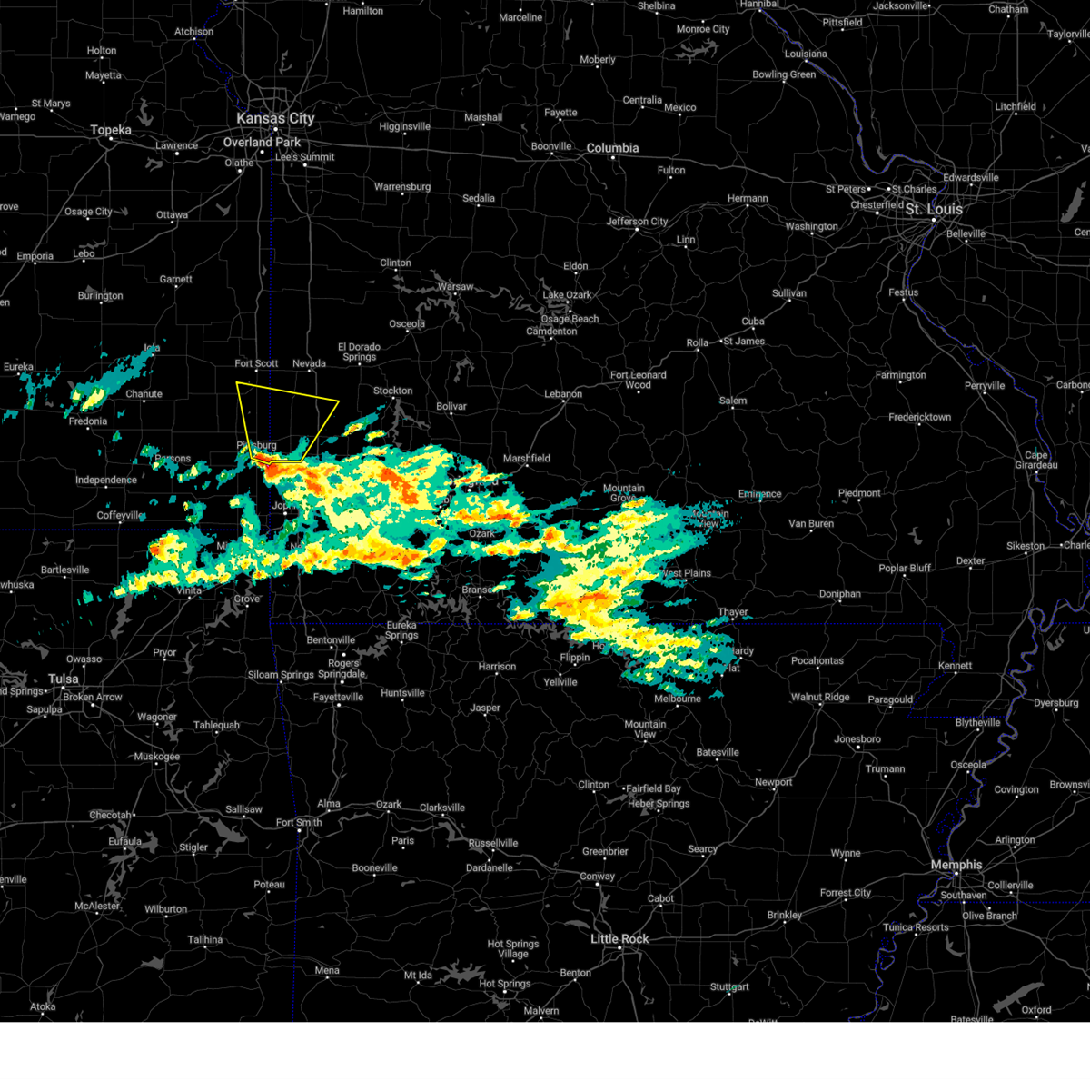 At 128 pm cst, a severe thunderstorm was located near frontenac, or near pittsburg, moving north at 45 mph (radar indicated). Hazards include quarter size hail. Damage to vehicles is expected. locations impacted include, pittsburg, prairie state park, frontenac, arma, liberal, sheldon, mulberry, nashville, mindenmines, franklin, arcadia, bronaugh, lamar heights, irwin, burgess, croweburg, yale, hannon, oakton and iantha. this includes interstate 49 between mile markers 67 and 80. hail threat, radar indicated max hail size, 1. 00 in wind threat, radar indicated max wind gust, <50 mph. At 128 pm cst, a severe thunderstorm was located near frontenac, or near pittsburg, moving north at 45 mph (radar indicated). Hazards include quarter size hail. Damage to vehicles is expected. locations impacted include, pittsburg, prairie state park, frontenac, arma, liberal, sheldon, mulberry, nashville, mindenmines, franklin, arcadia, bronaugh, lamar heights, irwin, burgess, croweburg, yale, hannon, oakton and iantha. this includes interstate 49 between mile markers 67 and 80. hail threat, radar indicated max hail size, 1. 00 in wind threat, radar indicated max wind gust, <50 mph.
|
| 3/2/2023 1:11 PM CST |
 At 111 pm cst, a severe thunderstorm was located near weir, or 9 miles northeast of columbus, moving north at 45 mph (radar indicated). Hazards include quarter size hail. damage to vehicles is expected At 111 pm cst, a severe thunderstorm was located near weir, or 9 miles northeast of columbus, moving north at 45 mph (radar indicated). Hazards include quarter size hail. damage to vehicles is expected
|
| 10/12/2022 6:41 AM CDT |
 The severe thunderstorm warning for barton, cedar, st. clair, southeastern vernon and northwestern dade counties will expire at 645 am cdt, the storms which prompted the warning have weakened below severe limits, and no longer pose an immediate threat to life or property. therefore, the warning will be allowed to expire. The severe thunderstorm warning for barton, cedar, st. clair, southeastern vernon and northwestern dade counties will expire at 645 am cdt, the storms which prompted the warning have weakened below severe limits, and no longer pose an immediate threat to life or property. therefore, the warning will be allowed to expire.
|
| 10/12/2022 6:08 AM CDT |
 At 607 am cdt, severe thunderstorms were located along a line extending from near schell city to near sheldon to near mulberry, moving east at 45 mph (radar indicated). Hazards include quarter size hail. damage to vehicles is expected At 607 am cdt, severe thunderstorms were located along a line extending from near schell city to near sheldon to near mulberry, moving east at 45 mph (radar indicated). Hazards include quarter size hail. damage to vehicles is expected
|
| 6/26/2022 2:25 AM CDT |
 At 225 am cdt, severe thunderstorms were located along a line extending from near arcadia to near liberal to frontenac, moving east at 35 mph (radar indicated). Hazards include 60 mph wind gusts and nickel size hail. expect damage to roofs, siding, and trees At 225 am cdt, severe thunderstorms were located along a line extending from near arcadia to near liberal to frontenac, moving east at 35 mph (radar indicated). Hazards include 60 mph wind gusts and nickel size hail. expect damage to roofs, siding, and trees
|
| 5/15/2022 9:57 AM CDT | At 957 am cdt, a severe thunderstorm was located over liberal, or 11 miles west of lamar, moving southeast at 40 mph (radar indicated). Hazards include 60 mph wind gusts and quarter size hail. Hail damage to vehicles is expected. Expect wind damage to roofs, siding, and trees. |
| 10/13/2021 8:16 AM CDT |
 At 816 am cdt, severe thunderstorms were located along a line extending from mulberry to near pittsburg, moving northeast at 50 mph (radar indicated). Hazards include 60 mph wind gusts. expect damage to roofs, siding, and trees At 816 am cdt, severe thunderstorms were located along a line extending from mulberry to near pittsburg, moving northeast at 50 mph (radar indicated). Hazards include 60 mph wind gusts. expect damage to roofs, siding, and trees
|
| 3/17/2021 6:28 AM CDT |
 The severe thunderstorm warning for barton, northern newton and jasper counties will expire at 630 am cdt, the storms which prompted the warning have weakened below severe limits, and no longer pose an immediate threat to life or property. therefore, the warning will be allowed to expire. however heavy rain is still possible with these thunderstorms. a severe thunderstorm watch remains in effect until 800 am cdt for southeastern kansas, and southwestern and west central missouri. The severe thunderstorm warning for barton, northern newton and jasper counties will expire at 630 am cdt, the storms which prompted the warning have weakened below severe limits, and no longer pose an immediate threat to life or property. therefore, the warning will be allowed to expire. however heavy rain is still possible with these thunderstorms. a severe thunderstorm watch remains in effect until 800 am cdt for southeastern kansas, and southwestern and west central missouri.
|
| 3/17/2021 6:09 AM CDT |
 At 608 am cdt, severe thunderstorms were located along a line extending from near liberal to joplin, moving east at 35 mph (radar indicated). Hazards include 60 mph wind gusts and penny size hail. Expect damage to roofs, siding, and trees. locations impacted include, joplin, carthage, neosho, webb city, prairie state park, carl junction, lamar, galena, oronogo, granby, carterville, duquesne, sarcoxie, duenweg, jasper, diamond, golden city, liberal, loma linda, airport drive, this includes the following highways, interstate 44 between mile markers 0 and 29. Interstate 49 between mile markers 25 and 76. At 608 am cdt, severe thunderstorms were located along a line extending from near liberal to joplin, moving east at 35 mph (radar indicated). Hazards include 60 mph wind gusts and penny size hail. Expect damage to roofs, siding, and trees. locations impacted include, joplin, carthage, neosho, webb city, prairie state park, carl junction, lamar, galena, oronogo, granby, carterville, duquesne, sarcoxie, duenweg, jasper, diamond, golden city, liberal, loma linda, airport drive, this includes the following highways, interstate 44 between mile markers 0 and 29. Interstate 49 between mile markers 25 and 76.
|
| 3/17/2021 5:51 AM CDT |
 At 551 am cdt, severe thunderstorms were located along a line extending from arcadia to near galena, moving east at 40 mph (radar indicated). Hazards include 60 mph wind gusts and penny size hail. Expect damage to roofs, siding, and trees. locations impacted include, joplin, pittsburg, carthage, neosho, webb city, prairie state park, carl junction, lamar, baxter springs, frontenac, columbus, galena, girard, oronogo, granby, carterville, duquesne, arma, sarcoxie, duenweg, this includes the following highways, interstate 44 between mile markers 0 and 29. Interstate 49 between mile markers 25 and 76. At 551 am cdt, severe thunderstorms were located along a line extending from arcadia to near galena, moving east at 40 mph (radar indicated). Hazards include 60 mph wind gusts and penny size hail. Expect damage to roofs, siding, and trees. locations impacted include, joplin, pittsburg, carthage, neosho, webb city, prairie state park, carl junction, lamar, baxter springs, frontenac, columbus, galena, girard, oronogo, granby, carterville, duquesne, arma, sarcoxie, duenweg, this includes the following highways, interstate 44 between mile markers 0 and 29. Interstate 49 between mile markers 25 and 76.
|
| 3/17/2021 5:33 AM CDT |
 At 533 am cdt, severe thunderstorms were located along a line extending from 8 miles east of hepler to treece, moving east at 40 mph (radar indicated). Hazards include 60 mph wind gusts and penny size hail. expect damage to roofs, siding, and trees At 533 am cdt, severe thunderstorms were located along a line extending from 8 miles east of hepler to treece, moving east at 40 mph (radar indicated). Hazards include 60 mph wind gusts and penny size hail. expect damage to roofs, siding, and trees
|
| 11/24/2020 9:23 PM CST |
 At 922 pm cst, severe thunderstorms were located along a line extending from 9 miles west of sheldon to near lamar to near jasper to near granby to near pineville, moving east at 70 mph (public). Hazards include 60 mph wind gusts and quarter size hail. a measured 62 mph gust was reported at the joplin regional airport. Hail damage to vehicles is expected. expect wind damage to roofs, siding, and trees. locations impacted include, eastern joplin, bella vista, carthage, neosho, webb city, prairie state park, big sugar creek state park, lamar, oronogo, granby, anderson, carterville, noel, duquesne, sarcoxie, goodman, duenweg, south west city, jasper, diamond, this includes the following highways, interstate 44 between mile markers 9 and 32. Interstate 49 between mile markers 1 and 76. At 922 pm cst, severe thunderstorms were located along a line extending from 9 miles west of sheldon to near lamar to near jasper to near granby to near pineville, moving east at 70 mph (public). Hazards include 60 mph wind gusts and quarter size hail. a measured 62 mph gust was reported at the joplin regional airport. Hail damage to vehicles is expected. expect wind damage to roofs, siding, and trees. locations impacted include, eastern joplin, bella vista, carthage, neosho, webb city, prairie state park, big sugar creek state park, lamar, oronogo, granby, anderson, carterville, noel, duquesne, sarcoxie, goodman, duenweg, south west city, jasper, diamond, this includes the following highways, interstate 44 between mile markers 9 and 32. Interstate 49 between mile markers 1 and 76.
|
| 11/24/2020 8:58 PM CST |
 At 858 pm cst, severe thunderstorms were located along a line extending from near girard to near pittsburg to near carl junction to seneca to near south west city, moving east at 60 mph (radar indicated). Hazards include 60 mph wind gusts and quarter size hail. Hail damage to vehicles is expected. Expect wind damage to roofs, siding, and trees. At 858 pm cst, severe thunderstorms were located along a line extending from near girard to near pittsburg to near carl junction to seneca to near south west city, moving east at 60 mph (radar indicated). Hazards include 60 mph wind gusts and quarter size hail. Hail damage to vehicles is expected. Expect wind damage to roofs, siding, and trees.
|
| 8/29/2020 9:09 AM CDT |
 At 908 am cdt, severe thunderstorms were located along a line extending from near arcadia to near purcell to near shoal creek drive, moving east at 50 mph (law enforcement. this line of storms has a history of producing tree damage and downing power lines across portions of southeastern kansas this morning). Hazards include 70 mph wind gusts. Expect considerable tree damage. damage is likely to mobile homes, roofs, and outbuildings. locations impacted include, joplin, carthage, webb city, prairie state park, carl junction, lamar, galena, oronogo, carterville, duquesne, sarcoxie, duenweg, jasper, diamond, golden city, liberal, loma linda, airport drive, leawood, silver creek, this includes the following highways, interstate 44 between mile markers 0 and 32. Interstate 49 between mile markers 32 and 76. At 908 am cdt, severe thunderstorms were located along a line extending from near arcadia to near purcell to near shoal creek drive, moving east at 50 mph (law enforcement. this line of storms has a history of producing tree damage and downing power lines across portions of southeastern kansas this morning). Hazards include 70 mph wind gusts. Expect considerable tree damage. damage is likely to mobile homes, roofs, and outbuildings. locations impacted include, joplin, carthage, webb city, prairie state park, carl junction, lamar, galena, oronogo, carterville, duquesne, sarcoxie, duenweg, jasper, diamond, golden city, liberal, loma linda, airport drive, leawood, silver creek, this includes the following highways, interstate 44 between mile markers 0 and 32. Interstate 49 between mile markers 32 and 76.
|
| 8/29/2020 8:55 AM CDT |
 At 853 am cdt, severe thunderstorms were located along a line extending from 8 miles west of arcadia to 6 miles east of weir to near quapaw, moving east at 50 mph (law enforcement. this line of storms has a history of producing wind gusts to 60 mph and minor tree damage and downing power lines across portions of southeastern kansas this morning). Hazards include 60 mph wind gusts. expect damage to roofs, siding, and trees At 853 am cdt, severe thunderstorms were located along a line extending from 8 miles west of arcadia to 6 miles east of weir to near quapaw, moving east at 50 mph (law enforcement. this line of storms has a history of producing wind gusts to 60 mph and minor tree damage and downing power lines across portions of southeastern kansas this morning). Hazards include 60 mph wind gusts. expect damage to roofs, siding, and trees
|
| 5/4/2020 11:11 AM CDT |
 At 1110 am cdt, a severe thunderstorm was located over sheldon, or 11 miles north of lamar, moving east at 55 mph (radar indicated). Hazards include two inch hail along the vernon barton county line. People and animals outdoors will be injured. expect damage to roofs, siding, windows, and vehicles. Locations impacted include, prairie state park, lamar, liberal, mulberry, arcadia, lamar heights, irwin, burgess, milford, iantha, oskaloosa, verdella, hannon, this includes interstate 49 between mile markers 66 and 76. At 1110 am cdt, a severe thunderstorm was located over sheldon, or 11 miles north of lamar, moving east at 55 mph (radar indicated). Hazards include two inch hail along the vernon barton county line. People and animals outdoors will be injured. expect damage to roofs, siding, windows, and vehicles. Locations impacted include, prairie state park, lamar, liberal, mulberry, arcadia, lamar heights, irwin, burgess, milford, iantha, oskaloosa, verdella, hannon, this includes interstate 49 between mile markers 66 and 76.
|
| 5/4/2020 10:56 AM CDT |
 At 1056 am cdt, a severe thunderstorm was located over arcadia, or 15 miles southeast of fort scott, moving east at 45 mph (radar indicated). Hazards include half dollar size hail. damage to vehicles is expected At 1056 am cdt, a severe thunderstorm was located over arcadia, or 15 miles southeast of fort scott, moving east at 45 mph (radar indicated). Hazards include half dollar size hail. damage to vehicles is expected
|
| 5/4/2020 9:53 AM CDT |
 At 953 am cdt, a severe thunderstorm was located near jasper, or 12 miles northwest of carthage, moving northeast at 45 mph (law enforcement. this storm has a history of producing golf ball sized hail over jasper county). Hazards include golf ball size hail. People and animals outdoors will be injured. Expect damage to roofs, siding, windows, and vehicles. At 953 am cdt, a severe thunderstorm was located near jasper, or 12 miles northwest of carthage, moving northeast at 45 mph (law enforcement. this storm has a history of producing golf ball sized hail over jasper county). Hazards include golf ball size hail. People and animals outdoors will be injured. Expect damage to roofs, siding, windows, and vehicles.
|
| 5/3/2020 9:20 AM CDT |
 At 920 am cdt, severe thunderstorms were located along a line extending from 8 miles south of rich hill to 7 miles west of sheldon to near weir, moving east at 45 mph (trained weather spotters). Hazards include tennis ball size hail and 70 mph wind gusts. People and animals outdoors will be injured. expect hail damage to roofs, siding, windows, and vehicles. expect considerable tree damage. wind damage is also likely to mobile homes, roofs, and outbuildings. Locations impacted include, prairie state park, nevada, lamar, golden city, liberal, sheldon, mulberry, nashville, mindenmines, montevallo, walker, schell city, bronaugh, lamar heights, moundville, richards, milo, deerfield, irwin, burgess, this includes interstate 49 between mile markers 57 and 107. At 920 am cdt, severe thunderstorms were located along a line extending from 8 miles south of rich hill to 7 miles west of sheldon to near weir, moving east at 45 mph (trained weather spotters). Hazards include tennis ball size hail and 70 mph wind gusts. People and animals outdoors will be injured. expect hail damage to roofs, siding, windows, and vehicles. expect considerable tree damage. wind damage is also likely to mobile homes, roofs, and outbuildings. Locations impacted include, prairie state park, nevada, lamar, golden city, liberal, sheldon, mulberry, nashville, mindenmines, montevallo, walker, schell city, bronaugh, lamar heights, moundville, richards, milo, deerfield, irwin, burgess, this includes interstate 49 between mile markers 57 and 107.
|
| 5/3/2020 8:53 AM CDT |
 At 852 am cdt, severe thunderstorms were located along a line extending from fulton to 8 miles south of fort scott to mccune, moving east at 45 mph (trained weather spotters). Hazards include 70 mph wind gusts and quarter size hail has been reported with these storms. Hail damage to vehicles is expected. expect considerable tree damage. Wind damage is also likely to mobile homes, roofs, and outbuildings. At 852 am cdt, severe thunderstorms were located along a line extending from fulton to 8 miles south of fort scott to mccune, moving east at 45 mph (trained weather spotters). Hazards include 70 mph wind gusts and quarter size hail has been reported with these storms. Hail damage to vehicles is expected. expect considerable tree damage. Wind damage is also likely to mobile homes, roofs, and outbuildings.
|
| 12/28/2019 5:23 PM CST |
 At 523 pm cst, a severe thunderstorm capable of producing a tornado was located near arcadia, or 16 miles northeast of pittsburg, moving northeast at 45 mph (radar indicated rotation). Hazards include tornado. Flying debris will be dangerous to those caught without shelter. mobile homes will be damaged or destroyed. damage to roofs, windows, and vehicles will occur. Tree damage is likely. At 523 pm cst, a severe thunderstorm capable of producing a tornado was located near arcadia, or 16 miles northeast of pittsburg, moving northeast at 45 mph (radar indicated rotation). Hazards include tornado. Flying debris will be dangerous to those caught without shelter. mobile homes will be damaged or destroyed. damage to roofs, windows, and vehicles will occur. Tree damage is likely.
|
| 9/28/2019 9:27 PM CDT |
 The tornado warning for northwestern barton county will expire at 930 pm cdt, the storm which prompted the warning no longer appears capable of producing a tornado. therefore, the warning will be allowed to expire. however large hail and gusty winds are still possible with this thunderstorm. remember, a severe thunderstorm warning still remains in effect for portions of barton county. The tornado warning for northwestern barton county will expire at 930 pm cdt, the storm which prompted the warning no longer appears capable of producing a tornado. therefore, the warning will be allowed to expire. however large hail and gusty winds are still possible with this thunderstorm. remember, a severe thunderstorm warning still remains in effect for portions of barton county.
|
| 9/28/2019 9:06 PM CDT |
 At 905 pm cdt, a severe thunderstorm capable of producing a tornado was located near iantha, or 8 miles west of lamar, moving east at 25 mph (radar indicated rotation). Hazards include tornado and half dollar size hail. Flying debris will be dangerous to those caught without shelter. mobile homes will be damaged or destroyed. damage to roofs, windows, and vehicles will occur. tree damage is likely. Locations impacted include, lamar, liberal, lamar heights, irwin, iantha, verdella, this includes interstate 49 between mile markers 67 and 76. At 905 pm cdt, a severe thunderstorm capable of producing a tornado was located near iantha, or 8 miles west of lamar, moving east at 25 mph (radar indicated rotation). Hazards include tornado and half dollar size hail. Flying debris will be dangerous to those caught without shelter. mobile homes will be damaged or destroyed. damage to roofs, windows, and vehicles will occur. tree damage is likely. Locations impacted include, lamar, liberal, lamar heights, irwin, iantha, verdella, this includes interstate 49 between mile markers 67 and 76.
|
| 9/28/2019 9:04 PM CDT |
 At 903 pm cdt, a severe thunderstorm was located near liberal, or 9 miles west of lamar, moving east at 40 mph. a tornado warning is also in effect for barton county (radar indicated). Hazards include 60 mph wind gusts and half dollar size hail. Hail damage to vehicles is expected. expect wind damage to roofs, siding, and trees. Locations impacted include, liberal, verdella, iantha,. At 903 pm cdt, a severe thunderstorm was located near liberal, or 9 miles west of lamar, moving east at 40 mph. a tornado warning is also in effect for barton county (radar indicated). Hazards include 60 mph wind gusts and half dollar size hail. Hail damage to vehicles is expected. expect wind damage to roofs, siding, and trees. Locations impacted include, liberal, verdella, iantha,.
|
| 9/28/2019 8:46 PM CDT |
 At 846 pm cdt, a severe thunderstorm capable of producing a tornado was located near liberal, or 11 miles northeast of pittsburg, moving east at 25 mph (radar indicated rotation). Hazards include tornado and half dollar size hail. Flying debris will be dangerous to those caught without shelter. mobile homes will be damaged or destroyed. damage to roofs, windows, and vehicles will occur. Tree damage is likely. At 846 pm cdt, a severe thunderstorm capable of producing a tornado was located near liberal, or 11 miles northeast of pittsburg, moving east at 25 mph (radar indicated rotation). Hazards include tornado and half dollar size hail. Flying debris will be dangerous to those caught without shelter. mobile homes will be damaged or destroyed. damage to roofs, windows, and vehicles will occur. Tree damage is likely.
|
| 9/28/2019 8:36 PM CDT |
 At 835 pm cdt, a severe thunderstorm was located over frontenac, or near pittsburg, moving east at 20 mph (radar indicated). Hazards include 60 mph wind gusts and half dollar size hail. Hail damage to vehicles is expected. Expect wind damage to roofs, siding, and trees. At 835 pm cdt, a severe thunderstorm was located over frontenac, or near pittsburg, moving east at 20 mph (radar indicated). Hazards include 60 mph wind gusts and half dollar size hail. Hail damage to vehicles is expected. Expect wind damage to roofs, siding, and trees.
|
| 9/12/2019 8:05 PM CDT |
 At 805 pm cdt, a severe thunderstorm was located over arma, or 8 miles northeast of girard, moving east at 30 mph (radar indicated). Hazards include 60 mph wind gusts. expect damage to roofs, siding, and trees At 805 pm cdt, a severe thunderstorm was located over arma, or 8 miles northeast of girard, moving east at 30 mph (radar indicated). Hazards include 60 mph wind gusts. expect damage to roofs, siding, and trees
|
| 8/16/2019 2:01 AM CDT |
 A severe thunderstorm warning remains in effect until 215 am cdt for hickory. barton. southeastern cedar. polk. southeastern st. clair and northern dade counties. At 200 am cdt, severe thunderstorms were located along a line extending from 6 miles southeast of osceola to 6 miles southwest of humansville to 8 miles southwest of stockton to near sheldon, moving. A severe thunderstorm warning remains in effect until 215 am cdt for hickory. barton. southeastern cedar. polk. southeastern st. clair and northern dade counties. At 200 am cdt, severe thunderstorms were located along a line extending from 6 miles southeast of osceola to 6 miles southwest of humansville to 8 miles southwest of stockton to near sheldon, moving.
|
| 8/16/2019 1:32 AM CDT |
 At 132 am cdt, severe thunderstorms were located along a line extending from 7 miles southwest of lowry city to near el dorado springs to 7 miles northeast of sheldon to near arcadia, moving southeast at 55 mph (radar indicated). Hazards include 70 mph wind gusts and quarter size hail. Hail damage to vehicles is expected. expect considerable tree damage. Wind damage is also likely to mobile homes, roofs, and outbuildings. At 132 am cdt, severe thunderstorms were located along a line extending from 7 miles southwest of lowry city to near el dorado springs to 7 miles northeast of sheldon to near arcadia, moving southeast at 55 mph (radar indicated). Hazards include 70 mph wind gusts and quarter size hail. Hail damage to vehicles is expected. expect considerable tree damage. Wind damage is also likely to mobile homes, roofs, and outbuildings.
|
| 8/6/2019 5:56 PM CDT |
 The severe thunderstorm warning for southern bourbon, crawford, western barton and southwestern vernon counties will expire at 600 pm cdt, the severe thunderstorm which prompted the warning has weakened. therefore, the warning will be allowed to expire. however small hail and gusty winds are still possible with this thunderstorm. The severe thunderstorm warning for southern bourbon, crawford, western barton and southwestern vernon counties will expire at 600 pm cdt, the severe thunderstorm which prompted the warning has weakened. therefore, the warning will be allowed to expire. however small hail and gusty winds are still possible with this thunderstorm.
|
| 8/6/2019 5:15 PM CDT |
 At 514 pm cdt, a severe thunderstorm was located 9 miles northwest of arcadia, or 10 miles southwest of fort scott, moving southeast at 40 mph (radar indicated). Hazards include 60 mph wind gusts and quarter size hail. Hail damage to vehicles is expected. Expect wind damage to roofs, siding, and trees. At 514 pm cdt, a severe thunderstorm was located 9 miles northwest of arcadia, or 10 miles southwest of fort scott, moving southeast at 40 mph (radar indicated). Hazards include 60 mph wind gusts and quarter size hail. Hail damage to vehicles is expected. Expect wind damage to roofs, siding, and trees.
|
| 7/10/2019 11:23 AM CDT |
 At 1123 am cdt, severe thunderstorms were located along a line extending from near liberal to near pittsburg, moving southeast at 20 mph (radar indicated). Hazards include 60 mph wind gusts. expect damage to roofs, siding, and trees At 1123 am cdt, severe thunderstorms were located along a line extending from near liberal to near pittsburg, moving southeast at 20 mph (radar indicated). Hazards include 60 mph wind gusts. expect damage to roofs, siding, and trees
|
| 6/23/2019 8:21 AM CDT |
 At 820 am cdt, severe thunderstorms were located along a line extending from 8 miles southwest of rich hill to near sheldon to mindenmines, moving east at 55 mph (radar indicated). Hazards include 60 mph wind gusts. Expect damage to roofs, siding, and trees. Locations impacted include, prairie state park, nevada, lamar, golden city, liberal, sheldon, nashville, mindenmines, montevallo, walker, schell city, bronaugh, lamar heights, moundville, milo, deerfield, irwin, metz, harwood, milford, this includes interstate 49 between mile markers 57 and 107. At 820 am cdt, severe thunderstorms were located along a line extending from 8 miles southwest of rich hill to near sheldon to mindenmines, moving east at 55 mph (radar indicated). Hazards include 60 mph wind gusts. Expect damage to roofs, siding, and trees. Locations impacted include, prairie state park, nevada, lamar, golden city, liberal, sheldon, nashville, mindenmines, montevallo, walker, schell city, bronaugh, lamar heights, moundville, milo, deerfield, irwin, metz, harwood, milford, this includes interstate 49 between mile markers 57 and 107.
|
| 6/23/2019 7:46 AM CDT |
 At 746 am cdt, severe thunderstorms were located along a line extending from 7 miles south of blue mound to near hepler to near st. paul, moving east at 55 mph (radar indicated). Hazards include 60 mph wind gusts. expect damage to roofs, siding, and trees At 746 am cdt, severe thunderstorms were located along a line extending from 7 miles south of blue mound to near hepler to near st. paul, moving east at 55 mph (radar indicated). Hazards include 60 mph wind gusts. expect damage to roofs, siding, and trees
|
| 6/21/2019 12:33 PM CDT |
 At 1219 pm cdt, severe thunderstorms were located along a line extending from near warsaw to 9 miles southwest of osceola to near arcadia, moving east at 35 mph (radar indicated). Hazards include 60 mph wind gusts and penny size hail. Expect damage to roofs, siding, and trees. Locations impacted include, pomme de terre lake, truman lake, stockton lake, prairie state park, pomme de terre state park, stockton state park, nevada, fort scott, lamar, el dorado springs, frontenac, girard, stockton, arma, pittsburg, appleton city, humansville, osceola, marmaton, liberal, this includes interstate 49 between mile markers 67 and 107. At 1219 pm cdt, severe thunderstorms were located along a line extending from near warsaw to 9 miles southwest of osceola to near arcadia, moving east at 35 mph (radar indicated). Hazards include 60 mph wind gusts and penny size hail. Expect damage to roofs, siding, and trees. Locations impacted include, pomme de terre lake, truman lake, stockton lake, prairie state park, pomme de terre state park, stockton state park, nevada, fort scott, lamar, el dorado springs, frontenac, girard, stockton, arma, pittsburg, appleton city, humansville, osceola, marmaton, liberal, this includes interstate 49 between mile markers 67 and 107.
|
| 6/21/2019 12:20 PM CDT |
 At 1219 pm cdt, severe thunderstorms were located along a line extending from near warsaw to 9 miles southwest of osceola to near arcadia, moving east at 35 mph (radar indicated). Hazards include 60 mph wind gusts and penny size hail. Expect damage to roofs, siding, and trees. Locations impacted include, pomme de terre lake, truman lake, stockton lake, prairie state park, pomme de terre state park, stockton state park, nevada, fort scott, lamar, el dorado springs, frontenac, girard, stockton, arma, pittsburg, appleton city, humansville, osceola, marmaton, liberal, this includes interstate 49 between mile markers 67 and 107. At 1219 pm cdt, severe thunderstorms were located along a line extending from near warsaw to 9 miles southwest of osceola to near arcadia, moving east at 35 mph (radar indicated). Hazards include 60 mph wind gusts and penny size hail. Expect damage to roofs, siding, and trees. Locations impacted include, pomme de terre lake, truman lake, stockton lake, prairie state park, pomme de terre state park, stockton state park, nevada, fort scott, lamar, el dorado springs, frontenac, girard, stockton, arma, pittsburg, appleton city, humansville, osceola, marmaton, liberal, this includes interstate 49 between mile markers 67 and 107.
|
| 6/21/2019 11:56 AM CDT |
 At 1154 am cdt, severe thunderstorms were located along a line extending from near deepwater to near schell city to near redfield, moving east at 35 mph (radar indicated). Hazards include 60 mph wind gusts and penny size hail. expect damage to roofs, siding, and trees At 1154 am cdt, severe thunderstorms were located along a line extending from near deepwater to near schell city to near redfield, moving east at 35 mph (radar indicated). Hazards include 60 mph wind gusts and penny size hail. expect damage to roofs, siding, and trees
|
| 6/1/2019 6:45 PM CDT |
 At 644 pm cdt, severe thunderstorms were located along a line extending from near el dorado springs to 7 miles southeast of sheldon to near redfield, moving southeast at 30 mph (emergency management. received reports of trees down in nevada and have received several 60 mph wind reports with this line). Hazards include 60 mph wind gusts and quarter size hail. Hail damage to vehicles is expected. expect wind damage to roofs, siding, and trees. Locations impacted include, fort scott, el dorado springs, marmaton, liberal, sheldon, montevallo, arcadia, uniontown, bronaugh, jerico springs, redfield, moundville, deerfield, irwin, milford, petersburg, porterville, hannon, olympia, wagoner, this includes interstate 49 between mile markers 70 and 84. At 644 pm cdt, severe thunderstorms were located along a line extending from near el dorado springs to 7 miles southeast of sheldon to near redfield, moving southeast at 30 mph (emergency management. received reports of trees down in nevada and have received several 60 mph wind reports with this line). Hazards include 60 mph wind gusts and quarter size hail. Hail damage to vehicles is expected. expect wind damage to roofs, siding, and trees. Locations impacted include, fort scott, el dorado springs, marmaton, liberal, sheldon, montevallo, arcadia, uniontown, bronaugh, jerico springs, redfield, moundville, deerfield, irwin, milford, petersburg, porterville, hannon, olympia, wagoner, this includes interstate 49 between mile markers 70 and 84.
|
| 6/1/2019 6:23 PM CDT |
 At 622 pm cdt, severe thunderstorms were located along a line extending from near walker to near sheldon to 7 miles north of uniontown, moving southeast at 45 mph (emergency management. have received multiple reports of 60 mph winds across vernon county). Hazards include 70 mph wind gusts and quarter size hail. Hail damage to vehicles is expected. expect considerable tree damage. wind damage is also likely to mobile homes, roofs, and outbuildings. Locations impacted include, nevada, fort scott, el dorado springs, marmaton, liberal, sheldon, bronson, montevallo, arcadia, uniontown, walker, bronaugh, jerico springs, redfield, moundville, richards, milo, deerfield, irwin, harwood, this includes interstate 49 between mile markers 70 and 99. At 622 pm cdt, severe thunderstorms were located along a line extending from near walker to near sheldon to 7 miles north of uniontown, moving southeast at 45 mph (emergency management. have received multiple reports of 60 mph winds across vernon county). Hazards include 70 mph wind gusts and quarter size hail. Hail damage to vehicles is expected. expect considerable tree damage. wind damage is also likely to mobile homes, roofs, and outbuildings. Locations impacted include, nevada, fort scott, el dorado springs, marmaton, liberal, sheldon, bronson, montevallo, arcadia, uniontown, walker, bronaugh, jerico springs, redfield, moundville, richards, milo, deerfield, irwin, harwood, this includes interstate 49 between mile markers 70 and 99.
|
| 6/1/2019 6:07 PM CDT |
 At 605 pm cdt, severe thunderstorms were located along a line extending from near schell city to 9 miles east of fort scott to 6 miles southwest of blue mound, moving southeast at 25 mph (radar indicated). Hazards include 70 mph wind gusts and half dollar size hail. Hail damage to vehicles is expected. expect considerable tree damage. Wind damage is also likely to mobile homes, roofs, and outbuildings. At 605 pm cdt, severe thunderstorms were located along a line extending from near schell city to 9 miles east of fort scott to 6 miles southwest of blue mound, moving southeast at 25 mph (radar indicated). Hazards include 70 mph wind gusts and half dollar size hail. Hail damage to vehicles is expected. expect considerable tree damage. Wind damage is also likely to mobile homes, roofs, and outbuildings.
|
| 5/27/2019 9:27 AM CDT |
 The severe thunderstorm warning for barton and southeastern vernon counties will expire at 930 am cdt, the storm which prompted the warning has weakened, though is expected to produce winds to 50 mph as it tracks eastward into the stockton lake area southward and into greenfield. The severe thunderstorm warning for barton and southeastern vernon counties will expire at 930 am cdt, the storm which prompted the warning has weakened, though is expected to produce winds to 50 mph as it tracks eastward into the stockton lake area southward and into greenfield.
|
| 5/27/2019 8:58 AM CDT |
 At 856 am cdt, a severe thunderstorm was located near mindenmines, or 11 miles northeast of pittsburg, moving east at 50 mph. spotters report power lines down and small limbs in frontenac kansas (law enforcement). Hazards include 60 mph wind gusts. expect damage to roofs, siding, and trees At 856 am cdt, a severe thunderstorm was located near mindenmines, or 11 miles northeast of pittsburg, moving east at 50 mph. spotters report power lines down and small limbs in frontenac kansas (law enforcement). Hazards include 60 mph wind gusts. expect damage to roofs, siding, and trees
|
| 5/22/2019 8:46 PM CDT |
 At 846 pm cdt, a severe thunderstorm was located over frontenac, or near pittsburg, moving northeast at 45 mph (radar indicated). Hazards include 60 mph wind gusts and quarter size hail. Hail damage to vehicles is expected. expect wind damage to roofs, siding, and trees. Locations impacted include, pittsburg, prairie state park, frontenac, girard, arma, liberal, mulberry, mindenmines, franklin, arcadia, irwin, burgess, croweburg, yale, iantha, ringo, oskaloosa, verdella, lone oak, polk, this includes interstate 49 between mile markers 71 and 76. At 846 pm cdt, a severe thunderstorm was located over frontenac, or near pittsburg, moving northeast at 45 mph (radar indicated). Hazards include 60 mph wind gusts and quarter size hail. Hail damage to vehicles is expected. expect wind damage to roofs, siding, and trees. Locations impacted include, pittsburg, prairie state park, frontenac, girard, arma, liberal, mulberry, mindenmines, franklin, arcadia, irwin, burgess, croweburg, yale, iantha, ringo, oskaloosa, verdella, lone oak, polk, this includes interstate 49 between mile markers 71 and 76.
|
| 5/22/2019 8:31 PM CDT |
 At 831 pm cdt, a severe thunderstorm was located over frontenac, or over pittsburg, moving northeast at 45 mph (radar indicated). Hazards include 60 mph wind gusts and half dollar size hail. Hail damage to vehicles is expected. Expect wind damage to roofs, siding, and trees. At 831 pm cdt, a severe thunderstorm was located over frontenac, or over pittsburg, moving northeast at 45 mph (radar indicated). Hazards include 60 mph wind gusts and half dollar size hail. Hail damage to vehicles is expected. Expect wind damage to roofs, siding, and trees.
|
| 5/22/2019 7:08 PM CDT |
 At 708 pm cdt, a severe thunderstorm was located near scammon, or 7 miles northeast of columbus, moving east at 30 mph (radar indicated). Hazards include golf ball size hail and 60 mph wind gusts. People and animals outdoors will be injured. expect hail damage to roofs, siding, windows, and vehicles. Expect wind damage to roofs, siding, and trees. At 708 pm cdt, a severe thunderstorm was located near scammon, or 7 miles northeast of columbus, moving east at 30 mph (radar indicated). Hazards include golf ball size hail and 60 mph wind gusts. People and animals outdoors will be injured. expect hail damage to roofs, siding, windows, and vehicles. Expect wind damage to roofs, siding, and trees.
|
| 5/20/2019 9:11 PM CDT |
 The severe thunderstorm warning for barton and vernon counties will expire at 915 pm cdt, the storms which prompted the warning have moved out of the warned area. therefore, the warning will be allowed to expire. a tornado watch remains in effect until 100 am cdt for southeastern kansas, and southwestern missouri. The severe thunderstorm warning for barton and vernon counties will expire at 915 pm cdt, the storms which prompted the warning have moved out of the warned area. therefore, the warning will be allowed to expire. a tornado watch remains in effect until 100 am cdt for southeastern kansas, and southwestern missouri.
|
| 5/20/2019 8:47 PM CDT |
 At 847 pm cdt, severe thunderstorms were located along a line extending from near rich hill to near nevada to near sheldon to near jasper, moving east at 40 mph (trained weather spotters). Hazards include 60 mph wind gusts and quarter size hail. Hail damage to vehicles is expected. expect wind damage to roofs, siding, and trees. Locations impacted include, prairie state park, nevada, lamar, golden city, liberal, sheldon, nashville, mindenmines, montevallo, walker, schell city, bronaugh, lamar heights, moundville, milo, deerfield, irwin, metz, harwood, milford, this includes interstate 49 between mile markers 57 and 104. At 847 pm cdt, severe thunderstorms were located along a line extending from near rich hill to near nevada to near sheldon to near jasper, moving east at 40 mph (trained weather spotters). Hazards include 60 mph wind gusts and quarter size hail. Hail damage to vehicles is expected. expect wind damage to roofs, siding, and trees. Locations impacted include, prairie state park, nevada, lamar, golden city, liberal, sheldon, nashville, mindenmines, montevallo, walker, schell city, bronaugh, lamar heights, moundville, milo, deerfield, irwin, metz, harwood, milford, this includes interstate 49 between mile markers 57 and 104.
|
| 5/20/2019 8:36 PM CDT |
 At 835 pm cdt, severe thunderstorms were located along a line extending from near hume to 7 miles west of sheldon to 7 miles southeast of liberal, moving east at 40 mph (trained weather spotters. estimated 60 mph winds have been reported over western barton county). Hazards include 60 mph wind gusts. Expect damage to roofs, siding, and trees. Locations impacted include, prairie state park, nevada, lamar, golden city, liberal, sheldon, mulberry, nashville, mindenmines, montevallo, arcadia, walker, schell city, bronaugh, lamar heights, moundville, richards, milo, deerfield, irwin, this includes interstate 49 between mile markers 57 and 107. At 835 pm cdt, severe thunderstorms were located along a line extending from near hume to 7 miles west of sheldon to 7 miles southeast of liberal, moving east at 40 mph (trained weather spotters. estimated 60 mph winds have been reported over western barton county). Hazards include 60 mph wind gusts. Expect damage to roofs, siding, and trees. Locations impacted include, prairie state park, nevada, lamar, golden city, liberal, sheldon, mulberry, nashville, mindenmines, montevallo, arcadia, walker, schell city, bronaugh, lamar heights, moundville, richards, milo, deerfield, irwin, this includes interstate 49 between mile markers 57 and 107.
|
| 5/20/2019 8:15 PM CDT |
 At 814 pm cdt, severe thunderstorms were located along a line extending from fulton to near arcadia to near pittsburg, moving east at 40 mph (radar indicated). Hazards include 60 mph wind gusts. expect damage to roofs, siding, and trees At 814 pm cdt, severe thunderstorms were located along a line extending from fulton to near arcadia to near pittsburg, moving east at 40 mph (radar indicated). Hazards include 60 mph wind gusts. expect damage to roofs, siding, and trees
|
| 5/20/2019 4:41 PM CDT |
 At 441 pm cdt, a severe thunderstorm was located near lamar, moving northeast at 50 mph (radar indicated). Hazards include 70 mph wind gusts and quarter size hail. Hail damage to vehicles is expected. expect considerable tree damage. wind damage is also likely to mobile homes, roofs, and outbuildings. Locations impacted include, prairie state park, lamar, jasper, golden city, liberal, alba, purcell, nashville, mindenmines, carytown, asbury, neck city, lamar heights, waco, irwin, milford, oakton, iantha, dudenville, kenoma, this includes interstate 49 between mile markers 47 and 75. At 441 pm cdt, a severe thunderstorm was located near lamar, moving northeast at 50 mph (radar indicated). Hazards include 70 mph wind gusts and quarter size hail. Hail damage to vehicles is expected. expect considerable tree damage. wind damage is also likely to mobile homes, roofs, and outbuildings. Locations impacted include, prairie state park, lamar, jasper, golden city, liberal, alba, purcell, nashville, mindenmines, carytown, asbury, neck city, lamar heights, waco, irwin, milford, oakton, iantha, dudenville, kenoma, this includes interstate 49 between mile markers 47 and 75.
|
| 5/20/2019 4:36 PM CDT |
 At 436 pm cdt, a severe thunderstorm capable of producing a tornado was located near mindenmines, or 10 miles east of pittsburg, moving northeast at 45 mph (radar indicated rotation). Hazards include tornado and half dollar size hail. Flying debris will be dangerous to those caught without shelter. mobile homes will be damaged or destroyed. damage to roofs, windows, and vehicles will occur. Tree damage is likely. At 436 pm cdt, a severe thunderstorm capable of producing a tornado was located near mindenmines, or 10 miles east of pittsburg, moving northeast at 45 mph (radar indicated rotation). Hazards include tornado and half dollar size hail. Flying debris will be dangerous to those caught without shelter. mobile homes will be damaged or destroyed. damage to roofs, windows, and vehicles will occur. Tree damage is likely.
|
| 5/20/2019 4:13 PM CDT |
 At 413 pm cdt, a severe thunderstorm was located over weir, or 7 miles southwest of pittsburg, moving northeast at 45 mph (radar indicated). Hazards include 60 mph wind gusts and quarter size hail. Hail damage to vehicles is expected. expect wind damage to roofs, siding, and trees. Locations impacted include, pittsburg, prairie state park, lamar, frontenac, columbus, girard, oronogo, arma, jasper, golden city, liberal, cherokee, weir, alba, mulberry, scammon, purcell, chicopee, nashville, mindenmines, this includes interstate 49 between mile markers 45 and 75. At 413 pm cdt, a severe thunderstorm was located over weir, or 7 miles southwest of pittsburg, moving northeast at 45 mph (radar indicated). Hazards include 60 mph wind gusts and quarter size hail. Hail damage to vehicles is expected. expect wind damage to roofs, siding, and trees. Locations impacted include, pittsburg, prairie state park, lamar, frontenac, columbus, girard, oronogo, arma, jasper, golden city, liberal, cherokee, weir, alba, mulberry, scammon, purcell, chicopee, nashville, mindenmines, this includes interstate 49 between mile markers 45 and 75.
|
| 5/20/2019 4:08 PM CDT |
 At 408 pm cdt, a severe thunderstorm was located over scammon, or 9 miles north of columbus, moving northeast at 50 mph (radar indicated). Hazards include 60 mph wind gusts. expect damage to roofs, siding, and trees At 408 pm cdt, a severe thunderstorm was located over scammon, or 9 miles north of columbus, moving northeast at 50 mph (radar indicated). Hazards include 60 mph wind gusts. expect damage to roofs, siding, and trees
|
| 5/20/2019 4:08 PM CDT |
 The national weather service in springfield has issued a * severe thunderstorm warning for. northern cherokee county in southeastern kansas. southern crawford county in southeastern kansas. barton county in southwestern missouri. Northern jasper county in southwestern missouri. The national weather service in springfield has issued a * severe thunderstorm warning for. northern cherokee county in southeastern kansas. southern crawford county in southeastern kansas. barton county in southwestern missouri. Northern jasper county in southwestern missouri.
|
| 5/18/2019 2:25 PM CDT |
 At 224 pm cdt, severe thunderstorms were located along a line extending from 10 miles southeast of hume to near nevada to near sheldon to near carthage to near goodman, moving northeast at 40 mph (radar indicated). Hazards include 60 mph wind gusts and quarter size hail. Hail damage to vehicles is expected. expect wind damage to roofs, siding, and trees. locations impacted include, eastern joplin, carthage, neosho, webb city, big sugar creek state park, prairie state park, roaring river state park, monett, nevada, lamar, el dorado springs, cassville, oronogo, granby, anderson, carterville, duquesne, sarcoxie, pierce city, goodman, this includes the following highways, interstate 44 between mile markers 11 and 42. Interstate 49 between mile markers 1 and 30, and between mile markers 32 and 105. At 224 pm cdt, severe thunderstorms were located along a line extending from 10 miles southeast of hume to near nevada to near sheldon to near carthage to near goodman, moving northeast at 40 mph (radar indicated). Hazards include 60 mph wind gusts and quarter size hail. Hail damage to vehicles is expected. expect wind damage to roofs, siding, and trees. locations impacted include, eastern joplin, carthage, neosho, webb city, big sugar creek state park, prairie state park, roaring river state park, monett, nevada, lamar, el dorado springs, cassville, oronogo, granby, anderson, carterville, duquesne, sarcoxie, pierce city, goodman, this includes the following highways, interstate 44 between mile markers 11 and 42. Interstate 49 between mile markers 1 and 30, and between mile markers 32 and 105.
|
| 5/18/2019 2:11 PM CDT |
 At 210 pm cdt, severe thunderstorms were located along a line extending from near fulton to 8 miles northeast of arcadia to near sheldon to near carthage to near pineville, moving northeast at 45 mph (radar indicated). Hazards include 60 mph wind gusts and quarter size hail. Hail damage to vehicles is expected. expect wind damage to roofs, siding, and trees. locations impacted include, joplin, carthage, neosho, webb city, big sugar creek state park, prairie state park, roaring river state park, monett, nevada, carl junction, lamar, el dorado springs, cassville, oronogo, granby, anderson, carterville, noel, duquesne, sarcoxie, this includes the following highways, interstate 44 between mile markers 5 and 42. Interstate 49 between mile markers 1 and 105. At 210 pm cdt, severe thunderstorms were located along a line extending from near fulton to 8 miles northeast of arcadia to near sheldon to near carthage to near pineville, moving northeast at 45 mph (radar indicated). Hazards include 60 mph wind gusts and quarter size hail. Hail damage to vehicles is expected. expect wind damage to roofs, siding, and trees. locations impacted include, joplin, carthage, neosho, webb city, big sugar creek state park, prairie state park, roaring river state park, monett, nevada, carl junction, lamar, el dorado springs, cassville, oronogo, granby, anderson, carterville, noel, duquesne, sarcoxie, this includes the following highways, interstate 44 between mile markers 5 and 42. Interstate 49 between mile markers 1 and 105.
|
| 5/18/2019 2:11 PM CDT |
 A severe thunderstorm warning remains in effect until 300 pm cdt for northeastern bourbon. barton. newton. western cedar. mcdonald. western barry. western lawrence. vernon. jasper and western dade counties. At 210 pm cdt, severe thunderstorms were located along a line extending from near fulton to 8 miles northeast of arcadia to near. A severe thunderstorm warning remains in effect until 300 pm cdt for northeastern bourbon. barton. newton. western cedar. mcdonald. western barry. western lawrence. vernon. jasper and western dade counties. At 210 pm cdt, severe thunderstorms were located along a line extending from near fulton to 8 miles northeast of arcadia to near.
|
| 5/18/2019 1:55 PM CDT |
 At 154 pm cdt, severe thunderstorms were located along a line extending from near redfield to near arcadia to near mindenmines to joplin to near noel, moving northeast at 40 mph (radar indicated). Hazards include 60 mph wind gusts and quarter size hail. Hail damage to vehicles is expected. Expect wind damage to roofs, siding, and trees. At 154 pm cdt, severe thunderstorms were located along a line extending from near redfield to near arcadia to near mindenmines to joplin to near noel, moving northeast at 40 mph (radar indicated). Hazards include 60 mph wind gusts and quarter size hail. Hail damage to vehicles is expected. Expect wind damage to roofs, siding, and trees.
|
| 5/18/2019 1:55 PM CDT |
 The national weather service in springfield has issued a * severe thunderstorm warning for. bourbon county in southeastern kansas. northeastern crawford county in southeastern kansas. barton county in southwestern missouri. Newton county in southwestern missouri. The national weather service in springfield has issued a * severe thunderstorm warning for. bourbon county in southeastern kansas. northeastern crawford county in southeastern kansas. barton county in southwestern missouri. Newton county in southwestern missouri.
|
| 5/18/2019 1:47 PM CDT |
 At 146 pm cdt, severe thunderstorms were located along a line extending from near bronson to 8 miles southeast of redfield to near mindenmines to near shoal creek drive to 7 miles northwest of anderson, moving north at 55 mph (radar indicated. at 141 pm cdt...powerlines were blown over 2 miles east of pittsburg kansas). Hazards include 60 mph wind gusts and quarter size hail. Hail damage to vehicles is expected. expect wind damage to roofs, siding, and trees. locations impacted include, joplin, pittsburg, carthage, neosho, webb city, big sugar creek state park, prairie state park, fort scott, carl junction, lamar, frontenac, galena, girard, oronogo, seneca, granby, anderson, carterville, noel, duquesne, this includes the following highways, interstate 44 between mile markers 0 and 30. Interstate 49 between mile markers 1 and 85. At 146 pm cdt, severe thunderstorms were located along a line extending from near bronson to 8 miles southeast of redfield to near mindenmines to near shoal creek drive to 7 miles northwest of anderson, moving north at 55 mph (radar indicated. at 141 pm cdt...powerlines were blown over 2 miles east of pittsburg kansas). Hazards include 60 mph wind gusts and quarter size hail. Hail damage to vehicles is expected. expect wind damage to roofs, siding, and trees. locations impacted include, joplin, pittsburg, carthage, neosho, webb city, big sugar creek state park, prairie state park, fort scott, carl junction, lamar, frontenac, galena, girard, oronogo, seneca, granby, anderson, carterville, noel, duquesne, this includes the following highways, interstate 44 between mile markers 0 and 30. Interstate 49 between mile markers 1 and 85.
|
| 5/18/2019 1:32 PM CDT |
 At 132 pm cdt, severe thunderstorms were located along a line extending from near uniontown to near girard to near pittsburg to seneca to near south west city, moving north-northeast at 55 mph (radar indicated). Hazards include 60 mph wind gusts and quarter size hail. Hail damage to vehicles is expected. expect wind damage to roofs, siding, and trees. locations impacted include, joplin, pittsburg, carthage, neosho, webb city, big sugar creek state park, prairie state park, fort scott, carl junction, lamar, baxter springs, frontenac, galena, girard, oronogo, seneca, granby, anderson, carterville, noel, this includes the following highways, interstate 44 between mile markers 0 and 30. Interstate 49 between mile markers 1 and 85. At 132 pm cdt, severe thunderstorms were located along a line extending from near uniontown to near girard to near pittsburg to seneca to near south west city, moving north-northeast at 55 mph (radar indicated). Hazards include 60 mph wind gusts and quarter size hail. Hail damage to vehicles is expected. expect wind damage to roofs, siding, and trees. locations impacted include, joplin, pittsburg, carthage, neosho, webb city, big sugar creek state park, prairie state park, fort scott, carl junction, lamar, baxter springs, frontenac, galena, girard, oronogo, seneca, granby, anderson, carterville, noel, this includes the following highways, interstate 44 between mile markers 0 and 30. Interstate 49 between mile markers 1 and 85.
|
| 5/18/2019 1:13 PM CDT |
 At 113 pm cdt, severe thunderstorms were located along a line extending from near mccune to near scammon to near miami to near maysville, moving north at 55 mph (radar indicated). Hazards include 60 mph wind gusts and half dollar size hail. Hail damage to vehicles is expected. Expect wind damage to roofs, siding, and trees. At 113 pm cdt, severe thunderstorms were located along a line extending from near mccune to near scammon to near miami to near maysville, moving north at 55 mph (radar indicated). Hazards include 60 mph wind gusts and half dollar size hail. Hail damage to vehicles is expected. Expect wind damage to roofs, siding, and trees.
|
| 5/6/2019 10:47 PM CDT |
 At 1047 pm cdt, severe thunderstorms were located along a line extending from 9 miles east of sheldon to near jasper to 8 miles northwest of purcell, moving southeast at 40 mph (radar indicated). Hazards include 60 mph wind gusts and quarter size hail. damaging winds have been reported with these storms. Hail damage to vehicles is expected. expect wind damage to roofs, siding, and trees. Locations impacted include, pittsburg, prairie state park, lamar, frontenac, liberal, sheldon, mulberry, nashville, mindenmines, montevallo, lamar heights, irwin, milford, oakton, opolis, yale, iantha, lone oak, boston, this includes interstate 49 between mile markers 57 and 81. At 1047 pm cdt, severe thunderstorms were located along a line extending from 9 miles east of sheldon to near jasper to 8 miles northwest of purcell, moving southeast at 40 mph (radar indicated). Hazards include 60 mph wind gusts and quarter size hail. damaging winds have been reported with these storms. Hail damage to vehicles is expected. expect wind damage to roofs, siding, and trees. Locations impacted include, pittsburg, prairie state park, lamar, frontenac, liberal, sheldon, mulberry, nashville, mindenmines, montevallo, lamar heights, irwin, milford, oakton, opolis, yale, iantha, lone oak, boston, this includes interstate 49 between mile markers 57 and 81.
|
| 5/6/2019 10:09 PM CDT |
 At 1009 pm cdt, severe thunderstorms were located along a line extending from 7 miles northwest of nevada to near arma to near girard, moving southeast at 40 mph (radar indicated). Hazards include ping pong ball size hail and 60 mph wind gusts. People and animals outdoors will be injured. expect hail damage to roofs, siding, windows, and vehicles. Expect wind damage to roofs, siding, and trees. At 1009 pm cdt, severe thunderstorms were located along a line extending from 7 miles northwest of nevada to near arma to near girard, moving southeast at 40 mph (radar indicated). Hazards include ping pong ball size hail and 60 mph wind gusts. People and animals outdoors will be injured. expect hail damage to roofs, siding, windows, and vehicles. Expect wind damage to roofs, siding, and trees.
|
| 4/18/2019 12:15 AM CDT |
 At 1214 am cdt, severe thunderstorms were located along a line extending from 9 miles northwest of arma to near seneca, moving east at 65 mph (radar indicated. at 1214 am, 73 mph wind gusts were measured at koam tv). Hazards include 70 mph wind gusts. Expect considerable tree damage. damage is likely to mobile homes, roofs, and outbuildings. locations impacted include, joplin, carthage, webb city, prairie state park, nevada, carl junction, lamar, galena, oronogo, granby, carterville, duquesne, sarcoxie, duenweg, jasper, diamond, golden city, liberal, loma linda, airport drive, this includes the following highways, interstate 44 between mile markers 0 and 32. Interstate 49 between mile markers 25 and 90. At 1214 am cdt, severe thunderstorms were located along a line extending from 9 miles northwest of arma to near seneca, moving east at 65 mph (radar indicated. at 1214 am, 73 mph wind gusts were measured at koam tv). Hazards include 70 mph wind gusts. Expect considerable tree damage. damage is likely to mobile homes, roofs, and outbuildings. locations impacted include, joplin, carthage, webb city, prairie state park, nevada, carl junction, lamar, galena, oronogo, granby, carterville, duquesne, sarcoxie, duenweg, jasper, diamond, golden city, liberal, loma linda, airport drive, this includes the following highways, interstate 44 between mile markers 0 and 32. Interstate 49 between mile markers 25 and 90.
|
| 4/18/2019 12:03 AM CDT |
 At 1200 am cdt, severe thunderstorms were located along a line extending from near walnut to near narcissa, moving east at 65 mph (radar indicated). Hazards include 70 mph wind gusts. Expect considerable tree damage. Damage is likely to mobile homes, roofs, and outbuildings. At 1200 am cdt, severe thunderstorms were located along a line extending from near walnut to near narcissa, moving east at 65 mph (radar indicated). Hazards include 70 mph wind gusts. Expect considerable tree damage. Damage is likely to mobile homes, roofs, and outbuildings.
|
| 12/1/2018 12:05 AM CST |
 At 1203 am cst, severe thunderstorms were located along a line extending from near hume to near sheldon to near lamar to near carthage, moving east at 40 mph (law enforcement. these storms have a history of producing wind damage across extreme southeastern kansas). Hazards include 60 mph wind gusts and penny size hail. Expect damage to roofs, siding, and trees. locations impacted include, northern joplin, carthage, webb city, prairie state park, nevada, lamar, oronogo, carterville, jasper, golden city, liberal, alba, sheldon, purcell, nashville, montevallo, carytown, walker, schell city, bronaugh, this includes interstate 49 between mile markers 42 and 107. A tornado watch remains in effect until 500 am cst for southwestern and west central missouri. At 1203 am cst, severe thunderstorms were located along a line extending from near hume to near sheldon to near lamar to near carthage, moving east at 40 mph (law enforcement. these storms have a history of producing wind damage across extreme southeastern kansas). Hazards include 60 mph wind gusts and penny size hail. Expect damage to roofs, siding, and trees. locations impacted include, northern joplin, carthage, webb city, prairie state park, nevada, lamar, oronogo, carterville, jasper, golden city, liberal, alba, sheldon, purcell, nashville, montevallo, carytown, walker, schell city, bronaugh, this includes interstate 49 between mile markers 42 and 107. A tornado watch remains in effect until 500 am cst for southwestern and west central missouri.
|
| 11/30/2018 11:40 PM CST |
 At 1138 pm cst, severe thunderstorms were located along a line extending from 7 miles southeast of blue mound to near arcadia to near mindenmines to galena, moving northeast at 55 mph (radar indicated. at 1131 pm damage was reported to a grain bin and a home near girard ks). Hazards include 70 mph wind gusts and quarter size hail. Hail damage to vehicles is expected. expect considerable tree damage. Wind damage is also likely to mobile homes, roofs, and outbuildings. At 1138 pm cst, severe thunderstorms were located along a line extending from 7 miles southeast of blue mound to near arcadia to near mindenmines to galena, moving northeast at 55 mph (radar indicated. at 1131 pm damage was reported to a grain bin and a home near girard ks). Hazards include 70 mph wind gusts and quarter size hail. Hail damage to vehicles is expected. expect considerable tree damage. Wind damage is also likely to mobile homes, roofs, and outbuildings.
|
| 8/19/2018 5:35 PM CDT |
 At 534 pm cdt, a severe thunderstorm capable of producing a tornado was located near lamar, moving east at 25 mph. another possible tornado near verdella (radar indicated rotation). Hazards include tornado. Flying debris will be dangerous to those caught without shelter. mobile homes will be damaged or destroyed. damage to roofs, windows, and vehicles will occur. Tree damage is likely. At 534 pm cdt, a severe thunderstorm capable of producing a tornado was located near lamar, moving east at 25 mph. another possible tornado near verdella (radar indicated rotation). Hazards include tornado. Flying debris will be dangerous to those caught without shelter. mobile homes will be damaged or destroyed. damage to roofs, windows, and vehicles will occur. Tree damage is likely.
|
| 8/19/2018 5:16 PM CDT |
 At 515 pm cdt, severe thunderstorms were located along a line extending from near liberal to near carterville to near south west city, moving east at 35 mph (radar indicated). Hazards include 60 mph wind gusts and penny size hail. expect damage to roofs, siding, and trees At 515 pm cdt, severe thunderstorms were located along a line extending from near liberal to near carterville to near south west city, moving east at 35 mph (radar indicated). Hazards include 60 mph wind gusts and penny size hail. expect damage to roofs, siding, and trees
|
| 8/19/2018 4:54 PM CDT |
 At 453 pm cdt, severe thunderstorms were located along a line extending from 8 miles west of sheldon to near purcell to 6 miles north of seneca, moving east at 25 mph. at 445 pm, emergency management reported 60 mph winds at mile marker one on interstate 44 (emergency management). Hazards include 60 mph wind gusts and nickel size hail. Expect damage to roofs, siding, and trees. locations impacted include, joplin, pittsburg, carthage, neosho, webb city, prairie state park, carl junction, lamar, baxter springs, frontenac, galena, oronogo, seneca, granby, carterville, duquesne, arma, sarcoxie, duenweg, jasper, this includes the following highways, interstate 44 between mile markers 0 and 31. interstate 49 between mile markers 22 and 76. A tornado watch remains in effect until 900 pm cdt for southeastern kansas, and southwestern missouri. At 453 pm cdt, severe thunderstorms were located along a line extending from 8 miles west of sheldon to near purcell to 6 miles north of seneca, moving east at 25 mph. at 445 pm, emergency management reported 60 mph winds at mile marker one on interstate 44 (emergency management). Hazards include 60 mph wind gusts and nickel size hail. Expect damage to roofs, siding, and trees. locations impacted include, joplin, pittsburg, carthage, neosho, webb city, prairie state park, carl junction, lamar, baxter springs, frontenac, galena, oronogo, seneca, granby, carterville, duquesne, arma, sarcoxie, duenweg, jasper, this includes the following highways, interstate 44 between mile markers 0 and 31. interstate 49 between mile markers 22 and 76. A tornado watch remains in effect until 900 pm cdt for southeastern kansas, and southwestern missouri.
|
| 8/19/2018 4:22 PM CDT |
 At 422 pm cdt, severe thunderstorms were located along a line extending from near arcadia to near columbus to miami, moving east at 40 mph (radar indicated). Hazards include 60 mph wind gusts and nickel size hail. expect damage to roofs, siding, and trees At 422 pm cdt, severe thunderstorms were located along a line extending from near arcadia to near columbus to miami, moving east at 40 mph (radar indicated). Hazards include 60 mph wind gusts and nickel size hail. expect damage to roofs, siding, and trees
|
| 8/16/2018 8:09 PM CDT |
 At 746 pm cdt, severe thunderstorms were located along a line extending from near el dorado springs to 8 miles north of golden city to 6 miles southeast of pittsburg, moving east at 40 mph (radar indicated). Hazards include 60 mph wind gusts and quarter size hail. Hail damage to vehicles is expected. expect wind damage to roofs, siding, and trees. Locations impacted include, pittsburg, prairie state park, nevada, lamar, frontenac, arma, golden city, liberal, sheldon, mulberry, chicopee, nashville, mindenmines, franklin, montevallo, arcadia, walker, bronaugh, lamar heights, moundville, this includes interstate 49 between mile markers 57 and 95. At 746 pm cdt, severe thunderstorms were located along a line extending from near el dorado springs to 8 miles north of golden city to 6 miles southeast of pittsburg, moving east at 40 mph (radar indicated). Hazards include 60 mph wind gusts and quarter size hail. Hail damage to vehicles is expected. expect wind damage to roofs, siding, and trees. Locations impacted include, pittsburg, prairie state park, nevada, lamar, frontenac, arma, golden city, liberal, sheldon, mulberry, chicopee, nashville, mindenmines, franklin, montevallo, arcadia, walker, bronaugh, lamar heights, moundville, this includes interstate 49 between mile markers 57 and 95.
|
| 8/16/2018 8:09 PM CDT |
 The severe thunderstorm warning for southeastern bourbon, eastern crawford, barton and vernon counties will expire at 815 pm cdt, the storms which prompted the warning have weakened below severe limits, and have exited the warned area. therefore, the warning will be allowed to expire. a severe thunderstorm watch remains in effect until 100 am cdt for southeastern kansas, and southwestern and west central missouri. The severe thunderstorm warning for southeastern bourbon, eastern crawford, barton and vernon counties will expire at 815 pm cdt, the storms which prompted the warning have weakened below severe limits, and have exited the warned area. therefore, the warning will be allowed to expire. a severe thunderstorm watch remains in effect until 100 am cdt for southeastern kansas, and southwestern and west central missouri.
|
| 8/16/2018 7:47 PM CDT |
 At 724 pm cdt, severe thunderstorms were located along a line extending from 6 miles north of nevada to 6 miles south of sheldon to 7 miles south of walnut, moving southeast at 30 mph (radar indicated). Hazards include 70 mph wind gusts and quarter size hail. Hail damage to vehicles is expected. expect considerable tree damage. Wind damage is also likely to mobile homes, roofs, and outbuildings. At 724 pm cdt, severe thunderstorms were located along a line extending from 6 miles north of nevada to 6 miles south of sheldon to 7 miles south of walnut, moving southeast at 30 mph (radar indicated). Hazards include 70 mph wind gusts and quarter size hail. Hail damage to vehicles is expected. expect considerable tree damage. Wind damage is also likely to mobile homes, roofs, and outbuildings.
|
| 8/16/2018 7:47 PM CDT |
 At 746 pm cdt, severe thunderstorms were located along a line extending from near el dorado springs to 8 miles north of golden city to 6 miles southeast of pittsburg, moving east at 40 mph (radar indicated). Hazards include 60 mph wind gusts and quarter size hail. Hail damage to vehicles is expected. expect wind damage to roofs, siding, and trees. Locations impacted include, pittsburg, prairie state park, nevada, lamar, frontenac, arma, golden city, liberal, sheldon, mulberry, chicopee, nashville, mindenmines, franklin, montevallo, arcadia, walker, bronaugh, lamar heights, moundville, this includes interstate 49 between mile markers 57 and 95. At 746 pm cdt, severe thunderstorms were located along a line extending from near el dorado springs to 8 miles north of golden city to 6 miles southeast of pittsburg, moving east at 40 mph (radar indicated). Hazards include 60 mph wind gusts and quarter size hail. Hail damage to vehicles is expected. expect wind damage to roofs, siding, and trees. Locations impacted include, pittsburg, prairie state park, nevada, lamar, frontenac, arma, golden city, liberal, sheldon, mulberry, chicopee, nashville, mindenmines, franklin, montevallo, arcadia, walker, bronaugh, lamar heights, moundville, this includes interstate 49 between mile markers 57 and 95.
|
| 8/16/2018 7:25 PM CDT |
 At 724 pm cdt, severe thunderstorms were located along a line extending from 6 miles north of nevada to 6 miles south of sheldon to 7 miles south of walnut, moving southeast at 30 mph (radar indicated). Hazards include 70 mph wind gusts and quarter size hail. Hail damage to vehicles is expected. expect considerable tree damage. Wind damage is also likely to mobile homes, roofs, and outbuildings. At 724 pm cdt, severe thunderstorms were located along a line extending from 6 miles north of nevada to 6 miles south of sheldon to 7 miles south of walnut, moving southeast at 30 mph (radar indicated). Hazards include 70 mph wind gusts and quarter size hail. Hail damage to vehicles is expected. expect considerable tree damage. Wind damage is also likely to mobile homes, roofs, and outbuildings.
|
| 7/19/2018 5:53 PM CDT |
 The severe thunderstorm warning for barton, western cedar, southeastern vernon and northwestern dade counties will expire at 600 pm cdt, the storms which prompted the warning have moved out of the area. therefore, the warning will be allowed to expire. however heavy rain is still possible with these thunderstorms. a severe thunderstorm watch remains in effect until 900 pm cdt for southwestern and west central missouri. The severe thunderstorm warning for barton, western cedar, southeastern vernon and northwestern dade counties will expire at 600 pm cdt, the storms which prompted the warning have moved out of the area. therefore, the warning will be allowed to expire. however heavy rain is still possible with these thunderstorms. a severe thunderstorm watch remains in effect until 900 pm cdt for southwestern and west central missouri.
|
| 7/19/2018 5:28 PM CDT |
 At 528 pm cdt, severe thunderstorms were located along a line extending from 8 miles east of el dorado springs to near mindenmines, moving southeast at 40 mph (radar indicated). Hazards include 60 mph wind gusts. Expect damage to roofs, siding, and trees. Locations impacted include, prairie state park, lamar, el dorado springs, golden city, liberal, sheldon, montevallo, jerico springs, lamar heights, milo, irwin, arcola, milford, sylvania, hannon, boston, oakton, olympia, wagoner, iantha, this includes interstate 49 between mile markers 57 and 85. At 528 pm cdt, severe thunderstorms were located along a line extending from 8 miles east of el dorado springs to near mindenmines, moving southeast at 40 mph (radar indicated). Hazards include 60 mph wind gusts. Expect damage to roofs, siding, and trees. Locations impacted include, prairie state park, lamar, el dorado springs, golden city, liberal, sheldon, montevallo, jerico springs, lamar heights, milo, irwin, arcola, milford, sylvania, hannon, boston, oakton, olympia, wagoner, iantha, this includes interstate 49 between mile markers 57 and 85.
|
| 7/19/2018 5:06 PM CDT |
 At 506 pm cdt, severe thunderstorms were located along a line extending from near nevada to 6 miles east of arcadia, moving southeast at 50 mph (radar indicated). Hazards include 60 mph wind gusts. expect damage to roofs, siding, and trees At 506 pm cdt, severe thunderstorms were located along a line extending from near nevada to 6 miles east of arcadia, moving southeast at 50 mph (radar indicated). Hazards include 60 mph wind gusts. expect damage to roofs, siding, and trees
|
| 6/26/2018 3:10 PM CDT |
 At 310 pm cdt, severe thunderstorms were located along a line extending from near schell city to near arcadia, moving east at 35 mph (radar indicated). Hazards include 60 mph wind gusts and quarter size hail. Hail damage to vehicles is expected. Expect wind damage to roofs, siding, and trees. At 310 pm cdt, severe thunderstorms were located along a line extending from near schell city to near arcadia, moving east at 35 mph (radar indicated). Hazards include 60 mph wind gusts and quarter size hail. Hail damage to vehicles is expected. Expect wind damage to roofs, siding, and trees.
|
| 5/20/2018 1:36 AM CDT |
 The severe thunderstorm warning for western barton county will expire at 145 am cdt, the storm which prompted the warning has weakened below severe limits, and no longer poses an immediate threat to life or property. therefore the warning will be allowed to expire. however small hail is still possible with this thunderstorm. The severe thunderstorm warning for western barton county will expire at 145 am cdt, the storm which prompted the warning has weakened below severe limits, and no longer poses an immediate threat to life or property. therefore the warning will be allowed to expire. however small hail is still possible with this thunderstorm.
|
| 5/20/2018 1:18 AM CDT |
 At 117 am cdt, a severe thunderstorm was located near mindenmines, or 11 miles east of pittsburg, moving east at 40 mph (radar indicated). Hazards include 60 mph wind gusts and quarter size hail. Hail damage to vehicles is expected. expect wind damage to roofs, siding, and trees. Locations impacted include, prairie state park, lamar, liberal, nashville, mindenmines, lamar heights, oakton, iantha, verdella, boston, this includes interstate 49 between mile markers 57 and 70. At 117 am cdt, a severe thunderstorm was located near mindenmines, or 11 miles east of pittsburg, moving east at 40 mph (radar indicated). Hazards include 60 mph wind gusts and quarter size hail. Hail damage to vehicles is expected. expect wind damage to roofs, siding, and trees. Locations impacted include, prairie state park, lamar, liberal, nashville, mindenmines, lamar heights, oakton, iantha, verdella, boston, this includes interstate 49 between mile markers 57 and 70.
|
| 5/20/2018 1:11 AM CDT |
 At 111 am cdt, a severe thunderstorm was located over mindenmines, or 7 miles east of pittsburg, moving east at 40 mph (radar indicated). Hazards include 60 mph wind gusts and quarter size hail. Hail damage to vehicles is expected. expect wind damage to roofs, siding, and trees. Locations impacted include, pittsburg, prairie state park, lamar, frontenac, girard, arma, jasper, liberal, cherokee, weir, mulberry, chicopee, nashville, mindenmines, franklin, asbury, lamar heights, burgess, beulah, croweburg, this includes interstate 49 between mile markers 55 and 70. At 111 am cdt, a severe thunderstorm was located over mindenmines, or 7 miles east of pittsburg, moving east at 40 mph (radar indicated). Hazards include 60 mph wind gusts and quarter size hail. Hail damage to vehicles is expected. expect wind damage to roofs, siding, and trees. Locations impacted include, pittsburg, prairie state park, lamar, frontenac, girard, arma, jasper, liberal, cherokee, weir, mulberry, chicopee, nashville, mindenmines, franklin, asbury, lamar heights, burgess, beulah, croweburg, this includes interstate 49 between mile markers 55 and 70.
|
| 5/20/2018 12:54 AM CDT |
 At 1254 am cdt, a severe thunderstorm was located near pittsburg, moving east at 50 mph (radar indicated). Hazards include 60 mph wind gusts and quarter size hail. Hail damage to vehicles is expected. Expect wind damage to roofs, siding, and trees. At 1254 am cdt, a severe thunderstorm was located near pittsburg, moving east at 50 mph (radar indicated). Hazards include 60 mph wind gusts and quarter size hail. Hail damage to vehicles is expected. Expect wind damage to roofs, siding, and trees.
|
| 5/19/2018 5:06 PM CDT |
 At 506 pm cdt, a severe thunderstorm was located over liberal, or 12 miles west of lamar, moving east at 45 mph (radar indicated). Hazards include ping pong ball size hail and 60 mph wind gusts. People and animals outdoors will be injured. expect hail damage to roofs, siding, windows, and vehicles. expect wind damage to roofs, siding, and trees. Locations impacted include, pittsburg, prairie state park, lamar, frontenac, girard, arma, liberal, sheldon, mulberry, chicopee, nashville, mindenmines, franklin, arcadia, bronaugh, lamar heights, moundville, milo, irwin, burgess, this includes interstate 49 between mile markers 60 and 87. At 506 pm cdt, a severe thunderstorm was located over liberal, or 12 miles west of lamar, moving east at 45 mph (radar indicated). Hazards include ping pong ball size hail and 60 mph wind gusts. People and animals outdoors will be injured. expect hail damage to roofs, siding, windows, and vehicles. expect wind damage to roofs, siding, and trees. Locations impacted include, pittsburg, prairie state park, lamar, frontenac, girard, arma, liberal, sheldon, mulberry, chicopee, nashville, mindenmines, franklin, arcadia, bronaugh, lamar heights, moundville, milo, irwin, burgess, this includes interstate 49 between mile markers 60 and 87.
|
| 5/19/2018 5:05 PM CDT | Trees and large limbs reported downed in libera in barton county MO, 0.4 miles W of Liberal, MO |
| 5/19/2018 4:48 PM CDT |
 At 448 pm cdt, a severe thunderstorm was located near frontenac, or near girard, moving east at 45 mph (radar indicated). Hazards include 60 mph wind gusts and half dollar size hail. Hail damage to vehicles is expected. Expect wind damage to roofs, siding, and trees. At 448 pm cdt, a severe thunderstorm was located near frontenac, or near girard, moving east at 45 mph (radar indicated). Hazards include 60 mph wind gusts and half dollar size hail. Hail damage to vehicles is expected. Expect wind damage to roofs, siding, and trees.
|
| 5/19/2018 10:25 AM CDT |
 At 1025 am cdt, severe thunderstorms were located along a line extending from near liberal to near lamar to near jasper, moving east at 35 mph (radar indicated). Hazards include 60 mph wind gusts and half dollar size hail. Hail damage to vehicles is expected. expect wind damage to roofs, siding, and trees. Locations impacted include, prairie state park, lamar, liberal, nashville, lamar heights, irwin, milford, oakton, iantha, verdella, kenoma, hannon, boston, this includes interstate 49 between mile markers 59 and 76. At 1025 am cdt, severe thunderstorms were located along a line extending from near liberal to near lamar to near jasper, moving east at 35 mph (radar indicated). Hazards include 60 mph wind gusts and half dollar size hail. Hail damage to vehicles is expected. expect wind damage to roofs, siding, and trees. Locations impacted include, prairie state park, lamar, liberal, nashville, lamar heights, irwin, milford, oakton, iantha, verdella, kenoma, hannon, boston, this includes interstate 49 between mile markers 59 and 76.
|
| 5/19/2018 10:14 AM CDT |
 At 1013 am cdt, severe thunderstorms were located along a line extending from near liberal to 6 miles east of mindenmines to 9 miles northwest of purcell, moving east at 35 mph (radar indicated). Hazards include 60 mph wind gusts and quarter size hail. Hail damage to vehicles is expected. expect wind damage to roofs, siding, and trees. Locations impacted include, prairie state park, lamar, liberal, nashville, mindenmines, lamar heights, irwin, burgess, milford, oakton, iantha, oskaloosa, verdella, kenoma, hannon, boston, opolis, this includes interstate 49 between mile markers 59 and 76. At 1013 am cdt, severe thunderstorms were located along a line extending from near liberal to 6 miles east of mindenmines to 9 miles northwest of purcell, moving east at 35 mph (radar indicated). Hazards include 60 mph wind gusts and quarter size hail. Hail damage to vehicles is expected. expect wind damage to roofs, siding, and trees. Locations impacted include, prairie state park, lamar, liberal, nashville, mindenmines, lamar heights, irwin, burgess, milford, oakton, iantha, oskaloosa, verdella, kenoma, hannon, boston, opolis, this includes interstate 49 between mile markers 59 and 76.
|
| 5/19/2018 9:51 AM CDT |
 At 950 am cdt, a severe thunderstorm was located over frontenac, or over pittsburg, moving northeast at 40 mph (radar indicated). Hazards include 60 mph wind gusts and quarter size hail. Hail damage to vehicles is expected. Expect wind damage to roofs, siding, and trees. At 950 am cdt, a severe thunderstorm was located over frontenac, or over pittsburg, moving northeast at 40 mph (radar indicated). Hazards include 60 mph wind gusts and quarter size hail. Hail damage to vehicles is expected. Expect wind damage to roofs, siding, and trees.
|
| 5/3/2018 12:32 AM CDT |
 At 1230 am cdt, severe thunderstorms were located along a line extending from 7 miles northwest of lamar to near jasper to near diamond, moving east at 50 mph (law enforcement). Hazards include 60 mph wind gusts. these storms recently downed a tree and power pole in the webb city area. Expect damage to roofs, siding, and trees. locations impacted include, joplin, carthage, neosho, webb city, prairie state park, lamar, oronogo, seneca, granby, carterville, duquesne, sarcoxie, duenweg, jasper, diamond, golden city, liberal, loma linda, airport drive, leawood, this includes the following highways, interstate 44 between mile markers 1 and 32. Interstate 49 between mile markers 21 and 76. At 1230 am cdt, severe thunderstorms were located along a line extending from 7 miles northwest of lamar to near jasper to near diamond, moving east at 50 mph (law enforcement). Hazards include 60 mph wind gusts. these storms recently downed a tree and power pole in the webb city area. Expect damage to roofs, siding, and trees. locations impacted include, joplin, carthage, neosho, webb city, prairie state park, lamar, oronogo, seneca, granby, carterville, duquesne, sarcoxie, duenweg, jasper, diamond, golden city, liberal, loma linda, airport drive, leawood, this includes the following highways, interstate 44 between mile markers 1 and 32. Interstate 49 between mile markers 21 and 76.
|
| 5/3/2018 12:06 AM CDT |
 At 1205 am cdt, severe thunderstorms were located along a line extending from near girard to near carl junction to near quapaw, moving east at 50 mph (emergency management). Hazards include 60 mph wind gusts. the cherokee county, kansas emergency manager has reported 50 to 60 mph winds with these storms. Expect damage to roofs, siding, and trees. locations impacted include, joplin, carthage, neosho, webb city, prairie state park, carl junction, lamar, galena, oronogo, seneca, granby, carterville, duquesne, sarcoxie, duenweg, jasper, diamond, golden city, liberal, loma linda, this includes the following highways, interstate 44 between mile markers 0 and 32. Interstate 49 between mile markers 21 and 76. At 1205 am cdt, severe thunderstorms were located along a line extending from near girard to near carl junction to near quapaw, moving east at 50 mph (emergency management). Hazards include 60 mph wind gusts. the cherokee county, kansas emergency manager has reported 50 to 60 mph winds with these storms. Expect damage to roofs, siding, and trees. locations impacted include, joplin, carthage, neosho, webb city, prairie state park, carl junction, lamar, galena, oronogo, seneca, granby, carterville, duquesne, sarcoxie, duenweg, jasper, diamond, golden city, liberal, loma linda, this includes the following highways, interstate 44 between mile markers 0 and 32. Interstate 49 between mile markers 21 and 76.
|
| 5/2/2018 11:58 PM CDT |
 At 1158 pm cdt, severe thunderstorms were located along a line extending from near girard to near columbus to miami, moving east at 50 mph (radar indicated). Hazards include 60 mph wind gusts. expect damage to roofs, siding, and trees At 1158 pm cdt, severe thunderstorms were located along a line extending from near girard to near columbus to miami, moving east at 50 mph (radar indicated). Hazards include 60 mph wind gusts. expect damage to roofs, siding, and trees
|
| 4/13/2018 6:06 PM CDT |
 At 605 pm cdt, a severe thunderstorm was located over pittsburg, moving northeast at 35 mph (radar indicated). Hazards include 60 mph wind gusts and quarter size hail. Hail damage to vehicles is expected. Expect wind damage to roofs, siding, and trees. At 605 pm cdt, a severe thunderstorm was located over pittsburg, moving northeast at 35 mph (radar indicated). Hazards include 60 mph wind gusts and quarter size hail. Hail damage to vehicles is expected. Expect wind damage to roofs, siding, and trees.
|
| 3/26/2018 11:14 AM CDT |
 At 1114 am cdt, a severe thunderstorm was located near frontenac, or near pittsburg, moving northeast at 55 mph (radar indicated). Hazards include quarter size hail. Damage to vehicles is expected. Locations impacted include, pittsburg, prairie state park, lamar, frontenac, liberal, cherokee, weir, mulberry, scammon, chicopee, nashville, mindenmines, asbury, lamar heights, roseland, burgess, beulah, yale, boston, oakton, this includes interstate 49 between mile markers 57 and 69. At 1114 am cdt, a severe thunderstorm was located near frontenac, or near pittsburg, moving northeast at 55 mph (radar indicated). Hazards include quarter size hail. Damage to vehicles is expected. Locations impacted include, pittsburg, prairie state park, lamar, frontenac, liberal, cherokee, weir, mulberry, scammon, chicopee, nashville, mindenmines, asbury, lamar heights, roseland, burgess, beulah, yale, boston, oakton, this includes interstate 49 between mile markers 57 and 69.
|
| 3/26/2018 10:45 AM CDT |
 The national weather service in springfield has issued a * severe thunderstorm warning for. northern cherokee county in southeastern kansas. southern crawford county in southeastern kansas. western barton county in southwestern missouri. Northwestern jasper county in southwestern missouri. The national weather service in springfield has issued a * severe thunderstorm warning for. northern cherokee county in southeastern kansas. southern crawford county in southeastern kansas. western barton county in southwestern missouri. Northwestern jasper county in southwestern missouri.
|
| 3/26/2018 10:45 AM CDT |
 At 1045 am cdt, a severe thunderstorm was located near oswego, moving northeast at 55 mph (radar indicated). Hazards include quarter size hail. damage to vehicles is expected At 1045 am cdt, a severe thunderstorm was located near oswego, moving northeast at 55 mph (radar indicated). Hazards include quarter size hail. damage to vehicles is expected
|
| 10/21/2017 11:02 PM CDT |
 At 1102 pm cdt, severe thunderstorms were located along a line extending from near purcell to 6 miles north of seneca, moving east at 50 mph (radar indicated). Hazards include 60 mph wind gusts and nickel size hail. Expect damage to roofs, siding, and trees. locations impacted include, joplin, carthage, neosho, webb city, prairie state park, carl junction, lamar, oronogo, seneca, granby, carterville, duquesne, sarcoxie, duenweg, jasper, diamond, golden city, liberal, loma linda, airport drive, this includes the following highways, interstate 44 between mile markers 1 and 32. Interstate 49 between mile markers 16 and 76. At 1102 pm cdt, severe thunderstorms were located along a line extending from near purcell to 6 miles north of seneca, moving east at 50 mph (radar indicated). Hazards include 60 mph wind gusts and nickel size hail. Expect damage to roofs, siding, and trees. locations impacted include, joplin, carthage, neosho, webb city, prairie state park, carl junction, lamar, oronogo, seneca, granby, carterville, duquesne, sarcoxie, duenweg, jasper, diamond, golden city, liberal, loma linda, airport drive, this includes the following highways, interstate 44 between mile markers 1 and 32. Interstate 49 between mile markers 16 and 76.
|
| 10/21/2017 10:49 PM CDT |
 At 1049 pm cdt, severe thunderstorms were located along a line extending from 6 miles east of weir to near seneca, moving east at 50 mph (radar indicated). Hazards include 60 mph wind gusts and nickel size hail. expect damage to roofs, siding, and trees At 1049 pm cdt, severe thunderstorms were located along a line extending from 6 miles east of weir to near seneca, moving east at 50 mph (radar indicated). Hazards include 60 mph wind gusts and nickel size hail. expect damage to roofs, siding, and trees
|
| 9/16/2017 6:28 PM CDT |
 At 628 pm cdt, severe thunderstorms were located along a line extending from 6 miles southeast of fort scott to near sheldon to jasper, moving northeast at 30 mph (radar indicated). Hazards include 60 mph wind gusts. expect damage to roofs, siding, and trees At 628 pm cdt, severe thunderstorms were located along a line extending from 6 miles southeast of fort scott to near sheldon to jasper, moving northeast at 30 mph (radar indicated). Hazards include 60 mph wind gusts. expect damage to roofs, siding, and trees
|
| 9/16/2017 6:20 PM CDT |
 At 619 pm cdt, severe thunderstorms were located along a line extending from 7 miles northwest of arcadia to near liberal to 6 miles northwest of jasper, moving northeast at 45 mph (radar indicated). Hazards include 60 mph wind gusts. Expect damage to roofs, siding, and trees. Locations impacted include, lamar, liberal, sheldon, arcadia, bronaugh, lamar heights, moundville, irwin, milford, oakton, iantha, oskaloosa, pawnee station, verdella, kenoma, garland, hannon, boston,. At 619 pm cdt, severe thunderstorms were located along a line extending from 7 miles northwest of arcadia to near liberal to 6 miles northwest of jasper, moving northeast at 45 mph (radar indicated). Hazards include 60 mph wind gusts. Expect damage to roofs, siding, and trees. Locations impacted include, lamar, liberal, sheldon, arcadia, bronaugh, lamar heights, moundville, irwin, milford, oakton, iantha, oskaloosa, pawnee station, verdella, kenoma, garland, hannon, boston,.
|
| 9/16/2017 6:11 PM CDT |
 At 611 pm cdt, severe thunderstorms were located along a line extending from 7 miles east of hepler to near mindenmines to 7 miles northwest of purcell, moving east at 35 mph (radar indicated). Hazards include 60 mph wind gusts. Expect damage to roofs, siding, and trees. Locations impacted include, pittsburg, prairie state park, lamar, frontenac, girard, arma, liberal, cherokee, weir, sheldon, mulberry, scammon, chicopee, nashville, mindenmines, franklin, arcadia, bronaugh, lamar heights, hepler,. At 611 pm cdt, severe thunderstorms were located along a line extending from 7 miles east of hepler to near mindenmines to 7 miles northwest of purcell, moving east at 35 mph (radar indicated). Hazards include 60 mph wind gusts. Expect damage to roofs, siding, and trees. Locations impacted include, pittsburg, prairie state park, lamar, frontenac, girard, arma, liberal, cherokee, weir, sheldon, mulberry, scammon, chicopee, nashville, mindenmines, franklin, arcadia, bronaugh, lamar heights, hepler,.
|
| 9/16/2017 5:54 PM CDT |
 At 553 pm cdt, severe thunderstorms were located along a line extending from near hepler to near frontenac to near weir, moving east at 35 mph (emergency management. damaging wind gusts were reported in the town of weir, with trees and power lines down). Hazards include 60 mph wind gusts. expect damage to roofs, siding, and trees At 553 pm cdt, severe thunderstorms were located along a line extending from near hepler to near frontenac to near weir, moving east at 35 mph (emergency management. damaging wind gusts were reported in the town of weir, with trees and power lines down). Hazards include 60 mph wind gusts. expect damage to roofs, siding, and trees
|
| 6/29/2017 11:11 PM CDT |
 At 346 am cdt, severe thunderstorms were located along a line extending from 8 miles southeast of butler to walker to near liberal, moving east at 40 mph (radar indicated). Hazards include 60 mph wind gusts. Expect damage to roofs, siding, and trees. Locations impacted include, prairie state park, nevada, lamar, golden city, liberal, sheldon, nashville, mindenmines, montevallo, walker, schell city, bronaugh, lamar heights, moundville, milo, deerfield, irwin, metz, harwood, milford,. At 346 am cdt, severe thunderstorms were located along a line extending from 8 miles southeast of butler to walker to near liberal, moving east at 40 mph (radar indicated). Hazards include 60 mph wind gusts. Expect damage to roofs, siding, and trees. Locations impacted include, prairie state park, nevada, lamar, golden city, liberal, sheldon, nashville, mindenmines, montevallo, walker, schell city, bronaugh, lamar heights, moundville, milo, deerfield, irwin, metz, harwood, milford,.
|
| 6/29/2017 10:46 PM CDT |
 At 346 am cdt, severe thunderstorms were located along a line extending from 8 miles southeast of butler to walker to near liberal, moving east at 40 mph (radar indicated). Hazards include 60 mph wind gusts. Expect damage to roofs, siding, and trees. Locations impacted include, prairie state park, nevada, lamar, golden city, liberal, sheldon, nashville, mindenmines, montevallo, walker, schell city, bronaugh, lamar heights, moundville, milo, deerfield, irwin, metz, harwood, milford,. At 346 am cdt, severe thunderstorms were located along a line extending from 8 miles southeast of butler to walker to near liberal, moving east at 40 mph (radar indicated). Hazards include 60 mph wind gusts. Expect damage to roofs, siding, and trees. Locations impacted include, prairie state park, nevada, lamar, golden city, liberal, sheldon, nashville, mindenmines, montevallo, walker, schell city, bronaugh, lamar heights, moundville, milo, deerfield, irwin, metz, harwood, milford,.
|
| 6/29/2017 10:31 PM CDT |
 At 331 am cdt, severe thunderstorms were located along a line extending from 7 miles west of butler to 8 miles northwest of nevada to near arma, moving east at 40 mph (radar indicated). Hazards include 60 mph wind gusts. Expect damage to roofs, siding, and trees. Locations impacted include, prairie state park, nevada, lamar, golden city, liberal, sheldon, mulberry, nashville, mindenmines, montevallo, walker, schell city, bronaugh, lamar heights, moundville, richards, milo, deerfield, irwin, burgess,. At 331 am cdt, severe thunderstorms were located along a line extending from 7 miles west of butler to 8 miles northwest of nevada to near arma, moving east at 40 mph (radar indicated). Hazards include 60 mph wind gusts. Expect damage to roofs, siding, and trees. Locations impacted include, prairie state park, nevada, lamar, golden city, liberal, sheldon, mulberry, nashville, mindenmines, montevallo, walker, schell city, bronaugh, lamar heights, moundville, richards, milo, deerfield, irwin, burgess,.
|
| 6/29/2017 10:16 PM CDT |
 At 316 am cdt, severe thunderstorms were located along a line extending from near pleasanton to near fort scott to near hepler, moving east at 40 mph (radar indicated). Hazards include 60 mph wind gusts. expect damage to roofs, siding, and trees At 316 am cdt, severe thunderstorms were located along a line extending from near pleasanton to near fort scott to near hepler, moving east at 40 mph (radar indicated). Hazards include 60 mph wind gusts. expect damage to roofs, siding, and trees
|
| 6/17/2017 6:00 AM CDT |
 At 559 am cdt, severe thunderstorms were located along a line extending from 7 miles south of fort scott to near arma to near girard to 7 miles northeast of mccune to st. paul, moving south at 30 mph (radar indicated). Hazards include 60 mph wind gusts and quarter size hail. Hail damage to vehicles is expected. expect wind damage to roofs, siding, and trees. Locations impacted include, pittsburg, prairie state park, carl junction, frontenac, columbus, girard, arma, liberal, cherokee, weir, sherman, mulberry, scammon, chicopee, mccune, nashville, mindenmines, franklin, arcadia, walnut,. At 559 am cdt, severe thunderstorms were located along a line extending from 7 miles south of fort scott to near arma to near girard to 7 miles northeast of mccune to st. paul, moving south at 30 mph (radar indicated). Hazards include 60 mph wind gusts and quarter size hail. Hail damage to vehicles is expected. expect wind damage to roofs, siding, and trees. Locations impacted include, pittsburg, prairie state park, carl junction, frontenac, columbus, girard, arma, liberal, cherokee, weir, sherman, mulberry, scammon, chicopee, mccune, nashville, mindenmines, franklin, arcadia, walnut,.
|
| 6/17/2017 5:44 AM CDT |
 At 544 am cdt, severe thunderstorms were located along a line extending from fort scott to near arcadia to near girard to 6 miles southeast of walnut to near erie, moving south at 30 mph (radar indicated). Hazards include 60 mph wind gusts and quarter size hail. Hail damage to vehicles is expected. Expect wind damage to roofs, siding, and trees. At 544 am cdt, severe thunderstorms were located along a line extending from fort scott to near arcadia to near girard to 6 miles southeast of walnut to near erie, moving south at 30 mph (radar indicated). Hazards include 60 mph wind gusts and quarter size hail. Hail damage to vehicles is expected. Expect wind damage to roofs, siding, and trees.
|
| 6/17/2017 4:13 AM CDT |
 The severe thunderstorm warning for southeastern bourbon. barton. western cedar. vernon and northern dade counties will expire at 415 am cdt. the storm which prompted the warning has weakened below severe limits, and no longer poses an immediate threat to life or property. Therefore the warning will be allowed to expire. The severe thunderstorm warning for southeastern bourbon. barton. western cedar. vernon and northern dade counties will expire at 415 am cdt. the storm which prompted the warning has weakened below severe limits, and no longer poses an immediate threat to life or property. Therefore the warning will be allowed to expire.
|
| 6/17/2017 3:46 AM CDT |
 At 346 am cdt, a severe thunderstorm was located near sheldon, or near lamar, moving southeast at 65 mph (radar indicated). Hazards include 60 mph wind gusts. Expect damage to roofs, siding, and trees. Locations impacted include, stockton lake, prairie state park, stockton state park, nevada, lamar, el dorado springs, greenfield, golden city, liberal, sheldon, nashville, mindenmines, montevallo, arcadia, walker, bronaugh, dadeville, jerico springs, lamar heights, moundville,. At 346 am cdt, a severe thunderstorm was located near sheldon, or near lamar, moving southeast at 65 mph (radar indicated). Hazards include 60 mph wind gusts. Expect damage to roofs, siding, and trees. Locations impacted include, stockton lake, prairie state park, stockton state park, nevada, lamar, el dorado springs, greenfield, golden city, liberal, sheldon, nashville, mindenmines, montevallo, arcadia, walker, bronaugh, dadeville, jerico springs, lamar heights, moundville,.
|
| 6/17/2017 3:26 AM CDT |
 At 326 am cdt, a severe thunderstorm was located near nevada, moving southeast at 65 mph (radar indicated). Hazards include 60 mph wind gusts. expect damage to roofs, siding, and trees At 326 am cdt, a severe thunderstorm was located near nevada, moving southeast at 65 mph (radar indicated). Hazards include 60 mph wind gusts. expect damage to roofs, siding, and trees
|
| 5/27/2017 1:30 PM CDT |
 At 130 pm cdt, severe thunderstorms were located along a line extending from near liberal to cherokee, moving east at 20 mph (radar indicated). Hazards include 60 mph wind gusts and quarter size hail. Hail damage to vehicles is expected. Expect wind damage to roofs, siding, and trees. At 130 pm cdt, severe thunderstorms were located along a line extending from near liberal to cherokee, moving east at 20 mph (radar indicated). Hazards include 60 mph wind gusts and quarter size hail. Hail damage to vehicles is expected. Expect wind damage to roofs, siding, and trees.
|
| 5/27/2017 1:13 PM CDT |
 At 113 pm cdt, severe thunderstorms were located along a line extending from liberal to 10 miles east of sheldon to near greenfield, moving northeast at 25 mph (emergency management. quarter sized hail was reported east of lamar in barton county). Hazards include 60 mph wind gusts and quarter size hail. Hail damage to vehicles is expected. expect wind damage to roofs, siding, and trees. Locations impacted include, stockton lake, prairie state park, stockton state park, lamar, stockton, greenfield, liberal, sheldon, mulberry, mindenmines, montevallo, arcadia, bronaugh, jerico springs, lamar heights, moundville, milo, irwin, burgess, arcola, a tornado watch remains in effect until 700 pm cdt for southeastern kansas, and southwestern and west central missouri. At 113 pm cdt, severe thunderstorms were located along a line extending from liberal to 10 miles east of sheldon to near greenfield, moving northeast at 25 mph (emergency management. quarter sized hail was reported east of lamar in barton county). Hazards include 60 mph wind gusts and quarter size hail. Hail damage to vehicles is expected. expect wind damage to roofs, siding, and trees. Locations impacted include, stockton lake, prairie state park, stockton state park, lamar, stockton, greenfield, liberal, sheldon, mulberry, mindenmines, montevallo, arcadia, bronaugh, jerico springs, lamar heights, moundville, milo, irwin, burgess, arcola, a tornado watch remains in effect until 700 pm cdt for southeastern kansas, and southwestern and west central missouri.
|
| 5/27/2017 12:47 PM CDT |
 The national weather service in springfield has issued a * severe thunderstorm warning for. barton county in southwestern missouri. southern cedar county in southwestern missouri. southern vernon county in west central missouri. Western dade county in southwestern missouri. The national weather service in springfield has issued a * severe thunderstorm warning for. barton county in southwestern missouri. southern cedar county in southwestern missouri. southern vernon county in west central missouri. Western dade county in southwestern missouri.
|
| 5/18/2017 11:44 PM CDT |
 At 1144 pm cdt, severe thunderstorms were located along a line extending from near arcadia to 6 miles east of liberal to jasper, moving northeast at 50 mph (radar indicated). Hazards include 60 mph wind gusts. expect damage to roofs, siding, and trees At 1144 pm cdt, severe thunderstorms were located along a line extending from near arcadia to 6 miles east of liberal to jasper, moving northeast at 50 mph (radar indicated). Hazards include 60 mph wind gusts. expect damage to roofs, siding, and trees
|
| 4/29/2017 8:53 PM CDT |
 At 853 pm cdt, severe thunderstorms were located along a line extending from near hepler to 7 miles northeast of girard to arma to near frontenac, moving north at 40 mph (radar indicated). Hazards include 60 mph wind gusts. expect damage to roofs, siding, and trees At 853 pm cdt, severe thunderstorms were located along a line extending from near hepler to 7 miles northeast of girard to arma to near frontenac, moving north at 40 mph (radar indicated). Hazards include 60 mph wind gusts. expect damage to roofs, siding, and trees
|
| 4/25/2017 10:53 PM CDT |
 The severe thunderstorm warning for southeastern crawford, western barton and southwestern vernon counties will expire at 1100 pm cdt, the storm which prompted the warning has weakened below severe limits, and no longer poses an immediate threat to life or property. therefore the warning will be allowed to expire. a severe thunderstorm watch remains in effect until 200 am cdt for southeastern kansas, and southwestern and west central missouri. to report severe weather, contact your nearest law enforcement agency. they will relay your report to the national weather service springfield. The severe thunderstorm warning for southeastern crawford, western barton and southwestern vernon counties will expire at 1100 pm cdt, the storm which prompted the warning has weakened below severe limits, and no longer poses an immediate threat to life or property. therefore the warning will be allowed to expire. a severe thunderstorm watch remains in effect until 200 am cdt for southeastern kansas, and southwestern and west central missouri. to report severe weather, contact your nearest law enforcement agency. they will relay your report to the national weather service springfield.
|
| 4/25/2017 10:48 PM CDT |
 At 1048 pm cdt, a severe thunderstorm was located over liberal, or 14 miles northwest of lamar, moving east at 30 mph (radar indicated). Hazards include 60 mph wind gusts and nickel size hail. Expect damage to roofs, siding, and trees. Locations impacted include, pittsburg, prairie state park, frontenac, liberal, mulberry, chicopee, nashville, mindenmines, bronaugh, burgess, yale, iantha, oskaloosa, verdella, hannon,. At 1048 pm cdt, a severe thunderstorm was located over liberal, or 14 miles northwest of lamar, moving east at 30 mph (radar indicated). Hazards include 60 mph wind gusts and nickel size hail. Expect damage to roofs, siding, and trees. Locations impacted include, pittsburg, prairie state park, frontenac, liberal, mulberry, chicopee, nashville, mindenmines, bronaugh, burgess, yale, iantha, oskaloosa, verdella, hannon,.
|
| 4/25/2017 10:36 PM CDT |
 At 1036 pm cdt, a severe thunderstorm was located over mulberry, or 11 miles north of pittsburg, moving northeast at 30 mph (radar indicated). Hazards include 60 mph wind gusts and quarter size hail. Hail damage to vehicles is expected. expect wind damage to roofs, siding, and trees. Locations impacted include, pittsburg, prairie state park, frontenac, arma, liberal, cherokee, mulberry, chicopee, nashville, mindenmines, franklin, arcadia, bronaugh, burgess, croweburg, yale, iantha, oskaloosa, verdella, lone oak,. At 1036 pm cdt, a severe thunderstorm was located over mulberry, or 11 miles north of pittsburg, moving northeast at 30 mph (radar indicated). Hazards include 60 mph wind gusts and quarter size hail. Hail damage to vehicles is expected. expect wind damage to roofs, siding, and trees. Locations impacted include, pittsburg, prairie state park, frontenac, arma, liberal, cherokee, mulberry, chicopee, nashville, mindenmines, franklin, arcadia, bronaugh, burgess, croweburg, yale, iantha, oskaloosa, verdella, lone oak,.
|
| 4/25/2017 10:25 PM CDT |
 At 1025 pm cdt, a severe thunderstorm was located over arma, or near girard, moving northeast at 40 mph (radar indicated). Hazards include 60 mph wind gusts and quarter size hail. Hail damage to vehicles is expected. expect wind damage to roofs, siding, and trees. Locations impacted include, pittsburg, prairie state park, frontenac, girard, arma, liberal, cherokee, mulberry, chicopee, nashville, mindenmines, franklin, arcadia, bronaugh, burgess, beulah, croweburg, yale, farlington, hannon,. At 1025 pm cdt, a severe thunderstorm was located over arma, or near girard, moving northeast at 40 mph (radar indicated). Hazards include 60 mph wind gusts and quarter size hail. Hail damage to vehicles is expected. expect wind damage to roofs, siding, and trees. Locations impacted include, pittsburg, prairie state park, frontenac, girard, arma, liberal, cherokee, mulberry, chicopee, nashville, mindenmines, franklin, arcadia, bronaugh, burgess, beulah, croweburg, yale, farlington, hannon,.
|
| 4/25/2017 10:13 PM CDT |
 At 1013 pm cdt, a severe thunderstorm was located over girard, moving northeast at 40 mph (radar indicated). Hazards include 60 mph wind gusts and quarter size hail. Hail damage to vehicles is expected. Expect wind damage to roofs, siding, and trees. At 1013 pm cdt, a severe thunderstorm was located over girard, moving northeast at 40 mph (radar indicated). Hazards include 60 mph wind gusts and quarter size hail. Hail damage to vehicles is expected. Expect wind damage to roofs, siding, and trees.
|
| 3/9/2017 4:38 PM CST |
 At 438 pm cst, a severe thunderstorm was located 8 miles southwest of lamar, moving east at 45 mph (radar indicated). Hazards include 60 mph wind gusts and quarter size hail. Hail damage to vehicles is expected. expect wind damage to roofs, siding, and trees. Locations impacted include, prairie state park, lamar, golden city, liberal, nashville, lamar heights, milford, kenoma, oakton, iantha, boston,. At 438 pm cst, a severe thunderstorm was located 8 miles southwest of lamar, moving east at 45 mph (radar indicated). Hazards include 60 mph wind gusts and quarter size hail. Hail damage to vehicles is expected. expect wind damage to roofs, siding, and trees. Locations impacted include, prairie state park, lamar, golden city, liberal, nashville, lamar heights, milford, kenoma, oakton, iantha, boston,.
|
| 3/9/2017 4:15 PM CST |
 At 415 pm cst, a severe thunderstorm was located over frontenac, or near pittsburg, moving east at 35 mph (radar indicated). Hazards include 60 mph wind gusts and quarter size hail. Hail damage to vehicles is expected. Expect wind damage to roofs, siding, and trees. At 415 pm cst, a severe thunderstorm was located over frontenac, or near pittsburg, moving east at 35 mph (radar indicated). Hazards include 60 mph wind gusts and quarter size hail. Hail damage to vehicles is expected. Expect wind damage to roofs, siding, and trees.
|
| 3/6/2017 9:07 PM CST |
 At 906 pm cst, severe thunderstorms were located along a line extending from near fort scott to near arcadia, moving northeast at 50 mph. this storm has a history of producing damage to outbuildings in bourbon county, ks (radar indicated). Hazards include 70 mph wind gusts and quarter size hail. Hail damage to vehicles is expected. expect considerable tree damage. Wind damage is also likely to mobile homes, roofs, and outbuildings. At 906 pm cst, severe thunderstorms were located along a line extending from near fort scott to near arcadia, moving northeast at 50 mph. this storm has a history of producing damage to outbuildings in bourbon county, ks (radar indicated). Hazards include 70 mph wind gusts and quarter size hail. Hail damage to vehicles is expected. expect considerable tree damage. Wind damage is also likely to mobile homes, roofs, and outbuildings.
|
| 2/28/2017 11:29 PM CST |
 At 1129 pm cst, severe thunderstorms were located along a line extending from near fort scott to 6 miles northeast of arcadia to near liberal, moving east at 65 mph (radar indicated). Hazards include 60 mph wind gusts. expect damage to roofs, siding, and trees At 1129 pm cst, severe thunderstorms were located along a line extending from near fort scott to 6 miles northeast of arcadia to near liberal, moving east at 65 mph (radar indicated). Hazards include 60 mph wind gusts. expect damage to roofs, siding, and trees
|
| 12/25/2016 7:39 PM CST |
 At 738 pm cst, a severe thunderstorm was located 9 miles south of mindenmines, or 10 miles southeast of pittsburg, moving northeast at 60 mph (radar indicated). Hazards include 60 mph wind gusts. Expect damage to roofs, siding, and trees. Locations impacted include, prairie state park, jasper, liberal, nashville, mindenmines, asbury, waco, opolis,. At 738 pm cst, a severe thunderstorm was located 9 miles south of mindenmines, or 10 miles southeast of pittsburg, moving northeast at 60 mph (radar indicated). Hazards include 60 mph wind gusts. Expect damage to roofs, siding, and trees. Locations impacted include, prairie state park, jasper, liberal, nashville, mindenmines, asbury, waco, opolis,.
|
| 12/25/2016 7:34 PM CST |
 At 732 pm cst, a severe thunderstorm was located 7 miles north of carl junction, or 10 miles southeast of pittsburg, moving northeast at 60 mph (radar indicated). Hazards include 60 mph wind gusts. Expect damage to roofs, siding, and trees. Locations impacted include, pittsburg, prairie state park, jasper, liberal, nashville, mindenmines, asbury, neck city, waco, lawton, opolis, crestline,. At 732 pm cst, a severe thunderstorm was located 7 miles north of carl junction, or 10 miles southeast of pittsburg, moving northeast at 60 mph (radar indicated). Hazards include 60 mph wind gusts. Expect damage to roofs, siding, and trees. Locations impacted include, pittsburg, prairie state park, jasper, liberal, nashville, mindenmines, asbury, neck city, waco, lawton, opolis, crestline,.
|
| 12/25/2016 7:21 PM CST |
 At 721 pm cst, a severe thunderstorm was located near columbus, moving northeast at 60 mph (radar indicated). Hazards include 60 mph wind gusts. expect damage to roofs, siding, and trees At 721 pm cst, a severe thunderstorm was located near columbus, moving northeast at 60 mph (radar indicated). Hazards include 60 mph wind gusts. expect damage to roofs, siding, and trees
|
| 7/8/2016 12:11 AM CDT |
 At 1210 am cdt, severe thunderstorms were located along a line extending from near walker to 6 miles east of sheldon to near lamar, moving southeast at 45 mph (law enforcement. these storms have a history of downing large trees across extreme southeastern kansas). Hazards include 60 mph wind gusts and nickel size hail. Expect damage to roofs. siding. and trees. Locations impacted include, prairie state park, nevada, lamar, golden city, liberal, sheldon, mindenmines, montevallo, walker, bronaugh, lamar heights, moundville, milo, irwin, metz, harwood, milford, kenoma, iantha, oakton,. At 1210 am cdt, severe thunderstorms were located along a line extending from near walker to 6 miles east of sheldon to near lamar, moving southeast at 45 mph (law enforcement. these storms have a history of downing large trees across extreme southeastern kansas). Hazards include 60 mph wind gusts and nickel size hail. Expect damage to roofs. siding. and trees. Locations impacted include, prairie state park, nevada, lamar, golden city, liberal, sheldon, mindenmines, montevallo, walker, bronaugh, lamar heights, moundville, milo, irwin, metz, harwood, milford, kenoma, iantha, oakton,.
|
| 7/7/2016 11:40 PM CDT |
 At 1140 pm cdt, severe thunderstorms were located along a line extending from 8 miles east of fulton to 8 miles west of nevada to arcadia, moving east at 30 mph (law enforcement). Hazards include 60 mph wind gusts and nickel size hail. Expect damage to roofs. siding. And trees. At 1140 pm cdt, severe thunderstorms were located along a line extending from 8 miles east of fulton to 8 miles west of nevada to arcadia, moving east at 30 mph (law enforcement). Hazards include 60 mph wind gusts and nickel size hail. Expect damage to roofs. siding. And trees.
|
| 7/7/2016 11:24 PM CDT |
 At 1124 pm cdt, severe thunderstorms were located along a line extending from near fulton to 7 miles northwest of arcadia, moving east at 45 mph (radar indicated). Hazards include 60 mph wind gusts and nickel size hail. Expect damage to roofs. siding. And trees. At 1124 pm cdt, severe thunderstorms were located along a line extending from near fulton to 7 miles northwest of arcadia, moving east at 45 mph (radar indicated). Hazards include 60 mph wind gusts and nickel size hail. Expect damage to roofs. siding. And trees.
|
| 7/6/2016 5:58 AM CDT | The severe thunderstorm warning for southern vernon, jasper and barton counties will expire at 600 am cdt, the storms which prompted the warning have weakened below severe limits, and exited the warned area. therefore the warning will be allowed to expire. however heavy rain is still possible with these thunderstorms. a severe thunderstorm watch remains in effect until 900 am cdt for southeastern kansas, and southwestern missouri. |
| 7/6/2016 5:24 AM CDT |
 At 524 am cdt, severe thunderstorms were located along a line extending from mulberry to 8 miles southeast of mindenmines to near galena, moving east at 55 mph (radar indicated). Hazards include 60 mph wind gusts. Expect damage to roofs. siding. and trees. Locations impacted include, joplin, carthage, webb city, prairie state park, carl junction, lamar, galena, oronogo, carterville, duquesne, sarcoxie, duenweg, jasper, golden city, liberal, airport drive, alba, sheldon, mulberry, purcell, this includes interstate 44 between mile markers 10 and 32. At 524 am cdt, severe thunderstorms were located along a line extending from mulberry to 8 miles southeast of mindenmines to near galena, moving east at 55 mph (radar indicated). Hazards include 60 mph wind gusts. Expect damage to roofs. siding. and trees. Locations impacted include, joplin, carthage, webb city, prairie state park, carl junction, lamar, galena, oronogo, carterville, duquesne, sarcoxie, duenweg, jasper, golden city, liberal, airport drive, alba, sheldon, mulberry, purcell, this includes interstate 44 between mile markers 10 and 32.
|
| 7/6/2016 5:03 AM CDT |
 At 502 am cdt, severe thunderstorms were located along a line extending from near uniontown to near girard to near west mineral to near oswego, moving east at 60 mph (radar indicated). Hazards include 60 mph wind gusts. Expect damage to roofs. siding. And trees. At 502 am cdt, severe thunderstorms were located along a line extending from near uniontown to near girard to near west mineral to near oswego, moving east at 60 mph (radar indicated). Hazards include 60 mph wind gusts. Expect damage to roofs. siding. And trees.
|
| 6/23/2016 7:04 PM CDT |
 At 702 pm cdt, severe thunderstorms were located from pittsburg kansas to liberal, moving east at 5 mph. these storms have a history of producing wind damage in pittsburg (radar indicated). Hazards include 60 mph wind gusts. Expect damage to roofs. siding. And trees. At 702 pm cdt, severe thunderstorms were located from pittsburg kansas to liberal, moving east at 5 mph. these storms have a history of producing wind damage in pittsburg (radar indicated). Hazards include 60 mph wind gusts. Expect damage to roofs. siding. And trees.
|
| 6/16/2016 1:41 AM CDT |
 At 138 am cdt, severe thunderstorms were located along a line extending from 7 miles southwest of nevada to mindenmines, moving east at 20 mph. strong winds will likely arrive at least 15 minutes before the actual thunderstorms. these storms have a history of producing wind damage in the fort scott area (radar indicated). Hazards include 60 mph wind gusts. Expect damage to roofs. siding. and trees. Locations impacted include, prairie state park, lamar, golden city, liberal, sheldon, mulberry, mindenmines, montevallo, arcadia, bronaugh, lamar heights, moundville, milo, irwin, burgess, milford, kenoma, oskaloosa, iantha, oakton,. At 138 am cdt, severe thunderstorms were located along a line extending from 7 miles southwest of nevada to mindenmines, moving east at 20 mph. strong winds will likely arrive at least 15 minutes before the actual thunderstorms. these storms have a history of producing wind damage in the fort scott area (radar indicated). Hazards include 60 mph wind gusts. Expect damage to roofs. siding. and trees. Locations impacted include, prairie state park, lamar, golden city, liberal, sheldon, mulberry, mindenmines, montevallo, arcadia, bronaugh, lamar heights, moundville, milo, irwin, burgess, milford, kenoma, oskaloosa, iantha, oakton,.
|
| 6/16/2016 1:18 AM CDT |
 At 117 am cdt, a severe thunderstorm was located near arcadia, or 7 miles south of fort scott, moving east at 20 mph (radar indicated). Hazards include 60 mph wind gusts and penny size hail. Expect damage to roofs. siding. And trees. At 117 am cdt, a severe thunderstorm was located near arcadia, or 7 miles south of fort scott, moving east at 20 mph (radar indicated). Hazards include 60 mph wind gusts and penny size hail. Expect damage to roofs. siding. And trees.
|
| 5/11/2016 2:12 AM CDT |
 At 211 am cdt, severe thunderstorms were located along a line extending from liberal to 11 miles east of sheldon, moving northeast at 15 mph (radar indicated). Hazards include half dollar size hail. Damage to vehicles is expected. Locations impacted include, prairie state park, lamar, liberal, sheldon, mulberry, mindenmines, arcadia, bronaugh, lamar heights, moundville, milo, irwin, burgess, milford, oskaloosa, iantha, verdella, hannon,. At 211 am cdt, severe thunderstorms were located along a line extending from liberal to 11 miles east of sheldon, moving northeast at 15 mph (radar indicated). Hazards include half dollar size hail. Damage to vehicles is expected. Locations impacted include, prairie state park, lamar, liberal, sheldon, mulberry, mindenmines, arcadia, bronaugh, lamar heights, moundville, milo, irwin, burgess, milford, oskaloosa, iantha, verdella, hannon,.
|
| 5/11/2016 1:52 AM CDT |
 At 151 am cdt, severe thunderstorms were located along a line extending from near liberal to near lamar, moving east at 25 mph (radar indicated). Hazards include quarter size hail. damage to vehicles is expected At 151 am cdt, severe thunderstorms were located along a line extending from near liberal to near lamar, moving east at 25 mph (radar indicated). Hazards include quarter size hail. damage to vehicles is expected
|
| 5/11/2016 1:43 AM CDT |
 At 142 am cdt, a severe thunderstorm was located near liberal, or 14 miles northwest of lamar, moving northeast at 30 mph (radar indicated). Hazards include quarter size hail. Damage to vehicles is expected. Locations impacted include, prairie state park, liberal, sheldon, mulberry, mindenmines, arcadia, bronaugh, moundville, burgess, oskaloosa, hannon, verdella,. At 142 am cdt, a severe thunderstorm was located near liberal, or 14 miles northwest of lamar, moving northeast at 30 mph (radar indicated). Hazards include quarter size hail. Damage to vehicles is expected. Locations impacted include, prairie state park, liberal, sheldon, mulberry, mindenmines, arcadia, bronaugh, moundville, burgess, oskaloosa, hannon, verdella,.
|
| 5/11/2016 1:16 AM CDT |
 At 116 am cdt, a severe thunderstorm was located over arma, or 7 miles north of pittsburg, moving northeast at 30 mph (radar indicated). Hazards include quarter size hail. damage to vehicles is expected At 116 am cdt, a severe thunderstorm was located over arma, or 7 miles north of pittsburg, moving northeast at 30 mph (radar indicated). Hazards include quarter size hail. damage to vehicles is expected
|
| 4/27/2016 12:40 AM CDT | Trees uprooted in liberal in barton county MO, 0.1 miles ENE of Liberal, MO |
| 4/27/2016 12:34 AM CDT |
 At 1233 am cdt, severe thunderstorms were located along a line extending from 8 miles east of pleasanton to 7 miles southwest of rich hill to near nevada, moving northeast at 60 mph (radar indicated). Hazards include 70 mph wind gusts and quarter size hail. Hail damage to vehicles is expected. expect considerable tree damage. wind damage is also likely to mobile homes, roofs, and outbuildings. Locations impacted include, prairie state park, nevada, liberal, sheldon, mindenmines, montevallo, walker, schell city, bronaugh, moundville, richards, milo, deerfield, irwin, metz, harwood, milford, stotesbury, oskaloosa, iantha,. At 1233 am cdt, severe thunderstorms were located along a line extending from 8 miles east of pleasanton to 7 miles southwest of rich hill to near nevada, moving northeast at 60 mph (radar indicated). Hazards include 70 mph wind gusts and quarter size hail. Hail damage to vehicles is expected. expect considerable tree damage. wind damage is also likely to mobile homes, roofs, and outbuildings. Locations impacted include, prairie state park, nevada, liberal, sheldon, mindenmines, montevallo, walker, schell city, bronaugh, moundville, richards, milo, deerfield, irwin, metz, harwood, milford, stotesbury, oskaloosa, iantha,.
|
| 4/27/2016 12:14 AM CDT | Wind damaged a brick structure unknown severity in liberal in barton county MO, 0.1 miles ENE of Liberal, MO |
| 4/27/2016 12:04 AM CDT |
 At 1203 am cdt, severe thunderstorms were located along a line extending from near redfield to near arcadia to arma, moving northeast at 55 mph (radar indicated). Hazards include 70 mph wind gusts and quarter size hail. Hail damage to vehicles is expected. expect considerable tree damage. Wind damage is also likely to mobile homes, roofs, and outbuildings. At 1203 am cdt, severe thunderstorms were located along a line extending from near redfield to near arcadia to arma, moving northeast at 55 mph (radar indicated). Hazards include 70 mph wind gusts and quarter size hail. Hail damage to vehicles is expected. expect considerable tree damage. Wind damage is also likely to mobile homes, roofs, and outbuildings.
|
| 4/26/2016 11:14 PM CDT | Wind damaged a brick structure unknown severity in liberal in barton county MO, 0.1 miles ENE of Liberal, MO |
| 11/5/2015 2:27 PM CST |
 At 227 pm cst, severe thunderstorms were located along a line extending from near pittsburg to weir to 6 miles southeast of scammon to near columbus, moving northeast at 40 mph (radar indicated). Hazards include 60 mph wind gusts and quarter size hail. Hail damage to vehicles is expected. expect wind damage to roofs, siding and trees. Locations impacted include, northern joplin, pittsburg, webb city, prairie state park, carl junction, frontenac, oronogo, carterville, jasper, liberal, airport drive, weir, alba, purcell, chicopee, nashville, mindenmines, carytown, asbury, neck city,. At 227 pm cst, severe thunderstorms were located along a line extending from near pittsburg to weir to 6 miles southeast of scammon to near columbus, moving northeast at 40 mph (radar indicated). Hazards include 60 mph wind gusts and quarter size hail. Hail damage to vehicles is expected. expect wind damage to roofs, siding and trees. Locations impacted include, northern joplin, pittsburg, webb city, prairie state park, carl junction, frontenac, oronogo, carterville, jasper, liberal, airport drive, weir, alba, purcell, chicopee, nashville, mindenmines, carytown, asbury, neck city,.
|
| 11/5/2015 2:15 PM CST |
 At 214 pm cst, severe thunderstorms were located along a line extending from near cherokee to near west mineral to columbus to near treece, moving northeast at 40 mph (radar indicated). Hazards include 60 mph wind gusts and quarter size hail. Hail damage to vehicles is expected. Expect wind damage to roofs, siding and trees. At 214 pm cst, severe thunderstorms were located along a line extending from near cherokee to near west mineral to columbus to near treece, moving northeast at 40 mph (radar indicated). Hazards include 60 mph wind gusts and quarter size hail. Hail damage to vehicles is expected. Expect wind damage to roofs, siding and trees.
|
| 11/5/2015 2:09 PM CST |
 The severe thunderstorm warning for southeastern vernon and northern barton counties will expire at 215 pm cst, the storms which prompted the warning have weakened below severe limits, and no longer pose an immediate threat to life or property. therefore the warning will be allowed to expire. however gusty winds are still possible with these thunderstorms. a severe thunderstorm watch remains in effect until 800 pm cst for southwestern missouri. The severe thunderstorm warning for southeastern vernon and northern barton counties will expire at 215 pm cst, the storms which prompted the warning have weakened below severe limits, and no longer pose an immediate threat to life or property. therefore the warning will be allowed to expire. however gusty winds are still possible with these thunderstorms. a severe thunderstorm watch remains in effect until 800 pm cst for southwestern missouri.
|
| 11/5/2015 2:03 PM CST |
 At 203 pm cst, severe thunderstorms were located along a line extending from 6 miles west of walker to nevada to 7 miles west of sheldon to liberal, moving northeast at 55 mph (radar indicated). Hazards include 70 mph wind gusts and quarter size hail. Hail damage to vehicles is expected. expect considerable tree damage. wind damage is also likely to mobile homes, roofs and outbuildings. Locations impacted include, prairie state park, nevada, liberal, sheldon, mindenmines, montevallo, walker, milo, irwin, harwood, milford, iantha, verdella,. At 203 pm cst, severe thunderstorms were located along a line extending from 6 miles west of walker to nevada to 7 miles west of sheldon to liberal, moving northeast at 55 mph (radar indicated). Hazards include 70 mph wind gusts and quarter size hail. Hail damage to vehicles is expected. expect considerable tree damage. wind damage is also likely to mobile homes, roofs and outbuildings. Locations impacted include, prairie state park, nevada, liberal, sheldon, mindenmines, montevallo, walker, milo, irwin, harwood, milford, iantha, verdella,.
|
| 11/5/2015 1:43 PM CST |
 At 141 pm cst, severe thunderstorms were located along a line extending from 9 miles north of mulberry to arcadia to frontenac to near cherokee, moving northeast at 55 mph (radar indicated. at 530...high winds damaging businesses and downing trees was reported in girard). Hazards include 70 mph wind gusts and quarter size hail. Hail damage to vehicles is expected. expect considerable tree damage. wind damage is also likely to mobile homes, roofs and outbuildings. Locations impacted include, prairie state park, nevada, lamar, liberal, sheldon, mindenmines, montevallo, walker, bronaugh, lamar heights, moundville, milo, irwin, burgess, harwood, milford, oskaloosa, iantha, oakton, verdella,. At 141 pm cst, severe thunderstorms were located along a line extending from 9 miles north of mulberry to arcadia to frontenac to near cherokee, moving northeast at 55 mph (radar indicated. at 530...high winds damaging businesses and downing trees was reported in girard). Hazards include 70 mph wind gusts and quarter size hail. Hail damage to vehicles is expected. expect considerable tree damage. wind damage is also likely to mobile homes, roofs and outbuildings. Locations impacted include, prairie state park, nevada, lamar, liberal, sheldon, mindenmines, montevallo, walker, bronaugh, lamar heights, moundville, milo, irwin, burgess, harwood, milford, oskaloosa, iantha, oakton, verdella,.
|
| 11/5/2015 1:33 PM CST |
 At 133 pm cst, severe thunderstorms were located along a line extending from near arcadia to arma to near cherokee to near west mineral, moving northeast at 55 mph (radar indicated). Hazards include 60 mph wind gusts and quarter size hail. Hail damage to vehicles is expected. Expect wind damage to roofs, siding and trees. At 133 pm cst, severe thunderstorms were located along a line extending from near arcadia to arma to near cherokee to near west mineral, moving northeast at 55 mph (radar indicated). Hazards include 60 mph wind gusts and quarter size hail. Hail damage to vehicles is expected. Expect wind damage to roofs, siding and trees.
|
| 5/17/2015 12:29 AM CDT | At 1226 am cdt, severe thunderstorms were located along a line extending from 9 miles northwest of schell city to 5 miles southeast of mindenmines, and moving east at 40 mph (radar indicated. along with radar indications of strong winds, the airport in nevada recorded a wind gust of 55 mph). Hazards include 60 mph wind gusts. Expect damage to roofs. siding and trees. locations impacted include, appleton city, el dorado springs, golden city, lamar, liberal, mindenmines, nevada, schell city, sheldon, verdella and walker. this warning also includes prairie state park. a tornado watch remains in effect until 500 am cdt sunday morning for southeast kansas and southwestern missouri. 75in. |
| 5/17/2015 12:12 AM CDT | At 1210 am cdt, severe thunderstorms were located along a line extending from 15 miles northwest of walker to 10 miles southwest of mindenmines, and moving east at 40 mph (radar indicated). Hazards include 60 mph wind gusts. Expect damage to roofs. Siding and trees. |
| 4/7/2015 4:46 AM CDT | A severe thunderstorm warning remains in effect for northwestern jasper and barton counties until 530 am cdt. at 444 am cdt. severe thunderstorms were located along a line extending from liberal to 9 miles southeast of mindenmines. and moving east at 35 mph. hazard. Quarter size hail. |
| 4/7/2015 4:29 AM CDT | The national weather service in springfield has issued a * severe thunderstorm warning for. northeastern cherokee county in southeast kansas. southeastern crawford county in southeast kansas. barton county in southwest missouri. Northwestern jasper county in southwest missouri. |
| 4/7/2015 4:29 AM CDT | The national weather service in springfield has issued a * severe thunderstorm warning for. northeastern cherokee county in southeast kansas. southeastern crawford county in southeast kansas. barton county in southwest missouri. Northwestern jasper county in southwest missouri. |
| 4/3/2015 2:28 AM CDT | The national weather service in springfield has issued a * severe thunderstorm warning for. barton county in southwest missouri. jasper county in southwest missouri. newton county in southwest missouri. Until 330 am cdt. |
| 4/2/2015 8:01 PM CDT | A severe thunderstorm warning remains in effect for north central jasper and barton counties until 845 pm cdt. at 759 pm cdt. a severe thunderstorm was located 13 miles west of lamar. and moving east at 25 mph. hazard. golf ball size hail and 60 mph wind gusts. source. Radar indicated. |
| 4/2/2015 7:55 PM CDT | The severe thunderstorm warning for northern barton and east central crawford counties is being reissued. please refer to that bulletin for the latest severe weather information. A tornado watch remains in effect until 200 am cdt friday morning for southeast kansas and southern missouri. |
| 4/2/2015 7:55 PM CDT | The severe thunderstorm warning for northern barton and east central crawford counties is being reissued. please refer to that bulletin for the latest severe weather information. A tornado watch remains in effect until 200 am cdt friday morning for southeast kansas and southern missouri. |
| 4/2/2015 7:54 PM CDT | The national weather service in springfield has issued a * severe thunderstorm warning for. barton county in southwest missouri. northern jasper county in southwest missouri. until 845 pm cdt * at 752 pm cdt. A severe thunderstorm was located near. |
| 4/2/2015 7:49 PM CDT | A severe thunderstorm warning remains in effect for northern barton and east central crawford counties until 800 pm cdt. at 747 pm cdt. a severe thunderstorm was located near mindenmines. and moving east at 30 mph. hazard. 60 mph wind gusts and quarter size hail. source. Radar indicated. |
| 4/2/2015 7:49 PM CDT | A severe thunderstorm warning remains in effect for northern barton and east central crawford counties until 800 pm cdt. at 747 pm cdt. a severe thunderstorm was located near mindenmines. and moving east at 30 mph. hazard. 60 mph wind gusts and quarter size hail. source. Radar indicated. |
| 4/2/2015 7:26 PM CDT | A severe thunderstorm warning remains in effect for northern barton and central crawford counties until 800 pm cdt. at 724 pm cdt. a severe thunderstorm was located near frontenac. and moving east at 50 mph. hazard. 60 mph wind gusts and quarter size hail. source. Radar indicated. |
| 4/2/2015 7:26 PM CDT | A severe thunderstorm warning remains in effect for northern barton and central crawford counties until 800 pm cdt. at 724 pm cdt. a severe thunderstorm was located near frontenac. and moving east at 50 mph. hazard. 60 mph wind gusts and quarter size hail. source. Radar indicated. |
| 4/2/2015 7:05 PM CDT | The national weather service in springfield has issued a * severe thunderstorm warning for. southern crawford county in southeast kansas. barton county in southwest missouri. until 800 pm cdt * at 704 pm cdt. A severe thunderstorm was located near cherokee. |
| 4/2/2015 7:05 PM CDT | The national weather service in springfield has issued a * severe thunderstorm warning for. southern crawford county in southeast kansas. barton county in southwest missouri. until 800 pm cdt * at 704 pm cdt. A severe thunderstorm was located near cherokee. |
| 3/25/2015 1:47 PM CDT | A severe thunderstorm warning remains in effect for southwestern vernon and northwestern barton counties until 215 pm cdt. at 141 pm cdt. a severe thunderstorm was located near liberal. and moving northeast at 30 mph. hazard. quarter size hail. source. Radar indicated. |
| 3/25/2015 1:27 PM CDT | The national weather service in springfield has issued a * severe thunderstorm warning for. southeastern bourbon county in southeast kansas. eastern crawford county in southeast kansas. northwestern barton county in southwest missouri. Southwestern vernon county in west central missouri. |
| 3/25/2015 1:27 PM CDT | The national weather service in springfield has issued a * severe thunderstorm warning for. southeastern bourbon county in southeast kansas. eastern crawford county in southeast kansas. northwestern barton county in southwest missouri. Southwestern vernon county in west central missouri. |
| 3/24/2015 4:43 PM CDT | A severe thunderstorm warning remains in effect for vernon and barton counties until 515 pm cdt. at 439 pm cdt. a severe thunderstorm was located 9 miles west of lamar. and moving east at 50 mph. hazard. ping pong ball size hail and 60 mph wind gusts. source. radar indicated. This storm has as history of producing. |
| 3/24/2015 4:28 PM CDT | The national weather service in springfield has issued a * severe thunderstorm warning for. barton county in southwest missouri. vernon county in west central missouri. until 515 pm cdt * at 425 pm cdt. Severe thunderstorms were located along a line. |
| 3/24/2015 4:11 PM CDT | The national weather service in springfield has issued a * severe thunderstorm warning for. eastern crawford county in southeast kansas. northwestern barton county in southwest missouri. southwestern vernon county in west central missouri. Until 500 pm cdt. |
| 3/24/2015 4:11 PM CDT | The national weather service in springfield has issued a * severe thunderstorm warning for. eastern crawford county in southeast kansas. northwestern barton county in southwest missouri. southwestern vernon county in west central missouri. Until 500 pm cdt. |
| 1/1/0001 12:00 AM | Minor roof damage reporte in barton county MO, 6 miles NW of Liberal, MO |
| 1/1/0001 12:00 AM | Emergency management reports multiple large trees uprooted in libera in barton county MO, 0.1 miles ENE of Liberal, MO |
Hail Maps for Liberal, MO
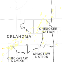
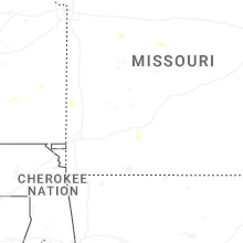
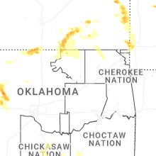


Connect with Interactive Hail Maps