

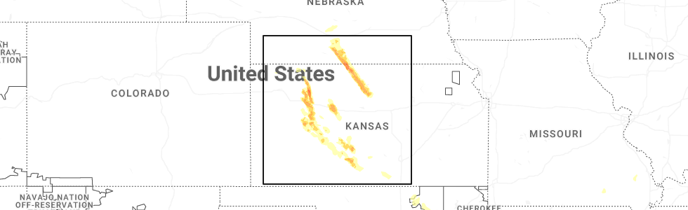
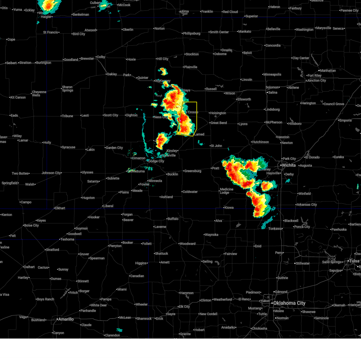
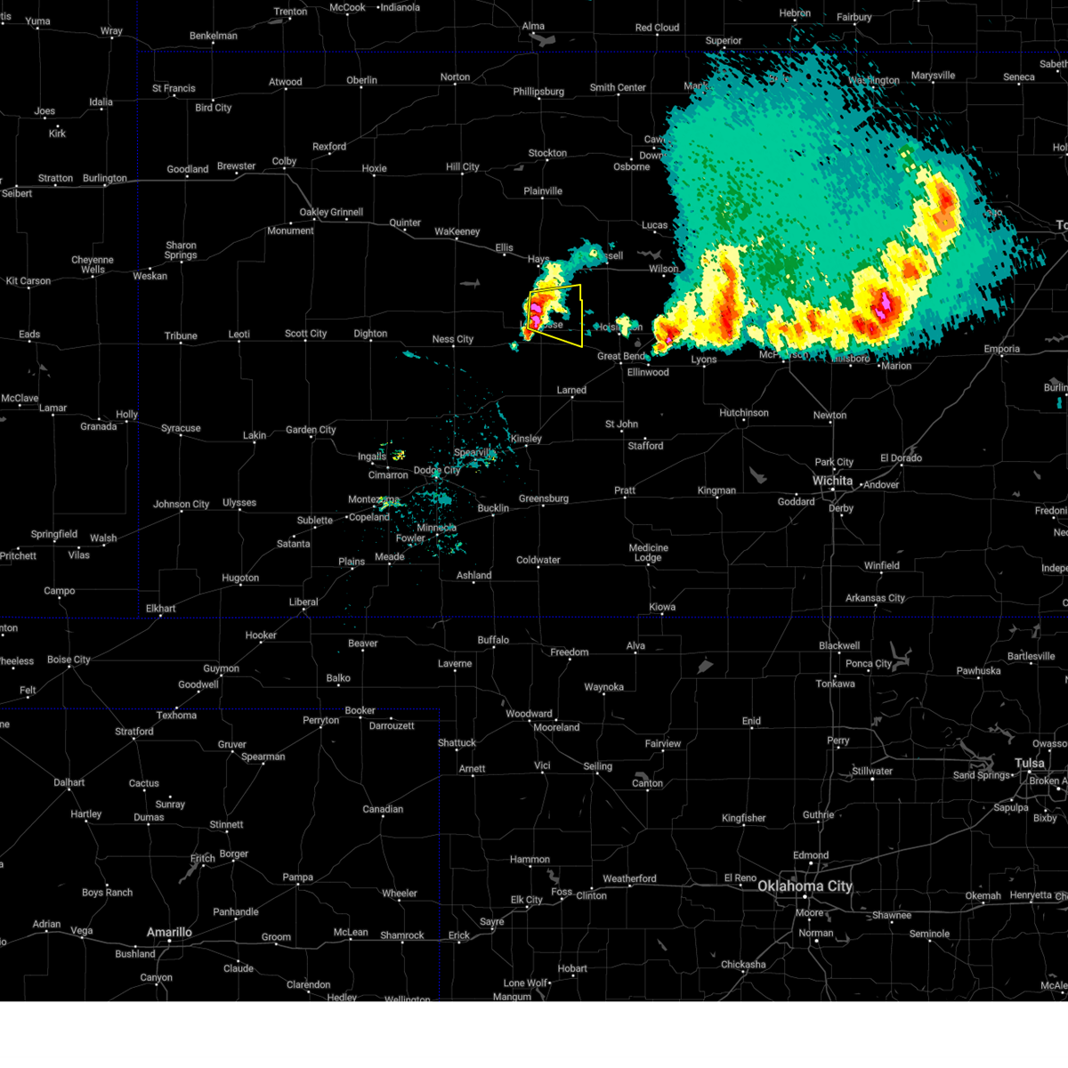
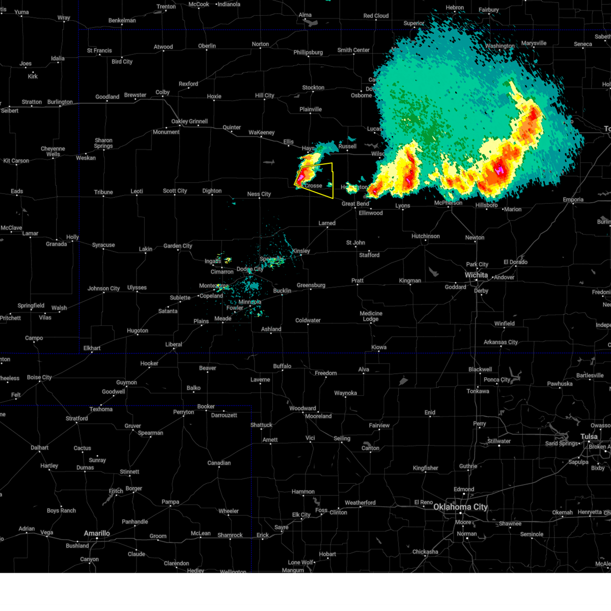
Hail Map for Liebenthal, KS
The Liebenthal, KS area has had 7 reports of on-the-ground hail by trained spotters, and has been under severe weather warnings 24 times during the past 12 months. Doppler radar has detected hail at or near Liebenthal, KS on 99 occasions, including 7 occasions during the past year.
| Name: | Liebenthal, KS |
| Where Located: | 15 miles S of Hays, KS |
| Map: | Google Map for Liebenthal, KS |
| Population: | 103 |
| Housing Units: | 60 |
| More Info: | Search Google for Liebenthal, KS |
1
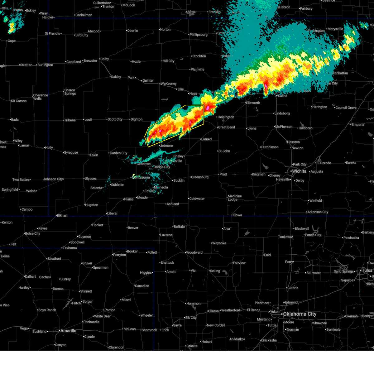
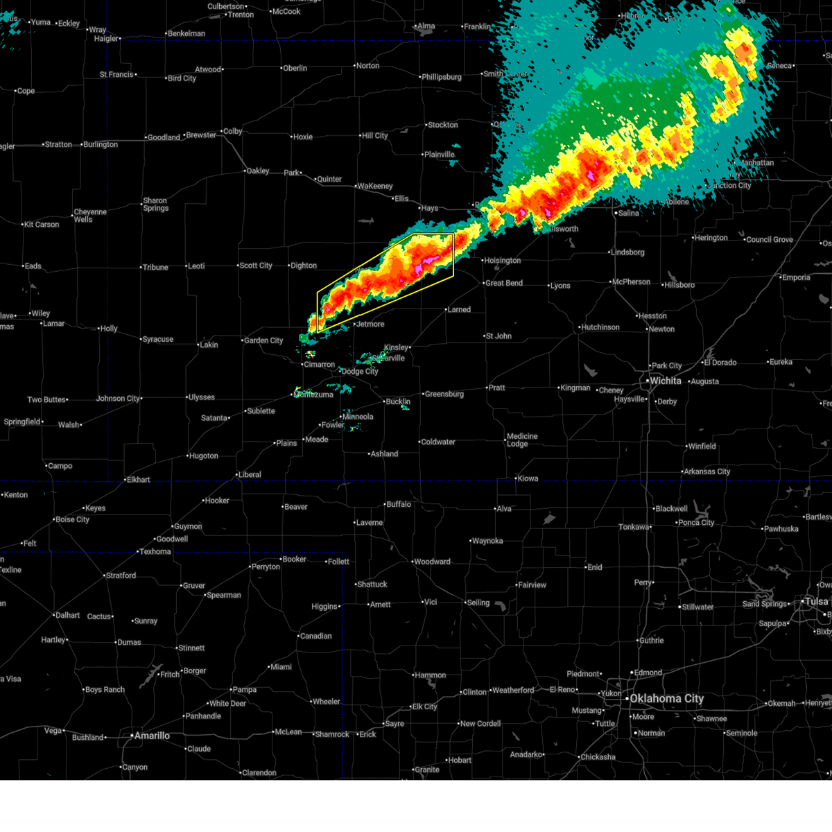
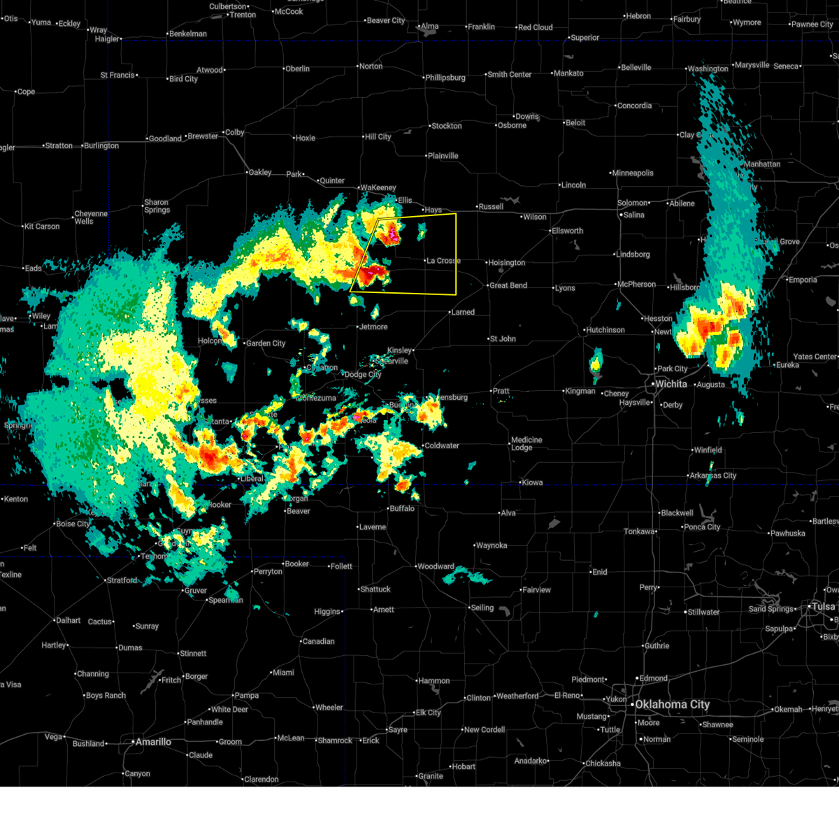
The Top Recent Hail Date for Liebenthal, KS is Friday, September 19, 2025 (38th out of 99)
Hail and Wind Damage Spotted near Liebenthal, KS
| Date / Time | Report Details |
|---|---|
| 6/20/2026 10:37 PM CDT |
 Svrddc the national weather service in dodge city has issued a * severe thunderstorm warning for, pawnee county in south central kansas, stafford county in south central kansas, rush county in central kansas, northeastern edwards county in south central kansas, northwestern pratt county in south central kansas, southeastern ellis county in central kansas, * until 1130 pm cdt. * at 1036 pm cdt, severe thunderstorms were located along a line extending from near otis to 7 miles southwest of garfield, moving southeast at 40 mph (radar indicated). Hazards include 60 mph wind gusts. Expect damage to roofs, siding, and trees. severe thunderstorms will be near, otis, garfield, ash valley, frizell, and shaffer around 1040 pm cdt. larned around 1045 pm cdt. zook around 1050 pm cdt. belpre around 1055 pm cdt. Other locations in the path of these severe thunderstorms include radium, macksville, seward and dillwyn. Svrddc the national weather service in dodge city has issued a * severe thunderstorm warning for, pawnee county in south central kansas, stafford county in south central kansas, rush county in central kansas, northeastern edwards county in south central kansas, northwestern pratt county in south central kansas, southeastern ellis county in central kansas, * until 1130 pm cdt. * at 1036 pm cdt, severe thunderstorms were located along a line extending from near otis to 7 miles southwest of garfield, moving southeast at 40 mph (radar indicated). Hazards include 60 mph wind gusts. Expect damage to roofs, siding, and trees. severe thunderstorms will be near, otis, garfield, ash valley, frizell, and shaffer around 1040 pm cdt. larned around 1045 pm cdt. zook around 1050 pm cdt. belpre around 1055 pm cdt. Other locations in the path of these severe thunderstorms include radium, macksville, seward and dillwyn.
|
| 6/20/2026 10:19 PM CDT |
 At 1018 pm cdt, severe thunderstorms were located along a line extending from near pfeifer to near la crosse to near burdett, moving east at 30 mph (public. at 1016 pm cdt, a personal weather station reported 63 mph winds 4 miles west of nekoma). Hazards include 70 mph wind gusts. Expect considerable tree damage. damage is likely to mobile homes, roofs, and outbuildings. Locations impacted include, hays, larned, la crosse, victoria, walker, otis, bison, burdett, schoenchen, rush center, rozel, liebenthal, timken, alexander, ash valley, sanford, nekoma, frizell, hargrave, and pfeifer. At 1018 pm cdt, severe thunderstorms were located along a line extending from near pfeifer to near la crosse to near burdett, moving east at 30 mph (public. at 1016 pm cdt, a personal weather station reported 63 mph winds 4 miles west of nekoma). Hazards include 70 mph wind gusts. Expect considerable tree damage. damage is likely to mobile homes, roofs, and outbuildings. Locations impacted include, hays, larned, la crosse, victoria, walker, otis, bison, burdett, schoenchen, rush center, rozel, liebenthal, timken, alexander, ash valley, sanford, nekoma, frizell, hargrave, and pfeifer.
|
| 6/20/2026 9:52 PM CDT |
 Svrddc the national weather service in dodge city has issued a * severe thunderstorm warning for, eastern ness county in west central kansas, northeastern hodgeman county in southwestern kansas, southeastern trego county in west central kansas, pawnee county in south central kansas, rush county in central kansas, southern ellis county in central kansas, * until 1045 pm cdt. * at 952 pm cdt, severe thunderstorms were located along a line extending from near antonino to near mccracken to 9 miles southeast of ness city, moving east at 35 mph (radar indicated). Hazards include 70 mph wind gusts and penny size hail. Expect considerable tree damage. Damage is likely to mobile homes, roofs, and outbuildings. Svrddc the national weather service in dodge city has issued a * severe thunderstorm warning for, eastern ness county in west central kansas, northeastern hodgeman county in southwestern kansas, southeastern trego county in west central kansas, pawnee county in south central kansas, rush county in central kansas, southern ellis county in central kansas, * until 1045 pm cdt. * at 952 pm cdt, severe thunderstorms were located along a line extending from near antonino to near mccracken to 9 miles southeast of ness city, moving east at 35 mph (radar indicated). Hazards include 70 mph wind gusts and penny size hail. Expect considerable tree damage. Damage is likely to mobile homes, roofs, and outbuildings.
|
| 6/9/2026 7:49 PM CDT |
 At 749 pm cdt, high winds north of a thunderstorm cluster were located along a line extending from near rush center to 11 miles northwest of jetmore, moving north at 45 mph. little additional rainfall and lightning is expected with these high winds (radar indicated). Hazards include 60 mph wind gusts. Expect damage to roofs, siding, and trees. these severe storms will be near, la crosse, bazine, rush center, alexander, and nekoma around 755 pm cdt. bison and hargrave around 800 pm cdt. ness city and mccracken around 805 pm cdt. Other locations in the path of these severe thunderstorms include liebenthal and loretta. At 749 pm cdt, high winds north of a thunderstorm cluster were located along a line extending from near rush center to 11 miles northwest of jetmore, moving north at 45 mph. little additional rainfall and lightning is expected with these high winds (radar indicated). Hazards include 60 mph wind gusts. Expect damage to roofs, siding, and trees. these severe storms will be near, la crosse, bazine, rush center, alexander, and nekoma around 755 pm cdt. bison and hargrave around 800 pm cdt. ness city and mccracken around 805 pm cdt. Other locations in the path of these severe thunderstorms include liebenthal and loretta.
|
| 6/9/2026 6:09 PM CDT |
 Svrddc the national weather service in dodge city has issued a * severe thunderstorm warning for, northeastern ness county in west central kansas, southeastern trego county in west central kansas, rush county in central kansas, ellis county in central kansas, * until 700 pm cdt. * at 609 pm cdt, severe thunderstorms were located along a line extending from 6 miles south of ogallah to near mccracken to 9 miles north of burdett, moving northeast at 45 mph (radar indicated). Hazards include 60 mph wind gusts. Expect damage to roofs, siding, and trees. severe thunderstorms will be near, riga, nekoma, and hargrave around 615 pm cdt. ellis and antonino around 620 pm cdt. la crosse, schoenchen, rush center, liebenthal, and yocemento around 625 pm cdt. Other locations in the path of these severe thunderstorms include hays, munjor, bison, toulon, victoria, catherine, loretta and pfeifer. Svrddc the national weather service in dodge city has issued a * severe thunderstorm warning for, northeastern ness county in west central kansas, southeastern trego county in west central kansas, rush county in central kansas, ellis county in central kansas, * until 700 pm cdt. * at 609 pm cdt, severe thunderstorms were located along a line extending from 6 miles south of ogallah to near mccracken to 9 miles north of burdett, moving northeast at 45 mph (radar indicated). Hazards include 60 mph wind gusts. Expect damage to roofs, siding, and trees. severe thunderstorms will be near, riga, nekoma, and hargrave around 615 pm cdt. ellis and antonino around 620 pm cdt. la crosse, schoenchen, rush center, liebenthal, and yocemento around 625 pm cdt. Other locations in the path of these severe thunderstorms include hays, munjor, bison, toulon, victoria, catherine, loretta and pfeifer.
|
| 5/30/2026 5:19 PM CDT |
 At 519 pm cdt, a severe thunderstorm was located 11 miles south of plainville, or 12 miles north of yocemento, moving north at 30 mph (radar indicated). Hazards include 60 mph wind gusts and quarter size hail. Hail damage to vehicles is expected. expect wind damage to roofs, siding, and trees. Locations impacted include, hays, victoria, walker, catherine, bison, schoenchen, liebenthal, emmeram, yocemento, munjor, loretta, pfeifer, toulon, and antonino. At 519 pm cdt, a severe thunderstorm was located 11 miles south of plainville, or 12 miles north of yocemento, moving north at 30 mph (radar indicated). Hazards include 60 mph wind gusts and quarter size hail. Hail damage to vehicles is expected. expect wind damage to roofs, siding, and trees. Locations impacted include, hays, victoria, walker, catherine, bison, schoenchen, liebenthal, emmeram, yocemento, munjor, loretta, pfeifer, toulon, and antonino.
|
| 5/30/2026 5:18 PM CDT |
 At 517 pm cdt, a severe thunderstorm was located near bison, moving northeast at 40 mph (radar indicated). Hazards include 60 mph wind gusts and quarter size hail. Hail damage to vehicles is expected. expect wind damage to roofs, siding, and trees. Locations impacted include, la crosse, otis, bison, rush center, liebenthal, timken, ash valley, loretta, and shaffer. At 517 pm cdt, a severe thunderstorm was located near bison, moving northeast at 40 mph (radar indicated). Hazards include 60 mph wind gusts and quarter size hail. Hail damage to vehicles is expected. expect wind damage to roofs, siding, and trees. Locations impacted include, la crosse, otis, bison, rush center, liebenthal, timken, ash valley, loretta, and shaffer.
|
| 5/30/2026 5:09 PM CDT |
 At 508 pm cdt, a severe thunderstorm was located near yocemento, moving north at 45 mph (radar indicated). Hazards include 60 mph wind gusts and quarter size hail. Hail damage to vehicles is expected. expect wind damage to roofs, siding, and trees. Locations impacted include, hays, ellis, la crosse, victoria, walker, catherine, bison, schoenchen, liebenthal, emmeram, yocemento, munjor, loretta, pfeifer, toulon, and antonino. At 508 pm cdt, a severe thunderstorm was located near yocemento, moving north at 45 mph (radar indicated). Hazards include 60 mph wind gusts and quarter size hail. Hail damage to vehicles is expected. expect wind damage to roofs, siding, and trees. Locations impacted include, hays, ellis, la crosse, victoria, walker, catherine, bison, schoenchen, liebenthal, emmeram, yocemento, munjor, loretta, pfeifer, toulon, and antonino.
|
| 5/30/2026 4:56 PM CDT |
 At 456 pm cdt, a severe thunderstorm was located near ash valley, moving north at 30 mph (radar indicated). Hazards include 60 mph wind gusts and half dollar size hail. Hail damage to vehicles is expected. expect wind damage to roofs, siding, and trees. Locations impacted include, larned, la crosse, otis, bison, rush center, rozel, liebenthal, timken, ash valley, loretta, sanford, frizell, and shaffer. At 456 pm cdt, a severe thunderstorm was located near ash valley, moving north at 30 mph (radar indicated). Hazards include 60 mph wind gusts and half dollar size hail. Hail damage to vehicles is expected. expect wind damage to roofs, siding, and trees. Locations impacted include, larned, la crosse, otis, bison, rush center, rozel, liebenthal, timken, ash valley, loretta, sanford, frizell, and shaffer.
|
| 5/30/2026 4:54 PM CDT |
 At 454 pm cdt, a severe thunderstorm was located 7 miles west of antonino, moving north at 30 mph (radar indicated). Hazards include 60 mph wind gusts and half dollar size hail. Hail damage to vehicles is expected. expect wind damage to roofs, siding, and trees. Locations impacted include, hays, ellis, la crosse, victoria, walker, catherine, bison, schoenchen, liebenthal, emmeram, yocemento, cedar bluff, munjor, loretta, riga, pfeifer, toulon, and antonino. At 454 pm cdt, a severe thunderstorm was located 7 miles west of antonino, moving north at 30 mph (radar indicated). Hazards include 60 mph wind gusts and half dollar size hail. Hail damage to vehicles is expected. expect wind damage to roofs, siding, and trees. Locations impacted include, hays, ellis, la crosse, victoria, walker, catherine, bison, schoenchen, liebenthal, emmeram, yocemento, cedar bluff, munjor, loretta, riga, pfeifer, toulon, and antonino.
|
| 5/30/2026 4:44 PM CDT |
 Svrddc the national weather service in dodge city has issued a * severe thunderstorm warning for, northeastern pawnee county in south central kansas, eastern rush county in central kansas, * until 600 pm cdt. * at 444 pm cdt, a severe thunderstorm was located near sanford, moving north at 30 mph (radar indicated). Hazards include 60 mph wind gusts and quarter size hail. Hail damage to vehicles is expected. Expect wind damage to roofs, siding, and trees. Svrddc the national weather service in dodge city has issued a * severe thunderstorm warning for, northeastern pawnee county in south central kansas, eastern rush county in central kansas, * until 600 pm cdt. * at 444 pm cdt, a severe thunderstorm was located near sanford, moving north at 30 mph (radar indicated). Hazards include 60 mph wind gusts and quarter size hail. Hail damage to vehicles is expected. Expect wind damage to roofs, siding, and trees.
|
| 5/30/2026 4:39 PM CDT |
 Svrddc the national weather service in dodge city has issued a * severe thunderstorm warning for, northeastern ness county in west central kansas, eastern trego county in west central kansas, northern rush county in central kansas, ellis county in central kansas, * until 600 pm cdt. * at 439 pm cdt, a severe thunderstorm was located 7 miles north of mccracken, moving north at 30 mph (radar indicated). Hazards include 60 mph wind gusts and half dollar size hail. Hail damage to vehicles is expected. Expect wind damage to roofs, siding, and trees. Svrddc the national weather service in dodge city has issued a * severe thunderstorm warning for, northeastern ness county in west central kansas, eastern trego county in west central kansas, northern rush county in central kansas, ellis county in central kansas, * until 600 pm cdt. * at 439 pm cdt, a severe thunderstorm was located 7 miles north of mccracken, moving north at 30 mph (radar indicated). Hazards include 60 mph wind gusts and half dollar size hail. Hail damage to vehicles is expected. Expect wind damage to roofs, siding, and trees.
|
| 5/29/2026 8:00 PM CDT | Storm damage reported in rush county KS, 2.7 miles SSW of Liebenthal, KS |
| 5/17/2026 10:07 PM CDT |
 At 1007 pm cdt, severe thunderstorms were located along a line extending from near milberger to 12 miles southeast of beeler, moving northeast at 15 mph (radar indicated). Hazards include 60 mph wind gusts and quarter size hail. Hail damage to vehicles is expected. expect wind damage to roofs, siding, and trees. Locations impacted include, bazine, mccracken, liebenthal, alexander, loretta, hargrave, pfeifer and ness city. At 1007 pm cdt, severe thunderstorms were located along a line extending from near milberger to 12 miles southeast of beeler, moving northeast at 15 mph (radar indicated). Hazards include 60 mph wind gusts and quarter size hail. Hail damage to vehicles is expected. expect wind damage to roofs, siding, and trees. Locations impacted include, bazine, mccracken, liebenthal, alexander, loretta, hargrave, pfeifer and ness city.
|
| 5/17/2026 9:25 PM CDT |
 Svrddc the national weather service in dodge city has issued a * severe thunderstorm warning for, southern ness county in west central kansas, northern hodgeman county in southwestern kansas, northwestern pawnee county in south central kansas, rush county in central kansas, * until 1015 pm cdt. * at 925 pm cdt, severe thunderstorms were located along a line extending from near otis to 8 miles northeast of kalvesta, moving northeast at 15 mph (radar indicated). Hazards include golf ball size hail and 60 mph wind gusts. People and animals outdoors will be injured. expect hail damage to roofs, siding, windows, and vehicles. expect wind damage to roofs, siding, and trees. severe thunderstorms will be near, la crosse, alexander, and nekoma around 930 pm cdt. Bazine, loretta, and hargrave around 940 pm cdt. Svrddc the national weather service in dodge city has issued a * severe thunderstorm warning for, southern ness county in west central kansas, northern hodgeman county in southwestern kansas, northwestern pawnee county in south central kansas, rush county in central kansas, * until 1015 pm cdt. * at 925 pm cdt, severe thunderstorms were located along a line extending from near otis to 8 miles northeast of kalvesta, moving northeast at 15 mph (radar indicated). Hazards include golf ball size hail and 60 mph wind gusts. People and animals outdoors will be injured. expect hail damage to roofs, siding, windows, and vehicles. expect wind damage to roofs, siding, and trees. severe thunderstorms will be near, la crosse, alexander, and nekoma around 930 pm cdt. Bazine, loretta, and hargrave around 940 pm cdt.
|
| 4/26/2026 8:50 AM CDT |
 At 850 am cdt, a severe thunderstorm was located near mccracken, moving northeast at 25 mph (radar indicated). Hazards include 60 mph wind gusts and quarter size hail. Hail damage to vehicles is expected. expect wind damage to roofs, siding, and trees. Locations impacted include, schoenchen. At 850 am cdt, a severe thunderstorm was located near mccracken, moving northeast at 25 mph (radar indicated). Hazards include 60 mph wind gusts and quarter size hail. Hail damage to vehicles is expected. expect wind damage to roofs, siding, and trees. Locations impacted include, schoenchen.
|
| 4/26/2026 8:27 AM CDT |
 At 827 am cdt, a severe thunderstorm was located near brownell, moving northeast at 25 mph (radar indicated). Hazards include 60 mph wind gusts and quarter size hail. Hail damage to vehicles is expected. expect wind damage to roofs, siding, and trees. This severe storm will be near, mccracken around 835 am cdt. At 827 am cdt, a severe thunderstorm was located near brownell, moving northeast at 25 mph (radar indicated). Hazards include 60 mph wind gusts and quarter size hail. Hail damage to vehicles is expected. expect wind damage to roofs, siding, and trees. This severe storm will be near, mccracken around 835 am cdt.
|
| 4/26/2026 8:17 AM CDT |
 Svrddc the national weather service in dodge city has issued a * severe thunderstorm warning for, northeastern ness county in west central kansas, southeastern trego county in west central kansas, northwestern rush county in central kansas, southwestern ellis county in central kansas, * until 900 am cdt. * at 817 am cdt, a severe thunderstorm was located near brownell, moving northeast at 25 mph (radar indicated). Hazards include quarter size hail. Damage to vehicles is expected. This severe thunderstorm will be near, mccracken around 835 am cdt. Svrddc the national weather service in dodge city has issued a * severe thunderstorm warning for, northeastern ness county in west central kansas, southeastern trego county in west central kansas, northwestern rush county in central kansas, southwestern ellis county in central kansas, * until 900 am cdt. * at 817 am cdt, a severe thunderstorm was located near brownell, moving northeast at 25 mph (radar indicated). Hazards include quarter size hail. Damage to vehicles is expected. This severe thunderstorm will be near, mccracken around 835 am cdt.
|
| 9/19/2025 8:20 PM CDT | The storm which prompted the warning has weakened below severe limits, and no longer poses an immediate threat to life or property. therefore, the warning will be allowed to expire. a severe thunderstorm watch remains in effect until 1100 pm cdt for central kansas. |
| 9/19/2025 7:59 PM CDT | At 758 pm cdt, a severe thunderstorm was located very near loretta, moving southeast at 20 mph (radar indicated). Hazards include 60 mph wind gusts and quarter size hail. Hail damage to vehicles is expected. expect wind damage to roofs, siding, and trees. Locations impacted include, otis. |
| 9/19/2025 7:59 PM CDT | the severe thunderstorm warning has been cancelled and is no longer in effect |
| 9/19/2025 7:41 PM CDT | Quarter sized hail reported 1.1 miles S of Liebenthal, KS |
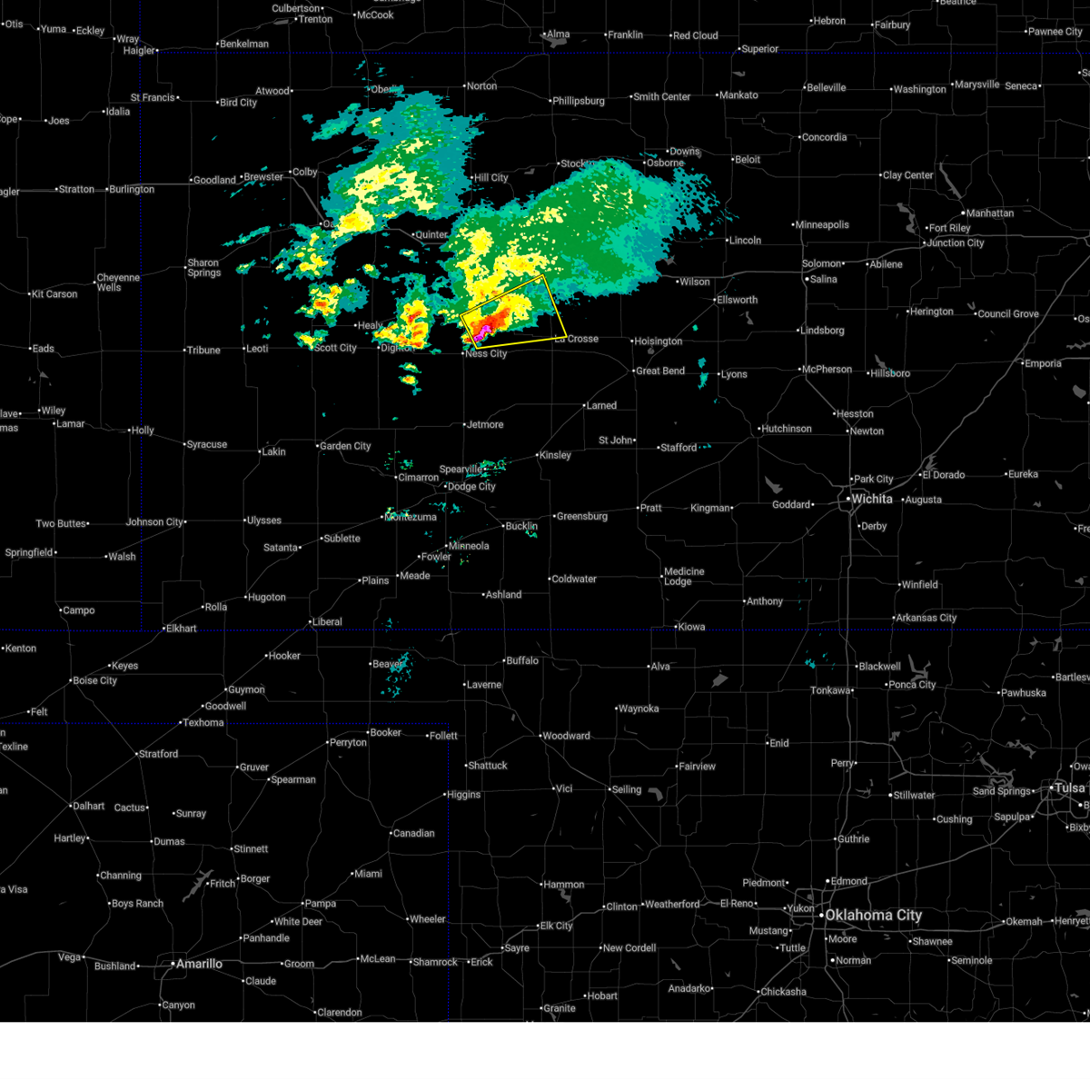
| 9/19/2025 7:34 PM CDT | Svrddc the national weather service in dodge city has issued a * severe thunderstorm warning for, northeastern rush county in central kansas, southeastern ellis county in central kansas, * until 830 pm cdt. * at 734 pm cdt, a severe thunderstorm was located very near schoenchen, moving southeast at 20 mph (radar indicated). Hazards include ping pong ball size hail and 60 mph wind gusts. People and animals outdoors will be injured. expect hail damage to roofs, siding, windows, and vehicles. expect wind damage to roofs, siding, and trees. this severe thunderstorm will be near, liebenthal around 740 pm cdt. Loretta and pfeifer around 750 pm cdt. |
| 7/21/2025 8:50 PM CDT |
 At 849 pm cdt, severe thunderstorms were located along a line extending from 6 miles south of albert to near liebenthal, moving east at 10 mph (radar indicated). Hazards include 60 mph wind gusts. Expect damage to roofs, siding, and trees. Locations impacted include, bison, schoenchen, liebenthal, timken, shaffer, otis and loretta. At 849 pm cdt, severe thunderstorms were located along a line extending from 6 miles south of albert to near liebenthal, moving east at 10 mph (radar indicated). Hazards include 60 mph wind gusts. Expect damage to roofs, siding, and trees. Locations impacted include, bison, schoenchen, liebenthal, timken, shaffer, otis and loretta.
|
| 7/21/2025 8:50 PM CDT |
 the severe thunderstorm warning has been cancelled and is no longer in effect the severe thunderstorm warning has been cancelled and is no longer in effect
|
| 7/21/2025 8:15 PM CDT | Storm damage reported in rush county KS, 0.3 miles N of Liebenthal, KS |
| 7/21/2025 8:08 PM CDT |
 Svrddc the national weather service in dodge city has issued a * severe thunderstorm warning for, northeastern ness county in west central kansas, southeastern trego county in west central kansas, rush county in central kansas, southern ellis county in central kansas, * until 900 pm cdt. * at 808 pm cdt, severe thunderstorms were located along a line extending from near otis to near mccracken, moving south at 20 mph (radar indicated). Hazards include 60 mph wind gusts and nickel size hail. Expect damage to roofs, siding, and trees. severe thunderstorms will be near, la crosse, bison, rush center, timken, alexander, shaffer, and nekoma around 815 pm cdt. Bazine around 820 pm cdt. Svrddc the national weather service in dodge city has issued a * severe thunderstorm warning for, northeastern ness county in west central kansas, southeastern trego county in west central kansas, rush county in central kansas, southern ellis county in central kansas, * until 900 pm cdt. * at 808 pm cdt, severe thunderstorms were located along a line extending from near otis to near mccracken, moving south at 20 mph (radar indicated). Hazards include 60 mph wind gusts and nickel size hail. Expect damage to roofs, siding, and trees. severe thunderstorms will be near, la crosse, bison, rush center, timken, alexander, shaffer, and nekoma around 815 pm cdt. Bazine around 820 pm cdt.
|
| 6/17/2025 2:00 AM CDT |
 At 159 am cdt, a severe thunderstorm was located near shaffer, moving southeast at 40 mph (radar indicated). Hazards include 60 mph wind gusts and quarter size hail. Hail damage to vehicles is expected. expect wind damage to roofs, siding, and trees. Locations impacted include, hays, la crosse, victoria, walker, otis, bison, schoenchen, mccracken, rush center, liebenthal, timken, munjor, loretta, nekoma, hargrave, pfeifer, toulon, shaffer, and antonino. At 159 am cdt, a severe thunderstorm was located near shaffer, moving southeast at 40 mph (radar indicated). Hazards include 60 mph wind gusts and quarter size hail. Hail damage to vehicles is expected. expect wind damage to roofs, siding, and trees. Locations impacted include, hays, la crosse, victoria, walker, otis, bison, schoenchen, mccracken, rush center, liebenthal, timken, munjor, loretta, nekoma, hargrave, pfeifer, toulon, shaffer, and antonino.
|
| 6/17/2025 1:43 AM CDT |
 Svrddc the national weather service in dodge city has issued a * severe thunderstorm warning for, southeastern trego county in west central kansas, rush county in central kansas, southern ellis county in central kansas, * until 245 am cdt. * at 143 am cdt, a severe thunderstorm was located near pfeifer, moving southeast at 40 mph (radar indicated). Hazards include 60 mph wind gusts and quarter size hail. Hail damage to vehicles is expected. expect wind damage to roofs, siding, and trees. This severe thunderstorm will remain over mainly rural areas of southeastern trego, rush and southern ellis counties. Svrddc the national weather service in dodge city has issued a * severe thunderstorm warning for, southeastern trego county in west central kansas, rush county in central kansas, southern ellis county in central kansas, * until 245 am cdt. * at 143 am cdt, a severe thunderstorm was located near pfeifer, moving southeast at 40 mph (radar indicated). Hazards include 60 mph wind gusts and quarter size hail. Hail damage to vehicles is expected. expect wind damage to roofs, siding, and trees. This severe thunderstorm will remain over mainly rural areas of southeastern trego, rush and southern ellis counties.
|
| 6/17/2025 1:37 AM CDT |
 At 137 am cdt, a severe thunderstorm was located near mccracken, moving southeast at 40 mph (radar indicated). Hazards include 60 mph wind gusts and penny size hail. Expect damage to roofs, siding, and trees. Locations impacted include, mccracken, hargrave and la crosse. At 137 am cdt, a severe thunderstorm was located near mccracken, moving southeast at 40 mph (radar indicated). Hazards include 60 mph wind gusts and penny size hail. Expect damage to roofs, siding, and trees. Locations impacted include, mccracken, hargrave and la crosse.
|
| 6/17/2025 1:13 AM CDT |
 Svrddc the national weather service in dodge city has issued a * severe thunderstorm warning for, northeastern ness county in west central kansas, southern trego county in west central kansas, northern rush county in central kansas, southwestern ellis county in central kansas, * until 200 am cdt. * at 113 am cdt, a severe thunderstorm was located near cedar bluff, moving southeast at 40 mph (radar indicated). Hazards include 60 mph wind gusts and quarter size hail. Hail damage to vehicles is expected. expect wind damage to roofs, siding, and trees. this severe thunderstorm will be near, cedar bluff around 120 am cdt. brownell around 130 am cdt. Other locations in the path of this severe thunderstorm include mccracken and alexander. Svrddc the national weather service in dodge city has issued a * severe thunderstorm warning for, northeastern ness county in west central kansas, southern trego county in west central kansas, northern rush county in central kansas, southwestern ellis county in central kansas, * until 200 am cdt. * at 113 am cdt, a severe thunderstorm was located near cedar bluff, moving southeast at 40 mph (radar indicated). Hazards include 60 mph wind gusts and quarter size hail. Hail damage to vehicles is expected. expect wind damage to roofs, siding, and trees. this severe thunderstorm will be near, cedar bluff around 120 am cdt. brownell around 130 am cdt. Other locations in the path of this severe thunderstorm include mccracken and alexander.
|
| 5/19/2025 8:44 PM CDT |
 the severe thunderstorm warning has been cancelled and is no longer in effect the severe thunderstorm warning has been cancelled and is no longer in effect
|
| 5/19/2025 8:44 PM CDT |
 At 844 pm cdt, severe thunderstorms were located along a line extending from schoenchen to near alexander, moving east at 25 mph (radar indicated). Hazards include 60 mph wind gusts and quarter size hail. Hail damage to vehicles is expected. expect wind damage to roofs, siding, and trees. Locations impacted include, schoenchen, liebenthal, nekoma, hargrave, la crosse, pfeifer, rush center, loretta, bison, timken and otis. At 844 pm cdt, severe thunderstorms were located along a line extending from schoenchen to near alexander, moving east at 25 mph (radar indicated). Hazards include 60 mph wind gusts and quarter size hail. Hail damage to vehicles is expected. expect wind damage to roofs, siding, and trees. Locations impacted include, schoenchen, liebenthal, nekoma, hargrave, la crosse, pfeifer, rush center, loretta, bison, timken and otis.
|
| 5/19/2025 8:13 PM CDT |
 Svrddc the national weather service in dodge city has issued a * severe thunderstorm warning for, eastern ness county in west central kansas, southeastern trego county in west central kansas, northwestern pawnee county in south central kansas, rush county in central kansas, southern ellis county in central kansas, * until 915 pm cdt. * at 813 pm cdt, severe thunderstorms were located along a line extending from 9 miles north of mccracken to near bazine, moving east at 25 mph (radar indicated). Hazards include 60 mph wind gusts and quarter size hail. Hail damage to vehicles is expected. expect wind damage to roofs, siding, and trees. severe thunderstorms will be near, bazine and mccracken around 820 pm cdt. alexander around 825 pm cdt. Other locations in the path of these severe thunderstorms include schoenchen, hargrave, liebenthal, nekoma, la crosse, pfeifer, rush center and loretta. Svrddc the national weather service in dodge city has issued a * severe thunderstorm warning for, eastern ness county in west central kansas, southeastern trego county in west central kansas, northwestern pawnee county in south central kansas, rush county in central kansas, southern ellis county in central kansas, * until 915 pm cdt. * at 813 pm cdt, severe thunderstorms were located along a line extending from 9 miles north of mccracken to near bazine, moving east at 25 mph (radar indicated). Hazards include 60 mph wind gusts and quarter size hail. Hail damage to vehicles is expected. expect wind damage to roofs, siding, and trees. severe thunderstorms will be near, bazine and mccracken around 820 pm cdt. alexander around 825 pm cdt. Other locations in the path of these severe thunderstorms include schoenchen, hargrave, liebenthal, nekoma, la crosse, pfeifer, rush center and loretta.
|
| 4/24/2025 5:51 PM CDT |
 The storm which prompted the warning has weakened below severe limits, and no longer poses an immediate threat to life or property. therefore, the warning will be allowed to expire. a severe thunderstorm watch remains in effect until midnight cdt for central kansas. The storm which prompted the warning has weakened below severe limits, and no longer poses an immediate threat to life or property. therefore, the warning will be allowed to expire. a severe thunderstorm watch remains in effect until midnight cdt for central kansas.
|
| 4/24/2025 5:36 PM CDT |
 At 536 pm cdt, a severe thunderstorm was located near pfeifer, moving northeast at 15 mph (radar indicated). Hazards include quarter size hail. Damage to vehicles is expected. Locations impacted include, pfeifer, loretta, liebenthal, and victoria. At 536 pm cdt, a severe thunderstorm was located near pfeifer, moving northeast at 15 mph (radar indicated). Hazards include quarter size hail. Damage to vehicles is expected. Locations impacted include, pfeifer, loretta, liebenthal, and victoria.
|
| 4/24/2025 5:18 PM CDT |
 Svrddc the national weather service in dodge city has issued a * severe thunderstorm warning for, northeastern rush county in central kansas, southeastern ellis county in central kansas, * until 600 pm cdt. * at 517 pm cdt, a severe thunderstorm was located very near pfeifer, moving northeast at 15 mph (radar indicated). Hazards include quarter size hail. Damage to vehicles is expected. This severe thunderstorm will remain over mainly rural areas of northeastern rush and southeastern ellis counties. Svrddc the national weather service in dodge city has issued a * severe thunderstorm warning for, northeastern rush county in central kansas, southeastern ellis county in central kansas, * until 600 pm cdt. * at 517 pm cdt, a severe thunderstorm was located very near pfeifer, moving northeast at 15 mph (radar indicated). Hazards include quarter size hail. Damage to vehicles is expected. This severe thunderstorm will remain over mainly rural areas of northeastern rush and southeastern ellis counties.
|
| 7/31/2024 7:32 PM CDT |
 At 731 pm cdt, a severe thunderstorm was located near victoria, moving southeast at 25 mph (radar indicated). Hazards include ping pong ball size hail and 60 mph wind gusts. People and animals outdoors will be injured. expect hail damage to roofs, siding, windows, and vehicles. expect wind damage to roofs, siding, and trees. Locations impacted include, hays, la crosse, victoria, walker, catherine, bison, schoenchen, mccracken, rush center, liebenthal, alexander, emmeram, yocemento, munjor, loretta, nekoma, hargrave, pfeifer, toulon, and antonino. At 731 pm cdt, a severe thunderstorm was located near victoria, moving southeast at 25 mph (radar indicated). Hazards include ping pong ball size hail and 60 mph wind gusts. People and animals outdoors will be injured. expect hail damage to roofs, siding, windows, and vehicles. expect wind damage to roofs, siding, and trees. Locations impacted include, hays, la crosse, victoria, walker, catherine, bison, schoenchen, mccracken, rush center, liebenthal, alexander, emmeram, yocemento, munjor, loretta, nekoma, hargrave, pfeifer, toulon, and antonino.
|
| 7/31/2024 7:32 PM CDT |
 the severe thunderstorm warning has been cancelled and is no longer in effect the severe thunderstorm warning has been cancelled and is no longer in effect
|
| 7/31/2024 7:30 PM CDT |
 Svrddc the national weather service in dodge city has issued a * severe thunderstorm warning for, northeastern pawnee county in south central kansas, rush county in central kansas, southeastern ellis county in central kansas, * until 815 pm cdt. * at 727 pm cdt, a severe thunderstorm was located near nekoma, moving southeast at 30 mph (radar indicated). Hazards include ping pong ball size hail and 60 mph wind gusts. People and animals outdoors will be injured. expect hail damage to roofs, siding, windows, and vehicles. expect wind damage to roofs, siding, and trees. this severe thunderstorm will be near, ash valley around 745 pm cdt. Other locations in the path of this severe thunderstorm include larned. Svrddc the national weather service in dodge city has issued a * severe thunderstorm warning for, northeastern pawnee county in south central kansas, rush county in central kansas, southeastern ellis county in central kansas, * until 815 pm cdt. * at 727 pm cdt, a severe thunderstorm was located near nekoma, moving southeast at 30 mph (radar indicated). Hazards include ping pong ball size hail and 60 mph wind gusts. People and animals outdoors will be injured. expect hail damage to roofs, siding, windows, and vehicles. expect wind damage to roofs, siding, and trees. this severe thunderstorm will be near, ash valley around 745 pm cdt. Other locations in the path of this severe thunderstorm include larned.
|
| 7/31/2024 7:16 PM CDT |
 At 715 pm cdt, a severe thunderstorm was located near toulon, moving southeast at 20 mph (radar indicated). Hazards include ping pong ball size hail and 60 mph wind gusts. People and animals outdoors will be injured. expect hail damage to roofs, siding, windows, and vehicles. expect wind damage to roofs, siding, and trees. Locations impacted include, hays, victoria, toulon and walker. At 715 pm cdt, a severe thunderstorm was located near toulon, moving southeast at 20 mph (radar indicated). Hazards include ping pong ball size hail and 60 mph wind gusts. People and animals outdoors will be injured. expect hail damage to roofs, siding, windows, and vehicles. expect wind damage to roofs, siding, and trees. Locations impacted include, hays, victoria, toulon and walker.
|
| 7/31/2024 6:59 PM CDT |
 Svrddc the national weather service in dodge city has issued a * severe thunderstorm warning for, northeastern ness county in west central kansas, trego county in west central kansas, rush county in central kansas, ellis county in central kansas, * until 745 pm cdt. * at 658 pm cdt, a severe thunderstorm was located near antonino, moving east at 20 mph (radar indicated). Hazards include golf ball size hail and 60 mph wind gusts. People and animals outdoors will be injured. expect hail damage to roofs, siding, windows, and vehicles. expect wind damage to roofs, siding, and trees. this severe thunderstorm will be near, antonino around 705 pm cdt. hays and munjor around 710 pm cdt. toulon around 715 pm cdt. Other locations in the path of this severe thunderstorm include victoria and walker. Svrddc the national weather service in dodge city has issued a * severe thunderstorm warning for, northeastern ness county in west central kansas, trego county in west central kansas, rush county in central kansas, ellis county in central kansas, * until 745 pm cdt. * at 658 pm cdt, a severe thunderstorm was located near antonino, moving east at 20 mph (radar indicated). Hazards include golf ball size hail and 60 mph wind gusts. People and animals outdoors will be injured. expect hail damage to roofs, siding, windows, and vehicles. expect wind damage to roofs, siding, and trees. this severe thunderstorm will be near, antonino around 705 pm cdt. hays and munjor around 710 pm cdt. toulon around 715 pm cdt. Other locations in the path of this severe thunderstorm include victoria and walker.
|
| 7/16/2024 3:29 AM CDT |
 At 329 am cdt, a severe thunderstorm was located very near gorham, or very near walker, moving east at 35 mph (radar indicated). Hazards include 70 mph wind gusts and nickel size hail. Expect considerable tree damage. damage is likely to mobile homes, roofs, and outbuildings. This severe thunderstorm will remain over mainly rural areas of northern rush and ellis counties. At 329 am cdt, a severe thunderstorm was located very near gorham, or very near walker, moving east at 35 mph (radar indicated). Hazards include 70 mph wind gusts and nickel size hail. Expect considerable tree damage. damage is likely to mobile homes, roofs, and outbuildings. This severe thunderstorm will remain over mainly rural areas of northern rush and ellis counties.
|
| 7/16/2024 3:16 AM CDT |
 At 315 am cdt, a severe thunderstorm was located very near victoria, moving east at 35 mph (radar indicated). Hazards include 70 mph wind gusts and nickel size hail. Expect considerable tree damage. damage is likely to mobile homes, roofs, and outbuildings. This severe storm will be near, walker around 320 am cdt. At 315 am cdt, a severe thunderstorm was located very near victoria, moving east at 35 mph (radar indicated). Hazards include 70 mph wind gusts and nickel size hail. Expect considerable tree damage. damage is likely to mobile homes, roofs, and outbuildings. This severe storm will be near, walker around 320 am cdt.
|
| 7/16/2024 3:04 AM CDT |
 Svrddc the national weather service in dodge city has issued a * severe thunderstorm warning for, northern rush county in central kansas, ellis county in central kansas, * until 400 am cdt. * at 303 am cdt, a severe thunderstorm was located very near toulon, moving east at 40 mph. this replaces the previous warning for ellis and rush counties (radar indicated). Hazards include 70 mph wind gusts and nickel size hail. Expect considerable tree damage. damage is likely to mobile homes, roofs, and outbuildings. this severe thunderstorm will be near, victoria around 310 am cdt. Walker around 320 am cdt. Svrddc the national weather service in dodge city has issued a * severe thunderstorm warning for, northern rush county in central kansas, ellis county in central kansas, * until 400 am cdt. * at 303 am cdt, a severe thunderstorm was located very near toulon, moving east at 40 mph. this replaces the previous warning for ellis and rush counties (radar indicated). Hazards include 70 mph wind gusts and nickel size hail. Expect considerable tree damage. damage is likely to mobile homes, roofs, and outbuildings. this severe thunderstorm will be near, victoria around 310 am cdt. Walker around 320 am cdt.
|
| 7/16/2024 2:34 AM CDT |
 Svrddc the national weather service in dodge city has issued a * severe thunderstorm warning for, ness county in west central kansas, trego county in west central kansas, western rush county in central kansas, ellis county in central kansas, * until 315 am cdt. * at 234 am cdt, a severe thunderstorm was located near cedar bluff, moving east at 35 mph (radar indicated). Hazards include 70 mph wind gusts and nickel size hail. Expect considerable tree damage. Damage is likely to mobile homes, roofs, and outbuildings. Svrddc the national weather service in dodge city has issued a * severe thunderstorm warning for, ness county in west central kansas, trego county in west central kansas, western rush county in central kansas, ellis county in central kansas, * until 315 am cdt. * at 234 am cdt, a severe thunderstorm was located near cedar bluff, moving east at 35 mph (radar indicated). Hazards include 70 mph wind gusts and nickel size hail. Expect considerable tree damage. Damage is likely to mobile homes, roofs, and outbuildings.
|
| 7/6/2024 9:58 PM CDT |
 Svrddc the national weather service in dodge city has issued a * severe thunderstorm warning for, northwestern pawnee county in south central kansas, rush county in central kansas, * until 1045 pm cdt. * at 957 pm cdt, severe thunderstorms were located along a line extending from near shaffer to near burdett, moving north at 35 mph (mesonet indicated). Hazards include 60 mph wind gusts. Expect damage to roofs, siding, and trees. severe thunderstorms will be near, otis, timken, and shaffer around 1005 pm cdt. bison and rush center around 1010 pm cdt. la crosse around 1015 pm cdt. Other locations in the path of these severe thunderstorms include nekoma, alexander, hargrave, loretta and liebenthal. Svrddc the national weather service in dodge city has issued a * severe thunderstorm warning for, northwestern pawnee county in south central kansas, rush county in central kansas, * until 1045 pm cdt. * at 957 pm cdt, severe thunderstorms were located along a line extending from near shaffer to near burdett, moving north at 35 mph (mesonet indicated). Hazards include 60 mph wind gusts. Expect damage to roofs, siding, and trees. severe thunderstorms will be near, otis, timken, and shaffer around 1005 pm cdt. bison and rush center around 1010 pm cdt. la crosse around 1015 pm cdt. Other locations in the path of these severe thunderstorms include nekoma, alexander, hargrave, loretta and liebenthal.
|
| 6/8/2024 10:39 PM CDT |
 Svrddc the national weather service in dodge city has issued a * severe thunderstorm warning for, eastern ness county in west central kansas, northeastern hodgeman county in southwestern kansas, northern pawnee county in south central kansas, rush county in central kansas, * until 1145 pm cdt. * at 1039 pm cdt, severe thunderstorms were located along a line extending from near hanston to near ash valley, moving north at 20 mph (radar indicated). Hazards include 60 mph wind gusts and quarter size hail. Hail damage to vehicles is expected. expect wind damage to roofs, siding, and trees. severe thunderstorms will be near, burdett and ash valley around 1045 pm cdt. Other locations in the path of these severe thunderstorms include rush center, timken, shaffer, bazine, bison, alexander, nekoma, la crosse and otis. Svrddc the national weather service in dodge city has issued a * severe thunderstorm warning for, eastern ness county in west central kansas, northeastern hodgeman county in southwestern kansas, northern pawnee county in south central kansas, rush county in central kansas, * until 1145 pm cdt. * at 1039 pm cdt, severe thunderstorms were located along a line extending from near hanston to near ash valley, moving north at 20 mph (radar indicated). Hazards include 60 mph wind gusts and quarter size hail. Hail damage to vehicles is expected. expect wind damage to roofs, siding, and trees. severe thunderstorms will be near, burdett and ash valley around 1045 pm cdt. Other locations in the path of these severe thunderstorms include rush center, timken, shaffer, bazine, bison, alexander, nekoma, la crosse and otis.
|
| 6/4/2024 11:49 AM CDT |
 At 1149 am cdt, a severe thunderstorm was located near cedar bluff, moving east at 25 mph (radar indicated). Hazards include 60 mph wind gusts and half dollar size hail. Hail damage to vehicles is expected. expect wind damage to roofs, siding, and trees. Locations impacted include, hays, schoenchen, liebenthal, toulon, munjor, and antonino. At 1149 am cdt, a severe thunderstorm was located near cedar bluff, moving east at 25 mph (radar indicated). Hazards include 60 mph wind gusts and half dollar size hail. Hail damage to vehicles is expected. expect wind damage to roofs, siding, and trees. Locations impacted include, hays, schoenchen, liebenthal, toulon, munjor, and antonino.
|
| 6/4/2024 11:41 AM CDT |
 Svrddc the national weather service in dodge city has issued a * severe thunderstorm warning for, northeastern ness county in west central kansas, southeastern trego county in west central kansas, northwestern rush county in central kansas, southwestern ellis county in central kansas, * until 1245 pm cdt. * at 1140 am cdt, a severe thunderstorm was located near cedar bluff, moving east at 20 mph (radar indicated). Hazards include quarter size hail. damage to vehicles is expected Svrddc the national weather service in dodge city has issued a * severe thunderstorm warning for, northeastern ness county in west central kansas, southeastern trego county in west central kansas, northwestern rush county in central kansas, southwestern ellis county in central kansas, * until 1245 pm cdt. * at 1140 am cdt, a severe thunderstorm was located near cedar bluff, moving east at 20 mph (radar indicated). Hazards include quarter size hail. damage to vehicles is expected
|
| 5/25/2024 5:57 PM CDT |
 the severe thunderstorm warning has been cancelled and is no longer in effect the severe thunderstorm warning has been cancelled and is no longer in effect
|
| 5/25/2024 5:47 PM CDT |
 At 546 pm cdt, a severe thunderstorm was located near hargrave, moving northeast at 45 mph (radar indicated). Hazards include 60 mph wind gusts and quarter size hail. Hail damage to vehicles is expected. expect wind damage to roofs, siding, and trees. this severe storm will be near, hargrave around 550 pm cdt. liebenthal around 555 pm cdt. schoenchen around 600 pm cdt. Other locations in the path of this severe thunderstorm include pfeifer. At 546 pm cdt, a severe thunderstorm was located near hargrave, moving northeast at 45 mph (radar indicated). Hazards include 60 mph wind gusts and quarter size hail. Hail damage to vehicles is expected. expect wind damage to roofs, siding, and trees. this severe storm will be near, hargrave around 550 pm cdt. liebenthal around 555 pm cdt. schoenchen around 600 pm cdt. Other locations in the path of this severe thunderstorm include pfeifer.
|
| 5/25/2024 5:47 PM CDT |
 the severe thunderstorm warning has been cancelled and is no longer in effect the severe thunderstorm warning has been cancelled and is no longer in effect
|
| 5/25/2024 5:40 PM CDT |
 Svrddc the national weather service in dodge city has issued a * severe thunderstorm warning for, east central ness county in west central kansas, northern rush county in central kansas, southeastern ellis county in central kansas, * until 630 pm cdt. * at 540 pm cdt, a severe thunderstorm was located near mccracken, moving northeast at 45 mph (radar indicated). Hazards include two inch hail and 60 mph wind gusts. People and animals outdoors will be injured. expect hail damage to roofs, siding, windows, and vehicles. expect wind damage to roofs, siding, and trees. this severe thunderstorm will be near, mccracken and hargrave around 545 pm cdt. liebenthal around 555 pm cdt. schoenchen around 600 pm cdt. Other locations in the path of this severe thunderstorm include pfeifer. Svrddc the national weather service in dodge city has issued a * severe thunderstorm warning for, east central ness county in west central kansas, northern rush county in central kansas, southeastern ellis county in central kansas, * until 630 pm cdt. * at 540 pm cdt, a severe thunderstorm was located near mccracken, moving northeast at 45 mph (radar indicated). Hazards include two inch hail and 60 mph wind gusts. People and animals outdoors will be injured. expect hail damage to roofs, siding, windows, and vehicles. expect wind damage to roofs, siding, and trees. this severe thunderstorm will be near, mccracken and hargrave around 545 pm cdt. liebenthal around 555 pm cdt. schoenchen around 600 pm cdt. Other locations in the path of this severe thunderstorm include pfeifer.
|
| 5/19/2024 6:24 PM CDT |
 At 624 pm cdt, severe thunderstorms were located along a line extending from near ness city to near la crosse to near pawnee rock, moving east at 55 mph (radar indicated). Hazards include 60 mph wind gusts and penny size hail. Expect damage to roofs, siding, and trees. Locations impacted include, larned, la crosse, bazine, otis, bison, mccracken, rush center, rozel, liebenthal, timken, alexander, seward, ash valley, brownell, radium, sanford, loretta, nekoma, frizell, and hargrave. At 624 pm cdt, severe thunderstorms were located along a line extending from near ness city to near la crosse to near pawnee rock, moving east at 55 mph (radar indicated). Hazards include 60 mph wind gusts and penny size hail. Expect damage to roofs, siding, and trees. Locations impacted include, larned, la crosse, bazine, otis, bison, mccracken, rush center, rozel, liebenthal, timken, alexander, seward, ash valley, brownell, radium, sanford, loretta, nekoma, frizell, and hargrave.
|
| 5/19/2024 6:24 PM CDT |
 the severe thunderstorm warning has been cancelled and is no longer in effect the severe thunderstorm warning has been cancelled and is no longer in effect
|
| 5/19/2024 6:08 PM CDT |
 At 608 pm cdt, severe thunderstorms were located along a line extending from 6 miles east of beeler to near alexander to near garfield, moving east at 55 mph (radar indicated). Hazards include 70 mph wind gusts and penny size hail. Expect considerable tree damage. damage is likely to mobile homes, roofs, and outbuildings. Locations impacted include, larned, ness city, bazine, rush center, alexander, ash valley, frizell, nekoma, la crosse, hargrave, bison, timken, radium, shaffer, otis, mccracken, liebenthal and loretta. At 608 pm cdt, severe thunderstorms were located along a line extending from 6 miles east of beeler to near alexander to near garfield, moving east at 55 mph (radar indicated). Hazards include 70 mph wind gusts and penny size hail. Expect considerable tree damage. damage is likely to mobile homes, roofs, and outbuildings. Locations impacted include, larned, ness city, bazine, rush center, alexander, ash valley, frizell, nekoma, la crosse, hargrave, bison, timken, radium, shaffer, otis, mccracken, liebenthal and loretta.
|
| 5/19/2024 6:08 PM CDT |
 the severe thunderstorm warning has been cancelled and is no longer in effect the severe thunderstorm warning has been cancelled and is no longer in effect
|
| 5/19/2024 5:52 PM CDT |
 Svrddc the national weather service in dodge city has issued a * severe thunderstorm warning for, ness county in west central kansas, hodgeman county in southwestern kansas, southern trego county in west central kansas, pawnee county in south central kansas, southeastern lane county in west central kansas, northern stafford county in south central kansas, rush county in central kansas, northwestern edwards county in south central kansas, southern ellis county in central kansas, * until 645 pm cdt. * at 552 pm cdt, severe thunderstorms were located along a line extending from 7 miles south of alamota to 8 miles southwest of bazine to 9 miles southeast of gray, moving east at 55 mph (radar indicated). Hazards include 70 mph wind gusts and penny size hail. Expect considerable tree damage. damage is likely to mobile homes, roofs, and outbuildings. severe thunderstorms will be near, burdett around 555 pm cdt. ness city, bazine, rozel, and beeler around 600 pm cdt. garfield, alexander, and sanford around 605 pm cdt. frizell and nekoma around 610 pm cdt. Other locations in the path of these severe thunderstorms include larned, rush center, ash valley, la crosse, bison, timken, radium, shaffer, hargrave, otis and mccracken. Svrddc the national weather service in dodge city has issued a * severe thunderstorm warning for, ness county in west central kansas, hodgeman county in southwestern kansas, southern trego county in west central kansas, pawnee county in south central kansas, southeastern lane county in west central kansas, northern stafford county in south central kansas, rush county in central kansas, northwestern edwards county in south central kansas, southern ellis county in central kansas, * until 645 pm cdt. * at 552 pm cdt, severe thunderstorms were located along a line extending from 7 miles south of alamota to 8 miles southwest of bazine to 9 miles southeast of gray, moving east at 55 mph (radar indicated). Hazards include 70 mph wind gusts and penny size hail. Expect considerable tree damage. damage is likely to mobile homes, roofs, and outbuildings. severe thunderstorms will be near, burdett around 555 pm cdt. ness city, bazine, rozel, and beeler around 600 pm cdt. garfield, alexander, and sanford around 605 pm cdt. frizell and nekoma around 610 pm cdt. Other locations in the path of these severe thunderstorms include larned, rush center, ash valley, la crosse, bison, timken, radium, shaffer, hargrave, otis and mccracken.
|
| 4/27/2024 2:54 PM CDT |
 Svrddc the national weather service in dodge city has issued a * severe thunderstorm warning for, northwestern rush county in central kansas, ellis county in central kansas, * until 330 pm cdt. * at 254 pm cdt, a severe thunderstorm was located near munjor, moving north at 30 mph (radar indicated). Hazards include golf ball size hail and 60 mph wind gusts. People and animals outdoors will be injured. expect hail damage to roofs, siding, windows, and vehicles. expect wind damage to roofs, siding, and trees. This severe thunderstorm will be near, hays, toulon, and munjor around 300 pm cdt. Svrddc the national weather service in dodge city has issued a * severe thunderstorm warning for, northwestern rush county in central kansas, ellis county in central kansas, * until 330 pm cdt. * at 254 pm cdt, a severe thunderstorm was located near munjor, moving north at 30 mph (radar indicated). Hazards include golf ball size hail and 60 mph wind gusts. People and animals outdoors will be injured. expect hail damage to roofs, siding, windows, and vehicles. expect wind damage to roofs, siding, and trees. This severe thunderstorm will be near, hays, toulon, and munjor around 300 pm cdt.
|
| 9/19/2023 7:20 PM CDT |
 The severe thunderstorm warning for southeastern ness, northwestern pawnee and western rush counties will expire at 730 pm cdt, the storm which prompted the warning has weakened below severe limits, and no longer poses an immediate threat to life or property. therefore, the warning will be allowed to expire. The severe thunderstorm warning for southeastern ness, northwestern pawnee and western rush counties will expire at 730 pm cdt, the storm which prompted the warning has weakened below severe limits, and no longer poses an immediate threat to life or property. therefore, the warning will be allowed to expire.
|
| 9/19/2023 7:08 PM CDT |
 At 707 pm cdt, a severe thunderstorm was located very near alexander, moving northwest at 10 mph (radar indicated). Hazards include 60 mph wind gusts and nickel size hail. Expect damage to roofs, siding, and trees. locations impacted include, alexander, hargrave and mccracken. hail threat, radar indicated max hail size, 0. 88 in wind threat, radar indicated max wind gust, 60 mph. At 707 pm cdt, a severe thunderstorm was located very near alexander, moving northwest at 10 mph (radar indicated). Hazards include 60 mph wind gusts and nickel size hail. Expect damage to roofs, siding, and trees. locations impacted include, alexander, hargrave and mccracken. hail threat, radar indicated max hail size, 0. 88 in wind threat, radar indicated max wind gust, 60 mph.
|
| 9/19/2023 6:45 PM CDT |
 At 645 pm cdt, a severe thunderstorm was located near nekoma, moving northwest at 10 mph (radar indicated). Hazards include 60 mph wind gusts and quarter size hail. Hail damage to vehicles is expected. expect wind damage to roofs, siding, and trees. this severe thunderstorm will be near, nekoma around 655 pm cdt. other locations in the path of this severe thunderstorm include alexander, hargrave and mccracken. hail threat, radar indicated max hail size, 1. 00 in wind threat, radar indicated max wind gust, 60 mph. At 645 pm cdt, a severe thunderstorm was located near nekoma, moving northwest at 10 mph (radar indicated). Hazards include 60 mph wind gusts and quarter size hail. Hail damage to vehicles is expected. expect wind damage to roofs, siding, and trees. this severe thunderstorm will be near, nekoma around 655 pm cdt. other locations in the path of this severe thunderstorm include alexander, hargrave and mccracken. hail threat, radar indicated max hail size, 1. 00 in wind threat, radar indicated max wind gust, 60 mph.
|
| 9/19/2023 6:25 PM CDT |
 At 624 pm cdt, a severe thunderstorm was located near nekoma, and is nearly stationary (radar indicated). Hazards include 60 mph wind gusts and quarter size hail. Hail damage to vehicles is expected. expect wind damage to roofs, siding, and trees. locations impacted include, la crosse, otis, bison, rush center, liebenthal, timken, loretta, nekoma, hargrave and shaffer. hail threat, radar indicated max hail size, 1. 00 in wind threat, radar indicated max wind gust, 60 mph. At 624 pm cdt, a severe thunderstorm was located near nekoma, and is nearly stationary (radar indicated). Hazards include 60 mph wind gusts and quarter size hail. Hail damage to vehicles is expected. expect wind damage to roofs, siding, and trees. locations impacted include, la crosse, otis, bison, rush center, liebenthal, timken, loretta, nekoma, hargrave and shaffer. hail threat, radar indicated max hail size, 1. 00 in wind threat, radar indicated max wind gust, 60 mph.
|
| 9/19/2023 6:09 PM CDT |
 At 609 pm cdt, a severe thunderstorm was located near nekoma, and is nearly stationary (radar indicated). Hazards include 60 mph wind gusts and quarter size hail. Hail damage to vehicles is expected. Expect wind damage to roofs, siding, and trees. At 609 pm cdt, a severe thunderstorm was located near nekoma, and is nearly stationary (radar indicated). Hazards include 60 mph wind gusts and quarter size hail. Hail damage to vehicles is expected. Expect wind damage to roofs, siding, and trees.
|
| 8/9/2023 1:08 AM CDT |
 At 107 am cdt, a severe thunderstorm was located near pfeifer, moving northeast at 20 mph (radar indicated). Hazards include 60 mph wind gusts and quarter size hail. Hail damage to vehicles is expected. expect wind damage to roofs, siding, and trees. locations impacted include, hays, victoria, walker, schoenchen, liebenthal, loretta, pfeifer, toulon and munjor. hail threat, radar indicated max hail size, 1. 00 in wind threat, radar indicated max wind gust, 60 mph. At 107 am cdt, a severe thunderstorm was located near pfeifer, moving northeast at 20 mph (radar indicated). Hazards include 60 mph wind gusts and quarter size hail. Hail damage to vehicles is expected. expect wind damage to roofs, siding, and trees. locations impacted include, hays, victoria, walker, schoenchen, liebenthal, loretta, pfeifer, toulon and munjor. hail threat, radar indicated max hail size, 1. 00 in wind threat, radar indicated max wind gust, 60 mph.
|
| 8/9/2023 12:38 AM CDT |
 At 1238 am cdt, a severe thunderstorm was located near schoenchen, moving east at 25 mph (radar indicated). Hazards include 60 mph wind gusts and quarter size hail. Hail damage to vehicles is expected. Expect wind damage to roofs, siding, and trees. At 1238 am cdt, a severe thunderstorm was located near schoenchen, moving east at 25 mph (radar indicated). Hazards include 60 mph wind gusts and quarter size hail. Hail damage to vehicles is expected. Expect wind damage to roofs, siding, and trees.
|
| 8/7/2023 9:23 PM CDT |
 The severe thunderstorm warning for northern rush and southeastern ellis counties will expire at 930 pm cdt, the severe thunderstorm which prompted the warning is slowly weakening and moving out of the warned area. therefore, the warning will be allowed to expire at 930 pm cdt. heavy rain, frequent lightning and strong winds will continue for the next hour. a severe thunderstorm watch remains in effect until 100 am cdt for central kansas. The severe thunderstorm warning for northern rush and southeastern ellis counties will expire at 930 pm cdt, the severe thunderstorm which prompted the warning is slowly weakening and moving out of the warned area. therefore, the warning will be allowed to expire at 930 pm cdt. heavy rain, frequent lightning and strong winds will continue for the next hour. a severe thunderstorm watch remains in effect until 100 am cdt for central kansas.
|
| 8/7/2023 9:10 PM CDT |
 At 909 pm cdt, a severe thunderstorm was located near loretta, moving southeast at 35 mph (automated equipment. a wind gust of 58 mph was measured at the hays airport at 8:56 pm cdt). Hazards include 60 mph wind gusts and quarter size hail. Hail damage to vehicles is expected. expect wind damage to roofs, siding, and trees. locations impacted include, otis. hail threat, radar indicated max hail size, 1. 00 in wind threat, radar indicated max wind gust, 60 mph. At 909 pm cdt, a severe thunderstorm was located near loretta, moving southeast at 35 mph (automated equipment. a wind gust of 58 mph was measured at the hays airport at 8:56 pm cdt). Hazards include 60 mph wind gusts and quarter size hail. Hail damage to vehicles is expected. expect wind damage to roofs, siding, and trees. locations impacted include, otis. hail threat, radar indicated max hail size, 1. 00 in wind threat, radar indicated max wind gust, 60 mph.
|
| 8/7/2023 8:54 PM CDT |
 At 853 pm cdt, a severe thunderstorm was located very near liebenthal, moving southeast at 35 mph (radar indicated). Hazards include 60 mph wind gusts and quarter size hail. Hail damage to vehicles is expected. expect wind damage to roofs, siding, and trees. this severe thunderstorm will be near, pfeifer around 905 pm cdt. loretta around 910 pm cdt. other locations in the path of this severe thunderstorm include bison and otis. hail threat, radar indicated max hail size, 1. 00 in wind threat, radar indicated max wind gust, 60 mph. At 853 pm cdt, a severe thunderstorm was located very near liebenthal, moving southeast at 35 mph (radar indicated). Hazards include 60 mph wind gusts and quarter size hail. Hail damage to vehicles is expected. expect wind damage to roofs, siding, and trees. this severe thunderstorm will be near, pfeifer around 905 pm cdt. loretta around 910 pm cdt. other locations in the path of this severe thunderstorm include bison and otis. hail threat, radar indicated max hail size, 1. 00 in wind threat, radar indicated max wind gust, 60 mph.
|
| 8/7/2023 8:47 PM CDT |
 At 846 pm cdt, a severe thunderstorm was located near yocemento, moving southeast at 30 mph (radar indicated). Hazards include 60 mph wind gusts and quarter size hail. Hail damage to vehicles is expected. expect wind damage to roofs, siding, and trees. locations impacted include, antonino, hays, schoenchen, munjor, toulon and liebenthal. hail threat, radar indicated max hail size, 1. 00 in wind threat, radar indicated max wind gust, 60 mph. At 846 pm cdt, a severe thunderstorm was located near yocemento, moving southeast at 30 mph (radar indicated). Hazards include 60 mph wind gusts and quarter size hail. Hail damage to vehicles is expected. expect wind damage to roofs, siding, and trees. locations impacted include, antonino, hays, schoenchen, munjor, toulon and liebenthal. hail threat, radar indicated max hail size, 1. 00 in wind threat, radar indicated max wind gust, 60 mph.
|
| 8/7/2023 8:26 PM CDT |
 At 826 pm cdt, a severe thunderstorm was located very near riga, moving east at 20 mph (radar indicated). Hazards include 60 mph wind gusts and quarter size hail. Hail damage to vehicles is expected. expect wind damage to roofs, siding, and trees. this severe thunderstorm will be near, ellis around 835 pm cdt. other locations in the path of this severe thunderstorm include yocemento, hays, antonino, munjor and toulon. hail threat, radar indicated max hail size, 1. 00 in wind threat, radar indicated max wind gust, 60 mph. At 826 pm cdt, a severe thunderstorm was located very near riga, moving east at 20 mph (radar indicated). Hazards include 60 mph wind gusts and quarter size hail. Hail damage to vehicles is expected. expect wind damage to roofs, siding, and trees. this severe thunderstorm will be near, ellis around 835 pm cdt. other locations in the path of this severe thunderstorm include yocemento, hays, antonino, munjor and toulon. hail threat, radar indicated max hail size, 1. 00 in wind threat, radar indicated max wind gust, 60 mph.
|
| 7/14/2023 1:43 PM CDT |
 At 143 pm cdt, a severe thunderstorm was located near liebenthal, moving east at 30 mph (radar indicated). Hazards include 70 mph wind gusts and ping pong ball size hail. People and animals outdoors will be injured. expect hail damage to roofs, siding, windows, and vehicles. expect considerable tree damage. wind damage is also likely to mobile homes, roofs, and outbuildings. this severe thunderstorm will be near, bison, timken and loretta around 155 pm cdt. other locations in the path of this severe thunderstorm include otis. thunderstorm damage threat, considerable hail threat, radar indicated max hail size, 1. 50 in wind threat, radar indicated max wind gust, 70 mph. At 143 pm cdt, a severe thunderstorm was located near liebenthal, moving east at 30 mph (radar indicated). Hazards include 70 mph wind gusts and ping pong ball size hail. People and animals outdoors will be injured. expect hail damage to roofs, siding, windows, and vehicles. expect considerable tree damage. wind damage is also likely to mobile homes, roofs, and outbuildings. this severe thunderstorm will be near, bison, timken and loretta around 155 pm cdt. other locations in the path of this severe thunderstorm include otis. thunderstorm damage threat, considerable hail threat, radar indicated max hail size, 1. 50 in wind threat, radar indicated max wind gust, 70 mph.
|
| 6/27/2023 9:11 PM CDT |
 At 910 pm cdt, severe thunderstorms were located along a line extending from 13 miles northwest of jetmore to near bucklin, moving northeast at 50 mph (radar indicated). Hazards include 70 mph wind gusts. Expect considerable tree damage. damage is likely to mobile homes, roofs, and outbuildings. thunderstorm damage threat, considerable hail threat, radar indicated max hail size, <. 75 in wind threat, radar indicated max wind gust, 70 mph. At 910 pm cdt, severe thunderstorms were located along a line extending from 13 miles northwest of jetmore to near bucklin, moving northeast at 50 mph (radar indicated). Hazards include 70 mph wind gusts. Expect considerable tree damage. damage is likely to mobile homes, roofs, and outbuildings. thunderstorm damage threat, considerable hail threat, radar indicated max hail size, <. 75 in wind threat, radar indicated max wind gust, 70 mph.
|
| 5/28/2023 6:32 PM CDT |
 At 632 pm cdt, a severe thunderstorm was located 5 miles northwest of rush center, moving north at 10 mph (radar indicated). Hazards include half dollar size hail. Damage to vehicles is expected. locations impacted include, la crosse, rush center, liebenthal, nekoma and hargrave. hail threat, radar indicated max hail size, 1. 25 in wind threat, radar indicated max wind gust, <50 mph. At 632 pm cdt, a severe thunderstorm was located 5 miles northwest of rush center, moving north at 10 mph (radar indicated). Hazards include half dollar size hail. Damage to vehicles is expected. locations impacted include, la crosse, rush center, liebenthal, nekoma and hargrave. hail threat, radar indicated max hail size, 1. 25 in wind threat, radar indicated max wind gust, <50 mph.
|
| 5/28/2023 6:25 PM CDT |
 At 625 pm cdt, a severe thunderstorm was located near 5 miles west of rush center, moving north at 10 mph (radar indicated). Hazards include golf ball size hail and 60 mph wind gusts. People and animals outdoors will be injured. expect hail damage to roofs, siding, windows, and vehicles. expect wind damage to roofs, siding, and trees. locations impacted include, nekoma, la crosse, hargrave and liebenthal. thunderstorm damage threat, considerable hail threat, radar indicated max hail size, 1. 75 in wind threat, radar indicated max wind gust, 60 mph. At 625 pm cdt, a severe thunderstorm was located near 5 miles west of rush center, moving north at 10 mph (radar indicated). Hazards include golf ball size hail and 60 mph wind gusts. People and animals outdoors will be injured. expect hail damage to roofs, siding, windows, and vehicles. expect wind damage to roofs, siding, and trees. locations impacted include, nekoma, la crosse, hargrave and liebenthal. thunderstorm damage threat, considerable hail threat, radar indicated max hail size, 1. 75 in wind threat, radar indicated max wind gust, 60 mph.
|
| 5/28/2023 6:13 PM CDT |
 At 613 pm cdt, a severe thunderstorm was located near rush center, moving north at 10 mph (radar indicated). Hazards include golf ball size hail and 60 mph wind gusts. People and animals outdoors will be injured. expect hail damage to roofs, siding, windows, and vehicles. expect wind damage to roofs, siding, and trees. this severe thunderstorm will be near, nekoma around 620 pm cdt. rush center around 625 pm cdt. other locations in the path of this severe thunderstorm include la crosse, hargrave and liebenthal. thunderstorm damage threat, considerable hail threat, radar indicated max hail size, 1. 75 in wind threat, radar indicated max wind gust, 60 mph. At 613 pm cdt, a severe thunderstorm was located near rush center, moving north at 10 mph (radar indicated). Hazards include golf ball size hail and 60 mph wind gusts. People and animals outdoors will be injured. expect hail damage to roofs, siding, windows, and vehicles. expect wind damage to roofs, siding, and trees. this severe thunderstorm will be near, nekoma around 620 pm cdt. rush center around 625 pm cdt. other locations in the path of this severe thunderstorm include la crosse, hargrave and liebenthal. thunderstorm damage threat, considerable hail threat, radar indicated max hail size, 1. 75 in wind threat, radar indicated max wind gust, 60 mph.
|
| 5/9/2023 2:39 PM CDT |
 At 239 pm cdt, a severe thunderstorm was located near liebenthal, moving southeast at 20 mph (radar indicated). Hazards include two inch hail. People and animals outdoors will be injured. expect damage to roofs, siding, windows, and vehicles. locations impacted include, loretta, bison and otis. thunderstorm damage threat, considerable hail threat, radar indicated max hail size, 2. 00 in wind threat, radar indicated max wind gust, <50 mph. At 239 pm cdt, a severe thunderstorm was located near liebenthal, moving southeast at 20 mph (radar indicated). Hazards include two inch hail. People and animals outdoors will be injured. expect damage to roofs, siding, windows, and vehicles. locations impacted include, loretta, bison and otis. thunderstorm damage threat, considerable hail threat, radar indicated max hail size, 2. 00 in wind threat, radar indicated max wind gust, <50 mph.
|
| 5/9/2023 2:28 PM CDT |
 At 227 pm cdt, a severe thunderstorm was located near liebenthal, moving southeast at 20 mph (radar indicated). Hazards include ping pong ball size hail. People and animals outdoors will be injured. expect damage to roofs, siding, windows, and vehicles. this severe thunderstorm will be near, liebenthal around 235 pm cdt. other locations in the path of this severe thunderstorm include la crosse, loretta, bison and otis. hail threat, radar indicated max hail size, 1. 50 in wind threat, radar indicated max wind gust, <50 mph. At 227 pm cdt, a severe thunderstorm was located near liebenthal, moving southeast at 20 mph (radar indicated). Hazards include ping pong ball size hail. People and animals outdoors will be injured. expect damage to roofs, siding, windows, and vehicles. this severe thunderstorm will be near, liebenthal around 235 pm cdt. other locations in the path of this severe thunderstorm include la crosse, loretta, bison and otis. hail threat, radar indicated max hail size, 1. 50 in wind threat, radar indicated max wind gust, <50 mph.
|
| 2/26/2023 7:06 PM CST |
 The severe thunderstorm warning for northeastern ness, southern trego, northern pawnee, rush and ellis counties will expire at 715 pm cst, the storms which prompted the warning have weakened below severe limits, and no longer pose an immediate threat to life or property. therefore, the warning will be allowed to expire. a severe thunderstorm watch remains in effect until 800 pm cst for central, south central and west central kansas. The severe thunderstorm warning for northeastern ness, southern trego, northern pawnee, rush and ellis counties will expire at 715 pm cst, the storms which prompted the warning have weakened below severe limits, and no longer pose an immediate threat to life or property. therefore, the warning will be allowed to expire. a severe thunderstorm watch remains in effect until 800 pm cst for central, south central and west central kansas.
|
| 2/26/2023 6:38 PM CST |
 At 638 pm cst, severe thunderstorms were located along a line extending from near mccracken to near nekoma to near rozel, moving east at 60 mph (radar indicated). Hazards include 60 mph wind gusts and nickel size hail. Expect damage to roofs, siding, and trees. Locations impacted include, rush center, ash valley, la crosse, liebenthal, timken, bison, shaffer, loretta, pfeifer and otis. At 638 pm cst, severe thunderstorms were located along a line extending from near mccracken to near nekoma to near rozel, moving east at 60 mph (radar indicated). Hazards include 60 mph wind gusts and nickel size hail. Expect damage to roofs, siding, and trees. Locations impacted include, rush center, ash valley, la crosse, liebenthal, timken, bison, shaffer, loretta, pfeifer and otis.
|
| 2/26/2023 6:24 PM CST |
 At 623 pm cst, severe thunderstorms were located along a line extending from 6 miles southwest of brownell to near bazine to near burdett, moving east at 60 mph (radar indicated). Hazards include 70 mph wind gusts and ping pong ball size hail. People and animals outdoors will be injured. expect hail damage to roofs, siding, windows, and vehicles. expect considerable tree damage. wind damage is also likely to mobile homes, roofs, and outbuildings. severe thunderstorms will be near, burdett and alexander around 630 pm cst. nekoma around 635 pm cst. mccracken around 640 pm cst. Other locations in the path of these severe thunderstorms include rush center, ash valley, hargrave, la crosse, liebenthal, timken, shaffer, bison, loretta, pfeifer and otis. At 623 pm cst, severe thunderstorms were located along a line extending from 6 miles southwest of brownell to near bazine to near burdett, moving east at 60 mph (radar indicated). Hazards include 70 mph wind gusts and ping pong ball size hail. People and animals outdoors will be injured. expect hail damage to roofs, siding, windows, and vehicles. expect considerable tree damage. wind damage is also likely to mobile homes, roofs, and outbuildings. severe thunderstorms will be near, burdett and alexander around 630 pm cst. nekoma around 635 pm cst. mccracken around 640 pm cst. Other locations in the path of these severe thunderstorms include rush center, ash valley, hargrave, la crosse, liebenthal, timken, shaffer, bison, loretta, pfeifer and otis.
|
| 9/15/2022 5:09 PM CDT |
 At 509 pm cdt, a severe thunderstorm was located near schoenchen, moving northeast at 20 mph (radar indicated). Hazards include 60 mph wind gusts and nickel size hail. large accumulations of small hail are likely. Expect damage to roofs, siding, and trees. locations impacted include, hays, schoenchen, liebenthal, yocemento, pfeifer, toulon, munjor, antonino and loretta. hail threat, radar indicated max hail size, 0. 88 in wind threat, radar indicated max wind gust, 60 mph. At 509 pm cdt, a severe thunderstorm was located near schoenchen, moving northeast at 20 mph (radar indicated). Hazards include 60 mph wind gusts and nickel size hail. large accumulations of small hail are likely. Expect damage to roofs, siding, and trees. locations impacted include, hays, schoenchen, liebenthal, yocemento, pfeifer, toulon, munjor, antonino and loretta. hail threat, radar indicated max hail size, 0. 88 in wind threat, radar indicated max wind gust, 60 mph.
|
| 9/15/2022 4:54 PM CDT |
 At 453 pm cdt, a severe thunderstorm was located near schoenchen, moving northeast at 20 mph (radar indicated). Hazards include 60 mph wind gusts and quarter size hail. Hail damage to vehicles is expected. Expect wind damage to roofs, siding, and trees. At 453 pm cdt, a severe thunderstorm was located near schoenchen, moving northeast at 20 mph (radar indicated). Hazards include 60 mph wind gusts and quarter size hail. Hail damage to vehicles is expected. Expect wind damage to roofs, siding, and trees.
|
| 7/22/2022 11:07 PM CDT |
 The severe thunderstorm warning for northeastern ness, rush and ellis counties will expire at 1115 pm cdt, the storms which prompted the warning have weakened below severe limits, and no longer pose an immediate threat to life or property. therefore, the warning will be allowed to expire. The severe thunderstorm warning for northeastern ness, rush and ellis counties will expire at 1115 pm cdt, the storms which prompted the warning have weakened below severe limits, and no longer pose an immediate threat to life or property. therefore, the warning will be allowed to expire.
|
| 7/22/2022 10:45 PM CDT |
 At 1045 pm cdt, severe thunderstorms were located along a line extending from 8 miles south of natoma to near loretta to near bazine, moving southeast at 25 mph (radar indicated). Hazards include 70 mph wind gusts and penny size hail. Expect considerable tree damage. damage is likely to mobile homes, roofs, and outbuildings. locations impacted include, loretta, pfeifer, otis and nekoma. thunderstorm damage threat, considerable hail threat, radar indicated max hail size, 0. 75 in wind threat, radar indicated max wind gust, 70 mph. At 1045 pm cdt, severe thunderstorms were located along a line extending from 8 miles south of natoma to near loretta to near bazine, moving southeast at 25 mph (radar indicated). Hazards include 70 mph wind gusts and penny size hail. Expect considerable tree damage. damage is likely to mobile homes, roofs, and outbuildings. locations impacted include, loretta, pfeifer, otis and nekoma. thunderstorm damage threat, considerable hail threat, radar indicated max hail size, 0. 75 in wind threat, radar indicated max wind gust, 70 mph.
|
| 7/22/2022 10:25 PM CDT |
 At 1025 pm cdt, severe thunderstorms were located along a line extending from 6 miles south of codell to near schoenchen to 6 miles northwest of bazine, moving southeast at 20 mph (radar indicated). Hazards include 60 mph wind gusts and nickel size hail. Expect damage to roofs, siding, and trees. severe thunderstorms will be near, schoenchen, liebenthal and munjor around 1030 pm cdt. loretta and pfeifer around 1045 pm cdt. other locations in the path of these severe thunderstorms include alexander, otis and nekoma. hail threat, radar indicated max hail size, 0. 88 in wind threat, radar indicated max wind gust, 60 mph. At 1025 pm cdt, severe thunderstorms were located along a line extending from 6 miles south of codell to near schoenchen to 6 miles northwest of bazine, moving southeast at 20 mph (radar indicated). Hazards include 60 mph wind gusts and nickel size hail. Expect damage to roofs, siding, and trees. severe thunderstorms will be near, schoenchen, liebenthal and munjor around 1030 pm cdt. loretta and pfeifer around 1045 pm cdt. other locations in the path of these severe thunderstorms include alexander, otis and nekoma. hail threat, radar indicated max hail size, 0. 88 in wind threat, radar indicated max wind gust, 60 mph.
|
| 7/6/2022 4:33 PM CDT |
 At 433 pm cdt, a severe thunderstorm was located near liebenthal, moving east at 15 mph (law enforcement). Hazards include golf ball size hail and 60 mph wind gusts. People and animals outdoors will be injured. expect hail damage to roofs, siding, windows, and vehicles. expect wind damage to roofs, siding, and trees. this severe thunderstorm will be near, bison around 450 pm cdt. other locations in the path of this severe thunderstorm include loretta, pfeifer and otis. thunderstorm damage threat, considerable hail threat, observed max hail size, 1. 75 in wind threat, radar indicated max wind gust, 60 mph. At 433 pm cdt, a severe thunderstorm was located near liebenthal, moving east at 15 mph (law enforcement). Hazards include golf ball size hail and 60 mph wind gusts. People and animals outdoors will be injured. expect hail damage to roofs, siding, windows, and vehicles. expect wind damage to roofs, siding, and trees. this severe thunderstorm will be near, bison around 450 pm cdt. other locations in the path of this severe thunderstorm include loretta, pfeifer and otis. thunderstorm damage threat, considerable hail threat, observed max hail size, 1. 75 in wind threat, radar indicated max wind gust, 60 mph.
|
| 6/14/2022 8:14 PM CDT |
 At 813 pm cdt, a severe thunderstorm was located along a line from very near hargrave to about 8 miles southwest of mccracken, moving northeast at 25 mph (radar indicated). Hazards include quarter size hail. Damage to vehicles is expected. locations impacted include, la crosse and liebenthal. hail threat, radar indicated max hail size, 1. 00 in wind threat, radar indicated max wind gust, <50 mph. At 813 pm cdt, a severe thunderstorm was located along a line from very near hargrave to about 8 miles southwest of mccracken, moving northeast at 25 mph (radar indicated). Hazards include quarter size hail. Damage to vehicles is expected. locations impacted include, la crosse and liebenthal. hail threat, radar indicated max hail size, 1. 00 in wind threat, radar indicated max wind gust, <50 mph.
|
| 6/14/2022 7:55 PM CDT |
 At 755 pm cdt, a severe thunderstorm was located near alexander, moving northeast at 25 mph (radar indicated). Hazards include 60 mph wind gusts and half dollar size hail. Hail damage to vehicles is expected. expect wind damage to roofs, siding, and trees. this severe thunderstorm will be near, mccracken around 805 pm cdt. other locations in the path of this severe thunderstorm include hargrave, la crosse and liebenthal. hail threat, radar indicated max hail size, 1. 25 in wind threat, radar indicated max wind gust, 60 mph. At 755 pm cdt, a severe thunderstorm was located near alexander, moving northeast at 25 mph (radar indicated). Hazards include 60 mph wind gusts and half dollar size hail. Hail damage to vehicles is expected. expect wind damage to roofs, siding, and trees. this severe thunderstorm will be near, mccracken around 805 pm cdt. other locations in the path of this severe thunderstorm include hargrave, la crosse and liebenthal. hail threat, radar indicated max hail size, 1. 25 in wind threat, radar indicated max wind gust, 60 mph.
|
| 6/14/2022 7:33 PM CDT |
 At 731 pm cdt, a severe thunderstorm was located near bazine, moving east at 20 mph. a second severe thunderstorm was located near loretta, moving northeast at 25 mph (public. golfball size hail was reported 3 miles southeast of bazine at 730 pm). Hazards include golf ball size hail and 70 mph wind gusts. People and animals outdoors will be injured. expect hail damage to roofs, siding, windows, and vehicles. expect considerable tree damage. wind damage is also likely to mobile homes, roofs, and outbuildings. locations impacted include, alexander, mccracken, nekoma, la crosse, rush center and hargrave. thunderstorm damage threat, considerable hail threat, observed max hail size, 1. 75 in wind threat, radar indicated max wind gust, 70 mph. At 731 pm cdt, a severe thunderstorm was located near bazine, moving east at 20 mph. a second severe thunderstorm was located near loretta, moving northeast at 25 mph (public. golfball size hail was reported 3 miles southeast of bazine at 730 pm). Hazards include golf ball size hail and 70 mph wind gusts. People and animals outdoors will be injured. expect hail damage to roofs, siding, windows, and vehicles. expect considerable tree damage. wind damage is also likely to mobile homes, roofs, and outbuildings. locations impacted include, alexander, mccracken, nekoma, la crosse, rush center and hargrave. thunderstorm damage threat, considerable hail threat, observed max hail size, 1. 75 in wind threat, radar indicated max wind gust, 70 mph.
|
| 6/14/2022 7:12 PM CDT |
 At 710 pm cdt, a severe thunderstorm was located near bazine, moving northeast at 35 mph. a second severe thunderstorm was located 5 miles north of la crosse, moving northeast at 30 mph (radar indicated and storm spotter reported. golfball size hail was reported 4 miles west southwest of bazine at 708 pm). Hazards include golf ball size hail and 70 mph wind gusts with both storms. People and animals outdoors will be injured. expect hail damage to roofs, siding, windows, and vehicles. expect considerable tree damage. wind damage is also likely to mobile homes, roofs, and outbuildings. this severe thunderstorm will be near, alexander around 725 pm cdt. mccracken around 730 pm cdt. other locations in the path of this severe thunderstorm include nekoma, hargrave, la crosse, rush center, liebenthal, bison, timken, otis and loretta. this new warning replaces the previous warnings in effect for southeastern ness and rush counties. thunderstorm damage threat, considerable hail threat, observed max hail size, 1. 75 in wind threat, radar indicated max wind gust, 70 mph. At 710 pm cdt, a severe thunderstorm was located near bazine, moving northeast at 35 mph. a second severe thunderstorm was located 5 miles north of la crosse, moving northeast at 30 mph (radar indicated and storm spotter reported. golfball size hail was reported 4 miles west southwest of bazine at 708 pm). Hazards include golf ball size hail and 70 mph wind gusts with both storms. People and animals outdoors will be injured. expect hail damage to roofs, siding, windows, and vehicles. expect considerable tree damage. wind damage is also likely to mobile homes, roofs, and outbuildings. this severe thunderstorm will be near, alexander around 725 pm cdt. mccracken around 730 pm cdt. other locations in the path of this severe thunderstorm include nekoma, hargrave, la crosse, rush center, liebenthal, bison, timken, otis and loretta. this new warning replaces the previous warnings in effect for southeastern ness and rush counties. thunderstorm damage threat, considerable hail threat, observed max hail size, 1. 75 in wind threat, radar indicated max wind gust, 70 mph.
|
| 6/14/2022 6:51 PM CDT |
 At 650 pm cdt, a severe thunderstorm was located very near hargrave, moving northeast at 25 mph (trained weather spotter. quarter size hail was reported with this storm 3 miles west of hargrave). Hazards include 70 mph wind gusts and half dollar size hail. Hail damage to vehicles is expected. expect considerable tree damage. wind damage is also likely to mobile homes, roofs, and outbuildings. locations impacted include, la crosse, liebenthal and loretta. thunderstorm damage threat, considerable hail threat, observed max hail size, 1. 25 in wind threat, radar indicated max wind gust, 70 mph. At 650 pm cdt, a severe thunderstorm was located very near hargrave, moving northeast at 25 mph (trained weather spotter. quarter size hail was reported with this storm 3 miles west of hargrave). Hazards include 70 mph wind gusts and half dollar size hail. Hail damage to vehicles is expected. expect considerable tree damage. wind damage is also likely to mobile homes, roofs, and outbuildings. locations impacted include, la crosse, liebenthal and loretta. thunderstorm damage threat, considerable hail threat, observed max hail size, 1. 25 in wind threat, radar indicated max wind gust, 70 mph.
|
| 6/14/2022 6:29 PM CDT |
 At 629 pm cdt, a severe thunderstorm was located near alexander, moving northeast at 25 mph (radar indicated). Hazards include 70 mph wind gusts and half dollar size hail. Hail damage to vehicles is expected. expect considerable tree damage. wind damage is also likely to mobile homes, roofs, and outbuildings. this severe thunderstorm will be near, mccracken and nekoma around 640 pm cdt. other locations in the path of this severe thunderstorm include hargrave, liebenthal and loretta. thunderstorm damage threat, considerable hail threat, radar indicated max hail size, 1. 25 in wind threat, radar indicated max wind gust, 70 mph. At 629 pm cdt, a severe thunderstorm was located near alexander, moving northeast at 25 mph (radar indicated). Hazards include 70 mph wind gusts and half dollar size hail. Hail damage to vehicles is expected. expect considerable tree damage. wind damage is also likely to mobile homes, roofs, and outbuildings. this severe thunderstorm will be near, mccracken and nekoma around 640 pm cdt. other locations in the path of this severe thunderstorm include hargrave, liebenthal and loretta. thunderstorm damage threat, considerable hail threat, radar indicated max hail size, 1. 25 in wind threat, radar indicated max wind gust, 70 mph.
|
| 6/10/2022 1:12 AM CDT |
 At 111 am cdt, a severe thunderstorm was located near munjor, moving southeast at 25 mph (radar indicated). Hazards include 60 mph wind gusts and penny size hail. Expect damage to roofs, siding, and trees. locations impacted include, hays, victoria, catherine, schoenchen, liebenthal, loretta, yocemento, pfeifer, toulon, munjor, antonino and hargrave. hail threat, radar indicated max hail size, 0. 75 in wind threat, radar indicated max wind gust, 60 mph. At 111 am cdt, a severe thunderstorm was located near munjor, moving southeast at 25 mph (radar indicated). Hazards include 60 mph wind gusts and penny size hail. Expect damage to roofs, siding, and trees. locations impacted include, hays, victoria, catherine, schoenchen, liebenthal, loretta, yocemento, pfeifer, toulon, munjor, antonino and hargrave. hail threat, radar indicated max hail size, 0. 75 in wind threat, radar indicated max wind gust, 60 mph.
|
| 6/10/2022 12:47 AM CDT |
 At 1247 am cdt, a severe thunderstorm was located near yocemento, moving southeast at 25 mph (radar indicated). Hazards include 70 mph wind gusts and quarter size hail. Hail damage to vehicles is expected. expect considerable tree damage. Wind damage is also likely to mobile homes, roofs, and outbuildings. At 1247 am cdt, a severe thunderstorm was located near yocemento, moving southeast at 25 mph (radar indicated). Hazards include 70 mph wind gusts and quarter size hail. Hail damage to vehicles is expected. expect considerable tree damage. Wind damage is also likely to mobile homes, roofs, and outbuildings.
|
| 5/17/2022 10:15 PM CDT |
 At 1015 pm cdt, severe thunderstorms were located along a line extending from 8 miles south of dorrance to near shaffer to near bazine, moving southeast at 40 mph (radar indicated). Hazards include 60 mph wind gusts and penny size hail. Expect damage to roofs, siding, and trees. locations impacted include, otis and shaffer. hail threat, radar indicated max hail size, 0. 75 in wind threat, radar indicated max wind gust, 60 mph. At 1015 pm cdt, severe thunderstorms were located along a line extending from 8 miles south of dorrance to near shaffer to near bazine, moving southeast at 40 mph (radar indicated). Hazards include 60 mph wind gusts and penny size hail. Expect damage to roofs, siding, and trees. locations impacted include, otis and shaffer. hail threat, radar indicated max hail size, 0. 75 in wind threat, radar indicated max wind gust, 60 mph.
|
| 5/17/2022 9:42 PM CDT |
 At 942 pm cdt, severe thunderstorms were located along a line extending from near gorham to near hargrave to 7 miles south of arnold, moving southeast at 40 mph (radar indicated). Hazards include 60 mph wind gusts and quarter size hail. Hail damage to vehicles is expected. expect wind damage to roofs, siding, and trees. severe thunderstorms will be near, walker, liebenthal and hargrave around 945 pm cdt. la crosse and rush center around 955 pm cdt. bison around 1000 pm cdt. other locations in the path of these severe thunderstorms include timken, bazine, otis and shaffer. hail threat, radar indicated max hail size, 1. 00 in wind threat, radar indicated max wind gust, 60 mph. At 942 pm cdt, severe thunderstorms were located along a line extending from near gorham to near hargrave to 7 miles south of arnold, moving southeast at 40 mph (radar indicated). Hazards include 60 mph wind gusts and quarter size hail. Hail damage to vehicles is expected. expect wind damage to roofs, siding, and trees. severe thunderstorms will be near, walker, liebenthal and hargrave around 945 pm cdt. la crosse and rush center around 955 pm cdt. bison around 1000 pm cdt. other locations in the path of these severe thunderstorms include timken, bazine, otis and shaffer. hail threat, radar indicated max hail size, 1. 00 in wind threat, radar indicated max wind gust, 60 mph.
|
| 5/12/2022 8:23 PM CDT |
 At 823 pm cdt, a severe thunderstorm was located near mccracken, moving northeast at 25 mph (radar indicated). Hazards include 60 mph wind gusts and half dollar size hail. Hail damage to vehicles is expected. expect wind damage to roofs, siding, and trees. locations impacted include, la crosse, mccracken, rush center, liebenthal, alexander, nekoma and hargrave. hail threat, radar indicated max hail size, 1. 25 in wind threat, radar indicated max wind gust, 60 mph. At 823 pm cdt, a severe thunderstorm was located near mccracken, moving northeast at 25 mph (radar indicated). Hazards include 60 mph wind gusts and half dollar size hail. Hail damage to vehicles is expected. expect wind damage to roofs, siding, and trees. locations impacted include, la crosse, mccracken, rush center, liebenthal, alexander, nekoma and hargrave. hail threat, radar indicated max hail size, 1. 25 in wind threat, radar indicated max wind gust, 60 mph.
|
| 5/12/2022 8:09 PM CDT |
 At 808 pm cdt, a severe thunderstorm was located near alexander, moving northeast at 20 mph (radar indicated). Hazards include ping pong ball size hail and 60 mph wind gusts. People and animals outdoors will be injured. expect hail damage to roofs, siding, windows, and vehicles. expect wind damage to roofs, siding, and trees. locations impacted include, la crosse, bazine, mccracken, rush center, liebenthal, alexander, nekoma and hargrave. hail threat, radar indicated max hail size, 1. 50 in wind threat, radar indicated max wind gust, 60 mph. At 808 pm cdt, a severe thunderstorm was located near alexander, moving northeast at 20 mph (radar indicated). Hazards include ping pong ball size hail and 60 mph wind gusts. People and animals outdoors will be injured. expect hail damage to roofs, siding, windows, and vehicles. expect wind damage to roofs, siding, and trees. locations impacted include, la crosse, bazine, mccracken, rush center, liebenthal, alexander, nekoma and hargrave. hail threat, radar indicated max hail size, 1. 50 in wind threat, radar indicated max wind gust, 60 mph.
|
| 5/12/2022 8:00 PM CDT |
 At 800 pm cdt, a severe thunderstorm was located near bazine, moving northeast at 20 mph (radar indicated). Hazards include 60 mph wind gusts and quarter size hail. Hail damage to vehicles is expected. Expect wind damage to roofs, siding, and trees. At 800 pm cdt, a severe thunderstorm was located near bazine, moving northeast at 20 mph (radar indicated). Hazards include 60 mph wind gusts and quarter size hail. Hail damage to vehicles is expected. Expect wind damage to roofs, siding, and trees.
|
| 4/29/2022 5:39 PM CDT |
 At 539 pm cdt, severe thunderstorms were located along a line extending from collyer to near trego center to mccracken, moving northeast at 40 mph (radar indicated). Hazards include 60 mph wind gusts and nickel size hail. Expect damage to roofs, siding, and trees. severe thunderstorms will be near, ogallah around 545 pm cdt. wakeeney and riga around 550 pm cdt. ellis and liebenthal around 555 pm cdt. other locations in the path of these severe thunderstorms include schoenchen, antonino, munjor, toulon, victoria and walker. hail threat, radar indicated max hail size, 0. 88 in wind threat, radar indicated max wind gust, 60 mph. At 539 pm cdt, severe thunderstorms were located along a line extending from collyer to near trego center to mccracken, moving northeast at 40 mph (radar indicated). Hazards include 60 mph wind gusts and nickel size hail. Expect damage to roofs, siding, and trees. severe thunderstorms will be near, ogallah around 545 pm cdt. wakeeney and riga around 550 pm cdt. ellis and liebenthal around 555 pm cdt. other locations in the path of these severe thunderstorms include schoenchen, antonino, munjor, toulon, victoria and walker. hail threat, radar indicated max hail size, 0. 88 in wind threat, radar indicated max wind gust, 60 mph.
|
| 4/23/2022 3:33 AM CDT |
 At 333 am cdt, severe thunderstorms were located along a line extending from near natoma to near rush center, moving east at 40 mph (radar indicated). Hazards include 60 mph wind gusts. Expect damage to roofs, siding, and trees. locations impacted include, otis. hail threat, radar indicated max hail size, <. 75 in wind threat, radar indicated max wind gust, 60 mph. At 333 am cdt, severe thunderstorms were located along a line extending from near natoma to near rush center, moving east at 40 mph (radar indicated). Hazards include 60 mph wind gusts. Expect damage to roofs, siding, and trees. locations impacted include, otis. hail threat, radar indicated max hail size, <. 75 in wind threat, radar indicated max wind gust, 60 mph.
|
| 4/23/2022 2:47 AM CDT |
 At 246 am cdt, severe thunderstorms were located along a line extending from 9 miles north of ogallah to near ness city, moving east at 40 mph (radar indicated). Hazards include 60 mph wind gusts. Expect damage to roofs, siding, and trees. severe thunderstorms will be near, bazine around 300 am cdt. other locations in the path of these severe thunderstorms include alexander, nekoma, hargrave, rush center, la crosse, bison, timken and shaffer. hail threat, radar indicated max hail size, <. 75 in wind threat, radar indicated max wind gust, 60 mph. At 246 am cdt, severe thunderstorms were located along a line extending from 9 miles north of ogallah to near ness city, moving east at 40 mph (radar indicated). Hazards include 60 mph wind gusts. Expect damage to roofs, siding, and trees. severe thunderstorms will be near, bazine around 300 am cdt. other locations in the path of these severe thunderstorms include alexander, nekoma, hargrave, rush center, la crosse, bison, timken and shaffer. hail threat, radar indicated max hail size, <. 75 in wind threat, radar indicated max wind gust, 60 mph.
|
| 10/12/2021 11:13 PM CDT |
 At 1113 pm cdt, severe thunderstorms were located along a line extending from near liebenthal to 6 miles southwest of rush center to near gray, moving northeast at 30 mph (radar indicated). Hazards include 60 mph wind gusts and penny size hail. Expect damage to roofs, siding, and trees. Locations impacted include, liebenthal, loretta, rush center, pfeifer, la crosse, timken, bison, sanford, shaffer, otis and ash valley. At 1113 pm cdt, severe thunderstorms were located along a line extending from near liebenthal to 6 miles southwest of rush center to near gray, moving northeast at 30 mph (radar indicated). Hazards include 60 mph wind gusts and penny size hail. Expect damage to roofs, siding, and trees. Locations impacted include, liebenthal, loretta, rush center, pfeifer, la crosse, timken, bison, sanford, shaffer, otis and ash valley.
|
| 10/12/2021 10:47 PM CDT |
 At 1047 pm cdt, severe thunderstorms were located along a line extending from near mccracken to near burdett to near bellefont, moving east at 50 mph (radar indicated). Hazards include 70 mph wind gusts and penny size hail. Expect considerable tree damage. damage is likely to mobile homes, roofs, and outbuildings. severe thunderstorms will be near, burdett, mccracken and alexander around 1050 pm cdt. rozel, hargrave and nekoma around 1055 pm cdt. kinsley, la crosse, rush center and liebenthal around 1105 pm cdt. Other locations in the path of these severe thunderstorms include ash valley, bison, timken, loretta, lewis, garfield, otis, belpre and zook. At 1047 pm cdt, severe thunderstorms were located along a line extending from near mccracken to near burdett to near bellefont, moving east at 50 mph (radar indicated). Hazards include 70 mph wind gusts and penny size hail. Expect considerable tree damage. damage is likely to mobile homes, roofs, and outbuildings. severe thunderstorms will be near, burdett, mccracken and alexander around 1050 pm cdt. rozel, hargrave and nekoma around 1055 pm cdt. kinsley, la crosse, rush center and liebenthal around 1105 pm cdt. Other locations in the path of these severe thunderstorms include ash valley, bison, timken, loretta, lewis, garfield, otis, belpre and zook.
|
| 8/15/2021 6:38 AM CDT |
 The severe thunderstorm warning for northeastern ness, southeastern trego, northwestern rush and southwestern ellis counties will expire at 645 am cdt, the storm which prompted the warning has weakened below severe limits, and no longer poses an immediate threat to life or property. therefore, the warning will be allowed to expire. however gusty winds and heavy rain are still possible with this thunderstorm. The severe thunderstorm warning for northeastern ness, southeastern trego, northwestern rush and southwestern ellis counties will expire at 645 am cdt, the storm which prompted the warning has weakened below severe limits, and no longer poses an immediate threat to life or property. therefore, the warning will be allowed to expire. however gusty winds and heavy rain are still possible with this thunderstorm.
|
| 8/15/2021 6:19 AM CDT |
 At 618 am cdt, a severe thunderstorm was located near mccracken, moving south at 20 mph (radar indicated). Hazards include 60 mph wind gusts and half dollar size hail. Hail damage to vehicles is expected. expect wind damage to roofs, siding, and trees. locations impacted include, mccracken. hail threat, radar indicated max hail size, 1. 25 in wind threat, radar indicated max wind gust, 60 mph. At 618 am cdt, a severe thunderstorm was located near mccracken, moving south at 20 mph (radar indicated). Hazards include 60 mph wind gusts and half dollar size hail. Hail damage to vehicles is expected. expect wind damage to roofs, siding, and trees. locations impacted include, mccracken. hail threat, radar indicated max hail size, 1. 25 in wind threat, radar indicated max wind gust, 60 mph.
|
| 8/15/2021 5:56 AM CDT |
 At 556 am cdt, a severe thunderstorm was located near cedar bluff, moving south at 20 mph (radar indicated). Hazards include 60 mph wind gusts and quarter size hail. Hail damage to vehicles is expected. expect wind damage to roofs, siding, and trees. this severe thunderstorm will be near, brownell around 615 am cdt. other locations in the path of this severe thunderstorm include mccracken. hail threat, radar indicated max hail size, 1. 00 in wind threat, radar indicated max wind gust, 60 mph. At 556 am cdt, a severe thunderstorm was located near cedar bluff, moving south at 20 mph (radar indicated). Hazards include 60 mph wind gusts and quarter size hail. Hail damage to vehicles is expected. expect wind damage to roofs, siding, and trees. this severe thunderstorm will be near, brownell around 615 am cdt. other locations in the path of this severe thunderstorm include mccracken. hail threat, radar indicated max hail size, 1. 00 in wind threat, radar indicated max wind gust, 60 mph.
|
| 8/10/2021 6:40 PM CDT |
 At 640 pm cdt, a severe thunderstorm was located very near pfeifer, moving northeast at 35 mph (radar indicated). Hazards include two inch hail and 60 mph wind gusts. People and animals outdoors will be injured. expect hail damage to roofs, siding, windows, and vehicles. expect wind damage to roofs, siding, and trees. locations impacted include, munjor. thunderstorm damage threat, considerable hail threat, radar indicated max hail size, 2. 00 in wind threat, radar indicated max wind gust, 60 mph. At 640 pm cdt, a severe thunderstorm was located very near pfeifer, moving northeast at 35 mph (radar indicated). Hazards include two inch hail and 60 mph wind gusts. People and animals outdoors will be injured. expect hail damage to roofs, siding, windows, and vehicles. expect wind damage to roofs, siding, and trees. locations impacted include, munjor. thunderstorm damage threat, considerable hail threat, radar indicated max hail size, 2. 00 in wind threat, radar indicated max wind gust, 60 mph.
|
| 8/10/2021 6:24 PM CDT |
 At 624 pm cdt, a severe thunderstorm was located near la crosse, moving northeast at 30 mph (radar indicated). Hazards include two inch hail and 60 mph wind gusts. People and animals outdoors will be injured. expect hail damage to roofs, siding, windows, and vehicles. expect wind damage to roofs, siding, and trees. this severe thunderstorm will be near, schoenchen and loretta around 635 pm cdt. pfeifer around 640 pm cdt. other locations in the path of this severe thunderstorm include munjor. thunderstorm damage threat, considerable hail threat, radar indicated max hail size, 2. 00 in wind threat, radar indicated max wind gust, 60 mph. At 624 pm cdt, a severe thunderstorm was located near la crosse, moving northeast at 30 mph (radar indicated). Hazards include two inch hail and 60 mph wind gusts. People and animals outdoors will be injured. expect hail damage to roofs, siding, windows, and vehicles. expect wind damage to roofs, siding, and trees. this severe thunderstorm will be near, schoenchen and loretta around 635 pm cdt. pfeifer around 640 pm cdt. other locations in the path of this severe thunderstorm include munjor. thunderstorm damage threat, considerable hail threat, radar indicated max hail size, 2. 00 in wind threat, radar indicated max wind gust, 60 mph.
|
| 8/7/2021 7:56 PM CDT |
 The severe thunderstorm warning for northern rush and eastern ellis counties will expire at 800 pm cdt, the storms which prompted the warning have moved out of the area. therefore, the warning will be allowed to expire. however gusty winds are still possible with these thunderstorms. a severe thunderstorm watch remains in effect until 900 pm cdt for central kansas. The severe thunderstorm warning for northern rush and eastern ellis counties will expire at 800 pm cdt, the storms which prompted the warning have moved out of the area. therefore, the warning will be allowed to expire. however gusty winds are still possible with these thunderstorms. a severe thunderstorm watch remains in effect until 900 pm cdt for central kansas.
|
| 8/7/2021 7:13 PM CDT |
 At 712 pm cdt, severe thunderstorms were located along a line extending from 9 miles south of natoma to near victoria to near hargrave, moving east at 25 mph (radar indicated). Hazards include 60 mph wind gusts. Expect damage to roofs, siding, and trees. severe thunderstorms will be near, walker around 720 pm cdt. other locations in the path of these severe thunderstorms include otis. hail threat, radar indicated max hail size, <. 75 in wind threat, radar indicated max wind gust, 60 mph. At 712 pm cdt, severe thunderstorms were located along a line extending from 9 miles south of natoma to near victoria to near hargrave, moving east at 25 mph (radar indicated). Hazards include 60 mph wind gusts. Expect damage to roofs, siding, and trees. severe thunderstorms will be near, walker around 720 pm cdt. other locations in the path of these severe thunderstorms include otis. hail threat, radar indicated max hail size, <. 75 in wind threat, radar indicated max wind gust, 60 mph.
|
| 8/7/2021 6:58 PM CDT |
 At 657 pm cdt, severe thunderstorms were located along a line extending from near natoma to near walker to near hargrave, moving east at 25 mph (radar indicated). Hazards include 60 mph wind gusts and penny size hail. Expect damage to roofs, siding, and trees. locations impacted include, walker, bison, loretta, pfeifer and otis. hail threat, radar indicated max hail size, 0. 75 in wind threat, radar indicated max wind gust, 60 mph. At 657 pm cdt, severe thunderstorms were located along a line extending from near natoma to near walker to near hargrave, moving east at 25 mph (radar indicated). Hazards include 60 mph wind gusts and penny size hail. Expect damage to roofs, siding, and trees. locations impacted include, walker, bison, loretta, pfeifer and otis. hail threat, radar indicated max hail size, 0. 75 in wind threat, radar indicated max wind gust, 60 mph.
|
| 8/7/2021 6:31 PM CDT |
 At 630 pm cdt, severe thunderstorms were located along a line extending from near zurich to near yocemento to near mccracken, moving east at 40 mph (radar indicated). Hazards include ping pong ball size hail and 60 mph wind gusts. People and animals outdoors will be injured. expect hail damage to roofs, siding, windows, and vehicles. expect wind damage to roofs, siding, and trees. severe thunderstorms will be near, hays, la crosse, liebenthal, toulon and munjor around 645 pm cdt. catherine around 650 pm cdt. other locations in the path of these severe thunderstorms include victoria, bison, loretta, emmeram, pfeifer, walker and otis. this warning replaces the previous warning for southern portions of trego and ellis and northern portions of ness and rush counties. hail threat, radar indicated max hail size, 1. 50 in wind threat, radar indicated max wind gust, 60 mph. At 630 pm cdt, severe thunderstorms were located along a line extending from near zurich to near yocemento to near mccracken, moving east at 40 mph (radar indicated). Hazards include ping pong ball size hail and 60 mph wind gusts. People and animals outdoors will be injured. expect hail damage to roofs, siding, windows, and vehicles. expect wind damage to roofs, siding, and trees. severe thunderstorms will be near, hays, la crosse, liebenthal, toulon and munjor around 645 pm cdt. catherine around 650 pm cdt. other locations in the path of these severe thunderstorms include victoria, bison, loretta, emmeram, pfeifer, walker and otis. this warning replaces the previous warning for southern portions of trego and ellis and northern portions of ness and rush counties. hail threat, radar indicated max hail size, 1. 50 in wind threat, radar indicated max wind gust, 60 mph.
|
| 7/18/2021 12:51 PM CDT |
 At 1251 pm cdt, severe thunderstorms were located along a line extending from near pfeifer to near mccracken, moving south at 35 mph (radar indicated). Hazards include 60 mph wind gusts and nickel size hail. Expect damage to roofs, siding, and trees. severe thunderstorms will be near, mccracken around 1255 pm cdt. alexander around 105 pm cdt. bazine around 110 pm cdt. Other locations in the path of these severe thunderstorms include la crosse, bison, timken, rush center and nekoma. At 1251 pm cdt, severe thunderstorms were located along a line extending from near pfeifer to near mccracken, moving south at 35 mph (radar indicated). Hazards include 60 mph wind gusts and nickel size hail. Expect damage to roofs, siding, and trees. severe thunderstorms will be near, mccracken around 1255 pm cdt. alexander around 105 pm cdt. bazine around 110 pm cdt. Other locations in the path of these severe thunderstorms include la crosse, bison, timken, rush center and nekoma.
|
| 7/18/2021 12:48 PM CDT |
 At 1247 pm cdt, severe thunderstorms were located along a line extending from near munjor to 7 miles northeast of mccracken, moving south at 25 mph (radar indicated. at 1232 pm a 74 mph wind gust was measured at mesonet weather station in hays). Hazards include 70 mph wind gusts and quarter size hail. Hail damage to vehicles is expected. expect considerable tree damage. wind damage is also likely to mobile homes, roofs, and outbuildings. Locations impacted include, schoenchen, pfeifer, liebenthal and loretta. At 1247 pm cdt, severe thunderstorms were located along a line extending from near munjor to 7 miles northeast of mccracken, moving south at 25 mph (radar indicated. at 1232 pm a 74 mph wind gust was measured at mesonet weather station in hays). Hazards include 70 mph wind gusts and quarter size hail. Hail damage to vehicles is expected. expect considerable tree damage. wind damage is also likely to mobile homes, roofs, and outbuildings. Locations impacted include, schoenchen, pfeifer, liebenthal and loretta.
|
| 7/18/2021 12:35 PM CDT |
 At 1233 pm cdt, a severe thunderstorm was located near hays, moving south at 25 mph (radar indicated and public reported. at 1227 pm cdt wind damage was reported 3 miles west northwest of hays). Hazards include 70 mph wind gusts and ping pong ball size hail. People and animals outdoors will be injured. expect hail damage to roofs, siding, windows, and vehicles. expect considerable tree damage. wind damage is also likely to mobile homes, roofs, and outbuildings. Locations impacted include, schoenchen, pfeifer, liebenthal and loretta. At 1233 pm cdt, a severe thunderstorm was located near hays, moving south at 25 mph (radar indicated and public reported. at 1227 pm cdt wind damage was reported 3 miles west northwest of hays). Hazards include 70 mph wind gusts and ping pong ball size hail. People and animals outdoors will be injured. expect hail damage to roofs, siding, windows, and vehicles. expect considerable tree damage. wind damage is also likely to mobile homes, roofs, and outbuildings. Locations impacted include, schoenchen, pfeifer, liebenthal and loretta.
|
| 7/18/2021 12:17 PM CDT |
 At 1216 pm cdt, a severe thunderstorm was located near yocemento, moving south at 30 mph (radar indicated). Hazards include golf ball size hail and 60 mph wind gusts. People and animals outdoors will be injured. expect hail damage to roofs, siding, windows, and vehicles. expect wind damage to roofs, siding, and trees. this severe thunderstorm will be near, hays and toulon around 1230 pm cdt. antonino and munjor around 1235 pm cdt. Other locations in the path of this severe thunderstorm include schoenchen, liebenthal and loretta. At 1216 pm cdt, a severe thunderstorm was located near yocemento, moving south at 30 mph (radar indicated). Hazards include golf ball size hail and 60 mph wind gusts. People and animals outdoors will be injured. expect hail damage to roofs, siding, windows, and vehicles. expect wind damage to roofs, siding, and trees. this severe thunderstorm will be near, hays and toulon around 1230 pm cdt. antonino and munjor around 1235 pm cdt. Other locations in the path of this severe thunderstorm include schoenchen, liebenthal and loretta.
|
| 6/25/2021 12:03 AM CDT |
 At 1203 am cdt, a severe thunderstorm was located near liebenthal, moving east at 25 mph (radar indicated). Hazards include 60 mph wind gusts and quarter size hail. Hail damage to vehicles is expected. expect wind damage to roofs, siding, and trees. Locations impacted include, loretta and pfeifer. At 1203 am cdt, a severe thunderstorm was located near liebenthal, moving east at 25 mph (radar indicated). Hazards include 60 mph wind gusts and quarter size hail. Hail damage to vehicles is expected. expect wind damage to roofs, siding, and trees. Locations impacted include, loretta and pfeifer.
|
| 6/24/2021 11:47 PM CDT |
 At 1146 pm cdt, a severe thunderstorm was located near hargrave, moving northeast at 20 mph (radar indicated). Hazards include 60 mph wind gusts and quarter size hail. Hail damage to vehicles is expected. expect wind damage to roofs, siding, and trees. this severe thunderstorm will be near, rush center around 1150 pm cdt. la crosse around 1200 am cdt. liebenthal around 1205 am cdt. Other locations in the path of this severe thunderstorm include bison, loretta and pfeifer. At 1146 pm cdt, a severe thunderstorm was located near hargrave, moving northeast at 20 mph (radar indicated). Hazards include 60 mph wind gusts and quarter size hail. Hail damage to vehicles is expected. expect wind damage to roofs, siding, and trees. this severe thunderstorm will be near, rush center around 1150 pm cdt. la crosse around 1200 am cdt. liebenthal around 1205 am cdt. Other locations in the path of this severe thunderstorm include bison, loretta and pfeifer.
|
| 5/26/2021 3:27 PM CDT |
 At 326 pm cdt, a severe thunderstorm was located near schoenchen, moving northeast at 10 mph (radar indicated). Hazards include golf ball size hail. People and animals outdoors will be injured. Expect damage to roofs, siding, windows, and vehicles. At 326 pm cdt, a severe thunderstorm was located near schoenchen, moving northeast at 10 mph (radar indicated). Hazards include golf ball size hail. People and animals outdoors will be injured. Expect damage to roofs, siding, windows, and vehicles.
|
| 5/16/2021 6:59 PM CDT |
 At 659 pm cdt, a severe thunderstorm was located near liebenthal, and is nearly stationary (radar indicated). Hazards include 60 mph wind gusts and quarter size hail. Hail damage to vehicles is expected. expect wind damage to roofs, siding, and trees. Locations impacted include, liebenthal. At 659 pm cdt, a severe thunderstorm was located near liebenthal, and is nearly stationary (radar indicated). Hazards include 60 mph wind gusts and quarter size hail. Hail damage to vehicles is expected. expect wind damage to roofs, siding, and trees. Locations impacted include, liebenthal.
|
| 5/16/2021 6:35 PM CDT |
 At 634 pm cdt, a severe thunderstorm was located near liebenthal, and is nearly stationary. another severe thunderstorm was located 5 miles north of mccracken and was also nearly stationary (radar indicated). Hazards include 60 mph wind gusts and half dollar size hail. Hail damage to vehicles is expected. Expect wind damage to roofs, siding, and trees. At 634 pm cdt, a severe thunderstorm was located near liebenthal, and is nearly stationary. another severe thunderstorm was located 5 miles north of mccracken and was also nearly stationary (radar indicated). Hazards include 60 mph wind gusts and half dollar size hail. Hail damage to vehicles is expected. Expect wind damage to roofs, siding, and trees.
|
| 5/14/2021 8:50 PM CDT |
 The severe thunderstorm warning for northeastern rush county will expire at 900 pm cdt, the storm which prompted the warning has moved out of the area. therefore, the warning will be allowed to expire. however small hail, gusty winds and heavy rain are still possible with this thunderstorm. a severe thunderstorm watch remains in effect until 100 am cdt for central kansas. The severe thunderstorm warning for northeastern rush county will expire at 900 pm cdt, the storm which prompted the warning has moved out of the area. therefore, the warning will be allowed to expire. however small hail, gusty winds and heavy rain are still possible with this thunderstorm. a severe thunderstorm watch remains in effect until 100 am cdt for central kansas.
|
| 5/14/2021 8:44 PM CDT |
 At 844 pm cdt, a severe thunderstorm was located near loretta, moving southeast at 30 mph (radar indicated). Hazards include golf ball size hail and 60 mph wind gusts. People and animals outdoors will be injured. expect hail damage to roofs, siding, windows, and vehicles. expect wind damage to roofs, siding, and trees. Locations impacted include, otis, liebenthal, loretta and shaffer. At 844 pm cdt, a severe thunderstorm was located near loretta, moving southeast at 30 mph (radar indicated). Hazards include golf ball size hail and 60 mph wind gusts. People and animals outdoors will be injured. expect hail damage to roofs, siding, windows, and vehicles. expect wind damage to roofs, siding, and trees. Locations impacted include, otis, liebenthal, loretta and shaffer.
|
| 5/14/2021 8:29 PM CDT |
 At 829 pm cdt, a severe thunderstorm was located near pfeifer, moving southeast at 25 mph (radar indicated). Hazards include golf ball size hail and 60 mph wind gusts. People and animals outdoors will be injured. expect hail damage to roofs, siding, windows, and vehicles. expect wind damage to roofs, siding, and trees. Locations impacted include, loretta, bison, otis and shaffer. At 829 pm cdt, a severe thunderstorm was located near pfeifer, moving southeast at 25 mph (radar indicated). Hazards include golf ball size hail and 60 mph wind gusts. People and animals outdoors will be injured. expect hail damage to roofs, siding, windows, and vehicles. expect wind damage to roofs, siding, and trees. Locations impacted include, loretta, bison, otis and shaffer.
|
| 5/14/2021 8:06 PM CDT |
 At 806 pm cdt, a severe thunderstorm was located near antonino, moving southeast at 25 mph (radar indicated). Hazards include ping pong ball size hail and 60 mph wind gusts. People and animals outdoors will be injured. expect hail damage to roofs, siding, windows, and vehicles. expect wind damage to roofs, siding, and trees. this severe thunderstorm will be near, toulon around 810 pm cdt. schoenchen and munjor around 815 pm cdt. liebenthal around 825 pm cdt. Other locations in the path of this severe thunderstorm include pfeifer, loretta and otis. At 806 pm cdt, a severe thunderstorm was located near antonino, moving southeast at 25 mph (radar indicated). Hazards include ping pong ball size hail and 60 mph wind gusts. People and animals outdoors will be injured. expect hail damage to roofs, siding, windows, and vehicles. expect wind damage to roofs, siding, and trees. this severe thunderstorm will be near, toulon around 810 pm cdt. schoenchen and munjor around 815 pm cdt. liebenthal around 825 pm cdt. Other locations in the path of this severe thunderstorm include pfeifer, loretta and otis.
|
| 5/8/2021 6:58 PM CDT |
 At 658 pm cdt, a severe thunderstorm was located near liebenthal, moving northeast at 30 mph (radar indicated). Hazards include ping pong ball size hail. People and animals outdoors will be injured. expect damage to roofs, siding, windows, and vehicles. Locations impacted include, pfeifer, victoria and walker. At 658 pm cdt, a severe thunderstorm was located near liebenthal, moving northeast at 30 mph (radar indicated). Hazards include ping pong ball size hail. People and animals outdoors will be injured. expect damage to roofs, siding, windows, and vehicles. Locations impacted include, pfeifer, victoria and walker.
|
| 5/8/2021 6:55 PM CDT | Quarter sized hail reported 0.3 miles N of Liebenthal, KS, quarter size hail reported on social media. |
| 5/8/2021 6:49 PM CDT |
 At 648 pm cdt, a severe thunderstorm was located very near liebenthal, moving northeast at 30 mph (radar indicated). Hazards include half dollar size hail. Damage to vehicles is expected. this severe thunderstorm will be near, loretta around 700 pm cdt. pfeifer around 705 pm cdt. Other locations in the path of this severe thunderstorm include walker. At 648 pm cdt, a severe thunderstorm was located very near liebenthal, moving northeast at 30 mph (radar indicated). Hazards include half dollar size hail. Damage to vehicles is expected. this severe thunderstorm will be near, loretta around 700 pm cdt. pfeifer around 705 pm cdt. Other locations in the path of this severe thunderstorm include walker.
|
| 5/8/2021 6:36 PM CDT |
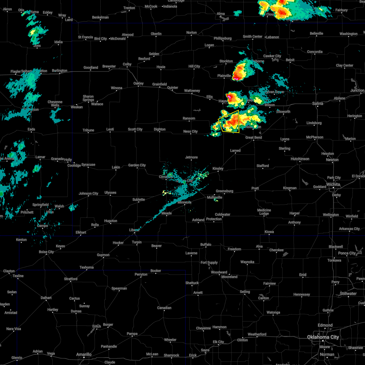 The severe thunderstorm warning for northeastern rush and southeastern ellis counties will expire at 645 pm cdt, the storm which prompted the warning has weakened below severe limits, and no longer poses an immediate threat to life or property. therefore, the warning will be allowed to expire. however small hail up to penny sized is still possible with this thunderstorm. a severe thunderstorm watch remains in effect until 900 pm cdt for central kansas. The severe thunderstorm warning for northeastern rush and southeastern ellis counties will expire at 645 pm cdt, the storm which prompted the warning has weakened below severe limits, and no longer poses an immediate threat to life or property. therefore, the warning will be allowed to expire. however small hail up to penny sized is still possible with this thunderstorm. a severe thunderstorm watch remains in effect until 900 pm cdt for central kansas.
|
| 5/8/2021 6:21 PM CDT |
 At 620 pm cdt, a severe thunderstorm was located near la crosse, moving east at 25 mph (trained weather spotters reported quarter sized hail 3 miles east of hargrave at 6:15 pm). Hazards include quarter size hail. Damage to vehicles is expected. Locations impacted include, bison, loretta, pfeifer and otis. At 620 pm cdt, a severe thunderstorm was located near la crosse, moving east at 25 mph (trained weather spotters reported quarter sized hail 3 miles east of hargrave at 6:15 pm). Hazards include quarter size hail. Damage to vehicles is expected. Locations impacted include, bison, loretta, pfeifer and otis.
|
| 5/8/2021 6:06 PM CDT |
 At 606 pm cdt, a severe thunderstorm was located near hargrave, moving east at 25 mph (radar indicated). Hazards include quarter size hail. Damage to vehicles is expected. this severe thunderstorm will be near, la crosse and liebenthal around 620 pm cdt. Other locations in the path of this severe thunderstorm include bison, timken, loretta and otis. At 606 pm cdt, a severe thunderstorm was located near hargrave, moving east at 25 mph (radar indicated). Hazards include quarter size hail. Damage to vehicles is expected. this severe thunderstorm will be near, la crosse and liebenthal around 620 pm cdt. Other locations in the path of this severe thunderstorm include bison, timken, loretta and otis.
|
| 5/2/2021 10:19 PM CDT |
 At 1019 pm cdt, severe thunderstorms were located along a line extending from near walker to near gray, moving southeast at 35 mph (radar indicated). Hazards include 60 mph wind gusts and penny size hail. expect damage to roofs, siding, and trees At 1019 pm cdt, severe thunderstorms were located along a line extending from near walker to near gray, moving southeast at 35 mph (radar indicated). Hazards include 60 mph wind gusts and penny size hail. expect damage to roofs, siding, and trees
|
| 5/2/2021 10:00 PM CDT |
 At 1000 pm cdt, severe thunderstorms were located along a line extending from catherine to near bazine, moving east at 45 mph (radar indicated). Hazards include 60 mph wind gusts and nickel size hail. Expect damage to roofs, siding, and trees. Locations impacted include, hays, ellis, ness city, la crosse, victoria, walker, bazine, catherine, ransom, schoenchen, mccracken, ogallah, liebenthal, alexander, brownell, emmeram, yocemento, nekoma, hargrave and riga. At 1000 pm cdt, severe thunderstorms were located along a line extending from catherine to near bazine, moving east at 45 mph (radar indicated). Hazards include 60 mph wind gusts and nickel size hail. Expect damage to roofs, siding, and trees. Locations impacted include, hays, ellis, ness city, la crosse, victoria, walker, bazine, catherine, ransom, schoenchen, mccracken, ogallah, liebenthal, alexander, brownell, emmeram, yocemento, nekoma, hargrave and riga.
|
| 5/2/2021 9:42 PM CDT |
 At 942 pm cdt, severe thunderstorms were located along a line extending from near ellis to near arnold, moving southeast at 45 mph (radar indicated). Hazards include 60 mph wind gusts and nickel size hail. expect damage to roofs, siding, and trees At 942 pm cdt, severe thunderstorms were located along a line extending from near ellis to near arnold, moving southeast at 45 mph (radar indicated). Hazards include 60 mph wind gusts and nickel size hail. expect damage to roofs, siding, and trees
|
| 8/14/2020 10:54 PM CDT |
 At 1054 pm cdt, a severe thunderstorm was located 7 miles southwest of antonino, moving south at 10 mph (radar indicated). Hazards include 60 mph wind gusts and quarter size hail. Hail damage to vehicles is expected. expect wind damage to roofs, siding, and trees. Locations impacted include, schoenchen, liebenthal, loretta and antonino. At 1054 pm cdt, a severe thunderstorm was located 7 miles southwest of antonino, moving south at 10 mph (radar indicated). Hazards include 60 mph wind gusts and quarter size hail. Hail damage to vehicles is expected. expect wind damage to roofs, siding, and trees. Locations impacted include, schoenchen, liebenthal, loretta and antonino.
|
| 8/14/2020 10:37 PM CDT |
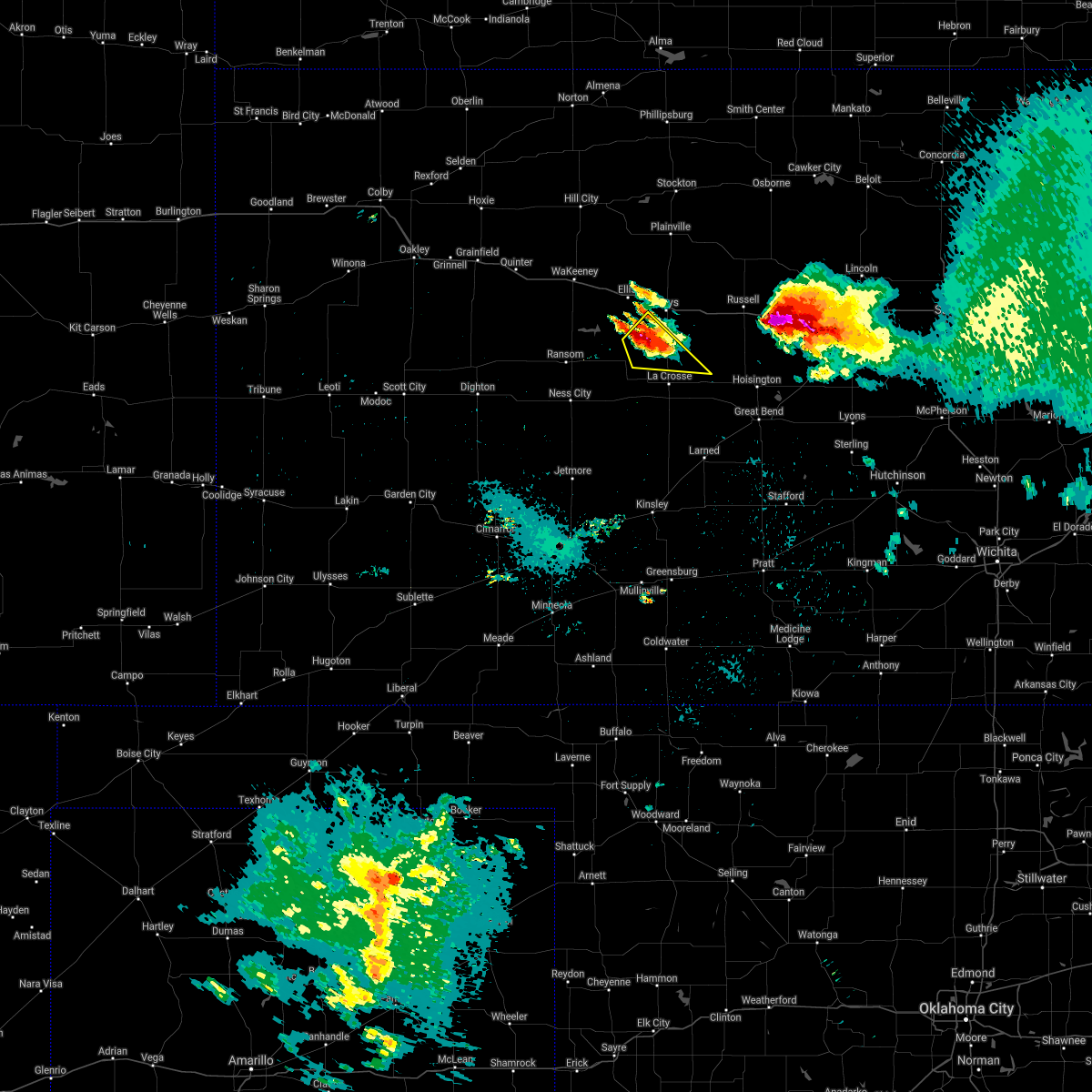 At 1037 pm cdt, a severe thunderstorm was located near antonino, moving southeast at 20 mph (radar indicated). Hazards include 60 mph wind gusts and quarter size hail. Hail damage to vehicles is expected. Expect wind damage to roofs, siding, and trees. At 1037 pm cdt, a severe thunderstorm was located near antonino, moving southeast at 20 mph (radar indicated). Hazards include 60 mph wind gusts and quarter size hail. Hail damage to vehicles is expected. Expect wind damage to roofs, siding, and trees.
|
| 8/10/2020 6:06 PM CDT |
 At 606 pm cdt, a severe thunderstorm was located 7 miles north of mccracken, moving north at 20 mph (radar indicated). Hazards include golf ball size hail and 70 mph wind gusts. People and animals outdoors will be injured. expect hail damage to roofs, siding, windows, and vehicles. expect considerable tree damage. Wind damage is also likely to mobile homes, roofs, and outbuildings. At 606 pm cdt, a severe thunderstorm was located 7 miles north of mccracken, moving north at 20 mph (radar indicated). Hazards include golf ball size hail and 70 mph wind gusts. People and animals outdoors will be injured. expect hail damage to roofs, siding, windows, and vehicles. expect considerable tree damage. Wind damage is also likely to mobile homes, roofs, and outbuildings.
|
| 8/10/2020 5:43 PM CDT | Golf Ball sized hail reported 5.5 miles E of Liebenthal, KS |
| 8/10/2020 5:43 PM CDT | Shingles blown of in rush county KS, 5.5 miles E of Liebenthal, KS |
| 8/10/2020 5:37 PM CDT |
 At 537 pm cdt, a severe thunderstorm was located near hargrave, moving north at 10 mph (radar indicated). Hazards include golf ball size hail and 60 mph wind gusts. People and animals outdoors will be injured. expect hail damage to roofs, siding, windows, and vehicles. Expect wind damage to roofs, siding, and trees. At 537 pm cdt, a severe thunderstorm was located near hargrave, moving north at 10 mph (radar indicated). Hazards include golf ball size hail and 60 mph wind gusts. People and animals outdoors will be injured. expect hail damage to roofs, siding, windows, and vehicles. Expect wind damage to roofs, siding, and trees.
|
| 8/10/2020 5:25 PM CDT |
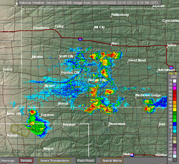 At 525 pm cdt, a severe thunderstorm was located near hargrave, moving northeast at 5 mph (radar indicated). Hazards include golf ball size hail and 60 mph wind gusts. People and animals outdoors will be injured. expect hail damage to roofs, siding, windows, and vehicles. Expect wind damage to roofs, siding, and trees. At 525 pm cdt, a severe thunderstorm was located near hargrave, moving northeast at 5 mph (radar indicated). Hazards include golf ball size hail and 60 mph wind gusts. People and animals outdoors will be injured. expect hail damage to roofs, siding, windows, and vehicles. Expect wind damage to roofs, siding, and trees.
|
| 6/21/2020 4:47 PM CDT |
 At 447 pm cdt, a severe thunderstorm was located near milberger, or 8 miles east of pfeifer, moving southeast at 20 mph (radar indicated). Hazards include golf ball size hail and 60 mph wind gusts. People and animals outdoors will be injured. expect hail damage to roofs, siding, windows, and vehicles. expect wind damage to roofs, siding, and trees. Locations impacted include, la crosse, otis, bison, schoenchen, rush center, liebenthal, timken, alexander, loretta, nekoma, hargrave, pfeifer, shaffer and antonino. At 447 pm cdt, a severe thunderstorm was located near milberger, or 8 miles east of pfeifer, moving southeast at 20 mph (radar indicated). Hazards include golf ball size hail and 60 mph wind gusts. People and animals outdoors will be injured. expect hail damage to roofs, siding, windows, and vehicles. expect wind damage to roofs, siding, and trees. Locations impacted include, la crosse, otis, bison, schoenchen, rush center, liebenthal, timken, alexander, loretta, nekoma, hargrave, pfeifer, shaffer and antonino.
|
| 6/21/2020 4:24 PM CDT |
 At 424 pm cdt, a severe thunderstorm was located near pfeifer, and is nearly stationary (radar indicated). Hazards include golf ball size hail and 60 mph wind gusts. People and animals outdoors will be injured. expect hail damage to roofs, siding, windows, and vehicles. expect wind damage to roofs, siding, and trees. Locations impacted include, hays, ellis, la crosse, victoria, walker, catherine, otis, bison, schoenchen, rush center, liebenthal, timken, alexander, yocemento, munjor, loretta, nekoma, hargrave, pfeifer and toulon. At 424 pm cdt, a severe thunderstorm was located near pfeifer, and is nearly stationary (radar indicated). Hazards include golf ball size hail and 60 mph wind gusts. People and animals outdoors will be injured. expect hail damage to roofs, siding, windows, and vehicles. expect wind damage to roofs, siding, and trees. Locations impacted include, hays, ellis, la crosse, victoria, walker, catherine, otis, bison, schoenchen, rush center, liebenthal, timken, alexander, yocemento, munjor, loretta, nekoma, hargrave, pfeifer and toulon.
|
| 6/21/2020 4:09 PM CDT |
 At 408 pm cdt, a severe thunderstorm was located near pfeifer, moving southeast at 20 mph (radar indicated). Hazards include 60 mph wind gusts and half dollar size hail. Hail damage to vehicles is expected. Expect wind damage to roofs, siding, and trees. At 408 pm cdt, a severe thunderstorm was located near pfeifer, moving southeast at 20 mph (radar indicated). Hazards include 60 mph wind gusts and half dollar size hail. Hail damage to vehicles is expected. Expect wind damage to roofs, siding, and trees.
|
| 9/21/2019 8:10 PM CDT |
 The severe thunderstorm warning for northern rush and southern ellis counties will expire at 815 pm cdt, the storms which prompted the warning have weakened below severe limits, and no longer pose an immediate threat to life or property. therefore, the warning will be allowed to expire. however gusty winds are still possible with these thunderstorms. a severe thunderstorm watch remains in effect until midnight cdt for central and west central kansas. The severe thunderstorm warning for northern rush and southern ellis counties will expire at 815 pm cdt, the storms which prompted the warning have weakened below severe limits, and no longer pose an immediate threat to life or property. therefore, the warning will be allowed to expire. however gusty winds are still possible with these thunderstorms. a severe thunderstorm watch remains in effect until midnight cdt for central and west central kansas.
|
| 9/21/2019 7:50 PM CDT |
 At 748 pm cdt, severe thunderstorms were located along a line extending from near victoria to mccracken, moving east at 20 mph. reports of 60 mph winds and blowing dust were reported from storm spotters near la crosse at 743 pm cdt. the public also reported a wind gust of 62 mph near schoenchen at 730 pm cdt (trained spotter). Hazards include 70 mph wind gusts and quarter size hail. Hail damage to vehicles is expected. expect considerable tree damage. wind damage is also likely to mobile homes, roofs, and outbuildings. Locations impacted include, hays, victoria, walker, schoenchen, mccracken, liebenthal, loretta, hargrave, pfeifer, toulon, munjor and antonino. At 748 pm cdt, severe thunderstorms were located along a line extending from near victoria to mccracken, moving east at 20 mph. reports of 60 mph winds and blowing dust were reported from storm spotters near la crosse at 743 pm cdt. the public also reported a wind gust of 62 mph near schoenchen at 730 pm cdt (trained spotter). Hazards include 70 mph wind gusts and quarter size hail. Hail damage to vehicles is expected. expect considerable tree damage. wind damage is also likely to mobile homes, roofs, and outbuildings. Locations impacted include, hays, victoria, walker, schoenchen, mccracken, liebenthal, loretta, hargrave, pfeifer, toulon, munjor and antonino.
|
| 9/21/2019 7:25 PM CDT |
 At 724 pm cdt, severe thunderstorms were located along a line extending from near victoria to near mccracken, moving east at 25 mph (radar indicated). Hazards include 60 mph wind gusts and quarter size hail. Hail damage to vehicles is expected. Expect wind damage to roofs, siding, and trees. At 724 pm cdt, severe thunderstorms were located along a line extending from near victoria to near mccracken, moving east at 25 mph (radar indicated). Hazards include 60 mph wind gusts and quarter size hail. Hail damage to vehicles is expected. Expect wind damage to roofs, siding, and trees.
|
| 9/21/2019 6:59 PM CDT |
 At 659 pm cdt, a severe thunderstorm was located near schoenchen, moving northeast at 30 mph (radar indicated). Hazards include 60 mph wind gusts and quarter size hail. Hail damage to vehicles is expected. expect wind damage to roofs, siding, and trees. Locations impacted include, hays, victoria, walker, schoenchen, mccracken, liebenthal, loretta, pfeifer, toulon, munjor and antonino. At 659 pm cdt, a severe thunderstorm was located near schoenchen, moving northeast at 30 mph (radar indicated). Hazards include 60 mph wind gusts and quarter size hail. Hail damage to vehicles is expected. expect wind damage to roofs, siding, and trees. Locations impacted include, hays, victoria, walker, schoenchen, mccracken, liebenthal, loretta, pfeifer, toulon, munjor and antonino.
|
| 9/21/2019 6:39 PM CDT |
 At 638 pm cdt, a severe thunderstorm was located very near mccracken, moving east at 20 mph (radar indicated). Hazards include 60 mph wind gusts and quarter size hail. Hail damage to vehicles is expected. Expect wind damage to roofs, siding, and trees. At 638 pm cdt, a severe thunderstorm was located very near mccracken, moving east at 20 mph (radar indicated). Hazards include 60 mph wind gusts and quarter size hail. Hail damage to vehicles is expected. Expect wind damage to roofs, siding, and trees.
|
| 8/29/2019 10:25 PM CDT |
 At 1024 pm cdt, a severe thunderstorm was located near liebenthal, moving southeast at 40 mph (radar indicated). Hazards include 60 mph wind gusts and quarter size hail. Hail damage to vehicles is expected. expect wind damage to roofs, siding, and trees. Locations impacted include, victoria, otis, schoenchen, liebenthal, loretta, pfeifer, munjor, antonino and toulon. At 1024 pm cdt, a severe thunderstorm was located near liebenthal, moving southeast at 40 mph (radar indicated). Hazards include 60 mph wind gusts and quarter size hail. Hail damage to vehicles is expected. expect wind damage to roofs, siding, and trees. Locations impacted include, victoria, otis, schoenchen, liebenthal, loretta, pfeifer, munjor, antonino and toulon.
|
| 8/29/2019 10:17 PM CDT |
 At 1017 pm cdt, a severe thunderstorm was located near pfeifer, moving southeast at 40 mph (radar indicated). Hazards include 70 mph wind gusts and quarter size hail. Hail damage to vehicles is expected. expect considerable tree damage. wind damage is also likely to mobile homes, roofs, and outbuildings. Locations impacted include, hays, victoria, walker, catherine, otis, schoenchen, liebenthal, emmeram, munjor, loretta, pfeifer, toulon and antonino. At 1017 pm cdt, a severe thunderstorm was located near pfeifer, moving southeast at 40 mph (radar indicated). Hazards include 70 mph wind gusts and quarter size hail. Hail damage to vehicles is expected. expect considerable tree damage. wind damage is also likely to mobile homes, roofs, and outbuildings. Locations impacted include, hays, victoria, walker, catherine, otis, schoenchen, liebenthal, emmeram, munjor, loretta, pfeifer, toulon and antonino.
|
| 8/29/2019 10:06 PM CDT |
 At 1005 pm cdt, a severe thunderstorm was located very near munjor, moving southeast at 40 mph (radar indicated). Hazards include 70 mph wind gusts and quarter size hail. Hail damage to vehicles is expected. expect considerable tree damage. Wind damage is also likely to mobile homes, roofs, and outbuildings. At 1005 pm cdt, a severe thunderstorm was located very near munjor, moving southeast at 40 mph (radar indicated). Hazards include 70 mph wind gusts and quarter size hail. Hail damage to vehicles is expected. expect considerable tree damage. Wind damage is also likely to mobile homes, roofs, and outbuildings.
|
| 8/29/2019 9:50 PM CDT |
 At 949 pm cdt, severe thunderstorms were located along a line extending from near emmeram to near ransom, moving southeast at 15 mph (automated weather equipment. hays regional airport measured a wind gust of 73 mph at 9:46 pm cdt. these storms have a history of producing wind damage). Hazards include 70 mph wind gusts and quarter size hail. Hail damage to vehicles is expected. expect considerable tree damage. wind damage is also likely to mobile homes, roofs, and outbuildings. Locations impacted include, hays, ellis, victoria, walker, catherine, schoenchen, mccracken, ogallah, liebenthal, brownell, emmeram, trego center, yocemento, cedar bluff, munjor, loretta, hargrave, riga, pfeifer and toulon. At 949 pm cdt, severe thunderstorms were located along a line extending from near emmeram to near ransom, moving southeast at 15 mph (automated weather equipment. hays regional airport measured a wind gust of 73 mph at 9:46 pm cdt. these storms have a history of producing wind damage). Hazards include 70 mph wind gusts and quarter size hail. Hail damage to vehicles is expected. expect considerable tree damage. wind damage is also likely to mobile homes, roofs, and outbuildings. Locations impacted include, hays, ellis, victoria, walker, catherine, schoenchen, mccracken, ogallah, liebenthal, brownell, emmeram, trego center, yocemento, cedar bluff, munjor, loretta, hargrave, riga, pfeifer and toulon.
|
| 8/29/2019 9:35 PM CDT |
 At 934 pm cdt, severe thunderstorms were located along a line extending from near emmeram to near arnold, moving southeast at 25 mph (radar indicated). Hazards include 70 mph wind gusts and quarter size hail. Hail damage to vehicles is expected. expect considerable tree damage. wind damage is also likely to mobile homes, roofs, and outbuildings. Locations impacted include, hays, ellis, victoria, walker, catherine, ransom, schoenchen, mccracken, ogallah, liebenthal, brownell, emmeram, trego center, yocemento, cedar bluff, munjor, arnold, loretta, hargrave and riga. At 934 pm cdt, severe thunderstorms were located along a line extending from near emmeram to near arnold, moving southeast at 25 mph (radar indicated). Hazards include 70 mph wind gusts and quarter size hail. Hail damage to vehicles is expected. expect considerable tree damage. wind damage is also likely to mobile homes, roofs, and outbuildings. Locations impacted include, hays, ellis, victoria, walker, catherine, ransom, schoenchen, mccracken, ogallah, liebenthal, brownell, emmeram, trego center, yocemento, cedar bluff, munjor, arnold, loretta, hargrave and riga.
|
| 8/29/2019 9:25 PM CDT |
 At 923 pm cdt, doppler radar indicated a line of severe thunderstorms located along a line extending from 6 miles north of catherine to near utica, moving southeast at 25 mph. these are very dangerous storms (radar indicated). Hazards include 80 mph wind gusts and quarter size hail. Flying debris will be dangerous to those caught without shelter. mobile homes will be heavily damaged. expect considerable damage to roofs, windows, and vehicles. extensive tree damage and power outages are likely. Locations impacted include, hays, ellis, victoria, walker, catherine, ransom, schoenchen, mccracken, ogallah, liebenthal, brownell, emmeram, trego center, yocemento, cedar bluff, munjor, arnold, loretta, hargrave and riga. At 923 pm cdt, doppler radar indicated a line of severe thunderstorms located along a line extending from 6 miles north of catherine to near utica, moving southeast at 25 mph. these are very dangerous storms (radar indicated). Hazards include 80 mph wind gusts and quarter size hail. Flying debris will be dangerous to those caught without shelter. mobile homes will be heavily damaged. expect considerable damage to roofs, windows, and vehicles. extensive tree damage and power outages are likely. Locations impacted include, hays, ellis, victoria, walker, catherine, ransom, schoenchen, mccracken, ogallah, liebenthal, brownell, emmeram, trego center, yocemento, cedar bluff, munjor, arnold, loretta, hargrave and riga.
|
| 8/29/2019 9:07 PM CDT |
 At 906 pm cdt, severe thunderstorms were located along a line extending from 7 miles southwest of codell to 8 miles north of utica, moving southeast at 35 mph. these are very dangerous storms (automated weather equipment and trained spotters. these storms have a history of producing wind damage). Hazards include 80 mph wind gusts and half dollar size hail. Flying debris will be dangerous to those caught without shelter. mobile homes will be heavily damaged. expect considerable damage to roofs, windows, and vehicles. Extensive tree damage and power outages are likely. At 906 pm cdt, severe thunderstorms were located along a line extending from 7 miles southwest of codell to 8 miles north of utica, moving southeast at 35 mph. these are very dangerous storms (automated weather equipment and trained spotters. these storms have a history of producing wind damage). Hazards include 80 mph wind gusts and half dollar size hail. Flying debris will be dangerous to those caught without shelter. mobile homes will be heavily damaged. expect considerable damage to roofs, windows, and vehicles. Extensive tree damage and power outages are likely.
|
| 8/25/2019 12:34 AM CDT |
 At 1233 am cdt, a severe thunderstorm was located near la crosse, moving southeast at 30 mph (radar indicated). Hazards include 60 mph wind gusts and half dollar size hail. Hail damage to vehicles is expected. expect wind damage to roofs, siding, and trees. Locations impacted include, la crosse, otis, bison, mccracken, rush center, liebenthal, timken, loretta, nekoma, hargrave, shaffer and pfeifer. At 1233 am cdt, a severe thunderstorm was located near la crosse, moving southeast at 30 mph (radar indicated). Hazards include 60 mph wind gusts and half dollar size hail. Hail damage to vehicles is expected. expect wind damage to roofs, siding, and trees. Locations impacted include, la crosse, otis, bison, mccracken, rush center, liebenthal, timken, loretta, nekoma, hargrave, shaffer and pfeifer.
|
| 8/25/2019 12:18 AM CDT |
 At 1216 am cdt, severe thunderstorms were located along a line extending from near hoisington to near albert to near timken, moving southeast at 40 mph. another severe thunderstorm was developing just north of mccracken (radar indicated). Hazards include golf ball size hail and 60 mph wind gusts. People and animals outdoors will be injured. expect hail damage to roofs, siding, windows, and vehicles. expect wind damage to roofs, siding, and trees. Locations impacted include, la crosse, walker, otis, bison, schoenchen, mccracken, rush center, liebenthal, timken, ash valley, loretta, nekoma, hargrave, pfeifer and shaffer. At 1216 am cdt, severe thunderstorms were located along a line extending from near hoisington to near albert to near timken, moving southeast at 40 mph. another severe thunderstorm was developing just north of mccracken (radar indicated). Hazards include golf ball size hail and 60 mph wind gusts. People and animals outdoors will be injured. expect hail damage to roofs, siding, windows, and vehicles. expect wind damage to roofs, siding, and trees. Locations impacted include, la crosse, walker, otis, bison, schoenchen, mccracken, rush center, liebenthal, timken, ash valley, loretta, nekoma, hargrave, pfeifer and shaffer.
|
| 8/24/2019 11:38 PM CDT |
 At 1138 pm cdt, severe thunderstorms were located along a line extending from near gorham to near liebenthal to near brownell, moving southeast at 30 mph (radar indicated). Hazards include 70 mph wind gusts and half dollar size hail. Hail damage to vehicles is expected. expect considerable tree damage. Wind damage is also likely to mobile homes, roofs, and outbuildings. At 1138 pm cdt, severe thunderstorms were located along a line extending from near gorham to near liebenthal to near brownell, moving southeast at 30 mph (radar indicated). Hazards include 70 mph wind gusts and half dollar size hail. Hail damage to vehicles is expected. expect considerable tree damage. Wind damage is also likely to mobile homes, roofs, and outbuildings.
|
| 8/24/2019 11:01 PM CDT |
 At 1100 pm cdt, severe thunderstorms were located along a line extending from 10 miles east of natoma to near trego center, moving southeast at 25 mph (radar indicated). Hazards include 60 mph wind gusts and half dollar size hail. Hail damage to vehicles is expected. Expect wind damage to roofs, siding, and trees. At 1100 pm cdt, severe thunderstorms were located along a line extending from 10 miles east of natoma to near trego center, moving southeast at 25 mph (radar indicated). Hazards include 60 mph wind gusts and half dollar size hail. Hail damage to vehicles is expected. Expect wind damage to roofs, siding, and trees.
|
| 8/18/2019 3:43 AM CDT |
 At 343 am cdt, severe thunderstorms were located along a line extending from near gorham to near schoenchen, moving southeast at 20 mph (radar indicated). Hazards include 60 mph wind gusts and penny size hail. expect damage to roofs, siding, and trees At 343 am cdt, severe thunderstorms were located along a line extending from near gorham to near schoenchen, moving southeast at 20 mph (radar indicated). Hazards include 60 mph wind gusts and penny size hail. expect damage to roofs, siding, and trees
|
| 8/18/2019 12:54 AM CDT |
 A severe thunderstorm warning remains in effect until 115 am cdt for northern rush and southern ellis counties. at 1253 am cdt, severe thunderstorms were located along a line extending from near gorham to near victoria to near liebenthal, moving east at 20 mph. hazard. 60 mph wind gusts and quarter size hail. A severe thunderstorm warning remains in effect until 115 am cdt for northern rush and southern ellis counties. at 1253 am cdt, severe thunderstorms were located along a line extending from near gorham to near victoria to near liebenthal, moving east at 20 mph. hazard. 60 mph wind gusts and quarter size hail.
|
| 8/18/2019 12:36 AM CDT |
 At 1235 am cdt, severe thunderstorms were located along a line extending from near gorham to near munjor to near mccracken, moving east at 30 mph (public). Hazards include 70 mph wind gusts and half dollar size hail. Hail damage to vehicles is expected. expect considerable tree damage. wind damage is also likely to mobile homes, roofs, and outbuildings. Locations impacted include, hays, victoria, walker, catherine, schoenchen, liebenthal, emmeram, cedar bluff, munjor, loretta, pfeifer, toulon and antonino. At 1235 am cdt, severe thunderstorms were located along a line extending from near gorham to near munjor to near mccracken, moving east at 30 mph (public). Hazards include 70 mph wind gusts and half dollar size hail. Hail damage to vehicles is expected. expect considerable tree damage. wind damage is also likely to mobile homes, roofs, and outbuildings. Locations impacted include, hays, victoria, walker, catherine, schoenchen, liebenthal, emmeram, cedar bluff, munjor, loretta, pfeifer, toulon and antonino.
|
| 8/18/2019 12:08 AM CDT |
 The national weather service in dodge city has issued a * severe thunderstorm warning for. northeastern ness county in west central kansas. southeastern trego county in west central kansas. northern rush county in central kansas. Ellis county in central kansas. The national weather service in dodge city has issued a * severe thunderstorm warning for. northeastern ness county in west central kansas. southeastern trego county in west central kansas. northern rush county in central kansas. Ellis county in central kansas.
|
| 8/13/2019 8:48 PM CDT |
 At 848 pm cdt, severe thunderstorms were located along a line extending from 6 miles north of olmitz to near radium to near macksville, moving southeast at 40 mph (radar indicated). Hazards include 70 mph wind gusts and quarter size hail. Hail damage to vehicles is expected. expect considerable tree damage. wind damage is also likely to mobile homes, roofs, and outbuildings. locations impacted include, larned, kinsley, la crosse, st. John, macksville, lewis, otis, bison, garfield, rush center, rozel, liebenthal, belpre, timken, seward, ash valley, radium, sanford, loretta and frizell. At 848 pm cdt, severe thunderstorms were located along a line extending from 6 miles north of olmitz to near radium to near macksville, moving southeast at 40 mph (radar indicated). Hazards include 70 mph wind gusts and quarter size hail. Hail damage to vehicles is expected. expect considerable tree damage. wind damage is also likely to mobile homes, roofs, and outbuildings. locations impacted include, larned, kinsley, la crosse, st. John, macksville, lewis, otis, bison, garfield, rush center, rozel, liebenthal, belpre, timken, seward, ash valley, radium, sanford, loretta and frizell.
|
| 8/13/2019 8:13 PM CDT |
 At 813 pm cdt, severe thunderstorms were located along a line extending from near munjor to near garfield, moving east at 25 mph (radar indicated). Hazards include 70 mph wind gusts and quarter size hail. Hail damage to vehicles is expected. expect considerable tree damage. Wind damage is also likely to mobile homes, roofs, and outbuildings. At 813 pm cdt, severe thunderstorms were located along a line extending from near munjor to near garfield, moving east at 25 mph (radar indicated). Hazards include 70 mph wind gusts and quarter size hail. Hail damage to vehicles is expected. expect considerable tree damage. Wind damage is also likely to mobile homes, roofs, and outbuildings.
|
| 8/13/2019 7:23 PM CDT |
 At 722 pm cdt, severe thunderstorms were located along a line extending from 10 miles south of zurich to near mccracken to 6 miles southwest of ness city, moving southeast at 40 mph (radar indicated). Hazards include 70 mph wind gusts and ping pong ball size hail. People and animals outdoors will be injured. expect hail damage to roofs, siding, windows, and vehicles. expect considerable tree damage. wind damage is also likely to mobile homes, roofs, and outbuildings. locations impacted include, hays, ellis, ness city, la crosse, victoria, walker, bazine, catherine, ransom, schoenchen, mccracken, rush center, liebenthal, alexander, brownell, emmeram, yocemento, nekoma, hargrave and riga. At 655 pm cdt, a 72 mph wind gust was measured 1 mile south of wakeeney. At 722 pm cdt, severe thunderstorms were located along a line extending from 10 miles south of zurich to near mccracken to 6 miles southwest of ness city, moving southeast at 40 mph (radar indicated). Hazards include 70 mph wind gusts and ping pong ball size hail. People and animals outdoors will be injured. expect hail damage to roofs, siding, windows, and vehicles. expect considerable tree damage. wind damage is also likely to mobile homes, roofs, and outbuildings. locations impacted include, hays, ellis, ness city, la crosse, victoria, walker, bazine, catherine, ransom, schoenchen, mccracken, rush center, liebenthal, alexander, brownell, emmeram, yocemento, nekoma, hargrave and riga. At 655 pm cdt, a 72 mph wind gust was measured 1 mile south of wakeeney.
|
| 8/13/2019 7:00 PM CDT |
 At 659 pm cdt, severe thunderstorms were located along a line extending from 8 miles south of palco to near cedar bluff to near utica, moving southeast at 40 mph (radar indicated). Hazards include 70 mph wind gusts and ping pong ball size hail. People and animals outdoors will be injured. expect hail damage to roofs, siding, windows, and vehicles. expect considerable tree damage. Wind damage is also likely to mobile homes, roofs, and outbuildings. At 659 pm cdt, severe thunderstorms were located along a line extending from 8 miles south of palco to near cedar bluff to near utica, moving southeast at 40 mph (radar indicated). Hazards include 70 mph wind gusts and ping pong ball size hail. People and animals outdoors will be injured. expect hail damage to roofs, siding, windows, and vehicles. expect considerable tree damage. Wind damage is also likely to mobile homes, roofs, and outbuildings.
|
| 7/5/2019 6:36 PM CDT |
 At 620 pm cdt, a severe thunderstorm was located 7 miles north of mccracken, moving south at 10 mph (radar indicated). Hazards include ping pong ball size hail and 60 mph wind gusts. People and animals outdoors will be injured. expect hail damage to roofs, siding, windows, and vehicles. Expect wind damage to roofs, siding, and trees. At 620 pm cdt, a severe thunderstorm was located 7 miles north of mccracken, moving south at 10 mph (radar indicated). Hazards include ping pong ball size hail and 60 mph wind gusts. People and animals outdoors will be injured. expect hail damage to roofs, siding, windows, and vehicles. Expect wind damage to roofs, siding, and trees.
|
| 7/5/2019 6:20 PM CDT |
 At 620 pm cdt, a severe thunderstorm was located 7 miles north of mccracken, moving south at 10 mph (radar indicated). Hazards include ping pong ball size hail and 60 mph wind gusts. People and animals outdoors will be injured. expect hail damage to roofs, siding, windows, and vehicles. Expect wind damage to roofs, siding, and trees. At 620 pm cdt, a severe thunderstorm was located 7 miles north of mccracken, moving south at 10 mph (radar indicated). Hazards include ping pong ball size hail and 60 mph wind gusts. People and animals outdoors will be injured. expect hail damage to roofs, siding, windows, and vehicles. Expect wind damage to roofs, siding, and trees.
|
| 6/9/2019 2:05 AM CDT |
 The severe thunderstorm warning for rush and southeastern ellis counties will expire at 215 am cdt, the storms which prompted the warning have moved out of the area. therefore, the warning will be allowed to expire. however gusty winds and heavy rain are still possible with these thunderstorms. a severe thunderstorm watch remains in effect until 300 am cdt for central kansas. The severe thunderstorm warning for rush and southeastern ellis counties will expire at 215 am cdt, the storms which prompted the warning have moved out of the area. therefore, the warning will be allowed to expire. however gusty winds and heavy rain are still possible with these thunderstorms. a severe thunderstorm watch remains in effect until 300 am cdt for central kansas.
|
| 6/9/2019 1:39 AM CDT |
 At 138 am cdt, severe thunderstorms were located along a line extending from near emmeram to near loretta to 7 miles south of nekoma, moving east at 50 mph (radar indicated). Hazards include 70 mph wind gusts and nickel size hail. Expect considerable tree damage. Damage is likely to mobile homes, roofs, and outbuildings. At 138 am cdt, severe thunderstorms were located along a line extending from near emmeram to near loretta to 7 miles south of nekoma, moving east at 50 mph (radar indicated). Hazards include 70 mph wind gusts and nickel size hail. Expect considerable tree damage. Damage is likely to mobile homes, roofs, and outbuildings.
|
| 6/9/2019 1:30 AM CDT |
 At 130 am cdt, severe thunderstorms were located along a line extending from near catherine to near la crosse to 6 miles south of bazine, moving southeast at 55 mph (radar indicated). Hazards include 70 mph wind gusts and nickel size hail. Expect considerable tree damage. damage is likely to mobile homes, roofs, and outbuildings. Locations impacted include, hays, ness city, la crosse, victoria, walker, bazine, catherine, otis, bison, schoenchen, mccracken, rush center, liebenthal, timken, alexander, emmeram, yocemento, nekoma, hargrave and pfeifer. At 130 am cdt, severe thunderstorms were located along a line extending from near catherine to near la crosse to 6 miles south of bazine, moving southeast at 55 mph (radar indicated). Hazards include 70 mph wind gusts and nickel size hail. Expect considerable tree damage. damage is likely to mobile homes, roofs, and outbuildings. Locations impacted include, hays, ness city, la crosse, victoria, walker, bazine, catherine, otis, bison, schoenchen, mccracken, rush center, liebenthal, timken, alexander, emmeram, yocemento, nekoma, hargrave and pfeifer.
|
| 6/9/2019 1:17 AM CDT |
 At 117 am cdt, severe thunderstorms were located along a line extending from 6 miles northwest of catherine to near mccracken to near ness city, moving southeast at 40 mph (radar indicated). Hazards include 60 mph wind gusts and nickel size hail. Expect damage to roofs, siding, and trees. Locations impacted include, hays, ness city, la crosse, victoria, walker, bazine, catherine, otis, bison, schoenchen, mccracken, rush center, liebenthal, timken, alexander, brownell, emmeram, yocemento, nekoma and hargrave. At 117 am cdt, severe thunderstorms were located along a line extending from 6 miles northwest of catherine to near mccracken to near ness city, moving southeast at 40 mph (radar indicated). Hazards include 60 mph wind gusts and nickel size hail. Expect damage to roofs, siding, and trees. Locations impacted include, hays, ness city, la crosse, victoria, walker, bazine, catherine, otis, bison, schoenchen, mccracken, rush center, liebenthal, timken, alexander, brownell, emmeram, yocemento, nekoma and hargrave.
|
| 6/9/2019 12:51 AM CDT |
 At 1251 am cdt, severe thunderstorms were located along a line extending from 9 miles south of zurich to near beeler, moving southeast at 45 mph (radar indicated). Hazards include 60 mph wind gusts and nickel size hail. expect damage to roofs, siding, and trees At 1251 am cdt, severe thunderstorms were located along a line extending from 9 miles south of zurich to near beeler, moving southeast at 45 mph (radar indicated). Hazards include 60 mph wind gusts and nickel size hail. expect damage to roofs, siding, and trees
|
| 5/27/2019 12:06 AM CDT |
 The severe thunderstorm warning for east central trego, central rush and southwestern ellis counties will expire at 1215 am cdt, the storms which prompted the warning have weakened below severe limits, and no longer pose an immediate threat to life or property. therefore, the warning will be allowed to expire. however gusty winds are still possible with these thunderstorms. a severe thunderstorm watch remains in effect until 200 am cdt for central, south central and west central kansas. remember, a severe thunderstorm warning still remains in effect for eastern ellis and eastern rush county until 1245 am. The severe thunderstorm warning for east central trego, central rush and southwestern ellis counties will expire at 1215 am cdt, the storms which prompted the warning have weakened below severe limits, and no longer pose an immediate threat to life or property. therefore, the warning will be allowed to expire. however gusty winds are still possible with these thunderstorms. a severe thunderstorm watch remains in effect until 200 am cdt for central, south central and west central kansas. remember, a severe thunderstorm warning still remains in effect for eastern ellis and eastern rush county until 1245 am.
|
| 5/27/2019 12:02 AM CDT |
 At 1202 am cdt, severe thunderstorms were located along a line extending from near trego center to 8 miles north of mccracken to near ash valley, moving east at 45 mph (radar indicated). Hazards include 60 mph wind gusts and nickel size hail. Expect damage to roofs, siding, and trees. Locations impacted include, ellis, la crosse, bison, schoenchen, ogallah, rush center, liebenthal, timken, nekoma, hargrave, riga and antonino. At 1202 am cdt, severe thunderstorms were located along a line extending from near trego center to 8 miles north of mccracken to near ash valley, moving east at 45 mph (radar indicated). Hazards include 60 mph wind gusts and nickel size hail. Expect damage to roofs, siding, and trees. Locations impacted include, ellis, la crosse, bison, schoenchen, ogallah, rush center, liebenthal, timken, nekoma, hargrave, riga and antonino.
|
| 5/27/2019 12:00 AM CDT |
 At 1159 pm cdt, severe thunderstorms were located along a line extending from near ellis to 7 miles northwest of pawnee rock, moving northeast at 40 mph (radar indicated). Hazards include 60 mph wind gusts and penny size hail. expect damage to roofs, siding, and trees At 1159 pm cdt, severe thunderstorms were located along a line extending from near ellis to 7 miles northwest of pawnee rock, moving northeast at 40 mph (radar indicated). Hazards include 60 mph wind gusts and penny size hail. expect damage to roofs, siding, and trees
|
| 5/26/2019 11:35 PM CDT |
 At 1135 pm cdt, severe thunderstorms were located along a line extending from 8 miles north of utica to near burdett, moving northeast at 40 mph (radar indicated). Hazards include 60 mph wind gusts and nickel size hail. Expect damage to roofs, siding, and trees. Locations impacted include, ellis, ness city, la crosse, bazine, ransom, bison, schoenchen, mccracken, ogallah, rush center, liebenthal, timken, alexander, brownell, trego center, cedar bluff, arnold, nekoma, hargrave and riga. At 1135 pm cdt, severe thunderstorms were located along a line extending from 8 miles north of utica to near burdett, moving northeast at 40 mph (radar indicated). Hazards include 60 mph wind gusts and nickel size hail. Expect damage to roofs, siding, and trees. Locations impacted include, ellis, ness city, la crosse, bazine, ransom, bison, schoenchen, mccracken, ogallah, rush center, liebenthal, timken, alexander, brownell, trego center, cedar bluff, arnold, nekoma, hargrave and riga.
|
| 5/26/2019 11:21 PM CDT |
 At 1121 pm cdt, severe thunderstorms were located along a line extending from near pendennis to near jetmore, moving east at 45 mph (radar indicated). Hazards include 60 mph wind gusts and nickel size hail. expect damage to roofs, siding, and trees At 1121 pm cdt, severe thunderstorms were located along a line extending from near pendennis to near jetmore, moving east at 45 mph (radar indicated). Hazards include 60 mph wind gusts and nickel size hail. expect damage to roofs, siding, and trees
|
| 5/24/2019 1:12 AM CDT |
 At 112 am cdt, a severe thunderstorm was located near loretta, moving northeast at 40 mph (radar indicated). Hazards include ping pong ball size hail and 60 mph wind gusts. People and animals outdoors will be injured. expect hail damage to roofs, siding, windows, and vehicles. expect wind damage to roofs, siding, and trees. Locations impacted include, la crosse, bison, schoenchen, liebenthal, loretta, pfeifer and antonino. At 112 am cdt, a severe thunderstorm was located near loretta, moving northeast at 40 mph (radar indicated). Hazards include ping pong ball size hail and 60 mph wind gusts. People and animals outdoors will be injured. expect hail damage to roofs, siding, windows, and vehicles. expect wind damage to roofs, siding, and trees. Locations impacted include, la crosse, bison, schoenchen, liebenthal, loretta, pfeifer and antonino.
|
| 5/24/2019 12:58 AM CDT |
 At 1258 am cdt, a severe thunderstorm was located near la crosse, moving northeast at 30 mph (radar indicated). Hazards include 60 mph wind gusts and half dollar size hail. Hail damage to vehicles is expected. Expect wind damage to roofs, siding, and trees. At 1258 am cdt, a severe thunderstorm was located near la crosse, moving northeast at 30 mph (radar indicated). Hazards include 60 mph wind gusts and half dollar size hail. Hail damage to vehicles is expected. Expect wind damage to roofs, siding, and trees.
|
| 5/17/2019 9:33 PM CDT |
 At 932 pm cdt, a severe thunderstorm was located near alexander, moving northeast at 30 mph (radar indicated). Hazards include 60 mph wind gusts and half dollar size hail. Hail damage to vehicles is expected. expect wind damage to roofs, siding, and trees. Locations impacted include, bazine, schoenchen, mccracken, liebenthal, alexander, nekoma, hargrave and antonino. At 932 pm cdt, a severe thunderstorm was located near alexander, moving northeast at 30 mph (radar indicated). Hazards include 60 mph wind gusts and half dollar size hail. Hail damage to vehicles is expected. expect wind damage to roofs, siding, and trees. Locations impacted include, bazine, schoenchen, mccracken, liebenthal, alexander, nekoma, hargrave and antonino.
|
| 5/17/2019 9:18 PM CDT |
 At 918 pm cdt, a severe thunderstorm was located near bazine, moving northeast at 35 mph (radar indicated). Hazards include 60 mph wind gusts and half dollar size hail. Hail damage to vehicles is expected. expect wind damage to roofs, siding, and trees. Locations impacted include, ness city, bazine, schoenchen, mccracken, liebenthal, alexander, brownell, nekoma, cedar bluff, hargrave and antonino. At 918 pm cdt, a severe thunderstorm was located near bazine, moving northeast at 35 mph (radar indicated). Hazards include 60 mph wind gusts and half dollar size hail. Hail damage to vehicles is expected. expect wind damage to roofs, siding, and trees. Locations impacted include, ness city, bazine, schoenchen, mccracken, liebenthal, alexander, brownell, nekoma, cedar bluff, hargrave and antonino.
|
| 5/17/2019 9:07 PM CDT |
 At 906 pm cdt, a severe thunderstorm was located 11 miles south of ness city, moving northeast at 35 mph. this warning will replace the previous tornado warning for hodgeman and ness counties (radar indicated). Hazards include golf ball size hail and 60 mph wind gusts. People and animals outdoors will be injured. expect hail damage to roofs, siding, windows, and vehicles. Expect wind damage to roofs, siding, and trees. At 906 pm cdt, a severe thunderstorm was located 11 miles south of ness city, moving northeast at 35 mph. this warning will replace the previous tornado warning for hodgeman and ness counties (radar indicated). Hazards include golf ball size hail and 60 mph wind gusts. People and animals outdoors will be injured. expect hail damage to roofs, siding, windows, and vehicles. Expect wind damage to roofs, siding, and trees.
|
| 5/5/2019 7:10 PM CDT |
 The severe thunderstorm warning for northeastern rush and southeastern ellis counties will expire at 715 pm cdt, the storm which prompted the warning has weakened below severe limits, and no longer poses an immediate threat to life or property. therefore, the warning will be allowed to expire. however gusty winds and heavy rain are still possible with this thunderstorm. a severe thunderstorm watch remains in effect until 1100 pm cdt for central kansas. The severe thunderstorm warning for northeastern rush and southeastern ellis counties will expire at 715 pm cdt, the storm which prompted the warning has weakened below severe limits, and no longer poses an immediate threat to life or property. therefore, the warning will be allowed to expire. however gusty winds and heavy rain are still possible with this thunderstorm. a severe thunderstorm watch remains in effect until 1100 pm cdt for central kansas.
|
| 5/5/2019 6:54 PM CDT |
 At 654 pm cdt, a severe thunderstorm was located near otis, moving northeast at 25 mph (radar indicated). Hazards include golf ball size hail and 60 mph wind gusts. People and animals outdoors will be injured. expect hail damage to roofs, siding, windows, and vehicles. expect wind damage to roofs, siding, and trees. Locations impacted include, la crosse, bison, schoenchen, liebenthal, timken, loretta and pfeifer. At 654 pm cdt, a severe thunderstorm was located near otis, moving northeast at 25 mph (radar indicated). Hazards include golf ball size hail and 60 mph wind gusts. People and animals outdoors will be injured. expect hail damage to roofs, siding, windows, and vehicles. expect wind damage to roofs, siding, and trees. Locations impacted include, la crosse, bison, schoenchen, liebenthal, timken, loretta and pfeifer.
|
| 5/5/2019 6:38 PM CDT |
 At 638 pm cdt, a severe thunderstorm was located near bison, moving northeast at 25 mph. another severe thunderstorm was located near hargrave, also moving northeast at 25 mph (radar indicated). Hazards include golf ball size hail and 60 mph wind gusts. People and animals outdoors will be injured. expect hail damage to roofs, siding, windows, and vehicles. expect wind damage to roofs, siding, and trees. Locations impacted include, hays, la crosse, victoria, bison, schoenchen, liebenthal, timken, munjor, loretta, hargrave, pfeifer, antonino and toulon. At 638 pm cdt, a severe thunderstorm was located near bison, moving northeast at 25 mph. another severe thunderstorm was located near hargrave, also moving northeast at 25 mph (radar indicated). Hazards include golf ball size hail and 60 mph wind gusts. People and animals outdoors will be injured. expect hail damage to roofs, siding, windows, and vehicles. expect wind damage to roofs, siding, and trees. Locations impacted include, hays, la crosse, victoria, bison, schoenchen, liebenthal, timken, munjor, loretta, hargrave, pfeifer, antonino and toulon.
|
| 5/5/2019 6:22 PM CDT |
 At 622 pm cdt, a severe thunderstorm was located very near la crosse, moving northeast at 25 mph (radar indicated). Hazards include 60 mph wind gusts and half dollar size hail. Hail damage to vehicles is expected. Expect wind damage to roofs, siding, and trees. At 622 pm cdt, a severe thunderstorm was located very near la crosse, moving northeast at 25 mph (radar indicated). Hazards include 60 mph wind gusts and half dollar size hail. Hail damage to vehicles is expected. Expect wind damage to roofs, siding, and trees.
|
| 4/29/2019 12:09 AM CDT |
 At 1208 am cdt, a severe thunderstorm was located very near nekoma, moving east at 40 mph (radar indicated). Hazards include golf ball size hail. People and animals outdoors will be injured. Expect damage to roofs, siding, windows, and vehicles. At 1208 am cdt, a severe thunderstorm was located very near nekoma, moving east at 40 mph (radar indicated). Hazards include golf ball size hail. People and animals outdoors will be injured. Expect damage to roofs, siding, windows, and vehicles.
|
| 4/28/2019 10:16 PM CDT |
 At 1016 pm cdt, severe thunderstorms were located along a line extending from near emmeram to near timken, moving east at 40 mph (radar indicated). Hazards include 60 mph wind gusts and quarter size hail. Hail damage to vehicles is expected. expect wind damage to roofs, siding, and trees. Locations impacted include, hays, la crosse, victoria, walker, catherine, otis, bison, schoenchen, rush center, liebenthal, timken, emmeram, munjor, loretta, pfeifer, toulon, shaffer and antonino. At 1016 pm cdt, severe thunderstorms were located along a line extending from near emmeram to near timken, moving east at 40 mph (radar indicated). Hazards include 60 mph wind gusts and quarter size hail. Hail damage to vehicles is expected. expect wind damage to roofs, siding, and trees. Locations impacted include, hays, la crosse, victoria, walker, catherine, otis, bison, schoenchen, rush center, liebenthal, timken, emmeram, munjor, loretta, pfeifer, toulon, shaffer and antonino.
|
| 4/28/2019 9:58 PM CDT |
 At 958 pm cdt, severe thunderstorms were located along a line extending from yocemento to near nekoma, moving east at 35 mph (radar indicated). Hazards include 60 mph wind gusts and quarter size hail. Hail damage to vehicles is expected. Expect wind damage to roofs, siding, and trees. At 958 pm cdt, severe thunderstorms were located along a line extending from yocemento to near nekoma, moving east at 35 mph (radar indicated). Hazards include 60 mph wind gusts and quarter size hail. Hail damage to vehicles is expected. Expect wind damage to roofs, siding, and trees.
|
| 4/28/2019 9:41 PM CDT |
 At 940 pm cdt, a severe thunderstorm was located near antonino, moving east at 40 mph (radar indicated). Hazards include 60 mph wind gusts and quarter size hail. Hail damage to vehicles is expected. expect wind damage to roofs, siding, and trees. Locations impacted include, hays, ellis, la crosse, schoenchen, mccracken, ogallah, liebenthal, brownell, cedar bluff, munjor, loretta, nekoma, hargrave, riga, pfeifer, antonino, toulon and yocemento. At 940 pm cdt, a severe thunderstorm was located near antonino, moving east at 40 mph (radar indicated). Hazards include 60 mph wind gusts and quarter size hail. Hail damage to vehicles is expected. expect wind damage to roofs, siding, and trees. Locations impacted include, hays, ellis, la crosse, schoenchen, mccracken, ogallah, liebenthal, brownell, cedar bluff, munjor, loretta, nekoma, hargrave, riga, pfeifer, antonino, toulon and yocemento.
|
| 4/28/2019 9:20 PM CDT |
 At 920 pm cdt, a severe thunderstorm was located very near cedar bluff, moving east at 40 mph (radar indicated). Hazards include 60 mph wind gusts and quarter size hail. Hail damage to vehicles is expected. Expect wind damage to roofs, siding, and trees. At 920 pm cdt, a severe thunderstorm was located very near cedar bluff, moving east at 40 mph (radar indicated). Hazards include 60 mph wind gusts and quarter size hail. Hail damage to vehicles is expected. Expect wind damage to roofs, siding, and trees.
|
| 4/21/2019 7:56 PM CDT |
 At 756 pm cdt, a severe thunderstorm was located near loretta, moving northeast at 45 mph (radar indicated). Hazards include 60 mph wind gusts and quarter size hail. Hail damage to vehicles is expected. expect wind damage to roofs, siding, and trees. Locations impacted include, hays, victoria, walker, catherine, otis, schoenchen, liebenthal, loretta, emmeram, pfeifer, toulon and munjor. At 756 pm cdt, a severe thunderstorm was located near loretta, moving northeast at 45 mph (radar indicated). Hazards include 60 mph wind gusts and quarter size hail. Hail damage to vehicles is expected. expect wind damage to roofs, siding, and trees. Locations impacted include, hays, victoria, walker, catherine, otis, schoenchen, liebenthal, loretta, emmeram, pfeifer, toulon and munjor.
|
| 4/21/2019 7:30 PM CDT |
 At 729 pm cdt, a severe thunderstorm was located 8 miles south of plainville, or 14 miles northwest of catherine, moving east at 45 mph (radar indicated). Hazards include 60 mph wind gusts. Expect damage to roofs, siding, and trees. Locations impacted include, hays, ellis, victoria, walker, catherine, otis, schoenchen, ogallah, liebenthal, emmeram, yocemento, munjor, loretta, riga, pfeifer, toulon and antonino. At 729 pm cdt, a severe thunderstorm was located 8 miles south of plainville, or 14 miles northwest of catherine, moving east at 45 mph (radar indicated). Hazards include 60 mph wind gusts. Expect damage to roofs, siding, and trees. Locations impacted include, hays, ellis, victoria, walker, catherine, otis, schoenchen, ogallah, liebenthal, emmeram, yocemento, munjor, loretta, riga, pfeifer, toulon and antonino.
|
| 4/21/2019 7:16 PM CDT |
 At 716 pm cdt, a severe thunderstorm was located 9 miles north of ellis, moving east at 45 mph (radar indicated). Hazards include 60 mph wind gusts and penny size hail. expect damage to roofs, siding, and trees At 716 pm cdt, a severe thunderstorm was located 9 miles north of ellis, moving east at 45 mph (radar indicated). Hazards include 60 mph wind gusts and penny size hail. expect damage to roofs, siding, and trees
|
| 10/5/2018 7:00 PM CDT |
 At 659 pm cdt, a severe thunderstorm was located near la crosse, moving east at 30 mph (radar indicated). Hazards include 60 mph wind gusts and quarter size hail. Hail damage to vehicles is expected. expect wind damage to roofs, siding, and trees. Locations impacted include, la crosse, otis, bison, rush center, liebenthal, loretta and pfeifer. At 659 pm cdt, a severe thunderstorm was located near la crosse, moving east at 30 mph (radar indicated). Hazards include 60 mph wind gusts and quarter size hail. Hail damage to vehicles is expected. expect wind damage to roofs, siding, and trees. Locations impacted include, la crosse, otis, bison, rush center, liebenthal, loretta and pfeifer.
|
| 10/5/2018 6:47 PM CDT |
 At 647 pm cdt, a severe thunderstorm was located 3 miles northeast of nekoma, moving northeast at 35 mph (radar indicated). Hazards include 60 mph wind gusts and quarter size hail. Hail damage to vehicles is expected. Expect wind damage to roofs, siding, and trees. At 647 pm cdt, a severe thunderstorm was located 3 miles northeast of nekoma, moving northeast at 35 mph (radar indicated). Hazards include 60 mph wind gusts and quarter size hail. Hail damage to vehicles is expected. Expect wind damage to roofs, siding, and trees.
|
| 7/27/2018 5:42 PM CDT |
 At 541 pm cdt, a severe thunderstorm was located 3 miles north of la crosse, moving southeast at 20 mph (radar indicated). Hazards include ping pong ball size hail and 60 mph wind gusts. People and animals outdoors will be injured. expect hail damage to roofs, siding, windows, and vehicles. Expect wind damage to roofs, siding, and trees. At 541 pm cdt, a severe thunderstorm was located 3 miles north of la crosse, moving southeast at 20 mph (radar indicated). Hazards include ping pong ball size hail and 60 mph wind gusts. People and animals outdoors will be injured. expect hail damage to roofs, siding, windows, and vehicles. Expect wind damage to roofs, siding, and trees.
|
| 7/25/2018 7:39 PM CDT |
 At 739 pm cdt, a severe thunderstorm was located 3 miles southeast of hargrave, moving southeast at 40 mph. this replaces the previous warning for rush county (radar indicated). Hazards include golf ball size hail and 70 mph wind gusts. People and animals outdoors will be injured. expect hail damage to roofs, siding, windows, and vehicles. expect considerable tree damage. Wind damage is also likely to mobile homes, roofs, and outbuildings. At 739 pm cdt, a severe thunderstorm was located 3 miles southeast of hargrave, moving southeast at 40 mph. this replaces the previous warning for rush county (radar indicated). Hazards include golf ball size hail and 70 mph wind gusts. People and animals outdoors will be injured. expect hail damage to roofs, siding, windows, and vehicles. expect considerable tree damage. Wind damage is also likely to mobile homes, roofs, and outbuildings.
|
| 7/25/2018 7:28 PM CDT |
 At 728 pm cdt, severe thunderstorms were located along a line extending from 4 miles south of walker to 2 miles southwest of loretta to 2 miles southeast of mccracken, moving southeast at 30 mph (radar indicated). Hazards include 70 mph wind gusts and half dollar size hail. Hail damage to vehicles is expected. expect considerable tree damage. wind damage is also likely to mobile homes, roofs, and outbuildings. Locations impacted include, hays, la crosse, victoria, catherine, bison, schoenchen, mccracken, liebenthal, munjor, loretta, hargrave, pfeifer, toulon and antonino. At 728 pm cdt, severe thunderstorms were located along a line extending from 4 miles south of walker to 2 miles southwest of loretta to 2 miles southeast of mccracken, moving southeast at 30 mph (radar indicated). Hazards include 70 mph wind gusts and half dollar size hail. Hail damage to vehicles is expected. expect considerable tree damage. wind damage is also likely to mobile homes, roofs, and outbuildings. Locations impacted include, hays, la crosse, victoria, catherine, bison, schoenchen, mccracken, liebenthal, munjor, loretta, hargrave, pfeifer, toulon and antonino.
|
| 7/25/2018 7:14 PM CDT |
 At 713 pm cdt, severe thunderstorms were located along a line extending from 3 miles south of emmeram to 3 miles east of schoenchen to 3 miles northwest of mccracken, moving southeast at 40 mph. these are very dangerous storms (radar indicated). Hazards include 80 mph wind gusts and ping pong ball size hail. Flying debris will be dangerous to those caught without shelter. mobile homes will be heavily damaged. expect considerable damage to roofs, windows, and vehicles. extensive tree damage and power outages are likely. Locations impacted include, hays, la crosse, victoria, walker, catherine, bison, schoenchen, mccracken, liebenthal, emmeram, munjor, loretta, hargrave, pfeifer, toulon and antonino. At 713 pm cdt, severe thunderstorms were located along a line extending from 3 miles south of emmeram to 3 miles east of schoenchen to 3 miles northwest of mccracken, moving southeast at 40 mph. these are very dangerous storms (radar indicated). Hazards include 80 mph wind gusts and ping pong ball size hail. Flying debris will be dangerous to those caught without shelter. mobile homes will be heavily damaged. expect considerable damage to roofs, windows, and vehicles. extensive tree damage and power outages are likely. Locations impacted include, hays, la crosse, victoria, walker, catherine, bison, schoenchen, mccracken, liebenthal, emmeram, munjor, loretta, hargrave, pfeifer, toulon and antonino.
|
| 7/25/2018 6:54 PM CDT |
 At 653 pm cdt, severe thunderstorms were located along a line extending from 8 miles south of codell to 2 miles southeast of yocemento to near cedar bluff, moving southeast at 40 mph. this replaces the previous warning for ellis county. these are very dangerous storms (radar indicated). Hazards include 80 mph wind gusts and two inch hail. Flying debris will be dangerous to those caught without shelter. mobile homes will be heavily damaged. expect considerable damage to roofs, windows, and vehicles. Extensive tree damage and power outages are likely. At 653 pm cdt, severe thunderstorms were located along a line extending from 8 miles south of codell to 2 miles southeast of yocemento to near cedar bluff, moving southeast at 40 mph. this replaces the previous warning for ellis county. these are very dangerous storms (radar indicated). Hazards include 80 mph wind gusts and two inch hail. Flying debris will be dangerous to those caught without shelter. mobile homes will be heavily damaged. expect considerable damage to roofs, windows, and vehicles. Extensive tree damage and power outages are likely.
|
| 7/20/2018 11:43 PM CDT |
 At 1142 pm cdt, a severe thunderstorm was located very near nekoma, moving east at 30 mph (radar indicated). Hazards include quarter size hail. Damage to vehicles is expected. Locations impacted include, la crosse, mccracken, rush center, liebenthal, alexander, nekoma and hargrave. At 1142 pm cdt, a severe thunderstorm was located very near nekoma, moving east at 30 mph (radar indicated). Hazards include quarter size hail. Damage to vehicles is expected. Locations impacted include, la crosse, mccracken, rush center, liebenthal, alexander, nekoma and hargrave.
|
| 7/20/2018 11:15 PM CDT |
 At 1114 pm cdt, a severe thunderstorm was located 6 miles southwest of bazine, moving east at 25 mph (radar indicated). Hazards include 60 mph wind gusts and half dollar size hail. Hail damage to vehicles is expected. Expect wind damage to roofs, siding, and trees. At 1114 pm cdt, a severe thunderstorm was located 6 miles southwest of bazine, moving east at 25 mph (radar indicated). Hazards include 60 mph wind gusts and half dollar size hail. Hail damage to vehicles is expected. Expect wind damage to roofs, siding, and trees.
|
| 6/26/2018 8:55 AM CDT |
 At 855 am cdt, a severe thunderstorm was located very near liebenthal, moving east at 30 mph (radar indicated). Hazards include 60 mph wind gusts and quarter size hail. Hail damage to vehicles is expected. Expect wind damage to roofs, siding, and trees. At 855 am cdt, a severe thunderstorm was located very near liebenthal, moving east at 30 mph (radar indicated). Hazards include 60 mph wind gusts and quarter size hail. Hail damage to vehicles is expected. Expect wind damage to roofs, siding, and trees.
|
| 6/24/2018 8:33 PM CDT |
 At 832 pm cdt, severe thunderstorms were located along a line extending from 7 miles southwest of zurich to 4 miles northeast of brownell, moving east at 45 mph (radar indicated). Hazards include 60 mph wind gusts and penny size hail. Expect damage to roofs, siding, and trees. Locations impacted include, hays, ellis, wakeeney, victoria, walker, catherine, otis, bison, schoenchen, ogallah, collyer, liebenthal, brownell, emmeram, trego center, yocemento, cedar bluff, munjor, loretta and riga. At 832 pm cdt, severe thunderstorms were located along a line extending from 7 miles southwest of zurich to 4 miles northeast of brownell, moving east at 45 mph (radar indicated). Hazards include 60 mph wind gusts and penny size hail. Expect damage to roofs, siding, and trees. Locations impacted include, hays, ellis, wakeeney, victoria, walker, catherine, otis, bison, schoenchen, ogallah, collyer, liebenthal, brownell, emmeram, trego center, yocemento, cedar bluff, munjor, loretta and riga.
|
| 6/24/2018 8:04 PM CDT |
 At 804 pm cdt, severe thunderstorms were located along a line extending from 5 miles northeast of voda to 3 miles northeast of utica, moving east at 55 mph (radar indicated). Hazards include 60 mph wind gusts and penny size hail. expect damage to roofs, siding, and trees At 804 pm cdt, severe thunderstorms were located along a line extending from 5 miles northeast of voda to 3 miles northeast of utica, moving east at 55 mph (radar indicated). Hazards include 60 mph wind gusts and penny size hail. expect damage to roofs, siding, and trees
|
| 6/19/2018 10:55 PM CDT |
 At 1054 pm cdt, severe thunderstorms were located along a line extending from 3 miles west of codell to near ash valley, moving east at 55 mph (radar indicated). Hazards include 70 mph wind gusts and penny size hail. Expect considerable tree damage. Damage is likely to mobile homes, roofs, and outbuildings. At 1054 pm cdt, severe thunderstorms were located along a line extending from 3 miles west of codell to near ash valley, moving east at 55 mph (radar indicated). Hazards include 70 mph wind gusts and penny size hail. Expect considerable tree damage. Damage is likely to mobile homes, roofs, and outbuildings.
|
| 6/19/2018 10:29 PM CDT |
 At 1028 pm cdt, severe thunderstorms were located along a line extending from 6 miles south of palco to 6 miles south of brownell, moving northeast at 45 mph (radar indicated). Hazards include 70 mph wind gusts and penny size hail. Expect considerable tree damage. Damage is likely to mobile homes, roofs, and outbuildings. At 1028 pm cdt, severe thunderstorms were located along a line extending from 6 miles south of palco to 6 miles south of brownell, moving northeast at 45 mph (radar indicated). Hazards include 70 mph wind gusts and penny size hail. Expect considerable tree damage. Damage is likely to mobile homes, roofs, and outbuildings.
|
| 6/19/2018 10:19 PM CDT |
 At 957 pm cdt, severe thunderstorms were located along a line extending from 11 miles north of wakeeney to 4 miles north of ness city, moving east at 60 mph (radar indicated). Hazards include 70 mph wind gusts and penny size hail. Expect considerable tree damage. damage is likely to mobile homes, roofs, and outbuildings. Locations impacted include, hays, ellis, wakeeney, la crosse, victoria, walker, catherine, ransom, otis, bison, schoenchen, mccracken, ogallah, utica, collyer, liebenthal, timken, brownell, emmeram and yocemento. At 957 pm cdt, severe thunderstorms were located along a line extending from 11 miles north of wakeeney to 4 miles north of ness city, moving east at 60 mph (radar indicated). Hazards include 70 mph wind gusts and penny size hail. Expect considerable tree damage. damage is likely to mobile homes, roofs, and outbuildings. Locations impacted include, hays, ellis, wakeeney, la crosse, victoria, walker, catherine, ransom, otis, bison, schoenchen, mccracken, ogallah, utica, collyer, liebenthal, timken, brownell, emmeram and yocemento.
|
| 6/19/2018 9:57 PM CDT |
 At 957 pm cdt, severe thunderstorms were located along a line extending from 11 miles north of wakeeney to 4 miles north of ness city, moving east at 60 mph (radar indicated). Hazards include 70 mph wind gusts and penny size hail. Expect considerable tree damage. damage is likely to mobile homes, roofs, and outbuildings. Locations impacted include, hays, ellis, wakeeney, la crosse, victoria, walker, catherine, ransom, otis, bison, schoenchen, mccracken, ogallah, utica, collyer, liebenthal, timken, brownell, emmeram and yocemento. At 957 pm cdt, severe thunderstorms were located along a line extending from 11 miles north of wakeeney to 4 miles north of ness city, moving east at 60 mph (radar indicated). Hazards include 70 mph wind gusts and penny size hail. Expect considerable tree damage. damage is likely to mobile homes, roofs, and outbuildings. Locations impacted include, hays, ellis, wakeeney, la crosse, victoria, walker, catherine, ransom, otis, bison, schoenchen, mccracken, ogallah, utica, collyer, liebenthal, timken, brownell, emmeram and yocemento.
|
| 6/19/2018 9:37 PM CDT |
 At 936 pm cdt, severe thunderstorms were located along a line extending from 6 miles northeast of quinter to 5 miles north of alamota, moving east at 50 mph (radar indicated). Hazards include 70 mph wind gusts and penny size hail. Expect considerable tree damage. Damage is likely to mobile homes, roofs, and outbuildings. At 936 pm cdt, severe thunderstorms were located along a line extending from 6 miles northeast of quinter to 5 miles north of alamota, moving east at 50 mph (radar indicated). Hazards include 70 mph wind gusts and penny size hail. Expect considerable tree damage. Damage is likely to mobile homes, roofs, and outbuildings.
|
| 6/7/2018 2:53 AM CDT |
 At 253 am cdt, severe thunderstorms were located along a line extending from 4 miles north of cedar bluff to 9 miles south of bazine, moving east at 15 mph (radar indicated). Hazards include 70 mph wind gusts and quarter size hail. Hail damage to vehicles is expected. expect considerable tree damage. wind damage is also likely to mobile homes, roofs, and outbuildings. Locations impacted include, hays, ellis, wakeeney, ness city, la crosse, bazine, catherine, ransom, bison, schoenchen, mccracken, ogallah, rush center, liebenthal, timken, alexander, brownell, yocemento, nekoma and hargrave. At 253 am cdt, severe thunderstorms were located along a line extending from 4 miles north of cedar bluff to 9 miles south of bazine, moving east at 15 mph (radar indicated). Hazards include 70 mph wind gusts and quarter size hail. Hail damage to vehicles is expected. expect considerable tree damage. wind damage is also likely to mobile homes, roofs, and outbuildings. Locations impacted include, hays, ellis, wakeeney, ness city, la crosse, bazine, catherine, ransom, bison, schoenchen, mccracken, ogallah, rush center, liebenthal, timken, alexander, brownell, yocemento, nekoma and hargrave.
|
| 6/7/2018 2:24 AM CDT |
 At 224 am cdt, severe thunderstorms were located along a line extending from 4 miles southeast of trego center to 12 miles south of ness city, moving east at 10 mph (radar indicated). Hazards include 70 mph wind gusts and quarter size hail. Hail damage to vehicles is expected. expect considerable tree damage. Wind damage is also likely to mobile homes, roofs, and outbuildings. At 224 am cdt, severe thunderstorms were located along a line extending from 4 miles southeast of trego center to 12 miles south of ness city, moving east at 10 mph (radar indicated). Hazards include 70 mph wind gusts and quarter size hail. Hail damage to vehicles is expected. expect considerable tree damage. Wind damage is also likely to mobile homes, roofs, and outbuildings.
|
| 5/28/2018 8:50 PM CDT |
 At 850 pm cdt, severe thunderstorms were located along a line extending from 3 miles south of ellis to 6 miles northwest of burdett, moving east at 40 mph (radar indicated). Hazards include 60 mph wind gusts and quarter size hail. Hail damage to vehicles is expected. Expect wind damage to roofs, siding, and trees. At 850 pm cdt, severe thunderstorms were located along a line extending from 3 miles south of ellis to 6 miles northwest of burdett, moving east at 40 mph (radar indicated). Hazards include 60 mph wind gusts and quarter size hail. Hail damage to vehicles is expected. Expect wind damage to roofs, siding, and trees.
|
| 5/28/2018 8:23 PM CDT |
 The severe thunderstorm warning for northeastern finney, ness, northern hodgeman, southern trego, northwestern pawnee, lane, rush and southwestern ellis counties will expire at 830 pm cdt, the storms which prompted the warning have moved out of the area. therefore the warning will be allowed to expire. however small hail, gusty winds and heavy rain are still possible with these thunderstorms. a tornado watch remains in effect until 1000 pm cdt for central and west central kansas. a severe thunderstorm watch remains in effect until 1000 pm cdt for south central and southwestern kansas. The severe thunderstorm warning for northeastern finney, ness, northern hodgeman, southern trego, northwestern pawnee, lane, rush and southwestern ellis counties will expire at 830 pm cdt, the storms which prompted the warning have moved out of the area. therefore the warning will be allowed to expire. however small hail, gusty winds and heavy rain are still possible with these thunderstorms. a tornado watch remains in effect until 1000 pm cdt for central and west central kansas. a severe thunderstorm watch remains in effect until 1000 pm cdt for south central and southwestern kansas.
|
| 5/28/2018 8:12 PM CDT |
 At 812 pm cdt, a severe thunderstorm was located 3 miles north of cedar bluff, moving east at 30 mph (radar indicated). Hazards include 60 mph wind gusts and quarter size hail. Hail damage to vehicles is expected. Expect wind damage to roofs, siding, and trees. At 812 pm cdt, a severe thunderstorm was located 3 miles north of cedar bluff, moving east at 30 mph (radar indicated). Hazards include 60 mph wind gusts and quarter size hail. Hail damage to vehicles is expected. Expect wind damage to roofs, siding, and trees.
|
| 5/28/2018 7:47 PM CDT |
 At 747 pm cdt, severe thunderstorms were located along a line extending from 2 miles northwest of cedar bluff to 14 miles south of dighton, moving east at 50 mph (radar indicated). Hazards include 70 mph wind gusts and quarter size hail. Hail damage to vehicles is expected. expect considerable tree damage. wind damage is also likely to mobile homes, roofs, and outbuildings. locations impacted include, ness city, la crosse, dighton, bazine, ransom, schoenchen, mccracken, rush center, utica, liebenthal, alamota, alexander, brownell, cedar bluff, beeler, pendennis, amy, arnold, nekoma and hargrave. A tornado watch remains in effect until 1000 pm cdt for central and west central kansas. At 747 pm cdt, severe thunderstorms were located along a line extending from 2 miles northwest of cedar bluff to 14 miles south of dighton, moving east at 50 mph (radar indicated). Hazards include 70 mph wind gusts and quarter size hail. Hail damage to vehicles is expected. expect considerable tree damage. wind damage is also likely to mobile homes, roofs, and outbuildings. locations impacted include, ness city, la crosse, dighton, bazine, ransom, schoenchen, mccracken, rush center, utica, liebenthal, alamota, alexander, brownell, cedar bluff, beeler, pendennis, amy, arnold, nekoma and hargrave. A tornado watch remains in effect until 1000 pm cdt for central and west central kansas.
|
| 5/28/2018 7:37 PM CDT |
 At 736 pm cdt, severe thunderstorms were located along a line extending from 5 miles southwest of trego center to 14 miles south of amy, moving east at 50 mph (radar indicated). Hazards include 60 mph wind gusts and quarter size hail. Hail damage to vehicles is expected. Expect wind damage to roofs, siding, and trees. At 736 pm cdt, severe thunderstorms were located along a line extending from 5 miles southwest of trego center to 14 miles south of amy, moving east at 50 mph (radar indicated). Hazards include 60 mph wind gusts and quarter size hail. Hail damage to vehicles is expected. Expect wind damage to roofs, siding, and trees.
|
| 5/13/2018 10:29 PM CDT |
 At 1029 pm cdt, a severe thunderstorm was located southwest of antonio, moving northeast at 35 mph. this warning will replace the expiring warning (radar indicated). Hazards include two inch hail and 60 mph wind gusts. People and animals outdoors will be injured. expect hail damage to roofs, siding, windows, and vehicles. Expect wind damage to roofs, siding, and trees. At 1029 pm cdt, a severe thunderstorm was located southwest of antonio, moving northeast at 35 mph. this warning will replace the expiring warning (radar indicated). Hazards include two inch hail and 60 mph wind gusts. People and animals outdoors will be injured. expect hail damage to roofs, siding, windows, and vehicles. Expect wind damage to roofs, siding, and trees.
|
| 5/13/2018 10:16 PM CDT |
 At 1015 pm cdt, line of severe thunderstorms has formed along a cedar bluff, schoenchen, pfeifer line moving northeast at 35 mph (radar indicated). Hazards include two inch hail and 70 mph wind gusts. People and animals outdoors will be injured. expect hail damage to roofs, siding, windows, and vehicles. expect considerable tree damage. wind damage is also likely to mobile homes, roofs, and outbuildings. Locations impacted include, hays, ellis, victoria, walker, catherine, schoenchen, liebenthal, emmeram, yocemento, cedar bluff, munjor, loretta, riga, pfeifer, toulon and antonino. At 1015 pm cdt, line of severe thunderstorms has formed along a cedar bluff, schoenchen, pfeifer line moving northeast at 35 mph (radar indicated). Hazards include two inch hail and 70 mph wind gusts. People and animals outdoors will be injured. expect hail damage to roofs, siding, windows, and vehicles. expect considerable tree damage. wind damage is also likely to mobile homes, roofs, and outbuildings. Locations impacted include, hays, ellis, victoria, walker, catherine, schoenchen, liebenthal, emmeram, yocemento, cedar bluff, munjor, loretta, riga, pfeifer, toulon and antonino.
|
| 5/13/2018 10:00 PM CDT |
 At 940 pm cdt, a severe thunderstorm was located 7 miles west of antonino, moving northeast at 35 mph. this warning replaces the expiring warning (radar indicated). Hazards include two inch hail and 70 mph wind gusts. People and animals outdoors will be injured. expect hail damage to roofs, siding, windows, and vehicles. expect considerable tree damage. Wind damage is also likely to mobile homes, roofs, and outbuildings. At 940 pm cdt, a severe thunderstorm was located 7 miles west of antonino, moving northeast at 35 mph. this warning replaces the expiring warning (radar indicated). Hazards include two inch hail and 70 mph wind gusts. People and animals outdoors will be injured. expect hail damage to roofs, siding, windows, and vehicles. expect considerable tree damage. Wind damage is also likely to mobile homes, roofs, and outbuildings.
|
| 5/13/2018 9:42 PM CDT |
 At 940 pm cdt, a severe thunderstorm was located 7 miles west of antonino, moving northeast at 35 mph. this warning replaces the expiring warning (radar indicated). Hazards include two inch hail and 70 mph wind gusts. People and animals outdoors will be injured. expect hail damage to roofs, siding, windows, and vehicles. expect considerable tree damage. Wind damage is also likely to mobile homes, roofs, and outbuildings. At 940 pm cdt, a severe thunderstorm was located 7 miles west of antonino, moving northeast at 35 mph. this warning replaces the expiring warning (radar indicated). Hazards include two inch hail and 70 mph wind gusts. People and animals outdoors will be injured. expect hail damage to roofs, siding, windows, and vehicles. expect considerable tree damage. Wind damage is also likely to mobile homes, roofs, and outbuildings.
|
| 5/13/2018 9:28 PM CDT |
 At 928 pm cdt, a severe thunderstorm was located 3 miles south of ellis, moving north at 35 mph (radar indicated). Hazards include two inch hail and 70 mph wind gusts. People and animals outdoors will be injured. expect hail damage to roofs, siding, windows, and vehicles. expect considerable tree damage. wind damage is also likely to mobile homes, roofs, and outbuildings. Locations impacted include, hays, ellis, victoria, walker, catherine, schoenchen, mccracken, liebenthal, brownell, emmeram, yocemento, cedar bluff, munjor, loretta, riga, pfeifer, toulon and antonino. At 928 pm cdt, a severe thunderstorm was located 3 miles south of ellis, moving north at 35 mph (radar indicated). Hazards include two inch hail and 70 mph wind gusts. People and animals outdoors will be injured. expect hail damage to roofs, siding, windows, and vehicles. expect considerable tree damage. wind damage is also likely to mobile homes, roofs, and outbuildings. Locations impacted include, hays, ellis, victoria, walker, catherine, schoenchen, mccracken, liebenthal, brownell, emmeram, yocemento, cedar bluff, munjor, loretta, riga, pfeifer, toulon and antonino.
|
| 5/13/2018 8:59 PM CDT |
 At 859 pm cdt, a severe thunderstorm was located 5 miles east of brownell, moving north at 35 mph. this replaces the expiring warning (radar indicated). Hazards include two inch hail and 70 mph wind gusts. People and animals outdoors will be injured. expect hail damage to roofs, siding, windows, and vehicles. expect considerable tree damage. Wind damage is also likely to mobile homes, roofs, and outbuildings. At 859 pm cdt, a severe thunderstorm was located 5 miles east of brownell, moving north at 35 mph. this replaces the expiring warning (radar indicated). Hazards include two inch hail and 70 mph wind gusts. People and animals outdoors will be injured. expect hail damage to roofs, siding, windows, and vehicles. expect considerable tree damage. Wind damage is also likely to mobile homes, roofs, and outbuildings.
|
| 5/13/2018 8:32 PM CDT |
 At 832 pm cdt, a severe thunderstorm was located 5 miles west of schoenchen, moving northeast at 35 mph (radar indicated). Hazards include two inch hail and 70 mph wind gusts. People and animals outdoors will be injured. expect hail damage to roofs, siding, windows, and vehicles. expect considerable tree damage. wind damage is also likely to mobile homes, roofs, and outbuildings. Locations impacted include, hays, ellis, la crosse, victoria, walker, catherine, schoenchen, mccracken, liebenthal, brownell, yocemento, cedar bluff, munjor, loretta, hargrave, riga, pfeifer, toulon and antonino. At 832 pm cdt, a severe thunderstorm was located 5 miles west of schoenchen, moving northeast at 35 mph (radar indicated). Hazards include two inch hail and 70 mph wind gusts. People and animals outdoors will be injured. expect hail damage to roofs, siding, windows, and vehicles. expect considerable tree damage. wind damage is also likely to mobile homes, roofs, and outbuildings. Locations impacted include, hays, ellis, la crosse, victoria, walker, catherine, schoenchen, mccracken, liebenthal, brownell, yocemento, cedar bluff, munjor, loretta, hargrave, riga, pfeifer, toulon and antonino.
|
| 5/13/2018 8:19 PM CDT |
 At 818 pm cdt, a severe thunderstorm was located near mccracken, moving northeast at 35 mph (radar indicated). Hazards include tennis ball size hail and 70 mph wind gusts. People and animals outdoors will be injured. expect hail damage to roofs, siding, windows, and vehicles. expect considerable tree damage. wind damage is also likely to mobile homes, roofs, and outbuildings. Locations impacted include, hays, ellis, la crosse, victoria, walker, catherine, schoenchen, mccracken, liebenthal, alexander, brownell, yocemento, cedar bluff, munjor, loretta, nekoma, hargrave, riga, pfeifer and toulon. At 818 pm cdt, a severe thunderstorm was located near mccracken, moving northeast at 35 mph (radar indicated). Hazards include tennis ball size hail and 70 mph wind gusts. People and animals outdoors will be injured. expect hail damage to roofs, siding, windows, and vehicles. expect considerable tree damage. wind damage is also likely to mobile homes, roofs, and outbuildings. Locations impacted include, hays, ellis, la crosse, victoria, walker, catherine, schoenchen, mccracken, liebenthal, alexander, brownell, yocemento, cedar bluff, munjor, loretta, nekoma, hargrave, riga, pfeifer and toulon.
|
| 5/13/2018 8:11 PM CDT |
 The severe thunderstorm warning for northeastern ness, southeastern trego, northwestern rush and southwestern ellis counties will expire at 815 pm cdt, the severe thunderstorm which prompted the warning has expanded out of the warning. a new warning has been issued. therefore, this warning will be allowed to expire. however large hail and gusty winds are still possible with this thunderstorm. a severe thunderstorm watch remains in effect until 1100 pm cdt for central and west central kansas. The severe thunderstorm warning for northeastern ness, southeastern trego, northwestern rush and southwestern ellis counties will expire at 815 pm cdt, the severe thunderstorm which prompted the warning has expanded out of the warning. a new warning has been issued. therefore, this warning will be allowed to expire. however large hail and gusty winds are still possible with this thunderstorm. a severe thunderstorm watch remains in effect until 1100 pm cdt for central and west central kansas.
|
| 5/13/2018 8:09 PM CDT |
 At 809 pm cdt, a severe thunderstorm was located near mccracken, moving northeast at 35 mph. this warning replaces the two previous warnings (radar indicated). Hazards include tennis ball size hail and 70 mph wind gusts. People and animals outdoors will be injured. expect hail damage to roofs, siding, windows, and vehicles. expect considerable tree damage. Wind damage is also likely to mobile homes, roofs, and outbuildings. At 809 pm cdt, a severe thunderstorm was located near mccracken, moving northeast at 35 mph. this warning replaces the two previous warnings (radar indicated). Hazards include tennis ball size hail and 70 mph wind gusts. People and animals outdoors will be injured. expect hail damage to roofs, siding, windows, and vehicles. expect considerable tree damage. Wind damage is also likely to mobile homes, roofs, and outbuildings.
|
| 5/13/2018 8:04 PM CDT |
 At 803 pm cdt, a severe thunderstorm was located 7 miles northeast of mccracken, moving northeast at 25 mph (radar indicated). Hazards include tennis ball size hail and 70 mph wind gusts. People and animals outdoors will be injured. expect hail damage to roofs, siding, windows, and vehicles. expect considerable tree damage. wind damage is also likely to mobile homes, roofs, and outbuildings. Locations impacted include, la crosse, bazine, schoenchen, mccracken, liebenthal, alexander, loretta, nekoma and hargrave. At 803 pm cdt, a severe thunderstorm was located 7 miles northeast of mccracken, moving northeast at 25 mph (radar indicated). Hazards include tennis ball size hail and 70 mph wind gusts. People and animals outdoors will be injured. expect hail damage to roofs, siding, windows, and vehicles. expect considerable tree damage. wind damage is also likely to mobile homes, roofs, and outbuildings. Locations impacted include, la crosse, bazine, schoenchen, mccracken, liebenthal, alexander, loretta, nekoma and hargrave.
|
| 5/13/2018 7:48 PM CDT |
 At 747 pm cdt, a severe thunderstorm was located very near mccracken, moving northeast at 25 mph (radar indicated). Hazards include tennis ball size hail and 70 mph wind gusts. People and animals outdoors will be injured. expect hail damage to roofs, siding, windows, and vehicles. expect considerable tree damage. wind damage is also likely to mobile homes, roofs, and outbuildings. Locations impacted include, la crosse, bazine, schoenchen, mccracken, liebenthal, alexander, loretta, nekoma and hargrave. At 747 pm cdt, a severe thunderstorm was located very near mccracken, moving northeast at 25 mph (radar indicated). Hazards include tennis ball size hail and 70 mph wind gusts. People and animals outdoors will be injured. expect hail damage to roofs, siding, windows, and vehicles. expect considerable tree damage. wind damage is also likely to mobile homes, roofs, and outbuildings. Locations impacted include, la crosse, bazine, schoenchen, mccracken, liebenthal, alexander, loretta, nekoma and hargrave.
|
| 5/13/2018 7:21 PM CDT |
 At 721 pm cdt, a severe thunderstorm was located 3 miles east of bazine, moving northeast at 25 mph (radar indicated). Hazards include two inch hail and 70 mph wind gusts. People and animals outdoors will be injured. expect hail damage to roofs, siding, windows, and vehicles. expect considerable tree damage. Wind damage is also likely to mobile homes, roofs, and outbuildings. At 721 pm cdt, a severe thunderstorm was located 3 miles east of bazine, moving northeast at 25 mph (radar indicated). Hazards include two inch hail and 70 mph wind gusts. People and animals outdoors will be injured. expect hail damage to roofs, siding, windows, and vehicles. expect considerable tree damage. Wind damage is also likely to mobile homes, roofs, and outbuildings.
|
| 8/10/2017 4:04 PM CDT |
 At 404 pm cdt, a severe thunderstorm was located 3 miles southwest of loretta, or 7 miles northeast of la crosse, moving southeast at 35 mph (radar indicated). Hazards include 60 mph wind gusts and quarter size hail. Hail damage to vehicles is expected. Expect wind damage to roofs, siding, and trees. At 404 pm cdt, a severe thunderstorm was located 3 miles southwest of loretta, or 7 miles northeast of la crosse, moving southeast at 35 mph (radar indicated). Hazards include 60 mph wind gusts and quarter size hail. Hail damage to vehicles is expected. Expect wind damage to roofs, siding, and trees.
|
| 8/10/2017 3:57 PM CDT |
 The severe thunderstorm warning for north central rush and southern ellis counties will expire at 400 pm cdt, the severe thunderstorm which prompted the warning has weakened below severe limits. therefore, the warning will be allowed to expire. a severe thunderstorm watch remains in effect until 900 pm cdt for central kansas. The severe thunderstorm warning for north central rush and southern ellis counties will expire at 400 pm cdt, the severe thunderstorm which prompted the warning has weakened below severe limits. therefore, the warning will be allowed to expire. a severe thunderstorm watch remains in effect until 900 pm cdt for central kansas.
|
| 8/10/2017 3:38 PM CDT |
 At 338 pm cdt, a severe thunderstorm was located near antonino, or 10 miles south of hays, moving southeast at 25 mph (radar indicated). Hazards include 60 mph wind gusts and quarter size hail. Hail damage to vehicles is expected. expect wind damage to roofs, siding, and trees. Locations impacted include, hays, victoria, catherine, schoenchen, liebenthal, munjor, antonino, yocemento, toulon and hays regional airport. At 338 pm cdt, a severe thunderstorm was located near antonino, or 10 miles south of hays, moving southeast at 25 mph (radar indicated). Hazards include 60 mph wind gusts and quarter size hail. Hail damage to vehicles is expected. expect wind damage to roofs, siding, and trees. Locations impacted include, hays, victoria, catherine, schoenchen, liebenthal, munjor, antonino, yocemento, toulon and hays regional airport.
|
| 8/10/2017 3:26 PM CDT |
 At 326 pm cdt, a severe thunderstorm was located very near antonino, or 8 miles southwest of hays, moving southeast at 35 mph (radar indicated). Hazards include two inch hail and 60 mph wind gusts. People and animals outdoors will be injured. expect hail damage to roofs, siding, windows, and vehicles. expect wind damage to roofs, siding, and trees. Locations impacted include, hays, ellis, victoria, catherine, schoenchen, liebenthal, munjor, antonino, yocemento, toulon, riga and hays regional airport. At 326 pm cdt, a severe thunderstorm was located very near antonino, or 8 miles southwest of hays, moving southeast at 35 mph (radar indicated). Hazards include two inch hail and 60 mph wind gusts. People and animals outdoors will be injured. expect hail damage to roofs, siding, windows, and vehicles. expect wind damage to roofs, siding, and trees. Locations impacted include, hays, ellis, victoria, catherine, schoenchen, liebenthal, munjor, antonino, yocemento, toulon, riga and hays regional airport.
|
| 8/10/2017 3:16 PM CDT |
 At 316 pm cdt, a severe thunderstorm was located 8 miles west of antonino, or 12 miles west of hays, moving east at 40 mph. this is a very dangerous storm (radar indicated). Hazards include three inch hail and 60 mph wind gusts. People and animals outdoors will be severely injured. Expect shattered windows, extensive damage to roofs, siding, and vehicles. At 316 pm cdt, a severe thunderstorm was located 8 miles west of antonino, or 12 miles west of hays, moving east at 40 mph. this is a very dangerous storm (radar indicated). Hazards include three inch hail and 60 mph wind gusts. People and animals outdoors will be severely injured. Expect shattered windows, extensive damage to roofs, siding, and vehicles.
|
| 8/9/2017 6:25 PM CDT |
 At 625 pm cdt, a severe thunderstorm was located very near munjor, or 6 miles southeast of hays, moving southeast at 20 mph (radar indicated). Hazards include 70 mph wind gusts and quarter size hail. Hail damage to vehicles is expected. expect considerable tree damage. wind damage is also likely to mobile homes, roofs, and outbuildings. Locations impacted include, victoria, schoenchen, liebenthal, munjor, antonino, loretta, pfeifer, toulon and hays regional airport. At 625 pm cdt, a severe thunderstorm was located very near munjor, or 6 miles southeast of hays, moving southeast at 20 mph (radar indicated). Hazards include 70 mph wind gusts and quarter size hail. Hail damage to vehicles is expected. expect considerable tree damage. wind damage is also likely to mobile homes, roofs, and outbuildings. Locations impacted include, victoria, schoenchen, liebenthal, munjor, antonino, loretta, pfeifer, toulon and hays regional airport.
|
| 8/9/2017 6:13 PM CDT |
 At 612 pm cdt, a severe thunderstorm was located near hays, moving southeast at 20 mph. this replaces the previous warning for ellis county (radar indicated). Hazards include 60 mph wind gusts and quarter size hail. Hail damage to vehicles is expected. Expect wind damage to roofs, siding, and trees. At 612 pm cdt, a severe thunderstorm was located near hays, moving southeast at 20 mph. this replaces the previous warning for ellis county (radar indicated). Hazards include 60 mph wind gusts and quarter size hail. Hail damage to vehicles is expected. Expect wind damage to roofs, siding, and trees.
|
| 6/22/2017 9:36 PM CDT |
 The severe thunderstorm warning for northeastern rush and southeastern ellis counties will expire at 945 pm cdt, the storm which prompted the warning has weakened below severe limits, and has exited the warned area. therefore, the warning will be allowed to expire. The severe thunderstorm warning for northeastern rush and southeastern ellis counties will expire at 945 pm cdt, the storm which prompted the warning has weakened below severe limits, and has exited the warned area. therefore, the warning will be allowed to expire.
|
| 6/22/2017 9:27 PM CDT |
 At 926 pm cdt, a severe thunderstorm was located 5 miles east of loretta, or 15 miles northeast of la crosse, moving east at 25 mph (radar indicated). Hazards include 60 mph wind gusts and quarter size hail. Hail damage to vehicles is expected. expect wind damage to roofs, siding, and trees. Locations impacted include, la crosse, victoria, otis, bison, schoenchen, liebenthal, walker, munjor, loretta, pfeifer and toulon. At 926 pm cdt, a severe thunderstorm was located 5 miles east of loretta, or 15 miles northeast of la crosse, moving east at 25 mph (radar indicated). Hazards include 60 mph wind gusts and quarter size hail. Hail damage to vehicles is expected. expect wind damage to roofs, siding, and trees. Locations impacted include, la crosse, victoria, otis, bison, schoenchen, liebenthal, walker, munjor, loretta, pfeifer and toulon.
|
| 6/22/2017 9:15 PM CDT |
 At 915 pm cdt, a severe thunderstorm was located near pfeifer, or 12 miles southeast of hays, moving east at 25 mph (radar indicated). Hazards include 60 mph wind gusts and quarter size hail. Hail damage to vehicles is expected. expect wind damage to roofs, siding, and trees. Locations impacted include, hays, la crosse, victoria, catherine, otis, bison, schoenchen, mccracken, rush center, liebenthal, timken, walker, alexander, nekoma, munjor, antonino, emmeram, loretta, pfeifer and toulon. At 915 pm cdt, a severe thunderstorm was located near pfeifer, or 12 miles southeast of hays, moving east at 25 mph (radar indicated). Hazards include 60 mph wind gusts and quarter size hail. Hail damage to vehicles is expected. expect wind damage to roofs, siding, and trees. Locations impacted include, hays, la crosse, victoria, catherine, otis, bison, schoenchen, mccracken, rush center, liebenthal, timken, walker, alexander, nekoma, munjor, antonino, emmeram, loretta, pfeifer and toulon.
|
| 6/22/2017 8:53 PM CDT |
 At 853 pm cdt, a severe thunderstorm was located very near schoenchen, or 11 miles north of la crosse, moving east at 25 mph (radar indicated). Hazards include two inch hail and 60 mph wind gusts. People and animals outdoors will be injured. expect hail damage to roofs, siding, windows, and vehicles. Expect wind damage to roofs, siding, and trees. At 853 pm cdt, a severe thunderstorm was located very near schoenchen, or 11 miles north of la crosse, moving east at 25 mph (radar indicated). Hazards include two inch hail and 60 mph wind gusts. People and animals outdoors will be injured. expect hail damage to roofs, siding, windows, and vehicles. Expect wind damage to roofs, siding, and trees.
|
| 6/18/2017 12:43 AM CDT |
 At 1242 am cdt, a severe thunderstorm was located near nekoma, or 10 miles southwest of la crosse, moving east at 45 mph (radar indicated). Hazards include 60 mph wind gusts and nickel size hail. Expect damage to roofs, siding, and trees. Locations impacted include, la crosse, otis, bison, rush center, liebenthal, timken, alexander, nekoma, loretta, shaffer and hargrave. At 1242 am cdt, a severe thunderstorm was located near nekoma, or 10 miles southwest of la crosse, moving east at 45 mph (radar indicated). Hazards include 60 mph wind gusts and nickel size hail. Expect damage to roofs, siding, and trees. Locations impacted include, la crosse, otis, bison, rush center, liebenthal, timken, alexander, nekoma, loretta, shaffer and hargrave.
|
| 6/18/2017 12:16 AM CDT |
 At 1216 am cdt, a severe thunderstorm was located 6 miles northeast of ness city, moving east at 45 mph (radar indicated). Hazards include 60 mph wind gusts and quarter size hail. Hail damage to vehicles is expected. Expect wind damage to roofs, siding, and trees. At 1216 am cdt, a severe thunderstorm was located 6 miles northeast of ness city, moving east at 45 mph (radar indicated). Hazards include 60 mph wind gusts and quarter size hail. Hail damage to vehicles is expected. Expect wind damage to roofs, siding, and trees.
|
| 6/15/2017 4:41 PM CDT |
 At 441 pm cdt, a severe thunderstorm was located very near bison, or 7 miles east of la crosse, moving southeast at 25 mph (radar indicated). Hazards include 70 mph wind gusts and ping pong ball size hail. People and animals outdoors will be injured. expect hail damage to roofs, siding, windows, and vehicles. expect considerable tree damage. wind damage is also likely to mobile homes, roofs, and outbuildings. Locations impacted include, la crosse, otis, bison, rush center, liebenthal, timken, loretta and shaffer. At 441 pm cdt, a severe thunderstorm was located very near bison, or 7 miles east of la crosse, moving southeast at 25 mph (radar indicated). Hazards include 70 mph wind gusts and ping pong ball size hail. People and animals outdoors will be injured. expect hail damage to roofs, siding, windows, and vehicles. expect considerable tree damage. wind damage is also likely to mobile homes, roofs, and outbuildings. Locations impacted include, la crosse, otis, bison, rush center, liebenthal, timken, loretta and shaffer.
|
| 6/15/2017 4:28 PM CDT |
 At 427 pm cdt, a severe thunderstorm was located 4 miles southeast of loretta, or 11 miles northeast of la crosse, moving southeast at 20 mph (radar indicated). Hazards include 60 mph wind gusts and quarter size hail. Hail damage to vehicles is expected. Expect wind damage to roofs, siding, and trees. At 427 pm cdt, a severe thunderstorm was located 4 miles southeast of loretta, or 11 miles northeast of la crosse, moving southeast at 20 mph (radar indicated). Hazards include 60 mph wind gusts and quarter size hail. Hail damage to vehicles is expected. Expect wind damage to roofs, siding, and trees.
|
| 6/15/2017 4:15 PM CDT |
 At 415 pm cdt, a severe thunderstorm was located very near loretta, or 9 miles northeast of la crosse, moving southeast at 25 mph (radar indicated). Hazards include 60 mph wind gusts and half dollar size hail. Hail damage to vehicles is expected. expect wind damage to roofs, siding, and trees. Locations impacted include, hays, la crosse, victoria, otis, bison, schoenchen, mccracken, rush center, liebenthal, timken, walker, alexander, ash valley, nekoma, munjor, antonino, loretta, pfeifer, toulon and shaffer. At 415 pm cdt, a severe thunderstorm was located very near loretta, or 9 miles northeast of la crosse, moving southeast at 25 mph (radar indicated). Hazards include 60 mph wind gusts and half dollar size hail. Hail damage to vehicles is expected. expect wind damage to roofs, siding, and trees. Locations impacted include, hays, la crosse, victoria, otis, bison, schoenchen, mccracken, rush center, liebenthal, timken, walker, alexander, ash valley, nekoma, munjor, antonino, loretta, pfeifer, toulon and shaffer.
|
| 6/15/2017 3:43 PM CDT |
 The national weather service in dodge city has issued a * severe thunderstorm warning for. northern pawnee county in south central kansas. rush county in central kansas. southern ellis county in central kansas. Until 430 pm cdt. The national weather service in dodge city has issued a * severe thunderstorm warning for. northern pawnee county in south central kansas. rush county in central kansas. southern ellis county in central kansas. Until 430 pm cdt.
|
| 6/15/2017 3:17 PM CDT |
 At 317 pm cdt, a severe thunderstorm was located very near schoenchen, or 11 miles north of la crosse, moving southeast at 20 mph (radar indicated). Hazards include 70 mph wind gusts and half dollar size hail. Hail damage to vehicles is expected. expect considerable tree damage. wind damage is also likely to mobile homes, roofs, and outbuildings. Locations impacted include, otis, schoenchen, liebenthal, antonino, loretta and pfeifer. At 317 pm cdt, a severe thunderstorm was located very near schoenchen, or 11 miles north of la crosse, moving southeast at 20 mph (radar indicated). Hazards include 70 mph wind gusts and half dollar size hail. Hail damage to vehicles is expected. expect considerable tree damage. wind damage is also likely to mobile homes, roofs, and outbuildings. Locations impacted include, otis, schoenchen, liebenthal, antonino, loretta and pfeifer.
|
| 6/15/2017 3:02 PM CDT |
 At 301 pm cdt, a severe thunderstorm was located near antonino, or 9 miles south of hays, moving southeast at 15 mph (radar indicated). Hazards include 70 mph wind gusts and ping pong ball size hail. People and animals outdoors will be injured. expect hail damage to roofs, siding, windows, and vehicles. expect considerable tree damage. Wind damage is also likely to mobile homes, roofs, and outbuildings. At 301 pm cdt, a severe thunderstorm was located near antonino, or 9 miles south of hays, moving southeast at 15 mph (radar indicated). Hazards include 70 mph wind gusts and ping pong ball size hail. People and animals outdoors will be injured. expect hail damage to roofs, siding, windows, and vehicles. expect considerable tree damage. Wind damage is also likely to mobile homes, roofs, and outbuildings.
|
| 6/13/2017 8:56 PM CDT |
 At 856 pm cdt, a severe thunderstorm was located 3 miles south of liebenthal, or 4 miles north of la crosse, moving northeast at 55 mph (radar indicated). Hazards include up to ping pong ball size hail and 60 mph wind gusts. People and animals outdoors will be injured. expect hail damage to roofs, siding, windows, and vehicles. Expect wind damage to roofs, siding, and trees. At 856 pm cdt, a severe thunderstorm was located 3 miles south of liebenthal, or 4 miles north of la crosse, moving northeast at 55 mph (radar indicated). Hazards include up to ping pong ball size hail and 60 mph wind gusts. People and animals outdoors will be injured. expect hail damage to roofs, siding, windows, and vehicles. Expect wind damage to roofs, siding, and trees.
|
| 6/13/2017 8:36 PM CDT |
 At 835 pm cdt, a severe thunderstorm was located very near alexander, or 13 miles west of la crosse, moving northeast at 60 mph (radar indicated). Hazards include up to ping pong ball size hail and 60 mph wind gusts. People and animals outdoors will be injured. expect hail damage to roofs, siding, windows, and vehicles. expect wind damage to roofs, siding, and trees. Locations impacted include, la crosse, schoenchen, mccracken, liebenthal, alexander, nekoma, antonino, loretta and hargrave. At 835 pm cdt, a severe thunderstorm was located very near alexander, or 13 miles west of la crosse, moving northeast at 60 mph (radar indicated). Hazards include up to ping pong ball size hail and 60 mph wind gusts. People and animals outdoors will be injured. expect hail damage to roofs, siding, windows, and vehicles. expect wind damage to roofs, siding, and trees. Locations impacted include, la crosse, schoenchen, mccracken, liebenthal, alexander, nekoma, antonino, loretta and hargrave.
|
| 6/13/2017 8:25 PM CDT |
 At 825 pm cdt, a severe thunderstorm was located 6 miles south of bazine, or 14 miles southeast of ness city, moving northeast at 60 mph (radar indicated). Hazards include up to ping pong ball size hail and 60 mph wind gusts. People and animals outdoors will be injured. expect hail damage to roofs, siding, windows, and vehicles. Expect wind damage to roofs, siding, and trees. At 825 pm cdt, a severe thunderstorm was located 6 miles south of bazine, or 14 miles southeast of ness city, moving northeast at 60 mph (radar indicated). Hazards include up to ping pong ball size hail and 60 mph wind gusts. People and animals outdoors will be injured. expect hail damage to roofs, siding, windows, and vehicles. Expect wind damage to roofs, siding, and trees.
|
| 6/13/2017 8:03 PM CDT |
 At 802 pm cdt, severe thunderstorms were located along a line extending from 6 miles north of gray to 6 miles northwest of lewis, moving northeast at 60 mph (radar indicated). Hazards include 70 mph wind gusts and up to ping pong ball size hail. People and animals outdoors will be injured. expect hail damage to roofs, siding, windows, and vehicles. expect considerable tree damage. wind damage is also likely to mobile homes, roofs, and outbuildings. Locations impacted include, larned, kinsley, la crosse, jetmore, spearville, lewis, bison, burdett, hanston, offerle, garfield, rush center, rozel, liebenthal, timken, alexander, ash valley, nekoma, bellefont and gray. At 802 pm cdt, severe thunderstorms were located along a line extending from 6 miles north of gray to 6 miles northwest of lewis, moving northeast at 60 mph (radar indicated). Hazards include 70 mph wind gusts and up to ping pong ball size hail. People and animals outdoors will be injured. expect hail damage to roofs, siding, windows, and vehicles. expect considerable tree damage. wind damage is also likely to mobile homes, roofs, and outbuildings. Locations impacted include, larned, kinsley, la crosse, jetmore, spearville, lewis, bison, burdett, hanston, offerle, garfield, rush center, rozel, liebenthal, timken, alexander, ash valley, nekoma, bellefont and gray.
|
| 6/13/2017 7:54 PM CDT |
 At 754 pm cdt, severe thunderstorms were located along a line extending from 3 miles northwest of gray to near kinsley, moving northeast at 60 mph (radar indicated). Hazards include 70 mph wind gusts and ping pong ball size hail. People and animals outdoors will be injured. expect hail damage to roofs, siding, windows, and vehicles. expect considerable tree damage. wind damage is also likely to mobile homes, roofs, and outbuildings. Locations impacted include, larned, kinsley, la crosse, jetmore, spearville, lewis, bison, burdett, hanston, offerle, garfield, rush center, rozel, liebenthal, timken, alexander, ash valley, nekoma, bellefont and gray. At 754 pm cdt, severe thunderstorms were located along a line extending from 3 miles northwest of gray to near kinsley, moving northeast at 60 mph (radar indicated). Hazards include 70 mph wind gusts and ping pong ball size hail. People and animals outdoors will be injured. expect hail damage to roofs, siding, windows, and vehicles. expect considerable tree damage. wind damage is also likely to mobile homes, roofs, and outbuildings. Locations impacted include, larned, kinsley, la crosse, jetmore, spearville, lewis, bison, burdett, hanston, offerle, garfield, rush center, rozel, liebenthal, timken, alexander, ash valley, nekoma, bellefont and gray.
|
| 6/13/2017 7:41 PM CDT |
 At 740 pm cdt, severe thunderstorms were located along a line extending from 5 miles southeast of jetmore to 6 miles east of windhorst, moving northeast at 60 mph (radar indicated). Hazards include 70 mph wind gusts and up to ping pong ball size hail. People and animals outdoors will be injured. expect hail damage to roofs, siding, windows, and vehicles. expect considerable tree damage. Wind damage is also likely to mobile homes, roofs, and outbuildings. At 740 pm cdt, severe thunderstorms were located along a line extending from 5 miles southeast of jetmore to 6 miles east of windhorst, moving northeast at 60 mph (radar indicated). Hazards include 70 mph wind gusts and up to ping pong ball size hail. People and animals outdoors will be injured. expect hail damage to roofs, siding, windows, and vehicles. expect considerable tree damage. Wind damage is also likely to mobile homes, roofs, and outbuildings.
|
| 6/13/2017 5:51 PM CDT |
 At 550 pm cdt, a severe thunderstorm was located 8 miles southwest of rush center, or 12 miles south of la crosse, moving northeast at 40 mph (radar indicated). Hazards include 60 mph wind gusts and quarter size hail. Hail damage to vehicles is expected. expect wind damage to roofs, siding, and trees. Locations impacted include, la crosse, bison, rush center, liebenthal, timken and loretta. At 550 pm cdt, a severe thunderstorm was located 8 miles southwest of rush center, or 12 miles south of la crosse, moving northeast at 40 mph (radar indicated). Hazards include 60 mph wind gusts and quarter size hail. Hail damage to vehicles is expected. expect wind damage to roofs, siding, and trees. Locations impacted include, la crosse, bison, rush center, liebenthal, timken and loretta.
|
| 6/13/2017 5:34 PM CDT |
 At 534 pm cdt, a severe thunderstorm was located near burdett, or 21 miles north of kinsley, moving northeast at 40 mph (radar indicated). Hazards include 60 mph wind gusts and half dollar size hail. Hail damage to vehicles is expected. Expect wind damage to roofs, siding, and trees. At 534 pm cdt, a severe thunderstorm was located near burdett, or 21 miles north of kinsley, moving northeast at 40 mph (radar indicated). Hazards include 60 mph wind gusts and half dollar size hail. Hail damage to vehicles is expected. Expect wind damage to roofs, siding, and trees.
|
| 5/27/2017 3:13 AM CDT |
 At 313 am cdt, a severe thunderstorm was located very near schoenchen, or 11 miles north of la crosse, moving east at 40 mph (radar indicated). Hazards include golf ball size hail and 60 mph wind gusts. People and animals outdoors will be injured. expect hail damage to roofs, siding, windows, and vehicles. Expect wind damage to roofs, siding, and trees. At 313 am cdt, a severe thunderstorm was located very near schoenchen, or 11 miles north of la crosse, moving east at 40 mph (radar indicated). Hazards include golf ball size hail and 60 mph wind gusts. People and animals outdoors will be injured. expect hail damage to roofs, siding, windows, and vehicles. Expect wind damage to roofs, siding, and trees.
|
| 5/27/2017 2:59 AM CDT |
 At 258 am cdt, severe thunderstorms were located along a line extending from ellis to 2 miles northwest of hargrave, moving east at 40 mph (emergency management). Hazards include golf ball size hail and 60 mph wind gusts. People and animals outdoors will be injured. expect hail damage to roofs, siding, windows, and vehicles. expect wind damage to roofs, siding, and trees. Locations impacted include, hays, ellis, schoenchen, liebenthal, antonino and yocemento. At 258 am cdt, severe thunderstorms were located along a line extending from ellis to 2 miles northwest of hargrave, moving east at 40 mph (emergency management). Hazards include golf ball size hail and 60 mph wind gusts. People and animals outdoors will be injured. expect hail damage to roofs, siding, windows, and vehicles. expect wind damage to roofs, siding, and trees. Locations impacted include, hays, ellis, schoenchen, liebenthal, antonino and yocemento.
|
| 5/27/2017 2:40 AM CDT |
 At 239 am cdt, severe thunderstorms were located along a line extending from 4 miles northeast of trego center to 5 miles south of brownell, moving east at 50 mph (radar indicated). Hazards include golf ball size hail and 60 mph wind gusts. People and animals outdoors will be injured. expect hail damage to roofs, siding, windows, and vehicles. Expect wind damage to roofs, siding, and trees. At 239 am cdt, severe thunderstorms were located along a line extending from 4 miles northeast of trego center to 5 miles south of brownell, moving east at 50 mph (radar indicated). Hazards include golf ball size hail and 60 mph wind gusts. People and animals outdoors will be injured. expect hail damage to roofs, siding, windows, and vehicles. Expect wind damage to roofs, siding, and trees.
|
| 5/25/2017 10:36 PM CDT |
 At 1036 pm cdt, a severe thunderstorm was located near la crosse, moving east at 40 mph (radar indicated). Hazards include 60 mph wind gusts and quarter size hail. Hail damage to vehicles is expected. expect wind damage to roofs, siding, and trees. Locations impacted include, la crosse, victoria, otis, bison, schoenchen, rush center, liebenthal, timken, walker, munjor, loretta, pfeifer, toulon and hays regional airport. At 1036 pm cdt, a severe thunderstorm was located near la crosse, moving east at 40 mph (radar indicated). Hazards include 60 mph wind gusts and quarter size hail. Hail damage to vehicles is expected. expect wind damage to roofs, siding, and trees. Locations impacted include, la crosse, victoria, otis, bison, schoenchen, rush center, liebenthal, timken, walker, munjor, loretta, pfeifer, toulon and hays regional airport.
|
| 5/25/2017 10:21 PM CDT |
 At 1021 pm cdt, a severe thunderstorm was located very near hargrave, or 7 miles northwest of la crosse, moving east at 35 mph (radar indicated). Hazards include 60 mph wind gusts and quarter size hail. Hail damage to vehicles is expected. Expect wind damage to roofs, siding, and trees. At 1021 pm cdt, a severe thunderstorm was located very near hargrave, or 7 miles northwest of la crosse, moving east at 35 mph (radar indicated). Hazards include 60 mph wind gusts and quarter size hail. Hail damage to vehicles is expected. Expect wind damage to roofs, siding, and trees.
|
| 5/25/2017 8:57 PM CDT |
 At 856 pm cdt, a severe thunderstorm was located very near hays, moving east at 40 mph (radar indicated). Hazards include golf ball size hail and 70 mph wind gusts. People and animals outdoors will be injured. expect hail damage to roofs, siding, windows, and vehicles. expect considerable tree damage. wind damage is also likely to mobile homes, roofs, and outbuildings. Locations impacted include, hays, victoria, catherine, otis, schoenchen, liebenthal, walker, munjor, antonino, emmeram, loretta, pfeifer, yocemento, toulon and hays regional airport. At 856 pm cdt, a severe thunderstorm was located very near hays, moving east at 40 mph (radar indicated). Hazards include golf ball size hail and 70 mph wind gusts. People and animals outdoors will be injured. expect hail damage to roofs, siding, windows, and vehicles. expect considerable tree damage. wind damage is also likely to mobile homes, roofs, and outbuildings. Locations impacted include, hays, victoria, catherine, otis, schoenchen, liebenthal, walker, munjor, antonino, emmeram, loretta, pfeifer, yocemento, toulon and hays regional airport.
|
| 5/25/2017 8:50 PM CDT |
 At 850 pm cdt, a severe thunderstorm was located very near yocemento, or 4 miles west of hays, moving east at 45 mph (radar indicated). Hazards include golf ball size hail and 70 mph wind gusts. People and animals outdoors will be injured. expect hail damage to roofs, siding, windows, and vehicles. expect considerable tree damage. wind damage is also likely to mobile homes, roofs, and outbuildings. Locations impacted include, hays, la crosse, ellis, victoria, catherine, otis, bison, schoenchen, mccracken, rush center, liebenthal, timken, walker, alexander, nekoma, antonino, munjor, emmeram, loretta and pfeifer. At 850 pm cdt, a severe thunderstorm was located very near yocemento, or 4 miles west of hays, moving east at 45 mph (radar indicated). Hazards include golf ball size hail and 70 mph wind gusts. People and animals outdoors will be injured. expect hail damage to roofs, siding, windows, and vehicles. expect considerable tree damage. wind damage is also likely to mobile homes, roofs, and outbuildings. Locations impacted include, hays, la crosse, ellis, victoria, catherine, otis, bison, schoenchen, mccracken, rush center, liebenthal, timken, walker, alexander, nekoma, antonino, munjor, emmeram, loretta and pfeifer.
|
| 5/25/2017 8:37 PM CDT |
 At 837 pm cdt, a severe thunderstorm was located 8 miles west of antonino, or 14 miles southwest of hays, moving east at 45 mph (radar indicated). Hazards include 70 mph wind gusts and quarter size hail. Hail damage to vehicles is expected. expect considerable tree damage. wind damage is also likely to mobile homes, roofs, and outbuildings. Locations impacted include, hays, la crosse, ellis, victoria, bazine, catherine, otis, bison, schoenchen, mccracken, rush center, liebenthal, timken, walker, alexander, nekoma, brownell, antonino, munjor and emmeram. At 837 pm cdt, a severe thunderstorm was located 8 miles west of antonino, or 14 miles southwest of hays, moving east at 45 mph (radar indicated). Hazards include 70 mph wind gusts and quarter size hail. Hail damage to vehicles is expected. expect considerable tree damage. wind damage is also likely to mobile homes, roofs, and outbuildings. Locations impacted include, hays, la crosse, ellis, victoria, bazine, catherine, otis, bison, schoenchen, mccracken, rush center, liebenthal, timken, walker, alexander, nekoma, brownell, antonino, munjor and emmeram.
|
| 5/25/2017 8:28 PM CDT |
 At 827 pm cdt, a severe thunderstorm was located 3 miles east of cedar bluff reservoir, or 18 miles southeast of wakeeney, moving east at 45 mph (radar indicated). Hazards include golf ball size hail and 70 mph wind gusts. People and animals outdoors will be injured. expect hail damage to roofs, siding, windows, and vehicles. expect considerable tree damage. Wind damage is also likely to mobile homes, roofs, and outbuildings. At 827 pm cdt, a severe thunderstorm was located 3 miles east of cedar bluff reservoir, or 18 miles southeast of wakeeney, moving east at 45 mph (radar indicated). Hazards include golf ball size hail and 70 mph wind gusts. People and animals outdoors will be injured. expect hail damage to roofs, siding, windows, and vehicles. expect considerable tree damage. Wind damage is also likely to mobile homes, roofs, and outbuildings.
|
| 5/16/2017 9:36 PM CDT |
 The severe thunderstorm warning for northern rush county will expire at 945 pm cdt, the storm which prompted the warning has weakened below severe limits, and no longer poses an immediate threat to life or property. therefore the warning will be allowed to expire. a tornado watch remains in effect until 1000 pm cdt for central kansas. The severe thunderstorm warning for northern rush county will expire at 945 pm cdt, the storm which prompted the warning has weakened below severe limits, and no longer poses an immediate threat to life or property. therefore the warning will be allowed to expire. a tornado watch remains in effect until 1000 pm cdt for central kansas.
|
| 5/16/2017 9:17 PM CDT |
 At 915 pm cdt, a severe thunderstorm was located 4 miles northwest of la crosse, moving northeast at 35 mph. golf ball size hail was reported (radar indicated). Hazards include golf ball size hail and 60 mph wind gusts. People and animals outdoors will be injured. expect hail damage to roofs, siding, windows, and vehicles. expect wind damage to roofs, siding, and trees. locations impacted include, la crosse, mccracken, liebenthal, nekoma, loretta and hargrave. A tornado watch remains in effect until 1000 pm cdt for central kansas. At 915 pm cdt, a severe thunderstorm was located 4 miles northwest of la crosse, moving northeast at 35 mph. golf ball size hail was reported (radar indicated). Hazards include golf ball size hail and 60 mph wind gusts. People and animals outdoors will be injured. expect hail damage to roofs, siding, windows, and vehicles. expect wind damage to roofs, siding, and trees. locations impacted include, la crosse, mccracken, liebenthal, nekoma, loretta and hargrave. A tornado watch remains in effect until 1000 pm cdt for central kansas.
|
| 5/16/2017 8:59 PM CDT |
 At 859 pm cdt, a severe thunderstorm was located near alexander, or 11 miles west of la crosse, moving northeast at 30 mph (radar indicated). Hazards include golf ball size hail and 60 mph wind gusts. People and animals outdoors will be injured. expect hail damage to roofs, siding, windows, and vehicles. Expect wind damage to roofs, siding, and trees. At 859 pm cdt, a severe thunderstorm was located near alexander, or 11 miles west of la crosse, moving northeast at 30 mph (radar indicated). Hazards include golf ball size hail and 60 mph wind gusts. People and animals outdoors will be injured. expect hail damage to roofs, siding, windows, and vehicles. Expect wind damage to roofs, siding, and trees.
|
| 5/16/2017 6:12 PM CDT |
 At 612 pm cdt, a severe thunderstorm was located near shaffer, or 14 miles northwest of great bend, moving northeast at 45 mph. this is a very dangerous storm (radar indicated). Hazards include 80 mph wind gusts and ping pong ball size hail. Flying debris will be dangerous to those caught without shelter. mobile homes will be heavily damaged. expect considerable damage to roofs, windows, and vehicles. extensive tree damage and power outages are likely. locations impacted include, victoria, otis, bison, liebenthal, walker, loretta, pfeifer and shaffer. A tornado watch remains in effect until 1000 pm cdt for central kansas. At 612 pm cdt, a severe thunderstorm was located near shaffer, or 14 miles northwest of great bend, moving northeast at 45 mph. this is a very dangerous storm (radar indicated). Hazards include 80 mph wind gusts and ping pong ball size hail. Flying debris will be dangerous to those caught without shelter. mobile homes will be heavily damaged. expect considerable damage to roofs, windows, and vehicles. extensive tree damage and power outages are likely. locations impacted include, victoria, otis, bison, liebenthal, walker, loretta, pfeifer and shaffer. A tornado watch remains in effect until 1000 pm cdt for central kansas.
|
| 5/16/2017 5:53 PM CDT |
 The severe thunderstorm warning for pawnee, rush and northwestern edwards counties will expire at 600 pm cdt, the storm which prompted the warning has weakened below severe limits, and no longer poses an immediate threat to life or property. therefore the warning will be allowed to expire. however small hail and wind gusts up to 55 mph are still possible with this thunderstorm. a tornado watch remains in effect until 1000 pm cdt for south central and central kansas. remember, a severe thunderstorm warning still remains in effect for northeast rush county. The severe thunderstorm warning for pawnee, rush and northwestern edwards counties will expire at 600 pm cdt, the storm which prompted the warning has weakened below severe limits, and no longer poses an immediate threat to life or property. therefore the warning will be allowed to expire. however small hail and wind gusts up to 55 mph are still possible with this thunderstorm. a tornado watch remains in effect until 1000 pm cdt for south central and central kansas. remember, a severe thunderstorm warning still remains in effect for northeast rush county.
|
| 5/16/2017 5:47 PM CDT |
 At 547 pm cdt, a severe thunderstorm was located very near bison, or 5 miles east of la crosse, moving northeast at 45 mph. this is a very dangerous storm (radar indicated). Hazards include 80 mph wind gusts and ping pong ball size hail. Flying debris will be dangerous to those caught without shelter. mobile homes will be heavily damaged. expect considerable damage to roofs, windows, and vehicles. Extensive tree damage and power outages are likely. At 547 pm cdt, a severe thunderstorm was located very near bison, or 5 miles east of la crosse, moving northeast at 45 mph. this is a very dangerous storm (radar indicated). Hazards include 80 mph wind gusts and ping pong ball size hail. Flying debris will be dangerous to those caught without shelter. mobile homes will be heavily damaged. expect considerable damage to roofs, windows, and vehicles. Extensive tree damage and power outages are likely.
|
| 5/16/2017 5:41 PM CDT |
 A severe thunderstorm warning remains in effect until 600 pm cdt for pawnee. rush and northwestern edwards counties. at 541 pm cdt, a severe thunderstorm was located 5 miles southeast of rush center, or 9 miles south of la crosse, moving northeast at 45 mph. hazard. Two inch hail and 70 mph wind gusts. A severe thunderstorm warning remains in effect until 600 pm cdt for pawnee. rush and northwestern edwards counties. at 541 pm cdt, a severe thunderstorm was located 5 miles southeast of rush center, or 9 miles south of la crosse, moving northeast at 45 mph. hazard. Two inch hail and 70 mph wind gusts.
|
| 5/16/2017 5:30 PM CDT |
 At 530 pm cdt, a severe thunderstorm was located 5 miles west of ash valley, or 14 miles south of la crosse, moving northeast at 45 mph. this is a very dangerous storm (radar indicated). Hazards include 80 mph wind gusts and two inch hail. Flying debris will be dangerous to those caught without shelter. mobile homes will be heavily damaged. expect considerable damage to roofs, windows, and vehicles. extensive tree damage and power outages are likely. locations impacted include, larned, la crosse, bison, burdett, hanston, garfield, rush center, rozel, liebenthal, timken, alexander, ash valley, nekoma, gray, sanford, shaffer, hargrave, frizell and fort larned historic site. A tornado watch remains in effect until 1000 pm cdt for south central, central, southwestern and west central kansas. At 530 pm cdt, a severe thunderstorm was located 5 miles west of ash valley, or 14 miles south of la crosse, moving northeast at 45 mph. this is a very dangerous storm (radar indicated). Hazards include 80 mph wind gusts and two inch hail. Flying debris will be dangerous to those caught without shelter. mobile homes will be heavily damaged. expect considerable damage to roofs, windows, and vehicles. extensive tree damage and power outages are likely. locations impacted include, larned, la crosse, bison, burdett, hanston, garfield, rush center, rozel, liebenthal, timken, alexander, ash valley, nekoma, gray, sanford, shaffer, hargrave, frizell and fort larned historic site. A tornado watch remains in effect until 1000 pm cdt for south central, central, southwestern and west central kansas.
|
| 5/16/2017 5:08 PM CDT |
 At 507 pm cdt, a severe thunderstorm was located 5 miles south of burdett, or 13 miles north of kinsley, moving northeast at 45 mph (radar indicated). Hazards include tennis ball size hail and 60 mph wind gusts. People and animals outdoors will be injured. expect hail damage to roofs, siding, windows, and vehicles. Expect wind damage to roofs, siding, and trees. At 507 pm cdt, a severe thunderstorm was located 5 miles south of burdett, or 13 miles north of kinsley, moving northeast at 45 mph (radar indicated). Hazards include tennis ball size hail and 60 mph wind gusts. People and animals outdoors will be injured. expect hail damage to roofs, siding, windows, and vehicles. Expect wind damage to roofs, siding, and trees.
|
| 12/25/2016 10:45 AM CST |
 At 1045 am cst, a severe thunderstorm was located 6 miles east of cedar bluff reservoir, or 18 miles west of hays, moving northeast at 50 mph (radar indicated). Hazards include 60 mph wind gusts. expect damage to roofs, siding, and trees At 1045 am cst, a severe thunderstorm was located 6 miles east of cedar bluff reservoir, or 18 miles west of hays, moving northeast at 50 mph (radar indicated). Hazards include 60 mph wind gusts. expect damage to roofs, siding, and trees
|
| 10/25/2016 9:36 PM CDT |
 The severe thunderstorm warning for northern rush county will expire at 945 pm cdt, the storm which prompted the warning has weakened below severe limits, and no longer pose an immediate threat to life or property. therefore the warning will be allowed to expire. however small hail is still possible with this thunderstorm. The severe thunderstorm warning for northern rush county will expire at 945 pm cdt, the storm which prompted the warning has weakened below severe limits, and no longer pose an immediate threat to life or property. therefore the warning will be allowed to expire. however small hail is still possible with this thunderstorm.
|
| 10/25/2016 9:33 PM CDT |
 At 932 pm cdt, a severe thunderstorm was located 4 miles northeast of hargrave, or 5 miles northwest of la crosse, moving east at 35 mph (radar indicated). Hazards include quarter size hail. Damage to vehicles is expected. Locations impacted include, liebenthal, loretta and hargrave. At 932 pm cdt, a severe thunderstorm was located 4 miles northeast of hargrave, or 5 miles northwest of la crosse, moving east at 35 mph (radar indicated). Hazards include quarter size hail. Damage to vehicles is expected. Locations impacted include, liebenthal, loretta and hargrave.
|
| 10/25/2016 9:19 PM CDT |
 At 919 pm cdt, a severe thunderstorm was located near hargrave, or 10 miles west of la crosse, moving northeast at 35 mph (radar indicated). Hazards include 60 mph wind gusts and quarter size hail. Hail damage to vehicles is expected. expect wind damage to roofs, siding, and trees. Locations impacted include, la crosse, bison, mccracken, rush center, liebenthal, timken, alexander, nekoma, loretta and hargrave. At 919 pm cdt, a severe thunderstorm was located near hargrave, or 10 miles west of la crosse, moving northeast at 35 mph (radar indicated). Hazards include 60 mph wind gusts and quarter size hail. Hail damage to vehicles is expected. expect wind damage to roofs, siding, and trees. Locations impacted include, la crosse, bison, mccracken, rush center, liebenthal, timken, alexander, nekoma, loretta and hargrave.
|
| 10/25/2016 9:00 PM CDT |
 At 900 pm cdt, a severe thunderstorm was located very near bazine, or 11 miles east of ness city, moving east at 35 mph (radar indicated). Hazards include 60 mph wind gusts and quarter size hail. Hail damage to vehicles is expected. Expect wind damage to roofs, siding, and trees. At 900 pm cdt, a severe thunderstorm was located very near bazine, or 11 miles east of ness city, moving east at 35 mph (radar indicated). Hazards include 60 mph wind gusts and quarter size hail. Hail damage to vehicles is expected. Expect wind damage to roofs, siding, and trees.
|
| 7/13/2016 6:21 AM CDT |
 The severe thunderstorm warning for northeastern rush and ellis counties will expire at 630 am cdt, the storm which prompted the warning has moved out of the area. therefore, the warning will be allowed to expire. a severe thunderstorm watch remains in effect until 1000 am cdt for central kansas. The severe thunderstorm warning for northeastern rush and ellis counties will expire at 630 am cdt, the storm which prompted the warning has moved out of the area. therefore, the warning will be allowed to expire. a severe thunderstorm watch remains in effect until 1000 am cdt for central kansas.
|
| 7/13/2016 6:03 AM CDT |
 At 601 am cdt, a severe thunderstorm was located 4 miles east of munjor, moving east at 40 mph. a wind gust of 62 mph was reported at the hays airport at 555 am cdt (radar indicated). Hazards include 70 mph wind gusts and nickel size hail. Expect considerable tree damage. damage is likely to mobile homes, roofs, and outbuildings. Locations impacted include, hays, la crosse, victoria, walker, catherine, otis, bison, schoenchen, liebenthal, timken, toulon, yocemento, loretta, shaffer, emmeram, hargrave, munjor, pfeifer and antonino. At 601 am cdt, a severe thunderstorm was located 4 miles east of munjor, moving east at 40 mph. a wind gust of 62 mph was reported at the hays airport at 555 am cdt (radar indicated). Hazards include 70 mph wind gusts and nickel size hail. Expect considerable tree damage. damage is likely to mobile homes, roofs, and outbuildings. Locations impacted include, hays, la crosse, victoria, walker, catherine, otis, bison, schoenchen, liebenthal, timken, toulon, yocemento, loretta, shaffer, emmeram, hargrave, munjor, pfeifer and antonino.
|
| 7/13/2016 5:36 AM CDT |
 At 535 am cdt, a severe thunderstorm was located 6 miles southwest of yocemento, moving east at 40 mph (radar indicated). Hazards include 60 mph wind gusts and nickel size hail. Expect damage to roofs. siding. And trees. At 535 am cdt, a severe thunderstorm was located 6 miles southwest of yocemento, moving east at 40 mph (radar indicated). Hazards include 60 mph wind gusts and nickel size hail. Expect damage to roofs. siding. And trees.
|
| 7/12/2016 12:40 AM CDT |
 At 1239 am cdt, a severe thunderstorm was located 7 miles south of nekoma, moving northeast at 15 mph (radar indicated). Hazards include 60 mph wind gusts and half dollar size hail. Hail damage to vehicles is expected. expect wind damage to roofs, siding, and trees. Locations impacted include, la crosse, otis, bison, mccracken, rush center, liebenthal, timken, alexander, loretta, nekoma and hargrave. At 1239 am cdt, a severe thunderstorm was located 7 miles south of nekoma, moving northeast at 15 mph (radar indicated). Hazards include 60 mph wind gusts and half dollar size hail. Hail damage to vehicles is expected. expect wind damage to roofs, siding, and trees. Locations impacted include, la crosse, otis, bison, mccracken, rush center, liebenthal, timken, alexander, loretta, nekoma and hargrave.
|
| 7/12/2016 12:13 AM CDT |
 At 1213 am cdt, a severe thunderstorm was located 6 miles south of alexander, moving northeast at 30 mph (radar indicated). Hazards include 60 mph wind gusts and half dollar size hail. Hail damage to vehicles is expected. Expect wind damage to roofs, siding, and trees. At 1213 am cdt, a severe thunderstorm was located 6 miles south of alexander, moving northeast at 30 mph (radar indicated). Hazards include 60 mph wind gusts and half dollar size hail. Hail damage to vehicles is expected. Expect wind damage to roofs, siding, and trees.
|
| 6/17/2016 8:12 PM CDT |
 At 811 pm cdt, a severe thunderstorm was located 4 miles southeast of brownell, moving south at 5 mph (radar indicated). Hazards include 60 mph wind gusts and half dollar size hail. Hail damage to vehicles is expected. expect wind damage to roofs, siding and trees. Locations impacted include, la crosse, bazine, bison, schoenchen, mccracken, rush center, liebenthal, timken, alexander, brownell, cedar bluff, nekoma, hargrave and antonino. At 811 pm cdt, a severe thunderstorm was located 4 miles southeast of brownell, moving south at 5 mph (radar indicated). Hazards include 60 mph wind gusts and half dollar size hail. Hail damage to vehicles is expected. expect wind damage to roofs, siding and trees. Locations impacted include, la crosse, bazine, bison, schoenchen, mccracken, rush center, liebenthal, timken, alexander, brownell, cedar bluff, nekoma, hargrave and antonino.
|
| 6/17/2016 7:53 PM CDT |
 At 752 pm cdt, a severe thunderstorm was located near brownell, moving south at 5 mph (radar indicated). Hazards include up to two inch hail and 60 mph wind gusts. People and animals outdoors will be injured. expect hail damage to roofs, siding, windows and vehicles. Expect wind damage to roofs, siding and trees. At 752 pm cdt, a severe thunderstorm was located near brownell, moving south at 5 mph (radar indicated). Hazards include up to two inch hail and 60 mph wind gusts. People and animals outdoors will be injured. expect hail damage to roofs, siding, windows and vehicles. Expect wind damage to roofs, siding and trees.
|
| 6/17/2016 7:26 PM CDT |
 At 726 pm cdt, a severe thunderstorm was located 5 miles northeast of mccracken, moving south at 15 mph (radar indicated). Hazards include up to two inch hail and 60 mph wind gusts. People and animals outdoors will be injured. expect hail damage to roofs, siding, windows and vehicles. expect wind damage to roofs, siding and trees. Locations impacted include, hays, ellis, la crosse, victoria, walker, catherine, otis, bison, schoenchen, mccracken, ogallah, liebenthal, riga, yocemento, munjor, cedar bluff, toulon, antonino, loretta and emmeram. At 726 pm cdt, a severe thunderstorm was located 5 miles northeast of mccracken, moving south at 15 mph (radar indicated). Hazards include up to two inch hail and 60 mph wind gusts. People and animals outdoors will be injured. expect hail damage to roofs, siding, windows and vehicles. expect wind damage to roofs, siding and trees. Locations impacted include, hays, ellis, la crosse, victoria, walker, catherine, otis, bison, schoenchen, mccracken, ogallah, liebenthal, riga, yocemento, munjor, cedar bluff, toulon, antonino, loretta and emmeram.
|
| 6/17/2016 7:11 PM CDT |
 At 711 pm cdt, a severe thunderstorm was located 7 miles north of mccracken, moving south at 10 mph (radar indicated). Hazards include up to ping pong ball size hail and 60 mph wind gusts. People and animals outdoors will be injured. expect hail damage to roofs, siding, windows and vehicles. Expect wind damage to roofs, siding and trees. At 711 pm cdt, a severe thunderstorm was located 7 miles north of mccracken, moving south at 10 mph (radar indicated). Hazards include up to ping pong ball size hail and 60 mph wind gusts. People and animals outdoors will be injured. expect hail damage to roofs, siding, windows and vehicles. Expect wind damage to roofs, siding and trees.
|
| 5/27/2016 8:34 PM CDT |
 At 833 pm cdt, a severe thunderstorm was located 4 miles northeast of liebenthal, moving northeast at 25 mph (radar indicated). Hazards include up to quarter size hail. Damage to vehicles and vegetation is expected. Locations impacted include, schoenchen, liebenthal, antonino and pfeifer. At 833 pm cdt, a severe thunderstorm was located 4 miles northeast of liebenthal, moving northeast at 25 mph (radar indicated). Hazards include up to quarter size hail. Damage to vehicles and vegetation is expected. Locations impacted include, schoenchen, liebenthal, antonino and pfeifer.
|
| 5/27/2016 8:25 PM CDT |
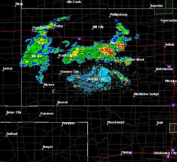 At 824 pm cdt, a severe thunderstorm was located near liebenthal, moving northeast at 20 mph (radar indicated). Hazards include 60 mph wind gusts and up to quarter size hail. Hail damage to vehicles is expected. expect wind damage to roofs, siding and trees. Locations impacted include, schoenchen, liebenthal, antonino and pfeifer. At 824 pm cdt, a severe thunderstorm was located near liebenthal, moving northeast at 20 mph (radar indicated). Hazards include 60 mph wind gusts and up to quarter size hail. Hail damage to vehicles is expected. expect wind damage to roofs, siding and trees. Locations impacted include, schoenchen, liebenthal, antonino and pfeifer.
|
| 5/27/2016 8:14 PM CDT |
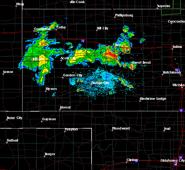 At 813 pm cdt, a severe thunderstorm was located 3 miles south of antonino, moving north at 25 mph (radar indicated). Hazards include 60 mph wind gusts and up to half dollar size hail. Hail damage to vehicles is expected. expect wind damage to roofs, siding and trees. Locations impacted include, la crosse, schoenchen, liebenthal, antonino, pfeifer and hargrave. At 813 pm cdt, a severe thunderstorm was located 3 miles south of antonino, moving north at 25 mph (radar indicated). Hazards include 60 mph wind gusts and up to half dollar size hail. Hail damage to vehicles is expected. expect wind damage to roofs, siding and trees. Locations impacted include, la crosse, schoenchen, liebenthal, antonino, pfeifer and hargrave.
|
| 5/27/2016 8:04 PM CDT |
 At 803 pm cdt, a severe thunderstorm was located 6 miles southwest of schoenchen, moving north at 25 mph (radar indicated). Hazards include 60 mph wind gusts and half dollar size hail. Hail damage to vehicles is expected. Expect wind damage to roofs, siding and trees. At 803 pm cdt, a severe thunderstorm was located 6 miles southwest of schoenchen, moving north at 25 mph (radar indicated). Hazards include 60 mph wind gusts and half dollar size hail. Hail damage to vehicles is expected. Expect wind damage to roofs, siding and trees.
|
| 5/26/2016 2:59 PM CDT |
 At 258 pm cdt, a severe thunderstorm was located very near bison, moving northeast at 30 mph (radar indicated). Hazards include ping pong ball size hail and 60 mph wind gusts. People and animals outdoors will be injured. expect hail damage to roofs, siding, windows and vehicles. expect wind damage to roofs, siding and trees. locations impacted include, la crosse, otis, bison, rush center, liebenthal, timken, loretta, shaffer and hargrave. A tornado watch remains in effect until 1000 pm cdt for central kansas. At 258 pm cdt, a severe thunderstorm was located very near bison, moving northeast at 30 mph (radar indicated). Hazards include ping pong ball size hail and 60 mph wind gusts. People and animals outdoors will be injured. expect hail damage to roofs, siding, windows and vehicles. expect wind damage to roofs, siding and trees. locations impacted include, la crosse, otis, bison, rush center, liebenthal, timken, loretta, shaffer and hargrave. A tornado watch remains in effect until 1000 pm cdt for central kansas.
|
| 5/26/2016 2:54 PM CDT |
 At 253 pm cdt, a severe thunderstorm was located near timken, moving northeast at 30 mph (radar indicated). Hazards include two inch hail and 70 mph wind gusts. People and animals outdoors will be injured. expect hail damage to roofs, siding, windows and vehicles. expect considerable tree damage. wind damage is also likely to mobile homes, roofs and outbuildings. locations impacted include, la crosse, otis, bison, rush center, liebenthal, timken, loretta, nekoma, shaffer and hargrave. A tornado watch remains in effect until 1000 pm cdt for south central kansas. At 253 pm cdt, a severe thunderstorm was located near timken, moving northeast at 30 mph (radar indicated). Hazards include two inch hail and 70 mph wind gusts. People and animals outdoors will be injured. expect hail damage to roofs, siding, windows and vehicles. expect considerable tree damage. wind damage is also likely to mobile homes, roofs and outbuildings. locations impacted include, la crosse, otis, bison, rush center, liebenthal, timken, loretta, nekoma, shaffer and hargrave. A tornado watch remains in effect until 1000 pm cdt for south central kansas.
|
| 5/26/2016 2:46 PM CDT |
 At 246 pm cdt, a severe thunderstorm was located 4 miles southeast of rush center, moving northeast at 30 mph (radar indicated). Hazards include two inch hail and 70 mph wind gusts. People and animals outdoors will be injured. expect hail damage to roofs, siding, windows and vehicles. expect considerable tree damage. wind damage is also likely to mobile homes, roofs and outbuildings. locations impacted include, larned, la crosse, otis, bison, rush center, liebenthal, timken, ash valley, loretta, nekoma, shaffer and hargrave. A tornado watch remains in effect until 1000 pm cdt for south central kansas. At 246 pm cdt, a severe thunderstorm was located 4 miles southeast of rush center, moving northeast at 30 mph (radar indicated). Hazards include two inch hail and 70 mph wind gusts. People and animals outdoors will be injured. expect hail damage to roofs, siding, windows and vehicles. expect considerable tree damage. wind damage is also likely to mobile homes, roofs and outbuildings. locations impacted include, larned, la crosse, otis, bison, rush center, liebenthal, timken, ash valley, loretta, nekoma, shaffer and hargrave. A tornado watch remains in effect until 1000 pm cdt for south central kansas.
|
| 5/26/2016 2:37 PM CDT |
 At 237 pm cdt, a severe thunderstorm was located 5 miles northwest of ash valley, moving northeast at 30 mph (radar indicated). Hazards include tennis ball size hail and 70 mph wind gusts. People and animals outdoors will be injured. expect hail damage to roofs, siding, windows and vehicles. expect considerable tree damage. Wind damage is also likely to mobile homes, roofs and outbuildings. At 237 pm cdt, a severe thunderstorm was located 5 miles northwest of ash valley, moving northeast at 30 mph (radar indicated). Hazards include tennis ball size hail and 70 mph wind gusts. People and animals outdoors will be injured. expect hail damage to roofs, siding, windows and vehicles. expect considerable tree damage. Wind damage is also likely to mobile homes, roofs and outbuildings.
|
| 5/24/2016 7:58 PM CDT |
 At 758 pm cdt, a severe thunderstorm was located very near mccracken, moving northeast at 15 mph (radar indicated). Hazards include 60 mph wind gusts and quarter size hail. Hail damage to vehicles is expected. Expect wind damage to roofs, siding and trees. At 758 pm cdt, a severe thunderstorm was located very near mccracken, moving northeast at 15 mph (radar indicated). Hazards include 60 mph wind gusts and quarter size hail. Hail damage to vehicles is expected. Expect wind damage to roofs, siding and trees.
|
| 5/24/2016 7:14 PM CDT | The national weather service in dodge city has issued a * tornado warning for. central rush county in central kansas. southeastern ellis county in central kansas. until 800 pm cdt * at 714 pm cdt. A severe thunderstorm capable of producing a. |
| 5/8/2016 10:14 PM CDT |
 At 1014 pm cdt, a severe thunderstorm was located 3 miles east of schoenchen, moving east at 35 mph (radar indicated). Hazards include two inch hail and 70 mph wind gusts. People and animals outdoors will be injured. expect hail damage to roofs, siding, windows and vehicles. expect considerable tree damage. wind damage is also likely to mobile homes, roofs and outbuildings. locations impacted include, schoenchen, liebenthal, antonino, munjor, loretta, pfeifer and toulon. A tornado watch remains in effect until midnight cdt for central kansas. At 1014 pm cdt, a severe thunderstorm was located 3 miles east of schoenchen, moving east at 35 mph (radar indicated). Hazards include two inch hail and 70 mph wind gusts. People and animals outdoors will be injured. expect hail damage to roofs, siding, windows and vehicles. expect considerable tree damage. wind damage is also likely to mobile homes, roofs and outbuildings. locations impacted include, schoenchen, liebenthal, antonino, munjor, loretta, pfeifer and toulon. A tornado watch remains in effect until midnight cdt for central kansas.
|
| 5/8/2016 10:04 PM CDT |
 At 1002 pm cdt, a severe thunderstorm was located 3 miles south of antonino, moving northeast at 30 mph (radar indicated). Hazards include golf ball size hail and 60 mph wind gusts. People and animals outdoors will be injured. expect hail damage to roofs, siding, windows and vehicles. expect wind damage to roofs, siding and trees. locations impacted include, hays, schoenchen, mccracken, liebenthal, yocemento, antonino, munjor, loretta, toulon and pfeifer. A tornado watch remains in effect until midnight cdt for central kansas. At 1002 pm cdt, a severe thunderstorm was located 3 miles south of antonino, moving northeast at 30 mph (radar indicated). Hazards include golf ball size hail and 60 mph wind gusts. People and animals outdoors will be injured. expect hail damage to roofs, siding, windows and vehicles. expect wind damage to roofs, siding and trees. locations impacted include, hays, schoenchen, mccracken, liebenthal, yocemento, antonino, munjor, loretta, toulon and pfeifer. A tornado watch remains in effect until midnight cdt for central kansas.
|
| 5/8/2016 9:33 PM CDT |
 At 932 pm cdt, a severe thunderstorm was located 4 miles west of mccracken, moving northeast at 30 mph (radar indicated). Hazards include golf ball size hail and 60 mph wind gusts. People and animals outdoors will be injured. expect hail damage to roofs, siding, windows and vehicles. Expect wind damage to roofs, siding and trees. At 932 pm cdt, a severe thunderstorm was located 4 miles west of mccracken, moving northeast at 30 mph (radar indicated). Hazards include golf ball size hail and 60 mph wind gusts. People and animals outdoors will be injured. expect hail damage to roofs, siding, windows and vehicles. Expect wind damage to roofs, siding and trees.
|
| 5/8/2016 6:50 PM CDT |
 At 649 pm cdt, a severe thunderstorm was located near pfeifer, moving north at 55 mph (radar indicated). Hazards include golf ball size hail and 70 mph wind gusts. People and animals outdoors will be injured. expect hail damage to roofs, siding, windows and vehicles. expect considerable tree damage. wind damage is also likely to mobile homes, roofs and outbuildings. trained spotters reported half dollar size hail near bison. locations impacted include, la crosse, otis, bison, schoenchen, liebenthal, antonino, loretta and pfeifer. A tornado watch remains in effect until 1000 pm cdt for central kansas. At 649 pm cdt, a severe thunderstorm was located near pfeifer, moving north at 55 mph (radar indicated). Hazards include golf ball size hail and 70 mph wind gusts. People and animals outdoors will be injured. expect hail damage to roofs, siding, windows and vehicles. expect considerable tree damage. wind damage is also likely to mobile homes, roofs and outbuildings. trained spotters reported half dollar size hail near bison. locations impacted include, la crosse, otis, bison, schoenchen, liebenthal, antonino, loretta and pfeifer. A tornado watch remains in effect until 1000 pm cdt for central kansas.
|
| 5/8/2016 6:38 PM CDT |
 At 638 pm cdt, a severe thunderstorm was located near bison, moving north at 45 mph (radar indicated). Hazards include two inch hail and 70 mph wind gusts. People and animals outdoors will be injured. expect hail damage to roofs, siding, windows and vehicles. expect considerable tree damage. Wind damage is also likely to mobile homes, roofs and outbuildings. At 638 pm cdt, a severe thunderstorm was located near bison, moving north at 45 mph (radar indicated). Hazards include two inch hail and 70 mph wind gusts. People and animals outdoors will be injured. expect hail damage to roofs, siding, windows and vehicles. expect considerable tree damage. Wind damage is also likely to mobile homes, roofs and outbuildings.
|
| 11/16/2015 10:31 PM CST |
 At 1031 pm cst, severe thunderstorms were located along a line extending from 4 miles west of antonino to 3 miles southwest of loretta, moving northeast at 60 mph (radar indicated). Hazards include 60 mph wind gusts and penny size hail. Expect damage to roofs. Siding and trees. At 1031 pm cst, severe thunderstorms were located along a line extending from 4 miles west of antonino to 3 miles southwest of loretta, moving northeast at 60 mph (radar indicated). Hazards include 60 mph wind gusts and penny size hail. Expect damage to roofs. Siding and trees.
|
| 7/25/2015 7:26 PM CDT |
 At 726 pm cdt, a severe thunderstorm was located near rush center, moving east at 15 mph (radar indicated). Hazards include golf ball size hail and 60 mph wind gusts. People and animals outdoors will be injured. expect hail damage to roofs, siding, windows and vehicles. expect wind damage to roofs, siding and trees. Locations impacted include, la crosse, bison, mccracken, rush center, liebenthal, timken, alexander, loretta, nekoma, shaffer and hargrave. At 726 pm cdt, a severe thunderstorm was located near rush center, moving east at 15 mph (radar indicated). Hazards include golf ball size hail and 60 mph wind gusts. People and animals outdoors will be injured. expect hail damage to roofs, siding, windows and vehicles. expect wind damage to roofs, siding and trees. Locations impacted include, la crosse, bison, mccracken, rush center, liebenthal, timken, alexander, loretta, nekoma, shaffer and hargrave.
|
| 7/25/2015 7:00 PM CDT |
 At 659 pm cdt, a severe thunderstorm was located 3 miles west of la crosse, moving east at 15 mph (radar indicated). Hazards include golf ball size hail and 60 mph wind gusts. People and animals outdoors will be injured. expect hail damage to roofs, siding, windows and vehicles. Expect wind damage to roofs, siding and trees. At 659 pm cdt, a severe thunderstorm was located 3 miles west of la crosse, moving east at 15 mph (radar indicated). Hazards include golf ball size hail and 60 mph wind gusts. People and animals outdoors will be injured. expect hail damage to roofs, siding, windows and vehicles. Expect wind damage to roofs, siding and trees.
|
| 7/25/2015 6:00 PM CDT |
 At 600 pm cdt, a severe thunderstorm was located 6 miles southeast of cedar bluff, moving east at 15 mph (radar indicated). Hazards include 60 mph wind gusts and quarter size hail. Hail damage to vehicles is expected. Expect wind damage to roofs, siding and trees. At 600 pm cdt, a severe thunderstorm was located 6 miles southeast of cedar bluff, moving east at 15 mph (radar indicated). Hazards include 60 mph wind gusts and quarter size hail. Hail damage to vehicles is expected. Expect wind damage to roofs, siding and trees.
|
| 7/15/2015 1:36 AM CDT |
 At 135 am cdt, a severe thunderstorm was located 5 miles southwest of yocemento, moving east at 35 mph (radar indicated). Hazards include 70 mph wind gusts and ping pong ball size hail. People and animals outdoors will be injured. expect hail damage to roofs, siding, windows and vehicles. expect considerable tree damage. Wind damage is also likely to mobile homes, roofs and outbuildings. At 135 am cdt, a severe thunderstorm was located 5 miles southwest of yocemento, moving east at 35 mph (radar indicated). Hazards include 70 mph wind gusts and ping pong ball size hail. People and animals outdoors will be injured. expect hail damage to roofs, siding, windows and vehicles. expect considerable tree damage. Wind damage is also likely to mobile homes, roofs and outbuildings.
|
| 4/2/2015 10:42 PM CDT | The national weather service in dodge city has issued a * severe thunderstorm warning for. pawnee county in south central kansas. stafford county in south central kansas. rush county in central kansas. East central edwards county in south central kansas. |
| 4/2/2015 10:20 PM CDT | A severe thunderstorm warning remains in effect until 1045 pm cdt for northern rush and southern ellis counties. at 1019 pm cdt. a severe thunderstorm was located 7 miles southwest of antonino. moving east at 45 mph. hazard. 60 mph wind gusts and penny size hail. source. Radar indicated. |
| 4/2/2015 10:06 PM CDT | A severe thunderstorm warning remains in effect until 1045 pm cdt for southeastern trego. northern rush. northeastern ness and southern ellis counties. at 1006 pm cdt. a severe thunderstorm was located over cedar bluff. moving east at 35 mph. hazard. 60 mph wind gusts and penny size hail. |
| 4/2/2015 9:50 PM CDT | The national weather service in dodge city has issued a * severe thunderstorm warning for. eastern trego county in west central kansas. northern rush county in central kansas. northeastern ness county in west central kansas. Ellis county in central kansas. |
| 9/9/2014 9:00 PM CDT | Storm damage reported in rush county KS, 7.5 miles W of Liebenthal, KS |
| 6/18/2013 6:40 PM CDT | Storm damage reported in rush county KS, 5.8 miles ENE of Liebenthal, KS |
| 4/9/2013 4:35 PM CDT | Quarter sized hail reported 0.4 miles S of Liebenthal, KS, the hail was mostly dime to nickel size. |
| 5/27/2012 8:51 PM CDT | Ping Pong Ball sized hail reported 0.3 miles N of Liebenthal, KS |
| 5/27/2012 8:50 PM CDT | Half Dollar sized hail reported 0.3 miles N of Liebenthal, KS |
| 5/27/2012 8:48 PM CDT | Quarter sized hail reported 3.1 miles N of Liebenthal, KS |
| 1/1/0001 12:00 AM | Storm damage reported in rush county KS, 7.5 miles W of Liebenthal, KS |
| 1/1/0001 12:00 AM | Five electric poles were down just west of lorett in rush county KS, 7 miles W of Liebenthal, KS |
Hail Maps for Liebenthal, KS
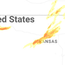

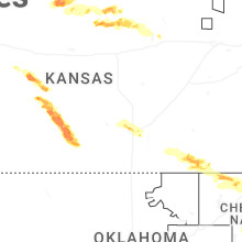
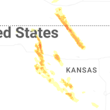
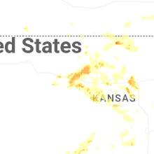

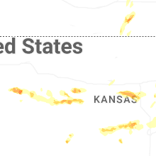


Connect with Interactive Hail Maps