

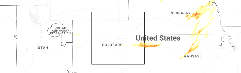
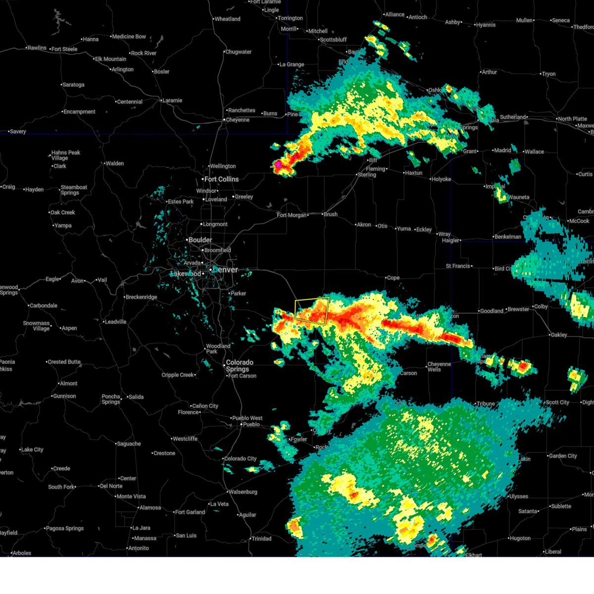
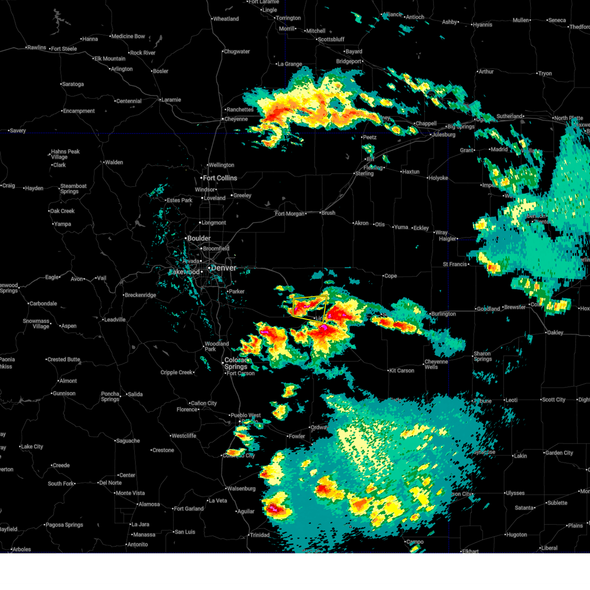
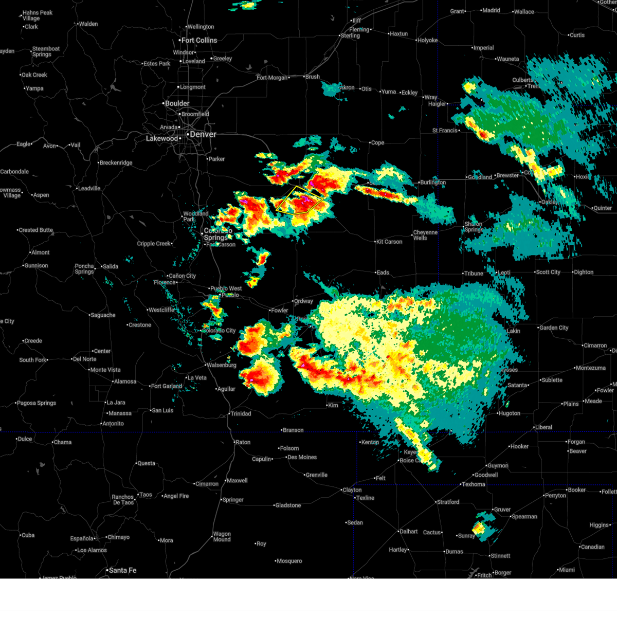
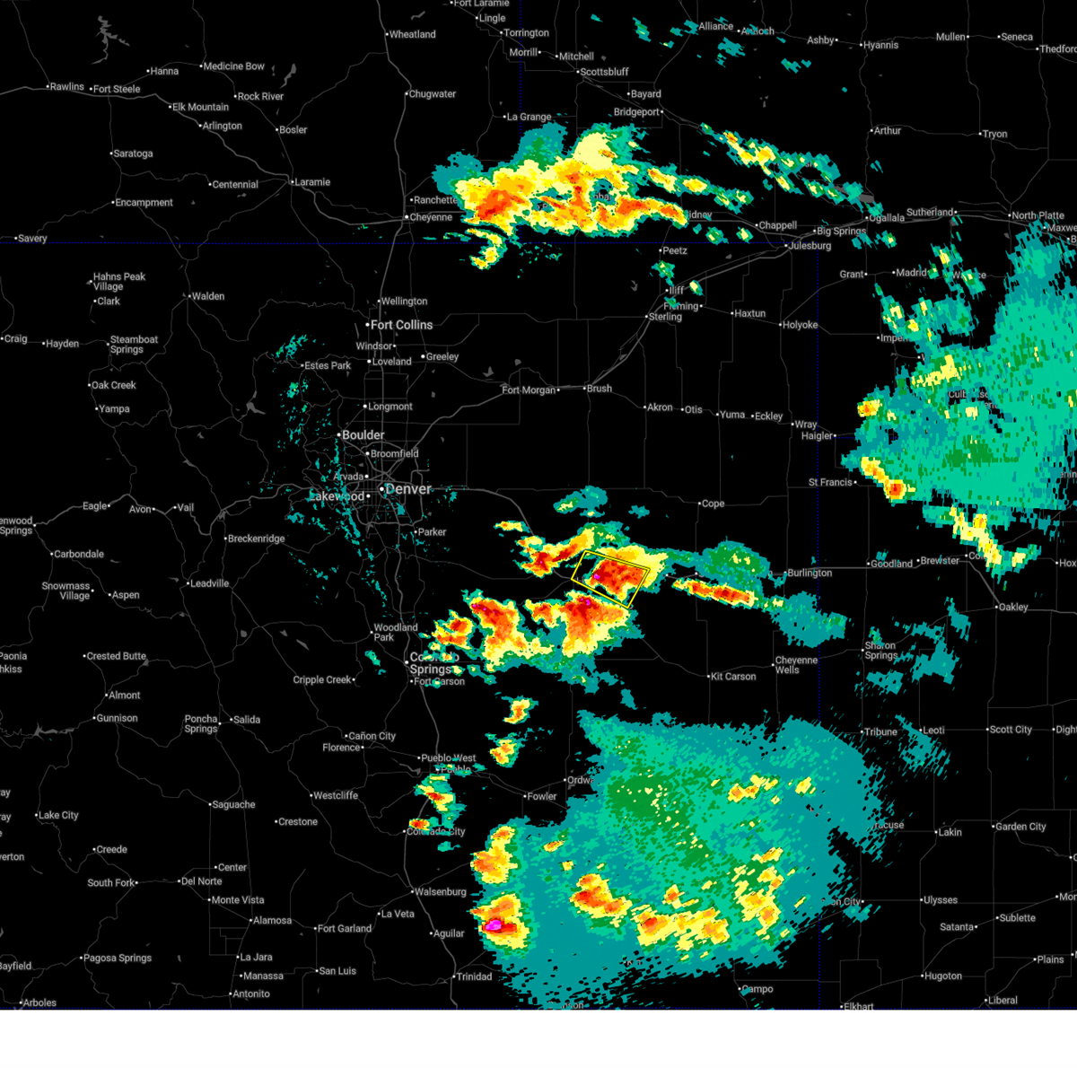
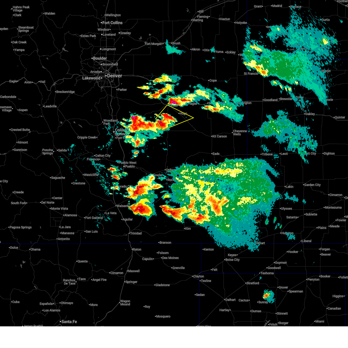
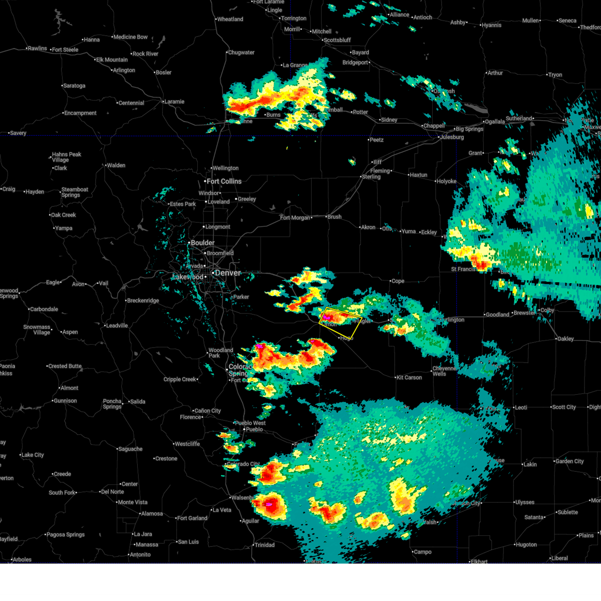
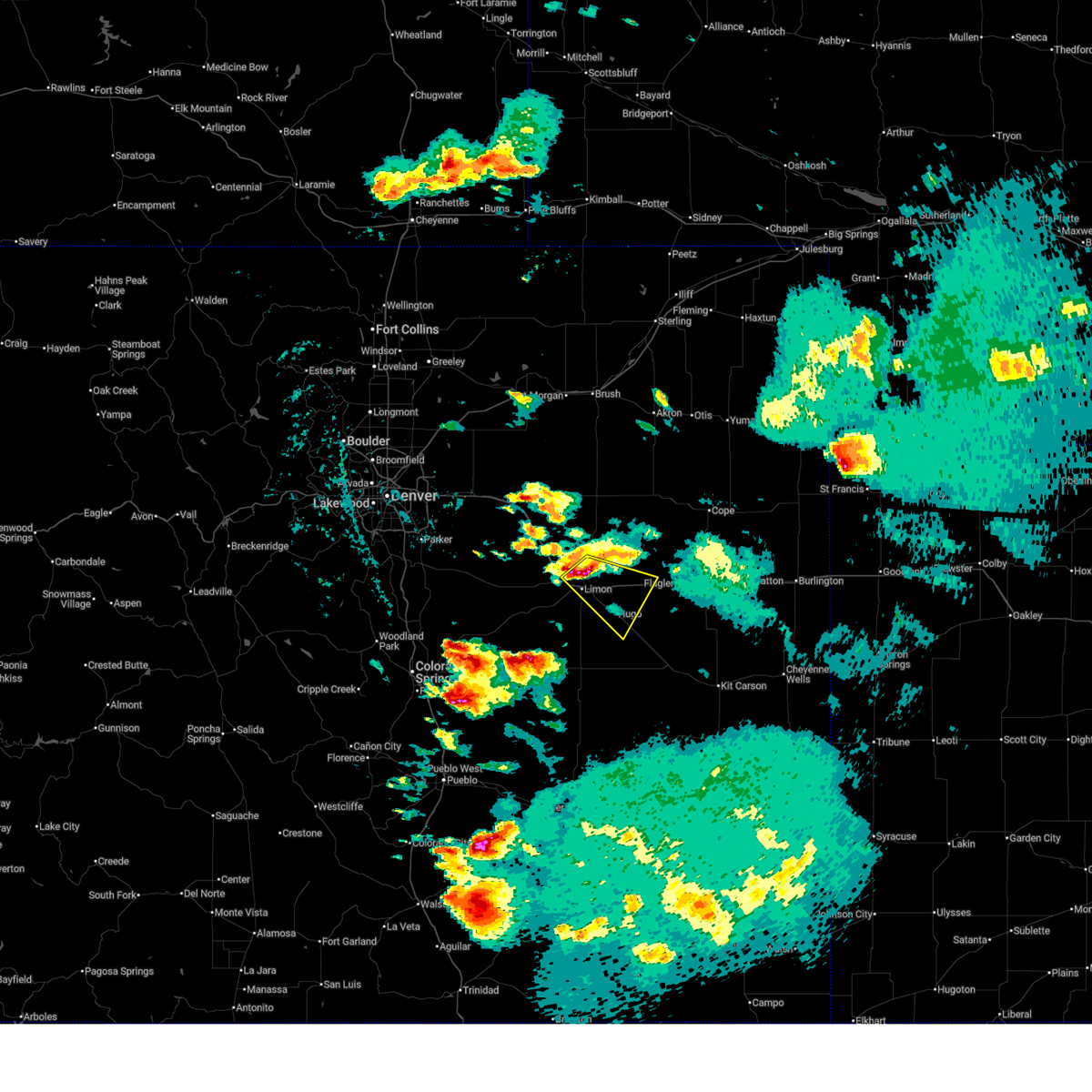
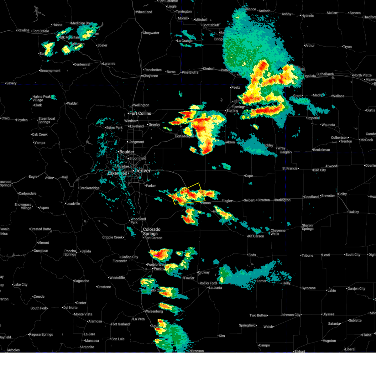
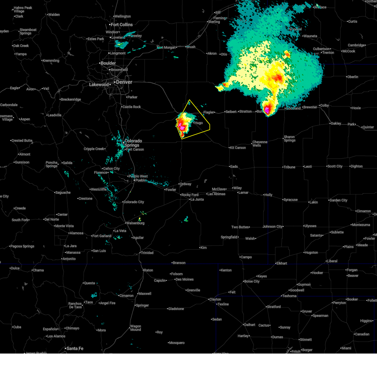
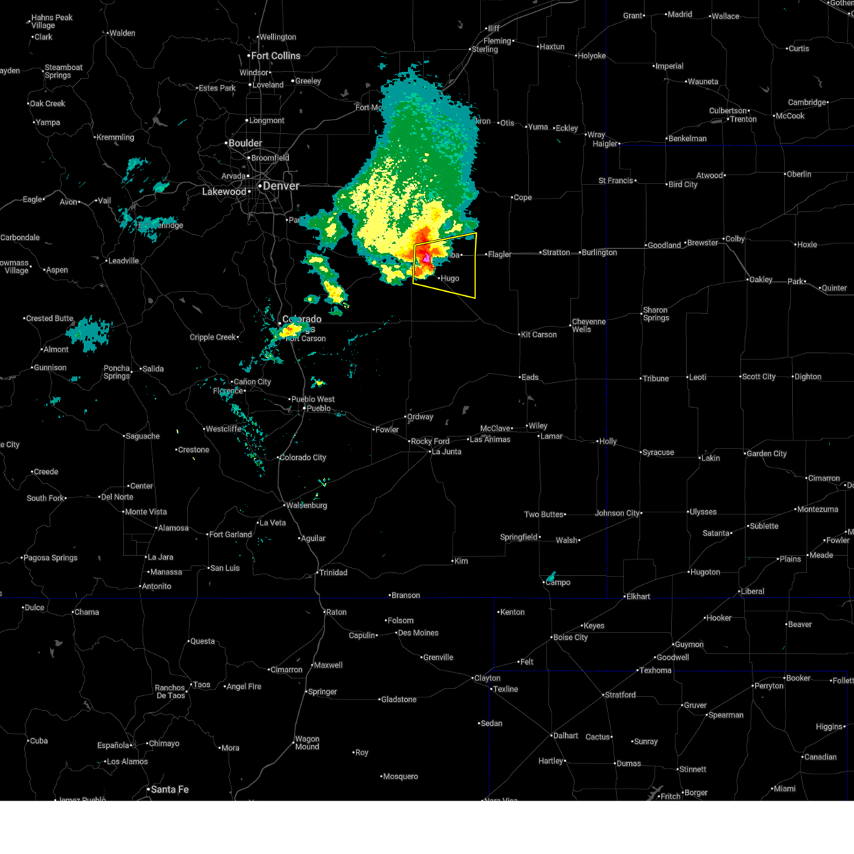
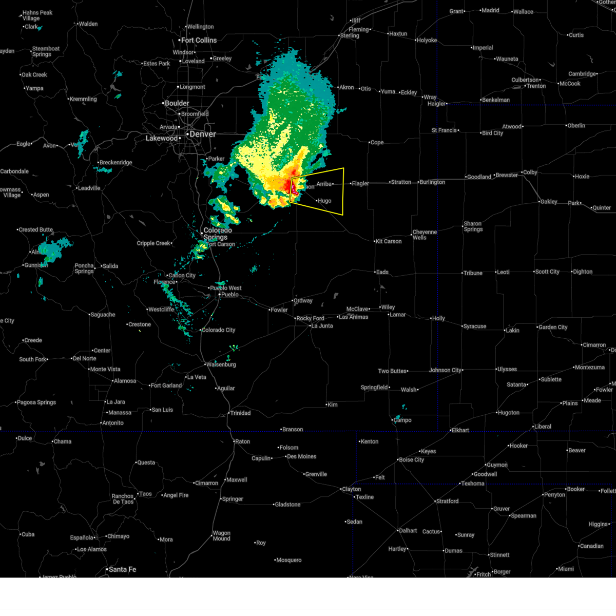
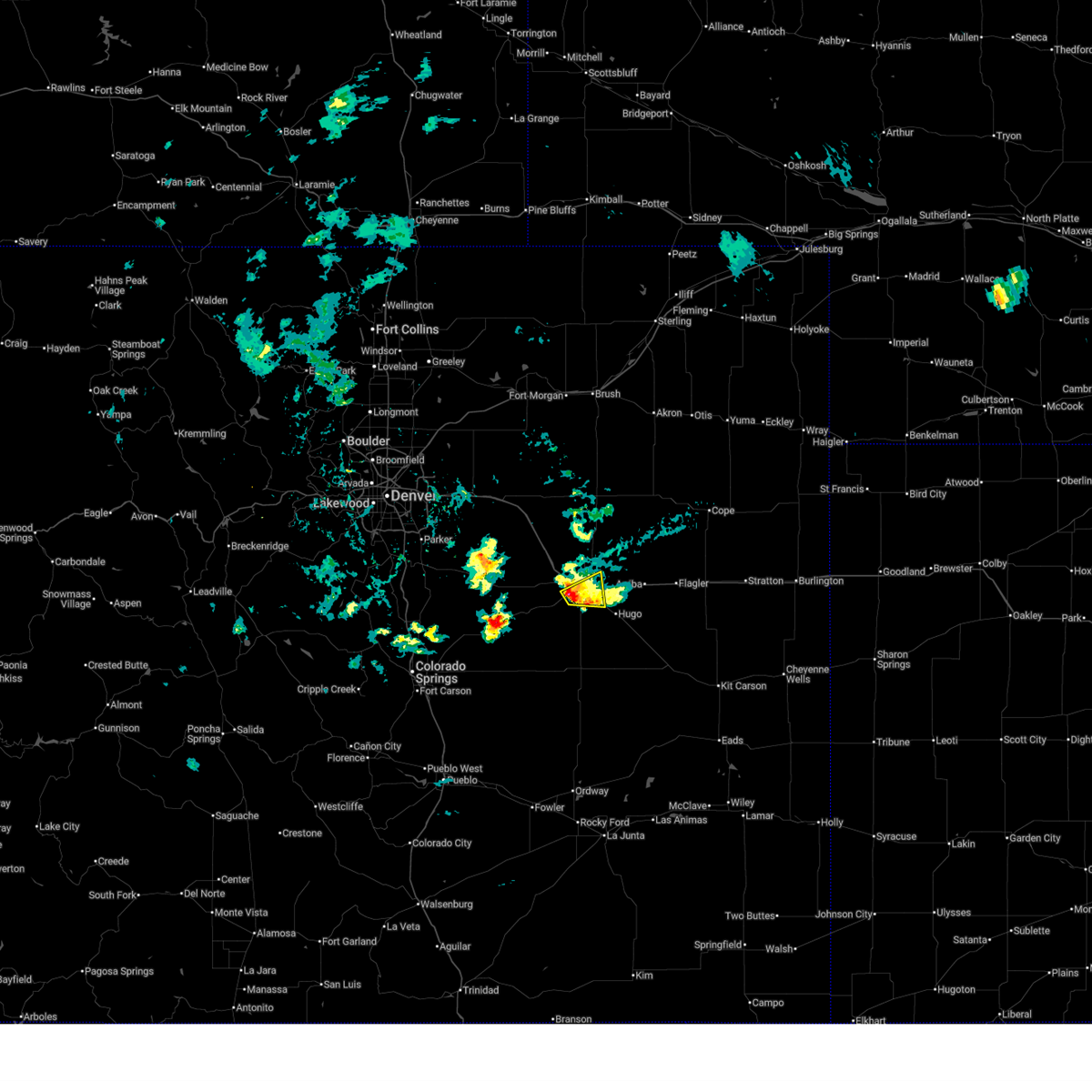
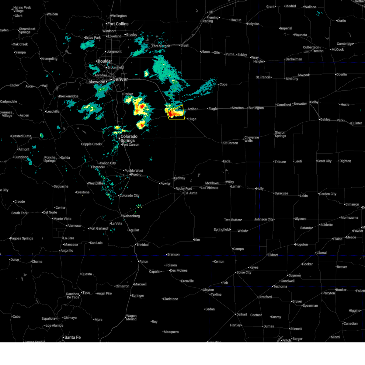
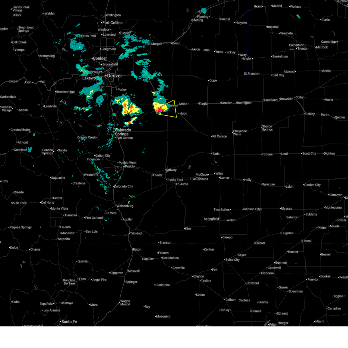
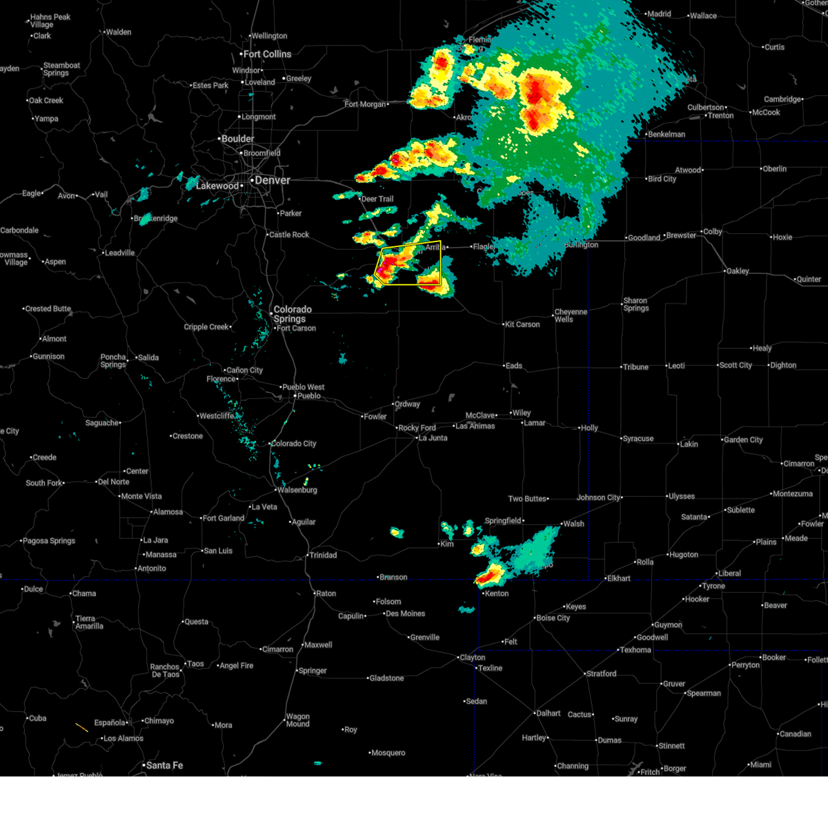
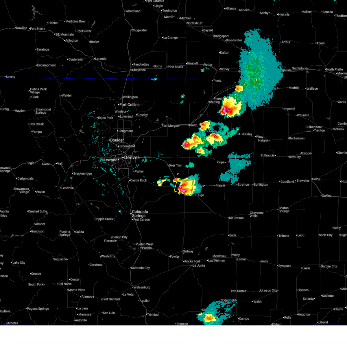
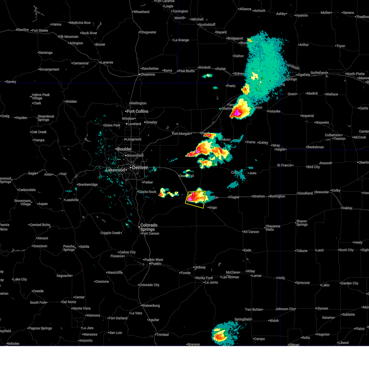
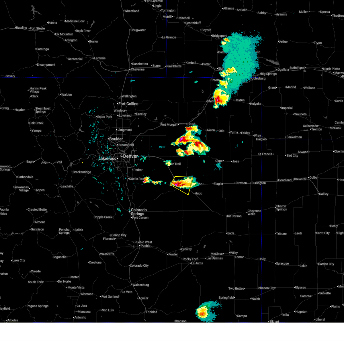
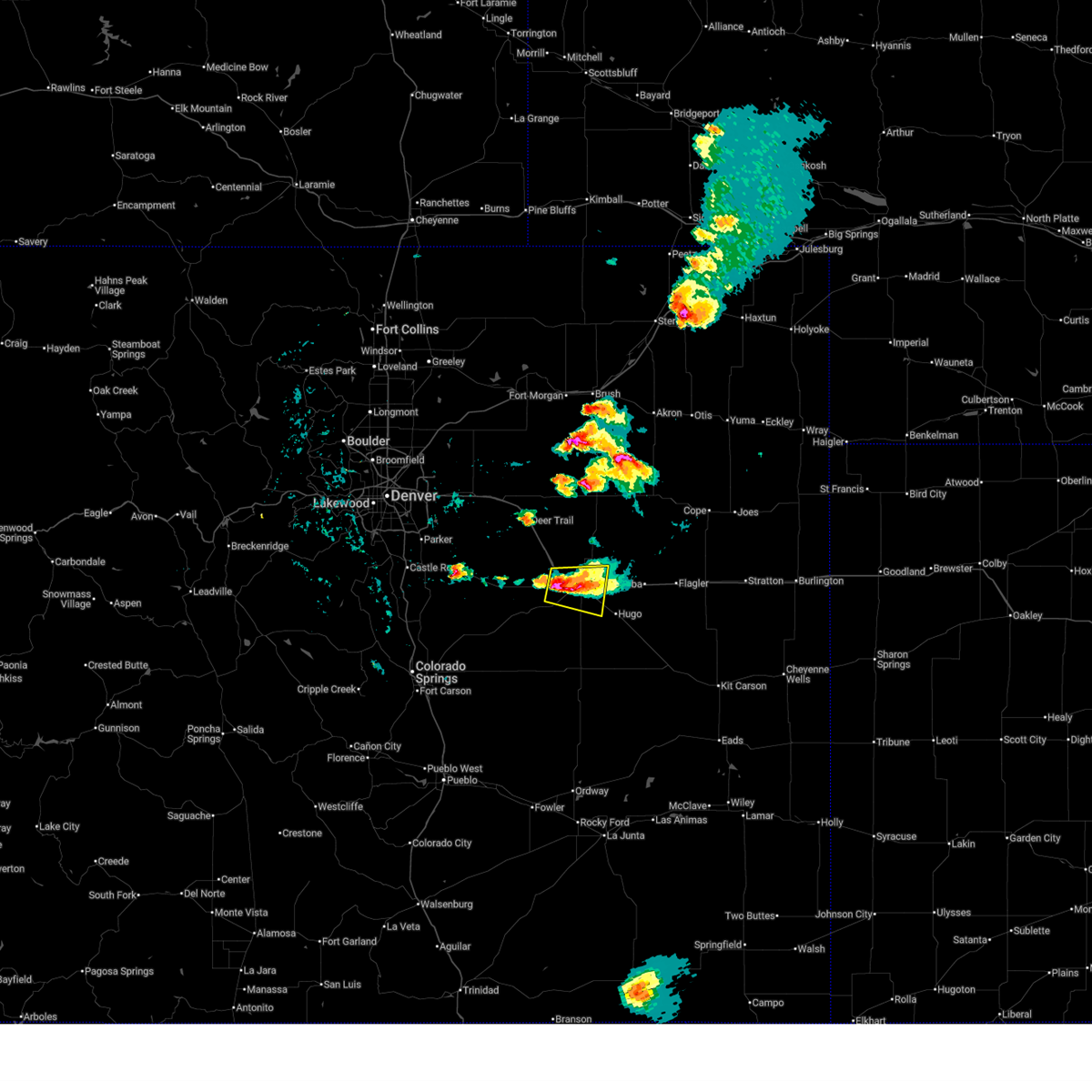
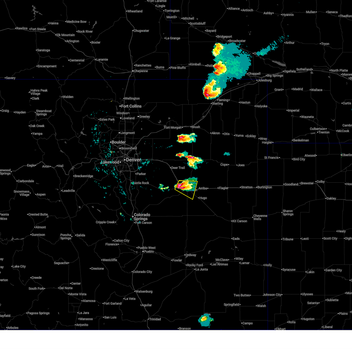
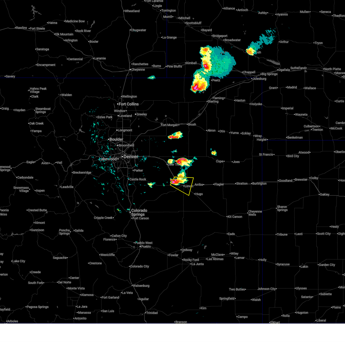
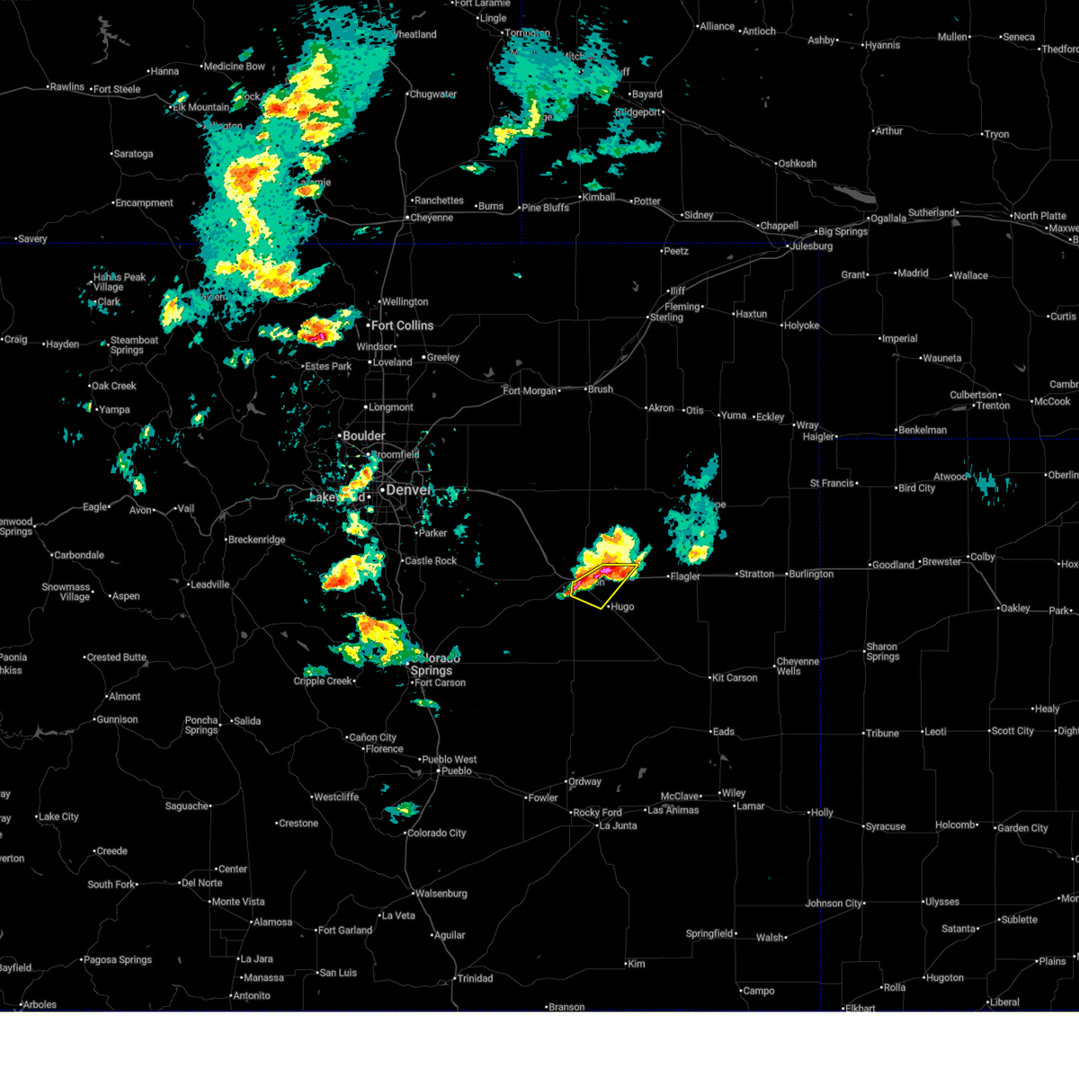
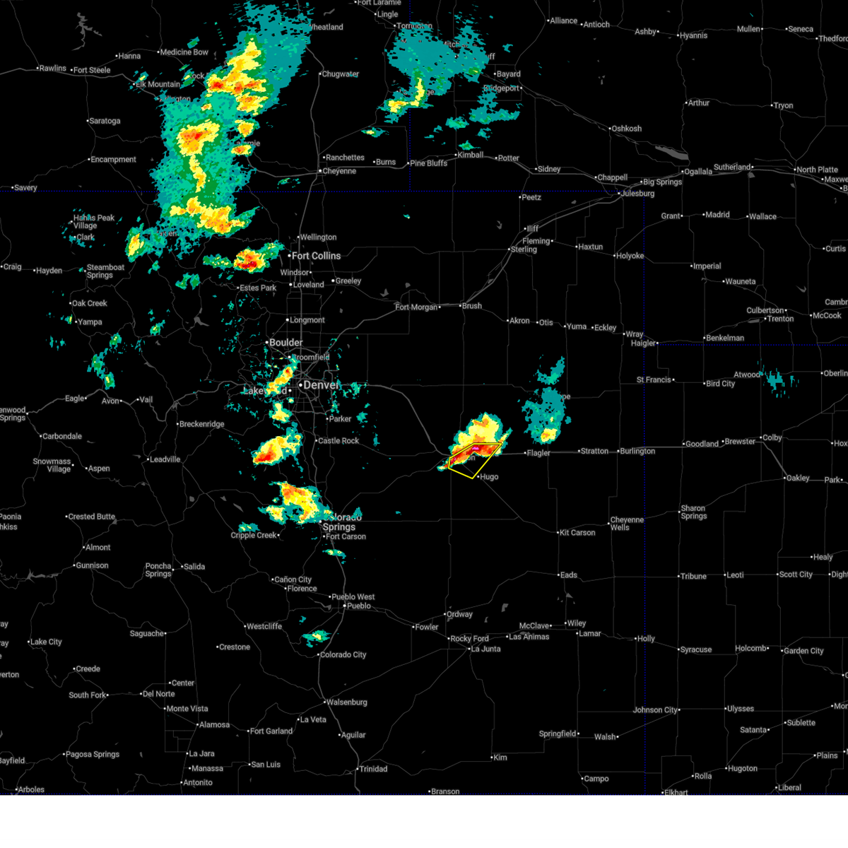
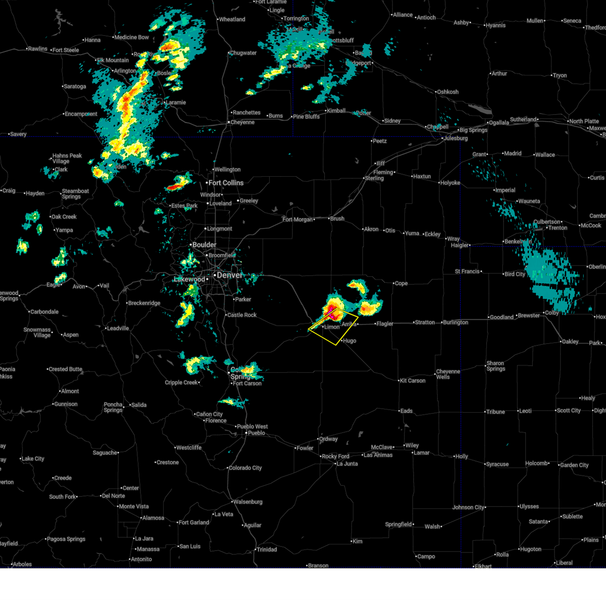
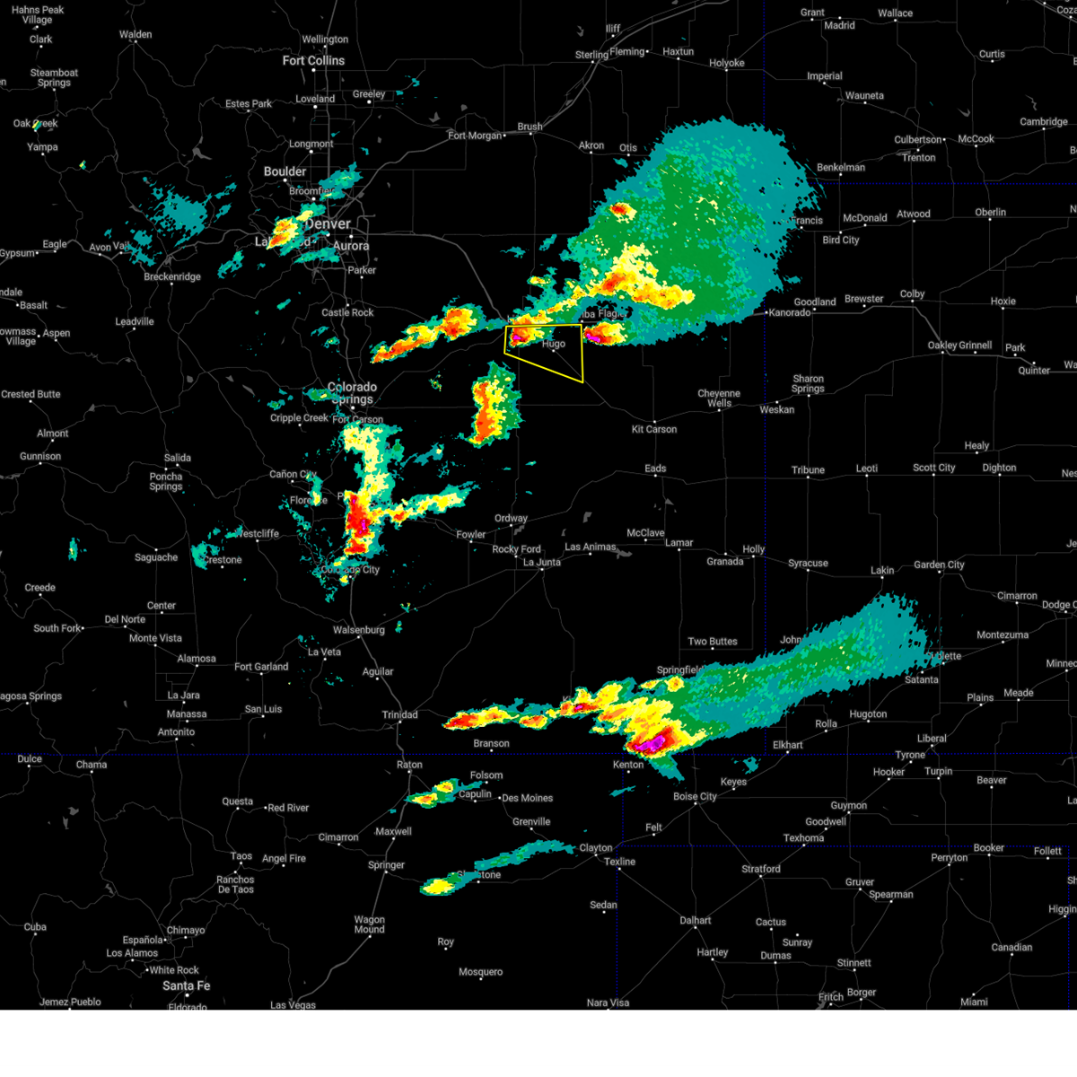
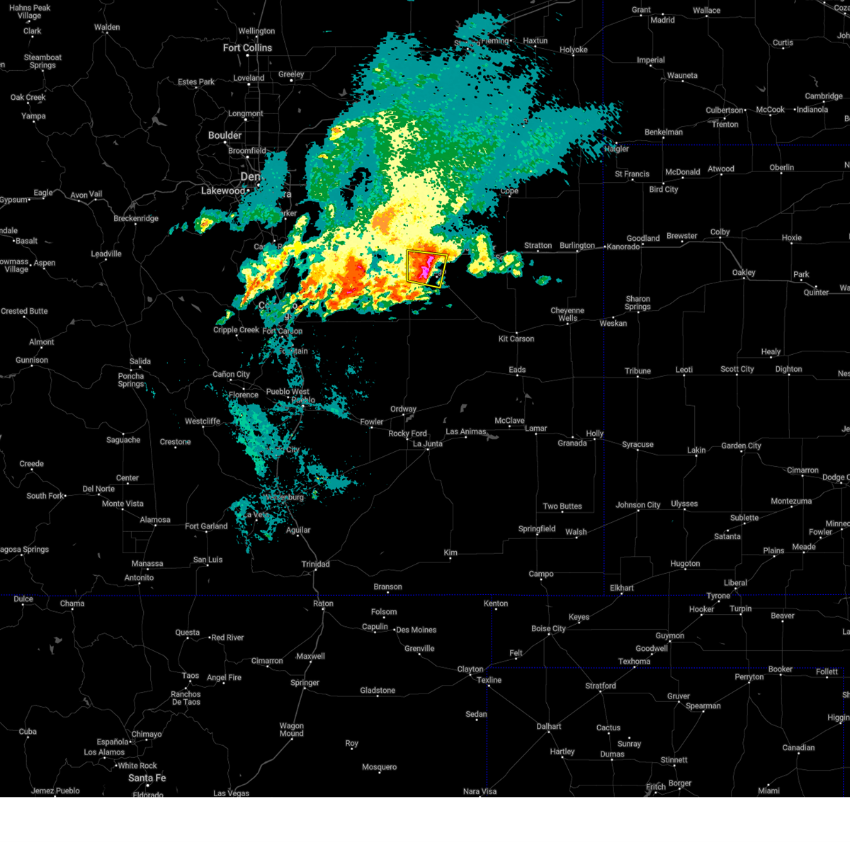
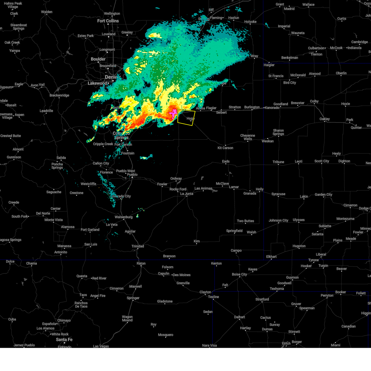
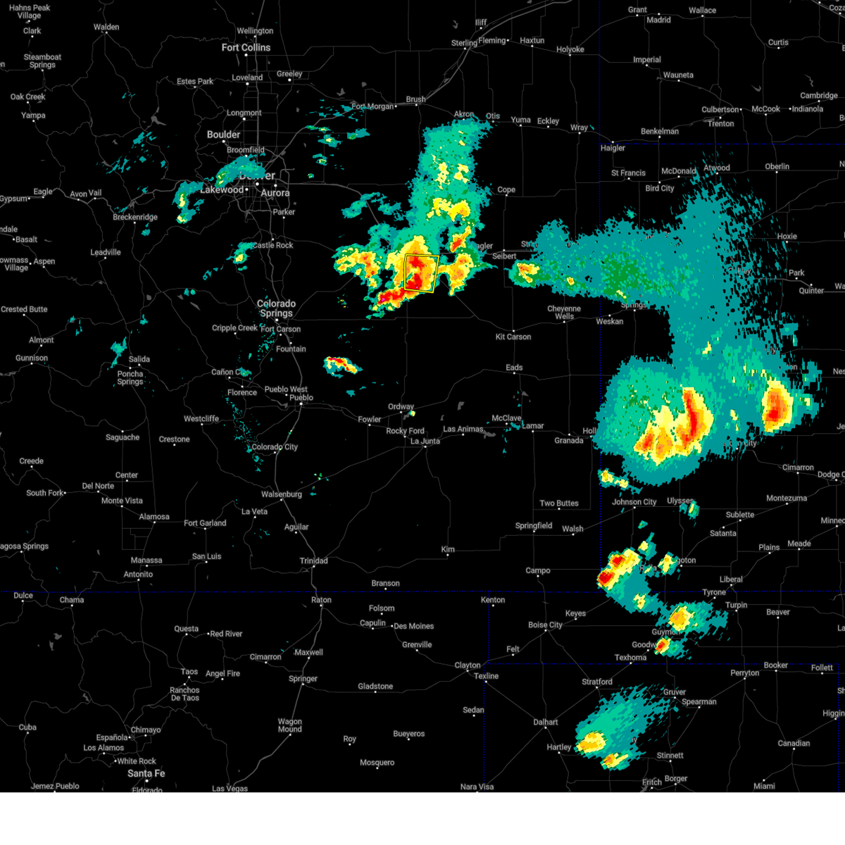
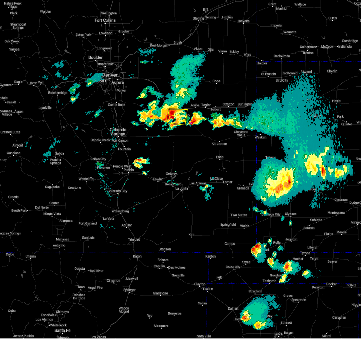
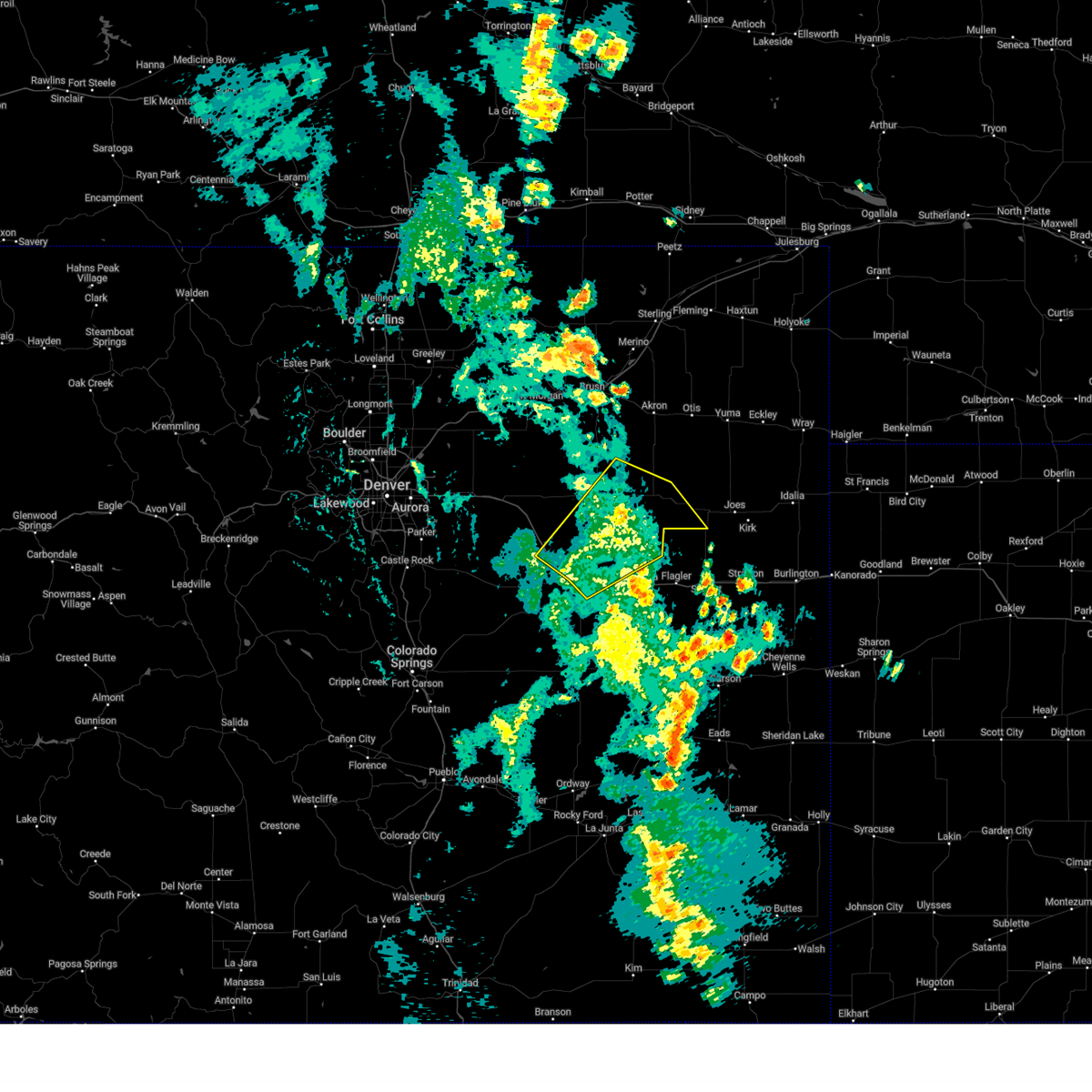
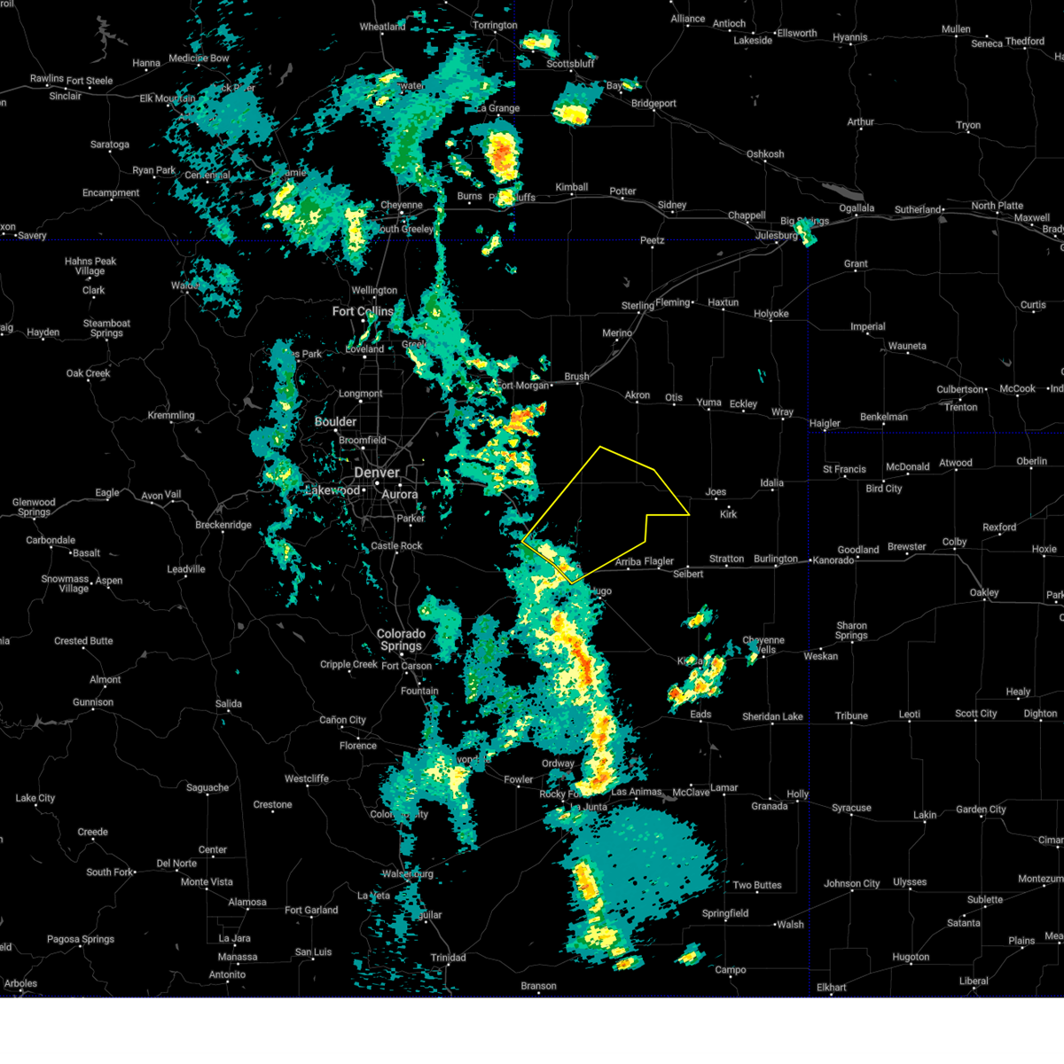
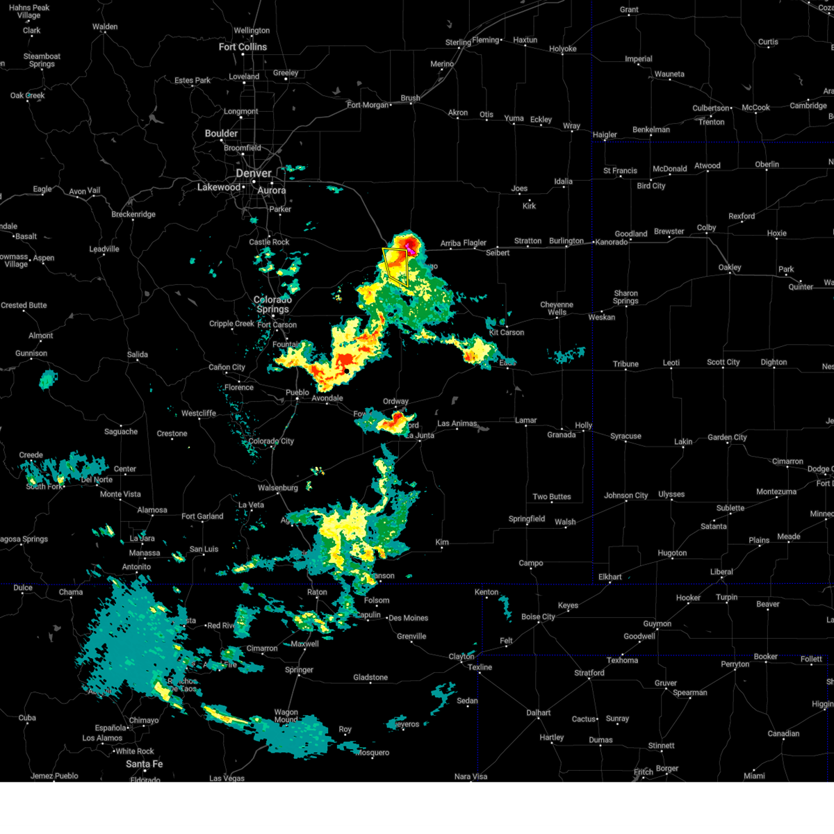
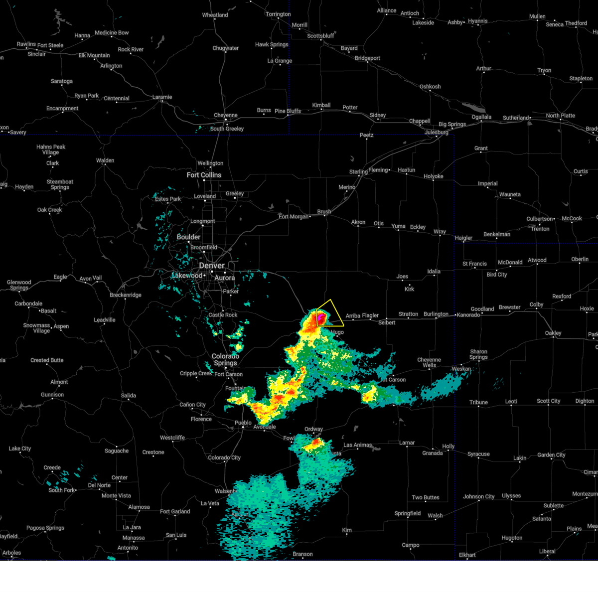
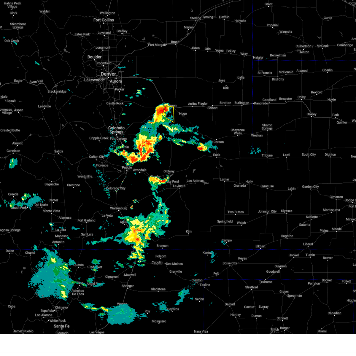
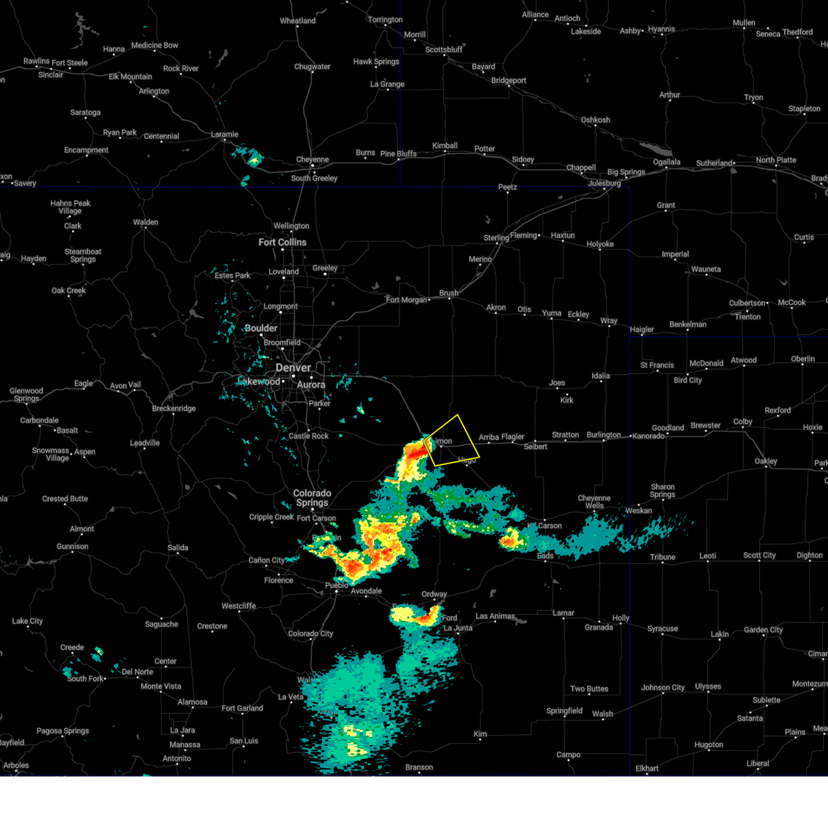
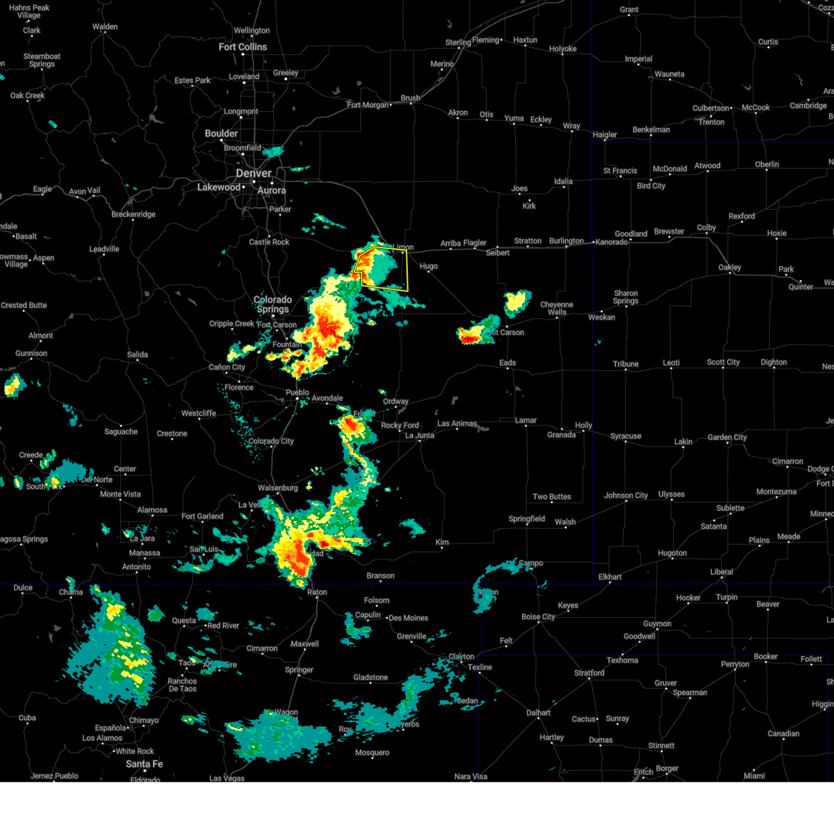
Hail Map for Limon, CO
The Limon, CO area has had 90 reports of on-the-ground hail by trained spotters, and has been under severe weather warnings 35 times during the past 12 months. Doppler radar has detected hail at or near Limon, CO on 122 occasions, including 15 occasions during the past year.
| Name: | Limon, CO |
| Where Located: | 76.9 miles ESE of Denver, CO |
| Map: | Google Map for Limon, CO |
| Population: | 1880 |
| Housing Units: | 963 |
| More Info: | Search Google for Limon, CO |
1
The Top Recent Hail Date for Limon, CO is Sunday, May 17, 2026 (23rd out of 122)
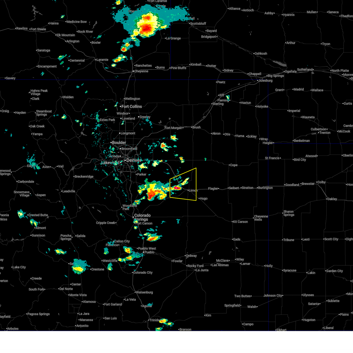
Hail and Wind Damage Spotted near Limon, CO
| Date / Time | Report Details |
|---|---|
| 7/3/2026 11:57 PM MDT |
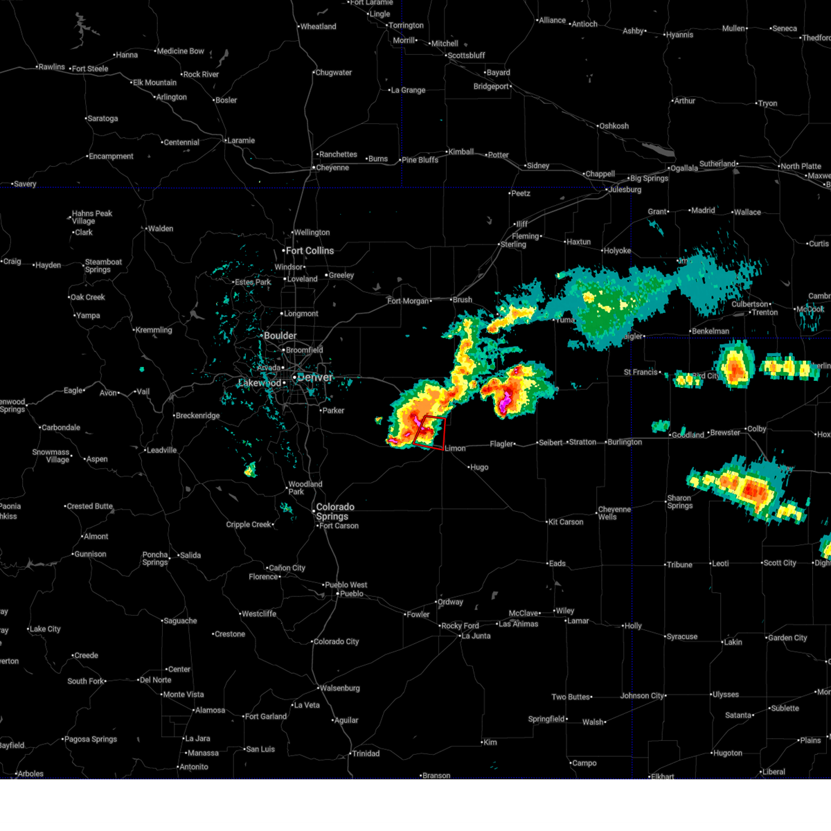 At 1157 pm mdt, a severe thunderstorm capable of producing a tornado was located 9 miles northwest of limon, moving east at 15 mph (radar indicated rotation). Hazards include tornado and ping pong ball size hail. Flying debris will be dangerous to those caught without shelter. mobile homes will be damaged or destroyed. damage to roofs, windows and vehicles will occur. tree damage is likely. Locations impacted include, limon and cedar point. At 1157 pm mdt, a severe thunderstorm capable of producing a tornado was located 9 miles northwest of limon, moving east at 15 mph (radar indicated rotation). Hazards include tornado and ping pong ball size hail. Flying debris will be dangerous to those caught without shelter. mobile homes will be damaged or destroyed. damage to roofs, windows and vehicles will occur. tree damage is likely. Locations impacted include, limon and cedar point.
|
| 7/3/2026 11:48 PM MDT |
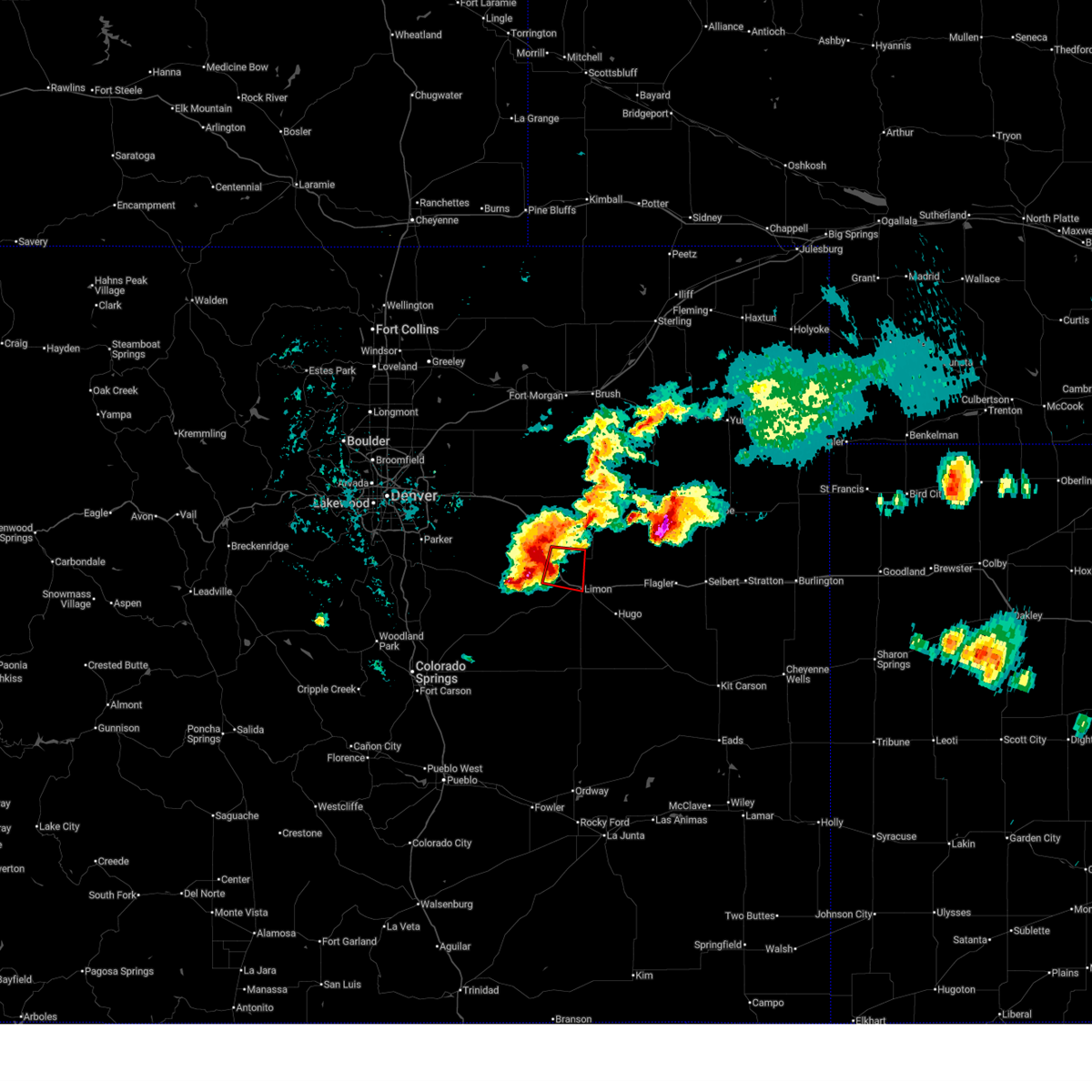 Torbou the national weather service in denver has issued a * tornado warning for, northeastern elbert county in east central colorado, north central lincoln county in east central colorado, * until 1215 am mdt. * at 1148 pm mdt, a severe thunderstorm capable of producing a tornado was located 8 miles southeast of agate, or 11 miles northwest of limon, moving east at 15 mph (radar indicated rotation). Hazards include tornado and ping pong ball size hail. Flying debris will be dangerous to those caught without shelter. mobile homes will be damaged or destroyed. damage to roofs, windows and vehicles will occur. Tree damage is likely. Torbou the national weather service in denver has issued a * tornado warning for, northeastern elbert county in east central colorado, north central lincoln county in east central colorado, * until 1215 am mdt. * at 1148 pm mdt, a severe thunderstorm capable of producing a tornado was located 8 miles southeast of agate, or 11 miles northwest of limon, moving east at 15 mph (radar indicated rotation). Hazards include tornado and ping pong ball size hail. Flying debris will be dangerous to those caught without shelter. mobile homes will be damaged or destroyed. damage to roofs, windows and vehicles will occur. Tree damage is likely.
|
| 6/26/2026 4:27 PM MDT | Asos station klic limo in lincoln county CO, 1.1 miles WSW of Limon, CO |
| 6/26/2026 3:15 PM MDT |
 Svrbou the national weather service in denver has issued a * severe thunderstorm warning for, northeastern elbert county in east central colorado, north central lincoln county in east central colorado, southwestern washington county in northeastern colorado, * until 345 pm mdt. * at 315 pm mdt, a severe thunderstorm was located 6 miles northwest of limon, moving east at 35 mph (radar indicated). Hazards include 60 mph wind gusts and quarter size hail. Hail damage to vehicles is expected. Expect wind damage to roofs, siding, and trees. Svrbou the national weather service in denver has issued a * severe thunderstorm warning for, northeastern elbert county in east central colorado, north central lincoln county in east central colorado, southwestern washington county in northeastern colorado, * until 345 pm mdt. * at 315 pm mdt, a severe thunderstorm was located 6 miles northwest of limon, moving east at 35 mph (radar indicated). Hazards include 60 mph wind gusts and quarter size hail. Hail damage to vehicles is expected. Expect wind damage to roofs, siding, and trees.
|
| 6/24/2026 1:23 AM MDT |
 The storm which prompted the warning has weakened below severe limits, and no longer poses an immediate threat to life or property. therefore, the warning will be allowed to expire. however, heavy rain is still possible with this thunderstorm. a severe thunderstorm watch remains in effect until 300 am mdt for a portion of east central colorado. The storm which prompted the warning has weakened below severe limits, and no longer poses an immediate threat to life or property. therefore, the warning will be allowed to expire. however, heavy rain is still possible with this thunderstorm. a severe thunderstorm watch remains in effect until 300 am mdt for a portion of east central colorado.
|
| 6/24/2026 12:47 AM MDT |
 Svrbou the national weather service in denver has issued a * severe thunderstorm warning for, northeastern elbert county in east central colorado, north central lincoln county in east central colorado, * until 130 am mdt. * at 1247 am mdt, a severe thunderstorm was located 8 miles northwest of limon, moving east at 35 mph (radar indicated). Hazards include 60 mph wind gusts and half dollar size hail. Hail damage to vehicles is expected. Expect wind damage to roofs, siding, and trees. Svrbou the national weather service in denver has issued a * severe thunderstorm warning for, northeastern elbert county in east central colorado, north central lincoln county in east central colorado, * until 130 am mdt. * at 1247 am mdt, a severe thunderstorm was located 8 miles northwest of limon, moving east at 35 mph (radar indicated). Hazards include 60 mph wind gusts and half dollar size hail. Hail damage to vehicles is expected. Expect wind damage to roofs, siding, and trees.
|
| 6/24/2026 12:45 AM MDT |
 At 1245 am mdt, a severe thunderstorm was located 2 miles west of hugo, or 12 miles southeast of limon, moving northeast at 40 mph (radar indicated). Hazards include ping pong ball size hail and 60 mph wind gusts. People and animals outdoors will be injured. expect hail damage to roofs, siding, windows, and vehicles. expect wind damage to roofs, siding, and trees. Locations impacted include, hugo. At 1245 am mdt, a severe thunderstorm was located 2 miles west of hugo, or 12 miles southeast of limon, moving northeast at 40 mph (radar indicated). Hazards include ping pong ball size hail and 60 mph wind gusts. People and animals outdoors will be injured. expect hail damage to roofs, siding, windows, and vehicles. expect wind damage to roofs, siding, and trees. Locations impacted include, hugo.
|
| 6/24/2026 12:43 AM MDT |
 The severe thunderstorm warning that was previously in effect has been reissued for lincoln county and is in effect until 130 am mdt. please refer to that bulletin for the latest severe weather information. The severe thunderstorm warning that was previously in effect has been reissued for lincoln county and is in effect until 130 am mdt. please refer to that bulletin for the latest severe weather information.
|
| 6/24/2026 12:26 AM MDT |
 Svrbou the national weather service in denver has issued a * severe thunderstorm warning for, southeastern elbert county in east central colorado, central lincoln county in east central colorado, * until 115 am mdt. * at 1226 am mdt, a severe thunderstorm was located 13 miles north of punkin center, or 16 miles south of limon, moving northeast at 40 mph (radar indicated). Hazards include 60 mph wind gusts and quarter size hail. Hail damage to vehicles is expected. Expect wind damage to roofs, siding, and trees. Svrbou the national weather service in denver has issued a * severe thunderstorm warning for, southeastern elbert county in east central colorado, central lincoln county in east central colorado, * until 115 am mdt. * at 1226 am mdt, a severe thunderstorm was located 13 miles north of punkin center, or 16 miles south of limon, moving northeast at 40 mph (radar indicated). Hazards include 60 mph wind gusts and quarter size hail. Hail damage to vehicles is expected. Expect wind damage to roofs, siding, and trees.
|
| 6/24/2026 12:20 AM MDT |
 At 1220 am mdt, a severe thunderstorm was located over genoa, or 9 miles east of limon, moving southeast at 25 mph (radar indicated). Hazards include two inch hail and 60 mph wind gusts. People and animals outdoors will be injured. expect hail damage to roofs, siding, windows, and vehicles. expect wind damage to roofs, siding, and trees. Locations impacted include, limon, arriba and genoa. At 1220 am mdt, a severe thunderstorm was located over genoa, or 9 miles east of limon, moving southeast at 25 mph (radar indicated). Hazards include two inch hail and 60 mph wind gusts. People and animals outdoors will be injured. expect hail damage to roofs, siding, windows, and vehicles. expect wind damage to roofs, siding, and trees. Locations impacted include, limon, arriba and genoa.
|
| 6/23/2026 11:59 PM MDT |
 Svrbou the national weather service in denver has issued a * severe thunderstorm warning for, eastern elbert county in east central colorado, northeastern lincoln county in east central colorado, * until 1245 am mdt. * at 1159 pm mdt, a severe thunderstorm was located 4 miles northeast of limon, moving southeast at 25 mph (radar indicated). Hazards include 60 mph wind gusts and quarter size hail. Hail damage to vehicles is expected. Expect wind damage to roofs, siding, and trees. Svrbou the national weather service in denver has issued a * severe thunderstorm warning for, eastern elbert county in east central colorado, northeastern lincoln county in east central colorado, * until 1245 am mdt. * at 1159 pm mdt, a severe thunderstorm was located 4 miles northeast of limon, moving southeast at 25 mph (radar indicated). Hazards include 60 mph wind gusts and quarter size hail. Hail damage to vehicles is expected. Expect wind damage to roofs, siding, and trees.
|
| 6/23/2026 9:42 PM MDT |
 Svrbou the national weather service in denver has issued a * severe thunderstorm warning for, northeastern elbert county in east central colorado, north central lincoln county in east central colorado, * until 1030 pm mdt. * at 942 pm mdt, a severe thunderstorm was located 7 miles southeast of agate, or 12 miles northwest of limon, moving east at 30 mph (radar indicated). Hazards include 60 mph wind gusts and quarter size hail. Hail damage to vehicles is expected. Expect wind damage to roofs, siding, and trees. Svrbou the national weather service in denver has issued a * severe thunderstorm warning for, northeastern elbert county in east central colorado, north central lincoln county in east central colorado, * until 1030 pm mdt. * at 942 pm mdt, a severe thunderstorm was located 7 miles southeast of agate, or 12 miles northwest of limon, moving east at 30 mph (radar indicated). Hazards include 60 mph wind gusts and quarter size hail. Hail damage to vehicles is expected. Expect wind damage to roofs, siding, and trees.
|
| 6/23/2026 6:32 PM MDT | Quarter sized hail reported 11.3 miles ESE of Limon, CO, report from mping: quarter (1.00 in.). |
| 6/23/2026 6:27 PM MDT | Golf Ball sized hail reported 16.2 miles ESE of Limon, CO |
| 6/8/2026 9:10 PM MDT |
 Svrbou the national weather service in denver has issued a * severe thunderstorm warning for, east central elbert county in east central colorado, central lincoln county in east central colorado, * until 1000 pm mdt. * at 910 pm mdt, a severe thunderstorm was located 13 miles north of punkin center, or 16 miles south of limon, moving east at 30 mph (radar indicated). Hazards include ping pong ball size hail and 60 mph wind gusts. People and animals outdoors will be injured. expect hail damage to roofs, siding, windows, and vehicles. Expect wind damage to roofs, siding, and trees. Svrbou the national weather service in denver has issued a * severe thunderstorm warning for, east central elbert county in east central colorado, central lincoln county in east central colorado, * until 1000 pm mdt. * at 910 pm mdt, a severe thunderstorm was located 13 miles north of punkin center, or 16 miles south of limon, moving east at 30 mph (radar indicated). Hazards include ping pong ball size hail and 60 mph wind gusts. People and animals outdoors will be injured. expect hail damage to roofs, siding, windows, and vehicles. Expect wind damage to roofs, siding, and trees.
|
| 6/8/2026 6:22 PM MDT | Quarter sized hail reported 7.3 miles S of Limon, CO, report from mping: quarter (1.00 in.). |
| 6/8/2026 6:15 PM MDT | Personal weather statio in lincoln county CO, 10.2 miles S of Limon, CO |
| 6/8/2026 6:12 PM MDT | Quarter sized hail reported 13.3 miles SSW of Limon, CO, report from mping: quarter (1.00 in.). |
| 6/8/2026 5:58 PM MDT |
 Torbou the national weather service in denver has issued a * tornado warning for, eastern elbert county in east central colorado, north central lincoln county in east central colorado, * until 645 pm mdt. * at 558 pm mdt, a severe thunderstorm capable of producing a tornado was located 7 miles west of limon, moving east at 20 mph (radar indicated rotation). Hazards include tornado and three inch hail. Flying debris will be dangerous to those caught without shelter. mobile homes will be damaged or destroyed. damage to roofs, windows and vehicles will occur. tree damage is likely. this tornado will be near, limon around 615 pm mdt. Other locations impacted by the tornado include cedar point. Torbou the national weather service in denver has issued a * tornado warning for, eastern elbert county in east central colorado, north central lincoln county in east central colorado, * until 645 pm mdt. * at 558 pm mdt, a severe thunderstorm capable of producing a tornado was located 7 miles west of limon, moving east at 20 mph (radar indicated rotation). Hazards include tornado and three inch hail. Flying debris will be dangerous to those caught without shelter. mobile homes will be damaged or destroyed. damage to roofs, windows and vehicles will occur. tree damage is likely. this tornado will be near, limon around 615 pm mdt. Other locations impacted by the tornado include cedar point.
|
| 6/8/2026 5:56 PM MDT | Tea Cup sized hail reported 9.4 miles ESE of Limon, CO |
| 6/1/2026 5:40 PM MDT | Quarter sized hail reported 0.3 miles N of Limon, CO |
| 6/1/2026 5:10 PM MDT |
 At 510 pm mdt, a severe thunderstorm was located 4 miles north of matheson, or 15 miles west of limon, moving northeast at 15 mph (radar indicated). Hazards include half dollar size hail. Damage to vehicles is expected. Locations impacted include, limon and matheson. At 510 pm mdt, a severe thunderstorm was located 4 miles north of matheson, or 15 miles west of limon, moving northeast at 15 mph (radar indicated). Hazards include half dollar size hail. Damage to vehicles is expected. Locations impacted include, limon and matheson.
|
| 6/1/2026 4:51 PM MDT |
 Svrbou the national weather service in denver has issued a * severe thunderstorm warning for, northeastern elbert county in east central colorado, * until 530 pm mdt. * at 451 pm mdt, a severe thunderstorm was located near matheson, or 19 miles west of limon, moving northeast at 15 mph (radar indicated). Hazards include quarter size hail. damage to vehicles is expected Svrbou the national weather service in denver has issued a * severe thunderstorm warning for, northeastern elbert county in east central colorado, * until 530 pm mdt. * at 451 pm mdt, a severe thunderstorm was located near matheson, or 19 miles west of limon, moving northeast at 15 mph (radar indicated). Hazards include quarter size hail. damage to vehicles is expected
|
| 5/17/2026 3:28 PM MDT |
 the severe thunderstorm warning has been cancelled and is no longer in effect the severe thunderstorm warning has been cancelled and is no longer in effect
|
| 5/17/2026 3:28 PM MDT |
 At 328 pm mdt, a severe thunderstorm was located near genoa, or 9 miles east of limon, moving east at 40 mph (weather station reported). Hazards include 70 mph wind gusts and quarter size hail. Hail damage to vehicles is expected. expect considerable tree damage. wind damage is also likely to mobile homes, roofs, and outbuildings. Locations impacted include, limon, hugo, arriba and genoa. At 328 pm mdt, a severe thunderstorm was located near genoa, or 9 miles east of limon, moving east at 40 mph (weather station reported). Hazards include 70 mph wind gusts and quarter size hail. Hail damage to vehicles is expected. expect considerable tree damage. wind damage is also likely to mobile homes, roofs, and outbuildings. Locations impacted include, limon, hugo, arriba and genoa.
|
| 5/17/2026 3:19 PM MDT | Asos station klic limo in lincoln county CO, 1.1 miles WSW of Limon, CO |
| 5/17/2026 3:18 PM MDT |
 Svrbou the national weather service in denver has issued a * severe thunderstorm warning for, east central elbert county in east central colorado, northeastern lincoln county in east central colorado, * until 400 pm mdt. * at 318 pm mdt, a severe thunderstorm was located over limon, moving east at 35 mph (radar indicated). Hazards include 60 mph wind gusts and quarter size hail. Hail damage to vehicles is expected. Expect wind damage to roofs, siding, and trees. Svrbou the national weather service in denver has issued a * severe thunderstorm warning for, east central elbert county in east central colorado, northeastern lincoln county in east central colorado, * until 400 pm mdt. * at 318 pm mdt, a severe thunderstorm was located over limon, moving east at 35 mph (radar indicated). Hazards include 60 mph wind gusts and quarter size hail. Hail damage to vehicles is expected. Expect wind damage to roofs, siding, and trees.
|
| 5/17/2026 3:04 PM MDT | Storm damage reported in elbert county CO, 7.9 miles ENE of Limon, CO |
| 5/16/2026 2:54 PM MDT |
 At 254 pm mdt, a severe thunderstorm was located near limon, moving east at 15 mph (radar indicated). Hazards include 60 mph wind gusts and small hail. Expect damage to roofs, siding, and trees. Locations impacted include, limon. At 254 pm mdt, a severe thunderstorm was located near limon, moving east at 15 mph (radar indicated). Hazards include 60 mph wind gusts and small hail. Expect damage to roofs, siding, and trees. Locations impacted include, limon.
|
| 5/16/2026 2:42 PM MDT |
 At 242 pm mdt, a severe thunderstorm was located 6 miles southwest of limon, moving east at 15 mph (radar indicated). Hazards include 60 mph wind gusts and quarter size hail. Hail damage to vehicles is expected. expect wind damage to roofs, siding, and trees. Locations impacted include, limon. At 242 pm mdt, a severe thunderstorm was located 6 miles southwest of limon, moving east at 15 mph (radar indicated). Hazards include 60 mph wind gusts and quarter size hail. Hail damage to vehicles is expected. expect wind damage to roofs, siding, and trees. Locations impacted include, limon.
|
| 5/16/2026 2:27 PM MDT |
 Svrbou the national weather service in denver has issued a * severe thunderstorm warning for, east central elbert county in east central colorado, central lincoln county in east central colorado, * until 315 pm mdt. * at 227 pm mdt, a severe thunderstorm was located 8 miles east of matheson, or 9 miles southwest of limon, moving east at 20 mph (radar indicated). Hazards include 60 mph wind gusts and quarter size hail. Hail damage to vehicles is expected. Expect wind damage to roofs, siding, and trees. Svrbou the national weather service in denver has issued a * severe thunderstorm warning for, east central elbert county in east central colorado, central lincoln county in east central colorado, * until 315 pm mdt. * at 227 pm mdt, a severe thunderstorm was located 8 miles east of matheson, or 9 miles southwest of limon, moving east at 20 mph (radar indicated). Hazards include 60 mph wind gusts and quarter size hail. Hail damage to vehicles is expected. Expect wind damage to roofs, siding, and trees.
|
| 5/9/2026 9:37 PM MDT | Asos station klic limo in lincoln county CO, 1.1 miles WSW of Limon, CO |
| 10/27/2025 6:04 PM MDT | The storm which prompted the warning has moved out of the area. therefore, the warning has been allowed to expire. |
| 10/27/2025 5:41 PM MDT | At 541 pm mdt, a severe thunderstorm was located 10 miles south of limon, moving east at 25 mph (radar indicated). Hazards include quarter size hail. Damage to vehicles is expected. Locations impacted include, limon and hugo. |
| 10/27/2025 5:31 PM MDT | Svrbou the national weather service in denver has issued a * severe thunderstorm warning for, east central elbert county in east central colorado, central lincoln county in east central colorado, * until 600 pm mdt. * at 531 pm mdt, a severe thunderstorm was located 10 miles southwest of limon, moving east at 25 mph (radar indicated). Hazards include quarter size hail. damage to vehicles is expected |
| 8/24/2025 7:38 PM MDT | Asos station klic limo in lincoln county CO, 1.1 miles WSW of Limon, CO |
| 8/18/2025 2:47 PM MDT | Asos station klic limo in lincoln county CO, 1.1 miles WSW of Limon, CO |
| 8/14/2025 5:54 PM MDT |
 The storm which prompted the warning has weakened below severe limits, and no longer poses an immediate threat to life or property. therefore, the warning will be allowed to expire. The storm which prompted the warning has weakened below severe limits, and no longer poses an immediate threat to life or property. therefore, the warning will be allowed to expire.
|
| 8/14/2025 5:33 PM MDT |
 At 533 pm mdt, a severe thunderstorm was located 6 miles south of limon, moving northeast at 15 mph (radar indicated). Hazards include 60 mph wind gusts and quarter size hail. Hail damage to vehicles is expected. expect wind damage to roofs, siding, and trees. Locations impacted include, limon. At 533 pm mdt, a severe thunderstorm was located 6 miles south of limon, moving northeast at 15 mph (radar indicated). Hazards include 60 mph wind gusts and quarter size hail. Hail damage to vehicles is expected. expect wind damage to roofs, siding, and trees. Locations impacted include, limon.
|
| 8/14/2025 5:08 PM MDT |
 Svrbou the national weather service in denver has issued a * severe thunderstorm warning for, east central elbert county in east central colorado, central lincoln county in east central colorado, * until 600 pm mdt. * at 508 pm mdt, a severe thunderstorm was located 10 miles southeast of matheson, or 13 miles southwest of limon, moving northeast at 15 mph (trained spotters reported). Hazards include 60 mph wind gusts and quarter size hail. Hail damage to vehicles is expected. Expect wind damage to roofs, siding, and trees. Svrbou the national weather service in denver has issued a * severe thunderstorm warning for, east central elbert county in east central colorado, central lincoln county in east central colorado, * until 600 pm mdt. * at 508 pm mdt, a severe thunderstorm was located 10 miles southeast of matheson, or 13 miles southwest of limon, moving northeast at 15 mph (trained spotters reported). Hazards include 60 mph wind gusts and quarter size hail. Hail damage to vehicles is expected. Expect wind damage to roofs, siding, and trees.
|
| 8/14/2025 5:05 PM MDT | Quarter sized hail reported 15.4 miles NNE of Limon, CO, off duty nws employee reported hail up to quarter size. time and location estimated by radar. |
| 8/9/2025 5:19 PM MDT |
 Svrbou the national weather service in denver has issued a * severe thunderstorm warning for, east central elbert county in east central colorado, central lincoln county in east central colorado, * until 600 pm mdt. * at 519 pm mdt, a severe thunderstorm was located 6 miles southwest of limon, moving east at 35 mph (radar indicated). Hazards include ping pong ball size hail and 60 mph wind gusts. People and animals outdoors will be injured. expect hail damage to roofs, siding, windows, and vehicles. Expect wind damage to roofs, siding, and trees. Svrbou the national weather service in denver has issued a * severe thunderstorm warning for, east central elbert county in east central colorado, central lincoln county in east central colorado, * until 600 pm mdt. * at 519 pm mdt, a severe thunderstorm was located 6 miles southwest of limon, moving east at 35 mph (radar indicated). Hazards include ping pong ball size hail and 60 mph wind gusts. People and animals outdoors will be injured. expect hail damage to roofs, siding, windows, and vehicles. Expect wind damage to roofs, siding, and trees.
|
| 8/9/2025 4:32 PM MDT | Hen Egg sized hail reported 9.3 miles N of Limon, CO, report from mping: hen egg (2.00 in.). time estimated by radar. |
| 8/9/2025 4:28 PM MDT | Tea Cup sized hail reported 7.3 miles NNE of Limon, CO |
| 8/9/2025 4:28 PM MDT | Baseball sized hail reported 10.7 miles N of Limon, CO, report from mping: baseball (2.75 in.). |
| 8/9/2025 4:27 PM MDT | Tennis Ball sized hail reported 10.8 miles N of Limon, CO, report from mping: tennis ball (2.50 in.). |
| 8/9/2025 4:24 PM MDT | Baseball sized hail reported 7.5 miles NNE of Limon, CO |
| 8/9/2025 4:20 PM MDT | Tennis Ball sized hail reported 9.9 miles NE of Limon, CO |
| 8/9/2025 4:18 PM MDT | Hen Egg sized hail reported 8.4 miles NE of Limon, CO |
| 8/9/2025 4:16 PM MDT | Ping Pong Ball sized hail reported 5.3 miles NE of Limon, CO, report from mping: ping pong ball (1.50 in.). |
| 8/9/2025 4:14 PM MDT |
 Svrbou the national weather service in denver has issued a * severe thunderstorm warning for, east central elbert county in east central colorado, north central lincoln county in east central colorado, * until 500 pm mdt. * at 414 pm mdt, a severe thunderstorm was located 6 miles west of limon, moving east at 5 mph (public reported. at 409 pm, two inch hail was reported 6 miles south of limon). Hazards include two inch hail and 60 mph wind gusts. People and animals outdoors will be injured. expect hail damage to roofs, siding, windows, and vehicles. Expect wind damage to roofs, siding, and trees. Svrbou the national weather service in denver has issued a * severe thunderstorm warning for, east central elbert county in east central colorado, north central lincoln county in east central colorado, * until 500 pm mdt. * at 414 pm mdt, a severe thunderstorm was located 6 miles west of limon, moving east at 5 mph (public reported. at 409 pm, two inch hail was reported 6 miles south of limon). Hazards include two inch hail and 60 mph wind gusts. People and animals outdoors will be injured. expect hail damage to roofs, siding, windows, and vehicles. Expect wind damage to roofs, siding, and trees.
|
| 8/9/2025 4:14 PM MDT |
 The severe thunderstorm warning that was previously in effect has been reissued for elbert and lincoln counties and is in effect until 500 pm mdt. please refer to that bulletin for the latest severe weather information. a severe thunderstorm watch remains in effect until 900 pm mdt saturday for a portion of east central colorado. The severe thunderstorm warning that was previously in effect has been reissued for elbert and lincoln counties and is in effect until 500 pm mdt. please refer to that bulletin for the latest severe weather information. a severe thunderstorm watch remains in effect until 900 pm mdt saturday for a portion of east central colorado.
|
| 8/9/2025 4:11 PM MDT | Ping Pong Ball sized hail reported 6.5 miles NE of Limon, CO, report from mping: ping pong ball (1.50 in.). |
| 8/9/2025 4:09 PM MDT | Hen Egg sized hail reported 5.9 miles ENE of Limon, CO, report from mping: hen egg (2.00 in.). |
| 8/9/2025 4:08 PM MDT | Quarter sized hail reported 6.5 miles NE of Limon, CO, report from mping: quarter (1.00 in.). |
| 8/9/2025 4:04 PM MDT | Hen Egg sized hail reported 8.6 miles E of Limon, CO, report from mping: hen egg (2.00 in.). |
| 8/9/2025 4:03 PM MDT |
 At 403 pm mdt, a severe thunderstorm was located 7 miles west of limon, moving east at 15 mph (public reported. at 359 pm, golf ball sized hail was reported 7 miles south of cedar point). Hazards include golf ball size hail. People and animals outdoors will be injured. expect damage to roofs, siding, windows, and vehicles. Locations impacted include, limon and cedar point. At 403 pm mdt, a severe thunderstorm was located 7 miles west of limon, moving east at 15 mph (public reported. at 359 pm, golf ball sized hail was reported 7 miles south of cedar point). Hazards include golf ball size hail. People and animals outdoors will be injured. expect damage to roofs, siding, windows, and vehicles. Locations impacted include, limon and cedar point.
|
| 8/9/2025 4:01 PM MDT | Ping Pong Ball sized hail reported 5.9 miles ENE of Limon, CO, report from mping: ping pong ball (1.50 in.). |
| 8/9/2025 3:59 PM MDT | Golf Ball sized hail reported 8.6 miles E of Limon, CO, report from mping: golf ball (1.75 in.). |
| 8/9/2025 3:44 PM MDT |
 The severe thunderstorm warning that was previously in effect has been reissued for elbert and lincoln counties and is in effect until 415 pm mdt. please refer to that bulletin for the latest severe weather information. a severe thunderstorm watch remains in effect until 900 pm mdt saturday for a portion of east central colorado. The severe thunderstorm warning that was previously in effect has been reissued for elbert and lincoln counties and is in effect until 415 pm mdt. please refer to that bulletin for the latest severe weather information. a severe thunderstorm watch remains in effect until 900 pm mdt saturday for a portion of east central colorado.
|
| 8/9/2025 3:41 PM MDT | Quarter sized hail reported 1.6 miles ESE of Limon, CO |
| 8/9/2025 3:37 PM MDT |
 Svrbou the national weather service in denver has issued a * severe thunderstorm warning for, east central elbert county in east central colorado, north central lincoln county in east central colorado, * until 415 pm mdt. * at 337 pm mdt, a severe thunderstorm was located 10 miles northeast of matheson, or 9 miles west of limon, moving east at 20 mph (radar indicated). Hazards include ping pong ball size hail. People and animals outdoors will be injured. Expect damage to roofs, siding, windows, and vehicles. Svrbou the national weather service in denver has issued a * severe thunderstorm warning for, east central elbert county in east central colorado, north central lincoln county in east central colorado, * until 415 pm mdt. * at 337 pm mdt, a severe thunderstorm was located 10 miles northeast of matheson, or 9 miles west of limon, moving east at 20 mph (radar indicated). Hazards include ping pong ball size hail. People and animals outdoors will be injured. Expect damage to roofs, siding, windows, and vehicles.
|
| 8/9/2025 3:26 PM MDT | Quarter sized hail reported 7.6 miles E of Limon, CO, report via spotternetwork. |
| 8/9/2025 3:13 PM MDT |
 At 313 pm mdt, a severe thunderstorm was located 6 miles west of limon, moving east at 15 mph (public reported. at 307 pm, quarter sized hail was reported 3 miles southwest of cedar point). Hazards include ping pong ball size hail and 60 mph wind gusts. People and animals outdoors will be injured. expect hail damage to roofs, siding, windows, and vehicles. expect wind damage to roofs, siding, and trees. Locations impacted include, limon and cedar point. At 313 pm mdt, a severe thunderstorm was located 6 miles west of limon, moving east at 15 mph (public reported. at 307 pm, quarter sized hail was reported 3 miles southwest of cedar point). Hazards include ping pong ball size hail and 60 mph wind gusts. People and animals outdoors will be injured. expect hail damage to roofs, siding, windows, and vehicles. expect wind damage to roofs, siding, and trees. Locations impacted include, limon and cedar point.
|
| 8/9/2025 3:07 PM MDT | Quarter sized hail reported 8.6 miles ESE of Limon, CO, report from mping: quarter (1.00 in.). |
| 8/9/2025 2:58 PM MDT |
 Svrbou the national weather service in denver has issued a * severe thunderstorm warning for, east central elbert county in east central colorado, north central lincoln county in east central colorado, * until 345 pm mdt. * at 258 pm mdt, a severe thunderstorm was located 11 miles south of agate, or 10 miles west of limon, moving east at 15 mph (radar indicated). Hazards include ping pong ball size hail and 60 mph wind gusts. People and animals outdoors will be injured. expect hail damage to roofs, siding, windows, and vehicles. Expect wind damage to roofs, siding, and trees. Svrbou the national weather service in denver has issued a * severe thunderstorm warning for, east central elbert county in east central colorado, north central lincoln county in east central colorado, * until 345 pm mdt. * at 258 pm mdt, a severe thunderstorm was located 11 miles south of agate, or 10 miles west of limon, moving east at 15 mph (radar indicated). Hazards include ping pong ball size hail and 60 mph wind gusts. People and animals outdoors will be injured. expect hail damage to roofs, siding, windows, and vehicles. Expect wind damage to roofs, siding, and trees.
|
| 8/9/2025 2:40 PM MDT | Quarter sized hail reported 15.6 miles ESE of Limon, CO, measured with digital calipers. |
| 8/9/2025 2:37 PM MDT | Quarter sized hail reported 11.7 miles SE of Limon, CO, report from mping: quarter (1.00 in.). |
| 6/17/2025 11:47 AM MDT |
 the severe thunderstorm warning has been cancelled and is no longer in effect the severe thunderstorm warning has been cancelled and is no longer in effect
|
| 6/17/2025 11:47 AM MDT |
 At 1147 am mdt, a severe thunderstorm was located over genoa, or 11 miles east of limon, moving southeast at 5 mph (radar indicated). Hazards include ping pong ball size hail and 60 mph wind gusts. People and animals outdoors will be injured. expect hail damage to roofs, siding, windows, and vehicles. expect wind damage to roofs, siding, and trees. Locations impacted include, limon and genoa. At 1147 am mdt, a severe thunderstorm was located over genoa, or 11 miles east of limon, moving southeast at 5 mph (radar indicated). Hazards include ping pong ball size hail and 60 mph wind gusts. People and animals outdoors will be injured. expect hail damage to roofs, siding, windows, and vehicles. expect wind damage to roofs, siding, and trees. Locations impacted include, limon and genoa.
|
| 6/17/2025 11:19 AM MDT |
 Svrbou the national weather service in denver has issued a * severe thunderstorm warning for, east central elbert county in east central colorado, northeastern lincoln county in east central colorado, * until noon mdt. * at 1119 am mdt, a severe thunderstorm was located 7 miles northeast of limon, moving southeast at 15 mph (radar indicated). Hazards include two inch hail and 60 mph wind gusts. People and animals outdoors will be injured. expect hail damage to roofs, siding, windows, and vehicles. Expect wind damage to roofs, siding, and trees. Svrbou the national weather service in denver has issued a * severe thunderstorm warning for, east central elbert county in east central colorado, northeastern lincoln county in east central colorado, * until noon mdt. * at 1119 am mdt, a severe thunderstorm was located 7 miles northeast of limon, moving southeast at 15 mph (radar indicated). Hazards include two inch hail and 60 mph wind gusts. People and animals outdoors will be injured. expect hail damage to roofs, siding, windows, and vehicles. Expect wind damage to roofs, siding, and trees.
|
| 6/17/2025 11:16 AM MDT | Quarter sized hail reported 6.7 miles S of Limon, CO |
| 6/6/2025 4:27 PM MDT |
 Svrbou the national weather service in denver has issued a * severe thunderstorm warning for, east central elbert county in east central colorado, east central lincoln county in east central colorado, * until 515 pm mdt. * at 427 pm mdt, a severe thunderstorm was located 5 miles south of limon, moving east at 30 mph (radar indicated). Hazards include half dollar size hail. damage to vehicles is expected Svrbou the national weather service in denver has issued a * severe thunderstorm warning for, east central elbert county in east central colorado, east central lincoln county in east central colorado, * until 515 pm mdt. * at 427 pm mdt, a severe thunderstorm was located 5 miles south of limon, moving east at 30 mph (radar indicated). Hazards include half dollar size hail. damage to vehicles is expected
|
| 5/24/2025 9:15 PM MDT |
 The storm which prompted the warning has weakened below severe limits, and no longer poses an immediate threat to life or property. therefore, the warning has been allowed to expire. however, small hail, gusty winds, and heavy rain are still possible with this thunderstorm. The storm which prompted the warning has weakened below severe limits, and no longer poses an immediate threat to life or property. therefore, the warning has been allowed to expire. however, small hail, gusty winds, and heavy rain are still possible with this thunderstorm.
|
| 5/24/2025 8:47 PM MDT |
 Svrbou the national weather service in denver has issued a * severe thunderstorm warning for, central lincoln county in east central colorado, * until 915 pm mdt. * at 847 pm mdt, a severe thunderstorm was located near limon, moving east at 30 mph (radar indicated). Hazards include quarter size hail. Damage to vehicles is expected. Hail may accumulate on roadways causing hazardous travel. Svrbou the national weather service in denver has issued a * severe thunderstorm warning for, central lincoln county in east central colorado, * until 915 pm mdt. * at 847 pm mdt, a severe thunderstorm was located near limon, moving east at 30 mph (radar indicated). Hazards include quarter size hail. Damage to vehicles is expected. Hail may accumulate on roadways causing hazardous travel.
|
| 4/23/2025 7:50 PM MDT | Quarter sized hail reported 1.6 miles ENE of Limon, CO |
| 4/23/2025 7:45 PM MDT |
 the severe thunderstorm warning has been cancelled and is no longer in effect the severe thunderstorm warning has been cancelled and is no longer in effect
|
| 4/23/2025 7:45 PM MDT |
 At 745 pm mdt, severe thunderstorms were located along a line from near genoa to 11 miles southwest of hugo, or along a line from 6 miles east of limon to 17 miles south of limon, moving east at 30 mph (radar indicated). Hazards include ping pong ball size hail and 60 mph wind gusts. People and animals outdoors will be injured. expect hail damage to roofs, siding, windows, and vehicles. expect wind damage to roofs, siding, and trees. Locations impacted include, limon and hugo. At 745 pm mdt, severe thunderstorms were located along a line from near genoa to 11 miles southwest of hugo, or along a line from 6 miles east of limon to 17 miles south of limon, moving east at 30 mph (radar indicated). Hazards include ping pong ball size hail and 60 mph wind gusts. People and animals outdoors will be injured. expect hail damage to roofs, siding, windows, and vehicles. expect wind damage to roofs, siding, and trees. Locations impacted include, limon and hugo.
|
| 4/23/2025 7:37 PM MDT | Golf Ball sized hail reported 10.1 miles N of Limon, CO |
| 4/23/2025 7:25 PM MDT |
 Svrbou the national weather service in denver has issued a * severe thunderstorm warning for, east central elbert county in east central colorado, central lincoln county in east central colorado, * until 800 pm mdt. * at 725 pm mdt, a severe thunderstorm was located 9 miles south of limon, moving east at 15 mph (radar indicated). Hazards include 60 mph wind gusts and quarter size hail. Hail damage to vehicles is expected. Expect wind damage to roofs, siding, and trees. Svrbou the national weather service in denver has issued a * severe thunderstorm warning for, east central elbert county in east central colorado, central lincoln county in east central colorado, * until 800 pm mdt. * at 725 pm mdt, a severe thunderstorm was located 9 miles south of limon, moving east at 15 mph (radar indicated). Hazards include 60 mph wind gusts and quarter size hail. Hail damage to vehicles is expected. Expect wind damage to roofs, siding, and trees.
|
| 4/23/2025 7:22 PM MDT | Asos station klic limo in lincoln county CO, 1.1 miles WSW of Limon, CO |
| 9/17/2024 4:57 PM MDT |
 the severe thunderstorm warning has been cancelled and is no longer in effect the severe thunderstorm warning has been cancelled and is no longer in effect
|
| 9/17/2024 4:29 PM MDT |
 Svrbou the national weather service in denver colorado has issued a * severe thunderstorm warning for, northeastern elbert county in east central colorado, southeastern arapahoe county in northeastern colorado, southwestern washington county in northeastern colorado, northeastern lincoln county in east central colorado, * until 515 pm mdt. * at 429 pm mdt, severe thunderstorms were located along a line extending from 4 miles northeast of agate to 11 miles north of limon to 3 miles northwest of genoa, or along a line extending from 52 miles south of fort morgan to 55 miles southwest of akron to 25 miles west of flagler, moving northeast at 45 mph (radar indicated). Hazards include 60 mph wind gusts. expect damage to roofs, siding, and trees Svrbou the national weather service in denver colorado has issued a * severe thunderstorm warning for, northeastern elbert county in east central colorado, southeastern arapahoe county in northeastern colorado, southwestern washington county in northeastern colorado, northeastern lincoln county in east central colorado, * until 515 pm mdt. * at 429 pm mdt, severe thunderstorms were located along a line extending from 4 miles northeast of agate to 11 miles north of limon to 3 miles northwest of genoa, or along a line extending from 52 miles south of fort morgan to 55 miles southwest of akron to 25 miles west of flagler, moving northeast at 45 mph (radar indicated). Hazards include 60 mph wind gusts. expect damage to roofs, siding, and trees
|
| 9/17/2024 4:15 PM MDT | Mesonet station co066 cedar poin in elbert county CO, 8.1 miles ESE of Limon, CO |
| 8/22/2024 5:53 PM MDT | Mesonet station co066 cedar poin in elbert county CO, 8.1 miles ESE of Limon, CO |
| 8/20/2024 8:24 PM MDT |
 The storm which prompted the warning has moved out of the area. therefore, the warning will be allowed to expire. The storm which prompted the warning has moved out of the area. therefore, the warning will be allowed to expire.
|
| 8/20/2024 8:17 PM MDT |
 the severe thunderstorm warning has been cancelled and is no longer in effect the severe thunderstorm warning has been cancelled and is no longer in effect
|
| 8/20/2024 8:17 PM MDT |
 At 816 pm mdt, a severe thunderstorm was located near limon, moving east at 25 mph (trained spotters reported hail 1 inch in diameter). Hazards include two inch hail and 60 mph wind gusts. Expect damage to roofs, siding, and trees. people and animals outdoors will be injured. expect hail damage to roofs, siding, windows, and vehicles. Locations impacted include, limon and genoa. At 816 pm mdt, a severe thunderstorm was located near limon, moving east at 25 mph (trained spotters reported hail 1 inch in diameter). Hazards include two inch hail and 60 mph wind gusts. Expect damage to roofs, siding, and trees. people and animals outdoors will be injured. expect hail damage to roofs, siding, windows, and vehicles. Locations impacted include, limon and genoa.
|
| 8/20/2024 8:15 PM MDT | Asos station klic limo in lincoln county CO, 1.1 miles WSW of Limon, CO |
| 8/20/2024 8:12 PM MDT | Quarter sized hail reported 0.6 miles ENE of Limon, CO, intersection of main street and state road 71. |
| 8/20/2024 8:06 PM MDT |
 At 805 pm mdt, a severe thunderstorm was located 3 miles west of limon, moving east at 25 mph (radar indicated). Hazards include 60 mph wind gusts and quarter size hail. Expect damage to roofs, siding, and trees. hail damage to vehicles is expected. Locations impacted include, limon. At 805 pm mdt, a severe thunderstorm was located 3 miles west of limon, moving east at 25 mph (radar indicated). Hazards include 60 mph wind gusts and quarter size hail. Expect damage to roofs, siding, and trees. hail damage to vehicles is expected. Locations impacted include, limon.
|
| 8/20/2024 8:02 PM MDT |
 Svrbou the national weather service in denver colorado has issued a * severe thunderstorm warning for, east central elbert county in east central colorado, northeastern lincoln county in east central colorado, * until 845 pm mdt. * at 802 pm mdt, a severe thunderstorm was located near limon, moving east at 25 mph (radar indicated). Hazards include 60 mph wind gusts and quarter size hail. Expect damage to roofs, siding, and trees. Hail damage to vehicles is expected. Svrbou the national weather service in denver colorado has issued a * severe thunderstorm warning for, east central elbert county in east central colorado, northeastern lincoln county in east central colorado, * until 845 pm mdt. * at 802 pm mdt, a severe thunderstorm was located near limon, moving east at 25 mph (radar indicated). Hazards include 60 mph wind gusts and quarter size hail. Expect damage to roofs, siding, and trees. Hail damage to vehicles is expected.
|
| 8/20/2024 7:40 PM MDT |
 Svrbou the national weather service in denver colorado has issued a * severe thunderstorm warning for, east central elbert county in east central colorado, central lincoln county in east central colorado, * until 830 pm mdt. * at 739 pm mdt, a cluster of strong thunderstorms producing severe wind gusts was located west of matheson, or 13 miles southwest of limon, moving east at 30 mph (radar indicated). Hazards include 60 mph wind gusts. expect damage to roofs, siding, and trees Svrbou the national weather service in denver colorado has issued a * severe thunderstorm warning for, east central elbert county in east central colorado, central lincoln county in east central colorado, * until 830 pm mdt. * at 739 pm mdt, a cluster of strong thunderstorms producing severe wind gusts was located west of matheson, or 13 miles southwest of limon, moving east at 30 mph (radar indicated). Hazards include 60 mph wind gusts. expect damage to roofs, siding, and trees
|
| 8/2/2024 8:48 PM MDT | Golf Ball sized hail reported 16.5 miles ESE of Limon, CO |
| 7/20/2024 7:33 PM MDT | Asos station klic limo in lincoln county CO, 1.1 miles WSW of Limon, CO |
| 7/19/2024 6:45 PM MDT |
 At 645 pm mdt, a severe thunderstorm was located 10 miles east of hugo, or 17 miles southwest of flagler, moving southeast at 50 mph (law enforcement). Hazards include golf ball size hail and 60 mph wind gusts. Expect damage to roofs, siding, and trees. people and animals outdoors will be injured. expect hail damage to roofs, siding, windows, and vehicles. Locations impacted include, limon, hugo, arriba, and genoa. At 645 pm mdt, a severe thunderstorm was located 10 miles east of hugo, or 17 miles southwest of flagler, moving southeast at 50 mph (law enforcement). Hazards include golf ball size hail and 60 mph wind gusts. Expect damage to roofs, siding, and trees. people and animals outdoors will be injured. expect hail damage to roofs, siding, windows, and vehicles. Locations impacted include, limon, hugo, arriba, and genoa.
|
| 7/19/2024 6:42 PM MDT | Golf Ball sized hail reported 0.7 miles SW of Limon, CO |
| 7/19/2024 6:42 PM MDT |
 At 642 pm mdt, a severe thunderstorm was located 8 miles east of hugo, or 17 miles southwest of flagler, moving southeast at 50 mph (radar indicated). Hazards include golf ball size hail and 60 mph wind gusts. Expect damage to roofs, siding, and trees. people and animals outdoors will be injured. expect hail damage to roofs, siding, windows, and vehicles. Locations impacted include, limon, hugo, arriba, and genoa. At 642 pm mdt, a severe thunderstorm was located 8 miles east of hugo, or 17 miles southwest of flagler, moving southeast at 50 mph (radar indicated). Hazards include golf ball size hail and 60 mph wind gusts. Expect damage to roofs, siding, and trees. people and animals outdoors will be injured. expect hail damage to roofs, siding, windows, and vehicles. Locations impacted include, limon, hugo, arriba, and genoa.
|
| 7/19/2024 6:36 PM MDT |
 At 635 pm mdt, a severe thunderstorm was located 5 miles northeast of hugo, or 17 miles east of limon, moving southeast at 50 mph (radar indicated). Hazards include golf ball size hail and 60 mph wind gusts. Expect damage to roofs, siding, and trees. people and animals outdoors will be injured. expect hail damage to roofs, siding, windows, and vehicles. Locations impacted include, limon, hugo, arriba, and genoa. At 635 pm mdt, a severe thunderstorm was located 5 miles northeast of hugo, or 17 miles east of limon, moving southeast at 50 mph (radar indicated). Hazards include golf ball size hail and 60 mph wind gusts. Expect damage to roofs, siding, and trees. people and animals outdoors will be injured. expect hail damage to roofs, siding, windows, and vehicles. Locations impacted include, limon, hugo, arriba, and genoa.
|
| 7/19/2024 6:25 PM MDT |
 Svrbou the national weather service in denver colorado has issued a * severe thunderstorm warning for, northeastern lincoln county in east central colorado, * until 715 pm mdt. * at 625 pm mdt, a severe thunderstorm was located over genoa, or 10 miles east of limon, moving southeast at 50 mph (radar indicated). Hazards include 60 mph wind gusts and half dollar size hail. Expect damage to roofs, siding, and trees. Hail damage to vehicles is expected. Svrbou the national weather service in denver colorado has issued a * severe thunderstorm warning for, northeastern lincoln county in east central colorado, * until 715 pm mdt. * at 625 pm mdt, a severe thunderstorm was located over genoa, or 10 miles east of limon, moving southeast at 50 mph (radar indicated). Hazards include 60 mph wind gusts and half dollar size hail. Expect damage to roofs, siding, and trees. Hail damage to vehicles is expected.
|
| 7/3/2024 5:38 PM MDT |
 At 538 pm mdt, a severe thunderstorm was located 9 miles west of hugo, or 10 miles south of limon, moving southeast at 30 mph (radar indicated). Hazards include two inch hail and 70 mph wind gusts. Expect considerable tree damage. damage is likely to mobile homes, roofs, and outbuildings. people and animals outdoors will be injured. expect hail damage to roofs, siding, windows, and vehicles. Locations impacted include, limon. At 538 pm mdt, a severe thunderstorm was located 9 miles west of hugo, or 10 miles south of limon, moving southeast at 30 mph (radar indicated). Hazards include two inch hail and 70 mph wind gusts. Expect considerable tree damage. damage is likely to mobile homes, roofs, and outbuildings. people and animals outdoors will be injured. expect hail damage to roofs, siding, windows, and vehicles. Locations impacted include, limon.
|
| 7/3/2024 5:23 PM MDT | Asos station klic limo in lincoln county CO, 1.1 miles WSW of Limon, CO |
| 7/3/2024 5:22 PM MDT |
 At 521 pm mdt, a severe thunderstorm was located 8 miles southwest of limon, moving southeast at 30 mph (radar indicated). Hazards include ping pong ball size hail. People and animals outdoors will be injured. expect damage to roofs, siding, windows, and vehicles. Locations impacted include, limon. At 521 pm mdt, a severe thunderstorm was located 8 miles southwest of limon, moving southeast at 30 mph (radar indicated). Hazards include ping pong ball size hail. People and animals outdoors will be injured. expect damage to roofs, siding, windows, and vehicles. Locations impacted include, limon.
|
| 7/3/2024 5:05 PM MDT |
 Svrbou the national weather service in denver colorado has issued a * severe thunderstorm warning for, east central elbert county in east central colorado, central lincoln county in east central colorado, * until 545 pm mdt. * at 505 pm mdt, a severe thunderstorm was located 4 miles northeast of matheson, or 12 miles west of limon, moving southeast at 30 mph (radar indicated). Hazards include half dollar size hail. damage to vehicles is expected Svrbou the national weather service in denver colorado has issued a * severe thunderstorm warning for, east central elbert county in east central colorado, central lincoln county in east central colorado, * until 545 pm mdt. * at 505 pm mdt, a severe thunderstorm was located 4 miles northeast of matheson, or 12 miles west of limon, moving southeast at 30 mph (radar indicated). Hazards include half dollar size hail. damage to vehicles is expected
|
| 7/3/2024 5:02 PM MDT | Baseball sized hail reported 11.3 miles ESE of Limon, CO, report from mping: baseball (2.75 in.). |
| 7/3/2024 5:01 PM MDT | Tennis Ball sized hail reported 11.8 miles ESE of Limon, CO |
| 6/30/2024 7:07 PM MDT | Quarter sized hail reported 7.2 miles N of Limon, CO |
| 6/30/2024 6:56 PM MDT |
 Svrbou the national weather service in denver colorado has issued a * severe thunderstorm warning for, southeastern elbert county in east central colorado, northern lincoln county in east central colorado, * until 745 pm mdt. * at 655 pm mdt, severe thunderstorms were located along a line extending from 6 miles north of genoa to 12 miles west of hugo, or along a line extending from 11 miles northeast of limon to 59 miles east of colorado springs, moving east at 20 mph. this storm has a history of severe wind gusts (trained weather spotters). Hazards include 60 mph wind gusts and quarter size hail. Expect damage to roofs, siding, and trees. Hail damage to vehicles is expected. Svrbou the national weather service in denver colorado has issued a * severe thunderstorm warning for, southeastern elbert county in east central colorado, northern lincoln county in east central colorado, * until 745 pm mdt. * at 655 pm mdt, severe thunderstorms were located along a line extending from 6 miles north of genoa to 12 miles west of hugo, or along a line extending from 11 miles northeast of limon to 59 miles east of colorado springs, moving east at 20 mph. this storm has a history of severe wind gusts (trained weather spotters). Hazards include 60 mph wind gusts and quarter size hail. Expect damage to roofs, siding, and trees. Hail damage to vehicles is expected.
|
| 6/30/2024 6:47 PM MDT |
 At 646 pm mdt, a severe thunderstorm was located 6 miles south of limon, moving southeast at 20 mph. the automated weather station in limon recorded a gust to 60 mph at 641 pm (trained weather spotters). Hazards include 60 mph wind gusts and quarter size hail. Expect damage to roofs, siding, and trees. hail damage to vehicles is expected. Locations impacted include, limon and hugo. At 646 pm mdt, a severe thunderstorm was located 6 miles south of limon, moving southeast at 20 mph. the automated weather station in limon recorded a gust to 60 mph at 641 pm (trained weather spotters). Hazards include 60 mph wind gusts and quarter size hail. Expect damage to roofs, siding, and trees. hail damage to vehicles is expected. Locations impacted include, limon and hugo.
|
| 6/30/2024 6:41 PM MDT | Asos station klic limo in lincoln county CO, 1.1 miles WSW of Limon, CO |
| 6/30/2024 6:29 PM MDT |
 Svrbou the national weather service in denver colorado has issued a * severe thunderstorm warning for, east central elbert county in east central colorado, central lincoln county in east central colorado, * until 700 pm mdt. * at 629 pm mdt, a severe thunderstorm was located 7 miles east of matheson, or 10 miles southwest of limon, moving southeast at 25 mph (radar indicated). Hazards include 60 mph wind gusts and quarter size hail. Expect damage to roofs, siding, and trees. Hail damage to vehicles is expected. Svrbou the national weather service in denver colorado has issued a * severe thunderstorm warning for, east central elbert county in east central colorado, central lincoln county in east central colorado, * until 700 pm mdt. * at 629 pm mdt, a severe thunderstorm was located 7 miles east of matheson, or 10 miles southwest of limon, moving southeast at 25 mph (radar indicated). Hazards include 60 mph wind gusts and quarter size hail. Expect damage to roofs, siding, and trees. Hail damage to vehicles is expected.
|
| 6/30/2024 6:16 PM MDT | Mesonet station co066 cedar poin in elbert county CO, 8.1 miles ESE of Limon, CO |
| 6/8/2024 6:53 PM MDT |
 Svrbou the national weather service in denver colorado has issued a * severe thunderstorm warning for, east central elbert county in east central colorado, northeastern lincoln county in east central colorado, * until 745 pm mdt. * at 652 pm mdt, a severe thunderstorm was located 8 miles southwest of limon, moving east at 25 mph (radar indicated). Hazards include 60 mph wind gusts and half dollar size hail. Expect damage to roofs, siding, and trees. Hail damage to vehicles is expected. Svrbou the national weather service in denver colorado has issued a * severe thunderstorm warning for, east central elbert county in east central colorado, northeastern lincoln county in east central colorado, * until 745 pm mdt. * at 652 pm mdt, a severe thunderstorm was located 8 miles southwest of limon, moving east at 25 mph (radar indicated). Hazards include 60 mph wind gusts and half dollar size hail. Expect damage to roofs, siding, and trees. Hail damage to vehicles is expected.
|
| 5/31/2024 7:04 PM MDT | Half Dollar sized hail reported 7.1 miles NE of Limon, CO |
| 5/31/2024 7:01 PM MDT | Hen Egg sized hail reported 8.6 miles N of Limon, CO |
| 5/31/2024 6:54 PM MDT | Hen Egg sized hail reported 8.6 miles N of Limon, CO, corrects previous hail report from 9 s limon. |
| 5/31/2024 6:50 PM MDT | Half Dollar sized hail reported 6.9 miles NNE of Limon, CO, report from mping: half dollar (1.25 in.). |
| 5/31/2024 6:45 PM MDT |
 At 644 pm mdt, a severe thunderstorm was located 6 miles northwest of hugo, or 8 miles southeast of limon, moving southeast at 30 mph (radar indicated). Hazards include two inch hail and 60 mph wind gusts. Expect damage to roofs, siding, and trees. people and animals outdoors will be injured. expect hail damage to roofs, siding, windows, and vehicles. Locations impacted include, hugo. At 644 pm mdt, a severe thunderstorm was located 6 miles northwest of hugo, or 8 miles southeast of limon, moving southeast at 30 mph (radar indicated). Hazards include two inch hail and 60 mph wind gusts. Expect damage to roofs, siding, and trees. people and animals outdoors will be injured. expect hail damage to roofs, siding, windows, and vehicles. Locations impacted include, hugo.
|
| 5/31/2024 6:45 PM MDT |
 the severe thunderstorm warning has been cancelled and is no longer in effect the severe thunderstorm warning has been cancelled and is no longer in effect
|
| 5/31/2024 6:28 PM MDT |
 Svrbou the national weather service in denver colorado has issued a * severe thunderstorm warning for, east central elbert county in east central colorado, central lincoln county in east central colorado, * until 700 pm mdt. * at 627 pm mdt, a severe thunderstorm was located near limon, moving southeast at 30 mph. this is a destructive storm for areas southeast of limon! (radar indicated). Hazards include baseball size hail and 60 mph wind gusts. People and animals outdoors will be severely injured. expect shattered windows, extensive damage to roofs, siding, and vehicles. This severe thunderstorm will be near, hugo around 645 pm mdt. Svrbou the national weather service in denver colorado has issued a * severe thunderstorm warning for, east central elbert county in east central colorado, central lincoln county in east central colorado, * until 700 pm mdt. * at 627 pm mdt, a severe thunderstorm was located near limon, moving southeast at 30 mph. this is a destructive storm for areas southeast of limon! (radar indicated). Hazards include baseball size hail and 60 mph wind gusts. People and animals outdoors will be severely injured. expect shattered windows, extensive damage to roofs, siding, and vehicles. This severe thunderstorm will be near, hugo around 645 pm mdt.
|
| 5/31/2024 6:23 PM MDT | Golf Ball sized hail reported 5.3 miles SE of Limon, CO |
| 5/31/2024 6:21 PM MDT | Ping Pong Ball sized hail reported 6.4 miles ENE of Limon, CO |
| 5/31/2024 6:18 PM MDT | Hen Egg sized hail reported 1.9 miles ENE of Limon, CO |
| 5/31/2024 6:16 PM MDT |
 At 615 pm mdt, a severe thunderstorm was located near limon, moving east at 30 mph. this is a destructive storm for the limon area (radar indicated). Hazards include baseball size hail and 60 mph wind gusts. People and animals outdoors will be severely injured. expect shattered windows, extensive damage to roofs, siding, and vehicles. This severe thunderstorm will remain over mainly rural areas of east central elbert and north central lincoln counties, including the following locations, cedar point. At 615 pm mdt, a severe thunderstorm was located near limon, moving east at 30 mph. this is a destructive storm for the limon area (radar indicated). Hazards include baseball size hail and 60 mph wind gusts. People and animals outdoors will be severely injured. expect shattered windows, extensive damage to roofs, siding, and vehicles. This severe thunderstorm will remain over mainly rural areas of east central elbert and north central lincoln counties, including the following locations, cedar point.
|
| 5/31/2024 6:03 PM MDT |
 Svrbou the national weather service in denver colorado has issued a * severe thunderstorm warning for, east central elbert county in east central colorado, north central lincoln county in east central colorado, * until 630 pm mdt. * at 602 pm mdt, a severe thunderstorm was located 5 miles west of limon, moving east at 30 mph. this is a destructive storm for areas near the limon area! (radar indicated). Hazards include baseball size hail and 60 mph wind gusts. People and animals outdoors will be severely injured. expect shattered windows, extensive damage to roofs, siding, and vehicles. This severe thunderstorm will be near, limon around 610 pm mdt. Svrbou the national weather service in denver colorado has issued a * severe thunderstorm warning for, east central elbert county in east central colorado, north central lincoln county in east central colorado, * until 630 pm mdt. * at 602 pm mdt, a severe thunderstorm was located 5 miles west of limon, moving east at 30 mph. this is a destructive storm for areas near the limon area! (radar indicated). Hazards include baseball size hail and 60 mph wind gusts. People and animals outdoors will be severely injured. expect shattered windows, extensive damage to roofs, siding, and vehicles. This severe thunderstorm will be near, limon around 610 pm mdt.
|
| 5/31/2024 5:55 PM MDT |
 At 555 pm mdt, a severe thunderstorm was located 5 miles west of limon, moving east at 30 mph. this is a destructive storm for areas near the limon area! (radar indicated). Hazards include baseball size hail and 60 mph wind gusts. People and animals outdoors will be severely injured. expect shattered windows, extensive damage to roofs, siding, and vehicles. this severe storm will be near, limon around 600 pm mdt. Other locations in the path of this severe thunderstorm include genoa. At 555 pm mdt, a severe thunderstorm was located 5 miles west of limon, moving east at 30 mph. this is a destructive storm for areas near the limon area! (radar indicated). Hazards include baseball size hail and 60 mph wind gusts. People and animals outdoors will be severely injured. expect shattered windows, extensive damage to roofs, siding, and vehicles. this severe storm will be near, limon around 600 pm mdt. Other locations in the path of this severe thunderstorm include genoa.
|
| 5/31/2024 5:48 PM MDT |
 Svrbou the national weather service in denver colorado has issued a * severe thunderstorm warning for, east central elbert county in east central colorado, north central lincoln county in east central colorado, * until 630 pm mdt. * at 548 pm mdt, a severe thunderstorm was located 8 miles west of limon, moving east at 30 mph (radar indicated). Hazards include golf ball size hail and 60 mph wind gusts. Expect damage to roofs, siding, and trees. people and animals outdoors will be injured. expect hail damage to roofs, siding, windows, and vehicles. this severe thunderstorm will be near, limon around 555 pm mdt. Other locations in the path of this severe thunderstorm include genoa. Svrbou the national weather service in denver colorado has issued a * severe thunderstorm warning for, east central elbert county in east central colorado, north central lincoln county in east central colorado, * until 630 pm mdt. * at 548 pm mdt, a severe thunderstorm was located 8 miles west of limon, moving east at 30 mph (radar indicated). Hazards include golf ball size hail and 60 mph wind gusts. Expect damage to roofs, siding, and trees. people and animals outdoors will be injured. expect hail damage to roofs, siding, windows, and vehicles. this severe thunderstorm will be near, limon around 555 pm mdt. Other locations in the path of this severe thunderstorm include genoa.
|
| 8/5/2023 8:31 PM MDT | Golf Ball sized hail reported 10 miles N of Limon, CO, hail lasted approximately 15 minutes. |
| 8/5/2023 8:19 PM MDT | Half Dollar sized hail reported 8.7 miles ENE of Limon, CO |
| 8/5/2023 8:13 PM MDT |
 At 812 pm mdt, a severe thunderstorm was located 7 miles east of matheson, or 8 miles southwest of limon, moving southeast at 35 mph (radar indicated). Hazards include ping pong ball size hail and 60 mph wind gusts. Expect damage to roofs, siding, and trees. people and animals outdoors will be injured. Expect hail damage to roofs, siding, windows, and vehicles. At 812 pm mdt, a severe thunderstorm was located 7 miles east of matheson, or 8 miles southwest of limon, moving southeast at 35 mph (radar indicated). Hazards include ping pong ball size hail and 60 mph wind gusts. Expect damage to roofs, siding, and trees. people and animals outdoors will be injured. Expect hail damage to roofs, siding, windows, and vehicles.
|
| 8/5/2023 2:19 PM MDT |
 At 218 pm mdt, a severe thunderstorm was located 9 miles southwest of agate, or 18 miles west of limon, moving east at 35 mph (radar indicated. at 200 pm quarter size hail was reported 13 miles north of simla). Hazards include golf ball size hail and 60 mph wind gusts. Expect damage to roofs, siding, and trees. people and animals outdoors will be injured. Expect hail damage to roofs, siding, windows, and vehicles. At 218 pm mdt, a severe thunderstorm was located 9 miles southwest of agate, or 18 miles west of limon, moving east at 35 mph (radar indicated. at 200 pm quarter size hail was reported 13 miles north of simla). Hazards include golf ball size hail and 60 mph wind gusts. Expect damage to roofs, siding, and trees. people and animals outdoors will be injured. Expect hail damage to roofs, siding, windows, and vehicles.
|
| 8/3/2023 6:24 PM MDT |
 The severe thunderstorm warning for east central elbert and central lincoln counties will expire at 630 pm mdt, the storm which prompted the warning has weakened below severe limits, and no longer poses an immediate threat to life or property. therefore, the warning will be allowed to expire. however gusty winds are still possible with this thunderstorm. a severe thunderstorm watch remains in effect until 900 pm mdt for east central colorado. The severe thunderstorm warning for east central elbert and central lincoln counties will expire at 630 pm mdt, the storm which prompted the warning has weakened below severe limits, and no longer poses an immediate threat to life or property. therefore, the warning will be allowed to expire. however gusty winds are still possible with this thunderstorm. a severe thunderstorm watch remains in effect until 900 pm mdt for east central colorado.
|
| 8/3/2023 5:40 PM MDT |
 At 540 pm mdt, a severe thunderstorm was located 5 miles north of matheson, or 15 miles west of limon, moving east at 25 mph (radar indicated). Hazards include 60 mph wind gusts and quarter size hail. Expect damage to roofs, siding, and trees. Hail damage to vehicles is expected. At 540 pm mdt, a severe thunderstorm was located 5 miles north of matheson, or 15 miles west of limon, moving east at 25 mph (radar indicated). Hazards include 60 mph wind gusts and quarter size hail. Expect damage to roofs, siding, and trees. Hail damage to vehicles is expected.
|
| 7/25/2023 6:53 PM MDT |
 The severe thunderstorm warning for northeastern elbert, southeastern arapahoe, southwestern washington and northeastern lincoln counties will expire at 700 pm mdt, the storms which prompted the warning have moved out of the area. therefore, the warning will be allowed to expire. however gusty winds are still possible due to outflow of storms. The severe thunderstorm warning for northeastern elbert, southeastern arapahoe, southwestern washington and northeastern lincoln counties will expire at 700 pm mdt, the storms which prompted the warning have moved out of the area. therefore, the warning will be allowed to expire. however gusty winds are still possible due to outflow of storms.
|
| 7/25/2023 6:10 PM MDT |
 At 607 pm mdt, severe thunderstorms were located along a line extending from 4 miles south of last chance to 11 miles west of agate, or along a line extending from 38 miles northwest of flagler to 26 miles west of limon, moving southeast at 35 mph (radar indicated). Hazards include 60 mph wind gusts. expect damage to roofs, siding, and trees At 607 pm mdt, severe thunderstorms were located along a line extending from 4 miles south of last chance to 11 miles west of agate, or along a line extending from 38 miles northwest of flagler to 26 miles west of limon, moving southeast at 35 mph (radar indicated). Hazards include 60 mph wind gusts. expect damage to roofs, siding, and trees
|
| 7/25/2023 4:23 PM MDT | Mesonet station up731 3.2 se limon (upr in lincoln county CO, 3.2 miles WNW of Limon, CO |
| 6/17/2023 2:39 PM MDT |
 At 239 pm mdt, a severe thunderstorm was located 6 miles west of limon, moving east at 15 mph (radar indicated). Hazards include quarter size hail. damage to vehicles is expected At 239 pm mdt, a severe thunderstorm was located 6 miles west of limon, moving east at 15 mph (radar indicated). Hazards include quarter size hail. damage to vehicles is expected
|
| 6/16/2023 6:45 PM MDT | Tennis Ball sized hail reported 3.4 miles WNW of Limon, CO, hail stone measured 2.60 inches in diameter three hours after the hail fell. |
| 6/16/2023 3:45 PM MDT | Tennis Ball sized hail reported 3.4 miles WNW of Limon, CO, corrects the time of the previous hail report from 3 ese limon. hail stone measured 2.60 inches in diameter three hours after the hail fell. |
| 6/16/2023 3:44 PM MDT | Quarter sized hail reported 3.4 miles WNW of Limon, CO, accumulating hail. up to 4 to 6 inches of hail just southeast of limon on highway 40/sh287. the largest hail was estimated to be quarter size. time estimated by radar. |
| 6/16/2023 3:41 PM MDT | Ping Pong Ball sized hail reported 5.7 miles WNW of Limon, CO, hail still falling at the time of report. |
| 6/16/2023 3:35 PM MDT |
 At 332 pm mdt, a severe thunderstorm was located near limon, moving east at 25 mph (radar indicated. trained spotters have reported at least the size of half dollar sized hail. hail also covering roads which may lead to local areas of flooding). Hazards include ping pong ball size hail and 70 mph wind gusts. Expect damage to roofs, siding, and trees. people and animals outdoors will be injured. expect hail damage to roofs, siding, windows, and vehicles. Locations impacted include, limon. At 332 pm mdt, a severe thunderstorm was located near limon, moving east at 25 mph (radar indicated. trained spotters have reported at least the size of half dollar sized hail. hail also covering roads which may lead to local areas of flooding). Hazards include ping pong ball size hail and 70 mph wind gusts. Expect damage to roofs, siding, and trees. people and animals outdoors will be injured. expect hail damage to roofs, siding, windows, and vehicles. Locations impacted include, limon.
|
| 6/16/2023 3:28 PM MDT | Quarter sized hail reported 2.2 miles E of Limon, CO, report via spotternetwork of quarter size... wind-driven hail west of limon. no estimate on wind speed provided. |
| 6/16/2023 3:25 PM MDT | Half Dollar sized hail reported 1.1 miles ESE of Limon, CO |
| 6/16/2023 3:22 PM MDT | Quarter sized hail reported 5.6 miles ENE of Limon, CO, report from mping: quarter (1.00 in.). |
| 6/16/2023 3:15 PM MDT | Half Dollar sized hail reported 5.9 miles ENE of Limon, CO, falling at the time of report. |
| 6/16/2023 3:15 PM MDT |
 At 314 pm mdt, a severe thunderstorm was located 7 miles west of limon, moving east at 20 mph (radar indicated). Hazards include tennis ball size hail. People and animals outdoors will be injured. Expect damage to roofs, siding, windows, and vehicles. At 314 pm mdt, a severe thunderstorm was located 7 miles west of limon, moving east at 20 mph (radar indicated). Hazards include tennis ball size hail. People and animals outdoors will be injured. Expect damage to roofs, siding, windows, and vehicles.
|
| 6/11/2023 10:30 PM MDT | Quarter sized hail reported 3.8 miles N of Limon, CO, hail accumulation 6-8 deep. |
| 6/11/2023 10:28 PM MDT |
 The severe thunderstorm warning for central lincoln county will expire at 1030 pm mdt, the storm which prompted the warning has weakened below severe limits, and no longer poses an immediate threat to life or property. therefore, the warning will be allowed to expire. however small hail and heavy rain are still possible with this thunderstorm. The severe thunderstorm warning for central lincoln county will expire at 1030 pm mdt, the storm which prompted the warning has weakened below severe limits, and no longer poses an immediate threat to life or property. therefore, the warning will be allowed to expire. however small hail and heavy rain are still possible with this thunderstorm.
|
| 6/11/2023 9:46 PM MDT |
 At 946 pm mdt, a severe thunderstorm was located near limon, moving east at 5 mph (radar indicated). Hazards include ping pong ball size hail and 60 mph wind gusts. Expect damage to roofs, siding, and trees. people and animals outdoors will be injured. expect hail damage to roofs, siding, windows, and vehicles. this severe thunderstorm will remain over mainly rural areas of central lincoln county. hail threat, radar indicated max hail size, 1. 50 in wind threat, radar indicated max wind gust, 60 mph. At 946 pm mdt, a severe thunderstorm was located near limon, moving east at 5 mph (radar indicated). Hazards include ping pong ball size hail and 60 mph wind gusts. Expect damage to roofs, siding, and trees. people and animals outdoors will be injured. expect hail damage to roofs, siding, windows, and vehicles. this severe thunderstorm will remain over mainly rural areas of central lincoln county. hail threat, radar indicated max hail size, 1. 50 in wind threat, radar indicated max wind gust, 60 mph.
|
| 6/11/2023 9:30 PM MDT | Quarter sized hail reported 7.9 miles ENE of Limon, CO, accumulated 3-4 deep on highway 24. |
| 6/11/2023 9:14 PM MDT | Ping Pong Ball sized hail reported 8.6 miles ENE of Limon, CO |
| 6/11/2023 9:10 PM MDT | Quarter sized hail reported 8.3 miles NE of Limon, CO, hail accumlatted 2" deep. |
| 6/11/2023 9:05 PM MDT |
 At 904 pm mdt, a severe thunderstorm was located 5 miles southwest of limon, moving east at 10 mph (trained weather spotters reported quarter sized hail). Hazards include 60 mph wind gusts and quarter size hail. Expect damage to roofs, siding, and trees. hail damage to vehicles is expected. hail may accumulate on roadways causing hazardous travel. locations impacted include, limon. hail threat, radar indicated max hail size, 1. 00 in wind threat, radar indicated max wind gust, 60 mph. At 904 pm mdt, a severe thunderstorm was located 5 miles southwest of limon, moving east at 10 mph (trained weather spotters reported quarter sized hail). Hazards include 60 mph wind gusts and quarter size hail. Expect damage to roofs, siding, and trees. hail damage to vehicles is expected. hail may accumulate on roadways causing hazardous travel. locations impacted include, limon. hail threat, radar indicated max hail size, 1. 00 in wind threat, radar indicated max wind gust, 60 mph.
|
| 6/11/2023 8:42 PM MDT |
 At 842 pm mdt, a severe thunderstorm was located 7 miles east of matheson, or 9 miles southwest of limon, moving east at 10 mph (radar indicated). Hazards include ping pong ball size hail and 60 mph wind gusts. Expect damage to roofs, siding, and trees. people and animals outdoors will be injured. Expect hail damage to roofs, siding, windows, and vehicles. At 842 pm mdt, a severe thunderstorm was located 7 miles east of matheson, or 9 miles southwest of limon, moving east at 10 mph (radar indicated). Hazards include ping pong ball size hail and 60 mph wind gusts. Expect damage to roofs, siding, and trees. people and animals outdoors will be injured. Expect hail damage to roofs, siding, windows, and vehicles.
|
| 8/6/2022 7:02 PM MDT |
 At 701 pm mdt, a severe thunderstorm was located 11 miles south of limon, moving northeast at 20 mph (radar indicated). Hazards include 70 mph wind gusts and ping pong ball size hail. Expect considerable tree damage. damage is likely to mobile homes, roofs, and outbuildings. people and animals outdoors will be injured. expect hail damage to roofs, siding, windows, and vehicles. Hail may accumulate on roadways causing hazardous travel. At 701 pm mdt, a severe thunderstorm was located 11 miles south of limon, moving northeast at 20 mph (radar indicated). Hazards include 70 mph wind gusts and ping pong ball size hail. Expect considerable tree damage. damage is likely to mobile homes, roofs, and outbuildings. people and animals outdoors will be injured. expect hail damage to roofs, siding, windows, and vehicles. Hail may accumulate on roadways causing hazardous travel.
|
| 6/6/2022 6:51 PM MDT |
 At 651 pm mdt, a severe thunderstorm was located 5 miles southwest of limon, moving east at 30 mph (radar indicated). Hazards include quarter size hail. Damage to vehicles is expected. locations impacted include, limon, hugo and genoa. hail threat, radar indicated max hail size, 1. 00 in wind threat, radar indicated max wind gust, <50 mph. At 651 pm mdt, a severe thunderstorm was located 5 miles southwest of limon, moving east at 30 mph (radar indicated). Hazards include quarter size hail. Damage to vehicles is expected. locations impacted include, limon, hugo and genoa. hail threat, radar indicated max hail size, 1. 00 in wind threat, radar indicated max wind gust, <50 mph.
|
| 6/6/2022 6:38 PM MDT |
 At 637 pm mdt, a severe thunderstorm was located 5 miles northeast of matheson, or 11 miles southwest of limon, moving east at 30 mph (radar indicated). Hazards include quarter size hail. damage to vehicles is expected At 637 pm mdt, a severe thunderstorm was located 5 miles northeast of matheson, or 11 miles southwest of limon, moving east at 30 mph (radar indicated). Hazards include quarter size hail. damage to vehicles is expected
|
| 6/6/2022 5:43 PM MDT | Quarter sized hail reported 5.7 miles WNW of Limon, CO |
| 6/6/2022 5:35 PM MDT |
 At 535 pm mdt, a severe thunderstorm was located near limon, moving east at 35 mph (radar indicated). Hazards include 60 mph wind gusts and quarter size hail. Expect damage to roofs, siding, and trees. Hail damage to vehicles is expected. At 535 pm mdt, a severe thunderstorm was located near limon, moving east at 35 mph (radar indicated). Hazards include 60 mph wind gusts and quarter size hail. Expect damage to roofs, siding, and trees. Hail damage to vehicles is expected.
|
| 5/18/2022 2:20 PM MDT |
 At 219 pm mdt, a severe thunderstorm was located 7 miles south of limon, moving southeast at 25 mph (radar indicated). Hazards include 60 mph wind gusts and quarter size hail. Expect damage to roofs, siding, and trees. hail damage to vehicles is expected. this severe thunderstorm will remain over mainly rural areas of east central elbert and central lincoln counties. hail threat, radar indicated max hail size, 1. 00 in wind threat, radar indicated max wind gust, 60 mph. At 219 pm mdt, a severe thunderstorm was located 7 miles south of limon, moving southeast at 25 mph (radar indicated). Hazards include 60 mph wind gusts and quarter size hail. Expect damage to roofs, siding, and trees. hail damage to vehicles is expected. this severe thunderstorm will remain over mainly rural areas of east central elbert and central lincoln counties. hail threat, radar indicated max hail size, 1. 00 in wind threat, radar indicated max wind gust, 60 mph.
|
| 5/18/2022 1:53 PM MDT |
 At 152 pm mdt, a severe thunderstorm was located 5 miles west of limon, moving southeast at 10 mph (radar indicated). Hazards include 60 mph wind gusts and quarter size hail. Expect damage to roofs, siding, and trees. hail damage to vehicles is expected. this severe thunderstorm will be near, limon around 200 pm mdt. hail threat, radar indicated max hail size, 1. 00 in wind threat, radar indicated max wind gust, 60 mph. At 152 pm mdt, a severe thunderstorm was located 5 miles west of limon, moving southeast at 10 mph (radar indicated). Hazards include 60 mph wind gusts and quarter size hail. Expect damage to roofs, siding, and trees. hail damage to vehicles is expected. this severe thunderstorm will be near, limon around 200 pm mdt. hail threat, radar indicated max hail size, 1. 00 in wind threat, radar indicated max wind gust, 60 mph.
|
| 5/1/2022 9:55 PM MDT |
 The severe thunderstorm warning for north central lincoln county will expire at 1000 pm mdt, the storm which prompted the warning has weakened below severe limits, and no longer poses an immediate threat to life or property. therefore, the warning will be allowed to expire. however gusty winds and heavy rain are still possible with this thunderstorm. The severe thunderstorm warning for north central lincoln county will expire at 1000 pm mdt, the storm which prompted the warning has weakened below severe limits, and no longer poses an immediate threat to life or property. therefore, the warning will be allowed to expire. however gusty winds and heavy rain are still possible with this thunderstorm.
|
| 5/1/2022 9:39 PM MDT |
 At 938 pm mdt, a severe thunderstorm was located 5 miles northeast of limon, moving northeast at 25 mph (radar indicated). Hazards include 60 mph wind gusts and quarter size hail. Expect damage to roofs, siding, and trees. hail damage to vehicles is expected. this severe storm will be near, genoa around 945 pm mdt. hail threat, radar indicated max hail size, 1. 00 in wind threat, radar indicated max wind gust, 60 mph. At 938 pm mdt, a severe thunderstorm was located 5 miles northeast of limon, moving northeast at 25 mph (radar indicated). Hazards include 60 mph wind gusts and quarter size hail. Expect damage to roofs, siding, and trees. hail damage to vehicles is expected. this severe storm will be near, genoa around 945 pm mdt. hail threat, radar indicated max hail size, 1. 00 in wind threat, radar indicated max wind gust, 60 mph.
|
| 5/1/2022 9:25 PM MDT |
 At 925 pm mdt, a severe thunderstorm was located over limon, moving northeast at 25 mph (radar indicated). Hazards include 60 mph wind gusts and quarter size hail. Expect damage to roofs, siding, and trees. hail damage to vehicles is expected. this severe thunderstorm will be near, genoa around 945 pm mdt. hail threat, radar indicated max hail size, 1. 00 in wind threat, radar indicated max wind gust, 60 mph. At 925 pm mdt, a severe thunderstorm was located over limon, moving northeast at 25 mph (radar indicated). Hazards include 60 mph wind gusts and quarter size hail. Expect damage to roofs, siding, and trees. hail damage to vehicles is expected. this severe thunderstorm will be near, genoa around 945 pm mdt. hail threat, radar indicated max hail size, 1. 00 in wind threat, radar indicated max wind gust, 60 mph.
|
| 4/27/2022 5:04 PM MDT |
 At 502 pm mdt, a severe thunderstorm was located near limon, moving east at 25 mph (radar indicated). Hazards include 60 mph wind gusts. Expect damage to roofs, siding, and trees. this severe thunderstorm will be near, genoa around 520 pm mdt. other locations in the path of this severe thunderstorm include arriba. hail threat, radar indicated max hail size, <. 75 in wind threat, radar indicated max wind gust, 60 mph. At 502 pm mdt, a severe thunderstorm was located near limon, moving east at 25 mph (radar indicated). Hazards include 60 mph wind gusts. Expect damage to roofs, siding, and trees. this severe thunderstorm will be near, genoa around 520 pm mdt. other locations in the path of this severe thunderstorm include arriba. hail threat, radar indicated max hail size, <. 75 in wind threat, radar indicated max wind gust, 60 mph.
|
| 4/27/2022 5:00 PM MDT | A thunderstorm wind gust blew one-half of a modular home onto its side while they were traveling on highway 71... south in limo in lincoln county CO, 1.1 miles NNE of Limon, CO |
| 4/27/2022 4:55 PM MDT | Asos station klic limo in lincoln county CO, 1.1 miles WSW of Limon, CO |
| 7/15/2021 2:12 PM MDT |
 The severe thunderstorm warning for north central lincoln county will expire at 215 pm mdt, the severe thunderstorm which prompted the warning has weakened. therefore, the warning will be allowed to expire. however gusty winds are still possible with this thunderstorm. The severe thunderstorm warning for north central lincoln county will expire at 215 pm mdt, the severe thunderstorm which prompted the warning has weakened. therefore, the warning will be allowed to expire. however gusty winds are still possible with this thunderstorm.
|
| 7/15/2021 1:56 PM MDT |
 At 155 pm mdt, a severe thunderstorm was located near limon, moving southeast at 15 mph (radar indicated). Hazards include 60 mph wind gusts and quarter size hail. Expect damage to roofs, siding, and trees. hail damage to vehicles is expected. Locations impacted include, limon. At 155 pm mdt, a severe thunderstorm was located near limon, moving southeast at 15 mph (radar indicated). Hazards include 60 mph wind gusts and quarter size hail. Expect damage to roofs, siding, and trees. hail damage to vehicles is expected. Locations impacted include, limon.
|
| 7/15/2021 1:37 PM MDT |
 At 137 pm mdt, a severe thunderstorm was located near limon, moving southeast at 10 mph (radar indicated). Hazards include 60 mph wind gusts and half dollar size hail. Expect damage to roofs, siding, and trees. Hail damage to vehicles is expected. At 137 pm mdt, a severe thunderstorm was located near limon, moving southeast at 10 mph (radar indicated). Hazards include 60 mph wind gusts and half dollar size hail. Expect damage to roofs, siding, and trees. Hail damage to vehicles is expected.
|
| 6/19/2021 4:21 PM MDT |
 The severe thunderstorm warning for north central lincoln county will expire at 430 pm mdt, the storms which prompted the warning have moved out of the area. therefore, the warning will be allowed to expire. a severe thunderstorm watch remains in effect until 900 pm mdt for northeastern and east central colorado. The severe thunderstorm warning for north central lincoln county will expire at 430 pm mdt, the storms which prompted the warning have moved out of the area. therefore, the warning will be allowed to expire. a severe thunderstorm watch remains in effect until 900 pm mdt for northeastern and east central colorado.
|
| 6/19/2021 3:59 PM MDT |
 A severe thunderstorm warning remains in effect until 430 pm mdt for north central lincoln county. At 358 pm mdt, severe thunderstorms were located along a line extending from 8 miles west of thurman to 8 miles north of kutch, or along a line extending from 27 miles northwest of flagler to 18 miles southwest of limon, moving east at 20 mph. A severe thunderstorm warning remains in effect until 430 pm mdt for north central lincoln county. At 358 pm mdt, severe thunderstorms were located along a line extending from 8 miles west of thurman to 8 miles north of kutch, or along a line extending from 27 miles northwest of flagler to 18 miles southwest of limon, moving east at 20 mph.
|
| 6/19/2021 3:53 PM MDT | Asos station klic limo in lincoln county CO, 1.1 miles WSW of Limon, CO |
| 6/19/2021 3:41 PM MDT |
 At 340 pm mdt, severe thunderstorms were located along a line extending from 9 miles south of lindon to 9 miles south of matheson, or along a line extending from 30 miles northwest of flagler to 21 miles southwest of limon, moving east at 20 mph (radar indicated). Hazards include 60 mph wind gusts and quarter size hail. Expect damage to roofs, siding, and trees. Hail damage to vehicles is expected. At 340 pm mdt, severe thunderstorms were located along a line extending from 9 miles south of lindon to 9 miles south of matheson, or along a line extending from 30 miles northwest of flagler to 21 miles southwest of limon, moving east at 20 mph (radar indicated). Hazards include 60 mph wind gusts and quarter size hail. Expect damage to roofs, siding, and trees. Hail damage to vehicles is expected.
|
| 5/23/2021 3:44 PM MDT |
 At 343 pm mdt, a severe thunderstorm was located 4 miles northwest of last chance, or 33 miles south of fort morgan, moving north at 45 mph (radar indicated). Hazards include 60 mph wind gusts and nickel size hail. Expect damage to roofs, siding, and trees. Locations impacted include, limon, woodlin school, last chance and woodrow. At 343 pm mdt, a severe thunderstorm was located 4 miles northwest of last chance, or 33 miles south of fort morgan, moving north at 45 mph (radar indicated). Hazards include 60 mph wind gusts and nickel size hail. Expect damage to roofs, siding, and trees. Locations impacted include, limon, woodlin school, last chance and woodrow.
|
| 5/23/2021 3:19 PM MDT | Storm damage reported in lincoln county CO, 1.1 miles WSW of Limon, CO |
| 5/23/2021 3:14 PM MDT |
 At 313 pm mdt, a severe thunderstorm was located 8 miles east of agate, or 14 miles north of limon, moving north at 45 mph (radar indicated). Hazards include 60 mph wind gusts and nickel size hail. expect damage to roofs, siding, and trees At 313 pm mdt, a severe thunderstorm was located 8 miles east of agate, or 14 miles north of limon, moving north at 45 mph (radar indicated). Hazards include 60 mph wind gusts and nickel size hail. expect damage to roofs, siding, and trees
|
| 5/23/2021 1:40 PM MDT |
 At 139 pm mdt, a severe thunderstorm was located 7 miles northwest of limon, moving northeast at 45 mph (radar indicated). Hazards include 60 mph wind gusts and quarter size hail. Expect damage to roofs, siding, and trees. hail damage to vehicles is expected. Locations impacted include, limon. At 139 pm mdt, a severe thunderstorm was located 7 miles northwest of limon, moving northeast at 45 mph (radar indicated). Hazards include 60 mph wind gusts and quarter size hail. Expect damage to roofs, siding, and trees. hail damage to vehicles is expected. Locations impacted include, limon.
|
| 5/23/2021 1:24 PM MDT |
 At 123 pm mdt, a severe thunderstorm was located 4 miles east of matheson, or 11 miles southwest of limon, moving northeast at 50 mph (radar indicated). Hazards include 60 mph wind gusts and quarter size hail. Expect damage to roofs, siding, and trees. Hail damage to vehicles is expected. At 123 pm mdt, a severe thunderstorm was located 4 miles east of matheson, or 11 miles southwest of limon, moving northeast at 50 mph (radar indicated). Hazards include 60 mph wind gusts and quarter size hail. Expect damage to roofs, siding, and trees. Hail damage to vehicles is expected.
|
| 5/22/2021 5:42 PM MDT |
 The tornado warning for north central lincoln county will expire at 545 pm mdt, the storm which prompted the warning has weakened below severe limits, and no longer appears capable of producing a tornado. therefore, the warning will be allowed to expire. however small hail, gusty winds and heavy rain are still possible with this thunderstorm. a tornado watch remains in effect until 800 pm mdt for east central colorado. The tornado warning for north central lincoln county will expire at 545 pm mdt, the storm which prompted the warning has weakened below severe limits, and no longer appears capable of producing a tornado. therefore, the warning will be allowed to expire. however small hail, gusty winds and heavy rain are still possible with this thunderstorm. a tornado watch remains in effect until 800 pm mdt for east central colorado.
|
| 5/22/2021 5:29 PM MDT |
 At 529 pm mdt, a severe thunderstorm capable of producing a tornado was located 8 miles north of limon, moving north at 45 mph (radar indicated rotation). Hazards include tornado and quarter size hail. Flying debris will be dangerous to those caught without shelter. mobile homes will be damaged or destroyed. damage to roofs, windows, and vehicles will occur. tree damage is likely. Locations impacted include, limon and genoa. At 529 pm mdt, a severe thunderstorm capable of producing a tornado was located 8 miles north of limon, moving north at 45 mph (radar indicated rotation). Hazards include tornado and quarter size hail. Flying debris will be dangerous to those caught without shelter. mobile homes will be damaged or destroyed. damage to roofs, windows, and vehicles will occur. tree damage is likely. Locations impacted include, limon and genoa.
|
| 5/22/2021 5:16 PM MDT |
 At 514 pm mdt, a severe thunderstorm capable of producing a tornado was located near limon, moving north at 40 mph. another storm capable of producing a tornado was located south of limon (radar indicated rotation). Hazards include tornado. Flying debris will be dangerous to those caught without shelter. mobile homes will be damaged or destroyed. damage to roofs, windows, and vehicles will occur. Tree damage is likely. At 514 pm mdt, a severe thunderstorm capable of producing a tornado was located near limon, moving north at 40 mph. another storm capable of producing a tornado was located south of limon (radar indicated rotation). Hazards include tornado. Flying debris will be dangerous to those caught without shelter. mobile homes will be damaged or destroyed. damage to roofs, windows, and vehicles will occur. Tree damage is likely.
|
| 5/22/2021 4:57 PM MDT |
 At 457 pm mdt, a severe thunderstorm capable of producing a tornado was located near limon, moving north at 35 mph (radar indicated rotation). Hazards include tornado and quarter size hail. Flying debris will be dangerous to those caught without shelter. mobile homes will be damaged or destroyed. damage to roofs, windows, and vehicles will occur. tree damage is likely. Locations impacted include, limon. At 457 pm mdt, a severe thunderstorm capable of producing a tornado was located near limon, moving north at 35 mph (radar indicated rotation). Hazards include tornado and quarter size hail. Flying debris will be dangerous to those caught without shelter. mobile homes will be damaged or destroyed. damage to roofs, windows, and vehicles will occur. tree damage is likely. Locations impacted include, limon.
|
| 5/22/2021 4:42 PM MDT |
 At 441 pm mdt, a confirmed tornado was located 12 miles west of hugo, or 13 miles south of limon, moving north at 35 mph (law enforcement confirmed tornado). Hazards include damaging tornado and quarter size hail. Flying debris will be dangerous to those caught without shelter. mobile homes will be damaged or destroyed. damage to roofs, windows, and vehicles will occur. Tree damage is likely. At 441 pm mdt, a confirmed tornado was located 12 miles west of hugo, or 13 miles south of limon, moving north at 35 mph (law enforcement confirmed tornado). Hazards include damaging tornado and quarter size hail. Flying debris will be dangerous to those caught without shelter. mobile homes will be damaged or destroyed. damage to roofs, windows, and vehicles will occur. Tree damage is likely.
|
| 5/8/2021 4:47 PM MDT | Asos station klic limo in lincoln county CO, 1.1 miles WSW of Limon, CO |
| 8/19/2020 7:01 PM MDT |
 At 701 pm mdt, a severe thunderstorm was located near limon, moving southeast at 15 mph (radar indicated). Hazards include 60 mph wind gusts. expect damage to roofs, siding, and trees At 701 pm mdt, a severe thunderstorm was located near limon, moving southeast at 15 mph (radar indicated). Hazards include 60 mph wind gusts. expect damage to roofs, siding, and trees
|
| 8/19/2020 6:48 PM MDT | Asos station klic limo in lincoln county CO, 1.1 miles WSW of Limon, CO |
| 8/19/2020 6:42 PM MDT | Mesonet station co066 sh-86 cedar poin in elbert county CO, 8.1 miles ESE of Limon, CO |
| 8/15/2020 5:53 PM MDT | Ping Pong Ball sized hail reported 4.9 miles NW of Limon, CO |
| 8/15/2020 5:30 PM MDT |
 At 530 pm mdt, a severe thunderstorm was located 5 miles southwest of genoa, or 6 miles east of limon, moving south at 15 mph (radar indicated). Hazards include 60 mph wind gusts and half dollar size hail. Expect damage to roofs, siding, and trees. Hail damage to vehicles is expected. At 530 pm mdt, a severe thunderstorm was located 5 miles southwest of genoa, or 6 miles east of limon, moving south at 15 mph (radar indicated). Hazards include 60 mph wind gusts and half dollar size hail. Expect damage to roofs, siding, and trees. Hail damage to vehicles is expected.
|
| 8/4/2020 6:06 PM MDT |
 At 606 pm mdt, a severe thunderstorm was located 8 miles east of agate, or 17 miles north of limon, moving southeast at 20 mph (radar indicated). Hazards include ping pong ball size hail and 60 mph wind gusts. Expect damage to roofs, siding, and trees. people and animals outdoors will be injured. expect hail damage to roofs, siding, windows, and vehicles. Hail may accumulate on roadways causing hazardous travel. At 606 pm mdt, a severe thunderstorm was located 8 miles east of agate, or 17 miles north of limon, moving southeast at 20 mph (radar indicated). Hazards include ping pong ball size hail and 60 mph wind gusts. Expect damage to roofs, siding, and trees. people and animals outdoors will be injured. expect hail damage to roofs, siding, windows, and vehicles. Hail may accumulate on roadways causing hazardous travel.
|
| 8/2/2020 8:54 PM MDT | Golf Ball sized hail reported 5 miles NW of Limon, CO, multiple cars with broken windshields along i-70. |
| 8/2/2020 8:47 PM MDT | Half Dollar sized hail reported 0.4 miles S of Limon, CO, spotter li130... was in town... not at her residence. |
| 8/2/2020 8:41 PM MDT | Lic aso in lincoln county CO, 1.2 miles SSW of Limon, CO |
| 8/2/2020 8:37 PM MDT |
 At 836 pm mdt, a severe thunderstorm was located near limon, moving east at 25 mph (radar indicated). Hazards include two inch hail and 70 mph wind gusts. Expect considerable tree damage. damage is likely to mobile homes, roofs, and outbuildings. people and animals outdoors will be injured. expect hail damage to roofs, siding, windows, and vehicles. Locations impacted include, limon. At 836 pm mdt, a severe thunderstorm was located near limon, moving east at 25 mph (radar indicated). Hazards include two inch hail and 70 mph wind gusts. Expect considerable tree damage. damage is likely to mobile homes, roofs, and outbuildings. people and animals outdoors will be injured. expect hail damage to roofs, siding, windows, and vehicles. Locations impacted include, limon.
|
| 8/2/2020 8:21 PM MDT |
 At 821 pm mdt, a severe thunderstorm was located 7 miles northeast of matheson, or 10 miles west of limon, moving southeast at 20 mph (radar indicated). Hazards include 70 mph wind gusts and ping pong ball size hail. Expect considerable tree damage. damage is likely to mobile homes, roofs, and outbuildings. people and animals outdoors will be injured. Expect hail damage to roofs, siding, windows, and vehicles. At 821 pm mdt, a severe thunderstorm was located 7 miles northeast of matheson, or 10 miles west of limon, moving southeast at 20 mph (radar indicated). Hazards include 70 mph wind gusts and ping pong ball size hail. Expect considerable tree damage. damage is likely to mobile homes, roofs, and outbuildings. people and animals outdoors will be injured. Expect hail damage to roofs, siding, windows, and vehicles.
|
| 7/3/2020 6:28 PM MDT |
 At 627 pm mdt, a severe thunderstorm was located 5 miles south of limon, moving southeast at 15 mph (radar indicated). Hazards include 60 mph wind gusts and quarter size hail. Expect damage to roofs, siding, and trees. hail damage to vehicles is expected. Locations impacted include, limon and genoa. At 627 pm mdt, a severe thunderstorm was located 5 miles south of limon, moving southeast at 15 mph (radar indicated). Hazards include 60 mph wind gusts and quarter size hail. Expect damage to roofs, siding, and trees. hail damage to vehicles is expected. Locations impacted include, limon and genoa.
|
| 7/3/2020 5:53 PM MDT |
 At 553 pm mdt, a severe thunderstorm was located near limon, moving southeast at 5 mph (radar indicated). Hazards include 60 mph wind gusts and half dollar size hail. Expect damage to roofs, siding, and trees. Hail damage to vehicles is expected. At 553 pm mdt, a severe thunderstorm was located near limon, moving southeast at 5 mph (radar indicated). Hazards include 60 mph wind gusts and half dollar size hail. Expect damage to roofs, siding, and trees. Hail damage to vehicles is expected.
|
| 6/6/2020 6:08 PM MDT |
 At 605 pm mdt, severe thunderstorms were located along a line extending from 10 miles southwest of thurman to 13 miles southeast of truckton, or along a line extending from 21 miles northwest of flagler to 40 miles northeast of pueblo, moving northeast at 55 mph (radar indicated). Hazards include 70 mph wind gusts. Expect considerable tree damage. Damage is likely to mobile homes, roofs, and outbuildings. At 605 pm mdt, severe thunderstorms were located along a line extending from 10 miles southwest of thurman to 13 miles southeast of truckton, or along a line extending from 21 miles northwest of flagler to 40 miles northeast of pueblo, moving northeast at 55 mph (radar indicated). Hazards include 70 mph wind gusts. Expect considerable tree damage. Damage is likely to mobile homes, roofs, and outbuildings.
|
| 6/6/2020 5:33 PM MDT | Asos station klic limo in lincoln county CO, 1.1 miles WSW of Limon, CO |
| 6/6/2020 5:27 PM MDT |
 At 526 pm mdt, severe thunderstorms were located along a line extending from 6 miles south of byers to 3 miles north of simla, or along a line extending from 37 miles east of denver to 20 miles west of limon, moving northeast at 60 mph (radar indicated). Hazards include 75 mph wind gusts. Expect considerable tree damage. Damage is likely to mobile homes, roofs, and outbuildings. At 526 pm mdt, severe thunderstorms were located along a line extending from 6 miles south of byers to 3 miles north of simla, or along a line extending from 37 miles east of denver to 20 miles west of limon, moving northeast at 60 mph (radar indicated). Hazards include 75 mph wind gusts. Expect considerable tree damage. Damage is likely to mobile homes, roofs, and outbuildings.
|
| 6/6/2020 4:50 PM MDT |
 At 449 pm mdt, severe thunderstorms were located along a line extending from 10 miles northeast of ponderosa park to 8 miles northwest of calhan, or along a line extending from 26 miles southeast of denver to 28 miles northeast of colorado springs, moving northeast at 60 mph. these are very dangerous storms (radar indicated). Hazards include 80 mph wind gusts. Flying debris will be dangerous to those caught without shelter. mobile homes will be heavily damaged. expect considerable damage to roofs, windows, and vehicles. Extensive tree damage and power outages are likely. At 449 pm mdt, severe thunderstorms were located along a line extending from 10 miles northeast of ponderosa park to 8 miles northwest of calhan, or along a line extending from 26 miles southeast of denver to 28 miles northeast of colorado springs, moving northeast at 60 mph. these are very dangerous storms (radar indicated). Hazards include 80 mph wind gusts. Flying debris will be dangerous to those caught without shelter. mobile homes will be heavily damaged. expect considerable damage to roofs, windows, and vehicles. Extensive tree damage and power outages are likely.
|
| 6/6/2020 4:34 PM MDT | Storm damage reported in elbert county CO, 9.1 miles SE of Limon, CO |
| 6/6/2020 2:44 PM MDT |
 At 243 pm mdt, a severe thunderstorm was located 8 miles south of thurman, or 13 miles north of flagler, moving northeast at 65 mph (radar indicated. a wind gust to 85 mph was reported at cedar point as this storm passed). Hazards include 70 mph wind gusts. Expect considerable tree damage. damage is likely to mobile homes, roofs, and outbuildings. Locations impacted include, limon, hugo, arriba, genoa, thurman, arickaree school, cope, anton, elba, woodlin school, lindon and last chance. At 243 pm mdt, a severe thunderstorm was located 8 miles south of thurman, or 13 miles north of flagler, moving northeast at 65 mph (radar indicated. a wind gust to 85 mph was reported at cedar point as this storm passed). Hazards include 70 mph wind gusts. Expect considerable tree damage. damage is likely to mobile homes, roofs, and outbuildings. Locations impacted include, limon, hugo, arriba, genoa, thurman, arickaree school, cope, anton, elba, woodlin school, lindon and last chance.
|
| 6/6/2020 2:15 PM MDT |
 At 215 pm mdt, a severe thunderstorm was located 7 miles west of hugo, or 8 miles southeast of limon, moving northeast at 65 mph. this is a very dangerous storm (radar indicated). Hazards include 80 mph wind gusts. Flying debris will be dangerous to those caught without shelter. mobile homes will be heavily damaged. expect considerable damage to roofs, windows, and vehicles. Extensive tree damage and power outages are likely. At 215 pm mdt, a severe thunderstorm was located 7 miles west of hugo, or 8 miles southeast of limon, moving northeast at 65 mph. this is a very dangerous storm (radar indicated). Hazards include 80 mph wind gusts. Flying debris will be dangerous to those caught without shelter. mobile homes will be heavily damaged. expect considerable damage to roofs, windows, and vehicles. Extensive tree damage and power outages are likely.
|
| 6/6/2020 2:14 PM MDT | Storm damage reported in elbert county CO, 9.1 miles SE of Limon, CO |
| 5/3/2020 10:12 PM MDT |
 The severe thunderstorm warning for east central elbert and north central lincoln counties will expire at 1015 pm mdt, the storm which prompted the warning has weakened below severe limits, and no longer poses an immediate threat to life or property. therefore, the warning will be allowed to expire. however small hail and heavy rain are still possible with this thunderstorm. The severe thunderstorm warning for east central elbert and north central lincoln counties will expire at 1015 pm mdt, the storm which prompted the warning has weakened below severe limits, and no longer poses an immediate threat to life or property. therefore, the warning will be allowed to expire. however small hail and heavy rain are still possible with this thunderstorm.
|
| 5/3/2020 9:46 PM MDT | Quarter sized hail reported 8.3 miles SE of Limon, CO |
| 5/3/2020 9:46 PM MDT |
 At 946 pm mdt, a severe thunderstorm was located 8 miles northwest of limon, moving northeast at 25 mph (radar indicated). Hazards include 60 mph wind gusts and quarter size hail. Expect damage to roofs, siding, and trees. Hail damage to vehicles is expected. At 946 pm mdt, a severe thunderstorm was located 8 miles northwest of limon, moving northeast at 25 mph (radar indicated). Hazards include 60 mph wind gusts and quarter size hail. Expect damage to roofs, siding, and trees. Hail damage to vehicles is expected.
|
| 5/3/2020 8:16 PM MDT |
 At 814 pm mdt, a severe thunderstorm was located 4 miles east of limon, moving east at 20 mph (radar indicated). Hazards include 60 mph wind gusts and half dollar size hail. Expect damage to roofs, siding, and trees. hail damage to vehicles is expected. Locations impacted include, genoa. At 814 pm mdt, a severe thunderstorm was located 4 miles east of limon, moving east at 20 mph (radar indicated). Hazards include 60 mph wind gusts and half dollar size hail. Expect damage to roofs, siding, and trees. hail damage to vehicles is expected. Locations impacted include, genoa.
|
| 5/3/2020 7:42 PM MDT |
 At 741 pm mdt, a severe thunderstorm was located near limon, moving east at 25 mph (radar indicated). Hazards include half dollar size hail. damage to vehicles is expected At 741 pm mdt, a severe thunderstorm was located near limon, moving east at 25 mph (radar indicated). Hazards include half dollar size hail. damage to vehicles is expected
|
| 5/3/2020 7:34 PM MDT | Quarter sized hail reported 8.7 miles ENE of Limon, CO |
| 5/3/2020 7:29 PM MDT |
 At 729 pm mdt, a severe thunderstorm was located 7 miles southwest of limon, moving east at 25 mph (radar indicated). Hazards include 60 mph wind gusts and quarter size hail. Expect damage to roofs, siding, and trees. hail damage to vehicles is expected. Locations impacted include, limon. At 729 pm mdt, a severe thunderstorm was located 7 miles southwest of limon, moving east at 25 mph (radar indicated). Hazards include 60 mph wind gusts and quarter size hail. Expect damage to roofs, siding, and trees. hail damage to vehicles is expected. Locations impacted include, limon.
|
| 5/3/2020 7:10 PM MDT |
 At 710 pm mdt, a severe thunderstorm was located near matheson, or 14 miles southwest of limon, moving east at 30 mph (radar indicated). Hazards include 60 mph wind gusts and quarter size hail. Expect damage to roofs, siding, and trees. Hail damage to vehicles is expected. At 710 pm mdt, a severe thunderstorm was located near matheson, or 14 miles southwest of limon, moving east at 30 mph (radar indicated). Hazards include 60 mph wind gusts and quarter size hail. Expect damage to roofs, siding, and trees. Hail damage to vehicles is expected.
|
| 8/8/2019 5:43 PM MDT |
 At 541 pm mdt, severe thunderstorms were located along a line extending from 7 miles southeast of agate to 10 miles south of simla, or along a line extending from 12 miles northwest of limon to 44 miles east of colorado springs, moving east at 15 mph (radar indicated). Hazards include 60 mph wind gusts. expect damage to roofs, siding, and trees At 541 pm mdt, severe thunderstorms were located along a line extending from 7 miles southeast of agate to 10 miles south of simla, or along a line extending from 12 miles northwest of limon to 44 miles east of colorado springs, moving east at 15 mph (radar indicated). Hazards include 60 mph wind gusts. expect damage to roofs, siding, and trees
|
| 8/7/2019 7:29 PM MDT |
 At 728 pm mdt, a severe thunderstorm was located 8 miles east of agate, or 13 miles northwest of limon, moving southeast at 15 mph (radar indicated). Hazards include half dollar size hail. Damage to vehicles is expected. hail may accumulate on roadways causing hazardous travel. This severe thunderstorm will remain over mainly rural areas of northeastern elbert and north central lincoln counties, east of interstate 70 and north of limon. At 728 pm mdt, a severe thunderstorm was located 8 miles east of agate, or 13 miles northwest of limon, moving southeast at 15 mph (radar indicated). Hazards include half dollar size hail. Damage to vehicles is expected. hail may accumulate on roadways causing hazardous travel. This severe thunderstorm will remain over mainly rural areas of northeastern elbert and north central lincoln counties, east of interstate 70 and north of limon.
|
| 7/21/2019 6:55 PM MDT |
 The severe thunderstorm warning for east central elbert and north central lincoln counties will expire at 700 pm mdt, the severe thunderstorm which prompted the warning has weakened. therefore, the warning will be allowed to expire. The severe thunderstorm warning for east central elbert and north central lincoln counties will expire at 700 pm mdt, the severe thunderstorm which prompted the warning has weakened. therefore, the warning will be allowed to expire.
|
| 7/21/2019 6:35 PM MDT | Quarter sized hail reported 0.6 miles ENE of Limon, CO, also reported 1 inch of rain and still raining. |
| 7/21/2019 6:32 PM MDT | Asos station klic limo in lincoln county CO, 1.1 miles WSW of Limon, CO |
| 7/21/2019 6:29 PM MDT |
 At 610 pm mdt, a severe thunderstorm was located near limon, moving east at 25 mph (radar indicated). Hazards include ping pong ball size hail and 60 mph wind gusts. Expect damage to roofs, siding, and trees. people and animals outdoors will be injured. Expect hail damage to roofs, siding, windows, and vehicles. At 610 pm mdt, a severe thunderstorm was located near limon, moving east at 25 mph (radar indicated). Hazards include ping pong ball size hail and 60 mph wind gusts. Expect damage to roofs, siding, and trees. people and animals outdoors will be injured. Expect hail damage to roofs, siding, windows, and vehicles.
|
| 7/21/2019 6:10 PM MDT |
 At 610 pm mdt, a severe thunderstorm was located near limon, moving east at 25 mph (radar indicated). Hazards include ping pong ball size hail and 60 mph wind gusts. Expect damage to roofs, siding, and trees. people and animals outdoors will be injured. Expect hail damage to roofs, siding, windows, and vehicles. At 610 pm mdt, a severe thunderstorm was located near limon, moving east at 25 mph (radar indicated). Hazards include ping pong ball size hail and 60 mph wind gusts. Expect damage to roofs, siding, and trees. people and animals outdoors will be injured. Expect hail damage to roofs, siding, windows, and vehicles.
|
| 7/21/2019 5:31 PM MDT |
 At 531 pm mdt, a severe thunderstorm was located 8 miles northeast of matheson, or 8 miles west of limon, moving northeast at 10 mph (radar indicated). Hazards include two inch hail and 60 mph wind gusts. Expect damage to roofs, siding, and trees. people and animals outdoors will be injured. Expect hail damage to roofs, siding, windows, and vehicles. At 531 pm mdt, a severe thunderstorm was located 8 miles northeast of matheson, or 8 miles west of limon, moving northeast at 10 mph (radar indicated). Hazards include two inch hail and 60 mph wind gusts. Expect damage to roofs, siding, and trees. people and animals outdoors will be injured. Expect hail damage to roofs, siding, windows, and vehicles.
|
| 7/21/2019 5:21 PM MDT | Half Dollar sized hail reported 8.7 miles ENE of Limon, CO |
| 7/16/2019 4:17 PM MDT |
 At 416 pm mdt, a severe thunderstorm was located 10 miles southeast of agate, or 10 miles northwest of limon, moving northeast at 30 mph (radar indicated). Hazards include quarter size hail. Damage to vehicles is expected. Locations impacted include, limon. At 416 pm mdt, a severe thunderstorm was located 10 miles southeast of agate, or 10 miles northwest of limon, moving northeast at 30 mph (radar indicated). Hazards include quarter size hail. Damage to vehicles is expected. Locations impacted include, limon.
|
| 7/16/2019 3:51 PM MDT |
 At 350 pm mdt, a severe thunderstorm was located 5 miles north of simla, or 20 miles west of limon, moving northeast at 30 mph (radar indicated). Hazards include quarter size hail. damage to vehicles is expected At 350 pm mdt, a severe thunderstorm was located 5 miles north of simla, or 20 miles west of limon, moving northeast at 30 mph (radar indicated). Hazards include quarter size hail. damage to vehicles is expected
|
| 6/21/2019 4:30 PM MDT | Hen Egg sized hail reported 10 miles N of Limon, CO |
| 6/21/2019 4:26 PM MDT |
 At 425 pm mdt, severe thunderstorms were located along a line extending from 8 miles west of hugo to 8 miles north of kutch, or along a line extending from 8 miles southeast of limon to 54 miles east of colorado springs, moving southeast at 30 mph (radar indicated). Hazards include ping pong ball size hail and 60 mph wind gusts. Expect damage to roofs, siding, and trees. people and animals outdoors will be injured. Expect hail damage to roofs, siding, windows, and vehicles. At 425 pm mdt, severe thunderstorms were located along a line extending from 8 miles west of hugo to 8 miles north of kutch, or along a line extending from 8 miles southeast of limon to 54 miles east of colorado springs, moving southeast at 30 mph (radar indicated). Hazards include ping pong ball size hail and 60 mph wind gusts. Expect damage to roofs, siding, and trees. people and animals outdoors will be injured. Expect hail damage to roofs, siding, windows, and vehicles.
|
| 6/21/2019 4:04 PM MDT | Golf Ball sized hail reported 11.6 miles ENE of Limon, CO |
| 6/21/2019 3:51 PM MDT |
 At 351 pm mdt, a severe thunderstorm was located 4 miles northwest of matheson, or 17 miles west of limon, moving east at 40 mph. a tornado warning will continue until 400 pm for simla to matheson (radar indicated). Hazards include golf ball size hail and 60 mph wind gusts. Expect damage to roofs, siding, and trees. people and animals outdoors will be injured. Expect hail damage to roofs, siding, windows, and vehicles. At 351 pm mdt, a severe thunderstorm was located 4 miles northwest of matheson, or 17 miles west of limon, moving east at 40 mph. a tornado warning will continue until 400 pm for simla to matheson (radar indicated). Hazards include golf ball size hail and 60 mph wind gusts. Expect damage to roofs, siding, and trees. people and animals outdoors will be injured. Expect hail damage to roofs, siding, windows, and vehicles.
|
| 6/8/2019 7:30 PM MDT |
 At 700 pm mdt, a severe thunderstorm was located 9 miles north of matheson, or 14 miles west of limon, moving southeast at 35 mph (radar indicated). Hazards include ping pong ball size hail and 60 mph wind gusts. Expect damage to roofs, siding, and trees. people and animals outdoors will be injured. Expect hail damage to roofs, siding, windows, and vehicles. At 700 pm mdt, a severe thunderstorm was located 9 miles north of matheson, or 14 miles west of limon, moving southeast at 35 mph (radar indicated). Hazards include ping pong ball size hail and 60 mph wind gusts. Expect damage to roofs, siding, and trees. people and animals outdoors will be injured. Expect hail damage to roofs, siding, windows, and vehicles.
|
| 6/8/2019 7:00 PM MDT |
 At 700 pm mdt, a severe thunderstorm was located 9 miles north of matheson, or 14 miles west of limon, moving southeast at 35 mph (radar indicated). Hazards include ping pong ball size hail and 60 mph wind gusts. Expect damage to roofs, siding, and trees. people and animals outdoors will be injured. Expect hail damage to roofs, siding, windows, and vehicles. At 700 pm mdt, a severe thunderstorm was located 9 miles north of matheson, or 14 miles west of limon, moving southeast at 35 mph (radar indicated). Hazards include ping pong ball size hail and 60 mph wind gusts. Expect damage to roofs, siding, and trees. people and animals outdoors will be injured. Expect hail damage to roofs, siding, windows, and vehicles.
|
| 6/7/2019 7:41 PM MDT |
 At 739 pm mdt, severe thunderstorms were located along a line extending from 6 miles northwest of anton to 7 miles north of punkin center, or along a line extending from 23 miles south of akron to 21 miles south of limon, moving east at 10 mph (radar indicated. a spotter has reported quarter sized hail 9 miles south of limon with this storm). Hazards include two inch hail and 60 mph wind gusts. Expect damage to roofs, siding, and trees. people and animals outdoors will be injured. expect hail damage to roofs, siding, windows, and vehicles. Locations impacted include, limon, hugo, arriba, genoa, thurman, arickaree school, anton, boyero, woodlin school, lindon and last chance. At 739 pm mdt, severe thunderstorms were located along a line extending from 6 miles northwest of anton to 7 miles north of punkin center, or along a line extending from 23 miles south of akron to 21 miles south of limon, moving east at 10 mph (radar indicated. a spotter has reported quarter sized hail 9 miles south of limon with this storm). Hazards include two inch hail and 60 mph wind gusts. Expect damage to roofs, siding, and trees. people and animals outdoors will be injured. expect hail damage to roofs, siding, windows, and vehicles. Locations impacted include, limon, hugo, arriba, genoa, thurman, arickaree school, anton, boyero, woodlin school, lindon and last chance.
|
| 6/7/2019 7:25 PM MDT | Quarter sized hail reported 8.6 miles N of Limon, CO |
| 6/7/2019 7:13 PM MDT |
 At 712 pm mdt, severe thunderstorms were located along a line extending from near woodlin school to 7 miles north of punkin center, or along a line extending from 28 miles southwest of akron to 21 miles south of limon, moving northeast at 25 mph (radar indicated). Hazards include 60 mph wind gusts and quarter size hail. Expect damage to roofs, siding, and trees. Hail damage to vehicles is expected. At 712 pm mdt, severe thunderstorms were located along a line extending from near woodlin school to 7 miles north of punkin center, or along a line extending from 28 miles southwest of akron to 21 miles south of limon, moving northeast at 25 mph (radar indicated). Hazards include 60 mph wind gusts and quarter size hail. Expect damage to roofs, siding, and trees. Hail damage to vehicles is expected.
|
| 6/7/2019 6:10 PM MDT | Half Dollar sized hail reported 7.3 miles S of Limon, CO |
| 6/3/2019 4:36 PM MDT |
 The severe thunderstorm warning for southeastern elbert and central lincoln counties will expire at 445 pm mdt, the storm which prompted the warning has weakened below severe limits, and has exited the warned area. therefore, the warning will be allowed to expire. a severe thunderstorm watch remains in effect until 900 pm mdt for east central colorado. The severe thunderstorm warning for southeastern elbert and central lincoln counties will expire at 445 pm mdt, the storm which prompted the warning has weakened below severe limits, and has exited the warned area. therefore, the warning will be allowed to expire. a severe thunderstorm watch remains in effect until 900 pm mdt for east central colorado.
|
| 6/3/2019 4:13 PM MDT |
 At 413 pm mdt, a severe thunderstorm was located 7 miles south of matheson, or 19 miles southwest of limon, moving east at 20 mph (radar indicated). Hazards include 60 mph wind gusts and quarter size hail. Expect damage to roofs, siding, and trees. Hail damage to vehicles is expected. At 413 pm mdt, a severe thunderstorm was located 7 miles south of matheson, or 19 miles southwest of limon, moving east at 20 mph (radar indicated). Hazards include 60 mph wind gusts and quarter size hail. Expect damage to roofs, siding, and trees. Hail damage to vehicles is expected.
|
| 5/6/2019 5:58 PM MDT | Quarter sized hail reported 8.3 miles NE of Limon, CO |
| 5/6/2019 3:35 PM MDT |
 At 330 pm mdt, a severe thunderstorm was located near limon, moving east at 25 mph (trained weather spotter 2 miles north of limon). Hazards include half dollar size hail. Expect damage to roofs, siding, and trees. hail damage to vehicles is expected. Locations impacted include, limon and genoa. At 330 pm mdt, a severe thunderstorm was located near limon, moving east at 25 mph (trained weather spotter 2 miles north of limon). Hazards include half dollar size hail. Expect damage to roofs, siding, and trees. hail damage to vehicles is expected. Locations impacted include, limon and genoa.
|
| 5/6/2019 3:30 PM MDT | Half Dollar sized hail reported 2.4 miles S of Limon, CO |
| 5/6/2019 3:24 PM MDT |
 At 323 pm mdt, a severe thunderstorm was located over limon, moving east at 30 mph (radar indicated). Hazards include 60 mph wind gusts and half dollar size hail. Expect damage to roofs, siding, and trees. Hail damage to vehicles is expected. At 323 pm mdt, a severe thunderstorm was located over limon, moving east at 30 mph (radar indicated). Hazards include 60 mph wind gusts and half dollar size hail. Expect damage to roofs, siding, and trees. Hail damage to vehicles is expected.
|
| 9/10/2018 5:16 PM MDT | Asos station lic... limon municipal airpor in lincoln county CO, 1.1 miles WSW of Limon, CO |
| 8/6/2018 8:35 PM MDT |
 At 833 pm mdt, a severe thunderstorm was located 6 miles north of limon, moving southeast at 30 mph (radar indicated). Hazards include tennis ball size hail. golf ball sized hail was reported with this storm 5 miles east-northeast of cedar point in elbert county at 8:33 pm mdt. People and animals outdoors will be injured. expect damage to roofs, siding, windows, and vehicles. Locations impacted include, limon and genoa. At 833 pm mdt, a severe thunderstorm was located 6 miles north of limon, moving southeast at 30 mph (radar indicated). Hazards include tennis ball size hail. golf ball sized hail was reported with this storm 5 miles east-northeast of cedar point in elbert county at 8:33 pm mdt. People and animals outdoors will be injured. expect damage to roofs, siding, windows, and vehicles. Locations impacted include, limon and genoa.
|
| 8/6/2018 8:33 PM MDT | Golf Ball sized hail reported 7.4 miles SSE of Limon, CO |
| 8/6/2018 8:15 PM MDT |
 The national weather service in denver colorado has issued a * severe thunderstorm warning for. northeastern elbert county in east central colorado. north central lincoln county in east central colorado. until 900 pm mdt. At 815 pm mdt, a severe thunderstorm was located 9 miles east of. The national weather service in denver colorado has issued a * severe thunderstorm warning for. northeastern elbert county in east central colorado. north central lincoln county in east central colorado. until 900 pm mdt. At 815 pm mdt, a severe thunderstorm was located 9 miles east of.
|
| 8/5/2018 3:52 PM MDT |
 At 352 pm mdt, a severe thunderstorm was located near genoa, or 7 miles east of limon, moving east at 40 mph (radar indicated). Hazards include 60 mph wind gusts and half dollar size hail. Expect damage to roofs, siding, and trees. Hail damage to vehicles is expected. At 352 pm mdt, a severe thunderstorm was located near genoa, or 7 miles east of limon, moving east at 40 mph (radar indicated). Hazards include 60 mph wind gusts and half dollar size hail. Expect damage to roofs, siding, and trees. Hail damage to vehicles is expected.
|
| 7/29/2018 8:58 PM MDT |
 At 858 pm mdt, severe thunderstorms were located along a line extending from 6 miles southeast of agate to 11 miles north of matheson to 5 miles northwest of ramah, or along a line extending from 13 miles northwest of limon to 73 miles west of stratton to 37 miles northeast of colorado springs, moving south at 60 mph (radar indicated). Hazards include two inch hail and 70 mph wind gusts. Expect considerable tree damage. damage is likely to mobile homes, roofs, and outbuildings. people and animals outdoors will be injured. Expect hail damage to roofs, siding, windows, and vehicles. At 858 pm mdt, severe thunderstorms were located along a line extending from 6 miles southeast of agate to 11 miles north of matheson to 5 miles northwest of ramah, or along a line extending from 13 miles northwest of limon to 73 miles west of stratton to 37 miles northeast of colorado springs, moving south at 60 mph (radar indicated). Hazards include two inch hail and 70 mph wind gusts. Expect considerable tree damage. damage is likely to mobile homes, roofs, and outbuildings. people and animals outdoors will be injured. Expect hail damage to roofs, siding, windows, and vehicles.
|
| 7/29/2018 7:26 PM MDT |
 The tornado warning for east central elbert and northeastern lincoln counties will expire at 730 pm mdt, the tornadic thunderstorm which prompted the warning has weakened and moved out of the warned area. therefore, the warning will be allowed to expire. a tornado watch remains in effect until 900 pm mdt for east central colorado. The tornado warning for east central elbert and northeastern lincoln counties will expire at 730 pm mdt, the tornadic thunderstorm which prompted the warning has weakened and moved out of the warned area. therefore, the warning will be allowed to expire. a tornado watch remains in effect until 900 pm mdt for east central colorado.
|
| 7/29/2018 7:11 PM MDT |
 The severe thunderstorm warning for southwestern washington and northeastern lincoln counties will expire at 715 pm mdt. the severe thunderstorm which prompted the warning has moved out of the warned area. therefore, the warning will be allowed to expire. A tornado watch remains in effect until 900 pm mdt for northeastern and east central colorado. The severe thunderstorm warning for southwestern washington and northeastern lincoln counties will expire at 715 pm mdt. the severe thunderstorm which prompted the warning has moved out of the warned area. therefore, the warning will be allowed to expire. A tornado watch remains in effect until 900 pm mdt for northeastern and east central colorado.
|
| 7/29/2018 7:06 PM MDT | Storm damage reported in lincoln county CO, 0.4 miles S of Limon, CO |
| 7/29/2018 7:04 PM MDT |
 At 703 pm mdt, a severe thunderstorm capable of producing a tornado was located over limon, moving south at 40 mph (radar indicated rotation). Hazards include tornado and ping pong ball size hail. Flying debris will be dangerous to those caught without shelter. mobile homes will be damaged or destroyed. damage to roofs, windows, and vehicles will occur. Tree damage is likely. At 703 pm mdt, a severe thunderstorm capable of producing a tornado was located over limon, moving south at 40 mph (radar indicated rotation). Hazards include tornado and ping pong ball size hail. Flying debris will be dangerous to those caught without shelter. mobile homes will be damaged or destroyed. damage to roofs, windows, and vehicles will occur. Tree damage is likely.
|
| 7/29/2018 6:55 PM MDT | Storm damage reported in lincoln county CO, 0.4 miles S of Limon, CO |
| 7/29/2018 6:52 PM MDT | Golf Ball sized hail reported 12.8 miles S of Limon, CO |
| 7/29/2018 6:25 PM MDT |
 At 624 pm mdt, a severe thunderstorm was located 9 miles south of last chance, or 23 miles north of limon, moving southeast at 35 mph (radar indicated). Hazards include 60 mph wind gusts and half dollar size hail. Expect damage to roofs, siding, and trees. Hail damage to vehicles is expected. At 624 pm mdt, a severe thunderstorm was located 9 miles south of last chance, or 23 miles north of limon, moving southeast at 35 mph (radar indicated). Hazards include 60 mph wind gusts and half dollar size hail. Expect damage to roofs, siding, and trees. Hail damage to vehicles is expected.
|
| 7/27/2018 4:08 PM MDT |
 At 408 pm mdt, severe thunderstorms were located along a line extending from 5 miles northeast of cottonwood valley to 7 miles southwest of agate, or along a line extending from 40 miles south of fort morgan to 19 miles west of limon, moving southeast at 25 mph (radar indicated). Hazards include 70 mph wind gusts and quarter size hail. Expect considerable tree damage. damage is likely to mobile homes, roofs, and outbuildings. Hail damage to vehicles is expected. At 408 pm mdt, severe thunderstorms were located along a line extending from 5 miles northeast of cottonwood valley to 7 miles southwest of agate, or along a line extending from 40 miles south of fort morgan to 19 miles west of limon, moving southeast at 25 mph (radar indicated). Hazards include 70 mph wind gusts and quarter size hail. Expect considerable tree damage. damage is likely to mobile homes, roofs, and outbuildings. Hail damage to vehicles is expected.
|
| 7/4/2018 4:23 PM MDT |
 At 422 pm mdt, a severe thunderstorm was located near limon, moving northeast at 10 mph (radar indicated). Hazards include 60 mph wind gusts and quarter size hail. Expect damage to roofs, siding, and trees. Hail damage to vehicles is expected. At 422 pm mdt, a severe thunderstorm was located near limon, moving northeast at 10 mph (radar indicated). Hazards include 60 mph wind gusts and quarter size hail. Expect damage to roofs, siding, and trees. Hail damage to vehicles is expected.
|
| 7/4/2018 4:13 PM MDT |
 At 412 pm mdt, a severe thunderstorm was located 8 miles south of limon, moving northeast at 15 mph (a weather observation reported a wind gusts 61 mph at 3:58 pm mdt at limon municipal airport). Hazards include 60 mph wind gusts and quarter size hail. Expect damage to roofs, siding, and trees. hail damage to vehicles is expected. Locations impacted include, limon and genoa. At 412 pm mdt, a severe thunderstorm was located 8 miles south of limon, moving northeast at 15 mph (a weather observation reported a wind gusts 61 mph at 3:58 pm mdt at limon municipal airport). Hazards include 60 mph wind gusts and quarter size hail. Expect damage to roofs, siding, and trees. hail damage to vehicles is expected. Locations impacted include, limon and genoa.
|
| 7/4/2018 4:02 PM MDT |
 At 401 pm mdt, a severe thunderstorm was located 5 miles southwest of limon, moving northeast at 15 mph (radar indicated). Hazards include 60 mph wind gusts and quarter size hail. Expect damage to roofs, siding, and trees. hail damage to vehicles is expected. Locations impacted include, limon and genoa. At 401 pm mdt, a severe thunderstorm was located 5 miles southwest of limon, moving northeast at 15 mph (radar indicated). Hazards include 60 mph wind gusts and quarter size hail. Expect damage to roofs, siding, and trees. hail damage to vehicles is expected. Locations impacted include, limon and genoa.
|
| 7/4/2018 3:58 PM MDT | Asos station lic... limon municipal airpor in lincoln county CO, 1.1 miles WSW of Limon, CO |
| 7/4/2018 3:46 PM MDT |
 At 345 pm mdt, a severe thunderstorm was located 4 miles south of limon, moving northeast at 55 mph (radar indicated). Hazards include 60 mph wind gusts and quarter size hail. Expect damage to roofs, siding, and trees. Hail damage to vehicles is expected. At 345 pm mdt, a severe thunderstorm was located 4 miles south of limon, moving northeast at 55 mph (radar indicated). Hazards include 60 mph wind gusts and quarter size hail. Expect damage to roofs, siding, and trees. Hail damage to vehicles is expected.
|
| 6/24/2018 2:38 PM MDT |
 At 237 pm mdt, a severe thunderstorm was located 7 miles southwest of limon, moving east at 25 mph (radar indicated). Hazards include 60 mph wind gusts, quarter size hail and heavy rain. Expect damage to roofs, siding, and trees. Hail damage to vehicles is expected. At 237 pm mdt, a severe thunderstorm was located 7 miles southwest of limon, moving east at 25 mph (radar indicated). Hazards include 60 mph wind gusts, quarter size hail and heavy rain. Expect damage to roofs, siding, and trees. Hail damage to vehicles is expected.
|
| 6/24/2018 1:19 AM MDT |
 At 118 am mdt, severe thunderstorms were located along a line extending from 12 miles south of last chance to 4 miles southeast of limon, or along a line extending from 46 miles southwest of akron to 31 miles west of flagler, moving east at 30 mph (radar indicated). Hazards include 60 mph wind gusts and half dollar size hail. Expect damage to roofs, siding, and trees. Hail damage to vehicles is expected. At 118 am mdt, severe thunderstorms were located along a line extending from 12 miles south of last chance to 4 miles southeast of limon, or along a line extending from 46 miles southwest of akron to 31 miles west of flagler, moving east at 30 mph (radar indicated). Hazards include 60 mph wind gusts and half dollar size hail. Expect damage to roofs, siding, and trees. Hail damage to vehicles is expected.
|
| 6/23/2018 2:19 PM MDT |
 At 219 pm mdt, a severe thunderstorm was located 6 miles west of limon, moving east at 20 mph (radar indicated). Hazards include 60 mph wind gusts and quarter size hail. Expect damage to roofs, siding, and trees. hail damage to vehicles is expected. Locations impacted include, limon. At 219 pm mdt, a severe thunderstorm was located 6 miles west of limon, moving east at 20 mph (radar indicated). Hazards include 60 mph wind gusts and quarter size hail. Expect damage to roofs, siding, and trees. hail damage to vehicles is expected. Locations impacted include, limon.
|
| 6/23/2018 1:59 PM MDT |
 At 158 pm mdt, a severe thunderstorm was located 9 miles north of matheson, or 13 miles west of limon, moving east at 20 mph (radar indicated). Hazards include 60 mph wind gusts and quarter size hail. Expect damage to roofs, siding, and trees. Hail damage to vehicles is expected. At 158 pm mdt, a severe thunderstorm was located 9 miles north of matheson, or 13 miles west of limon, moving east at 20 mph (radar indicated). Hazards include 60 mph wind gusts and quarter size hail. Expect damage to roofs, siding, and trees. Hail damage to vehicles is expected.
|
| 6/19/2018 5:03 PM MDT |
 A severe thunderstorm warning remains in effect until 530 pm mdt for northeastern lincoln county. at 503 pm mdt, severe thunderstorms were located along a line extending from 9 miles north of arriba to 8 miles west of hugo, or along a line extending from 15 miles northwest of flagler to 9 miles southeast of limon, moving east at 35 mph. There is also a tornado. A severe thunderstorm warning remains in effect until 530 pm mdt for northeastern lincoln county. at 503 pm mdt, severe thunderstorms were located along a line extending from 9 miles north of arriba to 8 miles west of hugo, or along a line extending from 15 miles northwest of flagler to 9 miles southeast of limon, moving east at 35 mph. There is also a tornado.
|
| 6/19/2018 4:48 PM MDT | Storm damage reported in elbert county CO, 1.6 miles ENE of Limon, CO |
| 6/19/2018 4:47 PM MDT | Storm damage reported in lincoln county CO, 1.1 miles WSW of Limon, CO |
| 6/19/2018 4:47 PM MDT | Tree uprooted... fell onto hous in lincoln county CO, 0.6 miles ENE of Limon, CO |
| 6/19/2018 4:42 PM MDT |
 The national weather service in denver colorado has issued a * tornado warning for. north central lincoln county in east central colorado. until 500 pm mdt. At 442 pm mdt, a severe thunderstorm capable of producing a tornado was located near limon, moving southeast at 25 mph. The national weather service in denver colorado has issued a * tornado warning for. north central lincoln county in east central colorado. until 500 pm mdt. At 442 pm mdt, a severe thunderstorm capable of producing a tornado was located near limon, moving southeast at 25 mph.
|
| 6/19/2018 4:32 PM MDT |
 At 432 pm mdt, severe thunderstorms were located along a line extending from 14 miles southeast of cottonwood valley to 5 miles northeast of matheson, or along a line extending from 31 miles northwest of flagler to 12 miles west of limon, moving east at 30 mph. these are very dangerous storms (radar indicated). Hazards include 80 mph wind gusts and quarter size hail. Flying debris will be dangerous to those caught without shelter. mobile homes will be heavily damaged. expect considerable damage to roofs, windows, and vehicles. Extensive tree damage and power outages are likely. At 432 pm mdt, severe thunderstorms were located along a line extending from 14 miles southeast of cottonwood valley to 5 miles northeast of matheson, or along a line extending from 31 miles northwest of flagler to 12 miles west of limon, moving east at 30 mph. these are very dangerous storms (radar indicated). Hazards include 80 mph wind gusts and quarter size hail. Flying debris will be dangerous to those caught without shelter. mobile homes will be heavily damaged. expect considerable damage to roofs, windows, and vehicles. Extensive tree damage and power outages are likely.
|
| 5/29/2018 3:50 PM MDT |
 At 350 pm mdt, a severe thunderstorm was located 8 miles northwest of genoa, or 9 miles northeast of limon, moving south at 15 mph (radar indicated). Hazards include quarter size hail. Damage to vehicles is expected. Locations impacted include, limon. At 350 pm mdt, a severe thunderstorm was located 8 miles northwest of genoa, or 9 miles northeast of limon, moving south at 15 mph (radar indicated). Hazards include quarter size hail. Damage to vehicles is expected. Locations impacted include, limon.
|
| 5/29/2018 3:29 PM MDT |
 At 329 pm mdt, a severe thunderstorm was located 12 miles northwest of genoa, or 12 miles north of limon, moving south at 15 mph (radar indicated). Hazards include quarter size hail. damage to vehicles is expected At 329 pm mdt, a severe thunderstorm was located 12 miles northwest of genoa, or 12 miles north of limon, moving south at 15 mph (radar indicated). Hazards include quarter size hail. damage to vehicles is expected
|
| 5/14/2018 3:21 PM MDT |
 At 320 pm mdt, a severe thunderstorm was located 9 miles northwest of genoa, or 11 miles northeast of limon, moving east at 30 mph (radar indicated). Hazards include 60 mph wind gusts and half dollar size hail. Hail damage to vehicles is expected. Expect wind damage to roofs, siding, and trees. At 320 pm mdt, a severe thunderstorm was located 9 miles northwest of genoa, or 11 miles northeast of limon, moving east at 30 mph (radar indicated). Hazards include 60 mph wind gusts and half dollar size hail. Hail damage to vehicles is expected. Expect wind damage to roofs, siding, and trees.
|
| 5/14/2018 3:18 PM MDT |
 At 318 pm mdt, a severe thunderstorm was located 9 miles north of limon, moving east at 30 mph (radar indicated). Hazards include 60 mph wind gusts and quarter size hail. Hail damage to vehicles is expected. expect wind damage to roofs, siding, and trees. Locations impacted include, limon. At 318 pm mdt, a severe thunderstorm was located 9 miles north of limon, moving east at 30 mph (radar indicated). Hazards include 60 mph wind gusts and quarter size hail. Hail damage to vehicles is expected. expect wind damage to roofs, siding, and trees. Locations impacted include, limon.
|
| 5/14/2018 3:03 PM MDT |
 At 302 pm mdt, a severe thunderstorm was located 8 miles east of agate, or 13 miles northwest of limon, moving east at 30 mph (radar indicated). Hazards include 60 mph wind gusts and quarter size hail. Hail damage to vehicles is expected. expect wind damage to roofs, siding, and trees. Locations impacted include, limon and agate. At 302 pm mdt, a severe thunderstorm was located 8 miles east of agate, or 13 miles northwest of limon, moving east at 30 mph (radar indicated). Hazards include 60 mph wind gusts and quarter size hail. Hail damage to vehicles is expected. expect wind damage to roofs, siding, and trees. Locations impacted include, limon and agate.
|
| 5/14/2018 2:41 PM MDT |
 At 241 pm mdt, a severe thunderstorm was located near agate, or 23 miles northwest of limon, moving east at 30 mph (radar indicated). Hazards include 60 mph wind gusts and quarter size hail. Hail damage to vehicles is expected. Expect wind damage to roofs, siding, and trees. At 241 pm mdt, a severe thunderstorm was located near agate, or 23 miles northwest of limon, moving east at 30 mph (radar indicated). Hazards include 60 mph wind gusts and quarter size hail. Hail damage to vehicles is expected. Expect wind damage to roofs, siding, and trees.
|
| 5/10/2018 5:38 PM MDT |
 At 538 pm mdt, a severe thunderstorm was located 5 miles northeast of limon, moving northeast at 20 mph (radar indicated). Hazards include 60 mph wind gusts and half dollar size hail. Hail damage to vehicles is expected. Expect wind damage to roofs, siding, and trees. At 538 pm mdt, a severe thunderstorm was located 5 miles northeast of limon, moving northeast at 20 mph (radar indicated). Hazards include 60 mph wind gusts and half dollar size hail. Hail damage to vehicles is expected. Expect wind damage to roofs, siding, and trees.
|
| 3/23/2018 1:17 PM MDT |
 At 115 pm mdt, strong outflow winds from a previous storm was located 7 miles southeast of limon, moving southeast at 45 mph (radar indicated). Hazards include 60 mph wind gusts. expect damage to roofs, siding, and trees At 115 pm mdt, strong outflow winds from a previous storm was located 7 miles southeast of limon, moving southeast at 45 mph (radar indicated). Hazards include 60 mph wind gusts. expect damage to roofs, siding, and trees
|
| 8/15/2017 5:07 PM MDT |
 At 506 pm mdt, a severe thunderstorm was located 9 miles northwest of limon, moving east at 15 mph (radar indicated). Hazards include ping pong ball size hail and 60 mph wind gusts. People and animals outdoors will be injured. expect hail damage to roofs, siding, windows, and vehicles. Expect wind damage to roofs, siding, and trees. At 506 pm mdt, a severe thunderstorm was located 9 miles northwest of limon, moving east at 15 mph (radar indicated). Hazards include ping pong ball size hail and 60 mph wind gusts. People and animals outdoors will be injured. expect hail damage to roofs, siding, windows, and vehicles. Expect wind damage to roofs, siding, and trees.
|
| 8/12/2017 6:07 PM MDT |
 The severe thunderstorm warning for northeastern elbert and north central lincoln counties will expire at 615 pm mdt, the storm which prompted the warning has weakened below severe limits, and no longer poses an immediate threat to life or property. therefore the warning will be allowed to expire. however, gusty winds and heavy rain are still possible with this thunderstorm. The severe thunderstorm warning for northeastern elbert and north central lincoln counties will expire at 615 pm mdt, the storm which prompted the warning has weakened below severe limits, and no longer poses an immediate threat to life or property. therefore the warning will be allowed to expire. however, gusty winds and heavy rain are still possible with this thunderstorm.
|
| 8/12/2017 5:48 PM MDT |
 At 547 pm mdt, a severe thunderstorm was located 7 miles southeast of agate, or 12 miles northwest of limon, moving southeast at 30 mph (radar indicated). Hazards include 60 mph wind gusts and penny size hail. Expect damage to roofs, siding, and trees. Locations impacted include, limon. At 547 pm mdt, a severe thunderstorm was located 7 miles southeast of agate, or 12 miles northwest of limon, moving southeast at 30 mph (radar indicated). Hazards include 60 mph wind gusts and penny size hail. Expect damage to roofs, siding, and trees. Locations impacted include, limon.
|
| 8/12/2017 5:35 PM MDT |
 At 535 pm mdt, a severe thunderstorm was located near agate, or 17 miles northwest of limon, moving southeast at 20 mph (radar indicated). Hazards include 60 mph wind gusts and penny size hail. expect damage to roofs, siding, and trees At 535 pm mdt, a severe thunderstorm was located near agate, or 17 miles northwest of limon, moving southeast at 20 mph (radar indicated). Hazards include 60 mph wind gusts and penny size hail. expect damage to roofs, siding, and trees
|
| 8/10/2017 4:55 PM MDT | Quarter sized hail reported 5.2 miles S of Limon, CO |
| 7/12/2017 3:05 PM MDT | Limon municipal airport reported a gust of 62 mph in lincoln county CO, 1.1 miles WSW of Limon, CO |
| 7/12/2017 3:03 PM MDT |
 At 303 pm mdt, a severe thunderstorm was located near limon, moving east at 25 mph (radar indicated). Hazards include 60 mph wind gusts. expect damage to roofs, siding, and trees At 303 pm mdt, a severe thunderstorm was located near limon, moving east at 25 mph (radar indicated). Hazards include 60 mph wind gusts. expect damage to roofs, siding, and trees
|
| 7/12/2017 2:44 PM MDT | Storm damage reported in elbert county CO, 7.1 miles SE of Limon, CO |
| 7/7/2017 5:33 PM MDT |
 At 532 pm mdt, a severe thunderstorm was located over arriba, or 9 miles west of flagler, moving east at 15 mph (radar indicated). Hazards include 60 mph wind gusts and quarter size hail. Hail damage to vehicles is expected. expect wind damage to roofs, siding, and trees. Locations impacted include, limon and genoa. At 532 pm mdt, a severe thunderstorm was located over arriba, or 9 miles west of flagler, moving east at 15 mph (radar indicated). Hazards include 60 mph wind gusts and quarter size hail. Hail damage to vehicles is expected. expect wind damage to roofs, siding, and trees. Locations impacted include, limon and genoa.
|
| 7/7/2017 4:57 PM MDT |
 The national weather service in denver colorado has issued a * severe thunderstorm warning for. central lincoln county in east central colorado. Until 545 pm mdt * at 456 pm mdt, a severe thunderstorm was located 5 miles east of genoa, or 15 miles east of limon, moving east at 10 mph. The national weather service in denver colorado has issued a * severe thunderstorm warning for. central lincoln county in east central colorado. Until 545 pm mdt * at 456 pm mdt, a severe thunderstorm was located 5 miles east of genoa, or 15 miles east of limon, moving east at 10 mph.
|
| 7/7/2017 4:41 PM MDT |
 At 418 pm mdt, a severe thunderstorm was located near genoa, or 6 miles east of limon, moving east at 10 mph (radar indicated). Hazards include 60 mph wind gusts and half dollar size hail. Hail damage to vehicles is expected. Expect wind damage to roofs, siding, and trees. At 418 pm mdt, a severe thunderstorm was located near genoa, or 6 miles east of limon, moving east at 10 mph (radar indicated). Hazards include 60 mph wind gusts and half dollar size hail. Hail damage to vehicles is expected. Expect wind damage to roofs, siding, and trees.
|
| 7/7/2017 4:19 PM MDT |
 At 418 pm mdt, a severe thunderstorm was located near genoa, or 6 miles east of limon, moving east at 10 mph (radar indicated). Hazards include 60 mph wind gusts and half dollar size hail. Hail damage to vehicles is expected. Expect wind damage to roofs, siding, and trees. At 418 pm mdt, a severe thunderstorm was located near genoa, or 6 miles east of limon, moving east at 10 mph (radar indicated). Hazards include 60 mph wind gusts and half dollar size hail. Hail damage to vehicles is expected. Expect wind damage to roofs, siding, and trees.
|
| 6/29/2017 8:57 AM MDT |
 The severe thunderstorm warning for east central elbert and north central lincoln counties will expire at 300 pm mdt, the storm which prompted the warning has weakened below severe limits, and no longer poses an immediate threat to life or property. therefore the warning will be allowed to expire. however, small hail and brief gusty winds to 35 mph are still possible with this thunderstorm. a severe thunderstorm watch remains in effect until 900 pm mdt for east central colorado. The severe thunderstorm warning for east central elbert and north central lincoln counties will expire at 300 pm mdt, the storm which prompted the warning has weakened below severe limits, and no longer poses an immediate threat to life or property. therefore the warning will be allowed to expire. however, small hail and brief gusty winds to 35 mph are still possible with this thunderstorm. a severe thunderstorm watch remains in effect until 900 pm mdt for east central colorado.
|
| 6/29/2017 8:37 AM MDT |
 At 235 pm mdt, a severe thunderstorm was located 8 miles northeast of matheson, or 9 miles west of limon, moving east at 25 mph (radar indicated). Hazards include half dollar size hail. Damage to vehicles is expected. Locations impacted include, limon and interstate 70 between mile markers 350 and 360. At 235 pm mdt, a severe thunderstorm was located 8 miles northeast of matheson, or 9 miles west of limon, moving east at 25 mph (radar indicated). Hazards include half dollar size hail. Damage to vehicles is expected. Locations impacted include, limon and interstate 70 between mile markers 350 and 360.
|
| 6/29/2017 8:20 AM MDT |
 At 219 pm mdt, a severe thunderstorm was located 8 miles south of agate, or 14 miles northwest of limon, moving northeast at 25 mph (radar indicated). Hazards include ping pong ball size hail. People and animals outdoors will be injured. Expect damage to roofs, siding, windows, and vehicles. At 219 pm mdt, a severe thunderstorm was located 8 miles south of agate, or 14 miles northwest of limon, moving northeast at 25 mph (radar indicated). Hazards include ping pong ball size hail. People and animals outdoors will be injured. Expect damage to roofs, siding, windows, and vehicles.
|
| 5/8/2017 4:59 PM MDT |
 At 456 pm mdt, a severe thunderstorm was located 15 miles north of genoa, or 16 miles north of limon, moving north at 5 mph (trained weather spotters have been reporting brief funnel clouds with this thunderstorm. hail up to 2 inches in diameter has also been reported from these storms). Hazards include golf ball size hail. People and animals outdoors will be injured. Expect damage to roofs, siding, windows, and vehicles. At 456 pm mdt, a severe thunderstorm was located 15 miles north of genoa, or 16 miles north of limon, moving north at 5 mph (trained weather spotters have been reporting brief funnel clouds with this thunderstorm. hail up to 2 inches in diameter has also been reported from these storms). Hazards include golf ball size hail. People and animals outdoors will be injured. Expect damage to roofs, siding, windows, and vehicles.
|
| 5/8/2017 4:54 PM MDT |
 The severe thunderstorm warning for northeastern elbert and north central lincoln counties will expire at 500 pm mdt, the severe thunderstorm which prompted the warning has remains over northern lincoln county. another thunderstorm is building over northeast elbert county, about 4 miles northwest of limon. large hail and heavy rain are still possible with these thunderstorms. spotters have reported hail up to 2 inches in diameter from these storms. a severe thunderstorm watch remains in effect until 800 pm mdt for east central colorado. The severe thunderstorm warning for northeastern elbert and north central lincoln counties will expire at 500 pm mdt, the severe thunderstorm which prompted the warning has remains over northern lincoln county. another thunderstorm is building over northeast elbert county, about 4 miles northwest of limon. large hail and heavy rain are still possible with these thunderstorms. spotters have reported hail up to 2 inches in diameter from these storms. a severe thunderstorm watch remains in effect until 800 pm mdt for east central colorado.
|
| 5/8/2017 4:50 PM MDT | Half Dollar sized hail reported 13.5 miles SSW of Limon, CO |
| 5/8/2017 4:41 PM MDT |
 At 438 pm mdt, a severe thunderstorm was located 13 miles southeast of cottonwood valley, or 16 miles north of limon, moving northeast at 10 mph (trained weather spotters have been reporting brief funnel clouds with this storm). Hazards include ping pong ball size hail and 60 mph wind gusts. People and animals outdoors will be injured. expect hail damage to roofs, siding, windows, and vehicles. expect wind damage to roofs, siding, and trees. Locations impacted include, limon and genoa. At 438 pm mdt, a severe thunderstorm was located 13 miles southeast of cottonwood valley, or 16 miles north of limon, moving northeast at 10 mph (trained weather spotters have been reporting brief funnel clouds with this storm). Hazards include ping pong ball size hail and 60 mph wind gusts. People and animals outdoors will be injured. expect hail damage to roofs, siding, windows, and vehicles. expect wind damage to roofs, siding, and trees. Locations impacted include, limon and genoa.
|
| 5/8/2017 4:23 PM MDT |
 At 422 pm mdt, a severe thunderstorm was located 14 miles southeast of cottonwood valley, or 14 miles north of limon, moving northeast at 10 mph (radar indicated). Hazards include ping pong ball size hail and 60 mph wind gusts. People and animals outdoors will be injured. expect hail damage to roofs, siding, windows, and vehicles. Expect wind damage to roofs, siding, and trees. At 422 pm mdt, a severe thunderstorm was located 14 miles southeast of cottonwood valley, or 14 miles north of limon, moving northeast at 10 mph (radar indicated). Hazards include ping pong ball size hail and 60 mph wind gusts. People and animals outdoors will be injured. expect hail damage to roofs, siding, windows, and vehicles. Expect wind damage to roofs, siding, and trees.
|
| 5/7/2017 11:14 PM MDT | Storm damage reported in lincoln county CO, 0.4 miles S of Limon, CO |
| 8/2/2016 11:57 PM MDT |
 At 1156 pm mdt, a severe thunderstorm was located 7 miles north of limon, moving east at 30 mph. another storm was located 15 miles north of genoa, moving southeast at 20 mph (radar indicated). Hazards include 60 mph wind gusts and quarter size hail. Hail damage to vehicles is expected. Expect wind damage to roofs, siding, and trees. At 1156 pm mdt, a severe thunderstorm was located 7 miles north of limon, moving east at 30 mph. another storm was located 15 miles north of genoa, moving southeast at 20 mph (radar indicated). Hazards include 60 mph wind gusts and quarter size hail. Hail damage to vehicles is expected. Expect wind damage to roofs, siding, and trees.
|
| 7/28/2016 10:38 PM MDT |
 The severe thunderstorm warning for east central elbert and north central lincoln counties will expire at 1045 pm mdt, the storm which prompted the warning has weakened below severe limits, and no longer poses an immediate threat to life or property. therefore the warning will be allowed to expire. however small hail, gusty winds and heavy rain are still possible with this thunderstorm. The severe thunderstorm warning for east central elbert and north central lincoln counties will expire at 1045 pm mdt, the storm which prompted the warning has weakened below severe limits, and no longer poses an immediate threat to life or property. therefore the warning will be allowed to expire. however small hail, gusty winds and heavy rain are still possible with this thunderstorm.
|
| 7/28/2016 10:24 PM MDT |
 At 1024 pm mdt, a severe thunderstorm was located near limon, moving east at 20 mph (radar indicated). Hazards include ping pong ball size hail and 60 mph wind gusts. People and animals outdoors will be injured. expect hail damage to roofs, siding, windows, and vehicles. expect wind damage to roofs, siding, and trees. Locations impacted include, limon. At 1024 pm mdt, a severe thunderstorm was located near limon, moving east at 20 mph (radar indicated). Hazards include ping pong ball size hail and 60 mph wind gusts. People and animals outdoors will be injured. expect hail damage to roofs, siding, windows, and vehicles. expect wind damage to roofs, siding, and trees. Locations impacted include, limon.
|
| 7/28/2016 10:06 PM MDT |
 At 1006 pm mdt, a severe thunderstorm was located 8 miles west of limon, moving east at 20 mph (radar indicated). Hazards include ping pong ball size hail and 60 mph wind gusts. People and animals outdoors will be injured. expect hail damage to roofs, siding, windows, and vehicles. Expect wind damage to roofs, siding, and trees. At 1006 pm mdt, a severe thunderstorm was located 8 miles west of limon, moving east at 20 mph (radar indicated). Hazards include ping pong ball size hail and 60 mph wind gusts. People and animals outdoors will be injured. expect hail damage to roofs, siding, windows, and vehicles. Expect wind damage to roofs, siding, and trees.
|
| 6/29/2016 6:16 PM MDT |
 At 616 pm mdt, severe thunderstorms were located along a line extending from near limon to near simla, or along a line extending from 31 miles west of flagler to 46 miles northeast of colorado springs, moving southeast at 15 mph (radar indicated). Hazards include 60 mph wind gusts and quarter size hail. Hail damage to vehicles is expected. Expect wind damage to roofs, siding, and trees. At 616 pm mdt, severe thunderstorms were located along a line extending from near limon to near simla, or along a line extending from 31 miles west of flagler to 46 miles northeast of colorado springs, moving southeast at 15 mph (radar indicated). Hazards include 60 mph wind gusts and quarter size hail. Hail damage to vehicles is expected. Expect wind damage to roofs, siding, and trees.
|
| 8/17/2015 5:08 PM MDT | Two grain bins toppled and crushed in lincoln county CO, 5.5 miles W of Limon, CO |
| 8/17/2015 5:07 PM MDT |
 At 506 pm mdt, severe thunderstorms were located along a line extending from 8 miles northeast of woodlin school to 6 miles north of punkin center, or along a line extending from 23 miles southwest of akron to 22 miles south of limon, moving southeast at 40 mph (radar indicated). Hazards include 70 mph wind gusts and up to quarter size hail. Hail damage to vehicles is expected. expect considerable tree damage. Wind damage is also likely to mobile homes, roofs and outbuildings. At 506 pm mdt, severe thunderstorms were located along a line extending from 8 miles northeast of woodlin school to 6 miles north of punkin center, or along a line extending from 23 miles southwest of akron to 22 miles south of limon, moving southeast at 40 mph (radar indicated). Hazards include 70 mph wind gusts and up to quarter size hail. Hail damage to vehicles is expected. expect considerable tree damage. Wind damage is also likely to mobile homes, roofs and outbuildings.
|
| 8/17/2015 4:38 PM MDT |
 At 437 pm mdt, a severe thunderstorm capable of producing a tornado was located near limon, moving southeast at 35 mph (radar indicated rotation). Hazards include tornado and half dollar size hail. Flying debris will be dangerous to those caught without shelter. mobile homes will be damaged or destroyed. damage to roofs, windows and vehicles will occur. Tree damage is likely. At 437 pm mdt, a severe thunderstorm capable of producing a tornado was located near limon, moving southeast at 35 mph (radar indicated rotation). Hazards include tornado and half dollar size hail. Flying debris will be dangerous to those caught without shelter. mobile homes will be damaged or destroyed. damage to roofs, windows and vehicles will occur. Tree damage is likely.
|
| 8/17/2015 4:34 PM MDT | Over-turned semi near mile marker 350 in elbert county CO, 8.1 miles ESE of Limon, CO |
| 8/17/2015 4:28 PM MDT |
 At 427 pm mdt, severe thunderstorms were located along a line extending from near antelope springs to near simla, or along a line extending from 13 miles north of fort morgan to 22 miles southwest of limon, moving east at 65 mph (radar indicated). Hazards include 60 mph wind gusts and half dollar size hail. Hail damage to vehicles is expected. Expect wind damage to roofs, siding and trees. At 427 pm mdt, severe thunderstorms were located along a line extending from near antelope springs to near simla, or along a line extending from 13 miles north of fort morgan to 22 miles southwest of limon, moving east at 65 mph (radar indicated). Hazards include 60 mph wind gusts and half dollar size hail. Hail damage to vehicles is expected. Expect wind damage to roofs, siding and trees.
|
| 8/15/2015 9:24 PM MDT | Storm damage reported in lincoln county CO, 6.6 miles N of Limon, CO |
| 8/15/2015 9:09 PM MDT |
 At 908 pm mdt, a severe thunderstorm was located 8 miles southwest of limon, moving south at 15 mph (radar indicated). Hazards include 70 mph wind gusts and half dollar size hail. Hail damage to vehicles is expected. expect considerable tree damage. Wind damage is also likely to mobile homes, roofs and outbuildings. At 908 pm mdt, a severe thunderstorm was located 8 miles southwest of limon, moving south at 15 mph (radar indicated). Hazards include 70 mph wind gusts and half dollar size hail. Hail damage to vehicles is expected. expect considerable tree damage. Wind damage is also likely to mobile homes, roofs and outbuildings.
|
| 6/28/2015 8:59 PM MDT |
 At 859 pm mdt, a severe thunderstorm was located near limon, moving southeast at 20 mph (radar indicated). Hazards include golf ball size hail and 60 mph wind gusts. People and animals outdoors will be injured. expect hail damage to roofs, siding, windows and vehicles. Expect wind damage to roofs, siding and trees. At 859 pm mdt, a severe thunderstorm was located near limon, moving southeast at 20 mph (radar indicated). Hazards include golf ball size hail and 60 mph wind gusts. People and animals outdoors will be injured. expect hail damage to roofs, siding, windows and vehicles. Expect wind damage to roofs, siding and trees.
|
| 6/24/2015 7:19 PM MDT |
 At 717 pm mdt, a severe thunderstorm was located 8 miles northwest of limon, moving east at 20 mph (radar indicated). Hazards include 60 mph wind gusts and quarter size hail. Hail damage to vehicles is expected. Expect wind damage to roofs, siding and trees. At 717 pm mdt, a severe thunderstorm was located 8 miles northwest of limon, moving east at 20 mph (radar indicated). Hazards include 60 mph wind gusts and quarter size hail. Hail damage to vehicles is expected. Expect wind damage to roofs, siding and trees.
|
| 6/16/2015 8:12 PM MDT | The severe thunderstorm warning for northeastern elbert, southeastern arapahoe, northeastern lincoln and southern washington counties will expire at 815 pm mdt, the line of storms which prompted the warning has weakened below severe limits, and no longer poses an immediate threat to life or property. therefore the warning will be allowed to expire. however small hail and gusty winds are still possible with these thunderstorms. a severe thunderstorm watch remains in effect until 1000 pm mdt for northeastern colorado. |
| 6/16/2015 7:59 PM MDT |
 At 757 pm mdt, severe thunderstorms were located along a line extending from 6 miles east of elba to 5 miles southeast of agate, or along a line extending from 20 miles south of akron to 14 miles northwest of limon, moving southeast at 30 mph (radar indicated). Hazards include quarter size hail and 60 mph wind gusts. Hail damage to vehicles is expected. expect wind damage to roofs, siding and trees. Locations impacted include, limon, genoa, anton, cottonwood valley, thurman, woodlin school, arickaree school, elba, lindon, last chance and agate. At 757 pm mdt, severe thunderstorms were located along a line extending from 6 miles east of elba to 5 miles southeast of agate, or along a line extending from 20 miles south of akron to 14 miles northwest of limon, moving southeast at 30 mph (radar indicated). Hazards include quarter size hail and 60 mph wind gusts. Hail damage to vehicles is expected. expect wind damage to roofs, siding and trees. Locations impacted include, limon, genoa, anton, cottonwood valley, thurman, woodlin school, arickaree school, elba, lindon, last chance and agate.
|
| 6/16/2015 7:29 PM MDT |
 At 728 pm mdt, severe thunderstorms were located along a line extending from 10 miles southwest of akron to 5 miles west of agate, or along a line extending from 29 miles southeast of fort morgan to 22 miles northwest of limon, moving southeast at 35 mph (radar indicated). Hazards include 60 mph wind gusts and quarter size hail. Hail damage to vehicles is expected. Expect wind damage to roofs, siding and trees. At 728 pm mdt, severe thunderstorms were located along a line extending from 10 miles southwest of akron to 5 miles west of agate, or along a line extending from 29 miles southeast of fort morgan to 22 miles northwest of limon, moving southeast at 35 mph (radar indicated). Hazards include 60 mph wind gusts and quarter size hail. Hail damage to vehicles is expected. Expect wind damage to roofs, siding and trees.
|
| 6/5/2015 1:12 AM MDT | The severe thunderstorm warning for east central elbert and north central lincoln counties will expire at 115 am mdt. the storm which prompted the warning has weakened below severe limits. and no longer poses an immediate threat to life or property. therefore the warning will be allowed to expire. However small hail and heavy rain are still possible with this thunderstorm. |
| 6/5/2015 12:52 AM MDT | At 1252 am mdt, a severe thunderstorm was located 5 miles north of limon, moving north at 20 mph (radar indicated). Hazards include golf ball size hail. People and animals outdoors will be injured. Expect damage to roofs, siding, windows and vehicles. |
| 8/9/2014 3:51 PM MDT | Storm damage reported in elbert county CO, 9.1 miles SE of Limon, CO |
| 8/9/2014 3:41 PM MDT | Storm damage reported in elbert county CO, 9.1 miles SE of Limon, CO |
| 7/3/2014 7:23 PM MDT | Golf Ball sized hail reported 5.8 miles N of Limon, CO |
| 7/3/2014 6:57 PM MDT | Ping Pong Ball sized hail reported 8.6 miles N of Limon, CO |
| 7/3/2014 6:48 PM MDT | Ping Pong Ball sized hail reported 8.5 miles NNE of Limon, CO |
| 6/14/2014 6:16 PM MDT | Quarter sized hail reported 0.4 miles S of Limon, CO |
| 6/14/2014 6:07 PM MDT | Golf Ball sized hail reported 1.1 miles S of Limon, CO |
| 6/14/2014 6:02 PM MDT | Golf Ball sized hail reported 0.6 miles SE of Limon, CO |
| 6/14/2014 5:17 PM MDT | Half Dollar sized hail reported 1.7 miles S of Limon, CO |
| 6/14/2014 5:12 PM MDT | Golf Ball sized hail reported 12.1 miles S of Limon, CO |
| 6/4/2014 10:17 PM MDT | Golf Ball sized hail reported 0.4 miles S of Limon, CO |
| 6/4/2014 10:11 PM MDT | Interstate 70 at cedar point in elbert county CO, 9.1 miles SE of Limon, CO |
| 6/4/2014 9:50 PM MDT | Hen Egg sized hail reported 12.1 miles SE of Limon, CO, wind gusts 50-80 mph |
| 6/2/2014 12:23 AM MDT | Quarter sized hail reported 0.4 miles S of Limon, CO, time estimated based on radar |
| 6/7/2013 3:21 PM MDT | Golf Ball sized hail reported 3.8 miles E of Limon, CO |
| 6/7/2013 3:18 PM MDT | Quarter sized hail reported 11.6 miles ENE of Limon, CO |
| 6/2/2012 3:40 PM MDT | Storm damage reported in elbert county CO, 8.7 miles SE of Limon, CO |
| 1/1/0001 12:00 AM | Limon asos reported peak wind gust 68 mph at 1749 mdt in lincoln county CO, 0.4 miles S of Limon, CO |
| 1/1/0001 12:00 AM | Ping Pong Ball sized hail reported 0.4 miles S of Limon, CO |
| 1/1/0001 12:00 AM | Ping Pong Ball sized hail reported 0.4 miles S of Limon, CO |
| 1/1/0001 12:00 AM | Quarter sized hail reported 3.2 miles W of Limon, CO, quarter size hail covering i-70 for 1.5 mile stretch. |
| 1/1/0001 12:00 AM | I-70 mile marke in lincoln county CO, 0.4 miles S of Limon, CO |
| 1/1/0001 12:00 AM | Estimated wind gusts 50 to 60 mp in lincoln county CO, 0.4 miles S of Limon, CO |
| 1/1/0001 12:00 AM | Winds 35046g77 mph at 1649 mdt in lincoln county CO, 0.4 miles S of Limon, CO |
Hail Maps for Limon, CO


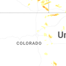
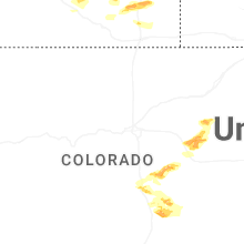

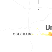
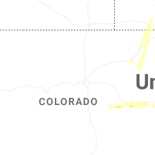
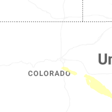
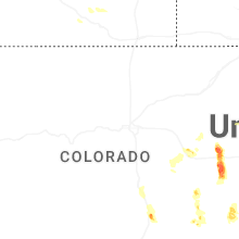

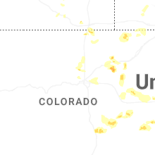
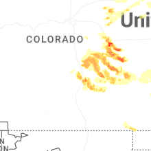


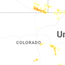

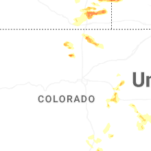

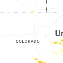
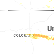


Connect with Interactive Hail Maps