

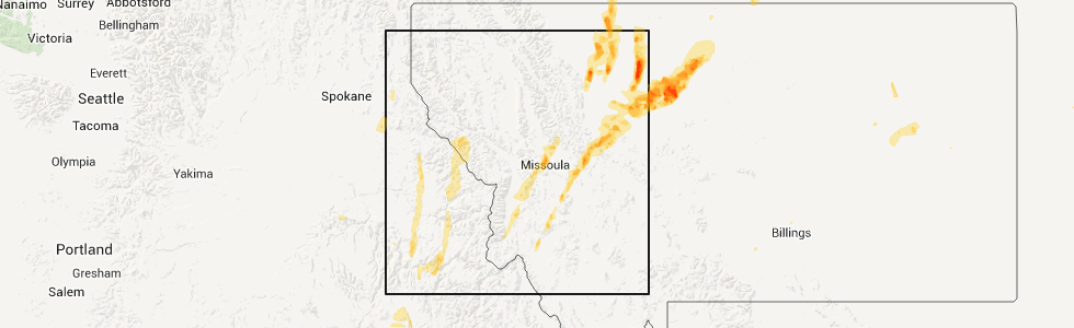
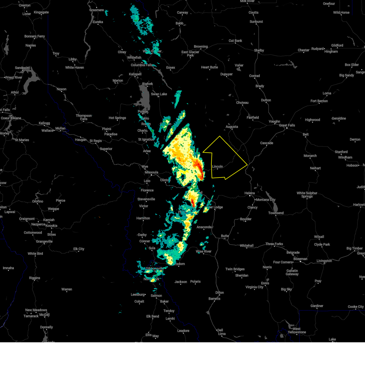
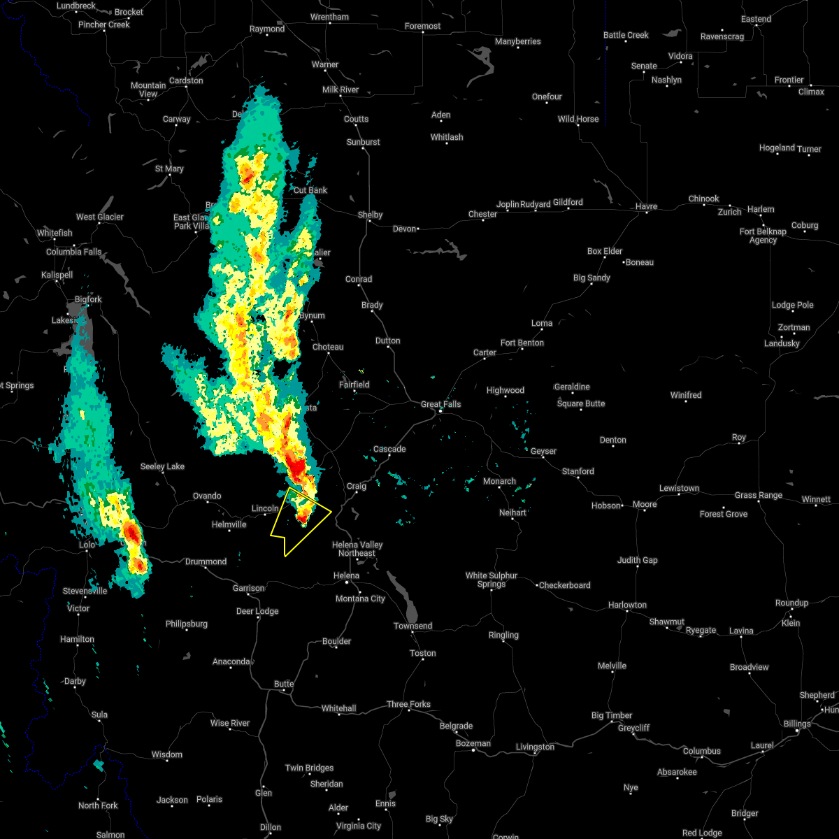
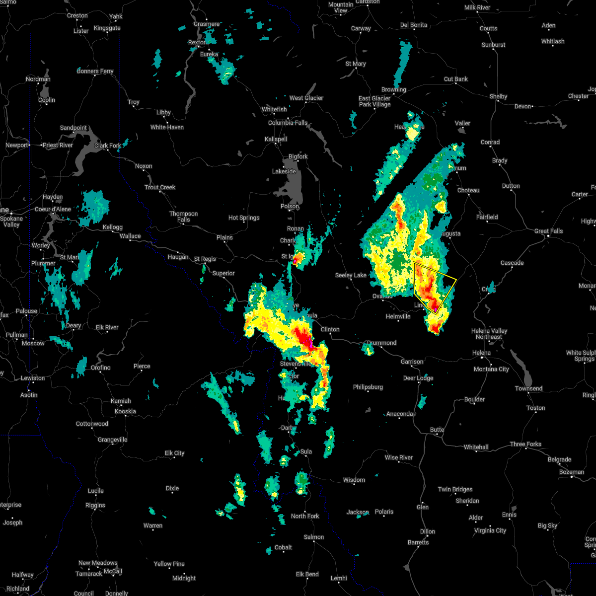
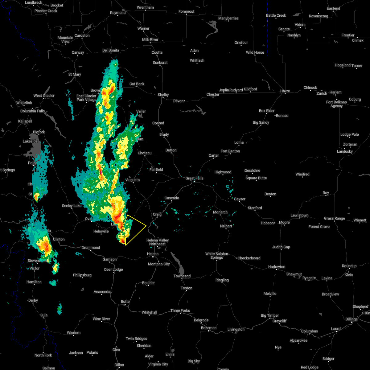
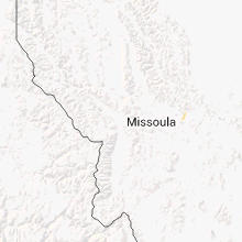
Hail Map for Lincoln, MT
The Lincoln, MT area has had 5 reports of on-the-ground hail by trained spotters, and has been under severe weather warnings 3 times during the past 12 months. Doppler radar has detected hail at or near Lincoln, MT on 19 occasions.
| Name: | Lincoln, MT |
| Where Located: | 63.2 miles E of Missoula, MT |
| Map: | Google Map for Lincoln, MT |
| Population: | 1013 |
| Housing Units: | 846 |
| More Info: | Search Google for Lincoln, MT |
5
The Top Recent Hail Date for Lincoln, MT is Monday, June 4, 2012 (1st out of 19)
Hail and Wind Damage Spotted near Lincoln, MT
| Date / Time | Report Details |
|---|---|
| 9/14/2025 7:55 PM MDT |
 The storms which prompted the warning have weakened below severe limits, and have exited the warned area. therefore, the warning will be allowed to expire. however, gusty winds are still possible with these thunderstorms. The storms which prompted the warning have weakened below severe limits, and have exited the warned area. therefore, the warning will be allowed to expire. however, gusty winds are still possible with these thunderstorms.
|
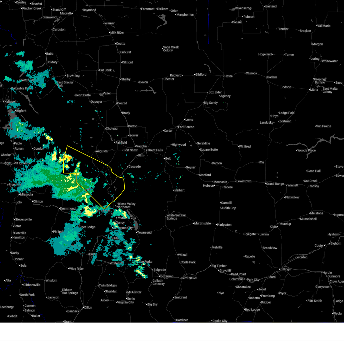
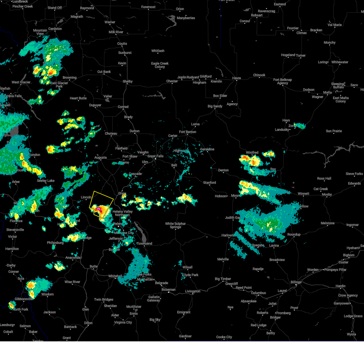
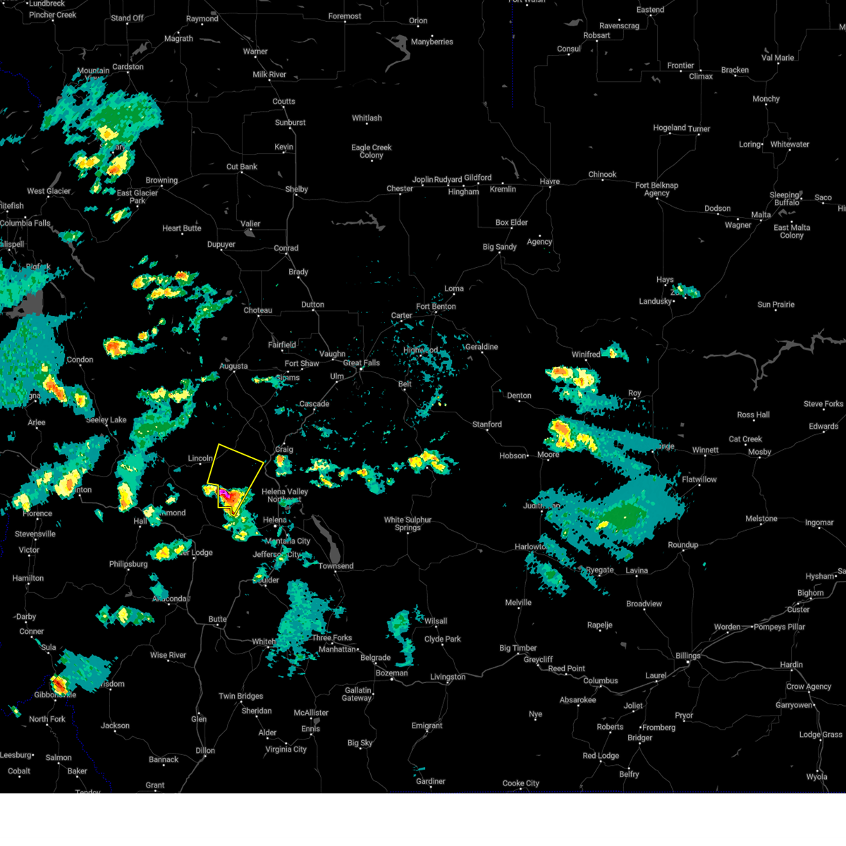
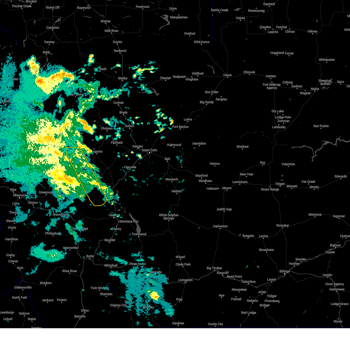
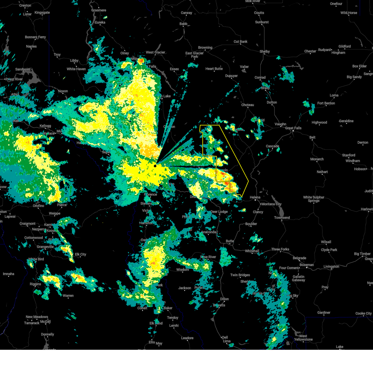
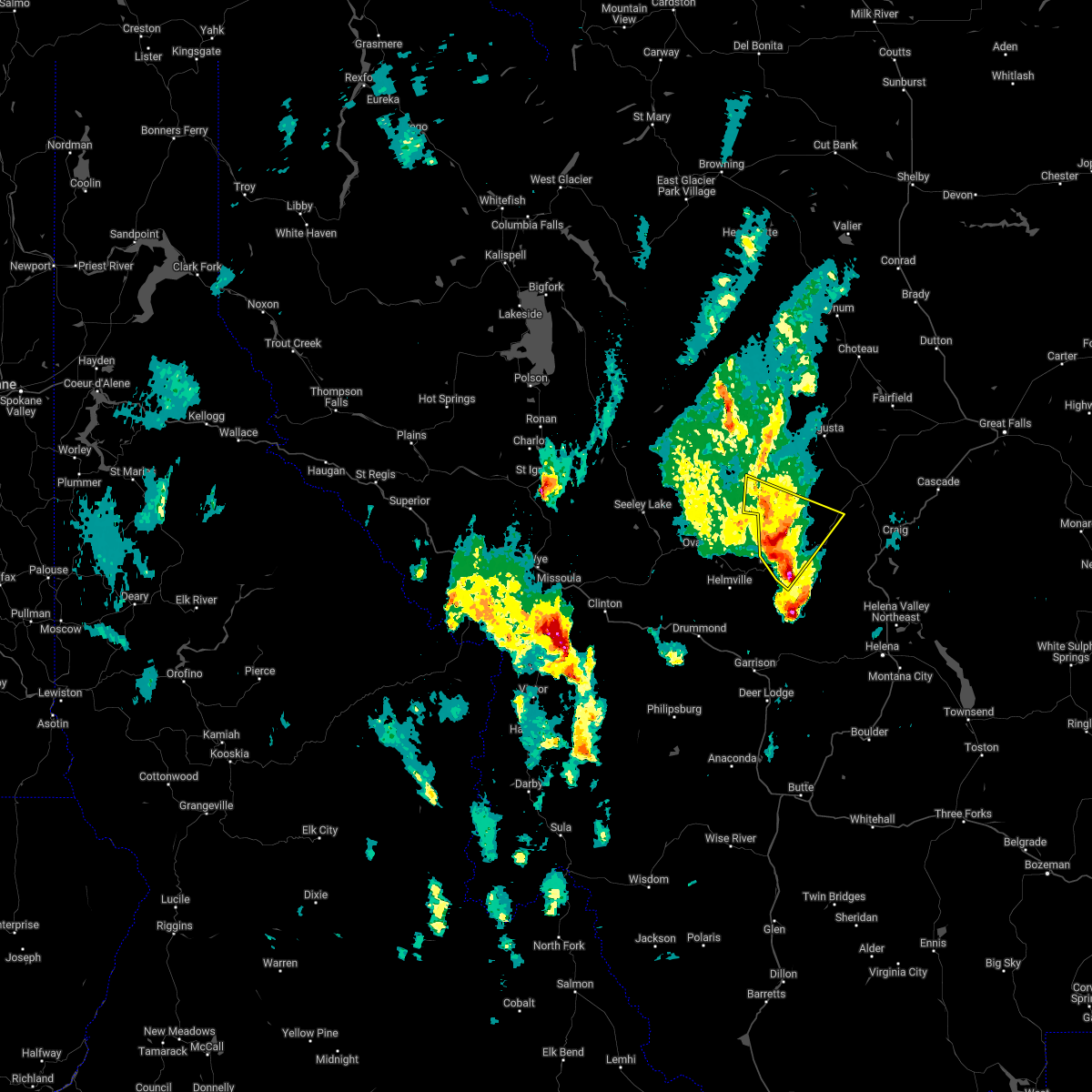
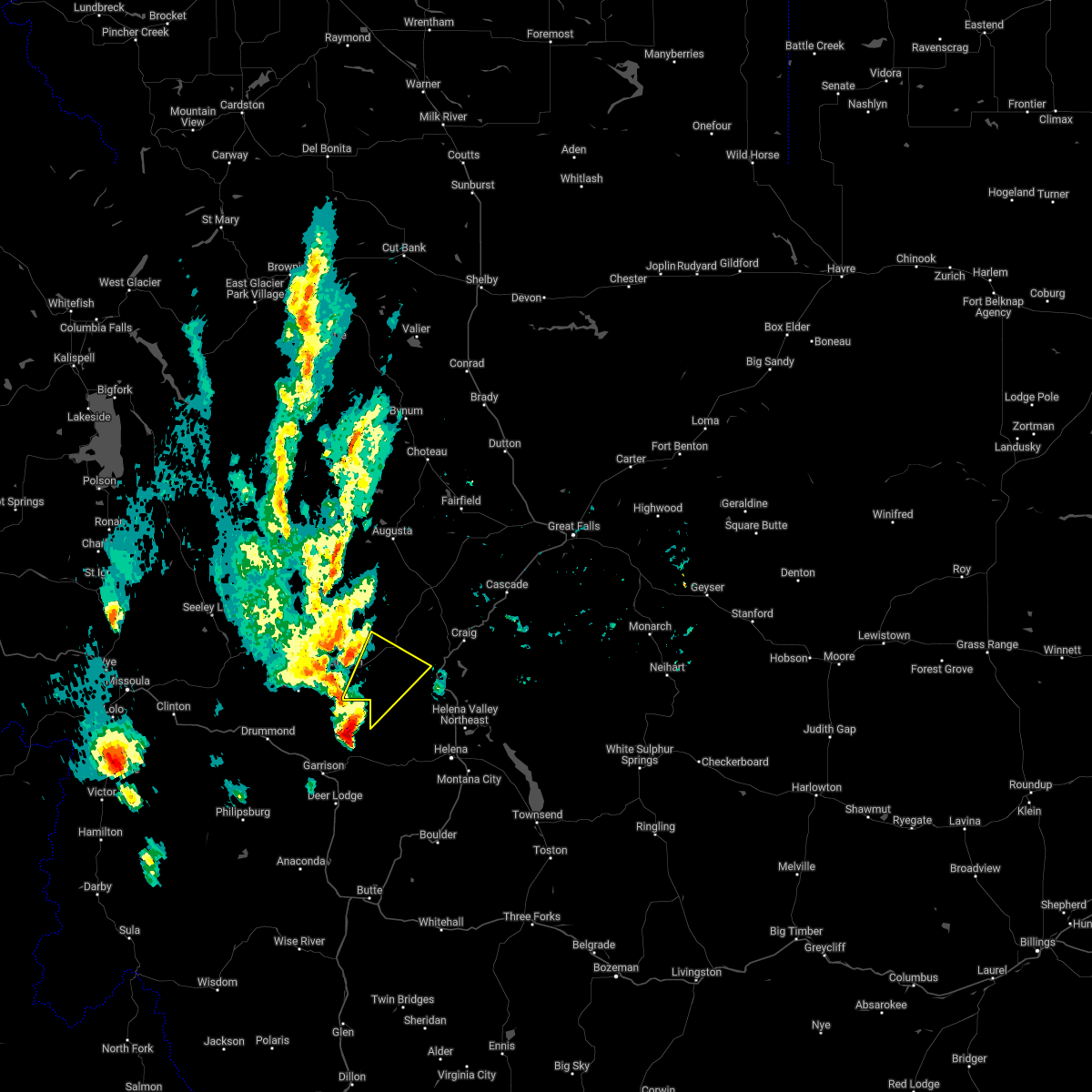
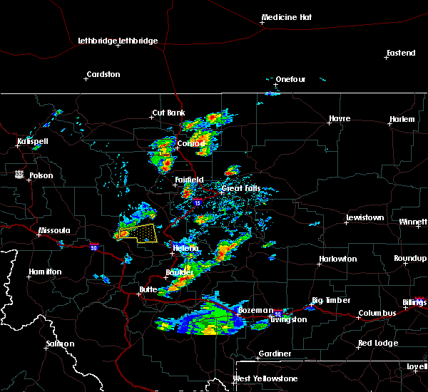
| 9/14/2025 7:35 PM MDT | At 735 pm mdt, severe thunderstorms were located along a line extending from 16 miles northeast of seeley lake to 8 miles northeast of lincoln to 14 miles north of helena, moving northeast at 30 mph (radar indicated). Hazards include 60 mph wind gusts. Expect damage to roofs, siding, and trees. Locations impacted include, wolf creek, bowmans corner, marysville, canyon creek, bean lake, and craig. |
| 9/14/2025 7:00 PM MDT | Svrtfx the national weather service in great falls has issued a * severe thunderstorm warning for, lewis and clark county in west central montana, * until 800 pm mdt. * at 659 pm mdt, severe thunderstorms were located along a line extending from 6 miles southeast of seeley lake to 9 miles southwest of lincoln to 15 miles west of helena, moving northeast at 35 mph (radar indicated). Hazards include 60 mph wind gusts. expect damage to roofs, siding, and trees |
| 8/10/2024 5:06 PM MDT |
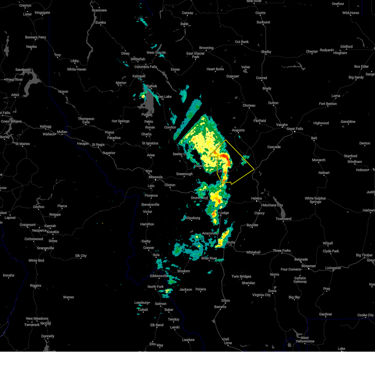
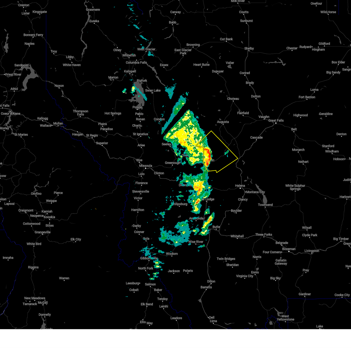
 At 505 pm mdt, a severe thunderstorm was located 14 miles southeast of lincoln, or 25 miles northwest of helena, moving northeast at 25 mph (radar indicated). Hazards include quarter size hail. Damage to vehicles is expected. Locations impacted include, canyon creek. At 505 pm mdt, a severe thunderstorm was located 14 miles southeast of lincoln, or 25 miles northwest of helena, moving northeast at 25 mph (radar indicated). Hazards include quarter size hail. Damage to vehicles is expected. Locations impacted include, canyon creek.
|
| 8/10/2024 4:53 PM MDT |
 Svrtfx the national weather service in great falls has issued a * severe thunderstorm warning for, south central lewis and clark county in west central montana, * until 530 pm mdt. * at 453 pm mdt, a severe thunderstorm was located 14 miles southeast of lincoln, or 25 miles northwest of helena, moving northeast at 30 mph (radar indicated). Hazards include quarter size hail. damage to vehicles is expected Svrtfx the national weather service in great falls has issued a * severe thunderstorm warning for, south central lewis and clark county in west central montana, * until 530 pm mdt. * at 453 pm mdt, a severe thunderstorm was located 14 miles southeast of lincoln, or 25 miles northwest of helena, moving northeast at 30 mph (radar indicated). Hazards include quarter size hail. damage to vehicles is expected
|
| 8/29/2023 8:40 PM MDT |
 The severe thunderstorm warning for southwestern lewis and clark county will expire at 845 pm mdt, the storms which prompted the warning have weakened below severe limits, and have exited the warned area. therefore, the warning will be allowed to expire. however gusty winds and heavy rain are still possible with these thunderstorms. remember, a severe thunderstorm warning still remains in effect for portions of lewis and clark and cascade counties until 915 pm mdt. The severe thunderstorm warning for southwestern lewis and clark county will expire at 845 pm mdt, the storms which prompted the warning have weakened below severe limits, and have exited the warned area. therefore, the warning will be allowed to expire. however gusty winds and heavy rain are still possible with these thunderstorms. remember, a severe thunderstorm warning still remains in effect for portions of lewis and clark and cascade counties until 915 pm mdt.
|
| 8/29/2023 8:29 PM MDT |
 At 828 pm mdt, severe thunderstorms were located along a line extending from 20 miles west of augusta to 15 miles southwest of wolf creek, moving north at 35 mph (radar indicated). Hazards include 60 mph wind gusts. Expect damage to roofs, siding, and trees. locations impacted include, canyon creek. hail threat, radar indicated max hail size, <. 75 in wind threat, radar indicated max wind gust, 60 mph. At 828 pm mdt, severe thunderstorms were located along a line extending from 20 miles west of augusta to 15 miles southwest of wolf creek, moving north at 35 mph (radar indicated). Hazards include 60 mph wind gusts. Expect damage to roofs, siding, and trees. locations impacted include, canyon creek. hail threat, radar indicated max hail size, <. 75 in wind threat, radar indicated max wind gust, 60 mph.
|
| 8/29/2023 8:08 PM MDT |
 At 807 pm mdt, severe thunderstorms were located along a line extending from 13 miles northeast of ovando to 18 miles east of garrison, moving north at 25 mph (radar indicated). Hazards include 60 mph wind gusts. hail up to one half inch in diameter. expect damage to roofs, siding, and trees At 807 pm mdt, severe thunderstorms were located along a line extending from 13 miles northeast of ovando to 18 miles east of garrison, moving north at 25 mph (radar indicated). Hazards include 60 mph wind gusts. hail up to one half inch in diameter. expect damage to roofs, siding, and trees
|
| 5/22/2023 12:52 PM MDT |
 The severe thunderstorm warning for west central lewis and clark county will expire at 100 pm mdt, the storm which prompted the warning has largely moved out of the area. another severe thunderstorm warning will be issued. The severe thunderstorm warning for west central lewis and clark county will expire at 100 pm mdt, the storm which prompted the warning has largely moved out of the area. another severe thunderstorm warning will be issued.
|
| 5/22/2023 12:41 PM MDT |
 At 1240 pm mdt, a severe thunderstorm was located 9 miles north of lincoln, or 36 miles northeast of drummond, moving northeast at 40 mph (radar indicated). Hazards include 60 mph wind gusts and penny size hail. Expect damage to roofs, siding, and trees. locations impacted include, lincoln. hail threat, radar indicated max hail size, 0. 75 in wind threat, radar indicated max wind gust, 60 mph. At 1240 pm mdt, a severe thunderstorm was located 9 miles north of lincoln, or 36 miles northeast of drummond, moving northeast at 40 mph (radar indicated). Hazards include 60 mph wind gusts and penny size hail. Expect damage to roofs, siding, and trees. locations impacted include, lincoln. hail threat, radar indicated max hail size, 0. 75 in wind threat, radar indicated max wind gust, 60 mph.
|
| 5/22/2023 12:19 PM MDT |
 At 1218 pm mdt, a severe thunderstorm was located 11 miles east of ovando, or 23 miles northeast of drummond, moving northeast at 40 mph (radar indicated). Hazards include 60 mph wind gusts and penny size hail. expect damage to roofs, siding, and trees At 1218 pm mdt, a severe thunderstorm was located 11 miles east of ovando, or 23 miles northeast of drummond, moving northeast at 40 mph (radar indicated). Hazards include 60 mph wind gusts and penny size hail. expect damage to roofs, siding, and trees
|
| 6/18/2022 2:10 PM MDT |
 The severe thunderstorm warning for south central lewis and clark county will expire at 215 pm mdt, the storm which prompted the warning has been replaced with a new severe thunderstorm warning that is in effect until 245 pm. a severe thunderstorm watch remains in effect until 700 pm mdt for west central montana. The severe thunderstorm warning for south central lewis and clark county will expire at 215 pm mdt, the storm which prompted the warning has been replaced with a new severe thunderstorm warning that is in effect until 245 pm. a severe thunderstorm watch remains in effect until 700 pm mdt for west central montana.
|
| 6/18/2022 2:09 PM MDT |
 The severe thunderstorm warning for south central lewis and clark county will expire at 215 pm mdt, the storm which prompted the warning has been replaced with a new severe thunderstorm warning that is in effect until 245 pm. a severe thunderstorm watch remains in effect until 700 pm mdt for west central montana. The severe thunderstorm warning for south central lewis and clark county will expire at 215 pm mdt, the storm which prompted the warning has been replaced with a new severe thunderstorm warning that is in effect until 245 pm. a severe thunderstorm watch remains in effect until 700 pm mdt for west central montana.
|
| 6/18/2022 1:46 PM MDT |
 At 145 pm mdt, a severe thunderstorm was located 8 miles north of lincoln, or 36 miles northeast of drummond, moving north at 35 mph (radar indicated). Hazards include 70 mph wind gusts and ping pong ball size hail. People and animals outdoors will be injured. expect hail damage to roofs, siding, windows, and vehicles. expect considerable tree damage. wind damage is also likely to mobile homes, roofs, and outbuildings. This severe thunderstorm will remain over mainly rural areas of west central lewis and clark county. At 145 pm mdt, a severe thunderstorm was located 8 miles north of lincoln, or 36 miles northeast of drummond, moving north at 35 mph (radar indicated). Hazards include 70 mph wind gusts and ping pong ball size hail. People and animals outdoors will be injured. expect hail damage to roofs, siding, windows, and vehicles. expect considerable tree damage. wind damage is also likely to mobile homes, roofs, and outbuildings. This severe thunderstorm will remain over mainly rural areas of west central lewis and clark county.
|
| 6/18/2022 1:39 PM MDT |
 At 138 pm mdt, a severe thunderstorm was located 13 miles southeast of lincoln, or 28 miles north of deer lodge, moving northeast at 30 mph (radar indicated). Hazards include ping pong ball size hail and 60 mph wind gusts. People and animals outdoors will be injured. expect hail damage to roofs, siding, windows, and vehicles. expect wind damage to roofs, siding, and trees. this severe thunderstorm will remain over mainly rural areas of south central lewis and clark county. hail threat, radar indicated max hail size, 1. 50 in wind threat, radar indicated max wind gust, 60 mph. At 138 pm mdt, a severe thunderstorm was located 13 miles southeast of lincoln, or 28 miles north of deer lodge, moving northeast at 30 mph (radar indicated). Hazards include ping pong ball size hail and 60 mph wind gusts. People and animals outdoors will be injured. expect hail damage to roofs, siding, windows, and vehicles. expect wind damage to roofs, siding, and trees. this severe thunderstorm will remain over mainly rural areas of south central lewis and clark county. hail threat, radar indicated max hail size, 1. 50 in wind threat, radar indicated max wind gust, 60 mph.
|
| 6/18/2022 1:39 PM MDT |
 At 139 pm mdt, a severe thunderstorm was located near lincoln, or 26 miles northeast of drummond, moving north at 35 mph (radar indicated). Hazards include 70 mph wind gusts and half dollar size hail. Hail damage to vehicles is expected. expect considerable tree damage. wind damage is also likely to mobile homes, roofs, and outbuildings. Locations impacted include, lincoln. At 139 pm mdt, a severe thunderstorm was located near lincoln, or 26 miles northeast of drummond, moving north at 35 mph (radar indicated). Hazards include 70 mph wind gusts and half dollar size hail. Hail damage to vehicles is expected. expect considerable tree damage. wind damage is also likely to mobile homes, roofs, and outbuildings. Locations impacted include, lincoln.
|
| 6/18/2022 1:37 PM MDT |
 At 136 pm mdt, a severe thunderstorm was located over lincoln, or 27 miles northeast of drummond, and is moving northeast at 35 mph (radar indicated). Hazards include 70 mph wind gusts and half dollar size hail. Hail damage to vehicles is expected. expect considerable tree damage. wind damage is also likely to mobile homes, roofs, and outbuildings. Locations impacted include, lincoln. At 136 pm mdt, a severe thunderstorm was located over lincoln, or 27 miles northeast of drummond, and is moving northeast at 35 mph (radar indicated). Hazards include 70 mph wind gusts and half dollar size hail. Hail damage to vehicles is expected. expect considerable tree damage. wind damage is also likely to mobile homes, roofs, and outbuildings. Locations impacted include, lincoln.
|
| 6/18/2022 1:28 PM MDT |
 At 128 pm mdt, a severe thunderstorm was located 15 miles south of lincoln, or 24 miles north of deer lodge, moving northeast at 35 mph (radar indicated). Hazards include 60 mph wind gusts and quarter size hail. Hail damage to vehicles is expected. expect wind damage to roofs, siding, and trees. this severe thunderstorm will remain over mainly rural areas of south central lewis and clark county. hail threat, radar indicated max hail size, 1. 00 in wind threat, radar indicated max wind gust, 60 mph. At 128 pm mdt, a severe thunderstorm was located 15 miles south of lincoln, or 24 miles north of deer lodge, moving northeast at 35 mph (radar indicated). Hazards include 60 mph wind gusts and quarter size hail. Hail damage to vehicles is expected. expect wind damage to roofs, siding, and trees. this severe thunderstorm will remain over mainly rural areas of south central lewis and clark county. hail threat, radar indicated max hail size, 1. 00 in wind threat, radar indicated max wind gust, 60 mph.
|
| 6/18/2022 1:27 PM MDT |
 At 127 pm mdt, a severe thunderstorm was located near lincoln, or 23 miles northeast of drummond, moving north at 35 mph (radar indicated). Hazards include 60 mph wind gusts and quarter size hail. Hail damage to vehicles is expected. Expect wind damage to roofs, siding, and trees. At 127 pm mdt, a severe thunderstorm was located near lincoln, or 23 miles northeast of drummond, moving north at 35 mph (radar indicated). Hazards include 60 mph wind gusts and quarter size hail. Hail damage to vehicles is expected. Expect wind damage to roofs, siding, and trees.
|
| 8/5/2021 5:07 PM MDT |
 At 507 pm mdt, a severe thunderstorm was located near garrison, or 12 miles north of deer lodge, moving north at 35 mph (radar indicated). Hazards include 60 mph wind gusts and quarter size hail. Hail damage to vehicles is expected. expect wind damage to roofs, siding, and trees. this severe thunderstorm will remain over mainly rural areas of southwestern lewis and clark county. hail threat, radar indicated max hail size, 1. 00 in wind threat, radar indicated max wind gust, 60 mph. At 507 pm mdt, a severe thunderstorm was located near garrison, or 12 miles north of deer lodge, moving north at 35 mph (radar indicated). Hazards include 60 mph wind gusts and quarter size hail. Hail damage to vehicles is expected. expect wind damage to roofs, siding, and trees. this severe thunderstorm will remain over mainly rural areas of southwestern lewis and clark county. hail threat, radar indicated max hail size, 1. 00 in wind threat, radar indicated max wind gust, 60 mph.
|
| 7/14/2019 4:24 PM MDT |
 The severe thunderstorm warning for southwestern lewis and clark county will expire at 430 pm mdt, the storm which prompted the warning has weakened below severe limits, and no longer poses an immediate threat to life or property. therefore, the warning will be allowed to expire. however small hail and gusty winds are still possible with this thunderstorm. The severe thunderstorm warning for southwestern lewis and clark county will expire at 430 pm mdt, the storm which prompted the warning has weakened below severe limits, and no longer poses an immediate threat to life or property. therefore, the warning will be allowed to expire. however small hail and gusty winds are still possible with this thunderstorm.
|
| 7/14/2019 4:13 PM MDT |
 At 412 pm mdt, a severe thunderstorm was located near lincoln, or 27 miles northeast of drummond, moving east at 35 mph (radar indicated). Hazards include 60 mph wind gusts and half dollar size hail. Hail damage to vehicles is expected. expect wind damage to roofs, siding, and trees. Locations impacted include, lincoln and canyon creek. At 412 pm mdt, a severe thunderstorm was located near lincoln, or 27 miles northeast of drummond, moving east at 35 mph (radar indicated). Hazards include 60 mph wind gusts and half dollar size hail. Hail damage to vehicles is expected. expect wind damage to roofs, siding, and trees. Locations impacted include, lincoln and canyon creek.
|
| 7/14/2019 4:04 PM MDT | Ping Pong Ball sized hail reported 13.3 miles ENE of Lincoln, MT |
| 7/14/2019 4:02 PM MDT |
 At 402 pm mdt, a severe thunderstorm was located 8 miles southwest of lincoln, or 21 miles northeast of drummond, moving east at 35 mph (radar indicated). Hazards include 60 mph wind gusts and half dollar size hail. Hail damage to vehicles is expected. Expect wind damage to roofs, siding, and trees. At 402 pm mdt, a severe thunderstorm was located 8 miles southwest of lincoln, or 21 miles northeast of drummond, moving east at 35 mph (radar indicated). Hazards include 60 mph wind gusts and half dollar size hail. Hail damage to vehicles is expected. Expect wind damage to roofs, siding, and trees.
|
| 5/16/2018 4:45 PM MDT | Lincoln fire department reports a large pine tree down (snapped at base). pea size hail and 0.40 inches of rainfall in 30 minutes. report via facebook. time/location es in lewis and clark county MT, 0.9 miles ESE of Lincoln, MT |
| 6/8/2017 5:38 PM MDT | Golf Ball sized hail reported 2.1 miles WSW of Lincoln, MT, est 40 to 50 mph winds along with golf ball sized hail. |
| 6/8/2017 5:38 PM MDT | Quarter sized hail reported 2.1 miles WSW of Lincoln, MT, est 40 to 50 mph winds along with up to quarter sized hail. report via ham radio. time and location estimated. |
| 6/8/2017 5:36 PM MDT |
 At 535 pm mdt, a severe thunderstorm was located 14 miles north of lincoln, or 39 miles northeast of drummond, moving northeast at 35 to 40 mph (radar indicated). Hazards include 60 mph wind gusts and quarter size hail. Hail damage to vehicles is expected. Expect wind damage to roofs, siding, and trees. At 535 pm mdt, a severe thunderstorm was located 14 miles north of lincoln, or 39 miles northeast of drummond, moving northeast at 35 to 40 mph (radar indicated). Hazards include 60 mph wind gusts and quarter size hail. Hail damage to vehicles is expected. Expect wind damage to roofs, siding, and trees.
|
| 9/7/2013 6:35 PM MDT | Ping Pong Ball sized hail reported 3.6 miles E of Lincoln, MT, ping pong size hail reported west of lincoln. report relayed via ham radio to nws missoula. |
| 6/4/2012 5:20 PM MDT | Quarter sized hail reported 6.5 miles N of Lincoln, MT, quater size hail near stemple pass |
Hail Maps for Lincoln, MT


Connect with Interactive Hail Maps