

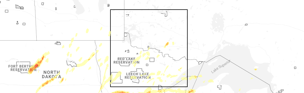
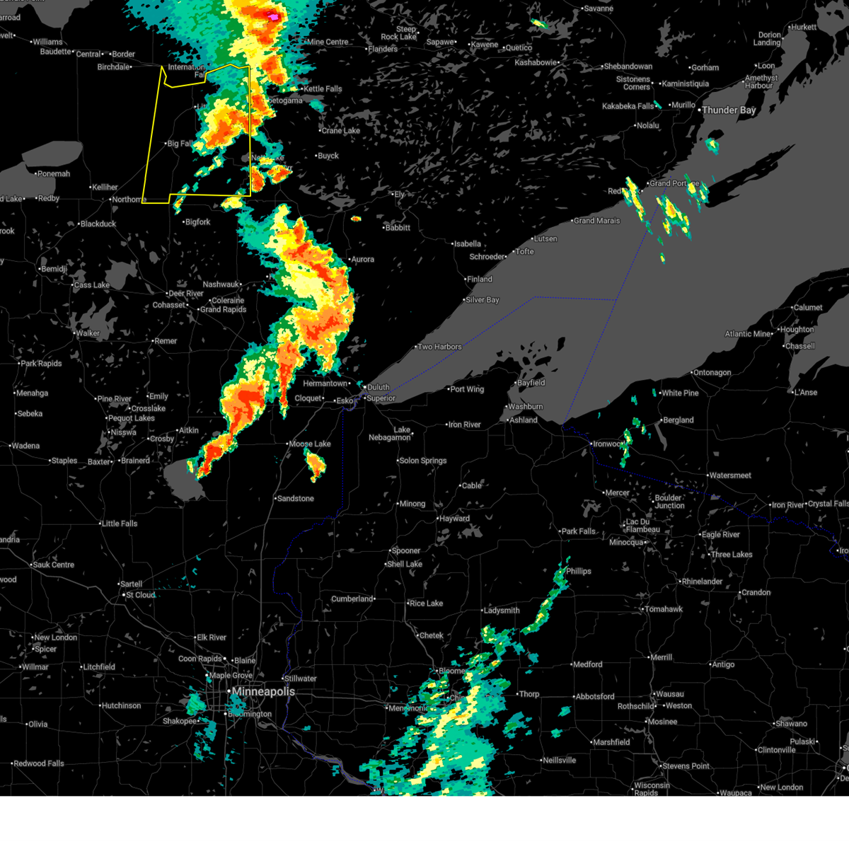
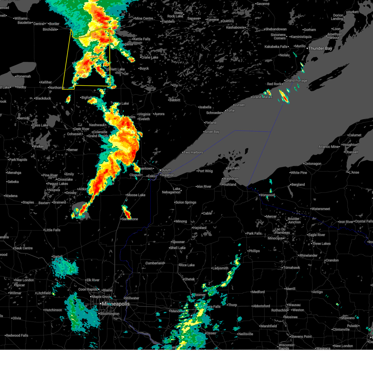
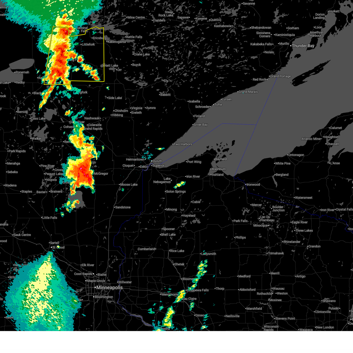
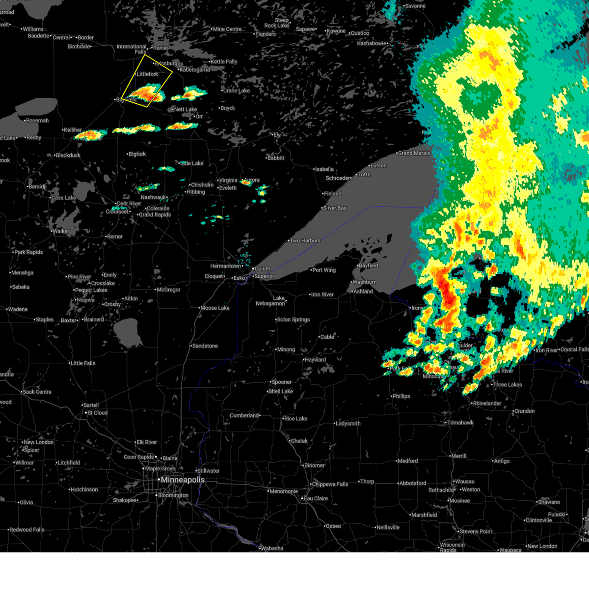
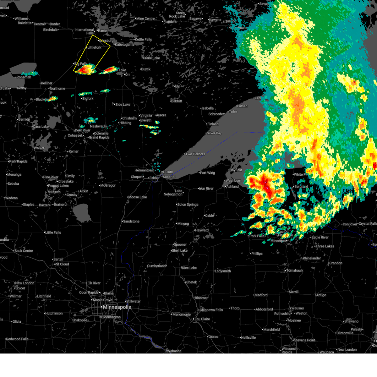
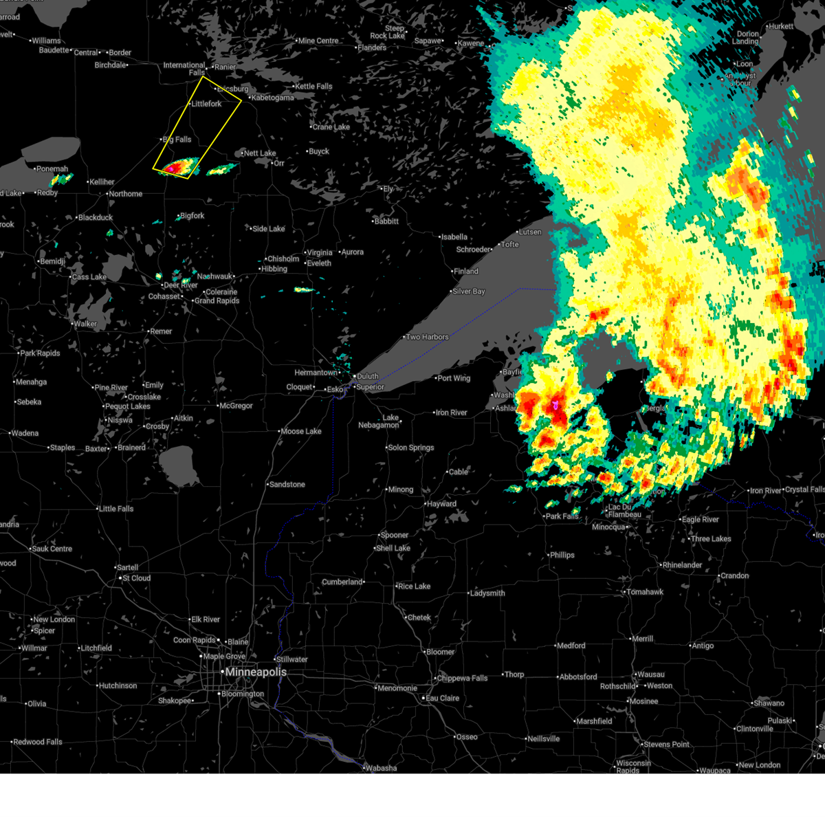
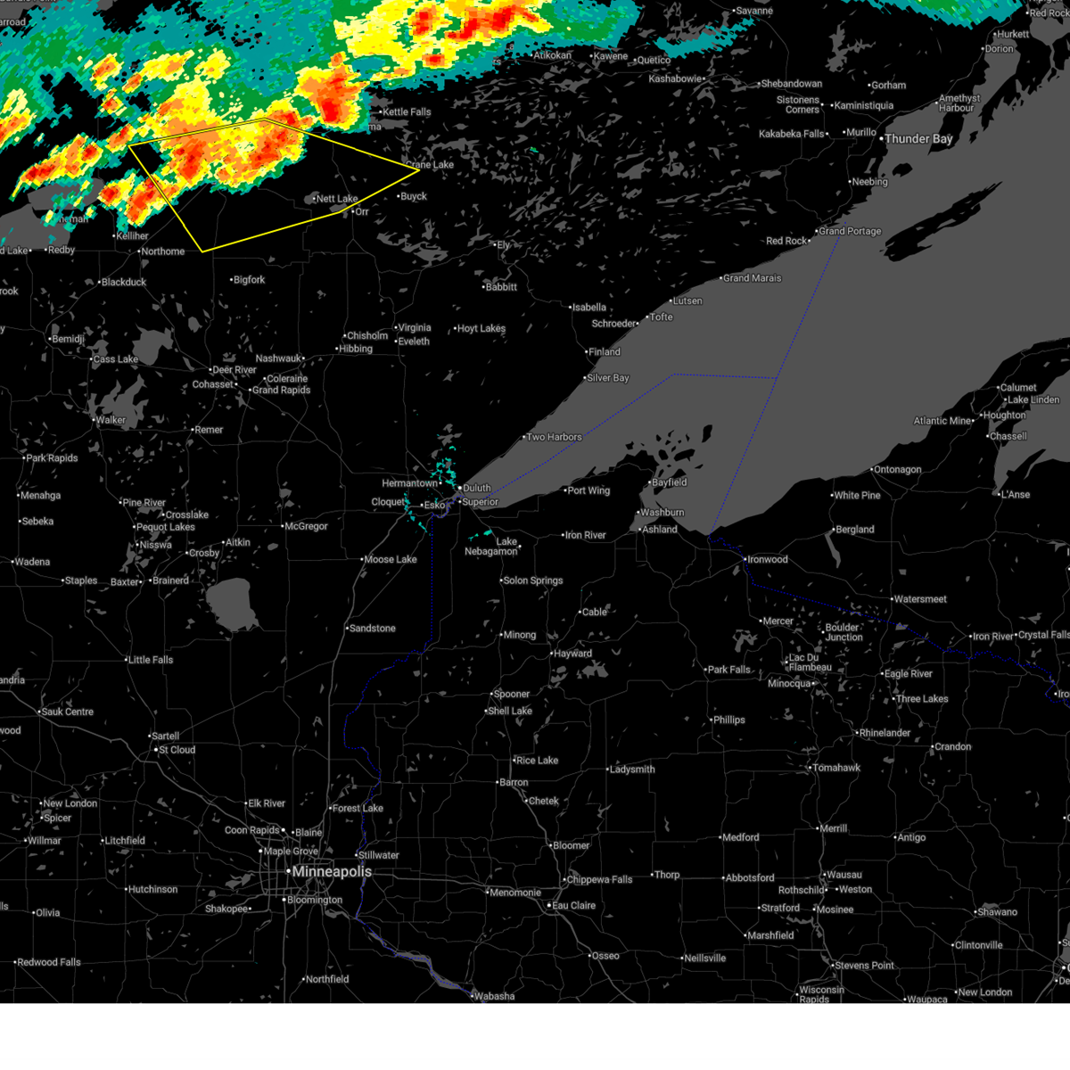
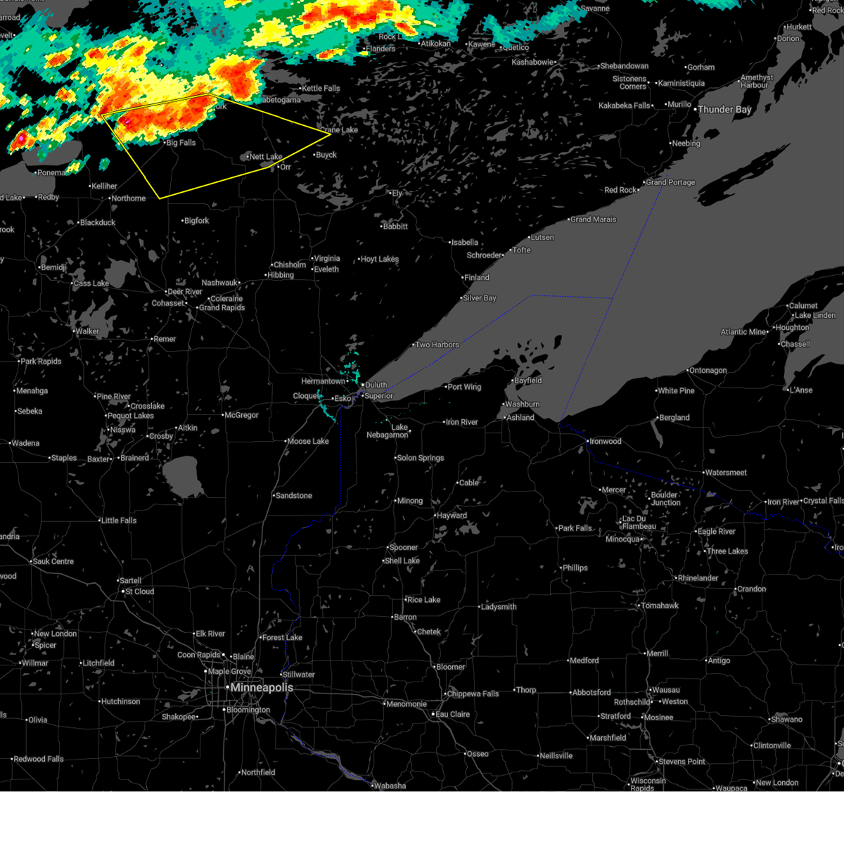
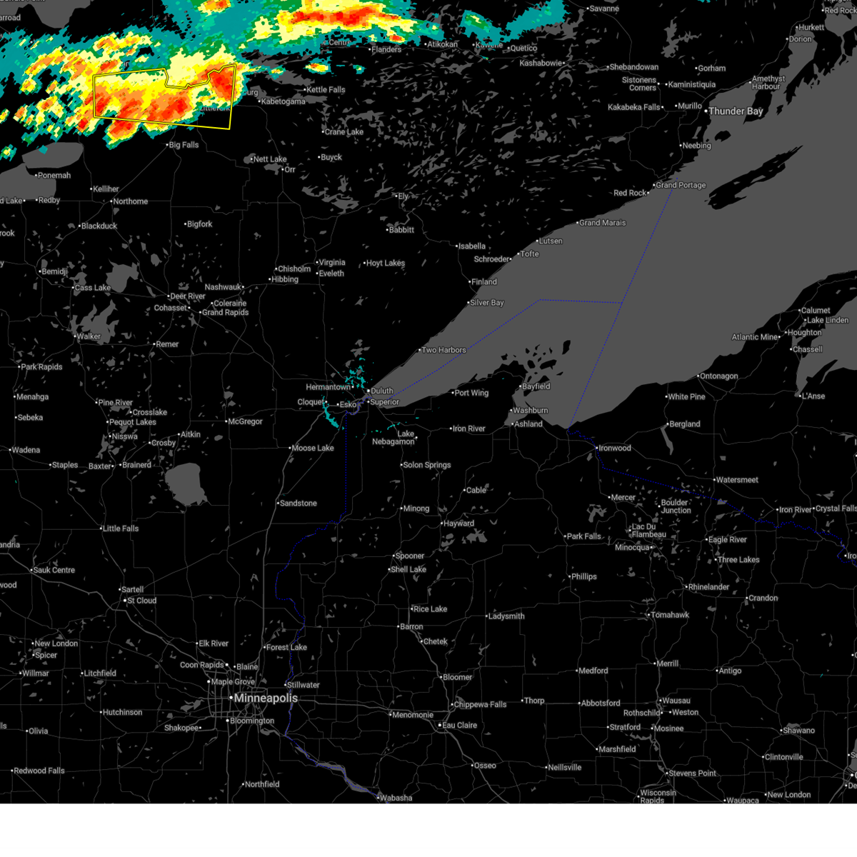
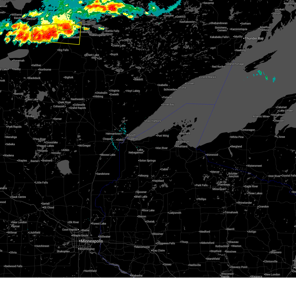
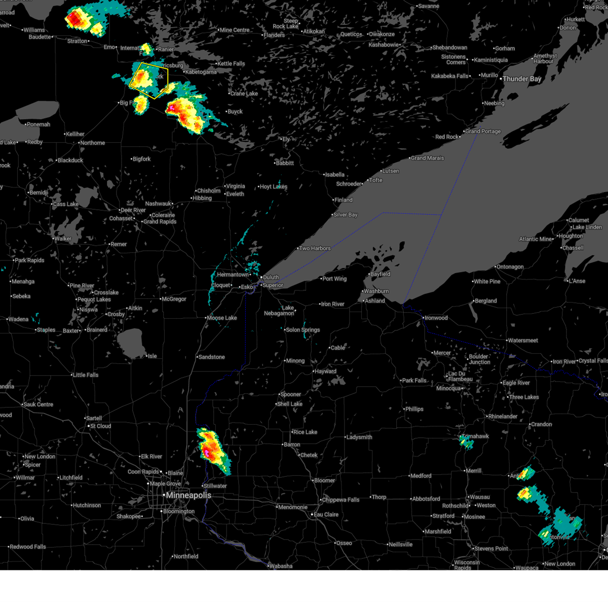
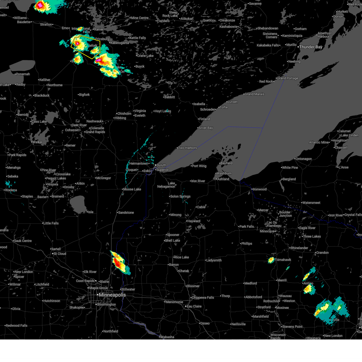
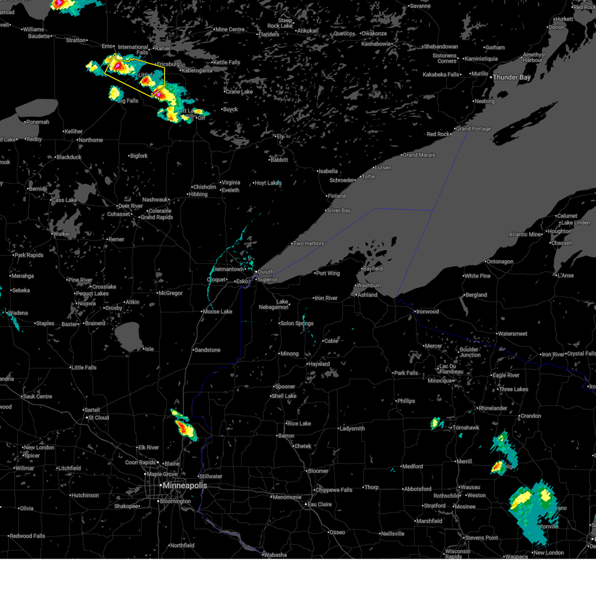
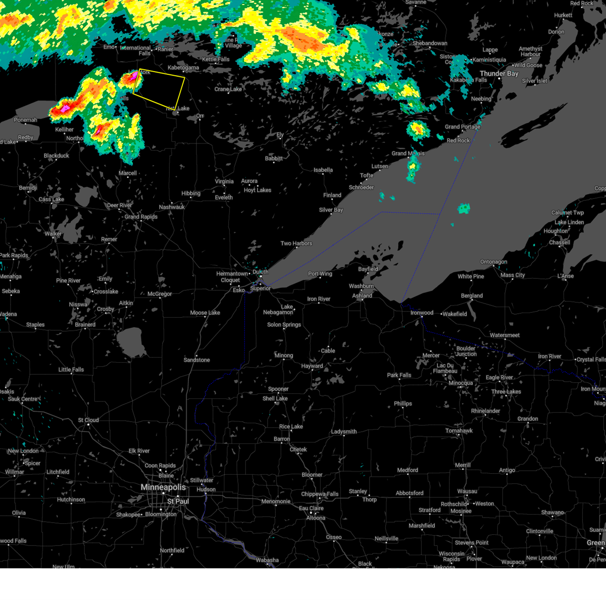
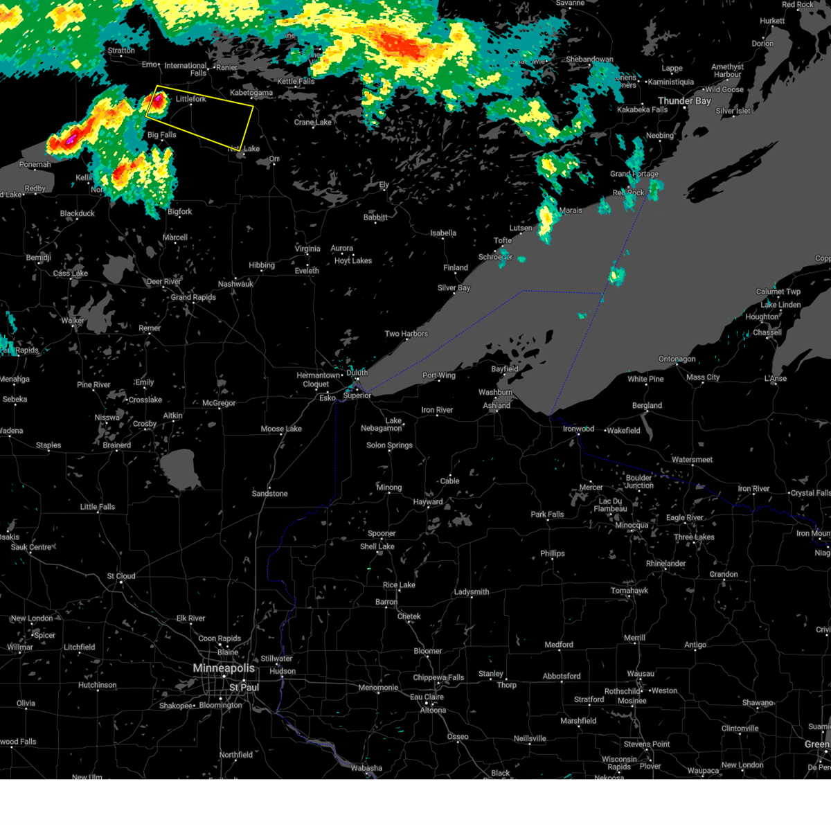
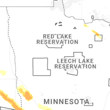
Hail Map for Littlefork, MN
The Littlefork, MN area has had 1 report of on-the-ground hail by trained spotters, and has been under severe weather warnings 7 times during the past 12 months. Doppler radar has detected hail at or near Littlefork, MN on 37 occasions, including 2 occasions during the past year.
| Name: | Littlefork, MN |
| Where Located: | 15.6 miles SSW of International Falls, MN |
| Map: | Google Map for Littlefork, MN |
| Population: | 647 |
| Housing Units: | 296 |
| More Info: | Search Google for Littlefork, MN |
2
The Top Recent Hail Date for Littlefork, MN is Monday, June 29, 2026 (15th out of 37)
Hail and Wind Damage Spotted near Littlefork, MN
| Date / Time | Report Details |
|---|---|
| 6/30/2026 12:50 AM CDT |
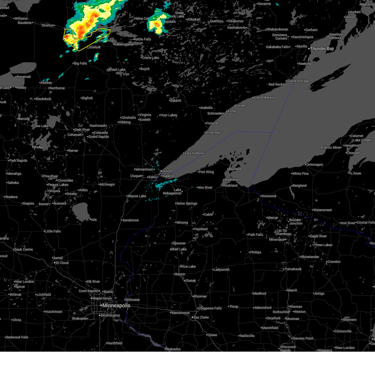
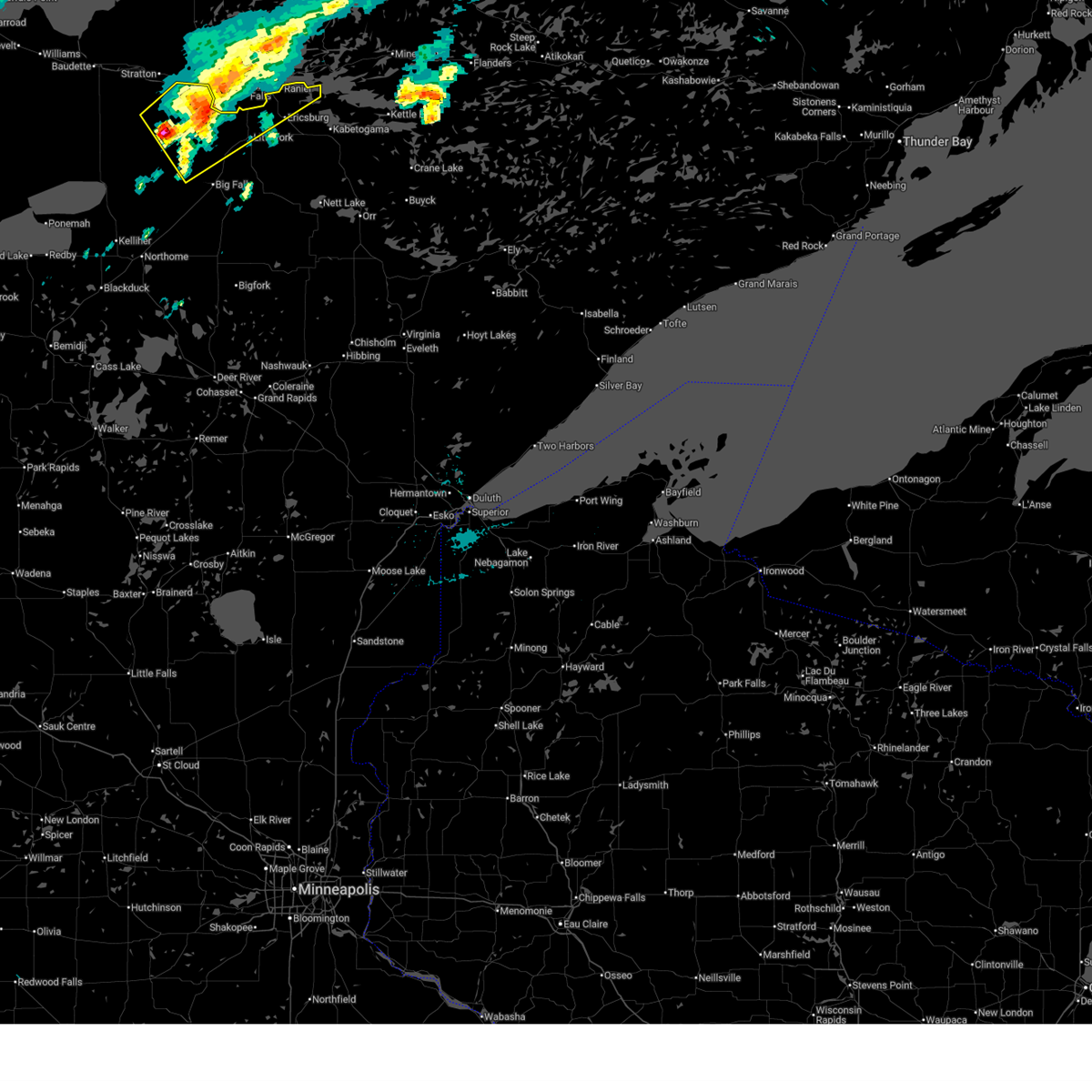
 The storms which prompted the warning have weakened below severe limits, and no longer pose an immediate threat to life or property. therefore, the warning will be allowed to expire. however, heavy rain is still possible with these thunderstorms. a tornado watch remains in effect until 200 am cdt for north central and northeastern minnesota. to report severe weather, contact your nearest law enforcement agency. they will relay your report to the national weather service duluth mn. The storms which prompted the warning have weakened below severe limits, and no longer pose an immediate threat to life or property. therefore, the warning will be allowed to expire. however, heavy rain is still possible with these thunderstorms. a tornado watch remains in effect until 200 am cdt for north central and northeastern minnesota. to report severe weather, contact your nearest law enforcement agency. they will relay your report to the national weather service duluth mn.
|
| 6/30/2026 12:27 AM CDT |
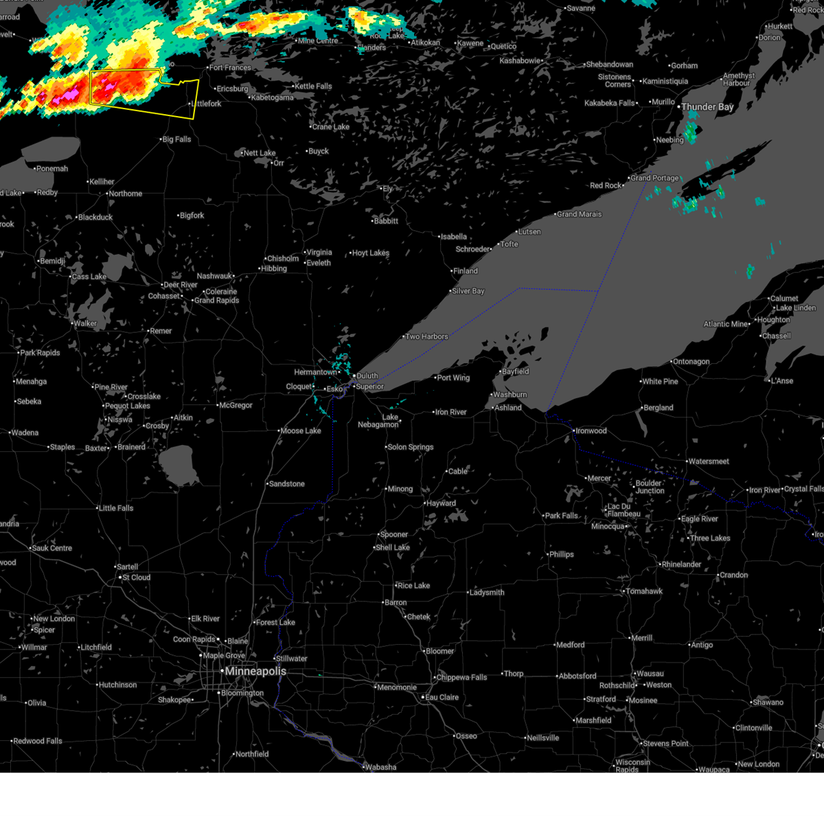
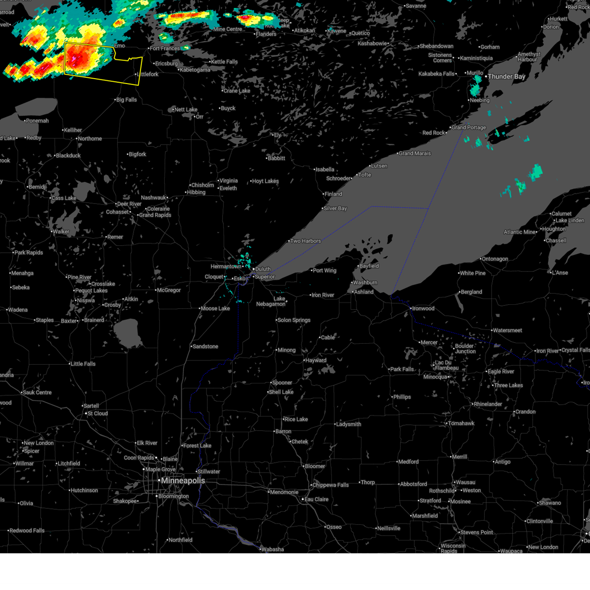
 At 1227 am cdt, severe thunderstorms were located along a line extending from 10 miles northwest of rainy lake west to 8 miles northeast of effie, moving northeast at 45 mph (radar indicated). Hazards include 60 mph wind gusts and quarter size hail. Hail damage to vehicles is expected. expect wind damage to roofs, siding, and trees. Locations impacted include, international falls, littlefork, nett lake, big falls, rainy lake west, pelland, loman, margie, kabetogama lake, ranier, indus, craigville, grand falls, ray, bois forte band nett lake area, island view, ericksburg, and bois forte band deer creek area. At 1227 am cdt, severe thunderstorms were located along a line extending from 10 miles northwest of rainy lake west to 8 miles northeast of effie, moving northeast at 45 mph (radar indicated). Hazards include 60 mph wind gusts and quarter size hail. Hail damage to vehicles is expected. expect wind damage to roofs, siding, and trees. Locations impacted include, international falls, littlefork, nett lake, big falls, rainy lake west, pelland, loman, margie, kabetogama lake, ranier, indus, craigville, grand falls, ray, bois forte band nett lake area, island view, ericksburg, and bois forte band deer creek area.
|
| 6/30/2026 12:03 AM CDT |
 At 1202 am cdt, severe thunderstorms were located along a line extending from 9 miles north of pelland to 12 miles west of effie, moving northeast at 45 mph (radar indicated). Hazards include 60 mph wind gusts and quarter size hail. Hail damage to vehicles is expected. expect wind damage to roofs, siding, and trees. Locations impacted include, international falls, littlefork, pelland, rainy lake west, voyageurs national park and kabetogama lake. At 1202 am cdt, severe thunderstorms were located along a line extending from 9 miles north of pelland to 12 miles west of effie, moving northeast at 45 mph (radar indicated). Hazards include 60 mph wind gusts and quarter size hail. Hail damage to vehicles is expected. expect wind damage to roofs, siding, and trees. Locations impacted include, international falls, littlefork, pelland, rainy lake west, voyageurs national park and kabetogama lake.
|
| 6/29/2026 11:44 PM CDT |
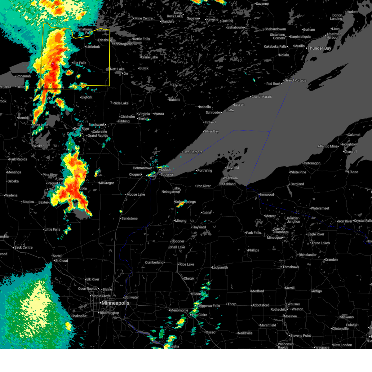 Svrdlh the national weather service in duluth mn has issued a * severe thunderstorm warning for, koochiching county in north central minnesota, * until 100 am cdt. * at 1144 pm cdt, severe thunderstorms were located along a line extending from near loman to 6 miles east of alvwood, moving northeast at 45 mph (radar indicated). Hazards include 60 mph wind gusts and quarter size hail. Hail damage to vehicles is expected. expect wind damage to roofs, siding, and trees. severe thunderstorms will be near, big falls, loman, and margie around 1150 pm cdt. pelland around 1200 am cdt. Other locations in the path of these severe thunderstorms include littlefork, international falls, rainy lake west, voyageurs national park and kabetogama lake. Svrdlh the national weather service in duluth mn has issued a * severe thunderstorm warning for, koochiching county in north central minnesota, * until 100 am cdt. * at 1144 pm cdt, severe thunderstorms were located along a line extending from near loman to 6 miles east of alvwood, moving northeast at 45 mph (radar indicated). Hazards include 60 mph wind gusts and quarter size hail. Hail damage to vehicles is expected. expect wind damage to roofs, siding, and trees. severe thunderstorms will be near, big falls, loman, and margie around 1150 pm cdt. pelland around 1200 am cdt. Other locations in the path of these severe thunderstorms include littlefork, international falls, rainy lake west, voyageurs national park and kabetogama lake.
|
| 6/29/2026 5:51 PM CDT |
 At 551 pm cdt, a severe thunderstorm was located 12 miles east of big falls, or 27 miles south of international falls, moving northeast at 35 mph (radar indicated). Hazards include 60 mph wind gusts and quarter size hail. Hail damage to vehicles is expected. expect wind damage to roofs, siding, and trees. Locations impacted include, littlefork, ericksburg, and ray. At 551 pm cdt, a severe thunderstorm was located 12 miles east of big falls, or 27 miles south of international falls, moving northeast at 35 mph (radar indicated). Hazards include 60 mph wind gusts and quarter size hail. Hail damage to vehicles is expected. expect wind damage to roofs, siding, and trees. Locations impacted include, littlefork, ericksburg, and ray.
|
| 6/29/2026 5:39 PM CDT |
 At 539 pm cdt, a severe thunderstorm was located 9 miles southeast of big falls, or 33 miles south of international falls, moving northeast at 35 mph (radar indicated). Hazards include 60 mph wind gusts and quarter size hail. Hail damage to vehicles is expected. expect wind damage to roofs, siding, and trees. Locations impacted include, littlefork, ericksburg, and ray. At 539 pm cdt, a severe thunderstorm was located 9 miles southeast of big falls, or 33 miles south of international falls, moving northeast at 35 mph (radar indicated). Hazards include 60 mph wind gusts and quarter size hail. Hail damage to vehicles is expected. expect wind damage to roofs, siding, and trees. Locations impacted include, littlefork, ericksburg, and ray.
|
| 6/29/2026 5:25 PM CDT |
 Svrdlh the national weather service in duluth mn has issued a * severe thunderstorm warning for, eastern koochiching county in north central minnesota, * until 630 pm cdt. * at 525 pm cdt, a severe thunderstorm was located 11 miles southeast of margie, moving northeast at 35 mph (radar indicated). Hazards include 60 mph wind gusts and quarter size hail. Hail damage to vehicles is expected. expect wind damage to roofs, siding, and trees. This severe thunderstorm will remain over mainly rural areas of eastern koochiching county, including the following locations, ericksburg and ray. Svrdlh the national weather service in duluth mn has issued a * severe thunderstorm warning for, eastern koochiching county in north central minnesota, * until 630 pm cdt. * at 525 pm cdt, a severe thunderstorm was located 11 miles southeast of margie, moving northeast at 35 mph (radar indicated). Hazards include 60 mph wind gusts and quarter size hail. Hail damage to vehicles is expected. expect wind damage to roofs, siding, and trees. This severe thunderstorm will remain over mainly rural areas of eastern koochiching county, including the following locations, ericksburg and ray.
|
| 7/4/2025 3:23 PM CDT |
 At 323 pm cdt, severe thunderstorms were located along a line extending from 12 miles southwest of kabetogama to near margie, moving east at 30 mph (radar indicated). Hazards include 60 mph wind gusts and penny size hail. Expect damage to roofs, siding, and trees. these severe storms will be near, big falls around 325 pm cdt. ash lake around 350 pm cdt. nett lake around 405 pm cdt. Other locations impacted by these severe thunderstorms include black duck lake, bois forte band nett lake area, ray, and grand falls. At 323 pm cdt, severe thunderstorms were located along a line extending from 12 miles southwest of kabetogama to near margie, moving east at 30 mph (radar indicated). Hazards include 60 mph wind gusts and penny size hail. Expect damage to roofs, siding, and trees. these severe storms will be near, big falls around 325 pm cdt. ash lake around 350 pm cdt. nett lake around 405 pm cdt. Other locations impacted by these severe thunderstorms include black duck lake, bois forte band nett lake area, ray, and grand falls.
|
| 7/4/2025 3:09 PM CDT |
 Svrdlh the national weather service in duluth mn has issued a * severe thunderstorm warning for, central koochiching county in north central minnesota, northwestern st. louis county in northeastern minnesota, * until 415 pm cdt. * at 309 pm cdt, severe thunderstorms were located along a line extending from 8 miles east of littlefork to 12 miles northwest of margie, moving east at 30 mph (radar indicated). Hazards include 60 mph wind gusts and quarter size hail. Hail damage to vehicles is expected. expect wind damage to roofs, siding, and trees. severe thunderstorms will be near, big falls around 315 pm cdt. Other locations in the path of these severe thunderstorms include ash lake. Svrdlh the national weather service in duluth mn has issued a * severe thunderstorm warning for, central koochiching county in north central minnesota, northwestern st. louis county in northeastern minnesota, * until 415 pm cdt. * at 309 pm cdt, severe thunderstorms were located along a line extending from 8 miles east of littlefork to 12 miles northwest of margie, moving east at 30 mph (radar indicated). Hazards include 60 mph wind gusts and quarter size hail. Hail damage to vehicles is expected. expect wind damage to roofs, siding, and trees. severe thunderstorms will be near, big falls around 315 pm cdt. Other locations in the path of these severe thunderstorms include ash lake.
|
| 7/4/2025 2:53 PM CDT |
 At 253 pm cdt, severe thunderstorms were located along a line extending from 13 miles southwest of birchdale to near international falls, moving east at 20 mph (radar indicated). Hazards include 60 mph wind gusts and quarter size hail. Hail damage to vehicles is expected. expect wind damage to roofs, siding, and trees. Locations impacted include, international falls, pelland and loman. At 253 pm cdt, severe thunderstorms were located along a line extending from 13 miles southwest of birchdale to near international falls, moving east at 20 mph (radar indicated). Hazards include 60 mph wind gusts and quarter size hail. Hail damage to vehicles is expected. expect wind damage to roofs, siding, and trees. Locations impacted include, international falls, pelland and loman.
|
| 7/4/2025 2:33 PM CDT |
 Svrdlh the national weather service in duluth mn has issued a * severe thunderstorm warning for, northern koochiching county in north central minnesota, * until 315 pm cdt. * at 233 pm cdt, severe thunderstorms were located along a line extending from 18 miles southwest of birchdale to pelland, moving east at 20 mph (radar indicated). Hazards include 60 mph wind gusts and quarter size hail. Hail damage to vehicles is expected. expect wind damage to roofs, siding, and trees. severe thunderstorms will be near, pelland and loman around 240 pm cdt. International falls around 245 pm cdt. Svrdlh the national weather service in duluth mn has issued a * severe thunderstorm warning for, northern koochiching county in north central minnesota, * until 315 pm cdt. * at 233 pm cdt, severe thunderstorms were located along a line extending from 18 miles southwest of birchdale to pelland, moving east at 20 mph (radar indicated). Hazards include 60 mph wind gusts and quarter size hail. Hail damage to vehicles is expected. expect wind damage to roofs, siding, and trees. severe thunderstorms will be near, pelland and loman around 240 pm cdt. International falls around 245 pm cdt.
|
| 7/4/2025 2:05 PM CDT |
 At 205 pm cdt, a severe thunderstorm was located 9 miles southwest of birchdale, or 37 miles west of international falls, moving east at 25 mph (emergency management). Hazards include 60 mph wind gusts and half dollar size hail. Hail damage to vehicles is expected. expect wind damage to roofs, siding, and trees. Locations impacted include, littlefork, loman, and pelland. At 205 pm cdt, a severe thunderstorm was located 9 miles southwest of birchdale, or 37 miles west of international falls, moving east at 25 mph (emergency management). Hazards include 60 mph wind gusts and half dollar size hail. Hail damage to vehicles is expected. expect wind damage to roofs, siding, and trees. Locations impacted include, littlefork, loman, and pelland.
|
| 7/4/2025 1:43 PM CDT |
 Svrdlh the national weather service in duluth mn has issued a * severe thunderstorm warning for, northwestern koochiching county in north central minnesota, * until 230 pm cdt. * at 143 pm cdt, a severe thunderstorm was located 10 miles southwest of birchdale, or 39 miles west of international falls, moving east at 35 mph (emergency management). Hazards include two inch hail and 60 mph wind gusts. People and animals outdoors will be injured. expect hail damage to roofs, siding, windows, and vehicles. Expect wind damage to roofs, siding, and trees. Svrdlh the national weather service in duluth mn has issued a * severe thunderstorm warning for, northwestern koochiching county in north central minnesota, * until 230 pm cdt. * at 143 pm cdt, a severe thunderstorm was located 10 miles southwest of birchdale, or 39 miles west of international falls, moving east at 35 mph (emergency management). Hazards include two inch hail and 60 mph wind gusts. People and animals outdoors will be injured. expect hail damage to roofs, siding, windows, and vehicles. Expect wind damage to roofs, siding, and trees.
|
| 6/22/2025 3:20 PM CDT |
 At 320 pm cdt, a severe thunderstorm was located over loman, or 21 miles west of international falls, moving northeast at 55 mph (radar indicated). Hazards include 60 mph wind gusts and quarter size hail. Hail damage to vehicles is expected. expect wind damage to roofs, siding, and trees. This severe storm will be near, loman around 325 pm cdt. At 320 pm cdt, a severe thunderstorm was located over loman, or 21 miles west of international falls, moving northeast at 55 mph (radar indicated). Hazards include 60 mph wind gusts and quarter size hail. Hail damage to vehicles is expected. expect wind damage to roofs, siding, and trees. This severe storm will be near, loman around 325 pm cdt.
|
| 6/22/2025 3:09 PM CDT |
 Svrdlh the national weather service in duluth mn has issued a * severe thunderstorm warning for, northern koochiching county in north central minnesota, * until 400 pm cdt. * at 308 pm cdt, a severe thunderstorm was located 13 miles south of birchdale, or 33 miles west of international falls, moving northeast at 55 mph (radar indicated). Hazards include 60 mph wind gusts and half dollar size hail. Hail damage to vehicles is expected. expect wind damage to roofs, siding, and trees. This severe thunderstorm will be near, loman around 320 pm cdt. Svrdlh the national weather service in duluth mn has issued a * severe thunderstorm warning for, northern koochiching county in north central minnesota, * until 400 pm cdt. * at 308 pm cdt, a severe thunderstorm was located 13 miles south of birchdale, or 33 miles west of international falls, moving northeast at 55 mph (radar indicated). Hazards include 60 mph wind gusts and half dollar size hail. Hail damage to vehicles is expected. expect wind damage to roofs, siding, and trees. This severe thunderstorm will be near, loman around 320 pm cdt.
|
| 6/19/2025 7:00 PM CDT |
 At 700 pm cdt, a severe thunderstorm was located over littlefork, or 13 miles southwest of international falls, moving southeast at 30 mph (radar indicated). Hazards include 60 mph wind gusts and quarter size hail. Hail damage to vehicles is expected. expect wind damage to roofs, siding, and trees. Locations impacted include, littlefork. At 700 pm cdt, a severe thunderstorm was located over littlefork, or 13 miles southwest of international falls, moving southeast at 30 mph (radar indicated). Hazards include 60 mph wind gusts and quarter size hail. Hail damage to vehicles is expected. expect wind damage to roofs, siding, and trees. Locations impacted include, littlefork.
|
| 6/19/2025 6:46 PM CDT |
 At 645 pm cdt, a severe thunderstorm was located near loman, or 16 miles southwest of international falls, moving southeast at 30 mph (radar indicated). Hazards include 60 mph wind gusts and quarter size hail. Hail damage to vehicles is expected. expect wind damage to roofs, siding, and trees. Locations impacted include, littlefork. At 645 pm cdt, a severe thunderstorm was located near loman, or 16 miles southwest of international falls, moving southeast at 30 mph (radar indicated). Hazards include 60 mph wind gusts and quarter size hail. Hail damage to vehicles is expected. expect wind damage to roofs, siding, and trees. Locations impacted include, littlefork.
|
| 6/19/2025 6:28 PM CDT |
 Svrdlh the national weather service in duluth mn has issued a * severe thunderstorm warning for, northeastern koochiching county in north central minnesota, * until 715 pm cdt. * at 628 pm cdt, a severe thunderstorm was located near loman, or 22 miles west of international falls, moving southeast at 30 mph (radar indicated). Hazards include 60 mph wind gusts and quarter size hail. Hail damage to vehicles is expected. expect wind damage to roofs, siding, and trees. this severe thunderstorm will be near, loman around 635 pm cdt. Other locations in the path of this severe thunderstorm include littlefork. Svrdlh the national weather service in duluth mn has issued a * severe thunderstorm warning for, northeastern koochiching county in north central minnesota, * until 715 pm cdt. * at 628 pm cdt, a severe thunderstorm was located near loman, or 22 miles west of international falls, moving southeast at 30 mph (radar indicated). Hazards include 60 mph wind gusts and quarter size hail. Hail damage to vehicles is expected. expect wind damage to roofs, siding, and trees. this severe thunderstorm will be near, loman around 635 pm cdt. Other locations in the path of this severe thunderstorm include littlefork.
|
| 8/3/2024 10:04 AM CDT |
 At 1004 am cdt, a severe thunderstorm was located near littlefork, or 17 miles south of international falls, moving east at 55 mph (radar indicated). Hazards include 60 mph wind gusts and quarter size hail. Hail damage to vehicles is expected. expect wind damage to roofs, siding, and trees. this severe thunderstorm will remain over mainly rural areas of east central koochiching and northwestern st. Louis counties, including the following locations, ray and bois forte band nett lake area. At 1004 am cdt, a severe thunderstorm was located near littlefork, or 17 miles south of international falls, moving east at 55 mph (radar indicated). Hazards include 60 mph wind gusts and quarter size hail. Hail damage to vehicles is expected. expect wind damage to roofs, siding, and trees. this severe thunderstorm will remain over mainly rural areas of east central koochiching and northwestern st. Louis counties, including the following locations, ray and bois forte band nett lake area.
|
| 8/3/2024 9:48 AM CDT |
 Svrdlh the national weather service in duluth mn has issued a * severe thunderstorm warning for, east central koochiching county in north central minnesota, northwestern st. louis county in northeastern minnesota, * until 1015 am cdt. * at 948 am cdt, a severe thunderstorm was located 7 miles south of loman, or 20 miles southwest of international falls, moving east at 55 mph (radar indicated). Hazards include 60 mph wind gusts and quarter size hail. Hail damage to vehicles is expected. expect wind damage to roofs, siding, and trees. This severe thunderstorm will be near, littlefork around 955 am cdt. Svrdlh the national weather service in duluth mn has issued a * severe thunderstorm warning for, east central koochiching county in north central minnesota, northwestern st. louis county in northeastern minnesota, * until 1015 am cdt. * at 948 am cdt, a severe thunderstorm was located 7 miles south of loman, or 20 miles southwest of international falls, moving east at 55 mph (radar indicated). Hazards include 60 mph wind gusts and quarter size hail. Hail damage to vehicles is expected. expect wind damage to roofs, siding, and trees. This severe thunderstorm will be near, littlefork around 955 am cdt.
|
| 6/18/2024 6:01 AM CDT |
 the severe thunderstorm warning has been cancelled and is no longer in effect the severe thunderstorm warning has been cancelled and is no longer in effect
|
| 6/18/2024 5:53 AM CDT |
 At 553 am cdt, severe thunderstorms were located along a line extending from near international falls to 9 miles southeast of littlefork to 14 miles east of big falls, moving east at 40 mph (radar indicated). Hazards include 60 mph wind gusts and penny size hail. Expect damage to roofs, siding, and trees. Locations impacted include, rainy lake west, voyageurs national park and kabetogama lake. At 553 am cdt, severe thunderstorms were located along a line extending from near international falls to 9 miles southeast of littlefork to 14 miles east of big falls, moving east at 40 mph (radar indicated). Hazards include 60 mph wind gusts and penny size hail. Expect damage to roofs, siding, and trees. Locations impacted include, rainy lake west, voyageurs national park and kabetogama lake.
|
| 6/18/2024 5:38 AM CDT |
 At 536 am cdt, severe thunderstorms were located along a line extending from 7 miles north of pelland to 7 miles south of littlefork to 6 miles southeast of big falls, moving east at 40 mph (radar indicated). Hazards include 60 mph wind gusts and penny size hail. Expect damage to roofs, siding, and trees. these severe storms will be near, international falls, littlefork, and pelland around 540 am cdt. Other locations in the path of these severe thunderstorms include rainy lake west, voyageurs national park and kabetogama lake. At 536 am cdt, severe thunderstorms were located along a line extending from 7 miles north of pelland to 7 miles south of littlefork to 6 miles southeast of big falls, moving east at 40 mph (radar indicated). Hazards include 60 mph wind gusts and penny size hail. Expect damage to roofs, siding, and trees. these severe storms will be near, international falls, littlefork, and pelland around 540 am cdt. Other locations in the path of these severe thunderstorms include rainy lake west, voyageurs national park and kabetogama lake.
|
| 6/18/2024 5:21 AM CDT |
 At 521 am cdt, severe thunderstorms were located along a line extending from 7 miles north of loman to 6 miles north of big falls to near margie, moving east at 40 mph (radar indicated). Hazards include 60 mph wind gusts and quarter size hail. Hail damage to vehicles is expected. expect wind damage to roofs, siding, and trees. these severe storms will be near, big falls around 525 am cdt. Other locations in the path of these severe thunderstorms include littlefork, pelland, international falls, rainy lake west, voyageurs national park and kabetogama lake. At 521 am cdt, severe thunderstorms were located along a line extending from 7 miles north of loman to 6 miles north of big falls to near margie, moving east at 40 mph (radar indicated). Hazards include 60 mph wind gusts and quarter size hail. Hail damage to vehicles is expected. expect wind damage to roofs, siding, and trees. these severe storms will be near, big falls around 525 am cdt. Other locations in the path of these severe thunderstorms include littlefork, pelland, international falls, rainy lake west, voyageurs national park and kabetogama lake.
|
| 6/18/2024 5:09 AM CDT |
 Svrdlh the national weather service in duluth mn has issued a * severe thunderstorm warning for, central koochiching county in north central minnesota, * until 615 am cdt. * at 509 am cdt, severe thunderstorms were located along a line extending from near manitou to 6 miles northwest of big falls to margie, moving east at 40 mph (radar indicated). Hazards include 60 mph wind gusts and quarter size hail. Hail damage to vehicles is expected. expect wind damage to roofs, siding, and trees. severe thunderstorms will be near, big falls and loman around 515 am cdt. littlefork and pelland around 525 am cdt. Other locations in the path of these severe thunderstorms include international falls, rainy lake west, voyageurs national park and kabetogama lake. Svrdlh the national weather service in duluth mn has issued a * severe thunderstorm warning for, central koochiching county in north central minnesota, * until 615 am cdt. * at 509 am cdt, severe thunderstorms were located along a line extending from near manitou to 6 miles northwest of big falls to margie, moving east at 40 mph (radar indicated). Hazards include 60 mph wind gusts and quarter size hail. Hail damage to vehicles is expected. expect wind damage to roofs, siding, and trees. severe thunderstorms will be near, big falls and loman around 515 am cdt. littlefork and pelland around 525 am cdt. Other locations in the path of these severe thunderstorms include international falls, rainy lake west, voyageurs national park and kabetogama lake.
|
| 8/5/2022 1:34 PM CDT |
 At 133 pm cdt, a severe thunderstorm was located 10 miles southwest of loman, or 27 miles southwest of international falls, moving east at 45 mph (radar indicated). Hazards include ping pong ball size hail and 60 mph wind gusts. People and animals outdoors will be injured. expect hail damage to roofs, siding, windows, and vehicles. expect wind damage to roofs, siding, and trees. this severe thunderstorm will be near, loman around 145 pm cdt. other locations in the path of this severe thunderstorm include littlefork and pelland. hail threat, radar indicated max hail size, 1. 50 in wind threat, radar indicated max wind gust, 60 mph. At 133 pm cdt, a severe thunderstorm was located 10 miles southwest of loman, or 27 miles southwest of international falls, moving east at 45 mph (radar indicated). Hazards include ping pong ball size hail and 60 mph wind gusts. People and animals outdoors will be injured. expect hail damage to roofs, siding, windows, and vehicles. expect wind damage to roofs, siding, and trees. this severe thunderstorm will be near, loman around 145 pm cdt. other locations in the path of this severe thunderstorm include littlefork and pelland. hail threat, radar indicated max hail size, 1. 50 in wind threat, radar indicated max wind gust, 60 mph.
|
| 5/30/2022 7:32 PM CDT | Trees down near us 71 and state highway 65. time estimated from rada in koochiching county MN, 0.8 miles E of Littlefork, MN |
| 7/28/2021 2:07 PM CDT |
 At 207 pm cdt, a severe thunderstorm was located over rainy lake west, or 9 miles east of international falls, moving southeast at 45 mph (radar indicated). Hazards include 60 mph wind gusts and nickel size hail. Expect damage to roofs, siding, and trees. this severe storm will be near, voyageurs national park around 210 pm cdt. Other locations in the path of this severe thunderstorm include kabetogama, kabetogama lake, crane lake and buyck. At 207 pm cdt, a severe thunderstorm was located over rainy lake west, or 9 miles east of international falls, moving southeast at 45 mph (radar indicated). Hazards include 60 mph wind gusts and nickel size hail. Expect damage to roofs, siding, and trees. this severe storm will be near, voyageurs national park around 210 pm cdt. Other locations in the path of this severe thunderstorm include kabetogama, kabetogama lake, crane lake and buyck.
|
| 7/28/2021 1:54 PM CDT |
 At 153 pm cdt, a severe thunderstorm was located 8 miles northeast of international falls, moving southeast at 50 mph (radar indicated). Hazards include 60 mph wind gusts. Expect damage to roofs, siding, and trees. this severe thunderstorm will be near, voyageurs national park around 205 pm cdt. Other locations in the path of this severe thunderstorm include kabetogama, kabetogama lake, crane lake and buyck. At 153 pm cdt, a severe thunderstorm was located 8 miles northeast of international falls, moving southeast at 50 mph (radar indicated). Hazards include 60 mph wind gusts. Expect damage to roofs, siding, and trees. this severe thunderstorm will be near, voyageurs national park around 205 pm cdt. Other locations in the path of this severe thunderstorm include kabetogama, kabetogama lake, crane lake and buyck.
|
| 7/23/2021 4:28 PM CDT |
 At 428 pm cdt, severe thunderstorms were located along a line extending from near rainy lake west, to 6 miles south of international falls, to near littlefork, moving east at 35 mph (radar indicated). Hazards include 60 mph wind gusts and quarter size hail. Hail damage to vehicles is expected. expect wind damage to roofs, siding, and trees. severe thunderstorms will be near, voyageurs national park around 435 pm cdt. rainy lake west around 440 pm cdt. rainy lake east around 445 pm cdt. Other locations in the path of these severe thunderstorms include kabetogama and kabetogama lake. At 428 pm cdt, severe thunderstorms were located along a line extending from near rainy lake west, to 6 miles south of international falls, to near littlefork, moving east at 35 mph (radar indicated). Hazards include 60 mph wind gusts and quarter size hail. Hail damage to vehicles is expected. expect wind damage to roofs, siding, and trees. severe thunderstorms will be near, voyageurs national park around 435 pm cdt. rainy lake west around 440 pm cdt. rainy lake east around 445 pm cdt. Other locations in the path of these severe thunderstorms include kabetogama and kabetogama lake.
|
| 7/5/2020 3:55 PM CDT |
 The severe thunderstorm warning for central koochiching county will expire at 400 pm cdt, the storm which prompted the warning has weakened below severe limits, and no longer poses an immediate threat to life or property. therefore, the warning will be allowed to expire. however hail up to the size of nickels is still possible with this thunderstorm. The severe thunderstorm warning for central koochiching county will expire at 400 pm cdt, the storm which prompted the warning has weakened below severe limits, and no longer poses an immediate threat to life or property. therefore, the warning will be allowed to expire. however hail up to the size of nickels is still possible with this thunderstorm.
|
| 7/5/2020 3:43 PM CDT |
 At 343 pm cdt, a severe thunderstorm was located 10 miles south of loman, or 25 miles southwest of international falls, moving northeast at 15 mph (radar indicated). Hazards include quarter size hail. Damage to vehicles is expected. Locations impacted include, littlefork. At 343 pm cdt, a severe thunderstorm was located 10 miles south of loman, or 25 miles southwest of international falls, moving northeast at 15 mph (radar indicated). Hazards include quarter size hail. Damage to vehicles is expected. Locations impacted include, littlefork.
|
| 7/5/2020 3:30 PM CDT |
 At 329 pm cdt, a severe thunderstorm was located 11 miles northwest of big falls, or 29 miles southwest of international falls, moving northeast at 15 mph (radar indicated). Hazards include half dollar size hail. damage to vehicles is expected At 329 pm cdt, a severe thunderstorm was located 11 miles northwest of big falls, or 29 miles southwest of international falls, moving northeast at 15 mph (radar indicated). Hazards include half dollar size hail. damage to vehicles is expected
|
| 7/17/2019 7:07 PM CDT |
 At 706 pm cdt, a severe thunderstorm capable of producing a tornado was located near littlefork, or 12 miles south of international falls, moving northeast at 25 mph (radar indicated rotation). Hazards include tornado and golf ball size hail. Flying debris will be dangerous to those caught without shelter. mobile homes will be damaged or destroyed. damage to roofs, windows, and vehicles will occur. Tree damage is likely. At 706 pm cdt, a severe thunderstorm capable of producing a tornado was located near littlefork, or 12 miles south of international falls, moving northeast at 25 mph (radar indicated rotation). Hazards include tornado and golf ball size hail. Flying debris will be dangerous to those caught without shelter. mobile homes will be damaged or destroyed. damage to roofs, windows, and vehicles will occur. Tree damage is likely.
|
| 7/17/2019 7:02 PM CDT |
 At 702 pm cdt, a severe thunderstorm likely producing a tornado was located over littlefork, or 13 miles southwest of international falls, moving northeast at 30 mph (radar indicated rotation). Hazards include tornado and ping pong ball size hail. Flying debris will be dangerous to those caught without shelter. mobile homes will be damaged or destroyed. damage to roofs, windows, and vehicles will occur. tree damage is likely. Locations impacted include, littlefork. At 702 pm cdt, a severe thunderstorm likely producing a tornado was located over littlefork, or 13 miles southwest of international falls, moving northeast at 30 mph (radar indicated rotation). Hazards include tornado and ping pong ball size hail. Flying debris will be dangerous to those caught without shelter. mobile homes will be damaged or destroyed. damage to roofs, windows, and vehicles will occur. tree damage is likely. Locations impacted include, littlefork.
|
| 7/17/2019 6:54 PM CDT |
 At 653 pm cdt, a severe thunderstorm likely producing a tornado was located over littlefork, or 17 miles southwest of international falls, moving northeast at 35 mph (radar indicated rotation). Hazards include tornado and half dollar size hail. Flying debris will be dangerous to those caught without shelter. mobile homes will be damaged or destroyed. damage to roofs, windows, and vehicles will occur. tree damage is likely. Locations impacted include, littlefork. At 653 pm cdt, a severe thunderstorm likely producing a tornado was located over littlefork, or 17 miles southwest of international falls, moving northeast at 35 mph (radar indicated rotation). Hazards include tornado and half dollar size hail. Flying debris will be dangerous to those caught without shelter. mobile homes will be damaged or destroyed. damage to roofs, windows, and vehicles will occur. tree damage is likely. Locations impacted include, littlefork.
|
| 7/17/2019 6:49 PM CDT | Trees down along highway 65 near littlefork and trees down knocking down powerlines in littlefork. time estimated by rada in koochiching county MN, 0.7 miles NNE of Littlefork, MN |
| 7/17/2019 6:49 PM CDT | Bleachers damaged at fairgrounds in littlefork. tree down on a powerline in littlefork. time estimated by rada in koochiching county MN, 0.8 miles E of Littlefork, MN |
| 7/17/2019 6:37 PM CDT |
 At 637 pm cdt, a severe thunderstorm capable of producing a tornado was located near littlefork, or 21 miles southwest of international falls, moving northeast at 35 mph (radar indicated rotation). Hazards include tornado and ping pong ball size hail. Flying debris will be dangerous to those caught without shelter. mobile homes will be damaged or destroyed. damage to roofs, windows, and vehicles will occur. tree damage is likely. Locations impacted include, littlefork. At 637 pm cdt, a severe thunderstorm capable of producing a tornado was located near littlefork, or 21 miles southwest of international falls, moving northeast at 35 mph (radar indicated rotation). Hazards include tornado and ping pong ball size hail. Flying debris will be dangerous to those caught without shelter. mobile homes will be damaged or destroyed. damage to roofs, windows, and vehicles will occur. tree damage is likely. Locations impacted include, littlefork.
|
| 7/17/2019 6:28 PM CDT |
 At 628 pm cdt, a severe thunderstorm capable of producing a tornado was located 7 miles north of big falls, or 29 miles southwest of international falls, moving northeast at 30 mph (radar indicated rotation). Hazards include tornado and ping pong ball size hail. Flying debris will be dangerous to those caught without shelter. mobile homes will be damaged or destroyed. damage to roofs, windows, and vehicles will occur. tree damage is likely. This dangerous storm will be near, littlefork around 705 pm cdt. At 628 pm cdt, a severe thunderstorm capable of producing a tornado was located 7 miles north of big falls, or 29 miles southwest of international falls, moving northeast at 30 mph (radar indicated rotation). Hazards include tornado and ping pong ball size hail. Flying debris will be dangerous to those caught without shelter. mobile homes will be damaged or destroyed. damage to roofs, windows, and vehicles will occur. tree damage is likely. This dangerous storm will be near, littlefork around 705 pm cdt.
|
| 7/17/2019 6:16 PM CDT |
 At 615 pm cdt, a severe thunderstorm was located near big falls, or 31 miles southwest of international falls, moving northeast at 25 mph (radar indicated). Hazards include 60 mph wind gusts and half dollar size hail. Hail damage to vehicles is expected. expect wind damage to roofs, siding, and trees. Locations impacted include, littlefork, big falls, and grand falls. At 615 pm cdt, a severe thunderstorm was located near big falls, or 31 miles southwest of international falls, moving northeast at 25 mph (radar indicated). Hazards include 60 mph wind gusts and half dollar size hail. Hail damage to vehicles is expected. expect wind damage to roofs, siding, and trees. Locations impacted include, littlefork, big falls, and grand falls.
|
| 7/17/2019 6:07 PM CDT |
 At 607 pm cdt, a severe thunderstorm was located 7 miles northwest of big falls, or 35 miles southwest of international falls, moving northeast at 25 mph (radar indicated). Hazards include 60 mph wind gusts and quarter size hail. Hail damage to vehicles is expected. Expect wind damage to roofs, siding, and trees. At 607 pm cdt, a severe thunderstorm was located 7 miles northwest of big falls, or 35 miles southwest of international falls, moving northeast at 25 mph (radar indicated). Hazards include 60 mph wind gusts and quarter size hail. Hail damage to vehicles is expected. Expect wind damage to roofs, siding, and trees.
|
| 7/15/2019 1:06 PM CDT |
 The severe thunderstorm warning for central koochiching county will expire at 115 pm cdt, the storms which prompted the warning have weakened below severe limits, and no longer pose an immediate threat to life or property. therefore, the warning will be allowed to expire. however small hail, gusty winds, and heavy rain are still possible with these thunderstorms. remember, a severe thunderstorm warning still remains in effect for southwest koochiching county until 145 pm. The severe thunderstorm warning for central koochiching county will expire at 115 pm cdt, the storms which prompted the warning have weakened below severe limits, and no longer pose an immediate threat to life or property. therefore, the warning will be allowed to expire. however small hail, gusty winds, and heavy rain are still possible with these thunderstorms. remember, a severe thunderstorm warning still remains in effect for southwest koochiching county until 145 pm.
|
| 7/15/2019 12:55 PM CDT |
 At 1254 pm cdt, severe thunderstorms were located along a line extending from 9 miles east of manitou, to loman, to 12 miles north of big falls, moving east at 35 mph (radar indicated). Hazards include 60 mph wind gusts and quarter size hail. Hail damage to vehicles is expected. expect wind damage to roofs, siding, and trees. Locations impacted include, international falls, littlefork, pelland, loman, rainy lake west, ranier, ericksburg, indus, and bois forte reservation. At 1254 pm cdt, severe thunderstorms were located along a line extending from 9 miles east of manitou, to loman, to 12 miles north of big falls, moving east at 35 mph (radar indicated). Hazards include 60 mph wind gusts and quarter size hail. Hail damage to vehicles is expected. expect wind damage to roofs, siding, and trees. Locations impacted include, international falls, littlefork, pelland, loman, rainy lake west, ranier, ericksburg, indus, and bois forte reservation.
|
| 7/15/2019 12:35 PM CDT |
 At 1234 pm cdt, severe thunderstorms were located along a line extending from near manitou, to 8 miles southeast of birchdale, to 14 miles southwest of loman, moving east at 35 mph (radar indicated). Hazards include 60 mph wind gusts and quarter size hail. Hail damage to vehicles is expected. Expect wind damage to roofs, siding, and trees. At 1234 pm cdt, severe thunderstorms were located along a line extending from near manitou, to 8 miles southeast of birchdale, to 14 miles southwest of loman, moving east at 35 mph (radar indicated). Hazards include 60 mph wind gusts and quarter size hail. Hail damage to vehicles is expected. Expect wind damage to roofs, siding, and trees.
|
| 6/4/2019 2:39 PM CDT |
 At 215 pm cdt, a severe thunderstorm was located near loman, or 21 miles west of international falls, moving east at 25 mph (radar indicated). Hazards include 60 mph wind gusts and quarter size hail. Hail damage to vehicles is expected. expect wind damage to roofs, siding, and trees. Locations impacted include, littlefork, pelland, loman, and indus. At 215 pm cdt, a severe thunderstorm was located near loman, or 21 miles west of international falls, moving east at 25 mph (radar indicated). Hazards include 60 mph wind gusts and quarter size hail. Hail damage to vehicles is expected. expect wind damage to roofs, siding, and trees. Locations impacted include, littlefork, pelland, loman, and indus.
|
| 6/4/2019 2:15 PM CDT |
 At 215 pm cdt, a severe thunderstorm was located near loman, or 21 miles west of international falls, moving east at 25 mph (radar indicated). Hazards include 60 mph wind gusts and quarter size hail. Hail damage to vehicles is expected. expect wind damage to roofs, siding, and trees. Locations impacted include, littlefork, pelland, loman, and indus. At 215 pm cdt, a severe thunderstorm was located near loman, or 21 miles west of international falls, moving east at 25 mph (radar indicated). Hazards include 60 mph wind gusts and quarter size hail. Hail damage to vehicles is expected. expect wind damage to roofs, siding, and trees. Locations impacted include, littlefork, pelland, loman, and indus.
|
| 6/4/2019 2:01 PM CDT |
 At 200 pm cdt, a severe thunderstorm was located near manitou, or 26 miles west of international falls, moving southeast at 25 mph (radar indicated). Hazards include 60 mph wind gusts and quarter size hail. Hail damage to vehicles is expected. Expect wind damage to roofs, siding, and trees. At 200 pm cdt, a severe thunderstorm was located near manitou, or 26 miles west of international falls, moving southeast at 25 mph (radar indicated). Hazards include 60 mph wind gusts and quarter size hail. Hail damage to vehicles is expected. Expect wind damage to roofs, siding, and trees.
|
| 8/25/2018 9:18 PM CDT |
 At 918 pm cdt, a severe thunderstorm was located over littlefork, or 12 miles southwest of international falls, moving east at 40 mph (radar indicated). Hazards include 60 mph wind gusts and quarter size hail. Hail damage to vehicles is expected. expect wind damage to roofs, siding, and trees. Locations impacted include, littlefork, ray, and ericksburg. At 918 pm cdt, a severe thunderstorm was located over littlefork, or 12 miles southwest of international falls, moving east at 40 mph (radar indicated). Hazards include 60 mph wind gusts and quarter size hail. Hail damage to vehicles is expected. expect wind damage to roofs, siding, and trees. Locations impacted include, littlefork, ray, and ericksburg.
|
| 8/25/2018 8:55 PM CDT |
 At 855 pm cdt, a severe thunderstorm was located over loman, or 20 miles west of international falls, moving east at 40 mph (radar indicated). Hazards include 60 mph wind gusts and quarter size hail. Hail damage to vehicles is expected. Expect wind damage to roofs, siding, and trees. At 855 pm cdt, a severe thunderstorm was located over loman, or 20 miles west of international falls, moving east at 40 mph (radar indicated). Hazards include 60 mph wind gusts and quarter size hail. Hail damage to vehicles is expected. Expect wind damage to roofs, siding, and trees.
|
| 7/8/2018 6:25 AM CDT |
 At 624 am cdt, a severe thunderstorm was located 11 miles northwest of big falls, or 29 miles southwest of international falls, moving east at 40 mph (radar indicated). Hazards include 60 mph wind gusts and quarter size hail. Hail damage to vehicles is expected. expect wind damage to roofs, siding, and trees. This severe storm will be near, littlefork around 645 am cdt. At 624 am cdt, a severe thunderstorm was located 11 miles northwest of big falls, or 29 miles southwest of international falls, moving east at 40 mph (radar indicated). Hazards include 60 mph wind gusts and quarter size hail. Hail damage to vehicles is expected. expect wind damage to roofs, siding, and trees. This severe storm will be near, littlefork around 645 am cdt.
|
| 7/8/2018 6:19 AM CDT |
 At 619 am cdt, a severe thunderstorm was located 13 miles northwest of big falls, or 33 miles southwest of international falls, moving east at 40 mph (radar indicated). Hazards include 60 mph wind gusts and quarter size hail. Hail damage to vehicles is expected. expect wind damage to roofs, siding, and trees. Locations impacted include, littlefork and pelland. At 619 am cdt, a severe thunderstorm was located 13 miles northwest of big falls, or 33 miles southwest of international falls, moving east at 40 mph (radar indicated). Hazards include 60 mph wind gusts and quarter size hail. Hail damage to vehicles is expected. expect wind damage to roofs, siding, and trees. Locations impacted include, littlefork and pelland.
|
| 7/8/2018 6:06 AM CDT |
 At 606 am cdt, a severe thunderstorm was located 16 miles northeast of waskish, moving east at 40 mph (radar indicated). Hazards include 60 mph wind gusts and quarter size hail. Hail damage to vehicles is expected. Expect wind damage to roofs, siding, and trees. At 606 am cdt, a severe thunderstorm was located 16 miles northeast of waskish, moving east at 40 mph (radar indicated). Hazards include 60 mph wind gusts and quarter size hail. Hail damage to vehicles is expected. Expect wind damage to roofs, siding, and trees.
|
| 7/4/2018 7:31 AM CDT |
 At 731 am cdt, a severe thunderstorm was located near loman, or 18 miles southwest of international falls, moving east at 40 mph (radar indicated). Hazards include 60 mph wind gusts and quarter size hail. Hail damage to vehicles is expected. expect wind damage to roofs, siding, and trees. Locations impacted include, international falls, littlefork, pelland, loman, manitou, ranier, and ericksburg. At 731 am cdt, a severe thunderstorm was located near loman, or 18 miles southwest of international falls, moving east at 40 mph (radar indicated). Hazards include 60 mph wind gusts and quarter size hail. Hail damage to vehicles is expected. expect wind damage to roofs, siding, and trees. Locations impacted include, international falls, littlefork, pelland, loman, manitou, ranier, and ericksburg.
|
| 7/4/2018 7:07 AM CDT |
 At 707 am cdt, a severe thunderstorm was located 15 miles southwest of loman, or 33 miles southwest of international falls, moving east at 50 mph (radar indicated). Hazards include 60 mph wind gusts and half dollar size hail. Hail damage to vehicles is expected. expect wind damage to roofs, siding, and trees. Locations impacted include, international falls, littlefork, pelland, loman, manitou, ranier, and ericksburg. At 707 am cdt, a severe thunderstorm was located 15 miles southwest of loman, or 33 miles southwest of international falls, moving east at 50 mph (radar indicated). Hazards include 60 mph wind gusts and half dollar size hail. Hail damage to vehicles is expected. expect wind damage to roofs, siding, and trees. Locations impacted include, international falls, littlefork, pelland, loman, manitou, ranier, and ericksburg.
|
| 6/29/2018 7:05 AM CDT |
 At 704 am cdt, severe thunderstorms were located along a line extending from 7 miles southwest of kabetogama, to near ash lake, to near gheen, to 6 miles southwest of cook, to 6 miles northwest of chisholm, moving east at 75 mph. these are very dangerous storms (radar indicated). Hazards include 80 mph wind gusts and quarter size hail. Flying debris will be dangerous to those caught without shelter. mobile homes will be heavily damaged. expect considerable damage to roofs, windows, and vehicles. extensive tree damage and power outages are likely. Locations impacted include, hibbing, lake vermilion, mountain iron, littlefork, cook, tower, marcell, bigfork, nett lake, orr, big falls, meadow brook, ash lake, kabetogama, effie, crane lake, gheen, voyageurs national park, buyck, and cusson. At 704 am cdt, severe thunderstorms were located along a line extending from 7 miles southwest of kabetogama, to near ash lake, to near gheen, to 6 miles southwest of cook, to 6 miles northwest of chisholm, moving east at 75 mph. these are very dangerous storms (radar indicated). Hazards include 80 mph wind gusts and quarter size hail. Flying debris will be dangerous to those caught without shelter. mobile homes will be heavily damaged. expect considerable damage to roofs, windows, and vehicles. extensive tree damage and power outages are likely. Locations impacted include, hibbing, lake vermilion, mountain iron, littlefork, cook, tower, marcell, bigfork, nett lake, orr, big falls, meadow brook, ash lake, kabetogama, effie, crane lake, gheen, voyageurs national park, buyck, and cusson.
|
| 6/29/2018 6:49 AM CDT |
 At 649 am cdt, severe thunderstorms were located along a line extending from 8 miles southeast of littlefork, to 12 miles west of ash lake, to 7 miles south of nett lake, to togo, to 12 miles northwest of nashwauk, moving east at 80 mph. these are very dangerous storms (radar indicated). Hazards include 80 mph wind gusts. Flying debris will be dangerous to those caught without shelter. mobile homes will be heavily damaged. expect considerable damage to roofs, windows, and vehicles. extensive tree damage and power outages are likely. Locations impacted include, hibbing, lake vermilion, mountain iron, littlefork, cook, tower, marcell, bigfork, nett lake, orr, big falls, meadow brook, ash lake, kabetogama, effie, crane lake, gheen, voyageurs national park, buyck, and cusson. At 649 am cdt, severe thunderstorms were located along a line extending from 8 miles southeast of littlefork, to 12 miles west of ash lake, to 7 miles south of nett lake, to togo, to 12 miles northwest of nashwauk, moving east at 80 mph. these are very dangerous storms (radar indicated). Hazards include 80 mph wind gusts. Flying debris will be dangerous to those caught without shelter. mobile homes will be heavily damaged. expect considerable damage to roofs, windows, and vehicles. extensive tree damage and power outages are likely. Locations impacted include, hibbing, lake vermilion, mountain iron, littlefork, cook, tower, marcell, bigfork, nett lake, orr, big falls, meadow brook, ash lake, kabetogama, effie, crane lake, gheen, voyageurs national park, buyck, and cusson.
|
| 6/29/2018 6:36 AM CDT |
 At 635 am cdt, severe thunderstorms were located along a line extending from 10 miles north of big falls, to 15 miles south of littlefork, to 18 miles northwest of togo, to 6 miles east of effie, to near bigfork, to near marcell, moving east at 80 mph. these are very dangerous storms (radar indicated). Hazards include 80 mph wind gusts. Flying debris will be dangerous to those caught without shelter. mobile homes will be heavily damaged. expect considerable damage to roofs, windows, and vehicles. extensive tree damage and power outages are likely. Locations impacted include, hibbing, international falls, lake vermilion, mountain iron, littlefork, cook, tower, marcell, bigfork, nett lake, orr, big falls, meadow brook, ash lake, kabetogama, effie, squaw lake, crane lake, gheen, and pelland. At 635 am cdt, severe thunderstorms were located along a line extending from 10 miles north of big falls, to 15 miles south of littlefork, to 18 miles northwest of togo, to 6 miles east of effie, to near bigfork, to near marcell, moving east at 80 mph. these are very dangerous storms (radar indicated). Hazards include 80 mph wind gusts. Flying debris will be dangerous to those caught without shelter. mobile homes will be heavily damaged. expect considerable damage to roofs, windows, and vehicles. extensive tree damage and power outages are likely. Locations impacted include, hibbing, international falls, lake vermilion, mountain iron, littlefork, cook, tower, marcell, bigfork, nett lake, orr, big falls, meadow brook, ash lake, kabetogama, effie, squaw lake, crane lake, gheen, and pelland.
|
| 6/29/2018 6:18 AM CDT |
 At 617 am cdt, severe thunderstorms were located along a line extending from 12 miles northeast of waskish, to near margie, to 11 miles southeast of gemmell, to oslund, to near lake winnibigoshish, moving east at 75 mph. these are very dangerous storms (radar indicated. trained spotters near kelliher and northwest of bemidji reported numerous trees down with this storm). Hazards include 80 mph wind gusts. Flying debris will be dangerous to those caught without shelter. mobile homes will be heavily damaged. expect considerable damage to roofs, windows, and vehicles. Extensive tree damage and power outages are likely. At 617 am cdt, severe thunderstorms were located along a line extending from 12 miles northeast of waskish, to near margie, to 11 miles southeast of gemmell, to oslund, to near lake winnibigoshish, moving east at 75 mph. these are very dangerous storms (radar indicated. trained spotters near kelliher and northwest of bemidji reported numerous trees down with this storm). Hazards include 80 mph wind gusts. Flying debris will be dangerous to those caught without shelter. mobile homes will be heavily damaged. expect considerable damage to roofs, windows, and vehicles. Extensive tree damage and power outages are likely.
|
| 6/29/2018 6:11 AM CDT |
 At 610 am cdt, severe thunderstorms were located along a line extending from 9 miles north of waskish, to 8 miles northwest of gemmell, to near mizpah, to 6 miles west of squaw lake, to 14 miles west of lake winnibigoshish, moving northeast at 80 mph (trained weather spotters reported numerous trees down near kelliher). Hazards include 70 mph wind gusts and penny size hail. Expect considerable tree damage. damage is likely to mobile homes, roofs, and outbuildings. Locations impacted include, birchdale, littlefork, big falls, northome, effie, squaw lake, mizpah, alvwood, manitou, oslund, inger, gemmell, margie, loman, lake winnibigoshish, spring lake, bowstring, sand lake, max, and wirt. At 610 am cdt, severe thunderstorms were located along a line extending from 9 miles north of waskish, to 8 miles northwest of gemmell, to near mizpah, to 6 miles west of squaw lake, to 14 miles west of lake winnibigoshish, moving northeast at 80 mph (trained weather spotters reported numerous trees down near kelliher). Hazards include 70 mph wind gusts and penny size hail. Expect considerable tree damage. damage is likely to mobile homes, roofs, and outbuildings. Locations impacted include, birchdale, littlefork, big falls, northome, effie, squaw lake, mizpah, alvwood, manitou, oslund, inger, gemmell, margie, loman, lake winnibigoshish, spring lake, bowstring, sand lake, max, and wirt.
|
| 6/29/2018 5:58 AM CDT |
 At 558 am cdt, severe thunderstorms were located along a line extending from 6 miles northwest of upper red lake, to 6 miles northeast of blackduck, to 8 miles southeast of turtle river, to 6 miles northwest of laporte, moving east at 70 mph (trained weather spotters). Hazards include 70 mph wind gusts and penny size hail. Expect considerable tree damage. damage is likely to mobile homes, roofs, and outbuildings. Locations impacted include, birchdale, littlefork, big falls, northome, effie, squaw lake, mizpah, alvwood, manitou, oslund, inger, gemmell, margie, loman, lake winnibigoshish, spring lake, bowstring, sand lake, max, and wirt. At 558 am cdt, severe thunderstorms were located along a line extending from 6 miles northwest of upper red lake, to 6 miles northeast of blackduck, to 8 miles southeast of turtle river, to 6 miles northwest of laporte, moving east at 70 mph (trained weather spotters). Hazards include 70 mph wind gusts and penny size hail. Expect considerable tree damage. damage is likely to mobile homes, roofs, and outbuildings. Locations impacted include, birchdale, littlefork, big falls, northome, effie, squaw lake, mizpah, alvwood, manitou, oslund, inger, gemmell, margie, loman, lake winnibigoshish, spring lake, bowstring, sand lake, max, and wirt.
|
| 6/29/2018 5:34 AM CDT |
 At 533 am cdt, severe thunderstorms were located along a line extending from 14 miles southeast of grygla, to lower red lake, to 6 miles south of little rock, to 10 miles north of bad medicine lake, moving northeast at 75 mph (trained weather spotters). Hazards include 70 mph wind gusts and penny size hail. Expect considerable tree damage. Damage is likely to mobile homes, roofs, and outbuildings. At 533 am cdt, severe thunderstorms were located along a line extending from 14 miles southeast of grygla, to lower red lake, to 6 miles south of little rock, to 10 miles north of bad medicine lake, moving northeast at 75 mph (trained weather spotters). Hazards include 70 mph wind gusts and penny size hail. Expect considerable tree damage. Damage is likely to mobile homes, roofs, and outbuildings.
|
| 8/28/2016 10:20 PM CDT | Quarter sized hail reported 2.2 miles S of Littlefork, MN, . |
| 8/28/2016 9:59 PM CDT |
 At 959 pm cdt, a severe thunderstorm was located 10 miles north of big falls, or 24 miles southwest of international falls, moving southeast at 30 mph (radar indicated). Hazards include 60 mph wind gusts and quarter size hail. Hail damage to vehicles is expected. expect wind damage to roofs, siding, and trees. This severe thunderstorm will be near, littlefork around 1010 pm cdt. At 959 pm cdt, a severe thunderstorm was located 10 miles north of big falls, or 24 miles southwest of international falls, moving southeast at 30 mph (radar indicated). Hazards include 60 mph wind gusts and quarter size hail. Hail damage to vehicles is expected. expect wind damage to roofs, siding, and trees. This severe thunderstorm will be near, littlefork around 1010 pm cdt.
|
| 7/21/2016 1:05 AM CDT |
 At 105 am cdt, severe thunderstorms were located along a line extending from 11 miles north of international falls, to 15 miles east of big falls, moving east at 55 mph (radar indicated). Hazards include 60 mph wind gusts and half dollar size hail. Hail damage to vehicles is expected. expect wind damage to roofs, siding, and trees. Locations impacted include, international falls, littlefork, big falls, pelland, rainy lake, kabetogama lake, ranier, island view, ericksburg, ray and grand falls. At 105 am cdt, severe thunderstorms were located along a line extending from 11 miles north of international falls, to 15 miles east of big falls, moving east at 55 mph (radar indicated). Hazards include 60 mph wind gusts and half dollar size hail. Hail damage to vehicles is expected. expect wind damage to roofs, siding, and trees. Locations impacted include, international falls, littlefork, big falls, pelland, rainy lake, kabetogama lake, ranier, island view, ericksburg, ray and grand falls.
|
| 7/21/2016 12:52 AM CDT |
 At 1252 am cdt, severe thunderstorms were located along a line extending from 14 miles northwest of international falls, to 6 miles southeast of big falls, moving east at 55 mph (radar indicated). Hazards include 60 mph wind gusts and half dollar size hail. Hail damage to vehicles is expected. expect wind damage to roofs, siding, and trees. Locations impacted include, international falls, littlefork, big falls, loman, margie, pelland, manitou, rainy lake, kabetogama lake, ranier, grand falls, island view, indus, ericksburg and ray. At 1252 am cdt, severe thunderstorms were located along a line extending from 14 miles northwest of international falls, to 6 miles southeast of big falls, moving east at 55 mph (radar indicated). Hazards include 60 mph wind gusts and half dollar size hail. Hail damage to vehicles is expected. expect wind damage to roofs, siding, and trees. Locations impacted include, international falls, littlefork, big falls, loman, margie, pelland, manitou, rainy lake, kabetogama lake, ranier, grand falls, island view, indus, ericksburg and ray.
|
| 7/21/2016 12:41 AM CDT |
 At 1241 am cdt, severe thunderstorms were located along a line extending from 12 miles northeast of manitou, to near margie, moving east at 55 mph (radar indicated). Hazards include 60 mph wind gusts and half dollar size hail. Hail damage to vehicles is expected. expect wind damage to roofs, siding, and trees. These severe thunderstorms will remain over mainly rural areas of koochiching county, including the following locations: ranier, island view, franz jevne state park, indus, ericksburg, ray and grand falls. At 1241 am cdt, severe thunderstorms were located along a line extending from 12 miles northeast of manitou, to near margie, moving east at 55 mph (radar indicated). Hazards include 60 mph wind gusts and half dollar size hail. Hail damage to vehicles is expected. expect wind damage to roofs, siding, and trees. These severe thunderstorms will remain over mainly rural areas of koochiching county, including the following locations: ranier, island view, franz jevne state park, indus, ericksburg, ray and grand falls.
|
| 7/21/2016 12:26 AM CDT |
 At 1226 am cdt, severe thunderstorms were located along a line extending from 7 miles north of birchdale, to 8 miles north of gemmell, moving east at 55 mph (radar indicated). Hazards include 60 mph wind gusts and half dollar size hail. Hail damage to vehicles is expected. expect wind damage to roofs, siding, and trees. these severe storms will be near, manitou around 1230 am cdt. margie around 1240 am cdt. big falls around 1245 am cdt. Other locations impacted by these severe thunderstorms include island view, indus, ericksburg, ranier, ray and grand falls. At 1226 am cdt, severe thunderstorms were located along a line extending from 7 miles north of birchdale, to 8 miles north of gemmell, moving east at 55 mph (radar indicated). Hazards include 60 mph wind gusts and half dollar size hail. Hail damage to vehicles is expected. expect wind damage to roofs, siding, and trees. these severe storms will be near, manitou around 1230 am cdt. margie around 1240 am cdt. big falls around 1245 am cdt. Other locations impacted by these severe thunderstorms include island view, indus, ericksburg, ranier, ray and grand falls.
|
| 7/21/2016 12:09 AM CDT |
 At 1208 am cdt, severe thunderstorms were located along a line extending from 6 miles east of baudette, to near waskish, moving east at 55 mph (radar indicated). Hazards include 60 mph wind gusts and half dollar size hail. Hail damage to vehicles is expected. expect wind damage to roofs, siding, and trees. severe thunderstorms will be near, birchdale around 1225 am cdt. manitou around 1230 am cdt. margie around 1240 am cdt. big falls around 1245 am cdt. other locations impacted by these severe thunderstorms include island view, indus, ericksburg, ranier, ray and grand falls. It will also affect voyageurs national park. At 1208 am cdt, severe thunderstorms were located along a line extending from 6 miles east of baudette, to near waskish, moving east at 55 mph (radar indicated). Hazards include 60 mph wind gusts and half dollar size hail. Hail damage to vehicles is expected. expect wind damage to roofs, siding, and trees. severe thunderstorms will be near, birchdale around 1225 am cdt. manitou around 1230 am cdt. margie around 1240 am cdt. big falls around 1245 am cdt. other locations impacted by these severe thunderstorms include island view, indus, ericksburg, ranier, ray and grand falls. It will also affect voyageurs national park.
|
| 6/25/2016 5:06 AM CDT |
 At 502 am cdt, a severe thunderstorm was located near big falls, or 33 miles southwest of international falls, moving east at 40 mph (radar indicated). Hazards include ping pong ball size hail. winds to 40 mph. Expect damage to roofs. siding. windows. trees and vehicles. this severe thunderstorm will impact the areas of big falls, littlefork. Pelland, international falls and ranier through 530 am cdt. At 502 am cdt, a severe thunderstorm was located near big falls, or 33 miles southwest of international falls, moving east at 40 mph (radar indicated). Hazards include ping pong ball size hail. winds to 40 mph. Expect damage to roofs. siding. windows. trees and vehicles. this severe thunderstorm will impact the areas of big falls, littlefork. Pelland, international falls and ranier through 530 am cdt.
|
| 6/25/2016 4:43 AM CDT |
 At 442 am cdt, a severe thunderstorm was located 13 miles northwest of big falls, or 36 miles southwest of international falls, moving northeast at 40 mph (radar indicated). Hazards include half dollar size hail. Damage to vehicles and trees can be expected. this severe storm will be near, loman around 510 am cdt. littlefork around 520 am cdt. pelland around 525 am cdt. International falls and rainier around 530 am cdt. At 442 am cdt, a severe thunderstorm was located 13 miles northwest of big falls, or 36 miles southwest of international falls, moving northeast at 40 mph (radar indicated). Hazards include half dollar size hail. Damage to vehicles and trees can be expected. this severe storm will be near, loman around 510 am cdt. littlefork around 520 am cdt. pelland around 525 am cdt. International falls and rainier around 530 am cdt.
|
| 6/25/2016 4:38 AM CDT |
 At 437 am cdt, a severe thunderstorm was located 15 miles northwest of margie, or 40 miles southwest of international falls, moving northeast at 40 mph (radar indicated. immediately). Hazards include half dollar size hail. Damage to vehicles and trees can be expected. this severe thunderstorm will be near, loman around 510 am cdt. littlefork around 520 am cdt. pelland around 525 am cdt. International falls and ranier around 530 am cdt. At 437 am cdt, a severe thunderstorm was located 15 miles northwest of margie, or 40 miles southwest of international falls, moving northeast at 40 mph (radar indicated. immediately). Hazards include half dollar size hail. Damage to vehicles and trees can be expected. this severe thunderstorm will be near, loman around 510 am cdt. littlefork around 520 am cdt. pelland around 525 am cdt. International falls and ranier around 530 am cdt.
|
| 6/19/2016 9:27 AM CDT |
 At 926 am cdt, a large and dangerous severe thunderstorm was located over pelland, or 7 miles southwest of international falls, moving east at 45 mph (radar indicated). Hazards include tennis ball size hail and 70 mph wind gusts. People and animals outdoors will be injured. expect hail damage to roofs, siding, windows, and vehicles. expect considerable tree damage. Wind damage is also likely to mobile homes, roofs, and outbuildings. At 926 am cdt, a large and dangerous severe thunderstorm was located over pelland, or 7 miles southwest of international falls, moving east at 45 mph (radar indicated). Hazards include tennis ball size hail and 70 mph wind gusts. People and animals outdoors will be injured. expect hail damage to roofs, siding, windows, and vehicles. expect considerable tree damage. Wind damage is also likely to mobile homes, roofs, and outbuildings.
|
| 6/19/2016 9:20 AM CDT |
 At 920 am cdt, a large and dangerous severe thunderstorm was located near pelland, or 13 miles southwest of international falls, moving east at 50 mph (radar indicated). Hazards include tennis ball size hail and 70 mph wind gusts. People and animals outdoors will be injured. expect hail damage to roofs, siding, windows, and vehicles. expect considerable tree damage. wind damage is also likely to mobile homes, roofs, and outbuildings. this severe storm will be near, international falls around 930 am cdt. this storm will also affect highway 11 between loman and international falls, and highway 71 between littlefork and international falls. Other locations impacted by this severe thunderstorm include ericksburg and ranier. At 920 am cdt, a large and dangerous severe thunderstorm was located near pelland, or 13 miles southwest of international falls, moving east at 50 mph (radar indicated). Hazards include tennis ball size hail and 70 mph wind gusts. People and animals outdoors will be injured. expect hail damage to roofs, siding, windows, and vehicles. expect considerable tree damage. wind damage is also likely to mobile homes, roofs, and outbuildings. this severe storm will be near, international falls around 930 am cdt. this storm will also affect highway 11 between loman and international falls, and highway 71 between littlefork and international falls. Other locations impacted by this severe thunderstorm include ericksburg and ranier.
|
| 6/19/2016 9:07 AM CDT |
 At 907 am cdt, a large and dangerous severe thunderstorm was located near loman, or 21 miles southwest of international falls, moving east at 50 mph (radar indicated). Hazards include tennis ball size hail and 70 mph wind gusts. People and animals outdoors will be injured. expect hail damage to roofs, siding, windows, and vehicles. expect considerable tree damage. wind damage is also likely to mobile homes, roofs, and outbuildings. locations impacted include, international falls, littlefork, pelland, loman, manitou, rainy lake, ranier, island view, indus, ericksburg and ray. This also includes highway 11 between international falls and loman, highway 71 between littlefork and pelland and the rainy river west of international falls. At 907 am cdt, a large and dangerous severe thunderstorm was located near loman, or 21 miles southwest of international falls, moving east at 50 mph (radar indicated). Hazards include tennis ball size hail and 70 mph wind gusts. People and animals outdoors will be injured. expect hail damage to roofs, siding, windows, and vehicles. expect considerable tree damage. wind damage is also likely to mobile homes, roofs, and outbuildings. locations impacted include, international falls, littlefork, pelland, loman, manitou, rainy lake, ranier, island view, indus, ericksburg and ray. This also includes highway 11 between international falls and loman, highway 71 between littlefork and pelland and the rainy river west of international falls.
|
| 6/19/2016 8:56 AM CDT |
 At 856 am cdt, a large and dangerous severe thunderstorm was located 9 miles southwest of loman, or 28 miles southwest of international falls, moving east at 55 mph (radar indicated). Hazards include tennis ball size hail and 70 mph wind gusts. People and animals outdoors will be injured. expect hail damage to roofs, siding, windows, and vehicles. expect considerable tree damage. wind damage is also likely to mobile homes, roofs, and outbuildings. locations impacted include, international falls, littlefork, pelland, loman, manitou, rainy lake, ranier, island view, indus, ericksburg and ray. This also includes highways 11, 71, 53 and the rainy river west of international falls. At 856 am cdt, a large and dangerous severe thunderstorm was located 9 miles southwest of loman, or 28 miles southwest of international falls, moving east at 55 mph (radar indicated). Hazards include tennis ball size hail and 70 mph wind gusts. People and animals outdoors will be injured. expect hail damage to roofs, siding, windows, and vehicles. expect considerable tree damage. wind damage is also likely to mobile homes, roofs, and outbuildings. locations impacted include, international falls, littlefork, pelland, loman, manitou, rainy lake, ranier, island view, indus, ericksburg and ray. This also includes highways 11, 71, 53 and the rainy river west of international falls.
|
| 6/19/2016 8:44 AM CDT |
 At 843 am cdt, a large and dangerous severe thunderstorm was located 9 miles south of birchdale, or 33 miles west of international falls, moving east at 60 mph (radar indicated). Hazards include tennis ball size hail and 70 mph wind gusts. People and animals outdoors will be injured. expect hail damage to roofs, siding, windows, and vehicles. expect considerable tree damage. Wind damage is also likely to mobile homes, roofs, and outbuildings. At 843 am cdt, a large and dangerous severe thunderstorm was located 9 miles south of birchdale, or 33 miles west of international falls, moving east at 60 mph (radar indicated). Hazards include tennis ball size hail and 70 mph wind gusts. People and animals outdoors will be injured. expect hail damage to roofs, siding, windows, and vehicles. expect considerable tree damage. Wind damage is also likely to mobile homes, roofs, and outbuildings.
|
| 6/17/2016 10:40 AM CDT |
 At 1039 am cdt, severe thunderstorms were located along a line extending from near manitou to 12 miles southwest of loman to near margie, moving east at 40 mph (radar indicated). Hazards include 60 mph wind gusts and penny size hail. Expect damage to roofs. siding. and trees. Locations impacted include, birchdale, littlefork, big falls, pelland, loman, manitou, indus and grand falls. At 1039 am cdt, severe thunderstorms were located along a line extending from near manitou to 12 miles southwest of loman to near margie, moving east at 40 mph (radar indicated). Hazards include 60 mph wind gusts and penny size hail. Expect damage to roofs. siding. and trees. Locations impacted include, birchdale, littlefork, big falls, pelland, loman, manitou, indus and grand falls.
|
| 6/17/2016 10:23 AM CDT |
 At 1023 am cdt, severe thunderstorms were located along a line extending from 10 miles northwest of birchdale to 13 miles southwest of manitou to 11 miles east of waskish, moving east at 35 mph (radar indicated). Hazards include 60 mph wind gusts and quarter size hail. Hail damage to vehicles is expected. Expect wind damage to roofs, siding, and trees. At 1023 am cdt, severe thunderstorms were located along a line extending from 10 miles northwest of birchdale to 13 miles southwest of manitou to 11 miles east of waskish, moving east at 35 mph (radar indicated). Hazards include 60 mph wind gusts and quarter size hail. Hail damage to vehicles is expected. Expect wind damage to roofs, siding, and trees.
|
| 8/12/2015 11:20 PM CDT |
 At 1119 pm cdt, severe thunderstorms were located along a line extending from near international falls to 9 miles south of littlefork, moving east at 30 mph (radar indicated). Hazards include 70 mph wind gusts and ping pong ball size hail. People and animals outdoors will be injured. expect hail damage to roofs, siding, windows and vehicles. expect considerable tree damage. wind damage is also likely to mobile homes, roofs and outbuildings. severe thunderstorms will be near, international falls around 1125 pm cdt. voyageurs national park and rainy lake around 1145 pm cdt. Other locations impacted by these severe thunderstorms include island view, ericksburg, ranier and ray. At 1119 pm cdt, severe thunderstorms were located along a line extending from near international falls to 9 miles south of littlefork, moving east at 30 mph (radar indicated). Hazards include 70 mph wind gusts and ping pong ball size hail. People and animals outdoors will be injured. expect hail damage to roofs, siding, windows and vehicles. expect considerable tree damage. wind damage is also likely to mobile homes, roofs and outbuildings. severe thunderstorms will be near, international falls around 1125 pm cdt. voyageurs national park and rainy lake around 1145 pm cdt. Other locations impacted by these severe thunderstorms include island view, ericksburg, ranier and ray.
|
| 7/21/2014 11:50 PM CDT | Power outage in koochiching county MN, 0.4 miles E of Littlefork, MN |
| 1/1/0001 12:00 AM | Some branches and tree limbs blown down...with one tree blown over part of highway 217. time estimate in koochiching county MN, 9.8 miles W of Littlefork, MN |
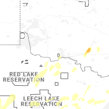
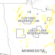
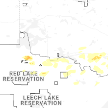
Hail Maps for Littlefork, MN


Connect with Interactive Hail Maps