

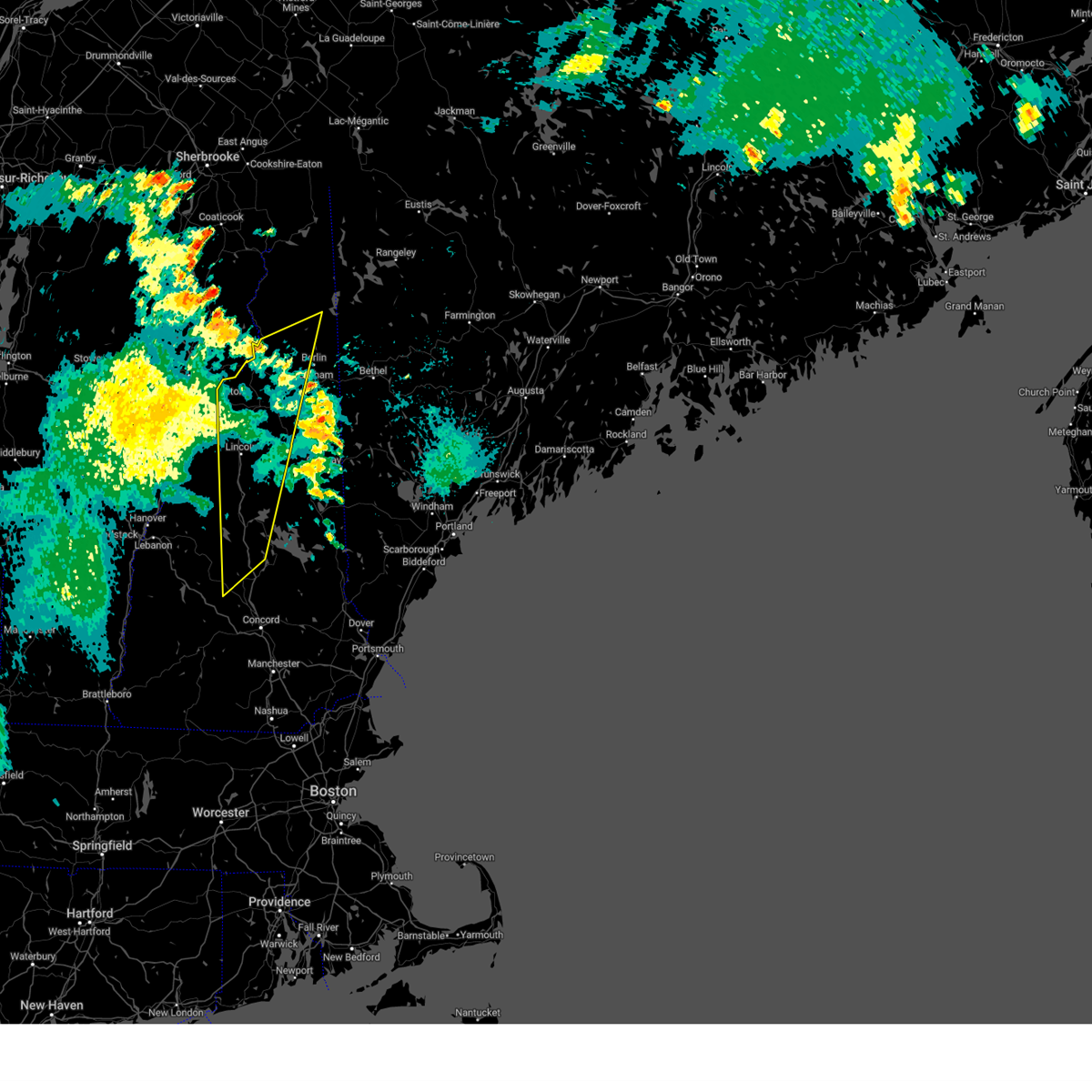
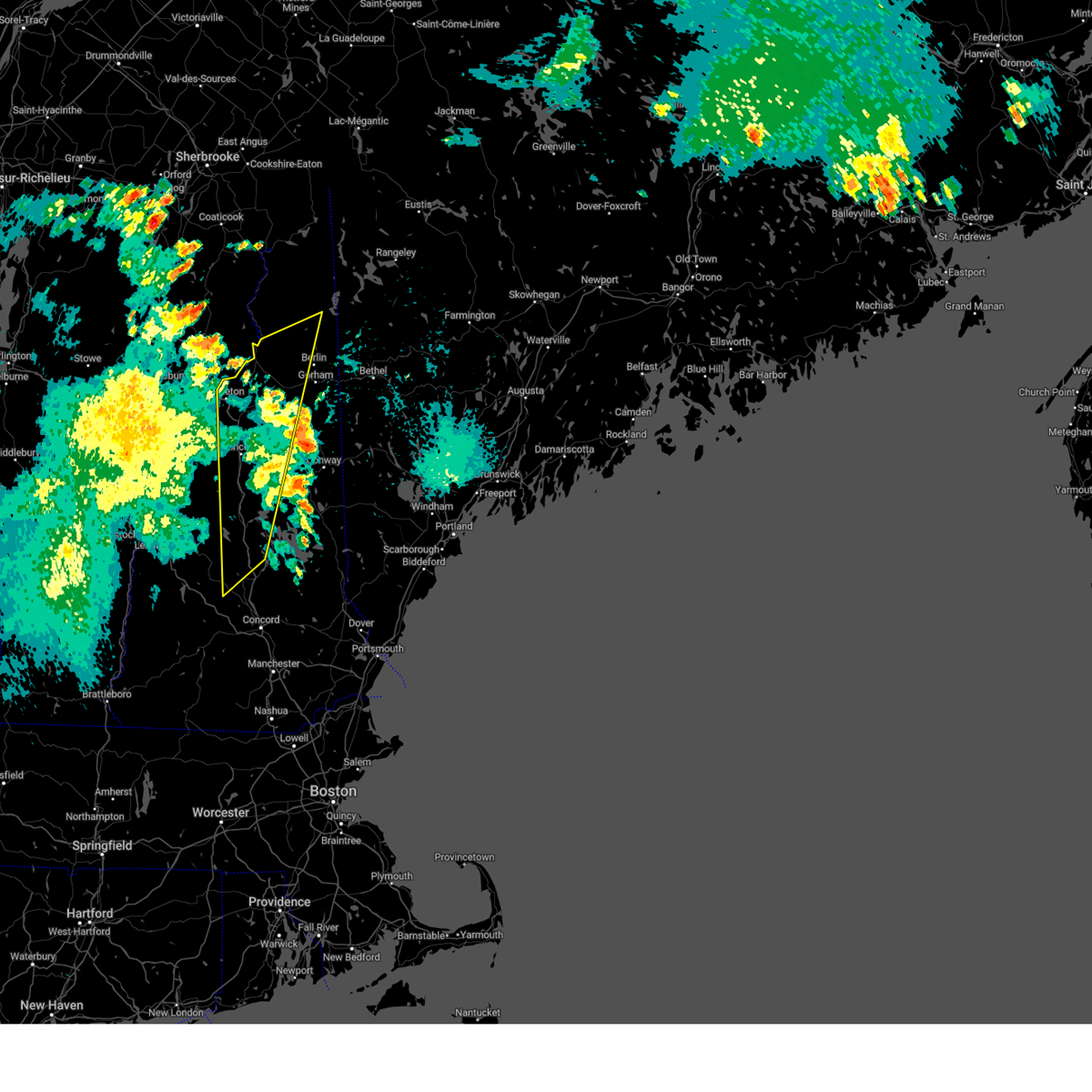
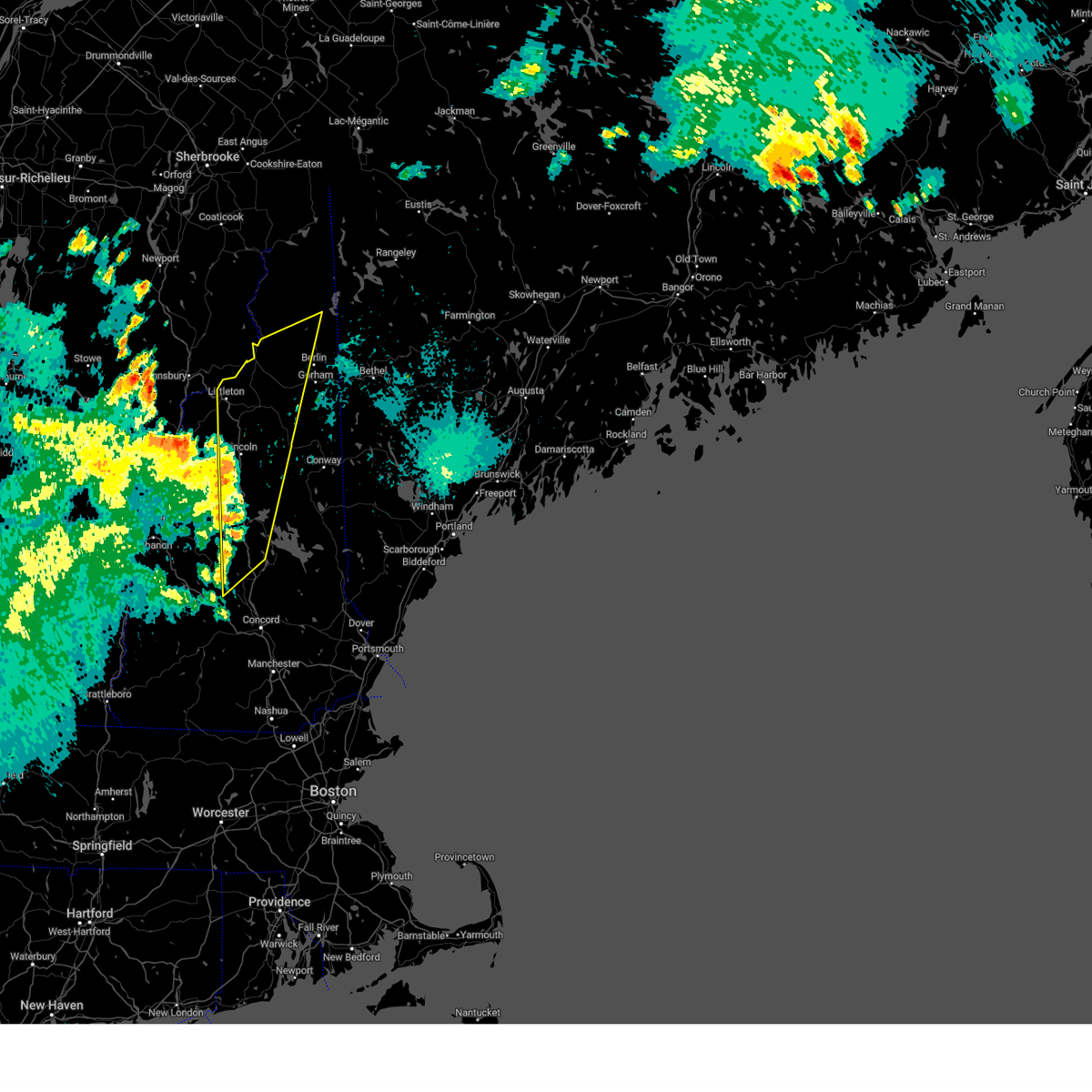
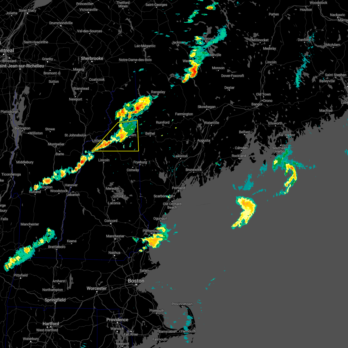
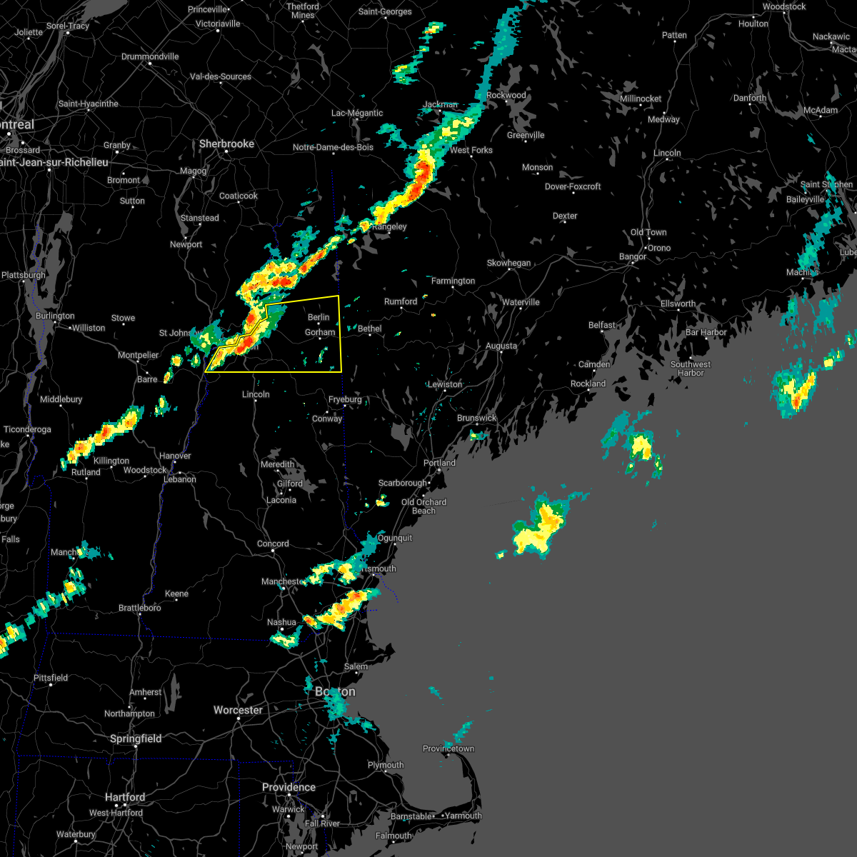
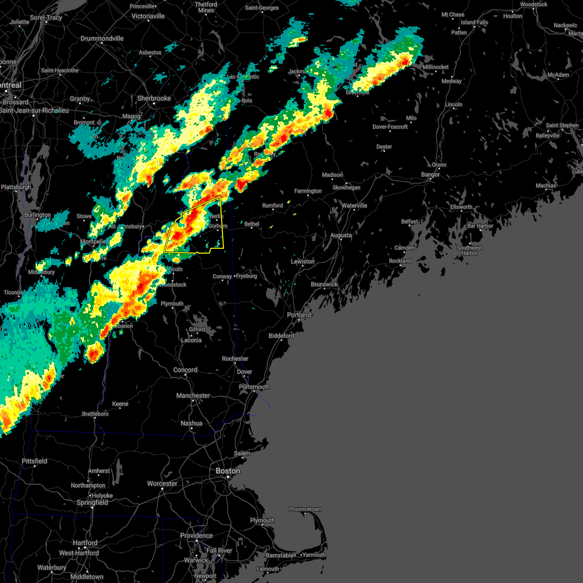
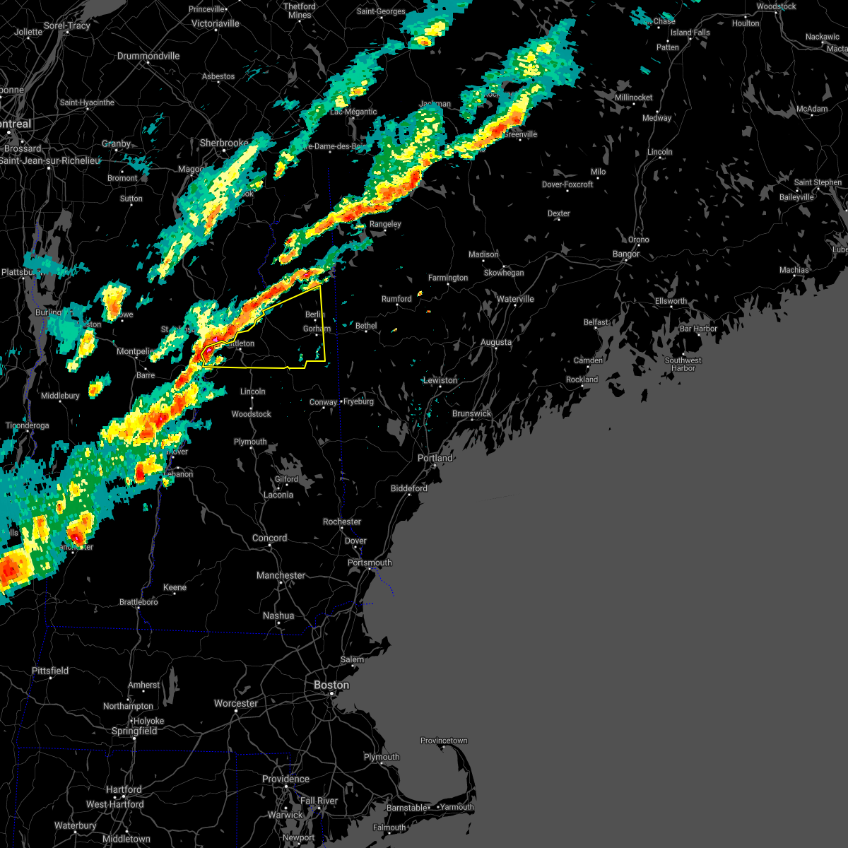
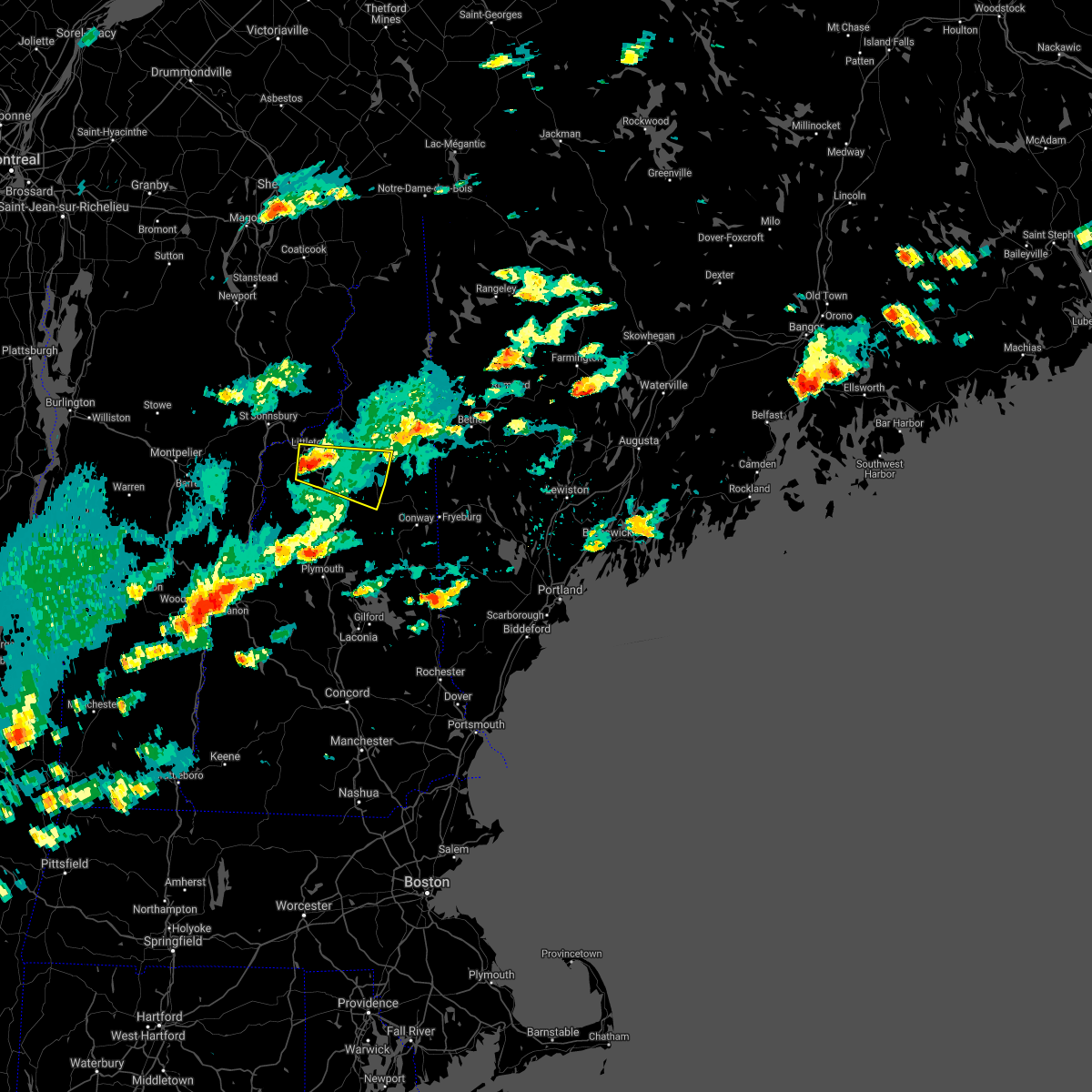
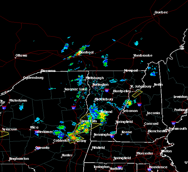
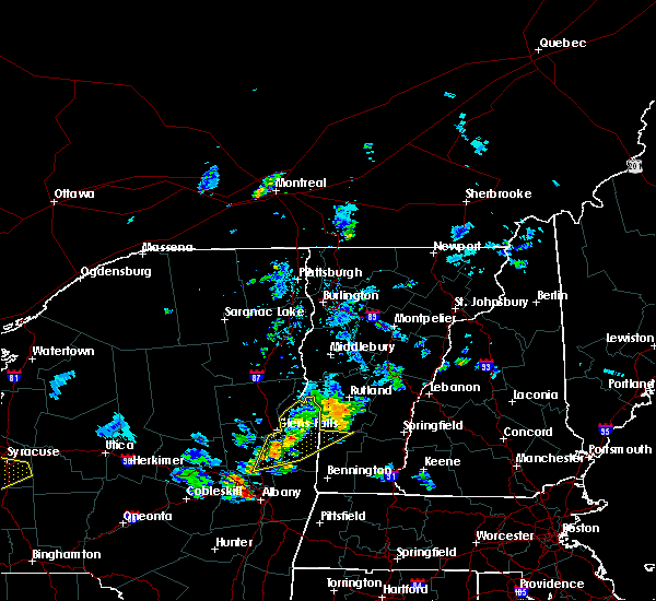
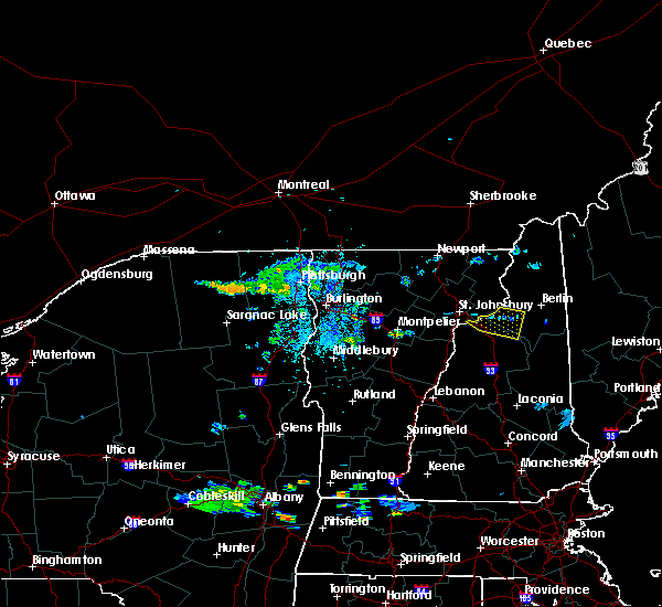
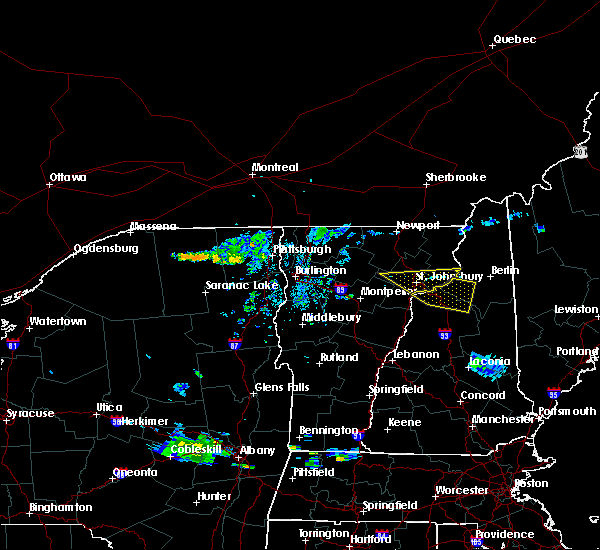
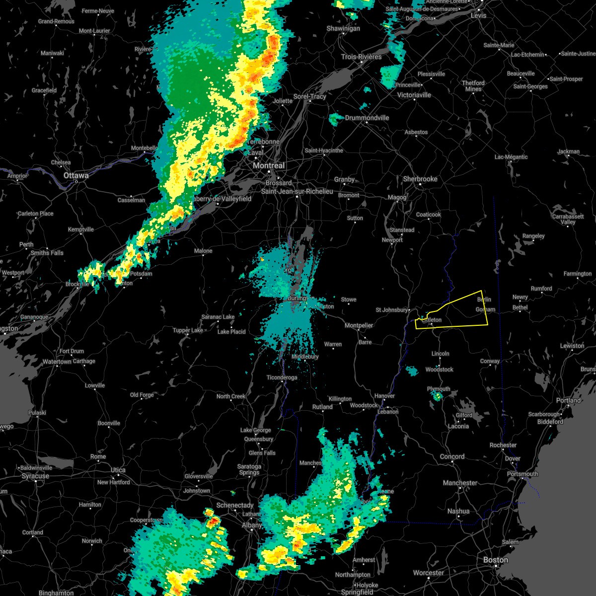
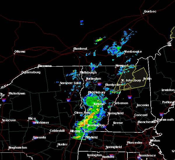
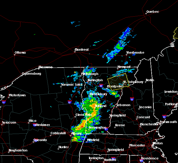
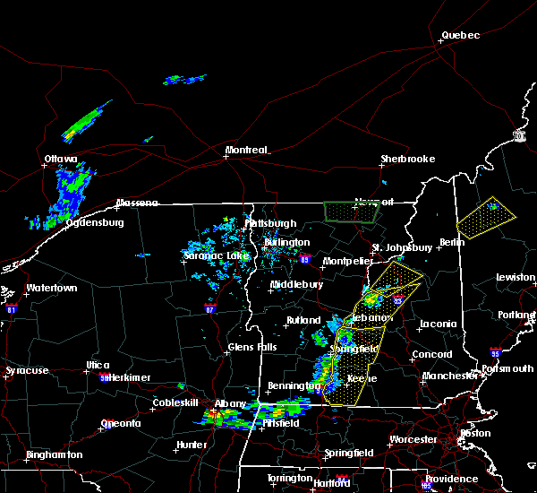
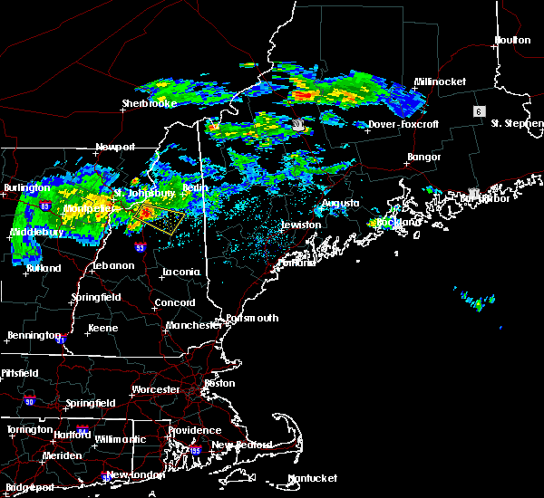
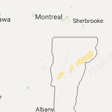
Hail Map for Littleton, NH
The Littleton, NH area has had 4 reports of on-the-ground hail by trained spotters, and has been under severe weather warnings 6 times during the past 12 months. Doppler radar has detected hail at or near Littleton, NH on 14 occasions.
| Name: | Littleton, NH |
| Where Located: | 72.2 miles E of Burlington, VT |
| Map: | Google Map for Littleton, NH |
| Population: | 4412 |
| Housing Units: | 2253 |
| More Info: | Search Google for Littleton, NH |
5
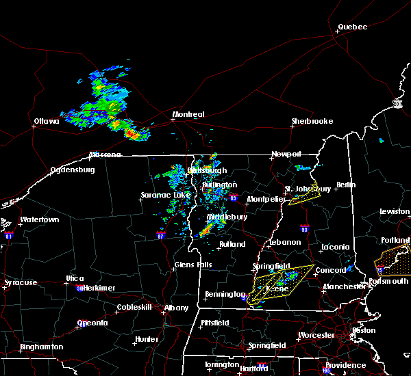
The Top Recent Hail Date for Littleton, NH is Wednesday, September 15, 2021 (2nd out of 14)

Hail and Wind Damage Spotted near Littleton, NH
| Date / Time | Report Details |
|---|---|
| 9/7/2023 11:57 PM EDT |
 The severe thunderstorm warning for southern coos, eastern grafton, northwestern belknap, north central merrimack and northwestern carroll counties will expire at midnight edt, the storms which prompted the warning have weakened below severe limits, and have exited the warned area. therefore, the warning will be allowed to expire. The severe thunderstorm warning for southern coos, eastern grafton, northwestern belknap, north central merrimack and northwestern carroll counties will expire at midnight edt, the storms which prompted the warning have weakened below severe limits, and have exited the warned area. therefore, the warning will be allowed to expire.
|
| 9/7/2023 11:43 PM EDT |
 At 1140 pm edt, severe thunderstorms were located along a line extending from near lancaster to near holderness, moving northeast at 50 mph (radar indicated). Hazards include 60 mph wind gusts and quarter size hail. Expect wind damage to trees and power lines. Minor hail damage to vehicles is possible. At 1140 pm edt, severe thunderstorms were located along a line extending from near lancaster to near holderness, moving northeast at 50 mph (radar indicated). Hazards include 60 mph wind gusts and quarter size hail. Expect wind damage to trees and power lines. Minor hail damage to vehicles is possible.
|
| 9/7/2023 11:09 PM EDT |
 At 1108 pm edt, severe thunderstorms were located along a line extending from 6 miles east of haverhill to 7 miles north of warner, moving northeast at 40 mph (radar indicated). Hazards include 60 mph wind gusts and quarter size hail. Expect wind damage to trees and power lines. Minor hail damage to vehicles is possible. At 1108 pm edt, severe thunderstorms were located along a line extending from 6 miles east of haverhill to 7 miles north of warner, moving northeast at 40 mph (radar indicated). Hazards include 60 mph wind gusts and quarter size hail. Expect wind damage to trees and power lines. Minor hail damage to vehicles is possible.
|
| 9/7/2023 10:52 PM EDT |
 At 1051 pm edt, severe thunderstorms were located along a line extending from 20 miles northwest of littleton to 7 miles north of hanover, moving north at 85 mph (radar indicated). Hazards include 60 mph wind gusts and quarter size hail. Expect wind damage to trees and power lines. minor hail damage to vehicles is possible. locations impacted include, franklin, littleton, bethlehem, lincoln, new london, plymouth, grafton, hanover, haverhill, enfield, canaan, bradford, danbury, franconia, groton, woodstock, piermont, newport, walpole and alstead. hail threat, radar indicated max hail size, 1. 00 in wind threat, observed max wind gust, 60 mph. At 1051 pm edt, severe thunderstorms were located along a line extending from 20 miles northwest of littleton to 7 miles north of hanover, moving north at 85 mph (radar indicated). Hazards include 60 mph wind gusts and quarter size hail. Expect wind damage to trees and power lines. minor hail damage to vehicles is possible. locations impacted include, franklin, littleton, bethlehem, lincoln, new london, plymouth, grafton, hanover, haverhill, enfield, canaan, bradford, danbury, franconia, groton, woodstock, piermont, newport, walpole and alstead. hail threat, radar indicated max hail size, 1. 00 in wind threat, observed max wind gust, 60 mph.
|
| 9/7/2023 10:18 PM EDT |
 At 1018 pm edt, severe thunderstorms were located along a line extending from 17 miles northwest of hanover to near charlestown, moving north at 85 mph (radar indicated). Hazards include 60 mph wind gusts and quarter size hail. Expect wind damage to trees and power lines. Minor hail damage to vehicles is possible. At 1018 pm edt, severe thunderstorms were located along a line extending from 17 miles northwest of hanover to near charlestown, moving north at 85 mph (radar indicated). Hazards include 60 mph wind gusts and quarter size hail. Expect wind damage to trees and power lines. Minor hail damage to vehicles is possible.
|
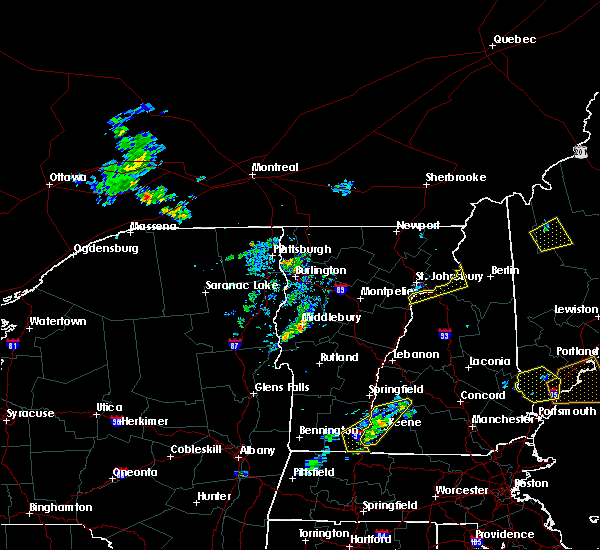
| 7/13/2023 8:02 PM EDT |
 At 802 pm edt, severe thunderstorms were located along a line extending from 11 miles west of littleton to 9 miles southwest of lebanon, moving northeast at 65 mph (radar indicated). Hazards include 60 mph wind gusts. expect damage to roofs, siding, and trees At 802 pm edt, severe thunderstorms were located along a line extending from 11 miles west of littleton to 9 miles southwest of lebanon, moving northeast at 65 mph (radar indicated). Hazards include 60 mph wind gusts. expect damage to roofs, siding, and trees
|
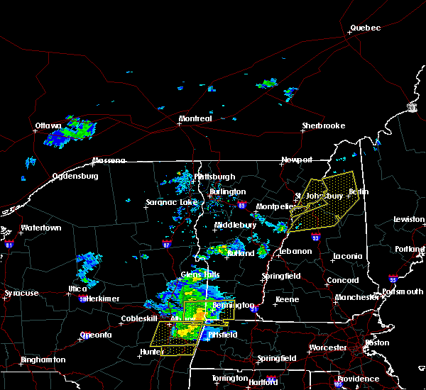
| 7/25/2022 2:54 PM EDT |
 At 254 pm edt, severe thunderstorms were located along a line extending from 8 miles southwest of berlin to bethlehem, moving east at 25 mph (radar indicated). Hazards include 60 mph wind gusts and quarter size hail. Hail damage to vehicles is expected. expect wind damage to roofs, siding, and trees. locations impacted include, berlin, littleton, lancaster, bethlehem, franconia, pinkham notch, mount washington, carroll, gorham, lisbon, jefferson, dalton, jackson, chatham, whitefield, sugar hill, milan, shelburne, randolph and stark. this includes interstate 93 between mile markers 113 and 122. hail threat, radar indicated max hail size, 1. 00 in wind threat, radar indicated max wind gust, 60 mph. At 254 pm edt, severe thunderstorms were located along a line extending from 8 miles southwest of berlin to bethlehem, moving east at 25 mph (radar indicated). Hazards include 60 mph wind gusts and quarter size hail. Hail damage to vehicles is expected. expect wind damage to roofs, siding, and trees. locations impacted include, berlin, littleton, lancaster, bethlehem, franconia, pinkham notch, mount washington, carroll, gorham, lisbon, jefferson, dalton, jackson, chatham, whitefield, sugar hill, milan, shelburne, randolph and stark. this includes interstate 93 between mile markers 113 and 122. hail threat, radar indicated max hail size, 1. 00 in wind threat, radar indicated max wind gust, 60 mph.
|
| 7/25/2022 2:26 PM EDT |
 At 225 pm edt, a severe thunderstorm was located near bethlehem, moving east at 40 mph (radar indicated). Hazards include 60 mph wind gusts and quarter size hail. Hail damage to vehicles is expected. Expect wind damage to roofs, siding, and trees. At 225 pm edt, a severe thunderstorm was located near bethlehem, moving east at 40 mph (radar indicated). Hazards include 60 mph wind gusts and quarter size hail. Hail damage to vehicles is expected. Expect wind damage to roofs, siding, and trees.
|
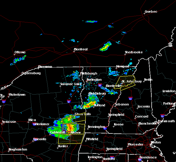
| 7/21/2022 2:20 PM EDT |
 At 220 pm edt, a severe thunderstorm was located over piermont, or 18 miles west of lincoln, moving northeast at 45 mph (radar indicated). Hazards include 60 mph wind gusts and quarter size hail. Hail damage to vehicles is expected. expect wind damage to roofs, siding, and trees. locations impacted include, littleton, bethlehem, lincoln, haverhill, franconia, piermont, woodstock, lisbon, bath, dalton, benton, easton, monroe, landaff, lyman, sugar hill and orford. This includes interstate 93 between mile markers 100 and 131. At 220 pm edt, a severe thunderstorm was located over piermont, or 18 miles west of lincoln, moving northeast at 45 mph (radar indicated). Hazards include 60 mph wind gusts and quarter size hail. Hail damage to vehicles is expected. expect wind damage to roofs, siding, and trees. locations impacted include, littleton, bethlehem, lincoln, haverhill, franconia, piermont, woodstock, lisbon, bath, dalton, benton, easton, monroe, landaff, lyman, sugar hill and orford. This includes interstate 93 between mile markers 100 and 131.
|
| 7/21/2022 1:46 PM EDT |
 At 146 pm edt, a severe thunderstorm was located 7 miles northwest of haverhill, or 22 miles southwest of littleton, moving northeast at 30 mph (radar indicated). Hazards include 60 mph wind gusts and quarter size hail. Hail damage to vehicles is expected. Expect wind damage to roofs, siding, and trees. At 146 pm edt, a severe thunderstorm was located 7 miles northwest of haverhill, or 22 miles southwest of littleton, moving northeast at 30 mph (radar indicated). Hazards include 60 mph wind gusts and quarter size hail. Hail damage to vehicles is expected. Expect wind damage to roofs, siding, and trees.
|
| 9/15/2021 2:59 PM EDT |
 At 259 pm edt, a severe thunderstorm was located 8 miles southeast of lancaster, moving east at 45 mph (radar indicated). Hazards include 60 mph wind gusts and penny size hail. Expect damage to roofs, siding, and trees. locations impacted include, berlin, littleton, lancaster, bethlehem, franconia, pinkham notch, mount washington, carroll, gorham, jefferson, dalton, jackson, dummer, whitefield, milan, shelburne, randolph, sugar hill, stark and northumberland. hail threat, radar indicated max hail size, 0. 75 in wind threat, radar indicated max wind gust, 60 mph. At 259 pm edt, a severe thunderstorm was located 8 miles southeast of lancaster, moving east at 45 mph (radar indicated). Hazards include 60 mph wind gusts and penny size hail. Expect damage to roofs, siding, and trees. locations impacted include, berlin, littleton, lancaster, bethlehem, franconia, pinkham notch, mount washington, carroll, gorham, jefferson, dalton, jackson, dummer, whitefield, milan, shelburne, randolph, sugar hill, stark and northumberland. hail threat, radar indicated max hail size, 0. 75 in wind threat, radar indicated max wind gust, 60 mph.
|
| 9/15/2021 2:41 PM EDT | Numerous trees down across littleton. time estimated based on rada in grafton county NH, 1.1 miles N of Littleton, NH |
| 9/15/2021 2:18 PM EDT |
 At 218 pm edt, a severe thunderstorm was located 11 miles west of littleton, moving east at 45 mph (radar indicated). Hazards include 60 mph wind gusts and quarter size hail. Hail damage to vehicles is expected. Expect wind damage to roofs, siding, and trees. At 218 pm edt, a severe thunderstorm was located 11 miles west of littleton, moving east at 45 mph (radar indicated). Hazards include 60 mph wind gusts and quarter size hail. Hail damage to vehicles is expected. Expect wind damage to roofs, siding, and trees.
|
| 6/30/2021 3:15 PM EDT | Tree knocked down in thunderstorm blocking streeter pond road. pea size hail also reported. time estimated by rada in grafton county NH, 5.9 miles N of Littleton, NH |
| 6/30/2021 3:10 PM EDT |
 At 310 pm edt, a severe thunderstorm was located over franconia, or near bethlehem, moving east at 40 mph (radar indicated). Hazards include 60 mph wind gusts. expect damage to roofs, siding, and trees At 310 pm edt, a severe thunderstorm was located over franconia, or near bethlehem, moving east at 40 mph (radar indicated). Hazards include 60 mph wind gusts. expect damage to roofs, siding, and trees
|
| 6/21/2021 6:30 PM EDT | Quarter sized hail reported 2.8 miles SSE of Littleton, NH |
| 5/26/2021 5:20 PM EDT | Trees down off of hwy 30 in grafton county NH, 2.3 miles NE of Littleton, NH |
| 5/26/2021 5:20 PM EDT |
 At 519 pm edt, a severe thunderstorm was located near littleton, moving east at 50 mph (radar indicated). Hazards include 60 mph wind gusts and penny size hail. Expect damage to roofs, siding, and trees. locations impacted include, berlin, littleton, lancaster, bethlehem, colebrook, franconia, stratford, pinkham notch, mount washington, carroll, gorham, jefferson, dalton, columbia, dummer, whitefield, randolph, stark, northumberland and milan. this also includes, kilkenny ridge trail, north twin mountain, mount jefferson, mount madison, and mount eisenhower. This includes interstate 93 between mile markers 112 and 116, and between mile markers 120 and 121. At 519 pm edt, a severe thunderstorm was located near littleton, moving east at 50 mph (radar indicated). Hazards include 60 mph wind gusts and penny size hail. Expect damage to roofs, siding, and trees. locations impacted include, berlin, littleton, lancaster, bethlehem, colebrook, franconia, stratford, pinkham notch, mount washington, carroll, gorham, jefferson, dalton, columbia, dummer, whitefield, randolph, stark, northumberland and milan. this also includes, kilkenny ridge trail, north twin mountain, mount jefferson, mount madison, and mount eisenhower. This includes interstate 93 between mile markers 112 and 116, and between mile markers 120 and 121.
|
| 5/26/2021 4:51 PM EDT |
 At 450 pm edt, a severe thunderstorm was located 21 miles north of haverhill, or 21 miles west of littleton, moving east at 50 mph. this storm has a history of producing wind damage in vermont (radar indicated). Hazards include 60 mph wind gusts and penny size hail. expect damage to roofs, siding, and trees At 450 pm edt, a severe thunderstorm was located 21 miles north of haverhill, or 21 miles west of littleton, moving east at 50 mph. this storm has a history of producing wind damage in vermont (radar indicated). Hazards include 60 mph wind gusts and penny size hail. expect damage to roofs, siding, and trees
|
| 7/8/2020 5:30 PM EDT | Trees down in town. reported by sheriffs office. time estimated from rada in grafton county NH, 1.1 miles N of Littleton, NH |
| 7/8/2020 5:19 PM EDT |
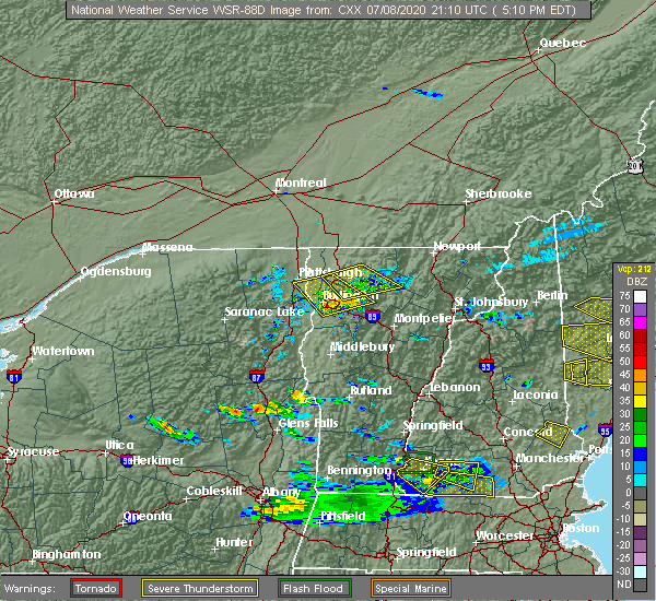 At 519 pm edt, a severe thunderstorm was located near bethlehem, moving east at 20 mph (radar indicated). Hazards include 60 mph wind gusts and quarter size hail. Hail damage to vehicles is expected. Expect wind damage to roofs, siding, and trees. At 519 pm edt, a severe thunderstorm was located near bethlehem, moving east at 20 mph (radar indicated). Hazards include 60 mph wind gusts and quarter size hail. Hail damage to vehicles is expected. Expect wind damage to roofs, siding, and trees.
|
| 5/29/2020 8:26 PM EDT |
 At 825 pm edt, severe thunderstorms were located along a line extending from 19 miles northwest of franconia to 6 miles southwest of littleton to 8 miles northwest of lincoln to 7 miles west of woodstock, moving northeast at 45 mph (radar indicated). Hazards include 60 mph wind gusts. expect damage to roofs, siding, and trees At 825 pm edt, severe thunderstorms were located along a line extending from 19 miles northwest of franconia to 6 miles southwest of littleton to 8 miles northwest of lincoln to 7 miles west of woodstock, moving northeast at 45 mph (radar indicated). Hazards include 60 mph wind gusts. expect damage to roofs, siding, and trees
|
| 5/27/2020 3:38 PM EDT |
 The severe thunderstorm warning for north central grafton county will expire at 345 pm edt, the storm which prompted the warning has weakened below severe limits, and no longer poses an immediate threat to life or property. therefore, the warning will be allowed to expire. The severe thunderstorm warning for north central grafton county will expire at 345 pm edt, the storm which prompted the warning has weakened below severe limits, and no longer poses an immediate threat to life or property. therefore, the warning will be allowed to expire.
|
| 5/27/2020 2:53 PM EDT |
 At 252 pm edt, a severe thunderstorm was located over franconia, or near bethlehem, moving northeast at 10 mph (radar indicated). Hazards include 60 mph wind gusts and quarter size hail. Hail damage to vehicles is expected. Expect wind damage to roofs, siding, and trees. At 252 pm edt, a severe thunderstorm was located over franconia, or near bethlehem, moving northeast at 10 mph (radar indicated). Hazards include 60 mph wind gusts and quarter size hail. Hail damage to vehicles is expected. Expect wind damage to roofs, siding, and trees.
|
| 7/30/2019 7:15 PM EDT |
 At 714 pm edt, a severe thunderstorm was located over franconia, or near littleton, moving northeast at 20 mph (radar indicated). Hazards include 60 mph wind gusts and quarter size hail. Hail damage to vehicles is expected. expect wind damage to roofs, siding, and trees. locations impacted include, littleton, bethlehem, franconia, lisbon, bath, dalton, sugar hill, landaff and whitefield. This includes interstate 93 between mile markers 117 and 125. At 714 pm edt, a severe thunderstorm was located over franconia, or near littleton, moving northeast at 20 mph (radar indicated). Hazards include 60 mph wind gusts and quarter size hail. Hail damage to vehicles is expected. expect wind damage to roofs, siding, and trees. locations impacted include, littleton, bethlehem, franconia, lisbon, bath, dalton, sugar hill, landaff and whitefield. This includes interstate 93 between mile markers 117 and 125.
|
| 7/30/2019 7:06 PM EDT | Trees down in sugar hill blake... rd. sugar hill police departmen in grafton county NH, 5.9 miles N of Littleton, NH |
| 7/30/2019 6:58 PM EDT |
 At 658 pm edt, a severe thunderstorm was located 8 miles west of franconia, or 9 miles southwest of littleton, moving northeast at 25 mph (radar indicated). Hazards include 60 mph wind gusts and quarter size hail. Hail damage to vehicles is expected. Expect wind damage to roofs, siding, and trees. At 658 pm edt, a severe thunderstorm was located 8 miles west of franconia, or 9 miles southwest of littleton, moving northeast at 25 mph (radar indicated). Hazards include 60 mph wind gusts and quarter size hail. Hail damage to vehicles is expected. Expect wind damage to roofs, siding, and trees.
|
| 9/3/2018 8:06 PM EDT |
 At 806 pm edt, a severe thunderstorm was located near littleton, moving east at 30 mph (radar indicated). Hazards include 60 mph wind gusts and penny size hail. Expect damage to roofs, siding, and trees. locations impacted include, littleton, lancaster, bethlehem, franconia, carroll, lisbon, jefferson, dalton, whitefield and sugar hill. this also includes, amc zealand falls hut. This includes interstate 93 between mile markers 119 and 131. At 806 pm edt, a severe thunderstorm was located near littleton, moving east at 30 mph (radar indicated). Hazards include 60 mph wind gusts and penny size hail. Expect damage to roofs, siding, and trees. locations impacted include, littleton, lancaster, bethlehem, franconia, carroll, lisbon, jefferson, dalton, whitefield and sugar hill. this also includes, amc zealand falls hut. This includes interstate 93 between mile markers 119 and 131.
|
| 9/3/2018 7:48 PM EDT |
 At 748 pm edt, a severe thunderstorm was located 9 miles northwest of littleton, or near saint johnsbury vermont, moving east at 30 mph (radar indicated). Hazards include 60 mph wind gusts and penny size hail. expect damage to roofs, siding, and trees At 748 pm edt, a severe thunderstorm was located 9 miles northwest of littleton, or near saint johnsbury vermont, moving east at 30 mph (radar indicated). Hazards include 60 mph wind gusts and penny size hail. expect damage to roofs, siding, and trees
|
| 7/28/2018 7:07 PM EDT |
 At 707 pm edt, severe thunderstorms were located along a line extending from 8 miles southwest of stratford to near littleton, moving northeast at 30 mph (radar indicated). Hazards include 60 mph wind gusts and quarter size hail. Hail damage to vehicles is expected. expect wind damage to roofs, siding, and trees. locations impacted include, littleton, lancaster, lisbon, dalton, whitefield, northumberland and lyman. This includes interstate 93 between mile markers 123 and 131. At 707 pm edt, severe thunderstorms were located along a line extending from 8 miles southwest of stratford to near littleton, moving northeast at 30 mph (radar indicated). Hazards include 60 mph wind gusts and quarter size hail. Hail damage to vehicles is expected. expect wind damage to roofs, siding, and trees. locations impacted include, littleton, lancaster, lisbon, dalton, whitefield, northumberland and lyman. This includes interstate 93 between mile markers 123 and 131.
|
| 7/28/2018 6:40 PM EDT |
 At 639 pm edt, a severe thunderstorm was located 13 miles west of littleton, moving northeast at 30 mph (radar indicated). Hazards include 60 mph wind gusts and quarter size hail. Hail damage to vehicles is expected. Expect wind damage to roofs, siding, and trees. At 639 pm edt, a severe thunderstorm was located 13 miles west of littleton, moving northeast at 30 mph (radar indicated). Hazards include 60 mph wind gusts and quarter size hail. Hail damage to vehicles is expected. Expect wind damage to roofs, siding, and trees.
|
| 7/1/2018 1:50 AM EDT |
 At 149 am edt, a severe thunderstorm was located 14 miles west of littleton, moving southeast at 45 mph (radar indicated). Hazards include 60 mph wind gusts and penny size hail. expect damage to roofs, siding, and trees At 149 am edt, a severe thunderstorm was located 14 miles west of littleton, moving southeast at 45 mph (radar indicated). Hazards include 60 mph wind gusts and penny size hail. expect damage to roofs, siding, and trees
|
| 5/4/2018 9:10 PM EDT |
 At 910 pm edt, severe thunderstorms were located along a line extending from 17 miles south of jackman to 10 miles south of eustis to near berlin to near mount washington, moving east at 50 mph (radar indicated). Hazards include 60 mph wind gusts. Expect damage to roofs, siding, and trees. locations impacted include, berlin, littleton, lancaster, bethlehem, colebrook, franconia, errol, dixville, stratford, pittsburg, carroll, lisbon, jefferson, dalton, columbia, dummer, clarksville, whitefield, northumberland and monroe. this also includes, umbagog lake state park, kilkenny ridge trail, pontook reservoir, dixville notch state park, and percy peaks. This includes interstate 93 between mile markers 112 and 131. At 910 pm edt, severe thunderstorms were located along a line extending from 17 miles south of jackman to 10 miles south of eustis to near berlin to near mount washington, moving east at 50 mph (radar indicated). Hazards include 60 mph wind gusts. Expect damage to roofs, siding, and trees. locations impacted include, berlin, littleton, lancaster, bethlehem, colebrook, franconia, errol, dixville, stratford, pittsburg, carroll, lisbon, jefferson, dalton, columbia, dummer, clarksville, whitefield, northumberland and monroe. this also includes, umbagog lake state park, kilkenny ridge trail, pontook reservoir, dixville notch state park, and percy peaks. This includes interstate 93 between mile markers 112 and 131.
|
| 5/4/2018 8:37 PM EDT |
 At 837 pm edt, severe thunderstorms were located along a line extending from coburn gore to 16 miles east of pittsburg to near lancaster to 6 miles west of littleton, moving east at 35 mph (radar indicated). Hazards include 60 mph wind gusts and penny size hail. Expect damage to roofs, siding, and trees. locations impacted include, berlin, littleton, lancaster, bethlehem, colebrook, franconia, errol, pittsburg, dixville, stratford, carroll, lisbon, jefferson, dalton, columbia, dummer, clarksville, whitefield, northumberland and monroe. this also includes, umbagog lake state park, first connecticut lake, kilkenny ridge trail, pontook reservoir, and dixville notch state park. This includes interstate 93 between mile markers 112 and 131. At 837 pm edt, severe thunderstorms were located along a line extending from coburn gore to 16 miles east of pittsburg to near lancaster to 6 miles west of littleton, moving east at 35 mph (radar indicated). Hazards include 60 mph wind gusts and penny size hail. Expect damage to roofs, siding, and trees. locations impacted include, berlin, littleton, lancaster, bethlehem, colebrook, franconia, errol, pittsburg, dixville, stratford, carroll, lisbon, jefferson, dalton, columbia, dummer, clarksville, whitefield, northumberland and monroe. this also includes, umbagog lake state park, first connecticut lake, kilkenny ridge trail, pontook reservoir, and dixville notch state park. This includes interstate 93 between mile markers 112 and 131.
|
| 5/4/2018 8:12 PM EDT |
 At 811 pm edt, severe thunderstorms were located along a line extending from 14 miles west of coburn gore to near pittsburg to 17 miles west of lancaster to 20 miles west of littleton, moving east at 50 mph (radar indicated). Hazards include 60 mph wind gusts and nickel size hail. expect damage to roofs, siding, and trees At 811 pm edt, severe thunderstorms were located along a line extending from 14 miles west of coburn gore to near pittsburg to 17 miles west of lancaster to 20 miles west of littleton, moving east at 50 mph (radar indicated). Hazards include 60 mph wind gusts and nickel size hail. expect damage to roofs, siding, and trees
|
| 8/22/2017 7:03 PM EDT |
 At 703 pm edt, severe thunderstorms were located along a line extending from 27 miles west of littleton to 13 miles northwest of haverhill to 17 miles west of piermont, moving east at 55 mph (radar indicated). Hazards include 60 mph wind gusts and penny size hail. expect damage to trees, and power lines At 703 pm edt, severe thunderstorms were located along a line extending from 27 miles west of littleton to 13 miles northwest of haverhill to 17 miles west of piermont, moving east at 55 mph (radar indicated). Hazards include 60 mph wind gusts and penny size hail. expect damage to trees, and power lines
|
| 7/8/2017 3:37 PM EDT |
 At 337 pm edt, a severe thunderstorm was located near franconia, or near bethlehem, moving east at 30 mph (radar indicated). Hazards include 60 mph wind gusts and quarter size hail. Minor hail damage to vehicles is possible. Expect wind damage to roofs, siding, and trees. At 337 pm edt, a severe thunderstorm was located near franconia, or near bethlehem, moving east at 30 mph (radar indicated). Hazards include 60 mph wind gusts and quarter size hail. Minor hail damage to vehicles is possible. Expect wind damage to roofs, siding, and trees.
|
| 7/1/2017 3:43 PM EDT |
 At 343 pm edt, a severe thunderstorm was located 9 miles northeast of haverhill, or 13 miles west of lincoln, moving east at 40 mph (radar indicated). Hazards include 60 mph wind gusts and penny size hail. Expect damage to trees, and power lines. locations impacted include, littleton, bethlehem, lincoln, haverhill, franconia, piermont, woodstock, lisbon, bath, benton, easton, landaff and sugar hill. this also includes, franconia notch, mount moosilauke, cannon mountain, franconia ridge, and mount lafayette. This includes interstate 93 between mile markers 100 and 123. At 343 pm edt, a severe thunderstorm was located 9 miles northeast of haverhill, or 13 miles west of lincoln, moving east at 40 mph (radar indicated). Hazards include 60 mph wind gusts and penny size hail. Expect damage to trees, and power lines. locations impacted include, littleton, bethlehem, lincoln, haverhill, franconia, piermont, woodstock, lisbon, bath, benton, easton, landaff and sugar hill. this also includes, franconia notch, mount moosilauke, cannon mountain, franconia ridge, and mount lafayette. This includes interstate 93 between mile markers 100 and 123.
|
| 7/1/2017 3:18 PM EDT |
 At 317 pm edt, a severe thunderstorm was located near haverhill, or 25 miles west of lincoln, moving northeast at 25 mph (radar indicated). Hazards include 60 mph wind gusts and penny size hail. expect damage to trees, and power lines At 317 pm edt, a severe thunderstorm was located near haverhill, or 25 miles west of lincoln, moving northeast at 25 mph (radar indicated). Hazards include 60 mph wind gusts and penny size hail. expect damage to trees, and power lines
|
| 5/31/2017 5:07 PM EDT |
 The severe thunderstorm warning for southwestern coos and north central grafton counties will expire at 515 pm edt, the storm which prompted the warning has moved out of the area. therefore the warning will be allowed to expire. however gusty winds are still possible with this thunderstorm. a severe thunderstorm watch remains in effect until 900 pm edt for northern new hampshire. The severe thunderstorm warning for southwestern coos and north central grafton counties will expire at 515 pm edt, the storm which prompted the warning has moved out of the area. therefore the warning will be allowed to expire. however gusty winds are still possible with this thunderstorm. a severe thunderstorm watch remains in effect until 900 pm edt for northern new hampshire.
|
| 5/31/2017 4:58 PM EDT |
 At 457 pm edt, severe thunderstorms were located along a line extending from 6 miles west of stratford to near littleton to near haverhill, moving east at 40 mph (radar indicated). Hazards include 60 mph wind gusts and quarter size hail. Minor hail damage to vehicles is possible. Expect wind damage to roofs, siding, and trees. At 457 pm edt, severe thunderstorms were located along a line extending from 6 miles west of stratford to near littleton to near haverhill, moving east at 40 mph (radar indicated). Hazards include 60 mph wind gusts and quarter size hail. Minor hail damage to vehicles is possible. Expect wind damage to roofs, siding, and trees.
|
| 5/31/2017 4:33 PM EDT |
 At 432 pm edt, a severe thunderstorm was located 14 miles west of littleton, moving east at 35 mph (radar indicated). Hazards include 60 mph wind gusts and quarter size hail. Minor hail damage to vehicles is possible. Expect wind damage to roofs, siding, and trees. At 432 pm edt, a severe thunderstorm was located 14 miles west of littleton, moving east at 35 mph (radar indicated). Hazards include 60 mph wind gusts and quarter size hail. Minor hail damage to vehicles is possible. Expect wind damage to roofs, siding, and trees.
|
| 5/18/2017 9:27 PM EDT | Trees and wires down trees across various roads in grafton county NH, 1.1 miles N of Littleton, NH |
| 5/18/2017 9:22 PM EDT |
 At 921 pm edt, a severe thunderstorm was located near littleton, moving east at 55 mph (radar indicated). Hazards include 60 mph wind gusts and quarter size hail. Minor hail damage to vehicles is possible. Expect wind damage to roofs, siding, and trees. At 921 pm edt, a severe thunderstorm was located near littleton, moving east at 55 mph (radar indicated). Hazards include 60 mph wind gusts and quarter size hail. Minor hail damage to vehicles is possible. Expect wind damage to roofs, siding, and trees.
|
| 5/18/2017 8:31 PM EDT |
 At 831 pm edt, a severe thunderstorm was located 10 miles north of haverhill, or 14 miles southwest of littleton, moving east at 40 mph (radar indicated). Hazards include 60 mph wind gusts and penny size hail. expect damage to trees, and power lines At 831 pm edt, a severe thunderstorm was located 10 miles north of haverhill, or 14 miles southwest of littleton, moving east at 40 mph (radar indicated). Hazards include 60 mph wind gusts and penny size hail. expect damage to trees, and power lines
|
| 9/11/2016 8:06 AM EDT |
 At 806 am edt, severe thunderstorms were located along a line extending from near littleton to near lebanon, moving northeast at 55 mph (radar indicated). Hazards include 60 mph wind gusts and penny size hail. Expect damage to roofs. siding. And trees. At 806 am edt, severe thunderstorms were located along a line extending from near littleton to near lebanon, moving northeast at 55 mph (radar indicated). Hazards include 60 mph wind gusts and penny size hail. Expect damage to roofs. siding. And trees.
|
| 7/22/2016 11:26 PM EDT |
 At 1126 pm edt, severe thunderstorms were located along a line extending from 9 miles southeast of stratford to 6 miles southeast of bethlehem to haverhill, moving east at 50 mph (radar indicated). Hazards include 60 mph wind gusts. Expect damage to roofs. siding. And trees. At 1126 pm edt, severe thunderstorms were located along a line extending from 9 miles southeast of stratford to 6 miles southeast of bethlehem to haverhill, moving east at 50 mph (radar indicated). Hazards include 60 mph wind gusts. Expect damage to roofs. siding. And trees.
|
| 7/18/2016 6:08 PM EDT |
 At 607 pm edt, a severe thunderstorm was located over bethlehem, moving east at 30 mph (radar indicated). Hazards include 60 mph wind gusts and quarter size hail. Hail damage to vehicles is expected. expect wind damage to roofs, siding, and trees. Locations impacted include, littleton, bethlehem, lincoln, franconia, mount washington, carroll, bartlett, lisbon, jefferson, hart`s location, sugar hill, randolph, whitefield and livermore. At 607 pm edt, a severe thunderstorm was located over bethlehem, moving east at 30 mph (radar indicated). Hazards include 60 mph wind gusts and quarter size hail. Hail damage to vehicles is expected. expect wind damage to roofs, siding, and trees. Locations impacted include, littleton, bethlehem, lincoln, franconia, mount washington, carroll, bartlett, lisbon, jefferson, hart`s location, sugar hill, randolph, whitefield and livermore.
|
| 7/18/2016 5:58 PM EDT |
 At 557 pm edt, a severe thunderstorm was located over franconia, or 3 miles south of littleton, moving east at 35 mph (radar indicated). Hazards include 60 mph wind gusts and quarter size hail. Hail damage to vehicles is expected. Expect wind damage to roofs, siding, and trees. At 557 pm edt, a severe thunderstorm was located over franconia, or 3 miles south of littleton, moving east at 35 mph (radar indicated). Hazards include 60 mph wind gusts and quarter size hail. Hail damage to vehicles is expected. Expect wind damage to roofs, siding, and trees.
|
| 7/18/2016 3:39 PM EDT |
 At 339 pm edt, a severe thunderstorm was located 5 miles northeast of bethlehem, moving east at 35 mph (radar indicated). Hazards include 60 mph wind gusts and quarter size hail. Hail damage to vehicles is expected. expect wind damage to roofs, siding, and trees. Locations impacted include, littleton, bethlehem, franconia, carroll, jefferson, dalton and whitefield. At 339 pm edt, a severe thunderstorm was located 5 miles northeast of bethlehem, moving east at 35 mph (radar indicated). Hazards include 60 mph wind gusts and quarter size hail. Hail damage to vehicles is expected. expect wind damage to roofs, siding, and trees. Locations impacted include, littleton, bethlehem, franconia, carroll, jefferson, dalton and whitefield.
|
| 7/18/2016 3:21 PM EDT |
 At 321 pm edt, a severe thunderstorm was located over littleton, moving east at 50 mph (radar indicated). Hazards include 60 mph wind gusts and quarter size hail. Hail damage to vehicles is expected. expect wind damage to roofs, siding, and trees. Locations impacted include, berlin, littleton, lancaster, bethlehem, franconia, carroll, lisbon, jefferson, dalton, whitefield, south lunenburg, lyman and sugar hill. At 321 pm edt, a severe thunderstorm was located over littleton, moving east at 50 mph (radar indicated). Hazards include 60 mph wind gusts and quarter size hail. Hail damage to vehicles is expected. expect wind damage to roofs, siding, and trees. Locations impacted include, berlin, littleton, lancaster, bethlehem, franconia, carroll, lisbon, jefferson, dalton, whitefield, south lunenburg, lyman and sugar hill.
|
| 7/18/2016 3:12 PM EDT | Golf Ball sized hail reported 5.7 miles ESE of Littleton, NH, golf ball size hail |
| 7/18/2016 3:03 PM EDT |
 At 303 pm edt, a severe thunderstorm was located 8 miles west of lower waterford, or 14 miles west of littleton, moving east at 30 mph (radar indicated). Hazards include 60 mph wind gusts and quarter size hail. Hail damage to vehicles is expected. Expect wind damage to roofs, siding, and trees. At 303 pm edt, a severe thunderstorm was located 8 miles west of lower waterford, or 14 miles west of littleton, moving east at 30 mph (radar indicated). Hazards include 60 mph wind gusts and quarter size hail. Hail damage to vehicles is expected. Expect wind damage to roofs, siding, and trees.
|
| 7/14/2016 5:15 PM EDT | Multiple trees and wires down in grafton county NH, 1.1 miles N of Littleton, NH |
| 7/14/2016 5:07 PM EDT |
 At 506 pm edt, severe thunderstorms were located along a line extending from 10 miles northwest of gilman to near lower waterford to near franconia, moving northeast at 50 mph (radar indicated). Hazards include 60 mph wind gusts and penny size hail. Expect damage to roofs. siding. And trees. At 506 pm edt, severe thunderstorms were located along a line extending from 10 miles northwest of gilman to near lower waterford to near franconia, moving northeast at 50 mph (radar indicated). Hazards include 60 mph wind gusts and penny size hail. Expect damage to roofs. siding. And trees.
|
| 7/14/2016 4:45 PM EDT |
 At 445 pm edt, a severe thunderstorm was located 9 miles east of ricker state park, or 14 miles west of littleton, moving northeast at 35 mph (radar indicated). Hazards include 60 mph wind gusts and penny size hail. Expect damage to roofs. siding. And trees. At 445 pm edt, a severe thunderstorm was located 9 miles east of ricker state park, or 14 miles west of littleton, moving northeast at 35 mph (radar indicated). Hazards include 60 mph wind gusts and penny size hail. Expect damage to roofs. siding. And trees.
|
| 8/4/2015 1:48 PM EDT | Trees on wires dahlia dr in grafton county NH, 1.1 miles N of Littleton, NH |
| 8/4/2015 1:44 PM EDT |
 At 144 pm edt, doppler radar indicated a line of severe thunderstorms capable of producing quarter size hail and damaging winds in excess of 60 mph. these storms were located along a line extending from lunenburg to near bethlehem to 7 miles southwest of franconia, moving east at 40 mph. locations impacted include, berlin, littleton, lancaster, bethlehem, lincoln, franconia, mount washington, pinkham notch, franconia notch state park, carroll, gorham, lisbon, jefferson, bath, dalton, dummer, easton, south lunenburg, randolph and sugar hill. At 144 pm edt, doppler radar indicated a line of severe thunderstorms capable of producing quarter size hail and damaging winds in excess of 60 mph. these storms were located along a line extending from lunenburg to near bethlehem to 7 miles southwest of franconia, moving east at 40 mph. locations impacted include, berlin, littleton, lancaster, bethlehem, lincoln, franconia, mount washington, pinkham notch, franconia notch state park, carroll, gorham, lisbon, jefferson, bath, dalton, dummer, easton, south lunenburg, randolph and sugar hill.
|
| 8/4/2015 1:24 PM EDT |
 At 124 pm edt, doppler radar indicated a line of severe thunderstorms capable of producing quarter size hail and damaging winds in excess of 60 mph. these storms were located along a line extending from near granby to 7 miles southeast of barnet, and moving east at 40 mph. At 124 pm edt, doppler radar indicated a line of severe thunderstorms capable of producing quarter size hail and damaging winds in excess of 60 mph. these storms were located along a line extending from near granby to 7 miles southeast of barnet, and moving east at 40 mph.
|
| 8/3/2015 5:23 PM EDT |
 At 523 pm edt, doppler radar indicated a severe thunderstorm capable of producing quarter size hail and damaging winds in excess of 60 mph. this storm was located near littleton, and moving northeast at 30 mph. At 523 pm edt, doppler radar indicated a severe thunderstorm capable of producing quarter size hail and damaging winds in excess of 60 mph. this storm was located near littleton, and moving northeast at 30 mph.
|
| 8/3/2015 5:18 PM EDT |
 At 518 pm edt, doppler radar indicated a severe thunderstorm capable of producing quarter size hail and damaging winds in excess of 60 mph. this storm was located near franconia notch state park, or 8 miles north of lincoln, moving northeast at 20 mph. locations impacted include, littleton, bethlehem, lincoln, haverhill, franconia, franconia notch state park, woodstock, lisbon, bath, benton, easton, sugar hill and landaff. At 518 pm edt, doppler radar indicated a severe thunderstorm capable of producing quarter size hail and damaging winds in excess of 60 mph. this storm was located near franconia notch state park, or 8 miles north of lincoln, moving northeast at 20 mph. locations impacted include, littleton, bethlehem, lincoln, haverhill, franconia, franconia notch state park, woodstock, lisbon, bath, benton, easton, sugar hill and landaff.
|
| 8/3/2015 5:15 PM EDT | Quarter sized hail reported 1.1 miles N of Littleton, NH |
| 8/3/2015 4:46 PM EDT |
 At 446 pm edt, doppler radar indicated a severe thunderstorm capable of producing quarter size hail and damaging winds in excess of 60 mph. this storm was located 8 miles east of newbury, or 11 miles west of lincoln, and moving northeast at 30 mph. At 446 pm edt, doppler radar indicated a severe thunderstorm capable of producing quarter size hail and damaging winds in excess of 60 mph. this storm was located 8 miles east of newbury, or 11 miles west of lincoln, and moving northeast at 30 mph.
|
| 7/28/2015 2:01 AM EDT |
 At 201 am edt, doppler radar indicated a severe thunderstorm capable of producing quarter size hail and damaging winds in excess of 60 mph. this storm was located over bethlehem, and moving southeast at 25 mph. At 201 am edt, doppler radar indicated a severe thunderstorm capable of producing quarter size hail and damaging winds in excess of 60 mph. this storm was located over bethlehem, and moving southeast at 25 mph.
|
| 7/19/2015 6:45 PM EDT | Numerous trees and wires down in grafton county NH, 1.1 miles N of Littleton, NH |
| 7/19/2015 6:24 PM EDT |
 At 624 pm edt, doppler radar indicated a severe thunderstorm capable of producing large damaging hail up to golf ball size and damaging winds in excess of 60 mph. this storm was located near concord, or near littleton, and moving southeast at 45 mph. At 624 pm edt, doppler radar indicated a severe thunderstorm capable of producing large damaging hail up to golf ball size and damaging winds in excess of 60 mph. this storm was located near concord, or near littleton, and moving southeast at 45 mph.
|
| 5/30/2015 9:04 PM EDT | At 903 pm edt, doppler radar indicated a severe thunderstorm capable of producing quarter size hail and damaging winds in excess of 60 mph. this storm was located near lower waterford, or 7 miles west of littleton, and moving east at 45 mph. |
| 5/27/2015 5:33 PM EDT | At 532 pm edt, doppler radar indicated a line of severe thunderstorms capable of producing damaging winds in excess of 60 mph. these storms were located along a line extending from lancaster to 9 miles east of franconia notch state park to near plymouth, moving northeast at 55 mph. locations impacted include, eastern lebanon, littleton, lancaster, bethlehem, lincoln, plymouth, hanover, canaan, franconia, groton, franconia notch state park, woodstock, piermont, carroll, lyme, lisbon, jefferson, dalton, benton and dorchester. |
| 5/27/2015 4:55 PM EDT | At 455 pm edt, doppler radar indicated a line of severe thunderstorms capable of producing damaging winds in excess of 60 mph. these storms were located along a line extending from near barnet to near fairlee to near north hartland, and moving northeast at 55 mph. |
| 5/27/2015 4:34 PM EDT | The national weather service in gray maine has issued a * severe thunderstorm warning for. central grafton county in northern new hampshire. until 500 pm edt * at 434 pm edt. Doppler radar indicated a line of severe thunderstorms capable of producing damaging winds in excess of 60. |
| 7/2/2014 3:24 PM EDT | Muliple trees down in littleton and bethlehem. trees on wires. a tree on a garag in grafton county NH, 1.1 miles N of Littleton, NH |
| 7/2/2014 3:16 PM EDT | Trees down on house in grafton county NH, 1.1 miles N of Littleton, NH |
| 7/2/2014 3:15 PM EDT | Quarter sized hail reported 1.1 miles N of Littleton, NH |
| 7/2/2014 3:00 PM EDT | Tree blocking i-93 southbound in grafton county NH, 1.1 miles N of Littleton, NH |
| 10/7/2013 5:55 PM EDT | Numerous trees and power lines down on manns hill in littleton. fire department is sending in extra personnel in grafton county NH, 0.6 miles NW of Littleton, NH |
| 10/7/2013 5:55 PM EDT | Tree limbs and power lines down on manns hill in littleto in grafton county NH, 0.6 miles NW of Littleton, NH |
| 7/17/2013 7:57 PM EDT | Multiple trees down throughout littleton...time estimated by radar in grafton county NH, 1.1 miles N of Littleton, NH |
| 6/2/2013 5:16 PM EDT | Tree and powerlines down in littleton reported by fire department scanner in grafton county NH, 2.3 miles WNW of Littleton, NH |
| 6/2/2013 4:00 PM EDT | Trees down on wires in littleton and on routes 91 and 93 in grafton county NH, 1.1 miles N of Littleton, NH |
| 6/2/2013 4:00 PM EDT | Tree and powerlines down in littleton reported by fire department scanner in grafton county NH, 2.3 miles WNW of Littleton, NH |
| 9/8/2012 7:02 PM EDT | Tree on wires at 29 pleasant st in grafton county NH, 1.1 miles N of Littleton, NH |
| 9/8/2012 6:55 PM EDT | Tree down on hilltop road in grafton county NH, 1.1 miles N of Littleton, NH |
| 1/1/0001 12:00 AM | Trees down... n. littleton... partridge lake rd in grafton county NH, 1.1 miles N of Littleton, NH |
| 1/1/0001 12:00 AM | Trees down... n. littleton... partridge lake rd in grafton county NH, 1.1 miles N of Littleton, NH |
| 1/1/0001 12:00 AM | Small to medium branches broken off trees in littleto in grafton county NH, 1.1 miles N of Littleton, NH |
| 1/1/0001 12:00 AM | Tree on parked car on lafayette av in grafton county NH, 1.1 miles N of Littleton, NH |
| 1/1/0001 12:00 AM | Trees down bocking the road in tow in grafton county NH, 1.1 miles N of Littleton, NH |
Hail Maps for Littleton, NH


Connect with Interactive Hail Maps