

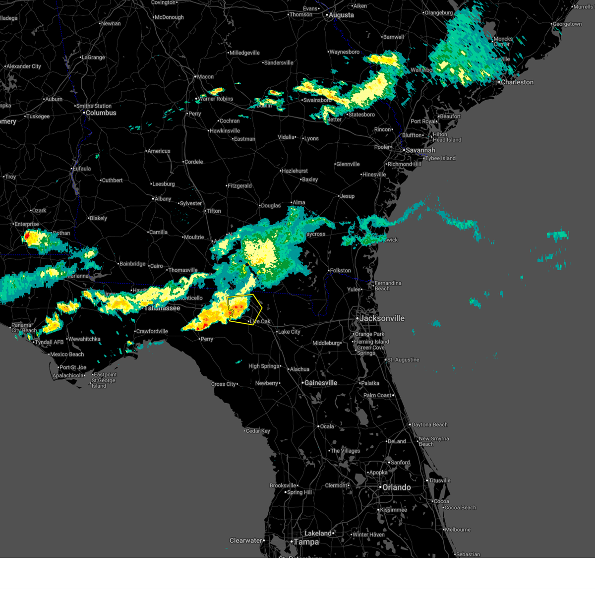
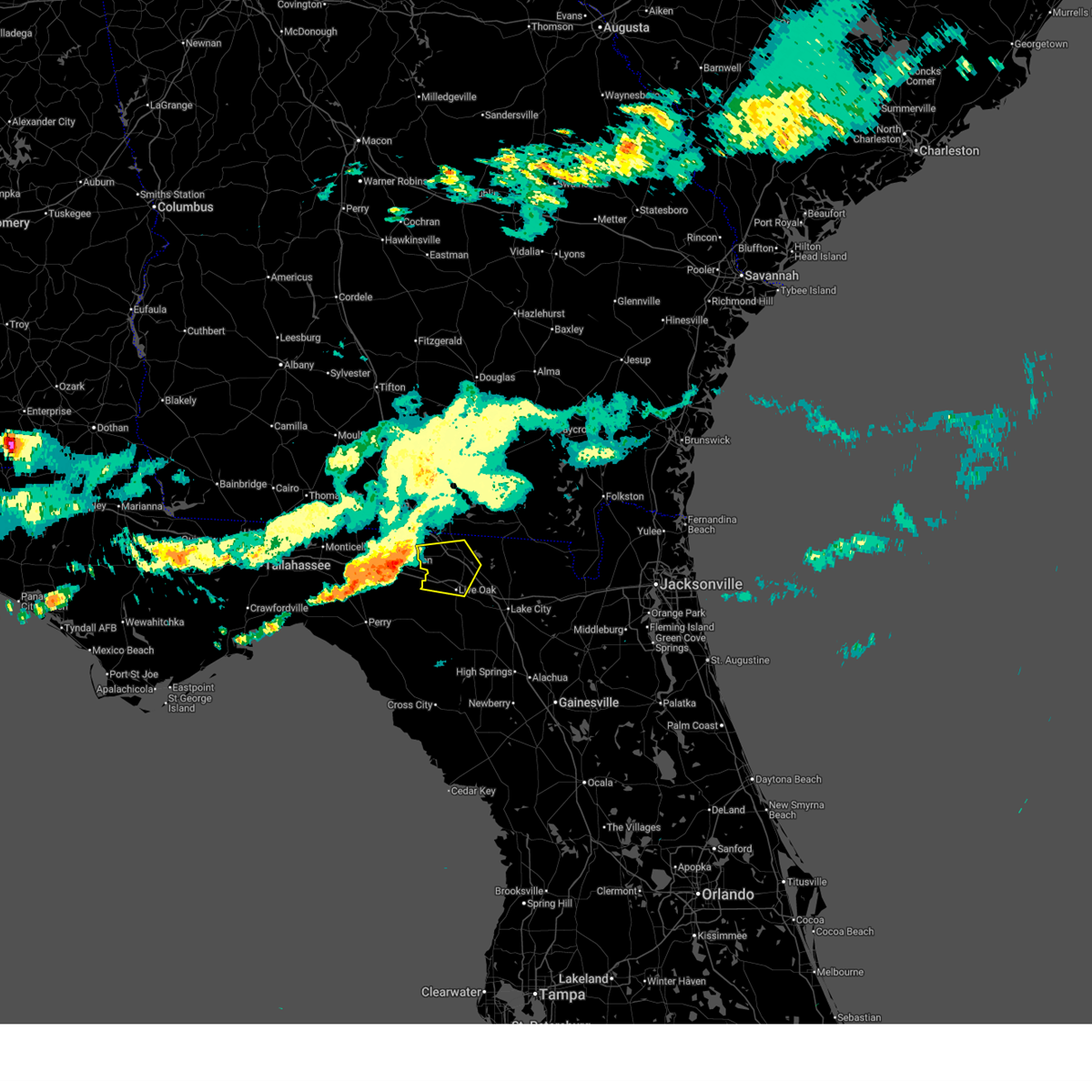
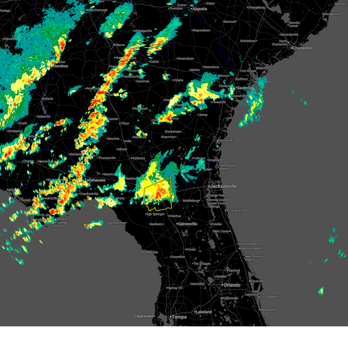
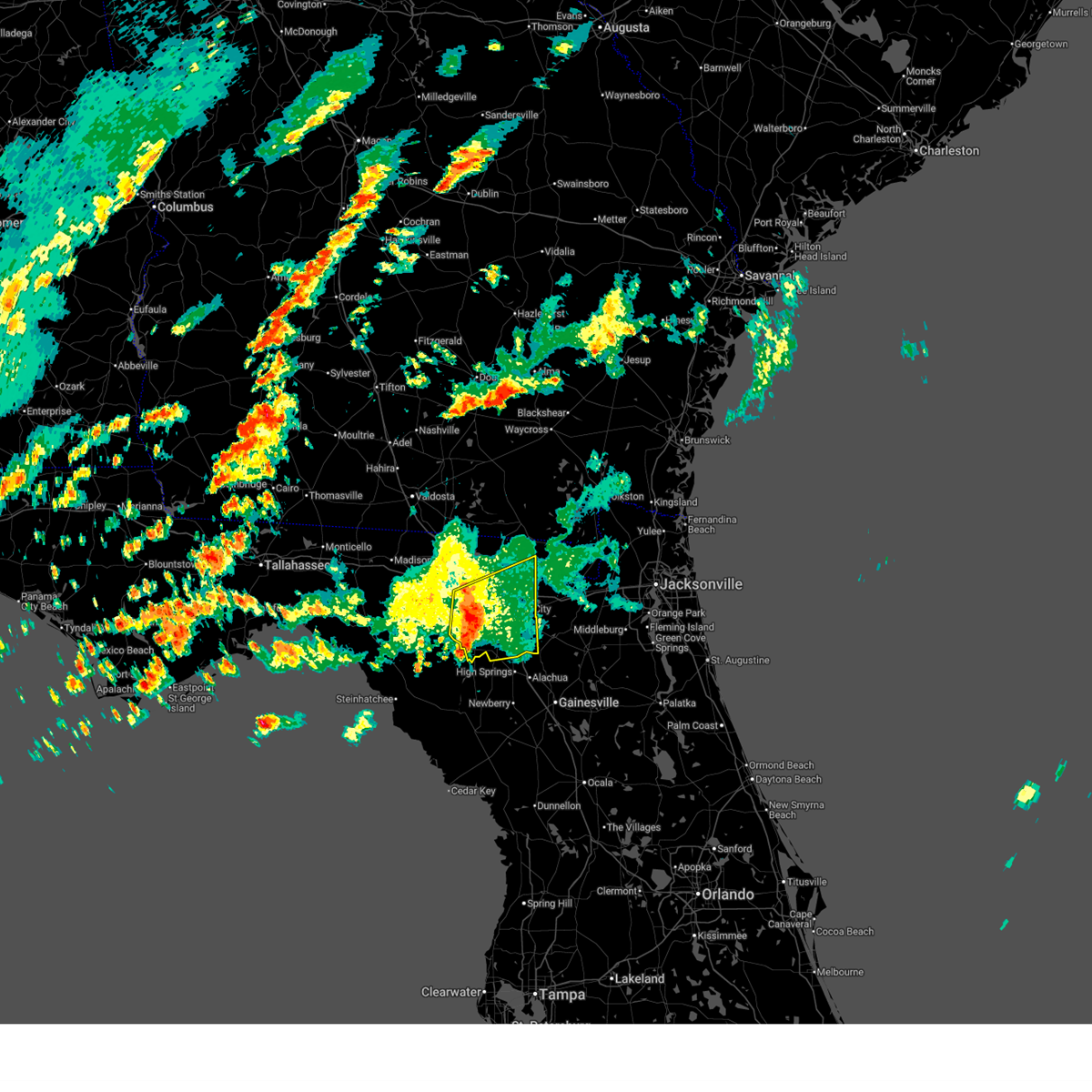
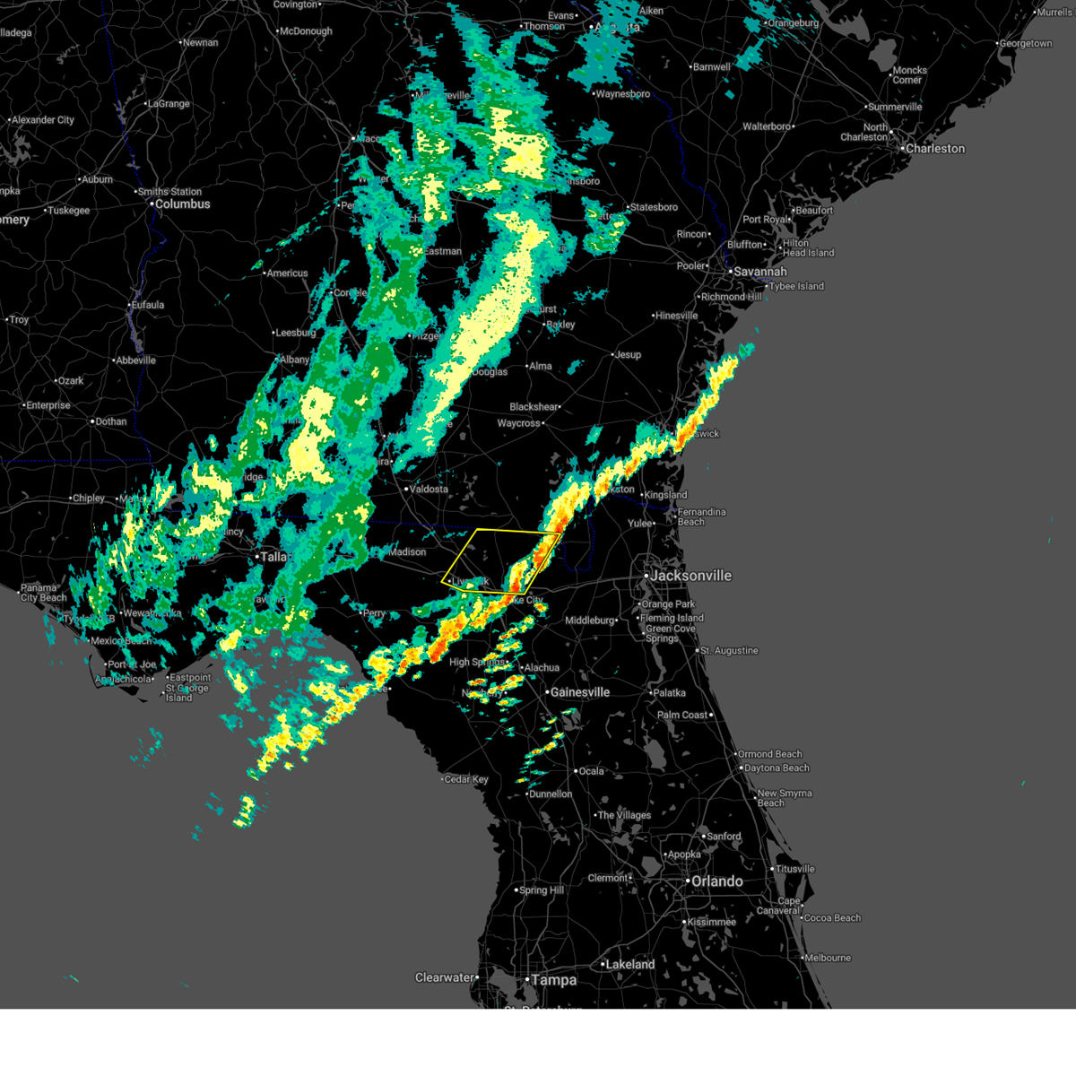
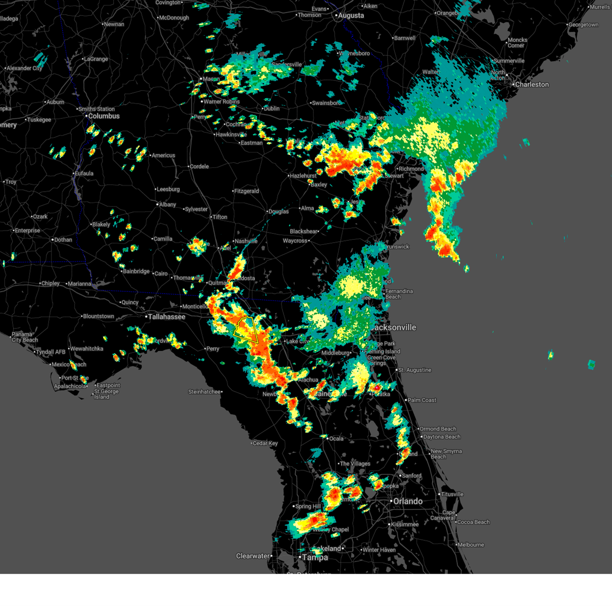
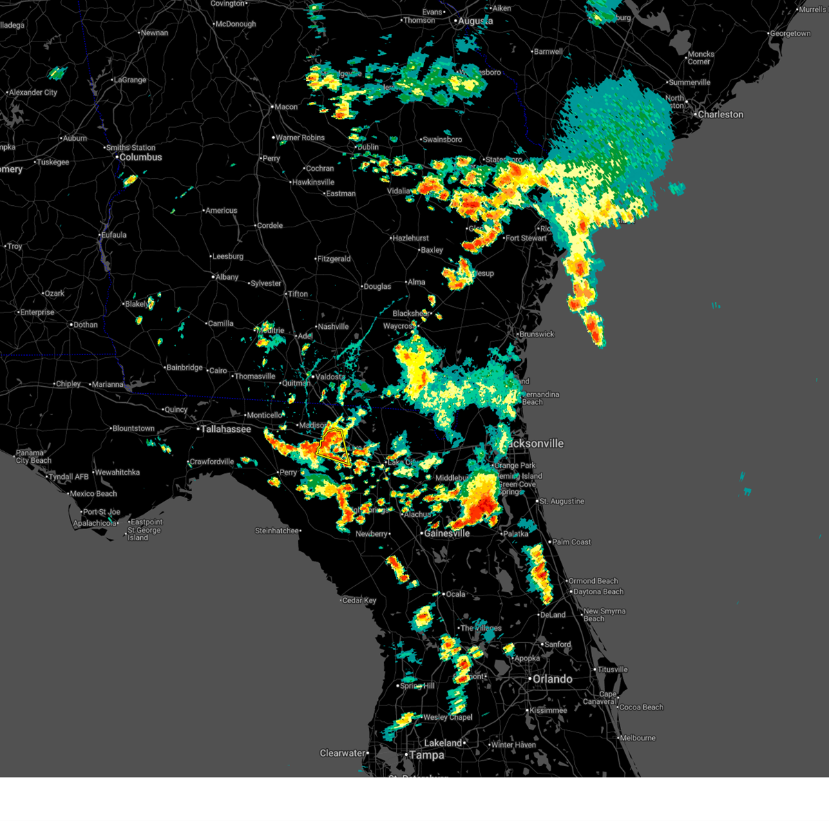
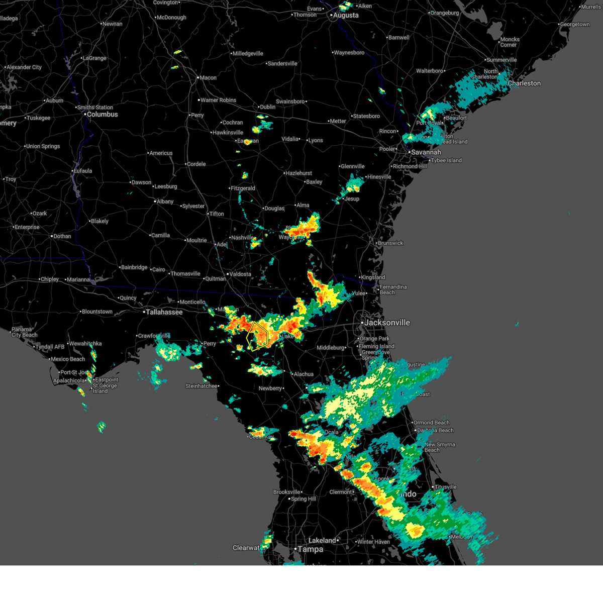
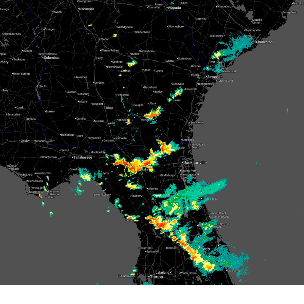
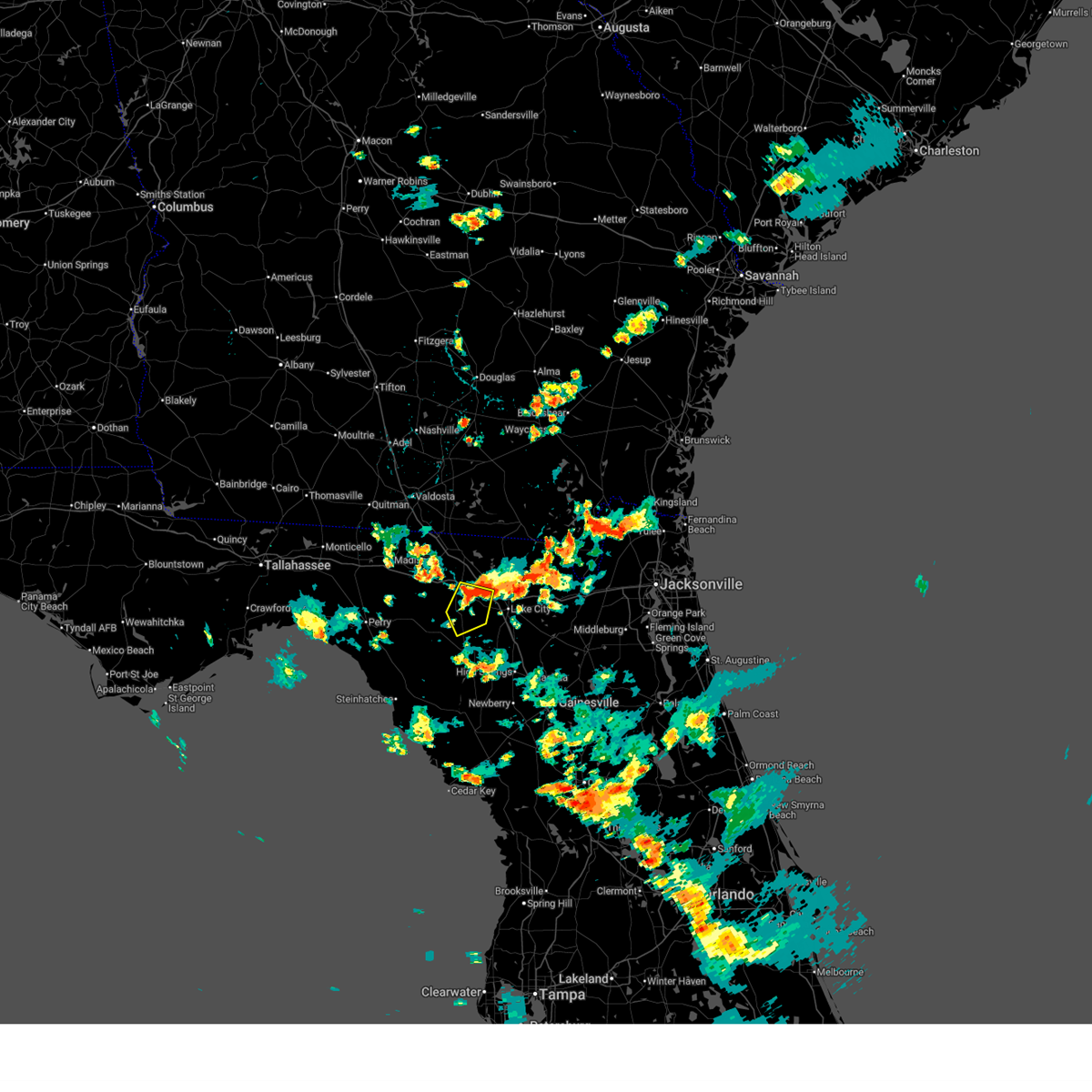
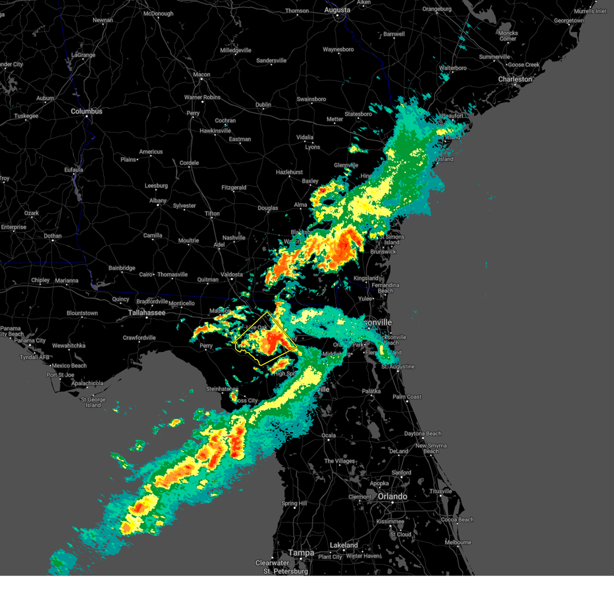
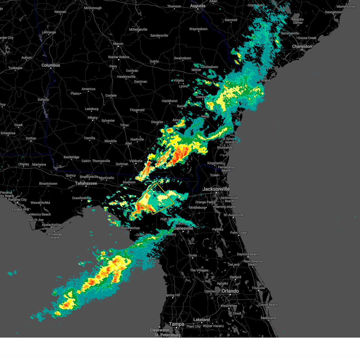
Hail Map for Live Oak, FL
The Live Oak, FL area has had 6 reports of on-the-ground hail by trained spotters, and has been under severe weather warnings 14 times during the past 12 months. Doppler radar has detected hail at or near Live Oak, FL on 52 occasions, including 1 occasion during the past year.
| Name: | Live Oak, FL |
| Where Located: | 78.1 miles E of Tallahassee, FL |
| Map: | Google Map for Live Oak, FL |
| Population: | 6850 |
| Housing Units: | 2951 |
| More Info: | Search Google for Live Oak, FL |
3
The Top Recent Hail Date for Live Oak, FL is Wednesday, July 9, 2025 (7th out of 52)

Hail and Wind Damage Spotted near Live Oak, FL
| Date / Time | Report Details |
|---|---|
| 5/7/2026 2:54 PM EDT |
 the severe thunderstorm warning has been cancelled and is no longer in effect the severe thunderstorm warning has been cancelled and is no longer in effect
|
| 5/7/2026 2:31 PM EDT |
 Svrjax the national weather service in jacksonville has issued a * severe thunderstorm warning for, northwestern suwannee county in northern florida, central hamilton county in northern florida, * until 315 pm edt. * at 231 pm edt, a severe thunderstorm was located near madison, moving east at 40 mph (radar indicated). Hazards include 60 mph wind gusts and penny size hail. expect damage to roofs, siding, and trees Svrjax the national weather service in jacksonville has issued a * severe thunderstorm warning for, northwestern suwannee county in northern florida, central hamilton county in northern florida, * until 315 pm edt. * at 231 pm edt, a severe thunderstorm was located near madison, moving east at 40 mph (radar indicated). Hazards include 60 mph wind gusts and penny size hail. expect damage to roofs, siding, and trees
|
| 3/16/2026 6:42 AM EDT |
 The storms which prompted the warning have weakened below severe limits, and no longer pose an immediate threat to life or property. therefore, the warning will be allowed to expire. however, small hail, gusty winds and heavy rain are still possible with these thunderstorms. The storms which prompted the warning have weakened below severe limits, and no longer pose an immediate threat to life or property. therefore, the warning will be allowed to expire. however, small hail, gusty winds and heavy rain are still possible with these thunderstorms.
|
| 3/16/2026 6:17 AM EDT |
 Svrjax the national weather service in jacksonville has issued a * severe thunderstorm warning for, western union county in northern florida, columbia county in northern florida, eastern suwannee county in northern florida, southeastern hamilton county in northern florida, * until 645 am edt. * at 617 am edt, severe thunderstorms were located along a line extending from near live oak to near obrien, moving northeast at 35 mph (radar indicated). Hazards include 60 mph wind gusts and penny size hail. expect damage to roofs, siding, and trees Svrjax the national weather service in jacksonville has issued a * severe thunderstorm warning for, western union county in northern florida, columbia county in northern florida, eastern suwannee county in northern florida, southeastern hamilton county in northern florida, * until 645 am edt. * at 617 am edt, severe thunderstorms were located along a line extending from near live oak to near obrien, moving northeast at 35 mph (radar indicated). Hazards include 60 mph wind gusts and penny size hail. expect damage to roofs, siding, and trees
|
| 3/12/2026 10:16 AM EDT |
 The storms which prompted the warning have weakened below severe limits, and no longer pose an immediate threat to life or property. therefore, the warning has been allowed to expire. however, gusty winds are still possible with these showers and thunderstorms. The storms which prompted the warning have weakened below severe limits, and no longer pose an immediate threat to life or property. therefore, the warning has been allowed to expire. however, gusty winds are still possible with these showers and thunderstorms.
|
| 3/12/2026 9:30 AM EDT |
 Svrjax the national weather service in jacksonville has issued a * severe thunderstorm warning for, northwestern baker county in northeastern florida, northern columbia county in northern florida, northeastern suwannee county in northern florida, eastern hamilton county in northern florida, * until 1015 am edt. * at 930 am edt, severe thunderstorms were located along a line extending from 6 miles north of belmont to near suwannee springs, moving east at 35 mph (radar indicated). Hazards include 60 mph wind gusts. expect damage to roofs, siding, and trees Svrjax the national weather service in jacksonville has issued a * severe thunderstorm warning for, northwestern baker county in northeastern florida, northern columbia county in northern florida, northeastern suwannee county in northern florida, eastern hamilton county in northern florida, * until 1015 am edt. * at 930 am edt, severe thunderstorms were located along a line extending from 6 miles north of belmont to near suwannee springs, moving east at 35 mph (radar indicated). Hazards include 60 mph wind gusts. expect damage to roofs, siding, and trees
|
| 3/12/2026 9:19 AM EDT |
 At 919 am edt, severe thunderstorms were located along a line extending from 6 miles northeast of jasper to 6 miles northwest of live oak, moving east at 40 mph (radar indicated). Hazards include 60 mph wind gusts. Expect damage to roofs, siding, and trees. Locations impacted include, live oak, jasper, suwannee springs, belmont, and houston. At 919 am edt, severe thunderstorms were located along a line extending from 6 miles northeast of jasper to 6 miles northwest of live oak, moving east at 40 mph (radar indicated). Hazards include 60 mph wind gusts. Expect damage to roofs, siding, and trees. Locations impacted include, live oak, jasper, suwannee springs, belmont, and houston.
|
| 3/12/2026 8:49 AM EDT |
 Svrjax the national weather service in jacksonville has issued a * severe thunderstorm warning for, northwestern columbia county in northern florida, northern suwannee county in northern florida, hamilton county in northern florida, * until 930 am edt. * at 848 am edt, severe thunderstorms were located along a line extending from near lake park to near madison, moving east at 35 mph (radar indicated). Hazards include 60 mph wind gusts. expect damage to roofs, siding, and trees Svrjax the national weather service in jacksonville has issued a * severe thunderstorm warning for, northwestern columbia county in northern florida, northern suwannee county in northern florida, hamilton county in northern florida, * until 930 am edt. * at 848 am edt, severe thunderstorms were located along a line extending from near lake park to near madison, moving east at 35 mph (radar indicated). Hazards include 60 mph wind gusts. expect damage to roofs, siding, and trees
|
| 8/16/2025 5:40 PM EDT |
 The storm which prompted the warning has weakened below severe limits, and no longer poses an immediate threat to life or property. therefore, the warning will be allowed to expire. however, heavy rain is still possible with this thunderstorm. The storm which prompted the warning has weakened below severe limits, and no longer poses an immediate threat to life or property. therefore, the warning will be allowed to expire. however, heavy rain is still possible with this thunderstorm.
|
| 8/16/2025 5:04 PM EDT |
 Svrjax the national weather service in jacksonville has issued a * severe thunderstorm warning for, northwestern suwannee county in northern florida, * until 545 pm edt. * at 503 pm edt, a severe thunderstorm was located near suwannee river state park, and is drifting east. other storms were near newburn and suwannee (radar indicated). Hazards include 60 mph wind gusts. expect damage to roofs, siding, and trees Svrjax the national weather service in jacksonville has issued a * severe thunderstorm warning for, northwestern suwannee county in northern florida, * until 545 pm edt. * at 503 pm edt, a severe thunderstorm was located near suwannee river state park, and is drifting east. other storms were near newburn and suwannee (radar indicated). Hazards include 60 mph wind gusts. expect damage to roofs, siding, and trees
|
| 7/3/2025 6:17 PM EDT |
 The storm which prompted the warning has weakened below severe limits, and no longer poses an immediate threat to life or property. therefore, the warning has been allowed to expire. The storm which prompted the warning has weakened below severe limits, and no longer poses an immediate threat to life or property. therefore, the warning has been allowed to expire.
|
| 7/3/2025 6:06 PM EDT |
 At 605 pm edt, a severe thunderstorm was located near live oak, moving south at 5 mph (radar indicated). Hazards include 60 mph wind gusts and penny size hail. Expect damage to roofs, siding, and trees. Locations impacted include, live oak, wellborn, mcalpin, and houston. At 605 pm edt, a severe thunderstorm was located near live oak, moving south at 5 mph (radar indicated). Hazards include 60 mph wind gusts and penny size hail. Expect damage to roofs, siding, and trees. Locations impacted include, live oak, wellborn, mcalpin, and houston.
|
| 7/3/2025 6:06 PM EDT |
 the severe thunderstorm warning has been cancelled and is no longer in effect the severe thunderstorm warning has been cancelled and is no longer in effect
|
| 7/3/2025 5:42 PM EDT |
 Svrjax the national weather service in jacksonville has issued a * severe thunderstorm warning for, west central columbia county in northern florida, northeastern suwannee county in northern florida, * until 615 pm edt. * at 542 pm edt, a severe thunderstorm was located near live oak, moving south at 5 mph (radar indicated). Hazards include 60 mph wind gusts and penny size hail. expect damage to roofs, siding, and trees Svrjax the national weather service in jacksonville has issued a * severe thunderstorm warning for, west central columbia county in northern florida, northeastern suwannee county in northern florida, * until 615 pm edt. * at 542 pm edt, a severe thunderstorm was located near live oak, moving south at 5 mph (radar indicated). Hazards include 60 mph wind gusts and penny size hail. expect damage to roofs, siding, and trees
|
| 3/16/2025 11:12 AM EDT |
 The storm which prompted the warning has moved out of the area. therefore, the warning will be allowed to expire. a tornado watch remains in effect until 300 pm edt for northern florida. The storm which prompted the warning has moved out of the area. therefore, the warning will be allowed to expire. a tornado watch remains in effect until 300 pm edt for northern florida.
|
| 3/16/2025 10:38 AM EDT |
 Svrjax the national weather service in jacksonville has issued a * severe thunderstorm warning for, central columbia county in northern florida, suwannee county in northern florida, southeastern hamilton county in northern florida, * until 1115 am edt. * at 1037 am edt, a severe thunderstorm was located over mayo, moving east at 40 mph (radar indicated). Hazards include 60 mph wind gusts and quarter size hail. Hail damage to vehicles is expected. Expect wind damage to roofs, siding, and trees. Svrjax the national weather service in jacksonville has issued a * severe thunderstorm warning for, central columbia county in northern florida, suwannee county in northern florida, southeastern hamilton county in northern florida, * until 1115 am edt. * at 1037 am edt, a severe thunderstorm was located over mayo, moving east at 40 mph (radar indicated). Hazards include 60 mph wind gusts and quarter size hail. Hail damage to vehicles is expected. Expect wind damage to roofs, siding, and trees.
|
| 6/26/2024 3:59 PM EDT |
 The storm which prompted the warning has weakened below severe limits, and no longer poses an immediate threat to life or property. therefore, the warning will be allowed to expire. however, small hail, gusty winds and heavy rain are still possible with this thunderstorm. to report severe weather, contact your nearest law enforcement agency. they will relay your report to the national weather service jacksonville. The storm which prompted the warning has weakened below severe limits, and no longer poses an immediate threat to life or property. therefore, the warning will be allowed to expire. however, small hail, gusty winds and heavy rain are still possible with this thunderstorm. to report severe weather, contact your nearest law enforcement agency. they will relay your report to the national weather service jacksonville.
|
| 6/26/2024 3:48 PM EDT |
 the severe thunderstorm warning has been cancelled and is no longer in effect the severe thunderstorm warning has been cancelled and is no longer in effect
|
| 6/26/2024 3:48 PM EDT |
 At 348 pm edt, a severe thunderstorm was located near suwannee springs, and is nearly stationary (radar indicated). Hazards include 60 mph wind gusts and half dollar size hail. Hail damage to vehicles is expected. expect wind damage to roofs, siding, and trees. Locations impacted include, live oak, jasper, and suwannee springs. At 348 pm edt, a severe thunderstorm was located near suwannee springs, and is nearly stationary (radar indicated). Hazards include 60 mph wind gusts and half dollar size hail. Hail damage to vehicles is expected. expect wind damage to roofs, siding, and trees. Locations impacted include, live oak, jasper, and suwannee springs.
|
| 6/26/2024 3:29 PM EDT | Large tree branches were reported down in the live oak area. flooding was also reporte in suwannee county FL, 0.5 miles ENE of Live Oak, FL |
| 6/26/2024 3:29 PM EDT |
 Svrjax the national weather service in jacksonville has issued a * severe thunderstorm warning for, northeastern suwannee county in northern florida, central hamilton county in northern florida, southwestern echols county in southeastern georgia, * until 400 pm edt. * at 329 pm edt, severe thunderstorms were located along a line extending from near crossroads to near live oak, moving northeast at 10 mph (radar indicated). Hazards include 60 mph wind gusts and quarter size hail. Hail damage to vehicles is expected. Expect wind damage to roofs, siding, and trees. Svrjax the national weather service in jacksonville has issued a * severe thunderstorm warning for, northeastern suwannee county in northern florida, central hamilton county in northern florida, southwestern echols county in southeastern georgia, * until 400 pm edt. * at 329 pm edt, severe thunderstorms were located along a line extending from near crossroads to near live oak, moving northeast at 10 mph (radar indicated). Hazards include 60 mph wind gusts and quarter size hail. Hail damage to vehicles is expected. Expect wind damage to roofs, siding, and trees.
|
| 5/14/2024 6:55 AM EDT |
 The storm which prompted the warning has weakened below severe limits, and no longer poses an immediate threat to life or property. therefore, the warning will be allowed to expire. however, gusty winds are still possible with this thunderstorm. a tornado watch remains in effect until 100 pm edt for northern florida, and southeastern georgia. The storm which prompted the warning has weakened below severe limits, and no longer poses an immediate threat to life or property. therefore, the warning will be allowed to expire. however, gusty winds are still possible with this thunderstorm. a tornado watch remains in effect until 100 pm edt for northern florida, and southeastern georgia.
|
| 5/14/2024 6:32 AM EDT |
 Svrjax the national weather service in jacksonville has issued a * severe thunderstorm warning for, north central suwannee county in northern florida, north central columbia county in northern florida, hamilton county in northern florida, echols county in southeastern georgia, central clinch county in southeastern georgia, * until 700 am edt. * at 632 am edt, a severe thunderstorm was located near jasper, moving northeast at 45 mph (radar indicated). Hazards include 60 mph wind gusts and penny size hail. expect damage to roofs, siding, and trees Svrjax the national weather service in jacksonville has issued a * severe thunderstorm warning for, north central suwannee county in northern florida, north central columbia county in northern florida, hamilton county in northern florida, echols county in southeastern georgia, central clinch county in southeastern georgia, * until 700 am edt. * at 632 am edt, a severe thunderstorm was located near jasper, moving northeast at 45 mph (radar indicated). Hazards include 60 mph wind gusts and penny size hail. expect damage to roofs, siding, and trees
|
| 5/10/2024 10:00 AM EDT | Reports of 18000/24000 (>70%) customers are without power in countywide in suwannee count in suwannee county FL, 7.1 miles N of Live Oak, FL |
| 5/10/2024 8:00 AM EDT |
 At 800 am edt, severe thunderstorms were located along a line extending from moody air force base to 7 miles southwest of dowling park to near steinhatchee, moving east at 45 mph (radar indicated). Hazards include 70 mph wind gusts and quarter size hail. possible tornadoes. Hail damage to vehicles is expected. expect considerable tree damage. wind damage is also likely to mobile homes, roofs, and outbuildings. Locations impacted include, lake city, live oak, jasper, homerville, trenton, jennings, white springs, bell, fargo, and statenville. At 800 am edt, severe thunderstorms were located along a line extending from moody air force base to 7 miles southwest of dowling park to near steinhatchee, moving east at 45 mph (radar indicated). Hazards include 70 mph wind gusts and quarter size hail. possible tornadoes. Hail damage to vehicles is expected. expect considerable tree damage. wind damage is also likely to mobile homes, roofs, and outbuildings. Locations impacted include, lake city, live oak, jasper, homerville, trenton, jennings, white springs, bell, fargo, and statenville.
|
| 5/10/2024 7:50 AM EDT |
 Svrjax the national weather service in jacksonville has issued a * severe thunderstorm warning for, gilchrist county in northern florida, suwannee county in northern florida, western columbia county in northern florida, hamilton county in northern florida, echols county in southeastern georgia, west central ware county in southeastern georgia, clinch county in southeastern georgia, * until 830 am edt. * at 750 am edt, severe thunderstorms were located along a line extending from near hahira to 7 miles west of dowling park to 18 miles northwest of steinhatchee, moving east at 55 mph (radar indicated). Hazards include 70 mph wind gusts and quarter size hail. Hail damage to vehicles is expected. expect considerable tree damage. Wind damage is also likely to mobile homes, roofs, and outbuildings. Svrjax the national weather service in jacksonville has issued a * severe thunderstorm warning for, gilchrist county in northern florida, suwannee county in northern florida, western columbia county in northern florida, hamilton county in northern florida, echols county in southeastern georgia, west central ware county in southeastern georgia, clinch county in southeastern georgia, * until 830 am edt. * at 750 am edt, severe thunderstorms were located along a line extending from near hahira to 7 miles west of dowling park to 18 miles northwest of steinhatchee, moving east at 55 mph (radar indicated). Hazards include 70 mph wind gusts and quarter size hail. Hail damage to vehicles is expected. expect considerable tree damage. Wind damage is also likely to mobile homes, roofs, and outbuildings.
|
| 4/11/2024 8:12 AM EDT |
 At 812 am edt, severe thunderstorms were located along a line extending from 7 miles south of fargo to near obrien, moving east at 40 mph (radar indicated). Hazards include 60 mph wind gusts. Expect damage to roofs, siding, and trees. Locations impacted include, lake city, live oak, white springs, ichetucknee spring, columbia, fort white, winfield, suwannee valley, belmont, and mcalpin. At 812 am edt, severe thunderstorms were located along a line extending from 7 miles south of fargo to near obrien, moving east at 40 mph (radar indicated). Hazards include 60 mph wind gusts. Expect damage to roofs, siding, and trees. Locations impacted include, lake city, live oak, white springs, ichetucknee spring, columbia, fort white, winfield, suwannee valley, belmont, and mcalpin.
|
| 4/11/2024 8:00 AM EDT | The storm which prompted the warning has weakened and no longer appears capable of producing a tornado. therefore, the tornado warning will be allowed to expire. a tornado watch remains in effect until 300 pm edt for northern florida. remember, a severe thunderstorm warning still remains in effect for e astern hamilton and suwannee counties and columbia county through 830 am. |
| 4/11/2024 7:58 AM EDT |
 Svrjax the national weather service in jacksonville has issued a * severe thunderstorm warning for, eastern suwannee county in northern florida, columbia county in northern florida, eastern hamilton county in northern florida, * until 830 am edt. * at 758 am edt, severe thunderstorms were located along a line extending from 9 miles northwest of belmont to near ichetucknee spring, moving east at 35 mph (radar indicated). Hazards include 60 mph wind gusts. expect damage to roofs, siding, and trees Svrjax the national weather service in jacksonville has issued a * severe thunderstorm warning for, eastern suwannee county in northern florida, columbia county in northern florida, eastern hamilton county in northern florida, * until 830 am edt. * at 758 am edt, severe thunderstorms were located along a line extending from 9 miles northwest of belmont to near ichetucknee spring, moving east at 35 mph (radar indicated). Hazards include 60 mph wind gusts. expect damage to roofs, siding, and trees
|
| 4/11/2024 7:52 AM EDT |
 At 752 am edt, a severe thunderstorm capable of producing a tornado was located near live oak, moving east at 45 mph (radar indicated rotation). Hazards include tornado. Flying debris will be dangerous to those caught without shelter. mobile homes will be damaged or destroyed. damage to roofs, windows, and vehicles will occur. tree damage is likely. Locations impacted include, wellborn and houston. At 752 am edt, a severe thunderstorm capable of producing a tornado was located near live oak, moving east at 45 mph (radar indicated rotation). Hazards include tornado. Flying debris will be dangerous to those caught without shelter. mobile homes will be damaged or destroyed. damage to roofs, windows, and vehicles will occur. tree damage is likely. Locations impacted include, wellborn and houston.
|
| 4/11/2024 7:49 AM EDT |
 At 749 am edt, a severe thunderstorm capable of producing a tornado was located near live oak, moving east at 45 mph (radar indicated rotation). Hazards include tornado. Flying debris will be dangerous to those caught without shelter. mobile homes will be damaged or destroyed. damage to roofs, windows, and vehicles will occur. tree damage is likely. This tornadic thunderstorm will remain over mainly rural areas of northeastern suwannee county, including the following locations, houston. At 749 am edt, a severe thunderstorm capable of producing a tornado was located near live oak, moving east at 45 mph (radar indicated rotation). Hazards include tornado. Flying debris will be dangerous to those caught without shelter. mobile homes will be damaged or destroyed. damage to roofs, windows, and vehicles will occur. tree damage is likely. This tornadic thunderstorm will remain over mainly rural areas of northeastern suwannee county, including the following locations, houston.
|
| 4/11/2024 7:47 AM EDT |
 At 747 am edt, a severe thunderstorm capable of producing a tornado was located near live oak, moving east at 50 mph (radar indicated rotation). Hazards include tornado. Flying debris will be dangerous to those caught without shelter. mobile homes will be damaged or destroyed. damage to roofs, windows, and vehicles will occur. tree damage is likely. this dangerous storm will be near, live oak around 750 am edt. Other locations impacted by this tornadic thunderstorm include houston. At 747 am edt, a severe thunderstorm capable of producing a tornado was located near live oak, moving east at 50 mph (radar indicated rotation). Hazards include tornado. Flying debris will be dangerous to those caught without shelter. mobile homes will be damaged or destroyed. damage to roofs, windows, and vehicles will occur. tree damage is likely. this dangerous storm will be near, live oak around 750 am edt. Other locations impacted by this tornadic thunderstorm include houston.
|
| 4/11/2024 7:42 AM EDT |
 Torjax the national weather service in jacksonville has issued a * tornado warning for, central suwannee county in northern florida, * until 800 am edt. * at 742 am edt, a severe thunderstorm capable of producing a tornado was located near live oak, moving east at 45 mph (radar indicated rotation). Hazards include tornado. Flying debris will be dangerous to those caught without shelter. mobile homes will be damaged or destroyed. damage to roofs, windows, and vehicles will occur. tree damage is likely. this dangerous storm will be near, live oak around 745 am edt. wellborn around 755 am edt. Other locations impacted by this tornadic thunderstorm include newburn and houston. Torjax the national weather service in jacksonville has issued a * tornado warning for, central suwannee county in northern florida, * until 800 am edt. * at 742 am edt, a severe thunderstorm capable of producing a tornado was located near live oak, moving east at 45 mph (radar indicated rotation). Hazards include tornado. Flying debris will be dangerous to those caught without shelter. mobile homes will be damaged or destroyed. damage to roofs, windows, and vehicles will occur. tree damage is likely. this dangerous storm will be near, live oak around 745 am edt. wellborn around 755 am edt. Other locations impacted by this tornadic thunderstorm include newburn and houston.
|
| 4/11/2024 7:39 AM EDT |
 At 738 am edt, a severe thunderstorm capable of producing a tornado was located near live oak, moving northeast at 45 mph (radar indicated rotation). Hazards include tornado. Flying debris will be dangerous to those caught without shelter. mobile homes will be damaged or destroyed. damage to roofs, windows, and vehicles will occur. tree damage is likely. Locations impacted include, live oak, newburn, and houston. At 738 am edt, a severe thunderstorm capable of producing a tornado was located near live oak, moving northeast at 45 mph (radar indicated rotation). Hazards include tornado. Flying debris will be dangerous to those caught without shelter. mobile homes will be damaged or destroyed. damage to roofs, windows, and vehicles will occur. tree damage is likely. Locations impacted include, live oak, newburn, and houston.
|
| 4/11/2024 7:37 AM EDT |
 A tornado warning remains in effect for central suwannee county until 745 am a tornado watch remains in effect until 300 pm edt for northern florida, and southeastern georgia. A tornado warning remains in effect for central suwannee county until 745 am a tornado watch remains in effect until 300 pm edt for northern florida, and southeastern georgia.
|
| 4/11/2024 7:34 AM EDT |
 At 734 am edt, a severe thunderstorm capable of producing a tornado was located 7 miles east of dowling park, or 8 miles southwest of live oak, moving northeast at 45 mph (radar indicated rotation). Hazards include tornado. Flying debris will be dangerous to those caught without shelter. mobile homes will be damaged or destroyed. damage to roofs, windows, and vehicles will occur. tree damage is likely. Locations impacted include, live oak, newburn, and houston. At 734 am edt, a severe thunderstorm capable of producing a tornado was located 7 miles east of dowling park, or 8 miles southwest of live oak, moving northeast at 45 mph (radar indicated rotation). Hazards include tornado. Flying debris will be dangerous to those caught without shelter. mobile homes will be damaged or destroyed. damage to roofs, windows, and vehicles will occur. tree damage is likely. Locations impacted include, live oak, newburn, and houston.
|
| 4/11/2024 7:28 AM EDT |
 At 727 am edt, severe thunderstorms were located along a line extending from near statenville to 33 miles west of steinhatchee, moving southeast at 20 mph (radar indicated). Hazards include 60 mph wind gusts and penny size hail. Expect damage to roofs, siding, and trees. Locations impacted include, live oak, jasper, jennings, white springs, suwannee river state park, suwannee springs, belmont, crossroads, luraville, and dowling park. At 727 am edt, severe thunderstorms were located along a line extending from near statenville to 33 miles west of steinhatchee, moving southeast at 20 mph (radar indicated). Hazards include 60 mph wind gusts and penny size hail. Expect damage to roofs, siding, and trees. Locations impacted include, live oak, jasper, jennings, white springs, suwannee river state park, suwannee springs, belmont, crossroads, luraville, and dowling park.
|
| 4/11/2024 7:24 AM EDT |
 Torjax the national weather service in jacksonville has issued a * tornado warning for, central suwannee county in northern florida, * until 745 am edt. * at 723 am edt, a severe thunderstorm capable of producing a tornado was located near dowling park, or 10 miles northwest of mayo, moving northeast at 45 mph (radar indicated rotation). Hazards include tornado. Flying debris will be dangerous to those caught without shelter. mobile homes will be damaged or destroyed. damage to roofs, windows, and vehicles will occur. tree damage is likely. This tornadic thunderstorm will remain over mainly rural areas of central suwannee county, including the following locations, newburn and houston. Torjax the national weather service in jacksonville has issued a * tornado warning for, central suwannee county in northern florida, * until 745 am edt. * at 723 am edt, a severe thunderstorm capable of producing a tornado was located near dowling park, or 10 miles northwest of mayo, moving northeast at 45 mph (radar indicated rotation). Hazards include tornado. Flying debris will be dangerous to those caught without shelter. mobile homes will be damaged or destroyed. damage to roofs, windows, and vehicles will occur. tree damage is likely. This tornadic thunderstorm will remain over mainly rural areas of central suwannee county, including the following locations, newburn and houston.
|
| 4/11/2024 6:53 AM EDT |
 Svrjax the national weather service in jacksonville has issued a * severe thunderstorm warning for, suwannee county in northern florida, hamilton county in northern florida, * until 745 am edt. * at 653 am edt, severe thunderstorms were located along a line extending from near mayday to 38 miles west of steinhatchee, moving east at 10 mph (radar indicated). Hazards include 60 mph wind gusts and penny size hail. expect damage to roofs, siding, and trees Svrjax the national weather service in jacksonville has issued a * severe thunderstorm warning for, suwannee county in northern florida, hamilton county in northern florida, * until 745 am edt. * at 653 am edt, severe thunderstorms were located along a line extending from near mayday to 38 miles west of steinhatchee, moving east at 10 mph (radar indicated). Hazards include 60 mph wind gusts and penny size hail. expect damage to roofs, siding, and trees
|
| 3/5/2024 9:59 PM EST |
 Svrjax the national weather service in jacksonville has issued a * severe thunderstorm warning for, central suwannee county in northern florida, * until 1030 pm est. * at 959 pm est, a severe thunderstorm was located near obrien, or 8 miles east of mayo, moving north at 30 mph (radar indicated). Hazards include 60 mph wind gusts. expect damage to roofs, siding, and trees Svrjax the national weather service in jacksonville has issued a * severe thunderstorm warning for, central suwannee county in northern florida, * until 1030 pm est. * at 959 pm est, a severe thunderstorm was located near obrien, or 8 miles east of mayo, moving north at 30 mph (radar indicated). Hazards include 60 mph wind gusts. expect damage to roofs, siding, and trees
|
| 1/9/2024 1:51 PM EST |
 The severe thunderstorm warning for central suwannee and eastern hamilton counties will expire at 200 pm est, the storms which prompted the warning have moved out of the area. therefore, the warning will be allowed to expire. however, gusty winds are still possible with these thunderstorms. a tornado watch remains in effect until 300 pm est for northern florida, and southeastern georgia. The severe thunderstorm warning for central suwannee and eastern hamilton counties will expire at 200 pm est, the storms which prompted the warning have moved out of the area. therefore, the warning will be allowed to expire. however, gusty winds are still possible with these thunderstorms. a tornado watch remains in effect until 300 pm est for northern florida, and southeastern georgia.
|
| 1/9/2024 1:23 PM EST |
 At 122 pm est, severe thunderstorms were located along a line extending from 8 miles east of statenville to 10 miles south of mayo, moving northeast at 40 mph (radar indicated). Hazards include 60 mph wind gusts and penny size hail. Expect damage to roofs, siding, and trees. Locations impacted include, live oak, jasper, suwannee springs, obrien, mcalpin, and houston. At 122 pm est, severe thunderstorms were located along a line extending from 8 miles east of statenville to 10 miles south of mayo, moving northeast at 40 mph (radar indicated). Hazards include 60 mph wind gusts and penny size hail. Expect damage to roofs, siding, and trees. Locations impacted include, live oak, jasper, suwannee springs, obrien, mcalpin, and houston.
|
| 1/9/2024 12:58 PM EST |
 At 1258 pm est, severe thunderstorms were located along a line extending from jennings to 8 miles northwest of steinhatchee, moving northeast at 40 mph (radar indicated). Hazards include 60 mph wind gusts and penny size hail. expect damage to roofs, siding, and trees At 1258 pm est, severe thunderstorms were located along a line extending from jennings to 8 miles northwest of steinhatchee, moving northeast at 40 mph (radar indicated). Hazards include 60 mph wind gusts and penny size hail. expect damage to roofs, siding, and trees
|
| 12/2/2023 2:22 PM EST |
 At 222 pm est, a severe thunderstorm was located over mcalpin, or 8 miles south of live oak, moving east at 25 mph (radar indicated). Hazards include 60 mph wind gusts and penny size hail. Expect damage to roofs, siding, and trees. Locations impacted include, live oak, mcalpin, and houston. At 222 pm est, a severe thunderstorm was located over mcalpin, or 8 miles south of live oak, moving east at 25 mph (radar indicated). Hazards include 60 mph wind gusts and penny size hail. Expect damage to roofs, siding, and trees. Locations impacted include, live oak, mcalpin, and houston.
|
| 12/2/2023 2:03 PM EST |
 At 202 pm est, a severe thunderstorm was located over luraville, or 7 miles north of mayo, moving east at 30 mph (radar indicated). Hazards include 60 mph wind gusts. expect damage to roofs, siding, and trees At 202 pm est, a severe thunderstorm was located over luraville, or 7 miles north of mayo, moving east at 30 mph (radar indicated). Hazards include 60 mph wind gusts. expect damage to roofs, siding, and trees
|
| 8/17/2023 6:45 PM EDT |
 At 645 pm edt, severe thunderstorms were located along a line extending from near suwannee springs to near live oak, moving southeast at 25 mph (radar indicated). Hazards include 60 mph wind gusts. Expect damage to roofs, siding, and trees. locations impacted include, live oak, white springs, wellborn, mcalpin, suwannee valley, and houston. hail threat, radar indicated max hail size, <. 75 in wind threat, radar indicated max wind gust, 60 mph. At 645 pm edt, severe thunderstorms were located along a line extending from near suwannee springs to near live oak, moving southeast at 25 mph (radar indicated). Hazards include 60 mph wind gusts. Expect damage to roofs, siding, and trees. locations impacted include, live oak, white springs, wellborn, mcalpin, suwannee valley, and houston. hail threat, radar indicated max hail size, <. 75 in wind threat, radar indicated max wind gust, 60 mph.
|
| 8/17/2023 6:30 PM EDT |
 At 630 pm edt, severe thunderstorms were located along a line extending from near jasper to near suwannee springs, moving southeast at 10 mph (radar indicated). Hazards include 60 mph wind gusts. expect damage to roofs, siding, and trees At 630 pm edt, severe thunderstorms were located along a line extending from near jasper to near suwannee springs, moving southeast at 10 mph (radar indicated). Hazards include 60 mph wind gusts. expect damage to roofs, siding, and trees
|
| 6/27/2023 6:18 PM EDT | Report of trees and power lines down caused by thunderstorm in suwannee county FL, 2 miles SSE of Live Oak, FL |
| 6/27/2023 5:55 PM EDT | Corrects previous tstm wnd dmg report from 2 n live oak. report of trees and power lines down caused by thunderstorm in suwannee county FL, 2 miles SSE of Live Oak, FL |
| 6/27/2023 5:53 PM EDT |
 The severe thunderstorm warning for suwannee county will expire at 600 pm edt, the storm which prompted the warning has weakened below severe limits, and no longer poses an immediate threat to life or property. therefore, the warning will be allowed to expire. however small hail, gusty winds and heavy rain are still possible with this thunderstorm. The severe thunderstorm warning for suwannee county will expire at 600 pm edt, the storm which prompted the warning has weakened below severe limits, and no longer poses an immediate threat to life or property. therefore, the warning will be allowed to expire. however small hail, gusty winds and heavy rain are still possible with this thunderstorm.
|
| 6/27/2023 5:45 PM EDT |
 At 545 pm edt, a severe thunderstorm was located 7 miles south of suwannee river state park, moving east at 25 mph (radar indicated). Hazards include 60 mph wind gusts and quarter size hail. Hail damage to vehicles is expected. expect wind damage to roofs, siding, and trees. locations impacted include, live oak, suwannee springs, wellborn, dowling park, mcalpin, newburn and houston. hail threat, radar indicated max hail size, 1. 00 in wind threat, radar indicated max wind gust, 60 mph. At 545 pm edt, a severe thunderstorm was located 7 miles south of suwannee river state park, moving east at 25 mph (radar indicated). Hazards include 60 mph wind gusts and quarter size hail. Hail damage to vehicles is expected. expect wind damage to roofs, siding, and trees. locations impacted include, live oak, suwannee springs, wellborn, dowling park, mcalpin, newburn and houston. hail threat, radar indicated max hail size, 1. 00 in wind threat, radar indicated max wind gust, 60 mph.
|
| 6/27/2023 5:34 PM EDT |
 At 534 pm edt, a severe thunderstorm was located near dowling park, or near suwannee river state park, moving east at 25 mph (radar indicated). Hazards include 60 mph wind gusts and quarter size hail. Hail damage to vehicles is expected. Expect wind damage to roofs, siding, and trees. At 534 pm edt, a severe thunderstorm was located near dowling park, or near suwannee river state park, moving east at 25 mph (radar indicated). Hazards include 60 mph wind gusts and quarter size hail. Hail damage to vehicles is expected. Expect wind damage to roofs, siding, and trees.
|
| 6/19/2023 6:46 PM EDT | Report of powerlines and trees down from thunderstorm wind gus in suwannee county FL, 7.5 miles WSW of Live Oak, FL |
| 6/19/2023 10:59 AM EDT | Corrects previous tstm wnd dmg report from 6 nne houston. report of powerlines and trees down along cr 136a and 53rd road from thunderstorm wind gus in suwannee county FL, 7.5 miles WSW of Live Oak, FL |
| 6/19/2023 10:55 AM EDT |
 The severe thunderstorm warning for northern suwannee and hamilton counties will expire at 1100 am edt, the storms which prompted the warning have weakened below severe limits, and no longer pose an immediate threat to life or property. therefore, the warning will be allowed to expire. however gusty winds are still possible with these thunderstorms. a severe thunderstorm watch remains in effect until 200 pm edt for northern florida. The severe thunderstorm warning for northern suwannee and hamilton counties will expire at 1100 am edt, the storms which prompted the warning have weakened below severe limits, and no longer pose an immediate threat to life or property. therefore, the warning will be allowed to expire. however gusty winds are still possible with these thunderstorms. a severe thunderstorm watch remains in effect until 200 pm edt for northern florida.
|
| 6/19/2023 10:20 AM EDT |
 At 1020 am edt, severe thunderstorms were located along a line extending from 12 miles southwest of lake park to near madison to 10 miles southeast of monticello, moving east at 40 mph (radar indicated). Hazards include 60 mph wind gusts and penny size hail. expect damage to roofs, siding, and trees At 1020 am edt, severe thunderstorms were located along a line extending from 12 miles southwest of lake park to near madison to 10 miles southeast of monticello, moving east at 40 mph (radar indicated). Hazards include 60 mph wind gusts and penny size hail. expect damage to roofs, siding, and trees
|
| 6/17/2023 6:55 PM EDT |
 The severe thunderstorm warning for suwannee county will expire at 700 pm edt, the storm which prompted the warning has weakened below severe limits, and no longer poses an immediate threat to life or property. therefore, the warning will be allowed to expire. however small hail, gusty winds and heavy rain are still possible with this thunderstorm. The severe thunderstorm warning for suwannee county will expire at 700 pm edt, the storm which prompted the warning has weakened below severe limits, and no longer poses an immediate threat to life or property. therefore, the warning will be allowed to expire. however small hail, gusty winds and heavy rain are still possible with this thunderstorm.
|
| 6/17/2023 6:30 PM EDT |
 At 630 pm edt, a severe thunderstorm was located near live oak, moving southeast at 30 mph (radar indicated). Hazards include 60 mph wind gusts and quarter size hail. Hail damage to vehicles is expected. Expect wind damage to roofs, siding, and trees. At 630 pm edt, a severe thunderstorm was located near live oak, moving southeast at 30 mph (radar indicated). Hazards include 60 mph wind gusts and quarter size hail. Hail damage to vehicles is expected. Expect wind damage to roofs, siding, and trees.
|
| 6/14/2023 10:35 PM EDT | Suwannee county 911/dispatch reports trees and powerlines downed by strong winds across the county... with several roads currently blocked by fallen trees. time of dama in suwannee county FL, 16.4 miles NE of Live Oak, FL |
| 6/14/2023 10:26 PM EDT |
 At 1026 pm edt, severe thunderstorms were located along a line extending from near belmont to near mcalpin to near mayo, moving southeast at 40 mph (radar indicated). Hazards include 60 mph wind gusts. expect damage to roofs, siding, and trees At 1026 pm edt, severe thunderstorms were located along a line extending from near belmont to near mcalpin to near mayo, moving southeast at 40 mph (radar indicated). Hazards include 60 mph wind gusts. expect damage to roofs, siding, and trees
|
| 3/10/2023 5:30 PM EST |
 At 530 pm est, a severe thunderstorm was located near mcalpin, or 7 miles southeast of live oak, moving east at 30 mph (radar indicated). Hazards include 60 mph wind gusts and quarter size hail. Hail damage to vehicles is expected. expect wind damage to roofs, siding, and trees. Locations impacted include, live oak, wellborn, mcalpin, suwannee valley and houston. At 530 pm est, a severe thunderstorm was located near mcalpin, or 7 miles southeast of live oak, moving east at 30 mph (radar indicated). Hazards include 60 mph wind gusts and quarter size hail. Hail damage to vehicles is expected. expect wind damage to roofs, siding, and trees. Locations impacted include, live oak, wellborn, mcalpin, suwannee valley and houston.
|
| 3/10/2023 5:16 PM EST |
 At 516 pm est, a severe thunderstorm was located near live oak, moving southeast at 30 mph (radar indicated). Hazards include 60 mph wind gusts and half dollar size hail. Hail damage to vehicles is expected. expect wind damage to roofs, siding, and trees. Locations impacted include, live oak, wellborn, mcalpin, suwannee valley and houston. At 516 pm est, a severe thunderstorm was located near live oak, moving southeast at 30 mph (radar indicated). Hazards include 60 mph wind gusts and half dollar size hail. Hail damage to vehicles is expected. expect wind damage to roofs, siding, and trees. Locations impacted include, live oak, wellborn, mcalpin, suwannee valley and houston.
|
| 3/10/2023 5:12 PM EST |
 The severe thunderstorm warning for northwestern suwannee county will expire at 515 pm est, the storm which prompted the warning has moved out of the warned area. therefore, this warning will be allowed to expire. another severe thunderstorm warning is in effect for this storm as it approaches live oak. remember, a severe thunderstorm warning still remains in effect for nw suwannee county. The severe thunderstorm warning for northwestern suwannee county will expire at 515 pm est, the storm which prompted the warning has moved out of the warned area. therefore, this warning will be allowed to expire. another severe thunderstorm warning is in effect for this storm as it approaches live oak. remember, a severe thunderstorm warning still remains in effect for nw suwannee county.
|
| 3/10/2023 5:07 PM EST |
 At 506 pm est, a severe thunderstorm was located near live oak, moving east at 30 mph (radar indicated). Hazards include 60 mph wind gusts and half dollar size hail. Hail damage to vehicles is expected. Expect wind damage to roofs, siding, and trees. At 506 pm est, a severe thunderstorm was located near live oak, moving east at 30 mph (radar indicated). Hazards include 60 mph wind gusts and half dollar size hail. Hail damage to vehicles is expected. Expect wind damage to roofs, siding, and trees.
|
| 3/10/2023 5:03 PM EST |
 At 503 pm est, a severe thunderstorm was located near live oak, moving east at 30 mph (radar indicated). Hazards include ping pong ball size hail and 60 mph wind gusts. People and animals outdoors will be injured. expect hail damage to roofs, siding, windows, and vehicles. expect wind damage to roofs, siding, and trees. locations impacted include, live oak, dowling park and newburn. hail threat, radar indicated max hail size, 1. 50 in wind threat, radar indicated max wind gust, 60 mph. At 503 pm est, a severe thunderstorm was located near live oak, moving east at 30 mph (radar indicated). Hazards include ping pong ball size hail and 60 mph wind gusts. People and animals outdoors will be injured. expect hail damage to roofs, siding, windows, and vehicles. expect wind damage to roofs, siding, and trees. locations impacted include, live oak, dowling park and newburn. hail threat, radar indicated max hail size, 1. 50 in wind threat, radar indicated max wind gust, 60 mph.
|
| 3/10/2023 4:54 PM EST |
 At 454 pm est, a severe thunderstorm was located near dowling park, or 7 miles south of suwannee river state park, moving east at 30 mph (radar indicated). Hazards include 60 mph wind gusts and quarter size hail. Hail damage to vehicles is expected. expect wind damage to roofs, siding, and trees. locations impacted include, live oak, dowling park and newburn. hail threat, radar indicated max hail size, 1. 00 in wind threat, radar indicated max wind gust, 60 mph. At 454 pm est, a severe thunderstorm was located near dowling park, or 7 miles south of suwannee river state park, moving east at 30 mph (radar indicated). Hazards include 60 mph wind gusts and quarter size hail. Hail damage to vehicles is expected. expect wind damage to roofs, siding, and trees. locations impacted include, live oak, dowling park and newburn. hail threat, radar indicated max hail size, 1. 00 in wind threat, radar indicated max wind gust, 60 mph.
|
| 3/10/2023 4:32 PM EST |
 At 432 pm est, a severe thunderstorm was located 9 miles northwest of dowling park, or 9 miles southeast of madison, moving east at 25 mph (radar indicated). Hazards include 60 mph wind gusts and quarter size hail. Hail damage to vehicles is expected. Expect wind damage to roofs, siding, and trees. At 432 pm est, a severe thunderstorm was located 9 miles northwest of dowling park, or 9 miles southeast of madison, moving east at 25 mph (radar indicated). Hazards include 60 mph wind gusts and quarter size hail. Hail damage to vehicles is expected. Expect wind damage to roofs, siding, and trees.
|
| 1/4/2023 12:53 PM EST |
 At 1252 pm est, severe thunderstorms were located along a line extending from 6 miles southwest of bristol to 10 miles southeast of manor to near fargo to 9 miles northeast of jasper, moving northeast at 45 mph (radar indicated). Hazards include 60 mph wind gusts and quarter size hail. Hail damage to vehicles is expected. expect wind damage to roofs, siding, and trees. Locations impacted include, white springs, fargo, suwannee springs, suwannee river state park, needmore, suwannee valley, belmont and blue springs. At 1252 pm est, severe thunderstorms were located along a line extending from 6 miles southwest of bristol to 10 miles southeast of manor to near fargo to 9 miles northeast of jasper, moving northeast at 45 mph (radar indicated). Hazards include 60 mph wind gusts and quarter size hail. Hail damage to vehicles is expected. expect wind damage to roofs, siding, and trees. Locations impacted include, white springs, fargo, suwannee springs, suwannee river state park, needmore, suwannee valley, belmont and blue springs.
|
| 1/4/2023 12:32 PM EST |
 At 1232 pm est, severe thunderstorms were located along a line extending from near dixie union to 12 miles northwest of fargo to 7 miles southwest of needmore to near crossroads, moving northeast at 45 mph (radar indicated). Hazards include 60 mph wind gusts and quarter size hail. Hail damage to vehicles is expected. expect wind damage to roofs, siding, and trees. Locations impacted include, jasper, homerville, white springs, fargo, argyle, suwannee river state park, suwannee springs, suwannee valley, belmont and crossroads. At 1232 pm est, severe thunderstorms were located along a line extending from near dixie union to 12 miles northwest of fargo to 7 miles southwest of needmore to near crossroads, moving northeast at 45 mph (radar indicated). Hazards include 60 mph wind gusts and quarter size hail. Hail damage to vehicles is expected. expect wind damage to roofs, siding, and trees. Locations impacted include, jasper, homerville, white springs, fargo, argyle, suwannee river state park, suwannee springs, suwannee valley, belmont and crossroads.
|
| 1/4/2023 12:24 PM EST |
 At 1224 pm est, severe thunderstorms were located along a line extending from 9 miles north of manor to 9 miles northwest of needmore to 7 miles northeast of jasper to near crossroads, moving northeast at 45 mph (radar indicated). Hazards include 60 mph wind gusts and quarter size hail. Hail damage to vehicles is expected. expect wind damage to roofs, siding, and trees. Locations impacted include, jasper, homerville, white springs, fargo, argyle, suwannee river state park, suwannee springs, suwannee valley, belmont and crossroads. At 1224 pm est, severe thunderstorms were located along a line extending from 9 miles north of manor to 9 miles northwest of needmore to 7 miles northeast of jasper to near crossroads, moving northeast at 45 mph (radar indicated). Hazards include 60 mph wind gusts and quarter size hail. Hail damage to vehicles is expected. expect wind damage to roofs, siding, and trees. Locations impacted include, jasper, homerville, white springs, fargo, argyle, suwannee river state park, suwannee springs, suwannee valley, belmont and crossroads.
|
| 1/4/2023 12:20 PM EST |
 At 1220 pm est, severe thunderstorms were located along a line extending from 7 miles northeast of cogdell to 10 miles northwest of needmore to near jasper to near suwannee river state park, moving east at 45 mph (radar indicated). Hazards include 60 mph wind gusts and quarter size hail. Hail damage to vehicles is expected. expect wind damage to roofs, siding, and trees. Locations impacted include, jasper, homerville, jennings, white springs, fargo, argyle, suwannee river state park, suwannee springs, du pont and suwannee valley. At 1220 pm est, severe thunderstorms were located along a line extending from 7 miles northeast of cogdell to 10 miles northwest of needmore to near jasper to near suwannee river state park, moving east at 45 mph (radar indicated). Hazards include 60 mph wind gusts and quarter size hail. Hail damage to vehicles is expected. expect wind damage to roofs, siding, and trees. Locations impacted include, jasper, homerville, jennings, white springs, fargo, argyle, suwannee river state park, suwannee springs, du pont and suwannee valley.
|
| 1/4/2023 12:14 PM EST |
 At 1214 pm est, severe thunderstorms were located along a line extending from 6 miles north of cogdell to 7 miles east of mayday to 6 miles east of jennings to near blue springs, moving northeast at 45 mph (radar indicated). Hazards include 60 mph wind gusts and quarter size hail. Hail damage to vehicles is expected. Expect wind damage to roofs, siding, and trees. At 1214 pm est, severe thunderstorms were located along a line extending from 6 miles north of cogdell to 7 miles east of mayday to 6 miles east of jennings to near blue springs, moving northeast at 45 mph (radar indicated). Hazards include 60 mph wind gusts and quarter size hail. Hail damage to vehicles is expected. Expect wind damage to roofs, siding, and trees.
|
| 1/4/2023 11:39 AM EST |
 At 1139 am est, severe thunderstorms were located along a line extending from 6 miles south of lakeland to 6 miles southwest of madison, moving east at 40 mph (radar indicated). Hazards include 60 mph wind gusts and quarter size hail. Hail damage to vehicles is expected. Expect wind damage to roofs, siding, and trees. At 1139 am est, severe thunderstorms were located along a line extending from 6 miles south of lakeland to 6 miles southwest of madison, moving east at 40 mph (radar indicated). Hazards include 60 mph wind gusts and quarter size hail. Hail damage to vehicles is expected. Expect wind damage to roofs, siding, and trees.
|
| 11/30/2022 12:09 PM EST |
 The severe thunderstorm warning for west central columbia and northern suwannee counties will expire at 1215 pm est, the storm which prompted the warning has weakened below severe limits, and no longer poses an immediate threat to life or property. therefore, the warning will be allowed to expire. however strong gusty winds and heavy rain are still expected with this thunderstorm. The severe thunderstorm warning for west central columbia and northern suwannee counties will expire at 1215 pm est, the storm which prompted the warning has weakened below severe limits, and no longer poses an immediate threat to life or property. therefore, the warning will be allowed to expire. however strong gusty winds and heavy rain are still expected with this thunderstorm.
|
| 11/30/2022 11:54 AM EST |
 At 1154 am est, a severe thunderstorm was located near mcalpin, or 9 miles southeast of live oak, moving southeast at 40 mph (radar indicated). Hazards include 60 mph wind gusts. Expect damage to roofs, siding, and trees. Locations impacted include, lake city, live oak, white springs, wellborn, five points, winfield, suwannee valley, mcalpin and houston. At 1154 am est, a severe thunderstorm was located near mcalpin, or 9 miles southeast of live oak, moving southeast at 40 mph (radar indicated). Hazards include 60 mph wind gusts. Expect damage to roofs, siding, and trees. Locations impacted include, lake city, live oak, white springs, wellborn, five points, winfield, suwannee valley, mcalpin and houston.
|
| 11/30/2022 11:36 AM EST |
 At 1136 am est, strong to severe thunderstorms were located near live oak, moving southeast at 35 mph (radar indicated). Hazards include 60 mph wind gusts. expect damage to roofs, siding, and trees At 1136 am est, strong to severe thunderstorms were located near live oak, moving southeast at 35 mph (radar indicated). Hazards include 60 mph wind gusts. expect damage to roofs, siding, and trees
|
| 7/14/2022 4:54 PM EDT |
 The severe thunderstorm warning for northeastern suwannee and southeastern hamilton counties will expire at 500 pm edt, the storm which prompted the warning has weakened below severe limits, and no longer poses an immediate threat to life or property. therefore, the warning will be allowed to expire. however gusty winds and heavy rain are still possible with this thunderstorm. The severe thunderstorm warning for northeastern suwannee and southeastern hamilton counties will expire at 500 pm edt, the storm which prompted the warning has weakened below severe limits, and no longer poses an immediate threat to life or property. therefore, the warning will be allowed to expire. however gusty winds and heavy rain are still possible with this thunderstorm.
|
| 7/14/2022 4:36 PM EDT |
 At 436 pm edt, a severe thunderstorm was located near suwannee springs, moving northeast at 20 mph (radar indicated). Hazards include 60 mph wind gusts and penny size hail. Expect damage to roofs, siding, and trees. locations impacted include, white springs and suwannee springs. hail threat, radar indicated max hail size, 0. 75 in wind threat, radar indicated max wind gust, 60 mph. At 436 pm edt, a severe thunderstorm was located near suwannee springs, moving northeast at 20 mph (radar indicated). Hazards include 60 mph wind gusts and penny size hail. Expect damage to roofs, siding, and trees. locations impacted include, white springs and suwannee springs. hail threat, radar indicated max hail size, 0. 75 in wind threat, radar indicated max wind gust, 60 mph.
|
| 7/14/2022 4:26 PM EDT |
 At 426 pm edt, a severe thunderstorm was located over suwannee springs, moving northeast at 15 mph (radar indicated). Hazards include 60 mph wind gusts and penny size hail. expect damage to roofs, siding, and trees At 426 pm edt, a severe thunderstorm was located over suwannee springs, moving northeast at 15 mph (radar indicated). Hazards include 60 mph wind gusts and penny size hail. expect damage to roofs, siding, and trees
|
| 6/24/2022 4:18 PM EDT |
 At 418 pm edt, severe thunderstorms were located along a line extending from near lakeland to near white springs to 7 miles south of obrien, moving east at 10 mph (radar indicated). Hazards include 60 mph wind gusts and quarter size hail. Hail damage to vehicles is expected. expect wind damage to roofs, siding, and trees. locations impacted include, lake city, live oak, jasper, homerville, white springs, ichetucknee spring, statenville, suwannee springs, columbia and du pont. hail threat, radar indicated max hail size, 1. 00 in wind threat, radar indicated max wind gust, 60 mph. At 418 pm edt, severe thunderstorms were located along a line extending from near lakeland to near white springs to 7 miles south of obrien, moving east at 10 mph (radar indicated). Hazards include 60 mph wind gusts and quarter size hail. Hail damage to vehicles is expected. expect wind damage to roofs, siding, and trees. locations impacted include, lake city, live oak, jasper, homerville, white springs, ichetucknee spring, statenville, suwannee springs, columbia and du pont. hail threat, radar indicated max hail size, 1. 00 in wind threat, radar indicated max wind gust, 60 mph.
|
| 6/24/2022 4:06 PM EDT |
 At 406 pm edt, severe thunderstorms were located along a line extending from 6 miles northeast of mayday to near obrien, moving east at 10 mph (radar indicated). Hazards include 60 mph wind gusts and quarter size hail. Hail damage to vehicles is expected. Expect wind damage to roofs, siding, and trees. At 406 pm edt, severe thunderstorms were located along a line extending from 6 miles northeast of mayday to near obrien, moving east at 10 mph (radar indicated). Hazards include 60 mph wind gusts and quarter size hail. Hail damage to vehicles is expected. Expect wind damage to roofs, siding, and trees.
|
| 6/24/2022 3:36 PM EDT |
 At 336 pm edt, a severe thunderstorm was located over live oak, moving east at 15 mph (radar indicated). Hazards include 60 mph wind gusts and quarter size hail. Hail damage to vehicles is expected. expect wind damage to roofs, siding, and trees. locations impacted include, live oak, suwannee springs, wellborn, mcalpin and houston. hail threat, radar indicated max hail size, 1. 00 in wind threat, radar indicated max wind gust, 60 mph. At 336 pm edt, a severe thunderstorm was located over live oak, moving east at 15 mph (radar indicated). Hazards include 60 mph wind gusts and quarter size hail. Hail damage to vehicles is expected. expect wind damage to roofs, siding, and trees. locations impacted include, live oak, suwannee springs, wellborn, mcalpin and houston. hail threat, radar indicated max hail size, 1. 00 in wind threat, radar indicated max wind gust, 60 mph.
|
| 6/24/2022 3:30 PM EDT |
 At 329 pm edt, a severe thunderstorm was located over live oak, moving east at 15 mph (radar indicated). Hazards include 60 mph wind gusts and quarter size hail. Hail damage to vehicles is expected. expect wind damage to roofs, siding, and trees. locations impacted include, live oak, suwannee springs, wellborn, mcalpin and houston. hail threat, radar indicated max hail size, 1. 00 in wind threat, radar indicated max wind gust, 60 mph. At 329 pm edt, a severe thunderstorm was located over live oak, moving east at 15 mph (radar indicated). Hazards include 60 mph wind gusts and quarter size hail. Hail damage to vehicles is expected. expect wind damage to roofs, siding, and trees. locations impacted include, live oak, suwannee springs, wellborn, mcalpin and houston. hail threat, radar indicated max hail size, 1. 00 in wind threat, radar indicated max wind gust, 60 mph.
|
| 6/24/2022 3:19 PM EDT |
 At 318 pm edt, a severe thunderstorm was located near live oak, moving east at 15 mph (radar indicated). Hazards include 60 mph wind gusts and quarter size hail. Hail damage to vehicles is expected. Expect wind damage to roofs, siding, and trees. At 318 pm edt, a severe thunderstorm was located near live oak, moving east at 15 mph (radar indicated). Hazards include 60 mph wind gusts and quarter size hail. Hail damage to vehicles is expected. Expect wind damage to roofs, siding, and trees.
|
| 6/6/2022 4:31 PM EDT |
 At 431 pm edt, a severe thunderstorm was located over jasper, moving east at 10 mph (radar indicated). Hazards include 60 mph wind gusts and quarter size hail. Hail damage to vehicles is expected. Expect wind damage to roofs, siding, and trees. At 431 pm edt, a severe thunderstorm was located over jasper, moving east at 10 mph (radar indicated). Hazards include 60 mph wind gusts and quarter size hail. Hail damage to vehicles is expected. Expect wind damage to roofs, siding, and trees.
|
| 5/23/2022 4:53 PM EDT |
 At 453 pm edt, a severe thunderstorm was located over suwannee springs, moving east at 10 mph (radar indicated). Hazards include 60 mph wind gusts and nickel size hail. expect damage to roofs, siding, and trees At 453 pm edt, a severe thunderstorm was located over suwannee springs, moving east at 10 mph (radar indicated). Hazards include 60 mph wind gusts and nickel size hail. expect damage to roofs, siding, and trees
|
| 5/6/2022 7:32 PM EDT |
 At 732 pm edt, a severe thunderstorm was located near white springs, moving east at 45 mph (radar indicated). Hazards include 60 mph wind gusts and penny size hail. Expect damage to roofs, siding, and trees. Locations impacted include, live oak, white springs and suwannee valley. At 732 pm edt, a severe thunderstorm was located near white springs, moving east at 45 mph (radar indicated). Hazards include 60 mph wind gusts and penny size hail. Expect damage to roofs, siding, and trees. Locations impacted include, live oak, white springs and suwannee valley.
|
| 5/6/2022 7:19 PM EDT |
 At 719 pm edt, a severe thunderstorm was located near suwannee springs, moving east at 45 mph (radar indicated). Hazards include 60 mph wind gusts and penny size hail. expect damage to roofs, siding, and trees At 719 pm edt, a severe thunderstorm was located near suwannee springs, moving east at 45 mph (radar indicated). Hazards include 60 mph wind gusts and penny size hail. expect damage to roofs, siding, and trees
|
| 3/12/2022 2:21 AM EST |
 At 220 am est, a severe thunderstorm capable of producing a tornado was located near luraville, or near mayo, moving northeast at 45 mph (radar indicated rotation). Hazards include tornado. Flying debris will be dangerous to those caught without shelter. mobile homes will be damaged or destroyed. damage to roofs, windows, and vehicles will occur. tree damage is likely. this dangerous storm will be near, mcalpin around 230 am est. wellborn around 245 am est. Other locations impacted by this tornadic thunderstorm include houston. At 220 am est, a severe thunderstorm capable of producing a tornado was located near luraville, or near mayo, moving northeast at 45 mph (radar indicated rotation). Hazards include tornado. Flying debris will be dangerous to those caught without shelter. mobile homes will be damaged or destroyed. damage to roofs, windows, and vehicles will occur. tree damage is likely. this dangerous storm will be near, mcalpin around 230 am est. wellborn around 245 am est. Other locations impacted by this tornadic thunderstorm include houston.
|
| 7/22/2021 5:57 PM EDT |
 The severe thunderstorm warning for northern suwannee county will expire at 600 pm edt, the storm which prompted the warning has weakened below severe limits, and no longer poses an immediate threat to life or property. therefore, the warning will be allowed to expire. however gusty winds are still possible with this thunderstorm. to report severe weather, contact your nearest law enforcement agency. they will relay your report to the national weather service jacksonville. The severe thunderstorm warning for northern suwannee county will expire at 600 pm edt, the storm which prompted the warning has weakened below severe limits, and no longer poses an immediate threat to life or property. therefore, the warning will be allowed to expire. however gusty winds are still possible with this thunderstorm. to report severe weather, contact your nearest law enforcement agency. they will relay your report to the national weather service jacksonville.
|
| 7/22/2021 5:51 PM EDT |
 At 551 pm edt, a severe thunderstorm was located 7 miles northeast of dowling park, or 7 miles south of suwannee river state park, moving east at 30 mph (radar indicated). Hazards include 60 mph wind gusts. Expect damage to roofs, siding, and trees. Locations impacted include, live oak, dowling park, mcalpin, newburn and houston. At 551 pm edt, a severe thunderstorm was located 7 miles northeast of dowling park, or 7 miles south of suwannee river state park, moving east at 30 mph (radar indicated). Hazards include 60 mph wind gusts. Expect damage to roofs, siding, and trees. Locations impacted include, live oak, dowling park, mcalpin, newburn and houston.
|
| 7/22/2021 5:36 PM EDT |
 At 535 pm edt, a severe thunderstorm was located near dowling park, or 7 miles southwest of suwannee river state park, moving east at 30 mph (radar indicated). Hazards include 60 mph wind gusts. expect damage to roofs, siding, and trees At 535 pm edt, a severe thunderstorm was located near dowling park, or 7 miles southwest of suwannee river state park, moving east at 30 mph (radar indicated). Hazards include 60 mph wind gusts. expect damage to roofs, siding, and trees
|
| 6/15/2021 6:12 PM EDT |
 At 611 pm edt, a severe thunderstorm was located 7 miles west of live oak, moving southeast at 20 mph (radar indicated). Hazards include 70 mph wind gusts and quarter size hail. Hail damage to vehicles is expected. expect considerable tree damage. wind damage is also likely to mobile homes, roofs, and outbuildings. Locations impacted include, live oak, dowling park, mcalpin, luraville, newburn and houston. At 611 pm edt, a severe thunderstorm was located 7 miles west of live oak, moving southeast at 20 mph (radar indicated). Hazards include 70 mph wind gusts and quarter size hail. Hail damage to vehicles is expected. expect considerable tree damage. wind damage is also likely to mobile homes, roofs, and outbuildings. Locations impacted include, live oak, dowling park, mcalpin, luraville, newburn and houston.
|
| 6/15/2021 5:54 PM EDT |
 At 554 pm edt, a severe thunderstorm was located near suwannee river state park, moving east at 25 mph (radar indicated). Hazards include 70 mph wind gusts and quarter size hail. Hail damage to vehicles is expected. expect considerable tree damage. Wind damage is also likely to mobile homes, roofs, and outbuildings. At 554 pm edt, a severe thunderstorm was located near suwannee river state park, moving east at 25 mph (radar indicated). Hazards include 70 mph wind gusts and quarter size hail. Hail damage to vehicles is expected. expect considerable tree damage. Wind damage is also likely to mobile homes, roofs, and outbuildings.
|
| 6/15/2021 5:30 PM EDT |
 At 529 pm edt, severe thunderstorms were located along a line extending from 8 miles northeast of suwannee valley to near madison, moving southeast at 45 mph (radar indicated). Hazards include 60 mph wind gusts and quarter size hail. Hail damage to vehicles is expected. Expect wind damage to roofs, siding, and trees. At 529 pm edt, severe thunderstorms were located along a line extending from 8 miles northeast of suwannee valley to near madison, moving southeast at 45 mph (radar indicated). Hazards include 60 mph wind gusts and quarter size hail. Hail damage to vehicles is expected. Expect wind damage to roofs, siding, and trees.
|
| 6/15/2021 3:15 PM EDT | 911 call center reported a tree down near the intersection of co rd 137 & hogan rd. time estimate based on rada in suwannee county FL, 10.6 miles WNW of Live Oak, FL |
| 4/10/2021 2:18 PM EDT |
 At 218 pm edt, severe thunderstorms were located along a line extending from near mayday to near dowling park, moving east at 25 mph (radar indicated). Hazards include 60 mph wind gusts and penny size hail. expect damage to roofs, siding, and trees At 218 pm edt, severe thunderstorms were located along a line extending from near mayday to near dowling park, moving east at 25 mph (radar indicated). Hazards include 60 mph wind gusts and penny size hail. expect damage to roofs, siding, and trees
|
| 1/27/2021 1:56 PM EST | Softwood tree trunks snapped and multiple large branches broken (1-3 inch diameter). radar estimated tim in suwannee county FL, 3.3 miles WSW of Live Oak, FL |
| 1/27/2021 1:55 PM EST | Powerlines and trees reported down... roof antenna across a roadway. location on the north side of live oak city limits. time and location approximate in suwannee county FL, 0.5 miles SSW of Live Oak, FL |
| 1/27/2021 1:53 PM EST | Damage to motel exterior soffit near us hwy 129 and i-10. multiple softwood trees uprooted and a hardwood tree trunk snapped along 70th st. radar estimated tim in suwannee county FL, 2.3 miles SW of Live Oak, FL |
| 1/27/2021 1:47 PM EST |
 At 146 pm est, a severe thunderstorm capable of producing a tornado was located near live oak, moving east at 40 mph (radar indicated rotation). Hazards include tornado. Flying debris will be dangerous to those caught without shelter. mobile homes will be damaged or destroyed. damage to roofs, windows, and vehicles will occur. tree damage is likely. this dangerous storm will be near, live oak around 150 pm est. Suwannee springs around 155 pm est. At 146 pm est, a severe thunderstorm capable of producing a tornado was located near live oak, moving east at 40 mph (radar indicated rotation). Hazards include tornado. Flying debris will be dangerous to those caught without shelter. mobile homes will be damaged or destroyed. damage to roofs, windows, and vehicles will occur. tree damage is likely. this dangerous storm will be near, live oak around 150 pm est. Suwannee springs around 155 pm est.
|
| 1/27/2021 1:43 PM EST |
 The severe thunderstorm warning for northern suwannee and central hamilton counties will expire at 145 pm est, the storm which prompted the warning has moved out of the area. therefore, the warning will be allowed to expire. however gusty winds are still possible with this thunderstorm. to report severe weather, contact your nearest law enforcement agency. they will relay your report to the national weather service jacksonville. The severe thunderstorm warning for northern suwannee and central hamilton counties will expire at 145 pm est, the storm which prompted the warning has moved out of the area. therefore, the warning will be allowed to expire. however gusty winds are still possible with this thunderstorm. to report severe weather, contact your nearest law enforcement agency. they will relay your report to the national weather service jacksonville.
|
| 1/27/2021 1:42 PM EST |
 At 141 pm est, a severe thunderstorm was located near live oak, moving east at 35 mph (radar indicated). Hazards include 60 mph wind gusts. expect damage to roofs, siding, and trees At 141 pm est, a severe thunderstorm was located near live oak, moving east at 35 mph (radar indicated). Hazards include 60 mph wind gusts. expect damage to roofs, siding, and trees
|
| 1/27/2021 1:32 PM EST |
 At 132 pm est, a severe thunderstorm was located near suwannee valley, or near white springs, moving east at 45 mph (radar indicated). Hazards include 60 mph wind gusts. Expect damage to roofs, siding, and trees. Locations impacted include, live oak, jasper, suwannee springs, suwannee river state park and crossroads. At 132 pm est, a severe thunderstorm was located near suwannee valley, or near white springs, moving east at 45 mph (radar indicated). Hazards include 60 mph wind gusts. Expect damage to roofs, siding, and trees. Locations impacted include, live oak, jasper, suwannee springs, suwannee river state park and crossroads.
|
| 1/27/2021 12:57 PM EST |
 At 1256 pm est, a severe thunderstorm was located 8 miles south of madison, moving east at 45 mph (radar indicated). Hazards include 60 mph wind gusts. expect damage to roofs, siding, and trees At 1256 pm est, a severe thunderstorm was located 8 miles south of madison, moving east at 45 mph (radar indicated). Hazards include 60 mph wind gusts. expect damage to roofs, siding, and trees
|
| 12/24/2020 5:26 PM EST |
 At 526 pm est, severe thunderstorms were located along a line extending from near waycross to 7 miles west of stephen foster state park to near mcalpin, moving east at 45 mph (radar indicated). Hazards include 60 mph wind gusts. Expect damage to roofs, siding, and trees. Locations impacted include, waycross, lake city, live oak, white springs, fargo, ichetucknee spring, suwannee springs, stephen foster state park, columbia and boggy bay. At 526 pm est, severe thunderstorms were located along a line extending from near waycross to 7 miles west of stephen foster state park to near mcalpin, moving east at 45 mph (radar indicated). Hazards include 60 mph wind gusts. Expect damage to roofs, siding, and trees. Locations impacted include, waycross, lake city, live oak, white springs, fargo, ichetucknee spring, suwannee springs, stephen foster state park, columbia and boggy bay.
|
| 12/24/2020 5:01 PM EST |
 At 501 pm est, severe thunderstorms were located along a line extending from 7 miles northeast of manor to 6 miles north of needmore to near mayo, moving east at 45 mph (radar indicated). Hazards include 60 mph wind gusts. Expect damage to roofs, siding, and trees. Locations impacted include, waycross, lake city, live oak, jasper, homerville, white springs, fargo, argyle, stephen foster state park and ichetucknee spring. At 501 pm est, severe thunderstorms were located along a line extending from 7 miles northeast of manor to 6 miles north of needmore to near mayo, moving east at 45 mph (radar indicated). Hazards include 60 mph wind gusts. Expect damage to roofs, siding, and trees. Locations impacted include, waycross, lake city, live oak, jasper, homerville, white springs, fargo, argyle, stephen foster state park and ichetucknee spring.
|
| 12/24/2020 4:39 PM EST |
 At 439 pm est, severe thunderstorms were located along a line extending from near homerville to 7 miles east of statenville to 13 miles southeast of perry, moving east at 45 mph (radar indicated). Hazards include 60 mph wind gusts. expect damage to roofs, siding, and trees At 439 pm est, severe thunderstorms were located along a line extending from near homerville to 7 miles east of statenville to 13 miles southeast of perry, moving east at 45 mph (radar indicated). Hazards include 60 mph wind gusts. expect damage to roofs, siding, and trees
|
| 8/24/2020 6:17 PM EDT | A tree was reported down northwest part of live oa in suwannee county FL, 1.1 miles E of Live Oak, FL |
| 8/24/2020 6:14 PM EDT |
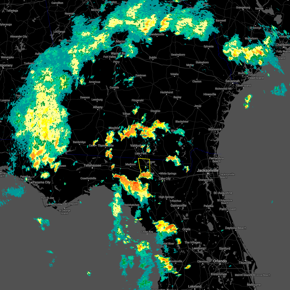 At 614 pm edt, a severe thunderstorm was located near live oak, moving north at 30 mph (radar indicated). Hazards include 60 mph wind gusts. expect damage to roofs, siding, and trees At 614 pm edt, a severe thunderstorm was located near live oak, moving north at 30 mph (radar indicated). Hazards include 60 mph wind gusts. expect damage to roofs, siding, and trees
|
| 8/16/2020 5:22 PM EDT |
 At 521 pm edt, a severe thunderstorm was located near mcalpin, or near live oak, moving east at 10 mph (radar indicated). Hazards include 60 mph wind gusts and penny size hail. expect damage to roofs, siding, and trees At 521 pm edt, a severe thunderstorm was located near mcalpin, or near live oak, moving east at 10 mph (radar indicated). Hazards include 60 mph wind gusts and penny size hail. expect damage to roofs, siding, and trees
|
| 6/30/2020 7:50 PM EDT |
 The severe thunderstorm warning for southwestern columbia, suwannee and southwestern hamilton counties will expire at 800 pm edt, the storms which prompted the warning have weakened below severe limits, and no longer pose an immediate threat to life or property. therefore, the warning will be allowed to expire. however gusty winds and heavy rain are still possible with these thunderstorms. The severe thunderstorm warning for southwestern columbia, suwannee and southwestern hamilton counties will expire at 800 pm edt, the storms which prompted the warning have weakened below severe limits, and no longer pose an immediate threat to life or property. therefore, the warning will be allowed to expire. however gusty winds and heavy rain are still possible with these thunderstorms.
|
| 6/30/2020 7:31 PM EDT |
 At 731 pm edt, severe thunderstorms were located along a line extending from near suwannee river state park to near suwannee springs, moving south at 25 mph (radar indicated). Hazards include 60 mph wind gusts and quarter size hail. Hail damage to vehicles is expected. expect wind damage to roofs, siding, and trees. Locations impacted include, live oak, ichetucknee spring, suwannee river state park, suwannee springs, columbia, mcalpin, luraville, wellborn, dowling park and obrien. At 731 pm edt, severe thunderstorms were located along a line extending from near suwannee river state park to near suwannee springs, moving south at 25 mph (radar indicated). Hazards include 60 mph wind gusts and quarter size hail. Hail damage to vehicles is expected. expect wind damage to roofs, siding, and trees. Locations impacted include, live oak, ichetucknee spring, suwannee river state park, suwannee springs, columbia, mcalpin, luraville, wellborn, dowling park and obrien.
|
| 6/30/2020 7:12 PM EDT |
 At 712 pm edt, severe thunderstorms were located along a line extending from blue springs to near jasper, moving south at 25 mph (radar indicated). Hazards include 60 mph wind gusts and quarter size hail. Hail damage to vehicles is expected. Expect wind damage to roofs, siding, and trees. At 712 pm edt, severe thunderstorms were located along a line extending from blue springs to near jasper, moving south at 25 mph (radar indicated). Hazards include 60 mph wind gusts and quarter size hail. Hail damage to vehicles is expected. Expect wind damage to roofs, siding, and trees.
|
| 6/30/2020 6:56 PM EDT |
 The severe thunderstorm warning for northeastern suwannee and hamilton counties will expire at 700 pm edt, the storm which prompted the warning has weakened below severe limits, and no longer poses an immediate threat to life or property. therefore, the warning will be allowed to expire. however small hail, gusty winds and heavy rain are still possible with this thunderstorm. The severe thunderstorm warning for northeastern suwannee and hamilton counties will expire at 700 pm edt, the storm which prompted the warning has weakened below severe limits, and no longer poses an immediate threat to life or property. therefore, the warning will be allowed to expire. however small hail, gusty winds and heavy rain are still possible with this thunderstorm.
|
| 6/30/2020 6:50 PM EDT |
 At 649 pm edt, a severe thunderstorm was located over jennings, moving southeast at 20 mph (radar indicated). Hazards include 60 mph wind gusts and nickel size hail. Expect damage to roofs, siding, and trees. Locations impacted include, live oak, jasper, jennings, suwannee springs, blue springs, crossroads and houston. At 649 pm edt, a severe thunderstorm was located over jennings, moving southeast at 20 mph (radar indicated). Hazards include 60 mph wind gusts and nickel size hail. Expect damage to roofs, siding, and trees. Locations impacted include, live oak, jasper, jennings, suwannee springs, blue springs, crossroads and houston.
|
| 6/30/2020 6:33 PM EDT |
 At 633 pm edt, a severe thunderstorm was located near lake park, moving southeast at 20 mph (radar indicated). Hazards include 60 mph wind gusts and nickel size hail. expect damage to roofs, siding, and trees At 633 pm edt, a severe thunderstorm was located near lake park, moving southeast at 20 mph (radar indicated). Hazards include 60 mph wind gusts and nickel size hail. expect damage to roofs, siding, and trees
|
| 4/23/2020 8:54 PM EDT |
 At 854 pm edt, severe thunderstorms were located along a line extending from 8 miles north of stephen foster state park to near fargo to near luraville, moving east at 35 mph (radar indicated). Hazards include 60 mph wind gusts and penny size hail. Expect damage to roofs, siding, and trees. Locations impacted include, lake city, live oak, folkston, white springs, fargo, suwannee springs, stephen foster state park, columbia, taylor and homeland. At 854 pm edt, severe thunderstorms were located along a line extending from 8 miles north of stephen foster state park to near fargo to near luraville, moving east at 35 mph (radar indicated). Hazards include 60 mph wind gusts and penny size hail. Expect damage to roofs, siding, and trees. Locations impacted include, lake city, live oak, folkston, white springs, fargo, suwannee springs, stephen foster state park, columbia, taylor and homeland.
|
| 4/23/2020 8:26 PM EDT |
 At 826 pm edt, severe thunderstorms were located along a line extending from 10 miles southeast of homerville to 6 miles north of belmont to 6 miles west of luraville, moving east at 35 mph (radar indicated). Hazards include 60 mph wind gusts and penny size hail. expect damage to roofs, siding, and trees At 826 pm edt, severe thunderstorms were located along a line extending from 10 miles southeast of homerville to 6 miles north of belmont to 6 miles west of luraville, moving east at 35 mph (radar indicated). Hazards include 60 mph wind gusts and penny size hail. expect damage to roofs, siding, and trees
|
| 4/23/2020 8:02 PM EDT |
 At 801 pm edt, severe thunderstorms were located along a line extending from near du pont to near jennings to near perry, moving east at 55 mph (radar indicated). Hazards include 60 mph wind gusts and quarter size hail. Hail damage to vehicles is expected. expect wind damage to roofs, siding, and trees. Locations impacted include, live oak, jasper, homerville, jennings, argyle, statenville, suwannee river state park, suwannee springs, du pont and mayday. At 801 pm edt, severe thunderstorms were located along a line extending from near du pont to near jennings to near perry, moving east at 55 mph (radar indicated). Hazards include 60 mph wind gusts and quarter size hail. Hail damage to vehicles is expected. expect wind damage to roofs, siding, and trees. Locations impacted include, live oak, jasper, homerville, jennings, argyle, statenville, suwannee river state park, suwannee springs, du pont and mayday.
|
| 4/23/2020 7:36 PM EDT |
 At 736 pm edt, severe thunderstorms were located along a line extending from near ray city to 16 miles west of perry, moving east at 45 mph (radar indicated). Hazards include 60 mph wind gusts and quarter size hail. Hail damage to vehicles is expected. Expect wind damage to roofs, siding, and trees. At 736 pm edt, severe thunderstorms were located along a line extending from near ray city to 16 miles west of perry, moving east at 45 mph (radar indicated). Hazards include 60 mph wind gusts and quarter size hail. Hail damage to vehicles is expected. Expect wind damage to roofs, siding, and trees.
|
| 4/15/2020 2:09 AM EDT |
 At 209 am edt, a severe thunderstorm was located over mayo, moving east at 40 mph (radar indicated). Hazards include 60 mph wind gusts and penny size hail. expect damage to roofs, siding, and trees At 209 am edt, a severe thunderstorm was located over mayo, moving east at 40 mph (radar indicated). Hazards include 60 mph wind gusts and penny size hail. expect damage to roofs, siding, and trees
|
| 4/14/2020 8:50 AM EDT | Suwannee county emergency management relayed photos of playground equipment and a metal shed damaged by sub-severe wind gusts. time of damage based on radar dat in suwannee county FL, 15.9 miles NE of Live Oak, FL |
| 4/14/2020 8:45 AM EDT | Suwannee county 911/dispatch reported trees and powerlines down along 144th street near luraville. time of damage based on radar dat in suwannee county FL, 10.5 miles NE of Live Oak, FL |
| 4/13/2020 10:35 AM EDT |
 At 1035 am edt, severe thunderstorms were located along a line extending from 6 miles southeast of belmont to winfield to near luraville, moving east at 55 mph (radar indicated). Hazards include 60 mph wind gusts and quarter size hail. Hail damage to vehicles is expected. expect wind damage to roofs, siding, and trees. Locations impacted include, lake city, live oak, white springs, taylor, winfield, suwannee valley, olustee, luraville, mcalpin and wellborn. At 1035 am edt, severe thunderstorms were located along a line extending from 6 miles southeast of belmont to winfield to near luraville, moving east at 55 mph (radar indicated). Hazards include 60 mph wind gusts and quarter size hail. Hail damage to vehicles is expected. expect wind damage to roofs, siding, and trees. Locations impacted include, lake city, live oak, white springs, taylor, winfield, suwannee valley, olustee, luraville, mcalpin and wellborn.
|
| 4/13/2020 10:16 AM EDT | Widespread reports of trees and powerlines reported across suwannee county... florid in suwannee county FL, 1 miles NNE of Live Oak, FL |
| 4/13/2020 10:12 AM EDT |
 At 1012 am edt, severe thunderstorms were located along a line extending from near live oak to 6 miles northwest of mcalpin to 10 miles southeast of perry, moving east at 55 mph (radar indicated). Hazards include 60 mph wind gusts and quarter size hail. Hail damage to vehicles is expected. Expect wind damage to roofs, siding, and trees. At 1012 am edt, severe thunderstorms were located along a line extending from near live oak to 6 miles northwest of mcalpin to 10 miles southeast of perry, moving east at 55 mph (radar indicated). Hazards include 60 mph wind gusts and quarter size hail. Hail damage to vehicles is expected. Expect wind damage to roofs, siding, and trees.
|
| 4/13/2020 10:10 AM EDT | Suwannee county emergency management reports three damaged along u.s. highway 90 just west of downtown live oak along goldkist boulevard. the roof of the farmers cooper in suwannee county FL, 1.8 miles ESE of Live Oak, FL |
| 4/13/2020 9:57 AM EDT |
 At 957 am edt, a severe thunderstorm was located near dowling park, or 9 miles south of suwannee river state park, moving northeast at 45 mph (radar indicated). Hazards include 60 mph wind gusts and quarter size hail. Hail damage to vehicles is expected. expect wind damage to roofs, siding, and trees. Locations impacted include, lake city, live oak, white springs, suwannee springs, taylor, winfield, suwannee valley, belmont, luraville and mcalpin. At 957 am edt, a severe thunderstorm was located near dowling park, or 9 miles south of suwannee river state park, moving northeast at 45 mph (radar indicated). Hazards include 60 mph wind gusts and quarter size hail. Hail damage to vehicles is expected. expect wind damage to roofs, siding, and trees. Locations impacted include, lake city, live oak, white springs, suwannee springs, taylor, winfield, suwannee valley, belmont, luraville and mcalpin.
|
| 4/13/2020 9:46 AM EDT |
 At 945 am edt, severe thunderstorms were located along a line extending from near suwannee springs to 12 miles north of taylor, moving east at 65 mph (radar indicated). Hazards include 60 mph wind gusts. Expect damage to roofs, siding, and trees. Locations impacted include, lake city, live oak, white springs, suwannee river state park, suwannee springs, taylor, winfield, suwannee valley, belmont and luraville. At 945 am edt, severe thunderstorms were located along a line extending from near suwannee springs to 12 miles north of taylor, moving east at 65 mph (radar indicated). Hazards include 60 mph wind gusts. Expect damage to roofs, siding, and trees. Locations impacted include, lake city, live oak, white springs, suwannee river state park, suwannee springs, taylor, winfield, suwannee valley, belmont and luraville.
|
| 4/13/2020 9:15 AM EDT |
 At 915 am edt, severe thunderstorms were located along a line extending from 6 miles west of dowling park to near belmont, moving east at 65 mph (radar indicated). Hazards include 60 mph wind gusts. expect damage to roofs, siding, and trees At 915 am edt, severe thunderstorms were located along a line extending from 6 miles west of dowling park to near belmont, moving east at 65 mph (radar indicated). Hazards include 60 mph wind gusts. expect damage to roofs, siding, and trees
|
| 4/13/2020 8:35 AM EDT |
 At 835 am edt, severe thunderstorms were located along a line extending from near needmore to near jasper to 12 miles west of dowling park, moving northeast at 65 mph (radar indicated). Hazards include 60 mph wind gusts. expect damage to roofs, siding, and trees At 835 am edt, severe thunderstorms were located along a line extending from near needmore to near jasper to 12 miles west of dowling park, moving northeast at 65 mph (radar indicated). Hazards include 60 mph wind gusts. expect damage to roofs, siding, and trees
|
| 3/31/2020 5:26 PM EDT | Emergency manager was in route to reports from 911 dispatch of damage to a chicken house and numerous trees down along cr252 between cr129 and cr349. time estimated by in suwannee county FL, 9.8 miles NNE of Live Oak, FL |
| 3/31/2020 5:06 PM EDT |
 The tornado warning for northwestern suwannee county will expire at 515 pm edt, the storm which prompted the warning has weakened below severe limits, and no longer appears capable of producing a tornado. therefore, the warning will be allowed to expire. however gusty winds and heavy rain are still possible with this thunderstorm. a tornado watch remains in effect until 900 pm edt for northern florida. to report severe weather, contact your nearest law enforcement agency. they will relay your report to the national weather service jacksonville. The tornado warning for northwestern suwannee county will expire at 515 pm edt, the storm which prompted the warning has weakened below severe limits, and no longer appears capable of producing a tornado. therefore, the warning will be allowed to expire. however gusty winds and heavy rain are still possible with this thunderstorm. a tornado watch remains in effect until 900 pm edt for northern florida. to report severe weather, contact your nearest law enforcement agency. they will relay your report to the national weather service jacksonville.
|
| 3/31/2020 4:53 PM EDT |
 At 452 pm edt, a severe thunderstorm capable of producing a tornado was located 7 miles northwest of dowling park, or 8 miles southwest of suwannee river state park, moving east at 50 mph (radar indicated rotation). Hazards include tornado. Flying debris will be dangerous to those caught without shelter. mobile homes will be damaged or destroyed. damage to roofs, windows, and vehicles will occur. tree damage is likely. This tornadic thunderstorm will remain over mainly rural areas of northwestern suwannee county, including the following locations, newburn. At 452 pm edt, a severe thunderstorm capable of producing a tornado was located 7 miles northwest of dowling park, or 8 miles southwest of suwannee river state park, moving east at 50 mph (radar indicated rotation). Hazards include tornado. Flying debris will be dangerous to those caught without shelter. mobile homes will be damaged or destroyed. damage to roofs, windows, and vehicles will occur. tree damage is likely. This tornadic thunderstorm will remain over mainly rural areas of northwestern suwannee county, including the following locations, newburn.
|
| 3/31/2020 4:43 PM EDT |
 At 443 pm edt, a severe thunderstorm capable of producing a tornado was located 9 miles south of madison, moving east at 55 mph (radar indicated rotation). Hazards include tornado. Flying debris will be dangerous to those caught without shelter. mobile homes will be damaged or destroyed. damage to roofs, windows, and vehicles will occur. tree damage is likely. this dangerous storm will be near, suwannee river state park around 500 pm edt. Other locations impacted by this tornadic thunderstorm include newburn. At 443 pm edt, a severe thunderstorm capable of producing a tornado was located 9 miles south of madison, moving east at 55 mph (radar indicated rotation). Hazards include tornado. Flying debris will be dangerous to those caught without shelter. mobile homes will be damaged or destroyed. damage to roofs, windows, and vehicles will occur. tree damage is likely. this dangerous storm will be near, suwannee river state park around 500 pm edt. Other locations impacted by this tornadic thunderstorm include newburn.
|
| 2/6/2020 8:00 PM EST |
 At 759 pm est, severe thunderstorms were located along a line extending from near jennings to 8 miles south of perry, moving east at 25 mph (radar indicated). Hazards include 60 to 70 mph wind gusts. Expect considerable tree damage. Damage is likely to mobile homes, roofs, and outbuildings. At 759 pm est, severe thunderstorms were located along a line extending from near jennings to 8 miles south of perry, moving east at 25 mph (radar indicated). Hazards include 60 to 70 mph wind gusts. Expect considerable tree damage. Damage is likely to mobile homes, roofs, and outbuildings.
|
| 2/6/2020 7:55 PM EST |
 At 754 pm est, severe thunderstorms were located along a line extending from near argyle to 7 miles north of needmore to 6 miles northeast of dowling park, moving northeast at 65 mph. the strongest storm winds are in clinch and moving into ware county. these are very dangerous storms (radar indicated). Hazards include 60 to 80 mph wind gusts. Flying debris will be dangerous to those caught without shelter. mobile homes will be heavily damaged. expect considerable damage to roofs, windows, and vehicles. extensive tree damage and power outages are likely. Locations impacted include, live oak, jasper, homerville, white springs, fargo, argyle, suwannee springs, stephen foster state park, homeland and belmont. At 754 pm est, severe thunderstorms were located along a line extending from near argyle to 7 miles north of needmore to 6 miles northeast of dowling park, moving northeast at 65 mph. the strongest storm winds are in clinch and moving into ware county. these are very dangerous storms (radar indicated). Hazards include 60 to 80 mph wind gusts. Flying debris will be dangerous to those caught without shelter. mobile homes will be heavily damaged. expect considerable damage to roofs, windows, and vehicles. extensive tree damage and power outages are likely. Locations impacted include, live oak, jasper, homerville, white springs, fargo, argyle, suwannee springs, stephen foster state park, homeland and belmont.
|
| 2/6/2020 7:42 PM EST |
 At 742 pm est, severe thunderstorms were located along a line extending from 6 miles northeast of mayday to 8 miles northeast of jasper to near dowling park, moving east at 60 mph (radar indicated). Hazards include 70 mph wind gusts. Expect considerable tree damage. Damage is likely to mobile homes, roofs, and outbuildings. At 742 pm est, severe thunderstorms were located along a line extending from 6 miles northeast of mayday to 8 miles northeast of jasper to near dowling park, moving east at 60 mph (radar indicated). Hazards include 70 mph wind gusts. Expect considerable tree damage. Damage is likely to mobile homes, roofs, and outbuildings.
|
| 2/6/2020 7:30 PM EST | Corrects previous tstm wnd dmg report from 3 s suwannee river station. numerous trees and powerlines down across suwannee count in suwannee county FL, 11.4 miles ESE of Live Oak, FL |
| 10/22/2019 1:20 PM EDT |
 At 120 pm edt, a severe thunderstorm was located near live oak, moving northeast at 30 mph (radar indicated). Hazards include 60 mph wind gusts. expect damage to roofs, siding, and trees At 120 pm edt, a severe thunderstorm was located near live oak, moving northeast at 30 mph (radar indicated). Hazards include 60 mph wind gusts. expect damage to roofs, siding, and trees
|
| 7/3/2019 6:57 PM EDT | 911 call center passed on that numerous trees are down across the count in suwannee county FL, 11.3 miles N of Live Oak, FL |
| 4/19/2019 10:29 AM EDT | Suwannee county emergency mangement reports a tree downed through a home to the east of live oak. trees and power lines have been reported throughout the count in suwannee county FL, 6.1 miles NW of Live Oak, FL |
| 4/19/2019 10:22 AM EDT |
 The severe thunderstorm warning for northwestern suwannee, central hamilton and western echols counties will expire at 1030 am edt, the storms which prompted the warning have moved out of the area. therefore, the warning will be allowed to expire. however gusty winds are still possible with these thunderstorms. a tornado watch remains in effect until 400 pm edt for northern florida, and southeastern georgia. The severe thunderstorm warning for northwestern suwannee, central hamilton and western echols counties will expire at 1030 am edt, the storms which prompted the warning have moved out of the area. therefore, the warning will be allowed to expire. however gusty winds are still possible with these thunderstorms. a tornado watch remains in effect until 400 pm edt for northern florida, and southeastern georgia.
|
| 4/19/2019 10:20 AM EDT | Suwannee county 911/dispatch reports numerous trees and power lines downed by strong winds county-wid in suwannee county FL, 11.3 miles N of Live Oak, FL |
| 4/19/2019 10:03 AM EDT |
 At 1002 am edt, severe thunderstorms were located along a line extending from near mayday to live oak, moving northeast at 50 mph (radar indicated). Hazards include 70 mph wind gusts. Expect considerable tree damage. damage is likely to mobile homes, roofs, and outbuildings. Locations impacted include, live oak, jasper, jennings, suwannee springs, statenville, mayday, crossroads and newburn. At 1002 am edt, severe thunderstorms were located along a line extending from near mayday to live oak, moving northeast at 50 mph (radar indicated). Hazards include 70 mph wind gusts. Expect considerable tree damage. damage is likely to mobile homes, roofs, and outbuildings. Locations impacted include, live oak, jasper, jennings, suwannee springs, statenville, mayday, crossroads and newburn.
|
| 4/19/2019 9:43 AM EDT |
 At 943 am edt, severe thunderstorms were located along a line extending from near lake park to near luraville, moving northeast at 45 mph (radar indicated). Hazards include 60 mph wind gusts. expect damage to roofs, siding, and trees At 943 am edt, severe thunderstorms were located along a line extending from near lake park to near luraville, moving northeast at 45 mph (radar indicated). Hazards include 60 mph wind gusts. expect damage to roofs, siding, and trees
|
| 12/3/2018 8:10 AM EST |
 The severe thunderstorm warning for northeastern gilchrist, columbia and suwannee counties will expire at 815 am est, the storm which prompted the warning has weakened below severe limits, and no longer poses an immediate threat to life or property. therefore, the warning will be allowed to expire. however gusty winds are still possible with this thunderstorm. The severe thunderstorm warning for northeastern gilchrist, columbia and suwannee counties will expire at 815 am est, the storm which prompted the warning has weakened below severe limits, and no longer poses an immediate threat to life or property. therefore, the warning will be allowed to expire. however gusty winds are still possible with this thunderstorm.
|
| 12/3/2018 7:28 AM EST |
 At 728 am est, severe thunderstorms were located along a line extending from near luraville to near ichetucknee spring to 6 miles southwest of high springs, moving northeast at 55 mph (radar indicated). Hazards include 60 mph wind gusts. Expect damage to roofs, siding, and trees. Locations impacted include, lake city, live oak, ichetucknee spring, columbia, fort white, winfield, suwannee valley, luraville, mcalpin and wellborn. At 728 am est, severe thunderstorms were located along a line extending from near luraville to near ichetucknee spring to 6 miles southwest of high springs, moving northeast at 55 mph (radar indicated). Hazards include 60 mph wind gusts. Expect damage to roofs, siding, and trees. Locations impacted include, lake city, live oak, ichetucknee spring, columbia, fort white, winfield, suwannee valley, luraville, mcalpin and wellborn.
|
| 12/3/2018 7:24 AM EST |
 At 724 am est, severe thunderstorms were located along a line extending from near luraville to 6 miles southeast of obrien to 8 miles east of bell, moving northeast at 50 mph (radar indicated). Hazards include 60 mph wind gusts. expect damage to roofs, siding, and trees At 724 am est, severe thunderstorms were located along a line extending from near luraville to 6 miles southeast of obrien to 8 miles east of bell, moving northeast at 50 mph (radar indicated). Hazards include 60 mph wind gusts. expect damage to roofs, siding, and trees
|
| 8/28/2018 5:41 PM EDT |
 The severe thunderstorm warning for central suwannee county will expire at 545 pm edt, the storm which prompted the warning has weakened below severe limits, and no longer poses an immediate threat to life or property. therefore, the warning will be allowed to expire. however gusty winds and heavy rain are still possible with this thunderstorm. to report severe weather, contact your nearest law enforcement agency. they will relay your report to the national weather service jacksonville. The severe thunderstorm warning for central suwannee county will expire at 545 pm edt, the storm which prompted the warning has weakened below severe limits, and no longer poses an immediate threat to life or property. therefore, the warning will be allowed to expire. however gusty winds and heavy rain are still possible with this thunderstorm. to report severe weather, contact your nearest law enforcement agency. they will relay your report to the national weather service jacksonville.
|
| 8/28/2018 4:54 PM EDT |
 At 454 pm edt, a severe thunderstorm was located near mcalpin, or 11 miles east of mayo, moving northwest at 20 mph (radar indicated). Hazards include 60 mph wind gusts and penny size hail. expect damage to roofs, siding, and trees At 454 pm edt, a severe thunderstorm was located near mcalpin, or 11 miles east of mayo, moving northwest at 20 mph (radar indicated). Hazards include 60 mph wind gusts and penny size hail. expect damage to roofs, siding, and trees
|
| 8/16/2018 5:10 PM EDT | 911 call center passed on a report of a tree down near county road 250 and 153rd road south of live oak. time estimated using radar dat in suwannee county FL, 5.9 miles NE of Live Oak, FL |
| 8/8/2018 3:40 PM EDT | 911 call center reported tree and powerline down on 16th street. time is estimated based on radar imager in suwannee county FL, 11.1 miles SE of Live Oak, FL |
| 8/8/2018 3:35 PM EDT | 911 call center reported tree and powerline down on 76th street. time is estimated based on radar imager in suwannee county FL, 8.3 miles E of Live Oak, FL |
| 7/22/2018 7:06 PM EDT |
 At 705 pm edt, a severe thunderstorm was located near suwannee river state park, moving southeast at 35 mph (radar indicated). Hazards include ping pong ball size hail and 60 mph wind gusts. People and animals outdoors will be injured. expect hail damage to roofs, siding, windows, and vehicles. expect wind damage to roofs, siding, and trees. Locations impacted include, live oak, jasper, white springs, suwannee river state park, suwannee springs, suwannee valley, belmont, crossroads, wellborn and dowling park. At 705 pm edt, a severe thunderstorm was located near suwannee river state park, moving southeast at 35 mph (radar indicated). Hazards include ping pong ball size hail and 60 mph wind gusts. People and animals outdoors will be injured. expect hail damage to roofs, siding, windows, and vehicles. expect wind damage to roofs, siding, and trees. Locations impacted include, live oak, jasper, white springs, suwannee river state park, suwannee springs, suwannee valley, belmont, crossroads, wellborn and dowling park.
|
| 7/22/2018 6:58 PM EDT |
 At 658 pm edt, severe thunderstorms were located along a line extending from near blue springs to near suwannee river state park, moving southeast at 20 mph (radar indicated). Hazards include 60 mph wind gusts and quarter size hail. Hail damage to vehicles is expected. Expect wind damage to roofs, siding, and trees. At 658 pm edt, severe thunderstorms were located along a line extending from near blue springs to near suwannee river state park, moving southeast at 20 mph (radar indicated). Hazards include 60 mph wind gusts and quarter size hail. Hail damage to vehicles is expected. Expect wind damage to roofs, siding, and trees.
|
| 7/22/2018 11:36 AM EDT |
 At 1135 am edt, a severe thunderstorm was located near live oak, moving east at 20 mph (radar indicated). Hazards include 70 mph wind gusts. Expect considerable tree damage. Damage is likely to mobile homes, roofs, and outbuildings. At 1135 am edt, a severe thunderstorm was located near live oak, moving east at 20 mph (radar indicated). Hazards include 70 mph wind gusts. Expect considerable tree damage. Damage is likely to mobile homes, roofs, and outbuildings.
|
| 7/21/2018 2:14 PM EDT |
 At 213 pm edt, a severe thunderstorm was located near suwannee springs, moving southeast at 35 mph (radar indicated). Hazards include 60 mph wind gusts. Expect damage to roofs, siding, and trees. Locations impacted include, lake city, live oak, jasper, white springs, suwannee river state park, suwannee springs, winfield, suwannee valley, crossroads and luraville. At 213 pm edt, a severe thunderstorm was located near suwannee springs, moving southeast at 35 mph (radar indicated). Hazards include 60 mph wind gusts. Expect damage to roofs, siding, and trees. Locations impacted include, lake city, live oak, jasper, white springs, suwannee river state park, suwannee springs, winfield, suwannee valley, crossroads and luraville.
|
| 7/21/2018 2:00 PM EDT |
 At 200 pm edt, a severe thunderstorm was located near crossroads, or near suwannee river state park, moving southeast at 35 mph (radar indicated). Hazards include 60 mph wind gusts. expect damage to roofs, siding, and trees At 200 pm edt, a severe thunderstorm was located near crossroads, or near suwannee river state park, moving southeast at 35 mph (radar indicated). Hazards include 60 mph wind gusts. expect damage to roofs, siding, and trees
|
| 7/6/2018 4:01 PM EDT |
 At 401 pm edt, a severe thunderstorm was located near wellborn, or 7 miles east of live oak, moving west at 10 mph (radar indicated). Hazards include 60 mph wind gusts and quarter size hail. Hail damage to vehicles is expected. Expect wind damage to roofs, siding, and trees. At 401 pm edt, a severe thunderstorm was located near wellborn, or 7 miles east of live oak, moving west at 10 mph (radar indicated). Hazards include 60 mph wind gusts and quarter size hail. Hail damage to vehicles is expected. Expect wind damage to roofs, siding, and trees.
|
| 6/20/2018 7:35 PM EDT | Two trees down in the live oak city limits blocking roadways. the time given was based on rada in suwannee county FL, 1 miles NNE of Live Oak, FL |
| 6/20/2018 7:26 PM EDT |
 At 726 pm edt, a severe thunderstorm was located near live oak, moving south at 10 mph (radar indicated). Hazards include 60 mph wind gusts and penny size hail. expect damage to roofs, siding, and trees At 726 pm edt, a severe thunderstorm was located near live oak, moving south at 10 mph (radar indicated). Hazards include 60 mph wind gusts and penny size hail. expect damage to roofs, siding, and trees
|
| 6/8/2018 3:23 PM EDT |
 At 323 pm edt, a severe thunderstorm was located near live oak, moving west at 10 mph (radar indicated). Hazards include 60 mph wind gusts and quarter size hail. Hail damage to vehicles is expected. Expect wind damage to roofs, siding, and trees. At 323 pm edt, a severe thunderstorm was located near live oak, moving west at 10 mph (radar indicated). Hazards include 60 mph wind gusts and quarter size hail. Hail damage to vehicles is expected. Expect wind damage to roofs, siding, and trees.
|
| 6/3/2018 5:50 PM EDT | 911 call center passed on report of several trees down east of luraville near 180th street and 177th roa in suwannee county FL, 14.7 miles NNE of Live Oak, FL |
| 6/2/2018 5:09 PM EDT |
 At 508 pm edt, severe thunderstorms were located along a line extending from near belmont to 6 miles southeast of suwannee river state park, moving southeast at 25 mph (radar indicated). Hazards include 60 mph wind gusts and nickel size hail. Expect damage to roofs, siding, and trees. Locations impacted include, live oak, jasper, white springs, suwannee springs, suwannee river state park, dowling park, belmont, luraville, newburn and houston. At 508 pm edt, severe thunderstorms were located along a line extending from near belmont to 6 miles southeast of suwannee river state park, moving southeast at 25 mph (radar indicated). Hazards include 60 mph wind gusts and nickel size hail. Expect damage to roofs, siding, and trees. Locations impacted include, live oak, jasper, white springs, suwannee springs, suwannee river state park, dowling park, belmont, luraville, newburn and houston.
|
| 6/2/2018 4:55 PM EDT | Trees and powerlines down near 136a and adams road. time based on rada in suwannee county FL, 6.4 miles WSW of Live Oak, FL |
| 6/2/2018 4:42 PM EDT |
 At 442 pm edt, severe thunderstorms were located along a line extending from 9 miles northeast of jasper to near suwannee river state park, moving southeast at 20 mph (radar indicated). Hazards include 60 mph wind gusts and nickel size hail. expect damage to roofs, siding, and trees At 442 pm edt, severe thunderstorms were located along a line extending from 9 miles northeast of jasper to near suwannee river state park, moving southeast at 20 mph (radar indicated). Hazards include 60 mph wind gusts and nickel size hail. expect damage to roofs, siding, and trees
|
| 6/2/2018 4:40 PM EDT | Trees and powerlines down. time based on rada in suwannee county FL, 4.4 miles SE of Live Oak, FL |
| 6/2/2018 4:31 PM EDT |
 At 430 pm edt, severe thunderstorms were located along a line extending from 9 miles southwest of needmore to near blue springs, moving east near 35 mph (radar indicated). Hazards include 60 mph wind gusts. Expect damage to roofs, siding, and trees. Locations impacted include, jasper, jennings, suwannee springs, suwannee river state park, belmont, blue springs, crossroads, dowling park and newburn. At 430 pm edt, severe thunderstorms were located along a line extending from 9 miles southwest of needmore to near blue springs, moving east near 35 mph (radar indicated). Hazards include 60 mph wind gusts. Expect damage to roofs, siding, and trees. Locations impacted include, jasper, jennings, suwannee springs, suwannee river state park, belmont, blue springs, crossroads, dowling park and newburn.
|
| 6/2/2018 4:02 PM EDT |
 At 401 pm edt, severe thunderstorms were located along a line extending from statenville to 14 miles west of madison, moving southeast near 30 mph (radar indicated). Hazards include 60 mph wind gusts. expect damage to roofs, siding, and trees At 401 pm edt, severe thunderstorms were located along a line extending from statenville to 14 miles west of madison, moving southeast near 30 mph (radar indicated). Hazards include 60 mph wind gusts. expect damage to roofs, siding, and trees
|
| 4/15/2018 11:13 AM EDT |
 At 1112 am edt, severe thunderstorms were located along a line extending from near homerville to near jasper to 13 miles south of mayo, moving northeast at 40 mph (radar indicated). Hazards include 60 mph wind gusts. expect damage to roofs, siding, and trees At 1112 am edt, severe thunderstorms were located along a line extending from near homerville to near jasper to 13 miles south of mayo, moving northeast at 40 mph (radar indicated). Hazards include 60 mph wind gusts. expect damage to roofs, siding, and trees
|
| 4/15/2018 10:59 AM EDT |
 At 1033 am edt, severe thunderstorms were located along a line extending from near lakeland to mayday to 6 miles southwest of mayo, moving northeast at 55 mph (radar indicated). Hazards include 60 mph wind gusts. Expect damage to roofs, siding, and trees. locations impacted include, live oak, jasper, homerville, jennings, statenville, suwannee river state park, suwannee springs, du pont, mayday and crossroads. A tornado watch remains in effect until 600 pm edt for northern florida, and southeastern georgia. At 1033 am edt, severe thunderstorms were located along a line extending from near lakeland to mayday to 6 miles southwest of mayo, moving northeast at 55 mph (radar indicated). Hazards include 60 mph wind gusts. Expect damage to roofs, siding, and trees. locations impacted include, live oak, jasper, homerville, jennings, statenville, suwannee river state park, suwannee springs, du pont, mayday and crossroads. A tornado watch remains in effect until 600 pm edt for northern florida, and southeastern georgia.
|
| 4/15/2018 10:33 AM EDT |
 At 1033 am edt, severe thunderstorms were located along a line extending from near lakeland to mayday to 6 miles southwest of mayo, moving northeast at 55 mph (radar indicated). Hazards include 60 mph wind gusts. Expect damage to roofs, siding, and trees. locations impacted include, live oak, jasper, homerville, jennings, statenville, suwannee river state park, suwannee springs, du pont, mayday and crossroads. A tornado watch remains in effect until 600 pm edt for northern florida, and southeastern georgia. At 1033 am edt, severe thunderstorms were located along a line extending from near lakeland to mayday to 6 miles southwest of mayo, moving northeast at 55 mph (radar indicated). Hazards include 60 mph wind gusts. Expect damage to roofs, siding, and trees. locations impacted include, live oak, jasper, homerville, jennings, statenville, suwannee river state park, suwannee springs, du pont, mayday and crossroads. A tornado watch remains in effect until 600 pm edt for northern florida, and southeastern georgia.
|
| 4/15/2018 10:09 AM EDT |
 At 1009 am edt, severe thunderstorms were located along a line extending from near valdosta to 7 miles northwest of blue springs to 7 miles east of perry, moving northeast at 40 mph (radar indicated). Hazards include 60 mph wind gusts. expect damage to roofs, siding, and trees At 1009 am edt, severe thunderstorms were located along a line extending from near valdosta to 7 miles northwest of blue springs to 7 miles east of perry, moving northeast at 40 mph (radar indicated). Hazards include 60 mph wind gusts. expect damage to roofs, siding, and trees
|
| 7/21/2017 7:27 PM EDT |
 The severe thunderstorm warning for northeastern suwannee and southeastern hamilton counties will expire at 730 pm edt, the storm which prompted the warning has weakened below severe limits, and no longer poses an immediate threat to life or property. therefore the warning will be allowed to expire. however gusty winds are still expected with this thunderstorm. The severe thunderstorm warning for northeastern suwannee and southeastern hamilton counties will expire at 730 pm edt, the storm which prompted the warning has weakened below severe limits, and no longer poses an immediate threat to life or property. therefore the warning will be allowed to expire. however gusty winds are still expected with this thunderstorm.
|
| 7/21/2017 6:55 PM EDT |
 At 654 pm edt, a severe thunderstorm was located near wellborn, or 7 miles southeast of live oak, moving north at 15 mph (radar indicated). Hazards include 60 mph wind gusts. Expect damage to roofs, siding, and trees. Locations impacted include, live oak, suwannee springs, wellborn and houston. At 654 pm edt, a severe thunderstorm was located near wellborn, or 7 miles southeast of live oak, moving north at 15 mph (radar indicated). Hazards include 60 mph wind gusts. Expect damage to roofs, siding, and trees. Locations impacted include, live oak, suwannee springs, wellborn and houston.
|
| 7/21/2017 6:45 PM EDT | Trees and powerlines down on 77th drive and cr-25 in suwannee county FL, 10.7 miles NNW of Live Oak, FL |
| 7/21/2017 6:41 PM EDT |
 At 641 pm edt, a severe thunderstorm was located near wellborn, or 9 miles southeast of live oak, moving north at 15 mph (radar indicated). Hazards include 60 mph wind gusts and penny size hail. expect damage to roofs, siding, and trees At 641 pm edt, a severe thunderstorm was located near wellborn, or 9 miles southeast of live oak, moving north at 15 mph (radar indicated). Hazards include 60 mph wind gusts and penny size hail. expect damage to roofs, siding, and trees
|
| 7/13/2017 4:10 PM EDT | Public works reported a tree down near state route 51 and 165th roa in suwannee county FL, 9.1 miles NE of Live Oak, FL |
| 7/13/2017 4:07 PM EDT | Public works reported a tree down near the i-10 overpass on hogan roa in suwannee county FL, 7.9 miles W of Live Oak, FL |
| 7/13/2017 3:58 PM EDT |
 The national weather service in jacksonville has issued a * severe thunderstorm warning for. northwestern suwannee county in northern florida. northwestern hamilton county in northern florida. western echols county in southeastern georgia. West central clinch county in southeastern georgia. The national weather service in jacksonville has issued a * severe thunderstorm warning for. northwestern suwannee county in northern florida. northwestern hamilton county in northern florida. western echols county in southeastern georgia. West central clinch county in southeastern georgia.
|
| 7/13/2017 3:50 PM EDT | Sheriffs office reported numerous calls of trees down across the count in suwannee county FL, 2.6 miles NNW of Live Oak, FL |
| 7/13/2017 3:40 PM EDT | Public works reported a tree down near county road 13 in suwannee county FL, 9.7 miles W of Live Oak, FL |
| 7/13/2017 3:35 PM EDT | Public works reported a tree down near the i-10 overpass on hogan road. time corrected based on radar dat in suwannee county FL, 7.9 miles W of Live Oak, FL |
| 7/13/2017 3:30 PM EDT | Public works reported a tree down at goldkist blv in suwannee county FL, 1.7 miles E of Live Oak, FL |
| 7/13/2017 3:29 PM EDT |
 At 329 pm edt, a severe thunderstorm was located over mcalpin, or 8 miles south of live oak, moving west at 25 mph (radar indicated). Hazards include 60 mph wind gusts and penny size hail. Expect damage to roofs, siding, and trees. Locations impacted include, live oak, suwannee springs, suwannee river state park, dowling park, obrien, luraville, mcalpin, newburn and houston. At 329 pm edt, a severe thunderstorm was located over mcalpin, or 8 miles south of live oak, moving west at 25 mph (radar indicated). Hazards include 60 mph wind gusts and penny size hail. Expect damage to roofs, siding, and trees. Locations impacted include, live oak, suwannee springs, suwannee river state park, dowling park, obrien, luraville, mcalpin, newburn and houston.
|
| 7/13/2017 3:15 PM EDT |
 At 314 pm edt, a severe thunderstorm was located near mcalpin, or 12 miles southeast of live oak, moving west at 25 mph (radar indicated). Hazards include 60 mph wind gusts and penny size hail. expect damage to roofs, siding, and trees At 314 pm edt, a severe thunderstorm was located near mcalpin, or 12 miles southeast of live oak, moving west at 25 mph (radar indicated). Hazards include 60 mph wind gusts and penny size hail. expect damage to roofs, siding, and trees
|
| 5/24/2017 10:47 AM EDT |
 At 1047 am edt, severe thunderstorms were located along a line extending from near dowling park to near ichetucknee spring, moving northeast at 35 mph (radar indicated). Hazards include 60 mph wind gusts. expect damage to roofs, siding, and trees At 1047 am edt, severe thunderstorms were located along a line extending from near dowling park to near ichetucknee spring, moving northeast at 35 mph (radar indicated). Hazards include 60 mph wind gusts. expect damage to roofs, siding, and trees
|
| 5/23/2017 8:35 PM EDT |
 The severe thunderstorm warning for northeastern suwannee county will expire at 845 pm edt, the storm which prompted the warning has weakened below severe limits, and no longer poses an immediate threat to life or property. therefore the warning will be allowed to expire. however gusty winds are still possible with this thunderstorm. a tornado watch remains in effect until 1100 pm edt for northern florida. The severe thunderstorm warning for northeastern suwannee county will expire at 845 pm edt, the storm which prompted the warning has weakened below severe limits, and no longer poses an immediate threat to life or property. therefore the warning will be allowed to expire. however gusty winds are still possible with this thunderstorm. a tornado watch remains in effect until 1100 pm edt for northern florida.
|
| 5/23/2017 8:18 PM EDT |
 At 818 pm edt, a severe thunderstorm was located near live oak, moving northeast at 40 mph (radar indicated). Hazards include 60 mph wind gusts and penny size hail. Expect damage to roofs, siding, and trees. locations impacted include, live oak and suwannee springs. A tornado watch remains in effect until 1100 pm edt for northern florida. At 818 pm edt, a severe thunderstorm was located near live oak, moving northeast at 40 mph (radar indicated). Hazards include 60 mph wind gusts and penny size hail. Expect damage to roofs, siding, and trees. locations impacted include, live oak and suwannee springs. A tornado watch remains in effect until 1100 pm edt for northern florida.
|
| 5/23/2017 8:05 PM EDT |
 At 805 pm edt, a severe thunderstorm was located near dowling park, or 10 miles north of mayo, moving northeast at 25 mph (radar indicated). Hazards include 60 mph wind gusts and penny size hail. tornado possible. Expect damage to roofs, siding, and trees. locations impacted include, live oak, suwannee springs and newburn. A tornado watch remains in effect until 1100 pm edt for northern florida. At 805 pm edt, a severe thunderstorm was located near dowling park, or 10 miles north of mayo, moving northeast at 25 mph (radar indicated). Hazards include 60 mph wind gusts and penny size hail. tornado possible. Expect damage to roofs, siding, and trees. locations impacted include, live oak, suwannee springs and newburn. A tornado watch remains in effect until 1100 pm edt for northern florida.
|
| 5/23/2017 7:57 PM EDT |
 At 756 pm edt, a severe thunderstorm was located near dowling park, or 9 miles north of mayo, moving northeast at 30 mph (radar indicated). Hazards include 60 mph wind gusts and penny size hail. expect damage to roofs, siding, and trees At 756 pm edt, a severe thunderstorm was located near dowling park, or 9 miles north of mayo, moving northeast at 30 mph (radar indicated). Hazards include 60 mph wind gusts and penny size hail. expect damage to roofs, siding, and trees
|
| 4/6/2017 12:56 AM EDT |
 The severe thunderstorm warning for northern suwannee and hamilton counties will expire at 100 am edt, the storm which prompted the warning has moved out of the area. therefore the warning will be allowed to expire. however small hail, gusty winds and heavy rain are still possible with this thunderstorm. a tornado watch remains in effect until 800 am edt for northern florida. to report severe weather, contact your nearest law enforcement agency. they will relay your report to the national weather service jacksonville. The severe thunderstorm warning for northern suwannee and hamilton counties will expire at 100 am edt, the storm which prompted the warning has moved out of the area. therefore the warning will be allowed to expire. however small hail, gusty winds and heavy rain are still possible with this thunderstorm. a tornado watch remains in effect until 800 am edt for northern florida. to report severe weather, contact your nearest law enforcement agency. they will relay your report to the national weather service jacksonville.
|
| 4/6/2017 12:26 AM EDT | Law enforcement reported tree down across road on county road 24 in suwannee county FL, 5.8 miles SE of Live Oak, FL |
| 4/6/2017 12:08 AM EDT |
 At 1208 am edt, a severe thunderstorm was located 7 miles north of dowling park, or 8 miles southwest of suwannee river state park, moving east at 45 mph (radar indicated). Hazards include 60 mph wind gusts and quarter size hail. Hail damage to vehicles is expected. Expect wind damage to roofs, siding, and trees. At 1208 am edt, a severe thunderstorm was located 7 miles north of dowling park, or 8 miles southwest of suwannee river state park, moving east at 45 mph (radar indicated). Hazards include 60 mph wind gusts and quarter size hail. Hail damage to vehicles is expected. Expect wind damage to roofs, siding, and trees.
|
| 4/4/2017 1:05 AM EDT | Suwannee county law enforcement reported two trees down at county road 252 and 135th roa in suwannee county FL, 9.6 miles NNE of Live Oak, FL |
| 4/3/2017 9:05 PM EDT |
 At 904 pm edt, a severe thunderstorm was located over suwannee springs, moving northeast at 35 mph (radar indicated). Hazards include 60 mph wind gusts and quarter size hail. Hail damage to vehicles is expected. expect wind damage to roofs, siding, and trees. Locations impacted include, live oak, jasper, white springs, suwannee springs, suwannee river state park, dowling park and newburn. At 904 pm edt, a severe thunderstorm was located over suwannee springs, moving northeast at 35 mph (radar indicated). Hazards include 60 mph wind gusts and quarter size hail. Hail damage to vehicles is expected. expect wind damage to roofs, siding, and trees. Locations impacted include, live oak, jasper, white springs, suwannee springs, suwannee river state park, dowling park and newburn.
|
| 4/3/2017 8:46 PM EDT |
 At 845 pm edt, a severe thunderstorm was located near suwannee river state park, moving east at 45 mph (radar indicated). Hazards include 60 mph wind gusts and quarter size hail. Hail damage to vehicles is expected. expect wind damage to roofs, siding, and trees. Locations impacted include, live oak, jasper, jennings, white springs, suwannee springs, suwannee river state park, dowling park, blue springs, crossroads and newburn. At 845 pm edt, a severe thunderstorm was located near suwannee river state park, moving east at 45 mph (radar indicated). Hazards include 60 mph wind gusts and quarter size hail. Hail damage to vehicles is expected. expect wind damage to roofs, siding, and trees. Locations impacted include, live oak, jasper, jennings, white springs, suwannee springs, suwannee river state park, dowling park, blue springs, crossroads and newburn.
|
| 4/3/2017 8:34 PM EDT |
 At 834 pm edt, a severe thunderstorm was located near dowling park, or 8 miles southwest of suwannee river state park, moving northeast at 45 mph (radar indicated). Hazards include 60 mph wind gusts and quarter size hail. Hail damage to vehicles is expected. Expect wind damage to roofs, siding, and trees. At 834 pm edt, a severe thunderstorm was located near dowling park, or 8 miles southwest of suwannee river state park, moving northeast at 45 mph (radar indicated). Hazards include 60 mph wind gusts and quarter size hail. Hail damage to vehicles is expected. Expect wind damage to roofs, siding, and trees.
|
| 1/22/2017 5:39 PM EST |
 At 539 pm est, severe thunderstorms were located along a line extending from 6 miles southeast of argyle to 8 miles south of fargo to near live oak, moving northeast at 55 mph (radar indicated). Hazards include 60 mph wind gusts and quarter size hail. Hail damage to vehicles is expected. expect wind damage to roofs, siding, and trees. locations impacted include, lake city, live oak, white springs, fargo, wellborn, obrien, belmont, winfield, suwannee valley and five points. A tornado watch remains in effect until 800 pm est for northern and northeastern florida, and southeastern georgia. At 539 pm est, severe thunderstorms were located along a line extending from 6 miles southeast of argyle to 8 miles south of fargo to near live oak, moving northeast at 55 mph (radar indicated). Hazards include 60 mph wind gusts and quarter size hail. Hail damage to vehicles is expected. expect wind damage to roofs, siding, and trees. locations impacted include, lake city, live oak, white springs, fargo, wellborn, obrien, belmont, winfield, suwannee valley and five points. A tornado watch remains in effect until 800 pm est for northern and northeastern florida, and southeastern georgia.
|
| 1/22/2017 5:31 PM EST |
 At 530 pm est, severe thunderstorms were located along a line extending from 7 miles southeast of homerville to 6 miles east of belmont to near live oak, moving northeast at 55 mph (radar indicated). Hazards include 60 mph wind gusts and quarter size hail. Hail damage to vehicles is expected. expect wind damage to roofs, siding, and trees. locations impacted include, lake city, live oak, white springs, fargo, suwannee springs, wellborn, obrien, belmont, winfield and suwannee valley. A tornado watch remains in effect until 800 pm est for northern and northeastern florida, and southeastern georgia. At 530 pm est, severe thunderstorms were located along a line extending from 7 miles southeast of homerville to 6 miles east of belmont to near live oak, moving northeast at 55 mph (radar indicated). Hazards include 60 mph wind gusts and quarter size hail. Hail damage to vehicles is expected. expect wind damage to roofs, siding, and trees. locations impacted include, lake city, live oak, white springs, fargo, suwannee springs, wellborn, obrien, belmont, winfield and suwannee valley. A tornado watch remains in effect until 800 pm est for northern and northeastern florida, and southeastern georgia.
|
| 1/22/2017 5:30 PM EST | Emergency manager reported trees and powerlines down county wid in suwannee county FL, 1 miles NNE of Live Oak, FL |
| 1/22/2017 5:19 PM EST |
 At 519 pm est, severe thunderstorms were located along a line extending from 9 miles south of du pont to near belmont to luraville, moving northeast at 55 mph (radar indicated). Hazards include 60 mph wind gusts and quarter size hail. Hail damage to vehicles is expected. expect wind damage to roofs, siding, and trees. locations impacted include, lake city, live oak, jasper, white springs, fargo, suwannee springs, columbia, wellborn, obrien and belmont. A tornado watch remains in effect until 800 pm est for northern and northeastern florida, and southeastern georgia. At 519 pm est, severe thunderstorms were located along a line extending from 9 miles south of du pont to near belmont to luraville, moving northeast at 55 mph (radar indicated). Hazards include 60 mph wind gusts and quarter size hail. Hail damage to vehicles is expected. expect wind damage to roofs, siding, and trees. locations impacted include, lake city, live oak, jasper, white springs, fargo, suwannee springs, columbia, wellborn, obrien and belmont. A tornado watch remains in effect until 800 pm est for northern and northeastern florida, and southeastern georgia.
|
| 1/22/2017 5:09 PM EST |
 At 509 pm est, severe thunderstorms were located along a line extending from near mayday to near suwannee springs to 6 miles west of mayo, moving northeast at 55 mph (radar indicated). Hazards include 60 mph wind gusts and quarter size hail. Hail damage to vehicles is expected. Expect wind damage to roofs, siding, and trees. At 509 pm est, severe thunderstorms were located along a line extending from near mayday to near suwannee springs to 6 miles west of mayo, moving northeast at 55 mph (radar indicated). Hazards include 60 mph wind gusts and quarter size hail. Hail damage to vehicles is expected. Expect wind damage to roofs, siding, and trees.
|
| 1/7/2017 2:05 AM EST |
 The severe thunderstorm warning for northeastern suwannee and south central hamilton counties will expire at 215 am est, the storm which prompted the warning has moved out of the area. therefore the warning will be allowed to expire. The severe thunderstorm warning for northeastern suwannee and south central hamilton counties will expire at 215 am est, the storm which prompted the warning has moved out of the area. therefore the warning will be allowed to expire.
|
| 1/7/2017 1:45 AM EST | Emergency management reported large trees uprooted near county road 136 and 96th place in live oak. there were also reports of damage to cars and homes. the time given in suwannee county FL, 4.6 miles ENE of Live Oak, FL |
| 1/7/2017 1:44 AM EST |
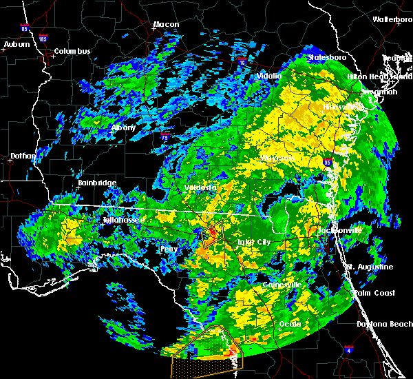 At 144 am est, a severe thunderstorm was located over live oak, moving northeast at 50 mph (radar indicated). Hazards include 60 mph wind gusts. expect damage to roofs, siding, and trees At 144 am est, a severe thunderstorm was located over live oak, moving northeast at 50 mph (radar indicated). Hazards include 60 mph wind gusts. expect damage to roofs, siding, and trees
|
| 7/24/2016 9:29 PM EDT |
 At 928 pm edt, a severe thunderstorm was located near mcalpin, or 8 miles northeast of mayo, moving west at 15 mph (radar indicated). Hazards include 60 mph wind gusts and quarter size hail. Hail damage to vehicles is expected. Expect wind damage to roofs, siding, and trees. At 928 pm edt, a severe thunderstorm was located near mcalpin, or 8 miles northeast of mayo, moving west at 15 mph (radar indicated). Hazards include 60 mph wind gusts and quarter size hail. Hail damage to vehicles is expected. Expect wind damage to roofs, siding, and trees.
|
| 7/24/2016 9:13 PM EDT |
 At 913 pm edt, a severe thunderstorm was located near live oak, moving west at 15 mph (radar indicated). Hazards include 60 mph wind gusts and quarter size hail. Hail damage to vehicles is expected. expect wind damage to roofs, siding, and trees. Locations impacted include, live oak, suwannee river state park, crossroads, blue springs, mcalpin, dowling park, newburn and houston. At 913 pm edt, a severe thunderstorm was located near live oak, moving west at 15 mph (radar indicated). Hazards include 60 mph wind gusts and quarter size hail. Hail damage to vehicles is expected. expect wind damage to roofs, siding, and trees. Locations impacted include, live oak, suwannee river state park, crossroads, blue springs, mcalpin, dowling park, newburn and houston.
|
| 7/24/2016 8:47 PM EDT |
 At 846 pm edt, a severe thunderstorm was located near live oak, moving northwest at 25 mph (radar indicated). Hazards include 60 mph wind gusts and quarter size hail. Hail damage to vehicles is expected. Expect wind damage to roofs, siding, and trees. At 846 pm edt, a severe thunderstorm was located near live oak, moving northwest at 25 mph (radar indicated). Hazards include 60 mph wind gusts and quarter size hail. Hail damage to vehicles is expected. Expect wind damage to roofs, siding, and trees.
|
| 7/17/2016 7:20 PM EDT |
 At 718 pm edt, severe thunderstorm was located along a line west and southwest of live oak, moving west at 15 mph (radar indicated). Hazards include 60 mph wind gusts. Expect damage to roofs. siding. and trees. Locations impacted include, live oak and suwannee springs. At 718 pm edt, severe thunderstorm was located along a line west and southwest of live oak, moving west at 15 mph (radar indicated). Hazards include 60 mph wind gusts. Expect damage to roofs. siding. and trees. Locations impacted include, live oak and suwannee springs.
|
| 7/17/2016 6:56 PM EDT |
 At 654 pm edt, a severe thunderstorm was located near live oak, moving west at 15 mph. another severe thunderstorms was located about 10 miles south of live oak (radar indicated). Hazards include 60 mph wind gusts. Expect damage to roofs. siding. And trees. At 654 pm edt, a severe thunderstorm was located near live oak, moving west at 15 mph. another severe thunderstorms was located about 10 miles south of live oak (radar indicated). Hazards include 60 mph wind gusts. Expect damage to roofs. siding. And trees.
|
| 7/17/2016 6:33 PM EDT |
 At 633 pm edt, a severe thunderstorm was located near wellborn, or near live oak, moving west at 15 mph (radar indicated). Hazards include 60 mph wind gusts. Expect damage to roofs. siding. And trees. At 633 pm edt, a severe thunderstorm was located near wellborn, or near live oak, moving west at 15 mph (radar indicated). Hazards include 60 mph wind gusts. Expect damage to roofs. siding. And trees.
|
| 7/12/2016 6:26 PM EDT |
 At 626 pm edt, a severe thunderstorm was located near live oak, moving east at 10 mph (radar indicated). Hazards include 60 mph wind gusts and nickel size hail. Expect damage to roofs. siding. and trees. Locations impacted include, live oak, newburn and houston. At 626 pm edt, a severe thunderstorm was located near live oak, moving east at 10 mph (radar indicated). Hazards include 60 mph wind gusts and nickel size hail. Expect damage to roofs. siding. and trees. Locations impacted include, live oak, newburn and houston.
|
| 7/12/2016 6:16 PM EDT | 911 call center reported tree down on state road 5 in suwannee county FL, 6.8 miles NE of Live Oak, FL |
| 7/12/2016 5:56 PM EDT |
 At 556 pm edt, a severe thunderstorm was located near dowling park, or 8 miles west of live oak, moving east at 10 mph (radar indicated). Hazards include 60 mph wind gusts and quarter size hail. Hail damage to vehicles is expected. Expect wind damage to roofs, siding, and trees. At 556 pm edt, a severe thunderstorm was located near dowling park, or 8 miles west of live oak, moving east at 10 mph (radar indicated). Hazards include 60 mph wind gusts and quarter size hail. Hail damage to vehicles is expected. Expect wind damage to roofs, siding, and trees.
|
| 4/2/2016 4:44 AM EDT |
 At 444 am edt, severe thunderstorms were located along a line extending from 8 miles south of fargo to near white springs, moving northeast at 35 mph (radar indicated). Hazards include 60 mph wind gusts. Expect damage to roofs. siding. and trees. locations impacted include, lake city, live oak, white springs, wellborn, five points, watertown, mcalpin, luraville, winfield, suwannee valley and houston. A tornado watch remains in effect until 600 am edt for northern florida. At 444 am edt, severe thunderstorms were located along a line extending from 8 miles south of fargo to near white springs, moving northeast at 35 mph (radar indicated). Hazards include 60 mph wind gusts. Expect damage to roofs. siding. and trees. locations impacted include, lake city, live oak, white springs, wellborn, five points, watertown, mcalpin, luraville, winfield, suwannee valley and houston. A tornado watch remains in effect until 600 am edt for northern florida.
|
| 4/2/2016 4:11 AM EDT |
 The tornado warning for southeastern hamilton and central suwannee counties will expire at 415 am edt, the tornado threat has diminished and the tornado warning has been cancelled. however, large hail and damaging winds remain likely and a severe thunderstorm warning remains in effect for the area. however gusty winds are still possible with this thunderstorm. a tornado watch remains in effect until 600 am edt for northern florida. remember, a severe thunderstorm warning still remains in effect for hamilton and suwannee counties. The tornado warning for southeastern hamilton and central suwannee counties will expire at 415 am edt, the tornado threat has diminished and the tornado warning has been cancelled. however, large hail and damaging winds remain likely and a severe thunderstorm warning remains in effect for the area. however gusty winds are still possible with this thunderstorm. a tornado watch remains in effect until 600 am edt for northern florida. remember, a severe thunderstorm warning still remains in effect for hamilton and suwannee counties.
|
| 4/2/2016 4:01 AM EDT |
 At 401 am edt, a severe thunderstorm capable of producing a tornado was located 7 miles east of dowling park, or 8 miles southwest of live oak, moving northeast at 30 mph (radar indicated rotation). Hazards include tornado. Flying debris will be dangerous to those caught without shelter. mobile homes will be damaged or destroyed. damage to roofs, windows, and vehicles will occur. tree damage is likely. this dangerous storm will be near, live oak around 415 am edt. Other locations impacted by this tornadic thunderstorm include newburn and houston. At 401 am edt, a severe thunderstorm capable of producing a tornado was located 7 miles east of dowling park, or 8 miles southwest of live oak, moving northeast at 30 mph (radar indicated rotation). Hazards include tornado. Flying debris will be dangerous to those caught without shelter. mobile homes will be damaged or destroyed. damage to roofs, windows, and vehicles will occur. tree damage is likely. this dangerous storm will be near, live oak around 415 am edt. Other locations impacted by this tornadic thunderstorm include newburn and houston.
|
| 4/2/2016 3:59 AM EDT |
 At 358 am edt, a severe thunderstorm capable of producing a tornado was located near dowling park, or 9 miles southwest of live oak, moving northeast at 30 mph (radar indicated rotation). Hazards include tornado. Flying debris will be dangerous to those caught without shelter. mobile homes will be damaged or destroyed. damage to roofs, windows, and vehicles will occur. tree damage is likely. this dangerous storm will be near, live oak around 415 am edt. Other locations impacted by this tornadic thunderstorm include newburn and houston. At 358 am edt, a severe thunderstorm capable of producing a tornado was located near dowling park, or 9 miles southwest of live oak, moving northeast at 30 mph (radar indicated rotation). Hazards include tornado. Flying debris will be dangerous to those caught without shelter. mobile homes will be damaged or destroyed. damage to roofs, windows, and vehicles will occur. tree damage is likely. this dangerous storm will be near, live oak around 415 am edt. Other locations impacted by this tornadic thunderstorm include newburn and houston.
|
| 4/2/2016 3:57 AM EDT |
 At 356 am edt, severe thunderstorms were located along a line extending from suwannee springs to near luraville, moving northeast at 35 mph (radar indicated). Hazards include 60 mph wind gusts. Expect damage to roofs. siding. And trees. At 356 am edt, severe thunderstorms were located along a line extending from suwannee springs to near luraville, moving northeast at 35 mph (radar indicated). Hazards include 60 mph wind gusts. Expect damage to roofs. siding. And trees.
|
| 4/2/2016 3:42 AM EDT |
 At 342 am edt, a severe thunderstorm capable of producing a tornado was located near dowling park, or 9 miles northwest of mayo, moving northeast at 30 mph (radar indicated rotation). Hazards include tornado. Flying debris will be dangerous to those caught without shelter. mobile homes will be damaged or destroyed. damage to roofs, windows, and vehicles will occur. tree damage is likely. this dangerous storm will be near, live oak around 415 am edt. Other locations impacted by this tornadic thunderstorm include newburn and houston. At 342 am edt, a severe thunderstorm capable of producing a tornado was located near dowling park, or 9 miles northwest of mayo, moving northeast at 30 mph (radar indicated rotation). Hazards include tornado. Flying debris will be dangerous to those caught without shelter. mobile homes will be damaged or destroyed. damage to roofs, windows, and vehicles will occur. tree damage is likely. this dangerous storm will be near, live oak around 415 am edt. Other locations impacted by this tornadic thunderstorm include newburn and houston.
|
| 4/2/2016 3:25 AM EDT |
 At 324 am edt, severe thunderstorms were located along a line extending from near dowling park to 9 miles west of luraville, moving northeast at 60 mph (radar indicated). Hazards include 60 mph wind gusts. Expect damage to roofs. siding. And trees. At 324 am edt, severe thunderstorms were located along a line extending from near dowling park to 9 miles west of luraville, moving northeast at 60 mph (radar indicated). Hazards include 60 mph wind gusts. Expect damage to roofs. siding. And trees.
|
| 4/2/2016 2:44 AM EDT |
 At 244 am edt, a severe thunderstorm was located near live oak, moving northeast at 25 mph (radar indicated). Hazards include 60 mph wind gusts. Expect damage to roofs. siding. and trees. locations impacted include, live oak, wellborn, mcalpin and houston. A tornado watch remains in effect until 400 am edt for northern florida. At 244 am edt, a severe thunderstorm was located near live oak, moving northeast at 25 mph (radar indicated). Hazards include 60 mph wind gusts. Expect damage to roofs. siding. and trees. locations impacted include, live oak, wellborn, mcalpin and houston. A tornado watch remains in effect until 400 am edt for northern florida.
|
| 4/2/2016 2:23 AM EDT |
 At 223 am edt, a severe thunderstorm was located near luraville, or 9 miles north of mayo, moving east at 30 mph (radar indicated). Hazards include 60 mph wind gusts. Expect damage to roofs. siding. And trees. At 223 am edt, a severe thunderstorm was located near luraville, or 9 miles north of mayo, moving east at 30 mph (radar indicated). Hazards include 60 mph wind gusts. Expect damage to roofs. siding. And trees.
|
| 3/4/2016 12:02 AM EST |
 At 1202 am est, a severe thunderstorm was located near jasper, moving east at 45 mph (radar indicated). Hazards include 60 mph wind gusts and quarter size hail. Hail damage to vehicles is expected. expect wind damage to roofs, siding and trees. Locations impacted include, live oak, jasper, white springs, suwannee springs, belmont, winfield and suwannee valley. At 1202 am est, a severe thunderstorm was located near jasper, moving east at 45 mph (radar indicated). Hazards include 60 mph wind gusts and quarter size hail. Hail damage to vehicles is expected. expect wind damage to roofs, siding and trees. Locations impacted include, live oak, jasper, white springs, suwannee springs, belmont, winfield and suwannee valley.
|
| 3/3/2016 11:40 PM EST |
 At 1140 pm est, a severe thunderstorm was located over blue springs, or near suwannee river state park, moving east at 60 mph (radar indicated). Hazards include 60 mph wind gusts and quarter size hail. Hail damage to vehicles is expected. Expect wind damage to roofs, siding and trees. At 1140 pm est, a severe thunderstorm was located over blue springs, or near suwannee river state park, moving east at 60 mph (radar indicated). Hazards include 60 mph wind gusts and quarter size hail. Hail damage to vehicles is expected. Expect wind damage to roofs, siding and trees.
|
| 8/27/2015 5:25 PM EDT | Dispatch call center reported a few trees down and transformers damage in suwannee county FL, 10.8 miles NNW of Live Oak, FL |
| 8/22/2015 11:27 PM EDT |
 At 1127 pm edt, doppler radar indicated a line of severe thunderstorms capable of producing damaging winds in excess of 60 mph. these storms were located along a line extending from 7 miles east of dowling park to winfield, and moving south at 10 mph. At 1127 pm edt, doppler radar indicated a line of severe thunderstorms capable of producing damaging winds in excess of 60 mph. these storms were located along a line extending from 7 miles east of dowling park to winfield, and moving south at 10 mph.
|
| 8/22/2015 11:09 PM EDT |
 The severe thunderstorm warning for eastern hamilton, northeastern suwannee, northwestern columbia and southeastern echols counties will expire at 1115 pm edt, the storm which prompted the warning has moved out of echols county, but a new severe thunderstorm warning remains in effect for portions of suwannee, .columbia and hamilton counties through 1130 pm. The severe thunderstorm warning for eastern hamilton, northeastern suwannee, northwestern columbia and southeastern echols counties will expire at 1115 pm edt, the storm which prompted the warning has moved out of echols county, but a new severe thunderstorm warning remains in effect for portions of suwannee, .columbia and hamilton counties through 1130 pm.
|
| 8/22/2015 11:00 PM EDT |
 At 1100 pm edt, doppler radar indicated a severe thunderstorm capable of producing destructive winds in excess of 70 mph. this storm was located over jasper. this storm was nearly stationary. locations impacted include, jasper, white springs, suwannee springs and belmont. At 1100 pm edt, doppler radar indicated a severe thunderstorm capable of producing destructive winds in excess of 70 mph. this storm was located over jasper. this storm was nearly stationary. locations impacted include, jasper, white springs, suwannee springs and belmont.
|
| 8/22/2015 10:18 PM EDT |
 At 1018 pm edt, doppler radar indicated a severe thunderstorm capable of producing destructive winds in excess of 70 mph. this storm was located 7 miles northeast of jasper, and moving southwest at 10 mph. At 1018 pm edt, doppler radar indicated a severe thunderstorm capable of producing destructive winds in excess of 70 mph. this storm was located 7 miles northeast of jasper, and moving southwest at 10 mph.
|
| 8/15/2015 8:31 PM EDT |
 At 831 pm edt, doppler radar indicated a severe thunderstorm capable of producing damaging winds in excess of 60 mph. this storm was located near winfield, or 8 miles north of lake city, and moving west at 10 mph. At 831 pm edt, doppler radar indicated a severe thunderstorm capable of producing damaging winds in excess of 60 mph. this storm was located near winfield, or 8 miles north of lake city, and moving west at 10 mph.
|
| 8/7/2015 8:09 PM EDT |
 The severe thunderstorm warning for union, southeastern hamilton, northeastern suwannee and central columbia counties will expire at 815 pm edt, the storm which prompted the warning has weakened below severe limits, and no longer poses an immediate threat to life or property. therefore the warning will be allowed to expire. however gusty winds are still possible with this thunderstorm. The severe thunderstorm warning for union, southeastern hamilton, northeastern suwannee and central columbia counties will expire at 815 pm edt, the storm which prompted the warning has weakened below severe limits, and no longer poses an immediate threat to life or property. therefore the warning will be allowed to expire. however gusty winds are still possible with this thunderstorm.
|
| 8/7/2015 7:47 PM EDT |
 At 747 pm edt, doppler radar indicated a severe thunderstorm capable of producing damaging winds in excess of 60 mph. this storm was located near live oak, and moving southeast at 40 mph. At 747 pm edt, doppler radar indicated a severe thunderstorm capable of producing damaging winds in excess of 60 mph. this storm was located near live oak, and moving southeast at 40 mph.
|
| 8/7/2015 5:27 PM EDT | The severe thunderstorm warning for central hamilton, northern suwannee and columbia counties will expire at 530 pm edt, the storms which prompted the warning have moved out of the area. therefore the warning will be allowed to expire. however gusty winds are still possible with these thunderstorms. remember, a severe thunderstorm warning still remains in effect for east and southern portions of the county. |
| 8/7/2015 4:51 PM EDT |
 At 450 pm edt, doppler radar indicated a line of severe thunderstorms capable of producing damaging winds in excess of 60 mph. these storms were located along a line extending from 6 miles northeast of belmont to near white springs to suwannee river state park, moving southeast at 25 mph. locations impacted include, lake city, live oak, jasper, white springs, suwannee springs, suwannee river state park, wellborn, crossroads, belmont, blue springs, winfield, suwannee valley, five points, watertown, lulu and houston. At 450 pm edt, doppler radar indicated a line of severe thunderstorms capable of producing damaging winds in excess of 60 mph. these storms were located along a line extending from 6 miles northeast of belmont to near white springs to suwannee river state park, moving southeast at 25 mph. locations impacted include, lake city, live oak, jasper, white springs, suwannee springs, suwannee river state park, wellborn, crossroads, belmont, blue springs, winfield, suwannee valley, five points, watertown, lulu and houston.
|
| 8/7/2015 4:33 PM EDT |
 At 433 pm edt, doppler radar indicated a line of severe thunderstorms capable of producing damaging winds in excess of 60 mph. these storms were located along a line extending from near needmore to 6 miles west of belmont to near blue springs, and moving southeast at 35 mph. At 433 pm edt, doppler radar indicated a line of severe thunderstorms capable of producing damaging winds in excess of 60 mph. these storms were located along a line extending from near needmore to 6 miles west of belmont to near blue springs, and moving southeast at 35 mph.
|
| 7/21/2015 3:46 PM EDT |
 At 346 pm edt, doppler radar indicated a severe thunderstorm capable of producing damaging winds in excess of 60 mph. this storm was located 7 miles southwest of live oak, and moving east at 35 mph. At 346 pm edt, doppler radar indicated a severe thunderstorm capable of producing damaging winds in excess of 60 mph. this storm was located 7 miles southwest of live oak, and moving east at 35 mph.
|
| 6/30/2015 7:45 PM EDT | Suwannee county 911/dispatch reports numerous trees downed across the count in suwannee county FL, 11.3 miles N of Live Oak, FL |
| 6/30/2015 7:39 PM EDT | Numerous large trees down across the area in suwannee county FL, 9.7 miles ESE of Live Oak, FL |
| 6/30/2015 7:22 PM EDT |
 At 721 pm edt, doppler radar indicated a line of severe thunderstorms capable of producing damaging winds in excess of 60 mph. these storms were located along a line extending from 9 miles north of blue springs to near luraville, and moving east at 55 mph. At 721 pm edt, doppler radar indicated a line of severe thunderstorms capable of producing damaging winds in excess of 60 mph. these storms were located along a line extending from 9 miles north of blue springs to near luraville, and moving east at 55 mph.
|
| 6/30/2015 2:29 PM EDT |
 At 228 pm edt, doppler radar indicated a line of severe thunderstorms capable of producing damaging winds in excess of 60 mph. these storms were located along a line extending from fargo to near white springs to near luraville, and moving east at 35 mph. At 228 pm edt, doppler radar indicated a line of severe thunderstorms capable of producing damaging winds in excess of 60 mph. these storms were located along a line extending from fargo to near white springs to near luraville, and moving east at 35 mph.
|
| 6/30/2015 1:59 PM EDT |
 At 159 pm edt, doppler radar indicated a line of severe thunderstorms capable of producing damaging winds in excess of 60 mph. these storms were located along a line extending from 11 miles north of needmore to 10 miles southwest of dowling park, and moving east at 35 mph. At 159 pm edt, doppler radar indicated a line of severe thunderstorms capable of producing damaging winds in excess of 60 mph. these storms were located along a line extending from 11 miles north of needmore to 10 miles southwest of dowling park, and moving east at 35 mph.
|
| 6/30/2015 1:02 PM EDT |
 At 101 pm edt, doppler radar indicated a severe thunderstorm capable of producing damaging winds in excess of 60 mph. this storm was located near suwannee springs, and moving east at 25 mph. penny size hail may also accompany the damaging winds. At 101 pm edt, doppler radar indicated a severe thunderstorm capable of producing damaging winds in excess of 60 mph. this storm was located near suwannee springs, and moving east at 25 mph. penny size hail may also accompany the damaging winds.
|
| 6/22/2015 6:09 PM EDT |
 The severe thunderstorm warning for southeastern hamilton and northeastern suwannee counties will expire at 615 pm edt, the storm which prompted the warning has weakened below severe limits, and no longer poses an immediate threat to life or property. therefore the warning will be allowed to expire. however heavy rain is still expected with this thunderstorm. The severe thunderstorm warning for southeastern hamilton and northeastern suwannee counties will expire at 615 pm edt, the storm which prompted the warning has weakened below severe limits, and no longer poses an immediate threat to life or property. therefore the warning will be allowed to expire. however heavy rain is still expected with this thunderstorm.
|
| 6/22/2015 6:00 PM EDT |
 At 600 pm edt, doppler radar indicated a severe thunderstorm capable of producing quarter size hail and damaging winds in excess of 60 mph. this storm was located near suwannee springs, moving northeast at 15 mph. locations impacted include, live oak and suwannee springs. At 600 pm edt, doppler radar indicated a severe thunderstorm capable of producing quarter size hail and damaging winds in excess of 60 mph. this storm was located near suwannee springs, moving northeast at 15 mph. locations impacted include, live oak and suwannee springs.
|
| 6/22/2015 5:45 PM EDT |
 At 545 pm edt, doppler radar indicated a severe thunderstorm capable of producing quarter size hail and damaging winds in excess of 60 mph. this storm was located over live oak, and moving northeast at 10 mph. At 545 pm edt, doppler radar indicated a severe thunderstorm capable of producing quarter size hail and damaging winds in excess of 60 mph. this storm was located over live oak, and moving northeast at 10 mph.
|
| 6/21/2015 6:07 PM EDT |
 At 606 pm edt, local law enforcement reported a line of severe thunderstorms producing damaging winds up to 60 mph. these storms were located along a line extending from near suwannee springs to near suwannee river state park. these storms were nearly stationary. nickel size hail may also accompany the damaging winds. in addition, law enforcement reported trees blown down northwest of live oak. locations impacted include, live oak, jasper and suwannee springs. At 606 pm edt, local law enforcement reported a line of severe thunderstorms producing damaging winds up to 60 mph. these storms were located along a line extending from near suwannee springs to near suwannee river state park. these storms were nearly stationary. nickel size hail may also accompany the damaging winds. in addition, law enforcement reported trees blown down northwest of live oak. locations impacted include, live oak, jasper and suwannee springs.
|
| 6/21/2015 5:40 PM EDT | The sheriffs office received reports of trees down near interstate 10 and 185th road in falmouth. the time was based on rada in suwannee county FL, 9.7 miles ESE of Live Oak, FL |
| 6/21/2015 5:33 PM EDT |
 At 533 pm edt, doppler radar indicated a line of severe thunderstorms capable of producing damaging winds in excess of 60 mph. these storms were located along a line extending from near suwannee springs to 6 miles west of live oak. these storms were nearly stationary. nickel size hail may also accompany the damaging winds. At 533 pm edt, doppler radar indicated a line of severe thunderstorms capable of producing damaging winds in excess of 60 mph. these storms were located along a line extending from near suwannee springs to 6 miles west of live oak. these storms were nearly stationary. nickel size hail may also accompany the damaging winds.
|
| 5/20/2015 7:43 PM EDT | The severe thunderstorm warning for northwestern columbia, southern hamilton and northern suwannee counties will expire at 745 pm edt, the storm which prompted the warning has weakened below severe limits, and no longer poses an immediate threat to life or property. therefore the warning will be allowed to expire. however small hail and gusty winds are still possible with this thunderstorm. |
| 5/20/2015 7:27 PM EDT | At 727 pm edt, doppler radar indicated a severe thunderstorm capable of producing quarter size hail and damaging winds in excess of 60 mph. this storm was located near suwannee springs, moving east at 25 mph. locations impacted include, lake city, live oak, jasper, white springs, suwannee river state park, suwannee springs, wellborn, five points, winfield, suwannee valley, newburn and houston. |
| 5/20/2015 7:02 PM EDT | At 702 pm edt, doppler radar indicated a severe thunderstorm capable of producing quarter size hail and damaging winds in excess of 60 mph. this storm was located near suwannee river state park, and moving east at 25 mph. |
| 5/19/2015 7:57 PM EDT | The severe thunderstorm warning for central columbia, southeastern hamilton and northern suwannee counties will expire at 800 pm edt, the storms which prompted the warning have weakened below severe limits, and no longer poses an immediate threat to life or property. therefore the warning will be allowed to expire. however small. |
| 5/19/2015 7:49 PM EDT | At 749 pm edt, doppler radar indicated a line of severe thunderstorms capable of producing damaging winds in excess of 60 mph. these storms were located along a line extending from near suwannee springs to near watertown, moving south at 10 mph. nickel size hail may also accompany the damaging winds. locations impacted include, lake city, live oak, jasper, white springs, suwannee springs, columbia, wellborn, winfield, suwannee valley, five points, watertown, lulu, houston and newburn. |
| 5/19/2015 7:30 PM EDT | At 730 pm edt, doppler radar indicated a line of severe thunderstorms capable of producing damaging winds in excess of 60 mph. these storms were located along a line extending from near jasper to near watertown, and moving south at 10 mph. nickel size hail may also accompany the damaging winds. |
| 4/25/2015 1:00 PM EDT | At 1259 pm edt, doppler radar indicated a severe thunderstorm capable of producing a tornado. this dangerous storm was located over suwannee springs, and moving east at 40 mph. |
| 4/19/2015 3:16 PM EDT | At 316 pm edt, doppler radar indicated a line of severe thunderstorms capable of producing destructive winds in excess of 70 mph. these storms were located along a line extending from 9 miles southwest of dowling park to near mayo to 15 miles south of luraville, and moving northeast at 65 mph. |
| 2/25/2015 11:30 PM EST | 911 dispatch and suwannee county emergency management report trees and powerlines downed by strong wind gusts throughout the northern half of the county. pea sized hail in suwannee county FL, 1 miles NNE of Live Oak, FL |
| 10/14/2014 1:45 PM EDT | Tree down near cr 24 in suwannee county FL, 6.7 miles SE of Live Oak, FL |
| 9/2/2014 6:30 PM EDT | Trained spotter and county officials both reported scattered tree limbs down across the county between 6 pm and 7 p in suwannee county FL, 1 miles NNE of Live Oak, FL |
| 8/18/2014 3:00 PM EDT | Suwannee county 911/dispatch reported a powerline down in the vicinity of live oak. time of damage based on radar dat in suwannee county FL, 0.9 miles N of Live Oak, FL |
| 6/7/2014 1:00 AM EDT | Quarter sized hail reported 1 miles NNE of Live Oak, FL |
| 6/7/2014 12:30 AM EDT | A tree fell on a house in the live oak city limit in suwannee county FL, 1 miles NNE of Live Oak, FL |
| 6/7/2014 12:25 AM EDT | Tree fell across road and car struck tree injurying the driver. time estimated from rada in suwannee county FL, 9.3 miles SE of Live Oak, FL |
| 9/6/2013 5:15 PM EDT | Suwannee county fire department reports a tree downed by thunderstorm wind gusts over county road 136a and a powerline downed by wind gusts across county road 129a. tim in suwannee county FL, 4.1 miles SW of Live Oak, FL |
| 7/9/2013 5:20 PM EDT | The emergency management received reports of a couple of trees down in the live oak area. the time given was based on rada in suwannee county FL, 1 miles NNE of Live Oak, FL |
| 7/3/2013 5:25 PM EDT | The emergency management received reports of over 80 trees and powerlines down including along u.s. highway 90 near live oak. the time given was based on rada in suwannee county FL, 1.1 miles E of Live Oak, FL |
| 2/25/2013 9:45 AM EST | Hen Egg sized hail reported 2 miles NW of Live Oak, FL, public reported two inch hail causing broken car windows and tree limbs downed. |
| 2/25/2013 9:25 AM EST | Golf Ball sized hail reported 11.8 miles ENE of Live Oak, FL, em received multiple reports of golf-ball size hail. |
| 2/25/2013 8:45 AM EST | Half Dollar sized hail reported 10.1 miles E of Live Oak, FL, quarter size to half dollar size hail was observed for about 15 minutes. |
| 12/20/2012 6:15 PM EST | One tree was reported down 8 miles west of live oa in suwannee county FL, 8.3 miles E of Live Oak, FL |
| 7/17/2012 4:20 PM EDT | The ema reported trees and powerlines as well damage to a corn field due to a possible microburst. the time given was based on rada in suwannee county FL, 9 miles NNE of Live Oak, FL |
| 5/7/2012 6:00 PM EDT | Quarter sized hail reported 16.9 miles NE of Live Oak, FL, power lines and a transformer also down near luraville. |
| 3/24/2012 11:15 AM EDT | Horse barn roof blown off by strong thunderstorm wind in suwannee county FL, 10.2 miles E of Live Oak, FL |
| 1/1/0001 12:00 AM | Pine trees snapped off and damage to structures near county road 417 and interstate 1 in suwannee county FL, 5 miles W of Live Oak, FL |
| 1/1/0001 12:00 AM | The law enforcement reported that powerlines were blown down in the northwest portion of the county. the time given was based on rada in suwannee county FL, 9.8 miles SE of Live Oak, FL |
| 1/1/0001 12:00 AM | Law enforcement reported that a tree fell through a house on 122nd stree in suwannee county FL, 5 miles N of Live Oak, FL |
| 1/1/0001 12:00 AM | Golf Ball sized hail reported 9.1 miles ENE of Live Oak, FL |
| 1/1/0001 12:00 AM | Spotter reported power outages in live oak due to trees down on powerlines. time estimated from rada in suwannee county FL, 0.2 miles NW of Live Oak, FL |
| 1/1/0001 12:00 AM | Spotter reported a lane closure on us-90 eastbound between live oak and lake city due to a downed tree. time estimated from rada in suwannee county FL, 5.2 miles NW of Live Oak, FL |
Hail Maps for Live Oak, FL


Connect with Interactive Hail Maps