

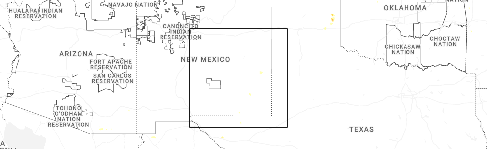
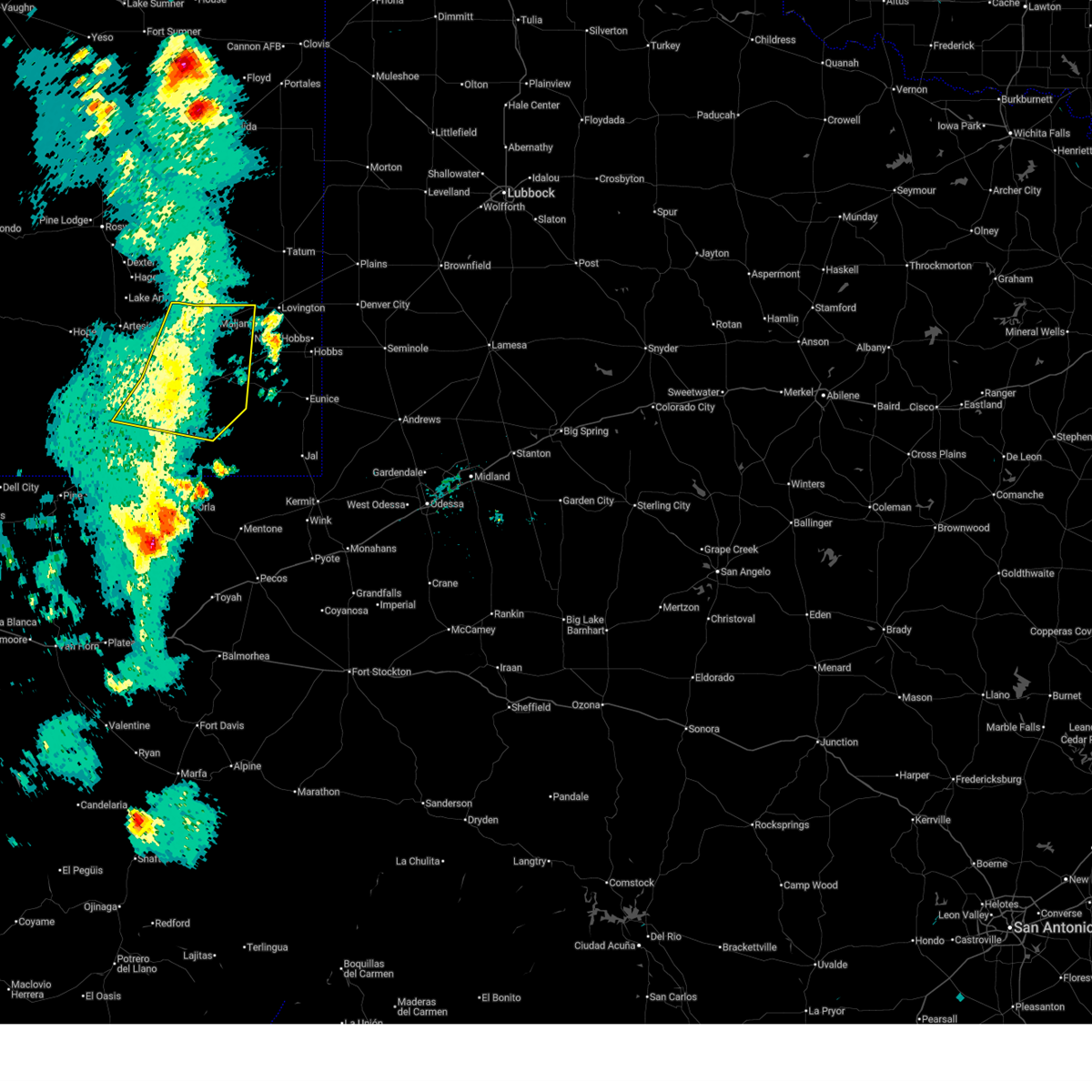
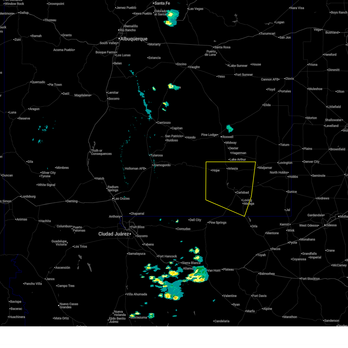
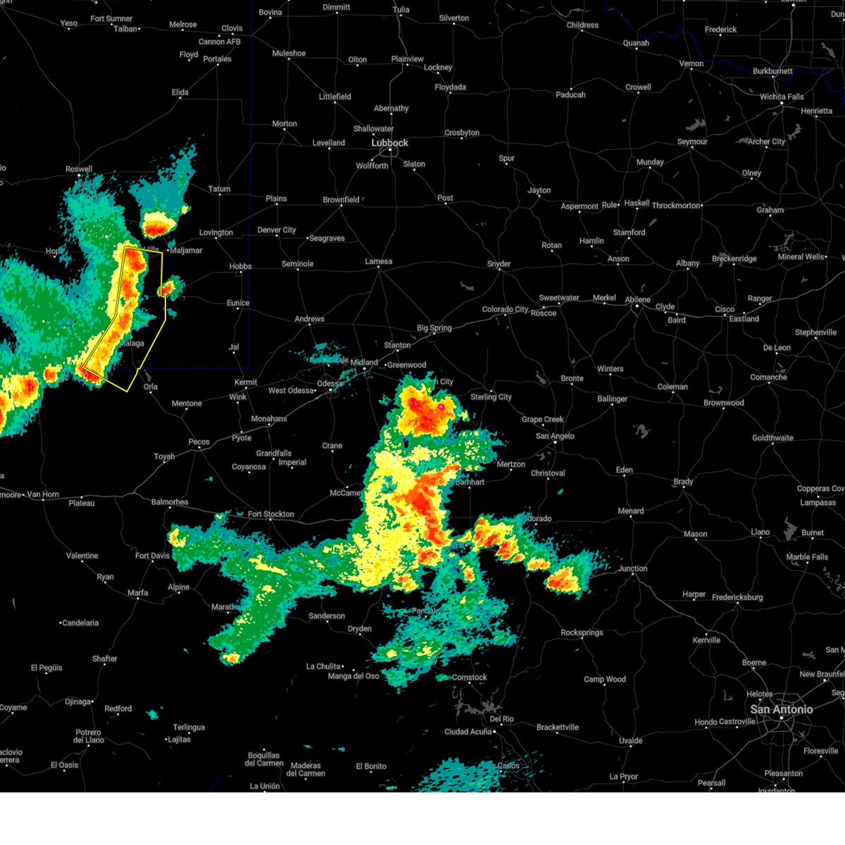
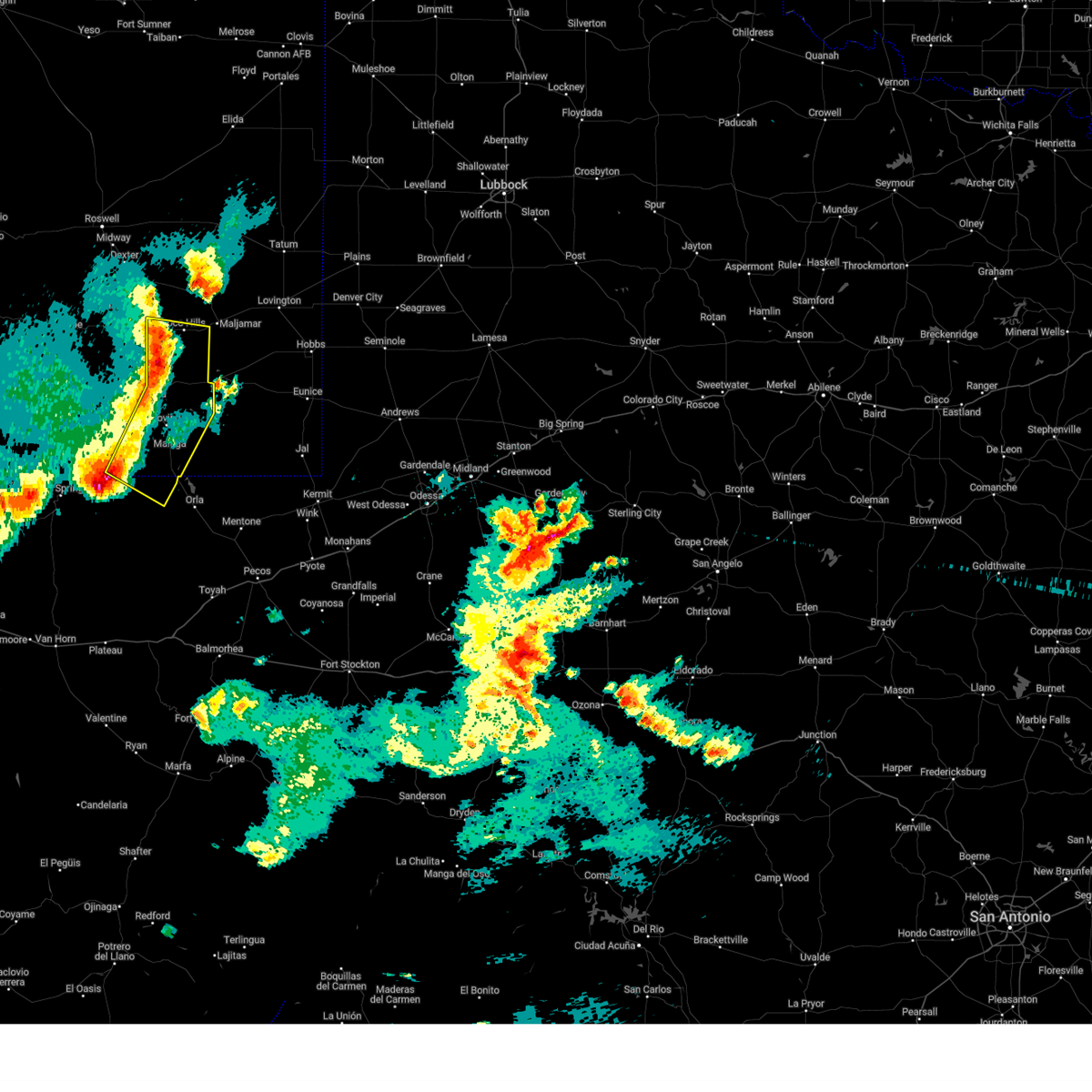
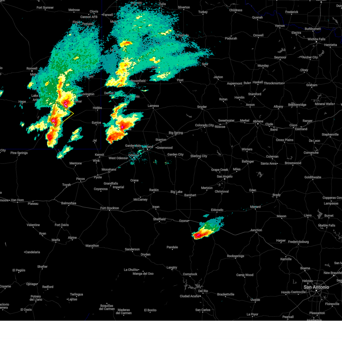
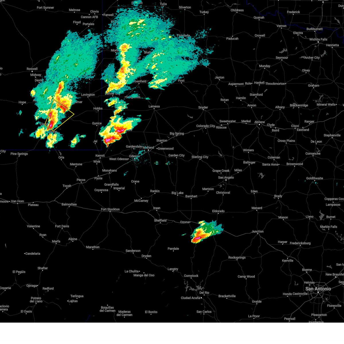
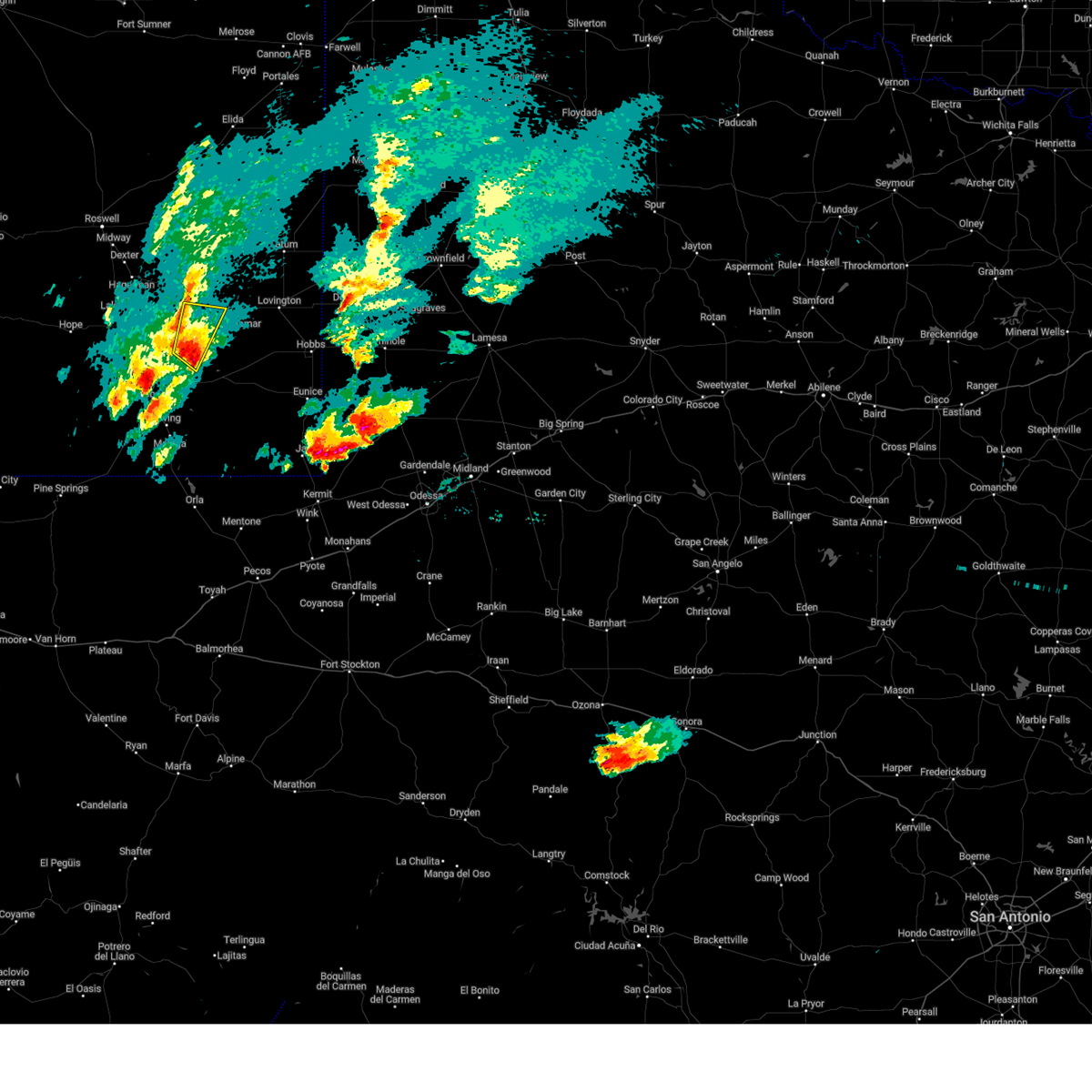
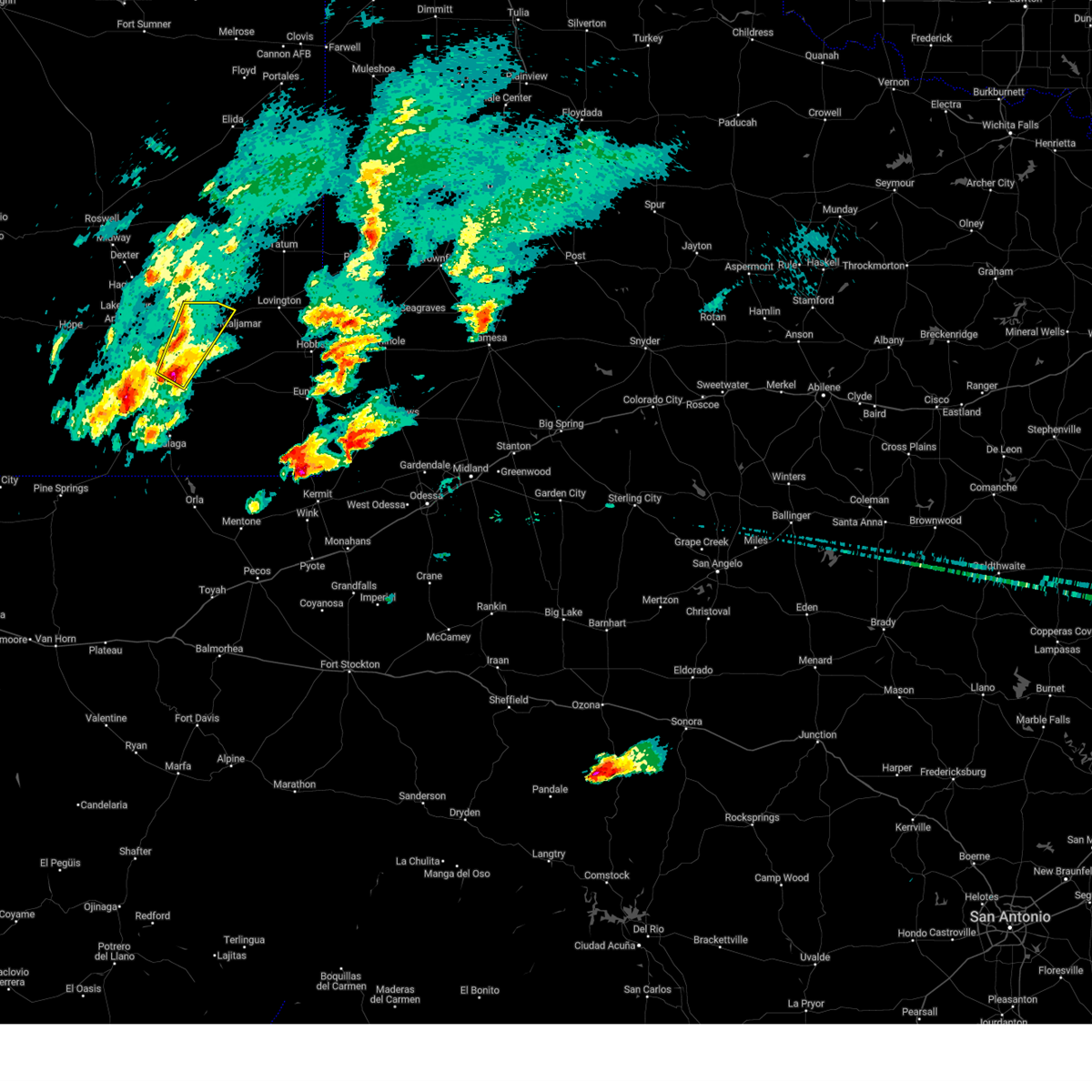
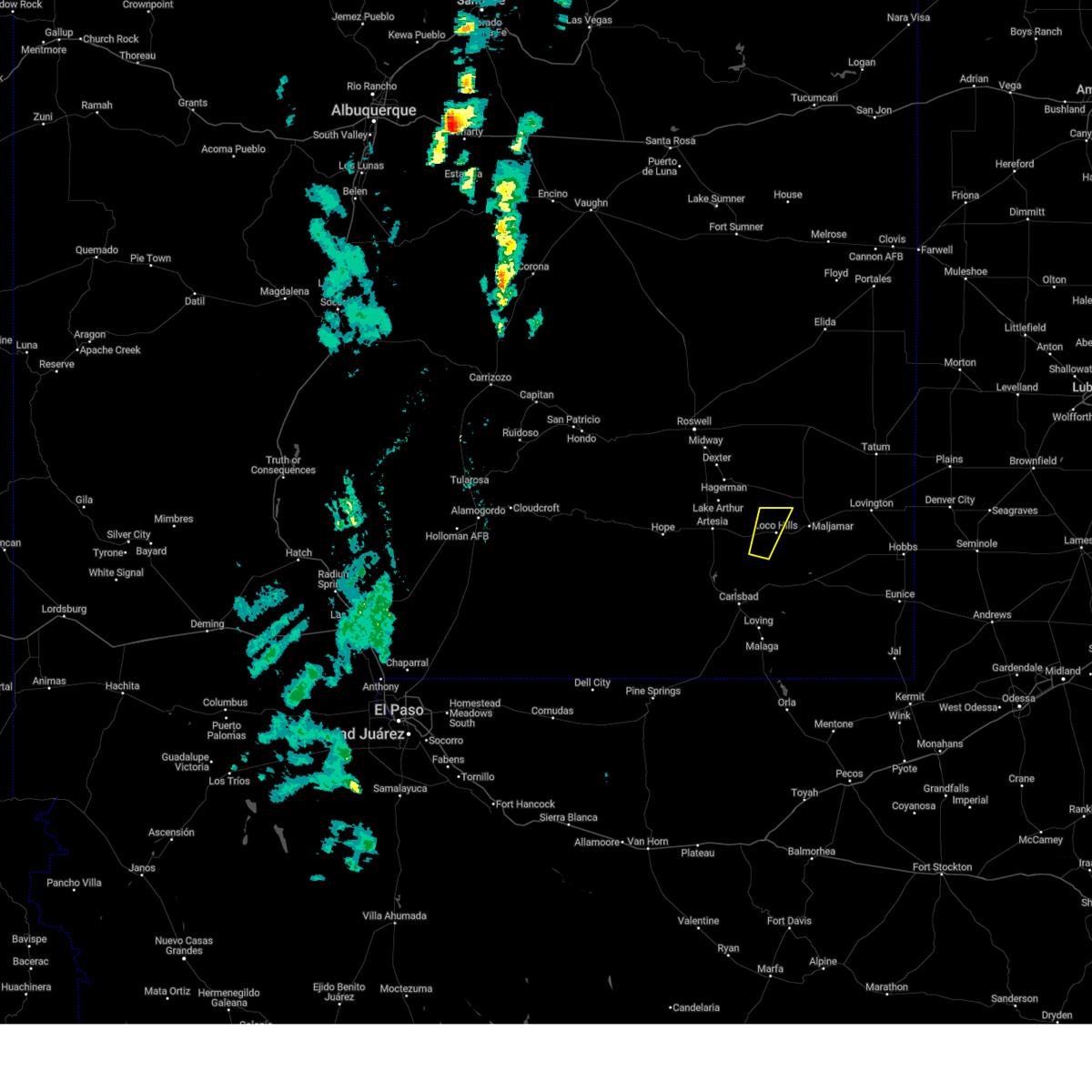
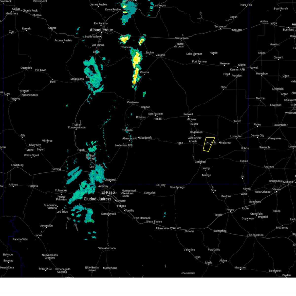
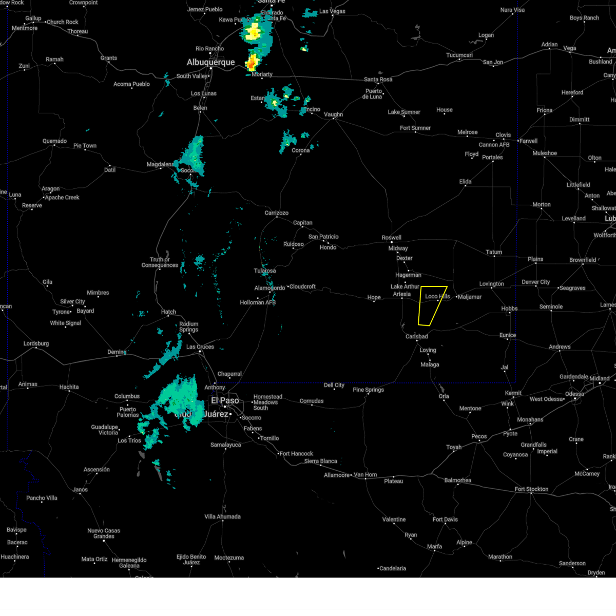
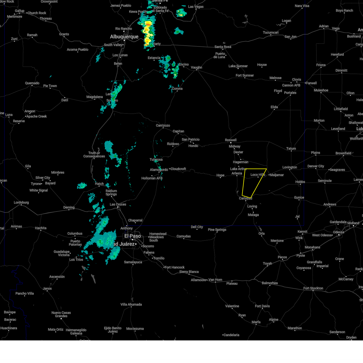
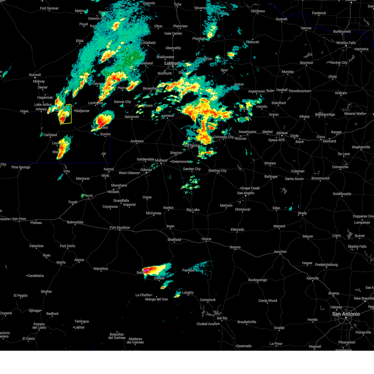
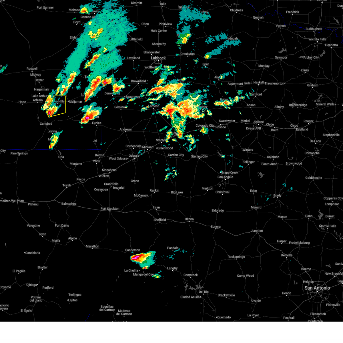
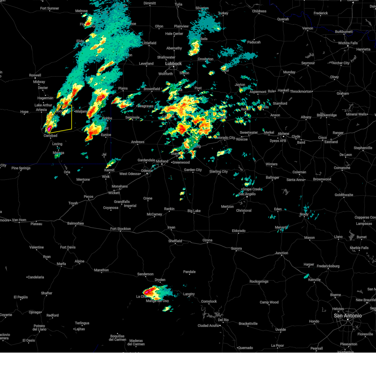
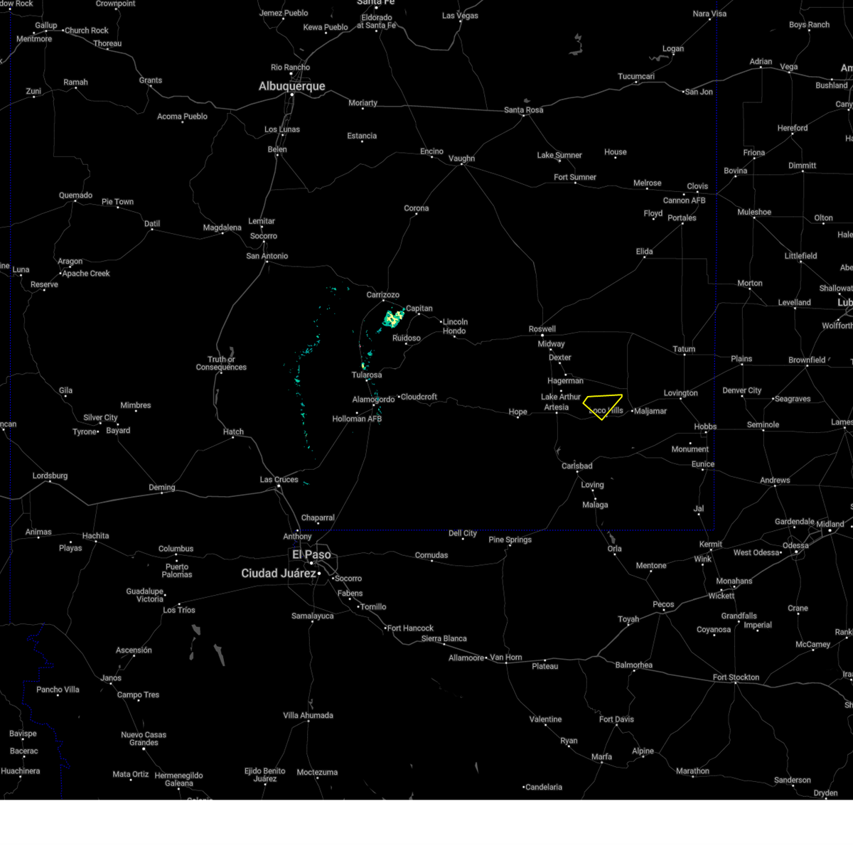
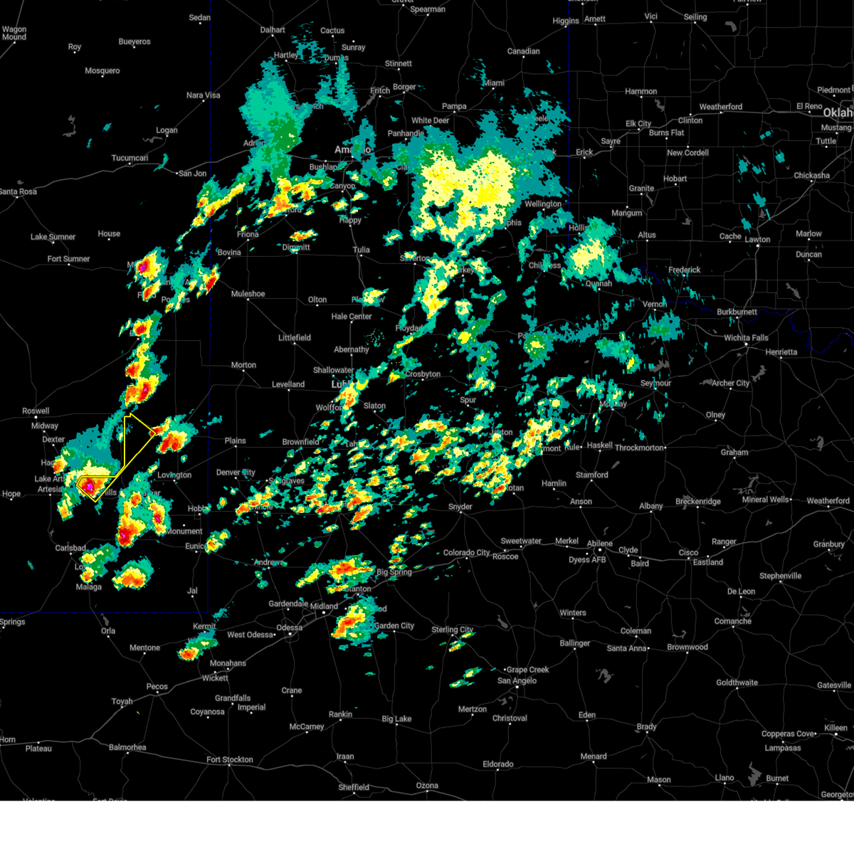
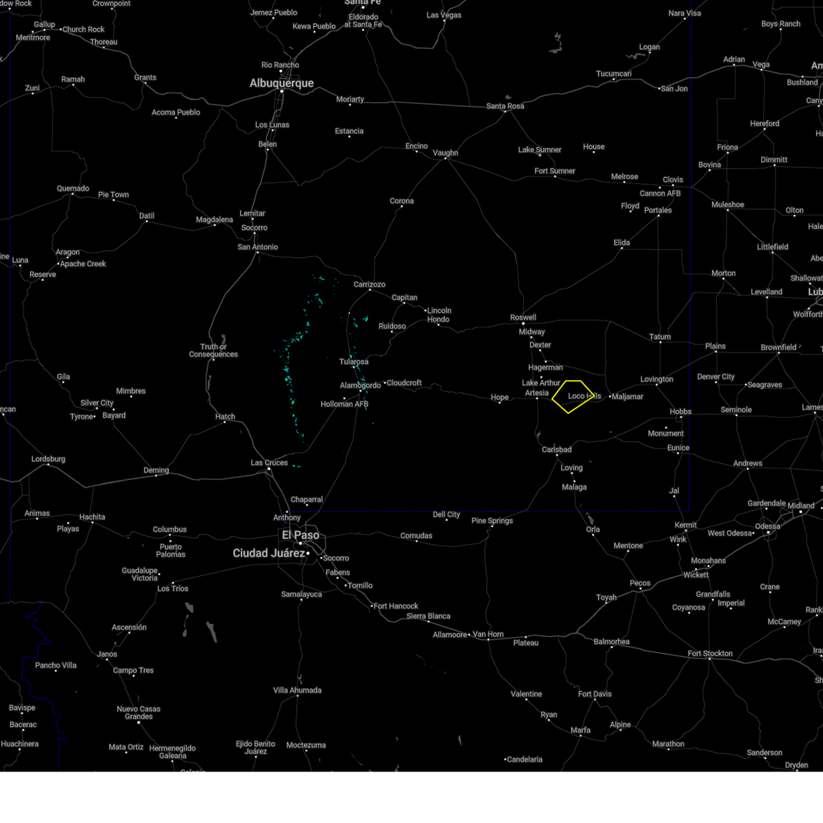
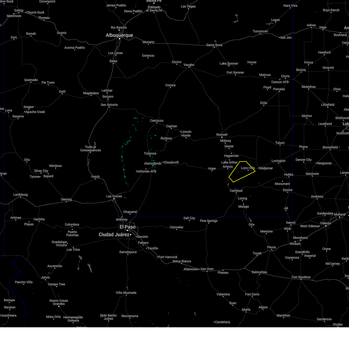
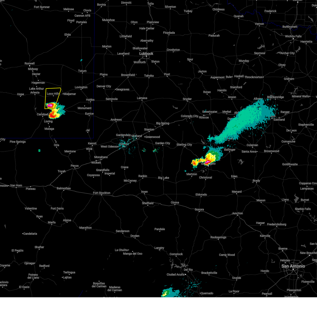
Hail Map for Loco Hills, NM
The Loco Hills, NM area has had 0 reports of on-the-ground hail by trained spotters, and has been under severe weather warnings 3 times during the past 12 months. Doppler radar has detected hail at or near Loco Hills, NM on 50 occasions, including 1 occasion during the past year.
| Name: | Loco Hills, NM |
| Where Located: | 50.6 miles SE of Roswell, NM |
| Map: | Google Map for Loco Hills, NM |
| Population: | 126 |
| Housing Units: | 56 |
| More Info: | Search Google for Loco Hills, NM |
1
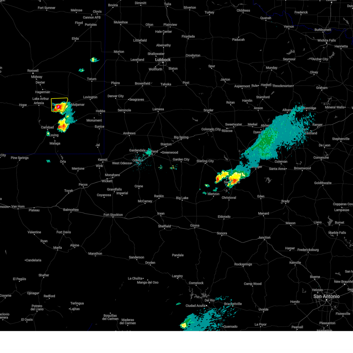
The Top Recent Hail Date for Loco Hills, NM is Monday, September 15, 2025 (17th out of 50)
Hail and Wind Damage Spotted near Loco Hills, NM
| Date / Time | Report Details |
|---|---|
| 6/2/2026 7:47 PM MDT |
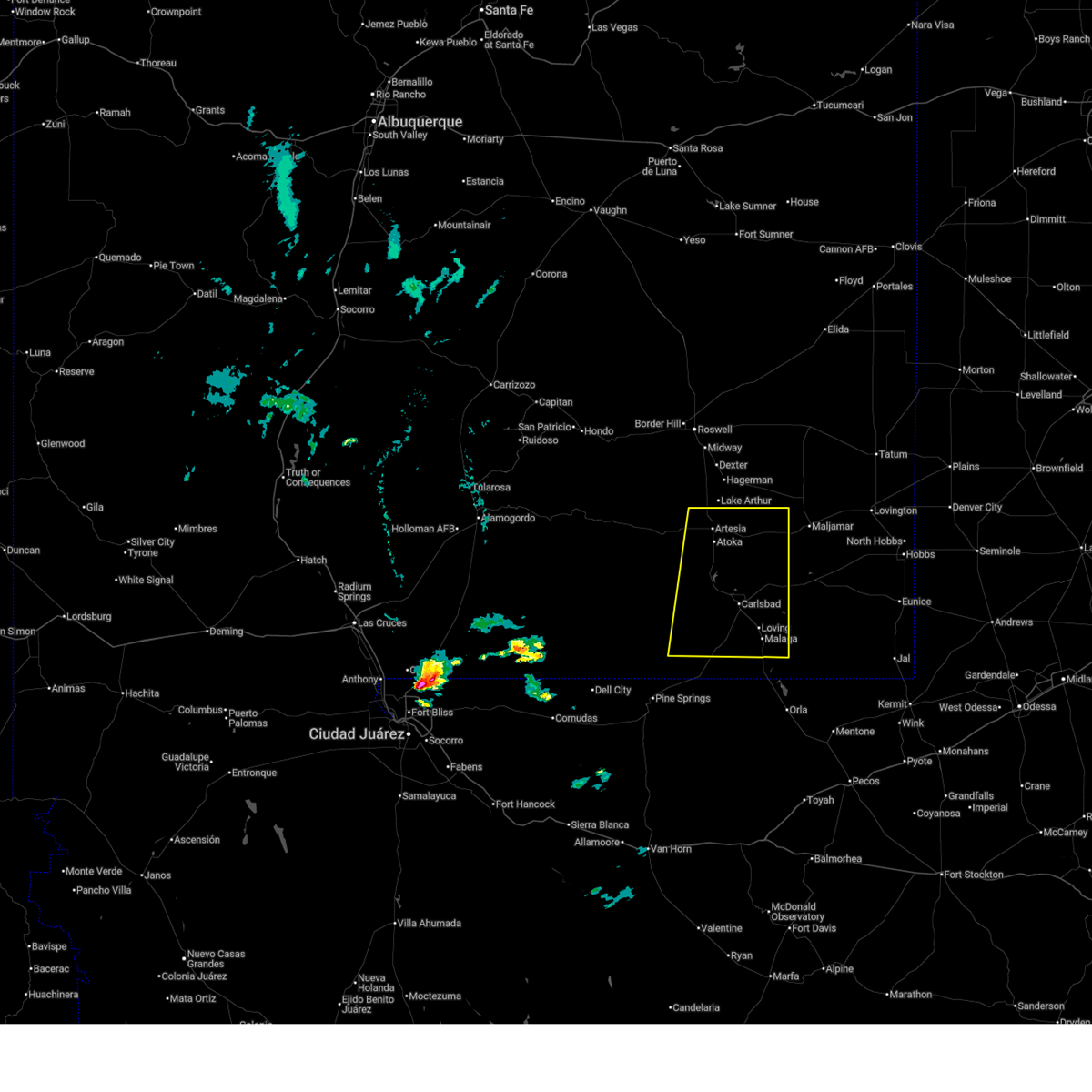 At 745 pm mdt, a severe thunderstorm was located over carlsbad north, or near carlsbad, moving east at 30 mph (radar indicated. a 73 mph gust was reported by the carlsbad caverns national park mesonet at 8:41 pm cdt). Hazards include 70 mph wind gusts and quarter size hail. Hail damage to vehicles is expected. expect considerable tree damage. wind damage is also likely to mobile homes, roofs, and outbuildings. Locations impacted include, carlsbad, artesia, loving, avalon, seven rivers airport, malaga, brantley lake state park, carlsbad north, carlsbad caverns national park, whites city, lea county zip franklin memorial airport, loco hills, artesia municipal airport, otis, cavern city air terminal, living desert state park, dayton, lakewood, atoka, and lake avalon. At 745 pm mdt, a severe thunderstorm was located over carlsbad north, or near carlsbad, moving east at 30 mph (radar indicated. a 73 mph gust was reported by the carlsbad caverns national park mesonet at 8:41 pm cdt). Hazards include 70 mph wind gusts and quarter size hail. Hail damage to vehicles is expected. expect considerable tree damage. wind damage is also likely to mobile homes, roofs, and outbuildings. Locations impacted include, carlsbad, artesia, loving, avalon, seven rivers airport, malaga, brantley lake state park, carlsbad north, carlsbad caverns national park, whites city, lea county zip franklin memorial airport, loco hills, artesia municipal airport, otis, cavern city air terminal, living desert state park, dayton, lakewood, atoka, and lake avalon.
|
| 6/2/2026 7:36 PM MDT |
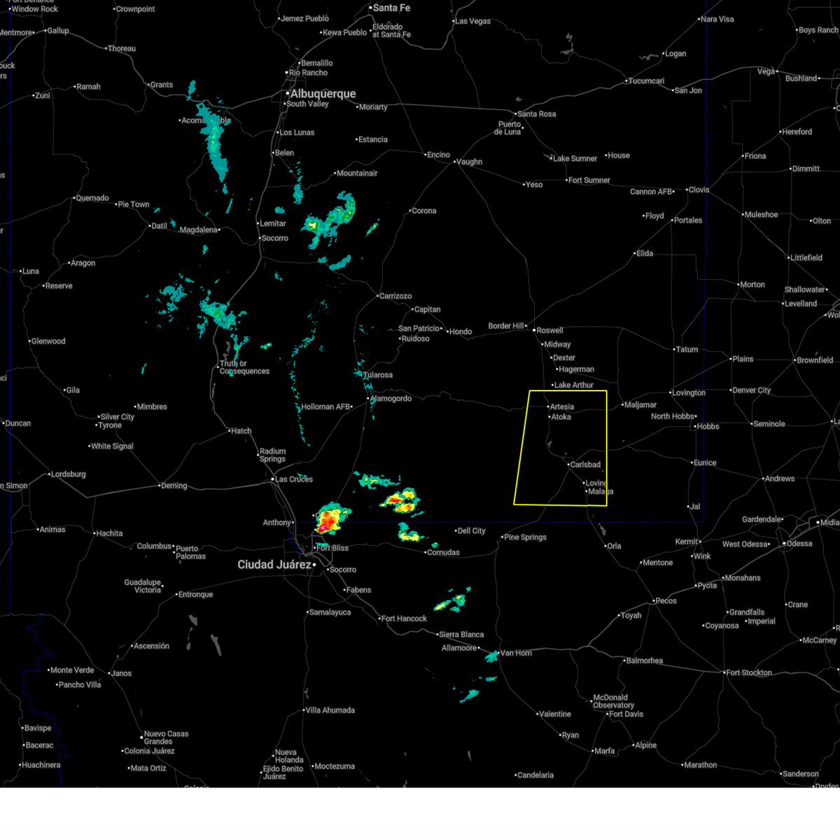 At 736 pm mdt, a severe thunderstorm was located over carlsbad north, or over carlsbad, moving east at 30 mph (radar indicated). Hazards include 60 mph wind gusts and quarter size hail. Hail damage to vehicles is expected. expect wind damage to roofs, siding, and trees. Locations impacted include, carlsbad, artesia, loving, avalon, seven rivers airport, malaga, brantley lake state park, carlsbad north, carlsbad caverns national park, whites city, lea county zip franklin memorial airport, loco hills, artesia municipal airport, otis, cavern city air terminal, living desert state park, dayton, lakewood, atoka, and lake avalon. At 736 pm mdt, a severe thunderstorm was located over carlsbad north, or over carlsbad, moving east at 30 mph (radar indicated). Hazards include 60 mph wind gusts and quarter size hail. Hail damage to vehicles is expected. expect wind damage to roofs, siding, and trees. Locations impacted include, carlsbad, artesia, loving, avalon, seven rivers airport, malaga, brantley lake state park, carlsbad north, carlsbad caverns national park, whites city, lea county zip franklin memorial airport, loco hills, artesia municipal airport, otis, cavern city air terminal, living desert state park, dayton, lakewood, atoka, and lake avalon.
|
| 6/2/2026 7:12 PM MDT |
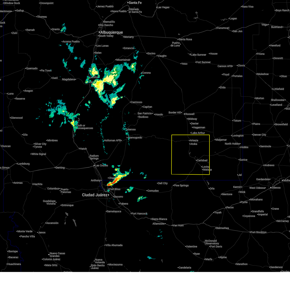 Svrmaf the national weather service in midland has issued a * severe thunderstorm warning for, eddy county in southeastern new mexico, * until 800 pm mdt. * at 712 pm mdt, a severe thunderstorm was located over brantley lake state park, or 12 miles northwest of carlsbad, moving northeast at 25 mph (radar indicated). Hazards include 60 mph wind gusts and quarter size hail. Hail damage to vehicles is expected. Expect wind damage to roofs, siding, and trees. Svrmaf the national weather service in midland has issued a * severe thunderstorm warning for, eddy county in southeastern new mexico, * until 800 pm mdt. * at 712 pm mdt, a severe thunderstorm was located over brantley lake state park, or 12 miles northwest of carlsbad, moving northeast at 25 mph (radar indicated). Hazards include 60 mph wind gusts and quarter size hail. Hail damage to vehicles is expected. Expect wind damage to roofs, siding, and trees.
|
| 6/15/2025 5:37 PM MDT |
 The storms which prompted the warning have weakened below severe limits, and no longer pose an immediate threat to life or property. therefore, the warning has been allowed to expire. a severe thunderstorm watch remains in effect until 1100 pm mdt for southeastern new mexico. The storms which prompted the warning have weakened below severe limits, and no longer pose an immediate threat to life or property. therefore, the warning has been allowed to expire. a severe thunderstorm watch remains in effect until 1100 pm mdt for southeastern new mexico.
|
| 6/15/2025 4:55 PM MDT |
 At 453 pm mdt, severe thunderstorms were located along a line extending from 7 miles west of maljamar to 12 miles east of carlsbad north to near loving, moving east at 25 mph (radar indicated). Hazards include 70 mph wind gusts and penny size hail. Expect considerable tree damage. damage is likely to mobile homes, roofs, and outbuildings. Locations impacted include, carlsbad, loving, avalon, maljamar, carlsbad north, lea county zip franklin memorial airport, halfway, loco hills, lake avalon, otis, cavern city air terminal, and living desert state park. At 453 pm mdt, severe thunderstorms were located along a line extending from 7 miles west of maljamar to 12 miles east of carlsbad north to near loving, moving east at 25 mph (radar indicated). Hazards include 70 mph wind gusts and penny size hail. Expect considerable tree damage. damage is likely to mobile homes, roofs, and outbuildings. Locations impacted include, carlsbad, loving, avalon, maljamar, carlsbad north, lea county zip franklin memorial airport, halfway, loco hills, lake avalon, otis, cavern city air terminal, and living desert state park.
|
| 6/15/2025 4:28 PM MDT |
 Svrmaf the national weather service in midland has issued a * severe thunderstorm warning for, northeastern eddy county in southeastern new mexico, southwestern lea county in southeastern new mexico, * until 530 pm mdt. * at 427 pm mdt, severe thunderstorms were located along a line extending from 17 miles east of artesia to 6 miles east of avalon to near carlsbad, moving east at 25 mph (radar indicated). Hazards include 70 mph wind gusts and quarter size hail. Hail damage to vehicles is expected. expect considerable tree damage. Wind damage is also likely to mobile homes, roofs, and outbuildings. Svrmaf the national weather service in midland has issued a * severe thunderstorm warning for, northeastern eddy county in southeastern new mexico, southwestern lea county in southeastern new mexico, * until 530 pm mdt. * at 427 pm mdt, severe thunderstorms were located along a line extending from 17 miles east of artesia to 6 miles east of avalon to near carlsbad, moving east at 25 mph (radar indicated). Hazards include 70 mph wind gusts and quarter size hail. Hail damage to vehicles is expected. expect considerable tree damage. Wind damage is also likely to mobile homes, roofs, and outbuildings.
|
| 6/15/2025 3:55 PM MDT |
 At 355 pm mdt, severe thunderstorms were located along a line extending from 8 miles southeast of artesia to near brantley lake state park to near carlsbad caverns national park, moving east at 25 mph (radar indicated). Hazards include 70 mph wind gusts and quarter size hail. Hail damage to vehicles is expected. expect considerable tree damage. wind damage is also likely to mobile homes, roofs, and outbuildings. Locations impacted include, carlsbad, artesia, loving, avalon, seven rivers airport, malaga, brantley lake state park, carlsbad north, whites city, carlsbad caverns national park, lincoln national forest, lea county zip franklin memorial airport, loco hills, artesia municipal airport, otis, cavern city air terminal, living desert state park, dayton, lakewood, and atoka. At 355 pm mdt, severe thunderstorms were located along a line extending from 8 miles southeast of artesia to near brantley lake state park to near carlsbad caverns national park, moving east at 25 mph (radar indicated). Hazards include 70 mph wind gusts and quarter size hail. Hail damage to vehicles is expected. expect considerable tree damage. wind damage is also likely to mobile homes, roofs, and outbuildings. Locations impacted include, carlsbad, artesia, loving, avalon, seven rivers airport, malaga, brantley lake state park, carlsbad north, whites city, carlsbad caverns national park, lincoln national forest, lea county zip franklin memorial airport, loco hills, artesia municipal airport, otis, cavern city air terminal, living desert state park, dayton, lakewood, and atoka.
|
| 6/15/2025 3:25 PM MDT |
 Svrmaf the national weather service in midland has issued a * severe thunderstorm warning for, eddy county in southeastern new mexico, * until 430 pm mdt. * at 324 pm mdt, severe thunderstorms were located along a line extending from near artesia to 8 miles southwest of seven rivers airport to 13 miles north of carlsbad caverns national park, moving east at 30 mph (radar indicated). Hazards include 70 mph wind gusts and quarter size hail. Hail damage to vehicles is expected. expect considerable tree damage. Wind damage is also likely to mobile homes, roofs, and outbuildings. Svrmaf the national weather service in midland has issued a * severe thunderstorm warning for, eddy county in southeastern new mexico, * until 430 pm mdt. * at 324 pm mdt, severe thunderstorms were located along a line extending from near artesia to 8 miles southwest of seven rivers airport to 13 miles north of carlsbad caverns national park, moving east at 30 mph (radar indicated). Hazards include 70 mph wind gusts and quarter size hail. Hail damage to vehicles is expected. expect considerable tree damage. Wind damage is also likely to mobile homes, roofs, and outbuildings.
|
| 6/9/2025 10:12 PM MDT |
 Svrmaf the national weather service in midland has issued a * severe thunderstorm warning for, northeastern eddy county in southeastern new mexico, central lea county in southeastern new mexico, * until 1115 pm mdt. * at 1012 pm mdt, severe thunderstorms were located along a line extending from near tatum to 13 miles southwest of maljamar, moving southeast at 25 mph (radar indicated). Hazards include two inch hail and 70 mph wind gusts. People and animals outdoors will be injured. expect hail damage to roofs, siding, windows, and vehicles. expect considerable tree damage. Wind damage is also likely to mobile homes, roofs, and outbuildings. Svrmaf the national weather service in midland has issued a * severe thunderstorm warning for, northeastern eddy county in southeastern new mexico, central lea county in southeastern new mexico, * until 1115 pm mdt. * at 1012 pm mdt, severe thunderstorms were located along a line extending from near tatum to 13 miles southwest of maljamar, moving southeast at 25 mph (radar indicated). Hazards include two inch hail and 70 mph wind gusts. People and animals outdoors will be injured. expect hail damage to roofs, siding, windows, and vehicles. expect considerable tree damage. Wind damage is also likely to mobile homes, roofs, and outbuildings.
|
| 6/9/2025 9:55 PM MDT |
 Svrmaf the national weather service in midland has issued a * severe thunderstorm warning for, northeastern eddy county in southeastern new mexico, northwestern lea county in southeastern new mexico, * until 1015 pm mdt. * at 955 pm mdt, severe thunderstorms were located along a line extending from 17 miles north of maljamar to 20 miles east of artesia, moving southeast at 25 mph (radar indicated). Hazards include 60 mph wind gusts and half dollar size hail. Hail damage to vehicles is expected. Expect wind damage to roofs, siding, and trees. Svrmaf the national weather service in midland has issued a * severe thunderstorm warning for, northeastern eddy county in southeastern new mexico, northwestern lea county in southeastern new mexico, * until 1015 pm mdt. * at 955 pm mdt, severe thunderstorms were located along a line extending from 17 miles north of maljamar to 20 miles east of artesia, moving southeast at 25 mph (radar indicated). Hazards include 60 mph wind gusts and half dollar size hail. Hail damage to vehicles is expected. Expect wind damage to roofs, siding, and trees.
|
| 6/6/2025 4:58 PM MDT |
 Svrmaf the national weather service in midland has issued a * severe thunderstorm warning for, northeastern eddy county in southeastern new mexico, west central lea county in southeastern new mexico, * until 600 pm mdt. * at 458 pm mdt, a severe thunderstorm was located 8 miles southwest of maljamar, or 31 miles east of artesia, moving east at 15 mph (radar indicated). Hazards include 60 mph wind gusts and half dollar size hail. Hail damage to vehicles is expected. Expect wind damage to roofs, siding, and trees. Svrmaf the national weather service in midland has issued a * severe thunderstorm warning for, northeastern eddy county in southeastern new mexico, west central lea county in southeastern new mexico, * until 600 pm mdt. * at 458 pm mdt, a severe thunderstorm was located 8 miles southwest of maljamar, or 31 miles east of artesia, moving east at 15 mph (radar indicated). Hazards include 60 mph wind gusts and half dollar size hail. Hail damage to vehicles is expected. Expect wind damage to roofs, siding, and trees.
|
| 6/5/2025 4:27 PM MDT |
 Svrmaf the national weather service in midland has issued a * severe thunderstorm warning for, northeastern eddy county in southeastern new mexico, west central lea county in southeastern new mexico, * until 530 pm mdt. * at 427 pm mdt, a severe thunderstorm was located 11 miles southwest of maljamar, or 29 miles east of artesia, moving northeast at 25 mph (radar indicated). Hazards include 70 mph wind gusts and ping pong ball size hail. People and animals outdoors will be injured. expect hail damage to roofs, siding, windows, and vehicles. expect considerable tree damage. Wind damage is also likely to mobile homes, roofs, and outbuildings. Svrmaf the national weather service in midland has issued a * severe thunderstorm warning for, northeastern eddy county in southeastern new mexico, west central lea county in southeastern new mexico, * until 530 pm mdt. * at 427 pm mdt, a severe thunderstorm was located 11 miles southwest of maljamar, or 29 miles east of artesia, moving northeast at 25 mph (radar indicated). Hazards include 70 mph wind gusts and ping pong ball size hail. People and animals outdoors will be injured. expect hail damage to roofs, siding, windows, and vehicles. expect considerable tree damage. Wind damage is also likely to mobile homes, roofs, and outbuildings.
|
| 5/27/2025 8:51 PM MDT |
 At 951 pm cdt/851 pm mdt/, severe thunderstorms were located along a line extending from 13 miles west of maljamar to 13 miles northeast of loving to 15 miles south of whites city, moving east at 15 mph (radar indicated). Hazards include 60 mph wind gusts and quarter size hail. Hail damage to vehicles is expected. expect wind damage to roofs, siding, and trees. Locations impacted include, carlsbad, loving, malaga, otis, lea county zip franklin memorial airport, and loco hills. At 951 pm cdt/851 pm mdt/, severe thunderstorms were located along a line extending from 13 miles west of maljamar to 13 miles northeast of loving to 15 miles south of whites city, moving east at 15 mph (radar indicated). Hazards include 60 mph wind gusts and quarter size hail. Hail damage to vehicles is expected. expect wind damage to roofs, siding, and trees. Locations impacted include, carlsbad, loving, malaga, otis, lea county zip franklin memorial airport, and loco hills.
|
| 5/27/2025 8:26 PM MDT |
 Svrmaf the national weather service in midland has issued a * severe thunderstorm warning for, eastern eddy county in southeastern new mexico, northeastern culberson county in southwestern texas, * until 1015 pm cdt/915 pm mdt/. * at 926 pm cdt/826 pm mdt/, severe thunderstorms were located along a line extending from 18 miles west of maljamar to 8 miles east of carlsbad north to 13 miles south of whites city, moving east at 15 mph (the carlsbad airport reported a 59 mph wind gust recently). Hazards include 60 mph wind gusts and quarter size hail. Hail damage to vehicles is expected. Expect wind damage to roofs, siding, and trees. Svrmaf the national weather service in midland has issued a * severe thunderstorm warning for, eastern eddy county in southeastern new mexico, northeastern culberson county in southwestern texas, * until 1015 pm cdt/915 pm mdt/. * at 926 pm cdt/826 pm mdt/, severe thunderstorms were located along a line extending from 18 miles west of maljamar to 8 miles east of carlsbad north to 13 miles south of whites city, moving east at 15 mph (the carlsbad airport reported a 59 mph wind gust recently). Hazards include 60 mph wind gusts and quarter size hail. Hail damage to vehicles is expected. Expect wind damage to roofs, siding, and trees.
|
| 5/5/2025 8:36 PM MDT |
 At 836 pm mdt, a severe thunderstorm was located 13 miles east of avalon, or 15 miles northeast of carlsbad, moving northeast at 30 mph (radar indicated). Hazards include 60 mph wind gusts and quarter size hail. Hail damage to vehicles is expected. expect wind damage to roofs, siding, and trees. Locations impacted include, lea county zip franklin memorial airport and loco hills. At 836 pm mdt, a severe thunderstorm was located 13 miles east of avalon, or 15 miles northeast of carlsbad, moving northeast at 30 mph (radar indicated). Hazards include 60 mph wind gusts and quarter size hail. Hail damage to vehicles is expected. expect wind damage to roofs, siding, and trees. Locations impacted include, lea county zip franklin memorial airport and loco hills.
|
| 5/5/2025 8:23 PM MDT |
 Svrmaf the national weather service in midland has issued a * severe thunderstorm warning for, northeastern eddy county in southeastern new mexico, west central lea county in southeastern new mexico, * until 930 pm mdt. * at 822 pm mdt, a severe thunderstorm was located near carlsbad north, or 7 miles northeast of carlsbad, moving northeast at 20 mph (radar indicated). Hazards include 60 mph wind gusts and quarter size hail. Hail damage to vehicles is expected. Expect wind damage to roofs, siding, and trees. Svrmaf the national weather service in midland has issued a * severe thunderstorm warning for, northeastern eddy county in southeastern new mexico, west central lea county in southeastern new mexico, * until 930 pm mdt. * at 822 pm mdt, a severe thunderstorm was located near carlsbad north, or 7 miles northeast of carlsbad, moving northeast at 20 mph (radar indicated). Hazards include 60 mph wind gusts and quarter size hail. Hail damage to vehicles is expected. Expect wind damage to roofs, siding, and trees.
|
| 5/5/2025 8:09 PM MDT |
 At 809 pm mdt, a severe thunderstorm was located 14 miles southwest of maljamar, or 27 miles east of artesia, moving northeast at 20 mph (radar indicated). Hazards include 60 mph wind gusts and quarter size hail. Hail damage to vehicles is expected. expect wind damage to roofs, siding, and trees. Locations impacted include, maljamar, lea county zip franklin memorial airport, and loco hills. At 809 pm mdt, a severe thunderstorm was located 14 miles southwest of maljamar, or 27 miles east of artesia, moving northeast at 20 mph (radar indicated). Hazards include 60 mph wind gusts and quarter size hail. Hail damage to vehicles is expected. expect wind damage to roofs, siding, and trees. Locations impacted include, maljamar, lea county zip franklin memorial airport, and loco hills.
|
| 5/5/2025 7:47 PM MDT |
 Svrmaf the national weather service in midland has issued a * severe thunderstorm warning for, northeastern eddy county in southeastern new mexico, west central lea county in southeastern new mexico, * until 845 pm mdt. * at 746 pm mdt, a severe thunderstorm was located 13 miles northeast of avalon, or 18 miles northeast of carlsbad, moving northeast at 20 mph (radar indicated). Hazards include 60 mph wind gusts and half dollar size hail. Hail damage to vehicles is expected. Expect wind damage to roofs, siding, and trees. Svrmaf the national weather service in midland has issued a * severe thunderstorm warning for, northeastern eddy county in southeastern new mexico, west central lea county in southeastern new mexico, * until 845 pm mdt. * at 746 pm mdt, a severe thunderstorm was located 13 miles northeast of avalon, or 18 miles northeast of carlsbad, moving northeast at 20 mph (radar indicated). Hazards include 60 mph wind gusts and half dollar size hail. Hail damage to vehicles is expected. Expect wind damage to roofs, siding, and trees.
|
| 5/5/2025 7:12 PM MDT |
 The storm which prompted the warning has weakened below severe limits, and no longer poses an immediate threat to life or property. therefore, the warning will be allowed to expire. a tornado watch remains in effect until 800 pm mdt for southeastern new mexico. The storm which prompted the warning has weakened below severe limits, and no longer poses an immediate threat to life or property. therefore, the warning will be allowed to expire. a tornado watch remains in effect until 800 pm mdt for southeastern new mexico.
|
| 5/5/2025 7:00 PM MDT |
 At 700 pm mdt, a severe thunderstorm was located 19 miles northeast of avalon, or 21 miles east of artesia, moving northeast at 30 mph (radar indicated). Hazards include 60 mph wind gusts and quarter size hail. Hail damage to vehicles is expected. expect wind damage to roofs, siding, and trees. Locations impacted include, lea county zip franklin memorial airport and loco hills. At 700 pm mdt, a severe thunderstorm was located 19 miles northeast of avalon, or 21 miles east of artesia, moving northeast at 30 mph (radar indicated). Hazards include 60 mph wind gusts and quarter size hail. Hail damage to vehicles is expected. expect wind damage to roofs, siding, and trees. Locations impacted include, lea county zip franklin memorial airport and loco hills.
|
| 5/5/2025 6:29 PM MDT |
 At 629 pm mdt, a severe thunderstorm was located 18 miles east of artesia, moving north at 35 mph (radar indicated). Hazards include 60 mph wind gusts and quarter size hail. Hail damage to vehicles is expected. expect wind damage to roofs, siding, and trees. Locations impacted include, lea county zip franklin memorial airport and loco hills. At 629 pm mdt, a severe thunderstorm was located 18 miles east of artesia, moving north at 35 mph (radar indicated). Hazards include 60 mph wind gusts and quarter size hail. Hail damage to vehicles is expected. expect wind damage to roofs, siding, and trees. Locations impacted include, lea county zip franklin memorial airport and loco hills.
|
| 5/5/2025 6:15 PM MDT |
 Svrmaf the national weather service in midland has issued a * severe thunderstorm warning for, northeastern eddy county in southeastern new mexico, * until 715 pm mdt. * at 615 pm mdt, a severe thunderstorm was located 11 miles northeast of avalon, or 17 miles north of carlsbad, moving north at 35 mph (radar indicated). Hazards include 60 mph wind gusts and quarter size hail. Hail damage to vehicles is expected. Expect wind damage to roofs, siding, and trees. Svrmaf the national weather service in midland has issued a * severe thunderstorm warning for, northeastern eddy county in southeastern new mexico, * until 715 pm mdt. * at 615 pm mdt, a severe thunderstorm was located 11 miles northeast of avalon, or 17 miles north of carlsbad, moving north at 35 mph (radar indicated). Hazards include 60 mph wind gusts and quarter size hail. Hail damage to vehicles is expected. Expect wind damage to roofs, siding, and trees.
|
| 11/2/2024 3:25 PM MDT |
 At 324 pm mdt, a severe thunderstorm was located 13 miles southwest of maljamar, or 27 miles east of artesia, moving northeast at 25 mph (radar indicated). Hazards include 60 mph wind gusts and quarter size hail. Hail damage to vehicles is expected. expect wind damage to roofs, siding, and trees. Locations impacted include, lea county zip franklin memorial airport and loco hills. At 324 pm mdt, a severe thunderstorm was located 13 miles southwest of maljamar, or 27 miles east of artesia, moving northeast at 25 mph (radar indicated). Hazards include 60 mph wind gusts and quarter size hail. Hail damage to vehicles is expected. expect wind damage to roofs, siding, and trees. Locations impacted include, lea county zip franklin memorial airport and loco hills.
|
| 11/2/2024 3:06 PM MDT |
 At 305 pm mdt, a severe thunderstorm was located 13 miles northeast of avalon, or 20 miles southeast of artesia, moving northeast at 25 mph (radar indicated). Hazards include 60 mph wind gusts and half dollar size hail. Hail damage to vehicles is expected. expect wind damage to roofs, siding, and trees. Locations impacted include, lea county zip franklin memorial airport and loco hills. At 305 pm mdt, a severe thunderstorm was located 13 miles northeast of avalon, or 20 miles southeast of artesia, moving northeast at 25 mph (radar indicated). Hazards include 60 mph wind gusts and half dollar size hail. Hail damage to vehicles is expected. expect wind damage to roofs, siding, and trees. Locations impacted include, lea county zip franklin memorial airport and loco hills.
|
| 11/2/2024 2:54 PM MDT |
 Svrmaf the national weather service in midland has issued a * severe thunderstorm warning for, northeastern eddy county in southeastern new mexico, * until 400 pm mdt. * at 254 pm mdt, a severe thunderstorm was located 8 miles north of avalon, or 14 miles north of carlsbad, moving northeast at 25 mph (radar indicated). Hazards include golf ball size hail and 60 mph wind gusts. People and animals outdoors will be injured. expect hail damage to roofs, siding, windows, and vehicles. Expect wind damage to roofs, siding, and trees. Svrmaf the national weather service in midland has issued a * severe thunderstorm warning for, northeastern eddy county in southeastern new mexico, * until 400 pm mdt. * at 254 pm mdt, a severe thunderstorm was located 8 miles north of avalon, or 14 miles north of carlsbad, moving northeast at 25 mph (radar indicated). Hazards include golf ball size hail and 60 mph wind gusts. People and animals outdoors will be injured. expect hail damage to roofs, siding, windows, and vehicles. Expect wind damage to roofs, siding, and trees.
|
| 11/2/2024 2:03 PM MDT |
 At 203 pm mdt, a severe thunderstorm was located 15 miles northwest of maljamar, or 25 miles east of artesia, moving northeast at 35 mph (radar indicated). Hazards include golf ball size hail and 60 mph wind gusts. People and animals outdoors will be injured. expect hail damage to roofs, siding, windows, and vehicles. expect wind damage to roofs, siding, and trees. Locations impacted include, loco hills. At 203 pm mdt, a severe thunderstorm was located 15 miles northwest of maljamar, or 25 miles east of artesia, moving northeast at 35 mph (radar indicated). Hazards include golf ball size hail and 60 mph wind gusts. People and animals outdoors will be injured. expect hail damage to roofs, siding, windows, and vehicles. expect wind damage to roofs, siding, and trees. Locations impacted include, loco hills.
|
| 11/2/2024 2:03 PM MDT |
 the severe thunderstorm warning has been cancelled and is no longer in effect the severe thunderstorm warning has been cancelled and is no longer in effect
|
| 11/2/2024 1:57 PM MDT |
 Svrmaf the national weather service in midland has issued a * severe thunderstorm warning for, north central eddy county in southeastern new mexico, northwestern lea county in southeastern new mexico, * until 230 pm mdt. * at 157 pm mdt, a severe thunderstorm was located 16 miles west of maljamar, or 22 miles east of artesia, moving northeast at 35 mph (radar indicated). Hazards include golf ball size hail and 60 mph wind gusts. People and animals outdoors will be injured. expect hail damage to roofs, siding, windows, and vehicles. Expect wind damage to roofs, siding, and trees. Svrmaf the national weather service in midland has issued a * severe thunderstorm warning for, north central eddy county in southeastern new mexico, northwestern lea county in southeastern new mexico, * until 230 pm mdt. * at 157 pm mdt, a severe thunderstorm was located 16 miles west of maljamar, or 22 miles east of artesia, moving northeast at 35 mph (radar indicated). Hazards include golf ball size hail and 60 mph wind gusts. People and animals outdoors will be injured. expect hail damage to roofs, siding, windows, and vehicles. Expect wind damage to roofs, siding, and trees.
|
| 11/2/2024 1:47 PM MDT |
 At 147 pm mdt, a severe thunderstorm was located 17 miles east of artesia, moving northeast at 35 mph (radar indicated). Hazards include golf ball size hail and 60 mph wind gusts. People and animals outdoors will be injured. expect hail damage to roofs, siding, windows, and vehicles. expect wind damage to roofs, siding, and trees. Locations impacted include, lea county zip franklin memorial airport and loco hills. At 147 pm mdt, a severe thunderstorm was located 17 miles east of artesia, moving northeast at 35 mph (radar indicated). Hazards include golf ball size hail and 60 mph wind gusts. People and animals outdoors will be injured. expect hail damage to roofs, siding, windows, and vehicles. expect wind damage to roofs, siding, and trees. Locations impacted include, lea county zip franklin memorial airport and loco hills.
|
| 11/2/2024 1:40 PM MDT |
 At 139 pm mdt, a severe thunderstorm was located 14 miles east of artesia, moving northeast at 30 mph (radar indicated). Hazards include 60 mph wind gusts and half dollar size hail. Hail damage to vehicles is expected. expect wind damage to roofs, siding, and trees. Locations impacted include, loco hills and lea county zip franklin memorial airport. At 139 pm mdt, a severe thunderstorm was located 14 miles east of artesia, moving northeast at 30 mph (radar indicated). Hazards include 60 mph wind gusts and half dollar size hail. Hail damage to vehicles is expected. expect wind damage to roofs, siding, and trees. Locations impacted include, loco hills and lea county zip franklin memorial airport.
|
| 11/2/2024 1:23 PM MDT |
 Svrmaf the national weather service in midland has issued a * severe thunderstorm warning for, northeastern eddy county in southeastern new mexico, * until 200 pm mdt. * at 122 pm mdt, a severe thunderstorm was located 11 miles northeast of brantley lake state park, or 13 miles southeast of artesia, moving northeast at 25 mph (radar indicated). Hazards include 60 mph wind gusts and half dollar size hail. Hail damage to vehicles is expected. Expect wind damage to roofs, siding, and trees. Svrmaf the national weather service in midland has issued a * severe thunderstorm warning for, northeastern eddy county in southeastern new mexico, * until 200 pm mdt. * at 122 pm mdt, a severe thunderstorm was located 11 miles northeast of brantley lake state park, or 13 miles southeast of artesia, moving northeast at 25 mph (radar indicated). Hazards include 60 mph wind gusts and half dollar size hail. Hail damage to vehicles is expected. Expect wind damage to roofs, siding, and trees.
|
| 11/1/2024 10:50 PM MDT |
 At 1049 pm mdt, a severe thunderstorm was located 16 miles west of maljamar, or 21 miles east of artesia, moving north at 15 mph (radar indicated). Hazards include golf ball size hail and 60 mph wind gusts. People and animals outdoors will be injured. expect hail damage to roofs, siding, windows, and vehicles. expect wind damage to roofs, siding, and trees. Locations impacted include, lea county zip franklin memorial airport and loco hills. At 1049 pm mdt, a severe thunderstorm was located 16 miles west of maljamar, or 21 miles east of artesia, moving north at 15 mph (radar indicated). Hazards include golf ball size hail and 60 mph wind gusts. People and animals outdoors will be injured. expect hail damage to roofs, siding, windows, and vehicles. expect wind damage to roofs, siding, and trees. Locations impacted include, lea county zip franklin memorial airport and loco hills.
|
| 11/1/2024 10:24 PM MDT |
 Svrmaf the national weather service in midland has issued a * severe thunderstorm warning for, northeastern eddy county in southeastern new mexico, * until 1130 pm mdt. * at 1024 pm mdt, a severe thunderstorm was located 18 miles east of artesia, moving north at 15 mph (radar indicated). Hazards include ping pong ball size hail and 60 mph wind gusts. People and animals outdoors will be injured. expect hail damage to roofs, siding, windows, and vehicles. Expect wind damage to roofs, siding, and trees. Svrmaf the national weather service in midland has issued a * severe thunderstorm warning for, northeastern eddy county in southeastern new mexico, * until 1130 pm mdt. * at 1024 pm mdt, a severe thunderstorm was located 18 miles east of artesia, moving north at 15 mph (radar indicated). Hazards include ping pong ball size hail and 60 mph wind gusts. People and animals outdoors will be injured. expect hail damage to roofs, siding, windows, and vehicles. Expect wind damage to roofs, siding, and trees.
|
| 11/1/2024 8:56 PM MDT |
 At 856 pm mdt, a severe thunderstorm was located 13 miles west of maljamar, or 24 miles east of artesia, moving north at 40 mph (radar indicated). Hazards include 60 mph wind gusts and quarter size hail. Hail damage to vehicles is expected. expect wind damage to roofs, siding, and trees. Locations impacted include, lea county zip franklin memorial airport and loco hills. At 856 pm mdt, a severe thunderstorm was located 13 miles west of maljamar, or 24 miles east of artesia, moving north at 40 mph (radar indicated). Hazards include 60 mph wind gusts and quarter size hail. Hail damage to vehicles is expected. expect wind damage to roofs, siding, and trees. Locations impacted include, lea county zip franklin memorial airport and loco hills.
|
| 11/1/2024 8:32 PM MDT |
 Svrmaf the national weather service in midland has issued a * severe thunderstorm warning for, northeastern eddy county in southeastern new mexico, * until 915 pm mdt. * at 832 pm mdt, a severe thunderstorm was located 16 miles northeast of avalon, or 21 miles northeast of carlsbad, moving north at 40 mph (radar indicated). Hazards include golf ball size hail and 60 mph wind gusts. People and animals outdoors will be injured. expect hail damage to roofs, siding, windows, and vehicles. Expect wind damage to roofs, siding, and trees. Svrmaf the national weather service in midland has issued a * severe thunderstorm warning for, northeastern eddy county in southeastern new mexico, * until 915 pm mdt. * at 832 pm mdt, a severe thunderstorm was located 16 miles northeast of avalon, or 21 miles northeast of carlsbad, moving north at 40 mph (radar indicated). Hazards include golf ball size hail and 60 mph wind gusts. People and animals outdoors will be injured. expect hail damage to roofs, siding, windows, and vehicles. Expect wind damage to roofs, siding, and trees.
|
| 5/11/2024 6:33 PM MDT |
 At 632 pm mdt, a severe thunderstorm was located 14 miles southeast of hagerman, or 18 miles northeast of artesia, moving east at 20 mph (radar indicated). Hazards include golf ball size hail and 60 mph wind gusts. People and animals outdoors will be injured. expect hail damage to roofs, siding, windows, and vehicles. expect wind damage to roofs, siding, and trees. Locations impacted include, lea county zip franklin memorial airport and loco hills. At 632 pm mdt, a severe thunderstorm was located 14 miles southeast of hagerman, or 18 miles northeast of artesia, moving east at 20 mph (radar indicated). Hazards include golf ball size hail and 60 mph wind gusts. People and animals outdoors will be injured. expect hail damage to roofs, siding, windows, and vehicles. expect wind damage to roofs, siding, and trees. Locations impacted include, lea county zip franklin memorial airport and loco hills.
|
| 5/11/2024 6:13 PM MDT |
 Svrmaf the national weather service in midland has issued a * severe thunderstorm warning for, northeastern eddy county in southeastern new mexico, * until 730 pm mdt. * at 613 pm mdt, a severe thunderstorm was located 8 miles southeast of hagerman, or 14 miles northeast of artesia, moving east at 20 mph (radar indicated). Hazards include ping pong ball size hail and 60 mph wind gusts. People and animals outdoors will be injured. expect hail damage to roofs, siding, windows, and vehicles. Expect wind damage to roofs, siding, and trees. Svrmaf the national weather service in midland has issued a * severe thunderstorm warning for, northeastern eddy county in southeastern new mexico, * until 730 pm mdt. * at 613 pm mdt, a severe thunderstorm was located 8 miles southeast of hagerman, or 14 miles northeast of artesia, moving east at 20 mph (radar indicated). Hazards include ping pong ball size hail and 60 mph wind gusts. People and animals outdoors will be injured. expect hail damage to roofs, siding, windows, and vehicles. Expect wind damage to roofs, siding, and trees.
|
| 10/2/2023 4:39 PM MDT |
 At 439 pm mdt, a severe thunderstorm was located 18 miles northeast of avalon, or 23 miles northeast of carlsbad, moving northeast at 35 mph (radar indicated). Hazards include 60 mph wind gusts and quarter size hail. Hail damage to vehicles is expected. expect wind damage to roofs, siding, and trees. locations impacted include, carlsbad, avalon, carlsbad north, lake avalon, lea county zip franklin memorial airport, and loco hills. hail threat, radar indicated max hail size, 1. 00 in wind threat, radar indicated max wind gust, 60 mph. At 439 pm mdt, a severe thunderstorm was located 18 miles northeast of avalon, or 23 miles northeast of carlsbad, moving northeast at 35 mph (radar indicated). Hazards include 60 mph wind gusts and quarter size hail. Hail damage to vehicles is expected. expect wind damage to roofs, siding, and trees. locations impacted include, carlsbad, avalon, carlsbad north, lake avalon, lea county zip franklin memorial airport, and loco hills. hail threat, radar indicated max hail size, 1. 00 in wind threat, radar indicated max wind gust, 60 mph.
|
| 10/2/2023 4:15 PM MDT |
 At 414 pm mdt, a severe thunderstorm was located near avalon, or 9 miles north of carlsbad, moving northeast at 35 mph (radar indicated). Hazards include 60 mph wind gusts and quarter size hail. Hail damage to vehicles is expected. Expect wind damage to roofs, siding, and trees. At 414 pm mdt, a severe thunderstorm was located near avalon, or 9 miles north of carlsbad, moving northeast at 35 mph (radar indicated). Hazards include 60 mph wind gusts and quarter size hail. Hail damage to vehicles is expected. Expect wind damage to roofs, siding, and trees.
|
| 10/2/2023 3:42 PM MDT |
 At 342 pm mdt, a severe thunderstorm was located 10 miles south of maljamar, or 31 miles southwest of lovington, moving northeast at 20 mph (radar indicated). Hazards include two inch hail and 70 mph wind gusts. People and animals outdoors will be injured. expect hail damage to roofs, siding, windows, and vehicles. expect considerable tree damage. wind damage is also likely to mobile homes, roofs, and outbuildings. Locations impacted include, maljamar. At 342 pm mdt, a severe thunderstorm was located 10 miles south of maljamar, or 31 miles southwest of lovington, moving northeast at 20 mph (radar indicated). Hazards include two inch hail and 70 mph wind gusts. People and animals outdoors will be injured. expect hail damage to roofs, siding, windows, and vehicles. expect considerable tree damage. wind damage is also likely to mobile homes, roofs, and outbuildings. Locations impacted include, maljamar.
|
| 10/2/2023 3:32 PM MDT |
 At 332 pm mdt, a severe thunderstorm was located 13 miles southwest of maljamar, or 28 miles northeast of carlsbad, moving northeast at 20 mph (radar indicated). Hazards include golf ball size hail and 60 mph wind gusts. People and animals outdoors will be injured. expect hail damage to roofs, siding, windows, and vehicles. expect wind damage to roofs, siding, and trees. Locations impacted include, maljamar, lea county zip franklin memorial airport, and loco hills. At 332 pm mdt, a severe thunderstorm was located 13 miles southwest of maljamar, or 28 miles northeast of carlsbad, moving northeast at 20 mph (radar indicated). Hazards include golf ball size hail and 60 mph wind gusts. People and animals outdoors will be injured. expect hail damage to roofs, siding, windows, and vehicles. expect wind damage to roofs, siding, and trees. Locations impacted include, maljamar, lea county zip franklin memorial airport, and loco hills.
|
| 10/2/2023 3:23 PM MDT |
 At 323 pm mdt, a severe thunderstorm was located 16 miles southwest of maljamar, or 25 miles northeast of carlsbad, moving northeast at 20 mph (radar indicated). Hazards include ping pong ball size hail and 60 mph wind gusts. People and animals outdoors will be injured. expect hail damage to roofs, siding, windows, and vehicles. Expect wind damage to roofs, siding, and trees. At 323 pm mdt, a severe thunderstorm was located 16 miles southwest of maljamar, or 25 miles northeast of carlsbad, moving northeast at 20 mph (radar indicated). Hazards include ping pong ball size hail and 60 mph wind gusts. People and animals outdoors will be injured. expect hail damage to roofs, siding, windows, and vehicles. Expect wind damage to roofs, siding, and trees.
|
| 10/2/2023 2:44 PM MDT |
 At 244 pm mdt, a severe thunderstorm was located 15 miles west of maljamar, or 22 miles east of artesia, moving northeast at 25 mph (radar indicated). Hazards include tennis ball size hail and 60 mph wind gusts. People and animals outdoors will be injured. expect hail damage to roofs, siding, windows, and vehicles. expect wind damage to roofs, siding, and trees. locations impacted include, maljamar, lea county zip franklin memorial airport, and loco hills. thunderstorm damage threat, considerable hail threat, radar indicated max hail size, 2. 50 in wind threat, radar indicated max wind gust, 60 mph. At 244 pm mdt, a severe thunderstorm was located 15 miles west of maljamar, or 22 miles east of artesia, moving northeast at 25 mph (radar indicated). Hazards include tennis ball size hail and 60 mph wind gusts. People and animals outdoors will be injured. expect hail damage to roofs, siding, windows, and vehicles. expect wind damage to roofs, siding, and trees. locations impacted include, maljamar, lea county zip franklin memorial airport, and loco hills. thunderstorm damage threat, considerable hail threat, radar indicated max hail size, 2. 50 in wind threat, radar indicated max wind gust, 60 mph.
|
| 10/2/2023 2:28 PM MDT |
 At 228 pm mdt, a severe thunderstorm was located 18 miles east of artesia, moving northeast at 25 mph (radar indicated). Hazards include golf ball size hail and 60 mph wind gusts. People and animals outdoors will be injured. expect hail damage to roofs, siding, windows, and vehicles. Expect wind damage to roofs, siding, and trees. At 228 pm mdt, a severe thunderstorm was located 18 miles east of artesia, moving northeast at 25 mph (radar indicated). Hazards include golf ball size hail and 60 mph wind gusts. People and animals outdoors will be injured. expect hail damage to roofs, siding, windows, and vehicles. Expect wind damage to roofs, siding, and trees.
|
| 9/30/2023 11:36 PM MDT |
 The severe thunderstorm warning for northeastern eddy county will expire at 1145 pm mdt, the storm which prompted the warning has weakened below severe limits, and no longer poses an immediate threat to life or property. therefore, the warning will be allowed to expire. however, gusty wind is still possible with this thunderstorm. The severe thunderstorm warning for northeastern eddy county will expire at 1145 pm mdt, the storm which prompted the warning has weakened below severe limits, and no longer poses an immediate threat to life or property. therefore, the warning will be allowed to expire. however, gusty wind is still possible with this thunderstorm.
|
| 9/30/2023 10:48 PM MDT |
 At 1047 pm mdt, a severe thunderstorm was located over artesia, moving northeast at 30 mph (radar indicated). Hazards include 60 mph wind gusts and penny size hail. expect damage to roofs, siding, and trees At 1047 pm mdt, a severe thunderstorm was located over artesia, moving northeast at 30 mph (radar indicated). Hazards include 60 mph wind gusts and penny size hail. expect damage to roofs, siding, and trees
|
| 5/31/2023 3:19 PM MDT |
 At 319 pm mdt, a severe thunderstorm was located 12 miles west of maljamar, or 25 miles east of artesia, moving northeast at 20 mph (radar indicated). Hazards include golf ball size hail and 60 mph wind gusts. People and animals outdoors will be injured. expect hail damage to roofs, siding, windows, and vehicles. expect wind damage to roofs, siding, and trees. locations impacted include, maljamar, lea county zip franklin memorial airport and loco hills. thunderstorm damage threat, considerable hail threat, radar indicated max hail size, 1. 75 in wind threat, radar indicated max wind gust, 60 mph. At 319 pm mdt, a severe thunderstorm was located 12 miles west of maljamar, or 25 miles east of artesia, moving northeast at 20 mph (radar indicated). Hazards include golf ball size hail and 60 mph wind gusts. People and animals outdoors will be injured. expect hail damage to roofs, siding, windows, and vehicles. expect wind damage to roofs, siding, and trees. locations impacted include, maljamar, lea county zip franklin memorial airport and loco hills. thunderstorm damage threat, considerable hail threat, radar indicated max hail size, 1. 75 in wind threat, radar indicated max wind gust, 60 mph.
|
| 5/31/2023 2:51 PM MDT |
 At 250 pm mdt, a severe thunderstorm was located 18 miles west of maljamar, or 20 miles east of artesia, moving northeast at 25 mph (radar indicated). Hazards include ping pong ball size hail and 60 mph wind gusts. People and animals outdoors will be injured. expect hail damage to roofs, siding, windows, and vehicles. expect wind damage to roofs, siding, and trees. locations impacted include, maljamar, lea county zip franklin memorial airport and loco hills. hail threat, radar indicated max hail size, 1. 50 in wind threat, radar indicated max wind gust, 60 mph. At 250 pm mdt, a severe thunderstorm was located 18 miles west of maljamar, or 20 miles east of artesia, moving northeast at 25 mph (radar indicated). Hazards include ping pong ball size hail and 60 mph wind gusts. People and animals outdoors will be injured. expect hail damage to roofs, siding, windows, and vehicles. expect wind damage to roofs, siding, and trees. locations impacted include, maljamar, lea county zip franklin memorial airport and loco hills. hail threat, radar indicated max hail size, 1. 50 in wind threat, radar indicated max wind gust, 60 mph.
|
| 5/31/2023 2:39 PM MDT |
 At 239 pm mdt, a severe thunderstorm was located 16 miles north of avalon, or 18 miles southeast of artesia, moving northeast at 25 mph (radar indicated). Hazards include 60 mph wind gusts and quarter size hail. Hail damage to vehicles is expected. Expect wind damage to roofs, siding, and trees. At 239 pm mdt, a severe thunderstorm was located 16 miles north of avalon, or 18 miles southeast of artesia, moving northeast at 25 mph (radar indicated). Hazards include 60 mph wind gusts and quarter size hail. Hail damage to vehicles is expected. Expect wind damage to roofs, siding, and trees.
|
| 6/3/2022 4:09 PM MDT |
 At 409 pm mdt, a severe thunderstorm was located 7 miles west of maljamar, or 30 miles east of artesia, moving east at 20 mph (radar indicated). Hazards include golf ball size hail and 60 mph wind gusts. People and animals outdoors will be injured. expect hail damage to roofs, siding, windows, and vehicles. expect wind damage to roofs, siding, and trees. Locations impacted include, maljamar, lea county zip franklin memorial airport and loco hills. At 409 pm mdt, a severe thunderstorm was located 7 miles west of maljamar, or 30 miles east of artesia, moving east at 20 mph (radar indicated). Hazards include golf ball size hail and 60 mph wind gusts. People and animals outdoors will be injured. expect hail damage to roofs, siding, windows, and vehicles. expect wind damage to roofs, siding, and trees. Locations impacted include, maljamar, lea county zip franklin memorial airport and loco hills.
|
| 6/3/2022 3:55 PM MDT |
 At 355 pm mdt, a severe thunderstorm was located 11 miles west of maljamar, or 27 miles east of artesia, moving east at 15 mph (radar indicated). Hazards include golf ball size hail and 60 mph wind gusts. People and animals outdoors will be injured. expect hail damage to roofs, siding, windows, and vehicles. expect wind damage to roofs, siding, and trees. Locations impacted include, maljamar, lea county zip franklin memorial airport and loco hills. At 355 pm mdt, a severe thunderstorm was located 11 miles west of maljamar, or 27 miles east of artesia, moving east at 15 mph (radar indicated). Hazards include golf ball size hail and 60 mph wind gusts. People and animals outdoors will be injured. expect hail damage to roofs, siding, windows, and vehicles. expect wind damage to roofs, siding, and trees. Locations impacted include, maljamar, lea county zip franklin memorial airport and loco hills.
|
| 6/3/2022 3:45 PM MDT |
 At 345 pm mdt, a severe thunderstorm was located 14 miles west of maljamar, or 25 miles east of artesia, moving east at 20 mph (radar indicated). Hazards include 60 mph wind gusts and half dollar size hail. Hail damage to vehicles is expected. Expect wind damage to roofs, siding, and trees. At 345 pm mdt, a severe thunderstorm was located 14 miles west of maljamar, or 25 miles east of artesia, moving east at 20 mph (radar indicated). Hazards include 60 mph wind gusts and half dollar size hail. Hail damage to vehicles is expected. Expect wind damage to roofs, siding, and trees.
|
| 7/5/2021 3:31 AM MDT |
 At 331 am mdt, severe thunderstorms were located along a line extending from near nadine to 7 miles west of eunice airport to 14 miles east of loving to near brantley lake state park to 11 miles southeast of hope, moving south at 30 mph (radar indicated). Hazards include 60 mph wind gusts and nickel size hail. Expect damage to roofs, siding, and trees. Locations impacted include, hobbs, carlsbad, artesia, lovington, eunice, loving, monument, humble city, avalon, maljamar, eunice airport, seven rivers airport, nadine, brantley lake state park, carlsbad north, malaga, loco hills, otis, dayton and halfway. At 331 am mdt, severe thunderstorms were located along a line extending from near nadine to 7 miles west of eunice airport to 14 miles east of loving to near brantley lake state park to 11 miles southeast of hope, moving south at 30 mph (radar indicated). Hazards include 60 mph wind gusts and nickel size hail. Expect damage to roofs, siding, and trees. Locations impacted include, hobbs, carlsbad, artesia, lovington, eunice, loving, monument, humble city, avalon, maljamar, eunice airport, seven rivers airport, nadine, brantley lake state park, carlsbad north, malaga, loco hills, otis, dayton and halfway.
|
| 7/5/2021 3:00 AM MDT |
 At 300 am mdt, severe thunderstorms were located along a line extending from 7 miles northeast of hobbs to 6 miles west of monument to 22 miles east of carlsbad north to 7 miles south of artesia to 10 miles northeast of hope, moving south at 35 mph (radar indicated). Hazards include 60 mph wind gusts and nickel size hail. expect damage to roofs, siding, and trees At 300 am mdt, severe thunderstorms were located along a line extending from 7 miles northeast of hobbs to 6 miles west of monument to 22 miles east of carlsbad north to 7 miles south of artesia to 10 miles northeast of hope, moving south at 35 mph (radar indicated). Hazards include 60 mph wind gusts and nickel size hail. expect damage to roofs, siding, and trees
|
| 5/28/2021 8:09 PM MDT |
 At 809 pm mdt, a severe thunderstorm was located near artesia, moving southeast at 50 mph (radar indicated). Hazards include 60 mph wind gusts. Expect damage to roofs, siding, and trees. Locations impacted include, artesia, maljamar, lea county zip franklin memorial airport, halfway, loco hills, artesia municipal airport, atoka and dayton. At 809 pm mdt, a severe thunderstorm was located near artesia, moving southeast at 50 mph (radar indicated). Hazards include 60 mph wind gusts. Expect damage to roofs, siding, and trees. Locations impacted include, artesia, maljamar, lea county zip franklin memorial airport, halfway, loco hills, artesia municipal airport, atoka and dayton.
|
| 5/28/2021 7:38 PM MDT |
 At 738 pm mdt, a severe thunderstorm was located 13 miles east of hagerman, or 22 miles northeast of artesia, moving southeast at 40 mph (radar indicated). Hazards include 60 mph wind gusts and half dollar size hail. Hail damage to vehicles is expected. Expect wind damage to roofs, siding, and trees. At 738 pm mdt, a severe thunderstorm was located 13 miles east of hagerman, or 22 miles northeast of artesia, moving southeast at 40 mph (radar indicated). Hazards include 60 mph wind gusts and half dollar size hail. Hail damage to vehicles is expected. Expect wind damage to roofs, siding, and trees.
|
| 5/23/2021 7:39 PM MDT |
 At 738 pm mdt, a severe thunderstorm was located 14 miles east of avalon, or 16 miles northeast of carlsbad, moving north at 25 mph (radar indicated). Hazards include 60 mph wind gusts and quarter size hail. Hail damage to vehicles is expected. expect wind damage to roofs, siding, and trees. Locations impacted include, lea county zip franklin memorial airport and loco hills. At 738 pm mdt, a severe thunderstorm was located 14 miles east of avalon, or 16 miles northeast of carlsbad, moving north at 25 mph (radar indicated). Hazards include 60 mph wind gusts and quarter size hail. Hail damage to vehicles is expected. expect wind damage to roofs, siding, and trees. Locations impacted include, lea county zip franklin memorial airport and loco hills.
|
| 5/23/2021 7:31 PM MDT |
 At 731 pm mdt, a severe thunderstorm was located 11 miles east of carlsbad north, or 13 miles northeast of carlsbad, moving north at 25 mph (radar indicated). Hazards include 60 mph wind gusts and quarter size hail. Hail damage to vehicles is expected. Expect wind damage to roofs, siding, and trees. At 731 pm mdt, a severe thunderstorm was located 11 miles east of carlsbad north, or 13 miles northeast of carlsbad, moving north at 25 mph (radar indicated). Hazards include 60 mph wind gusts and quarter size hail. Hail damage to vehicles is expected. Expect wind damage to roofs, siding, and trees.
|
| 6/23/2020 8:17 PM MDT |
 At 815 pm mdt, a line of severe thunderstorms was located from 10 miles southeast of caprock to near artesia. the line of storms were moving to the south at 30 mph (radar indicated). Hazards include 60 mph wind gusts and quarter size hail. Hail damage to vehicles is expected. expect wind damage to roofs, siding, and trees. Locations impacted include, hobbs, artesia, lovington, tatum, hope, humble city, maljamar, crossroads, seven rivers airport, mcdonald, brantley lake state park, lea county zip franklin memorial airport, loco hills, artesia municipal airport, dayton, gladiola, tatum airport, lakewood, knowles and atoka. At 815 pm mdt, a line of severe thunderstorms was located from 10 miles southeast of caprock to near artesia. the line of storms were moving to the south at 30 mph (radar indicated). Hazards include 60 mph wind gusts and quarter size hail. Hail damage to vehicles is expected. expect wind damage to roofs, siding, and trees. Locations impacted include, hobbs, artesia, lovington, tatum, hope, humble city, maljamar, crossroads, seven rivers airport, mcdonald, brantley lake state park, lea county zip franklin memorial airport, loco hills, artesia municipal airport, dayton, gladiola, tatum airport, lakewood, knowles and atoka.
|
| 6/23/2020 7:44 PM MDT |
 At 743 pm mdt, a line of severe thunderstorm was located from near caprock to artesia. the line of storms were moving southeast at 30 mph (radar indicated). Hazards include 60 mph wind gusts and quarter size hail. Hail damage to vehicles is expected. Expect wind damage to roofs, siding, and trees. At 743 pm mdt, a line of severe thunderstorm was located from near caprock to artesia. the line of storms were moving southeast at 30 mph (radar indicated). Hazards include 60 mph wind gusts and quarter size hail. Hail damage to vehicles is expected. Expect wind damage to roofs, siding, and trees.
|
| 6/17/2019 8:46 PM MDT |
 At 846 pm mdt, a severe thunderstorm was located 9 miles southwest of maljamar, or 29 miles east of artesia, moving east at 20 mph (radar indicated). Hazards include 60 mph wind gusts and half dollar size hail. Hail damage to vehicles is expected. Expect wind damage to roofs, siding, and trees. At 846 pm mdt, a severe thunderstorm was located 9 miles southwest of maljamar, or 29 miles east of artesia, moving east at 20 mph (radar indicated). Hazards include 60 mph wind gusts and half dollar size hail. Hail damage to vehicles is expected. Expect wind damage to roofs, siding, and trees.
|
| 6/17/2019 7:46 PM MDT |
 At 746 pm mdt, a severe thunderstorm was located near artesia, moving east at 20 mph (radar indicated). Hazards include 60 mph wind gusts and half dollar size hail. Hail damage to vehicles is expected. Expect wind damage to roofs, siding, and trees. At 746 pm mdt, a severe thunderstorm was located near artesia, moving east at 20 mph (radar indicated). Hazards include 60 mph wind gusts and half dollar size hail. Hail damage to vehicles is expected. Expect wind damage to roofs, siding, and trees.
|
| 6/3/2019 7:58 PM MDT |
 At 757 pm mdt, a severe thunderstorm was located near avalon, or 12 miles north of carlsbad, moving east at 30 mph (radar indicated). Hazards include 70 mph wind gusts and quarter size hail. Hail damage to vehicles is expected. expect considerable tree damage. wind damage is also likely to mobile homes, roofs, and outbuildings. Locations impacted include, carlsbad, avalon, carlsbad north, brantley lake state park, lea county zip franklin memorial airport, lake avalon, living desert state park, lakewood and loco hills. At 757 pm mdt, a severe thunderstorm was located near avalon, or 12 miles north of carlsbad, moving east at 30 mph (radar indicated). Hazards include 70 mph wind gusts and quarter size hail. Hail damage to vehicles is expected. expect considerable tree damage. wind damage is also likely to mobile homes, roofs, and outbuildings. Locations impacted include, carlsbad, avalon, carlsbad north, brantley lake state park, lea county zip franklin memorial airport, lake avalon, living desert state park, lakewood and loco hills.
|
| 6/3/2019 7:41 PM MDT |
 At 741 pm mdt, a severe thunderstorm was located over brantley lake state park, or 13 miles northwest of carlsbad, moving east at 30 mph (radar indicated). Hazards include 70 mph wind gusts and quarter size hail. Hail damage to vehicles is expected. expect considerable tree damage. wind damage is also likely to mobile homes, roofs, and outbuildings. Locations impacted include, carlsbad, brantley lake state park, avalon, carlsbad north, seven rivers airport, lea county zip franklin memorial airport, lake avalon, living desert state park, lakewood and loco hills. At 741 pm mdt, a severe thunderstorm was located over brantley lake state park, or 13 miles northwest of carlsbad, moving east at 30 mph (radar indicated). Hazards include 70 mph wind gusts and quarter size hail. Hail damage to vehicles is expected. expect considerable tree damage. wind damage is also likely to mobile homes, roofs, and outbuildings. Locations impacted include, carlsbad, brantley lake state park, avalon, carlsbad north, seven rivers airport, lea county zip franklin memorial airport, lake avalon, living desert state park, lakewood and loco hills.
|
| 6/3/2019 7:29 PM MDT |
 The national weather service in midland has issued a * severe thunderstorm warning for. central eddy county in southeastern new mexico. until 830 pm mdt. At 729 pm mdt, a severe thunderstorm was located 7 miles southwest of seven rivers airport, or 17 miles northwest of carlsbad, moving. The national weather service in midland has issued a * severe thunderstorm warning for. central eddy county in southeastern new mexico. until 830 pm mdt. At 729 pm mdt, a severe thunderstorm was located 7 miles southwest of seven rivers airport, or 17 miles northwest of carlsbad, moving.
|
| 6/2/2019 8:05 PM MDT |
 At 805 pm mdt, a severe thunderstorm was located 8 miles south of maljamar, or 30 miles southwest of lovington, moving east at 25 mph (radar indicated). Hazards include 60 mph wind gusts and quarter size hail. Hail damage to vehicles is expected. expect wind damage to roofs, siding, and trees. Locations impacted include, maljamar, lea county zip franklin memorial airport, halfway and loco hills. At 805 pm mdt, a severe thunderstorm was located 8 miles south of maljamar, or 30 miles southwest of lovington, moving east at 25 mph (radar indicated). Hazards include 60 mph wind gusts and quarter size hail. Hail damage to vehicles is expected. expect wind damage to roofs, siding, and trees. Locations impacted include, maljamar, lea county zip franklin memorial airport, halfway and loco hills.
|
| 6/2/2019 7:56 PM MDT |
 At 756 pm mdt, a severe thunderstorm was located 9 miles southwest of maljamar, or 31 miles east of artesia, moving east at 25 mph (radar indicated). Hazards include ping pong ball size hail and 60 mph wind gusts. People and animals outdoors will be injured. expect hail damage to roofs, siding, windows, and vehicles. Expect wind damage to roofs, siding, and trees. At 756 pm mdt, a severe thunderstorm was located 9 miles southwest of maljamar, or 31 miles east of artesia, moving east at 25 mph (radar indicated). Hazards include ping pong ball size hail and 60 mph wind gusts. People and animals outdoors will be injured. expect hail damage to roofs, siding, windows, and vehicles. Expect wind damage to roofs, siding, and trees.
|
| 6/2/2019 7:45 PM MDT |
 At 744 pm mdt, a severe thunderstorm was located 12 miles southwest of maljamar, or 27 miles east of artesia, moving east at 25 mph (radar indicated). Hazards include tennis ball size hail. People and animals outdoors will be injured. expect damage to roofs, siding, windows, and vehicles. Locations impacted include, maljamar, lea county zip franklin memorial airport and loco hills. At 744 pm mdt, a severe thunderstorm was located 12 miles southwest of maljamar, or 27 miles east of artesia, moving east at 25 mph (radar indicated). Hazards include tennis ball size hail. People and animals outdoors will be injured. expect damage to roofs, siding, windows, and vehicles. Locations impacted include, maljamar, lea county zip franklin memorial airport and loco hills.
|
| 6/2/2019 7:20 PM MDT |
 At 720 pm mdt, a severe thunderstorm was located 17 miles west of maljamar, or 20 miles east of artesia, moving east at 30 mph. this is a very dangerous storm (radar indicated). Hazards include three inch hail. People and animals outdoors will be severely injured. expect shattered windows, extensive damage to roofs, siding, and vehicles. Locations impacted include, maljamar, lea county zip franklin memorial airport and loco hills. At 720 pm mdt, a severe thunderstorm was located 17 miles west of maljamar, or 20 miles east of artesia, moving east at 30 mph. this is a very dangerous storm (radar indicated). Hazards include three inch hail. People and animals outdoors will be severely injured. expect shattered windows, extensive damage to roofs, siding, and vehicles. Locations impacted include, maljamar, lea county zip franklin memorial airport and loco hills.
|
| 6/2/2019 6:57 PM MDT |
 At 656 pm mdt, a severe thunderstorm was located 10 miles northeast of artesia, moving east at 25 mph (radar indicated). Hazards include tennis ball size hail. People and animals outdoors will be injured. Expect damage to roofs, siding, windows, and vehicles. At 656 pm mdt, a severe thunderstorm was located 10 miles northeast of artesia, moving east at 25 mph (radar indicated). Hazards include tennis ball size hail. People and animals outdoors will be injured. Expect damage to roofs, siding, windows, and vehicles.
|
| 6/1/2019 5:38 PM MDT |
 The severe thunderstorm warning for northeastern eddy county will expire at 545 pm mdt, the storm which prompted the warning has weakened below severe limits, and no longer poses an immediate threat to life or property. therefore, the warning will be allowed to expire. small hail is still possible with this storm. a severe thunderstorm watch remains in effect until 1000 pm mdt for southeastern new mexico. The severe thunderstorm warning for northeastern eddy county will expire at 545 pm mdt, the storm which prompted the warning has weakened below severe limits, and no longer poses an immediate threat to life or property. therefore, the warning will be allowed to expire. small hail is still possible with this storm. a severe thunderstorm watch remains in effect until 1000 pm mdt for southeastern new mexico.
|
| 6/1/2019 5:08 PM MDT |
 At 508 pm mdt, a severe thunderstorm was located 14 miles east of artesia, moving northeast at 20 mph (radar indicated). Hazards include golf ball size hail and 60 mph wind gusts. People and animals outdoors will be injured. expect hail damage to roofs, siding, windows, and vehicles. expect wind damage to roofs, siding, and trees. Locations impacted include, lea county zip franklin memorial airport and loco hills. At 508 pm mdt, a severe thunderstorm was located 14 miles east of artesia, moving northeast at 20 mph (radar indicated). Hazards include golf ball size hail and 60 mph wind gusts. People and animals outdoors will be injured. expect hail damage to roofs, siding, windows, and vehicles. expect wind damage to roofs, siding, and trees. Locations impacted include, lea county zip franklin memorial airport and loco hills.
|
| 6/1/2019 4:44 PM MDT |
 At 444 pm mdt, a severe thunderstorm was located 9 miles southeast of artesia, moving northeast at 25 mph (radar indicated). Hazards include 60 mph wind gusts and half dollar size hail. Hail damage to vehicles is expected. expect wind damage to roofs, siding, and trees. Locations impacted include, lea county zip franklin memorial airport and loco hills. At 444 pm mdt, a severe thunderstorm was located 9 miles southeast of artesia, moving northeast at 25 mph (radar indicated). Hazards include 60 mph wind gusts and half dollar size hail. Hail damage to vehicles is expected. expect wind damage to roofs, siding, and trees. Locations impacted include, lea county zip franklin memorial airport and loco hills.
|
| 6/1/2019 4:29 PM MDT |
 At 428 pm mdt, a severe thunderstorm was located 9 miles southeast of artesia, moving northeast at 25 mph (radar indicated). Hazards include ping pong ball size hail and 60 mph wind gusts. People and animals outdoors will be injured. expect hail damage to roofs, siding, windows, and vehicles. Expect wind damage to roofs, siding, and trees. At 428 pm mdt, a severe thunderstorm was located 9 miles southeast of artesia, moving northeast at 25 mph (radar indicated). Hazards include ping pong ball size hail and 60 mph wind gusts. People and animals outdoors will be injured. expect hail damage to roofs, siding, windows, and vehicles. Expect wind damage to roofs, siding, and trees.
|
| 3/12/2019 6:29 PM MDT |
 At 629 pm mdt, a severe thunderstorm was located 18 miles northeast of avalon, or 22 miles northeast of carlsbad, moving east at 30 mph (radar indicated). Hazards include 60 mph wind gusts and quarter size hail. Hail damage to vehicles is expected. expect wind damage to roofs, siding, and trees. locations impacted include, carlsbad, avalon, carlsbad north, lea county zip franklin memorial airport, loco hills, lake avalon, otis, cavern city air terminal and living desert state park. A tornado watch remains in effect until 1000 pm mdt for southeastern new mexico. At 629 pm mdt, a severe thunderstorm was located 18 miles northeast of avalon, or 22 miles northeast of carlsbad, moving east at 30 mph (radar indicated). Hazards include 60 mph wind gusts and quarter size hail. Hail damage to vehicles is expected. expect wind damage to roofs, siding, and trees. locations impacted include, carlsbad, avalon, carlsbad north, lea county zip franklin memorial airport, loco hills, lake avalon, otis, cavern city air terminal and living desert state park. A tornado watch remains in effect until 1000 pm mdt for southeastern new mexico.
|
| 3/12/2019 6:09 PM MDT |
 At 608 pm mdt, a severe thunderstorm was located 8 miles northeast of avalon, or 14 miles northeast of carlsbad, moving east at 45 mph (radar indicated). Hazards include 60 mph wind gusts and quarter size hail. Hail damage to vehicles is expected. Expect wind damage to roofs, siding, and trees. At 608 pm mdt, a severe thunderstorm was located 8 miles northeast of avalon, or 14 miles northeast of carlsbad, moving east at 45 mph (radar indicated). Hazards include 60 mph wind gusts and quarter size hail. Hail damage to vehicles is expected. Expect wind damage to roofs, siding, and trees.
|
| 6/16/2018 1:26 PM MDT |
 At 126 pm mdt, severe thunderstorms were located along a line extending from 18 miles west of maljamar to 16 miles northeast of avalon, moving east at 20 mph (radar indicated). Hazards include 60 mph wind gusts and nickel size hail. Expect damage to roofs, siding, and trees. Locations impacted include, maljamar, lea county zip franklin memorial airport and loco hills. At 126 pm mdt, severe thunderstorms were located along a line extending from 18 miles west of maljamar to 16 miles northeast of avalon, moving east at 20 mph (radar indicated). Hazards include 60 mph wind gusts and nickel size hail. Expect damage to roofs, siding, and trees. Locations impacted include, maljamar, lea county zip franklin memorial airport and loco hills.
|
| 6/16/2018 1:01 PM MDT |
 At 101 pm mdt, severe thunderstorms were located along a line extending from 12 miles southeast of hagerman to 8 miles north of avalon, moving east at 30 mph (radar indicated). Hazards include 70 mph wind gusts and nickel size hail. Expect considerable tree damage. Damage is likely to mobile homes, roofs, and outbuildings. At 101 pm mdt, severe thunderstorms were located along a line extending from 12 miles southeast of hagerman to 8 miles north of avalon, moving east at 30 mph (radar indicated). Hazards include 70 mph wind gusts and nickel size hail. Expect considerable tree damage. Damage is likely to mobile homes, roofs, and outbuildings.
|
| 6/16/2018 12:27 PM MDT |
 At 1227 pm mdt, severe thunderstorms were located along a line extending from 12 miles south of hagerman to 6 miles southeast of artesia to near brantley lake state park, moving east at 15 mph (trained weather spotters). Hazards include 60 mph wind gusts and nickel size hail. Expect damage to roofs, siding, and trees. Locations impacted include, artesia, brantley lake state park, seven rivers airport, lea county zip franklin memorial airport, loco hills, artesia municipal airport, atoka, dayton and lakewood. At 1227 pm mdt, severe thunderstorms were located along a line extending from 12 miles south of hagerman to 6 miles southeast of artesia to near brantley lake state park, moving east at 15 mph (trained weather spotters). Hazards include 60 mph wind gusts and nickel size hail. Expect damage to roofs, siding, and trees. Locations impacted include, artesia, brantley lake state park, seven rivers airport, lea county zip franklin memorial airport, loco hills, artesia municipal airport, atoka, dayton and lakewood.
|
| 6/16/2018 12:01 PM MDT |
 At 1201 pm mdt, severe thunderstorms were located along a line extending from 7 miles southwest of hagerman to seven rivers airport, moving northeast at 15 mph (radar indicated). Hazards include 60 mph wind gusts and nickel size hail. expect damage to roofs, siding, and trees At 1201 pm mdt, severe thunderstorms were located along a line extending from 7 miles southwest of hagerman to seven rivers airport, moving northeast at 15 mph (radar indicated). Hazards include 60 mph wind gusts and nickel size hail. expect damage to roofs, siding, and trees
|
| 6/3/2018 9:08 PM MDT |
 At 955 pm cdt/855 pm mdt/, severe thunderstorms were located along a line extending from 20 miles east of hagerman to 11 miles south of maljamar to 20 miles west of jal to 7 miles southeast of orla, moving northeast at 40 mph (radar indicated). Hazards include 70 mph wind gusts and ping pong ball size hail. People and animals outdoors will be injured. expect hail damage to roofs, siding, windows, and vehicles. expect considerable tree damage. wind damage is also likely to mobile homes, roofs, and outbuildings. Locations impacted include, artesia, loving, maljamar, red bluff reservoir, orla, malaga, lea county zip franklin memorial airport, halfway, loco hills, slash ranch and red bluff. At 955 pm cdt/855 pm mdt/, severe thunderstorms were located along a line extending from 20 miles east of hagerman to 11 miles south of maljamar to 20 miles west of jal to 7 miles southeast of orla, moving northeast at 40 mph (radar indicated). Hazards include 70 mph wind gusts and ping pong ball size hail. People and animals outdoors will be injured. expect hail damage to roofs, siding, windows, and vehicles. expect considerable tree damage. wind damage is also likely to mobile homes, roofs, and outbuildings. Locations impacted include, artesia, loving, maljamar, red bluff reservoir, orla, malaga, lea county zip franklin memorial airport, halfway, loco hills, slash ranch and red bluff.
|
| 6/3/2018 9:08 PM MDT |
 The severe thunderstorm warning for eastern eddy, southwestern lea, northwestern reeves, northeastern culberson and northwestern loving counties will expire at 1015 pm cdt/915 pm mdt/, the storms which prompted the warning are moving out of the area. therefore, the warning will be allowed to expire. however small hail, gusty winds and heavy rain are still possible with these thunderstorms. a severe thunderstorm watch remains in effect until midnight cdt/1100 pm mdt/ for southeastern new mexico, and southwestern texas. a severe thunderstorm watch also remains in effect until 500 am cdt/400 am mdt/ for southeastern new mexico, and western texas. The severe thunderstorm warning for eastern eddy, southwestern lea, northwestern reeves, northeastern culberson and northwestern loving counties will expire at 1015 pm cdt/915 pm mdt/, the storms which prompted the warning are moving out of the area. therefore, the warning will be allowed to expire. however small hail, gusty winds and heavy rain are still possible with these thunderstorms. a severe thunderstorm watch remains in effect until midnight cdt/1100 pm mdt/ for southeastern new mexico, and southwestern texas. a severe thunderstorm watch also remains in effect until 500 am cdt/400 am mdt/ for southeastern new mexico, and western texas.
|
| 6/3/2018 8:55 PM MDT |
 At 955 pm cdt/855 pm mdt/, severe thunderstorms were located along a line extending from 20 miles east of hagerman to 11 miles south of maljamar to 20 miles west of jal to 7 miles southeast of orla, moving northeast at 40 mph (radar indicated). Hazards include 70 mph wind gusts and ping pong ball size hail. People and animals outdoors will be injured. expect hail damage to roofs, siding, windows, and vehicles. expect considerable tree damage. wind damage is also likely to mobile homes, roofs, and outbuildings. Locations impacted include, artesia, loving, maljamar, red bluff reservoir, orla, malaga, lea county zip franklin memorial airport, halfway, loco hills, slash ranch and red bluff. At 955 pm cdt/855 pm mdt/, severe thunderstorms were located along a line extending from 20 miles east of hagerman to 11 miles south of maljamar to 20 miles west of jal to 7 miles southeast of orla, moving northeast at 40 mph (radar indicated). Hazards include 70 mph wind gusts and ping pong ball size hail. People and animals outdoors will be injured. expect hail damage to roofs, siding, windows, and vehicles. expect considerable tree damage. wind damage is also likely to mobile homes, roofs, and outbuildings. Locations impacted include, artesia, loving, maljamar, red bluff reservoir, orla, malaga, lea county zip franklin memorial airport, halfway, loco hills, slash ranch and red bluff.
|
| 6/3/2018 8:30 PM MDT |
 At 930 pm cdt/830 pm mdt/, severe thunderstorms were located along a line extending from 10 miles southeast of hagerman to 20 miles east of avalon to 15 miles northeast of red bluff reservoir to 13 miles south of orla, moving northeast at 40 mph (radar indicated). Hazards include 70 mph wind gusts and ping pong ball size hail. People and animals outdoors will be injured. expect hail damage to roofs, siding, windows, and vehicles. expect considerable tree damage. Wind damage is also likely to mobile homes, roofs, and outbuildings. At 930 pm cdt/830 pm mdt/, severe thunderstorms were located along a line extending from 10 miles southeast of hagerman to 20 miles east of avalon to 15 miles northeast of red bluff reservoir to 13 miles south of orla, moving northeast at 40 mph (radar indicated). Hazards include 70 mph wind gusts and ping pong ball size hail. People and animals outdoors will be injured. expect hail damage to roofs, siding, windows, and vehicles. expect considerable tree damage. Wind damage is also likely to mobile homes, roofs, and outbuildings.
|
| 6/3/2018 8:10 PM MDT |
 At 910 pm cdt/810 pm mdt/, severe thunderstorms were located along a line extending from near artesia to near carlsbad north to near red bluff reservoir to 28 miles southwest of orla, moving northeast at 35 mph (radar indicated). Hazards include 70 mph wind gusts and ping pong ball size hail. People and animals outdoors will be injured. expect hail damage to roofs, siding, windows, and vehicles. expect considerable tree damage. Wind damage is also likely to mobile homes, roofs, and outbuildings. At 910 pm cdt/810 pm mdt/, severe thunderstorms were located along a line extending from near artesia to near carlsbad north to near red bluff reservoir to 28 miles southwest of orla, moving northeast at 35 mph (radar indicated). Hazards include 70 mph wind gusts and ping pong ball size hail. People and animals outdoors will be injured. expect hail damage to roofs, siding, windows, and vehicles. expect considerable tree damage. Wind damage is also likely to mobile homes, roofs, and outbuildings.
|
| 6/3/2018 7:19 PM MDT |
 At 718 pm mdt, a severe thunderstorm was located 17 miles southwest of maljamar, or 25 miles northeast of carlsbad, moving northeast at 30 mph (radar indicated). Hazards include 60 mph wind gusts and quarter size hail. Hail damage to vehicles is expected. Expect wind damage to roofs, siding, and trees. At 718 pm mdt, a severe thunderstorm was located 17 miles southwest of maljamar, or 25 miles northeast of carlsbad, moving northeast at 30 mph (radar indicated). Hazards include 60 mph wind gusts and quarter size hail. Hail damage to vehicles is expected. Expect wind damage to roofs, siding, and trees.
|
| 5/23/2018 4:06 PM MDT |
 At 405 pm mdt, a severe thunderstorm was located 7 miles northwest of maljamar, or 29 miles west of lovington, moving northeast at 25 mph (radar indicated). Hazards include 60 mph wind gusts and half dollar size hail. Hail damage to vehicles is expected. Expect wind damage to roofs, siding, and trees. At 405 pm mdt, a severe thunderstorm was located 7 miles northwest of maljamar, or 29 miles west of lovington, moving northeast at 25 mph (radar indicated). Hazards include 60 mph wind gusts and half dollar size hail. Hail damage to vehicles is expected. Expect wind damage to roofs, siding, and trees.
|
| 7/2/2017 12:21 AM MDT |
 At 1221 am mdt, a severe thunderstorm was located near loco hills, or 28 miles east of artesia, moving east at 30 mph (radar indicated). Hazards include 70 mph wind gusts and penny size hail. Expect considerable tree damage. damage is likely to mobile homes, roofs, and outbuildings. Locations impacted include, loco hills, maljamar and lea county zip franklin memorial airport. At 1221 am mdt, a severe thunderstorm was located near loco hills, or 28 miles east of artesia, moving east at 30 mph (radar indicated). Hazards include 70 mph wind gusts and penny size hail. Expect considerable tree damage. damage is likely to mobile homes, roofs, and outbuildings. Locations impacted include, loco hills, maljamar and lea county zip franklin memorial airport.
|
| 7/1/2017 11:53 PM MDT |
 At 1153 pm mdt, a severe thunderstorm was located 11 miles west of loco hills, or 14 miles east of artesia, moving east at 30 mph (radar indicated). Hazards include 70 mph wind gusts and penny size hail. Expect considerable tree damage. Damage is likely to mobile homes, roofs, and outbuildings. At 1153 pm mdt, a severe thunderstorm was located 11 miles west of loco hills, or 14 miles east of artesia, moving east at 30 mph (radar indicated). Hazards include 70 mph wind gusts and penny size hail. Expect considerable tree damage. Damage is likely to mobile homes, roofs, and outbuildings.
|
| 5/9/2017 11:21 PM MDT |
 At 1120 pm mdt, a severe thunderstorm was located 11 miles northwest of loco hills, or 17 miles east of artesia, moving northeast at 25 mph (radar indicated). Hazards include 60 mph wind gusts and quarter size hail. Hail damage to vehicles is expected. expect wind damage to roofs, siding, and trees. Locations impacted include, carlsbad, artesia, loco hills, avalon, living desert state park, seven rivers airport, lakewood, brantley lake state park, seven rivers, carlsbad north, lea county zip franklin memorial airport, dayton, atoka and lake avalon. At 1120 pm mdt, a severe thunderstorm was located 11 miles northwest of loco hills, or 17 miles east of artesia, moving northeast at 25 mph (radar indicated). Hazards include 60 mph wind gusts and quarter size hail. Hail damage to vehicles is expected. expect wind damage to roofs, siding, and trees. Locations impacted include, carlsbad, artesia, loco hills, avalon, living desert state park, seven rivers airport, lakewood, brantley lake state park, seven rivers, carlsbad north, lea county zip franklin memorial airport, dayton, atoka and lake avalon.
|
| 5/9/2017 10:57 PM MDT |
 At 1056 pm mdt, a severe thunderstorm was located 10 miles east of artesia, moving northeast at 40 mph (radar indicated). Hazards include 60 mph wind gusts and quarter size hail. Hail damage to vehicles is expected. Expect wind damage to roofs, siding, and trees. At 1056 pm mdt, a severe thunderstorm was located 10 miles east of artesia, moving northeast at 40 mph (radar indicated). Hazards include 60 mph wind gusts and quarter size hail. Hail damage to vehicles is expected. Expect wind damage to roofs, siding, and trees.
|
| 5/9/2017 10:21 PM MDT |
 At 1021 pm mdt, a severe thunderstorm was located over seven rivers, or 16 miles northwest of carlsbad, moving north at 30 mph (radar indicated). Hazards include 60 mph wind gusts and quarter size hail. Hail damage to vehicles is expected. expect wind damage to roofs, siding, and trees. Locations impacted include, artesia, loco hills, avalon, living desert state park, seven rivers airport, lakewood, brantley lake state park, cottonwood, seven rivers, lea county zip franklin memorial airport, artesia municipal airport, dayton, atoka and lake avalon. At 1021 pm mdt, a severe thunderstorm was located over seven rivers, or 16 miles northwest of carlsbad, moving north at 30 mph (radar indicated). Hazards include 60 mph wind gusts and quarter size hail. Hail damage to vehicles is expected. expect wind damage to roofs, siding, and trees. Locations impacted include, artesia, loco hills, avalon, living desert state park, seven rivers airport, lakewood, brantley lake state park, cottonwood, seven rivers, lea county zip franklin memorial airport, artesia municipal airport, dayton, atoka and lake avalon.
|
| 5/9/2017 9:48 PM MDT |
 At 947 pm mdt, a severe thunderstorm was located 8 miles southwest of brantley lake state park, or 14 miles west of carlsbad, moving north at 45 mph (radar indicated). Hazards include 60 mph wind gusts and half dollar size hail. Hail damage to vehicles is expected. Expect wind damage to roofs, siding, and trees. At 947 pm mdt, a severe thunderstorm was located 8 miles southwest of brantley lake state park, or 14 miles west of carlsbad, moving north at 45 mph (radar indicated). Hazards include 60 mph wind gusts and half dollar size hail. Hail damage to vehicles is expected. Expect wind damage to roofs, siding, and trees.
|
| 4/12/2017 4:50 PM MDT |
 At 450 pm mdt, a severe thunderstorm was located 8 miles southwest of loco hills, or 19 miles east of artesia, moving northeast at 25 mph (radar indicated). Hazards include 60 mph wind gusts and quarter size hail. Hail damage to vehicles is expected. expect wind damage to roofs, siding, and trees. Locations impacted include, loco hills and lea county zip franklin memorial airport. At 450 pm mdt, a severe thunderstorm was located 8 miles southwest of loco hills, or 19 miles east of artesia, moving northeast at 25 mph (radar indicated). Hazards include 60 mph wind gusts and quarter size hail. Hail damage to vehicles is expected. expect wind damage to roofs, siding, and trees. Locations impacted include, loco hills and lea county zip franklin memorial airport.
|
| 4/12/2017 4:26 PM MDT |
 At 424 pm mdt, a severe thunderstorm was located near lakewood, or 15 miles southeast of artesia, moving northeast at 30 mph. storm has a history of producing large hail (radar indicated). Hazards include two inch hail and 60 mph wind gusts. People and animals outdoors will be injured. expect hail damage to roofs, siding, windows, and vehicles. Expect wind damage to roofs, siding, and trees. At 424 pm mdt, a severe thunderstorm was located near lakewood, or 15 miles southeast of artesia, moving northeast at 30 mph. storm has a history of producing large hail (radar indicated). Hazards include two inch hail and 60 mph wind gusts. People and animals outdoors will be injured. expect hail damage to roofs, siding, windows, and vehicles. Expect wind damage to roofs, siding, and trees.
|
| 1/1/2017 5:43 PM MST |
 At 642 pm cst/542 pm mst/, severe thunderstorms were located along a line extending from near loco hills to near red bluff reservoir to kent, moving east at 55 mph (radar indicated). Hazards include 60 mph wind gusts and penny size hail. expect damage to roofs, siding, and trees At 642 pm cst/542 pm mst/, severe thunderstorms were located along a line extending from near loco hills to near red bluff reservoir to kent, moving east at 55 mph (radar indicated). Hazards include 60 mph wind gusts and penny size hail. expect damage to roofs, siding, and trees
|
| 9/17/2016 5:03 PM MDT |
 At 503 pm mdt, a severe thunderstorm was located 9 miles northeast of lakewood, or 14 miles southeast of artesia, moving southeast at 25 mph. this is a very dangerous storm (trained weather spotters). Hazards include baseball size hail and 60 mph wind gusts. People and animals outdoors will be severely injured. expect shattered windows, extensive damage to roofs, siding, and vehicles. Locations impacted include, loco hills. At 503 pm mdt, a severe thunderstorm was located 9 miles northeast of lakewood, or 14 miles southeast of artesia, moving southeast at 25 mph. this is a very dangerous storm (trained weather spotters). Hazards include baseball size hail and 60 mph wind gusts. People and animals outdoors will be severely injured. expect shattered windows, extensive damage to roofs, siding, and vehicles. Locations impacted include, loco hills.
|
| 9/17/2016 4:39 PM MDT |
 At 438 pm mdt, a severe thunderstorm was located over artesia, moving southeast at 15 mph. this is a very dangerous storm (trained weather spotters. at 436 mdt golf ball hail was reported 1 mile north of artesia). Hazards include baseball size hail and 60 mph wind gusts. People and animals outdoors will be severely injured. expect shattered windows, extensive damage to roofs, siding, and vehicles. Locations impacted include, artesia, loco hills, atoka, dayton and artesia municipal airport. At 438 pm mdt, a severe thunderstorm was located over artesia, moving southeast at 15 mph. this is a very dangerous storm (trained weather spotters. at 436 mdt golf ball hail was reported 1 mile north of artesia). Hazards include baseball size hail and 60 mph wind gusts. People and animals outdoors will be severely injured. expect shattered windows, extensive damage to roofs, siding, and vehicles. Locations impacted include, artesia, loco hills, atoka, dayton and artesia municipal airport.
|
| 9/17/2016 4:26 PM MDT |
 At 424 pm mdt, a severe thunderstorm was located over artesia, moving east at 25 mph. this is a very dangerous storm (trained weather spotters. at 421 mdt...baseball sized hail was reported 1 mile west of artesia). Hazards include baseball size hail and 60 mph wind gusts. People and animals outdoors will be severely injured. Expect shattered windows, extensive damage to roofs, siding, and vehicles. At 424 pm mdt, a severe thunderstorm was located over artesia, moving east at 25 mph. this is a very dangerous storm (trained weather spotters. at 421 mdt...baseball sized hail was reported 1 mile west of artesia). Hazards include baseball size hail and 60 mph wind gusts. People and animals outdoors will be severely injured. Expect shattered windows, extensive damage to roofs, siding, and vehicles.
|
| 5/30/2016 3:40 PM MDT | The severe thunderstorm warning for northeastern eddy county will expire at 345 pm mdt, the storm which prompted the warning has weakened below severe limits, and no longer pose an immediate threat to life or property. therefore the warning will be allowed to expire. |
| 5/30/2016 3:20 PM MDT |
 At 320 pm mdt, a severe thunderstorm was located over loco hills, or 24 miles east of artesia, moving east at 30 mph (radar indicated). Hazards include 60 mph wind gusts and quarter size hail. Hail damage to vehicles is expected. expect wind damage to roofs, siding, and trees. Locations impacted include, loco hills and loco hills landing field. At 320 pm mdt, a severe thunderstorm was located over loco hills, or 24 miles east of artesia, moving east at 30 mph (radar indicated). Hazards include 60 mph wind gusts and quarter size hail. Hail damage to vehicles is expected. expect wind damage to roofs, siding, and trees. Locations impacted include, loco hills and loco hills landing field.
|
| 5/30/2016 2:45 PM MDT |
 At 245 pm mdt, a severe thunderstorm was located near dayton, or 11 miles southeast of artesia, moving east at 30 mph (radar indicated). Hazards include 60 mph wind gusts and quarter size hail. Hail damage to vehicles is expected. Expect wind damage to roofs, siding, and trees. At 245 pm mdt, a severe thunderstorm was located near dayton, or 11 miles southeast of artesia, moving east at 30 mph (radar indicated). Hazards include 60 mph wind gusts and quarter size hail. Hail damage to vehicles is expected. Expect wind damage to roofs, siding, and trees.
|
| 4/9/2016 12:21 AM MDT |
 At 1221 am mdt, a severe thunderstorm was located 13 miles west of halfway, or 17 miles northeast of carlsbad north, moving northeast at 35 mph (radar indicated). Hazards include 60 mph wind gusts and quarter size hail. Hail damage to vehicles is expected. expect wind damage to roofs, siding, and trees. Locations impacted include, loco hills and loco hills landing field. At 1221 am mdt, a severe thunderstorm was located 13 miles west of halfway, or 17 miles northeast of carlsbad north, moving northeast at 35 mph (radar indicated). Hazards include 60 mph wind gusts and quarter size hail. Hail damage to vehicles is expected. expect wind damage to roofs, siding, and trees. Locations impacted include, loco hills and loco hills landing field.
|
| 4/8/2016 11:44 PM MDT |
 At 1143 pm mdt, a severe thunderstorm was located near loving, or 9 miles southeast of carlsbad, moving north at 45 mph (radar indicated). Hazards include 60 mph wind gusts and quarter size hail. Hail damage to vehicles is expected. Expect wind damage to roofs, siding, and trees. At 1143 pm mdt, a severe thunderstorm was located near loving, or 9 miles southeast of carlsbad, moving north at 45 mph (radar indicated). Hazards include 60 mph wind gusts and quarter size hail. Hail damage to vehicles is expected. Expect wind damage to roofs, siding, and trees.
|
| 10/21/2015 10:39 PM MDT |
 At 1138 pm cdt/1038 pm mdt/, doppler radar indicated a line of severe thunderstorms capable of producing quarter size hail and damaging winds in excess of 60 mph. these storms were located along a line extending from near eunice to 7 miles west of winkler county airport, and moving northeast at 35 mph. At 1138 pm cdt/1038 pm mdt/, doppler radar indicated a line of severe thunderstorms capable of producing quarter size hail and damaging winds in excess of 60 mph. these storms were located along a line extending from near eunice to 7 miles west of winkler county airport, and moving northeast at 35 mph.
|
| 8/21/2015 9:10 PM MDT |
 At 909 pm mdt, a severe thunderstorm was located 8 miles west of loco hills, or 16 miles east of artesia, moving east at 15 mph (radar indicated). Hazards include 60 mph wind gusts and quarter size hail. Hail damage to vehicles is expected. Expect wind damage to roofs, siding and trees. At 909 pm mdt, a severe thunderstorm was located 8 miles west of loco hills, or 16 miles east of artesia, moving east at 15 mph (radar indicated). Hazards include 60 mph wind gusts and quarter size hail. Hail damage to vehicles is expected. Expect wind damage to roofs, siding and trees.
|
Hail Maps for Loco Hills, NM


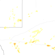
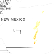


Connect with Interactive Hail Maps