

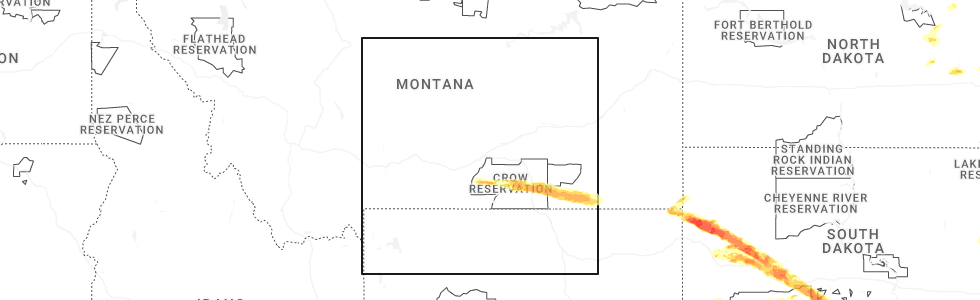
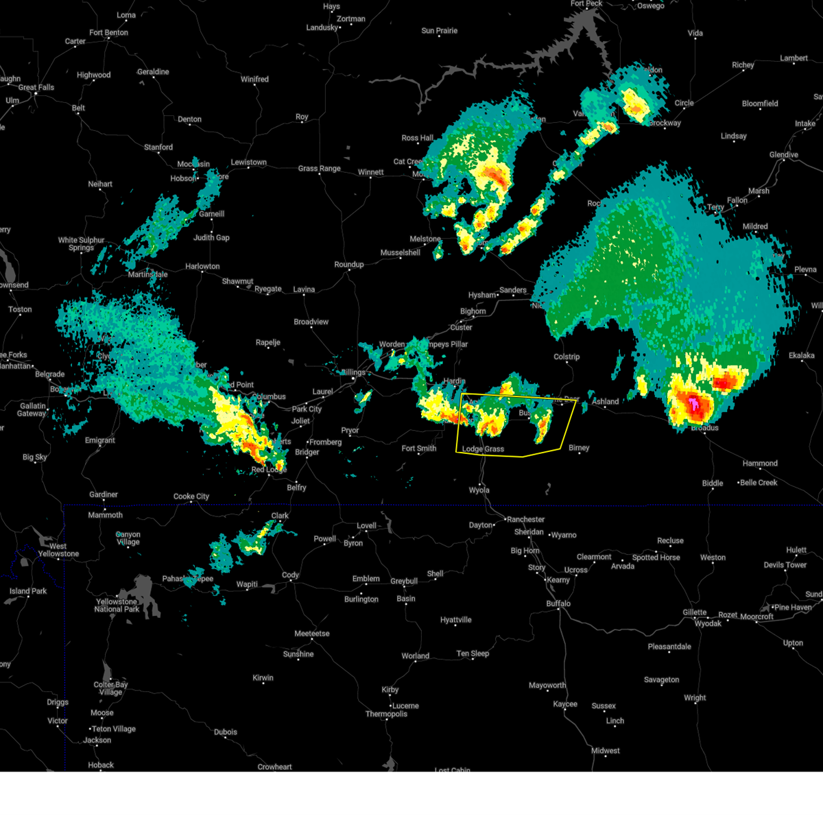
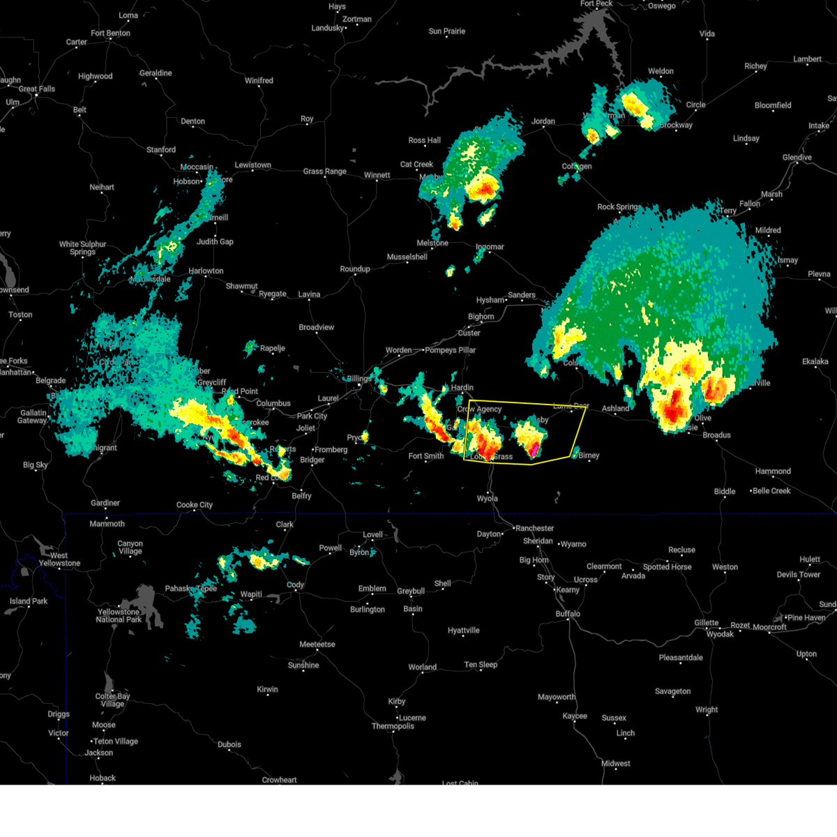
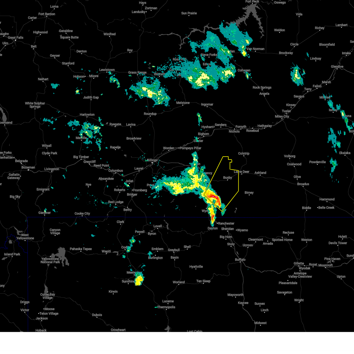
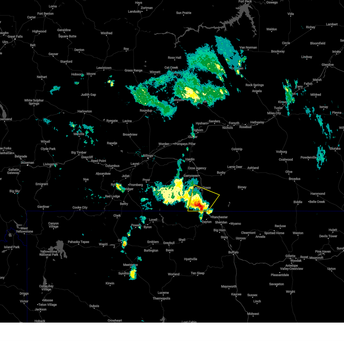
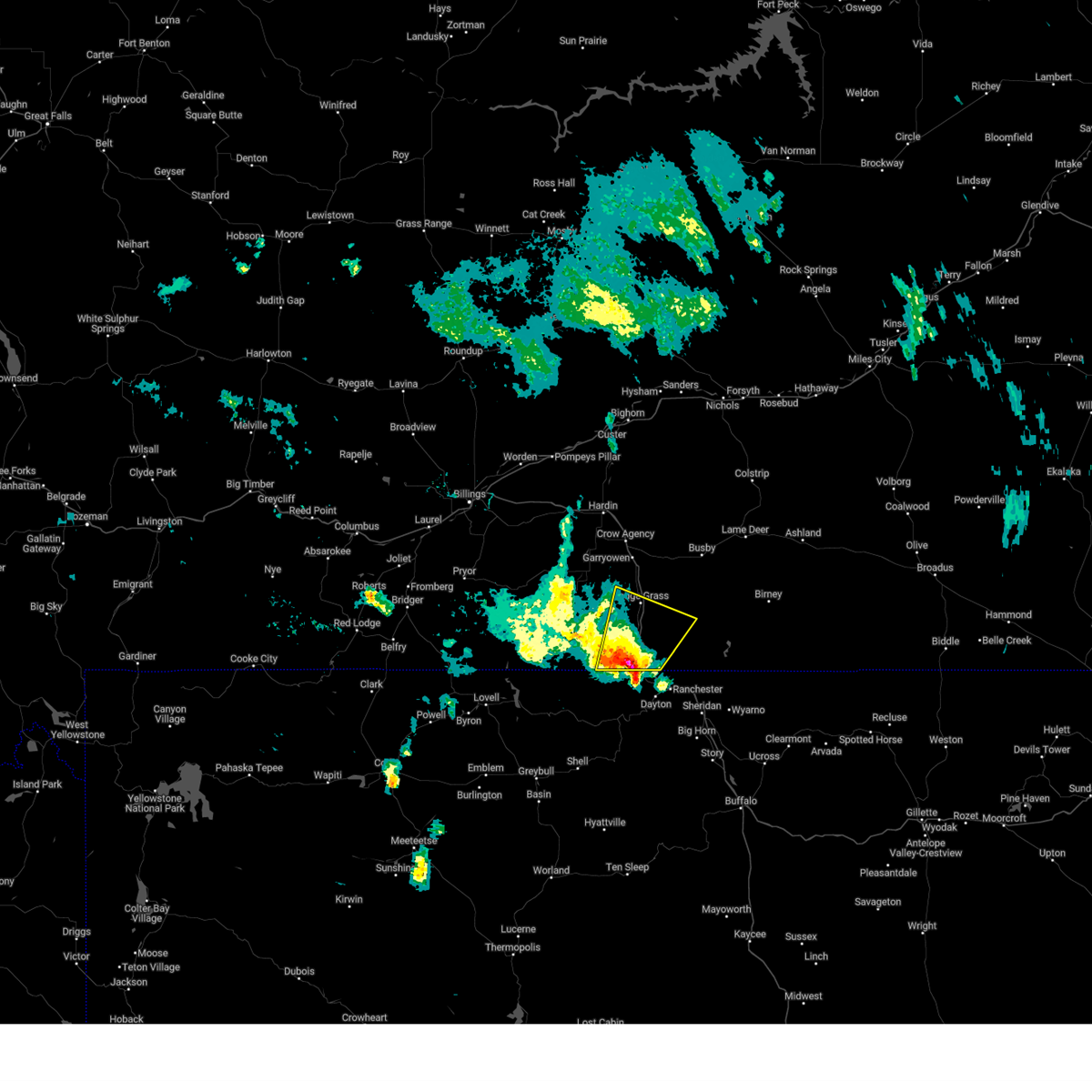
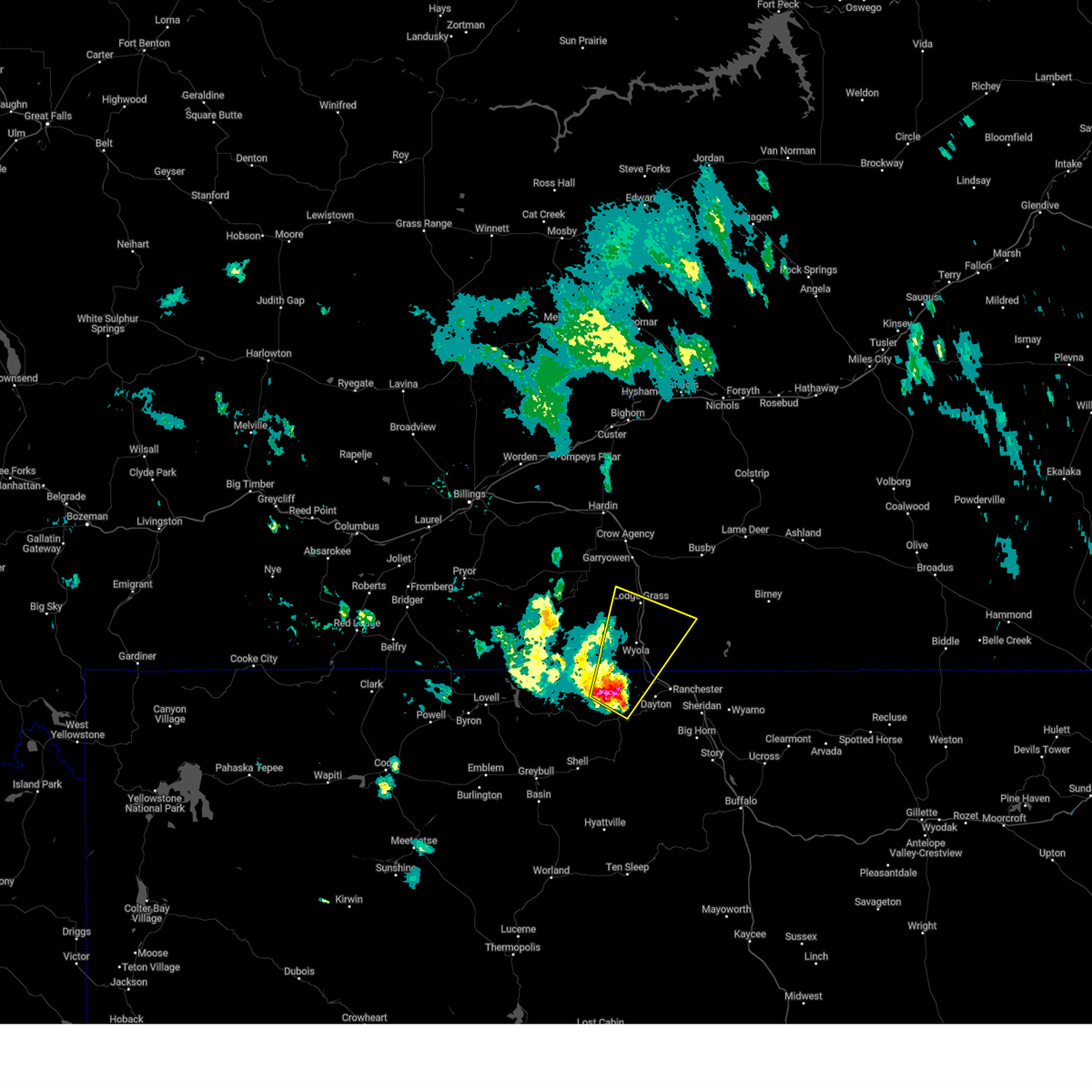
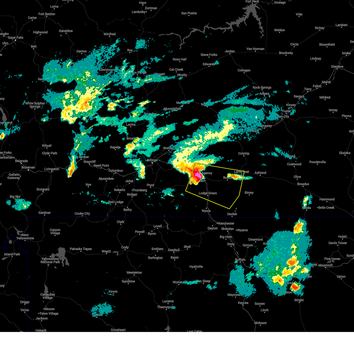
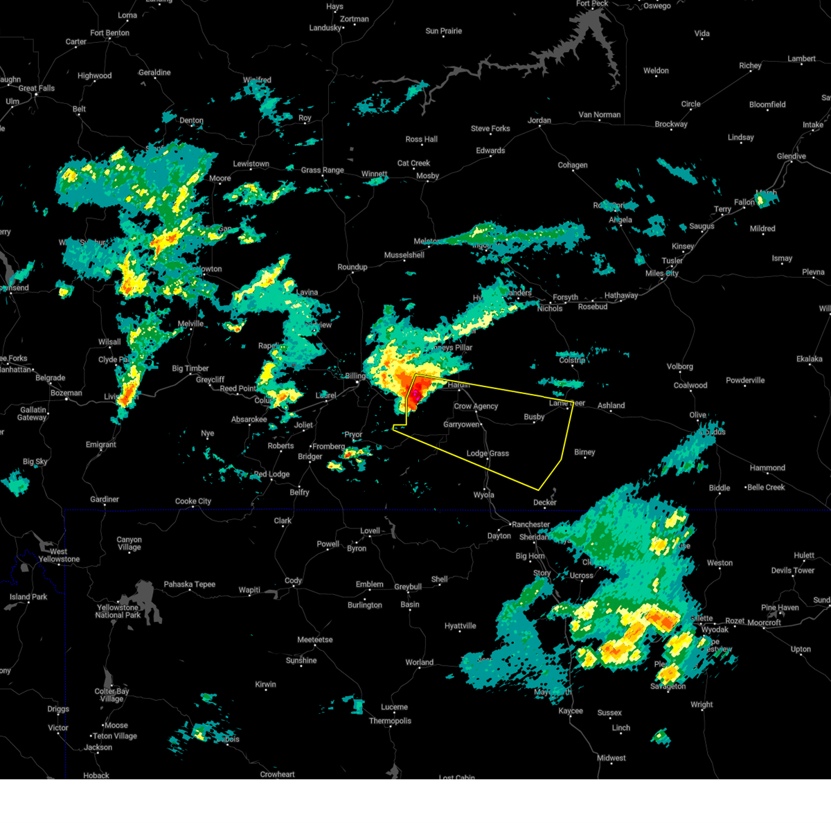
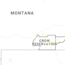
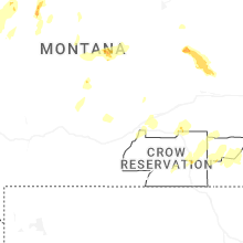
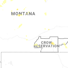
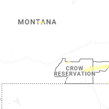
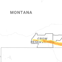
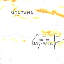
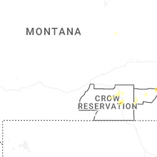
Hail Map for Lodge Grass, MT
The Lodge Grass, MT area has had 3 reports of on-the-ground hail by trained spotters, and has been under severe weather warnings 9 times during the past 12 months. Doppler radar has detected hail at or near Lodge Grass, MT on 42 occasions, including 6 occasions during the past year.
| Name: | Lodge Grass, MT |
| Where Located: | 64 miles ESE of Billings, MT |
| Map: | Google Map for Lodge Grass, MT |
| Population: | 428 |
| Housing Units: | 133 |
| More Info: | Search Google for Lodge Grass, MT |
5
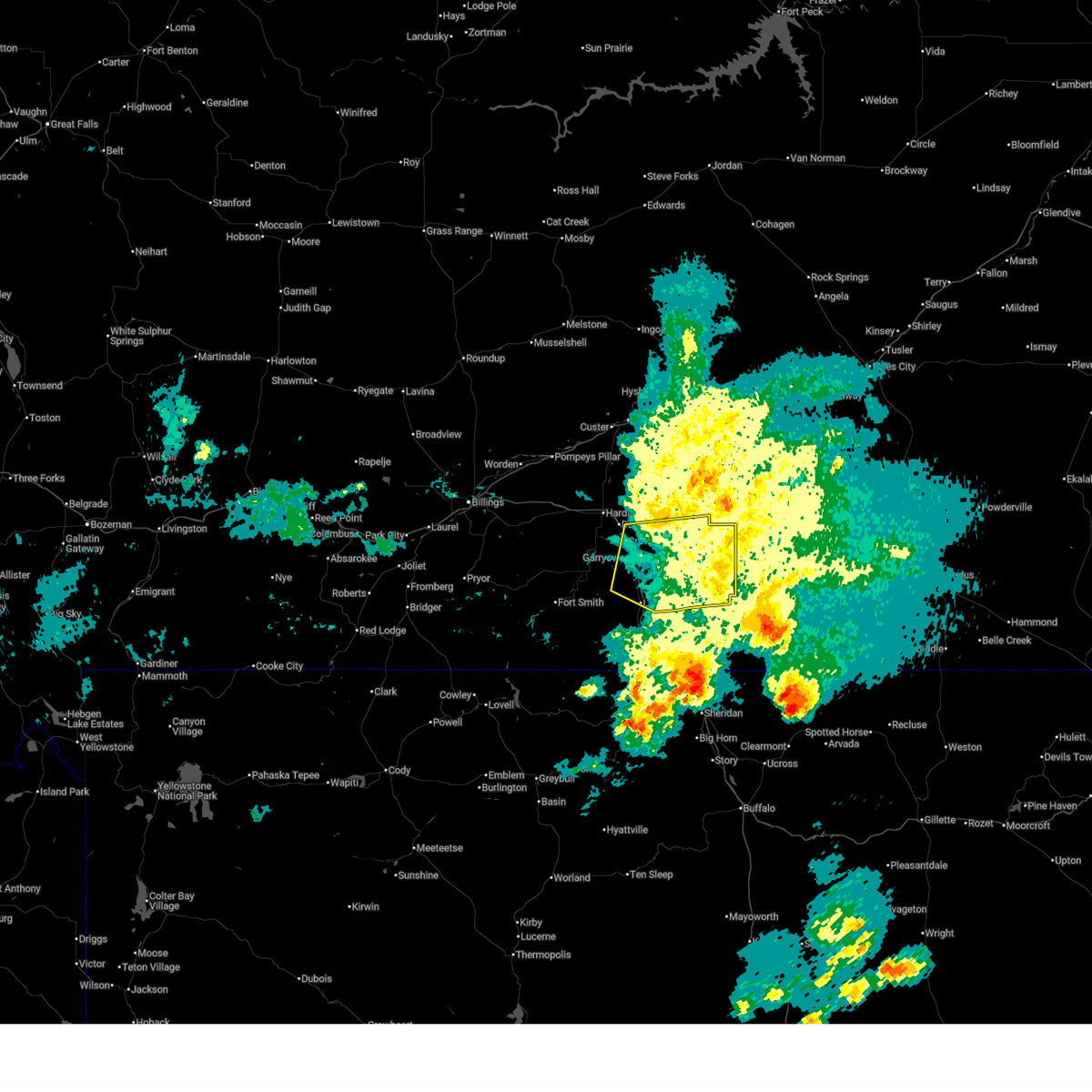
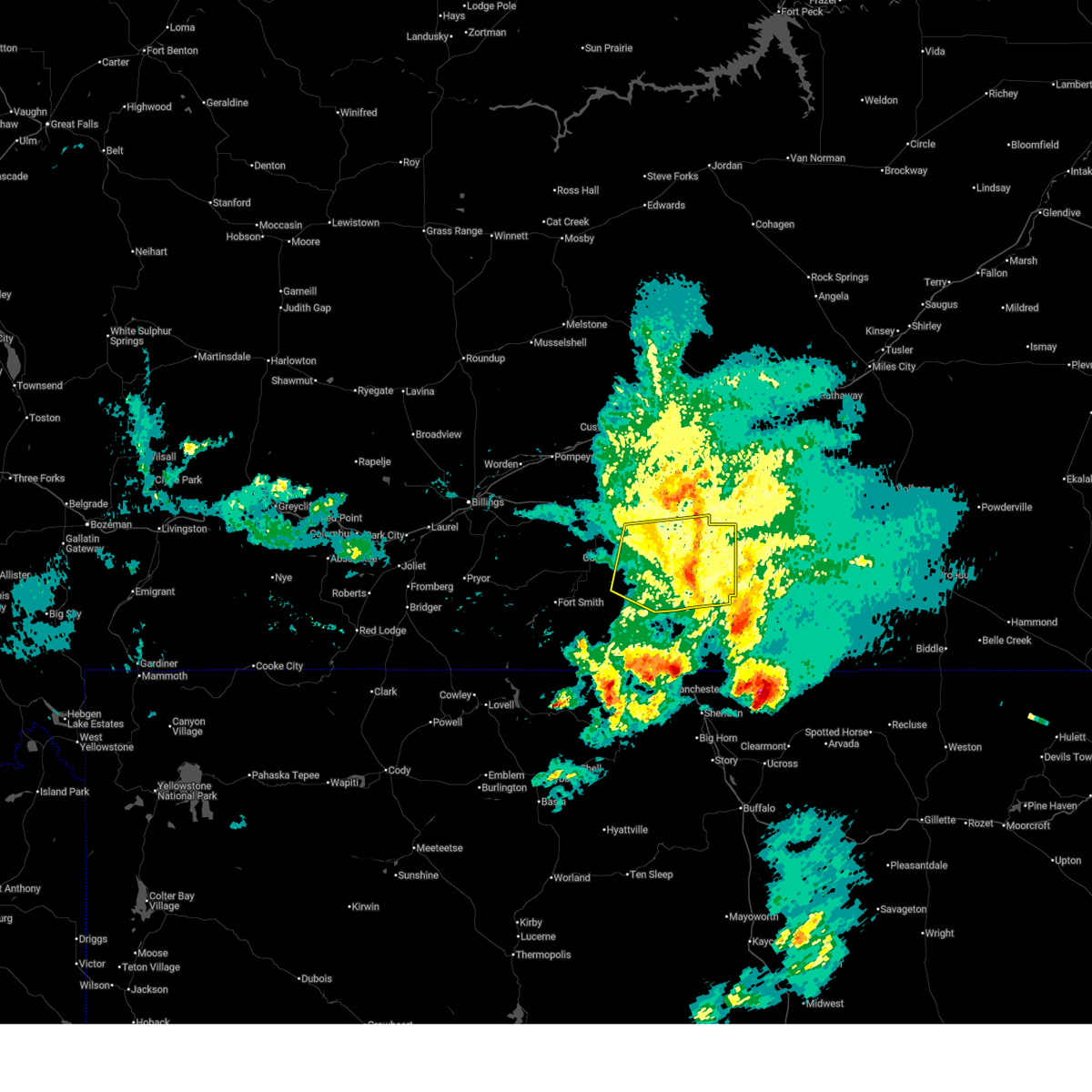
The Top Recent Hail Date for Lodge Grass, MT is Saturday, June 28, 2025 (1st out of 42)
Hail and Wind Damage Spotted near Lodge Grass, MT
| Date / Time | Report Details |
|---|---|
| 6/28/2025 7:36 PM MDT |
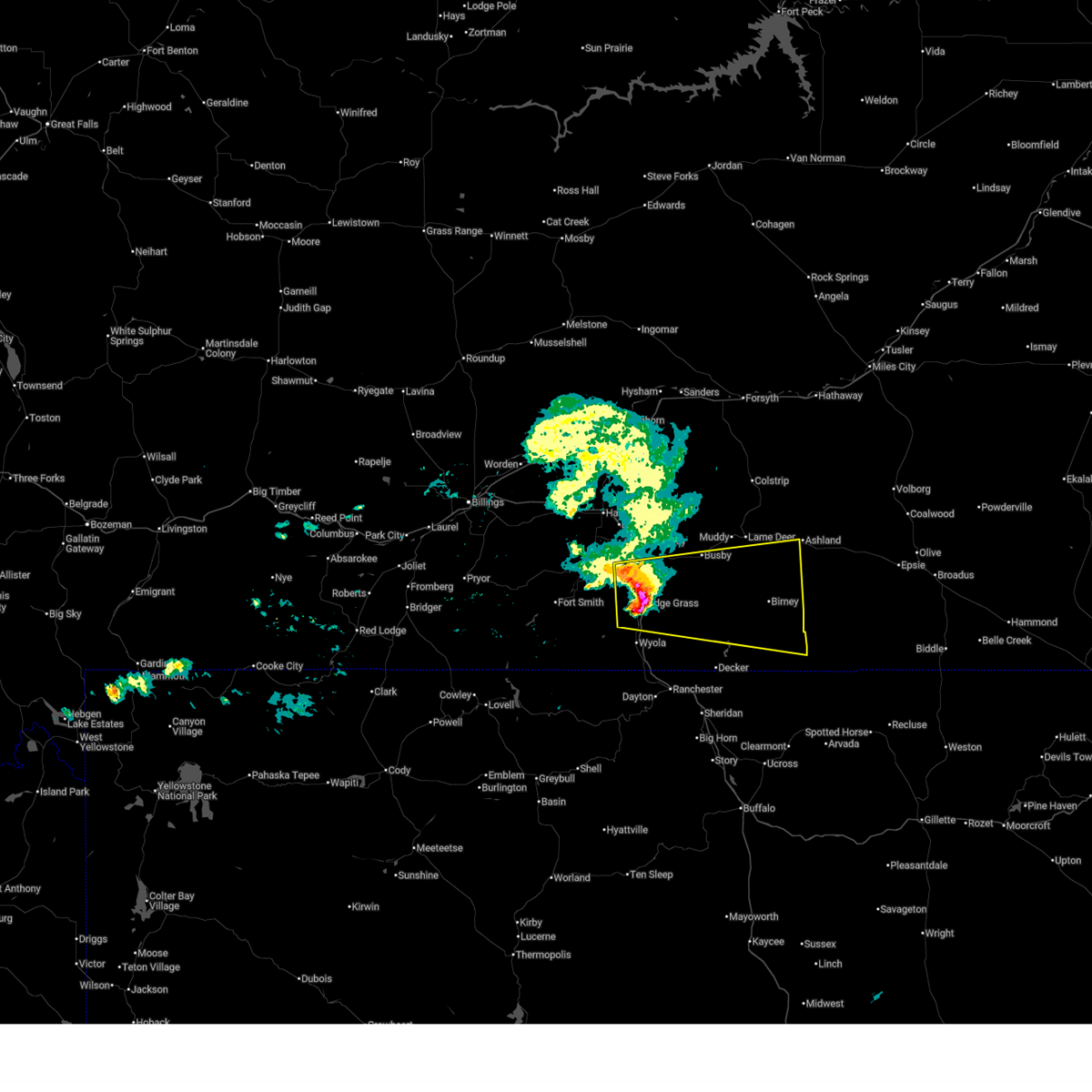 Svrbyz the national weather service in billings has issued a * severe thunderstorm warning for, southeastern big horn county in south central montana, southern rosebud county in southeastern montana, * until 830 pm mdt. * at 736 pm mdt, a severe thunderstorm was located near lodge grass, or 32 miles southeast of hardin, moving east at 45 mph (radar indicated). Hazards include 60 mph wind gusts and quarter size hail. Hail damage to vehicles is expected. Expect wind damage to roofs, siding, and trees. Svrbyz the national weather service in billings has issued a * severe thunderstorm warning for, southeastern big horn county in south central montana, southern rosebud county in southeastern montana, * until 830 pm mdt. * at 736 pm mdt, a severe thunderstorm was located near lodge grass, or 32 miles southeast of hardin, moving east at 45 mph (radar indicated). Hazards include 60 mph wind gusts and quarter size hail. Hail damage to vehicles is expected. Expect wind damage to roofs, siding, and trees.
|
| 6/16/2025 7:13 PM MDT |
 The storms which prompted the warning have weakened below severe limits, and no longer pose an immediate threat to life or property. therefore, the warning will be allowed to expire. however, gusty winds are still possible with these thunderstorms. The storms which prompted the warning have weakened below severe limits, and no longer pose an immediate threat to life or property. therefore, the warning will be allowed to expire. however, gusty winds are still possible with these thunderstorms.
|
| 6/16/2025 7:01 PM MDT |
 At 701 pm mdt, severe thunderstorms were located along a line from 9 miles southwest of colstrip to 18 miles northeast of ranchester, or along a line from 9 miles southwest of colstrip to 24 miles north of sheridan, moving east at 35 mph (radar indicated). Hazards include 60 mph wind gusts and small hail. Expect damage to roofs, siding, and trees. Locations impacted include, lodge grass, busby, crow agency, kirby, muddy cluster, northern cheyenne indian reservation and crow indian reservation. At 701 pm mdt, severe thunderstorms were located along a line from 9 miles southwest of colstrip to 18 miles northeast of ranchester, or along a line from 9 miles southwest of colstrip to 24 miles north of sheridan, moving east at 35 mph (radar indicated). Hazards include 60 mph wind gusts and small hail. Expect damage to roofs, siding, and trees. Locations impacted include, lodge grass, busby, crow agency, kirby, muddy cluster, northern cheyenne indian reservation and crow indian reservation.
|
| 6/16/2025 7:01 PM MDT |
 the severe thunderstorm warning has been cancelled and is no longer in effect the severe thunderstorm warning has been cancelled and is no longer in effect
|
| 6/16/2025 6:32 PM MDT |
 Svrbyz the national weather service in billings has issued a * severe thunderstorm warning for, central big horn county in south central montana, southern rosebud county in southeastern montana, * until 715 pm mdt. * at 632 pm mdt, severe thunderstorms were located along a line from 25 miles north of busby to 8 miles south of lodge grass, or along a line from 23 miles west of colstrip to 34 miles northwest of sheridan, moving east at 35 mph (radar indicated). Hazards include 60 mph wind gusts and small hail. expect damage to roofs, siding, and trees Svrbyz the national weather service in billings has issued a * severe thunderstorm warning for, central big horn county in south central montana, southern rosebud county in southeastern montana, * until 715 pm mdt. * at 632 pm mdt, severe thunderstorms were located along a line from 25 miles north of busby to 8 miles south of lodge grass, or along a line from 23 miles west of colstrip to 34 miles northwest of sheridan, moving east at 35 mph (radar indicated). Hazards include 60 mph wind gusts and small hail. expect damage to roofs, siding, and trees
|
| 6/15/2025 8:26 PM MDT |
 The storm which prompted the warning has weakened below severe limits, and has exited the warned area. therefore, the warning will be allowed to expire. however, small hail and gusty winds are still possible with this thunderstorm. a severe thunderstorm watch remains in effect until 1100 pm mdt sunday for a portion of south central montana. The storm which prompted the warning has weakened below severe limits, and has exited the warned area. therefore, the warning will be allowed to expire. however, small hail and gusty winds are still possible with this thunderstorm. a severe thunderstorm watch remains in effect until 1100 pm mdt sunday for a portion of south central montana.
|
| 6/15/2025 7:58 PM MDT |
 the severe thunderstorm warning has been cancelled and is no longer in effect the severe thunderstorm warning has been cancelled and is no longer in effect
|
| 6/15/2025 7:58 PM MDT |
 At 758 pm mdt, a severe thunderstorm was located 12 miles southeast of lodge grass, or 29 miles northwest of sheridan, moving east at 35 mph (radar indicated). Hazards include 60 mph wind gusts and quarter size hail. Hail damage to vehicles is expected. expect wind damage to roofs, siding, and trees. Locations impacted include, lodge grass, rosebud battlefield park, wyola, kirby, crow indian reservation and northern cheyenne indian reservation. At 758 pm mdt, a severe thunderstorm was located 12 miles southeast of lodge grass, or 29 miles northwest of sheridan, moving east at 35 mph (radar indicated). Hazards include 60 mph wind gusts and quarter size hail. Hail damage to vehicles is expected. expect wind damage to roofs, siding, and trees. Locations impacted include, lodge grass, rosebud battlefield park, wyola, kirby, crow indian reservation and northern cheyenne indian reservation.
|
| 6/15/2025 7:39 PM MDT |
 Svrbyz the national weather service in billings has issued a * severe thunderstorm warning for, south central big horn county in south central montana, north central sheridan county in north central wyoming, * until 830 pm mdt. * at 739 pm mdt, a line of severe thunderstorms was located 12 miles south of lodge grass, or 34 miles northwest of sheridan, moving east at 30 mph (radar indicated). Hazards include 60 mph wind gusts and quarter size hail. Hail damage to vehicles is expected. expect wind damage to roofs, siding, and trees. Motorists on i-90 south of lodge grass should be alert for sudden cross winds. Svrbyz the national weather service in billings has issued a * severe thunderstorm warning for, south central big horn county in south central montana, north central sheridan county in north central wyoming, * until 830 pm mdt. * at 739 pm mdt, a line of severe thunderstorms was located 12 miles south of lodge grass, or 34 miles northwest of sheridan, moving east at 30 mph (radar indicated). Hazards include 60 mph wind gusts and quarter size hail. Hail damage to vehicles is expected. expect wind damage to roofs, siding, and trees. Motorists on i-90 south of lodge grass should be alert for sudden cross winds.
|
| 4/27/2025 7:10 PM MDT |
 the severe thunderstorm warning has been cancelled and is no longer in effect the severe thunderstorm warning has been cancelled and is no longer in effect
|
| 4/27/2025 6:42 PM MDT |
 Svrbyz the national weather service in billings has issued a * severe thunderstorm warning for, central big horn county in south central montana, south central rosebud county in southeastern montana, * until 745 pm mdt. * at 642 pm mdt, a severe thunderstorm was located 10 miles south of busby, with another severe thunderstorm located near lodge grass, moving northeast at 15 mph (radar indicated). Hazards include 60 mph wind gusts and half dollar size hail. Hail damage to vehicles is expected. Expect wind damage to roofs, siding, and trees. Svrbyz the national weather service in billings has issued a * severe thunderstorm warning for, central big horn county in south central montana, south central rosebud county in southeastern montana, * until 745 pm mdt. * at 642 pm mdt, a severe thunderstorm was located 10 miles south of busby, with another severe thunderstorm located near lodge grass, moving northeast at 15 mph (radar indicated). Hazards include 60 mph wind gusts and half dollar size hail. Hail damage to vehicles is expected. Expect wind damage to roofs, siding, and trees.
|
| 9/12/2024 12:18 PM MDT |
 Svrbyz the national weather service in billings has issued a * severe thunderstorm warning for, eastern big horn county in south central montana, * until 115 pm mdt. * at 1217 pm mdt, a severe thunderstorm was located 9 miles east of lodge grass, or 33 miles southeast of hardin, moving northeast at 45 mph (radar indicated). Hazards include 60 mph wind gusts and quarter size hail. Hail damage to vehicles is expected. Expect wind damage to roofs, siding, and trees. Svrbyz the national weather service in billings has issued a * severe thunderstorm warning for, eastern big horn county in south central montana, * until 115 pm mdt. * at 1217 pm mdt, a severe thunderstorm was located 9 miles east of lodge grass, or 33 miles southeast of hardin, moving northeast at 45 mph (radar indicated). Hazards include 60 mph wind gusts and quarter size hail. Hail damage to vehicles is expected. Expect wind damage to roofs, siding, and trees.
|
| 9/12/2024 11:59 AM MDT |
 The storm which prompted the warning has weakened below severe limits, and no longer poses an immediate threat to life or property. therefore, the warning will be allowed to expire. however, small hail and gusty winds are still possible with this thunderstorm. The storm which prompted the warning has weakened below severe limits, and no longer poses an immediate threat to life or property. therefore, the warning will be allowed to expire. however, small hail and gusty winds are still possible with this thunderstorm.
|
| 9/12/2024 11:51 AM MDT |
 At 1151 am mdt, a severe thunderstorm was located 14 miles south of lodge grass, or 31 miles northwest of sheridan, moving northeast at 50 mph (radar indicated). Hazards include 60 mph wind gusts and quarter size hail. Hail damage to vehicles is expected. expect wind damage to roofs, siding, and trees. Locations impacted include, lodge grass, wyola, and crow indian reservation. At 1151 am mdt, a severe thunderstorm was located 14 miles south of lodge grass, or 31 miles northwest of sheridan, moving northeast at 50 mph (radar indicated). Hazards include 60 mph wind gusts and quarter size hail. Hail damage to vehicles is expected. expect wind damage to roofs, siding, and trees. Locations impacted include, lodge grass, wyola, and crow indian reservation.
|
| 9/12/2024 11:51 AM MDT |
 the severe thunderstorm warning has been cancelled and is no longer in effect the severe thunderstorm warning has been cancelled and is no longer in effect
|
| 9/12/2024 11:35 AM MDT |
 Svrbyz the national weather service in billings has issued a * severe thunderstorm warning for, south central big horn county in south central montana, northwestern sheridan county in north central wyoming, * until noon mdt. * at 1134 am mdt, a severe thunderstorm was located 13 miles west of dayton, or 29 miles west of sheridan, moving northeast at 50 mph (radar indicated). Hazards include 60 mph wind gusts and quarter size hail. Hail damage to vehicles is expected. Expect wind damage to roofs, siding, and trees. Svrbyz the national weather service in billings has issued a * severe thunderstorm warning for, south central big horn county in south central montana, northwestern sheridan county in north central wyoming, * until noon mdt. * at 1134 am mdt, a severe thunderstorm was located 13 miles west of dayton, or 29 miles west of sheridan, moving northeast at 50 mph (radar indicated). Hazards include 60 mph wind gusts and quarter size hail. Hail damage to vehicles is expected. Expect wind damage to roofs, siding, and trees.
|
| 8/6/2024 6:17 PM MDT |
 At 612 pm mdt, severe thunderstorms were located along a line extending from 6 miles north of crow agency to 13 miles north of lodge grass, moving east at 55 mph (trained weather spotters reported downed power poles in billings as well as quarter size hail northeast of billings. billings airport has reported a gust of 76 mph). Hazards include 75 mph wind gusts and quarter size hail. Hail damage to vehicles is expected. expect considerable tree damage. wind damage is also likely to mobile homes, roofs, and outbuildings. locations impacted include, hardin, lodge grass, lame deer, crow agency, busby, st. Xavier, kirby, muddy cluster, rosebud battlefield park, crow indian reservation, and northern cheyenne indian reservation. At 612 pm mdt, severe thunderstorms were located along a line extending from 6 miles north of crow agency to 13 miles north of lodge grass, moving east at 55 mph (trained weather spotters reported downed power poles in billings as well as quarter size hail northeast of billings. billings airport has reported a gust of 76 mph). Hazards include 75 mph wind gusts and quarter size hail. Hail damage to vehicles is expected. expect considerable tree damage. wind damage is also likely to mobile homes, roofs, and outbuildings. locations impacted include, hardin, lodge grass, lame deer, crow agency, busby, st. Xavier, kirby, muddy cluster, rosebud battlefield park, crow indian reservation, and northern cheyenne indian reservation.
|
| 8/6/2024 5:48 PM MDT |
 Svrbyz the national weather service in billings has issued a * severe thunderstorm warning for, central big horn county in south central montana, south central rosebud county in southeastern montana, * until 645 pm mdt. * at 546 pm mdt, severe thunderstorms were located along a line extending from 13 miles west of hardin to 19 miles west of crow agency to 14 miles north of fort smith, moving east at 55 mph (trained weather spotters reported downed power poles in billings. billings aiport has reported a gust of 76 mph). Hazards include 75 mph wind gusts and quarter size hail. Hail damage to vehicles is expected. expect considerable tree damage. Wind damage is also likely to mobile homes, roofs, and outbuildings. Svrbyz the national weather service in billings has issued a * severe thunderstorm warning for, central big horn county in south central montana, south central rosebud county in southeastern montana, * until 645 pm mdt. * at 546 pm mdt, severe thunderstorms were located along a line extending from 13 miles west of hardin to 19 miles west of crow agency to 14 miles north of fort smith, moving east at 55 mph (trained weather spotters reported downed power poles in billings. billings aiport has reported a gust of 76 mph). Hazards include 75 mph wind gusts and quarter size hail. Hail damage to vehicles is expected. expect considerable tree damage. Wind damage is also likely to mobile homes, roofs, and outbuildings.
|
| 7/11/2023 7:39 PM MDT |
 At 739 pm mdt, a severe thunderstorm was located near lodge grass, or 27 miles southeast of hardin, moving east at 45 mph (radar indicated). Hazards include 60 mph wind gusts and quarter size hail. Hail damage to vehicles is expected. Expect wind damage to roofs, siding, and trees. At 739 pm mdt, a severe thunderstorm was located near lodge grass, or 27 miles southeast of hardin, moving east at 45 mph (radar indicated). Hazards include 60 mph wind gusts and quarter size hail. Hail damage to vehicles is expected. Expect wind damage to roofs, siding, and trees.
|
| 7/2/2023 9:49 PM MDT |
 At 949 pm mdt, a severe thunderstorm was located 15 miles southwest of lodge grass, or 38 miles south of hardin, moving east at 25 mph (radar indicated). Hazards include 60 mph wind gusts and quarter size hail. Hail damage to vehicles is expected. Expect wind damage to roofs, siding, and trees. At 949 pm mdt, a severe thunderstorm was located 15 miles southwest of lodge grass, or 38 miles south of hardin, moving east at 25 mph (radar indicated). Hazards include 60 mph wind gusts and quarter size hail. Hail damage to vehicles is expected. Expect wind damage to roofs, siding, and trees.
|
| 6/19/2023 10:59 PM MDT |
 At 1058 pm mdt, a severe thunderstorm was located 7 miles west of lodge grass, or 26 miles south of hardin, moving northeast at 40 mph (radar indicated). Hazards include golf ball size hail and 70 mph wind gusts. People and animals outdoors will be injured. expect hail damage to roofs, siding, windows, and vehicles. expect considerable tree damage. wind damage is also likely to mobile homes, roofs, and outbuildings. locations impacted include, lodge grass, busby, kirby, rosebud battlefield park and crow indian reservation, as well as portions of i-90 between crow agency and wyola. thunderstorm damage threat, considerable hail threat, radar indicated max hail size, 1. 75 in wind threat, radar indicated max wind gust, 70 mph. At 1058 pm mdt, a severe thunderstorm was located 7 miles west of lodge grass, or 26 miles south of hardin, moving northeast at 40 mph (radar indicated). Hazards include golf ball size hail and 70 mph wind gusts. People and animals outdoors will be injured. expect hail damage to roofs, siding, windows, and vehicles. expect considerable tree damage. wind damage is also likely to mobile homes, roofs, and outbuildings. locations impacted include, lodge grass, busby, kirby, rosebud battlefield park and crow indian reservation, as well as portions of i-90 between crow agency and wyola. thunderstorm damage threat, considerable hail threat, radar indicated max hail size, 1. 75 in wind threat, radar indicated max wind gust, 70 mph.
|
| 6/19/2023 10:47 PM MDT |
 At 1046 pm mdt, a severe thunderstorm was located 13 miles west of lodge grass, or 31 miles south of hardin, moving northeast at 40 mph (radar indicated). Hazards include 70 mph wind gusts and half dollar size hail. Hail damage to vehicles is expected. expect considerable tree damage. Wind damage is also likely to mobile homes, roofs, and outbuildings. At 1046 pm mdt, a severe thunderstorm was located 13 miles west of lodge grass, or 31 miles south of hardin, moving northeast at 40 mph (radar indicated). Hazards include 70 mph wind gusts and half dollar size hail. Hail damage to vehicles is expected. expect considerable tree damage. Wind damage is also likely to mobile homes, roofs, and outbuildings.
|
| 7/24/2022 8:53 PM MDT |
 The severe thunderstorm warning for central big horn county will expire at 900 pm mdt, the storm which prompted the warning has weakened below severe limits, and has exited the warned area. therefore, the warning will be allowed to expire. however small hail, gusty winds and heavy rain are still possible with this thunderstorm. The severe thunderstorm warning for central big horn county will expire at 900 pm mdt, the storm which prompted the warning has weakened below severe limits, and has exited the warned area. therefore, the warning will be allowed to expire. however small hail, gusty winds and heavy rain are still possible with this thunderstorm.
|
| 7/24/2022 8:35 PM MDT |
 At 834 pm mdt, a severe thunderstorm was located near crow agency, or 11 miles southeast of hardin, moving east at 30 mph (radar indicated). Hazards include 60 mph wind gusts and quarter size hail. Hail damage to vehicles is expected. expect wind damage to roofs, siding, and trees. locations impacted include, hardin, lodge grass, crow agency, fort smith, st. xavier and crow indian reservation. hail threat, radar indicated max hail size, 1. 00 in wind threat, radar indicated max wind gust, 60 mph. At 834 pm mdt, a severe thunderstorm was located near crow agency, or 11 miles southeast of hardin, moving east at 30 mph (radar indicated). Hazards include 60 mph wind gusts and quarter size hail. Hail damage to vehicles is expected. expect wind damage to roofs, siding, and trees. locations impacted include, hardin, lodge grass, crow agency, fort smith, st. xavier and crow indian reservation. hail threat, radar indicated max hail size, 1. 00 in wind threat, radar indicated max wind gust, 60 mph.
|
| 7/24/2022 7:59 PM MDT |
 At 759 pm mdt, a severe thunderstorm was located 10 miles southwest of hardin, moving east at 30 mph (radar indicated). Hazards include 60 mph wind gusts and quarter size hail. Hail damage to vehicles is expected. Expect wind damage to roofs, siding, and trees. At 759 pm mdt, a severe thunderstorm was located 10 miles southwest of hardin, moving east at 30 mph (radar indicated). Hazards include 60 mph wind gusts and quarter size hail. Hail damage to vehicles is expected. Expect wind damage to roofs, siding, and trees.
|
| 7/15/2022 4:55 PM MDT |
 At 452 pm mdt, a gust front ahead of strong thunderstorms was located along a line extending from 19 miles south of hysham to 14 miles southwest of lodge grass, moving east at 40 mph (weather station. at 430 pm, 64 mph wind gust was reported 5 miles north of hardin from the hardin n mda weather station). Hazards include 70 mph wind gusts. Expect considerable tree damage. Damage is likely to mobile homes, roofs, and outbuildings. At 452 pm mdt, a gust front ahead of strong thunderstorms was located along a line extending from 19 miles south of hysham to 14 miles southwest of lodge grass, moving east at 40 mph (weather station. at 430 pm, 64 mph wind gust was reported 5 miles north of hardin from the hardin n mda weather station). Hazards include 70 mph wind gusts. Expect considerable tree damage. Damage is likely to mobile homes, roofs, and outbuildings.
|
| 6/20/2022 1:53 PM MDT |
 At 152 pm mdt, a severe thunderstorm was located 8 miles south of lodge grass, or 33 miles northwest of sheridan, moving northeast at 35 mph (radar indicated). Hazards include 60 mph wind gusts and half dollar size hail. Hail damage to vehicles is expected. Expect wind damage to roofs, siding, and trees. At 152 pm mdt, a severe thunderstorm was located 8 miles south of lodge grass, or 33 miles northwest of sheridan, moving northeast at 35 mph (radar indicated). Hazards include 60 mph wind gusts and half dollar size hail. Hail damage to vehicles is expected. Expect wind damage to roofs, siding, and trees.
|
| 7/7/2021 8:23 PM MDT |
 At 821 pm mdt, severe thunderstorms were located along a line extending from 12 miles east of hardin to 8 miles southeast of crow agency to 16 miles southwest of lodge grass, moving southeast at 55 mph (radar indicated). Hazards include 60 mph wind gusts. expect damage to roofs, siding, and trees At 821 pm mdt, severe thunderstorms were located along a line extending from 12 miles east of hardin to 8 miles southeast of crow agency to 16 miles southwest of lodge grass, moving southeast at 55 mph (radar indicated). Hazards include 60 mph wind gusts. expect damage to roofs, siding, and trees
|
| 7/6/2021 7:39 PM MDT |
 The severe thunderstorm warning for central big horn county will expire at 745 pm mdt, the storm which prompted the warning has weakened below severe limits, and no longer poses an immediate threat to life or property. therefore, the warning will be allowed to expire. however heavy rain is still possible with this thunderstorm. a severe thunderstorm watch remains in effect until 1100 pm mdt for south central montana. The severe thunderstorm warning for central big horn county will expire at 745 pm mdt, the storm which prompted the warning has weakened below severe limits, and no longer poses an immediate threat to life or property. therefore, the warning will be allowed to expire. however heavy rain is still possible with this thunderstorm. a severe thunderstorm watch remains in effect until 1100 pm mdt for south central montana.
|
| 7/6/2021 7:14 PM MDT |
 At 714 pm mdt, a severe thunderstorm was located 9 miles southwest of crow agency, or 16 miles south of hardin, moving southeast at 35 mph (radar indicated). Hazards include 60 mph wind gusts and quarter size hail. Hail damage to vehicles is expected. expect wind damage to roofs, siding, and trees. locations impacted include, lodge grass, st. Xavier and crow indian reservation. At 714 pm mdt, a severe thunderstorm was located 9 miles southwest of crow agency, or 16 miles south of hardin, moving southeast at 35 mph (radar indicated). Hazards include 60 mph wind gusts and quarter size hail. Hail damage to vehicles is expected. expect wind damage to roofs, siding, and trees. locations impacted include, lodge grass, st. Xavier and crow indian reservation.
|
| 7/6/2021 6:42 PM MDT |
 At 641 pm mdt, a severe thunderstorm was located 14 miles west of hardin, moving southeast at 35 mph (radar indicated). Hazards include 60 mph wind gusts and quarter size hail. Hail damage to vehicles is expected. Expect wind damage to roofs, siding, and trees. At 641 pm mdt, a severe thunderstorm was located 14 miles west of hardin, moving southeast at 35 mph (radar indicated). Hazards include 60 mph wind gusts and quarter size hail. Hail damage to vehicles is expected. Expect wind damage to roofs, siding, and trees.
|
| 5/28/2021 6:18 PM MDT | Storm damage reported in big horn county MT, 9.6 miles W of Lodge Grass, MT |
| 5/28/2021 6:13 PM MDT | Wolf mountain raws in big horn county MT, 9.6 miles W of Lodge Grass, MT |
| 7/16/2019 3:45 PM MDT |
 At 344 pm mdt, a severe thunderstorm was located 9 miles east of fort smith, or 30 miles south of hardin, moving east at 45 mph (trained weather spotters). Hazards include golf ball size hail and 70 mph wind gusts. ping pong size hail has been reported in fort smith. People and animals outdoors will be injured. expect hail damage to roofs, siding, windows, and vehicles. expect considerable tree damage. wind damage is also likely to mobile homes, roofs, and outbuildings. this severe storm will be near, lodge grass around 410 pm mdt. Other locations impacted by this severe thunderstorm include wyola, kirby, rosebud battlefield park and northern cheyenne indian reservation. At 344 pm mdt, a severe thunderstorm was located 9 miles east of fort smith, or 30 miles south of hardin, moving east at 45 mph (trained weather spotters). Hazards include golf ball size hail and 70 mph wind gusts. ping pong size hail has been reported in fort smith. People and animals outdoors will be injured. expect hail damage to roofs, siding, windows, and vehicles. expect considerable tree damage. wind damage is also likely to mobile homes, roofs, and outbuildings. this severe storm will be near, lodge grass around 410 pm mdt. Other locations impacted by this severe thunderstorm include wyola, kirby, rosebud battlefield park and northern cheyenne indian reservation.
|
| 7/16/2019 3:36 PM MDT |
 At 336 pm mdt, a severe thunderstorm was located near fort smith, or 33 miles south of hardin, moving east at 40 mph (radar indicated). Hazards include golf ball size hail and 70 mph wind gusts. People and animals outdoors will be injured. expect hail damage to roofs, siding, windows, and vehicles. expect considerable tree damage. wind damage is also likely to mobile homes, roofs, and outbuildings. this severe thunderstorm will be near, lodge grass around 410 pm mdt. Other locations impacted by this severe thunderstorm include wyola, kirby, rosebud battlefield park and northern cheyenne indian reservation. At 336 pm mdt, a severe thunderstorm was located near fort smith, or 33 miles south of hardin, moving east at 40 mph (radar indicated). Hazards include golf ball size hail and 70 mph wind gusts. People and animals outdoors will be injured. expect hail damage to roofs, siding, windows, and vehicles. expect considerable tree damage. wind damage is also likely to mobile homes, roofs, and outbuildings. this severe thunderstorm will be near, lodge grass around 410 pm mdt. Other locations impacted by this severe thunderstorm include wyola, kirby, rosebud battlefield park and northern cheyenne indian reservation.
|
| 7/8/2019 4:58 PM MDT | Ping Pong Ball sized hail reported 4.5 miles S of Lodge Grass, MT, 1 to 1 1/2 inch tree limbs blown down. over 1 inch of rain in 15 minutes. hail covering the ground. |
| 7/8/2019 4:58 PM MDT | 1 to 1 1/2 inch tree limbs blown down. over 1 inch of rain in 15 minutes. hail covering the groun in big horn county MT, 4.5 miles S of Lodge Grass, MT |
| 7/8/2019 4:58 PM MDT | 1 to 1 1/2 inch tree limbs blown down. over 1 inch of rain in 15 minutes. hail covering the groun in big horn county MT, 4.5 miles S of Lodge Grass, MT |
| 7/8/2019 4:58 PM MDT |
 At 457 pm mdt, a severe thunderstorm was located near lodge grass, or 24 miles southeast of hardin, moving north northeast at 25 mph (radar indicated). Hazards include 60 mph wind gusts and quarter size hail. Hail damage to vehicles is expected. Expect wind damage to roofs, siding, and trees. At 457 pm mdt, a severe thunderstorm was located near lodge grass, or 24 miles southeast of hardin, moving north northeast at 25 mph (radar indicated). Hazards include 60 mph wind gusts and quarter size hail. Hail damage to vehicles is expected. Expect wind damage to roofs, siding, and trees.
|
| 7/7/2019 5:57 PM MDT |
 At 532 pm mdt, a severe thunderstorm was located 9 miles southwest of lodge grass, or 36 miles south of hardin, moving east at 25 mph. another severe storm was located just east of lodge grass and moving slowly north (radar indicated). Hazards include 60 mph wind gusts and quarter size hail, along with very heavy rainfall. these storms will impact travel on interstate 90. Hail damage to vehicles is expected. Expect wind damage to roofs, siding, and trees. At 532 pm mdt, a severe thunderstorm was located 9 miles southwest of lodge grass, or 36 miles south of hardin, moving east at 25 mph. another severe storm was located just east of lodge grass and moving slowly north (radar indicated). Hazards include 60 mph wind gusts and quarter size hail, along with very heavy rainfall. these storms will impact travel on interstate 90. Hail damage to vehicles is expected. Expect wind damage to roofs, siding, and trees.
|
| 7/7/2019 5:45 PM MDT | Quarter sized hail reported 6 miles N of Lodge Grass, MT, also had nickel and dime-sized hail. |
| 7/7/2019 5:34 PM MDT |
 At 532 pm mdt, a severe thunderstorm was located 9 miles southwest of lodge grass, or 36 miles south of hardin, moving east at 25 mph. another severe storm was located just east of lodge grass and moving slowly north (radar indicated). Hazards include 60 mph wind gusts and quarter size hail, along with very heavy rainfall. these storms will impact travel on interstate 90. Hail damage to vehicles is expected. Expect wind damage to roofs, siding, and trees. At 532 pm mdt, a severe thunderstorm was located 9 miles southwest of lodge grass, or 36 miles south of hardin, moving east at 25 mph. another severe storm was located just east of lodge grass and moving slowly north (radar indicated). Hazards include 60 mph wind gusts and quarter size hail, along with very heavy rainfall. these storms will impact travel on interstate 90. Hail damage to vehicles is expected. Expect wind damage to roofs, siding, and trees.
|
| 6/25/2019 5:15 PM MDT |
 At 514 pm mdt, a severe thunderstorm was located near lodge grass, or 27 miles southeast of hardin, moving east at 40 mph (trained weather spotters). Hazards include golf ball size hail and 60 mph wind gusts. golf ball size hail was reported with this storm. People and animals outdoors will be injured. expect hail damage to roofs, siding, windows, and vehicles. expect wind damage to roofs, siding, and trees. Locations impacted include, lodge grass and rosebud battlefield park. At 514 pm mdt, a severe thunderstorm was located near lodge grass, or 27 miles southeast of hardin, moving east at 40 mph (trained weather spotters). Hazards include golf ball size hail and 60 mph wind gusts. golf ball size hail was reported with this storm. People and animals outdoors will be injured. expect hail damage to roofs, siding, windows, and vehicles. expect wind damage to roofs, siding, and trees. Locations impacted include, lodge grass and rosebud battlefield park.
|
| 6/25/2019 5:13 PM MDT | Golf Ball sized hail reported 4.5 miles S of Lodge Grass, MT |
| 6/25/2019 5:12 PM MDT | Storm damage reported in big horn county MT, 9.6 miles W of Lodge Grass, MT |
| 6/25/2019 4:54 PM MDT |
 At 453 pm mdt, a severe thunderstorm was located 13 miles west of lodge grass, or 24 miles south of hardin, moving east at 40 mph (trained weather spotter). Hazards include ping pong ball size hail and 60 mph wind gusts. half dollar sized hail has been reported with this storm. People and animals outdoors will be injured. expect hail damage to roofs, siding, windows, and vehicles. Expect wind damage to roofs, siding, and trees. At 453 pm mdt, a severe thunderstorm was located 13 miles west of lodge grass, or 24 miles south of hardin, moving east at 40 mph (trained weather spotter). Hazards include ping pong ball size hail and 60 mph wind gusts. half dollar sized hail has been reported with this storm. People and animals outdoors will be injured. expect hail damage to roofs, siding, windows, and vehicles. Expect wind damage to roofs, siding, and trees.
|
| 8/3/2018 6:01 PM MDT |
 At 559 pm mdt, severe thunderstorms were located along a line extending from 8 miles northeast of colstrip to 7 miles south of lame deer to 11 miles east of lodge grass, moving east at 50 mph (radar indicated). Hazards include 60 mph wind gusts. Expect damage to roofs, siding, and trees. Locations impacted include, colstrip, lodge grass, lame deer, busby, crow agency, ashland, birney, birney village, brandenberg, kirby, garland and northern cheyenne indian reservation. At 559 pm mdt, severe thunderstorms were located along a line extending from 8 miles northeast of colstrip to 7 miles south of lame deer to 11 miles east of lodge grass, moving east at 50 mph (radar indicated). Hazards include 60 mph wind gusts. Expect damage to roofs, siding, and trees. Locations impacted include, colstrip, lodge grass, lame deer, busby, crow agency, ashland, birney, birney village, brandenberg, kirby, garland and northern cheyenne indian reservation.
|
| 8/3/2018 5:53 PM MDT | Storm damage reported in big horn county MT, 9.6 miles W of Lodge Grass, MT |
| 8/3/2018 5:27 PM MDT |
 At 526 pm mdt, severe thunderstorms were located along a line extending from 20 miles northeast of hardin to 9 miles south of crow agency to near fort smith, moving east at 50 mph (trained weather spotters). Hazards include 70 mph wind gusts. Expect considerable tree damage. Damage is likely to mobile homes, roofs, and outbuildings. At 526 pm mdt, severe thunderstorms were located along a line extending from 20 miles northeast of hardin to 9 miles south of crow agency to near fort smith, moving east at 50 mph (trained weather spotters). Hazards include 70 mph wind gusts. Expect considerable tree damage. Damage is likely to mobile homes, roofs, and outbuildings.
|
| 7/28/2018 7:29 PM MDT |
 At 729 pm mdt, a severe thunderstorm was located 11 miles southwest of lodge grass, or 35 miles northwest of sheridan, moving southeast at 40 mph (radar indicated). Hazards include 70 mph wind gusts and quarter size hail. Hail damage to vehicles is expected. expect considerable tree damage. Wind damage is also likely to mobile homes, roofs, and outbuildings. At 729 pm mdt, a severe thunderstorm was located 11 miles southwest of lodge grass, or 35 miles northwest of sheridan, moving southeast at 40 mph (radar indicated). Hazards include 70 mph wind gusts and quarter size hail. Hail damage to vehicles is expected. expect considerable tree damage. Wind damage is also likely to mobile homes, roofs, and outbuildings.
|
| 7/27/2018 6:27 PM MDT |
 At 626 pm mdt, a severe thunderstorm was located near dayton, or 19 miles northwest of sheridan, moving southeast at 50 mph (radar indicated). Hazards include 60 mph wind gusts and quarter size hail. Hail damage to vehicles is expected. expect wind damage to roofs, siding, and trees. Locations impacted include, ranchester, dayton, lodge grass, wyola, parkman and tongue river reservoir. At 626 pm mdt, a severe thunderstorm was located near dayton, or 19 miles northwest of sheridan, moving southeast at 50 mph (radar indicated). Hazards include 60 mph wind gusts and quarter size hail. Hail damage to vehicles is expected. expect wind damage to roofs, siding, and trees. Locations impacted include, ranchester, dayton, lodge grass, wyola, parkman and tongue river reservoir.
|
| 7/27/2018 6:12 PM MDT |
 At 611 pm mdt, severe thunderstorms were located along a line extending from 14 miles southeast of lodge grass to 6 miles west of medicine wheel, moving southeast at 45 mph (radar indicated). Hazards include 60 mph wind gusts and quarter size hail. Hail damage to vehicles is expected. expect wind damage to roofs, siding, and trees. Locations impacted include, ranchester, dayton, lodge grass, wyola, parkman, tongue river reservoir, kirby, rosebud battlefield park and burgess junction. At 611 pm mdt, severe thunderstorms were located along a line extending from 14 miles southeast of lodge grass to 6 miles west of medicine wheel, moving southeast at 45 mph (radar indicated). Hazards include 60 mph wind gusts and quarter size hail. Hail damage to vehicles is expected. expect wind damage to roofs, siding, and trees. Locations impacted include, ranchester, dayton, lodge grass, wyola, parkman, tongue river reservoir, kirby, rosebud battlefield park and burgess junction.
|
| 7/27/2018 5:57 PM MDT |
 The national weather service in billings has issued a * severe thunderstorm warning for. southern big horn county in south central montana. southeastern carbon county in south central montana. south central rosebud county in southeastern montana. Western sheridan county in north central wyoming. The national weather service in billings has issued a * severe thunderstorm warning for. southern big horn county in south central montana. southeastern carbon county in south central montana. south central rosebud county in southeastern montana. Western sheridan county in north central wyoming.
|
| 7/2/2018 9:05 PM MDT |
 At 904 pm mdt, a severe thunderstorm was located 7 miles southwest of hardin, moving east at 35 mph (radar indicated). Hazards include golf ball size hail and 70 mph wind gusts. People and animals outdoors will be injured. expect hail damage to roofs, siding, windows, and vehicles. expect considerable tree damage. wind damage is also likely to mobile homes, roofs, and outbuildings. this severe storm will be near, hardin around 915 pm mdt. crow agency around 925 pm mdt. other locations impacted by this severe thunderstorm include st. xavier and crow indian reservation. Severe thunderstorm wind gusts may arrive well ahead of the thunderstorm. At 904 pm mdt, a severe thunderstorm was located 7 miles southwest of hardin, moving east at 35 mph (radar indicated). Hazards include golf ball size hail and 70 mph wind gusts. People and animals outdoors will be injured. expect hail damage to roofs, siding, windows, and vehicles. expect considerable tree damage. wind damage is also likely to mobile homes, roofs, and outbuildings. this severe storm will be near, hardin around 915 pm mdt. crow agency around 925 pm mdt. other locations impacted by this severe thunderstorm include st. xavier and crow indian reservation. Severe thunderstorm wind gusts may arrive well ahead of the thunderstorm.
|
| 7/2/2018 8:44 PM MDT |
 At 843 pm mdt, a severe thunderstorm was located 20 miles west of hardin, moving east at 40 mph (radar indicated). Hazards include golf ball size hail and 70 mph wind gusts. People and animals outdoors will be injured. expect hail damage to roofs, siding, windows, and vehicles. expect considerable tree damage. Wind damage is also likely to mobile homes, roofs, and outbuildings. At 843 pm mdt, a severe thunderstorm was located 20 miles west of hardin, moving east at 40 mph (radar indicated). Hazards include golf ball size hail and 70 mph wind gusts. People and animals outdoors will be injured. expect hail damage to roofs, siding, windows, and vehicles. expect considerable tree damage. Wind damage is also likely to mobile homes, roofs, and outbuildings.
|
| 6/7/2018 5:38 PM MDT |
 At 537 pm mdt, a severe thunderstorm was located near lodge grass, moving east at 30 mph (radar indicated). Hazards include 60 mph wind gusts and quarter size hail, along with very heavy rainfall. Hail damage to vehicles is expected. Expect wind damage to roofs, siding, and trees. At 537 pm mdt, a severe thunderstorm was located near lodge grass, moving east at 30 mph (radar indicated). Hazards include 60 mph wind gusts and quarter size hail, along with very heavy rainfall. Hail damage to vehicles is expected. Expect wind damage to roofs, siding, and trees.
|
| 5/31/2018 9:55 PM MDT |
 At 954 pm mdt, a severe thunderstorm was located 12 miles southeast of fort smith, or 36 miles south of hardin, moving northeast at 45 mph (radar indicated). Hazards include 60 mph wind gusts and half dollar size size hail. Hail damage to vehicles is expected. Expect wind damage to roofs, siding, and trees. At 954 pm mdt, a severe thunderstorm was located 12 miles southeast of fort smith, or 36 miles south of hardin, moving northeast at 45 mph (radar indicated). Hazards include 60 mph wind gusts and half dollar size size hail. Hail damage to vehicles is expected. Expect wind damage to roofs, siding, and trees.
|
| 5/23/2018 5:40 PM MDT |
 The severe thunderstorm warning for central big horn county will expire at 545 pm mdt, the storms which prompted the warning have weakened below severe limits, and no longer pose an immediate threat to life or property. therefore, the warning will be allowed to expire. however small hail and gusty winds are still possible with these thunderstorms. The severe thunderstorm warning for central big horn county will expire at 545 pm mdt, the storms which prompted the warning have weakened below severe limits, and no longer pose an immediate threat to life or property. therefore, the warning will be allowed to expire. however small hail and gusty winds are still possible with these thunderstorms.
|
| 5/23/2018 5:19 PM MDT |
 At 519 pm mdt, severe thunderstorms were located along a line extending from 14 miles south of custer to 8 miles east of lodge grass, moving northeast at 35 mph (radar indicated). Hazards include 60 mph wind gusts and quarter size hail. Hail damage to vehicles is expected. expect wind damage to roofs, siding, and trees. Locations impacted include, hardin, lodge grass, crow agency, wyola and rosebud battlefield park. At 519 pm mdt, severe thunderstorms were located along a line extending from 14 miles south of custer to 8 miles east of lodge grass, moving northeast at 35 mph (radar indicated). Hazards include 60 mph wind gusts and quarter size hail. Hail damage to vehicles is expected. expect wind damage to roofs, siding, and trees. Locations impacted include, hardin, lodge grass, crow agency, wyola and rosebud battlefield park.
|
| 5/23/2018 4:42 PM MDT |
 At 442 pm mdt, severe thunderstorms were located along a line extending from 7 miles southwest of hardin to 15 miles northwest of dayton, moving northeast at 40 mph (radar indicated). Hazards include 60 mph wind gusts and half dollar size hail. Hail damage to vehicles is expected. Expect wind damage to roofs, siding, and trees. At 442 pm mdt, severe thunderstorms were located along a line extending from 7 miles southwest of hardin to 15 miles northwest of dayton, moving northeast at 40 mph (radar indicated). Hazards include 60 mph wind gusts and half dollar size hail. Hail damage to vehicles is expected. Expect wind damage to roofs, siding, and trees.
|
| 8/1/2017 7:23 PM MDT |
 The severe thunderstorm warning for south central big horn and north central sheridan counties will expire at 730 pm mdt, the storm which prompted the warning has weakened below severe limits, and no longer poses an immediate threat to life or property. therefore the warning will be allowed to expire. however small hail and gusty winds are still possible with this thunderstorm. to report severe weather, contact your nearest law enforcement agency. they will relay your report to the national weather service billings. The severe thunderstorm warning for south central big horn and north central sheridan counties will expire at 730 pm mdt, the storm which prompted the warning has weakened below severe limits, and no longer poses an immediate threat to life or property. therefore the warning will be allowed to expire. however small hail and gusty winds are still possible with this thunderstorm. to report severe weather, contact your nearest law enforcement agency. they will relay your report to the national weather service billings.
|
| 8/1/2017 7:00 PM MDT |
 At 700 pm mdt, a severe thunderstorm was located 16 miles southeast of fort smith, or 37 miles northeast of lovell, moving east at 25 mph (radar indicated). Hazards include 60 mph wind gusts and quarter size hail. Hail damage to vehicles is expected. expect wind damage to roofs, siding, and trees. Locations impacted include, lodge grass, wyola and parkman. At 700 pm mdt, a severe thunderstorm was located 16 miles southeast of fort smith, or 37 miles northeast of lovell, moving east at 25 mph (radar indicated). Hazards include 60 mph wind gusts and quarter size hail. Hail damage to vehicles is expected. expect wind damage to roofs, siding, and trees. Locations impacted include, lodge grass, wyola and parkman.
|
| 8/1/2017 6:31 PM MDT |
 At 630 pm mdt, a severe thunderstorm was located 15 miles south of fort smith, or 26 miles northeast of lovell, moving east at 30 mph (radar indicated). Hazards include 60 mph wind gusts and half dollar size hail. Hail damage to vehicles is expected. Expect wind damage to roofs, siding, and trees. At 630 pm mdt, a severe thunderstorm was located 15 miles south of fort smith, or 26 miles northeast of lovell, moving east at 30 mph (radar indicated). Hazards include 60 mph wind gusts and half dollar size hail. Hail damage to vehicles is expected. Expect wind damage to roofs, siding, and trees.
|
| 8/7/2016 5:20 PM MDT |
 At 519 pm mdt, a severe thunderstorm with a history of producing quarter sized hail was located 11 miles southeast of lodge grass, or 29 miles northwest of sheridan, moving northeast at 45 mph (trained weather spotters). Hazards include 60 mph wind gusts and quarter size hail. Hail damage to vehicles is expected. expect wind damage to roofs, siding, and trees. Locations impacted include, lodge grass, kirby, wyola and rosebud battlefield park. At 519 pm mdt, a severe thunderstorm with a history of producing quarter sized hail was located 11 miles southeast of lodge grass, or 29 miles northwest of sheridan, moving northeast at 45 mph (trained weather spotters). Hazards include 60 mph wind gusts and quarter size hail. Hail damage to vehicles is expected. expect wind damage to roofs, siding, and trees. Locations impacted include, lodge grass, kirby, wyola and rosebud battlefield park.
|
| 8/7/2016 5:01 PM MDT |
 At 501 pm mdt, a severe thunderstorm was located 13 miles south of lodge grass, or 32 miles northwest of sheridan, moving northeast at 40 mph (radar indicated). Hazards include 60 mph wind gusts and quarter size hail. Hail damage to vehicles is expected. Expect wind damage to roofs, siding, and trees. At 501 pm mdt, a severe thunderstorm was located 13 miles south of lodge grass, or 32 miles northwest of sheridan, moving northeast at 40 mph (radar indicated). Hazards include 60 mph wind gusts and quarter size hail. Hail damage to vehicles is expected. Expect wind damage to roofs, siding, and trees.
|
| 7/15/2016 9:41 PM MDT |
 At 939 pm mdt, severe thunderstorms were located along a line extending from 9 miles southwest of custer to 8 miles west of lodge grass, moving east at 35 mph (trained weather spotters). Hazards include 60 mph wind gusts and nickel size hail. Expect frequent deadly lightning. heavy downpours and wind damage to trees and fences. locations impacted include, hardin, custer, lodge grass, worden, ballantine, lockwood, crow agency, shepherd, busby, huntley, st. Xavier, kirby, pompeys pillar, crow indian reservation and northern cheyenne indian reservation. At 939 pm mdt, severe thunderstorms were located along a line extending from 9 miles southwest of custer to 8 miles west of lodge grass, moving east at 35 mph (trained weather spotters). Hazards include 60 mph wind gusts and nickel size hail. Expect frequent deadly lightning. heavy downpours and wind damage to trees and fences. locations impacted include, hardin, custer, lodge grass, worden, ballantine, lockwood, crow agency, shepherd, busby, huntley, st. Xavier, kirby, pompeys pillar, crow indian reservation and northern cheyenne indian reservation.
|
| 7/15/2016 9:04 PM MDT |
 At 900 pm mdt, severe thunderstorms were located along a line extending from 7 miles north of worden to 9 miles northwest of fort smith, moving east at 35 mph (trained weather spotters). Hazards include 60 mph wind gusts and nickel size hail. Deadly lightning. wind damage to trees and fences. Street flooding and ponding of water on roads. At 900 pm mdt, severe thunderstorms were located along a line extending from 7 miles north of worden to 9 miles northwest of fort smith, moving east at 35 mph (trained weather spotters). Hazards include 60 mph wind gusts and nickel size hail. Deadly lightning. wind damage to trees and fences. Street flooding and ponding of water on roads.
|
| 9/5/2015 7:14 PM MDT |
 At 713 pm mdt, a severe thunderstorm was located near lodge grass, moving northeast at 40 mph (radar indicated). Hazards include 60 mph wind gusts and quarter size hail. Hail damage to vehicles is expected. Expect wind damage to roofs, siding and trees. At 713 pm mdt, a severe thunderstorm was located near lodge grass, moving northeast at 40 mph (radar indicated). Hazards include 60 mph wind gusts and quarter size hail. Hail damage to vehicles is expected. Expect wind damage to roofs, siding and trees.
|
| 7/27/2015 5:30 PM MDT |
 At 529 pm mdt, a severe thunderstorm was located 12 miles south of lodge grass, or 29 miles northwest of sheridan, moving northeast at 30 mph (radar indicated). Hazards include 60 mph wind gusts and quarter size hail. Hail damage to vehicles is expected. expect wind damage to roofs, siding and trees. Locations impacted include, lodge grass and wyola. At 529 pm mdt, a severe thunderstorm was located 12 miles south of lodge grass, or 29 miles northwest of sheridan, moving northeast at 30 mph (radar indicated). Hazards include 60 mph wind gusts and quarter size hail. Hail damage to vehicles is expected. expect wind damage to roofs, siding and trees. Locations impacted include, lodge grass and wyola.
|
| 7/27/2015 5:04 PM MDT |
 At 503 pm mdt, a severe thunderstorm was located 19 miles northwest of dayton, or 35 miles northwest of sheridan, moving northeast at 45 mph (radar indicated). Hazards include 60 mph wind gusts and quarter size hail. Hail damage to vehicles is expected. expect wind damage to roofs, siding and trees. this storm will cross i-90 between parkman and lodge grass. this severe thunderstorm will be near, lodge grass around 530 pm mdt. Other locations impacted by this severe thunderstorm include wyola and parkman. At 503 pm mdt, a severe thunderstorm was located 19 miles northwest of dayton, or 35 miles northwest of sheridan, moving northeast at 45 mph (radar indicated). Hazards include 60 mph wind gusts and quarter size hail. Hail damage to vehicles is expected. expect wind damage to roofs, siding and trees. this storm will cross i-90 between parkman and lodge grass. this severe thunderstorm will be near, lodge grass around 530 pm mdt. Other locations impacted by this severe thunderstorm include wyola and parkman.
|
| 7/14/2015 5:26 PM MDT |
 At 525 pm mdt, a severe thunderstorm was located 12 miles northwest of lodge grass, or 21 miles south of hardin, moving east at 35 mph (radar indicated). Hazards include 60 mph wind gusts and quarter size hail. Hail damage to vehicles is expected. expect wind damage to roofs, siding and trees. this severe thunderstorm will remain over mainly rural areas of central big horn county, including the following locations, st. xavier. This storm will cross interstate 90 between exits 514 and 530. At 525 pm mdt, a severe thunderstorm was located 12 miles northwest of lodge grass, or 21 miles south of hardin, moving east at 35 mph (radar indicated). Hazards include 60 mph wind gusts and quarter size hail. Hail damage to vehicles is expected. expect wind damage to roofs, siding and trees. this severe thunderstorm will remain over mainly rural areas of central big horn county, including the following locations, st. xavier. This storm will cross interstate 90 between exits 514 and 530.
|
| 7/14/2015 4:56 PM MDT |
 At 455 pm mdt, a severe thunderstorm was located near fort smith, or 26 miles southwest of hardin, moving east at 30 mph (radar indicated). Hazards include 60 mph wind gusts and quarter size hail. Hail damage to vehicles is expected. expect wind damage to roofs, siding and trees. this severe thunderstorm will remain over mainly rural areas of central big horn county, including the following locations, st. Xavier and crow indian reservation. At 455 pm mdt, a severe thunderstorm was located near fort smith, or 26 miles southwest of hardin, moving east at 30 mph (radar indicated). Hazards include 60 mph wind gusts and quarter size hail. Hail damage to vehicles is expected. expect wind damage to roofs, siding and trees. this severe thunderstorm will remain over mainly rural areas of central big horn county, including the following locations, st. Xavier and crow indian reservation.
|
| 6/18/2015 10:20 PM MDT | Wolf mountain raws in big horn county MT, 9.6 miles W of Lodge Grass, MT |
| 6/18/2015 10:20 PM MDT | At 1019 pm mdt, a severe thunderstorm was located 10 miles southeast of lodge grass, or 30 miles northwest of sheridan, moving east at 45 mph (radar indicated). Hazards include 70 mph wind gusts and quarter size hail. Hail damage to vehicles is expected. expect wind damage to roofs, siding and trees. This warning replaces the previous warning for central big horn. |
| 6/18/2015 10:20 PM MDT | At 1019 pm mdt, a severe thunderstorm was located 10 miles southeast of lodge grass, or 30 miles northwest of sheridan, moving east at 45 mph (radar indicated). Hazards include 70 mph wind gusts and quarter size hail. Hail damage to vehicles is expected. expect wind damage to roofs, siding and trees. This warning replaces the previous warning for central big horn. |
| 6/18/2015 10:15 PM MDT | Wolf mountain raws in big horn county MT, 9.6 miles W of Lodge Grass, MT |
| 6/18/2015 10:13 PM MDT | At 1012 pm mdt, a severe thunderstorm was located near lodge grass, or 34 miles southeast of hardin, moving east to southeast at 40 mph (radar indicated). Hazards include 60 mph wind gusts and quarter size hail. Hail damage to vehicles is expected. expect wind damage to roofs, siding and trees. Locations impacted include, lodge grass, busby, crow agency, kirby, rosebud battlefield park and northern cheyenne indian reservation. |
| 6/18/2015 10:10 PM MDT | Semi trailer flipped on i-90 due to strong winds in big horn county MT, 3.9 miles NNW of Lodge Grass, MT |
| 6/18/2015 9:44 PM MDT | At 943 pm mdt, a severe thunderstorm was located 12 miles northeast of fort smith, or 20 miles south of hardin, moving east at 45 mph (radar indicated). Hazards include 60 mph wind gusts and quarter size hail. Hail damage to vehicles is expected. Expect wind damage to roofs, siding and trees. |
| 6/13/2013 10:50 PM MDT | Wolf mountain raws in big horn county MT, 10.1 miles W of Lodge Grass, MT |
Hail Maps for Lodge Grass, MT


Connect with Interactive Hail Maps