

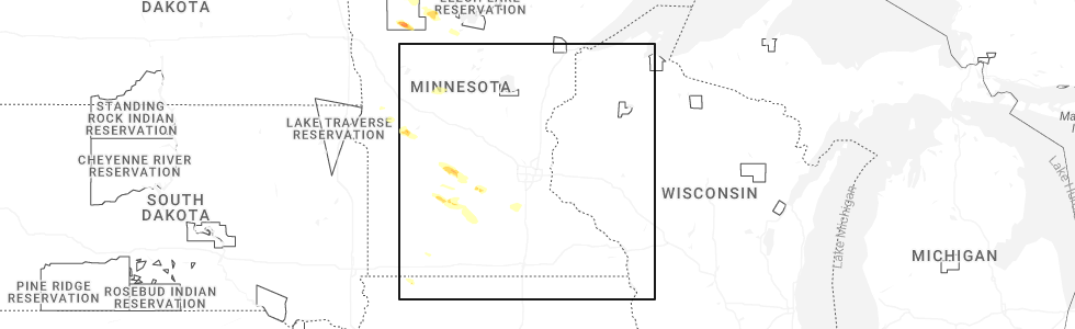
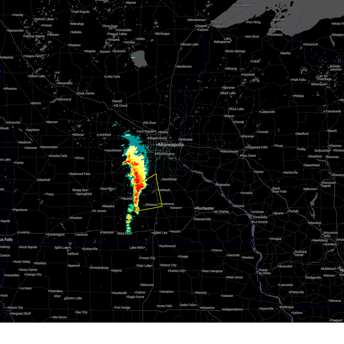
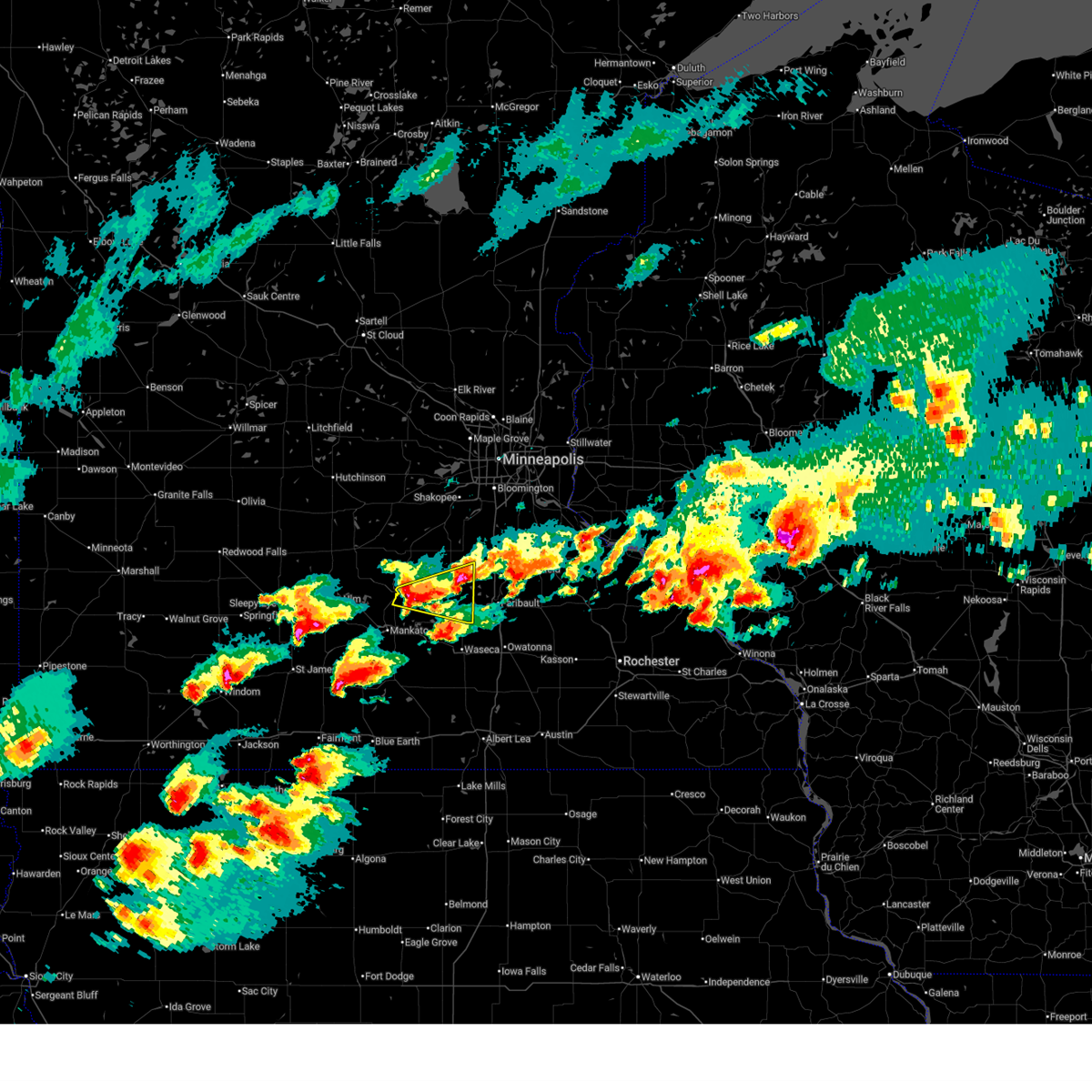
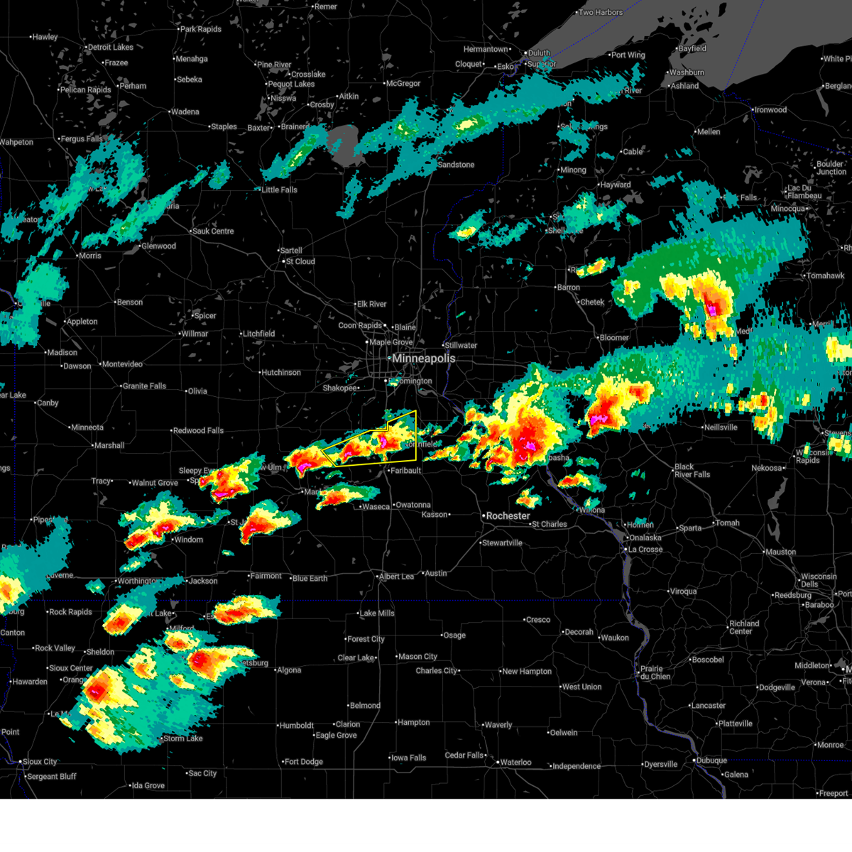
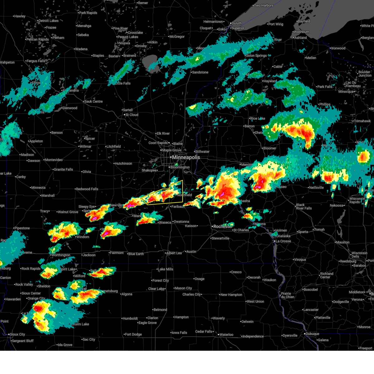
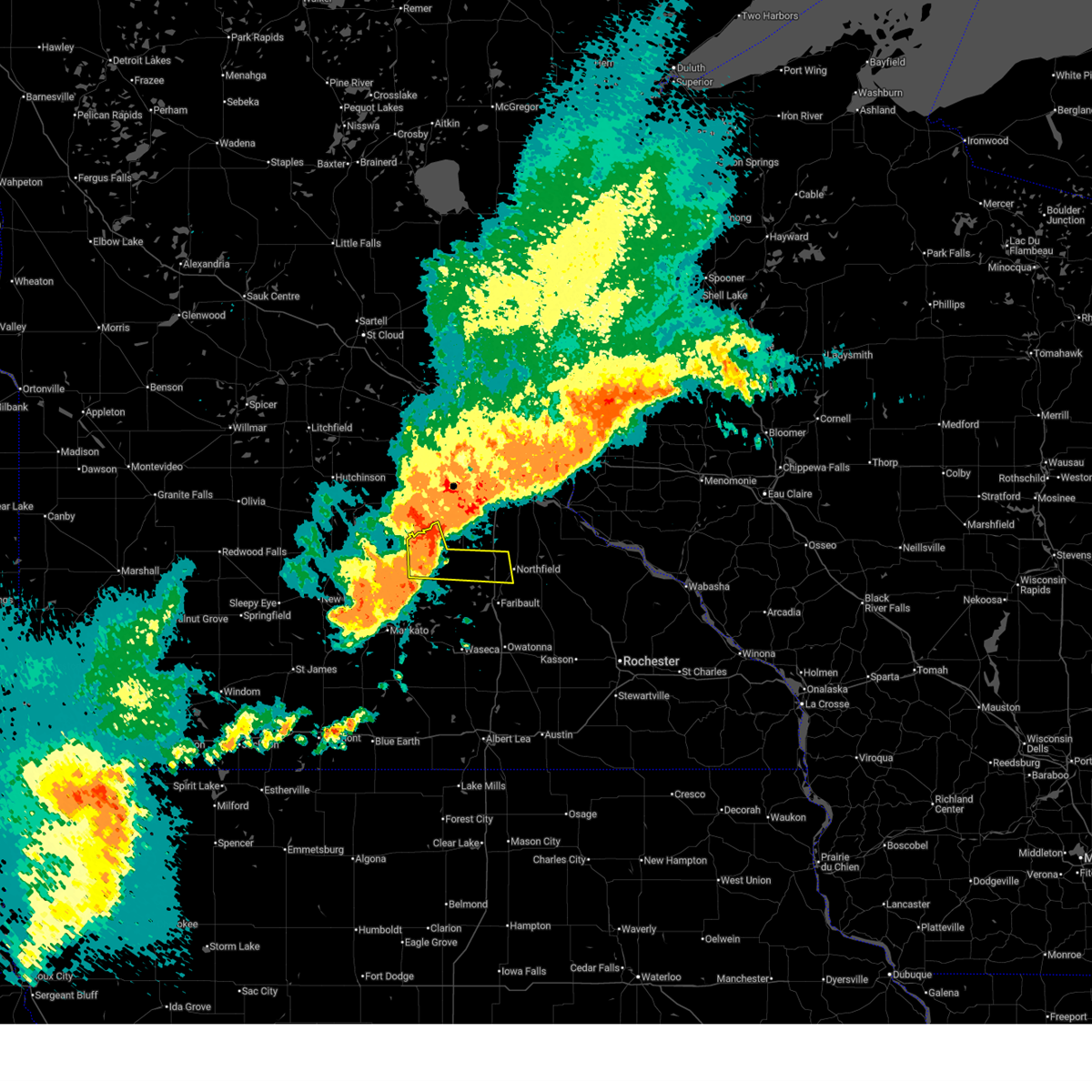
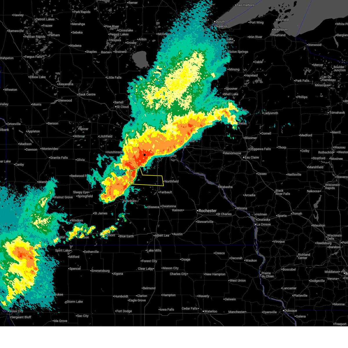
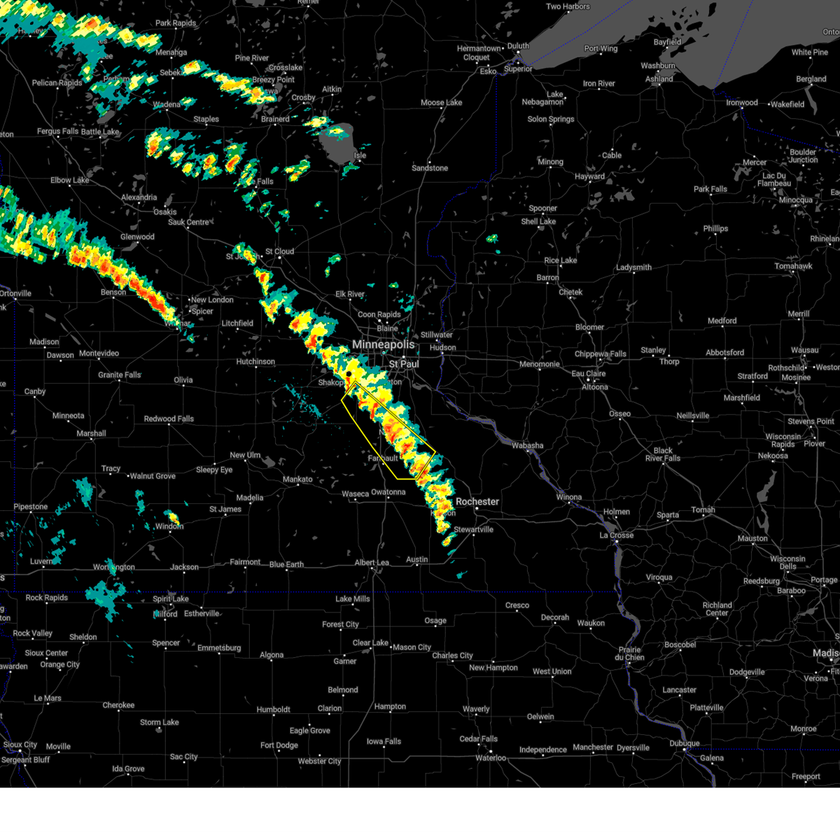
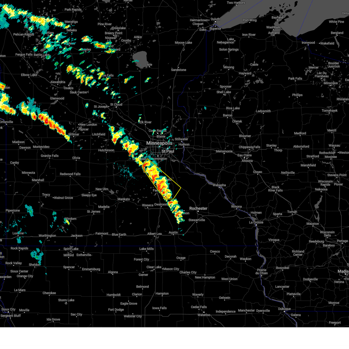
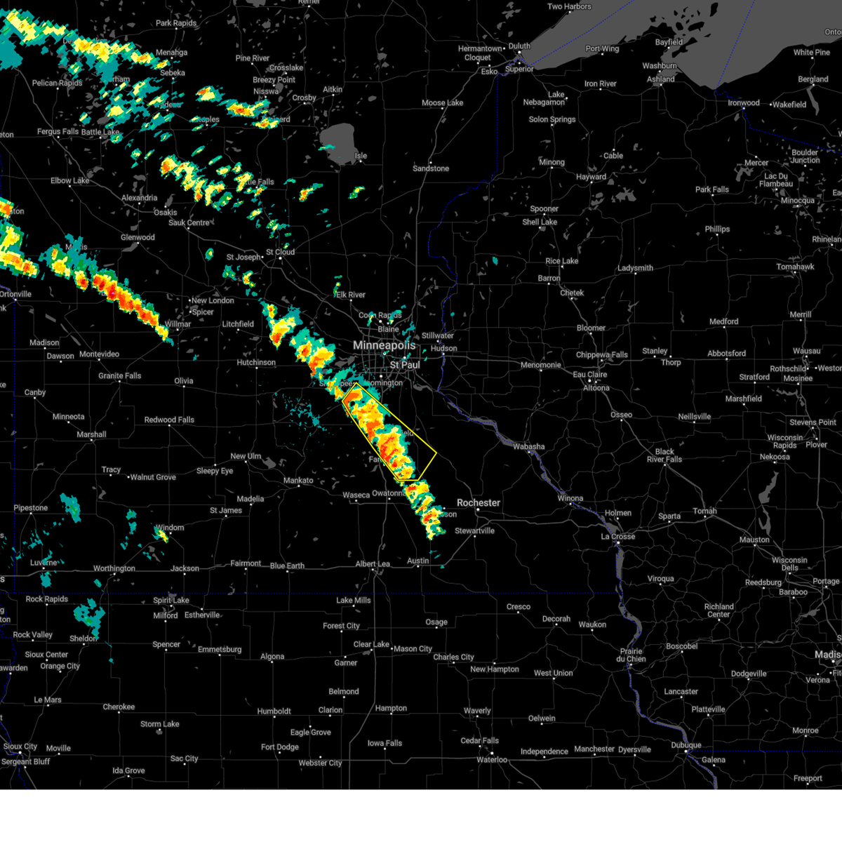
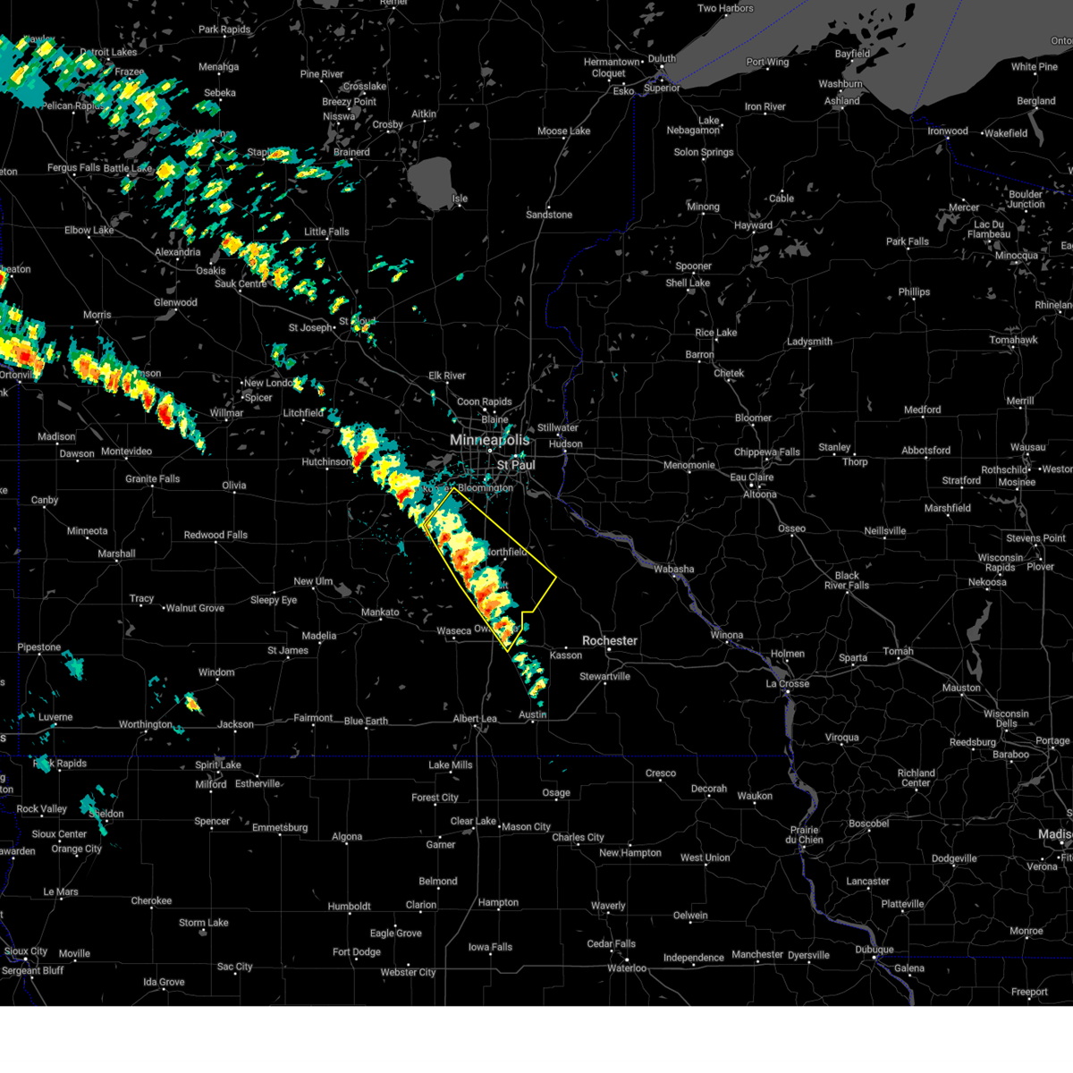
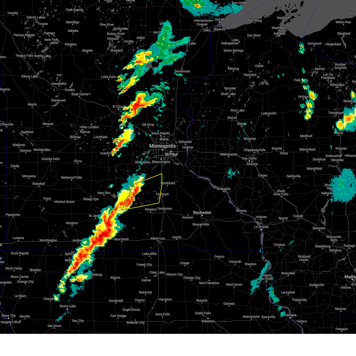
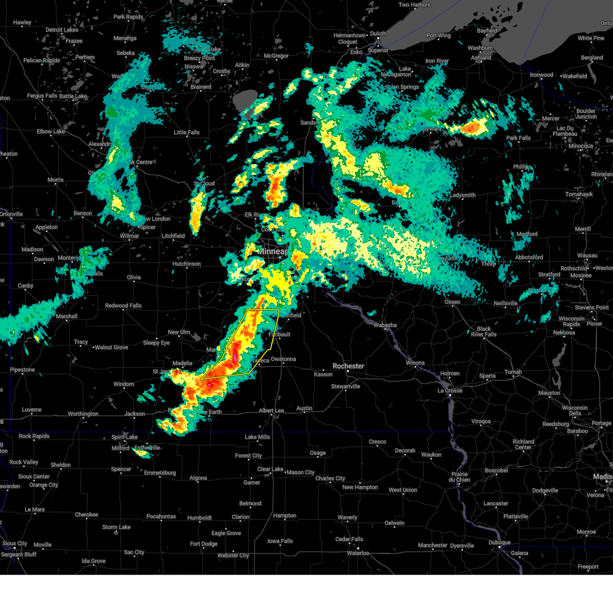
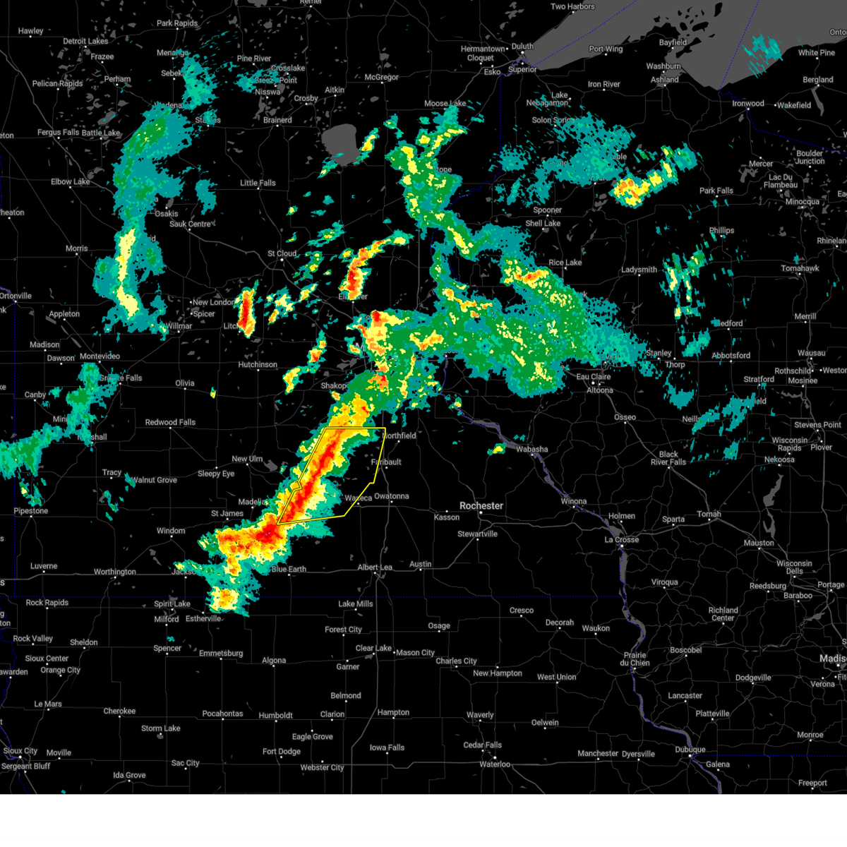
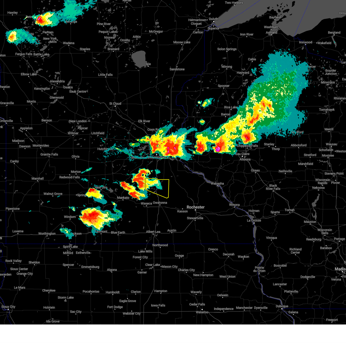
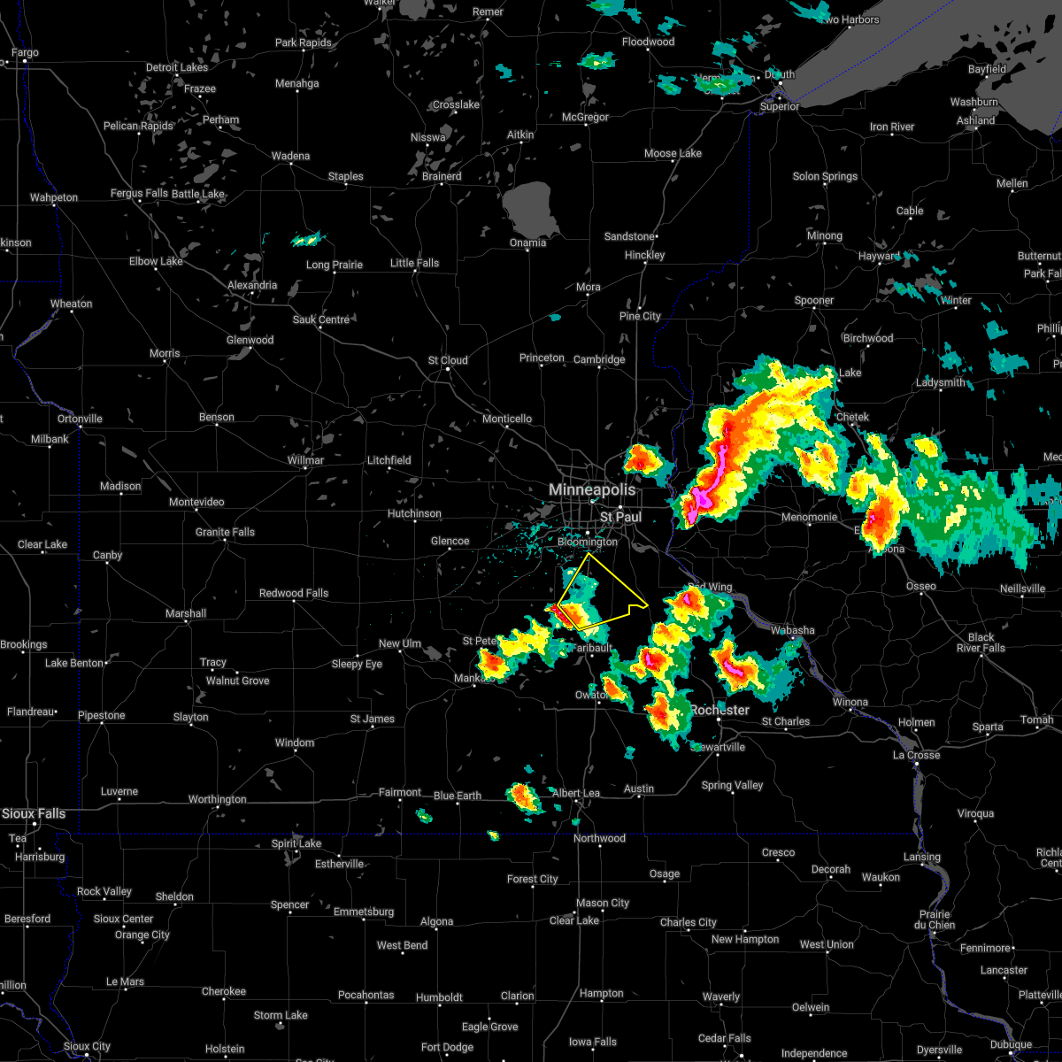
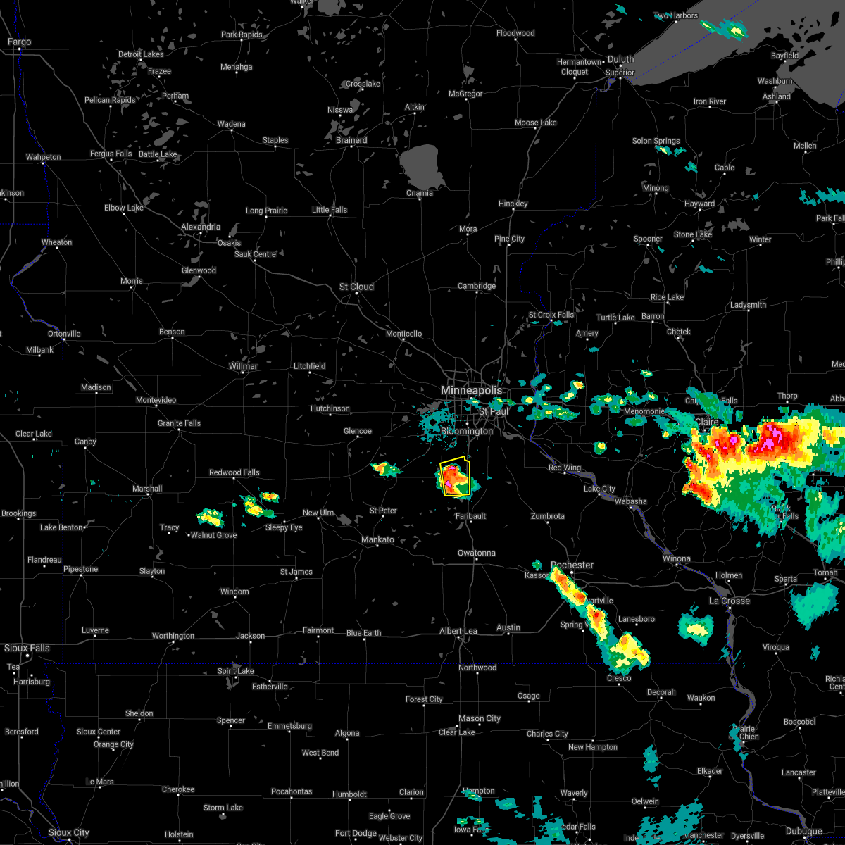
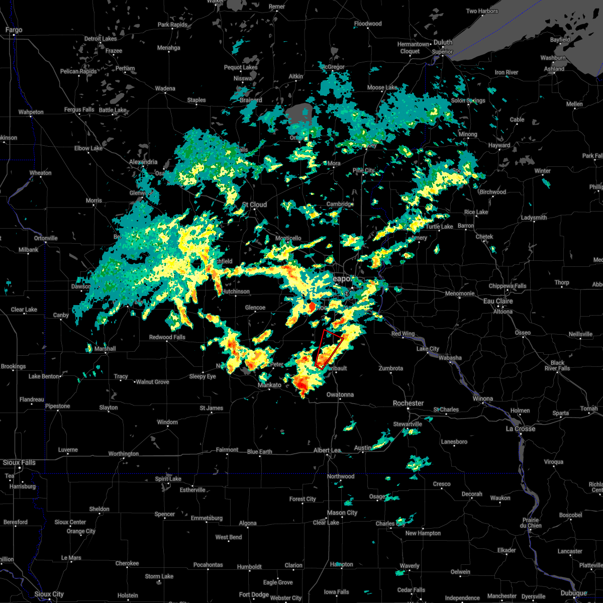
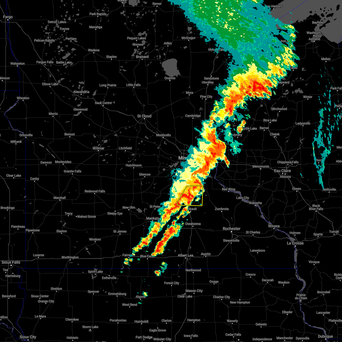
Hail Map for Lonsdale, MN
The Lonsdale, MN area has had 11 reports of on-the-ground hail by trained spotters, and has been under severe weather warnings 12 times during the past 12 months. Doppler radar has detected hail at or near Lonsdale, MN on 82 occasions, including 6 occasions during the past year.
| Name: | Lonsdale, MN |
| Where Located: | 35.4 miles SSW of Minneapolis, MN |
| Map: | Google Map for Lonsdale, MN |
| Population: | 3674 |
| Housing Units: | 1370 |
| More Info: | Search Google for Lonsdale, MN |
1
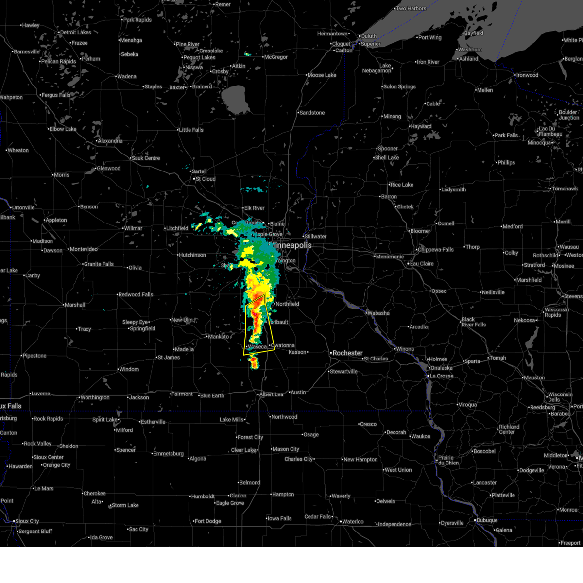
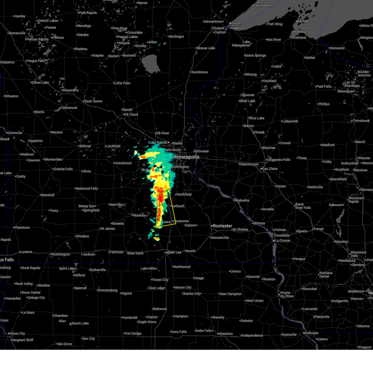
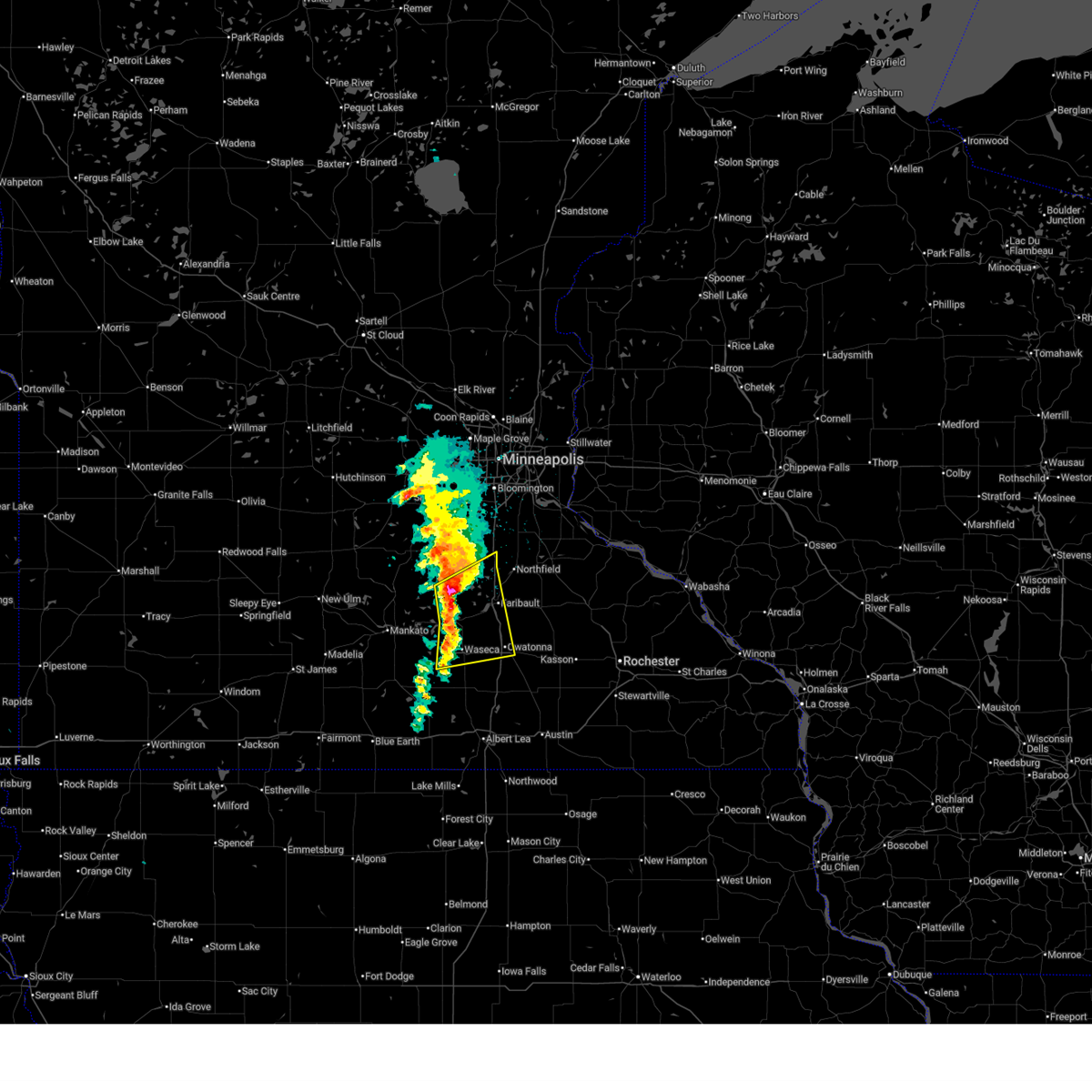
The Top Recent Hail Date for Lonsdale, MN is Tuesday, June 23, 2026 (19th out of 82)
Hail and Wind Damage Spotted near Lonsdale, MN
| Date / Time | Report Details |
|---|---|
| 4/17/2026 9:08 AM CDT |
 The storm which prompted the warning has weakened below severe limits, and no longer poses an immediate threat to life or property. therefore, the warning will be allowed to expire. however, small hail and heavy rain are still possible with this thunderstorm. The storm which prompted the warning has weakened below severe limits, and no longer poses an immediate threat to life or property. therefore, the warning will be allowed to expire. however, small hail and heavy rain are still possible with this thunderstorm.
|
| 4/17/2026 8:57 AM CDT |
 At 857 am cdt, a severe thunderstorm was located near morristown, or 8 miles west of faribault, moving east at 25 mph (radar indicated). Hazards include half dollar size hail. Damage to vehicles is expected. this severe thunderstorm will be near, warsaw and morristown around 900 am cdt. faribault around 910 am cdt. Other locations impacted by the severe thunderstorm include faribault airport. At 857 am cdt, a severe thunderstorm was located near morristown, or 8 miles west of faribault, moving east at 25 mph (radar indicated). Hazards include half dollar size hail. Damage to vehicles is expected. this severe thunderstorm will be near, warsaw and morristown around 900 am cdt. faribault around 910 am cdt. Other locations impacted by the severe thunderstorm include faribault airport.
|
| 4/17/2026 8:43 AM CDT |
 At 843 am cdt, a severe thunderstorm was located over waterville, or 14 miles west of faribault, moving east at 25 mph (radar indicated). Hazards include half dollar size hail. Damage to vehicles is expected. this severe thunderstorm will be near, morristown around 855 am cdt. warsaw around 900 am cdt. faribault around 910 am cdt. Other locations impacted by the severe thunderstorm include sakatah lake state park, kilkenny and faribault airport. At 843 am cdt, a severe thunderstorm was located over waterville, or 14 miles west of faribault, moving east at 25 mph (radar indicated). Hazards include half dollar size hail. Damage to vehicles is expected. this severe thunderstorm will be near, morristown around 855 am cdt. warsaw around 900 am cdt. faribault around 910 am cdt. Other locations impacted by the severe thunderstorm include sakatah lake state park, kilkenny and faribault airport.
|
| 4/17/2026 8:32 AM CDT |
 Svrmpx the national weather service in the twin cities has issued a * severe thunderstorm warning for, southeastern le sueur county in south central minnesota, western rice county in south central minnesota, northwestern steele county in south central minnesota, northern waseca county in south central minnesota, * until 915 am cdt. * at 832 am cdt, a severe thunderstorm was located over elysian, or 16 miles east of mankato, moving northeast at 30 mph (radar indicated). Hazards include half dollar size hail. damage to vehicles is expected Svrmpx the national weather service in the twin cities has issued a * severe thunderstorm warning for, southeastern le sueur county in south central minnesota, western rice county in south central minnesota, northwestern steele county in south central minnesota, northern waseca county in south central minnesota, * until 915 am cdt. * at 832 am cdt, a severe thunderstorm was located over elysian, or 16 miles east of mankato, moving northeast at 30 mph (radar indicated). Hazards include half dollar size hail. damage to vehicles is expected
|
| 4/13/2026 7:00 PM CDT |
 The storm which prompted the warning has weakened below severe limits, and no longer poses an immediate threat to life or property. therefore, the warning will be allowed to expire. a severe thunderstorm warning still remains in effect for the southeast part of the county. a tornado watch remains in effect until 1000 pm cdt monday for a portion of south central minnesota. The storm which prompted the warning has weakened below severe limits, and no longer poses an immediate threat to life or property. therefore, the warning will be allowed to expire. a severe thunderstorm warning still remains in effect for the southeast part of the county. a tornado watch remains in effect until 1000 pm cdt monday for a portion of south central minnesota.
|
| 4/13/2026 6:50 PM CDT |
 At 650 pm cdt, a severe thunderstorm was located over stanton, or 9 miles east of northfield, moving east at 25 mph (radar indicated). Hazards include golf ball size hail and 60 mph wind gusts. People and animals outdoors will be injured. expect hail damage to roofs, siding, windows, and vehicles. expect wind damage to roofs, siding, and trees. Locations impacted include, montgomery, lonsdale, dundas and northfield. At 650 pm cdt, a severe thunderstorm was located over stanton, or 9 miles east of northfield, moving east at 25 mph (radar indicated). Hazards include golf ball size hail and 60 mph wind gusts. People and animals outdoors will be injured. expect hail damage to roofs, siding, windows, and vehicles. expect wind damage to roofs, siding, and trees. Locations impacted include, montgomery, lonsdale, dundas and northfield.
|
| 4/13/2026 6:42 PM CDT |
 At 642 pm cdt, a severe thunderstorm was located near le center, or 17 miles northeast of mankato, moving east at 20 mph (radar indicated). Hazards include golf ball size hail and 60 mph wind gusts. People and animals outdoors will be injured. expect hail damage to roofs, siding, windows, and vehicles. expect wind damage to roofs, siding, and trees. Locations impacted include, lake jefferson, st henry, le center, waterville, kilkenny, montgomery, sakatah lake state park, morristown and lonsdale. At 642 pm cdt, a severe thunderstorm was located near le center, or 17 miles northeast of mankato, moving east at 20 mph (radar indicated). Hazards include golf ball size hail and 60 mph wind gusts. People and animals outdoors will be injured. expect hail damage to roofs, siding, windows, and vehicles. expect wind damage to roofs, siding, and trees. Locations impacted include, lake jefferson, st henry, le center, waterville, kilkenny, montgomery, sakatah lake state park, morristown and lonsdale.
|
| 4/13/2026 6:25 PM CDT |
 Svrmpx the national weather service in the twin cities has issued a * severe thunderstorm warning for, central le sueur county in south central minnesota, western rice county in south central minnesota, * until 730 pm cdt. * at 625 pm cdt, a severe thunderstorm was located over cleveland, or 13 miles northeast of mankato, moving east at 20 mph (radar indicated). Hazards include golf ball size hail and 60 mph wind gusts. People and animals outdoors will be injured. expect hail damage to roofs, siding, windows, and vehicles. Expect wind damage to roofs, siding, and trees. Svrmpx the national weather service in the twin cities has issued a * severe thunderstorm warning for, central le sueur county in south central minnesota, western rice county in south central minnesota, * until 730 pm cdt. * at 625 pm cdt, a severe thunderstorm was located over cleveland, or 13 miles northeast of mankato, moving east at 20 mph (radar indicated). Hazards include golf ball size hail and 60 mph wind gusts. People and animals outdoors will be injured. expect hail damage to roofs, siding, windows, and vehicles. Expect wind damage to roofs, siding, and trees.
|
| 4/13/2026 6:08 PM CDT |
 At 608 pm cdt, a severe thunderstorm was located 6 miles south of webster, or 8 miles west of northfield, moving east at 25 mph (trained spotters reported golf ball hail near circle lake ln). Hazards include golf ball size hail and 60 mph wind gusts. People and animals outdoors will be injured. expect hail damage to roofs, siding, windows, and vehicles. expect wind damage to roofs, siding, and trees. Locations impacted include, st henry, le center, montgomery, veseli, lonsdale, webster, bridgewater, dundas, northfield, castle rock, nerstrand big woods state park and randolph. At 608 pm cdt, a severe thunderstorm was located 6 miles south of webster, or 8 miles west of northfield, moving east at 25 mph (trained spotters reported golf ball hail near circle lake ln). Hazards include golf ball size hail and 60 mph wind gusts. People and animals outdoors will be injured. expect hail damage to roofs, siding, windows, and vehicles. expect wind damage to roofs, siding, and trees. Locations impacted include, st henry, le center, montgomery, veseli, lonsdale, webster, bridgewater, dundas, northfield, castle rock, nerstrand big woods state park and randolph.
|
| 4/13/2026 5:59 PM CDT |
 Svrmpx the national weather service in the twin cities has issued a * severe thunderstorm warning for, southwestern dakota county in east central minnesota, northeastern le sueur county in south central minnesota, northern rice county in south central minnesota, * until 700 pm cdt. * at 559 pm cdt, a severe thunderstorm was located near lonsdale, or 11 miles northwest of faribault, moving east at 25 mph (radar indicated). Hazards include 60 mph wind gusts and quarter size hail. Hail damage to vehicles is expected. Expect wind damage to roofs, siding, and trees. Svrmpx the national weather service in the twin cities has issued a * severe thunderstorm warning for, southwestern dakota county in east central minnesota, northeastern le sueur county in south central minnesota, northern rice county in south central minnesota, * until 700 pm cdt. * at 559 pm cdt, a severe thunderstorm was located near lonsdale, or 11 miles northwest of faribault, moving east at 25 mph (radar indicated). Hazards include 60 mph wind gusts and quarter size hail. Hail damage to vehicles is expected. Expect wind damage to roofs, siding, and trees.
|
| 7/28/2025 9:59 PM CDT |
 At 959 pm cdt, a severe thunderstorm was located 8 miles south of belle plaine, or 26 miles northwest of faribault, moving east at 35 mph (radar indicated). Hazards include 70 mph wind gusts and small hail. Expect considerable tree damage. damage is likely to mobile homes, roofs, and outbuildings. Locations impacted include, northfield, new prague, belle plaine, jordan, lonsdale, montgomery, webster, dundas, bridgewater, heidelberg, veseli, mn valley state rec area, minnesota valley state recreation area and st thomas. At 959 pm cdt, a severe thunderstorm was located 8 miles south of belle plaine, or 26 miles northwest of faribault, moving east at 35 mph (radar indicated). Hazards include 70 mph wind gusts and small hail. Expect considerable tree damage. damage is likely to mobile homes, roofs, and outbuildings. Locations impacted include, northfield, new prague, belle plaine, jordan, lonsdale, montgomery, webster, dundas, bridgewater, heidelberg, veseli, mn valley state rec area, minnesota valley state recreation area and st thomas.
|
| 7/28/2025 9:52 PM CDT |
 Svrmpx the national weather service in the twin cities has issued a * severe thunderstorm warning for, southwestern dakota county in east central minnesota, southwestern scott county in east central minnesota, northeastern le sueur county in south central minnesota, northwestern rice county in south central minnesota, * until 1045 pm cdt. * at 952 pm cdt, a severe thunderstorm was located 7 miles south of belle plaine, or 26 miles north of mankato, moving east at 35 mph (radar indicated). Hazards include 60 mph wind gusts and small hail. expect damage to roofs, siding, and trees Svrmpx the national weather service in the twin cities has issued a * severe thunderstorm warning for, southwestern dakota county in east central minnesota, southwestern scott county in east central minnesota, northeastern le sueur county in south central minnesota, northwestern rice county in south central minnesota, * until 1045 pm cdt. * at 952 pm cdt, a severe thunderstorm was located 7 miles south of belle plaine, or 26 miles north of mankato, moving east at 35 mph (radar indicated). Hazards include 60 mph wind gusts and small hail. expect damage to roofs, siding, and trees
|
| 5/15/2025 1:56 PM CDT |
 The severe thunderstorm warning that was previously in effect has been reissued for rice, goodhue, dakota, and scott counties and is in effect until 230 pm cdt. please refer to that bulletin for the latest severe weather information. however, gusty winds are still possible with these thunderstorms. a tornado watch remains in effect until 800 pm cdt thursday for portions of east central and southeast minnesota. The severe thunderstorm warning that was previously in effect has been reissued for rice, goodhue, dakota, and scott counties and is in effect until 230 pm cdt. please refer to that bulletin for the latest severe weather information. however, gusty winds are still possible with these thunderstorms. a tornado watch remains in effect until 800 pm cdt thursday for portions of east central and southeast minnesota.
|
| 5/15/2025 1:38 PM CDT |
 the severe thunderstorm warning has been cancelled and is no longer in effect the severe thunderstorm warning has been cancelled and is no longer in effect
|
| 5/15/2025 1:38 PM CDT |
 At 138 pm cdt, severe thunderstorms were located along a line from over carver to 6 miles east of medford, or along a line from 23 miles southwest of minneapolis to 8 miles northeast of owatonna, moving northeast at 35 mph (radar indicated). Hazards include 60 mph wind gusts and quarter size hail. Hail damage to vehicles is expected. expect wind damage to roofs, siding, and trees. Locations impacted include, faribault, northfield, lakeville, shakopee, savage, prior lake, jordan, lonsdale, kenyon, webster, dundas, stanton, nerstrand, elko new market, credit river, bridgewater, castle rock, nerstrand big woods state park, ruskin and veseli. At 138 pm cdt, severe thunderstorms were located along a line from over carver to 6 miles east of medford, or along a line from 23 miles southwest of minneapolis to 8 miles northeast of owatonna, moving northeast at 35 mph (radar indicated). Hazards include 60 mph wind gusts and quarter size hail. Hail damage to vehicles is expected. expect wind damage to roofs, siding, and trees. Locations impacted include, faribault, northfield, lakeville, shakopee, savage, prior lake, jordan, lonsdale, kenyon, webster, dundas, stanton, nerstrand, elko new market, credit river, bridgewater, castle rock, nerstrand big woods state park, ruskin and veseli.
|
| 5/15/2025 1:27 PM CDT |
 Svrmpx the national weather service in the twin cities has issued a * severe thunderstorm warning for, southwestern dakota county in east central minnesota, scott county in east central minnesota, northeastern le sueur county in south central minnesota, rice county in south central minnesota, northeastern steele county in south central minnesota, southwestern goodhue county in southeastern minnesota, * until 200 pm cdt. * at 127 pm cdt, a broken line of severe thunderstorms were located along a line from over jordan to over owatonna, or along a line from 28 miles northwest of northfield to over owatonna, moving northeast at 35 mph (radar indicated). Hazards include 60 mph wind gusts and quarter size hail. Hail damage to vehicles is expected. Expect wind damage to roofs, siding, and trees. Svrmpx the national weather service in the twin cities has issued a * severe thunderstorm warning for, southwestern dakota county in east central minnesota, scott county in east central minnesota, northeastern le sueur county in south central minnesota, rice county in south central minnesota, northeastern steele county in south central minnesota, southwestern goodhue county in southeastern minnesota, * until 200 pm cdt. * at 127 pm cdt, a broken line of severe thunderstorms were located along a line from over jordan to over owatonna, or along a line from 28 miles northwest of northfield to over owatonna, moving northeast at 35 mph (radar indicated). Hazards include 60 mph wind gusts and quarter size hail. Hail damage to vehicles is expected. Expect wind damage to roofs, siding, and trees.
|
| 4/28/2025 4:38 PM CDT |
 Svrmpx the national weather service in the twin cities has issued a * severe thunderstorm warning for, southeastern scott county in east central minnesota, northeastern blue earth county in south central minnesota, le sueur county in south central minnesota, western rice county in south central minnesota, northern waseca county in south central minnesota, * until 515 pm cdt. * at 438 pm cdt, severe thunderstorms were located along a line from 7 miles north of le center to over eagle lake, or along a line from 24 miles northwest of faribault to over mankato, moving east at 50 mph (radar indicated). Hazards include 60 mph wind gusts and quarter size hail. Hail damage to vehicles is expected. Expect wind damage to roofs, siding, and trees. Svrmpx the national weather service in the twin cities has issued a * severe thunderstorm warning for, southeastern scott county in east central minnesota, northeastern blue earth county in south central minnesota, le sueur county in south central minnesota, western rice county in south central minnesota, northern waseca county in south central minnesota, * until 515 pm cdt. * at 438 pm cdt, severe thunderstorms were located along a line from 7 miles north of le center to over eagle lake, or along a line from 24 miles northwest of faribault to over mankato, moving east at 50 mph (radar indicated). Hazards include 60 mph wind gusts and quarter size hail. Hail damage to vehicles is expected. Expect wind damage to roofs, siding, and trees.
|
| 4/17/2025 4:53 PM CDT |
 At 453 pm cdt, severe thunderstorms were located along a line from near new prague to near st. clair, or along a line from 17 miles northwest of northfield to 10 miles southeast of mankato, moving east at 30 mph (radar indicated). Hazards include 60 mph wind gusts and small hail. Expect damage to roofs, siding, and trees. locations impacted include, vernon center, mankato, good thunder, le center, eagle lake, madison lake, new prague, st. Clair, montgomery, pemberton, elysian, kilkenny, janesville, lonsdale, waterville, webster, waseca, morristown, faribault and warsaw. At 453 pm cdt, severe thunderstorms were located along a line from near new prague to near st. clair, or along a line from 17 miles northwest of northfield to 10 miles southeast of mankato, moving east at 30 mph (radar indicated). Hazards include 60 mph wind gusts and small hail. Expect damage to roofs, siding, and trees. locations impacted include, vernon center, mankato, good thunder, le center, eagle lake, madison lake, new prague, st. Clair, montgomery, pemberton, elysian, kilkenny, janesville, lonsdale, waterville, webster, waseca, morristown, faribault and warsaw.
|
| 4/17/2025 4:33 PM CDT |
 Svrmpx the national weather service in the twin cities has issued a * severe thunderstorm warning for, northeastern blue earth county in south central minnesota, le sueur county in south central minnesota, western rice county in south central minnesota, northern waseca county in south central minnesota, * until 530 pm cdt. * at 433 pm cdt, severe thunderstorms were located along a line from near new prague to 7 miles south of mankato, or along a line from 24 miles northwest of faribault to 7 miles south of mankato, moving east at 30 mph (radar indicated). Hazards include 60 mph wind gusts and small hail. expect damage to roofs, siding, and trees Svrmpx the national weather service in the twin cities has issued a * severe thunderstorm warning for, northeastern blue earth county in south central minnesota, le sueur county in south central minnesota, western rice county in south central minnesota, northern waseca county in south central minnesota, * until 530 pm cdt. * at 433 pm cdt, severe thunderstorms were located along a line from near new prague to 7 miles south of mankato, or along a line from 24 miles northwest of faribault to 7 miles south of mankato, moving east at 30 mph (radar indicated). Hazards include 60 mph wind gusts and small hail. expect damage to roofs, siding, and trees
|
| 8/3/2024 10:43 PM CDT | Svrmpx the national weather service in the twin cities has issued a * severe thunderstorm warning for, southwestern dakota county in east central minnesota, southeastern scott county in east central minnesota, north central rice county in south central minnesota, * until 1115 pm cdt. * at 1042 pm cdt, a severe thunderstorm was located near prior lake, or 18 miles northwest of northfield, moving southeast at 30 mph (radar indicated). Hazards include 60 mph wind gusts and penny size hail. expect damage to roofs, siding, and trees |
| 8/11/2023 5:44 PM CDT |
 At 544 pm cdt, a severe thunderstorm was located near montgomery, or 21 miles northwest of faribault, moving southeast at 40 mph (radar indicated). Hazards include 60 mph wind gusts and quarter size hail. Hail damage to vehicles is expected. expect wind damage to roofs, siding, and trees. this severe thunderstorm will be near, lonsdale around 555 pm cdt. other locations in the path of this severe thunderstorm include faribault, dundas and nerstrand. hail threat, radar indicated max hail size, 1. 00 in wind threat, radar indicated max wind gust, 60 mph. At 544 pm cdt, a severe thunderstorm was located near montgomery, or 21 miles northwest of faribault, moving southeast at 40 mph (radar indicated). Hazards include 60 mph wind gusts and quarter size hail. Hail damage to vehicles is expected. expect wind damage to roofs, siding, and trees. this severe thunderstorm will be near, lonsdale around 555 pm cdt. other locations in the path of this severe thunderstorm include faribault, dundas and nerstrand. hail threat, radar indicated max hail size, 1. 00 in wind threat, radar indicated max wind gust, 60 mph.
|
| 7/10/2023 8:11 PM CDT |
 At 810 pm cdt, a severe thunderstorm was located near lonsdale, or 8 miles west of northfield, moving southeast at 15 mph (radar indicated). Hazards include quarter size hail. Damage to vehicles is expected. locations impacted include, lonsdale. hail threat, radar indicated max hail size, 1. 00 in wind threat, radar indicated max wind gust, <50 mph. At 810 pm cdt, a severe thunderstorm was located near lonsdale, or 8 miles west of northfield, moving southeast at 15 mph (radar indicated). Hazards include quarter size hail. Damage to vehicles is expected. locations impacted include, lonsdale. hail threat, radar indicated max hail size, 1. 00 in wind threat, radar indicated max wind gust, <50 mph.
|
| 7/10/2023 7:57 PM CDT |
 At 757 pm cdt, a severe thunderstorm was located over lonsdale, or 10 miles west of northfield, moving southeast at 25 mph (radar indicated). Hazards include quarter size hail. Damage to vehicles is expected. locations impacted include, northfield, lonsdale, webster, castle rock and veseli. hail threat, radar indicated max hail size, 1. 00 in wind threat, radar indicated max wind gust, <50 mph. At 757 pm cdt, a severe thunderstorm was located over lonsdale, or 10 miles west of northfield, moving southeast at 25 mph (radar indicated). Hazards include quarter size hail. Damage to vehicles is expected. locations impacted include, northfield, lonsdale, webster, castle rock and veseli. hail threat, radar indicated max hail size, 1. 00 in wind threat, radar indicated max wind gust, <50 mph.
|
| 7/10/2023 7:46 PM CDT |
 At 746 pm cdt, a severe thunderstorm was located over lonsdale, or 13 miles west of northfield, moving southeast at 25 mph (radar indicated). Hazards include 60 mph wind gusts and quarter size hail. Hail damage to vehicles is expected. expect wind damage to roofs, siding, and trees. locations impacted include, northfield, lonsdale, webster, elko new market, castle rock and veseli. hail threat, radar indicated max hail size, 1. 00 in wind threat, radar indicated max wind gust, 60 mph. At 746 pm cdt, a severe thunderstorm was located over lonsdale, or 13 miles west of northfield, moving southeast at 25 mph (radar indicated). Hazards include 60 mph wind gusts and quarter size hail. Hail damage to vehicles is expected. expect wind damage to roofs, siding, and trees. locations impacted include, northfield, lonsdale, webster, elko new market, castle rock and veseli. hail threat, radar indicated max hail size, 1. 00 in wind threat, radar indicated max wind gust, 60 mph.
|
| 7/10/2023 7:29 PM CDT |
 At 729 pm cdt, a severe thunderstorm was located over new prague, or 19 miles northwest of northfield, moving southeast at 20 mph (radar indicated). Hazards include 60 mph wind gusts and half dollar size hail. Hail damage to vehicles is expected. Expect wind damage to roofs, siding, and trees. At 729 pm cdt, a severe thunderstorm was located over new prague, or 19 miles northwest of northfield, moving southeast at 20 mph (radar indicated). Hazards include 60 mph wind gusts and half dollar size hail. Hail damage to vehicles is expected. Expect wind damage to roofs, siding, and trees.
|
| 7/3/2023 8:58 PM CDT |
 At 857 pm cdt, a severe thunderstorm was located near webster, or 8 miles west of northfield, moving east at 15 mph (radar indicated). Hazards include 60 mph wind gusts and quarter size hail. Hail damage to vehicles is expected. Expect wind damage to roofs, siding, and trees. At 857 pm cdt, a severe thunderstorm was located near webster, or 8 miles west of northfield, moving east at 15 mph (radar indicated). Hazards include 60 mph wind gusts and quarter size hail. Hail damage to vehicles is expected. Expect wind damage to roofs, siding, and trees.
|
| 6/24/2023 4:05 PM CDT |
 At 404 pm cdt, a severe thunderstorm was located over montgomery, or 15 miles northwest of faribault, moving northeast at 30 mph (radar indicated). Hazards include 60 mph wind gusts and quarter size hail. Hail damage to vehicles is expected. expect wind damage to roofs, siding, and trees. this severe thunderstorm will be near, new prague and lonsdale around 415 pm cdt. other locations in the path of this severe thunderstorm include elko new market, lakeville and prior lake. hail threat, radar indicated max hail size, 1. 00 in wind threat, radar indicated max wind gust, 60 mph. At 404 pm cdt, a severe thunderstorm was located over montgomery, or 15 miles northwest of faribault, moving northeast at 30 mph (radar indicated). Hazards include 60 mph wind gusts and quarter size hail. Hail damage to vehicles is expected. expect wind damage to roofs, siding, and trees. this severe thunderstorm will be near, new prague and lonsdale around 415 pm cdt. other locations in the path of this severe thunderstorm include elko new market, lakeville and prior lake. hail threat, radar indicated max hail size, 1. 00 in wind threat, radar indicated max wind gust, 60 mph.
|
| 8/27/2022 8:18 PM CDT | At 818 pm cdt, a severe thunderstorm was located over lonsdale, or 13 miles west of northfield, moving northeast at 50 mph (radar indicated). Hazards include 60 mph wind gusts. Expect damage to roofs, siding, and trees. this severe storm will be near, webster around 825 pm cdt. other locations in the path of this severe thunderstorm include elko new market, lakeville and farmington. hail threat, radar indicated max hail size, <. 75 in wind threat, radar indicated max wind gust, 60 mph. |
| 8/27/2022 8:07 PM CDT | At 807 pm cdt, a severe thunderstorm was located near montgomery, or 13 miles west of faribault, moving northeast at 55 mph (radar indicated). Hazards include 60 mph wind gusts. Expect damage to roofs, siding, and trees. this severe thunderstorm will be near, lonsdale around 815 pm cdt. webster and elko new market around 825 pm cdt. other locations in the path of this severe thunderstorm include lakeville and farmington. hail threat, radar indicated max hail size, <. 75 in wind threat, radar indicated max wind gust, 60 mph. |
| 7/23/2022 12:23 PM CDT |
 The severe thunderstorm warning for southwestern dakota, northeastern le sueur, southeastern scott and northern rice counties will expire at 1230 pm cdt, the storm which prompted the warning has weakened below severe limits, and has exited the warned area. therefore, the warning will be allowed to expire. a severe thunderstorm watch remains in effect until 200 pm cdt for south central and east central minnesota. The severe thunderstorm warning for southwestern dakota, northeastern le sueur, southeastern scott and northern rice counties will expire at 1230 pm cdt, the storm which prompted the warning has weakened below severe limits, and has exited the warned area. therefore, the warning will be allowed to expire. a severe thunderstorm watch remains in effect until 200 pm cdt for south central and east central minnesota.
|
| 7/23/2022 12:11 PM CDT |
 At 1210 pm cdt, a severe thunderstorm was located over lonsdale, or 10 miles west of northfield, moving east at 40 mph (radar indicated). Hazards include 60 mph wind gusts and quarter size hail. Hail damage to vehicles is expected. expect wind damage to roofs, siding, and trees. locations impacted include, dundas and northfield. hail threat, radar indicated max hail size, 1. 00 in wind threat, radar indicated max wind gust, 60 mph. At 1210 pm cdt, a severe thunderstorm was located over lonsdale, or 10 miles west of northfield, moving east at 40 mph (radar indicated). Hazards include 60 mph wind gusts and quarter size hail. Hail damage to vehicles is expected. expect wind damage to roofs, siding, and trees. locations impacted include, dundas and northfield. hail threat, radar indicated max hail size, 1. 00 in wind threat, radar indicated max wind gust, 60 mph.
|
| 7/23/2022 11:52 AM CDT |
 At 1152 am cdt, a severe thunderstorm was located over new prague, or 20 miles west of northfield, moving east at 45 mph (radar indicated). Hazards include 60 mph wind gusts and quarter size hail. Hail damage to vehicles is expected. expect wind damage to roofs, siding, and trees. this severe thunderstorm will be near, lonsdale around 1200 pm cdt. webster and elko new market around 1205 pm cdt. other locations in the path of this severe thunderstorm include northfield and dundas. hail threat, radar indicated max hail size, 1. 00 in wind threat, radar indicated max wind gust, 60 mph. At 1152 am cdt, a severe thunderstorm was located over new prague, or 20 miles west of northfield, moving east at 45 mph (radar indicated). Hazards include 60 mph wind gusts and quarter size hail. Hail damage to vehicles is expected. expect wind damage to roofs, siding, and trees. this severe thunderstorm will be near, lonsdale around 1200 pm cdt. webster and elko new market around 1205 pm cdt. other locations in the path of this severe thunderstorm include northfield and dundas. hail threat, radar indicated max hail size, 1. 00 in wind threat, radar indicated max wind gust, 60 mph.
|
| 5/19/2022 4:26 PM CDT |
 At 425 pm cdt, a severe thunderstorm was located over webster, or 12 miles northwest of northfield, moving northeast at 45 mph (radar indicated). Hazards include 60 mph wind gusts and quarter size hail. Hail damage to vehicles is expected. expect wind damage to roofs, siding, and trees. this severe thunderstorm will remain over mainly rural areas of southeastern scott and northwestern rice counties, including the following locations, veseli. hail threat, radar indicated max hail size, 1. 00 in wind threat, radar indicated max wind gust, 60 mph. At 425 pm cdt, a severe thunderstorm was located over webster, or 12 miles northwest of northfield, moving northeast at 45 mph (radar indicated). Hazards include 60 mph wind gusts and quarter size hail. Hail damage to vehicles is expected. expect wind damage to roofs, siding, and trees. this severe thunderstorm will remain over mainly rural areas of southeastern scott and northwestern rice counties, including the following locations, veseli. hail threat, radar indicated max hail size, 1. 00 in wind threat, radar indicated max wind gust, 60 mph.
|
| 5/19/2022 4:26 PM CDT |
 At 426 pm cdt, a severe thunderstorm was located over webster, or 12 miles northwest of northfield, moving northeast at 45 mph (radar indicated). Hazards include 60 mph wind gusts and quarter size hail. Hail damage to vehicles is expected. expect wind damage to roofs, siding, and trees. this severe thunderstorm will be near, elko new market around 430 pm cdt. lakeville and farmington around 445 pm cdt. hail threat, radar indicated max hail size, 1. 00 in wind threat, radar indicated max wind gust, 60 mph. At 426 pm cdt, a severe thunderstorm was located over webster, or 12 miles northwest of northfield, moving northeast at 45 mph (radar indicated). Hazards include 60 mph wind gusts and quarter size hail. Hail damage to vehicles is expected. expect wind damage to roofs, siding, and trees. this severe thunderstorm will be near, elko new market around 430 pm cdt. lakeville and farmington around 445 pm cdt. hail threat, radar indicated max hail size, 1. 00 in wind threat, radar indicated max wind gust, 60 mph.
|
| 5/19/2022 4:14 PM CDT |
 At 414 pm cdt, a severe thunderstorm was located near lonsdale, or 16 miles northwest of faribault, moving northeast at 45 mph (radar indicated). Hazards include 60 mph wind gusts and quarter size hail. Hail damage to vehicles is expected. expect wind damage to roofs, siding, and trees. this severe storm will be near, webster and elko new market around 425 pm cdt. hail threat, radar indicated max hail size, 1. 00 in wind threat, radar indicated max wind gust, 60 mph. At 414 pm cdt, a severe thunderstorm was located near lonsdale, or 16 miles northwest of faribault, moving northeast at 45 mph (radar indicated). Hazards include 60 mph wind gusts and quarter size hail. Hail damage to vehicles is expected. expect wind damage to roofs, siding, and trees. this severe storm will be near, webster and elko new market around 425 pm cdt. hail threat, radar indicated max hail size, 1. 00 in wind threat, radar indicated max wind gust, 60 mph.
|
| 5/19/2022 4:10 PM CDT |
 At 409 pm cdt, a severe thunderstorm was located over montgomery, or 17 miles northwest of faribault, moving northeast at 45 mph (radar indicated). Hazards include 60 mph wind gusts and quarter size hail. Hail damage to vehicles is expected. expect wind damage to roofs, siding, and trees. this severe thunderstorm will be near, lonsdale around 420 pm cdt. webster around 425 pm cdt. other locations in the path of this severe thunderstorm include elko new market. hail threat, radar indicated max hail size, 1. 00 in wind threat, radar indicated max wind gust, 60 mph. At 409 pm cdt, a severe thunderstorm was located over montgomery, or 17 miles northwest of faribault, moving northeast at 45 mph (radar indicated). Hazards include 60 mph wind gusts and quarter size hail. Hail damage to vehicles is expected. expect wind damage to roofs, siding, and trees. this severe thunderstorm will be near, lonsdale around 420 pm cdt. webster around 425 pm cdt. other locations in the path of this severe thunderstorm include elko new market. hail threat, radar indicated max hail size, 1. 00 in wind threat, radar indicated max wind gust, 60 mph.
|
| 5/11/2022 7:58 PM CDT |
 At 757 pm cdt, a severe thunderstorm capable of producing a tornado was located near lonsdale, or 15 miles west of northfield, moving northeast at 55 mph (radar indicated rotation). Hazards include tornado and quarter size hail. Flying debris will be dangerous to those caught without shelter. mobile homes will be damaged or destroyed. damage to roofs, windows, and vehicles will occur. tree damage is likely. Locations impacted include, webster. At 757 pm cdt, a severe thunderstorm capable of producing a tornado was located near lonsdale, or 15 miles west of northfield, moving northeast at 55 mph (radar indicated rotation). Hazards include tornado and quarter size hail. Flying debris will be dangerous to those caught without shelter. mobile homes will be damaged or destroyed. damage to roofs, windows, and vehicles will occur. tree damage is likely. Locations impacted include, webster.
|
| 5/11/2022 7:38 PM CDT |
 At 738 pm cdt, a severe thunderstorm capable of producing a tornado was located near le center, or 20 miles northeast of mankato, moving northeast at 55 mph (radar indicated rotation). Hazards include tornado and quarter size hail. Flying debris will be dangerous to those caught without shelter. mobile homes will be damaged or destroyed. damage to roofs, windows, and vehicles will occur. tree damage is likely. this dangerous storm will be near, new prague and montgomery around 750 pm cdt. lonsdale around 755 pm cdt. Other locations in the path of this tornadic thunderstorm include webster. At 738 pm cdt, a severe thunderstorm capable of producing a tornado was located near le center, or 20 miles northeast of mankato, moving northeast at 55 mph (radar indicated rotation). Hazards include tornado and quarter size hail. Flying debris will be dangerous to those caught without shelter. mobile homes will be damaged or destroyed. damage to roofs, windows, and vehicles will occur. tree damage is likely. this dangerous storm will be near, new prague and montgomery around 750 pm cdt. lonsdale around 755 pm cdt. Other locations in the path of this tornadic thunderstorm include webster.
|
| 5/11/2022 7:27 PM CDT |
 At 727 pm cdt, a severe thunderstorm was located near le sueur, or 20 miles north of mankato, moving northeast at 50 mph (radar indicated). Hazards include 70 mph wind gusts and quarter size hail. Hail damage to vehicles is expected. expect considerable tree damage. wind damage is also likely to mobile homes, roofs, and outbuildings. this severe thunderstorm will be near, belle plaine around 745 pm cdt. Other locations in the path of this severe thunderstorm include new prague, jordan, elko new market and lakeville. At 727 pm cdt, a severe thunderstorm was located near le sueur, or 20 miles north of mankato, moving northeast at 50 mph (radar indicated). Hazards include 70 mph wind gusts and quarter size hail. Hail damage to vehicles is expected. expect considerable tree damage. wind damage is also likely to mobile homes, roofs, and outbuildings. this severe thunderstorm will be near, belle plaine around 745 pm cdt. Other locations in the path of this severe thunderstorm include new prague, jordan, elko new market and lakeville.
|
| 5/11/2022 6:41 AM CDT |
 At 640 am cdt, a severe thunderstorm was located near montgomery, or 16 miles northwest of faribault, moving north at 25 mph (radar indicated). Hazards include half dollar size hail. Damage to vehicles is expected. this severe thunderstorm will be near, montgomery around 650 am cdt. lonsdale around 655 am cdt. other locations in the path of this severe thunderstorm include new prague, elko new market and jordan. hail threat, radar indicated max hail size, 1. 25 in wind threat, radar indicated max wind gust, <50 mph. At 640 am cdt, a severe thunderstorm was located near montgomery, or 16 miles northwest of faribault, moving north at 25 mph (radar indicated). Hazards include half dollar size hail. Damage to vehicles is expected. this severe thunderstorm will be near, montgomery around 650 am cdt. lonsdale around 655 am cdt. other locations in the path of this severe thunderstorm include new prague, elko new market and jordan. hail threat, radar indicated max hail size, 1. 25 in wind threat, radar indicated max wind gust, <50 mph.
|
| 5/11/2022 6:22 AM CDT |
 At 622 am cdt, a severe thunderstorm was located near waterville, or 15 miles west of faribault, moving north at 25 mph (radar indicated). Hazards include ping pong ball size hail. People and animals outdoors will be injured. expect damage to roofs, siding, windows, and vehicles. locations impacted include, montgomery. hail threat, radar indicated max hail size, 1. 50 in wind threat, radar indicated max wind gust, <50 mph. At 622 am cdt, a severe thunderstorm was located near waterville, or 15 miles west of faribault, moving north at 25 mph (radar indicated). Hazards include ping pong ball size hail. People and animals outdoors will be injured. expect damage to roofs, siding, windows, and vehicles. locations impacted include, montgomery. hail threat, radar indicated max hail size, 1. 50 in wind threat, radar indicated max wind gust, <50 mph.
|
| 5/11/2022 6:10 AM CDT |
 At 610 am cdt, a severe thunderstorm was located over waterville, or 16 miles west of faribault, moving northeast at 25 mph (radar indicated). Hazards include half dollar size hail. Damage to vehicles is expected. this severe thunderstorm will be near, morristown around 625 am cdt. warsaw around 630 am cdt. other locations in the path of this severe thunderstorm include faribault. hail threat, radar indicated max hail size, 1. 25 in wind threat, radar indicated max wind gust, <50 mph. At 610 am cdt, a severe thunderstorm was located over waterville, or 16 miles west of faribault, moving northeast at 25 mph (radar indicated). Hazards include half dollar size hail. Damage to vehicles is expected. this severe thunderstorm will be near, morristown around 625 am cdt. warsaw around 630 am cdt. other locations in the path of this severe thunderstorm include faribault. hail threat, radar indicated max hail size, 1. 25 in wind threat, radar indicated max wind gust, <50 mph.
|
| 4/12/2022 8:40 PM CDT |
 At 840 pm cdt, severe thunderstorms were located along a line extending from le center to near lonsdale, moving northeast at 25 mph (radar indicated). Hazards include 60 mph wind gusts and quarter size hail. Hail damage to vehicles is expected. expect wind damage to roofs, siding, and trees. these severe storms will be near, lonsdale around 845 pm cdt. other locations in the path of these severe thunderstorms include webster, montgomery and new prague. hail threat, radar indicated max hail size, 1. 00 in wind threat, radar indicated max wind gust, 60 mph. At 840 pm cdt, severe thunderstorms were located along a line extending from le center to near lonsdale, moving northeast at 25 mph (radar indicated). Hazards include 60 mph wind gusts and quarter size hail. Hail damage to vehicles is expected. expect wind damage to roofs, siding, and trees. these severe storms will be near, lonsdale around 845 pm cdt. other locations in the path of these severe thunderstorms include webster, montgomery and new prague. hail threat, radar indicated max hail size, 1. 00 in wind threat, radar indicated max wind gust, 60 mph.
|
| 4/12/2022 8:30 PM CDT |
 At 830 pm cdt, severe thunderstorms were located along a line extending from cleveland to 6 miles south of lonsdale, moving northeast at 25 mph (radar indicated). Hazards include 60 mph wind gusts and quarter size hail. Hail damage to vehicles is expected. expect wind damage to roofs, siding, and trees. severe thunderstorms will be near, lonsdale around 840 pm cdt. other locations in the path of these severe thunderstorms include webster, montgomery and new prague. hail threat, radar indicated max hail size, 1. 00 in wind threat, radar indicated max wind gust, 60 mph. At 830 pm cdt, severe thunderstorms were located along a line extending from cleveland to 6 miles south of lonsdale, moving northeast at 25 mph (radar indicated). Hazards include 60 mph wind gusts and quarter size hail. Hail damage to vehicles is expected. expect wind damage to roofs, siding, and trees. severe thunderstorms will be near, lonsdale around 840 pm cdt. other locations in the path of these severe thunderstorms include webster, montgomery and new prague. hail threat, radar indicated max hail size, 1. 00 in wind threat, radar indicated max wind gust, 60 mph.
|
| 8/24/2021 4:19 AM CDT |
 At 418 am cdt, a severe thunderstorm was located near northfield, moving northeast at 20 mph (radar indicated). Hazards include quarter size hail. Damage to vehicles is expected. this severe thunderstorm will remain over mainly rural areas of southwestern dakota and northeastern rice counties, including the following locations, castle rock and bridgewater. hail threat, radar indicated max hail size, 1. 00 in wind threat, radar indicated max wind gust, <50 mph. At 418 am cdt, a severe thunderstorm was located near northfield, moving northeast at 20 mph (radar indicated). Hazards include quarter size hail. Damage to vehicles is expected. this severe thunderstorm will remain over mainly rural areas of southwestern dakota and northeastern rice counties, including the following locations, castle rock and bridgewater. hail threat, radar indicated max hail size, 1. 00 in wind threat, radar indicated max wind gust, <50 mph.
|
| 8/24/2021 4:00 AM CDT | Quarter sized hail reported 0.8 miles E of Lonsdale, MN |
| 8/24/2021 3:48 AM CDT |
 At 347 am cdt, a severe thunderstorm was located near lonsdale, or 10 miles northwest of faribault, moving northeast at 20 mph (radar indicated). Hazards include quarter size hail. Damage to vehicles is expected. this severe thunderstorm will be near, webster around 405 am cdt. other locations in the path of this severe thunderstorm include dundas and northfield. hail threat, radar indicated max hail size, 1. 00 in wind threat, radar indicated max wind gust, <50 mph. At 347 am cdt, a severe thunderstorm was located near lonsdale, or 10 miles northwest of faribault, moving northeast at 20 mph (radar indicated). Hazards include quarter size hail. Damage to vehicles is expected. this severe thunderstorm will be near, webster around 405 am cdt. other locations in the path of this severe thunderstorm include dundas and northfield. hail threat, radar indicated max hail size, 1. 00 in wind threat, radar indicated max wind gust, <50 mph.
|
| 6/17/2021 9:34 PM CDT | Tennis Ball sized hail reported 1.3 miles N of Lonsdale, MN, hail averaged 2 inches in diameter... with the largest being 2.5 inches. hailed for three minutes. |
| 6/17/2021 7:10 PM CDT | Tennis Ball sized hail reported 1.3 miles N of Lonsdale, MN, corrects time of previous hail report from 1 sse lonsdale. hail averaged 2 inches in diameter... with the largest being 2.5 inches. hailed for three minutes. |
| 6/17/2021 7:08 PM CDT | Tennis Ball sized hail reported 0.4 miles ESE of Lonsdale, MN, phoned in report. |
| 6/17/2021 7:03 PM CDT |
 At 703 pm cdt, a severe thunderstorm was located over webster, or 12 miles northwest of northfield, moving east at 35 mph (trained weather spotters). Hazards include tennis ball size hail and 60 mph wind gusts. People and animals outdoors will be injured. expect hail damage to roofs, siding, windows, and vehicles. expect wind damage to roofs, siding, and trees. This severe thunderstorm will remain over mainly rural areas of southeastern scott and northwestern rice counties, including the following locations, veseli. At 703 pm cdt, a severe thunderstorm was located over webster, or 12 miles northwest of northfield, moving east at 35 mph (trained weather spotters). Hazards include tennis ball size hail and 60 mph wind gusts. People and animals outdoors will be injured. expect hail damage to roofs, siding, windows, and vehicles. expect wind damage to roofs, siding, and trees. This severe thunderstorm will remain over mainly rural areas of southeastern scott and northwestern rice counties, including the following locations, veseli.
|
| 6/17/2021 7:02 PM CDT | Tennis Ball sized hail reported 0.2 miles WSW of Lonsdale, MN, via twitter. |
| 6/17/2021 6:59 PM CDT | Tennis Ball sized hail reported 0.4 miles ESE of Lonsdale, MN, golf ball to tennis ball sized hail. |
| 6/17/2021 6:54 PM CDT |
 At 654 pm cdt, a severe thunderstorm was located near new prague, or 18 miles west of northfield, moving east at 40 mph (trained weather spotters). Hazards include golf ball size hail and 60 mph wind gusts. People and animals outdoors will be injured. expect hail damage to roofs, siding, windows, and vehicles. expect wind damage to roofs, siding, and trees. this severe storm will be near, webster and elko new market around 705 pm cdt. Other locations in the path of this severe thunderstorm include lakeville. At 654 pm cdt, a severe thunderstorm was located near new prague, or 18 miles west of northfield, moving east at 40 mph (trained weather spotters). Hazards include golf ball size hail and 60 mph wind gusts. People and animals outdoors will be injured. expect hail damage to roofs, siding, windows, and vehicles. expect wind damage to roofs, siding, and trees. this severe storm will be near, webster and elko new market around 705 pm cdt. Other locations in the path of this severe thunderstorm include lakeville.
|
| 6/17/2021 6:47 PM CDT |
 At 647 pm cdt, a severe thunderstorm was located over new prague, or 23 miles west of northfield, moving east at 35 mph (radar indicated). Hazards include golf ball size hail and 60 mph wind gusts. People and animals outdoors will be injured. expect hail damage to roofs, siding, windows, and vehicles. expect wind damage to roofs, siding, and trees. this severe storm will be near, new prague around 650 pm cdt. Other locations in the path of this severe thunderstorm include lonsdale, webster, elko new market and lakeville. At 647 pm cdt, a severe thunderstorm was located over new prague, or 23 miles west of northfield, moving east at 35 mph (radar indicated). Hazards include golf ball size hail and 60 mph wind gusts. People and animals outdoors will be injured. expect hail damage to roofs, siding, windows, and vehicles. expect wind damage to roofs, siding, and trees. this severe storm will be near, new prague around 650 pm cdt. Other locations in the path of this severe thunderstorm include lonsdale, webster, elko new market and lakeville.
|
| 6/17/2021 6:38 PM CDT |
 At 638 pm cdt, a severe thunderstorm was located 6 miles north of le center, or 25 miles northeast of mankato, moving east at 35 mph (radar indicated). Hazards include 60 mph wind gusts and quarter size hail. Hail damage to vehicles is expected. expect wind damage to roofs, siding, and trees. this severe thunderstorm will be near, new prague and montgomery around 650 pm cdt. Other locations in the path of this severe thunderstorm include lonsdale, webster and elko new market. At 638 pm cdt, a severe thunderstorm was located 6 miles north of le center, or 25 miles northeast of mankato, moving east at 35 mph (radar indicated). Hazards include 60 mph wind gusts and quarter size hail. Hail damage to vehicles is expected. expect wind damage to roofs, siding, and trees. this severe thunderstorm will be near, new prague and montgomery around 650 pm cdt. Other locations in the path of this severe thunderstorm include lonsdale, webster and elko new market.
|
| 3/10/2021 4:36 PM CST |
 At 436 pm cst, a severe thunderstorm capable of producing a tornado was located 6 miles south of lonsdale, or 9 miles northwest of faribault, moving northeast at 35 mph (radar indicated rotation). Hazards include tornado. Flying debris will be dangerous to those caught without shelter. mobile homes will be damaged or destroyed. damage to roofs, windows, and vehicles will occur. tree damage is likely. this dangerous storm will be near, lonsdale around 445 pm cst. webster around 455 pm cst. Elko new market around 500 pm cst. At 436 pm cst, a severe thunderstorm capable of producing a tornado was located 6 miles south of lonsdale, or 9 miles northwest of faribault, moving northeast at 35 mph (radar indicated rotation). Hazards include tornado. Flying debris will be dangerous to those caught without shelter. mobile homes will be damaged or destroyed. damage to roofs, windows, and vehicles will occur. tree damage is likely. this dangerous storm will be near, lonsdale around 445 pm cst. webster around 455 pm cst. Elko new market around 500 pm cst.
|
| 3/10/2021 4:13 PM CST |
 At 413 pm cst, a severe thunderstorm capable of producing a tornado was located over webster, or 10 miles west of northfield, moving northeast at 45 mph (radar indicated rotation). Hazards include tornado. Flying debris will be dangerous to those caught without shelter. mobile homes will be damaged or destroyed. damage to roofs, windows, and vehicles will occur. tree damage is likely. this dangerous storm will be near, lakeville and farmington around 435 pm cst. apple valley around 440 pm cst. rosemount around 445 pm cst. Other locations impacted by this tornadic thunderstorm include castle rock and lakeville airport. At 413 pm cst, a severe thunderstorm capable of producing a tornado was located over webster, or 10 miles west of northfield, moving northeast at 45 mph (radar indicated rotation). Hazards include tornado. Flying debris will be dangerous to those caught without shelter. mobile homes will be damaged or destroyed. damage to roofs, windows, and vehicles will occur. tree damage is likely. this dangerous storm will be near, lakeville and farmington around 435 pm cst. apple valley around 440 pm cst. rosemount around 445 pm cst. Other locations impacted by this tornadic thunderstorm include castle rock and lakeville airport.
|
| 8/14/2020 8:38 PM CDT |
 The severe thunderstorm warning for southwestern dakota, southeastern scott and northern rice counties will expire at 845 pm cdt, the storm which prompted the warning has weakened below severe limits, and has exited the warned area. therefore, the warning will be allowed to expire. however gusty winds are still possible with this thunderstorm. a severe thunderstorm watch remains in effect until midnight cdt for south central and east central minnesota. The severe thunderstorm warning for southwestern dakota, southeastern scott and northern rice counties will expire at 845 pm cdt, the storm which prompted the warning has weakened below severe limits, and has exited the warned area. therefore, the warning will be allowed to expire. however gusty winds are still possible with this thunderstorm. a severe thunderstorm watch remains in effect until midnight cdt for south central and east central minnesota.
|
| 8/14/2020 8:29 PM CDT |
 At 828 pm cdt, a severe thunderstorm was located near elko new market, or 8 miles north of northfield, moving east at 50 mph (radar indicated). Hazards include 60 mph wind gusts. Expect damage to roofs, siding, and trees. This severe thunderstorm will remain over mainly rural areas of southwestern dakota, southeastern scott and northern rice counties, including the following locations, bridgewater, lakeville airport, castle rock and randolph. At 828 pm cdt, a severe thunderstorm was located near elko new market, or 8 miles north of northfield, moving east at 50 mph (radar indicated). Hazards include 60 mph wind gusts. Expect damage to roofs, siding, and trees. This severe thunderstorm will remain over mainly rural areas of southwestern dakota, southeastern scott and northern rice counties, including the following locations, bridgewater, lakeville airport, castle rock and randolph.
|
| 8/14/2020 8:12 PM CDT |
 At 812 pm cdt, a severe thunderstorm was located over montgomery, or 18 miles northwest of faribault, moving east at 45 mph (radar indicated). Hazards include 60 mph wind gusts. Expect damage to roofs, siding, and trees. this severe thunderstorm will be near, lonsdale around 820 pm cdt. webster and elko new market around 825 pm cdt. dundas around 835 pm cdt. northfield around 840 pm cdt. Other locations impacted by this severe thunderstorm include castle rock, helena, bridgewater, lakeville airport, veseli, st henry, heidelberg, randolph and st benedict. At 812 pm cdt, a severe thunderstorm was located over montgomery, or 18 miles northwest of faribault, moving east at 45 mph (radar indicated). Hazards include 60 mph wind gusts. Expect damage to roofs, siding, and trees. this severe thunderstorm will be near, lonsdale around 820 pm cdt. webster and elko new market around 825 pm cdt. dundas around 835 pm cdt. northfield around 840 pm cdt. Other locations impacted by this severe thunderstorm include castle rock, helena, bridgewater, lakeville airport, veseli, st henry, heidelberg, randolph and st benedict.
|
| 8/10/2020 3:09 AM CDT |
 At 308 am cdt, severe thunderstorms were located along a line extending from prescott to 7 miles northwest of cannon falls to near webster, moving east at 25 mph (radar indicated). Hazards include 60 mph wind gusts and quarter size hail. Hail damage to vehicles is expected. expect wind damage to roofs, siding, and trees. Locations impacted include, northfield, hastings, rosemount, farmington, webster, castle rock, hampton, randolph, vermillion, coates, miesville and new trier. At 308 am cdt, severe thunderstorms were located along a line extending from prescott to 7 miles northwest of cannon falls to near webster, moving east at 25 mph (radar indicated). Hazards include 60 mph wind gusts and quarter size hail. Hail damage to vehicles is expected. expect wind damage to roofs, siding, and trees. Locations impacted include, northfield, hastings, rosemount, farmington, webster, castle rock, hampton, randolph, vermillion, coates, miesville and new trier.
|
| 8/10/2020 2:41 AM CDT |
 At 240 am cdt, severe thunderstorms were located along a line extending from near rosemount to near elko new market to near montgomery, moving east at 25 mph (radar indicated). Hazards include 60 mph wind gusts and quarter size hail. Hail damage to vehicles is expected. Expect wind damage to roofs, siding, and trees. At 240 am cdt, severe thunderstorms were located along a line extending from near rosemount to near elko new market to near montgomery, moving east at 25 mph (radar indicated). Hazards include 60 mph wind gusts and quarter size hail. Hail damage to vehicles is expected. Expect wind damage to roofs, siding, and trees.
|
| 8/10/2020 2:08 AM CDT |
 At 207 am cdt, a severe thunderstorm was located near jordan, or 23 miles northwest of northfield, moving east at 20 mph (radar indicated). Hazards include 60 mph wind gusts and quarter size hail. Hail damage to vehicles is expected. Expect wind damage to roofs, siding, and trees. At 207 am cdt, a severe thunderstorm was located near jordan, or 23 miles northwest of northfield, moving east at 20 mph (radar indicated). Hazards include 60 mph wind gusts and quarter size hail. Hail damage to vehicles is expected. Expect wind damage to roofs, siding, and trees.
|
| 9/2/2019 10:56 PM CDT |
 At 1056 pm cdt, severe thunderstorms were located along a line extending from 6 miles east of star prairie to near rosemount to near montgomery, moving east at 55 mph (radar indicated). Hazards include 60 mph wind gusts and quarter size hail. Hail damage to vehicles is expected. expect wind damage to roofs, siding, and trees. locations impacted include, st. Paul, eagan, woodbury, burnsville, lakeville, apple valley, maplewood, cottage grove, inver grove heights, oakdale, savage and white bear lake. At 1056 pm cdt, severe thunderstorms were located along a line extending from 6 miles east of star prairie to near rosemount to near montgomery, moving east at 55 mph (radar indicated). Hazards include 60 mph wind gusts and quarter size hail. Hail damage to vehicles is expected. expect wind damage to roofs, siding, and trees. locations impacted include, st. Paul, eagan, woodbury, burnsville, lakeville, apple valley, maplewood, cottage grove, inver grove heights, oakdale, savage and white bear lake.
|
| 9/2/2019 10:48 PM CDT |
 At 1048 pm cdt, severe thunderstorms were located along a line extending from star prairie to near rosemount to near le center, moving east at 45 mph (radar indicated). Hazards include 60 mph wind gusts and quarter size hail. Hail damage to vehicles is expected. expect wind damage to roofs, siding, and trees. locations impacted include, minneapolis, st. paul, bloomington, eagan, woodbury, eden prairie, burnsville, lakeville, minnetonka, apple valley, edina and st. Louis park. At 1048 pm cdt, severe thunderstorms were located along a line extending from star prairie to near rosemount to near le center, moving east at 45 mph (radar indicated). Hazards include 60 mph wind gusts and quarter size hail. Hail damage to vehicles is expected. expect wind damage to roofs, siding, and trees. locations impacted include, minneapolis, st. paul, bloomington, eagan, woodbury, eden prairie, burnsville, lakeville, minnetonka, apple valley, edina and st. Louis park.
|
| 9/2/2019 10:37 PM CDT |
 At 1037 pm cdt, severe thunderstorms were located along a line extending from near somerset to burnsville to near le sueur, moving east at 60 mph (radar indicated). Hazards include 70 mph wind gusts. Expect considerable tree damage. damage is likely to mobile homes, roofs, and outbuildings. locations impacted include, minneapolis, st. Paul, bloomington, brooklyn park, plymouth, eagan, woodbury, eden prairie, burnsville, lakeville, minnetonka and apple valley. At 1037 pm cdt, severe thunderstorms were located along a line extending from near somerset to burnsville to near le sueur, moving east at 60 mph (radar indicated). Hazards include 70 mph wind gusts. Expect considerable tree damage. damage is likely to mobile homes, roofs, and outbuildings. locations impacted include, minneapolis, st. Paul, bloomington, brooklyn park, plymouth, eagan, woodbury, eden prairie, burnsville, lakeville, minnetonka and apple valley.
|
| 9/2/2019 10:22 PM CDT |
 At 1022 pm cdt, severe thunderstorms were located along a line extending from near forest lake to 6 miles south of arlington, moving east at 45 mph (radar indicated). Hazards include 70 mph wind gusts. Expect considerable tree damage. Damage is likely to mobile homes, roofs, and outbuildings. At 1022 pm cdt, severe thunderstorms were located along a line extending from near forest lake to 6 miles south of arlington, moving east at 45 mph (radar indicated). Hazards include 70 mph wind gusts. Expect considerable tree damage. Damage is likely to mobile homes, roofs, and outbuildings.
|
| 7/15/2019 7:42 PM CDT |
 At 742 pm cdt, severe thunderstorms were located along a line extending from near cannon falls to near dundas, moving southeast at 20 mph (radar indicated). Hazards include 60 mph wind gusts and quarter size hail. Hail damage to vehicles is expected. Expect wind damage to roofs, siding, and trees. At 742 pm cdt, severe thunderstorms were located along a line extending from near cannon falls to near dundas, moving southeast at 20 mph (radar indicated). Hazards include 60 mph wind gusts and quarter size hail. Hail damage to vehicles is expected. Expect wind damage to roofs, siding, and trees.
|
| 6/4/2019 5:11 PM CDT |
 At 510 pm cdt, a severe thunderstorm was located near nerstrand, or 11 miles east of faribault, moving southeast at 50 mph (trained weather spotters). Hazards include 70 mph wind gusts and penny size hail. Expect considerable tree damage. Damage is likely to mobile homes, roofs, and outbuildings. At 510 pm cdt, a severe thunderstorm was located near nerstrand, or 11 miles east of faribault, moving southeast at 50 mph (trained weather spotters). Hazards include 70 mph wind gusts and penny size hail. Expect considerable tree damage. Damage is likely to mobile homes, roofs, and outbuildings.
|
| 6/4/2019 4:47 PM CDT |
 At 446 pm cdt, a severe thunderstorm was located over medford, or near faribault, moving east at 55 mph (emergency management). Hazards include 60 mph wind gusts and penny size hail. expect damage to roofs, siding, and trees At 446 pm cdt, a severe thunderstorm was located over medford, or near faribault, moving east at 55 mph (emergency management). Hazards include 60 mph wind gusts and penny size hail. expect damage to roofs, siding, and trees
|
| 6/4/2019 4:13 PM CDT |
 At 413 pm cdt, a severe thunderstorm was located near henderson, or 26 miles north of mankato, moving east at 45 mph (radar indicated). Hazards include ping pong ball size hail and 60 mph wind gusts. People and animals outdoors will be injured. expect hail damage to roofs, siding, windows, and vehicles. Expect wind damage to roofs, siding, and trees. At 413 pm cdt, a severe thunderstorm was located near henderson, or 26 miles north of mankato, moving east at 45 mph (radar indicated). Hazards include ping pong ball size hail and 60 mph wind gusts. People and animals outdoors will be injured. expect hail damage to roofs, siding, windows, and vehicles. Expect wind damage to roofs, siding, and trees.
|
| 9/20/2018 6:52 PM CDT |
 At 651 pm cdt, severe thunderstorms were located along a line extending from near castle rock to near northfield to ruskin to near owatonna to ellendale, moving northeast at 75 mph (law enforcement). Hazards include 70 mph wind gusts. Expect considerable tree damage. damage is likely to mobile homes, roofs, and outbuildings. these severe storms will be near, northfield around 655 pm cdt. nerstrand around 700 pm cdt. other locations impacted by these severe thunderstorms include albert lea airport, lemond, myrtle, bridgewater, owatonna airport, clinton falls, merton, ruskin, faribault airport and manchester. A tornado watch remains in effect until 1100 pm cdt for south central and east central minnesota. At 651 pm cdt, severe thunderstorms were located along a line extending from near castle rock to near northfield to ruskin to near owatonna to ellendale, moving northeast at 75 mph (law enforcement). Hazards include 70 mph wind gusts. Expect considerable tree damage. damage is likely to mobile homes, roofs, and outbuildings. these severe storms will be near, northfield around 655 pm cdt. nerstrand around 700 pm cdt. other locations impacted by these severe thunderstorms include albert lea airport, lemond, myrtle, bridgewater, owatonna airport, clinton falls, merton, ruskin, faribault airport and manchester. A tornado watch remains in effect until 1100 pm cdt for south central and east central minnesota.
|
| 9/20/2018 6:23 PM CDT |
 At 623 pm cdt, severe thunderstorms were located along a line extending from near lake jefferson to near janesville to near waldorf to near wells to near bricelyn, moving northeast at 75 mph (radar indicated). Hazards include 70 mph wind gusts. Expect considerable tree damage. damage is likely to mobile homes, roofs, and outbuildings. severe thunderstorms will be near, waterville and elysian around 630 pm cdt. waseca, montgomery, new richland, morristown and warsaw around 635 pm cdt. faribault and lonsdale around 640 pm cdt. webster, medford and clarks grove around 645 pm cdt. northfield, dundas, ellendale and geneva around 650 pm cdt. owatonna around 655 pm cdt. nerstrand around 700 pm cdt. A tornado watch remains in effect until 1100 pm cdt for south central and east central minnesota. At 623 pm cdt, severe thunderstorms were located along a line extending from near lake jefferson to near janesville to near waldorf to near wells to near bricelyn, moving northeast at 75 mph (radar indicated). Hazards include 70 mph wind gusts. Expect considerable tree damage. damage is likely to mobile homes, roofs, and outbuildings. severe thunderstorms will be near, waterville and elysian around 630 pm cdt. waseca, montgomery, new richland, morristown and warsaw around 635 pm cdt. faribault and lonsdale around 640 pm cdt. webster, medford and clarks grove around 645 pm cdt. northfield, dundas, ellendale and geneva around 650 pm cdt. owatonna around 655 pm cdt. nerstrand around 700 pm cdt. A tornado watch remains in effect until 1100 pm cdt for south central and east central minnesota.
|
| 8/27/2018 5:09 PM CDT |
 The severe thunderstorm warning for northeastern le sueur, eastern sibley, southwestern scott and northwestern rice counties will expire at 515 pm cdt, the storms which prompted the warning have moved out of the area. therefore, the warning will be allowed to expire. a severe thunderstorm watch remains in effect until 1000 pm cdt for south central, central and east central minnesota. to report severe weather, contact your nearest law enforcement agency. they will relay your report to the national weather service the twin cities. The severe thunderstorm warning for northeastern le sueur, eastern sibley, southwestern scott and northwestern rice counties will expire at 515 pm cdt, the storms which prompted the warning have moved out of the area. therefore, the warning will be allowed to expire. a severe thunderstorm watch remains in effect until 1000 pm cdt for south central, central and east central minnesota. to report severe weather, contact your nearest law enforcement agency. they will relay your report to the national weather service the twin cities.
|
| 8/27/2018 5:03 PM CDT |
 At 503 pm cdt, severe thunderstorms were located along a line extending from near jordan to near dundas, moving northeast at 55 mph (radar indicated). Hazards include 60 mph wind gusts and nickel size hail. Expect damage to roofs, siding, and trees. these severe storms will be near, northfield around 510 pm cdt. Other locations impacted by these severe thunderstorms include faribault airport, helena, bridgewater, veseli, heidelberg, new rome and st benedict. At 503 pm cdt, severe thunderstorms were located along a line extending from near jordan to near dundas, moving northeast at 55 mph (radar indicated). Hazards include 60 mph wind gusts and nickel size hail. Expect damage to roofs, siding, and trees. these severe storms will be near, northfield around 510 pm cdt. Other locations impacted by these severe thunderstorms include faribault airport, helena, bridgewater, veseli, heidelberg, new rome and st benedict.
|
| 8/27/2018 4:50 PM CDT |
 At 450 pm cdt, severe thunderstorms were located along a line extending from near st thomas to near faribault airport, moving northeast at 55 mph (radar indicated). Hazards include 60 mph wind gusts and nickel size hail. Expect damage to roofs, siding, and trees. these severe storms will be near, lonsdale around 455 pm cdt. new prague, webster and dundas around 500 pm cdt. northfield around 505 pm cdt. Other locations impacted by these severe thunderstorms include st thomas, rush river, bridgewater, st henry, norseland, faribault airport, kilkenny, helena, veseli and ottawa. At 450 pm cdt, severe thunderstorms were located along a line extending from near st thomas to near faribault airport, moving northeast at 55 mph (radar indicated). Hazards include 60 mph wind gusts and nickel size hail. Expect damage to roofs, siding, and trees. these severe storms will be near, lonsdale around 455 pm cdt. new prague, webster and dundas around 500 pm cdt. northfield around 505 pm cdt. Other locations impacted by these severe thunderstorms include st thomas, rush river, bridgewater, st henry, norseland, faribault airport, kilkenny, helena, veseli and ottawa.
|
| 8/27/2018 4:39 PM CDT |
 At 438 pm cdt, severe thunderstorms were located along a line extending from near ottawa to near kilkenny, moving northeast at 55 mph (radar indicated). Hazards include 70 mph wind gusts and nickel size hail. Expect considerable tree damage. damage is likely to mobile homes, roofs, and outbuildings. these severe storms will be near, faribault, morristown and warsaw around 445 pm cdt. belle plaine and lonsdale around 455 pm cdt. new prague, webster and dundas around 500 pm cdt. northfield around 505 pm cdt. Other locations impacted by these severe thunderstorms include st thomas, rush river, bridgewater, lake jefferson, st henry, norseland, oshawa, faribault airport, kilkenny and helena. At 438 pm cdt, severe thunderstorms were located along a line extending from near ottawa to near kilkenny, moving northeast at 55 mph (radar indicated). Hazards include 70 mph wind gusts and nickel size hail. Expect considerable tree damage. damage is likely to mobile homes, roofs, and outbuildings. these severe storms will be near, faribault, morristown and warsaw around 445 pm cdt. belle plaine and lonsdale around 455 pm cdt. new prague, webster and dundas around 500 pm cdt. northfield around 505 pm cdt. Other locations impacted by these severe thunderstorms include st thomas, rush river, bridgewater, lake jefferson, st henry, norseland, oshawa, faribault airport, kilkenny and helena.
|
| 8/27/2018 4:14 PM CDT |
 At 413 pm cdt, severe thunderstorms were located along a line extending from near judson to st. clair, moving northeast at 55 mph (radar indicated). Hazards include 70 mph wind gusts and nickel size hail. Expect considerable tree damage. damage is likely to mobile homes, roofs, and outbuildings. severe thunderstorms will be near, st. peter, kasota and elysian around 430 pm cdt. waterville and cleveland around 435 pm cdt. le sueur, morristown and warsaw around 440 pm cdt. faribault and henderson around 445 pm cdt. lonsdale around 450 pm cdt. new prague and belle plaine around 455 pm cdt. Northfield, webster and dundas around 500 pm cdt. At 413 pm cdt, severe thunderstorms were located along a line extending from near judson to st. clair, moving northeast at 55 mph (radar indicated). Hazards include 70 mph wind gusts and nickel size hail. Expect considerable tree damage. damage is likely to mobile homes, roofs, and outbuildings. severe thunderstorms will be near, st. peter, kasota and elysian around 430 pm cdt. waterville and cleveland around 435 pm cdt. le sueur, morristown and warsaw around 440 pm cdt. faribault and henderson around 445 pm cdt. lonsdale around 450 pm cdt. new prague and belle plaine around 455 pm cdt. Northfield, webster and dundas around 500 pm cdt.
|
| 5/29/2018 5:37 PM CDT |
 At 536 pm cdt, a severe thunderstorm was located near castle rock, or near northfield, moving north at 35 mph (radar indicated). Hazards include 60 mph wind gusts and quarter size hail. Hail damage to vehicles is expected. expect wind damage to roofs, siding, and trees. this severe thunderstorm will be near, elko new market around 540 pm cdt. farmington around 550 pm cdt. burnsville, lakeville, apple valley and rosemount around 600 pm cdt. other locations impacted by this severe thunderstorm include castle rock, credit river and lakeville airport. This includes interstate 35 between mile markers 70 and 80. At 536 pm cdt, a severe thunderstorm was located near castle rock, or near northfield, moving north at 35 mph (radar indicated). Hazards include 60 mph wind gusts and quarter size hail. Hail damage to vehicles is expected. expect wind damage to roofs, siding, and trees. this severe thunderstorm will be near, elko new market around 540 pm cdt. farmington around 550 pm cdt. burnsville, lakeville, apple valley and rosemount around 600 pm cdt. other locations impacted by this severe thunderstorm include castle rock, credit river and lakeville airport. This includes interstate 35 between mile markers 70 and 80.
|
| 7/9/2017 9:43 PM CDT |
 At 943 pm cdt, a severe thunderstorm was located over faribault, moving south at 25 mph (radar indicated). Hazards include golf ball size hail and 70 mph wind gusts. People and animals outdoors will be injured. expect hail damage to roofs, siding, windows, and vehicles. expect considerable tree damage. wind damage is also likely to mobile homes, roofs, and outbuildings. this severe thunderstorm will remain over mainly rural areas of southwestern dakota and rice counties, including the following locations: bridgewater, ruskin, castle rock and faribault airport. A tornado watch remains in effect until 100 am cdt for south central and east central minnesota. At 943 pm cdt, a severe thunderstorm was located over faribault, moving south at 25 mph (radar indicated). Hazards include golf ball size hail and 70 mph wind gusts. People and animals outdoors will be injured. expect hail damage to roofs, siding, windows, and vehicles. expect considerable tree damage. wind damage is also likely to mobile homes, roofs, and outbuildings. this severe thunderstorm will remain over mainly rural areas of southwestern dakota and rice counties, including the following locations: bridgewater, ruskin, castle rock and faribault airport. A tornado watch remains in effect until 100 am cdt for south central and east central minnesota.
|
| 7/9/2017 9:23 PM CDT |
 At 923 pm cdt, a severe thunderstorm was located near lonsdale, or 9 miles northwest of faribault, moving south at 25 mph (radar indicated). Hazards include 70 mph wind gusts and ping pong ball size hail. People and animals outdoors will be injured. expect hail damage to roofs, siding, windows, and vehicles. expect considerable tree damage. wind damage is also likely to mobile homes, roofs, and outbuildings. this severe thunderstorm will be near, faribault around 945 pm cdt. warsaw around 950 pm cdt. morristown around 955 pm cdt. other locations impacted by this severe thunderstorm include bridgewater, veseli, ruskin and faribault airport. this includes interstate 35 between mile markers 50 and 80. A tornado watch remains in effect until 100 am cdt for south central and east central minnesota. At 923 pm cdt, a severe thunderstorm was located near lonsdale, or 9 miles northwest of faribault, moving south at 25 mph (radar indicated). Hazards include 70 mph wind gusts and ping pong ball size hail. People and animals outdoors will be injured. expect hail damage to roofs, siding, windows, and vehicles. expect considerable tree damage. wind damage is also likely to mobile homes, roofs, and outbuildings. this severe thunderstorm will be near, faribault around 945 pm cdt. warsaw around 950 pm cdt. morristown around 955 pm cdt. other locations impacted by this severe thunderstorm include bridgewater, veseli, ruskin and faribault airport. this includes interstate 35 between mile markers 50 and 80. A tornado watch remains in effect until 100 am cdt for south central and east central minnesota.
|
| 7/9/2017 9:13 PM CDT |
 At 913 pm cdt, a severe thunderstorm was located near northfield, moving southeast at 60 mph (radar indicated). Hazards include ping pong ball size hail and 60 mph wind gusts. People and animals outdoors will be injured. expect hail damage to roofs, siding, windows, and vehicles. expect wind damage to roofs, siding, and trees. A tornado watch remains in effect until 100 am cdt for south central and east central minnesota. At 913 pm cdt, a severe thunderstorm was located near northfield, moving southeast at 60 mph (radar indicated). Hazards include ping pong ball size hail and 60 mph wind gusts. People and animals outdoors will be injured. expect hail damage to roofs, siding, windows, and vehicles. expect wind damage to roofs, siding, and trees. A tornado watch remains in effect until 100 am cdt for south central and east central minnesota.
|
| 7/9/2017 8:56 PM CDT |
 The national weather service in the twin cities has issued a * severe thunderstorm warning for. southwestern dakota county in east central minnesota. northeastern le sueur county in south central minnesota. scott county in east central minnesota. Northern rice county in south central minnesota. The national weather service in the twin cities has issued a * severe thunderstorm warning for. southwestern dakota county in east central minnesota. northeastern le sueur county in south central minnesota. scott county in east central minnesota. Northern rice county in south central minnesota.
|
| 7/5/2016 7:36 PM CDT |
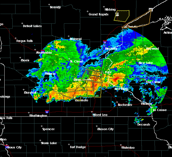 At 735 pm cdt, a severe thunderstorm was located over dundas, or over northfield, moving east at 45 mph (public). Hazards include 70 mph wind gusts and ping pong ball size hail. People and animals outdoors will be injured. expect hail damage to roofs, siding, windows, and vehicles. expect considerable tree damage. wind damage is also likely to mobile homes, roofs, and outbuildings. This severe thunderstorm will remain over mainly rural areas of eastern scott and northwestern rice counties, including the following locations: credit river and veseli. At 735 pm cdt, a severe thunderstorm was located over dundas, or over northfield, moving east at 45 mph (public). Hazards include 70 mph wind gusts and ping pong ball size hail. People and animals outdoors will be injured. expect hail damage to roofs, siding, windows, and vehicles. expect considerable tree damage. wind damage is also likely to mobile homes, roofs, and outbuildings. This severe thunderstorm will remain over mainly rural areas of eastern scott and northwestern rice counties, including the following locations: credit river and veseli.
|
| 7/5/2016 7:22 PM CDT |
 At 721 pm cdt, a severe thunderstorm was located over lonsdale, or 12 miles west of northfield, moving east at 45 mph (public). Hazards include 70 mph wind gusts and ping pong ball size hail. People and animals outdoors will be injured. expect hail damage to roofs, siding, windows, and vehicles. expect considerable tree damage. wind damage is also likely to mobile homes, roofs, and outbuildings. this severe storm will be near, webster and elko new market around 725 pm cdt. Other locations impacted by this severe thunderstorm include credit river, veseli and heidelberg. At 721 pm cdt, a severe thunderstorm was located over lonsdale, or 12 miles west of northfield, moving east at 45 mph (public). Hazards include 70 mph wind gusts and ping pong ball size hail. People and animals outdoors will be injured. expect hail damage to roofs, siding, windows, and vehicles. expect considerable tree damage. wind damage is also likely to mobile homes, roofs, and outbuildings. this severe storm will be near, webster and elko new market around 725 pm cdt. Other locations impacted by this severe thunderstorm include credit river, veseli and heidelberg.
|
| 7/5/2016 7:05 PM CDT |
 At 705 pm cdt, a severe thunderstorm was located over heidelberg, or 22 miles northwest of faribault, moving east at 40 mph (radar indicated). Hazards include 70 mph wind gusts and ping pong ball size hail. People and animals outdoors will be injured. expect hail damage to roofs, siding, windows, and vehicles. expect considerable tree damage. wind damage is also likely to mobile homes, roofs, and outbuildings. this severe storm will be near, montgomery around 710 pm cdt. lonsdale around 720 pm cdt. other locations impacted by this severe thunderstorm include credit river, marystown, st thomas, heidelberg, st benedict, mn valley state rec area, veseli and helena. A tornado watch remains in effect until 900 pm cdt for south central and central minnesota. At 705 pm cdt, a severe thunderstorm was located over heidelberg, or 22 miles northwest of faribault, moving east at 40 mph (radar indicated). Hazards include 70 mph wind gusts and ping pong ball size hail. People and animals outdoors will be injured. expect hail damage to roofs, siding, windows, and vehicles. expect considerable tree damage. wind damage is also likely to mobile homes, roofs, and outbuildings. this severe storm will be near, montgomery around 710 pm cdt. lonsdale around 720 pm cdt. other locations impacted by this severe thunderstorm include credit river, marystown, st thomas, heidelberg, st benedict, mn valley state rec area, veseli and helena. A tornado watch remains in effect until 900 pm cdt for south central and central minnesota.
|
| 7/5/2016 6:47 PM CDT |
 At 647 pm cdt, a severe thunderstorm was located near belle plaine, or 31 miles north of mankato, moving east at 45 mph (radar indicated). Hazards include ping pong ball size hail and 60 mph wind gusts. People and animals outdoors will be injured. expect hail damage to roofs, siding, windows, and vehicles. expect wind damage to roofs, siding, and trees. this severe thunderstorm will be near, belle plaine around 650 pm cdt. jordan around 700 pm cdt. new prague around 705 pm cdt. lonsdale around 715 pm cdt. webster and elko new market around 720 pm cdt. other locations impacted by this severe thunderstorm include credit river, marystown, st thomas, heidelberg, st benedict, mn valley state rec area, veseli and helena. this includes u. s. highway 169 between mile markers 79 and 110. A tornado watch remains in effect until 900 pm cdt for south central and central minnesota. At 647 pm cdt, a severe thunderstorm was located near belle plaine, or 31 miles north of mankato, moving east at 45 mph (radar indicated). Hazards include ping pong ball size hail and 60 mph wind gusts. People and animals outdoors will be injured. expect hail damage to roofs, siding, windows, and vehicles. expect wind damage to roofs, siding, and trees. this severe thunderstorm will be near, belle plaine around 650 pm cdt. jordan around 700 pm cdt. new prague around 705 pm cdt. lonsdale around 715 pm cdt. webster and elko new market around 720 pm cdt. other locations impacted by this severe thunderstorm include credit river, marystown, st thomas, heidelberg, st benedict, mn valley state rec area, veseli and helena. this includes u. s. highway 169 between mile markers 79 and 110. A tornado watch remains in effect until 900 pm cdt for south central and central minnesota.
|
| 6/22/2016 7:45 PM CDT | Quarter sized hail reported 0.4 miles ESE of Lonsdale, MN, . |
| 6/22/2016 7:45 PM CDT | Hen Egg sized hail reported 0.4 miles ESE of Lonsdale, MN, . |
| 6/22/2016 7:41 PM CDT | Half Dollar sized hail reported 0.4 miles ESE of Lonsdale, MN, . |
| 6/22/2016 7:38 PM CDT |
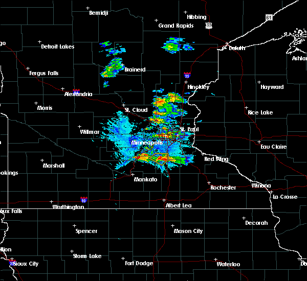 At 737 pm cdt, a severe thunderstorm was located over lonsdale, or 13 miles west of northfield, moving southeast at 25 mph (radar indicated). Hazards include 60 mph wind gusts and quarter size hail. Hail damage to vehicles is expected. expect wind damage to roofs, siding, and trees. This severe thunderstorm will remain over mainly rural areas of northwestern rice county, including the following locations: veseli. At 737 pm cdt, a severe thunderstorm was located over lonsdale, or 13 miles west of northfield, moving southeast at 25 mph (radar indicated). Hazards include 60 mph wind gusts and quarter size hail. Hail damage to vehicles is expected. expect wind damage to roofs, siding, and trees. This severe thunderstorm will remain over mainly rural areas of northwestern rice county, including the following locations: veseli.
|
| 6/22/2016 7:27 PM CDT |
 At 726 pm cdt, a severe thunderstorm was located over veseli, or 17 miles west of northfield, moving east at 30 mph (trained weather spotters). Hazards include 60 mph wind gusts and quarter size hail. Hail damage to vehicles is expected. expect wind damage to roofs, siding, and trees. this severe storm will be near, lonsdale around 735 pm cdt. webster and elko new market around 740 pm cdt. Other locations impacted by this severe thunderstorm include heidelberg and veseli. At 726 pm cdt, a severe thunderstorm was located over veseli, or 17 miles west of northfield, moving east at 30 mph (trained weather spotters). Hazards include 60 mph wind gusts and quarter size hail. Hail damage to vehicles is expected. expect wind damage to roofs, siding, and trees. this severe storm will be near, lonsdale around 735 pm cdt. webster and elko new market around 740 pm cdt. Other locations impacted by this severe thunderstorm include heidelberg and veseli.
|
| 6/22/2016 7:09 PM CDT |
 At 708 pm cdt, a severe thunderstorm was located over st benedict, or 24 miles west of northfield, moving southeast at 30 mph (radar indicated). Hazards include 60 mph wind gusts and quarter size hail. Hail damage to vehicles is expected. expect wind damage to roofs, siding, and trees. this severe thunderstorm will be near, new prague around 715 pm cdt. montgomery around 720 pm cdt. lonsdale and elko new market around 730 pm cdt. webster around 735 pm cdt. other locations impacted by this severe thunderstorm include veseli, heidelberg, st benedict and helena. This includes interstate 35 near mile marker 67, and between mile markers 69 and 78. At 708 pm cdt, a severe thunderstorm was located over st benedict, or 24 miles west of northfield, moving southeast at 30 mph (radar indicated). Hazards include 60 mph wind gusts and quarter size hail. Hail damage to vehicles is expected. expect wind damage to roofs, siding, and trees. this severe thunderstorm will be near, new prague around 715 pm cdt. montgomery around 720 pm cdt. lonsdale and elko new market around 730 pm cdt. webster around 735 pm cdt. other locations impacted by this severe thunderstorm include veseli, heidelberg, st benedict and helena. This includes interstate 35 near mile marker 67, and between mile markers 69 and 78.
|
| 6/10/2016 3:48 PM CDT |
 At 348 pm cdt, a severe thunderstorm was located over kilkenny, or 15 miles west of faribault, moving east at 25 mph (radar indicated). Hazards include 60 mph wind gusts and nickel size hail. Expect damage to roofs. siding. And trees. At 348 pm cdt, a severe thunderstorm was located over kilkenny, or 15 miles west of faribault, moving east at 25 mph (radar indicated). Hazards include 60 mph wind gusts and nickel size hail. Expect damage to roofs. siding. And trees.
|
| 9/17/2015 3:55 PM CDT |
 At 354 pm cdt, a severe thunderstorm was located near faribault airport, or 7 miles north of faribault, moving east at 20 mph (radar indicated). Hazards include 60 mph wind gusts and nickel size hail. Expect damage to roofs. siding and trees. this severe storm will be near, dundas around 410 pm cdt. northfield around 415 pm cdt. nerstrand around 430 pm cdt. other locations impacted by this severe thunderstorm include faribault airport and bridgewater. This includes interstate 35 between mile markers 57 and 72. At 354 pm cdt, a severe thunderstorm was located near faribault airport, or 7 miles north of faribault, moving east at 20 mph (radar indicated). Hazards include 60 mph wind gusts and nickel size hail. Expect damage to roofs. siding and trees. this severe storm will be near, dundas around 410 pm cdt. northfield around 415 pm cdt. nerstrand around 430 pm cdt. other locations impacted by this severe thunderstorm include faribault airport and bridgewater. This includes interstate 35 between mile markers 57 and 72.
|
| 9/17/2015 3:43 PM CDT |
 At 343 pm cdt, a severe thunderstorm was located near lonsdale, or 10 miles northwest of faribault, moving east at 25 mph (radar indicated). Hazards include 60 mph wind gusts and quarter size hail. Hail damage to vehicles is expected. expect wind damage to roofs, siding and trees. this severe thunderstorm will be near, dundas around 405 pm cdt. northfield around 415 pm cdt. other locations impacted by this severe thunderstorm include faribault airport, veseli, randolph, bridgewater and castle rock. This includes interstate 35 between mile markers 57 and 74. At 343 pm cdt, a severe thunderstorm was located near lonsdale, or 10 miles northwest of faribault, moving east at 25 mph (radar indicated). Hazards include 60 mph wind gusts and quarter size hail. Hail damage to vehicles is expected. expect wind damage to roofs, siding and trees. this severe thunderstorm will be near, dundas around 405 pm cdt. northfield around 415 pm cdt. other locations impacted by this severe thunderstorm include faribault airport, veseli, randolph, bridgewater and castle rock. This includes interstate 35 between mile markers 57 and 74.
|
| 7/18/2015 12:44 AM CDT |
 At 1244 am cdt, severe thunderstorms were located along a line extending from eagan to near webster to waterville, moving east at 50 mph (trained weather spotters). Hazards include 70 mph wind gusts. Expect considerable tree damage. damage is likely to mobile homes, roofs and outbuildings. these severe storms will be near, eagan, apple valley, rosemount and dundas around 1250 am cdt. northfield around 1255 am cdt. faribault, hastings and randolph around 100 am cdt. Other locations impacted by these severe thunderstorms include credit river, ruskin, veseli, coates, hampton, new trier, kilkenny, bridgewater, castle rock and faribault airport. At 1244 am cdt, severe thunderstorms were located along a line extending from eagan to near webster to waterville, moving east at 50 mph (trained weather spotters). Hazards include 70 mph wind gusts. Expect considerable tree damage. damage is likely to mobile homes, roofs and outbuildings. these severe storms will be near, eagan, apple valley, rosemount and dundas around 1250 am cdt. northfield around 1255 am cdt. faribault, hastings and randolph around 100 am cdt. Other locations impacted by these severe thunderstorms include credit river, ruskin, veseli, coates, hampton, new trier, kilkenny, bridgewater, castle rock and faribault airport.
|
| 7/18/2015 12:29 AM CDT |
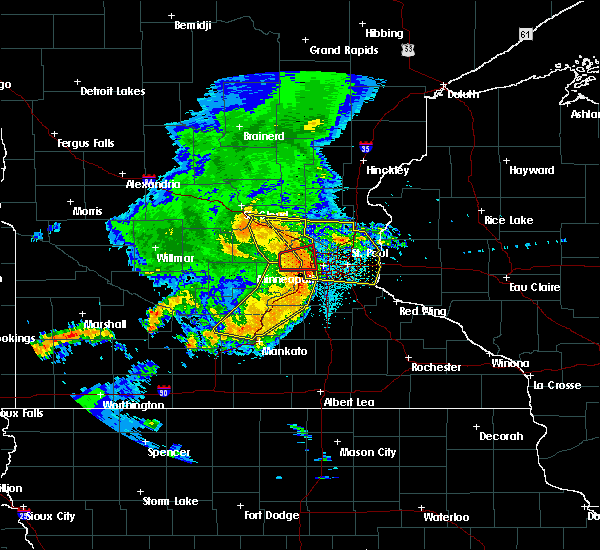 At 1229 am cdt, severe thunderstorms were located along a line extending from flying cloud airport to new prague to near lake jefferson, moving east at 50 mph (radar indicated). Hazards include 60 mph wind gusts. Expect damage to roofs. siding and trees. severe thunderstorms will be near, burnsville, savage, prior lake and lonsdale around 1235 am cdt. bloomington, lakeville, apple valley, webster and elko new market around 1240 am cdt. eagan and rosemount around 1245 am cdt. dundas and morristown around 1250 am cdt. faribault, northfield and warsaw around 1255 am cdt. hastings and randolph around 100 am cdt. other locations impacted by these severe thunderstorms include credit river, ruskin, veseli, coates, hampton, new trier, kilkenny, bridgewater, castle rock and faribault airport. this includes the following highways, interstate 35 between mile markers 50 and 88. u. s. highway 169 between mile markers 113 and 116. u. s. Highway 61 between mile markers 105 and 118. At 1229 am cdt, severe thunderstorms were located along a line extending from flying cloud airport to new prague to near lake jefferson, moving east at 50 mph (radar indicated). Hazards include 60 mph wind gusts. Expect damage to roofs. siding and trees. severe thunderstorms will be near, burnsville, savage, prior lake and lonsdale around 1235 am cdt. bloomington, lakeville, apple valley, webster and elko new market around 1240 am cdt. eagan and rosemount around 1245 am cdt. dundas and morristown around 1250 am cdt. faribault, northfield and warsaw around 1255 am cdt. hastings and randolph around 100 am cdt. other locations impacted by these severe thunderstorms include credit river, ruskin, veseli, coates, hampton, new trier, kilkenny, bridgewater, castle rock and faribault airport. this includes the following highways, interstate 35 between mile markers 50 and 88. u. s. highway 169 between mile markers 113 and 116. u. s. Highway 61 between mile markers 105 and 118.
|
| 5/3/2015 4:53 PM CDT | At 453 pm cdt, severe thunderstorms were located along a line extending from near helena to near mankato airport, moving east at 30 mph (radar indicated). Hazards include half dollar size hail. Damage to vehicles is expected. locations impacted include, mankato, lakeville, st. peter, new prague, le sueur, lonsdale, montgomery, le center, waterville, webster, madison lake and kasota. 1. 25in. |
| 5/3/2015 4:31 PM CDT | At 431 pm cdt, severe thunderstorms were located along a line extending from near belle plaine to near oshawa, moving southeast at 30 mph (radar indicated). Hazards include half dollar size hail. damage to vehicles is expected |
| 6/21/2013 9:50 PM CDT | Storm damage reported in rice county MN, 6.9 miles N of Lonsdale, MN |
| 6/18/2012 1:06 AM CDT | Golf Ball sized hail reported 0.4 miles ESE of Lonsdale, MN |
| 6/18/2012 1:03 AM CDT | Quarter sized hail reported 0.4 miles ESE of Lonsdale, MN |
Hail Maps for Lonsdale, MN
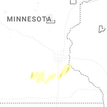


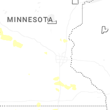


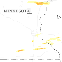


Connect with Interactive Hail Maps