

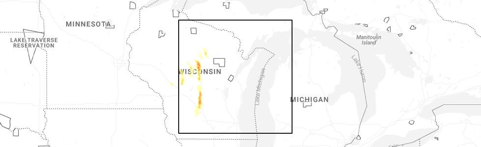
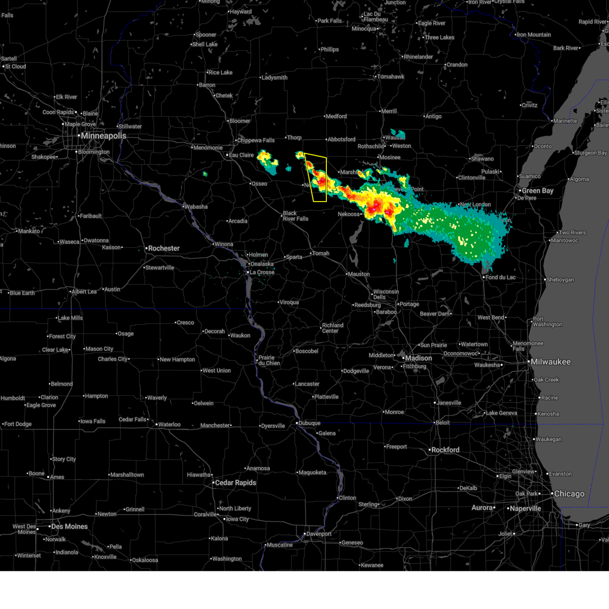
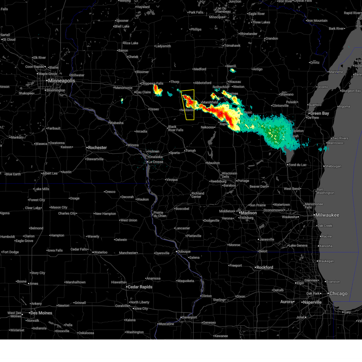
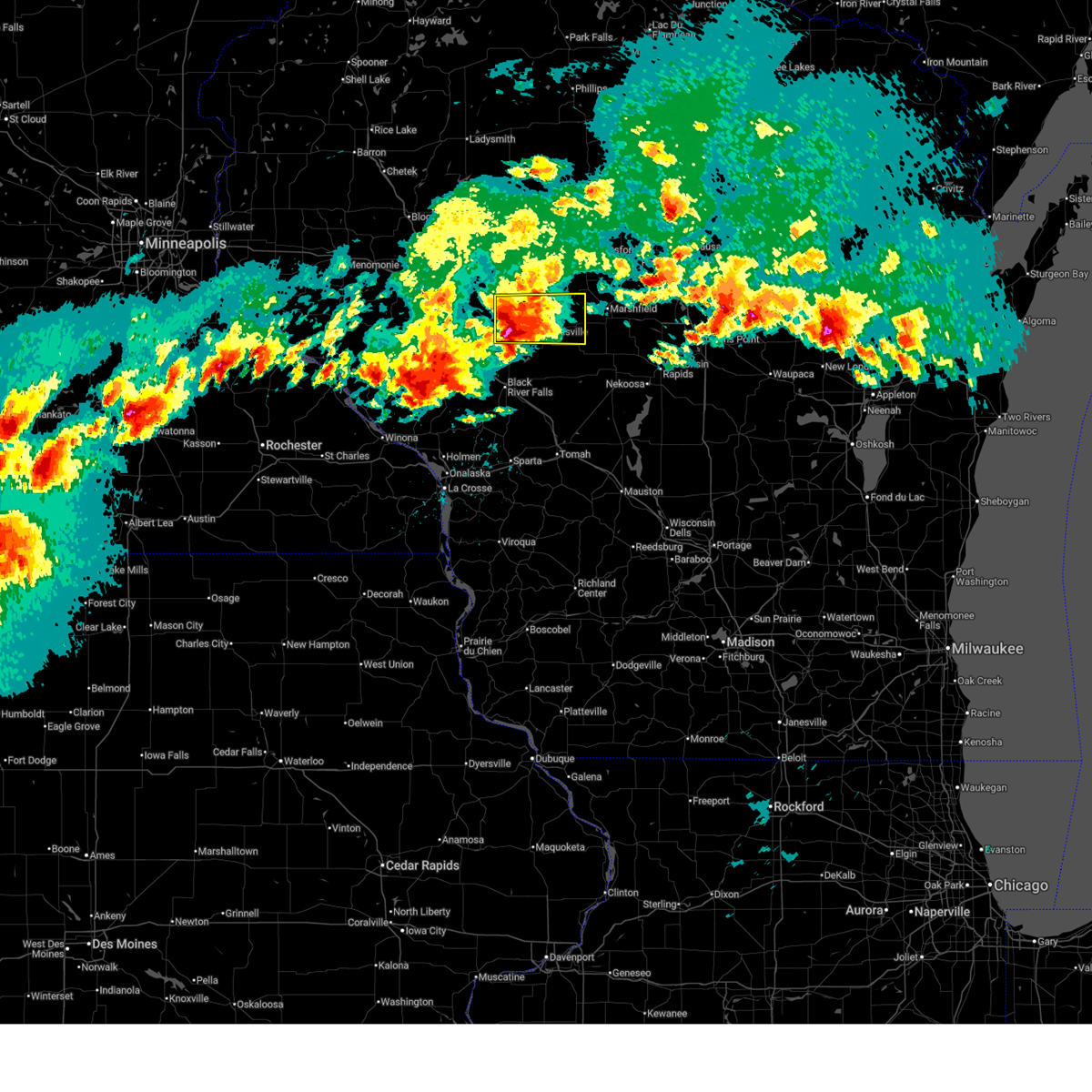
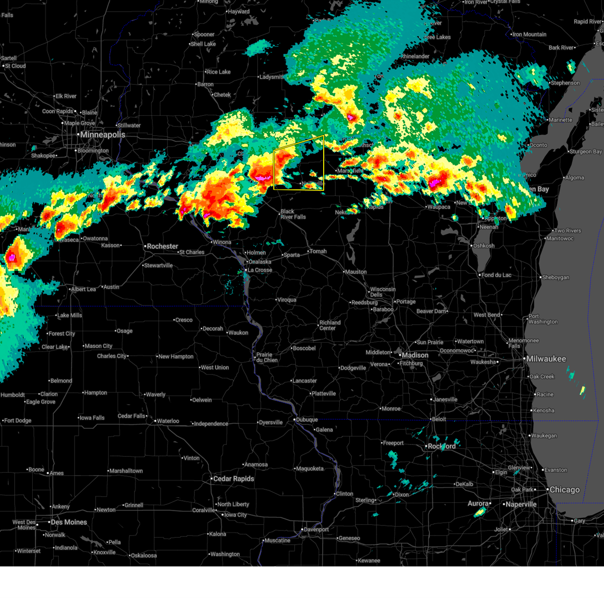
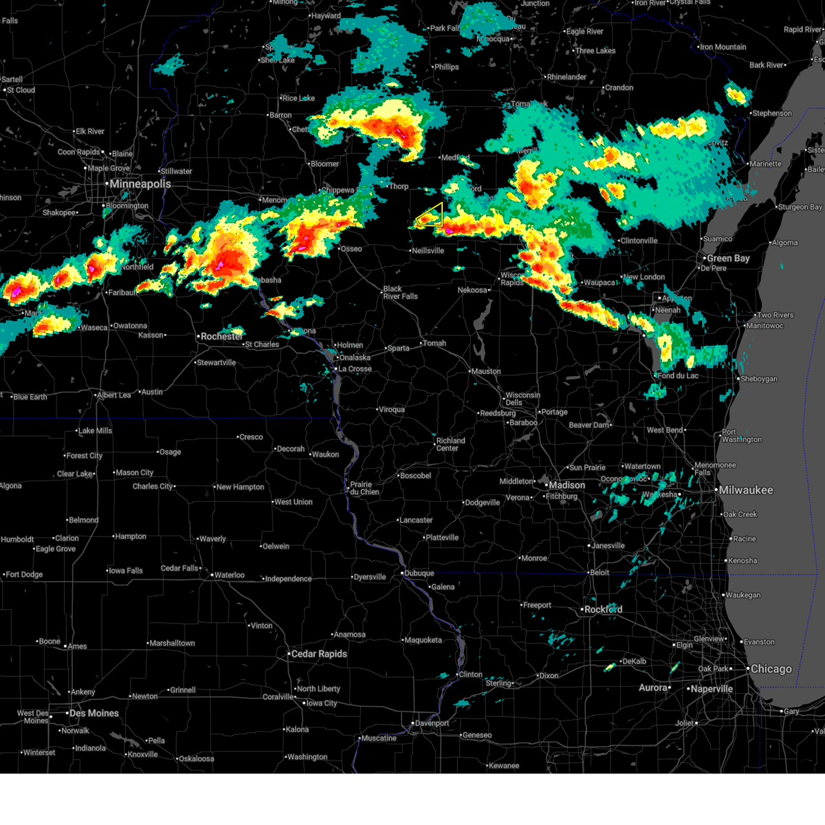
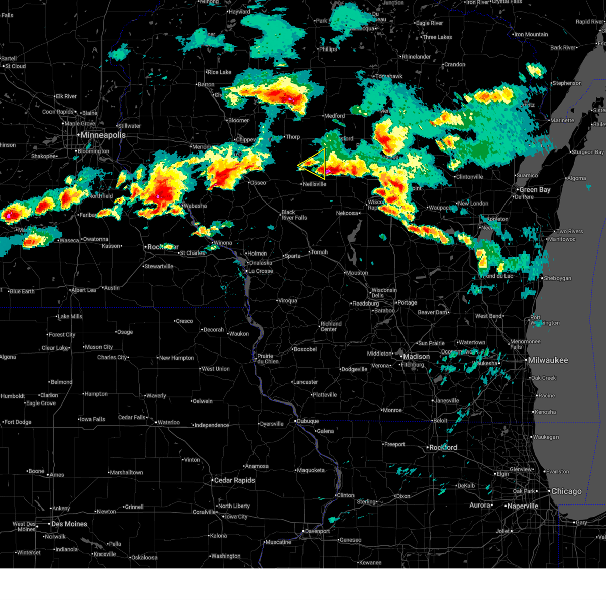
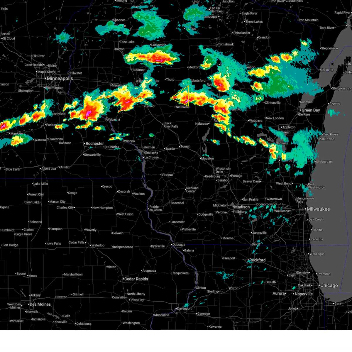
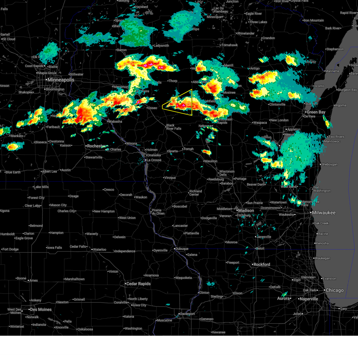
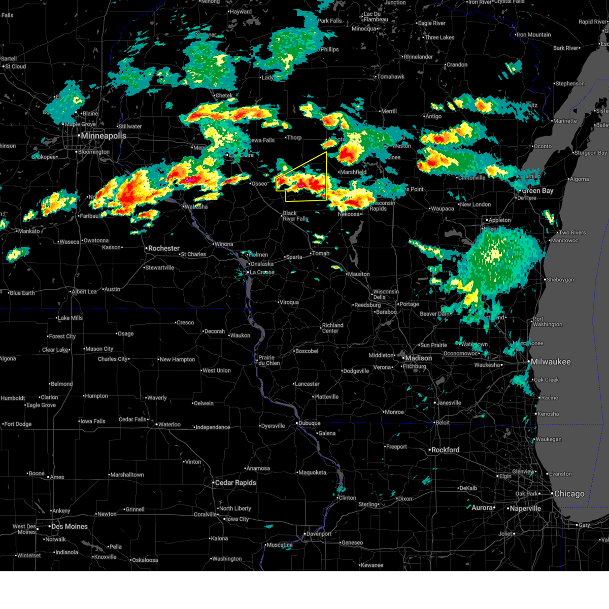
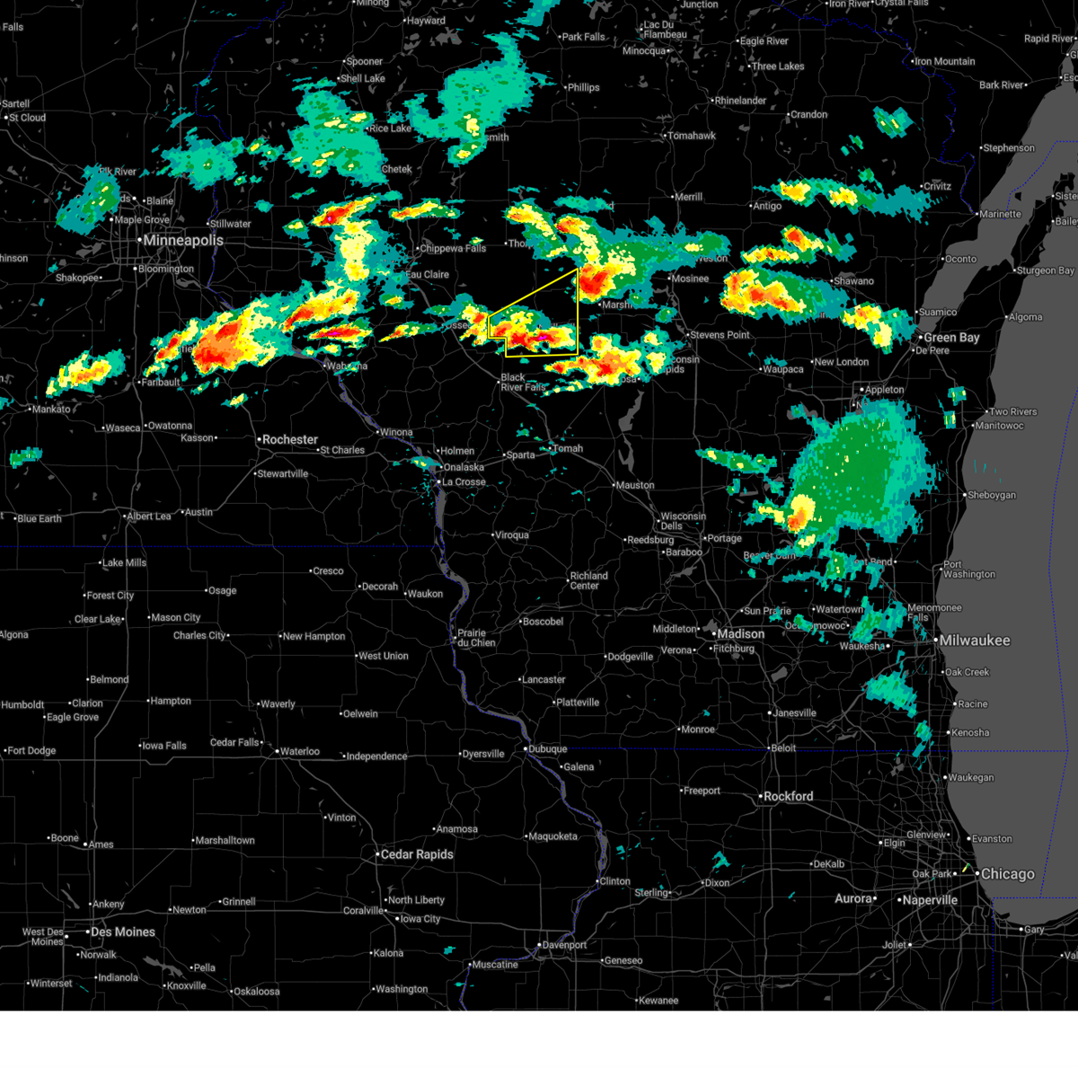
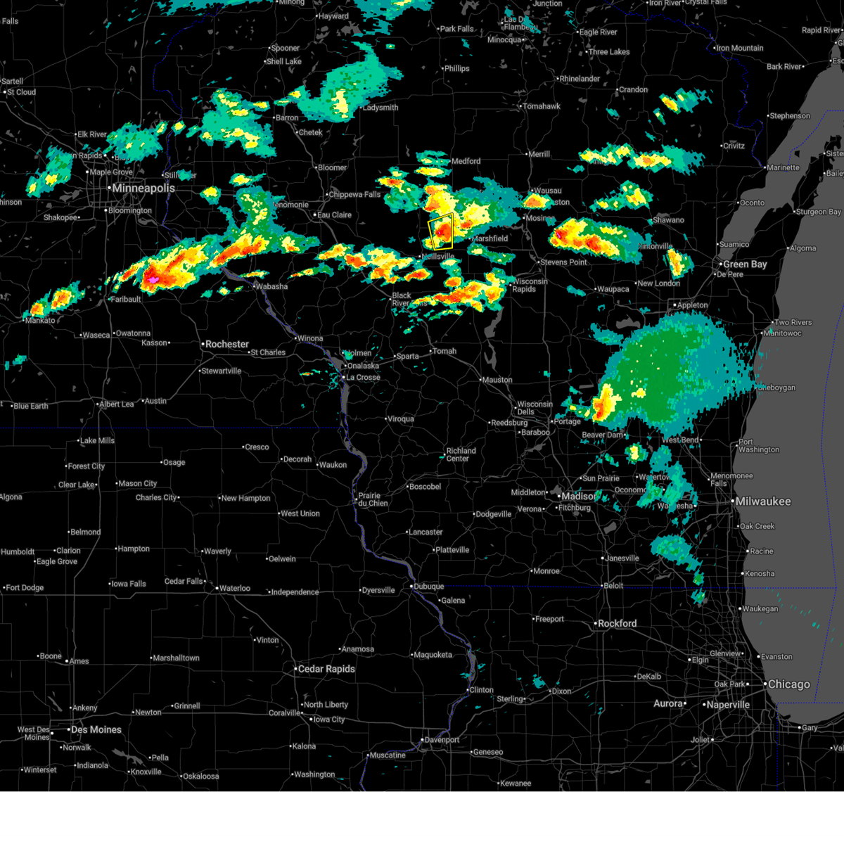
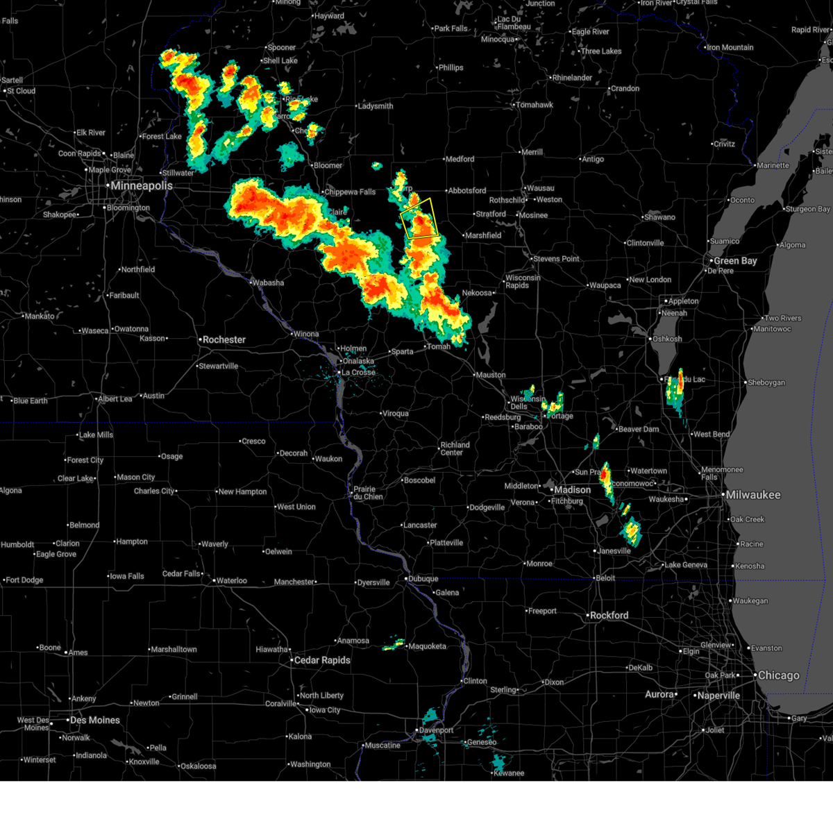
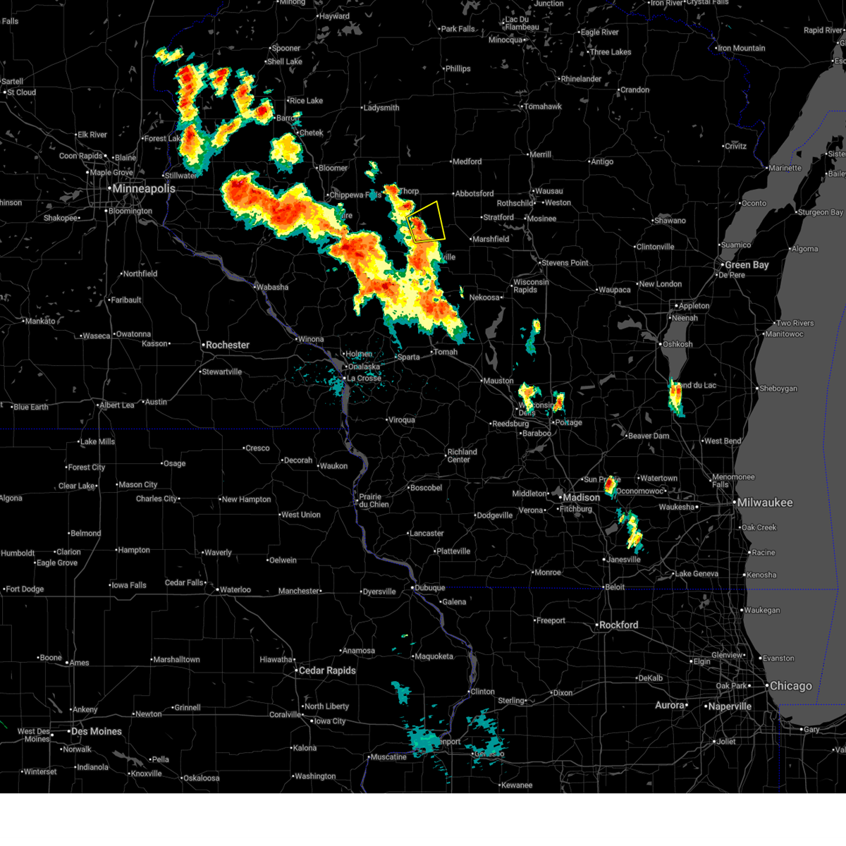
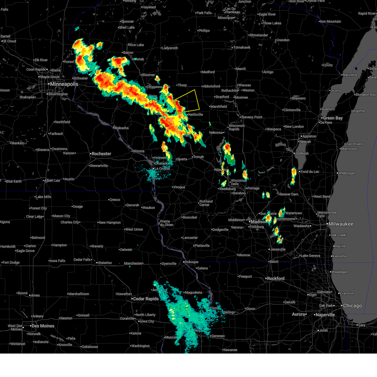
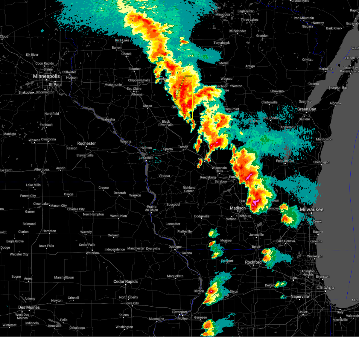
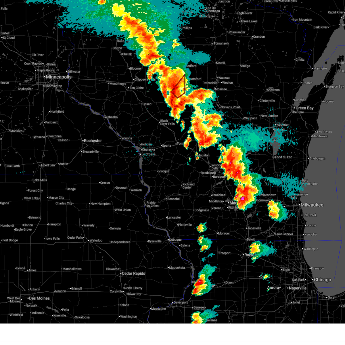
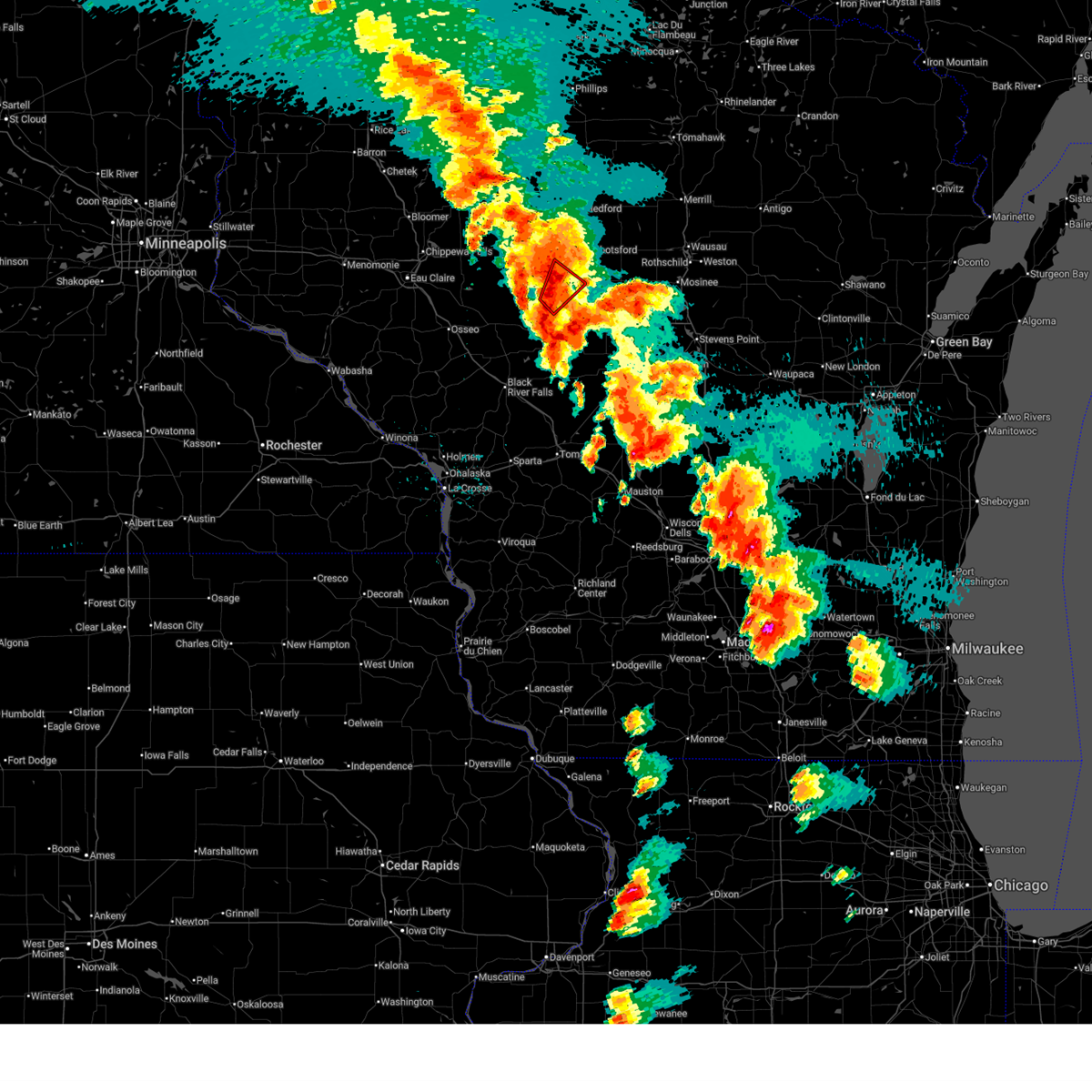
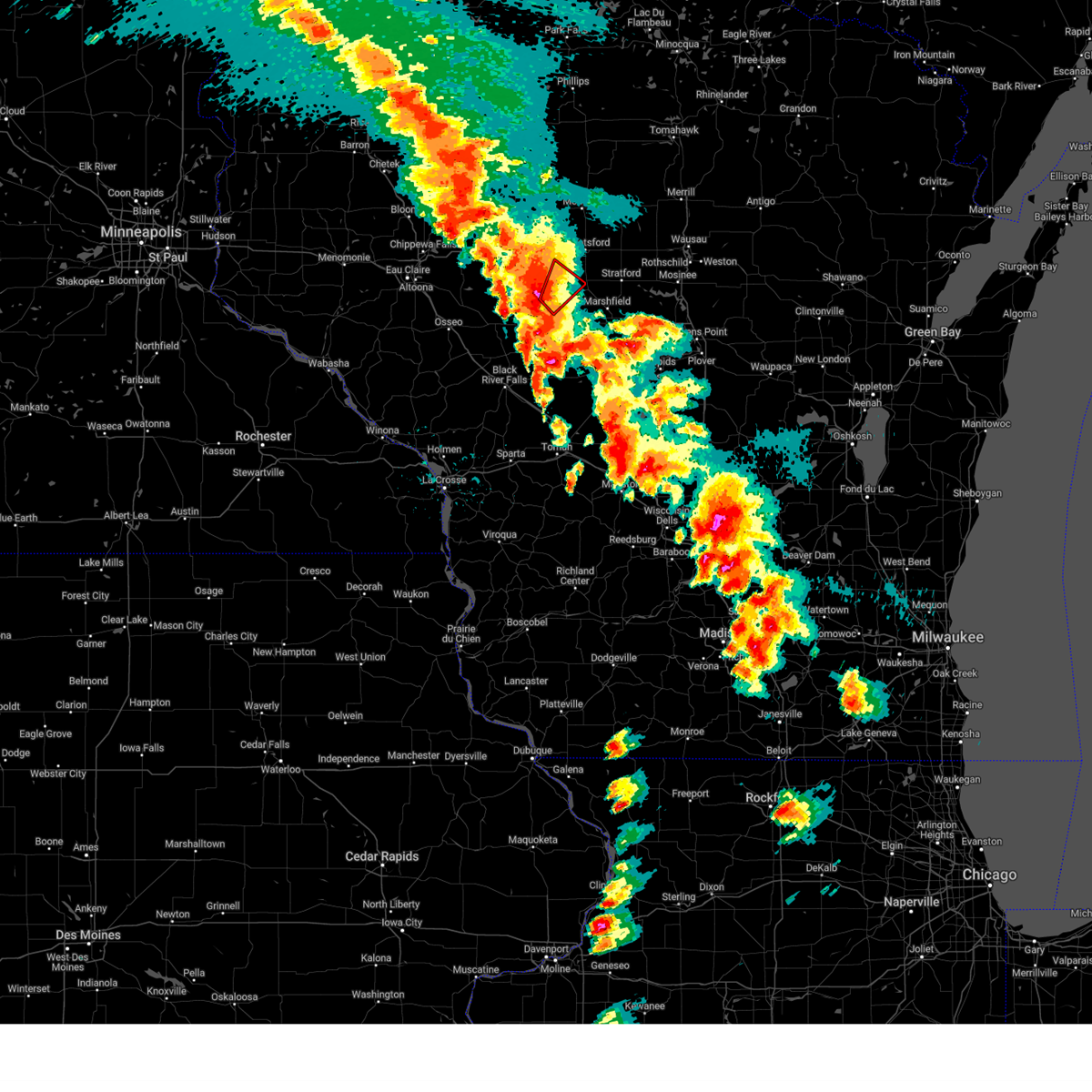
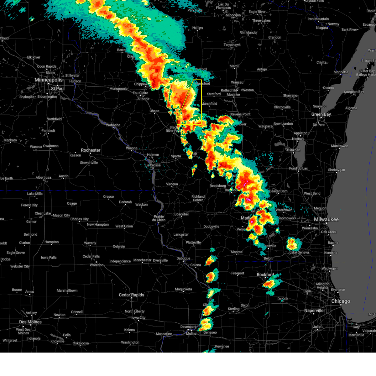
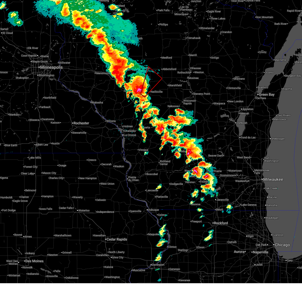
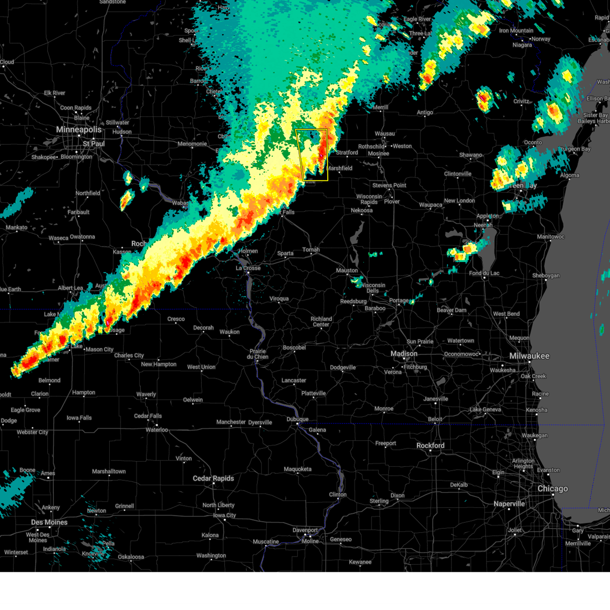
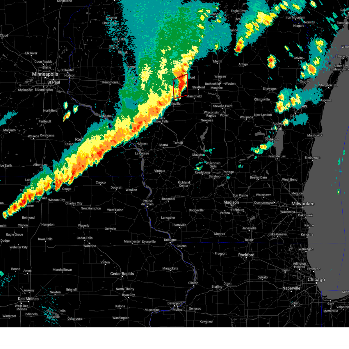
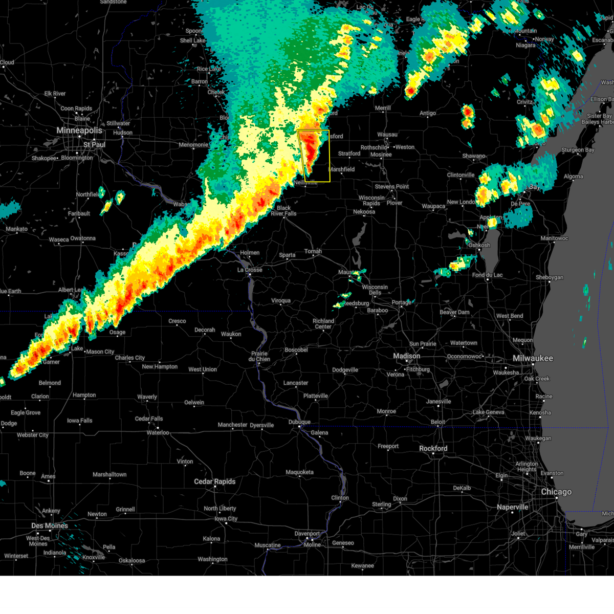
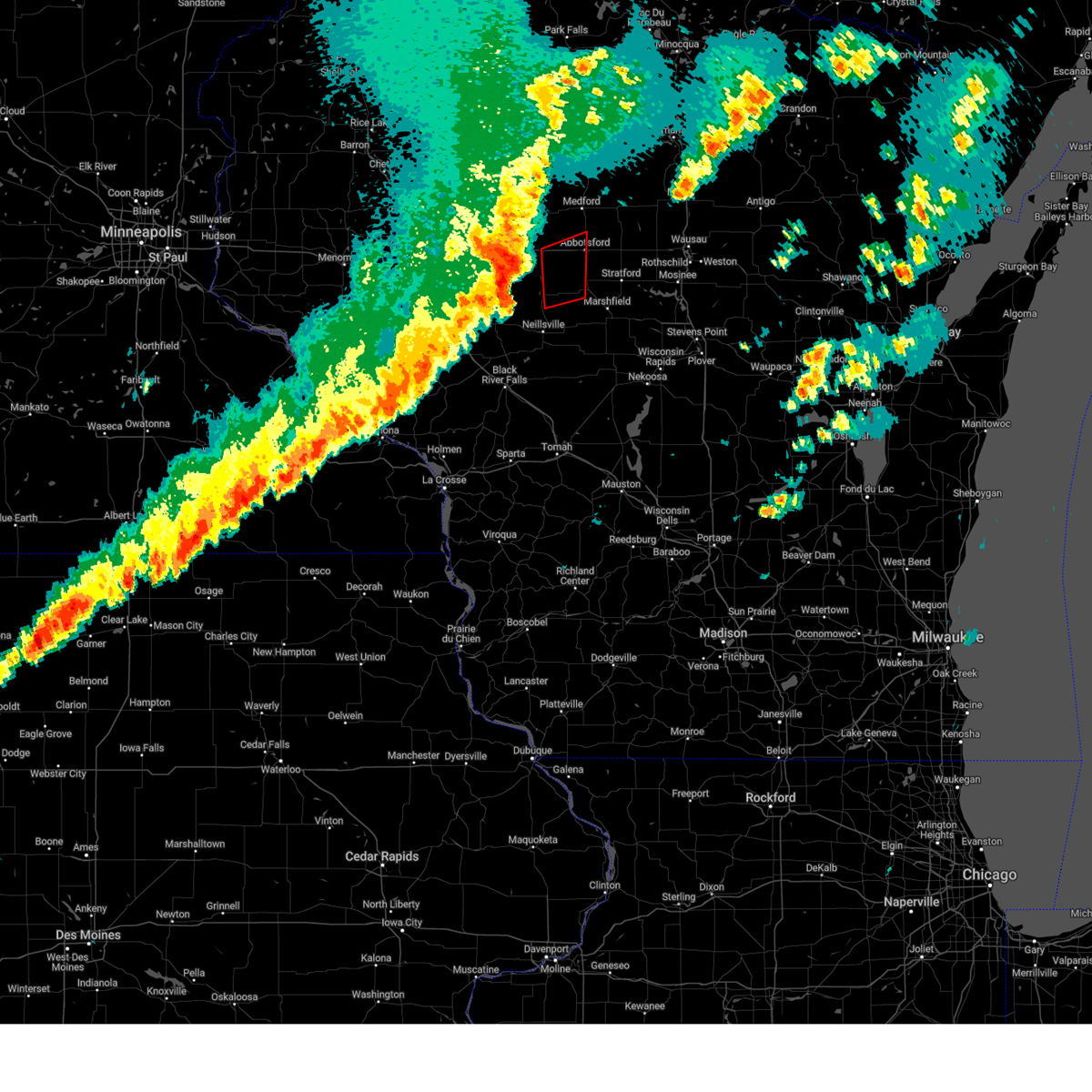
Hail Map for Loyal, WI
The Loyal, WI area has had 3 reports of on-the-ground hail by trained spotters, and has been under severe weather warnings 24 times during the past 12 months. Doppler radar has detected hail at or near Loyal, WI on 49 occasions, including 5 occasions during the past year.
| Name: | Loyal, WI |
| Where Located: | 74.2 miles NNE of La Crosse, WI |
| Map: | Google Map for Loyal, WI |
| Population: | 1261 |
| Housing Units: | 603 |
| More Info: | Search Google for Loyal, WI |
5
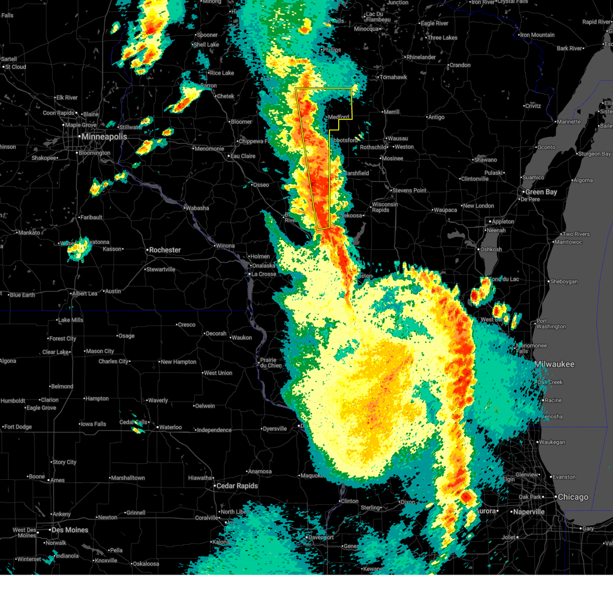
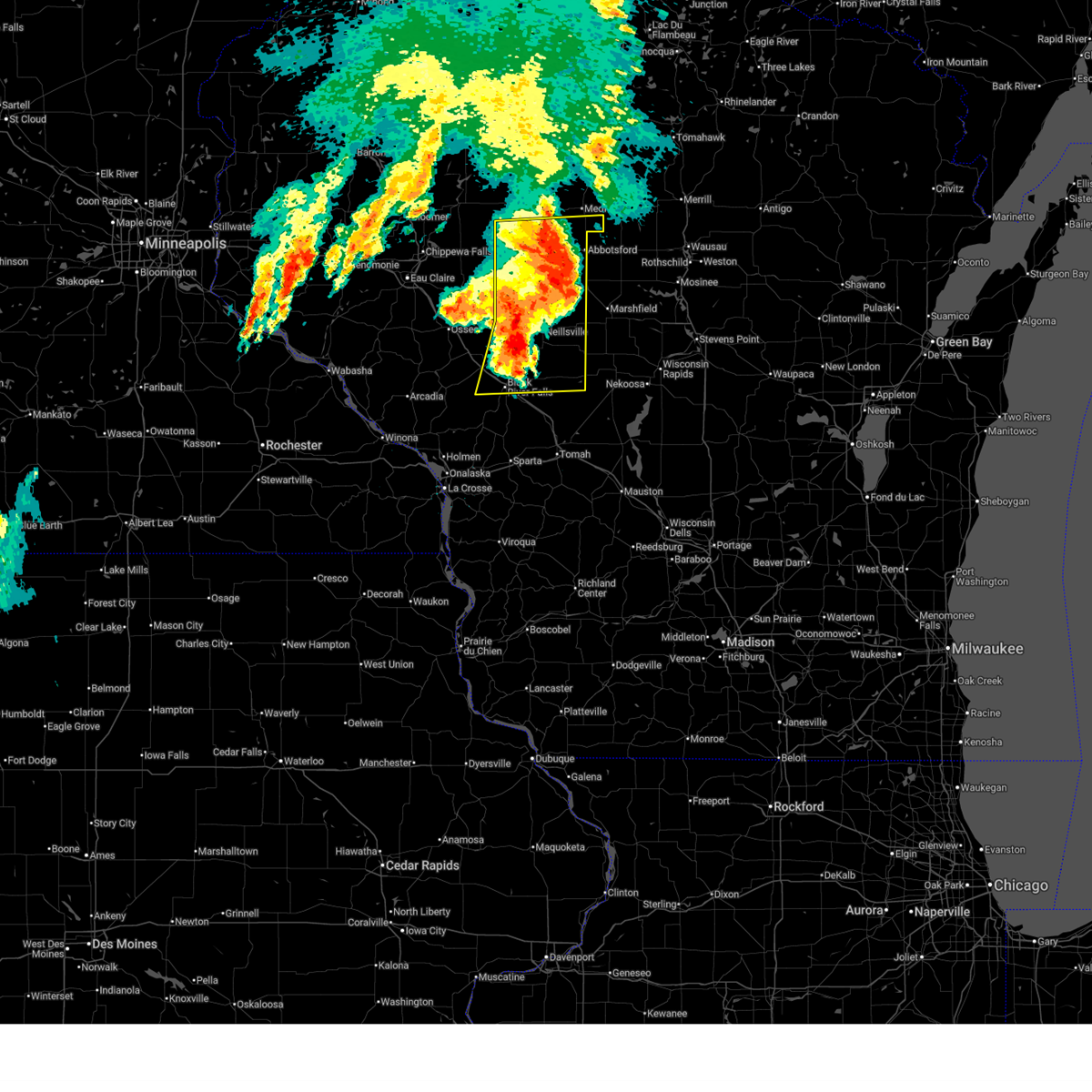
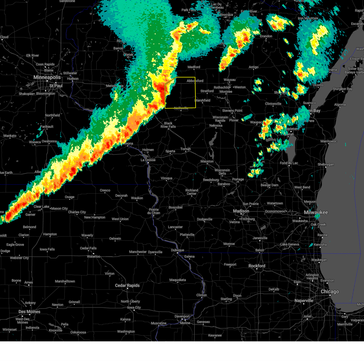
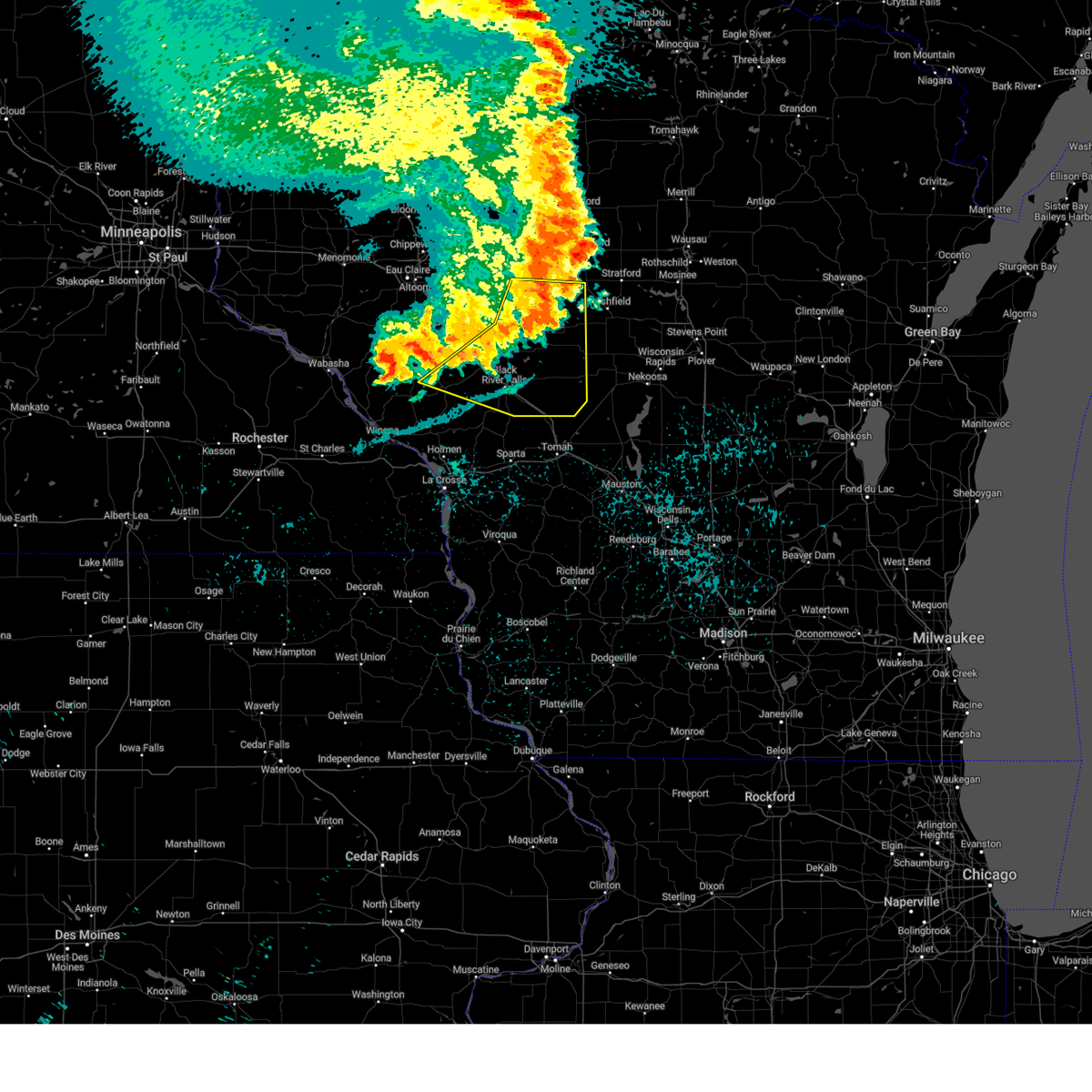
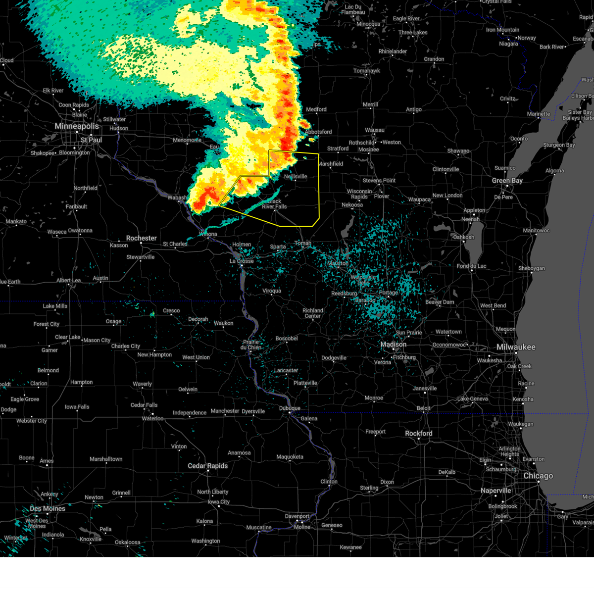
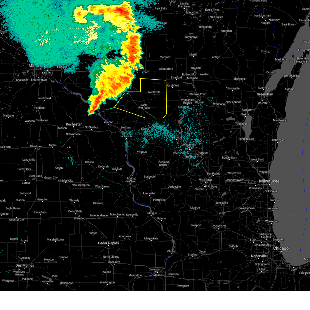
The Top Recent Hail Date for Loyal, WI is Wednesday, May 27, 2026 (1st out of 49)
Hail and Wind Damage Spotted near Loyal, WI
| Date / Time | Report Details |
|---|---|
| 6/10/2026 2:52 PM CDT |
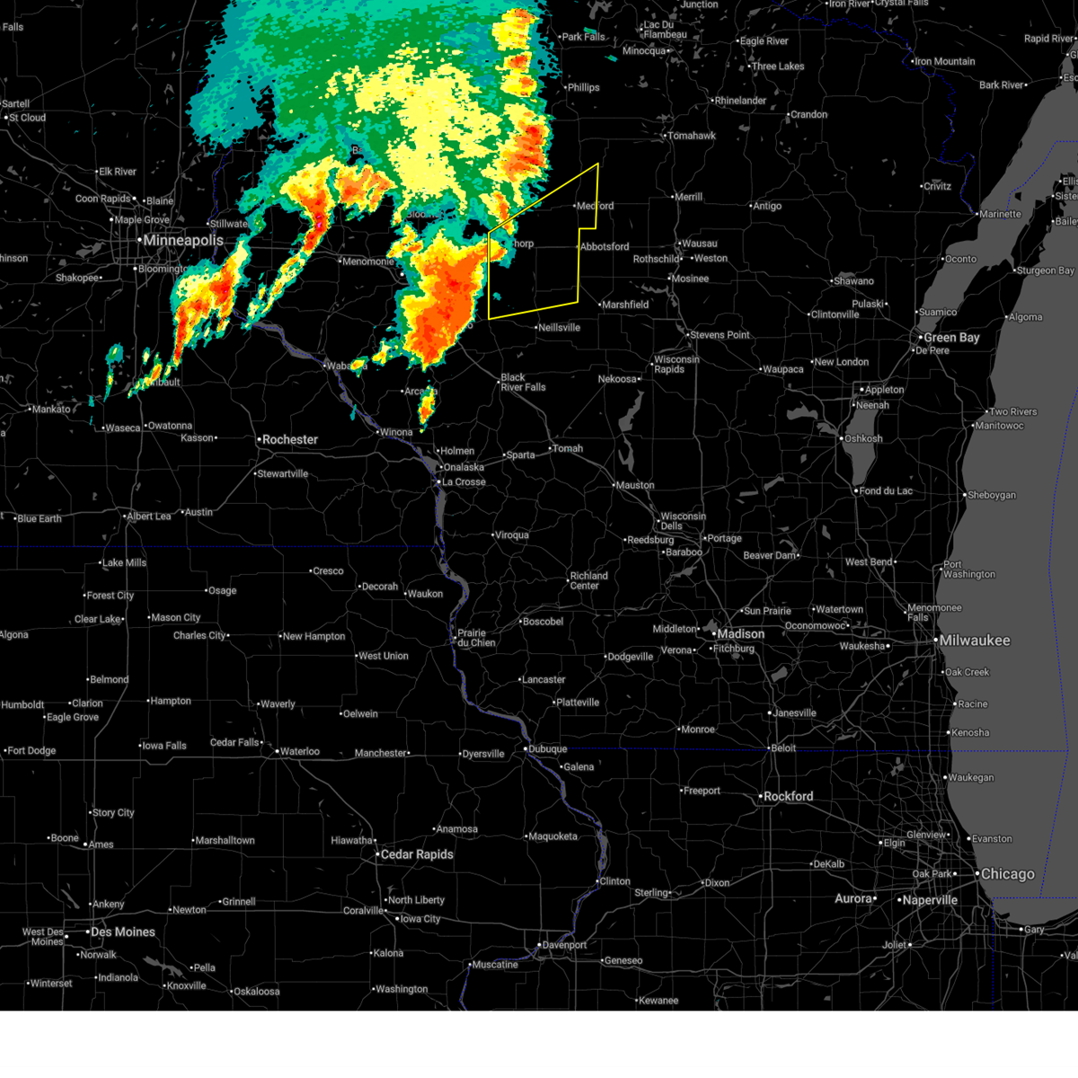
 At 252 pm cdt, severe thunderstorms were located along a line extending from 8 miles southeast of jump river to colby to 10 miles southwest of pittsville, moving northeast at 40 mph (radar indicated). Hazards include 70 mph wind gusts and quarter size hail. Hail damage to vehicles is expected. expect considerable tree damage. wind damage is also likely to mobile homes, roofs, and outbuildings. Locations impacted include, medford, abbotsford, spencer, loyal, owen, rib lake, dorchester, chelsea, westboro, shortville, colby, lynn, longwood, stetsonville, goodrich, withee, granton, unity, curtiss, and city point. At 252 pm cdt, severe thunderstorms were located along a line extending from 8 miles southeast of jump river to colby to 10 miles southwest of pittsville, moving northeast at 40 mph (radar indicated). Hazards include 70 mph wind gusts and quarter size hail. Hail damage to vehicles is expected. expect considerable tree damage. wind damage is also likely to mobile homes, roofs, and outbuildings. Locations impacted include, medford, abbotsford, spencer, loyal, owen, rib lake, dorchester, chelsea, westboro, shortville, colby, lynn, longwood, stetsonville, goodrich, withee, granton, unity, curtiss, and city point.
|
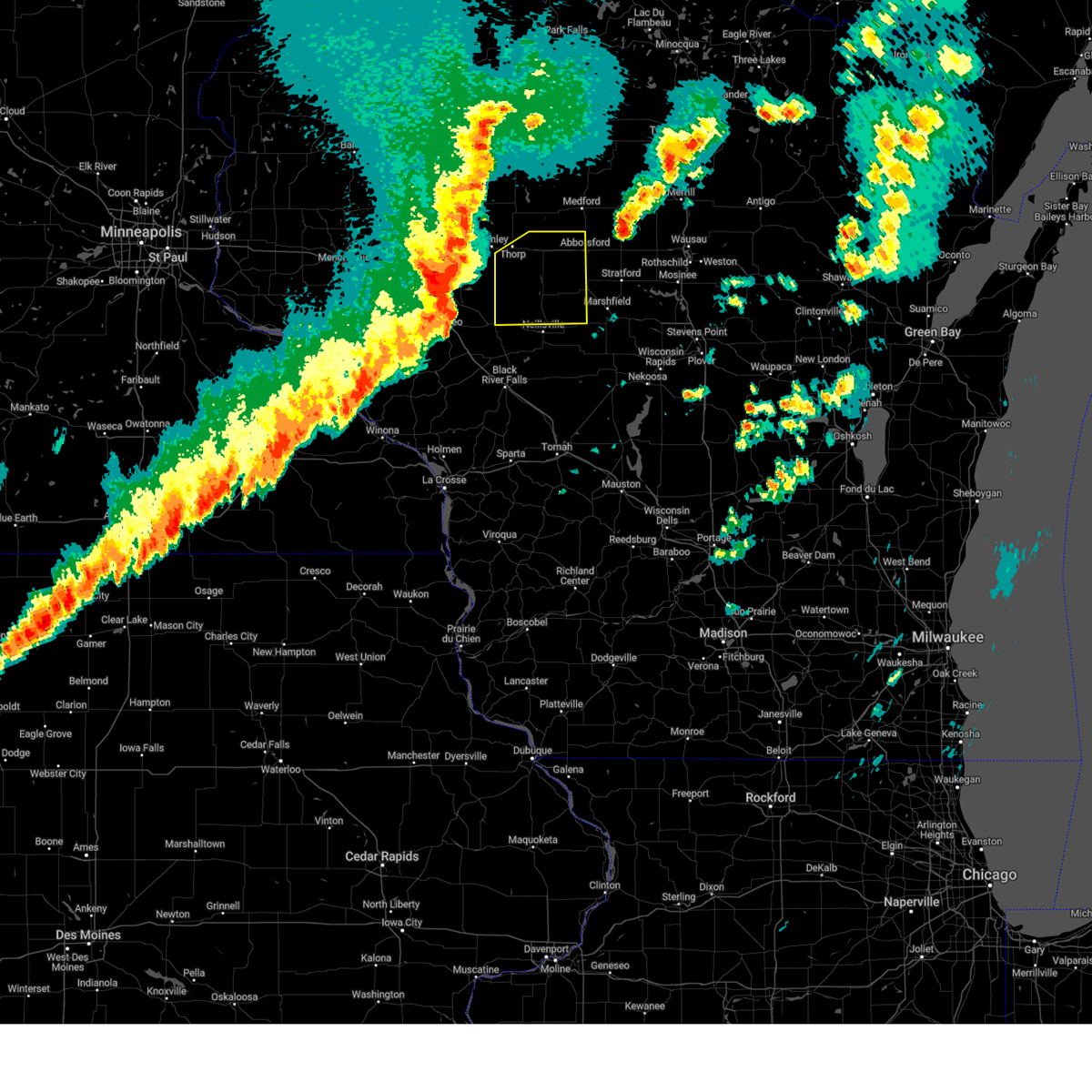
| 6/10/2026 2:10 PM CDT |
 Svrarx the national weather service in la crosse has issued a * severe thunderstorm warning for, eastern clark county in central wisconsin, east central jackson county in west central wisconsin, taylor county in north central wisconsin, * until 315 pm cdt. * at 210 pm cdt, severe thunderstorms were located along a line extending from near cornell to 10 miles west of greenwood to millston, moving northeast at 40 mph (radar indicated). Hazards include 70 mph wind gusts and quarter size hail. Hail damage to vehicles is expected. expect considerable tree damage. Wind damage is also likely to mobile homes, roofs, and outbuildings. Svrarx the national weather service in la crosse has issued a * severe thunderstorm warning for, eastern clark county in central wisconsin, east central jackson county in west central wisconsin, taylor county in north central wisconsin, * until 315 pm cdt. * at 210 pm cdt, severe thunderstorms were located along a line extending from near cornell to 10 miles west of greenwood to millston, moving northeast at 40 mph (radar indicated). Hazards include 70 mph wind gusts and quarter size hail. Hail damage to vehicles is expected. expect considerable tree damage. Wind damage is also likely to mobile homes, roofs, and outbuildings.
|
| 6/10/2026 6:48 AM CDT |
 At 648 am cdt, severe thunderstorms were located along a line extending from near dorchester to near spencer to 8 miles northeast of millston, moving east at 45 mph (radar indicated). Hazards include 60 mph wind gusts and quarter size hail. Hail damage to vehicles is expected. expect wind damage to roofs, siding, and trees. these severe thunderstorms will remain over mainly rural areas of clark, central jackson and southeastern taylor counties, including the following locations, ballard road and pray avenue, highway 73 and 98, city point, wildcat mound, the black river correctional center, atwood, and tioga. This includes interstate 94 between mile markers 110 and 111. At 648 am cdt, severe thunderstorms were located along a line extending from near dorchester to near spencer to 8 miles northeast of millston, moving east at 45 mph (radar indicated). Hazards include 60 mph wind gusts and quarter size hail. Hail damage to vehicles is expected. expect wind damage to roofs, siding, and trees. these severe thunderstorms will remain over mainly rural areas of clark, central jackson and southeastern taylor counties, including the following locations, ballard road and pray avenue, highway 73 and 98, city point, wildcat mound, the black river correctional center, atwood, and tioga. This includes interstate 94 between mile markers 110 and 111.
|
| 6/10/2026 6:42 AM CDT |
 Svrarx the national weather service in la crosse has issued a * severe thunderstorm warning for, clark county in central wisconsin, central jackson county in west central wisconsin, southern taylor county in north central wisconsin, * until 715 am cdt. * at 642 am cdt, severe thunderstorms were located along a line extending from 7 miles northwest of dorchester to 6 miles southwest of spencer to 6 miles north of millston, moving east at 45 mph (radar indicated). Hazards include 60 mph wind gusts and quarter size hail. Hail damage to vehicles is expected. expect wind damage to roofs, siding, and trees. severe thunderstorms will be near, abbotsford, spencer, colby, and dorchester around 650 am cdt. other locations impacted by these severe thunderstorms include highway 73 and 98, the black river correctional center, atwood, tioga, potters flowage, perry creek recreation area, and lynn. This includes interstate 94 between mile markers 106 and 119. Svrarx the national weather service in la crosse has issued a * severe thunderstorm warning for, clark county in central wisconsin, central jackson county in west central wisconsin, southern taylor county in north central wisconsin, * until 715 am cdt. * at 642 am cdt, severe thunderstorms were located along a line extending from 7 miles northwest of dorchester to 6 miles southwest of spencer to 6 miles north of millston, moving east at 45 mph (radar indicated). Hazards include 60 mph wind gusts and quarter size hail. Hail damage to vehicles is expected. expect wind damage to roofs, siding, and trees. severe thunderstorms will be near, abbotsford, spencer, colby, and dorchester around 650 am cdt. other locations impacted by these severe thunderstorms include highway 73 and 98, the black river correctional center, atwood, tioga, potters flowage, perry creek recreation area, and lynn. This includes interstate 94 between mile markers 106 and 119.
|
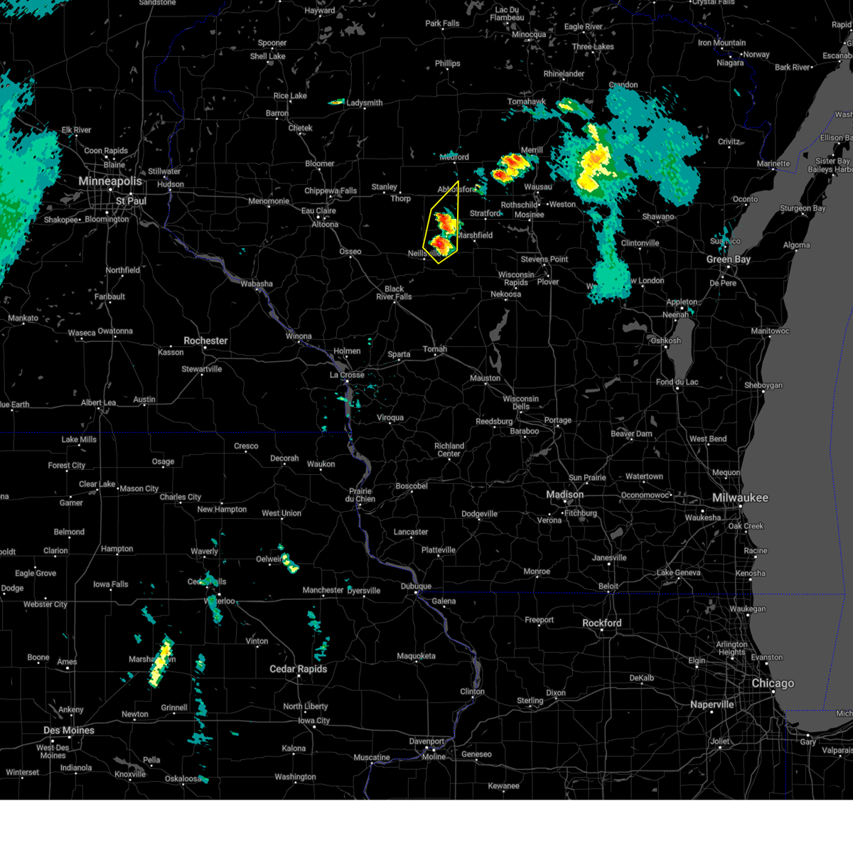
| 6/10/2026 6:07 AM CDT |
 Svrarx the national weather service in la crosse has issued a * severe thunderstorm warning for, clark county in central wisconsin, eastern taylor county in north central wisconsin, * until 645 am cdt. * at 607 am cdt, severe thunderstorms were located along a line extending from near thorp to near fairchild, moving northeast at 45 mph (radar indicated). Hazards include 60 mph wind gusts and quarter size hail. Hail damage to vehicles is expected. expect wind damage to roofs, siding, and trees. severe thunderstorms will be near, thorp around 610 am cdt. greenwood around 620 am cdt. owen around 625 am cdt. loyal around 635 am cdt. Other locations impacted by these severe thunderstorms include highway 73 and 98, atwood, tioga, christie, esadore lake, eidsvold, and longwood. Svrarx the national weather service in la crosse has issued a * severe thunderstorm warning for, clark county in central wisconsin, eastern taylor county in north central wisconsin, * until 645 am cdt. * at 607 am cdt, severe thunderstorms were located along a line extending from near thorp to near fairchild, moving northeast at 45 mph (radar indicated). Hazards include 60 mph wind gusts and quarter size hail. Hail damage to vehicles is expected. expect wind damage to roofs, siding, and trees. severe thunderstorms will be near, thorp around 610 am cdt. greenwood around 620 am cdt. owen around 625 am cdt. loyal around 635 am cdt. Other locations impacted by these severe thunderstorms include highway 73 and 98, atwood, tioga, christie, esadore lake, eidsvold, and longwood.
|
| 5/27/2026 6:34 PM CDT |
 At 634 pm cdt, a severe thunderstorm was located 7 miles east of shortville, or 12 miles southeast of neillsville, moving south at 20 mph (radar indicated). Hazards include ping pong ball size hail. People and animals outdoors will be injured. expect damage to roofs, siding, windows, and vehicles. Locations impacted include, loyal, lynn, granton, county k and capital road, chili, chili corners, veefkind, the cunningham airfield, county roads h and k, and nevins. At 634 pm cdt, a severe thunderstorm was located 7 miles east of shortville, or 12 miles southeast of neillsville, moving south at 20 mph (radar indicated). Hazards include ping pong ball size hail. People and animals outdoors will be injured. expect damage to roofs, siding, windows, and vehicles. Locations impacted include, loyal, lynn, granton, county k and capital road, chili, chili corners, veefkind, the cunningham airfield, county roads h and k, and nevins.
|
| 5/27/2026 6:25 PM CDT |
 At 624 pm cdt, a severe thunderstorm was located 7 miles east of shortville, or 11 miles east of neillsville, moving south at 20 mph (radar indicated). Hazards include ping pong ball size hail. People and animals outdoors will be injured. expect damage to roofs, siding, windows, and vehicles. Locations impacted include, loyal, lynn, granton, county k and capital road, chili, chili corners, veefkind, the cunningham airfield, county roads h and k, and nevins. At 624 pm cdt, a severe thunderstorm was located 7 miles east of shortville, or 11 miles east of neillsville, moving south at 20 mph (radar indicated). Hazards include ping pong ball size hail. People and animals outdoors will be injured. expect damage to roofs, siding, windows, and vehicles. Locations impacted include, loyal, lynn, granton, county k and capital road, chili, chili corners, veefkind, the cunningham airfield, county roads h and k, and nevins.
|
| 5/27/2026 6:12 PM CDT |
 At 612 pm cdt, a severe thunderstorm was located 8 miles northeast of shortville, or 9 miles east of neillsville, moving south at 20 mph (radar indicated). Hazards include quarter size hail. Damage to vehicles is expected. Locations impacted include, loyal, lynn, granton, county k and capital road, chili, chili corners, veefkind, the cunningham airfield, county roads h and k, and nevins. At 612 pm cdt, a severe thunderstorm was located 8 miles northeast of shortville, or 9 miles east of neillsville, moving south at 20 mph (radar indicated). Hazards include quarter size hail. Damage to vehicles is expected. Locations impacted include, loyal, lynn, granton, county k and capital road, chili, chili corners, veefkind, the cunningham airfield, county roads h and k, and nevins.
|
| 5/27/2026 6:04 PM CDT |
 At 604 pm cdt, a severe thunderstorm was located 9 miles southeast of loyal, or 10 miles northeast of neillsville, moving south at 20 mph (radar indicated). Hazards include quarter size hail. Damage to vehicles is expected. Locations impacted include, loyal, lynn, granton, unity, county k and capital road, chili, chili corners, veefkind, the cunningham airfield, riplinger, county roads h and k, and nevins. At 604 pm cdt, a severe thunderstorm was located 9 miles southeast of loyal, or 10 miles northeast of neillsville, moving south at 20 mph (radar indicated). Hazards include quarter size hail. Damage to vehicles is expected. Locations impacted include, loyal, lynn, granton, unity, county k and capital road, chili, chili corners, veefkind, the cunningham airfield, riplinger, county roads h and k, and nevins.
|
| 5/27/2026 5:58 PM CDT |
 At 557 pm cdt, a severe thunderstorm was located 7 miles southwest of spencer, or 12 miles northeast of neillsville, moving south at 20 mph (radar indicated). Hazards include quarter size hail. Damage to vehicles is expected. Locations impacted include, loyal, lynn, granton, unity, county k and capital road, chili, chili corners, veefkind, the cunningham airfield, riplinger, county roads h and k, and nevins. At 557 pm cdt, a severe thunderstorm was located 7 miles southwest of spencer, or 12 miles northeast of neillsville, moving south at 20 mph (radar indicated). Hazards include quarter size hail. Damage to vehicles is expected. Locations impacted include, loyal, lynn, granton, unity, county k and capital road, chili, chili corners, veefkind, the cunningham airfield, riplinger, county roads h and k, and nevins.
|
| 5/27/2026 5:53 PM CDT | Quarter sized hail reported 3.7 miles NW of Loyal, WI |
| 4/13/2026 7:16 PM CDT |
 At 716 pm cdt, a severe thunderstorm was located near humbird, or 11 miles west of neillsville, moving east at 30 mph (radar indicated). Hazards include two inch hail. People and animals outdoors will be injured. expect damage to roofs, siding, windows, and vehicles. Locations impacted include, neillsville, loyal, humbird, lynn, willard, granton, highway 73 and 98, wildcat mound, tioga, christie, highway 10 and bald peak road, globe, chili, hog corners, highway 10 and 12, chili corners, veefkind, the cunningham airfield, sidney, and county roads h and k. At 716 pm cdt, a severe thunderstorm was located near humbird, or 11 miles west of neillsville, moving east at 30 mph (radar indicated). Hazards include two inch hail. People and animals outdoors will be injured. expect damage to roofs, siding, windows, and vehicles. Locations impacted include, neillsville, loyal, humbird, lynn, willard, granton, highway 73 and 98, wildcat mound, tioga, christie, highway 10 and bald peak road, globe, chili, hog corners, highway 10 and 12, chili corners, veefkind, the cunningham airfield, sidney, and county roads h and k.
|
| 4/13/2026 7:03 PM CDT |
 At 703 pm cdt, a severe thunderstorm was located over humbird, or 15 miles north of black river falls, moving east at 30 mph (radar indicated). Hazards include two inch hail. People and animals outdoors will be injured. expect damage to roofs, siding, windows, and vehicles. Locations impacted include, neillsville, abbotsford, loyal, greenwood, humbird, colby, lynn, longwood, willard, granton, unity, curtiss, highway 73 and 98, wildcat mound, tioga, christie, highway 10 and bald peak road, atwood, sterling avenue and starks road, and seven sister mounds. At 703 pm cdt, a severe thunderstorm was located over humbird, or 15 miles north of black river falls, moving east at 30 mph (radar indicated). Hazards include two inch hail. People and animals outdoors will be injured. expect damage to roofs, siding, windows, and vehicles. Locations impacted include, neillsville, abbotsford, loyal, greenwood, humbird, colby, lynn, longwood, willard, granton, unity, curtiss, highway 73 and 98, wildcat mound, tioga, christie, highway 10 and bald peak road, atwood, sterling avenue and starks road, and seven sister mounds.
|
| 4/13/2026 6:53 PM CDT |
 Svrarx the national weather service in la crosse has issued a * severe thunderstorm warning for, clark county in central wisconsin, * until 800 pm cdt. * at 653 pm cdt, a severe thunderstorm was located over fairchild, or 17 miles west of neillsville, moving east at 40 mph (radar indicated). Hazards include half dollar size hail. Damage to vehicles is expected. This severe thunderstorm will remain over mainly rural areas of clark county, including the following locations, highway 73 and 98, wildcat mound, tioga, christie, highway 10 and bald peak road, atwood, and lynn. Svrarx the national weather service in la crosse has issued a * severe thunderstorm warning for, clark county in central wisconsin, * until 800 pm cdt. * at 653 pm cdt, a severe thunderstorm was located over fairchild, or 17 miles west of neillsville, moving east at 40 mph (radar indicated). Hazards include half dollar size hail. Damage to vehicles is expected. This severe thunderstorm will remain over mainly rural areas of clark county, including the following locations, highway 73 and 98, wildcat mound, tioga, christie, highway 10 and bald peak road, atwood, and lynn.
|
| 4/13/2026 6:05 PM CDT |
 At 605 pm cdt, a severe thunderstorm was located near loyal, or 15 miles northeast of neillsville, moving east at 30 mph (radar indicated). Hazards include quarter size hail. Damage to vehicles is expected. Locations impacted include, loyal and unity. At 605 pm cdt, a severe thunderstorm was located near loyal, or 15 miles northeast of neillsville, moving east at 30 mph (radar indicated). Hazards include quarter size hail. Damage to vehicles is expected. Locations impacted include, loyal and unity.
|
| 4/13/2026 5:53 PM CDT |
 At 553 pm cdt, a severe thunderstorm was located near spencer, or 14 miles northeast of neillsville, moving northeast at 20 mph (radar indicated). Hazards include half dollar size hail. Damage to vehicles is expected. Locations impacted include, loyal, unity, chili, highway 73 and 98, and veefkind. At 553 pm cdt, a severe thunderstorm was located near spencer, or 14 miles northeast of neillsville, moving northeast at 20 mph (radar indicated). Hazards include half dollar size hail. Damage to vehicles is expected. Locations impacted include, loyal, unity, chili, highway 73 and 98, and veefkind.
|
| 4/13/2026 5:45 PM CDT |
 Svrarx the national weather service in la crosse has issued a * severe thunderstorm warning for, east central clark county in central wisconsin, * until 630 pm cdt. * at 545 pm cdt, a severe thunderstorm was located near marshfield, or 16 miles northeast of neillsville, moving northeast at 30 mph (radar indicated). Hazards include two inch hail. People and animals outdoors will be injured. expect damage to roofs, siding, windows, and vehicles. This severe thunderstorm will remain over mainly rural areas of east central clark county, including the following locations, chili, highway 73 and 98, chili corners, veefkind, riplinger, county roads h and k, and unity. Svrarx the national weather service in la crosse has issued a * severe thunderstorm warning for, east central clark county in central wisconsin, * until 630 pm cdt. * at 545 pm cdt, a severe thunderstorm was located near marshfield, or 16 miles northeast of neillsville, moving northeast at 30 mph (radar indicated). Hazards include two inch hail. People and animals outdoors will be injured. expect damage to roofs, siding, windows, and vehicles. This severe thunderstorm will remain over mainly rural areas of east central clark county, including the following locations, chili, highway 73 and 98, chili corners, veefkind, riplinger, county roads h and k, and unity.
|
| 4/13/2026 5:26 PM CDT |
 At 525 pm cdt, a severe thunderstorm was located 8 miles northeast of neillsville, moving northeast at 35 mph (radar indicated). Hazards include two inch hail. People and animals outdoors will be injured. expect damage to roofs, siding, windows, and vehicles. This severe thunderstorm will remain over mainly rural areas of southern clark county, including the following locations, chili, hog corners, highway 73 and 98, chili corners, christie, highway 10 and bald peak road, and veefkind. At 525 pm cdt, a severe thunderstorm was located 8 miles northeast of neillsville, moving northeast at 35 mph (radar indicated). Hazards include two inch hail. People and animals outdoors will be injured. expect damage to roofs, siding, windows, and vehicles. This severe thunderstorm will remain over mainly rural areas of southern clark county, including the following locations, chili, hog corners, highway 73 and 98, chili corners, christie, highway 10 and bald peak road, and veefkind.
|
| 4/13/2026 5:21 PM CDT |
 At 521 pm cdt, a severe thunderstorm was located near neillsville, moving northeast at 35 mph (radar indicated). Hazards include two inch hail. People and animals outdoors will be injured. expect damage to roofs, siding, windows, and vehicles. This severe thunderstorm will remain over mainly rural areas of southern clark county, including the following locations, chili, hog corners, highway 73 and 98, highway 10 and 12, chili corners, christie, and highway 10 and bald peak road. At 521 pm cdt, a severe thunderstorm was located near neillsville, moving northeast at 35 mph (radar indicated). Hazards include two inch hail. People and animals outdoors will be injured. expect damage to roofs, siding, windows, and vehicles. This severe thunderstorm will remain over mainly rural areas of southern clark county, including the following locations, chili, hog corners, highway 73 and 98, highway 10 and 12, chili corners, christie, and highway 10 and bald peak road.
|
| 4/13/2026 5:14 PM CDT |
 At 514 pm cdt, a severe thunderstorm was located near neillsville, moving northeast at 40 mph (radar indicated). Hazards include two inch hail. People and animals outdoors will be injured. expect damage to roofs, siding, windows, and vehicles. This severe thunderstorm will remain over mainly rural areas of southern clark county, including the following locations, chili, hog corners, ballard road and pray avenue, highway 73 and 98, wildcat mound, highway 10 and 12, and chili corners. At 514 pm cdt, a severe thunderstorm was located near neillsville, moving northeast at 40 mph (radar indicated). Hazards include two inch hail. People and animals outdoors will be injured. expect damage to roofs, siding, windows, and vehicles. This severe thunderstorm will remain over mainly rural areas of southern clark county, including the following locations, chili, hog corners, ballard road and pray avenue, highway 73 and 98, wildcat mound, highway 10 and 12, and chili corners.
|
| 4/13/2026 5:03 PM CDT |
 Svrarx the national weather service in la crosse has issued a * severe thunderstorm warning for, southern clark county in central wisconsin, * until 545 pm cdt. * at 502 pm cdt, a severe thunderstorm was located near neillsville, moving northeast at 40 mph (radar indicated). Hazards include quarter size hail. Damage to vehicles is expected. this severe thunderstorm will be near, neillsville around 510 pm cdt. Other locations impacted by this severe thunderstorm include chili, hog corners, ballard road and pray avenue, highway 73 and 98, wildcat mound, highway 10 and 12, and chili corners. Svrarx the national weather service in la crosse has issued a * severe thunderstorm warning for, southern clark county in central wisconsin, * until 545 pm cdt. * at 502 pm cdt, a severe thunderstorm was located near neillsville, moving northeast at 40 mph (radar indicated). Hazards include quarter size hail. Damage to vehicles is expected. this severe thunderstorm will be near, neillsville around 510 pm cdt. Other locations impacted by this severe thunderstorm include chili, hog corners, ballard road and pray avenue, highway 73 and 98, wildcat mound, highway 10 and 12, and chili corners.
|
| 4/13/2026 4:43 PM CDT |
 Svrarx the national weather service in la crosse has issued a * severe thunderstorm warning for, east central clark county in central wisconsin, * until 500 pm cdt. * at 442 pm cdt, a severe thunderstorm was located near spencer, or 15 miles northeast of neillsville, moving northeast at 45 mph (radar indicated). Hazards include half dollar size hail. Damage to vehicles is expected. This severe thunderstorm will remain over mainly rural areas of east central clark county, including the following locations, chili and veefkind. Svrarx the national weather service in la crosse has issued a * severe thunderstorm warning for, east central clark county in central wisconsin, * until 500 pm cdt. * at 442 pm cdt, a severe thunderstorm was located near spencer, or 15 miles northeast of neillsville, moving northeast at 45 mph (radar indicated). Hazards include half dollar size hail. Damage to vehicles is expected. This severe thunderstorm will remain over mainly rural areas of east central clark county, including the following locations, chili and veefkind.
|
| 7/3/2025 11:43 PM CDT |
 The storm which prompted the warning has weakened below severe limits, and no longer poses an immediate threat to life or property. therefore, the warning will be allowed to expire. however, small hail is still possible with this thunderstorm. The storm which prompted the warning has weakened below severe limits, and no longer poses an immediate threat to life or property. therefore, the warning will be allowed to expire. however, small hail is still possible with this thunderstorm.
|
| 7/3/2025 11:21 PM CDT |
 At 1121 pm cdt, a severe thunderstorm was located over greenwood, or 12 miles north of neillsville, moving east at 20 mph (radar indicated). Hazards include 60 mph wind gusts and penny size hail. Expect damage to roofs, siding, and trees. this severe storm will be near, loyal around 1125 pm cdt. Other locations impacted by this severe thunderstorm include county k and capital road, highway 73 and 98, and atwood. At 1121 pm cdt, a severe thunderstorm was located over greenwood, or 12 miles north of neillsville, moving east at 20 mph (radar indicated). Hazards include 60 mph wind gusts and penny size hail. Expect damage to roofs, siding, and trees. this severe storm will be near, loyal around 1125 pm cdt. Other locations impacted by this severe thunderstorm include county k and capital road, highway 73 and 98, and atwood.
|
| 7/3/2025 10:56 PM CDT |
 Svrarx the national weather service in la crosse has issued a * severe thunderstorm warning for, central clark county in central wisconsin, * until 1145 pm cdt. * at 1056 pm cdt, a severe thunderstorm was located 8 miles southwest of greenwood, or 12 miles northwest of neillsville, moving east at 20 mph (radar indicated). Hazards include 60 mph wind gusts and quarter size hail. Hail damage to vehicles is expected. expect wind damage to roofs, siding, and trees. this severe thunderstorm will be near, greenwood around 1105 pm cdt. loyal around 1115 pm cdt. Other locations impacted by this severe thunderstorm include county k and capital road, hog corners, mead lake, highway 73 and 98, atwood, tioga, and christie. Svrarx the national weather service in la crosse has issued a * severe thunderstorm warning for, central clark county in central wisconsin, * until 1145 pm cdt. * at 1056 pm cdt, a severe thunderstorm was located 8 miles southwest of greenwood, or 12 miles northwest of neillsville, moving east at 20 mph (radar indicated). Hazards include 60 mph wind gusts and quarter size hail. Hail damage to vehicles is expected. expect wind damage to roofs, siding, and trees. this severe thunderstorm will be near, greenwood around 1105 pm cdt. loyal around 1115 pm cdt. Other locations impacted by this severe thunderstorm include county k and capital road, hog corners, mead lake, highway 73 and 98, atwood, tioga, and christie.
|
| 5/15/2025 5:16 PM CDT |
 At 516 pm cdt, a severe thunderstorm was located near spencer, or 20 miles northeast of neillsville, moving northeast at 45 mph (radar indicated). Hazards include 60 mph wind gusts and quarter size hail. Hail damage to vehicles is expected. expect wind damage to roofs, siding, and trees. this severe storm will be near, abbotsford around 525 pm cdt. dorchester around 530 pm cdt. Other locations impacted by this severe thunderstorm include county k and capital road, chili, highway 73 and 98, chili corners, atwood, christie, and veefkind. At 516 pm cdt, a severe thunderstorm was located near spencer, or 20 miles northeast of neillsville, moving northeast at 45 mph (radar indicated). Hazards include 60 mph wind gusts and quarter size hail. Hail damage to vehicles is expected. expect wind damage to roofs, siding, and trees. this severe storm will be near, abbotsford around 525 pm cdt. dorchester around 530 pm cdt. Other locations impacted by this severe thunderstorm include county k and capital road, chili, highway 73 and 98, chili corners, atwood, christie, and veefkind.
|
| 5/15/2025 5:06 PM CDT |
 Torarx the national weather service in la crosse has issued a * tornado warning for, east central clark county in central wisconsin, * until 545 pm cdt. * at 505 pm cdt, a confirmed tornado was located over loyal, or 12 miles northeast of neillsville, moving northeast at 35 mph (law enforcement confirmed tornado). Hazards include damaging tornado and quarter size hail. Flying debris will be dangerous to those caught without shelter. mobile homes will be damaged or destroyed. damage to roofs, windows, and vehicles will occur. tree damage is likely. This tornadic thunderstorm will remain over mainly rural areas of east central clark county, including the following locations, county k and capital road, riplinger, colby, and unity. Torarx the national weather service in la crosse has issued a * tornado warning for, east central clark county in central wisconsin, * until 545 pm cdt. * at 505 pm cdt, a confirmed tornado was located over loyal, or 12 miles northeast of neillsville, moving northeast at 35 mph (law enforcement confirmed tornado). Hazards include damaging tornado and quarter size hail. Flying debris will be dangerous to those caught without shelter. mobile homes will be damaged or destroyed. damage to roofs, windows, and vehicles will occur. tree damage is likely. This tornadic thunderstorm will remain over mainly rural areas of east central clark county, including the following locations, county k and capital road, riplinger, colby, and unity.
|
| 5/15/2025 5:03 PM CDT |
 At 502 pm cdt, a confirmed tornado was located over loyal, or 11 miles northeast of neillsville, moving northeast at 35 mph (law enforcement confirmed tornado). Hazards include damaging tornado and quarter size hail. Flying debris will be dangerous to those caught without shelter. mobile homes will be damaged or destroyed. damage to roofs, windows, and vehicles will occur. tree damage is likely. This tornadic thunderstorm will remain over mainly rural areas of northeastern clark county, including the following locations, county k and capital road, highway 73 and 98, and riplinger. At 502 pm cdt, a confirmed tornado was located over loyal, or 11 miles northeast of neillsville, moving northeast at 35 mph (law enforcement confirmed tornado). Hazards include damaging tornado and quarter size hail. Flying debris will be dangerous to those caught without shelter. mobile homes will be damaged or destroyed. damage to roofs, windows, and vehicles will occur. tree damage is likely. This tornadic thunderstorm will remain over mainly rural areas of northeastern clark county, including the following locations, county k and capital road, highway 73 and 98, and riplinger.
|
| 5/15/2025 5:00 PM CDT |
 At 459 pm cdt, a severe thunderstorm capable of producing a tornado was located over loyal, or 10 miles north of neillsville, moving northeast at 35 mph (radar indicated rotation). Hazards include tornado and quarter size hail. Flying debris will be dangerous to those caught without shelter. mobile homes will be damaged or destroyed. damage to roofs, windows, and vehicles will occur. tree damage is likely. this dangerous storm will be near, loyal around 505 pm cdt. Other locations impacted by this tornadic thunderstorm include county k and capital road, highway 73 and 98, and riplinger. At 459 pm cdt, a severe thunderstorm capable of producing a tornado was located over loyal, or 10 miles north of neillsville, moving northeast at 35 mph (radar indicated rotation). Hazards include tornado and quarter size hail. Flying debris will be dangerous to those caught without shelter. mobile homes will be damaged or destroyed. damage to roofs, windows, and vehicles will occur. tree damage is likely. this dangerous storm will be near, loyal around 505 pm cdt. Other locations impacted by this tornadic thunderstorm include county k and capital road, highway 73 and 98, and riplinger.
|
| 5/15/2025 4:46 PM CDT |
 At 446 pm cdt, a severe thunderstorm capable of producing a tornado was located near neillsville, moving northeast at 35 mph (radar indicated rotation). Hazards include tornado and quarter size hail. Flying debris will be dangerous to those caught without shelter. mobile homes will be damaged or destroyed. damage to roofs, windows, and vehicles will occur. tree damage is likely. this dangerous storm will be near, loyal and greenwood around 455 pm cdt. Other locations impacted by this tornadic thunderstorm include county k and capital road, hog corners, highway 73 and 98, atwood, christie, globe, and snyder lake. At 446 pm cdt, a severe thunderstorm capable of producing a tornado was located near neillsville, moving northeast at 35 mph (radar indicated rotation). Hazards include tornado and quarter size hail. Flying debris will be dangerous to those caught without shelter. mobile homes will be damaged or destroyed. damage to roofs, windows, and vehicles will occur. tree damage is likely. this dangerous storm will be near, loyal and greenwood around 455 pm cdt. Other locations impacted by this tornadic thunderstorm include county k and capital road, hog corners, highway 73 and 98, atwood, christie, globe, and snyder lake.
|
| 5/15/2025 4:44 PM CDT |
 Svrarx the national weather service in la crosse has issued a * severe thunderstorm warning for, eastern clark county in central wisconsin, * until 530 pm cdt. * at 444 pm cdt, a severe thunderstorm was located near shortville, or near neillsville, moving northeast at 45 mph (radar indicated). Hazards include 60 mph wind gusts and quarter size hail. Hail damage to vehicles is expected. expect wind damage to roofs, siding, and trees. this severe thunderstorm will be near, neillsville and shortville around 450 pm cdt. loyal around 505 pm cdt. abbotsford around 525 pm cdt. Other locations impacted by this severe thunderstorm include ballard road and pray avenue, highway 73 and 98, atwood, christie, lynn, curtiss, and globe. Svrarx the national weather service in la crosse has issued a * severe thunderstorm warning for, eastern clark county in central wisconsin, * until 530 pm cdt. * at 444 pm cdt, a severe thunderstorm was located near shortville, or near neillsville, moving northeast at 45 mph (radar indicated). Hazards include 60 mph wind gusts and quarter size hail. Hail damage to vehicles is expected. expect wind damage to roofs, siding, and trees. this severe thunderstorm will be near, neillsville and shortville around 450 pm cdt. loyal around 505 pm cdt. abbotsford around 525 pm cdt. Other locations impacted by this severe thunderstorm include ballard road and pray avenue, highway 73 and 98, atwood, christie, lynn, curtiss, and globe.
|
| 5/15/2025 4:30 PM CDT |
 Torarx the national weather service in la crosse has issued a * tornado warning for, central clark county in central wisconsin, * until 515 pm cdt. * at 429 pm cdt, a severe thunderstorm capable of producing a tornado was located 7 miles east of humbird, or 8 miles west of neillsville, moving northeast at 40 mph (radar indicated rotation). Hazards include tornado and quarter size hail. Flying debris will be dangerous to those caught without shelter. mobile homes will be damaged or destroyed. damage to roofs, windows, and vehicles will occur. tree damage is likely. this dangerous storm will be near, neillsville around 435 pm cdt. loyal and greenwood around 450 pm cdt. Other locations impacted by this tornadic thunderstorm include county k and capital road, hog corners, highway 73 and 98, wildcat mound, atwood, christie, and highway 10 and bald peak road. Torarx the national weather service in la crosse has issued a * tornado warning for, central clark county in central wisconsin, * until 515 pm cdt. * at 429 pm cdt, a severe thunderstorm capable of producing a tornado was located 7 miles east of humbird, or 8 miles west of neillsville, moving northeast at 40 mph (radar indicated rotation). Hazards include tornado and quarter size hail. Flying debris will be dangerous to those caught without shelter. mobile homes will be damaged or destroyed. damage to roofs, windows, and vehicles will occur. tree damage is likely. this dangerous storm will be near, neillsville around 435 pm cdt. loyal and greenwood around 450 pm cdt. Other locations impacted by this tornadic thunderstorm include county k and capital road, hog corners, highway 73 and 98, wildcat mound, atwood, christie, and highway 10 and bald peak road.
|
| 4/28/2025 8:55 PM CDT |
 The storms which prompted the warning have moved out of the area. therefore, the warning will be allowed to expire. a tornado watch remains in effect until 200 am cdt for central wisconsin. The storms which prompted the warning have moved out of the area. therefore, the warning will be allowed to expire. a tornado watch remains in effect until 200 am cdt for central wisconsin.
|
| 4/28/2025 8:53 PM CDT |
 The storms which prompted the warning have moved out of the area. therefore, the warning will be allowed to expire. a tornado watch remains in effect until 200 am cdt for central wisconsin. The storms which prompted the warning have moved out of the area. therefore, the warning will be allowed to expire. a tornado watch remains in effect until 200 am cdt for central wisconsin.
|
| 4/28/2025 8:42 PM CDT |
 At 842 pm cdt, severe thunderstorms were located along a line extending from near owen to loyal to 7 miles south of greenwood, moving east at 45 mph (radar indicated). Hazards include 60 mph wind gusts and quarter size hail. Hail damage to vehicles is expected. expect wind damage to roofs, siding, and trees. these severe storms will be near, loyal around 845 pm cdt. spencer around 850 pm cdt. abbotsford and colby around 855 pm cdt. Other locations impacted by these severe thunderstorms include county k and capital road, chili, highway 73 and 98, atwood, christie, veefkind, and longwood. At 842 pm cdt, severe thunderstorms were located along a line extending from near owen to loyal to 7 miles south of greenwood, moving east at 45 mph (radar indicated). Hazards include 60 mph wind gusts and quarter size hail. Hail damage to vehicles is expected. expect wind damage to roofs, siding, and trees. these severe storms will be near, loyal around 845 pm cdt. spencer around 850 pm cdt. abbotsford and colby around 855 pm cdt. Other locations impacted by these severe thunderstorms include county k and capital road, chili, highway 73 and 98, atwood, christie, veefkind, and longwood.
|
| 4/28/2025 8:26 PM CDT |
 Torarx the national weather service in la crosse has issued a * tornado warning for, northeastern clark county in central wisconsin, * until 900 pm cdt. * at 826 pm cdt, severe thunderstorms capable of producing a tornado were located along a line extending from 7 miles south of thorp to 9 miles northwest of neillsville, moving east at 50 mph (radar indicated rotation). Hazards include tornado. Flying debris will be dangerous to those caught without shelter. mobile homes will be damaged or destroyed. damage to roofs, windows, and vehicles will occur. tree damage is likely. these dangerous storms will be near, greenwood around 830 pm cdt. loyal and owen around 835 pm cdt. abbotsford and colby around 850 pm cdt. Other locations impacted by these tornadic storms include county k and capital road, curtiss, colby, atwood, withee, riplinger, and longwood. Torarx the national weather service in la crosse has issued a * tornado warning for, northeastern clark county in central wisconsin, * until 900 pm cdt. * at 826 pm cdt, severe thunderstorms capable of producing a tornado were located along a line extending from 7 miles south of thorp to 9 miles northwest of neillsville, moving east at 50 mph (radar indicated rotation). Hazards include tornado. Flying debris will be dangerous to those caught without shelter. mobile homes will be damaged or destroyed. damage to roofs, windows, and vehicles will occur. tree damage is likely. these dangerous storms will be near, greenwood around 830 pm cdt. loyal and owen around 835 pm cdt. abbotsford and colby around 850 pm cdt. Other locations impacted by these tornadic storms include county k and capital road, curtiss, colby, atwood, withee, riplinger, and longwood.
|
| 4/28/2025 8:15 PM CDT |
 At 815 pm cdt, severe thunderstorms were located along a line extending from 8 miles south of stanley to 12 miles east of augusta to near fairchild, moving east at 50 mph (radar indicated). Hazards include 60 mph wind gusts and quarter size hail. Hail damage to vehicles is expected. expect wind damage to roofs, siding, and trees. these severe storms will be near, greenwood around 825 pm cdt. loyal around 830 pm cdt. owen around 835 pm cdt. abbotsford, spencer, and colby around 845 pm cdt. Other locations impacted by these severe thunderstorms include highway 73 and 98, atwood, tioga, christie, eidsvold, longwood, and curtiss. At 815 pm cdt, severe thunderstorms were located along a line extending from 8 miles south of stanley to 12 miles east of augusta to near fairchild, moving east at 50 mph (radar indicated). Hazards include 60 mph wind gusts and quarter size hail. Hail damage to vehicles is expected. expect wind damage to roofs, siding, and trees. these severe storms will be near, greenwood around 825 pm cdt. loyal around 830 pm cdt. owen around 835 pm cdt. abbotsford, spencer, and colby around 845 pm cdt. Other locations impacted by these severe thunderstorms include highway 73 and 98, atwood, tioga, christie, eidsvold, longwood, and curtiss.
|
| 4/28/2025 8:03 PM CDT |
 Svrarx the national weather service in la crosse has issued a * severe thunderstorm warning for, clark county in central wisconsin, * until 900 pm cdt. * at 803 pm cdt, severe thunderstorms were located along a line extending from 8 miles northeast of fall creek to near augusta to near price, moving northeast at 45 mph (radar indicated). Hazards include 60 mph wind gusts. Expect damage to roofs, siding, and trees. severe thunderstorms will be near, thorp around 820 pm cdt. greenwood around 830 pm cdt. owen around 835 pm cdt. loyal around 845 pm cdt. Other locations impacted by these severe thunderstorms include highway 73 and 98, atwood, tioga, christie, eidsvold, longwood, and curtiss. Svrarx the national weather service in la crosse has issued a * severe thunderstorm warning for, clark county in central wisconsin, * until 900 pm cdt. * at 803 pm cdt, severe thunderstorms were located along a line extending from 8 miles northeast of fall creek to near augusta to near price, moving northeast at 45 mph (radar indicated). Hazards include 60 mph wind gusts. Expect damage to roofs, siding, and trees. severe thunderstorms will be near, thorp around 820 pm cdt. greenwood around 830 pm cdt. owen around 835 pm cdt. loyal around 845 pm cdt. Other locations impacted by these severe thunderstorms include highway 73 and 98, atwood, tioga, christie, eidsvold, longwood, and curtiss.
|
| 4/28/2025 3:22 PM CDT |
 The storm which prompted the warning has weakened below severe limits, and no longer poses an immediate threat to life or property. therefore, the warning will be allowed to expire. however, gusty winds are still possible with this thunderstorm. The storm which prompted the warning has weakened below severe limits, and no longer poses an immediate threat to life or property. therefore, the warning will be allowed to expire. however, gusty winds are still possible with this thunderstorm.
|
| 4/28/2025 3:16 PM CDT |
 At 316 pm cdt, a severe thunderstorm was located 7 miles south of loyal, or 7 miles northeast of neillsville, moving northeast at 75 mph (radar indicated). Hazards include 60 mph wind gusts and penny size hail. Expect damage to roofs, siding, and trees. This severe thunderstorm will remain over mainly rural areas of eastern clark county, including the following locations, county k and capital road, chili, chili corners, atwood, christie, veefkind, and lynn. At 316 pm cdt, a severe thunderstorm was located 7 miles south of loyal, or 7 miles northeast of neillsville, moving northeast at 75 mph (radar indicated). Hazards include 60 mph wind gusts and penny size hail. Expect damage to roofs, siding, and trees. This severe thunderstorm will remain over mainly rural areas of eastern clark county, including the following locations, county k and capital road, chili, chili corners, atwood, christie, veefkind, and lynn.
|
| 4/28/2025 3:07 PM CDT |
 Svrarx the national weather service in la crosse has issued a * severe thunderstorm warning for, southeastern clark county in central wisconsin, * until 330 pm cdt. * at 307 pm cdt, a severe thunderstorm was located near neillsville, moving northeast at 75 mph (radar indicated). Hazards include 60 mph wind gusts and quarter size hail. Hail damage to vehicles is expected. expect wind damage to roofs, siding, and trees. this severe thunderstorm will be near, neillsville around 310 pm cdt. Other locations impacted by this severe thunderstorm include county k and capital road, chili, hog corners, highway 73 and 98, chili corners, atwood, and christie. Svrarx the national weather service in la crosse has issued a * severe thunderstorm warning for, southeastern clark county in central wisconsin, * until 330 pm cdt. * at 307 pm cdt, a severe thunderstorm was located near neillsville, moving northeast at 75 mph (radar indicated). Hazards include 60 mph wind gusts and quarter size hail. Hail damage to vehicles is expected. expect wind damage to roofs, siding, and trees. this severe thunderstorm will be near, neillsville around 310 pm cdt. Other locations impacted by this severe thunderstorm include county k and capital road, chili, hog corners, highway 73 and 98, chili corners, atwood, and christie.
|
| 8/26/2024 10:43 PM CDT |
 The storms which prompted the warning have weakened below severe limits, and no longer pose an immediate threat to life or property. therefore, the warning will be allowed to expire. a severe thunderstorm watch remains in effect until 400 am cdt for central and west central wisconsin. remember, while the warning for southern clark county will expire at 1045 pm cdt, a separate severe thunderstorm warning still remains in effect for northern clark county until 11 pm cdt. The storms which prompted the warning have weakened below severe limits, and no longer pose an immediate threat to life or property. therefore, the warning will be allowed to expire. a severe thunderstorm watch remains in effect until 400 am cdt for central and west central wisconsin. remember, while the warning for southern clark county will expire at 1045 pm cdt, a separate severe thunderstorm warning still remains in effect for northern clark county until 11 pm cdt.
|
| 8/26/2024 10:23 PM CDT |
 At 1022 pm cdt, severe thunderstorms were located along a line extending from 6 miles southeast of loyal to 7 miles east of hatfield to 8 miles southwest of black river falls, moving east at 50 mph (radar indicated). Hazards include 60 mph wind gusts. Expect damage to roofs, siding, and trees. locations impacted include, black river falls, neillsville, whitehall, blair, loyal, greenwood, millston, humbird, hatfield, shortville, york, lynn, irving, northfield, merrillan, willard, alma center, taylor, hixton, and pigeon falls. This includes interstate 94 between mile markers 97 and 132. At 1022 pm cdt, severe thunderstorms were located along a line extending from 6 miles southeast of loyal to 7 miles east of hatfield to 8 miles southwest of black river falls, moving east at 50 mph (radar indicated). Hazards include 60 mph wind gusts. Expect damage to roofs, siding, and trees. locations impacted include, black river falls, neillsville, whitehall, blair, loyal, greenwood, millston, humbird, hatfield, shortville, york, lynn, irving, northfield, merrillan, willard, alma center, taylor, hixton, and pigeon falls. This includes interstate 94 between mile markers 97 and 132.
|
| 8/26/2024 10:09 PM CDT |
 At 1009 pm cdt, severe thunderstorms were located along a line extending from greenwood to near hatfield to near blair, moving east at 40 mph (radar indicated). Hazards include 60 mph wind gusts. Expect damage to roofs, siding, and trees. locations impacted include, black river falls, neillsville, whitehall, osseo, blair, independence, loyal, greenwood, fairchild, price, millston, humbird, hatfield, shortville, york, lynn, irving, northfield, merrillan, and willard. This includes interstate 94 between mile markers 88 and 132. At 1009 pm cdt, severe thunderstorms were located along a line extending from greenwood to near hatfield to near blair, moving east at 40 mph (radar indicated). Hazards include 60 mph wind gusts. Expect damage to roofs, siding, and trees. locations impacted include, black river falls, neillsville, whitehall, osseo, blair, independence, loyal, greenwood, fairchild, price, millston, humbird, hatfield, shortville, york, lynn, irving, northfield, merrillan, and willard. This includes interstate 94 between mile markers 88 and 132.
|
| 8/26/2024 9:42 PM CDT |
 Svrarx the national weather service in la crosse has issued a * severe thunderstorm warning for, clark county in central wisconsin, jackson county in west central wisconsin, northern trempealeau county in west central wisconsin, * until 1045 pm cdt. * at 941 pm cdt, severe thunderstorms were located along a line extending from 8 miles south of boyd to osseo to near independence, moving east at 50 mph (automated weather observations. at 927 pm cdt, a 64 mph wind gust was recorded with these thunderstorms at the eau claire airport). Hazards include 60 mph wind gusts. expect damage to roofs, siding, and trees Svrarx the national weather service in la crosse has issued a * severe thunderstorm warning for, clark county in central wisconsin, jackson county in west central wisconsin, northern trempealeau county in west central wisconsin, * until 1045 pm cdt. * at 941 pm cdt, severe thunderstorms were located along a line extending from 8 miles south of boyd to osseo to near independence, moving east at 50 mph (automated weather observations. at 927 pm cdt, a 64 mph wind gust was recorded with these thunderstorms at the eau claire airport). Hazards include 60 mph wind gusts. expect damage to roofs, siding, and trees
|
| 5/21/2024 7:55 PM CDT |
 The storms which prompted the warning have moved out of the area. therefore, the warning will be allowed to expire. a tornado watch remains in effect until 900 pm cdt for southwestern wisconsin. a tornado watch also remains in effect until midnight cdt for central and west central wisconsin. The storms which prompted the warning have moved out of the area. therefore, the warning will be allowed to expire. a tornado watch remains in effect until 900 pm cdt for southwestern wisconsin. a tornado watch also remains in effect until midnight cdt for central and west central wisconsin.
|
| 5/21/2024 7:48 PM CDT |
 At 747 pm cdt, severe thunderstorms were located along a line extending from rib lake to 11 miles west of rib mountain to 7 miles west of wisconsin rapids to near necedah, moving northeast at 65 mph (radar indicated). Hazards include 70 mph wind gusts. Expect considerable tree damage. damage is likely to mobile homes, roofs, and outbuildings. These severe thunderstorms will remain over mainly rural areas of eastern clark, southeastern jackson, northeastern vernon and eastern monroe counties, including the following locations, and jellystone park near warrens. At 747 pm cdt, severe thunderstorms were located along a line extending from rib lake to 11 miles west of rib mountain to 7 miles west of wisconsin rapids to near necedah, moving northeast at 65 mph (radar indicated). Hazards include 70 mph wind gusts. Expect considerable tree damage. damage is likely to mobile homes, roofs, and outbuildings. These severe thunderstorms will remain over mainly rural areas of eastern clark, southeastern jackson, northeastern vernon and eastern monroe counties, including the following locations, and jellystone park near warrens.
|
| 5/21/2024 7:19 PM CDT |
 At 718 pm cdt, a severe squall line capable of producing both tornadoes and extensive straight line wind damage was located along a line extending from near stanley to shortville, moving northeast at 60 mph (radar indicated rotation). Hazards include tornado. Flying debris will be dangerous to those caught without shelter. mobile homes will be damaged or destroyed. damage to roofs, windows, and vehicles will occur. tree damage is likely. these dangerous storms will be near, thorp, loyal, and greenwood around 725 pm cdt. owen around 730 pm cdt. abbotsford and dorchester around 740 pm cdt. Other locations impacted by these tornadic storms include highway 73 and 98, atwood, christie, lynn, eidsvold, longwood, and curtiss. At 718 pm cdt, a severe squall line capable of producing both tornadoes and extensive straight line wind damage was located along a line extending from near stanley to shortville, moving northeast at 60 mph (radar indicated rotation). Hazards include tornado. Flying debris will be dangerous to those caught without shelter. mobile homes will be damaged or destroyed. damage to roofs, windows, and vehicles will occur. tree damage is likely. these dangerous storms will be near, thorp, loyal, and greenwood around 725 pm cdt. owen around 730 pm cdt. abbotsford and dorchester around 740 pm cdt. Other locations impacted by these tornadic storms include highway 73 and 98, atwood, christie, lynn, eidsvold, longwood, and curtiss.
|
| 5/21/2024 7:12 PM CDT |
 At 712 pm cdt, a severe squall line capable of producing both tornadoes and extensive straight line wind damage was located along a line extending from 9 miles south of stanley to near hatfield, moving northeast at 55 mph (radar indicated rotation). Hazards include tornado. Flying debris will be dangerous to those caught without shelter. mobile homes will be damaged or destroyed. damage to roofs, windows, and vehicles will occur. tree damage is likely. these dangerous storms will be near, neillsville, greenwood, and shortville around 720 pm cdt. loyal around 725 pm cdt. owen around 730 pm cdt. Other locations impacted by these tornadic storms include highway 73 and 98, atwood, tioga, christie, highway 10 and bald peak road, lynn, and eidsvold. At 712 pm cdt, a severe squall line capable of producing both tornadoes and extensive straight line wind damage was located along a line extending from 9 miles south of stanley to near hatfield, moving northeast at 55 mph (radar indicated rotation). Hazards include tornado. Flying debris will be dangerous to those caught without shelter. mobile homes will be damaged or destroyed. damage to roofs, windows, and vehicles will occur. tree damage is likely. these dangerous storms will be near, neillsville, greenwood, and shortville around 720 pm cdt. loyal around 725 pm cdt. owen around 730 pm cdt. Other locations impacted by these tornadic storms include highway 73 and 98, atwood, tioga, christie, highway 10 and bald peak road, lynn, and eidsvold.
|
| 5/21/2024 7:07 PM CDT |
 Torarx the national weather service in la crosse has issued a * tornado warning for, clark county in central wisconsin, * until 745 pm cdt. * at 706 pm cdt, severe thunderstorms capable of producing both tornadoes and extensive straight line wind damage were located along a line extending from cadott to near hatfield, moving northeast at 55 mph (radar indicated rotation). Hazards include tornado. Flying debris will be dangerous to those caught without shelter. mobile homes will be damaged or destroyed. damage to roofs, windows, and vehicles will occur. tree damage is likely. these dangerous storms will be near, neillsville around 715 pm cdt. thorp, greenwood, and shortville around 720 pm cdt. loyal around 725 pm cdt. owen around 730 pm cdt. Other locations impacted by these tornadic storms include highway 73 and 98, wildcat mound, atwood, tioga, christie, highway 10 and bald peak road, and lynn. Torarx the national weather service in la crosse has issued a * tornado warning for, clark county in central wisconsin, * until 745 pm cdt. * at 706 pm cdt, severe thunderstorms capable of producing both tornadoes and extensive straight line wind damage were located along a line extending from cadott to near hatfield, moving northeast at 55 mph (radar indicated rotation). Hazards include tornado. Flying debris will be dangerous to those caught without shelter. mobile homes will be damaged or destroyed. damage to roofs, windows, and vehicles will occur. tree damage is likely. these dangerous storms will be near, neillsville around 715 pm cdt. thorp, greenwood, and shortville around 720 pm cdt. loyal around 725 pm cdt. owen around 730 pm cdt. Other locations impacted by these tornadic storms include highway 73 and 98, wildcat mound, atwood, tioga, christie, highway 10 and bald peak road, and lynn.
|
| 5/21/2024 6:55 PM CDT |
 Svrarx the national weather service in la crosse has issued a * severe thunderstorm warning for, clark county in central wisconsin, central jackson county in west central wisconsin, northeastern vernon county in southwestern wisconsin, monroe county in west central wisconsin, * until 800 pm cdt. * at 654 pm cdt, severe thunderstorms were located along a line extending from near fall creek to 8 miles south of humbird to near bangor to 8 miles east of new albin, moving northeast at 70 mph (radar indicated). Hazards include 70 mph wind gusts and penny size hail. Expect considerable tree damage. damage is likely to mobile homes, roofs, and outbuildings. severe thunderstorms will be near, sparta, black river falls, cataract, humbird, and hatfield around 700 pm cdt. neillsville, thorp, millston, and fort mc coy around 710 pm cdt. tomah, loyal, greenwood, and shortville around 715 pm cdt. owen around 720 pm cdt. Abbotsford and dorchester around 730 pm cdt. Svrarx the national weather service in la crosse has issued a * severe thunderstorm warning for, clark county in central wisconsin, central jackson county in west central wisconsin, northeastern vernon county in southwestern wisconsin, monroe county in west central wisconsin, * until 800 pm cdt. * at 654 pm cdt, severe thunderstorms were located along a line extending from near fall creek to 8 miles south of humbird to near bangor to 8 miles east of new albin, moving northeast at 70 mph (radar indicated). Hazards include 70 mph wind gusts and penny size hail. Expect considerable tree damage. damage is likely to mobile homes, roofs, and outbuildings. severe thunderstorms will be near, sparta, black river falls, cataract, humbird, and hatfield around 700 pm cdt. neillsville, thorp, millston, and fort mc coy around 710 pm cdt. tomah, loyal, greenwood, and shortville around 715 pm cdt. owen around 720 pm cdt. Abbotsford and dorchester around 730 pm cdt.
|
| 5/18/2024 5:05 PM CDT |
 the severe thunderstorm warning has been cancelled and is no longer in effect the severe thunderstorm warning has been cancelled and is no longer in effect
|
| 5/18/2024 4:55 PM CDT |
 At 454 pm cdt, a severe thunderstorm was located over loyal, or 12 miles northeast of neillsville, moving east at 30 mph (radar indicated). Hazards include 60 mph wind gusts and quarter size hail. Hail damage to vehicles is expected. expect wind damage to roofs, siding, and trees. This severe thunderstorm will remain over mainly rural areas of southern clark county, including the following locations, ballard road and pray avenue, highway 73 and 98, wildcat mound, tioga, christie, highway 10 and bald peak road, and lynn. At 454 pm cdt, a severe thunderstorm was located over loyal, or 12 miles northeast of neillsville, moving east at 30 mph (radar indicated). Hazards include 60 mph wind gusts and quarter size hail. Hail damage to vehicles is expected. expect wind damage to roofs, siding, and trees. This severe thunderstorm will remain over mainly rural areas of southern clark county, including the following locations, ballard road and pray avenue, highway 73 and 98, wildcat mound, tioga, christie, highway 10 and bald peak road, and lynn.
|
| 5/18/2024 4:50 PM CDT |
 At 450 pm cdt, a severe thunderstorm was located over loyal, or 11 miles north of neillsville, moving east at 30 mph (radar indicated). Hazards include 60 mph wind gusts and quarter size hail. Hail damage to vehicles is expected. expect wind damage to roofs, siding, and trees. this severe storm will be near, loyal around 455 pm cdt. Other locations impacted by this severe thunderstorm include ballard road and pray avenue, highway 73 and 98, wildcat mound, tioga, christie, highway 10 and bald peak road, and lynn. At 450 pm cdt, a severe thunderstorm was located over loyal, or 11 miles north of neillsville, moving east at 30 mph (radar indicated). Hazards include 60 mph wind gusts and quarter size hail. Hail damage to vehicles is expected. expect wind damage to roofs, siding, and trees. this severe storm will be near, loyal around 455 pm cdt. Other locations impacted by this severe thunderstorm include ballard road and pray avenue, highway 73 and 98, wildcat mound, tioga, christie, highway 10 and bald peak road, and lynn.
|
| 5/18/2024 4:33 PM CDT |
 At 432 pm cdt, a severe thunderstorm was located near greenwood, or 9 miles northwest of neillsville, moving east at 30 mph (radar indicated). Hazards include 60 mph wind gusts and quarter size hail. Hail damage to vehicles is expected. expect wind damage to roofs, siding, and trees. this severe storm will be near, greenwood around 440 pm cdt. loyal around 445 pm cdt. Other locations impacted by this severe thunderstorm include ballard road and pray avenue, highway 73 and 98, wildcat mound, tioga, christie, highway 10 and bald peak road, and lynn. At 432 pm cdt, a severe thunderstorm was located near greenwood, or 9 miles northwest of neillsville, moving east at 30 mph (radar indicated). Hazards include 60 mph wind gusts and quarter size hail. Hail damage to vehicles is expected. expect wind damage to roofs, siding, and trees. this severe storm will be near, greenwood around 440 pm cdt. loyal around 445 pm cdt. Other locations impacted by this severe thunderstorm include ballard road and pray avenue, highway 73 and 98, wildcat mound, tioga, christie, highway 10 and bald peak road, and lynn.
|
| 5/18/2024 4:25 PM CDT |
 Svrarx the national weather service in la crosse has issued a * severe thunderstorm warning for, southern clark county in central wisconsin, * until 530 pm cdt. * at 424 pm cdt, a severe thunderstorm was located 10 miles southwest of greenwood, or 10 miles northwest of neillsville, moving east at 30 mph (radar indicated). Hazards include 60 mph wind gusts and quarter size hail. Hail damage to vehicles is expected. expect wind damage to roofs, siding, and trees. this severe thunderstorm will be near, greenwood around 440 pm cdt. loyal around 445 pm cdt. Other locations impacted by this severe thunderstorm include ballard road and pray avenue, highway 73 and 98, wildcat mound, tioga, christie, highway 10 and bald peak road, and lynn. Svrarx the national weather service in la crosse has issued a * severe thunderstorm warning for, southern clark county in central wisconsin, * until 530 pm cdt. * at 424 pm cdt, a severe thunderstorm was located 10 miles southwest of greenwood, or 10 miles northwest of neillsville, moving east at 30 mph (radar indicated). Hazards include 60 mph wind gusts and quarter size hail. Hail damage to vehicles is expected. expect wind damage to roofs, siding, and trees. this severe thunderstorm will be near, greenwood around 440 pm cdt. loyal around 445 pm cdt. Other locations impacted by this severe thunderstorm include ballard road and pray avenue, highway 73 and 98, wildcat mound, tioga, christie, highway 10 and bald peak road, and lynn.
|
| 8/17/2023 12:08 AM CDT |
 At 1208 am cdt, severe thunderstorms were located along a line extending from near loyal to near neillsville, moving southeast at 40 mph (radar indicated). Hazards include 60 mph wind gusts. Expect damage to roofs, siding, and trees. these severe storms will be near, spencer around 1215 am cdt. other locations impacted by these severe thunderstorms include chili, chili corners, christie, granton, the neillsville municipal airport, veefkind and lynn. hail threat, radar indicated max hail size, <. 75 in wind threat, radar indicated max wind gust, 60 mph. At 1208 am cdt, severe thunderstorms were located along a line extending from near loyal to near neillsville, moving southeast at 40 mph (radar indicated). Hazards include 60 mph wind gusts. Expect damage to roofs, siding, and trees. these severe storms will be near, spencer around 1215 am cdt. other locations impacted by these severe thunderstorms include chili, chili corners, christie, granton, the neillsville municipal airport, veefkind and lynn. hail threat, radar indicated max hail size, <. 75 in wind threat, radar indicated max wind gust, 60 mph.
|
| 8/16/2023 11:58 PM CDT |
 At 1158 pm cdt, severe thunderstorms were located along a line extending from near spencer to 6 miles northeast of humbird, moving southeast at 45 mph (radar indicated). Hazards include 60 mph wind gusts. Expect damage to roofs, siding, and trees. these severe storms will be near, spencer around 1205 am cdt. other locations impacted by these severe thunderstorms include county k and capital road, chili, hog corners, highway 73 and 98, chili corners, tioga and christie. hail threat, radar indicated max hail size, <. 75 in wind threat, radar indicated max wind gust, 60 mph. At 1158 pm cdt, severe thunderstorms were located along a line extending from near spencer to 6 miles northeast of humbird, moving southeast at 45 mph (radar indicated). Hazards include 60 mph wind gusts. Expect damage to roofs, siding, and trees. these severe storms will be near, spencer around 1205 am cdt. other locations impacted by these severe thunderstorms include county k and capital road, chili, hog corners, highway 73 and 98, chili corners, tioga and christie. hail threat, radar indicated max hail size, <. 75 in wind threat, radar indicated max wind gust, 60 mph.
|
| 8/16/2023 11:47 PM CDT |
 At 1147 pm cdt, severe thunderstorms were located along a line extending from abbotsford to near fairchild, moving east at 40 mph (radar indicated). Hazards include 60 mph wind gusts. Expect damage to roofs, siding, and trees. these severe storms will be near, abbotsford, colby and dorchester around 1150 pm cdt. neillsville around 1210 am cdt. other locations impacted by these severe thunderstorms include highway 73 and 98, atwood, tioga, christie, lynn, longwood and curtiss. hail threat, radar indicated max hail size, <. 75 in wind threat, radar indicated max wind gust, 60 mph. At 1147 pm cdt, severe thunderstorms were located along a line extending from abbotsford to near fairchild, moving east at 40 mph (radar indicated). Hazards include 60 mph wind gusts. Expect damage to roofs, siding, and trees. these severe storms will be near, abbotsford, colby and dorchester around 1150 pm cdt. neillsville around 1210 am cdt. other locations impacted by these severe thunderstorms include highway 73 and 98, atwood, tioga, christie, lynn, longwood and curtiss. hail threat, radar indicated max hail size, <. 75 in wind threat, radar indicated max wind gust, 60 mph.
|
| 8/16/2023 11:40 PM CDT |
 At 1140 pm cdt, severe thunderstorms were located along a line extending from near dorchester to near augusta, moving east at 35 mph (radar indicated). Hazards include 60 mph wind gusts. Expect damage to roofs, siding, and trees. these severe storms will be near, colby and dorchester around 1150 pm cdt. abbotsford around 1155 pm cdt. neillsville around 1220 am cdt. other locations impacted by these severe thunderstorms include highway 73 and 98, atwood, tioga, christie, lynn, longwood and curtiss. hail threat, radar indicated max hail size, <. 75 in wind threat, radar indicated max wind gust, 60 mph. At 1140 pm cdt, severe thunderstorms were located along a line extending from near dorchester to near augusta, moving east at 35 mph (radar indicated). Hazards include 60 mph wind gusts. Expect damage to roofs, siding, and trees. these severe storms will be near, colby and dorchester around 1150 pm cdt. abbotsford around 1155 pm cdt. neillsville around 1220 am cdt. other locations impacted by these severe thunderstorms include highway 73 and 98, atwood, tioga, christie, lynn, longwood and curtiss. hail threat, radar indicated max hail size, <. 75 in wind threat, radar indicated max wind gust, 60 mph.
|
| 8/16/2023 11:29 PM CDT |
 At 1128 pm cdt, severe thunderstorms were located along a line extending from near owen to augusta, moving east at 40 mph (radar indicated). Hazards include 60 mph wind gusts. Expect damage to roofs, siding, and trees. severe thunderstorms will be near, owen around 1135 pm cdt. colby and dorchester around 1150 pm cdt. abbotsford around 1155 pm cdt. greenwood around 1205 am cdt. loyal around 1215 am cdt. other locations impacted by these severe thunderstorms include highway 73 and 98, atwood, tioga, christie, lynn, longwood and curtiss. hail threat, radar indicated max hail size, <. 75 in wind threat, radar indicated max wind gust, 60 mph. At 1128 pm cdt, severe thunderstorms were located along a line extending from near owen to augusta, moving east at 40 mph (radar indicated). Hazards include 60 mph wind gusts. Expect damage to roofs, siding, and trees. severe thunderstorms will be near, owen around 1135 pm cdt. colby and dorchester around 1150 pm cdt. abbotsford around 1155 pm cdt. greenwood around 1205 am cdt. loyal around 1215 am cdt. other locations impacted by these severe thunderstorms include highway 73 and 98, atwood, tioga, christie, lynn, longwood and curtiss. hail threat, radar indicated max hail size, <. 75 in wind threat, radar indicated max wind gust, 60 mph.
|
| 8/11/2023 7:04 PM CDT |
 At 704 pm cdt, a severe thunderstorm was located 7 miles northeast of shortville, or 9 miles east of neillsville, moving southeast at 55 mph (trained weather spotters reported 55 mph winds near spencer at 655 pm). Hazards include 60 mph wind gusts and penny size hail. Expect damage to roofs, siding, and trees. this severe thunderstorm will remain over mainly rural areas of southern clark county, including the following locations, chili, hog corners, ballard road and pray avenue, highway 73 and 98, chili corners, tioga and christie. hail threat, radar indicated max hail size, 0. 75 in wind threat, observed max wind gust, 60 mph. At 704 pm cdt, a severe thunderstorm was located 7 miles northeast of shortville, or 9 miles east of neillsville, moving southeast at 55 mph (trained weather spotters reported 55 mph winds near spencer at 655 pm). Hazards include 60 mph wind gusts and penny size hail. Expect damage to roofs, siding, and trees. this severe thunderstorm will remain over mainly rural areas of southern clark county, including the following locations, chili, hog corners, ballard road and pray avenue, highway 73 and 98, chili corners, tioga and christie. hail threat, radar indicated max hail size, 0. 75 in wind threat, observed max wind gust, 60 mph.
|
| 8/11/2023 6:53 PM CDT | Quarter sized hail reported 0.8 miles SSE of Loyal, WI |
| 8/11/2023 6:50 PM CDT |
 At 649 pm cdt, a severe thunderstorm was located over loyal, or 10 miles north of neillsville, moving southeast at 45 mph (public. a report of 70 mph winds were estimated by the public in loyal at 645 pm). Hazards include 70 mph wind gusts and penny size hail. Expect considerable tree damage. damage is likely to mobile homes, roofs, and outbuildings. this severe thunderstorm will remain over mainly rural areas of central clark county, including the following locations, ballard road and pray avenue, highway 73 and 98, atwood, tioga, christie, lynn and longwood. thunderstorm damage threat, considerable hail threat, radar indicated max hail size, 0. 75 in wind threat, observed max wind gust, 70 mph. At 649 pm cdt, a severe thunderstorm was located over loyal, or 10 miles north of neillsville, moving southeast at 45 mph (public. a report of 70 mph winds were estimated by the public in loyal at 645 pm). Hazards include 70 mph wind gusts and penny size hail. Expect considerable tree damage. damage is likely to mobile homes, roofs, and outbuildings. this severe thunderstorm will remain over mainly rural areas of central clark county, including the following locations, ballard road and pray avenue, highway 73 and 98, atwood, tioga, christie, lynn and longwood. thunderstorm damage threat, considerable hail threat, radar indicated max hail size, 0. 75 in wind threat, observed max wind gust, 70 mph.
|
| 8/11/2023 6:47 PM CDT | Storm damage reported in clark county WI, 0.4 miles E of Loyal, WI |
| 8/11/2023 6:38 PM CDT |
 At 637 pm cdt, a severe thunderstorm was located near greenwood, or 15 miles north of neillsville, moving southeast at 25 mph (trained weather spotters reported 60 mph winds at 633 pm). Hazards include 60 mph wind gusts and penny size hail. Expect damage to roofs, siding, and trees. this severe storm will be near, greenwood around 645 pm cdt. loyal around 700 pm cdt. other locations impacted by this severe thunderstorm include ballard road and pray avenue, highway 73 and 98, atwood, tioga, christie, lynn and longwood. hail threat, radar indicated max hail size, 0. 75 in wind threat, observed max wind gust, 60 mph. At 637 pm cdt, a severe thunderstorm was located near greenwood, or 15 miles north of neillsville, moving southeast at 25 mph (trained weather spotters reported 60 mph winds at 633 pm). Hazards include 60 mph wind gusts and penny size hail. Expect damage to roofs, siding, and trees. this severe storm will be near, greenwood around 645 pm cdt. loyal around 700 pm cdt. other locations impacted by this severe thunderstorm include ballard road and pray avenue, highway 73 and 98, atwood, tioga, christie, lynn and longwood. hail threat, radar indicated max hail size, 0. 75 in wind threat, observed max wind gust, 60 mph.
|
| 8/11/2023 6:28 PM CDT |
 At 628 pm cdt, a severe thunderstorm was located 8 miles south of thorp, or 22 miles northwest of neillsville, moving southeast at 45 mph (radar indicated). Hazards include 60 mph wind gusts and quarter size hail. Hail damage to vehicles is expected. expect wind damage to roofs, siding, and trees. this severe storm will be near, greenwood around 645 pm cdt. loyal around 655 pm cdt. other locations impacted by this severe thunderstorm include ballard road and pray avenue, highway 73 and 98, atwood, tioga, christie, lynn and eidsvold. hail threat, observed max hail size, 1. 00 in wind threat, observed max wind gust, 60 mph. At 628 pm cdt, a severe thunderstorm was located 8 miles south of thorp, or 22 miles northwest of neillsville, moving southeast at 45 mph (radar indicated). Hazards include 60 mph wind gusts and quarter size hail. Hail damage to vehicles is expected. expect wind damage to roofs, siding, and trees. this severe storm will be near, greenwood around 645 pm cdt. loyal around 655 pm cdt. other locations impacted by this severe thunderstorm include ballard road and pray avenue, highway 73 and 98, atwood, tioga, christie, lynn and eidsvold. hail threat, observed max hail size, 1. 00 in wind threat, observed max wind gust, 60 mph.
|
| 8/11/2023 6:15 PM CDT |
 At 614 pm cdt, a severe thunderstorm was located near boyd, or 24 miles east of eau claire, moving southeast at 45 mph (trained weather spotters. at 6:03pm, quarter size hail and 70 mph winds were reported north of cadott). Hazards include 60 mph wind gusts and quarter size hail. Hail damage to vehicles is expected. expect wind damage to roofs, siding, and trees. this severe thunderstorm will be near, greenwood around 645 pm cdt. loyal around 655 pm cdt. other locations impacted by this severe thunderstorm include ballard road and pray avenue, highway 73 and 98, atwood, tioga, christie, lynn and eidsvold. hail threat, observed max hail size, 1. 00 in wind threat, observed max wind gust, 60 mph. At 614 pm cdt, a severe thunderstorm was located near boyd, or 24 miles east of eau claire, moving southeast at 45 mph (trained weather spotters. at 6:03pm, quarter size hail and 70 mph winds were reported north of cadott). Hazards include 60 mph wind gusts and quarter size hail. Hail damage to vehicles is expected. expect wind damage to roofs, siding, and trees. this severe thunderstorm will be near, greenwood around 645 pm cdt. loyal around 655 pm cdt. other locations impacted by this severe thunderstorm include ballard road and pray avenue, highway 73 and 98, atwood, tioga, christie, lynn and eidsvold. hail threat, observed max hail size, 1. 00 in wind threat, observed max wind gust, 60 mph.
|
| 7/27/2023 8:40 PM CDT |
 At 839 pm cdt, severe thunderstorms were located along a line extending from 10 miles south of new wood wildlife area to 9 miles southeast of colby to 7 miles southeast of loyal, moving southeast at 35 mph (radar indicated). Hazards include 60 mph wind gusts and quarter size hail. Hail damage to vehicles is expected. expect wind damage to roofs, siding, and trees. hail threat, radar indicated max hail size, 1. 00 in wind threat, radar indicated max wind gust, 60 mph. At 839 pm cdt, severe thunderstorms were located along a line extending from 10 miles south of new wood wildlife area to 9 miles southeast of colby to 7 miles southeast of loyal, moving southeast at 35 mph (radar indicated). Hazards include 60 mph wind gusts and quarter size hail. Hail damage to vehicles is expected. expect wind damage to roofs, siding, and trees. hail threat, radar indicated max hail size, 1. 00 in wind threat, radar indicated max wind gust, 60 mph.
|
| 7/27/2023 8:32 PM CDT |
 At 830 pm cdt, severe thunderstorms were located along a line extending from 9 miles southwest of new wood wildlife area to 6 miles east of colby to near loyal, moving southeast at 50 mph (trained weather spotters). Hazards include 60 mph wind gusts and quarter size hail. Hail damage to vehicles is expected. expect wind damage to roofs, siding, and trees. locations impacted include, medford, abbotsford, thorp, loyal, greenwood, owen, rib lake, dorchester, chelsea, westboro, jump river, colby, longwood, reseburg, stetsonville, goodrich, withee, gilman, unity and curtiss. People attending the taylor county fair should seek safe shelter immediately!. At 830 pm cdt, severe thunderstorms were located along a line extending from 9 miles southwest of new wood wildlife area to 6 miles east of colby to near loyal, moving southeast at 50 mph (trained weather spotters). Hazards include 60 mph wind gusts and quarter size hail. Hail damage to vehicles is expected. expect wind damage to roofs, siding, and trees. locations impacted include, medford, abbotsford, thorp, loyal, greenwood, owen, rib lake, dorchester, chelsea, westboro, jump river, colby, longwood, reseburg, stetsonville, goodrich, withee, gilman, unity and curtiss. People attending the taylor county fair should seek safe shelter immediately!.
|
| 7/27/2023 8:25 PM CDT |
 At 824 pm cdt, severe thunderstorms were located along a line extending from 6 miles southeast of rib lake to near colby to loyal, moving southeast at 50 mph (trained weather spotters). Hazards include 60 mph wind gusts and quarter size hail. Hail damage to vehicles is expected. expect wind damage to roofs, siding, and trees. People attending the taylor county fair should seek safe shelter immediately!. At 824 pm cdt, severe thunderstorms were located along a line extending from 6 miles southeast of rib lake to near colby to loyal, moving southeast at 50 mph (trained weather spotters). Hazards include 60 mph wind gusts and quarter size hail. Hail damage to vehicles is expected. expect wind damage to roofs, siding, and trees. People attending the taylor county fair should seek safe shelter immediately!.
|
| 7/27/2023 8:20 PM CDT |
 At 820 pm cdt, severe thunderstorms were located along a line extending from near rib lake to abbotsford to greenwood, moving southeast at 55 mph (trained weather spotters). Hazards include 70 mph wind gusts and quarter size hail. Hail damage to vehicles is expected. expect considerable tree damage. wind damage is also likely to mobile homes, roofs, and outbuildings. People attending the taylor county fair should seek safe shelter immediately!. At 820 pm cdt, severe thunderstorms were located along a line extending from near rib lake to abbotsford to greenwood, moving southeast at 55 mph (trained weather spotters). Hazards include 70 mph wind gusts and quarter size hail. Hail damage to vehicles is expected. expect considerable tree damage. wind damage is also likely to mobile homes, roofs, and outbuildings. People attending the taylor county fair should seek safe shelter immediately!.
|
| 7/27/2023 8:08 PM CDT |
 At 807 pm cdt, severe thunderstorms were located along a line extending from near chelsea to 6 miles northeast of owen to near stanley, moving southeast at 60 mph (trained weather spotters). Hazards include 70 mph wind gusts and quarter size hail. Hail damage to vehicles is expected. expect considerable tree damage. wind damage is also likely to mobile homes, roofs, and outbuildings. locations impacted include, medford, abbotsford, thorp, loyal, greenwood, owen, rib lake, dorchester, chelsea, westboro, jump river, colby, longwood, reseburg, stetsonville, goodrich, withee, gilman, unity and curtiss. People attending the taylor county fair should seek safe shelter immediately!. At 807 pm cdt, severe thunderstorms were located along a line extending from near chelsea to 6 miles northeast of owen to near stanley, moving southeast at 60 mph (trained weather spotters). Hazards include 70 mph wind gusts and quarter size hail. Hail damage to vehicles is expected. expect considerable tree damage. wind damage is also likely to mobile homes, roofs, and outbuildings. locations impacted include, medford, abbotsford, thorp, loyal, greenwood, owen, rib lake, dorchester, chelsea, westboro, jump river, colby, longwood, reseburg, stetsonville, goodrich, withee, gilman, unity and curtiss. People attending the taylor county fair should seek safe shelter immediately!.
|
| 7/27/2023 7:54 PM CDT |
 At 753 pm cdt, severe thunderstorms were located along a line extending from 8 miles west of chelsea to near boyd, moving east at 50 mph. radar is indicating stronger rotation near polley. this area is being watched for the potential of tornado development. trained weather spotters reported quarter size hail in gilman at 745 pm (trained weather spotters). Hazards include 60 mph wind gusts and quarter size hail. Hail damage to vehicles is expected. expect wind damage to roofs, siding, and trees. locations impacted include, chelsea, westboro, rib lake, owen, colby, dorchester and abbotsford. People attending the taylor county fair should seek safe shelter immediately!. At 753 pm cdt, severe thunderstorms were located along a line extending from 8 miles west of chelsea to near boyd, moving east at 50 mph. radar is indicating stronger rotation near polley. this area is being watched for the potential of tornado development. trained weather spotters reported quarter size hail in gilman at 745 pm (trained weather spotters). Hazards include 60 mph wind gusts and quarter size hail. Hail damage to vehicles is expected. expect wind damage to roofs, siding, and trees. locations impacted include, chelsea, westboro, rib lake, owen, colby, dorchester and abbotsford. People attending the taylor county fair should seek safe shelter immediately!.
|
| 7/27/2023 7:44 PM CDT |
 At 743 pm cdt, severe thunderstorms were located along a line extending from 6 miles southeast of jump river to near cadott, moving southeast at 40 mph. radar is indicating stronger rotations near donald and jump river. these areas are being watched for the potential of tornado development (radar indicated). Hazards include 60 mph wind gusts and quarter size hail. Hail damage to vehicles is expected. expect wind damage to roofs, siding, and trees. locations impacted include, thorp, medford, dorchester, greenwood and loyal. People attending the taylor county fair should seek safe shelter immediately!. At 743 pm cdt, severe thunderstorms were located along a line extending from 6 miles southeast of jump river to near cadott, moving southeast at 40 mph. radar is indicating stronger rotations near donald and jump river. these areas are being watched for the potential of tornado development (radar indicated). Hazards include 60 mph wind gusts and quarter size hail. Hail damage to vehicles is expected. expect wind damage to roofs, siding, and trees. locations impacted include, thorp, medford, dorchester, greenwood and loyal. People attending the taylor county fair should seek safe shelter immediately!.
|
| 7/27/2023 7:28 PM CDT |
 At 727 pm cdt, severe thunderstorms were located along a line extending from near jump river to 7 miles east of bloomer, moving southeast at 40 mph (radar indicated). Hazards include 60 mph wind gusts and quarter size hail. Hail damage to vehicles is expected. expect wind damage to roofs, siding, and trees. severe thunderstorms will be near, jump river around 735 pm cdt. thorp around 810 pm cdt. medford around 815 pm cdt. dorchester around 825 pm cdt. greenwood around 835 pm cdt. loyal around 840 pm cdt. people attending the taylor county fair should seek safe shelter immediately! hail threat, radar indicated max hail size, 1. 00 in wind threat, radar indicated max wind gust, 60 mph. At 727 pm cdt, severe thunderstorms were located along a line extending from near jump river to 7 miles east of bloomer, moving southeast at 40 mph (radar indicated). Hazards include 60 mph wind gusts and quarter size hail. Hail damage to vehicles is expected. expect wind damage to roofs, siding, and trees. severe thunderstorms will be near, jump river around 735 pm cdt. thorp around 810 pm cdt. medford around 815 pm cdt. dorchester around 825 pm cdt. greenwood around 835 pm cdt. loyal around 840 pm cdt. people attending the taylor county fair should seek safe shelter immediately! hail threat, radar indicated max hail size, 1. 00 in wind threat, radar indicated max wind gust, 60 mph.
|
| 7/14/2023 6:54 PM CDT |
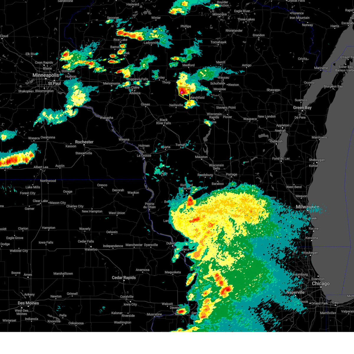 At 654 pm cdt, a severe thunderstorm was located near loyal, or 16 miles northeast of neillsville, moving east at 30 mph (radar indicated). Hazards include quarter size hail. Damage to vehicles is expected. this severe thunderstorm will remain over mainly rural areas of east central clark county, including the following locations, county k and capital road, riplinger, veefkind and unity. hail threat, radar indicated max hail size, 1. 00 in wind threat, radar indicated max wind gust, <50 mph. At 654 pm cdt, a severe thunderstorm was located near loyal, or 16 miles northeast of neillsville, moving east at 30 mph (radar indicated). Hazards include quarter size hail. Damage to vehicles is expected. this severe thunderstorm will remain over mainly rural areas of east central clark county, including the following locations, county k and capital road, riplinger, veefkind and unity. hail threat, radar indicated max hail size, 1. 00 in wind threat, radar indicated max wind gust, <50 mph.
|
| 7/14/2023 6:52 PM CDT | Several large trees broken. all trees fell to the east. one top of a tree traveled 75 feet. an unattached garage was also blown dow in clark county WI, 0.8 miles SSE of Loyal, WI |
| 7/14/2023 6:29 PM CDT |
 At 629 pm cdt, a severe thunderstorm was located over greenwood, or 16 miles north of neillsville, moving east at 25 mph (radar indicated). Hazards include quarter size hail. Damage to vehicles is expected. this severe thunderstorm will be near, loyal around 645 pm cdt. other locations impacted by this severe thunderstorm include county k and capital road, chili, highway 73 and 98, riplinger, veefkind and unity. hail threat, radar indicated max hail size, 1. 00 in wind threat, radar indicated max wind gust, <50 mph. At 629 pm cdt, a severe thunderstorm was located over greenwood, or 16 miles north of neillsville, moving east at 25 mph (radar indicated). Hazards include quarter size hail. Damage to vehicles is expected. this severe thunderstorm will be near, loyal around 645 pm cdt. other locations impacted by this severe thunderstorm include county k and capital road, chili, highway 73 and 98, riplinger, veefkind and unity. hail threat, radar indicated max hail size, 1. 00 in wind threat, radar indicated max wind gust, <50 mph.
|
| 8/3/2022 2:03 AM CDT |
 At 201 am cdt, severe thunderstorms were located along a line extending from near cornell to near fall creek, moving east at 60 mph (radar indicated). Hazards include 60 mph wind gusts. Expect damage to roofs, siding, and trees. severe thunderstorms will be near, thorp and jump river around 220 am cdt. owen around 235 am cdt. abbotsford, colby, dorchester and westboro around 245 am cdt. other locations impacted by these severe thunderstorms include polley, atwood, tioga, perkinstown, esadore lake and eidsvold. hail threat, radar indicated max hail size, <. 75 in wind threat, radar indicated max wind gust, 60 mph. At 201 am cdt, severe thunderstorms were located along a line extending from near cornell to near fall creek, moving east at 60 mph (radar indicated). Hazards include 60 mph wind gusts. Expect damage to roofs, siding, and trees. severe thunderstorms will be near, thorp and jump river around 220 am cdt. owen around 235 am cdt. abbotsford, colby, dorchester and westboro around 245 am cdt. other locations impacted by these severe thunderstorms include polley, atwood, tioga, perkinstown, esadore lake and eidsvold. hail threat, radar indicated max hail size, <. 75 in wind threat, radar indicated max wind gust, 60 mph.
|
| 8/24/2021 8:16 AM CDT |
 At 815 am cdt, severe thunderstorms were located along a line extending from colby to near marshfield to 8 miles east of shortville to 14 miles northeast of millston, moving east at 40 mph (radar indicated). Hazards include 60 mph wind gusts and quarter size hail. Hail damage to vehicles is expected. expect wind damage to roofs, siding, and trees. locations impacted include, neillsville, loyal, hatfield, shortville, colby, lynn, merrillan, granton, unity, city point, bruce mound, riplinger, and chili. hail threat, radar indicated max hail size, 1. 00 in wind threat, radar indicated max wind gust, 60 mph. At 815 am cdt, severe thunderstorms were located along a line extending from colby to near marshfield to 8 miles east of shortville to 14 miles northeast of millston, moving east at 40 mph (radar indicated). Hazards include 60 mph wind gusts and quarter size hail. Hail damage to vehicles is expected. expect wind damage to roofs, siding, and trees. locations impacted include, neillsville, loyal, hatfield, shortville, colby, lynn, merrillan, granton, unity, city point, bruce mound, riplinger, and chili. hail threat, radar indicated max hail size, 1. 00 in wind threat, radar indicated max wind gust, 60 mph.
|
| 8/24/2021 7:59 AM CDT |
 At 749 am cdt, severe thunderstorms were located along a line extending from near owen to 7 miles south of loyal to near neillsville to near hatfield, moving east at 40 mph (radar indicated). Hazards include 60 mph wind gusts and quarter size hail. Hail damage to vehicles is expected. expect wind damage to roofs, siding, and trees. locations impacted include, neillsville, loyal, greenwood, humbird, hatfield, shortville, colby, lynn, longwood, reseburg, merrillan, willard, alma center, granton, unity, atwood and tioga. hail threat, radar indicated max hail size, 1. 00 in wind threat, radar indicated max wind gust, 60 mph. At 749 am cdt, severe thunderstorms were located along a line extending from near owen to 7 miles south of loyal to near neillsville to near hatfield, moving east at 40 mph (radar indicated). Hazards include 60 mph wind gusts and quarter size hail. Hail damage to vehicles is expected. expect wind damage to roofs, siding, and trees. locations impacted include, neillsville, loyal, greenwood, humbird, hatfield, shortville, colby, lynn, longwood, reseburg, merrillan, willard, alma center, granton, unity, atwood and tioga. hail threat, radar indicated max hail size, 1. 00 in wind threat, radar indicated max wind gust, 60 mph.
|
| 8/24/2021 7:50 AM CDT |
 At 749 am cdt, severe thunderstorms were located along a line extending from near owen to 7 miles south of loyal to near neillsville to near hatfield, moving east at 40 mph (radar indicated). Hazards include 60 mph wind gusts and quarter size hail. Hail damage to vehicles is expected. expect wind damage to roofs, siding, and trees. locations impacted include, neillsville, loyal, greenwood, humbird, hatfield, shortville, colby, lynn, longwood, reseburg, merrillan, willard, alma center, granton, unity, atwood and tioga. hail threat, radar indicated max hail size, 1. 00 in wind threat, radar indicated max wind gust, 60 mph. At 749 am cdt, severe thunderstorms were located along a line extending from near owen to 7 miles south of loyal to near neillsville to near hatfield, moving east at 40 mph (radar indicated). Hazards include 60 mph wind gusts and quarter size hail. Hail damage to vehicles is expected. expect wind damage to roofs, siding, and trees. locations impacted include, neillsville, loyal, greenwood, humbird, hatfield, shortville, colby, lynn, longwood, reseburg, merrillan, willard, alma center, granton, unity, atwood and tioga. hail threat, radar indicated max hail size, 1. 00 in wind threat, radar indicated max wind gust, 60 mph.
|
| 8/24/2021 7:35 AM CDT |
 At 734 am cdt, severe thunderstorms were located along a line extending from near thorp to 8 miles west of greenwood to near black river falls, moving east at 40 mph (radar indicated). Hazards include 60 mph wind gusts and quarter size hail. Hail damage to vehicles is expected. expect wind damage to roofs, siding, and trees. locations impacted include, neillsville, loyal, greenwood, humbird, hatfield, shortville, colby, lynn, longwood, reseburg, merrillan, willard, alma center, granton, unity, and tioga. hail threat, radar indicated max hail size, 1. 00 in wind threat, radar indicated max wind gust, 60 mph. At 734 am cdt, severe thunderstorms were located along a line extending from near thorp to 8 miles west of greenwood to near black river falls, moving east at 40 mph (radar indicated). Hazards include 60 mph wind gusts and quarter size hail. Hail damage to vehicles is expected. expect wind damage to roofs, siding, and trees. locations impacted include, neillsville, loyal, greenwood, humbird, hatfield, shortville, colby, lynn, longwood, reseburg, merrillan, willard, alma center, granton, unity, and tioga. hail threat, radar indicated max hail size, 1. 00 in wind threat, radar indicated max wind gust, 60 mph.
|
| 8/24/2021 7:18 AM CDT |
 At 718 am cdt, severe thunderstorms were located along a line extending from near boyd to 8 miles north of fairchild to 8 miles east of blair, moving east at 40 mph (radar indicated). Hazards include 60 mph wind gusts and quarter size hail. Hail damage to vehicles is expected. Expect wind damage to roofs, siding, and trees. At 718 am cdt, severe thunderstorms were located along a line extending from near boyd to 8 miles north of fairchild to 8 miles east of blair, moving east at 40 mph (radar indicated). Hazards include 60 mph wind gusts and quarter size hail. Hail damage to vehicles is expected. Expect wind damage to roofs, siding, and trees.
|
| 7/6/2021 4:10 PM CDT |
 The severe thunderstorm warning for eastern clark county will expire at 415 pm cdt, the storms which prompted the warning have exited the warned area. therefore, the warning will be allowed to expire. a severe thunderstorm watch remains in effect until 1000 pm cdt for central and west central wisconsin. The severe thunderstorm warning for eastern clark county will expire at 415 pm cdt, the storms which prompted the warning have exited the warned area. therefore, the warning will be allowed to expire. a severe thunderstorm watch remains in effect until 1000 pm cdt for central and west central wisconsin.
|
| 7/6/2021 4:04 PM CDT |
 At 403 pm cdt, severe thunderstorms were located along a line extending from near spencer to near marshfield to near shortville, moving east at 55 mph (radar indicated). Hazards include 60 mph wind gusts. expect damage to roofs, siding, and trees At 403 pm cdt, severe thunderstorms were located along a line extending from near spencer to near marshfield to near shortville, moving east at 55 mph (radar indicated). Hazards include 60 mph wind gusts. expect damage to roofs, siding, and trees
|
| 7/6/2021 3:52 PM CDT |
 At 352 pm cdt, severe thunderstorms were located along a line extending from near greenwood to 7 miles southeast of loyal to near neillsville, moving east at 55 mph (radar indicated). Hazards include 60 mph wind gusts. Expect damage to roofs, siding, and trees. These severe thunderstorms will remain over mainly rural areas of eastern clark county, including the following locations, ballard road and pray avenue, highway 73 and 98, atwood, christie, lynn, longwood and globe. At 352 pm cdt, severe thunderstorms were located along a line extending from near greenwood to 7 miles southeast of loyal to near neillsville, moving east at 55 mph (radar indicated). Hazards include 60 mph wind gusts. Expect damage to roofs, siding, and trees. These severe thunderstorms will remain over mainly rural areas of eastern clark county, including the following locations, ballard road and pray avenue, highway 73 and 98, atwood, christie, lynn, longwood and globe.
|
| 7/6/2021 3:43 PM CDT |
 At 343 pm cdt, severe thunderstorms were located along a line extending from near greenwood to near neillsville to near hatfield, moving east at 50 mph (radar indicated). Hazards include 60 mph wind gusts. Expect damage to roofs, siding, and trees. These severe storms will be near, loyal and shortville around 355 pm cdt. At 343 pm cdt, severe thunderstorms were located along a line extending from near greenwood to near neillsville to near hatfield, moving east at 50 mph (radar indicated). Hazards include 60 mph wind gusts. Expect damage to roofs, siding, and trees. These severe storms will be near, loyal and shortville around 355 pm cdt.
|
| 7/6/2021 3:38 PM CDT |
 At 338 pm cdt, severe thunderstorms were located along a line extending from 8 miles northwest of greenwood to 7 miles northwest of neillsville to 6 miles east of humbird, moving east at 45 mph (radar indicated). Hazards include 60 mph wind gusts. Expect damage to roofs, siding, and trees. these severe storms will be near, neillsville and greenwood around 345 pm cdt. Loyal and shortville around 355 pm cdt. At 338 pm cdt, severe thunderstorms were located along a line extending from 8 miles northwest of greenwood to 7 miles northwest of neillsville to 6 miles east of humbird, moving east at 45 mph (radar indicated). Hazards include 60 mph wind gusts. Expect damage to roofs, siding, and trees. these severe storms will be near, neillsville and greenwood around 345 pm cdt. Loyal and shortville around 355 pm cdt.
|
| 7/6/2021 3:32 PM CDT |
 At 331 pm cdt, severe thunderstorms were located along a line extending from 7 miles south of thorp to 8 miles east of fairchild to humbird, moving east at 45 mph (radar indicated). Hazards include 60 mph wind gusts. Expect damage to roofs, siding, and trees. these severe storms will be near, neillsville and greenwood around 345 pm cdt. Loyal and shortville around 355 pm cdt. At 331 pm cdt, severe thunderstorms were located along a line extending from 7 miles south of thorp to 8 miles east of fairchild to humbird, moving east at 45 mph (radar indicated). Hazards include 60 mph wind gusts. Expect damage to roofs, siding, and trees. these severe storms will be near, neillsville and greenwood around 345 pm cdt. Loyal and shortville around 355 pm cdt.
|
| 7/6/2021 3:27 PM CDT |
 At 326 pm cdt, severe thunderstorms were located along a line extending from 8 miles southwest of thorp to near fairchild, moving east at 40 mph (radar indicated). Hazards include 60 mph wind gusts. Expect damage to roofs, siding, and trees. these severe storms will be near, greenwood around 345 pm cdt. neillsville around 350 pm cdt. loyal and shortville around 355 pm cdt. Other locations impacted by these severe thunderstorms include ballard road and pray avenue, highway 73 and 98, wildcat mound, atwood, tioga, christie and highway 10 and bald peak road. At 326 pm cdt, severe thunderstorms were located along a line extending from 8 miles southwest of thorp to near fairchild, moving east at 40 mph (radar indicated). Hazards include 60 mph wind gusts. Expect damage to roofs, siding, and trees. these severe storms will be near, greenwood around 345 pm cdt. neillsville around 350 pm cdt. loyal and shortville around 355 pm cdt. Other locations impacted by these severe thunderstorms include ballard road and pray avenue, highway 73 and 98, wildcat mound, atwood, tioga, christie and highway 10 and bald peak road.
|
| 7/6/2021 3:23 PM CDT |
 At 322 pm cdt, severe thunderstorms were located along a line extending from 7 miles south of stanley to fairchild, moving east at 40 mph (radar indicated). Hazards include 60 mph wind gusts. Expect damage to roofs, siding, and trees. severe thunderstorms will be near, greenwood around 345 pm cdt. neillsville around 350 pm cdt. loyal and shortville around 355 pm cdt. Other locations impacted by these severe thunderstorms include ballard road and pray avenue, highway 73 and 98, wildcat mound, atwood, tioga, christie and highway 10 and bald peak road. At 322 pm cdt, severe thunderstorms were located along a line extending from 7 miles south of stanley to fairchild, moving east at 40 mph (radar indicated). Hazards include 60 mph wind gusts. Expect damage to roofs, siding, and trees. severe thunderstorms will be near, greenwood around 345 pm cdt. neillsville around 350 pm cdt. loyal and shortville around 355 pm cdt. Other locations impacted by these severe thunderstorms include ballard road and pray avenue, highway 73 and 98, wildcat mound, atwood, tioga, christie and highway 10 and bald peak road.
|
| 6/24/2021 5:14 PM CDT |
 At 514 pm cdt, a severe thunderstorm was located over spencer, or 18 miles northeast of neillsville, moving east at 20 mph (radar indicated). Hazards include quarter size hail. Damage to vehicles is expected. This severe thunderstorm will remain over mainly rural areas of central clark county, including the following locations, county k and capital road, mead lake, highway 73 and 98, atwood, tioga, veefkind and longwood. At 514 pm cdt, a severe thunderstorm was located over spencer, or 18 miles northeast of neillsville, moving east at 20 mph (radar indicated). Hazards include quarter size hail. Damage to vehicles is expected. This severe thunderstorm will remain over mainly rural areas of central clark county, including the following locations, county k and capital road, mead lake, highway 73 and 98, atwood, tioga, veefkind and longwood.
|
| 6/24/2021 5:01 PM CDT |
 At 501 pm cdt, a severe thunderstorm was located near greenwood, or 14 miles north of neillsville, moving east at 25 mph (radar indicated). Hazards include quarter size hail. Damage to vehicles is expected. this severe storm will be near, greenwood around 510 pm cdt. loyal around 525 pm cdt. Other locations impacted by this severe thunderstorm include county k and capital road, mead lake, highway 73 and 98, atwood, tioga, veefkind and longwood. At 501 pm cdt, a severe thunderstorm was located near greenwood, or 14 miles north of neillsville, moving east at 25 mph (radar indicated). Hazards include quarter size hail. Damage to vehicles is expected. this severe storm will be near, greenwood around 510 pm cdt. loyal around 525 pm cdt. Other locations impacted by this severe thunderstorm include county k and capital road, mead lake, highway 73 and 98, atwood, tioga, veefkind and longwood.
|
| 6/24/2021 4:53 PM CDT |
 At 451 pm cdt, severe thunderstorms were located 8 miles west of greenwood moving east at 20 mph (radar indicated). Hazards include ping pong ball size hail. People and animals outdoors will be injured. expect damage to roofs, siding, windows, and vehicles. this severe storm will be near, greenwood around 515 pm cdt. loyal around 530 pm cdt. Other locations impacted by this severe thunderstorm include county k and capital road, mead lake, highway 73 and 98, atwood, tioga, veefkind and longwood. At 451 pm cdt, severe thunderstorms were located 8 miles west of greenwood moving east at 20 mph (radar indicated). Hazards include ping pong ball size hail. People and animals outdoors will be injured. expect damage to roofs, siding, windows, and vehicles. this severe storm will be near, greenwood around 515 pm cdt. loyal around 530 pm cdt. Other locations impacted by this severe thunderstorm include county k and capital road, mead lake, highway 73 and 98, atwood, tioga, veefkind and longwood.
|
| 6/24/2021 4:46 PM CDT |
 At 446 pm cdt, a severe thunderstorm was located 11 miles south of thorp, or 20 miles northwest of neillsville, moving east at 15 mph (radar indicated). Hazards include quarter size hail. Damage to vehicles is expected. this severe thunderstorm will be near, greenwood around 530 pm cdt. loyal around 545 pm cdt. Other locations impacted by this severe thunderstorm include county k and capital road, mead lake, highway 73 and 98, atwood, tioga, veefkind and longwood. At 446 pm cdt, a severe thunderstorm was located 11 miles south of thorp, or 20 miles northwest of neillsville, moving east at 15 mph (radar indicated). Hazards include quarter size hail. Damage to vehicles is expected. this severe thunderstorm will be near, greenwood around 530 pm cdt. loyal around 545 pm cdt. Other locations impacted by this severe thunderstorm include county k and capital road, mead lake, highway 73 and 98, atwood, tioga, veefkind and longwood.
|
| 6/17/2021 7:44 PM CDT |
 At 744 pm cdt, a severe thunderstorm was located near loyal, or 11 miles northeast of neillsville, moving east at 30 mph (radar indicated). Hazards include 60 mph wind gusts. Expect damage to roofs, siding, and trees. This severe thunderstorm will remain over mainly rural areas of eastern clark county, including the following locations, county k and capital road, chili, highway 73 and 98, chili corners, atwood, christie and veefkind. At 744 pm cdt, a severe thunderstorm was located near loyal, or 11 miles northeast of neillsville, moving east at 30 mph (radar indicated). Hazards include 60 mph wind gusts. Expect damage to roofs, siding, and trees. This severe thunderstorm will remain over mainly rural areas of eastern clark county, including the following locations, county k and capital road, chili, highway 73 and 98, chili corners, atwood, christie and veefkind.
|
| 6/17/2021 7:24 PM CDT |
 At 724 pm cdt, a severe thunderstorm was located near greenwood, or 10 miles north of neillsville, moving east at 30 mph (radar indicated). Hazards include 60 mph wind gusts and quarter size hail. Hail damage to vehicles is expected. expect wind damage to roofs, siding, and trees. this severe thunderstorm will be near, loyal around 740 pm cdt. Other locations impacted by this severe thunderstorm include highway 73 and 98, atwood, tioga, christie, highway 10 and bald peak road, lynn and longwood. At 724 pm cdt, a severe thunderstorm was located near greenwood, or 10 miles north of neillsville, moving east at 30 mph (radar indicated). Hazards include 60 mph wind gusts and quarter size hail. Hail damage to vehicles is expected. expect wind damage to roofs, siding, and trees. this severe thunderstorm will be near, loyal around 740 pm cdt. Other locations impacted by this severe thunderstorm include highway 73 and 98, atwood, tioga, christie, highway 10 and bald peak road, lynn and longwood.
|
| 6/17/2021 7:07 PM CDT |
 At 707 pm cdt, severe thunderstorms were located along a line extending from near greenwood to near augusta, moving east at 45 mph (radar indicated). Hazards include 60 mph wind gusts and quarter size hail. Hail damage to vehicles is expected. expect wind damage to roofs, siding, and trees. these severe storms will be near, greenwood around 710 pm cdt. loyal around 745 pm cdt. Other locations impacted by these severe thunderstorms include county k and capital road, chili, hog corners, mead lake, highway 73 and 98, highway 10 and 12 and tioga. At 707 pm cdt, severe thunderstorms were located along a line extending from near greenwood to near augusta, moving east at 45 mph (radar indicated). Hazards include 60 mph wind gusts and quarter size hail. Hail damage to vehicles is expected. expect wind damage to roofs, siding, and trees. these severe storms will be near, greenwood around 710 pm cdt. loyal around 745 pm cdt. Other locations impacted by these severe thunderstorms include county k and capital road, chili, hog corners, mead lake, highway 73 and 98, highway 10 and 12 and tioga.
|
| 6/17/2021 6:43 PM CDT |
 At 643 pm cdt, severe thunderstorms were located along a line extending from 8 miles south of stanley to near strum, moving east at 45 mph (radar indicated). Hazards include 60 mph wind gusts and quarter size hail. Hail damage to vehicles is expected. expect wind damage to roofs, siding, and trees. severe thunderstorms will be near, greenwood around 705 pm cdt. Other locations impacted by these severe thunderstorms include county k and capital road, chili, hog corners, mead lake, highway 73 and 98, highway 10 and 12 and tioga. At 643 pm cdt, severe thunderstorms were located along a line extending from 8 miles south of stanley to near strum, moving east at 45 mph (radar indicated). Hazards include 60 mph wind gusts and quarter size hail. Hail damage to vehicles is expected. expect wind damage to roofs, siding, and trees. severe thunderstorms will be near, greenwood around 705 pm cdt. Other locations impacted by these severe thunderstorms include county k and capital road, chili, hog corners, mead lake, highway 73 and 98, highway 10 and 12 and tioga.
|
| 5/25/2021 5:53 PM CDT |
 At 551 pm cdt, severe thunderstorms were located along a line extending from near spencer to near shortville to 6 miles north of millston, moving east at 45 mph (law enforcement reported tree damage in the neillsville area and across southern clark county). Hazards include 60 mph wind gusts and penny size hail. Expect damage to roofs, siding, and trees. these severe thunderstorms will remain over mainly rural areas of southeastern clark and jackson counties, including the following locations, franklin, ballard road and pray avenue, highway 73 and 98, city point, shamrock, the black river correctional center and pigeon creek campground. This includes interstate 94 between mile markers 103 and 132. At 551 pm cdt, severe thunderstorms were located along a line extending from near spencer to near shortville to 6 miles north of millston, moving east at 45 mph (law enforcement reported tree damage in the neillsville area and across southern clark county). Hazards include 60 mph wind gusts and penny size hail. Expect damage to roofs, siding, and trees. these severe thunderstorms will remain over mainly rural areas of southeastern clark and jackson counties, including the following locations, franklin, ballard road and pray avenue, highway 73 and 98, city point, shamrock, the black river correctional center and pigeon creek campground. This includes interstate 94 between mile markers 103 and 132.
|
| 5/25/2021 5:30 PM CDT |
 At 528 pm cdt, severe thunderstorms were located along a line extending from near greenwood to near humbird to 8 miles southeast of blair, moving east at 45 mph (radar indicated). Hazards include 60 mph wind gusts and penny size hail. Expect damage to roofs, siding, and trees. these severe storms will be near, loyal and greenwood around 535 pm cdt. neillsville around 545 pm cdt. black river falls and shortville around 550 pm cdt. millston around 600 pm cdt. other locations impacted by these severe thunderstorms include franklin, highway 73 and 98, shamrock, the black river correctional center, tioga, potters flowage and perry creek recreation area. This includes interstate 94 between mile markers 96 and 132. At 528 pm cdt, severe thunderstorms were located along a line extending from near greenwood to near humbird to 8 miles southeast of blair, moving east at 45 mph (radar indicated). Hazards include 60 mph wind gusts and penny size hail. Expect damage to roofs, siding, and trees. these severe storms will be near, loyal and greenwood around 535 pm cdt. neillsville around 545 pm cdt. black river falls and shortville around 550 pm cdt. millston around 600 pm cdt. other locations impacted by these severe thunderstorms include franklin, highway 73 and 98, shamrock, the black river correctional center, tioga, potters flowage and perry creek recreation area. This includes interstate 94 between mile markers 96 and 132.
|
| 5/25/2021 5:11 PM CDT |
 At 510 pm cdt, severe thunderstorms were located along a line extending from near fairchild to 9 miles south of price to near galesville, moving east at 45 mph (law enforecment reported widespread wind damage across trempealeau county). Hazards include 60 mph wind gusts and penny size hail. Expect damage to roofs, siding, and trees. severe thunderstorms will be near, fairchild around 515 pm cdt. humbird around 525 pm cdt. greenwood around 530 pm cdt. hatfield around 535 pm cdt. loyal around 540 pm cdt. neillsville around 545 pm cdt. shortville around 550 pm cdt. millston around 600 pm cdt. other locations impacted by these severe thunderstorms include franklin, highway 73 and 98, shamrock, the black river correctional center, tioga, potters flowage and perry creek recreation area. This includes interstate 94 between mile markers 94 and 132. At 510 pm cdt, severe thunderstorms were located along a line extending from near fairchild to 9 miles south of price to near galesville, moving east at 45 mph (law enforecment reported widespread wind damage across trempealeau county). Hazards include 60 mph wind gusts and penny size hail. Expect damage to roofs, siding, and trees. severe thunderstorms will be near, fairchild around 515 pm cdt. humbird around 525 pm cdt. greenwood around 530 pm cdt. hatfield around 535 pm cdt. loyal around 540 pm cdt. neillsville around 545 pm cdt. shortville around 550 pm cdt. millston around 600 pm cdt. other locations impacted by these severe thunderstorms include franklin, highway 73 and 98, shamrock, the black river correctional center, tioga, potters flowage and perry creek recreation area. This includes interstate 94 between mile markers 94 and 132.
|
| 7/14/2020 5:04 PM CDT |
 At 503 pm cdt, severe thunderstorms were located along a line extending from near abbotsford to near colby to near loyal, moving east at 50 mph (public. this storm has a history of producing tree damage). Hazards include 60 mph wind gusts and penny size hail. Expect damage to roofs, siding, and trees. These severe thunderstorms will remain over mainly rural areas of central clark county, including the following locations, county k and capital road, chili, hog corners, highway 73 and 98, tioga, christie and veefkind. At 503 pm cdt, severe thunderstorms were located along a line extending from near abbotsford to near colby to near loyal, moving east at 50 mph (public. this storm has a history of producing tree damage). Hazards include 60 mph wind gusts and penny size hail. Expect damage to roofs, siding, and trees. These severe thunderstorms will remain over mainly rural areas of central clark county, including the following locations, county k and capital road, chili, hog corners, highway 73 and 98, tioga, christie and veefkind.
|
| 7/14/2020 4:44 PM CDT |
 At 443 pm cdt, severe thunderstorms were located along a line extending from near owen to greenwood to 6 miles east of fairchild, moving east at 45 mph (public. this storm has a history of producing damage to trees in augusta). Hazards include 60 mph wind gusts and penny size hail. Expect damage to roofs, siding, and trees. these severe storms will be near, loyal and owen around 450 pm cdt. abbotsford around 505 pm cdt. Other locations impacted by these severe thunderstorms include county k and capital road, chili, hog corners, mead lake, highway 73 and 98, atwood and tioga. At 443 pm cdt, severe thunderstorms were located along a line extending from near owen to greenwood to 6 miles east of fairchild, moving east at 45 mph (public. this storm has a history of producing damage to trees in augusta). Hazards include 60 mph wind gusts and penny size hail. Expect damage to roofs, siding, and trees. these severe storms will be near, loyal and owen around 450 pm cdt. abbotsford around 505 pm cdt. Other locations impacted by these severe thunderstorms include county k and capital road, chili, hog corners, mead lake, highway 73 and 98, atwood and tioga.
|
| 7/14/2020 4:23 PM CDT |
 At 423 pm cdt, severe thunderstorms were located along a line extending from near thorp to 12 miles south of stanley to near price, moving east at 50 mph (radar indicated). Hazards include 60 mph wind gusts and penny size hail. Expect damage to roofs, siding, and trees. these severe storms will be near, owen around 435 pm cdt. greenwood around 455 pm cdt. abbotsford and loyal around 500 pm cdt. Other locations impacted by these severe thunderstorms include county k and capital road, chili, hog corners, mead lake, highway 73 and 98, atwood and tioga. At 423 pm cdt, severe thunderstorms were located along a line extending from near thorp to 12 miles south of stanley to near price, moving east at 50 mph (radar indicated). Hazards include 60 mph wind gusts and penny size hail. Expect damage to roofs, siding, and trees. these severe storms will be near, owen around 435 pm cdt. greenwood around 455 pm cdt. abbotsford and loyal around 500 pm cdt. Other locations impacted by these severe thunderstorms include county k and capital road, chili, hog corners, mead lake, highway 73 and 98, atwood and tioga.
|
| 7/14/2020 4:14 PM CDT |
 At 413 pm cdt, severe thunderstorms were located along a line extending from near stanley to 6 miles northeast of augusta to osseo, moving east at 50 mph (radar indicated). Hazards include 60 mph wind gusts and penny size hail. Expect damage to roofs, siding, and trees. severe thunderstorms will be near, owen around 435 pm cdt. greenwood around 450 pm cdt. loyal around 455 pm cdt. abbotsford around 500 pm cdt. Other locations impacted by these severe thunderstorms include county k and capital road, chili, hog corners, mead lake, highway 73 and 98, atwood and tioga. At 413 pm cdt, severe thunderstorms were located along a line extending from near stanley to 6 miles northeast of augusta to osseo, moving east at 50 mph (radar indicated). Hazards include 60 mph wind gusts and penny size hail. Expect damage to roofs, siding, and trees. severe thunderstorms will be near, owen around 435 pm cdt. greenwood around 450 pm cdt. loyal around 455 pm cdt. abbotsford around 500 pm cdt. Other locations impacted by these severe thunderstorms include county k and capital road, chili, hog corners, mead lake, highway 73 and 98, atwood and tioga.
|
| 6/2/2020 6:09 PM CDT |
 At 609 pm cdt, a cluster of severe thunderstorms were located near hatfield, or 8 miles southwest of neillsville, moving east at 45 mph (radar indicated). Hazards include ping pong ball size hail and 60 mph wind gusts. People and animals outdoors will be injured. expect hail damage to roofs, siding, windows, and vehicles. expect wind damage to roofs, siding, and trees. this severe thunderstorm will be near, neillsville around 620 pm cdt. shortville around 625 pm cdt. Other locations impacted by this severe thunderstorm include ballard road and pray avenue, city point, the black river correctional center, christie, potters flowage, lynn and chili. At 609 pm cdt, a cluster of severe thunderstorms were located near hatfield, or 8 miles southwest of neillsville, moving east at 45 mph (radar indicated). Hazards include ping pong ball size hail and 60 mph wind gusts. People and animals outdoors will be injured. expect hail damage to roofs, siding, windows, and vehicles. expect wind damage to roofs, siding, and trees. this severe thunderstorm will be near, neillsville around 620 pm cdt. shortville around 625 pm cdt. Other locations impacted by this severe thunderstorm include ballard road and pray avenue, city point, the black river correctional center, christie, potters flowage, lynn and chili.
|
| 9/24/2019 9:41 PM CDT |
 At 939 pm cdt, severe thunderstorms were located along a line extending from near colby to 6 miles southwest of spencer to shortville, moving east at 40 mph. jackson county wisconsin has not heard of any wind damage so far with these storms. clark county has reports of trees down in the loyal and greenwood areas (radar indicated). Hazards include 60 mph wind gusts. Expect damage to roofs, siding, and trees. Locations impacted include, neillsville, loyal, shortville, lynn, granton, unity, and city point. At 939 pm cdt, severe thunderstorms were located along a line extending from near colby to 6 miles southwest of spencer to shortville, moving east at 40 mph. jackson county wisconsin has not heard of any wind damage so far with these storms. clark county has reports of trees down in the loyal and greenwood areas (radar indicated). Hazards include 60 mph wind gusts. Expect damage to roofs, siding, and trees. Locations impacted include, neillsville, loyal, shortville, lynn, granton, unity, and city point.
|
| 9/24/2019 9:30 PM CDT |
 At 930 pm cdt, severe thunderstorms were located along a line extending from near greenwood to near loyal to near hatfield, moving east at 50 mph. these storms produced wind damage in neighboring counties that included downed trees and power lines (radar indicated). Hazards include 60 mph wind gusts. Expect damage to roofs, siding, and trees. These severe thunderstorms will remain over mainly rural areas of southeastern clark and central jackson counties, including the following locations, ballard road and pray avenue, highway 73 and 98, city point, wildcat mound, the black river correctional center, christie and vaudreuil. At 930 pm cdt, severe thunderstorms were located along a line extending from near greenwood to near loyal to near hatfield, moving east at 50 mph. these storms produced wind damage in neighboring counties that included downed trees and power lines (radar indicated). Hazards include 60 mph wind gusts. Expect damage to roofs, siding, and trees. These severe thunderstorms will remain over mainly rural areas of southeastern clark and central jackson counties, including the following locations, ballard road and pray avenue, highway 73 and 98, city point, wildcat mound, the black river correctional center, christie and vaudreuil.
|
| 9/24/2019 9:29 PM CDT | Trees and power lines blown dow in clark county WI, 0.4 miles E of Loyal, WI |
| 9/24/2019 9:20 PM CDT |
 At 920 pm cdt, severe thunderstorms were located along a line extending from 6 miles west of greenwood to 6 miles west of neillsville to 6 miles northwest of black river falls, moving northeast at 65 mph (radar indicated). Hazards include 60 mph wind gusts. Expect damage to roofs, siding, and trees. these severe storms will be near, neillsville and greenwood around 925 pm cdt. loyal around 935 pm cdt. shortville around 940 pm cdt. Other locations impacted by these severe thunderstorms include ballard road and pray avenue, highway 73 and 98, city point, wildcat mound, the black river correctional center, tioga and christie. At 920 pm cdt, severe thunderstorms were located along a line extending from 6 miles west of greenwood to 6 miles west of neillsville to 6 miles northwest of black river falls, moving northeast at 65 mph (radar indicated). Hazards include 60 mph wind gusts. Expect damage to roofs, siding, and trees. these severe storms will be near, neillsville and greenwood around 925 pm cdt. loyal around 935 pm cdt. shortville around 940 pm cdt. Other locations impacted by these severe thunderstorms include ballard road and pray avenue, highway 73 and 98, city point, wildcat mound, the black river correctional center, tioga and christie.
|
| 9/24/2019 9:06 PM CDT |
 At 905 pm cdt, severe thunderstorms were located along a line extending from near price to near blair, moving east at 50 mph. an area of strong winds was moving through northwest jackson county, between black river falls and the eau claire area (radar indicated). Hazards include 60 mph wind gusts. Expect damage to roofs, siding, and trees. severe thunderstorms will be near, price around 910 pm cdt. fairchild and humbird around 915 pm cdt. black river falls around 925 pm cdt. hatfield around 930 pm cdt. neillsville and greenwood around 940 pm cdt. loyal and shortville around 945 pm cdt. Other locations impacted by these severe thunderstorms include franklin, highway 73 and 98, the black river correctional center, tioga, i 94 exit 98, perry creek recreation area and lynn. At 905 pm cdt, severe thunderstorms were located along a line extending from near price to near blair, moving east at 50 mph. an area of strong winds was moving through northwest jackson county, between black river falls and the eau claire area (radar indicated). Hazards include 60 mph wind gusts. Expect damage to roofs, siding, and trees. severe thunderstorms will be near, price around 910 pm cdt. fairchild and humbird around 915 pm cdt. black river falls around 925 pm cdt. hatfield around 930 pm cdt. neillsville and greenwood around 940 pm cdt. loyal and shortville around 945 pm cdt. Other locations impacted by these severe thunderstorms include franklin, highway 73 and 98, the black river correctional center, tioga, i 94 exit 98, perry creek recreation area and lynn.
|
| 9/3/2019 12:43 AM CDT |
 The severe thunderstorm warning for northern clark and southeastern taylor counties will expire at 1245 am cdt, the storms which prompted the warning have moved out of the area. therefore, the warning will be allowed to expire. a severe thunderstorm watch remains in effect until 200 am cdt for central and north central wisconsin. The severe thunderstorm warning for northern clark and southeastern taylor counties will expire at 1245 am cdt, the storms which prompted the warning have moved out of the area. therefore, the warning will be allowed to expire. a severe thunderstorm watch remains in effect until 200 am cdt for central and north central wisconsin.
|
| 9/3/2019 12:36 AM CDT |
 At 1236 am cdt, severe thunderstorms were located along a line extending from near owen to near loyal to 7 miles south of greenwood, moving east at 60 mph (radar indicated). Hazards include 60 mph wind gusts. Expect damage to roofs, siding, and trees. these severe storms will be near, abbotsford, spencer, colby and dorchester around 1245 am cdt. Other locations impacted by these severe thunderstorms include chili, hog corners, stetsonville, christie and county roads a and e. At 1236 am cdt, severe thunderstorms were located along a line extending from near owen to near loyal to 7 miles south of greenwood, moving east at 60 mph (radar indicated). Hazards include 60 mph wind gusts. Expect damage to roofs, siding, and trees. these severe storms will be near, abbotsford, spencer, colby and dorchester around 1245 am cdt. Other locations impacted by these severe thunderstorms include chili, hog corners, stetsonville, christie and county roads a and e.
|
| 9/3/2019 12:19 AM CDT |
 At 1205 am cdt, severe thunderstorms were located along a line extending from 8 miles southeast of cornell to 6 miles southeast of boyd to near augusta, moving east at 60 mph (radar indicated). Hazards include 60 mph wind gusts. Expect damage to roofs, siding, and trees. severe thunderstorms will be near, thorp around 1220 am cdt. greenwood around 1225 am cdt. owen around 1230 am cdt. spencer, loyal and dorchester around 1240 am cdt. Other locations impacted by these severe thunderstorms include highway 73 and 98, atwood, tioga, christie, lynn, eidsvold and longwood. At 1205 am cdt, severe thunderstorms were located along a line extending from 8 miles southeast of cornell to 6 miles southeast of boyd to near augusta, moving east at 60 mph (radar indicated). Hazards include 60 mph wind gusts. Expect damage to roofs, siding, and trees. severe thunderstorms will be near, thorp around 1220 am cdt. greenwood around 1225 am cdt. owen around 1230 am cdt. spencer, loyal and dorchester around 1240 am cdt. Other locations impacted by these severe thunderstorms include highway 73 and 98, atwood, tioga, christie, lynn, eidsvold and longwood.
|
| 9/3/2019 12:06 AM CDT |
 At 1205 am cdt, severe thunderstorms were located along a line extending from 8 miles southeast of cornell to 6 miles southeast of boyd to near augusta, moving east at 60 mph (radar indicated). Hazards include 60 mph wind gusts. Expect damage to roofs, siding, and trees. severe thunderstorms will be near, thorp around 1220 am cdt. greenwood around 1225 am cdt. owen around 1230 am cdt. spencer, loyal and dorchester around 1240 am cdt. Other locations impacted by these severe thunderstorms include highway 73 and 98, atwood, tioga, christie, lynn, eidsvold and longwood. At 1205 am cdt, severe thunderstorms were located along a line extending from 8 miles southeast of cornell to 6 miles southeast of boyd to near augusta, moving east at 60 mph (radar indicated). Hazards include 60 mph wind gusts. Expect damage to roofs, siding, and trees. severe thunderstorms will be near, thorp around 1220 am cdt. greenwood around 1225 am cdt. owen around 1230 am cdt. spencer, loyal and dorchester around 1240 am cdt. Other locations impacted by these severe thunderstorms include highway 73 and 98, atwood, tioga, christie, lynn, eidsvold and longwood.
|
| 8/7/2019 6:07 PM CDT |
 The severe thunderstorm warning for east central clark county will expire at 615 pm cdt, the storm which prompted the warning has moved out of the area. therefore, the warning will be allowed to expire. The severe thunderstorm warning for east central clark county will expire at 615 pm cdt, the storm which prompted the warning has moved out of the area. therefore, the warning will be allowed to expire.
|
| 8/7/2019 5:52 PM CDT |
 At 551 pm cdt, a severe thunderstorm was located over spencer, or 20 miles northeast of neillsville, moving east at 35 mph (radar indicated). Hazards include 60 mph wind gusts and quarter size hail. Hail damage to vehicles is expected. expect wind damage to roofs, siding, and trees. Locations impacted include, loyal, unity and veefkind. At 551 pm cdt, a severe thunderstorm was located over spencer, or 20 miles northeast of neillsville, moving east at 35 mph (radar indicated). Hazards include 60 mph wind gusts and quarter size hail. Hail damage to vehicles is expected. expect wind damage to roofs, siding, and trees. Locations impacted include, loyal, unity and veefkind.
|
| 8/7/2019 5:43 PM CDT |
 At 542 pm cdt, a severe thunderstorm was located near spencer, or 17 miles northeast of neillsville, moving east at 35 mph (radar indicated). Hazards include 60 mph wind gusts and quarter size hail. Hail damage to vehicles is expected. expect wind damage to roofs, siding, and trees. This severe thunderstorm will remain over mainly rural areas of east central clark county, including the following locations, county k and capital road, riplinger, atwood, veefkind and unity. At 542 pm cdt, a severe thunderstorm was located near spencer, or 17 miles northeast of neillsville, moving east at 35 mph (radar indicated). Hazards include 60 mph wind gusts and quarter size hail. Hail damage to vehicles is expected. expect wind damage to roofs, siding, and trees. This severe thunderstorm will remain over mainly rural areas of east central clark county, including the following locations, county k and capital road, riplinger, atwood, veefkind and unity.
|
| 8/7/2019 5:31 PM CDT |
 At 531 pm cdt, a severe thunderstorm was located near loyal, or 17 miles north of neillsville, moving east at 35 mph (radar indicated). Hazards include 60 mph wind gusts and quarter size hail. Hail damage to vehicles is expected. expect wind damage to roofs, siding, and trees. This severe thunderstorm will remain over mainly rural areas of northeastern clark county, including the following locations, county k and capital road, riplinger, longwood, atwood, veefkind and unity. At 531 pm cdt, a severe thunderstorm was located near loyal, or 17 miles north of neillsville, moving east at 35 mph (radar indicated). Hazards include 60 mph wind gusts and quarter size hail. Hail damage to vehicles is expected. expect wind damage to roofs, siding, and trees. This severe thunderstorm will remain over mainly rural areas of northeastern clark county, including the following locations, county k and capital road, riplinger, longwood, atwood, veefkind and unity.
|
| 8/5/2019 6:28 PM CDT |
 The severe thunderstorm warning for southern clark county will expire at 630 pm cdt, the storms which prompted the warning have moved out of the area. therefore, the warning will be allowed to expire. a severe thunderstorm watch remains in effect until 1000 pm cdt for central wisconsin. The severe thunderstorm warning for southern clark county will expire at 630 pm cdt, the storms which prompted the warning have moved out of the area. therefore, the warning will be allowed to expire. a severe thunderstorm watch remains in effect until 1000 pm cdt for central wisconsin.
|
| 8/5/2019 6:17 PM CDT |
 At 617 pm cdt, severe thunderstorms were located along a line extending from 6 miles west of marshfield to near shortville to near neillsville, moving south at 35 mph (radar indicated). Hazards include 60 mph wind gusts and half dollar size hail. Hail damage to vehicles is expected. expect wind damage to roofs, siding, and trees. These severe thunderstorms will remain over mainly rural areas of southern clark county, including the following locations, chili, hog corners, highway 73 and 98, chili corners, christie, veefkind and lynn. At 617 pm cdt, severe thunderstorms were located along a line extending from 6 miles west of marshfield to near shortville to near neillsville, moving south at 35 mph (radar indicated). Hazards include 60 mph wind gusts and half dollar size hail. Hail damage to vehicles is expected. expect wind damage to roofs, siding, and trees. These severe thunderstorms will remain over mainly rural areas of southern clark county, including the following locations, chili, hog corners, highway 73 and 98, chili corners, christie, veefkind and lynn.
|
| 8/5/2019 6:11 PM CDT |
 At 611 pm cdt, severe thunderstorms were located along a line extending from 6 miles west of marshfield to near neillsville, moving south at 30 mph (radar indicated). Hazards include ping pong ball size hail and 60 mph wind gusts. People and animals outdoors will be injured. expect hail damage to roofs, siding, windows, and vehicles. expect wind damage to roofs, siding, and trees. These severe thunderstorms will remain over mainly rural areas of central clark county, including the following locations, county k and capital road, chili, hog corners, mead lake, highway 73 and 98, chili corners and tioga. At 611 pm cdt, severe thunderstorms were located along a line extending from 6 miles west of marshfield to near neillsville, moving south at 30 mph (radar indicated). Hazards include ping pong ball size hail and 60 mph wind gusts. People and animals outdoors will be injured. expect hail damage to roofs, siding, windows, and vehicles. expect wind damage to roofs, siding, and trees. These severe thunderstorms will remain over mainly rural areas of central clark county, including the following locations, county k and capital road, chili, hog corners, mead lake, highway 73 and 98, chili corners and tioga.
|
| 8/5/2019 6:03 PM CDT |
 At 603 pm cdt, severe thunderstorms were located along a line extending from 9 miles northeast of fairchild to near neillsville and also near loyal, moving east at 40 mph (radar indicated). Hazards include ping pong ball size hail and 60 mph wind gusts. People and animals outdoors will be injured. expect hail damage to roofs, siding, windows, and vehicles. expect wind damage to roofs, siding, and trees. these severe storms will be near, neillsville around 610 pm cdt. greenwood around 620 pm cdt. loyal around 630 pm cdt. Other locations impacted by these severe thunderstorms include highway 73 and 98, tioga, christie, highway 10 and bald peak road, lynn, seven sister mounds and globe. At 603 pm cdt, severe thunderstorms were located along a line extending from 9 miles northeast of fairchild to near neillsville and also near loyal, moving east at 40 mph (radar indicated). Hazards include ping pong ball size hail and 60 mph wind gusts. People and animals outdoors will be injured. expect hail damage to roofs, siding, windows, and vehicles. expect wind damage to roofs, siding, and trees. these severe storms will be near, neillsville around 610 pm cdt. greenwood around 620 pm cdt. loyal around 630 pm cdt. Other locations impacted by these severe thunderstorms include highway 73 and 98, tioga, christie, highway 10 and bald peak road, lynn, seven sister mounds and globe.
|
| 8/5/2019 5:48 PM CDT |
 At 548 pm cdt, severe thunderstorms were located along a line extending from 6 miles north of fairchild to humbird, moving east at 40 mph (radar indicated). Hazards include golf ball size hail and 60 mph wind gusts. People and animals outdoors will be injured. expect hail damage to roofs, siding, windows, and vehicles. expect wind damage to roofs, siding, and trees. severe thunderstorms will be near, neillsville around 610 pm cdt. shortville around 615 pm cdt. greenwood around 620 pm cdt. loyal around 625 pm cdt. Other locations impacted by these severe thunderstorms include highway 73 and 98, wildcat mound, tioga, christie, highway 10 and bald peak road, lynn and seven sister mounds. At 548 pm cdt, severe thunderstorms were located along a line extending from 6 miles north of fairchild to humbird, moving east at 40 mph (radar indicated). Hazards include golf ball size hail and 60 mph wind gusts. People and animals outdoors will be injured. expect hail damage to roofs, siding, windows, and vehicles. expect wind damage to roofs, siding, and trees. severe thunderstorms will be near, neillsville around 610 pm cdt. shortville around 615 pm cdt. greenwood around 620 pm cdt. loyal around 625 pm cdt. Other locations impacted by these severe thunderstorms include highway 73 and 98, wildcat mound, tioga, christie, highway 10 and bald peak road, lynn and seven sister mounds.
|
| 7/20/2019 10:20 AM CDT |
 At 1019 am cdt, severe thunderstorms were located along a line extending from colby to marshfield, moving east at 40 mph. this line of storms has had a history of producing damaging winds (trained weather spotters). Hazards include 70 mph wind gusts. Expect considerable tree damage. Damage is likely to mobile homes, roofs, and outbuildings. At 1019 am cdt, severe thunderstorms were located along a line extending from colby to marshfield, moving east at 40 mph. this line of storms has had a history of producing damaging winds (trained weather spotters). Hazards include 70 mph wind gusts. Expect considerable tree damage. Damage is likely to mobile homes, roofs, and outbuildings.
|
| 7/20/2019 10:12 AM CDT |
 At 1011 am cdt, severe thunderstorms were located along a line extending from 6 miles southeast of owen to near pittsville, moving east at 40 mph. at 1008 am, a spotter reported losing part of his roof and several trees blown down (trained weather spotters). Hazards include 70 mph wind gusts. Expect considerable tree damage. damage is likely to mobile homes, roofs, and outbuildings. Locations impacted include, loyal, greenwood, colby, lynn, longwood, granton, unity, county k and capital road, chili, highway 73 and 98, chili corners, atwood, veefkind, the cunningham airfield, county roads h and k, nevins and riplinger. At 1011 am cdt, severe thunderstorms were located along a line extending from 6 miles southeast of owen to near pittsville, moving east at 40 mph. at 1008 am, a spotter reported losing part of his roof and several trees blown down (trained weather spotters). Hazards include 70 mph wind gusts. Expect considerable tree damage. damage is likely to mobile homes, roofs, and outbuildings. Locations impacted include, loyal, greenwood, colby, lynn, longwood, granton, unity, county k and capital road, chili, highway 73 and 98, chili corners, atwood, veefkind, the cunningham airfield, county roads h and k, nevins and riplinger.
|
| 7/20/2019 10:07 AM CDT |
 At 1006 am cdt, severe thunderstorms were located along a line extending from near owen to 6 miles west of pittsville, moving east at 40 mph. law enforcement reported that a semi was blown over near neilsville (law enforcement). Hazards include 60 mph wind gusts. Expect damage to roofs, siding, and trees. Locations impacted include, loyal, greenwood, colby, lynn, longwood, granton, unity, county k and capital road, chili, highway 73 and 98, chili corners, atwood, veefkind, the cunningham airfield, county roads h and k, nevins and riplinger. At 1006 am cdt, severe thunderstorms were located along a line extending from near owen to 6 miles west of pittsville, moving east at 40 mph. law enforcement reported that a semi was blown over near neilsville (law enforcement). Hazards include 60 mph wind gusts. Expect damage to roofs, siding, and trees. Locations impacted include, loyal, greenwood, colby, lynn, longwood, granton, unity, county k and capital road, chili, highway 73 and 98, chili corners, atwood, veefkind, the cunningham airfield, county roads h and k, nevins and riplinger.
|
| 7/20/2019 9:58 AM CDT |
 At 958 am cdt, severe thunderstorms were located along a line extending from near owen to 8 miles southeast of shortville, moving east at 40 mph (radar indicated). Hazards include 60 mph wind gusts. Expect damage to roofs, siding, and trees. These severe thunderstorms will remain over mainly rural areas of eastern clark county, including the following locations, county k and capital road, chili, highway 73 and 98, chili corners, atwood, veefkind and lynn. At 958 am cdt, severe thunderstorms were located along a line extending from near owen to 8 miles southeast of shortville, moving east at 40 mph (radar indicated). Hazards include 60 mph wind gusts. Expect damage to roofs, siding, and trees. These severe thunderstorms will remain over mainly rural areas of eastern clark county, including the following locations, county k and capital road, chili, highway 73 and 98, chili corners, atwood, veefkind and lynn.
|
| 7/19/2019 9:20 PM CDT |
 The severe thunderstorm warning for clark and eastern jackson counties will expire at 930 pm cdt, the storms which prompted the warning have weakened below severe limits, and no longer pose an immediate threat to life or property. therefore, the warning will be allowed to expire. however gusty winds and heavy rain are still possible with these thunderstorms. a severe thunderstorm watch remains in effect until 100 am cdt for central and west central wisconsin. The severe thunderstorm warning for clark and eastern jackson counties will expire at 930 pm cdt, the storms which prompted the warning have weakened below severe limits, and no longer pose an immediate threat to life or property. therefore, the warning will be allowed to expire. however gusty winds and heavy rain are still possible with these thunderstorms. a severe thunderstorm watch remains in effect until 100 am cdt for central and west central wisconsin.
|
| 7/19/2019 8:42 PM CDT |
 At 841 pm cdt, severe thunderstorms were located along a line extending from 8 miles northeast of pittsville to 7 miles southeast of hatfield, moving southeast at 25 mph (trained weather spotters. these storms have a history of producing damage to trees and power lines). Hazards include 60 mph wind gusts. Expect damage to roofs, siding, and trees. These severe thunderstorms will remain over mainly rural areas of clark and eastern jackson counties, including the following locations, ballard road and pray avenue, highway 73 and 98, city point, wildcat mound, the black river correctional center, pigeon creek campground and atwood. At 841 pm cdt, severe thunderstorms were located along a line extending from 8 miles northeast of pittsville to 7 miles southeast of hatfield, moving southeast at 25 mph (trained weather spotters. these storms have a history of producing damage to trees and power lines). Hazards include 60 mph wind gusts. Expect damage to roofs, siding, and trees. These severe thunderstorms will remain over mainly rural areas of clark and eastern jackson counties, including the following locations, ballard road and pray avenue, highway 73 and 98, city point, wildcat mound, the black river correctional center, pigeon creek campground and atwood.
|
| 7/19/2019 8:16 PM CDT |
 At 814 pm cdt, severe thunderstorms were located along a line extending from near marshfield to near shortville to hatfield, moving southeast at 40 mph (trained weather spotters. at 742 pm, damage to trees and power lines were reported near colby). Hazards include 70 mph wind gusts and penny size hail. Expect considerable tree damage. damage is likely to mobile homes, roofs, and outbuildings. these severe storms will be near, millston around 835 pm cdt. Other locations impacted by these severe thunderstorms include highway 73 and 98, shamrock, the black river correctional center, atwood, tioga, potters flowage and perry creek recreation area. At 814 pm cdt, severe thunderstorms were located along a line extending from near marshfield to near shortville to hatfield, moving southeast at 40 mph (trained weather spotters. at 742 pm, damage to trees and power lines were reported near colby). Hazards include 70 mph wind gusts and penny size hail. Expect considerable tree damage. damage is likely to mobile homes, roofs, and outbuildings. these severe storms will be near, millston around 835 pm cdt. Other locations impacted by these severe thunderstorms include highway 73 and 98, shamrock, the black river correctional center, atwood, tioga, potters flowage and perry creek recreation area.
|
| 7/19/2019 8:00 PM CDT |
 At 759 pm cdt, severe thunderstorms were located along a line extending from near spencer to near neillsville to humbird, moving southeast at 40 mph (trained weather spotters. these storms have a history of producing widespread damage to trees and power lines). Hazards include 70 mph wind gusts and penny size hail. Expect considerable tree damage. damage is likely to mobile homes, roofs, and outbuildings. severe thunderstorms will be near, shortville around 810 pm cdt. black river falls around 820 pm cdt. millston around 835 pm cdt. other locations impacted by these severe thunderstorms include highway 73 and 98, shamrock, the black river correctional center, atwood, tioga, potters flowage and perry creek recreation area. People attending ussa summerfest should seek safe shelter immediately!. At 759 pm cdt, severe thunderstorms were located along a line extending from near spencer to near neillsville to humbird, moving southeast at 40 mph (trained weather spotters. these storms have a history of producing widespread damage to trees and power lines). Hazards include 70 mph wind gusts and penny size hail. Expect considerable tree damage. damage is likely to mobile homes, roofs, and outbuildings. severe thunderstorms will be near, shortville around 810 pm cdt. black river falls around 820 pm cdt. millston around 835 pm cdt. other locations impacted by these severe thunderstorms include highway 73 and 98, shamrock, the black river correctional center, atwood, tioga, potters flowage and perry creek recreation area. People attending ussa summerfest should seek safe shelter immediately!.
|
| 7/19/2019 7:21 PM CDT |
 At 720 pm cdt, severe thunderstorms were located along a line extending from near chelsea to near owen to 7 miles northeast of augusta, moving east at 55 mph. these are very dangerous storms (trained weather spotters. these storms have a history of producing widespread damage to trees and power lines). Hazards include 80 mph wind gusts and ping pong ball size hail. Flying debris will be dangerous to those caught without shelter. mobile homes will be heavily damaged. expect considerable damage to roofs, windows, and vehicles. extensive tree damage and power outages are likely. these severe storms will be near, neillsville around 745 pm cdt. shortville around 750 pm cdt. Other locations impacted by these severe thunderstorms include greenwood, ballard road and pray avenue, highway 73 and 98, wildcat mound, atwood, tioga, christie and highway 10 and bald peak road. At 720 pm cdt, severe thunderstorms were located along a line extending from near chelsea to near owen to 7 miles northeast of augusta, moving east at 55 mph. these are very dangerous storms (trained weather spotters. these storms have a history of producing widespread damage to trees and power lines). Hazards include 80 mph wind gusts and ping pong ball size hail. Flying debris will be dangerous to those caught without shelter. mobile homes will be heavily damaged. expect considerable damage to roofs, windows, and vehicles. extensive tree damage and power outages are likely. these severe storms will be near, neillsville around 745 pm cdt. shortville around 750 pm cdt. Other locations impacted by these severe thunderstorms include greenwood, ballard road and pray avenue, highway 73 and 98, wildcat mound, atwood, tioga, christie and highway 10 and bald peak road.
|
| 7/19/2019 7:07 PM CDT |
 At 706 pm cdt, severe thunderstorms were located along a line extending from 6 miles northwest of medford to near thorp to near fall creek, moving east at 55 mph. these are very dangerous storms (trained weather spotters. these storms are causing widespread damage to trees and power lines). Hazards include 80 mph wind gusts and ping pong ball size hail. Flying debris will be dangerous to those caught without shelter. mobile homes will be heavily damaged. expect considerable damage to roofs, windows, and vehicles. extensive tree damage and power outages are likely. severe thunderstorms will be near, abbotsford around 735 pm cdt. neillsville and loyal around 745 pm cdt. shortville around 750 pm cdt. Other locations impacted by these severe thunderstorms include greenwood, ballard road and pray avenue, highway 73 and 98, wildcat mound, atwood, tioga, christie and highway 10 and bald peak road. At 706 pm cdt, severe thunderstorms were located along a line extending from 6 miles northwest of medford to near thorp to near fall creek, moving east at 55 mph. these are very dangerous storms (trained weather spotters. these storms are causing widespread damage to trees and power lines). Hazards include 80 mph wind gusts and ping pong ball size hail. Flying debris will be dangerous to those caught without shelter. mobile homes will be heavily damaged. expect considerable damage to roofs, windows, and vehicles. extensive tree damage and power outages are likely. severe thunderstorms will be near, abbotsford around 735 pm cdt. neillsville and loyal around 745 pm cdt. shortville around 750 pm cdt. Other locations impacted by these severe thunderstorms include greenwood, ballard road and pray avenue, highway 73 and 98, wildcat mound, atwood, tioga, christie and highway 10 and bald peak road.
|
| 9/20/2018 9:09 PM CDT |
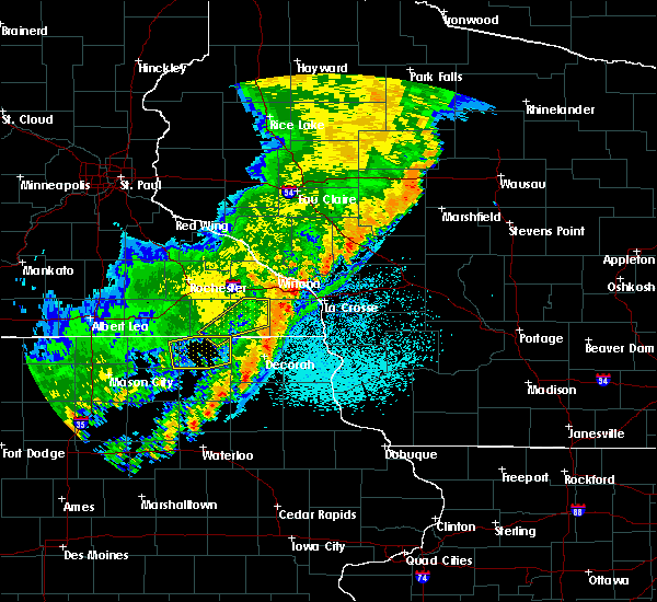 At 909 pm cdt, a severe thunderstorm was located near colby, or 18 miles south of medford, moving northeast at 65 mph (radar indicated). Hazards include 60 mph wind gusts. Expect damage to roofs, siding, and trees. this severe thunderstorm will remain over mainly rural areas of northeastern clark county, including the following locations, curtiss, county k and capital road, riplinger and atwood. A tornado watch remains in effect until midnight cdt for central wisconsin. At 909 pm cdt, a severe thunderstorm was located near colby, or 18 miles south of medford, moving northeast at 65 mph (radar indicated). Hazards include 60 mph wind gusts. Expect damage to roofs, siding, and trees. this severe thunderstorm will remain over mainly rural areas of northeastern clark county, including the following locations, curtiss, county k and capital road, riplinger and atwood. A tornado watch remains in effect until midnight cdt for central wisconsin.
|
| 9/20/2018 9:01 PM CDT |
 At 855 pm cdt, a severe thunderstorm was located near greenwood, or 13 miles north of neillsville, moving northeast at 60 mph (radar indicated. these storms have produce very isolated wind damage over the past hour, but none recently). Hazards include 60 mph wind gusts. Expect damage to roofs, siding, and trees. this severe storm will be near, loyal and owen around 905 pm cdt. colby around 915 pm cdt. other locations impacted by this severe thunderstorm include longwood, willard, curtiss, county k and capital road and hog corners. A tornado watch remains in effect until midnight cdt for central wisconsin. At 855 pm cdt, a severe thunderstorm was located near greenwood, or 13 miles north of neillsville, moving northeast at 60 mph (radar indicated. these storms have produce very isolated wind damage over the past hour, but none recently). Hazards include 60 mph wind gusts. Expect damage to roofs, siding, and trees. this severe storm will be near, loyal and owen around 905 pm cdt. colby around 915 pm cdt. other locations impacted by this severe thunderstorm include longwood, willard, curtiss, county k and capital road and hog corners. A tornado watch remains in effect until midnight cdt for central wisconsin.
|
| 9/20/2018 8:56 PM CDT |
 At 855 pm cdt, a severe thunderstorm was located near greenwood, or 13 miles north of neillsville, moving northeast at 60 mph (radar indicated. these storms have produce very isolated wind damage over the past hour, but none recently). Hazards include 60 mph wind gusts. Expect damage to roofs, siding, and trees. this severe storm will be near, loyal and owen around 905 pm cdt. colby around 915 pm cdt. other locations impacted by this severe thunderstorm include longwood, willard, curtiss, county k and capital road and hog corners. A tornado watch remains in effect until midnight cdt for central wisconsin. At 855 pm cdt, a severe thunderstorm was located near greenwood, or 13 miles north of neillsville, moving northeast at 60 mph (radar indicated. these storms have produce very isolated wind damage over the past hour, but none recently). Hazards include 60 mph wind gusts. Expect damage to roofs, siding, and trees. this severe storm will be near, loyal and owen around 905 pm cdt. colby around 915 pm cdt. other locations impacted by this severe thunderstorm include longwood, willard, curtiss, county k and capital road and hog corners. A tornado watch remains in effect until midnight cdt for central wisconsin.
|
| 9/20/2018 8:53 PM CDT |
 At 852 pm cdt, a severe thunderstorm was located near greenwood, or 13 miles northwest of neillsville, moving northeast at 60 mph (radar indicated). Hazards include 60 mph wind gusts. Expect damage to roofs, siding, and trees. this severe thunderstorm will be near, loyal and owen around 905 pm cdt. colby around 915 pm cdt. other locations impacted by this severe thunderstorm include longwood, willard, curtiss, county k and capital road and hog corners. A tornado watch remains in effect until midnight cdt for central wisconsin. At 852 pm cdt, a severe thunderstorm was located near greenwood, or 13 miles northwest of neillsville, moving northeast at 60 mph (radar indicated). Hazards include 60 mph wind gusts. Expect damage to roofs, siding, and trees. this severe thunderstorm will be near, loyal and owen around 905 pm cdt. colby around 915 pm cdt. other locations impacted by this severe thunderstorm include longwood, willard, curtiss, county k and capital road and hog corners. A tornado watch remains in effect until midnight cdt for central wisconsin.
|
| 9/4/2018 8:07 PM CDT |
 At 807 pm cdt, a severe thunderstorm capable of producing a tornado was located 7 miles west of greenwood, or 13 miles northwest of neillsville, moving northeast at 25 mph (radar indicated rotation). Hazards include tornado. Flying debris will be dangerous to those caught without shelter. mobile homes will be damaged or destroyed. damage to roofs, windows, and vehicles will occur. tree damage is likely. this dangerous storm will be near, greenwood around 825 pm cdt. loyal around 830 pm cdt. Other locations impacted by this tornadic thunderstorm include willard, mead lake, highway 73 and 98, sterling avenue and starks road and tioga. At 807 pm cdt, a severe thunderstorm capable of producing a tornado was located 7 miles west of greenwood, or 13 miles northwest of neillsville, moving northeast at 25 mph (radar indicated rotation). Hazards include tornado. Flying debris will be dangerous to those caught without shelter. mobile homes will be damaged or destroyed. damage to roofs, windows, and vehicles will occur. tree damage is likely. this dangerous storm will be near, greenwood around 825 pm cdt. loyal around 830 pm cdt. Other locations impacted by this tornadic thunderstorm include willard, mead lake, highway 73 and 98, sterling avenue and starks road and tioga.
|
| 9/4/2018 7:51 PM CDT |
 At 751 pm cdt, a severe thunderstorm capable of producing a tornado was located near fairchild, or 15 miles northwest of neillsville, moving northeast at 30 mph (radar indicated rotation). Hazards include tornado. Flying debris will be dangerous to those caught without shelter. mobile homes will be damaged or destroyed. damage to roofs, windows, and vehicles will occur. tree damage is likely. this dangerous storm will be near, greenwood and loyal around 820 pm cdt. Other locations impacted by this tornadic thunderstorm include willard, mead lake, highway 73 and 98, sterling avenue and starks road and tioga. At 751 pm cdt, a severe thunderstorm capable of producing a tornado was located near fairchild, or 15 miles northwest of neillsville, moving northeast at 30 mph (radar indicated rotation). Hazards include tornado. Flying debris will be dangerous to those caught without shelter. mobile homes will be damaged or destroyed. damage to roofs, windows, and vehicles will occur. tree damage is likely. this dangerous storm will be near, greenwood and loyal around 820 pm cdt. Other locations impacted by this tornadic thunderstorm include willard, mead lake, highway 73 and 98, sterling avenue and starks road and tioga.
|
| 7/12/2018 8:59 PM CDT |
 A severe thunderstorm warning remains in effect until 915 pm cdt for eastern clark county. at 858 pm cdt, severe thunderstorms were located along a line extending from near new wood wildlife area to near shortville, moving east at 35 mph. hazard. 60 mph wind gusts. A severe thunderstorm warning remains in effect until 915 pm cdt for eastern clark county. at 858 pm cdt, severe thunderstorms were located along a line extending from near new wood wildlife area to near shortville, moving east at 35 mph. hazard. 60 mph wind gusts.
|
| 7/12/2018 8:51 PM CDT |
 At 851 pm cdt, severe thunderstorms were located along a line extending from near rib lake to near shortville, moving east at 35 mph (law enforcement). Hazards include 60 mph wind gusts. Expect damage to roofs, siding, and trees. these severe storms will be near, rib lake around 855 pm cdt. Other locations impacted by these severe thunderstorms include lynn, longwood, stetsonville, goodrich and withee. At 851 pm cdt, severe thunderstorms were located along a line extending from near rib lake to near shortville, moving east at 35 mph (law enforcement). Hazards include 60 mph wind gusts. Expect damage to roofs, siding, and trees. these severe storms will be near, rib lake around 855 pm cdt. Other locations impacted by these severe thunderstorms include lynn, longwood, stetsonville, goodrich and withee.
|
| 7/12/2018 8:39 PM CDT |
 At 839 pm cdt, severe thunderstorms were located along a line extending from near rib lake to near neillsville, moving east at 35 mph (law enforcement). Hazards include 60 mph wind gusts. Expect damage to roofs, siding, and trees. severe thunderstorms will be near, rib lake, westboro and chelsea around 845 pm cdt. Other locations impacted by these severe thunderstorms include lynn, longwood, stetsonville, goodrich and willard. At 839 pm cdt, severe thunderstorms were located along a line extending from near rib lake to near neillsville, moving east at 35 mph (law enforcement). Hazards include 60 mph wind gusts. Expect damage to roofs, siding, and trees. severe thunderstorms will be near, rib lake, westboro and chelsea around 845 pm cdt. Other locations impacted by these severe thunderstorms include lynn, longwood, stetsonville, goodrich and willard.
|
| 7/12/2018 8:15 PM CDT |
 At 813 pm cdt, severe thunderstorms were located along a line extending from 11 miles south of catawba to near fairchild, moving east at 35 mph (trained weather spotters). Hazards include 65 mph wind gusts. Expect damage to roofs, siding, and trees. these severe storms will be near, chelsea around 830 pm cdt. westboro around 835 pm cdt. neillsville and rib lake around 840 pm cdt. trees and powerlines were reported blown down in chippewa county. Other locations impacted by these severe thunderstorms include lynn, longwood, reseburg, stetsonville and goodrich. At 813 pm cdt, severe thunderstorms were located along a line extending from 11 miles south of catawba to near fairchild, moving east at 35 mph (trained weather spotters). Hazards include 65 mph wind gusts. Expect damage to roofs, siding, and trees. these severe storms will be near, chelsea around 830 pm cdt. westboro around 835 pm cdt. neillsville and rib lake around 840 pm cdt. trees and powerlines were reported blown down in chippewa county. Other locations impacted by these severe thunderstorms include lynn, longwood, reseburg, stetsonville and goodrich.
|
| 7/12/2018 8:02 PM CDT |
 At 802 pm cdt, severe thunderstorms were located along a line extending from 7 miles east of jump river to price, moving east at 35 mph (trained weather spotters). Hazards include 60 mph wind gusts. Expect damage to roofs, siding, and trees. these severe storms will be near, westboro and chelsea around 830 pm cdt. neillsville and rib lake around 840 pm cdt. Other locations impacted by these severe thunderstorms include lynn, longwood, reseburg, stetsonville and goodrich. At 802 pm cdt, severe thunderstorms were located along a line extending from 7 miles east of jump river to price, moving east at 35 mph (trained weather spotters). Hazards include 60 mph wind gusts. Expect damage to roofs, siding, and trees. these severe storms will be near, westboro and chelsea around 830 pm cdt. neillsville and rib lake around 840 pm cdt. Other locations impacted by these severe thunderstorms include lynn, longwood, reseburg, stetsonville and goodrich.
|
| 7/12/2018 7:55 PM CDT |
 At 752 pm cdt, severe thunderstorms were located along a line extending from near jump river to near osseo, moving east at 35 mph (a trained weather spotter 5 west of gilman reported a measured wind gust of 65 mph at 751 pm). Hazards include 60 mph wind gusts. Expect damage to roofs, siding, and trees. these severe storms will be near, jump river around 800 pm cdt. westboro and chelsea around 830 pm cdt. neillsville and rib lake around 840 pm cdt. Other locations impacted by these severe thunderstorms include lynn, longwood, reseburg, stetsonville and goodrich. At 752 pm cdt, severe thunderstorms were located along a line extending from near jump river to near osseo, moving east at 35 mph (a trained weather spotter 5 west of gilman reported a measured wind gust of 65 mph at 751 pm). Hazards include 60 mph wind gusts. Expect damage to roofs, siding, and trees. these severe storms will be near, jump river around 800 pm cdt. westboro and chelsea around 830 pm cdt. neillsville and rib lake around 840 pm cdt. Other locations impacted by these severe thunderstorms include lynn, longwood, reseburg, stetsonville and goodrich.
|
| 7/12/2018 7:43 PM CDT |
 At 741 pm cdt, severe thunderstorms were located along a line extending from 6 miles northwest of jump river to near osseo, moving east at 35 mph (radar indicated). Hazards include 60 mph wind gusts. Expect damage to roofs, siding, and trees. severe thunderstorms will be near, jump river around 750 pm cdt. westboro and chelsea around 830 pm cdt. neillsville and rib lake around 840 pm cdt. Other locations impacted by these severe thunderstorms include lynn, longwood, reseburg, stetsonville and goodrich. At 741 pm cdt, severe thunderstorms were located along a line extending from 6 miles northwest of jump river to near osseo, moving east at 35 mph (radar indicated). Hazards include 60 mph wind gusts. Expect damage to roofs, siding, and trees. severe thunderstorms will be near, jump river around 750 pm cdt. westboro and chelsea around 830 pm cdt. neillsville and rib lake around 840 pm cdt. Other locations impacted by these severe thunderstorms include lynn, longwood, reseburg, stetsonville and goodrich.
|
| 6/17/2018 7:34 PM CDT |
 At 734 pm cdt, severe thunderstorms were located along a line extending from 7 miles east of medford to 9 miles east of colby to near spencer, moving east at 50 mph (radar indicated). Hazards include 70 mph wind gusts. Expect considerable tree damage. damage is likely to mobile homes, roofs, and outbuildings. These severe thunderstorms will remain over mainly rural areas of eastern clark county, including the following locations: colby, lynn, granton, unity and curtiss. At 734 pm cdt, severe thunderstorms were located along a line extending from 7 miles east of medford to 9 miles east of colby to near spencer, moving east at 50 mph (radar indicated). Hazards include 70 mph wind gusts. Expect considerable tree damage. damage is likely to mobile homes, roofs, and outbuildings. These severe thunderstorms will remain over mainly rural areas of eastern clark county, including the following locations: colby, lynn, granton, unity and curtiss.
|
| 6/17/2018 7:03 PM CDT |
 At 703 pm cdt, severe thunderstorms were located along a line extending from 6 miles northeast of thorp to greenwood to 6 miles west of neillsville, moving northeast at 50 mph (radar indicated). Hazards include 70 mph wind gusts. Expect considerable tree damage. damage is likely to mobile homes, roofs, and outbuildings. these severe storms will be near, owen around 710 pm cdt. loyal around 720 pm cdt. abbotsford and dorchester around 725 pm cdt. Other locations impacted by these severe thunderstorms include colby, lynn, longwood, reseburg and willard. At 703 pm cdt, severe thunderstorms were located along a line extending from 6 miles northeast of thorp to greenwood to 6 miles west of neillsville, moving northeast at 50 mph (radar indicated). Hazards include 70 mph wind gusts. Expect considerable tree damage. damage is likely to mobile homes, roofs, and outbuildings. these severe storms will be near, owen around 710 pm cdt. loyal around 720 pm cdt. abbotsford and dorchester around 725 pm cdt. Other locations impacted by these severe thunderstorms include colby, lynn, longwood, reseburg and willard.
|
| 6/17/2018 6:46 PM CDT |
 At 645 pm cdt, severe thunderstorms were located along a line extending from near stanley to near fairchild to 6 miles southwest of humbird, moving northeast at 50 mph (radar indicated). Hazards include 60 mph wind gusts. Expect damage to roofs, siding, and trees. severe thunderstorms will be near, thorp around 655 pm cdt. greenwood and owen around 705 pm cdt. neillsville around 710 pm cdt. loyal around 720 pm cdt. abbotsford and dorchester around 730 pm cdt. Other locations impacted by these severe thunderstorms include colby, lynn, longwood, reseburg and willard. At 645 pm cdt, severe thunderstorms were located along a line extending from near stanley to near fairchild to 6 miles southwest of humbird, moving northeast at 50 mph (radar indicated). Hazards include 60 mph wind gusts. Expect damage to roofs, siding, and trees. severe thunderstorms will be near, thorp around 655 pm cdt. greenwood and owen around 705 pm cdt. neillsville around 710 pm cdt. loyal around 720 pm cdt. abbotsford and dorchester around 730 pm cdt. Other locations impacted by these severe thunderstorms include colby, lynn, longwood, reseburg and willard.
|
| 6/17/2018 6:09 PM CDT |
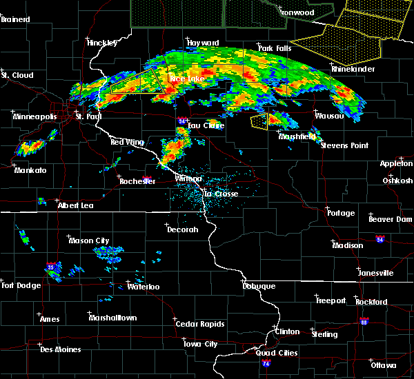 The severe thunderstorm warning for east central clark county will expire at 615 pm cdt, the storm which prompted the warning has weakened below severe limits, and has exited the warned area. therefore, the warning will be allowed to expire. a severe thunderstorm watch remains in effect until midnight cdt for central wisconsin. The severe thunderstorm warning for east central clark county will expire at 615 pm cdt, the storm which prompted the warning has weakened below severe limits, and has exited the warned area. therefore, the warning will be allowed to expire. a severe thunderstorm watch remains in effect until midnight cdt for central wisconsin.
|
| 6/17/2018 5:48 PM CDT |
 At 548 pm cdt, a severe thunderstorm was located over loyal, or 15 miles northeast of neillsville, moving east at 30 mph (radar indicated). Hazards include 60 mph wind gusts. Expect damage to roofs, siding, and trees. Locations impacted include, loyal, colby, unity, county k and capital road and riplinger. At 548 pm cdt, a severe thunderstorm was located over loyal, or 15 miles northeast of neillsville, moving east at 30 mph (radar indicated). Hazards include 60 mph wind gusts. Expect damage to roofs, siding, and trees. Locations impacted include, loyal, colby, unity, county k and capital road and riplinger.
|
| 6/17/2018 5:39 PM CDT |
 At 528 pm cdt, a severe thunderstorm was located near greenwood, or 12 miles north of neillsville, moving east at 30 mph (radar indicated). Hazards include 60 mph wind gusts. Expect damage to roofs, siding, and trees. this severe thunderstorm will be near, loyal around 545 pm cdt. Other locations impacted by this severe thunderstorm include colby, willard, unity, county k and capital road and highway 73 and 98. At 528 pm cdt, a severe thunderstorm was located near greenwood, or 12 miles north of neillsville, moving east at 30 mph (radar indicated). Hazards include 60 mph wind gusts. Expect damage to roofs, siding, and trees. this severe thunderstorm will be near, loyal around 545 pm cdt. Other locations impacted by this severe thunderstorm include colby, willard, unity, county k and capital road and highway 73 and 98.
|
| 6/17/2018 5:29 PM CDT |
 At 528 pm cdt, a severe thunderstorm was located near greenwood, or 12 miles north of neillsville, moving east at 30 mph (radar indicated). Hazards include 60 mph wind gusts. Expect damage to roofs, siding, and trees. this severe thunderstorm will be near, loyal around 545 pm cdt. Other locations impacted by this severe thunderstorm include colby, willard, unity, county k and capital road and highway 73 and 98. At 528 pm cdt, a severe thunderstorm was located near greenwood, or 12 miles north of neillsville, moving east at 30 mph (radar indicated). Hazards include 60 mph wind gusts. Expect damage to roofs, siding, and trees. this severe thunderstorm will be near, loyal around 545 pm cdt. Other locations impacted by this severe thunderstorm include colby, willard, unity, county k and capital road and highway 73 and 98.
|
| 6/16/2017 8:28 PM CDT |
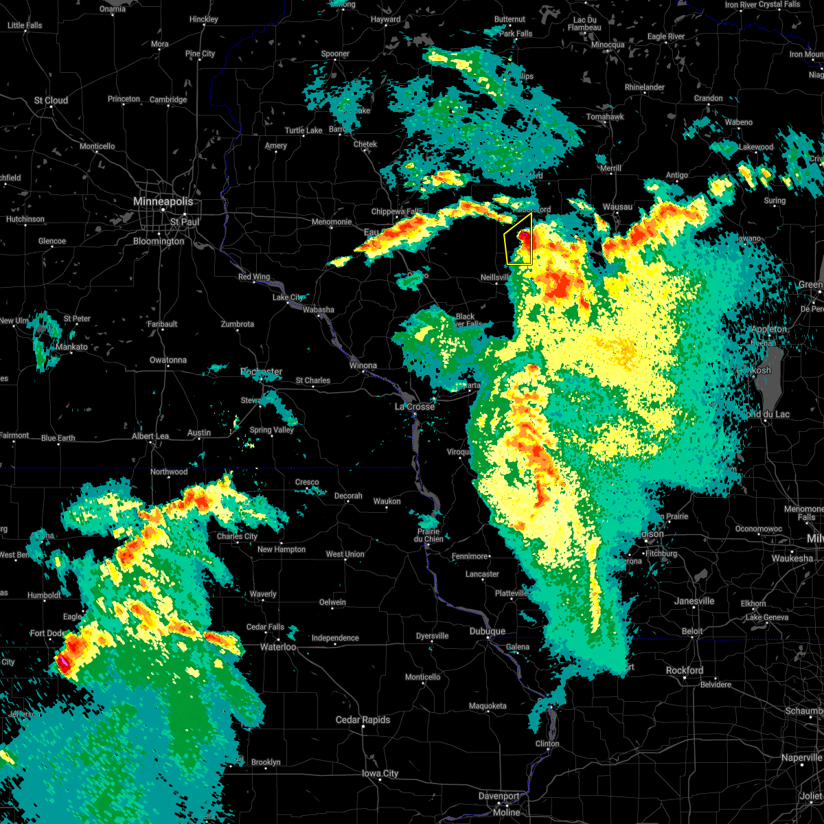 The severe thunderstorm warning for east central clark county will expire at 830 pm cdt. the severe thunderstorm which prompted the warning has weakened. therefore, the warning will be allowed to expire. However small hail and gusty winds are still possible with this thunderstorm. The severe thunderstorm warning for east central clark county will expire at 830 pm cdt. the severe thunderstorm which prompted the warning has weakened. therefore, the warning will be allowed to expire. However small hail and gusty winds are still possible with this thunderstorm.
|
| 6/16/2017 8:20 PM CDT |
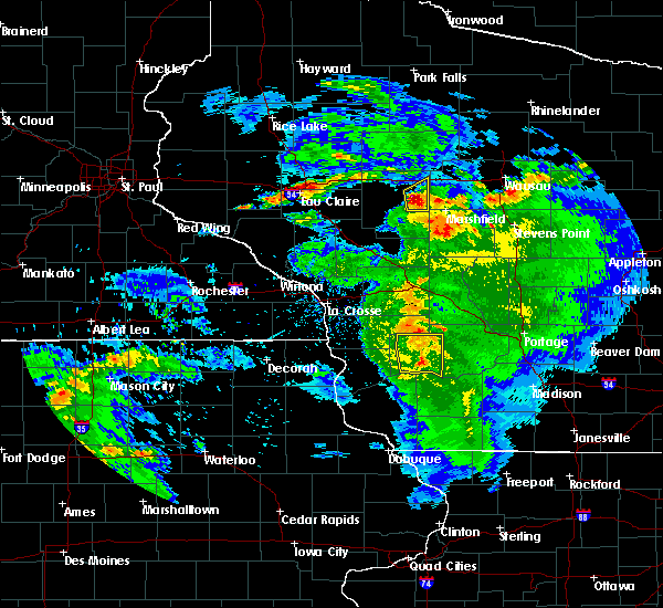 At 819 pm cdt, a severe thunderstorm was located near loyal, or 17 miles northeast of neillsville, moving northeast at 30 mph (law enforcement. at 748 pm, the clark county sheriff reported quarter size hail in willard). Hazards include quarter size hail. Damage to vehicles is expected. this severe storm will be near, abbotsford around 830 pm cdt. Other locations impacted by this severe thunderstorm include colby, unity, county k and capital road, veefkind and riplinger. At 819 pm cdt, a severe thunderstorm was located near loyal, or 17 miles northeast of neillsville, moving northeast at 30 mph (law enforcement. at 748 pm, the clark county sheriff reported quarter size hail in willard). Hazards include quarter size hail. Damage to vehicles is expected. this severe storm will be near, abbotsford around 830 pm cdt. Other locations impacted by this severe thunderstorm include colby, unity, county k and capital road, veefkind and riplinger.
|
| 6/16/2017 8:12 PM CDT |
 At 801 pm cdt, a severe thunderstorm was located near greenwood, or 11 miles north of neillsville, moving northeast at 30 mph (radar indicated). Hazards include quarter size hail. Damage to vehicles is expected. this severe storm will be near, greenwood around 805 pm cdt. loyal around 815 pm cdt. abbotsford around 830 pm cdt. Other locations impacted by this severe thunderstorm include colby, willard, granton, unity and highway 73 and 98. At 801 pm cdt, a severe thunderstorm was located near greenwood, or 11 miles north of neillsville, moving northeast at 30 mph (radar indicated). Hazards include quarter size hail. Damage to vehicles is expected. this severe storm will be near, greenwood around 805 pm cdt. loyal around 815 pm cdt. abbotsford around 830 pm cdt. Other locations impacted by this severe thunderstorm include colby, willard, granton, unity and highway 73 and 98.
|
| 6/16/2017 8:01 PM CDT |
 At 801 pm cdt, a severe thunderstorm was located near greenwood, or 11 miles north of neillsville, moving northeast at 30 mph (radar indicated). Hazards include quarter size hail. Damage to vehicles is expected. this severe storm will be near, greenwood around 805 pm cdt. loyal around 815 pm cdt. abbotsford around 830 pm cdt. Other locations impacted by this severe thunderstorm include colby, willard, granton, unity and highway 73 and 98. At 801 pm cdt, a severe thunderstorm was located near greenwood, or 11 miles north of neillsville, moving northeast at 30 mph (radar indicated). Hazards include quarter size hail. Damage to vehicles is expected. this severe storm will be near, greenwood around 805 pm cdt. loyal around 815 pm cdt. abbotsford around 830 pm cdt. Other locations impacted by this severe thunderstorm include colby, willard, granton, unity and highway 73 and 98.
|
| 6/16/2017 7:57 PM CDT |
 At 757 pm cdt, a severe thunderstorm was located near greenwood, or 10 miles northwest of neillsville, moving northeast at 30 mph (radar indicated). Hazards include quarter size hail. Damage to vehicles is expected. this severe storm will be near, greenwood around 805 pm cdt. loyal around 815 pm cdt. abbotsford around 830 pm cdt. Other locations impacted by this severe thunderstorm include colby, willard, granton, unity and highway 73 and 98. At 757 pm cdt, a severe thunderstorm was located near greenwood, or 10 miles northwest of neillsville, moving northeast at 30 mph (radar indicated). Hazards include quarter size hail. Damage to vehicles is expected. this severe storm will be near, greenwood around 805 pm cdt. loyal around 815 pm cdt. abbotsford around 830 pm cdt. Other locations impacted by this severe thunderstorm include colby, willard, granton, unity and highway 73 and 98.
|
| 6/16/2017 7:49 PM CDT |
 At 749 pm cdt, a severe thunderstorm was located 9 miles southwest of greenwood, or 11 miles northwest of neillsville, moving northeast at 30 mph (radar indicated). Hazards include quarter size hail. Damage to vehicles is expected. this severe storm will be near, neillsville around 755 pm cdt. greenwood around 805 pm cdt. loyal around 815 pm cdt. abbotsford around 830 pm cdt. Other locations impacted by this severe thunderstorm include colby, willard, granton, unity and highway 73 and 98. At 749 pm cdt, a severe thunderstorm was located 9 miles southwest of greenwood, or 11 miles northwest of neillsville, moving northeast at 30 mph (radar indicated). Hazards include quarter size hail. Damage to vehicles is expected. this severe storm will be near, neillsville around 755 pm cdt. greenwood around 805 pm cdt. loyal around 815 pm cdt. abbotsford around 830 pm cdt. Other locations impacted by this severe thunderstorm include colby, willard, granton, unity and highway 73 and 98.
|
| 6/16/2017 7:43 PM CDT |
 At 743 pm cdt, a severe thunderstorm was located 8 miles northeast of fairchild, or 12 miles northwest of neillsville, moving northeast at 30 mph (trained weather spotters). Hazards include half dollar size hail. Damage to vehicles is expected. this severe storm will be near, neillsville around 755 pm cdt. greenwood around 805 pm cdt. loyal around 815 pm cdt. abbotsford around 830 pm cdt. Other locations impacted by this severe thunderstorm include colby, willard, granton, unity and highway 73 and 98. At 743 pm cdt, a severe thunderstorm was located 8 miles northeast of fairchild, or 12 miles northwest of neillsville, moving northeast at 30 mph (trained weather spotters). Hazards include half dollar size hail. Damage to vehicles is expected. this severe storm will be near, neillsville around 755 pm cdt. greenwood around 805 pm cdt. loyal around 815 pm cdt. abbotsford around 830 pm cdt. Other locations impacted by this severe thunderstorm include colby, willard, granton, unity and highway 73 and 98.
|
| 6/16/2017 7:38 PM CDT |
 At 737 pm cdt, a severe thunderstorm was located near fairchild, or 14 miles west of neillsville, moving northeast at 30 mph (trained weather spotters). Hazards include ping pong ball size hail. People and animals outdoors will be injured. expect damage to roofs, siding, windows, and vehicles. this severe storm will be near, neillsville around 755 pm cdt. greenwood around 810 pm cdt. loyal around 815 pm cdt. abbotsford around 830 pm cdt. Other locations impacted by this severe thunderstorm include colby, willard, granton, unity and highway 73 and 98. At 737 pm cdt, a severe thunderstorm was located near fairchild, or 14 miles west of neillsville, moving northeast at 30 mph (trained weather spotters). Hazards include ping pong ball size hail. People and animals outdoors will be injured. expect damage to roofs, siding, windows, and vehicles. this severe storm will be near, neillsville around 755 pm cdt. greenwood around 810 pm cdt. loyal around 815 pm cdt. abbotsford around 830 pm cdt. Other locations impacted by this severe thunderstorm include colby, willard, granton, unity and highway 73 and 98.
|
| 6/16/2017 7:22 PM CDT |
 At 721 pm cdt, a severe thunderstorm was located over price, or 19 miles northeast of whitehall, moving northeast at 30 mph. this is a very dangerous storm (radar indicated). Hazards include baseball size hail. People and animals outdoors will be severely injured. expect shattered windows, extensive damage to roofs, siding, and vehicles. this severe thunderstorm will be near, humbird around 730 pm cdt. neillsville around 755 pm cdt. greenwood around 810 pm cdt. loyal around 815 pm cdt. abbotsford around 830 pm cdt. Other locations impacted by this severe thunderstorm include colby, willard, granton, unity and highway 73 and 98. At 721 pm cdt, a severe thunderstorm was located over price, or 19 miles northeast of whitehall, moving northeast at 30 mph. this is a very dangerous storm (radar indicated). Hazards include baseball size hail. People and animals outdoors will be severely injured. expect shattered windows, extensive damage to roofs, siding, and vehicles. this severe thunderstorm will be near, humbird around 730 pm cdt. neillsville around 755 pm cdt. greenwood around 810 pm cdt. loyal around 815 pm cdt. abbotsford around 830 pm cdt. Other locations impacted by this severe thunderstorm include colby, willard, granton, unity and highway 73 and 98.
|
| 6/11/2017 8:41 PM CDT |
 The severe thunderstorm warning for northern clark county will expire at 845 pm cdt, the storms which prompted the warning have moved out of the area. therefore the warning will be allowed to expire. a severe thunderstorm watch remains in effect until 300 am cdt for central wisconsin. The severe thunderstorm warning for northern clark county will expire at 845 pm cdt, the storms which prompted the warning have moved out of the area. therefore the warning will be allowed to expire. a severe thunderstorm watch remains in effect until 300 am cdt for central wisconsin.
|
| 6/11/2017 8:22 PM CDT |
 At 821 pm cdt, severe thunderstorms were located along a line extending from dorchester to near loyal, moving east at 55 mph (law enforcement. at 805 pm cdt, a tree was reported blown down in thorp). Hazards include 60 mph wind gusts and penny size hail. Expect damage to roofs, siding, and trees. these severe storms will be near, dorchester, dorchester, abbotsford, abbotsford and colby around 825 pm cdt. Other locations impacted by these severe thunderstorms include colby, longwood, reseburg, willard and withee. At 821 pm cdt, severe thunderstorms were located along a line extending from dorchester to near loyal, moving east at 55 mph (law enforcement. at 805 pm cdt, a tree was reported blown down in thorp). Hazards include 60 mph wind gusts and penny size hail. Expect damage to roofs, siding, and trees. these severe storms will be near, dorchester, dorchester, abbotsford, abbotsford and colby around 825 pm cdt. Other locations impacted by these severe thunderstorms include colby, longwood, reseburg, willard and withee.
|
| 6/11/2017 8:03 PM CDT |
 At 802 pm cdt, severe thunderstorms were located along a line extending from 7 miles northwest of owen to 9 miles northeast of fairchild, moving east at 45 mph (radar indicated). Hazards include 60 mph wind gusts and penny size hail. Expect damage to roofs, siding, and trees. severe thunderstorms will be near, owen around 810 pm cdt. greenwood and dorchester around 820 pm cdt. dorchester around 825 pm cdt. loyal around 830 pm cdt. colby, abbotsford and abbotsford around 845 pm cdt. Other locations impacted by these severe thunderstorms include colby, longwood, reseburg, willard and withee. At 802 pm cdt, severe thunderstorms were located along a line extending from 7 miles northwest of owen to 9 miles northeast of fairchild, moving east at 45 mph (radar indicated). Hazards include 60 mph wind gusts and penny size hail. Expect damage to roofs, siding, and trees. severe thunderstorms will be near, owen around 810 pm cdt. greenwood and dorchester around 820 pm cdt. dorchester around 825 pm cdt. loyal around 830 pm cdt. colby, abbotsford and abbotsford around 845 pm cdt. Other locations impacted by these severe thunderstorms include colby, longwood, reseburg, willard and withee.
|
| 5/17/2017 6:52 PM CDT |
 The severe thunderstorm warning for east central clark county will expire at 700 pm cdt, the storm which prompted the warning has moved out of the area. therefore the warning will be allowed to expire. a tornado watch remains in effect until 1100 pm cdt for central and west central wisconsin. The severe thunderstorm warning for east central clark county will expire at 700 pm cdt, the storm which prompted the warning has moved out of the area. therefore the warning will be allowed to expire. a tornado watch remains in effect until 1100 pm cdt for central and west central wisconsin.
|
| 5/17/2017 6:41 PM CDT |
 At 641 pm cdt, a severe thunderstorm was located over spencer, or 20 miles northeast of neillsville, moving northeast at 50 mph (radar indicated). Hazards include 60 mph wind gusts. Expect damage to roofs, siding, and trees. locations impacted include, loyal, colby, unity, county k and capital road, chili, chili corners, veefkind and riplinger. A tornado watch remains in effect until 1100 pm cdt for central and west central wisconsin. At 641 pm cdt, a severe thunderstorm was located over spencer, or 20 miles northeast of neillsville, moving northeast at 50 mph (radar indicated). Hazards include 60 mph wind gusts. Expect damage to roofs, siding, and trees. locations impacted include, loyal, colby, unity, county k and capital road, chili, chili corners, veefkind and riplinger. A tornado watch remains in effect until 1100 pm cdt for central and west central wisconsin.
|
| 5/17/2017 6:29 PM CDT |
 At 628 pm cdt, a severe thunderstorm was located 7 miles southeast of loyal, or 10 miles northeast of neillsville, moving northeast at 50 mph (radar indicated). Hazards include 60 mph wind gusts. Expect damage to roofs, siding, and trees. this severe thunderstorm will remain over mainly rural areas of southeastern clark county, including the following locations: colby, lynn, willard, granton and unity. A tornado watch remains in effect until 1100 pm cdt for central and west central wisconsin. At 628 pm cdt, a severe thunderstorm was located 7 miles southeast of loyal, or 10 miles northeast of neillsville, moving northeast at 50 mph (radar indicated). Hazards include 60 mph wind gusts. Expect damage to roofs, siding, and trees. this severe thunderstorm will remain over mainly rural areas of southeastern clark county, including the following locations: colby, lynn, willard, granton and unity. A tornado watch remains in effect until 1100 pm cdt for central and west central wisconsin.
|
| 5/17/2017 6:21 PM CDT |
 At 609 pm cdt, a severe thunderstorm was located over neillsville, moving northeast at 50 mph (radar indicated). Hazards include 60 mph wind gusts. Expect damage to roofs, siding, and trees. this severe storm will be near, loyal around 625 pm cdt. other locations impacted by this severe thunderstorm include sherwood, lynn, merrillan, alma center and granton. A tornado watch remains in effect until 1100 pm cdt for central and west central wisconsin. At 609 pm cdt, a severe thunderstorm was located over neillsville, moving northeast at 50 mph (radar indicated). Hazards include 60 mph wind gusts. Expect damage to roofs, siding, and trees. this severe storm will be near, loyal around 625 pm cdt. other locations impacted by this severe thunderstorm include sherwood, lynn, merrillan, alma center and granton. A tornado watch remains in effect until 1100 pm cdt for central and west central wisconsin.
|
| 5/17/2017 6:19 PM CDT |
 At 619 pm cdt, a severe thunderstorm capable of producing a tornado was located near neillsville, moving northeast at 25 mph (weather spotters reported a funnel cloud). Hazards include tornado and quarter size hail. Flying debris will be dangerous to those caught without shelter. mobile homes will be damaged or destroyed. damage to roofs, windows, and vehicles will occur. tree damage is likely. this dangerous storm will be near, neillsville around 630 pm cdt. loyal around 645 pm cdt. Other locations impacted by this tornadic thunderstorm include merrillan, alma center, granton, unity and wildcat mound. At 619 pm cdt, a severe thunderstorm capable of producing a tornado was located near neillsville, moving northeast at 25 mph (weather spotters reported a funnel cloud). Hazards include tornado and quarter size hail. Flying debris will be dangerous to those caught without shelter. mobile homes will be damaged or destroyed. damage to roofs, windows, and vehicles will occur. tree damage is likely. this dangerous storm will be near, neillsville around 630 pm cdt. loyal around 645 pm cdt. Other locations impacted by this tornadic thunderstorm include merrillan, alma center, granton, unity and wildcat mound.
|
| 5/17/2017 6:10 PM CDT |
 At 609 pm cdt, a severe thunderstorm was located over neillsville, moving northeast at 50 mph (radar indicated). Hazards include 60 mph wind gusts. Expect damage to roofs, siding, and trees. this severe storm will be near, loyal around 625 pm cdt. other locations impacted by this severe thunderstorm include sherwood, lynn, merrillan, alma center and granton. A tornado watch remains in effect until 1100 pm cdt for central and west central wisconsin. At 609 pm cdt, a severe thunderstorm was located over neillsville, moving northeast at 50 mph (radar indicated). Hazards include 60 mph wind gusts. Expect damage to roofs, siding, and trees. this severe storm will be near, loyal around 625 pm cdt. other locations impacted by this severe thunderstorm include sherwood, lynn, merrillan, alma center and granton. A tornado watch remains in effect until 1100 pm cdt for central and west central wisconsin.
|
| 5/17/2017 6:09 PM CDT |
 At 608 pm cdt, a severe thunderstorm capable of producing a tornado was located near humbird, or 11 miles southwest of neillsville, moving northeast at 45 mph (weather spotters reported a funnel cloud). Hazards include tornado and quarter size hail. Flying debris will be dangerous to those caught without shelter. mobile homes will be damaged or destroyed. damage to roofs, windows, and vehicles will occur. tree damage is likely. this dangerous storm will be near, neillsville around 620 pm cdt. loyal around 635 pm cdt. Other locations impacted by this tornadic thunderstorm include merrillan, alma center, granton, unity and wildcat mound. At 608 pm cdt, a severe thunderstorm capable of producing a tornado was located near humbird, or 11 miles southwest of neillsville, moving northeast at 45 mph (weather spotters reported a funnel cloud). Hazards include tornado and quarter size hail. Flying debris will be dangerous to those caught without shelter. mobile homes will be damaged or destroyed. damage to roofs, windows, and vehicles will occur. tree damage is likely. this dangerous storm will be near, neillsville around 620 pm cdt. loyal around 635 pm cdt. Other locations impacted by this tornadic thunderstorm include merrillan, alma center, granton, unity and wildcat mound.
|
| 5/17/2017 6:04 PM CDT |
 At 603 pm cdt, a severe thunderstorm capable of producing a tornado was located near humbird, or 10 miles north of black river falls, moving northeast at 45 mph. spotters reported a funnel cloud near alma center at 6 pm (radar indicated rotation). Hazards include tornado. Flying debris will be dangerous to those caught without shelter. mobile homes will be damaged or destroyed. damage to roofs, windows, and vehicles will occur. tree damage is likely. this dangerous storm will be near, neillsville around 620 pm cdt. loyal around 635 pm cdt. Other locations impacted by this tornadic thunderstorm include merrillan, alma center, granton, unity and wildcat mound. At 603 pm cdt, a severe thunderstorm capable of producing a tornado was located near humbird, or 10 miles north of black river falls, moving northeast at 45 mph. spotters reported a funnel cloud near alma center at 6 pm (radar indicated rotation). Hazards include tornado. Flying debris will be dangerous to those caught without shelter. mobile homes will be damaged or destroyed. damage to roofs, windows, and vehicles will occur. tree damage is likely. this dangerous storm will be near, neillsville around 620 pm cdt. loyal around 635 pm cdt. Other locations impacted by this tornadic thunderstorm include merrillan, alma center, granton, unity and wildcat mound.
|
| 5/17/2017 5:52 PM CDT |
 At 551 pm cdt, a severe thunderstorm was located near black river falls, moving northeast at 50 mph (radar indicated). Hazards include 70 mph wind gusts. Expect considerable tree damage. damage is likely to mobile homes, roofs, and outbuildings. this severe thunderstorm will be near, hatfield around 600 pm cdt. neillsville and shortville around 610 pm cdt. loyal around 625 pm cdt. other locations impacted by this severe thunderstorm include sherwood, lynn, merrillan, alma center and granton. A tornado watch remains in effect until 1100 pm cdt for central and west central wisconsin. At 551 pm cdt, a severe thunderstorm was located near black river falls, moving northeast at 50 mph (radar indicated). Hazards include 70 mph wind gusts. Expect considerable tree damage. damage is likely to mobile homes, roofs, and outbuildings. this severe thunderstorm will be near, hatfield around 600 pm cdt. neillsville and shortville around 610 pm cdt. loyal around 625 pm cdt. other locations impacted by this severe thunderstorm include sherwood, lynn, merrillan, alma center and granton. A tornado watch remains in effect until 1100 pm cdt for central and west central wisconsin.
|
| 4/10/2017 12:27 AM CDT |
 At 1227 am cdt, severe thunderstorms were located along a line extending from near dorchester to near neillsville, moving northeast at 35 mph (radar indicated). Hazards include quarter size hail. Damage to vehicles is expected. these severe storms will be near, dorchester, dorchester and abbotsford around 1230 am cdt. Other locations impacted by these severe thunderstorms include colby, lynn, granton, unity and curtiss. At 1227 am cdt, severe thunderstorms were located along a line extending from near dorchester to near neillsville, moving northeast at 35 mph (radar indicated). Hazards include quarter size hail. Damage to vehicles is expected. these severe storms will be near, dorchester, dorchester and abbotsford around 1230 am cdt. Other locations impacted by these severe thunderstorms include colby, lynn, granton, unity and curtiss.
|
| 4/10/2017 12:20 AM CDT |
 At 1219 am cdt, severe thunderstorms were located along a line extending from near dorchester to near neillsville, moving east at 25 mph (radar indicated). Hazards include quarter size hail. Damage to vehicles is expected. these severe storms will be near, dorchester, dorchester and abbotsford around 1225 am cdt. Other locations impacted by these severe thunderstorms include colby, lynn, granton, unity and curtiss. At 1219 am cdt, severe thunderstorms were located along a line extending from near dorchester to near neillsville, moving east at 25 mph (radar indicated). Hazards include quarter size hail. Damage to vehicles is expected. these severe storms will be near, dorchester, dorchester and abbotsford around 1225 am cdt. Other locations impacted by these severe thunderstorms include colby, lynn, granton, unity and curtiss.
|
| 4/10/2017 12:14 AM CDT |
 At 1213 am cdt, severe thunderstorms were located along a line extending from near dorchester to near neillsville, moving east at 25 mph (radar indicated). Hazards include quarter size hail. Damage to vehicles is expected. these severe storms will be near, dorchester, dorchester and abbotsford around 1220 am cdt. Other locations impacted by these severe thunderstorms include colby, lynn, longwood, reseburg and willard. At 1213 am cdt, severe thunderstorms were located along a line extending from near dorchester to near neillsville, moving east at 25 mph (radar indicated). Hazards include quarter size hail. Damage to vehicles is expected. these severe storms will be near, dorchester, dorchester and abbotsford around 1220 am cdt. Other locations impacted by these severe thunderstorms include colby, lynn, longwood, reseburg and willard.
|
| 4/9/2017 11:57 PM CDT |
 At 1156 pm cdt, severe thunderstorms were located along a line extending from near owen to near humbird, moving northeast at 25 mph (radar indicated). Hazards include quarter size hail. Damage to vehicles is expected. these severe storms will be near, owen around 1200 am cdt. dorchester and abbotsford around 1215 am cdt. shortville around 1230 am cdt. greenwood around 1240 am cdt. loyal around 1250 am cdt. Other locations impacted by these severe thunderstorms include colby, lynn, longwood, reseburg and willard. At 1156 pm cdt, severe thunderstorms were located along a line extending from near owen to near humbird, moving northeast at 25 mph (radar indicated). Hazards include quarter size hail. Damage to vehicles is expected. these severe storms will be near, owen around 1200 am cdt. dorchester and abbotsford around 1215 am cdt. shortville around 1230 am cdt. greenwood around 1240 am cdt. loyal around 1250 am cdt. Other locations impacted by these severe thunderstorms include colby, lynn, longwood, reseburg and willard.
|
| 4/9/2017 11:44 PM CDT |
 At 1143 pm cdt, a severe thunderstorm was located near greenwood, or 19 miles north of neillsville, moving northeast at 35 mph. another severe thunderstorm was located near fairchild moving into southern clark county (radar indicated). Hazards include quarter size hail. Damage to vehicles is expected. this severe thunderstorm will be near, owen around 1200 am cdt. dorchester, dorchester and abbotsford around 1215 am cdt. Other locations impacted by this severe thunderstorm include colby, lynn, longwood, reseburg and willard. At 1143 pm cdt, a severe thunderstorm was located near greenwood, or 19 miles north of neillsville, moving northeast at 35 mph. another severe thunderstorm was located near fairchild moving into southern clark county (radar indicated). Hazards include quarter size hail. Damage to vehicles is expected. this severe thunderstorm will be near, owen around 1200 am cdt. dorchester, dorchester and abbotsford around 1215 am cdt. Other locations impacted by this severe thunderstorm include colby, lynn, longwood, reseburg and willard.
|
| 9/21/2016 6:09 PM CDT |
 The severe thunderstorm warning for southeastern clark county will expire at 615 pm cdt, the storm which prompted the warning has weakened below severe limits, and no longer pose an immediate threat to life or property. therefore the warning will be allowed to expire. however heavy rain is still occurring across the central portions of clark county, with a flash flood warning in effect through 715 pm. quiet a few reports of flooded roadways have been received. The severe thunderstorm warning for southeastern clark county will expire at 615 pm cdt, the storm which prompted the warning has weakened below severe limits, and no longer pose an immediate threat to life or property. therefore the warning will be allowed to expire. however heavy rain is still occurring across the central portions of clark county, with a flash flood warning in effect through 715 pm. quiet a few reports of flooded roadways have been received.
|
| 9/21/2016 5:50 PM CDT |
 At 550 pm cdt, a severe thunderstorm was located near loyal, or near neillsville, moving northeast at 30 mph (radar indicated). Hazards include quarter size hail. Damage to vehicles is expected. this severe storm will be near, loyal around 600 pm cdt. Other locations impacted by this severe thunderstorm include granton, county roads h and k, veefkind, globe and hog corners. At 550 pm cdt, a severe thunderstorm was located near loyal, or near neillsville, moving northeast at 30 mph (radar indicated). Hazards include quarter size hail. Damage to vehicles is expected. this severe storm will be near, loyal around 600 pm cdt. Other locations impacted by this severe thunderstorm include granton, county roads h and k, veefkind, globe and hog corners.
|
| 9/21/2016 5:33 PM CDT |
 At 532 pm cdt, a severe thunderstorm was located 7 miles northwest of neillsville, moving northeast at 30 mph (radar indicated). Hazards include 60 mph wind gusts and quarter size hail. Hail damage to vehicles is expected. expect wind damage to roofs, siding, and trees. this severe thunderstorm will be near, greenwood around 555 pm cdt. loyal around 600 pm cdt. Other locations impacted by this severe thunderstorm include granton, hog corners, tioga, highway 73 and 98 and christie. At 532 pm cdt, a severe thunderstorm was located 7 miles northwest of neillsville, moving northeast at 30 mph (radar indicated). Hazards include 60 mph wind gusts and quarter size hail. Hail damage to vehicles is expected. expect wind damage to roofs, siding, and trees. this severe thunderstorm will be near, greenwood around 555 pm cdt. loyal around 600 pm cdt. Other locations impacted by this severe thunderstorm include granton, hog corners, tioga, highway 73 and 98 and christie.
|
| 6/10/2016 5:56 PM CDT | The severe thunderstorm warning for east central clark county will expire at 600 pm cdt, the storm which prompted the warning has moved out of the area. therefore the warning will be allowed to expire. a tornado watch remains in effect until 900 pm cdt for central wisconsin. |
| 6/10/2016 5:45 PM CDT | Large branches down in clark county WI, 0.4 miles E of Loyal, WI |
| 6/10/2016 5:43 PM CDT |
 At 543 pm cdt, a severe thunderstorm was located near spencer, or 18 miles northeast of neillsville, moving east at 45 mph (law enforcement. this storm has a history of damaging winds). Hazards include 60 mph wind gusts and penny size hail. Expect damage to roofs. siding. and trees. locations impacted include, spencer, loyal, greenwood, granton, unity, highway 73 and 98, christie, riplinger, county roads h and k, veefkind, chili and county k and capital road. A tornado watch remains in effect until 900 pm cdt for central wisconsin. At 543 pm cdt, a severe thunderstorm was located near spencer, or 18 miles northeast of neillsville, moving east at 45 mph (law enforcement. this storm has a history of damaging winds). Hazards include 60 mph wind gusts and penny size hail. Expect damage to roofs. siding. and trees. locations impacted include, spencer, loyal, greenwood, granton, unity, highway 73 and 98, christie, riplinger, county roads h and k, veefkind, chili and county k and capital road. A tornado watch remains in effect until 900 pm cdt for central wisconsin.
|
| 6/10/2016 5:32 PM CDT |
 At 531 pm cdt, a severe thunderstorm was located near loyal, or 11 miles northeast of neillsville, moving east at 45 mph (law enforcement. trees down near willard at 525 pm). Hazards include 60 mph wind gusts and penny size hail. Expect damage to roofs. siding. and trees. this severe storm will be near, spencer around 540 pm cdt. other locations impacted by this severe thunderstorm include willard, granton, unity, seven sister mounds and tioga. A tornado watch remains in effect until 900 pm cdt for central wisconsin. At 531 pm cdt, a severe thunderstorm was located near loyal, or 11 miles northeast of neillsville, moving east at 45 mph (law enforcement. trees down near willard at 525 pm). Hazards include 60 mph wind gusts and penny size hail. Expect damage to roofs. siding. and trees. this severe storm will be near, spencer around 540 pm cdt. other locations impacted by this severe thunderstorm include willard, granton, unity, seven sister mounds and tioga. A tornado watch remains in effect until 900 pm cdt for central wisconsin.
|
| 6/10/2016 5:28 PM CDT |
 At 528 pm cdt, a severe thunderstorm was located over loyal, or 10 miles northeast of neillsville, moving east at 45 mph (radar indicated). Hazards include 60 mph wind gusts and quarter size hail. Hail damage to vehicles is expected. expect wind damage to roofs, siding, and trees. this severe storm will be near, spencer around 540 pm cdt. other locations impacted by this severe thunderstorm include willard, granton, unity, seven sister mounds and tioga. A tornado watch remains in effect until 900 pm cdt for central wisconsin. At 528 pm cdt, a severe thunderstorm was located over loyal, or 10 miles northeast of neillsville, moving east at 45 mph (radar indicated). Hazards include 60 mph wind gusts and quarter size hail. Hail damage to vehicles is expected. expect wind damage to roofs, siding, and trees. this severe storm will be near, spencer around 540 pm cdt. other locations impacted by this severe thunderstorm include willard, granton, unity, seven sister mounds and tioga. A tornado watch remains in effect until 900 pm cdt for central wisconsin.
|
| 6/10/2016 5:15 PM CDT |
 At 515 pm cdt, a severe thunderstorm was located near greenwood, or 9 miles northwest of neillsville, moving east at 45 mph (radar indicated). Hazards include 60 mph wind gusts and quarter size hail. Hail damage to vehicles is expected. expect wind damage to roofs, siding, and trees. this severe storm will be near, greenwood around 520 pm cdt. loyal around 525 pm cdt. spencer around 540 pm cdt. other locations impacted by this severe thunderstorm include willard, granton, unity, seven sister mounds and tioga. A tornado watch remains in effect until 900 pm cdt for central wisconsin. At 515 pm cdt, a severe thunderstorm was located near greenwood, or 9 miles northwest of neillsville, moving east at 45 mph (radar indicated). Hazards include 60 mph wind gusts and quarter size hail. Hail damage to vehicles is expected. expect wind damage to roofs, siding, and trees. this severe storm will be near, greenwood around 520 pm cdt. loyal around 525 pm cdt. spencer around 540 pm cdt. other locations impacted by this severe thunderstorm include willard, granton, unity, seven sister mounds and tioga. A tornado watch remains in effect until 900 pm cdt for central wisconsin.
|
| 6/10/2016 4:59 PM CDT |
 At 458 pm cdt, a severe thunderstorm was located near fairchild, or 18 miles northwest of neillsville, moving east at 45 mph (radar indicated). Hazards include 60 mph wind gusts and quarter size hail. Hail damage to vehicles is expected. expect wind damage to roofs, siding, and trees. this severe thunderstorm will be near, greenwood around 520 pm cdt. loyal around 530 pm cdt. spencer around 540 pm cdt. other locations impacted by this severe thunderstorm include willard, granton, unity, seven sister mounds and tioga. A tornado watch remains in effect until 900 pm cdt for central wisconsin. At 458 pm cdt, a severe thunderstorm was located near fairchild, or 18 miles northwest of neillsville, moving east at 45 mph (radar indicated). Hazards include 60 mph wind gusts and quarter size hail. Hail damage to vehicles is expected. expect wind damage to roofs, siding, and trees. this severe thunderstorm will be near, greenwood around 520 pm cdt. loyal around 530 pm cdt. spencer around 540 pm cdt. other locations impacted by this severe thunderstorm include willard, granton, unity, seven sister mounds and tioga. A tornado watch remains in effect until 900 pm cdt for central wisconsin.
|
| 6/3/2016 5:47 PM CDT |
 At 546 pm cdt, severe thunderstorms were located along a line extending from loyal to 6 miles southeast of shortville, moving east at 30 mph (law enforcement reported a power line down and a tree blown down in the city of neillsville). Hazards include 60 mph wind gusts. Expect damage to roofs. siding. and trees. These severe thunderstorms will remain over mainly rural areas of clark and east central jackson counties, including the following locations: sherwood, colby, lynn, longwood and reseburg. At 546 pm cdt, severe thunderstorms were located along a line extending from loyal to 6 miles southeast of shortville, moving east at 30 mph (law enforcement reported a power line down and a tree blown down in the city of neillsville). Hazards include 60 mph wind gusts. Expect damage to roofs. siding. and trees. These severe thunderstorms will remain over mainly rural areas of clark and east central jackson counties, including the following locations: sherwood, colby, lynn, longwood and reseburg.
|
| 6/3/2016 5:29 PM CDT |
 At 528 pm cdt, severe thunderstorms were located along a line extending from near greenwood to near hatfield, moving east at 30 mph (radar indicated). Hazards include 60 mph wind gusts. Expect damage to roofs. siding. and trees. these severe storms will be near, shortville around 540 pm cdt. loyal around 545 pm cdt. Other locations impacted by these severe thunderstorms include sherwood, colby, lynn, longwood and reseburg. At 528 pm cdt, severe thunderstorms were located along a line extending from near greenwood to near hatfield, moving east at 30 mph (radar indicated). Hazards include 60 mph wind gusts. Expect damage to roofs. siding. and trees. these severe storms will be near, shortville around 540 pm cdt. loyal around 545 pm cdt. Other locations impacted by these severe thunderstorms include sherwood, colby, lynn, longwood and reseburg.
|
| 6/3/2016 5:13 PM CDT |
 At 512 pm cdt, severe thunderstorms were located along a line extending from 8 miles northeast of fairchild to near hatfield, moving east at 30 mph (law enforcement reported trees down in the city of northfield). Hazards include 60 mph wind gusts. Expect damage to roofs. siding. and trees. severe thunderstorms will be near, hatfield around 515 pm cdt. neillsville around 530 pm cdt. greenwood around 535 pm cdt. shortville around 540 pm cdt. loyal around 545 pm cdt. abbotsford around 600 pm cdt. Other locations impacted by these severe thunderstorms include sherwood, colby, lynn, longwood and reseburg. At 512 pm cdt, severe thunderstorms were located along a line extending from 8 miles northeast of fairchild to near hatfield, moving east at 30 mph (law enforcement reported trees down in the city of northfield). Hazards include 60 mph wind gusts. Expect damage to roofs. siding. and trees. severe thunderstorms will be near, hatfield around 515 pm cdt. neillsville around 530 pm cdt. greenwood around 535 pm cdt. shortville around 540 pm cdt. loyal around 545 pm cdt. abbotsford around 600 pm cdt. Other locations impacted by these severe thunderstorms include sherwood, colby, lynn, longwood and reseburg.
|
| 7/18/2015 3:32 AM CDT |
 At 331 am cdt, severe thunderstorms were located along a line extending from near chelsea to near shortville, moving east at 60 mph (law enforcement. a power pole was reported down in thorp). Hazards include 60 mph wind gusts. Expect damage to roofs. siding and trees. these severe storms will be near, rib lake around 340 am cdt. Other locations impacted by these severe thunderstorms include sherwood, colby, lynn, longwood and stetsonville. At 331 am cdt, severe thunderstorms were located along a line extending from near chelsea to near shortville, moving east at 60 mph (law enforcement. a power pole was reported down in thorp). Hazards include 60 mph wind gusts. Expect damage to roofs. siding and trees. these severe storms will be near, rib lake around 340 am cdt. Other locations impacted by these severe thunderstorms include sherwood, colby, lynn, longwood and stetsonville.
|
| 7/18/2015 2:59 AM CDT |
 At 259 am cdt, severe thunderstorms were located along a line extending from near jump river to humbird, moving east at 55 mph (radar indicated). Hazards include 60 mph wind gusts. Expect damage to roofs. siding and trees. these severe storms will be near, jump river around 305 am cdt. neillsville and shortville around 315 am cdt. chelsea and loyal around 320 am cdt. westboro around 325 am cdt. rib lake around 330 am cdt. spencer around 335 am cdt. Other locations impacted by these severe thunderstorms include sherwood, colby, lynn, longwood and reseburg. At 259 am cdt, severe thunderstorms were located along a line extending from near jump river to humbird, moving east at 55 mph (radar indicated). Hazards include 60 mph wind gusts. Expect damage to roofs. siding and trees. these severe storms will be near, jump river around 305 am cdt. neillsville and shortville around 315 am cdt. chelsea and loyal around 320 am cdt. westboro around 325 am cdt. rib lake around 330 am cdt. spencer around 335 am cdt. Other locations impacted by these severe thunderstorms include sherwood, colby, lynn, longwood and reseburg.
|
| 7/18/2015 2:32 AM CDT |
 At 231 am cdt, severe thunderstorms were located along a line extending from 9 miles northwest of cornell to strum, moving east at 50 mph (radar indicated). Hazards include 60 mph wind gusts. Expect damage to roofs. siding and trees. severe thunderstorms will be near, jump river around 255 am cdt. humbird around 300 am cdt. neillsville around 315 am cdt. shortville around 320 am cdt. medford and chelsea around 325 am cdt. Other locations impacted by these severe thunderstorms include sherwood, colby, lynn, longwood and reseburg. At 231 am cdt, severe thunderstorms were located along a line extending from 9 miles northwest of cornell to strum, moving east at 50 mph (radar indicated). Hazards include 60 mph wind gusts. Expect damage to roofs. siding and trees. severe thunderstorms will be near, jump river around 255 am cdt. humbird around 300 am cdt. neillsville around 315 am cdt. shortville around 320 am cdt. medford and chelsea around 325 am cdt. Other locations impacted by these severe thunderstorms include sherwood, colby, lynn, longwood and reseburg.
|
| 9/4/2012 6:13 PM CDT | Several small trees down around tow in clark county WI, 0.4 miles E of Loyal, WI |
| 8/23/2011 5:01 PM CDT | Quarter sized hail reported 0.4 miles E of Loyal, WI |
| 1/1/0001 12:00 AM | Storm damage reported in clark county WI, 1.6 miles W of Loyal, WI |
Hail Maps for Loyal, WI
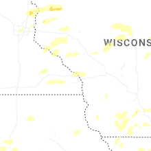
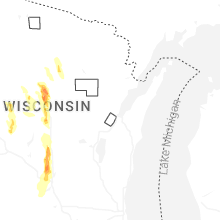
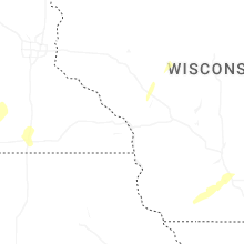
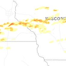
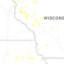


Connect with Interactive Hail Maps