

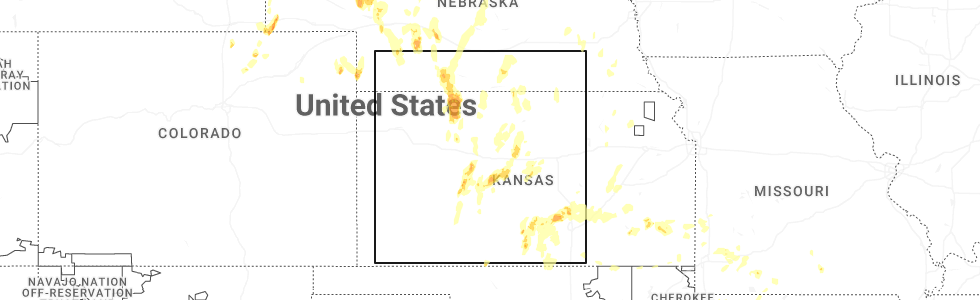
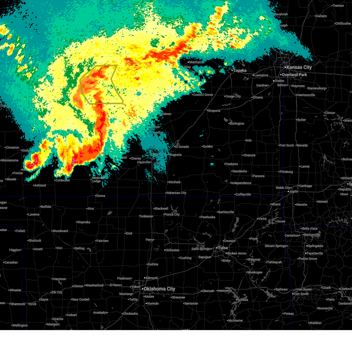
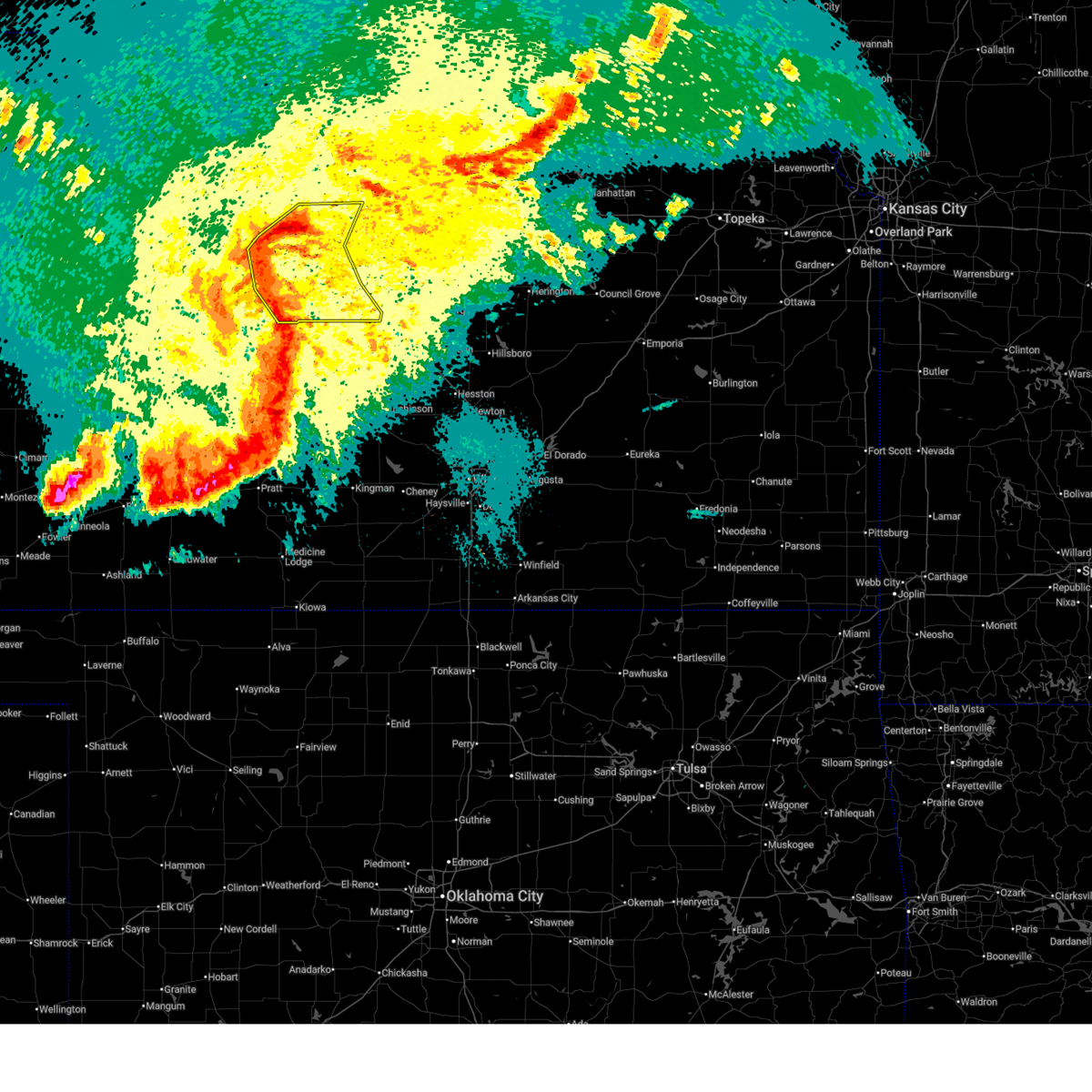
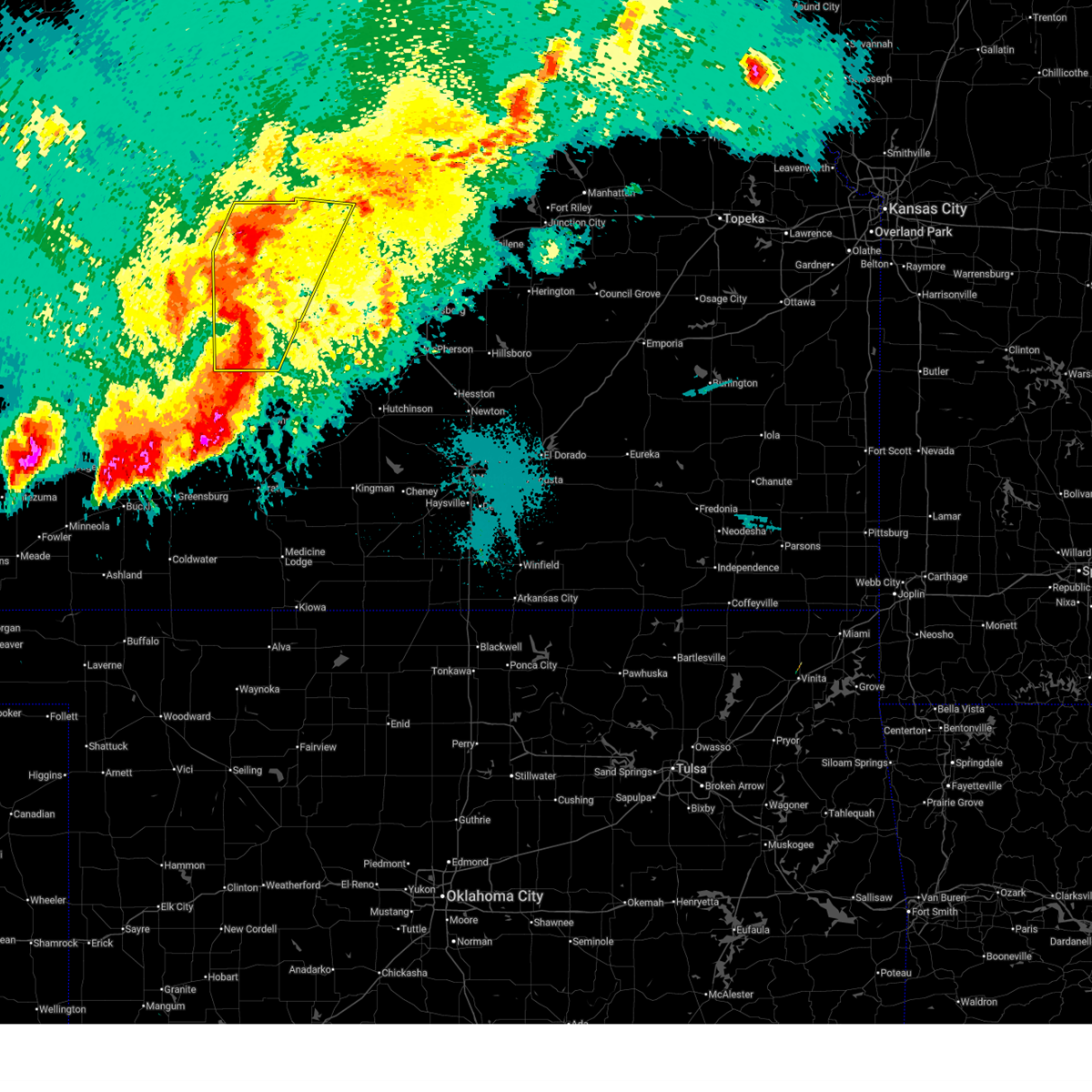
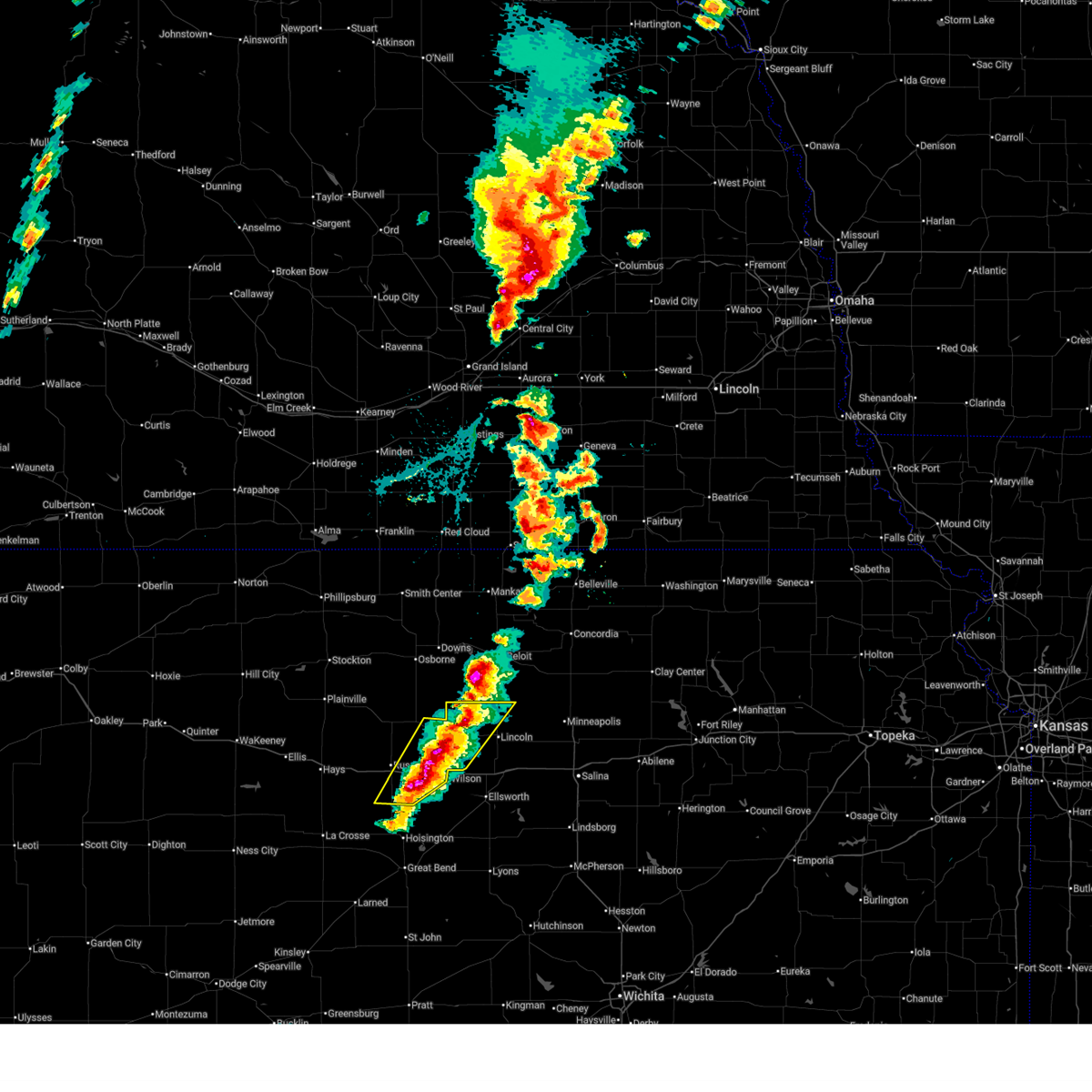
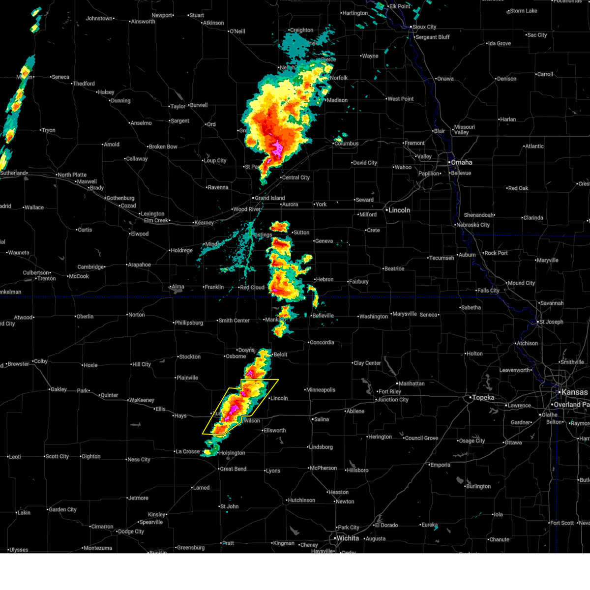
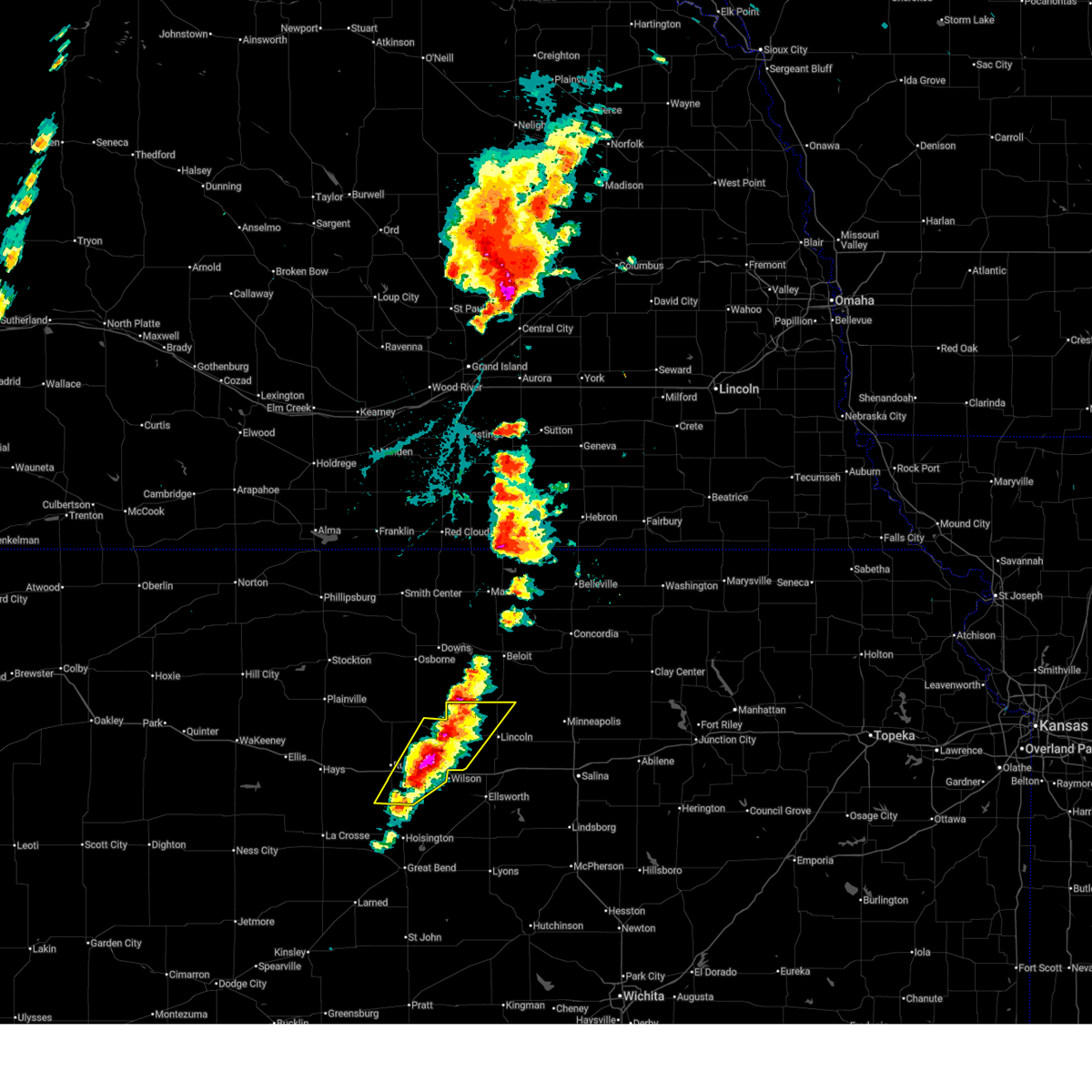
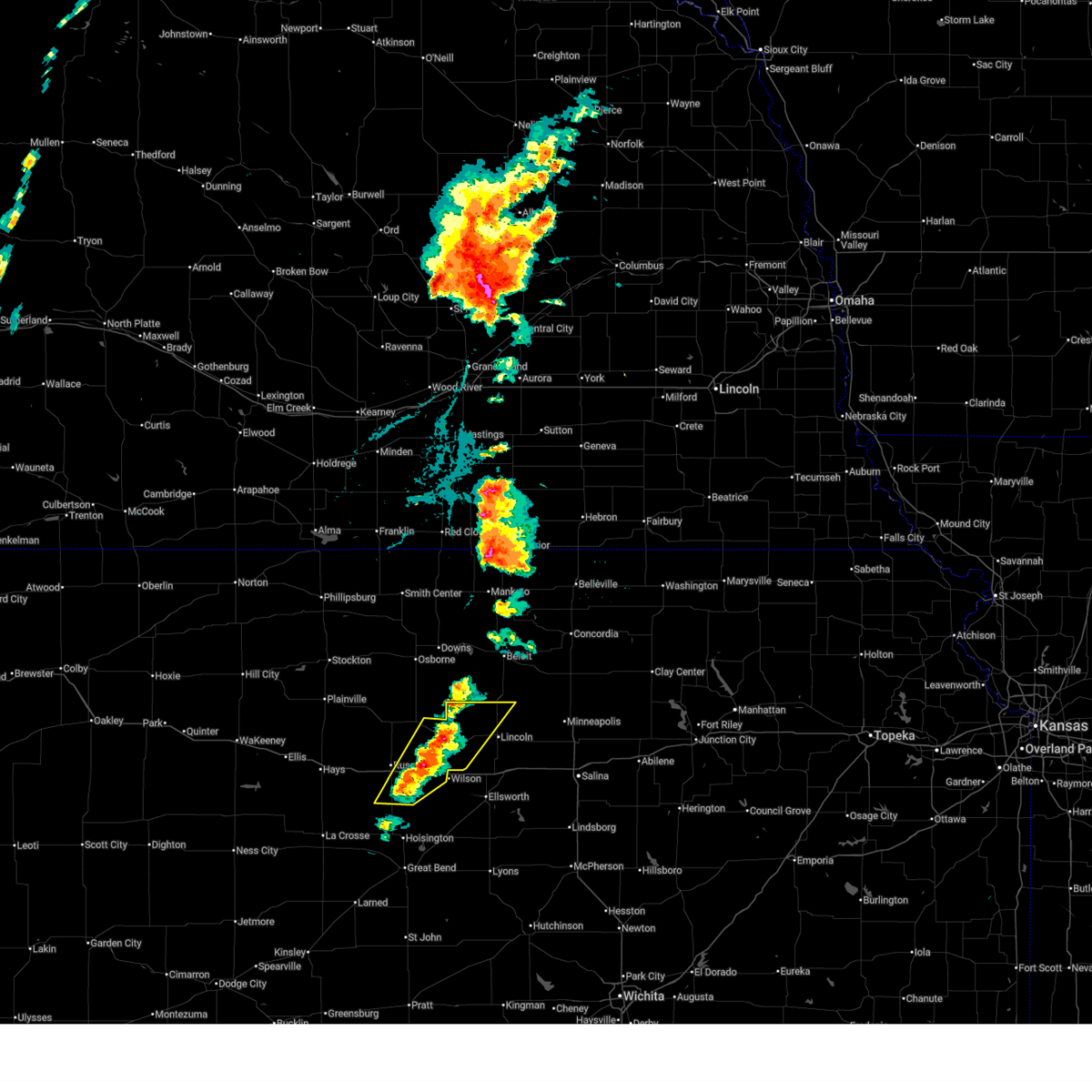
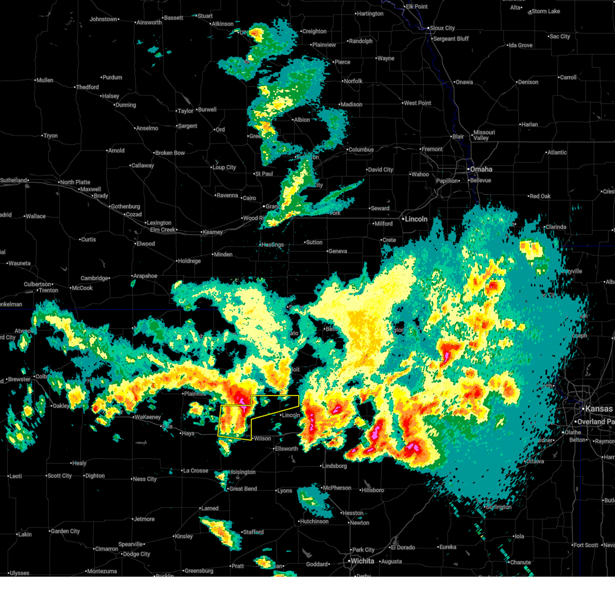
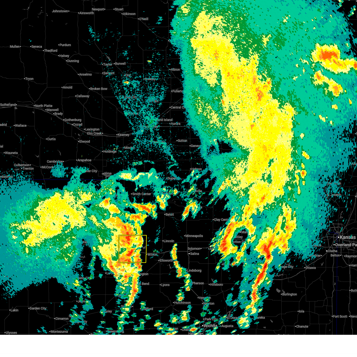
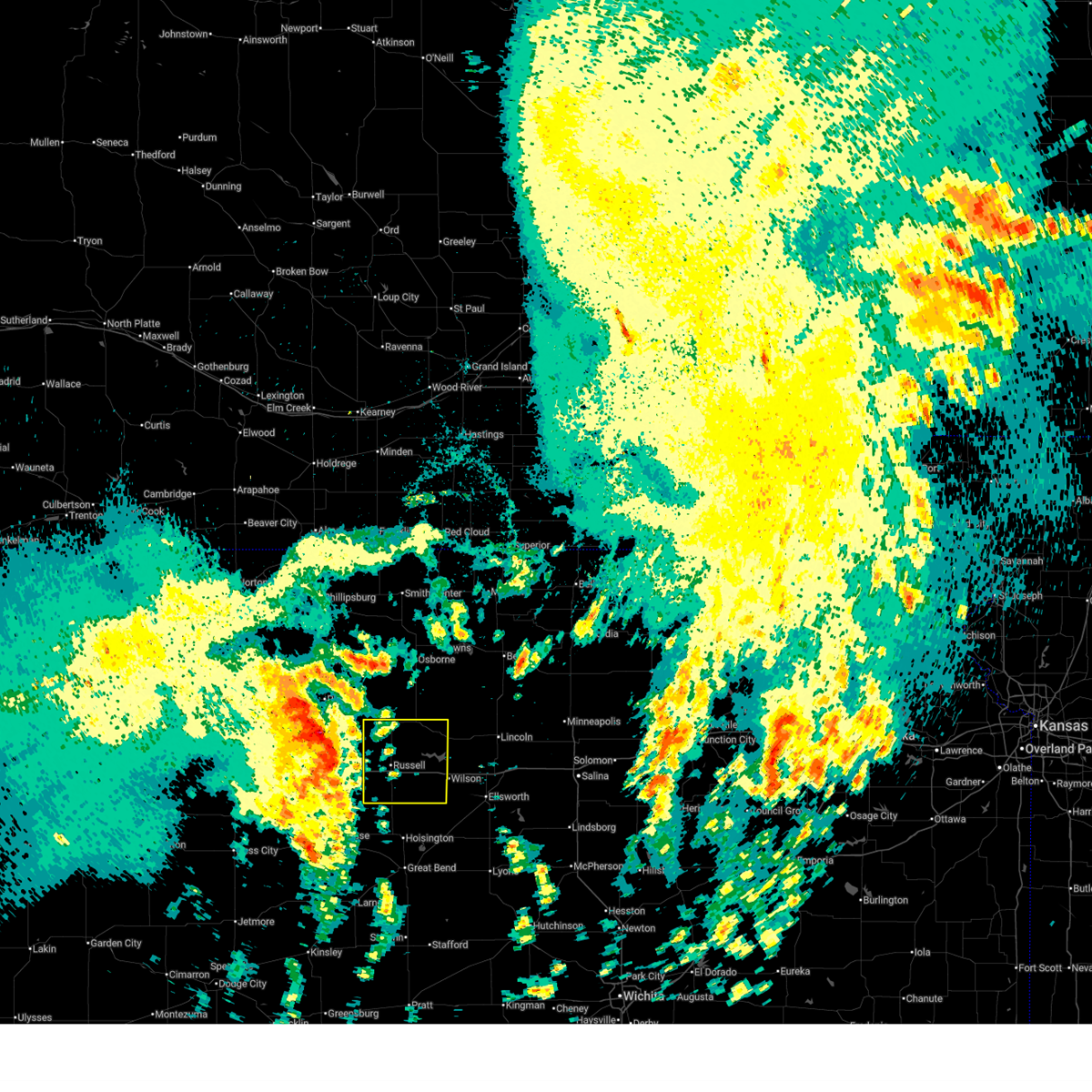
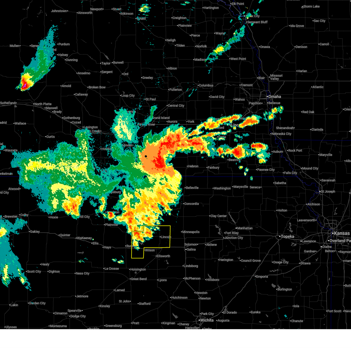
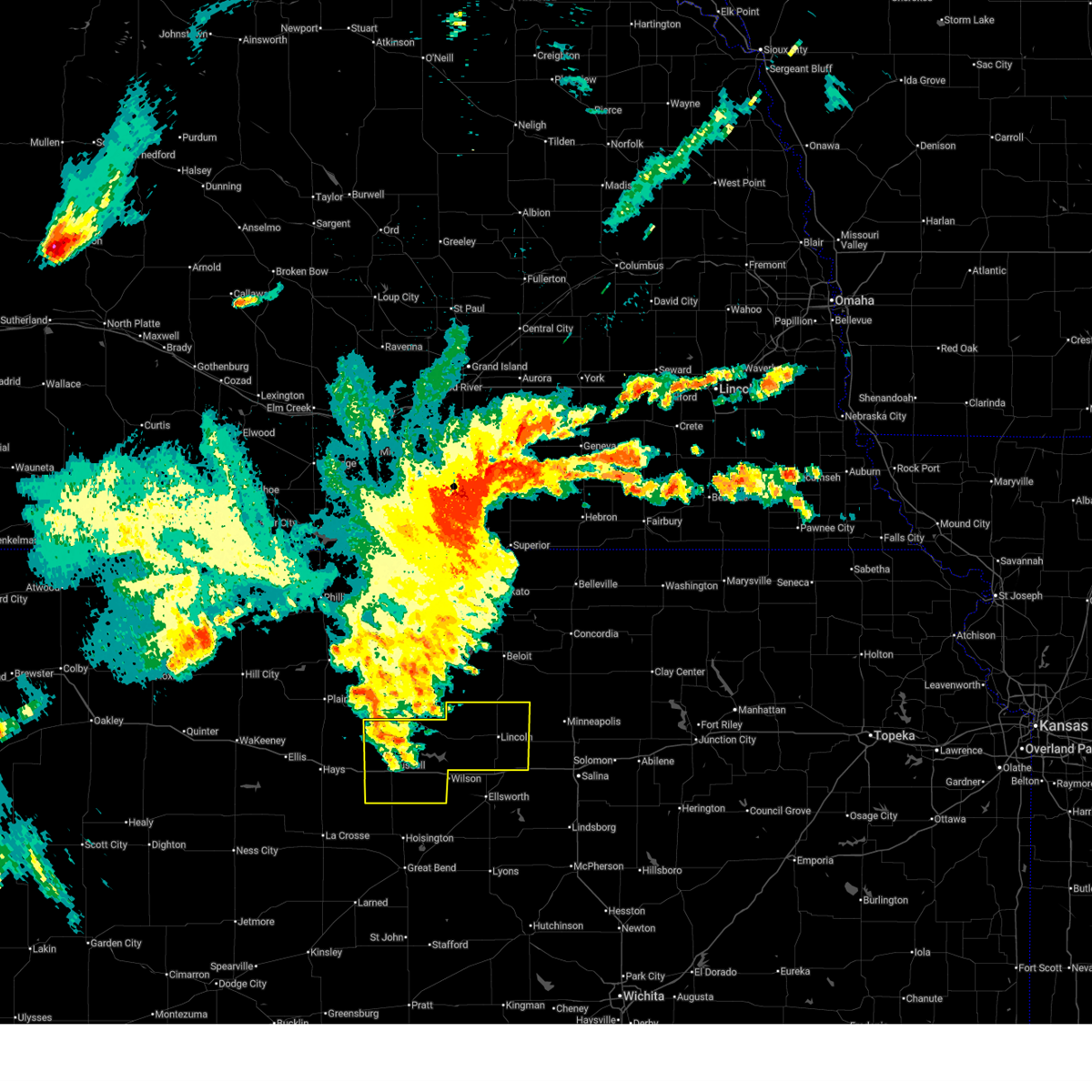
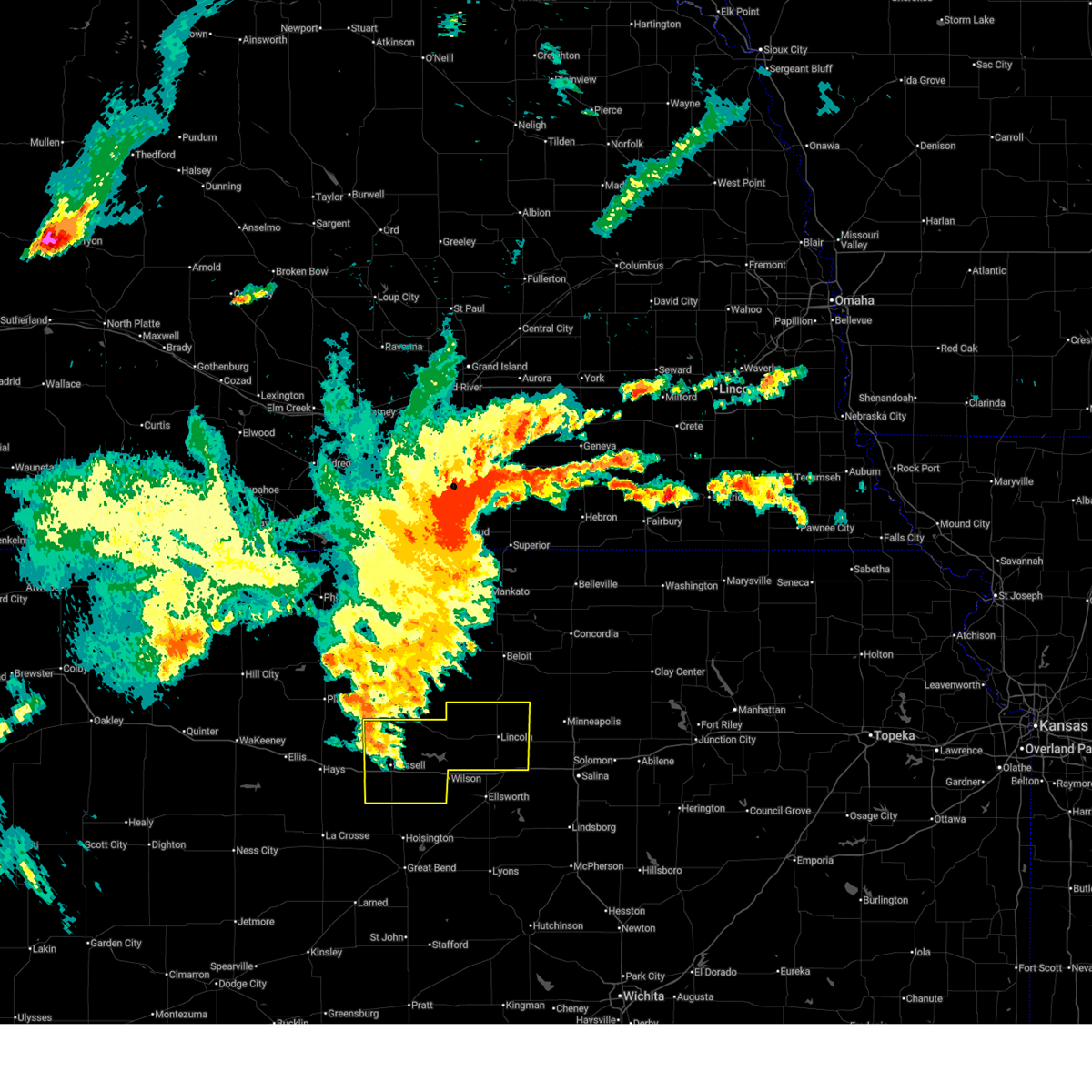
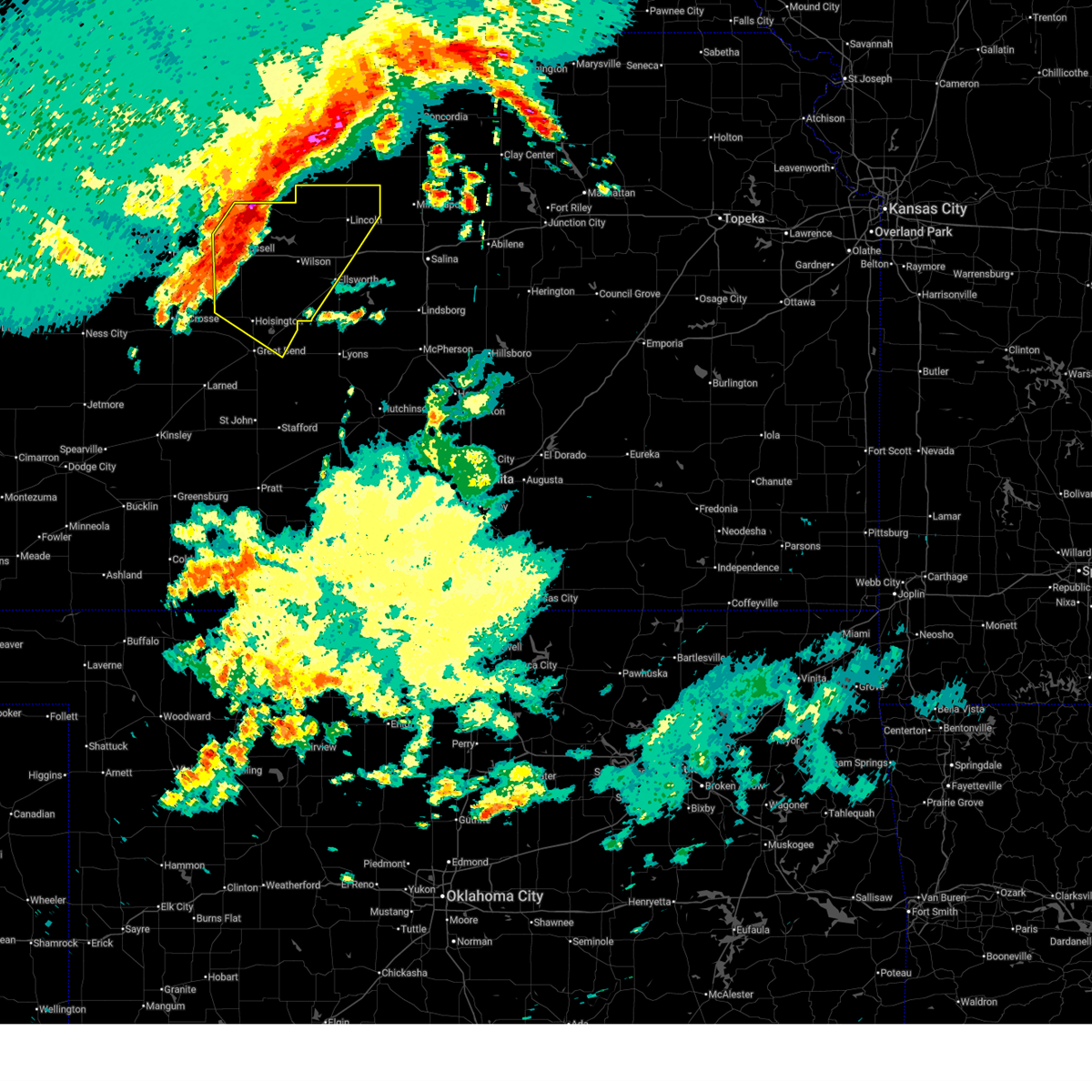
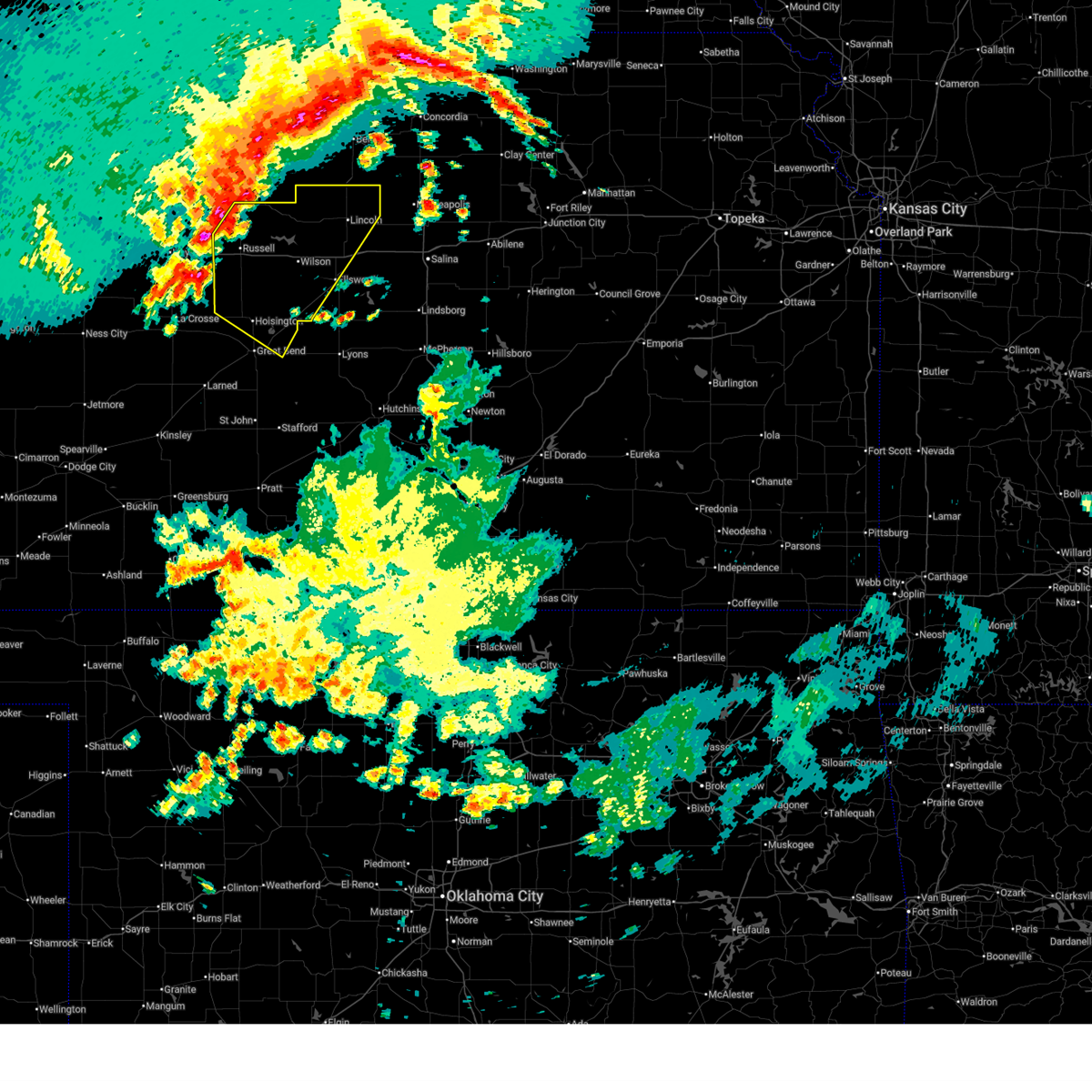
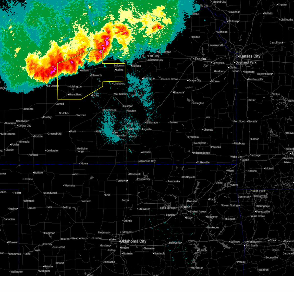
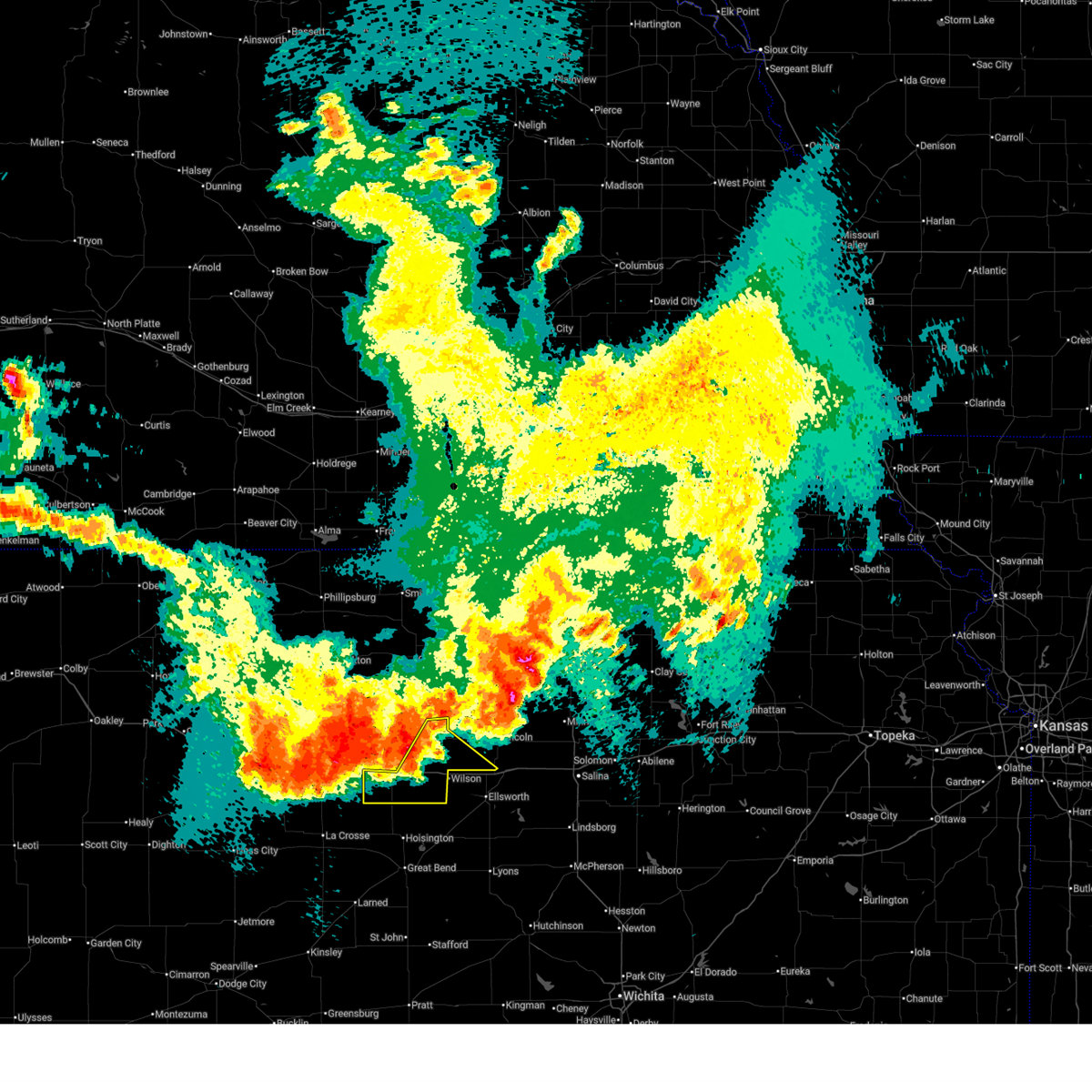
Hail Map for Lucas, KS
The Lucas, KS area has had 17 reports of on-the-ground hail by trained spotters, and has been under severe weather warnings 44 times during the past 12 months. Doppler radar has detected hail at or near Lucas, KS on 126 occasions, including 8 occasions during the past year.
| Name: | Lucas, KS |
| Where Located: | 44.8 miles ENE of Hays, KS |
| Map: | Google Map for Lucas, KS |
| Population: | 393 |
| Housing Units: | 257 |
| More Info: | Search Google for Lucas, KS |
1
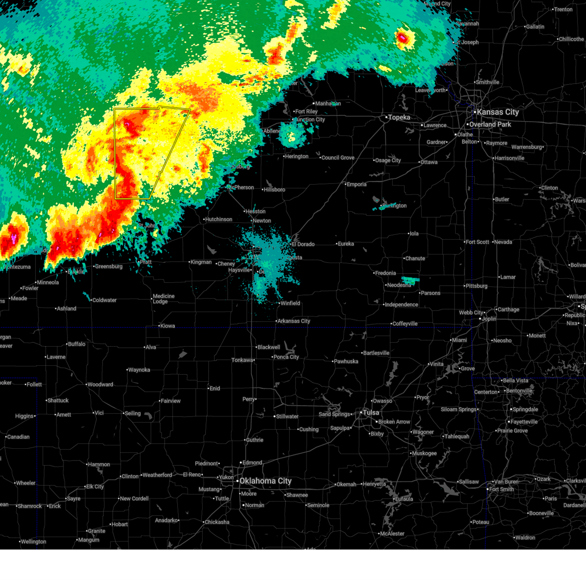
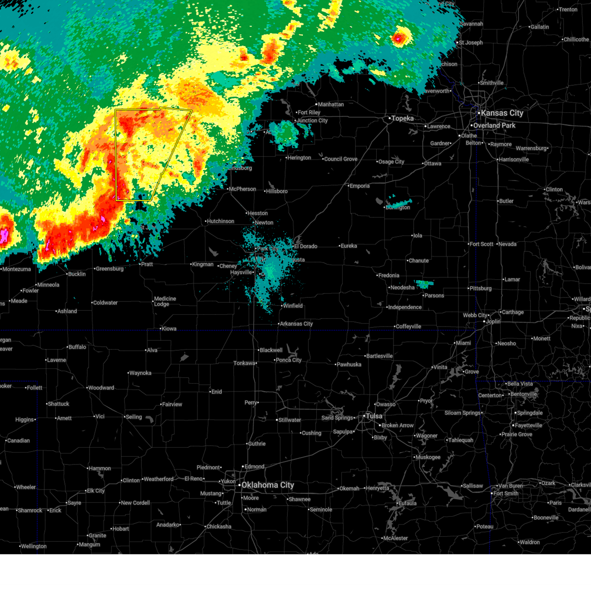
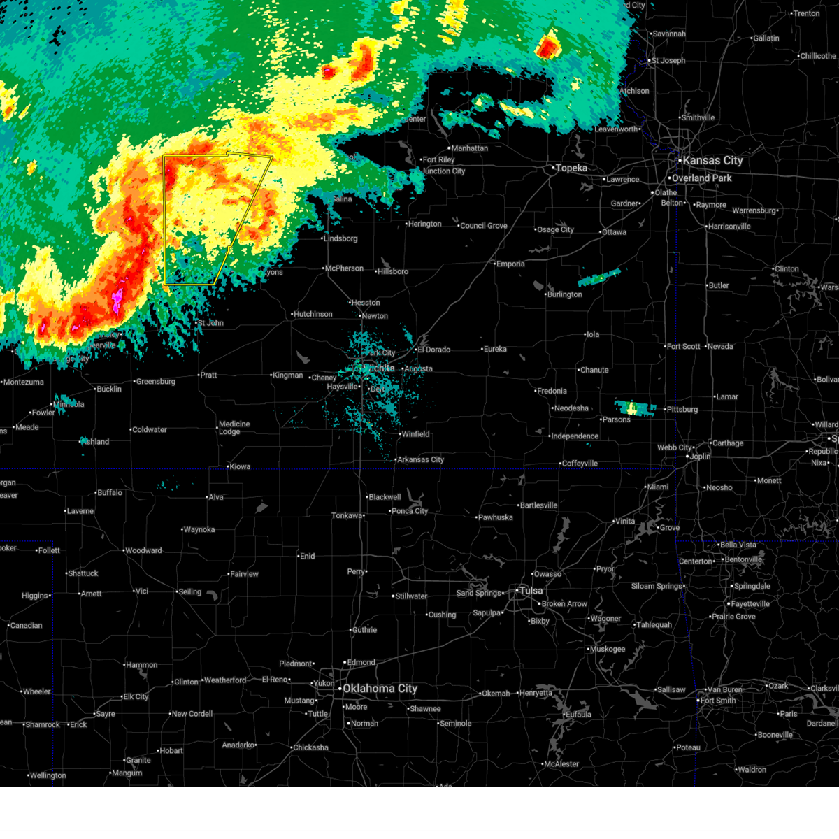
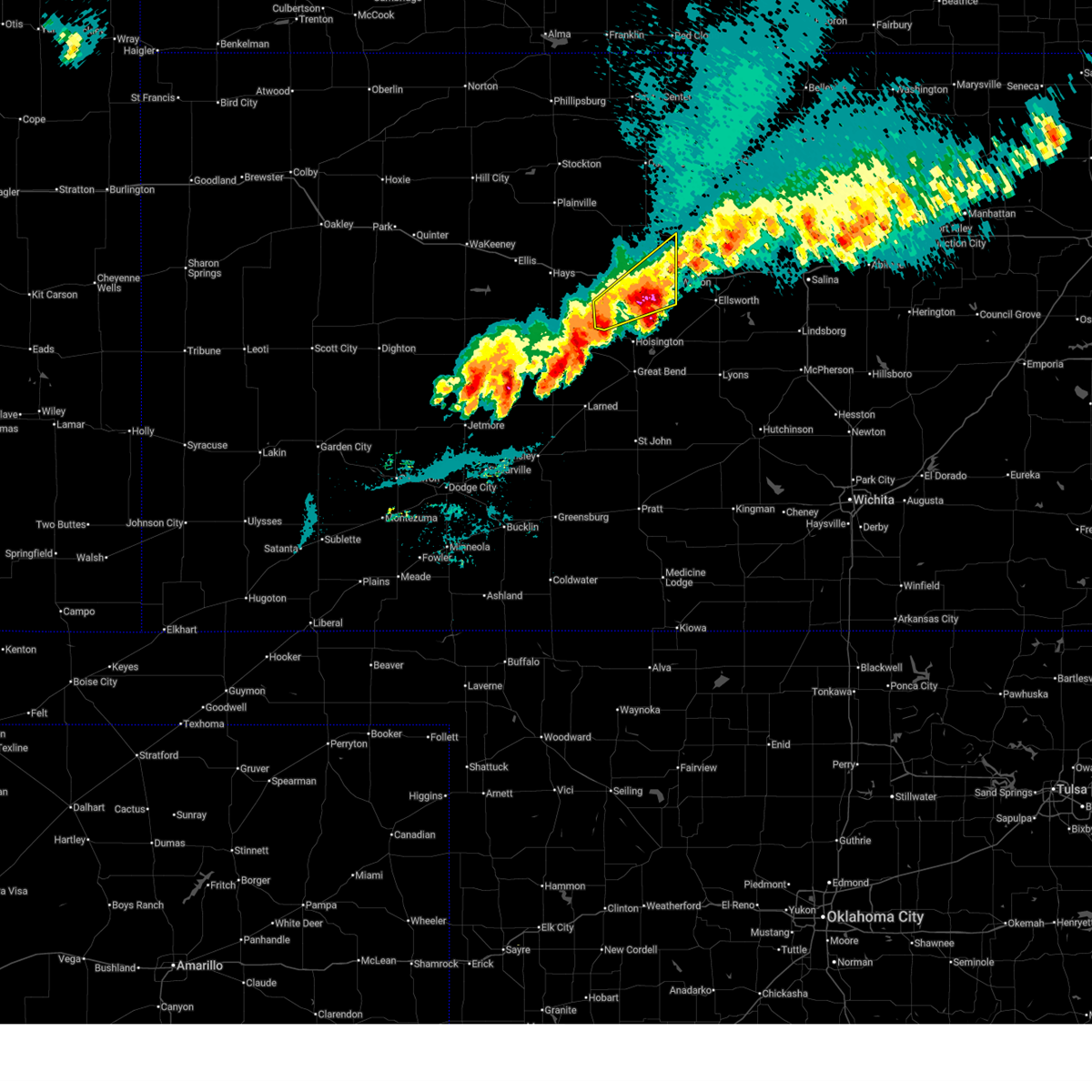
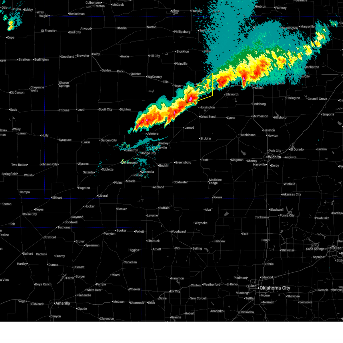
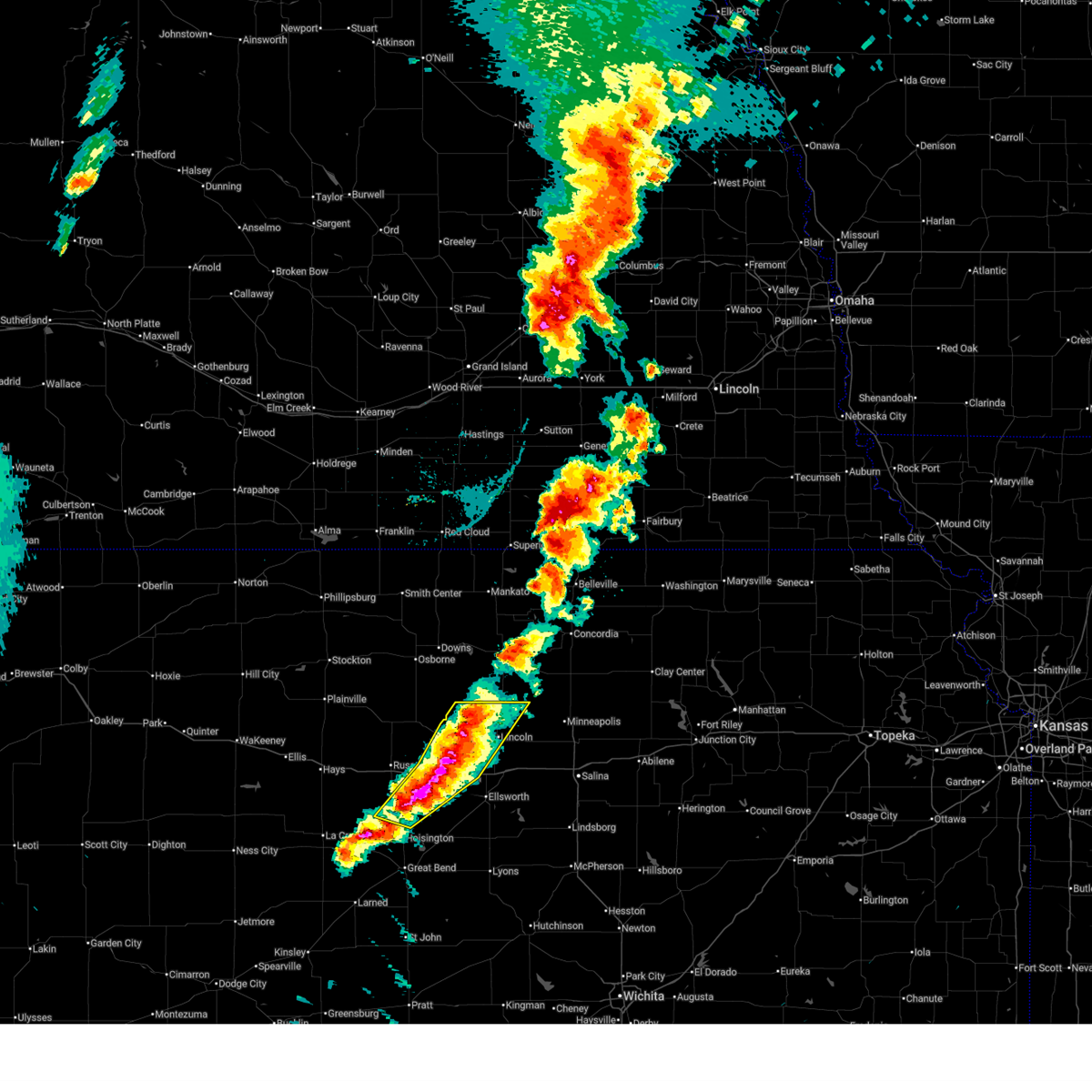
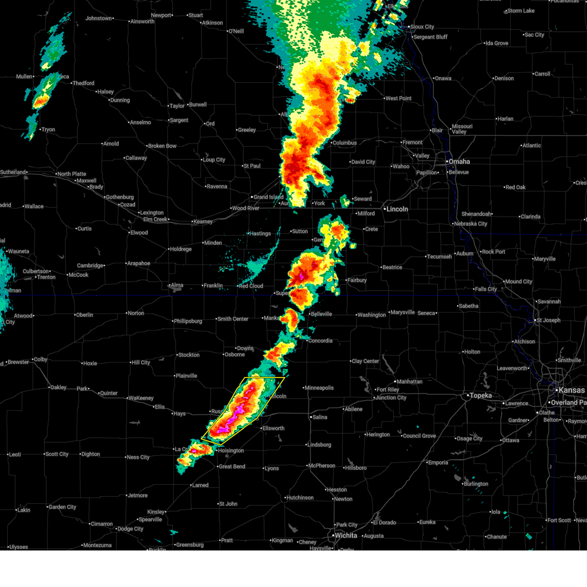
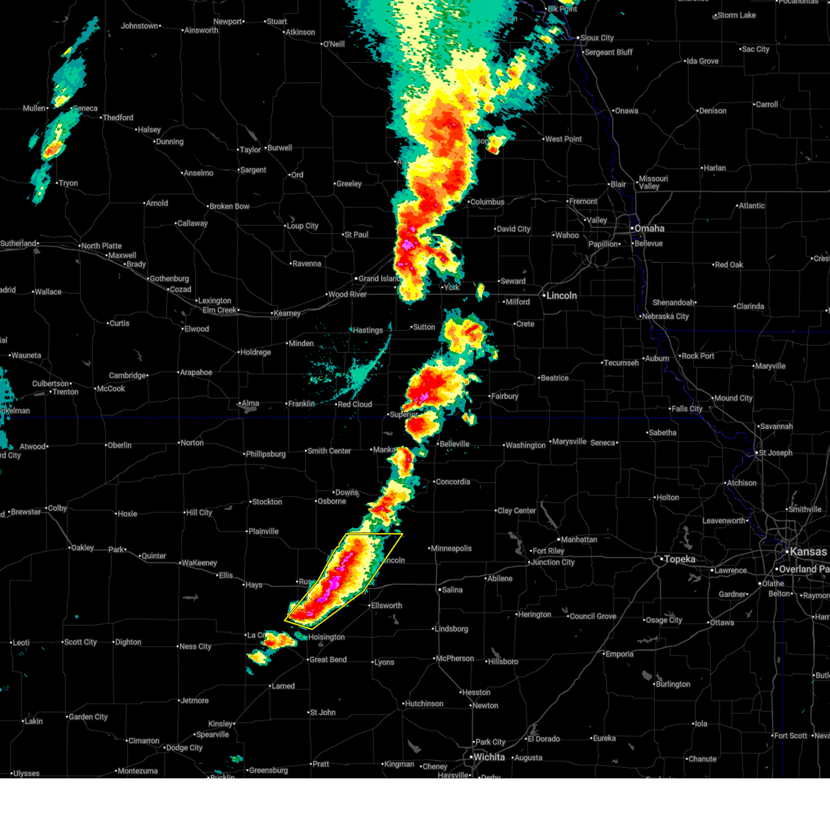
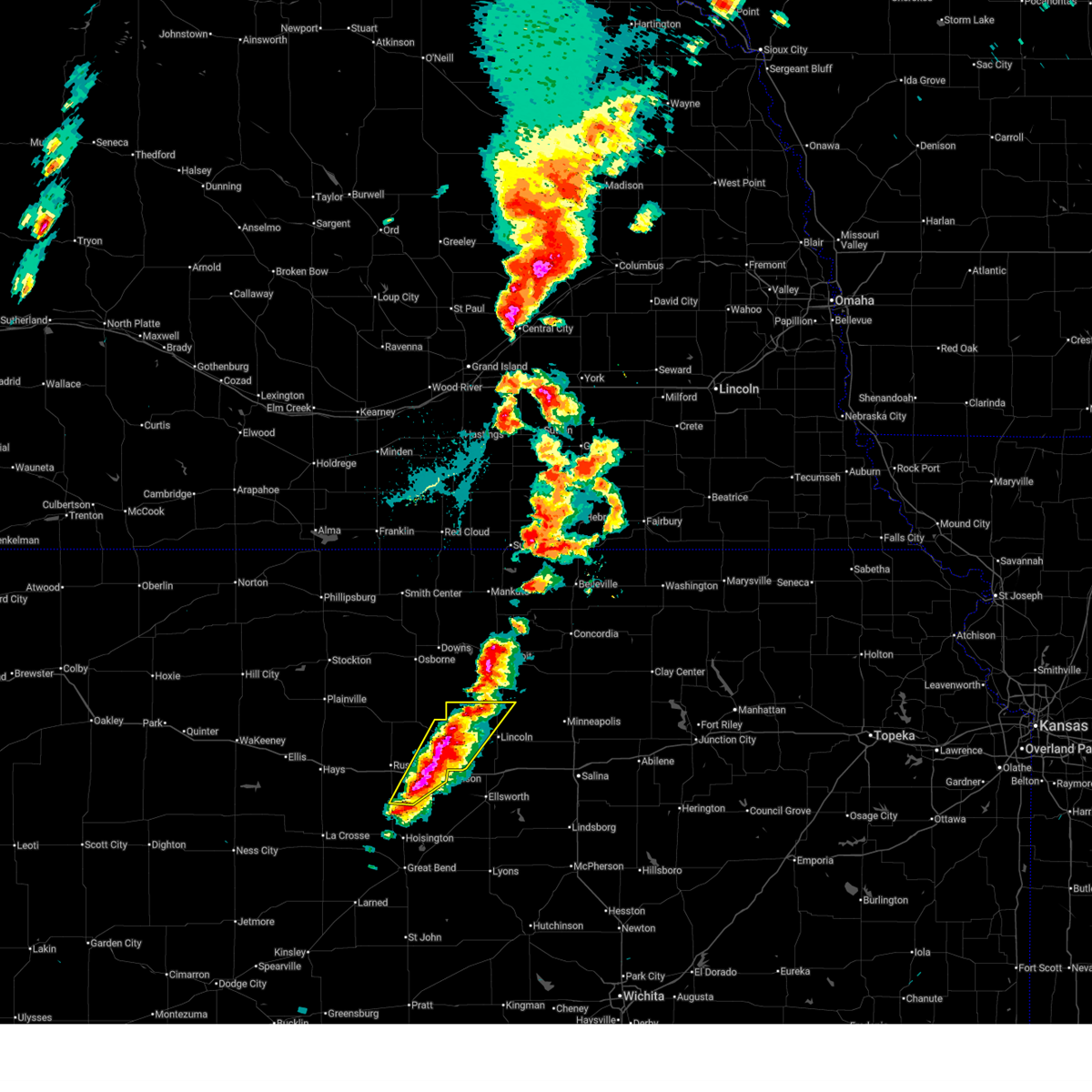
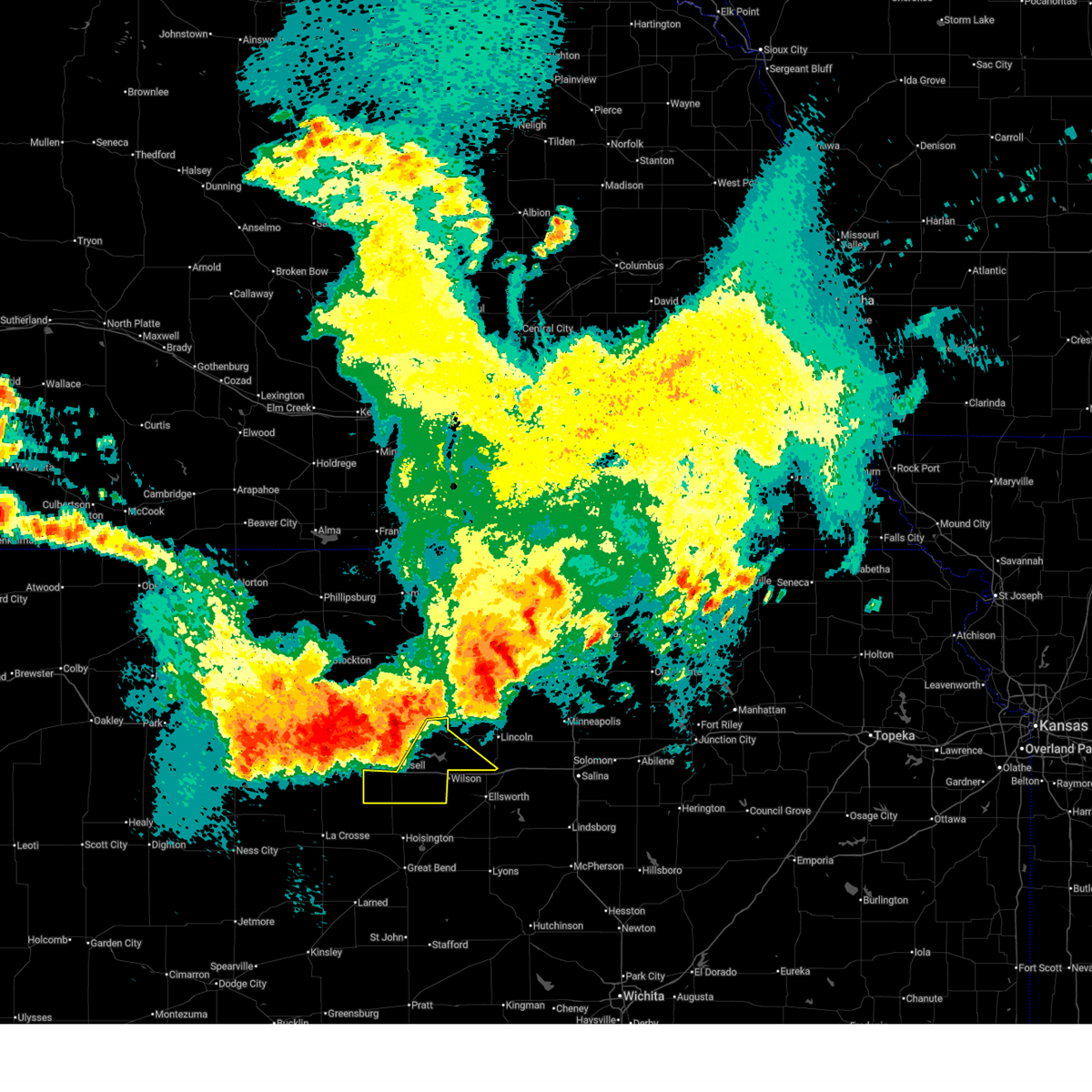
The Top Recent Hail Date for Lucas, KS is Saturday, May 30, 2026 (12th out of 126)
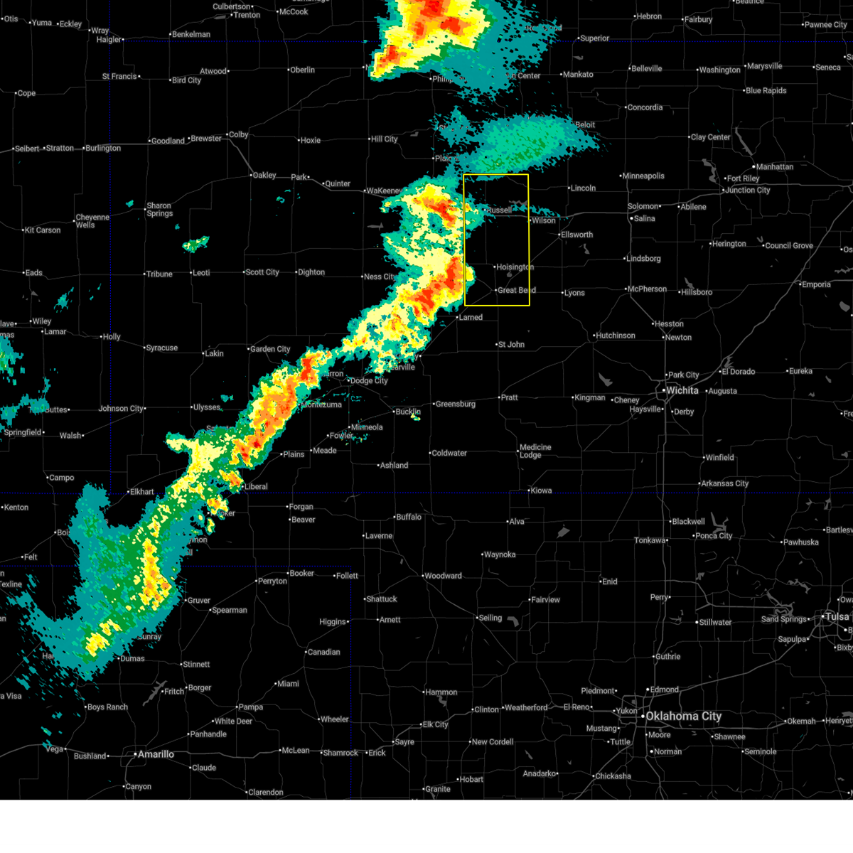
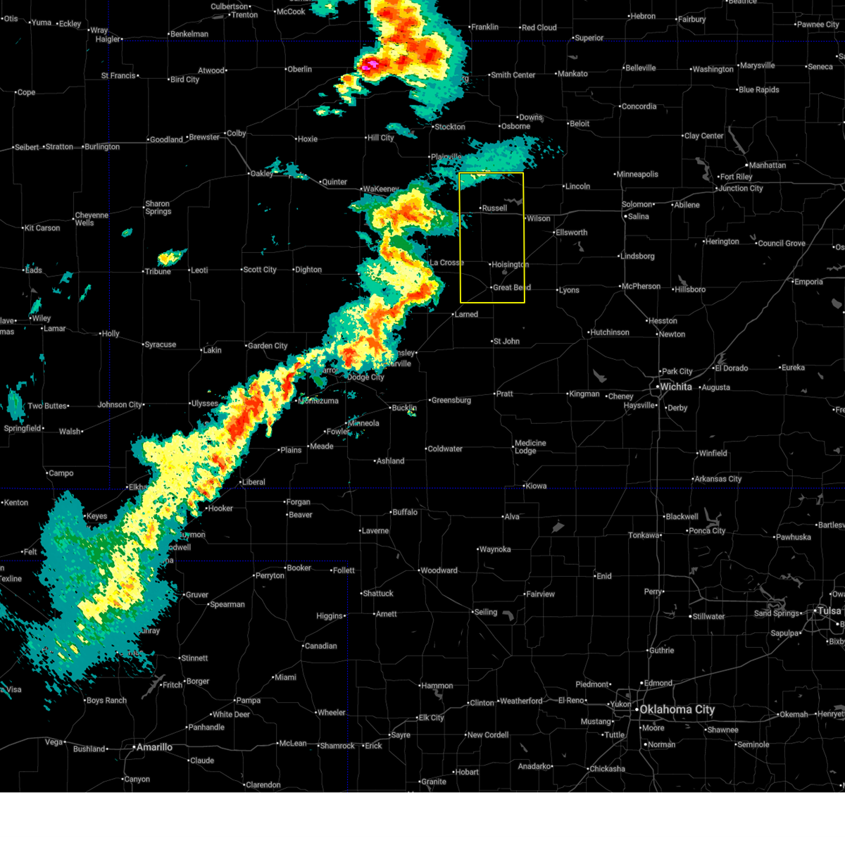
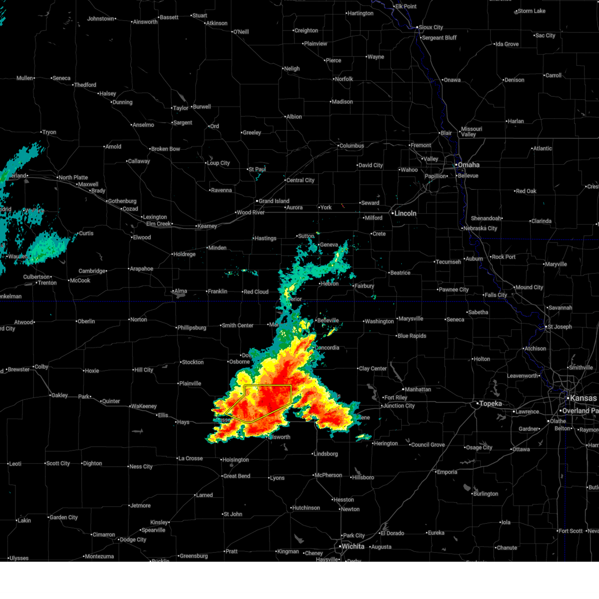
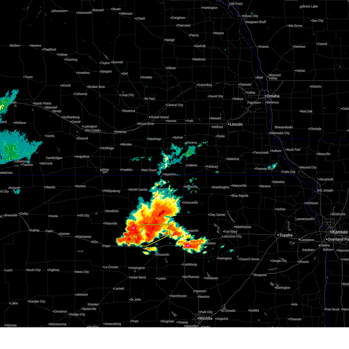
Hail and Wind Damage Spotted near Lucas, KS
| Date / Time | Report Details |
|---|---|
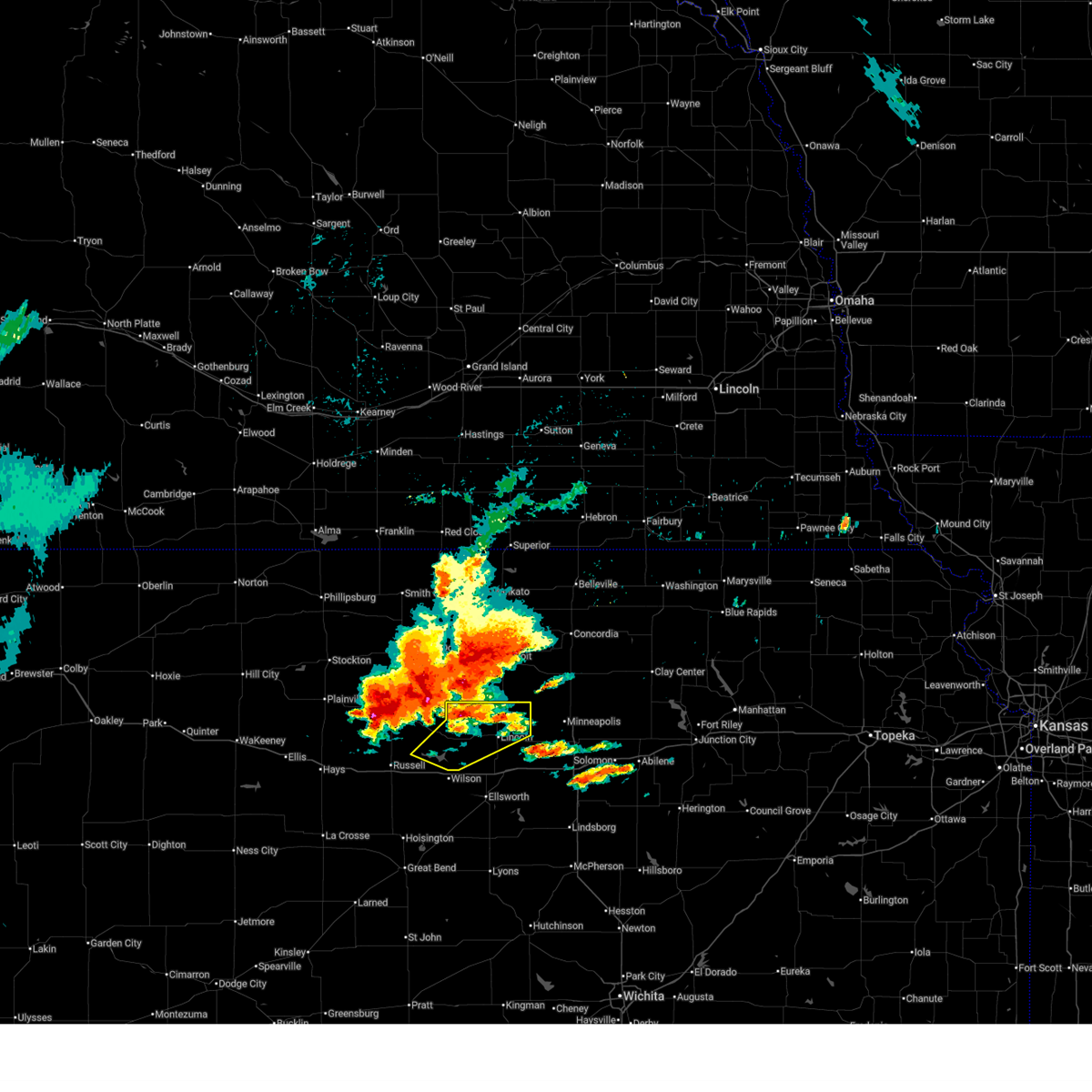
| 6/21/2026 12:02 AM CDT |
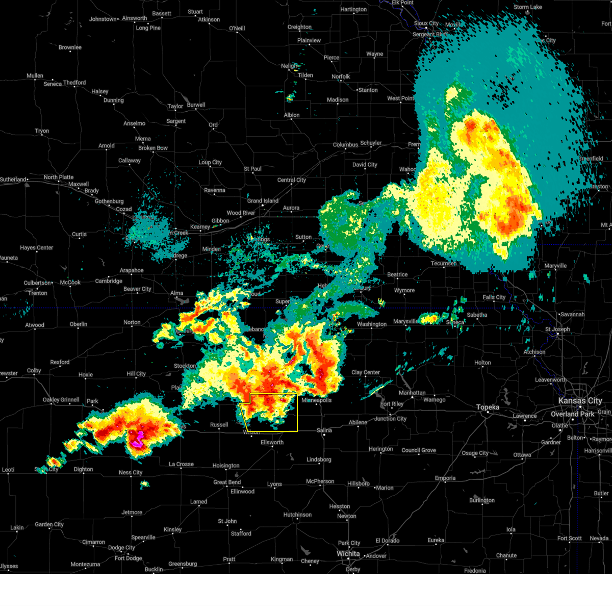
 At 1201 am cdt, severe thunderstorms were located along a line extending from 5 miles east of sylvan grove to 6 miles south of lucas to near dorrance to 8 miles northwest of holyrood to bushton, moving east at 25 mph (radar indicated). Hazards include 60 mph wind gusts. Expect damage to roofs, siding, and trees. locations impacted include, ellsworth, wilson, claflin, kanopolis, lincoln, holyrood, lucas, sylvan grove, geneseo, dorrance, lorraine, bunker hill, ellsworth airport, kanopolis lake, wilson state park, wilson lake, odin, and kanopolis state park. This includes interstate 70 between mile markers 188 and 223. At 1201 am cdt, severe thunderstorms were located along a line extending from 5 miles east of sylvan grove to 6 miles south of lucas to near dorrance to 8 miles northwest of holyrood to bushton, moving east at 25 mph (radar indicated). Hazards include 60 mph wind gusts. Expect damage to roofs, siding, and trees. locations impacted include, ellsworth, wilson, claflin, kanopolis, lincoln, holyrood, lucas, sylvan grove, geneseo, dorrance, lorraine, bunker hill, ellsworth airport, kanopolis lake, wilson state park, wilson lake, odin, and kanopolis state park. This includes interstate 70 between mile markers 188 and 223.
|
| 6/20/2026 11:42 PM CDT |
 Svrict the national weather service in wichita has issued a * severe thunderstorm warning for, southern lincoln county in central kansas, ellsworth county in central kansas, southeastern russell county in central kansas, northeastern barton county in central kansas, * until 100 am cdt. * at 1142 pm cdt, severe thunderstorms were located along a line extending from sylvan grove to 8 miles southwest of lucas to 6 miles northwest of dorrance to near claflin, moving east at 20 mph (radar indicated). Hazards include 60 mph wind gusts. expect damage to roofs, siding, and trees Svrict the national weather service in wichita has issued a * severe thunderstorm warning for, southern lincoln county in central kansas, ellsworth county in central kansas, southeastern russell county in central kansas, northeastern barton county in central kansas, * until 100 am cdt. * at 1142 pm cdt, severe thunderstorms were located along a line extending from sylvan grove to 8 miles southwest of lucas to 6 miles northwest of dorrance to near claflin, moving east at 20 mph (radar indicated). Hazards include 60 mph wind gusts. expect damage to roofs, siding, and trees
|
| 6/20/2026 11:36 PM CDT |
 At 1135 pm cdt, severe thunderstorms were located along a line extending from sylvan grove to 5 miles east of ellinwood to 8 miles south of st. john, moving east at 35 mph (radar indicated). Hazards include 60 mph wind gusts. Expect damage to roofs, siding, and trees. locations impacted include, great bend, russell, hoisington, ellinwood, wilson, claflin, lincoln, lucas, sylvan grove, dorrance, bunker hill, susank, russell airport, cheyenne bottoms, wilson state park, wilson lake, and odin. This includes interstate 70 between mile markers 184 and 216. At 1135 pm cdt, severe thunderstorms were located along a line extending from sylvan grove to 5 miles east of ellinwood to 8 miles south of st. john, moving east at 35 mph (radar indicated). Hazards include 60 mph wind gusts. Expect damage to roofs, siding, and trees. locations impacted include, great bend, russell, hoisington, ellinwood, wilson, claflin, lincoln, lucas, sylvan grove, dorrance, bunker hill, susank, russell airport, cheyenne bottoms, wilson state park, wilson lake, and odin. This includes interstate 70 between mile markers 184 and 216.
|
| 6/20/2026 11:11 PM CDT |
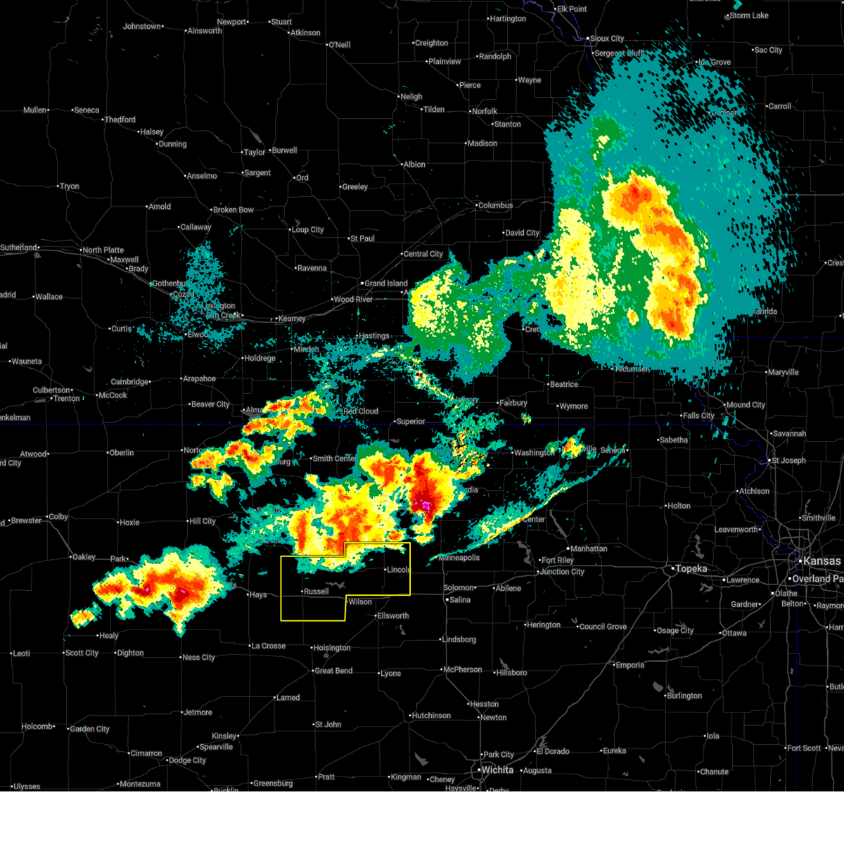
 At 1110 pm cdt, severe thunderstorms were located along a line extending from 5 miles southwest of lucas to near great bend to near macksville, moving east at 35 mph (automated weather sensors. at 11:07 pm the russell asos reported a wind gust of 72 mph). Hazards include 70 mph wind gusts. Expect considerable tree damage. damage is likely to mobile homes, roofs, and outbuildings. locations impacted include, great bend, russell, hoisington, ellinwood, wilson, wilson state park, claflin, lincoln, lucas, gorham, sylvan grove, pawnee rock, luray, dorrance, albert, olmitz, milberger, bunker hill, galatia, susank, and waldo. This includes interstate 70 between mile markers 175 and 216. At 1110 pm cdt, severe thunderstorms were located along a line extending from 5 miles southwest of lucas to near great bend to near macksville, moving east at 35 mph (automated weather sensors. at 11:07 pm the russell asos reported a wind gust of 72 mph). Hazards include 70 mph wind gusts. Expect considerable tree damage. damage is likely to mobile homes, roofs, and outbuildings. locations impacted include, great bend, russell, hoisington, ellinwood, wilson, wilson state park, claflin, lincoln, lucas, gorham, sylvan grove, pawnee rock, luray, dorrance, albert, olmitz, milberger, bunker hill, galatia, susank, and waldo. This includes interstate 70 between mile markers 175 and 216.
|
| 6/20/2026 11:04 PM CDT |
 At 1103 pm cdt, severe thunderstorms were located along a line extending from 7 miles south of luray to great bend to near belpre, moving east at 35 mph (automated weather sensors. at 10:59 pm the russell asos reported a wind gust of 63 mph). Hazards include 70 mph wind gusts. Expect considerable tree damage. damage is likely to mobile homes, roofs, and outbuildings. locations impacted include, great bend, russell, hoisington, ellinwood, wilson, wilson state park, claflin, lincoln, lucas, gorham, sylvan grove, pawnee rock, luray, dorrance, albert, olmitz, milberger, bunker hill, paradise, galatia, and susank. This includes interstate 70 between mile markers 176 and 216. At 1103 pm cdt, severe thunderstorms were located along a line extending from 7 miles south of luray to great bend to near belpre, moving east at 35 mph (automated weather sensors. at 10:59 pm the russell asos reported a wind gust of 63 mph). Hazards include 70 mph wind gusts. Expect considerable tree damage. damage is likely to mobile homes, roofs, and outbuildings. locations impacted include, great bend, russell, hoisington, ellinwood, wilson, wilson state park, claflin, lincoln, lucas, gorham, sylvan grove, pawnee rock, luray, dorrance, albert, olmitz, milberger, bunker hill, paradise, galatia, and susank. This includes interstate 70 between mile markers 176 and 216.
|
| 6/20/2026 10:59 PM CDT |
 At 1057 pm cdt, severe thunderstorms were located along a line extending from 7 miles southwest of luray to near great bend to near belpre, moving east at 40 mph (automated weather sensors. at 11:58pm the russell asos reported a wind gust of 62 mph). Hazards include 70 mph wind gusts. Expect considerable tree damage. damage is likely to mobile homes, roofs, and outbuildings. locations impacted include, great bend, russell, hoisington, ellinwood, wilson, wilson state park, claflin, lincoln, lucas, gorham, sylvan grove, pawnee rock, luray, dorrance, albert, olmitz, milberger, bunker hill, paradise, galatia, and susank. This includes interstate 70 between mile markers 176 and 216. At 1057 pm cdt, severe thunderstorms were located along a line extending from 7 miles southwest of luray to near great bend to near belpre, moving east at 40 mph (automated weather sensors. at 11:58pm the russell asos reported a wind gust of 62 mph). Hazards include 70 mph wind gusts. Expect considerable tree damage. damage is likely to mobile homes, roofs, and outbuildings. locations impacted include, great bend, russell, hoisington, ellinwood, wilson, wilson state park, claflin, lincoln, lucas, gorham, sylvan grove, pawnee rock, luray, dorrance, albert, olmitz, milberger, bunker hill, paradise, galatia, and susank. This includes interstate 70 between mile markers 176 and 216.
|
| 6/20/2026 10:35 PM CDT |
 Svrict the national weather service in wichita has issued a * severe thunderstorm warning for, southwestern lincoln county in central kansas, western ellsworth county in central kansas, russell county in central kansas, barton county in central kansas, * until 1145 pm cdt. * at 1032 pm cdt, severe thunderstorms were located along a line extending from 9 miles southwest of luray to 9 miles south of rozel, moving east at 35 mph (radar indicated). Hazards include 60 mph wind gusts. expect damage to roofs, siding, and trees Svrict the national weather service in wichita has issued a * severe thunderstorm warning for, southwestern lincoln county in central kansas, western ellsworth county in central kansas, russell county in central kansas, barton county in central kansas, * until 1145 pm cdt. * at 1032 pm cdt, severe thunderstorms were located along a line extending from 9 miles southwest of luray to 9 miles south of rozel, moving east at 35 mph (radar indicated). Hazards include 60 mph wind gusts. expect damage to roofs, siding, and trees
|
| 6/9/2026 7:26 PM CDT |
 At 725 pm cdt, severe thunderstorms were located along a line extending from 7 miles southwest of luray to 5 miles south of hoisington, moving east at 35 mph (radar indicated). Hazards include 60 mph wind gusts and nickel size hail. Expect damage to roofs, siding, and trees. locations impacted include, great bend, russell, hoisington, ellinwood, claflin, lucas, gorham, pawnee rock, luray, dorrance, albert, olmitz, milberger, bunker hill, paradise, galatia, susank, waldo, great bend airport, and russell airport. This includes interstate 70 between mile markers 176 and 204. At 725 pm cdt, severe thunderstorms were located along a line extending from 7 miles southwest of luray to 5 miles south of hoisington, moving east at 35 mph (radar indicated). Hazards include 60 mph wind gusts and nickel size hail. Expect damage to roofs, siding, and trees. locations impacted include, great bend, russell, hoisington, ellinwood, claflin, lucas, gorham, pawnee rock, luray, dorrance, albert, olmitz, milberger, bunker hill, paradise, galatia, susank, waldo, great bend airport, and russell airport. This includes interstate 70 between mile markers 176 and 204.
|
| 6/9/2026 7:10 PM CDT |
 At 709 pm cdt, severe thunderstorms were located along a line extending from 9 miles north of gorham to 6 miles west of great bend, moving northeast at 35 mph (radar indicated). Hazards include 60 mph wind gusts and nickel size hail. Expect damage to roofs, siding, and trees. locations impacted include, great bend, russell, hoisington, ellinwood, claflin, lucas, gorham, pawnee rock, luray, dorrance, albert, olmitz, milberger, bunker hill, paradise, galatia, susank, waldo, great bend airport, and russell airport. This includes interstate 70 between mile markers 176 and 204. At 709 pm cdt, severe thunderstorms were located along a line extending from 9 miles north of gorham to 6 miles west of great bend, moving northeast at 35 mph (radar indicated). Hazards include 60 mph wind gusts and nickel size hail. Expect damage to roofs, siding, and trees. locations impacted include, great bend, russell, hoisington, ellinwood, claflin, lucas, gorham, pawnee rock, luray, dorrance, albert, olmitz, milberger, bunker hill, paradise, galatia, susank, waldo, great bend airport, and russell airport. This includes interstate 70 between mile markers 176 and 204.
|
| 6/9/2026 6:52 PM CDT |
 At 651 pm cdt, severe thunderstorms were located along a line extending from emmeram to 6 miles northwest of pawnee rock, moving northeast at 35 mph (radar indicated). Hazards include 60 mph wind gusts and nickel size hail. Expect damage to roofs, siding, and trees. locations impacted include, great bend, russell, hoisington, ellinwood, claflin, lucas, gorham, pawnee rock, luray, dorrance, albert, olmitz, milberger, bunker hill, paradise, galatia, susank, waldo, great bend airport, and russell airport. This includes interstate 70 between mile markers 176 and 204. At 651 pm cdt, severe thunderstorms were located along a line extending from emmeram to 6 miles northwest of pawnee rock, moving northeast at 35 mph (radar indicated). Hazards include 60 mph wind gusts and nickel size hail. Expect damage to roofs, siding, and trees. locations impacted include, great bend, russell, hoisington, ellinwood, claflin, lucas, gorham, pawnee rock, luray, dorrance, albert, olmitz, milberger, bunker hill, paradise, galatia, susank, waldo, great bend airport, and russell airport. This includes interstate 70 between mile markers 176 and 204.
|
| 6/9/2026 6:35 PM CDT |
 Svrict the national weather service in wichita has issued a * severe thunderstorm warning for, russell county in central kansas, barton county in central kansas, * until 745 pm cdt. * at 635 pm cdt, severe thunderstorms were located along a line extending from catherine to near ash valley, moving northeast at 35 mph (radar indicated). Hazards include 60 mph wind gusts and nickel size hail. expect damage to roofs, siding, and trees Svrict the national weather service in wichita has issued a * severe thunderstorm warning for, russell county in central kansas, barton county in central kansas, * until 745 pm cdt. * at 635 pm cdt, severe thunderstorms were located along a line extending from catherine to near ash valley, moving northeast at 35 mph (radar indicated). Hazards include 60 mph wind gusts and nickel size hail. expect damage to roofs, siding, and trees
|
| 6/8/2026 8:44 PM CDT |
 The severe storm which prompted the warning moved out of the area. therefore, the warning will be allowed to expire. however, gusty winds and heavy rain are still possible with these thunderstorms. a tornado watch remains in effect until 1000 pm cdt for central kansas. to report severe weather, contact your nearest law enforcement agency. they will relay your report to the national weather service wichita. The severe storm which prompted the warning moved out of the area. therefore, the warning will be allowed to expire. however, gusty winds and heavy rain are still possible with these thunderstorms. a tornado watch remains in effect until 1000 pm cdt for central kansas. to report severe weather, contact your nearest law enforcement agency. they will relay your report to the national weather service wichita.
|
| 6/8/2026 8:21 PM CDT | Power is reported to be out and a few power poles leaning;time estimated from rada in russell county KS, 0.2 miles ESE of Lucas, KS |
| 6/8/2026 8:19 PM CDT |
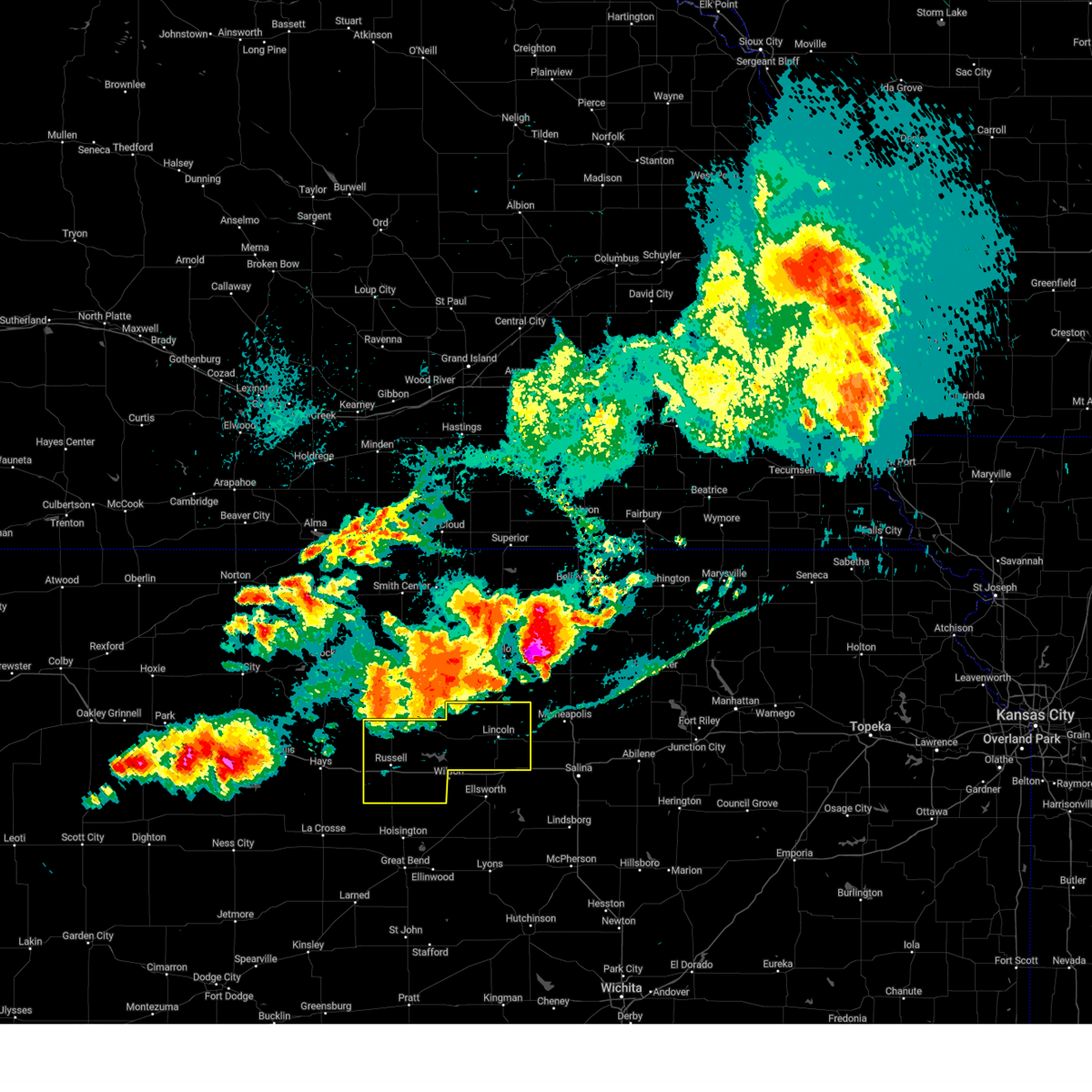
 At 819 pm cdt, severe thunderstorms were located along a line extending from 5 miles northwest of lincoln to 5 miles southwest of sylvan grove, moving south at 35 mph (radar indicated). Hazards include golf ball size hail and 70 mph wind gusts. People and animals outdoors will be injured. expect hail damage to roofs, siding, windows, and vehicles. expect considerable tree damage. wind damage is also likely to mobile homes, roofs, and outbuildings. Locations impacted include, lincoln, lucas, sylvan grove, barnard, ash grove, wilson state park, and wilson lake. At 819 pm cdt, severe thunderstorms were located along a line extending from 5 miles northwest of lincoln to 5 miles southwest of sylvan grove, moving south at 35 mph (radar indicated). Hazards include golf ball size hail and 70 mph wind gusts. People and animals outdoors will be injured. expect hail damage to roofs, siding, windows, and vehicles. expect considerable tree damage. wind damage is also likely to mobile homes, roofs, and outbuildings. Locations impacted include, lincoln, lucas, sylvan grove, barnard, ash grove, wilson state park, and wilson lake.
|
| 6/8/2026 8:08 PM CDT |
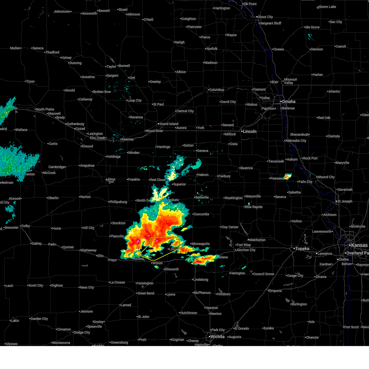 At 808 pm cdt, severe thunderstorms were located along a line extending from 5 miles southeast of victor to lucas, moving south at 35 mph (radar indicated). Hazards include 70 mph wind gusts and ping pong ball size hail. People and animals outdoors will be injured. expect hail damage to roofs, siding, windows, and vehicles. expect considerable tree damage. wind damage is also likely to mobile homes, roofs, and outbuildings. Locations impacted include, lincoln, lucas, sylvan grove, barnard, ash grove, wilson state park, and wilson lake. At 808 pm cdt, severe thunderstorms were located along a line extending from 5 miles southeast of victor to lucas, moving south at 35 mph (radar indicated). Hazards include 70 mph wind gusts and ping pong ball size hail. People and animals outdoors will be injured. expect hail damage to roofs, siding, windows, and vehicles. expect considerable tree damage. wind damage is also likely to mobile homes, roofs, and outbuildings. Locations impacted include, lincoln, lucas, sylvan grove, barnard, ash grove, wilson state park, and wilson lake.
|
| 6/8/2026 7:54 PM CDT |
 Svrict the national weather service in wichita has issued a * severe thunderstorm warning for, lincoln county in central kansas, east central russell county in central kansas, * until 845 pm cdt. * at 754 pm cdt, severe thunderstorms were located along a line extending from victor to 5 miles north of lucas, moving south at 35 mph (radar indicated). Hazards include 70 mph wind gusts and half dollar size hail. Hail damage to vehicles is expected. expect considerable tree damage. Wind damage is also likely to mobile homes, roofs, and outbuildings. Svrict the national weather service in wichita has issued a * severe thunderstorm warning for, lincoln county in central kansas, east central russell county in central kansas, * until 845 pm cdt. * at 754 pm cdt, severe thunderstorms were located along a line extending from victor to 5 miles north of lucas, moving south at 35 mph (radar indicated). Hazards include 70 mph wind gusts and half dollar size hail. Hail damage to vehicles is expected. expect considerable tree damage. Wind damage is also likely to mobile homes, roofs, and outbuildings.
|
| 5/30/2026 6:43 PM CDT |
 Svrict the national weather service in wichita has issued a * severe thunderstorm warning for, lincoln county in central kansas, northeastern russell county in central kansas, * until 745 pm cdt. * at 643 pm cdt, severe thunderstorms were located along a line extending from 9 miles north of luray to 7 miles north of wilson, moving northeast at 30 mph (radar indicated). Hazards include 60 mph wind gusts and quarter size hail. Hail damage to vehicles is expected. Expect wind damage to roofs, siding, and trees. Svrict the national weather service in wichita has issued a * severe thunderstorm warning for, lincoln county in central kansas, northeastern russell county in central kansas, * until 745 pm cdt. * at 643 pm cdt, severe thunderstorms were located along a line extending from 9 miles north of luray to 7 miles north of wilson, moving northeast at 30 mph (radar indicated). Hazards include 60 mph wind gusts and quarter size hail. Hail damage to vehicles is expected. Expect wind damage to roofs, siding, and trees.
|
| 5/29/2026 10:04 PM CDT |
 Svrict the national weather service in wichita has issued a * severe thunderstorm warning for, northwestern lincoln county in central kansas, northeastern russell county in central kansas, * until 1030 pm cdt. * at 1004 pm cdt, a severe thunderstorm was located near lucas, or 13 miles north of wilson, moving northeast at 30 mph (radar indicated). Hazards include 60 mph wind gusts and nickel size hail. expect damage to roofs, siding, and trees Svrict the national weather service in wichita has issued a * severe thunderstorm warning for, northwestern lincoln county in central kansas, northeastern russell county in central kansas, * until 1030 pm cdt. * at 1004 pm cdt, a severe thunderstorm was located near lucas, or 13 miles north of wilson, moving northeast at 30 mph (radar indicated). Hazards include 60 mph wind gusts and nickel size hail. expect damage to roofs, siding, and trees
|
| 5/17/2026 10:26 PM CDT |
 At 1024 pm cdt, a severe thunderstorm was located 10 miles east of milberger, or 12 miles southeast of russell, moving northeast at 45 mph (trained weather spotters reported two inch hail 5 miles northwest of susank at 1019 pm). Hazards include two inch hail and 60 mph wind gusts. People and animals outdoors will be injured. expect hail damage to roofs, siding, windows, and vehicles. expect wind damage to roofs, siding, and trees. locations impacted include, dorrance, milberger, bunker hill, galatia, susank, wilson state park, wilson lake, and russell airport. This includes interstate 70 between mile markers 187 and 204. At 1024 pm cdt, a severe thunderstorm was located 10 miles east of milberger, or 12 miles southeast of russell, moving northeast at 45 mph (trained weather spotters reported two inch hail 5 miles northwest of susank at 1019 pm). Hazards include two inch hail and 60 mph wind gusts. People and animals outdoors will be injured. expect hail damage to roofs, siding, windows, and vehicles. expect wind damage to roofs, siding, and trees. locations impacted include, dorrance, milberger, bunker hill, galatia, susank, wilson state park, wilson lake, and russell airport. This includes interstate 70 between mile markers 187 and 204.
|
| 5/17/2026 10:09 PM CDT |
 Svrict the national weather service in wichita has issued a * severe thunderstorm warning for, southern russell county in central kansas, northwestern barton county in central kansas, * until 1115 pm cdt. * at 1009 pm cdt, a severe thunderstorm was located near milberger, or 10 miles northeast of otis, moving northeast at 35 mph (radar indicated). Hazards include ping pong ball size hail and 60 mph wind gusts. People and animals outdoors will be injured. expect hail damage to roofs, siding, windows, and vehicles. Expect wind damage to roofs, siding, and trees. Svrict the national weather service in wichita has issued a * severe thunderstorm warning for, southern russell county in central kansas, northwestern barton county in central kansas, * until 1115 pm cdt. * at 1009 pm cdt, a severe thunderstorm was located near milberger, or 10 miles northeast of otis, moving northeast at 35 mph (radar indicated). Hazards include ping pong ball size hail and 60 mph wind gusts. People and animals outdoors will be injured. expect hail damage to roofs, siding, windows, and vehicles. Expect wind damage to roofs, siding, and trees.
|
| 5/17/2026 7:09 PM CDT |
 At 709 pm cdt, severe thunderstorms were located along a line extending from 5 miles north of lincoln to near wilson, moving northeast at 40 mph (trained weather spotters). Hazards include golf ball size hail and 70 mph wind gusts. People and animals outdoors will be injured. expect hail damage to roofs, siding, windows, and vehicles. expect considerable tree damage. wind damage is also likely to mobile homes, roofs, and outbuildings. locations impacted include, wilson, lincoln, sylvan grove, dorrance, barnard, bunker hill, galatia, susank, ash grove, wilson state park, and wilson lake. This includes interstate 70 between mile markers 192 and 216. At 709 pm cdt, severe thunderstorms were located along a line extending from 5 miles north of lincoln to near wilson, moving northeast at 40 mph (trained weather spotters). Hazards include golf ball size hail and 70 mph wind gusts. People and animals outdoors will be injured. expect hail damage to roofs, siding, windows, and vehicles. expect considerable tree damage. wind damage is also likely to mobile homes, roofs, and outbuildings. locations impacted include, wilson, lincoln, sylvan grove, dorrance, barnard, bunker hill, galatia, susank, ash grove, wilson state park, and wilson lake. This includes interstate 70 between mile markers 192 and 216.
|
| 5/17/2026 6:55 PM CDT |
 At 654 pm cdt, severe thunderstorms were located along a line extending from near sylvan grove to near dorrance, moving northeast at 40 mph (trained weather spotters). Hazards include tennis ball size hail and 70 mph wind gusts. People and animals outdoors will be injured. expect hail damage to roofs, siding, windows, and vehicles. expect considerable tree damage. wind damage is also likely to mobile homes, roofs, and outbuildings. locations impacted include, wilson, lincoln, lucas, sylvan grove, dorrance, barnard, bunker hill, galatia, susank, ash grove, wilson state park, and wilson lake. This includes interstate 70 between mile markers 192 and 216. At 654 pm cdt, severe thunderstorms were located along a line extending from near sylvan grove to near dorrance, moving northeast at 40 mph (trained weather spotters). Hazards include tennis ball size hail and 70 mph wind gusts. People and animals outdoors will be injured. expect hail damage to roofs, siding, windows, and vehicles. expect considerable tree damage. wind damage is also likely to mobile homes, roofs, and outbuildings. locations impacted include, wilson, lincoln, lucas, sylvan grove, dorrance, barnard, bunker hill, galatia, susank, ash grove, wilson state park, and wilson lake. This includes interstate 70 between mile markers 192 and 216.
|
| 5/17/2026 6:39 PM CDT |
 At 639 pm cdt, severe thunderstorms were located along a line extending from 5 miles southwest of sylvan grove to 8 miles east of milberger, moving northeast at 25 mph (trained weather spotters reported golf ball size hail in dorrance at 638 pm). Hazards include tennis ball size hail and 70 mph wind gusts. People and animals outdoors will be injured. expect hail damage to roofs, siding, windows, and vehicles. expect considerable tree damage. wind damage is also likely to mobile homes, roofs, and outbuildings. locations impacted include, wilson, lincoln, lucas, sylvan grove, dorrance, barnard, bunker hill, galatia, susank, ash grove, wilson state park, and wilson lake. This includes interstate 70 between mile markers 192 and 216. At 639 pm cdt, severe thunderstorms were located along a line extending from 5 miles southwest of sylvan grove to 8 miles east of milberger, moving northeast at 25 mph (trained weather spotters reported golf ball size hail in dorrance at 638 pm). Hazards include tennis ball size hail and 70 mph wind gusts. People and animals outdoors will be injured. expect hail damage to roofs, siding, windows, and vehicles. expect considerable tree damage. wind damage is also likely to mobile homes, roofs, and outbuildings. locations impacted include, wilson, lincoln, lucas, sylvan grove, dorrance, barnard, bunker hill, galatia, susank, ash grove, wilson state park, and wilson lake. This includes interstate 70 between mile markers 192 and 216.
|
| 5/17/2026 6:35 PM CDT |
 At 635 pm cdt, severe thunderstorms were located along a line extending from 7 miles northeast of sylvan grove to near dorrance, moving northeast at 40 mph (radar indicated). Hazards include tennis ball size hail and 70 mph wind gusts. People and animals outdoors will be injured. expect hail damage to roofs, siding, windows, and vehicles. expect considerable tree damage. wind damage is also likely to mobile homes, roofs, and outbuildings. locations impacted include, wilson, lincoln, lucas, sylvan grove, dorrance, barnard, bunker hill, galatia, susank, ash grove, wilson state park, and wilson lake. This includes interstate 70 between mile markers 192 and 216. At 635 pm cdt, severe thunderstorms were located along a line extending from 7 miles northeast of sylvan grove to near dorrance, moving northeast at 40 mph (radar indicated). Hazards include tennis ball size hail and 70 mph wind gusts. People and animals outdoors will be injured. expect hail damage to roofs, siding, windows, and vehicles. expect considerable tree damage. wind damage is also likely to mobile homes, roofs, and outbuildings. locations impacted include, wilson, lincoln, lucas, sylvan grove, dorrance, barnard, bunker hill, galatia, susank, ash grove, wilson state park, and wilson lake. This includes interstate 70 between mile markers 192 and 216.
|
| 5/17/2026 6:29 PM CDT |
 Svrict the national weather service in wichita has issued a * severe thunderstorm warning for, lincoln county in central kansas, northwestern ellsworth county in central kansas, eastern russell county in central kansas, northwestern barton county in central kansas, * until 730 pm cdt. * at 628 pm cdt, severe thunderstorms were located along a line extending from near sylvan grove to near dorrance, moving northeast at 40 mph (radar indicated). Hazards include two inch hail and 70 mph wind gusts. People and animals outdoors will be injured. expect hail damage to roofs, siding, windows, and vehicles. expect considerable tree damage. Wind damage is also likely to mobile homes, roofs, and outbuildings. Svrict the national weather service in wichita has issued a * severe thunderstorm warning for, lincoln county in central kansas, northwestern ellsworth county in central kansas, eastern russell county in central kansas, northwestern barton county in central kansas, * until 730 pm cdt. * at 628 pm cdt, severe thunderstorms were located along a line extending from near sylvan grove to near dorrance, moving northeast at 40 mph (radar indicated). Hazards include two inch hail and 70 mph wind gusts. People and animals outdoors will be injured. expect hail damage to roofs, siding, windows, and vehicles. expect considerable tree damage. Wind damage is also likely to mobile homes, roofs, and outbuildings.
|
| 5/17/2026 6:13 PM CDT |
 At 611 pm cdt, a severe thunderstorm was located near sylvan grove, or 14 miles west of lincoln, moving northeast at 30 mph (trained weather spotters reported golf ball size hail 5 miles sw of dorrance at 611 pm). Hazards include two inch hail and 70 mph wind gusts. People and animals outdoors will be injured. expect hail damage to roofs, siding, windows, and vehicles. expect considerable tree damage. wind damage is also likely to mobile homes, roofs, and outbuildings. locations impacted include, lucas, sylvan grove, dorrance, bunker hill, ash grove, wilson state park, and wilson lake. This includes interstate 70 between mile markers 191 and 205. At 611 pm cdt, a severe thunderstorm was located near sylvan grove, or 14 miles west of lincoln, moving northeast at 30 mph (trained weather spotters reported golf ball size hail 5 miles sw of dorrance at 611 pm). Hazards include two inch hail and 70 mph wind gusts. People and animals outdoors will be injured. expect hail damage to roofs, siding, windows, and vehicles. expect considerable tree damage. wind damage is also likely to mobile homes, roofs, and outbuildings. locations impacted include, lucas, sylvan grove, dorrance, bunker hill, ash grove, wilson state park, and wilson lake. This includes interstate 70 between mile markers 191 and 205.
|
| 5/17/2026 6:10 PM CDT |
 At 608 pm cdt, a severe thunderstorm was located near sylvan grove, or 15 miles west of lincoln, moving northeast at 30 mph (trained weather spotters reported quarter size hail sse of lucas at 605 pm). Hazards include two inch hail and 70 mph wind gusts. People and animals outdoors will be injured. expect hail damage to roofs, siding, windows, and vehicles. expect considerable tree damage. wind damage is also likely to mobile homes, roofs, and outbuildings. locations impacted include, lucas, sylvan grove, dorrance, bunker hill, ash grove, wilson state park, and wilson lake. This includes interstate 70 between mile markers 191 and 205. At 608 pm cdt, a severe thunderstorm was located near sylvan grove, or 15 miles west of lincoln, moving northeast at 30 mph (trained weather spotters reported quarter size hail sse of lucas at 605 pm). Hazards include two inch hail and 70 mph wind gusts. People and animals outdoors will be injured. expect hail damage to roofs, siding, windows, and vehicles. expect considerable tree damage. wind damage is also likely to mobile homes, roofs, and outbuildings. locations impacted include, lucas, sylvan grove, dorrance, bunker hill, ash grove, wilson state park, and wilson lake. This includes interstate 70 between mile markers 191 and 205.
|
| 5/17/2026 6:05 PM CDT | Quarter sized hail reported 3.5 miles NNW of Lucas, KS |
| 5/17/2026 5:54 PM CDT |
 At 554 pm cdt, a severe thunderstorm was located near lucas, or 12 miles north of wilson, moving northeast at 30 mph (radar indicated). Hazards include two inch hail and 70 mph wind gusts. People and animals outdoors will be injured. expect hail damage to roofs, siding, windows, and vehicles. expect considerable tree damage. wind damage is also likely to mobile homes, roofs, and outbuildings. locations impacted include, russell, lucas, sylvan grove, dorrance, milberger, bunker hill, ash grove, wilson state park, wilson lake, and russell airport. This includes interstate 70 between mile markers 186 and 205. At 554 pm cdt, a severe thunderstorm was located near lucas, or 12 miles north of wilson, moving northeast at 30 mph (radar indicated). Hazards include two inch hail and 70 mph wind gusts. People and animals outdoors will be injured. expect hail damage to roofs, siding, windows, and vehicles. expect considerable tree damage. wind damage is also likely to mobile homes, roofs, and outbuildings. locations impacted include, russell, lucas, sylvan grove, dorrance, milberger, bunker hill, ash grove, wilson state park, wilson lake, and russell airport. This includes interstate 70 between mile markers 186 and 205.
|
| 5/17/2026 5:44 PM CDT |
 At 543 pm cdt, a severe thunderstorm was located 6 miles north of dorrance, or 10 miles northwest of wilson, moving northeast at 20 mph (radar indicated). Hazards include tennis ball size hail and 70 mph wind gusts. People and animals outdoors will be injured. expect hail damage to roofs, siding, windows, and vehicles. expect considerable tree damage. wind damage is also likely to mobile homes, roofs, and outbuildings. locations impacted include, russell, lucas, sylvan grove, dorrance, milberger, bunker hill, ash grove, wilson state park, wilson lake, and russell airport. This includes interstate 70 between mile markers 186 and 205. At 543 pm cdt, a severe thunderstorm was located 6 miles north of dorrance, or 10 miles northwest of wilson, moving northeast at 20 mph (radar indicated). Hazards include tennis ball size hail and 70 mph wind gusts. People and animals outdoors will be injured. expect hail damage to roofs, siding, windows, and vehicles. expect considerable tree damage. wind damage is also likely to mobile homes, roofs, and outbuildings. locations impacted include, russell, lucas, sylvan grove, dorrance, milberger, bunker hill, ash grove, wilson state park, wilson lake, and russell airport. This includes interstate 70 between mile markers 186 and 205.
|
| 5/17/2026 5:37 PM CDT |
 At 536 pm cdt, a severe thunderstorm was located near dorrance, or 10 miles northwest of wilson, moving northeast at 30 mph (radar indicated). Hazards include golf ball size hail and 60 mph wind gusts. People and animals outdoors will be injured. expect hail damage to roofs, siding, windows, and vehicles. expect wind damage to roofs, siding, and trees. locations impacted include, russell, lucas, sylvan grove, dorrance, milberger, bunker hill, ash grove, wilson state park, wilson lake, and russell airport. This includes interstate 70 between mile markers 186 and 205. At 536 pm cdt, a severe thunderstorm was located near dorrance, or 10 miles northwest of wilson, moving northeast at 30 mph (radar indicated). Hazards include golf ball size hail and 60 mph wind gusts. People and animals outdoors will be injured. expect hail damage to roofs, siding, windows, and vehicles. expect wind damage to roofs, siding, and trees. locations impacted include, russell, lucas, sylvan grove, dorrance, milberger, bunker hill, ash grove, wilson state park, wilson lake, and russell airport. This includes interstate 70 between mile markers 186 and 205.
|
| 5/17/2026 5:36 PM CDT | Half Dollar sized hail reported 0.2 miles ESE of Lucas, KS, report from social media with picture. |
| 5/17/2026 5:31 PM CDT |
 Svrict the national weather service in wichita has issued a * severe thunderstorm warning for, western lincoln county in central kansas, eastern russell county in central kansas, * until 630 pm cdt. * at 531 pm cdt, a severe thunderstorm was located near dorrance, or 10 miles northwest of wilson, moving northeast at 30 mph (radar indicated). Hazards include 60 mph wind gusts and half dollar size hail. Hail damage to vehicles is expected. Expect wind damage to roofs, siding, and trees. Svrict the national weather service in wichita has issued a * severe thunderstorm warning for, western lincoln county in central kansas, eastern russell county in central kansas, * until 630 pm cdt. * at 531 pm cdt, a severe thunderstorm was located near dorrance, or 10 miles northwest of wilson, moving northeast at 30 mph (radar indicated). Hazards include 60 mph wind gusts and half dollar size hail. Hail damage to vehicles is expected. Expect wind damage to roofs, siding, and trees.
|
| 4/27/2026 1:15 AM CDT | Ping Pong Ball sized hail reported 0.2 miles ESE of Lucas, KS |
| 4/27/2026 1:14 AM CDT |
 At 114 am cdt, severe thunderstorms were located along a line extending from 6 miles north of lucas to 5 miles north of dorrance, moving east at 40 mph (radar indicated. this storm has a history of producing quarter size hail). Hazards include quarter size hail. Damage to vehicles is expected. locations impacted include, russell, lucas, luray, dorrance, barnard, bunker hill, waldo, ash grove, wilson state park, wilson lake, and russell airport. This includes interstate 70 between mile markers 184 and 204. At 114 am cdt, severe thunderstorms were located along a line extending from 6 miles north of lucas to 5 miles north of dorrance, moving east at 40 mph (radar indicated. this storm has a history of producing quarter size hail). Hazards include quarter size hail. Damage to vehicles is expected. locations impacted include, russell, lucas, luray, dorrance, barnard, bunker hill, waldo, ash grove, wilson state park, wilson lake, and russell airport. This includes interstate 70 between mile markers 184 and 204.
|
| 4/27/2026 1:02 AM CDT |
 At 101 am cdt, severe thunderstorms were located along a line extending from near luray to 7 miles northwest of dorrance, moving east to northeast at 40 mph (radar indicated. this storm has a history of producing large hail). Hazards include quarter size hail. Damage to vehicles is expected. locations impacted include, russell, lucas, gorham, luray, dorrance, barnard, bunker hill, paradise, waldo, ash grove, russell airport, wilson state park, and wilson lake. This includes interstate 70 between mile markers 175 and 204. At 101 am cdt, severe thunderstorms were located along a line extending from near luray to 7 miles northwest of dorrance, moving east to northeast at 40 mph (radar indicated. this storm has a history of producing large hail). Hazards include quarter size hail. Damage to vehicles is expected. locations impacted include, russell, lucas, gorham, luray, dorrance, barnard, bunker hill, paradise, waldo, ash grove, russell airport, wilson state park, and wilson lake. This includes interstate 70 between mile markers 175 and 204.
|
| 4/27/2026 12:51 AM CDT |
 Svrict the national weather service in wichita has issued a * severe thunderstorm warning for, northern lincoln county in central kansas, russell county in central kansas, * until 200 am cdt. * at 1250 am cdt, a severe thunderstorm was located near russell, moving east to northeast at 40 mph (emergency management. quarter size hail was reported south of paradise). Hazards include quarter size hail. damage to vehicles is expected Svrict the national weather service in wichita has issued a * severe thunderstorm warning for, northern lincoln county in central kansas, russell county in central kansas, * until 200 am cdt. * at 1250 am cdt, a severe thunderstorm was located near russell, moving east to northeast at 40 mph (emergency management. quarter size hail was reported south of paradise). Hazards include quarter size hail. damage to vehicles is expected
|
| 8/10/2025 5:06 AM CDT |
 The storms which prompted the warning have moved out of the area. therefore, the warning will be allowed to expire. The storms which prompted the warning have moved out of the area. therefore, the warning will be allowed to expire.
|
| 8/10/2025 4:41 AM CDT |
 At 441 am cdt, severe thunderstorms were located along a line extending from near luray to 9 miles southwest of dorrance, moving east at 55 mph (radar indicated). Hazards include 60 mph wind gusts. Expect damage to roofs, siding, and trees. locations impacted include, russell, lucas, gorham, luray, dorrance, milberger, bunker hill, paradise, waldo, wilson state park, wilson lake, and russell airport. This includes interstate 70 between mile markers 175 and 204. At 441 am cdt, severe thunderstorms were located along a line extending from near luray to 9 miles southwest of dorrance, moving east at 55 mph (radar indicated). Hazards include 60 mph wind gusts. Expect damage to roofs, siding, and trees. locations impacted include, russell, lucas, gorham, luray, dorrance, milberger, bunker hill, paradise, waldo, wilson state park, wilson lake, and russell airport. This includes interstate 70 between mile markers 175 and 204.
|
| 8/10/2025 4:09 AM CDT |
 Svrict the national weather service in wichita has issued a * severe thunderstorm warning for, russell county in central kansas, * until 515 am cdt. * at 409 am cdt, severe thunderstorms were located along a line extending from 7 miles southwest of natoma to near loretta, moving east at 45 mph (radar indicated). Hazards include 60 mph wind gusts. expect damage to roofs, siding, and trees Svrict the national weather service in wichita has issued a * severe thunderstorm warning for, russell county in central kansas, * until 515 am cdt. * at 409 am cdt, severe thunderstorms were located along a line extending from 7 miles southwest of natoma to near loretta, moving east at 45 mph (radar indicated). Hazards include 60 mph wind gusts. expect damage to roofs, siding, and trees
|
| 8/10/2025 12:56 AM CDT |
 At 1256 am cdt, severe thunderstorms were located along a line extending from glasco to 9 miles southwest of lincoln, moving east at 35 mph (radar indicated). Hazards include 70 mph wind gusts. Expect considerable tree damage. damage is likely to mobile homes, roofs, and outbuildings. locations impacted include, lincoln, lucas, sylvan grove, luray, dorrance, beverly, barnard, bunker hill, ash grove, westfall, wilson state park, and wilson lake. This includes interstate 70 between mile markers 192 and 205, and between mile markers 229 and 234. At 1256 am cdt, severe thunderstorms were located along a line extending from glasco to 9 miles southwest of lincoln, moving east at 35 mph (radar indicated). Hazards include 70 mph wind gusts. Expect considerable tree damage. damage is likely to mobile homes, roofs, and outbuildings. locations impacted include, lincoln, lucas, sylvan grove, luray, dorrance, beverly, barnard, bunker hill, ash grove, westfall, wilson state park, and wilson lake. This includes interstate 70 between mile markers 192 and 205, and between mile markers 229 and 234.
|
| 8/10/2025 12:42 AM CDT |
 At 1242 am cdt, severe thunderstorms were located along a line extending from asherville to near sylvan grove, moving east at 45 mph (radar indicated). Hazards include 70 mph wind gusts. Expect considerable tree damage. damage is likely to mobile homes, roofs, and outbuildings. locations impacted include, russell, lincoln, lucas, gorham, sylvan grove, luray, dorrance, beverly, barnard, milberger, bunker hill, paradise, waldo, ash grove, westfall, russell airport, wilson state park, and wilson lake. This includes interstate 70 between mile markers 176 and 205, and between mile markers 229 and 234. At 1242 am cdt, severe thunderstorms were located along a line extending from asherville to near sylvan grove, moving east at 45 mph (radar indicated). Hazards include 70 mph wind gusts. Expect considerable tree damage. damage is likely to mobile homes, roofs, and outbuildings. locations impacted include, russell, lincoln, lucas, gorham, sylvan grove, luray, dorrance, beverly, barnard, milberger, bunker hill, paradise, waldo, ash grove, westfall, russell airport, wilson state park, and wilson lake. This includes interstate 70 between mile markers 176 and 205, and between mile markers 229 and 234.
|
| 8/10/2025 12:25 AM CDT |
 Svrict the national weather service in wichita has issued a * severe thunderstorm warning for, lincoln county in central kansas, russell county in central kansas, * until 130 am cdt. * at 1225 am cdt, severe thunderstorms were located along a line extending from 5 miles southeast of glen elder to 6 miles north of russell, moving east at 35 mph (radar indicated). Hazards include 70 mph wind gusts. Expect considerable tree damage. Damage is likely to mobile homes, roofs, and outbuildings. Svrict the national weather service in wichita has issued a * severe thunderstorm warning for, lincoln county in central kansas, russell county in central kansas, * until 130 am cdt. * at 1225 am cdt, severe thunderstorms were located along a line extending from 5 miles southeast of glen elder to 6 miles north of russell, moving east at 35 mph (radar indicated). Hazards include 70 mph wind gusts. Expect considerable tree damage. Damage is likely to mobile homes, roofs, and outbuildings.
|
| 6/30/2025 5:22 AM CDT |
 The storms which prompted the warning have moved out of the area. therefore, the warning will be allowed to expire. however, gusty winds are still possible with these thunderstorms. The storms which prompted the warning have moved out of the area. therefore, the warning will be allowed to expire. however, gusty winds are still possible with these thunderstorms.
|
| 6/30/2025 5:11 AM CDT |
 At 511 am cdt, severe thunderstorms were located along a line extending from barnard to 8 miles southeast of sylvan grove to 5 miles north of claflin, moving southeast at 45 mph (radar indicated). Hazards include 60 mph wind gusts. Expect damage to roofs, siding, and trees. locations impacted include, ellsworth, hoisington, ellinwood, wilson, claflin, lincoln, holyrood, sylvan grove, dorrance, beverly, olmitz, barnard, bunker hill, susank, ash grove, ellsworth airport, cheyenne bottoms, wilson state park, wilson lake, and odin. This includes interstate 70 between mile markers 193 and 226. At 511 am cdt, severe thunderstorms were located along a line extending from barnard to 8 miles southeast of sylvan grove to 5 miles north of claflin, moving southeast at 45 mph (radar indicated). Hazards include 60 mph wind gusts. Expect damage to roofs, siding, and trees. locations impacted include, ellsworth, hoisington, ellinwood, wilson, claflin, lincoln, holyrood, sylvan grove, dorrance, beverly, olmitz, barnard, bunker hill, susank, ash grove, ellsworth airport, cheyenne bottoms, wilson state park, wilson lake, and odin. This includes interstate 70 between mile markers 193 and 226.
|
| 6/30/2025 4:52 AM CDT |
 At 452 am cdt, severe thunderstorms were located along a line extending from near victor to near lucas to 9 miles east of milberger, moving southeast at 45 mph (radar indicated). Hazards include 60 mph wind gusts and penny size hail. Expect damage to roofs, siding, and trees. locations impacted include, russell, ellsworth, hoisington, ellinwood, wilson, claflin, lincoln, holyrood, lucas, gorham, sylvan grove, luray, dorrance, beverly, olmitz, barnard, milberger, bunker hill, paradise, and galatia. This includes interstate 70 between mile markers 176 and 226. At 452 am cdt, severe thunderstorms were located along a line extending from near victor to near lucas to 9 miles east of milberger, moving southeast at 45 mph (radar indicated). Hazards include 60 mph wind gusts and penny size hail. Expect damage to roofs, siding, and trees. locations impacted include, russell, ellsworth, hoisington, ellinwood, wilson, claflin, lincoln, holyrood, lucas, gorham, sylvan grove, luray, dorrance, beverly, olmitz, barnard, milberger, bunker hill, paradise, and galatia. This includes interstate 70 between mile markers 176 and 226.
|
| 6/30/2025 4:34 AM CDT |
 At 434 am cdt, severe thunderstorms were located along a line extending from near tipton to luray to near milberger, moving southeast at 45 mph (radar indicated). Hazards include 60 mph wind gusts and penny size hail. Expect damage to roofs, siding, and trees. locations impacted include, russell, ellsworth, hoisington, ellinwood, wilson, claflin, lincoln, holyrood, lucas, gorham, sylvan grove, luray, dorrance, beverly, olmitz, barnard, milberger, bunker hill, paradise, and galatia. This includes interstate 70 between mile markers 176 and 226. At 434 am cdt, severe thunderstorms were located along a line extending from near tipton to luray to near milberger, moving southeast at 45 mph (radar indicated). Hazards include 60 mph wind gusts and penny size hail. Expect damage to roofs, siding, and trees. locations impacted include, russell, ellsworth, hoisington, ellinwood, wilson, claflin, lincoln, holyrood, lucas, gorham, sylvan grove, luray, dorrance, beverly, olmitz, barnard, milberger, bunker hill, paradise, and galatia. This includes interstate 70 between mile markers 176 and 226.
|
| 6/30/2025 4:23 AM CDT |
 Svrict the national weather service in wichita has issued a * severe thunderstorm warning for, lincoln county in central kansas, western ellsworth county in central kansas, russell county in central kansas, northeastern barton county in central kansas, * until 530 am cdt. * at 423 am cdt, severe thunderstorms were located along a line extending from cawker city to 6 miles north of luray to near walker, moving southeast at 45 mph (radar indicated). Hazards include 60 mph wind gusts. expect damage to roofs, siding, and trees Svrict the national weather service in wichita has issued a * severe thunderstorm warning for, lincoln county in central kansas, western ellsworth county in central kansas, russell county in central kansas, northeastern barton county in central kansas, * until 530 am cdt. * at 423 am cdt, severe thunderstorms were located along a line extending from cawker city to 6 miles north of luray to near walker, moving southeast at 45 mph (radar indicated). Hazards include 60 mph wind gusts. expect damage to roofs, siding, and trees
|
| 6/17/2025 1:41 AM CDT |
 Svrict the national weather service in wichita has issued a * severe thunderstorm warning for, lincoln county in central kansas, northern rice county in central kansas, ellsworth county in central kansas, russell county in central kansas, barton county in central kansas, saline county in central kansas, * until 245 am cdt. * at 140 am cdt, severe thunderstorms were located along a line extending from near tescott to near milberger, moving southeast at 35 mph (several weather stations and trained weather spotter reports). Hazards include 70 mph wind gusts. Expect considerable tree damage. Damage is likely to mobile homes, roofs, and outbuildings. Svrict the national weather service in wichita has issued a * severe thunderstorm warning for, lincoln county in central kansas, northern rice county in central kansas, ellsworth county in central kansas, russell county in central kansas, barton county in central kansas, saline county in central kansas, * until 245 am cdt. * at 140 am cdt, severe thunderstorms were located along a line extending from near tescott to near milberger, moving southeast at 35 mph (several weather stations and trained weather spotter reports). Hazards include 70 mph wind gusts. Expect considerable tree damage. Damage is likely to mobile homes, roofs, and outbuildings.
|
| 6/17/2025 1:30 AM CDT |
 At 130 am cdt, severe thunderstorms were located along a line extending from near lincoln to near russell, moving southeast at 25 mph (asos weather station). Hazards include 60 mph wind gusts and quarter size hail. Hail damage to vehicles is expected. expect wind damage to roofs, siding, and trees. locations impacted include, lucas, sylvan grove, dorrance, milberger, bunker hill, wilson state park, wilson lake, and russell airport. This includes interstate 70 between mile markers 175 and 182, and between mile markers 187 and 205. At 130 am cdt, severe thunderstorms were located along a line extending from near lincoln to near russell, moving southeast at 25 mph (asos weather station). Hazards include 60 mph wind gusts and quarter size hail. Hail damage to vehicles is expected. expect wind damage to roofs, siding, and trees. locations impacted include, lucas, sylvan grove, dorrance, milberger, bunker hill, wilson state park, wilson lake, and russell airport. This includes interstate 70 between mile markers 175 and 182, and between mile markers 187 and 205.
|
| 6/17/2025 1:14 AM CDT |
 Svrict the national weather service in wichita has issued a * severe thunderstorm warning for, southwestern lincoln county in central kansas, russell county in central kansas, * until 145 am cdt. * at 113 am cdt, severe thunderstorms were located along a line extending from 7 miles southeast of victor to near russell, moving southeast at 25 mph (radar indicated). Hazards include 60 mph wind gusts and quarter size hail. Hail damage to vehicles is expected. Expect wind damage to roofs, siding, and trees. Svrict the national weather service in wichita has issued a * severe thunderstorm warning for, southwestern lincoln county in central kansas, russell county in central kansas, * until 145 am cdt. * at 113 am cdt, severe thunderstorms were located along a line extending from 7 miles southeast of victor to near russell, moving southeast at 25 mph (radar indicated). Hazards include 60 mph wind gusts and quarter size hail. Hail damage to vehicles is expected. Expect wind damage to roofs, siding, and trees.
|
| 4/24/2025 9:28 PM CDT |
 Svrict the national weather service in wichita has issued a * severe thunderstorm warning for, northeastern russell county in central kansas, * until 1000 pm cdt. * at 927 pm cdt, a severe thunderstorm was located near lucas, or 14 miles northeast of russell, moving north at 15 mph (radar indicated). Hazards include 60 mph wind gusts and quarter size hail. Hail damage to vehicles is expected. Expect wind damage to roofs, siding, and trees. Svrict the national weather service in wichita has issued a * severe thunderstorm warning for, northeastern russell county in central kansas, * until 1000 pm cdt. * at 927 pm cdt, a severe thunderstorm was located near lucas, or 14 miles northeast of russell, moving north at 15 mph (radar indicated). Hazards include 60 mph wind gusts and quarter size hail. Hail damage to vehicles is expected. Expect wind damage to roofs, siding, and trees.
|
| 4/17/2025 1:35 AM CDT |
 At 134 am cdt, severe thunderstorms were located along a line extending from 8 miles south of victor to 3 miles south of luray, moving east at 65 mph (radar indicated). Hazards include 60 mph wind gusts and half dollar size hail. Hail damage to vehicles is expected. expect wind damage to roofs, siding, and trees. Locations impacted include, sylvan grove, lucas, barnard, lincoln, luray, and beverly. At 134 am cdt, severe thunderstorms were located along a line extending from 8 miles south of victor to 3 miles south of luray, moving east at 65 mph (radar indicated). Hazards include 60 mph wind gusts and half dollar size hail. Hail damage to vehicles is expected. expect wind damage to roofs, siding, and trees. Locations impacted include, sylvan grove, lucas, barnard, lincoln, luray, and beverly.
|
| 4/17/2025 1:22 AM CDT |
 Svrict the national weather service in wichita has issued a * severe thunderstorm warning for, lincoln county in central kansas, northern russell county in central kansas, * until 200 am cdt. * at 121 am cdt, severe thunderstorms were located along a line extending from near lucas to 7 miles east of emmeram, moving east at 50 mph (radar indicated). Hazards include 60 mph wind gusts and half dollar size hail. Hail damage to vehicles is expected. Expect wind damage to roofs, siding, and trees. Svrict the national weather service in wichita has issued a * severe thunderstorm warning for, lincoln county in central kansas, northern russell county in central kansas, * until 200 am cdt. * at 121 am cdt, severe thunderstorms were located along a line extending from near lucas to 7 miles east of emmeram, moving east at 50 mph (radar indicated). Hazards include 60 mph wind gusts and half dollar size hail. Hail damage to vehicles is expected. Expect wind damage to roofs, siding, and trees.
|
| 7/31/2024 6:38 PM CDT |
 At 638 pm cdt, severe thunderstorms were located along a line extending from near delphos to 6 miles north of wilson, moving southeast at 55 mph (radar indicated). Hazards include 60 mph wind gusts and penny size hail. Expect damage to roofs, siding, and trees. Locations impacted include, lincoln, lucas, sylvan grove, beverly, barnard, ash grove, westfall, wilson state park, and wilson lake. At 638 pm cdt, severe thunderstorms were located along a line extending from near delphos to 6 miles north of wilson, moving southeast at 55 mph (radar indicated). Hazards include 60 mph wind gusts and penny size hail. Expect damage to roofs, siding, and trees. Locations impacted include, lincoln, lucas, sylvan grove, beverly, barnard, ash grove, westfall, wilson state park, and wilson lake.
|
| 7/31/2024 6:22 PM CDT |
 At 620 pm cdt, severe thunderstorms were located along a line extending from 7 miles southwest of asherville to 8 miles northeast of russell, moving southeast at 55 mph (kansas state mesonet. at 614 pm cdt, a 64 mph wind gust was recorded at bunker hill). Hazards include 60 mph wind gusts. Expect damage to roofs, siding, and trees. Locations impacted include, russell, lincoln, lucas, gorham, sylvan grove, luray, dorrance, beverly, barnard, milberger, bunker hill, paradise, waldo, ash grove, westfall, russell airport, wilson state park, and wilson lake. At 620 pm cdt, severe thunderstorms were located along a line extending from 7 miles southwest of asherville to 8 miles northeast of russell, moving southeast at 55 mph (kansas state mesonet. at 614 pm cdt, a 64 mph wind gust was recorded at bunker hill). Hazards include 60 mph wind gusts. Expect damage to roofs, siding, and trees. Locations impacted include, russell, lincoln, lucas, gorham, sylvan grove, luray, dorrance, beverly, barnard, milberger, bunker hill, paradise, waldo, ash grove, westfall, russell airport, wilson state park, and wilson lake.
|
| 7/31/2024 6:12 PM CDT |
 Svrict the national weather service in wichita has issued a * severe thunderstorm warning for, lincoln county in central kansas, russell county in central kansas, * until 715 pm cdt. * at 611 pm cdt, severe thunderstorms were located along a line extending from 8 miles south of beloit to 10 miles north of russell, moving southeast at 55 mph (radar indicated). Hazards include 60 mph wind gusts and penny size hail. expect damage to roofs, siding, and trees Svrict the national weather service in wichita has issued a * severe thunderstorm warning for, lincoln county in central kansas, russell county in central kansas, * until 715 pm cdt. * at 611 pm cdt, severe thunderstorms were located along a line extending from 8 miles south of beloit to 10 miles north of russell, moving southeast at 55 mph (radar indicated). Hazards include 60 mph wind gusts and penny size hail. expect damage to roofs, siding, and trees
|
| 7/16/2024 4:28 AM CDT |
 The storm which prompted the warning has moved out of the area. therefore, the warning will be allowed to expire. however, small hail, gusty winds and heavy rain are still possible with this thunderstorm. a severe thunderstorm watch remains in effect until 900 am cdt for central kansas. to report severe weather, contact your nearest law enforcement agency. they will relay your report to the national weather service wichita. The storm which prompted the warning has moved out of the area. therefore, the warning will be allowed to expire. however, small hail, gusty winds and heavy rain are still possible with this thunderstorm. a severe thunderstorm watch remains in effect until 900 am cdt for central kansas. to report severe weather, contact your nearest law enforcement agency. they will relay your report to the national weather service wichita.
|
| 7/16/2024 4:11 AM CDT |
 At 410 am cdt, a severe thunderstorm was located near sylvan grove, or 8 miles north of wilson, moving east at 35 mph. this is a destructive storm for central and eastern russell county! (radar indicated). Hazards include 90 mph wind gusts and penny size hail. You are in a life-threatening situation. flying debris may be deadly to those caught without shelter. mobile homes will be heavily damaged or destroyed. homes and businesses will have substantial roof and window damage. expect extensive tree damage and power outages. Locations impacted include, russell, lucas, gorham, luray, dorrance, milberger, bunker hill, paradise, waldo, wilson state park, wilson lake, and russell airport. At 410 am cdt, a severe thunderstorm was located near sylvan grove, or 8 miles north of wilson, moving east at 35 mph. this is a destructive storm for central and eastern russell county! (radar indicated). Hazards include 90 mph wind gusts and penny size hail. You are in a life-threatening situation. flying debris may be deadly to those caught without shelter. mobile homes will be heavily damaged or destroyed. homes and businesses will have substantial roof and window damage. expect extensive tree damage and power outages. Locations impacted include, russell, lucas, gorham, luray, dorrance, milberger, bunker hill, paradise, waldo, wilson state park, wilson lake, and russell airport.
|
| 7/16/2024 3:58 AM CDT |
 At 357 am cdt, a severe thunderstorm was located 7 miles north of dorrance, or 12 miles east of russell, moving east at 35 mph. this is a destructive storm for central and eastern russell county (radar indicated). Hazards include 80 mph wind gusts and penny size hail. Flying debris will be dangerous to those caught without shelter. mobile homes will be heavily damaged. expect considerable damage to roofs, windows, and vehicles. extensive tree damage and power outages are likely. Locations impacted include, russell, lucas, gorham, luray, dorrance, milberger, bunker hill, paradise, waldo, wilson state park, wilson lake, and russell airport. At 357 am cdt, a severe thunderstorm was located 7 miles north of dorrance, or 12 miles east of russell, moving east at 35 mph. this is a destructive storm for central and eastern russell county (radar indicated). Hazards include 80 mph wind gusts and penny size hail. Flying debris will be dangerous to those caught without shelter. mobile homes will be heavily damaged. expect considerable damage to roofs, windows, and vehicles. extensive tree damage and power outages are likely. Locations impacted include, russell, lucas, gorham, luray, dorrance, milberger, bunker hill, paradise, waldo, wilson state park, wilson lake, and russell airport.
|
| 7/16/2024 3:39 AM CDT |
 At 338 am cdt, a severe thunderstorm was located over russell, moving east at 35 mph (radar indicated). Hazards include 70 mph wind gusts and penny size hail. Expect considerable tree damage. damage is likely to mobile homes, roofs, and outbuildings. Locations impacted include, russell, lucas, gorham, luray, dorrance, milberger, bunker hill, paradise, waldo, wilson state park, wilson lake, and russell airport. At 338 am cdt, a severe thunderstorm was located over russell, moving east at 35 mph (radar indicated). Hazards include 70 mph wind gusts and penny size hail. Expect considerable tree damage. damage is likely to mobile homes, roofs, and outbuildings. Locations impacted include, russell, lucas, gorham, luray, dorrance, milberger, bunker hill, paradise, waldo, wilson state park, wilson lake, and russell airport.
|
| 7/16/2024 3:24 AM CDT |
 At 323 am cdt, a severe thunderstorm was located near gorham, or 6 miles northeast of walker, moving east at 30 mph (radar indicated). Hazards include 60 mph wind gusts and penny size hail. Expect damage to roofs, siding, and trees. Locations impacted include, russell, lucas, gorham, luray, dorrance, milberger, bunker hill, paradise, waldo, wilson state park, wilson lake, and russell airport. At 323 am cdt, a severe thunderstorm was located near gorham, or 6 miles northeast of walker, moving east at 30 mph (radar indicated). Hazards include 60 mph wind gusts and penny size hail. Expect damage to roofs, siding, and trees. Locations impacted include, russell, lucas, gorham, luray, dorrance, milberger, bunker hill, paradise, waldo, wilson state park, wilson lake, and russell airport.
|
| 7/16/2024 3:08 AM CDT |
 Svrict the national weather service in wichita has issued a * severe thunderstorm warning for, russell county in central kansas, * until 430 am cdt. * at 308 am cdt, a severe thunderstorm was located near walker, moving east at 35 mph (radar indicated). Hazards include 60 mph wind gusts and penny size hail. expect damage to roofs, siding, and trees Svrict the national weather service in wichita has issued a * severe thunderstorm warning for, russell county in central kansas, * until 430 am cdt. * at 308 am cdt, a severe thunderstorm was located near walker, moving east at 35 mph (radar indicated). Hazards include 60 mph wind gusts and penny size hail. expect damage to roofs, siding, and trees
|
| 7/4/2024 12:06 AM CDT |
 The storm which prompted the warning has moved out of the area. therefore, the warning will be allowed to expire. The storm which prompted the warning has moved out of the area. therefore, the warning will be allowed to expire.
|
| 7/3/2024 11:45 PM CDT | Report of multiple campers blown over at wilson lak in russell county KS, 7.5 miles N of Lucas, KS |
| 7/3/2024 11:30 PM CDT |
 At 1130 pm cdt, a severe thunderstorm was located 9 miles northwest of dorrance, or 10 miles northeast of russell, moving east at 55 mph (radar indicated). Hazards include 60 mph wind gusts and penny size hail. Expect damage to roofs, siding, and trees. Locations impacted include, russell, lucas, gorham, luray, dorrance, milberger, bunker hill, paradise, waldo, wilson state park, wilson lake, and russell airport. At 1130 pm cdt, a severe thunderstorm was located 9 miles northwest of dorrance, or 10 miles northeast of russell, moving east at 55 mph (radar indicated). Hazards include 60 mph wind gusts and penny size hail. Expect damage to roofs, siding, and trees. Locations impacted include, russell, lucas, gorham, luray, dorrance, milberger, bunker hill, paradise, waldo, wilson state park, wilson lake, and russell airport.
|
| 7/3/2024 11:12 PM CDT |
 Svrict the national weather service in wichita has issued a * severe thunderstorm warning for, russell county in central kansas, * until 1215 am cdt. * at 1111 pm cdt, a severe thunderstorm was located near emmeram, moving east at 45 mph (radar indicated). Hazards include 60 mph wind gusts and penny size hail. expect damage to roofs, siding, and trees Svrict the national weather service in wichita has issued a * severe thunderstorm warning for, russell county in central kansas, * until 1215 am cdt. * at 1111 pm cdt, a severe thunderstorm was located near emmeram, moving east at 45 mph (radar indicated). Hazards include 60 mph wind gusts and penny size hail. expect damage to roofs, siding, and trees
|
| 6/18/2024 6:09 PM CDT |
 Svrict the national weather service in wichita has issued a * severe thunderstorm warning for, southwestern lincoln county in central kansas, northeastern russell county in central kansas, * until 645 pm cdt. * at 609 pm cdt, a severe thunderstorm was located near dorrance, or 9 miles northwest of wilson, moving east at 35 mph (radar indicated). Hazards include 70 mph wind gusts. Expect considerable tree damage. Damage is likely to mobile homes, roofs, and outbuildings. Svrict the national weather service in wichita has issued a * severe thunderstorm warning for, southwestern lincoln county in central kansas, northeastern russell county in central kansas, * until 645 pm cdt. * at 609 pm cdt, a severe thunderstorm was located near dorrance, or 9 miles northwest of wilson, moving east at 35 mph (radar indicated). Hazards include 70 mph wind gusts. Expect considerable tree damage. Damage is likely to mobile homes, roofs, and outbuildings.
|
| 6/7/2024 9:49 PM CDT |
 At 949 pm cdt, a severe thunderstorm was located over dorrance, or near wilson, moving southeast at 30 mph. an 81 mph gust was observed at russell airport this is a destructive storm! (radar indicated). Hazards include 80 mph wind gusts and quarter size hail. Flying debris will be dangerous to those caught without shelter. mobile homes will be heavily damaged. expect considerable damage to roofs, windows, and vehicles. extensive tree damage and power outages are likely. Locations impacted include, russell, lucas, dorrance, milberger, bunker hill, susank, wilson state park, wilson lake, and russell airport. At 949 pm cdt, a severe thunderstorm was located over dorrance, or near wilson, moving southeast at 30 mph. an 81 mph gust was observed at russell airport this is a destructive storm! (radar indicated). Hazards include 80 mph wind gusts and quarter size hail. Flying debris will be dangerous to those caught without shelter. mobile homes will be heavily damaged. expect considerable damage to roofs, windows, and vehicles. extensive tree damage and power outages are likely. Locations impacted include, russell, lucas, dorrance, milberger, bunker hill, susank, wilson state park, wilson lake, and russell airport.
|
| 6/7/2024 9:40 PM CDT |
 At 940 pm cdt, a severe thunderstorm was located near dorrance, or 9 miles southeast of russell, moving southeast at 35 mph. a gust of 74 mph was observed at russell airport (radar indicated). Hazards include 70 mph wind gusts and quarter size hail. Hail damage to vehicles is expected. expect considerable tree damage. wind damage is also likely to mobile homes, roofs, and outbuildings. Locations impacted include, russell, lucas, gorham, luray, dorrance, milberger, bunker hill, galatia, susank, waldo, russell airport, wilson state park, and wilson lake. At 940 pm cdt, a severe thunderstorm was located near dorrance, or 9 miles southeast of russell, moving southeast at 35 mph. a gust of 74 mph was observed at russell airport (radar indicated). Hazards include 70 mph wind gusts and quarter size hail. Hail damage to vehicles is expected. expect considerable tree damage. wind damage is also likely to mobile homes, roofs, and outbuildings. Locations impacted include, russell, lucas, gorham, luray, dorrance, milberger, bunker hill, galatia, susank, waldo, russell airport, wilson state park, and wilson lake.
|
| 6/7/2024 9:13 PM CDT |
 Svrict the national weather service in wichita has issued a * severe thunderstorm warning for, russell county in central kansas, northwestern barton county in central kansas, * until 1015 pm cdt. * at 912 pm cdt, a severe thunderstorm was located over emmeram, moving southeast at 45 mph. 70 mph wind gusts were observed near hays kansas (public). Hazards include 70 mph wind gusts and quarter size hail. Hail damage to vehicles is expected. expect considerable tree damage. Wind damage is also likely to mobile homes, roofs, and outbuildings. Svrict the national weather service in wichita has issued a * severe thunderstorm warning for, russell county in central kansas, northwestern barton county in central kansas, * until 1015 pm cdt. * at 912 pm cdt, a severe thunderstorm was located over emmeram, moving southeast at 45 mph. 70 mph wind gusts were observed near hays kansas (public). Hazards include 70 mph wind gusts and quarter size hail. Hail damage to vehicles is expected. expect considerable tree damage. Wind damage is also likely to mobile homes, roofs, and outbuildings.
|
| 6/4/2024 2:00 PM CDT | Hen Egg sized hail reported 6.6 miles NNW of Lucas, KS, army corps of engineers had mainly nickel to quarter sized with a few larger than golf balls. time is estimated. |
| 6/4/2024 1:45 PM CDT |
 At 144 pm cdt, a severe thunderstorm was located near sylvan grove, or 9 miles north of wilson, moving east at 25 mph (radar indicated). Hazards include golf ball size hail. People and animals outdoors will be injured. expect damage to roofs, siding, windows, and vehicles. Locations impacted include, wilson, lucas, sylvan grove, dorrance, ash grove, wilson state park, and wilson lake. At 144 pm cdt, a severe thunderstorm was located near sylvan grove, or 9 miles north of wilson, moving east at 25 mph (radar indicated). Hazards include golf ball size hail. People and animals outdoors will be injured. expect damage to roofs, siding, windows, and vehicles. Locations impacted include, wilson, lucas, sylvan grove, dorrance, ash grove, wilson state park, and wilson lake.
|
| 6/4/2024 1:43 PM CDT | Half Dollar sized hail reported 4.1 miles NNW of Lucas, KS, quarter to half dollar sized hail. time is estimated from radar. |
| 6/4/2024 1:30 PM CDT |
 Svrict the national weather service in wichita has issued a * severe thunderstorm warning for, western lincoln county in central kansas, northwestern ellsworth county in central kansas, eastern russell county in central kansas, * until 230 pm cdt. * at 129 pm cdt, a severe thunderstorm was located 7 miles southwest of lucas, or 11 miles northwest of wilson, moving east at 25 mph (radar indicated). Hazards include ping pong ball size hail. People and animals outdoors will be injured. Expect damage to roofs, siding, windows, and vehicles. Svrict the national weather service in wichita has issued a * severe thunderstorm warning for, western lincoln county in central kansas, northwestern ellsworth county in central kansas, eastern russell county in central kansas, * until 230 pm cdt. * at 129 pm cdt, a severe thunderstorm was located 7 miles southwest of lucas, or 11 miles northwest of wilson, moving east at 25 mph (radar indicated). Hazards include ping pong ball size hail. People and animals outdoors will be injured. Expect damage to roofs, siding, windows, and vehicles.
|
| 6/4/2024 1:16 PM CDT |
 At 116 pm cdt, a severe thunderstorm was located 8 miles northwest of dorrance, or 9 miles east of russell, moving east to northeast at 30 mph (radar indicated). Hazards include ping pong ball size hail. People and animals outdoors will be injured. expect damage to roofs, siding, windows, and vehicles. Locations impacted include, russell, lucas, gorham, luray, dorrance, milberger, bunker hill, paradise, waldo, wilson state park, wilson lake, and russell airport. At 116 pm cdt, a severe thunderstorm was located 8 miles northwest of dorrance, or 9 miles east of russell, moving east to northeast at 30 mph (radar indicated). Hazards include ping pong ball size hail. People and animals outdoors will be injured. expect damage to roofs, siding, windows, and vehicles. Locations impacted include, russell, lucas, gorham, luray, dorrance, milberger, bunker hill, paradise, waldo, wilson state park, wilson lake, and russell airport.
|
| 6/4/2024 12:55 PM CDT |
 At 1255 pm cdt, a severe thunderstorm was located near russell, moving east to northeast at 30 to 35 mph (radar indicated). Hazards include half dollar size hail. Damage to vehicles is expected. Locations impacted include, russell, lucas, gorham, luray, dorrance, milberger, bunker hill, paradise, waldo, wilson state park, wilson lake, and russell airport. At 1255 pm cdt, a severe thunderstorm was located near russell, moving east to northeast at 30 to 35 mph (radar indicated). Hazards include half dollar size hail. Damage to vehicles is expected. Locations impacted include, russell, lucas, gorham, luray, dorrance, milberger, bunker hill, paradise, waldo, wilson state park, wilson lake, and russell airport.
|
| 6/4/2024 12:36 PM CDT |
 Svrict the national weather service in wichita has issued a * severe thunderstorm warning for, russell county in central kansas, * until 130 pm cdt. * at 1236 pm cdt, a severe thunderstorm was located near gorham, or near emmeram, moving east to northeast at 40 mph (radar indicated). Hazards include half dollar size hail. damage to vehicles is expected Svrict the national weather service in wichita has issued a * severe thunderstorm warning for, russell county in central kansas, * until 130 pm cdt. * at 1236 pm cdt, a severe thunderstorm was located near gorham, or near emmeram, moving east to northeast at 40 mph (radar indicated). Hazards include half dollar size hail. damage to vehicles is expected
|
| 6/1/2024 11:09 PM CDT |
 The storm which prompted the warning has weakened below severe limits, and no longer poses an immediate threat to life or property. therefore, the warning will be allowed to expire. The storm which prompted the warning has weakened below severe limits, and no longer poses an immediate threat to life or property. therefore, the warning will be allowed to expire.
|
| 6/1/2024 10:57 PM CDT |
 At 1056 pm cdt, a severe thunderstorm was located 6 miles northeast of russell, moving east at 25 mph (radar indicated). Hazards include 60 mph wind gusts and nickel size hail. Expect damage to roofs, siding, and trees. Locations impacted include, russell, lucas, dorrance, bunker hill, wilson state park, wilson lake, and russell airport. At 1056 pm cdt, a severe thunderstorm was located 6 miles northeast of russell, moving east at 25 mph (radar indicated). Hazards include 60 mph wind gusts and nickel size hail. Expect damage to roofs, siding, and trees. Locations impacted include, russell, lucas, dorrance, bunker hill, wilson state park, wilson lake, and russell airport.
|
| 6/1/2024 10:41 PM CDT |
 At 1041 pm cdt, a severe thunderstorm was located over russell, moving east at 25 mph (radar indicated). Hazards include 60 mph wind gusts and quarter size hail. Hail damage to vehicles is expected. expect wind damage to roofs, siding, and trees. Locations impacted include, russell, lucas, dorrance, bunker hill, wilson state park, wilson lake, and russell airport. At 1041 pm cdt, a severe thunderstorm was located over russell, moving east at 25 mph (radar indicated). Hazards include 60 mph wind gusts and quarter size hail. Hail damage to vehicles is expected. expect wind damage to roofs, siding, and trees. Locations impacted include, russell, lucas, dorrance, bunker hill, wilson state park, wilson lake, and russell airport.
|
| 6/1/2024 10:21 PM CDT |
 Svrict the national weather service in wichita has issued a * severe thunderstorm warning for, russell county in central kansas, * until 1115 pm cdt. * at 1020 pm cdt, a severe thunderstorm was located over gorham, or near walker, moving east at 25 mph (radar indicated). Hazards include 60 mph wind gusts and quarter size hail. Hail damage to vehicles is expected. Expect wind damage to roofs, siding, and trees. Svrict the national weather service in wichita has issued a * severe thunderstorm warning for, russell county in central kansas, * until 1115 pm cdt. * at 1020 pm cdt, a severe thunderstorm was located over gorham, or near walker, moving east at 25 mph (radar indicated). Hazards include 60 mph wind gusts and quarter size hail. Hail damage to vehicles is expected. Expect wind damage to roofs, siding, and trees.
|
| 5/19/2024 4:29 PM CDT |
 The storm which prompted the warning has moved out of the area. therefore, the warning will be allowed to expire. a severe thunderstorm watch remains in effect until 1000 pm cdt for central kansas. The storm which prompted the warning has moved out of the area. therefore, the warning will be allowed to expire. a severe thunderstorm watch remains in effect until 1000 pm cdt for central kansas.
|
| 5/19/2024 3:54 PM CDT |
 At 353 pm cdt, a severe thunderstorm capable of producing a tornado was located 7 miles east of russell, moving east at 35 mph (radar indicated rotation). Hazards include tornado and tennis ball size hail. Flying debris will be dangerous to those caught without shelter. mobile homes will be damaged or destroyed. damage to roofs, windows, and vehicles will occur. tree damage is likely. This tornadic thunderstorm will remain over mainly rural areas of russell county, including the following locations, wilson lake, bunker hill, russell airport, and wilson state park. At 353 pm cdt, a severe thunderstorm capable of producing a tornado was located 7 miles east of russell, moving east at 35 mph (radar indicated rotation). Hazards include tornado and tennis ball size hail. Flying debris will be dangerous to those caught without shelter. mobile homes will be damaged or destroyed. damage to roofs, windows, and vehicles will occur. tree damage is likely. This tornadic thunderstorm will remain over mainly rural areas of russell county, including the following locations, wilson lake, bunker hill, russell airport, and wilson state park.
|
| 5/19/2024 3:43 PM CDT |
 At 343 pm cdt, a confirmed tornado was located near russell, moving northeast at 30 mph (weather spotters confirmed tornado). Hazards include damaging tornado and tennis ball size hail. Flying debris will be dangerous to those caught without shelter. mobile homes will be damaged or destroyed. damage to roofs, windows, and vehicles will occur. tree damage is likely. this tornado will be near, lucas around 420 pm cdt. Other locations impacted by this tornadic thunderstorm include wilson lake, bunker hill, russell airport, and wilson state park. At 343 pm cdt, a confirmed tornado was located near russell, moving northeast at 30 mph (weather spotters confirmed tornado). Hazards include damaging tornado and tennis ball size hail. Flying debris will be dangerous to those caught without shelter. mobile homes will be damaged or destroyed. damage to roofs, windows, and vehicles will occur. tree damage is likely. this tornado will be near, lucas around 420 pm cdt. Other locations impacted by this tornadic thunderstorm include wilson lake, bunker hill, russell airport, and wilson state park.
|
| 5/19/2024 3:30 PM CDT |
 At 330 pm cdt, a confirmed tornado was located near gorham, or near walker, moving east at 30 mph (weather spotters confirmed tornado). Hazards include damaging tornado and tennis ball size hail. Flying debris will be dangerous to those caught without shelter. mobile homes will be damaged or destroyed. damage to roofs, windows, and vehicles will occur. tree damage is likely. this tornado will be near, russell around 335 pm cdt. Other locations impacted by this tornadic thunderstorm include wilson lake, bunker hill, russell airport, and wilson state park. At 330 pm cdt, a confirmed tornado was located near gorham, or near walker, moving east at 30 mph (weather spotters confirmed tornado). Hazards include damaging tornado and tennis ball size hail. Flying debris will be dangerous to those caught without shelter. mobile homes will be damaged or destroyed. damage to roofs, windows, and vehicles will occur. tree damage is likely. this tornado will be near, russell around 335 pm cdt. Other locations impacted by this tornadic thunderstorm include wilson lake, bunker hill, russell airport, and wilson state park.
|
| 5/19/2024 3:24 PM CDT |
 Torict the national weather service in wichita has issued a * tornado warning for, russell county in central kansas, * until 430 pm cdt. * at 324 pm cdt, a severe thunderstorm capable of producing a tornado was located over gorham, or over walker, moving northeast at 30 mph (radar indicated rotation). Hazards include tornado and tennis ball size hail. Flying debris will be dangerous to those caught without shelter. mobile homes will be damaged or destroyed. damage to roofs, windows, and vehicles will occur. tree damage is likely. this dangerous storm will be near, russell around 335 pm cdt. lucas around 420 pm cdt. other locations impacted by this tornadic thunderstorm include wilson lake, bunker hill, russell airport, and wilson state park. This includes interstate 70 between mile markers 175 and 204. Torict the national weather service in wichita has issued a * tornado warning for, russell county in central kansas, * until 430 pm cdt. * at 324 pm cdt, a severe thunderstorm capable of producing a tornado was located over gorham, or over walker, moving northeast at 30 mph (radar indicated rotation). Hazards include tornado and tennis ball size hail. Flying debris will be dangerous to those caught without shelter. mobile homes will be damaged or destroyed. damage to roofs, windows, and vehicles will occur. tree damage is likely. this dangerous storm will be near, russell around 335 pm cdt. lucas around 420 pm cdt. other locations impacted by this tornadic thunderstorm include wilson lake, bunker hill, russell airport, and wilson state park. This includes interstate 70 between mile markers 175 and 204.
|
| 7/16/2023 4:49 PM CDT |
 At 448 pm cdt, severe thunderstorms were located along a line extending from near lucas to 6 miles southwest of luray to near natoma, moving southeast at 40 mph. at 425 pm, a storm spotter reported 58 mph winds in waldo. these are destructive storms for up to baseball size hail! (trained weather spotters). Hazards include baseball size hail and 70 mph wind gusts. People and animals outdoors will be severely injured. expect shattered windows, extensive damage to roofs, siding, and vehicles. Locations impacted include, russell, lucas, luray, dorrance, bunker hill, paradise, waldo, wilson state park, wilson lake and russell airport. At 448 pm cdt, severe thunderstorms were located along a line extending from near lucas to 6 miles southwest of luray to near natoma, moving southeast at 40 mph. at 425 pm, a storm spotter reported 58 mph winds in waldo. these are destructive storms for up to baseball size hail! (trained weather spotters). Hazards include baseball size hail and 70 mph wind gusts. People and animals outdoors will be severely injured. expect shattered windows, extensive damage to roofs, siding, and vehicles. Locations impacted include, russell, lucas, luray, dorrance, bunker hill, paradise, waldo, wilson state park, wilson lake and russell airport.
|
| 7/16/2023 4:33 PM CDT |
 At 430 pm cdt, a severe thunderstorm was located 5 miles northwest of luray, or 20 miles north of russell, moving southeast at 30 mph. this storm produced 3 inch diameter hail in osborne county at 416 pm. this is a destructive storm for hail up to baseball size! (radar indicated). Hazards include baseball size hail and 70 mph wind gusts. People and animals outdoors will be severely injured. expect shattered windows, extensive damage to roofs, siding, and vehicles. Locations impacted include, russell, lucas, luray, dorrance, bunker hill, paradise, waldo, wilson state park, wilson lake and russell airport. At 430 pm cdt, a severe thunderstorm was located 5 miles northwest of luray, or 20 miles north of russell, moving southeast at 30 mph. this storm produced 3 inch diameter hail in osborne county at 416 pm. this is a destructive storm for hail up to baseball size! (radar indicated). Hazards include baseball size hail and 70 mph wind gusts. People and animals outdoors will be severely injured. expect shattered windows, extensive damage to roofs, siding, and vehicles. Locations impacted include, russell, lucas, luray, dorrance, bunker hill, paradise, waldo, wilson state park, wilson lake and russell airport.
|
| 7/16/2023 4:21 PM CDT |
 At 420 pm cdt, a severe thunderstorm was located 6 miles northwest of luray, or 23 miles north of russell, moving southeast at 30 mph (radar indicated). Hazards include two inch hail and 70 mph wind gusts. People and animals outdoors will be injured. expect hail damage to roofs, siding, windows, and vehicles. expect considerable tree damage. Wind damage is also likely to mobile homes, roofs, and outbuildings. At 420 pm cdt, a severe thunderstorm was located 6 miles northwest of luray, or 23 miles north of russell, moving southeast at 30 mph (radar indicated). Hazards include two inch hail and 70 mph wind gusts. People and animals outdoors will be injured. expect hail damage to roofs, siding, windows, and vehicles. expect considerable tree damage. Wind damage is also likely to mobile homes, roofs, and outbuildings.
|
| 7/10/2023 11:05 PM CDT |
 At 1105 pm cdt, severe thunderstorms were located along a line extending from 5 miles south of luray to 9 miles east of milberger, moving east at 30 mph (radar indicated). Hazards include 60 mph wind gusts. Expect damage to roofs, siding, and trees. locations impacted include, russell, lucas, luray, dorrance, bunker hill, waldo, wilson state park, wilson lake and russell airport. hail threat, radar indicated max hail size, <. 75 in wind threat, radar indicated max wind gust, 60 mph. At 1105 pm cdt, severe thunderstorms were located along a line extending from 5 miles south of luray to 9 miles east of milberger, moving east at 30 mph (radar indicated). Hazards include 60 mph wind gusts. Expect damage to roofs, siding, and trees. locations impacted include, russell, lucas, luray, dorrance, bunker hill, waldo, wilson state park, wilson lake and russell airport. hail threat, radar indicated max hail size, <. 75 in wind threat, radar indicated max wind gust, 60 mph.
|
| 7/10/2023 10:38 PM CDT |
 At 1037 pm cdt, severe thunderstorms were located along a line extending from 9 miles east of emmeram to 6 miles east of pfeifer, moving southeast at 45 mph (radar indicated). Hazards include 60 mph wind gusts. expect damage to roofs, siding, and trees At 1037 pm cdt, severe thunderstorms were located along a line extending from 9 miles east of emmeram to 6 miles east of pfeifer, moving southeast at 45 mph (radar indicated). Hazards include 60 mph wind gusts. expect damage to roofs, siding, and trees
|
| 6/30/2023 9:03 PM CDT |
 At 903 pm cdt, a severe thunderstorm was located 8 miles northeast of wilson, moving northeast at 35 mph (radar indicated). Hazards include 70 mph wind gusts and quarter size hail. Hail damage to vehicles is expected. expect considerable tree damage. wind damage is also likely to mobile homes, roofs, and outbuildings. locations impacted include, wilson, lucas, sylvan grove, wilson lake and wilson state park. thunderstorm damage threat, considerable hail threat, radar indicated max hail size, 1. 00 in wind threat, radar indicated max wind gust, 70 mph. At 903 pm cdt, a severe thunderstorm was located 8 miles northeast of wilson, moving northeast at 35 mph (radar indicated). Hazards include 70 mph wind gusts and quarter size hail. Hail damage to vehicles is expected. expect considerable tree damage. wind damage is also likely to mobile homes, roofs, and outbuildings. locations impacted include, wilson, lucas, sylvan grove, wilson lake and wilson state park. thunderstorm damage threat, considerable hail threat, radar indicated max hail size, 1. 00 in wind threat, radar indicated max wind gust, 70 mph.
|
| 6/30/2023 8:48 PM CDT |
 At 848 pm cdt, a severe thunderstorm was located near dorrance, or near wilson, moving northeast at 20 mph (radar indicated). Hazards include 60 mph wind gusts and quarter size hail. Hail damage to vehicles is expected. Expect wind damage to roofs, siding, and trees. At 848 pm cdt, a severe thunderstorm was located near dorrance, or near wilson, moving northeast at 20 mph (radar indicated). Hazards include 60 mph wind gusts and quarter size hail. Hail damage to vehicles is expected. Expect wind damage to roofs, siding, and trees.
|
| 6/30/2023 1:29 AM CDT |
 At 128 am cdt, a severe thunderstorm was located near sylvan grove, or 11 miles north of wilson, moving northeast at 50 mph (radar indicated). Hazards include 60 mph wind gusts and quarter size hail. Hail damage to vehicles is expected. expect wind damage to roofs, siding, and trees. locations impacted include, wilson, lincoln, lucas, sylvan grove, dorrance, beverly, barnard, bunker hill, westfall, ash grove, wilson state park and wilson lake. hail threat, radar indicated max hail size, 1. 00 in wind threat, radar indicated max wind gust, 60 mph. At 128 am cdt, a severe thunderstorm was located near sylvan grove, or 11 miles north of wilson, moving northeast at 50 mph (radar indicated). Hazards include 60 mph wind gusts and quarter size hail. Hail damage to vehicles is expected. expect wind damage to roofs, siding, and trees. locations impacted include, wilson, lincoln, lucas, sylvan grove, dorrance, beverly, barnard, bunker hill, westfall, ash grove, wilson state park and wilson lake. hail threat, radar indicated max hail size, 1. 00 in wind threat, radar indicated max wind gust, 60 mph.
|
| 6/30/2023 1:19 AM CDT |
 At 119 am cdt, a severe thunderstorm was located 7 miles northeast of dorrance, or 7 miles north of wilson, moving northeast at 45 mph (radar indicated). Hazards include 60 mph wind gusts and quarter size hail. Hail damage to vehicles is expected. expect wind damage to roofs, siding, and trees. locations impacted include, russell, wilson, lincoln, lucas, sylvan grove, luray, dorrance, beverly, barnard, bunker hill, westfall, ash grove, russell airport, wilson state park and wilson lake. hail threat, radar indicated max hail size, 1. 00 in wind threat, radar indicated max wind gust, 60 mph. At 119 am cdt, a severe thunderstorm was located 7 miles northeast of dorrance, or 7 miles north of wilson, moving northeast at 45 mph (radar indicated). Hazards include 60 mph wind gusts and quarter size hail. Hail damage to vehicles is expected. expect wind damage to roofs, siding, and trees. locations impacted include, russell, wilson, lincoln, lucas, sylvan grove, luray, dorrance, beverly, barnard, bunker hill, westfall, ash grove, russell airport, wilson state park and wilson lake. hail threat, radar indicated max hail size, 1. 00 in wind threat, radar indicated max wind gust, 60 mph.
|
| 6/30/2023 12:57 AM CDT |
 At 1257 am cdt, a severe thunderstorm was located 6 miles southeast of russell, moving northeast at 55 mph (radar indicated). Hazards include 60 mph wind gusts and nickel size hail. expect damage to roofs, siding, and trees At 1257 am cdt, a severe thunderstorm was located 6 miles southeast of russell, moving northeast at 55 mph (radar indicated). Hazards include 60 mph wind gusts and nickel size hail. expect damage to roofs, siding, and trees
|
| 6/17/2023 10:28 PM CDT |
 At 1027 pm cdt, a severe thunderstorm was located over russell, moving northeast at 30 mph (radar indicated). Hazards include 60 mph wind gusts and nickel size hail. expect damage to roofs, siding, and trees At 1027 pm cdt, a severe thunderstorm was located over russell, moving northeast at 30 mph (radar indicated). Hazards include 60 mph wind gusts and nickel size hail. expect damage to roofs, siding, and trees
|
| 5/28/2023 5:12 PM CDT |
 At 511 pm cdt, a severe thunderstorm was located 5 miles south of lucas, or 11 miles north of wilson, moving north at 15 mph (radar indicated). Hazards include 60 mph wind gusts and quarter size hail. Hail damage to vehicles is expected. expect wind damage to roofs, siding, and trees. locations impacted include, lucas, sylvan grove, ash grove, wilson lake and wilson state park. hail threat, radar indicated max hail size, 1. 00 in wind threat, radar indicated max wind gust, 60 mph. At 511 pm cdt, a severe thunderstorm was located 5 miles south of lucas, or 11 miles north of wilson, moving north at 15 mph (radar indicated). Hazards include 60 mph wind gusts and quarter size hail. Hail damage to vehicles is expected. expect wind damage to roofs, siding, and trees. locations impacted include, lucas, sylvan grove, ash grove, wilson lake and wilson state park. hail threat, radar indicated max hail size, 1. 00 in wind threat, radar indicated max wind gust, 60 mph.
|
| 5/28/2023 4:54 PM CDT |
 At 454 pm cdt, a severe thunderstorm was located 7 miles northeast of dorrance, or 8 miles north of wilson, moving north at 15 mph (radar indicated). Hazards include 60 mph wind gusts and quarter size hail. Hail damage to vehicles is expected. Expect wind damage to roofs, siding, and trees. At 454 pm cdt, a severe thunderstorm was located 7 miles northeast of dorrance, or 8 miles north of wilson, moving north at 15 mph (radar indicated). Hazards include 60 mph wind gusts and quarter size hail. Hail damage to vehicles is expected. Expect wind damage to roofs, siding, and trees.
|
| 5/9/2023 12:49 PM CDT |
 At 1249 pm cdt, severe thunderstorms were located along a line extending from near lincoln to 5 miles southwest of sylvan grove to gorham, moving east at 35 mph (radar indicated). Hazards include 70 mph wind gusts and ping pong ball size hail. People and animals outdoors will be injured. expect hail damage to roofs, siding, windows, and vehicles. expect considerable tree damage. wind damage is also likely to mobile homes, roofs, and outbuildings. Locations impacted include, russell, wilson, lincoln, lucas, gorham, sylvan grove, luray, dorrance, beverly, barnard, milberger, bunker hill, paradise, waldo, ash grove, russell airport, wilson state park and wilson lake. At 1249 pm cdt, severe thunderstorms were located along a line extending from near lincoln to 5 miles southwest of sylvan grove to gorham, moving east at 35 mph (radar indicated). Hazards include 70 mph wind gusts and ping pong ball size hail. People and animals outdoors will be injured. expect hail damage to roofs, siding, windows, and vehicles. expect considerable tree damage. wind damage is also likely to mobile homes, roofs, and outbuildings. Locations impacted include, russell, wilson, lincoln, lucas, gorham, sylvan grove, luray, dorrance, beverly, barnard, milberger, bunker hill, paradise, waldo, ash grove, russell airport, wilson state park and wilson lake.
|
| 5/9/2023 12:29 PM CDT |
 At 1229 pm cdt, a severe thunderstorm was located near lucas, or 19 miles north of wilson, moving east to southeast at 35 mph (radar indicated). Hazards include golf ball size hail and 70 mph wind gusts. People and animals outdoors will be injured. expect hail damage to roofs, siding, windows, and vehicles. expect considerable tree damage. Wind damage is also likely to mobile homes, roofs, and outbuildings. At 1229 pm cdt, a severe thunderstorm was located near lucas, or 19 miles north of wilson, moving east to southeast at 35 mph (radar indicated). Hazards include golf ball size hail and 70 mph wind gusts. People and animals outdoors will be injured. expect hail damage to roofs, siding, windows, and vehicles. expect considerable tree damage. Wind damage is also likely to mobile homes, roofs, and outbuildings.
|
| 5/9/2023 12:19 PM CDT |
 At 1218 pm cdt, severe thunderstorms were located along a line extending from victor to 8 miles northwest of russell, moving east to southeast at 35 mph (radar indicated). Hazards include golf ball size hail and 70 mph wind gusts. People and animals outdoors will be injured. expect hail damage to roofs, siding, windows, and vehicles. expect considerable tree damage. wind damage is also likely to mobile homes, roofs, and outbuildings. Locations impacted include, russell, lucas, gorham, sylvan grove, luray, barnard, paradise, waldo, ash grove, russell airport and wilson lake. At 1218 pm cdt, severe thunderstorms were located along a line extending from victor to 8 miles northwest of russell, moving east to southeast at 35 mph (radar indicated). Hazards include golf ball size hail and 70 mph wind gusts. People and animals outdoors will be injured. expect hail damage to roofs, siding, windows, and vehicles. expect considerable tree damage. wind damage is also likely to mobile homes, roofs, and outbuildings. Locations impacted include, russell, lucas, gorham, sylvan grove, luray, barnard, paradise, waldo, ash grove, russell airport and wilson lake.
|
| 5/9/2023 12:06 PM CDT |
 At 1206 pm cdt, a severe thunderstorm capable of producing a tornado was located 7 miles west of luray, or 13 miles north of russell, moving southeast at 40 mph (radar indicated rotation). Hazards include tornado and golf ball size hail. Flying debris will be dangerous to those caught without shelter. mobile homes will be damaged or destroyed. damage to roofs, windows, and vehicles will occur. tree damage is likely. this dangerous storm will be near, luray around 1215 pm cdt. lucas around 1230 pm cdt. Other locations impacted by this tornadic thunderstorm include waldo, paradise and wilson lake. At 1206 pm cdt, a severe thunderstorm capable of producing a tornado was located 7 miles west of luray, or 13 miles north of russell, moving southeast at 40 mph (radar indicated rotation). Hazards include tornado and golf ball size hail. Flying debris will be dangerous to those caught without shelter. mobile homes will be damaged or destroyed. damage to roofs, windows, and vehicles will occur. tree damage is likely. this dangerous storm will be near, luray around 1215 pm cdt. lucas around 1230 pm cdt. Other locations impacted by this tornadic thunderstorm include waldo, paradise and wilson lake.
|
| 5/9/2023 12:04 PM CDT |
 At 1203 pm cdt, severe thunderstorms were located along a line extending from near cawker city to near catherine, moving south at 30 mph (trained weather spotters report 65 mph winds north of fairport). Hazards include golf ball size hail and 70 mph wind gusts. People and animals outdoors will be injured. expect hail damage to roofs, siding, windows, and vehicles. expect considerable tree damage. wind damage is also likely to mobile homes, roofs, and outbuildings. Locations impacted include, russell, lucas, gorham, sylvan grove, luray, barnard, paradise, waldo, ash grove, russell airport and wilson lake. At 1203 pm cdt, severe thunderstorms were located along a line extending from near cawker city to near catherine, moving south at 30 mph (trained weather spotters report 65 mph winds north of fairport). Hazards include golf ball size hail and 70 mph wind gusts. People and animals outdoors will be injured. expect hail damage to roofs, siding, windows, and vehicles. expect considerable tree damage. wind damage is also likely to mobile homes, roofs, and outbuildings. Locations impacted include, russell, lucas, gorham, sylvan grove, luray, barnard, paradise, waldo, ash grove, russell airport and wilson lake.
|
| 5/9/2023 11:54 AM CDT |
 At 1153 am cdt, a severe thunderstorm capable of producing a tornado was located near natoma, or 14 miles northeast of emmeram, moving southeast at 40 mph (radar indicated rotation). Hazards include tornado and golf ball size hail. Flying debris will be dangerous to those caught without shelter. mobile homes will be damaged or destroyed. damage to roofs, windows, and vehicles will occur. tree damage is likely. this dangerous storm will be near, luray around 1215 pm cdt. lucas around 1230 pm cdt. Other locations impacted by this tornadic thunderstorm include waldo, paradise and wilson lake. At 1153 am cdt, a severe thunderstorm capable of producing a tornado was located near natoma, or 14 miles northeast of emmeram, moving southeast at 40 mph (radar indicated rotation). Hazards include tornado and golf ball size hail. Flying debris will be dangerous to those caught without shelter. mobile homes will be damaged or destroyed. damage to roofs, windows, and vehicles will occur. tree damage is likely. this dangerous storm will be near, luray around 1215 pm cdt. lucas around 1230 pm cdt. Other locations impacted by this tornadic thunderstorm include waldo, paradise and wilson lake.
|
| 5/9/2023 11:37 AM CDT |
 At 1135 am cdt, severe thunderstorms were located along a line extending from 6 miles west of ionia to 8 miles south of plainville, moving south at 30 mph (trained weather spotters have reported quarter sized hail and winds up to 80mph in rooks and osborne counties). Hazards include 70 mph wind gusts and ping pong ball size hail. People and animals outdoors will be injured. expect hail damage to roofs, siding, windows, and vehicles. expect considerable tree damage. Wind damage is also likely to mobile homes, roofs, and outbuildings. At 1135 am cdt, severe thunderstorms were located along a line extending from 6 miles west of ionia to 8 miles south of plainville, moving south at 30 mph (trained weather spotters have reported quarter sized hail and winds up to 80mph in rooks and osborne counties). Hazards include 70 mph wind gusts and ping pong ball size hail. People and animals outdoors will be injured. expect hail damage to roofs, siding, windows, and vehicles. expect considerable tree damage. Wind damage is also likely to mobile homes, roofs, and outbuildings.
|
| 6/23/2022 7:21 PM CDT |
 The severe thunderstorm warning for northern lincoln and northeastern russell counties will expire at 730 pm cdt, the storm which prompted the warning has weakened below severe limits, and has exited the warned area. therefore, the warning will be allowed to expire. however small hail, gusty winds and heavy rain are still possible with this thunderstorm. a severe thunderstorm watch remains in effect until 900 pm cdt for central kansas. The severe thunderstorm warning for northern lincoln and northeastern russell counties will expire at 730 pm cdt, the storm which prompted the warning has weakened below severe limits, and has exited the warned area. therefore, the warning will be allowed to expire. however small hail, gusty winds and heavy rain are still possible with this thunderstorm. a severe thunderstorm watch remains in effect until 900 pm cdt for central kansas.
|
| 6/23/2022 6:43 PM CDT |
 At 642 pm cdt, a severe thunderstorm was located near lucas, or 21 miles north of wilson, moving northeast at 30 mph (radar indicated. this storm has a history of producing large hail). Hazards include 70 mph wind gusts and ping pong ball size hail. People and animals outdoors will be injured. expect hail damage to roofs, siding, windows, and vehicles. expect considerable tree damage. wind damage is also likely to mobile homes, roofs, and outbuildings. locations impacted include, lucas, luray, barnard and ash grove. thunderstorm damage threat, considerable hail threat, radar indicated max hail size, 1. 50 in wind threat, radar indicated max wind gust, 70 mph. At 642 pm cdt, a severe thunderstorm was located near lucas, or 21 miles north of wilson, moving northeast at 30 mph (radar indicated. this storm has a history of producing large hail). Hazards include 70 mph wind gusts and ping pong ball size hail. People and animals outdoors will be injured. expect hail damage to roofs, siding, windows, and vehicles. expect considerable tree damage. wind damage is also likely to mobile homes, roofs, and outbuildings. locations impacted include, lucas, luray, barnard and ash grove. thunderstorm damage threat, considerable hail threat, radar indicated max hail size, 1. 50 in wind threat, radar indicated max wind gust, 70 mph.
|
| 6/23/2022 6:30 PM CDT |
 At 630 pm cdt, a severe thunderstorm was located over luray, or 17 miles northeast of russell, moving east to northeast at 30 mph (radar indicated). Hazards include 70 mph wind gusts and ping pong ball size hail. People and animals outdoors will be injured. expect hail damage to roofs, siding, windows, and vehicles. expect considerable tree damage. Wind damage is also likely to mobile homes, roofs, and outbuildings. At 630 pm cdt, a severe thunderstorm was located over luray, or 17 miles northeast of russell, moving east to northeast at 30 mph (radar indicated). Hazards include 70 mph wind gusts and ping pong ball size hail. People and animals outdoors will be injured. expect hail damage to roofs, siding, windows, and vehicles. expect considerable tree damage. Wind damage is also likely to mobile homes, roofs, and outbuildings.
|
| 6/23/2022 5:46 PM CDT |
 At 546 pm cdt, a severe thunderstorm capable of producing a tornado was located near dorrance, or 8 miles northwest of wilson, moving east at 15 mph (radar indicated rotation). Hazards include tornado and two inch hail. Flying debris will be dangerous to those caught without shelter. mobile homes will be damaged or destroyed. damage to roofs, windows, and vehicles will occur. tree damage is likely. Locations impacted include, wilson, lucas, sylvan grove, dorrance, bunker hill, wilson state park and wilson lake. At 546 pm cdt, a severe thunderstorm capable of producing a tornado was located near dorrance, or 8 miles northwest of wilson, moving east at 15 mph (radar indicated rotation). Hazards include tornado and two inch hail. Flying debris will be dangerous to those caught without shelter. mobile homes will be damaged or destroyed. damage to roofs, windows, and vehicles will occur. tree damage is likely. Locations impacted include, wilson, lucas, sylvan grove, dorrance, bunker hill, wilson state park and wilson lake.
|
| 6/23/2022 5:41 PM CDT |
 At 540 pm cdt, a severe thunderstorm capable of producing a tornado was located near dorrance, or 9 miles west of wilson, moving east at 15 mph (radar indicated rotation. this storm has a history of producing brief tornadoes). Hazards include tornado and hail up to two inches in diameter. Flying debris will be dangerous to those caught without shelter. mobile homes will be damaged or destroyed. damage to roofs, windows, and vehicles will occur. Tree damage is likely. At 540 pm cdt, a severe thunderstorm capable of producing a tornado was located near dorrance, or 9 miles west of wilson, moving east at 15 mph (radar indicated rotation. this storm has a history of producing brief tornadoes). Hazards include tornado and hail up to two inches in diameter. Flying debris will be dangerous to those caught without shelter. mobile homes will be damaged or destroyed. damage to roofs, windows, and vehicles will occur. Tree damage is likely.
|
| 6/23/2022 5:29 PM CDT |
 At 525 pm cdt, a confirmed tornado was located 6 miles northwest of dorrance, or 9 miles east of russell, moving northeast at 20 mph (weather spotters confirmed tornado). Hazards include damaging tornado and two inch hail. Flying debris will be dangerous to those caught without shelter. mobile homes will be damaged or destroyed. damage to roofs, windows, and vehicles will occur. tree damage is likely. Locations impacted include, lucas, dorrance, bunker hill, wilson lake and wilson state park. At 525 pm cdt, a confirmed tornado was located 6 miles northwest of dorrance, or 9 miles east of russell, moving northeast at 20 mph (weather spotters confirmed tornado). Hazards include damaging tornado and two inch hail. Flying debris will be dangerous to those caught without shelter. mobile homes will be damaged or destroyed. damage to roofs, windows, and vehicles will occur. tree damage is likely. Locations impacted include, lucas, dorrance, bunker hill, wilson lake and wilson state park.
|
| 6/23/2022 5:22 PM CDT |
 At 521 pm cdt, a severe thunderstorm capable of producing a tornado was located 7 miles east of russell, moving northeast at 15 mph (radar indicated rotation). Hazards include tornado and golf ball size hail. Flying debris will be dangerous to those caught without shelter. mobile homes will be damaged or destroyed. damage to roofs, windows, and vehicles will occur. tree damage is likely. Locations impacted include, lucas, dorrance, bunker hill, wilson lake and wilson state park. At 521 pm cdt, a severe thunderstorm capable of producing a tornado was located 7 miles east of russell, moving northeast at 15 mph (radar indicated rotation). Hazards include tornado and golf ball size hail. Flying debris will be dangerous to those caught without shelter. mobile homes will be damaged or destroyed. damage to roofs, windows, and vehicles will occur. tree damage is likely. Locations impacted include, lucas, dorrance, bunker hill, wilson lake and wilson state park.
|
| 6/23/2022 5:11 PM CDT |
 At 511 pm cdt, a severe thunderstorm capable of producing a tornado was located near russell, moving northeast at 25 mph (radar indicated rotation). Hazards include tornado and golf ball size hail. Flying debris will be dangerous to those caught without shelter. mobile homes will be damaged or destroyed. damage to roofs, windows, and vehicles will occur. tree damage is likely. Locations impacted include, lucas, dorrance, bunker hill, wilson lake and wilson state park. At 511 pm cdt, a severe thunderstorm capable of producing a tornado was located near russell, moving northeast at 25 mph (radar indicated rotation). Hazards include tornado and golf ball size hail. Flying debris will be dangerous to those caught without shelter. mobile homes will be damaged or destroyed. damage to roofs, windows, and vehicles will occur. tree damage is likely. Locations impacted include, lucas, dorrance, bunker hill, wilson lake and wilson state park.
|
| 6/23/2022 5:03 PM CDT |
 At 502 pm cdt, a severe thunderstorm capable of producing a tornado was located near russell, moving northeast at 30 mph (radar indicated rotation). Hazards include tornado and golf ball size hail. Flying debris will be dangerous to those caught without shelter. mobile homes will be damaged or destroyed. damage to roofs, windows, and vehicles will occur. Tree damage is likely. At 502 pm cdt, a severe thunderstorm capable of producing a tornado was located near russell, moving northeast at 30 mph (radar indicated rotation). Hazards include tornado and golf ball size hail. Flying debris will be dangerous to those caught without shelter. mobile homes will be damaged or destroyed. damage to roofs, windows, and vehicles will occur. Tree damage is likely.
|
| 6/23/2022 4:54 PM CDT |
 At 453 pm cdt, a severe thunderstorm was located 6 miles northeast of russell, moving northeast at 30 mph (radar indicated). Hazards include 70 mph wind gusts and ping pong ball size hail. People and animals outdoors will be injured. expect hail damage to roofs, siding, windows, and vehicles. expect considerable tree damage. wind damage is also likely to mobile homes, roofs, and outbuildings. Locations impacted include, russell, lucas, gorham, luray, dorrance, bunker hill, paradise, waldo, wilson state park, wilson lake and russell airport. At 453 pm cdt, a severe thunderstorm was located 6 miles northeast of russell, moving northeast at 30 mph (radar indicated). Hazards include 70 mph wind gusts and ping pong ball size hail. People and animals outdoors will be injured. expect hail damage to roofs, siding, windows, and vehicles. expect considerable tree damage. wind damage is also likely to mobile homes, roofs, and outbuildings. Locations impacted include, russell, lucas, gorham, luray, dorrance, bunker hill, paradise, waldo, wilson state park, wilson lake and russell airport.
|
| 6/23/2022 4:43 PM CDT |
 At 442 pm cdt, a severe thunderstorm was located 7 miles northeast of russell, moving northeast at 25 mph. a second strong to severe storm was located just southwest of russell, and a third west of lucas (radar indicated). Hazards include 70 mph wind gusts and ping pong ball size hail. People and animals outdoors will be injured. expect hail damage to roofs, siding, windows, and vehicles. expect considerable tree damage. wind damage is also likely to mobile homes, roofs, and outbuildings. locations impacted include, russell, lucas, gorham, luray, dorrance, milberger, bunker hill, paradise, waldo, wilson state park, wilson lake and russell airport. thunderstorm damage threat, considerable hail threat, radar indicated max hail size, 1. 50 in wind threat, radar indicated max wind gust, 70 mph. At 442 pm cdt, a severe thunderstorm was located 7 miles northeast of russell, moving northeast at 25 mph. a second strong to severe storm was located just southwest of russell, and a third west of lucas (radar indicated). Hazards include 70 mph wind gusts and ping pong ball size hail. People and animals outdoors will be injured. expect hail damage to roofs, siding, windows, and vehicles. expect considerable tree damage. wind damage is also likely to mobile homes, roofs, and outbuildings. locations impacted include, russell, lucas, gorham, luray, dorrance, milberger, bunker hill, paradise, waldo, wilson state park, wilson lake and russell airport. thunderstorm damage threat, considerable hail threat, radar indicated max hail size, 1. 50 in wind threat, radar indicated max wind gust, 70 mph.
|
| 6/23/2022 4:34 PM CDT |
 At 434 pm cdt, a severe thunderstorm was located near russell, moving northeast at 20 mph (radar indicated). Hazards include 70 mph wind gusts and ping pong ball size hail. People and animals outdoors will be injured. expect hail damage to roofs, siding, windows, and vehicles. expect considerable tree damage. wind damage is also likely to mobile homes, roofs, and outbuildings. locations impacted include, russell, lucas, gorham, luray, dorrance, milberger, bunker hill, paradise, waldo, wilson state park, wilson lake and russell airport. thunderstorm damage threat, considerable hail threat, radar indicated max hail size, 1. 50 in wind threat, radar indicated max wind gust, 70 mph. At 434 pm cdt, a severe thunderstorm was located near russell, moving northeast at 20 mph (radar indicated). Hazards include 70 mph wind gusts and ping pong ball size hail. People and animals outdoors will be injured. expect hail damage to roofs, siding, windows, and vehicles. expect considerable tree damage. wind damage is also likely to mobile homes, roofs, and outbuildings. locations impacted include, russell, lucas, gorham, luray, dorrance, milberger, bunker hill, paradise, waldo, wilson state park, wilson lake and russell airport. thunderstorm damage threat, considerable hail threat, radar indicated max hail size, 1. 50 in wind threat, radar indicated max wind gust, 70 mph.
|
| 6/23/2022 4:28 PM CDT |
 At 427 pm cdt, a severe thunderstorm was located over russell, moving northeast at 25 mph (radar indicated). Hazards include 60 mph wind gusts and quarter size hail. Hail damage to vehicles is expected. Expect wind damage to roofs, siding, and trees. At 427 pm cdt, a severe thunderstorm was located over russell, moving northeast at 25 mph (radar indicated). Hazards include 60 mph wind gusts and quarter size hail. Hail damage to vehicles is expected. Expect wind damage to roofs, siding, and trees.
|
| 6/23/2022 4:03 PM CDT |
 At 403 pm cdt, a severe thunderstorm was located 6 miles northeast of russell, moving northeast at 25 mph (radar indicated). Hazards include 60 mph wind gusts and nickel size hail. Expect damage to roofs, siding, and trees. locations impacted include, russell, lucas, gorham, luray, dorrance, milberger, bunker hill, paradise, waldo, wilson state park, wilson lake and russell airport. hail threat, radar indicated max hail size, 0. 88 in wind threat, radar indicated max wind gust, 60 mph. At 403 pm cdt, a severe thunderstorm was located 6 miles northeast of russell, moving northeast at 25 mph (radar indicated). Hazards include 60 mph wind gusts and nickel size hail. Expect damage to roofs, siding, and trees. locations impacted include, russell, lucas, gorham, luray, dorrance, milberger, bunker hill, paradise, waldo, wilson state park, wilson lake and russell airport. hail threat, radar indicated max hail size, 0. 88 in wind threat, radar indicated max wind gust, 60 mph.
|
| 6/23/2022 3:50 PM CDT |
 At 350 pm cdt, a severe thunderstorm was located 8 miles southwest of luray, or 9 miles northeast of russell, moving northeast at 30 mph (radar indicated). Hazards include 70 mph wind gusts and half dollar size hail. Hail damage to vehicles is expected. expect considerable tree damage. wind damage is also likely to mobile homes, roofs, and outbuildings. locations impacted include, russell, lucas, gorham, luray, dorrance, milberger, bunker hill, paradise, waldo, wilson state park, wilson lake and russell airport. thunderstorm damage threat, considerable hail threat, radar indicated max hail size, 1. 25 in wind threat, radar indicated max wind gust, 70 mph. At 350 pm cdt, a severe thunderstorm was located 8 miles southwest of luray, or 9 miles northeast of russell, moving northeast at 30 mph (radar indicated). Hazards include 70 mph wind gusts and half dollar size hail. Hail damage to vehicles is expected. expect considerable tree damage. wind damage is also likely to mobile homes, roofs, and outbuildings. locations impacted include, russell, lucas, gorham, luray, dorrance, milberger, bunker hill, paradise, waldo, wilson state park, wilson lake and russell airport. thunderstorm damage threat, considerable hail threat, radar indicated max hail size, 1. 25 in wind threat, radar indicated max wind gust, 70 mph.
|
| 6/23/2022 3:43 PM CDT |
 At 342 pm cdt, a severe thunderstorm was located 6 miles northeast of russell, moving northeast at 25 mph. another strong to severe thunderstorm was located northwest of russell, also moving northeast (radar indicated). Hazards include 70 mph wind gusts and nickel size hail. Expect considerable tree damage. damage is likely to mobile homes, roofs, and outbuildings. locations impacted include, russell, lucas, gorham, luray, dorrance, milberger, bunker hill, paradise, waldo, wilson state park, wilson lake and russell airport. thunderstorm damage threat, considerable hail threat, radar indicated max hail size, 0. 88 in wind threat, radar indicated max wind gust, 70 mph. At 342 pm cdt, a severe thunderstorm was located 6 miles northeast of russell, moving northeast at 25 mph. another strong to severe thunderstorm was located northwest of russell, also moving northeast (radar indicated). Hazards include 70 mph wind gusts and nickel size hail. Expect considerable tree damage. damage is likely to mobile homes, roofs, and outbuildings. locations impacted include, russell, lucas, gorham, luray, dorrance, milberger, bunker hill, paradise, waldo, wilson state park, wilson lake and russell airport. thunderstorm damage threat, considerable hail threat, radar indicated max hail size, 0. 88 in wind threat, radar indicated max wind gust, 70 mph.
|
| 6/23/2022 3:29 PM CDT |
 At 329 pm cdt, a severe thunderstorm was located near russell, moving northeast at 35 mph (radar indicated). Hazards include 70 mph wind gusts and penny size hail. Expect considerable tree damage. Damage is likely to mobile homes, roofs, and outbuildings. At 329 pm cdt, a severe thunderstorm was located near russell, moving northeast at 35 mph (radar indicated). Hazards include 70 mph wind gusts and penny size hail. Expect considerable tree damage. Damage is likely to mobile homes, roofs, and outbuildings.
|
| 6/14/2022 7:25 PM CDT |
 At 724 pm cdt, a severe thunderstorm was located over loretta, moving northeast at 40 mph (trained weather spotters). Hazards include 60 mph wind gusts and quarter size hail. Hail damage to vehicles is expected. Expect wind damage to roofs, siding, and trees. At 724 pm cdt, a severe thunderstorm was located over loretta, moving northeast at 40 mph (trained weather spotters). Hazards include 60 mph wind gusts and quarter size hail. Hail damage to vehicles is expected. Expect wind damage to roofs, siding, and trees.
|
| 6/7/2022 11:50 PM CDT |
 The severe thunderstorm warning for lincoln, northern ellsworth, russell and northern saline counties will expire at midnight cdt, the storms which prompted the warning have weakened below severe limits, and no longer pose an immediate threat to life or property. therefore, the warning will be allowed to expire. however gusty winds and heavy rain are still possible with these thunderstorms. a severe thunderstorm watch remains in effect until 500 am cdt for central kansas. The severe thunderstorm warning for lincoln, northern ellsworth, russell and northern saline counties will expire at midnight cdt, the storms which prompted the warning have weakened below severe limits, and no longer pose an immediate threat to life or property. therefore, the warning will be allowed to expire. however gusty winds and heavy rain are still possible with these thunderstorms. a severe thunderstorm watch remains in effect until 500 am cdt for central kansas.
|
| 6/7/2022 11:25 PM CDT |
 At 1125 pm cdt, severe thunderstorms were located along a line extending from barnard to 5 miles northeast of lucas to 6 miles northeast of natoma, moving southeast at 50 mph (radar indicated). Hazards include 60 mph wind gusts and nickel size hail. Expect damage to roofs, siding, and trees. locations impacted include, russell, wilson, lincoln, lucas, gorham, sylvan grove, luray, dorrance, beverly, new cambria, barnard, milberger, glendale, bunker hill, paradise, waldo, ash grove, westfall, russell airport and wilson state park. hail threat, radar indicated max hail size, 0. 88 in wind threat, radar indicated max wind gust, 60 mph. At 1125 pm cdt, severe thunderstorms were located along a line extending from barnard to 5 miles northeast of lucas to 6 miles northeast of natoma, moving southeast at 50 mph (radar indicated). Hazards include 60 mph wind gusts and nickel size hail. Expect damage to roofs, siding, and trees. locations impacted include, russell, wilson, lincoln, lucas, gorham, sylvan grove, luray, dorrance, beverly, new cambria, barnard, milberger, glendale, bunker hill, paradise, waldo, ash grove, westfall, russell airport and wilson state park. hail threat, radar indicated max hail size, 0. 88 in wind threat, radar indicated max wind gust, 60 mph.
|
| 6/7/2022 11:02 PM CDT |
 At 1058 pm cdt, severe thunderstorms were located along a line extending from asherville to near codell, moving southeast at 45 mph (radar indicated). Hazards include 60 mph wind gusts and nickel size hail. expect damage to roofs, siding, and trees At 1058 pm cdt, severe thunderstorms were located along a line extending from asherville to near codell, moving southeast at 45 mph (radar indicated). Hazards include 60 mph wind gusts and nickel size hail. expect damage to roofs, siding, and trees
|
| 6/5/2022 6:40 PM CDT |
 At 640 pm cdt, a severe thunderstorm was located over lucas, or 18 miles north of wilson, moving east at 20 mph (radar indicated). Hazards include 60 mph wind gusts and quarter size hail. Hail damage to vehicles is expected. Expect wind damage to roofs, siding, and trees. At 640 pm cdt, a severe thunderstorm was located over lucas, or 18 miles north of wilson, moving east at 20 mph (radar indicated). Hazards include 60 mph wind gusts and quarter size hail. Hail damage to vehicles is expected. Expect wind damage to roofs, siding, and trees.
|
| 6/5/2022 12:49 AM CDT |
 At 1248 am cdt, a severe thunderstorm was located near sylvan grove, or 11 miles northeast of wilson, moving southeast at 25 mph (radar indicated). Hazards include 60 mph wind gusts and nickel size hail. Expect damage to roofs, siding, and trees. locations impacted include, wilson, lincoln, lucas, sylvan grove, barnard, ash grove, wilson state park, ellsworth airport and wilson lake. hail threat, radar indicated max hail size, 0. 88 in wind threat, radar indicated max wind gust, 60 mph. At 1248 am cdt, a severe thunderstorm was located near sylvan grove, or 11 miles northeast of wilson, moving southeast at 25 mph (radar indicated). Hazards include 60 mph wind gusts and nickel size hail. Expect damage to roofs, siding, and trees. locations impacted include, wilson, lincoln, lucas, sylvan grove, barnard, ash grove, wilson state park, ellsworth airport and wilson lake. hail threat, radar indicated max hail size, 0. 88 in wind threat, radar indicated max wind gust, 60 mph.
|
| 6/5/2022 12:31 AM CDT |
 At 1231 am cdt, a severe thunderstorm was located near lucas, or 13 miles north of wilson, moving east at 30 mph (radar indicated). Hazards include 60 mph wind gusts and nickel size hail. expect damage to roofs, siding, and trees At 1231 am cdt, a severe thunderstorm was located near lucas, or 13 miles north of wilson, moving east at 30 mph (radar indicated). Hazards include 60 mph wind gusts and nickel size hail. expect damage to roofs, siding, and trees
|
| 5/17/2022 9:06 PM CDT |
 At 904 pm cdt, a severe thunderstorm was located near lucas, or 17 miles north of wilson, moving southeast at 40 mph. this is a destructive storm for russell and wilson lake (75 mph winds have been reported at the russell airport). Hazards include 80 mph wind gusts and quarter size hail. Flying debris will be dangerous to those caught without shelter. mobile homes will be heavily damaged. expect considerable damage to roofs, windows, and vehicles. extensive tree damage and power outages are likely. locations impacted include, russell, lincoln, lucas, sylvan grove, luray, dorrance, beverly, barnard, bunker hill, paradise, waldo, ash grove, westfall, russell airport, wilson state park and wilson lake. thunderstorm damage threat, destructive hail threat, radar indicated max hail size, 1. 00 in wind threat, observed max wind gust, 80 mph. At 904 pm cdt, a severe thunderstorm was located near lucas, or 17 miles north of wilson, moving southeast at 40 mph. this is a destructive storm for russell and wilson lake (75 mph winds have been reported at the russell airport). Hazards include 80 mph wind gusts and quarter size hail. Flying debris will be dangerous to those caught without shelter. mobile homes will be heavily damaged. expect considerable damage to roofs, windows, and vehicles. extensive tree damage and power outages are likely. locations impacted include, russell, lincoln, lucas, sylvan grove, luray, dorrance, beverly, barnard, bunker hill, paradise, waldo, ash grove, westfall, russell airport, wilson state park and wilson lake. thunderstorm damage threat, destructive hail threat, radar indicated max hail size, 1. 00 in wind threat, observed max wind gust, 80 mph.
|
| 5/17/2022 8:34 PM CDT |
 At 832 pm cdt, a severe thunderstorm was located 9 miles south of osborne, or 30 miles north of russell, moving east at 45 mph (radar indicated). Hazards include 60 mph wind gusts and quarter size hail. Hail damage to vehicles is expected. Expect wind damage to roofs, siding, and trees. At 832 pm cdt, a severe thunderstorm was located 9 miles south of osborne, or 30 miles north of russell, moving east at 45 mph (radar indicated). Hazards include 60 mph wind gusts and quarter size hail. Hail damage to vehicles is expected. Expect wind damage to roofs, siding, and trees.
|
| 5/12/2022 11:50 PM CDT |
 The severe thunderstorm warning for southwestern lincoln, northwestern ellsworth and southeastern russell counties will expire at midnight cdt, the storm which prompted the warning has weakened below severe limits, and no longer poses an immediate threat to life or property. therefore, the warning will be allowed to expire. The severe thunderstorm warning for southwestern lincoln, northwestern ellsworth and southeastern russell counties will expire at midnight cdt, the storm which prompted the warning has weakened below severe limits, and no longer poses an immediate threat to life or property. therefore, the warning will be allowed to expire.
|
| 5/12/2022 11:43 PM CDT |
 At 1142 pm cdt, a severe thunderstorm was located over dorrance, or near wilson, moving northeast at 25 mph (radar indicated). Hazards include 60 mph wind gusts and quarter size hail. Hail damage to vehicles is expected. expect wind damage to roofs, siding, and trees. locations impacted include, wilson, lucas, sylvan grove, dorrance, wilson lake and wilson state park. hail threat, radar indicated max hail size, 1. 00 in wind threat, radar indicated max wind gust, 60 mph. At 1142 pm cdt, a severe thunderstorm was located over dorrance, or near wilson, moving northeast at 25 mph (radar indicated). Hazards include 60 mph wind gusts and quarter size hail. Hail damage to vehicles is expected. expect wind damage to roofs, siding, and trees. locations impacted include, wilson, lucas, sylvan grove, dorrance, wilson lake and wilson state park. hail threat, radar indicated max hail size, 1. 00 in wind threat, radar indicated max wind gust, 60 mph.
|
| 5/12/2022 11:31 PM CDT |
 At 1131 pm cdt, a severe thunderstorm was located near dorrance, or near wilson, moving northeast at 35 mph (radar indicated). Hazards include 60 mph wind gusts and quarter size hail. Hail damage to vehicles is expected. expect wind damage to roofs, siding, and trees. locations impacted include, wilson, lucas, sylvan grove, dorrance, bunker hill, wilson state park and wilson lake. hail threat, radar indicated max hail size, 1. 00 in wind threat, radar indicated max wind gust, 60 mph. At 1131 pm cdt, a severe thunderstorm was located near dorrance, or near wilson, moving northeast at 35 mph (radar indicated). Hazards include 60 mph wind gusts and quarter size hail. Hail damage to vehicles is expected. expect wind damage to roofs, siding, and trees. locations impacted include, wilson, lucas, sylvan grove, dorrance, bunker hill, wilson state park and wilson lake. hail threat, radar indicated max hail size, 1. 00 in wind threat, radar indicated max wind gust, 60 mph.
|
| 5/12/2022 11:19 PM CDT |
 At 1119 pm cdt, a severe thunderstorm was located near dorrance, or 9 miles west of wilson, moving northeast at 30 mph (radar indicated). Hazards include 60 mph wind gusts and quarter size hail. Hail damage to vehicles is expected. expect wind damage to roofs, siding, and trees. locations impacted include, wilson, lucas, sylvan grove, dorrance, milberger, bunker hill, wilson state park and wilson lake. hail threat, radar indicated max hail size, 1. 00 in wind threat, radar indicated max wind gust, 60 mph. At 1119 pm cdt, a severe thunderstorm was located near dorrance, or 9 miles west of wilson, moving northeast at 30 mph (radar indicated). Hazards include 60 mph wind gusts and quarter size hail. Hail damage to vehicles is expected. expect wind damage to roofs, siding, and trees. locations impacted include, wilson, lucas, sylvan grove, dorrance, milberger, bunker hill, wilson state park and wilson lake. hail threat, radar indicated max hail size, 1. 00 in wind threat, radar indicated max wind gust, 60 mph.
|
| 5/12/2022 11:09 PM CDT |
 At 1108 pm cdt, a severe thunderstorm was located 7 miles southwest of dorrance, or 10 miles southeast of russell, moving northeast at 35 mph (radar indicated). Hazards include 60 mph wind gusts and quarter size hail. Hail damage to vehicles is expected. expect wind damage to roofs, siding, and trees. locations impacted include, wilson, lucas, sylvan grove, dorrance, milberger, bunker hill, wilson state park and wilson lake. hail threat, radar indicated max hail size, 1. 00 in wind threat, radar indicated max wind gust, 60 mph. At 1108 pm cdt, a severe thunderstorm was located 7 miles southwest of dorrance, or 10 miles southeast of russell, moving northeast at 35 mph (radar indicated). Hazards include 60 mph wind gusts and quarter size hail. Hail damage to vehicles is expected. expect wind damage to roofs, siding, and trees. locations impacted include, wilson, lucas, sylvan grove, dorrance, milberger, bunker hill, wilson state park and wilson lake. hail threat, radar indicated max hail size, 1. 00 in wind threat, radar indicated max wind gust, 60 mph.
|
| 5/12/2022 10:58 PM CDT |
 At 1058 pm cdt, a severe thunderstorm was located 6 miles east of milberger, or 11 miles south of russell, moving northeast at 35 mph (radar indicated). Hazards include 60 mph wind gusts and quarter size hail. Hail damage to vehicles is expected. Expect wind damage to roofs, siding, and trees. At 1058 pm cdt, a severe thunderstorm was located 6 miles east of milberger, or 11 miles south of russell, moving northeast at 35 mph (radar indicated). Hazards include 60 mph wind gusts and quarter size hail. Hail damage to vehicles is expected. Expect wind damage to roofs, siding, and trees.
|
| 5/12/2022 4:56 PM CDT |
 At 455 pm cdt, a severe thunderstorm was located 6 miles northeast of lucas, or 18 miles west of lincoln, moving northeast at 30 mph (radar indicated). Hazards include golf ball size hail and 60 mph wind gusts. People and animals outdoors will be injured. expect hail damage to roofs, siding, windows, and vehicles. expect wind damage to roofs, siding, and trees. locations impacted include, lucas, sylvan grove, ash grove, wilson state park and wilson lake. thunderstorm damage threat, considerable hail threat, radar indicated max hail size, 1. 75 in wind threat, radar indicated max wind gust, 60 mph. At 455 pm cdt, a severe thunderstorm was located 6 miles northeast of lucas, or 18 miles west of lincoln, moving northeast at 30 mph (radar indicated). Hazards include golf ball size hail and 60 mph wind gusts. People and animals outdoors will be injured. expect hail damage to roofs, siding, windows, and vehicles. expect wind damage to roofs, siding, and trees. locations impacted include, lucas, sylvan grove, ash grove, wilson state park and wilson lake. thunderstorm damage threat, considerable hail threat, radar indicated max hail size, 1. 75 in wind threat, radar indicated max wind gust, 60 mph.
|
| 5/12/2022 4:48 PM CDT |
 At 447 pm cdt, a severe thunderstorm was located over lucas, or 15 miles north of wilson, moving northeast at 25 mph (radar indicated). Hazards include ping pong ball size hail and 60 mph wind gusts. People and animals outdoors will be injured. expect hail damage to roofs, siding, windows, and vehicles. expect wind damage to roofs, siding, and trees. locations impacted include, lucas, sylvan grove, dorrance, bunker hill, ash grove, wilson state park and wilson lake. hail threat, radar indicated max hail size, 1. 50 in wind threat, radar indicated max wind gust, 60 mph. At 447 pm cdt, a severe thunderstorm was located over lucas, or 15 miles north of wilson, moving northeast at 25 mph (radar indicated). Hazards include ping pong ball size hail and 60 mph wind gusts. People and animals outdoors will be injured. expect hail damage to roofs, siding, windows, and vehicles. expect wind damage to roofs, siding, and trees. locations impacted include, lucas, sylvan grove, dorrance, bunker hill, ash grove, wilson state park and wilson lake. hail threat, radar indicated max hail size, 1. 50 in wind threat, radar indicated max wind gust, 60 mph.
|
| 5/12/2022 4:36 PM CDT |
 At 436 pm cdt, a severe thunderstorm was located near lucas, or 12 miles northwest of wilson, moving northeast at 25 mph (radar indicated). Hazards include 60 mph wind gusts and quarter size hail. Hail damage to vehicles is expected. Expect wind damage to roofs, siding, and trees. At 436 pm cdt, a severe thunderstorm was located near lucas, or 12 miles northwest of wilson, moving northeast at 25 mph (radar indicated). Hazards include 60 mph wind gusts and quarter size hail. Hail damage to vehicles is expected. Expect wind damage to roofs, siding, and trees.
|
| 4/23/2022 3:31 AM CDT |
 At 330 am cdt, severe thunderstorms were located along a line extending from near codell to near pfeifer to 8 miles south of alexander, moving east at 45 mph (radar indicated). Hazards include 60 to 70 mph wind gusts. Expect considerable tree damage. Damage is likely to mobile homes, roofs, and outbuildings. At 330 am cdt, severe thunderstorms were located along a line extending from near codell to near pfeifer to 8 miles south of alexander, moving east at 45 mph (radar indicated). Hazards include 60 to 70 mph wind gusts. Expect considerable tree damage. Damage is likely to mobile homes, roofs, and outbuildings.
|
| 12/15/2021 1:51 PM CST |
 At 150 pm cst, severe thunderstorms were located along a line extending from 5 miles south of hunter to near ellinwood, moving east at 45 mph. these are destructive storms! (radar indicated). Hazards include 80 to 90 mph wind gusts. You are in a life-threatening situation. flying debris may be deadly to those caught without shelter. mobile homes will be heavily damaged or destroyed. homes and businesses will have substantial roof and window damage. expect extensive tree damage and power outages. locations impacted include, great bend, russell, lyons, ellsworth, hoisington, sterling, ellinwood, wilson, claflin, kanopolis, lincoln, little river, chase, holyrood, lucas, gorham, bushton, sylvan grove, geneseo and pawnee rock. thunderstorm damage threat, destructive hail threat, radar indicated max hail size, <. 75 in wind threat, radar indicated max wind gust, 90 mph. At 150 pm cst, severe thunderstorms were located along a line extending from 5 miles south of hunter to near ellinwood, moving east at 45 mph. these are destructive storms! (radar indicated). Hazards include 80 to 90 mph wind gusts. You are in a life-threatening situation. flying debris may be deadly to those caught without shelter. mobile homes will be heavily damaged or destroyed. homes and businesses will have substantial roof and window damage. expect extensive tree damage and power outages. locations impacted include, great bend, russell, lyons, ellsworth, hoisington, sterling, ellinwood, wilson, claflin, kanopolis, lincoln, little river, chase, holyrood, lucas, gorham, bushton, sylvan grove, geneseo and pawnee rock. thunderstorm damage threat, destructive hail threat, radar indicated max hail size, <. 75 in wind threat, radar indicated max wind gust, 90 mph.
|
| 12/15/2021 1:33 PM CST |
 At 131 pm cst, severe thunderstorms were located along a line extending from near luray to near great bend, moving northeast at 50 mph. this line of storms is producing destructive winds! (radar indicated). Hazards include 80 to 90 mph wind gusts. You are in a life-threatening situation. flying debris may be deadly to those caught without shelter. mobile homes will be heavily damaged or destroyed. homes and businesses will have substantial roof and window damage. Expect extensive tree damage and power outages. At 131 pm cst, severe thunderstorms were located along a line extending from near luray to near great bend, moving northeast at 50 mph. this line of storms is producing destructive winds! (radar indicated). Hazards include 80 to 90 mph wind gusts. You are in a life-threatening situation. flying debris may be deadly to those caught without shelter. mobile homes will be heavily damaged or destroyed. homes and businesses will have substantial roof and window damage. Expect extensive tree damage and power outages.
|
| 10/13/2021 12:24 AM CDT |
 The severe thunderstorm warning for russell and barton counties will expire at 1230 am cdt, the storms which prompted the warning have weakened below severe limits, and no longer pose an immediate threat to life or property. therefore, the warning will be allowed to expire. however gusty winds of 45 to 55 mph are still possible with these thunderstorms. a tornado watch remains in effect until 500 am cdt for central kansas. The severe thunderstorm warning for russell and barton counties will expire at 1230 am cdt, the storms which prompted the warning have weakened below severe limits, and no longer pose an immediate threat to life or property. therefore, the warning will be allowed to expire. however gusty winds of 45 to 55 mph are still possible with these thunderstorms. a tornado watch remains in effect until 500 am cdt for central kansas.
|
| 10/12/2021 11:49 PM CDT |
 At 1148 pm cdt, severe thunderstorms were located along a line extending from 9 miles southeast of natoma to 6 miles north of olmitz to 5 miles east of larned, moving east at 30 mph (radar indicated). Hazards include 70 mph wind gusts and quarter size hail. Hail damage to vehicles is expected. expect considerable tree damage. wind damage is also likely to mobile homes, roofs, and outbuildings. Locations impacted include, great bend, russell, hoisington, ellinwood, wilson, claflin, lucas, gorham, pawnee rock, luray, dorrance, albert, olmitz, milberger, bunker hill, paradise, galatia, susank, waldo and great bend airport. At 1148 pm cdt, severe thunderstorms were located along a line extending from 9 miles southeast of natoma to 6 miles north of olmitz to 5 miles east of larned, moving east at 30 mph (radar indicated). Hazards include 70 mph wind gusts and quarter size hail. Hail damage to vehicles is expected. expect considerable tree damage. wind damage is also likely to mobile homes, roofs, and outbuildings. Locations impacted include, great bend, russell, hoisington, ellinwood, wilson, claflin, lucas, gorham, pawnee rock, luray, dorrance, albert, olmitz, milberger, bunker hill, paradise, galatia, susank, waldo and great bend airport.
|
| 10/12/2021 11:20 PM CDT |
 At 1119 pm cdt, severe thunderstorms were located along a line extending from 7 miles south of codell to near loretta to near frizell, moving east at 45 mph (radar indicated). Hazards include 70 mph wind gusts and quarter size hail. Hail damage to vehicles is expected. expect considerable tree damage. Wind damage is also likely to mobile homes, roofs, and outbuildings. At 1119 pm cdt, severe thunderstorms were located along a line extending from 7 miles south of codell to near loretta to near frizell, moving east at 45 mph (radar indicated). Hazards include 70 mph wind gusts and quarter size hail. Hail damage to vehicles is expected. expect considerable tree damage. Wind damage is also likely to mobile homes, roofs, and outbuildings.
|
| 8/12/2021 5:59 PM CDT | Report came in via faceboo in russell county KS, 0.2 miles ESE of Lucas, KS |
| 8/12/2021 5:59 PM CDT |
 At 559 pm cdt, a severe thunderstorm was located near lucas, or 12 miles north of wilson, moving south at 10 mph (emergency management). Hazards include 70 mph wind gusts and quarter size hail. Hail damage to vehicles is expected. expect considerable tree damage. Wind damage is also likely to mobile homes, roofs, and outbuildings. At 559 pm cdt, a severe thunderstorm was located near lucas, or 12 miles north of wilson, moving south at 10 mph (emergency management). Hazards include 70 mph wind gusts and quarter size hail. Hail damage to vehicles is expected. expect considerable tree damage. Wind damage is also likely to mobile homes, roofs, and outbuildings.
|
| 8/12/2021 5:10 PM CDT | Ping Pong Ball sized hail reported 6.6 miles SSW of Lucas, KS, a few stones up to ping pong ball size. |
| 8/12/2021 5:05 PM CDT |
 At 505 pm cdt, severe thunderstorms were located along a line extending from near lincoln to 7 miles northeast of russell, moving east at 5 mph (radar indicated). Hazards include 70 mph wind gusts and quarter size hail. Hail damage to vehicles is expected. expect considerable tree damage. Wind damage is also likely to mobile homes, roofs, and outbuildings. At 505 pm cdt, severe thunderstorms were located along a line extending from near lincoln to 7 miles northeast of russell, moving east at 5 mph (radar indicated). Hazards include 70 mph wind gusts and quarter size hail. Hail damage to vehicles is expected. expect considerable tree damage. Wind damage is also likely to mobile homes, roofs, and outbuildings.
|
| 8/10/2021 8:00 PM CDT | Measured from weather statio in lincoln county KS, 3.3 miles WNW of Lucas, KS |
| 8/10/2021 7:53 PM CDT |
 At 752 pm cdt, a severe thunderstorm was located over lucas, or 15 miles north of wilson, moving northeast at 35 mph (trained weather spotters have reported 70 mph winds north or russell). Hazards include 70 mph wind gusts and half dollar size hail. Hail damage to vehicles is expected. expect considerable tree damage. wind damage is also likely to mobile homes, roofs, and outbuildings. locations impacted include, lucas, luray, ash grove, wilson lake and wilson state park. thunderstorm damage threat, considerable hail threat, observed max hail size, 1. 25 in wind threat, observed max wind gust, 70 mph. At 752 pm cdt, a severe thunderstorm was located over lucas, or 15 miles north of wilson, moving northeast at 35 mph (trained weather spotters have reported 70 mph winds north or russell). Hazards include 70 mph wind gusts and half dollar size hail. Hail damage to vehicles is expected. expect considerable tree damage. wind damage is also likely to mobile homes, roofs, and outbuildings. locations impacted include, lucas, luray, ash grove, wilson lake and wilson state park. thunderstorm damage threat, considerable hail threat, observed max hail size, 1. 25 in wind threat, observed max wind gust, 70 mph.
|
| 8/10/2021 7:48 PM CDT | Quarter sized hail reported 2.2 miles S of Lucas, KS, accompanied by 50 mph measured wind. |
| 8/10/2021 7:40 PM CDT |
 At 738 pm cdt, a severe thunderstorm was located 6 miles southwest of lucas, or 13 miles northeast of russell, moving northeast at 35 mph and is expected to move over the community of lucas in the next 20 minutes (trained weather spotters have reported 70 mph winds just north of russell). Hazards include 70 mph wind gusts and ping pong ball size hail. People and animals outdoors will be injured. expect hail damage to roofs, siding, windows, and vehicles. expect considerable tree damage. wind damage is also likely to mobile homes, roofs, and outbuildings. locations impacted include, lucas, luray, waldo, ash grove, wilson lake and wilson state park. thunderstorm damage threat, considerable hail threat, observed max hail size, 1. 50 in wind threat, observed max wind gust, 70 mph. At 738 pm cdt, a severe thunderstorm was located 6 miles southwest of lucas, or 13 miles northeast of russell, moving northeast at 35 mph and is expected to move over the community of lucas in the next 20 minutes (trained weather spotters have reported 70 mph winds just north of russell). Hazards include 70 mph wind gusts and ping pong ball size hail. People and animals outdoors will be injured. expect hail damage to roofs, siding, windows, and vehicles. expect considerable tree damage. wind damage is also likely to mobile homes, roofs, and outbuildings. locations impacted include, lucas, luray, waldo, ash grove, wilson lake and wilson state park. thunderstorm damage threat, considerable hail threat, observed max hail size, 1. 50 in wind threat, observed max wind gust, 70 mph.
|
| 8/10/2021 7:27 PM CDT |
 At 727 pm cdt, a severe thunderstorm was located 7 miles northeast of russell, moving northeast at 30 mph (trained weather spotters have reported 70 mph winds 7 miles north or russell). Hazards include 70 mph wind gusts and ping pong ball size hail. People and animals outdoors will be injured. expect hail damage to roofs, siding, windows, and vehicles. expect considerable tree damage. wind damage is also likely to mobile homes, roofs, and outbuildings. locations impacted include, lucas, luray, paradise, waldo, ash grove, wilson state park and wilson lake. thunderstorm damage threat, considerable hail threat, observed max hail size, 1. 50 in wind threat, observed max wind gust, 70 mph. At 727 pm cdt, a severe thunderstorm was located 7 miles northeast of russell, moving northeast at 30 mph (trained weather spotters have reported 70 mph winds 7 miles north or russell). Hazards include 70 mph wind gusts and ping pong ball size hail. People and animals outdoors will be injured. expect hail damage to roofs, siding, windows, and vehicles. expect considerable tree damage. wind damage is also likely to mobile homes, roofs, and outbuildings. locations impacted include, lucas, luray, paradise, waldo, ash grove, wilson state park and wilson lake. thunderstorm damage threat, considerable hail threat, observed max hail size, 1. 50 in wind threat, observed max wind gust, 70 mph.
|
| 8/10/2021 7:21 PM CDT |
 At 719 pm cdt, a severe thunderstorm was located near russell, moving northeast at 30 mph (law enforcement has reported ping pong sized hail in russell. 61 mph winds have been reported at the russell airport). Hazards include ping pong ball size hail and 60 mph wind gusts. People and animals outdoors will be injured. expect hail damage to roofs, siding, windows, and vehicles. Expect wind damage to roofs, siding, and trees. At 719 pm cdt, a severe thunderstorm was located near russell, moving northeast at 30 mph (law enforcement has reported ping pong sized hail in russell. 61 mph winds have been reported at the russell airport). Hazards include ping pong ball size hail and 60 mph wind gusts. People and animals outdoors will be injured. expect hail damage to roofs, siding, windows, and vehicles. Expect wind damage to roofs, siding, and trees.
|
| 8/7/2021 7:54 PM CDT |
 At 753 pm cdt, severe thunderstorms were located along a line extending from 7 miles southeast of hunter to near wilson to 5 miles northwest of pawnee rock, moving east-northeast at 45 mph (radar indicated). Hazards include 70 mph wind gusts and quarter size hail. Hail damage to vehicles is expected. expect considerable tree damage. wind damage is also likely to mobile homes, roofs, and outbuildings. locations impacted include, great bend, russell, ellsworth, hoisington, ellinwood, wilson, claflin, kanopolis, lincoln, holyrood, lucas, bushton, sylvan grove, pawnee rock, luray, dorrance, albert, beverly, lorraine and olmitz. thunderstorm damage threat, considerable hail threat, radar indicated max hail size, 1. 00 in wind threat, radar indicated max wind gust, 70 mph. At 753 pm cdt, severe thunderstorms were located along a line extending from 7 miles southeast of hunter to near wilson to 5 miles northwest of pawnee rock, moving east-northeast at 45 mph (radar indicated). Hazards include 70 mph wind gusts and quarter size hail. Hail damage to vehicles is expected. expect considerable tree damage. wind damage is also likely to mobile homes, roofs, and outbuildings. locations impacted include, great bend, russell, ellsworth, hoisington, ellinwood, wilson, claflin, kanopolis, lincoln, holyrood, lucas, bushton, sylvan grove, pawnee rock, luray, dorrance, albert, beverly, lorraine and olmitz. thunderstorm damage threat, considerable hail threat, radar indicated max hail size, 1. 00 in wind threat, radar indicated max wind gust, 70 mph.
|
| 8/7/2021 7:45 PM CDT | Storm damage reported in lincoln county KS, 3.5 miles W of Lucas, KS |
| 8/7/2021 7:33 PM CDT |
 At 732 pm cdt, severe thunderstorms were located along a line extending from near luray to near milberger to near ash valley, moving east-northeast at 40 mph (radar indicated). Hazards include 70 mph wind gusts and quarter size hail. Hail damage to vehicles is expected. expect considerable tree damage. Wind damage is also likely to mobile homes, roofs, and outbuildings. At 732 pm cdt, severe thunderstorms were located along a line extending from near luray to near milberger to near ash valley, moving east-northeast at 40 mph (radar indicated). Hazards include 70 mph wind gusts and quarter size hail. Hail damage to vehicles is expected. expect considerable tree damage. Wind damage is also likely to mobile homes, roofs, and outbuildings.
|
| 8/7/2021 7:16 PM CDT |
 At 715 pm cdt, severe thunderstorms were located along a line extending from 8 miles west of luray to russell to 5 miles east of pfeifer, moving east-northeast at 35 mph (radar indicated). Hazards include 70 mph wind gusts and quarter size hail. Hail damage to vehicles is expected. expect considerable tree damage. wind damage is also likely to mobile homes, roofs, and outbuildings. locations impacted include, russell, lucas, gorham, luray, dorrance, bunker hill, paradise, waldo, wilson state park, wilson lake and russell airport. thunderstorm damage threat, considerable hail threat, radar indicated max hail size, 1. 00 in wind threat, radar indicated max wind gust, 70 mph. At 715 pm cdt, severe thunderstorms were located along a line extending from 8 miles west of luray to russell to 5 miles east of pfeifer, moving east-northeast at 35 mph (radar indicated). Hazards include 70 mph wind gusts and quarter size hail. Hail damage to vehicles is expected. expect considerable tree damage. wind damage is also likely to mobile homes, roofs, and outbuildings. locations impacted include, russell, lucas, gorham, luray, dorrance, bunker hill, paradise, waldo, wilson state park, wilson lake and russell airport. thunderstorm damage threat, considerable hail threat, radar indicated max hail size, 1. 00 in wind threat, radar indicated max wind gust, 70 mph.
|
| 8/7/2021 6:47 PM CDT |
 At 647 pm cdt, severe thunderstorms were located along a line extending from 5 miles southwest of natoma to victoria to near liebenthal, moving northeast at 40 mph (radar indicated). Hazards include golf ball size hail and 70 mph wind gusts. People and animals outdoors will be injured. expect hail damage to roofs, siding, windows, and vehicles. expect considerable tree damage. Wind damage is also likely to mobile homes, roofs, and outbuildings. At 647 pm cdt, severe thunderstorms were located along a line extending from 5 miles southwest of natoma to victoria to near liebenthal, moving northeast at 40 mph (radar indicated). Hazards include golf ball size hail and 70 mph wind gusts. People and animals outdoors will be injured. expect hail damage to roofs, siding, windows, and vehicles. expect considerable tree damage. Wind damage is also likely to mobile homes, roofs, and outbuildings.
|
| 6/25/2021 12:27 AM CDT |
 At 1226 am cdt, a severe thunderstorm was located 6 miles southeast of milberger, or 10 miles north of hoisington, moving east at 30 mph (trained weather spotters). Hazards include 65 mph wind gusts and nickel size hail. Expect considerable tree damage. damage is likely to mobile homes, roofs, and outbuildings. This severe thunderstorm will remain over mainly rural areas of russell and northern barton counties, including the following locations, wilson state park, susank, wilson lake, bunker hill, russell airport, galatia and odin. At 1226 am cdt, a severe thunderstorm was located 6 miles southeast of milberger, or 10 miles north of hoisington, moving east at 30 mph (trained weather spotters). Hazards include 65 mph wind gusts and nickel size hail. Expect considerable tree damage. damage is likely to mobile homes, roofs, and outbuildings. This severe thunderstorm will remain over mainly rural areas of russell and northern barton counties, including the following locations, wilson state park, susank, wilson lake, bunker hill, russell airport, galatia and odin.
|
| 6/25/2021 12:02 AM CDT |
 At 1202 am cdt, a severe thunderstorm was located near milberger, or 9 miles southeast of walker, moving northeast at 35 mph (radar indicated). Hazards include 60 mph wind gusts and quarter size hail. Hail damage to vehicles is expected. expect wind damage to roofs, siding, and trees. this severe thunderstorm will be near, milberger around 1205 am cdt. other locations in the path of this severe thunderstorm include russell, dorrance and lucas. This includes interstate 70 between mile markers 175 and 204. At 1202 am cdt, a severe thunderstorm was located near milberger, or 9 miles southeast of walker, moving northeast at 35 mph (radar indicated). Hazards include 60 mph wind gusts and quarter size hail. Hail damage to vehicles is expected. expect wind damage to roofs, siding, and trees. this severe thunderstorm will be near, milberger around 1205 am cdt. other locations in the path of this severe thunderstorm include russell, dorrance and lucas. This includes interstate 70 between mile markers 175 and 204.
|
| 6/19/2021 11:10 PM CDT |
 The severe thunderstorm warning for russell county will expire at 1115 pm cdt, the storms which prompted the warning have weakened below severe limits, and no longer pose an immediate threat to life or property. therefore, the warning will be allowed to expire. however gusty winds are still possible with these thunderstorms. a severe thunderstorm watch remains in effect until 400 am cdt for central kansas. The severe thunderstorm warning for russell county will expire at 1115 pm cdt, the storms which prompted the warning have weakened below severe limits, and no longer pose an immediate threat to life or property. therefore, the warning will be allowed to expire. however gusty winds are still possible with these thunderstorms. a severe thunderstorm watch remains in effect until 400 am cdt for central kansas.
|
| 6/19/2021 10:43 PM CDT |
 At 1043 pm cdt, severe thunderstorms were located along a line extending from near tipton to 5 miles south of luray to near russell to near milberger, moving east at 40 mph (radar indicated). Hazards include 60 mph wind gusts. Expect damage to roofs, siding, and trees. these severe storms will be near, lucas around 1055 pm cdt. dorrance around 1105 pm cdt. Other locations impacted by these severe thunderstorms include wilson lake, waldo, bunker hill, russell airport, wilson state park and paradise. At 1043 pm cdt, severe thunderstorms were located along a line extending from near tipton to 5 miles south of luray to near russell to near milberger, moving east at 40 mph (radar indicated). Hazards include 60 mph wind gusts. Expect damage to roofs, siding, and trees. these severe storms will be near, lucas around 1055 pm cdt. dorrance around 1105 pm cdt. Other locations impacted by these severe thunderstorms include wilson lake, waldo, bunker hill, russell airport, wilson state park and paradise.
|
| 6/19/2021 10:30 PM CDT |
 At 1029 pm cdt, severe thunderstorms were located along a line extending from 9 miles south of osborne to 6 miles southwest of luray to near gorham to 7 miles northwest of milberger, moving east at 50 mph (radar indicated). Hazards include 60 mph wind gusts. Expect damage to roofs, siding, and trees. these severe storms will be near, luray around 1035 pm cdt. lucas around 1045 pm cdt. dorrance around 1055 pm cdt. Other locations impacted by these severe thunderstorms include wilson lake, waldo, bunker hill, russell airport, wilson state park and paradise. At 1029 pm cdt, severe thunderstorms were located along a line extending from 9 miles south of osborne to 6 miles southwest of luray to near gorham to 7 miles northwest of milberger, moving east at 50 mph (radar indicated). Hazards include 60 mph wind gusts. Expect damage to roofs, siding, and trees. these severe storms will be near, luray around 1035 pm cdt. lucas around 1045 pm cdt. dorrance around 1055 pm cdt. Other locations impacted by these severe thunderstorms include wilson lake, waldo, bunker hill, russell airport, wilson state park and paradise.
|
| 6/19/2021 10:13 PM CDT |
 At 1013 pm cdt, severe thunderstorms were located along a line extending from 7 miles north of natoma to 7 miles northeast of emmeram to near toulon to near munjor, moving east at 50 mph (radar indicated). Hazards include 60 mph wind gusts. expect damage to roofs, siding, and trees At 1013 pm cdt, severe thunderstorms were located along a line extending from 7 miles north of natoma to 7 miles northeast of emmeram to near toulon to near munjor, moving east at 50 mph (radar indicated). Hazards include 60 mph wind gusts. expect damage to roofs, siding, and trees
|
| 5/26/2021 5:34 PM CDT |
 At 534 pm cdt, a severe thunderstorm was located 6 miles southeast of milberger, or 11 miles north of hoisington, moving northeast at 25 mph (radar indicated). Hazards include 60 mph wind gusts and quarter size hail. Hail damage to vehicles is expected. Expect wind damage to roofs, siding, and trees. At 534 pm cdt, a severe thunderstorm was located 6 miles southeast of milberger, or 11 miles north of hoisington, moving northeast at 25 mph (radar indicated). Hazards include 60 mph wind gusts and quarter size hail. Hail damage to vehicles is expected. Expect wind damage to roofs, siding, and trees.
|
| 5/26/2021 3:17 PM CDT |
 At 317 pm cdt, a severe thunderstorm was located 7 miles west of dorrance, or 7 miles east of russell, moving north at 30 mph (radar indicated). Hazards include ping pong ball size hail. People and animals outdoors will be injured. Expect damage to roofs, siding, windows, and vehicles. At 317 pm cdt, a severe thunderstorm was located 7 miles west of dorrance, or 7 miles east of russell, moving north at 30 mph (radar indicated). Hazards include ping pong ball size hail. People and animals outdoors will be injured. Expect damage to roofs, siding, windows, and vehicles.
|
| 5/14/2021 8:52 PM CDT |
 At 852 pm cdt, a severe thunderstorm was located over luray, or 17 miles northeast of russell, moving east at 35 mph (radar indicated). Hazards include 60 mph wind gusts and quarter size hail. Hail damage to vehicles is expected. expect wind damage to roofs, siding, and trees. Locations impacted include, lucas. At 852 pm cdt, a severe thunderstorm was located over luray, or 17 miles northeast of russell, moving east at 35 mph (radar indicated). Hazards include 60 mph wind gusts and quarter size hail. Hail damage to vehicles is expected. expect wind damage to roofs, siding, and trees. Locations impacted include, lucas.
|
| 5/14/2021 8:36 PM CDT |
 At 836 pm cdt, a severe thunderstorm was located 9 miles west of luray, or 12 miles north of russell, moving east at 35 mph (radar indicated). Hazards include 60 mph wind gusts and half dollar size hail. Hail damage to vehicles is expected. expect wind damage to roofs, siding, and trees. this severe thunderstorm will be near, luray around 850 pm cdt. Other locations in the path of this severe thunderstorm include lucas. At 836 pm cdt, a severe thunderstorm was located 9 miles west of luray, or 12 miles north of russell, moving east at 35 mph (radar indicated). Hazards include 60 mph wind gusts and half dollar size hail. Hail damage to vehicles is expected. expect wind damage to roofs, siding, and trees. this severe thunderstorm will be near, luray around 850 pm cdt. Other locations in the path of this severe thunderstorm include lucas.
|
| 5/2/2021 11:16 PM CDT |
 At 1115 pm cdt, severe thunderstorms were located along a line extending from near lucas to 5 miles east of wilson to bushton to near ellinwood, moving east to southeast at 40 mph (radar indicated). Hazards include 60 mph wind gusts. Expect damage to roofs, siding, and trees. locations impacted include, great bend, russell, lyons, ellsworth, hoisington, sterling, ellinwood, wilson, claflin, kanopolis, lincoln, little river, chase, holyrood, lucas, gorham, bushton, sylvan grove, geneseo and pawnee rock. This storm has a history of producing damaging winds. At 1115 pm cdt, severe thunderstorms were located along a line extending from near lucas to 5 miles east of wilson to bushton to near ellinwood, moving east to southeast at 40 mph (radar indicated). Hazards include 60 mph wind gusts. Expect damage to roofs, siding, and trees. locations impacted include, great bend, russell, lyons, ellsworth, hoisington, sterling, ellinwood, wilson, claflin, kanopolis, lincoln, little river, chase, holyrood, lucas, gorham, bushton, sylvan grove, geneseo and pawnee rock. This storm has a history of producing damaging winds.
|
| 5/2/2021 10:59 PM CDT |
 At 1057 pm cdt, severe thunderstorms were located along a line extending from luray to near wilson to near claflin to near great bend, moving east to southeast at 40 mph (radar indicated). Hazards include 60 to 70 mph wind gusts. Expect considerable tree damage. Damage is likely to mobile homes, roofs, and outbuildings. At 1057 pm cdt, severe thunderstorms were located along a line extending from luray to near wilson to near claflin to near great bend, moving east to southeast at 40 mph (radar indicated). Hazards include 60 to 70 mph wind gusts. Expect considerable tree damage. Damage is likely to mobile homes, roofs, and outbuildings.
|
| 5/2/2021 10:43 PM CDT |
 At 1043 pm cdt, severe thunderstorms were located along a line extending from 5 miles southwest of luray to 6 miles southwest of dorrance to 5 miles southeast of olmitz to 5 miles east of ash valley, moving east to southeast at 45 mph (radar indicated). Hazards include 70 mph wind gusts. Expect considerable tree damage. damage is likely to mobile homes, roofs, and outbuildings. Locations impacted include, great bend, russell, hoisington, ellinwood, wilson, claflin, lucas, gorham, pawnee rock, luray, dorrance, albert, olmitz, milberger, bunker hill, paradise, galatia, susank, waldo and great bend airport. At 1043 pm cdt, severe thunderstorms were located along a line extending from 5 miles southwest of luray to 6 miles southwest of dorrance to 5 miles southeast of olmitz to 5 miles east of ash valley, moving east to southeast at 45 mph (radar indicated). Hazards include 70 mph wind gusts. Expect considerable tree damage. damage is likely to mobile homes, roofs, and outbuildings. Locations impacted include, great bend, russell, hoisington, ellinwood, wilson, claflin, lucas, gorham, pawnee rock, luray, dorrance, albert, olmitz, milberger, bunker hill, paradise, galatia, susank, waldo and great bend airport.
|
| 5/2/2021 10:31 PM CDT |
 At 1031 pm cdt, severe thunderstorms were located along a line extending from 8 miles southeast of natoma, to 5 miles southeast of russell, to near olmitz, to near ash valley, moving southeast at 45 mph (radar indicated). Hazards include 60 mph wind gusts. Expect damage to roofs, siding, and trees. Locations impacted include, great bend, russell, hoisington, ellinwood, wilson, claflin, lucas, gorham, pawnee rock, luray, dorrance, albert, olmitz, milberger, bunker hill, paradise, galatia, susank, waldo and great bend airport. At 1031 pm cdt, severe thunderstorms were located along a line extending from 8 miles southeast of natoma, to 5 miles southeast of russell, to near olmitz, to near ash valley, moving southeast at 45 mph (radar indicated). Hazards include 60 mph wind gusts. Expect damage to roofs, siding, and trees. Locations impacted include, great bend, russell, hoisington, ellinwood, wilson, claflin, lucas, gorham, pawnee rock, luray, dorrance, albert, olmitz, milberger, bunker hill, paradise, galatia, susank, waldo and great bend airport.
|
| 5/2/2021 10:01 PM CDT |
 At 1000 pm cdt, severe thunderstorms were located along a line extending from near emmeram to hargrave to 8 miles southeast of ness city, moving southeast at 45 mph (radar indicated). Hazards include 60 mph wind gusts. expect damage to roofs, siding, and trees At 1000 pm cdt, severe thunderstorms were located along a line extending from near emmeram to hargrave to 8 miles southeast of ness city, moving southeast at 45 mph (radar indicated). Hazards include 60 mph wind gusts. expect damage to roofs, siding, and trees
|
| 4/6/2021 7:38 PM CDT |
 At 737 pm cdt, a severe thunderstorm was located over olmitz, or 7 miles west of hoisington, moving northeast at 40 mph (trained weather spotters have reported nickel hail with this storm. wind threat remains the greatest threat with this storm). Hazards include 60 mph wind gusts and nickel size hail. Expect damage to roofs, siding, and trees. Locations impacted include, great bend, russell, hoisington, wilson, claflin, lucas, pawnee rock, dorrance, albert, olmitz, milberger, bunker hill, galatia, susank, great bend airport, russell airport, cheyenne bottoms, wilson state park, wilson lake and odin. At 737 pm cdt, a severe thunderstorm was located over olmitz, or 7 miles west of hoisington, moving northeast at 40 mph (trained weather spotters have reported nickel hail with this storm. wind threat remains the greatest threat with this storm). Hazards include 60 mph wind gusts and nickel size hail. Expect damage to roofs, siding, and trees. Locations impacted include, great bend, russell, hoisington, wilson, claflin, lucas, pawnee rock, dorrance, albert, olmitz, milberger, bunker hill, galatia, susank, great bend airport, russell airport, cheyenne bottoms, wilson state park, wilson lake and odin.
|
| 4/6/2021 7:21 PM CDT |
 At 720 pm cdt, a severe thunderstorm was located over bison, moving northeast at 25 mph (quarter sized hail has been report in ash grove in rush county with this storm). Hazards include 60 mph wind gusts and quarter size hail. Hail damage to vehicles is expected. Expect wind damage to roofs, siding, and trees. At 720 pm cdt, a severe thunderstorm was located over bison, moving northeast at 25 mph (quarter sized hail has been report in ash grove in rush county with this storm). Hazards include 60 mph wind gusts and quarter size hail. Hail damage to vehicles is expected. Expect wind damage to roofs, siding, and trees.
|
| 4/6/2021 7:18 PM CDT |
 At 717 pm cdt, a severe thunderstorm was located 6 miles northwest of russell, moving northeast at 50 mph (emergency management has reported quarter sized 8 miles northwest of russell). Hazards include 60 mph wind gusts and quarter size hail. Hail damage to vehicles is expected. expect wind damage to roofs, siding, and trees. Locations impacted include, russell, lucas, gorham, luray, milberger, bunker hill, paradise, waldo, russell airport and wilson lake. At 717 pm cdt, a severe thunderstorm was located 6 miles northwest of russell, moving northeast at 50 mph (emergency management has reported quarter sized 8 miles northwest of russell). Hazards include 60 mph wind gusts and quarter size hail. Hail damage to vehicles is expected. expect wind damage to roofs, siding, and trees. Locations impacted include, russell, lucas, gorham, luray, milberger, bunker hill, paradise, waldo, russell airport and wilson lake.
|
| 4/6/2021 7:13 PM CDT |
 At 654 pm cdt, a severe thunderstorm was located near pfeifer, moving northeast at 40 mph (radar indicated). Hazards include 60 mph wind gusts and half dollar size hail. Hail damage to vehicles is expected. Expect wind damage to roofs, siding, and trees. At 654 pm cdt, a severe thunderstorm was located near pfeifer, moving northeast at 40 mph (radar indicated). Hazards include 60 mph wind gusts and half dollar size hail. Hail damage to vehicles is expected. Expect wind damage to roofs, siding, and trees.
|
| 4/6/2021 6:55 PM CDT |
 At 654 pm cdt, a severe thunderstorm was located near pfeifer, moving northeast at 40 mph (radar indicated). Hazards include 60 mph wind gusts and half dollar size hail. Hail damage to vehicles is expected. Expect wind damage to roofs, siding, and trees. At 654 pm cdt, a severe thunderstorm was located near pfeifer, moving northeast at 40 mph (radar indicated). Hazards include 60 mph wind gusts and half dollar size hail. Hail damage to vehicles is expected. Expect wind damage to roofs, siding, and trees.
|
| 8/28/2020 9:27 PM CDT |
 At 927 pm cdt, a severe thunderstorm was located near lucas, or 18 miles west of lincoln, moving southeast at 20 mph (radar indicated). Hazards include 60 mph wind gusts and quarter size hail. Hail damage to vehicles is expected. expect wind damage to roofs, siding, and trees. Locations impacted include, lucas, ash grove and wilson lake. At 927 pm cdt, a severe thunderstorm was located near lucas, or 18 miles west of lincoln, moving southeast at 20 mph (radar indicated). Hazards include 60 mph wind gusts and quarter size hail. Hail damage to vehicles is expected. expect wind damage to roofs, siding, and trees. Locations impacted include, lucas, ash grove and wilson lake.
|
| 8/28/2020 9:09 PM CDT |
 At 909 pm cdt, a severe thunderstorm was located 7 miles north of lucas, or 22 miles northwest of lincoln, moving southeast at 25 mph (radar indicated). Hazards include ping pong ball size hail and 60 mph wind gusts. People and animals outdoors will be injured. expect hail damage to roofs, siding, windows, and vehicles. expect wind damage to roofs, siding, and trees. Locations impacted include, lucas, luray, ash grove and wilson lake. At 909 pm cdt, a severe thunderstorm was located 7 miles north of lucas, or 22 miles northwest of lincoln, moving southeast at 25 mph (radar indicated). Hazards include ping pong ball size hail and 60 mph wind gusts. People and animals outdoors will be injured. expect hail damage to roofs, siding, windows, and vehicles. expect wind damage to roofs, siding, and trees. Locations impacted include, lucas, luray, ash grove and wilson lake.
|
| 8/28/2020 8:56 PM CDT |
 At 856 pm cdt, a severe thunderstorm was located 9 miles northeast of luray, or 27 miles northeast of russell, moving southeast at 25 mph (radar indicated). Hazards include ping pong ball size hail and 60 mph wind gusts. People and animals outdoors will be injured. expect hail damage to roofs, siding, windows, and vehicles. Expect wind damage to roofs, siding, and trees. At 856 pm cdt, a severe thunderstorm was located 9 miles northeast of luray, or 27 miles northeast of russell, moving southeast at 25 mph (radar indicated). Hazards include ping pong ball size hail and 60 mph wind gusts. People and animals outdoors will be injured. expect hail damage to roofs, siding, windows, and vehicles. Expect wind damage to roofs, siding, and trees.
|
| 8/16/2020 9:06 PM CDT |
 At 906 pm cdt, a severe thunderstorm was located near lucas, or 13 miles north of wilson, moving southeast at 20 mph (radar indicated). Hazards include 60 mph wind gusts and nickel size hail. Expect damage to roofs, siding, and trees. Locations impacted include, lucas, sylvan grove, wilson lake and wilson state park. At 906 pm cdt, a severe thunderstorm was located near lucas, or 13 miles north of wilson, moving southeast at 20 mph (radar indicated). Hazards include 60 mph wind gusts and nickel size hail. Expect damage to roofs, siding, and trees. Locations impacted include, lucas, sylvan grove, wilson lake and wilson state park.
|
| 8/16/2020 8:59 PM CDT |
 At 859 pm cdt, a severe thunderstorm was located over lucas, or 15 miles north of wilson, moving southeast at 20 mph (radar indicated). Hazards include 60 mph wind gusts and quarter size hail. Hail damage to vehicles is expected. expect wind damage to roofs, siding, and trees. Locations impacted include, lucas, sylvan grove, wilson lake and wilson state park. At 859 pm cdt, a severe thunderstorm was located over lucas, or 15 miles north of wilson, moving southeast at 20 mph (radar indicated). Hazards include 60 mph wind gusts and quarter size hail. Hail damage to vehicles is expected. expect wind damage to roofs, siding, and trees. Locations impacted include, lucas, sylvan grove, wilson lake and wilson state park.
|
| 8/16/2020 8:49 PM CDT |
 At 849 pm cdt, a severe thunderstorm was located over lucas, or 18 miles north of wilson, moving southeast at 20 mph (radar indicated). Hazards include 60 mph wind gusts and half dollar size hail. Hail damage to vehicles is expected. Expect wind damage to roofs, siding, and trees. At 849 pm cdt, a severe thunderstorm was located over lucas, or 18 miles north of wilson, moving southeast at 20 mph (radar indicated). Hazards include 60 mph wind gusts and half dollar size hail. Hail damage to vehicles is expected. Expect wind damage to roofs, siding, and trees.
|
| 8/14/2020 10:20 PM CDT |
 At 1019 pm cdt, a severe thunderstorm was located 7 miles south of lucas, or 10 miles northwest of wilson, moving southeast at 25 mph (radar indicated). Hazards include two inch hail and 70 mph wind gusts. People and animals outdoors will be injured. expect hail damage to roofs, siding, windows, and vehicles. expect considerable tree damage. wind damage is also likely to mobile homes, roofs, and outbuildings. Locations impacted include, ellsworth, wilson, kanopolis, lincoln, lucas, sylvan grove, dorrance, bunker hill, wilson state park, ellsworth airport and wilson lake. At 1019 pm cdt, a severe thunderstorm was located 7 miles south of lucas, or 10 miles northwest of wilson, moving southeast at 25 mph (radar indicated). Hazards include two inch hail and 70 mph wind gusts. People and animals outdoors will be injured. expect hail damage to roofs, siding, windows, and vehicles. expect considerable tree damage. wind damage is also likely to mobile homes, roofs, and outbuildings. Locations impacted include, ellsworth, wilson, kanopolis, lincoln, lucas, sylvan grove, dorrance, bunker hill, wilson state park, ellsworth airport and wilson lake.
|
| 8/14/2020 9:58 PM CDT |
 At 957 pm cdt, a severe thunderstorm was located near lucas, or 18 miles north of wilson, moving southeast at 30 mph (radar indicated). Hazards include golf ball size hail and 60 mph wind gusts. People and animals outdoors will be injured. expect hail damage to roofs, siding, windows, and vehicles. Expect wind damage to roofs, siding, and trees. At 957 pm cdt, a severe thunderstorm was located near lucas, or 18 miles north of wilson, moving southeast at 30 mph (radar indicated). Hazards include golf ball size hail and 60 mph wind gusts. People and animals outdoors will be injured. expect hail damage to roofs, siding, windows, and vehicles. Expect wind damage to roofs, siding, and trees.
|
| 8/14/2020 9:31 PM CDT |
 At 930 pm cdt, a severe thunderstorm was located near hunter, or 14 miles northwest of lincoln, moving south at 35 mph (radar indicated). Hazards include two inch hail and 60 mph wind gusts. People and animals outdoors will be injured. expect hail damage to roofs, siding, windows, and vehicles. expect wind damage to roofs, siding, and trees. Locations impacted include, lincoln, lucas, sylvan grove, luray, beverly, barnard, waldo, ash grove, westfall, wilson state park and wilson lake. At 930 pm cdt, a severe thunderstorm was located near hunter, or 14 miles northwest of lincoln, moving south at 35 mph (radar indicated). Hazards include two inch hail and 60 mph wind gusts. People and animals outdoors will be injured. expect hail damage to roofs, siding, windows, and vehicles. expect wind damage to roofs, siding, and trees. Locations impacted include, lincoln, lucas, sylvan grove, luray, beverly, barnard, waldo, ash grove, westfall, wilson state park and wilson lake.
|
| 8/14/2020 9:05 PM CDT |
 At 904 pm cdt, a severe thunderstorm was located near victor, or 13 miles southwest of beloit, moving south at 35 mph (radar indicated). Hazards include two inch hail and 60 mph wind gusts. People and animals outdoors will be injured. expect hail damage to roofs, siding, windows, and vehicles. Expect wind damage to roofs, siding, and trees. At 904 pm cdt, a severe thunderstorm was located near victor, or 13 miles southwest of beloit, moving south at 35 mph (radar indicated). Hazards include two inch hail and 60 mph wind gusts. People and animals outdoors will be injured. expect hail damage to roofs, siding, windows, and vehicles. Expect wind damage to roofs, siding, and trees.
|
| 8/10/2020 7:38 PM CDT |
 The severe thunderstorm warning for russell county will expire at 745 pm cdt, the storm which prompted the warning has moved out of the area. therefore, the warning will be allowed to expire. however small hail, gusty winds and heavy rain are still possible with this thunderstorm. The severe thunderstorm warning for russell county will expire at 745 pm cdt, the storm which prompted the warning has moved out of the area. therefore, the warning will be allowed to expire. however small hail, gusty winds and heavy rain are still possible with this thunderstorm.
|
| 8/10/2020 6:46 PM CDT |
 At 645 pm cdt, a severe thunderstorm was located over victoria, moving northeast at 30 mph (radar indicated). Hazards include 60 mph wind gusts and quarter size hail. Hail damage to vehicles is expected. Expect wind damage to roofs, siding, and trees. At 645 pm cdt, a severe thunderstorm was located over victoria, moving northeast at 30 mph (radar indicated). Hazards include 60 mph wind gusts and quarter size hail. Hail damage to vehicles is expected. Expect wind damage to roofs, siding, and trees.
|
| 7/30/2020 2:50 AM CDT |
 The severe thunderstorm warning for lincoln and northeastern russell counties will expire at 300 am cdt, the storms which prompted the warning have moved out of the area. therefore, the warning will be allowed to expire. however gusty winds are still possible with these thunderstorms. The severe thunderstorm warning for lincoln and northeastern russell counties will expire at 300 am cdt, the storms which prompted the warning have moved out of the area. therefore, the warning will be allowed to expire. however gusty winds are still possible with these thunderstorms.
|
| 7/30/2020 2:32 AM CDT |
 At 231 am cdt, severe thunderstorms were located along a line extending from 5 miles northeast of victor to near beverly to near ellsworth, moving east at 45 mph (radar indicated). Hazards include 60 mph wind gusts. Expect damage to roofs, siding, and trees. Locations impacted include, lincoln, lucas, sylvan grove, beverly, barnard, ash grove, westfall, wilson state park and wilson lake. At 231 am cdt, severe thunderstorms were located along a line extending from 5 miles northeast of victor to near beverly to near ellsworth, moving east at 45 mph (radar indicated). Hazards include 60 mph wind gusts. Expect damage to roofs, siding, and trees. Locations impacted include, lincoln, lucas, sylvan grove, beverly, barnard, ash grove, westfall, wilson state park and wilson lake.
|
| 7/30/2020 2:23 AM CDT |
 At 222 am cdt, severe thunderstorms were located along a line extending from 6 miles north of victor to near lincoln to 5 miles northwest of ellsworth, moving east at 45 mph (radar indicated). Hazards include 70 mph wind gusts. Expect considerable tree damage. damage is likely to mobile homes, roofs, and outbuildings. Locations impacted include, lincoln, lucas, sylvan grove, luray, beverly, barnard, waldo, ash grove, westfall, wilson state park and wilson lake. At 222 am cdt, severe thunderstorms were located along a line extending from 6 miles north of victor to near lincoln to 5 miles northwest of ellsworth, moving east at 45 mph (radar indicated). Hazards include 70 mph wind gusts. Expect considerable tree damage. damage is likely to mobile homes, roofs, and outbuildings. Locations impacted include, lincoln, lucas, sylvan grove, luray, beverly, barnard, waldo, ash grove, westfall, wilson state park and wilson lake.
|
| 7/30/2020 1:55 AM CDT |
 At 154 am cdt, severe thunderstorms were located along a line extending from osborne to near lucas to near dorrance, moving east at 40 mph (radar indicated). Hazards include 60 mph wind gusts. expect damage to roofs, siding, and trees At 154 am cdt, severe thunderstorms were located along a line extending from osborne to near lucas to near dorrance, moving east at 40 mph (radar indicated). Hazards include 60 mph wind gusts. expect damage to roofs, siding, and trees
|
| 7/29/2020 8:43 PM CDT |
 The severe thunderstorm warning for russell and barton counties will expire at 845 pm cdt, the storms which prompted the warning have weakened below severe limits, and no longer pose an immediate threat to life or property. therefore, the warning will be allowed to expire. however gusty winds are still possible with these thunderstorms. The severe thunderstorm warning for russell and barton counties will expire at 845 pm cdt, the storms which prompted the warning have weakened below severe limits, and no longer pose an immediate threat to life or property. therefore, the warning will be allowed to expire. however gusty winds are still possible with these thunderstorms.
|
| 7/29/2020 8:22 PM CDT |
 At 822 pm cdt, severe thunderstorms were located along a line extending from 6 miles west of dorrance to olmitz to 9 miles south of alexander, moving southeast at 30 mph (radar indicated). Hazards include 60 mph wind gusts and penny size hail. Expect damage to roofs, siding, and trees. Locations impacted include, great bend, russell, hoisington, ellinwood, claflin, lucas, gorham, pawnee rock, luray, dorrance, albert, olmitz, milberger, bunker hill, paradise, galatia, susank, waldo, great bend airport and russell airport. At 822 pm cdt, severe thunderstorms were located along a line extending from 6 miles west of dorrance to olmitz to 9 miles south of alexander, moving southeast at 30 mph (radar indicated). Hazards include 60 mph wind gusts and penny size hail. Expect damage to roofs, siding, and trees. Locations impacted include, great bend, russell, hoisington, ellinwood, claflin, lucas, gorham, pawnee rock, luray, dorrance, albert, olmitz, milberger, bunker hill, paradise, galatia, susank, waldo, great bend airport and russell airport.
|
| 7/29/2020 7:43 PM CDT |
 At 743 pm cdt, severe thunderstorms were located along a line extending from 7 miles southeast of codell to near pfeifer to 5 miles northwest of bazine, moving southeast at 30 mph (radar indicated). Hazards include 60 mph wind gusts and penny size hail. expect damage to roofs, siding, and trees At 743 pm cdt, severe thunderstorms were located along a line extending from 7 miles southeast of codell to near pfeifer to 5 miles northwest of bazine, moving southeast at 30 mph (radar indicated). Hazards include 60 mph wind gusts and penny size hail. expect damage to roofs, siding, and trees
|
| 7/14/2020 2:29 AM CDT |
 At 229 am cdt, severe thunderstorms were located along a line extending from near luray to 5 miles northwest of dorrance to 5 miles east of milberger, moving east at 40 mph (radar indicated). Hazards include 60 mph wind gusts and penny size hail. Expect damage to roofs, siding, and trees. Locations impacted include, russell, lucas, luray, dorrance, milberger, bunker hill, paradise, waldo, wilson state park, wilson lake and russell airport. At 229 am cdt, severe thunderstorms were located along a line extending from near luray to 5 miles northwest of dorrance to 5 miles east of milberger, moving east at 40 mph (radar indicated). Hazards include 60 mph wind gusts and penny size hail. Expect damage to roofs, siding, and trees. Locations impacted include, russell, lucas, luray, dorrance, milberger, bunker hill, paradise, waldo, wilson state park, wilson lake and russell airport.
|
| 7/14/2020 2:12 AM CDT |
 At 212 am cdt, severe thunderstorms were located along a line extending from 6 miles southeast of natoma to near russell to 5 miles west of milberger, moving east at 40 mph (radar indicated). Hazards include 60 mph wind gusts and penny size hail. expect damage to roofs, siding, and trees At 212 am cdt, severe thunderstorms were located along a line extending from 6 miles southeast of natoma to near russell to 5 miles west of milberger, moving east at 40 mph (radar indicated). Hazards include 60 mph wind gusts and penny size hail. expect damage to roofs, siding, and trees
|
| 7/2/2020 10:32 PM CDT |
 At 1031 pm cdt, a severe thunderstorm was located near dorrance, or 6 miles northwest of wilson, moving east at 35 mph (60 mph winds have been reported in russell). Hazards include 60 mph wind gusts and penny size hail. Expect damage to roofs, siding, and trees. Locations impacted include, russell, hoisington, wilson, claflin, lucas, gorham, luray, dorrance, olmitz, milberger, bunker hill, paradise, galatia, susank, waldo, russell airport, wilson state park, wilson lake and odin. At 1031 pm cdt, a severe thunderstorm was located near dorrance, or 6 miles northwest of wilson, moving east at 35 mph (60 mph winds have been reported in russell). Hazards include 60 mph wind gusts and penny size hail. Expect damage to roofs, siding, and trees. Locations impacted include, russell, hoisington, wilson, claflin, lucas, gorham, luray, dorrance, olmitz, milberger, bunker hill, paradise, galatia, susank, waldo, russell airport, wilson state park, wilson lake and odin.
|
| 7/2/2020 10:10 PM CDT |
 At 1010 pm cdt, a severe thunderstorm was located near russell, moving east at 35 mph (68 mph winds have been reported at the russell airport). Hazards include 60 mph wind gusts and penny size hail. expect damage to roofs, siding, and trees At 1010 pm cdt, a severe thunderstorm was located near russell, moving east at 35 mph (68 mph winds have been reported at the russell airport). Hazards include 60 mph wind gusts and penny size hail. expect damage to roofs, siding, and trees
|
| 7/2/2020 9:34 PM CDT |
 At 928 pm cdt, a severe thunderstorm was located 6 miles north of gorham, or 6 miles east of emmeram, moving east at 50 mph (radar indicated). Hazards include 60 mph wind gusts and quarter size hail. Hail damage to vehicles is expected. expect wind damage to roofs, siding, and trees. Locations impacted include, russell, lucas, gorham, luray, dorrance, milberger, bunker hill, paradise, waldo, wilson state park, wilson lake and russell airport. At 928 pm cdt, a severe thunderstorm was located 6 miles north of gorham, or 6 miles east of emmeram, moving east at 50 mph (radar indicated). Hazards include 60 mph wind gusts and quarter size hail. Hail damage to vehicles is expected. expect wind damage to roofs, siding, and trees. Locations impacted include, russell, lucas, gorham, luray, dorrance, milberger, bunker hill, paradise, waldo, wilson state park, wilson lake and russell airport.
|
| 7/2/2020 9:29 PM CDT |
 At 928 pm cdt, a severe thunderstorm was located 6 miles north of gorham, or 6 miles east of emmeram, moving east at 50 mph (radar indicated). Hazards include 60 mph wind gusts and quarter size hail. Hail damage to vehicles is expected. expect wind damage to roofs, siding, and trees. Locations impacted include, russell, lucas, gorham, luray, dorrance, milberger, bunker hill, paradise, waldo, wilson state park, wilson lake and russell airport. At 928 pm cdt, a severe thunderstorm was located 6 miles north of gorham, or 6 miles east of emmeram, moving east at 50 mph (radar indicated). Hazards include 60 mph wind gusts and quarter size hail. Hail damage to vehicles is expected. expect wind damage to roofs, siding, and trees. Locations impacted include, russell, lucas, gorham, luray, dorrance, milberger, bunker hill, paradise, waldo, wilson state park, wilson lake and russell airport.
|
| 7/2/2020 9:12 PM CDT |
 At 911 pm cdt, a severe thunderstorm was located 8 miles south of zurich, or 14 miles north of yocemento, moving east at 35 mph (radar indicated). Hazards include 60 mph wind gusts. wind gusts will preceed the main thunderstorm by at least 30 mins. expect damage to roofs, siding, and trees At 911 pm cdt, a severe thunderstorm was located 8 miles south of zurich, or 14 miles north of yocemento, moving east at 35 mph (radar indicated). Hazards include 60 mph wind gusts. wind gusts will preceed the main thunderstorm by at least 30 mins. expect damage to roofs, siding, and trees
|
| 6/21/2020 3:18 PM CDT |
 At 318 pm cdt, a severe thunderstorm was located 7 miles southwest of dorrance, or 11 miles southeast of russell, moving southeast at 5 mph (radar indicated). Hazards include 60 mph wind gusts and half dollar size hail. Hail damage to vehicles is expected. expect wind damage to roofs, siding, and trees. Locations impacted include, russell, lucas, gorham, luray, dorrance, milberger, bunker hill, paradise, waldo, wilson state park, wilson lake and russell airport. At 318 pm cdt, a severe thunderstorm was located 7 miles southwest of dorrance, or 11 miles southeast of russell, moving southeast at 5 mph (radar indicated). Hazards include 60 mph wind gusts and half dollar size hail. Hail damage to vehicles is expected. expect wind damage to roofs, siding, and trees. Locations impacted include, russell, lucas, gorham, luray, dorrance, milberger, bunker hill, paradise, waldo, wilson state park, wilson lake and russell airport.
|
| 6/21/2020 2:44 PM CDT |
 At 243 pm cdt, a severe thunderstorm was located near dorrance, or 9 miles east of russell, moving east at 15 mph. a second storm was located near paradise moving northeast at 15 mph (radar indicated). Hazards include ping pong ball size hail and 60 mph wind gusts. People and animals outdoors will be injured. expect hail damage to roofs, siding, windows, and vehicles. Expect wind damage to roofs, siding, and trees. At 243 pm cdt, a severe thunderstorm was located near dorrance, or 9 miles east of russell, moving east at 15 mph. a second storm was located near paradise moving northeast at 15 mph (radar indicated). Hazards include ping pong ball size hail and 60 mph wind gusts. People and animals outdoors will be injured. expect hail damage to roofs, siding, windows, and vehicles. Expect wind damage to roofs, siding, and trees.
|
| 6/21/2020 2:20 PM CDT |
 At 220 pm cdt, a severe thunderstorm was located near luray, or 21 miles northeast of russell, moving northeast at 25 mph (radar indicated). Hazards include 60 mph wind gusts and quarter size hail. Hail damage to vehicles is expected. expect wind damage to roofs, siding, and trees. Locations impacted include, lucas, sylvan grove, luray, ash grove and wilson lake. At 220 pm cdt, a severe thunderstorm was located near luray, or 21 miles northeast of russell, moving northeast at 25 mph (radar indicated). Hazards include 60 mph wind gusts and quarter size hail. Hail damage to vehicles is expected. expect wind damage to roofs, siding, and trees. Locations impacted include, lucas, sylvan grove, luray, ash grove and wilson lake.
|
| 6/21/2020 1:42 PM CDT |
 At 142 pm cdt, a severe thunderstorm was located near luray, or 14 miles northeast of russell, moving east at 15 mph (radar indicated). Hazards include 60 mph wind gusts and quarter size hail. Hail damage to vehicles is expected. Expect wind damage to roofs, siding, and trees. At 142 pm cdt, a severe thunderstorm was located near luray, or 14 miles northeast of russell, moving east at 15 mph (radar indicated). Hazards include 60 mph wind gusts and quarter size hail. Hail damage to vehicles is expected. Expect wind damage to roofs, siding, and trees.
|
| 6/21/2020 7:40 AM CDT | Quarter sized hail reported 0.2 miles ESE of Lucas, KS, delayed report...brief quarter size hail and then mostly dime size hail for about 3 minutes. |
| 5/24/2020 8:54 PM CDT |
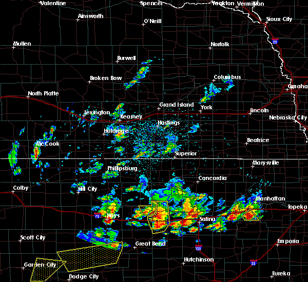 At 854 pm cdt, a severe thunderstorm was located near sylvan grove, or 10 miles north of wilson, moving north at 30 mph (radar indicated). Hazards include 60 mph wind gusts and half dollar size hail. Hail damage to vehicles is expected. expect wind damage to roofs, siding, and trees. Locations impacted include, lucas, luray and wilson lake. At 854 pm cdt, a severe thunderstorm was located near sylvan grove, or 10 miles north of wilson, moving north at 30 mph (radar indicated). Hazards include 60 mph wind gusts and half dollar size hail. Hail damage to vehicles is expected. expect wind damage to roofs, siding, and trees. Locations impacted include, lucas, luray and wilson lake.
|
| 5/24/2020 8:26 PM CDT |
 At 825 pm cdt, a severe thunderstorm was located near lucas, or 12 miles north of wilson, moving north at 15 mph (radar indicated). Hazards include 60 mph wind gusts and half dollar size hail. Hail damage to vehicles is expected. Expect wind damage to roofs, siding, and trees. At 825 pm cdt, a severe thunderstorm was located near lucas, or 12 miles north of wilson, moving north at 15 mph (radar indicated). Hazards include 60 mph wind gusts and half dollar size hail. Hail damage to vehicles is expected. Expect wind damage to roofs, siding, and trees.
|
| 5/24/2020 7:57 PM CDT |
 The severe thunderstorm warning for northeastern russell county will expire at 800 pm cdt, the storm which prompted the warning has weakened below severe limits, and no longer poses an immediate threat to life or property. therefore, the warning will be allowed to expire. a severe thunderstorm watch remains in effect until midnight cdt for central kansas. The severe thunderstorm warning for northeastern russell county will expire at 800 pm cdt, the storm which prompted the warning has weakened below severe limits, and no longer poses an immediate threat to life or property. therefore, the warning will be allowed to expire. a severe thunderstorm watch remains in effect until midnight cdt for central kansas.
|
| 5/24/2020 7:48 PM CDT |
 At 748 pm cdt, a severe thunderstorm was located near lucas, or 18 miles north of wilson, moving northeast at 50 mph (radar indicated). Hazards include 60 mph wind gusts and quarter size hail. Hail damage to vehicles is expected. expect wind damage to roofs, siding, and trees. Locations impacted include, lucas, luray, dorrance, bunker hill, wilson lake and wilson state park. At 748 pm cdt, a severe thunderstorm was located near lucas, or 18 miles north of wilson, moving northeast at 50 mph (radar indicated). Hazards include 60 mph wind gusts and quarter size hail. Hail damage to vehicles is expected. expect wind damage to roofs, siding, and trees. Locations impacted include, lucas, luray, dorrance, bunker hill, wilson lake and wilson state park.
|
| 5/24/2020 7:22 PM CDT |
 At 721 pm cdt, a severe thunderstorm was located near russell, moving northeast at 25 mph (radar indicated). Hazards include 60 mph wind gusts and half dollar size hail. Hail damage to vehicles is expected. expect wind damage to roofs, siding, and trees. Locations impacted include, lucas, sylvan grove, luray, dorrance, bunker hill, wilson state park and wilson lake. At 721 pm cdt, a severe thunderstorm was located near russell, moving northeast at 25 mph (radar indicated). Hazards include 60 mph wind gusts and half dollar size hail. Hail damage to vehicles is expected. expect wind damage to roofs, siding, and trees. Locations impacted include, lucas, sylvan grove, luray, dorrance, bunker hill, wilson state park and wilson lake.
|
| 5/24/2020 6:57 PM CDT |
 At 657 pm cdt, a severe thunderstorm was located near wilson, moving northeast at 20 mph (radar indicated). Hazards include 60 mph wind gusts and half dollar size hail. Hail damage to vehicles is expected. Expect wind damage to roofs, siding, and trees. At 657 pm cdt, a severe thunderstorm was located near wilson, moving northeast at 20 mph (radar indicated). Hazards include 60 mph wind gusts and half dollar size hail. Hail damage to vehicles is expected. Expect wind damage to roofs, siding, and trees.
|
| 5/4/2020 6:39 AM CDT |
 At 623 am cdt, a severe thunderstorm was located 9 miles southwest of dorrance, or 10 miles southeast of russell, moving northeast at 35 mph (radar indicated). Hazards include quarter size hail. damage to vehicles is expected At 623 am cdt, a severe thunderstorm was located 9 miles southwest of dorrance, or 10 miles southeast of russell, moving northeast at 35 mph (radar indicated). Hazards include quarter size hail. damage to vehicles is expected
|
| 5/4/2020 6:24 AM CDT |
 At 623 am cdt, a severe thunderstorm was located 9 miles southwest of dorrance, or 10 miles southeast of russell, moving northeast at 35 mph (radar indicated). Hazards include quarter size hail. damage to vehicles is expected At 623 am cdt, a severe thunderstorm was located 9 miles southwest of dorrance, or 10 miles southeast of russell, moving northeast at 35 mph (radar indicated). Hazards include quarter size hail. damage to vehicles is expected
|
| 9/21/2019 8:58 PM CDT |
 At 857 pm cdt, a severe thunderstorm was located near dorrance, or near wilson, moving northeast at 40 mph (radar indicated). Hazards include 60 mph wind gusts and nickel size hail. Expect damage to roofs, siding, and trees. Locations impacted include, lucas, luray, dorrance, wilson lake and wilson state park. At 857 pm cdt, a severe thunderstorm was located near dorrance, or near wilson, moving northeast at 40 mph (radar indicated). Hazards include 60 mph wind gusts and nickel size hail. Expect damage to roofs, siding, and trees. Locations impacted include, lucas, luray, dorrance, wilson lake and wilson state park.
|
| 9/21/2019 8:33 PM CDT |
 At 830 pm cdt, a severe thunderstorm was located near russell, moving east at 35 mph. russell municipal airport recorded an observed 75mph wind gust at 827 pm cdt (radar indicated). Hazards include 70 mph wind gusts and quarter size hail. Hail damage to vehicles is expected. expect considerable tree damage. wind damage is also likely to mobile homes, roofs, and outbuildings. Locations impacted include, russell, lucas, gorham, luray, dorrance, milberger, bunker hill, paradise, galatia, susank, waldo, russell airport, wilson state park and wilson lake. At 830 pm cdt, a severe thunderstorm was located near russell, moving east at 35 mph. russell municipal airport recorded an observed 75mph wind gust at 827 pm cdt (radar indicated). Hazards include 70 mph wind gusts and quarter size hail. Hail damage to vehicles is expected. expect considerable tree damage. wind damage is also likely to mobile homes, roofs, and outbuildings. Locations impacted include, russell, lucas, gorham, luray, dorrance, milberger, bunker hill, paradise, galatia, susank, waldo, russell airport, wilson state park and wilson lake.
|
| 9/21/2019 7:50 PM CDT |
 At 750 pm cdt, a severe thunderstorm was located near walker, moving northeast at 20 mph (radar indicated). Hazards include 60 mph wind gusts and quarter size hail. Hail damage to vehicles is expected. Expect wind damage to roofs, siding, and trees. At 750 pm cdt, a severe thunderstorm was located near walker, moving northeast at 20 mph (radar indicated). Hazards include 60 mph wind gusts and quarter size hail. Hail damage to vehicles is expected. Expect wind damage to roofs, siding, and trees.
|
| 8/29/2019 10:24 PM CDT |
 At 1023 pm cdt, severe thunderstorms were located along a line extending from 7 miles south of hunter to near wilson to near olmitz, moving southeast at 40 mph (radar indicated). Hazards include 70 mph wind gusts and quarter size hail. Hail damage to vehicles is expected. expect considerable tree damage. wind damage is also likely to mobile homes, roofs, and outbuildings. Locations impacted include, great bend, russell, ellsworth, hoisington, ellinwood, wilson, claflin, lincoln, holyrood, lucas, gorham, sylvan grove, pawnee rock, luray, dorrance, albert, beverly, olmitz, barnard and milberger. At 1023 pm cdt, severe thunderstorms were located along a line extending from 7 miles south of hunter to near wilson to near olmitz, moving southeast at 40 mph (radar indicated). Hazards include 70 mph wind gusts and quarter size hail. Hail damage to vehicles is expected. expect considerable tree damage. wind damage is also likely to mobile homes, roofs, and outbuildings. Locations impacted include, great bend, russell, ellsworth, hoisington, ellinwood, wilson, claflin, lincoln, holyrood, lucas, gorham, sylvan grove, pawnee rock, luray, dorrance, albert, beverly, olmitz, barnard and milberger.
|
| 8/29/2019 10:14 PM CDT | Report from mping: 1-inch tree limbs broken; shingles blown of in russell county KS, 0.3 miles WSW of Lucas, KS |
| 8/29/2019 9:37 PM CDT |
 At 936 pm cdt, severe thunderstorms were located along a line extending from near natoma to near hays, moving southeast at 40 mph (radar indicated). Hazards include 70 mph wind gusts and quarter size hail. Hail damage to vehicles is expected. expect considerable tree damage. Wind damage is also likely to mobile homes, roofs, and outbuildings. At 936 pm cdt, severe thunderstorms were located along a line extending from near natoma to near hays, moving southeast at 40 mph (radar indicated). Hazards include 70 mph wind gusts and quarter size hail. Hail damage to vehicles is expected. expect considerable tree damage. Wind damage is also likely to mobile homes, roofs, and outbuildings.
|
| 8/24/2019 11:49 PM CDT |
 At 1149 pm cdt, severe thunderstorms were located along a line extending from near lucas to 7 miles southwest of dorrance to near loretta, moving southeast at 40 mph (radar indicated). Hazards include 70 mph wind gusts and nickel size hail. Expect considerable tree damage. damage is likely to mobile homes, roofs, and outbuildings. Locations impacted include, russell, lucas, gorham, sylvan grove, luray, dorrance, olmitz, milberger, bunker hill, paradise, galatia, susank, waldo, russell airport, wilson state park and wilson lake. At 1149 pm cdt, severe thunderstorms were located along a line extending from near lucas to 7 miles southwest of dorrance to near loretta, moving southeast at 40 mph (radar indicated). Hazards include 70 mph wind gusts and nickel size hail. Expect considerable tree damage. damage is likely to mobile homes, roofs, and outbuildings. Locations impacted include, russell, lucas, gorham, sylvan grove, luray, dorrance, olmitz, milberger, bunker hill, paradise, galatia, susank, waldo, russell airport, wilson state park and wilson lake.
|
| 8/24/2019 11:35 PM CDT |
 At 1135 pm cdt, severe thunderstorms were located along a line extending from 8 miles northeast of luray to near russell to near schoenchen, moving southeast at 40 mph (radar indicated). Hazards include 70 mph wind gusts and nickel size hail. Expect considerable tree damage. damage is likely to mobile homes, roofs, and outbuildings. Locations impacted include, russell, lucas, gorham, sylvan grove, luray, dorrance, olmitz, milberger, bunker hill, paradise, galatia, susank, waldo, russell airport, wilson state park and wilson lake. At 1135 pm cdt, severe thunderstorms were located along a line extending from 8 miles northeast of luray to near russell to near schoenchen, moving southeast at 40 mph (radar indicated). Hazards include 70 mph wind gusts and nickel size hail. Expect considerable tree damage. damage is likely to mobile homes, roofs, and outbuildings. Locations impacted include, russell, lucas, gorham, sylvan grove, luray, dorrance, olmitz, milberger, bunker hill, paradise, galatia, susank, waldo, russell airport, wilson state park and wilson lake.
|
| 8/24/2019 11:11 PM CDT |
 At 1110 pm cdt, severe thunderstorms were located along a line extending from 7 miles south of osborne to 6 miles southeast of natoma to near hays, moving southeast at 35 mph (radar indicated). Hazards include 70 mph wind gusts and quarter size hail. Hail damage to vehicles is expected. expect considerable tree damage. Wind damage is also likely to mobile homes, roofs, and outbuildings. At 1110 pm cdt, severe thunderstorms were located along a line extending from 7 miles south of osborne to 6 miles southeast of natoma to near hays, moving southeast at 35 mph (radar indicated). Hazards include 70 mph wind gusts and quarter size hail. Hail damage to vehicles is expected. expect considerable tree damage. Wind damage is also likely to mobile homes, roofs, and outbuildings.
|
| 8/24/2019 7:52 PM CDT |
 The severe thunderstorm warning for northeastern russell county will expire at 800 pm cdt, the storm which prompted the warning has weakened below severe limits, and no longer poses an immediate threat to life or property. therefore, the warning will be allowed to expire. however gusty winds are still possible with this thunderstorm. a tornado watch remains in effect until midnight cdt for central kansas. The severe thunderstorm warning for northeastern russell county will expire at 800 pm cdt, the storm which prompted the warning has weakened below severe limits, and no longer poses an immediate threat to life or property. therefore, the warning will be allowed to expire. however gusty winds are still possible with this thunderstorm. a tornado watch remains in effect until midnight cdt for central kansas.
|
| 8/24/2019 7:39 PM CDT |
 At 738 pm cdt, a severe thunderstorm was located 5 miles southwest of lucas, or 15 miles northeast of russell, moving east at 25 mph (radar indicated). Hazards include 60 mph wind gusts and quarter size hail. Hail damage to vehicles is expected. expect wind damage to roofs, siding, and trees. Locations impacted include, lucas, wilson lake and wilson state park. At 738 pm cdt, a severe thunderstorm was located 5 miles southwest of lucas, or 15 miles northeast of russell, moving east at 25 mph (radar indicated). Hazards include 60 mph wind gusts and quarter size hail. Hail damage to vehicles is expected. expect wind damage to roofs, siding, and trees. Locations impacted include, lucas, wilson lake and wilson state park.
|
| 8/24/2019 7:27 PM CDT |
 At 726 pm cdt, a severe thunderstorm was located 6 miles south of luray, or 11 miles northeast of russell, moving east at 25 mph (radar indicated). Hazards include 60 mph wind gusts and quarter size hail. Hail damage to vehicles is expected. Expect wind damage to roofs, siding, and trees. At 726 pm cdt, a severe thunderstorm was located 6 miles south of luray, or 11 miles northeast of russell, moving east at 25 mph (radar indicated). Hazards include 60 mph wind gusts and quarter size hail. Hail damage to vehicles is expected. Expect wind damage to roofs, siding, and trees.
|
| 8/18/2019 12:05 AM CDT |
 The severe thunderstorm warning for russell county will expire at 1215 am cdt. the storm which prompted the warning has weakened below severe limits, and no longer poses an immediate threat to life or property. therefore, the warning will be allowed to expire. however gusty winds and heavy rain are still possible with this thunderstorm. A The severe thunderstorm warning for russell county will expire at 1215 am cdt. the storm which prompted the warning has weakened below severe limits, and no longer poses an immediate threat to life or property. therefore, the warning will be allowed to expire. however gusty winds and heavy rain are still possible with this thunderstorm. A
|
| 8/17/2019 11:14 PM CDT |
 The national weather service in wichita has issued a * severe thunderstorm warning for. russell county in central kansas. until 1215 am cdt. At 1114 pm cdt, a severe thunderstorm was located over russell, moving east at 30 mph. The national weather service in wichita has issued a * severe thunderstorm warning for. russell county in central kansas. until 1215 am cdt. At 1114 pm cdt, a severe thunderstorm was located over russell, moving east at 30 mph.
|
| 8/17/2019 10:01 PM CDT |
 At 1001 pm cdt, a severe thunderstorm was located near wilson, moving southeast at 45 mph (radar indicated). Hazards include 70 mph wind gusts and quarter size hail. Hail damage to vehicles is expected. expect considerable tree damage. wind damage is also likely to mobile homes, roofs, and outbuildings. Locations impacted include, wilson, claflin, lucas, luray, dorrance, bunker hill, galatia, susank, waldo, wilson state park, wilson lake, odin and cheyenne bottoms. At 1001 pm cdt, a severe thunderstorm was located near wilson, moving southeast at 45 mph (radar indicated). Hazards include 70 mph wind gusts and quarter size hail. Hail damage to vehicles is expected. expect considerable tree damage. wind damage is also likely to mobile homes, roofs, and outbuildings. Locations impacted include, wilson, claflin, lucas, luray, dorrance, bunker hill, galatia, susank, waldo, wilson state park, wilson lake, odin and cheyenne bottoms.
|
| 8/17/2019 9:49 PM CDT |
 At 949 pm cdt, a severe thunderstorm was located near dorrance, or 10 miles east of russell, moving east at 45 mph. this is a very dangerous storm (radar indicated). Hazards include 80 mph wind gusts and quarter size hail. Flying debris will be dangerous to those caught without shelter. mobile homes will be heavily damaged. expect considerable damage to roofs, windows, and vehicles. extensive tree damage and power outages are likely. Locations impacted include, russell, wilson, claflin, lucas, gorham, luray, dorrance, milberger, bunker hill, paradise, galatia, susank, waldo, russell airport, wilson state park, wilson lake, odin and cheyenne bottoms. At 949 pm cdt, a severe thunderstorm was located near dorrance, or 10 miles east of russell, moving east at 45 mph. this is a very dangerous storm (radar indicated). Hazards include 80 mph wind gusts and quarter size hail. Flying debris will be dangerous to those caught without shelter. mobile homes will be heavily damaged. expect considerable damage to roofs, windows, and vehicles. extensive tree damage and power outages are likely. Locations impacted include, russell, wilson, claflin, lucas, gorham, luray, dorrance, milberger, bunker hill, paradise, galatia, susank, waldo, russell airport, wilson state park, wilson lake, odin and cheyenne bottoms.
|
| 8/17/2019 9:35 PM CDT |
 At 934 pm cdt, a severe thunderstorm was located over russell, moving east at 45 mph. this is a very dangerous storm (radar indicated). Hazards include 80 mph wind gusts and half dollar size hail. Flying debris will be dangerous to those caught without shelter. mobile homes will be heavily damaged. expect considerable damage to roofs, windows, and vehicles. extensive tree damage and power outages are likely. Locations impacted include, russell, hoisington, wilson, claflin, lucas, gorham, luray, dorrance, milberger, bunker hill, paradise, galatia, susank, waldo, russell airport, cheyenne bottoms, wilson state park, wilson lake and odin. At 934 pm cdt, a severe thunderstorm was located over russell, moving east at 45 mph. this is a very dangerous storm (radar indicated). Hazards include 80 mph wind gusts and half dollar size hail. Flying debris will be dangerous to those caught without shelter. mobile homes will be heavily damaged. expect considerable damage to roofs, windows, and vehicles. extensive tree damage and power outages are likely. Locations impacted include, russell, hoisington, wilson, claflin, lucas, gorham, luray, dorrance, milberger, bunker hill, paradise, galatia, susank, waldo, russell airport, cheyenne bottoms, wilson state park, wilson lake and odin.
|
| 8/17/2019 9:18 PM CDT |
 At 917 pm cdt, a severe thunderstorm was located over emmeram, moving east at 45 mph (radar indicated). Hazards include 70 mph wind gusts and half dollar size hail. Hail damage to vehicles is expected. expect considerable tree damage. wind damage is also likely to mobile homes, roofs, and outbuildings. Locations impacted include, russell, hoisington, wilson, claflin, lucas, gorham, luray, dorrance, milberger, bunker hill, paradise, galatia, susank, waldo, russell airport, cheyenne bottoms, wilson state park, wilson lake and odin. At 917 pm cdt, a severe thunderstorm was located over emmeram, moving east at 45 mph (radar indicated). Hazards include 70 mph wind gusts and half dollar size hail. Hail damage to vehicles is expected. expect considerable tree damage. wind damage is also likely to mobile homes, roofs, and outbuildings. Locations impacted include, russell, hoisington, wilson, claflin, lucas, gorham, luray, dorrance, milberger, bunker hill, paradise, galatia, susank, waldo, russell airport, cheyenne bottoms, wilson state park, wilson lake and odin.
|
| 8/17/2019 9:11 PM CDT |
 At 910 pm cdt, a severe thunderstorm was located over catherine, moving east at 45 mph (radar indicated). Hazards include 70 mph wind gusts and half dollar size hail. Hail damage to vehicles is expected. expect considerable tree damage. Wind damage is also likely to mobile homes, roofs, and outbuildings. At 910 pm cdt, a severe thunderstorm was located over catherine, moving east at 45 mph (radar indicated). Hazards include 70 mph wind gusts and half dollar size hail. Hail damage to vehicles is expected. expect considerable tree damage. Wind damage is also likely to mobile homes, roofs, and outbuildings.
|
| 8/17/2019 12:38 AM CDT |
 The severe thunderstorm warning for russell county will expire at 1245 am cdt, the storm which prompted the warning has weakened below severe limits, and no longer poses an immediate threat to life or property. therefore, the warning will be allowed to expire. however small hail, gusty winds and very heavy rain are still occurring with this thunderstorm complex. a severe thunderstorm watch remains in effect until 700 am cdt for central kansas. The severe thunderstorm warning for russell county will expire at 1245 am cdt, the storm which prompted the warning has weakened below severe limits, and no longer poses an immediate threat to life or property. therefore, the warning will be allowed to expire. however small hail, gusty winds and very heavy rain are still occurring with this thunderstorm complex. a severe thunderstorm watch remains in effect until 700 am cdt for central kansas.
|
| 8/16/2019 11:56 PM CDT |
 A severe thunderstorm warning remains in effect until 1245 am cdt for russell county. at 1155 pm cdt, a severe thunderstorm was located 8 miles north of russell, moving east at 30 mph. hazard. 60 mph wind gusts and quarter size hail. source. Radar indicated. A severe thunderstorm warning remains in effect until 1245 am cdt for russell county. at 1155 pm cdt, a severe thunderstorm was located 8 miles north of russell, moving east at 30 mph. hazard. 60 mph wind gusts and quarter size hail. source. Radar indicated.
|
| 8/16/2019 11:44 PM CDT |
 The national weather service in wichita has issued a * severe thunderstorm warning for. russell county in central kansas. until 1245 am cdt. At 1144 pm cdt, a severe thunderstorm was located 6 miles north of gorham, or 7 miles east of emmeram, moving east at 15 mph. The national weather service in wichita has issued a * severe thunderstorm warning for. russell county in central kansas. until 1245 am cdt. At 1144 pm cdt, a severe thunderstorm was located 6 miles north of gorham, or 7 miles east of emmeram, moving east at 15 mph.
|
| 1/1/0001 12:00 AM | Golf Ball sized hail reported 3.3 miles WNW of Lucas, KS |
| 6/14/2019 10:32 PM CDT |
 At 1032 pm cdt, severe thunderstorms were located along a line extending from 8 miles northwest of dorrance to 8 miles north of hoisington to near pawnee rock, moving east at 40 mph (radar indicated). Hazards include 60 mph wind gusts and quarter size hail. Hail damage to vehicles is expected. expect wind damage to roofs, siding, and trees. Locations impacted include, great bend, russell, hoisington, ellinwood, claflin, lucas, pawnee rock, dorrance, albert, olmitz, milberger, bunker hill, galatia, susank, great bend airport, russell airport, cheyenne bottoms, wilson state park, wilson lake and odin. At 1032 pm cdt, severe thunderstorms were located along a line extending from 8 miles northwest of dorrance to 8 miles north of hoisington to near pawnee rock, moving east at 40 mph (radar indicated). Hazards include 60 mph wind gusts and quarter size hail. Hail damage to vehicles is expected. expect wind damage to roofs, siding, and trees. Locations impacted include, great bend, russell, hoisington, ellinwood, claflin, lucas, pawnee rock, dorrance, albert, olmitz, milberger, bunker hill, galatia, susank, great bend airport, russell airport, cheyenne bottoms, wilson state park, wilson lake and odin.
|
| 6/14/2019 10:12 PM CDT |
 At 1012 pm cdt, severe thunderstorms were located along a line extending from 6 miles northeast of emmeram to 5 miles southwest of milberger to 6 miles south of shaffer, moving east at 40 mph (radar indicated). Hazards include 60 mph wind gusts and quarter size hail. Hail damage to vehicles is expected. Expect wind damage to roofs, siding, and trees. At 1012 pm cdt, severe thunderstorms were located along a line extending from 6 miles northeast of emmeram to 5 miles southwest of milberger to 6 miles south of shaffer, moving east at 40 mph (radar indicated). Hazards include 60 mph wind gusts and quarter size hail. Hail damage to vehicles is expected. Expect wind damage to roofs, siding, and trees.
|
| 6/11/2019 7:31 PM CDT |
 At 731 pm cdt, a severe thunderstorm was located near sylvan grove, or 13 miles north of wilson, moving southeast at 30 mph (radar indicated). Hazards include 60 mph wind gusts and quarter size hail. Hail damage to vehicles is expected. expect wind damage to roofs, siding, and trees. Locations impacted include, lincoln, lucas, sylvan grove, westfall, wilson lake and wilson state park. At 731 pm cdt, a severe thunderstorm was located near sylvan grove, or 13 miles north of wilson, moving southeast at 30 mph (radar indicated). Hazards include 60 mph wind gusts and quarter size hail. Hail damage to vehicles is expected. expect wind damage to roofs, siding, and trees. Locations impacted include, lincoln, lucas, sylvan grove, westfall, wilson lake and wilson state park.
|
| 6/11/2019 6:58 PM CDT |
 At 657 pm cdt, a severe thunderstorm was located 7 miles south of osborne, or 30 miles west of beloit, moving southeast at 25 mph (radar indicated). Hazards include 60 mph wind gusts and half dollar size hail. Hail damage to vehicles is expected. Expect wind damage to roofs, siding, and trees. At 657 pm cdt, a severe thunderstorm was located 7 miles south of osborne, or 30 miles west of beloit, moving southeast at 25 mph (radar indicated). Hazards include 60 mph wind gusts and half dollar size hail. Hail damage to vehicles is expected. Expect wind damage to roofs, siding, and trees.
|
| 5/27/2019 12:19 AM CDT |
 At 1219 am cdt, severe thunderstorms were located along a line extending from 5 miles northeast of milberger to 8 miles southwest of raymond to near cairo, moving northeast at 60 mph (radar indicated). Hazards include 70 mph wind gusts and nickel size hail. Expect considerable tree damage. damage is likely to mobile homes, roofs, and outbuildings. Locations impacted include, hutchinson, great bend, russell, lyons, ellsworth, hoisington, south hutchinson, sterling, ellinwood, inman, buhler, haven, nickerson, wilson, pretty prairie, claflin, kanopolis, little river, chase and arlington. At 1219 am cdt, severe thunderstorms were located along a line extending from 5 miles northeast of milberger to 8 miles southwest of raymond to near cairo, moving northeast at 60 mph (radar indicated). Hazards include 70 mph wind gusts and nickel size hail. Expect considerable tree damage. damage is likely to mobile homes, roofs, and outbuildings. Locations impacted include, hutchinson, great bend, russell, lyons, ellsworth, hoisington, south hutchinson, sterling, ellinwood, inman, buhler, haven, nickerson, wilson, pretty prairie, claflin, kanopolis, little river, chase and arlington.
|
| 5/26/2019 11:40 PM CDT |
 At 1139 pm cdt, severe thunderstorms were located along a line extending from near nekoma to near lewis to near wilmore, moving northeast at 60 mph (radar indicated). Hazards include 70 mph wind gusts and quarter size hail. Hail damage to vehicles is expected. expect considerable tree damage. Wind damage is also likely to mobile homes, roofs, and outbuildings. At 1139 pm cdt, severe thunderstorms were located along a line extending from near nekoma to near lewis to near wilmore, moving northeast at 60 mph (radar indicated). Hazards include 70 mph wind gusts and quarter size hail. Hail damage to vehicles is expected. expect considerable tree damage. Wind damage is also likely to mobile homes, roofs, and outbuildings.
|
| 5/24/2019 2:11 AM CDT |
 The severe thunderstorm warning for russell and northern barton counties will expire at 215 am cdt, the storm which prompted the warning has moved out of the area. therefore, the warning will be allowed to expire. we continue to monitor additional strong storms moving northeast into barton county. be prepared to take shelter in the event these storm intensify and become severe. a tornado watch remains in effect until 800 am cdt for central kansas. The severe thunderstorm warning for russell and northern barton counties will expire at 215 am cdt, the storm which prompted the warning has moved out of the area. therefore, the warning will be allowed to expire. we continue to monitor additional strong storms moving northeast into barton county. be prepared to take shelter in the event these storm intensify and become severe. a tornado watch remains in effect until 800 am cdt for central kansas.
|
| 5/24/2019 1:30 AM CDT |
 At 129 am cdt, a severe thunderstorm was located near milberger, or 11 miles south of russell, moving northeast at 60 mph (radar indicated). Hazards include 70 mph wind gusts and half dollar size hail. Hail damage to vehicles is expected. expect considerable tree damage. wind damage is also likely to mobile homes, roofs, and outbuildings. Locations impacted include, russell, hoisington, lucas, gorham, luray, dorrance, albert, olmitz, milberger, bunker hill, paradise, galatia, susank, waldo, russell airport, wilson state park, wilson lake and odin. At 129 am cdt, a severe thunderstorm was located near milberger, or 11 miles south of russell, moving northeast at 60 mph (radar indicated). Hazards include 70 mph wind gusts and half dollar size hail. Hail damage to vehicles is expected. expect considerable tree damage. wind damage is also likely to mobile homes, roofs, and outbuildings. Locations impacted include, russell, hoisington, lucas, gorham, luray, dorrance, albert, olmitz, milberger, bunker hill, paradise, galatia, susank, waldo, russell airport, wilson state park, wilson lake and odin.
|
| 5/24/2019 1:17 AM CDT |
 At 117 am cdt, a severe thunderstorm was located near loretta, moving northeast at 45 mph (radar indicated). Hazards include 70 mph wind gusts and ping pong ball size hail. People and animals outdoors will be injured. expect hail damage to roofs, siding, windows, and vehicles. expect considerable tree damage. Wind damage is also likely to mobile homes, roofs, and outbuildings. At 117 am cdt, a severe thunderstorm was located near loretta, moving northeast at 45 mph (radar indicated). Hazards include 70 mph wind gusts and ping pong ball size hail. People and animals outdoors will be injured. expect hail damage to roofs, siding, windows, and vehicles. expect considerable tree damage. Wind damage is also likely to mobile homes, roofs, and outbuildings.
|
| 5/21/2019 5:46 PM CDT |
 A severe thunderstorm warning remains in effect until 645 pm cdt for central russell county. at 546 pm cdt, a severe thunderstorm was located near russell, moving north to northeast at 30 mph. hazard. 60 mph wind gusts and quarter size hail. source. Radar indicated. A severe thunderstorm warning remains in effect until 645 pm cdt for central russell county. at 546 pm cdt, a severe thunderstorm was located near russell, moving north to northeast at 30 mph. hazard. 60 mph wind gusts and quarter size hail. source. Radar indicated.
|
| 5/21/2019 12:46 PM CDT |
 A severe thunderstorm warning remains in effect until 645 pm cdt for central russell county. at 546 pm cdt, a severe thunderstorm was located near russell, moving north to northeast at 30 mph. hazard. 60 mph wind gusts and quarter size hail. source. Radar indicated. A severe thunderstorm warning remains in effect until 645 pm cdt for central russell county. at 546 pm cdt, a severe thunderstorm was located near russell, moving north to northeast at 30 mph. hazard. 60 mph wind gusts and quarter size hail. source. Radar indicated.
|
| 5/17/2019 10:32 PM CDT |
 The national weather service in wichita has issued a * severe thunderstorm warning for. lincoln county in central kansas. northwestern ellsworth county in central kansas. eastern russell county in central kansas. Until 1130 pm cdt. The national weather service in wichita has issued a * severe thunderstorm warning for. lincoln county in central kansas. northwestern ellsworth county in central kansas. eastern russell county in central kansas. Until 1130 pm cdt.
|
| 5/17/2019 10:24 PM CDT |
 At 1024 pm cdt, severe thunderstorms were located along a line extending from near lucas to near dorrance to 6 miles southwest of wilson, moving northeast at 55 mph (radar indicated). Hazards include 70 mph wind gusts and penny size hail. Expect considerable tree damage. damage is likely to mobile homes, roofs, and outbuildings. Locations impacted include, russell, lucas, luray, dorrance, bunker hill, wilson state park, wilson lake and russell airport. At 1024 pm cdt, severe thunderstorms were located along a line extending from near lucas to near dorrance to 6 miles southwest of wilson, moving northeast at 55 mph (radar indicated). Hazards include 70 mph wind gusts and penny size hail. Expect considerable tree damage. damage is likely to mobile homes, roofs, and outbuildings. Locations impacted include, russell, lucas, luray, dorrance, bunker hill, wilson state park, wilson lake and russell airport.
|
| 5/17/2019 10:06 PM CDT |
 At 1005 pm cdt, a severe thunderstorm capable of producing a tornado was located near russell, moving northeast at 50 mph (radar indicated rotation). Hazards include tornado. Flying debris will be dangerous to those caught without shelter. mobile homes will be damaged or destroyed. damage to roofs, windows, and vehicles will occur. tree damage is likely. Locations impacted include, russell, lucas, gorham, luray, dorrance, bunker hill, wilson state park, wilson lake and russell airport. At 1005 pm cdt, a severe thunderstorm capable of producing a tornado was located near russell, moving northeast at 50 mph (radar indicated rotation). Hazards include tornado. Flying debris will be dangerous to those caught without shelter. mobile homes will be damaged or destroyed. damage to roofs, windows, and vehicles will occur. tree damage is likely. Locations impacted include, russell, lucas, gorham, luray, dorrance, bunker hill, wilson state park, wilson lake and russell airport.
|
| 5/17/2019 9:56 PM CDT |
 At 955 pm cdt, a severe thunderstorm capable of producing a tornado was located near gorham, or near walker, moving northeast at 50 mph (radar indicated rotation). Hazards include tornado. Flying debris will be dangerous to those caught without shelter. mobile homes will be damaged or destroyed. damage to roofs, windows, and vehicles will occur. Tree damage is likely. At 955 pm cdt, a severe thunderstorm capable of producing a tornado was located near gorham, or near walker, moving northeast at 50 mph (radar indicated rotation). Hazards include tornado. Flying debris will be dangerous to those caught without shelter. mobile homes will be damaged or destroyed. damage to roofs, windows, and vehicles will occur. Tree damage is likely.
|
| 5/17/2019 9:49 PM CDT |
 The national weather service in wichita has issued a * severe thunderstorm warning for. russell county in central kansas. northern barton county in central kansas. until 1045 pm cdt. At 948 pm cdt, severe thunderstorms were located along a line. The national weather service in wichita has issued a * severe thunderstorm warning for. russell county in central kansas. northern barton county in central kansas. until 1045 pm cdt. At 948 pm cdt, severe thunderstorms were located along a line.
|
| 4/21/2019 8:18 PM CDT |
 At 815 pm cdt, severe thunderstorms were located along a line extending from 9 miles northwest of luray to 5 miles north of otis, moving northeast at 30 mph (radar indicated). Hazards include 60 mph wind gusts and nickel size hail. Expect damage to roofs, siding, and trees. Locations impacted include, russell, hoisington, lucas, gorham, luray, dorrance, olmitz, milberger, bunker hill, paradise, galatia, susank, waldo, russell airport, wilson lake, odin and wilson state park. At 815 pm cdt, severe thunderstorms were located along a line extending from 9 miles northwest of luray to 5 miles north of otis, moving northeast at 30 mph (radar indicated). Hazards include 60 mph wind gusts and nickel size hail. Expect damage to roofs, siding, and trees. Locations impacted include, russell, hoisington, lucas, gorham, luray, dorrance, olmitz, milberger, bunker hill, paradise, galatia, susank, waldo, russell airport, wilson lake, odin and wilson state park.
|
| 4/21/2019 7:55 PM CDT |
 At 754 pm cdt, severe thunderstorms were located along a line extending from near natoma to near bison, moving northeast at 30 mph (radar indicated). Hazards include 60 mph wind gusts and nickel size hail. expect damage to roofs, siding, and trees At 754 pm cdt, severe thunderstorms were located along a line extending from near natoma to near bison, moving northeast at 30 mph (radar indicated). Hazards include 60 mph wind gusts and nickel size hail. expect damage to roofs, siding, and trees
|
| 9/20/2018 6:28 PM CDT |
 At 628 pm cdt, severe thunderstorms were located along a line extending from 5 miles northeast of luray to 6 miles northwest of claflin, moving east at 45 mph (radar indicated). Hazards include 60 mph wind gusts. Expect damage to roofs, siding, and trees. Locations impacted include, russell, hoisington, wilson, lucas, gorham, luray, dorrance, albert, olmitz, milberger, bunker hill, paradise, galatia, susank, waldo, russell airport, wilson state park, wilson lake and odin. At 628 pm cdt, severe thunderstorms were located along a line extending from 5 miles northeast of luray to 6 miles northwest of claflin, moving east at 45 mph (radar indicated). Hazards include 60 mph wind gusts. Expect damage to roofs, siding, and trees. Locations impacted include, russell, hoisington, wilson, lucas, gorham, luray, dorrance, albert, olmitz, milberger, bunker hill, paradise, galatia, susank, waldo, russell airport, wilson state park, wilson lake and odin.
|
| 9/20/2018 6:09 PM CDT |
 At 608 pm cdt, severe thunderstorms were located along a line extending from 7 miles south of natoma to near olmitz, moving northeast at 50 mph (radar indicated). Hazards include 60 mph wind gusts. expect damage to roofs, siding, and trees At 608 pm cdt, severe thunderstorms were located along a line extending from 7 miles south of natoma to near olmitz, moving northeast at 50 mph (radar indicated). Hazards include 60 mph wind gusts. expect damage to roofs, siding, and trees
|
| 9/1/2018 6:31 PM CDT |
 At 631 pm cdt, a severe thunderstorm was located 7 miles southwest of hunter, or 21 miles northwest of lincoln, moving northeast at 35 mph (radar indicated). Hazards include 70 mph wind gusts and half dollar size hail. Hail damage to vehicles is expected. expect considerable tree damage. Wind damage is also likely to mobile homes, roofs, and outbuildings. At 631 pm cdt, a severe thunderstorm was located 7 miles southwest of hunter, or 21 miles northwest of lincoln, moving northeast at 35 mph (radar indicated). Hazards include 70 mph wind gusts and half dollar size hail. Hail damage to vehicles is expected. expect considerable tree damage. Wind damage is also likely to mobile homes, roofs, and outbuildings.
|
| 9/1/2018 4:52 PM CDT |
 At 452 pm cdt, a severe thunderstorm was located 6 miles west of milberger, or 7 miles northeast of pfeifer, moving northeast at 30 mph (radar indicated). Hazards include 70 mph wind gusts and half dollar size hail. Hail damage to vehicles is expected. expect considerable tree damage. Wind damage is also likely to mobile homes, roofs, and outbuildings. At 452 pm cdt, a severe thunderstorm was located 6 miles west of milberger, or 7 miles northeast of pfeifer, moving northeast at 30 mph (radar indicated). Hazards include 70 mph wind gusts and half dollar size hail. Hail damage to vehicles is expected. expect considerable tree damage. Wind damage is also likely to mobile homes, roofs, and outbuildings.
|
| 8/5/2018 11:38 PM CDT |
 At 1137 pm cdt, a severe thunderstorm was located 6 miles northeast of russell, moving northeast at 55 mph (59 mph wind have been reported at the russell airport). Hazards include 60 mph wind gusts. expect damage to roofs, siding, and trees At 1137 pm cdt, a severe thunderstorm was located 6 miles northeast of russell, moving northeast at 55 mph (59 mph wind have been reported at the russell airport). Hazards include 60 mph wind gusts. expect damage to roofs, siding, and trees
|
| 6/30/2018 11:35 PM CDT |
 At 1133 pm cdt, severe thunderstorms were located along a line extending from luray to near russell to near milberger, moving east at 45 mph (radar indicated). Hazards include 70 mph winds and penny size hail. Expect considerable tree damage. damage is likely to mobile homes, roofs, and outbuildings. Locations impacted include, russell, wilson, lucas, gorham, sylvan grove, luray, dorrance, milberger, bunker hill, paradise, waldo, ash grove, russell airport, wilson state park and wilson lake. At 1133 pm cdt, severe thunderstorms were located along a line extending from luray to near russell to near milberger, moving east at 45 mph (radar indicated). Hazards include 70 mph winds and penny size hail. Expect considerable tree damage. damage is likely to mobile homes, roofs, and outbuildings. Locations impacted include, russell, wilson, lucas, gorham, sylvan grove, luray, dorrance, milberger, bunker hill, paradise, waldo, ash grove, russell airport, wilson state park and wilson lake.
|
| 6/30/2018 11:20 PM CDT |
 At 1118 pm cdt, a severe thunderstorm was located near russell, moving east at 45 mph (radar indicated). Hazards include 70 mph winds. Expect considerable tree damage. damage is likely to mobile homes, roofs, and outbuildings. Locations impacted include, russell, wilson, lucas, gorham, sylvan grove, luray, dorrance, milberger, bunker hill, paradise, waldo, ash grove, russell airport, wilson state park and wilson lake. At 1118 pm cdt, a severe thunderstorm was located near russell, moving east at 45 mph (radar indicated). Hazards include 70 mph winds. Expect considerable tree damage. damage is likely to mobile homes, roofs, and outbuildings. Locations impacted include, russell, wilson, lucas, gorham, sylvan grove, luray, dorrance, milberger, bunker hill, paradise, waldo, ash grove, russell airport, wilson state park and wilson lake.
|
| 6/30/2018 11:11 PM CDT |
 The national weather service in wichita has issued a * severe thunderstorm warning for. western lincoln county in central kansas. northwestern ellsworth county in central kansas. russell county in central kansas. Northeastern barton county in central kansas. The national weather service in wichita has issued a * severe thunderstorm warning for. western lincoln county in central kansas. northwestern ellsworth county in central kansas. russell county in central kansas. Northeastern barton county in central kansas.
|
| 6/26/2018 10:26 AM CDT |
 The severe thunderstorm warning for russell county will expire at 1030 am cdt, the storm which prompted the warning has weakened below severe limits, and no longer poses an immediate threat to life or property. therefore, the warning will be allowed to expire. however heavy rain is still possible with this thunderstorm. The severe thunderstorm warning for russell county will expire at 1030 am cdt, the storm which prompted the warning has weakened below severe limits, and no longer poses an immediate threat to life or property. therefore, the warning will be allowed to expire. however heavy rain is still possible with this thunderstorm.
|
| 6/26/2018 10:04 AM CDT |
 At 1004 am cdt, a severe thunderstorm was located over russell, moving northeast at 25 mph (radar indicated). Hazards include 60 mph wind gusts and penny size hail. Expect damage to roofs, siding, and trees. Locations impacted include, russell, lucas, luray, dorrance, bunker hill, waldo, wilson state park, wilson lake and russell airport. At 1004 am cdt, a severe thunderstorm was located over russell, moving northeast at 25 mph (radar indicated). Hazards include 60 mph wind gusts and penny size hail. Expect damage to roofs, siding, and trees. Locations impacted include, russell, lucas, luray, dorrance, bunker hill, waldo, wilson state park, wilson lake and russell airport.
|
| 6/26/2018 9:36 AM CDT |
 At 935 am cdt, a severe thunderstorm was located near walker, moving northeast at 25 mph (radar indicated). Hazards include 60 mph wind gusts and quarter size hail. Hail damage to vehicles is expected. Expect wind damage to roofs, siding, and trees. At 935 am cdt, a severe thunderstorm was located near walker, moving northeast at 25 mph (radar indicated). Hazards include 60 mph wind gusts and quarter size hail. Hail damage to vehicles is expected. Expect wind damage to roofs, siding, and trees.
|
| 6/19/2018 11:49 PM CDT |
 At 1149 pm cdt, severe thunderstorms were located along a line extending from near dorrance, to near claflin, to near seward, moving east to southeast at 40 mph (radar indicated. the storm has a history of producing damaging winds). Hazards include 60 mph wind gusts. Expect damage to roofs, siding, and trees. Locations impacted include, great bend, russell, hoisington, ellinwood, wilson, claflin, lucas, gorham, pawnee rock, luray, dorrance, albert, olmitz, milberger, bunker hill, paradise, galatia, susank, waldo and great bend airport. At 1149 pm cdt, severe thunderstorms were located along a line extending from near dorrance, to near claflin, to near seward, moving east to southeast at 40 mph (radar indicated. the storm has a history of producing damaging winds). Hazards include 60 mph wind gusts. Expect damage to roofs, siding, and trees. Locations impacted include, great bend, russell, hoisington, ellinwood, wilson, claflin, lucas, gorham, pawnee rock, luray, dorrance, albert, olmitz, milberger, bunker hill, paradise, galatia, susank, waldo and great bend airport.
|
| 6/19/2018 11:23 PM CDT |
 At 1122 pm cdt, severe thunderstorms were located along a line extending from near gorham, to near olmitz, to near pawnee rock, moving east to southeast at 40 mph (radar indicated. this storm has a history of producing damaging winds). Hazards include 60 mph wind gusts and penny size hail. Expect damage to roofs, siding, and trees. Locations impacted include, great bend, russell, hoisington, ellinwood, wilson, claflin, lucas, gorham, pawnee rock, luray, dorrance, albert, olmitz, milberger, bunker hill, paradise, galatia, susank, waldo and great bend airport. At 1122 pm cdt, severe thunderstorms were located along a line extending from near gorham, to near olmitz, to near pawnee rock, moving east to southeast at 40 mph (radar indicated. this storm has a history of producing damaging winds). Hazards include 60 mph wind gusts and penny size hail. Expect damage to roofs, siding, and trees. Locations impacted include, great bend, russell, hoisington, ellinwood, wilson, claflin, lucas, gorham, pawnee rock, luray, dorrance, albert, olmitz, milberger, bunker hill, paradise, galatia, susank, waldo and great bend airport.
|
| 6/19/2018 11:01 PM CDT |
 At 1059 pm cdt, severe thunderstorms were located along a line extending from 6 miles north of emmeram, to near loretta, to near ash valley, moving east at 40 mph (radar indicated. this storm has a history of producing damaging winds). Hazards include 60 mph wind gusts. expect damage to roofs, siding, and trees At 1059 pm cdt, severe thunderstorms were located along a line extending from 6 miles north of emmeram, to near loretta, to near ash valley, moving east at 40 mph (radar indicated. this storm has a history of producing damaging winds). Hazards include 60 mph wind gusts. expect damage to roofs, siding, and trees
|
| 5/29/2018 7:38 PM CDT |
 The national weather service in wichita has issued a * severe thunderstorm warning for. northern russell county in central kansas. Until 845 pm cdt * at 738 pm cdt, a severe thunderstorm was located 9 miles southeast of natoma, or 12 miles northeast of emmeram, moving east at 60 mph. The national weather service in wichita has issued a * severe thunderstorm warning for. northern russell county in central kansas. Until 845 pm cdt * at 738 pm cdt, a severe thunderstorm was located 9 miles southeast of natoma, or 12 miles northeast of emmeram, moving east at 60 mph.
|
| 5/28/2018 10:10 PM CDT |
 The severe thunderstorm warning for russell and barton counties will expire at 1015 pm cdt, the storm which prompted the warning has weakened below severe limits, and no longer poses an immediate threat to life or property. therefore the warning will be allowed to expire. however gusty winds are still possible with this thunderstorm. The severe thunderstorm warning for russell and barton counties will expire at 1015 pm cdt, the storm which prompted the warning has weakened below severe limits, and no longer poses an immediate threat to life or property. therefore the warning will be allowed to expire. however gusty winds are still possible with this thunderstorm.
|
| 5/28/2018 9:11 PM CDT |
 At 910 pm cdt, a severe thunderstorm was located near bison, moving northeast at 40 mph (radar indicated). Hazards include 60 mph wind gusts and penny size hail. expect damage to roofs, siding, and trees At 910 pm cdt, a severe thunderstorm was located near bison, moving northeast at 40 mph (radar indicated). Hazards include 60 mph wind gusts and penny size hail. expect damage to roofs, siding, and trees
|
| 5/13/2018 10:56 PM CDT |
 The severe thunderstorm warning for west central lincoln and russell counties will expire at 1100 pm cdt, the storm which prompted the warning has weakened below severe limits, and no longer poses an immediate threat to life or property. therefore the warning will be allowed to expire. however small hail and gusty winds are still possible with this thunderstorm as it moves across eastern russell and southwest lincoln counties. The severe thunderstorm warning for west central lincoln and russell counties will expire at 1100 pm cdt, the storm which prompted the warning has weakened below severe limits, and no longer poses an immediate threat to life or property. therefore the warning will be allowed to expire. however small hail and gusty winds are still possible with this thunderstorm as it moves across eastern russell and southwest lincoln counties.
|
| 5/13/2018 10:26 PM CDT |
 At 1026 pm cdt, a severe thunderstorm was located 9 miles northwest of dorrance, or 10 miles northeast of russell, moving north at 20 mph (radar indicated). Hazards include 60 mph wind gusts and half dollar size hail. Hail damage to vehicles is expected. expect wind damage to roofs, siding, and trees. Locations impacted include, russell, lucas, gorham, sylvan grove, luray, dorrance, bunker hill, paradise, waldo, wilson state park, wilson lake and russell airport. At 1026 pm cdt, a severe thunderstorm was located 9 miles northwest of dorrance, or 10 miles northeast of russell, moving north at 20 mph (radar indicated). Hazards include 60 mph wind gusts and half dollar size hail. Hail damage to vehicles is expected. expect wind damage to roofs, siding, and trees. Locations impacted include, russell, lucas, gorham, sylvan grove, luray, dorrance, bunker hill, paradise, waldo, wilson state park, wilson lake and russell airport.
|
| 5/13/2018 9:58 PM CDT |
 At 958 pm cdt, a severe thunderstorm was located near milberger, or 10 miles northeast of otis, moving northeast at 40 mph (radar indicated). Hazards include 60 mph wind gusts and half dollar size hail. Hail damage to vehicles is expected. Expect wind damage to roofs, siding, and trees. At 958 pm cdt, a severe thunderstorm was located near milberger, or 10 miles northeast of otis, moving northeast at 40 mph (radar indicated). Hazards include 60 mph wind gusts and half dollar size hail. Hail damage to vehicles is expected. Expect wind damage to roofs, siding, and trees.
|
| 5/1/2018 8:29 PM CDT |
 At 829 pm cdt, a severe thunderstorm capable of producing a tornado was located 6 miles northeast of lucas, or 16 miles west of lincoln, moving east at 45 mph (radar indicated rotation). Hazards include tornado and golf ball size hail. Flying debris will be dangerous to those caught without shelter. mobile homes will be damaged or destroyed. damage to roofs, windows, and vehicles will occur. Tree damage is likely. At 829 pm cdt, a severe thunderstorm capable of producing a tornado was located 6 miles northeast of lucas, or 16 miles west of lincoln, moving east at 45 mph (radar indicated rotation). Hazards include tornado and golf ball size hail. Flying debris will be dangerous to those caught without shelter. mobile homes will be damaged or destroyed. damage to roofs, windows, and vehicles will occur. Tree damage is likely.
|
| 5/1/2018 8:23 PM CDT |
 At 823 pm cdt, a severe thunderstorm was located near lucas, or 19 miles north of wilson, moving east at 45 mph (radar indicated). Hazards include 60 mph wind gusts and half dollar size hail. Hail damage to vehicles is expected. Expect wind damage to roofs, siding, and trees. At 823 pm cdt, a severe thunderstorm was located near lucas, or 19 miles north of wilson, moving east at 45 mph (radar indicated). Hazards include 60 mph wind gusts and half dollar size hail. Hail damage to vehicles is expected. Expect wind damage to roofs, siding, and trees.
|
| 5/1/2018 8:16 PM CDT |
 At 816 pm cdt, severe thunderstorms were located along a line extending from 5 miles southwest of victor to 10 miles southeast of natoma, moving northeast at 20 mph (radar indicated). Hazards include 60 mph wind gusts and quarter size hail. Hail damage to vehicles is expected. expect wind damage to roofs, siding, and trees. locations impacted include, russell, lucas, gorham, sylvan grove, luray, barnard, paradise, waldo, ash grove, russell airport and wilson lake. A tornado watch remains in effect until 1000 pm cdt for central kansas. At 816 pm cdt, severe thunderstorms were located along a line extending from 5 miles southwest of victor to 10 miles southeast of natoma, moving northeast at 20 mph (radar indicated). Hazards include 60 mph wind gusts and quarter size hail. Hail damage to vehicles is expected. expect wind damage to roofs, siding, and trees. locations impacted include, russell, lucas, gorham, sylvan grove, luray, barnard, paradise, waldo, ash grove, russell airport and wilson lake. A tornado watch remains in effect until 1000 pm cdt for central kansas.
|
| 5/1/2018 7:57 PM CDT |
 At 757 pm cdt, severe thunderstorms were scattered along a line extending from 6 miles southeast of hunter to 7 miles southwest of luray, moving east at 45 mph (radar indicated). Hazards include 60 mph wind gusts and quarter size hail. Hail damage to vehicles is expected. expect wind damage to roofs, siding, and trees. locations impacted include, russell, lucas, gorham, sylvan grove, luray, barnard, paradise, waldo, ash grove, russell airport and wilson lake. A tornado watch remains in effect until 1000 pm cdt for central kansas. At 757 pm cdt, severe thunderstorms were scattered along a line extending from 6 miles southeast of hunter to 7 miles southwest of luray, moving east at 45 mph (radar indicated). Hazards include 60 mph wind gusts and quarter size hail. Hail damage to vehicles is expected. expect wind damage to roofs, siding, and trees. locations impacted include, russell, lucas, gorham, sylvan grove, luray, barnard, paradise, waldo, ash grove, russell airport and wilson lake. A tornado watch remains in effect until 1000 pm cdt for central kansas.
|
| 5/1/2018 7:40 PM CDT |
 At 740 pm cdt, severe thunderstorms were scattered along a line extending from just south of victor to 7 miles northeast of gorham, moving northeast at 45 mph (radar indicated). Hazards include 60 mph wind gusts and quarter size hail. Hail damage to vehicles is expected. expect wind damage to roofs, siding, and trees. locations impacted include, russell, lucas, gorham, sylvan grove, luray, barnard, paradise, waldo, ash grove, russell airport and wilson lake. A tornado watch remains in effect until 1000 pm cdt for central kansas. At 740 pm cdt, severe thunderstorms were scattered along a line extending from just south of victor to 7 miles northeast of gorham, moving northeast at 45 mph (radar indicated). Hazards include 60 mph wind gusts and quarter size hail. Hail damage to vehicles is expected. expect wind damage to roofs, siding, and trees. locations impacted include, russell, lucas, gorham, sylvan grove, luray, barnard, paradise, waldo, ash grove, russell airport and wilson lake. A tornado watch remains in effect until 1000 pm cdt for central kansas.
|
| 5/1/2018 7:28 PM CDT |
 At 728 pm cdt, a severe thunderstorm was located near lucas, or 19 miles north of wilson, moving northeast at 55 mph (radar indicated). Hazards include 60 mph wind gusts and quarter size hail. Hail damage to vehicles is expected. Expect wind damage to roofs, siding, and trees. At 728 pm cdt, a severe thunderstorm was located near lucas, or 19 miles north of wilson, moving northeast at 55 mph (radar indicated). Hazards include 60 mph wind gusts and quarter size hail. Hail damage to vehicles is expected. Expect wind damage to roofs, siding, and trees.
|
| 5/1/2018 7:17 PM CDT |
 At 717 pm cdt, a severe thunderstorm was located over lucas, or 17 miles north of wilson, moving northeast at 20 mph (radar indicated). Hazards include 60 mph wind gusts and half dollar size hail. Hail damage to vehicles is expected. expect wind damage to roofs, siding, and trees. locations impacted include, lucas, sylvan grove, ash grove and wilson lake. A tornado watch remains in effect until 1000 pm cdt for central kansas. At 717 pm cdt, a severe thunderstorm was located over lucas, or 17 miles north of wilson, moving northeast at 20 mph (radar indicated). Hazards include 60 mph wind gusts and half dollar size hail. Hail damage to vehicles is expected. expect wind damage to roofs, siding, and trees. locations impacted include, lucas, sylvan grove, ash grove and wilson lake. A tornado watch remains in effect until 1000 pm cdt for central kansas.
|
| 5/1/2018 7:04 PM CDT |
 At 704 pm cdt, a severe thunderstorm was located over lucas, or 16 miles north of wilson, moving northeast at 40 mph (radar indicated). Hazards include 60 mph wind gusts and half dollar size hail. Hail damage to vehicles is expected. expect wind damage to roofs, siding, and trees. locations impacted include, lucas, sylvan grove, ash grove and wilson lake. A tornado watch remains in effect until 1000 pm cdt for central kansas. At 704 pm cdt, a severe thunderstorm was located over lucas, or 16 miles north of wilson, moving northeast at 40 mph (radar indicated). Hazards include 60 mph wind gusts and half dollar size hail. Hail damage to vehicles is expected. expect wind damage to roofs, siding, and trees. locations impacted include, lucas, sylvan grove, ash grove and wilson lake. A tornado watch remains in effect until 1000 pm cdt for central kansas.
|
| 5/1/2018 6:47 PM CDT |
 At 646 pm cdt, a severe thunderstorm was located 7 miles southwest of lucas, or 11 miles northwest of wilson, moving northeast at 30 mph (radar indicated). Hazards include ping pong ball size hail and 60 mph wind gusts. People and animals outdoors will be injured. expect hail damage to roofs, siding, windows, and vehicles. expect wind damage to roofs, siding, and trees. locations impacted include, lucas, sylvan grove, ash grove and wilson lake. A tornado watch remains in effect until 1000 pm cdt for central kansas. At 646 pm cdt, a severe thunderstorm was located 7 miles southwest of lucas, or 11 miles northwest of wilson, moving northeast at 30 mph (radar indicated). Hazards include ping pong ball size hail and 60 mph wind gusts. People and animals outdoors will be injured. expect hail damage to roofs, siding, windows, and vehicles. expect wind damage to roofs, siding, and trees. locations impacted include, lucas, sylvan grove, ash grove and wilson lake. A tornado watch remains in effect until 1000 pm cdt for central kansas.
|
| 5/1/2018 6:37 PM CDT |
 At 637 pm cdt, a severe thunderstorm was located 7 miles northwest of dorrance, or 10 miles east of russell, moving northeast at 30 mph (radar indicated). Hazards include ping pong ball size hail and 60 mph wind gusts. People and animals outdoors will be injured. expect hail damage to roofs, siding, windows, and vehicles. Expect wind damage to roofs, siding, and trees. At 637 pm cdt, a severe thunderstorm was located 7 miles northwest of dorrance, or 10 miles east of russell, moving northeast at 30 mph (radar indicated). Hazards include ping pong ball size hail and 60 mph wind gusts. People and animals outdoors will be injured. expect hail damage to roofs, siding, windows, and vehicles. Expect wind damage to roofs, siding, and trees.
|
| 5/1/2018 5:20 PM CDT | Delayed reports of outbuilding damage in the general area of 280th and 70th. time estimated from rada in osborne county KS, 8.6 miles SE of Lucas, KS |
| 8/16/2017 5:28 AM CDT |
 At 528 am cdt, severe thunderstorms were located along a line extending from near lucas to 9 miles south of dorrance, moving east at 30 mph (radar indicated). Hazards include 60 mph wind gusts and penny size hail. Expect damage to roofs, siding, and trees. Locations impacted include, lucas, luray, dorrance, bunker hill, wilson lake and wilson state park. At 528 am cdt, severe thunderstorms were located along a line extending from near lucas to 9 miles south of dorrance, moving east at 30 mph (radar indicated). Hazards include 60 mph wind gusts and penny size hail. Expect damage to roofs, siding, and trees. Locations impacted include, lucas, luray, dorrance, bunker hill, wilson lake and wilson state park.
|
| 8/16/2017 5:03 AM CDT |
 At 503 am cdt, severe thunderstorms were located along a line extending from near luray to near milberger, moving east at 30 mph (radar indicated). Hazards include 70 mph wind gusts and penny size hail. Expect considerable tree damage. damage is likely to mobile homes, roofs, and outbuildings. Locations impacted include, russell, lucas, luray, dorrance, milberger, bunker hill, waldo, wilson state park, wilson lake and russell airport. At 503 am cdt, severe thunderstorms were located along a line extending from near luray to near milberger, moving east at 30 mph (radar indicated). Hazards include 70 mph wind gusts and penny size hail. Expect considerable tree damage. damage is likely to mobile homes, roofs, and outbuildings. Locations impacted include, russell, lucas, luray, dorrance, milberger, bunker hill, waldo, wilson state park, wilson lake and russell airport.
|
| 8/16/2017 4:50 AM CDT |
 At 450 am cdt, severe thunderstorms were located along a line extending from 6 miles southwest of luray to milberger, moving east at 30 mph (radar indicated). Hazards include 60 mph wind gusts and penny size hail. expect damage to roofs, siding, and trees At 450 am cdt, severe thunderstorms were located along a line extending from 6 miles southwest of luray to milberger, moving east at 30 mph (radar indicated). Hazards include 60 mph wind gusts and penny size hail. expect damage to roofs, siding, and trees
|
| 7/3/2017 12:53 AM CDT |
 At 1253 am cdt, severe thunderstorms were located along a line extending from near tipton to 7 miles southwest of luray to toulon, moving southeast at 35 mph (radar indicated). Hazards include 60 mph wind gusts and quarter size hail. Hail damage to vehicles is expected. expect wind damage to roofs, siding, and trees. Locations impacted include, russell, lucas, gorham, sylvan grove, luray, dorrance, barnard, milberger, bunker hill, paradise, waldo, ash grove, russell airport, wilson state park and wilson lake. At 1253 am cdt, severe thunderstorms were located along a line extending from near tipton to 7 miles southwest of luray to toulon, moving southeast at 35 mph (radar indicated). Hazards include 60 mph wind gusts and quarter size hail. Hail damage to vehicles is expected. expect wind damage to roofs, siding, and trees. Locations impacted include, russell, lucas, gorham, sylvan grove, luray, dorrance, barnard, milberger, bunker hill, paradise, waldo, ash grove, russell airport, wilson state park and wilson lake.
|
| 7/3/2017 12:28 AM CDT |
 At 1228 am cdt, severe thunderstorms were located along a line extending from near downs to near natoma to 5 miles north of yocemento, moving southeast at 35 mph (radar indicated). Hazards include 60 mph wind gusts and quarter size hail. Hail damage to vehicles is expected. expect wind damage to roofs, siding, and trees. Locations impacted include, russell, lucas, gorham, sylvan grove, luray, dorrance, barnard, milberger, bunker hill, paradise, waldo, ash grove, russell airport, wilson state park and wilson lake. At 1228 am cdt, severe thunderstorms were located along a line extending from near downs to near natoma to 5 miles north of yocemento, moving southeast at 35 mph (radar indicated). Hazards include 60 mph wind gusts and quarter size hail. Hail damage to vehicles is expected. expect wind damage to roofs, siding, and trees. Locations impacted include, russell, lucas, gorham, sylvan grove, luray, dorrance, barnard, milberger, bunker hill, paradise, waldo, ash grove, russell airport, wilson state park and wilson lake.
|
| 7/3/2017 12:15 AM CDT |
 At 1215 am cdt, severe thunderstorms were located along a line extending from portis to near natoma to 8 miles north of ellis, moving southeast at 35 mph (radar indicated). Hazards include 60 mph wind gusts and quarter size hail. Hail damage to vehicles is expected. Expect wind damage to roofs, siding, and trees. At 1215 am cdt, severe thunderstorms were located along a line extending from portis to near natoma to 8 miles north of ellis, moving southeast at 35 mph (radar indicated). Hazards include 60 mph wind gusts and quarter size hail. Hail damage to vehicles is expected. Expect wind damage to roofs, siding, and trees.
|
| 6/20/2017 8:02 PM CDT |
 At 801 pm cdt, a severe thunderstorm was located 7 miles west of lincoln, moving east at 25 mph (trained weather spotters reported 60 mph winds 5 miles west of sylvan grove and quarter sized hail 3 miles north of sylvan grove). Hazards include 70 mph wind gusts and half dollar size hail. Hail damage to vehicles is expected. expect considerable tree damage. wind damage is also likely to mobile homes, roofs, and outbuildings. Locations impacted include, lincoln, lucas, sylvan grove, barnard, ash grove, wilson state park and wilson lake. At 801 pm cdt, a severe thunderstorm was located 7 miles west of lincoln, moving east at 25 mph (trained weather spotters reported 60 mph winds 5 miles west of sylvan grove and quarter sized hail 3 miles north of sylvan grove). Hazards include 70 mph wind gusts and half dollar size hail. Hail damage to vehicles is expected. expect considerable tree damage. wind damage is also likely to mobile homes, roofs, and outbuildings. Locations impacted include, lincoln, lucas, sylvan grove, barnard, ash grove, wilson state park and wilson lake.
|
| 6/20/2017 7:42 PM CDT |
 At 742 pm cdt, a severe thunderstorm was located near sylvan grove, or 15 miles west of lincoln, moving east at 25 mph (trained weather spotters have reported 60 mph winds 5 miles west of sylvan grove). Hazards include 70 mph wind gusts and half dollar size hail. Hail damage to vehicles is expected. expect considerable tree damage. wind damage is also likely to mobile homes, roofs, and outbuildings. Locations impacted include, lincoln, lucas, sylvan grove, barnard, ash grove, wilson state park and wilson lake. At 742 pm cdt, a severe thunderstorm was located near sylvan grove, or 15 miles west of lincoln, moving east at 25 mph (trained weather spotters have reported 60 mph winds 5 miles west of sylvan grove). Hazards include 70 mph wind gusts and half dollar size hail. Hail damage to vehicles is expected. expect considerable tree damage. wind damage is also likely to mobile homes, roofs, and outbuildings. Locations impacted include, lincoln, lucas, sylvan grove, barnard, ash grove, wilson state park and wilson lake.
|
| 6/20/2017 7:25 PM CDT |
 At 725 pm cdt, a severe thunderstorm was located near lucas, or 19 miles north of wilson, moving east at 25 mph (radar indicated). Hazards include 70 mph wind gusts and quarter size hail. Hail damage to vehicles is expected. expect considerable tree damage. Wind damage is also likely to mobile homes, roofs, and outbuildings. At 725 pm cdt, a severe thunderstorm was located near lucas, or 19 miles north of wilson, moving east at 25 mph (radar indicated). Hazards include 70 mph wind gusts and quarter size hail. Hail damage to vehicles is expected. expect considerable tree damage. Wind damage is also likely to mobile homes, roofs, and outbuildings.
|
| 6/20/2017 7:16 PM CDT |
 At 716 pm cdt, a severe thunderstorm was located 9 miles south of luray, or 9 miles northeast of russell, moving east at 20 mph (trained weather spotters have reported 65 mph winds 10 miles north of russell). Hazards include 70 mph wind gusts and quarter size hail. Hail damage to vehicles is expected. expect considerable tree damage. wind damage is also likely to mobile homes, roofs, and outbuildings. Locations impacted include, russell, lucas, luray, dorrance, bunker hill, paradise, waldo, wilson state park, wilson lake and russell airport. At 716 pm cdt, a severe thunderstorm was located 9 miles south of luray, or 9 miles northeast of russell, moving east at 20 mph (trained weather spotters have reported 65 mph winds 10 miles north of russell). Hazards include 70 mph wind gusts and quarter size hail. Hail damage to vehicles is expected. expect considerable tree damage. wind damage is also likely to mobile homes, roofs, and outbuildings. Locations impacted include, russell, lucas, luray, dorrance, bunker hill, paradise, waldo, wilson state park, wilson lake and russell airport.
|
| 6/20/2017 7:01 PM CDT |
 At 700 pm cdt, a severe thunderstorm was located 7 miles north of russell, moving east at 25 mph (trained weather spotters 65 mph winds 10 miles north of russell). Hazards include 70 mph wind gusts and quarter size hail. Hail damage to vehicles is expected. expect considerable tree damage. wind damage is also likely to mobile homes, roofs, and outbuildings. Locations impacted include, russell, lucas, gorham, luray, dorrance, bunker hill, paradise, waldo, wilson state park, wilson lake and russell airport. At 700 pm cdt, a severe thunderstorm was located 7 miles north of russell, moving east at 25 mph (trained weather spotters 65 mph winds 10 miles north of russell). Hazards include 70 mph wind gusts and quarter size hail. Hail damage to vehicles is expected. expect considerable tree damage. wind damage is also likely to mobile homes, roofs, and outbuildings. Locations impacted include, russell, lucas, gorham, luray, dorrance, bunker hill, paradise, waldo, wilson state park, wilson lake and russell airport.
|
| 6/20/2017 6:47 PM CDT |
 At 646 pm cdt, a severe thunderstorm was located 8 miles north of russell, moving east at 35 mph (radar indicated). Hazards include 70 mph wind gusts and quarter size hail. Hail damage to vehicles is expected. expect considerable tree damage. wind damage is also likely to mobile homes, roofs, and outbuildings. Locations impacted include, russell, lucas, gorham, luray, dorrance, bunker hill, paradise, waldo, wilson state park, wilson lake and russell airport. At 646 pm cdt, a severe thunderstorm was located 8 miles north of russell, moving east at 35 mph (radar indicated). Hazards include 70 mph wind gusts and quarter size hail. Hail damage to vehicles is expected. expect considerable tree damage. wind damage is also likely to mobile homes, roofs, and outbuildings. Locations impacted include, russell, lucas, gorham, luray, dorrance, bunker hill, paradise, waldo, wilson state park, wilson lake and russell airport.
|
| 6/20/2017 6:32 PM CDT |
 At 631 pm cdt, a severe thunderstorm was located 6 miles northeast of emmeram, moving southeast at 35 mph (radar indicated). Hazards include 70 mph wind gusts and quarter size hail. Hail damage to vehicles is expected. expect considerable tree damage. Wind damage is also likely to mobile homes, roofs, and outbuildings. At 631 pm cdt, a severe thunderstorm was located 6 miles northeast of emmeram, moving southeast at 35 mph (radar indicated). Hazards include 70 mph wind gusts and quarter size hail. Hail damage to vehicles is expected. expect considerable tree damage. Wind damage is also likely to mobile homes, roofs, and outbuildings.
|
| 6/13/2017 9:32 PM CDT |
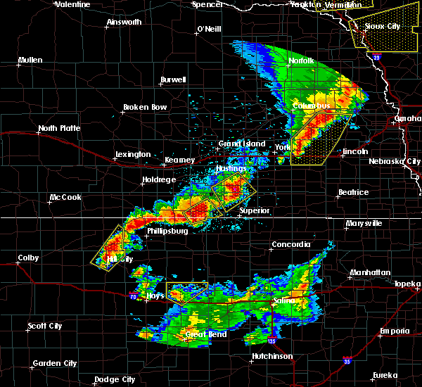 At 932 pm cdt, a severe thunderstorm was located 7 miles north of russell, moving northeast at 50 mph (radar indicated). Hazards include 60 mph wind gusts. Expect damage to roofs, siding, and trees. Locations impacted include, russell, lucas, luray, paradise, waldo, russell airport and wilson lake. At 932 pm cdt, a severe thunderstorm was located 7 miles north of russell, moving northeast at 50 mph (radar indicated). Hazards include 60 mph wind gusts. Expect damage to roofs, siding, and trees. Locations impacted include, russell, lucas, luray, paradise, waldo, russell airport and wilson lake.
|
| 6/13/2017 9:14 PM CDT |
 At 914 pm cdt, a severe thunderstorm was located near walker, moving northeast at 55 mph (radar indicated). Hazards include 70 mph wind gusts and nickel size hail. Expect considerable tree damage. Damage is likely to mobile homes, roofs, and outbuildings. At 914 pm cdt, a severe thunderstorm was located near walker, moving northeast at 55 mph (radar indicated). Hazards include 70 mph wind gusts and nickel size hail. Expect considerable tree damage. Damage is likely to mobile homes, roofs, and outbuildings.
|
| 5/25/2017 10:08 PM CDT |
 At 1007 pm cdt, severe thunderstorms were located along a line extending from 5 miles northeast of sylvan grove, to 7 miles east of wilson, to 8 miles west of ellsworth, moving east at 40 mph (radar indicated). Hazards include 70 mph wind gusts and ping pong ball size hail. People and animals outdoors will be injured. expect hail damage to roofs, siding, windows, and vehicles. expect considerable tree damage. wind damage is also likely to mobile homes, roofs, and outbuildings. Locations impacted include, ellsworth, wilson, kanopolis, lincoln, holyrood, lucas, sylvan grove, geneseo, beverly, lorraine, westfall, ellsworth airport, kanopolis lake, wilson state park, kanopolis state park and wilson lake. At 1007 pm cdt, severe thunderstorms were located along a line extending from 5 miles northeast of sylvan grove, to 7 miles east of wilson, to 8 miles west of ellsworth, moving east at 40 mph (radar indicated). Hazards include 70 mph wind gusts and ping pong ball size hail. People and animals outdoors will be injured. expect hail damage to roofs, siding, windows, and vehicles. expect considerable tree damage. wind damage is also likely to mobile homes, roofs, and outbuildings. Locations impacted include, ellsworth, wilson, kanopolis, lincoln, holyrood, lucas, sylvan grove, geneseo, beverly, lorraine, westfall, ellsworth airport, kanopolis lake, wilson state park, kanopolis state park and wilson lake.
|
| 5/25/2017 10:06 PM CDT | Trained spotter estimates 60 to 70 mph winds which was breaking off branches of unknown siz in russell county KS, 2.8 miles NNW of Lucas, KS |
| 5/25/2017 9:52 PM CDT |
 At 951 pm cdt, severe thunderstorms were located along a line extending from near lucas, to near dorrance, to 10 miles southwest of wilson, moving east at 45 mph (radar indicated). Hazards include golf ball size hail and 70 mph wind gusts. People and animals outdoors will be injured. expect hail damage to roofs, siding, windows, and vehicles. expect considerable tree damage. wind damage is also likely to mobile homes, roofs, and outbuildings. Locations impacted include, ellsworth, wilson, claflin, kanopolis, lincoln, holyrood, lucas, sylvan grove, geneseo, dorrance, beverly, lorraine, westfall, ellsworth airport, kanopolis lake, wilson state park, kanopolis state park, wilson lake and odin. At 951 pm cdt, severe thunderstorms were located along a line extending from near lucas, to near dorrance, to 10 miles southwest of wilson, moving east at 45 mph (radar indicated). Hazards include golf ball size hail and 70 mph wind gusts. People and animals outdoors will be injured. expect hail damage to roofs, siding, windows, and vehicles. expect considerable tree damage. wind damage is also likely to mobile homes, roofs, and outbuildings. Locations impacted include, ellsworth, wilson, claflin, kanopolis, lincoln, holyrood, lucas, sylvan grove, geneseo, dorrance, beverly, lorraine, westfall, ellsworth airport, kanopolis lake, wilson state park, kanopolis state park, wilson lake and odin.
|
| 5/25/2017 9:42 PM CDT |
 At 941 pm cdt, severe thunderstorms were located along a line extending from 5 miles southwest of lucas, to near dorrance, to 10 miles east of milberger, moving east to southeast at 45 mph (radar indicated). Hazards include golf ball size hail and 70 mph wind gusts. People and animals outdoors will be injured. expect hail damage to roofs, siding, windows, and vehicles. expect considerable tree damage. Wind damage is also likely to mobile homes, roofs, and outbuildings. At 941 pm cdt, severe thunderstorms were located along a line extending from 5 miles southwest of lucas, to near dorrance, to 10 miles east of milberger, moving east to southeast at 45 mph (radar indicated). Hazards include golf ball size hail and 70 mph wind gusts. People and animals outdoors will be injured. expect hail damage to roofs, siding, windows, and vehicles. expect considerable tree damage. Wind damage is also likely to mobile homes, roofs, and outbuildings.
|
| 5/16/2017 9:18 PM CDT |
 At 917 pm cdt, a severe thunderstorm was located near lucas, or 15 miles north of wilson, moving northeast at 45 mph (radar indicated). Hazards include 60 mph wind gusts and quarter size hail. Hail damage to vehicles is expected. expect wind damage to roofs, siding, and trees. locations impacted include, lucas, sylvan grove and ash grove. A tornado watch remains in effect until 1000 pm cdt for central kansas. At 917 pm cdt, a severe thunderstorm was located near lucas, or 15 miles north of wilson, moving northeast at 45 mph (radar indicated). Hazards include 60 mph wind gusts and quarter size hail. Hail damage to vehicles is expected. expect wind damage to roofs, siding, and trees. locations impacted include, lucas, sylvan grove and ash grove. A tornado watch remains in effect until 1000 pm cdt for central kansas.
|
| 5/16/2017 9:04 PM CDT |
 At 904 pm cdt, a severe thunderstorm was located over dorrance, or 6 miles northwest of wilson, moving northeast at 40 mph (radar indicated). Hazards include 60 mph wind gusts and quarter size hail. Hail damage to vehicles is expected. Expect wind damage to roofs, siding, and trees. At 904 pm cdt, a severe thunderstorm was located over dorrance, or 6 miles northwest of wilson, moving northeast at 40 mph (radar indicated). Hazards include 60 mph wind gusts and quarter size hail. Hail damage to vehicles is expected. Expect wind damage to roofs, siding, and trees.
|
| 4/19/2017 6:18 PM CDT |
 At 617 pm cdt, severe thunderstorms were located along a line extending from 5 miles southwest of aurora to 8 miles southeast of sylvan grove, moving east at 30 mph (trained weather spotters have reported quarter sized hail just to the west of lincoln). Hazards include 70 mph wind gusts and quarter size hail. Hail damage to vehicles is expected. expect considerable tree damage. wind damage is also likely to mobile homes, roofs, and outbuildings. Locations impacted include, ellsworth, wilson, kanopolis, lincoln, lucas, sylvan grove, luray, dorrance, beverly, barnard, bunker hill, westfall, ash grove, ellsworth airport, wilson state park and wilson lake. At 617 pm cdt, severe thunderstorms were located along a line extending from 5 miles southwest of aurora to 8 miles southeast of sylvan grove, moving east at 30 mph (trained weather spotters have reported quarter sized hail just to the west of lincoln). Hazards include 70 mph wind gusts and quarter size hail. Hail damage to vehicles is expected. expect considerable tree damage. wind damage is also likely to mobile homes, roofs, and outbuildings. Locations impacted include, ellsworth, wilson, kanopolis, lincoln, lucas, sylvan grove, luray, dorrance, beverly, barnard, bunker hill, westfall, ash grove, ellsworth airport, wilson state park and wilson lake.
|
| 4/19/2017 5:54 PM CDT | Quarter sized hail reported 3.2 miles SSW of Lucas, KS |
| 4/19/2017 5:51 PM CDT |
 At 549 pm cdt, severe thunderstorms were located along a line extending from 5 miles northeast of simpson to 6 miles north of dorrance, moving east at 30 mph (trained weather spotters have reported quarter sized hail 9 miles north of sylvan grove). Hazards include 70 mph wind gusts and quarter size hail. Hail damage to vehicles is expected. expect considerable tree damage. Wind damage is also likely to mobile homes, roofs, and outbuildings. At 549 pm cdt, severe thunderstorms were located along a line extending from 5 miles northeast of simpson to 6 miles north of dorrance, moving east at 30 mph (trained weather spotters have reported quarter sized hail 9 miles north of sylvan grove). Hazards include 70 mph wind gusts and quarter size hail. Hail damage to vehicles is expected. expect considerable tree damage. Wind damage is also likely to mobile homes, roofs, and outbuildings.
|
| 4/15/2017 8:29 PM CDT | Half Dollar sized hail reported 5.5 miles SSW of Lucas, KS, quarter to half dollar sized hail reported. |
| 4/15/2017 8:18 PM CDT |
 At 817 pm cdt, a severe thunderstorm was located near lucas, or 19 miles north of wilson, moving southeast at 30 mph (radar indicated). Hazards include 60 mph wind gusts and quarter size hail. Hail damage to vehicles is expected. Expect wind damage to roofs, siding, and trees. At 817 pm cdt, a severe thunderstorm was located near lucas, or 19 miles north of wilson, moving southeast at 30 mph (radar indicated). Hazards include 60 mph wind gusts and quarter size hail. Hail damage to vehicles is expected. Expect wind damage to roofs, siding, and trees.
|
| 8/23/2016 5:37 PM CDT |
 The severe thunderstorm warning for northeastern russell county will expire at 545 pm cdt, the storm which prompted the warning has weakened below severe limits, and no longer pose an immediate threat to life or property. therefore, the warning will be allowed to expire. however gusty winds are still possible with this thunderstorm. The severe thunderstorm warning for northeastern russell county will expire at 545 pm cdt, the storm which prompted the warning has weakened below severe limits, and no longer pose an immediate threat to life or property. therefore, the warning will be allowed to expire. however gusty winds are still possible with this thunderstorm.
|
| 8/23/2016 5:22 PM CDT |
 At 522 pm cdt, a severe thunderstorm was located near luray, or 15 miles northeast of russell, moving northeast at 30 mph (radar indicated). Hazards include 60 mph wind gusts and quarter size hail. Hail damage to vehicles is expected. expect wind damage to roofs, siding, and trees. Locations impacted include, lucas and luray. At 522 pm cdt, a severe thunderstorm was located near luray, or 15 miles northeast of russell, moving northeast at 30 mph (radar indicated). Hazards include 60 mph wind gusts and quarter size hail. Hail damage to vehicles is expected. expect wind damage to roofs, siding, and trees. Locations impacted include, lucas and luray.
|
| 8/23/2016 5:08 PM CDT |
 At 507 pm cdt, a severe thunderstorm was located 8 miles northeast of russell, moving northeast at 30 mph (radar indicated). Hazards include 60 mph wind gusts and quarter size hail. Hail damage to vehicles is expected. Expect wind damage to roofs, siding, and trees. At 507 pm cdt, a severe thunderstorm was located 8 miles northeast of russell, moving northeast at 30 mph (radar indicated). Hazards include 60 mph wind gusts and quarter size hail. Hail damage to vehicles is expected. Expect wind damage to roofs, siding, and trees.
|
| 8/19/2016 2:58 PM CDT |
 At 257 pm cdt, a severe thunderstorm was located over lucas, or 14 miles north of wilson, moving northeast at 20 mph (radar indicated). Hazards include 60 mph wind gusts and quarter size hail. Hail damage to vehicles is expected. expect wind damage to roofs, siding, and trees. Locations impacted include, lucas, luray, bunker hill, waldo, wilson state park and wilson lake. At 257 pm cdt, a severe thunderstorm was located over lucas, or 14 miles north of wilson, moving northeast at 20 mph (radar indicated). Hazards include 60 mph wind gusts and quarter size hail. Hail damage to vehicles is expected. expect wind damage to roofs, siding, and trees. Locations impacted include, lucas, luray, bunker hill, waldo, wilson state park and wilson lake.
|
| 8/19/2016 2:39 PM CDT |
 At 239 pm cdt, a severe thunderstorm was located 7 miles southwest of lucas, or 12 miles northeast of russell, moving northeast at 25 mph (radar indicated). Hazards include 60 mph wind gusts and quarter size hail. Hail damage to vehicles is expected. Expect wind damage to roofs, siding, and trees. At 239 pm cdt, a severe thunderstorm was located 7 miles southwest of lucas, or 12 miles northeast of russell, moving northeast at 25 mph (radar indicated). Hazards include 60 mph wind gusts and quarter size hail. Hail damage to vehicles is expected. Expect wind damage to roofs, siding, and trees.
|
| 7/28/2016 6:13 PM CDT |
 At 612 pm cdt, severe thunderstorms were located along a line extending from near lucas to 8 miles south of dorrance, moving east at 45 mph. another severe storm was located 6 miles northeast of wilson near i-70 (radar indicated). Hazards include 70 mph wind gusts and quarter size hail. Hail damage to vehicles is expected. expect considerable tree damage. wind damage is also likely to mobile homes, roofs, and outbuildings. Locations impacted include, russell, ellsworth, wilson, kanopolis, lincoln, lucas, sylvan grove, luray, dorrance, bunker hill, wilson state park, wilson lake, ellsworth airport and russell airport. At 612 pm cdt, severe thunderstorms were located along a line extending from near lucas to 8 miles south of dorrance, moving east at 45 mph. another severe storm was located 6 miles northeast of wilson near i-70 (radar indicated). Hazards include 70 mph wind gusts and quarter size hail. Hail damage to vehicles is expected. expect considerable tree damage. wind damage is also likely to mobile homes, roofs, and outbuildings. Locations impacted include, russell, ellsworth, wilson, kanopolis, lincoln, lucas, sylvan grove, luray, dorrance, bunker hill, wilson state park, wilson lake, ellsworth airport and russell airport.
|
| 7/28/2016 6:00 PM CDT |
 At 600 pm cdt, severe thunderstorms were located along a line extending from near sylvan grove to 9 miles southwest of luray, moving east at 35 mph (radar indicated). Hazards include 60 mph wind gusts and quarter size hail. Hail damage to vehicles is expected. expect wind damage to roofs, siding, and trees. Locations impacted include, russell, ellsworth, wilson, kanopolis, lincoln, lucas, gorham, sylvan grove, luray, dorrance, bunker hill, paradise, waldo, wilson state park, wilson lake, ellsworth airport and russell airport. At 600 pm cdt, severe thunderstorms were located along a line extending from near sylvan grove to 9 miles southwest of luray, moving east at 35 mph (radar indicated). Hazards include 60 mph wind gusts and quarter size hail. Hail damage to vehicles is expected. expect wind damage to roofs, siding, and trees. Locations impacted include, russell, ellsworth, wilson, kanopolis, lincoln, lucas, gorham, sylvan grove, luray, dorrance, bunker hill, paradise, waldo, wilson state park, wilson lake, ellsworth airport and russell airport.
|
| 7/28/2016 5:52 PM CDT |
 At 552 pm cdt, severe thunderstorms were located along a line extending from 5 miles north of sylvan grove to 10 miles southeast of natoma, moving east at 35 mph (radar indicated). Hazards include 60 mph wind gusts and quarter size hail. Hail damage to vehicles is expected. Expect wind damage to roofs, siding, and trees. At 552 pm cdt, severe thunderstorms were located along a line extending from 5 miles north of sylvan grove to 10 miles southeast of natoma, moving east at 35 mph (radar indicated). Hazards include 60 mph wind gusts and quarter size hail. Hail damage to vehicles is expected. Expect wind damage to roofs, siding, and trees.
|
| 7/13/2016 7:06 AM CDT |
 The severe thunderstorm warning for barton and russell counties will expire at 715 am cdt, the storms which prompted the warning have moved out of the area. therefore the warning will be allowed to expire. however gusty north winds of 40 to 50 mph are still possible on the back side of these thunderstorms. a severe thunderstorm watch remains in effect until 1000 am cdt for central kansas. The severe thunderstorm warning for barton and russell counties will expire at 715 am cdt, the storms which prompted the warning have moved out of the area. therefore the warning will be allowed to expire. however gusty north winds of 40 to 50 mph are still possible on the back side of these thunderstorms. a severe thunderstorm watch remains in effect until 1000 am cdt for central kansas.
|
| 7/13/2016 6:55 AM CDT |
 At 654 am cdt, severe thunderstorms were located along a line extending from near sylvan grove to near wilson to near claflin, moving east at 45 mph (radar indicated). Hazards include 60 mph wind gusts are still occurring on the backside of these storms across the warned area. Expect damage to roofs. siding. and trees. Locations impacted include, great bend, russell, hoisington, ellinwood, wilson, claflin, lucas, gorham, pawnee rock, luray, dorrance, albert, olmitz, milberger, bunker hill, paradise, galatia, susank, waldo and wilson state park. At 654 am cdt, severe thunderstorms were located along a line extending from near sylvan grove to near wilson to near claflin, moving east at 45 mph (radar indicated). Hazards include 60 mph wind gusts are still occurring on the backside of these storms across the warned area. Expect damage to roofs. siding. and trees. Locations impacted include, great bend, russell, hoisington, ellinwood, wilson, claflin, lucas, gorham, pawnee rock, luray, dorrance, albert, olmitz, milberger, bunker hill, paradise, galatia, susank, waldo and wilson state park.
|
| 7/13/2016 6:25 AM CDT |
 At 624 am cdt, severe thunderstorms were located along a line extending from 5 miles north of russell to 8 miles west of dorrance to olmitz, moving east at 40 mph. these are very dangerous storms (radar indicated). Hazards include 80 mph wind gusts and penny size hail. Flying debris will be dangerous to those caught without shelter. mobile homes will be heavily damaged. expect considerable damage to roofs, windows, and vehicles. extensive tree damage and power outages are likely. Locations impacted include, great bend, russell, hoisington, ellinwood, wilson, claflin, lucas, gorham, pawnee rock, luray, dorrance, albert, olmitz, milberger, bunker hill, paradise, galatia, susank, waldo and wilson state park. At 624 am cdt, severe thunderstorms were located along a line extending from 5 miles north of russell to 8 miles west of dorrance to olmitz, moving east at 40 mph. these are very dangerous storms (radar indicated). Hazards include 80 mph wind gusts and penny size hail. Flying debris will be dangerous to those caught without shelter. mobile homes will be heavily damaged. expect considerable damage to roofs, windows, and vehicles. extensive tree damage and power outages are likely. Locations impacted include, great bend, russell, hoisington, ellinwood, wilson, claflin, lucas, gorham, pawnee rock, luray, dorrance, albert, olmitz, milberger, bunker hill, paradise, galatia, susank, waldo and wilson state park.
|
| 7/13/2016 6:16 AM CDT |
 At 616 am cdt, severe thunderstorms were located along a line extending from 6 miles northwest of russell to 7 miles northeast of milberger to near albert, moving east at 45 mph (radar indicated). Hazards include 70 mph wind gusts and penny size hail. Expect considerable tree damage. damage is likely to mobile homes, roofs, and outbuildings. Locations impacted include, great bend, russell, hoisington, ellinwood, wilson, claflin, lucas, gorham, pawnee rock, luray, dorrance, albert, olmitz, milberger, bunker hill, paradise, galatia, susank, waldo and wilson state park. At 616 am cdt, severe thunderstorms were located along a line extending from 6 miles northwest of russell to 7 miles northeast of milberger to near albert, moving east at 45 mph (radar indicated). Hazards include 70 mph wind gusts and penny size hail. Expect considerable tree damage. damage is likely to mobile homes, roofs, and outbuildings. Locations impacted include, great bend, russell, hoisington, ellinwood, wilson, claflin, lucas, gorham, pawnee rock, luray, dorrance, albert, olmitz, milberger, bunker hill, paradise, galatia, susank, waldo and wilson state park.
|
| 7/13/2016 5:55 AM CDT |
 At 554 am cdt, severe thunderstorms were located along a line extending from near catherine to near la crosse, moving east at 40 mph (radar indicated). Hazards include 60 to 70 mph wind gusts. Expect considerable tree damage. Damage is likely to mobile homes, roofs, and outbuildings. At 554 am cdt, severe thunderstorms were located along a line extending from near catherine to near la crosse, moving east at 40 mph (radar indicated). Hazards include 60 to 70 mph wind gusts. Expect considerable tree damage. Damage is likely to mobile homes, roofs, and outbuildings.
|
| 7/6/2016 12:40 AM CDT |
 At 1240 am cdt, severe thunderstorms were located along a line extending from near lucas to milberger, moving east at 35 mph (radar indicated). Hazards include 60 mph wind gusts and nickel size hail. Expect damage to roofs. siding. and trees. Locations impacted include, russell, lucas, gorham, luray, dorrance, milberger, bunker hill, waldo, wilson state park, wilson lake and russell airport. At 1240 am cdt, severe thunderstorms were located along a line extending from near lucas to milberger, moving east at 35 mph (radar indicated). Hazards include 60 mph wind gusts and nickel size hail. Expect damage to roofs. siding. and trees. Locations impacted include, russell, lucas, gorham, luray, dorrance, milberger, bunker hill, waldo, wilson state park, wilson lake and russell airport.
|
| 7/6/2016 12:24 AM CDT |
 At 1224 am cdt, severe thunderstorms were located along a line extending from near luray to 6 miles northeast of pfeifer, moving east at 30 mph (radar indicated). Hazards include 60 mph wind gusts and nickel size hail. Expect damage to roofs. siding. And trees. At 1224 am cdt, severe thunderstorms were located along a line extending from near luray to 6 miles northeast of pfeifer, moving east at 30 mph (radar indicated). Hazards include 60 mph wind gusts and nickel size hail. Expect damage to roofs. siding. And trees.
|
| 6/15/2016 6:13 PM CDT |
 At 612 pm cdt, a severe thunderstorm was located over wilson, moving northeast at 25 mph (radar indicated). Hazards include 60 mph wind gusts and half dollar size hail. Hail damage to vehicles is expected. Expect wind damage to roofs, siding, and trees. At 612 pm cdt, a severe thunderstorm was located over wilson, moving northeast at 25 mph (radar indicated). Hazards include 60 mph wind gusts and half dollar size hail. Hail damage to vehicles is expected. Expect wind damage to roofs, siding, and trees.
|
| 5/29/2016 8:11 PM CDT |
 At 810 pm cdt, a severe thunderstorm was located 8 miles north of hoisington, and is nearly stationary (quarter size hail has been been reported 1 mile south of bunker hill by the public). Hazards include 70 mph wind gusts and quarter size hail. Hail damage to vehicles is expected. expect considerable tree damage. wind damage is also likely to mobile homes, roofs, and outbuildings. Locations impacted include, russell, lucas, luray, dorrance, bunker hill, paradise, waldo, wilson lake, russell airport and wilson state park. At 810 pm cdt, a severe thunderstorm was located 8 miles north of hoisington, and is nearly stationary (quarter size hail has been been reported 1 mile south of bunker hill by the public). Hazards include 70 mph wind gusts and quarter size hail. Hail damage to vehicles is expected. expect considerable tree damage. wind damage is also likely to mobile homes, roofs, and outbuildings. Locations impacted include, russell, lucas, luray, dorrance, bunker hill, paradise, waldo, wilson lake, russell airport and wilson state park.
|
| 5/29/2016 7:49 PM CDT |
 At 749 pm cdt, a severe thunderstorm was located 8 miles northwest of luray, or 23 miles north of russell, and is nearly stationary (quarter sized hail as been reported 1 mile south of bunker hill by the public). Hazards include 70 mph wind gusts and quarter size hail. Hail damage to vehicles is expected. expect considerable tree damage. wind damage is also likely to mobile homes, roofs, and outbuildings. Locations impacted include, russell, lucas, luray, dorrance, bunker hill, paradise, waldo, wilson lake, russell airport and wilson state park. At 749 pm cdt, a severe thunderstorm was located 8 miles northwest of luray, or 23 miles north of russell, and is nearly stationary (quarter sized hail as been reported 1 mile south of bunker hill by the public). Hazards include 70 mph wind gusts and quarter size hail. Hail damage to vehicles is expected. expect considerable tree damage. wind damage is also likely to mobile homes, roofs, and outbuildings. Locations impacted include, russell, lucas, luray, dorrance, bunker hill, paradise, waldo, wilson lake, russell airport and wilson state park.
|
| 5/29/2016 7:39 PM CDT |
 At 737 pm cdt, a severe thunderstorm was located 6 miles northwest of luray, or 21 miles north of russell, moving north at 10 mph (63 mph winds have been reported at the russell airport). Hazards include 70 mph wind gusts and quarter size hail. Hail damage to vehicles is expected. expect considerable tree damage. Wind damage is also likely to mobile homes, roofs, and outbuildings. At 737 pm cdt, a severe thunderstorm was located 6 miles northwest of luray, or 21 miles north of russell, moving north at 10 mph (63 mph winds have been reported at the russell airport). Hazards include 70 mph wind gusts and quarter size hail. Hail damage to vehicles is expected. expect considerable tree damage. Wind damage is also likely to mobile homes, roofs, and outbuildings.
|
| 5/29/2016 7:15 PM CDT |
 At 715 pm cdt, a severe thunderstorm was located near luray, or 16 miles north of russell, moving north at 10 mph (65 mph winds have been reproted at the russell airport). Hazards include 70 mph wind gusts and half dollar size hail. Hail damage to vehicles is expected. expect considerable tree damage. wind damage is also likely to mobile homes, roofs, and outbuildings. Locations impacted include, russell, lucas, luray, dorrance, bunker hill, paradise, waldo, wilson lake, russell airport and wilson state park. At 715 pm cdt, a severe thunderstorm was located near luray, or 16 miles north of russell, moving north at 10 mph (65 mph winds have been reproted at the russell airport). Hazards include 70 mph wind gusts and half dollar size hail. Hail damage to vehicles is expected. expect considerable tree damage. wind damage is also likely to mobile homes, roofs, and outbuildings. Locations impacted include, russell, lucas, luray, dorrance, bunker hill, paradise, waldo, wilson lake, russell airport and wilson state park.
|
| 5/29/2016 7:08 PM CDT |
 At 707 pm cdt, a severe thunderstorm was located near luray, or 15 miles north of russell, moving north at 10 mph (65 mph winds have been reported at the russell airport). Hazards include 70 mph wind gusts and half dollar size hail. Hail damage to vehicles is expected. expect wind damage to roofs, siding, and trees. Locations impacted include, russell, lucas, luray, dorrance, bunker hill, paradise, waldo, wilson lake, russell airport and wilson state park. At 707 pm cdt, a severe thunderstorm was located near luray, or 15 miles north of russell, moving north at 10 mph (65 mph winds have been reported at the russell airport). Hazards include 70 mph wind gusts and half dollar size hail. Hail damage to vehicles is expected. expect wind damage to roofs, siding, and trees. Locations impacted include, russell, lucas, luray, dorrance, bunker hill, paradise, waldo, wilson lake, russell airport and wilson state park.
|
| 5/29/2016 6:41 PM CDT |
 At 640 pm cdt, a severe thunderstorm was located 7 miles southwest of luray, or 10 miles northeast of russell, moving north at 10 mph (radar indicated). Hazards include 60 mph wind gusts and quarter size hail. Hail damage to vehicles is expected. Expect wind damage to roofs, siding, and trees. At 640 pm cdt, a severe thunderstorm was located 7 miles southwest of luray, or 10 miles northeast of russell, moving north at 10 mph (radar indicated). Hazards include 60 mph wind gusts and quarter size hail. Hail damage to vehicles is expected. Expect wind damage to roofs, siding, and trees.
|
| 5/27/2016 5:50 PM CDT |
 At 548 pm cdt, a severe thunderstorm was located over lucas, or 18 miles north of wilson, moving north at 10 mph (radar indicated). Hazards include 60 mph wind gusts and quarter size hail. Hail damage to vehicles is expected. expect wind damage to roofs, siding, and trees. Locations impacted include, lucas. At 548 pm cdt, a severe thunderstorm was located over lucas, or 18 miles north of wilson, moving north at 10 mph (radar indicated). Hazards include 60 mph wind gusts and quarter size hail. Hail damage to vehicles is expected. expect wind damage to roofs, siding, and trees. Locations impacted include, lucas.
|
| 5/27/2016 5:39 PM CDT |
 At 539 pm cdt, a severe thunderstorm was located over lucas, or 16 miles north of wilson, moving north at 10 mph (radar indicated). Hazards include 60 mph wind gusts and quarter size hail. Hail damage to vehicles is expected. Expect wind damage to roofs, siding, and trees. At 539 pm cdt, a severe thunderstorm was located over lucas, or 16 miles north of wilson, moving north at 10 mph (radar indicated). Hazards include 60 mph wind gusts and quarter size hail. Hail damage to vehicles is expected. Expect wind damage to roofs, siding, and trees.
|
| 5/27/2016 5:37 PM CDT | Ping Pong Ball sized hail reported 0.2 miles ESE of Lucas, KS |
| 5/24/2016 8:08 PM CDT |
 At 807 pm cdt, severe thunderstorms were located along a line extending from gorham to 8 miles south of russell to 7 miles northwest of ellinwood, moving northeast at 45 mph (radar indicated). Hazards include 60 mph wind gusts and quarter size hail. Hail damage to vehicles is expected. expect wind damage to roofs, siding, and trees. locations impacted include, great bend, russell, hoisington, lucas, gorham, luray, dorrance, albert, olmitz, odin, bunker hill, paradise, galatia, susank, waldo, cheyenne bottoms, great bend airport, milberger, wilson lake and russell airport. A tornado watch remains in effect until 200 am cdt for central kansas. At 807 pm cdt, severe thunderstorms were located along a line extending from gorham to 8 miles south of russell to 7 miles northwest of ellinwood, moving northeast at 45 mph (radar indicated). Hazards include 60 mph wind gusts and quarter size hail. Hail damage to vehicles is expected. expect wind damage to roofs, siding, and trees. locations impacted include, great bend, russell, hoisington, lucas, gorham, luray, dorrance, albert, olmitz, odin, bunker hill, paradise, galatia, susank, waldo, cheyenne bottoms, great bend airport, milberger, wilson lake and russell airport. A tornado watch remains in effect until 200 am cdt for central kansas.
|
| 5/24/2016 5:34 AM CDT | A severe thunderstorm warning remains in effect until 545 am cdt for northeastern russell county. at 534 am cdt. a severe thunderstorm was located 7 miles northeast of lucas. or 22 miles north of wilson. moving east at 40 mph. hazard. 60 mph wind gusts and quarter size hail. source. Radar indicated. |
| 5/9/2016 12:57 AM CDT | The severe thunderstorm warning for northern russell county will expire at 100 am cdt, the storm which prompted the warning has weakened below severe limits, and no longer poses an immediate threat to life or property. therefore the warning will be allowed to expire. however small. |
| 5/9/2016 12:26 AM CDT | At 1225 am cdt, a severe thunderstorm was located over luray, or 19 miles northeast of russell, moving northeast at 30 mph. another strong to severe thunderstorm was located west and southwest of paradise, also moving northeast (radar indicated). Hazards include two inch hail and 60 mph wind gusts. People and animals outdoors will be injured. expect hail damage to roofs, siding, windows, and vehicles. expect wind damage to roofs, siding, and trees. Locations impacted include, lucas, gorham, luray, paradise and waldo. |
| 5/9/2016 12:09 AM CDT | At 1209 am cdt, a severe thunderstorm was located 7 miles southwest of luray, or 11 miles north of russell, moving northeast at 30 mph (radar indicated). Hazards include golf ball size hail and 60 mph wind gusts. People and animals outdoors will be injured. expect hail damage to roofs, siding, windows, and vehicles. expect wind damage to roofs, siding, and trees. Locations impacted include, lucas, gorham, luray, paradise and waldo. |
| 5/9/2016 12:00 AM CDT | Quarter sized hail reported 5.5 miles SSW of Lucas, KS |
| 5/8/2016 11:53 PM CDT | At 1152 pm cdt, a severe thunderstorm was located 8 miles northeast of gorham, or 9 miles northwest of russell, moving northeast at 30 mph (radar indicated). Hazards include golf ball size hail and 60 mph wind gusts. People and animals outdoors will be injured. expect hail damage to roofs, siding, windows, and vehicles. Expect wind damage to roofs, siding, and trees. |
| 5/8/2016 11:50 PM CDT | Storm damage reported in lincoln county KS, 3.3 miles WNW of Lucas, KS |
| 5/8/2016 11:49 PM CDT | At 1149 pm cdt, a severe thunderstorm capable of producing a tornado was located near lucas, or 19 miles north of wilson, moving northeast at 40 mph (radar indicated rotation). Hazards include tornado and ping pong ball size hail. Flying debris will be dangerous to those caught without shelter. mobile homes will be damaged or destroyed. damage to roofs, windows, and vehicles will occur. tree damage is likely. Locations impacted include, lucas, sylvan grove, ash grove and wilson lake. |
| 5/8/2016 11:28 PM CDT |
 At 1128 pm cdt, a severe thunderstorm capable of producing a tornado was located 9 miles northeast of russell, moving northeast at 30 mph (radar indicated rotation). Hazards include tornado and golf ball size hail. Flying debris will be dangerous to those caught without shelter. mobile homes will be damaged or destroyed. damage to roofs, windows, and vehicles will occur. tree damage is likely. this dangerous storm will be near, luray around 1140 pm cdt. lucas around 1150 pm cdt. sylvan grove around 1200 am cdt. other locations impacted by this tornadic thunderstorm include ash grove and wilson lake. At 1128 pm cdt, a severe thunderstorm capable of producing a tornado was located 9 miles northeast of russell, moving northeast at 30 mph (radar indicated rotation). Hazards include tornado and golf ball size hail. Flying debris will be dangerous to those caught without shelter. mobile homes will be damaged or destroyed. damage to roofs, windows, and vehicles will occur. tree damage is likely. this dangerous storm will be near, luray around 1140 pm cdt. lucas around 1150 pm cdt. sylvan grove around 1200 am cdt. other locations impacted by this tornadic thunderstorm include ash grove and wilson lake.
|
| 4/24/2016 3:34 PM CDT |
 At 333 pm cdt, a severe thunderstorm was located 9 miles northwest of claflin, moving northeast at 45 mph (radar indicated). Hazards include ping pong ball size hail and 60 mph wind gusts. People and animals outdoors will be injured. expect hail damage to roofs, siding, windows, and vehicles. expect wind damage to roofs, siding, and trees. locations impacted include, hoisington, wilson, claflin, lucas, sylvan grove, dorrance, odin, bunker hill, susank, wilson lake, cheyenne bottoms and wilson state park. A tornado watch remains in effect until 1100 pm cdt for central kansas. At 333 pm cdt, a severe thunderstorm was located 9 miles northwest of claflin, moving northeast at 45 mph (radar indicated). Hazards include ping pong ball size hail and 60 mph wind gusts. People and animals outdoors will be injured. expect hail damage to roofs, siding, windows, and vehicles. expect wind damage to roofs, siding, and trees. locations impacted include, hoisington, wilson, claflin, lucas, sylvan grove, dorrance, odin, bunker hill, susank, wilson lake, cheyenne bottoms and wilson state park. A tornado watch remains in effect until 1100 pm cdt for central kansas.
|
| 4/24/2016 3:21 PM CDT |
 At 320 pm cdt, a severe thunderstorm was located over hoisington, moving northeast at 45 mph (radar indicated). Hazards include ping pong ball size hail and 60 mph wind gusts. People and animals outdoors will be injured. expect hail damage to roofs, siding, windows, and vehicles. Expect wind damage to roofs, siding, and trees. At 320 pm cdt, a severe thunderstorm was located over hoisington, moving northeast at 45 mph (radar indicated). Hazards include ping pong ball size hail and 60 mph wind gusts. People and animals outdoors will be injured. expect hail damage to roofs, siding, windows, and vehicles. Expect wind damage to roofs, siding, and trees.
|
| 9/10/2015 6:41 PM CDT |
 At 639 pm cdt, a severe thunderstorm was located near luray, or 15 miles northeast of russell, moving southeast at 35 mph (radar indicated). Hazards include 60 mph wind gusts and quarter size hail. Hail damage to vehicles is expected. expect wind damage to roofs, siding and trees. a second severe thunderstorm was located 2 miles northeast of gorham, moving southeast at 35 mph. 60 mph wind gusts and quarter size hail is likely. Locations impacted include, russell, lucas, gorham, luray, bunker hill, paradise, waldo, wilson lake, russell airport and wilson state park. At 639 pm cdt, a severe thunderstorm was located near luray, or 15 miles northeast of russell, moving southeast at 35 mph (radar indicated). Hazards include 60 mph wind gusts and quarter size hail. Hail damage to vehicles is expected. expect wind damage to roofs, siding and trees. a second severe thunderstorm was located 2 miles northeast of gorham, moving southeast at 35 mph. 60 mph wind gusts and quarter size hail is likely. Locations impacted include, russell, lucas, gorham, luray, bunker hill, paradise, waldo, wilson lake, russell airport and wilson state park.
|
| 9/10/2015 6:23 PM CDT |
 At 622 pm cdt, a severe thunderstorm was located near luray, or 17 miles north of russell, moving southeast at 30 mph (radar indicated). Hazards include tennis ball size hail and 70 mph wind gusts. People and animals outdoors will be injured. expect hail damage to roofs, siding, windows and vehicles. expect considerable tree damage. wind damage is also likely to mobile homes, roofs and outbuildings. Locations impacted include, russell, lucas, gorham, luray, bunker hill, paradise, waldo, wilson lake, russell airport and wilson state park. At 622 pm cdt, a severe thunderstorm was located near luray, or 17 miles north of russell, moving southeast at 30 mph (radar indicated). Hazards include tennis ball size hail and 70 mph wind gusts. People and animals outdoors will be injured. expect hail damage to roofs, siding, windows and vehicles. expect considerable tree damage. wind damage is also likely to mobile homes, roofs and outbuildings. Locations impacted include, russell, lucas, gorham, luray, bunker hill, paradise, waldo, wilson lake, russell airport and wilson state park.
|
| 9/10/2015 6:08 PM CDT |
 At 607 pm cdt, a severe thunderstorm was located 11 miles northwest of luray, or 21 miles north of russell, moving southeast at 40 mph (radar indicated). Hazards include tennis ball size hail and 70 mph wind gusts. People and animals outdoors will be injured. expect hail damage to roofs, siding, windows and vehicles. expect considerable tree damage. Wind damage is also likely to mobile homes, roofs and outbuildings. At 607 pm cdt, a severe thunderstorm was located 11 miles northwest of luray, or 21 miles north of russell, moving southeast at 40 mph (radar indicated). Hazards include tennis ball size hail and 70 mph wind gusts. People and animals outdoors will be injured. expect hail damage to roofs, siding, windows and vehicles. expect considerable tree damage. Wind damage is also likely to mobile homes, roofs and outbuildings.
|
| 8/27/2015 6:25 PM CDT |
 At 625 pm cdt, a severe thunderstorm was located over luray, or 17 miles northeast of russell, moving east at 20 mph (radar indicated). Hazards include 60 mph wind gusts and quarter size hail. Hail damage to vehicles is expected. expect wind damage to roofs, siding and trees. Locations impacted include, lucas, luray and waldo. At 625 pm cdt, a severe thunderstorm was located over luray, or 17 miles northeast of russell, moving east at 20 mph (radar indicated). Hazards include 60 mph wind gusts and quarter size hail. Hail damage to vehicles is expected. expect wind damage to roofs, siding and trees. Locations impacted include, lucas, luray and waldo.
|
| 8/27/2015 6:14 PM CDT |
 At 613 pm cdt, a severe thunderstorm was located near waldo, or 15 miles north of russell, moving east at 20 mph (radar indicated). Hazards include 60 mph wind gusts and quarter size hail. Hail damage to vehicles is expected. Expect wind damage to roofs, siding and trees. At 613 pm cdt, a severe thunderstorm was located near waldo, or 15 miles north of russell, moving east at 20 mph (radar indicated). Hazards include 60 mph wind gusts and quarter size hail. Hail damage to vehicles is expected. Expect wind damage to roofs, siding and trees.
|
| 8/8/2015 6:18 PM CDT |
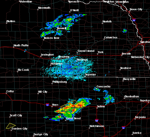 At 617 pm cdt, a severe thunderstorm was located near russell, moving east at 20 mph (radar indicated). Hazards include 60 mph wind gusts and quarter size hail. Hail damage to vehicles is expected. expect wind damage to roofs, siding and trees. Locations impacted include, russell, wilson, lucas, sylvan grove, dorrance, bunker hill, wilson state park, wilson lake and russell airport. At 617 pm cdt, a severe thunderstorm was located near russell, moving east at 20 mph (radar indicated). Hazards include 60 mph wind gusts and quarter size hail. Hail damage to vehicles is expected. expect wind damage to roofs, siding and trees. Locations impacted include, russell, wilson, lucas, sylvan grove, dorrance, bunker hill, wilson state park, wilson lake and russell airport.
|
| 8/8/2015 5:56 PM CDT |
 At 554 pm cdt, a severe thunderstorm was located 5 miles south and southwest of russell, moving northeast at 25 mph (radar indicated). Hazards include 60 mph wind gusts and quarter size hail. Hail damage to vehicles is expected. Expect wind damage to roofs, siding and trees. At 554 pm cdt, a severe thunderstorm was located 5 miles south and southwest of russell, moving northeast at 25 mph (radar indicated). Hazards include 60 mph wind gusts and quarter size hail. Hail damage to vehicles is expected. Expect wind damage to roofs, siding and trees.
|
| 8/8/2015 5:37 PM CDT |
 At 536 pm cdt, a severe thunderstorm was located near lucas, or 11 miles north of wilson, moving northeast at 30 mph (radar indicated). Hazards include 60 mph wind gusts and quarter size hail. Hail damage to vehicles is expected. expect wind damage to roofs, siding and trees. Locations impacted include, lincoln, lucas, sylvan grove, dorrance, barnard, ash grove, wilson state park and wilson lake. At 536 pm cdt, a severe thunderstorm was located near lucas, or 11 miles north of wilson, moving northeast at 30 mph (radar indicated). Hazards include 60 mph wind gusts and quarter size hail. Hail damage to vehicles is expected. expect wind damage to roofs, siding and trees. Locations impacted include, lincoln, lucas, sylvan grove, dorrance, barnard, ash grove, wilson state park and wilson lake.
|
| 8/8/2015 5:15 PM CDT |
 At 513 pm cdt, a severe thunderstorm was located near lucas, or 10 miles north of wilson, moving northeast at 35 mph (radar indicated). Hazards include 60 mph wind gusts and quarter size hail. Hail damage to vehicles is expected. expect wind damage to roofs, siding and trees. Locations impacted include, lincoln, lucas, sylvan grove, dorrance, barnard, ash grove, wilson state park and wilson lake. At 513 pm cdt, a severe thunderstorm was located near lucas, or 10 miles north of wilson, moving northeast at 35 mph (radar indicated). Hazards include 60 mph wind gusts and quarter size hail. Hail damage to vehicles is expected. expect wind damage to roofs, siding and trees. Locations impacted include, lincoln, lucas, sylvan grove, dorrance, barnard, ash grove, wilson state park and wilson lake.
|
| 8/8/2015 4:58 PM CDT |
 At 457 pm cdt, a severe thunderstorm was located 7 miles north of dorrance, or 9 miles northwest of wilson, moving northeast at 35 mph (radar indicated). Hazards include 60 mph wind gusts and quarter size hail. Hail damage to vehicles is expected. Expect wind damage to roofs, siding and trees. At 457 pm cdt, a severe thunderstorm was located 7 miles north of dorrance, or 9 miles northwest of wilson, moving northeast at 35 mph (radar indicated). Hazards include 60 mph wind gusts and quarter size hail. Hail damage to vehicles is expected. Expect wind damage to roofs, siding and trees.
|
| 8/8/2015 4:48 PM CDT |
 At 446 pm cdt, a severe thunderstorm was located near lucas, or 11 miles north of wilson, moving northeast at 35 mph (radar indicated). Hazards include 60 mph wind gusts and quarter size hail. Hail damage to vehicles is expected. expect wind damage to roofs, siding and trees. Locations impacted include, russell, lincoln, lucas, sylvan grove, dorrance, bunker hill, ash grove, wilson state park, wilson lake and russell airport. At 446 pm cdt, a severe thunderstorm was located near lucas, or 11 miles north of wilson, moving northeast at 35 mph (radar indicated). Hazards include 60 mph wind gusts and quarter size hail. Hail damage to vehicles is expected. expect wind damage to roofs, siding and trees. Locations impacted include, russell, lincoln, lucas, sylvan grove, dorrance, bunker hill, ash grove, wilson state park, wilson lake and russell airport.
|
| 8/8/2015 4:30 PM CDT |
 At 428 pm cdt, a severe thunderstorm was located 6 miles south of lucas, or 10 miles north of wilson, moving east at 15 mph (radar indicated). Hazards include 70 mph wind gusts and ping pong ball size hail. People and animals outdoors will be injured. expect hail damage to roofs, siding, windows and vehicles. expect considerable tree damage. wind damage is also likely to mobile homes, roofs and outbuildings. Locations impacted include, russell, lincoln, lucas, sylvan grove, dorrance, bunker hill, ash grove, wilson state park, wilson lake and russell airport. At 428 pm cdt, a severe thunderstorm was located 6 miles south of lucas, or 10 miles north of wilson, moving east at 15 mph (radar indicated). Hazards include 70 mph wind gusts and ping pong ball size hail. People and animals outdoors will be injured. expect hail damage to roofs, siding, windows and vehicles. expect considerable tree damage. wind damage is also likely to mobile homes, roofs and outbuildings. Locations impacted include, russell, lincoln, lucas, sylvan grove, dorrance, bunker hill, ash grove, wilson state park, wilson lake and russell airport.
|
| 8/8/2015 4:06 PM CDT |
 At 406 pm cdt, a severe thunderstorm was located 6 miles north of dorrance, or 11 miles northwest of wilson, moving northeast at 25 mph (radar indicated). Hazards include 60 mph wind gusts and half dollar size hail. Hail damage to vehicles is expected. expect wind damage to roofs, siding and trees. Locations impacted include, russell, lincoln, lucas, sylvan grove, dorrance, bunker hill, ash grove, wilson state park, wilson lake and russell airport. At 406 pm cdt, a severe thunderstorm was located 6 miles north of dorrance, or 11 miles northwest of wilson, moving northeast at 25 mph (radar indicated). Hazards include 60 mph wind gusts and half dollar size hail. Hail damage to vehicles is expected. expect wind damage to roofs, siding and trees. Locations impacted include, russell, lincoln, lucas, sylvan grove, dorrance, bunker hill, ash grove, wilson state park, wilson lake and russell airport.
|
| 8/8/2015 3:59 PM CDT |
 At 359 pm cdt, a severe thunderstorm was located 6 miles northwest of dorrance, or 10 miles east of russell, moving northeast at 25 mph (radar indicated). Hazards include 60 mph wind gusts and half dollar size hail. Hail damage to vehicles is expected. Expect wind damage to roofs, siding and trees. At 359 pm cdt, a severe thunderstorm was located 6 miles northwest of dorrance, or 10 miles east of russell, moving northeast at 25 mph (radar indicated). Hazards include 60 mph wind gusts and half dollar size hail. Hail damage to vehicles is expected. Expect wind damage to roofs, siding and trees.
|
| 7/15/2015 3:42 AM CDT |
 At 342 am cdt, a severe thunderstorm was located 6 miles northeast of wilson, moving east at 30 mph (radar indicated). Hazards include 70 mph wind gusts and penny size hail. Expect considerable tree damage. damage is likely to mobile homes, roofs and outbuildings. Locations impacted include, wilson, lucas, sylvan grove, luray, dorrance, bunker hill, ash grove, wilson state park and wilson lake. At 342 am cdt, a severe thunderstorm was located 6 miles northeast of wilson, moving east at 30 mph (radar indicated). Hazards include 70 mph wind gusts and penny size hail. Expect considerable tree damage. damage is likely to mobile homes, roofs and outbuildings. Locations impacted include, wilson, lucas, sylvan grove, luray, dorrance, bunker hill, ash grove, wilson state park and wilson lake.
|
| 7/15/2015 3:24 AM CDT |
 At 324 am cdt, a severe thunderstorm was located near dorrance, or 6 miles northwest of wilson, moving east at 30 mph (radar indicated). Hazards include 70 mph wind gusts and penny size hail. Expect considerable tree damage. damage is likely to mobile homes, roofs and outbuildings. Locations impacted include, russell, wilson, lucas, sylvan grove, luray, dorrance, bunker hill, waldo, ash grove, wilson state park, wilson lake and russell airport. At 324 am cdt, a severe thunderstorm was located near dorrance, or 6 miles northwest of wilson, moving east at 30 mph (radar indicated). Hazards include 70 mph wind gusts and penny size hail. Expect considerable tree damage. damage is likely to mobile homes, roofs and outbuildings. Locations impacted include, russell, wilson, lucas, sylvan grove, luray, dorrance, bunker hill, waldo, ash grove, wilson state park, wilson lake and russell airport.
|
| 7/15/2015 3:08 AM CDT |
 At 308 am cdt, a severe thunderstorm was located 7 miles east of russell, moving east at 30 mph (radar indicated). Hazards include 70 mph wind gusts and penny size hail. Expect considerable tree damage. Damage is likely to mobile homes, roofs and outbuildings. At 308 am cdt, a severe thunderstorm was located 7 miles east of russell, moving east at 30 mph (radar indicated). Hazards include 70 mph wind gusts and penny size hail. Expect considerable tree damage. Damage is likely to mobile homes, roofs and outbuildings.
|
| 6/3/2015 9:10 PM CDT | The severe thunderstorm warning for northern russell county will expire at 915 pm cdt, the 2 thunderstorms that prompted the warning remain north of the russell/osborne county line and are moving slowly toward the northeast. therefore the warning will be allowed to expire. a tornado watch, number 252, remains in effect until 200 am cdt for central kansas. if you experienced severe weather, contact your nearest law enforcement agency. they will relay your report to the national weather service wichita. |
| 6/3/2015 8:46 PM CDT | At 837 pm cdt, a severe thunderstorm was located near luray, or 20 miles northeast of russell, moving east at 10 mph. a second severe thunderstorm was located 10 miles northwest of paradise just barely north of the southwest osborne/northwest russell county border. this severe thunderstorm was also moving east around 10 mph (radar indicated). Hazards include golf ball size hail and 60 mph wind gusts. People and animals outdoors will be injured. expect hail damage to roofs, siding, windows and vehicles. expect wind damage to roofs, siding and trees. locations impacted include, lucas, luray, paradise and waldo. A tornado watch remains in effect until 200 am cdt for central kansas. |
| 6/3/2015 8:26 PM CDT | At 824 pm cdt, a severe thunderstorm was located over luray, or 18 miles northeast of russell, moving east at 10 mph. another severe thunderstorm was located near natoma, also moving slowly to the east (radar indicated). Hazards include golf ball size hail and 60 mph wind gusts. People and animals outdoors will be injured. expect hail damage to roofs, siding, windows and vehicles. Expect wind damage to roofs, siding and trees. |
| 5/28/2015 8:41 PM CDT | At 841 pm cdt, severe thunderstorms were located along a line extending from 6 miles northwest of dorrance to near hoisington, moving east at 30 mph (radar indicated). Hazards include 60 mph wind gusts and dime size hail. Expect damage to roofs. siding and trees. Locations impacted include, great bend, russell, hoisington, ellinwood, wilson, claflin, lucas, gorham, pawnee rock, dorrance, albert, olmitz, milberger, bunker hill, galatia, susank, wilson state park, wilson lake, odin and great bend airport. |
| 5/28/2015 8:26 PM CDT | At 825 pm cdt, severe thunderstorms were located along a line extending from russell to near olmitz, moving northeast at 35 mph (radar indicated). Hazards include 60 mph wind gusts and penny size hail. Expect damage to roofs. Siding and trees. |
| 4/24/2015 7:07 PM CDT | The severe thunderstorm warning for northeastern russell county will expire at 715 pm cdt, the storm which prompted the warning has moved out of the area. therefore the warning will be allowed to expire. a tornado watch, number 102, remains in effect until 1100 pm cdt for central kansas. |
| 4/24/2015 6:45 PM CDT | Golf Ball sized hail reported 3.3 miles WNW of Lucas, KS |
| 4/24/2015 6:42 PM CDT | At 642 pm cdt, a severe thunderstorm was located 9 miles south of luray, or 11 miles northeast of russell, moving east at 20 mph (radar indicated). Hazards include golf ball size hail and 60 mph wind gusts. People and animals outdoors will be injured. expect hail damage to roofs, siding, windows and vehicles. Expect wind damage to roofs, siding and trees. |
| 4/24/2015 6:40 PM CDT | Ping Pong Ball sized hail reported 0.2 miles ESE of Lucas, KS, emergency manager reports that virtually every car and roof sustained significant hail damage in the town of lucas. all skylights in the middle school were broke out. |
| 4/24/2015 6:40 PM CDT | Tennis Ball sized hail reported 0.2 miles ESE of Lucas, KS |
| 4/24/2015 6:34 PM CDT | Ping Pong Ball sized hail reported 0.2 miles ESE of Lucas, KS |
| 4/24/2015 6:20 PM CDT | At 618 pm cdt, a severe thunderstorm capable of producing a tornado was located near lucas, or 19 miles north of wilson, moving east at 20 mph (radar indicated rotation). Hazards include tornado and ping pong ball sized hail. Flying debris will be dangerous to those caught without shelter. mobile homes will be damaged or destroyed. damage to roofs, windows and vehicles will occur. tree damage is likely. this tornadic thunderstorm will remain over mainly rural areas of northern russell county, including the following locations, wilson state park, paradise, waldo and wilson lake. Radar indicated. |
| 4/24/2015 6:00 PM CDT | At 558 pm cdt, a confirmed tornado was located near luray, or 13 miles northeast of russell, moving east at 25 mph (weather spotters confirmed tornado). Hazards include damaging tornado...tennis ball sized hail and 80 mph winds. Flying debris will be dangerous to those caught without shelter. mobile homes will be damaged or destroyed. damage to roofs, windows and vehicles will occur. tree damage is likely. this tornado will be near, lucas around 625 pm cdt. other locations impacted by this tornadic thunderstorm include wilson state park, paradise, waldo and wilson lake. Observed. |
| 4/24/2015 5:50 PM CDT | At 549 pm cdt, a confirmed tornado was located 6 miles south of luray, or 11 miles northeast of russell, moving east at 30 mph (weather spotters confirmed tornado). Hazards include damaging tornado...two inch hail and 70 to 80 mph winds. Flying debris will be dangerous to those caught without shelter. mobile homes will be damaged or destroyed. damage to roofs, windows and vehicles will occur. tree damage is likely. this tornado will be near, lucas around 605 pm cdt. other locations impacted by this tornadic thunderstorm include wilson state park, paradise, waldo and wilson lake. Observed. |
| 4/24/2015 5:38 PM CDT | At 538 pm cdt, a severe thunderstorm capable of producing a tornado was located 9 miles north of russell, moving east at 25 mph (radar indicated rotation). Hazards include tornado and tennis ball size hail. Flying debris will be dangerous to those caught without shelter. mobile homes will be damaged or destroyed. damage to roofs, windows and vehicles will occur. tree damage is likely. this dangerous storm will be near, luray around 600 pm cdt. lucas around 615 pm cdt. other locations impacted by this tornadic thunderstorm include wilson state park, paradise, waldo and wilson lake. Radar indicated. |
| 6/14/2014 11:50 PM CDT | Storm damage reported in lincoln county KS, 3.8 miles WNW of Lucas, KS |
| 7/20/2013 3:18 PM CDT | Trained spotter estimates wind gusts of 60 to 70 mph with torrential rainfall on the russell and lincoln county lines on highway 1 in russell county KS, 1.9 miles W of Lucas, KS |
| 4/14/2012 2:20 PM CDT | Power poles down and power lines down across highway 18 between lucas and lura in russell county KS, 2.9 miles E of Lucas, KS |
| 4/14/2012 1:54 PM CDT | Some outbuildings damaged or destroyed along with power pole lines dow in russell county KS, 0.2 miles ESE of Lucas, KS |
| 4/14/2012 1:45 PM CDT | Storm damage reported in russell county KS, 4.2 miles S of Lucas, KS |
| 1/1/0001 12:00 AM | Trained spotter along lincoln and russell county lines on highway 18 estimating 60 mph wind in russell county KS, 1.9 miles NW of Lucas, KS |
| 1/1/0001 12:00 AM | Storm damage reported in russell county KS, 0.2 miles ESE of Lucas, KS |
Hail Maps for Lucas, KS
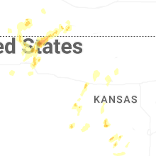
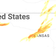
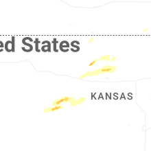
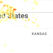
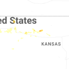
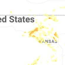
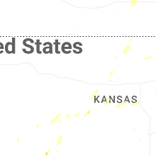


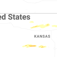


Connect with Interactive Hail Maps