

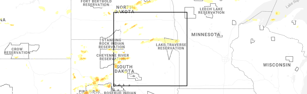
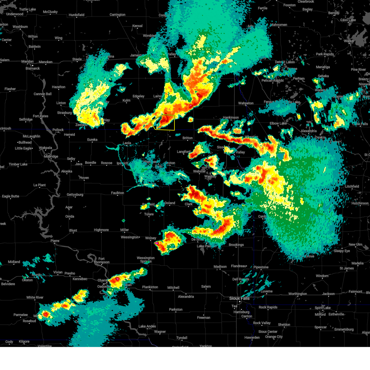
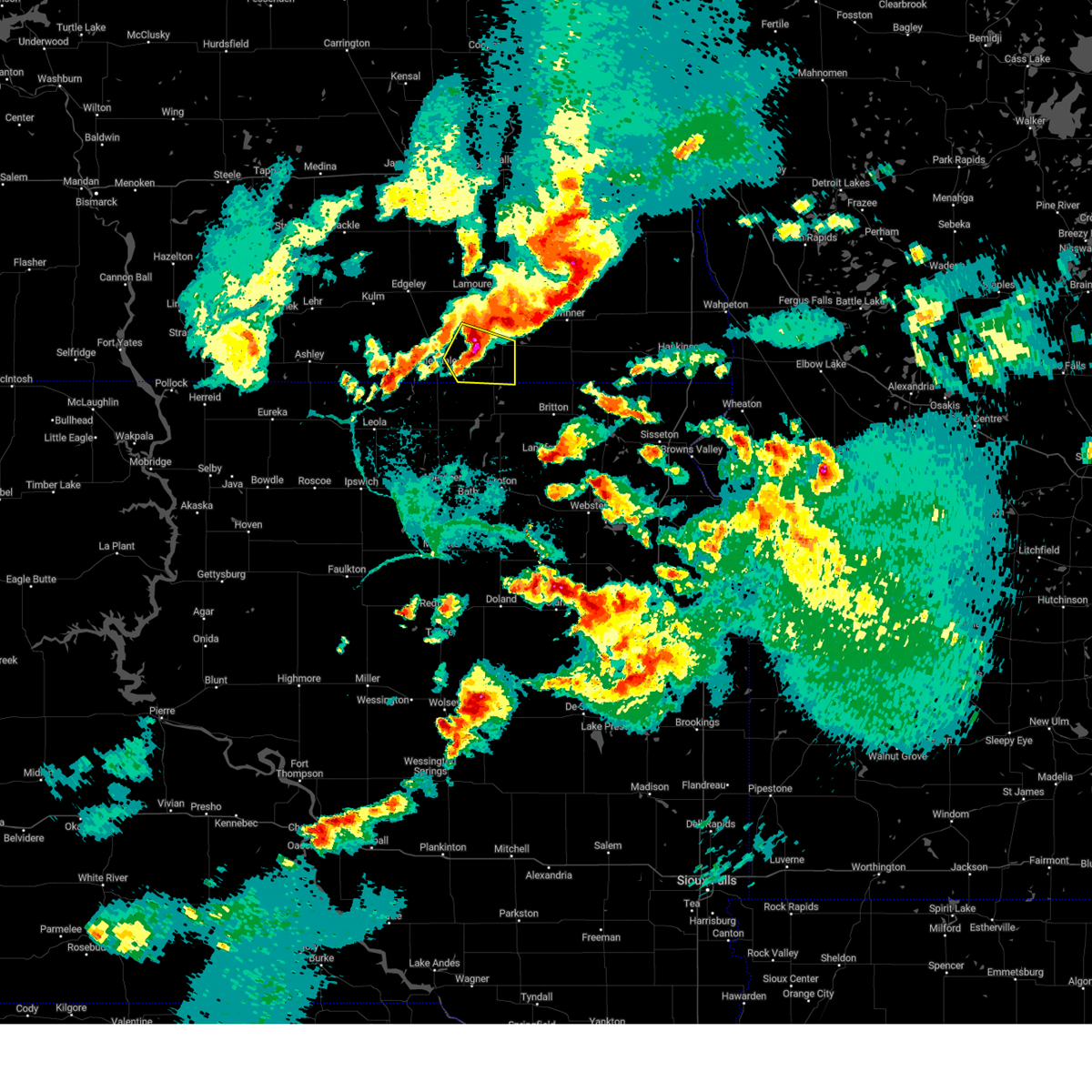
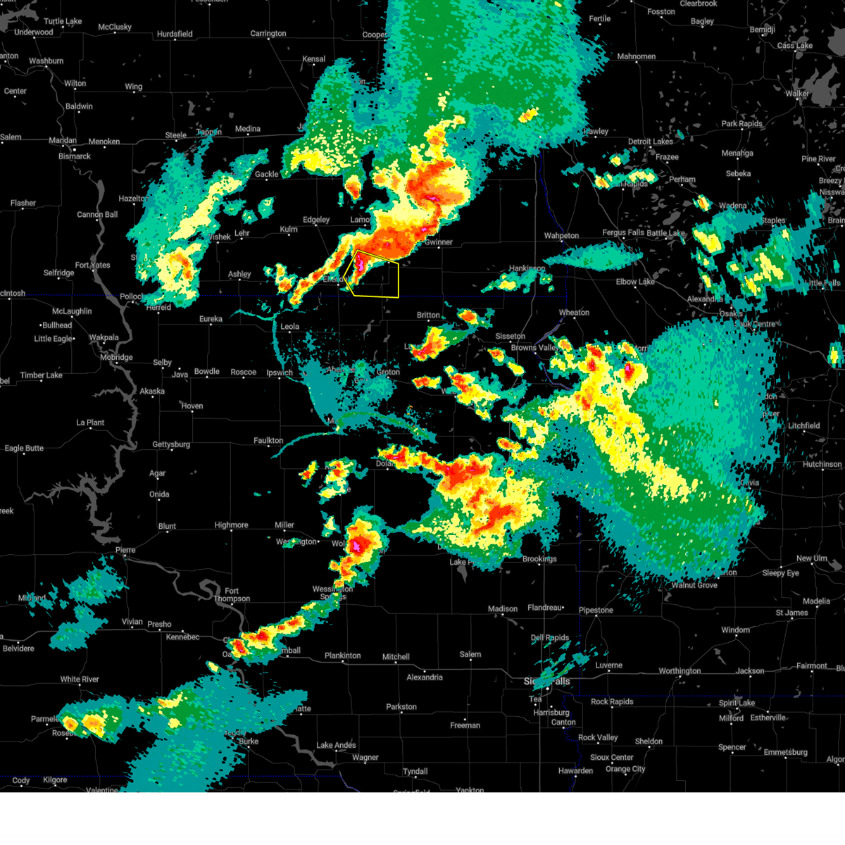
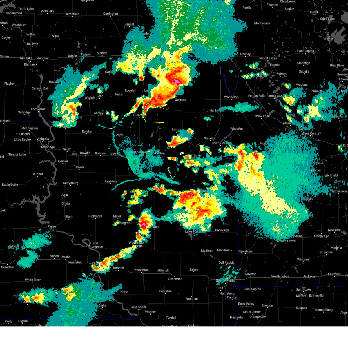
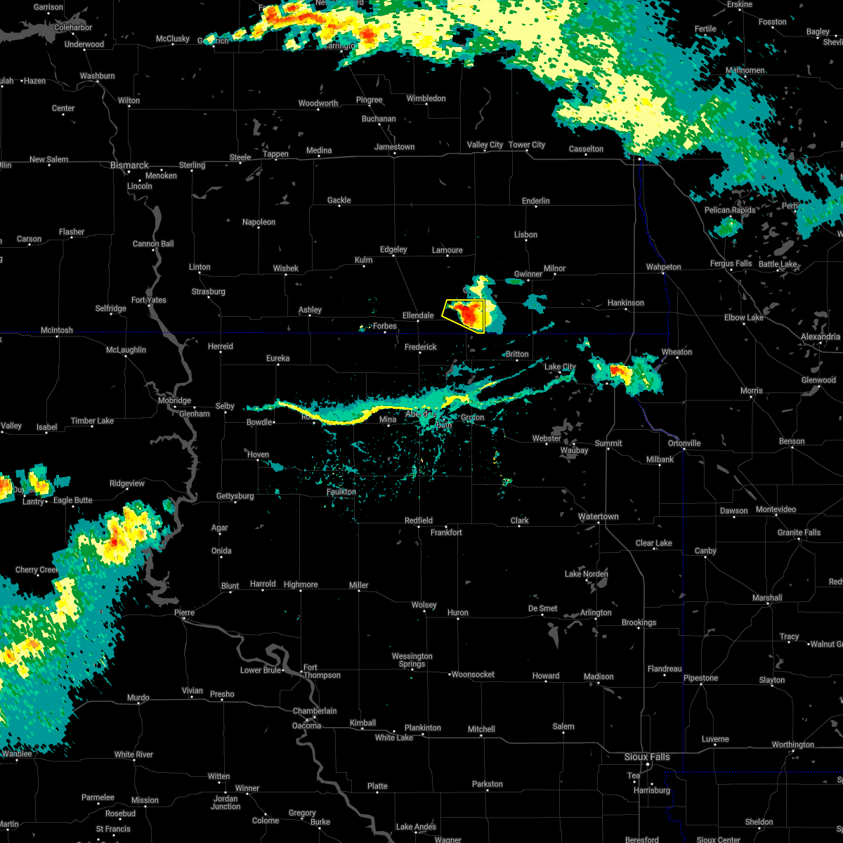
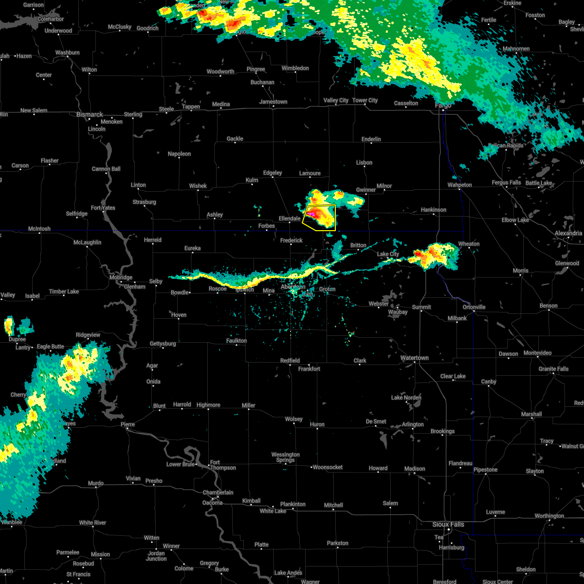
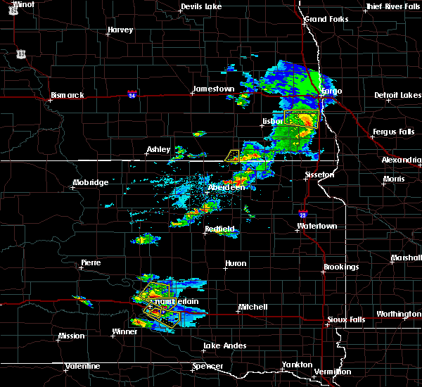
Hail Map for Ludden, ND
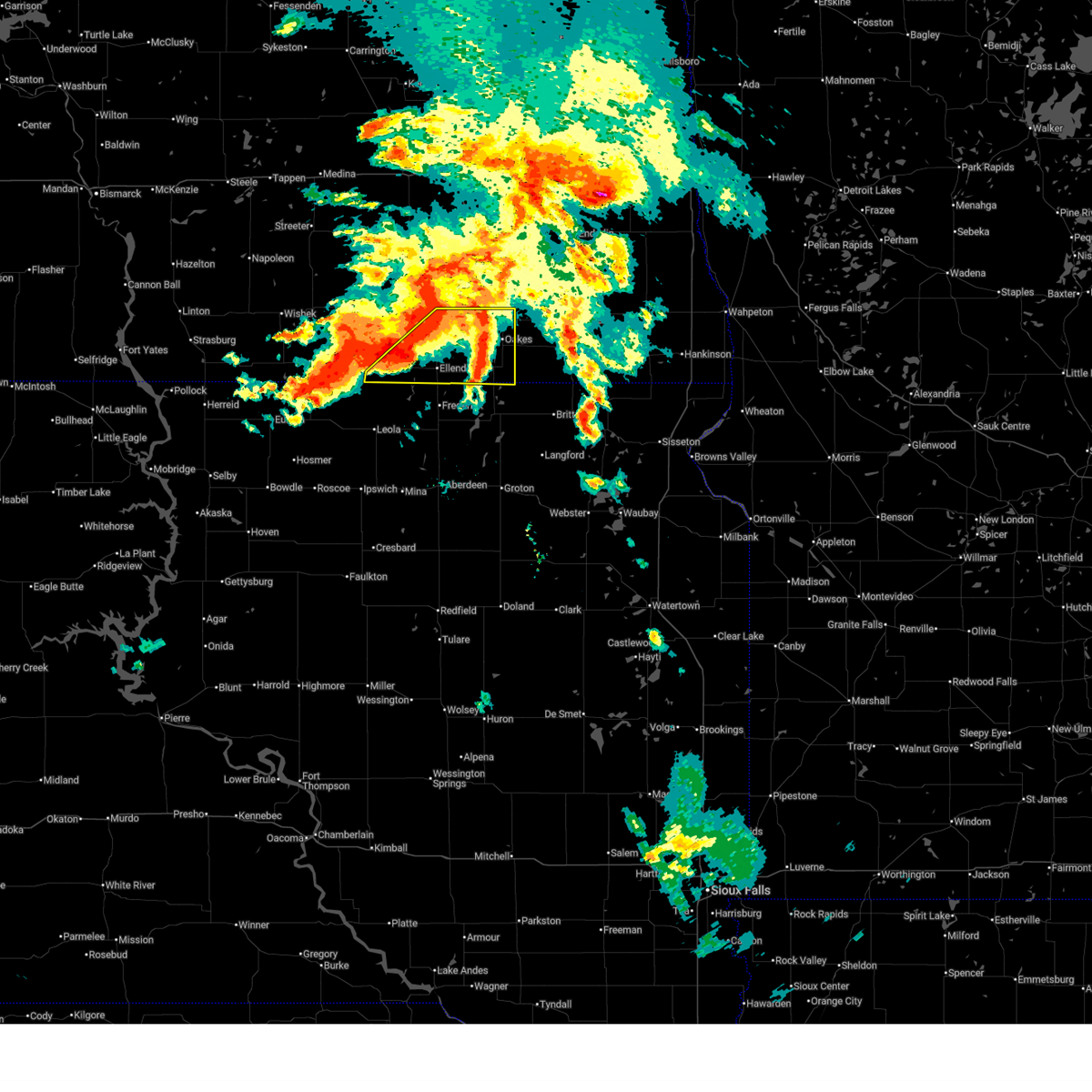
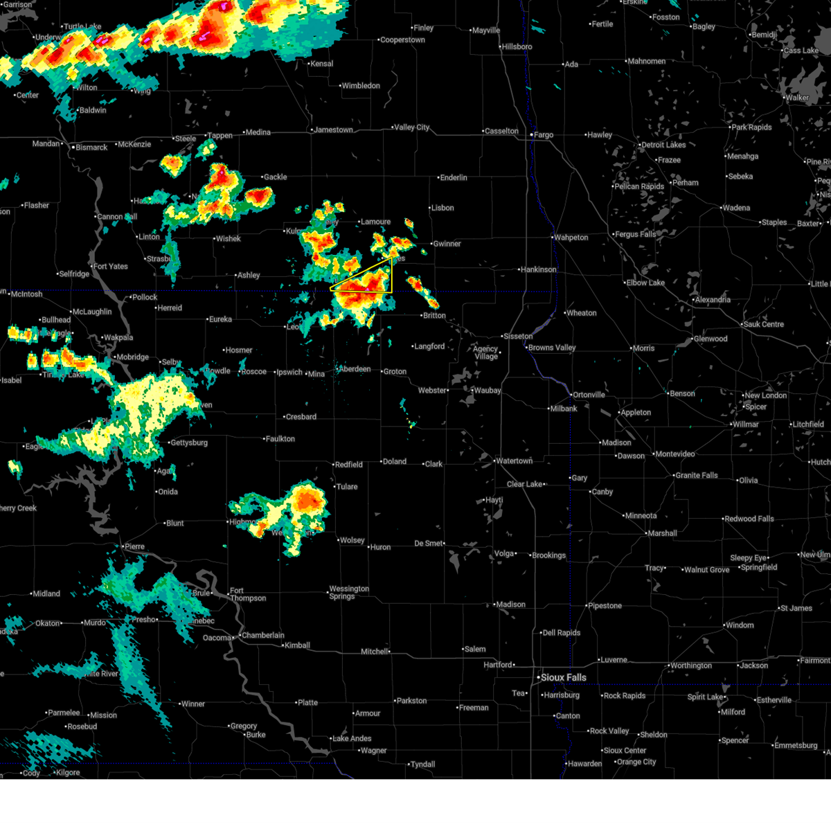
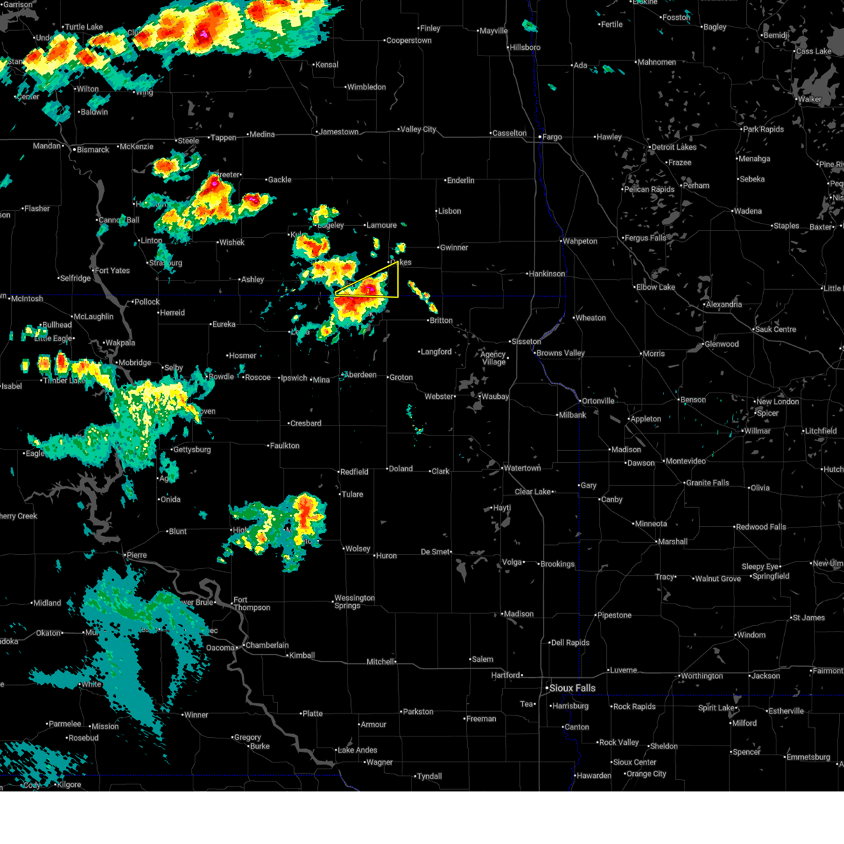
The Ludden, ND area has had 0 reports of on-the-ground hail by trained spotters, and has been under severe weather warnings 16 times during the past 12 months. Doppler radar has detected hail at or near Ludden, ND on 53 occasions, including 6 occasions during the past year.
| Name: | Ludden, ND |
| Where Located: | 41.8 miles NNE of Aberdeen, SD |
| Map: | Google Map for Ludden, ND |
| Population: | 23 |
| Housing Units: | 19 |
| More Info: | Search Google for Ludden, ND |
4
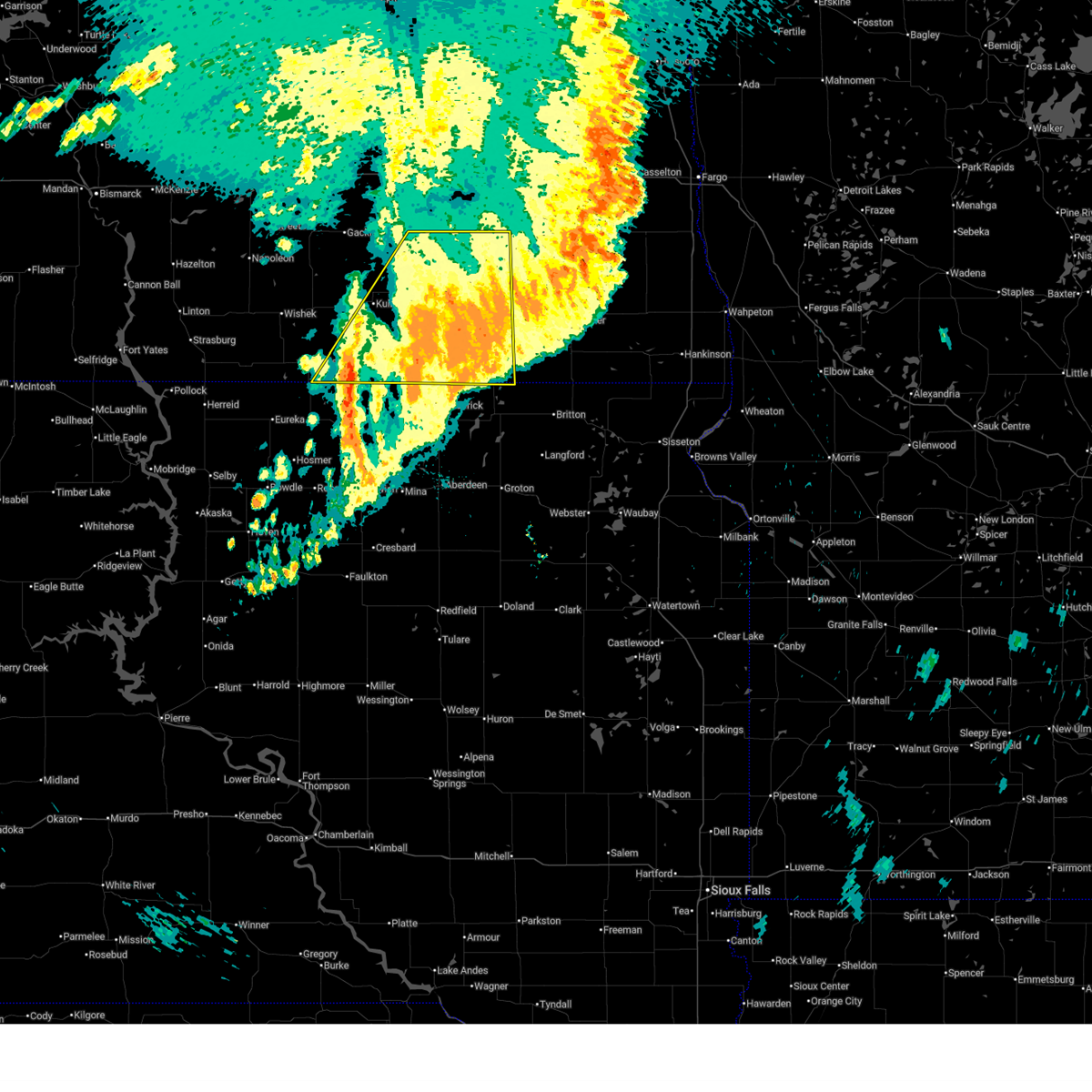
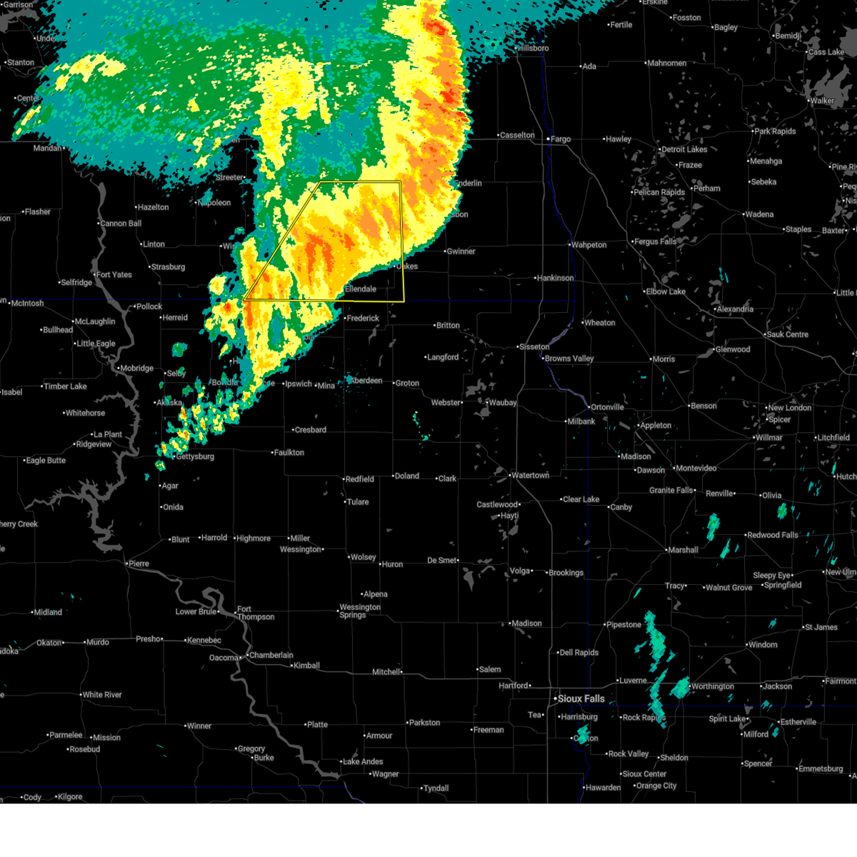
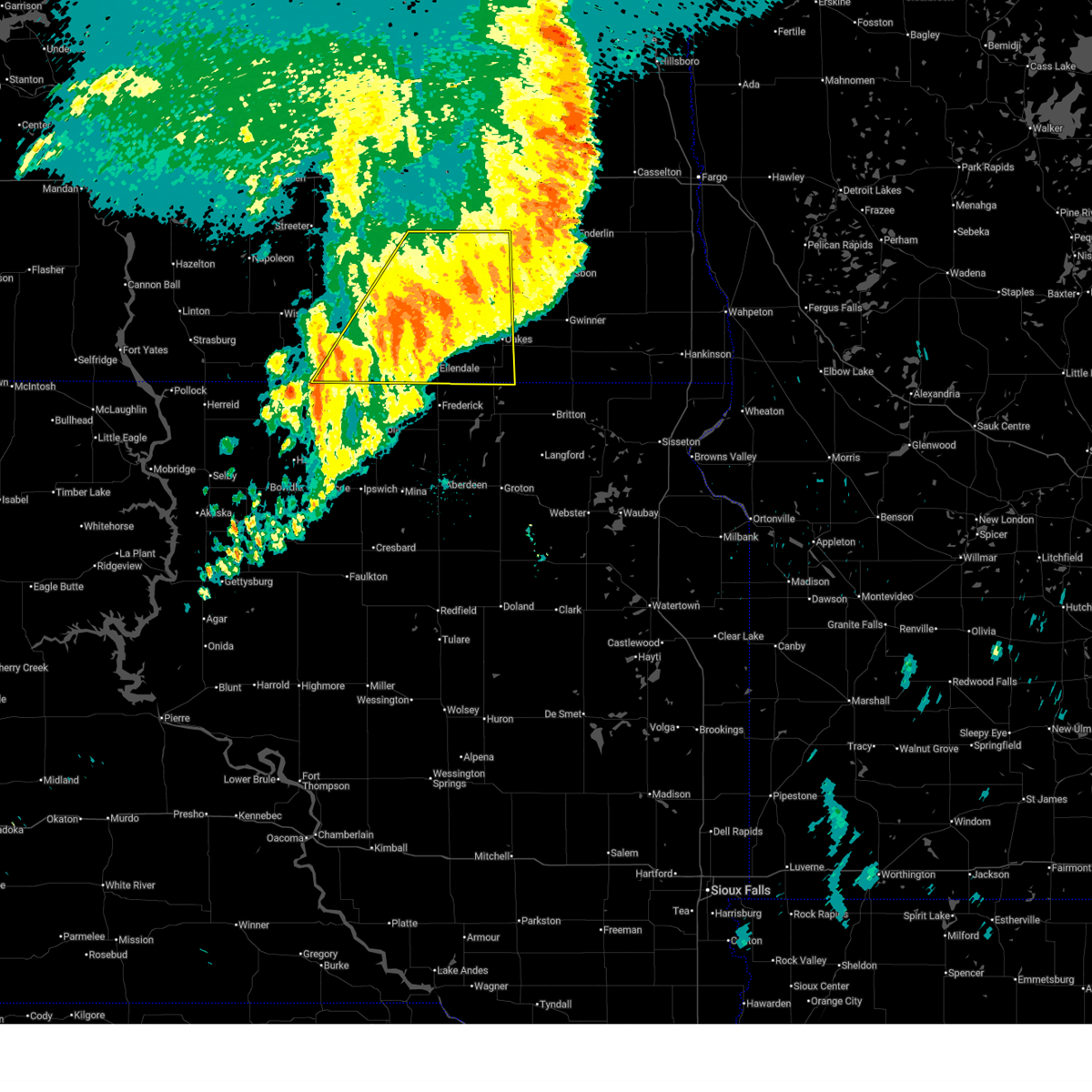
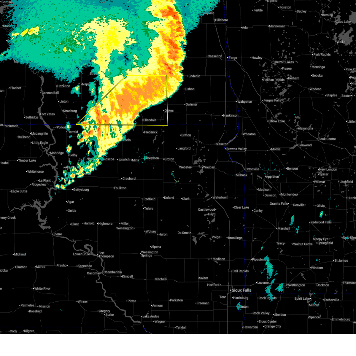
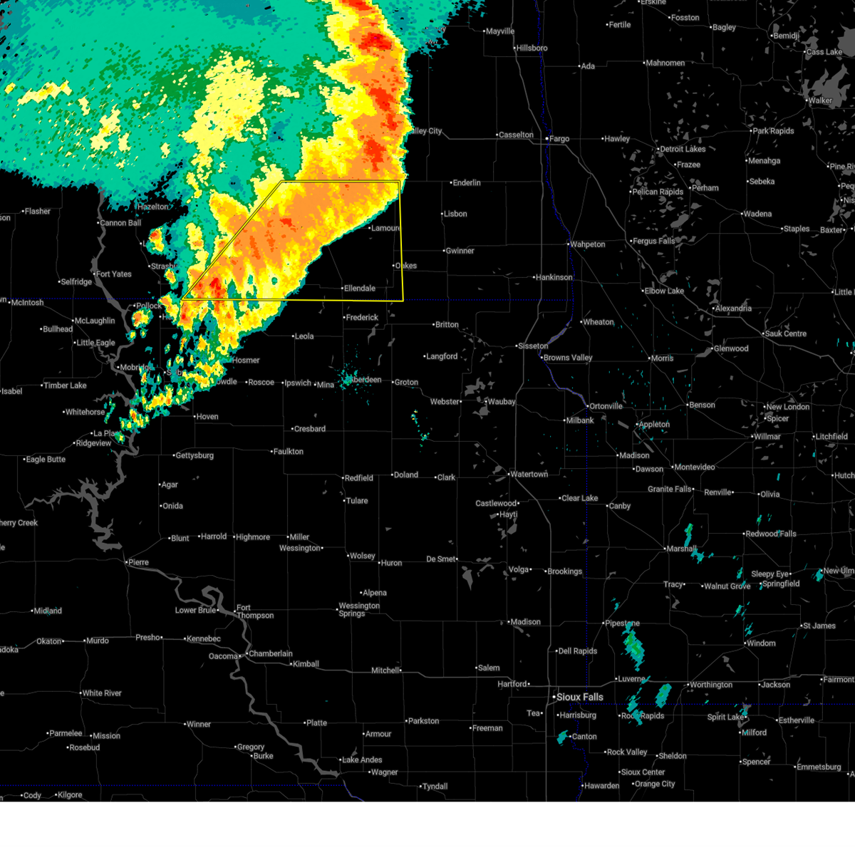
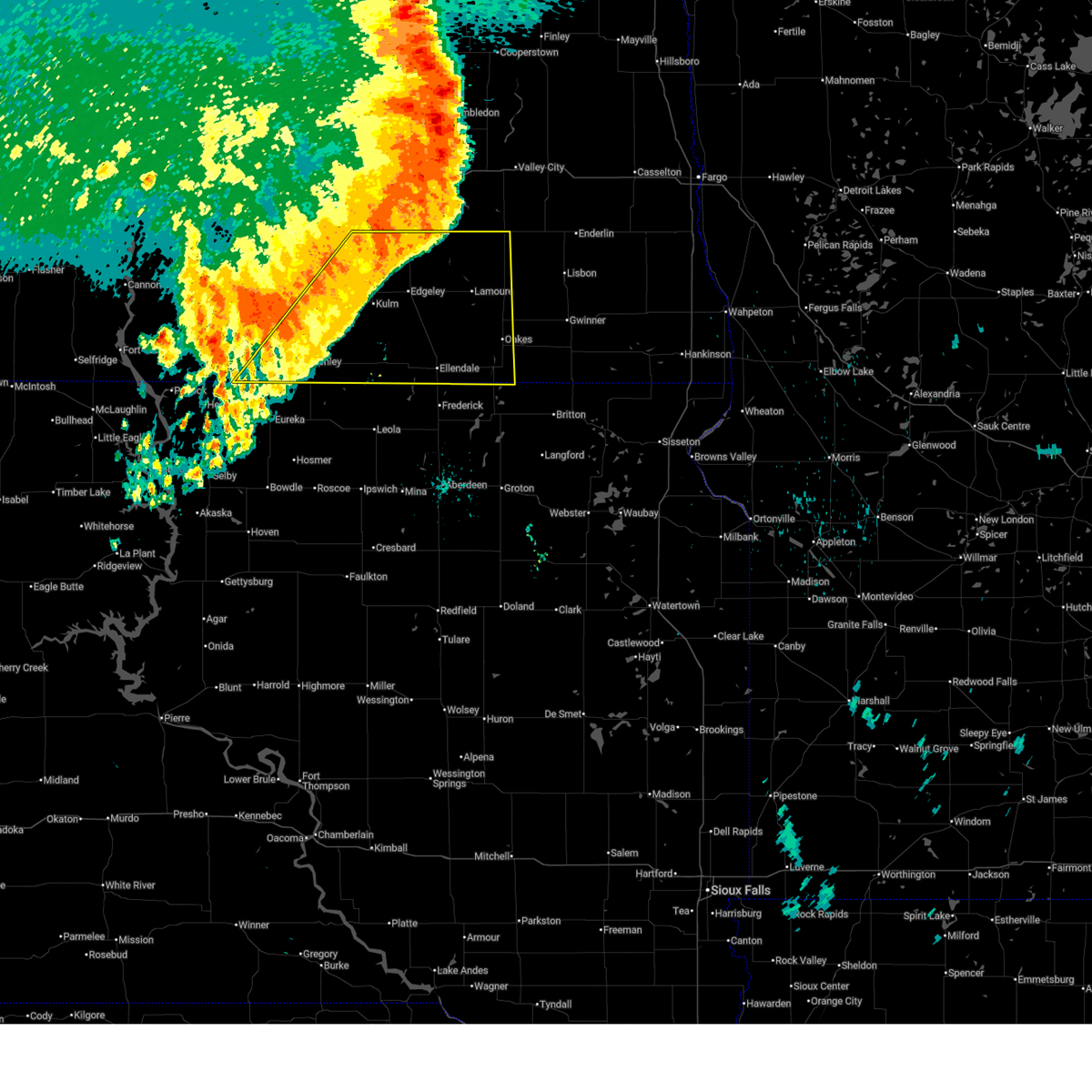
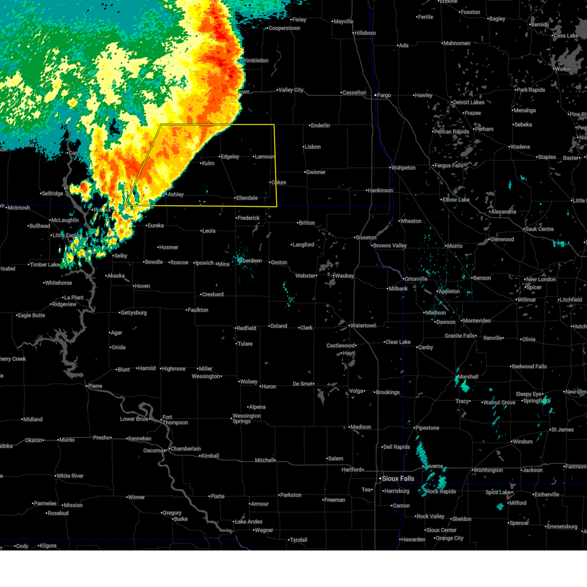
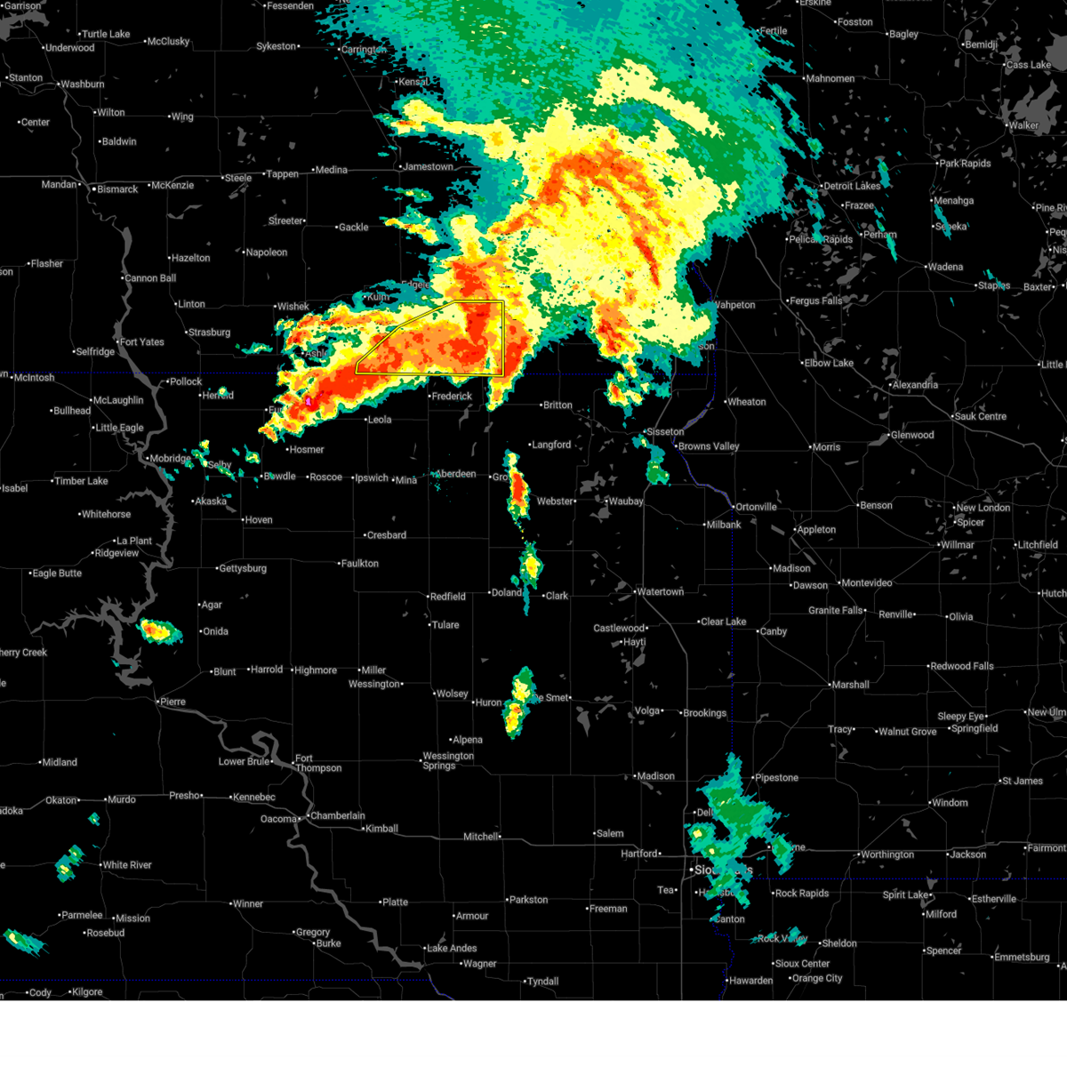
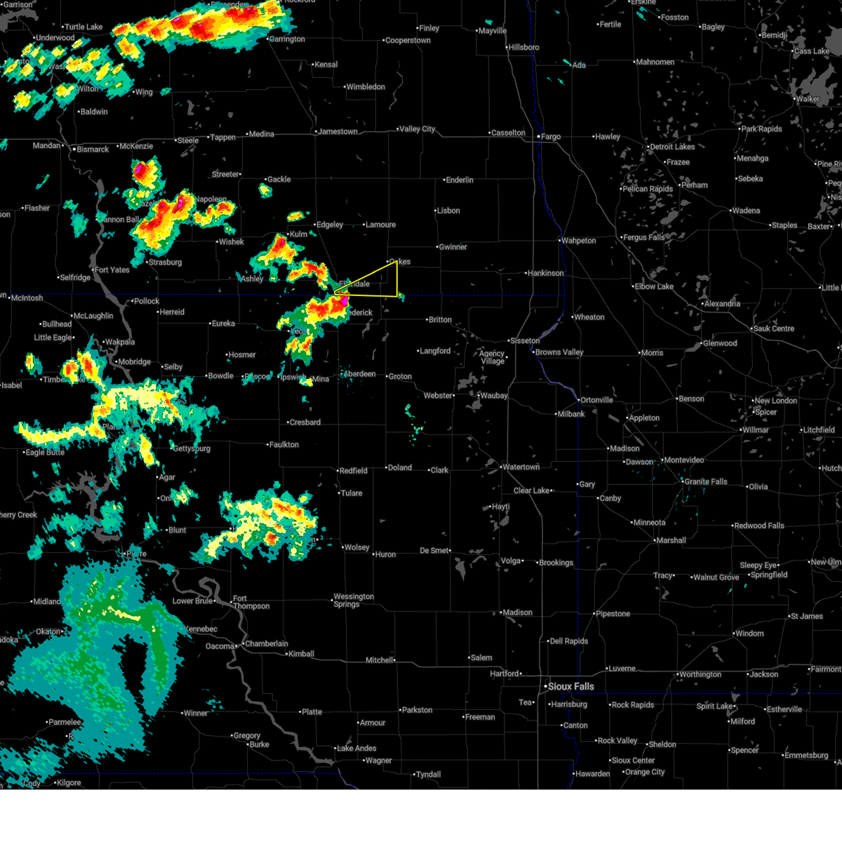
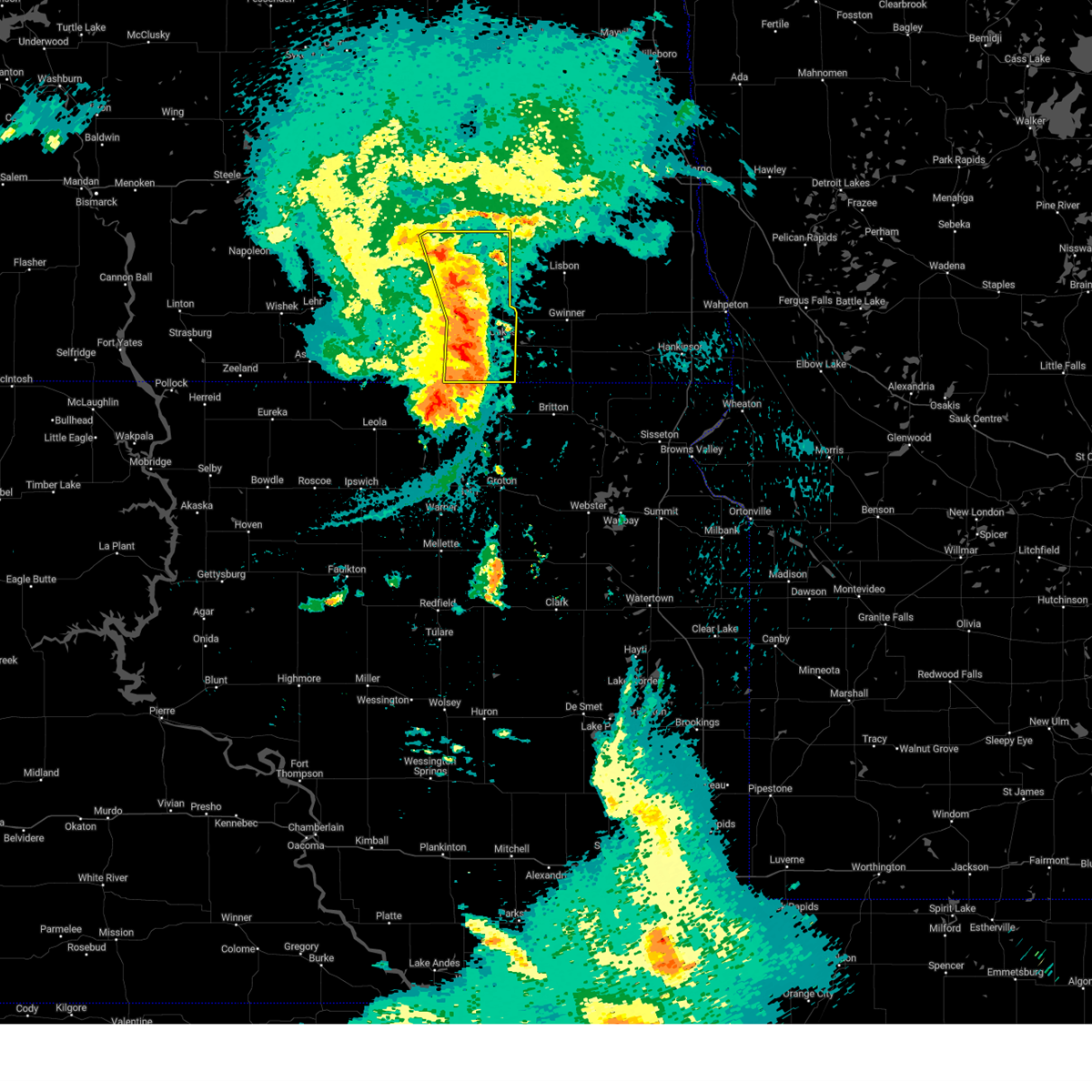
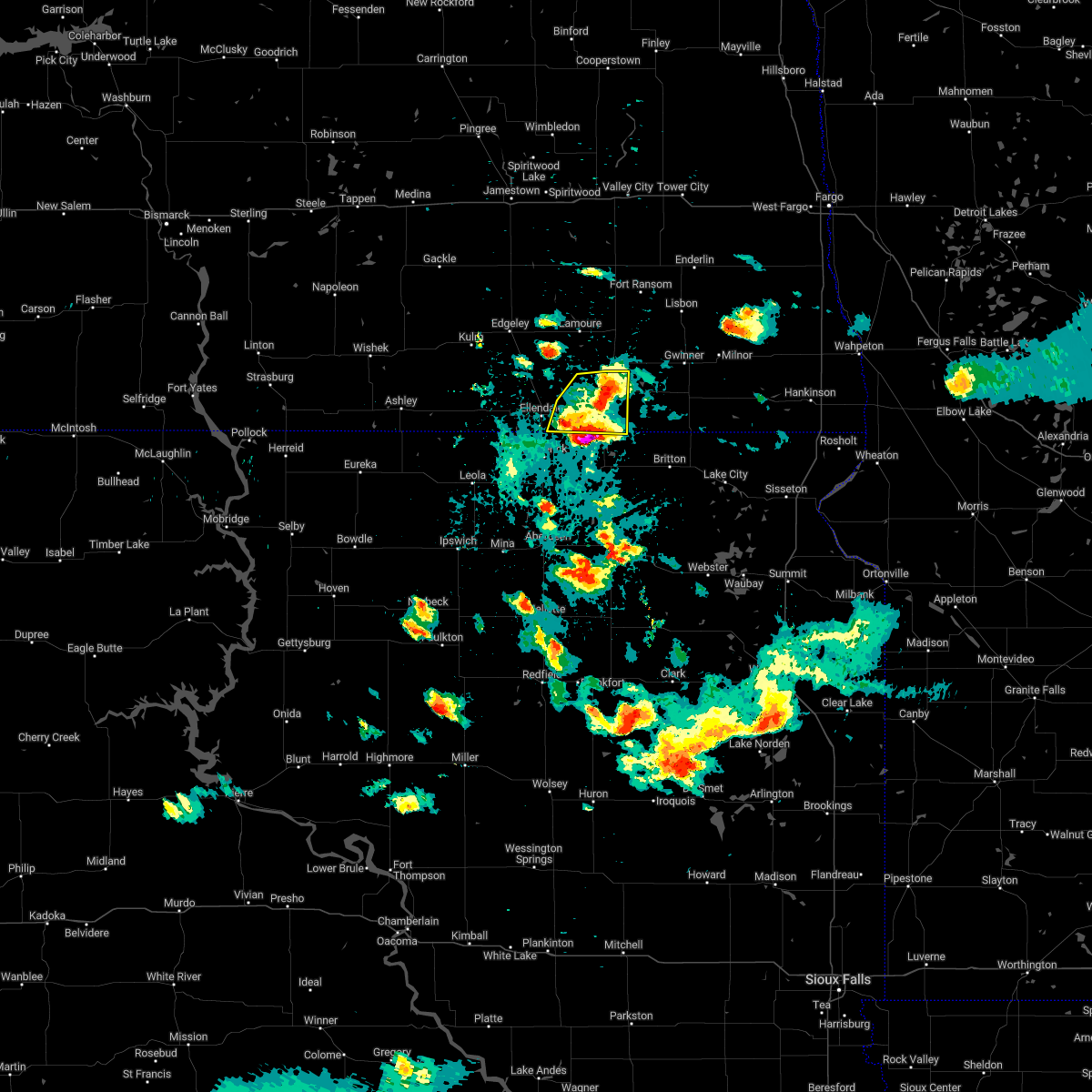
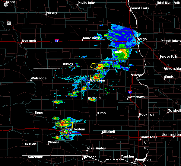
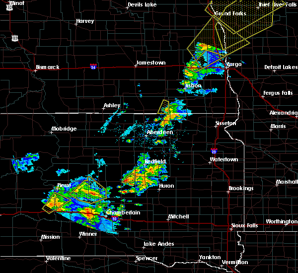
The Top Recent Hail Date for Ludden, ND is Monday, July 14, 2025 (6th out of 53)
Hail and Wind Damage Spotted near Ludden, ND
| Date / Time | Report Details |
|---|---|
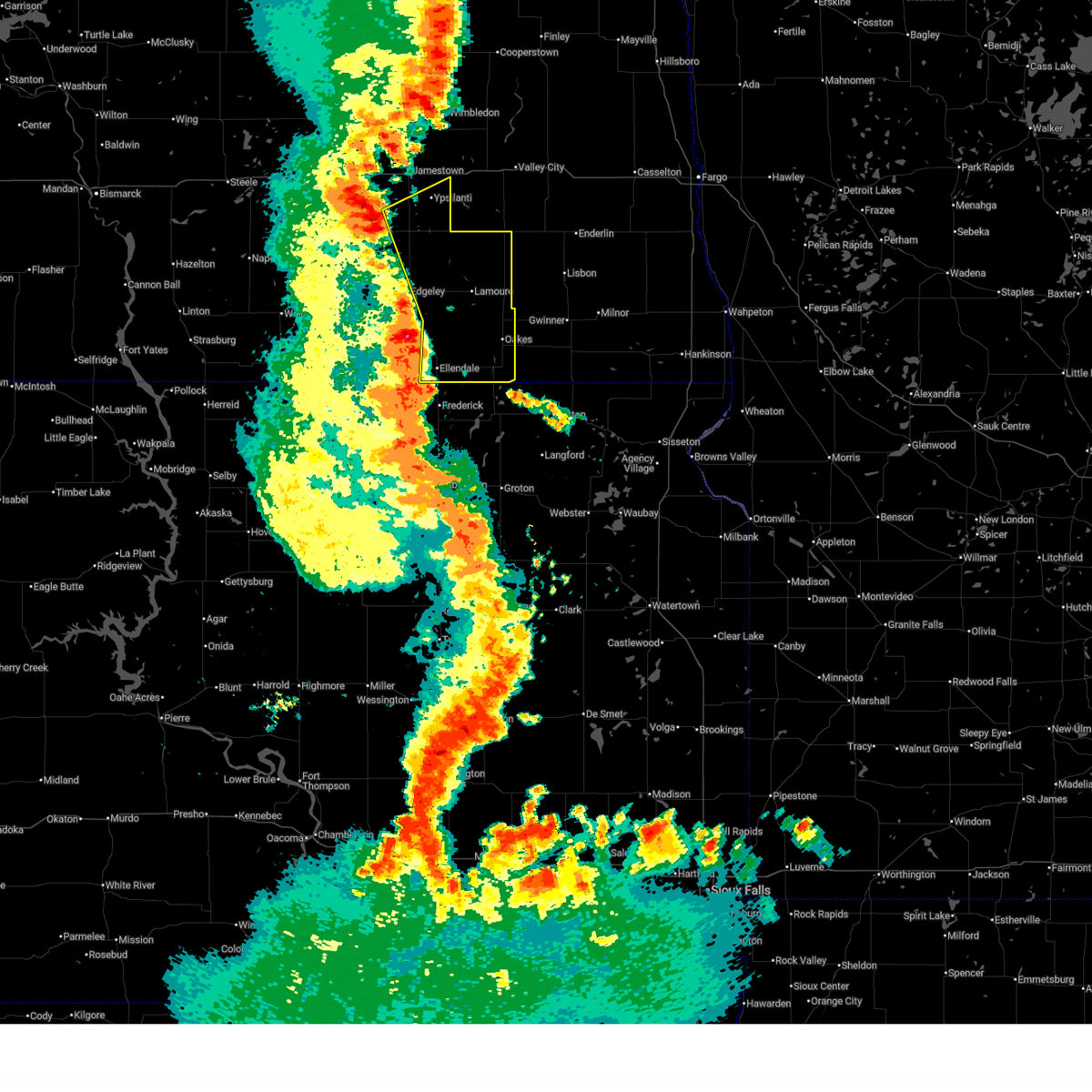
| 6/10/2026 12:15 AM CDT |
 At 1215 am cdt, severe thunderstorms were located along a line from 10 miles southeast of spiritwood to over ludden, or along a line from 16 miles southeast of jamestown to 17 miles east of ellendale, moving northeast at 40 mph (radar indicated). Hazards include 70 mph wind gusts and small hail. Expect considerable tree damage. damage is likely to mobile homes, roofs, and outbuildings. Locations impacted include, oakes, lamoure, marion, ypsilanti, la moure, adrian, montpelier, verona, fullerton, dickey, ludden, la moure city, grand rapids, berlin, glover and guelph. At 1215 am cdt, severe thunderstorms were located along a line from 10 miles southeast of spiritwood to over ludden, or along a line from 16 miles southeast of jamestown to 17 miles east of ellendale, moving northeast at 40 mph (radar indicated). Hazards include 70 mph wind gusts and small hail. Expect considerable tree damage. damage is likely to mobile homes, roofs, and outbuildings. Locations impacted include, oakes, lamoure, marion, ypsilanti, la moure, adrian, montpelier, verona, fullerton, dickey, ludden, la moure city, grand rapids, berlin, glover and guelph.
|
| 6/9/2026 11:56 PM CDT |
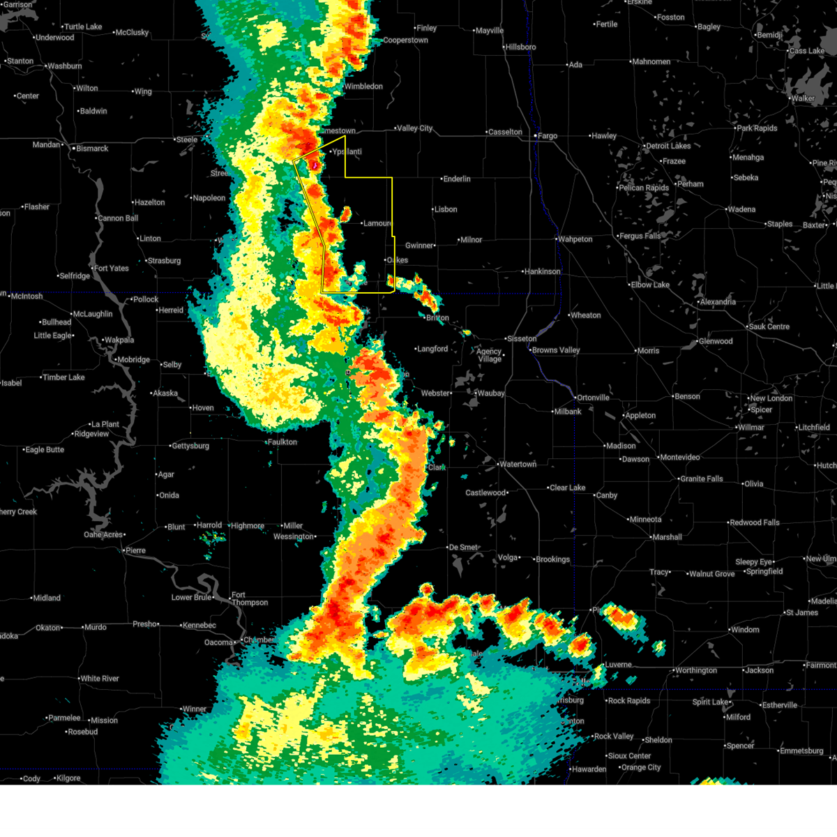 At 1156 pm cdt, severe thunderstorms were located along a line from over ypsilanti to 10 miles west of ludden, or along a line from 12 miles southeast of jamestown to 10 miles east of ellendale, moving northeast at 40 mph (radar indicated). Hazards include 70 mph wind gusts and small hail. Expect considerable tree damage. damage is likely to mobile homes, roofs, and outbuildings. Locations impacted include, ellendale, oakes, lamoure, marion, ypsilanti, la moure, adrian, montpelier, verona, fullerton, dickey, ludden, la moure city, grand rapids, sydney, monango, berlin, glover, guelph and nortonville. At 1156 pm cdt, severe thunderstorms were located along a line from over ypsilanti to 10 miles west of ludden, or along a line from 12 miles southeast of jamestown to 10 miles east of ellendale, moving northeast at 40 mph (radar indicated). Hazards include 70 mph wind gusts and small hail. Expect considerable tree damage. damage is likely to mobile homes, roofs, and outbuildings. Locations impacted include, ellendale, oakes, lamoure, marion, ypsilanti, la moure, adrian, montpelier, verona, fullerton, dickey, ludden, la moure city, grand rapids, sydney, monango, berlin, glover, guelph and nortonville.
|
| 6/9/2026 11:41 PM CDT |
 Svrbis the national weather service in bismarck has issued a * severe thunderstorm warning for, dickey county in southeastern north dakota, lamoure county in southeastern north dakota, southeastern stutsman county in southeastern north dakota, * until 1245 am cdt. * at 1141 pm cdt, severe thunderstorms were located along a line from 6 miles west of montpelier to 8 miles south of ellendale, or along a line from 15 miles south of jamestown to 8 miles south of ellendale, moving northeast at 40 mph (radar indicated). Hazards include 60 mph wind gusts and small hail. expect damage to roofs, siding, and trees Svrbis the national weather service in bismarck has issued a * severe thunderstorm warning for, dickey county in southeastern north dakota, lamoure county in southeastern north dakota, southeastern stutsman county in southeastern north dakota, * until 1245 am cdt. * at 1141 pm cdt, severe thunderstorms were located along a line from 6 miles west of montpelier to 8 miles south of ellendale, or along a line from 15 miles south of jamestown to 8 miles south of ellendale, moving northeast at 40 mph (radar indicated). Hazards include 60 mph wind gusts and small hail. expect damage to roofs, siding, and trees
|
| 8/8/2025 3:56 AM CDT |
 The storms which prompted the warning have weakened below severe limits. therefore, the warning will be allowed to expire. however, gusty winds are still possible with these thunderstorms. a severe thunderstorm watch remains in effect until 700 am cdt for southeastern north dakota. The storms which prompted the warning have weakened below severe limits. therefore, the warning will be allowed to expire. however, gusty winds are still possible with these thunderstorms. a severe thunderstorm watch remains in effect until 700 am cdt for southeastern north dakota.
|
| 8/8/2025 3:41 AM CDT |
 the severe thunderstorm warning has been cancelled and is no longer in effect the severe thunderstorm warning has been cancelled and is no longer in effect
|
| 8/8/2025 3:41 AM CDT |
 At 340 am cdt, severe thunderstorms were located along a line extending from enderlin to 5 miles southwest of ellendale, moving east at 65 mph (radar indicated). Hazards include 60 mph wind gusts. Expect damage to roofs, siding, and trees. Locations impacted include, ellendale, oakes, lamoure, edgeley, kulm, marion, la moure, adrian, verona, fullerton, forbes, dickey, ludden, merricourt city, la moure city, grand rapids, monango, berlin, guelph, and merricourt. At 340 am cdt, severe thunderstorms were located along a line extending from enderlin to 5 miles southwest of ellendale, moving east at 65 mph (radar indicated). Hazards include 60 mph wind gusts. Expect damage to roofs, siding, and trees. Locations impacted include, ellendale, oakes, lamoure, edgeley, kulm, marion, la moure, adrian, verona, fullerton, forbes, dickey, ludden, merricourt city, la moure city, grand rapids, monango, berlin, guelph, and merricourt.
|
| 8/8/2025 3:27 AM CDT |
 At 327 am cdt, severe thunderstorms were located along a line extending from 10 miles west of enderlin to forbes, moving east at 65 mph (radar indicated). Hazards include 60 mph wind gusts. Expect damage to roofs, siding, and trees. Locations impacted include, ellendale, oakes, lamoure, ashley, edgeley, kulm, marion, la moure, adrian, zeeland, verona, lehr, jud, fullerton, forbes, dickey, ludden, venturia, la moure city, and merricourt city. At 327 am cdt, severe thunderstorms were located along a line extending from 10 miles west of enderlin to forbes, moving east at 65 mph (radar indicated). Hazards include 60 mph wind gusts. Expect damage to roofs, siding, and trees. Locations impacted include, ellendale, oakes, lamoure, ashley, edgeley, kulm, marion, la moure, adrian, zeeland, verona, lehr, jud, fullerton, forbes, dickey, ludden, venturia, la moure city, and merricourt city.
|
| 8/8/2025 3:14 AM CDT |
 At 314 am cdt, severe thunderstorms were located along a line extending from 5 miles southeast of litchville to 8 miles west of spring creek colony, moving east at 65 mph (radar indicated). Hazards include 60 mph wind gusts. Expect damage to roofs, siding, and trees. Locations impacted include, ellendale, oakes, lamoure, ashley, edgeley, kulm, marion, la moure, adrian, zeeland, verona, lehr, jud, fullerton, forbes, dickey, ludden, venturia, la moure city, and merricourt city. At 314 am cdt, severe thunderstorms were located along a line extending from 5 miles southeast of litchville to 8 miles west of spring creek colony, moving east at 65 mph (radar indicated). Hazards include 60 mph wind gusts. Expect damage to roofs, siding, and trees. Locations impacted include, ellendale, oakes, lamoure, ashley, edgeley, kulm, marion, la moure, adrian, zeeland, verona, lehr, jud, fullerton, forbes, dickey, ludden, venturia, la moure city, and merricourt city.
|
| 8/8/2025 3:03 AM CDT |
 At 303 am cdt, severe thunderstorms were located along a line extending from marion to 7 miles southeast of ashley, moving east at 65 mph (radar indicated). Hazards include 60 mph wind gusts. Expect damage to roofs, siding, and trees. Locations impacted include, ellendale, oakes, lamoure, ashley, edgeley, kulm, marion, la moure, adrian, zeeland, verona, lehr, jud, fullerton, forbes, dickey, ludden, venturia, la moure city, and merricourt city. At 303 am cdt, severe thunderstorms were located along a line extending from marion to 7 miles southeast of ashley, moving east at 65 mph (radar indicated). Hazards include 60 mph wind gusts. Expect damage to roofs, siding, and trees. Locations impacted include, ellendale, oakes, lamoure, ashley, edgeley, kulm, marion, la moure, adrian, zeeland, verona, lehr, jud, fullerton, forbes, dickey, ludden, venturia, la moure city, and merricourt city.
|
| 8/8/2025 2:49 AM CDT |
 Svrbis the national weather service in bismarck has issued a * severe thunderstorm warning for, lamoure county in southeastern north dakota, dickey county in southeastern north dakota, eastern logan county in southeastern north dakota, mcintosh county in southeastern north dakota, * until 400 am cdt. * at 249 am cdt, severe thunderstorms were located along a line extending from near adrian to near venturia, moving east at 65 mph (radar indicated). Hazards include 60 mph wind gusts. expect damage to roofs, siding, and trees Svrbis the national weather service in bismarck has issued a * severe thunderstorm warning for, lamoure county in southeastern north dakota, dickey county in southeastern north dakota, eastern logan county in southeastern north dakota, mcintosh county in southeastern north dakota, * until 400 am cdt. * at 249 am cdt, severe thunderstorms were located along a line extending from near adrian to near venturia, moving east at 65 mph (radar indicated). Hazards include 60 mph wind gusts. expect damage to roofs, siding, and trees
|
| 8/5/2025 7:34 PM CDT |
 At 734 pm cdt, severe thunderstorms were located along a line extending from 7 miles northeast of oakes to 7 miles southeast of ellendale, moving east at 30 mph (radar indicated). Hazards include 60 mph wind gusts and penny size hail. Expect damage to roofs, siding, and trees. Locations impacted include, ellendale, oakes, fullerton, ludden, guelph, and glover. At 734 pm cdt, severe thunderstorms were located along a line extending from 7 miles northeast of oakes to 7 miles southeast of ellendale, moving east at 30 mph (radar indicated). Hazards include 60 mph wind gusts and penny size hail. Expect damage to roofs, siding, and trees. Locations impacted include, ellendale, oakes, fullerton, ludden, guelph, and glover.
|
| 8/5/2025 7:16 PM CDT |
 At 716 pm cdt, severe thunderstorms were located along a line extending from 5 miles north of oakes to near ellendale, moving east at 40 mph (radar indicated). Hazards include 70 mph wind gusts and nickel size hail. Expect considerable tree damage. damage is likely to mobile homes, roofs, and outbuildings. Locations impacted include, ellendale, oakes, fullerton, forbes, ludden, monango, guelph, and glover. At 716 pm cdt, severe thunderstorms were located along a line extending from 5 miles north of oakes to near ellendale, moving east at 40 mph (radar indicated). Hazards include 70 mph wind gusts and nickel size hail. Expect considerable tree damage. damage is likely to mobile homes, roofs, and outbuildings. Locations impacted include, ellendale, oakes, fullerton, forbes, ludden, monango, guelph, and glover.
|
| 8/5/2025 6:38 PM CDT |
 Svrbis the national weather service in bismarck has issued a * severe thunderstorm warning for, dickey county in southeastern north dakota, * until 745 pm cdt. * at 637 pm cdt, severe thunderstorms were located along a line extending from 6 miles northwest of fullerton to 5 miles north of spring creek colony, moving east at 30 mph (radar indicated). Hazards include 70 mph wind gusts and nickel size hail. Expect considerable tree damage. Damage is likely to mobile homes, roofs, and outbuildings. Svrbis the national weather service in bismarck has issued a * severe thunderstorm warning for, dickey county in southeastern north dakota, * until 745 pm cdt. * at 637 pm cdt, severe thunderstorms were located along a line extending from 6 miles northwest of fullerton to 5 miles north of spring creek colony, moving east at 30 mph (radar indicated). Hazards include 70 mph wind gusts and nickel size hail. Expect considerable tree damage. Damage is likely to mobile homes, roofs, and outbuildings.
|
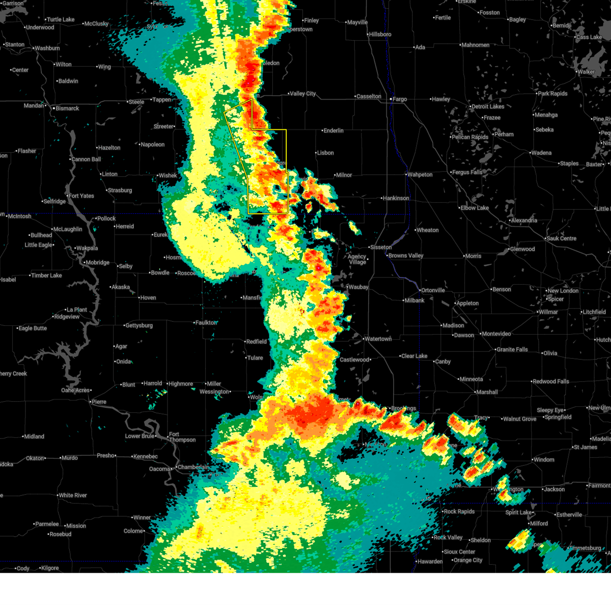
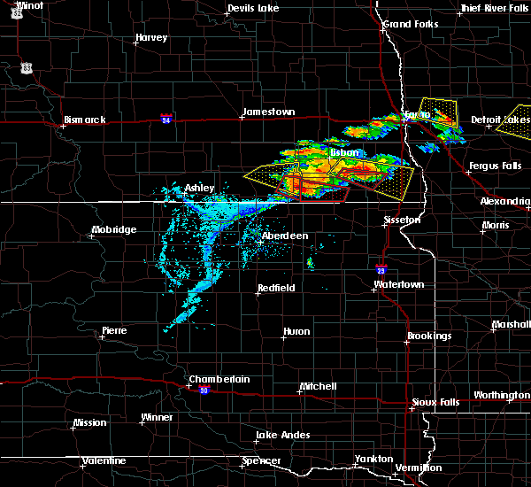
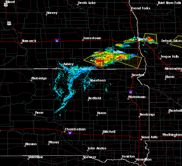
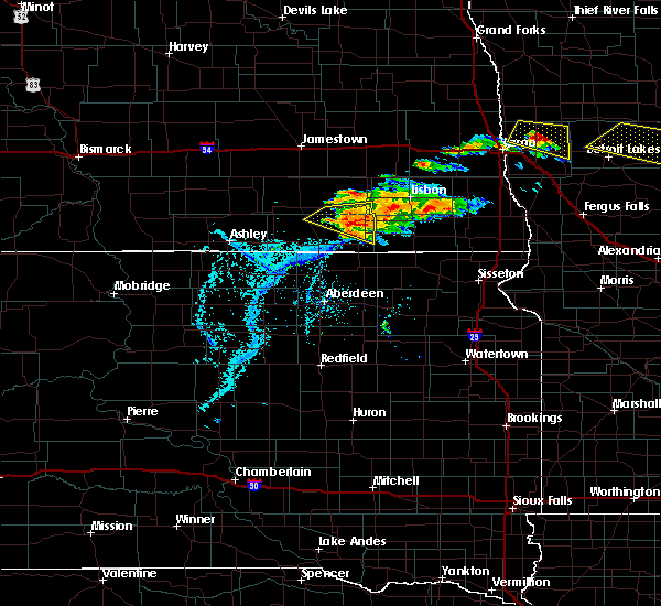
| 7/14/2025 11:09 PM CDT |
 At 1109 pm cdt, a severe thunderstorm was located near ludden, or 15 miles east of ellendale, moving northeast at 15 mph (radar indicated). Hazards include ping pong ball size hail and 60 mph wind gusts. People and animals outdoors will be injured. expect hail damage to roofs, siding, windows, and vehicles. expect wind damage to roofs, siding, and trees. Locations impacted include, ludden and guelph. At 1109 pm cdt, a severe thunderstorm was located near ludden, or 15 miles east of ellendale, moving northeast at 15 mph (radar indicated). Hazards include ping pong ball size hail and 60 mph wind gusts. People and animals outdoors will be injured. expect hail damage to roofs, siding, windows, and vehicles. expect wind damage to roofs, siding, and trees. Locations impacted include, ludden and guelph.
|
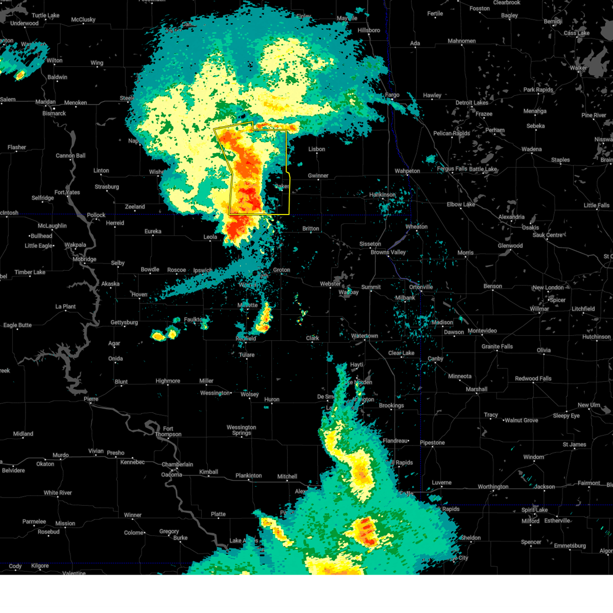
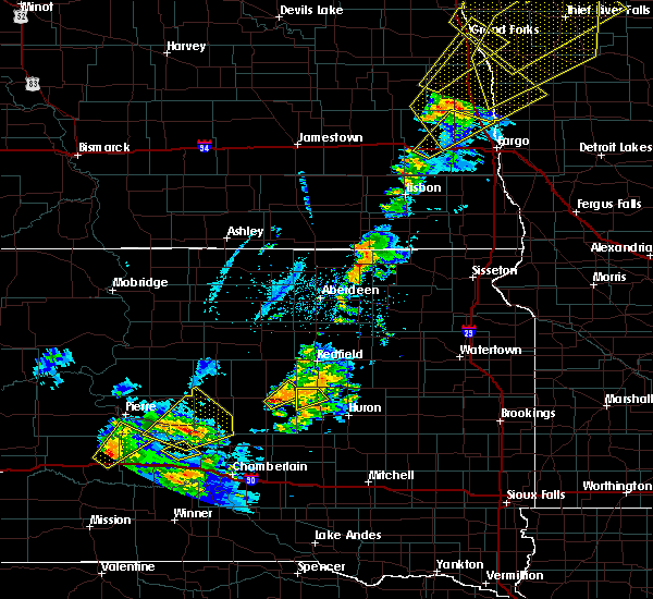
| 7/14/2025 11:00 PM CDT |
 At 1100 pm cdt, a severe thunderstorm was located near ludden, or 15 miles east of ellendale, moving northeast at 25 mph (radar indicated). Hazards include ping pong ball size hail and 60 mph wind gusts. People and animals outdoors will be injured. expect hail damage to roofs, siding, windows, and vehicles. expect wind damage to roofs, siding, and trees. Locations impacted include, ludden and guelph. At 1100 pm cdt, a severe thunderstorm was located near ludden, or 15 miles east of ellendale, moving northeast at 25 mph (radar indicated). Hazards include ping pong ball size hail and 60 mph wind gusts. People and animals outdoors will be injured. expect hail damage to roofs, siding, windows, and vehicles. expect wind damage to roofs, siding, and trees. Locations impacted include, ludden and guelph.
|
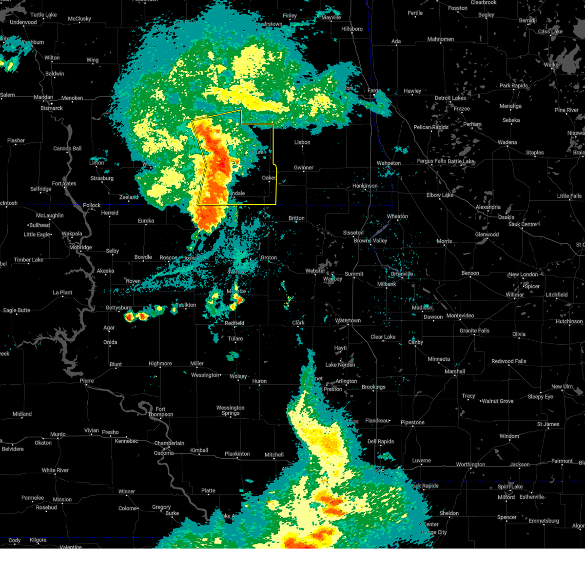
| 7/14/2025 10:32 PM CDT |
 Svrbis the national weather service in bismarck has issued a * severe thunderstorm warning for, southeastern dickey county in southeastern north dakota, * until 1130 pm cdt. * at 1032 pm cdt, a severe thunderstorm was located 6 miles northeast of frederick, or 8 miles southeast of ellendale, moving east at 25 mph (radar indicated). Hazards include ping pong ball size hail and 60 mph wind gusts. People and animals outdoors will be injured. expect hail damage to roofs, siding, windows, and vehicles. Expect wind damage to roofs, siding, and trees. Svrbis the national weather service in bismarck has issued a * severe thunderstorm warning for, southeastern dickey county in southeastern north dakota, * until 1130 pm cdt. * at 1032 pm cdt, a severe thunderstorm was located 6 miles northeast of frederick, or 8 miles southeast of ellendale, moving east at 25 mph (radar indicated). Hazards include ping pong ball size hail and 60 mph wind gusts. People and animals outdoors will be injured. expect hail damage to roofs, siding, windows, and vehicles. Expect wind damage to roofs, siding, and trees.
|
| 6/20/2025 10:49 PM CDT |
 Svrbis the national weather service in bismarck has issued a * severe thunderstorm warning for, dickey county in southeastern north dakota, * until 1130 pm cdt. * at 1049 pm cdt, severe thunderstorms were located along a line extending from 5 miles southeast of edgeley to near elm lake, moving east at 105 mph (radar indicated). Hazards include 60 mph wind gusts. expect damage to roofs, siding, and trees Svrbis the national weather service in bismarck has issued a * severe thunderstorm warning for, dickey county in southeastern north dakota, * until 1130 pm cdt. * at 1049 pm cdt, severe thunderstorms were located along a line extending from 5 miles southeast of edgeley to near elm lake, moving east at 105 mph (radar indicated). Hazards include 60 mph wind gusts. expect damage to roofs, siding, and trees
|
| 6/20/2025 10:40 PM CDT |
 Svrbis the national weather service in bismarck has issued a * severe thunderstorm warning for, dickey county in southeastern north dakota, * until 1130 pm cdt. * at 1039 pm cdt, severe thunderstorms were located along a line extending from 4 miles east of kulm to near spring creek colony, moving east at 105 mph (radar indicated). Hazards include 60 mph wind gusts. expect damage to roofs, siding, and trees Svrbis the national weather service in bismarck has issued a * severe thunderstorm warning for, dickey county in southeastern north dakota, * until 1130 pm cdt. * at 1039 pm cdt, severe thunderstorms were located along a line extending from 4 miles east of kulm to near spring creek colony, moving east at 105 mph (radar indicated). Hazards include 60 mph wind gusts. expect damage to roofs, siding, and trees
|
| 7/29/2024 11:11 PM CDT |
 the severe thunderstorm warning has been cancelled and is no longer in effect the severe thunderstorm warning has been cancelled and is no longer in effect
|
| 7/29/2024 10:53 PM CDT |
 the severe thunderstorm warning has been cancelled and is no longer in effect the severe thunderstorm warning has been cancelled and is no longer in effect
|
| 7/29/2024 10:53 PM CDT |
 At 1053 pm cdt, severe thunderstorms were located along a line extending from near marion to 4 miles south of la moure to 9 miles northwest of hecla, moving east at 40 mph (radar indicated). Hazards include 60 mph wind gusts. Expect damage to roofs, siding, and trees. Locations impacted include, oakes, lamoure, marion, la moure, adrian, verona, fullerton, dickey, ludden, la moure city, grand rapids, berlin, guelph, and glover. At 1053 pm cdt, severe thunderstorms were located along a line extending from near marion to 4 miles south of la moure to 9 miles northwest of hecla, moving east at 40 mph (radar indicated). Hazards include 60 mph wind gusts. Expect damage to roofs, siding, and trees. Locations impacted include, oakes, lamoure, marion, la moure, adrian, verona, fullerton, dickey, ludden, la moure city, grand rapids, berlin, guelph, and glover.
|
| 7/29/2024 10:42 PM CDT |
 At 1042 pm cdt, severe thunderstorms were located along a line extending from near marion to 4 miles south of la moure to 9 miles northwest of hecla, moving east at 40 mph (radar indicated). Hazards include 60 mph wind gusts. Expect damage to roofs, siding, and trees. Locations impacted include, ellendale, oakes, lamoure, edgeley, marion, la moure, adrian, verona, fullerton, dickey, ludden, la moure city, grand rapids, monango, berlin, guelph, nortonville, and glover. At 1042 pm cdt, severe thunderstorms were located along a line extending from near marion to 4 miles south of la moure to 9 miles northwest of hecla, moving east at 40 mph (radar indicated). Hazards include 60 mph wind gusts. Expect damage to roofs, siding, and trees. Locations impacted include, ellendale, oakes, lamoure, edgeley, marion, la moure, adrian, verona, fullerton, dickey, ludden, la moure city, grand rapids, monango, berlin, guelph, nortonville, and glover.
|
| 7/29/2024 10:27 PM CDT |
 Svrbis the national weather service in bismarck has issued a * severe thunderstorm warning for, lamoure county in southeastern north dakota, dickey county in southeastern north dakota, southeastern stutsman county in southeastern north dakota, * until 1130 pm cdt. * at 1027 pm cdt, severe thunderstorms were located along a line extending from near adrian to 9 miles northwest of fullerton to 5 miles southwest of ellendale, moving east at 40 mph (radar indicated). Hazards include 60 mph wind gusts. expect damage to roofs, siding, and trees Svrbis the national weather service in bismarck has issued a * severe thunderstorm warning for, lamoure county in southeastern north dakota, dickey county in southeastern north dakota, southeastern stutsman county in southeastern north dakota, * until 1130 pm cdt. * at 1027 pm cdt, severe thunderstorms were located along a line extending from near adrian to 9 miles northwest of fullerton to 5 miles southwest of ellendale, moving east at 40 mph (radar indicated). Hazards include 60 mph wind gusts. expect damage to roofs, siding, and trees
|
| 6/18/2024 2:38 AM CDT |
 The storms which prompted the warning have weakened below severe limits. therefore, the warning will be allowed to expire. however, gusty winds are still possible with these thunderstorms. a severe thunderstorm watch remains in effect until 600 am cdt for southeastern north dakota. The storms which prompted the warning have weakened below severe limits. therefore, the warning will be allowed to expire. however, gusty winds are still possible with these thunderstorms. a severe thunderstorm watch remains in effect until 600 am cdt for southeastern north dakota.
|
| 6/18/2024 2:12 AM CDT |
 At 212 am cdt, severe thunderstorms were located along a line extending from 5 miles southeast of litchville to 5 miles south of la moure city to 6 miles southwest of ellendale, moving east at 40 mph (radar indicated). Hazards include 60 mph wind gusts and penny size hail. Expect damage to roofs, siding, and trees. Locations impacted include, ellendale, oakes, lamoure, ashley, edgeley, kulm, marion, la moure, adrian, verona, jud, fullerton, forbes, dickey, ludden, venturia, la moure city, merricourt city, grand rapids, and fredonia. At 212 am cdt, severe thunderstorms were located along a line extending from 5 miles southeast of litchville to 5 miles south of la moure city to 6 miles southwest of ellendale, moving east at 40 mph (radar indicated). Hazards include 60 mph wind gusts and penny size hail. Expect damage to roofs, siding, and trees. Locations impacted include, ellendale, oakes, lamoure, ashley, edgeley, kulm, marion, la moure, adrian, verona, jud, fullerton, forbes, dickey, ludden, venturia, la moure city, merricourt city, grand rapids, and fredonia.
|
| 6/18/2024 1:59 AM CDT |
 At 158 am cdt, severe thunderstorms were located along a line extending from near marion to 8 miles north of fullerton to forbes, moving east at 35 mph (radar indicated). Hazards include 60 mph wind gusts and penny size hail. Expect damage to roofs, siding, and trees. Locations impacted include, ellendale, oakes, wishek, lamoure, ashley, edgeley, kulm, gackle, marion, la moure, adrian, zeeland, verona, lehr, jud, fullerton, forbes, dickey, ludden, and venturia. At 158 am cdt, severe thunderstorms were located along a line extending from near marion to 8 miles north of fullerton to forbes, moving east at 35 mph (radar indicated). Hazards include 60 mph wind gusts and penny size hail. Expect damage to roofs, siding, and trees. Locations impacted include, ellendale, oakes, wishek, lamoure, ashley, edgeley, kulm, gackle, marion, la moure, adrian, zeeland, verona, lehr, jud, fullerton, forbes, dickey, ludden, and venturia.
|
| 6/18/2024 1:39 AM CDT |
 Svrbis the national weather service in bismarck has issued a * severe thunderstorm warning for, lamoure county in southeastern north dakota, dickey county in southeastern north dakota, eastern logan county in southeastern north dakota, mcintosh county in southeastern north dakota, * until 245 am cdt. * at 138 am cdt, severe thunderstorms were located along a line extending from near adrian to 5 miles northeast of merricourt city to 6 miles northwest of spring creek colony, moving east at 40 mph (radar indicated). Hazards include 70 mph wind gusts and penny size hail. Expect considerable tree damage. Damage is likely to mobile homes, roofs, and outbuildings. Svrbis the national weather service in bismarck has issued a * severe thunderstorm warning for, lamoure county in southeastern north dakota, dickey county in southeastern north dakota, eastern logan county in southeastern north dakota, mcintosh county in southeastern north dakota, * until 245 am cdt. * at 138 am cdt, severe thunderstorms were located along a line extending from near adrian to 5 miles northeast of merricourt city to 6 miles northwest of spring creek colony, moving east at 40 mph (radar indicated). Hazards include 70 mph wind gusts and penny size hail. Expect considerable tree damage. Damage is likely to mobile homes, roofs, and outbuildings.
|
| 6/2/2024 8:59 PM CDT |
 The storm which prompted the warning has weakened below severe limits. therefore, the warning will be allowed to expire. however, small hail and gusty winds are still possible with this thunderstorm. a severe thunderstorm watch remains in effect until 1000 pm cdt for southeastern north dakota. The storm which prompted the warning has weakened below severe limits. therefore, the warning will be allowed to expire. however, small hail and gusty winds are still possible with this thunderstorm. a severe thunderstorm watch remains in effect until 1000 pm cdt for southeastern north dakota.
|
| 6/2/2024 8:50 PM CDT |
 At 849 pm cdt, a severe thunderstorm was located over ludden, or 18 miles east of ellendale, moving southeast at 25 mph (radar indicated). Hazards include 60 mph wind gusts and quarter size hail. Hail damage to vehicles is expected. expect wind damage to roofs, siding, and trees. Locations impacted include, ludden and guelph. At 849 pm cdt, a severe thunderstorm was located over ludden, or 18 miles east of ellendale, moving southeast at 25 mph (radar indicated). Hazards include 60 mph wind gusts and quarter size hail. Hail damage to vehicles is expected. expect wind damage to roofs, siding, and trees. Locations impacted include, ludden and guelph.
|
| 6/2/2024 8:43 PM CDT |
 At 843 pm cdt, a severe thunderstorm was located near ludden, or 21 miles east of ellendale, moving east at 30 mph (radar indicated). Hazards include 70 mph wind gusts and half dollar size hail. Hail damage to vehicles is expected. expect considerable tree damage. wind damage is also likely to mobile homes, roofs, and outbuildings. Locations impacted include, oakes, ludden, and guelph. At 843 pm cdt, a severe thunderstorm was located near ludden, or 21 miles east of ellendale, moving east at 30 mph (radar indicated). Hazards include 70 mph wind gusts and half dollar size hail. Hail damage to vehicles is expected. expect considerable tree damage. wind damage is also likely to mobile homes, roofs, and outbuildings. Locations impacted include, oakes, ludden, and guelph.
|
| 6/2/2024 8:30 PM CDT |
 At 830 pm cdt, a severe thunderstorm was located 5 miles northwest of ludden, or 16 miles east of ellendale, moving east at 30 mph (radar indicated). Hazards include 70 mph wind gusts and ping pong ball size hail. People and animals outdoors will be injured. expect hail damage to roofs, siding, windows, and vehicles. expect considerable tree damage. wind damage is also likely to mobile homes, roofs, and outbuildings. Locations impacted include, oakes, ludden, and guelph. At 830 pm cdt, a severe thunderstorm was located 5 miles northwest of ludden, or 16 miles east of ellendale, moving east at 30 mph (radar indicated). Hazards include 70 mph wind gusts and ping pong ball size hail. People and animals outdoors will be injured. expect hail damage to roofs, siding, windows, and vehicles. expect considerable tree damage. wind damage is also likely to mobile homes, roofs, and outbuildings. Locations impacted include, oakes, ludden, and guelph.
|
| 6/2/2024 8:25 PM CDT |
 At 824 pm cdt, a severe thunderstorm was located 7 miles northwest of ludden, or 14 miles east of ellendale, moving east at 30 mph (radar indicated). Hazards include ping pong ball size hail and 60 mph wind gusts. People and animals outdoors will be injured. expect hail damage to roofs, siding, windows, and vehicles. expect wind damage to roofs, siding, and trees. Locations impacted include, oakes, ludden, and guelph. At 824 pm cdt, a severe thunderstorm was located 7 miles northwest of ludden, or 14 miles east of ellendale, moving east at 30 mph (radar indicated). Hazards include ping pong ball size hail and 60 mph wind gusts. People and animals outdoors will be injured. expect hail damage to roofs, siding, windows, and vehicles. expect wind damage to roofs, siding, and trees. Locations impacted include, oakes, ludden, and guelph.
|
| 6/2/2024 8:16 PM CDT |
 Svrbis the national weather service in bismarck has issued a * severe thunderstorm warning for, southeastern dickey county in southeastern north dakota, * until 900 pm cdt. * at 815 pm cdt, a severe thunderstorm was located 6 miles southeast of fullerton, or 11 miles northeast of ellendale, moving southeast at 30 mph (radar indicated). Hazards include 60 mph wind gusts and quarter size hail. Hail damage to vehicles is expected. Expect wind damage to roofs, siding, and trees. Svrbis the national weather service in bismarck has issued a * severe thunderstorm warning for, southeastern dickey county in southeastern north dakota, * until 900 pm cdt. * at 815 pm cdt, a severe thunderstorm was located 6 miles southeast of fullerton, or 11 miles northeast of ellendale, moving southeast at 30 mph (radar indicated). Hazards include 60 mph wind gusts and quarter size hail. Hail damage to vehicles is expected. Expect wind damage to roofs, siding, and trees.
|
| 7/21/2022 10:22 PM CDT |
 At 1022 pm cdt, a severe thunderstorm was located 5 miles northwest of hecla, or 14 miles east of ellendale, moving southeast at 50 mph (radar indicated). Hazards include quarter size hail. Damage to vehicles is expected. locations impacted include, oakes, ludden and guelph. hail threat, radar indicated max hail size, 1. 00 in wind threat, radar indicated max wind gust, <50 mph. At 1022 pm cdt, a severe thunderstorm was located 5 miles northwest of hecla, or 14 miles east of ellendale, moving southeast at 50 mph (radar indicated). Hazards include quarter size hail. Damage to vehicles is expected. locations impacted include, oakes, ludden and guelph. hail threat, radar indicated max hail size, 1. 00 in wind threat, radar indicated max wind gust, <50 mph.
|
| 7/21/2022 9:52 PM CDT |
 At 952 pm cdt, a severe thunderstorm was located 11 miles north of forbes, or 11 miles northwest of ellendale, moving southeast at 50 mph (radar indicated). Hazards include quarter size hail. damage to vehicles is expected At 952 pm cdt, a severe thunderstorm was located 11 miles north of forbes, or 11 miles northwest of ellendale, moving southeast at 50 mph (radar indicated). Hazards include quarter size hail. damage to vehicles is expected
|
| 6/24/2022 9:57 PM CDT |
 The severe thunderstorm warning for southeastern lamoure and dickey counties will expire at 1000 pm cdt, the storms which prompted the warning have weakened below severe limits, and no longer pose an immediate threat to life or property. therefore, the warning will be allowed to expire. a severe thunderstorm watch remains in effect until 1100 pm cdt for southeastern north dakota. The severe thunderstorm warning for southeastern lamoure and dickey counties will expire at 1000 pm cdt, the storms which prompted the warning have weakened below severe limits, and no longer pose an immediate threat to life or property. therefore, the warning will be allowed to expire. a severe thunderstorm watch remains in effect until 1100 pm cdt for southeastern north dakota.
|
| 6/24/2022 9:49 PM CDT |
 At 948 pm cdt, severe thunderstorms were located along a line extending from near lisbon to 8 miles west of gwinner to near ludden, moving east at 45 mph (radar indicated). Hazards include 60 mph wind gusts and penny size hail. Expect damage to roofs, siding, and trees. locations impacted include, oakes, ellendale, lamoure, verona, fullerton, forbes, ludden, monango, guelph and glover. hail threat, radar indicated max hail size, 0. 75 in wind threat, radar indicated max wind gust, 60 mph. At 948 pm cdt, severe thunderstorms were located along a line extending from near lisbon to 8 miles west of gwinner to near ludden, moving east at 45 mph (radar indicated). Hazards include 60 mph wind gusts and penny size hail. Expect damage to roofs, siding, and trees. locations impacted include, oakes, ellendale, lamoure, verona, fullerton, forbes, ludden, monango, guelph and glover. hail threat, radar indicated max hail size, 0. 75 in wind threat, radar indicated max wind gust, 60 mph.
|
| 6/24/2022 9:35 PM CDT |
 At 935 pm cdt, severe thunderstorms were located along a line extending from 7 miles northeast of verona to near oakes to 7 miles southwest of ludden, moving east at 50 mph (radar indicated). Hazards include 60 mph wind gusts and quarter size hail. Hail damage to vehicles is expected. expect wind damage to roofs, siding, and trees. these severe thunderstorms will remain over mainly rural areas of southeastern lamoure and dickey counties, including the following locations, monango, guelph, berlin, grand rapids and glover. hail threat, radar indicated max hail size, 1. 00 in wind threat, radar indicated max wind gust, 60 mph. At 935 pm cdt, severe thunderstorms were located along a line extending from 7 miles northeast of verona to near oakes to 7 miles southwest of ludden, moving east at 50 mph (radar indicated). Hazards include 60 mph wind gusts and quarter size hail. Hail damage to vehicles is expected. expect wind damage to roofs, siding, and trees. these severe thunderstorms will remain over mainly rural areas of southeastern lamoure and dickey counties, including the following locations, monango, guelph, berlin, grand rapids and glover. hail threat, radar indicated max hail size, 1. 00 in wind threat, radar indicated max wind gust, 60 mph.
|
| 6/24/2022 9:20 PM CDT |
 At 919 pm cdt, severe thunderstorms were located along a line extending from 5 miles west of verona to 8 miles west of oakes to 5 miles north of frederick, moving east at 45 mph (radar indicated). Hazards include 60 mph wind gusts and quarter size hail. Hail damage to vehicles is expected. expect wind damage to roofs, siding, and trees. severe thunderstorms will be near, verona around 925 pm cdt. oakes around 930 pm cdt. other locations in the path of these severe thunderstorms include ludden. hail threat, radar indicated max hail size, 1. 00 in wind threat, radar indicated max wind gust, 60 mph. At 919 pm cdt, severe thunderstorms were located along a line extending from 5 miles west of verona to 8 miles west of oakes to 5 miles north of frederick, moving east at 45 mph (radar indicated). Hazards include 60 mph wind gusts and quarter size hail. Hail damage to vehicles is expected. expect wind damage to roofs, siding, and trees. severe thunderstorms will be near, verona around 925 pm cdt. oakes around 930 pm cdt. other locations in the path of these severe thunderstorms include ludden. hail threat, radar indicated max hail size, 1. 00 in wind threat, radar indicated max wind gust, 60 mph.
|
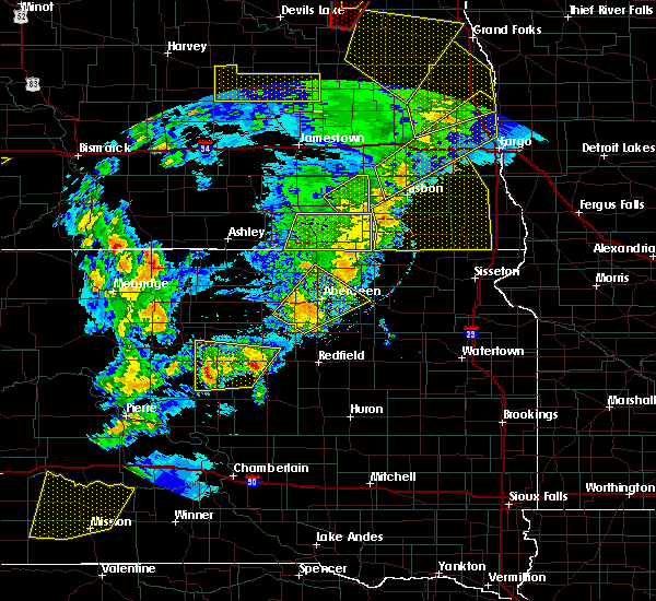
| 6/14/2022 5:14 AM CDT |
 At 513 am cdt, severe thunderstorms were located along a line extending from 13 miles northwest of ellendale to 8 miles southeast of fullerton to near hecla, moving northeast at 55 mph. these are destructive storms for central and eastern dickey county (trained weather spotters). Hazards include 80 mph wind gusts and two inch hail. Flying debris will be dangerous to those caught without shelter. mobile homes will be heavily damaged. expect considerable damage to roofs, windows, and vehicles. extensive tree damage and power outages are likely. locations impacted include, oakes, ellendale, fullerton, forbes, ludden, monango, guelph and glover. thunderstorm damage threat, destructive hail threat, radar indicated max hail size, 2. 00 in wind threat, observed max wind gust, 80 mph. At 513 am cdt, severe thunderstorms were located along a line extending from 13 miles northwest of ellendale to 8 miles southeast of fullerton to near hecla, moving northeast at 55 mph. these are destructive storms for central and eastern dickey county (trained weather spotters). Hazards include 80 mph wind gusts and two inch hail. Flying debris will be dangerous to those caught without shelter. mobile homes will be heavily damaged. expect considerable damage to roofs, windows, and vehicles. extensive tree damage and power outages are likely. locations impacted include, oakes, ellendale, fullerton, forbes, ludden, monango, guelph and glover. thunderstorm damage threat, destructive hail threat, radar indicated max hail size, 2. 00 in wind threat, observed max wind gust, 80 mph.
|
| 6/14/2022 5:00 AM CDT |
 At 459 am cdt, severe thunderstorms were located along a line extending from near ellendale to 7 miles east of frederick to near columbia, moving northeast at 55 mph. these are destructive storms for dickey county (trained weather spotters). Hazards include 80 mph wind gusts and golf ball size hail. Flying debris will be dangerous to those caught without shelter. mobile homes will be heavily damaged. expect considerable damage to roofs, windows, and vehicles. extensive tree damage and power outages are likely. locations impacted include, oakes, ellendale, fullerton, forbes, ludden, monango, guelph, glover, and merricourt. thunderstorm damage threat, destructive hail threat, observed max hail size, 1. 75 in wind threat, observed max wind gust, 80 mph. At 459 am cdt, severe thunderstorms were located along a line extending from near ellendale to 7 miles east of frederick to near columbia, moving northeast at 55 mph. these are destructive storms for dickey county (trained weather spotters). Hazards include 80 mph wind gusts and golf ball size hail. Flying debris will be dangerous to those caught without shelter. mobile homes will be heavily damaged. expect considerable damage to roofs, windows, and vehicles. extensive tree damage and power outages are likely. locations impacted include, oakes, ellendale, fullerton, forbes, ludden, monango, guelph, glover, and merricourt. thunderstorm damage threat, destructive hail threat, observed max hail size, 1. 75 in wind threat, observed max wind gust, 80 mph.
|
| 6/14/2022 4:56 AM CDT |
 At 455 am cdt, severe thunderstorms were located along a line extending from 6 miles west of ellendale to near frederick to near columbia, moving northeast at 90 mph. these are destructive storms for dickey county (trained weather spotters). Hazards include 80 mph wind gusts and golf ball size hail. Flying debris will be dangerous to those caught without shelter. mobile homes will be heavily damaged. expect considerable damage to roofs, windows, and vehicles. extensive tree damage and power outages are likely. locations impacted include, ellendale, fullerton, forbes, guelph, ludden, and oakes. thunderstorm damage threat, destructive hail threat, radar indicated max hail size, 1. 75 in wind threat, radar indicated max wind gust, 80 mph. At 455 am cdt, severe thunderstorms were located along a line extending from 6 miles west of ellendale to near frederick to near columbia, moving northeast at 90 mph. these are destructive storms for dickey county (trained weather spotters). Hazards include 80 mph wind gusts and golf ball size hail. Flying debris will be dangerous to those caught without shelter. mobile homes will be heavily damaged. expect considerable damage to roofs, windows, and vehicles. extensive tree damage and power outages are likely. locations impacted include, ellendale, fullerton, forbes, guelph, ludden, and oakes. thunderstorm damage threat, destructive hail threat, radar indicated max hail size, 1. 75 in wind threat, radar indicated max wind gust, 80 mph.
|
| 6/14/2022 4:43 AM CDT |
 At 442 am cdt, severe thunderstorms were located along a line extending from near forbes to 6 miles west of barnard to near richmond lake rec area, moving northeast at 55 mph (trained weather spotters). Hazards include 70 mph wind gusts and ping pong ball size hail. People and animals outdoors will be injured. expect hail damage to roofs, siding, windows, and vehicles. expect considerable tree damage. wind damage is also likely to mobile homes, roofs, and outbuildings. severe thunderstorms will be near, ellendale around 500 am cdt. other locations in the path of these severe thunderstorms include fullerton, ludden and oakes. thunderstorm damage threat, considerable hail threat, radar indicated max hail size, 1. 50 in wind threat, radar indicated max wind gust, 70 mph. At 442 am cdt, severe thunderstorms were located along a line extending from near forbes to 6 miles west of barnard to near richmond lake rec area, moving northeast at 55 mph (trained weather spotters). Hazards include 70 mph wind gusts and ping pong ball size hail. People and animals outdoors will be injured. expect hail damage to roofs, siding, windows, and vehicles. expect considerable tree damage. wind damage is also likely to mobile homes, roofs, and outbuildings. severe thunderstorms will be near, ellendale around 500 am cdt. other locations in the path of these severe thunderstorms include fullerton, ludden and oakes. thunderstorm damage threat, considerable hail threat, radar indicated max hail size, 1. 50 in wind threat, radar indicated max wind gust, 70 mph.
|
| 5/12/2022 7:19 PM CDT |
 At 719 pm cdt, a severe thunderstorm was located near verona, or 14 miles north of oakes, moving north at 55 mph (radar indicated). Hazards include 70 mph wind gusts and nickel size hail. Expect considerable tree damage. damage is likely to mobile homes, roofs, and outbuildings. this severe thunderstorm will remain over mainly rural areas of eastern dickey county, including the following locations, guelph and glover. thunderstorm damage threat, considerable hail threat, radar indicated max hail size, 0. 88 in wind threat, radar indicated max wind gust, 70 mph. At 719 pm cdt, a severe thunderstorm was located near verona, or 14 miles north of oakes, moving north at 55 mph (radar indicated). Hazards include 70 mph wind gusts and nickel size hail. Expect considerable tree damage. damage is likely to mobile homes, roofs, and outbuildings. this severe thunderstorm will remain over mainly rural areas of eastern dickey county, including the following locations, guelph and glover. thunderstorm damage threat, considerable hail threat, radar indicated max hail size, 0. 88 in wind threat, radar indicated max wind gust, 70 mph.
|
| 5/12/2022 6:42 PM CDT |
 At 641 pm cdt, a severe thunderstorm was located 7 miles north of sand lake wildlife refuge, or 14 miles southeast of ellendale, moving north at 55 mph (radar indicated). Hazards include 70 mph wind gusts and nickel size hail. Expect considerable tree damage. damage is likely to mobile homes, roofs, and outbuildings. this severe thunderstorm will be near, ludden around 655 pm cdt. other locations in the path of this severe thunderstorm include oakes. thunderstorm damage threat, considerable hail threat, radar indicated max hail size, 0. 88 in wind threat, radar indicated max wind gust, 70 mph. At 641 pm cdt, a severe thunderstorm was located 7 miles north of sand lake wildlife refuge, or 14 miles southeast of ellendale, moving north at 55 mph (radar indicated). Hazards include 70 mph wind gusts and nickel size hail. Expect considerable tree damage. damage is likely to mobile homes, roofs, and outbuildings. this severe thunderstorm will be near, ludden around 655 pm cdt. other locations in the path of this severe thunderstorm include oakes. thunderstorm damage threat, considerable hail threat, radar indicated max hail size, 0. 88 in wind threat, radar indicated max wind gust, 70 mph.
|
| 8/24/2021 12:56 AM CDT |
 At 1256 am cdt, severe thunderstorms were located along a line extending from 5 miles south of verona to near oakes to near hecla, moving east at 45 mph (radar indicated). Hazards include 70 mph wind gusts. Expect considerable tree damage. damage is likely to mobile homes, roofs, and outbuildings. these severe thunderstorms will remain over mainly rural areas of eastern dickey county, including the following locations, guelph and glover. thunderstorm damage threat, considerable hail threat, radar indicated max hail size, <. 75 in wind threat, radar indicated max wind gust, 70 mph. At 1256 am cdt, severe thunderstorms were located along a line extending from 5 miles south of verona to near oakes to near hecla, moving east at 45 mph (radar indicated). Hazards include 70 mph wind gusts. Expect considerable tree damage. damage is likely to mobile homes, roofs, and outbuildings. these severe thunderstorms will remain over mainly rural areas of eastern dickey county, including the following locations, guelph and glover. thunderstorm damage threat, considerable hail threat, radar indicated max hail size, <. 75 in wind threat, radar indicated max wind gust, 70 mph.
|
| 8/24/2021 12:45 AM CDT |
 At 1244 am cdt, severe thunderstorms were located along a line extending from 6 miles southeast of lamoure to 4 miles west of oakes to 6 miles northwest of hecla, moving east at 45 mph (radar indicated). Hazards include 70 mph wind gusts. Expect considerable tree damage. damage is likely to mobile homes, roofs, and outbuildings. severe thunderstorms will be near, oakes around 1250 am cdt. thunderstorm damage threat, considerable hail threat, radar indicated max hail size, <. 75 in wind threat, radar indicated max wind gust, 70 mph. At 1244 am cdt, severe thunderstorms were located along a line extending from 6 miles southeast of lamoure to 4 miles west of oakes to 6 miles northwest of hecla, moving east at 45 mph (radar indicated). Hazards include 70 mph wind gusts. Expect considerable tree damage. damage is likely to mobile homes, roofs, and outbuildings. severe thunderstorms will be near, oakes around 1250 am cdt. thunderstorm damage threat, considerable hail threat, radar indicated max hail size, <. 75 in wind threat, radar indicated max wind gust, 70 mph.
|
| 7/23/2021 11:01 PM CDT |
 At 1101 pm cdt, a severe thunderstorm was located 7 miles west of hecla, or 13 miles southeast of ellendale, moving east at 50 mph (radar indicated). Hazards include 60 mph wind gusts and nickel size hail. Expect damage to roofs, siding, and trees. Locations impacted include, oakes, ellendale, fullerton, forbes, ludden, monango, guelph, glover and merricourt. At 1101 pm cdt, a severe thunderstorm was located 7 miles west of hecla, or 13 miles southeast of ellendale, moving east at 50 mph (radar indicated). Hazards include 60 mph wind gusts and nickel size hail. Expect damage to roofs, siding, and trees. Locations impacted include, oakes, ellendale, fullerton, forbes, ludden, monango, guelph, glover and merricourt.
|
| 7/23/2021 10:09 PM CDT |
 At 1008 pm cdt, a severe thunderstorm was located 9 miles east of ashley, moving east at 50 mph (radar indicated). Hazards include 60 mph wind gusts and nickel size hail. expect damage to roofs, siding, and trees At 1008 pm cdt, a severe thunderstorm was located 9 miles east of ashley, moving east at 50 mph (radar indicated). Hazards include 60 mph wind gusts and nickel size hail. expect damage to roofs, siding, and trees
|
| 6/11/2021 4:26 AM CDT |
 The severe thunderstorm warning for lamoure, dickey, foster and stutsman counties will expire at 430 am cdt, the storms which prompted the warning have weakened below severe limits, and have exited the warned area. therefore, the warning will be allowed to expire. however gusty winds are still possible behind these thunderstorms. a severe thunderstorm watch remains in effect until 700 am cdt for southeastern north dakota. The severe thunderstorm warning for lamoure, dickey, foster and stutsman counties will expire at 430 am cdt, the storms which prompted the warning have weakened below severe limits, and have exited the warned area. therefore, the warning will be allowed to expire. however gusty winds are still possible behind these thunderstorms. a severe thunderstorm watch remains in effect until 700 am cdt for southeastern north dakota.
|
| 6/11/2021 4:01 AM CDT |
 At 401 am cdt, severe thunderstorms were located along a line extending from 7 miles northwest of grace city to 7 miles southeast of new rockford to jud to near forbes to 8 miles northeast of frederick, moving east at 30 mph (radar indicated). Hazards include 60 mph wind gusts and penny size hail. Expect damage to roofs, siding, and trees. Locations impacted include, grace city, ludden, ellendale, adrian, montpelier, marion, mchenry and dickey. At 401 am cdt, severe thunderstorms were located along a line extending from 7 miles northwest of grace city to 7 miles southeast of new rockford to jud to near forbes to 8 miles northeast of frederick, moving east at 30 mph (radar indicated). Hazards include 60 mph wind gusts and penny size hail. Expect damage to roofs, siding, and trees. Locations impacted include, grace city, ludden, ellendale, adrian, montpelier, marion, mchenry and dickey.
|
| 6/11/2021 3:43 AM CDT |
 At 343 am cdt, severe thunderstorms were located along a line extending from 5 miles southeast of new rockford to 8 miles east of cathay to 7 miles south of gackle to 5 miles west of spring creek colony to near frederick, moving east at 30 mph (radar indicated). Hazards include 60 mph wind gusts and penny size hail. Expect damage to roofs, siding, and trees. severe thunderstorms will be near, carrington around 350 am cdt. jud around 400 am cdt. Other locations in the path of these severe thunderstorms include forbes, grace city, mchenry, ludden, ellendale, adrian and montpelier. At 343 am cdt, severe thunderstorms were located along a line extending from 5 miles southeast of new rockford to 8 miles east of cathay to 7 miles south of gackle to 5 miles west of spring creek colony to near frederick, moving east at 30 mph (radar indicated). Hazards include 60 mph wind gusts and penny size hail. Expect damage to roofs, siding, and trees. severe thunderstorms will be near, carrington around 350 am cdt. jud around 400 am cdt. Other locations in the path of these severe thunderstorms include forbes, grace city, mchenry, ludden, ellendale, adrian and montpelier.
|
| 8/23/2020 6:48 PM CDT |
 At 647 pm cdt, a severe thunderstorm was located near ludden, or 7 miles south of oakes, moving east at 25 mph (radar indicated). Hazards include 60 mph wind gusts and quarter size hail. Hail damage to vehicles is expected. expect wind damage to roofs, siding, and trees. Locations impacted include, ludden. At 647 pm cdt, a severe thunderstorm was located near ludden, or 7 miles south of oakes, moving east at 25 mph (radar indicated). Hazards include 60 mph wind gusts and quarter size hail. Hail damage to vehicles is expected. expect wind damage to roofs, siding, and trees. Locations impacted include, ludden.
|
| 8/23/2020 6:33 PM CDT |
 At 633 pm cdt, a severe thunderstorm was located near ludden, or 7 miles southwest of oakes, moving east at 25 mph (radar indicated). Hazards include golf ball size hail and 60 mph wind gusts. People and animals outdoors will be injured. expect hail damage to roofs, siding, windows, and vehicles. expect wind damage to roofs, siding, and trees. This severe thunderstorm will remain over mainly rural areas of southeastern dickey county, including the following locations, guelph. At 633 pm cdt, a severe thunderstorm was located near ludden, or 7 miles southwest of oakes, moving east at 25 mph (radar indicated). Hazards include golf ball size hail and 60 mph wind gusts. People and animals outdoors will be injured. expect hail damage to roofs, siding, windows, and vehicles. expect wind damage to roofs, siding, and trees. This severe thunderstorm will remain over mainly rural areas of southeastern dickey county, including the following locations, guelph.
|
| 8/23/2020 5:27 PM CDT |
 At 527 pm cdt, a severe thunderstorm was located near ellendale, moving east at 20 mph (radar indicated). Hazards include two inch hail and 60 mph wind gusts. People and animals outdoors will be injured. expect hail damage to roofs, siding, windows, and vehicles. expect wind damage to roofs, siding, and trees. Locations impacted include, ellendale, forbes, ludden and guelph. At 527 pm cdt, a severe thunderstorm was located near ellendale, moving east at 20 mph (radar indicated). Hazards include two inch hail and 60 mph wind gusts. People and animals outdoors will be injured. expect hail damage to roofs, siding, windows, and vehicles. expect wind damage to roofs, siding, and trees. Locations impacted include, ellendale, forbes, ludden and guelph.
|
| 8/23/2020 5:18 PM CDT |
 At 518 pm cdt, a severe thunderstorm was located 5 miles southwest of ellendale, moving east at 15 mph (radar indicated). Hazards include golf ball size hail. People and animals outdoors will be injured. expect damage to roofs, siding, windows, and vehicles. this severe storm will be near, ellendale around 530 pm cdt. Other locations impacted by this severe thunderstorm include guelph. At 518 pm cdt, a severe thunderstorm was located 5 miles southwest of ellendale, moving east at 15 mph (radar indicated). Hazards include golf ball size hail. People and animals outdoors will be injured. expect damage to roofs, siding, windows, and vehicles. this severe storm will be near, ellendale around 530 pm cdt. Other locations impacted by this severe thunderstorm include guelph.
|
| 8/23/2020 5:07 PM CDT |
 At 507 pm cdt, a severe thunderstorm was located 5 miles southwest of ellendale, moving east at 20 mph (radar indicated). Hazards include half dollar size hail. Damage to vehicles is expected. this severe thunderstorm will be near, ellendale around 520 pm cdt. ludden around 600 pm cdt. Other locations impacted by this severe thunderstorm include guelph. At 507 pm cdt, a severe thunderstorm was located 5 miles southwest of ellendale, moving east at 20 mph (radar indicated). Hazards include half dollar size hail. Damage to vehicles is expected. this severe thunderstorm will be near, ellendale around 520 pm cdt. ludden around 600 pm cdt. Other locations impacted by this severe thunderstorm include guelph.
|
| 7/4/2020 5:57 PM CDT |
 At 557 pm cdt, severe thunderstorms were located along a line extending from 7 miles east of edgeley to 10 miles northwest of fullerton to 9 miles north of forbes to 7 miles southeast of ashley, moving east at 35 mph (radar indicated). Hazards include 70 mph wind gusts and ping pong ball size hail. People and animals outdoors will be injured. expect hail damage to roofs, siding, windows, and vehicles. expect considerable tree damage. Wind damage is also likely to mobile homes, roofs, and outbuildings. At 557 pm cdt, severe thunderstorms were located along a line extending from 7 miles east of edgeley to 10 miles northwest of fullerton to 9 miles north of forbes to 7 miles southeast of ashley, moving east at 35 mph (radar indicated). Hazards include 70 mph wind gusts and ping pong ball size hail. People and animals outdoors will be injured. expect hail damage to roofs, siding, windows, and vehicles. expect considerable tree damage. Wind damage is also likely to mobile homes, roofs, and outbuildings.
|
| 6/20/2020 6:25 PM CDT |
 The severe thunderstorm warning for southeastern dickey county will expire at 630 pm cdt, the storm which prompted the warning has weakened below severe limits, and has exited the warned area. therefore, the warning will be allowed to expire. to report severe weather, contact your nearest law enforcement agency. they will relay your report to the national weather service bismarck. The severe thunderstorm warning for southeastern dickey county will expire at 630 pm cdt, the storm which prompted the warning has weakened below severe limits, and has exited the warned area. therefore, the warning will be allowed to expire. to report severe weather, contact your nearest law enforcement agency. they will relay your report to the national weather service bismarck.
|
| 6/20/2020 6:05 PM CDT |
 At 605 pm cdt, a severe thunderstorm was located over ludden, or 9 miles south of oakes, moving east at 20 mph (radar indicated). Hazards include ping pong ball size hail and 60 mph wind gusts. People and animals outdoors will be injured. expect hail damage to roofs, siding, windows, and vehicles. expect wind damage to roofs, siding, and trees. Locations impacted include, ludden. At 605 pm cdt, a severe thunderstorm was located over ludden, or 9 miles south of oakes, moving east at 20 mph (radar indicated). Hazards include ping pong ball size hail and 60 mph wind gusts. People and animals outdoors will be injured. expect hail damage to roofs, siding, windows, and vehicles. expect wind damage to roofs, siding, and trees. Locations impacted include, ludden.
|
| 6/20/2020 5:59 PM CDT |
 At 538 pm cdt, a severe thunderstorm was located 6 miles west of ludden, or 10 miles southwest of oakes, moving east at 25 mph (radar indicated). Hazards include ping pong ball size hail and 60 mph wind gusts. People and animals outdoors will be injured. expect hail damage to roofs, siding, windows, and vehicles. expect wind damage to roofs, siding, and trees. this severe thunderstorm will be near, ludden around 555 pm cdt. Other locations impacted by this severe thunderstorm include guelph. At 538 pm cdt, a severe thunderstorm was located 6 miles west of ludden, or 10 miles southwest of oakes, moving east at 25 mph (radar indicated). Hazards include ping pong ball size hail and 60 mph wind gusts. People and animals outdoors will be injured. expect hail damage to roofs, siding, windows, and vehicles. expect wind damage to roofs, siding, and trees. this severe thunderstorm will be near, ludden around 555 pm cdt. Other locations impacted by this severe thunderstorm include guelph.
|
| 6/20/2020 5:38 PM CDT |
 At 538 pm cdt, a severe thunderstorm was located 6 miles west of ludden, or 10 miles southwest of oakes, moving east at 25 mph (radar indicated). Hazards include ping pong ball size hail and 60 mph wind gusts. People and animals outdoors will be injured. expect hail damage to roofs, siding, windows, and vehicles. expect wind damage to roofs, siding, and trees. this severe thunderstorm will be near, ludden around 555 pm cdt. Other locations impacted by this severe thunderstorm include guelph. At 538 pm cdt, a severe thunderstorm was located 6 miles west of ludden, or 10 miles southwest of oakes, moving east at 25 mph (radar indicated). Hazards include ping pong ball size hail and 60 mph wind gusts. People and animals outdoors will be injured. expect hail damage to roofs, siding, windows, and vehicles. expect wind damage to roofs, siding, and trees. this severe thunderstorm will be near, ludden around 555 pm cdt. Other locations impacted by this severe thunderstorm include guelph.
|
| 6/17/2020 9:56 PM CDT |
 At 955 pm cdt, a severe thunderstorm was located near ludden, or 9 miles south of oakes, moving north at 15 mph (radar indicated). Hazards include 60 mph wind gusts. Expect damage to roofs, siding, and trees. Locations impacted include, ludden. At 955 pm cdt, a severe thunderstorm was located near ludden, or 9 miles south of oakes, moving north at 15 mph (radar indicated). Hazards include 60 mph wind gusts. Expect damage to roofs, siding, and trees. Locations impacted include, ludden.
|
| 6/17/2020 9:38 PM CDT |
 At 937 pm cdt, a severe thunderstorm was located 5 miles east of ludden, or 11 miles south of oakes, moving northeast at 25 mph (radar indicated). Hazards include 60 mph wind gusts. Expect damage to roofs, siding, and trees. This severe storm will remain over mainly rural areas of southeastern dickey county. At 937 pm cdt, a severe thunderstorm was located 5 miles east of ludden, or 11 miles south of oakes, moving northeast at 25 mph (radar indicated). Hazards include 60 mph wind gusts. Expect damage to roofs, siding, and trees. This severe storm will remain over mainly rural areas of southeastern dickey county.
|
| 6/17/2020 9:25 PM CDT |
 At 924 pm cdt, a severe thunderstorm was located near hecla, or 16 miles south of oakes, moving northeast at 25 mph (radar indicated). Hazards include 60 mph wind gusts. Expect damage to roofs, siding, and trees. This severe thunderstorm will be near, ludden around 935 pm cdt. At 924 pm cdt, a severe thunderstorm was located near hecla, or 16 miles south of oakes, moving northeast at 25 mph (radar indicated). Hazards include 60 mph wind gusts. Expect damage to roofs, siding, and trees. This severe thunderstorm will be near, ludden around 935 pm cdt.
|
| 6/7/2020 9:16 PM CDT |
 At 916 pm cdt, severe thunderstorms were located along a line extending from 6 miles south of lamoure to 5 miles southeast of ludden, moving east at 45 mph (radar indicated). Hazards include 70 mph wind gusts. Expect considerable tree damage. damage is likely to mobile homes, roofs, and outbuildings. Locations impacted include, oakes, ludden, guelph and glover. At 916 pm cdt, severe thunderstorms were located along a line extending from 6 miles south of lamoure to 5 miles southeast of ludden, moving east at 45 mph (radar indicated). Hazards include 70 mph wind gusts. Expect considerable tree damage. damage is likely to mobile homes, roofs, and outbuildings. Locations impacted include, oakes, ludden, guelph and glover.
|
| 6/7/2020 8:57 PM CDT |
 At 856 pm cdt, severe thunderstorms were located along a line extending from 8 miles southeast of edgeley to near hecla, moving northeast at 45 mph (radar indicated. at 855 pm cdt, the dickey county emergency manager reported trees down in ellendale from these storms). Hazards include 70 mph wind gusts. Expect considerable tree damage. damage is likely to mobile homes, roofs, and outbuildings. Locations impacted include, oakes, ellendale, fullerton, forbes, ludden, monango, guelph and glover. At 856 pm cdt, severe thunderstorms were located along a line extending from 8 miles southeast of edgeley to near hecla, moving northeast at 45 mph (radar indicated. at 855 pm cdt, the dickey county emergency manager reported trees down in ellendale from these storms). Hazards include 70 mph wind gusts. Expect considerable tree damage. damage is likely to mobile homes, roofs, and outbuildings. Locations impacted include, oakes, ellendale, fullerton, forbes, ludden, monango, guelph and glover.
|
| 6/7/2020 8:44 PM CDT |
 At 844 pm cdt, severe thunderstorms were located along a line extending from 12 miles north of forbes to near columbia, moving northeast at 45 mph (radar indicated). Hazards include 70 mph wind gusts. Expect considerable tree damage. damage is likely to mobile homes, roofs, and outbuildings. These severe thunderstorms will remain over mainly rural areas of dickey county, including the following locations, monango, merricourt, guelph and glover. At 844 pm cdt, severe thunderstorms were located along a line extending from 12 miles north of forbes to near columbia, moving northeast at 45 mph (radar indicated). Hazards include 70 mph wind gusts. Expect considerable tree damage. damage is likely to mobile homes, roofs, and outbuildings. These severe thunderstorms will remain over mainly rural areas of dickey county, including the following locations, monango, merricourt, guelph and glover.
|
| 6/7/2020 8:30 PM CDT |
 At 829 pm cdt, severe thunderstorms were located along a line extending from 7 miles north of spring creek colony to 5 miles west of westport to 4 miles west of mansfield, moving east at 45 mph (radar indicated). Hazards include 70 mph wind gusts. Expect considerable tree damage. damage is likely to mobile homes, roofs, and outbuildings. severe thunderstorms will be near, ellendale around 855 pm cdt. fullerton around 905 pm cdt. oakes around 925 pm cdt. Other locations impacted by these severe thunderstorms include monango, merricourt, guelph and glover. At 829 pm cdt, severe thunderstorms were located along a line extending from 7 miles north of spring creek colony to 5 miles west of westport to 4 miles west of mansfield, moving east at 45 mph (radar indicated). Hazards include 70 mph wind gusts. Expect considerable tree damage. damage is likely to mobile homes, roofs, and outbuildings. severe thunderstorms will be near, ellendale around 855 pm cdt. fullerton around 905 pm cdt. oakes around 925 pm cdt. Other locations impacted by these severe thunderstorms include monango, merricourt, guelph and glover.
|
| 6/2/2020 8:48 AM CDT |
 At 847 am cdt, a severe thunderstorm was located 8 miles west of ludden, or 10 miles east of ellendale, moving east at 45 mph (radar indicated). Hazards include 60 mph wind gusts and quarter size hail. Hail damage to vehicles is expected. expect wind damage to roofs, siding, and trees. this severe storm will be near, ludden around 900 am cdt. Other locations impacted by this severe thunderstorm include guelph. At 847 am cdt, a severe thunderstorm was located 8 miles west of ludden, or 10 miles east of ellendale, moving east at 45 mph (radar indicated). Hazards include 60 mph wind gusts and quarter size hail. Hail damage to vehicles is expected. expect wind damage to roofs, siding, and trees. this severe storm will be near, ludden around 900 am cdt. Other locations impacted by this severe thunderstorm include guelph.
|
| 6/2/2020 8:36 AM CDT |
 At 836 am cdt, a severe thunderstorm was located over ellendale, moving east at 45 mph (radar indicated). Hazards include 60 mph wind gusts and quarter size hail. Hail damage to vehicles is expected. expect wind damage to roofs, siding, and trees. this severe thunderstorm will be near, ludden around 900 am cdt. Other locations impacted by this severe thunderstorm include guelph. At 836 am cdt, a severe thunderstorm was located over ellendale, moving east at 45 mph (radar indicated). Hazards include 60 mph wind gusts and quarter size hail. Hail damage to vehicles is expected. expect wind damage to roofs, siding, and trees. this severe thunderstorm will be near, ludden around 900 am cdt. Other locations impacted by this severe thunderstorm include guelph.
|
| 9/2/2019 6:24 PM CDT |
 The severe thunderstorm warning for eastern dickey county will expire at 630 pm cdt, the storm which prompted the warning has moved out of the area. therefore, the warning will be allowed to expire. a severe thunderstorm watch remains in effect until 800 pm cdt for southeastern north dakota. The severe thunderstorm warning for eastern dickey county will expire at 630 pm cdt, the storm which prompted the warning has moved out of the area. therefore, the warning will be allowed to expire. a severe thunderstorm watch remains in effect until 800 pm cdt for southeastern north dakota.
|
| 9/2/2019 6:03 PM CDT |
 At 602 pm cdt, a severe thunderstorm was located near fullerton, or 15 miles northeast of ellendale, moving southeast at 60 mph (radar indicated). Hazards include 60 mph wind gusts. Expect damage to roofs, siding, and trees. Locations impacted include, oakes, fullerton, ludden, monango and guelph. At 602 pm cdt, a severe thunderstorm was located near fullerton, or 15 miles northeast of ellendale, moving southeast at 60 mph (radar indicated). Hazards include 60 mph wind gusts. Expect damage to roofs, siding, and trees. Locations impacted include, oakes, fullerton, ludden, monango and guelph.
|
| 9/2/2019 5:50 PM CDT |
 At 550 pm cdt, a severe thunderstorm was located 5 miles south of edgeley, moving southeast at 35 mph (radar indicated). Hazards include 60 mph wind gusts and quarter size hail. Hail damage to vehicles is expected. expect wind damage to roofs, siding, and trees. Locations impacted include, oakes, ellendale, edgeley, fullerton, ludden, monango, berlin, guelph and merricourt. At 550 pm cdt, a severe thunderstorm was located 5 miles south of edgeley, moving southeast at 35 mph (radar indicated). Hazards include 60 mph wind gusts and quarter size hail. Hail damage to vehicles is expected. expect wind damage to roofs, siding, and trees. Locations impacted include, oakes, ellendale, edgeley, fullerton, ludden, monango, berlin, guelph and merricourt.
|
| 9/2/2019 5:29 PM CDT |
 At 529 pm cdt, a severe thunderstorm was located 6 miles northeast of kulm, or 8 miles west of edgeley, moving southeast at 50 mph (radar indicated). Hazards include 70 mph wind gusts and half dollar size hail. Hail damage to vehicles is expected. expect considerable tree damage. Wind damage is also likely to mobile homes, roofs, and outbuildings. At 529 pm cdt, a severe thunderstorm was located 6 miles northeast of kulm, or 8 miles west of edgeley, moving southeast at 50 mph (radar indicated). Hazards include 70 mph wind gusts and half dollar size hail. Hail damage to vehicles is expected. expect considerable tree damage. Wind damage is also likely to mobile homes, roofs, and outbuildings.
|
| 8/15/2019 3:49 PM CDT |
 At 336 pm cdt, a severe thunderstorm was located over ludden, or 6 miles south of oakes, moving east at 20 mph (radar indicated). Hazards include 60 mph wind gusts and quarter size hail. Hail damage to vehicles is expected. expect wind damage to roofs, siding, and trees. this severe storm will be near, oakes around 345 pm cdt. Other locations impacted by this severe thunderstorm include guelph. At 336 pm cdt, a severe thunderstorm was located over ludden, or 6 miles south of oakes, moving east at 20 mph (radar indicated). Hazards include 60 mph wind gusts and quarter size hail. Hail damage to vehicles is expected. expect wind damage to roofs, siding, and trees. this severe storm will be near, oakes around 345 pm cdt. Other locations impacted by this severe thunderstorm include guelph.
|
| 8/15/2019 3:36 PM CDT |
 At 336 pm cdt, a severe thunderstorm was located over ludden, or 6 miles south of oakes, moving east at 20 mph (radar indicated). Hazards include 60 mph wind gusts and quarter size hail. Hail damage to vehicles is expected. expect wind damage to roofs, siding, and trees. this severe storm will be near, oakes around 345 pm cdt. Other locations impacted by this severe thunderstorm include guelph. At 336 pm cdt, a severe thunderstorm was located over ludden, or 6 miles south of oakes, moving east at 20 mph (radar indicated). Hazards include 60 mph wind gusts and quarter size hail. Hail damage to vehicles is expected. expect wind damage to roofs, siding, and trees. this severe storm will be near, oakes around 345 pm cdt. Other locations impacted by this severe thunderstorm include guelph.
|
| 8/15/2019 3:24 PM CDT |
 At 324 pm cdt, a severe thunderstorm was located 6 miles northwest of ludden, or 8 miles southwest of oakes, moving east at 20 mph (radar indicated). Hazards include 60 mph wind gusts and quarter size hail. Hail damage to vehicles is expected. expect wind damage to roofs, siding, and trees. this severe thunderstorm will be near, ludden around 340 pm cdt. oakes around 350 pm cdt. Other locations impacted by this severe thunderstorm include guelph. At 324 pm cdt, a severe thunderstorm was located 6 miles northwest of ludden, or 8 miles southwest of oakes, moving east at 20 mph (radar indicated). Hazards include 60 mph wind gusts and quarter size hail. Hail damage to vehicles is expected. expect wind damage to roofs, siding, and trees. this severe thunderstorm will be near, ludden around 340 pm cdt. oakes around 350 pm cdt. Other locations impacted by this severe thunderstorm include guelph.
|
| 7/8/2018 6:44 PM CDT |
 At 643 pm cdt, a severe thunderstorm capable of producing a tornado was located near oakes, moving southeast at 35 mph (radar indicated rotation). Hazards include tornado and baseball size hail. Flying debris will be dangerous to those caught without shelter. mobile homes will be damaged or destroyed. damage to roofs, windows, and vehicles will occur. tree damage is likely. This tornadic thunderstorm will remain over mainly rural areas of northeastern dickey county southeast of oakes. At 643 pm cdt, a severe thunderstorm capable of producing a tornado was located near oakes, moving southeast at 35 mph (radar indicated rotation). Hazards include tornado and baseball size hail. Flying debris will be dangerous to those caught without shelter. mobile homes will be damaged or destroyed. damage to roofs, windows, and vehicles will occur. tree damage is likely. This tornadic thunderstorm will remain over mainly rural areas of northeastern dickey county southeast of oakes.
|
| 7/8/2018 6:34 PM CDT |
 At 633 pm cdt, a severe thunderstorm capable of producing a tornado was located near oakes, moving southeast at 30 mph (radar indicated rotation). Hazards include tornado and tennis ball size hail. Flying debris will be dangerous to those caught without shelter. mobile homes will be damaged or destroyed. damage to roofs, windows, and vehicles will occur. tree damage is likely. this dangerous storm will be near, oakes around 640 pm cdt. Ludden around 645 pm cdt. At 633 pm cdt, a severe thunderstorm capable of producing a tornado was located near oakes, moving southeast at 30 mph (radar indicated rotation). Hazards include tornado and tennis ball size hail. Flying debris will be dangerous to those caught without shelter. mobile homes will be damaged or destroyed. damage to roofs, windows, and vehicles will occur. tree damage is likely. this dangerous storm will be near, oakes around 640 pm cdt. Ludden around 645 pm cdt.
|
| 7/8/2018 6:25 PM CDT |
 At 625 pm cdt, a severe thunderstorm capable of producing a tornado was located 5 miles west of oakes, moving southeast at 35 mph (radar indicated rotation). Hazards include tornado and tennis ball size hail. Flying debris will be dangerous to those caught without shelter. mobile homes will be damaged or destroyed. damage to roofs, windows, and vehicles will occur. tree damage is likely. this dangerous storm will be near, oakes around 635 pm cdt. Ludden around 640 pm cdt. At 625 pm cdt, a severe thunderstorm capable of producing a tornado was located 5 miles west of oakes, moving southeast at 35 mph (radar indicated rotation). Hazards include tornado and tennis ball size hail. Flying debris will be dangerous to those caught without shelter. mobile homes will be damaged or destroyed. damage to roofs, windows, and vehicles will occur. tree damage is likely. this dangerous storm will be near, oakes around 635 pm cdt. Ludden around 640 pm cdt.
|
| 7/4/2018 3:39 AM CDT |
 At 320 am cdt, severe thunderstorms were located along a line extending from 5 miles southeast of lamoure to 4 miles south of ellendale, moving east at 20 mph (radar indicated). Hazards include 60 mph wind gusts and quarter size hail. Hail damage to vehicles is expected. expect wind damage to roofs, siding, and trees. severe thunderstorms will be near, lamoure around 325 am cdt. verona around 345 am cdt. ludden around 415 am cdt. Other locations impacted by these severe thunderstorms include monango, guelph and glover. At 320 am cdt, severe thunderstorms were located along a line extending from 5 miles southeast of lamoure to 4 miles south of ellendale, moving east at 20 mph (radar indicated). Hazards include 60 mph wind gusts and quarter size hail. Hail damage to vehicles is expected. expect wind damage to roofs, siding, and trees. severe thunderstorms will be near, lamoure around 325 am cdt. verona around 345 am cdt. ludden around 415 am cdt. Other locations impacted by these severe thunderstorms include monango, guelph and glover.
|
| 7/4/2018 3:20 AM CDT |
 At 320 am cdt, severe thunderstorms were located along a line extending from 5 miles southeast of lamoure to 4 miles south of ellendale, moving east at 20 mph (radar indicated). Hazards include 60 mph wind gusts and quarter size hail. Hail damage to vehicles is expected. expect wind damage to roofs, siding, and trees. severe thunderstorms will be near, lamoure around 325 am cdt. verona around 345 am cdt. ludden around 415 am cdt. Other locations impacted by these severe thunderstorms include monango, guelph and glover. At 320 am cdt, severe thunderstorms were located along a line extending from 5 miles southeast of lamoure to 4 miles south of ellendale, moving east at 20 mph (radar indicated). Hazards include 60 mph wind gusts and quarter size hail. Hail damage to vehicles is expected. expect wind damage to roofs, siding, and trees. severe thunderstorms will be near, lamoure around 325 am cdt. verona around 345 am cdt. ludden around 415 am cdt. Other locations impacted by these severe thunderstorms include monango, guelph and glover.
|
| 7/3/2018 6:39 AM CDT |
 At 638 am cdt, severe thunderstorms were located along a line extending from 5 miles northwest of spiritwood lake to 4 miles west of dickey to 7 miles west of spring creek colony, moving east at 60 mph (radar indicated). Hazards include 70 mph wind gusts and quarter size hail. Hail damage to vehicles is expected. expect considerable tree damage. wind damage is also likely to mobile homes, roofs, and outbuildings. Locations impacted include, jamestown, oakes, ellendale, ashley, edgeley, medina, lamoure, kulm, gackle, marion, ypsilanti, adrian, buchanan, spiritwood lake, montpelier, verona, cleveland, lehr, spiritwood and jud. At 638 am cdt, severe thunderstorms were located along a line extending from 5 miles northwest of spiritwood lake to 4 miles west of dickey to 7 miles west of spring creek colony, moving east at 60 mph (radar indicated). Hazards include 70 mph wind gusts and quarter size hail. Hail damage to vehicles is expected. expect considerable tree damage. wind damage is also likely to mobile homes, roofs, and outbuildings. Locations impacted include, jamestown, oakes, ellendale, ashley, edgeley, medina, lamoure, kulm, gackle, marion, ypsilanti, adrian, buchanan, spiritwood lake, montpelier, verona, cleveland, lehr, spiritwood and jud.
|
| 7/3/2018 6:13 AM CDT |
 At 612 am cdt, severe thunderstorms were located along a line extending from 6 miles east of woodworth to 7 miles west of jud to near venturia, moving east at 60 mph (radar indicated). Hazards include 70 mph wind gusts and quarter size hail. Hail damage to vehicles is expected. expect considerable tree damage. Wind damage is also likely to mobile homes, roofs, and outbuildings. At 612 am cdt, severe thunderstorms were located along a line extending from 6 miles east of woodworth to 7 miles west of jud to near venturia, moving east at 60 mph (radar indicated). Hazards include 70 mph wind gusts and quarter size hail. Hail damage to vehicles is expected. expect considerable tree damage. Wind damage is also likely to mobile homes, roofs, and outbuildings.
|
| 6/29/2018 4:06 AM CDT |
 The severe thunderstorm warning for eastern lamoure and dickey counties will expire at 415 am cdt, the storms which prompted the warning have moved out of the area. therefore, the warning will be allowed to expire. a severe thunderstorm watch remains in effect until 800 am cdt for southeastern north dakota. The severe thunderstorm warning for eastern lamoure and dickey counties will expire at 415 am cdt, the storms which prompted the warning have moved out of the area. therefore, the warning will be allowed to expire. a severe thunderstorm watch remains in effect until 800 am cdt for southeastern north dakota.
|
| 6/29/2018 3:48 AM CDT |
 At 348 am cdt, severe thunderstorms were located along a line extending from 12 miles southeast of litchville to 4 miles northeast of oakes to 4 miles southwest of ludden, moving east at 60 mph (radar indicated). Hazards include 60 mph wind gusts and quarter size hail. Hail damage to vehicles is expected. expect wind damage to roofs, siding, and trees. These severe thunderstorms will remain over mainly rural areas of eastern lamoure and dickey counties, including the following locations, monango, guelph, berlin, grand rapids and glover. At 348 am cdt, severe thunderstorms were located along a line extending from 12 miles southeast of litchville to 4 miles northeast of oakes to 4 miles southwest of ludden, moving east at 60 mph (radar indicated). Hazards include 60 mph wind gusts and quarter size hail. Hail damage to vehicles is expected. expect wind damage to roofs, siding, and trees. These severe thunderstorms will remain over mainly rural areas of eastern lamoure and dickey counties, including the following locations, monango, guelph, berlin, grand rapids and glover.
|
| 6/29/2018 3:30 AM CDT |
 At 330 am cdt, severe thunderstorms were located along a line extending from 5 miles southeast of litchville to near lamoure to forbes, moving east at 45 mph (radar indicated). Hazards include 60 mph wind gusts and quarter size hail. Hail damage to vehicles is expected. expect wind damage to roofs, siding, and trees. these severe storms will be near, lamoure around 335 am cdt. ellendale and verona around 345 am cdt. ludden around 410 am cdt. Other locations impacted by these severe thunderstorms include monango, merricourt, guelph, berlin, grand rapids and glover. At 330 am cdt, severe thunderstorms were located along a line extending from 5 miles southeast of litchville to near lamoure to forbes, moving east at 45 mph (radar indicated). Hazards include 60 mph wind gusts and quarter size hail. Hail damage to vehicles is expected. expect wind damage to roofs, siding, and trees. these severe storms will be near, lamoure around 335 am cdt. ellendale and verona around 345 am cdt. ludden around 410 am cdt. Other locations impacted by these severe thunderstorms include monango, merricourt, guelph, berlin, grand rapids and glover.
|
| 6/29/2018 3:17 AM CDT |
 At 317 am cdt, severe thunderstorms were located along a line extending from near marion to 9 miles northeast of long lake, moving east at 45 mph (radar indicated). Hazards include 60 mph wind gusts and quarter size hail. Hail damage to vehicles is expected. expect wind damage to roofs, siding, and trees. severe thunderstorms will be near, marion and dickey around 320 am cdt. forbes around 335 am cdt. ellendale around 355 am cdt. ludden around 415 am cdt. Other locations impacted by these severe thunderstorms include monango, merricourt, guelph, berlin, grand rapids and glover. At 317 am cdt, severe thunderstorms were located along a line extending from near marion to 9 miles northeast of long lake, moving east at 45 mph (radar indicated). Hazards include 60 mph wind gusts and quarter size hail. Hail damage to vehicles is expected. expect wind damage to roofs, siding, and trees. severe thunderstorms will be near, marion and dickey around 320 am cdt. forbes around 335 am cdt. ellendale around 355 am cdt. ludden around 415 am cdt. Other locations impacted by these severe thunderstorms include monango, merricourt, guelph, berlin, grand rapids and glover.
|
| 9/19/2017 8:38 PM CDT |
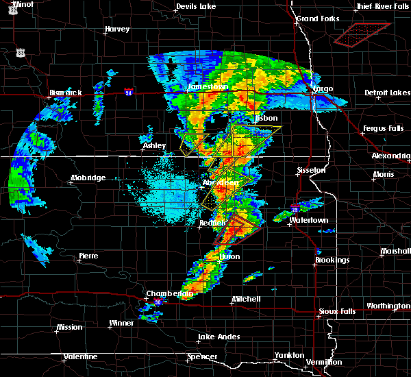 At 837 pm cdt, a severe thunderstorm was located over ludden, or 11 miles south of oakes, moving northeast at 30 mph (radar indicated). Hazards include ping pong ball size hail and 60 mph wind gusts. People and animals outdoors will be injured. expect hail damage to roofs, siding, windows, and vehicles. expect wind damage to roofs, siding, and trees. locations impacted include, oakes, ludden and guelph. A tornado watch remains in effect until midnight cdt for southeastern north dakota. At 837 pm cdt, a severe thunderstorm was located over ludden, or 11 miles south of oakes, moving northeast at 30 mph (radar indicated). Hazards include ping pong ball size hail and 60 mph wind gusts. People and animals outdoors will be injured. expect hail damage to roofs, siding, windows, and vehicles. expect wind damage to roofs, siding, and trees. locations impacted include, oakes, ludden and guelph. A tornado watch remains in effect until midnight cdt for southeastern north dakota.
|
| 9/19/2017 8:18 PM CDT |
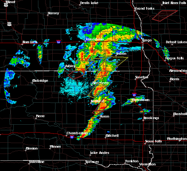 At 818 pm cdt, a severe thunderstorm was located 5 miles east of ludden, or 8 miles southeast of oakes, moving northeast at 40 mph (radar indicated). Hazards include ping pong ball size hail and 60 mph wind gusts. People and animals outdoors will be injured. expect hail damage to roofs, siding, windows, and vehicles. expect wind damage to roofs, siding, and trees. locations impacted include, oakes, ludden and guelph. A tornado watch remains in effect until midnight cdt for southeastern north dakota. At 818 pm cdt, a severe thunderstorm was located 5 miles east of ludden, or 8 miles southeast of oakes, moving northeast at 40 mph (radar indicated). Hazards include ping pong ball size hail and 60 mph wind gusts. People and animals outdoors will be injured. expect hail damage to roofs, siding, windows, and vehicles. expect wind damage to roofs, siding, and trees. locations impacted include, oakes, ludden and guelph. A tornado watch remains in effect until midnight cdt for southeastern north dakota.
|
| 9/19/2017 8:03 PM CDT |
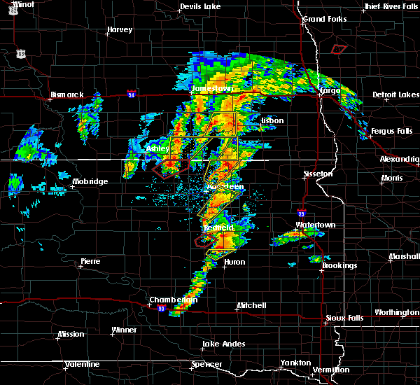 At 802 pm cdt, a severe thunderstorm was located near ludden, or 13 miles south of oakes, moving northeast at 40 mph (radar indicated). Hazards include ping pong ball size hail and 60 mph wind gusts. People and animals outdoors will be injured. expect hail damage to roofs, siding, windows, and vehicles. Expect wind damage to roofs, siding, and trees. At 802 pm cdt, a severe thunderstorm was located near ludden, or 13 miles south of oakes, moving northeast at 40 mph (radar indicated). Hazards include ping pong ball size hail and 60 mph wind gusts. People and animals outdoors will be injured. expect hail damage to roofs, siding, windows, and vehicles. Expect wind damage to roofs, siding, and trees.
|
| 8/9/2017 3:47 PM CDT |
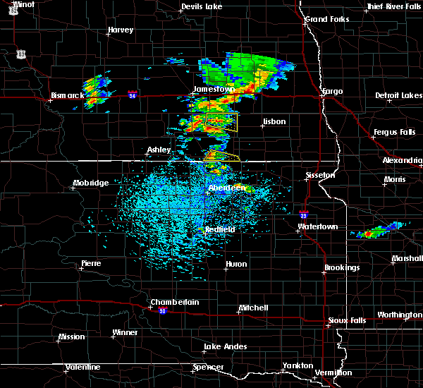 At 347 pm cdt, a severe thunderstorm was located 5 miles southeast of ellendale, moving southeast at 20 mph (radar indicated). Hazards include 60 mph wind gusts and quarter size hail. Hail damage to vehicles is expected. expect wind damage to roofs, siding, and trees. Locations impacted include, ludden and guelph. At 347 pm cdt, a severe thunderstorm was located 5 miles southeast of ellendale, moving southeast at 20 mph (radar indicated). Hazards include 60 mph wind gusts and quarter size hail. Hail damage to vehicles is expected. expect wind damage to roofs, siding, and trees. Locations impacted include, ludden and guelph.
|
| 8/9/2017 3:27 PM CDT |
 At 327 pm cdt, a severe thunderstorm was located over ellendale, moving southeast at 25 mph (radar indicated). Hazards include 60 mph wind gusts and quarter size hail. Hail damage to vehicles is expected. expect wind damage to roofs, siding, and trees. This severe thunderstorm will remain over mainly rural areas of southeastern dickey county, including the following locations: guelph. At 327 pm cdt, a severe thunderstorm was located over ellendale, moving southeast at 25 mph (radar indicated). Hazards include 60 mph wind gusts and quarter size hail. Hail damage to vehicles is expected. expect wind damage to roofs, siding, and trees. This severe thunderstorm will remain over mainly rural areas of southeastern dickey county, including the following locations: guelph.
|
| 6/13/2017 4:37 AM CDT |
 The severe thunderstorm warning for southern lamoure and dickey counties will expire at 445 am cdt, the storms which prompted the warning have weakened below severe limits, and no longer pose an immediate threat to life or property. therefore, the warning will be allowed to expire. The severe thunderstorm warning for southern lamoure and dickey counties will expire at 445 am cdt, the storms which prompted the warning have weakened below severe limits, and no longer pose an immediate threat to life or property. therefore, the warning will be allowed to expire.
|
| 6/13/2017 4:20 AM CDT |
 At 420 am cdt, severe thunderstorms were located along a line extending from 6 miles southwest of edgeley to 4 miles west of oakes to 4 miles north of amherst, moving northeast at 45 mph (radar indicated). Hazards include 60 mph wind gusts. Expect damage to roofs, siding, and trees. Locations impacted include, oakes, ellendale, edgeley, lamoure, fullerton, ludden, monango, berlin, guelph, glover and merricourt. At 420 am cdt, severe thunderstorms were located along a line extending from 6 miles southwest of edgeley to 4 miles west of oakes to 4 miles north of amherst, moving northeast at 45 mph (radar indicated). Hazards include 60 mph wind gusts. Expect damage to roofs, siding, and trees. Locations impacted include, oakes, ellendale, edgeley, lamoure, fullerton, ludden, monango, berlin, guelph, glover and merricourt.
|
| 6/13/2017 4:12 AM CDT |
 At 412 am cdt, severe thunderstorms were located along a line extending from 7 miles southeast of kulm to 6 miles northwest of ludden to near amherst, moving northeast at 50 mph (radar indicated). Hazards include 60 mph wind gusts. Expect damage to roofs, siding, and trees. Locations impacted include, oakes, ellendale, edgeley, lamoure, kulm, fullerton, ludden, monango, berlin, guelph, glover and merricourt. At 412 am cdt, severe thunderstorms were located along a line extending from 7 miles southeast of kulm to 6 miles northwest of ludden to near amherst, moving northeast at 50 mph (radar indicated). Hazards include 60 mph wind gusts. Expect damage to roofs, siding, and trees. Locations impacted include, oakes, ellendale, edgeley, lamoure, kulm, fullerton, ludden, monango, berlin, guelph, glover and merricourt.
|
| 6/13/2017 3:54 AM CDT |
 At 353 am cdt, severe thunderstorms were located along a line extending from 13 miles northwest of spring creek colony to 7 miles northeast of frederick to near putney, moving northeast at 50 mph (radar indicated). Hazards include 60 mph wind gusts and penny size hail. Expect damage to roofs, siding, and trees. Locations impacted include, oakes, ellendale, edgeley, lamoure, kulm, fullerton, ludden, monango, berlin, guelph, glover and merricourt. At 353 am cdt, severe thunderstorms were located along a line extending from 13 miles northwest of spring creek colony to 7 miles northeast of frederick to near putney, moving northeast at 50 mph (radar indicated). Hazards include 60 mph wind gusts and penny size hail. Expect damage to roofs, siding, and trees. Locations impacted include, oakes, ellendale, edgeley, lamoure, kulm, fullerton, ludden, monango, berlin, guelph, glover and merricourt.
|
| 6/13/2017 3:38 AM CDT |
 At 337 am cdt, severe thunderstorms were located along a line extending from near long lake to 5 miles west of barnard to near bath in south dakota, moving northeast at 50 mph (radar indicated). Hazards include 60 mph wind gusts. Expect damage to roofs, siding, and trees. severe thunderstorms will be near, ludden around 415 am cdt. oakes around 425 am cdt. lamoure around 445 am cdt. Other locations impacted by these severe thunderstorms include monango, merricourt, guelph, berlin and glover. At 337 am cdt, severe thunderstorms were located along a line extending from near long lake to 5 miles west of barnard to near bath in south dakota, moving northeast at 50 mph (radar indicated). Hazards include 60 mph wind gusts. Expect damage to roofs, siding, and trees. severe thunderstorms will be near, ludden around 415 am cdt. oakes around 425 am cdt. lamoure around 445 am cdt. Other locations impacted by these severe thunderstorms include monango, merricourt, guelph, berlin and glover.
|
| 8/18/2016 8:35 AM CDT |
 At 835 am cdt, severe thunderstorms were located along a line extending from ludden to 9 miles southeast of verona, moving southeast at 40 mph (radar indicated). Hazards include 60 mph wind gusts and quarter size hail. Hail damage to vehicles is expected. expect wind damage to roofs, siding, and trees. Locations impacted include, oakes, verona, ludden, glover and guelph. At 835 am cdt, severe thunderstorms were located along a line extending from ludden to 9 miles southeast of verona, moving southeast at 40 mph (radar indicated). Hazards include 60 mph wind gusts and quarter size hail. Hail damage to vehicles is expected. expect wind damage to roofs, siding, and trees. Locations impacted include, oakes, verona, ludden, glover and guelph.
|
| 8/18/2016 8:16 AM CDT |
 At 815 am cdt, severe thunderstorms were located along a line extending from 7 miles northwest of ludden to 6 miles east of verona, moving southeast at 35 mph (radar indicated). Hazards include 70 mph wind gusts and quarter size hail. Hail damage to vehicles is expected. expect considerable tree damage. wind damage is also likely to mobile homes, roofs, and outbuildings. Locations impacted include, oakes, lamoure, verona, fullerton, ludden, grand rapids, monango, berlin, guelph and glover. At 815 am cdt, severe thunderstorms were located along a line extending from 7 miles northwest of ludden to 6 miles east of verona, moving southeast at 35 mph (radar indicated). Hazards include 70 mph wind gusts and quarter size hail. Hail damage to vehicles is expected. expect considerable tree damage. wind damage is also likely to mobile homes, roofs, and outbuildings. Locations impacted include, oakes, lamoure, verona, fullerton, ludden, grand rapids, monango, berlin, guelph and glover.
|
| 8/18/2016 7:57 AM CDT |
 At 757 am cdt, severe thunderstorms were located along a line extending from 4 miles northwest of fullerton to 12 miles southeast of litchville, moving southeast at 50 mph (radar indicated). Hazards include 70 mph wind gusts and quarter size hail. Hail damage to vehicles is expected. expect considerable tree damage. Wind damage is also likely to mobile homes, roofs, and outbuildings. At 757 am cdt, severe thunderstorms were located along a line extending from 4 miles northwest of fullerton to 12 miles southeast of litchville, moving southeast at 50 mph (radar indicated). Hazards include 70 mph wind gusts and quarter size hail. Hail damage to vehicles is expected. expect considerable tree damage. Wind damage is also likely to mobile homes, roofs, and outbuildings.
|
| 8/10/2016 1:13 PM CDT |
 At 112 pm cdt, a severe thunderstorm was located 6 miles south of fullerton, or 7 miles northeast of ellendale, moving east at 25 mph (radar indicated). Hazards include 60 mph wind gusts and quarter size hail. Hail damage to vehicles is expected. expect wind damage to roofs, siding, and trees. Locations impacted include, oakes, ellendale, lamoure, verona, fullerton, ludden, monango, guelph and glover. At 112 pm cdt, a severe thunderstorm was located 6 miles south of fullerton, or 7 miles northeast of ellendale, moving east at 25 mph (radar indicated). Hazards include 60 mph wind gusts and quarter size hail. Hail damage to vehicles is expected. expect wind damage to roofs, siding, and trees. Locations impacted include, oakes, ellendale, lamoure, verona, fullerton, ludden, monango, guelph and glover.
|
| 8/10/2016 12:50 PM CDT |
 At 1248 pm cdt, a severe thunderstorm was located 6 miles northwest of ellendale, moving northeast at 20 mph (radar indicated). Hazards include 60 mph wind gusts and half dollar size hail. hail the size of a quarter was received northeast of forbes from this storm. Hail damage to vehicles is expected. expect wind damage to roofs, siding, and trees. Locations impacted include, oakes, ellendale, lamoure, verona, fullerton, forbes, ludden, monango, guelph, merricourt and glover. At 1248 pm cdt, a severe thunderstorm was located 6 miles northwest of ellendale, moving northeast at 20 mph (radar indicated). Hazards include 60 mph wind gusts and half dollar size hail. hail the size of a quarter was received northeast of forbes from this storm. Hail damage to vehicles is expected. expect wind damage to roofs, siding, and trees. Locations impacted include, oakes, ellendale, lamoure, verona, fullerton, forbes, ludden, monango, guelph, merricourt and glover.
|
| 8/10/2016 12:30 PM CDT |
 At 1228 pm cdt, a severe thunderstorm was located 8 miles north of forbes, or 10 miles northwest of ellendale, moving northeast at 40 mph (radar indicated). Hazards include 60 mph wind gusts and half dollar size hail. Hail damage to vehicles is expected. Expect wind damage to roofs, siding, and trees. At 1228 pm cdt, a severe thunderstorm was located 8 miles north of forbes, or 10 miles northwest of ellendale, moving northeast at 40 mph (radar indicated). Hazards include 60 mph wind gusts and half dollar size hail. Hail damage to vehicles is expected. Expect wind damage to roofs, siding, and trees.
|
| 8/10/2016 11:40 AM CDT |
 At 1140 am cdt, a severe thunderstorm was located 7 miles south of lamoure, or 12 miles northwest of oakes, moving northeast at 35 mph (radar indicated). Hazards include 60 mph wind gusts and half dollar size hail. Hail damage to vehicles is expected. Expect wind damage to roofs, siding, and trees. At 1140 am cdt, a severe thunderstorm was located 7 miles south of lamoure, or 12 miles northwest of oakes, moving northeast at 35 mph (radar indicated). Hazards include 60 mph wind gusts and half dollar size hail. Hail damage to vehicles is expected. Expect wind damage to roofs, siding, and trees.
|
| 8/10/2016 2:07 AM CDT |
 At 206 am cdt, severe thunderstorms were located along a line extending from 7 miles southwest of lamoure to 5 miles southeast of ellendale, moving east at 45 mph (radar indicated). Hazards include 60 mph wind gusts. Expect damage to roofs. siding. and trees. these severe storms will be near, ludden around 225 am cdt. Other locations impacted by these severe thunderstorms include merricourt, glover, guelph and monango. At 206 am cdt, severe thunderstorms were located along a line extending from 7 miles southwest of lamoure to 5 miles southeast of ellendale, moving east at 45 mph (radar indicated). Hazards include 60 mph wind gusts. Expect damage to roofs. siding. and trees. these severe storms will be near, ludden around 225 am cdt. Other locations impacted by these severe thunderstorms include merricourt, glover, guelph and monango.
|
| 8/10/2016 1:37 AM CDT |
 At 137 am cdt, severe thunderstorms were located along a line extending from 6 miles east of kulm to near forbes, moving east at 45 mph (radar indicated). Hazards include 60 mph wind gusts and penny size hail. Expect damage to roofs. siding. and trees. severe thunderstorms will be near, forbes around 140 am cdt. ellendale around 200 am cdt. ludden around 225 am cdt. Other locations impacted by these severe thunderstorms include merricourt, glover, guelph and monango. At 137 am cdt, severe thunderstorms were located along a line extending from 6 miles east of kulm to near forbes, moving east at 45 mph (radar indicated). Hazards include 60 mph wind gusts and penny size hail. Expect damage to roofs. siding. and trees. severe thunderstorms will be near, forbes around 140 am cdt. ellendale around 200 am cdt. ludden around 225 am cdt. Other locations impacted by these severe thunderstorms include merricourt, glover, guelph and monango.
|
| 8/1/2016 8:33 PM CDT |
 At 832 pm cdt, severe thunderstorms were located along a line extending from 4 miles northeast of oakes to 6 miles east of ellendale, moving southeast at 20 mph (radar indicated). Hazards include 60 mph wind gusts and quarter size hail. Hail damage to vehicles is expected. expect wind damage to roofs, siding, and trees. Locations impacted include, oakes, ellendale, ludden, glover and guelph. At 832 pm cdt, severe thunderstorms were located along a line extending from 4 miles northeast of oakes to 6 miles east of ellendale, moving southeast at 20 mph (radar indicated). Hazards include 60 mph wind gusts and quarter size hail. Hail damage to vehicles is expected. expect wind damage to roofs, siding, and trees. Locations impacted include, oakes, ellendale, ludden, glover and guelph.
|
| 8/1/2016 8:21 PM CDT |
 At 821 pm cdt, severe thunderstorms were located along a line extending from 6 miles north of oakes to 6 miles northeast of ellendale, moving southeast at 15 mph (radar indicated). Hazards include 60 mph wind gusts and quarter size hail. Hail damage to vehicles is expected. expect wind damage to roofs, siding, and trees. Locations impacted include, oakes, ellendale, fullerton, ludden, glover and guelph. At 821 pm cdt, severe thunderstorms were located along a line extending from 6 miles north of oakes to 6 miles northeast of ellendale, moving southeast at 15 mph (radar indicated). Hazards include 60 mph wind gusts and quarter size hail. Hail damage to vehicles is expected. expect wind damage to roofs, siding, and trees. Locations impacted include, oakes, ellendale, fullerton, ludden, glover and guelph.
|
| 8/1/2016 8:00 PM CDT |
 At 759 pm cdt, a severe thunderstorm was located near ellendale, moving east at 20 mph (radar indicated). Hazards include 60 mph wind gusts and quarter size hail. Hail damage to vehicles is expected. expect wind damage to roofs, siding, and trees. Locations impacted include, ellendale, ludden and guelph. At 759 pm cdt, a severe thunderstorm was located near ellendale, moving east at 20 mph (radar indicated). Hazards include 60 mph wind gusts and quarter size hail. Hail damage to vehicles is expected. expect wind damage to roofs, siding, and trees. Locations impacted include, ellendale, ludden and guelph.
|
| 8/1/2016 7:58 PM CDT |
 At 758 pm cdt, severe thunderstorms were located along a line extending from 5 miles southwest of verona to 6 miles southwest of fullerton, moving southeast at 20 mph (radar indicated). Hazards include 60 mph wind gusts and quarter size hail. Hail damage to vehicles is expected. Expect wind damage to roofs, siding, and trees. At 758 pm cdt, severe thunderstorms were located along a line extending from 5 miles southwest of verona to 6 miles southwest of fullerton, moving southeast at 20 mph (radar indicated). Hazards include 60 mph wind gusts and quarter size hail. Hail damage to vehicles is expected. Expect wind damage to roofs, siding, and trees.
|
| 8/1/2016 7:46 PM CDT |
 At 746 pm cdt, a severe thunderstorm was located over ellendale, moving east at 20 mph (radar indicated). Hazards include 60 mph wind gusts and quarter size hail. Hail damage to vehicles is expected. expect wind damage to roofs, siding, and trees. this severe storm will be near, ludden around 830 pm cdt. Other locations impacted by this severe thunderstorm include guelph. At 746 pm cdt, a severe thunderstorm was located over ellendale, moving east at 20 mph (radar indicated). Hazards include 60 mph wind gusts and quarter size hail. Hail damage to vehicles is expected. expect wind damage to roofs, siding, and trees. this severe storm will be near, ludden around 830 pm cdt. Other locations impacted by this severe thunderstorm include guelph.
|
| 8/1/2016 7:30 PM CDT |
 At 729 pm cdt, a severe thunderstorm was located near ellendale, moving east at 30 mph (radar indicated). Hazards include 60 mph wind gusts and half dollar size hail. Hail damage to vehicles is expected. expect wind damage to roofs, siding, and trees. this severe thunderstorm will be near, ellendale around 735 pm cdt. ludden around 810 pm cdt. Other locations impacted by this severe thunderstorm include guelph. At 729 pm cdt, a severe thunderstorm was located near ellendale, moving east at 30 mph (radar indicated). Hazards include 60 mph wind gusts and half dollar size hail. Hail damage to vehicles is expected. expect wind damage to roofs, siding, and trees. this severe thunderstorm will be near, ellendale around 735 pm cdt. ludden around 810 pm cdt. Other locations impacted by this severe thunderstorm include guelph.
|
| 7/10/2016 11:39 PM CDT |
 At 1139 pm cdt, severe thunderstorms were located along a line extending from mchenry to dickey to near spring creek colony, moving east at 45 mph (trained weather spotters). Hazards include 60 mph wind gusts and quarter size hail. Hail damage to vehicles is expected. expect wind damage to roofs, siding, and trees. Locations impacted include, jamestown, carrington, oakes, ellendale, edgeley, lamoure, kulm, gackle, and spiritwood. At 1139 pm cdt, severe thunderstorms were located along a line extending from mchenry to dickey to near spring creek colony, moving east at 45 mph (trained weather spotters). Hazards include 60 mph wind gusts and quarter size hail. Hail damage to vehicles is expected. expect wind damage to roofs, siding, and trees. Locations impacted include, jamestown, carrington, oakes, ellendale, edgeley, lamoure, kulm, gackle, and spiritwood.
|
| 7/10/2016 11:26 PM CDT |
 At 1124 pm cdt, severe thunderstorms were located along a line extending from 4 miles north of grace city to 7 miles west of adrian to 7 miles east of long lake, moving east at 45 mph (trained weather spotters). Hazards include 60 mph wind gusts and quarter size hail. Hail damage to vehicles is expected. expect wind damage to roofs, siding, and trees. Locations impacted include, jamestown, carrington, ellendale, ashley, wishek, lamoure, gackle, and streeter. At 1124 pm cdt, severe thunderstorms were located along a line extending from 4 miles north of grace city to 7 miles west of adrian to 7 miles east of long lake, moving east at 45 mph (trained weather spotters). Hazards include 60 mph wind gusts and quarter size hail. Hail damage to vehicles is expected. expect wind damage to roofs, siding, and trees. Locations impacted include, jamestown, carrington, ellendale, ashley, wishek, lamoure, gackle, and streeter.
|
| 7/10/2016 10:59 PM CDT |
 At 1058 pm cdt, severe thunderstorms were located along a line extending from new rockford to 4 miles east of gackle to 8 miles south of ashley, moving east at 45 mph (radar indicated). Hazards include 60 mph wind gusts and quarter size hail. Hail damage to vehicles is expected. Expect wind damage to roofs, siding, and trees. At 1058 pm cdt, severe thunderstorms were located along a line extending from new rockford to 4 miles east of gackle to 8 miles south of ashley, moving east at 45 mph (radar indicated). Hazards include 60 mph wind gusts and quarter size hail. Hail damage to vehicles is expected. Expect wind damage to roofs, siding, and trees.
|
| 6/22/2016 3:06 AM CDT |
 At 306 am cdt, a severe thunderstorm was located near hecla, or 16 miles southeast of ellendale, moving southeast at 60 mph (radar indicated). Hazards include 60 mph wind gusts and penny size hail. Expect damage to roofs. siding. and trees. Locations impacted include, oakes, ellendale, ludden, glover and guelph. At 306 am cdt, a severe thunderstorm was located near hecla, or 16 miles southeast of ellendale, moving southeast at 60 mph (radar indicated). Hazards include 60 mph wind gusts and penny size hail. Expect damage to roofs. siding. and trees. Locations impacted include, oakes, ellendale, ludden, glover and guelph.
|
| 6/22/2016 2:50 AM CDT |
 At 250 am cdt, a severe thunderstorm was located over ellendale, moving southeast at 60 mph (radar indicated). Hazards include 60 mph wind gusts and penny size hail. Expect damage to roofs. siding. and trees. This severe thunderstorm will remain over mainly rural areas of dickey county, including the following locations: glover and guelph. At 250 am cdt, a severe thunderstorm was located over ellendale, moving southeast at 60 mph (radar indicated). Hazards include 60 mph wind gusts and penny size hail. Expect damage to roofs. siding. and trees. This severe thunderstorm will remain over mainly rural areas of dickey county, including the following locations: glover and guelph.
|
| 6/22/2016 2:27 AM CDT |
 At 226 am cdt, a severe thunderstorm was located 10 miles south of kulm, or 18 miles northeast of ashley, moving southeast at 60 mph (radar indicated). Hazards include 60 mph wind gusts and penny size hail. Expect damage to roofs. siding. and trees. this severe thunderstorm will be near, forbes around 245 am cdt. ellendale around 255 am cdt. Other locations impacted by this severe thunderstorm include merricourt, glover, guelph and monango. At 226 am cdt, a severe thunderstorm was located 10 miles south of kulm, or 18 miles northeast of ashley, moving southeast at 60 mph (radar indicated). Hazards include 60 mph wind gusts and penny size hail. Expect damage to roofs. siding. and trees. this severe thunderstorm will be near, forbes around 245 am cdt. ellendale around 255 am cdt. Other locations impacted by this severe thunderstorm include merricourt, glover, guelph and monango.
|
| 5/25/2016 9:24 PM CDT |
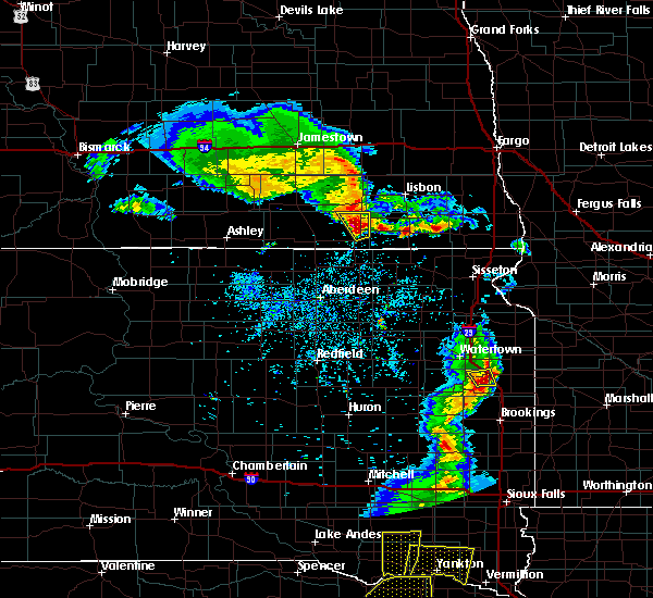 At 924 pm cdt, a severe thunderstorm was located over oakes, moving northeast at 20 mph (radar indicated). Hazards include 60 mph wind gusts and quarter size hail. Hail damage to vehicles is expected. expect wind damage to roofs, siding, and trees. This severe thunderstorm will remain over mainly rural areas of northeastern dickey county, including the following locations: glover. At 924 pm cdt, a severe thunderstorm was located over oakes, moving northeast at 20 mph (radar indicated). Hazards include 60 mph wind gusts and quarter size hail. Hail damage to vehicles is expected. expect wind damage to roofs, siding, and trees. This severe thunderstorm will remain over mainly rural areas of northeastern dickey county, including the following locations: glover.
|
| 7/17/2015 7:15 PM CDT |
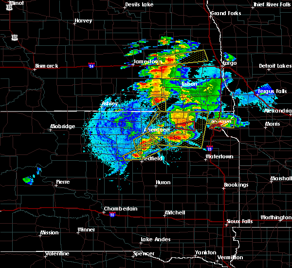 At 715 pm cdt, a severe thunderstorm was located near ludden, or 5 miles south of oakes, moving east at 25 mph (radar indicated). Hazards include 60 mph wind gusts and quarter size hail. Hail damage to vehicles is expected. expect wind damage to roofs, siding and trees. This severe thunderstorm will remain over mainly rural areas of eastern dickey county, including the following locations, glover. At 715 pm cdt, a severe thunderstorm was located near ludden, or 5 miles south of oakes, moving east at 25 mph (radar indicated). Hazards include 60 mph wind gusts and quarter size hail. Hail damage to vehicles is expected. expect wind damage to roofs, siding and trees. This severe thunderstorm will remain over mainly rural areas of eastern dickey county, including the following locations, glover.
|
| 7/17/2015 7:05 PM CDT |
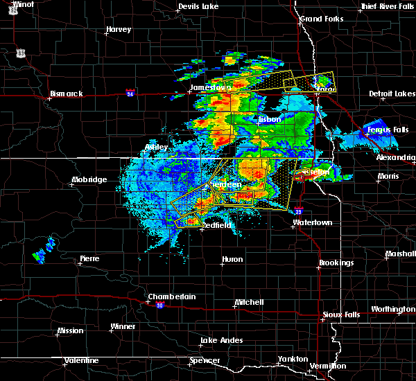 At 704 pm cdt, a severe thunderstorm was located 6 miles southwest of oakes, moving southeast at 30 mph (radar indicated). Hazards include 60 mph wind gusts and half dollar size hail. Hail damage to vehicles is expected. expect wind damage to roofs, siding and trees. this severe thunderstorm will be near, oakes around 710 pm cdt. ludden around 715 pm cdt. Other locations impacted by this severe thunderstorm include guelph and glover. At 704 pm cdt, a severe thunderstorm was located 6 miles southwest of oakes, moving southeast at 30 mph (radar indicated). Hazards include 60 mph wind gusts and half dollar size hail. Hail damage to vehicles is expected. expect wind damage to roofs, siding and trees. this severe thunderstorm will be near, oakes around 710 pm cdt. ludden around 715 pm cdt. Other locations impacted by this severe thunderstorm include guelph and glover.
|
| 5/28/2015 7:09 PM CDT | At 709 pm cdt, a severe thunderstorm was located over ellendale, moving northeast at 15 mph (radar indicated). Hazards include 60 mph wind gusts and quarter size hail. Hail damage to vehicles is expected. expect wind damage to roofs, siding and trees. this severe thunderstorm will be near, fullerton around 740 pm cdt. oakes around 815 pm cdt. Other locations impacted by this severe thunderstorm include guelph. |
| 9/9/2013 3:40 AM CDT | Report from facebook in dickey county ND, 0.1 miles ESE of Ludden, ND |
| 1/1/0001 12:00 AM | 4 inch diameter tree branches down across the yard in sargent county ND, 9.3 miles WNW of Ludden, ND |
| 1/1/0001 12:00 AM | Several tree limbs down and blocking roads. three to six inch diamete in dickey county ND, 0.1 miles ESE of Ludden, ND |
| 1/1/0001 12:00 AM | Numerous trees and branches down in and around ludde in dickey county ND, 0.1 miles ESE of Ludden, ND |
Hail Maps for Ludden, ND
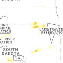
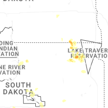
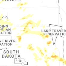

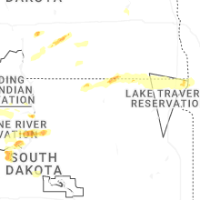


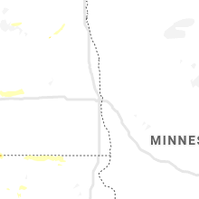


Connect with Interactive Hail Maps