

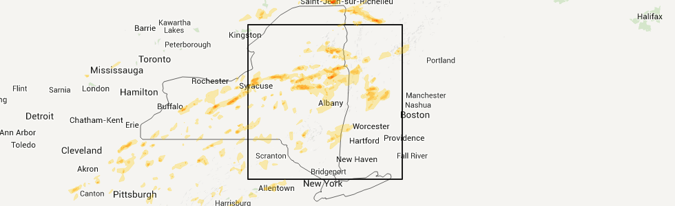
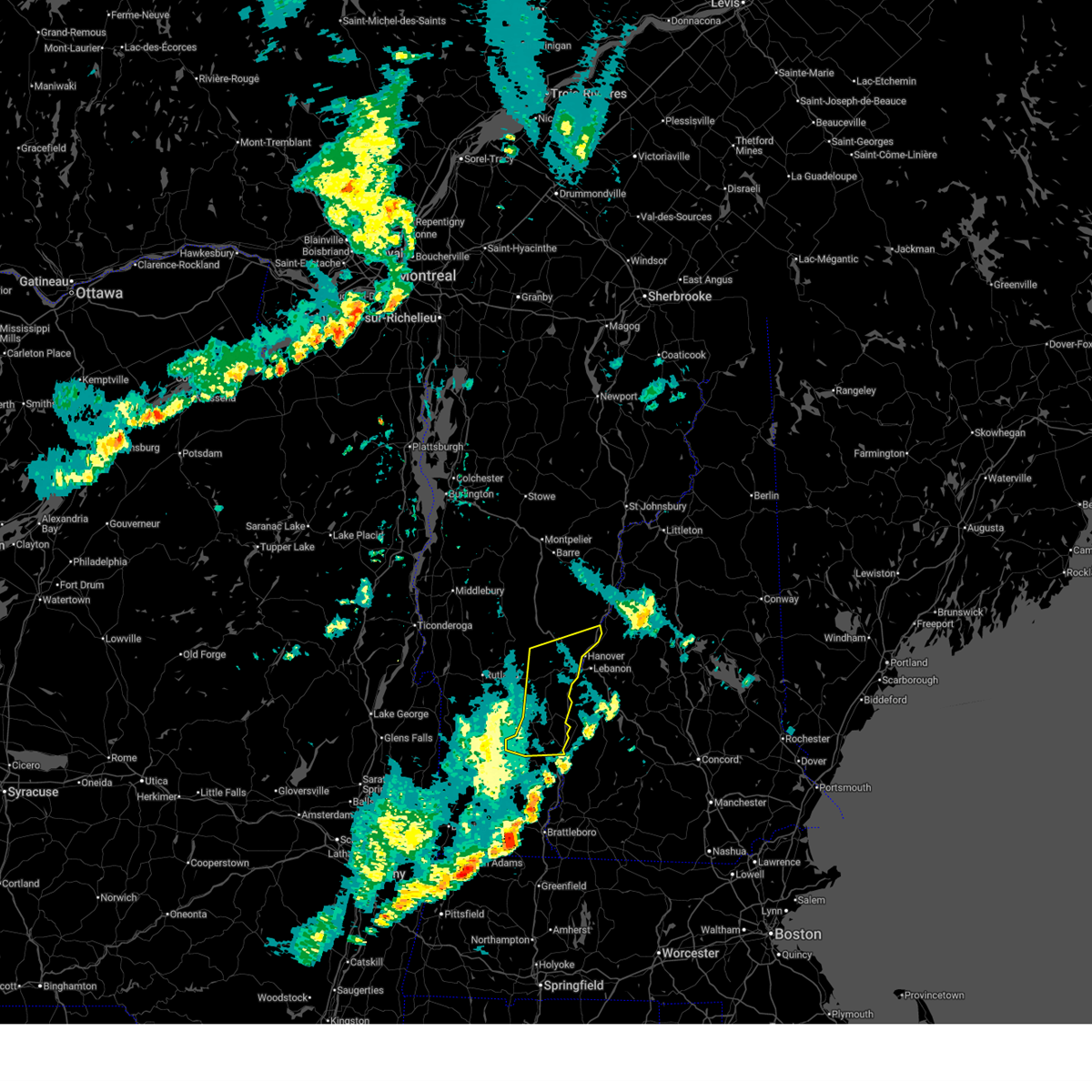
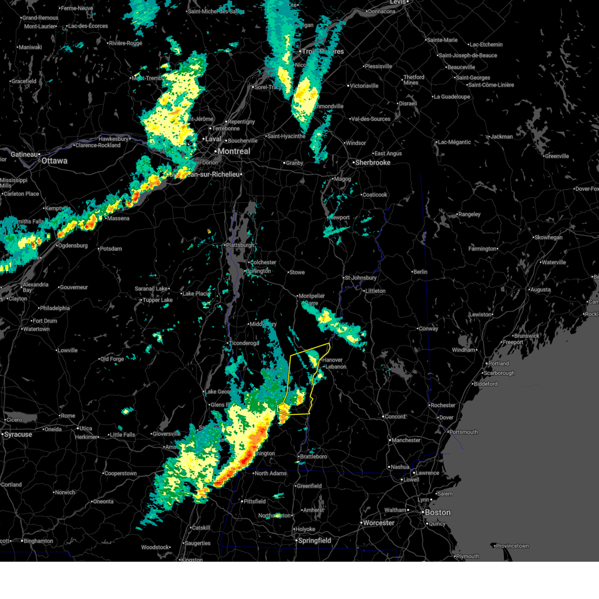
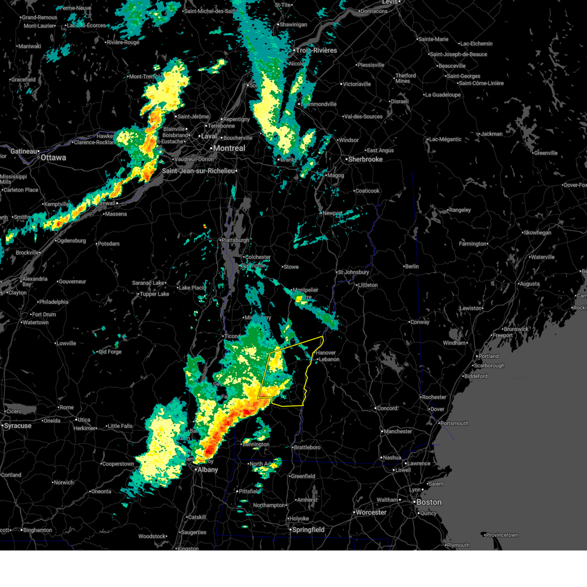
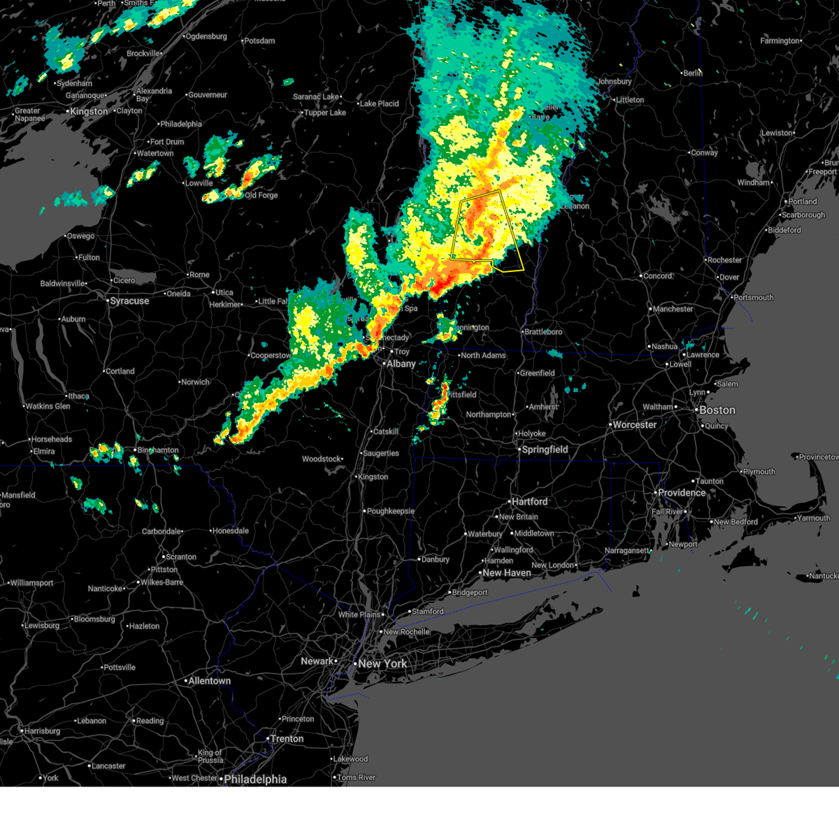
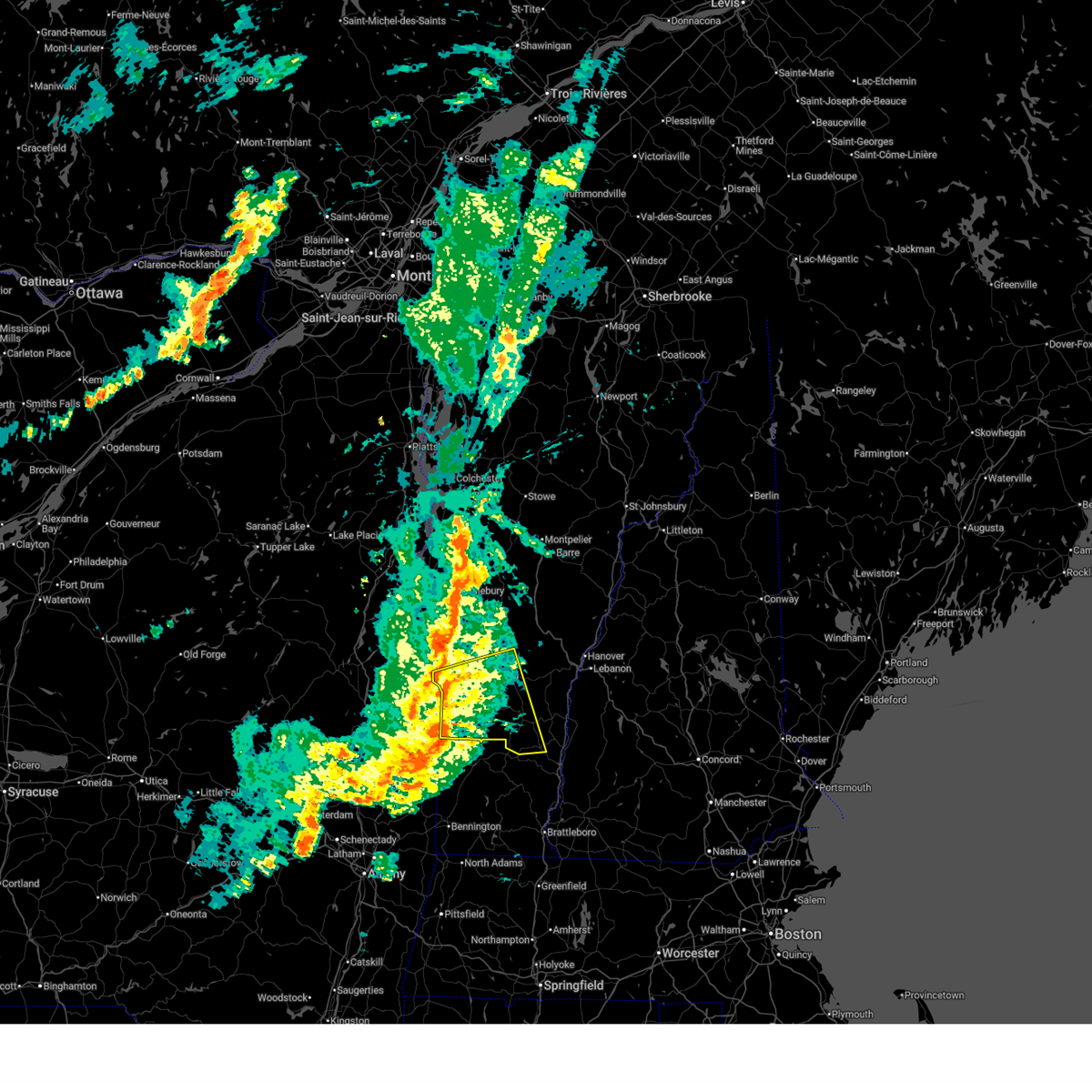
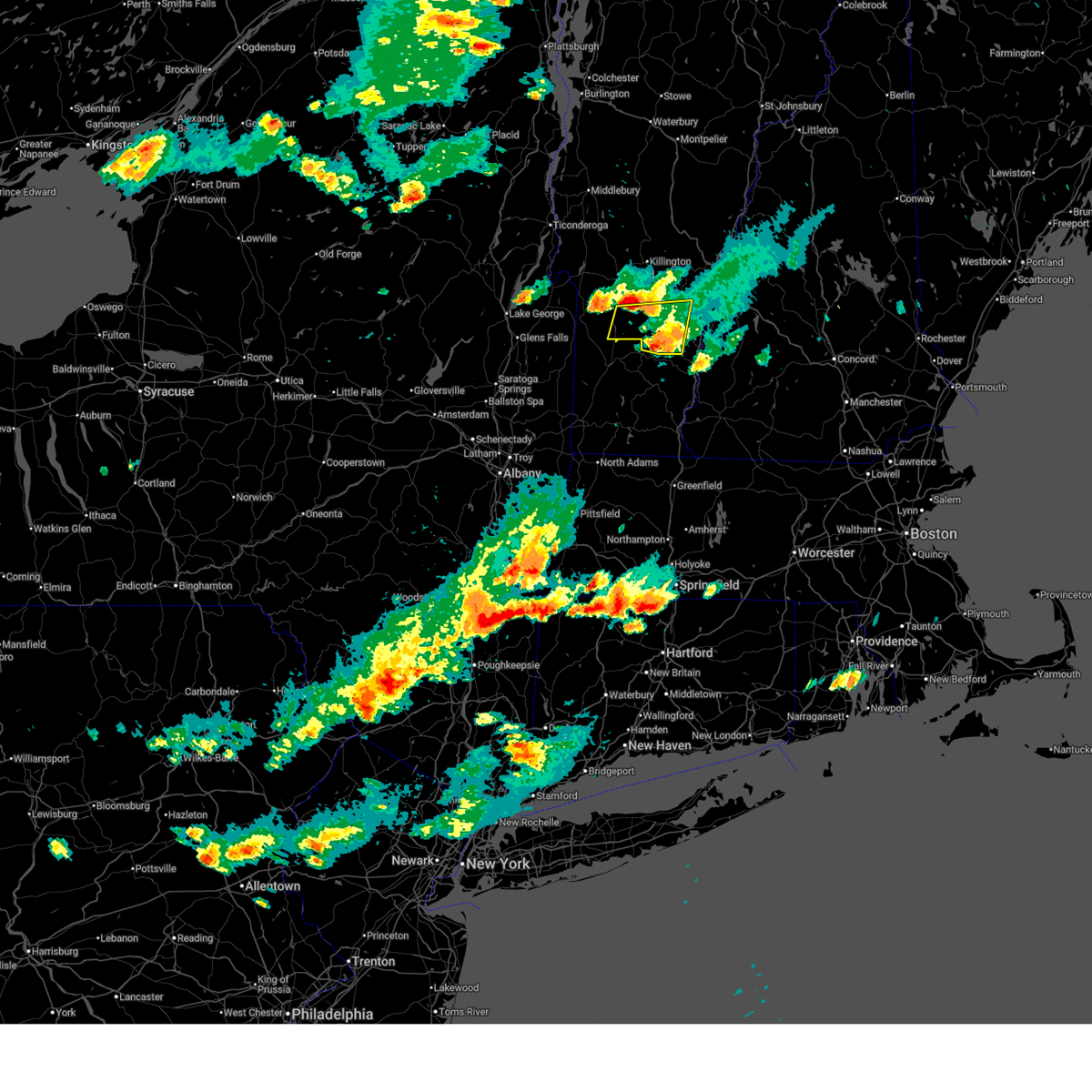
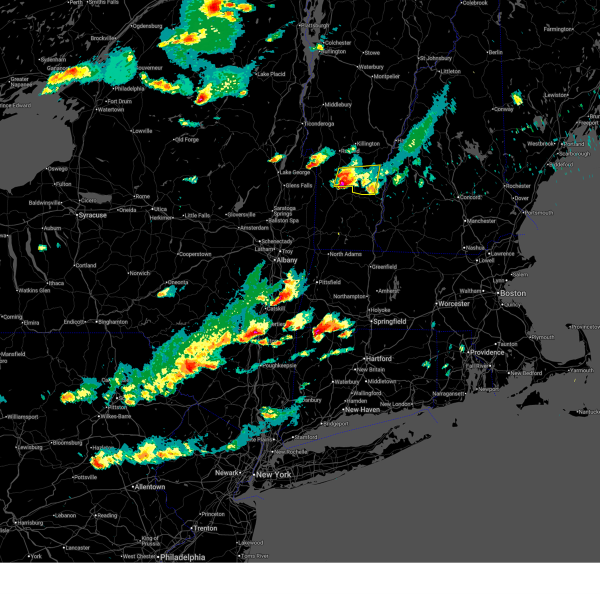
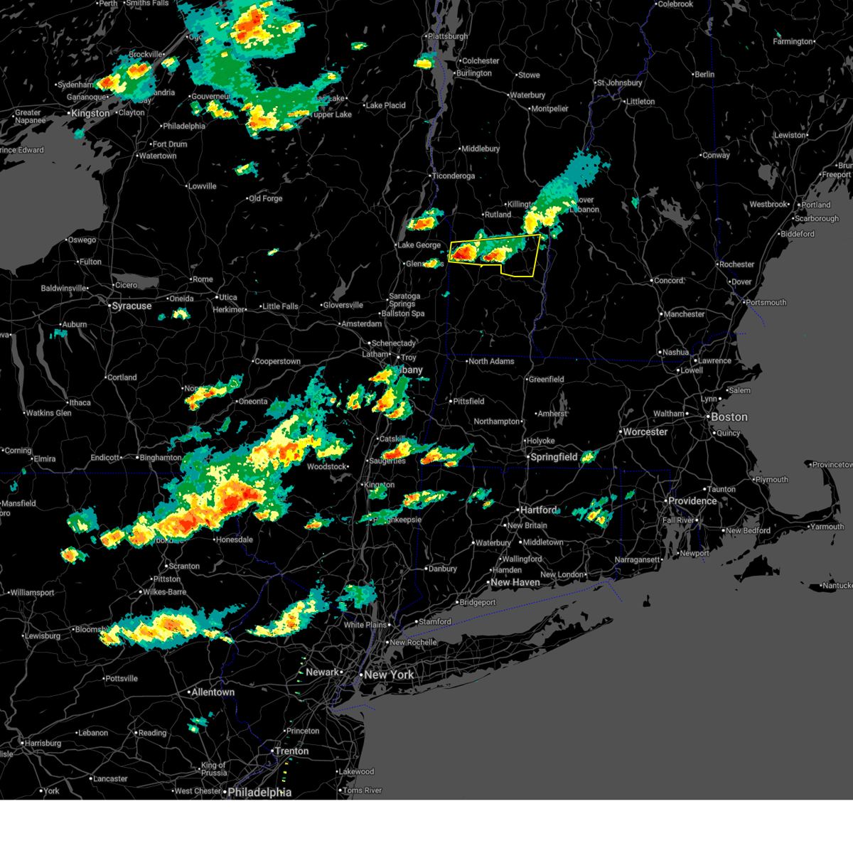
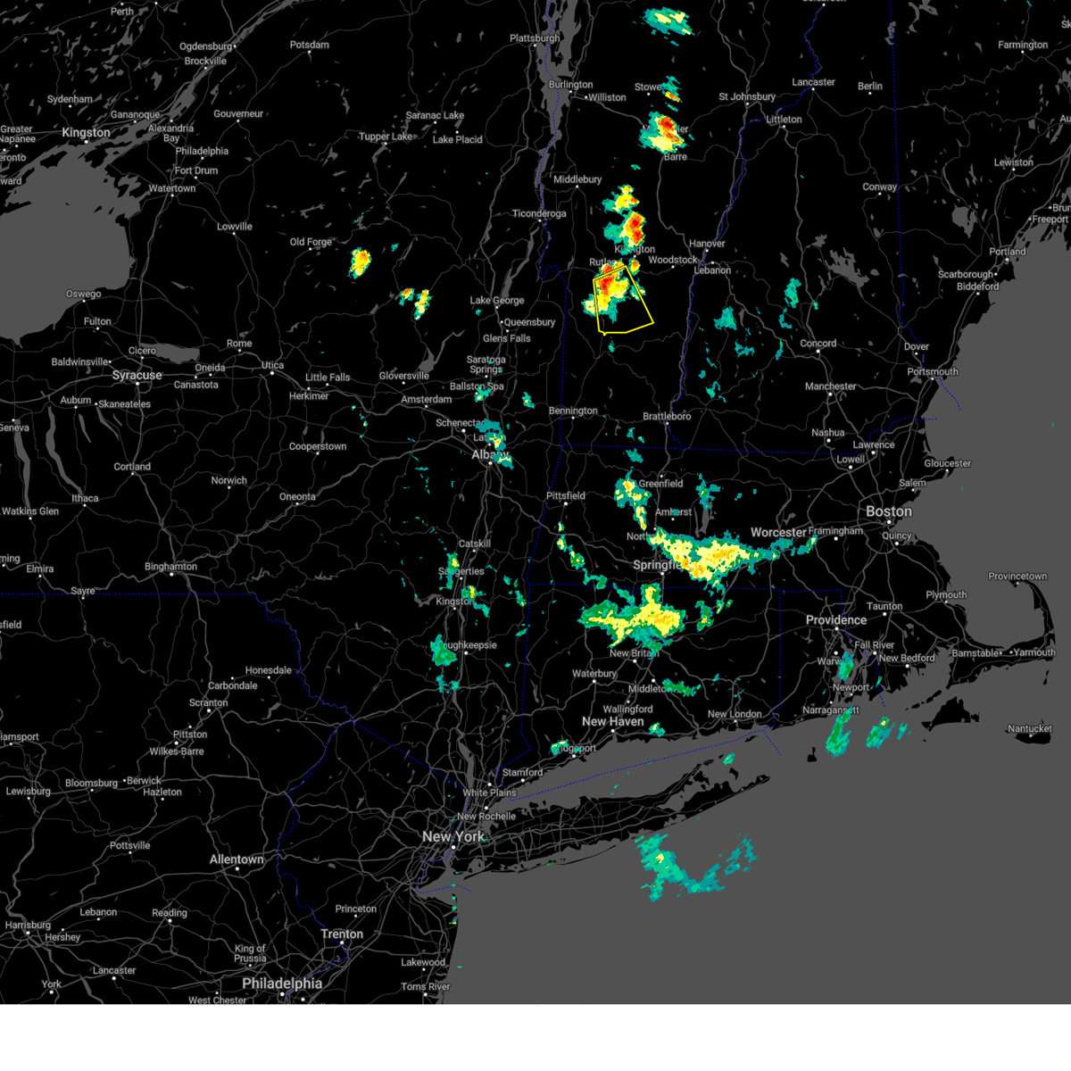
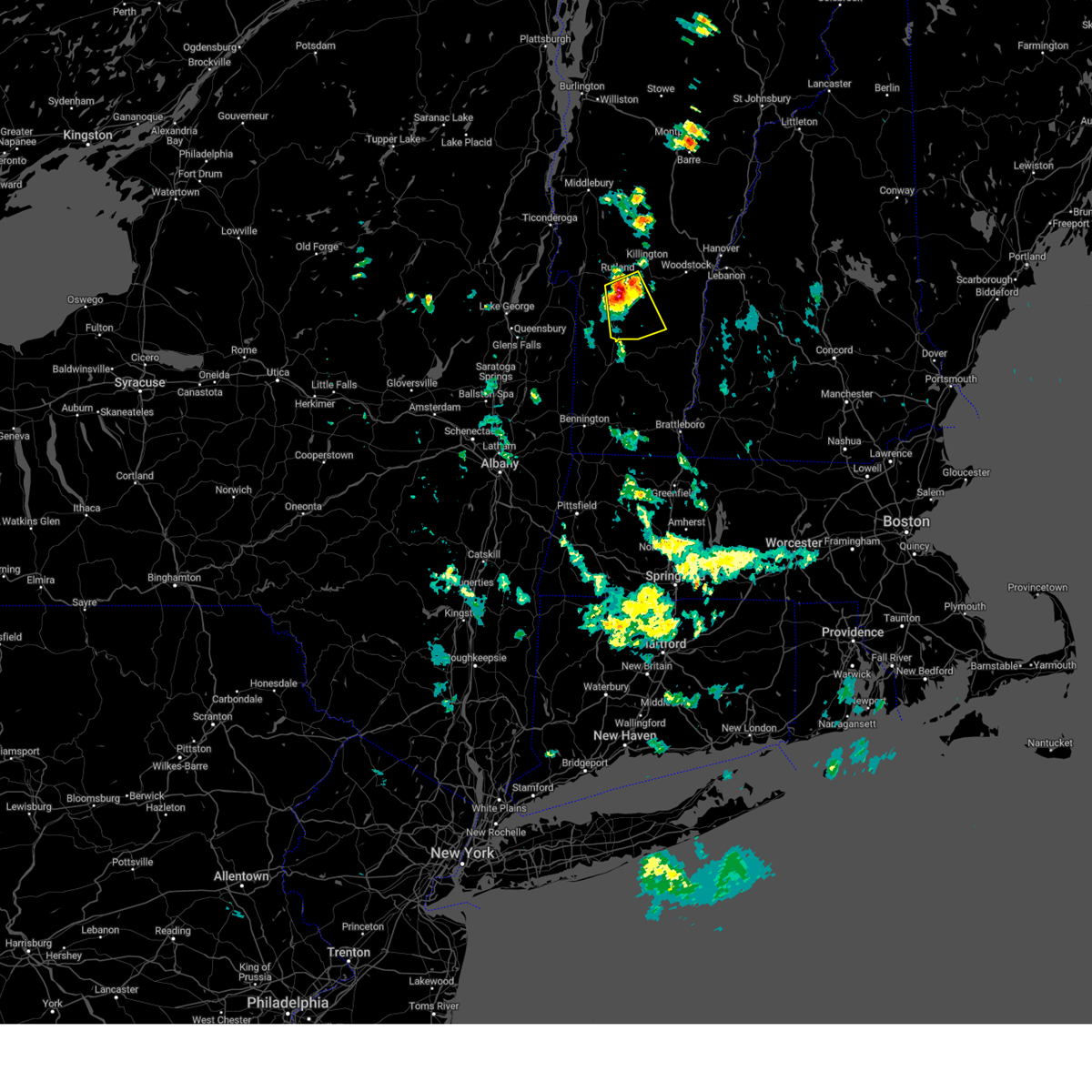
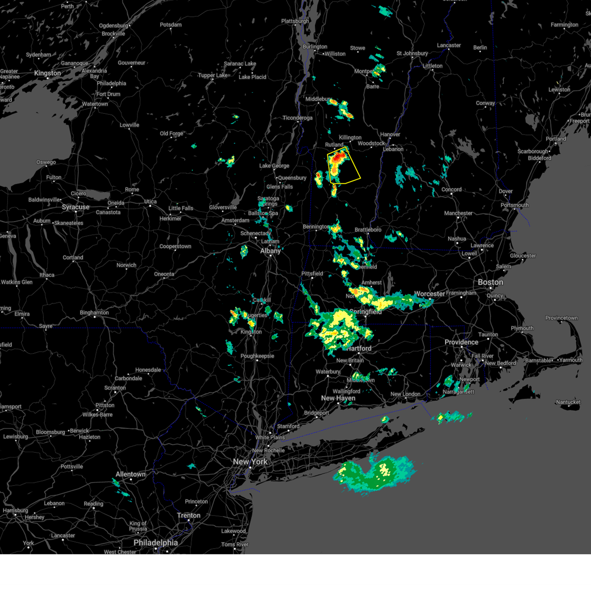
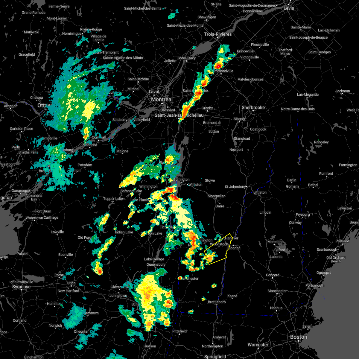
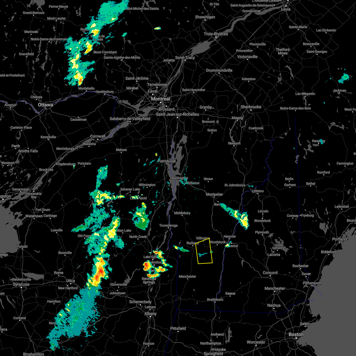
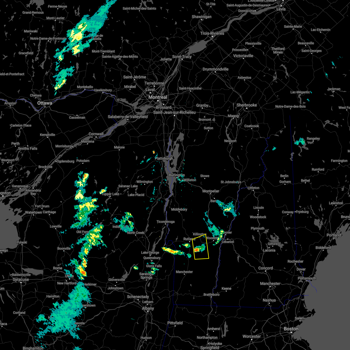
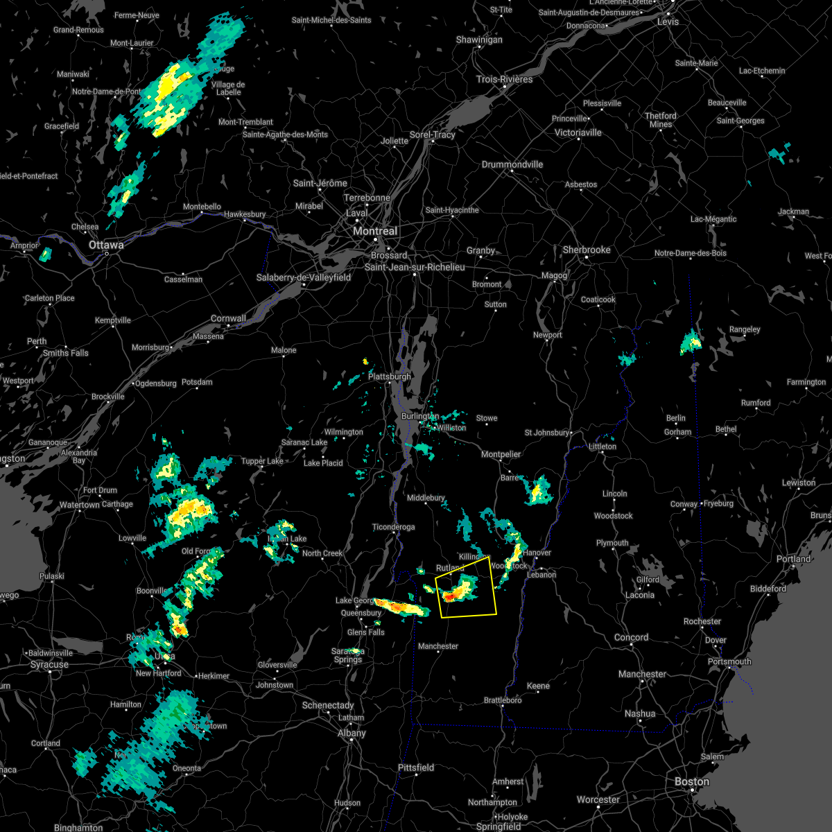
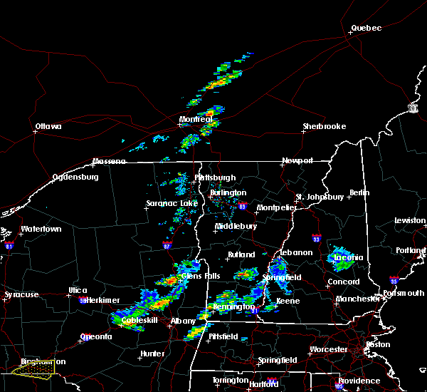
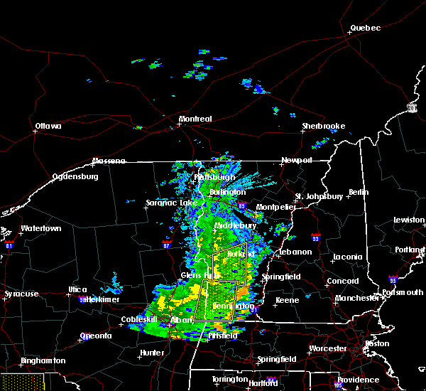
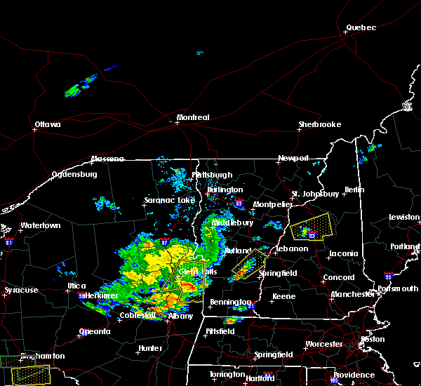
Hail Map for Ludlow, VT
The Ludlow, VT area has had 5 reports of on-the-ground hail by trained spotters, and has been under severe weather warnings 8 times during the past 12 months. Doppler radar has detected hail at or near Ludlow, VT on 9 occasions.
| Name: | Ludlow, VT |
| Where Located: | 74.6 miles ENE of Schenectady, NY |
| Map: | Google Map for Ludlow, VT |
| Population: | 811 |
| Housing Units: | 752 |
| More Info: | Search Google for Ludlow, VT |
5
The Top Recent Hail Date for Ludlow, VT is Tuesday, May 29, 2012 (1st out of 9)
Hail and Wind Damage Spotted near Ludlow, VT
| Date / Time | Report Details |
|---|---|
| 6/18/2026 3:20 PM EDT |
 The storm which prompted the warning has moved out of the area. therefore, the warning will be allowed to expire. however, gusty winds and heavy rain are still possible with this thunderstorm. a tornado watch remains in effect until 500 pm edt for central and southern vermont. to report severe weather, contact your nearest law enforcement agency. they will relay your report to the national weather service burlington. The storm which prompted the warning has moved out of the area. therefore, the warning will be allowed to expire. however, gusty winds and heavy rain are still possible with this thunderstorm. a tornado watch remains in effect until 500 pm edt for central and southern vermont. to report severe weather, contact your nearest law enforcement agency. they will relay your report to the national weather service burlington.
|
| 6/18/2026 2:55 PM EDT |
 At 254 pm edt, a severe thunderstorm was located over west hartford, moving east at 35 mph (radar indicated). Hazards include 60 mph wind gusts and quarter size hail. Minor hail damage to vehicles is possible. expect wind damage to trees and powerlines. locations impacted include, woodstock, chester, hartland four corners, cavendish, thetford hill state park, ludlow village, perkinsville village, pomfret, thetford, hartland, barnard, windsor, woodstock village, ludlow, sharon, andover, thetford center, quechee, norwich, and bridgewater. this includes the following highways, interstate 89 between mile markers 1 and 14. Interstate 91 between mile markers 39 and 49, between mile markers 51 and 61, between mile markers 63 and 71, near mile marker 73, and between mile markers 75 and 86. At 254 pm edt, a severe thunderstorm was located over west hartford, moving east at 35 mph (radar indicated). Hazards include 60 mph wind gusts and quarter size hail. Minor hail damage to vehicles is possible. expect wind damage to trees and powerlines. locations impacted include, woodstock, chester, hartland four corners, cavendish, thetford hill state park, ludlow village, perkinsville village, pomfret, thetford, hartland, barnard, windsor, woodstock village, ludlow, sharon, andover, thetford center, quechee, norwich, and bridgewater. this includes the following highways, interstate 89 between mile markers 1 and 14. Interstate 91 between mile markers 39 and 49, between mile markers 51 and 61, between mile markers 63 and 71, near mile marker 73, and between mile markers 75 and 86.
|
| 6/18/2026 2:27 PM EDT |
 Svrbtv the national weather service in burlington has issued a * severe thunderstorm warning for, south central orange county in central vermont, southeastern rutland county in southern vermont, windsor county in southern vermont, * until 330 pm edt. * at 227 pm edt, a severe thunderstorm was located over bridgewater, moving east at 35 mph (radar indicated). Hazards include 60 mph wind gusts and quarter size hail. Minor hail damage to vehicles is possible. Expect wind damage to trees and powerlines. Svrbtv the national weather service in burlington has issued a * severe thunderstorm warning for, south central orange county in central vermont, southeastern rutland county in southern vermont, windsor county in southern vermont, * until 330 pm edt. * at 227 pm edt, a severe thunderstorm was located over bridgewater, moving east at 35 mph (radar indicated). Hazards include 60 mph wind gusts and quarter size hail. Minor hail damage to vehicles is possible. Expect wind damage to trees and powerlines.
|
| 6/18/2026 2:10 PM EDT |
 At 210 pm edt, a severe thunderstorm was located over south wallingford, moving northeast at 40 mph (radar indicated). Hazards include 60 mph wind gusts. Expect damage to trees and powerlines. locations impacted include, rutland, chester, killington, ludlow village, rutland city, middletown springs, wallingford, mt. holly, mt. Tabor, rutland - southern vermont airport, plymouth, clarendon, west rutland, ira, mount holly, ludlow, mount tabor, andover, tinmouth, and weston. At 210 pm edt, a severe thunderstorm was located over south wallingford, moving northeast at 40 mph (radar indicated). Hazards include 60 mph wind gusts. Expect damage to trees and powerlines. locations impacted include, rutland, chester, killington, ludlow village, rutland city, middletown springs, wallingford, mt. holly, mt. Tabor, rutland - southern vermont airport, plymouth, clarendon, west rutland, ira, mount holly, ludlow, mount tabor, andover, tinmouth, and weston.
|
| 6/18/2026 1:49 PM EDT |
 Svrbtv the national weather service in burlington has issued a * severe thunderstorm warning for, rutland county in southern vermont, southwestern windsor county in southern vermont, * until 230 pm edt. * at 149 pm edt, a severe thunderstorm was located over west pawlet, moving east at 40 mph (radar indicated). Hazards include 60 mph wind gusts. expect damage to trees and powerlines Svrbtv the national weather service in burlington has issued a * severe thunderstorm warning for, rutland county in southern vermont, southwestern windsor county in southern vermont, * until 230 pm edt. * at 149 pm edt, a severe thunderstorm was located over west pawlet, moving east at 40 mph (radar indicated). Hazards include 60 mph wind gusts. expect damage to trees and powerlines
|
| 7/3/2025 5:14 PM EDT |
 The storm which prompted the warning has weakened below severe limits, and no longer poses an immediate threat to life or property. therefore, the warning will be allowed to expire. however, gusty winds and heavy rain are still possible with this thunderstorm. to report severe weather, contact your nearest law enforcement agency. they will relay your report to the national weather service burlington. The storm which prompted the warning has weakened below severe limits, and no longer poses an immediate threat to life or property. therefore, the warning will be allowed to expire. however, gusty winds and heavy rain are still possible with this thunderstorm. to report severe weather, contact your nearest law enforcement agency. they will relay your report to the national weather service burlington.
|
| 7/3/2025 4:46 PM EDT |
 At 446 pm edt, a severe thunderstorm was located over mount tabor, moving east at 20 mph (radar indicated). Hazards include 60 mph wind gusts and half dollar size hail. Minor hail damage to vehicles is possible. expect wind damage to trees and powerlines. locations impacted include, chester, mount holly, ludlow, cavendish, mount tabor, weston, andover, ludlow village, perkinsville village, wallingford, mt. holly, mt. Tabor, baltimore, west windsor, reading, weathersfield, danby, springfield, plymouth, and perkinsville. At 446 pm edt, a severe thunderstorm was located over mount tabor, moving east at 20 mph (radar indicated). Hazards include 60 mph wind gusts and half dollar size hail. Minor hail damage to vehicles is possible. expect wind damage to trees and powerlines. locations impacted include, chester, mount holly, ludlow, cavendish, mount tabor, weston, andover, ludlow village, perkinsville village, wallingford, mt. holly, mt. Tabor, baltimore, west windsor, reading, weathersfield, danby, springfield, plymouth, and perkinsville.
|
| 7/3/2025 4:12 PM EDT |
 Svrbtv the national weather service in burlington has issued a * severe thunderstorm warning for, southeastern rutland county in southern vermont, southwestern windsor county in southern vermont, * until 515 pm edt. * at 412 pm edt, a severe thunderstorm was located over pawlet, moving east at 20 mph (radar indicated). Hazards include 60 mph wind gusts and quarter size hail. Minor hail damage to vehicles is possible. Expect wind damage to trees and powerlines. Svrbtv the national weather service in burlington has issued a * severe thunderstorm warning for, southeastern rutland county in southern vermont, southwestern windsor county in southern vermont, * until 515 pm edt. * at 412 pm edt, a severe thunderstorm was located over pawlet, moving east at 20 mph (radar indicated). Hazards include 60 mph wind gusts and quarter size hail. Minor hail damage to vehicles is possible. Expect wind damage to trees and powerlines.
|
| 7/29/2024 6:22 PM EDT |
 The storm which prompted the warning has weakened below severe limits. therefore, the warning will be allowed to expire. however, torrential rain is still occurring with this thunderstorm. localized flooding is possible. The storm which prompted the warning has weakened below severe limits. therefore, the warning will be allowed to expire. however, torrential rain is still occurring with this thunderstorm. localized flooding is possible.
|
| 7/29/2024 6:04 PM EDT |
 At 604 pm edt, a severe thunderstorm was located over east clarendon, and is nearly stationary (radar indicated). Hazards include 60 mph wind gusts and quarter size hail. Minor hail damage to vehicles is possible. expect wind damage to trees and powerlines. locations impacted include, rutland, mount holly, ludlow, mount tabor, weston, shrewsbury, ludlow village, wallingford, mt. holly, mt. Tabor, rutland - southern vermont airport, clarendon, mendon, tinmouth, ira, danby, plymouth, andover, killington, and east clarendon. At 604 pm edt, a severe thunderstorm was located over east clarendon, and is nearly stationary (radar indicated). Hazards include 60 mph wind gusts and quarter size hail. Minor hail damage to vehicles is possible. expect wind damage to trees and powerlines. locations impacted include, rutland, mount holly, ludlow, mount tabor, weston, shrewsbury, ludlow village, wallingford, mt. holly, mt. Tabor, rutland - southern vermont airport, clarendon, mendon, tinmouth, ira, danby, plymouth, andover, killington, and east clarendon.
|
| 7/29/2024 5:47 PM EDT |
 Svrbtv the national weather service in burlington has issued a * severe thunderstorm warning for, southeastern rutland county in southern vermont, southwestern windsor county in southern vermont, * until 630 pm edt. * at 547 pm edt, a severe thunderstorm was located over east clarendon, moving south at 5 mph (radar indicated). Hazards include 60 mph wind gusts and quarter size hail. Minor hail damage to vehicles is possible. Expect wind damage to trees and powerlines. Svrbtv the national weather service in burlington has issued a * severe thunderstorm warning for, southeastern rutland county in southern vermont, southwestern windsor county in southern vermont, * until 630 pm edt. * at 547 pm edt, a severe thunderstorm was located over east clarendon, moving south at 5 mph (radar indicated). Hazards include 60 mph wind gusts and quarter size hail. Minor hail damage to vehicles is possible. Expect wind damage to trees and powerlines.
|
| 7/16/2024 5:39 PM EDT |
 Svrbtv the national weather service in burlington has issued a * severe thunderstorm warning for, southeastern essex county in northern new york, west central orange county in central vermont, southern addison county in central vermont, rutland county in southern vermont, western windsor county in southern vermont, * until 630 pm edt. * at 539 pm edt, severe thunderstorms were located along a line extending from chipmans point to 8 miles south of west pawlet, moving east at 45 mph (radar indicated). Hazards include 70 mph wind gusts. Expect considerable tree damage. Damage is likely to mobile homes, roofs, and outbuildings. Svrbtv the national weather service in burlington has issued a * severe thunderstorm warning for, southeastern essex county in northern new york, west central orange county in central vermont, southern addison county in central vermont, rutland county in southern vermont, western windsor county in southern vermont, * until 630 pm edt. * at 539 pm edt, severe thunderstorms were located along a line extending from chipmans point to 8 miles south of west pawlet, moving east at 45 mph (radar indicated). Hazards include 70 mph wind gusts. Expect considerable tree damage. Damage is likely to mobile homes, roofs, and outbuildings.
|
| 6/23/2024 3:45 PM EDT |
 At 345 pm edt, a severe thunderstorm was located over weston, moving east at 45 mph (law enforcement). Hazards include 60 mph wind gusts. Expect damage to trees and powerlines. locations impacted include, chester, cavendish, ludlow village, perkinsville village, wallingford, mt. holly, mt. Tabor, windsor, pawlet, mount holly, ludlow, mount tabor, andover, weston, danby, baltimore, springfield, weathersfield, west windsor, and reading. At 345 pm edt, a severe thunderstorm was located over weston, moving east at 45 mph (law enforcement). Hazards include 60 mph wind gusts. Expect damage to trees and powerlines. locations impacted include, chester, cavendish, ludlow village, perkinsville village, wallingford, mt. holly, mt. Tabor, windsor, pawlet, mount holly, ludlow, mount tabor, andover, weston, danby, baltimore, springfield, weathersfield, west windsor, and reading.
|
| 6/23/2024 3:00 PM EDT |
 Svrbtv the national weather service in burlington has issued a * severe thunderstorm warning for, southeastern rutland county in southern vermont, southwestern windsor county in southern vermont, * until 400 pm edt. * at 259 pm edt, a severe thunderstorm was located 13 miles southwest of west pawlet, moving east at 40 mph (radar indicated). Hazards include 60 mph wind gusts and penny size hail. expect damage to trees and powerlines Svrbtv the national weather service in burlington has issued a * severe thunderstorm warning for, southeastern rutland county in southern vermont, southwestern windsor county in southern vermont, * until 400 pm edt. * at 259 pm edt, a severe thunderstorm was located 13 miles southwest of west pawlet, moving east at 40 mph (radar indicated). Hazards include 60 mph wind gusts and penny size hail. expect damage to trees and powerlines
|
| 7/13/2023 8:03 PM EDT |
 At 803 pm edt, a severe thunderstorm was located over cavendish, moving east at 50 mph (radar indicated). Hazards include 60 mph wind gusts and penny size hail. expect damage to trees and powerlines At 803 pm edt, a severe thunderstorm was located over cavendish, moving east at 50 mph (radar indicated). Hazards include 60 mph wind gusts and penny size hail. expect damage to trees and powerlines
|
| 1/1/0001 12:00 AM | Trees and powerlines dow in rutland county VT, 7 miles ESE of Ludlow, VT |
| 7/13/2023 7:37 PM EDT |
 The severe thunderstorm warning for orange, south central caledonia, east central rutland, windsor and southeastern washington counties will expire at 745 pm edt, the storms which prompted the warning have weakened. therefore, the warning will be allowed to expire. a severe thunderstorm watch remains in effect until 1000 pm edt for central, southern and northeastern vermont. The severe thunderstorm warning for orange, south central caledonia, east central rutland, windsor and southeastern washington counties will expire at 745 pm edt, the storms which prompted the warning have weakened. therefore, the warning will be allowed to expire. a severe thunderstorm watch remains in effect until 1000 pm edt for central, southern and northeastern vermont.
|
| 7/13/2023 7:22 PM EDT |
 At 722 pm edt, severe thunderstorms were located along a line extending from whiting to 13 miles south of west pawlet, moving east at 35 mph (radar indicated). Hazards include 60 mph wind gusts and quarter size hail. Minor hail damage to vehicles is possible. Expect wind damage to trees and powerlines. At 722 pm edt, severe thunderstorms were located along a line extending from whiting to 13 miles south of west pawlet, moving east at 35 mph (radar indicated). Hazards include 60 mph wind gusts and quarter size hail. Minor hail damage to vehicles is possible. Expect wind damage to trees and powerlines.
|
| 7/13/2023 6:57 PM EDT |
 At 657 pm edt, severe thunderstorms were located along a line extending from near irasville to near south wallingford, moving east at 55 mph (radar indicated). Hazards include 60 mph wind gusts and quarter size hail. Minor hail damage to vehicles is possible. Expect wind damage to trees and powerlines. At 657 pm edt, severe thunderstorms were located along a line extending from near irasville to near south wallingford, moving east at 55 mph (radar indicated). Hazards include 60 mph wind gusts and quarter size hail. Minor hail damage to vehicles is possible. Expect wind damage to trees and powerlines.
|
| 8/30/2022 4:46 PM EDT |
 At 446 pm edt, a severe thunderstorm was located over south woodstock, moving northeast at 35 mph (radar indicated). Hazards include 60 mph wind gusts and penny size hail. expect damage to trees and powerlines At 446 pm edt, a severe thunderstorm was located over south woodstock, moving northeast at 35 mph (radar indicated). Hazards include 60 mph wind gusts and penny size hail. expect damage to trees and powerlines
|
| 8/4/2022 6:11 PM EDT |
 At 611 pm edt, severe thunderstorms were located along a line extending from near south wallingford to 9 miles southwest of weston, moving northeast at 25 mph (radar indicated). Hazards include 60 mph wind gusts and quarter size hail. Minor hail damage to vehicles is possible. Expect wind damage to trees and powerlines. At 611 pm edt, severe thunderstorms were located along a line extending from near south wallingford to 9 miles southwest of weston, moving northeast at 25 mph (radar indicated). Hazards include 60 mph wind gusts and quarter size hail. Minor hail damage to vehicles is possible. Expect wind damage to trees and powerlines.
|
| 7/28/2022 5:51 PM EDT |
 At 551 pm edt, a severe thunderstorm was located over baltimore, moving east at 25 mph (radar indicated). Hazards include 60 mph wind gusts and quarter size hail. Minor hail damage to vehicles is possible. Expect wind damage to trees and powerlines. At 551 pm edt, a severe thunderstorm was located over baltimore, moving east at 25 mph (radar indicated). Hazards include 60 mph wind gusts and quarter size hail. Minor hail damage to vehicles is possible. Expect wind damage to trees and powerlines.
|
| 7/27/2021 4:20 PM EDT | Tree down on powerlines... time approximate in rutland county VT, 6.2 miles ESE of Ludlow, VT |
| 7/27/2021 4:07 PM EDT |
 At 406 pm edt, a severe thunderstorm was located over east wallingford, moving east at 30 mph (radar indicated). Hazards include 60 mph wind gusts and penny size hail. Expect damage to trees and powerlines. locations impacted include, chester, windsor, mount holly, ludlow, cavendish, andover, mount tabor, weston, tinmouth, ludlow village, perkinsville village, wallingford, mt. Holly, baltimore, weathersfield, west windsor, reading, clarendon, shrewsbury and plymouth. At 406 pm edt, a severe thunderstorm was located over east wallingford, moving east at 30 mph (radar indicated). Hazards include 60 mph wind gusts and penny size hail. Expect damage to trees and powerlines. locations impacted include, chester, windsor, mount holly, ludlow, cavendish, andover, mount tabor, weston, tinmouth, ludlow village, perkinsville village, wallingford, mt. Holly, baltimore, weathersfield, west windsor, reading, clarendon, shrewsbury and plymouth.
|
| 7/27/2021 3:46 PM EDT |
 At 346 pm edt, a severe thunderstorm was located over chippenhook, moving east at 30 mph (radar indicated). Hazards include 60 mph wind gusts and penny size hail. expect damage to trees and powerlines At 346 pm edt, a severe thunderstorm was located over chippenhook, moving east at 30 mph (radar indicated). Hazards include 60 mph wind gusts and penny size hail. expect damage to trees and powerlines
|
| 7/20/2021 9:31 PM EDT |
 At 929 pm edt, a line of severe thunderstorms was over portions of rutland and windsor counties in vermont generally located along a line extending from near white river junction to felchville to 6 miles south of danby, moving southeast at 30 mph (radar indicated). Hazards include 60 mph wind gusts and quarter size hail. Expect wind damage to trees and powerlines. minor hail damage to vehicles is possible. locations impacted include, woodstock, chester, hartland four corners, cavendish, ludlow village, perkinsville village, wallingford, mt. holly, mt. Tabor, pomfret, plymouth, hartland, windsor, woodstock village, pawlet, mount holly, ludlow, sharon, andover and mount tabor. At 929 pm edt, a line of severe thunderstorms was over portions of rutland and windsor counties in vermont generally located along a line extending from near white river junction to felchville to 6 miles south of danby, moving southeast at 30 mph (radar indicated). Hazards include 60 mph wind gusts and quarter size hail. Expect wind damage to trees and powerlines. minor hail damage to vehicles is possible. locations impacted include, woodstock, chester, hartland four corners, cavendish, ludlow village, perkinsville village, wallingford, mt. holly, mt. Tabor, pomfret, plymouth, hartland, windsor, woodstock village, pawlet, mount holly, ludlow, sharon, andover and mount tabor.
|
| 7/20/2021 8:54 PM EDT |
 At 852 pm edt, a line of severe thunderstorms over south central vermont was located along a line extending from near south strafford to west bridgewater to near north pawlet, moving southeast at 30 mph (radar indicated). Hazards include 60 mph wind gusts and quarter size hail. Expect wind damage to trees and powerlines. Minor hail damage to vehicles is possible. At 852 pm edt, a line of severe thunderstorms over south central vermont was located along a line extending from near south strafford to west bridgewater to near north pawlet, moving southeast at 30 mph (radar indicated). Hazards include 60 mph wind gusts and quarter size hail. Expect wind damage to trees and powerlines. Minor hail damage to vehicles is possible.
|
| 6/21/2021 7:17 PM EDT |
 The severe thunderstorm warning for southeastern rutland and southwestern windsor counties has expired, the storm which prompted the warning has weakened below severe limits, and has exited the warned area. therefore, the warning has been allowed to expire. a severe thunderstorm watch remains in effect until 900 pm edt for southern vermont. to report severe weather, contact your nearest law enforcement agency. they will relay your report to the national weather service burlington. The severe thunderstorm warning for southeastern rutland and southwestern windsor counties has expired, the storm which prompted the warning has weakened below severe limits, and has exited the warned area. therefore, the warning has been allowed to expire. a severe thunderstorm watch remains in effect until 900 pm edt for southern vermont. to report severe weather, contact your nearest law enforcement agency. they will relay your report to the national weather service burlington.
|
| 6/21/2021 6:55 PM EDT |
 At 654 pm edt, a severe thunderstorm was located over north shrewsbury, moving east at 20 mph (radar indicated). Hazards include 60 mph wind gusts and quarter size hail. Minor hail damage to vehicles is possible. expect wind damage to trees and powerlines. locations impacted include, mount holly, ludlow, killington, shrewsbury, ludlow village, mt. Holly, plymouth, bridgewater, mendon, cavendish, reading, barnard, wallingford, mount tabor, weston, stockbridge, plymouth union, belmont, south sherburne and cuttingsville. At 654 pm edt, a severe thunderstorm was located over north shrewsbury, moving east at 20 mph (radar indicated). Hazards include 60 mph wind gusts and quarter size hail. Minor hail damage to vehicles is possible. expect wind damage to trees and powerlines. locations impacted include, mount holly, ludlow, killington, shrewsbury, ludlow village, mt. Holly, plymouth, bridgewater, mendon, cavendish, reading, barnard, wallingford, mount tabor, weston, stockbridge, plymouth union, belmont, south sherburne and cuttingsville.
|
| 6/21/2021 6:38 PM EDT |
 At 638 pm edt, a severe thunderstorm was located over east clarendon, moving east at 20 mph (radar indicated). Hazards include 60 mph wind gusts and quarter size hail. Minor hail damage to vehicles is possible. expect wind damage to trees and powerlines. locations impacted include, rutland, mount holly, ludlow, killington, tinmouth, shrewsbury, ludlow village, rutland city, wallingford, mt. Holly, rutland - southern vermont airport, plymouth, bridgewater, mendon, clarendon, ira, cavendish, west rutland, danby and mount tabor. At 638 pm edt, a severe thunderstorm was located over east clarendon, moving east at 20 mph (radar indicated). Hazards include 60 mph wind gusts and quarter size hail. Minor hail damage to vehicles is possible. expect wind damage to trees and powerlines. locations impacted include, rutland, mount holly, ludlow, killington, tinmouth, shrewsbury, ludlow village, rutland city, wallingford, mt. Holly, rutland - southern vermont airport, plymouth, bridgewater, mendon, clarendon, ira, cavendish, west rutland, danby and mount tabor.
|
| 6/21/2021 6:18 PM EDT |
 At 618 pm edt, a severe thunderstorm was located over tinmouth, moving east at 20 mph (radar indicated). Hazards include 60 mph wind gusts and quarter size hail. Minor hail damage to vehicles is possible. Expect wind damage to trees and powerlines. At 618 pm edt, a severe thunderstorm was located over tinmouth, moving east at 20 mph (radar indicated). Hazards include 60 mph wind gusts and quarter size hail. Minor hail damage to vehicles is possible. Expect wind damage to trees and powerlines.
|
| 6/21/2021 5:51 PM EDT |
 At 550 pm edt, a severe thunderstorm was located over east pittsford, moving east at 40 mph (radar indicated). Hazards include 60 mph wind gusts and quarter size hail. Minor hail damage to vehicles is possible. expect wind damage to trees and powerlines. Locations impacted include, rutland, woodstock, sudbury, killington, ludlow village, rutland city, wallingford, orwell, rutland - southern vermont airport, benson, plymouth, chittenden, west rutland, whiting, ira, west castleton, mount holly, poultney village, mount tabor and shrewsbury. At 550 pm edt, a severe thunderstorm was located over east pittsford, moving east at 40 mph (radar indicated). Hazards include 60 mph wind gusts and quarter size hail. Minor hail damage to vehicles is possible. expect wind damage to trees and powerlines. Locations impacted include, rutland, woodstock, sudbury, killington, ludlow village, rutland city, wallingford, orwell, rutland - southern vermont airport, benson, plymouth, chittenden, west rutland, whiting, ira, west castleton, mount holly, poultney village, mount tabor and shrewsbury.
|
| 6/21/2021 5:12 PM EDT |
 At 512 pm edt, a severe thunderstorm was located over west haven, moving east at 40 mph (radar indicated). Hazards include 60 mph wind gusts and quarter size hail. Minor hail damage to vehicles is possible. Expect wind damage to trees and powerlines. At 512 pm edt, a severe thunderstorm was located over west haven, moving east at 40 mph (radar indicated). Hazards include 60 mph wind gusts and quarter size hail. Minor hail damage to vehicles is possible. Expect wind damage to trees and powerlines.
|
| 8/21/2020 4:57 PM EDT |
 The severe thunderstorm warning for southeastern rutland and southwestern windsor counties will expire at 500 pm edt, the storm which prompted the warning has weakened below severe limits, and has exited the warned area. therefore, the warning will be allowed to expire. however gusty winds and heavy rain are still possible with this thunderstorm. The severe thunderstorm warning for southeastern rutland and southwestern windsor counties will expire at 500 pm edt, the storm which prompted the warning has weakened below severe limits, and has exited the warned area. therefore, the warning will be allowed to expire. however gusty winds and heavy rain are still possible with this thunderstorm.
|
| 8/21/2020 4:32 PM EDT |
 At 430 pm edt, a severe thunderstorm was located over andover, moving east at 45 mph (law enforcement). Hazards include 60 mph wind gusts and quarter size hail. Trees and powerlines down throughout wells and middletown springs, vermont. minor hail damage to vehicles is possible. expect wind damage to trees and powerlines. locations impacted include, chester, cavendish, ludlow village, perkinsville village, wallingford, mt. holly, mt. Tabor, rutland - southern vermont airport, clarendon, windsor, mount holly, ludlow, andover, mount tabor, weston, danby, reading, baltimore, springfield and weathersfield. At 430 pm edt, a severe thunderstorm was located over andover, moving east at 45 mph (law enforcement). Hazards include 60 mph wind gusts and quarter size hail. Trees and powerlines down throughout wells and middletown springs, vermont. minor hail damage to vehicles is possible. expect wind damage to trees and powerlines. locations impacted include, chester, cavendish, ludlow village, perkinsville village, wallingford, mt. holly, mt. Tabor, rutland - southern vermont airport, clarendon, windsor, mount holly, ludlow, andover, mount tabor, weston, danby, reading, baltimore, springfield and weathersfield.
|
| 8/21/2020 4:01 PM EDT |
 At 401 pm edt, a severe thunderstorm was located over east wells, moving east at 45 mph (radar indicated). Hazards include 60 mph wind gusts and quarter size hail. Minor hail damage to vehicles is possible. Expect wind damage to trees and powerlines. At 401 pm edt, a severe thunderstorm was located over east wells, moving east at 45 mph (radar indicated). Hazards include 60 mph wind gusts and quarter size hail. Minor hail damage to vehicles is possible. Expect wind damage to trees and powerlines.
|
| 9/4/2019 1:29 PM EDT | Quarter sized hail reported 1 miles E of Ludlow, VT, quarter sized hail reported at okemo mountain lodge |
| 9/4/2019 1:24 PM EDT |
 At 124 pm edt, a severe thunderstorm was located over ludlow, moving northeast at 50 mph (radar indicated). Hazards include 60 mph wind gusts and quarter size hail. Minor hail damage to vehicles is possible. Expect wind damage to trees and powerlines. At 124 pm edt, a severe thunderstorm was located over ludlow, moving northeast at 50 mph (radar indicated). Hazards include 60 mph wind gusts and quarter size hail. Minor hail damage to vehicles is possible. Expect wind damage to trees and powerlines.
|
| 8/17/2019 7:00 PM EDT | Trees and power lines down across the town of plymouth. a few power outages also reporte in windsor county VT, 9.3 miles S of Ludlow, VT |
| 8/17/2019 7:00 PM EDT |
 At 624 pm edt, severe thunderstorms were located along a line extending from near east hubbardton to near danby, moving northeast at 25 mph (radar indicated). Hazards include 60 mph wind gusts. expect damage to trees and powerlines At 624 pm edt, severe thunderstorms were located along a line extending from near east hubbardton to near danby, moving northeast at 25 mph (radar indicated). Hazards include 60 mph wind gusts. expect damage to trees and powerlines
|
| 8/17/2019 6:24 PM EDT |
 At 624 pm edt, severe thunderstorms were located along a line extending from near east hubbardton to near danby, moving northeast at 25 mph (radar indicated). Hazards include 60 mph wind gusts. expect damage to trees and powerlines At 624 pm edt, severe thunderstorms were located along a line extending from near east hubbardton to near danby, moving northeast at 25 mph (radar indicated). Hazards include 60 mph wind gusts. expect damage to trees and powerlines
|
| 6/20/2019 2:51 PM EDT |
 The severe thunderstorm warning for southeastern orange, southeastern rutland and windsor counties will expire at 300 pm edt, the storm which prompted the warning has weakened below severe limits, and no longer poses an immediate threat to life or property. therefore, the warning will be allowed to expire. however heavy rain is still possible with this thunderstorm. The severe thunderstorm warning for southeastern orange, southeastern rutland and windsor counties will expire at 300 pm edt, the storm which prompted the warning has weakened below severe limits, and no longer poses an immediate threat to life or property. therefore, the warning will be allowed to expire. however heavy rain is still possible with this thunderstorm.
|
| 6/20/2019 2:27 PM EDT |
 At 224 pm edt, a severe thunderstorm was located over west hartford, moving east at 45 mph (trees down and power outages were reported in the rutland area around 145 pm). Hazards include 60 mph wind gusts. Expect damage to trees and powerlines. Locations impacted include, rutland, woodstock, chester, killington, ludlow village, rutland city, wallingford, rutland - southern vermont airport, pomfret, plymouth, hartland, mount holly, sharon, shrewsbury, bridgewater, baltimore, west windsor, hartland four corners, cavendish and perkinsville village. At 224 pm edt, a severe thunderstorm was located over west hartford, moving east at 45 mph (trees down and power outages were reported in the rutland area around 145 pm). Hazards include 60 mph wind gusts. Expect damage to trees and powerlines. Locations impacted include, rutland, woodstock, chester, killington, ludlow village, rutland city, wallingford, rutland - southern vermont airport, pomfret, plymouth, hartland, mount holly, sharon, shrewsbury, bridgewater, baltimore, west windsor, hartland four corners, cavendish and perkinsville village.
|
| 6/20/2019 1:54 PM EDT |
 At 153 pm edt, a severe thunderstorm was located near north clarendon, moving east at 50 mph (radar indicated). Hazards include 60 mph wind gusts. expect damage to trees and powerlines At 153 pm edt, a severe thunderstorm was located near north clarendon, moving east at 50 mph (radar indicated). Hazards include 60 mph wind gusts. expect damage to trees and powerlines
|
| 6/20/2019 1:37 PM EDT |
 At 137 pm edt, a severe thunderstorm was located over ira, moving east at 45 mph (radar indicated). Hazards include 60 mph wind gusts. expect damage to trees and powerlines At 137 pm edt, a severe thunderstorm was located over ira, moving east at 45 mph (radar indicated). Hazards include 60 mph wind gusts. expect damage to trees and powerlines
|
| 9/6/2018 12:42 PM EDT |
 At 1222 pm edt, a severe thunderstorm was located over calvin coolidge state park, moving east at 40 mph (radar indicated). Hazards include 60 mph wind gusts and quarter size hail. Minor hail damage to vehicles is possible. expect wind damage to trees and powerlines. locations impacted include, woodstock, rutland, chester, hartland four corners, cavendish, killington, ludlow village, rutland city, perkinsville village, mt. Holly, rutland - southern vermont airport, plymouth, hartland, clarendon, west rutland, ira, windsor, woodstock village, mount holly and ludlow. At 1222 pm edt, a severe thunderstorm was located over calvin coolidge state park, moving east at 40 mph (radar indicated). Hazards include 60 mph wind gusts and quarter size hail. Minor hail damage to vehicles is possible. expect wind damage to trees and powerlines. locations impacted include, woodstock, rutland, chester, hartland four corners, cavendish, killington, ludlow village, rutland city, perkinsville village, mt. Holly, rutland - southern vermont airport, plymouth, hartland, clarendon, west rutland, ira, windsor, woodstock village, mount holly and ludlow.
|
| 9/6/2018 12:22 PM EDT |
 At 1222 pm edt, a severe thunderstorm was located over calvin coolidge state park, moving east at 40 mph (radar indicated). Hazards include 60 mph wind gusts and quarter size hail. Minor hail damage to vehicles is possible. expect wind damage to trees and powerlines. locations impacted include, woodstock, rutland, chester, hartland four corners, cavendish, killington, ludlow village, rutland city, perkinsville village, mt. Holly, rutland - southern vermont airport, plymouth, hartland, clarendon, west rutland, ira, windsor, woodstock village, mount holly and ludlow. At 1222 pm edt, a severe thunderstorm was located over calvin coolidge state park, moving east at 40 mph (radar indicated). Hazards include 60 mph wind gusts and quarter size hail. Minor hail damage to vehicles is possible. expect wind damage to trees and powerlines. locations impacted include, woodstock, rutland, chester, hartland four corners, cavendish, killington, ludlow village, rutland city, perkinsville village, mt. Holly, rutland - southern vermont airport, plymouth, hartland, clarendon, west rutland, ira, windsor, woodstock village, mount holly and ludlow.
|
| 9/6/2018 11:44 AM EDT |
 At 1144 am edt, a severe thunderstorm was located over bomoseen, moving east at 40 mph (radar indicated). Hazards include 60 mph wind gusts and quarter size hail. Minor hail damage to vehicles is possible. Expect wind damage to trees and powerlines. At 1144 am edt, a severe thunderstorm was located over bomoseen, moving east at 40 mph (radar indicated). Hazards include 60 mph wind gusts and quarter size hail. Minor hail damage to vehicles is possible. Expect wind damage to trees and powerlines.
|
| 7/10/2018 4:56 PM EDT |
 The severe thunderstorm warning for central rutland and central windsor counties will expire at 500 pm edt, the storm which prompted the warning has weakened below severe limits, and no longer poses an immediate threat to life or property. therefore, the warning will be allowed to expire. however heavy rain is still possible with this thunderstorm. to report severe weather, contact your nearest law enforcement agency. they will relay your report to the national weather service burlington. The severe thunderstorm warning for central rutland and central windsor counties will expire at 500 pm edt, the storm which prompted the warning has weakened below severe limits, and no longer poses an immediate threat to life or property. therefore, the warning will be allowed to expire. however heavy rain is still possible with this thunderstorm. to report severe weather, contact your nearest law enforcement agency. they will relay your report to the national weather service burlington.
|
| 7/10/2018 4:24 PM EDT |
 At 424 pm edt, a severe thunderstorm was located over north clarendon, moving east at 25 mph (radar indicated). Hazards include 60 mph wind gusts and nickel size hail. Expect damage to trees and powerlines. locations impacted include, woodstock, rutland, chester, castleton, cavendish, killington, ludlow village, rutland city, wallingford, mt. Holly, rutland - southern vermont airport, poultney, plymouth, clarendon, west rutland, ira, woodstock village, mount holly, ludlow and shrewsbury. At 424 pm edt, a severe thunderstorm was located over north clarendon, moving east at 25 mph (radar indicated). Hazards include 60 mph wind gusts and nickel size hail. Expect damage to trees and powerlines. locations impacted include, woodstock, rutland, chester, castleton, cavendish, killington, ludlow village, rutland city, wallingford, mt. Holly, rutland - southern vermont airport, poultney, plymouth, clarendon, west rutland, ira, woodstock village, mount holly, ludlow and shrewsbury.
|
| 7/10/2018 3:58 PM EDT |
 At 358 pm edt, a severe thunderstorm was located over west rutland, moving east at 30 mph (radar indicated). Hazards include 60 mph wind gusts and nickel size hail. expect damage to trees and powerlines At 358 pm edt, a severe thunderstorm was located over west rutland, moving east at 30 mph (radar indicated). Hazards include 60 mph wind gusts and nickel size hail. expect damage to trees and powerlines
|
| 5/4/2018 9:08 PM EDT |
 A severe thunderstorm warning remains in effect until 930 pm edt for south central windsor county. at 908 pm edt, severe thunderstorms were located along a line extending from near reading to near chester, moving east at 45 mph. hazard. 60 mph wind gusts and quarter size hail. source. Radar indicated. A severe thunderstorm warning remains in effect until 930 pm edt for south central windsor county. at 908 pm edt, severe thunderstorms were located along a line extending from near reading to near chester, moving east at 45 mph. hazard. 60 mph wind gusts and quarter size hail. source. Radar indicated.
|
| 5/4/2018 8:36 PM EDT |
 At 836 pm edt, a severe thunderstorm was located over tinmouth, moving east at 50 mph (radar indicated). Hazards include 60 mph wind gusts and quarter size hail. Minor hail damage to vehicles is possible. Expect wind damage to trees and powerlines. At 836 pm edt, a severe thunderstorm was located over tinmouth, moving east at 50 mph (radar indicated). Hazards include 60 mph wind gusts and quarter size hail. Minor hail damage to vehicles is possible. Expect wind damage to trees and powerlines.
|
| 8/22/2017 9:51 PM EDT |
 The severe thunderstorm warning for southeastern rutland and southwestern windsor counties will expire at 1000 pm edt, the storm which prompted the warning has moved out of the area. therefore the warning will be allowed to expire. a severe thunderstorm watch remains in effect until midnight edt for southern vermont. The severe thunderstorm warning for southeastern rutland and southwestern windsor counties will expire at 1000 pm edt, the storm which prompted the warning has moved out of the area. therefore the warning will be allowed to expire. a severe thunderstorm watch remains in effect until midnight edt for southern vermont.
|
| 8/22/2017 9:06 PM EDT |
 At 906 pm edt, a severe thunderstorm was located over andover, moving east at 45 mph (radar indicated). Hazards include 60 mph wind gusts. expect damage to trees and powerlines At 906 pm edt, a severe thunderstorm was located over andover, moving east at 45 mph (radar indicated). Hazards include 60 mph wind gusts. expect damage to trees and powerlines
|
| 7/17/2017 6:13 PM EDT |
 At 612 pm edt, a severe thunderstorm was located over whitesville, moving northeast at 20 mph (trained weather spotters). Hazards include 60 mph wind gusts and quarter size hail. Minor hail damage to vehicles is possible. Expect wind damage to trees and powerlines. At 612 pm edt, a severe thunderstorm was located over whitesville, moving northeast at 20 mph (trained weather spotters). Hazards include 60 mph wind gusts and quarter size hail. Minor hail damage to vehicles is possible. Expect wind damage to trees and powerlines.
|
| 7/17/2017 6:00 PM EDT | Quarter sized hail reported 3.3 miles N of Ludlow, VT |
| 7/17/2017 6:00 PM EDT | Trees and powerlines down on south hill road in windsor county VT, 3.3 miles N of Ludlow, VT |
| 7/17/2017 5:20 PM EDT | Quarter sized hail reported 0.2 miles S of Ludlow, VT |
| 7/17/2017 5:18 PM EDT |
 At 518 pm edt, a severe thunderstorm was located over ludlow, moving northeast at 20 mph (radar indicated). Hazards include 60 mph wind gusts and quarter size hail. Minor hail damage to vehicles is possible. Expect wind damage to trees and powerlines. At 518 pm edt, a severe thunderstorm was located over ludlow, moving northeast at 20 mph (radar indicated). Hazards include 60 mph wind gusts and quarter size hail. Minor hail damage to vehicles is possible. Expect wind damage to trees and powerlines.
|
| 7/1/2017 4:56 PM EDT |
 At 456 pm edt, severe thunderstorms were located along a line extending from near south woodstock to near mt. tabor, moving southeast at 20 mph (radar indicated). Hazards include 60 mph wind gusts and nickel size hail. Expect damage to trees and powerlines. locations impacted include, woodstock, chester, hartland four corners, windsor, woodstock village, mount holly, ludlow, cavendish, andover, weston, ludlow village, perkinsville village, mt. Holly, hartland, reading, baltimore, springfield, weathersfield, west windsor and plymouth. At 456 pm edt, severe thunderstorms were located along a line extending from near south woodstock to near mt. tabor, moving southeast at 20 mph (radar indicated). Hazards include 60 mph wind gusts and nickel size hail. Expect damage to trees and powerlines. locations impacted include, woodstock, chester, hartland four corners, windsor, woodstock village, mount holly, ludlow, cavendish, andover, weston, ludlow village, perkinsville village, mt. Holly, hartland, reading, baltimore, springfield, weathersfield, west windsor and plymouth.
|
| 7/1/2017 4:13 PM EDT |
 At 413 pm edt, a severe thunderstorm was located over south wallingford, moving northeast at 35 mph (radar indicated). Hazards include 60 mph wind gusts and nickel size hail. expect damage to trees and powerlines At 413 pm edt, a severe thunderstorm was located over south wallingford, moving northeast at 35 mph (radar indicated). Hazards include 60 mph wind gusts and nickel size hail. expect damage to trees and powerlines
|
| 7/1/2017 3:47 PM EDT |
 At 347 pm edt, a severe thunderstorm was located over plymouth, moving northeast at 30 mph (radar indicated). Hazards include 60 mph wind gusts and nickel size hail. expect damage to trees and powerlines At 347 pm edt, a severe thunderstorm was located over plymouth, moving northeast at 30 mph (radar indicated). Hazards include 60 mph wind gusts and nickel size hail. expect damage to trees and powerlines
|
| 7/1/2017 3:22 PM EDT |
 At 322 pm edt, a severe thunderstorm was located over wallingford, moving northeast at 25 mph (radar indicated). Hazards include 60 mph wind gusts and nickel size hail. Expect damage to trees and powerlines. locations impacted include, woodstock, rutland, cavendish, killington, ludlow village, wallingford, mt. holly, mt. Tabor, rutland - southern vermont airport, plymouth, clarendon, mount holly, ludlow, mount tabor, tinmouth, shrewsbury, danby, bridgewater, mendon and reading. At 322 pm edt, a severe thunderstorm was located over wallingford, moving northeast at 25 mph (radar indicated). Hazards include 60 mph wind gusts and nickel size hail. Expect damage to trees and powerlines. locations impacted include, woodstock, rutland, cavendish, killington, ludlow village, wallingford, mt. holly, mt. Tabor, rutland - southern vermont airport, plymouth, clarendon, mount holly, ludlow, mount tabor, tinmouth, shrewsbury, danby, bridgewater, mendon and reading.
|
| 7/1/2017 2:58 PM EDT |
 At 258 pm edt, a severe thunderstorm was located over pawlet, moving northeast at 25 mph (radar indicated). Hazards include 60 mph wind gusts and nickel size hail. expect damage to trees and powerlines At 258 pm edt, a severe thunderstorm was located over pawlet, moving northeast at 25 mph (radar indicated). Hazards include 60 mph wind gusts and nickel size hail. expect damage to trees and powerlines
|
| 7/23/2016 5:43 PM EDT |
 The severe thunderstorm warning for southwestern windsor and southeastern rutland counties will expire at 545 pm edt, the storms which prompted the warning have moved out of the area. therefore the warning will be allowed to expire. however small hail and gusty winds are still possible with these thunderstorms. a severe thunderstorm watch remains in effect until 800 pm edt for southern vermont. The severe thunderstorm warning for southwestern windsor and southeastern rutland counties will expire at 545 pm edt, the storms which prompted the warning have moved out of the area. therefore the warning will be allowed to expire. however small hail and gusty winds are still possible with these thunderstorms. a severe thunderstorm watch remains in effect until 800 pm edt for southern vermont.
|
| 7/23/2016 5:19 PM EDT |
 At 519 pm edt, severe thunderstorms were located along a line extending from south granville to near charlestown, moving south at 15 mph (radar indicated). Hazards include 60 mph wind gusts and quarter size hail. Hail damage to vehicles is expected. Expect wind damage to roofs, siding, and trees. At 519 pm edt, severe thunderstorms were located along a line extending from south granville to near charlestown, moving south at 15 mph (radar indicated). Hazards include 60 mph wind gusts and quarter size hail. Hail damage to vehicles is expected. Expect wind damage to roofs, siding, and trees.
|
| 7/1/2016 6:29 PM EDT |
 At 628 pm edt, a severe thunderstorm was located over andover, moving northeast at 40 mph (radar indicated). Hazards include 60 mph wind gusts and penny size hail. Expect damage to roofs. siding. And trees. At 628 pm edt, a severe thunderstorm was located over andover, moving northeast at 40 mph (radar indicated). Hazards include 60 mph wind gusts and penny size hail. Expect damage to roofs. siding. And trees.
|
| 9/11/2013 8:06 PM EDT | Trees down in windsor county VT, 0.2 miles S of Ludlow, VT |
| 1/1/0001 12:00 AM | Trees down on routes 100 and 100a in windsor county VT, 9.9 miles S of Ludlow, VT |
| 1/1/0001 12:00 AM | Trees down on routes 100 and 100a in windsor county VT, 9.9 miles S of Ludlow, VT |
| 1/1/0001 12:00 AM | Quarter sized hail reported 0.2 miles S of Ludlow, VT, quarter size hail |
| 1/1/0001 12:00 AM | Quarter sized hail reported 0.2 miles S of Ludlow, VT, quarter size hail |
| 1/1/0001 12:00 AM | Tree limbs and power outage in windsor county VT, 4.4 miles S of Ludlow, VT |
Hail Maps for Ludlow, VT


Connect with Interactive Hail Maps