

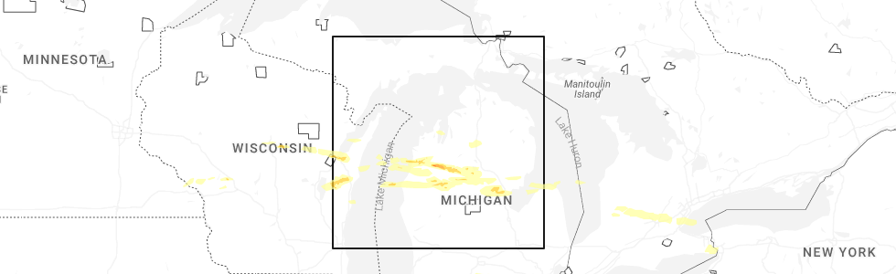
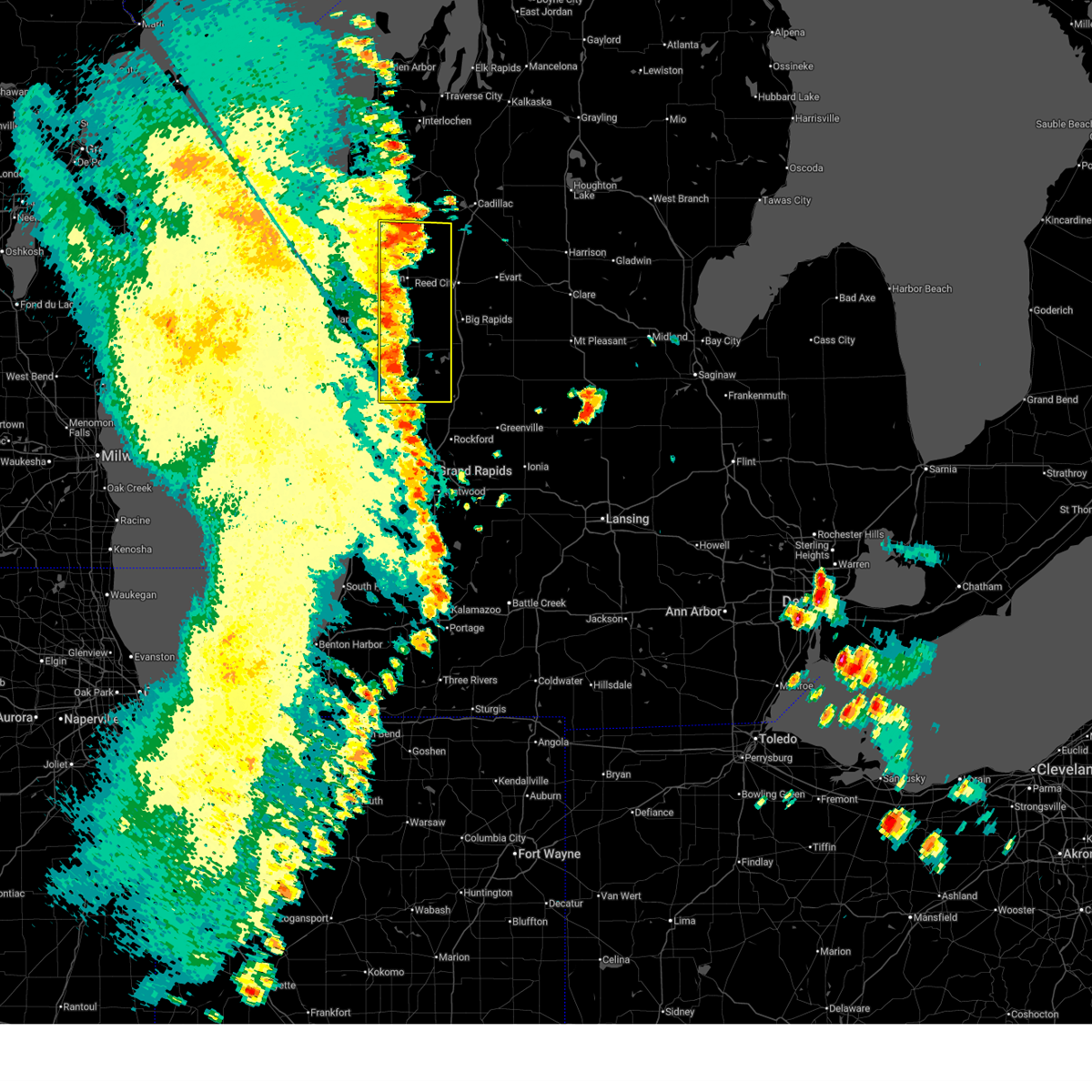
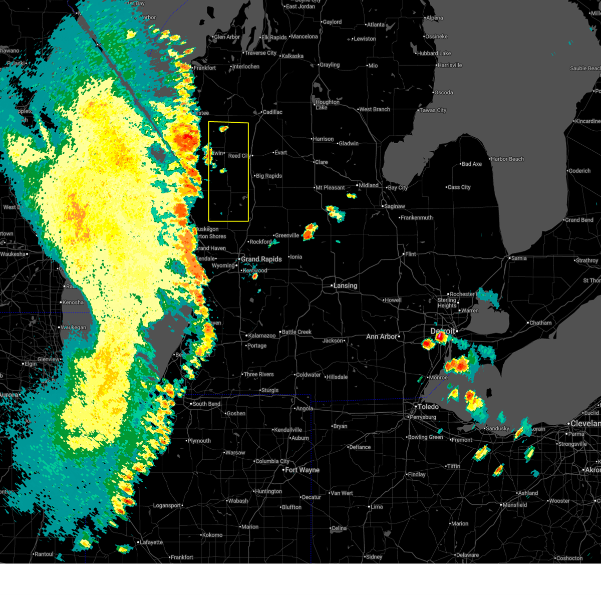
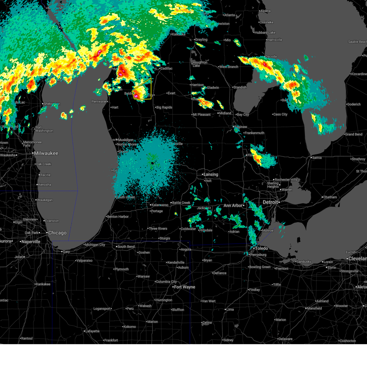
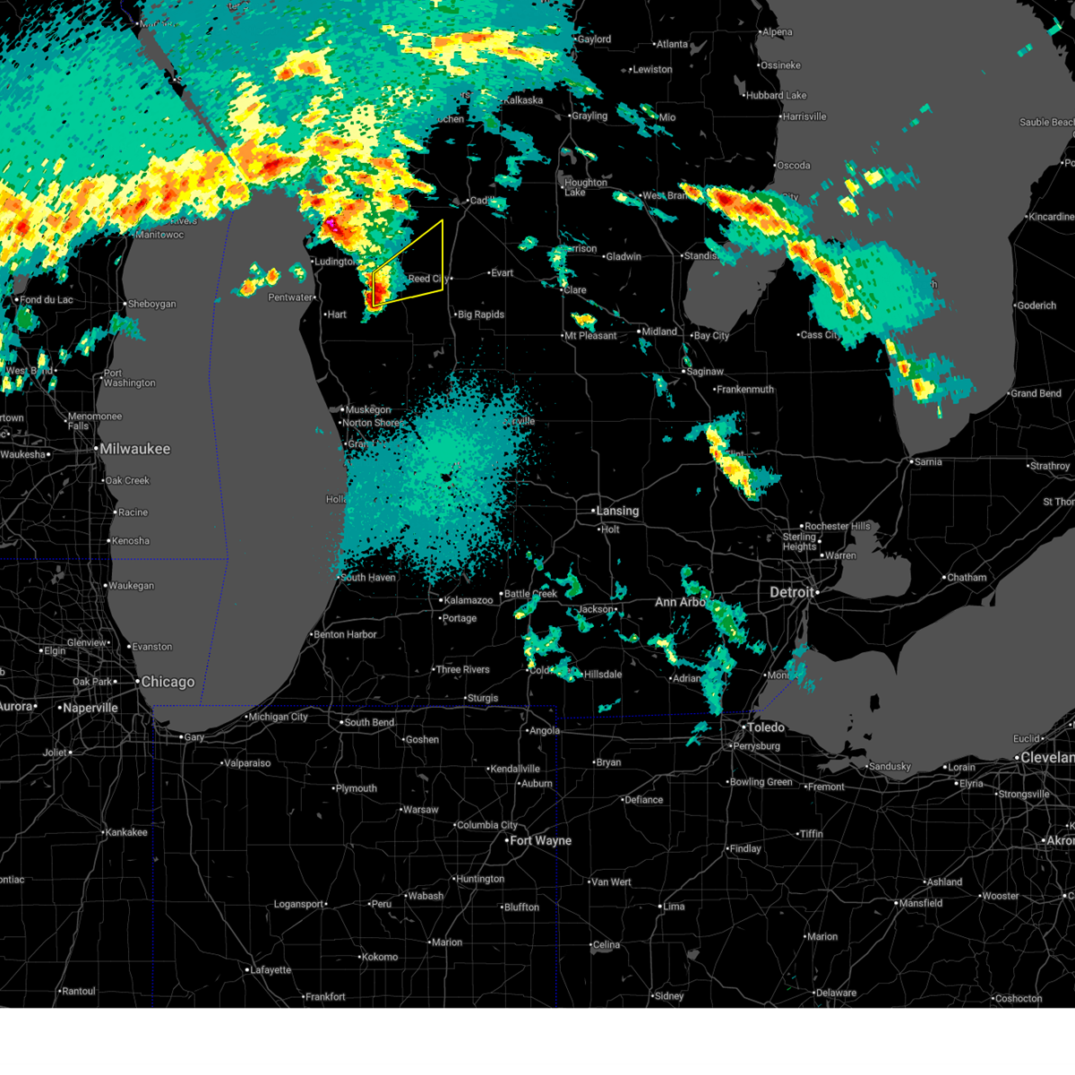
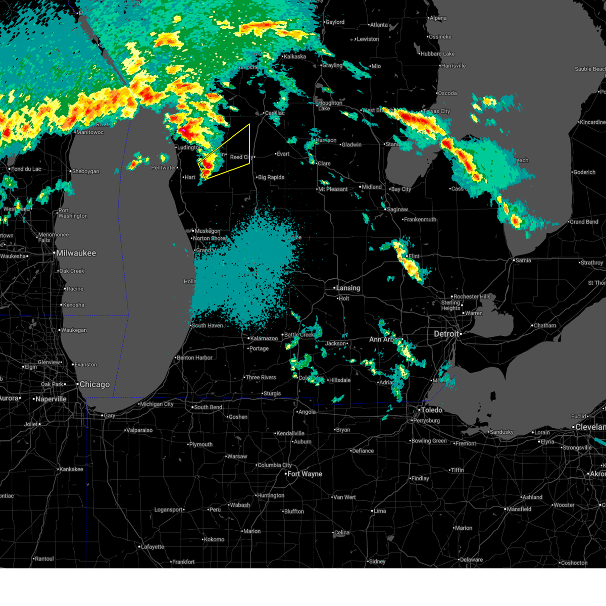
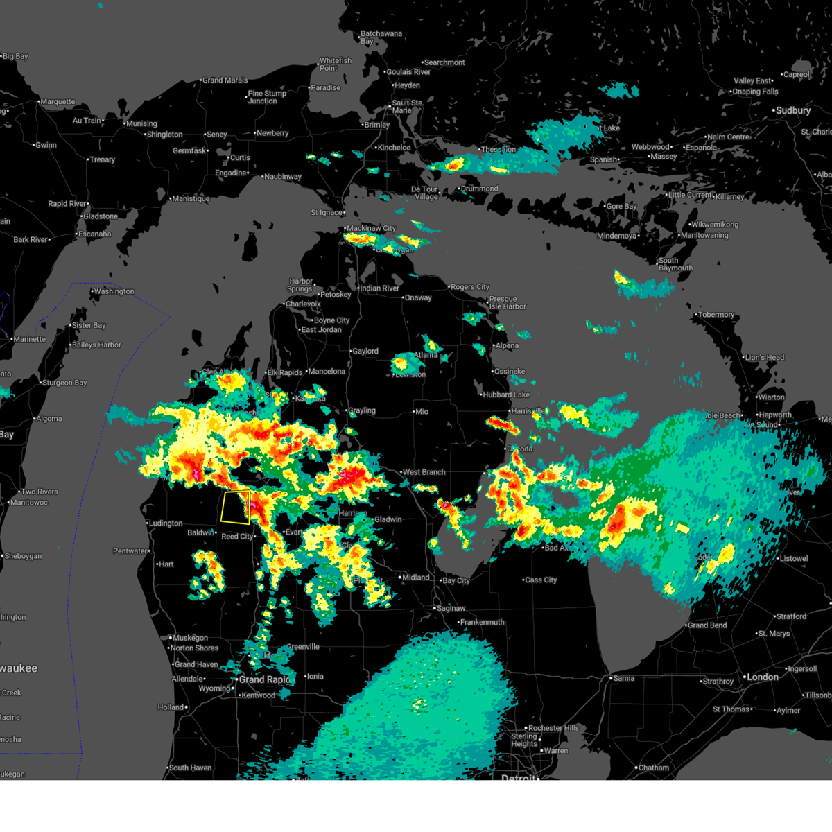
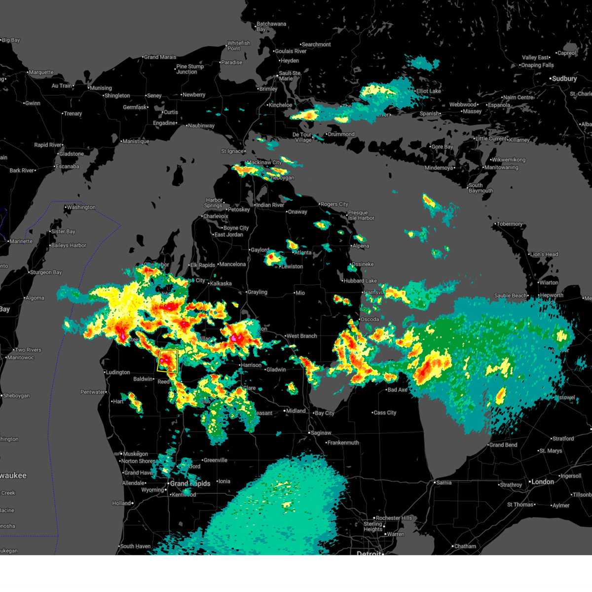
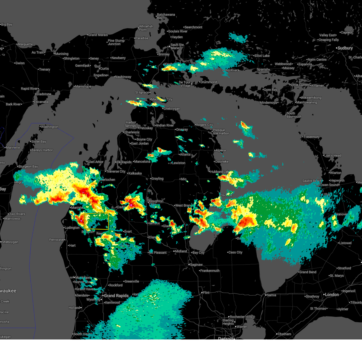
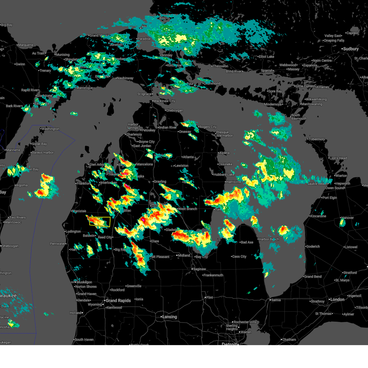
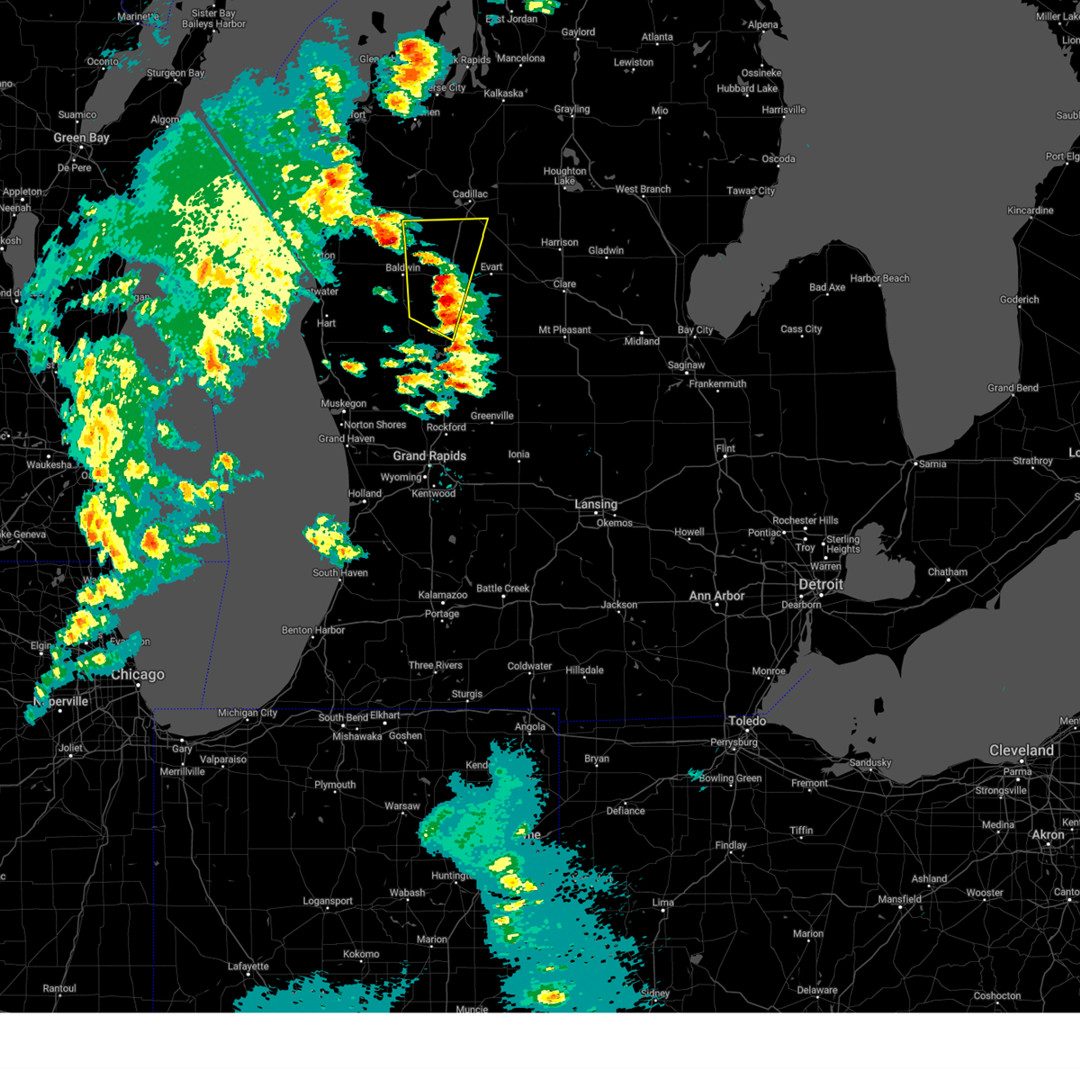
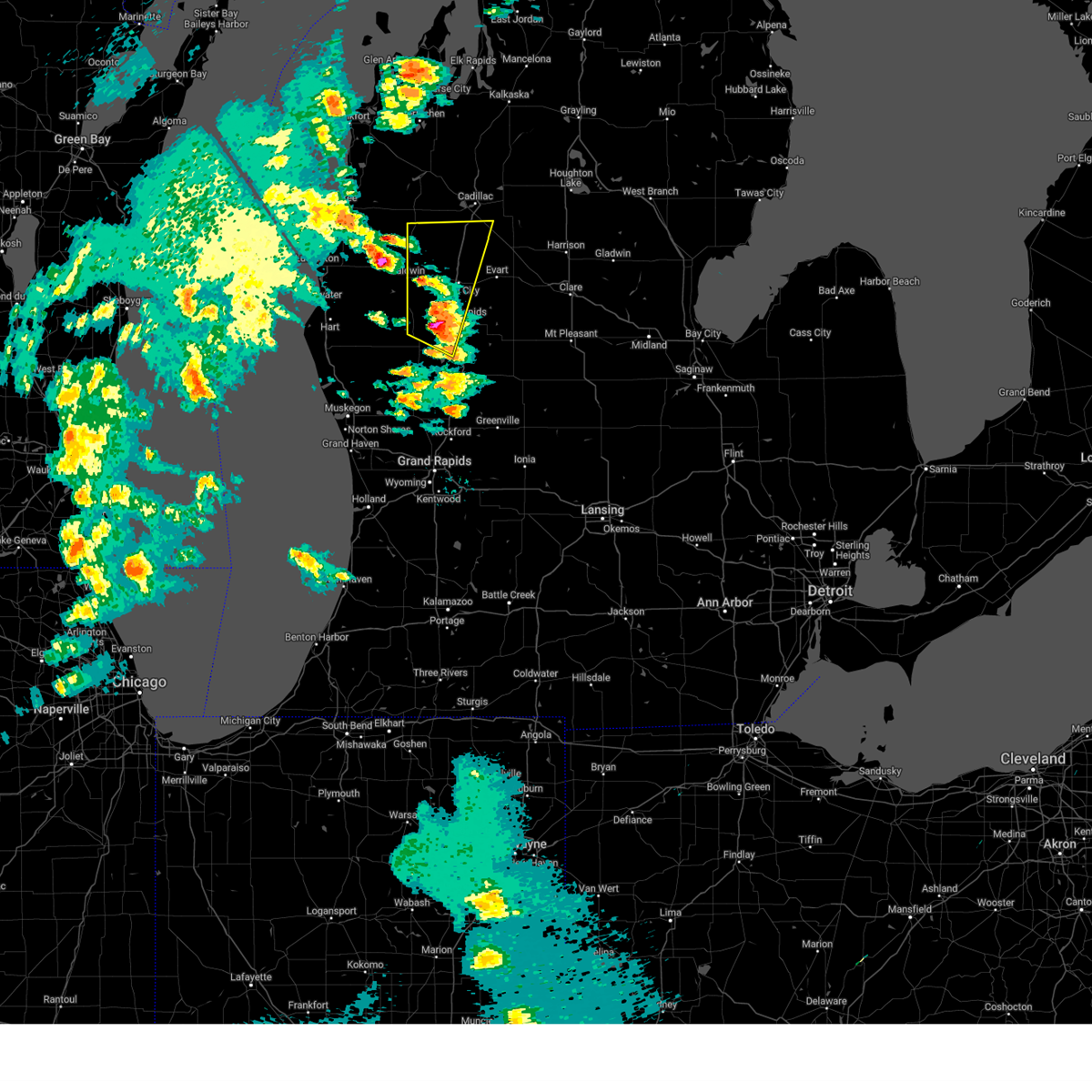
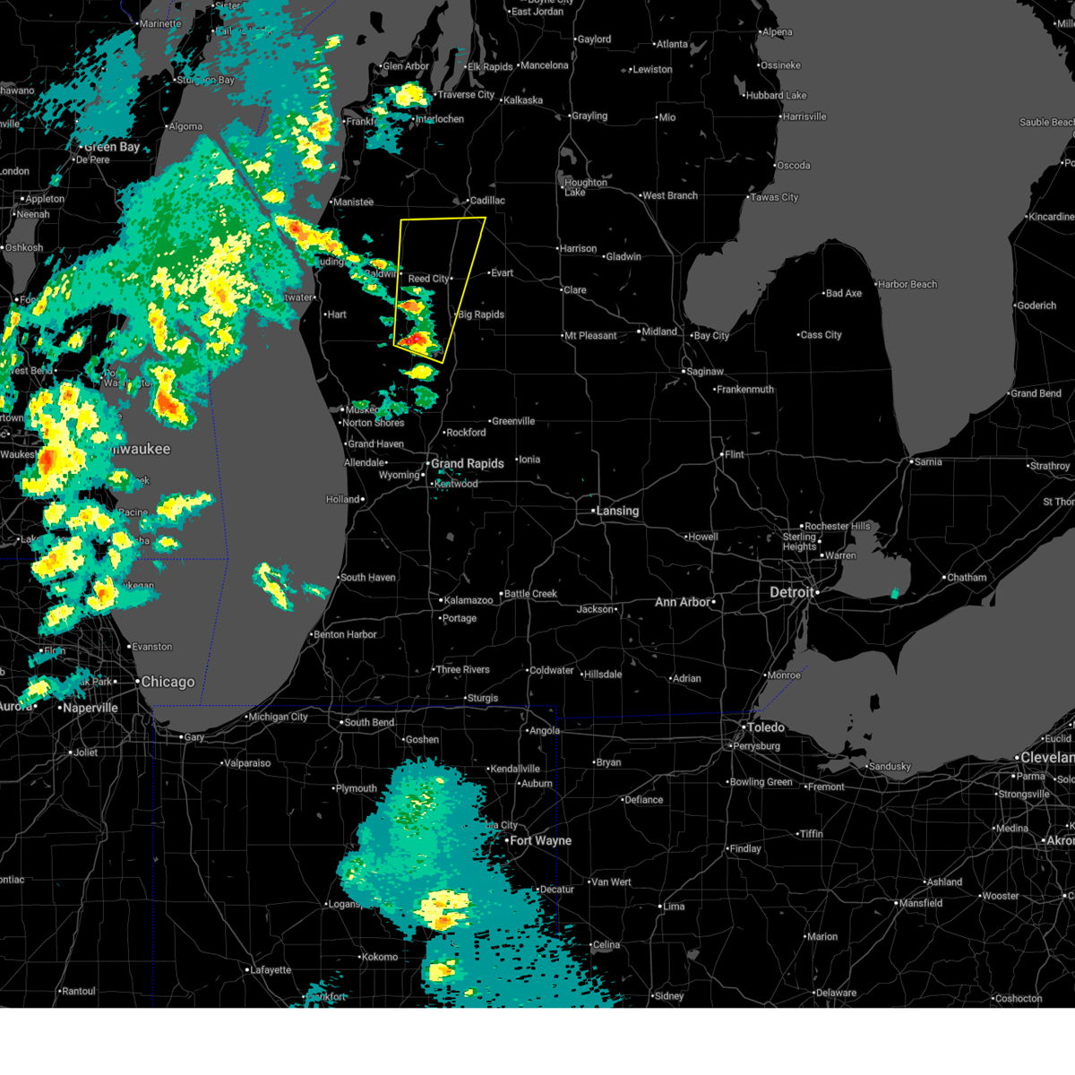
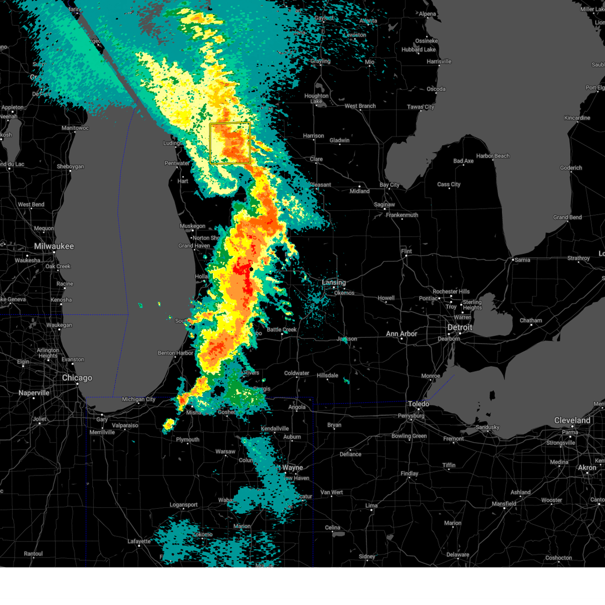
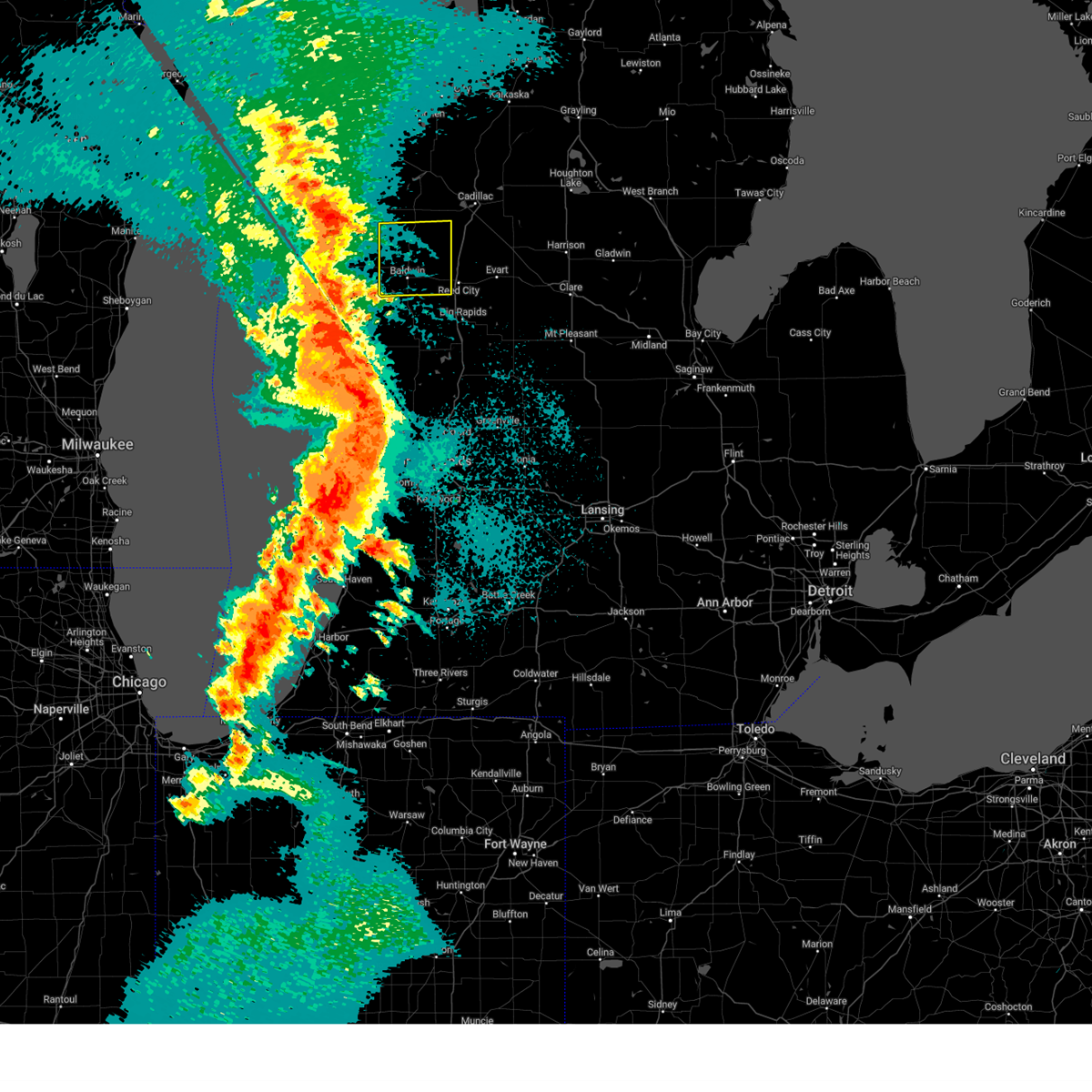
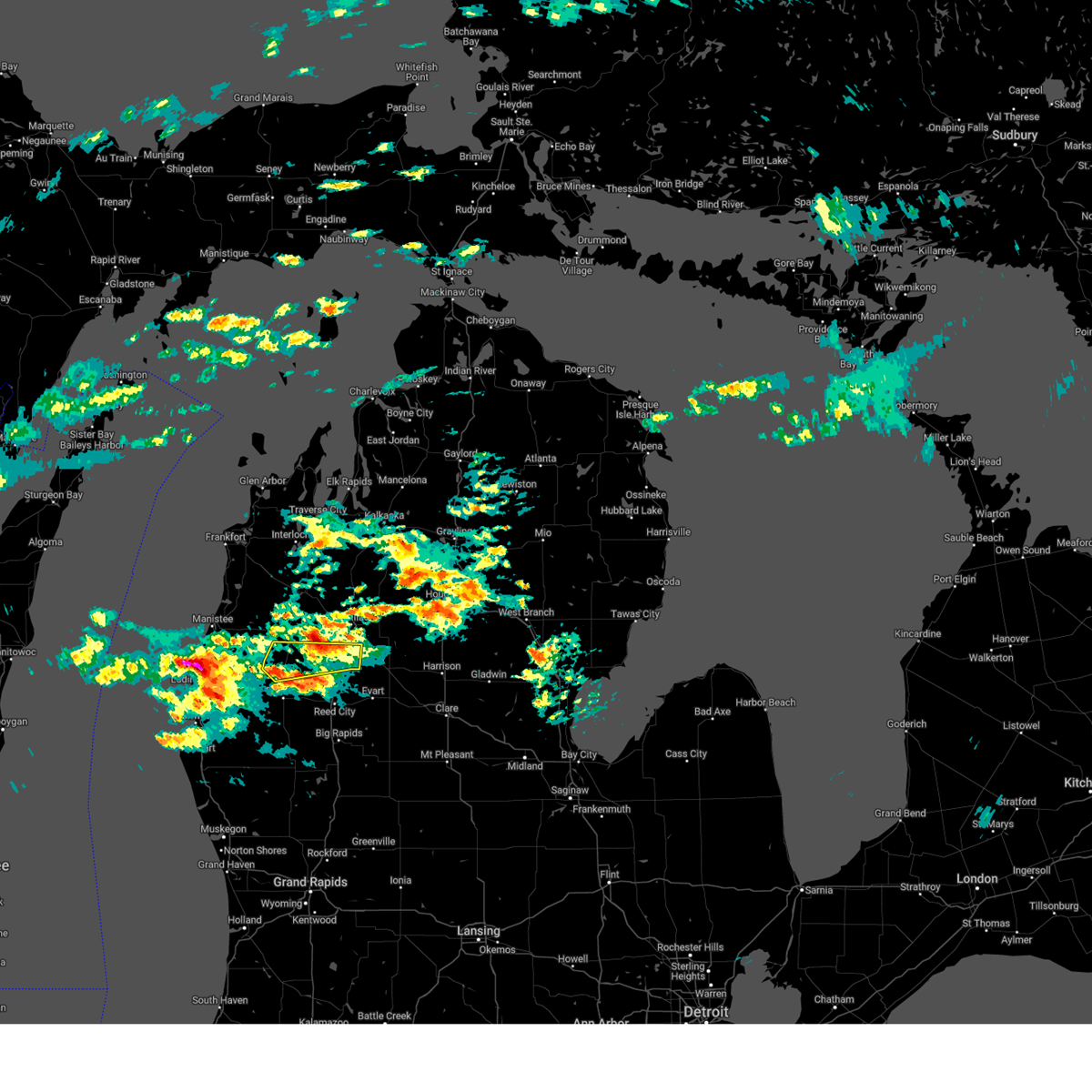
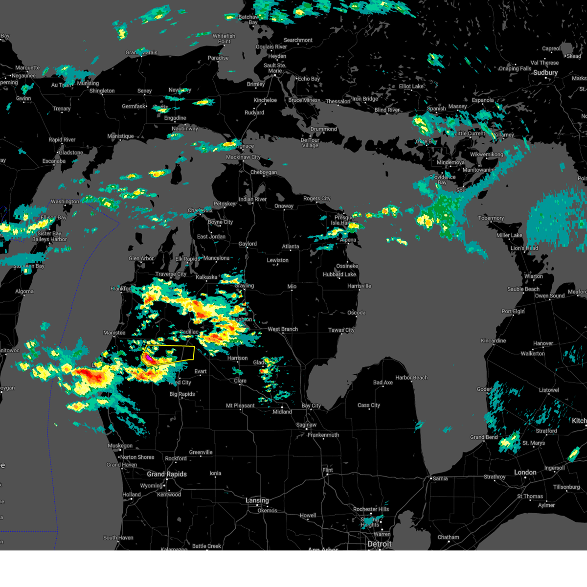
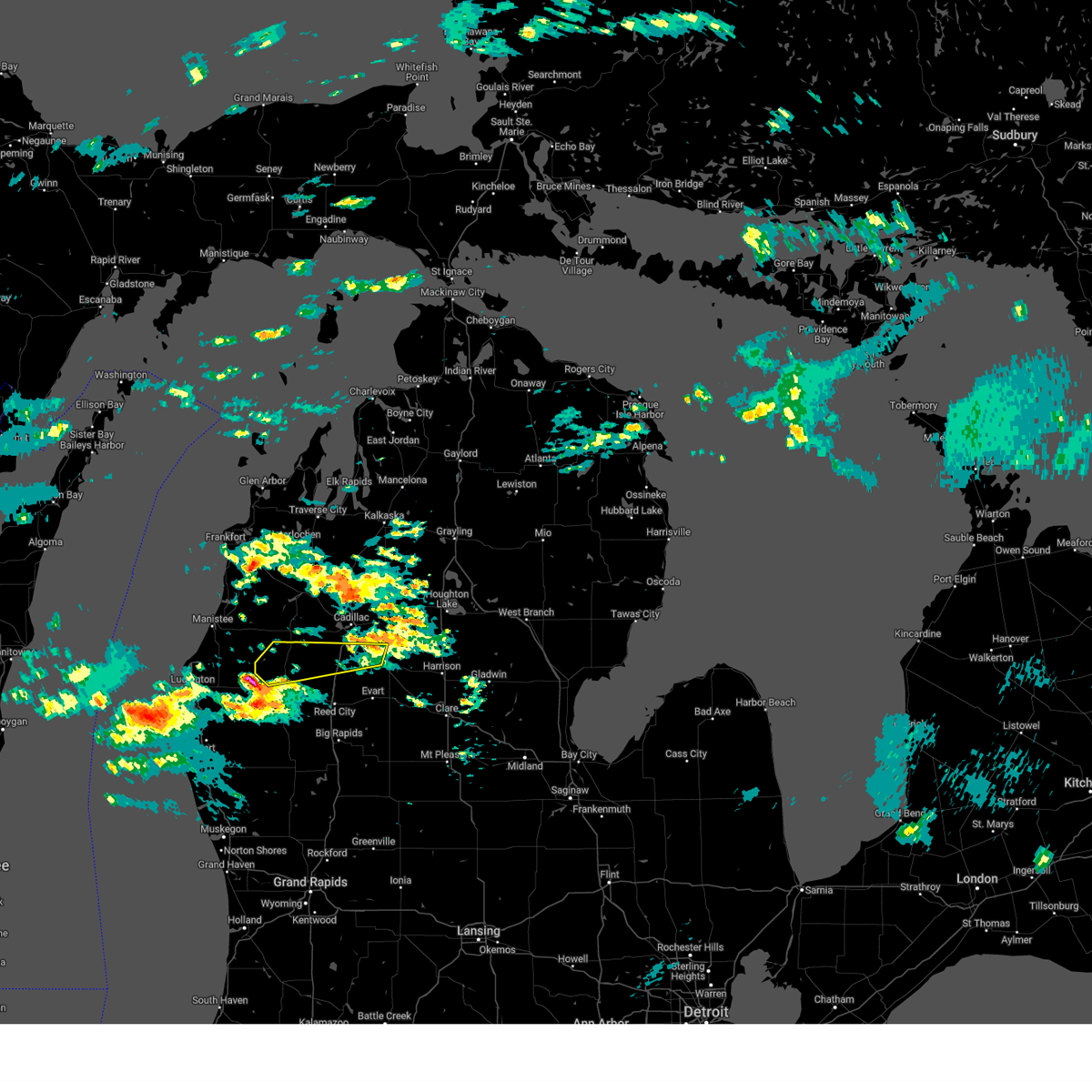
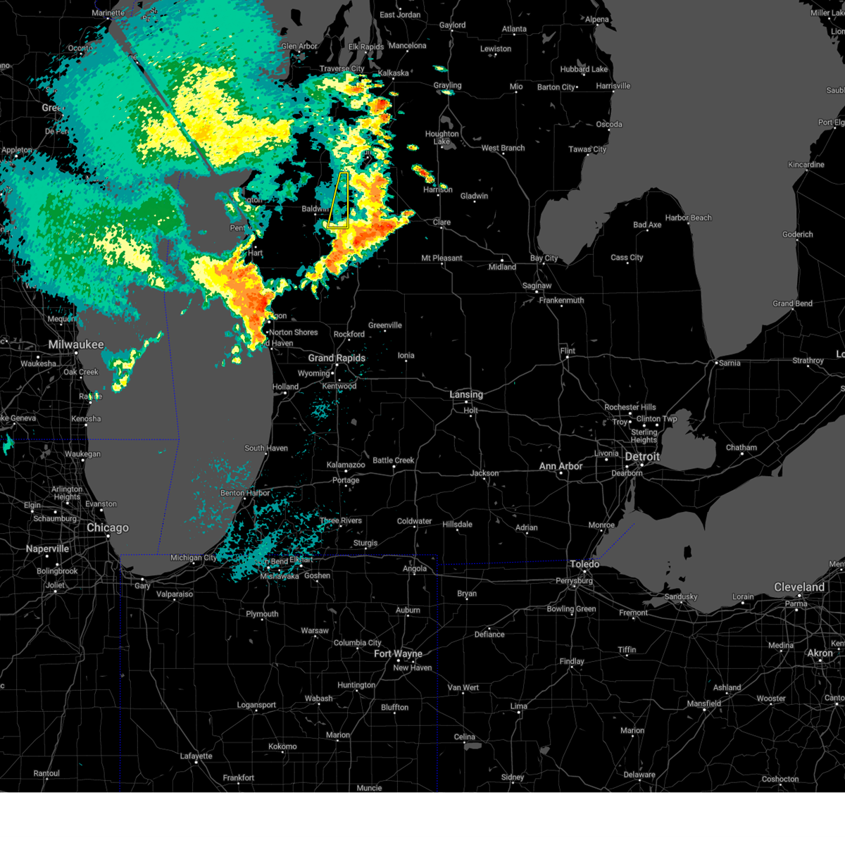
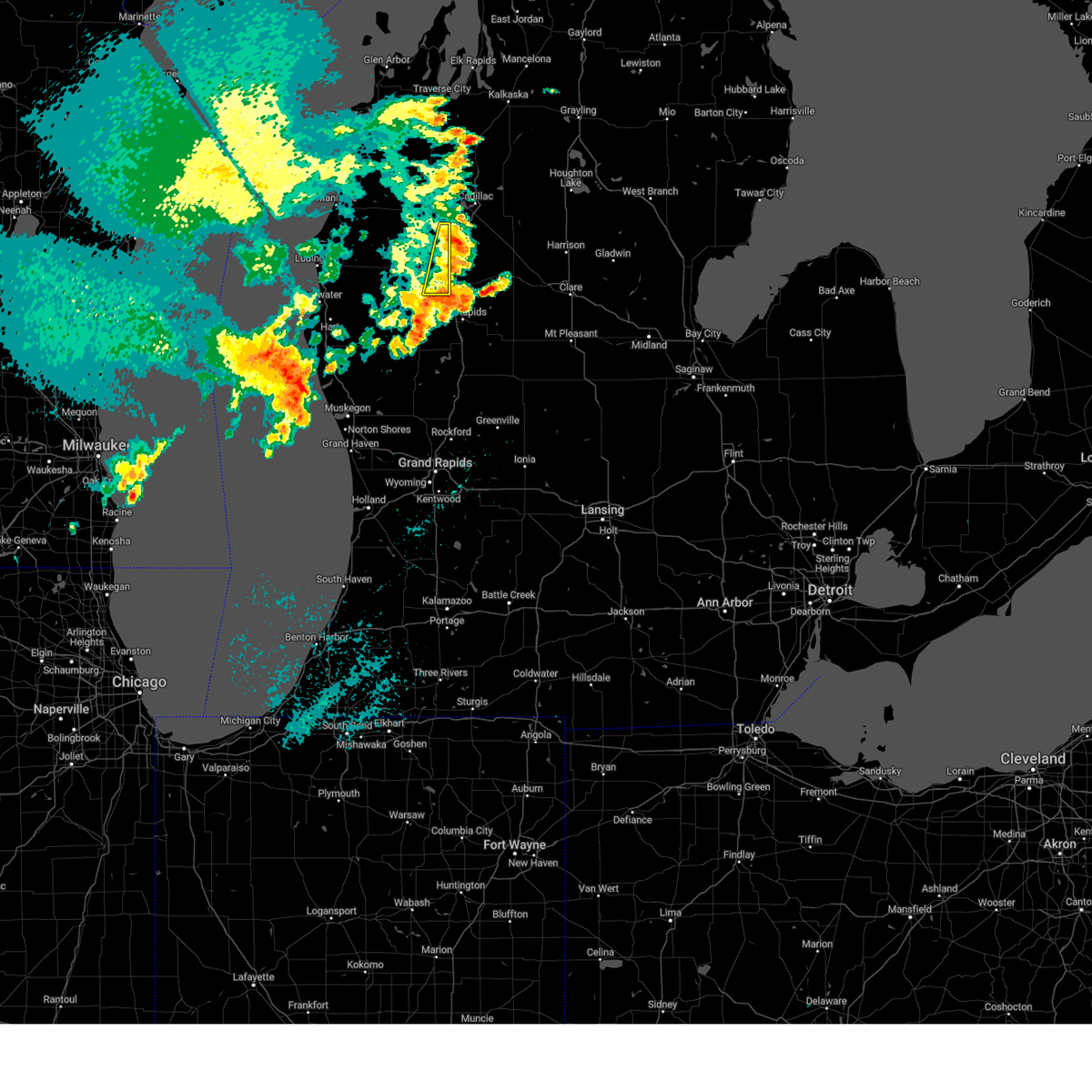
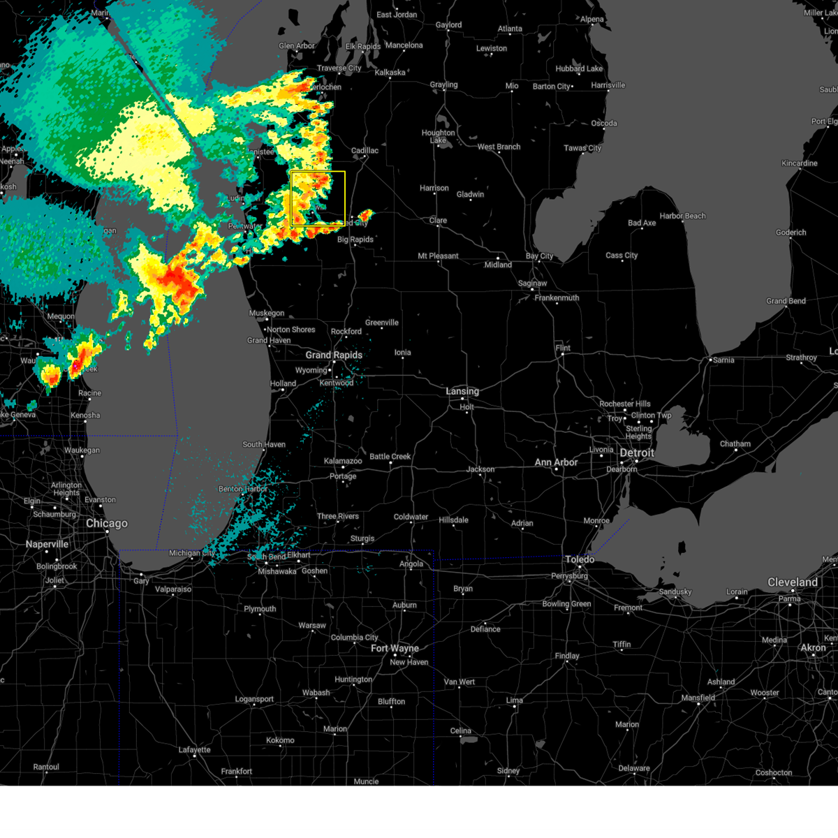
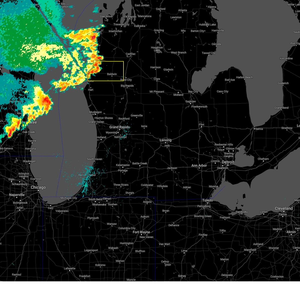
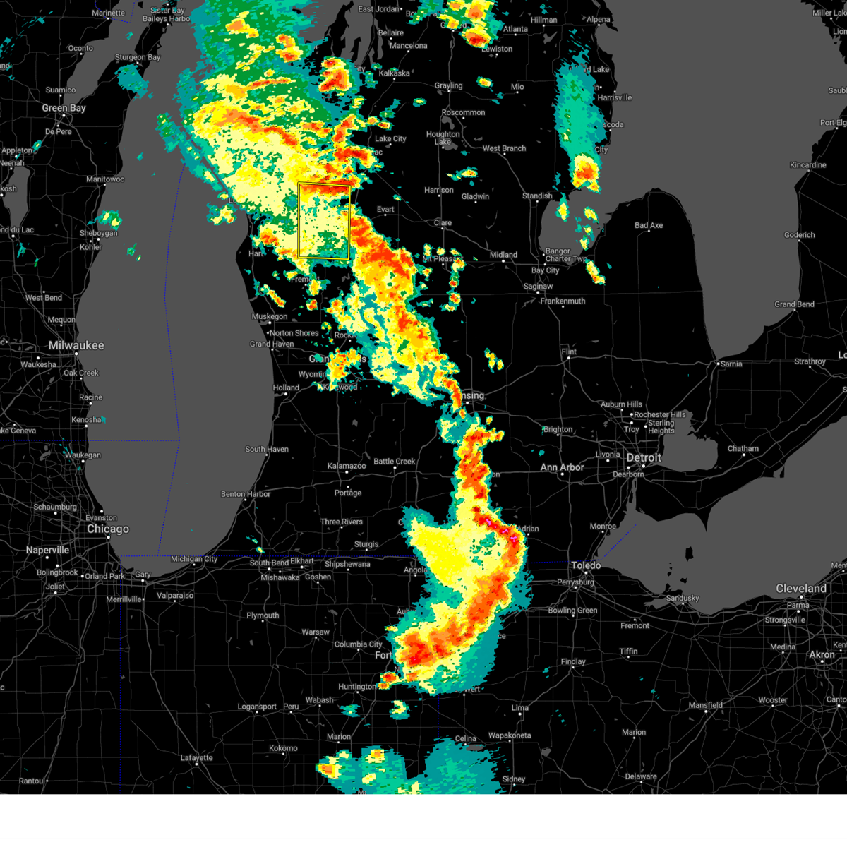
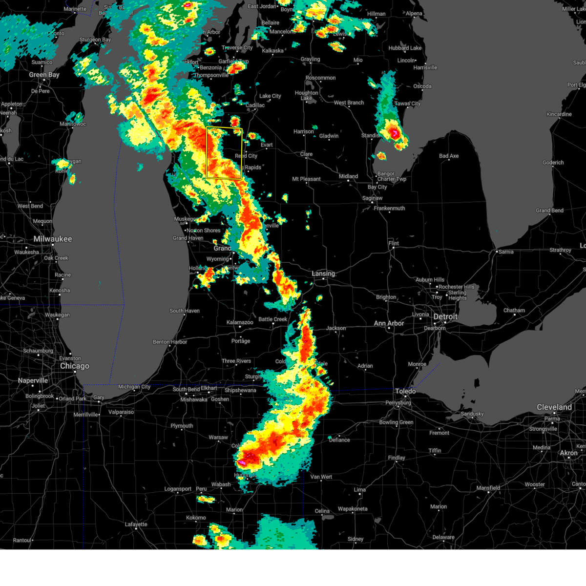
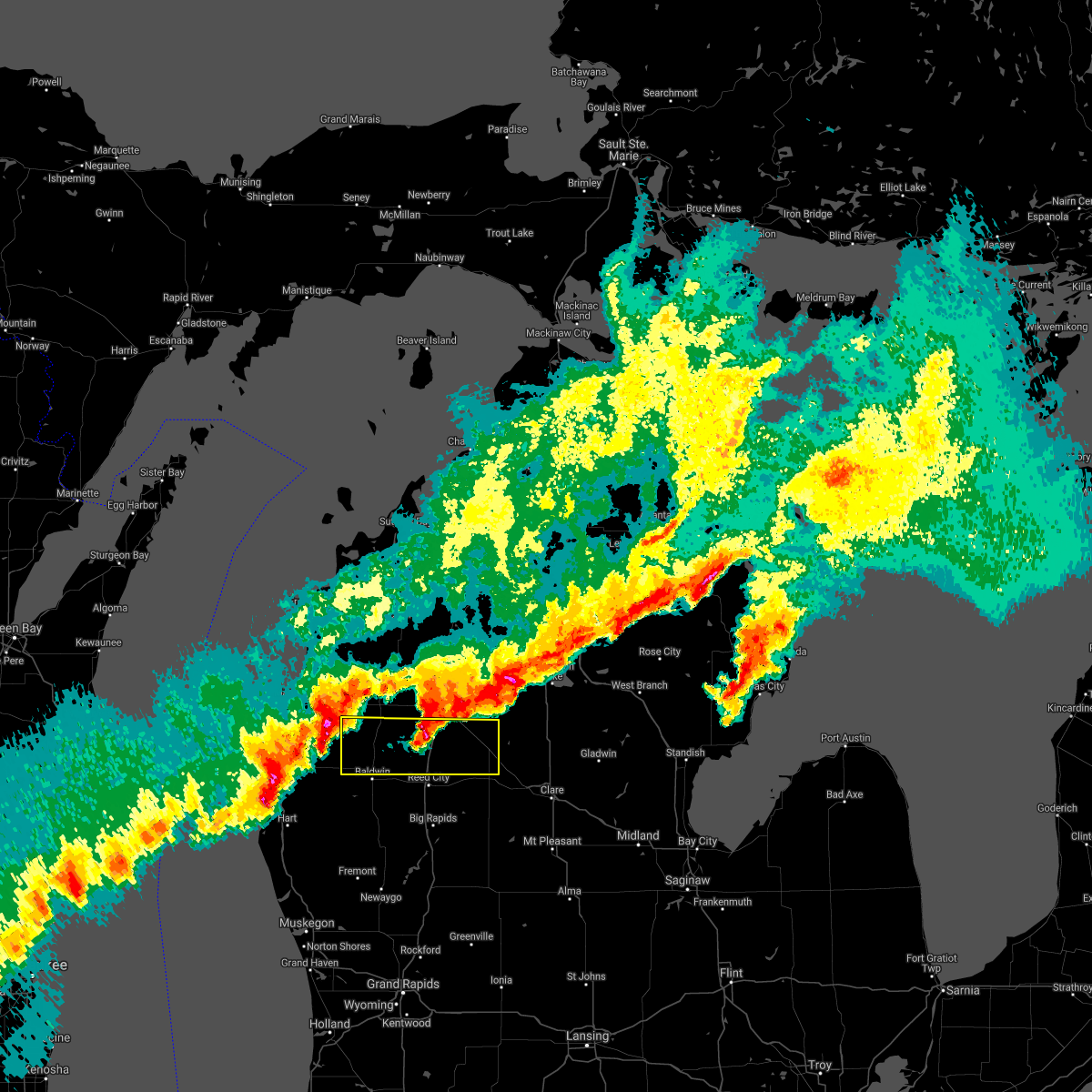
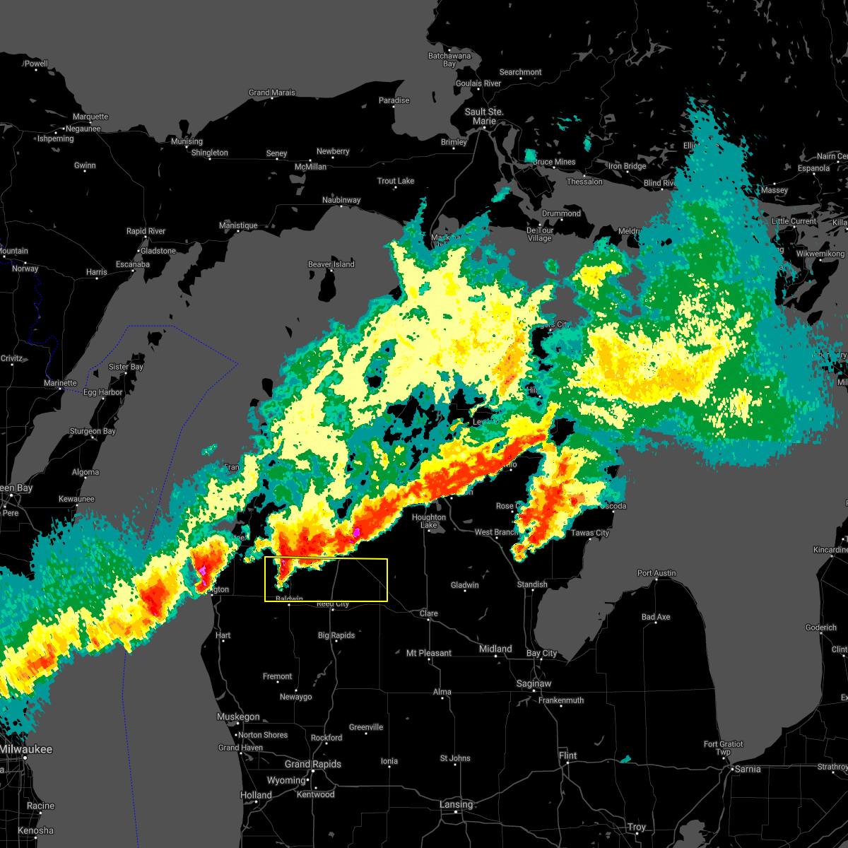
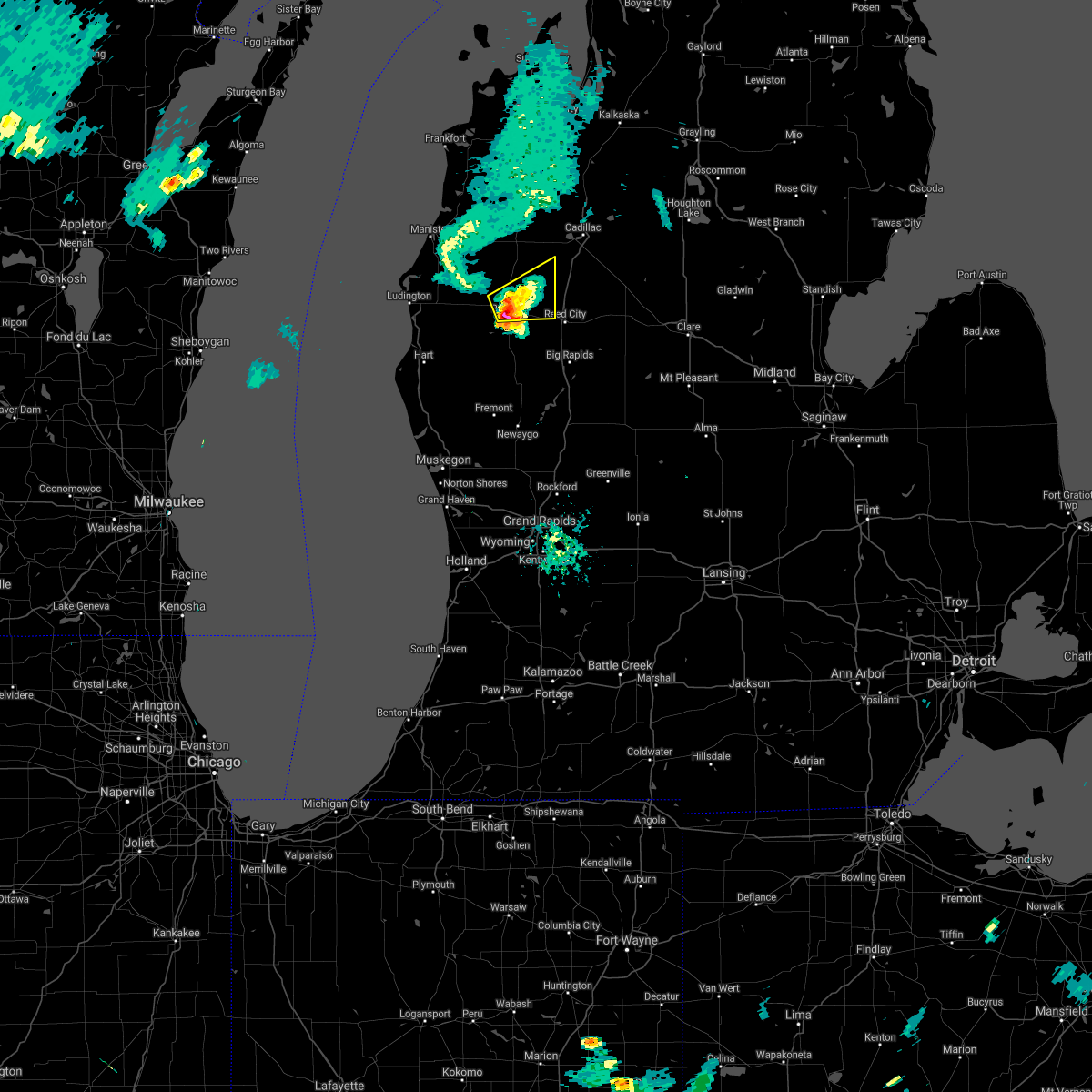
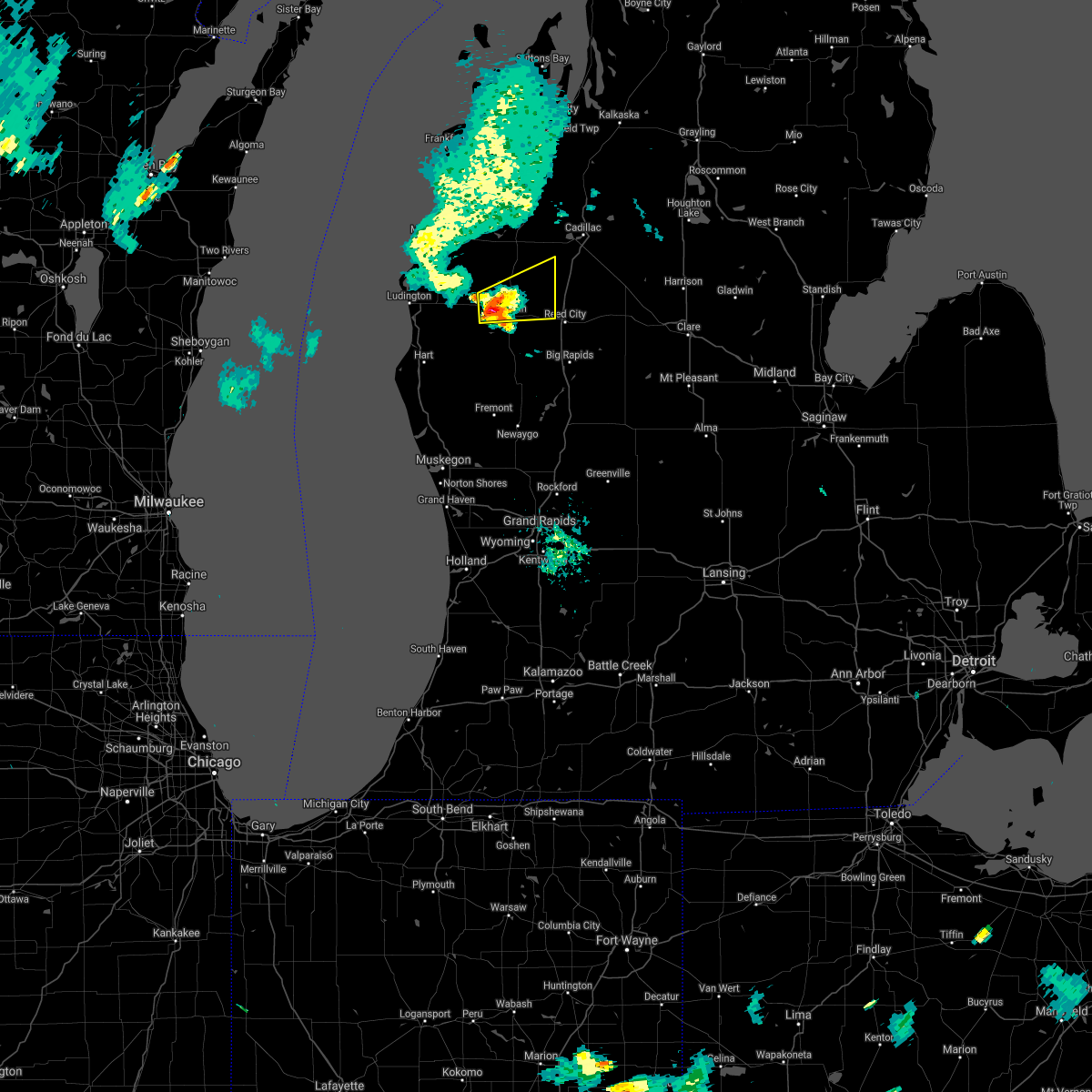
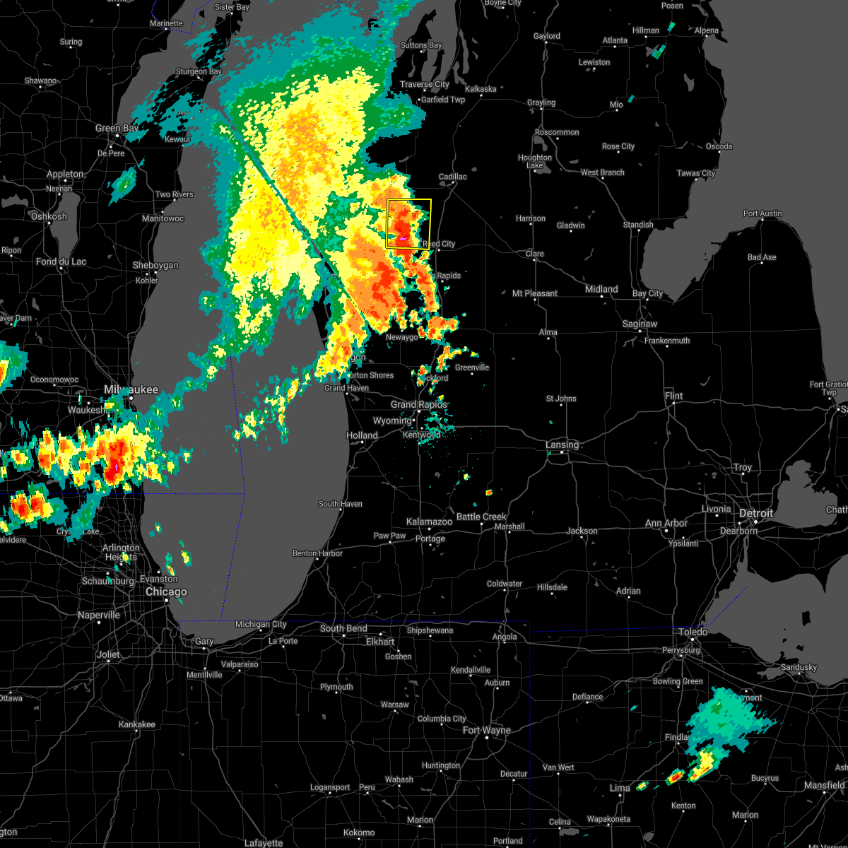
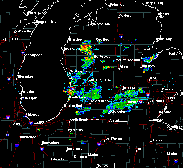
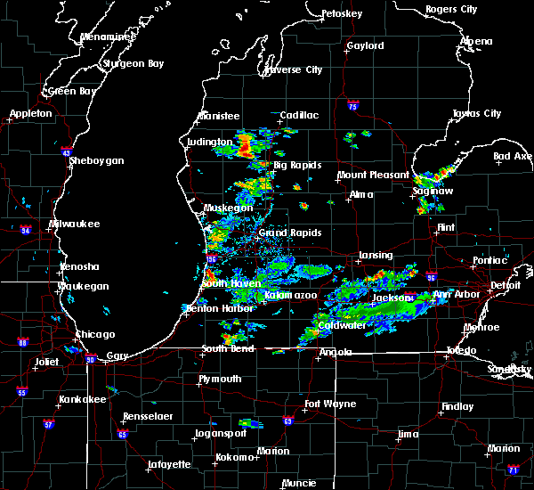
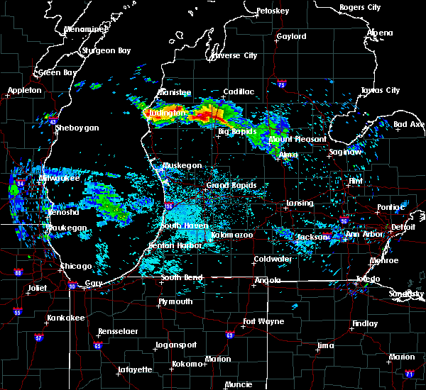
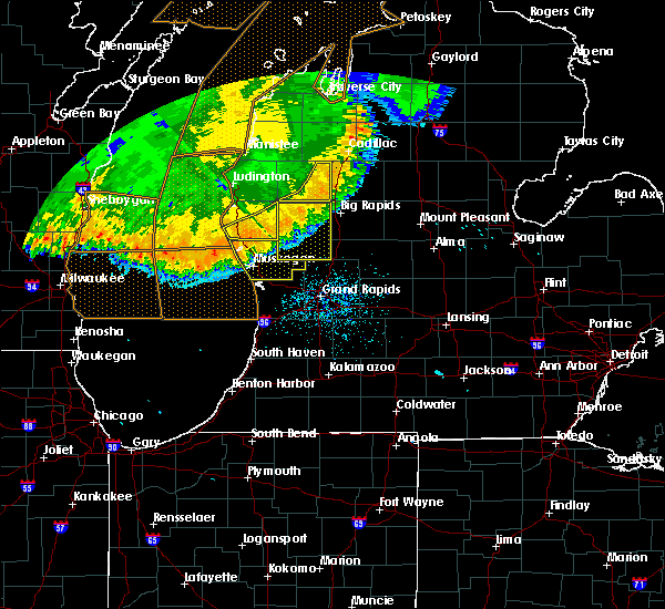
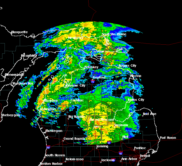
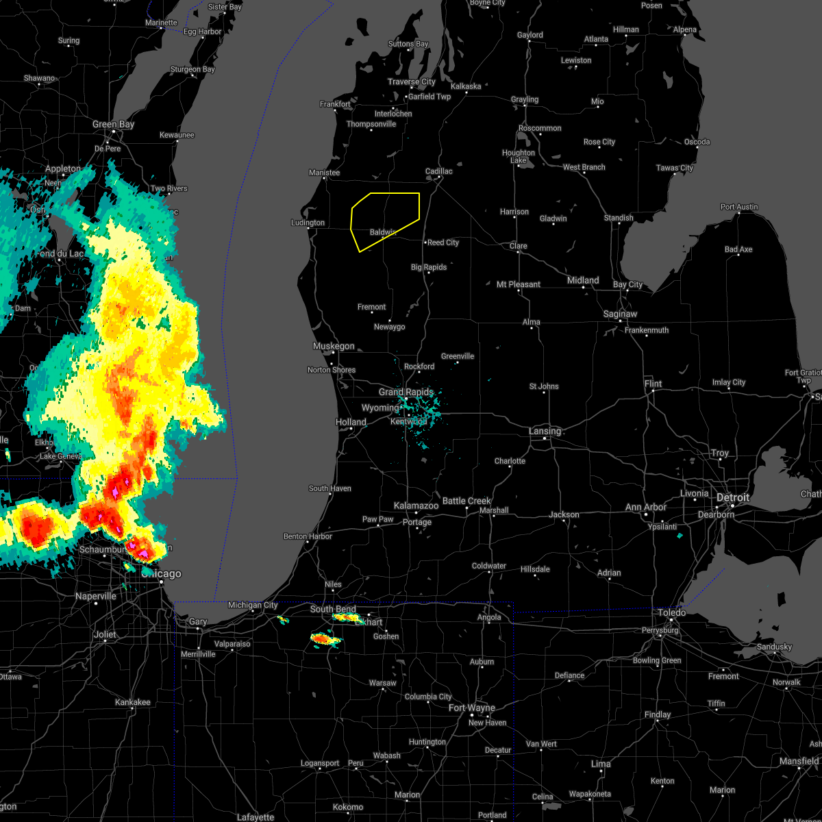
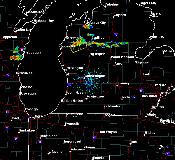
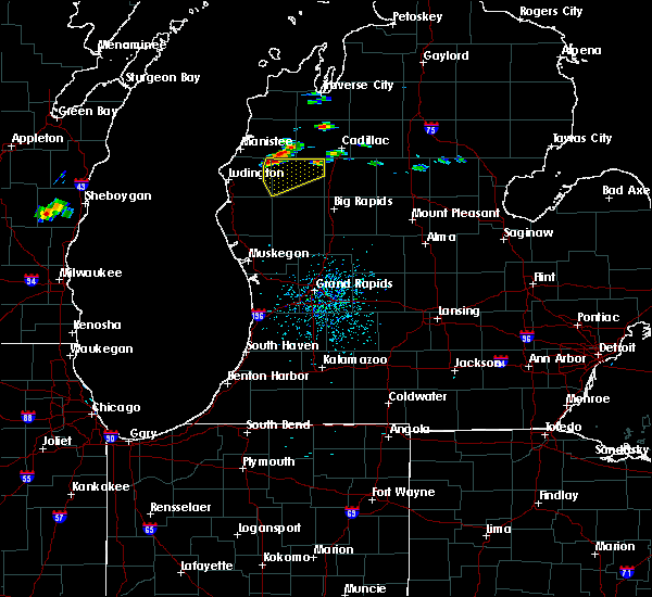
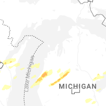
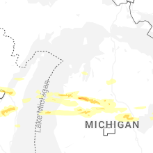
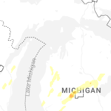
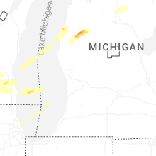
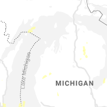
Hail Map for Luther, MI
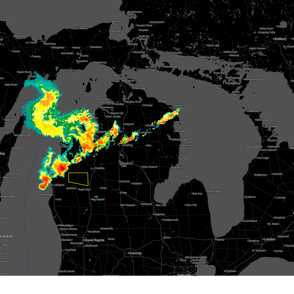
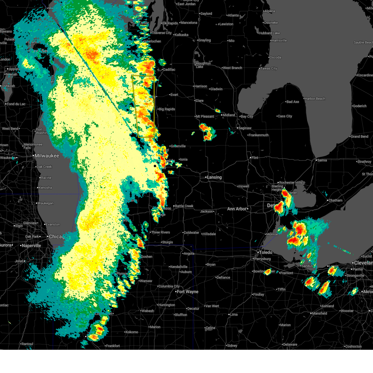
The Luther, MI area has had 1 report of on-the-ground hail by trained spotters, and has been under severe weather warnings 13 times during the past 12 months. Doppler radar has detected hail at or near Luther, MI on 28 occasions, including 2 occasions during the past year.
| Name: | Luther, MI |
| Where Located: | 49.8 miles S of Traverse City, MI |
| Map: | Google Map for Luther, MI |
| Population: | 318 |
| Housing Units: | 190 |
| More Info: | Search Google for Luther, MI |
1
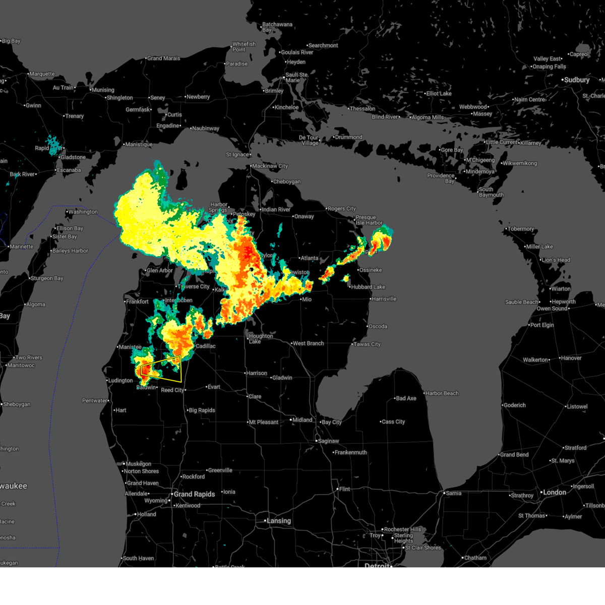
The Top Recent Hail Date for Luther, MI is Monday, March 30, 2026 (5th out of 28)
Hail and Wind Damage Spotted near Luther, MI
| Date / Time | Report Details |
|---|---|
| 7/1/2026 12:26 PM EDT |
 At 1226 pm edt, severe thunderstorms were located along a line extending from 6 miles northeast of luther to 6 miles southeast of fountain, moving east at 45 mph (radar indicated). Hazards include 60 mph wind gusts and penny size hail. Expect damage to roofs, siding, and trees. Locations impacted include, luther, bristol, wolf lake, sauble lakes,. At 1226 pm edt, severe thunderstorms were located along a line extending from 6 miles northeast of luther to 6 miles southeast of fountain, moving east at 45 mph (radar indicated). Hazards include 60 mph wind gusts and penny size hail. Expect damage to roofs, siding, and trees. Locations impacted include, luther, bristol, wolf lake, sauble lakes,.
|
| 7/1/2026 11:48 AM EDT |
 Svrgrr the national weather service in grand rapids has issued a * severe thunderstorm warning for, northern lake county in west central michigan, * until 1245 pm edt. * at 1148 am edt, a severe thunderstorm was located 6 miles east of free soil, or 13 miles southeast of manistee, moving east at 45 mph (radar indicated). Hazards include 60 mph wind gusts and penny size hail. expect damage to roofs, siding, and trees Svrgrr the national weather service in grand rapids has issued a * severe thunderstorm warning for, northern lake county in west central michigan, * until 1245 pm edt. * at 1148 am edt, a severe thunderstorm was located 6 miles east of free soil, or 13 miles southeast of manistee, moving east at 45 mph (radar indicated). Hazards include 60 mph wind gusts and penny size hail. expect damage to roofs, siding, and trees
|
| 6/10/2026 7:14 PM EDT |
 At 714 pm edt, severe thunderstorms were located along a line extending from near boon to near morley, moving northeast at 50 mph (radar indicated). Hazards include 60 mph wind gusts and penny size hail. Expect damage to roofs, siding, and trees. Locations impacted include, newaygo, white cloud, baldwin, grant, luther, croton, chase, brohman, woodland park, hawkins, nirvana, wolf lake, woodville, idlewild, irons, bristol, sauble lakes, bitely, croton heights, wooster,. At 714 pm edt, severe thunderstorms were located along a line extending from near boon to near morley, moving northeast at 50 mph (radar indicated). Hazards include 60 mph wind gusts and penny size hail. Expect damage to roofs, siding, and trees. Locations impacted include, newaygo, white cloud, baldwin, grant, luther, croton, chase, brohman, woodland park, hawkins, nirvana, wolf lake, woodville, idlewild, irons, bristol, sauble lakes, bitely, croton heights, wooster,.
|
| 6/10/2026 6:57 PM EDT |
 At 656 pm edt, severe thunderstorms were located along a line extending from 5 miles east of dublin to near grant, moving east at 50 mph (radar indicated). Hazards include 60 mph wind gusts and penny size hail. Expect damage to roofs, siding, and trees. Locations impacted include, newaygo, white cloud, baldwin, fremont, hesperia, grant, luther, croton, bridgeton, chase, brohman, reeman, nirvana, idlewild, bristol, woodland park, hawkins, big star lake, wolf lake, woodville,. At 656 pm edt, severe thunderstorms were located along a line extending from 5 miles east of dublin to near grant, moving east at 50 mph (radar indicated). Hazards include 60 mph wind gusts and penny size hail. Expect damage to roofs, siding, and trees. Locations impacted include, newaygo, white cloud, baldwin, fremont, hesperia, grant, luther, croton, bridgeton, chase, brohman, reeman, nirvana, idlewild, bristol, woodland park, hawkins, big star lake, wolf lake, woodville,.
|
| 6/10/2026 6:35 PM EDT |
 Svrgrr the national weather service in grand rapids has issued a * severe thunderstorm warning for, newaygo county in west central michigan, lake county in west central michigan, * until 730 pm edt. * at 633 pm edt, severe thunderstorms were located along a line extending from 5 miles east of free soil to near ravenna, moving northeast at 50 mph. a wind gust of 56 mph was reported at the muskegon county airport (radar indicated). Hazards include 60 mph wind gusts and penny size hail. expect damage to roofs, siding, and trees Svrgrr the national weather service in grand rapids has issued a * severe thunderstorm warning for, newaygo county in west central michigan, lake county in west central michigan, * until 730 pm edt. * at 633 pm edt, severe thunderstorms were located along a line extending from 5 miles east of free soil to near ravenna, moving northeast at 50 mph. a wind gust of 56 mph was reported at the muskegon county airport (radar indicated). Hazards include 60 mph wind gusts and penny size hail. expect damage to roofs, siding, and trees
|
| 4/14/2026 12:06 AM EDT |
 At 1206 am edt, a severe thunderstorm was located near baldwin, moving northeast at 45 mph (radar indicated). Hazards include quarter size hail. Damage to vehicles is expected. Locations impacted include, baldwin, luther, chase, idlewild, nirvana, bristol,. At 1206 am edt, a severe thunderstorm was located near baldwin, moving northeast at 45 mph (radar indicated). Hazards include quarter size hail. Damage to vehicles is expected. Locations impacted include, baldwin, luther, chase, idlewild, nirvana, bristol,.
|
| 4/13/2026 11:55 PM EDT |
 At 1154 pm edt, a severe thunderstorm was located near baldwin, moving northeast at 45 mph (radar indicated). Hazards include quarter size hail. Damage to vehicles is expected. Locations impacted include, baldwin, luther, chase, nirvana, bristol, wolf lake, big star lake, idlewild,. At 1154 pm edt, a severe thunderstorm was located near baldwin, moving northeast at 45 mph (radar indicated). Hazards include quarter size hail. Damage to vehicles is expected. Locations impacted include, baldwin, luther, chase, nirvana, bristol, wolf lake, big star lake, idlewild,.
|
| 4/13/2026 11:55 PM EDT |
 the severe thunderstorm warning has been cancelled and is no longer in effect the severe thunderstorm warning has been cancelled and is no longer in effect
|
| 4/13/2026 11:45 PM EDT |
 Svrgrr the national weather service in grand rapids has issued a * severe thunderstorm warning for, northwestern newaygo county in west central michigan, lake county in west central michigan, southeastern mason county in west central michigan, northeastern oceana county in west central michigan, * until 1230 am edt. * at 1145 pm edt, a severe thunderstorm was located 11 miles southwest of baldwin, moving northeast at 45 mph (radar indicated). Hazards include quarter size hail. damage to vehicles is expected Svrgrr the national weather service in grand rapids has issued a * severe thunderstorm warning for, northwestern newaygo county in west central michigan, lake county in west central michigan, southeastern mason county in west central michigan, northeastern oceana county in west central michigan, * until 1230 am edt. * at 1145 pm edt, a severe thunderstorm was located 11 miles southwest of baldwin, moving northeast at 45 mph (radar indicated). Hazards include quarter size hail. damage to vehicles is expected
|
| 3/31/2026 2:45 AM EDT |
 the severe thunderstorm warning has been cancelled and is no longer in effect the severe thunderstorm warning has been cancelled and is no longer in effect
|
| 3/31/2026 2:33 AM EDT |
 At 233 am edt, a severe thunderstorm was located over luther, or 14 miles northeast of baldwin, moving east at 50 mph (radar indicated). Hazards include 60 mph wind gusts and quarter size hail. Hail damage to vehicles is expected. expect wind damage to roofs, siding, and trees. Locations impacted include, luther, bristol,. At 233 am edt, a severe thunderstorm was located over luther, or 14 miles northeast of baldwin, moving east at 50 mph (radar indicated). Hazards include 60 mph wind gusts and quarter size hail. Hail damage to vehicles is expected. expect wind damage to roofs, siding, and trees. Locations impacted include, luther, bristol,.
|
| 3/31/2026 2:13 AM EDT |
 Svrgrr the national weather service in grand rapids has issued a * severe thunderstorm warning for, lake county in west central michigan, * until 300 am edt. * at 212 am edt, a severe thunderstorm was located 8 miles south of dublin, or 13 miles northwest of baldwin, moving east at 60 mph (radar indicated). Hazards include 60 mph wind gusts and quarter size hail. Hail damage to vehicles is expected. Expect wind damage to roofs, siding, and trees. Svrgrr the national weather service in grand rapids has issued a * severe thunderstorm warning for, lake county in west central michigan, * until 300 am edt. * at 212 am edt, a severe thunderstorm was located 8 miles south of dublin, or 13 miles northwest of baldwin, moving east at 60 mph (radar indicated). Hazards include 60 mph wind gusts and quarter size hail. Hail damage to vehicles is expected. Expect wind damage to roofs, siding, and trees.
|
| 3/30/2026 11:59 PM EDT | Quarter sized hail reported 7.9 miles SE of Luther, MI |
| 3/30/2026 11:56 PM EDT |
 Svrgrr the national weather service in grand rapids has issued a * severe thunderstorm warning for, northern lake county in west central michigan, * until 1245 am edt. * at 1156 pm edt, a severe thunderstorm was located 6 miles southeast of dublin, or 14 miles north of baldwin, moving east at 40 mph (radar indicated). Hazards include 60 mph wind gusts and quarter size hail. Hail damage to vehicles is expected. Expect wind damage to roofs, siding, and trees. Svrgrr the national weather service in grand rapids has issued a * severe thunderstorm warning for, northern lake county in west central michigan, * until 1245 am edt. * at 1156 pm edt, a severe thunderstorm was located 6 miles southeast of dublin, or 14 miles north of baldwin, moving east at 40 mph (radar indicated). Hazards include 60 mph wind gusts and quarter size hail. Hail damage to vehicles is expected. Expect wind damage to roofs, siding, and trees.
|
| 5/16/2025 8:06 PM EDT |
 At 805 pm edt, a severe thunderstorm was located 6 miles northwest of big rapids, moving northeast at 50 mph (public. at 801pm ping pong ball sized hail was reported 6 miles west of big rapids). Hazards include ping pong ball size hail and 60 mph wind gusts. People and animals outdoors will be injured. expect hail damage to roofs, siding, windows, and vehicles. expect wind damage to roofs, siding, and trees. Locations impacted include, big rapids, reed city, luther, chase, paris, hersey, le roy, tustin, hawkins, nirvana, idlewild, woodville, ashton, roben-hood airport, bristol, rose lake, dighton,. At 805 pm edt, a severe thunderstorm was located 6 miles northwest of big rapids, moving northeast at 50 mph (public. at 801pm ping pong ball sized hail was reported 6 miles west of big rapids). Hazards include ping pong ball size hail and 60 mph wind gusts. People and animals outdoors will be injured. expect hail damage to roofs, siding, windows, and vehicles. expect wind damage to roofs, siding, and trees. Locations impacted include, big rapids, reed city, luther, chase, paris, hersey, le roy, tustin, hawkins, nirvana, idlewild, woodville, ashton, roben-hood airport, bristol, rose lake, dighton,.
|
| 5/16/2025 7:55 PM EDT |
 At 755 pm edt, a severe thunderstorm was located 10 miles west of big rapids, moving northeast at 35 mph (radar indicated). Hazards include ping pong ball size hail and 60 mph wind gusts. People and animals outdoors will be injured. expect hail damage to roofs, siding, windows, and vehicles. expect wind damage to roofs, siding, and trees. Locations impacted include, big rapids, baldwin, reed city, luther, chase, paris, hersey, le roy, tustin, brohman, hawkins, nirvana, wolf lake, idlewild, woodville, ashton, roben-hood airport, bristol, rose lake, dighton,. At 755 pm edt, a severe thunderstorm was located 10 miles west of big rapids, moving northeast at 35 mph (radar indicated). Hazards include ping pong ball size hail and 60 mph wind gusts. People and animals outdoors will be injured. expect hail damage to roofs, siding, windows, and vehicles. expect wind damage to roofs, siding, and trees. Locations impacted include, big rapids, baldwin, reed city, luther, chase, paris, hersey, le roy, tustin, brohman, hawkins, nirvana, wolf lake, idlewild, woodville, ashton, roben-hood airport, bristol, rose lake, dighton,.
|
| 5/16/2025 7:44 PM EDT |
 Svrgrr the national weather service in grand rapids has issued a * severe thunderstorm warning for, northeastern newaygo county in west central michigan, western osceola county in central michigan, lake county in west central michigan, northwestern mecosta county in central michigan, * until 915 pm edt. * at 744 pm edt, a severe thunderstorm was located near white cloud, moving northeast at 30 mph (radar indicated). Hazards include 60 mph wind gusts and penny size hail. expect damage to roofs, siding, and trees Svrgrr the national weather service in grand rapids has issued a * severe thunderstorm warning for, northeastern newaygo county in west central michigan, western osceola county in central michigan, lake county in west central michigan, northwestern mecosta county in central michigan, * until 915 pm edt. * at 744 pm edt, a severe thunderstorm was located near white cloud, moving northeast at 30 mph (radar indicated). Hazards include 60 mph wind gusts and penny size hail. expect damage to roofs, siding, and trees
|
| 5/15/2025 10:50 PM EDT |
 the severe thunderstorm warning has been cancelled and is no longer in effect the severe thunderstorm warning has been cancelled and is no longer in effect
|
| 5/15/2025 10:04 PM EDT |
 Svrgrr the national weather service in grand rapids has issued a * severe thunderstorm warning for, lake county in west central michigan, * until 1130 pm edt. * at 1004 pm edt, severe thunderstorms were located along a line extending from 5 miles northeast of free soil to 11 miles northeast of hart, moving east at 30 mph (radar indicated). Hazards include 70 mph wind gusts and penny size hail. Expect considerable tree damage. Damage is likely to mobile homes, roofs, and outbuildings. Svrgrr the national weather service in grand rapids has issued a * severe thunderstorm warning for, lake county in west central michigan, * until 1130 pm edt. * at 1004 pm edt, severe thunderstorms were located along a line extending from 5 miles northeast of free soil to 11 miles northeast of hart, moving east at 30 mph (radar indicated). Hazards include 70 mph wind gusts and penny size hail. Expect considerable tree damage. Damage is likely to mobile homes, roofs, and outbuildings.
|
| 4/18/2025 10:23 PM EDT |
 the severe thunderstorm warning has been cancelled and is no longer in effect the severe thunderstorm warning has been cancelled and is no longer in effect
|
| 4/18/2025 10:08 PM EDT |
 At 1008 pm edt, a severe thunderstorm was located 6 miles northwest of luther, or 13 miles north of baldwin, moving northeast at 55 mph (radar indicated). Hazards include golf ball size hail and 60 mph wind gusts. People and animals outdoors will be injured. expect hail damage to roofs, siding, windows, and vehicles. expect wind damage to roofs, siding, and trees. Locations impacted include, irons, bristol, wolf lake, sauble lakes, le roy, tustin, rose lake, dighton, luther,. At 1008 pm edt, a severe thunderstorm was located 6 miles northwest of luther, or 13 miles north of baldwin, moving northeast at 55 mph (radar indicated). Hazards include golf ball size hail and 60 mph wind gusts. People and animals outdoors will be injured. expect hail damage to roofs, siding, windows, and vehicles. expect wind damage to roofs, siding, and trees. Locations impacted include, irons, bristol, wolf lake, sauble lakes, le roy, tustin, rose lake, dighton, luther,.
|
| 4/18/2025 10:03 PM EDT |
 the severe thunderstorm warning has been cancelled and is no longer in effect the severe thunderstorm warning has been cancelled and is no longer in effect
|
| 4/18/2025 10:03 PM EDT |
 At 1003 pm edt, a severe thunderstorm was located 9 miles south of dublin, or 10 miles north of baldwin, moving northeast at 65 mph (radar indicated). Hazards include 60 mph wind gusts and quarter size hail. Hail damage to vehicles is expected. expect wind damage to roofs, siding, and trees. Locations impacted include, irons, bristol, wolf lake, sauble lakes, le roy, tustin, rose lake, dighton, luther, highland,. At 1003 pm edt, a severe thunderstorm was located 9 miles south of dublin, or 10 miles north of baldwin, moving northeast at 65 mph (radar indicated). Hazards include 60 mph wind gusts and quarter size hail. Hail damage to vehicles is expected. expect wind damage to roofs, siding, and trees. Locations impacted include, irons, bristol, wolf lake, sauble lakes, le roy, tustin, rose lake, dighton, luther, highland,.
|
| 4/18/2025 9:56 PM EDT |
 Svrgrr the national weather service in grand rapids has issued a * severe thunderstorm warning for, northern osceola county in central michigan, lake county in west central michigan, east central mason county in west central michigan, * until 1045 pm edt. * at 955 pm edt, a severe thunderstorm was located 9 miles northwest of baldwin, moving northeast at 55 mph (radar indicated). Hazards include 60 mph wind gusts and quarter size hail. Hail damage to vehicles is expected. Expect wind damage to roofs, siding, and trees. Svrgrr the national weather service in grand rapids has issued a * severe thunderstorm warning for, northern osceola county in central michigan, lake county in west central michigan, east central mason county in west central michigan, * until 1045 pm edt. * at 955 pm edt, a severe thunderstorm was located 9 miles northwest of baldwin, moving northeast at 55 mph (radar indicated). Hazards include 60 mph wind gusts and quarter size hail. Hail damage to vehicles is expected. Expect wind damage to roofs, siding, and trees.
|
| 8/27/2024 2:49 PM EDT |
 The storm which prompted the warning has moved out of the area. therefore, the warning has been allowed to expire. a severe thunderstorm watch remains in effect until 800 pm edt for west central michigan. The storm which prompted the warning has moved out of the area. therefore, the warning has been allowed to expire. a severe thunderstorm watch remains in effect until 800 pm edt for west central michigan.
|
| 8/27/2024 2:32 PM EDT |
 At 231 pm edt, a severe thunderstorm was located near luther, or 14 miles southwest of cadillac, moving east at 30 mph (radar indicated). Hazards include 60 mph wind gusts. Expect damage to roofs, siding, and trees. Locations impacted include, luther, chase, nirvana, bristol,. At 231 pm edt, a severe thunderstorm was located near luther, or 14 miles southwest of cadillac, moving east at 30 mph (radar indicated). Hazards include 60 mph wind gusts. Expect damage to roofs, siding, and trees. Locations impacted include, luther, chase, nirvana, bristol,.
|
| 8/27/2024 2:17 PM EDT |
 the severe thunderstorm warning has been cancelled and is no longer in effect the severe thunderstorm warning has been cancelled and is no longer in effect
|
| 8/27/2024 2:17 PM EDT |
 At 217 pm edt, scattered severe thunderstorm were located from near luther to south of baldwin, moving east at 45 mph (radar indicated). Hazards include 60 mph wind gusts. Expect damage to roofs, siding, and trees. Locations impacted include, baldwin, luther, chase, irons, nirvana, bristol, wolf lake, big star lake, sauble lakes, idlewild,. At 217 pm edt, scattered severe thunderstorm were located from near luther to south of baldwin, moving east at 45 mph (radar indicated). Hazards include 60 mph wind gusts. Expect damage to roofs, siding, and trees. Locations impacted include, baldwin, luther, chase, irons, nirvana, bristol, wolf lake, big star lake, sauble lakes, idlewild,.
|
| 8/27/2024 1:51 PM EDT |
 Svrgrr the national weather service in grand rapids has issued a * severe thunderstorm warning for, lake county in west central michigan, mason county in west central michigan, * until 245 pm edt. * at 150 pm edt, a severe thunderstorm was located near scottville, or 9 miles east of ludington, moving east at 45 mph (radar indicated). Hazards include 60 mph wind gusts and penny size hail. expect damage to roofs, siding, and trees Svrgrr the national weather service in grand rapids has issued a * severe thunderstorm warning for, lake county in west central michigan, mason county in west central michigan, * until 245 pm edt. * at 150 pm edt, a severe thunderstorm was located near scottville, or 9 miles east of ludington, moving east at 45 mph (radar indicated). Hazards include 60 mph wind gusts and penny size hail. expect damage to roofs, siding, and trees
|
| 6/25/2023 5:27 PM EDT |
 The severe thunderstorm warning for northern newaygo and lake counties will expire at 530 pm edt, the storm which prompted the warning has weakened below severe limits, and has exited the warned area. therefore, the warning will be allowed to expire. a severe thunderstorm watch remains in effect until 700 pm edt for central and west central michigan. The severe thunderstorm warning for northern newaygo and lake counties will expire at 530 pm edt, the storm which prompted the warning has weakened below severe limits, and has exited the warned area. therefore, the warning will be allowed to expire. a severe thunderstorm watch remains in effect until 700 pm edt for central and west central michigan.
|
| 6/25/2023 4:59 PM EDT |
 At 458 pm edt, a severe thunderstorm was located 7 miles south of baldwin, moving north at 45 mph (radar indicated). Hazards include 60 mph wind gusts and penny size hail. Expect damage to roofs, siding, and trees. locations impacted include, baldwin, luther, chase, brohman, woodland park, hawkins, nirvana, wolf lake, big star lake, woodville, idlewild, baldwin municipal ai, sauble lakes, bitely, hail threat, radar indicated max hail size, 0. 75 in wind threat, radar indicated max wind gust, 60 mph. At 458 pm edt, a severe thunderstorm was located 7 miles south of baldwin, moving north at 45 mph (radar indicated). Hazards include 60 mph wind gusts and penny size hail. Expect damage to roofs, siding, and trees. locations impacted include, baldwin, luther, chase, brohman, woodland park, hawkins, nirvana, wolf lake, big star lake, woodville, idlewild, baldwin municipal ai, sauble lakes, bitely, hail threat, radar indicated max hail size, 0. 75 in wind threat, radar indicated max wind gust, 60 mph.
|
| 6/25/2023 4:36 PM EDT |
 At 435 pm edt, a severe thunderstorm was located over white cloud, moving north at 35 mph (radar indicated). Hazards include 60 mph wind gusts and penny size hail. expect damage to roofs, siding, and trees At 435 pm edt, a severe thunderstorm was located over white cloud, moving north at 35 mph (radar indicated). Hazards include 60 mph wind gusts and penny size hail. expect damage to roofs, siding, and trees
|
| 9/7/2021 1:30 PM EDT |
 At 129 pm edt, severe thunderstorms were located along a line extending from 10 miles west of luther to near baldwin to 9 miles northeast of hesperia, moving east at 60 mph (radar indicated). Hazards include golf ball size hail and 60 mph wind gusts. People and animals outdoors will be injured. expect hail damage to roofs, siding, windows, and vehicles. expect wind damage to roofs, siding, and trees. locations impacted include, baldwin, luther, chase, woodland park, hawkins, nirvana, bristol, wolf lake, big star lake, bitely, idlewild, thunderstorm damage threat, considerable hail threat, radar indicated max hail size, 1. 75 in wind threat, radar indicated max wind gust, 60 mph. At 129 pm edt, severe thunderstorms were located along a line extending from 10 miles west of luther to near baldwin to 9 miles northeast of hesperia, moving east at 60 mph (radar indicated). Hazards include golf ball size hail and 60 mph wind gusts. People and animals outdoors will be injured. expect hail damage to roofs, siding, windows, and vehicles. expect wind damage to roofs, siding, and trees. locations impacted include, baldwin, luther, chase, woodland park, hawkins, nirvana, bristol, wolf lake, big star lake, bitely, idlewild, thunderstorm damage threat, considerable hail threat, radar indicated max hail size, 1. 75 in wind threat, radar indicated max wind gust, 60 mph.
|
| 9/7/2021 1:13 PM EDT |
 At 113 pm edt, a severe thunderstorm was located 11 miles southeast of scottville, or 13 miles west of baldwin, moving east at 60 mph (radar indicated). Hazards include 60 mph wind gusts and quarter size hail. Hail damage to vehicles is expected. Expect wind damage to roofs, siding, and trees. At 113 pm edt, a severe thunderstorm was located 11 miles southeast of scottville, or 13 miles west of baldwin, moving east at 60 mph (radar indicated). Hazards include 60 mph wind gusts and quarter size hail. Hail damage to vehicles is expected. Expect wind damage to roofs, siding, and trees.
|
| 9/7/2021 1:03 PM EDT |
 At 103 pm edt, severe thunderstorms were located along a line extending from near mitchell state park to 6 miles east of luther, moving east at 55 mph (radar indicated). Hazards include 60 mph wind gusts and quarter size hail. Hail damage to vehicles is expected. expect wind damage to roofs, siding, and trees. Locations impacted include, marion, luther, highland, le roy, tustin, wolf lake, ashton, irons, bristol, sauble lakes, avondale, dighton,. At 103 pm edt, severe thunderstorms were located along a line extending from near mitchell state park to 6 miles east of luther, moving east at 55 mph (radar indicated). Hazards include 60 mph wind gusts and quarter size hail. Hail damage to vehicles is expected. expect wind damage to roofs, siding, and trees. Locations impacted include, marion, luther, highland, le roy, tustin, wolf lake, ashton, irons, bristol, sauble lakes, avondale, dighton,.
|
| 9/7/2021 12:59 PM EDT |
 At 1258 pm edt, severe thunderstorms were located along a line extending from near mitchell state park to near luther, moving east at 45 mph. another line of severe thunderstorms in northeast mason county will move into lake county through 115 pm (radar indicated). Hazards include 60 mph wind gusts and quarter size hail. Hail damage to vehicles is expected. expect wind damage to roofs, siding, and trees. locations impacted include, marion, luther, highland, le roy, tustin, wolf lake, ashton, irons, bristol, sauble lakes, avondale, dighton, hail threat, radar indicated max hail size, 1. 00 in wind threat, radar indicated max wind gust, 60 mph. At 1258 pm edt, severe thunderstorms were located along a line extending from near mitchell state park to near luther, moving east at 45 mph. another line of severe thunderstorms in northeast mason county will move into lake county through 115 pm (radar indicated). Hazards include 60 mph wind gusts and quarter size hail. Hail damage to vehicles is expected. expect wind damage to roofs, siding, and trees. locations impacted include, marion, luther, highland, le roy, tustin, wolf lake, ashton, irons, bristol, sauble lakes, avondale, dighton, hail threat, radar indicated max hail size, 1. 00 in wind threat, radar indicated max wind gust, 60 mph.
|
| 9/7/2021 12:32 PM EDT |
 At 1231 pm edt, a severe thunderstorm was located 6 miles southeast of dublin, or 14 miles north of baldwin, moving east at 55 mph (radar indicated). Hazards include 60 mph wind gusts and penny size hail. expect damage to roofs, siding, and trees At 1231 pm edt, a severe thunderstorm was located 6 miles southeast of dublin, or 14 miles north of baldwin, moving east at 55 mph (radar indicated). Hazards include 60 mph wind gusts and penny size hail. expect damage to roofs, siding, and trees
|
| 8/28/2021 3:16 AM EDT |
 At 314 am edt, severe thunderstorms were located along a line extending from 6 miles south of mitchell state park to 9 miles north of reed city to 5 miles southeast of baldwin, moving east at 40 mph (radar indicated). Hazards include 60 mph wind gusts and penny size hail. Expect damage to roofs, siding, and trees. Locations impacted include, evart, baldwin, reed city, marion, luther, highland, chase, hersey, le roy, tustin, nirvana, idlewild, ashton, sears, bristol, avondale, dighton,. At 314 am edt, severe thunderstorms were located along a line extending from 6 miles south of mitchell state park to 9 miles north of reed city to 5 miles southeast of baldwin, moving east at 40 mph (radar indicated). Hazards include 60 mph wind gusts and penny size hail. Expect damage to roofs, siding, and trees. Locations impacted include, evart, baldwin, reed city, marion, luther, highland, chase, hersey, le roy, tustin, nirvana, idlewild, ashton, sears, bristol, avondale, dighton,.
|
| 8/28/2021 2:50 AM EDT |
 At 249 am edt, severe thunderstorms were located along a line extending from near hoxeyville to near baldwin, moving east at 40 mph (radar indicated). Hazards include 60 mph wind gusts. expect damage to roofs, siding, and trees At 249 am edt, severe thunderstorms were located along a line extending from near hoxeyville to near baldwin, moving east at 40 mph (radar indicated). Hazards include 60 mph wind gusts. expect damage to roofs, siding, and trees
|
| 8/27/2021 7:50 PM EDT |
 At 750 pm edt, a severe thunderstorm was located near baldwin, moving east at 20 mph (radar indicated). Hazards include 60 mph wind gusts and quarter size hail. Hail damage to vehicles is expected. expect wind damage to roofs, siding, and trees. locations impacted include, baldwin, luther, chase, nirvana, bristol, wolf lake, idlewild, hail threat, radar indicated max hail size, 1. 00 in wind threat, radar indicated max wind gust, 60 mph. At 750 pm edt, a severe thunderstorm was located near baldwin, moving east at 20 mph (radar indicated). Hazards include 60 mph wind gusts and quarter size hail. Hail damage to vehicles is expected. expect wind damage to roofs, siding, and trees. locations impacted include, baldwin, luther, chase, nirvana, bristol, wolf lake, idlewild, hail threat, radar indicated max hail size, 1. 00 in wind threat, radar indicated max wind gust, 60 mph.
|
| 8/27/2021 7:36 PM EDT |
 At 735 pm edt, a severe thunderstorm was located near baldwin, moving east at 20 mph (radar indicated). Hazards include 60 mph wind gusts and quarter size hail. Hail damage to vehicles is expected. Expect wind damage to roofs, siding, and trees. At 735 pm edt, a severe thunderstorm was located near baldwin, moving east at 20 mph (radar indicated). Hazards include 60 mph wind gusts and quarter size hail. Hail damage to vehicles is expected. Expect wind damage to roofs, siding, and trees.
|
| 8/24/2021 5:23 PM EDT |
 The severe thunderstorm warning for central lake county will expire at 530 pm edt, the storm which prompted the warning has moved out of the area. therefore, the warning will be allowed to expire. The severe thunderstorm warning for central lake county will expire at 530 pm edt, the storm which prompted the warning has moved out of the area. therefore, the warning will be allowed to expire.
|
| 8/24/2021 4:45 PM EDT |
 At 445 pm edt, a severe thunderstorm was located near luther, or 10 miles northeast of baldwin, moving east at 25 mph (radar indicated). Hazards include 60 mph wind gusts and quarter size hail. Hail damage to vehicles is expected. Expect wind damage to roofs, siding, and trees. At 445 pm edt, a severe thunderstorm was located near luther, or 10 miles northeast of baldwin, moving east at 25 mph (radar indicated). Hazards include 60 mph wind gusts and quarter size hail. Hail damage to vehicles is expected. Expect wind damage to roofs, siding, and trees.
|
| 8/10/2021 10:02 PM EDT |
 At 1002 pm edt, severe thunderstorms were located along a line extending from 6 miles west of manistee to near fruitport to near fennville to near coloma, moving east at 55 mph (radar indicated). Hazards include 60 mph wind gusts. expect damage to roofs, siding, and trees At 1002 pm edt, severe thunderstorms were located along a line extending from 6 miles west of manistee to near fruitport to near fennville to near coloma, moving east at 55 mph (radar indicated). Hazards include 60 mph wind gusts. expect damage to roofs, siding, and trees
|
| 11/10/2020 7:59 PM EST |
 At 734 pm est, severe thunderstorms were located along a line extending from 7 miles northeast of hart to 19 miles southwest of muskegon, moving northeast at 65 mph (radar indicated). Hazards include 60 mph wind gusts. expect damage to roofs, siding, and trees At 734 pm est, severe thunderstorms were located along a line extending from 7 miles northeast of hart to 19 miles southwest of muskegon, moving northeast at 65 mph (radar indicated). Hazards include 60 mph wind gusts. expect damage to roofs, siding, and trees
|
| 11/10/2020 7:35 PM EST |
 At 734 pm est, severe thunderstorms were located along a line extending from 7 miles northeast of hart to 19 miles southwest of muskegon, moving northeast at 65 mph (radar indicated). Hazards include 60 mph wind gusts. expect damage to roofs, siding, and trees At 734 pm est, severe thunderstorms were located along a line extending from 7 miles northeast of hart to 19 miles southwest of muskegon, moving northeast at 65 mph (radar indicated). Hazards include 60 mph wind gusts. expect damage to roofs, siding, and trees
|
| 6/3/2020 12:30 AM EDT |
 At 1230 am edt, severe thunderstorms were located along a line extending from 7 miles northwest of reed city to 6 miles east of newaygo, moving east at 35 mph (radar indicated). Hazards include 60 mph wind gusts. Expect damage to roofs, siding, and trees. Locations impacted include, newaygo, white cloud, baldwin, fremont, hesperia, grant, luther, croton, bridgeton, chase, brohman, woodland park, hawkins, reeman, nirvana, wolf lake, woodville, idlewild, irons, bristol,. At 1230 am edt, severe thunderstorms were located along a line extending from 7 miles northwest of reed city to 6 miles east of newaygo, moving east at 35 mph (radar indicated). Hazards include 60 mph wind gusts. Expect damage to roofs, siding, and trees. Locations impacted include, newaygo, white cloud, baldwin, fremont, hesperia, grant, luther, croton, bridgeton, chase, brohman, woodland park, hawkins, reeman, nirvana, wolf lake, woodville, idlewild, irons, bristol,.
|
| 6/2/2020 11:43 PM EDT |
 At 1142 pm edt, severe thunderstorms were located along a line extending from 5 miles east of scottville to near whitehall, moving east at 50 mph (radar indicated). Hazards include 60 mph wind gusts. expect damage to roofs, siding, and trees At 1142 pm edt, severe thunderstorms were located along a line extending from 5 miles east of scottville to near whitehall, moving east at 50 mph (radar indicated). Hazards include 60 mph wind gusts. expect damage to roofs, siding, and trees
|
| 5/26/2020 7:38 PM EDT |
 At 737 pm edt, a severe thunderstorm was located near luther, or 7 miles northeast of baldwin, moving north at 20 mph (radar indicated). Hazards include 60 mph wind gusts and quarter size hail. Hail damage to vehicles is expected. expect wind damage to roofs, siding, and trees. Locations impacted include, luther, nirvana, wolf lake,. At 737 pm edt, a severe thunderstorm was located near luther, or 7 miles northeast of baldwin, moving north at 20 mph (radar indicated). Hazards include 60 mph wind gusts and quarter size hail. Hail damage to vehicles is expected. expect wind damage to roofs, siding, and trees. Locations impacted include, luther, nirvana, wolf lake,.
|
| 5/26/2020 7:18 PM EDT |
 At 717 pm edt, a severe thunderstorm was located near baldwin, moving north at 20 mph (radar indicated). Hazards include 60 mph wind gusts and quarter size hail. Hail damage to vehicles is expected. Expect wind damage to roofs, siding, and trees. At 717 pm edt, a severe thunderstorm was located near baldwin, moving north at 20 mph (radar indicated). Hazards include 60 mph wind gusts and quarter size hail. Hail damage to vehicles is expected. Expect wind damage to roofs, siding, and trees.
|
| 7/20/2019 3:11 PM EDT |
 At 311 pm edt, a severe thunderstorm was located over reed city, or 10 miles north of big rapids, moving east at 40 mph (radar indicated). Hazards include 60 mph wind gusts and penny size hail. expect damage to roofs, siding, and trees At 311 pm edt, a severe thunderstorm was located over reed city, or 10 miles north of big rapids, moving east at 40 mph (radar indicated). Hazards include 60 mph wind gusts and penny size hail. expect damage to roofs, siding, and trees
|
| 7/20/2019 7:52 AM EDT |
 At 751 am edt, a severe thunderstorm was located 6 miles southwest of luther, or 7 miles northeast of baldwin, moving east at 30 mph (radar indicated). Hazards include 60 mph wind gusts and quarter size hail. Hail damage to vehicles is expected. Expect wind damage to roofs, siding, and trees. At 751 am edt, a severe thunderstorm was located 6 miles southwest of luther, or 7 miles northeast of baldwin, moving east at 30 mph (radar indicated). Hazards include 60 mph wind gusts and quarter size hail. Hail damage to vehicles is expected. Expect wind damage to roofs, siding, and trees.
|
| 7/20/2019 1:00 AM EDT |
 At 100 am edt, severe thunderstorms were located along a line extending from 7 miles north of reed city to 10 miles north of white cloud, moving southeast at 50 mph (radar indicated). Hazards include 60 mph wind gusts. Expect damage to roofs, siding, and trees. Locations impacted include, baldwin, luther, chase, idlewild, nirvana, bristol,. At 100 am edt, severe thunderstorms were located along a line extending from 7 miles north of reed city to 10 miles north of white cloud, moving southeast at 50 mph (radar indicated). Hazards include 60 mph wind gusts. Expect damage to roofs, siding, and trees. Locations impacted include, baldwin, luther, chase, idlewild, nirvana, bristol,.
|
| 7/20/2019 12:46 AM EDT |
 At 1246 am edt, severe thunderstorms were located along a line extending from near luther to 12 miles southwest of baldwin, moving southeast at 50 mph (radar indicated). Hazards include 60 mph wind gusts. trees have been reported down across mason county with this line of storms. Expect damage to roofs, siding, and trees. Locations impacted include, baldwin, luther, chase, irons, nirvana, bristol, wolf lake, idlewild,. At 1246 am edt, severe thunderstorms were located along a line extending from near luther to 12 miles southwest of baldwin, moving southeast at 50 mph (radar indicated). Hazards include 60 mph wind gusts. trees have been reported down across mason county with this line of storms. Expect damage to roofs, siding, and trees. Locations impacted include, baldwin, luther, chase, irons, nirvana, bristol, wolf lake, idlewild,.
|
| 7/20/2019 12:42 AM EDT | Trees down across all of lake county. 3 mile road impassable due to numerous downed trees. time estimated by rada in lake county MI, 4.9 miles E of Luther, MI |
| 7/20/2019 12:23 AM EDT |
 At 1222 am edt, severe thunderstorms were located along a line extending from 5 miles southwest of dublin to 6 miles northeast of mears sp, moving southeast at 50 mph (radar indicated). Hazards include 60 mph wind gusts. expect damage to roofs, siding, and trees At 1222 am edt, severe thunderstorms were located along a line extending from 5 miles southwest of dublin to 6 miles northeast of mears sp, moving southeast at 50 mph (radar indicated). Hazards include 60 mph wind gusts. expect damage to roofs, siding, and trees
|
| 5/31/2019 10:09 PM EDT |
 The severe thunderstorm warning for lake and east central mason counties will expire at 1015 pm edt, the storm which prompted the warning has weakened below severe limits, and no longer poses an immediate threat to life or property. therefore, the warning will be allowed to expire. however small hail and gusty winds are still possible with this thunderstorm. The severe thunderstorm warning for lake and east central mason counties will expire at 1015 pm edt, the storm which prompted the warning has weakened below severe limits, and no longer poses an immediate threat to life or property. therefore, the warning will be allowed to expire. however small hail and gusty winds are still possible with this thunderstorm.
|
| 5/31/2019 9:58 PM EDT |
 At 941 pm edt, a severe thunderstorm was located near fountain, or 16 miles northwest of baldwin, moving east at 45 mph (radar indicated). Hazards include 60 mph wind gusts and quarter size hail. Hail damage to vehicles is expected. expect wind damage to roofs, siding, and trees. Locations impacted include, baldwin, scottville, luther, fountain, free soil, freesoil, chase, custer, nirvana, wolf lake, idlewild, irons, walhalla, bristol,. At 941 pm edt, a severe thunderstorm was located near fountain, or 16 miles northwest of baldwin, moving east at 45 mph (radar indicated). Hazards include 60 mph wind gusts and quarter size hail. Hail damage to vehicles is expected. expect wind damage to roofs, siding, and trees. Locations impacted include, baldwin, scottville, luther, fountain, free soil, freesoil, chase, custer, nirvana, wolf lake, idlewild, irons, walhalla, bristol,.
|
| 5/31/2019 9:41 PM EDT |
 At 941 pm edt, a severe thunderstorm was located near fountain, or 16 miles northwest of baldwin, moving east at 45 mph (radar indicated). Hazards include 60 mph wind gusts and quarter size hail. Hail damage to vehicles is expected. expect wind damage to roofs, siding, and trees. Locations impacted include, baldwin, scottville, luther, fountain, free soil, freesoil, chase, custer, nirvana, wolf lake, idlewild, irons, walhalla, bristol,. At 941 pm edt, a severe thunderstorm was located near fountain, or 16 miles northwest of baldwin, moving east at 45 mph (radar indicated). Hazards include 60 mph wind gusts and quarter size hail. Hail damage to vehicles is expected. expect wind damage to roofs, siding, and trees. Locations impacted include, baldwin, scottville, luther, fountain, free soil, freesoil, chase, custer, nirvana, wolf lake, idlewild, irons, walhalla, bristol,.
|
| 5/31/2019 9:29 PM EDT |
 At 929 pm edt, a severe thunderstorm was located near free soil, or 9 miles southeast of manistee, moving east at 40 mph (radar indicated). Hazards include 60 mph wind gusts and quarter size hail. Hail damage to vehicles is expected. Expect wind damage to roofs, siding, and trees. At 929 pm edt, a severe thunderstorm was located near free soil, or 9 miles southeast of manistee, moving east at 40 mph (radar indicated). Hazards include 60 mph wind gusts and quarter size hail. Hail damage to vehicles is expected. Expect wind damage to roofs, siding, and trees.
|
| 9/2/2018 8:33 PM EDT |
 At 833 pm edt, a severe thunderstorm was located 6 miles east of baldwin, moving east at 25 mph (radar indicated). Hazards include 60 mph wind gusts and penny size hail. Expect damage to roofs, siding, and trees. Locations impacted include, luther, chase, idlewild, nirvana, bristol,. At 833 pm edt, a severe thunderstorm was located 6 miles east of baldwin, moving east at 25 mph (radar indicated). Hazards include 60 mph wind gusts and penny size hail. Expect damage to roofs, siding, and trees. Locations impacted include, luther, chase, idlewild, nirvana, bristol,.
|
| 9/2/2018 8:11 PM EDT |
 At 810 pm edt, a severe thunderstorm was located near baldwin, moving northeast at 25 mph (radar indicated). Hazards include 60 mph wind gusts and penny size hail. expect damage to roofs, siding, and trees At 810 pm edt, a severe thunderstorm was located near baldwin, moving northeast at 25 mph (radar indicated). Hazards include 60 mph wind gusts and penny size hail. expect damage to roofs, siding, and trees
|
| 8/28/2018 7:37 PM EDT |
 At 737 pm edt, severe thunderstorms were located along a line extending from mitchell state park to 9 miles southeast of baldwin to 6 miles northwest of white cloud to 7 miles west of fremont, moving east at 75 mph (radar indicated). Hazards include 60 mph wind gusts. Expect damage to roofs, siding, and trees. Locations impacted include, big rapids, newaygo, evart, white cloud, baldwin, fremont, reed city, hesperia, grant, marion, morley, mecosta, barryton, luther, canadian lakes, croton, bridgeton, highland, chase, paris,. At 737 pm edt, severe thunderstorms were located along a line extending from mitchell state park to 9 miles southeast of baldwin to 6 miles northwest of white cloud to 7 miles west of fremont, moving east at 75 mph (radar indicated). Hazards include 60 mph wind gusts. Expect damage to roofs, siding, and trees. Locations impacted include, big rapids, newaygo, evart, white cloud, baldwin, fremont, reed city, hesperia, grant, marion, morley, mecosta, barryton, luther, canadian lakes, croton, bridgeton, highland, chase, paris,.
|
| 8/28/2018 7:14 PM EDT |
 At 714 pm edt, severe thunderstorms were located along a line extending from near dublin to 7 miles east of hart to 5 miles south of shelby to 11 miles west of montague, moving east at 75 mph (radar indicated). Hazards include 60 mph wind gusts. expect damage to roofs, siding, and trees At 714 pm edt, severe thunderstorms were located along a line extending from near dublin to 7 miles east of hart to 5 miles south of shelby to 11 miles west of montague, moving east at 75 mph (radar indicated). Hazards include 60 mph wind gusts. expect damage to roofs, siding, and trees
|
| 7/1/2018 8:18 PM EDT |
 At 817 pm edt, severe thunderstorms were located along a line extending from near bristol to near white cloud, moving northeast at 45 mph (law enforcement). Hazards include 60 mph wind gusts. Expect damage to roofs, siding, and trees. Locations impacted include, white cloud, luther, chase, brohman, hawkins, nirvana, bristol, woodville, wooster,. At 817 pm edt, severe thunderstorms were located along a line extending from near bristol to near white cloud, moving northeast at 45 mph (law enforcement). Hazards include 60 mph wind gusts. Expect damage to roofs, siding, and trees. Locations impacted include, white cloud, luther, chase, brohman, hawkins, nirvana, bristol, woodville, wooster,.
|
| 7/1/2018 7:47 PM EDT |
 At 746 pm edt, severe thunderstorms were located along a line extending from near irons to 5 miles southwest of fremont, moving northeast at 50 mph (law enforcement). Hazards include 60 mph wind gusts. expect damage to roofs, siding, and trees At 746 pm edt, severe thunderstorms were located along a line extending from near irons to 5 miles southwest of fremont, moving northeast at 50 mph (law enforcement). Hazards include 60 mph wind gusts. expect damage to roofs, siding, and trees
|
| 7/13/2017 2:15 AM EDT | Tree and power lines down at six mile rd and n coe r in lake county MI, 4.1 miles WSW of Luther, MI |
| 7/13/2017 2:09 AM EDT |
 At 208 am edt, severe thunderstorms were located along a line extending from near hoxeyville to 9 miles northwest of baldwin, moving east at 45 mph (radar indicated). Hazards include 60 mph wind gusts and penny size hail. Expect damage to roofs, siding, and trees. Locations impacted include, baldwin, luther, irons, nirvana, bristol, wolf lake, idlewild,. At 208 am edt, severe thunderstorms were located along a line extending from near hoxeyville to 9 miles northwest of baldwin, moving east at 45 mph (radar indicated). Hazards include 60 mph wind gusts and penny size hail. Expect damage to roofs, siding, and trees. Locations impacted include, baldwin, luther, irons, nirvana, bristol, wolf lake, idlewild,.
|
| 7/13/2017 1:50 AM EDT |
 At 149 am edt, severe thunderstorms were located along a line extending from 6 miles northeast of free soil to 7 miles east of ludington sp, moving east at 35 mph (radar indicated). Hazards include 60 mph wind gusts and penny size hail. expect damage to roofs, siding, and trees At 149 am edt, severe thunderstorms were located along a line extending from 6 miles northeast of free soil to 7 miles east of ludington sp, moving east at 35 mph (radar indicated). Hazards include 60 mph wind gusts and penny size hail. expect damage to roofs, siding, and trees
|
| 8/20/2016 4:09 PM EDT |
 At 409 pm edt, a severe thunderstorm was located near luther, moving northeast at 35 mph (radar indicated). Hazards include 60 mph wind gusts. Expect damage to roofs. siding. and trees. Locations impacted include, luther, bristol, wolf lake,. At 409 pm edt, a severe thunderstorm was located near luther, moving northeast at 35 mph (radar indicated). Hazards include 60 mph wind gusts. Expect damage to roofs. siding. and trees. Locations impacted include, luther, bristol, wolf lake,.
|
| 8/20/2016 3:44 PM EDT |
 At 344 pm edt, a severe thunderstorm was located over baldwin, moving north at 20 mph (radar indicated). Hazards include 60 mph wind gusts. Expect damage to roofs. siding. And trees. At 344 pm edt, a severe thunderstorm was located over baldwin, moving north at 20 mph (radar indicated). Hazards include 60 mph wind gusts. Expect damage to roofs. siding. And trees.
|
| 7/27/2016 1:57 PM EDT |
 The severe thunderstorm warning for east central mason and lake counties will expire at 200 pm edt, the storm which prompted the warning has weakened below severe limits, and no longer pose an immediate threat to life or property. therefore, the warning will be allowed to expire. however gusty winds and heavy rain are still possible with this thunderstorm. The severe thunderstorm warning for east central mason and lake counties will expire at 200 pm edt, the storm which prompted the warning has weakened below severe limits, and no longer pose an immediate threat to life or property. therefore, the warning will be allowed to expire. however gusty winds and heavy rain are still possible with this thunderstorm.
|
| 7/27/2016 1:37 PM EDT |
 At 136 pm edt, a severe thunderstorm was located 8 miles south of dublin, moving southeast at 20 mph (radar indicated). Hazards include 60 mph wind gusts and penny size hail. Expect damage to roofs. siding. and trees. Locations impacted include, baldwin, luther, bristol, irons, wolf lake,. At 136 pm edt, a severe thunderstorm was located 8 miles south of dublin, moving southeast at 20 mph (radar indicated). Hazards include 60 mph wind gusts and penny size hail. Expect damage to roofs. siding. and trees. Locations impacted include, baldwin, luther, bristol, irons, wolf lake,.
|
| 7/27/2016 1:16 PM EDT |
 At 116 pm edt, a severe thunderstorm was located near dublin, moving southeast at 20 mph (radar indicated). Hazards include 60 mph wind gusts and penny size hail. Expect damage to roofs. siding. And trees. At 116 pm edt, a severe thunderstorm was located near dublin, moving southeast at 20 mph (radar indicated). Hazards include 60 mph wind gusts and penny size hail. Expect damage to roofs. siding. And trees.
|
| 7/8/2016 9:41 AM EDT |
 At 940 am edt, a severe thunderstorm was located over luther, moving east at 35 mph (radar indicated). Hazards include golf ball size hail and 60 mph wind gusts. People and animals outdoors will be injured. expect hail damage to roofs, siding, windows and vehicles. expect wind damage to roofs, siding and trees. Locations impacted include, luther, bristol,. At 940 am edt, a severe thunderstorm was located over luther, moving east at 35 mph (radar indicated). Hazards include golf ball size hail and 60 mph wind gusts. People and animals outdoors will be injured. expect hail damage to roofs, siding, windows and vehicles. expect wind damage to roofs, siding and trees. Locations impacted include, luther, bristol,.
|
| 7/8/2016 9:34 AM EDT |
 At 934 am edt, a severe thunderstorm was located over luther, moving east at 35 mph (radar indicated). Hazards include 60 mph wind gusts and quarter size hail. Hail damage to vehicles is expected. Expect wind damage to roofs, siding and trees. At 934 am edt, a severe thunderstorm was located over luther, moving east at 35 mph (radar indicated). Hazards include 60 mph wind gusts and quarter size hail. Hail damage to vehicles is expected. Expect wind damage to roofs, siding and trees.
|
| 9/3/2015 8:21 AM EDT |
 The severe thunderstorm warning for southern osceola, northeastern newaygo, southeastern lake and western mecosta counties will expire at 830 am edt, the storms which prompted the warning have weakened below severe limits, and no longer pose an immediate threat to life or property. therefore the warning will be allowed to expire. however gusty winds and heavy rain are still possible with these thunderstorms. The severe thunderstorm warning for southern osceola, northeastern newaygo, southeastern lake and western mecosta counties will expire at 830 am edt, the storms which prompted the warning have weakened below severe limits, and no longer pose an immediate threat to life or property. therefore the warning will be allowed to expire. however gusty winds and heavy rain are still possible with these thunderstorms.
|
| 9/3/2015 7:55 AM EDT |
 At 754 am edt, severe thunderstorms were located along a line extending from 7 miles northeast of reed city to 11 miles west of big rapids, moving east at 30 mph (radar indicated). Hazards include 60 mph wind gusts and quarter size hail. Hail damage to vehicles is expected. expect wind damage to roofs, siding and trees. Locations impacted include, big rapids, evart, baldwin, reed city, luther, chase, paris, hersey, le roy, stanwood, rodney, idlewild, hawkins, bitely, avondale, nirvana, chippewa lake, woodville, woodland park, ashton,. At 754 am edt, severe thunderstorms were located along a line extending from 7 miles northeast of reed city to 11 miles west of big rapids, moving east at 30 mph (radar indicated). Hazards include 60 mph wind gusts and quarter size hail. Hail damage to vehicles is expected. expect wind damage to roofs, siding and trees. Locations impacted include, big rapids, evart, baldwin, reed city, luther, chase, paris, hersey, le roy, stanwood, rodney, idlewild, hawkins, bitely, avondale, nirvana, chippewa lake, woodville, woodland park, ashton,.
|
| 9/3/2015 7:27 AM EDT |
 At 726 am edt, severe thunderstorms were located along a line extending from luther to 10 miles southwest of baldwin, moving east at 25 mph (radar indicated). Hazards include 60 mph wind gusts and quarter size hail. Hail damage to vehicles is expected. Expect wind damage to roofs, siding and trees. At 726 am edt, severe thunderstorms were located along a line extending from luther to 10 miles southwest of baldwin, moving east at 25 mph (radar indicated). Hazards include 60 mph wind gusts and quarter size hail. Hail damage to vehicles is expected. Expect wind damage to roofs, siding and trees.
|
| 8/2/2015 6:01 PM EDT |
 At 600 pm edt, severe thunderstorms were located along a line extending from 23 miles northwest of ludington to near pierport, moving east at 35 mph (radar indicated). Hazards include 60 mph wind gusts and quarter size hail. Hail damage to vehicles is expected. Expect wind damage to roofs, siding and trees. At 600 pm edt, severe thunderstorms were located along a line extending from 23 miles northwest of ludington to near pierport, moving east at 35 mph (radar indicated). Hazards include 60 mph wind gusts and quarter size hail. Hail damage to vehicles is expected. Expect wind damage to roofs, siding and trees.
|
| 5/3/2012 5:35 AM EDT | Three trees were reported down between irons and baldwi in lake county MI, 10.4 miles E of Luther, MI |
Hail Maps for Luther, MI


Connect with Interactive Hail Maps