

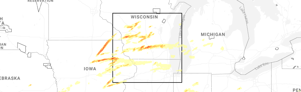
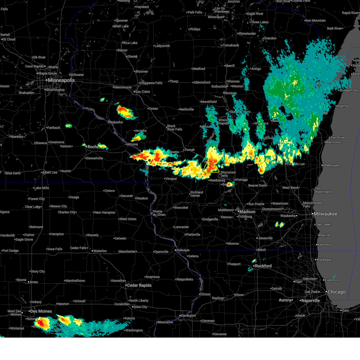
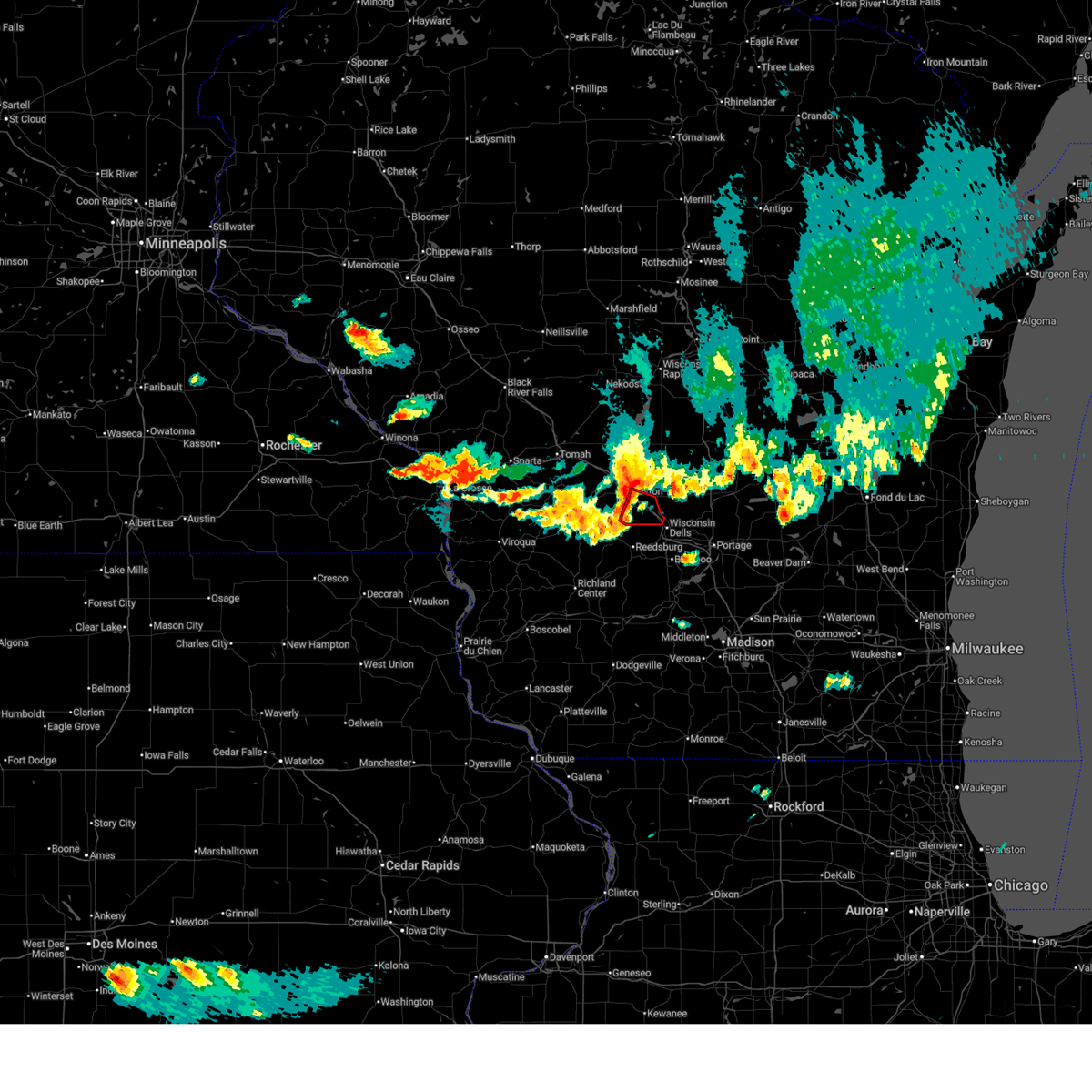
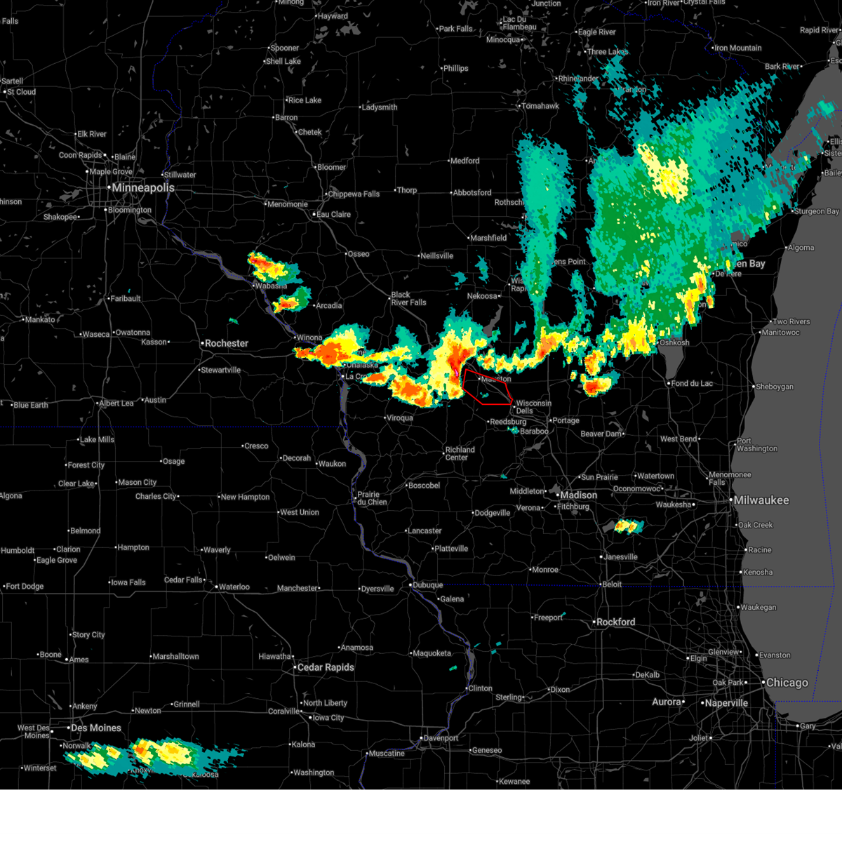
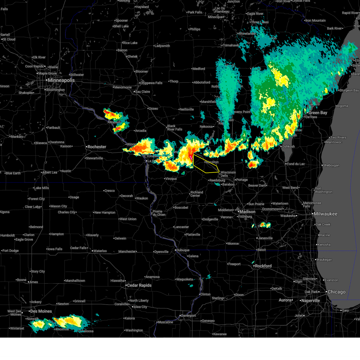
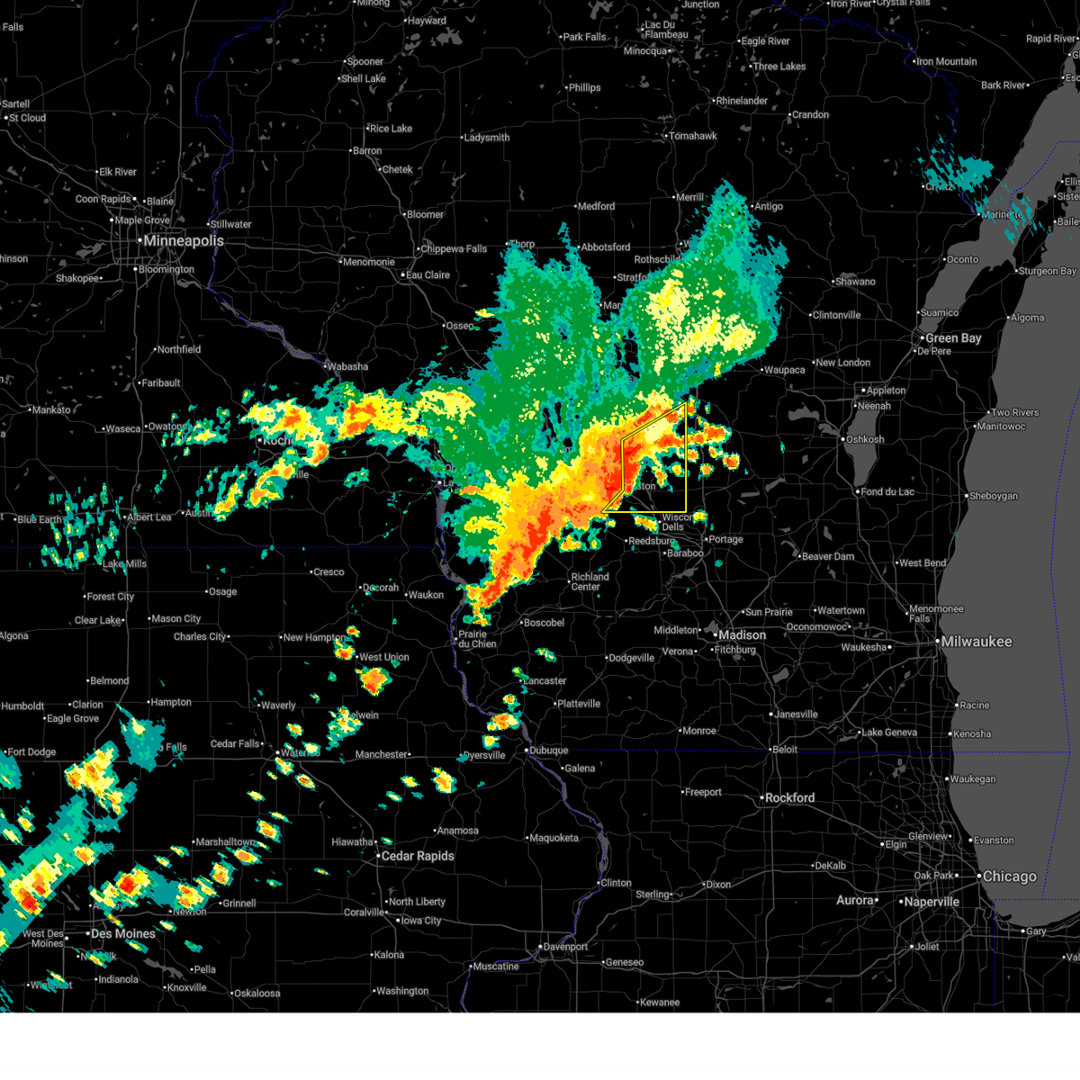
Hail Map for Lyndon Station, WI
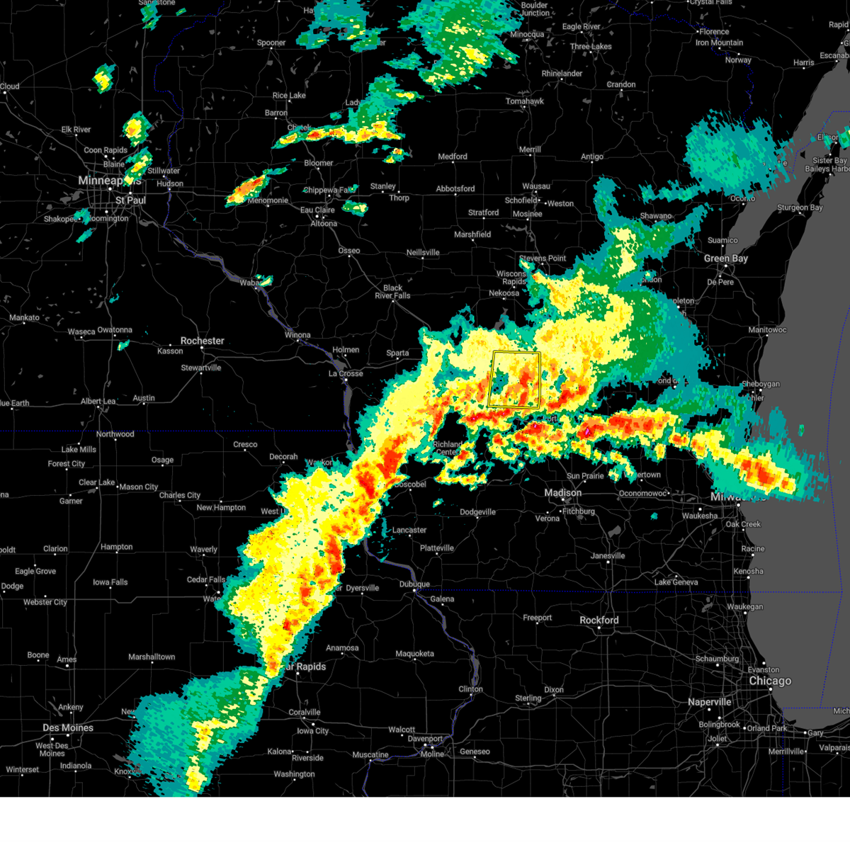
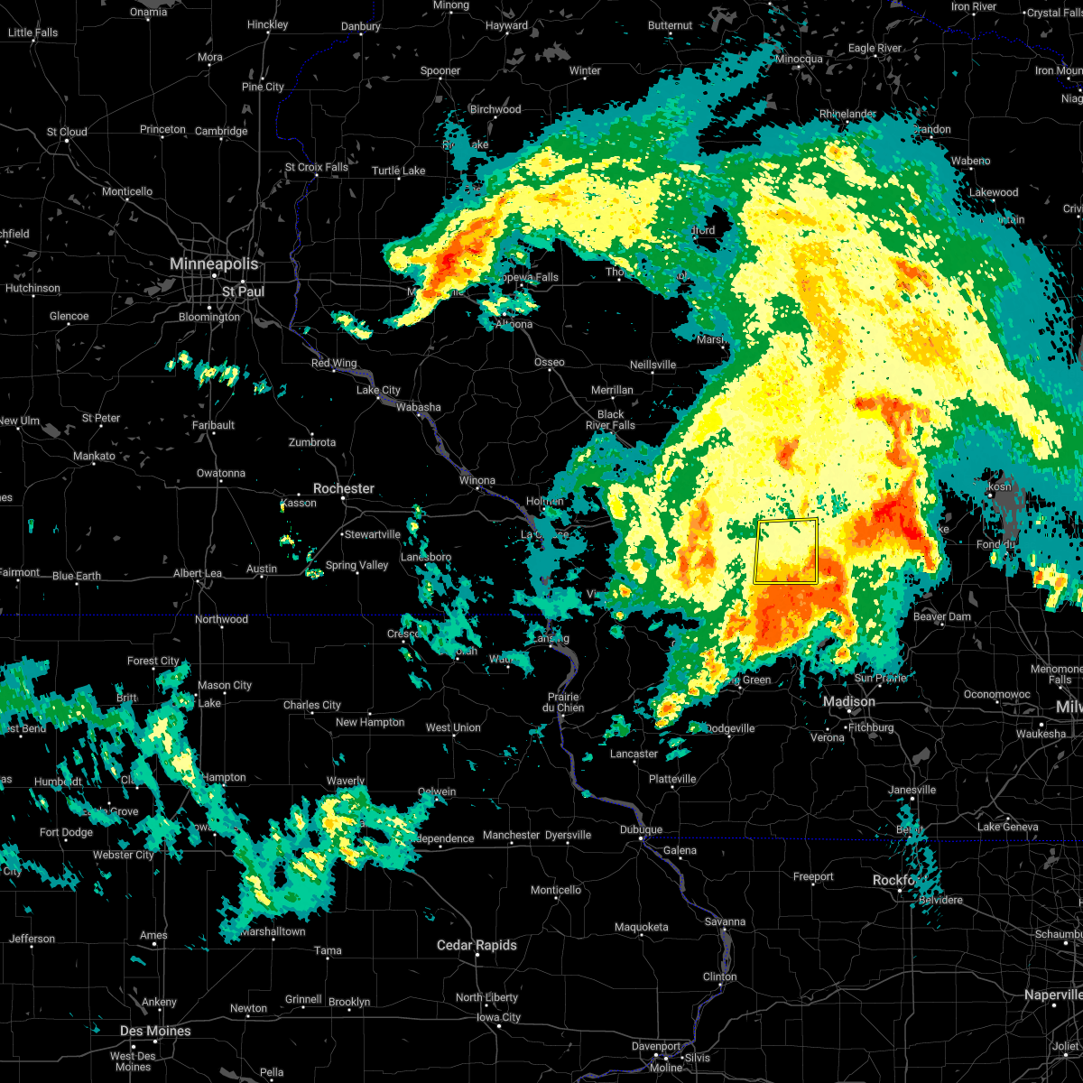
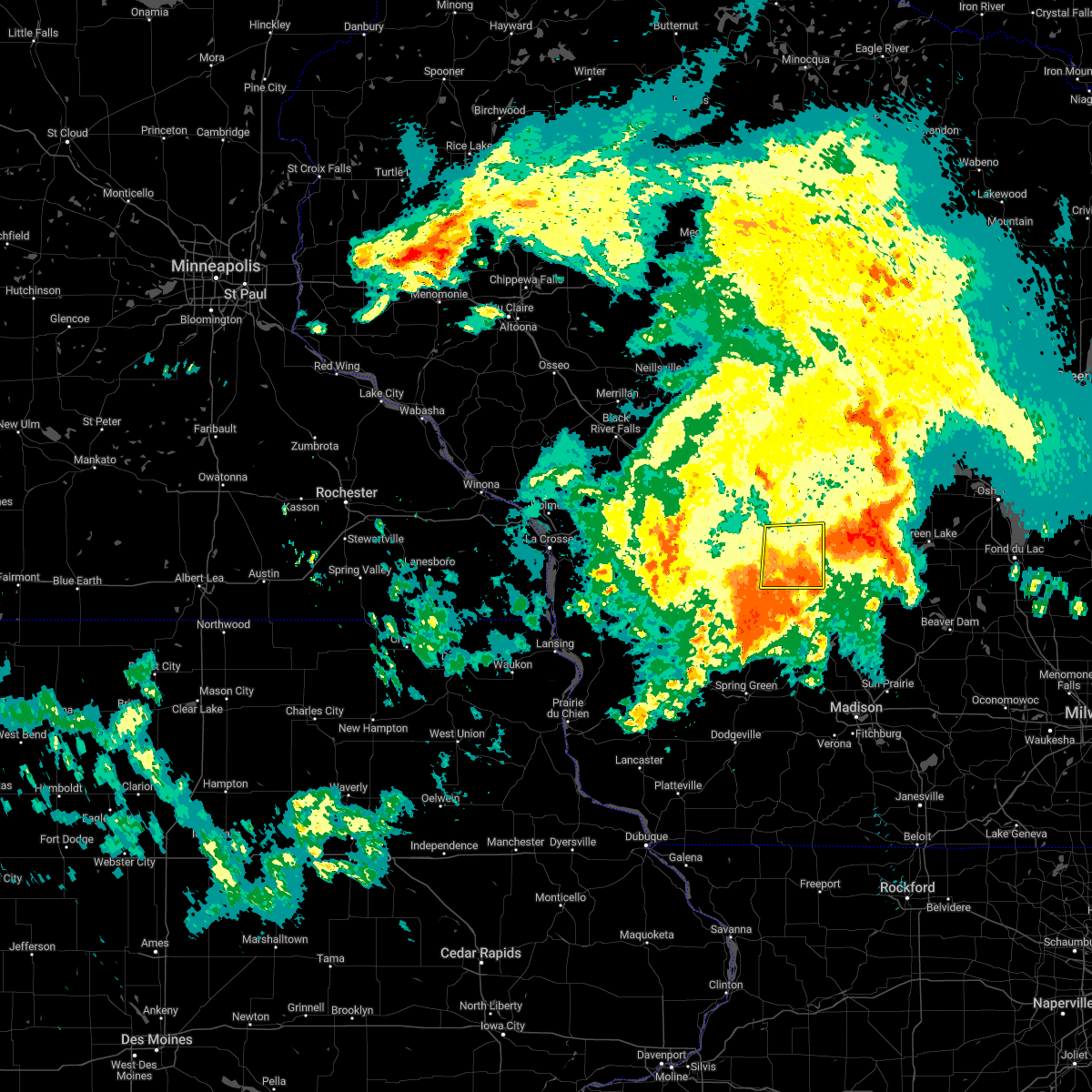
The Lyndon Station, WI area has had 3 reports of on-the-ground hail by trained spotters, and has been under severe weather warnings 22 times during the past 12 months. Doppler radar has detected hail at or near Lyndon Station, WI on 43 occasions, including 4 occasions during the past year.
| Name: | Lyndon Station, WI |
| Where Located: | 51 miles NNW of Madison, WI |
| Map: | Google Map for Lyndon Station, WI |
| Population: | 500 |
| Housing Units: | 247 |
| More Info: | Search Google for Lyndon Station, WI |
2
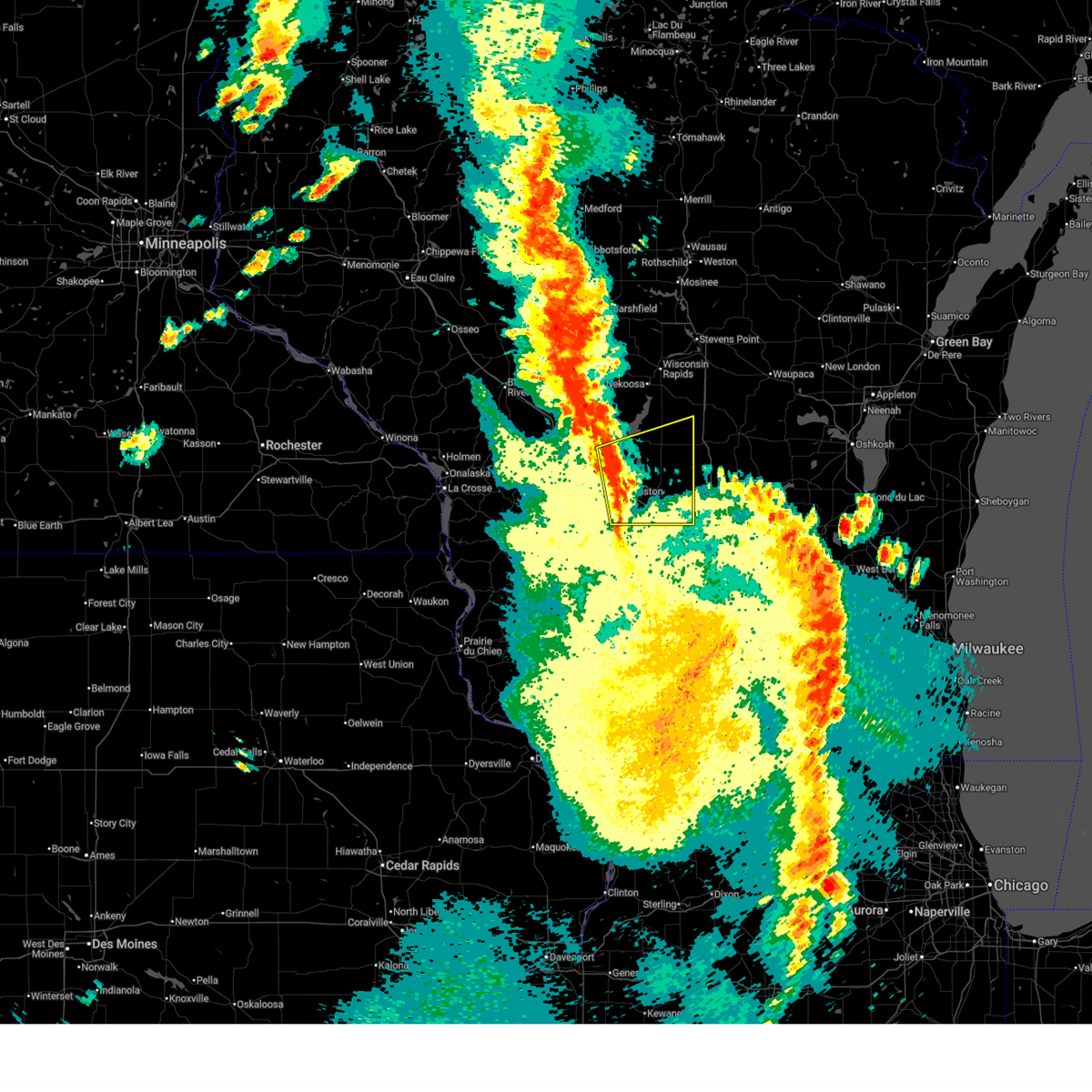
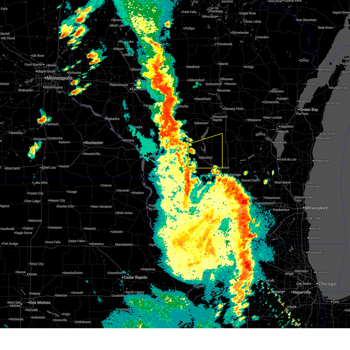
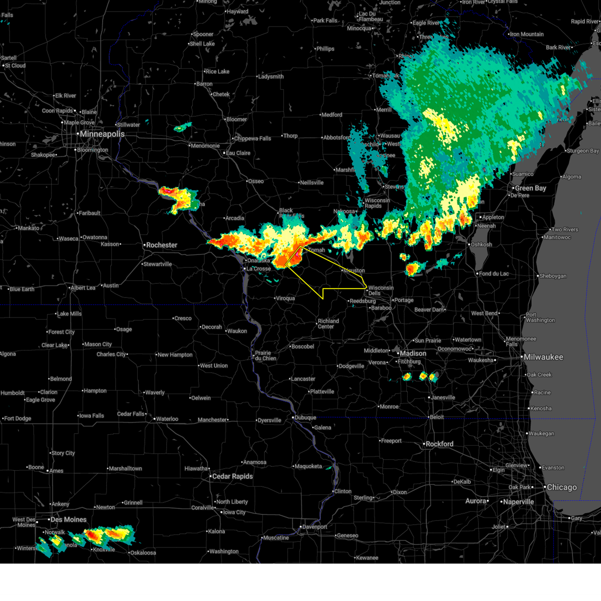
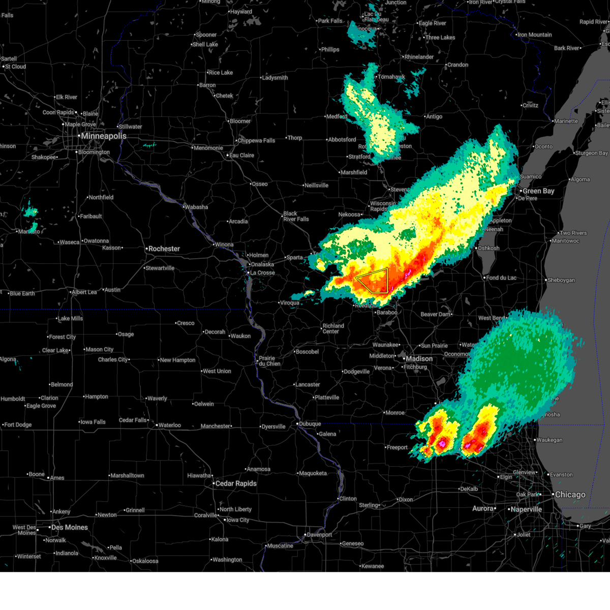
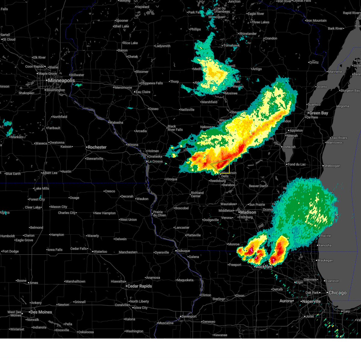
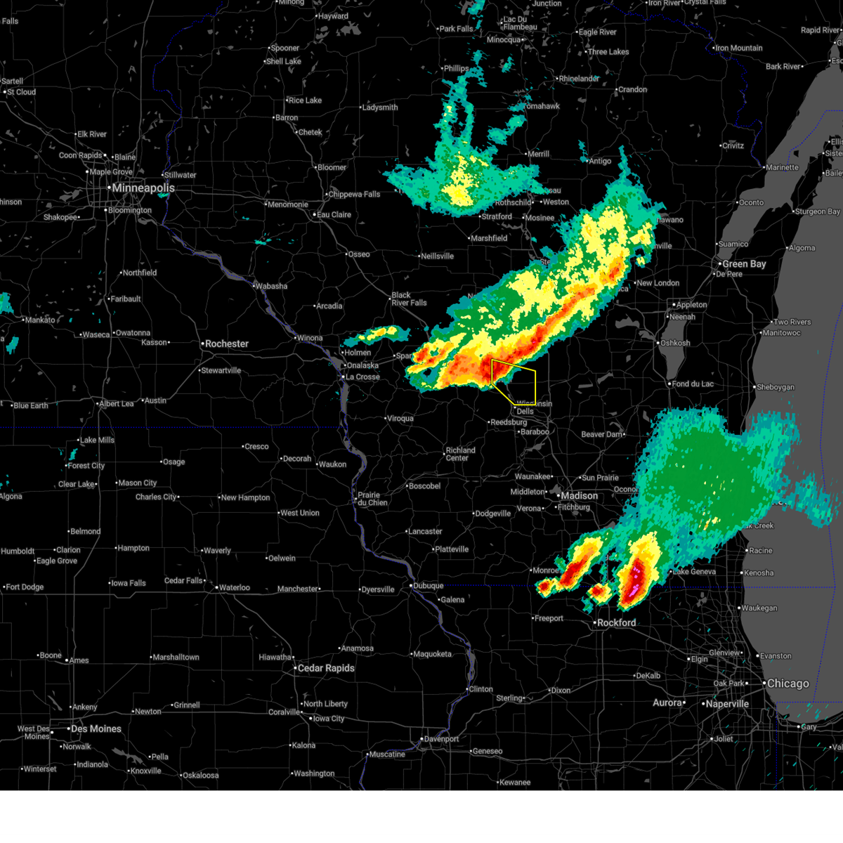
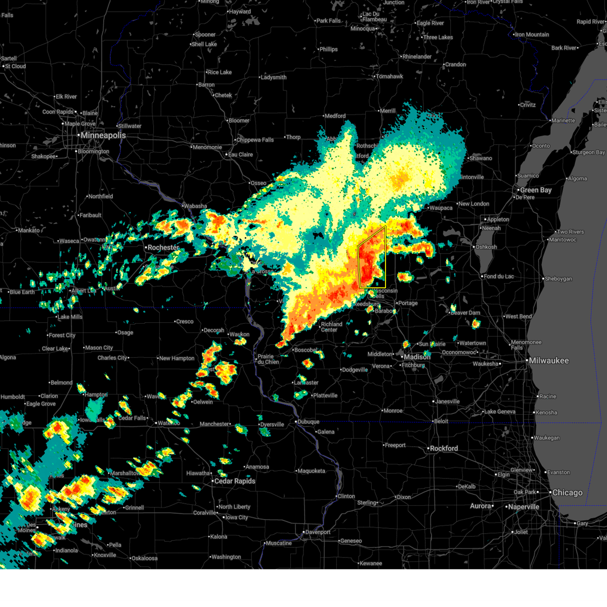
The Top Recent Hail Date for Lyndon Station, WI is Tuesday, April 14, 2026 (3rd out of 43)
Hail and Wind Damage Spotted near Lyndon Station, WI
| Date / Time | Report Details |
|---|---|
| 6/10/2026 2:47 PM CDT |
 At 247 pm cdt, severe thunderstorms were located along a line extending from 7 miles south of mauston to near necedah, moving north at 50 mph (radar indicated). Hazards include 60 mph wind gusts. Expect damage to roofs, siding, and trees. these severe storms will be near, mauston, new lisbon, and necedah around 255 pm cdt. other locations impacted by these severe thunderstorms include highways 13 and 21, county roads g and m, big spring, highway 13 and county e, county roads c and g, lemonweir, and buckhorn state park. This includes interstate 90/94 between mile markers 59 and 86. At 247 pm cdt, severe thunderstorms were located along a line extending from 7 miles south of mauston to near necedah, moving north at 50 mph (radar indicated). Hazards include 60 mph wind gusts. Expect damage to roofs, siding, and trees. these severe storms will be near, mauston, new lisbon, and necedah around 255 pm cdt. other locations impacted by these severe thunderstorms include highways 13 and 21, county roads g and m, big spring, highway 13 and county e, county roads c and g, lemonweir, and buckhorn state park. This includes interstate 90/94 between mile markers 59 and 86.
|
| 6/10/2026 2:19 PM CDT |
 Svrarx the national weather service in la crosse has issued a * severe thunderstorm warning for, juneau county in central wisconsin, adams county in central wisconsin, * until 300 pm cdt. * at 219 pm cdt, severe thunderstorms were located along a line extending from near portage to near wonewoc, moving north at 65 mph (radar indicated). Hazards include 60 mph wind gusts. Expect damage to roofs, siding, and trees. severe thunderstorms will be near, elroy and wonewoc around 225 pm cdt. mauston around 230 pm cdt. new lisbon around 235 pm cdt. friendship, adams, and dellwood around 240 pm cdt. necedah around 245 pm cdt. other locations impacted by these severe thunderstorms include highways 13 and 21, county roads g and m, johnson hill, big spring, highway 13 and county e, county roads c and g, and lemonweir. This includes interstate 90/94 between mile markers 54 and 86. Svrarx the national weather service in la crosse has issued a * severe thunderstorm warning for, juneau county in central wisconsin, adams county in central wisconsin, * until 300 pm cdt. * at 219 pm cdt, severe thunderstorms were located along a line extending from near portage to near wonewoc, moving north at 65 mph (radar indicated). Hazards include 60 mph wind gusts. Expect damage to roofs, siding, and trees. severe thunderstorms will be near, elroy and wonewoc around 225 pm cdt. mauston around 230 pm cdt. new lisbon around 235 pm cdt. friendship, adams, and dellwood around 240 pm cdt. necedah around 245 pm cdt. other locations impacted by these severe thunderstorms include highways 13 and 21, county roads g and m, johnson hill, big spring, highway 13 and county e, county roads c and g, and lemonweir. This includes interstate 90/94 between mile markers 54 and 86.
|
| 6/5/2026 9:32 PM CDT |
 At 932 pm cdt, severe thunderstorms were located along a line extending from 8 miles north of wisconsin dells to near reedsburg, moving southeast at 50 mph (radar indicated). Hazards include 60 mph wind gusts. Expect damage to roofs, siding, and trees. locations impacted include, lyndon station, castle rock, arrowhead resort campground, county roads b and p, dells timberland campground, k and l campground, county roads b and k, highway 23 and county g, stand rock campground, highway 23 and county b, big spring, eagle park campground, bass lake campground, rocky arbor state park, holiday shores campground, yukon trails campground, highway 82 and county b, highways 82 and 13, plainville, and river bay campground. This includes interstate 90/94 between mile markers 77 and 86. At 932 pm cdt, severe thunderstorms were located along a line extending from 8 miles north of wisconsin dells to near reedsburg, moving southeast at 50 mph (radar indicated). Hazards include 60 mph wind gusts. Expect damage to roofs, siding, and trees. locations impacted include, lyndon station, castle rock, arrowhead resort campground, county roads b and p, dells timberland campground, k and l campground, county roads b and k, highway 23 and county g, stand rock campground, highway 23 and county b, big spring, eagle park campground, bass lake campground, rocky arbor state park, holiday shores campground, yukon trails campground, highway 82 and county b, highways 82 and 13, plainville, and river bay campground. This includes interstate 90/94 between mile markers 77 and 86.
|
| 6/5/2026 9:28 PM CDT |
 The storm which prompted the warning has moved out of the area. therefore, the warning will be allowed to expire. The storm which prompted the warning has moved out of the area. therefore, the warning will be allowed to expire.
|
| 6/5/2026 9:20 PM CDT |
 At 920 pm cdt, a severe thunderstorm was located 10 miles north of reedsburg, moving southeast at 45 mph (radar indicated). Hazards include 60 mph wind gusts. Expect damage to roofs, siding, and trees. this severe thunderstorm will remain over mainly rural areas of southeastern juneau county, including the following locations, arrowhead resort campground, rocky arbor state park, lemonweir, dells timberland campground, yukon trails campground, bass hollow rec area, and lyndon station. This includes interstate 90/94 between mile markers 71 and 85. At 920 pm cdt, a severe thunderstorm was located 10 miles north of reedsburg, moving southeast at 45 mph (radar indicated). Hazards include 60 mph wind gusts. Expect damage to roofs, siding, and trees. this severe thunderstorm will remain over mainly rural areas of southeastern juneau county, including the following locations, arrowhead resort campground, rocky arbor state park, lemonweir, dells timberland campground, yukon trails campground, bass hollow rec area, and lyndon station. This includes interstate 90/94 between mile markers 71 and 85.
|
| 6/5/2026 9:17 PM CDT |
 Svrarx the national weather service in la crosse has issued a * severe thunderstorm warning for, southeastern juneau county in central wisconsin, southeastern adams county in central wisconsin, * until 945 pm cdt. * at 917 pm cdt, severe thunderstorms were located along a line extending from 6 miles east of mauston to near reedsburg, moving southeast at 50 mph (radar indicated). Hazards include 60 mph wind gusts. Expect damage to roofs, siding, and trees. these severe thunderstorms will remain over mainly rural areas of southeastern juneau and southeastern adams counties, including the following locations, arrowhead resort campground, county roads b and p, dells timberland campground, k and l campground, county roads b and k, highway 23 and county g, and lyndon station. This includes interstate 90/94 between mile markers 71 and 86. Svrarx the national weather service in la crosse has issued a * severe thunderstorm warning for, southeastern juneau county in central wisconsin, southeastern adams county in central wisconsin, * until 945 pm cdt. * at 917 pm cdt, severe thunderstorms were located along a line extending from 6 miles east of mauston to near reedsburg, moving southeast at 50 mph (radar indicated). Hazards include 60 mph wind gusts. Expect damage to roofs, siding, and trees. these severe thunderstorms will remain over mainly rural areas of southeastern juneau and southeastern adams counties, including the following locations, arrowhead resort campground, county roads b and p, dells timberland campground, k and l campground, county roads b and k, highway 23 and county g, and lyndon station. This includes interstate 90/94 between mile markers 71 and 86.
|
| 6/5/2026 9:15 PM CDT |
 At 915 pm cdt, a severe thunderstorm capable of producing a tornado was located 9 miles southeast of mauston, moving southeast at 45 mph (radar indicated rotation). Hazards include tornado. Flying debris will be dangerous to those caught without shelter. mobile homes will be damaged or destroyed. damage to roofs, windows, and vehicles will occur. tree damage is likely. this tornadic thunderstorm will remain over mainly rural areas of southeastern juneau county, including the following locations, arrowhead resort campground, rocky arbor state park, lemonweir, dells timberland campground, yukon trails campground, bass hollow rec area, and lyndon station. This includes interstate 90/94 between mile markers 72 and 86. At 915 pm cdt, a severe thunderstorm capable of producing a tornado was located 9 miles southeast of mauston, moving southeast at 45 mph (radar indicated rotation). Hazards include tornado. Flying debris will be dangerous to those caught without shelter. mobile homes will be damaged or destroyed. damage to roofs, windows, and vehicles will occur. tree damage is likely. this tornadic thunderstorm will remain over mainly rural areas of southeastern juneau county, including the following locations, arrowhead resort campground, rocky arbor state park, lemonweir, dells timberland campground, yukon trails campground, bass hollow rec area, and lyndon station. This includes interstate 90/94 between mile markers 72 and 86.
|
| 6/5/2026 9:03 PM CDT |
 At 903 pm cdt, a severe thunderstorm capable of producing a tornado was located near elroy, or near mauston, moving east at 35 mph (radar indicated rotation). Hazards include tornado. Flying debris will be dangerous to those caught without shelter. mobile homes will be damaged or destroyed. damage to roofs, windows, and vehicles will occur. tree damage is likely. this dangerous storm will be near, mauston around 910 pm cdt. other locations impacted by this tornadic thunderstorm include arrowhead resort campground, dells timberland campground, lindina, lyndon station, stand rock campground, eagle park campground, and bass lake campground. This includes interstate 90/94 between mile markers 67 and 86. At 903 pm cdt, a severe thunderstorm capable of producing a tornado was located near elroy, or near mauston, moving east at 35 mph (radar indicated rotation). Hazards include tornado. Flying debris will be dangerous to those caught without shelter. mobile homes will be damaged or destroyed. damage to roofs, windows, and vehicles will occur. tree damage is likely. this dangerous storm will be near, mauston around 910 pm cdt. other locations impacted by this tornadic thunderstorm include arrowhead resort campground, dells timberland campground, lindina, lyndon station, stand rock campground, eagle park campground, and bass lake campground. This includes interstate 90/94 between mile markers 67 and 86.
|
| 6/5/2026 8:56 PM CDT |
 the severe thunderstorm warning has been cancelled and is no longer in effect the severe thunderstorm warning has been cancelled and is no longer in effect
|
| 6/5/2026 8:56 PM CDT |
 At 855 pm cdt, a severe thunderstorm was located over elroy, or 11 miles west of mauston, moving southeast at 35 mph (radar indicated). Hazards include 60 mph wind gusts and penny size hail. Expect damage to roofs, siding, and trees. this severe storm will be near, elroy around 900 pm cdt. other locations impacted by this severe thunderstorm include arrowhead resort campground, dells timberland campground, lindina, johnson hill, lyndon station, stand rock campground, and eagle park campground. This includes interstate 90/94 between mile markers 67 and 85. At 855 pm cdt, a severe thunderstorm was located over elroy, or 11 miles west of mauston, moving southeast at 35 mph (radar indicated). Hazards include 60 mph wind gusts and penny size hail. Expect damage to roofs, siding, and trees. this severe storm will be near, elroy around 900 pm cdt. other locations impacted by this severe thunderstorm include arrowhead resort campground, dells timberland campground, lindina, johnson hill, lyndon station, stand rock campground, and eagle park campground. This includes interstate 90/94 between mile markers 67 and 85.
|
| 6/5/2026 8:48 PM CDT |
 Torarx the national weather service in la crosse has issued a * tornado warning for, southern juneau county in central wisconsin, * until 930 pm cdt. * at 848 pm cdt, a severe thunderstorm capable of producing a tornado was located 7 miles northwest of elroy, or 12 miles west of mauston, moving southeast at 45 mph (radar indicated rotation). Hazards include tornado. Flying debris will be dangerous to those caught without shelter. mobile homes will be damaged or destroyed. damage to roofs, windows, and vehicles will occur. tree damage is likely. this dangerous storm will be near, mauston around 900 pm cdt. other locations impacted by this tornadic thunderstorm include arrowhead resort campground, dells timberland campground, lindina, johnson hill, lyndon station, stand rock campground, and eagle park campground. This includes interstate 90/94 between mile markers 62 and 86. Torarx the national weather service in la crosse has issued a * tornado warning for, southern juneau county in central wisconsin, * until 930 pm cdt. * at 848 pm cdt, a severe thunderstorm capable of producing a tornado was located 7 miles northwest of elroy, or 12 miles west of mauston, moving southeast at 45 mph (radar indicated rotation). Hazards include tornado. Flying debris will be dangerous to those caught without shelter. mobile homes will be damaged or destroyed. damage to roofs, windows, and vehicles will occur. tree damage is likely. this dangerous storm will be near, mauston around 900 pm cdt. other locations impacted by this tornadic thunderstorm include arrowhead resort campground, dells timberland campground, lindina, johnson hill, lyndon station, stand rock campground, and eagle park campground. This includes interstate 90/94 between mile markers 62 and 86.
|
| 6/5/2026 8:46 PM CDT |
 At 846 pm cdt, a severe thunderstorm was located near elroy, or 13 miles southeast of tomah, moving southeast at 40 mph (radar indicated). Hazards include 60 mph wind gusts. Expect damage to roofs, siding, and trees. this severe storm will be near, elroy around 850 pm cdt. other locations impacted by this severe thunderstorm include arrowhead resort campground, dells timberland campground, clifton, lindina, union center, johnson hill, and lyndon station. This includes interstate 90/94 between mile markers 67 and 86. At 846 pm cdt, a severe thunderstorm was located near elroy, or 13 miles southeast of tomah, moving southeast at 40 mph (radar indicated). Hazards include 60 mph wind gusts. Expect damage to roofs, siding, and trees. this severe storm will be near, elroy around 850 pm cdt. other locations impacted by this severe thunderstorm include arrowhead resort campground, dells timberland campground, clifton, lindina, union center, johnson hill, and lyndon station. This includes interstate 90/94 between mile markers 67 and 86.
|
| 6/5/2026 8:29 PM CDT |
 Svrarx the national weather service in la crosse has issued a * severe thunderstorm warning for, southern juneau county in central wisconsin, northeastern vernon county in southwestern wisconsin, southeastern monroe county in west central wisconsin, * until 930 pm cdt. * at 829 pm cdt, a severe thunderstorm was located near tomah, moving southeast at 35 mph (radar indicated). Hazards include 60 mph wind gusts. Expect damage to roofs, siding, and trees. this severe thunderstorm will be near, elroy around 850 pm cdt. wonewoc around 905 pm cdt. other locations impacted by this severe thunderstorm include bartons corners, dells timberland campground, johnson hill, lyndon station, stand rock campground, glendale, and benders corners. this includes the following highways, interstate 90/94 between mile markers 67 and 86. Interstate 90 in wisconsin between mile markers 34 and 43. Svrarx the national weather service in la crosse has issued a * severe thunderstorm warning for, southern juneau county in central wisconsin, northeastern vernon county in southwestern wisconsin, southeastern monroe county in west central wisconsin, * until 930 pm cdt. * at 829 pm cdt, a severe thunderstorm was located near tomah, moving southeast at 35 mph (radar indicated). Hazards include 60 mph wind gusts. Expect damage to roofs, siding, and trees. this severe thunderstorm will be near, elroy around 850 pm cdt. wonewoc around 905 pm cdt. other locations impacted by this severe thunderstorm include bartons corners, dells timberland campground, johnson hill, lyndon station, stand rock campground, glendale, and benders corners. this includes the following highways, interstate 90/94 between mile markers 67 and 86. Interstate 90 in wisconsin between mile markers 34 and 43.
|
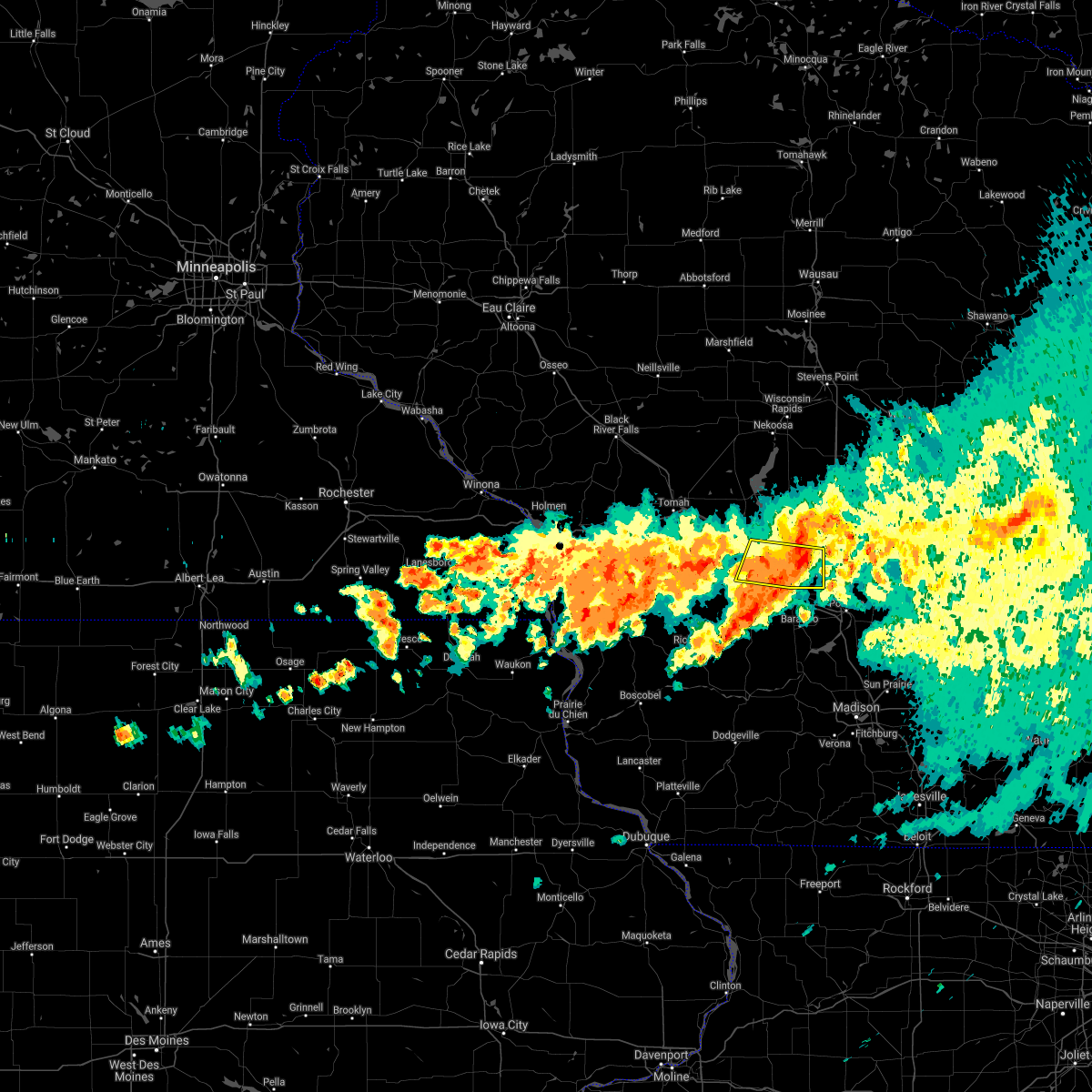
| 4/14/2026 6:13 PM CDT |
 At 613 pm cdt, a severe thunderstorm was located 7 miles northeast of wisconsin dells, moving east at 40 mph (law enforcement). Hazards include golf ball size hail and 60 mph wind gusts. People and animals outdoors will be injured. expect hail damage to roofs, siding, windows, and vehicles. expect wind damage to roofs, siding, and trees. locations impacted include, lyndon station, castle rock, arrowhead resort campground, county roads b and p, brooks, dells timberland campground, k and l campground, county roads b and k, highway 23 and county g, county roads a and b, stand rock campground, highway 23 and county b, big spring, eagle park campground, bass lake campground, coons deep lake campground, rocky arbor state park, holiday shores campground, county roads e and g, and yukon trails campground. This includes interstate 90/94 between mile markers 74 and 86. At 613 pm cdt, a severe thunderstorm was located 7 miles northeast of wisconsin dells, moving east at 40 mph (law enforcement). Hazards include golf ball size hail and 60 mph wind gusts. People and animals outdoors will be injured. expect hail damage to roofs, siding, windows, and vehicles. expect wind damage to roofs, siding, and trees. locations impacted include, lyndon station, castle rock, arrowhead resort campground, county roads b and p, brooks, dells timberland campground, k and l campground, county roads b and k, highway 23 and county g, county roads a and b, stand rock campground, highway 23 and county b, big spring, eagle park campground, bass lake campground, coons deep lake campground, rocky arbor state park, holiday shores campground, county roads e and g, and yukon trails campground. This includes interstate 90/94 between mile markers 74 and 86.
|
| 4/14/2026 6:03 PM CDT |
 At 602 pm cdt, a severe thunderstorm was located near mauston, moving east at 25 mph (law enforcement). Hazards include ping pong ball size hail and 60 mph wind gusts. People and animals outdoors will be injured. expect hail damage to roofs, siding, windows, and vehicles. expect wind damage to roofs, siding, and trees. this severe thunderstorm will remain over mainly rural areas of southeastern juneau county, including the following locations, arrowhead resort campground, dells timberland campground, lindina, lyndon station, stand rock campground, eagle park campground, and bass lake campground. This includes interstate 90/94 between mile markers 62 and 86. At 602 pm cdt, a severe thunderstorm was located near mauston, moving east at 25 mph (law enforcement). Hazards include ping pong ball size hail and 60 mph wind gusts. People and animals outdoors will be injured. expect hail damage to roofs, siding, windows, and vehicles. expect wind damage to roofs, siding, and trees. this severe thunderstorm will remain over mainly rural areas of southeastern juneau county, including the following locations, arrowhead resort campground, dells timberland campground, lindina, lyndon station, stand rock campground, eagle park campground, and bass lake campground. This includes interstate 90/94 between mile markers 62 and 86.
|
| 4/14/2026 6:00 PM CDT | Tea Cup sized hail reported 4.4 miles NW of Lyndon Station, WI |
| 4/14/2026 5:59 PM CDT |
 Svrarx the national weather service in la crosse has issued a * severe thunderstorm warning for, southeastern juneau county in central wisconsin, southern adams county in central wisconsin, * until 645 pm cdt. * at 559 pm cdt, a severe thunderstorm was located near wisconsin dells, moving east at 35 mph (radar indicated). Hazards include ping pong ball size hail and 60 mph wind gusts. People and animals outdoors will be injured. expect hail damage to roofs, siding, windows, and vehicles. expect wind damage to roofs, siding, and trees. this severe thunderstorm will remain over mainly rural areas of southeastern juneau and southern adams counties, including the following locations, county roads b and p, dells timberland campground, county roads b and k, the town of quincy, lyndon station, stand rock campground, and big spring. This includes interstate 90/94 between mile markers 73 and 86. Svrarx the national weather service in la crosse has issued a * severe thunderstorm warning for, southeastern juneau county in central wisconsin, southern adams county in central wisconsin, * until 645 pm cdt. * at 559 pm cdt, a severe thunderstorm was located near wisconsin dells, moving east at 35 mph (radar indicated). Hazards include ping pong ball size hail and 60 mph wind gusts. People and animals outdoors will be injured. expect hail damage to roofs, siding, windows, and vehicles. expect wind damage to roofs, siding, and trees. this severe thunderstorm will remain over mainly rural areas of southeastern juneau and southern adams counties, including the following locations, county roads b and p, dells timberland campground, county roads b and k, the town of quincy, lyndon station, stand rock campground, and big spring. This includes interstate 90/94 between mile markers 73 and 86.
|
| 4/14/2026 5:25 PM CDT |
 Svrarx the national weather service in la crosse has issued a * severe thunderstorm warning for, southern juneau county in central wisconsin, * until 615 pm cdt. * at 525 pm cdt, a severe thunderstorm was located over elroy, or 11 miles southwest of mauston, moving east at 25 mph (radar indicated). Hazards include ping pong ball size hail and 60 mph wind gusts. People and animals outdoors will be injured. expect hail damage to roofs, siding, windows, and vehicles. expect wind damage to roofs, siding, and trees. this severe thunderstorm will be near, elroy around 530 pm cdt. other locations impacted by this severe thunderstorm include arrowhead resort campground, dells timberland campground, lindina, union center, lyndon station, johnson hill, and stand rock campground. This includes interstate 90/94 between mile markers 62 and 86. Svrarx the national weather service in la crosse has issued a * severe thunderstorm warning for, southern juneau county in central wisconsin, * until 615 pm cdt. * at 525 pm cdt, a severe thunderstorm was located over elroy, or 11 miles southwest of mauston, moving east at 25 mph (radar indicated). Hazards include ping pong ball size hail and 60 mph wind gusts. People and animals outdoors will be injured. expect hail damage to roofs, siding, windows, and vehicles. expect wind damage to roofs, siding, and trees. this severe thunderstorm will be near, elroy around 530 pm cdt. other locations impacted by this severe thunderstorm include arrowhead resort campground, dells timberland campground, lindina, union center, lyndon station, johnson hill, and stand rock campground. This includes interstate 90/94 between mile markers 62 and 86.
|
| 9/19/2025 5:06 PM CDT | Quarter sized hail reported 2.2 miles SSW of Lyndon Station, WI, picture sent via email from county highway hh. |
| 8/16/2025 3:32 PM CDT |
 the severe thunderstorm warning has been cancelled and is no longer in effect the severe thunderstorm warning has been cancelled and is no longer in effect
|
| 8/16/2025 3:18 PM CDT |
 At 318 pm cdt, a severe thunderstorm was located 10 miles south of westfield, or 13 miles northeast of wisconsin dells, moving east at 40 mph (radar indicated). Hazards include quarter size hail. Damage to vehicles is expected. locations impacted include, lyndon station, county roads b and p, brooks, k and l campground, county roads b and k, highway 23 and county g, stand rock campground, coons deep lake campground, holiday shores campground, yukon trails campground, plainville, and river bay campground. This includes interstate 90/94 between mile markers 80 and 84. At 318 pm cdt, a severe thunderstorm was located 10 miles south of westfield, or 13 miles northeast of wisconsin dells, moving east at 40 mph (radar indicated). Hazards include quarter size hail. Damage to vehicles is expected. locations impacted include, lyndon station, county roads b and p, brooks, k and l campground, county roads b and k, highway 23 and county g, stand rock campground, coons deep lake campground, holiday shores campground, yukon trails campground, plainville, and river bay campground. This includes interstate 90/94 between mile markers 80 and 84.
|
| 8/16/2025 2:55 PM CDT |
 Svrarx the national weather service in la crosse has issued a * severe thunderstorm warning for, southeastern juneau county in central wisconsin, southern adams county in central wisconsin, * until 345 pm cdt. * at 254 pm cdt, a severe thunderstorm was located 10 miles east of mauston, moving east at 40 mph (radar indicated). Hazards include quarter size hail. Damage to vehicles is expected. this severe thunderstorm will remain over mainly rural areas of southeastern juneau and southern adams counties, including the following locations, county roads b and p, brooks, the town of quincy, highway 23 and county g, and county roads a and b. This includes interstate 90/94 between mile markers 80 and 84. Svrarx the national weather service in la crosse has issued a * severe thunderstorm warning for, southeastern juneau county in central wisconsin, southern adams county in central wisconsin, * until 345 pm cdt. * at 254 pm cdt, a severe thunderstorm was located 10 miles east of mauston, moving east at 40 mph (radar indicated). Hazards include quarter size hail. Damage to vehicles is expected. this severe thunderstorm will remain over mainly rural areas of southeastern juneau and southern adams counties, including the following locations, county roads b and p, brooks, the town of quincy, highway 23 and county g, and county roads a and b. This includes interstate 90/94 between mile markers 80 and 84.
|
| 6/23/2025 5:17 PM CDT |
 At 516 pm cdt, severe thunderstorms were located along a line extending from 8 miles northeast of friendship to 8 miles north of wisconsin dells, moving northeast at 40 mph (radar indicated). Hazards include 60 mph wind gusts. Expect damage to roofs, siding, and trees. these severe thunderstorms will affect the following locations, dells timberland campground, county roads b and k, highways 13 and 21, county roads g and o, county roads g and m, and lyndon station. This includes interstate 90/94 between mile markers 79 and 84. At 516 pm cdt, severe thunderstorms were located along a line extending from 8 miles northeast of friendship to 8 miles north of wisconsin dells, moving northeast at 40 mph (radar indicated). Hazards include 60 mph wind gusts. Expect damage to roofs, siding, and trees. these severe thunderstorms will affect the following locations, dells timberland campground, county roads b and k, highways 13 and 21, county roads g and o, county roads g and m, and lyndon station. This includes interstate 90/94 between mile markers 79 and 84.
|
| 6/23/2025 4:56 PM CDT |
 Svrarx the national weather service in la crosse has issued a * severe thunderstorm warning for, southeastern juneau county in central wisconsin, adams county in central wisconsin, * until 545 pm cdt. * at 455 pm cdt, severe thunderstorms were located along a line extending from near dellwood to 10 miles southwest of adams to near mauston, moving east at 40 mph (radar indicated). Hazards include 60 mph wind gusts. Expect damage to roofs, siding, and trees. severe thunderstorms will be near, friendship and adams around 500 pm cdt. other locations impacted by these severe thunderstorms include county roads b and p, dells timberland campground, county roads b and k, the town of quincy, highways 13 and 21, county roads g and o, and county roads g and m. This includes interstate 90/94 between mile markers 72 and 84. Svrarx the national weather service in la crosse has issued a * severe thunderstorm warning for, southeastern juneau county in central wisconsin, adams county in central wisconsin, * until 545 pm cdt. * at 455 pm cdt, severe thunderstorms were located along a line extending from near dellwood to 10 miles southwest of adams to near mauston, moving east at 40 mph (radar indicated). Hazards include 60 mph wind gusts. Expect damage to roofs, siding, and trees. severe thunderstorms will be near, friendship and adams around 500 pm cdt. other locations impacted by these severe thunderstorms include county roads b and p, dells timberland campground, county roads b and k, the town of quincy, highways 13 and 21, county roads g and o, and county roads g and m. This includes interstate 90/94 between mile markers 72 and 84.
|
| 5/15/2025 4:30 PM CDT | Quarter sized hail reported 4.4 miles NW of Lyndon Station, WI |
| 5/15/2025 4:07 PM CDT |
 Svrarx the national weather service in la crosse has issued a * severe thunderstorm warning for, eastern juneau county in central wisconsin, adams county in central wisconsin, * until 515 pm cdt. * at 407 pm cdt, a severe thunderstorm was located near mauston, moving northeast at 45 mph (radar indicated). Hazards include 60 mph wind gusts and quarter size hail. Hail damage to vehicles is expected. expect wind damage to roofs, siding, and trees. this severe thunderstorm will be near, dellwood around 415 pm cdt. other locations impacted by this severe thunderstorm include highways 13 and 21, county roads g and o, county roads g and m, big spring, highway 13 and county e, county roads c and g, and lemonweir. This includes interstate 90/94 between mile markers 65 and 86. Svrarx the national weather service in la crosse has issued a * severe thunderstorm warning for, eastern juneau county in central wisconsin, adams county in central wisconsin, * until 515 pm cdt. * at 407 pm cdt, a severe thunderstorm was located near mauston, moving northeast at 45 mph (radar indicated). Hazards include 60 mph wind gusts and quarter size hail. Hail damage to vehicles is expected. expect wind damage to roofs, siding, and trees. this severe thunderstorm will be near, dellwood around 415 pm cdt. other locations impacted by this severe thunderstorm include highways 13 and 21, county roads g and o, county roads g and m, big spring, highway 13 and county e, county roads c and g, and lemonweir. This includes interstate 90/94 between mile markers 65 and 86.
|
| 7/14/2024 4:46 AM CDT |
 the severe thunderstorm warning has been cancelled and is no longer in effect the severe thunderstorm warning has been cancelled and is no longer in effect
|
| 7/14/2024 4:18 AM CDT |
 Svrarx the national weather service in la crosse has issued a * severe thunderstorm warning for, southeastern juneau county in central wisconsin, * until 500 am cdt. * at 418 am cdt, severe thunderstorms were located along a line extending from 8 miles southeast of mauston to 8 miles north of reedsburg to 6 miles south of wonewoc, moving east at 40 mph (emergency management). Hazards include 60 mph wind gusts and quarter size hail. Hail damage to vehicles is expected. expect wind damage to roofs, siding, and trees. these severe thunderstorms will remain over mainly rural areas of southeastern juneau county, including the following locations, arrowhead resort campground, pleasant ridge, dells timberland campground, yukon trails campground, lindina, union center, and bass hollow rec area. This includes interstate 90/94 between mile markers 74 and 84. Svrarx the national weather service in la crosse has issued a * severe thunderstorm warning for, southeastern juneau county in central wisconsin, * until 500 am cdt. * at 418 am cdt, severe thunderstorms were located along a line extending from 8 miles southeast of mauston to 8 miles north of reedsburg to 6 miles south of wonewoc, moving east at 40 mph (emergency management). Hazards include 60 mph wind gusts and quarter size hail. Hail damage to vehicles is expected. expect wind damage to roofs, siding, and trees. these severe thunderstorms will remain over mainly rural areas of southeastern juneau county, including the following locations, arrowhead resort campground, pleasant ridge, dells timberland campground, yukon trails campground, lindina, union center, and bass hollow rec area. This includes interstate 90/94 between mile markers 74 and 84.
|
| 7/14/2024 4:07 AM CDT |
 the severe thunderstorm warning has been cancelled and is no longer in effect the severe thunderstorm warning has been cancelled and is no longer in effect
|
| 7/14/2024 4:07 AM CDT |
 At 407 am cdt, severe thunderstorms were located along a line extending from near mauston to near wonewoc to 6 miles south of hillsboro, moving east at 40 mph (emergency management). Hazards include 60 mph wind gusts and quarter size hail. Hail damage to vehicles is expected. expect wind damage to roofs, siding, and trees. these severe thunderstorms will remain over mainly rural areas of southern juneau, northeastern vernon and southeastern monroe counties, including the following locations, arrowhead resort campground, bartons corners, dells timberland campground, lindina, union center, lyndon station, and glendale. This includes interstate 90/94 between mile markers 73 and 84. At 407 am cdt, severe thunderstorms were located along a line extending from near mauston to near wonewoc to 6 miles south of hillsboro, moving east at 40 mph (emergency management). Hazards include 60 mph wind gusts and quarter size hail. Hail damage to vehicles is expected. expect wind damage to roofs, siding, and trees. these severe thunderstorms will remain over mainly rural areas of southern juneau, northeastern vernon and southeastern monroe counties, including the following locations, arrowhead resort campground, bartons corners, dells timberland campground, lindina, union center, lyndon station, and glendale. This includes interstate 90/94 between mile markers 73 and 84.
|
| 7/14/2024 3:55 AM CDT |
 Svrarx the national weather service in la crosse has issued a * severe thunderstorm warning for, southern juneau county in central wisconsin, northeastern vernon county in southwestern wisconsin, northeastern richland county in southwestern wisconsin, southeastern monroe county in west central wisconsin, * until 430 am cdt. * at 355 am cdt, severe thunderstorms were located along a line extending from near elroy to hillsboro to 8 miles east of la farge, moving east at 40 mph (emergency management). Hazards include 60 mph wind gusts and quarter size hail. Hail damage to vehicles is expected. expect wind damage to roofs, siding, and trees. severe thunderstorms will be near, hillsboro and wonewoc around 400 am cdt. This includes interstate 90/94 between mile markers 73 and 84. Svrarx the national weather service in la crosse has issued a * severe thunderstorm warning for, southern juneau county in central wisconsin, northeastern vernon county in southwestern wisconsin, northeastern richland county in southwestern wisconsin, southeastern monroe county in west central wisconsin, * until 430 am cdt. * at 355 am cdt, severe thunderstorms were located along a line extending from near elroy to hillsboro to 8 miles east of la farge, moving east at 40 mph (emergency management). Hazards include 60 mph wind gusts and quarter size hail. Hail damage to vehicles is expected. expect wind damage to roofs, siding, and trees. severe thunderstorms will be near, hillsboro and wonewoc around 400 am cdt. This includes interstate 90/94 between mile markers 73 and 84.
|
| 5/21/2024 8:30 PM CDT |
 The storms which prompted the warning have weakened below severe limits, and no longer pose an immediate threat to life or property. therefore, the warning has been allowed to expire. however, gusty winds are still possible with these thunderstorms and additional severe storms remain possible. a tornado watch remains in effect until midnight cdt for central wisconsin. The storms which prompted the warning have weakened below severe limits, and no longer pose an immediate threat to life or property. therefore, the warning has been allowed to expire. however, gusty winds are still possible with these thunderstorms and additional severe storms remain possible. a tornado watch remains in effect until midnight cdt for central wisconsin.
|
| 5/21/2024 7:29 PM CDT |
 Svrarx the national weather service in la crosse has issued a * severe thunderstorm warning for, juneau county in central wisconsin, adams county in central wisconsin, * until 830 pm cdt. * at 729 pm cdt, severe thunderstorms were located along a line extending from 10 miles west of babcock to 11 miles northwest of necedah to 10 miles northwest of elroy, moving east at 55 mph (radar indicated). Hazards include 70 mph wind gusts and penny size hail. Expect considerable tree damage. damage is likely to mobile homes, roofs, and outbuildings. severe thunderstorms will be near, new lisbon and necedah around 740 pm cdt. new rome and dellwood around 750 pm cdt. friendship and adams around 800 pm cdt. This includes interstate 90/94 between mile markers 53 and 86. Svrarx the national weather service in la crosse has issued a * severe thunderstorm warning for, juneau county in central wisconsin, adams county in central wisconsin, * until 830 pm cdt. * at 729 pm cdt, severe thunderstorms were located along a line extending from 10 miles west of babcock to 11 miles northwest of necedah to 10 miles northwest of elroy, moving east at 55 mph (radar indicated). Hazards include 70 mph wind gusts and penny size hail. Expect considerable tree damage. damage is likely to mobile homes, roofs, and outbuildings. severe thunderstorms will be near, new lisbon and necedah around 740 pm cdt. new rome and dellwood around 750 pm cdt. friendship and adams around 800 pm cdt. This includes interstate 90/94 between mile markers 53 and 86.
|
| 7/28/2023 9:08 PM CDT |
 The severe thunderstorm warning for southern juneau county will expire at 915 pm cdt, the storm which prompted the warning is moving out of the area. therefore, the warning will be allowed to expire. a severe thunderstorm watch remains in effect until 1000 pm cdt for central wisconsin. to report severe weather, contact your nearest law enforcement agency. they will relay your report to the national weather service la crosse. The severe thunderstorm warning for southern juneau county will expire at 915 pm cdt, the storm which prompted the warning is moving out of the area. therefore, the warning will be allowed to expire. a severe thunderstorm watch remains in effect until 1000 pm cdt for central wisconsin. to report severe weather, contact your nearest law enforcement agency. they will relay your report to the national weather service la crosse.
|
| 7/28/2023 8:47 PM CDT |
 At 847 pm cdt, a severe thunderstorm was located near wisconsin dells, moving east at 60 mph (radar indicated). Hazards include 60 mph wind gusts and half dollar size hail. Hail damage to vehicles is expected. expect wind damage to roofs, siding, and trees. this severe thunderstorm will remain over mainly rural areas of southern juneau county, including the following locations, arrowhead resort campground, dells timberland campground, lindina, union center, lyndon station, stand rock campground and eagle park campground. this includes interstate 90/94 between mile markers 63 and 86. hail threat, radar indicated max hail size, 1. 25 in wind threat, radar indicated max wind gust, 60 mph. At 847 pm cdt, a severe thunderstorm was located near wisconsin dells, moving east at 60 mph (radar indicated). Hazards include 60 mph wind gusts and half dollar size hail. Hail damage to vehicles is expected. expect wind damage to roofs, siding, and trees. this severe thunderstorm will remain over mainly rural areas of southern juneau county, including the following locations, arrowhead resort campground, dells timberland campground, lindina, union center, lyndon station, stand rock campground and eagle park campground. this includes interstate 90/94 between mile markers 63 and 86. hail threat, radar indicated max hail size, 1. 25 in wind threat, radar indicated max wind gust, 60 mph.
|
| 7/28/2023 8:11 PM CDT |
 At 811 pm cdt, a severe thunderstorm was located 7 miles south of tomah, moving east at 45 mph (radar indicated). Hazards include 60 mph wind gusts and quarter size hail. Hail damage to vehicles is expected. expect wind damage to roofs, siding, and trees. this severe thunderstorm will be near, elroy around 825 pm cdt. new lisbon around 830 pm cdt. mauston around 835 pm cdt. other locations impacted by this severe thunderstorm include dells timberland campground, johnson hill, lyndon station, stand rock campground, glendale, hoffman corners and lemonweir. this includes the following highways, interstate 90/94 between mile markers 63 and 86. interstate 90 in wisconsin between mile markers 39 and 41. hail threat, radar indicated max hail size, 1. 00 in wind threat, radar indicated max wind gust, 60 mph. At 811 pm cdt, a severe thunderstorm was located 7 miles south of tomah, moving east at 45 mph (radar indicated). Hazards include 60 mph wind gusts and quarter size hail. Hail damage to vehicles is expected. expect wind damage to roofs, siding, and trees. this severe thunderstorm will be near, elroy around 825 pm cdt. new lisbon around 830 pm cdt. mauston around 835 pm cdt. other locations impacted by this severe thunderstorm include dells timberland campground, johnson hill, lyndon station, stand rock campground, glendale, hoffman corners and lemonweir. this includes the following highways, interstate 90/94 between mile markers 63 and 86. interstate 90 in wisconsin between mile markers 39 and 41. hail threat, radar indicated max hail size, 1. 00 in wind threat, radar indicated max wind gust, 60 mph.
|
| 7/26/2023 5:42 AM CDT |
 The severe thunderstorm warning for southeastern juneau and southern adams counties will expire at 545 am cdt, the storm which prompted the warning has moved out of the area. therefore, the warning will be allowed to expire. however heavy rain is still possible with this thunderstorm. The severe thunderstorm warning for southeastern juneau and southern adams counties will expire at 545 am cdt, the storm which prompted the warning has moved out of the area. therefore, the warning will be allowed to expire. however heavy rain is still possible with this thunderstorm.
|
| 7/26/2023 5:12 AM CDT |
 At 511 am cdt, a severe thunderstorm was located 9 miles east of mauston, moving east at 55 mph (emergency management). Hazards include 60 mph wind gusts. Expect damage to roofs, siding, and trees. locations impacted include, mauston, adams, lemonweir, lyndon station, castle rock, county roads b and p. this includes interstate 90/94 between mile markers 68 and 86. hail threat, radar indicated max hail size, <. 75 in wind threat, observed max wind gust, 60 mph. At 511 am cdt, a severe thunderstorm was located 9 miles east of mauston, moving east at 55 mph (emergency management). Hazards include 60 mph wind gusts. Expect damage to roofs, siding, and trees. locations impacted include, mauston, adams, lemonweir, lyndon station, castle rock, county roads b and p. this includes interstate 90/94 between mile markers 68 and 86. hail threat, radar indicated max hail size, <. 75 in wind threat, observed max wind gust, 60 mph.
|
| 7/26/2023 4:57 AM CDT |
 At 457 am cdt, a severe thunderstorm was located near mauston, moving east at 55 mph (emergency management). Hazards include 60 mph wind gusts. Expect damage to roofs, siding, and trees. this severe thunderstorm will remain over mainly rural areas of southern juneau and southern adams counties, including the following locations, county roads b and p, dells timberland campground, county roads b and k, the town of quincy, johnson hill, lyndon station and stand rock campground. this includes interstate 90/94 between mile markers 59 and 86. hail threat, radar indicated max hail size, <. 75 in wind threat, observed max wind gust, 60 mph. At 457 am cdt, a severe thunderstorm was located near mauston, moving east at 55 mph (emergency management). Hazards include 60 mph wind gusts. Expect damage to roofs, siding, and trees. this severe thunderstorm will remain over mainly rural areas of southern juneau and southern adams counties, including the following locations, county roads b and p, dells timberland campground, county roads b and k, the town of quincy, johnson hill, lyndon station and stand rock campground. this includes interstate 90/94 between mile markers 59 and 86. hail threat, radar indicated max hail size, <. 75 in wind threat, observed max wind gust, 60 mph.
|
| 4/4/2023 11:35 PM CDT |
 The severe thunderstorm warning for southeastern juneau and southern adams counties will expire at 1145 pm cdt, the storm which prompted the warning has weakened below severe limits, and no longer poses an immediate threat to life or property. therefore, the warning will be allowed to expire. however heavy rain is still possible with this thunderstorm. a severe thunderstorm watch remains in effect until 100 am cdt for central wisconsin. The severe thunderstorm warning for southeastern juneau and southern adams counties will expire at 1145 pm cdt, the storm which prompted the warning has weakened below severe limits, and no longer poses an immediate threat to life or property. therefore, the warning will be allowed to expire. however heavy rain is still possible with this thunderstorm. a severe thunderstorm watch remains in effect until 100 am cdt for central wisconsin.
|
| 4/4/2023 11:21 PM CDT |
 At 1121 pm cdt, a severe thunderstorm was located 8 miles northwest of wisconsin dells, moving northeast at 45 mph (radar indicated). Hazards include quarter size hail. Damage to vehicles is expected. locations impacted include, friendship, adams, dellwood, lemonweir, lyndon station, and castle rock. this includes interstate 90/94 between mile markers 72 and 86. hail threat, radar indicated max hail size, 1. 00 in wind threat, radar indicated max wind gust, <50 mph. At 1121 pm cdt, a severe thunderstorm was located 8 miles northwest of wisconsin dells, moving northeast at 45 mph (radar indicated). Hazards include quarter size hail. Damage to vehicles is expected. locations impacted include, friendship, adams, dellwood, lemonweir, lyndon station, and castle rock. this includes interstate 90/94 between mile markers 72 and 86. hail threat, radar indicated max hail size, 1. 00 in wind threat, radar indicated max wind gust, <50 mph.
|
| 4/4/2023 11:04 PM CDT |
 At 1103 pm cdt, a severe thunderstorm was located near reedsburg, moving northeast at 40 mph (radar indicated). Hazards include quarter size hail. damage to vehicles is expected At 1103 pm cdt, a severe thunderstorm was located near reedsburg, moving northeast at 40 mph (radar indicated). Hazards include quarter size hail. damage to vehicles is expected
|
| 7/23/2022 5:24 PM CDT |
 The severe thunderstorm warning for southeastern juneau and southern adams counties will expire at 530 pm cdt, the storms which prompted the warning have moved out of the area. therefore, the warning will be allowed to expire. a severe thunderstorm watch remains in effect until 700 pm cdt for central wisconsin. The severe thunderstorm warning for southeastern juneau and southern adams counties will expire at 530 pm cdt, the storms which prompted the warning have moved out of the area. therefore, the warning will be allowed to expire. a severe thunderstorm watch remains in effect until 700 pm cdt for central wisconsin.
|
| 7/23/2022 5:11 PM CDT |
 At 510 pm cdt, severe thunderstorms were located along a line extending from 8 miles southeast of adams to 10 miles southwest of westfield to 7 miles east of wisconsin dells, moving east at 45 mph (radar indicated). Hazards include 70 mph wind gusts. Expect considerable tree damage. damage is likely to mobile homes, roofs, and outbuildings. this includes interstate 90/94 between mile markers 75 and 86. thunderstorm damage threat, considerable hail threat, radar indicated max hail size, <. 75 in wind threat, radar indicated max wind gust, 70 mph. At 510 pm cdt, severe thunderstorms were located along a line extending from 8 miles southeast of adams to 10 miles southwest of westfield to 7 miles east of wisconsin dells, moving east at 45 mph (radar indicated). Hazards include 70 mph wind gusts. Expect considerable tree damage. damage is likely to mobile homes, roofs, and outbuildings. this includes interstate 90/94 between mile markers 75 and 86. thunderstorm damage threat, considerable hail threat, radar indicated max hail size, <. 75 in wind threat, radar indicated max wind gust, 70 mph.
|
| 7/23/2022 4:46 PM CDT |
 At 445 pm cdt, severe thunderstorms were located along a line extending from near mauston to 12 miles southeast of new lisbon to 7 miles north of reedsburg, moving east at 45 mph (radar indicated). Hazards include 70 mph wind gusts. Expect considerable tree damage. damage is likely to mobile homes, roofs, and outbuildings. these severe thunderstorms will remain over mainly rural areas of southern juneau and southern adams counties, including the following locations, county roads b and p, dells timberland campground, county roads b and k, lyndon station and stand rock campground. this includes interstate 90/94 between mile markers 57 and 86. thunderstorm damage threat, considerable hail threat, radar indicated max hail size, <. 75 in wind threat, radar indicated max wind gust, 70 mph. At 445 pm cdt, severe thunderstorms were located along a line extending from near mauston to 12 miles southeast of new lisbon to 7 miles north of reedsburg, moving east at 45 mph (radar indicated). Hazards include 70 mph wind gusts. Expect considerable tree damage. damage is likely to mobile homes, roofs, and outbuildings. these severe thunderstorms will remain over mainly rural areas of southern juneau and southern adams counties, including the following locations, county roads b and p, dells timberland campground, county roads b and k, lyndon station and stand rock campground. this includes interstate 90/94 between mile markers 57 and 86. thunderstorm damage threat, considerable hail threat, radar indicated max hail size, <. 75 in wind threat, radar indicated max wind gust, 70 mph.
|
| 7/23/2022 4:13 PM CDT |
 At 413 pm cdt, severe thunderstorms were located along a line extending from 9 miles south of tomah to 6 miles west of elroy to near hillsboro, moving east at 45 mph (radar indicated). Hazards include 70 mph wind gusts and quarter size hail. Hail damage to vehicles is expected. expect considerable tree damage. wind damage is also likely to mobile homes, roofs, and outbuildings. severe thunderstorms will be near, elroy around 425 pm cdt. wonewoc around 430 pm cdt. new lisbon around 435 pm cdt. mauston around 440 pm cdt. other locations impacted by these severe thunderstorms include county roads b and p, dells timberland campground, county roads b and k, the town of quincy, johnson hill, lyndon station and stand rock campground. this includes interstate 90/94 between mile markers 57 and 86. thunderstorm damage threat, considerable hail threat, radar indicated max hail size, 1. 00 in wind threat, radar indicated max wind gust, 70 mph. At 413 pm cdt, severe thunderstorms were located along a line extending from 9 miles south of tomah to 6 miles west of elroy to near hillsboro, moving east at 45 mph (radar indicated). Hazards include 70 mph wind gusts and quarter size hail. Hail damage to vehicles is expected. expect considerable tree damage. wind damage is also likely to mobile homes, roofs, and outbuildings. severe thunderstorms will be near, elroy around 425 pm cdt. wonewoc around 430 pm cdt. new lisbon around 435 pm cdt. mauston around 440 pm cdt. other locations impacted by these severe thunderstorms include county roads b and p, dells timberland campground, county roads b and k, the town of quincy, johnson hill, lyndon station and stand rock campground. this includes interstate 90/94 between mile markers 57 and 86. thunderstorm damage threat, considerable hail threat, radar indicated max hail size, 1. 00 in wind threat, radar indicated max wind gust, 70 mph.
|
| 6/15/2022 5:02 PM CDT | Tree branches down... pea-sized hai in juneau county WI, 0.1 miles ENE of Lyndon Station, WI |
| 6/15/2022 4:58 PM CDT |
 At 458 pm cdt, a severe thunderstorm was located 7 miles northwest of wisconsin dells, moving east at 45 mph (radar indicated). Hazards include 60 mph wind gusts. Expect damage to roofs, siding, and trees. this severe thunderstorm will remain over mainly rural areas of southeastern juneau and southeastern adams counties, including the following locations, arrowhead resort campground, county roads b and p, dells timberland campground, k and l campground, county roads b and k, highway 23 and county g and lyndon station. this includes interstate 90/94 between mile markers 74 and 86. hail threat, radar indicated max hail size, <. 75 in wind threat, radar indicated max wind gust, 60 mph. At 458 pm cdt, a severe thunderstorm was located 7 miles northwest of wisconsin dells, moving east at 45 mph (radar indicated). Hazards include 60 mph wind gusts. Expect damage to roofs, siding, and trees. this severe thunderstorm will remain over mainly rural areas of southeastern juneau and southeastern adams counties, including the following locations, arrowhead resort campground, county roads b and p, dells timberland campground, k and l campground, county roads b and k, highway 23 and county g and lyndon station. this includes interstate 90/94 between mile markers 74 and 86. hail threat, radar indicated max hail size, <. 75 in wind threat, radar indicated max wind gust, 60 mph.
|
| 5/19/2022 11:52 PM CDT |
 The severe thunderstorm warning for southern juneau and southeastern adams counties will expire at midnight cdt, the storm which prompted the warning has weakened below severe limits, and no longer poses an immediate threat to life or property. therefore, the warning will be allowed to expire. The severe thunderstorm warning for southern juneau and southeastern adams counties will expire at midnight cdt, the storm which prompted the warning has weakened below severe limits, and no longer poses an immediate threat to life or property. therefore, the warning will be allowed to expire.
|
| 5/19/2022 11:41 PM CDT |
 At 1141 pm cdt, a severe thunderstorm was located near wisconsin dells, moving east at 45 mph (radar indicated). Hazards include quarter size hail. Damage to vehicles is expected. locations impacted include, lindina, lyndon station, union center, county roads b and p, dells timberland campground. this includes interstate 90/94 between mile markers 70 and 86. hail threat, radar indicated max hail size, 1. 00 in wind threat, radar indicated max wind gust, <50 mph. At 1141 pm cdt, a severe thunderstorm was located near wisconsin dells, moving east at 45 mph (radar indicated). Hazards include quarter size hail. Damage to vehicles is expected. locations impacted include, lindina, lyndon station, union center, county roads b and p, dells timberland campground. this includes interstate 90/94 between mile markers 70 and 86. hail threat, radar indicated max hail size, 1. 00 in wind threat, radar indicated max wind gust, <50 mph.
|
| 5/19/2022 11:09 PM CDT |
 At 1109 pm cdt, a severe thunderstorm was located near wonewoc, or 8 miles southwest of mauston, moving east at 45 mph (radar indicated). Hazards include quarter size hail. Damage to vehicles is expected. this severe thunderstorm will remain over mainly rural areas of southern juneau and southeastern adams counties, including the following locations, lyndon station, stand rock campground, big spring and lemonweir. this includes interstate 90/94 between mile markers 70 and 86. hail threat, radar indicated max hail size, 1. 00 in wind threat, radar indicated max wind gust, <50 mph. At 1109 pm cdt, a severe thunderstorm was located near wonewoc, or 8 miles southwest of mauston, moving east at 45 mph (radar indicated). Hazards include quarter size hail. Damage to vehicles is expected. this severe thunderstorm will remain over mainly rural areas of southern juneau and southeastern adams counties, including the following locations, lyndon station, stand rock campground, big spring and lemonweir. this includes interstate 90/94 between mile markers 70 and 86. hail threat, radar indicated max hail size, 1. 00 in wind threat, radar indicated max wind gust, <50 mph.
|
| 5/19/2022 9:25 PM CDT |
 At 925 pm cdt, a severe thunderstorm was located over elroy, or 11 miles west of mauston, moving east at 40 mph (radar indicated). Hazards include 60 mph wind gusts and quarter size hail. Hail damage to vehicles is expected. expect wind damage to roofs, siding, and trees. this severe thunderstorm will be near, wonewoc around 930 pm cdt. mauston around 940 pm cdt. other locations impacted by this severe thunderstorm include county roads b and p, dells timberland campground, county roads b and k, johnson hill, lyndon station, stand rock campground and big spring. this includes interstate 90/94 between mile markers 67 and 86. hail threat, radar indicated max hail size, 1. 00 in wind threat, radar indicated max wind gust, 60 mph. At 925 pm cdt, a severe thunderstorm was located over elroy, or 11 miles west of mauston, moving east at 40 mph (radar indicated). Hazards include 60 mph wind gusts and quarter size hail. Hail damage to vehicles is expected. expect wind damage to roofs, siding, and trees. this severe thunderstorm will be near, wonewoc around 930 pm cdt. mauston around 940 pm cdt. other locations impacted by this severe thunderstorm include county roads b and p, dells timberland campground, county roads b and k, johnson hill, lyndon station, stand rock campground and big spring. this includes interstate 90/94 between mile markers 67 and 86. hail threat, radar indicated max hail size, 1. 00 in wind threat, radar indicated max wind gust, 60 mph.
|
| 9/20/2021 8:07 PM CDT |
 At 807 pm cdt, severe thunderstorms were located along a line extending from near mauston to 9 miles south of dellwood to 7 miles west of wisconsin dells, moving northeast at 55 mph (radar indicated). Hazards include 60 mph wind gusts. Expect damage to roofs, siding, and trees. locations impacted include, mauston, new lisbon, lemonweir, lindina, lyndon station, arrowhead resort campground, highway 58 and county g, dells timberland campground, yukon trails campground, bass hollow rec area and bass lake campground. this includes interstate 90/94 between mile markers 62 and 80. hail threat, radar indicated max hail size, <. 75 in wind threat, radar indicated max wind gust, 60 mph. At 807 pm cdt, severe thunderstorms were located along a line extending from near mauston to 9 miles south of dellwood to 7 miles west of wisconsin dells, moving northeast at 55 mph (radar indicated). Hazards include 60 mph wind gusts. Expect damage to roofs, siding, and trees. locations impacted include, mauston, new lisbon, lemonweir, lindina, lyndon station, arrowhead resort campground, highway 58 and county g, dells timberland campground, yukon trails campground, bass hollow rec area and bass lake campground. this includes interstate 90/94 between mile markers 62 and 80. hail threat, radar indicated max hail size, <. 75 in wind threat, radar indicated max wind gust, 60 mph.
|
| 9/20/2021 7:59 PM CDT |
 At 759 pm cdt, severe thunderstorms were located along a line extending from near new lisbon to near mauston to near reedsburg, moving northeast at 55 mph (radar indicated). Hazards include 60 mph wind gusts. Expect damage to roofs, siding, and trees. these severe thunderstorms will remain over mainly rural areas of southern juneau county, including the following locations, arrowhead resort campground, dells timberland campground, lindina, union center, johnson hill, lyndon station and bass lake campground. this includes interstate 90/94 between mile markers 62 and 80. hail threat, radar indicated max hail size, <. 75 in wind threat, radar indicated max wind gust, 60 mph. At 759 pm cdt, severe thunderstorms were located along a line extending from near new lisbon to near mauston to near reedsburg, moving northeast at 55 mph (radar indicated). Hazards include 60 mph wind gusts. Expect damage to roofs, siding, and trees. these severe thunderstorms will remain over mainly rural areas of southern juneau county, including the following locations, arrowhead resort campground, dells timberland campground, lindina, union center, johnson hill, lyndon station and bass lake campground. this includes interstate 90/94 between mile markers 62 and 80. hail threat, radar indicated max hail size, <. 75 in wind threat, radar indicated max wind gust, 60 mph.
|
| 9/20/2021 7:52 PM CDT |
 At 751 pm cdt, severe thunderstorms were located along a line extending from elroy to near wonewoc to 6 miles west of reedsburg, moving northeast at 55 mph (radar indicated). Hazards include 60 mph wind gusts. Expect damage to roofs, siding, and trees. these severe storms will be near, mauston and new lisbon around 805 pm cdt. other locations impacted by these severe thunderstorms include arrowhead resort campground, dells timberland campground, lindina, union center, bunker hill, cazenovia and johnson hill. this includes interstate 90/94 between mile markers 59 and 80. hail threat, radar indicated max hail size, <. 75 in wind threat, radar indicated max wind gust, 60 mph. At 751 pm cdt, severe thunderstorms were located along a line extending from elroy to near wonewoc to 6 miles west of reedsburg, moving northeast at 55 mph (radar indicated). Hazards include 60 mph wind gusts. Expect damage to roofs, siding, and trees. these severe storms will be near, mauston and new lisbon around 805 pm cdt. other locations impacted by these severe thunderstorms include arrowhead resort campground, dells timberland campground, lindina, union center, bunker hill, cazenovia and johnson hill. this includes interstate 90/94 between mile markers 59 and 80. hail threat, radar indicated max hail size, <. 75 in wind threat, radar indicated max wind gust, 60 mph.
|
| 9/20/2021 7:41 PM CDT |
 At 740 pm cdt, severe thunderstorms were located along a line extending from 10 miles west of elroy to hillsboro to 11 miles southwest of wonewoc, moving northeast at 55 mph (radar indicated). Hazards include 60 mph wind gusts. Expect damage to roofs, siding, and trees. severe thunderstorms will be near, wonewoc around 745 pm cdt. elroy around 750 pm cdt. mauston around 755 pm cdt. new lisbon around 800 pm cdt. other locations impacted by these severe thunderstorms include bartons corners, dells timberland campground, bunker hill, johnson hill, lyndon station, germantown and glendale. This includes interstate 90/94 between mile markers 59 and 80. At 740 pm cdt, severe thunderstorms were located along a line extending from 10 miles west of elroy to hillsboro to 11 miles southwest of wonewoc, moving northeast at 55 mph (radar indicated). Hazards include 60 mph wind gusts. Expect damage to roofs, siding, and trees. severe thunderstorms will be near, wonewoc around 745 pm cdt. elroy around 750 pm cdt. mauston around 755 pm cdt. new lisbon around 800 pm cdt. other locations impacted by these severe thunderstorms include bartons corners, dells timberland campground, bunker hill, johnson hill, lyndon station, germantown and glendale. This includes interstate 90/94 between mile markers 59 and 80.
|
| 6/18/2021 12:22 AM CDT |
 The severe thunderstorm warning for southeastern juneau and southeastern adams counties will expire at 1230 am cdt, the severe thunderstorm which prompted the warning will soon move out of the warned area. therefore, the warning will be allowed to expire. however gusty winds are still possible with this thunderstorm. a severe thunderstorm watch remains in effect until 400 am cdt for central wisconsin. The severe thunderstorm warning for southeastern juneau and southeastern adams counties will expire at 1230 am cdt, the severe thunderstorm which prompted the warning will soon move out of the warned area. therefore, the warning will be allowed to expire. however gusty winds are still possible with this thunderstorm. a severe thunderstorm watch remains in effect until 400 am cdt for central wisconsin.
|
| 6/18/2021 12:07 AM CDT |
 At 1207 am cdt, a severe thunderstorm was located near mauston, moving east at 60 mph (radar indicated). Hazards include 60 mph wind gusts and penny size hail. Expect damage to roofs, siding, and trees. this severe thunderstorm will remain over mainly rural areas of southeastern juneau and southeastern adams counties, including the following locations, arrowhead resort campground, county roads b and p, dells timberland campground, k and l campground, county roads b and k, highway 23 and county g and lyndon station. This includes interstate 90/94 between mile markers 69 and 86. At 1207 am cdt, a severe thunderstorm was located near mauston, moving east at 60 mph (radar indicated). Hazards include 60 mph wind gusts and penny size hail. Expect damage to roofs, siding, and trees. this severe thunderstorm will remain over mainly rural areas of southeastern juneau and southeastern adams counties, including the following locations, arrowhead resort campground, county roads b and p, dells timberland campground, k and l campground, county roads b and k, highway 23 and county g and lyndon station. This includes interstate 90/94 between mile markers 69 and 86.
|
| 6/17/2021 11:56 PM CDT |
 At 1156 pm cdt, a severe thunderstorm was located near mauston, moving east at 55 mph (radar indicated). Hazards include 60 mph wind gusts and penny size hail. Expect damage to roofs, siding, and trees. this severe thunderstorm will be near, mauston around 1200 am cdt. other locations impacted by this severe thunderstorm include county roads b and p, dells timberland campground, county roads b and k, johnson hill, lyndon station, stand rock campground and big spring. This includes interstate 90/94 between mile markers 65 and 86. At 1156 pm cdt, a severe thunderstorm was located near mauston, moving east at 55 mph (radar indicated). Hazards include 60 mph wind gusts and penny size hail. Expect damage to roofs, siding, and trees. this severe thunderstorm will be near, mauston around 1200 am cdt. other locations impacted by this severe thunderstorm include county roads b and p, dells timberland campground, county roads b and k, johnson hill, lyndon station, stand rock campground and big spring. This includes interstate 90/94 between mile markers 65 and 86.
|
| 7/19/2020 3:46 AM CDT |
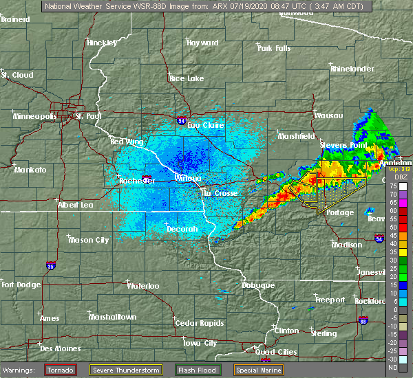 At 345 am cdt, a severe thunderstorm was located 11 miles north of wisconsin dells, moving southeast at 35 mph (radar indicated). Hazards include 60 mph wind gusts and quarter size hail. Hail damage to vehicles is expected. expect wind damage to roofs, siding, and trees. Locations impacted include, county roads b and p, brooks, k and l campground, county roads b and k, the town of quincy, highway 23 and county g, county roads a and b, stand rock campground, highway 23 and county b, big spring, coons deep lake campground, highway 13 and county e, rocky arbor state park, holiday shores campground, castle rock dam, yukon trails campground, white creek, highway 82 and county b, highways 82 and 13 and plainville. At 345 am cdt, a severe thunderstorm was located 11 miles north of wisconsin dells, moving southeast at 35 mph (radar indicated). Hazards include 60 mph wind gusts and quarter size hail. Hail damage to vehicles is expected. expect wind damage to roofs, siding, and trees. Locations impacted include, county roads b and p, brooks, k and l campground, county roads b and k, the town of quincy, highway 23 and county g, county roads a and b, stand rock campground, highway 23 and county b, big spring, coons deep lake campground, highway 13 and county e, rocky arbor state park, holiday shores campground, castle rock dam, yukon trails campground, white creek, highway 82 and county b, highways 82 and 13 and plainville.
|
| 7/19/2020 3:38 AM CDT |
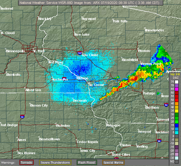 At 337 am cdt, a severe thunderstorm was located 10 miles southeast of adams, or 11 miles southeast of friendship, moving southeast at 50 mph (radar indicated). Hazards include 60 mph wind gusts and quarter size hail. Hail damage to vehicles is expected. expect wind damage to roofs, siding, and trees. This severe thunderstorm will remain over mainly rural areas of southeastern juneau and southern adams counties, including the following locations, county roads b and p, brooks, k and l campground, county roads b and k, the town of quincy, highway 23 and county g and county roads a and b. At 337 am cdt, a severe thunderstorm was located 10 miles southeast of adams, or 11 miles southeast of friendship, moving southeast at 50 mph (radar indicated). Hazards include 60 mph wind gusts and quarter size hail. Hail damage to vehicles is expected. expect wind damage to roofs, siding, and trees. This severe thunderstorm will remain over mainly rural areas of southeastern juneau and southern adams counties, including the following locations, county roads b and p, brooks, k and l campground, county roads b and k, the town of quincy, highway 23 and county g and county roads a and b.
|
| 6/2/2020 7:58 PM CDT |
 The severe thunderstorm warning for southern juneau, eastern vernon, richland and southern adams counties will expire at 800 pm cdt, the storms which prompted the warning have weakened below severe limits, and no longer pose an immediate threat to life or property. therefore, the warning will be allowed to expire. however gusty winds are still possible with these thunderstorms. a severe thunderstorm watch remains in effect until midnight cdt for central, southwestern and west central wisconsin. The severe thunderstorm warning for southern juneau, eastern vernon, richland and southern adams counties will expire at 800 pm cdt, the storms which prompted the warning have weakened below severe limits, and no longer pose an immediate threat to life or property. therefore, the warning will be allowed to expire. however gusty winds are still possible with these thunderstorms. a severe thunderstorm watch remains in effect until midnight cdt for central, southwestern and west central wisconsin.
|
| 6/2/2020 6:59 PM CDT |
 At 658 pm cdt, severe thunderstorms were located along a line extending from near necedah to 7 miles northwest of elroy to near westby, moving southeast at 55 mph (radar indicated). Hazards include 70 mph wind gusts and half dollar size hail. Hail damage to vehicles is expected. expect considerable tree damage. wind damage is also likely to mobile homes, roofs, and outbuildings. severe thunderstorms will be near, elroy and hillsboro around 705 pm cdt. wonewoc around 710 pm cdt. richland center around 730 pm cdt. Other locations impacted by these severe thunderstorms include johnson hill, big spring, highway 80 and county c c, gillingham, trippville, neptune and county roads a and z. At 658 pm cdt, severe thunderstorms were located along a line extending from near necedah to 7 miles northwest of elroy to near westby, moving southeast at 55 mph (radar indicated). Hazards include 70 mph wind gusts and half dollar size hail. Hail damage to vehicles is expected. expect considerable tree damage. wind damage is also likely to mobile homes, roofs, and outbuildings. severe thunderstorms will be near, elroy and hillsboro around 705 pm cdt. wonewoc around 710 pm cdt. richland center around 730 pm cdt. Other locations impacted by these severe thunderstorms include johnson hill, big spring, highway 80 and county c c, gillingham, trippville, neptune and county roads a and z.
|
| 7/20/2019 11:08 AM CDT |
 At 1105 am cdt, severe thunderstorms were located along a line extending from near necedah to mauston, moving northeast at 40 mph. at 1101 am, the juneau sheriff department reported a couple of trees were blown down in armenia and finley areas (law enforcement). Hazards include 60 mph wind gusts. expect damage to roofs, siding, and trees At 1105 am cdt, severe thunderstorms were located along a line extending from near necedah to mauston, moving northeast at 40 mph. at 1101 am, the juneau sheriff department reported a couple of trees were blown down in armenia and finley areas (law enforcement). Hazards include 60 mph wind gusts. expect damage to roofs, siding, and trees
|
| 8/28/2018 2:30 PM CDT | Trees down and power out in lyndon station are in juneau county WI, 1.1 miles E of Lyndon Station, WI |
| 8/28/2018 2:30 PM CDT |
 At 213 pm cdt, severe thunderstorms were located along a line extending from near new lisbon to 6 miles south of wonewoc, moving east at 40 mph (radar indicated). Hazards include 60 mph wind gusts. Expect damage to roofs, siding, and trees. these severe storms will be near, mauston around 220 pm cdt. Other locations impacted by these severe thunderstorms include lemonweir, lindina, camp douglas, lyndon station and kelly. At 213 pm cdt, severe thunderstorms were located along a line extending from near new lisbon to 6 miles south of wonewoc, moving east at 40 mph (radar indicated). Hazards include 60 mph wind gusts. Expect damage to roofs, siding, and trees. these severe storms will be near, mauston around 220 pm cdt. Other locations impacted by these severe thunderstorms include lemonweir, lindina, camp douglas, lyndon station and kelly.
|
| 8/28/2018 2:13 PM CDT |
 At 213 pm cdt, severe thunderstorms were located along a line extending from near new lisbon to 6 miles south of wonewoc, moving east at 40 mph (radar indicated). Hazards include 60 mph wind gusts. Expect damage to roofs, siding, and trees. these severe storms will be near, mauston around 220 pm cdt. Other locations impacted by these severe thunderstorms include lemonweir, lindina, camp douglas, lyndon station and kelly. At 213 pm cdt, severe thunderstorms were located along a line extending from near new lisbon to 6 miles south of wonewoc, moving east at 40 mph (radar indicated). Hazards include 60 mph wind gusts. Expect damage to roofs, siding, and trees. these severe storms will be near, mauston around 220 pm cdt. Other locations impacted by these severe thunderstorms include lemonweir, lindina, camp douglas, lyndon station and kelly.
|
| 8/28/2018 1:54 PM CDT |
 At 154 pm cdt, severe thunderstorms were located along a line extending from 8 miles southeast of tomah to 8 miles southwest of hillsboro, moving east at 40 mph (radar indicated). Hazards include 60 mph wind gusts. Expect damage to roofs, siding, and trees. severe thunderstorms will be near, elroy around 200 pm cdt. new lisbon around 210 pm cdt. mauston and wonewoc around 215 pm cdt. Other locations impacted by these severe thunderstorms include glendale, lemonweir, lindina, camp douglas and wilton. At 154 pm cdt, severe thunderstorms were located along a line extending from 8 miles southeast of tomah to 8 miles southwest of hillsboro, moving east at 40 mph (radar indicated). Hazards include 60 mph wind gusts. Expect damage to roofs, siding, and trees. severe thunderstorms will be near, elroy around 200 pm cdt. new lisbon around 210 pm cdt. mauston and wonewoc around 215 pm cdt. Other locations impacted by these severe thunderstorms include glendale, lemonweir, lindina, camp douglas and wilton.
|
| 8/27/2018 9:06 PM CDT |
 At 905 pm cdt, severe thunderstorms were located along a line extending from 7 miles south of lake wazeecha to near adams to wonewoc, moving east at 55 mph (radar indicated). Hazards include 60 mph wind gusts. Expect damage to roofs, siding, and trees. these severe storms will be near, friendship and adams around 910 pm cdt. Other locations impacted by these severe thunderstorms include lemonweir, big flats, lindina, lyndon station and colburn. At 905 pm cdt, severe thunderstorms were located along a line extending from 7 miles south of lake wazeecha to near adams to wonewoc, moving east at 55 mph (radar indicated). Hazards include 60 mph wind gusts. Expect damage to roofs, siding, and trees. these severe storms will be near, friendship and adams around 910 pm cdt. Other locations impacted by these severe thunderstorms include lemonweir, big flats, lindina, lyndon station and colburn.
|
| 8/27/2018 8:57 PM CDT |
 The national weather service in la crosse has issued a * severe thunderstorm warning for. southeastern juneau county in central wisconsin. adams county in central wisconsin. until 930 pm cdt. At 856 pm cdt, severe thunderstorms were located along a line. The national weather service in la crosse has issued a * severe thunderstorm warning for. southeastern juneau county in central wisconsin. adams county in central wisconsin. until 930 pm cdt. At 856 pm cdt, severe thunderstorms were located along a line.
|
| 6/30/2018 6:54 PM CDT |
 The severe thunderstorm warning for southeastern juneau county will expire at 700 pm cdt, the storms which prompted the warning have moved out of the area. therefore the warning will be allowed to expire. a severe thunderstorm watch remains in effect until 900 pm cdt for central wisconsin. The severe thunderstorm warning for southeastern juneau county will expire at 700 pm cdt, the storms which prompted the warning have moved out of the area. therefore the warning will be allowed to expire. a severe thunderstorm watch remains in effect until 900 pm cdt for central wisconsin.
|
| 6/30/2018 6:43 PM CDT |
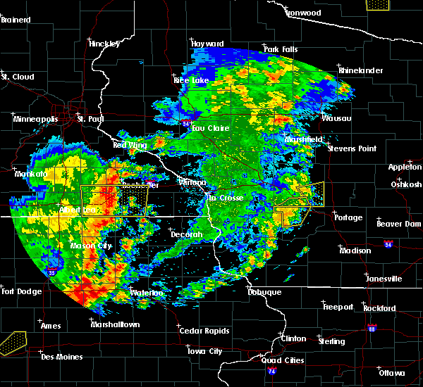 At 642 pm cdt, severe thunderstorms were located along a line extending from 10 miles north of wisconsin dells to near reedsburg, moving east at 45 mph (law enforcement). Hazards include 60 mph wind gusts. Expect damage to roofs, siding, and trees. Locations impacted include, wonewoc, lyndon station, arrowhead resort campground, i 90 94 exit 78, rocky arbor state park, dells timberland campground, yukon trails campground, bass hollow rec area, stand rock campground, eagle park campground, river bay campground and bass lake campground. At 642 pm cdt, severe thunderstorms were located along a line extending from 10 miles north of wisconsin dells to near reedsburg, moving east at 45 mph (law enforcement). Hazards include 60 mph wind gusts. Expect damage to roofs, siding, and trees. Locations impacted include, wonewoc, lyndon station, arrowhead resort campground, i 90 94 exit 78, rocky arbor state park, dells timberland campground, yukon trails campground, bass hollow rec area, stand rock campground, eagle park campground, river bay campground and bass lake campground.
|
| 6/30/2018 6:33 PM CDT |
 At 632 pm cdt, severe thunderstorms were located along a line extending from 6 miles east of mauston to near reedsburg, moving east at 65 mph (law enforcement has reported power lines and trees downed from these storms). Hazards include 60 mph wind gusts. Expect damage to roofs, siding, and trees. These severe thunderstorms will remain over mainly rural areas of southern juneau, east central vernon and northeastern richland counties, including the following locations, germantown, rockbridge, lyndon station, cazenovia and union center. At 632 pm cdt, severe thunderstorms were located along a line extending from 6 miles east of mauston to near reedsburg, moving east at 65 mph (law enforcement has reported power lines and trees downed from these storms). Hazards include 60 mph wind gusts. Expect damage to roofs, siding, and trees. These severe thunderstorms will remain over mainly rural areas of southern juneau, east central vernon and northeastern richland counties, including the following locations, germantown, rockbridge, lyndon station, cazenovia and union center.
|
| 6/30/2018 6:23 PM CDT |
 At 621 pm cdt, severe thunderstorms were located along a line extending from near elroy to 11 miles south of hillsboro, moving east at 30 mph (law enforcement. many reports of trees and power lines down in eastern vernon county east of la farge). Hazards include 60 mph wind gusts. Expect damage to roofs, siding, and trees. these severe storms will be near, wonewoc around 625 pm cdt. Other locations impacted by these severe thunderstorms include germantown, rockbridge, lyndon station, cazenovia and union center. At 621 pm cdt, severe thunderstorms were located along a line extending from near elroy to 11 miles south of hillsboro, moving east at 30 mph (law enforcement. many reports of trees and power lines down in eastern vernon county east of la farge). Hazards include 60 mph wind gusts. Expect damage to roofs, siding, and trees. these severe storms will be near, wonewoc around 625 pm cdt. Other locations impacted by these severe thunderstorms include germantown, rockbridge, lyndon station, cazenovia and union center.
|
| 6/30/2018 6:09 PM CDT |
 At 555 pm cdt, severe thunderstorms were located along a line extending from 10 miles east of cashton to 7 miles south of la farge, moving east at 40 mph (law enforcement. some trees and branches were downed across vernon county over the past 30 minutes). Hazards include 60 mph wind gusts. Expect damage to roofs, siding, and trees. severe thunderstorms will be near, hillsboro around 610 pm cdt. elroy around 615 pm cdt. wonewoc around 620 pm cdt. Other locations impacted by these severe thunderstorms include germantown, rockbridge, viola, sylvan and ontario. At 555 pm cdt, severe thunderstorms were located along a line extending from 10 miles east of cashton to 7 miles south of la farge, moving east at 40 mph (law enforcement. some trees and branches were downed across vernon county over the past 30 minutes). Hazards include 60 mph wind gusts. Expect damage to roofs, siding, and trees. severe thunderstorms will be near, hillsboro around 610 pm cdt. elroy around 615 pm cdt. wonewoc around 620 pm cdt. Other locations impacted by these severe thunderstorms include germantown, rockbridge, viola, sylvan and ontario.
|
| 6/30/2018 5:57 PM CDT |
 The national weather service in la crosse has issued a * severe thunderstorm warning for. southern juneau county in central wisconsin. eastern vernon county in southwestern wisconsin. northern richland county in southwestern wisconsin. Until 700 pm cdt. The national weather service in la crosse has issued a * severe thunderstorm warning for. southern juneau county in central wisconsin. eastern vernon county in southwestern wisconsin. northern richland county in southwestern wisconsin. Until 700 pm cdt.
|
| 7/12/2017 7:45 PM CDT |
 At 744 pm cdt, severe thunderstorms were located along a line extending from 6 miles northwest of necedah to near friendship to 8 miles southwest of westfield, moving east at 40 mph (radar indicated). Hazards include 60 mph wind gusts. Expect damage to roofs, siding, and trees. These severe thunderstorms will remain over mainly rural areas of juneau and adams counties, including the following locations: strongs prairie, big flats, lyndon station, kelly and cutler. At 744 pm cdt, severe thunderstorms were located along a line extending from 6 miles northwest of necedah to near friendship to 8 miles southwest of westfield, moving east at 40 mph (radar indicated). Hazards include 60 mph wind gusts. Expect damage to roofs, siding, and trees. These severe thunderstorms will remain over mainly rural areas of juneau and adams counties, including the following locations: strongs prairie, big flats, lyndon station, kelly and cutler.
|
| 7/12/2017 7:32 PM CDT |
 At 731 pm cdt, severe thunderstorms were located along a line extending from 10 miles west of necedah to near dellwood to 9 miles north of wisconsin dells, moving east at 50 mph (radar indicated). Hazards include 60 mph wind gusts and quarter size hail. Hail damage to vehicles is expected. expect wind damage to roofs, siding, and trees. these severe storms will be near, friendship and adams around 740 pm cdt. new rome around 755 pm cdt. Other locations impacted by these severe thunderstorms include strongs prairie, big flats, lyndon station, kelly and cutler. At 731 pm cdt, severe thunderstorms were located along a line extending from 10 miles west of necedah to near dellwood to 9 miles north of wisconsin dells, moving east at 50 mph (radar indicated). Hazards include 60 mph wind gusts and quarter size hail. Hail damage to vehicles is expected. expect wind damage to roofs, siding, and trees. these severe storms will be near, friendship and adams around 740 pm cdt. new rome around 755 pm cdt. Other locations impacted by these severe thunderstorms include strongs prairie, big flats, lyndon station, kelly and cutler.
|
| 7/12/2017 7:27 PM CDT |
 At 726 pm cdt, severe thunderstorms were located along a line extending from 6 miles west of necedah to 10 miles north of wisconsin dells, moving east at 45 mph (radar indicated). Hazards include 60 mph wind gusts and quarter size hail. Hail damage to vehicles is expected. expect wind damage to roofs, siding, and trees. these severe storms will be near, dellwood around 740 pm cdt. friendship, adams and new rome around 750 pm cdt. Other locations impacted by these severe thunderstorms include lemonweir, strongs prairie, big flats, lyndon station and kelly. At 726 pm cdt, severe thunderstorms were located along a line extending from 6 miles west of necedah to 10 miles north of wisconsin dells, moving east at 45 mph (radar indicated). Hazards include 60 mph wind gusts and quarter size hail. Hail damage to vehicles is expected. expect wind damage to roofs, siding, and trees. these severe storms will be near, dellwood around 740 pm cdt. friendship, adams and new rome around 750 pm cdt. Other locations impacted by these severe thunderstorms include lemonweir, strongs prairie, big flats, lyndon station and kelly.
|
| 7/12/2017 7:20 PM CDT |
 At 719 pm cdt, severe thunderstorms were located along a line extending from 10 miles east of tomah to 6 miles southeast of mauston, moving east at 45 mph (radar indicated). Hazards include 60 mph wind gusts and quarter size hail. Hail damage to vehicles is expected. expect wind damage to roofs, siding, and trees. these severe storms will be near, necedah around 735 pm cdt. dellwood around 740 pm cdt. friendship and new rome around 750 pm cdt. adams around 755 pm cdt. Other locations impacted by these severe thunderstorms include lemonweir, strongs prairie, big flats, lindina and camp douglas. At 719 pm cdt, severe thunderstorms were located along a line extending from 10 miles east of tomah to 6 miles southeast of mauston, moving east at 45 mph (radar indicated). Hazards include 60 mph wind gusts and quarter size hail. Hail damage to vehicles is expected. expect wind damage to roofs, siding, and trees. these severe storms will be near, necedah around 735 pm cdt. dellwood around 740 pm cdt. friendship and new rome around 750 pm cdt. adams around 755 pm cdt. Other locations impacted by these severe thunderstorms include lemonweir, strongs prairie, big flats, lindina and camp douglas.
|
| 7/12/2017 7:10 PM CDT |
 At 710 pm cdt, severe thunderstorms were located along a line extending from 9 miles east of tomah to near mauston, moving east at 45 mph (radar indicated). Hazards include 60 mph wind gusts and quarter size hail. Hail damage to vehicles is expected. expect wind damage to roofs, siding, and trees. severe thunderstorms will be near, mauston around 715 pm cdt. necedah around 725 pm cdt. dellwood around 735 pm cdt. new rome around 740 pm cdt. friendship and adams around 745 pm cdt. Other locations impacted by these severe thunderstorms include lemonweir, strongs prairie, big flats, lindina and camp douglas. At 710 pm cdt, severe thunderstorms were located along a line extending from 9 miles east of tomah to near mauston, moving east at 45 mph (radar indicated). Hazards include 60 mph wind gusts and quarter size hail. Hail damage to vehicles is expected. expect wind damage to roofs, siding, and trees. severe thunderstorms will be near, mauston around 715 pm cdt. necedah around 725 pm cdt. dellwood around 735 pm cdt. new rome around 740 pm cdt. friendship and adams around 745 pm cdt. Other locations impacted by these severe thunderstorms include lemonweir, strongs prairie, big flats, lindina and camp douglas.
|
| 6/14/2017 1:55 PM CDT |
 The severe thunderstorm warning for juneau county will expire at 200 pm cdt, the storms which prompted the warning have weakened below severe limits, and have exited the warned area. therefore the warning will be allowed to expire. however gusty winds and heavy rain are still possible with these thunderstorms. a severe thunderstorm watch remains in effect until 800 pm cdt for central wisconsin. The severe thunderstorm warning for juneau county will expire at 200 pm cdt, the storms which prompted the warning have weakened below severe limits, and have exited the warned area. therefore the warning will be allowed to expire. however gusty winds and heavy rain are still possible with these thunderstorms. a severe thunderstorm watch remains in effect until 800 pm cdt for central wisconsin.
|
| 6/14/2017 1:38 PM CDT |
 At 136 pm cdt, severe thunderstorms were moving across southwest juneau county, towards the northeast and the interstate. they have a history of producing wind gusts of 40 to 50 mph, but could get stronger and knock down trees or power lines (radar indicated). Hazards include 60 mph wind gusts. Expect possible damage to roofs, siding, and trees. these severe storms will be near, mauston around 140 pm cdt. new lisbon around 145 pm cdt. necedah around 200 pm cdt. Other locations impacted by these severe thunderstorms include lemonweir, lindina, camp douglas, lyndon station and kelly. At 136 pm cdt, severe thunderstorms were moving across southwest juneau county, towards the northeast and the interstate. they have a history of producing wind gusts of 40 to 50 mph, but could get stronger and knock down trees or power lines (radar indicated). Hazards include 60 mph wind gusts. Expect possible damage to roofs, siding, and trees. these severe storms will be near, mauston around 140 pm cdt. new lisbon around 145 pm cdt. necedah around 200 pm cdt. Other locations impacted by these severe thunderstorms include lemonweir, lindina, camp douglas, lyndon station and kelly.
|
| 6/14/2017 1:18 PM CDT |
 At 117 pm cdt, severe thunderstorms were located along a line extending from 10 miles northeast of la farge to hillsboro to 10 miles southwest of wonewoc, moving northeast at 50 mph. wind gusts of 40 to 50 mph have been reported with these storms so far (radar indicated). Hazards include 60 mph wind gusts. Expect damage to roofs, siding, and trees. severe thunderstorms will be near, wonewoc and elroy around 130 pm cdt. new lisbon around 140 pm cdt. mauston around 145 pm cdt. necedah around 150 pm cdt. Other locations impacted by these severe thunderstorms include lemonweir, lindina, camp douglas, lyndon station and kelly. At 117 pm cdt, severe thunderstorms were located along a line extending from 10 miles northeast of la farge to hillsboro to 10 miles southwest of wonewoc, moving northeast at 50 mph. wind gusts of 40 to 50 mph have been reported with these storms so far (radar indicated). Hazards include 60 mph wind gusts. Expect damage to roofs, siding, and trees. severe thunderstorms will be near, wonewoc and elroy around 130 pm cdt. new lisbon around 140 pm cdt. mauston around 145 pm cdt. necedah around 150 pm cdt. Other locations impacted by these severe thunderstorms include lemonweir, lindina, camp douglas, lyndon station and kelly.
|
| 5/17/2017 8:49 PM CDT |
 At 848 pm cdt, severe thunderstorms were located along a line extending from 8 miles northeast of millston to adams to 11 miles southwest of westfield, moving northeast at 65 mph (law enforcement. power lines and trees have been reported down near mauston at 835 pm. 50 mph wind gusts were reported near tomah at 835 pm). Hazards include 70 mph wind gusts. Expect considerable tree damage. damage is likely to mobile homes, roofs, and outbuildings. these severe thunderstorms will remain over mainly rural areas of southeastern jackson, juneau, adams and northeastern monroe counties, including the following locations: strongs prairie, big flats, lyndon station, kelly and warrens. A tornado watch remains in effect until 100 am cdt for central and west central wisconsin. At 848 pm cdt, severe thunderstorms were located along a line extending from 8 miles northeast of millston to adams to 11 miles southwest of westfield, moving northeast at 65 mph (law enforcement. power lines and trees have been reported down near mauston at 835 pm. 50 mph wind gusts were reported near tomah at 835 pm). Hazards include 70 mph wind gusts. Expect considerable tree damage. damage is likely to mobile homes, roofs, and outbuildings. these severe thunderstorms will remain over mainly rural areas of southeastern jackson, juneau, adams and northeastern monroe counties, including the following locations: strongs prairie, big flats, lyndon station, kelly and warrens. A tornado watch remains in effect until 100 am cdt for central and west central wisconsin.
|
| 5/17/2017 8:39 PM CDT |
 At 835 pm cdt, severe thunderstorms were located along a line extending from near millston to near mauston to wisconsin dells, moving northeast at 65 mph (law enforcement. power lines and trees have been reported down near mauston at 835 pm. 50 mph wind gusts were reported near tomah at 835 pm). Hazards include 70 mph wind gusts. Expect considerable tree damage. damage is likely to mobile homes, roofs, and outbuildings. these severe storms will be near, dellwood and necedah around 845 pm cdt. friendship and adams around 850 pm cdt. other locations impacted by these severe thunderstorms include lemonweir, strongs prairie, big flats, lindina and camp douglas. A tornado watch remains in effect until 1100 pm cdt for central and west central wisconsin. At 835 pm cdt, severe thunderstorms were located along a line extending from near millston to near mauston to wisconsin dells, moving northeast at 65 mph (law enforcement. power lines and trees have been reported down near mauston at 835 pm. 50 mph wind gusts were reported near tomah at 835 pm). Hazards include 70 mph wind gusts. Expect considerable tree damage. damage is likely to mobile homes, roofs, and outbuildings. these severe storms will be near, dellwood and necedah around 845 pm cdt. friendship and adams around 850 pm cdt. other locations impacted by these severe thunderstorms include lemonweir, strongs prairie, big flats, lindina and camp douglas. A tornado watch remains in effect until 1100 pm cdt for central and west central wisconsin.
|
| 5/17/2017 8:22 PM CDT |
 At 818 pm cdt, severe thunderstorms were located along a line extending from la crosse, to reedsburg, moving northeast at 60 mph (law enforcement. trees damage has been reported in hillsboro and winds estimated at 50 to 60 mph in melvina in monroe county). Hazards include 70 mph wind gusts. Expect considerable tree damage. damage is likely to mobile homes, roofs, and outbuildings. these severe storms will be near, elroy around 825 pm cdt. fort mc coy around 830 pm cdt. tomah, mauston and new lisbon around 835 pm cdt. dellwood and necedah around 845 pm cdt. friendship and adams around 850 pm cdt. new rome around 900 pm cdt. other locations impacted by these severe thunderstorms include glendale, lemonweir, strongs prairie, big flats and lindina. A tornado watch remains in effect until 1100 pm cdt for central, southwestern and west central wisconsin. At 818 pm cdt, severe thunderstorms were located along a line extending from la crosse, to reedsburg, moving northeast at 60 mph (law enforcement. trees damage has been reported in hillsboro and winds estimated at 50 to 60 mph in melvina in monroe county). Hazards include 70 mph wind gusts. Expect considerable tree damage. damage is likely to mobile homes, roofs, and outbuildings. these severe storms will be near, elroy around 825 pm cdt. fort mc coy around 830 pm cdt. tomah, mauston and new lisbon around 835 pm cdt. dellwood and necedah around 845 pm cdt. friendship and adams around 850 pm cdt. new rome around 900 pm cdt. other locations impacted by these severe thunderstorms include glendale, lemonweir, strongs prairie, big flats and lindina. A tornado watch remains in effect until 1100 pm cdt for central, southwestern and west central wisconsin.
|
| 5/17/2017 8:06 PM CDT |
 At 806 pm cdt, severe thunderstorms were located along a line extending from near cashton to 7 miles southwest of hillsboro to spring green, moving north at 80 mph (law enforcement. many power lines and trees are downed in richland county in southwest wisconsin). Hazards include 70 mph wind gusts. Expect considerable tree damage. damage is likely to mobile homes, roofs, and outbuildings. severe thunderstorms will be near, elroy and wonewoc around 815 pm cdt. fort mc coy around 820 pm cdt. mauston, tomah and new lisbon around 825 pm cdt. millston and dellwood around 830 pm cdt. necedah around 835 pm cdt. new rome around 845 pm cdt. friendship and adams around 850 pm cdt. other locations impacted by these severe thunderstorms include glendale, lemonweir, strongs prairie, big flats and lindina. A tornado watch remains in effect until 1100 pm cdt for central, southwestern and west central wisconsin. At 806 pm cdt, severe thunderstorms were located along a line extending from near cashton to 7 miles southwest of hillsboro to spring green, moving north at 80 mph (law enforcement. many power lines and trees are downed in richland county in southwest wisconsin). Hazards include 70 mph wind gusts. Expect considerable tree damage. damage is likely to mobile homes, roofs, and outbuildings. severe thunderstorms will be near, elroy and wonewoc around 815 pm cdt. fort mc coy around 820 pm cdt. mauston, tomah and new lisbon around 825 pm cdt. millston and dellwood around 830 pm cdt. necedah around 835 pm cdt. new rome around 845 pm cdt. friendship and adams around 850 pm cdt. other locations impacted by these severe thunderstorms include glendale, lemonweir, strongs prairie, big flats and lindina. A tornado watch remains in effect until 1100 pm cdt for central, southwestern and west central wisconsin.
|
| 3/6/2017 10:37 PM CST |
 At 1037 pm cst, severe thunderstorms were located along a line extending from 8 miles southwest of plainfield to near wisconsin dells, moving east at 45 mph (radar indicated). Hazards include 60 mph wind gusts. Expect damage to roofs, siding, and trees. These severe thunderstorms will remain over mainly rural areas of southeastern juneau and adams counties, including the following locations: big flats, lyndon station, colburn, county roads g and o and county roads g and m. At 1037 pm cst, severe thunderstorms were located along a line extending from 8 miles southwest of plainfield to near wisconsin dells, moving east at 45 mph (radar indicated). Hazards include 60 mph wind gusts. Expect damage to roofs, siding, and trees. These severe thunderstorms will remain over mainly rural areas of southeastern juneau and adams counties, including the following locations: big flats, lyndon station, colburn, county roads g and o and county roads g and m.
|
| 3/6/2017 10:30 PM CST |
 At 1030 pm cst, severe thunderstorms were located along a line extending from near plainfield to near wisconsin dells, moving east at 45 mph (radar indicated). Hazards include 60 mph wind gusts. Expect damage to roofs, siding, and trees. These severe thunderstorms will remain over mainly rural areas of southeastern juneau and adams counties, including the following locations: lemonweir, big flats, lyndon station, colburn and county roads g and o. At 1030 pm cst, severe thunderstorms were located along a line extending from near plainfield to near wisconsin dells, moving east at 45 mph (radar indicated). Hazards include 60 mph wind gusts. Expect damage to roofs, siding, and trees. These severe thunderstorms will remain over mainly rural areas of southeastern juneau and adams counties, including the following locations: lemonweir, big flats, lyndon station, colburn and county roads g and o.
|
| 3/6/2017 10:12 PM CST |
 At 1011 pm cst, severe thunderstorms were located along a line extending from 7 miles west of plainfield to 7 miles north of reedsburg, moving east at 50 mph (radar indicated). Hazards include 60 mph wind gusts. Expect damage to roofs, siding, and trees. These severe thunderstorms will remain over mainly rural areas of southern juneau and adams counties, including the following locations: lemonweir, big flats, lindina, lyndon station and colburn. At 1011 pm cst, severe thunderstorms were located along a line extending from 7 miles west of plainfield to 7 miles north of reedsburg, moving east at 50 mph (radar indicated). Hazards include 60 mph wind gusts. Expect damage to roofs, siding, and trees. These severe thunderstorms will remain over mainly rural areas of southern juneau and adams counties, including the following locations: lemonweir, big flats, lindina, lyndon station and colburn.
|
| 3/6/2017 9:47 PM CST |
 At 947 pm cst, severe thunderstorms were located along a line extending from near new rome to near dellwood to near elroy, moving east at 60 mph (radar indicated). Hazards include 60 mph wind gusts and penny size hail. Expect damage to roofs, siding, and trees. these severe storms will be near, new rome and dellwood around 950 pm cst. friendship and adams around 955 pm cst. Other locations impacted by these severe thunderstorms include lemonweir, strongs prairie, big flats, lindina and camp douglas. At 947 pm cst, severe thunderstorms were located along a line extending from near new rome to near dellwood to near elroy, moving east at 60 mph (radar indicated). Hazards include 60 mph wind gusts and penny size hail. Expect damage to roofs, siding, and trees. these severe storms will be near, new rome and dellwood around 950 pm cst. friendship and adams around 955 pm cst. Other locations impacted by these severe thunderstorms include lemonweir, strongs prairie, big flats, lindina and camp douglas.
|
| 3/6/2017 9:30 PM CST |
 At 929 pm cst, severe thunderstorms were located along a line extending from 8 miles southwest of babcock to 8 miles northwest of new lisbon to near elroy, moving northeast at 60 mph (radar indicated). Hazards include 60 mph wind gusts. Expect damage to roofs, siding, and trees. severe thunderstorms will be near, necedah around 940 pm cst. dellwood and new rome around 955 pm cst. friendship around 1000 pm cst. adams around 1005 pm cst. Other locations impacted by these severe thunderstorms include lemonweir, strongs prairie, big flats, lindina and camp douglas. At 929 pm cst, severe thunderstorms were located along a line extending from 8 miles southwest of babcock to 8 miles northwest of new lisbon to near elroy, moving northeast at 60 mph (radar indicated). Hazards include 60 mph wind gusts. Expect damage to roofs, siding, and trees. severe thunderstorms will be near, necedah around 940 pm cst. dellwood and new rome around 955 pm cst. friendship around 1000 pm cst. adams around 1005 pm cst. Other locations impacted by these severe thunderstorms include lemonweir, strongs prairie, big flats, lindina and camp douglas.
|
| 8/4/2016 5:01 PM CDT |
 At 501 pm cdt, a severe thunderstorm was located near wisconsin dells, moving east at 35 mph (radar indicated). Hazards include 60 mph wind gusts. Expect damage to roofs. siding. and trees. This severe thunderstorm will remain over mainly rural areas of southeastern juneau and southeastern adams counties, including the following locations: lyndon station, county roads b and p, eagle park campground, big spring and county roads b and k. At 501 pm cdt, a severe thunderstorm was located near wisconsin dells, moving east at 35 mph (radar indicated). Hazards include 60 mph wind gusts. Expect damage to roofs. siding. and trees. This severe thunderstorm will remain over mainly rural areas of southeastern juneau and southeastern adams counties, including the following locations: lyndon station, county roads b and p, eagle park campground, big spring and county roads b and k.
|
| 8/4/2016 4:42 PM CDT |
 At 441 pm cdt, severe thunderstorms were located along a line extending from near new lisbon to 12 miles south of wonewoc, moving east at 45 mph (radar indicated). Hazards include 60 mph wind gusts. Expect damage to roofs. siding. and trees. these severe storms will be near, mauston around 450 pm cdt. Other locations impacted by these severe thunderstorms include germantown, lemonweir, lindina, camp douglas and lyndon station. At 441 pm cdt, severe thunderstorms were located along a line extending from near new lisbon to 12 miles south of wonewoc, moving east at 45 mph (radar indicated). Hazards include 60 mph wind gusts. Expect damage to roofs. siding. and trees. these severe storms will be near, mauston around 450 pm cdt. Other locations impacted by these severe thunderstorms include germantown, lemonweir, lindina, camp douglas and lyndon station.
|
| 8/4/2016 4:33 PM CDT |
 At 433 pm cdt, severe thunderstorms were located along a line extending from 6 miles west of new lisbon to 10 miles south of hillsboro, moving east at 30 mph (radar indicated). Hazards include 60 mph wind gusts. Expect damage to roofs. siding. and trees. these severe storms will be near, new lisbon and wonewoc around 445 pm cdt. mauston around 455 pm cdt. Other locations impacted by these severe thunderstorms include germantown, glendale, lemonweir, lindina and camp douglas. At 433 pm cdt, severe thunderstorms were located along a line extending from 6 miles west of new lisbon to 10 miles south of hillsboro, moving east at 30 mph (radar indicated). Hazards include 60 mph wind gusts. Expect damage to roofs. siding. and trees. these severe storms will be near, new lisbon and wonewoc around 445 pm cdt. mauston around 455 pm cdt. Other locations impacted by these severe thunderstorms include germantown, glendale, lemonweir, lindina and camp douglas.
|
| 8/4/2016 4:09 PM CDT |
 At 409 pm cdt, severe thunderstorms were located along a line extending from 7 miles south of tomah to 7 miles west of hillsboro to near viroqua, moving east at 45 mph (radar indicated). Hazards include 60 mph wind gusts. Expect damage to roofs. siding. and trees. severe thunderstorms will be near, hillsboro around 420 pm cdt. wonewoc and elroy around 425 pm cdt. new lisbon around 430 pm cdt. mauston around 435 pm cdt. Other locations impacted by these severe thunderstorms include germantown, glendale, lemonweir, lindina and camp douglas. At 409 pm cdt, severe thunderstorms were located along a line extending from 7 miles south of tomah to 7 miles west of hillsboro to near viroqua, moving east at 45 mph (radar indicated). Hazards include 60 mph wind gusts. Expect damage to roofs. siding. and trees. severe thunderstorms will be near, hillsboro around 420 pm cdt. wonewoc and elroy around 425 pm cdt. new lisbon around 430 pm cdt. mauston around 435 pm cdt. Other locations impacted by these severe thunderstorms include germantown, glendale, lemonweir, lindina and camp douglas.
|
| 7/21/2016 4:38 PM CDT |
 At 435 pm, severe thunderstorms were located across central and southern parts of juneau and adams counties with strong wind gusts and torrential rains (law enforcement). Hazards include 60 mph wind gusts and penny size hail. Expect damage to trees and power lines. the communities of mauston, elroy, lyndon station, and rural areas of southern adams county northeast of the dells can expect these storms. These storms will also move into the wisconsin dells area soon. At 435 pm, severe thunderstorms were located across central and southern parts of juneau and adams counties with strong wind gusts and torrential rains (law enforcement). Hazards include 60 mph wind gusts and penny size hail. Expect damage to trees and power lines. the communities of mauston, elroy, lyndon station, and rural areas of southern adams county northeast of the dells can expect these storms. These storms will also move into the wisconsin dells area soon.
|
| 7/21/2016 4:28 PM CDT |
 At 425 pm cdt, severe thunderstorms were located from new lisbon to big flats, moving southeast at 40 mph (law enforcement). Hazards include 60 mph wind gusts and penny size hail. Expect damage to trees and power lines. These severe thunderstorms will remain over mainly rural areas of southern juneau and adams counties, including the following locations: lemonweir, lindina, camp douglas, lyndon station and union center. At 425 pm cdt, severe thunderstorms were located from new lisbon to big flats, moving southeast at 40 mph (law enforcement). Hazards include 60 mph wind gusts and penny size hail. Expect damage to trees and power lines. These severe thunderstorms will remain over mainly rural areas of southern juneau and adams counties, including the following locations: lemonweir, lindina, camp douglas, lyndon station and union center.
|
| 7/21/2016 4:14 PM CDT |
 At 413 pm cdt, severe thunderstorms were located along a line extending from near friendship to 6 miles northwest of hillsboro, moving east at 40 mph (law enforcement). Hazards include 60 mph wind gusts and penny size hail. Expect damage to roofs. siding. and trees. severe thunderstorms will be near, friendship and adams around 420 pm cdt. new lisbon around 430 pm cdt. mauston around 435 pm cdt. other locations impacted by these severe thunderstorms include glendale, lemonweir, lindina, camp douglas and wilton. This warning replaces the previous warning for northern juneau and northern adams counties. At 413 pm cdt, severe thunderstorms were located along a line extending from near friendship to 6 miles northwest of hillsboro, moving east at 40 mph (law enforcement). Hazards include 60 mph wind gusts and penny size hail. Expect damage to roofs. siding. and trees. severe thunderstorms will be near, friendship and adams around 420 pm cdt. new lisbon around 430 pm cdt. mauston around 435 pm cdt. other locations impacted by these severe thunderstorms include glendale, lemonweir, lindina, camp douglas and wilton. This warning replaces the previous warning for northern juneau and northern adams counties.
|
| 7/5/2016 11:56 PM CDT |
 The severe thunderstorm warning for southeastern juneau and adams counties will expire at midnight cdt, the storms which prompted the warning have moved out of the area. therefore the warning will be allowed to expire. a severe thunderstorm watch remains in effect until 500 am cdt for central wisconsin. The severe thunderstorm warning for southeastern juneau and adams counties will expire at midnight cdt, the storms which prompted the warning have moved out of the area. therefore the warning will be allowed to expire. a severe thunderstorm watch remains in effect until 500 am cdt for central wisconsin.
|
| 7/5/2016 11:32 PM CDT |
 At 1132 pm cdt, severe thunderstorms were located along a line extending from near friendship to near wisconsin dells, moving east at 35 mph (radar indicated). Hazards include 60 mph wind gusts. Expect damage to roofs. siding. and trees. These severe thunderstorms will remain over mainly rural areas of southeastern juneau and adams counties, including the following locations: lemonweir, big flats, lyndon station, colburn and county roads b and p. At 1132 pm cdt, severe thunderstorms were located along a line extending from near friendship to near wisconsin dells, moving east at 35 mph (radar indicated). Hazards include 60 mph wind gusts. Expect damage to roofs. siding. and trees. These severe thunderstorms will remain over mainly rural areas of southeastern juneau and adams counties, including the following locations: lemonweir, big flats, lyndon station, colburn and county roads b and p.
|
| 7/5/2016 11:20 PM CDT |
 At 1120 pm cdt, severe thunderstorms were located along a line extending from near friendship to 9 miles north of reedsburg, moving east at 40 mph (radar indicated). Hazards include 70 mph wind gusts. Expect considerable tree damage. damage is likely to mobile homes, roofs, and outbuildings. these severe storms will be near, friendship and adams around 1125 pm cdt. Other locations impacted by these severe thunderstorms include lemonweir, strongs prairie, big flats, lyndon station and kelly. At 1120 pm cdt, severe thunderstorms were located along a line extending from near friendship to 9 miles north of reedsburg, moving east at 40 mph (radar indicated). Hazards include 70 mph wind gusts. Expect considerable tree damage. damage is likely to mobile homes, roofs, and outbuildings. these severe storms will be near, friendship and adams around 1125 pm cdt. Other locations impacted by these severe thunderstorms include lemonweir, strongs prairie, big flats, lyndon station and kelly.
|
| 7/5/2016 10:58 PM CDT |
 At 1058 pm cdt, severe thunderstorms were located along a line extending from near necedah to near hillsboro, moving east at 40 mph (radar indicated). Hazards include 70 mph wind gusts. Expect considerable tree damage. damage is likely to mobile homes, roofs, and outbuildings. severe thunderstorms will be near, necedah around 1105 pm cdt. mauston and dellwood around 1115 pm cdt. friendship and adams around 1125 pm cdt. Other locations impacted by these severe thunderstorms include lemonweir, strongs prairie, big flats, lyndon station and kelly. At 1058 pm cdt, severe thunderstorms were located along a line extending from near necedah to near hillsboro, moving east at 40 mph (radar indicated). Hazards include 70 mph wind gusts. Expect considerable tree damage. damage is likely to mobile homes, roofs, and outbuildings. severe thunderstorms will be near, necedah around 1105 pm cdt. mauston and dellwood around 1115 pm cdt. friendship and adams around 1125 pm cdt. Other locations impacted by these severe thunderstorms include lemonweir, strongs prairie, big flats, lyndon station and kelly.
|
| 7/18/2015 4:35 AM CDT |
 At 435 am cdt, severe thunderstorms were located along a line extending from near plainfield to 8 miles west of wisconsin dells, moving east at 50 mph (radar indicated). Hazards include 60 mph wind gusts. Expect damage to roofs. siding and trees. These severe thunderstorms will remain over mainly rural areas of southern juneau and adams counties, including the following locations, lemonweir, big flats, lindina, lyndon station and colburn. At 435 am cdt, severe thunderstorms were located along a line extending from near plainfield to 8 miles west of wisconsin dells, moving east at 50 mph (radar indicated). Hazards include 60 mph wind gusts. Expect damage to roofs. siding and trees. These severe thunderstorms will remain over mainly rural areas of southern juneau and adams counties, including the following locations, lemonweir, big flats, lindina, lyndon station and colburn.
|
| 7/18/2015 4:21 AM CDT |
 At 420 am cdt, severe thunderstorms were located along a line extending from 6 miles east of new rome to near wonewoc, moving east at 50 mph (radar indicated. there was also a 49 mph wind gust reported at the volk field airport). Hazards include 60 mph wind gusts. Expect damage to roofs. siding and trees. these severe storms will be near, wisconsin dells around 440 am cdt. Other locations impacted by these severe thunderstorms include lemonweir, strongs prairie, big flats, lindina and camp douglas. At 420 am cdt, severe thunderstorms were located along a line extending from 6 miles east of new rome to near wonewoc, moving east at 50 mph (radar indicated. there was also a 49 mph wind gust reported at the volk field airport). Hazards include 60 mph wind gusts. Expect damage to roofs. siding and trees. these severe storms will be near, wisconsin dells around 440 am cdt. Other locations impacted by these severe thunderstorms include lemonweir, strongs prairie, big flats, lindina and camp douglas.
|
| 7/18/2015 4:07 AM CDT |
 At 407 am cdt, severe thunderstorms were located along a line extending from 6 miles east of babcock to near elroy, moving east at 50 mph (law enforcement. these storms have had a history of knocking trees down to the west in trempealeau and jackson counties). Hazards include 60 mph wind gusts. Expect damage to roofs. siding and trees. these severe storms will be near, new rome around 415 am cdt. mauston around 420 am cdt. wisconsin dells around 440 am cdt. Other locations impacted by these severe thunderstorms include lemonweir, strongs prairie, big flats, lindina and camp douglas. At 407 am cdt, severe thunderstorms were located along a line extending from 6 miles east of babcock to near elroy, moving east at 50 mph (law enforcement. these storms have had a history of knocking trees down to the west in trempealeau and jackson counties). Hazards include 60 mph wind gusts. Expect damage to roofs. siding and trees. these severe storms will be near, new rome around 415 am cdt. mauston around 420 am cdt. wisconsin dells around 440 am cdt. Other locations impacted by these severe thunderstorms include lemonweir, strongs prairie, big flats, lindina and camp douglas.
|
| 7/18/2015 3:57 AM CDT |
 At 356 am cdt, severe thunderstorms were located along a line extending from near pittsville to 10 miles south of tomah, moving east at 50 mph (law enforcement. these storms have had a history of knocking trees down). Hazards include 60 mph wind gusts. Expect damage to roofs. siding and trees. these severe storms will be near, new lisbon and new rome around 415 am cdt. mauston and necedah around 420 am cdt. dellwood around 425 am cdt. friendship and adams around 435 am cdt. Other locations impacted by these severe thunderstorms include lemonweir, strongs prairie, big flats, lindina and camp douglas. At 356 am cdt, severe thunderstorms were located along a line extending from near pittsville to 10 miles south of tomah, moving east at 50 mph (law enforcement. these storms have had a history of knocking trees down). Hazards include 60 mph wind gusts. Expect damage to roofs. siding and trees. these severe storms will be near, new lisbon and new rome around 415 am cdt. mauston and necedah around 420 am cdt. dellwood around 425 am cdt. friendship and adams around 435 am cdt. Other locations impacted by these severe thunderstorms include lemonweir, strongs prairie, big flats, lindina and camp douglas.
|
| 7/18/2015 3:37 AM CDT |
 At 336 am cdt, severe thunderstorms were located along a line extending from 9 miles southeast of sherwood to warrens and norwalk, moving east at 50 mph (law enforcement. tree was down on a power line in sparta). Hazards include 60 mph wind gusts. Expect damage to roofs. siding and trees. severe thunderstorms will be near, elroy around 400 am cdt. new lisbon and new rome around 410 am cdt. mauston around 415 am cdt. dellwood around 420 am cdt. friendship and adams around 430 am cdt. Other locations impacted by these severe thunderstorms include lemonweir, strongs prairie, big flats, lindina and camp douglas. At 336 am cdt, severe thunderstorms were located along a line extending from 9 miles southeast of sherwood to warrens and norwalk, moving east at 50 mph (law enforcement. tree was down on a power line in sparta). Hazards include 60 mph wind gusts. Expect damage to roofs. siding and trees. severe thunderstorms will be near, elroy around 400 am cdt. new lisbon and new rome around 410 am cdt. mauston around 415 am cdt. dellwood around 420 am cdt. friendship and adams around 430 am cdt. Other locations impacted by these severe thunderstorms include lemonweir, strongs prairie, big flats, lindina and camp douglas.
|
| 7/13/2015 8:26 PM CDT |
 At 825 pm cdt, a severe thunderstorm was located over mauston, moving southeast at 55 mph. this storm has been weakening but could still be producing gusty winds and torrential hail. the warning will be cancelled early if this trend continues (trained weather spotters). Hazards include 60 mph wind gusts. Damage to crops and trees. this severe storm will be near, wisconsin dells around 845 pm cdt. Other locations impacted by this severe thunderstorm include lemonweir, lindina, camp douglas, lyndon station and hustler. At 825 pm cdt, a severe thunderstorm was located over mauston, moving southeast at 55 mph. this storm has been weakening but could still be producing gusty winds and torrential hail. the warning will be cancelled early if this trend continues (trained weather spotters). Hazards include 60 mph wind gusts. Damage to crops and trees. this severe storm will be near, wisconsin dells around 845 pm cdt. Other locations impacted by this severe thunderstorm include lemonweir, lindina, camp douglas, lyndon station and hustler.
|
| 7/13/2015 8:11 PM CDT |
 At 810 pm cdt, a severe thunderstorm was located near oakdale, or 10 miles southeast of tomah, moving southeast at 55 mph (trained weather spotters). Hazards include 60 mph wind gusts and quarter size hail. Hail damage to vehicles is expected. expect wind damage to roofs, siding and trees. this severe thunderstorm will be near, elroy around 815 pm cdt. new lisbon around 820 pm cdt. mauston around 825 pm cdt. wisconsin dells around 845 pm cdt. Other locations impacted by this severe thunderstorm include lemonweir, lindina, camp douglas, lyndon station and kelly. At 810 pm cdt, a severe thunderstorm was located near oakdale, or 10 miles southeast of tomah, moving southeast at 55 mph (trained weather spotters). Hazards include 60 mph wind gusts and quarter size hail. Hail damage to vehicles is expected. expect wind damage to roofs, siding and trees. this severe thunderstorm will be near, elroy around 815 pm cdt. new lisbon around 820 pm cdt. mauston around 825 pm cdt. wisconsin dells around 845 pm cdt. Other locations impacted by this severe thunderstorm include lemonweir, lindina, camp douglas, lyndon station and kelly.
|
| 7/13/2015 3:20 AM CDT |
 At 319 am cdt, severe thunderstorms were located along a line extending from 6 miles southwest of wautoma to near west baraboo, moving southeast at 35 mph (automated observations around 60 mph at volk field and necedah). Hazards include 60 mph wind gusts. Expect damage to roofs. siding and trees. These severe thunderstorms will remain over mainly rural areas of southeastern juneau and southeastern adams counties, including the following locations, lyndon station, eagle park campground and big spring. At 319 am cdt, severe thunderstorms were located along a line extending from 6 miles southwest of wautoma to near west baraboo, moving southeast at 35 mph (automated observations around 60 mph at volk field and necedah). Hazards include 60 mph wind gusts. Expect damage to roofs. siding and trees. These severe thunderstorms will remain over mainly rural areas of southeastern juneau and southeastern adams counties, including the following locations, lyndon station, eagle park campground and big spring.
|
| 7/13/2015 3:04 AM CDT |
 At 304 am cdt, severe thunderstorms were located along a line extending from 7 miles south of plainfield to near wisconsin dells, moving east at 45 mph (automated observations of around 60 mph at volk field and necedah). Hazards include 60 mph wind gusts. Expect damage to roofs. siding and trees. These severe thunderstorms will remain over mainly rural areas of southern juneau and adams counties, including the following locations, lemonweir, big flats, lindina, lyndon station and colburn. At 304 am cdt, severe thunderstorms were located along a line extending from 7 miles south of plainfield to near wisconsin dells, moving east at 45 mph (automated observations of around 60 mph at volk field and necedah). Hazards include 60 mph wind gusts. Expect damage to roofs. siding and trees. These severe thunderstorms will remain over mainly rural areas of southern juneau and adams counties, including the following locations, lemonweir, big flats, lindina, lyndon station and colburn.
|
| 7/13/2015 2:50 AM CDT |
 At 250 am cdt, severe thunderstorms were located along a line extending from 7 miles southwest of plainfield to 9 miles south of mauston, moving east at 60 mph (automated observation of 58 mph at volk field). Hazards include 60 mph wind gusts. Expect damage to roofs. siding and trees. these severe storms will be near, wisconsin dells around 305 am cdt. Other locations impacted by these severe thunderstorms include lemonweir, strongs prairie, big flats, lindina and lyndon station. At 250 am cdt, severe thunderstorms were located along a line extending from 7 miles southwest of plainfield to 9 miles south of mauston, moving east at 60 mph (automated observation of 58 mph at volk field). Hazards include 60 mph wind gusts. Expect damage to roofs. siding and trees. these severe storms will be near, wisconsin dells around 305 am cdt. Other locations impacted by these severe thunderstorms include lemonweir, strongs prairie, big flats, lindina and lyndon station.
|
| 7/13/2015 2:39 AM CDT |
 At 238 am cdt, severe thunderstorms were located along a line extending from near new rome to elroy, moving east at 45 mph (automated observation at volk field which reported a gust to 58 mph). Hazards include 60 mph wind gusts. Expect damage to roofs. siding and trees. severe thunderstorms will be near, new rome around 245 am cdt. wisconsin dells around 315 am cdt. Other locations impacted by these severe thunderstorms include lemonweir, strongs prairie, big flats, lindina and camp douglas. At 238 am cdt, severe thunderstorms were located along a line extending from near new rome to elroy, moving east at 45 mph (automated observation at volk field which reported a gust to 58 mph). Hazards include 60 mph wind gusts. Expect damage to roofs. siding and trees. severe thunderstorms will be near, new rome around 245 am cdt. wisconsin dells around 315 am cdt. Other locations impacted by these severe thunderstorms include lemonweir, strongs prairie, big flats, lindina and camp douglas.
|
| 5/7/2015 8:10 PM CDT | Shed blown over from strong wind gust. time estimate in adams county WI, 7.3 miles SSW of Lyndon Station, WI |
| 6/18/2014 7:06 AM CDT | Tree down on interstate 94 eastbound at mile marker 75. trees also down on highway 80 between new lisbon and elroy...as well as near mauston. time estimated from rada in juneau county WI, 3.8 miles SE of Lyndon Station, WI |
| 8/16/2012 3:16 AM CDT | Trees dow in adams county WI, 5.3 miles WSW of Lyndon Station, WI |
Hail Maps for Lyndon Station, WI

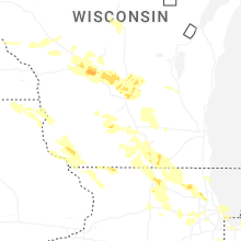
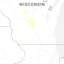


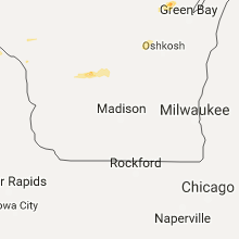


Connect with Interactive Hail Maps