

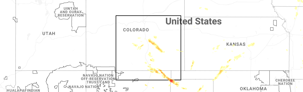
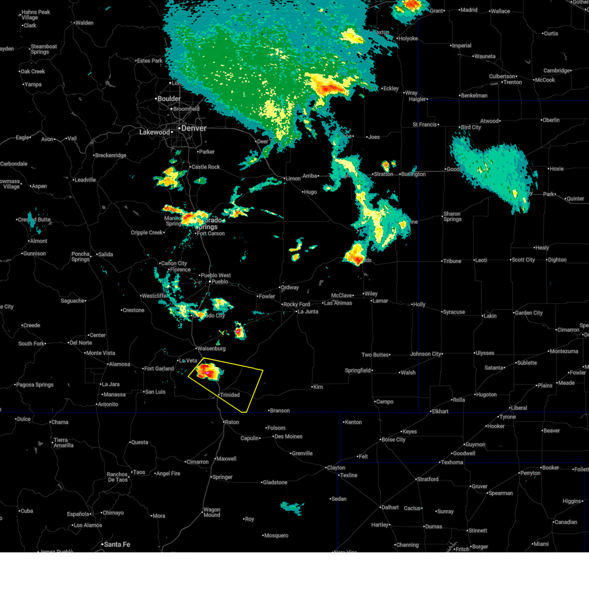
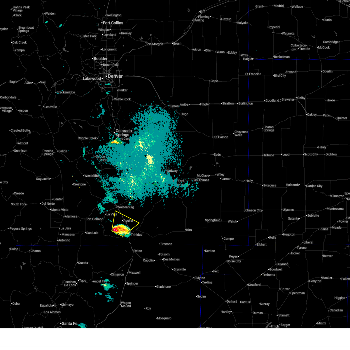
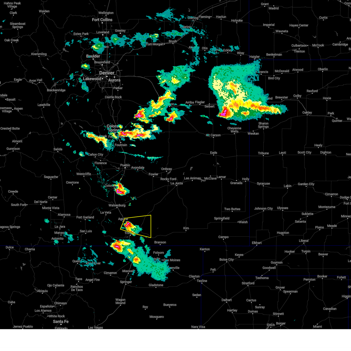
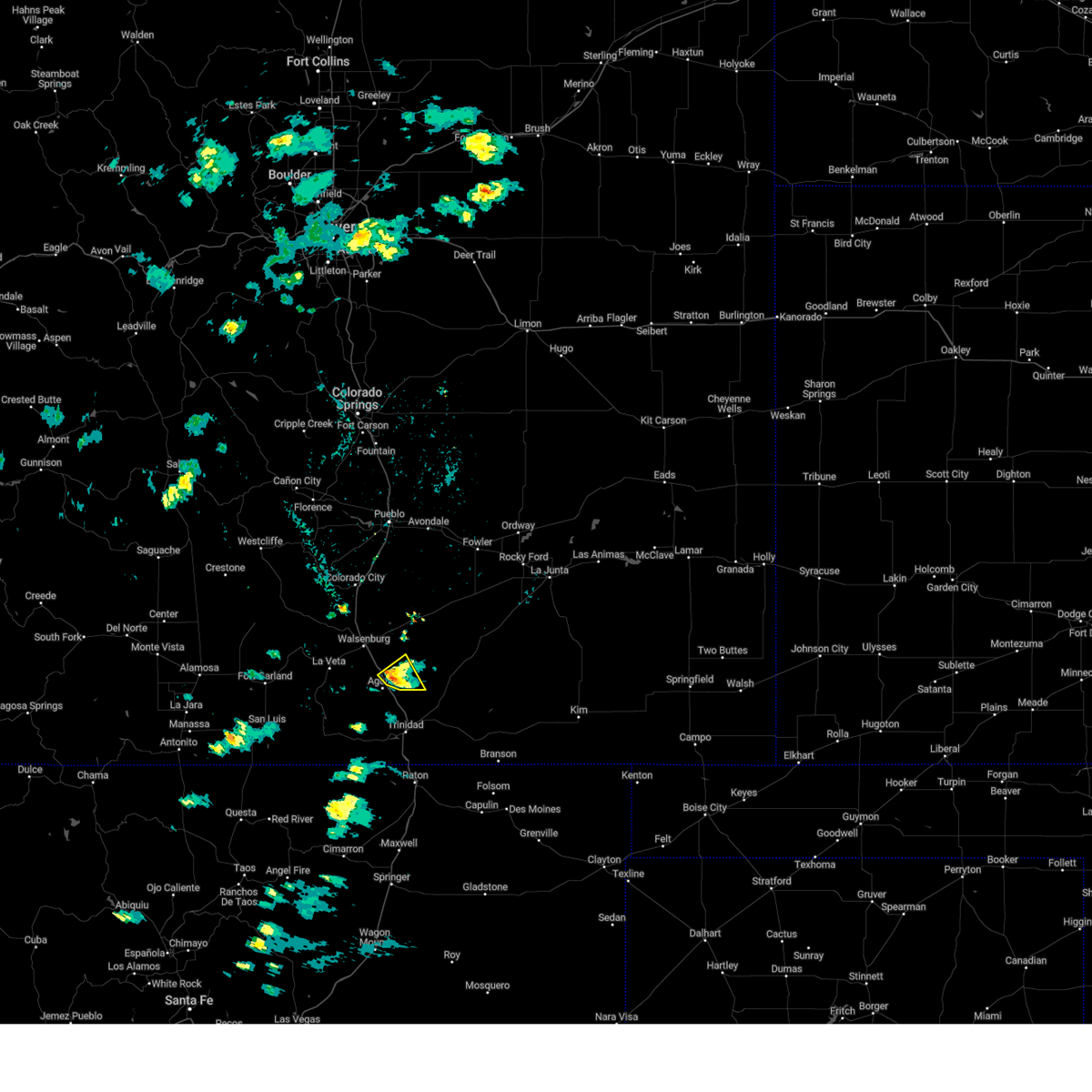
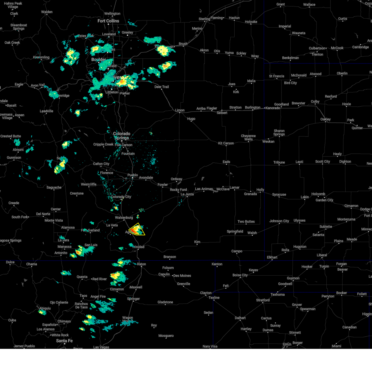
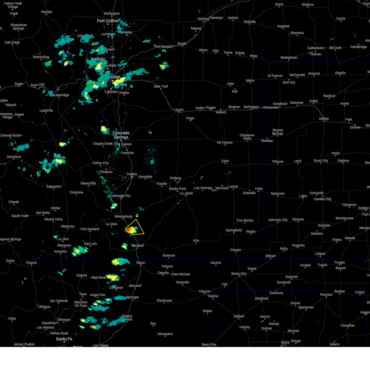
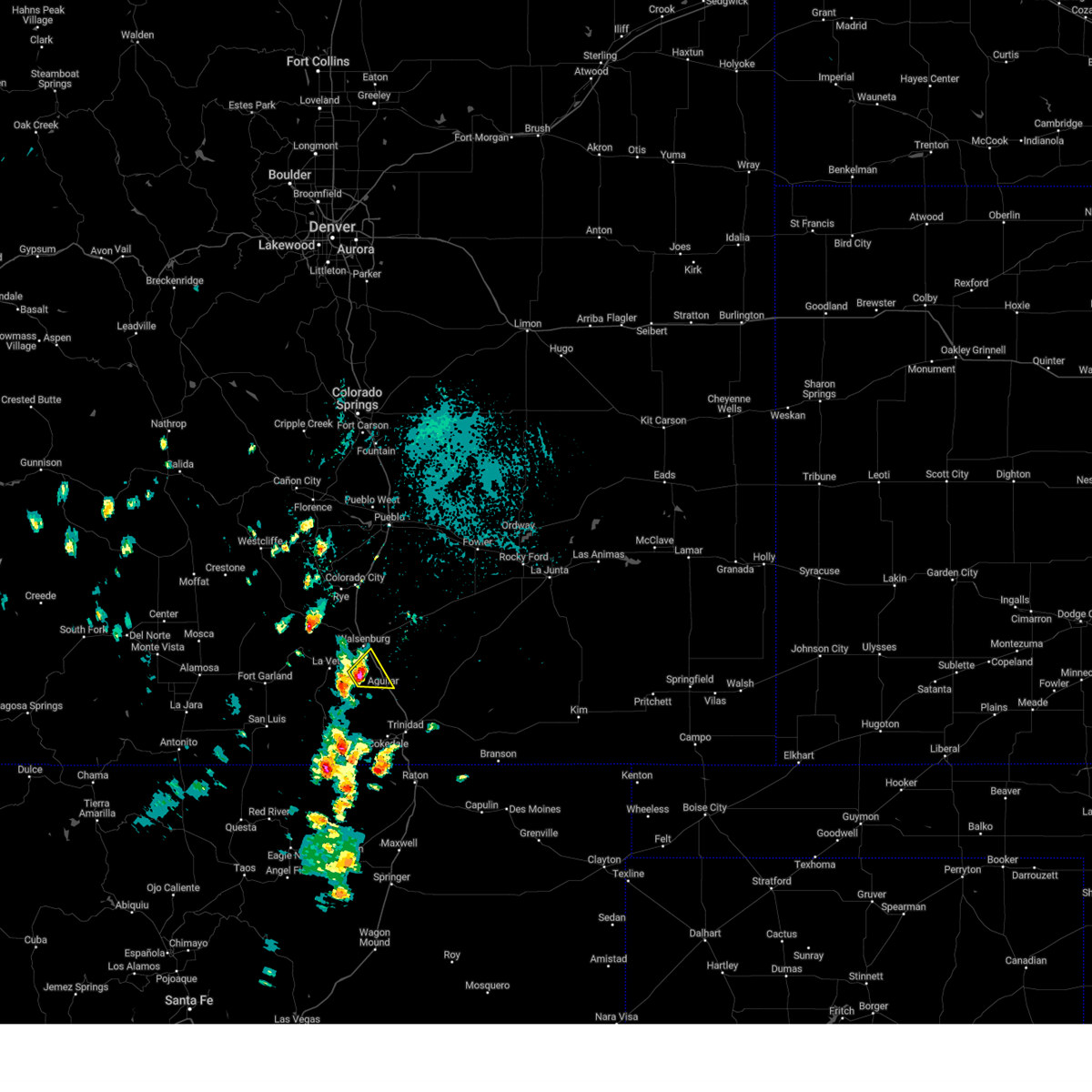
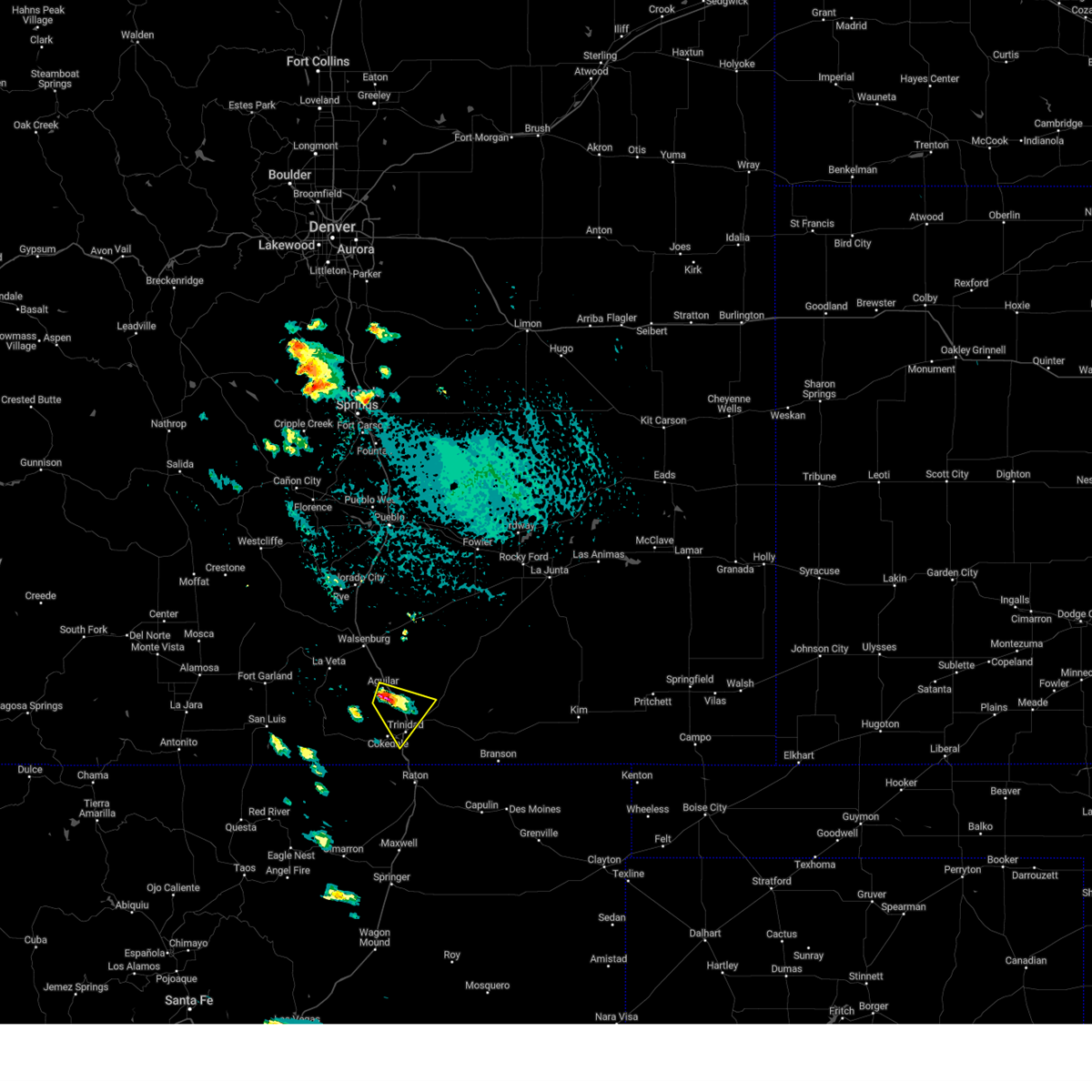
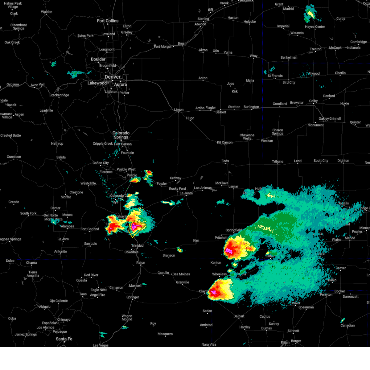
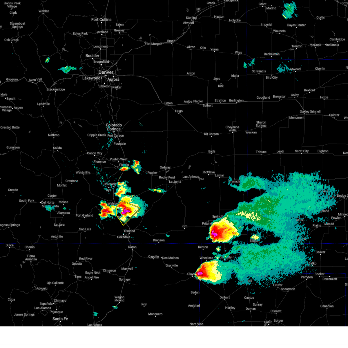
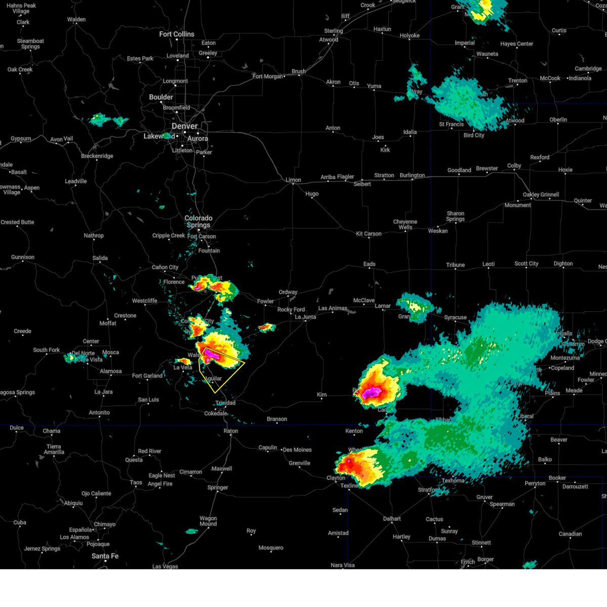
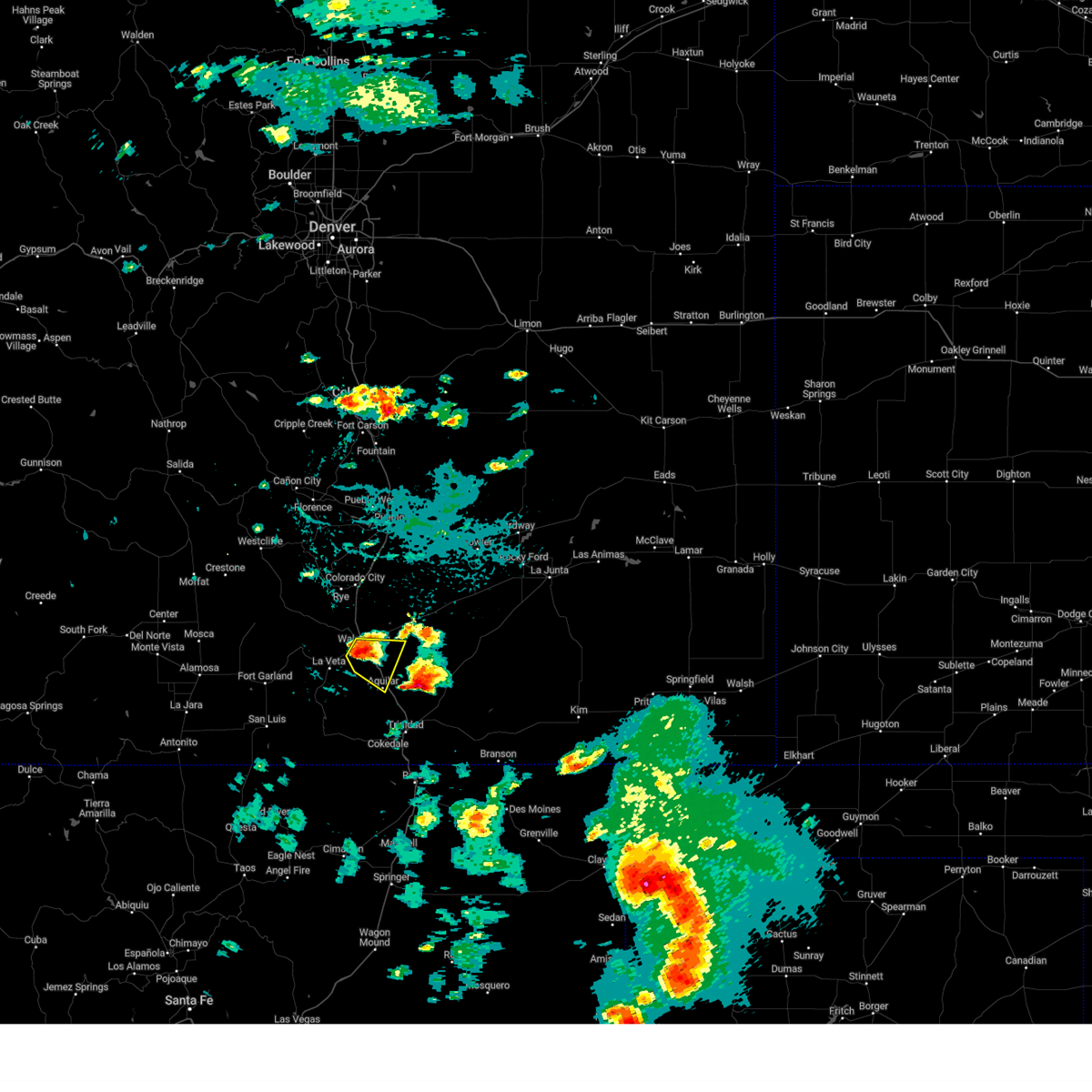
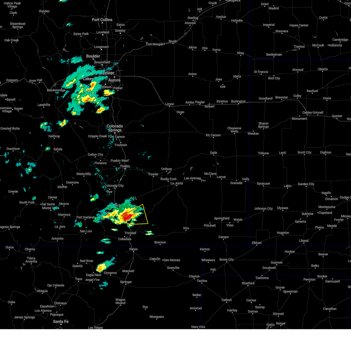
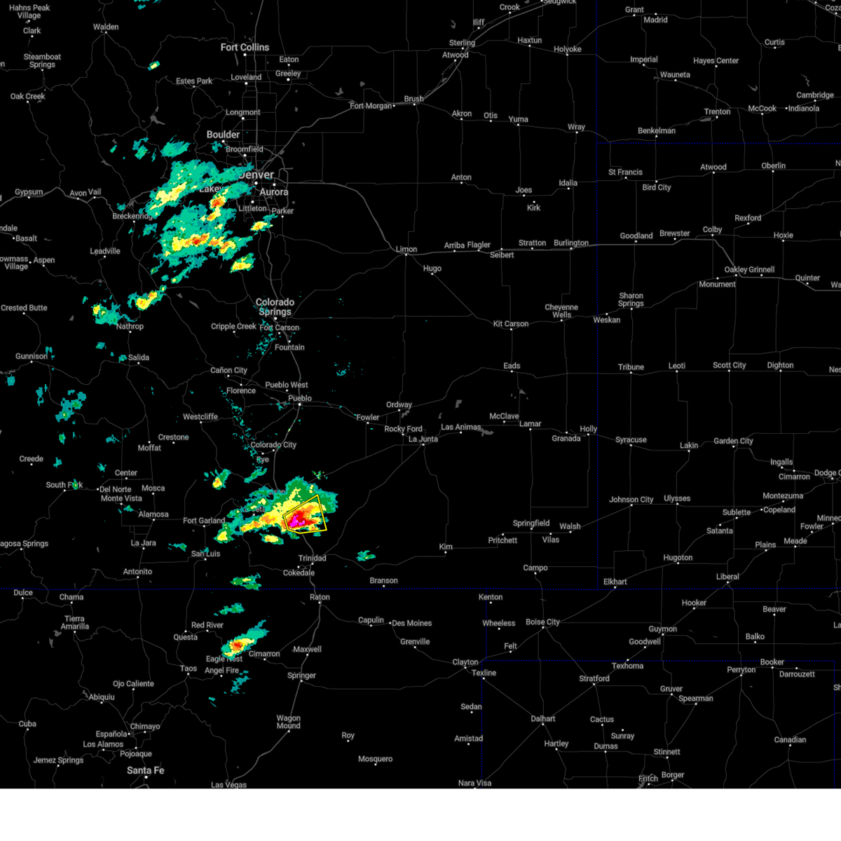
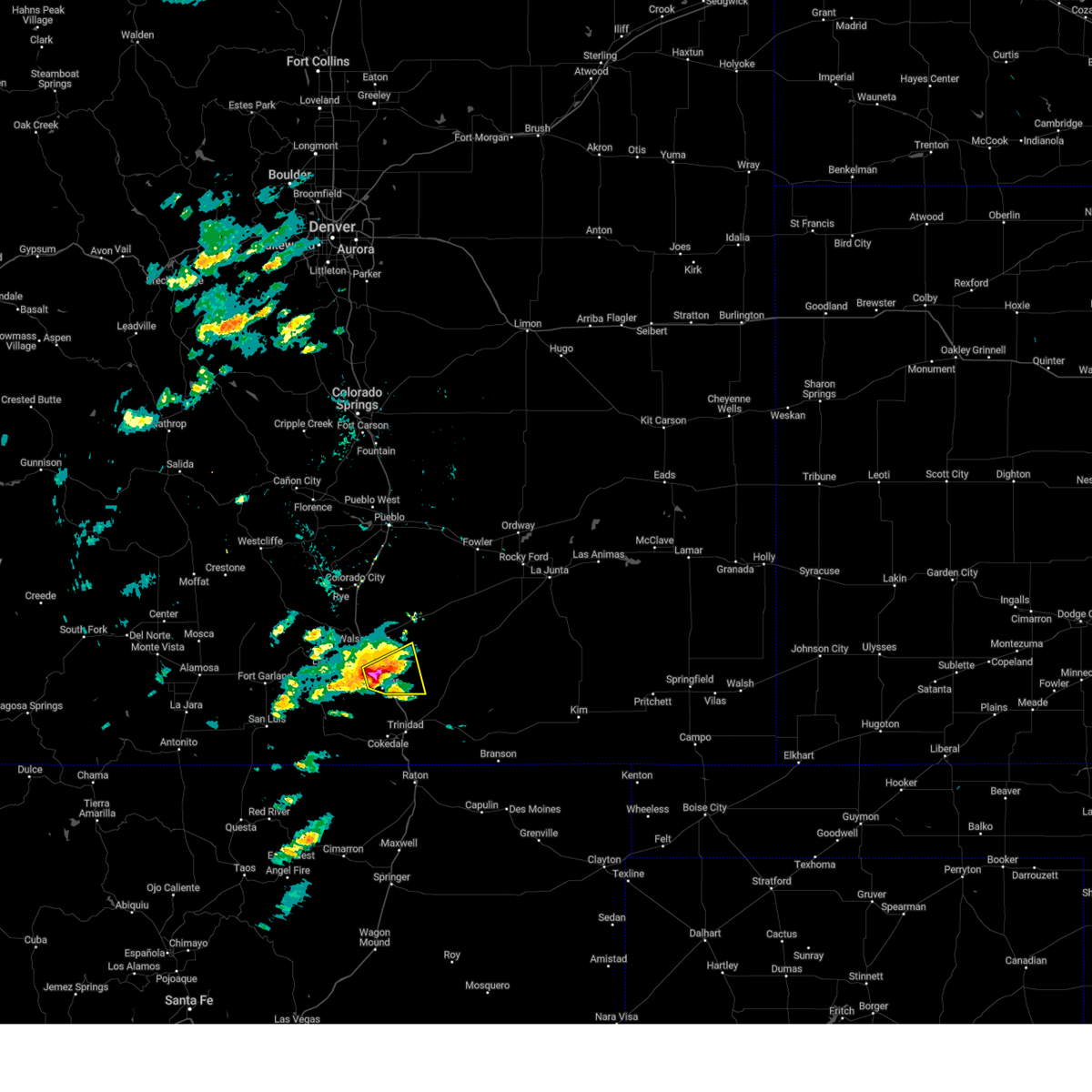
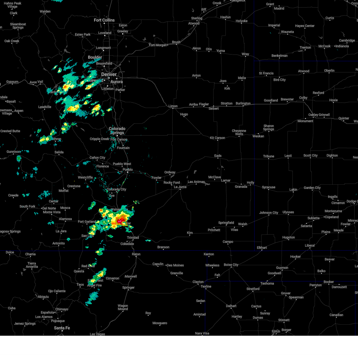
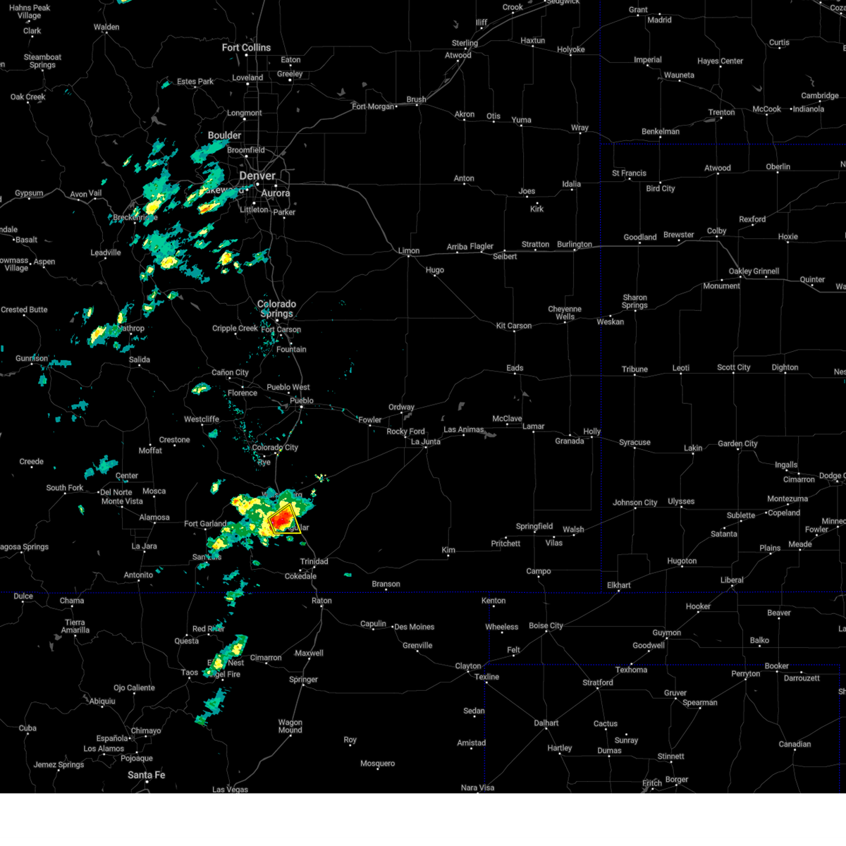
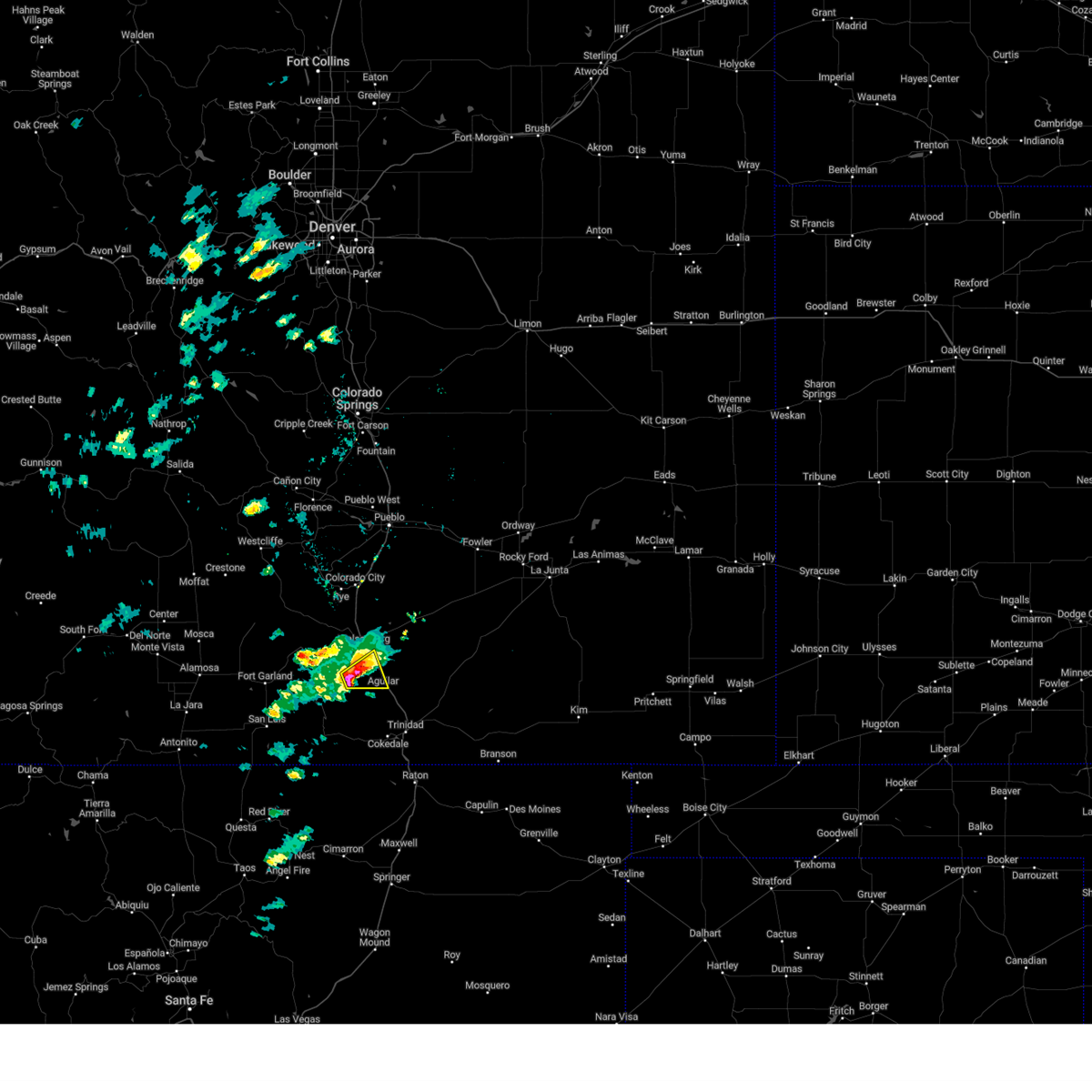
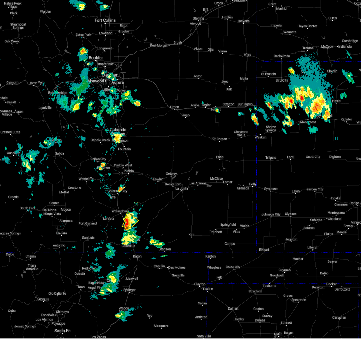
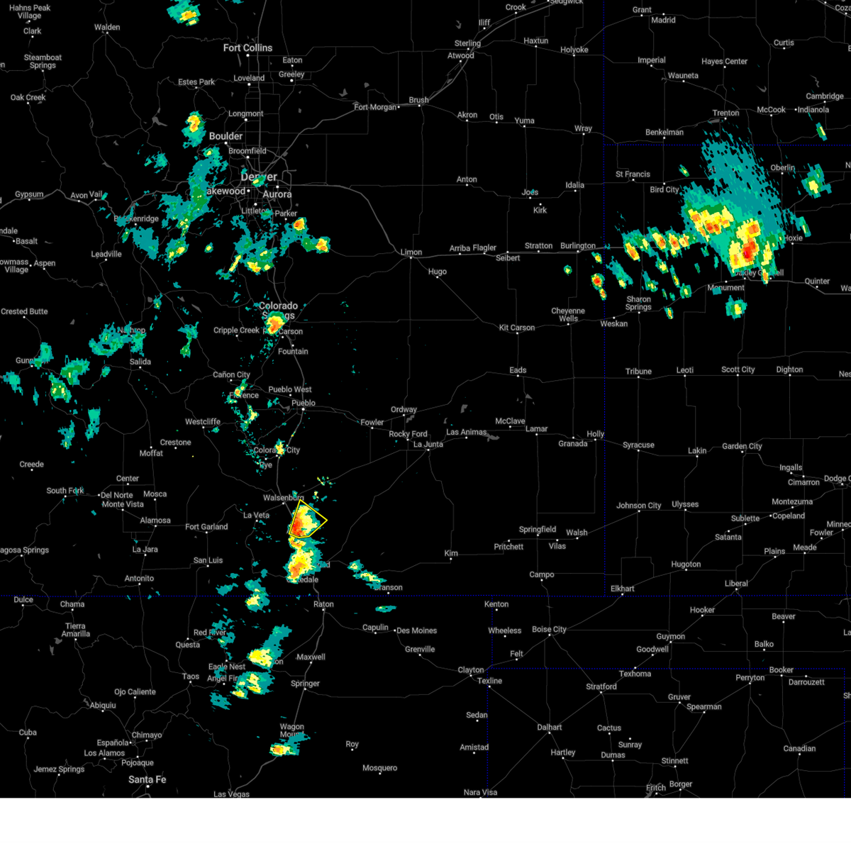
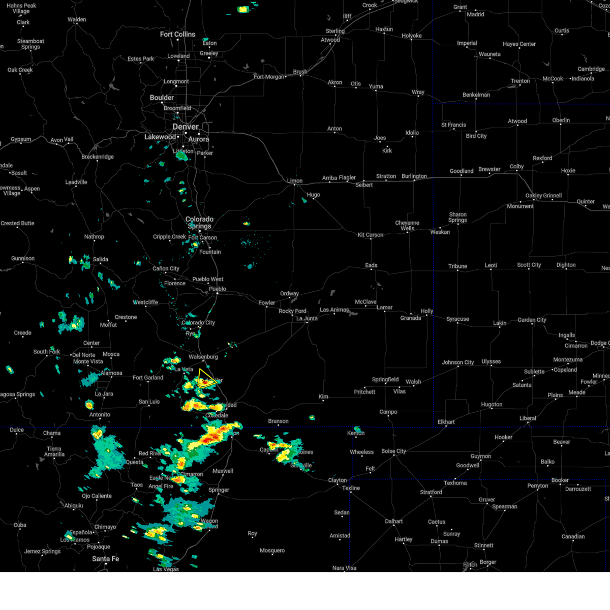
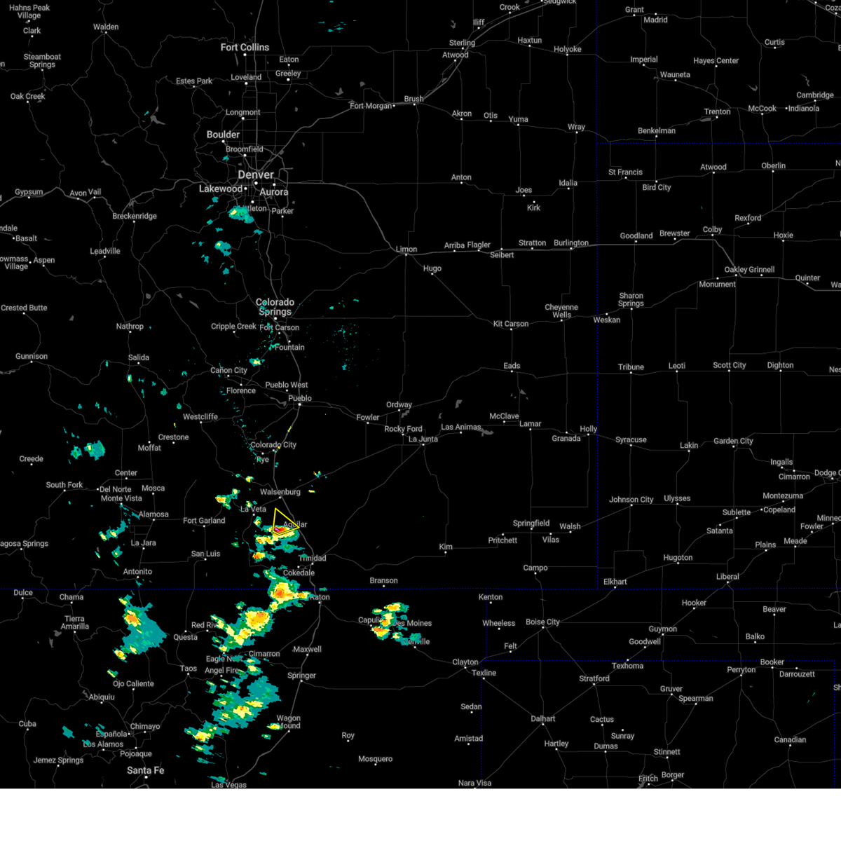
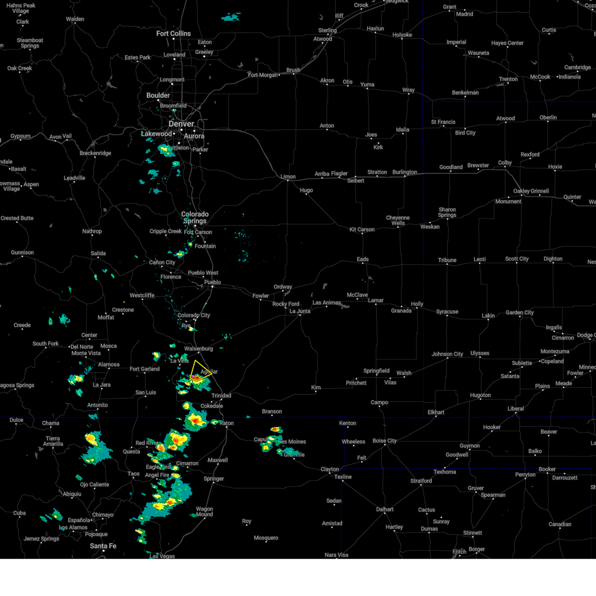
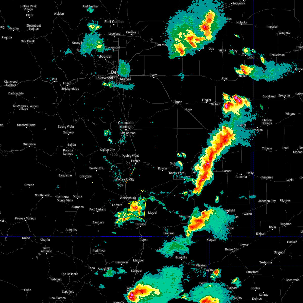
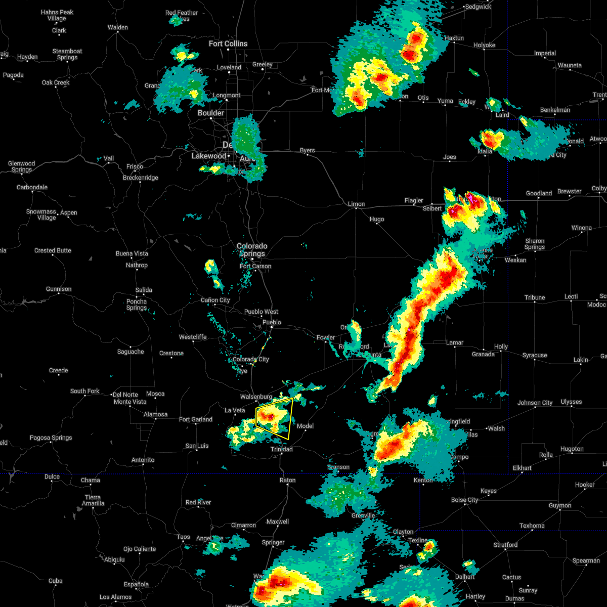
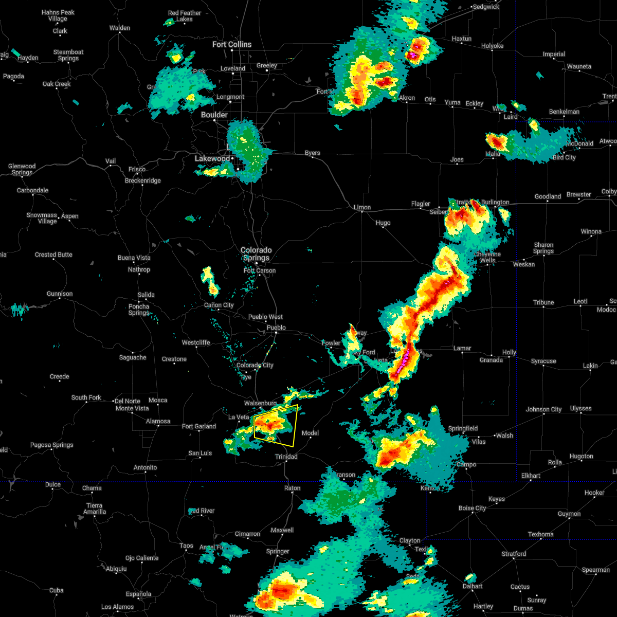
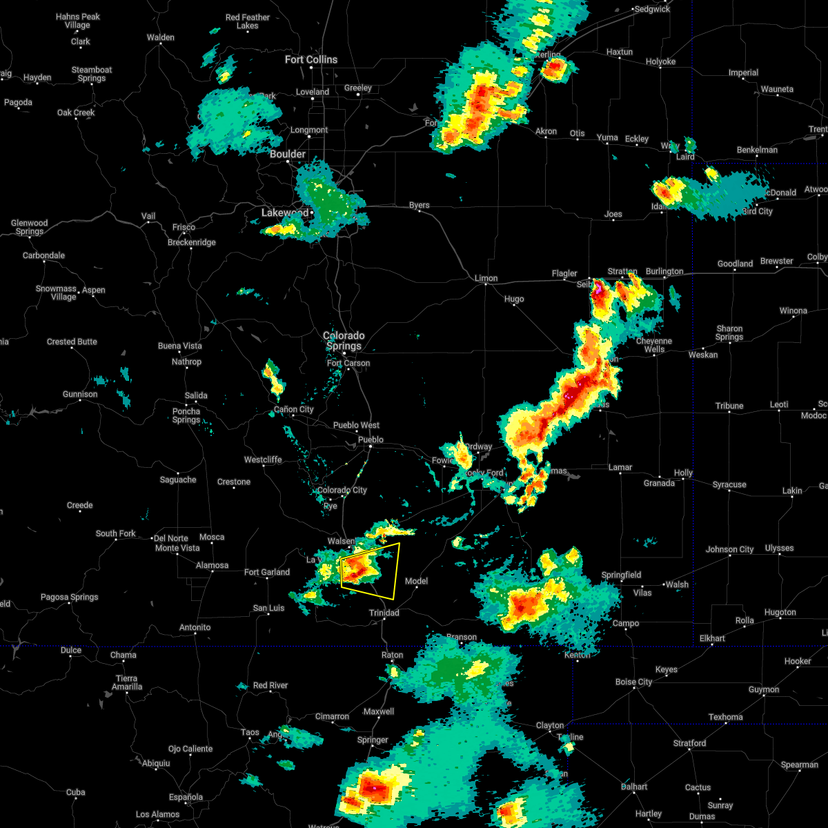
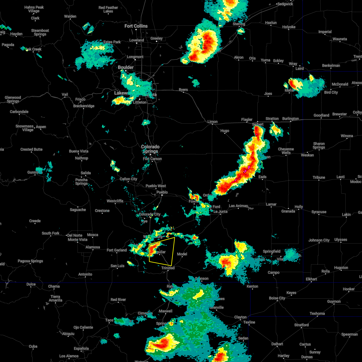
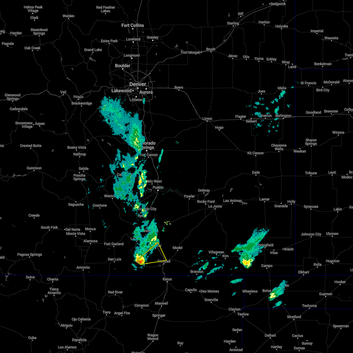
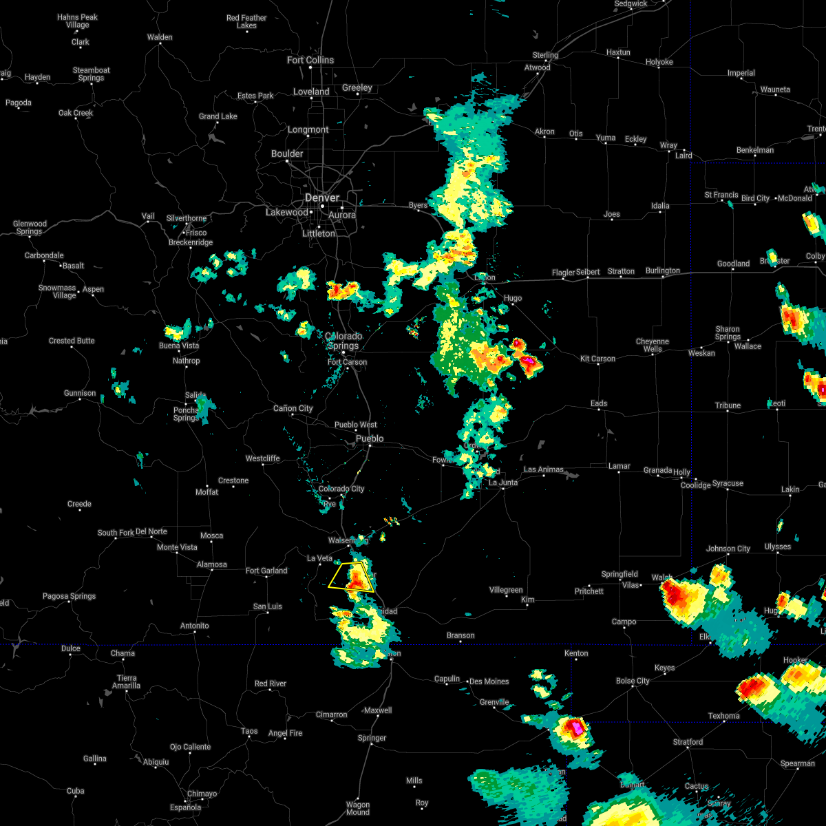
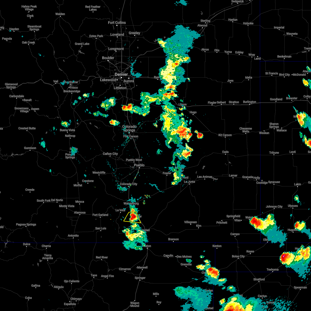
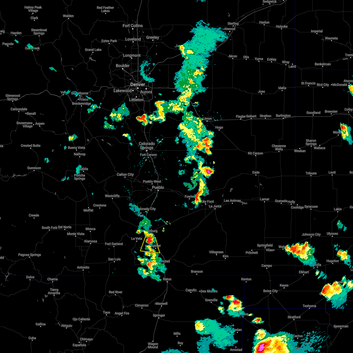
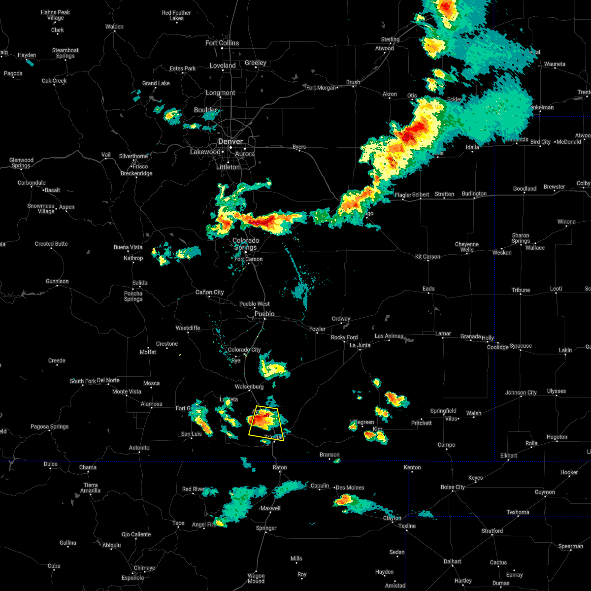
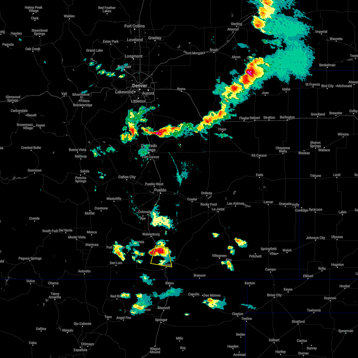
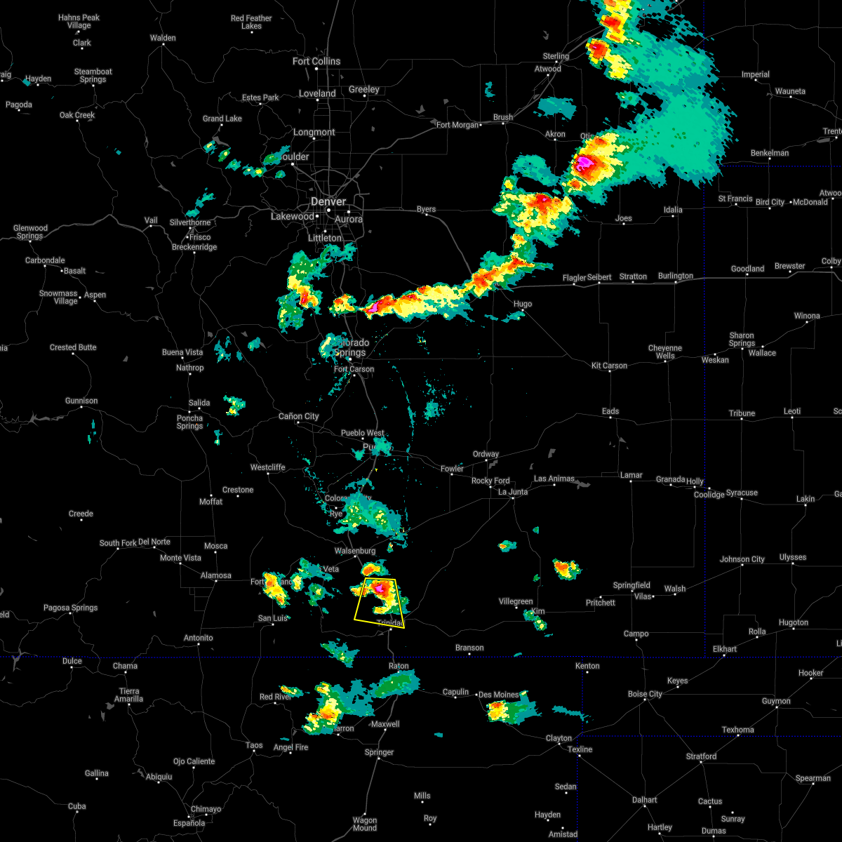
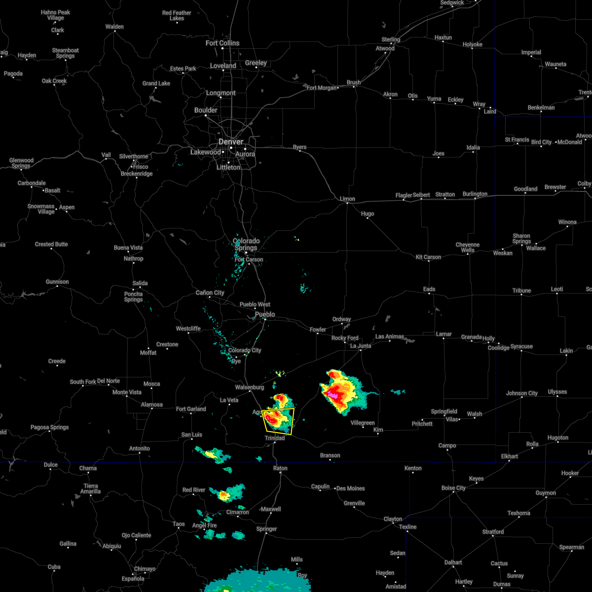
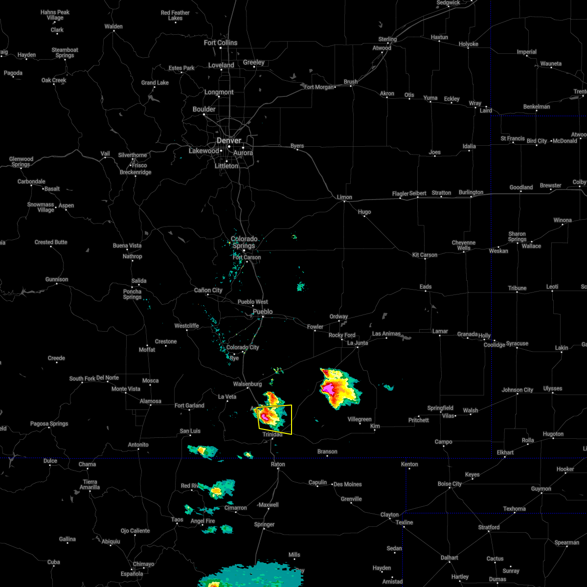
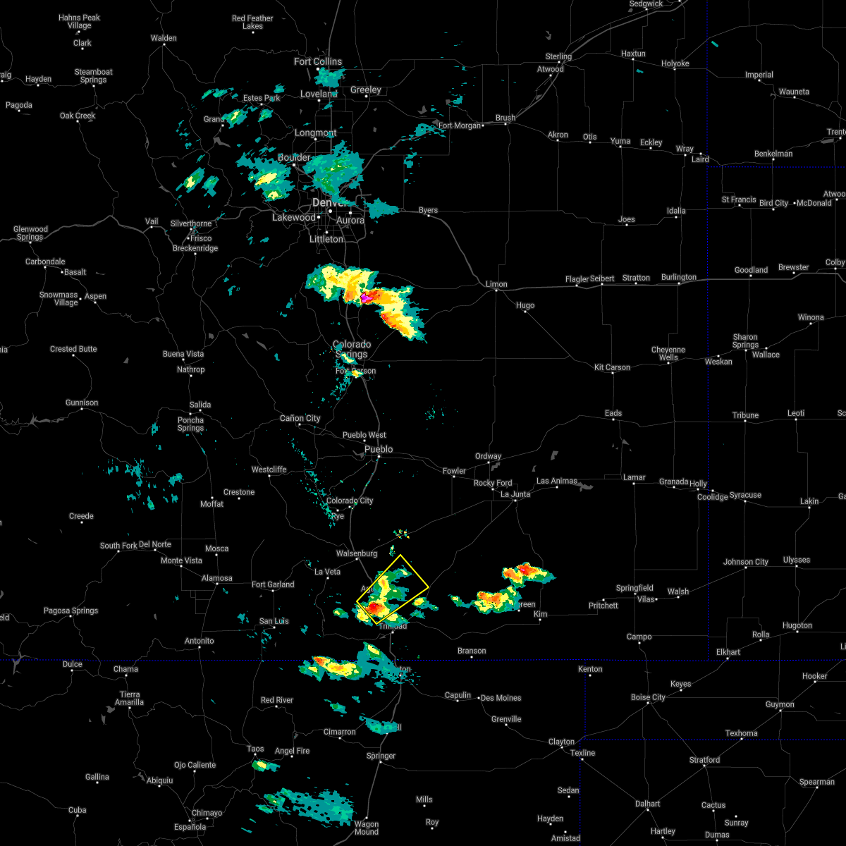
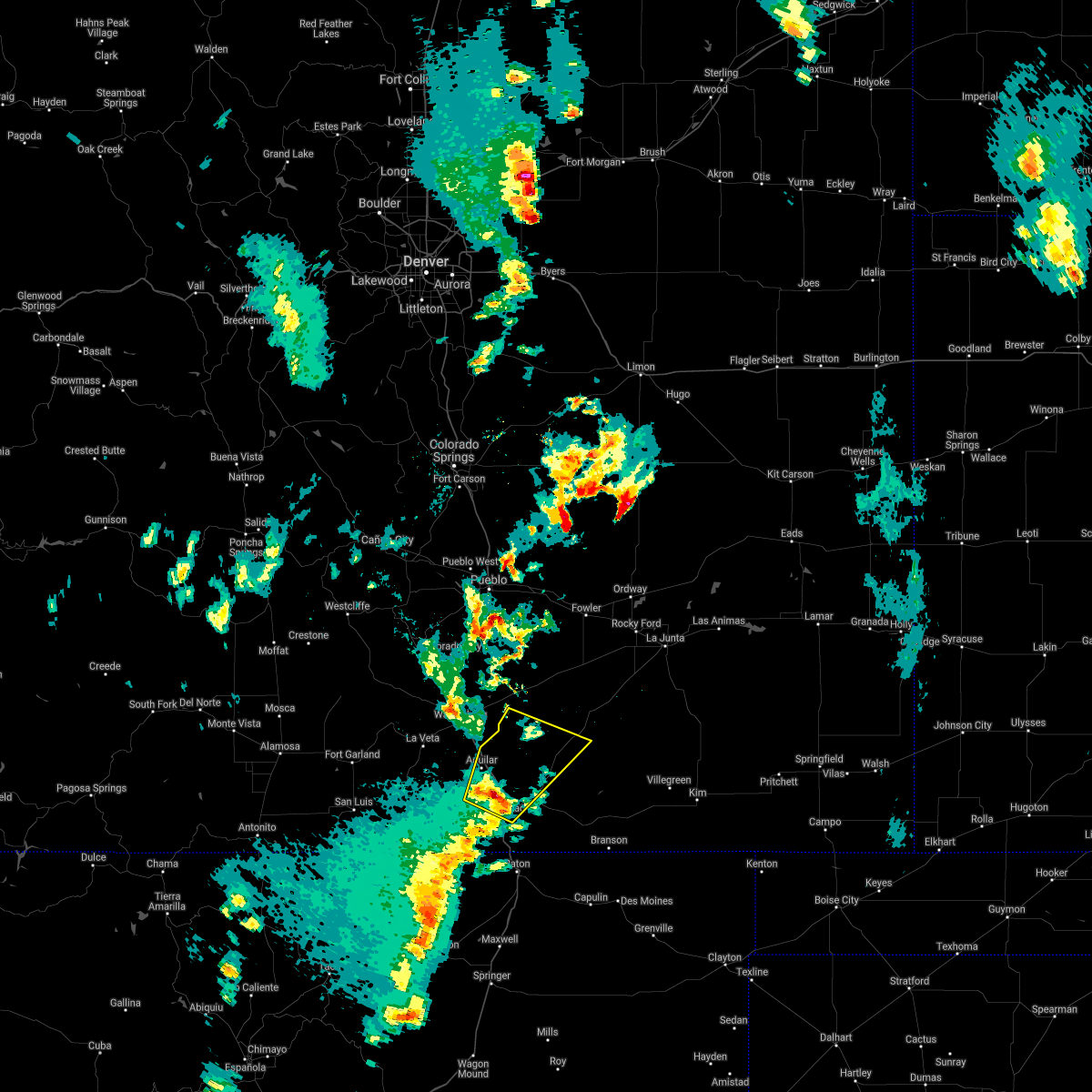
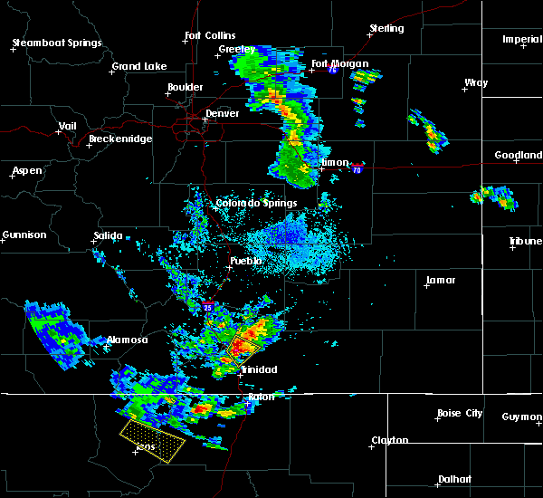
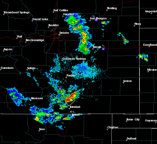
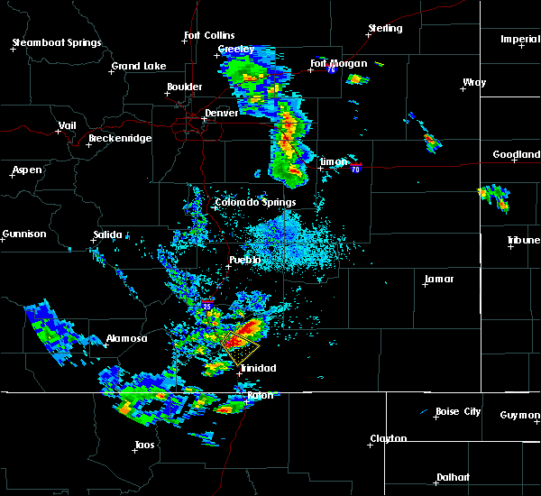
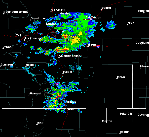
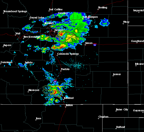
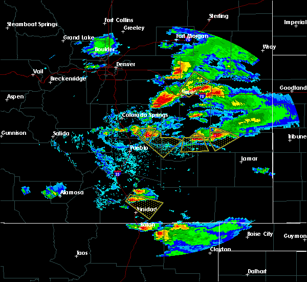
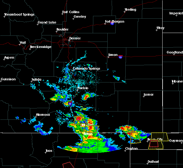
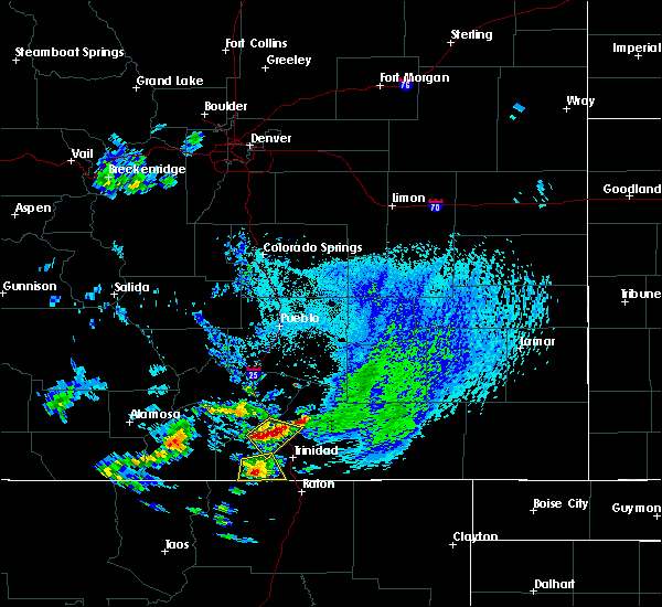
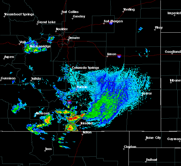
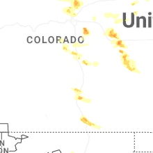
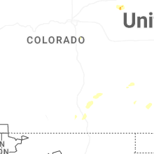
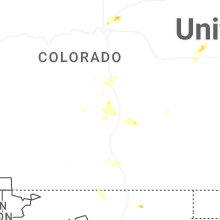
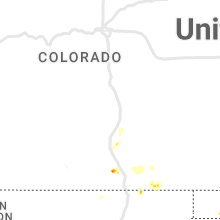
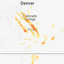
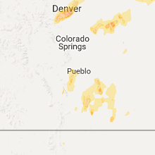
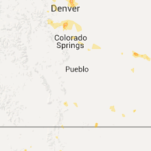
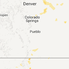
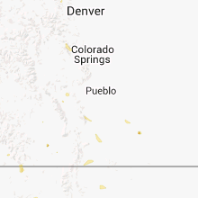
Hail Map for Lynn, CO
The Lynn, CO area has had 0 reports of on-the-ground hail by trained spotters, and has been under severe weather warnings 0 times during the past 12 months. Doppler radar has detected hail at or near Lynn, CO on 53 occasions, including 3 occasions during the past year.
| Name: | Lynn, CO |
| Where Located: | 58.2 miles S of Pueblo, CO |
| Map: | Google Map for Lynn, CO |
| Population: | 12 |
| Housing Units: | 9 |
| More Info: | Search Google for Lynn, CO |
0
The Top Recent Hail Date for Lynn, CO is Wednesday, September 17, 2025 (49th out of 53)
Hail and Wind Damage Spotted near Lynn, CO
| Date / Time | Report Details |
|---|---|
| 6/17/2025 4:06 PM MDT |
 Svrpub the national weather service in pueblo has issued a * severe thunderstorm warning for, south central huerfano county in southeastern colorado, southwestern las animas county in southeastern colorado, * until 445 pm mdt. * at 405 pm mdt, a severe thunderstorm was located over aguilar, or 16 miles northwest of trinidad, moving east at 40 mph (radar indicated). Hazards include ping pong ball size hail and 60 mph wind gusts. People and animals outdoors will be injured. expect hail damage to roofs, siding, windows, and vehicles. Expect wind damage to roofs, siding, and trees. Svrpub the national weather service in pueblo has issued a * severe thunderstorm warning for, south central huerfano county in southeastern colorado, southwestern las animas county in southeastern colorado, * until 445 pm mdt. * at 405 pm mdt, a severe thunderstorm was located over aguilar, or 16 miles northwest of trinidad, moving east at 40 mph (radar indicated). Hazards include ping pong ball size hail and 60 mph wind gusts. People and animals outdoors will be injured. expect hail damage to roofs, siding, windows, and vehicles. Expect wind damage to roofs, siding, and trees.
|
| 6/15/2025 2:06 PM MDT |
 Svrpub the national weather service in pueblo has issued a * severe thunderstorm warning for, southeastern huerfano county in southeastern colorado, southwestern las animas county in southeastern colorado, * until 230 pm mdt. * at 206 pm mdt, a severe thunderstorm was located near gulnare, or 17 miles west of trinidad, moving northeast at 10 mph (radar indicated). Hazards include 60 mph wind gusts and quarter size hail. Hail damage to vehicles is expected. Expect wind damage to roofs, siding, and trees. Svrpub the national weather service in pueblo has issued a * severe thunderstorm warning for, southeastern huerfano county in southeastern colorado, southwestern las animas county in southeastern colorado, * until 230 pm mdt. * at 206 pm mdt, a severe thunderstorm was located near gulnare, or 17 miles west of trinidad, moving northeast at 10 mph (radar indicated). Hazards include 60 mph wind gusts and quarter size hail. Hail damage to vehicles is expected. Expect wind damage to roofs, siding, and trees.
|
| 7/7/2024 5:49 PM MDT |
 Svrpub the national weather service in pueblo has issued a * severe thunderstorm warning for, central las animas county in southeastern colorado, * until 615 pm mdt. * at 548 pm mdt, a severe thunderstorm was located 8 miles southeast of aguilar, or 12 miles north of trinidad, moving east at 35 mph (radar indicated). Hazards include 60 mph wind gusts and quarter size hail. Hail damage to vehicles is expected. Expect wind damage to roofs, siding, and trees. Svrpub the national weather service in pueblo has issued a * severe thunderstorm warning for, central las animas county in southeastern colorado, * until 615 pm mdt. * at 548 pm mdt, a severe thunderstorm was located 8 miles southeast of aguilar, or 12 miles north of trinidad, moving east at 35 mph (radar indicated). Hazards include 60 mph wind gusts and quarter size hail. Hail damage to vehicles is expected. Expect wind damage to roofs, siding, and trees.
|
| 5/29/2024 1:41 PM MDT |
 The storm which prompted the warning has weakened below severe limits, and no longer poses an immediate threat to life or property. therefore, the warning will be allowed to expire. however, small hail and gusty winds are still possible with this thunderstorm. The storm which prompted the warning has weakened below severe limits, and no longer poses an immediate threat to life or property. therefore, the warning will be allowed to expire. however, small hail and gusty winds are still possible with this thunderstorm.
|
| 5/29/2024 1:34 PM MDT |
 the severe thunderstorm warning has been cancelled and is no longer in effect the severe thunderstorm warning has been cancelled and is no longer in effect
|
| 5/29/2024 1:34 PM MDT |
 At 133 pm mdt, a severe thunderstorm was located near aguilar, or 22 miles north of trinidad, moving northeast at 10 mph (radar indicated). Hazards include 60 mph wind gusts and quarter size hail. Hail damage to vehicles is expected. expect wind damage to roofs, siding, and trees. This severe thunderstorm will remain over mainly rural areas of central las animas county. At 133 pm mdt, a severe thunderstorm was located near aguilar, or 22 miles north of trinidad, moving northeast at 10 mph (radar indicated). Hazards include 60 mph wind gusts and quarter size hail. Hail damage to vehicles is expected. expect wind damage to roofs, siding, and trees. This severe thunderstorm will remain over mainly rural areas of central las animas county.
|
| 5/29/2024 1:18 PM MDT |
 Svrpub the national weather service in pueblo has issued a * severe thunderstorm warning for, southeastern huerfano county in southeastern colorado, west central las animas county in southeastern colorado, * until 145 pm mdt. * at 117 pm mdt, a severe thunderstorm was located near aguilar, or 22 miles northwest of trinidad, moving northeast at 10 mph (radar indicated). Hazards include 60 mph wind gusts and quarter size hail. Hail damage to vehicles is expected. Expect wind damage to roofs, siding, and trees. Svrpub the national weather service in pueblo has issued a * severe thunderstorm warning for, southeastern huerfano county in southeastern colorado, west central las animas county in southeastern colorado, * until 145 pm mdt. * at 117 pm mdt, a severe thunderstorm was located near aguilar, or 22 miles northwest of trinidad, moving northeast at 10 mph (radar indicated). Hazards include 60 mph wind gusts and quarter size hail. Hail damage to vehicles is expected. Expect wind damage to roofs, siding, and trees.
|
| 8/1/2023 12:17 PM MDT |
 At 1217 pm mdt, a severe thunderstorm was located 8 miles northwest of aguilar, or 17 miles east of indian creek on the southeastern spring burn scar, moving northeast at 10 mph (radar indicated). Hazards include 60 mph wind gusts and half dollar size hail. Hail damage to vehicles is expected. expect wind damage to roofs, siding, and trees. locations impacted include, aguilar. hail threat, radar indicated max hail size, 1. 25 in wind threat, radar indicated max wind gust, 60 mph. At 1217 pm mdt, a severe thunderstorm was located 8 miles northwest of aguilar, or 17 miles east of indian creek on the southeastern spring burn scar, moving northeast at 10 mph (radar indicated). Hazards include 60 mph wind gusts and half dollar size hail. Hail damage to vehicles is expected. expect wind damage to roofs, siding, and trees. locations impacted include, aguilar. hail threat, radar indicated max hail size, 1. 25 in wind threat, radar indicated max wind gust, 60 mph.
|
| 8/1/2023 12:09 PM MDT |
 At 1208 pm mdt, a severe thunderstorm was located 9 miles northwest of aguilar, or 16 miles east of indian creek on the southeastern spring burn scar, moving northeast at 10 mph (radar indicated). Hazards include 60 mph wind gusts and half dollar size hail. Hail damage to vehicles is expected. Expect wind damage to roofs, siding, and trees. At 1208 pm mdt, a severe thunderstorm was located 9 miles northwest of aguilar, or 16 miles east of indian creek on the southeastern spring burn scar, moving northeast at 10 mph (radar indicated). Hazards include 60 mph wind gusts and half dollar size hail. Hail damage to vehicles is expected. Expect wind damage to roofs, siding, and trees.
|
| 7/25/2023 1:57 PM MDT |
 The severe thunderstorm warning for southwestern otero, southeastern huerfano and western las animas counties will expire at 200 pm mdt, the storm which prompted the warning has weakened below severe limits, and no longer poses an immediate threat to life or property. therefore, the warning will be allowed to expire. however gusty winds are still possible with this thunderstorm. The severe thunderstorm warning for southwestern otero, southeastern huerfano and western las animas counties will expire at 200 pm mdt, the storm which prompted the warning has weakened below severe limits, and no longer poses an immediate threat to life or property. therefore, the warning will be allowed to expire. however gusty winds are still possible with this thunderstorm.
|
| 7/25/2023 1:47 PM MDT |
 At 146 pm mdt, a severe thunderstorm was located 11 miles northwest of trinchera, or 16 miles east of trinidad, moving east at 15 mph (trinidad airport equipment reported). Hazards include 60 mph wind gusts. Expect damage to roofs, siding, and trees. locations impacted include, trinidad, aguilar, cokedale, starkville, gulnare, raton pass, boncarbo, model, hoehne, thatcher, tyrone and trinchera. hail threat, radar indicated max hail size, <. 75 in wind threat, observed max wind gust, 60 mph. At 146 pm mdt, a severe thunderstorm was located 11 miles northwest of trinchera, or 16 miles east of trinidad, moving east at 15 mph (trinidad airport equipment reported). Hazards include 60 mph wind gusts. Expect damage to roofs, siding, and trees. locations impacted include, trinidad, aguilar, cokedale, starkville, gulnare, raton pass, boncarbo, model, hoehne, thatcher, tyrone and trinchera. hail threat, radar indicated max hail size, <. 75 in wind threat, observed max wind gust, 60 mph.
|
| 7/25/2023 1:31 PM MDT |
 At 130 pm mdt, a severe thunderstorm was located 12 miles northeast of sugarite canyon state park, or 12 miles east of trinidad, moving east at 15 mph (trinidad airport equipment reported). Hazards include 60 mph wind gusts. expect damage to roofs, siding, and trees At 130 pm mdt, a severe thunderstorm was located 12 miles northeast of sugarite canyon state park, or 12 miles east of trinidad, moving east at 15 mph (trinidad airport equipment reported). Hazards include 60 mph wind gusts. expect damage to roofs, siding, and trees
|
| 7/20/2023 2:45 PM MDT |
 At 245 pm mdt, severe thunderstorms were located along a line extending from near gulnare to near boncarbo to 11 miles southeast of stonewall, moving east at 20 mph (radar indicated). Hazards include 60 mph wind gusts and quarter size hail. Hail damage to vehicles is expected. expect wind damage to roofs, siding, and trees. locations impacted include, trinidad, aguilar, cokedale, starkville, gulnare, boncarbo, segundo, hoehne and weston. hail threat, radar indicated max hail size, 1. 00 in wind threat, radar indicated max wind gust, 60 mph. At 245 pm mdt, severe thunderstorms were located along a line extending from near gulnare to near boncarbo to 11 miles southeast of stonewall, moving east at 20 mph (radar indicated). Hazards include 60 mph wind gusts and quarter size hail. Hail damage to vehicles is expected. expect wind damage to roofs, siding, and trees. locations impacted include, trinidad, aguilar, cokedale, starkville, gulnare, boncarbo, segundo, hoehne and weston. hail threat, radar indicated max hail size, 1. 00 in wind threat, radar indicated max wind gust, 60 mph.
|
| 7/20/2023 2:25 PM MDT |
 At 225 pm mdt, severe thunderstorms were located along a line extending from near gulnare to 8 miles northwest of segundo to 11 miles south of stonewall, moving east at 10 mph (radar indicated). Hazards include torrential rainfall, 60 mph wind gusts, and quarter size hail. Hail damage to vehicles is expected. Expect wind damage to roofs, siding, and trees. At 225 pm mdt, severe thunderstorms were located along a line extending from near gulnare to 8 miles northwest of segundo to 11 miles south of stonewall, moving east at 10 mph (radar indicated). Hazards include torrential rainfall, 60 mph wind gusts, and quarter size hail. Hail damage to vehicles is expected. Expect wind damage to roofs, siding, and trees.
|
| 7/15/2023 1:43 PM MDT |
 At 143 pm mdt, a severe thunderstorm was located near aguilar, or 14 miles northwest of trinidad, moving southeast at 20 mph (radar indicated). Hazards include 60 mph wind gusts and quarter size hail. Hail damage to vehicles is expected. Expect wind damage to roofs, siding, and trees. At 143 pm mdt, a severe thunderstorm was located near aguilar, or 14 miles northwest of trinidad, moving southeast at 20 mph (radar indicated). Hazards include 60 mph wind gusts and quarter size hail. Hail damage to vehicles is expected. Expect wind damage to roofs, siding, and trees.
|
| 7/13/2023 7:44 PM MDT |
 At 744 pm mdt, a severe thunderstorm was located near aguilar, or 21 miles north of trinidad, moving southeast at 20 mph (radar indicated). Hazards include tennis ball size hail and 70 mph wind gusts. People and animals outdoors will be injured. expect hail damage to roofs, siding, windows, and vehicles. expect considerable tree damage. wind damage is also likely to mobile homes, roofs, and outbuildings. Locations impacted include, aguilar. At 744 pm mdt, a severe thunderstorm was located near aguilar, or 21 miles north of trinidad, moving southeast at 20 mph (radar indicated). Hazards include tennis ball size hail and 70 mph wind gusts. People and animals outdoors will be injured. expect hail damage to roofs, siding, windows, and vehicles. expect considerable tree damage. wind damage is also likely to mobile homes, roofs, and outbuildings. Locations impacted include, aguilar.
|
| 7/13/2023 7:38 PM MDT |
 At 737 pm mdt, a severe thunderstorm was located 8 miles north of aguilar, or 24 miles north of trinidad, moving southeast at 20 mph (radar indicated). Hazards include tennis ball size hail and 70 mph wind gusts. People and animals outdoors will be injured. expect hail damage to roofs, siding, windows, and vehicles. expect considerable tree damage. wind damage is also likely to mobile homes, roofs, and outbuildings. Locations impacted include, aguilar. At 737 pm mdt, a severe thunderstorm was located 8 miles north of aguilar, or 24 miles north of trinidad, moving southeast at 20 mph (radar indicated). Hazards include tennis ball size hail and 70 mph wind gusts. People and animals outdoors will be injured. expect hail damage to roofs, siding, windows, and vehicles. expect considerable tree damage. wind damage is also likely to mobile homes, roofs, and outbuildings. Locations impacted include, aguilar.
|
| 7/13/2023 7:18 PM MDT |
 At 718 pm mdt, a severe thunderstorm was located near walsenburg, or 24 miles east of spring burn scar north of highway 160, moving southeast at 20 mph (radar indicated). Hazards include tennis ball size hail and 70 mph wind gusts. People and animals outdoors will be injured. expect hail damage to roofs, siding, windows, and vehicles. expect considerable tree damage. Wind damage is also likely to mobile homes, roofs, and outbuildings. At 718 pm mdt, a severe thunderstorm was located near walsenburg, or 24 miles east of spring burn scar north of highway 160, moving southeast at 20 mph (radar indicated). Hazards include tennis ball size hail and 70 mph wind gusts. People and animals outdoors will be injured. expect hail damage to roofs, siding, windows, and vehicles. expect considerable tree damage. Wind damage is also likely to mobile homes, roofs, and outbuildings.
|
| 7/7/2023 3:39 PM MDT |
 At 339 pm mdt, a severe thunderstorm was located near walsenburg, or 19 miles east of spring burn scar north of highway 160, moving southeast at 15 mph (radar indicated). Hazards include half dollar size hail. damage to vehicles is expected At 339 pm mdt, a severe thunderstorm was located near walsenburg, or 19 miles east of spring burn scar north of highway 160, moving southeast at 15 mph (radar indicated). Hazards include half dollar size hail. damage to vehicles is expected
|
| 6/11/2023 2:28 PM MDT |
 At 228 pm mdt, a severe thunderstorm was located near aguilar, or 19 miles north of trinidad, moving east at 20 mph (radar indicated). Hazards include ping pong ball size hail and 60 mph wind gusts. People and animals outdoors will be injured. expect hail damage to roofs, siding, windows, and vehicles. Expect wind damage to roofs, siding, and trees. At 228 pm mdt, a severe thunderstorm was located near aguilar, or 19 miles north of trinidad, moving east at 20 mph (radar indicated). Hazards include ping pong ball size hail and 60 mph wind gusts. People and animals outdoors will be injured. expect hail damage to roofs, siding, windows, and vehicles. Expect wind damage to roofs, siding, and trees.
|
| 6/11/2023 2:13 PM MDT |
 At 213 pm mdt, a severe thunderstorm was located near aguilar, or 20 miles north of trinidad, moving east at 15 mph (radar indicated). Hazards include golf ball size hail and 60 mph wind gusts. People and animals outdoors will be injured. expect hail damage to roofs, siding, windows, and vehicles. expect wind damage to roofs, siding, and trees. locations impacted include, aguilar. thunderstorm damage threat, considerable hail threat, radar indicated max hail size, 1. 75 in wind threat, radar indicated max wind gust, 60 mph. At 213 pm mdt, a severe thunderstorm was located near aguilar, or 20 miles north of trinidad, moving east at 15 mph (radar indicated). Hazards include golf ball size hail and 60 mph wind gusts. People and animals outdoors will be injured. expect hail damage to roofs, siding, windows, and vehicles. expect wind damage to roofs, siding, and trees. locations impacted include, aguilar. thunderstorm damage threat, considerable hail threat, radar indicated max hail size, 1. 75 in wind threat, radar indicated max wind gust, 60 mph.
|
| 6/11/2023 1:59 PM MDT |
 At 158 pm mdt, a severe thunderstorm was located near aguilar, or 21 miles northwest of trinidad, moving east at 15 mph (radar indicated). Hazards include ping pong ball size hail and 60 mph wind gusts. People and animals outdoors will be injured. expect hail damage to roofs, siding, windows, and vehicles. Expect wind damage to roofs, siding, and trees. At 158 pm mdt, a severe thunderstorm was located near aguilar, or 21 miles northwest of trinidad, moving east at 15 mph (radar indicated). Hazards include ping pong ball size hail and 60 mph wind gusts. People and animals outdoors will be injured. expect hail damage to roofs, siding, windows, and vehicles. Expect wind damage to roofs, siding, and trees.
|
| 6/11/2023 1:50 PM MDT |
 At 149 pm mdt, a severe thunderstorm was located 8 miles northeast of spanish peaks, or 15 miles east of indian creek on the southeastern spring burn scar, moving east at 5 mph (radar indicated). Hazards include golf ball size hail and 60 mph wind gusts. People and animals outdoors will be injured. expect hail damage to roofs, siding, windows, and vehicles. expect wind damage to roofs, siding, and trees. locations impacted include, aguilar. thunderstorm damage threat, considerable hail threat, radar indicated max hail size, 1. 75 in wind threat, radar indicated max wind gust, 60 mph. At 149 pm mdt, a severe thunderstorm was located 8 miles northeast of spanish peaks, or 15 miles east of indian creek on the southeastern spring burn scar, moving east at 5 mph (radar indicated). Hazards include golf ball size hail and 60 mph wind gusts. People and animals outdoors will be injured. expect hail damage to roofs, siding, windows, and vehicles. expect wind damage to roofs, siding, and trees. locations impacted include, aguilar. thunderstorm damage threat, considerable hail threat, radar indicated max hail size, 1. 75 in wind threat, radar indicated max wind gust, 60 mph.
|
| 6/11/2023 1:41 PM MDT |
 At 141 pm mdt, a severe thunderstorm was located 7 miles northeast of spanish peaks, or 15 miles east of indian creek on the southeastern spring burn scar, moving east at 5 mph (radar indicated). Hazards include ping pong ball size hail and 60 mph wind gusts. People and animals outdoors will be injured. expect hail damage to roofs, siding, windows, and vehicles. expect wind damage to roofs, siding, and trees. locations impacted include, aguilar. hail threat, radar indicated max hail size, 1. 50 in wind threat, radar indicated max wind gust, 60 mph. At 141 pm mdt, a severe thunderstorm was located 7 miles northeast of spanish peaks, or 15 miles east of indian creek on the southeastern spring burn scar, moving east at 5 mph (radar indicated). Hazards include ping pong ball size hail and 60 mph wind gusts. People and animals outdoors will be injured. expect hail damage to roofs, siding, windows, and vehicles. expect wind damage to roofs, siding, and trees. locations impacted include, aguilar. hail threat, radar indicated max hail size, 1. 50 in wind threat, radar indicated max wind gust, 60 mph.
|
| 6/11/2023 1:29 PM MDT |
 At 129 pm mdt, a severe thunderstorm was located near spanish peaks, or 13 miles east of indian creek on the southeastern spring burn scar, moving east at 5 mph (radar indicated). Hazards include golf ball size hail and 60 mph wind gusts. People and animals outdoors will be injured. expect hail damage to roofs, siding, windows, and vehicles. Expect wind damage to roofs, siding, and trees. At 129 pm mdt, a severe thunderstorm was located near spanish peaks, or 13 miles east of indian creek on the southeastern spring burn scar, moving east at 5 mph (radar indicated). Hazards include golf ball size hail and 60 mph wind gusts. People and animals outdoors will be injured. expect hail damage to roofs, siding, windows, and vehicles. Expect wind damage to roofs, siding, and trees.
|
| 6/9/2023 1:54 PM MDT |
 At 154 pm mdt, a severe thunderstorm was located near aguilar, or 21 miles north of trinidad, moving northeast at 10 mph (radar indicated). Hazards include 60 mph wind gusts and nickel size hail. Expect damage to roofs, siding, and trees. locations impacted include, aguilar. hail threat, radar indicated max hail size, 0. 88 in wind threat, radar indicated max wind gust, 60 mph. At 154 pm mdt, a severe thunderstorm was located near aguilar, or 21 miles north of trinidad, moving northeast at 10 mph (radar indicated). Hazards include 60 mph wind gusts and nickel size hail. Expect damage to roofs, siding, and trees. locations impacted include, aguilar. hail threat, radar indicated max hail size, 0. 88 in wind threat, radar indicated max wind gust, 60 mph.
|
| 6/9/2023 1:44 PM MDT |
 At 144 pm mdt, a severe thunderstorm was located over aguilar, or 20 miles northwest of trinidad, moving northeast at 10 mph (radar indicated). Hazards include 60 mph wind gusts and quarter size hail. Hail damage to vehicles is expected. Expect wind damage to roofs, siding, and trees. At 144 pm mdt, a severe thunderstorm was located over aguilar, or 20 miles northwest of trinidad, moving northeast at 10 mph (radar indicated). Hazards include 60 mph wind gusts and quarter size hail. Hail damage to vehicles is expected. Expect wind damage to roofs, siding, and trees.
|
| 5/17/2023 12:21 PM MDT |
 The severe thunderstorm warning for southeastern huerfano and west central las animas counties will expire at 1230 pm mdt, the storm which prompted the warning has weakened below severe limits, and no longer poses an immediate threat to life or property. therefore, the warning will be allowed to expire. however small hail and gusty winds are still possible with this thunderstorm. The severe thunderstorm warning for southeastern huerfano and west central las animas counties will expire at 1230 pm mdt, the storm which prompted the warning has weakened below severe limits, and no longer poses an immediate threat to life or property. therefore, the warning will be allowed to expire. however small hail and gusty winds are still possible with this thunderstorm.
|
| 5/17/2023 12:01 PM MDT |
 At 1201 pm mdt, a severe thunderstorm was located 7 miles north of gulnare, or 17 miles east of indian creek on the southeastern spring burn scar, moving northeast at 10 mph (radar indicated). Hazards include 60 mph wind gusts and quarter size hail. Hail damage to vehicles is expected. expect wind damage to roofs, siding, and trees. this severe thunderstorm will remain over mainly rural areas of southeastern huerfano and west central las animas counties. hail threat, radar indicated max hail size, 1. 00 in wind threat, radar indicated max wind gust, 60 mph. At 1201 pm mdt, a severe thunderstorm was located 7 miles north of gulnare, or 17 miles east of indian creek on the southeastern spring burn scar, moving northeast at 10 mph (radar indicated). Hazards include 60 mph wind gusts and quarter size hail. Hail damage to vehicles is expected. expect wind damage to roofs, siding, and trees. this severe thunderstorm will remain over mainly rural areas of southeastern huerfano and west central las animas counties. hail threat, radar indicated max hail size, 1. 00 in wind threat, radar indicated max wind gust, 60 mph.
|
| 5/17/2023 11:46 AM MDT |
 At 1145 am mdt, a severe thunderstorm was located near spanish peaks, or 15 miles east of indian creek on the southeastern spring burn scar, moving northeast at 10 mph (radar indicated). Hazards include 60 mph wind gusts and half dollar size hail. Hail damage to vehicles is expected. Expect wind damage to roofs, siding, and trees. At 1145 am mdt, a severe thunderstorm was located near spanish peaks, or 15 miles east of indian creek on the southeastern spring burn scar, moving northeast at 10 mph (radar indicated). Hazards include 60 mph wind gusts and half dollar size hail. Hail damage to vehicles is expected. Expect wind damage to roofs, siding, and trees.
|
| 6/3/2022 5:42 PM MDT |
 The severe thunderstorm warning for southeastern huerfano and northwestern las animas counties will expire at 545 pm mdt, the storm which prompted the warning has weakened below severe limits, and no longer poses an immediate threat to life or property. therefore, the warning will be allowed to expire. however small hail and gusty winds are still possible with this thunderstorm. a severe thunderstorm watch remains in effect until 1000 pm mdt for southeastern colorado. The severe thunderstorm warning for southeastern huerfano and northwestern las animas counties will expire at 545 pm mdt, the storm which prompted the warning has weakened below severe limits, and no longer poses an immediate threat to life or property. therefore, the warning will be allowed to expire. however small hail and gusty winds are still possible with this thunderstorm. a severe thunderstorm watch remains in effect until 1000 pm mdt for southeastern colorado.
|
| 6/3/2022 5:35 PM MDT |
 At 535 pm mdt, a severe thunderstorm was located 9 miles northeast of aguilar, or 20 miles north of trinidad, moving east at 25 mph (radar indicated). Hazards include 60 mph wind gusts and quarter size hail. Hail damage to vehicles is expected. expect wind damage to roofs, siding, and trees. locations impacted include, aguilar. hail threat, radar indicated max hail size, 1. 00 in wind threat, radar indicated max wind gust, 60 mph. At 535 pm mdt, a severe thunderstorm was located 9 miles northeast of aguilar, or 20 miles north of trinidad, moving east at 25 mph (radar indicated). Hazards include 60 mph wind gusts and quarter size hail. Hail damage to vehicles is expected. expect wind damage to roofs, siding, and trees. locations impacted include, aguilar. hail threat, radar indicated max hail size, 1. 00 in wind threat, radar indicated max wind gust, 60 mph.
|
| 6/3/2022 5:25 PM MDT |
 At 524 pm mdt, a severe thunderstorm was located near aguilar, or 20 miles north of trinidad, moving east at 25 mph (radar indicated). Hazards include 60 mph wind gusts and half dollar size hail. Hail damage to vehicles is expected. expect wind damage to roofs, siding, and trees. locations impacted include, aguilar. hail threat, radar indicated max hail size, 1. 25 in wind threat, radar indicated max wind gust, 60 mph. At 524 pm mdt, a severe thunderstorm was located near aguilar, or 20 miles north of trinidad, moving east at 25 mph (radar indicated). Hazards include 60 mph wind gusts and half dollar size hail. Hail damage to vehicles is expected. expect wind damage to roofs, siding, and trees. locations impacted include, aguilar. hail threat, radar indicated max hail size, 1. 25 in wind threat, radar indicated max wind gust, 60 mph.
|
| 6/3/2022 5:13 PM MDT |
 At 513 pm mdt, a severe thunderstorm was located near aguilar, or 22 miles northwest of trinidad, moving east at 30 mph (radar indicated). Hazards include 60 mph wind gusts and half dollar size hail. Hail damage to vehicles is expected. expect wind damage to roofs, siding, and trees. this severe thunderstorm will remain over mainly rural areas of southeastern huerfano and northwestern las animas counties. hail threat, radar indicated max hail size, 1. 25 in wind threat, radar indicated max wind gust, 60 mph. At 513 pm mdt, a severe thunderstorm was located near aguilar, or 22 miles northwest of trinidad, moving east at 30 mph (radar indicated). Hazards include 60 mph wind gusts and half dollar size hail. Hail damage to vehicles is expected. expect wind damage to roofs, siding, and trees. this severe thunderstorm will remain over mainly rural areas of southeastern huerfano and northwestern las animas counties. hail threat, radar indicated max hail size, 1. 25 in wind threat, radar indicated max wind gust, 60 mph.
|
| 6/3/2022 4:57 PM MDT |
 At 457 pm mdt, a severe thunderstorm was located near aguilar, or 20 miles northwest of trinidad, moving east at 25 mph (radar indicated). Hazards include 60 mph wind gusts and half dollar size hail. Hail damage to vehicles is expected. expect wind damage to roofs, siding, and trees. This severe thunderstorm will be near, aguilar around 510 pm mdt. At 457 pm mdt, a severe thunderstorm was located near aguilar, or 20 miles northwest of trinidad, moving east at 25 mph (radar indicated). Hazards include 60 mph wind gusts and half dollar size hail. Hail damage to vehicles is expected. expect wind damage to roofs, siding, and trees. This severe thunderstorm will be near, aguilar around 510 pm mdt.
|
| 5/4/2022 2:32 PM MDT |
 At 232 pm mdt, a severe thunderstorm was located 8 miles northeast of stonewall, or 20 miles west of trinidad, moving northeast at 20 mph (radar indicated). Hazards include 60 mph wind gusts and quarter size hail. Hail damage to vehicles is expected. Expect wind damage to roofs, siding, and trees. At 232 pm mdt, a severe thunderstorm was located 8 miles northeast of stonewall, or 20 miles west of trinidad, moving northeast at 20 mph (radar indicated). Hazards include 60 mph wind gusts and quarter size hail. Hail damage to vehicles is expected. Expect wind damage to roofs, siding, and trees.
|
| 7/4/2021 5:57 PM MDT |
 The severe thunderstorm warning for south central huerfano and west central las animas counties will expire at 600 pm mdt, the storm which prompted the warning has weakened below severe limits, and no longer poses an immediate threat to life or property. therefore, the warning will be allowed to expire. however small hail and heavy rain are still possible with this thunderstorm. a severe thunderstorm watch remains in effect until 1000 pm mdt for southeastern colorado. The severe thunderstorm warning for south central huerfano and west central las animas counties will expire at 600 pm mdt, the storm which prompted the warning has weakened below severe limits, and no longer poses an immediate threat to life or property. therefore, the warning will be allowed to expire. however small hail and heavy rain are still possible with this thunderstorm. a severe thunderstorm watch remains in effect until 1000 pm mdt for southeastern colorado.
|
| 7/4/2021 5:43 PM MDT |
 At 543 pm mdt, a severe thunderstorm was located near aguilar, or 19 miles east of indian creek on the southeastern spring burn scar, moving south at 15 mph (radar indicated). Hazards include 60 mph wind gusts and quarter size hail. Hail damage to vehicles is expected. expect wind damage to roofs, siding, and trees. Locations impacted include, aguilar. At 543 pm mdt, a severe thunderstorm was located near aguilar, or 19 miles east of indian creek on the southeastern spring burn scar, moving south at 15 mph (radar indicated). Hazards include 60 mph wind gusts and quarter size hail. Hail damage to vehicles is expected. expect wind damage to roofs, siding, and trees. Locations impacted include, aguilar.
|
| 7/4/2021 5:29 PM MDT |
 At 529 pm mdt, a severe thunderstorm was located 8 miles south of walsenburg, or 19 miles east of indian creek on the southeastern spring burn scar, moving south at 15 mph (radar indicated). Hazards include 60 mph wind gusts and quarter size hail. Hail damage to vehicles is expected. Expect wind damage to roofs, siding, and trees. At 529 pm mdt, a severe thunderstorm was located 8 miles south of walsenburg, or 19 miles east of indian creek on the southeastern spring burn scar, moving south at 15 mph (radar indicated). Hazards include 60 mph wind gusts and quarter size hail. Hail damage to vehicles is expected. Expect wind damage to roofs, siding, and trees.
|
| 7/3/2021 6:10 PM MDT |
 The severe thunderstorm warning for southeastern huerfano and southwestern las animas counties will expire at 615 pm mdt, the storm which prompted the warning has weakened below severe limits, and no longer poses an immediate threat to life or property. therefore, the warning will be allowed to expire. however small hail and heavy rain are still possible with this thunderstorm. The severe thunderstorm warning for southeastern huerfano and southwestern las animas counties will expire at 615 pm mdt, the storm which prompted the warning has weakened below severe limits, and no longer poses an immediate threat to life or property. therefore, the warning will be allowed to expire. however small hail and heavy rain are still possible with this thunderstorm.
|
| 7/3/2021 5:56 PM MDT |
 At 556 pm mdt, a severe thunderstorm was located over aguilar, or 16 miles northwest of trinidad, moving southwest at 30 mph (radar indicated). Hazards include 60 mph wind gusts and quarter size hail. Hail damage to vehicles is expected. expect wind damage to roofs, siding, and trees. Locations impacted include, trinidad, aguilar, gulnare and boncarbo. At 556 pm mdt, a severe thunderstorm was located over aguilar, or 16 miles northwest of trinidad, moving southwest at 30 mph (radar indicated). Hazards include 60 mph wind gusts and quarter size hail. Hail damage to vehicles is expected. expect wind damage to roofs, siding, and trees. Locations impacted include, trinidad, aguilar, gulnare and boncarbo.
|
| 7/3/2021 5:44 PM MDT |
 At 544 pm mdt, a severe thunderstorm was located near aguilar, or 17 miles north of trinidad, moving south at 15 mph (radar indicated). Hazards include 60 mph wind gusts and quarter size hail. Hail damage to vehicles is expected. Expect wind damage to roofs, siding, and trees. At 544 pm mdt, a severe thunderstorm was located near aguilar, or 17 miles north of trinidad, moving south at 15 mph (radar indicated). Hazards include 60 mph wind gusts and quarter size hail. Hail damage to vehicles is expected. Expect wind damage to roofs, siding, and trees.
|
| 6/12/2021 5:53 PM MDT |
 At 553 pm mdt, a severe thunderstorm was located 7 miles east of aguilar, or 14 miles north of trinidad, moving east at 15 mph (radar indicated). Hazards include 60 mph wind gusts and quarter size hail. Hail damage to vehicles is expected. expect wind damage to roofs, siding, and trees. Locations impacted include, hoehne. At 553 pm mdt, a severe thunderstorm was located 7 miles east of aguilar, or 14 miles north of trinidad, moving east at 15 mph (radar indicated). Hazards include 60 mph wind gusts and quarter size hail. Hail damage to vehicles is expected. expect wind damage to roofs, siding, and trees. Locations impacted include, hoehne.
|
| 6/12/2021 5:41 PM MDT |
 The national weather service in pueblo has issued a * severe thunderstorm warning for. central las animas county in southeastern colorado. until 615 pm mdt. At 541 pm mdt, a severe thunderstorm was located near aguilar, or 14 miles north of trinidad, moving east at 20 mph. The national weather service in pueblo has issued a * severe thunderstorm warning for. central las animas county in southeastern colorado. until 615 pm mdt. At 541 pm mdt, a severe thunderstorm was located near aguilar, or 14 miles north of trinidad, moving east at 20 mph.
|
| 5/29/2021 2:06 PM MDT |
 At 206 pm mdt, a severe thunderstorm was located near aguilar, or 14 miles northwest of trinidad, moving northeast at 20 mph (radar indicated). Hazards include ping pong ball size hail and 60 mph wind gusts. People and animals outdoors will be injured. expect hail damage to roofs, siding, windows, and vehicles. Expect wind damage to roofs, siding, and trees. At 206 pm mdt, a severe thunderstorm was located near aguilar, or 14 miles northwest of trinidad, moving northeast at 20 mph (radar indicated). Hazards include ping pong ball size hail and 60 mph wind gusts. People and animals outdoors will be injured. expect hail damage to roofs, siding, windows, and vehicles. Expect wind damage to roofs, siding, and trees.
|
| 5/22/2021 3:29 PM MDT |
 At 329 pm mdt, a severe thunderstorm was located 7 miles northeast of boncarbo, or 8 miles northwest of trinidad, moving northeast at 45 mph (radar indicated). Hazards include 60 mph wind gusts and quarter size hail. Hail damage to vehicles is expected. Expect wind damage to roofs, siding, and trees. At 329 pm mdt, a severe thunderstorm was located 7 miles northeast of boncarbo, or 8 miles northwest of trinidad, moving northeast at 45 mph (radar indicated). Hazards include 60 mph wind gusts and quarter size hail. Hail damage to vehicles is expected. Expect wind damage to roofs, siding, and trees.
|
| 5/22/2021 3:18 PM MDT |
 At 318 pm mdt, a severe thunderstorm was located near cokedale, or 7 miles west of trinidad, moving northeast at 45 mph (radar indicated). Hazards include 60 mph wind gusts and quarter size hail. Hail damage to vehicles is expected. expect wind damage to roofs, siding, and trees. Locations impacted include, trinidad, aguilar, cokedale, gulnare and boncarbo. At 318 pm mdt, a severe thunderstorm was located near cokedale, or 7 miles west of trinidad, moving northeast at 45 mph (radar indicated). Hazards include 60 mph wind gusts and quarter size hail. Hail damage to vehicles is expected. expect wind damage to roofs, siding, and trees. Locations impacted include, trinidad, aguilar, cokedale, gulnare and boncarbo.
|
| 5/22/2021 3:03 PM MDT |
 At 303 pm mdt, a severe thunderstorm was located near segundo, or 16 miles southwest of trinidad, moving northeast at 50 mph (radar indicated). Hazards include 60 mph wind gusts and quarter size hail. Hail damage to vehicles is expected. Expect wind damage to roofs, siding, and trees. At 303 pm mdt, a severe thunderstorm was located near segundo, or 16 miles southwest of trinidad, moving northeast at 50 mph (radar indicated). Hazards include 60 mph wind gusts and quarter size hail. Hail damage to vehicles is expected. Expect wind damage to roofs, siding, and trees.
|
| 6/6/2020 2:58 PM MDT |
 The severe thunderstorm warning for southeastern huerfano and southwestern las animas counties will expire at 300 pm mdt, the storm which prompted the warning has weakened below severe limits, and no longer poses an immediate threat to life or property. therefore, the warning will be allowed to expire. however gusty winds are still possible with this thunderstorm. a severe thunderstorm watch remains in effect until 800 pm mdt for southeastern colorado. The severe thunderstorm warning for southeastern huerfano and southwestern las animas counties will expire at 300 pm mdt, the storm which prompted the warning has weakened below severe limits, and no longer poses an immediate threat to life or property. therefore, the warning will be allowed to expire. however gusty winds are still possible with this thunderstorm. a severe thunderstorm watch remains in effect until 800 pm mdt for southeastern colorado.
|
| 6/6/2020 2:45 PM MDT |
 At 244 pm mdt, a severe thunderstorm was located near segundo, or 19 miles west of trinidad, moving northeast at 50 mph (radar indicated). Hazards include 70 mph wind gusts. Expect considerable tree damage. damage is likely to mobile homes, roofs, and outbuildings. Locations impacted include, walsenburg, aguilar, gulnare, boncarbo, stonewall, segundo and weston. At 244 pm mdt, a severe thunderstorm was located near segundo, or 19 miles west of trinidad, moving northeast at 50 mph (radar indicated). Hazards include 70 mph wind gusts. Expect considerable tree damage. damage is likely to mobile homes, roofs, and outbuildings. Locations impacted include, walsenburg, aguilar, gulnare, boncarbo, stonewall, segundo and weston.
|
| 6/6/2020 2:28 PM MDT |
 At 228 pm mdt, a severe thunderstorm was located 7 miles southeast of stonewall, or 25 miles west of trinidad, moving northeast at 60 mph (radar indicated). Hazards include 70 mph wind gusts. Expect considerable tree damage. Damage is likely to mobile homes, roofs, and outbuildings. At 228 pm mdt, a severe thunderstorm was located 7 miles southeast of stonewall, or 25 miles west of trinidad, moving northeast at 60 mph (radar indicated). Hazards include 70 mph wind gusts. Expect considerable tree damage. Damage is likely to mobile homes, roofs, and outbuildings.
|
| 8/18/2018 2:08 PM MDT |
 At 208 pm mdt, a severe thunderstorm was located near aguilar, or 18 miles north of trinidad, moving southeast at 15 mph (radar indicated). Hazards include golf ball size hail and 70 mph wind gusts. People and animals outdoors will be injured. expect hail damage to roofs, siding, windows, and vehicles. expect considerable tree damage. wind damage is also likely to mobile homes, roofs, and outbuildings. This severe thunderstorm will remain over mainly rural areas of central las animas county. At 208 pm mdt, a severe thunderstorm was located near aguilar, or 18 miles north of trinidad, moving southeast at 15 mph (radar indicated). Hazards include golf ball size hail and 70 mph wind gusts. People and animals outdoors will be injured. expect hail damage to roofs, siding, windows, and vehicles. expect considerable tree damage. wind damage is also likely to mobile homes, roofs, and outbuildings. This severe thunderstorm will remain over mainly rural areas of central las animas county.
|
| 8/18/2018 1:55 PM MDT |
 At 155 pm mdt, a severe thunderstorm was located near aguilar, or 21 miles north of trinidad, moving southeast at 15 mph (radar indicated). Hazards include 70 mph wind gusts and half dollar size hail. Hail damage to vehicles is expected. expect considerable tree damage. wind damage is also likely to mobile homes, roofs, and outbuildings. This severe thunderstorm will remain over mainly rural areas of east central huerfano and central las animas counties. At 155 pm mdt, a severe thunderstorm was located near aguilar, or 21 miles north of trinidad, moving southeast at 15 mph (radar indicated). Hazards include 70 mph wind gusts and half dollar size hail. Hail damage to vehicles is expected. expect considerable tree damage. wind damage is also likely to mobile homes, roofs, and outbuildings. This severe thunderstorm will remain over mainly rural areas of east central huerfano and central las animas counties.
|
| 8/18/2018 1:49 PM MDT |
 At 148 pm mdt, a severe thunderstorm was located near aguilar, or 23 miles north of trinidad, moving southeast at 15 mph (radar indicated). Hazards include 60 mph wind gusts and half dollar size hail. Hail damage to vehicles is expected. expect wind damage to roofs, siding, and trees. This severe thunderstorm will remain over mainly rural areas of east central huerfano and central las animas counties. At 148 pm mdt, a severe thunderstorm was located near aguilar, or 23 miles north of trinidad, moving southeast at 15 mph (radar indicated). Hazards include 60 mph wind gusts and half dollar size hail. Hail damage to vehicles is expected. expect wind damage to roofs, siding, and trees. This severe thunderstorm will remain over mainly rural areas of east central huerfano and central las animas counties.
|
| 8/14/2018 7:47 PM MDT |
 At 747 pm mdt, a severe thunderstorm was located near aguilar, or 21 miles northwest of trinidad, moving east at 15 mph (radar indicated). Hazards include 60 mph wind gusts and quarter size hail. Hail damage to vehicles is expected. expect wind damage to roofs, siding, and trees. Locations impacted include, aguilar and gulnare. At 747 pm mdt, a severe thunderstorm was located near aguilar, or 21 miles northwest of trinidad, moving east at 15 mph (radar indicated). Hazards include 60 mph wind gusts and quarter size hail. Hail damage to vehicles is expected. expect wind damage to roofs, siding, and trees. Locations impacted include, aguilar and gulnare.
|
| 8/14/2018 7:31 PM MDT |
 At 731 pm mdt, a severe thunderstorm was located 9 miles northeast of spanish peaks, or 25 miles northwest of trinidad, moving east at 20 mph (radar indicated). Hazards include 60 mph wind gusts and quarter size hail. Hail damage to vehicles is expected. Expect wind damage to roofs, siding, and trees. At 731 pm mdt, a severe thunderstorm was located 9 miles northeast of spanish peaks, or 25 miles northwest of trinidad, moving east at 20 mph (radar indicated). Hazards include 60 mph wind gusts and quarter size hail. Hail damage to vehicles is expected. Expect wind damage to roofs, siding, and trees.
|
| 8/8/2018 2:13 PM MDT |
 At 213 pm mdt, a severe thunderstorm was located over spanish peaks, or 26 miles northwest of trinidad, moving southeast at 10 mph (radar indicated). Hazards include 60 mph wind gusts and half dollar size hail. Hail damage to vehicles is expected. Expect wind damage to roofs, siding, and trees. At 213 pm mdt, a severe thunderstorm was located over spanish peaks, or 26 miles northwest of trinidad, moving southeast at 10 mph (radar indicated). Hazards include 60 mph wind gusts and half dollar size hail. Hail damage to vehicles is expected. Expect wind damage to roofs, siding, and trees.
|
| 8/10/2017 5:28 PM MDT |
 The national weather service in pueblo has issued a * severe thunderstorm warning for. central las animas county in southeastern colorado. Until 615 pm mdt * at 527 pm mdt, a severe thunderstorm was located near aguilar, or 16 miles north of trinidad, moving southeast at 30 mph. The national weather service in pueblo has issued a * severe thunderstorm warning for. central las animas county in southeastern colorado. Until 615 pm mdt * at 527 pm mdt, a severe thunderstorm was located near aguilar, or 16 miles north of trinidad, moving southeast at 30 mph.
|
| 6/25/2017 5:55 PM MDT |
 At 555 pm mdt, a severe thunderstorm was located near aguilar, or 15 miles north of trinidad, moving south at 15 mph (radar indicated). Hazards include 60 mph wind gusts and quarter size hail. Hail damage to vehicles is expected. Expect wind damage to roofs, siding, and trees. At 555 pm mdt, a severe thunderstorm was located near aguilar, or 15 miles north of trinidad, moving south at 15 mph (radar indicated). Hazards include 60 mph wind gusts and quarter size hail. Hail damage to vehicles is expected. Expect wind damage to roofs, siding, and trees.
|
| 6/16/2015 1:46 PM MDT |
 At 145 pm mdt, a severe thunderstorm was located near aguilar, or 15 miles northwest of trinidad, moving southeast at 10 mph (radar indicated). Hazards include 60 mph wind gusts and quarter size hail. Hail damage to vehicles is expected. expect wind damage to roofs, siding and trees. Locations impacted include, aguilar, boncarbo and gulnare. At 145 pm mdt, a severe thunderstorm was located near aguilar, or 15 miles northwest of trinidad, moving southeast at 10 mph (radar indicated). Hazards include 60 mph wind gusts and quarter size hail. Hail damage to vehicles is expected. expect wind damage to roofs, siding and trees. Locations impacted include, aguilar, boncarbo and gulnare.
|
| 6/16/2015 1:29 PM MDT |
 At 129 pm mdt, a severe thunderstorm was located over aguilar, or 18 miles northwest of trinidad, moving southeast at 5 mph (radar indicated). Hazards include 60 mph wind gusts and quarter size hail. Hail damage to vehicles is expected. Expect wind damage to roofs, siding and trees. At 129 pm mdt, a severe thunderstorm was located over aguilar, or 18 miles northwest of trinidad, moving southeast at 5 mph (radar indicated). Hazards include 60 mph wind gusts and quarter size hail. Hail damage to vehicles is expected. Expect wind damage to roofs, siding and trees.
|
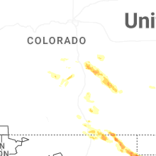
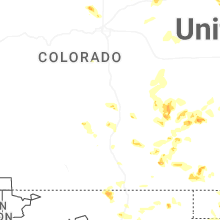
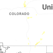
Hail Maps for Lynn, CO


Connect with Interactive Hail Maps