

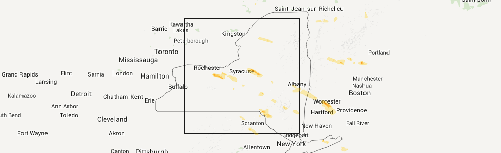
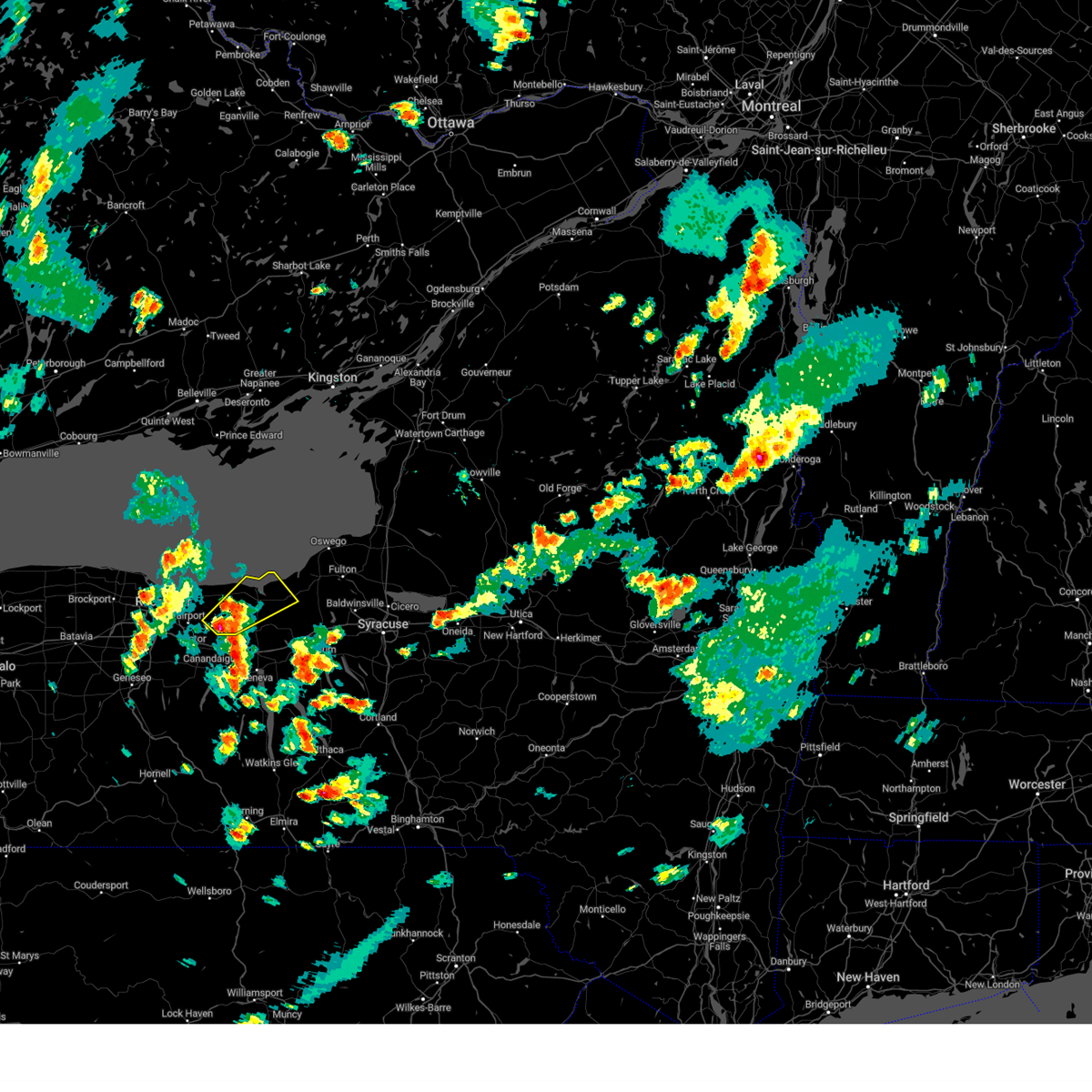
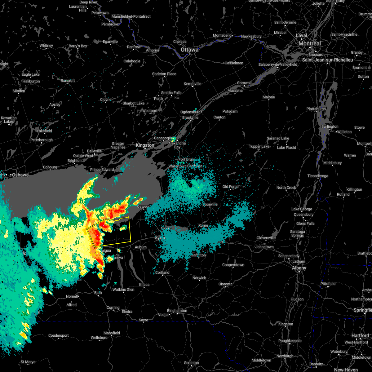
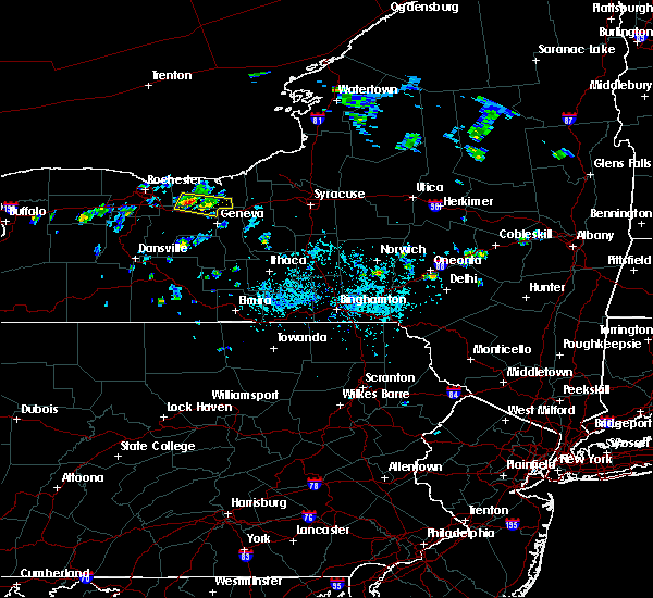
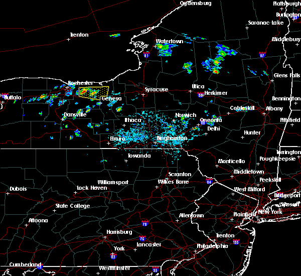
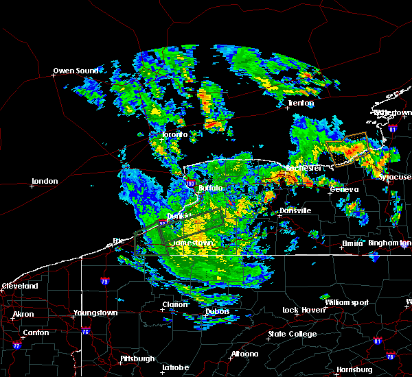
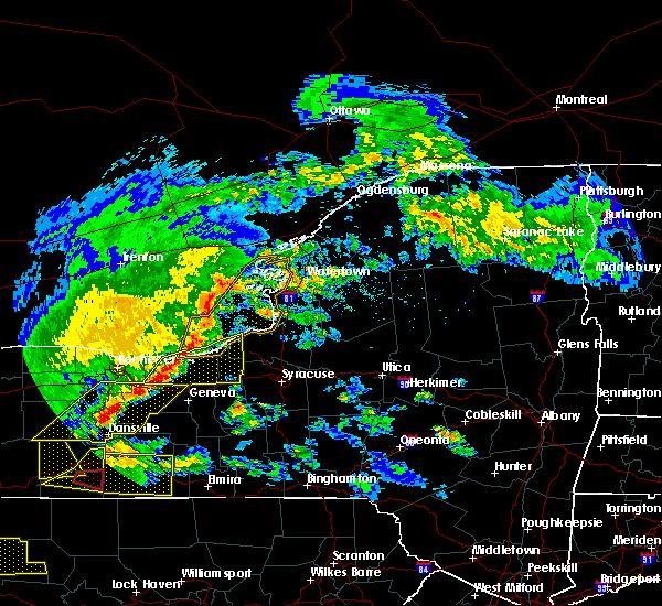
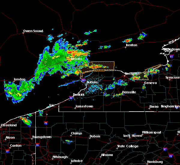
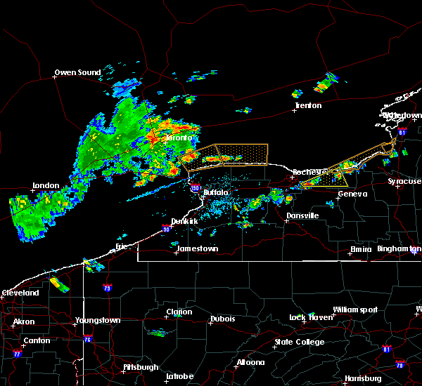
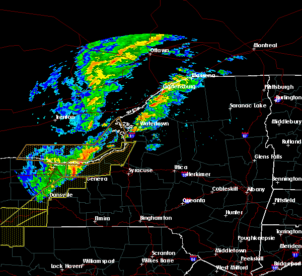
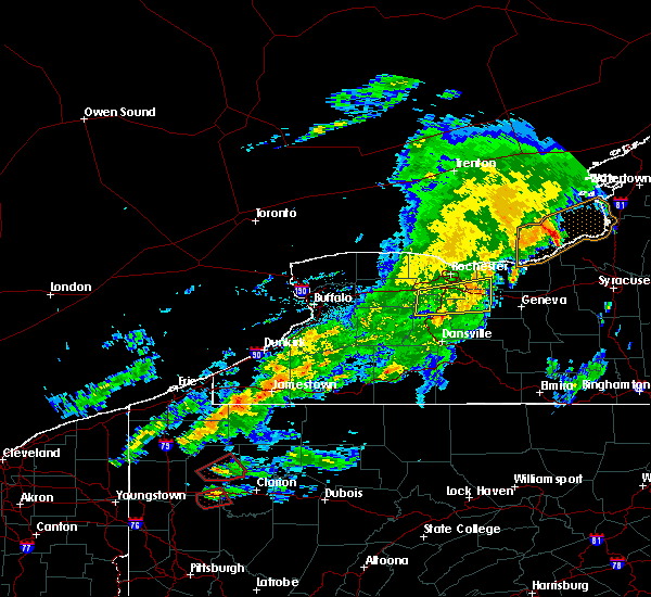
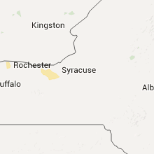
Hail Map for Macedon, NY
The Macedon, NY area has had 1 report of on-the-ground hail by trained spotters, and has been under severe weather warnings 4 times during the past 12 months. Doppler radar has detected hail at or near Macedon, NY on 14 occasions.
| Name: | Macedon, NY |
| Where Located: | 58.6 miles W of Syracuse, NY |
| Map: | Google Map for Macedon, NY |
| Population: | 1523 |
| Housing Units: | 633 |
| More Info: | Search Google for Macedon, NY |
5
The Top Recent Hail Date for Macedon, NY is Tuesday, July 26, 2011 (1st out of 14)
Hail and Wind Damage Spotted near Macedon, NY
| Date / Time | Report Details |
|---|---|
| 8/7/2023 3:24 PM EDT | Trees and wires dow in wayne county NY, 0.4 miles SW of Macedon, NY |
| 7/24/2023 2:35 PM EDT |
 At 235 pm edt, a severe thunderstorm was located over palmyra, or 12 miles east of fairport, moving northeast at 15 mph (radar indicated). Hazards include 60 mph wind gusts and quarter size hail. Hail damage to vehicles is expected. Expect wind damage to roofs, siding, and trees. At 235 pm edt, a severe thunderstorm was located over palmyra, or 12 miles east of fairport, moving northeast at 15 mph (radar indicated). Hazards include 60 mph wind gusts and quarter size hail. Hail damage to vehicles is expected. Expect wind damage to roofs, siding, and trees.
|
| 7/20/2023 10:12 PM EDT |
 At 1011 pm edt, severe thunderstorms were located along a line extending from near ontario to clifton springs, moving northeast at 30 mph (radar indicated). Hazards include 60 mph wind gusts. Expect damage to trees and power lines. locations impacted include, geneva, ontario, newark, williamson, marion, lyons, palmyra, clifton springs, clyde, and phelps. this includes interstate 90 between exits 42 and 43. hail threat, radar indicated max hail size, <. 75 in wind threat, radar indicated max wind gust, 60 mph. At 1011 pm edt, severe thunderstorms were located along a line extending from near ontario to clifton springs, moving northeast at 30 mph (radar indicated). Hazards include 60 mph wind gusts. Expect damage to trees and power lines. locations impacted include, geneva, ontario, newark, williamson, marion, lyons, palmyra, clifton springs, clyde, and phelps. this includes interstate 90 between exits 42 and 43. hail threat, radar indicated max hail size, <. 75 in wind threat, radar indicated max wind gust, 60 mph.
|
| 7/20/2023 9:39 PM EDT |
 At 937 pm edt, severe thunderstorms were located along a line extending from rochester to naples, moving east at 45 mph (radar indicated). Hazards include 60 mph wind gusts. Expect damage to trees and power lines. This line of storms has a history of producing wind damage across western new york. At 937 pm edt, severe thunderstorms were located along a line extending from rochester to naples, moving east at 45 mph (radar indicated). Hazards include 60 mph wind gusts. Expect damage to trees and power lines. This line of storms has a history of producing wind damage across western new york.
|
| 6/26/2023 5:08 PM EDT |
 At 507 pm edt, severe thunderstorms were located along a line extending from near palmyra to near middlesex, moving east at 30 mph (radar indicated). Hazards include 60 mph wind gusts and penny size hail. expect damage to trees and power lines At 507 pm edt, severe thunderstorms were located along a line extending from near palmyra to near middlesex, moving east at 30 mph (radar indicated). Hazards include 60 mph wind gusts and penny size hail. expect damage to trees and power lines
|
| 4/1/2023 4:21 PM EDT |
 At 420 pm edt, a severe thunderstorm was located over canandaigua, moving east at 55 mph (radar indicated). Hazards include 60 mph wind gusts. Expect damage to trees and power lines. locations impacted include, geneva, canandaigua, east rochester, fairport, newark, lyons, palmyra, victor, bristol and clifton springs. this includes interstate 90 between exits 40 and 45. hail threat, radar indicated max hail size, <. 75 in wind threat, radar indicated max wind gust, 60 mph. At 420 pm edt, a severe thunderstorm was located over canandaigua, moving east at 55 mph (radar indicated). Hazards include 60 mph wind gusts. Expect damage to trees and power lines. locations impacted include, geneva, canandaigua, east rochester, fairport, newark, lyons, palmyra, victor, bristol and clifton springs. this includes interstate 90 between exits 40 and 45. hail threat, radar indicated max hail size, <. 75 in wind threat, radar indicated max wind gust, 60 mph.
|
| 4/1/2023 3:45 PM EDT |
 At 344 pm edt, a severe thunderstorm was located over canandaigua, moving east at 45 mph (radar indicated). Hazards include 60 mph wind gusts. expect damage to trees and power lines At 344 pm edt, a severe thunderstorm was located over canandaigua, moving east at 45 mph (radar indicated). Hazards include 60 mph wind gusts. expect damage to trees and power lines
|
| 4/1/2023 2:52 PM EDT |
 At 250 pm edt, severe thunderstorms were located along a line extending from near medina to near houghton to marshburg, moving east at 70 mph (radar indicated). Hazards include 60 mph wind gusts and penny size hail. expect damage to trees and power lines At 250 pm edt, severe thunderstorms were located along a line extending from near medina to near houghton to marshburg, moving east at 70 mph (radar indicated). Hazards include 60 mph wind gusts and penny size hail. expect damage to trees and power lines
|
| 6/16/2022 5:04 PM EDT |
 At 504 pm edt, severe thunderstorms were located along a line extending from plainville to near clifton springs, moving east at 40 mph (radar indicated). Hazards include 60 mph wind gusts and quarter size hail. Minor damage to vehicles is possible. Expect wind damage to trees and power lines. At 504 pm edt, severe thunderstorms were located along a line extending from plainville to near clifton springs, moving east at 40 mph (radar indicated). Hazards include 60 mph wind gusts and quarter size hail. Minor damage to vehicles is possible. Expect wind damage to trees and power lines.
|
| 6/16/2022 4:30 PM EDT |
 At 429 pm edt, a severe thunderstorm was located over hilton, moving east at 55 mph (radar indicated). Hazards include 60 mph wind gusts and half dollar size hail. Minor damage to vehicles is possible. expect wind damage to trees and power lines. locations impacted include, rochester, greece, irondequoit, chili, brockport, east rochester, hilton, webster, fairport and brighton. this includes interstate 390 near exit 12. hail threat, radar indicated max hail size, 1. 25 in wind threat, radar indicated max wind gust, 60 mph. At 429 pm edt, a severe thunderstorm was located over hilton, moving east at 55 mph (radar indicated). Hazards include 60 mph wind gusts and half dollar size hail. Minor damage to vehicles is possible. expect wind damage to trees and power lines. locations impacted include, rochester, greece, irondequoit, chili, brockport, east rochester, hilton, webster, fairport and brighton. this includes interstate 390 near exit 12. hail threat, radar indicated max hail size, 1. 25 in wind threat, radar indicated max wind gust, 60 mph.
|
| 6/16/2022 4:07 PM EDT |
 At 407 pm edt, a severe thunderstorm was located over albion, moving east at 55 mph (radar indicated). Hazards include 60 mph wind gusts and half dollar size hail. Minor damage to vehicles is possible. Expect wind damage to trees and power lines. At 407 pm edt, a severe thunderstorm was located over albion, moving east at 55 mph (radar indicated). Hazards include 60 mph wind gusts and half dollar size hail. Minor damage to vehicles is possible. Expect wind damage to trees and power lines.
|
| 5/21/2022 9:46 PM EDT |
 At 945 pm edt, a severe thunderstorm was located near fairport, moving northeast at 50 mph (radar indicated). Hazards include 60 mph wind gusts. expect damage to trees and power lines At 945 pm edt, a severe thunderstorm was located near fairport, moving northeast at 50 mph (radar indicated). Hazards include 60 mph wind gusts. expect damage to trees and power lines
|
| 5/21/2022 9:16 PM EDT |
 At 915 pm edt, a severe thunderstorm was located over hemlock, or 10 miles east of geneseo, moving northeast at 45 mph (radar indicated). Hazards include 60 mph wind gusts and quarter size hail. Minor damage to vehicles is possible. expect wind damage to trees and power lines. locations impacted include, canandaigua, geneseo, east rochester, fairport, dansville, letchworth state park, avon, mount morris, victor and honeoye falls. this includes the following highways, interstate 390 between exits 4 and 11. interstate 90 between exits 45 and 43. hail threat, radar indicated max hail size, 1. 00 in wind threat, radar indicated max wind gust, 60 mph. At 915 pm edt, a severe thunderstorm was located over hemlock, or 10 miles east of geneseo, moving northeast at 45 mph (radar indicated). Hazards include 60 mph wind gusts and quarter size hail. Minor damage to vehicles is possible. expect wind damage to trees and power lines. locations impacted include, canandaigua, geneseo, east rochester, fairport, dansville, letchworth state park, avon, mount morris, victor and honeoye falls. this includes the following highways, interstate 390 between exits 4 and 11. interstate 90 between exits 45 and 43. hail threat, radar indicated max hail size, 1. 00 in wind threat, radar indicated max wind gust, 60 mph.
|
| 5/21/2022 8:53 PM EDT |
 At 852 pm edt, a severe thunderstorm was located near mount morris, or near letchworth state park, moving northeast at 45 mph (radar indicated). Hazards include 60 mph wind gusts and quarter size hail. Minor damage to vehicles is possible. Expect wind damage to trees and power lines. At 852 pm edt, a severe thunderstorm was located near mount morris, or near letchworth state park, moving northeast at 45 mph (radar indicated). Hazards include 60 mph wind gusts and quarter size hail. Minor damage to vehicles is possible. Expect wind damage to trees and power lines.
|
| 4/25/2022 7:43 PM EDT |
 At 743 pm edt, severe thunderstorms were located along a line extending from webster to near bristol, moving northeast at 40 mph (radar indicated). Hazards include 60 mph wind gusts. Expect damage to trees and power lines. locations impacted include, irondequoit, canandaigua, east rochester, webster, fairport, brighton, ontario, penfield, williamson and marion. This includes interstate 90 between exits 45 and 43. At 743 pm edt, severe thunderstorms were located along a line extending from webster to near bristol, moving northeast at 40 mph (radar indicated). Hazards include 60 mph wind gusts. Expect damage to trees and power lines. locations impacted include, irondequoit, canandaigua, east rochester, webster, fairport, brighton, ontario, penfield, williamson and marion. This includes interstate 90 between exits 45 and 43.
|
| 4/25/2022 7:32 PM EDT |
 At 731 pm edt, severe thunderstorms were located along a line extending from rochester to honeoye, moving east at 45 mph (radar indicated). Hazards include 70 mph wind gusts and penny size hail. Expect considerable tree damage. damage is likely to mobile homes, roofs, and outbuildings. locations impacted include, rochester, greece, irondequoit, chili, canandaigua, east rochester, webster, fairport, brighton, lima, victor, penfield, macedon, and walworth. this includes the following highways, interstate 390 between exits 10 and 12. Interstate 90 between exits 46 and 43. At 731 pm edt, severe thunderstorms were located along a line extending from rochester to honeoye, moving east at 45 mph (radar indicated). Hazards include 70 mph wind gusts and penny size hail. Expect considerable tree damage. damage is likely to mobile homes, roofs, and outbuildings. locations impacted include, rochester, greece, irondequoit, chili, canandaigua, east rochester, webster, fairport, brighton, lima, victor, penfield, macedon, and walworth. this includes the following highways, interstate 390 between exits 10 and 12. Interstate 90 between exits 46 and 43.
|
| 4/25/2022 7:08 PM EDT |
 At 707 pm edt, severe thunderstorms were located along a line extending from near holley to near mount morris, moving northeast at 40 mph (radar indicated). Hazards include 70 mph wind gusts and penny size hail. Expect considerable tree damage. Damage is likely to mobile homes, roofs, and outbuildings. At 707 pm edt, severe thunderstorms were located along a line extending from near holley to near mount morris, moving northeast at 40 mph (radar indicated). Hazards include 70 mph wind gusts and penny size hail. Expect considerable tree damage. Damage is likely to mobile homes, roofs, and outbuildings.
|
| 7/20/2021 7:38 PM EDT |
 At 737 pm edt, a severe thunderstorm was located over honeoye falls, or 11 miles south of brighton, moving east at 15 mph (radar indicated). Hazards include 60 mph wind gusts. expect damage to roofs, siding, and trees At 737 pm edt, a severe thunderstorm was located over honeoye falls, or 11 miles south of brighton, moving east at 15 mph (radar indicated). Hazards include 60 mph wind gusts. expect damage to roofs, siding, and trees
|
| 7/13/2021 8:02 PM EDT | Trees down in macedon. time estimated based on rada in wayne county NY, 0.4 miles SW of Macedon, NY |
| 7/6/2021 12:21 PM EDT |
 At 1221 pm edt, severe thunderstorms were located along a line extending from near fairport to near bristol, moving east at 30 mph (radar indicated). Hazards include 60 mph wind gusts and quarter size hail. Minor damage to vehicles is possible. Expect wind damage to roofs, siding, and trees. At 1221 pm edt, severe thunderstorms were located along a line extending from near fairport to near bristol, moving east at 30 mph (radar indicated). Hazards include 60 mph wind gusts and quarter size hail. Minor damage to vehicles is possible. Expect wind damage to roofs, siding, and trees.
|
| 7/6/2021 12:00 PM EDT |
 At 1200 pm edt, a severe thunderstorm was located over gates-north gates, moving east at 35 mph (radar indicated). Hazards include 60 mph wind gusts and quarter size hail. Minor damage to vehicles is possible. Expect wind damage to roofs, siding, and trees. At 1200 pm edt, a severe thunderstorm was located over gates-north gates, moving east at 35 mph (radar indicated). Hazards include 60 mph wind gusts and quarter size hail. Minor damage to vehicles is possible. Expect wind damage to roofs, siding, and trees.
|
| 6/21/2021 4:25 PM EDT |
 At 424 pm edt, a severe thunderstorm was located near newark, or 17 miles north of geneva, moving east at 45 mph (radar indicated). Hazards include 60 mph wind gusts and penny size hail. Expect damage to roofs, siding, and trees. locations impacted include, canandaigua, newark, marion, lyons, palmyra, victor, bristol, clifton springs, clyde and phelps. This includes interstate 90 between exits 44 and 42. At 424 pm edt, a severe thunderstorm was located near newark, or 17 miles north of geneva, moving east at 45 mph (radar indicated). Hazards include 60 mph wind gusts and penny size hail. Expect damage to roofs, siding, and trees. locations impacted include, canandaigua, newark, marion, lyons, palmyra, victor, bristol, clifton springs, clyde and phelps. This includes interstate 90 between exits 44 and 42.
|
| 6/21/2021 4:10 PM EDT | Tree down on trailer on quaker roa in wayne county NY, 2.5 miles ESE of Macedon, NY |
| 6/21/2021 3:58 PM EDT |
 At 358 pm edt, a severe thunderstorm was located near victor, or near fairport, moving east at 45 mph (radar indicated). Hazards include 60 mph wind gusts and penny size hail. expect damage to roofs, siding, and trees At 358 pm edt, a severe thunderstorm was located near victor, or near fairport, moving east at 45 mph (radar indicated). Hazards include 60 mph wind gusts and penny size hail. expect damage to roofs, siding, and trees
|
| 6/20/2021 10:24 PM EDT |
 At 1024 pm edt, a severe thunderstorm was located over victor, or 7 miles southeast of fairport, moving east at 35 mph (radar indicated). Hazards include 60 mph wind gusts and quarter size hail. Minor damage to vehicles is possible. expect wind damage to roofs, siding, and trees. locations impacted include, canandaigua, fairport, palmyra, victor, bristol, bloomfield, rushville, farmington, walworth and east bloomfield. This includes interstate 90 between exits 45 and 43. At 1024 pm edt, a severe thunderstorm was located over victor, or 7 miles southeast of fairport, moving east at 35 mph (radar indicated). Hazards include 60 mph wind gusts and quarter size hail. Minor damage to vehicles is possible. expect wind damage to roofs, siding, and trees. locations impacted include, canandaigua, fairport, palmyra, victor, bristol, bloomfield, rushville, farmington, walworth and east bloomfield. This includes interstate 90 between exits 45 and 43.
|
| 6/20/2021 9:55 PM EDT |
 At 955 pm edt, a severe thunderstorm was located over lima, or 12 miles southeast of chili, moving east at 30 mph (radar indicated). Hazards include 60 mph wind gusts and quarter size hail. Minor damage to vehicles is possible. Expect wind damage to roofs, siding, and trees. At 955 pm edt, a severe thunderstorm was located over lima, or 12 miles southeast of chili, moving east at 30 mph (radar indicated). Hazards include 60 mph wind gusts and quarter size hail. Minor damage to vehicles is possible. Expect wind damage to roofs, siding, and trees.
|
| 11/15/2020 4:51 PM EST |
 At 450 pm est, severe thunderstorms were located along a line extending from near webster to near bristol, moving east at 60 mph (radar indicated). Hazards include 60 mph wind gusts. expect damage to roofs, siding, and trees At 450 pm est, severe thunderstorms were located along a line extending from near webster to near bristol, moving east at 60 mph (radar indicated). Hazards include 60 mph wind gusts. expect damage to roofs, siding, and trees
|
| 11/15/2020 4:49 PM EST |
 At 448 pm est, severe thunderstorms were located along a line extending from near webster to near alfred, moving east at 55 mph (radar indicated). Hazards include 60 mph wind gusts. Expect damage to roofs, siding, and trees. locations impacted include, rochester, irondequoit, geneva, canandaigua, east rochester, webster, fairport, dansville, and wellsville. this includes the following highways, interstate 390 between exits 4 and 5. interstate 90 between exits 45 and 42. Interstate 86 between exits 32 and 33. At 448 pm est, severe thunderstorms were located along a line extending from near webster to near alfred, moving east at 55 mph (radar indicated). Hazards include 60 mph wind gusts. Expect damage to roofs, siding, and trees. locations impacted include, rochester, irondequoit, geneva, canandaigua, east rochester, webster, fairport, dansville, and wellsville. this includes the following highways, interstate 390 between exits 4 and 5. interstate 90 between exits 45 and 42. Interstate 86 between exits 32 and 33.
|
| 11/15/2020 4:32 PM EST |
 At 431 pm est, severe thunderstorms were located along a line extending from near rochester to 8 miles west of alfred, moving east at 55 mph (radar indicated). Hazards include 60 mph wind gusts. Expect damage to roofs, siding, and trees. locations impacted include, rochester, greece, irondequoit, chili, geneva, canandaigua, geneseo, east rochester, hilton, webster, mount morris, portageville, angelica, fillmore, and belmont. this includes the following highways, interstate 390 between exits 4 and 12. interstate 90 between exits 46 and 42. Interstate 86 between exits 29 and 33. At 431 pm est, severe thunderstorms were located along a line extending from near rochester to 8 miles west of alfred, moving east at 55 mph (radar indicated). Hazards include 60 mph wind gusts. Expect damage to roofs, siding, and trees. locations impacted include, rochester, greece, irondequoit, chili, geneva, canandaigua, geneseo, east rochester, hilton, webster, mount morris, portageville, angelica, fillmore, and belmont. this includes the following highways, interstate 390 between exits 4 and 12. interstate 90 between exits 46 and 42. Interstate 86 between exits 29 and 33.
|
| 11/15/2020 3:57 PM EST |
 At 355 pm est, severe thunderstorms were located along a line extending from near albion to 6 miles south of franklinville, moving east at 55 mph (radar indicated). Hazards include 60 mph wind gusts. expect damage to roofs, siding, and trees At 355 pm est, severe thunderstorms were located along a line extending from near albion to 6 miles south of franklinville, moving east at 55 mph (radar indicated). Hazards include 60 mph wind gusts. expect damage to roofs, siding, and trees
|
| 8/27/2020 2:41 PM EDT |
 At 240 pm edt, a severe thunderstorm was located near victor, or near fairport, moving east at 50 mph (radar indicated). Hazards include 60 mph wind gusts and quarter size hail. Minor damage to vehicles is possible. Expect wind damage to roofs, siding, and trees. At 240 pm edt, a severe thunderstorm was located near victor, or near fairport, moving east at 50 mph (radar indicated). Hazards include 60 mph wind gusts and quarter size hail. Minor damage to vehicles is possible. Expect wind damage to roofs, siding, and trees.
|
| 8/3/2020 7:58 PM EDT |
 The severe thunderstorm warning for southwestern wayne, east central monroe and north central ontario counties will expire at 800 pm edt, the storm which prompted the warning has weakened below severe limits, and no longer poses an immediate threat to life or property. therefore, the warning will be allowed to expire. however heavy rain is still likely with this thunderstorm. The severe thunderstorm warning for southwestern wayne, east central monroe and north central ontario counties will expire at 800 pm edt, the storm which prompted the warning has weakened below severe limits, and no longer poses an immediate threat to life or property. therefore, the warning will be allowed to expire. however heavy rain is still likely with this thunderstorm.
|
| 8/3/2020 7:37 PM EDT |
 At 737 pm edt, a severe thunderstorm was located near fairport, moving east at 20 mph (radar indicated). Hazards include 60 mph wind gusts. Expect damage to roofs, siding, and trees. locations impacted include, east rochester, webster, fairport, brighton, ontario, penfield, newark, marion, palmyra and walworth. This includes interstate 90 near exit 45. At 737 pm edt, a severe thunderstorm was located near fairport, moving east at 20 mph (radar indicated). Hazards include 60 mph wind gusts. Expect damage to roofs, siding, and trees. locations impacted include, east rochester, webster, fairport, brighton, ontario, penfield, newark, marion, palmyra and walworth. This includes interstate 90 near exit 45.
|
| 8/3/2020 7:05 PM EDT |
 At 704 pm edt, a severe thunderstorm was located over henrietta, or near brighton, moving northeast at 25 mph (radar indicated). Hazards include 60 mph wind gusts. expect damage to roofs, siding, and trees At 704 pm edt, a severe thunderstorm was located over henrietta, or near brighton, moving northeast at 25 mph (radar indicated). Hazards include 60 mph wind gusts. expect damage to roofs, siding, and trees
|
| 7/29/2020 4:41 PM EDT |
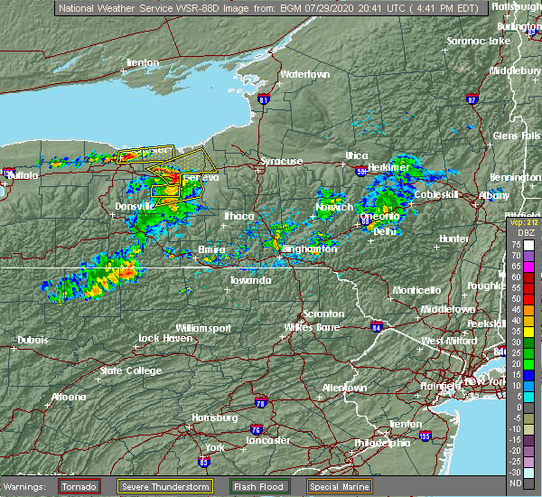 At 420 pm edt, a severe thunderstorm was located near victor, or near canandaigua, moving northeast at 40 mph (radar indicated). Hazards include 60 mph wind gusts. expect damage to roofs, siding, and trees At 420 pm edt, a severe thunderstorm was located near victor, or near canandaigua, moving northeast at 40 mph (radar indicated). Hazards include 60 mph wind gusts. expect damage to roofs, siding, and trees
|
| 7/29/2020 4:20 PM EDT |
 At 420 pm edt, a severe thunderstorm was located near victor, or near canandaigua, moving northeast at 40 mph (radar indicated). Hazards include 60 mph wind gusts. expect damage to roofs, siding, and trees At 420 pm edt, a severe thunderstorm was located near victor, or near canandaigua, moving northeast at 40 mph (radar indicated). Hazards include 60 mph wind gusts. expect damage to roofs, siding, and trees
|
| 7/19/2020 3:20 PM EDT |
 At 319 pm edt, a severe thunderstorm was located over bloomfield, or 8 miles west of canandaigua, moving east at 55 mph (radar indicated). Hazards include 60 mph wind gusts. expect damage to roofs, siding, and trees At 319 pm edt, a severe thunderstorm was located over bloomfield, or 8 miles west of canandaigua, moving east at 55 mph (radar indicated). Hazards include 60 mph wind gusts. expect damage to roofs, siding, and trees
|
| 7/13/2020 4:30 PM EDT |
 At 429 pm edt, a severe thunderstorm was located over newark, or 14 miles northeast of canandaigua, moving east at 20 mph (radar indicated). Hazards include 60 mph wind gusts and quarter size hail. Minor damage to vehicles is possible. expect wind damage to roofs, siding, and trees. locations impacted include, newark, lyons, palmyra, clyde, phelps, walworth, macedon, fairville, port gibson and willow creek estates. This includes interstate 90 near exit 42. At 429 pm edt, a severe thunderstorm was located over newark, or 14 miles northeast of canandaigua, moving east at 20 mph (radar indicated). Hazards include 60 mph wind gusts and quarter size hail. Minor damage to vehicles is possible. expect wind damage to roofs, siding, and trees. locations impacted include, newark, lyons, palmyra, clyde, phelps, walworth, macedon, fairville, port gibson and willow creek estates. This includes interstate 90 near exit 42.
|
| 7/13/2020 4:14 PM EDT |
 At 414 pm edt, a severe thunderstorm was located over palmyra, or 11 miles east of fairport, moving east at 20 mph (radar indicated). Hazards include 60 mph wind gusts and quarter size hail. Minor damage to vehicles is possible. expect wind damage to roofs, siding, and trees. locations impacted include, newark, marion, lyons, palmyra, clifton springs, clyde, phelps, walworth, rose and macedon. This includes interstate 90 near exit 42. At 414 pm edt, a severe thunderstorm was located over palmyra, or 11 miles east of fairport, moving east at 20 mph (radar indicated). Hazards include 60 mph wind gusts and quarter size hail. Minor damage to vehicles is possible. expect wind damage to roofs, siding, and trees. locations impacted include, newark, marion, lyons, palmyra, clifton springs, clyde, phelps, walworth, rose and macedon. This includes interstate 90 near exit 42.
|
| 7/13/2020 4:12 PM EDT |
 At 411 pm edt, a severe thunderstorm was located over palmyra, or 10 miles east of fairport, moving east at 20 mph (radar indicated). Hazards include quarter size hail. minor damage to vehicles is possible At 411 pm edt, a severe thunderstorm was located over palmyra, or 10 miles east of fairport, moving east at 20 mph (radar indicated). Hazards include quarter size hail. minor damage to vehicles is possible
|
| 7/11/2020 3:47 PM EDT | Trees dow in wayne county NY, 1.9 miles NNE of Macedon, NY |
| 7/11/2020 3:43 PM EDT |
 At 343 pm edt, a severe thunderstorm was located over palmyra, or 9 miles east of fairport, moving northeast at 25 mph (radar indicated). Hazards include 60 mph wind gusts. expect damage to roofs, siding, and trees At 343 pm edt, a severe thunderstorm was located over palmyra, or 9 miles east of fairport, moving northeast at 25 mph (radar indicated). Hazards include 60 mph wind gusts. expect damage to roofs, siding, and trees
|
| 8/16/2019 7:15 PM EDT | Wires dow in ontario county NY, 2.8 miles NNE of Macedon, NY |
| 8/8/2019 12:52 PM EDT |
 At 1251 pm edt, severe thunderstorms were located along a line extending from near williamson to near fairport to near lima, moving east at 35 mph (radar indicated). Hazards include 60 mph wind gusts and penny size hail. Expect damage to roofs, siding, and trees. locations impacted include, canandaigua, east rochester, webster, fairport, brighton, ontario, penfield, newark, williamson and marion. This includes interstate 90 between exits 45 and 42. At 1251 pm edt, severe thunderstorms were located along a line extending from near williamson to near fairport to near lima, moving east at 35 mph (radar indicated). Hazards include 60 mph wind gusts and penny size hail. Expect damage to roofs, siding, and trees. locations impacted include, canandaigua, east rochester, webster, fairport, brighton, ontario, penfield, newark, williamson and marion. This includes interstate 90 between exits 45 and 42.
|
| 8/8/2019 12:20 PM EDT |
 At 1219 pm edt, severe thunderstorms were located along a line extending from near greece to near scottsville to 6 miles east of pavilion, moving east at 35 mph (radar indicated). Hazards include 60 mph wind gusts. expect damage to roofs, siding, and trees At 1219 pm edt, severe thunderstorms were located along a line extending from near greece to near scottsville to 6 miles east of pavilion, moving east at 35 mph (radar indicated). Hazards include 60 mph wind gusts. expect damage to roofs, siding, and trees
|
| 5/25/2019 7:57 PM EDT |
 At 757 pm edt, a severe thunderstorm was located over palmyra, or 12 miles east of fairport, moving east at 55 mph (radar indicated). Hazards include 60 mph wind gusts and penny size hail. expect damage to roofs, siding, and trees At 757 pm edt, a severe thunderstorm was located over palmyra, or 12 miles east of fairport, moving east at 55 mph (radar indicated). Hazards include 60 mph wind gusts and penny size hail. expect damage to roofs, siding, and trees
|
| 5/19/2019 1:23 PM EDT |
 At 122 pm edt, a severe thunderstorm was located near palmyra, or near fairport, moving east at 35 mph (radar indicated). Hazards include 60 mph wind gusts and quarter size hail. Minor damage to vehicles is possible. Expect wind damage to roofs, siding, and trees. At 122 pm edt, a severe thunderstorm was located near palmyra, or near fairport, moving east at 35 mph (radar indicated). Hazards include 60 mph wind gusts and quarter size hail. Minor damage to vehicles is possible. Expect wind damage to roofs, siding, and trees.
|
| 9/21/2018 6:31 PM EDT |
 The national weather service in buffalo has issued a * severe thunderstorm warning for. southwestern wayne county in western new york. wyoming county in western new york. livingston county in western new york. Southern monroe county in western new york. The national weather service in buffalo has issued a * severe thunderstorm warning for. southwestern wayne county in western new york. wyoming county in western new york. livingston county in western new york. Southern monroe county in western new york.
|
| 8/6/2018 3:33 PM EDT |
 At 332 pm edt, a severe thunderstorm was located over palmyra, or 10 miles east of fairport, moving east at 30 mph (radar indicated). Hazards include 60 mph wind gusts. Expect damage to roofs, siding, and trees. Locations impacted include, newark, marion, lyons, palmyra, clyde, sodus, chimney bluffs state park and walworth. At 332 pm edt, a severe thunderstorm was located over palmyra, or 10 miles east of fairport, moving east at 30 mph (radar indicated). Hazards include 60 mph wind gusts. Expect damage to roofs, siding, and trees. Locations impacted include, newark, marion, lyons, palmyra, clyde, sodus, chimney bluffs state park and walworth.
|
| 8/6/2018 3:17 PM EDT |
 At 317 pm edt, a severe thunderstorm was located near fairport, moving east at 30 mph (radar indicated). Hazards include 60 mph wind gusts. expect damage to roofs, siding, and trees At 317 pm edt, a severe thunderstorm was located near fairport, moving east at 30 mph (radar indicated). Hazards include 60 mph wind gusts. expect damage to roofs, siding, and trees
|
| 7/5/2018 7:11 PM EDT |
 The severe thunderstorm warning for southwestern wayne, southeastern monroe and northwestern ontario counties will expire at 715 pm edt, the storm which prompted the warning is moving out of the area. therefore, the warning will be allowed to expire. however heavy rain is still possible with the weakened showers and thunderstorms. The severe thunderstorm warning for southwestern wayne, southeastern monroe and northwestern ontario counties will expire at 715 pm edt, the storm which prompted the warning is moving out of the area. therefore, the warning will be allowed to expire. however heavy rain is still possible with the weakened showers and thunderstorms.
|
| 7/5/2018 6:56 PM EDT |
 At 654 pm edt, a severe thunderstorm was located between victor and fairport, moving northeast at 30 mph (radar indicated). Hazards include 60 mph wind gusts and nickel size hail. Expect damage to roofs, siding, and trees. Locations impacted include, rochester, irondequoit, east rochester, webster, fairport, brighton, henrietta and penfield. At 654 pm edt, a severe thunderstorm was located between victor and fairport, moving northeast at 30 mph (radar indicated). Hazards include 60 mph wind gusts and nickel size hail. Expect damage to roofs, siding, and trees. Locations impacted include, rochester, irondequoit, east rochester, webster, fairport, brighton, henrietta and penfield.
|
| 7/5/2018 6:21 PM EDT |
 The national weather service in buffalo has issued a * severe thunderstorm warning for. southwestern wayne county in western new york. northeastern livingston county in western new york. southeastern monroe county in western new york. Northwestern ontario county in western new york. The national weather service in buffalo has issued a * severe thunderstorm warning for. southwestern wayne county in western new york. northeastern livingston county in western new york. southeastern monroe county in western new york. Northwestern ontario county in western new york.
|
| 5/4/2018 4:37 PM EDT |
 The severe thunderstorm warning for western wayne, southeastern orleans, monroe and eastern genesee counties will expire at 445 pm edt, the storm which prompted the warning has weakened below severe limits, and no longer pose an immediate threat to life or property. therefore the warning will be allowed to expire. however gusty winds are still possible with this thunderstorm. a severe thunderstorm watch remains in effect until 900 pm edt for western new york. The severe thunderstorm warning for western wayne, southeastern orleans, monroe and eastern genesee counties will expire at 445 pm edt, the storm which prompted the warning has weakened below severe limits, and no longer pose an immediate threat to life or property. therefore the warning will be allowed to expire. however gusty winds are still possible with this thunderstorm. a severe thunderstorm watch remains in effect until 900 pm edt for western new york.
|
| 5/4/2018 4:10 PM EDT |
 The national weather service in buffalo has issued a * severe thunderstorm warning for. western wayne county in western new york. southeastern orleans county in western new york. monroe county in western new york. Eastern genesee county in western new york. The national weather service in buffalo has issued a * severe thunderstorm warning for. western wayne county in western new york. southeastern orleans county in western new york. monroe county in western new york. Eastern genesee county in western new york.
|
| 10/15/2017 5:16 PM EDT |
 At 515 pm edt, severe thunderstorms were located along a line extending from 16 miles northwest of fair haven beach state park to near williamson to near palmyra, moving east at 55 mph (radar indicated). Hazards include 70 mph wind gusts. Expect considerable tree damage. Damage is likely to mobile homes, roofs, and outbuildings. At 515 pm edt, severe thunderstorms were located along a line extending from 16 miles northwest of fair haven beach state park to near williamson to near palmyra, moving east at 55 mph (radar indicated). Hazards include 70 mph wind gusts. Expect considerable tree damage. Damage is likely to mobile homes, roofs, and outbuildings.
|
| 10/15/2017 4:57 PM EDT |
 At 456 pm edt, severe thunderstorms were located along a line extending from 9 miles north of ontario to avon to near rushford, moving east at 50 mph (radar indicated). Hazards include 60 mph wind gusts. Expect wind damage to trees and power lines. locations impacted include, rochester, irondequoit, canandaigua, geneseo, east rochester, webster, fairport and dansville. this includes the following highways, interstate 390 between exits 4 and 12. Interstate 90 between exits 46 and 43. At 456 pm edt, severe thunderstorms were located along a line extending from 9 miles north of ontario to avon to near rushford, moving east at 50 mph (radar indicated). Hazards include 60 mph wind gusts. Expect wind damage to trees and power lines. locations impacted include, rochester, irondequoit, canandaigua, geneseo, east rochester, webster, fairport and dansville. this includes the following highways, interstate 390 between exits 4 and 12. Interstate 90 between exits 46 and 43.
|
| 10/15/2017 4:36 PM EDT |
 At 432 pm edt, severe thunderstorms were located along a line extending from near hilton to near pavilion to ashford hollow, moving east at 50 mph (radar indicated). Hazards include 60 mph wind gusts. expect wind damage to trees and power lines At 432 pm edt, severe thunderstorms were located along a line extending from near hilton to near pavilion to ashford hollow, moving east at 50 mph (radar indicated). Hazards include 60 mph wind gusts. expect wind damage to trees and power lines
|
| 9/4/2017 11:42 PM EDT |
 The severe thunderstorm warning for western wayne and southeastern monroe counties will expire at 1145 pm edt, the storm which prompted the warning has weakened below severe limits, and no longer pose an immediate threat to life or property. therefore the warning will be allowed to expire. The severe thunderstorm warning for western wayne and southeastern monroe counties will expire at 1145 pm edt, the storm which prompted the warning has weakened below severe limits, and no longer pose an immediate threat to life or property. therefore the warning will be allowed to expire.
|
| 9/4/2017 11:23 PM EDT |
 At 1123 pm edt, a severe thunderstorm was located over penfield, or near east rochester, moving east at 60 mph (radar indicated). Hazards include 60 mph wind gusts. Expect wind damage to trees and power lines. locations impacted include, rochester, irondequoit, east rochester, webster, fairport, brighton, ontario and henrietta. this includes the following highways, interstate 390 near exit 12. Interstate 90 near exit 46. At 1123 pm edt, a severe thunderstorm was located over penfield, or near east rochester, moving east at 60 mph (radar indicated). Hazards include 60 mph wind gusts. Expect wind damage to trees and power lines. locations impacted include, rochester, irondequoit, east rochester, webster, fairport, brighton, ontario and henrietta. this includes the following highways, interstate 390 near exit 12. Interstate 90 near exit 46.
|
| 9/4/2017 11:06 PM EDT |
 At 1105 pm edt, a severe thunderstorm was located over scottsville, or near chili, moving east at 60 mph (radar indicated). Hazards include 60 mph wind gusts. expect wind damage to trees and power lines At 1105 pm edt, a severe thunderstorm was located over scottsville, or near chili, moving east at 60 mph (radar indicated). Hazards include 60 mph wind gusts. expect wind damage to trees and power lines
|
| 8/22/2017 2:03 PM EDT |
 At 202 pm edt, severe thunderstorms were located along a line extending from near sodus to near clifton springs, moving east at 40 mph (radar indicated). Hazards include 60 mph wind gusts. Expect wind damage to trees and power lines. locations impacted include, geneva, canandaigua, fair haven beach state park, newark, williamson, marion, lyons and palmyra. this includes interstate 90 between exits 45 and 42. A tornado watch remains in effect until 900 pm edt for central and western new york. At 202 pm edt, severe thunderstorms were located along a line extending from near sodus to near clifton springs, moving east at 40 mph (radar indicated). Hazards include 60 mph wind gusts. Expect wind damage to trees and power lines. locations impacted include, geneva, canandaigua, fair haven beach state park, newark, williamson, marion, lyons and palmyra. this includes interstate 90 between exits 45 and 42. A tornado watch remains in effect until 900 pm edt for central and western new york.
|
| 8/22/2017 1:30 PM EDT | Power wires dow in wayne county NY, 5.3 miles SSE of Macedon, NY |
| 8/22/2017 1:25 PM EDT |
 The severe thunderstorm warning for western wayne, northeastern livingston, monroe, east central genesee and northwestern ontario counties will expire at 130 pm edt, the storms which prompted the warning have moved out of the area. therefore the warning will be allowed to expire. remember, a severe thunderstorm warning still remains in effect for eastern monroe, wayne and ontario counties. a tornado watch remains in effect until 900 pm edt for western new york. The severe thunderstorm warning for western wayne, northeastern livingston, monroe, east central genesee and northwestern ontario counties will expire at 130 pm edt, the storms which prompted the warning have moved out of the area. therefore the warning will be allowed to expire. remember, a severe thunderstorm warning still remains in effect for eastern monroe, wayne and ontario counties. a tornado watch remains in effect until 900 pm edt for western new york.
|
| 8/22/2017 1:23 PM EDT |
 At 123 pm edt, severe thunderstorms were located along a line extending from near penfield to near hemlock, moving east at 40 mph (radar indicated). Hazards include 60 mph wind gusts. expect wind damage to trees and power lines At 123 pm edt, severe thunderstorms were located along a line extending from near penfield to near hemlock, moving east at 40 mph (radar indicated). Hazards include 60 mph wind gusts. expect wind damage to trees and power lines
|
| 8/22/2017 1:04 PM EDT |
 At 103 pm edt, severe thunderstorms were located along a line extending from gates-north gates to near le roy, moving northeast at 55 mph (radar indicated). Hazards include 60 mph wind gusts. Expect wind damage to trees and power lines. locations impacted include, rochester, greece, irondequoit, chili, geneseo, east rochester, webster and fairport. this includes the following highways, interstate 390 between exits 8 and 12. interstate 90 between exits 46 and 44. A tornado watch remains in effect until 900 pm edt for western new york. At 103 pm edt, severe thunderstorms were located along a line extending from gates-north gates to near le roy, moving northeast at 55 mph (radar indicated). Hazards include 60 mph wind gusts. Expect wind damage to trees and power lines. locations impacted include, rochester, greece, irondequoit, chili, geneseo, east rochester, webster and fairport. this includes the following highways, interstate 390 between exits 8 and 12. interstate 90 between exits 46 and 44. A tornado watch remains in effect until 900 pm edt for western new york.
|
| 8/22/2017 12:34 PM EDT |
 At 1234 pm edt, severe thunderstorms were located along a line extending from near batavia to near varysburg, moving northeast at 55 mph (radar indicated). Hazards include 60 mph wind gusts. expect wind damage to trees and power lines At 1234 pm edt, severe thunderstorms were located along a line extending from near batavia to near varysburg, moving northeast at 55 mph (radar indicated). Hazards include 60 mph wind gusts. expect wind damage to trees and power lines
|
| 7/20/2017 12:48 PM EDT |
 At 1247 pm edt, a severe thunderstorm was located over churchville, or near chili, moving east at 45 mph (radar indicated). Hazards include 60 mph wind gusts. Expect wind damage to trees and power lines. locations impacted include, rochester, greece, irondequoit, chili, batavia, canandaigua, brockport and geneseo. this includes the following highways, interstate 390 between exits 8 and 12. Interstate 90 between exits 48a and 43. At 1247 pm edt, a severe thunderstorm was located over churchville, or near chili, moving east at 45 mph (radar indicated). Hazards include 60 mph wind gusts. Expect wind damage to trees and power lines. locations impacted include, rochester, greece, irondequoit, chili, batavia, canandaigua, brockport and geneseo. this includes the following highways, interstate 390 between exits 8 and 12. Interstate 90 between exits 48a and 43.
|
| 7/20/2017 12:21 PM EDT |
 At 1221 pm edt, a severe thunderstorm was located near albion, moving east at 45 mph (radar indicated). Hazards include 60 mph wind gusts. expect wind damage to trees and power lines At 1221 pm edt, a severe thunderstorm was located near albion, moving east at 45 mph (radar indicated). Hazards include 60 mph wind gusts. expect wind damage to trees and power lines
|
| 6/26/2017 5:36 PM EDT |
 At 535 pm edt, a severe thunderstorm was located over henrietta, or near brighton, moving northeast at 40 mph (radar indicated). Hazards include 60 mph wind gusts and quarter size hail. Minor damage to vehicles is possible. Expect wind damage to trees and power lines. At 535 pm edt, a severe thunderstorm was located over henrietta, or near brighton, moving northeast at 40 mph (radar indicated). Hazards include 60 mph wind gusts and quarter size hail. Minor damage to vehicles is possible. Expect wind damage to trees and power lines.
|
| 6/18/2017 5:54 PM EDT |
 At 552 pm edt, severe thunderstorms were located along a line extending from near fairport to near vine valley, moving northeast at 40 mph (radar indicated). Hazards include 70 mph wind gusts. Expect considerable tree damage. damage is likely to mobile homes, roofs, and outbuildings. locations impacted include, geneva, canandaigua, east rochester, webster, fairport. This includes interstate 90 between exits 45 and 42. At 552 pm edt, severe thunderstorms were located along a line extending from near fairport to near vine valley, moving northeast at 40 mph (radar indicated). Hazards include 70 mph wind gusts. Expect considerable tree damage. damage is likely to mobile homes, roofs, and outbuildings. locations impacted include, geneva, canandaigua, east rochester, webster, fairport. This includes interstate 90 between exits 45 and 42.
|
| 6/18/2017 5:19 PM EDT |
 At 519 pm edt, severe thunderstorms were located along a line extending from near gates-north gates to near dansville, moving northeast at 50 mph (radar indicated). Hazards include 60 mph wind gusts. expect wind damage to trees and power lines At 519 pm edt, severe thunderstorms were located along a line extending from near gates-north gates to near dansville, moving northeast at 50 mph (radar indicated). Hazards include 60 mph wind gusts. expect wind damage to trees and power lines
|
| 5/18/2017 11:39 PM EDT |
 At 1138 pm edt, a severe thunderstorm was located over lyons, or 11 miles north of geneva, moving east at 50 mph (radar indicated). Hazards include 60 mph wind gusts and quarter size hail. Minor damage to vehicles is possible. expect wind damage to trees and power lines. locations impacted include, fairport, newark, lyons, palmyra, victor, clifton springs, clyde and phelps. this includes the following highways, interstate 90 between exits 45 and 40. Interstate 81 near exit 32. At 1138 pm edt, a severe thunderstorm was located over lyons, or 11 miles north of geneva, moving east at 50 mph (radar indicated). Hazards include 60 mph wind gusts and quarter size hail. Minor damage to vehicles is possible. expect wind damage to trees and power lines. locations impacted include, fairport, newark, lyons, palmyra, victor, clifton springs, clyde and phelps. this includes the following highways, interstate 90 between exits 45 and 40. Interstate 81 near exit 32.
|
| 5/18/2017 11:14 PM EDT |
 At 1114 pm edt, a severe thunderstorm was located near marion, or 15 miles east of webster, moving east at 60 mph (radar indicated). Hazards include 60 mph wind gusts and quarter size hail. Minor damage to vehicles is possible. Expect wind damage to trees and power lines. At 1114 pm edt, a severe thunderstorm was located near marion, or 15 miles east of webster, moving east at 60 mph (radar indicated). Hazards include 60 mph wind gusts and quarter size hail. Minor damage to vehicles is possible. Expect wind damage to trees and power lines.
|
| 5/18/2017 3:22 PM EDT |
 At 321 pm edt, a severe thunderstorm was located near hemlock, or near geneseo, moving east at 45 mph (radar indicated). Hazards include 60 mph wind gusts and quarter size hail. Minor damage to vehicles is possible. Expect wind damage to trees and power lines. At 321 pm edt, a severe thunderstorm was located near hemlock, or near geneseo, moving east at 45 mph (radar indicated). Hazards include 60 mph wind gusts and quarter size hail. Minor damage to vehicles is possible. Expect wind damage to trees and power lines.
|
| 5/1/2017 5:20 PM EDT |
 At 519 pm edt, severe thunderstorms were located along a line extending from near sodus to near wayland, moving east at 40 mph (radar indicated). Hazards include 60 mph wind gusts. Expect damage to roofs, siding, and trees. locations impacted include, irondequoit, geneva, canandaigua, east rochester, webster, fairport, dansville, brighton, williamson, newark, victor. this includes the following highways, interstate 390 near exit 5. interstate 90 between exits 45 and 42. A tornado watch remains in effect until 1000 pm edt for western new york. At 519 pm edt, severe thunderstorms were located along a line extending from near sodus to near wayland, moving east at 40 mph (radar indicated). Hazards include 60 mph wind gusts. Expect damage to roofs, siding, and trees. locations impacted include, irondequoit, geneva, canandaigua, east rochester, webster, fairport, dansville, brighton, williamson, newark, victor. this includes the following highways, interstate 390 near exit 5. interstate 90 between exits 45 and 42. A tornado watch remains in effect until 1000 pm edt for western new york.
|
| 5/1/2017 4:52 PM EDT |
 At 451 pm edt, severe thunderstorms were located along a line extending from 8 miles north of webster to 6 miles southeast of letchworth state park, moving east at 50 mph (radar indicated). Hazards include 60 mph wind gusts. expect damage to roofs, siding, and trees At 451 pm edt, severe thunderstorms were located along a line extending from 8 miles north of webster to 6 miles southeast of letchworth state park, moving east at 50 mph (radar indicated). Hazards include 60 mph wind gusts. expect damage to roofs, siding, and trees
|
| 9/17/2016 8:22 PM EDT |
 The severe thunderstorm warning for northwestern ontario, southwestern wayne and southeastern monroe counties will expire at 830 pm edt, the storm which prompted the warning has weakened below severe limits, and has exited the warned area. therefore, the warning will be allowed to expire. The severe thunderstorm warning for northwestern ontario, southwestern wayne and southeastern monroe counties will expire at 830 pm edt, the storm which prompted the warning has weakened below severe limits, and has exited the warned area. therefore, the warning will be allowed to expire.
|
| 9/17/2016 8:00 PM EDT |
 At 759 pm edt, a severe thunderstorm was located over victor, or 7 miles south of fairport, moving east at 50 mph (radar indicated). Hazards include 60 mph wind gusts. Expect damage to roofs. siding. and trees. locations impacted include, canandaigua, fairport, palmyra, victor, bristol, bloomfield, farmington and mendon. This includes interstate 90 between exits 45 and 44. At 759 pm edt, a severe thunderstorm was located over victor, or 7 miles south of fairport, moving east at 50 mph (radar indicated). Hazards include 60 mph wind gusts. Expect damage to roofs. siding. and trees. locations impacted include, canandaigua, fairport, palmyra, victor, bristol, bloomfield, farmington and mendon. This includes interstate 90 between exits 45 and 44.
|
| 9/17/2016 7:30 PM EDT |
 At 729 pm edt, a severe thunderstorm was located near geneseo, moving east at 45 mph (radar indicated). Hazards include 60 mph wind gusts. Expect damage to roofs. siding. And trees. At 729 pm edt, a severe thunderstorm was located near geneseo, moving east at 45 mph (radar indicated). Hazards include 60 mph wind gusts. Expect damage to roofs. siding. And trees.
|
| 8/13/2016 4:35 PM EDT | Trees dow in wayne county NY, 0.4 miles SW of Macedon, NY |
| 8/13/2016 4:26 PM EDT |
 At 423 pm edt, a severe thunderstorm was located over brighton, moving northeast at 40 mph (radar indicated). Hazards include 60 mph wind gusts and quarter size hail. Hail damage to vehicles is expected. expect wind damage to roofs, siding, and trees. locations impacted include, east rochester, fairport, brighton, penfield, marion, palmyra, victor and farmington. This includes interstate 90 between exits 45 and 44. At 423 pm edt, a severe thunderstorm was located over brighton, moving northeast at 40 mph (radar indicated). Hazards include 60 mph wind gusts and quarter size hail. Hail damage to vehicles is expected. expect wind damage to roofs, siding, and trees. locations impacted include, east rochester, fairport, brighton, penfield, marion, palmyra, victor and farmington. This includes interstate 90 between exits 45 and 44.
|
| 8/13/2016 3:51 PM EDT |
 At 348 pm edt, a severe thunderstorm was located near caledonia, or 11 miles northwest of geneseo, moving northeast at 40 mph (radar indicated). Hazards include 60 mph wind gusts and one inch hail. Hail damage to vehicles is expected. Expect wind damage to roofs, siding, and trees. At 348 pm edt, a severe thunderstorm was located near caledonia, or 11 miles northwest of geneseo, moving northeast at 40 mph (radar indicated). Hazards include 60 mph wind gusts and one inch hail. Hail damage to vehicles is expected. Expect wind damage to roofs, siding, and trees.
|
| 7/18/2016 1:57 PM EDT | The severe thunderstorm warning for southern wayne county will expire at 200 pm edt, the severe thunderstorm which prompted the warning has weakened. therefore, the warning will be allowed to expire. however gusty winds are still possible with this thunderstorm. a severe thunderstorm watch remains in effect until 800 pm edt for central new york. |
| 7/18/2016 1:21 PM EDT |
 At 120 pm edt, a severe thunderstorm was located over marion, or 14 miles east of fairport, moving east at 30 mph (radar indicated). Hazards include 60 mph wind gusts and quarter size hail. Hail damage to vehicles is expected. expect wind damage to roofs, siding, and trees. Locations impacted include, newark, marion, lyons, palmyra, clyde, walworth, rose and savannah. At 120 pm edt, a severe thunderstorm was located over marion, or 14 miles east of fairport, moving east at 30 mph (radar indicated). Hazards include 60 mph wind gusts and quarter size hail. Hail damage to vehicles is expected. expect wind damage to roofs, siding, and trees. Locations impacted include, newark, marion, lyons, palmyra, clyde, walworth, rose and savannah.
|
| 7/18/2016 1:00 PM EDT |
 At 100 pm edt, a severe thunderstorm was located near fairport, moving east at 30 mph (radar indicated). Hazards include 60 mph wind gusts and quarter size hail. Hail damage to vehicles is expected. Expect wind damage to roofs, siding, and trees. At 100 pm edt, a severe thunderstorm was located near fairport, moving east at 30 mph (radar indicated). Hazards include 60 mph wind gusts and quarter size hail. Hail damage to vehicles is expected. Expect wind damage to roofs, siding, and trees.
|
| 7/15/2016 12:31 PM EDT |
 At 1230 pm edt, a severe thunderstorm was located near victor, or 7 miles southeast of fairport, moving east at 25 mph (radar indicated). Hazards include 60 mph wind gusts. Expect damage to roofs. siding. And trees. At 1230 pm edt, a severe thunderstorm was located near victor, or 7 miles southeast of fairport, moving east at 25 mph (radar indicated). Hazards include 60 mph wind gusts. Expect damage to roofs. siding. And trees.
|
| 7/15/2016 12:19 PM EDT |
 At 1218 pm edt, a severe thunderstorm was located near victor and moving east at 30 mph (radar indicated). Hazards include 60 mph wind gusts. Expect damage to roofs. siding. and trees. Locations impacted include, east rochester, fairport, victor, farmington, mendon, macedon, pittsford and fishers. At 1218 pm edt, a severe thunderstorm was located near victor and moving east at 30 mph (radar indicated). Hazards include 60 mph wind gusts. Expect damage to roofs. siding. and trees. Locations impacted include, east rochester, fairport, victor, farmington, mendon, macedon, pittsford and fishers.
|
| 7/15/2016 12:07 PM EDT |
 At 1207 pm edt, a severe thunderstorm was located near honeoye falls and moving east at 30 mph (radar indicated). Hazards include 60 mph wind gusts. Expect damage to roofs. siding. And trees. At 1207 pm edt, a severe thunderstorm was located near honeoye falls and moving east at 30 mph (radar indicated). Hazards include 60 mph wind gusts. Expect damage to roofs. siding. And trees.
|
| 6/23/2015 5:42 AM EDT | The severe thunderstorm warning for ontario, eastern livingston, southwestern wayne and southeastern monroe counties will expire at 545 am edt, the storms which prompted the warning have weakened below severe limits and exited the warned area. therefore the warning will be allowed to expire. |
| 6/23/2015 5:19 AM EDT |
 At 519 am edt, doppler radar indicated a line of severe thunderstorms capable of producing damaging winds in excess of 60 mph. these storms were located along a line extending from palmyra to near naples, moving east at 55 mph. locations impacted include, canandaigua, east rochester, fairport, brighton, henrietta, penfield, palmyra and victor. At 519 am edt, doppler radar indicated a line of severe thunderstorms capable of producing damaging winds in excess of 60 mph. these storms were located along a line extending from palmyra to near naples, moving east at 55 mph. locations impacted include, canandaigua, east rochester, fairport, brighton, henrietta, penfield, palmyra and victor.
|
| 6/23/2015 4:52 AM EDT |
 At 451 am edt, doppler radar indicated a line of severe thunderstorms capable of producing damaging winds in excess of 60 mph. these storms were located along a line extending from caledonia to 6 miles northeast of houghton, and moving east at 60 mph. At 451 am edt, doppler radar indicated a line of severe thunderstorms capable of producing damaging winds in excess of 60 mph. these storms were located along a line extending from caledonia to 6 miles northeast of houghton, and moving east at 60 mph.
|
| 6/12/2015 5:20 PM EDT |
 At 519 pm edt, doppler radar indicated a severe thunderstorm capable of producing quarter size hail and damaging winds in excess of 60 mph. this storm was located over palmyra, or 10 miles north of canandaigua, and moving east at 45 mph. At 519 pm edt, doppler radar indicated a severe thunderstorm capable of producing quarter size hail and damaging winds in excess of 60 mph. this storm was located over palmyra, or 10 miles north of canandaigua, and moving east at 45 mph.
|
| 6/10/2015 9:57 PM EDT |
 A severe thunderstorm warning remains in effect until 1015 pm edt for northern ontario. southwestern wayne and southeastern monroe counties. at 957 pm edt. doppler radar indicated a severe thunderstorm capable of producing quarter size hail and damaging winds in excess of 60 mph. this storm was located near newark. Or 10 miles northeast of. A severe thunderstorm warning remains in effect until 1015 pm edt for northern ontario. southwestern wayne and southeastern monroe counties. at 957 pm edt. doppler radar indicated a severe thunderstorm capable of producing quarter size hail and damaging winds in excess of 60 mph. this storm was located near newark. Or 10 miles northeast of.
|
| 6/10/2015 9:45 PM EDT | Quarter sized hail reported 0.4 miles SW of Macedon, NY |
| 6/10/2015 9:43 PM EDT | Trees down in road in wayne county NY, 0.4 miles SW of Macedon, NY |
| 6/10/2015 9:40 PM EDT |
 At 940 pm edt, doppler radar indicated a severe thunderstorm capable of producing quarter size hail and damaging winds in excess of 60 mph. this storm was located near victor, or near fairport, and moving east at 55 mph. At 940 pm edt, doppler radar indicated a severe thunderstorm capable of producing quarter size hail and damaging winds in excess of 60 mph. this storm was located near victor, or near fairport, and moving east at 55 mph.
|
| 6/10/2015 9:16 PM EDT |
 The national weather service in buffalo has issued a * severe thunderstorm warning for. wayne county in western new york. until 1015 pm edt * at 915 pm edt. Doppler radar indicated a severe thunderstorm capable of producing quarter size hail and damaging winds in excess. The national weather service in buffalo has issued a * severe thunderstorm warning for. wayne county in western new york. until 1015 pm edt * at 915 pm edt. Doppler radar indicated a severe thunderstorm capable of producing quarter size hail and damaging winds in excess.
|
| 6/8/2015 11:54 AM EDT | At 1152 am edt, doppler radar indicated a severe thunderstorm capable of producing damaging winds in excess of 60 mph. this storm was located over williamson, or 10 miles east of webster, moving northeast at 55 mph. locations impacted include, fairport, williamson, marion, palmyra, victor, honeoye falls, lima and sodus. |
| 6/8/2015 11:13 AM EDT |
 At 1112 am edt, doppler radar indicated a severe thunderstorm capable of producing damaging winds in excess of 60 mph. this storm was located near caledonia, or 9 miles north of geneseo, and moving northeast at 55 mph. At 1112 am edt, doppler radar indicated a severe thunderstorm capable of producing damaging winds in excess of 60 mph. this storm was located near caledonia, or 9 miles north of geneseo, and moving northeast at 55 mph.
|
| 7/8/2014 5:18 PM EDT | Trees and wires down in wayne county NY, 0.4 miles SW of Macedon, NY |
| 6/3/2014 5:35 PM EDT | A tree dow in ontario county NY, 4 miles NNE of Macedon, NY |
| 6/3/2014 5:25 PM EDT | Tree down blocking road near farmington rd and nolan rd in wayne county NY, 1.7 miles NE of Macedon, NY |
| 7/3/2013 5:46 PM EDT | Multiple reports of trees and wires dow in wayne county NY, 0.4 miles SW of Macedon, NY |
| 5/29/2012 1:17 PM EDT | Few trees and multiple large branches down in wayne county NY, 1.9 miles SSE of Macedon, NY |
| 5/29/2012 1:15 PM EDT | Few trees and multiple large branches down in wayne county NY, 1.9 miles SSE of Macedon, NY |
Hail Maps for Macedon, NY


Connect with Interactive Hail Maps