

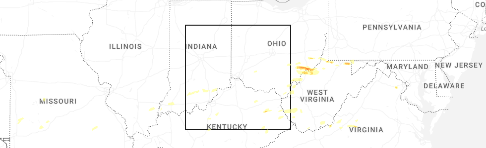
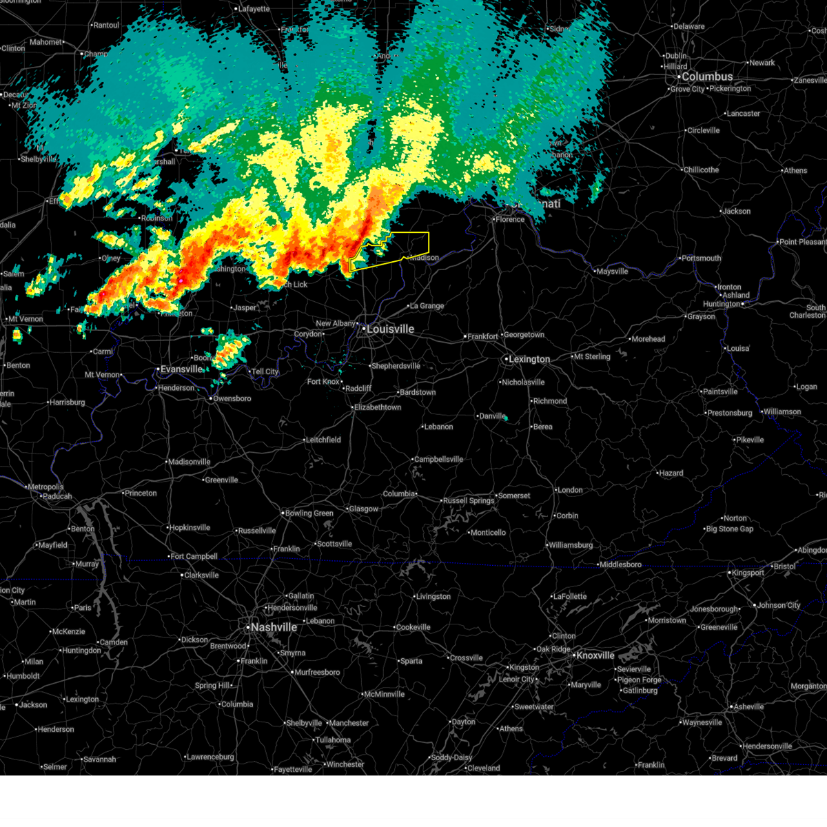
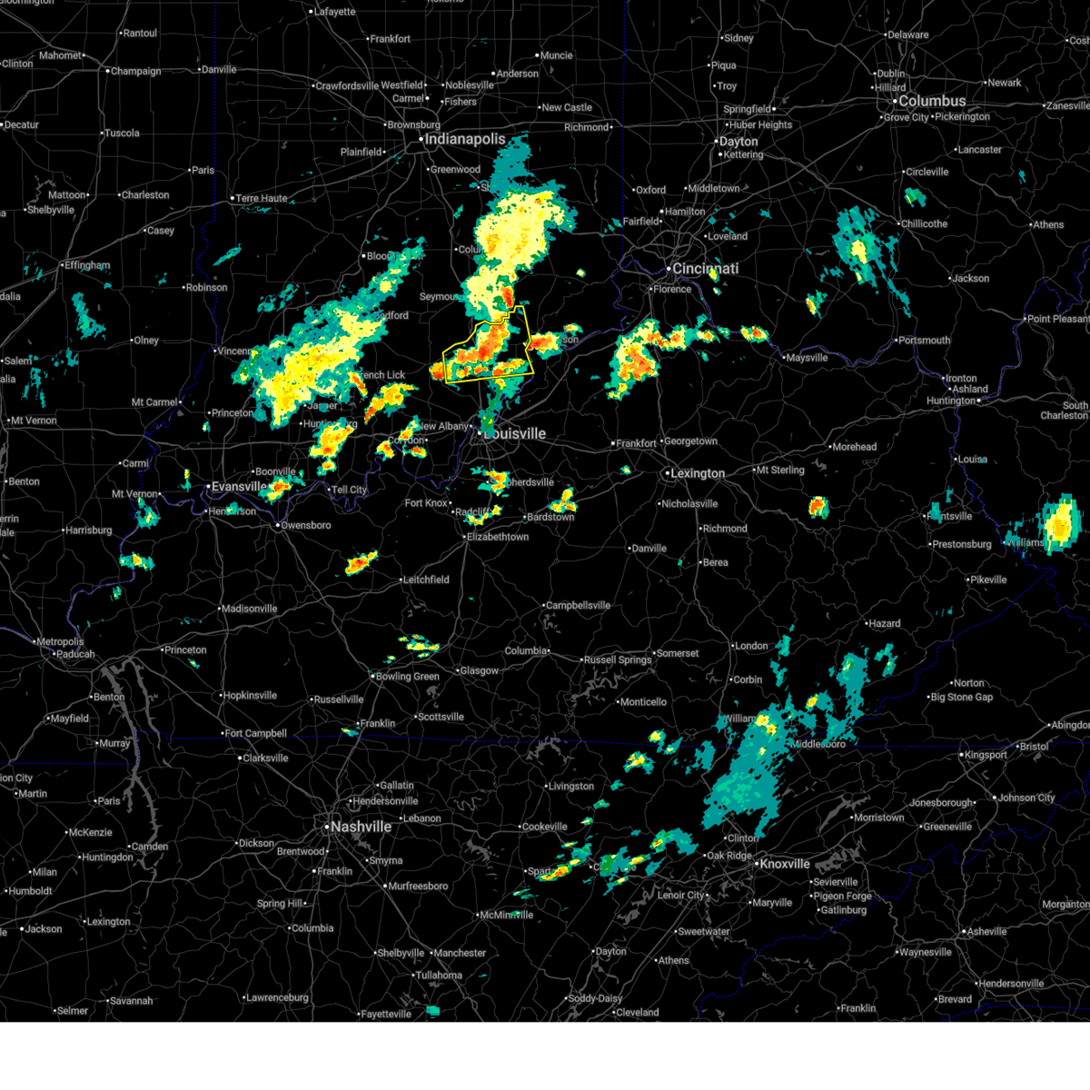
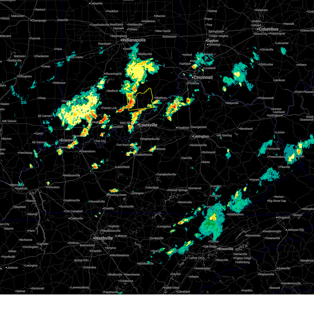
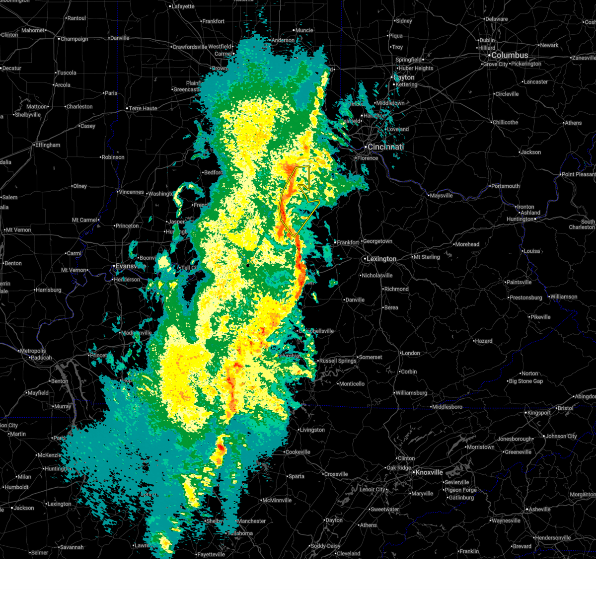
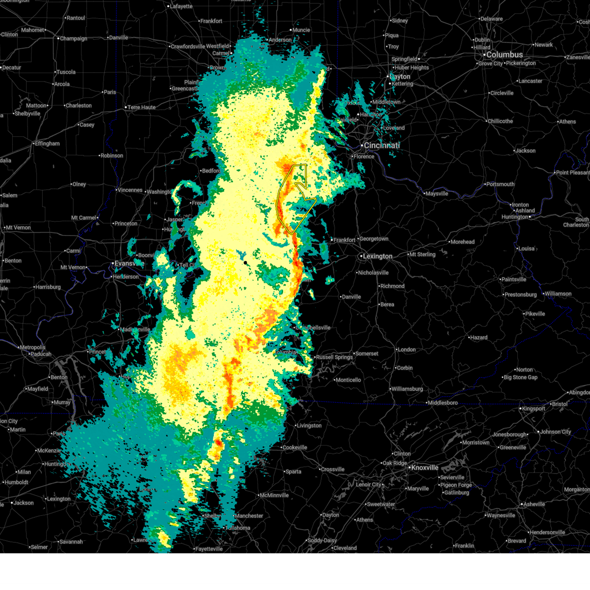
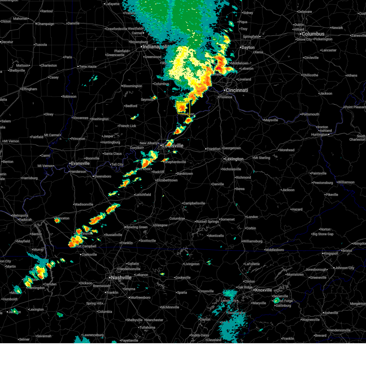
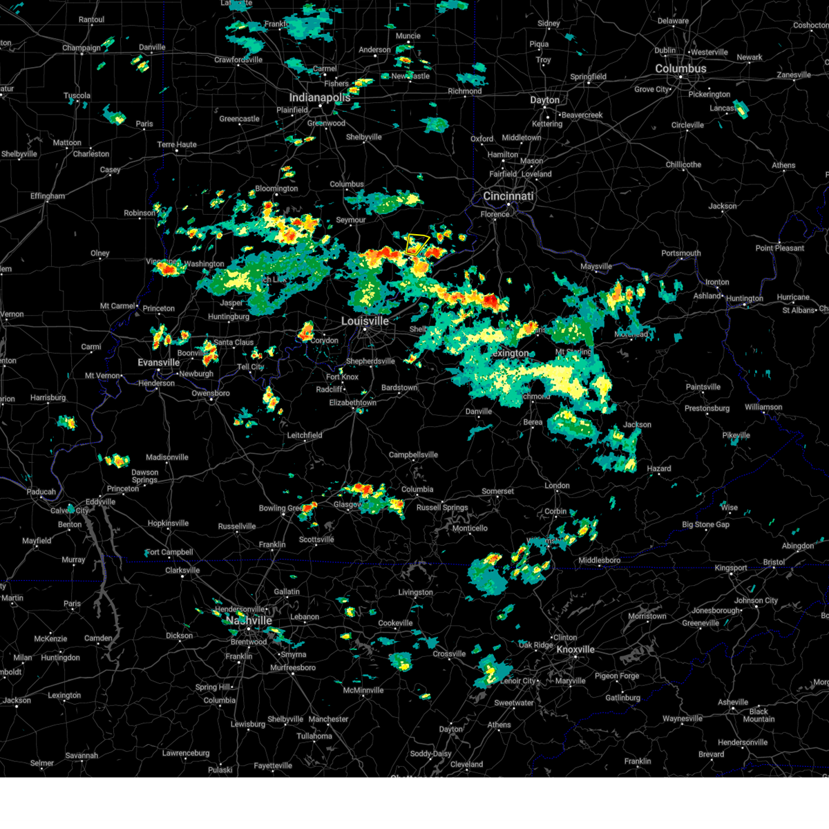
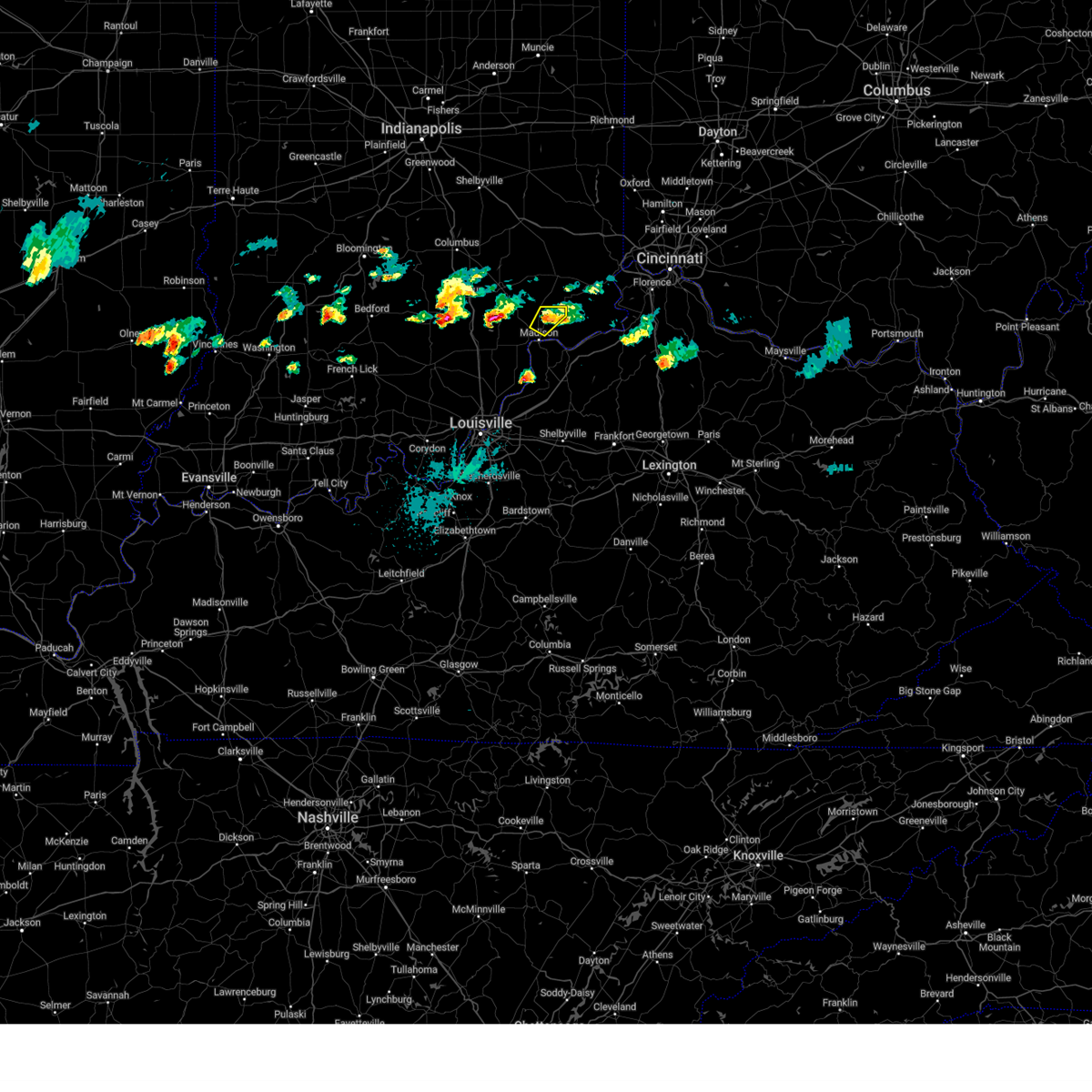
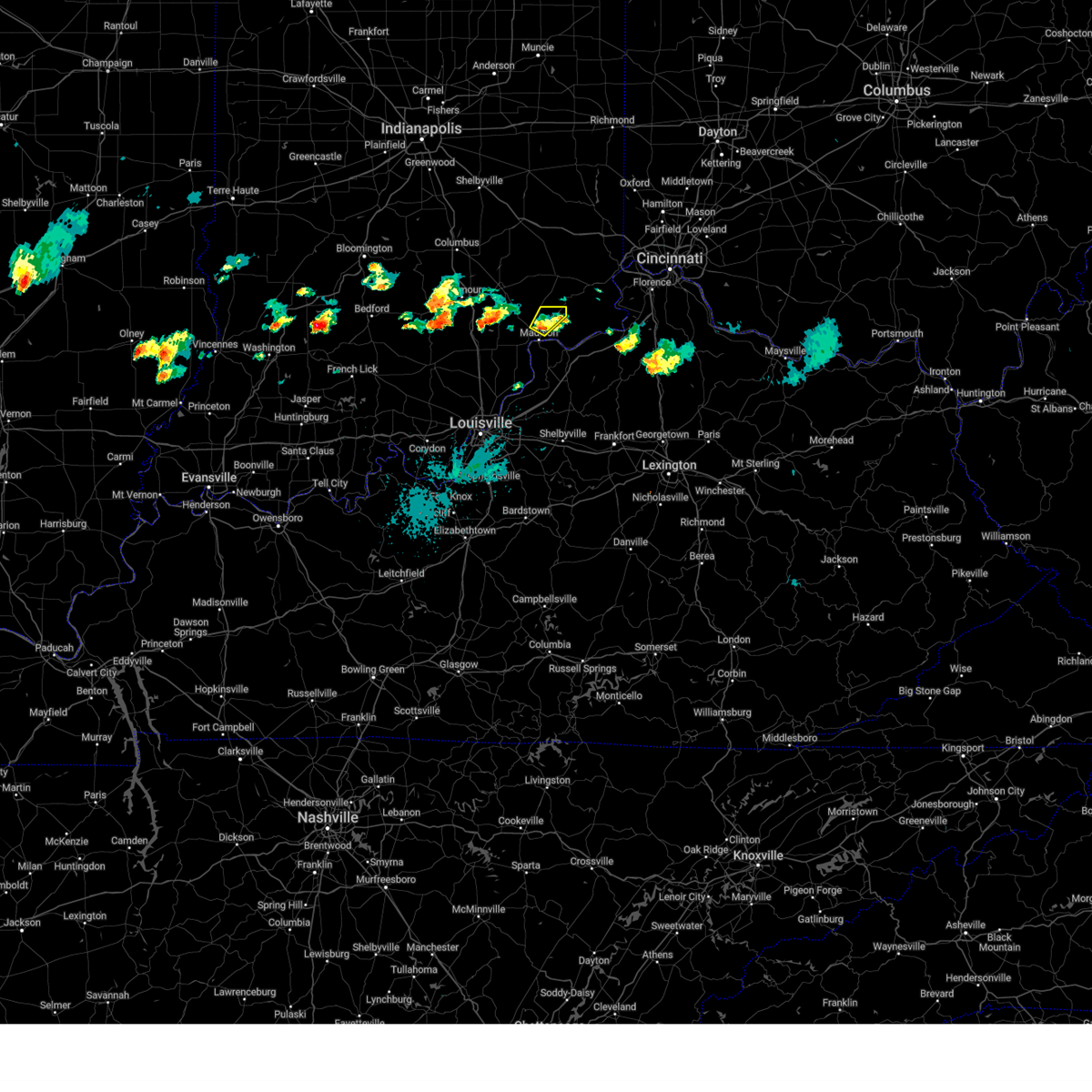
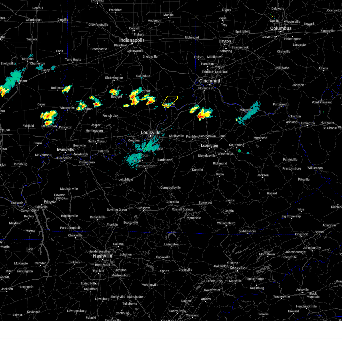
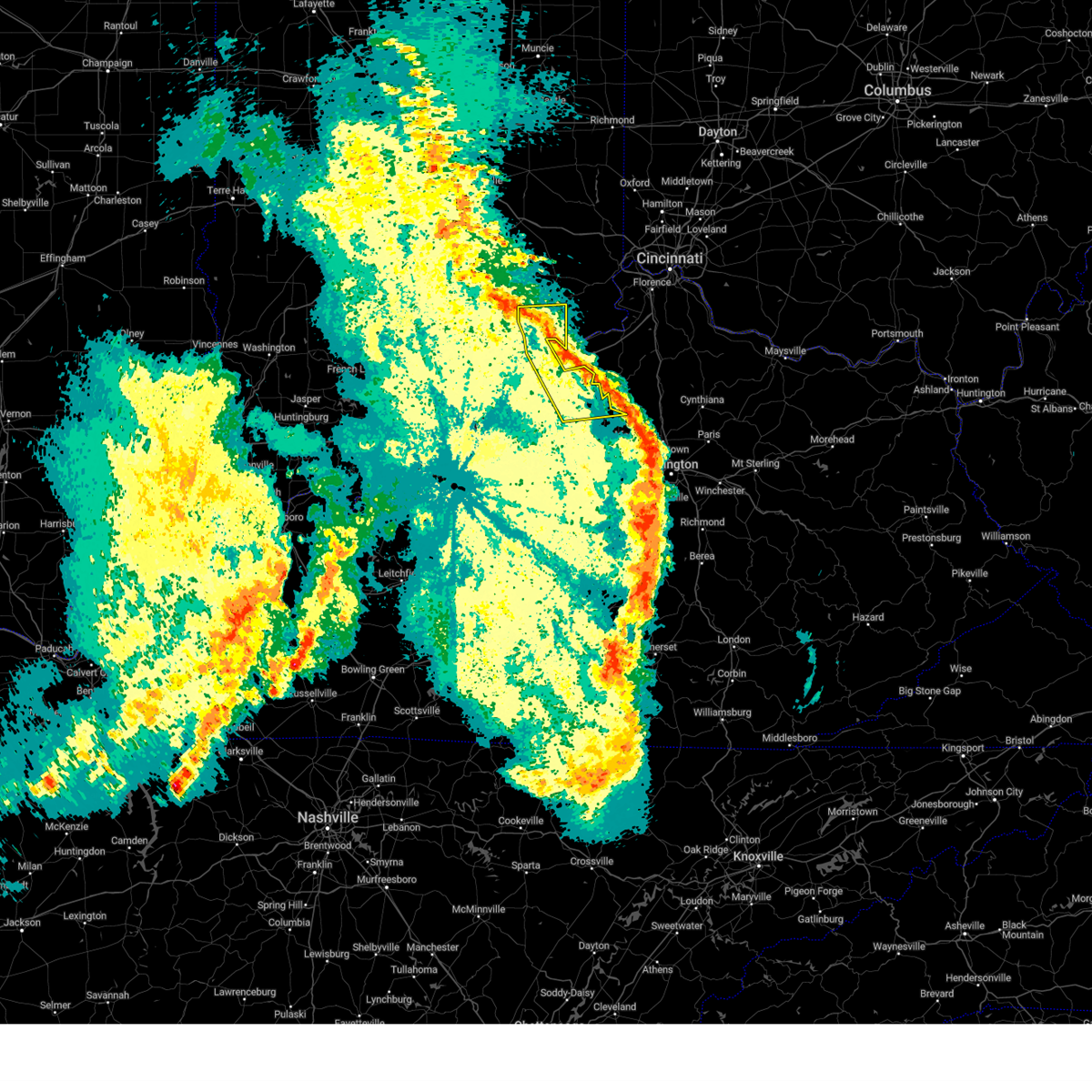
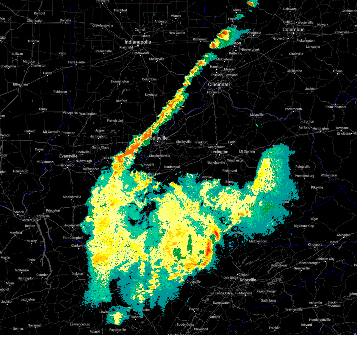
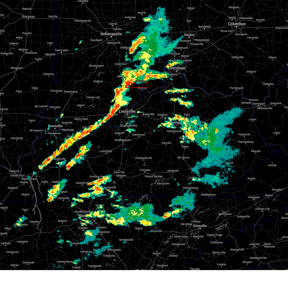
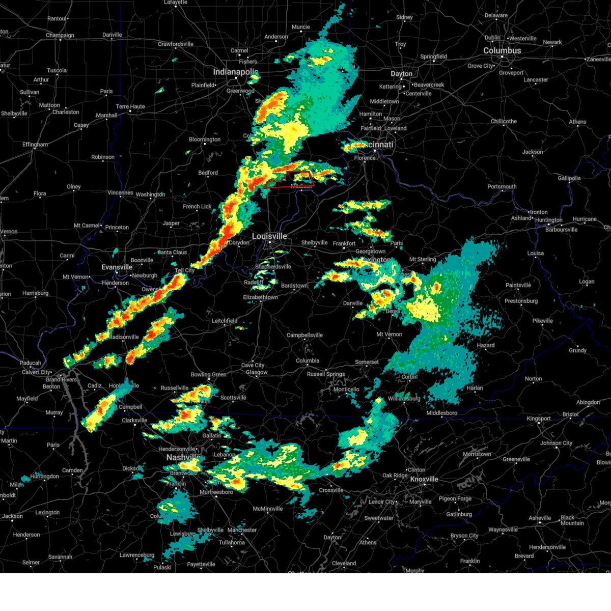
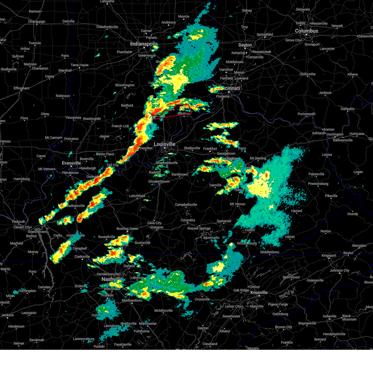
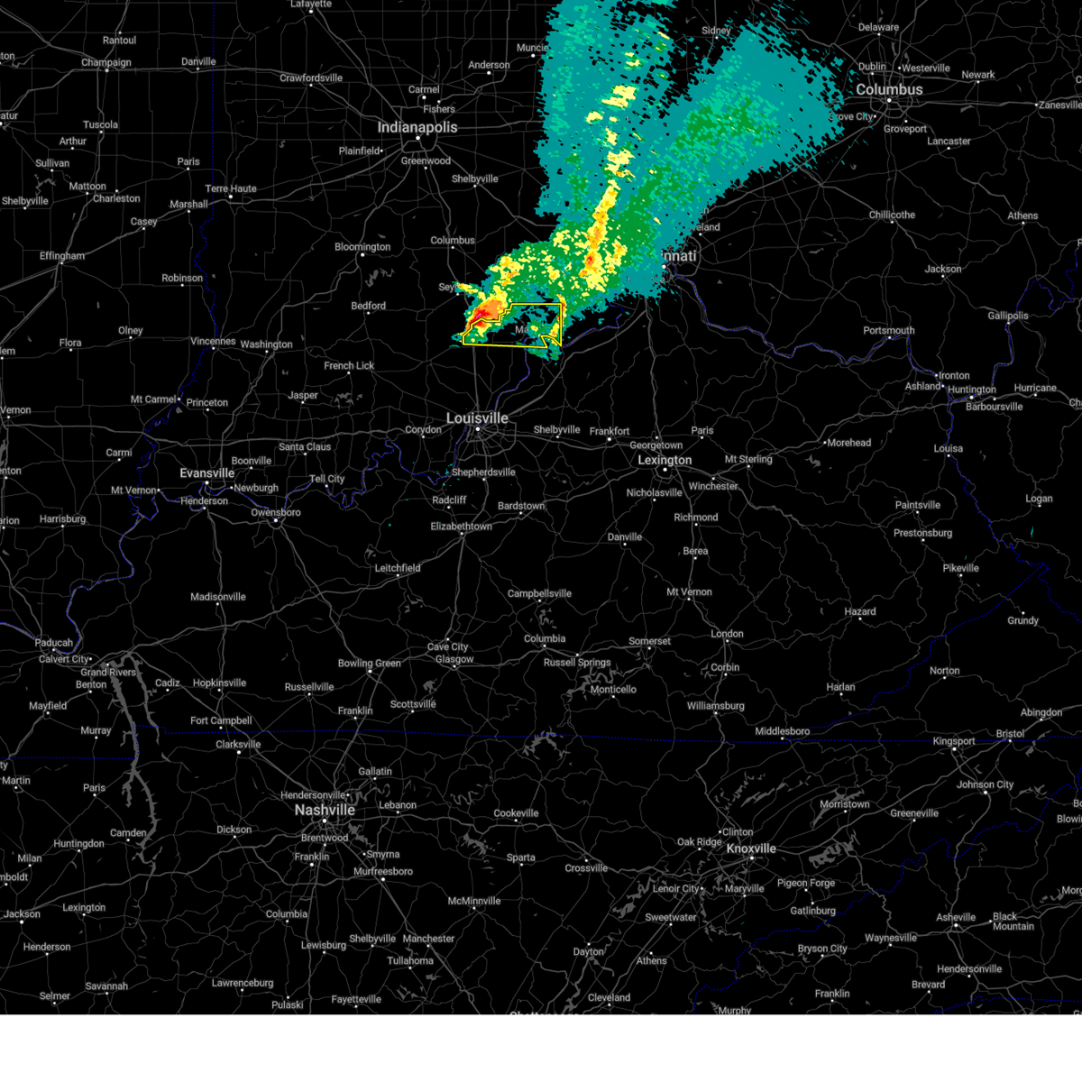
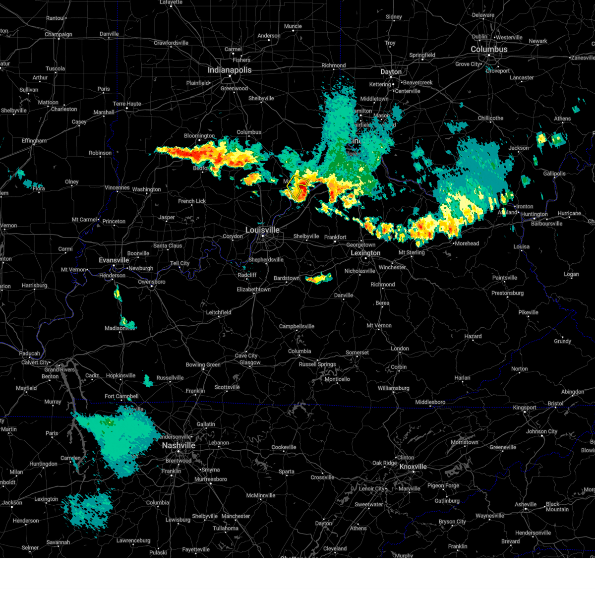
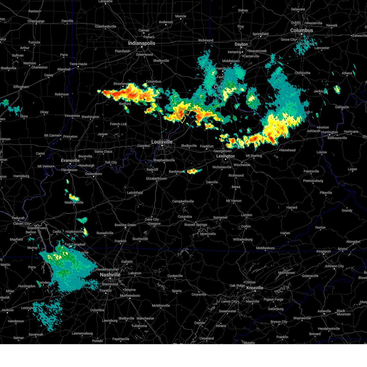
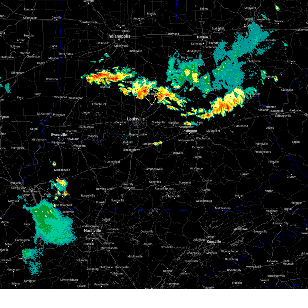
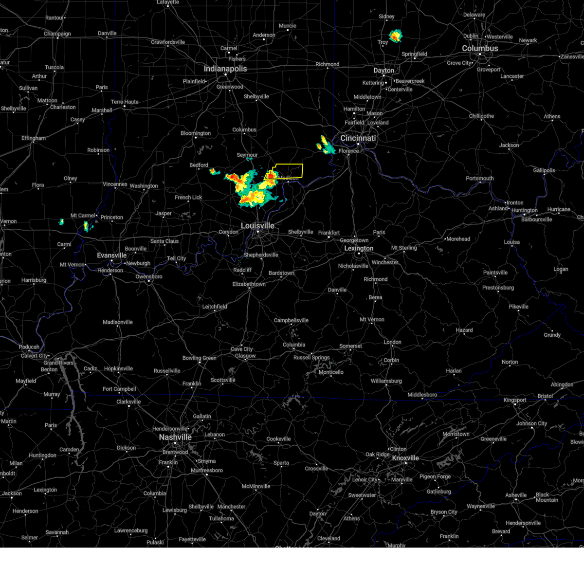
Hail Map for Madison, IN
The Madison, IN area has had 13 reports of on-the-ground hail by trained spotters, and has been under severe weather warnings 18 times during the past 12 months. Doppler radar has detected hail at or near Madison, IN on 57 occasions, including 2 occasions during the past year.
| Name: | Madison, IN |
| Where Located: | 54 miles WSW of Cincinnati, OH |
| Map: | Google Map for Madison, IN |
| Population: | 11967 |
| Housing Units: | 5787 |
| More Info: | Search Google for Madison, IN |
1
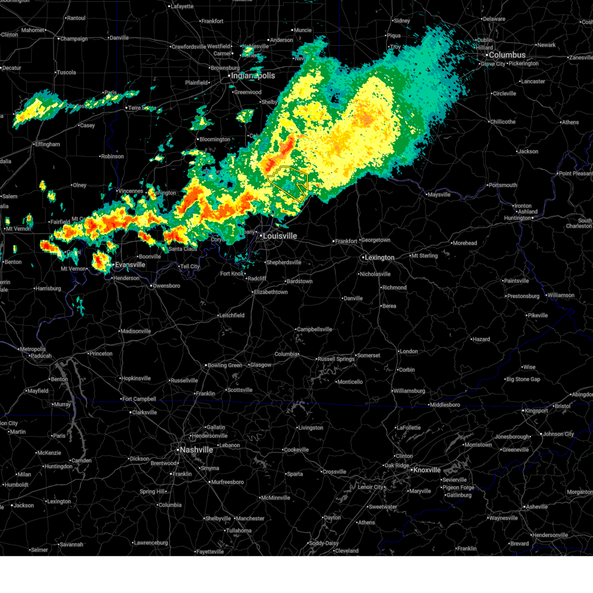
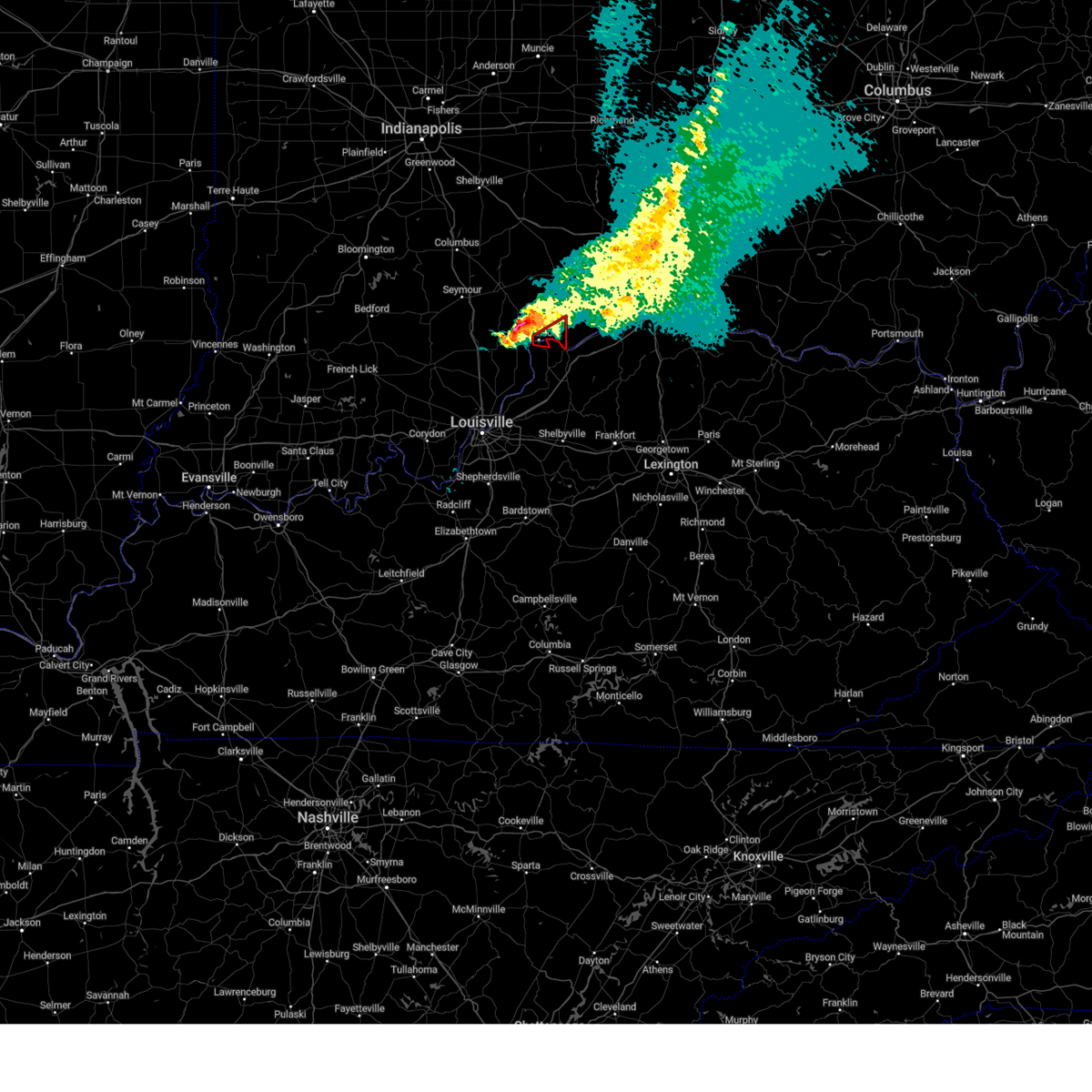
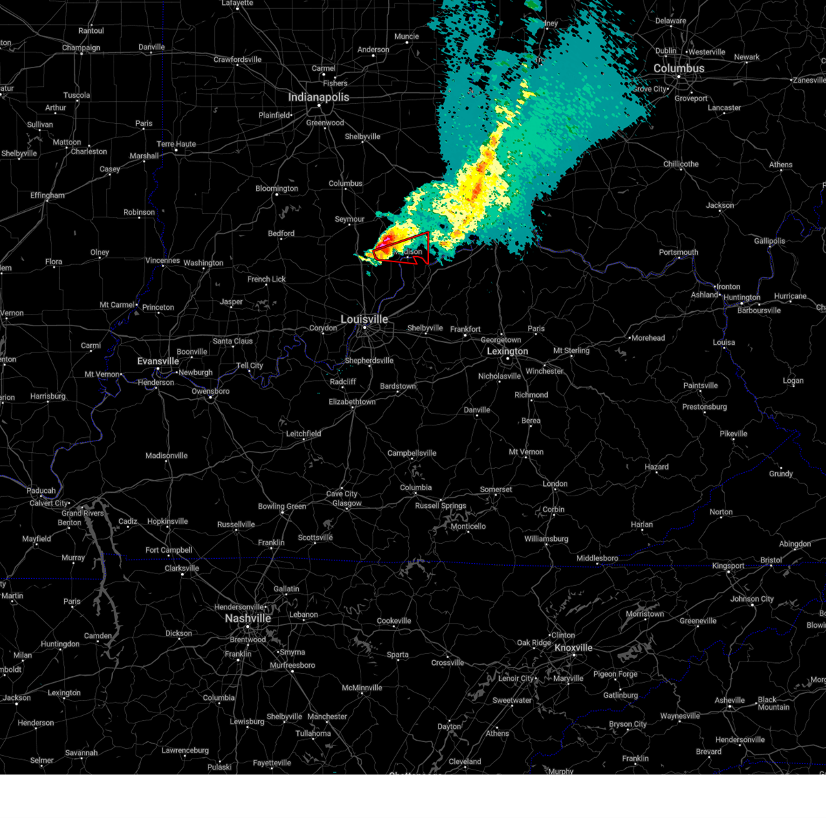
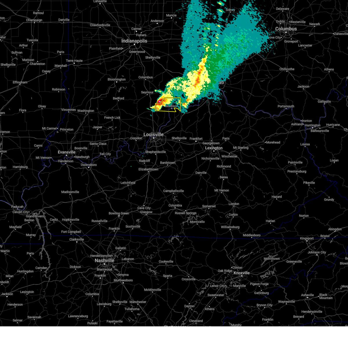
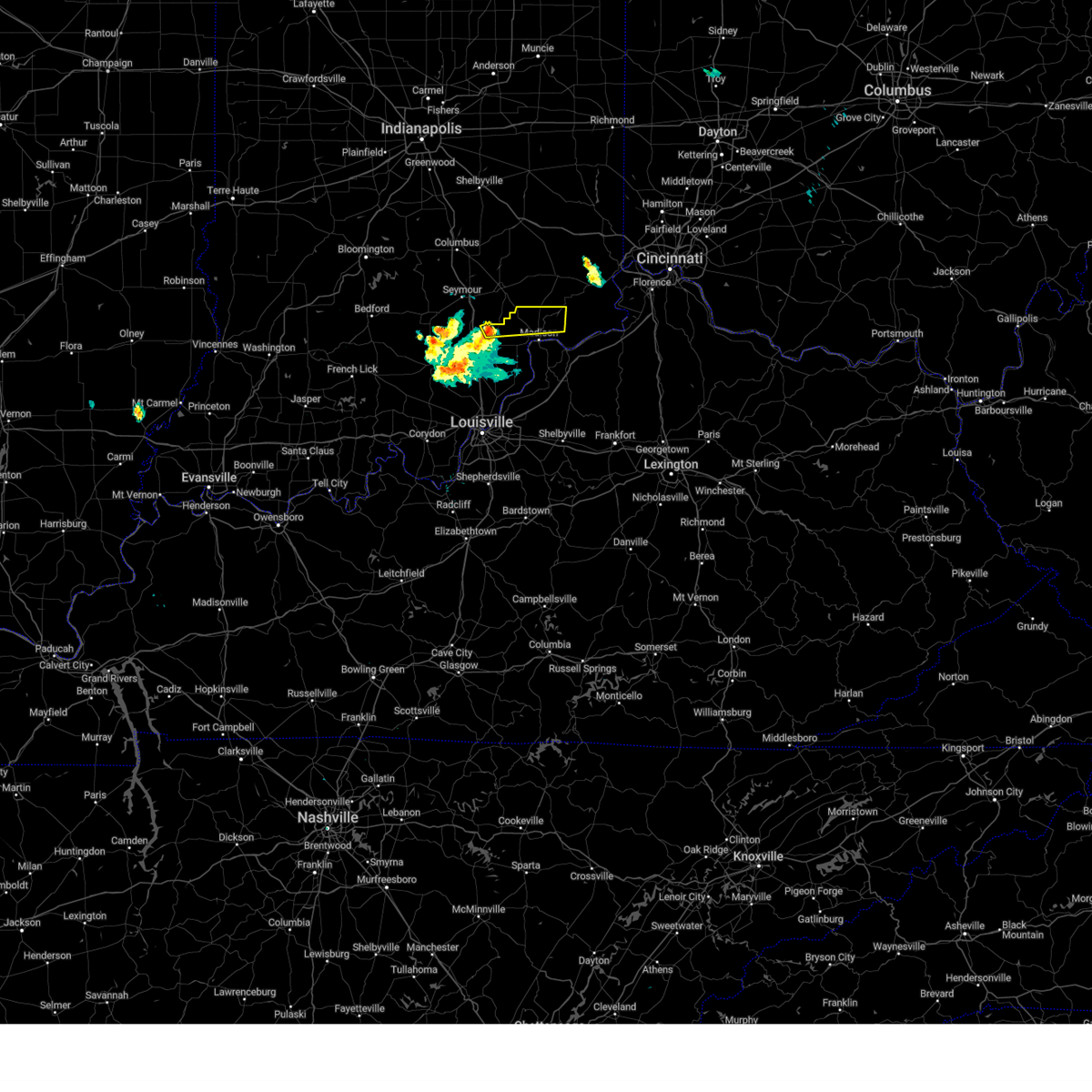
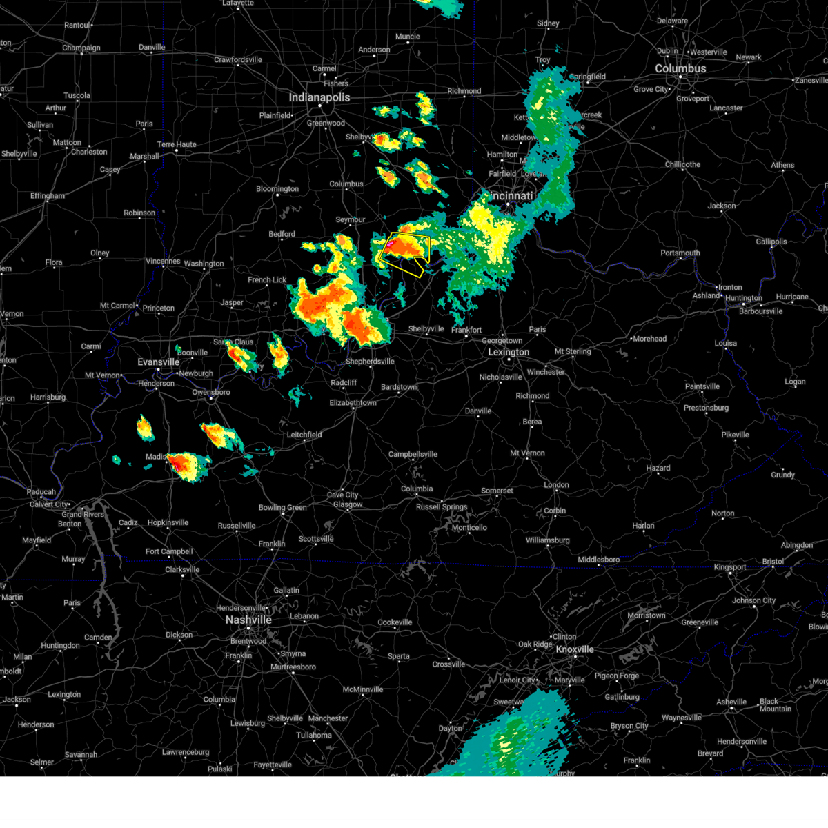
The Top Recent Hail Date for Madison, IN is Wednesday, April 1, 2026 (26th out of 57)
Hail and Wind Damage Spotted near Madison, IN
| Date / Time | Report Details |
|---|---|
| 6/21/2026 9:33 PM EDT |
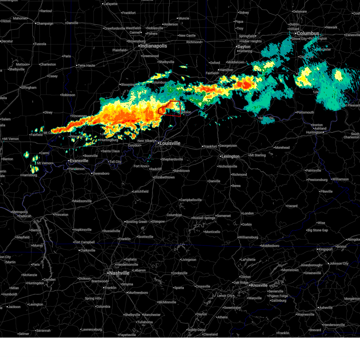
 Svrlmk the national weather service in louisville has issued a * severe thunderstorm warning for, jefferson county in south central indiana, northern trimble county in central kentucky, * until 1015 pm edt. * at 933 pm edt, a severe thunderstorm was located 9 miles south of vernon, moving southeast at 40 mph (radar indicated). Hazards include 60 mph wind gusts. expect damage to roofs, siding, and trees Svrlmk the national weather service in louisville has issued a * severe thunderstorm warning for, jefferson county in south central indiana, northern trimble county in central kentucky, * until 1015 pm edt. * at 933 pm edt, a severe thunderstorm was located 9 miles south of vernon, moving southeast at 40 mph (radar indicated). Hazards include 60 mph wind gusts. expect damage to roofs, siding, and trees
|
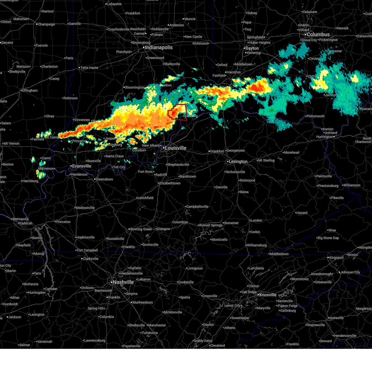
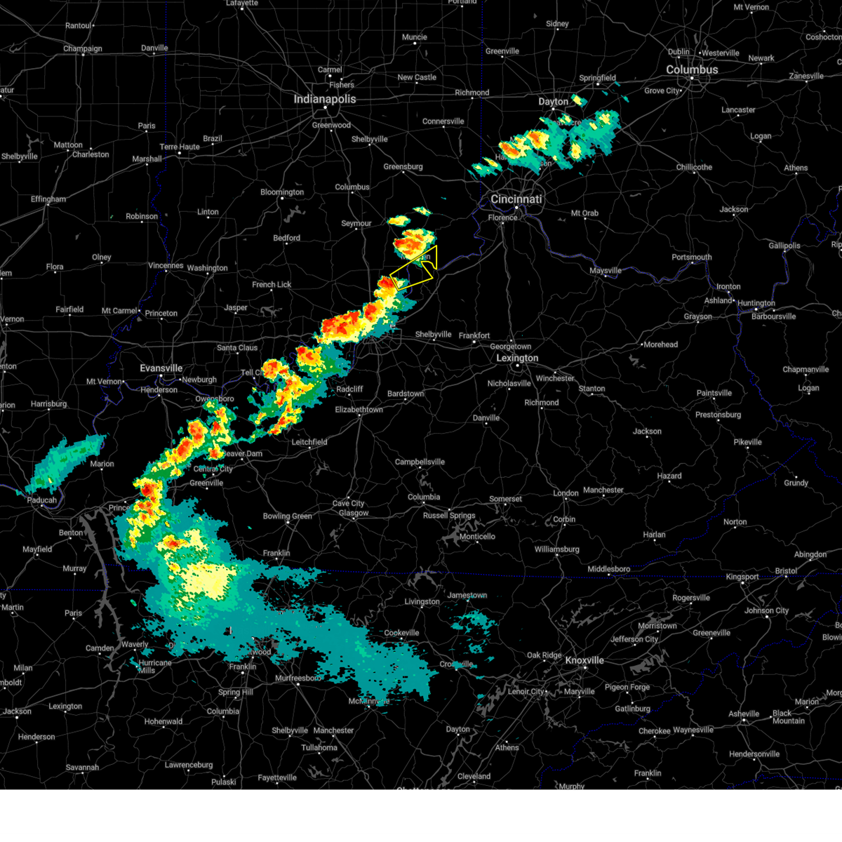
| 6/18/2026 3:28 AM EDT |
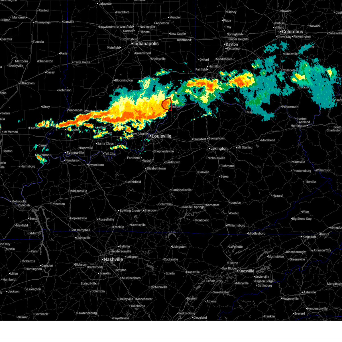 At 328 am edt, a confirmed tornado was located over madison, moving east at 45 mph (radar confirmed tornado). Hazards include damaging tornado. Flying debris will be dangerous to those caught without shelter. mobile homes will be damaged or destroyed. damage to roofs, windows, and vehicles will occur. tree damage is likely. This tornadic thunderstorm will remain over mainly rural areas of central jefferson and northwestern trimble counties, including the following locations, hanover, north madison, volga, ringwald, china, hanover beach, belleview, milton, smyrna, and wirt. At 328 am edt, a confirmed tornado was located over madison, moving east at 45 mph (radar confirmed tornado). Hazards include damaging tornado. Flying debris will be dangerous to those caught without shelter. mobile homes will be damaged or destroyed. damage to roofs, windows, and vehicles will occur. tree damage is likely. This tornadic thunderstorm will remain over mainly rural areas of central jefferson and northwestern trimble counties, including the following locations, hanover, north madison, volga, ringwald, china, hanover beach, belleview, milton, smyrna, and wirt.
|
| 6/18/2026 3:20 AM EDT |
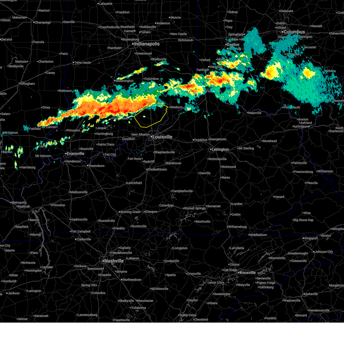
 At 320 am edt, a confirmed tornado was located 8 miles west of madison, moving east at 45 mph (radar confirmed tornado). Hazards include damaging tornado. Flying debris will be dangerous to those caught without shelter. mobile homes will be damaged or destroyed. damage to roofs, windows, and vehicles will occur. tree damage is likely. this tornado will be near, madison around 325 am edt. Other locations impacted by this tornadic thunderstorm include wakefield, middlefork, hanover, north madison, volga, kent, deputy, belleview, bryantsburg, and madison municipal airport. At 320 am edt, a confirmed tornado was located 8 miles west of madison, moving east at 45 mph (radar confirmed tornado). Hazards include damaging tornado. Flying debris will be dangerous to those caught without shelter. mobile homes will be damaged or destroyed. damage to roofs, windows, and vehicles will occur. tree damage is likely. this tornado will be near, madison around 325 am edt. Other locations impacted by this tornadic thunderstorm include wakefield, middlefork, hanover, north madison, volga, kent, deputy, belleview, bryantsburg, and madison municipal airport.
|
| 6/18/2026 3:13 AM EDT |
 At 313 am edt, a severe thunderstorm capable of producing a tornado was located 8 miles northeast of scottsburg, moving east at 45 mph (radar indicated rotation). Hazards include tornado. Flying debris will be dangerous to those caught without shelter. mobile homes will be damaged or destroyed. damage to roofs, windows, and vehicles will occur. tree damage is likely. this dangerous storm will be near, madison around 325 am edt. Other locations impacted by this tornadic thunderstorm include wakefield, middlefork, hanover, north madison, volga, kent, deputy, blocher, belleview, and bryantsburg. At 313 am edt, a severe thunderstorm capable of producing a tornado was located 8 miles northeast of scottsburg, moving east at 45 mph (radar indicated rotation). Hazards include tornado. Flying debris will be dangerous to those caught without shelter. mobile homes will be damaged or destroyed. damage to roofs, windows, and vehicles will occur. tree damage is likely. this dangerous storm will be near, madison around 325 am edt. Other locations impacted by this tornadic thunderstorm include wakefield, middlefork, hanover, north madison, volga, kent, deputy, blocher, belleview, and bryantsburg.
|
| 6/18/2026 3:04 AM EDT |
 Svrlmk the national weather service in louisville has issued a * severe thunderstorm warning for, southwestern jefferson county in south central indiana, northwestern clark county in south central indiana, scott county in south central indiana, southeastern washington county in south central indiana, * until 330 am edt. * at 303 am edt, severe thunderstorms were located along a line extending from 11 miles southeast of seymour to 6 miles west of scottsburg to near salem, moving southeast at 35 mph (radar indicated). Hazards include 60 mph wind gusts. expect damage to roofs, siding, and trees Svrlmk the national weather service in louisville has issued a * severe thunderstorm warning for, southwestern jefferson county in south central indiana, northwestern clark county in south central indiana, scott county in south central indiana, southeastern washington county in south central indiana, * until 330 am edt. * at 303 am edt, severe thunderstorms were located along a line extending from 11 miles southeast of seymour to 6 miles west of scottsburg to near salem, moving southeast at 35 mph (radar indicated). Hazards include 60 mph wind gusts. expect damage to roofs, siding, and trees
|
| 5/18/2026 7:50 PM EDT | Tree down on residential property on cedarwood d in jefferson county IN, 1.1 miles SSW of Madison, IN |
| 4/27/2026 5:54 PM EDT | Several trees and power lines down along eagle hollow roa in jefferson county IN, 3.8 miles W of Madison, IN |
| 4/27/2026 5:52 PM EDT |
 The storms which prompted the warning have weakened below severe limits, and no longer pose an immediate threat to life or property. therefore, the warning will be allowed to expire. however, heavy rain is still possible with these thunderstorms. a severe thunderstorm watch remains in effect until 700 pm edt for south central indiana, and central kentucky. to report severe weather, contact your nearest law enforcement agency. they will relay your report to the national weather service louisville. The storms which prompted the warning have weakened below severe limits, and no longer pose an immediate threat to life or property. therefore, the warning will be allowed to expire. however, heavy rain is still possible with these thunderstorms. a severe thunderstorm watch remains in effect until 700 pm edt for south central indiana, and central kentucky. to report severe weather, contact your nearest law enforcement agency. they will relay your report to the national weather service louisville.
|
| 4/27/2026 5:41 PM EDT |
 the severe thunderstorm warning has been cancelled and is no longer in effect the severe thunderstorm warning has been cancelled and is no longer in effect
|
| 4/27/2026 5:41 PM EDT |
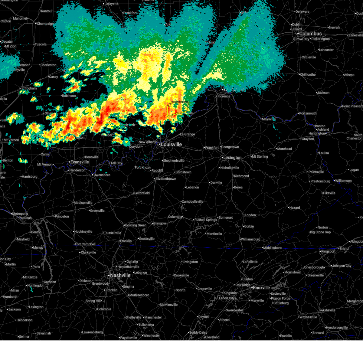
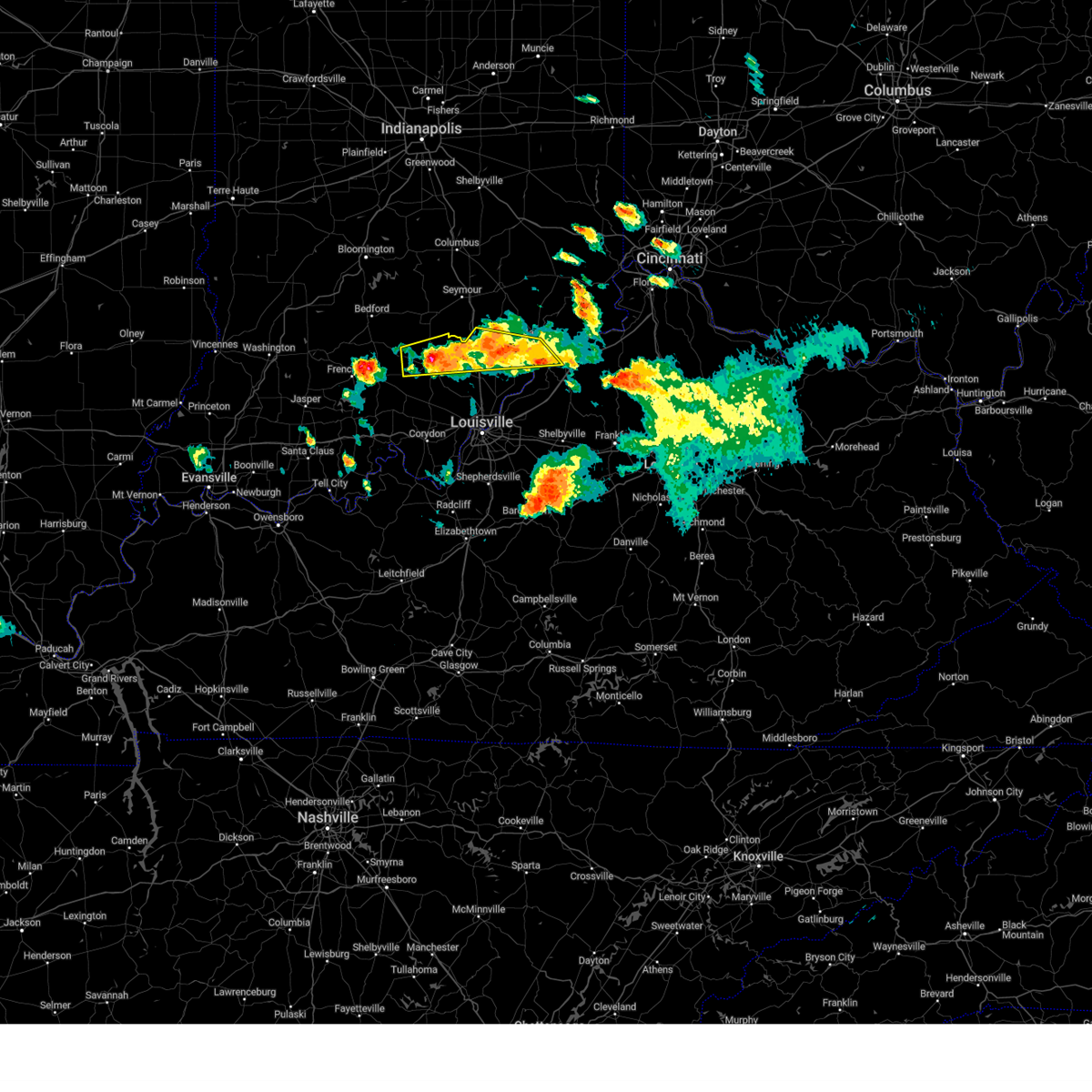
 At 540 pm edt, severe thunderstorms were located along a line extending from 7 miles southwest of versailles to 8 miles southwest of madison, moving east at 50 mph (radar indicated). Hazards include 60 mph wind gusts and penny size hail. Expect damage to roofs, siding, and trees. Locations impacted include, madison, hanover, smyrna, kent, dupont, wakefield, middlefork, canaan, volga, and north madison. At 540 pm edt, severe thunderstorms were located along a line extending from 7 miles southwest of versailles to 8 miles southwest of madison, moving east at 50 mph (radar indicated). Hazards include 60 mph wind gusts and penny size hail. Expect damage to roofs, siding, and trees. Locations impacted include, madison, hanover, smyrna, kent, dupont, wakefield, middlefork, canaan, volga, and north madison.
|
| 4/27/2026 5:10 PM EDT |
 Svrlmk the national weather service in louisville has issued a * severe thunderstorm warning for, jefferson county in south central indiana, central scott county in south central indiana, * until 600 pm edt. * at 510 pm edt, severe thunderstorms were located along a line extending from near north vernon to near scottsburg, moving east at 40 mph (radar indicated). Hazards include 60 mph wind gusts and quarter size hail. Hail damage to vehicles is expected. Expect wind damage to roofs, siding, and trees. Svrlmk the national weather service in louisville has issued a * severe thunderstorm warning for, jefferson county in south central indiana, central scott county in south central indiana, * until 600 pm edt. * at 510 pm edt, severe thunderstorms were located along a line extending from near north vernon to near scottsburg, moving east at 40 mph (radar indicated). Hazards include 60 mph wind gusts and quarter size hail. Hail damage to vehicles is expected. Expect wind damage to roofs, siding, and trees.
|
| 4/1/2026 4:37 PM EDT |
 The storm which prompted the warning has moved out of the area. therefore, the warning will be allowed to expire. however, gusty winds and heavy rain are still possible with this thunderstorm. The storm which prompted the warning has moved out of the area. therefore, the warning will be allowed to expire. however, gusty winds and heavy rain are still possible with this thunderstorm.
|
| 4/1/2026 4:26 PM EDT |
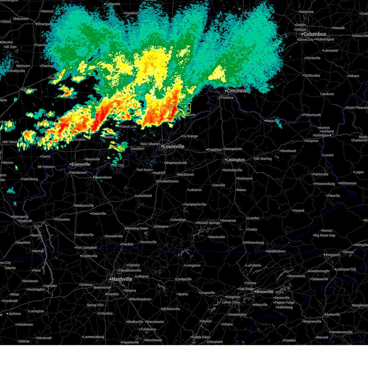
 At 425 pm edt, a severe thunderstorm was located 8 miles east of madison, moving northeast at 30 mph (radar indicated). Hazards include 60 mph wind gusts and quarter size hail. Hail damage to vehicles is expected. expect wind damage to roofs, siding, and trees. Locations impacted include, madison, brooksburg, north madison, ringwald, manville, and china. At 425 pm edt, a severe thunderstorm was located 8 miles east of madison, moving northeast at 30 mph (radar indicated). Hazards include 60 mph wind gusts and quarter size hail. Hail damage to vehicles is expected. expect wind damage to roofs, siding, and trees. Locations impacted include, madison, brooksburg, north madison, ringwald, manville, and china.
|
| 4/1/2026 4:26 PM EDT |
 the severe thunderstorm warning has been cancelled and is no longer in effect the severe thunderstorm warning has been cancelled and is no longer in effect
|
| 4/1/2026 4:16 PM EDT | Tree was reported down blocking roadway at n. k rd and old sr 62. time estimated by rada in jefferson county IN, 3.2 miles WSW of Madison, IN |
| 4/1/2026 4:14 PM EDT |
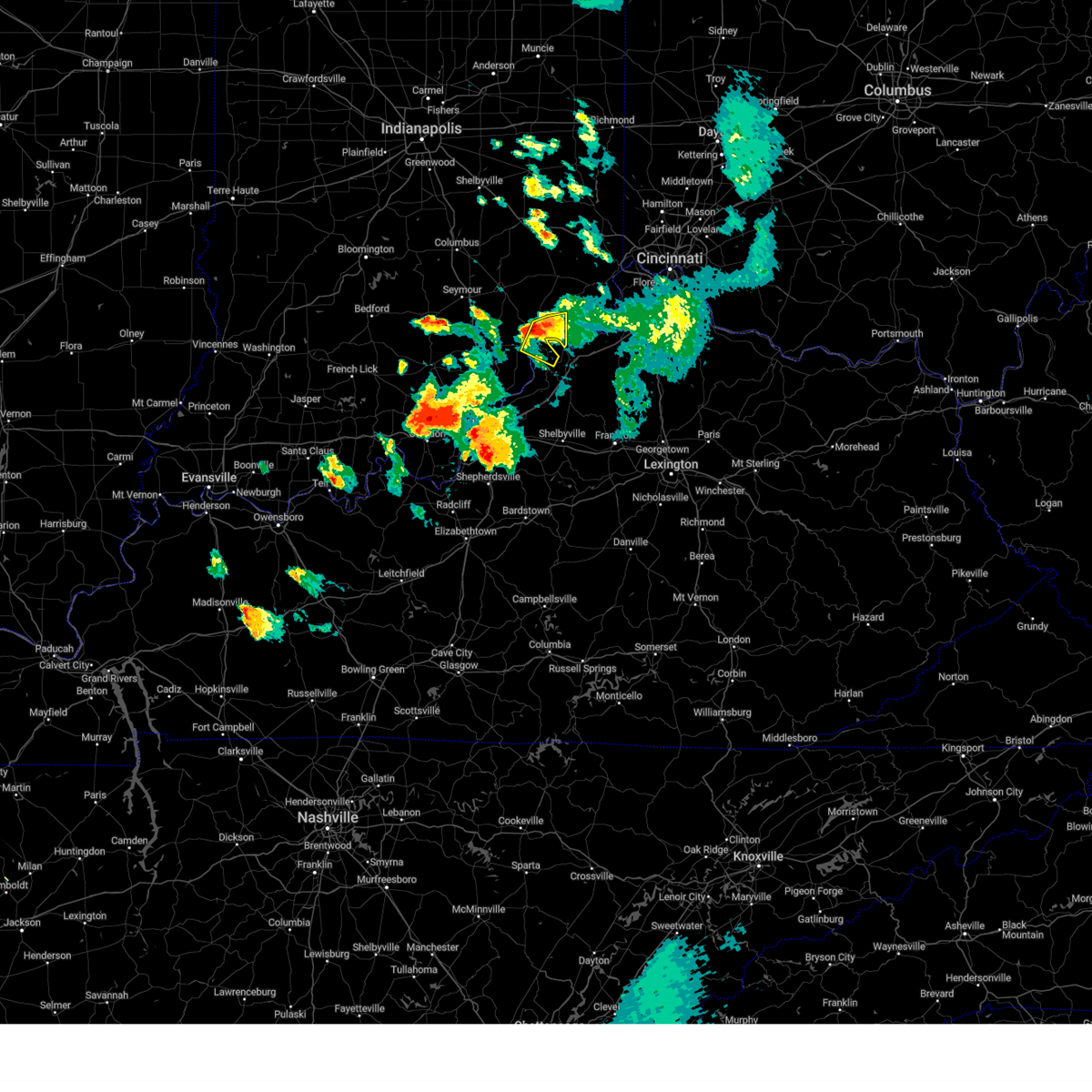
 Svrlmk the national weather service in louisville has issued a * severe thunderstorm warning for, northeastern jefferson county in south central indiana, north central trimble county in central kentucky, * until 445 pm edt. * at 414 pm edt, a severe thunderstorm was located over madison, moving northeast at 30 mph (radar indicated). Hazards include 60 mph wind gusts and quarter size hail. Hail damage to vehicles is expected. Expect wind damage to roofs, siding, and trees. Svrlmk the national weather service in louisville has issued a * severe thunderstorm warning for, northeastern jefferson county in south central indiana, north central trimble county in central kentucky, * until 445 pm edt. * at 414 pm edt, a severe thunderstorm was located over madison, moving northeast at 30 mph (radar indicated). Hazards include 60 mph wind gusts and quarter size hail. Hail damage to vehicles is expected. Expect wind damage to roofs, siding, and trees.
|
| 4/1/2026 3:44 PM EDT |
 At 344 pm edt, a severe thunderstorm was located near scottsburg, moving east at 35 mph (radar indicated). Hazards include 60 mph wind gusts and quarter size hail. Hail damage to vehicles is expected. expect wind damage to roofs, siding, and trees. Locations impacted include, madison, scottsburg, vienna, austin, lexington, hanover, blue river, saluda, smyrna, and kent. At 344 pm edt, a severe thunderstorm was located near scottsburg, moving east at 35 mph (radar indicated). Hazards include 60 mph wind gusts and quarter size hail. Hail damage to vehicles is expected. expect wind damage to roofs, siding, and trees. Locations impacted include, madison, scottsburg, vienna, austin, lexington, hanover, blue river, saluda, smyrna, and kent.
|
| 4/1/2026 3:22 PM EDT |
 Svrlmk the national weather service in louisville has issued a * severe thunderstorm warning for, western jefferson county in south central indiana, northeastern clark county in south central indiana, scott county in south central indiana, northeastern washington county in south central indiana, * until 400 pm edt. * at 321 pm edt, a severe thunderstorm was located near new salem, moving east at 35 mph (radar indicated). Hazards include 60 mph wind gusts and quarter size hail. Hail damage to vehicles is expected. Expect wind damage to roofs, siding, and trees. Svrlmk the national weather service in louisville has issued a * severe thunderstorm warning for, western jefferson county in south central indiana, northeastern clark county in south central indiana, scott county in south central indiana, northeastern washington county in south central indiana, * until 400 pm edt. * at 321 pm edt, a severe thunderstorm was located near new salem, moving east at 35 mph (radar indicated). Hazards include 60 mph wind gusts and quarter size hail. Hail damage to vehicles is expected. Expect wind damage to roofs, siding, and trees.
|
| 3/16/2026 12:26 AM EDT |
 At 1225 am edt, severe thunderstorms were located along a line extending from 6 miles southwest of madison to 11 miles southwest of bedford to near la grange, moving northeast at 75 mph (radar indicated). Hazards include 60 mph wind gusts. Expect damage to roofs, siding, and trees. Locations impacted include, madison, la grange, bedford, pendleton, crestwood, hanover, saluda, owen, campbellsburg, and bethlehem. At 1225 am edt, severe thunderstorms were located along a line extending from 6 miles southwest of madison to 11 miles southwest of bedford to near la grange, moving northeast at 75 mph (radar indicated). Hazards include 60 mph wind gusts. Expect damage to roofs, siding, and trees. Locations impacted include, madison, la grange, bedford, pendleton, crestwood, hanover, saluda, owen, campbellsburg, and bethlehem.
|
| 3/16/2026 12:26 AM EDT |
 the severe thunderstorm warning has been cancelled and is no longer in effect the severe thunderstorm warning has been cancelled and is no longer in effect
|
| 3/16/2026 12:21 AM EDT | Couple of trees down state rd 256 and state rd 5 in jefferson county IN, 2.9 miles ENE of Madison, IN |
| 3/16/2026 12:11 AM EDT |
 Svrlmk the national weather service in louisville has issued a * severe thunderstorm warning for, eastern jefferson county in south central indiana, eastern clark county in south central indiana, oldham county in central kentucky, northwestern shelby county in central kentucky, trimble county in central kentucky, western henry county in central kentucky, eastern jefferson county in central kentucky, * until 100 am edt. * at 1210 am edt, severe thunderstorms were located along a line extending from 9 miles north of prospect to glenview to fern creek, moving northeast at 75 mph (radar indicated). Hazards include 60 mph wind gusts. expect damage to roofs, siding, and trees Svrlmk the national weather service in louisville has issued a * severe thunderstorm warning for, eastern jefferson county in south central indiana, eastern clark county in south central indiana, oldham county in central kentucky, northwestern shelby county in central kentucky, trimble county in central kentucky, western henry county in central kentucky, eastern jefferson county in central kentucky, * until 100 am edt. * at 1210 am edt, severe thunderstorms were located along a line extending from 9 miles north of prospect to glenview to fern creek, moving northeast at 75 mph (radar indicated). Hazards include 60 mph wind gusts. expect damage to roofs, siding, and trees
|
| 6/18/2025 10:59 PM EDT |
 The storm which prompted the warning has weakened below severe limits, and has exited the warned area. therefore, the warning will be allowed to expire. however, gusty winds and heavy rain are still possible with this thunderstorm. a severe thunderstorm watch remains in effect until 100 am edt for central kentucky. to report severe weather, contact your nearest law enforcement agency. they will relay your report to the national weather service louisville. The storm which prompted the warning has weakened below severe limits, and has exited the warned area. therefore, the warning will be allowed to expire. however, gusty winds and heavy rain are still possible with this thunderstorm. a severe thunderstorm watch remains in effect until 100 am edt for central kentucky. to report severe weather, contact your nearest law enforcement agency. they will relay your report to the national weather service louisville.
|
| 6/18/2025 10:48 PM EDT |
 At 1048 pm edt, a severe thunderstorm was located 11 miles west of bedford, moving east at 50 mph (radar indicated). Hazards include 60 mph wind gusts. Expect damage to roofs, siding, and trees. Locations impacted include, madison, bedford, pendleton, charlestown, hanover, saluda, owen, goshen, bethlehem, and milton. At 1048 pm edt, a severe thunderstorm was located 11 miles west of bedford, moving east at 50 mph (radar indicated). Hazards include 60 mph wind gusts. Expect damage to roofs, siding, and trees. Locations impacted include, madison, bedford, pendleton, charlestown, hanover, saluda, owen, goshen, bethlehem, and milton.
|
| 6/18/2025 10:48 PM EDT |
 the severe thunderstorm warning has been cancelled and is no longer in effect the severe thunderstorm warning has been cancelled and is no longer in effect
|
| 6/18/2025 10:32 PM EDT |
 Svrlmk the national weather service in louisville has issued a * severe thunderstorm warning for, south central jefferson county in south central indiana, clark county in south central indiana, northeastern floyd county in south central indiana, southeastern scott county in south central indiana, east central washington county in south central indiana, northern oldham county in central kentucky, trimble county in central kentucky, west central henry county in central kentucky, * until 1100 pm edt. * at 1032 pm edt, a severe thunderstorm was located 11 miles north of jeffersonville, moving east at 50 mph (radar indicated). Hazards include 60 mph wind gusts. expect damage to roofs, siding, and trees Svrlmk the national weather service in louisville has issued a * severe thunderstorm warning for, south central jefferson county in south central indiana, clark county in south central indiana, northeastern floyd county in south central indiana, southeastern scott county in south central indiana, east central washington county in south central indiana, northern oldham county in central kentucky, trimble county in central kentucky, west central henry county in central kentucky, * until 1100 pm edt. * at 1032 pm edt, a severe thunderstorm was located 11 miles north of jeffersonville, moving east at 50 mph (radar indicated). Hazards include 60 mph wind gusts. expect damage to roofs, siding, and trees
|
| 6/18/2025 6:54 PM EDT |
 the severe thunderstorm warning has been cancelled and is no longer in effect the severe thunderstorm warning has been cancelled and is no longer in effect
|
| 6/18/2025 6:43 PM EDT |
 the severe thunderstorm warning has been cancelled and is no longer in effect the severe thunderstorm warning has been cancelled and is no longer in effect
|
| 6/18/2025 6:43 PM EDT |
 At 643 pm edt, a severe thunderstorm was located 7 miles north of madison, moving northeast at 35 mph (radar indicated). Hazards include 60 mph wind gusts and quarter size hail. Hail damage to vehicles is expected. expect wind damage to roofs, siding, and trees. Locations impacted include, madison, brooksburg, canaan, north madison, ringwald, manville, china, belleview, bryantsburg, and barbersville. At 643 pm edt, a severe thunderstorm was located 7 miles north of madison, moving northeast at 35 mph (radar indicated). Hazards include 60 mph wind gusts and quarter size hail. Hail damage to vehicles is expected. expect wind damage to roofs, siding, and trees. Locations impacted include, madison, brooksburg, canaan, north madison, ringwald, manville, china, belleview, bryantsburg, and barbersville.
|
| 6/18/2025 6:25 PM EDT |
 Svrlmk the national weather service in louisville has issued a * severe thunderstorm warning for, jefferson county in south central indiana, northwestern trimble county in central kentucky, * until 715 pm edt. * at 625 pm edt, a severe thunderstorm was located 8 miles west of madison, moving northeast at 35 mph (radar indicated). Hazards include 60 mph wind gusts and quarter size hail. Hail damage to vehicles is expected. Expect wind damage to roofs, siding, and trees. Svrlmk the national weather service in louisville has issued a * severe thunderstorm warning for, jefferson county in south central indiana, northwestern trimble county in central kentucky, * until 715 pm edt. * at 625 pm edt, a severe thunderstorm was located 8 miles west of madison, moving northeast at 35 mph (radar indicated). Hazards include 60 mph wind gusts and quarter size hail. Hail damage to vehicles is expected. Expect wind damage to roofs, siding, and trees.
|
| 6/18/2025 5:40 PM EDT |
 Svrlmk the national weather service in louisville has issued a * severe thunderstorm warning for, jefferson county in south central indiana, northern scott county in south central indiana, * until 630 pm edt. * at 534 pm edt, a severe thunderstorm was located 7 miles northwest of scottsburg, moving northeast at 50 mph (radar indicated). Hazards include 60 mph wind gusts and quarter size hail. Hail damage to vehicles is expected. Expect wind damage to roofs, siding, and trees. Svrlmk the national weather service in louisville has issued a * severe thunderstorm warning for, jefferson county in south central indiana, northern scott county in south central indiana, * until 630 pm edt. * at 534 pm edt, a severe thunderstorm was located 7 miles northwest of scottsburg, moving northeast at 50 mph (radar indicated). Hazards include 60 mph wind gusts and quarter size hail. Hail damage to vehicles is expected. Expect wind damage to roofs, siding, and trees.
|
| 5/13/2025 4:29 PM EDT |
 the severe thunderstorm warning has been cancelled and is no longer in effect the severe thunderstorm warning has been cancelled and is no longer in effect
|
| 5/13/2025 4:16 PM EDT |
 Svrlmk the national weather service in louisville has issued a * severe thunderstorm warning for, northeastern jefferson county in south central indiana, * until 445 pm edt. * at 415 pm edt, a severe thunderstorm was located near madison, moving northeast at 20 mph (radar indicated). Hazards include 60 mph wind gusts and quarter size hail. Hail damage to vehicles is expected. Expect wind damage to roofs, siding, and trees. Svrlmk the national weather service in louisville has issued a * severe thunderstorm warning for, northeastern jefferson county in south central indiana, * until 445 pm edt. * at 415 pm edt, a severe thunderstorm was located near madison, moving northeast at 20 mph (radar indicated). Hazards include 60 mph wind gusts and quarter size hail. Hail damage to vehicles is expected. Expect wind damage to roofs, siding, and trees.
|
| 5/13/2025 4:10 PM EDT | Quarter sized hail reported 2 miles SW of Madison, IN, report from mping: quarter (1.00 in.). |
| 4/30/2025 8:42 PM EDT |
 The storm which prompted the warning has weakened below severe limits, and no longer poses an immediate threat to life or property. therefore, the warning will be allowed to expire. however, small hail and gusty winds are still possible with this thunderstorm. to report severe weather, contact your nearest law enforcement agency. they will relay your report to the national weather service louisville. The storm which prompted the warning has weakened below severe limits, and no longer poses an immediate threat to life or property. therefore, the warning will be allowed to expire. however, small hail and gusty winds are still possible with this thunderstorm. to report severe weather, contact your nearest law enforcement agency. they will relay your report to the national weather service louisville.
|
| 4/30/2025 8:33 PM EDT |
 At 833 pm edt, a severe thunderstorm was located near madison, moving northeast at 25 mph (radar indicated). Hazards include 60 mph wind gusts and quarter size hail. Hail damage to vehicles is expected. expect wind damage to roofs, siding, and trees. Locations impacted include, madison, canaan, ringwald, china, belleview, bryantsburg, and barbersville. At 833 pm edt, a severe thunderstorm was located near madison, moving northeast at 25 mph (radar indicated). Hazards include 60 mph wind gusts and quarter size hail. Hail damage to vehicles is expected. expect wind damage to roofs, siding, and trees. Locations impacted include, madison, canaan, ringwald, china, belleview, bryantsburg, and barbersville.
|
| 4/30/2025 8:33 PM EDT |
 the severe thunderstorm warning has been cancelled and is no longer in effect the severe thunderstorm warning has been cancelled and is no longer in effect
|
| 4/30/2025 8:18 PM EDT |
 Svrlmk the national weather service in louisville has issued a * severe thunderstorm warning for, northeastern jefferson county in south central indiana, northern trimble county in central kentucky, * until 845 pm edt. * at 818 pm edt, a severe thunderstorm was located over madison, moving northeast at 30 mph (radar indicated). Hazards include 60 mph wind gusts and quarter size hail. Hail damage to vehicles is expected. Expect wind damage to roofs, siding, and trees. Svrlmk the national weather service in louisville has issued a * severe thunderstorm warning for, northeastern jefferson county in south central indiana, northern trimble county in central kentucky, * until 845 pm edt. * at 818 pm edt, a severe thunderstorm was located over madison, moving northeast at 30 mph (radar indicated). Hazards include 60 mph wind gusts and quarter size hail. Hail damage to vehicles is expected. Expect wind damage to roofs, siding, and trees.
|
| 4/3/2025 12:21 AM EDT |
 The storms which prompted the warning have weakened below severe limits, and have exited the warned area. therefore, the warning will be allowed to expire. however, gusty winds and heavy rain are still possible with these thunderstorms. a tornado watch remains in effect until 200 am edt for south central indiana, and central kentucky. to report severe weather, contact your nearest law enforcement agency. they will relay your report to the national weather service louisville. The storms which prompted the warning have weakened below severe limits, and have exited the warned area. therefore, the warning will be allowed to expire. however, gusty winds and heavy rain are still possible with these thunderstorms. a tornado watch remains in effect until 200 am edt for south central indiana, and central kentucky. to report severe weather, contact your nearest law enforcement agency. they will relay your report to the national weather service louisville.
|
| 4/2/2025 11:39 PM EDT |
 Svrlmk the national weather service in louisville has issued a * severe thunderstorm warning for, southeastern harrison county in south central indiana, jefferson county in south central indiana, clark county in south central indiana, floyd county in south central indiana, scott county in south central indiana, oldham county in central kentucky, trimble county in central kentucky, central jefferson county in central kentucky, * until 1230 am edt. * at 1139 pm edt, severe thunderstorms were located along a line extending from 9 miles south of scottsburg to 7 miles west of pleasure ridge park, moving northeast at 75 mph (radar indicated). Hazards include 60 mph wind gusts. expect damage to roofs, siding, and trees Svrlmk the national weather service in louisville has issued a * severe thunderstorm warning for, southeastern harrison county in south central indiana, jefferson county in south central indiana, clark county in south central indiana, floyd county in south central indiana, scott county in south central indiana, oldham county in central kentucky, trimble county in central kentucky, central jefferson county in central kentucky, * until 1230 am edt. * at 1139 pm edt, severe thunderstorms were located along a line extending from 9 miles south of scottsburg to 7 miles west of pleasure ridge park, moving northeast at 75 mph (radar indicated). Hazards include 60 mph wind gusts. expect damage to roofs, siding, and trees
|
| 3/30/2025 8:15 PM EDT | Multiple trees down in canaan. halls ridge rd & lower dry fork rd. reported by canaan firefighter in jefferson county IN, 8.7 miles SW of Madison, IN |
| 7/31/2024 4:42 PM EDT |
 The storms which prompted the warning have moved out of the area. therefore, the warning will be allowed to expire. however, gusty winds are still possible with these thunderstorms. a severe thunderstorm watch remains in effect until 800 pm edt for south central indiana, and central kentucky. to report severe weather, contact your nearest law enforcement agency. they will relay your report to the national weather service louisville. The storms which prompted the warning have moved out of the area. therefore, the warning will be allowed to expire. however, gusty winds are still possible with these thunderstorms. a severe thunderstorm watch remains in effect until 800 pm edt for south central indiana, and central kentucky. to report severe weather, contact your nearest law enforcement agency. they will relay your report to the national weather service louisville.
|
| 7/31/2024 4:23 PM EDT |
 At 422 pm edt, severe thunderstorms were located along a line extending from 13 miles southwest of versailles to near madison, moving east at 40 mph (radar indicated). Hazards include 60 mph wind gusts. Expect damage to roofs, siding, and trees. at 418 pm edt, winds gusts to 49 mph at the madison airport. these stronger winds soon will get into madison and points east. Locations impacted include, madison, hanover, smyrna, milton, brooksburg, canaan, north madison, manville, belleview, and bryantsburg. At 422 pm edt, severe thunderstorms were located along a line extending from 13 miles southwest of versailles to near madison, moving east at 40 mph (radar indicated). Hazards include 60 mph wind gusts. Expect damage to roofs, siding, and trees. at 418 pm edt, winds gusts to 49 mph at the madison airport. these stronger winds soon will get into madison and points east. Locations impacted include, madison, hanover, smyrna, milton, brooksburg, canaan, north madison, manville, belleview, and bryantsburg.
|
| 7/31/2024 4:09 PM EDT |
 Svrlmk the national weather service in louisville has issued a * severe thunderstorm warning for, jefferson county in south central indiana, northwestern trimble county in central kentucky, * until 445 pm edt. * at 408 pm edt, severe thunderstorms were located along a line extending from 8 miles southeast of vernon to 8 miles east of scottsburg, moving east at 40 mph (radar indicated). Hazards include 60 mph wind gusts. expect damage to roofs, siding, and trees Svrlmk the national weather service in louisville has issued a * severe thunderstorm warning for, jefferson county in south central indiana, northwestern trimble county in central kentucky, * until 445 pm edt. * at 408 pm edt, severe thunderstorms were located along a line extending from 8 miles southeast of vernon to 8 miles east of scottsburg, moving east at 40 mph (radar indicated). Hazards include 60 mph wind gusts. expect damage to roofs, siding, and trees
|
| 5/26/2024 1:05 PM EDT |
 the severe thunderstorm warning has been cancelled and is no longer in effect the severe thunderstorm warning has been cancelled and is no longer in effect
|
| 5/26/2024 1:05 PM EDT |
 At 104 pm edt, a severe thunderstorm was located 10 miles northeast of madison, moving northeast at 55 mph (radar indicated). Hazards include 60 mph wind gusts. Expect damage to roofs, siding, and trees. Locations impacted include, madison, new castle, bedford, pendleton, hanover, eminence, smyrna, pleasureville, campbellsburg, and milton. At 104 pm edt, a severe thunderstorm was located 10 miles northeast of madison, moving northeast at 55 mph (radar indicated). Hazards include 60 mph wind gusts. Expect damage to roofs, siding, and trees. Locations impacted include, madison, new castle, bedford, pendleton, hanover, eminence, smyrna, pleasureville, campbellsburg, and milton.
|
| 5/26/2024 12:25 PM EDT |
 Svrlmk the national weather service in louisville has issued a * severe thunderstorm warning for, jefferson county in south central indiana, central scott county in south central indiana, northeastern oldham county in central kentucky, northeastern shelby county in central kentucky, trimble county in central kentucky, henry county in central kentucky, northwestern franklin county in central kentucky, * until 130 pm edt. * at 1225 pm edt, a severe thunderstorm was located over la grange, moving northeast at 60 mph (radar indicated). Hazards include 70 mph wind gusts. Expect considerable tree damage. Damage is likely to mobile homes, roofs, and outbuildings. Svrlmk the national weather service in louisville has issued a * severe thunderstorm warning for, jefferson county in south central indiana, central scott county in south central indiana, northeastern oldham county in central kentucky, northeastern shelby county in central kentucky, trimble county in central kentucky, henry county in central kentucky, northwestern franklin county in central kentucky, * until 130 pm edt. * at 1225 pm edt, a severe thunderstorm was located over la grange, moving northeast at 60 mph (radar indicated). Hazards include 70 mph wind gusts. Expect considerable tree damage. Damage is likely to mobile homes, roofs, and outbuildings.
|
| 5/22/2024 7:21 PM EDT |
 Svrlmk the national weather service in louisville has issued a * severe thunderstorm warning for, northeastern jefferson county in south central indiana, * until 745 pm edt. * at 720 pm edt, a severe thunderstorm was located northwest of madison near wirt, moving northeast at 45 mph (radar indicated). Hazards include 60 mph wind gusts and penny size hail. expect damage to roofs, siding, and trees Svrlmk the national weather service in louisville has issued a * severe thunderstorm warning for, northeastern jefferson county in south central indiana, * until 745 pm edt. * at 720 pm edt, a severe thunderstorm was located northwest of madison near wirt, moving northeast at 45 mph (radar indicated). Hazards include 60 mph wind gusts and penny size hail. expect damage to roofs, siding, and trees
|
| 4/2/2024 5:10 PM EDT |
 At 510 pm edt, a confirmed tornado was located 10 miles south of vernon, moving east at 60 mph (law enforcement confirmed tornado). Hazards include damaging tornado and quarter size hail. Flying debris will be dangerous to those caught without shelter. mobile homes will be damaged or destroyed. damage to roofs, windows, and vehicles will occur. tree damage is likely. Locations impacted include, madison, smyrna, dupont, wakefield, middlefork, canaan, volga, manville, deputy, and belleview. At 510 pm edt, a confirmed tornado was located 10 miles south of vernon, moving east at 60 mph (law enforcement confirmed tornado). Hazards include damaging tornado and quarter size hail. Flying debris will be dangerous to those caught without shelter. mobile homes will be damaged or destroyed. damage to roofs, windows, and vehicles will occur. tree damage is likely. Locations impacted include, madison, smyrna, dupont, wakefield, middlefork, canaan, volga, manville, deputy, and belleview.
|
| 4/2/2024 5:03 PM EDT |
 At 502 pm edt, a severe thunderstorm capable of producing a tornado was located 7 miles north of scottsburg, moving east at 60 mph (radar indicated rotation). Hazards include tornado and quarter size hail. Flying debris will be dangerous to those caught without shelter. mobile homes will be damaged or destroyed. damage to roofs, windows, and vehicles will occur. tree damage is likely. This tornadic thunderstorm will remain over mainly rural areas of northern jefferson and northwestern scott counties, including the following locations, wakefield, middlefork, canaan, volga, manville, deputy, belleview, bryantsburg, five points, and ringwald. At 502 pm edt, a severe thunderstorm capable of producing a tornado was located 7 miles north of scottsburg, moving east at 60 mph (radar indicated rotation). Hazards include tornado and quarter size hail. Flying debris will be dangerous to those caught without shelter. mobile homes will be damaged or destroyed. damage to roofs, windows, and vehicles will occur. tree damage is likely. This tornadic thunderstorm will remain over mainly rural areas of northern jefferson and northwestern scott counties, including the following locations, wakefield, middlefork, canaan, volga, manville, deputy, belleview, bryantsburg, five points, and ringwald.
|
| 4/2/2024 5:03 PM EDT |
 the tornado warning has been cancelled and is no longer in effect the tornado warning has been cancelled and is no longer in effect
|
| 4/2/2024 4:54 PM EDT |
 Torlmk the national weather service in louisville has issued a * tornado warning for, northern jefferson county in south central indiana, northwestern scott county in south central indiana, northeastern washington county in south central indiana, * until 530 pm edt. * at 453 pm edt, a severe thunderstorm capable of producing a tornado was located 7 miles northwest of scottsburg, moving east at 60 mph (radar indicated rotation). Hazards include tornado and quarter size hail. Flying debris will be dangerous to those caught without shelter. mobile homes will be damaged or destroyed. damage to roofs, windows, and vehicles will occur. tree damage is likely. this dangerous storm will be near, scottsburg around 500 pm edt. Other locations impacted by this tornadic thunderstorm include wakefield, middlefork, canaan, volga, north madison, manville, deputy, belleview, bryantsburg, and pumpkin center. Torlmk the national weather service in louisville has issued a * tornado warning for, northern jefferson county in south central indiana, northwestern scott county in south central indiana, northeastern washington county in south central indiana, * until 530 pm edt. * at 453 pm edt, a severe thunderstorm capable of producing a tornado was located 7 miles northwest of scottsburg, moving east at 60 mph (radar indicated rotation). Hazards include tornado and quarter size hail. Flying debris will be dangerous to those caught without shelter. mobile homes will be damaged or destroyed. damage to roofs, windows, and vehicles will occur. tree damage is likely. this dangerous storm will be near, scottsburg around 500 pm edt. Other locations impacted by this tornadic thunderstorm include wakefield, middlefork, canaan, volga, north madison, manville, deputy, belleview, bryantsburg, and pumpkin center.
|
| 3/14/2024 2:05 PM EDT | Ping Pong Ball sized hail reported 1.5 miles SW of Madison, IN |
| 3/14/2024 2:04 PM EDT |
 At 204 pm edt, a confirmed tornado was located over madison, moving east at 45 mph (emergency management confirmed tornado). Hazards include damaging tornado and golf ball size hail. Flying debris will be dangerous to those caught without shelter. mobile homes will be damaged or destroyed. damage to roofs, windows, and vehicles will occur. tree damage is likely. This tornadic thunderstorm will remain over mainly rural areas of east central jefferson and north central trimble counties, including the following locations, brooksburg, north madison, manville, and milton. At 204 pm edt, a confirmed tornado was located over madison, moving east at 45 mph (emergency management confirmed tornado). Hazards include damaging tornado and golf ball size hail. Flying debris will be dangerous to those caught without shelter. mobile homes will be damaged or destroyed. damage to roofs, windows, and vehicles will occur. tree damage is likely. This tornadic thunderstorm will remain over mainly rural areas of east central jefferson and north central trimble counties, including the following locations, brooksburg, north madison, manville, and milton.
|
| 3/14/2024 2:02 PM EDT |
 At 201 pm edt, a severe thunderstorm capable of producing a tornado was located over madison, moving east at 45 mph (radar indicated rotation). Hazards include tornado. Flying debris will be dangerous to those caught without shelter. mobile homes will be damaged or destroyed. damage to roofs, windows, and vehicles will occur. tree damage is likely. this dangerous storm will be near, madison around 205 pm edt. Other locations impacted by this tornadic thunderstorm include north madison, ringwald, manville, brooksburg, milton, madison municipal airport, and hanover. At 201 pm edt, a severe thunderstorm capable of producing a tornado was located over madison, moving east at 45 mph (radar indicated rotation). Hazards include tornado. Flying debris will be dangerous to those caught without shelter. mobile homes will be damaged or destroyed. damage to roofs, windows, and vehicles will occur. tree damage is likely. this dangerous storm will be near, madison around 205 pm edt. Other locations impacted by this tornadic thunderstorm include north madison, ringwald, manville, brooksburg, milton, madison municipal airport, and hanover.
|
| 3/14/2024 2:00 PM EDT | Hen Egg sized hail reported 3.2 miles E of Madison, IN |
| 3/14/2024 1:55 PM EDT |
 At 154 pm edt, a severe thunderstorm capable of producing a tornado was approaching madison, moving east at 50 mph (radar indicated rotation). Hazards include tornado and golf ball size hail. Flying debris will be dangerous to those caught without shelter. mobile homes will be damaged or destroyed. damage to roofs, windows, and vehicles will occur. tree damage is likely. this dangerous storm will be near, madison around 200 pm edt. Other locations impacted by this tornadic thunderstorm include hanover, volga, north madison, kent, ringwald, manville, china, brooksburg, smyrna, and milton. At 154 pm edt, a severe thunderstorm capable of producing a tornado was approaching madison, moving east at 50 mph (radar indicated rotation). Hazards include tornado and golf ball size hail. Flying debris will be dangerous to those caught without shelter. mobile homes will be damaged or destroyed. damage to roofs, windows, and vehicles will occur. tree damage is likely. this dangerous storm will be near, madison around 200 pm edt. Other locations impacted by this tornadic thunderstorm include hanover, volga, north madison, kent, ringwald, manville, china, brooksburg, smyrna, and milton.
|
| 3/14/2024 1:48 PM EDT |
 Torlmk the national weather service in louisville has issued a * tornado warning for, central jefferson county in south central indiana, northwestern trimble county in central kentucky, * until 230 pm edt. * at 147 pm edt, a severe thunderstorm capable of producing a tornado was located 10 miles northeast of scottsburg, moving east at 45 mph (radar indicated rotation). Hazards include tornado and golf ball size hail. Flying debris will be dangerous to those caught without shelter. mobile homes will be damaged or destroyed. damage to roofs, windows, and vehicles will occur. tree damage is likely. this dangerous storm will be near, madison around 155 pm edt. Other locations impacted by this tornadic thunderstorm include wakefield, hanover, canaan, volga, north madison, kent, manville, belleview, madison municipal airport, and ringwald. Torlmk the national weather service in louisville has issued a * tornado warning for, central jefferson county in south central indiana, northwestern trimble county in central kentucky, * until 230 pm edt. * at 147 pm edt, a severe thunderstorm capable of producing a tornado was located 10 miles northeast of scottsburg, moving east at 45 mph (radar indicated rotation). Hazards include tornado and golf ball size hail. Flying debris will be dangerous to those caught without shelter. mobile homes will be damaged or destroyed. damage to roofs, windows, and vehicles will occur. tree damage is likely. this dangerous storm will be near, madison around 155 pm edt. Other locations impacted by this tornadic thunderstorm include wakefield, hanover, canaan, volga, north madison, kent, manville, belleview, madison municipal airport, and ringwald.
|
| 3/14/2024 1:43 PM EDT |
 At 143 pm edt, a severe thunderstorm was located 9 miles northeast of scottsburg, moving east at 50 mph (radar indicated). Hazards include golf ball size hail and 60 mph wind gusts. People and animals outdoors will be injured. expect hail damage to roofs, siding, windows, and vehicles. expect wind damage to roofs, siding, and trees. Locations impacted include, madison, hanover, smyrna, milton, kent, dupont, brooksburg, wakefield, canaan, and north madison. At 143 pm edt, a severe thunderstorm was located 9 miles northeast of scottsburg, moving east at 50 mph (radar indicated). Hazards include golf ball size hail and 60 mph wind gusts. People and animals outdoors will be injured. expect hail damage to roofs, siding, windows, and vehicles. expect wind damage to roofs, siding, and trees. Locations impacted include, madison, hanover, smyrna, milton, kent, dupont, brooksburg, wakefield, canaan, and north madison.
|
| 3/14/2024 1:35 PM EDT |
 Svrlmk the national weather service in louisville has issued a * severe thunderstorm warning for, jefferson county in south central indiana, northern scott county in south central indiana, northwestern trimble county in central kentucky, * until 215 pm edt. * at 135 pm edt, a severe thunderstorm was located near scottsburg, moving east at 50 mph (radar indicated). Hazards include 60 mph wind gusts and quarter size hail. Hail damage to vehicles is expected. Expect wind damage to roofs, siding, and trees. Svrlmk the national weather service in louisville has issued a * severe thunderstorm warning for, jefferson county in south central indiana, northern scott county in south central indiana, northwestern trimble county in central kentucky, * until 215 pm edt. * at 135 pm edt, a severe thunderstorm was located near scottsburg, moving east at 50 mph (radar indicated). Hazards include 60 mph wind gusts and quarter size hail. Hail damage to vehicles is expected. Expect wind damage to roofs, siding, and trees.
|
| 3/6/2024 10:06 AM EST |
 Torlmk the national weather service in louisville has issued a * this is a test message. tornado warning for, meade county in central kentucky, larue county in central kentucky, jessamine county in central kentucky, nicholas county in central kentucky, adair county in south central kentucky, bourbon county in central kentucky, warren county in south central kentucky, cumberland county in south central kentucky, henry county in central kentucky, russell county in south central kentucky, taylor county in central kentucky, jefferson county in central kentucky, hardin county in central kentucky, spencer county in central kentucky, scott county in central kentucky, hancock county in central kentucky, trimble county in central kentucky, monroe county in south central kentucky, metcalfe county in south central kentucky, shelby county in central kentucky, logan county in south central kentucky, nelson county in central kentucky, anderson county in central kentucky, clark county in central kentucky, marion county in central kentucky, simpson county in south central kentucky, grayson county in central kentucky, casey county in central kentucky, franklin county in central kentucky, edmonson county in south central kentucky, lincoln county in central kentucky, woodford county in central kentucky, butler county in south central kentucky, madison county in central kentucky, barren county in south central kentucky, ohio county in central kentucky, oldham county in central kentucky, garrard county in central kentucky, hart county in central kentucky, bullitt county in central kentucky, harrison county in central kentucky, mercer county in central kentucky, clinton county in south central kentucky, green county in central kentucky, allen county in south central kentucky, washington county in central kentucky, boyle county in central kentucky, breckinridge county in central kentucky, fayette county in central kentucky, * this is a test message. until 1030 am est/930 am cst/. * this is a test message. Torlmk the national weather service in louisville has issued a * this is a test message. tornado warning for, meade county in central kentucky, larue county in central kentucky, jessamine county in central kentucky, nicholas county in central kentucky, adair county in south central kentucky, bourbon county in central kentucky, warren county in south central kentucky, cumberland county in south central kentucky, henry county in central kentucky, russell county in south central kentucky, taylor county in central kentucky, jefferson county in central kentucky, hardin county in central kentucky, spencer county in central kentucky, scott county in central kentucky, hancock county in central kentucky, trimble county in central kentucky, monroe county in south central kentucky, metcalfe county in south central kentucky, shelby county in central kentucky, logan county in south central kentucky, nelson county in central kentucky, anderson county in central kentucky, clark county in central kentucky, marion county in central kentucky, simpson county in south central kentucky, grayson county in central kentucky, casey county in central kentucky, franklin county in central kentucky, edmonson county in south central kentucky, lincoln county in central kentucky, woodford county in central kentucky, butler county in south central kentucky, madison county in central kentucky, barren county in south central kentucky, ohio county in central kentucky, oldham county in central kentucky, garrard county in central kentucky, hart county in central kentucky, bullitt county in central kentucky, harrison county in central kentucky, mercer county in central kentucky, clinton county in south central kentucky, green county in central kentucky, allen county in south central kentucky, washington county in central kentucky, boyle county in central kentucky, breckinridge county in central kentucky, fayette county in central kentucky, * this is a test message. until 1030 am est/930 am cst/. * this is a test message.
|
| 7/24/2023 5:20 PM EDT |
 The severe thunderstorm warning for southwestern jefferson, east central scott and northwestern trimble counties will expire at 530 pm edt, the storm which prompted the warning has weakened below severe limits, and no longer poses an immediate threat to life or property. therefore, the warning will be allowed to expire. however, small hail and gusty winds are still possible with this thunderstorm. a severe thunderstorm watch remains in effect until 1000 pm edt for south central indiana, and central kentucky. The severe thunderstorm warning for southwestern jefferson, east central scott and northwestern trimble counties will expire at 530 pm edt, the storm which prompted the warning has weakened below severe limits, and no longer poses an immediate threat to life or property. therefore, the warning will be allowed to expire. however, small hail and gusty winds are still possible with this thunderstorm. a severe thunderstorm watch remains in effect until 1000 pm edt for south central indiana, and central kentucky.
|
| 7/24/2023 5:14 PM EDT |
 At 514 pm edt, a severe thunderstorm was located 10 miles west of madison, moving southeast at 15 mph (radar indicated). Hazards include 60 mph wind gusts and quarter size hail. Hail damage to vehicles is expected. expect wind damage to roofs, siding, and trees. locations impacted include, madison, hanover, saluda, kent, paynesville, hanover beach, chelsea and swanville. hail threat, radar indicated max hail size, 1. 00 in wind threat, radar indicated max wind gust, 60 mph. At 514 pm edt, a severe thunderstorm was located 10 miles west of madison, moving southeast at 15 mph (radar indicated). Hazards include 60 mph wind gusts and quarter size hail. Hail damage to vehicles is expected. expect wind damage to roofs, siding, and trees. locations impacted include, madison, hanover, saluda, kent, paynesville, hanover beach, chelsea and swanville. hail threat, radar indicated max hail size, 1. 00 in wind threat, radar indicated max wind gust, 60 mph.
|
| 7/24/2023 4:58 PM EDT |
 At 458 pm edt, a severe thunderstorm was located 8 miles northeast of scottsburg, moving southeast at 15 mph (radar indicated). Hazards include 60 mph wind gusts and quarter size hail. Hail damage to vehicles is expected. Expect wind damage to roofs, siding, and trees. At 458 pm edt, a severe thunderstorm was located 8 miles northeast of scottsburg, moving southeast at 15 mph (radar indicated). Hazards include 60 mph wind gusts and quarter size hail. Hail damage to vehicles is expected. Expect wind damage to roofs, siding, and trees.
|
| 7/17/2023 11:26 PM EDT |
 The severe thunderstorm warning for east central jefferson and northwestern trimble counties will expire at 1130 pm edt, the storm which prompted the warning has moved out of the area. therefore, the warning will be allowed to expire. The severe thunderstorm warning for east central jefferson and northwestern trimble counties will expire at 1130 pm edt, the storm which prompted the warning has moved out of the area. therefore, the warning will be allowed to expire.
|
| 7/17/2023 11:16 PM EDT |
 At 1116 pm edt, a severe thunderstorm was located over madison, moving southeast at 30 mph (radar indicated). Hazards include 60 mph wind gusts and quarter size hail. Hail damage to vehicles is expected. expect wind damage to roofs, siding, and trees. locations impacted include, madison, milton, brooksburg, north madison, ringwald and manville. hail threat, radar indicated max hail size, 1. 00 in wind threat, radar indicated max wind gust, 60 mph. At 1116 pm edt, a severe thunderstorm was located over madison, moving southeast at 30 mph (radar indicated). Hazards include 60 mph wind gusts and quarter size hail. Hail damage to vehicles is expected. expect wind damage to roofs, siding, and trees. locations impacted include, madison, milton, brooksburg, north madison, ringwald and manville. hail threat, radar indicated max hail size, 1. 00 in wind threat, radar indicated max wind gust, 60 mph.
|
| 7/17/2023 11:15 PM EDT | Quarter sized hail reported 2.3 miles ESE of Madison, IN |
| 7/17/2023 11:15 PM EDT | Tree down over north eagle hollow roa in jefferson county IN, 3.3 miles W of Madison, IN |
| 7/17/2023 10:56 PM EDT |
 At 1056 pm edt, a severe thunderstorm was located 9 miles northwest of madison, moving southeast at 30 mph (radar indicated). Hazards include 60 mph wind gusts and quarter size hail. Hail damage to vehicles is expected. Expect wind damage to roofs, siding, and trees. At 1056 pm edt, a severe thunderstorm was located 9 miles northwest of madison, moving southeast at 30 mph (radar indicated). Hazards include 60 mph wind gusts and quarter size hail. Hail damage to vehicles is expected. Expect wind damage to roofs, siding, and trees.
|
| 7/17/2023 1:13 AM EDT |
 At 112 am edt, a severe thunderstorm was located 11 miles northeast of scottsburg, moving east at 30 mph (radar indicated). Hazards include 60 mph wind gusts and quarter size hail. Hail damage to vehicles is expected. expect wind damage to roofs, siding, and trees. locations impacted include, madison, smyrna, dupont, wakefield, middlefork, canaan, volga, manville, deputy, and belleview. hail threat, radar indicated max hail size, 1. 00 in wind threat, radar indicated max wind gust, 60 mph. At 112 am edt, a severe thunderstorm was located 11 miles northeast of scottsburg, moving east at 30 mph (radar indicated). Hazards include 60 mph wind gusts and quarter size hail. Hail damage to vehicles is expected. expect wind damage to roofs, siding, and trees. locations impacted include, madison, smyrna, dupont, wakefield, middlefork, canaan, volga, manville, deputy, and belleview. hail threat, radar indicated max hail size, 1. 00 in wind threat, radar indicated max wind gust, 60 mph.
|
| 7/17/2023 1:03 AM EDT |
 At 102 am edt, a severe thunderstorm was located 8 miles northeast of scottsburg, moving east at 30 mph (radar indicated). Hazards include 60 mph wind gusts and quarter size hail. Hail damage to vehicles is expected. Expect wind damage to roofs, siding, and trees. At 102 am edt, a severe thunderstorm was located 8 miles northeast of scottsburg, moving east at 30 mph (radar indicated). Hazards include 60 mph wind gusts and quarter size hail. Hail damage to vehicles is expected. Expect wind damage to roofs, siding, and trees.
|
| 6/29/2023 4:57 PM EDT |
 The severe thunderstorm warning for jefferson, clark, floyd and scott counties will expire at 500 pm edt, the storms which prompted the warning have weakened below severe limits, and no longer pose an immediate threat to life or property. therefore, the warning will be allowed to expire. however gusty winds are still possible with these thunderstorms. a severe thunderstorm watch remains in effect until 800 pm edt for south central indiana. a severe thunderstorm watch also remains in effect until 900 pm edt for south central indiana, and central kentucky. The severe thunderstorm warning for jefferson, clark, floyd and scott counties will expire at 500 pm edt, the storms which prompted the warning have weakened below severe limits, and no longer pose an immediate threat to life or property. therefore, the warning will be allowed to expire. however gusty winds are still possible with these thunderstorms. a severe thunderstorm watch remains in effect until 800 pm edt for south central indiana. a severe thunderstorm watch also remains in effect until 900 pm edt for south central indiana, and central kentucky.
|
| 6/29/2023 4:48 PM EDT |
 At 447 pm edt, severe thunderstorms were located along a line extending from 9 miles north of madison to near new albany, moving southeast at 60 mph (radar indicated). Hazards include 60 mph wind gusts. Expect damage to roofs, siding, and trees. locations impacted include, louisville, jeffersonville, new albany, madison, scottsburg, clarksville, vienna, charlestown, sellersburg and lexington. hail threat, radar indicated max hail size, <. 75 in wind threat, radar indicated max wind gust, 60 mph. At 447 pm edt, severe thunderstorms were located along a line extending from 9 miles north of madison to near new albany, moving southeast at 60 mph (radar indicated). Hazards include 60 mph wind gusts. Expect damage to roofs, siding, and trees. locations impacted include, louisville, jeffersonville, new albany, madison, scottsburg, clarksville, vienna, charlestown, sellersburg and lexington. hail threat, radar indicated max hail size, <. 75 in wind threat, radar indicated max wind gust, 60 mph.
|
| 6/29/2023 4:15 PM EDT |
 At 414 pm edt, severe thunderstorms were located along a line extending from 8 miles northwest of seymour to near paoli, moving southeast at 60 mph (radar indicated). Hazards include 60 mph wind gusts and penny size hail. expect damage to roofs, siding, and trees At 414 pm edt, severe thunderstorms were located along a line extending from 8 miles northwest of seymour to near paoli, moving southeast at 60 mph (radar indicated). Hazards include 60 mph wind gusts and penny size hail. expect damage to roofs, siding, and trees
|
| 6/25/2023 7:36 PM EDT |
 At 736 pm edt, severe thunderstorms were located along a line extending from near madison to 7 miles northwest of salem, moving east at 50 mph (radar indicated). Hazards include quarter size hail. Damage to vehicles is expected. locations impacted include, madison, scottsburg, salem, bedford, vienna, austin, lexington, hanover, saluda and campbellsburg. hail threat, radar indicated max hail size, 1. 00 in wind threat, radar indicated max wind gust, <50 mph. At 736 pm edt, severe thunderstorms were located along a line extending from near madison to 7 miles northwest of salem, moving east at 50 mph (radar indicated). Hazards include quarter size hail. Damage to vehicles is expected. locations impacted include, madison, scottsburg, salem, bedford, vienna, austin, lexington, hanover, saluda and campbellsburg. hail threat, radar indicated max hail size, 1. 00 in wind threat, radar indicated max wind gust, <50 mph.
|
| 6/25/2023 7:13 PM EDT |
 At 712 pm edt, severe thunderstorms were located along a line extending from 9 miles east of scottsburg to 8 miles northeast of paoli, moving east at 50 mph (radar indicated). Hazards include quarter size hail. damage to vehicles is expected At 712 pm edt, severe thunderstorms were located along a line extending from 9 miles east of scottsburg to 8 miles northeast of paoli, moving east at 50 mph (radar indicated). Hazards include quarter size hail. damage to vehicles is expected
|
| 6/25/2023 6:26 PM EDT | Quarter sized hail reported 1.8 miles ESE of Madison, IN |
| 6/25/2023 6:25 PM EDT | Golf Ball sized hail reported 1.2 miles WNW of Madison, IN |
| 6/25/2023 6:24 PM EDT |
 At 624 pm edt, a severe thunderstorm was located over madison, moving southeast at 35 mph (radar indicated). Hazards include golf ball size hail and 60 mph wind gusts. People and animals outdoors will be injured. expect hail damage to roofs, siding, windows, and vehicles. expect wind damage to roofs, siding, and trees. locations impacted include, madison, hanover, milton, brooksburg, north madison, monitor, ringwald, manville, china and hanover beach. thunderstorm damage threat, considerable hail threat, radar indicated max hail size, 1. 75 in wind threat, radar indicated max wind gust, 60 mph. At 624 pm edt, a severe thunderstorm was located over madison, moving southeast at 35 mph (radar indicated). Hazards include golf ball size hail and 60 mph wind gusts. People and animals outdoors will be injured. expect hail damage to roofs, siding, windows, and vehicles. expect wind damage to roofs, siding, and trees. locations impacted include, madison, hanover, milton, brooksburg, north madison, monitor, ringwald, manville, china and hanover beach. thunderstorm damage threat, considerable hail threat, radar indicated max hail size, 1. 75 in wind threat, radar indicated max wind gust, 60 mph.
|
| 6/25/2023 6:23 PM EDT | Ping Pong Ball sized hail reported 1.7 miles SSE of Madison, IN |
| 6/25/2023 6:10 PM EDT |
 At 610 pm edt, a severe thunderstorm was located 8 miles northwest of madison, moving southeast at 35 mph (radar indicated). Hazards include golf ball size hail and 60 mph wind gusts. People and animals outdoors will be injured. expect hail damage to roofs, siding, windows, and vehicles. Expect wind damage to roofs, siding, and trees. At 610 pm edt, a severe thunderstorm was located 8 miles northwest of madison, moving southeast at 35 mph (radar indicated). Hazards include golf ball size hail and 60 mph wind gusts. People and animals outdoors will be injured. expect hail damage to roofs, siding, windows, and vehicles. Expect wind damage to roofs, siding, and trees.
|
| 3/1/2023 6:56 PM EST |
 At 656 pm est, a severe thunderstorm was located 8 miles southwest of madison, moving northeast at 55 mph (radar indicated). Hazards include 60 mph wind gusts and half dollar size hail. Hail damage to vehicles is expected. expect wind damage to roofs, siding, and trees. this severe thunderstorm will be near, madison and bedford around 705 pm est. hail threat, radar indicated max hail size, 1. 25 in wind threat, radar indicated max wind gust, 60 mph. At 656 pm est, a severe thunderstorm was located 8 miles southwest of madison, moving northeast at 55 mph (radar indicated). Hazards include 60 mph wind gusts and half dollar size hail. Hail damage to vehicles is expected. expect wind damage to roofs, siding, and trees. this severe thunderstorm will be near, madison and bedford around 705 pm est. hail threat, radar indicated max hail size, 1. 25 in wind threat, radar indicated max wind gust, 60 mph.
|
| 1/12/2023 6:00 AM EST |
 At 600 am est, a severe thunderstorm was located over madison, moving northeast at 50 mph (radar indicated). Hazards include quarter size hail. Damage to vehicles is expected. this severe thunderstorm will remain over mainly rural areas of central jefferson and northern trimble counties, including the following locations, middlefork, hanover, volga, north madison, kent, manville, trout, belleview, bryantsburg and madison municipal airport. hail threat, radar indicated max hail size, 1. 00 in wind threat, radar indicated max wind gust, <50 mph. At 600 am est, a severe thunderstorm was located over madison, moving northeast at 50 mph (radar indicated). Hazards include quarter size hail. Damage to vehicles is expected. this severe thunderstorm will remain over mainly rural areas of central jefferson and northern trimble counties, including the following locations, middlefork, hanover, volga, north madison, kent, manville, trout, belleview, bryantsburg and madison municipal airport. hail threat, radar indicated max hail size, 1. 00 in wind threat, radar indicated max wind gust, <50 mph.
|
| 1/12/2023 5:52 AM EST |
 At 552 am est, a severe thunderstorm was located 7 miles west of bedford, moving northeast at 50 mph (radar indicated). Hazards include quarter size hail. Damage to vehicles is expected. this severe storm will be near, bedford around 555 am est. other locations in the path of this severe thunderstorm include madison. hail threat, radar indicated max hail size, 1. 00 in wind threat, radar indicated max wind gust, <50 mph. At 552 am est, a severe thunderstorm was located 7 miles west of bedford, moving northeast at 50 mph (radar indicated). Hazards include quarter size hail. Damage to vehicles is expected. this severe storm will be near, bedford around 555 am est. other locations in the path of this severe thunderstorm include madison. hail threat, radar indicated max hail size, 1. 00 in wind threat, radar indicated max wind gust, <50 mph.
|
| 1/12/2023 5:44 AM EST |
 At 544 am est, a severe thunderstorm was located 11 miles west of bedford, moving northeast at 50 mph (radar indicated). Hazards include quarter size hail. Damage to vehicles is expected. this severe thunderstorm will be near, bedford around 555 am est. other locations in the path of this severe thunderstorm include madison. hail threat, radar indicated max hail size, 1. 00 in wind threat, radar indicated max wind gust, <50 mph. At 544 am est, a severe thunderstorm was located 11 miles west of bedford, moving northeast at 50 mph (radar indicated). Hazards include quarter size hail. Damage to vehicles is expected. this severe thunderstorm will be near, bedford around 555 am est. other locations in the path of this severe thunderstorm include madison. hail threat, radar indicated max hail size, 1. 00 in wind threat, radar indicated max wind gust, <50 mph.
|
| 1/12/2023 5:44 AM EST |
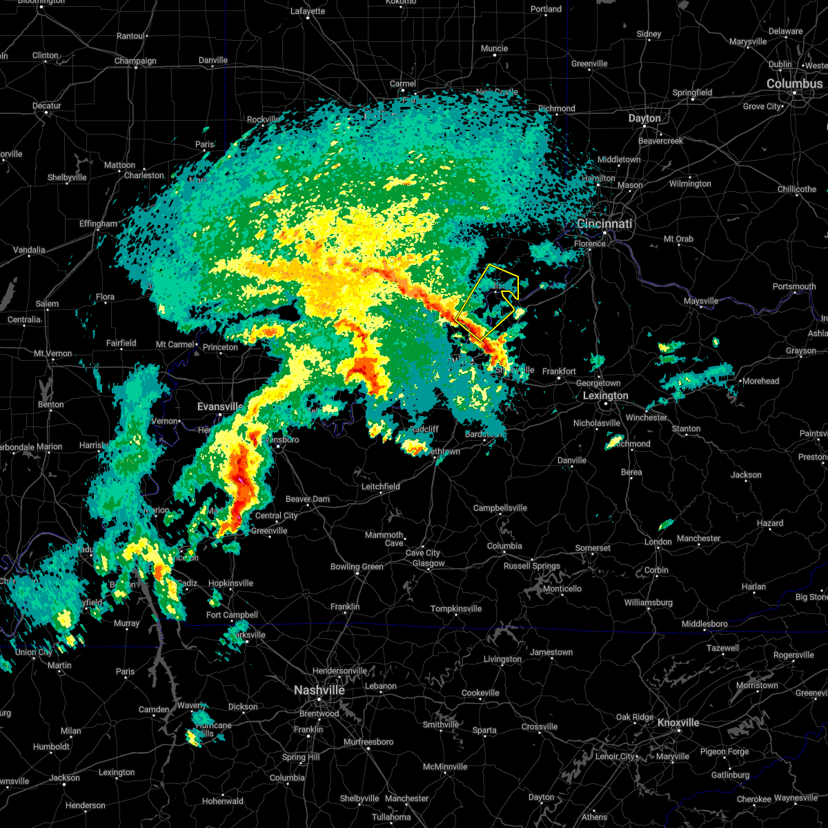 At 544 am est, a severe thunderstorm was located 11 miles west of bedford, moving northeast at 50 mph (radar indicated). Hazards include quarter size hail. Damage to vehicles is expected. this severe thunderstorm will be near, bedford around 555 am est. other locations in the path of this severe thunderstorm include madison. hail threat, radar indicated max hail size, 1. 00 in wind threat, radar indicated max wind gust, <50 mph. At 544 am est, a severe thunderstorm was located 11 miles west of bedford, moving northeast at 50 mph (radar indicated). Hazards include quarter size hail. Damage to vehicles is expected. this severe thunderstorm will be near, bedford around 555 am est. other locations in the path of this severe thunderstorm include madison. hail threat, radar indicated max hail size, 1. 00 in wind threat, radar indicated max wind gust, <50 mph.
|
| 8/9/2022 8:09 PM EDT | Siding off a building and reports of a couple of trees dow in jefferson county IN, 8.9 miles WNW of Madison, IN |
| 6/22/2022 3:50 PM EDT |
 At 350 pm edt, a severe thunderstorm was located 7 miles southwest of madison, moving southeast at 25 mph (radar indicated). Hazards include 60 mph wind gusts and quarter size hail. Hail damage to vehicles is expected. Expect wind damage to roofs, siding, and trees. At 350 pm edt, a severe thunderstorm was located 7 miles southwest of madison, moving southeast at 25 mph (radar indicated). Hazards include 60 mph wind gusts and quarter size hail. Hail damage to vehicles is expected. Expect wind damage to roofs, siding, and trees.
|
| 6/17/2022 11:25 AM EDT | Trees and power lines dow in jefferson county IN, 1.1 miles WSW of Madison, IN |
| 5/21/2022 4:45 PM EDT | Report of trees down near lancaster. picture received via social media. time estimated from rada in jefferson county IN, 8.6 miles SE of Madison, IN |
| 5/21/2022 4:24 PM EDT |
 At 423 pm edt, severe thunderstorms were located along a line extending from 9 miles west of scottsburg to near corydon, moving east at 40 mph (radar indicated). Hazards include 60 mph wind gusts. Expect damage to roofs, siding, and trees. severe thunderstorms will be near, scottsburg around 435 pm edt. other locations in the path of these severe thunderstorms include st. dennis, pleasure ridge park, valley station, shively, fairdale, louisville, audubon park, watterson park, lynnview, parkway village, poplar hills, newburg, okolona, west buechel, hollow creek, seneca gardens, strathmoor village, rolling fields, riverwood, norbourne estates, kingsley, strathmoor manor, bellewood, st. matthews, madison, hurstbourne, graymoor-devondale, windy hills, hurstbourne acres, st. regis park, beechwood village, barbourmeade, northfield, jeffersontown, lyndon, middletown, douglass hills, anchorage, worthington hills, coldstream, rolling hills, langdon place and plantation. hail threat, radar indicated max hail size, <. 75 in wind threat, radar indicated max wind gust, 60 mph. At 423 pm edt, severe thunderstorms were located along a line extending from 9 miles west of scottsburg to near corydon, moving east at 40 mph (radar indicated). Hazards include 60 mph wind gusts. Expect damage to roofs, siding, and trees. severe thunderstorms will be near, scottsburg around 435 pm edt. other locations in the path of these severe thunderstorms include st. dennis, pleasure ridge park, valley station, shively, fairdale, louisville, audubon park, watterson park, lynnview, parkway village, poplar hills, newburg, okolona, west buechel, hollow creek, seneca gardens, strathmoor village, rolling fields, riverwood, norbourne estates, kingsley, strathmoor manor, bellewood, st. matthews, madison, hurstbourne, graymoor-devondale, windy hills, hurstbourne acres, st. regis park, beechwood village, barbourmeade, northfield, jeffersontown, lyndon, middletown, douglass hills, anchorage, worthington hills, coldstream, rolling hills, langdon place and plantation. hail threat, radar indicated max hail size, <. 75 in wind threat, radar indicated max wind gust, 60 mph.
|
| 5/20/2022 4:10 AM EDT |
 The severe thunderstorm warning for eastern jefferson county will expire at 415 am edt, the storm which prompted the warning has weakened below severe limits and no longer poses an immediate threat to life or property. The severe thunderstorm warning for eastern jefferson county will expire at 415 am edt, the storm which prompted the warning has weakened below severe limits and no longer poses an immediate threat to life or property.
|
| 5/20/2022 4:04 AM EDT |
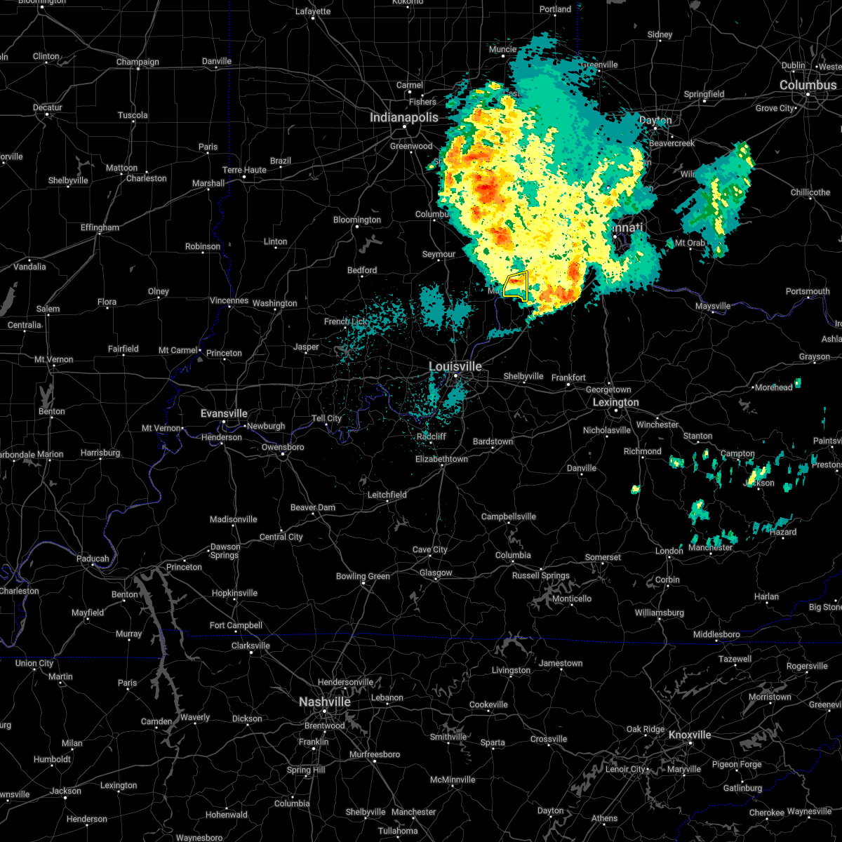 At 404 am edt, a severe thunderstorm was located 7 miles northeast of madison, moving east at 50 mph (radar indicated). Hazards include 60 mph wind gusts. Expect damage to roofs, siding, and trees. locations impacted include, madison, brooksburg, canaan, manville, and china. hail threat, radar indicated max hail size, <. 75 in wind threat, radar indicated max wind gust, 60 mph. At 404 am edt, a severe thunderstorm was located 7 miles northeast of madison, moving east at 50 mph (radar indicated). Hazards include 60 mph wind gusts. Expect damage to roofs, siding, and trees. locations impacted include, madison, brooksburg, canaan, manville, and china. hail threat, radar indicated max hail size, <. 75 in wind threat, radar indicated max wind gust, 60 mph.
|
| 5/20/2022 3:52 AM EDT |
 At 352 am edt, a severe thunderstorm was located 7 miles northwest of madison, moving east at 50 mph (radar indicated). Hazards include 60 mph wind gusts and penny size hail. expect damage to roofs, siding, and trees At 352 am edt, a severe thunderstorm was located 7 miles northwest of madison, moving east at 50 mph (radar indicated). Hazards include 60 mph wind gusts and penny size hail. expect damage to roofs, siding, and trees
|
| 5/20/2022 3:25 AM EDT | Several trees dow in jefferson county IN, 1.2 miles WNW of Madison, IN |
| 5/19/2022 10:21 PM EDT |
 The severe thunderstorm warning for east central jefferson and northwestern trimble counties will expire at 1030 pm edt, the storm which prompted the warning has moved out of the area. therefore, the warning will be allowed to expire. a severe thunderstorm watch remains in effect until 200 am edt for south central indiana, and central kentucky. The severe thunderstorm warning for east central jefferson and northwestern trimble counties will expire at 1030 pm edt, the storm which prompted the warning has moved out of the area. therefore, the warning will be allowed to expire. a severe thunderstorm watch remains in effect until 200 am edt for south central indiana, and central kentucky.
|
| 5/19/2022 10:21 PM EDT |
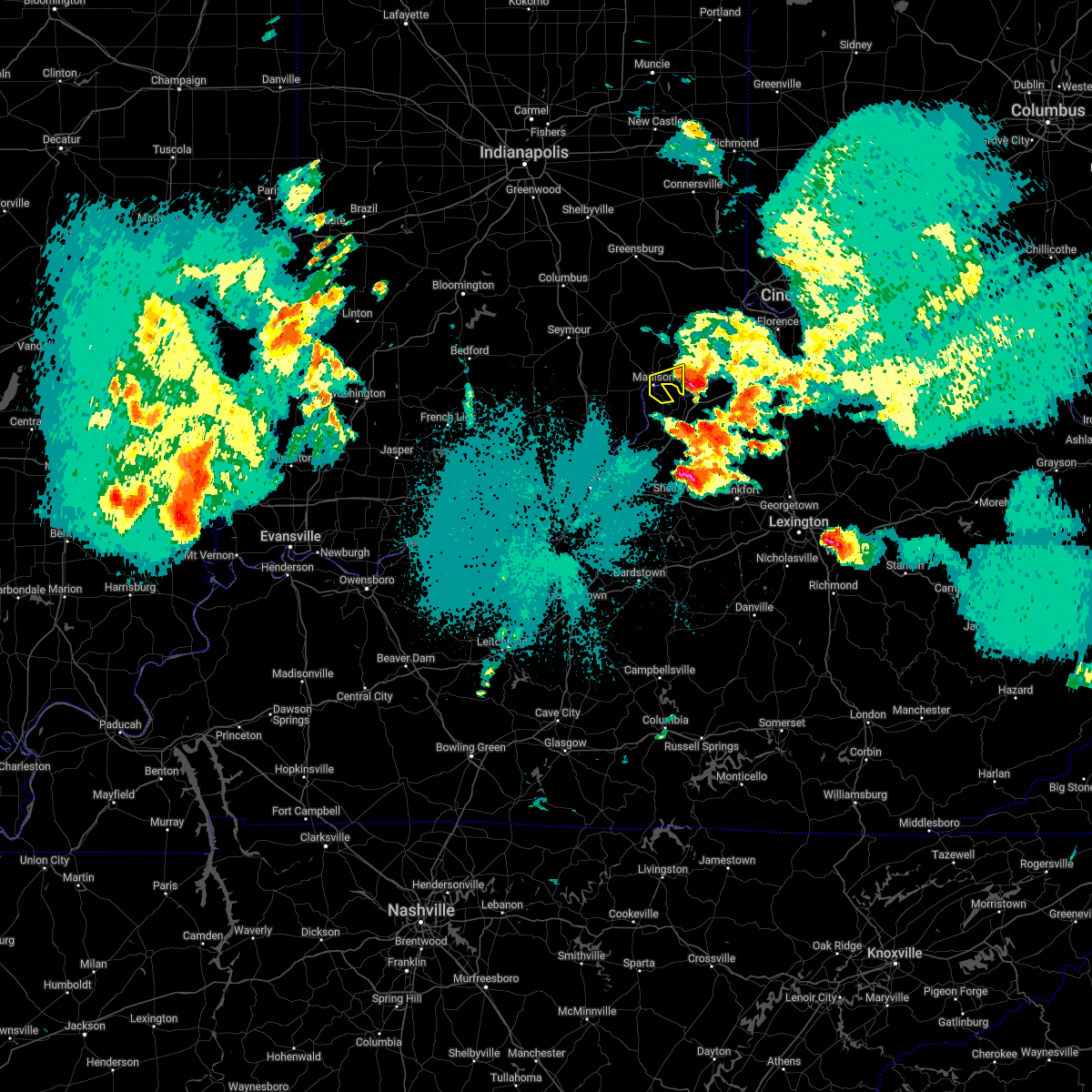 The severe thunderstorm warning for east central jefferson and northwestern trimble counties will expire at 1030 pm edt, the storm which prompted the warning has moved out of the area. therefore, the warning will be allowed to expire. a severe thunderstorm watch remains in effect until 200 am edt for south central indiana, and central kentucky. The severe thunderstorm warning for east central jefferson and northwestern trimble counties will expire at 1030 pm edt, the storm which prompted the warning has moved out of the area. therefore, the warning will be allowed to expire. a severe thunderstorm watch remains in effect until 200 am edt for south central indiana, and central kentucky.
|
| 5/19/2022 10:06 PM EDT |
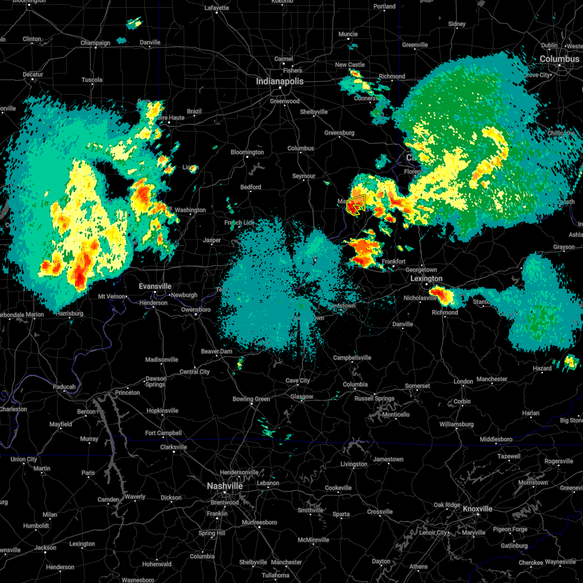 At 1005 pm edt, a severe thunderstorm was located near madison, moving east at 30 mph (radar indicated). Hazards include 60 mph wind gusts and half dollar size hail. Hail damage to vehicles is expected. expect wind damage to roofs, siding, and trees. Locations impacted include, madison, milton, brooksburg, north madison, ringwald and manville. At 1005 pm edt, a severe thunderstorm was located near madison, moving east at 30 mph (radar indicated). Hazards include 60 mph wind gusts and half dollar size hail. Hail damage to vehicles is expected. expect wind damage to roofs, siding, and trees. Locations impacted include, madison, milton, brooksburg, north madison, ringwald and manville.
|
| 5/19/2022 9:59 PM EDT |
 At 957 pm edt, a severe thunderstorm was located near madison, moving east at 30 mph (radar indicated). Hazards include 60 mph wind gusts and half dollar size hail. Hail damage to vehicles is expected. expect wind damage to roofs, siding, and trees. Locations impacted include, madison, hanover, milton, brooksburg, north madison, manville, trout, hanover beach, madison municipal airport and ringwald. At 957 pm edt, a severe thunderstorm was located near madison, moving east at 30 mph (radar indicated). Hazards include 60 mph wind gusts and half dollar size hail. Hail damage to vehicles is expected. expect wind damage to roofs, siding, and trees. Locations impacted include, madison, hanover, milton, brooksburg, north madison, manville, trout, hanover beach, madison municipal airport and ringwald.
|
| 5/19/2022 9:52 PM EDT |
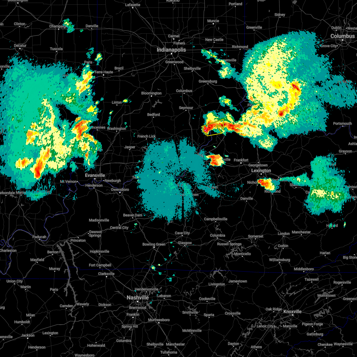 At 952 pm edt, a severe thunderstorm was located near madison, moving east at 30 mph (radar indicated). Hazards include 60 mph wind gusts and half dollar size hail. Hail damage to vehicles is expected. expect wind damage to roofs, siding, and trees. Locations impacted include, madison, hanover, saluda, milton, kent, brooksburg, north madison, manville, trout and madison municipal airport. At 952 pm edt, a severe thunderstorm was located near madison, moving east at 30 mph (radar indicated). Hazards include 60 mph wind gusts and half dollar size hail. Hail damage to vehicles is expected. expect wind damage to roofs, siding, and trees. Locations impacted include, madison, hanover, saluda, milton, kent, brooksburg, north madison, manville, trout and madison municipal airport.
|
| 5/19/2022 9:44 PM EDT |
 At 943 pm edt, a severe thunderstorm was located 10 miles southwest of madison, moving east northeast at 30 mph (radar indicated). Hazards include 60 mph wind gusts and half dollar size hail. Hail damage to vehicles is expected. Expect wind damage to roofs, siding, and trees. At 943 pm edt, a severe thunderstorm was located 10 miles southwest of madison, moving east northeast at 30 mph (radar indicated). Hazards include 60 mph wind gusts and half dollar size hail. Hail damage to vehicles is expected. Expect wind damage to roofs, siding, and trees.
|
| 5/19/2022 9:44 PM EDT |
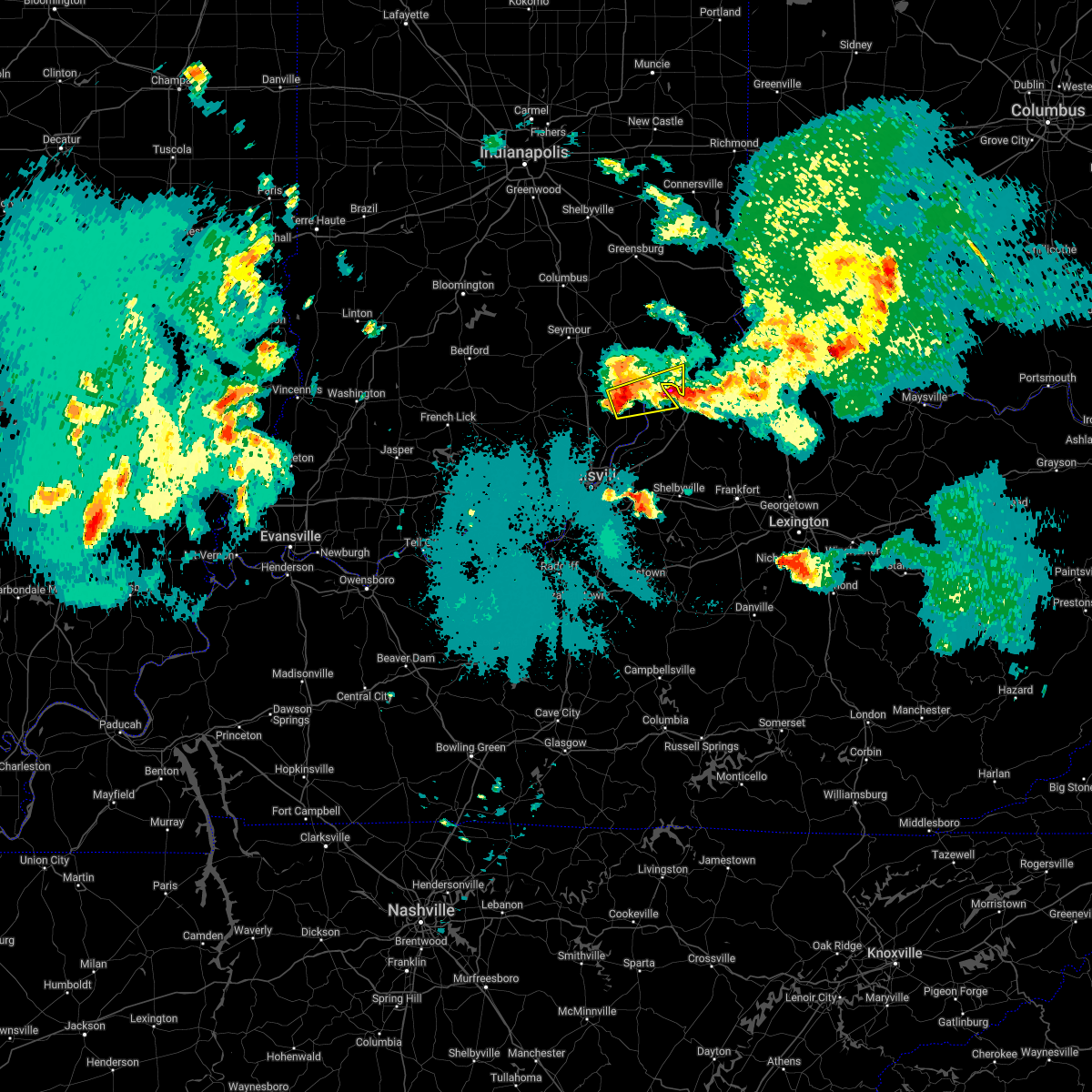 At 943 pm edt, a severe thunderstorm was located 10 miles southwest of madison, moving east northeast at 30 mph (radar indicated). Hazards include 60 mph wind gusts and half dollar size hail. Hail damage to vehicles is expected. Expect wind damage to roofs, siding, and trees. At 943 pm edt, a severe thunderstorm was located 10 miles southwest of madison, moving east northeast at 30 mph (radar indicated). Hazards include 60 mph wind gusts and half dollar size hail. Hail damage to vehicles is expected. Expect wind damage to roofs, siding, and trees.
|
| 5/19/2022 9:18 PM EDT |
 At 918 pm edt, a severe thunderstorm was located near florence, moving east at 30 mph (radar indicated). Hazards include 60 mph wind gusts and half dollar size hail. Hail damage to vehicles is expected. expect wind damage to roofs, siding, and trees. Locations impacted include, madison, milton, brooksburg, monitor, manville and china. At 918 pm edt, a severe thunderstorm was located near florence, moving east at 30 mph (radar indicated). Hazards include 60 mph wind gusts and half dollar size hail. Hail damage to vehicles is expected. expect wind damage to roofs, siding, and trees. Locations impacted include, madison, milton, brooksburg, monitor, manville and china.
|
| 5/19/2022 9:18 PM EDT |
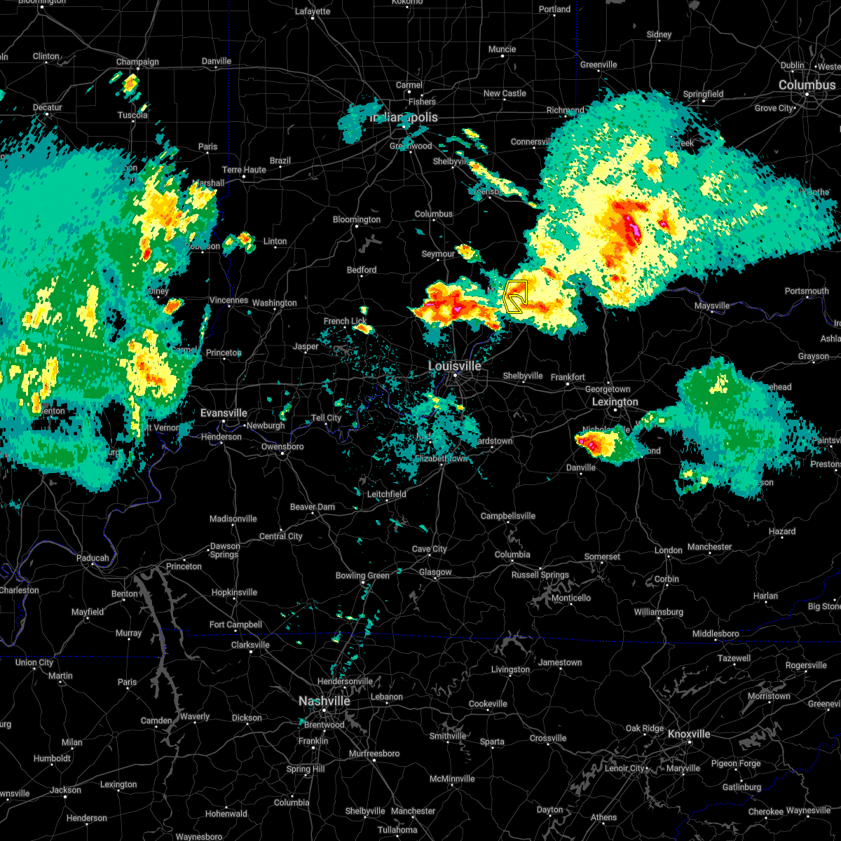 At 918 pm edt, a severe thunderstorm was located near florence, moving east at 30 mph (radar indicated). Hazards include 60 mph wind gusts and half dollar size hail. Hail damage to vehicles is expected. expect wind damage to roofs, siding, and trees. Locations impacted include, madison, milton, brooksburg, monitor, manville and china. At 918 pm edt, a severe thunderstorm was located near florence, moving east at 30 mph (radar indicated). Hazards include 60 mph wind gusts and half dollar size hail. Hail damage to vehicles is expected. expect wind damage to roofs, siding, and trees. Locations impacted include, madison, milton, brooksburg, monitor, manville and china.
|
| 5/19/2022 8:53 PM EDT | Emergency manager relayed report of power lines down near smyrna. time estimated from rada in jefferson county IN, 4.6 miles ESE of Madison, IN |
| 5/19/2022 8:53 PM EDT |
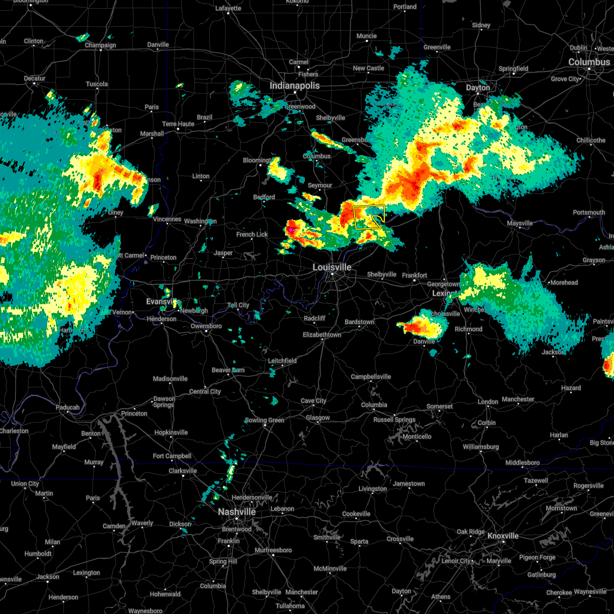 At 852 pm edt, a severe thunderstorm was located near madison, moving east at 60 mph (radar indicated). Hazards include 60 mph wind gusts and half dollar size hail. Hail damage to vehicles is expected. expect wind damage to roofs, siding, and trees. This severe thunderstorm will remain over mainly rural areas of central jefferson and northwestern trimble counties, including the following locations, hanover, volga, north madison, manville, trout, madison municipal airport, monitor, ringwald, china and hanover beach. At 852 pm edt, a severe thunderstorm was located near madison, moving east at 60 mph (radar indicated). Hazards include 60 mph wind gusts and half dollar size hail. Hail damage to vehicles is expected. expect wind damage to roofs, siding, and trees. This severe thunderstorm will remain over mainly rural areas of central jefferson and northwestern trimble counties, including the following locations, hanover, volga, north madison, manville, trout, madison municipal airport, monitor, ringwald, china and hanover beach.
|
| 5/19/2022 8:25 PM EDT |
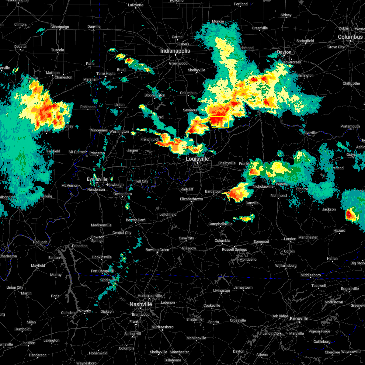 At 823 pm edt, a severe thunderstorm was located 9 miles southwest of dillsboro, moving east at 30 mph (radar indicated). Hazards include 60 mph wind gusts and quarter size hail. Hail damage to vehicles is expected. expect wind damage to roofs, siding, and trees. This severe thunderstorm will remain over mainly rural areas of northeastern jefferson county, including the following locations, middlefork, canaan, north madison, manville, belleview, bryantsburg, madison municipal airport, five points, ringwald and china. At 823 pm edt, a severe thunderstorm was located 9 miles southwest of dillsboro, moving east at 30 mph (radar indicated). Hazards include 60 mph wind gusts and quarter size hail. Hail damage to vehicles is expected. expect wind damage to roofs, siding, and trees. This severe thunderstorm will remain over mainly rural areas of northeastern jefferson county, including the following locations, middlefork, canaan, north madison, manville, belleview, bryantsburg, madison municipal airport, five points, ringwald and china.
|
| 5/19/2022 8:23 PM EDT | Emergency manager relayed report of trees and power lines down near manville. time estimated from rada in jefferson county IN, 7.5 miles WSW of Madison, IN |
| 5/19/2022 8:22 PM EDT | Trees down in northern jefferson county. time estimated from rada in jefferson county IN, 9.5 miles SW of Madison, IN |
| 5/19/2022 8:06 PM EDT | Trees down in northern jefferson county. time estimated from rada in jefferson county IN, 8.2 miles SE of Madison, IN |
| 5/19/2022 8:03 PM EDT |
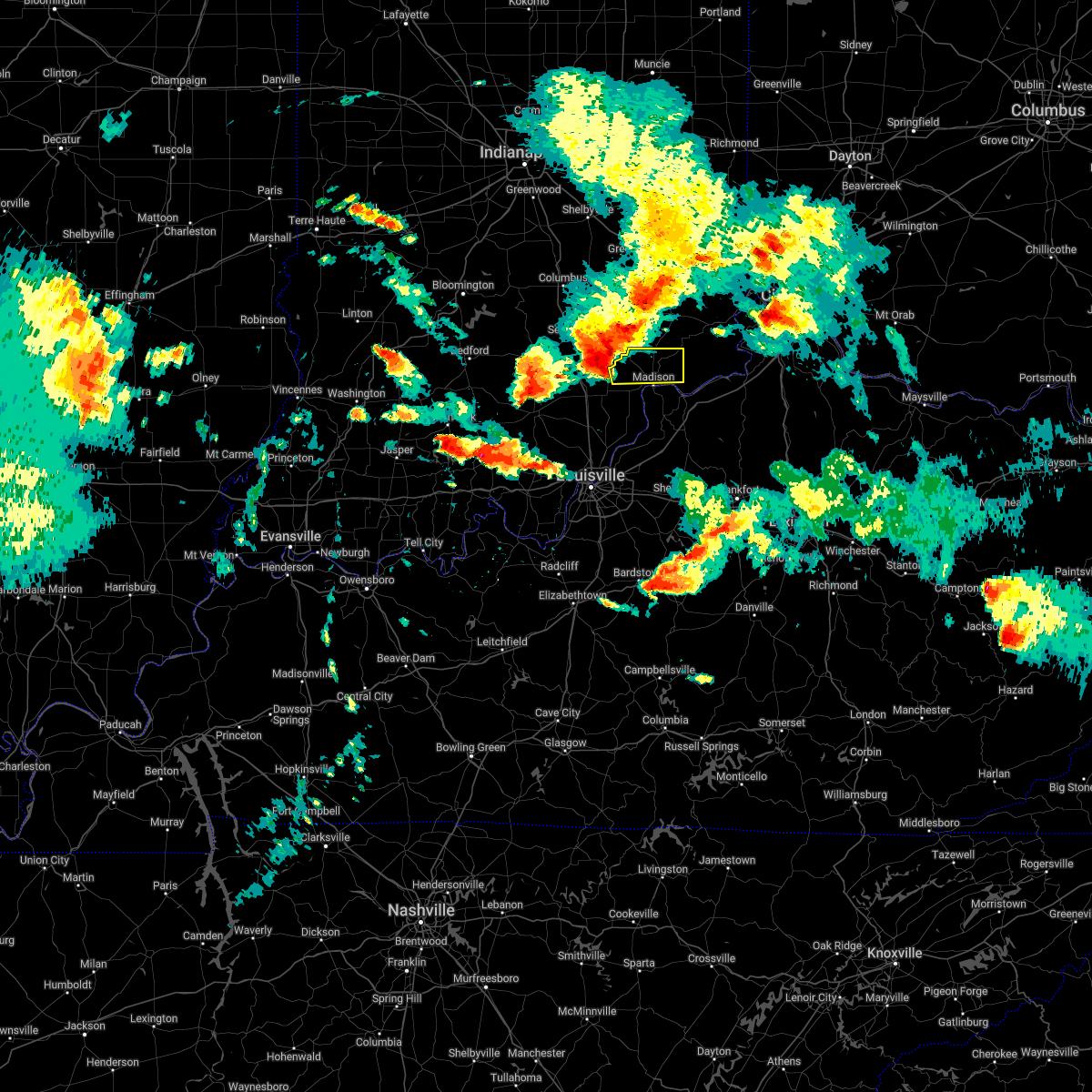 At 803 pm edt, a severe thunderstorm was located 11 miles northwest of madison, moving east at 30 mph (radar indicated). Hazards include 60 mph wind gusts and half dollar size hail. Hail damage to vehicles is expected. expect wind damage to roofs, siding, and trees. This severe thunderstorm will be near, madison around 810 pm edt. At 803 pm edt, a severe thunderstorm was located 11 miles northwest of madison, moving east at 30 mph (radar indicated). Hazards include 60 mph wind gusts and half dollar size hail. Hail damage to vehicles is expected. expect wind damage to roofs, siding, and trees. This severe thunderstorm will be near, madison around 810 pm edt.
|
| 7/10/2021 8:35 PM EDT |
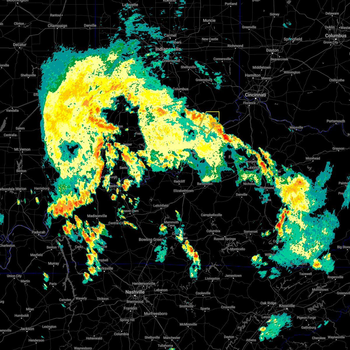 The severe thunderstorm warning for jefferson and northwestern trimble counties will expire at 845 pm edt, the storm which prompted the warning has weakened below severe limits, and no longer poses an immediate threat to life or property. therefore, the warning will be allowed to expire. however gusty winds are still possible with this thunderstorm. The severe thunderstorm warning for jefferson and northwestern trimble counties will expire at 845 pm edt, the storm which prompted the warning has weakened below severe limits, and no longer poses an immediate threat to life or property. therefore, the warning will be allowed to expire. however gusty winds are still possible with this thunderstorm.
|
| 7/10/2021 8:09 PM EDT |
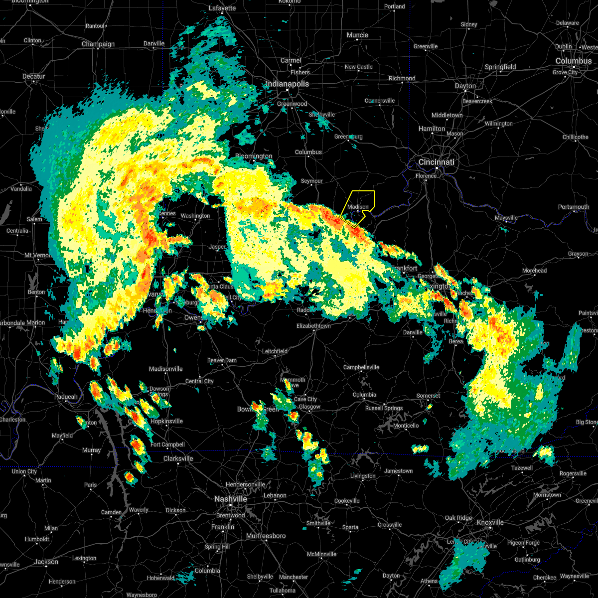 At 809 pm edt, a severe thunderstorm was located near madison, moving northeast at 35 mph (radar indicated). Hazards include 60 mph wind gusts. Expect damage to roofs, siding, and trees. This severe thunderstorm will be near, madison around 825 pm edt. At 809 pm edt, a severe thunderstorm was located near madison, moving northeast at 35 mph (radar indicated). Hazards include 60 mph wind gusts. Expect damage to roofs, siding, and trees. This severe thunderstorm will be near, madison around 825 pm edt.
|
| 7/8/2021 5:28 PM EDT |
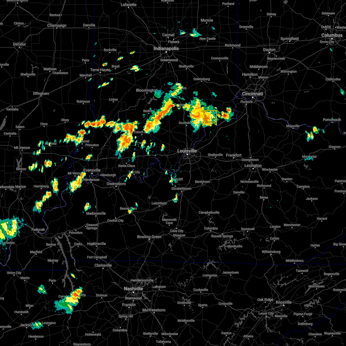 At 527 pm edt, severe thunderstorms were from 13 miles southwest of versailles to 11 miles northwest of carrollton to madison, moving east at 35 mph (radar indicated). Hazards include 65 mph wind gusts and penny size hail. Expect damage to roofs, siding, and trees. Locations in the path include, canaan, north madison, ringwald, manville, china, brooksburg, belleview, bryantsburg, and barbersville. At 527 pm edt, severe thunderstorms were from 13 miles southwest of versailles to 11 miles northwest of carrollton to madison, moving east at 35 mph (radar indicated). Hazards include 65 mph wind gusts and penny size hail. Expect damage to roofs, siding, and trees. Locations in the path include, canaan, north madison, ringwald, manville, china, brooksburg, belleview, bryantsburg, and barbersville.
|
| 7/8/2021 5:17 PM EDT |
 At 515 pm edt, severe thunderstorms were from 6 miles northwest of madison to 10 miles south of vernon, moving east at 20 mph (radar indicated). Hazards include 60 mph wind gusts and penny size hail. Expect damage to roofs, siding, and trees. Locations impacted include, madison, smyrna, kent, dupont, wakefield, middlefork, canaan, volga, north madison, and manville. At 515 pm edt, severe thunderstorms were from 6 miles northwest of madison to 10 miles south of vernon, moving east at 20 mph (radar indicated). Hazards include 60 mph wind gusts and penny size hail. Expect damage to roofs, siding, and trees. Locations impacted include, madison, smyrna, kent, dupont, wakefield, middlefork, canaan, volga, north madison, and manville.
|
| 7/8/2021 5:11 PM EDT | Tree down over chicken run r in jefferson county IN, 3.3 miles ESE of Madison, IN |
| 7/8/2021 4:58 PM EDT |
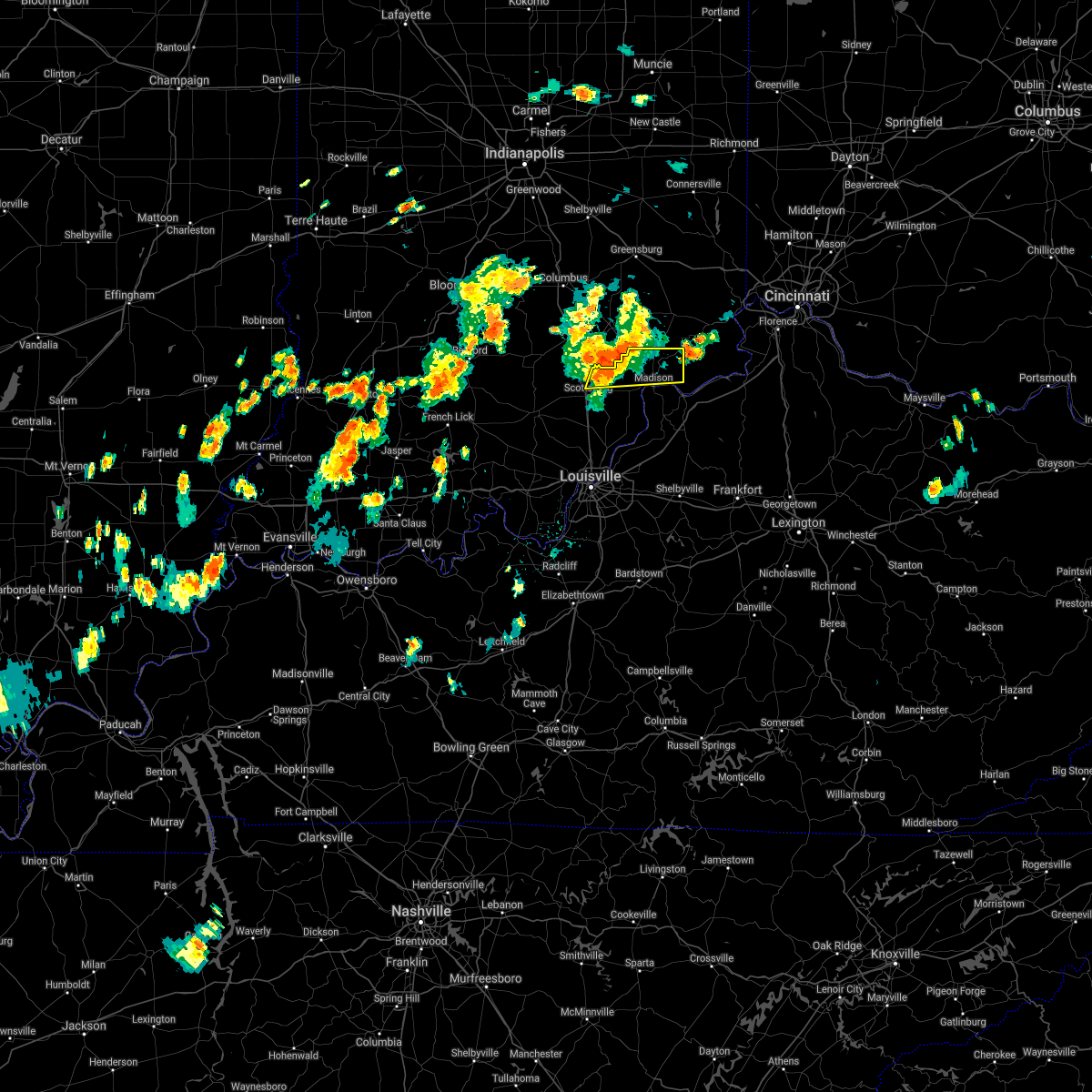 The national weather service in louisville has issued a * severe thunderstorm warning for. jefferson county in south central indiana. northeastern scott county in south central indiana. until 530 pm edt. At 457 pm edt, severe thunderstorms were from 6 miles southeast of. The national weather service in louisville has issued a * severe thunderstorm warning for. jefferson county in south central indiana. northeastern scott county in south central indiana. until 530 pm edt. At 457 pm edt, severe thunderstorms were from 6 miles southeast of.
|
| 6/18/2021 11:47 PM EDT |
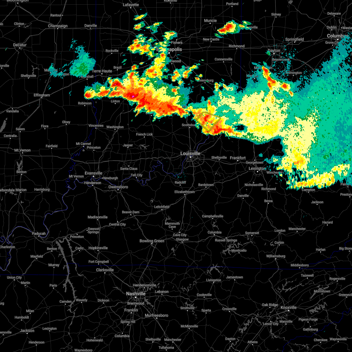 At 1147 pm edt, a severe thunderstorm was located over madison, moving southeast at 30 mph (radar indicated). Hazards include 60 mph wind gusts and penny size hail. Expect damage to roofs, siding, and trees. Locations impacted include, madison. At 1147 pm edt, a severe thunderstorm was located over madison, moving southeast at 30 mph (radar indicated). Hazards include 60 mph wind gusts and penny size hail. Expect damage to roofs, siding, and trees. Locations impacted include, madison.
|
| 6/18/2021 11:27 PM EDT |
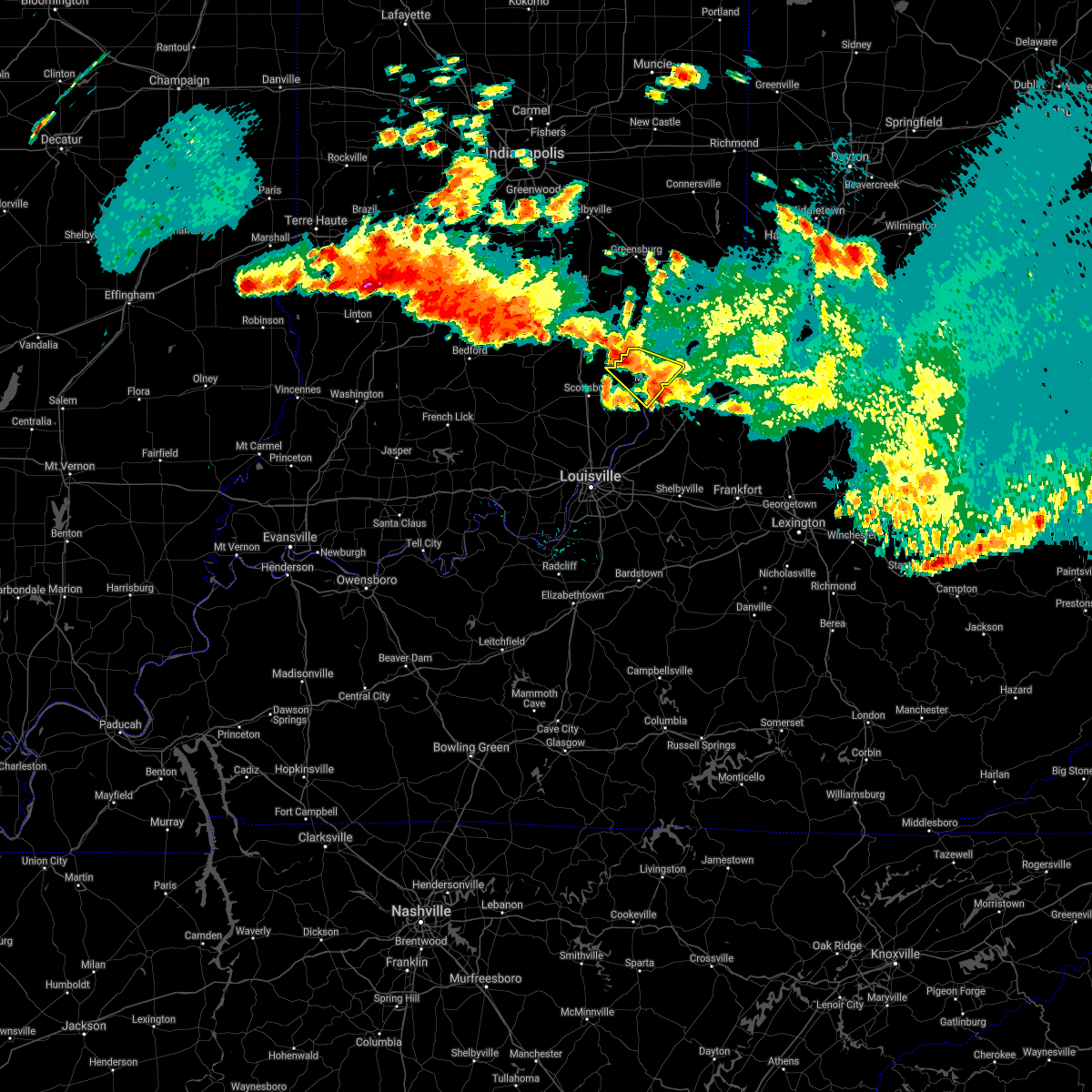 At 1127 pm edt, a severe thunderstorm was located 10 miles south of vernon, moving southeast at 30 mph (radar indicated). Hazards include 60 mph wind gusts and quarter size hail. Hail damage to vehicles is expected. expect wind damage to roofs, siding, and trees. This severe thunderstorm will be near, madison around 1145 pm edt. At 1127 pm edt, a severe thunderstorm was located 10 miles south of vernon, moving southeast at 30 mph (radar indicated). Hazards include 60 mph wind gusts and quarter size hail. Hail damage to vehicles is expected. expect wind damage to roofs, siding, and trees. This severe thunderstorm will be near, madison around 1145 pm edt.
|
| 3/25/2021 11:35 PM EDT | 8 inch diameter tree down on the road near the intersection of jefferson and lemon roads. also clearing a tree on sr 62 near chinaville road. time estimated based on ra in jefferson county IN, 11 miles SSW of Madison, IN |
| 4/8/2020 9:58 PM EDT |
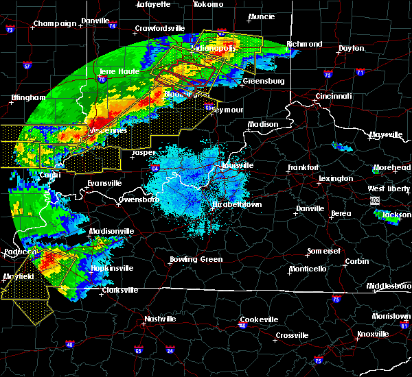 At 957 pm edt, a severe thunderstorm was located near north vernon, moving southeast at 60 mph (radar indicated). Hazards include 60 mph wind gusts. expect damage to roofs, siding, and trees At 957 pm edt, a severe thunderstorm was located near north vernon, moving southeast at 60 mph (radar indicated). Hazards include 60 mph wind gusts. expect damage to roofs, siding, and trees
|
| 3/20/2020 4:43 AM EDT |
 The severe thunderstorm warning for northeastern jefferson county will expire at 445 am edt, the storm which prompted the warning has weakened below severe limits, and has exited the warned area. therefore, the warning will be allowed to expire. however gusty winds and heavy rain are still possible with this thunderstorm. report severe weather to local law enforcement, post your report to the national weather service louisville facebook page, or tweet your report using hashtag l, m, k, spotter. The severe thunderstorm warning for northeastern jefferson county will expire at 445 am edt, the storm which prompted the warning has weakened below severe limits, and has exited the warned area. therefore, the warning will be allowed to expire. however gusty winds and heavy rain are still possible with this thunderstorm. report severe weather to local law enforcement, post your report to the national weather service louisville facebook page, or tweet your report using hashtag l, m, k, spotter.
|
| 3/20/2020 4:33 AM EDT |
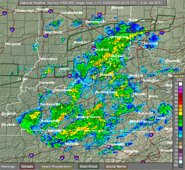 At 433 am edt, a severe thunderstorm was located 8 miles north of madison, moving east at 65 mph (radar indicated). Hazards include 60 mph wind gusts. expect damage to roofs, siding, and trees At 433 am edt, a severe thunderstorm was located 8 miles north of madison, moving east at 65 mph (radar indicated). Hazards include 60 mph wind gusts. expect damage to roofs, siding, and trees
|
| 6/30/2019 4:12 PM EDT |
 At 412 pm edt, a severe thunderstorm was located 7 miles west of madison, moving south at 20 mph (radar indicated). Hazards include 60 mph wind gusts and penny size hail. expect damage to roofs, siding, and trees At 412 pm edt, a severe thunderstorm was located 7 miles west of madison, moving south at 20 mph (radar indicated). Hazards include 60 mph wind gusts and penny size hail. expect damage to roofs, siding, and trees
|
| 6/30/2019 4:12 PM EDT |
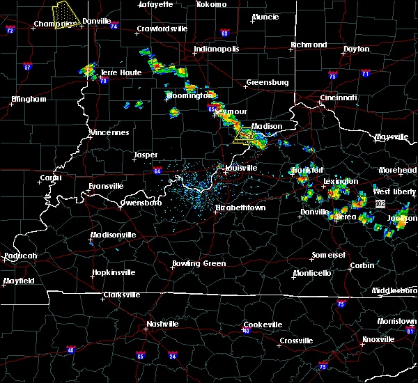 At 412 pm edt, a severe thunderstorm was located 7 miles west of madison, moving south at 20 mph (radar indicated). Hazards include 60 mph wind gusts and penny size hail. expect damage to roofs, siding, and trees At 412 pm edt, a severe thunderstorm was located 7 miles west of madison, moving south at 20 mph (radar indicated). Hazards include 60 mph wind gusts and penny size hail. expect damage to roofs, siding, and trees
|
| 6/30/2019 4:02 PM EDT |
 At 402 pm edt, a severe thunderstorm was located near madison, moving south at 20 mph (radar indicated). Hazards include 60 mph wind gusts and penny size hail. Expect damage to roofs, siding, and trees. Locations impacted include, madison, hanover, smyrna, milton, kent, volga, north madison, hanover beach, swanville and wirt. At 402 pm edt, a severe thunderstorm was located near madison, moving south at 20 mph (radar indicated). Hazards include 60 mph wind gusts and penny size hail. Expect damage to roofs, siding, and trees. Locations impacted include, madison, hanover, smyrna, milton, kent, volga, north madison, hanover beach, swanville and wirt.
|
| 6/30/2019 4:02 PM EDT |
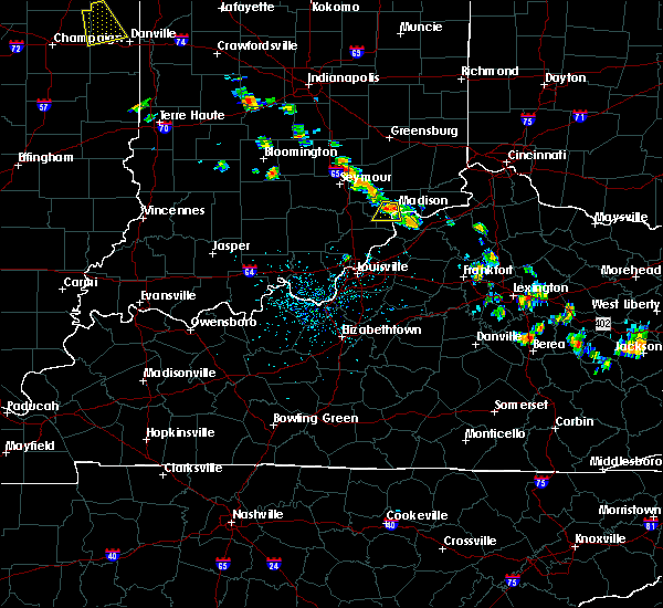 At 402 pm edt, a severe thunderstorm was located near madison, moving south at 20 mph (radar indicated). Hazards include 60 mph wind gusts and penny size hail. Expect damage to roofs, siding, and trees. Locations impacted include, madison, hanover, smyrna, milton, kent, volga, north madison, hanover beach, swanville and wirt. At 402 pm edt, a severe thunderstorm was located near madison, moving south at 20 mph (radar indicated). Hazards include 60 mph wind gusts and penny size hail. Expect damage to roofs, siding, and trees. Locations impacted include, madison, hanover, smyrna, milton, kent, volga, north madison, hanover beach, swanville and wirt.
|
| 6/30/2019 3:51 PM EDT |
 At 351 pm edt, a severe thunderstorm was located 7 miles northwest of madison, moving south at 20 mph (radar indicated). Hazards include 60 mph wind gusts and quarter size hail. Hail damage to vehicles is expected. Expect wind damage to roofs, siding, and trees. At 351 pm edt, a severe thunderstorm was located 7 miles northwest of madison, moving south at 20 mph (radar indicated). Hazards include 60 mph wind gusts and quarter size hail. Hail damage to vehicles is expected. Expect wind damage to roofs, siding, and trees.
|
| 6/5/2019 6:03 PM EDT |
 At 601 pm edt, a severe thunderstorm was located near madison, moving southeast at 30 mph. dispatch reported trees down reported 559 pm at us 62 near china manville road (radar indicated). Hazards include 60 mph wind gusts and half dollar size hail. Hail damage to vehicles is expected. expect wind damage to roofs, siding, and trees. Locations impacted include, madison, smyrna, milton, brooksburg, north madison, ringwald, manville, china, belleview and wirt. At 601 pm edt, a severe thunderstorm was located near madison, moving southeast at 30 mph. dispatch reported trees down reported 559 pm at us 62 near china manville road (radar indicated). Hazards include 60 mph wind gusts and half dollar size hail. Hail damage to vehicles is expected. expect wind damage to roofs, siding, and trees. Locations impacted include, madison, smyrna, milton, brooksburg, north madison, ringwald, manville, china, belleview and wirt.
|
| 6/5/2019 6:03 PM EDT |
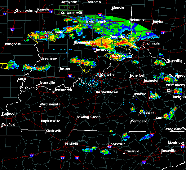 At 601 pm edt, a severe thunderstorm was located near madison, moving southeast at 30 mph. dispatch reported trees down reported 559 pm at us 62 near china manville road (radar indicated). Hazards include 60 mph wind gusts and half dollar size hail. Hail damage to vehicles is expected. expect wind damage to roofs, siding, and trees. Locations impacted include, madison, smyrna, milton, brooksburg, north madison, ringwald, manville, china, belleview and wirt. At 601 pm edt, a severe thunderstorm was located near madison, moving southeast at 30 mph. dispatch reported trees down reported 559 pm at us 62 near china manville road (radar indicated). Hazards include 60 mph wind gusts and half dollar size hail. Hail damage to vehicles is expected. expect wind damage to roofs, siding, and trees. Locations impacted include, madison, smyrna, milton, brooksburg, north madison, ringwald, manville, china, belleview and wirt.
|
| 6/5/2019 5:59 PM EDT | Report of trees down along state road 62 near china manville r in jefferson county IN, 6 miles SSW of Madison, IN |
| 6/5/2019 5:57 PM EDT | Multiple trees and power lines down at sr 250 and graham r in jefferson county IN, 5.3 miles SSW of Madison, IN |
| 6/5/2019 5:49 PM EDT |
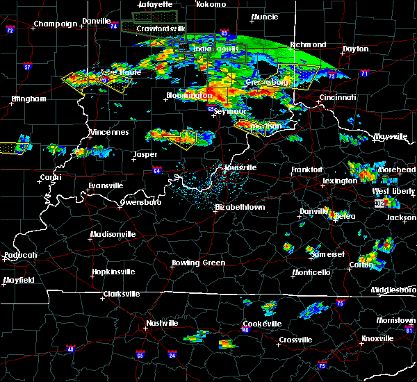 At 548 pm edt, a severe thunderstorm was located 9 miles northwest of madison, moving southeast at 30 mph (radar indicated). Hazards include 60 mph wind gusts and quarter size hail. Hail damage to vehicles is expected. Expect wind damage to roofs, siding, and trees. At 548 pm edt, a severe thunderstorm was located 9 miles northwest of madison, moving southeast at 30 mph (radar indicated). Hazards include 60 mph wind gusts and quarter size hail. Hail damage to vehicles is expected. Expect wind damage to roofs, siding, and trees.
|
| 5/16/2019 7:46 PM EDT |
 At 746 pm edt, severe thunderstorms were from 14 miles south of vernon to 19 miles west of madison to near scottsburg, moving southeast at 40 mph (radar indicated). Hazards include 60 mph wind gusts and quarter size hail. Hail damage to vehicles is expected. Expect wind damage to roofs, siding, and trees. At 746 pm edt, severe thunderstorms were from 14 miles south of vernon to 19 miles west of madison to near scottsburg, moving southeast at 40 mph (radar indicated). Hazards include 60 mph wind gusts and quarter size hail. Hail damage to vehicles is expected. Expect wind damage to roofs, siding, and trees.
|
| 4/12/2019 6:53 AM EDT |
 The severe thunderstorm warning for northwestern jefferson county will expire at 700 am edt, the storm which prompted the warning has moved out of the area. therefore, the warning will be allowed to expire. report severe weather to local law enforcement, post your report to the national weather service louisville facebook page, or tweet your report using hashtag l, m, k, spotter. The severe thunderstorm warning for northwestern jefferson county will expire at 700 am edt, the storm which prompted the warning has moved out of the area. therefore, the warning will be allowed to expire. report severe weather to local law enforcement, post your report to the national weather service louisville facebook page, or tweet your report using hashtag l, m, k, spotter.
|
| 4/12/2019 6:42 AM EDT |
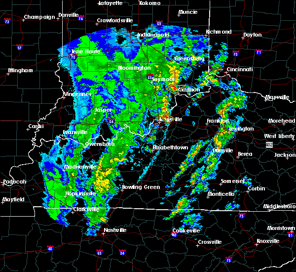 At 642 am edt, a severe thunderstorm was located 10 miles southeast of vernon, moving northeast at 55 mph (radar indicated). Hazards include 60 mph wind gusts and quarter size hail. Hail damage to vehicles is expected. Expect wind damage to roofs, siding, and trees. At 642 am edt, a severe thunderstorm was located 10 miles southeast of vernon, moving northeast at 55 mph (radar indicated). Hazards include 60 mph wind gusts and quarter size hail. Hail damage to vehicles is expected. Expect wind damage to roofs, siding, and trees.
|
| 3/14/2019 5:08 PM EDT |
 At 507 pm edt, a severe thunderstorm capable of producing a tornado was located 10 miles southwest of madison, moving northeast at 55 mph (radar indicated rotation). Hazards include tornado. Flying debris will be dangerous to those caught without shelter. mobile homes will be damaged or destroyed. damage to roofs, windows, and vehicles will occur. tree damage is likely. Locations impacted include, madison, hanover, saluda, chelsea, paynesville, and hanover beach. At 507 pm edt, a severe thunderstorm capable of producing a tornado was located 10 miles southwest of madison, moving northeast at 55 mph (radar indicated rotation). Hazards include tornado. Flying debris will be dangerous to those caught without shelter. mobile homes will be damaged or destroyed. damage to roofs, windows, and vehicles will occur. tree damage is likely. Locations impacted include, madison, hanover, saluda, chelsea, paynesville, and hanover beach.
|
| 3/14/2019 4:59 PM EDT |
 At 459 pm edt, a severe thunderstorm capable of producing a tornado was located 11 miles southeast of scottsburg, moving northeast at 55 mph (radar indicated rotation). Hazards include tornado. Flying debris will be dangerous to those caught without shelter. mobile homes will be damaged or destroyed. damage to roofs, windows, and vehicles will occur. Tree damage is likely. At 459 pm edt, a severe thunderstorm capable of producing a tornado was located 11 miles southeast of scottsburg, moving northeast at 55 mph (radar indicated rotation). Hazards include tornado. Flying debris will be dangerous to those caught without shelter. mobile homes will be damaged or destroyed. damage to roofs, windows, and vehicles will occur. Tree damage is likely.
|
| 3/14/2019 4:10 PM EDT |
 At 409 pm edt, a severe thunderstorm was located 12 miles southeast of scottsburg, moving northeast at 75 mph (radar indicated). Hazards include 70 mph wind gusts and quarter size hail. Hail damage to vehicles is expected. expect considerable tree damage. Wind damage is also likely to mobile homes, roofs, and outbuildings. At 409 pm edt, a severe thunderstorm was located 12 miles southeast of scottsburg, moving northeast at 75 mph (radar indicated). Hazards include 70 mph wind gusts and quarter size hail. Hail damage to vehicles is expected. expect considerable tree damage. Wind damage is also likely to mobile homes, roofs, and outbuildings.
|
| 3/14/2019 4:10 PM EDT |
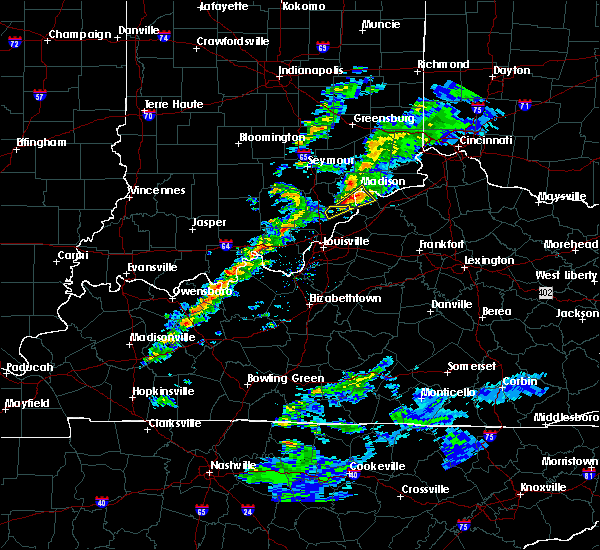 At 409 pm edt, a severe thunderstorm was located 12 miles southeast of scottsburg, moving northeast at 75 mph (radar indicated). Hazards include 70 mph wind gusts and quarter size hail. Hail damage to vehicles is expected. expect considerable tree damage. Wind damage is also likely to mobile homes, roofs, and outbuildings. At 409 pm edt, a severe thunderstorm was located 12 miles southeast of scottsburg, moving northeast at 75 mph (radar indicated). Hazards include 70 mph wind gusts and quarter size hail. Hail damage to vehicles is expected. expect considerable tree damage. Wind damage is also likely to mobile homes, roofs, and outbuildings.
|
| 8/7/2018 3:35 PM EDT |
 The severe thunderstorm warning for jefferson county will expire at 345 pm edt, the storm which prompted the warning has weakened below severe limits, and no longer poses an immediate threat to life or property. therefore, the warning will be allowed to expire. however gusty winds and heavy rain are still occurring with this thunderstorm. report severe weather to local law enforcement, post your report to the national weather service louisville facebook page, or tweet your report using hashtag l, m, k, spotter. The severe thunderstorm warning for jefferson county will expire at 345 pm edt, the storm which prompted the warning has weakened below severe limits, and no longer poses an immediate threat to life or property. therefore, the warning will be allowed to expire. however gusty winds and heavy rain are still occurring with this thunderstorm. report severe weather to local law enforcement, post your report to the national weather service louisville facebook page, or tweet your report using hashtag l, m, k, spotter.
|
| 8/7/2018 3:21 PM EDT |
 At 320 pm edt, a severe thunderstorm was located near madison, moving east at 30 mph (radar indicated. jefferson county 911 dispatch reported multiple trees down in madison and hanover hill). Hazards include 60 mph wind gusts and quarter size hail. Hail damage to vehicles is expected. expect wind damage to roofs, siding, and trees. Locations impacted include, madison, smyrna, dupont, wakefield, middlefork, canaan, volga, north madison, manville and belleview. At 320 pm edt, a severe thunderstorm was located near madison, moving east at 30 mph (radar indicated. jefferson county 911 dispatch reported multiple trees down in madison and hanover hill). Hazards include 60 mph wind gusts and quarter size hail. Hail damage to vehicles is expected. expect wind damage to roofs, siding, and trees. Locations impacted include, madison, smyrna, dupont, wakefield, middlefork, canaan, volga, north madison, manville and belleview.
|
| 8/7/2018 3:10 PM EDT | Multiple trees dow in jefferson county IN, 1.1 miles SSE of Madison, IN |
| 8/7/2018 3:04 PM EDT |
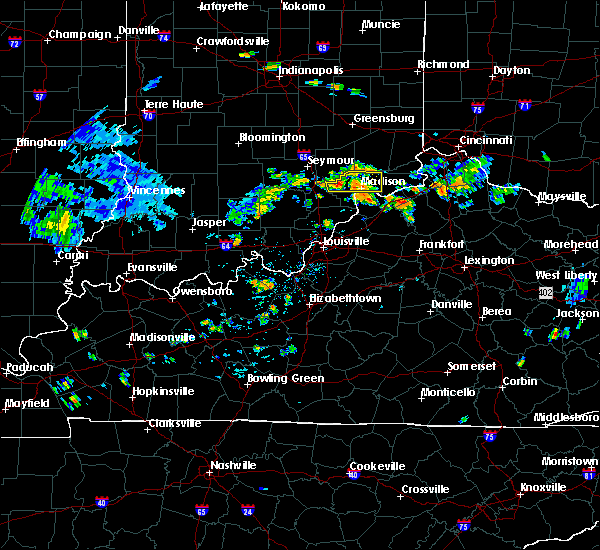 The national weather service in louisville has issued a * severe thunderstorm warning for. jefferson county in south central indiana. north central scott county in south central indiana. until 345 pm edt. At 303 pm edt, a severe thunderstorm was located 10 miles northwest. The national weather service in louisville has issued a * severe thunderstorm warning for. jefferson county in south central indiana. north central scott county in south central indiana. until 345 pm edt. At 303 pm edt, a severe thunderstorm was located 10 miles northwest.
|
| 7/20/2018 7:08 PM EDT |
 The national weather service in louisville has issued a * severe thunderstorm warning for. east central jefferson county in south central indiana. central trimble county in central kentucky. until 745 pm edt. At 708 pm edt, a severe thunderstorm was located near madison,. The national weather service in louisville has issued a * severe thunderstorm warning for. east central jefferson county in south central indiana. central trimble county in central kentucky. until 745 pm edt. At 708 pm edt, a severe thunderstorm was located near madison,.
|
| 7/20/2018 7:08 PM EDT |
 At 708 pm edt, a severe thunderstorm was located near madison, moving southeast at 40 mph (radar indicated). Hazards include 60 mph wind gusts and quarter size hail. Hail damage to vehicles is expected. Expect wind damage to roofs, siding, and trees. At 708 pm edt, a severe thunderstorm was located near madison, moving southeast at 40 mph (radar indicated). Hazards include 60 mph wind gusts and quarter size hail. Hail damage to vehicles is expected. Expect wind damage to roofs, siding, and trees.
|
| 7/20/2018 2:40 PM EDT | Quarter sized hail reported 13.7 miles SSW of Madison, IN, several trees have also been reported downed throughout ripley county. |
| 7/20/2018 2:38 PM EDT |
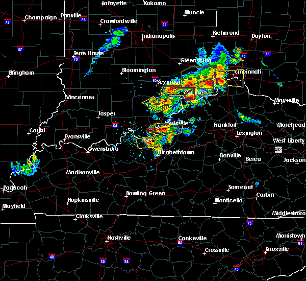 At 237 pm edt, a severe thunderstorm capable of producing a tornado was located over madison, moving northeast at 25 mph (weather spotters reported a funnel cloud). Hazards include tornado and baseball size hail. Flying debris will be dangerous to those caught without shelter. mobile homes will be damaged or destroyed. damage to roofs, windows, and vehicles will occur. tree damage is likely. Locations impacted include, madison, brooksburg and manville. At 237 pm edt, a severe thunderstorm capable of producing a tornado was located over madison, moving northeast at 25 mph (weather spotters reported a funnel cloud). Hazards include tornado and baseball size hail. Flying debris will be dangerous to those caught without shelter. mobile homes will be damaged or destroyed. damage to roofs, windows, and vehicles will occur. tree damage is likely. Locations impacted include, madison, brooksburg and manville.
|
| 7/20/2018 2:32 PM EDT |
 At 232 pm edt, a severe thunderstorm was located 9 miles south of vernon, moving east at 30 mph (radar indicated). Hazards include 70 mph wind gusts and half dollar size hail. Hail damage to vehicles is expected. expect considerable tree damage. Wind damage is also likely to mobile homes, roofs, and outbuildings. At 232 pm edt, a severe thunderstorm was located 9 miles south of vernon, moving east at 30 mph (radar indicated). Hazards include 70 mph wind gusts and half dollar size hail. Hail damage to vehicles is expected. expect considerable tree damage. Wind damage is also likely to mobile homes, roofs, and outbuildings.
|
| 7/20/2018 2:30 PM EDT |
 At 228 pm edt, a severe thunderstorm capable of producing a tornado was located over madison, moving northeast at 25 mph. baseball hail was reported at 227 pm in milton and a funnel cloud near hanover (weather spotters reported a funnel cloud). Hazards include tornado and baseball size hail. Flying debris will be dangerous to those caught without shelter. mobile homes will be damaged or destroyed. damage to roofs, windows, and vehicles will occur. tree damage is likely. Locations impacted include, madison, hanover, milton, brooksburg, north madison, ringwald, manville and hanover beach. At 228 pm edt, a severe thunderstorm capable of producing a tornado was located over madison, moving northeast at 25 mph. baseball hail was reported at 227 pm in milton and a funnel cloud near hanover (weather spotters reported a funnel cloud). Hazards include tornado and baseball size hail. Flying debris will be dangerous to those caught without shelter. mobile homes will be damaged or destroyed. damage to roofs, windows, and vehicles will occur. tree damage is likely. Locations impacted include, madison, hanover, milton, brooksburg, north madison, ringwald, manville and hanover beach.
|
| 7/20/2018 2:29 PM EDT | Ping Pong Ball sized hail reported 1.1 miles WSW of Madison, IN |
| 7/20/2018 2:28 PM EDT | Golf Ball sized hail reported 1.6 miles NW of Madison, IN, jefferson county dispatch reports golf ball size hail at their location. |
| 7/20/2018 2:20 PM EDT |
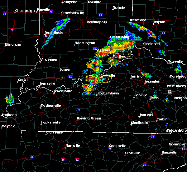 At 220 pm edt, a severe thunderstorm capable of producing a tornado was located near madison, moving northeast at 25 mph (radar indicated rotation). Hazards include tornado and ping pong ball size hail. Flying debris will be dangerous to those caught without shelter. mobile homes will be damaged or destroyed. damage to roofs, windows, and vehicles will occur. Tree damage is likely. At 220 pm edt, a severe thunderstorm capable of producing a tornado was located near madison, moving northeast at 25 mph (radar indicated rotation). Hazards include tornado and ping pong ball size hail. Flying debris will be dangerous to those caught without shelter. mobile homes will be damaged or destroyed. damage to roofs, windows, and vehicles will occur. Tree damage is likely.
|
| 7/20/2018 2:13 PM EDT |
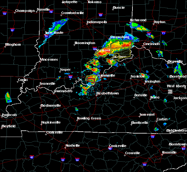 At 212 pm edt, a severe thunderstorm was located near madison, moving northeast at 25 mph (radar indicated). Hazards include 70 mph wind gusts and ping pong ball size hail. People and animals outdoors will be injured. expect hail damage to roofs, siding, windows, and vehicles. expect considerable tree damage. wind damage is also likely to mobile homes, roofs, and outbuildings. locations impacted include, madison, hanover, saluda, milton, brooksburg, canaan, north madison, manville, trout and madison municipal airport. A tornado watch remains in effect until 900 pm edt for south central indiana, and central kentucky. At 212 pm edt, a severe thunderstorm was located near madison, moving northeast at 25 mph (radar indicated). Hazards include 70 mph wind gusts and ping pong ball size hail. People and animals outdoors will be injured. expect hail damage to roofs, siding, windows, and vehicles. expect considerable tree damage. wind damage is also likely to mobile homes, roofs, and outbuildings. locations impacted include, madison, hanover, saluda, milton, brooksburg, canaan, north madison, manville, trout and madison municipal airport. A tornado watch remains in effect until 900 pm edt for south central indiana, and central kentucky.
|
| 7/20/2018 1:58 PM EDT |
 At 157 pm edt, a severe thunderstorm was located 11 miles southwest of madison, moving northeast at 25 mph (radar indicated). Hazards include 70 mph wind gusts and ping pong ball size hail. People and animals outdoors will be injured. expect hail damage to roofs, siding, windows, and vehicles. expect considerable tree damage. wind damage is also likely to mobile homes, roofs, and outbuildings. locations impacted include, madison, hanover, saluda, milton, brooksburg, canaan, north madison, manville, trout and madison municipal airport. A tornado watch remains in effect until 900 pm edt for south central indiana, and central kentucky. At 157 pm edt, a severe thunderstorm was located 11 miles southwest of madison, moving northeast at 25 mph (radar indicated). Hazards include 70 mph wind gusts and ping pong ball size hail. People and animals outdoors will be injured. expect hail damage to roofs, siding, windows, and vehicles. expect considerable tree damage. wind damage is also likely to mobile homes, roofs, and outbuildings. locations impacted include, madison, hanover, saluda, milton, brooksburg, canaan, north madison, manville, trout and madison municipal airport. A tornado watch remains in effect until 900 pm edt for south central indiana, and central kentucky.
|
| 7/20/2018 1:58 PM EDT |
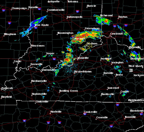 At 157 pm edt, a severe thunderstorm was located 11 miles southwest of madison, moving northeast at 25 mph (radar indicated). Hazards include 70 mph wind gusts and ping pong ball size hail. People and animals outdoors will be injured. expect hail damage to roofs, siding, windows, and vehicles. expect considerable tree damage. wind damage is also likely to mobile homes, roofs, and outbuildings. locations impacted include, madison, hanover, saluda, milton, brooksburg, canaan, north madison, manville, trout and madison municipal airport. A tornado watch remains in effect until 900 pm edt for south central indiana, and central kentucky. At 157 pm edt, a severe thunderstorm was located 11 miles southwest of madison, moving northeast at 25 mph (radar indicated). Hazards include 70 mph wind gusts and ping pong ball size hail. People and animals outdoors will be injured. expect hail damage to roofs, siding, windows, and vehicles. expect considerable tree damage. wind damage is also likely to mobile homes, roofs, and outbuildings. locations impacted include, madison, hanover, saluda, milton, brooksburg, canaan, north madison, manville, trout and madison municipal airport. A tornado watch remains in effect until 900 pm edt for south central indiana, and central kentucky.
|
| 7/20/2018 1:53 PM EDT |
 At 152 pm edt, a severe thunderstorm was located 10 miles southeast of scottsburg, moving northeast at 25 mph (radar indicated). Hazards include 70 mph wind gusts and ping pong ball size hail. People and animals outdoors will be injured. expect hail damage to roofs, siding, windows, and vehicles. expect considerable tree damage. Wind damage is also likely to mobile homes, roofs, and outbuildings. At 152 pm edt, a severe thunderstorm was located 10 miles southeast of scottsburg, moving northeast at 25 mph (radar indicated). Hazards include 70 mph wind gusts and ping pong ball size hail. People and animals outdoors will be injured. expect hail damage to roofs, siding, windows, and vehicles. expect considerable tree damage. Wind damage is also likely to mobile homes, roofs, and outbuildings.
|
| 6/26/2018 1:23 PM EDT |
 At 123 pm edt, severe thunderstorms were located along a line extending from 9 miles southeast of vernon to near madison to 10 miles north of prospect, moving northeast at 30 mph (radar indicated). Hazards include 60 mph wind gusts. expect damage to roofs, siding, and trees At 123 pm edt, severe thunderstorms were located along a line extending from 9 miles southeast of vernon to near madison to 10 miles north of prospect, moving northeast at 30 mph (radar indicated). Hazards include 60 mph wind gusts. expect damage to roofs, siding, and trees
|
| 5/31/2018 2:45 PM EDT | Em reported trees down all over the county. time estimated based on rada in jefferson county IN, 1.1 miles WSW of Madison, IN |
| 5/31/2018 2:35 PM EDT |
 At 235 pm edt, severe thunderstorms were located along a line extending from 9 miles south of vernon to brownsboro village, moving northeast at 50 mph (radar indicated). Hazards include 70 mph wind gusts. Expect considerable tree damage. Damage is likely to mobile homes, roofs, and outbuildings. At 235 pm edt, severe thunderstorms were located along a line extending from 9 miles south of vernon to brownsboro village, moving northeast at 50 mph (radar indicated). Hazards include 70 mph wind gusts. Expect considerable tree damage. Damage is likely to mobile homes, roofs, and outbuildings.
|
| 4/3/2018 4:43 PM EDT |
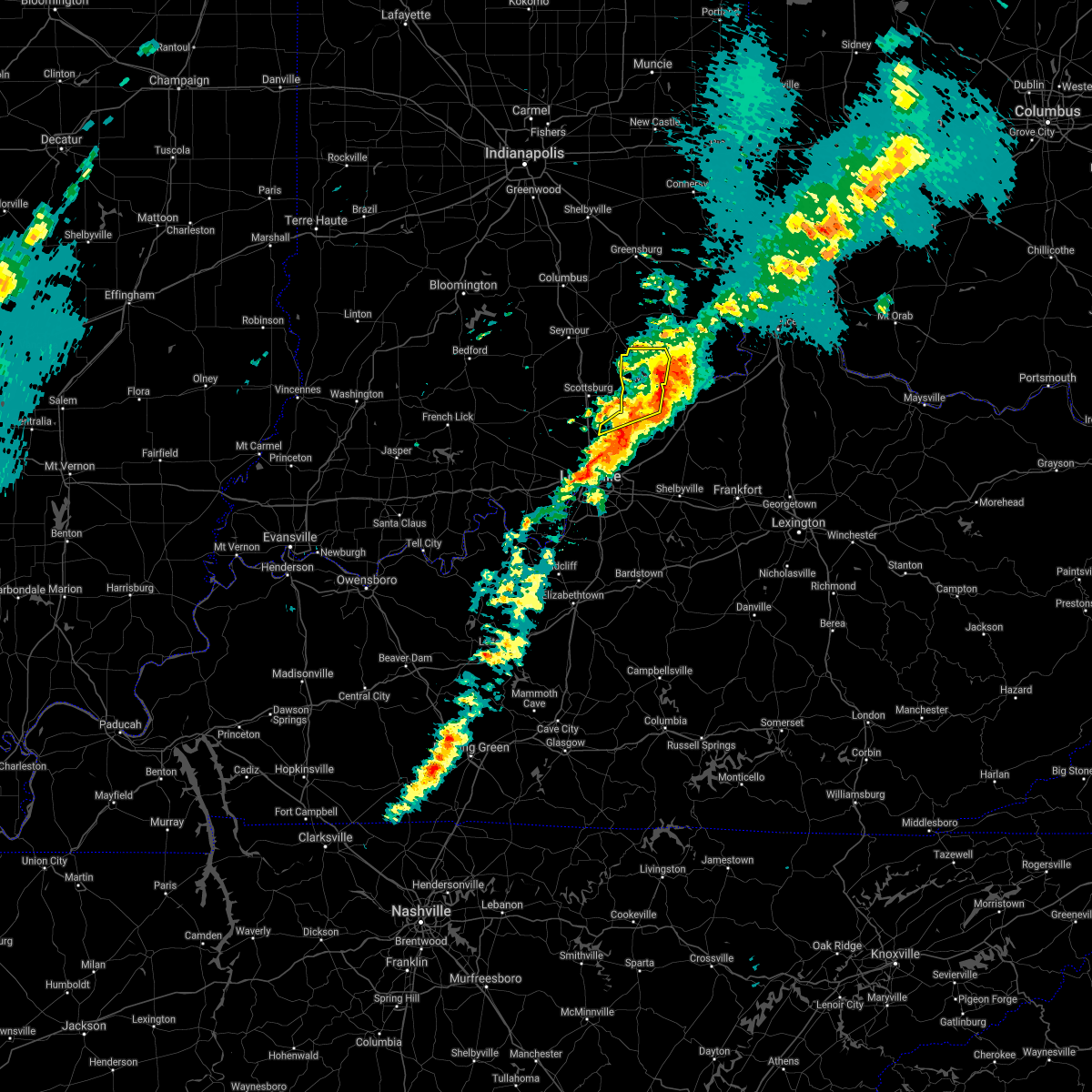 The severe thunderstorm warning for jefferson, northeastern clark and northwestern trimble counties will expire at 445 pm edt, the storms which prompted the warning have moved out of the area. therefore the warning will be allowed to expire. a tornado watch remains in effect until 800 pm edt for south central indiana, and central kentucky. report severe weather to local law enforcement, post your report to the national weather service louisville facebook page, or tweet your report using hashtag l, m, k, spotter. The severe thunderstorm warning for jefferson, northeastern clark and northwestern trimble counties will expire at 445 pm edt, the storms which prompted the warning have moved out of the area. therefore the warning will be allowed to expire. a tornado watch remains in effect until 800 pm edt for south central indiana, and central kentucky. report severe weather to local law enforcement, post your report to the national weather service louisville facebook page, or tweet your report using hashtag l, m, k, spotter.
|
| 4/3/2018 4:33 PM EDT | Time estimated by rada in jefferson county IN, 1.7 miles W of Madison, IN |
| 4/3/2018 4:33 PM EDT |
 At 432 pm edt, severe thunderstorms were located along a line extending from 9 miles southeast of vernon to near madison to 10 miles west of bedford, moving northeast at 45 mph (radar indicated). Hazards include 60 mph wind gusts and nickel size hail. Expect damage to roofs, siding, and trees. locations impacted include, madison, hanover, saluda, smyrna, milton, kent, dupont, wakefield, canaan and north madison. A tornado watch remains in effect until 800 pm edt for south central indiana, and central kentucky. At 432 pm edt, severe thunderstorms were located along a line extending from 9 miles southeast of vernon to near madison to 10 miles west of bedford, moving northeast at 45 mph (radar indicated). Hazards include 60 mph wind gusts and nickel size hail. Expect damage to roofs, siding, and trees. locations impacted include, madison, hanover, saluda, smyrna, milton, kent, dupont, wakefield, canaan and north madison. A tornado watch remains in effect until 800 pm edt for south central indiana, and central kentucky.
|
| 4/3/2018 4:33 PM EDT |
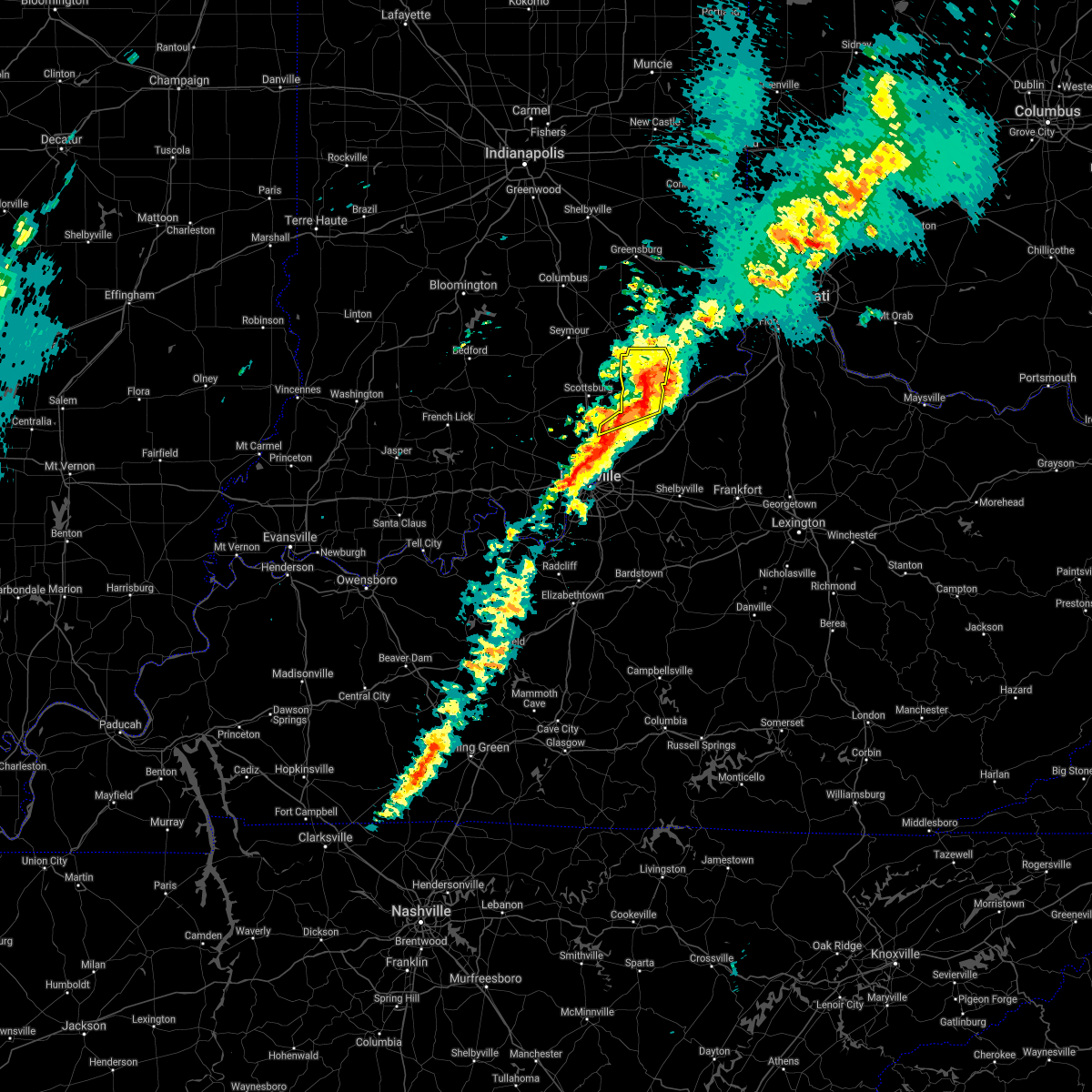 At 432 pm edt, severe thunderstorms were located along a line extending from 9 miles southeast of vernon to near madison to 10 miles west of bedford, moving northeast at 45 mph (radar indicated). Hazards include 60 mph wind gusts and nickel size hail. Expect damage to roofs, siding, and trees. locations impacted include, madison, hanover, saluda, smyrna, milton, kent, dupont, wakefield, canaan and north madison. A tornado watch remains in effect until 800 pm edt for south central indiana, and central kentucky. At 432 pm edt, severe thunderstorms were located along a line extending from 9 miles southeast of vernon to near madison to 10 miles west of bedford, moving northeast at 45 mph (radar indicated). Hazards include 60 mph wind gusts and nickel size hail. Expect damage to roofs, siding, and trees. locations impacted include, madison, hanover, saluda, smyrna, milton, kent, dupont, wakefield, canaan and north madison. A tornado watch remains in effect until 800 pm edt for south central indiana, and central kentucky.
|
| 4/3/2018 4:19 PM EDT |
 At 419 pm edt, severe thunderstorms were located along a line extending from 11 miles south of vernon to 6 miles east of scottsburg to 13 miles north of prospect, moving northeast at 45 mph (radar indicated). Hazards include 60 mph wind gusts and nickel size hail. expect damage to roofs, siding, and trees At 419 pm edt, severe thunderstorms were located along a line extending from 11 miles south of vernon to 6 miles east of scottsburg to 13 miles north of prospect, moving northeast at 45 mph (radar indicated). Hazards include 60 mph wind gusts and nickel size hail. expect damage to roofs, siding, and trees
|
| 4/3/2018 4:19 PM EDT |
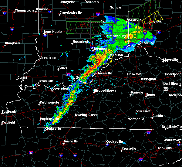 At 419 pm edt, severe thunderstorms were located along a line extending from 11 miles south of vernon to 6 miles east of scottsburg to 13 miles north of prospect, moving northeast at 45 mph (radar indicated). Hazards include 60 mph wind gusts and nickel size hail. expect damage to roofs, siding, and trees At 419 pm edt, severe thunderstorms were located along a line extending from 11 miles south of vernon to 6 miles east of scottsburg to 13 miles north of prospect, moving northeast at 45 mph (radar indicated). Hazards include 60 mph wind gusts and nickel size hail. expect damage to roofs, siding, and trees
|
| 7/7/2017 7:58 PM EDT |
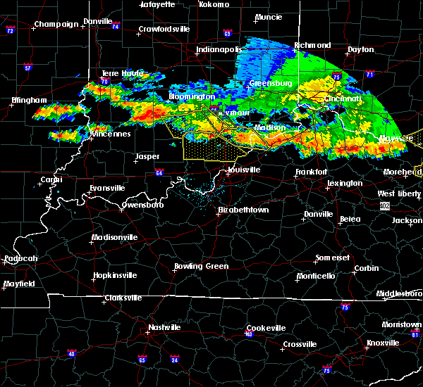 At 756 pm edt, severe thunderstorms were located along a line extending from near bedford to near scottsburg, moving southeast at 25 mph. at around 708 pm edt, law enforcement reported a large tree down blocking the road in deputy (law enforcement). Hazards include 60 mph wind gusts and quarter size hail. Hail damage to vehicles is expected. expect wind damage to roofs, siding, and trees. Locations impacted include, madison, scottsburg, bedford, austin, lexington, hanover, saluda, smyrna, milton and kent. At 756 pm edt, severe thunderstorms were located along a line extending from near bedford to near scottsburg, moving southeast at 25 mph. at around 708 pm edt, law enforcement reported a large tree down blocking the road in deputy (law enforcement). Hazards include 60 mph wind gusts and quarter size hail. Hail damage to vehicles is expected. expect wind damage to roofs, siding, and trees. Locations impacted include, madison, scottsburg, bedford, austin, lexington, hanover, saluda, smyrna, milton and kent.
|
| 7/7/2017 7:28 PM EDT |
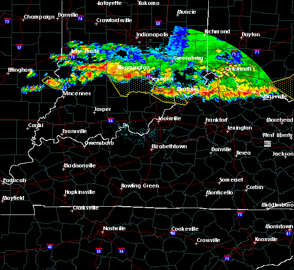 At 728 pm edt, severe thunderstorms were located along a line extending from madison to 8 miles north of scottsburg, moving southeast at 25 mph (radar indicated). Hazards include 60 mph wind gusts and quarter size hail. Hail damage to vehicles is expected. Expect wind damage to roofs, siding, and trees. At 728 pm edt, severe thunderstorms were located along a line extending from madison to 8 miles north of scottsburg, moving southeast at 25 mph (radar indicated). Hazards include 60 mph wind gusts and quarter size hail. Hail damage to vehicles is expected. Expect wind damage to roofs, siding, and trees.
|
| 7/7/2017 7:28 PM EDT |
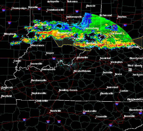 At 728 pm edt, severe thunderstorms were located along a line extending from madison to 8 miles north of scottsburg, moving southeast at 25 mph (radar indicated). Hazards include 60 mph wind gusts and quarter size hail. Hail damage to vehicles is expected. Expect wind damage to roofs, siding, and trees. At 728 pm edt, severe thunderstorms were located along a line extending from madison to 8 miles north of scottsburg, moving southeast at 25 mph (radar indicated). Hazards include 60 mph wind gusts and quarter size hail. Hail damage to vehicles is expected. Expect wind damage to roofs, siding, and trees.
|
| 7/7/2017 6:57 PM EDT |
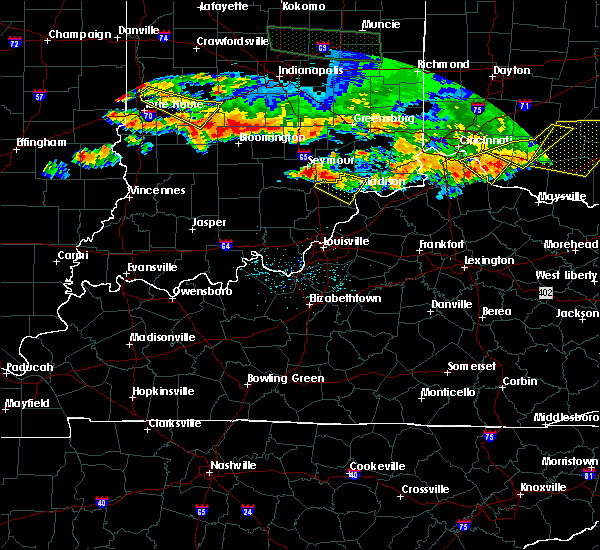 The national weather service in louisville has issued a * severe thunderstorm warning for. western jefferson county in south central indiana. northeastern scott county in south central indiana. Until 730 pm edt * at 656 pm edt, a severe thunderstorm was located 11 miles north of. The national weather service in louisville has issued a * severe thunderstorm warning for. western jefferson county in south central indiana. northeastern scott county in south central indiana. Until 730 pm edt * at 656 pm edt, a severe thunderstorm was located 11 miles north of.
|
| 5/20/2017 7:12 PM EDT | Roof damage to a bowling alle in jefferson county IN, 1.7 miles SSW of Madison, IN |
| 5/20/2017 7:11 PM EDT | Damage to the awning over a fuel statio in jefferson county IN, 1.1 miles SSE of Madison, IN |
| 5/20/2017 7:09 PM EDT | Trees and power lines down on sr 7 near dawson smith roa in jefferson county IN, 3.7 miles SE of Madison, IN |
| 5/20/2017 7:09 PM EDT |
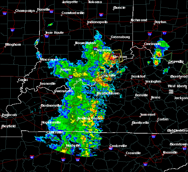 At 709 pm edt, a severe thunderstorm capable of producing a tornado was located near madison, moving northeast at 30 mph (radar indicated rotation). Hazards include tornado and quarter size hail. Flying debris will be dangerous to those caught without shelter. mobile homes will be damaged or destroyed. damage to roofs, windows, and vehicles will occur. Tree damage is likely. At 709 pm edt, a severe thunderstorm capable of producing a tornado was located near madison, moving northeast at 30 mph (radar indicated rotation). Hazards include tornado and quarter size hail. Flying debris will be dangerous to those caught without shelter. mobile homes will be damaged or destroyed. damage to roofs, windows, and vehicles will occur. Tree damage is likely.
|
| 5/20/2017 7:06 PM EDT | Measured at madison airpor in jefferson county IN, 3.2 miles E of Madison, IN |
| 5/20/2017 7:05 PM EDT |
 At 705 pm edt, a severe thunderstorm was located over madison, moving northeast at 35 mph (radar indicated). Hazards include 60 mph wind gusts and quarter size hail. Hail damage to vehicles is expected. Expect wind damage to roofs, siding, and trees. At 705 pm edt, a severe thunderstorm was located over madison, moving northeast at 35 mph (radar indicated). Hazards include 60 mph wind gusts and quarter size hail. Hail damage to vehicles is expected. Expect wind damage to roofs, siding, and trees.
|
| 5/20/2017 7:05 PM EDT |
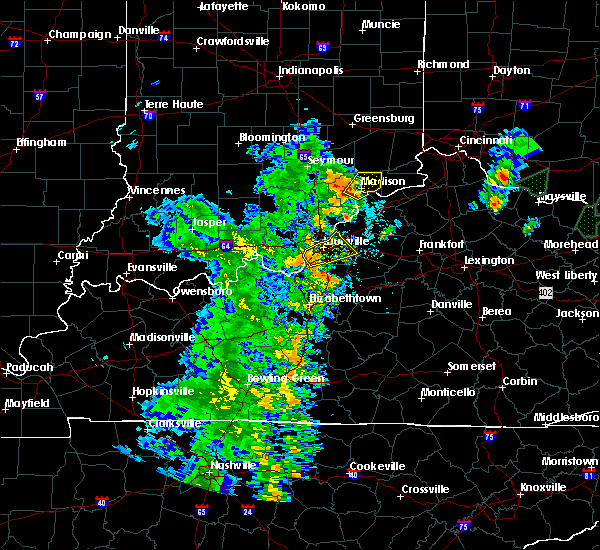 At 705 pm edt, a severe thunderstorm was located over madison, moving northeast at 35 mph (radar indicated). Hazards include 60 mph wind gusts and quarter size hail. Hail damage to vehicles is expected. Expect wind damage to roofs, siding, and trees. At 705 pm edt, a severe thunderstorm was located over madison, moving northeast at 35 mph (radar indicated). Hazards include 60 mph wind gusts and quarter size hail. Hail damage to vehicles is expected. Expect wind damage to roofs, siding, and trees.
|
| 5/19/2017 4:25 PM EDT |
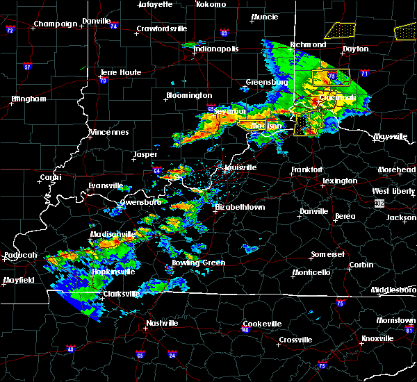 At 424 pm edt, a severe thunderstorm was located 10 miles southwest of dillsboro, moving northeast at 60 mph (radar indicated). Hazards include 60 mph wind gusts and penny size hail. Expect damage to roofs, siding, and trees. Locations impacted include, madison, dupont, middlefork, canaan, five points, ringwald, manville, china, belleview and bryantsburg. At 424 pm edt, a severe thunderstorm was located 10 miles southwest of dillsboro, moving northeast at 60 mph (radar indicated). Hazards include 60 mph wind gusts and penny size hail. Expect damage to roofs, siding, and trees. Locations impacted include, madison, dupont, middlefork, canaan, five points, ringwald, manville, china, belleview and bryantsburg.
|
| 5/19/2017 4:11 PM EDT |
 At 410 pm edt, a severe thunderstorm was located 7 miles northwest of madison, moving east at 60 mph (radar indicated). Hazards include 60 mph wind gusts and quarter size hail. Hail damage to vehicles is expected. Expect wind damage to roofs, siding, and trees. At 410 pm edt, a severe thunderstorm was located 7 miles northwest of madison, moving east at 60 mph (radar indicated). Hazards include 60 mph wind gusts and quarter size hail. Hail damage to vehicles is expected. Expect wind damage to roofs, siding, and trees.
|
| 5/19/2017 3:05 PM EDT |
 At 305 pm edt, a severe thunderstorm capable of producing a tornado was located just north of madison, moving east at 30 mph (radar indicated rotation). Hazards include tornado. Flying debris will be dangerous to those caught without shelter. mobile homes will be damaged or destroyed. damage to roofs, windows, and vehicles will occur. tree damage is likely. Locations impacted include, madison, canaan, north madison, ringwald, manville, china, belleview, bryantsburg, wirt and barbersville. At 305 pm edt, a severe thunderstorm capable of producing a tornado was located just north of madison, moving east at 30 mph (radar indicated rotation). Hazards include tornado. Flying debris will be dangerous to those caught without shelter. mobile homes will be damaged or destroyed. damage to roofs, windows, and vehicles will occur. tree damage is likely. Locations impacted include, madison, canaan, north madison, ringwald, manville, china, belleview, bryantsburg, wirt and barbersville.
|
| 5/19/2017 2:56 PM EDT |
 At 256 pm edt, a severe thunderstorm capable of producing a tornado was located near madison, moving east at 25 mph (radar indicated rotation). Hazards include tornado. Flying debris will be dangerous to those caught without shelter. mobile homes will be damaged or destroyed. damage to roofs, windows, and vehicles will occur. Tree damage is likely. At 256 pm edt, a severe thunderstorm capable of producing a tornado was located near madison, moving east at 25 mph (radar indicated rotation). Hazards include tornado. Flying debris will be dangerous to those caught without shelter. mobile homes will be damaged or destroyed. damage to roofs, windows, and vehicles will occur. Tree damage is likely.
|
| 5/19/2017 2:51 PM EDT |
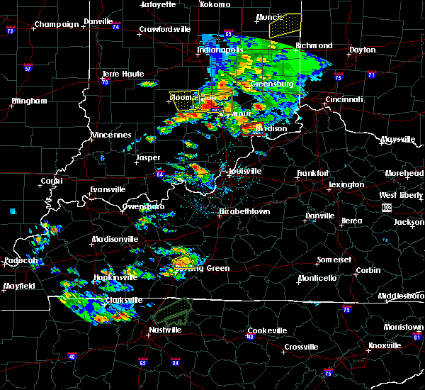 At 251 pm edt, a severe thunderstorm capable of producing a tornado was located 8 miles northwest of madison, moving east at 25 mph (radar indicated rotation). Hazards include tornado. Flying debris will be dangerous to those caught without shelter. mobile homes will be damaged or destroyed. damage to roofs, windows, and vehicles will occur. tree damage is likely. Locations impacted include, madison, smyrna, wakefield, middlefork, canaan, volga, north madison, manville, belleview and bryantsburg. At 251 pm edt, a severe thunderstorm capable of producing a tornado was located 8 miles northwest of madison, moving east at 25 mph (radar indicated rotation). Hazards include tornado. Flying debris will be dangerous to those caught without shelter. mobile homes will be damaged or destroyed. damage to roofs, windows, and vehicles will occur. tree damage is likely. Locations impacted include, madison, smyrna, wakefield, middlefork, canaan, volga, north madison, manville, belleview and bryantsburg.
|
| 5/19/2017 2:41 PM EDT |
 At 241 pm edt, a severe thunderstorm capable of producing a tornado was located 11 miles northwest of madison, moving east at 25 mph (radar indicated rotation). Hazards include tornado. Flying debris will be dangerous to those caught without shelter. mobile homes will be damaged or destroyed. damage to roofs, windows, and vehicles will occur. Tree damage is likely. At 241 pm edt, a severe thunderstorm capable of producing a tornado was located 11 miles northwest of madison, moving east at 25 mph (radar indicated rotation). Hazards include tornado. Flying debris will be dangerous to those caught without shelter. mobile homes will be damaged or destroyed. damage to roofs, windows, and vehicles will occur. Tree damage is likely.
|
| 5/19/2017 2:38 PM EDT |
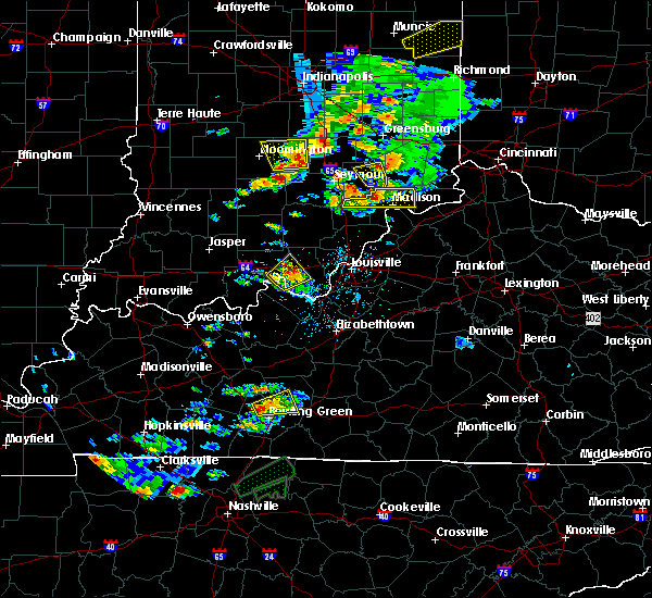 At 238 pm edt, a severe thunderstorm was located 11 miles south of vernon, moving east at 25 mph (radar indicated). Hazards include 60 mph wind gusts and quarter size hail. Hail damage to vehicles is expected. expect wind damage to roofs, siding, and trees. Locations impacted include, madison, austin, smyrna, dupont, wakefield, middlefork, canaan, volga, north madison and manville. At 238 pm edt, a severe thunderstorm was located 11 miles south of vernon, moving east at 25 mph (radar indicated). Hazards include 60 mph wind gusts and quarter size hail. Hail damage to vehicles is expected. expect wind damage to roofs, siding, and trees. Locations impacted include, madison, austin, smyrna, dupont, wakefield, middlefork, canaan, volga, north madison and manville.
|
| 5/19/2017 2:18 PM EDT |
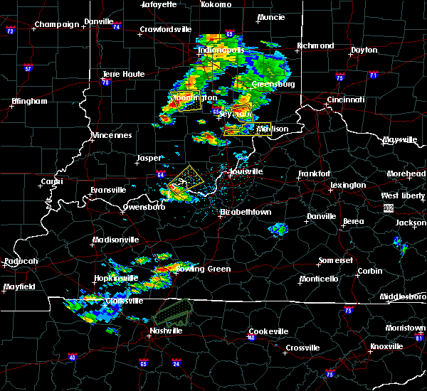 At 217 pm edt, a severe thunderstorm was located 7 miles north of scottsburg, moving east at 35 mph (radar indicated). Hazards include 60 mph wind gusts and quarter size hail. Hail damage to vehicles is expected. Expect wind damage to roofs, siding, and trees. At 217 pm edt, a severe thunderstorm was located 7 miles north of scottsburg, moving east at 35 mph (radar indicated). Hazards include 60 mph wind gusts and quarter size hail. Hail damage to vehicles is expected. Expect wind damage to roofs, siding, and trees.
|
| 4/29/2017 8:27 AM EDT |
 The severe thunderstorm warning for northeastern jefferson and trimble counties will expire at 830 am edt, the storm which prompted the warning has moved out of the area. therefore the warning will be allowed to expire. however gusty winds are still possible with this thunderstorm. report severe weather to local law enforcement, post your report to the national weather service louisville facebook page, or tweet your report using hashtag l, m, k, spotter. The severe thunderstorm warning for northeastern jefferson and trimble counties will expire at 830 am edt, the storm which prompted the warning has moved out of the area. therefore the warning will be allowed to expire. however gusty winds are still possible with this thunderstorm. report severe weather to local law enforcement, post your report to the national weather service louisville facebook page, or tweet your report using hashtag l, m, k, spotter.
|
| 4/29/2017 8:12 AM EDT |
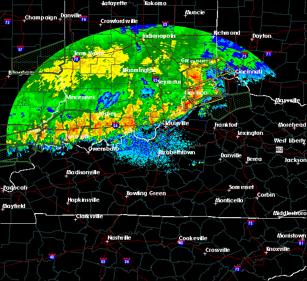 At 811 am edt, a severe thunderstorm was located near carrollton, moving east at 50 mph (radar indicated). Hazards include quarter size hail. Damage to vehicles is expected. Locations impacted include, madison, bedford, milton, brooksburg, canaan, monitor, manville and china. At 811 am edt, a severe thunderstorm was located near carrollton, moving east at 50 mph (radar indicated). Hazards include quarter size hail. Damage to vehicles is expected. Locations impacted include, madison, bedford, milton, brooksburg, canaan, monitor, manville and china.
|
| 4/29/2017 8:07 AM EDT | Golf Ball sized hail reported 1.4 miles SE of Madison, IN, mping report. |
| 4/29/2017 7:53 AM EDT |
 At 752 am edt, a severe thunderstorm was located near madison, moving east at 50 mph (public). Hazards include half dollar size hail. Damage to vehicles is expected. Locations impacted include, madison, bedford, hanover, saluda, smyrna, bethlehem, milton, kent, brooksburg and wakefield. At 752 am edt, a severe thunderstorm was located near madison, moving east at 50 mph (public). Hazards include half dollar size hail. Damage to vehicles is expected. Locations impacted include, madison, bedford, hanover, saluda, smyrna, bethlehem, milton, kent, brooksburg and wakefield.
|
| 4/29/2017 7:40 AM EDT |
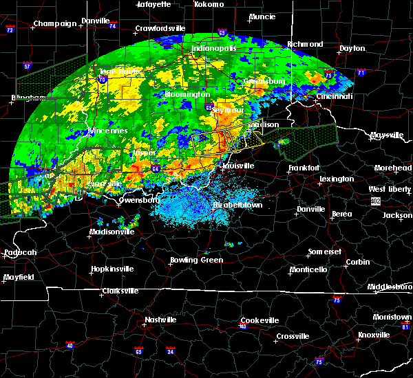 At 739 am edt, a severe thunderstorm was located 8 miles southeast of scottsburg, moving east at 50 mph (radar indicated). Hazards include 60 mph wind gusts and half dollar size hail. Hail damage to vehicles is expected. Expect wind damage to roofs, siding, and trees. At 739 am edt, a severe thunderstorm was located 8 miles southeast of scottsburg, moving east at 50 mph (radar indicated). Hazards include 60 mph wind gusts and half dollar size hail. Hail damage to vehicles is expected. Expect wind damage to roofs, siding, and trees.
|
| 3/1/2017 6:22 AM EST |
 At 621 am est, severe thunderstorms were located along a line extending from 8 miles north of brooksburg to 7 miles southwest of brandenburg, moving east at 55 mph (radar indicated). Hazards include 60 mph wind gusts. expect damage to roofs, siding, and trees At 621 am est, severe thunderstorms were located along a line extending from 8 miles north of brooksburg to 7 miles southwest of brandenburg, moving east at 55 mph (radar indicated). Hazards include 60 mph wind gusts. expect damage to roofs, siding, and trees
|
| 3/1/2017 5:57 AM EST |
 At 556 am est/456 am cst/, severe thunderstorms were located along a line extending from 9 miles northwest of scottsburg to 10 miles southwest of carefree town, moving east at 55 mph (radar indicated). Hazards include 60 mph wind gusts. expect damage to roofs, siding, and trees At 556 am est/456 am cst/, severe thunderstorms were located along a line extending from 9 miles northwest of scottsburg to 10 miles southwest of carefree town, moving east at 55 mph (radar indicated). Hazards include 60 mph wind gusts. expect damage to roofs, siding, and trees
|
| 2/24/2017 6:51 PM EST |
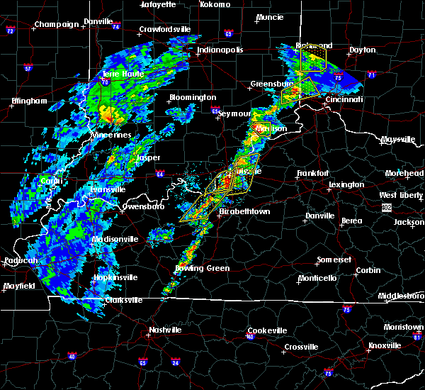 At 650 pm est, a severe thunderstorm was located near north madison, moving northeast at 50 mph (radar indicated). Hazards include 60 mph wind gusts and nickel size hail. Expect damage to roofs, siding, and trees. Locations impacted include, brooksburg, canaan, manville, china, belleview, bryantsburg and barbersville. At 650 pm est, a severe thunderstorm was located near north madison, moving northeast at 50 mph (radar indicated). Hazards include 60 mph wind gusts and nickel size hail. Expect damage to roofs, siding, and trees. Locations impacted include, brooksburg, canaan, manville, china, belleview, bryantsburg and barbersville.
|
| 2/24/2017 6:42 PM EST |
 At 641 pm est, a severe thunderstorm was located just west of madison, moving northeast at 55 mph (radar indicated). Hazards include 60 mph wind gusts and quarter size hail. Hail damage to vehicles is expected. Expect wind damage to roofs, siding, and trees. At 641 pm est, a severe thunderstorm was located just west of madison, moving northeast at 55 mph (radar indicated). Hazards include 60 mph wind gusts and quarter size hail. Hail damage to vehicles is expected. Expect wind damage to roofs, siding, and trees.
|
| 2/24/2017 6:42 PM EST |
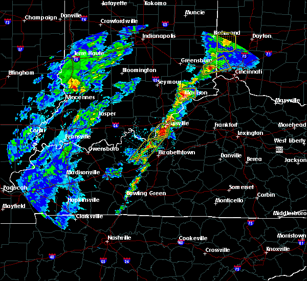 At 641 pm est, a severe thunderstorm was located just west of madison, moving northeast at 55 mph (radar indicated). Hazards include 60 mph wind gusts and quarter size hail. Hail damage to vehicles is expected. Expect wind damage to roofs, siding, and trees. At 641 pm est, a severe thunderstorm was located just west of madison, moving northeast at 55 mph (radar indicated). Hazards include 60 mph wind gusts and quarter size hail. Hail damage to vehicles is expected. Expect wind damage to roofs, siding, and trees.
|
| 2/24/2017 6:38 PM EST |
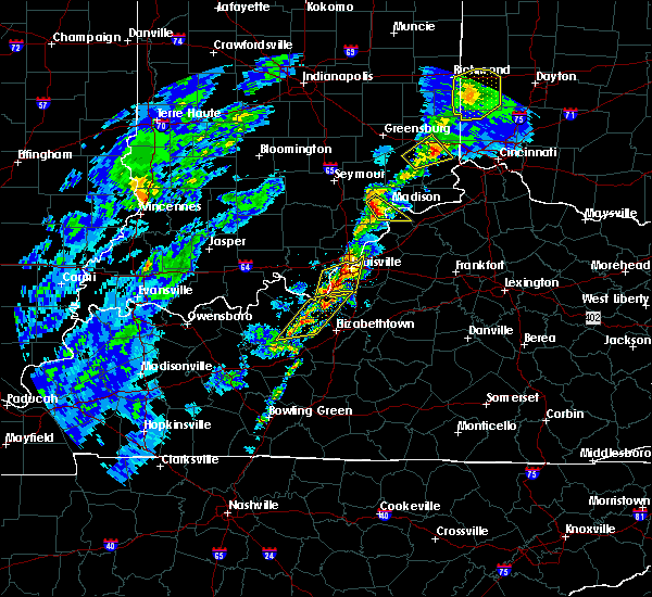 At 637 pm est, a severe thunderstorm was located west of madison, moving northeast at 55 mph (radar indicated). Hazards include 60 mph wind gusts and penny size hail. Expect damage to roofs, siding, and trees. locations impacted include, madison, hanover, saluda, smyrna, milton, kent, wakefield, volga, monitor and trout. This storm produced 60 mph winds earlier near henryville. At 637 pm est, a severe thunderstorm was located west of madison, moving northeast at 55 mph (radar indicated). Hazards include 60 mph wind gusts and penny size hail. Expect damage to roofs, siding, and trees. locations impacted include, madison, hanover, saluda, smyrna, milton, kent, wakefield, volga, monitor and trout. This storm produced 60 mph winds earlier near henryville.
|
| 2/24/2017 6:26 PM EST |
 At 625 pm est, a severe thunderstorm was located 8 miles southeast of scottsburg, moving northeast at 50 mph (trained weather spotters). Hazards include 70 mph wind gusts and quarter size hail. Hail damage to vehicles is expected. expect considerable tree damage. wind damage is also likely to mobile homes, roofs, and outbuildings. Locations impacted include, madison, bedford, lexington indiana, hanover, saluda, smyrna, milton, kent, wakefield and volga. At 625 pm est, a severe thunderstorm was located 8 miles southeast of scottsburg, moving northeast at 50 mph (trained weather spotters). Hazards include 70 mph wind gusts and quarter size hail. Hail damage to vehicles is expected. expect considerable tree damage. wind damage is also likely to mobile homes, roofs, and outbuildings. Locations impacted include, madison, bedford, lexington indiana, hanover, saluda, smyrna, milton, kent, wakefield and volga.
|
| 2/24/2017 6:26 PM EST |
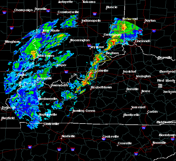 At 625 pm est, a severe thunderstorm was located 8 miles southeast of scottsburg, moving northeast at 50 mph (trained weather spotters). Hazards include 70 mph wind gusts and quarter size hail. Hail damage to vehicles is expected. expect considerable tree damage. wind damage is also likely to mobile homes, roofs, and outbuildings. Locations impacted include, madison, bedford, lexington indiana, hanover, saluda, smyrna, milton, kent, wakefield and volga. At 625 pm est, a severe thunderstorm was located 8 miles southeast of scottsburg, moving northeast at 50 mph (trained weather spotters). Hazards include 70 mph wind gusts and quarter size hail. Hail damage to vehicles is expected. expect considerable tree damage. wind damage is also likely to mobile homes, roofs, and outbuildings. Locations impacted include, madison, bedford, lexington indiana, hanover, saluda, smyrna, milton, kent, wakefield and volga.
|
| 2/24/2017 6:16 PM EST |
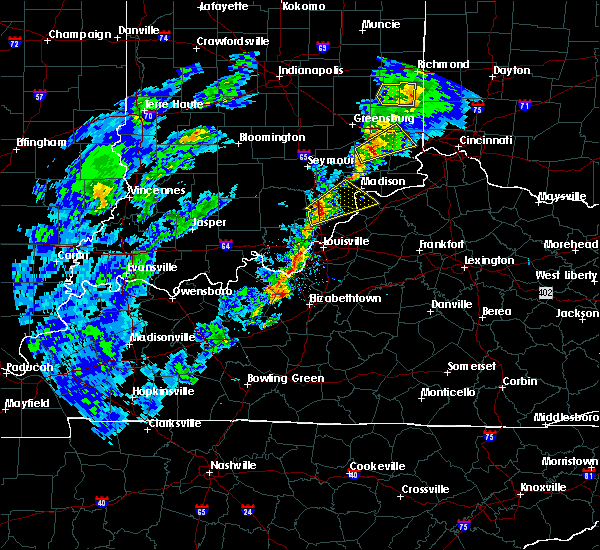 At 615 pm est, a severe thunderstorm was located 9 miles south of scottsburg, moving northeast at 55 mph (radar indicated). Hazards include 60 mph wind gusts and quarter size hail. Hail damage to vehicles is expected. Expect wind damage to roofs, siding, and trees. At 615 pm est, a severe thunderstorm was located 9 miles south of scottsburg, moving northeast at 55 mph (radar indicated). Hazards include 60 mph wind gusts and quarter size hail. Hail damage to vehicles is expected. Expect wind damage to roofs, siding, and trees.
|
| 9/10/2016 3:43 PM EDT |
 At 343 pm edt, a severe thunderstorm was located over madison, moving east at 55 mph (radar indicated). Hazards include 60 mph wind gusts. Expect damage to roofs. siding. And trees. At 343 pm edt, a severe thunderstorm was located over madison, moving east at 55 mph (radar indicated). Hazards include 60 mph wind gusts. Expect damage to roofs. siding. And trees.
|
| 9/10/2016 3:43 PM EDT |
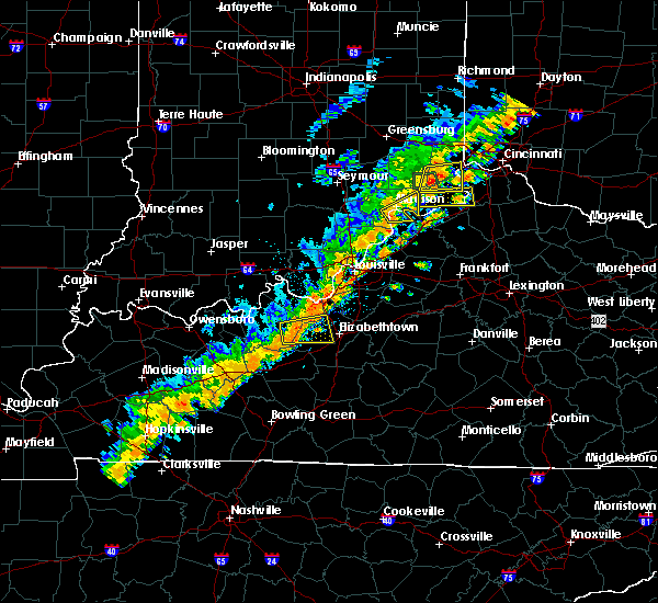 At 343 pm edt, a severe thunderstorm was located over madison, moving east at 55 mph (radar indicated). Hazards include 60 mph wind gusts. Expect damage to roofs. siding. And trees. At 343 pm edt, a severe thunderstorm was located over madison, moving east at 55 mph (radar indicated). Hazards include 60 mph wind gusts. Expect damage to roofs. siding. And trees.
|
| 9/10/2016 3:29 PM EDT |
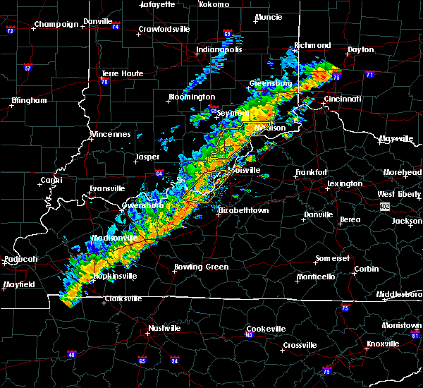 At 329 pm edt, severe thunderstorms were located along a line extending from 8 miles northwest of madison to 6 miles northeast of new providence town, moving east at 40 mph (radar indicated). Hazards include 60 mph wind gusts. Expect damage to roofs. siding. and trees. Locations impacted include, madison, scottsburg, new providence town, vienna, austin, lexington, hanover, saluda, smyrna and borden. At 329 pm edt, severe thunderstorms were located along a line extending from 8 miles northwest of madison to 6 miles northeast of new providence town, moving east at 40 mph (radar indicated). Hazards include 60 mph wind gusts. Expect damage to roofs. siding. and trees. Locations impacted include, madison, scottsburg, new providence town, vienna, austin, lexington, hanover, saluda, smyrna and borden.
|
| 9/10/2016 3:13 PM EDT |
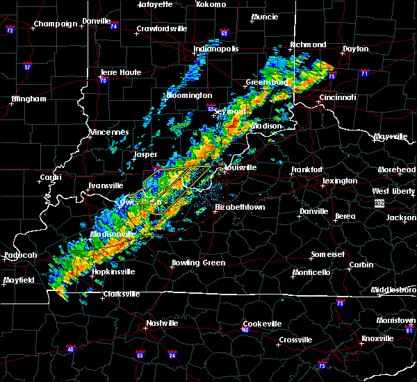 At 312 pm edt, severe thunderstorms were located along a line extending from 6 miles northeast of scottsburg to near new providence town, moving east at 40 mph (radar indicated). Hazards include 60 mph wind gusts. Expect damage to roofs. siding. And trees. At 312 pm edt, severe thunderstorms were located along a line extending from 6 miles northeast of scottsburg to near new providence town, moving east at 40 mph (radar indicated). Hazards include 60 mph wind gusts. Expect damage to roofs. siding. And trees.
|
| 7/8/2016 11:54 AM EDT |
 The severe thunderstorm warning for northeastern jefferson county will expire at noon edt, the storm which prompted the warning has moved out of the area. therefore the warning will be allowed to expire. a severe thunderstorm watch remains in effect until 600 pm edt for south central indiana, and central kentucky. report severe weather to local law enforcement, post your report to the national weather service louisville facebook page, or tweet your report using hashtag l, m, k, spotter. The severe thunderstorm warning for northeastern jefferson county will expire at noon edt, the storm which prompted the warning has moved out of the area. therefore the warning will be allowed to expire. a severe thunderstorm watch remains in effect until 600 pm edt for south central indiana, and central kentucky. report severe weather to local law enforcement, post your report to the national weather service louisville facebook page, or tweet your report using hashtag l, m, k, spotter.
|
| 7/8/2016 11:47 AM EDT |
 At 1144 am edt, a severe thunderstorm was located 8 miles north of brooksburg, moving northeast at 55 mph. several trees have been reported down by the jefferson county indiana road department (radar indicated). Hazards include 60 mph wind gusts. Expect damage to roofs. siding. and trees. Locations impacted include, madison, ringwald, canaan, manville, belleview, bryantsburg, barbersville and china. At 1144 am edt, a severe thunderstorm was located 8 miles north of brooksburg, moving northeast at 55 mph. several trees have been reported down by the jefferson county indiana road department (radar indicated). Hazards include 60 mph wind gusts. Expect damage to roofs. siding. and trees. Locations impacted include, madison, ringwald, canaan, manville, belleview, bryantsburg, barbersville and china.
|
| 7/8/2016 11:40 AM EDT | Trees and power pole dow in jefferson county IN, 3.1 miles S of Madison, IN |
| 7/8/2016 11:30 AM EDT | Trees down on alder roa in jefferson county IN, 3.7 miles WSW of Madison, IN |
| 7/8/2016 11:28 AM EDT |
 At 1127 am edt, a severe thunderstorm was located over madison, moving northeast at 50 mph (radar indicated). Hazards include 60 mph wind gusts. Expect damage to roofs. siding. And trees. At 1127 am edt, a severe thunderstorm was located over madison, moving northeast at 50 mph (radar indicated). Hazards include 60 mph wind gusts. Expect damage to roofs. siding. And trees.
|
| 7/8/2016 11:28 AM EDT |
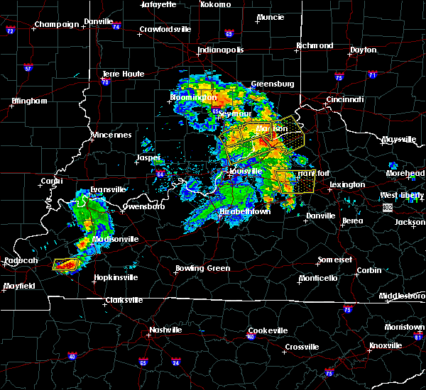 At 1127 am edt, a severe thunderstorm was located over madison, moving northeast at 50 mph (radar indicated). Hazards include 60 mph wind gusts. Expect damage to roofs. siding. And trees. At 1127 am edt, a severe thunderstorm was located over madison, moving northeast at 50 mph (radar indicated). Hazards include 60 mph wind gusts. Expect damage to roofs. siding. And trees.
|
| 7/8/2016 11:25 AM EDT | Trees reported dow in jefferson county IN, 1.1 miles WSW of Madison, IN |
| 7/8/2016 11:24 AM EDT |
 At 1123 am edt, a severe thunderstorm was located near madison, moving northeast at 50 mph (radar indicated). Hazards include 60 mph wind gusts. Expect damage to roofs. siding. and trees. Locations impacted include, madison, scottsburg, vienna, austin, lexington, hanover, smyrna, milton, kent and dupont. At 1123 am edt, a severe thunderstorm was located near madison, moving northeast at 50 mph (radar indicated). Hazards include 60 mph wind gusts. Expect damage to roofs. siding. and trees. Locations impacted include, madison, scottsburg, vienna, austin, lexington, hanover, smyrna, milton, kent and dupont.
|
| 7/8/2016 11:18 AM EDT |
 At 1115 am edt, a severe thunderstorm was located near scottsburg, moving east at 45 mph. this cluster of storms has a history of producing wind damage all the way back into western kentucky (radar indicated). Hazards include 60 mph wind gusts. Expect damage to roofs. siding. and trees. Locations impacted include, madison, scottsburg, vienna, austin, lexington, hanover, smyrna, milton, kent and dupont. At 1115 am edt, a severe thunderstorm was located near scottsburg, moving east at 45 mph. this cluster of storms has a history of producing wind damage all the way back into western kentucky (radar indicated). Hazards include 60 mph wind gusts. Expect damage to roofs. siding. and trees. Locations impacted include, madison, scottsburg, vienna, austin, lexington, hanover, smyrna, milton, kent and dupont.
|
| 7/8/2016 11:03 AM EDT |
 At 1102 am edt, a severe thunderstorm was located near scottsburg, moving northeast at 45 mph (law enforcement has reported several trees down across the area). Hazards include 60 mph wind gusts. Expect damage to roofs. siding. and trees. Locations impacted include, madison, scottsburg, salem, vienna, austin, lexington, hanover, new pekin, smyrna and milton. At 1102 am edt, a severe thunderstorm was located near scottsburg, moving northeast at 45 mph (law enforcement has reported several trees down across the area). Hazards include 60 mph wind gusts. Expect damage to roofs. siding. and trees. Locations impacted include, madison, scottsburg, salem, vienna, austin, lexington, hanover, new pekin, smyrna and milton.
|
| 7/8/2016 11:03 AM EDT |
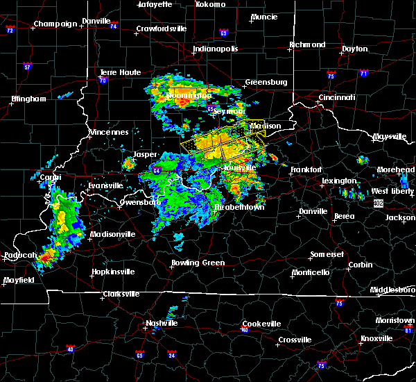 At 1102 am edt, a severe thunderstorm was located near scottsburg, moving northeast at 45 mph (law enforcement has reported several trees down across the area). Hazards include 60 mph wind gusts. Expect damage to roofs. siding. and trees. Locations impacted include, madison, scottsburg, salem, vienna, austin, lexington, hanover, new pekin, smyrna and milton. At 1102 am edt, a severe thunderstorm was located near scottsburg, moving northeast at 45 mph (law enforcement has reported several trees down across the area). Hazards include 60 mph wind gusts. Expect damage to roofs. siding. and trees. Locations impacted include, madison, scottsburg, salem, vienna, austin, lexington, hanover, new pekin, smyrna and milton.
|
| 7/8/2016 10:50 AM EDT |
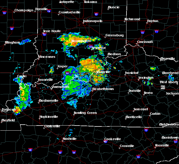 At 1049 am edt, a severe thunderstorm was located near salem, moving northeast at 50 mph (radar indicated). Hazards include 60 mph wind gusts. Expect damage to roofs. siding. And trees. At 1049 am edt, a severe thunderstorm was located near salem, moving northeast at 50 mph (radar indicated). Hazards include 60 mph wind gusts. Expect damage to roofs. siding. And trees.
|
| 5/11/2016 9:47 PM EDT |
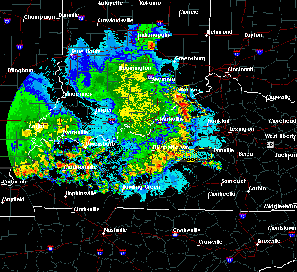 At 945 pm edt, a severe thunderstorm was located near brooksburg, moving northeast at 35 mph (public. trees were reported down in hanover). Hazards include 60 mph wind gusts and penny size hail. Expect damage to roofs. siding. and trees. Locations impacted include, madison, brooksburg, hanover, saluda, smyrna, milton, hanover beach, ringwald, canaan and belleview. At 945 pm edt, a severe thunderstorm was located near brooksburg, moving northeast at 35 mph (public. trees were reported down in hanover). Hazards include 60 mph wind gusts and penny size hail. Expect damage to roofs. siding. and trees. Locations impacted include, madison, brooksburg, hanover, saluda, smyrna, milton, hanover beach, ringwald, canaan and belleview.
|
| 5/11/2016 9:30 PM EDT |
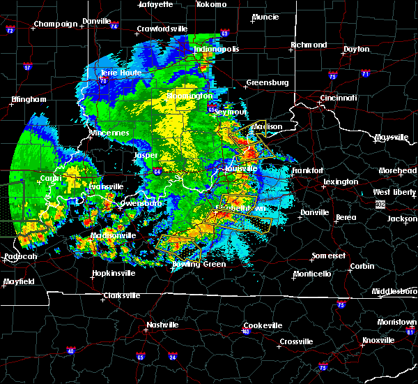 At 930 pm edt, a severe thunderstorm was located near madison, moving northeast at 35 mph (radar indicated). Hazards include 60 mph wind gusts and quarter size hail. Hail damage to vehicles is expected. Expect wind damage to roofs, siding, and trees. At 930 pm edt, a severe thunderstorm was located near madison, moving northeast at 35 mph (radar indicated). Hazards include 60 mph wind gusts and quarter size hail. Hail damage to vehicles is expected. Expect wind damage to roofs, siding, and trees.
|
| 4/26/2016 8:49 PM EDT |
 At 849 pm edt, a severe thunderstorm was located over scottsburg, moving east at 40 mph (radar indicated). Hazards include 60 mph wind gusts. Expect damage to roofs. siding. And trees. At 849 pm edt, a severe thunderstorm was located over scottsburg, moving east at 40 mph (radar indicated). Hazards include 60 mph wind gusts. Expect damage to roofs. siding. And trees.
|
| 4/26/2016 8:49 PM EDT |
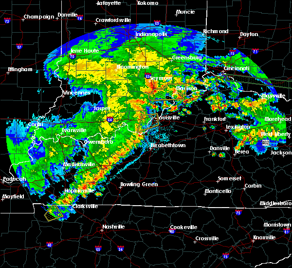 At 849 pm edt, a severe thunderstorm was located over scottsburg, moving east at 40 mph (radar indicated). Hazards include 60 mph wind gusts. Expect damage to roofs. siding. And trees. At 849 pm edt, a severe thunderstorm was located over scottsburg, moving east at 40 mph (radar indicated). Hazards include 60 mph wind gusts. Expect damage to roofs. siding. And trees.
|
| 4/26/2016 6:32 PM EDT |
 At 632 pm edt, a severe thunderstorm was located near madison, moving northeast at 25 mph (trained weather spotters). Hazards include 60 mph wind gusts and quarter size hail. Hail damage to vehicles is expected. expect wind damage to roofs, siding, and trees. Locations impacted include, madison, hanover, smyrna, milton, kent, hanover beach, madison municipal airport, ringwald, wakefield and wirt. At 632 pm edt, a severe thunderstorm was located near madison, moving northeast at 25 mph (trained weather spotters). Hazards include 60 mph wind gusts and quarter size hail. Hail damage to vehicles is expected. expect wind damage to roofs, siding, and trees. Locations impacted include, madison, hanover, smyrna, milton, kent, hanover beach, madison municipal airport, ringwald, wakefield and wirt.
|
| 4/26/2016 6:32 PM EDT |
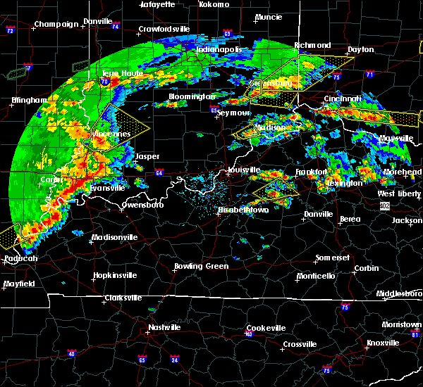 At 632 pm edt, a severe thunderstorm was located near madison, moving northeast at 25 mph (trained weather spotters). Hazards include 60 mph wind gusts and quarter size hail. Hail damage to vehicles is expected. expect wind damage to roofs, siding, and trees. Locations impacted include, madison, hanover, smyrna, milton, kent, hanover beach, madison municipal airport, ringwald, wakefield and wirt. At 632 pm edt, a severe thunderstorm was located near madison, moving northeast at 25 mph (trained weather spotters). Hazards include 60 mph wind gusts and quarter size hail. Hail damage to vehicles is expected. expect wind damage to roofs, siding, and trees. Locations impacted include, madison, hanover, smyrna, milton, kent, hanover beach, madison municipal airport, ringwald, wakefield and wirt.
|
| 4/26/2016 6:27 PM EDT |
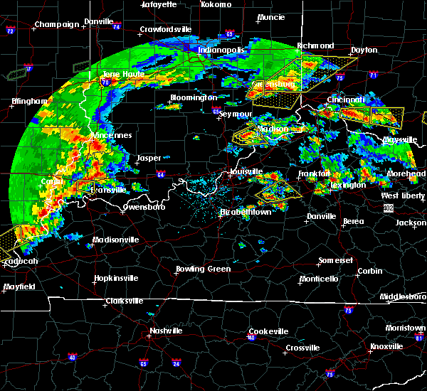 At 627 pm edt, a severe thunderstorm was located near madison, moving northeast at 25 mph (trained weather spotters). Hazards include 60 mph wind gusts and quarter size hail. Hail damage to vehicles is expected. Expect wind damage to roofs, siding, and trees. At 627 pm edt, a severe thunderstorm was located near madison, moving northeast at 25 mph (trained weather spotters). Hazards include 60 mph wind gusts and quarter size hail. Hail damage to vehicles is expected. Expect wind damage to roofs, siding, and trees.
|
| 4/26/2016 6:16 PM EDT |
 At 616 pm edt, a severe thunderstorm was located 10 miles west of madison, moving east at 20 mph. trained spotters reported quarter size hail near blocher (trained weather spotters). Hazards include 60 mph wind gusts and quarter size hail. Hail damage to vehicles is expected. expect wind damage to roofs, siding, and trees. Locations impacted include, madison, lexington, hanover, saluda, smyrna, milton, kent, hanover beach, ringwald and wakefield. At 616 pm edt, a severe thunderstorm was located 10 miles west of madison, moving east at 20 mph. trained spotters reported quarter size hail near blocher (trained weather spotters). Hazards include 60 mph wind gusts and quarter size hail. Hail damage to vehicles is expected. expect wind damage to roofs, siding, and trees. Locations impacted include, madison, lexington, hanover, saluda, smyrna, milton, kent, hanover beach, ringwald and wakefield.
|
| 4/26/2016 6:16 PM EDT |
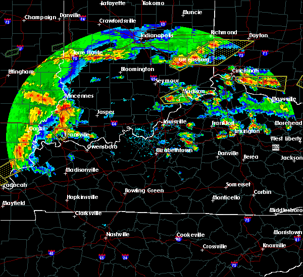 At 616 pm edt, a severe thunderstorm was located 10 miles west of madison, moving east at 20 mph. trained spotters reported quarter size hail near blocher (trained weather spotters). Hazards include 60 mph wind gusts and quarter size hail. Hail damage to vehicles is expected. expect wind damage to roofs, siding, and trees. Locations impacted include, madison, lexington, hanover, saluda, smyrna, milton, kent, hanover beach, ringwald and wakefield. At 616 pm edt, a severe thunderstorm was located 10 miles west of madison, moving east at 20 mph. trained spotters reported quarter size hail near blocher (trained weather spotters). Hazards include 60 mph wind gusts and quarter size hail. Hail damage to vehicles is expected. expect wind damage to roofs, siding, and trees. Locations impacted include, madison, lexington, hanover, saluda, smyrna, milton, kent, hanover beach, ringwald and wakefield.
|
| 4/26/2016 6:04 PM EDT |
 At 604 pm edt, a severe thunderstorm was located 7 miles east of scottsburg, moving northeast at 25 mph (radar indicated). Hazards include 60 mph wind gusts and quarter size hail. Hail damage to vehicles is expected. Expect wind damage to roofs, siding, and trees. At 604 pm edt, a severe thunderstorm was located 7 miles east of scottsburg, moving northeast at 25 mph (radar indicated). Hazards include 60 mph wind gusts and quarter size hail. Hail damage to vehicles is expected. Expect wind damage to roofs, siding, and trees.
|
| 4/26/2016 6:04 PM EDT |
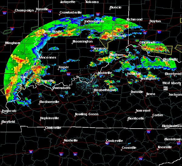 At 604 pm edt, a severe thunderstorm was located 7 miles east of scottsburg, moving northeast at 25 mph (radar indicated). Hazards include 60 mph wind gusts and quarter size hail. Hail damage to vehicles is expected. Expect wind damage to roofs, siding, and trees. At 604 pm edt, a severe thunderstorm was located 7 miles east of scottsburg, moving northeast at 25 mph (radar indicated). Hazards include 60 mph wind gusts and quarter size hail. Hail damage to vehicles is expected. Expect wind damage to roofs, siding, and trees.
|
| 12/23/2015 4:24 PM EST | At 424 pm est, a severe thunderstorm capable of producing a tornado was located 10 miles west of madison, moving northeast at 45 mph (radar indicated rotation). Hazards include tornado. Flying debris will be dangerous to those caught without shelter. mobile homes will be damaged or destroyed. damage to roofs, windows and vehicles will occur. tree damage is likely. this dangerous storm will be near, madison around 435 pm est. Other locations impacted by this tornadic thunderstorm include ringwald, smyrna, wakefield, belleview, deputy, wirt, bryantsburg, north madison, madison municipal airport and kent. |
| 12/23/2015 4:14 PM EST | The national weather service in louisville has issued a * tornado warning for. northwestern jefferson county in south central indiana. central scott county in south central indiana. until 445 pm est * at 414 pm est. A severe thunderstorm capable of producing a. |
| 7/17/2015 9:35 PM EDT |
 At 934 pm edt, a severe thunderstorm was located 8 miles north of madison, and moving east at 40 mph (radar indicated). Hazards include 60 mph wind gusts. Expect damage to roofs. siding and trees. Locations impacted include, manville and brooksburg. At 934 pm edt, a severe thunderstorm was located 8 miles north of madison, and moving east at 40 mph (radar indicated). Hazards include 60 mph wind gusts. Expect damage to roofs. siding and trees. Locations impacted include, manville and brooksburg.
|
| 7/17/2015 9:35 PM EDT |
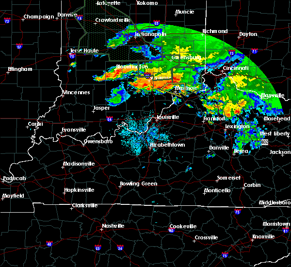 At 934 pm edt, a severe thunderstorm was located 8 miles north of madison, and moving east at 40 mph (radar indicated). Hazards include 60 mph wind gusts. Expect damage to roofs. siding and trees. Locations impacted include, manville and brooksburg. At 934 pm edt, a severe thunderstorm was located 8 miles north of madison, and moving east at 40 mph (radar indicated). Hazards include 60 mph wind gusts. Expect damage to roofs. siding and trees. Locations impacted include, manville and brooksburg.
|
| 7/17/2015 9:16 PM EDT |
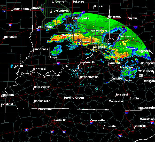 At 915 pm edt, a severe thunderstorm was located 6 miles southeast of vernon, and moving east at 40 mph (radar indicated). Hazards include 60 mph wind gusts. Expect damage to roofs. Siding and trees. At 915 pm edt, a severe thunderstorm was located 6 miles southeast of vernon, and moving east at 40 mph (radar indicated). Hazards include 60 mph wind gusts. Expect damage to roofs. Siding and trees.
|
| 7/14/2015 3:45 AM EDT | Multiple trees down in the count in jefferson county IN, 1.1 miles WSW of Madison, IN |
| 7/14/2015 1:33 AM EDT |
 At 129 am edt, a severe thunderstorm was located near bedford, moving southeast at 45 mph. another severe storm was over western jefferson county, also moving to the southeast (radar indicated). Hazards include 60 mph wind gusts and quarter size hail. Hail damage to vehicles is expected. expect wind damage to roofs, siding and trees. Locations impacted include, bedford, monitor, providence, campbellsburg, turners station, lacie, port royal and delville. At 129 am edt, a severe thunderstorm was located near bedford, moving southeast at 45 mph. another severe storm was over western jefferson county, also moving to the southeast (radar indicated). Hazards include 60 mph wind gusts and quarter size hail. Hail damage to vehicles is expected. expect wind damage to roofs, siding and trees. Locations impacted include, bedford, monitor, providence, campbellsburg, turners station, lacie, port royal and delville.
|
| 7/14/2015 1:21 AM EDT |
 At 119 am edt, a severe thunderstorm was located 5 miles southwest of madison, moving southeast at 45 mph (radar indicated). Hazards include 60 mph wind gusts and nickel size hail. Expect damage to roofs. Siding and trees. At 119 am edt, a severe thunderstorm was located 5 miles southwest of madison, moving southeast at 45 mph (radar indicated). Hazards include 60 mph wind gusts and nickel size hail. Expect damage to roofs. Siding and trees.
|
| 7/14/2015 1:21 AM EDT |
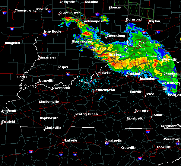 At 119 am edt, a severe thunderstorm was located 5 miles southwest of madison, moving southeast at 45 mph (radar indicated). Hazards include 60 mph wind gusts and nickel size hail. Expect damage to roofs. Siding and trees. At 119 am edt, a severe thunderstorm was located 5 miles southwest of madison, moving southeast at 45 mph (radar indicated). Hazards include 60 mph wind gusts and nickel size hail. Expect damage to roofs. Siding and trees.
|
| 7/13/2015 1:58 PM EDT |
 At 156 pm edt, severe thunderstorms were located along a line extending from 6 miles northwest of madison to 9 miles east of scottsburg to 6 miles southwest of scottsburg, and moving southeast at 50 mph (radar indicated). Hazards include 60 mph wind gusts. Expect damage to roofs. Siding and trees. At 156 pm edt, severe thunderstorms were located along a line extending from 6 miles northwest of madison to 9 miles east of scottsburg to 6 miles southwest of scottsburg, and moving southeast at 50 mph (radar indicated). Hazards include 60 mph wind gusts. Expect damage to roofs. Siding and trees.
|
| 7/13/2015 1:58 PM EDT |
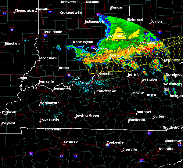 At 156 pm edt, severe thunderstorms were located along a line extending from 6 miles northwest of madison to 9 miles east of scottsburg to 6 miles southwest of scottsburg, and moving southeast at 50 mph (radar indicated). Hazards include 60 mph wind gusts. Expect damage to roofs. Siding and trees. At 156 pm edt, severe thunderstorms were located along a line extending from 6 miles northwest of madison to 9 miles east of scottsburg to 6 miles southwest of scottsburg, and moving southeast at 50 mph (radar indicated). Hazards include 60 mph wind gusts. Expect damage to roofs. Siding and trees.
|
| 7/13/2015 1:51 PM EDT |
 At 148 pm edt, severe thunderstorms were located along a line extending from 9 miles northwest of madison to scottsburg to 8 miles northeast of salem to 7 miles north of salem to salem, and moving southeast at 50 mph (radar indicated). Hazards include 60 mph wind gusts. Expect damage to roofs. siding and trees. Locations impacted include, madison, lexington, georgetown, smyrna, china, swanville, hanover, madison municipal airport, north madison, ringwald, canton, new salem, hanover beach, manville, new philadelphia, chelsea, saluda, harristown, milton and paynesville. At 148 pm edt, severe thunderstorms were located along a line extending from 9 miles northwest of madison to scottsburg to 8 miles northeast of salem to 7 miles north of salem to salem, and moving southeast at 50 mph (radar indicated). Hazards include 60 mph wind gusts. Expect damage to roofs. siding and trees. Locations impacted include, madison, lexington, georgetown, smyrna, china, swanville, hanover, madison municipal airport, north madison, ringwald, canton, new salem, hanover beach, manville, new philadelphia, chelsea, saluda, harristown, milton and paynesville.
|
| 7/13/2015 1:18 PM EDT |
 The national weather service in louisville has issued a * severe thunderstorm warning for. jefferson county in south central indiana. scott county in south central indiana. northern washington county in south central indiana. Northern trimble county in north central kentucky. The national weather service in louisville has issued a * severe thunderstorm warning for. jefferson county in south central indiana. scott county in south central indiana. northern washington county in south central indiana. Northern trimble county in north central kentucky.
|
| 7/13/2015 1:18 PM EDT |
 At 116 pm edt, severe thunderstorms were located along a line extending from 8 miles north of vernon to seymour to 8 miles west of brownstown, and moving south at 50 mph (radar indicated). Hazards include 60 mph wind gusts. Expect damage to roofs. Siding and trees. At 116 pm edt, severe thunderstorms were located along a line extending from 8 miles north of vernon to seymour to 8 miles west of brownstown, and moving south at 50 mph (radar indicated). Hazards include 60 mph wind gusts. Expect damage to roofs. Siding and trees.
|
| 6/18/2015 4:32 PM EDT | Tree down along sr 56 in eastern part of the county. time estimated based on rada in jefferson county IN, 4.5 miles WNW of Madison, IN |
| 6/18/2015 4:31 PM EDT | The severe thunderstorm warning for northwestern trimble and western jefferson counties will expire at 435 pm edt/335 pm cdt/, the storm which prompted the warning has weakened below severe limits, and no longer poses an immediate threat to life or property. however, heavy rain is still possible with this thunderstorm. |
| 6/18/2015 4:31 PM EDT | The severe thunderstorm warning for northwestern trimble and western jefferson counties will expire at 435 pm edt/335 pm cdt/. the storm which prompted the warning has weakened below severe limits. and no longer poses an immediate threat to life or property. however. Heavy rain is still possible with this thunderstorm. |
| 6/18/2015 4:20 PM EDT | Trees down at black road and thomas hill roa in jefferson county IN, 2.3 miles ESE of Madison, IN |
| 6/18/2015 4:15 PM EDT | At 412 pm edt, a severe thunderstorm was located 11 miles east of scottsburg, and moving east at 25 mph (radar indicated). Hazards include 60 mph wind gusts and penny size hail. Expect damage to roofs. siding and trees. Locations impacted include, kent, chelsea, volga, lancaster, five points, saluda, smyrna, hanover, madison municipal airport, middlefork, hanover beach, wirt, trout and north madison. |
| 6/18/2015 4:15 PM EDT | At 412 pm edt, a severe thunderstorm was located 11 miles east of scottsburg, and moving east at 25 mph (radar indicated). Hazards include 60 mph wind gusts and penny size hail. Expect damage to roofs. siding and trees. Locations impacted include, kent, chelsea, volga, lancaster, five points, saluda, smyrna, hanover, madison municipal airport, middlefork, hanover beach, wirt, trout and north madison. |
| 6/18/2015 4:04 PM EDT | At 402 pm edt, a severe thunderstorm was located 7 miles northeast of scottsburg, and moving east at 25 mph (radar indicated). Hazards include 60 mph wind gusts and penny size hail. Expect damage to roofs. Siding and trees. |
| 6/18/2015 4:04 PM EDT | At 402 pm edt, a severe thunderstorm was located 7 miles northeast of scottsburg, and moving east at 25 mph (radar indicated). Hazards include 60 mph wind gusts and penny size hail. Expect damage to roofs. Siding and trees. |
| 4/9/2015 5:57 PM EDT | The severe thunderstorm warning for northern jefferson county will expire at 600 pm edt/500 pm cdt/. The storm which prompted the warning has weakened and moved out of the warned area. |
| 4/9/2015 5:46 PM EDT | A severe thunderstorm warning remains in effect for northern jefferson county until 600 pm edt. at 544 pm edt. a severe thunderstorm was located 7 miles northwest of madison. and moving northeast at 45 mph. hazard. 60 mph wind gusts and quarter size hail. source. Radar indicated. |
| 4/9/2015 5:35 PM EDT | The national weather service in louisville has issued a * severe thunderstorm warning for. jefferson county in south central indiana. until 600 pm edt * at 534 pm edt. a severe thunderstorm was located 9 miles west of madison. And moving northeast at 45 mph. |
| 4/9/2015 5:17 PM EDT | The severe thunderstorm warning for jefferson county will expire at 520 pm edt/420 pm cdt/. the storm which prompted the warning has weakened below severe limits. And no longer poses an immediate threat to life or property. |
| 4/9/2015 4:56 PM EDT | The national weather service in louisville has issued a * severe thunderstorm warning for. jefferson county in south central indiana. until 520 pm edt * at 454 pm edt. a severe thunderstorm was located 7 miles west of madison. And moving northeast at 50 mph. |
| 4/8/2015 6:46 PM EDT | The national weather service in louisville has issued a * severe thunderstorm warning for. northeastern jefferson county in south central indiana. until 715 pm edt * at 643 pm edt. a severe thunderstorm was located near madison. And moving east at 55 mph. |
| 6/23/2014 6:15 PM EDT | Two trees blocking roads... one in madison... another in the northern part of the county near ripley count in jefferson county IN, 1.1 miles WSW of Madison, IN |
| 8/31/2013 4:40 PM EDT | Jefferson county emergency manager reported damage to shingles and siding of a home...a few heavy metal objects thrown 500-600 feet...and trees down near the intersecti in jefferson county IN, 4.1 miles ESE of Madison, IN |
| 4/16/2013 8:47 PM EDT | Quarter sized hail reported 3.2 miles SSW of Madison, IN |
| 7/27/2012 6:10 PM EDT | Partial metal roof ripped off in jefferson county IN, 1.1 miles WSW of Madison, IN |
| 1/1/0001 12:00 AM | Tree fell over us 421 blocking highway in jefferson county IN, 5.9 miles S of Madison, IN |
| 1/1/0001 12:00 AM | Damage to building at airport in jefferson county IN, 1.1 miles WSW of Madison, IN |
| 1/1/0001 12:00 AM | Major building damage...one building lost roof on in 62. power lines and trees down. wind damage a mile wide near airpor in jefferson county IN, 2 miles SW of Madison, IN |
| 1/1/0001 12:00 AM | Report relayed from jkl nws. roof taken off bldg. bark off telephone poles. door to garage ripped off an thrown around metal pole. damage located a mile or two west of in jefferson county IN, 2.7 miles E of Madison, IN |
| 1/1/0001 12:00 AM | Large trees down...roof damage...steeple blown off a church...outbuilding destroyed in jefferson county IN, 0.9 miles S of Madison, IN |
| 1/1/0001 12:00 AM | Quarter sized hail reported 1.1 miles WSW of Madison, IN |
Hail Maps for Madison, IN
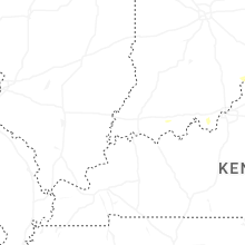
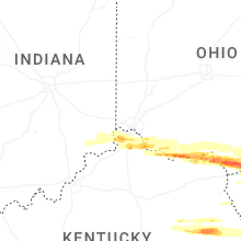


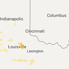


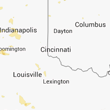


Connect with Interactive Hail Maps